Monthly Archives: June 2016

London Road Works

A brief post this week – short of time and researching some longer posts for the next few weeks.

A fact of London life is not just the continual building work that appears to be taking place across the whole of London, but also the never-ending road works. These have ranged from major works over the past year such as at the Elephant and Castle, and the Cycle Superhighway along the Embankment, through to a couple of hours needed to fill a hole in the road.

Road works also have a supporting cast of high-vis jackets, traffic cones, temporary traffic lights and lots of machinery with no doubt lots of planning and health and safety assessments.

My father worked for St. Pancras Borough Council Electricity and Public Lighting Department and then for the London Electricity Board, which is one of the reasons that he knew London so well, having worked across so many streets planning the installation of streetlights, cabling and electricity distribution equipment.

He took a number of photos of work taking place and I have a sample for today’s post. They show a very different working environment to that you would find today.

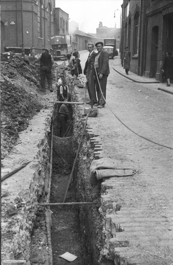
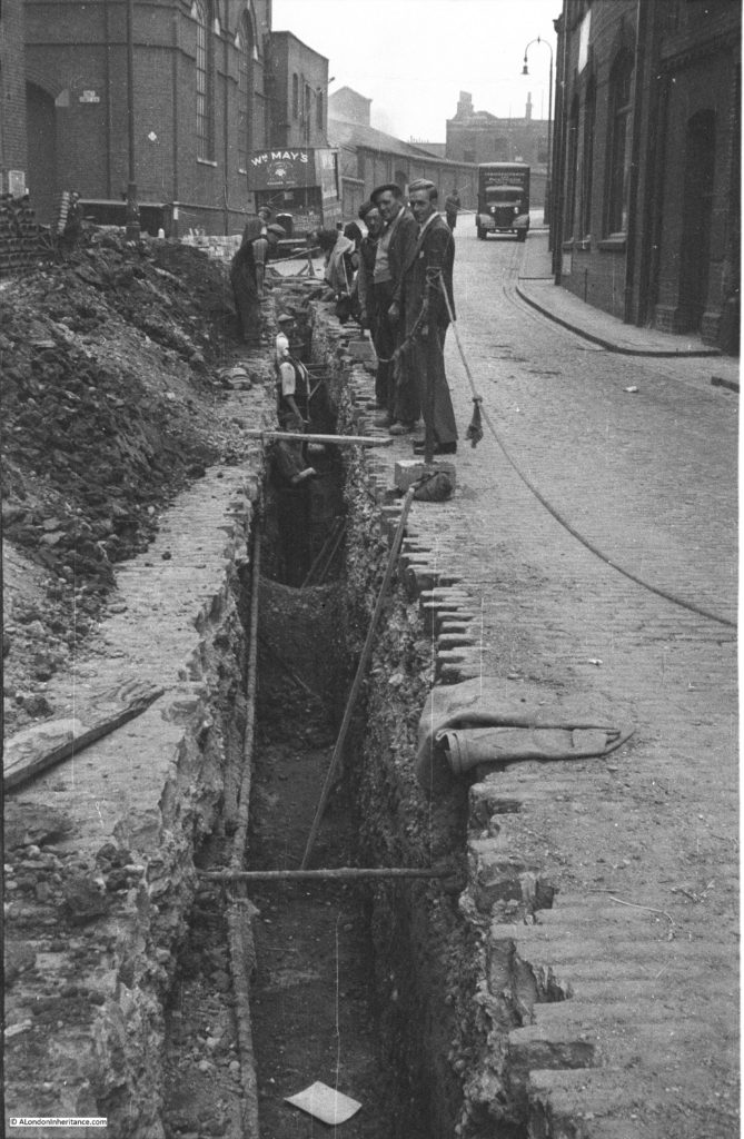
Firstly, two photos showing the same street scene which must have been taken only a few minutes apart. No idea where this is, there looks to be a street name on the building to the left however despite enlarging and trying different scan methods, the grain of the film does not allow the name to be read.

Road Works in London 10

Not a high visibility jacket or traffic cone in sight, although if you enlarge the photo, at the end of the trench there is a sign that states Caution Roadworks.

Road Works in London 9

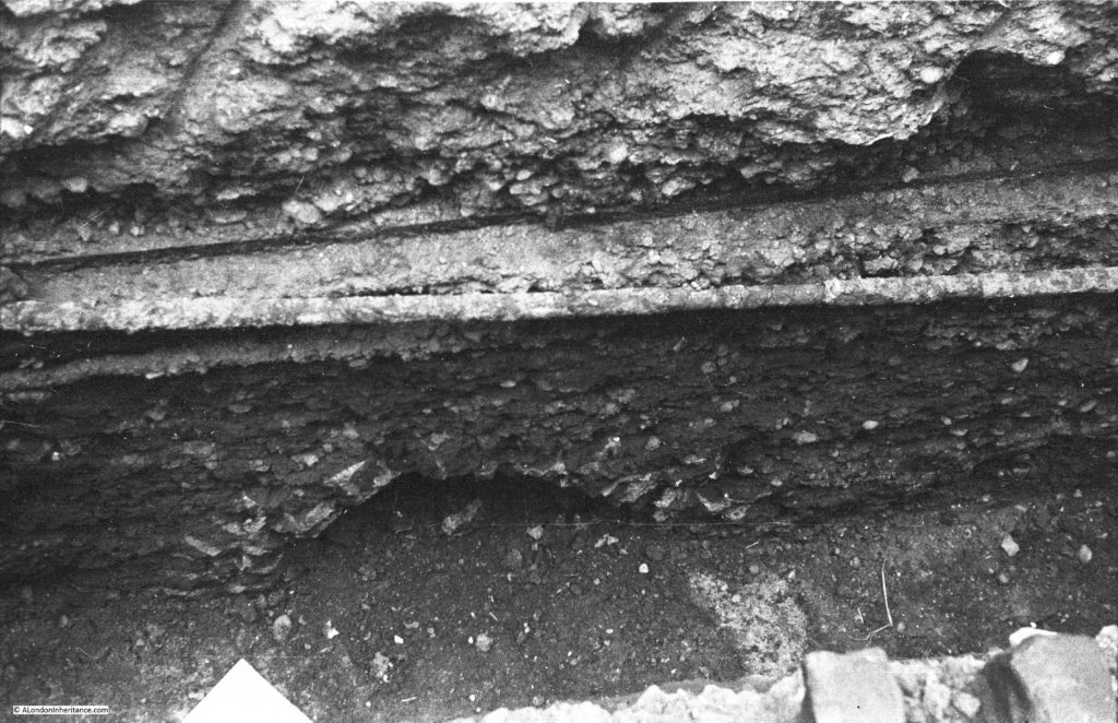
Sadly, I always look down a trench or hole in the road to see if there is anything interesting below the surface. The following photo was in the same sequence as the two above. An arch of some form has been cut through, but is clearly seen in the side of the trench.

Road Works in London 8

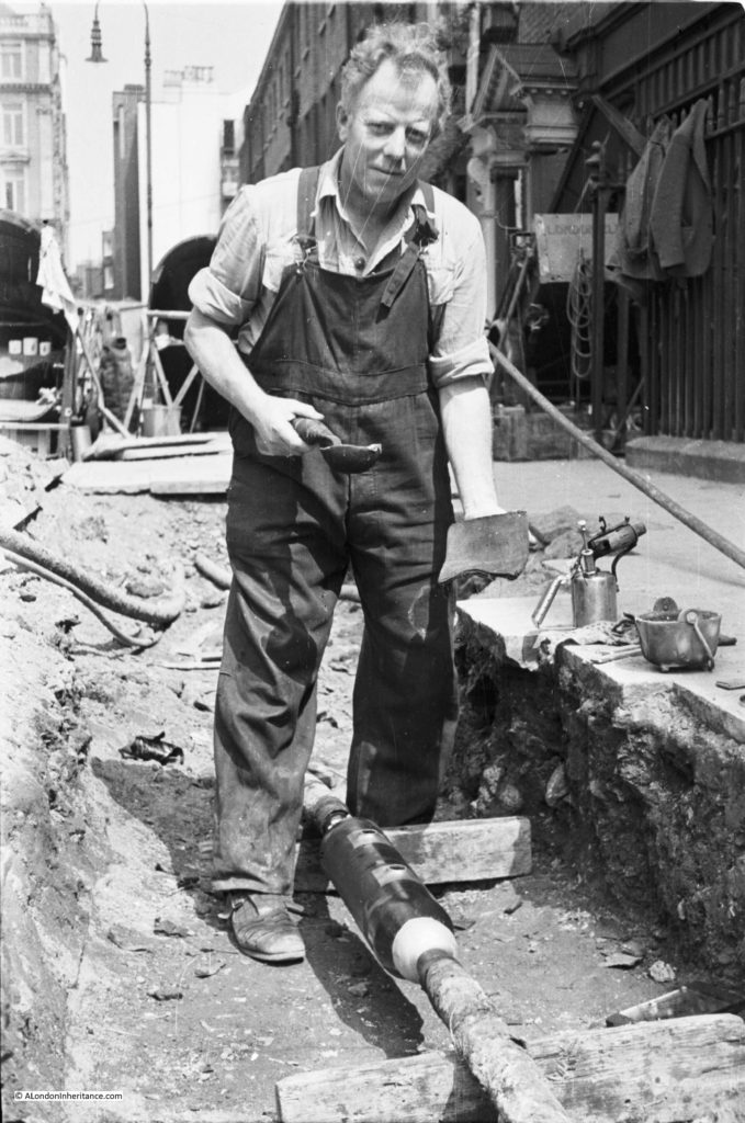
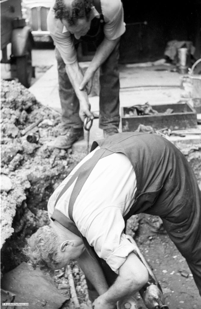
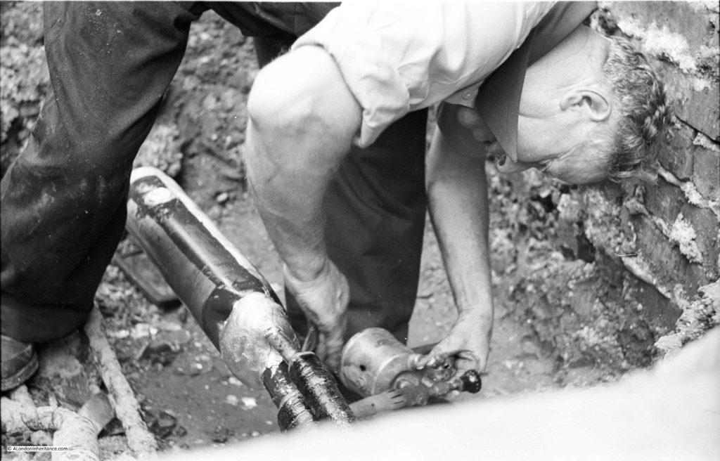
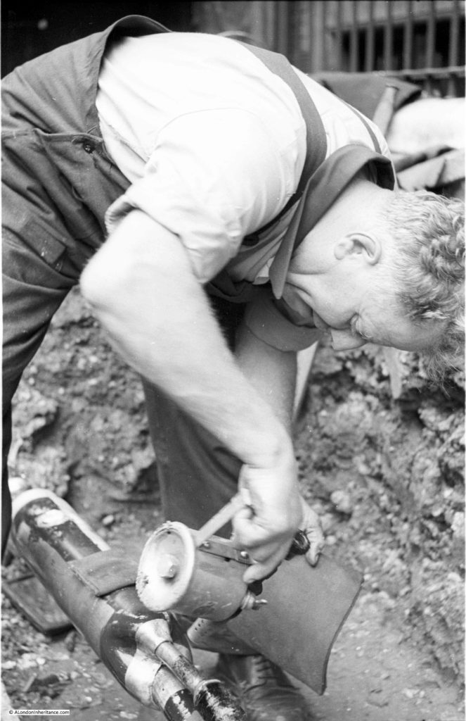
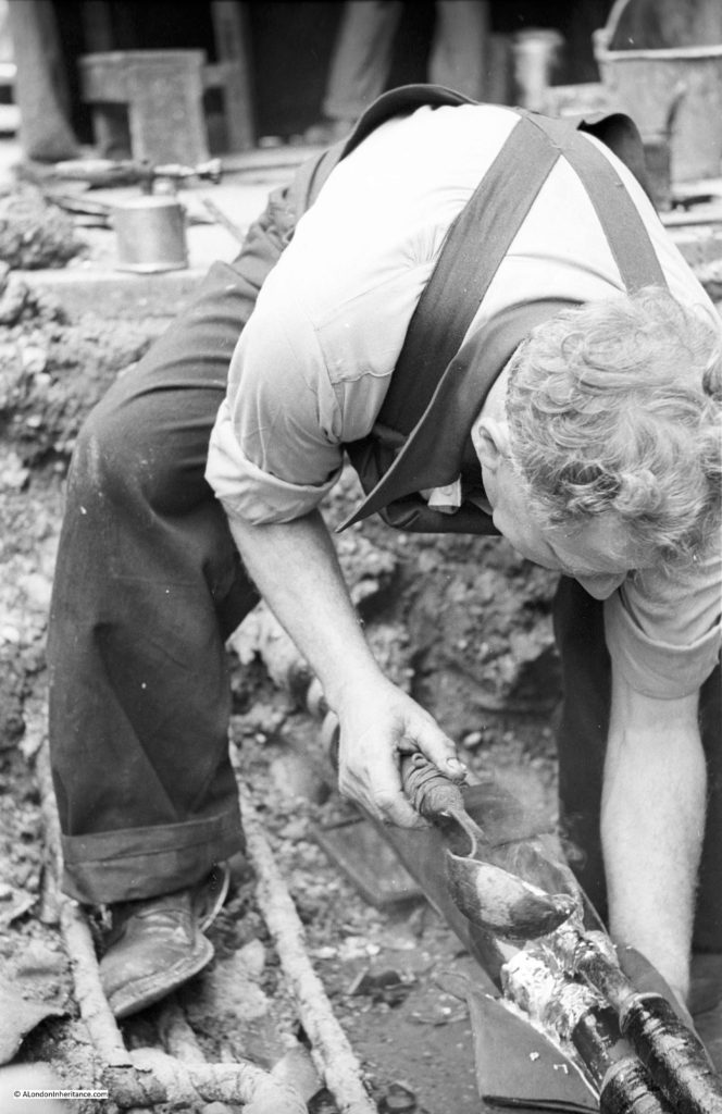
The above photos are from the late 1940s, the photos below are from the early 1950s and show the method of sealing a joint between multiple cables.

Road Works in London 5

Again, I do not know the location and there is nothing I recognise in the background.

Road Works in London 4

Road Works in London 3

Above and below; heating up a joint with a paraffin blow torch.

Road Works In London 1

Lastly, pouting molten metal over the joint to form a seal, probably some alloy of lead was used. Very basic protection – you would not want to get that on your skin.

Road Works in London 2

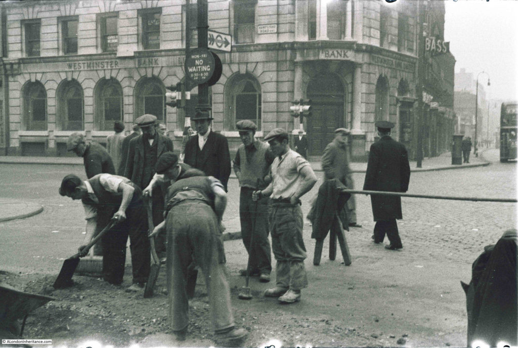
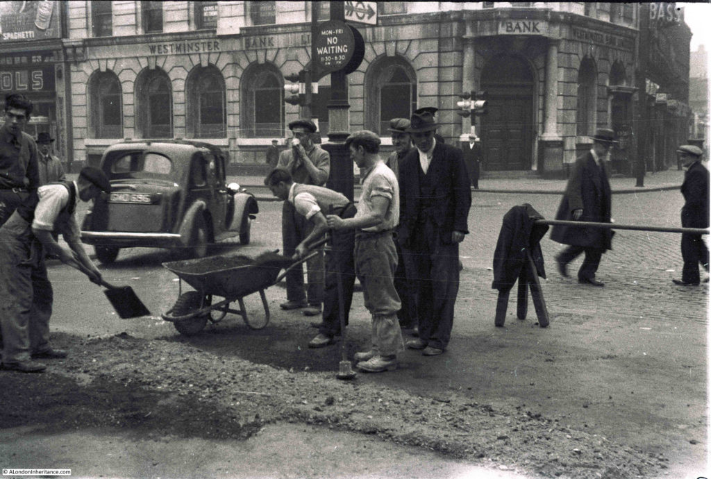
The final set is back to the late 1940s and are a couple of photos I published back in July 2014 and show road works at the top of Tottenham Court Road at the junction with Euston Road and Hampstead Road. The area looks very different now  – you can read the post here.

Road Works in London 7

Again, very basic compared to today. A shovel, wheel barrow and a pole across the road.

Road Works in London 6

Road works have always been a feature of London roads and I suspect will always be so. Next time your journey is delayed by some, rather than complain, have a look down, they are often an interesting, but ignored, feature of everyday street life.

alondoninheritance.com

London Books

Books have probably been written about London for as long as books have been published. London books cover specific areas and topics, general guides, histories, picture and photo books etc. I suspect that a book has been written about any London topic you could think off.

My own collection of London books, starting with the books my father bought from the 1940s onwards, probably numbers around 450 and ranges from a 1756 edition of William Maitland’s History and Survey of London through to recently published books such as Up In Smoke – The Failed Dreams of Battersea Power Station by Peter Watts.

Second hand bookshops are always a good hunting ground, although today there are not that many to be found, however last Saturday on a trip out to Canterbury I found a good one and bought an excellent history of Chelsea by Thea Holme from 1972 for £6.50.

Since starting this blog, I have had the pleasure of meeting a number of people who have a knowledge of London that far exceeds mine, one of these is Hawk Norton, a collector of London books whose collection is larger than mine by several orders of magnitude.

I first found out about Hawk through an article on Londonist and have since made a number of visits to his collection in Brentford and have probably purchased far too many books than my limited shelf space will support.

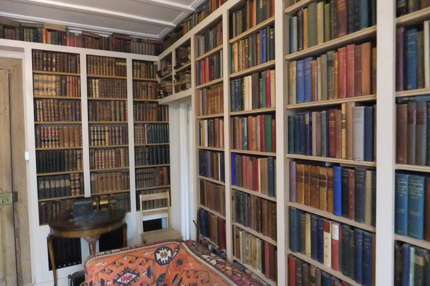
Hawk has been collecting London books for several decades however for the last year has been selling much of his collection. If you are interested in London, or books (or ideally a combination of the two), I recommend getting in touch with Hawk via his e-mail ( hawk@btinternet.com ) to request the latest copy of his list of books or to arrange a visit, although be careful with a visit as if like me, you will leave with more books than you had planned on arrival.

A small part of Hawk’s collection of London Books:

London Books 10

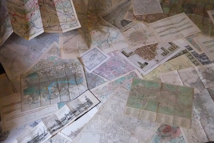
And an equally impressive collection of maps:

London Books 11

My own collection of London books is much smaller, however here is a selection that provide a snapshot of the wide range of books that have been published about London over the years.

One of the first comprehensive and published history or survey of London is that of John Stow which was first published in 1598. A second edition was published in 1603. Unfortunately I do not have either of these original versions, but I do have a 1908 reprint of the 1603 publication. This version has two volumes and the books are a detailed survey of London at the end of the 16th Century, almost a street by street walk through of London with a description of the City Wards, main streets, churches, houses, historical characters etc. Stow has been the original reference for much later writing.

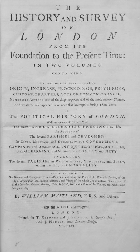
The next major survey is that of William Maitland who published his “History and Survey of London From Its Foundation to the Present Time” in 1739. I do not have the first edition, but I do have a copy of the 1756 edition, published in two large volumes as a detailed history and survey of London,

William Maitland was a Scottish merchant who lived in London for a time, returning to Scotland in 1740.

The title page from Maitland’s History and Survey of London:

London Books 1

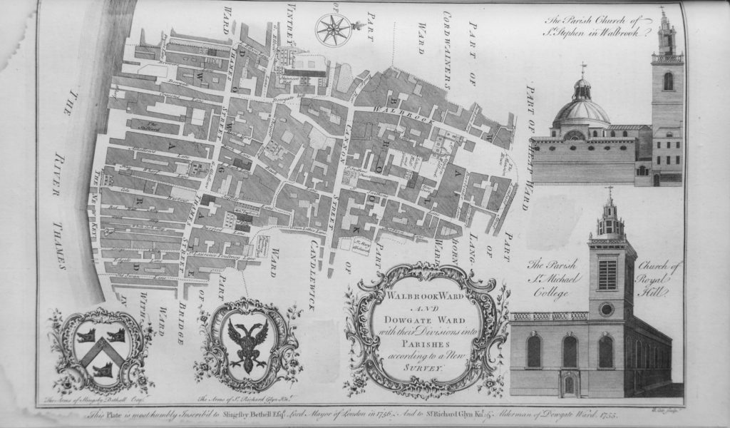
Maitland’s book has a large number of prints of major buildings across London and also many City Ward maps. Over the years, the prints and maps from early books are often removed and sold separately for a higher amount than if they were contained within the book, however when they do survive, along with the text they provide a fantastic view of London from the mid 18th Century.

Map of Walbrook and Dowgate Wards from Maitland’s History and Survey of London, including drawings of the churches of St. Stephen Walbrook and St. Michael, Royal College Hill.

London Books 2

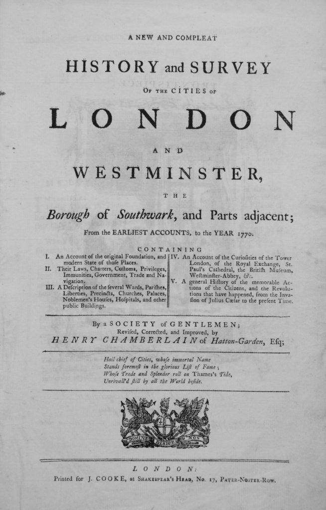
Soon after Maitland’s book, Henry Chamberlain published his History and Survey of London in 1770. The title page of Chamberlain’s book contains a wonderful dedication to the city:

Hail chief of Cities, whose immortal Name

Stands foremost in the glorious List of Fame;

Whose Trade and Splendor roll on Thames’s Tide,

Unrivall’d still by all the World beside.

London Books 3

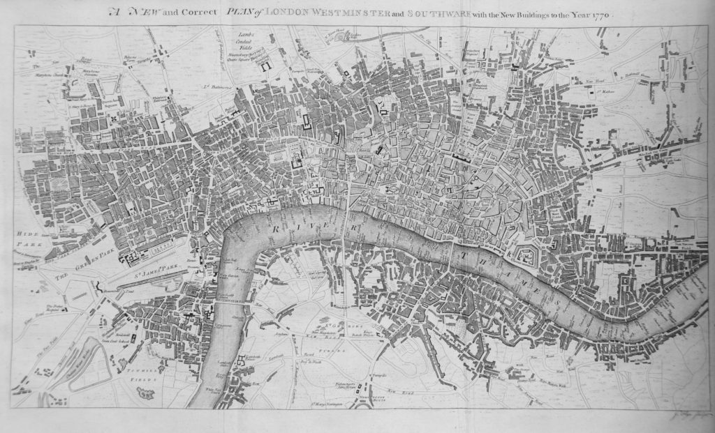
Chamberlain’s book also contains prints of various buildings, streets and events within the city as well as a “A New and Correct Plan of London, Westminster and Southwark with the New Buildings to the Year 1770”

London Books 4

Click on the map is open a larger version. It is fascinating to see the state of London in 1770. To the north is the New River Head at Sadlers Wells, to the east is the cluster of buildings at Bethnall Green, still separate from the city and surrounded by fields. South of the river, the city is expanding out from the southern end of London Bridge and in 1770 there were only three bridges over the Thames, Westminster Bridge, Blackfriars Bridge and London Bridge.

The southern end of Westminster Bridge opens out mainly into fields. There are also interesting little details, follow the Lambeth Road and there is a building named Dog and Duck, this was described as a “notorious pleasure garden and haunt of prostitutes in the 18th century.”  The site of the Dog and Duck is now the Imperial War Museum. Along the river, the map also shows how many stairs there were down to the river, each individually named enabling the traveler to find the right stairs to meet a boatman.

Moving into the 19th century and my next major survey of London is the six volume set, “Old and New London: A Narrative of Its History, Its People, And Its Places”.

The first two volumes were by Walter Thornbury and published in 1873 with an extended six volume edition published in 1878 with the last four volumes by Edward Walford.

These six volumes provide a detailed history of London, and illustrate how London had grown since the 18th century books. Old and New London covers central London, but now also includes “the suburbs”, a new 19th century word to cover the ever-expanding city.

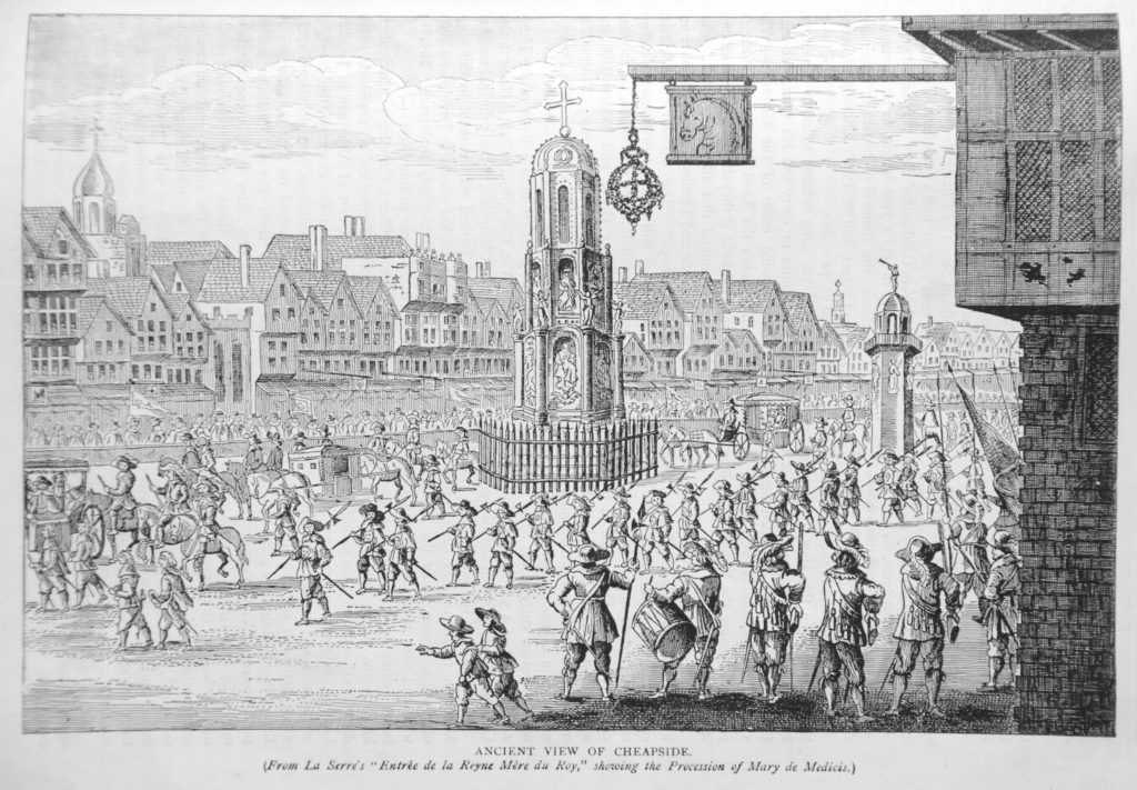
As well as a detailed written account of the city and suburbs, Old and New London has a large amount of drawings of all aspects of the city, the following being a typical example and is titled “Ancient View of Cheapside (From La Serre’s ‘Entree de la Reyne Mere du Roy’ showing the Procession of Mary de Medicis”.

London Books 5

In the time before photography and the mass printing of photographs in books, drawings such as this were the only way of conveying the visual sense of a place or event to the reader and Old and New London is probably one of the last major history and surveys of London before photography takes over.

As well as major books detailing the history of the whole of London, there are also many covering specific areas. One of these, which I bought from a bookshop in Launceston, Cornwall is the “History of the United Parishes of St. Giles In The Fields and St. George Bloomsbury” by Rowland Dobie and published in 1829. This is a fascinating book, not just because of the history of these parishes, but also the context in which the book was written. The preface to the book tells the story of a corrupt Vestry and the efforts of the parishioners to regain control which culminated in a court case when “the decision of a British Jury has established the long lost rights of the parishioners of St. Giles, by the overthrow of a pretended Select Vestry, whose authority had been exercised uncontrolled and with some deductions during more than two hundred years. This glorious triumph was achieved on the 23rd of July 1829, a day ever to be recorded in the annals of these parishes.”

I doubt that many people today walking the streets of these parishes to the east of Tottenham Court Road and south to Lincolns Inn Fields will be aware of the glorious triumph, but it is a fascinating insight into the way in which parishes were run and administered in the centuries leading up to more formal governance in the 19th century.

To conclude the preface to his book, written on the 15th December 1829, Dobie wrote:

“Finally, no exertion has been spared to render the Work both instructive and entertaining; and above all, to make it a faithful record of parochial government, where abuses and malversations are notorious, and thereby guarding the parishioners in future from similar evils. If I have succeeded in these objects, even in a remote degree, my end is answered – they are more invaluable in my estimation than the hope of profit, or the gratification of vanity.

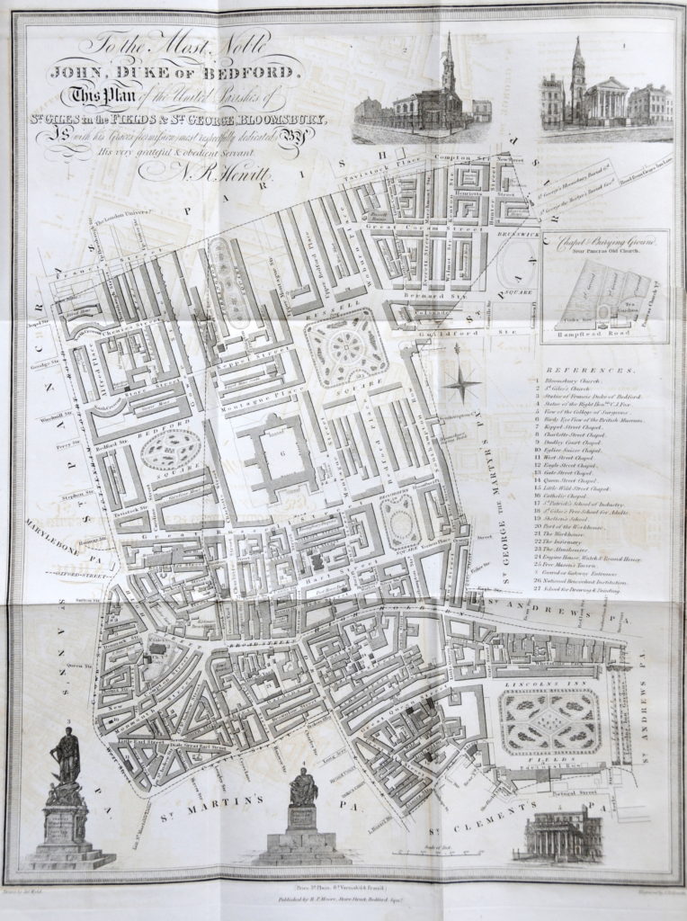
As well as a detailed written account of the parishes, Dobie’s book included an excellent, fold out map of the area as shown below:

London Books 13

Again, clicking on this should open a larger copy of this detailed map. In the bottom left hand corner is the area just east of the Charing Cross Road and Tottenham Court Road junction where the major Crossrail and associated developments are currently taking place. The map includes Denmark Street which so far, is the southern boundary of the current developments, but is a street undergoing major change.

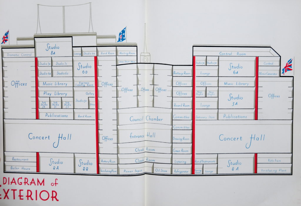
Books were often published to commemorate the opening of a new building. One such book was published in 1932 by the British Broadcasting Corporation to commemorate the opening of Broadcasting House at the corner of Portland Place and Langham Street. I found this in a second-hand bookshop in Leigh on Sea on the 15th February 1975 – according to the inscription on the inside of the book, my parents bought it for me for “a reasonable report”, I think the word “reasonable” probably tells you all you need to know about my latest school report, but luckily they still bought me the book.

The book provides a detailed account about the new building, specially built for the BBC. It contains plans of the building and photos of all the major rooms, studios and facilities, including lots of technical details. Who knew that Studio 8A used for Orchestral and Band Music had a reverberation time of 1.1 seconds.

The building design was heavily influenced by the Art Deco style of architecture and this extended to the plans in the book. The following shows a cut away side view of Broadcasting House with all the key rooms and studios labelled.

London Books 6

Broadcasting House is still there, with a recent, very large extension and is the main London location for the BBC following the closure of Television Centre and the gradual move out of White City.

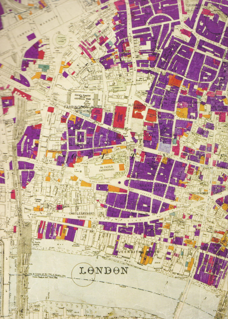
Continuing with maps, and the publication of the London County Council Bomb Damage Maps provides a detailed, street by street view of the damage caused by bombing across London. These are fascinating for research and show both the concentration of damage and also how random bombing could be.

London Books 9

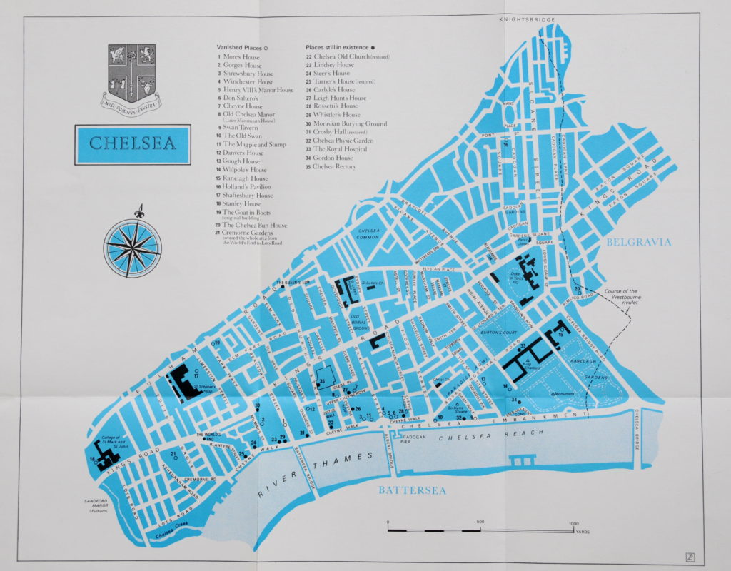
My latest find was “Chelsea” by Thea Holme and published in 1972. I found this last weekend in the excellent second-hand bookshop, The Chaucer Bookshop in the wonderfully named Beer Cart Lane in Canterbury. Continuing on the style of books from the 18th and 19th centuries, this book also has a large fold out map covering Chelsea detailing “Vanished Places” and “Places still in existence”. One of the Vanished Places is the Chelsea Bun House in Pimlico Road, a celebrated Bun House in Chelsea and home of the original Chelsea Bun. It was demolished in 1839.

London Books 12

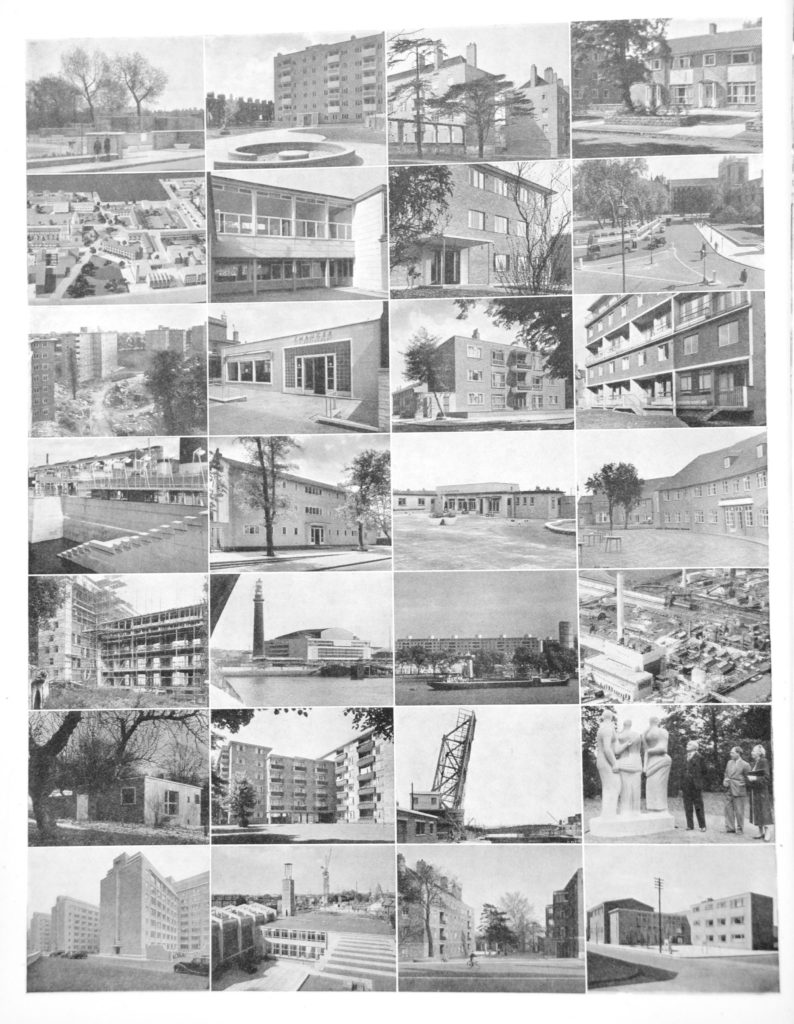
Other interesting books include the various County of London Development Plans. These provide both a snapshot of London at the time of publication along with plans for the future, some of which were built, others were not. These books frequently included highly detailed maps covering various aspects of the city, some of which I have featured in previous posts. In the 1951 Administrative Plan, there is a page summarising post war development in London, what had already been built by 1951.

London Books 7

From the top left and reading left to right:

  • Sayes Court, Greenwich, a new open space
  • Flats at Lansbury Neighbourhood, Poplar
  • Flats at Tulse Hill Estate
  • Houses at Somerfield Estate, hackney
  • Model of Lansbury Neighbourhood
  • Bessemer Grange Primary School, Camberwell
  • Flats at Clapham Common
  • Parliament Square Improvement
  • Flats at Charlton Village
  • Chaucer Restaurant, Deptford
  • Flats at Somerford Estate, hackney
  • Flats at Brett Mannor, Hackney
  • River Wall at South Bank
  • Flats at Elder Street, Lambeth
  • Sayes Court, Greenwich
  • Old People’s Home, Plumstead
  • Flats at Bishops Bridge Road, Paddington
  • Royal Festival Hall
  • Flats at Pimlico. Westminster
  • Blackwall Point Power Station
  • House at Fitzroy Park, Highgate
  • Flats at St. Pancras Way
  • Surrey Lock Bridge
  • Sculpture in Battersea Park
  • Offices in Kensington
  • Trinity Congregational Church, Lansbury Neighbourhood
  • Flats at Tulse Hill Estate
  • Susan Lawrence Primary School, Lansbury

Reading these Development Plans, the aim of building for Londoners is very apparent. Not a single luxury apartment for sale as an investment.

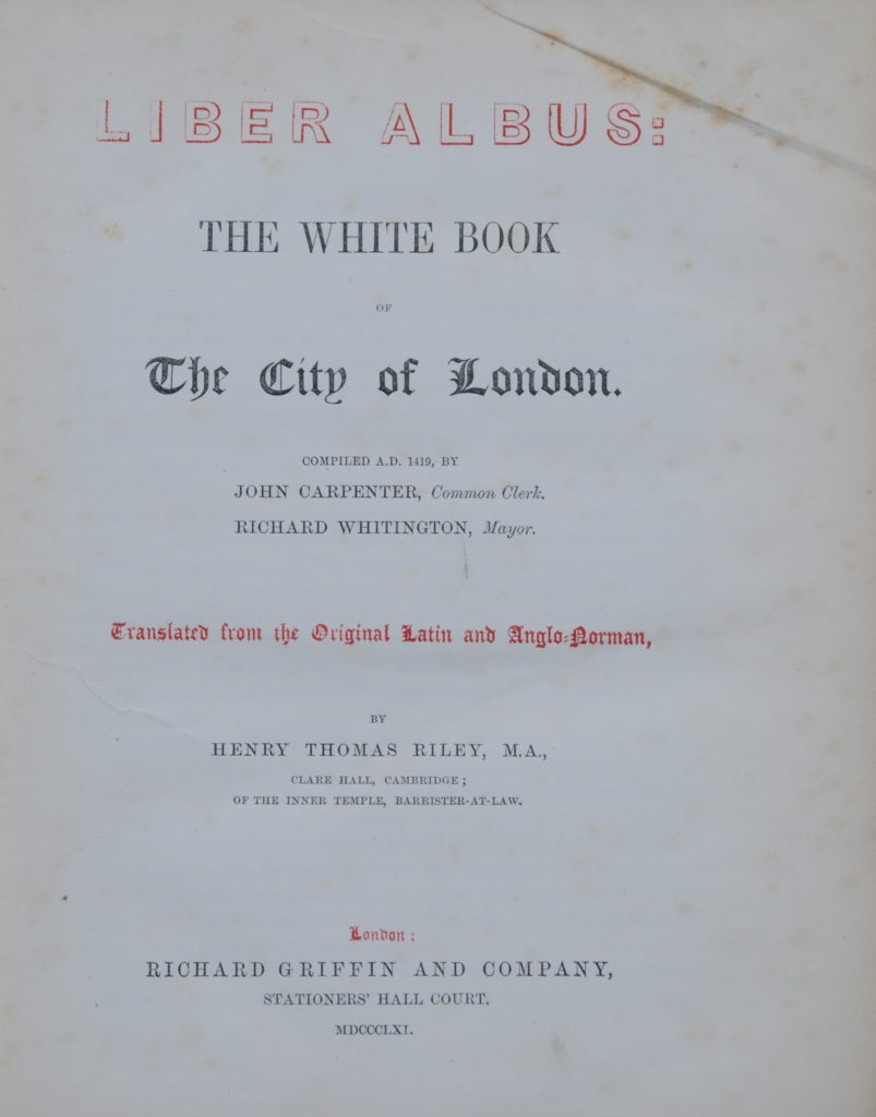
My final book in this review of London Books, is Liber Albus: The White Book of the City of London.

London Books 8

The copy I have is the edition published in 1861 and translated from the original Latin and Anglo-Norman.

The introduction to Liber Albus states that “It is a fact, not the less true because not universally known that there is no city in existence in possession of a collection of archives so ancient and so complete as that belonging to the City of London.”

“From these archives, as they existed in the year of Our Lord 1419, combined probably with other sources of information now lost or unknown, the Liber Albus, or White Book, is a compilation prepared in the last Mayoralty of Richard Whittington, for the instruction and guidance of those to whom, before they should have gained the experience of old age, the governance of the City, or the management of its affairs and interests, might under circumstances of emergency be entrusted.”

Liber Albus provides a fascinating insight into the day-to-day life of the medieval city and the rules that applied to the inhabitants of the City, two examples:

Of Strangers

And that no freeman of the City shall hold partnership with a strange man, or avow the merchandise of a strange man, whereby the King or his bailiffs of the City may lose custom upon the same; and this, under pain of losing the freedom.

Of Rebellious Persons

And that there be no one who shall make resistance in deed or in word unto the serjeants of the bailiffs of the City; and be it ordered, that no one shall molest them in making execution upon judgments, attachments, distresses, or other things which unto such bailiffs pertain to do, under pain of imprisonment. But if any one shall consider that the bailiff has done him wrong, let him make his suit thereon before his superiors, and have his recovery before those unto whom it pertains to make amends.

The above represent a very tiny sample of the vast number of London books published over the centuries, half a book shelf in a large library. Many are now online, but holding a physical book and turning the pages provides a more physical connection with the author and the time the book was published, rather than scrolling on a screen. Books about London continue to be published, some of the new books I have purchased over the last year include:

  • Dirty Old London by Lee Jackson
  • London Night and Day by Matt Brown
  • The Isle of Dogs During World War II by Mick Lemmerman
  • Up In Smoke: The Failed Dreams of Battersea Power Station by Peter Watts
  • East End by John Claridge

And I am sure that more will be published in the years to come – my only problem is finding enough shelf space.

alondoninheritance.com


Euston Underground Station – The Lost Tunnels

Euston Underground Station – The Lost Tunnels is the name of the latest Hidden London tour by the London Transport Museum, and on a warm Thursday afternoon last week I took the tour and descended beneath Euston station to find a time capsule from the 1960s.

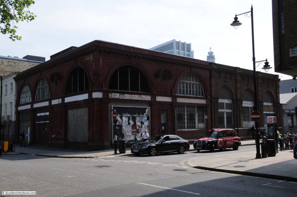
The tour started at the original Euston station of the Charing Cross, Euston and Hampstead Railway. The station is one of Leslie Green’s distinctive station designs and is the red building on the corner of Melton Street and Drummond Street, on the western side of Euston mainline station.

Euston Underground Tunnels 1

The Charing Cross, Euston and Hampstead Railway (better known as the Hampstead Tube), was one of two original underground lines serving Euston mainline station, opened in 1907, this line served from Charing Cross to the north of London (Golders Green and Highgate) through Euston Station.

The second of the lines was the City and South London Railway which ran from the City through to Stockwell in south London and extended from the City to Euston in 1907.

Although the two lines were separate and had stations on either side of Euston mainline station, they did agree to building an interconnecting passageway with a ticket hall and lifts to the mainline station platform.

The two separate station buildings were closed on the 30th September 1914 after the two railways were taken under the ownership of the Underground Electric Railways of London with the interconnecting passageway providing access to Euston Station. After work to enlarge some of the tunnels, the lines were combined to become the Northern line, with the two lines running south converging at Euston Underground Station.

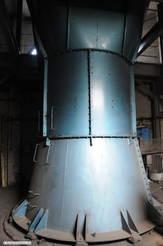
Inside the remaining Hampstead Tube station building in Melton Street, mainly now used for air conditioning of the tube system.

Euston Underground Tunnels 2

Euston mainline station was rebuilt in the 1960s and along with the new Victoria line running through Euston, the opportunity was taken to rationalise the various underground passageways and ticket halls for the underground lines terminating at Euston.

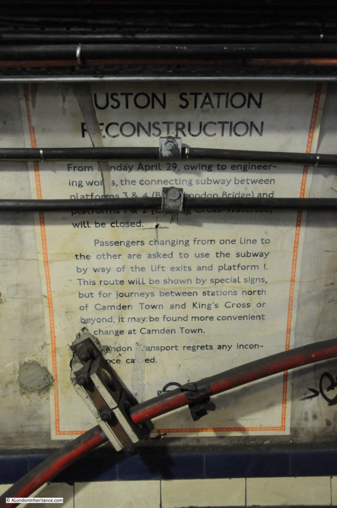
The old connecting passageways and ticket hall closed on the 29th April 1962 and it is these passageways that were the subject of the tour.

After a look at the station building in Melton Street, it was then a walk through Euston Station, through the underground ticket hall and down to one of the Northern Line platforms, where at the very end of the platform was a door that led through to the closed passageways.

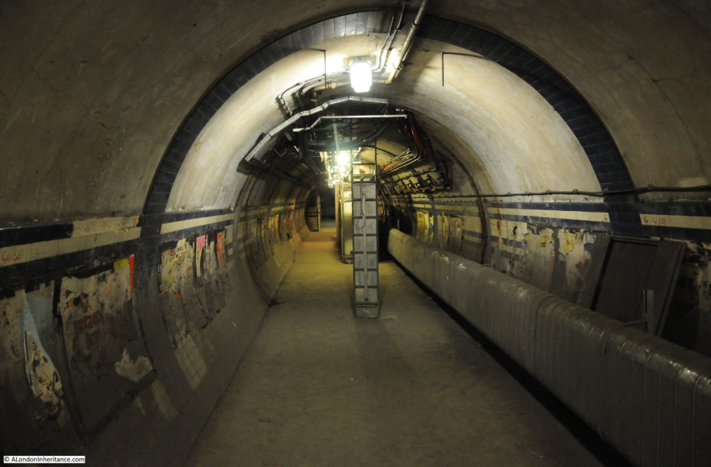
Through the door at the end of the platform and a series of steps lead upwards. The tiling on the side walls highlights that these were once passenger tunnels rather than service tunnels.

Euston Underground Tunnels 26

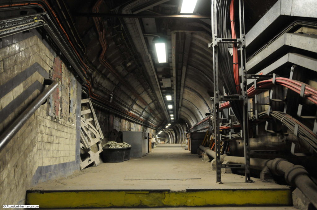
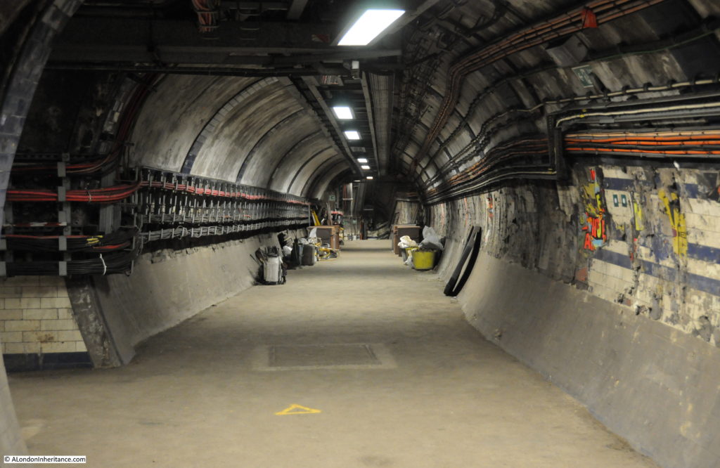
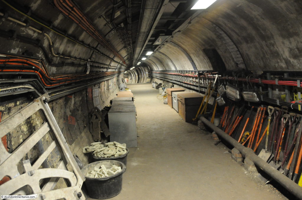
At the top of the steps and a long disused tunnel stretches ahead. No longer used by passengers moving between the different underground lines and the station above, now just used for carrying the infrastructure needed to run the transport system.

Euston Underground Tunnels 4

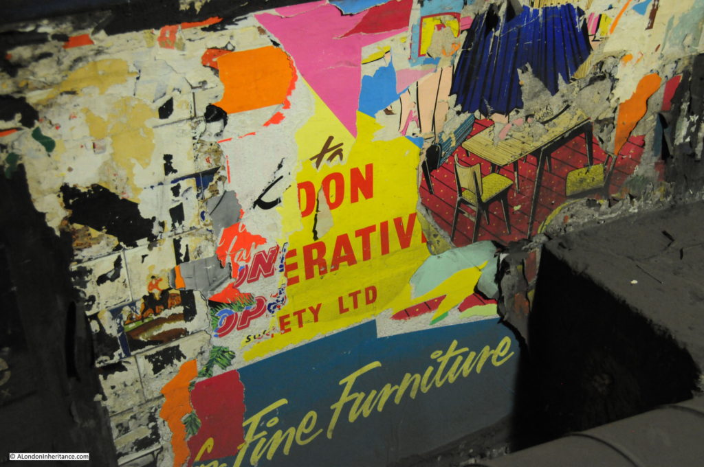
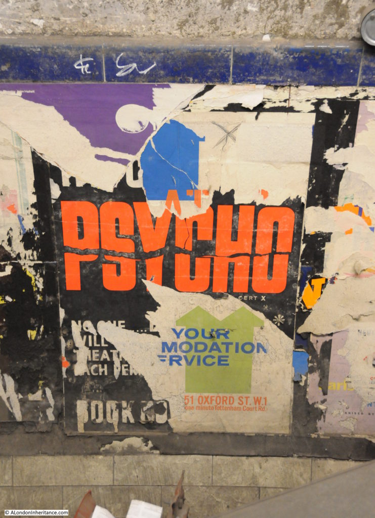
I mentioned at the start of this post, that the tunnels are a time capsule from the 1960s. Apart from the installation of cables, they have not been used since and the advertising posters that lined the walls of the tunnels are still in place. Whilst many have lost sections over the years, the lack of sunlight means that the colours are as vibrant as when they were first pasted on the walls.

Advertising fine furniture from the London Cooperative Society:

Euston Underground Tunnels 5

Posters on the walls include the posters informing passengers of the impending closure of the tunnels on the 29th April 1962:

Euston Underground Tunnels 6

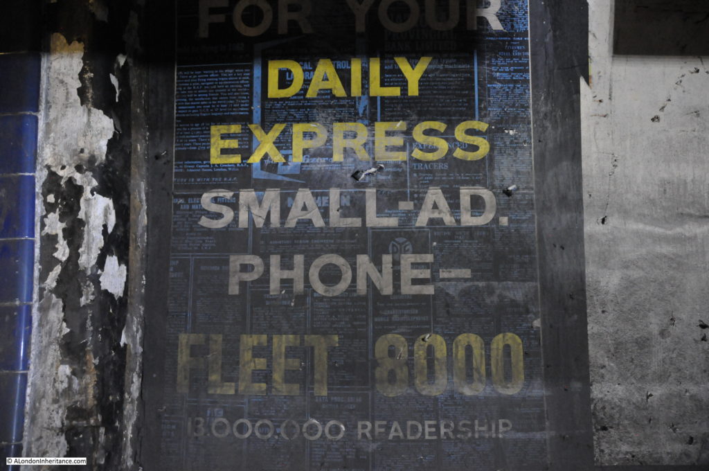
Posters include the original telephone number format when the London area was still part of the dial code:

Euston Underground Tunnels 7

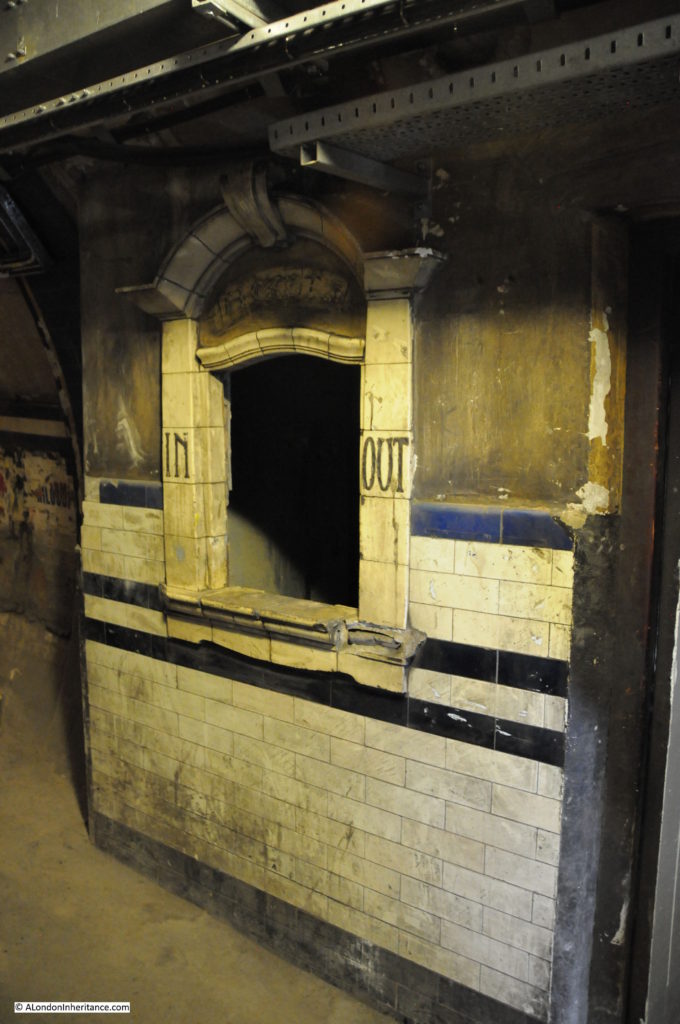
Along the passageway is the original ticket office. This provided passengers passing between the different rail networks with the option of buying tickets as they passed along the interconnecting tunnels.

Euston Underground Tunnels 8

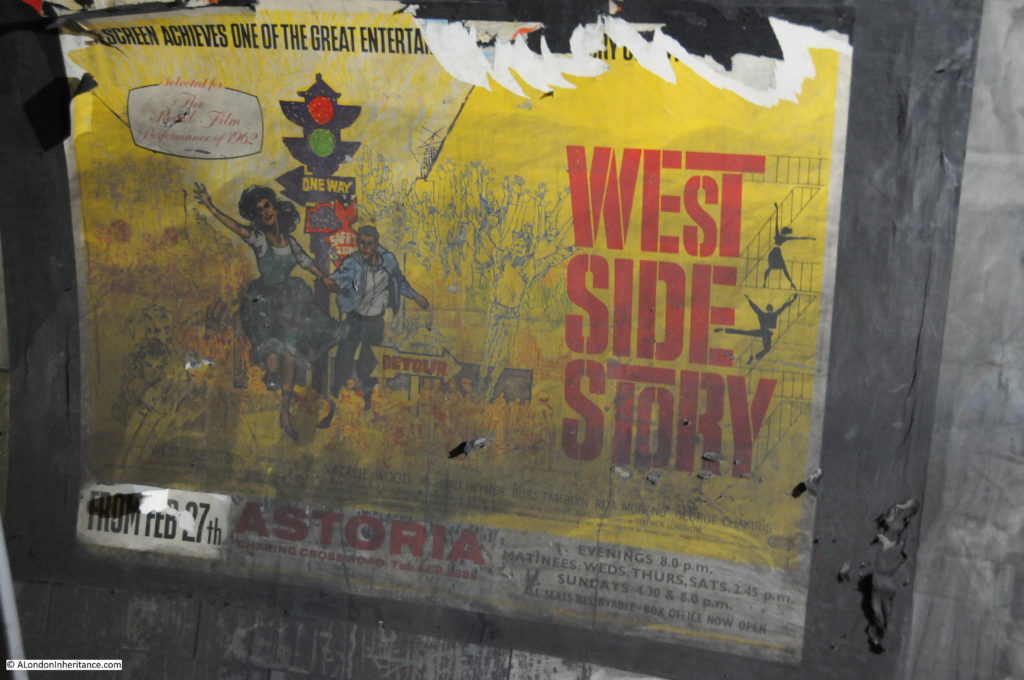
Poster advertising the film West Side Story at the Astoria from the 27th February 1962:

Euston Underground Tunnels 9

Steps to a dead end. It would be interesting to know what is on the other side:

Euston Underground Tunnels 10

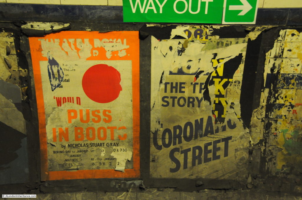
More posters:

Euston Underground Tunnels 11

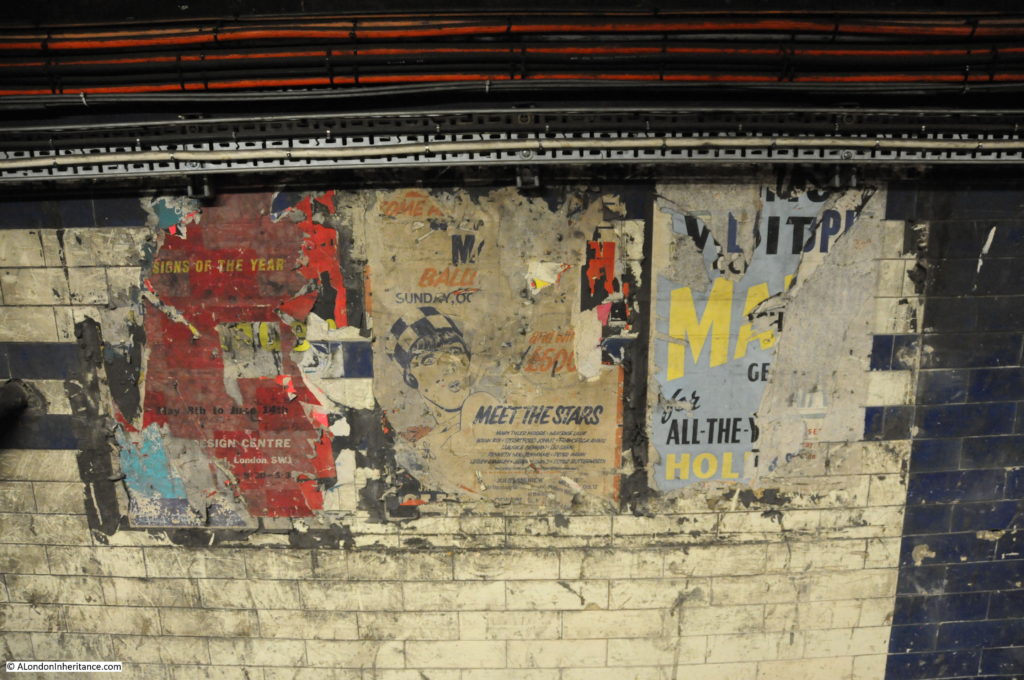
And more posters. The poster in the centre invites you to Meet the Stars and includes names such as Brian Rix, Stratford Johns, Francesca Annis, Maurice Denham and Julie Andrew.

Euston Underground Tunnels 12

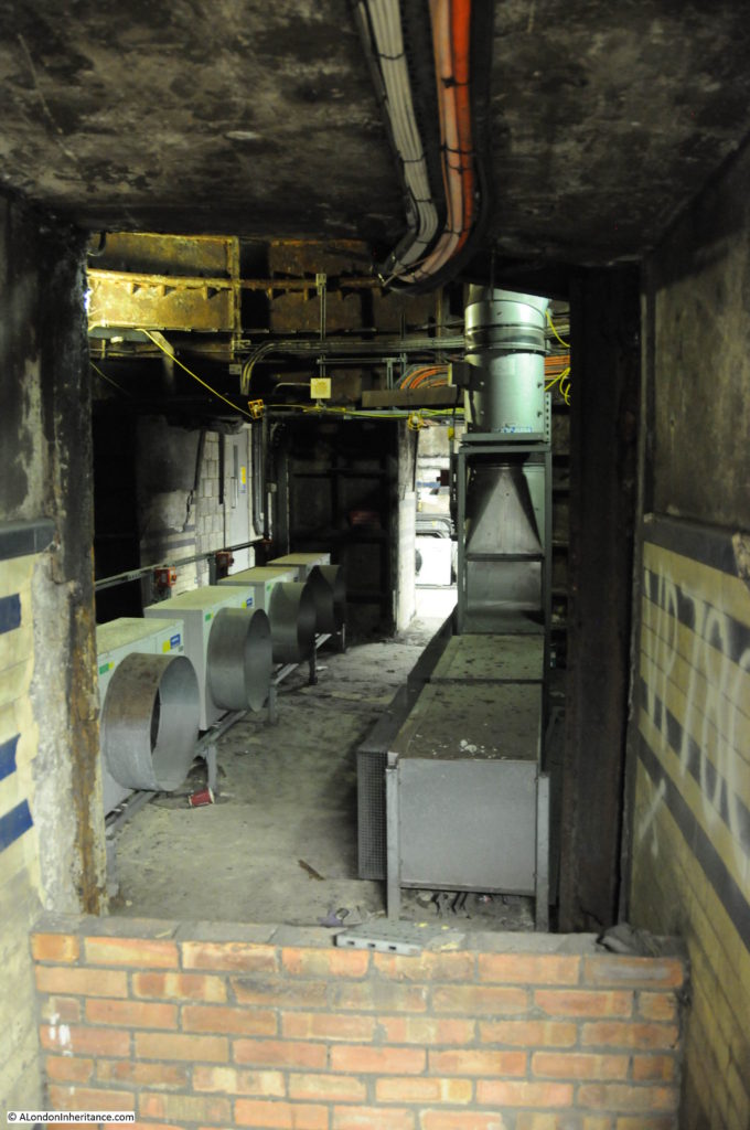
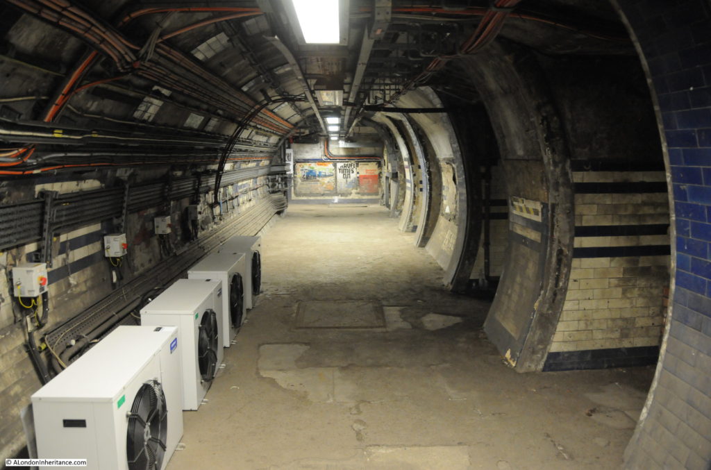
Cross tunnels with air conditioning:

Euston Underground Tunnels 13

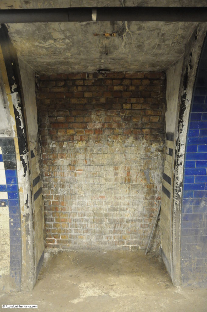
And a bricked up entrance:

Euston Underground Tunnels 14

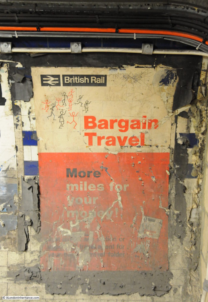
Poster advertising Bargain Travel on British Rail. Not sure that with the way ticket prices have changed since the early 1960s you would now get as much “More miles for your money”:

Euston Underground Tunnels 15

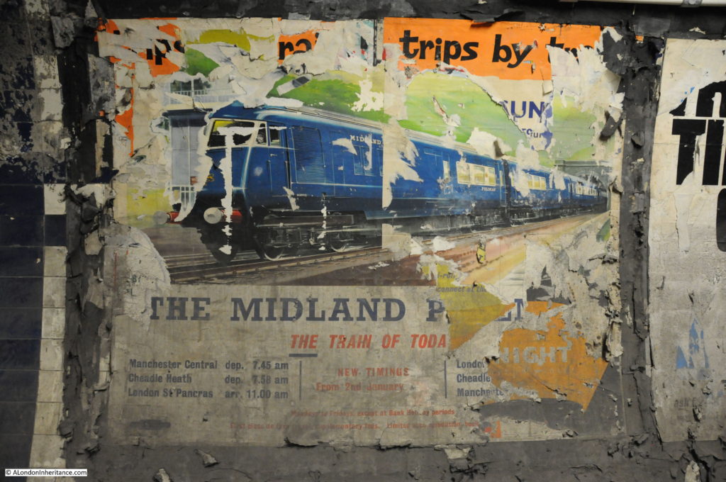
The Midland Pullman – a luxury 1st class only train aimed at business travelers between London and Manchester:

Euston Underground Tunnels 16

Advertising poster for Hitchcock’s film Psycho:

Euston Underground Tunnels 17

View along the tunnel:

Euston Underground Tunnels 18

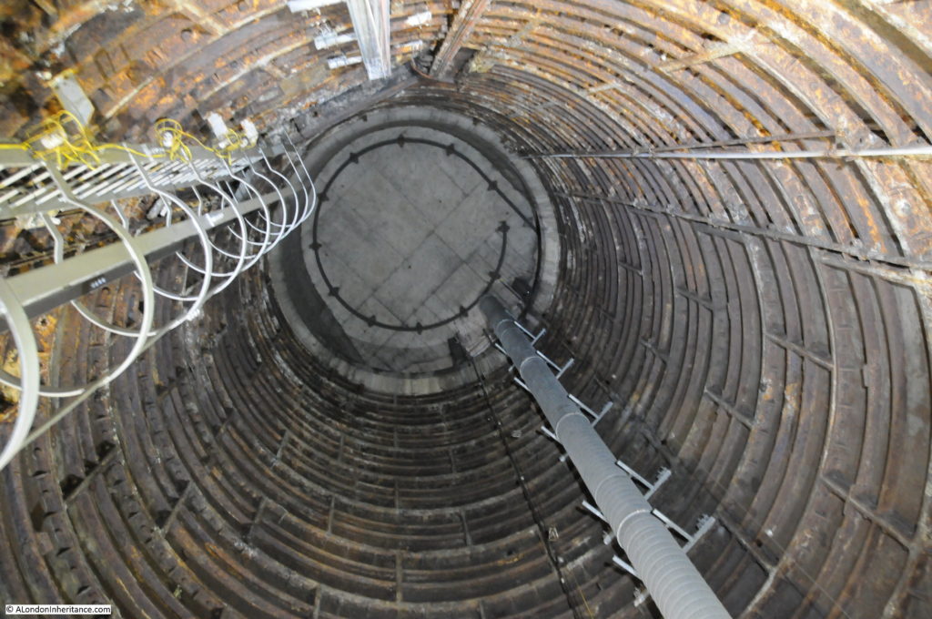
The route up to the mainline station from the original connecting passageways was via lift. Two lifts shafts originally ran to the surface. Looking up one of the lift shafts:

Euston Underground Tunnels 19

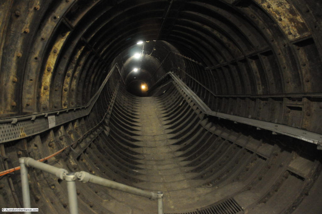
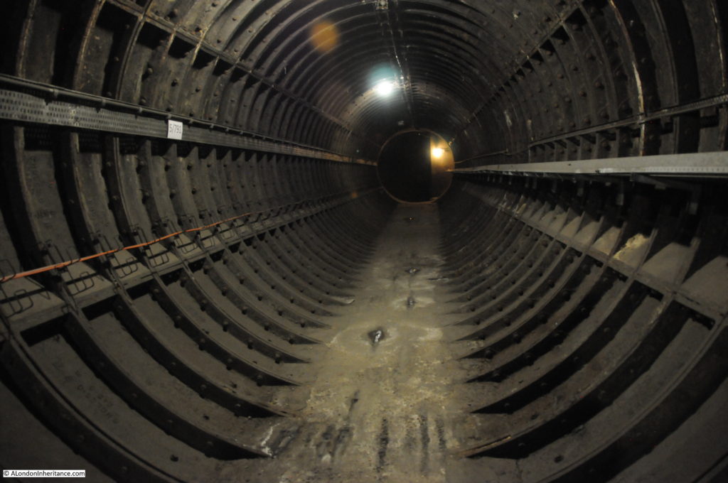
As well as the original passenger tunnels that provided connectivity between the underground lines and the surface station, the complex of tunnels includes tunnels to help provide ventilation to the underground system. These tunnels are just the basic construction without any of the flat walkways and wall tiling to be found on the passenger tunnels.

Looking up the tunnel with a limited amount of infill on the floor of the tunnel to provide a walkway:

Euston Underground Tunnels 23

Further up the tunnel:

Euston Underground Tunnels 22

At the top of the tunnel where it runs across the top of the underground platforms below:

Euston Underground Tunnels 21

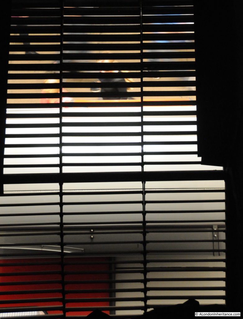
This is where the holes in the roof of the platforms below provide access to the ventilation tunnels above. If you look up from many of the platforms across the underground system you will see large grills set in the roof above the part of the tunnel where the train runs. It is these grills that lead to ventilation tunnels above. Trains entering and leaving the station help with ventilation by causing a large amount of air movement as they pass through.

The roof of a train and passengers just about to board seen from above the ventilation grill:

Euston Underground Tunnels 20

Back along the tunnels:

Euston Underground Tunnels 24

View back along one of the tunnels. Lots of tools stored along the tunnel edge:

Euston Underground Tunnels 25

Another view along the tunnels

Euston Underground Tunnels 27

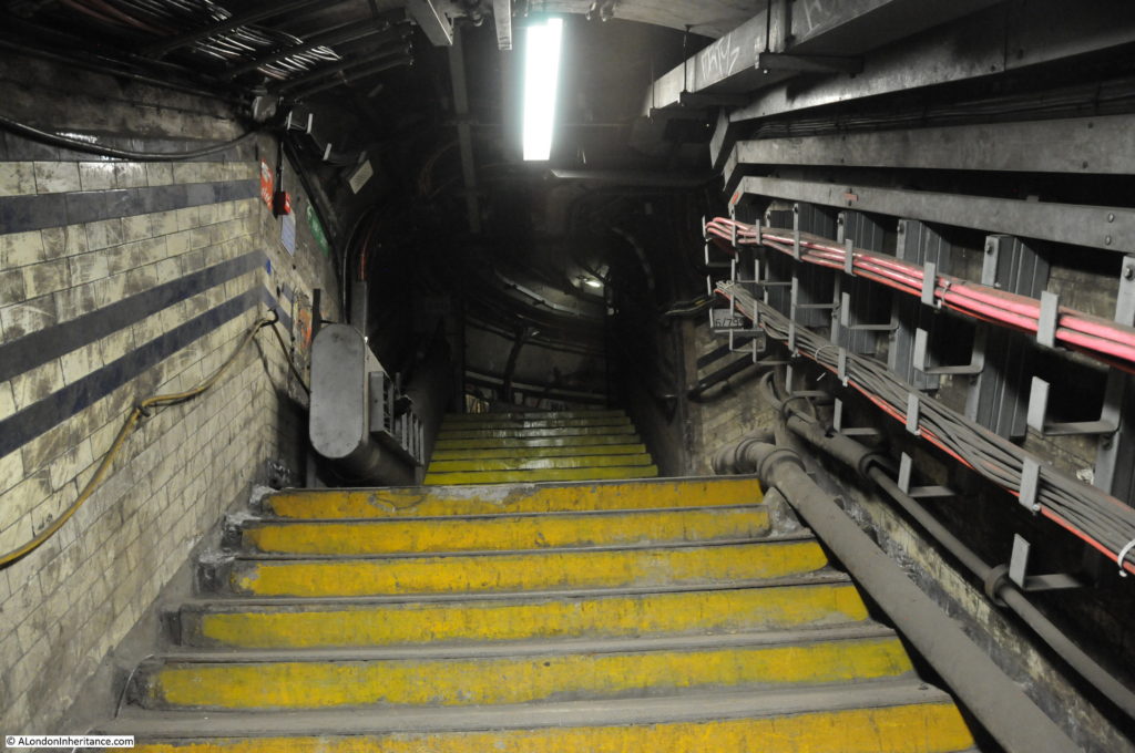
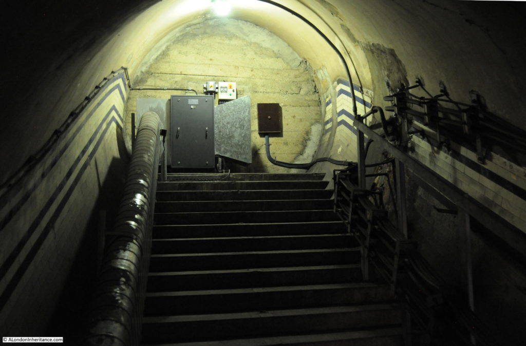
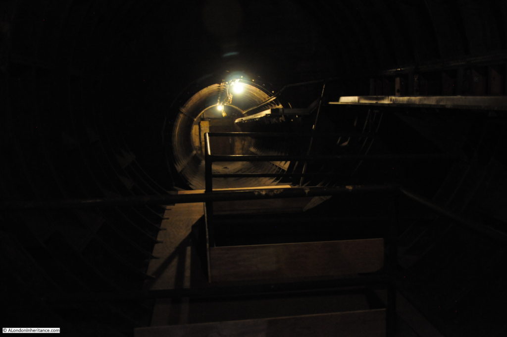
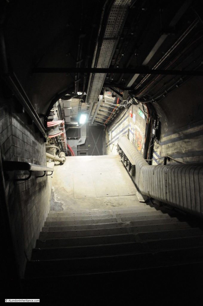
And finally at the end of the tour. Looking down the steps to the door leading through to the platform. It was 5pm by the end of the tour, so just the other side of that door is the platform with the start of the evening rush hour in full flow.

Euston Underground Tunnels 3

This is the fifth Hidden London tour by the London Transport Museum that I have been on over the last couple of years and in someways, once you have seen one tunnel you have seen them all, however they are all unique.

They each tell part of the story of how London’s Underground system has evolved over the past hundred plus years. Initially, individual lines often competing with each other, now part of an integrated transport system.

Some, such as these at Euston Underground Station provide a snapshot of the time when they were closed, the walls still covered in the posters that the last passengers would have seen when they last walked these tunnels in April 1962.

The Hidden London tours run by the London Transport Museum are excellent and provide a fascinating view of the old tunnels that run alongside the tunnels that carry thousands of passengers every day.

Tickets for Hidden London tours can be purchase here.

alondoninheritance.com

Smith Square – Architecture, History, And Reformers

If you are in Westminster, walk past the Houses of Parliament towards Lambeth Bridge, but turn right before reaching the bridge and you will end up in Smith Square. The relative peace is in sharp contrast to the crowds around Westminster and it is a pleasure to walk here and explore the history of the area.

Smith Square and the surrounding streets still follow much of the original 18th century street plan. A central square occupied by a church, with streets radiating out, some still lined by the original terrace houses from when the square was originally developed.

If you have turned down Great Peter Street from Millbank, then the first turning on the left is Lord North Street. This street is a contemporary with the church of St. John at the centre of the square and is lined with terrace housing built between 1722 and 1726.

The view looking down Lord North Street:
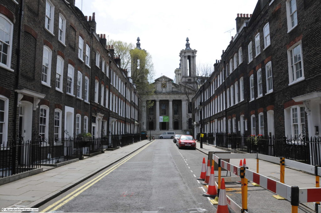
Smith Square 1

Whilst the architectural style of the majority of the buildings along the street is the same  – the buildings have timber sash windows, iron railings and the same building materials – there are variations, for example with the decoration around the main door to the street, some being simple with others having a rather ornate door surround as shown in the photo below.
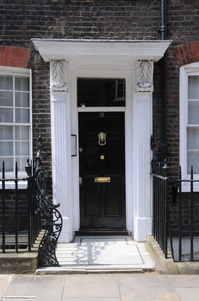
Smith Square 2

As well as retaining their original 18th century features, some of the buildings in Lord North Street have features from more recent events:
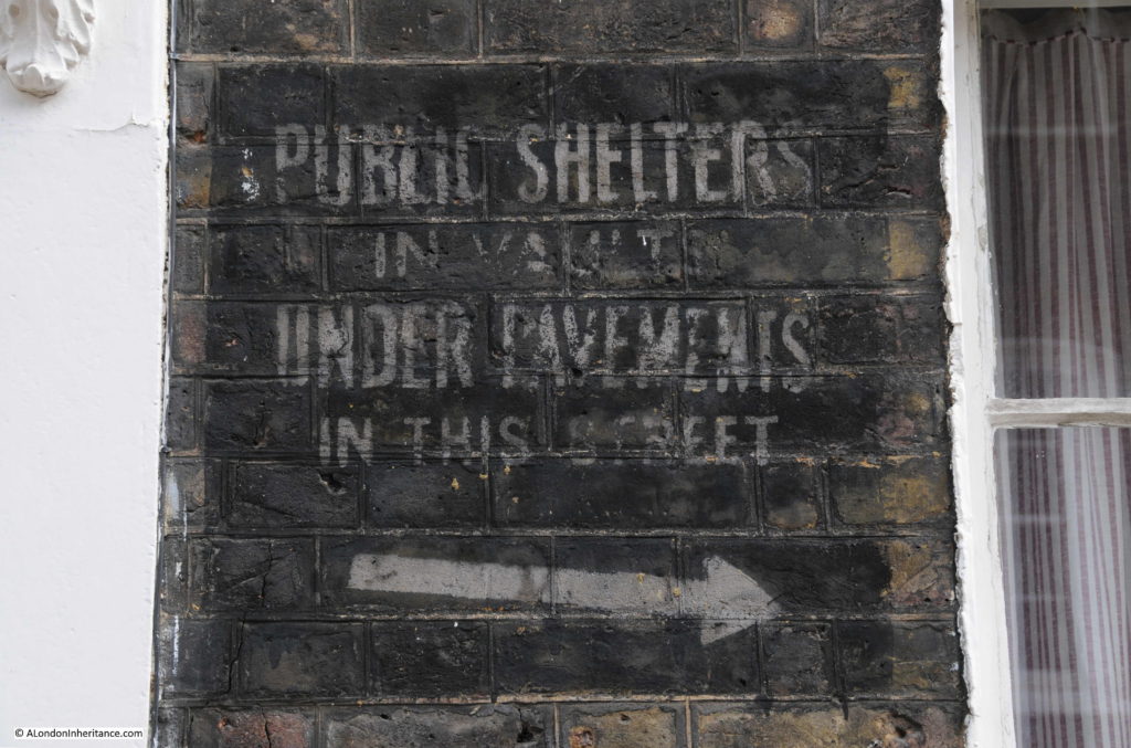
Smith Square 4

Smith Square suffered badly from bomb damage, the church was gutted by incendiary bombs and a high explosive bomb landed in the square also damaging the church and some of the surrounding buildings. The shelters in the basements of these buildings would have offered basic, but much needed protection from everything except for a direct hit.
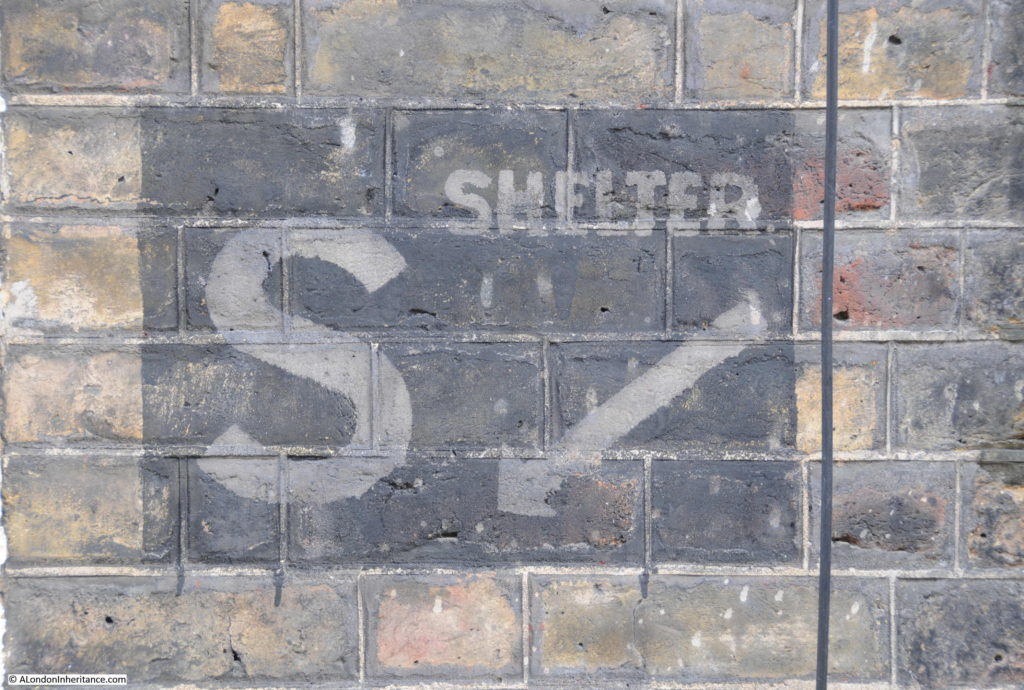
Smith Square 5

Variations in style:

Smith Square

A plaque at the end of Lord North Street to W.T. Stead, a fascinating character who lived his last years here.
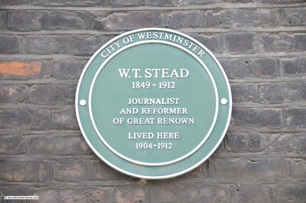
Smith Square 6

Stead was originally a journalist and newspaper publisher. His believe was that newspapers should be informative and entertaining and also an “engine for social reform” and pioneered a new form of journalism which led to the tabloid format of the 20th century. His expose of child prostitution in Victorian London was one of the most shocking newspaper articles of the time. He was a peace campaigner, attacking the Boer War and travelling widely to promote his ideas. In later years he developed an interest in spiritualism.

In 1912 he accepted an invitation to speak at the Men and Religion Forward Movement at Carnegie Hall in New York. He would probably have left his home here in Lord North Street to travel down to Southampton to catch the first sailing of the Titanic to attend the conference in New York.

He did not survive the sinking of the Titanic and accounts speak of Stead helping others into lifeboats and passing on his life jacket. His body was never recovered.

A fascinating man of his time, although some recent authors have been rather unsympathetic to Stead. For example, in “The Victorians”, A.N. Wilson writes:

“Stead, and the sort of journalism which he pioneered, was to provide for the lower-middle-class chapelgoers a marvelous substitute for the dramas of the Devils Theatre, the frivolous triumphs and disasters of the Devil’s Prayer Book. He was to redefine the world as a lurid back-drop for a new literary form, every bit as diverting as the three-decker novel from the Satanic circulating libraries.”

The real start of tabloid journalism!

The web site attackingthedevil,co,uk is a dedicated resource on W.T. Stead and is a highly recommended read.

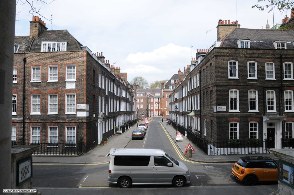
The view looking back down Lord North Street from the steps of the church. Stead’s house is on the left corner of Lord North Street.
Smith Square 7

The land around Smith Square was dominated from medieval times by the Abbey and Westminster Palace with vine yards, market gardens, orchards and building moving west from the Abbey and Palace complex. During the 17th century, part of the land between Millbank and Tufton Street was purchased by Simon Smith and his son Henry, and building commenced towards the end of the century.

Smith Square was formed around the church of St. John the Evangelist. This was one of the 50 new churches that had been identified by the Church Building Commissioners to meet the needs of an expanding London and growing population.  Land was bought by the Church Building Commissioners and the church was built between 1714 and 1728.

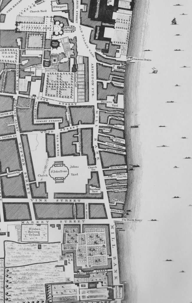
The church was originally at the centre of a much larger square with a considerable amount of space between the church and the closest buildings. The extract below from John Rocque’s map of 1746 shows the newly built streets and the church at the centre of a large space.
Smith Square 29

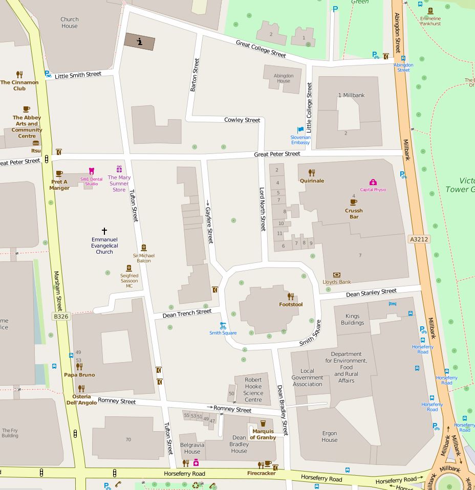
The following map extract shows the core area around Smith Square today. The area is still bounded by Tufton Street and Millbank (to the left and right) with College Street to the top of the map and Market Street at the bottom (now named Horseferry Road). Much of Vine Street has disappeared with the remaining section now named Romney Street. The large open space to the top left of the church has since been built over with Gayfere Street connecting Smith Square  to Great Peter Street. Church Street now runs longer from MIllbank to the square and has been renamed Dean Stanley Street. Horse and Groom Yard to the top right of the church has been built over.
Smith Square 30

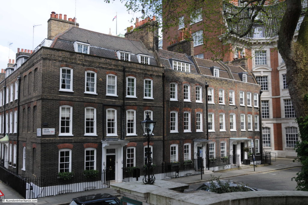
View from the church steps showing original houses along Smith Square.
Smith Square 8

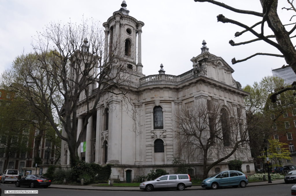
The church from the edge of the square.
Smith Square 27

The church was designed by the architect Thomas Archer and was one of the few of the “50 churches” that were completed. It was also the most expensive, costing £40,875 to complete.

There are four identical short towers on each corner of the church. These have led to the story that the church was designed after Queen Anne’s footstool as when asked what the church should look like, she kicked over a footstool and said “Go, build me a church like that”. Another myth is that the towers were added to ensure an equal pressure on the marshy ground of the area which caused a number of problems during construction. The towers were though part of Archer’s original design and not added for any other reason.

In 1928 the church was the location for Emmeline Pankhurst’s funeral, despite having earlier been the target of a Suffragette bomb plot.

Following the considerable destruction of the church during the war, it was eventually rebuilt but as a music venue rather than as a church, a role that the building continues to this day.

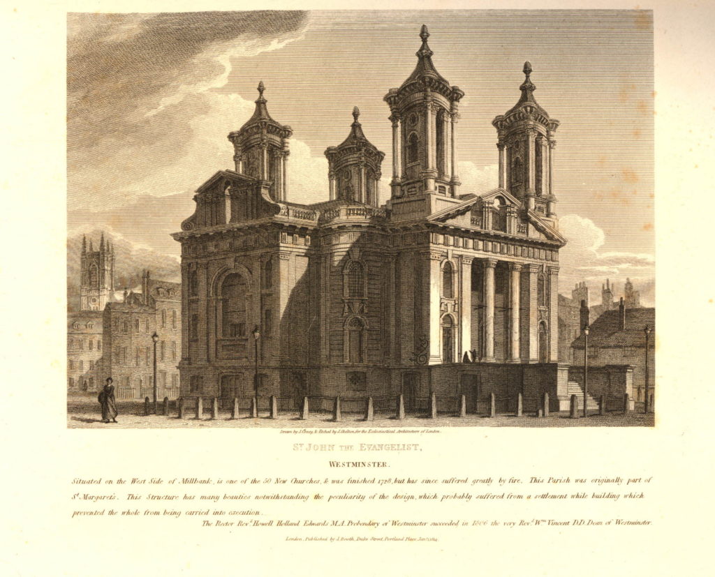
A print of St. John’s, Smith Square from 1814. The text below the print states “Situated on the West Side of Millbank, is one of the 50 New Churches & was finished 1728, but has since suffered greatly by fire. This Parish was originally part of St. Margret’s. This structure has many beauties notwithstanding the peculiarity of the design, which probably suffered from a settlement while building which prevented the whole from being carried into execution.” The fire that the text refers to was a major fire in 1742 that caused significant damage to the church.
626079001

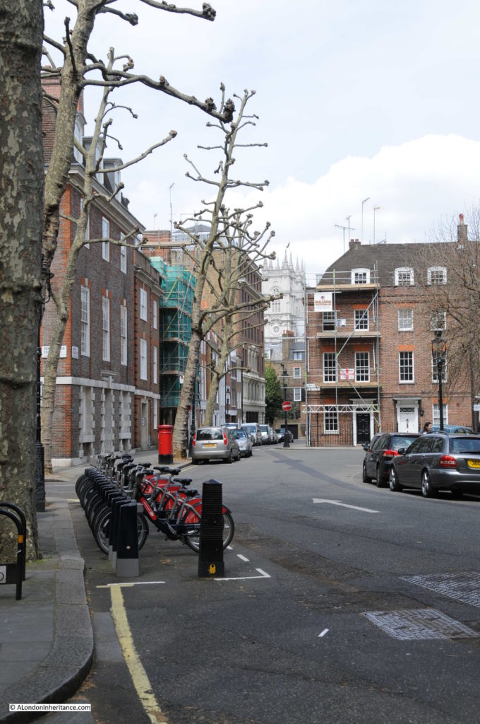
Looking up from Smith Square, along Gayfere Street to the towers of Westminster Abbey. A high explosive bomb fell in the road to the right of the red letter box during the war causing considerable damage to the surrounding buildings.
Smith Square 10

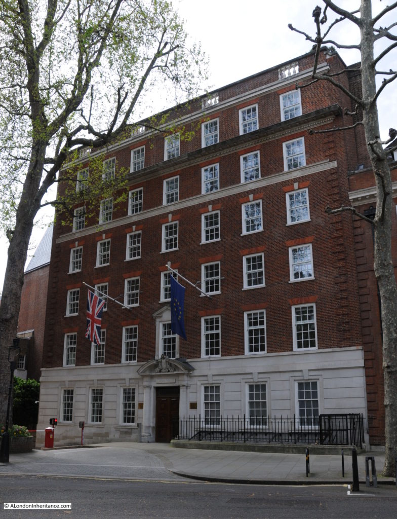
In the 1980s during the time when Margaret Thatcher was Prime Minster, Smith Square was often in the news due to the Conservative Party Central Office being located here at number 32. The Conservative Party moved here in the mid 1950s, moving out in 2004.

The building today is, perhaps ironically, the Information Office of the European Parliament.
Smith Square 9

Smith Square has had a long association with politicians. The Conservative MP Rab Butler lived in Smith Square as did the Labour MP Oswald Mosley who went on to leave Labour and set up the British Union of Fascists in 1932. Harold Wilson lived in Lord North Street during the early 1970s.

Another building (the photo below – Transport House) in Smith Square was also home to the Transport and General Workers Union as well as the Labour Party.
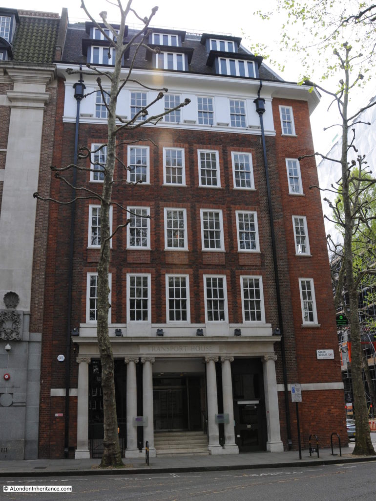
Smith Square 31

There is a rather strange building at one corner of Smith Square. A small part of the old ICI building, Nobel House, the bulk of which is on Millbank and extends to this corner of Smith Square and rather than blend in with Smith Square, the building has used exactly the same decoration as the main frontage of Nobel House on Millbank.

If you look up at the building along Millbank and part of Horseferry Road, the building is decorated with the faces of scientists on the keystone above the window with the name of the scientist across the balcony below. (See my original post covering Noble House). The corner of the building in Smith Square has:

  • John Dalton (1766 to 1844), a chemist, physicist and meteorologist, who was responsible for a wide range of scientific discoveries, and it was his work on Atomic Theory that was his major legacy, and;
  • Marcellin Berthelot (1827 – 1907), a French chemist  who demonstrated that organic substances could be synthetically produced rather than being dependent on some form of “vital spark” over which there was no human control.

The corner entrance to Nobel House in Smith Square with Dalton above the door and Berthelot to the right.
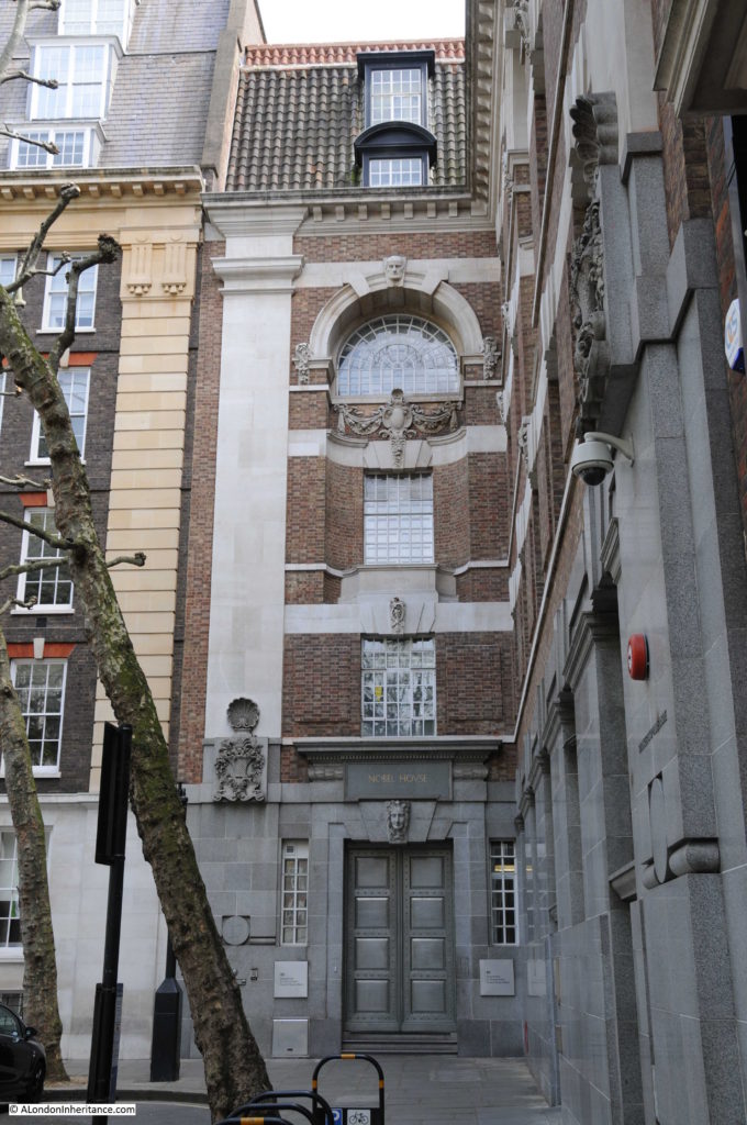
Smith Square 11

In the first decades of the 20th century, some of the original buildings around Smith Square were demolished to make way for new office blocks resulting in a range of building styles around the square.
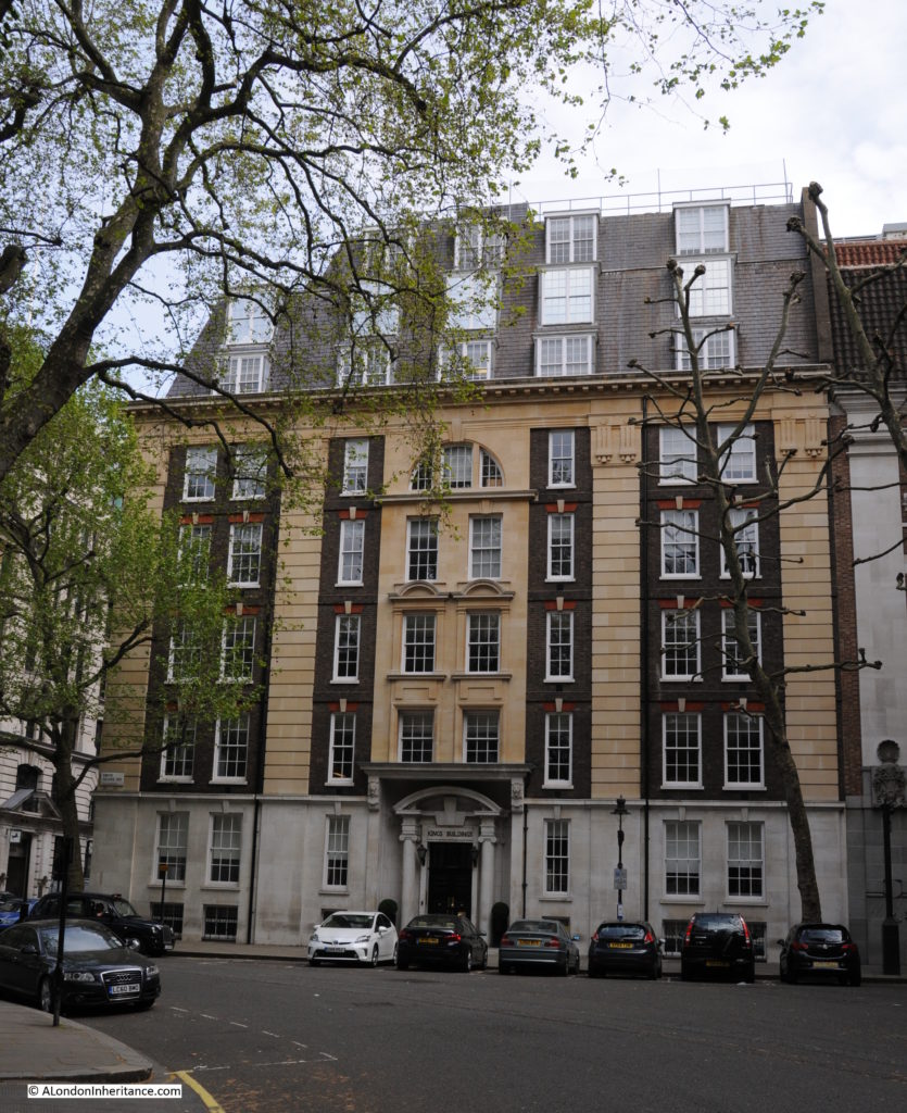
Smith Square 12

If you leave Smith Square by Dean Bradley Street (named after George Bradley, who was Dean of Westminster from 1881 to 1902) and walk down to Horseferry Road, the view down Dean Bradley Street provides another view of the church.
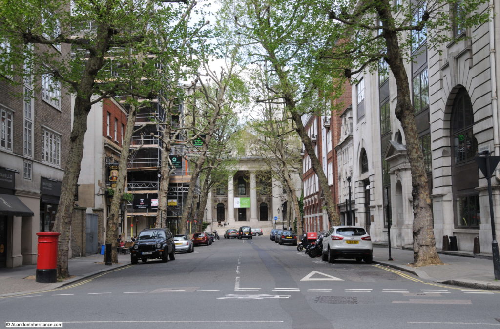
Smith Square 13

The streets around Smith Square are fascinating. A short walk down Horseferry Road is this building on the corner of Tufton Street. There is an old plaque on the building at ground level.
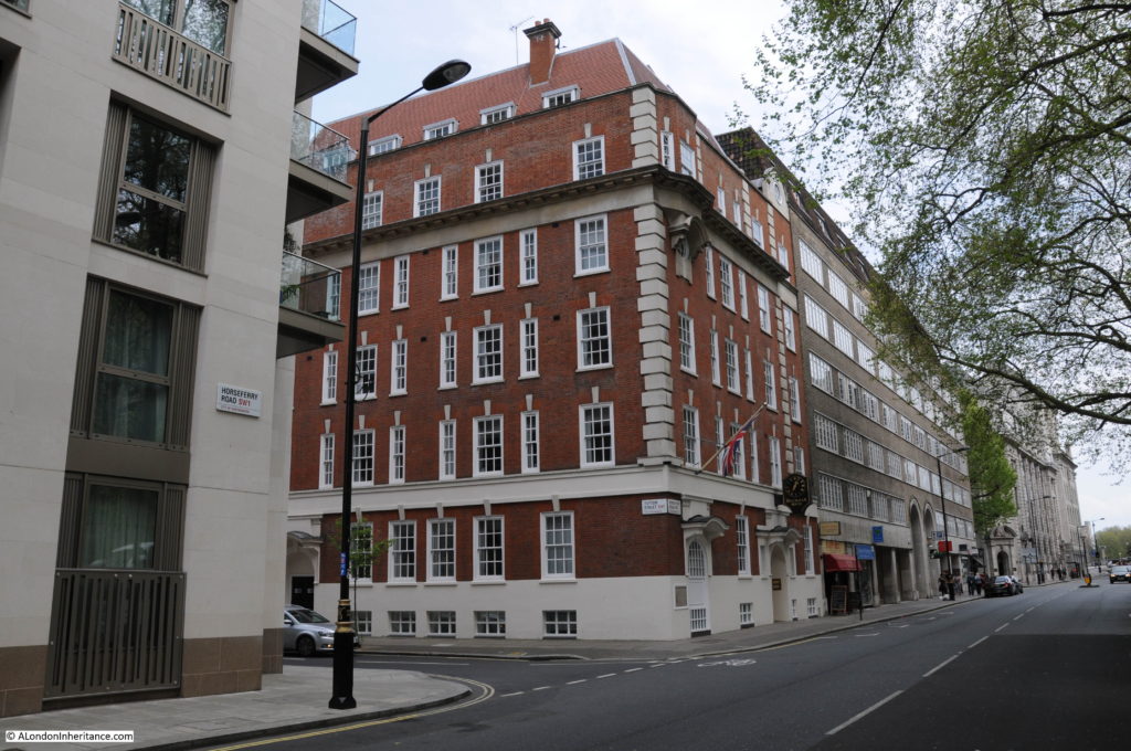
Smith Square 15

The plaque is the foundation stone for one of Mr Fegan’s Homes.
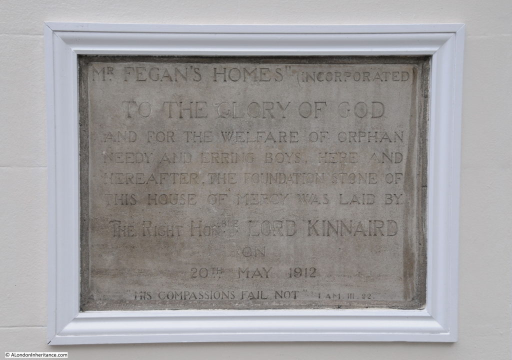
Smith Square 14

Mr Fegan was James William Condell Fegan who was born in Southampton in 1852 and moved to London with his family in 1865. He worked in the office of a firm of brokers and in the evening taught at a Ragged School. His experience at the Ragged School of the very poor conditions of many of the children who did not benefit from the school led Fegan to set up a home where children could come and learn in the evening and be given shelter overnight.

Fegan’s homes quickly developed with homes being opened at Deptford, Greenwich, Ramsgate and Southwark. As well as providing education and shelter for children in London, he also supported the emigration of children to Canada where he believed they would have a much better future.

The building in Horseferry Road was built for Fegan when the Southwark building had been outgrown and the new building housed the General Offices, an Enquiry and Advisory Bureau and a reception for new arrivals along with a Working Lads Hostel.

Fegan’s Homes also had a number of properties based in the country to prepare children for living and working in Canada.

Fegan’s Homes have all closed, however Fegans continues to exist as a Christian charity supporting children and their families

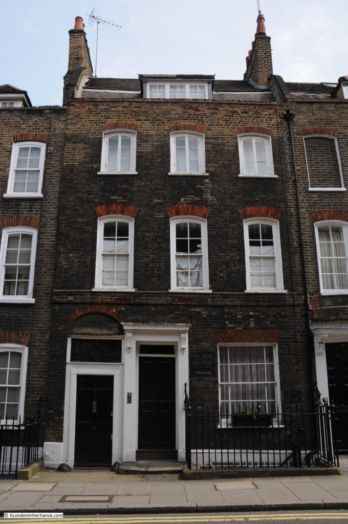
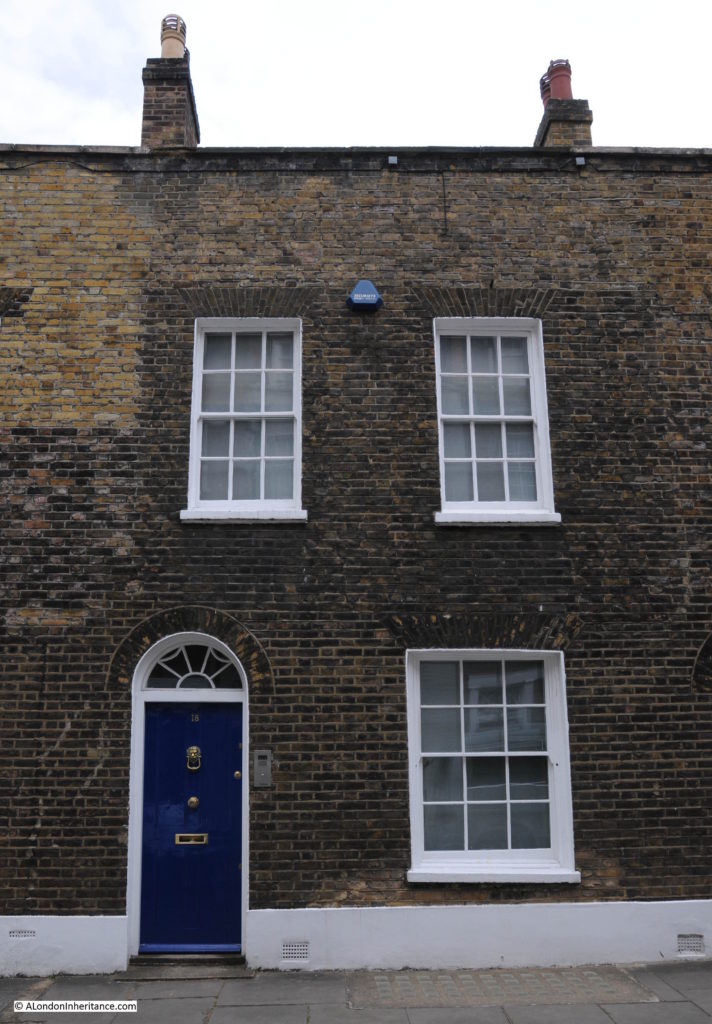
Tufton Street has some interesting architectural features. Lansdale House with a second door surround, but with no door, built to provide symmetry to the overall building.
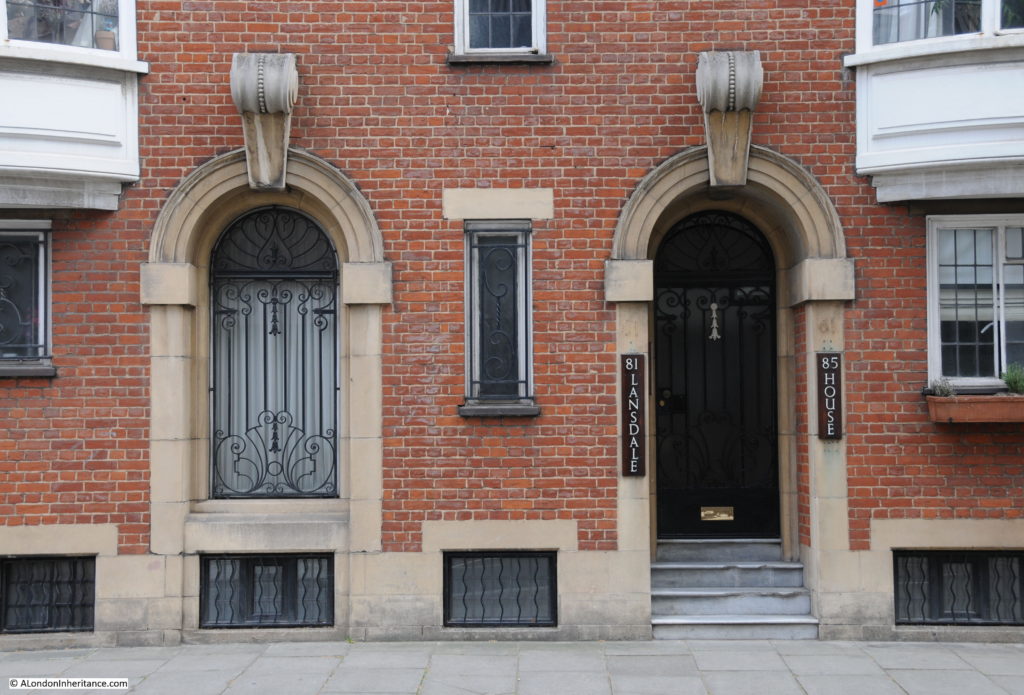
Smith Square 16.

Plaque in Tufton Street to Siegfried Sassoon (one of the First World War poets):
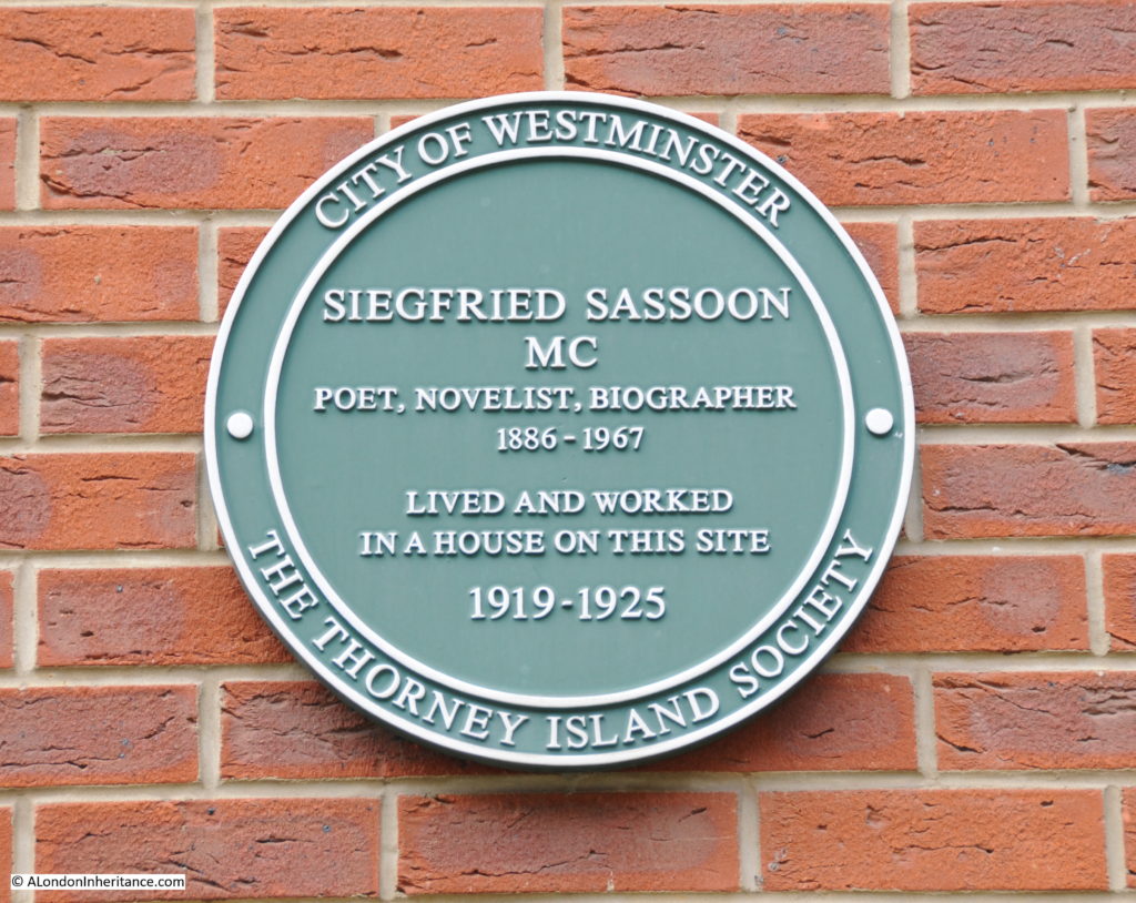
Smith Square 17

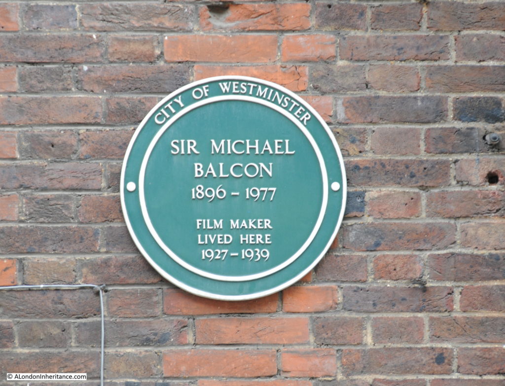
And another plaque on Tufton Street to Sir Michael Balcon who was a prolific British film producer. Just a few of the films he produced include The 39 Steps (produced when he was living here in Tufton Street), Passport to Pimlico and The Lavender Hill Mob.
Smith Square 18

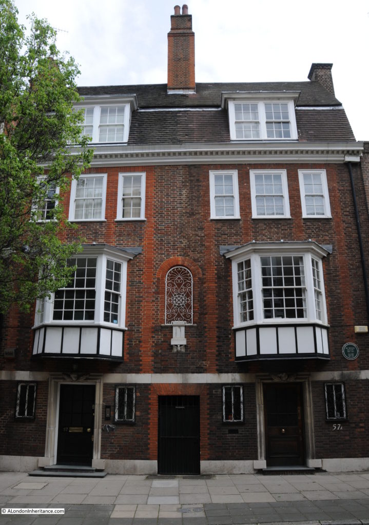
The architecture of Sir Michael Balcon’s house in Tufton Street is fascinating:
Smith Square 19

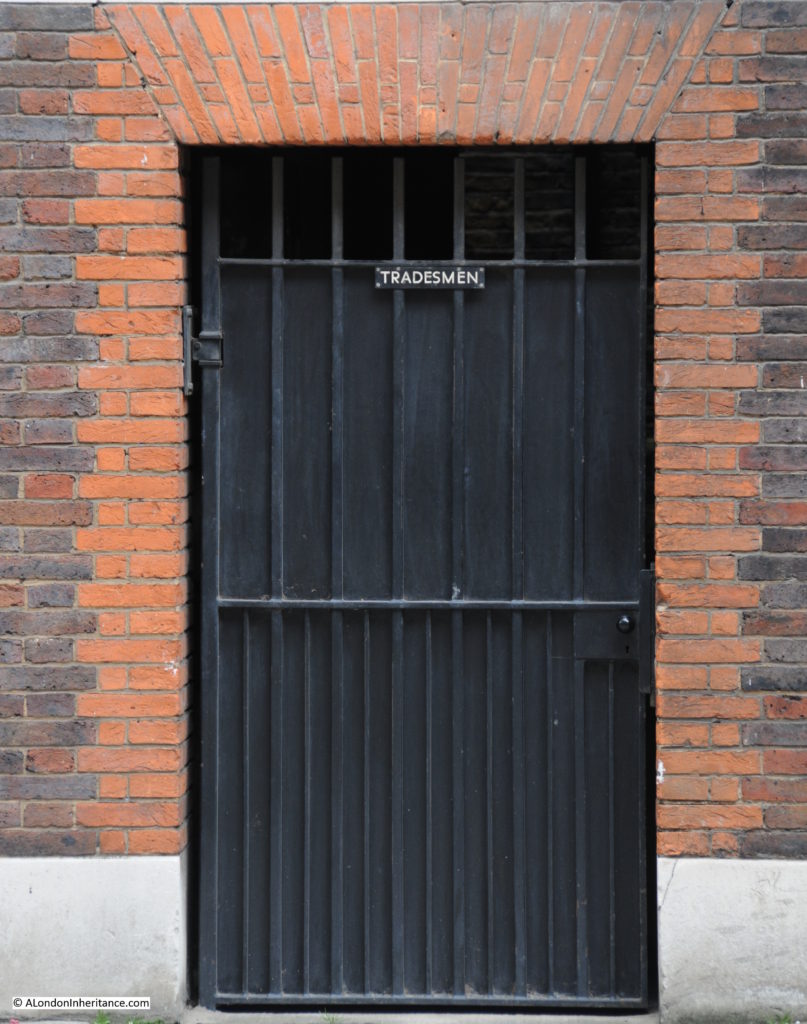
The Tradesmen Entrance in the centre flanked by two entrance doors to two separate parts of the overall building.
Smith Square 20

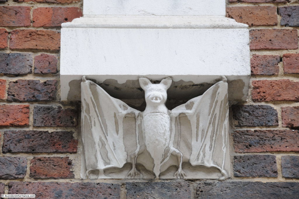
Above the Tradesmen Entrance is a niche covered by an ornate metal grille which looks like it should have a statue within. At the bottom of the niche is this rather beautifully carved bat. I have never seen one of these before and to find one in the centre of Westminster was an interesting find.
Smith Square 21

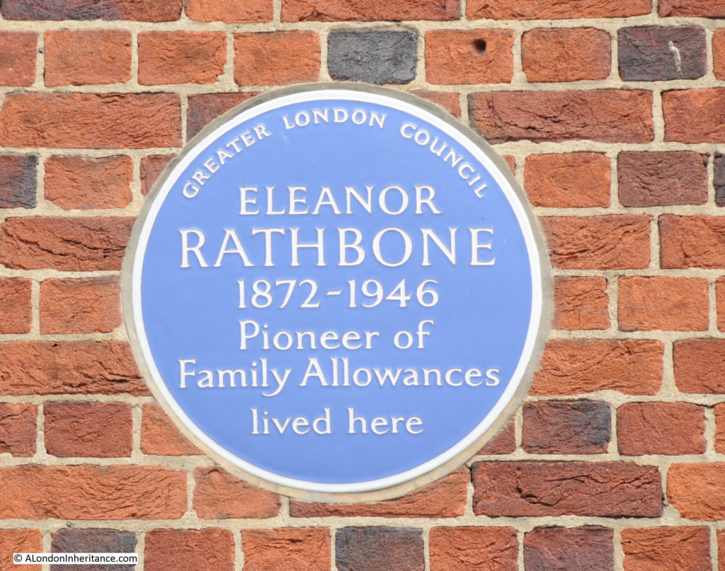
I have always found plaques such as the blue and green ones found around Smith Square both frustrating and tantalising. They provide a very brief glimpse of a single aspect of a life. Take the following plaque to Eleanor Rathbone in Tufton Street:
Smith Square 22

Eleanor Rathbone was the daughter of the philanthropist and politician William Rathbone and a member of a wealthy and nonconformist shipping family.

Her first public roles were as a reformer and feminist in Liverpool, and she was the first woman to be elected to Liverpool City Council. Rathbone was a constant campaigner for family allowances, having published The Case for Family Allowance in 1940 and just lived to see the start of their introduction in 1945, however there were many other aspects to her life.

She was an MP for the Combined English Universities. This was one of the constituencies that did not represent a physical location, but for this position the representation was for the graduates of English Universities other than Oxford, Cambridge and London which had their own MPs.

She was a campaigner for Women’s Suffrage and the impact of war on the dependents of soldiers. She also recognised the danger that Hitler and the rise of the Nazi Party presented, early in the 1930s. In her role as an MP she was an outspoken critic of appeasement with Germany and supported Winston Churchill when he was also warning about the rise of Nazi Germany.

Rathbone denounced the Munich Agreement in 1938 much to Neville Chamberlains displeasure and pressured the Government to take dissident Germans and Austrians along with Jews fleeing from the rise of the Nazis. She also set-up the Parliamentary Committee on Refugees and during the war campaigned for the Government to publish the growing evidence of the holocaust.

Up to 1940, Rathbone lived in Romney Street (just further back along Tufton Street), however this house was badly bombed in 1940 and the building in Tufton Street with the plaque is where she moved to after bombing damaged her Romney Street house.

A remarkable woman. Rathbone moved to Highgate in April 1945 but died suddenly in January 1946.

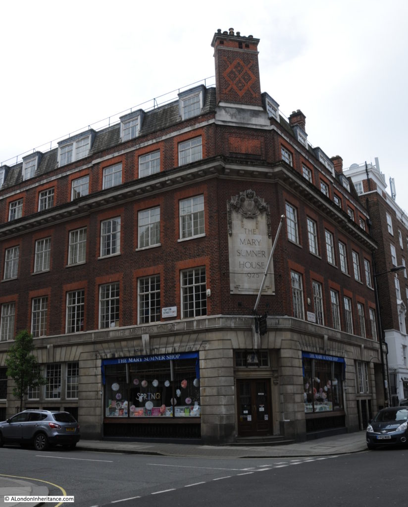
At the end of Tufton Street at the junction with Great Peter Street is Mary Sumner House.
Smith Square 25

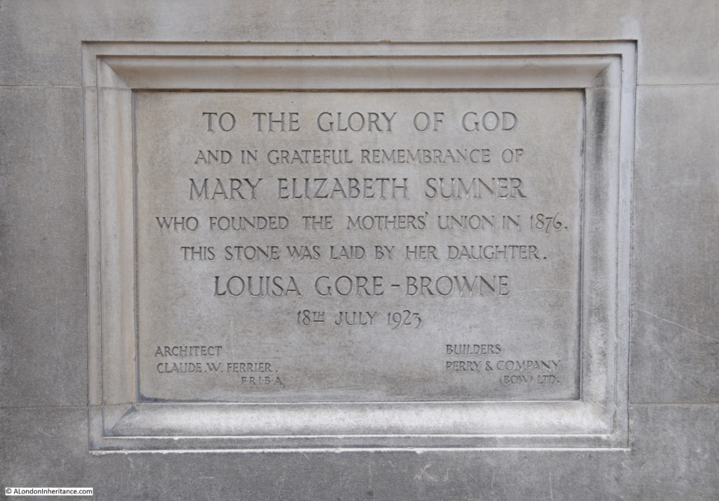
Mary Sumner was the founder of the Mothers Union, originally a group of mothers in the village of Old Alresford near Winchester formed by Mary in 1876. For the first nine years the group remained local but after a speech at the 1885 National Church Congress the concept of the Mothers Union grew rapidly across both the UK and the Commonwealth. By the end of the 19th century, the Mothers Union had 169,000 members.

Mary Sumner died in 1921 and is buried with her husband George (who held a number of posts in the church at Winchester) in the graveyard of Winchester Cathedral.

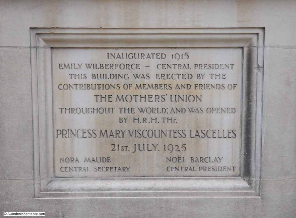
The foundation stone of Mary Sumner House, laid by her daughter in 1923.
Smith Square 23

Smith Square 24

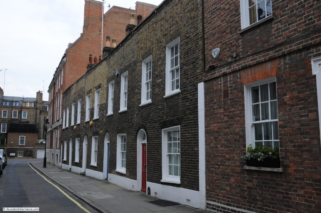
A short distance down Great Peter Street we can turn into Gayfere Street and head back to Smith Square to complete this quick walk around Smith Square and the local streets.
Smith Square 26

Original two storey houses along Gayfere Street.Smith Square 28
A short walk around Smith Square and a couple of the surrounding streets, but a fascinating history and architecture. There is mush else I can add, however I apologise for my usual problem of doing justice to a subject within the constraints of a weekly post.
I walked around the area on a Saturday afternoon and the streets were very quiet, they are not that much busier during a week day so avoid the crowds around Parliament Square and much of the rest of Westminster and explore the streets around Smith Square.

alondoninheritance.com