Monthly Archives: December 2022

M.R. James and a Ghost Story for Christmas

A Christmas custom for me, growing up in the 1970s, was to watch the BBC’s Ghost Story for Christmas. An almost annual event which usually featured one of the stories written by M.R. James.

Many of these stories followed some general themes. The main character was frequently a reserved antiquarian scholar, the plot often involved the discovery of something which would result in the arrival of a malevolent spirit, stories would often be set in the counties of Norfolk or Suffolk, a cathedral, abbey or university.

Many of these themes came from M.R. James own background.

He knew the counties of Norfolk and Suffolk very well. He was a medieval scholar, and was Provost of King’s College, Cambridge and then Eton. The term Provost is often used for the role of head of a university college or a private school.

His ghost stories appear to have originated from a custom where he would write, then read his ghost stories to friends on Christmas Eve. The first collection of his stories were published in book form in 1904 with the title “Ghost Stories of an Antiquary“.

M.R. James, or Montague Rhodes James, to give him his full name, was born on the 1st of August 1862, in the county of Kent and died on the 12th of June 1936 whilst he was Provost of Eton College.

He was buried in a small cemetery on the outskirts of Eton, so a recent trip to Windsor provided the opportunity to visit his grave, which seemed a suitable Jamesian thing to do in the weeks before Christmas.

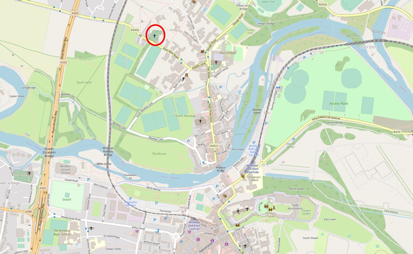
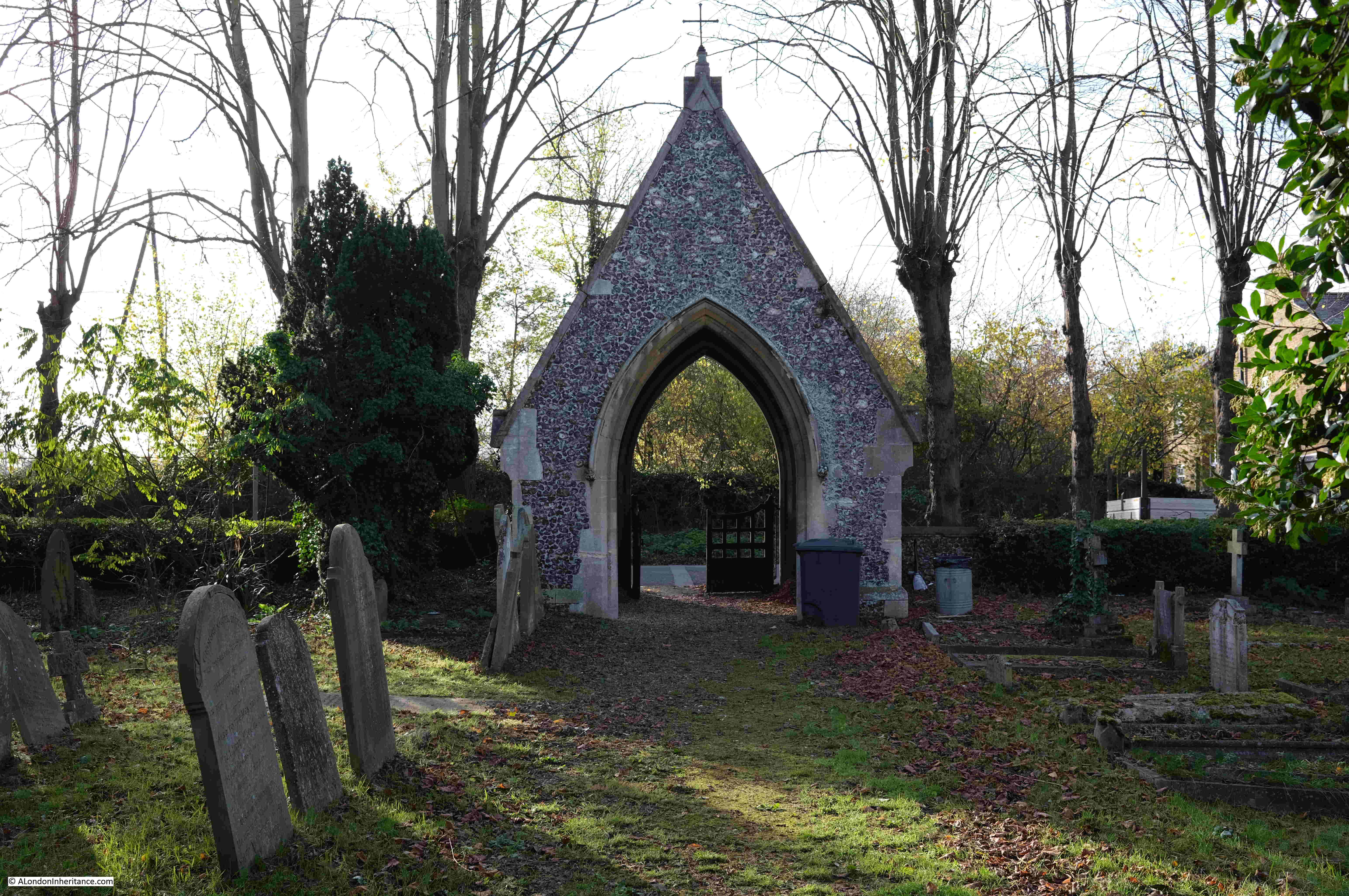
M.R. James was buried in the grounds of the Eton Wick Chapel, a short walk from the centre of Eton.

The easiest way to get to Eton is from Windsor where there are car parks and train stations, and it is from Windsor that we started the walk.

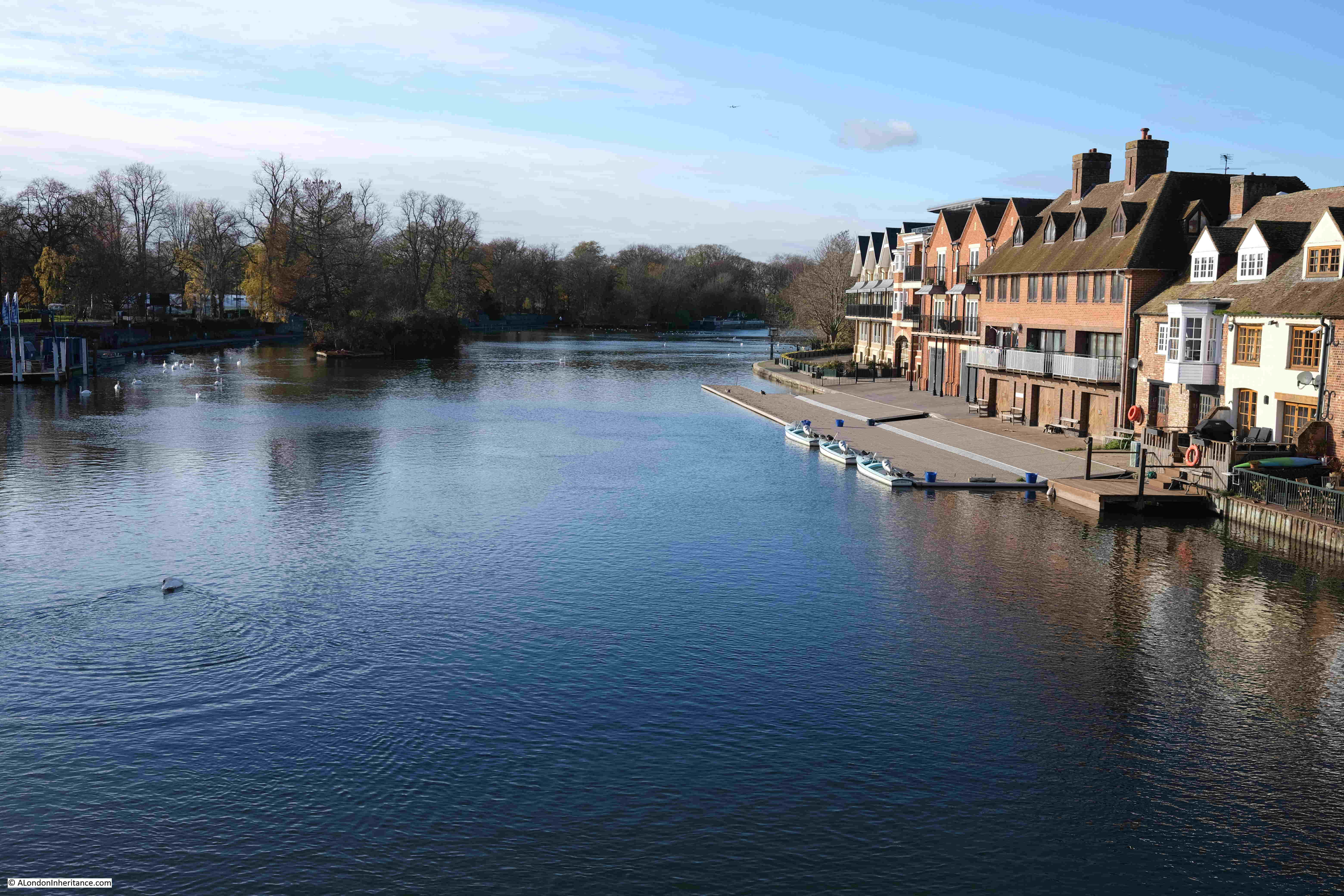
The old road bridge between Windsor and Eton is now pedestrianised and crosses the River Thames:

Ghost Story for Christmas

View from the bridge over the River Thames, with Windsor on the south bank of the river, and Eton on the north:

River Thames at Eton

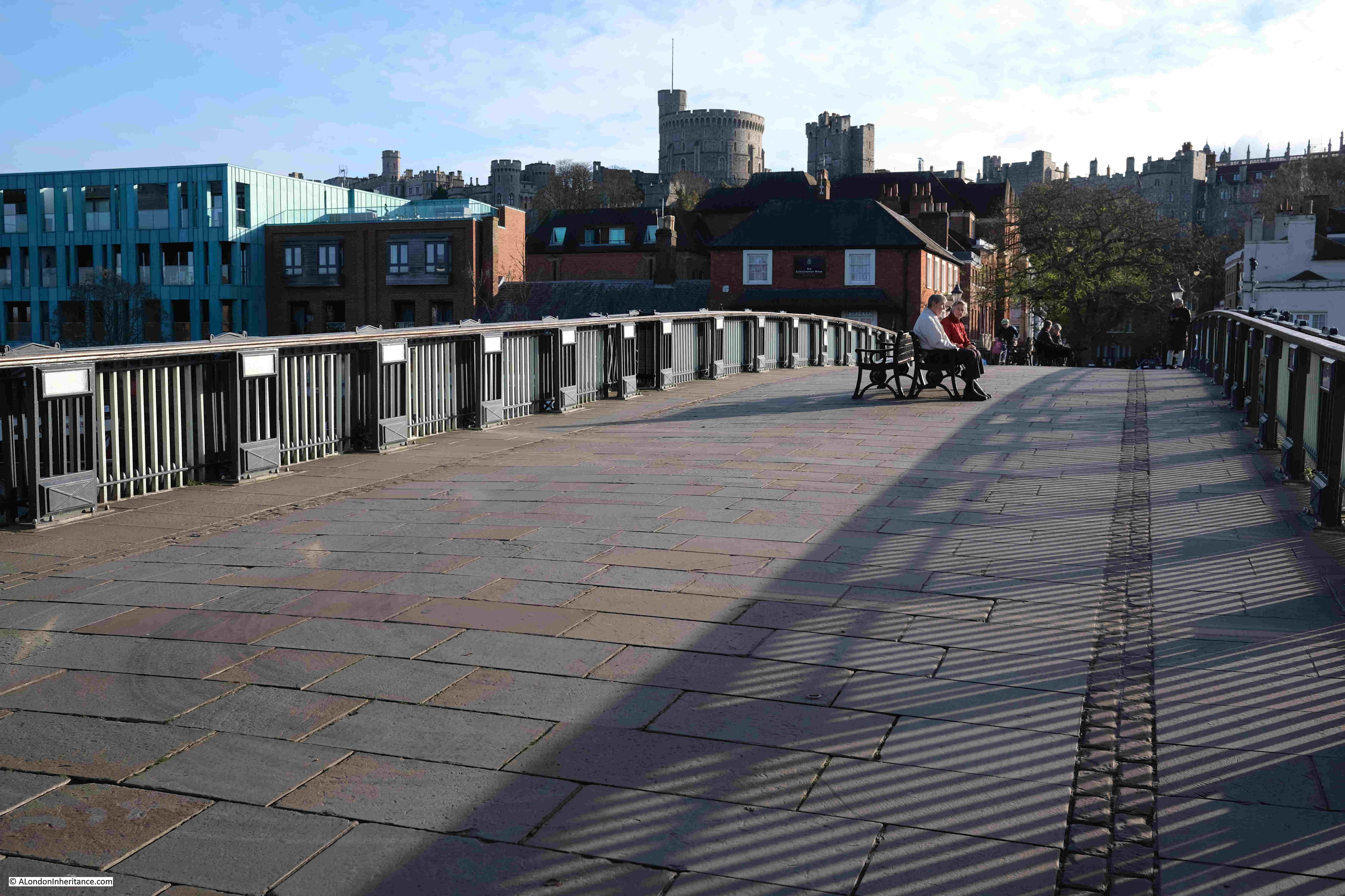
View looking back towards Windsor, with the castle towering above the town:

Eton Bridge

Eton High Street:

Eton High Street

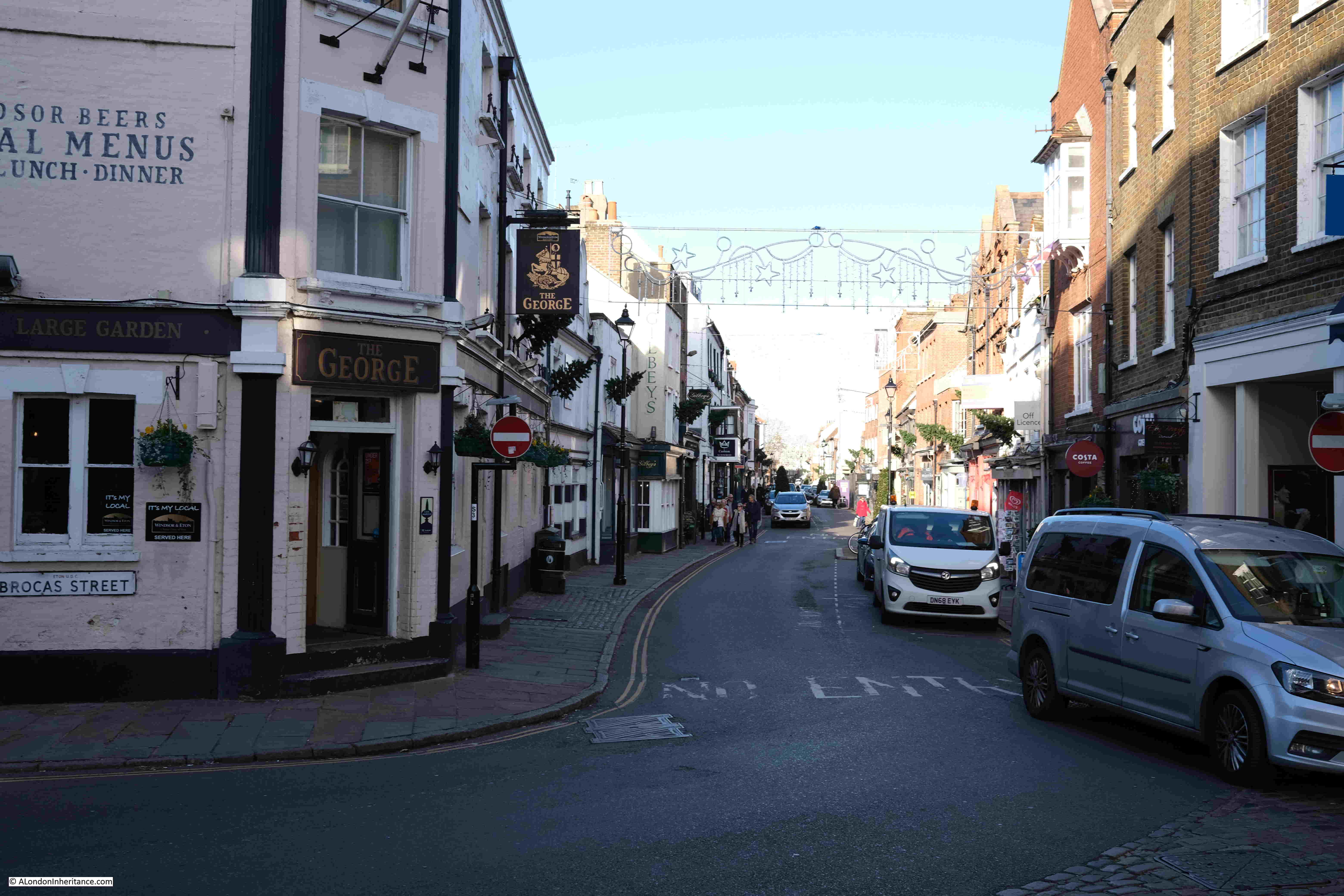
The pedestrianised bridge from Windsor over the Thames runs into Eton High Street. This bridge and street was once an important road as it was one of the main routes for access to Windsor Castle. Follow Eton High Street northwards and it ran up to the Bath Road in Slough, the Bath Road being one of the main routes from London to the west.

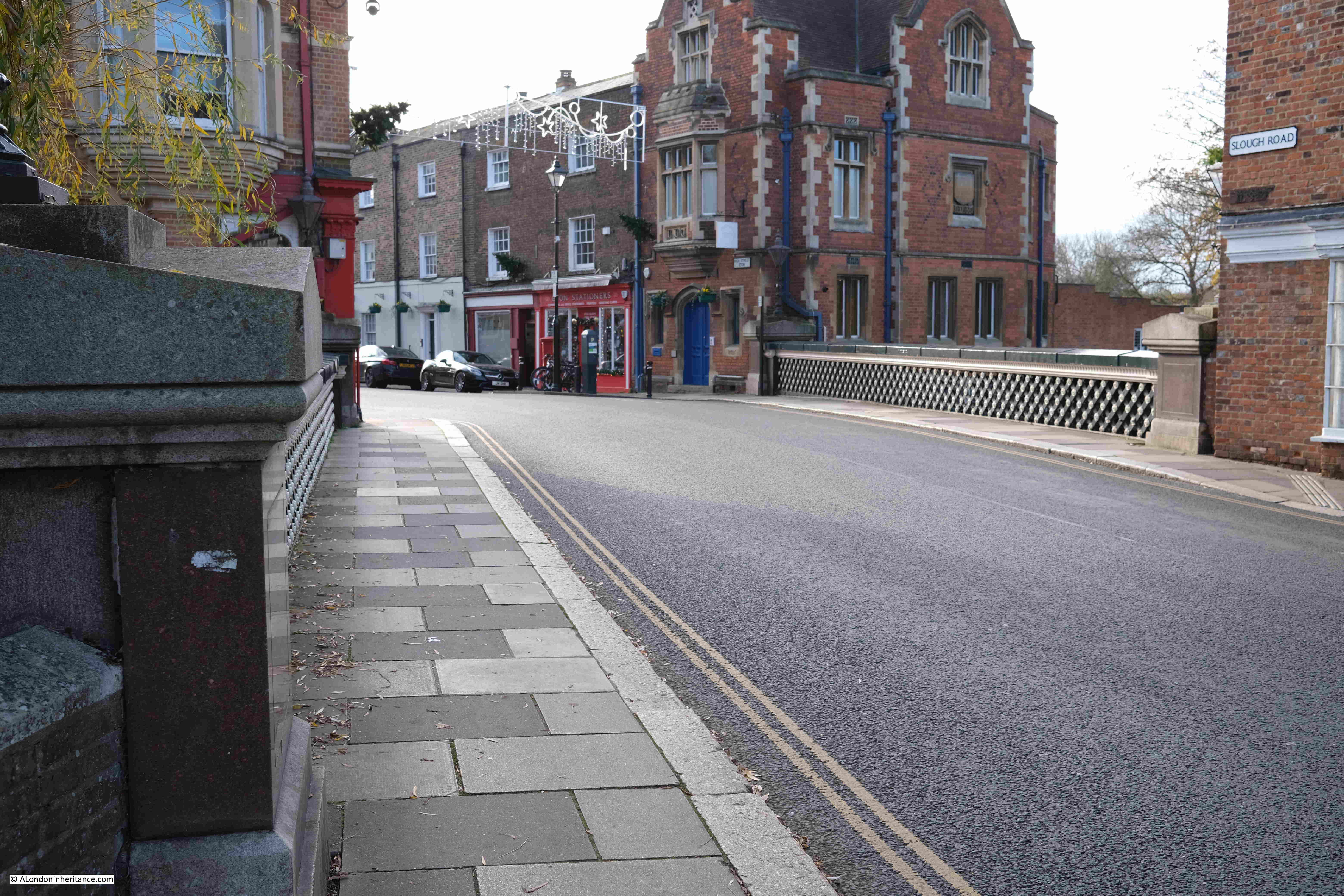
Running across the High Street is a small watercourse called Barnes Pool. This flows from the Thames, through Eton, then back to the Thames, and originally turned the southern section of Eton into a small island.

The earliest recorded bridge over the stream dates from 1274, and it has been rebuilt a number of times since, including 1592 when a new bridge was commissioned by Elizabeth I who was concerned about being cut-off in Windsor in the event of a Catholic revolt.

The Barnes Bridge today:

Barnes Bridge

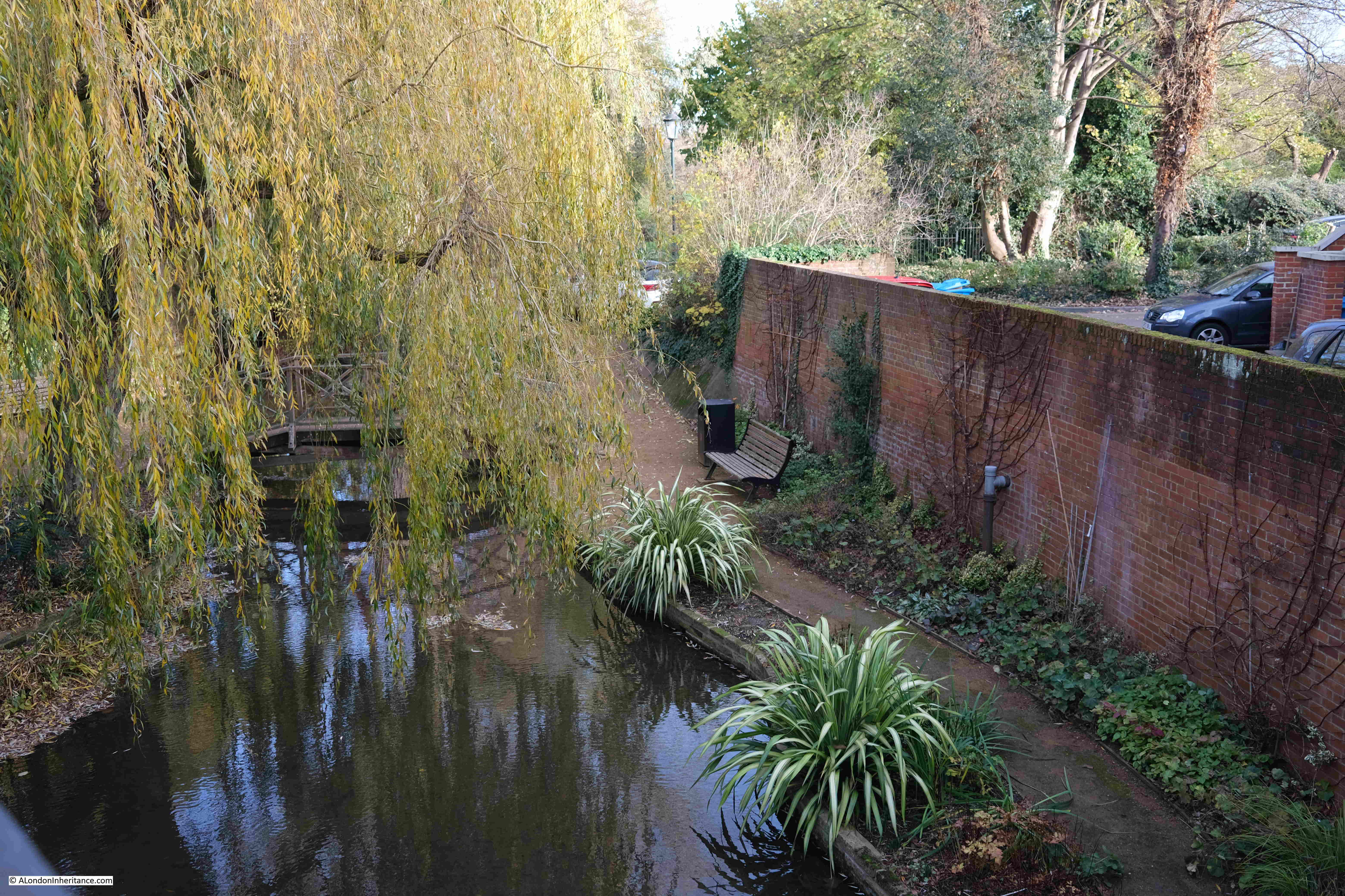
The stream is open water on either side of the bridge, however towards where the stream originates and then renters the Thames, the stream is contained within a culvert which gradually became silted up, and for many years there was no flow in the stream.

In the last few years there has been a campaign to open up the stream. The culvert has been cleared of silt, and Barnes Pool is now flowing through Eton between two points on the Thames:

Barnes Pool

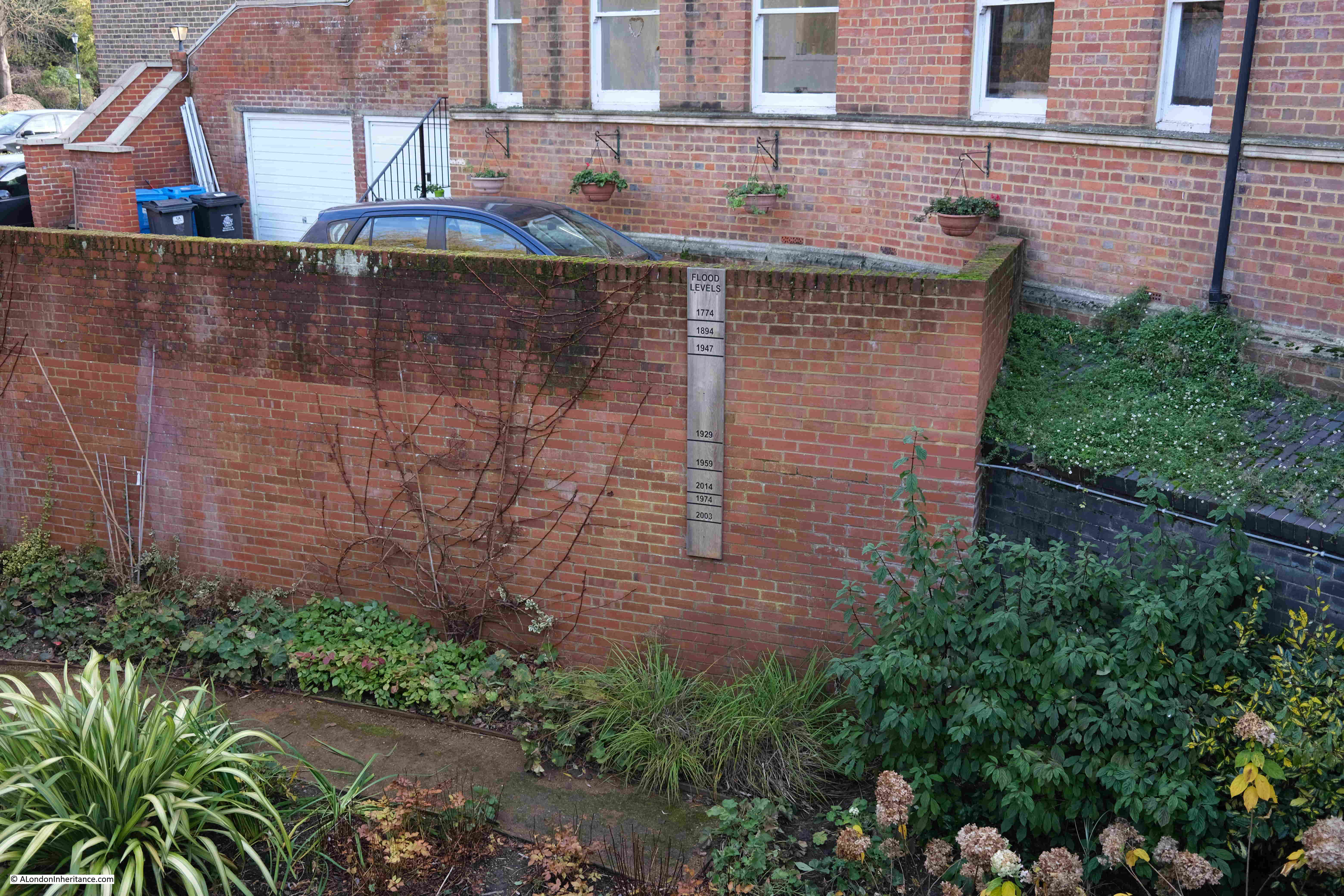
Whilst Barnes Pool looks a very small stream of water today, before the culverts silted up, the stream could flood during periods of high rainfall, and on the brick wall next to the stream is a marker recording the heights of previous floods, with the highest recorded in 1774 when the flood almost reached the top of the wall (which obviously was not there at the time).

Barnes Bridge

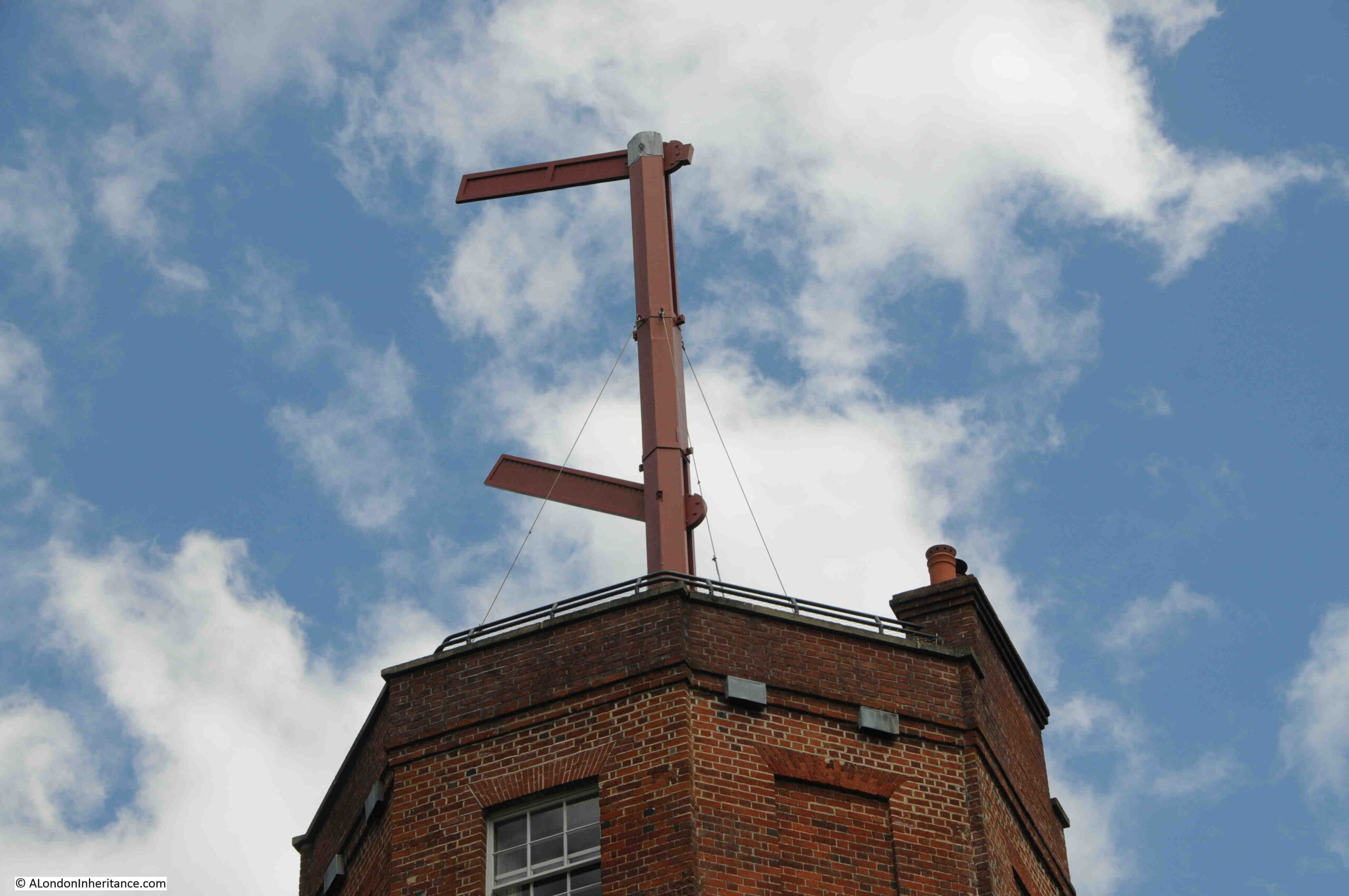
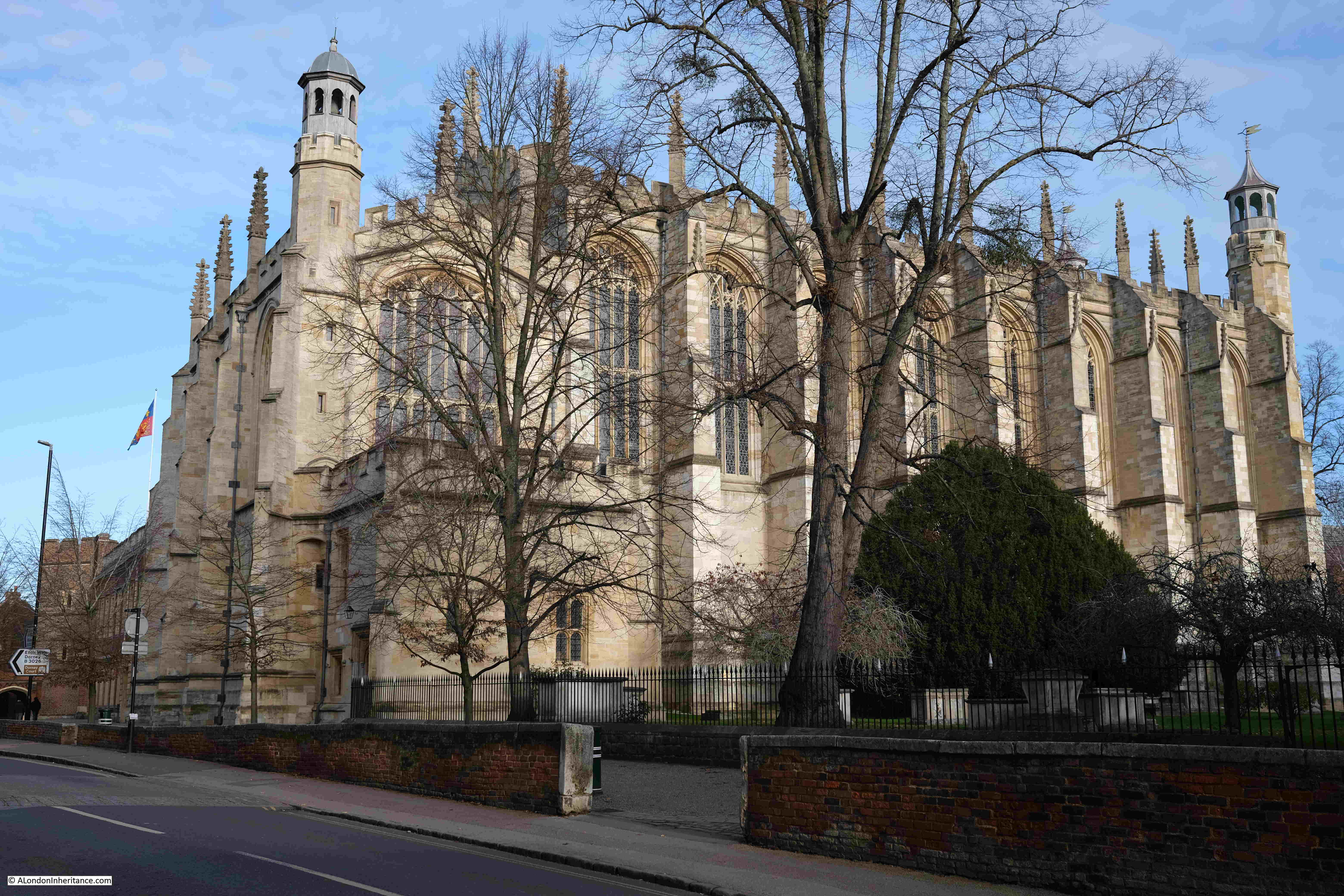
St Mary’s Chapel, Eton:

Eton Chapel

M.R. James became Provost of Eton in 1918, and in the announcements of his new role, there is no mention of his ghost stories, the first of which were published in book form in 1904. He appears to have been the logical candidate for the role of Provost, as this report from the “The Mail” on Wednesday, 31st of July 1918 explains:

“Dr. Montagu James Appointed – Our Cambridge correspondent is officially informed that Dr. Montagu Rhodes James has accepted the appointment of Provost of Eton as from next Michaelmas Day. Dr. James has been Provost of King’s since 1905, and was Vice-Chancellor in 1913 and 1914.

The appointment of Dr. James has always been regarded as inevitable at Eton, where it will be universally popular. A devoted Old Etonian, and head for the past dozen years of the sister college at Cambridge, he has already been a member of the Governing Body of Eton during that period, and has latterly sometimes presided over it. The selection by the Crown of a layman marks a breach with recent practice, though it is not unprecedented. Dr. James, however, takes high rank as a theologian no less than as a brilliant scholar. Moreover, he has been Vice-Chancellor of the University of Cambridge; so that he will bring to Eton not only a tradition of sound learning, but a great experience of academic administration.”

He was installed as Provost of Eton in October 1918, with the King’s representative present (the Dean of Windsor), and the Headmaster of Eton, with speeches and addresses to the new Provost being read in Latin.

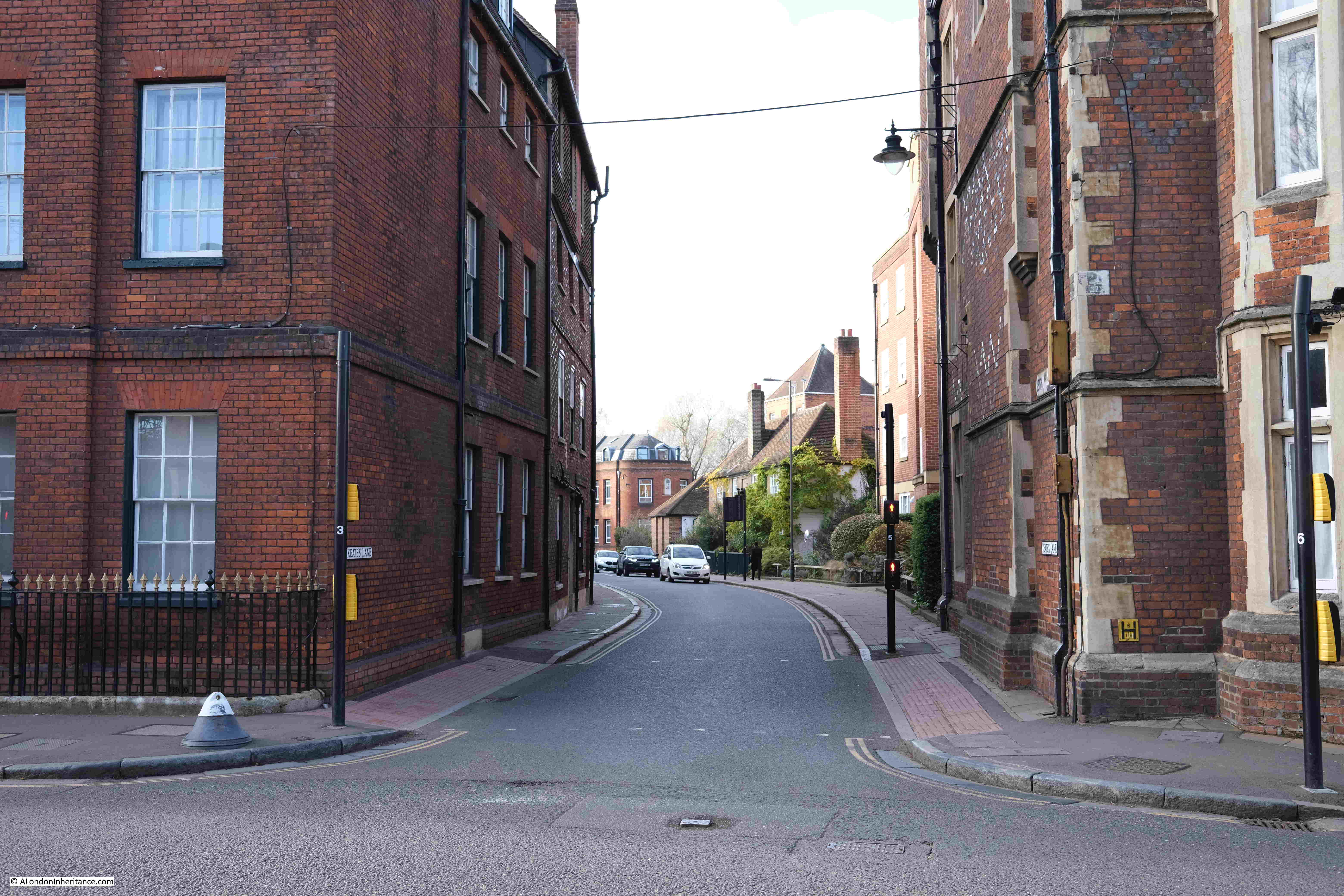
Opposite the chapel is Keates Lane, and this was the route out of Eton to find M.R. James grave:

Ghost Story for Christmas

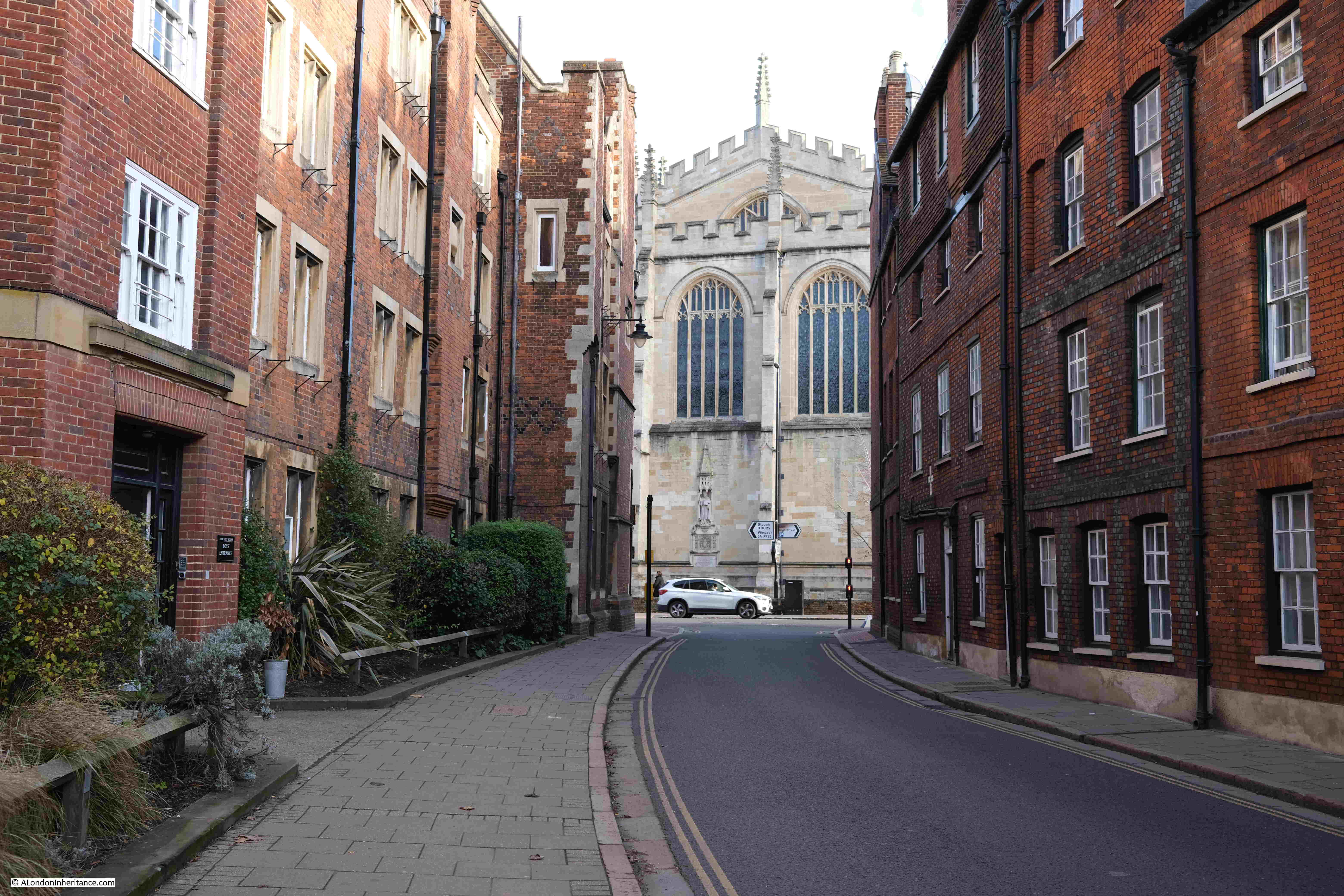
View from Keates Lane back to the chapel, with buildings of the college on either side of the street:

Ghost Story for Christmas

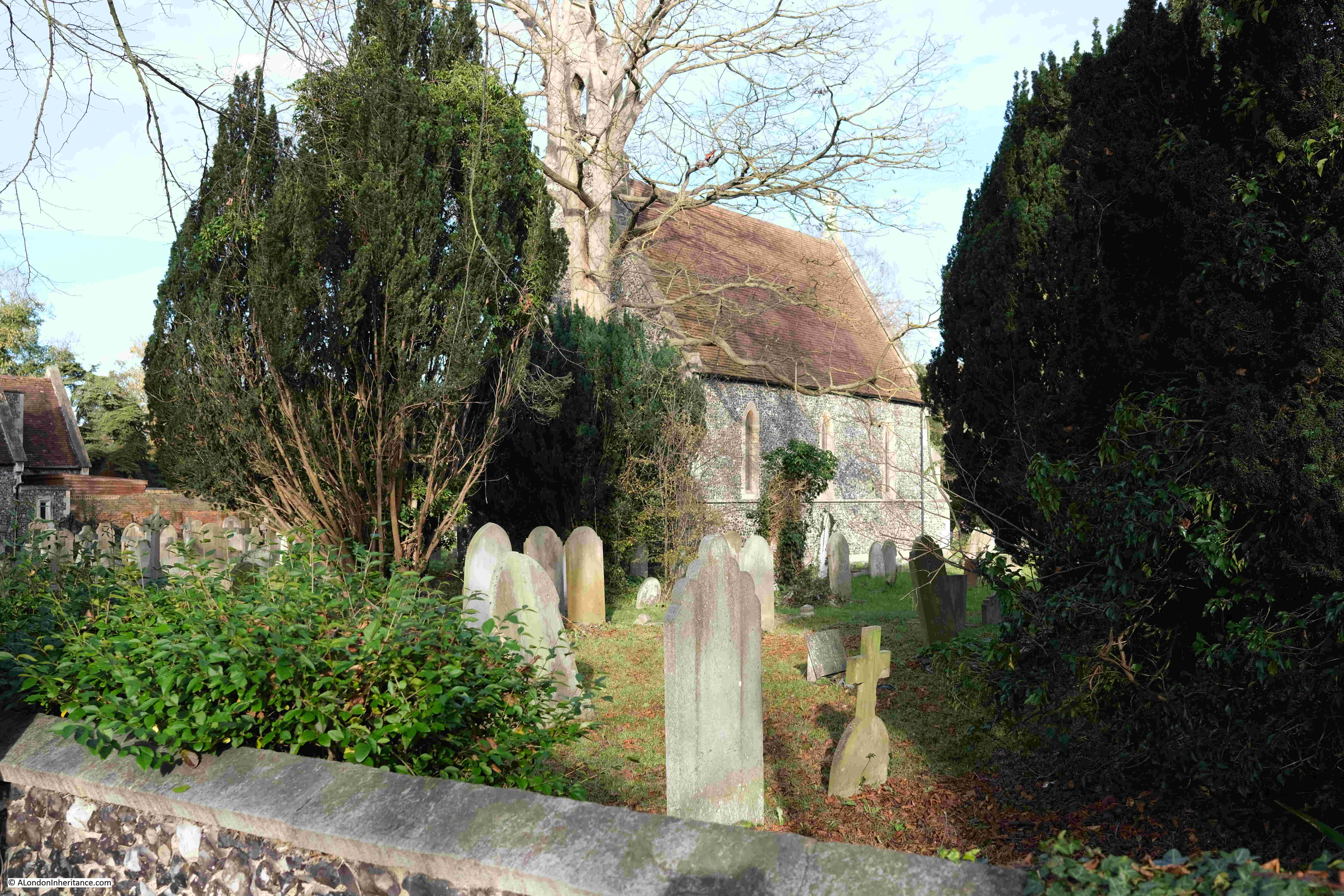
Keates Lane, then bends right and becomes Eton Wick Road, and after a short walk, I came to the chapel and graveyard:

Ghost Story for Christmas

I have circled the chapel and graveyard in the following map. Windsor is to the south of the Thames, with Eton High Street running north, from the bridge over the Thames up to the centre of the town, where a left turn into Keates Lane takes you to Eton Wick Road, and then the chapel (Map © OpenStreetMap contributors).

Eton Wick

Visiting churches, abbeys, monasteries and historic locations in general, as well as the towns and countryside of Suffolk and Norfolk appear to have been passions of M.R. James, and clearly influenced his ghost stories.

I have copies of two guide books that he wrote and which were based on his own travel and research.

The first, “Abbeys” was published in 1925, rather strangely by the Great Western Railway, Paddington Station, and although the title of the book is simply Abbeys, the focus is on the west of the country, so presumably fitted well with the Great Western Railway network.

The book includes a large map of the Great Western Railway, showing Cathedrals, Castles and Abbeys, so the book really acts as a guide for all the places you could visit by taking a train from Paddington Station.

M.R. James Great Western Railway map of abbeys

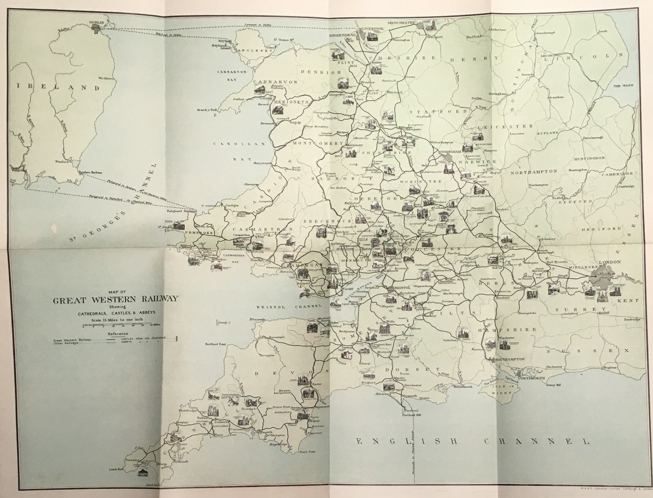
M.R. James second guide book was of Suffolk and Norfolk, and described as a “Perambulation of the two counties with notices of their history and their ancient builds”. This book was published in 1930 by J.M. Dent and Sons, so was not a guide book for a railway company.

Reading the two books it is clear where much of James inspiration for his ghost stories comes from. His descriptions of Norfolk and Suffolk align with many of his stories, for example, his story “Oh, Whistle, and I’ll Come to You, My Lad” was set on the Suffolk coast, where a Cambridge Professor on a golfing holiday finds an old whistle while exploring the ruins of an ancient Templar building.

He then sees the outline of a person running after him on the beach, and also standing on the beach looking at his hotel room. After cleaning the whistle and blowing on it, he is troubled with bad dreams, sounds in his bedroom and the sheets on the second bed in his room being crumpled as if someone had slept in the bed.

The climax of the story comes on the second night when a figure rises in the room, and the Professor is backing towards a window, only to be saved when another guest bursts into the room.

Although I was too young to see it when first broadcast, the BBC’s 1968 version of the story with Michael Horden playing the Professor is really good and brings across the wild and open landscape of the coast, and the growing tension of the story.

Horden brilliantly portrays a probably rather reclusive, scholarly, professor. A man who is completely confident in his rational view of the world – a view that is completely shaken by the end of the story.

The 1968 version of “Oh, Whistle, and I’ll Come to You, My Lad” can be found on YouTube.

The book also includes drawings of a number of bench end carvings. These are the carved depictions of animals, human figures etc. which can often be found on the end of benches and pews in churches.

These featured in the story “The Stalls of Barchester Cathedral”, where they appear to come alive and haunt a cleric who has murdered an aged Archdeacon at the cathedral

The 1971 BBC production of the Stalls of Barchester Cathedral as their ghost story for Christmas can be found on YouTube here.

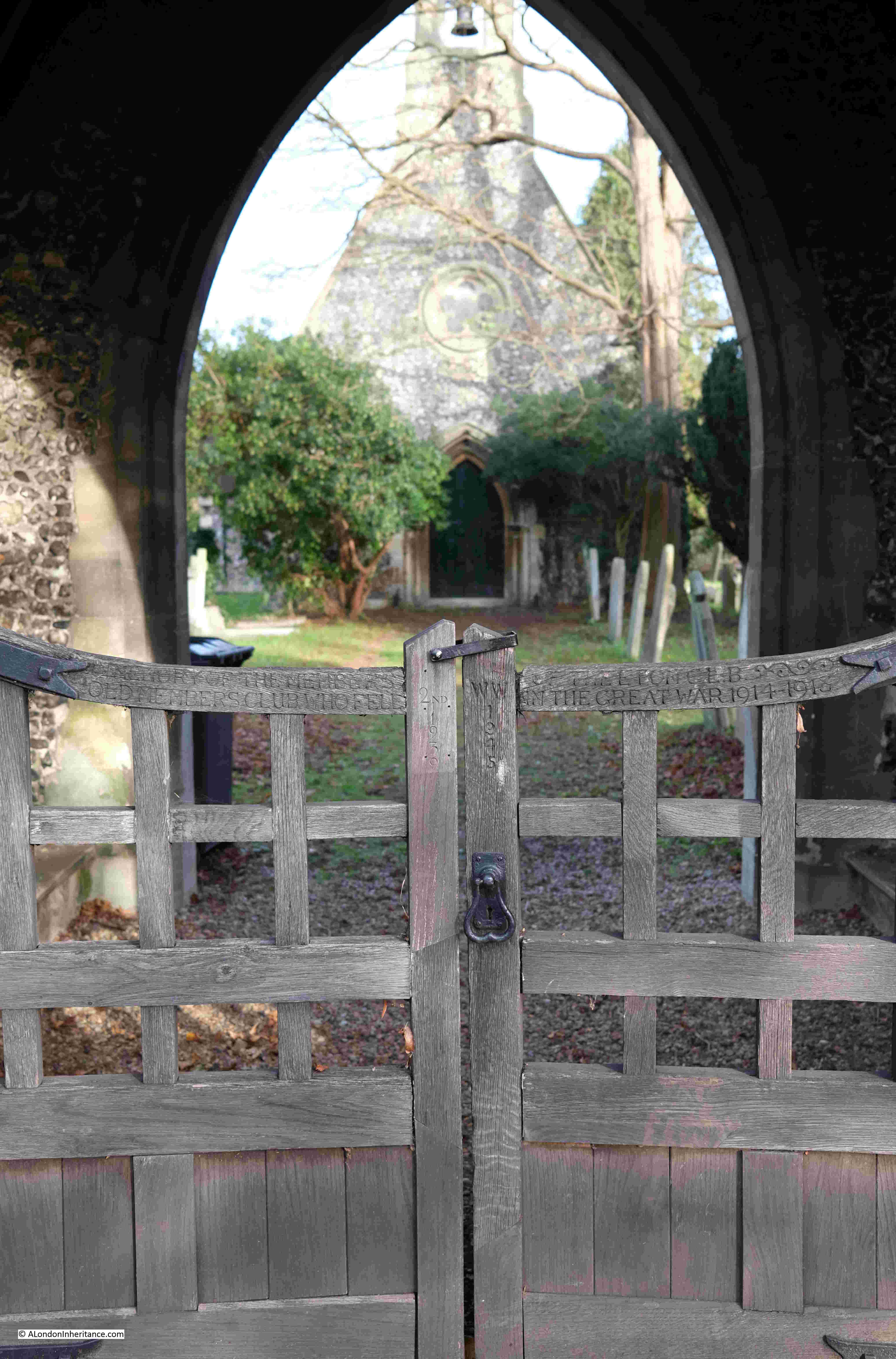
The gate leading from the road into the graveyard and chapel:
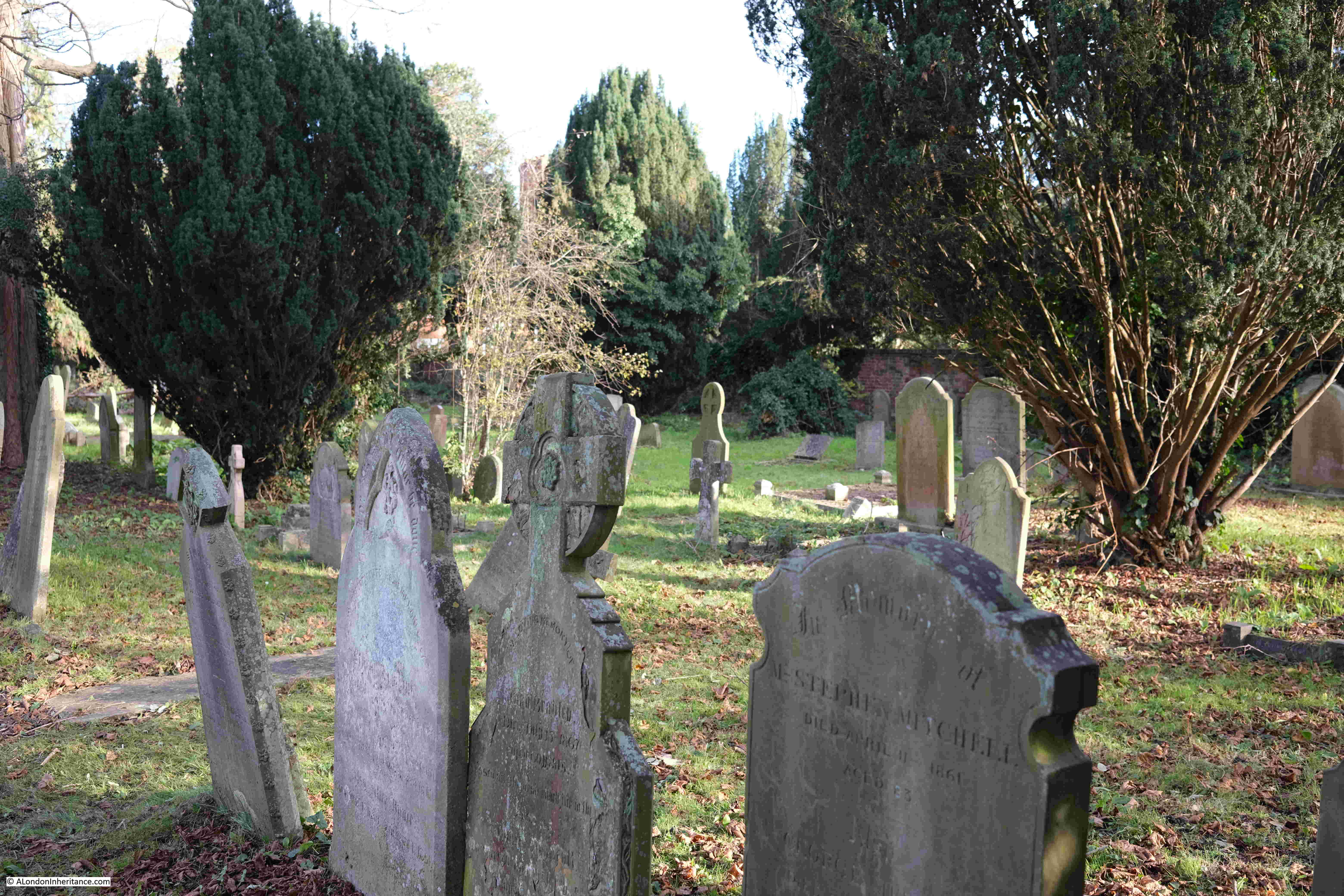
Ghost Story for Christmas

The graveyard:

Ghost Story for Christmas

Looking back at the gate into the graveyard:

Ghost Story for Christmas

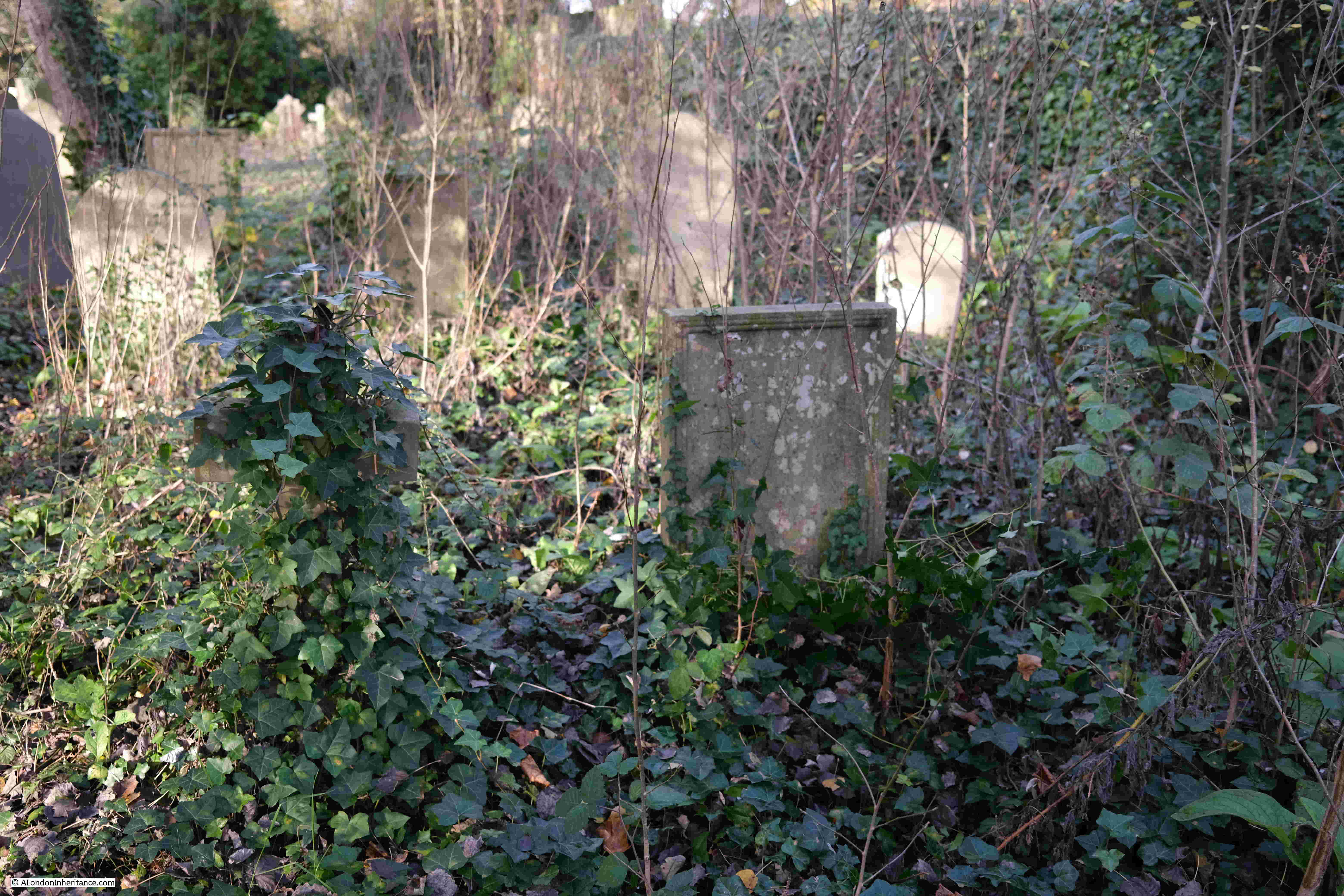
M.R. James grave is at the back of the graveyard, and similar to what could be expected in an M.R. James ghost story. It is in a rather overgrown part of the graveyard. Being December, much of the vegetation had died down, but I still had to walk through Ivy and the thorn covered stems of dead bramble growth.

In the following photo, the gravestone is the small, white stone on the right:

M.R. James grave

The gravestone of Montague Rhodes James:

M.R. James grave

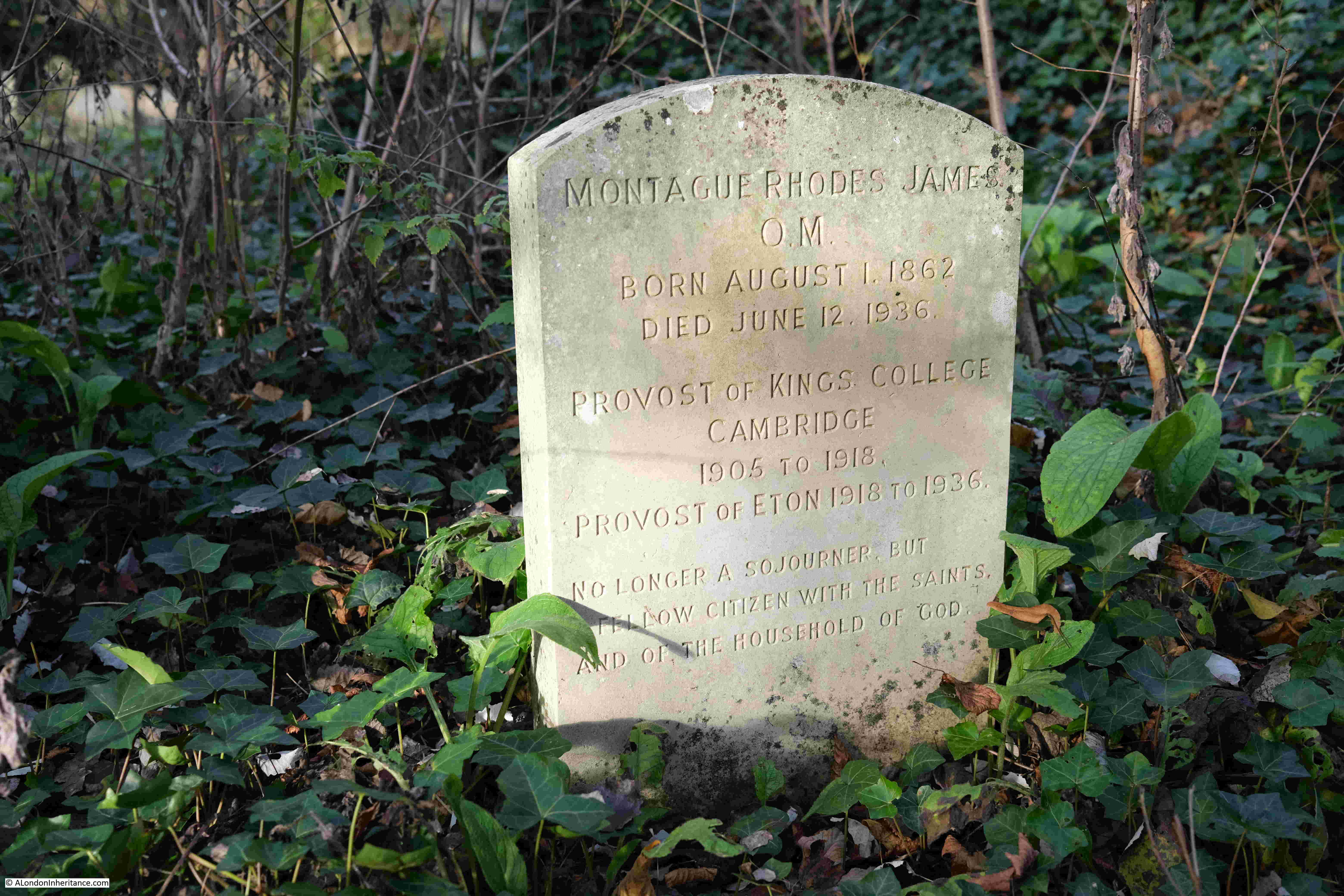
The grave is surprisingly simple. The gravestone records the dates of his birth and death, the dates of his time as Provost in Cambridge and Eton, along with the following inscription:

“No longer a sojourner, but a fellow citizen with the saints, and of the household of god.”

The area around the grave is overgrown, however the gravestone is clean and in good condition, which I believe is down to a campaign some years ago to clear the grave, although nature has now reclaimed much of the space.

Fortunately I did not find a whistle sticking out from between the leaves of the ivy.

A number of newspapers carried news of the death of M.R. James, and a brief obituary:

“DEATH OF PROVOST OF ETON – Mediaeval Authority and Prolific Author. The provost of Eton, Dr. Montague Rhodes James, died at his house, The Lodge, Eton, yesterday. he was 73.

Dr. James had been in ill-health since January of this year, and in April his condition became serious, but he made a satisfactory recovery.

As recently as last Thursday, at the Fourth of June celebrations, he was wheeled round the college playing fields, where he talked to a number of old Etonians.

Immediately he died the Eton flag, bearing the arms of Henry the Sixth, founder of the College, was lowered to half-mast over Upper School.

Dr. James was one of the most erudite antiquaries and one of the most prolific authors of his age. The list of his literary works fills nearly a page of ‘Who’s Who”.

He was an authority on ancient Christian manuscripts, and no surprise was evoked when in 1930 the Order of Merit was conferred upon him in recognition of his scholarship and of his eminent contributions to mediaeval history.

Ghost Stories – These serious studies, however, did not represent the sum total of his literary activity. He found time to write ghost stories – stories which would have won him wider fans but for the great reputation which he had earned in other spheres.

It was at Eton that Dr. James was educated, proceeding afterwards to King’s College, Cambridge, where he had a distinguished career, gaining the Caius Prize in 1882, and becoming Bell Scholar in 1883, and Craven Scholar the following year.

He was Provost of King’s from 1905 to 1918, and Vice-Chancellor of Cambridge University from 1913 to 1915.

Among other offices he held was that of a Trustee of the British Museum. His human quality was shown by his influence on youth.

‘The best things in life are not cars, wireless, flying, dirt track, or any other racing, league matches, or the pursuit of wealth’ he once said.

‘The best things are presented by the Bible, Shakespeare, Handel and Dickens, the Elgin Marbles and Salisbury Cathedral, the open country, the sea and the stars; the knowledge that all these may be made to disclose; honest games which are played and not merely looked at.’

His recreations were patience and piequet.”

Many aspects of his life can clearly be seen in his ghost stories. His love of Norfolk and Suffolk, religious buildings, mediaeval history, the academic life and institutions such as Cambridge and Eton.

What is not clear is how similar to the rationale scholar (the lead in Oh, Whistle, and I’ll Come to You) he was, or whether he had some belief in the supernatural, however I suspect the sentence “the knowledge that all these may be made to disclose” from his obituary hints more towards the rationale scholar.

For me, I have to thank M.R. James for some of the best programmes of Christmas TV as I was growing up, as well the published versions of his ghost stories which I have read and reread several times.

The British Film Institute have a brilliant collection of these programmes on DVD, they can be found here. They are well worth a watch during the dark winter’s evenings.

As well as M.R. James, the 1970s were a golden period for TV ghost stories, such as Charles Dickens story the Signalman with Denholm Elliot.

There were also other programmes, some of which had a bit of a moral story to them. Many of these have been on YouTube although several have now been removed due to copyright claims by the BBC.

One that is still (currently) online is The Exorcism, part of the BBC’s Dead of Night series. Broadcast in 1972 it tells the story of a couple who have moved from London and restored a derelict cottage in the Kent countryside – “still within easy distance of London”.

Another couple arrive and during the course of a dinner party, the cottage starts to take on a malevolent character, and the end of the story reflects the story of some previous occupants.

I do not beleive this is on DVD yet, but would be well worth a purchase. As well as the clothes and attitudes of the early 1970s, it also offers a view on those with money who were starting to move out of London and buying up and restoring properties in the surrounding counties. The programme can currently be found here.

Another was “The Stone Tape” which told the story of what we would now call a technology startup, who were establishing a research base in a country house, part of which included some ancient walls.

The Stone Tape has Jane Asher in the lead role, and who had a mysterious fate at the end of the programme. It was written by Nigel Kneal and in many ways builds on his earlier story for Quatermass and the Pit, where ancient memories are still retained in their surroundings and can continue to influence the present. The Stone Tape is available online as a DVD, and is currently on YouTube here.

The Ghost Story for Christmas format has been revived over recent years, with Mark Gatiss recreating a number of M.R. James stories as well as some originals.

As for me, I am on the sceptical side, although I do know a number of people who claim they have seen ghosts.

One of the most convincing, and my own Ghost Story for Christmas was when I was driving down a country lane at night. There were stories about the lane, but the person in the car with me was unaware of them. As we drove up the lane she asked me if I had seen the person in the hooded yellow anorak walking along the side of the road. I had seen nothing even though the car lights were on full and it was a narrow lane, and there was nothing to be seen in the red glow of the rear lights.

And with that, and for my last post of 2022, can I wish you a very happy and peaceful Christmas, however you are celebrating (or not), and wherever you are, and thanks for reading my posts over the year.

alondoninheritance.com

Euston Station and HS2 – A 2022 Update

For the past five years, I have written an annual post on the work around Euston to create the extension to the station for HS2, recording the area from before work started to some point in the future, when the new station will be operational.

My first post was back in 2017 and covered St James Gardens, just before they were closed for excavation.

My second post in 2018 walked around the streets to the west of the station, as buildings began to close, and the extent of the works could be seen.

I then went back in 2019 as demolition started.

In 2020, demolition was well underway and St James Gardens had disappeared, and the associated archaeological excavation had finished

And in June 2021 I went back for another walk around the edge of the construction site.

It has been on my list to revisit for a 2022 update, but it always seemed a lower priority to other places, and with the end of the year approaching, I really wanted to walk the edge of the site again. After a morning in Fitzrovia in early December, the afternoon left time to visit Euston.

It was a lovely sunny, but cold, December day. Whilst the clear sky was welcome, the resulting low sun produced deep shadows which do not work very well with photographing scenes in a built area, but it was my last chance for 2022.

The size of the construction site is remarkable. In front off, and to the west of Euston Station, along Hampstead Road, up to the point where the rail tracks from Euston cross under Hampstead Road. The construction site then extends west alongside the rail tracks.

There continues to be background rumblings about the cost of HS2 and that it should be cancelled. Walking around the Euston site demonstrates what has been put into the site so far, and the sheer size. If it was cancelled what would happen to the space – another place of random towers as with Vauxhall?

The name HS2 I suspect is part of the project’s problem. Whilst it will offer a faster journey, the main benefit seems to be the extra capacity released on the existing lines by moving fast trains to the HS2 route. This extra capacity allowing services to improve to the places along the route – assuming there is the money and political will to do so.

Whilst the scale of the project at Euston is remarkable, this is only the London terminus of the route. There is a considerable amount of work along the whole of the route, and if you have driven along the M25, just north of the M40 junction, the massive work site can be glimpsed where tunneling starts on the 10 mile tunnel under the Chilterns.

Back to Euston, and the following map shows the area where work is underway, which I have outlined in red. There are two circled places which I will come to later in the post(Map © OpenStreetMap contributors).

Euston HS2 construction site

This year, I started in Euston Station:

Euston Station

Then headed outside to see the front of the station, here the western side:

Euston Station

And the eastern side of the station:

Euston Station

In the forecourt of the station, is a statue to one of those buried in the cemetery at St James Gardens. An area where the graves have been excavated and the gardens now part of the overall construction site. See the 2017 post for a walk through St James Gardens. The statue is of Matthew Flinders:

Matthew Flinders

Matthew Flinders was born in Lincolnshire on the 16th of March 1774. He joined the Royal Navy and in the early years of the 19th century he mapped much of the coast of Australia, and was the first to demonstrate that Australia was one single continent.

His chart of Australia, or Terra Australis, was published in 1814. Although the name Australia had been in use, Flinders use of the name for his chart, was the first to apply the name to the overall land mass of the country. 

He had a lengthy return to London, however after his return his health deteriorated rapidly, His life at sea had taken a considerable toll on him, and he died at the age of 40 on the 19th of July 1814.

A brief announcement of his death in the London Evening Mail gives a hint of the challenges he had faced: “On Tuesday last, Captain Matthew Flinders, of the Royal Navy, greatly lamented by his family and friends. This Gentleman’s fate has been as hard as it has been eventful. Under the direction of the Admiralty, he sailed in 1801, on a voyage of discovery to Terra Australis; where, after successfully prosecuting the purposes of his voyage, he had the misfortune to run upon a coral rock and lose his ship: out of the wreck he constructed a small vessel that carried him to Mauritius, where, shocking to relate, instead of being received with kindness, as is the practice of a civilised nation to nautical discoverers, he was put in prison by the Governor and confined for six years and a half, which brought upon him maladies that have hastened his death. Fortunately for mankind and his own name, he survived a few days for finishing of the printing of the account of his voyage.”

His account of the voyage was published on the 5th of December 1814 as two volumes and “one very large volume, folio of Charts, Headlands and Botanical subjects”.

He died in a street roughly where the BT Tower is today and was buried in the burial ground for the parish of St. James Piccadilly, which was in use between 1790 and 1853, and which became St James Gardens until becoming part of the Euston HS2 construction site.

Matthew Flinders grave was discovered during the excavations to recover the bodies buried in the gardens, and his remains are due to be reburied at St Mary and the Holy Rood church in Donington, the village of his birth.

The statue, by sculptor Mark Richards, was initially unveiled at Australia House in 2014, before being moved to the forecourt of Euston Station.

Office block at the eastern edge of the forecourt: 

Euston Station

Directly in front of Euston Station is an open space, where the Flinders statue is located. There is then a row of office blocks, under which is a bus station:

Doric Arch pub

And a pub, the Doric Arch, part of which can just be seen in the above photo, and the following photo is one I took a while ago, after dark;

Doric Arch pub

The entrance to the pub, and toilets, occupy the ground floor, with the main pub on the first floor, which is surprisingly good, given its location and modern construction in the base of an office block. Despite the appearance in the above photo, it can also get very busy.

The Doric Arch was originally called the Head of Steam, but changed name to the arch that once stood in front of Euston Station when the pub was taken over by Fullers around 2008.

The Doric Arch is still run by Fullers, and according to the pub’s website, one of the stones from the original Euston Arch after which the pub is named, is on display behind the bar. I have no idea how I have missed this, but it is a good excuse for a return visit.

The pub sign is now an image of the Euston arch:

Doric Arch pub

Buses queue to leave their stops, underneath the office block in front of Euston Station:

Euston Station bus station

In front of the office block is the London and North Western Railway War Memorial. Designed by the railways’ architect, Reginald Wynn Owen, to commemorate the railway company’s workers who died in the first world war:

Euston Station war memorial

The following photo shows the memorial in the same position, prior to the demolition of the original Euston Station and hotel:

Euston Station war memorial

Entrance to Euston Station, after removal of Doric Arch cc-by-sa/2.0 – © Ben Brooksbank – geograph.org.uk/p/2991077

On the right of the above photo is one of the gatehouses that are still on either side of the entrance to Euston Station. The gatehouse can still be seen today, although the gardens that were behind the gatehouse, running alongside Euston Road, are now fenced off and are part of the considerable area of works surrounding the station.

Euston Station

Walking to the west of the station, and this is the view along Melton Street, which is now closed off, apart from being a construction site access gate:

Melton Street

To the right of the above photo is the taxi drop off and pick up point for Euston Station:

Euston Station taxi rank

There is still a walking route to the west of the station, along Melton Street, however this is lined by hoardings on either side:

Euston Station

The western walking route into the station:

Euston Station

Continuing on along Melton Street, with the station on the right:

Euston Station

Another construction access gate:

Euston underground station

Where on the corner of what was Melton Street and Drummond Street is the original Euston station of the Charing Cross, Euston and Hampstead Railway. The station is one of Leslie Green’s distinctive station designs, and whilst all the buildings surrounding the station have been demolished, it still survives, probably due to all the infrastructure within and below the station (I visited the tunnels below in this post):

Euston underground station

From alongside the station, we can look down what was Cardington Street. It was along here on the left that St James Gardens were located:

Cardington Street

To exit the overall Euston site, the walker heads west through a corridor lined with hoardings (a theme of the entire site), towards Drummond Street:

Drummond Street

Looking back, and the route is signposted to Euston Station:

Euston Station

A glimpse between the hoardings shows the size of the construction site running north from Euston Station:

HS2 construction site

This is the view to what was the corner of Cobourg Street and Euston Street. The Bree Louise pub was just on the left of the photo:

Cobourg Street

Looking north along Cobourg Street which is now fenced off, apart from the footpath to the left:

Cobourg Street

At the end of Cobourg Street is another gate to the main construction site:

HS2 construction site

And on the corner of Cobourg Street and Starcross Street, the Exmouth Arms is still there, and still open (small circle in the map at the start of the post):

Exmouth Arms

Just behind, and to the west of the Exmouth Arms is a new building:

HS2 construction site

At the end of Starcross Street are these school buildings (large circle in the map at the start of the post):

 Maria Fidelis School

The buildings were home to the Maria Fidelis School.

To free up the school site, HS2 have built a new school between Drummond Crescent and Phoenix Road, and the site in Starcross Street is now closed.

HS2’s plans for the school, also reveal the use of the new building between the school and the Exmouth Arms. From the HS2 website, the school and new building will “include welfare accommodation for HS2 site and management staff, and a Construction Skills Centre, including training rooms, workshops and interview rooms”.

The following view is the best I could get of the front of the old Maria Fidelis School, which shows a typical early 20th century brick school, with central curved section, and the playground area on the roof which is surrounded by metal fencing:

 Maria Fidelis School

We have now reached the Hampstead Road, and the following view is looking north. Hoardings continue to screen off the construction site, and as well as the standard information panels, they are covered in site and health and safety information:

Hampstead Road

Looking down what was the northern end of Cardington Street, where it joined Hampstead Road:

HS2 construction site

Where to the right of the above photo there is a large temporary office complex:

HS2 construction site

Looking north from the old junction with Cardington Street, and construction works continue on both sides of the street. To give an idea of how far these works run, Mornington Crescent underground station is not that far after the tower blocks in the photo:

Hampstead Road

This is looking across Hampstead Road to where construction continues heading west, parallel to the existing railway tracks that run into and out off Euston Station.

Hampstead Road

Where there is another access gate:

Hampstead Road

The photo above and the photo below give an indication of the scale of HS2 construction works around Euston. In the above photo, work s continue for some distance from Hampstead Road west, parallel to the existing rail tracks.

At some point, a new bridge will be needed to take Hampstead Road across the extra railway tracks into Euston Station.

The works heading west of Hampstead Road in the above photos lead to the wonderfully named “Euston Cavern”, which is described in the HS2 Euston Approaches FAQ as “a very large, underground structure at the Parkway end of the worksite, to enable one tunnel to split into two, so that trains can access the tunnels from the necessary range of platforms at Euston”. This tunnel takes the tracks away from Euston and heads towards a new station at Old Oak Common.

In the photo below, I am looking south along Hampstead Road, with the hoardings fencing off the construction site disappearing into the distance. Although it cannot be seen, Euston Station is to the left, some considerable distance across the construction site.

Hampstead Road

The HS2 construction works around Euston are considerable, and construction on the line is continuing all the way to Birmingham.

My last walk round the site was in June 2021, eighteen months ago. From alongside the construction site, not too much appears to have changed. The fenced off area has expanded slightly, but looking in from the outside, it is still a massive ground level construction site.

According to the HS2 website, phase one of the route from Euston to Birmingham is scheduled to open between 2029 and 2033 – it will be fascinating to have watched the site evolve from the original streets, gardens and pubs to the latest iteration of Euston Station.

alondoninheritance.com

Boundary Markers in the City of London

I have written a few posts about the blue plaques that can be found across the City of London, and for today’s post I would like to illustrate another feature that can be found across the City’s streets.

Wards are still a part of the way the City of London is organised, and in previous centuries, the division of the City into Parishes was also a key feature, and the City Livery Company’s also owned various properties, as they still do.

There was a need to mark these boundaries and ownership of property. Boundaries also needed to be regularly reaffirmed to maintain the boundary, and this needed to be done in a way that was obvious to those who walked and lived in London’s streets, with a clear record, before the ready availability of detailed maps.

The way to do this was by physical markers on a building or street, to show a boundary, to show in what part of the City’s parishes or Wards buildings belonged, or who owned the building.

There must have been hundreds of these within the City, and even today there are very many to be found, with almost every City street having a marker of some type.

In this post, I would like to highlight a selection of the boundary and ownership markers that can still be seen across the City’s streets.

The first is on the City of London Magistrates Court on the corner of Queen Victoria Street and Walbrook. I have arrowed the marker which is low down on the building:

Walbrook Ward

Where there is a simple marker dated 1892 for the north-western boundary of Walbrook Ward:

Walbrook Ward

Many boundary markers have survived multiple rebuilding’s of a site, and can still be found on relatively recent buildings, such as the location arrowed in Cheapside:

Cheapside

On the left is a parish boundary marker from 1817 for St. M. M. This is for St Mary Magdalene which could be found on Milk Street. This was one of the many City churches destroyed in the Great Fire of 1666, but the parish boundary still survived.

Parish boundary markers

The boundary marker on the right is for the parish of All Hallows Bread Street, another church that is long gone, not in the Great Fire, but during the late 19th century when the City lost a number of churches due to declining numbers of parishioners.

There are another couple of plaques, the left plaque again for All Hallows, and the plaque on the right for St Mary-le-Bow (look closely to see how the right vertical of the letter M has been combined with the L):

Parish boundary markers

There are a number of boundary markers along King Street, including the pair shown in the following photo:

King Street

On the left is the marker for St Martin Pomeroy, which was in Ironmonger Lane, again another church lost during the Great Fire and not rebuilt:

Parish boundary markers

On the right is St Mary Colechurch, again lost during the Great Fire, but stood on the corner of Cheapside and Old Jewry. This is one of the older parish boundary markers in the City, dating from 1789.

Below are two boundary markers. On the left is St Mary-le-Bow and on the right, St Lawrence Jewry in Guildhall Yard. Both of these plaques date from the 20th century showing that they were still relevant, and being updated.

Parish boundary markers

Parishes had multiple boundary markers to show their boundaries with adjacent parishes, so another marker for St Martin Pomeroy:

Parish boundary markers

There are also markers recording the ownership of property, as on the side of the building in the following photo:

Grocers Company

Where on the left are the armorial bearings of the Grocers’ Company, and on the right those of the Goldsmiths:

Grocers Company

On the corner of Old Jewry and Frederick’s Place:

Old Jewry

There is a plaque with two dates, 1680 and 1775. I think this may be a parish boundary marker for St. Olave Jewry, a church that was demolished in 1888:

Parish boundary markers

I am not sure why there are two dates, and whether the plaque originally dates from 1680, and the 1775 date was added when the boundary of the parish was reviewed and confirmed.

In Princes Street, on the wall of the Bank of England:

Princes Street

There are multiple plaques, with top left, St Margaret Lothbury. Top right is St C.P. a plaque for the church of St Christopher which was on the site of the current day Bank of England. Bottom left is a second plaque for St Margaret Lothbury, 43 years after the plaque above.

Parish boundary markers

The plaques for St Margaret Lothbury are on the left as that was their side of the parish boundary, and the two dates show the years when the boundary was confirmed.

Plaques such as these now in the middle of a wall of a building show where the parish boundary would have been when the area was more subdivided into smaller streets and plots of land. Indeed Roque’s 1746 map of London shows Princes Street turning east at this point, into where the Bank now stands, and where the parish boundary would have run, as illustrated in the following map:

Parish boundary markers

In Lombard Street is another cluster of markers:

Lombard Street

Shown in detail below, on the left is a plaque of the Fishmongers Company, then is All Hallows, Lombard Street which was demolished in 1939, although the tower was moved to Twickenham, where it can still be seen (subject for a future blog post). Then there is a plaque of the Haberdashers Company, which must have been there to show property ownership of adjoining properties by the Fishmongers and Haberdashers. The plaque at lower right is showing the boundary of St Edmund, King and Martyr, a church which is still on Lombard Street:

Parish boundary markers

On the Marks and Spencer, at the entrance to Cannon Street station, are two plaques:

Cannon Street Station

On the left is the boundary marker of St Swithin, London Stone, a church that was badly damaged in 1949, and demolished in 1962. On the right is the boundary marker of another church lost during the Great Fire, the church of St Mary Bothaw, that stood on the site of Cannon Street station.

Parish boundary markers

Opposite Cannon Street Station is a plaque to St John the Baptist. Destroyed during the Great Fire, a church that originally stood on the banks of the Walbrook:

Parish boundary markers

Back on Cheapside, there is a small plaque on the first floor of a building:

Cheapside

The plaque has the arms of the Skinners Company:

Skinners Company

Markers showing ownership of property are often on the edge of a building, to show where the boundary is with the adjacent property, as shown in the photos above, and the photo below:

Haberdashers Company

Where there is a plaque showing the arms of the Haberdashers Company:

Haberdashers Company

On a wall in Great Trinity Lane are three plaques:

Great Trinity Lane

The plaque on the left includes the full name of the church, details the distance from the wall to where the boundary extends, and includes the names of the churchwardens in 1889.

Parish boundary markers

In the middle is St James, Garlickhythe. I cannot find the meaning of the H.T. plaque on the right. It does not have the “St.” prefix of a church, but not sure what else it could be.

In Carter Lane, on a building at the junction with St Andrews Hill:

St Andrews Hill

On the right is a plaque identifying the boundary of Farringdon Ward Within:

Parish boundary markers

And an FP plate on the left, which stands for Fire Plug. Apparently in the early days of the fire service, and when many underground water pipes were made out of wood, firemen would dig down to the water main and bore a small, circular hole in the pipe to obtain a supply of water to fight the fire.

When finished, they would put a wooden plug into the hole, and leave an FP plate on a nearby wall to alert future firefighters that a water main with a plug already existed.

That is just a small sample of the very many boundary markers and markers identifying property ownership, that can be found across the City of London. Considering how many must have been lost over the years, there must have been a considerable number, probably lasting to the early 20th century, identifying Ward boundaries, Parish boundaries and where the City Livery Company’s owned properties.

Of course, it is not just the City where these can be found, there are markers all over London.

As an example, the following view is looking towards Horse Guards, from Horse Guards Parade:

Horse Guards Parade

There is a central arch through the Horse Guards building, a route that has featured in recent royal events where processions will frequently pass through the arch, and a roof mounted camera follows processions through, however look to the roof of the arch as you walk through, and there are two parish boundary markers:

Parish boundary markers

On the right is St Margaret, Westminster, with the suffix of No. 6 which presumably means that this was the 6th marker in a series that marked the parish boundary.

I suspect the marker on the left refers to St Martin in the Fields, adjacent to Trafalgar Square.

These boundary markers are a fascinating reminder of the importance of the parishes and wards in the City of London, even how churches that were lost during the Great Fire in 1666, and not rebuilt, still have their parish boundaries marked on the streets.

Historic property ownership by the livery companies of the City can also be traced by the plaque on the walls of City buildings.

Once you notice them, you will find them on walls all across the City.

alondoninheritance.com

London to Portsmouth Semaphore – Chatley Heath

A couple of weeks ago I wrote about the route that the body of Eleanor of Castile took to reach London, and the crosses that were built to mark the route. For today’s post I am tracing another of the historic routes that link London with the rest of the country.

Back in the 18th century, the speed of communication was mainly dependent on how long it took a horse and rider to travel between the source and destination of a message. Routine mail would be carried by stage coach and urgent messages would travel via a horse and rider who could travel much faster, but would still be limited by the speed of the horse, conditions of the roads, weather need to change and rest horses etc.

In 1770, the average time taken between London and Portsmouth was around 17 hours, but with improvements to road surfaces and coach building, by around 1820 this had improved to 9 hours for the fastest coaches.

The very best horse and rider could cover the route in just under 5 hours.

It seems remarkable when today we can make an instantaneous mobile phone call from almost anywhere in the country to the other side of the world, that just two hundred years ago it would take a day to get a message and answer between London and Portsmouth.

Portsmouth was important as it was the site of a major naval dockyard, and with the frequent wars of the late 18th and early 19th centuries there was need to devise a system which could rapidly send messages between the Admiralty in London, and the naval dockyards.

The Napoleonic Wars of the later 18th century resulted in the Admiralty building a telegraph system that copied a system already set up by the French. This used a method where signaling stations were based at high points along the route between London and Portsmouth. At each station, there was a wooden shed with a shutter frame built above. The frame held six shutters in two columns, and each shutter could be opened or closed to send a message to the next station along the route.

It was claimed that a message could be sent between London and Portsmouth in just under 8 minutes.

At the end of the Napoleonic Wars the system was dismantled, with Napoleon being held on the Isle of Elba.

Not long after, Napoleon escaped and returned to France, and the state of war between England and France resumed. The Admiralty needed another, and more permanent line of communication between London and Portsmouth, rather than the temporary wooden sheds set up for the shutter system.

The Admiralty created a new signaling line comprised of stations using a semaphore system, where the positions of two moveable arms would signify a message to be sent along the chain.

The following print shows the Admiralty building in Whitehall. On the roof at the rear of the building, a tall post can be seen with two arms. This was the London end of the chain of stations between London and Portsmouth  (© The Trustees of the British Museum).

The Admiralty semaphore tower

Signaling stations were needed at high points on the route between London and Portsmouth. Each station was equipped with a post and signaling arms, and had an observer with a telescope to keep an eye on the adjacent stations in the chain for any message that needed to be sent onwards.

The following map shows the chain of stations from the Admiralty at top right down to the dockyard in Portsmouth at lower left  (© OpenStreetMap contributors):

London to Portsmouth semaphore route

The system was opened two hundred years ago, in 1822, and an article in Bell’s Weekly Messenger in September 1822 listed the stations as;

The Admiralty, Chelsea, Putney Heath, Kingston Hill, Cooper’s Hill, Chatley Hill, Pewley Hill, Bannicle Hill, Haste Hill, Holner Hill, Beacon Hill, Compton Down, Portsdown, Lumps Fort (Southsea) and Portsmouth naval dockyard.

In 1822 it was claimed that a message could be conveyed between the Admiralty in London to Portsmouth in one minute and a few seconds. This seems remarkable and must have been in ideal conditions, perfect visibility, and the staff at the stations were ready for the receipt and forwarding of a very short message. Reports of normal transmission times state that around 15 minutes was the time taken to send a message from one end of the chain to the other – still a remarkably short time.

There is one remaining, complete, semaphore tower on the line between London and Portsmouth, at Chatley Heath in Surrey. Indeed it is the only remaining complete semaphore tower in the country. It has recently been restored by the Landmark Trust who held an open day in the summer. so I went along to see this remaining example of two hundred year old communications technology that linked London with the south coast.

In the above map of the whole chain of stations, I have marked Chatley Heath with a red circle around the red dot.

The following map shows the exact location of the Chatley Heath semaphore tower, a very short distance from the M25 and slightly to the east of the A3  (© OpenStreetMap contributors):

Chatley Heath semaphore tower

Chatley Heath is part of a wider area of 800 acres of commons and rare heathland that is managed by the Surrey Wildlife Trust. There are paths across the heath, some of which are signposted to show the route to the semaphore tower:

Chatley Heath semaphore tower

The open day was on one of the hot days of summer, where the land was so dry following weeks with no rain, a big contrast as I type this, as it is cold, cloudy and there has been much rain over the last few weeks.

Following the path to the semaphore tower:

Chatley Heath semaphore tower

The following photo shows the first glimpse of the semaphore arms at the very top of the tower, just showing above the tree line in the distance in the centre of the photo:

Chatley Heath semaphore tower

Finally reaching the Chatley Heath semaphore tower. The one remaining, fully restored tower, and the tallest on the line between the Admiralty in London, and Portsmouth.

Chatley Heath semaphore tower

Each semaphore station was manned by a retired navy lieutenant and an observer, usually a retired sailor of the lieutenants choosing. The lieutenant would be in charge of the station, and the observer was responsible for using a telescope to keep an eye on adjacent stations to check for messages to be forwarded.

The very first officer at the Chatley Heath tower when it opened in 1822 was Lieutenant Edward Harris.

The Chatley Heath tower included accommodation with a small house built onto the base of the tower. The blocked up windows in the tower were probably done to save the cost of building and installing windows. The navy was exempt from window tax, so this would not have been the reason. The shape of the tower was also more cost effective than the complexity of building a circular tower.

The semaphore system used a code devised by Rear Admiral Sir Home Riggs Popham.

It was Popham who created the code using flags, allowing messages to be sent between ships at sea, and it was his code that sent the message from Nelson at the Battle of Trafalgar that “England expects that every man will do his duty”. He was involved in a number of naval actions, and assaults on enemy land forces across the world, but must have spent some time at home as his wife had at least ten children.

Popham’s semaphore code used two arms on a wooden post. Each arm could assume any position on either side of the post, so could be either horizontal, vertical, or at an angle of 45 degrees, pointing up or down the post.

This arrangement created enough positions using the two arms that every letter of the alphabet, along with the numbers 0 to 9, could all be transmitted.

The two arms and vertical post:

Chatley Heath semaphore tower

From 1963 until 1988 the tower was left empty. It was vandalised and had suffered a major fire. It was restored in 1988 by Surrey County Council and then passed to the Surrey Wildlife Trust.

The age and very exposed position of the tower resulted in further, gradual deterioration, with water being a problem, getting into the tower around the base of the post, and around the windows.

The Landmark Trust then took on the tower and commenced a full restoration project in 2020. The Landmark Trust has restored and runs some remarkable buildings across the country, and following a restoration, they rent out the buildings for short stays, and this is now the future of the Chatley Heath semaphore tower.

The restoration including fitting out the tower so that it would include accommodation, so today, walking up the tower to the roof includes a walk through a number of rooms, which include a lounge:

Chatley Heath semaphore tower

Kitchen:

Chatley Heath semaphore tower

And bedroom:

Chatley Heath semaphore tower

There is a second bedroom (the tower now sleeps 4) and a bathroom.

In the kitchen, the restored mechanism used to control the position of the arms can be seen:

Chatley Heath semaphore tower

Once on the roof, it is easy to see why this was the chosen location for the station. It is one of the highest points in the local area at 59 meters above sea level, with the land dropping by 10 to 20 meters in the area surrounding the station.

This is the view looking towards London:

Chatley Heath semaphore tower

Zooming in from the roof of the tower, we can see the towers of London in the far distance, the Shard to the right is just over 31km from the Chatley Heath semaphore tower.

Chatley Heath semaphore tower

The semaphore post and arms seen from the top of the tower:

Chatley Heath semaphore tower

Operating the semaphore was not without its dangers. The Hampshire and Southampton County Newspaper reported on the 15th of August 1825 that: “During the thunder storm on Wednesday last, E. Oke, the signal man belonging to the semaphore in Portsmouth, was knocked down and remained insensible for several minutes. The semaphore was at work at the time, and the man had his hand on the wheel, which turns the arms to communicate intelligence to the next station. The whole apparatus is composed of metal, which, of course, attracted the lightning. The Lieutenant, who was standing close by, did not experience the slightest inconvenience, neither was any serious injury sustained by the man or the buildings”.

View looking towards the south, the next station at Pewley Hill was somewhere in the distance:

Chatley Heath semaphore tower

Chatley Heath was to be the branching point for another chain of semaphore stations, which would have run all the way to Plymouth, however this chain was only completed a short distance after Winchester.

The London to Portsmouth semaphore system ran from 1822 until 1847 when it was made redundant by the coming of the railways and the electric telegraph. The London & South Western Railway connected London to the south coast at Southampton, Gosport and Portsmouth and the new electric telegraph was laid alongside the railway. This provided a far more reliable and cost effective means of sending messages between the Admiralty and the naval dockyard at Portsmouth.

The semaphore line was closed at the end of 1847, and the staff made redundant, which must have been a blow to them as the staff were usually at the end of their naval careers and other opportunities for employment would have been limited.

The views from the tops of the semaphore tower show what a high location this is relative to the surrounding land. As well as the towers of the city shown in an earlier photo, from the top of the tower we can just about see the arch over the Wembley stadium in the distance:

Chatley Heath semaphore tower

The location of the semaphore stations can often be found in local naming, with Telegraph Hill being used at a couple of the old station locations. there is a Telegraph pub in Putney named after the original shutter telegraph on Putney Heath. There are a number of Telegraph Roads and Telegraph Houses along the route.

The London to Portsmouth semaphore / telegraph route was one of many that were built during the early decades of the 19th century. The admiralty built a number of chains to enable communication with key dockyards.

There were also commercial telegraph chains set-up. One, by a Lieutenant Watson was created between Holyhead and Liverpool and reported the names of ships passing Holyhead on their way to the docks at Liverpool. This would enable ship owners to have advance information of when their ships would be arriving in port.

Lieutenant Watson devised his own code for the telegraph system. He may have also been responsible for creating another system from London to the coast. The following print shows Watson’s Telegraph, near Tooley Street  (© The Trustees of the British Museum).

Watsons Telegraph

This has a similar arrangement to the semaphore route between London and Portsmouth, however it uses two rather than one post, and it appears that one of the posts had two arms at the top. Presumably this arrangement was to allow more complex messages to be sent at a faster rate.

The Chatley Heath semaphore tower is a wonderful reminder of a time, only 200 years ago, when it took hours to send a message the distance from London to Portsmouth, and the technological change that started to speed up communication.

If you fancy a stay in an early 19th century semaphore tower, the page on the Landmark Trust site with information and booking is here.

alondoninheritance.com