Monthly Archives: August 2022

Two Cornhill Churches – St Peter and St Michael

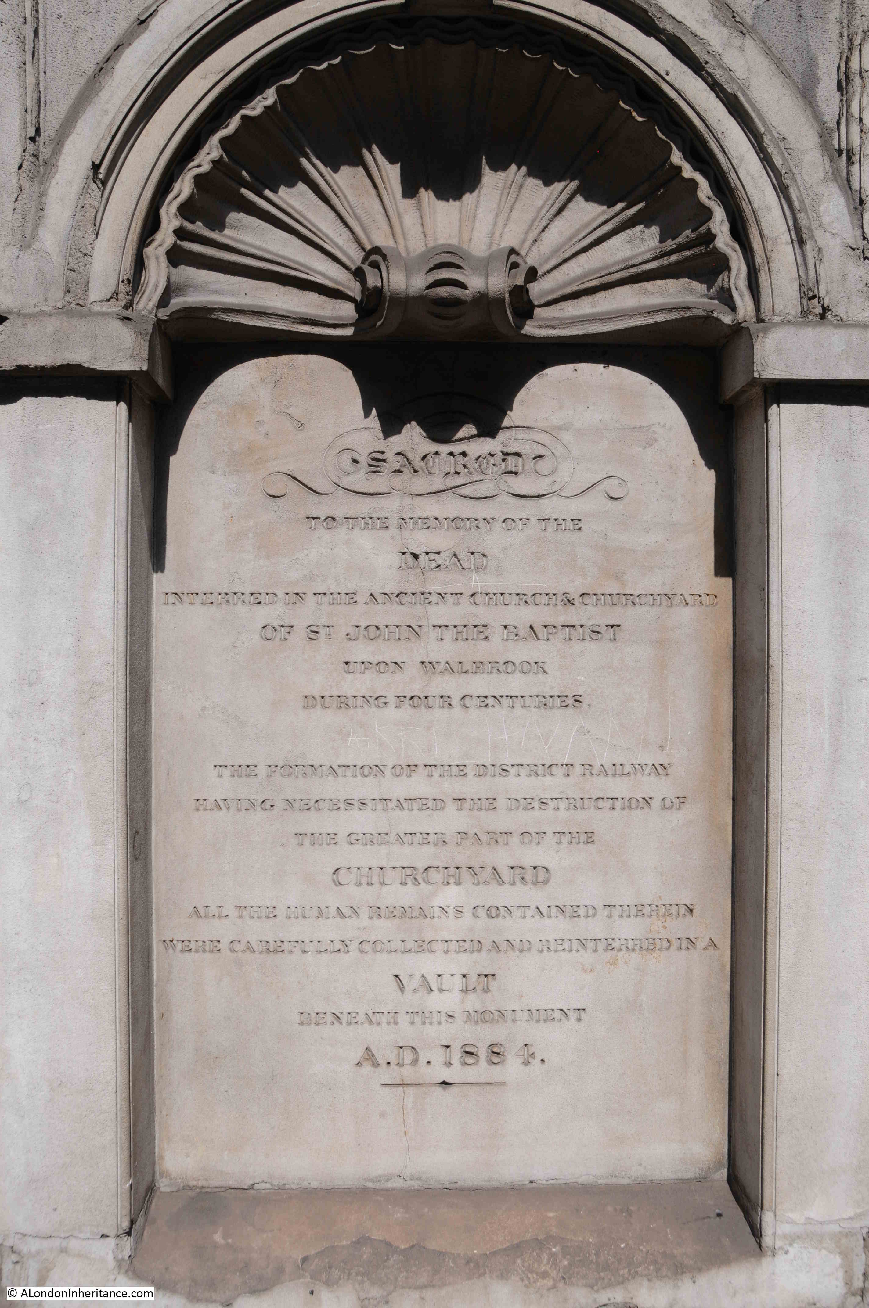
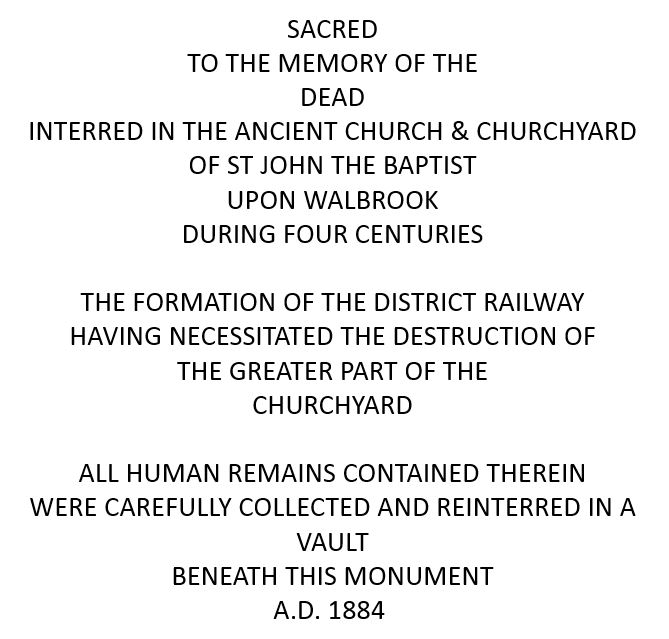
A church that was not rebuilt after the 1666 Great Fire along with the churchyard lost in the late 19th century was the subject of last week’s post. For today, I want to take a look at two churches that have survived, both very old churches, and at the eastern end of Cornhill in the City.

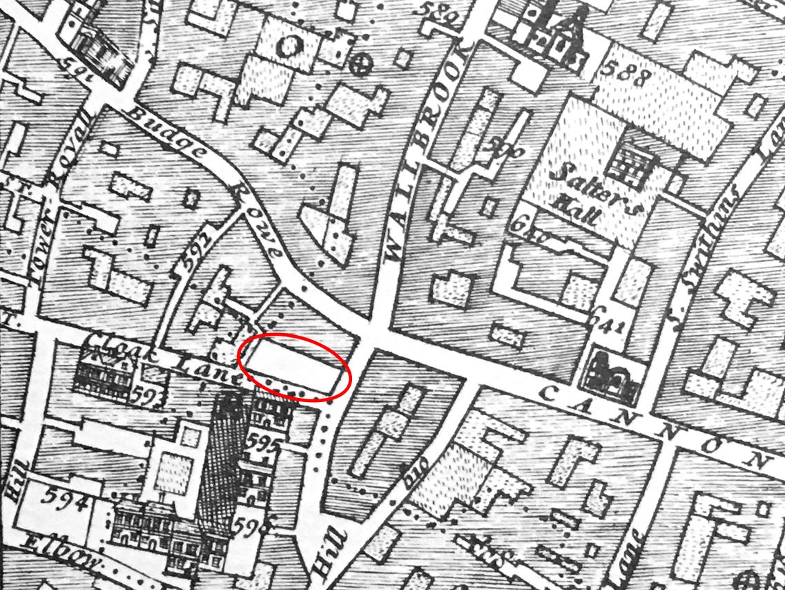
In the following extract from John Rocque’s 1746 map of London I have circled St Peter-upon-Cornhill (red) and St Michael Cornhill (orange):

Map of Cornhill

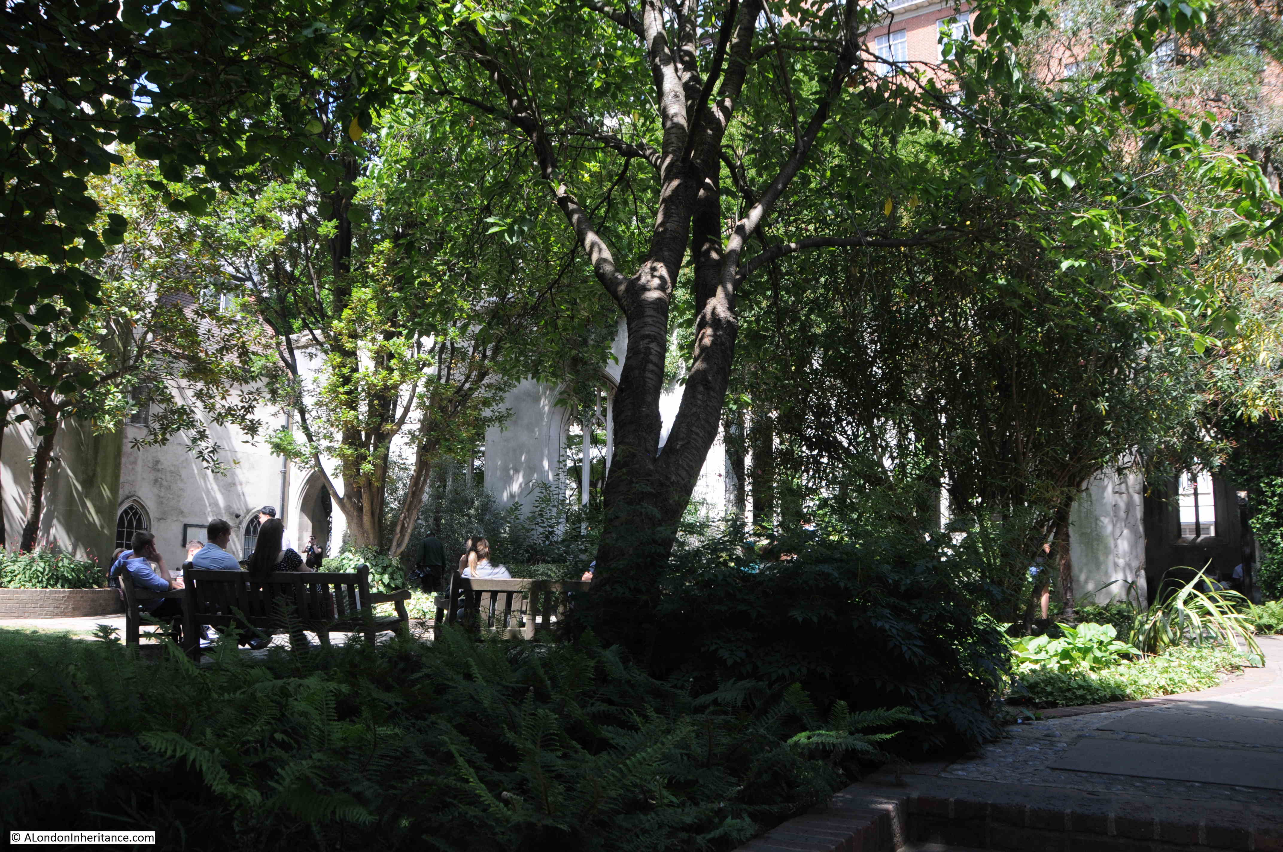
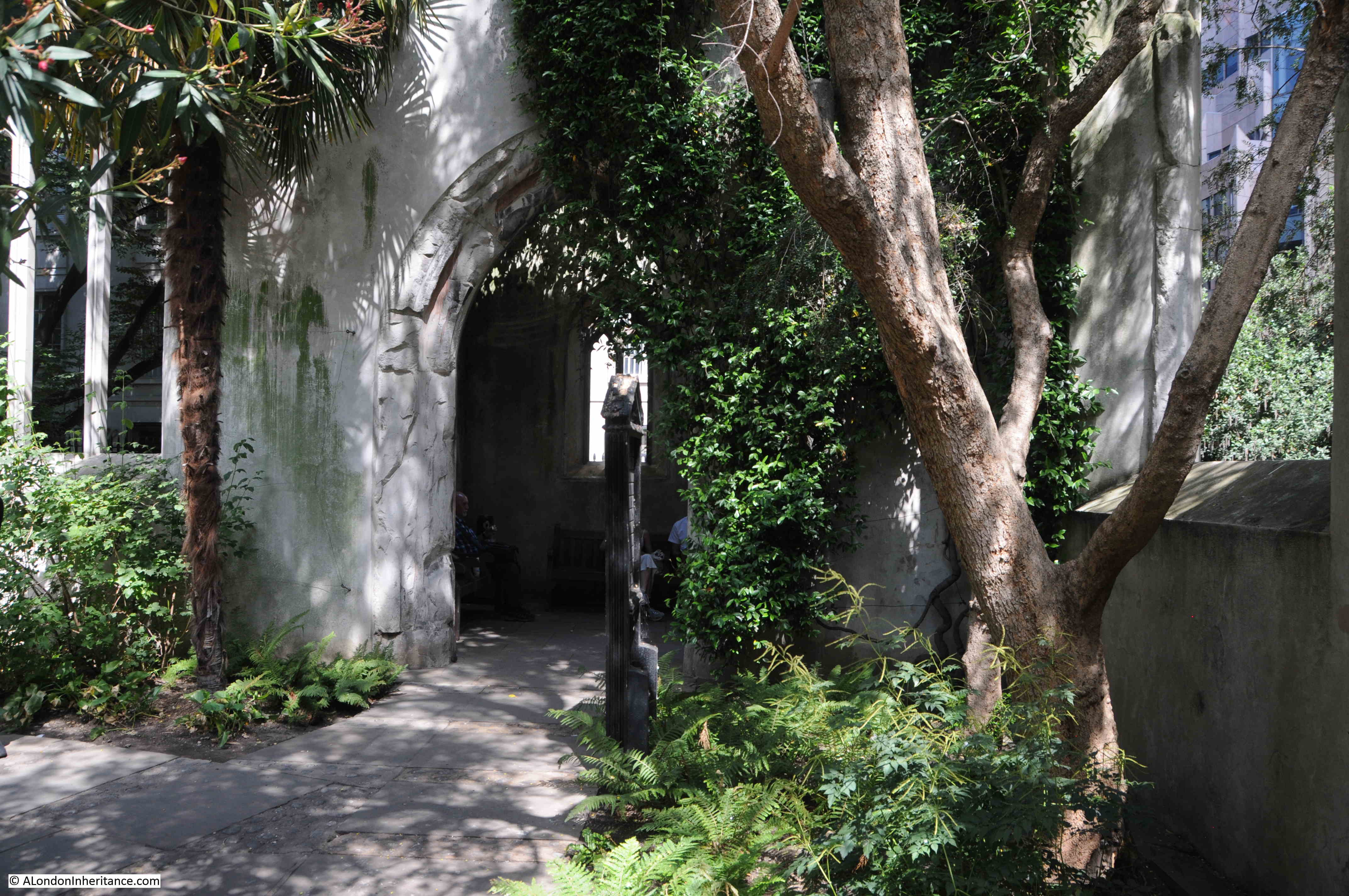
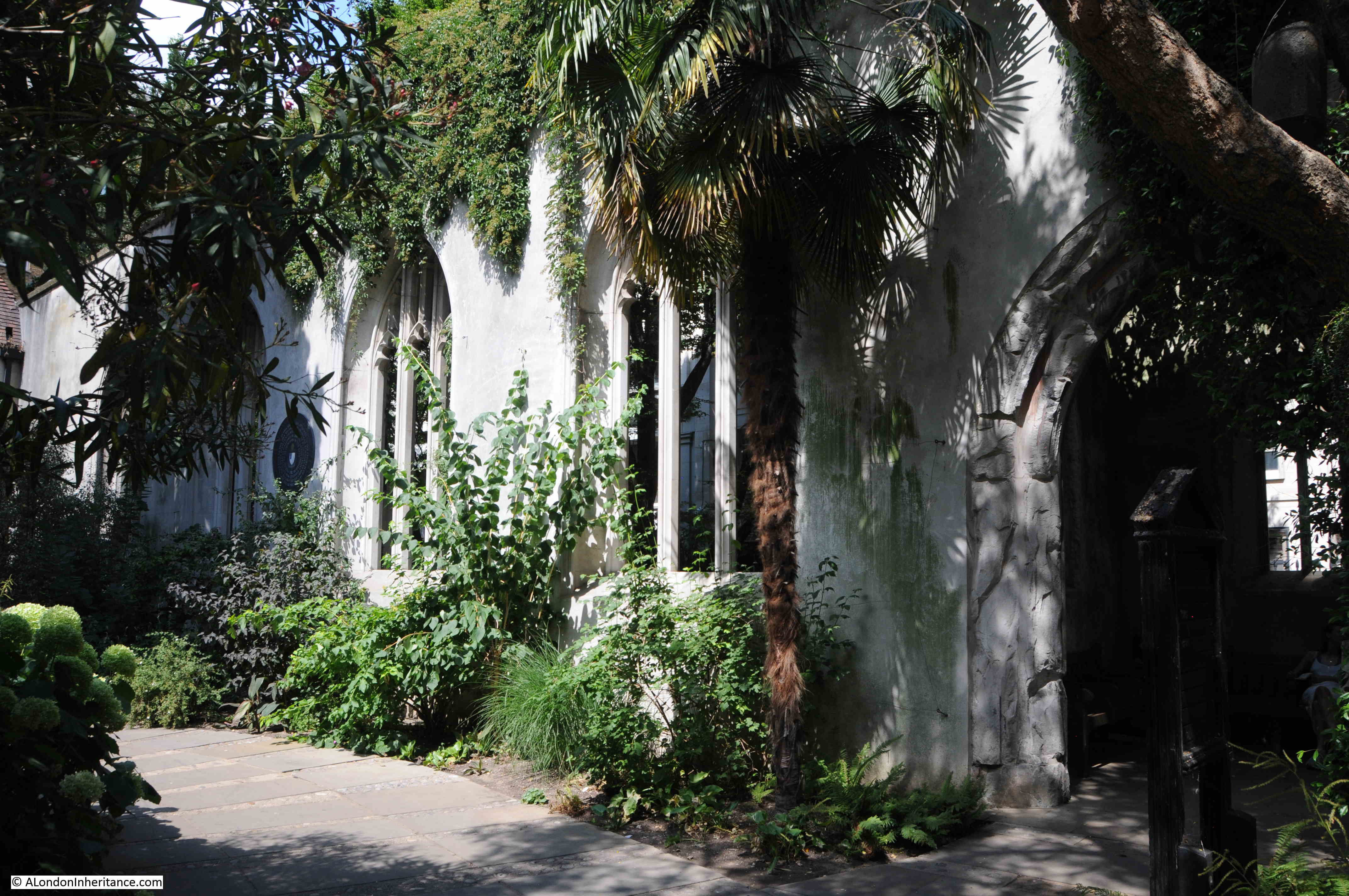
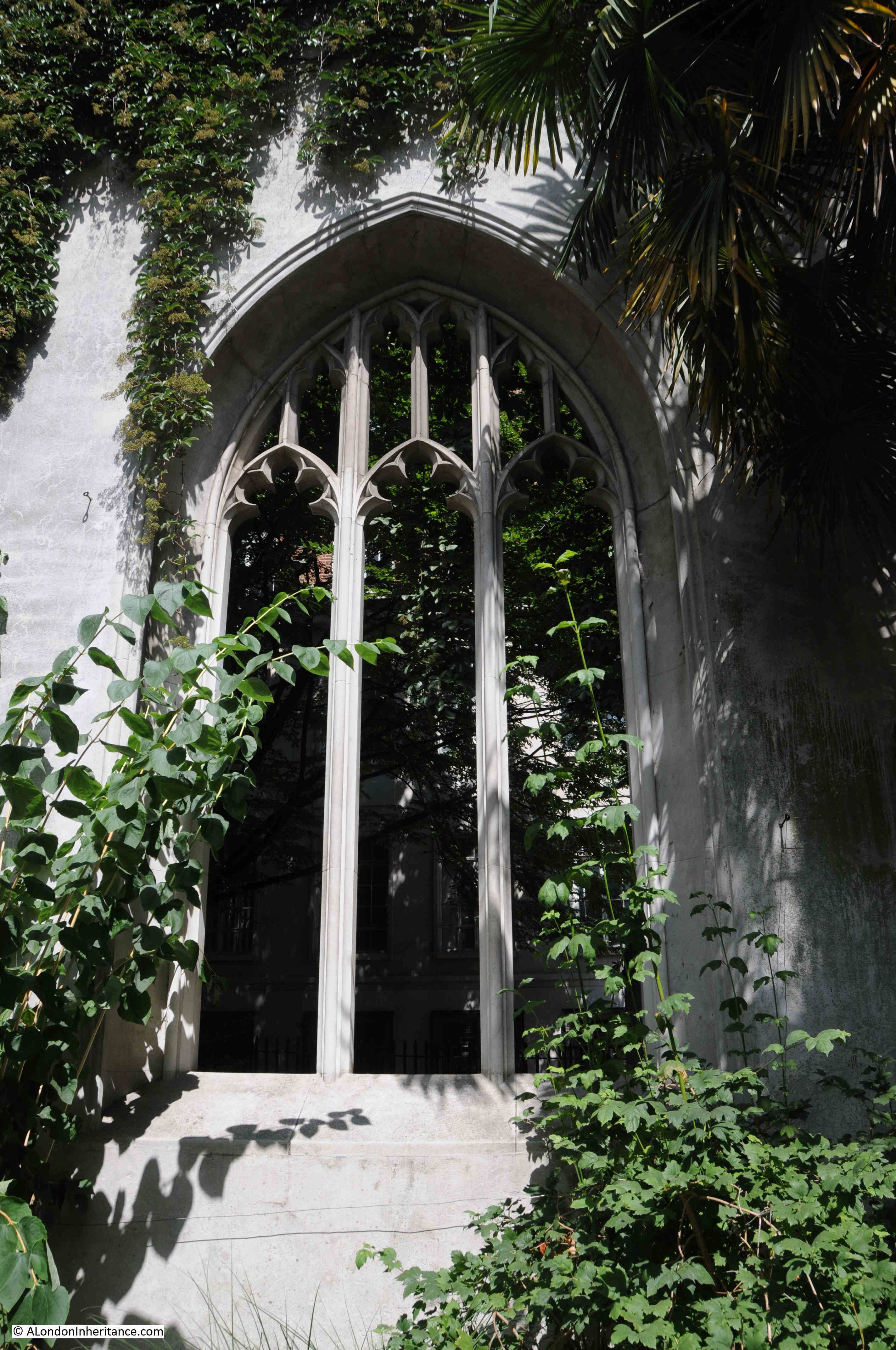
Both churches are partly hidden behind other buildings that face onto Cornhill, and have the appearance of churches from an earlier period of London’s history, when the built space was very crowded, and every available plot of land was utilised for building.

This is the view of St Peter, from Cornhill, with a lunchtime queue at the food shop that is on the small wedge of land between the body of the church and the street:

St Peter Cornhill

Only the main entrance to St Peter is on Cornhill, and when the doors are open, the entrance appears to offer a rather mysterious portal between the food shops to an older London:

St Peter Cornhill

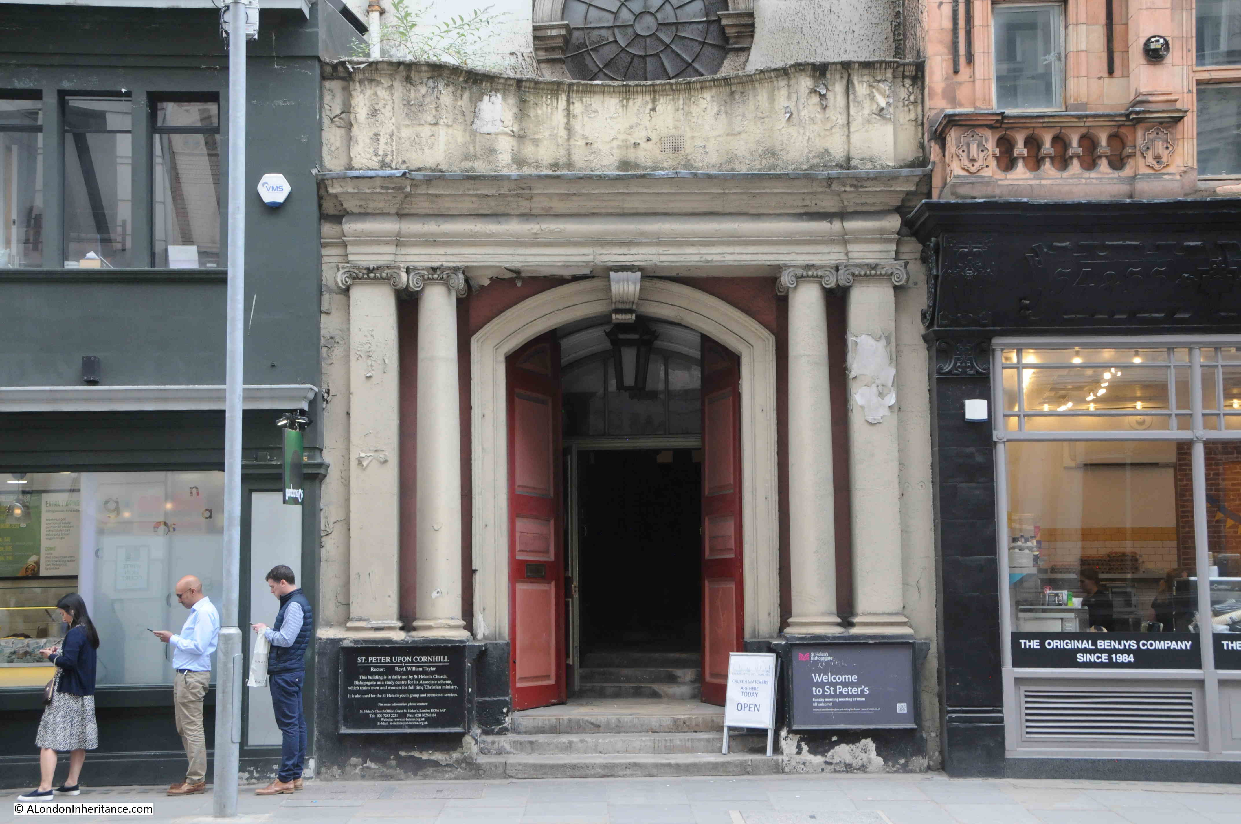
St Peter-upon-Cornhill is in an interesting location, as it is at roughly the highest point in the City of London. Whether this has anything to do with the church’s location is doubtful, however it has been a religious site for very many centuries with Stow claiming the second century as the date for the founding of a church on the site.

The website of the church is even more specific as it states ” 179AD when Lucius, the first Christian King of Britain”, and that St Peter was the first church in the City of London. It was built on the site of the Roman Basilica.

Stow refers to a tablet in the church which had an inscription about the original founding of the church, and this reference also appears in other accounts of the church, however it seems this tablet dated to the 14th century, so a considerable gap of many centuries with the alleged second century date of the original founding of the church.

The earliest written records for the church date to 1127, however a church was probably on the site for many centuries before the 12th century, but whether back to the 2nd century is impossible to confirm.

The church has had a number of rebuilds and additions over the years. In the 15th century there was a school attached to the church.

In common with many other City churches, it was very badly damaged during the 1666 Great Fire. It was rebuilt by Wren between 1677 and 1684, and this is the church we see today as it survived the blitz without any damage – although there have been a number of restorations since the 17th century.

It was the post fire rebuild that shortened the church. Ten feet of the eastern section of the pre-fire church was demolished to make way for a widened Gracechurch Street.

I found one reference to the church of a type that I have not seen before. It goes back to the 25th of January 1783 and is a newspaper report about a fire in Fenchurch Street, and states that:

“There was a great scarcity of water for some time, but the reservoir belonging to St Peter’s Cornhill, being opened, a good supply was obtained, which was the means of its being got under.”

I have not seen a reference to a City church having a water reservoir. Whether this was an open body of water, or a large tank or conduit, it is impossible to tell. It could perhaps have been a service that the church provided to the parish.

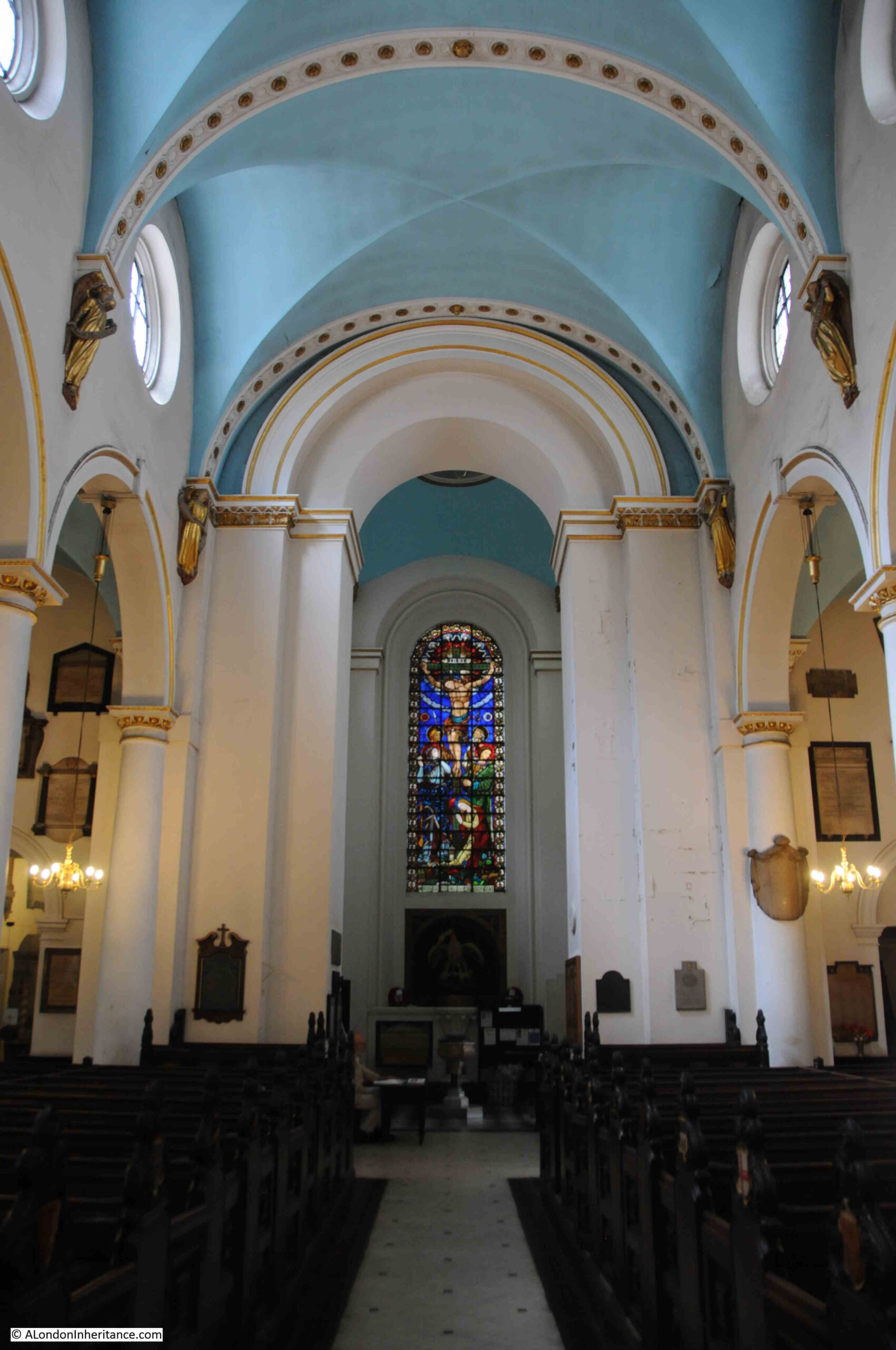
Walking through the dark portal of the church from Cornhill reveals a surprisingly light church interior:

St Peter Cornhill

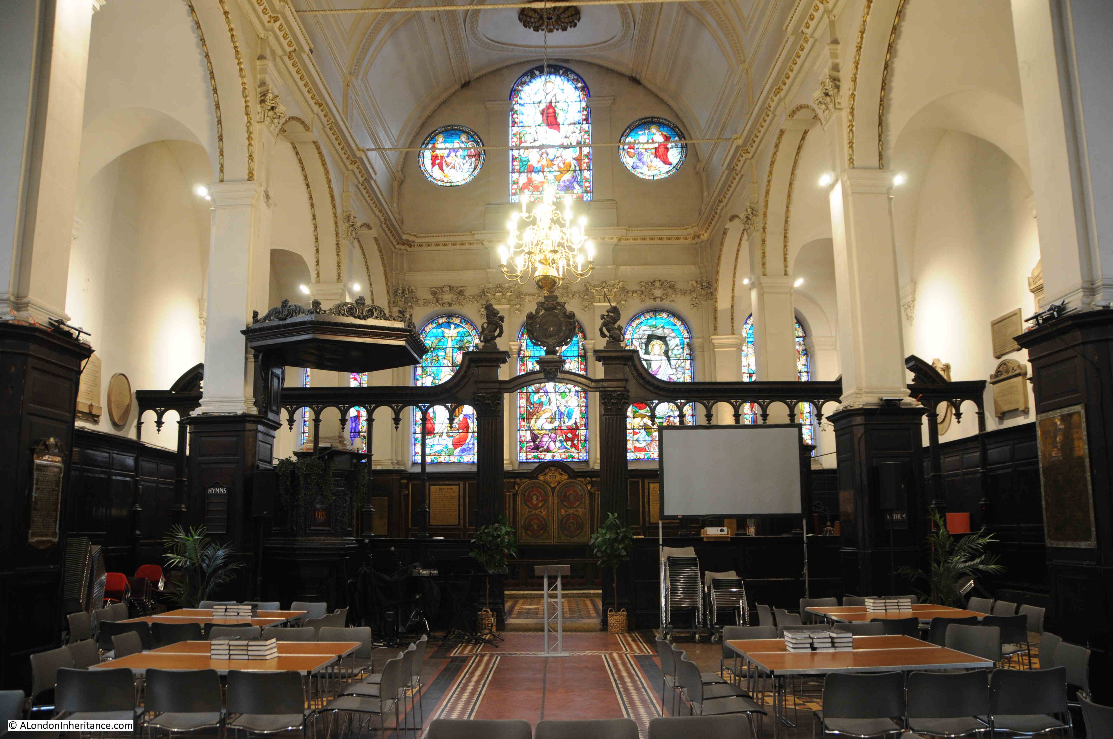
The last major restoration of the church was in 1872, and although everything above ground is Wren and later, below ground there are much earlier remains as during an excavation in 1990 it was found that Wren had used the medieval pier foundations of an earlier version of the church which probably dated to around the mid 15th century.

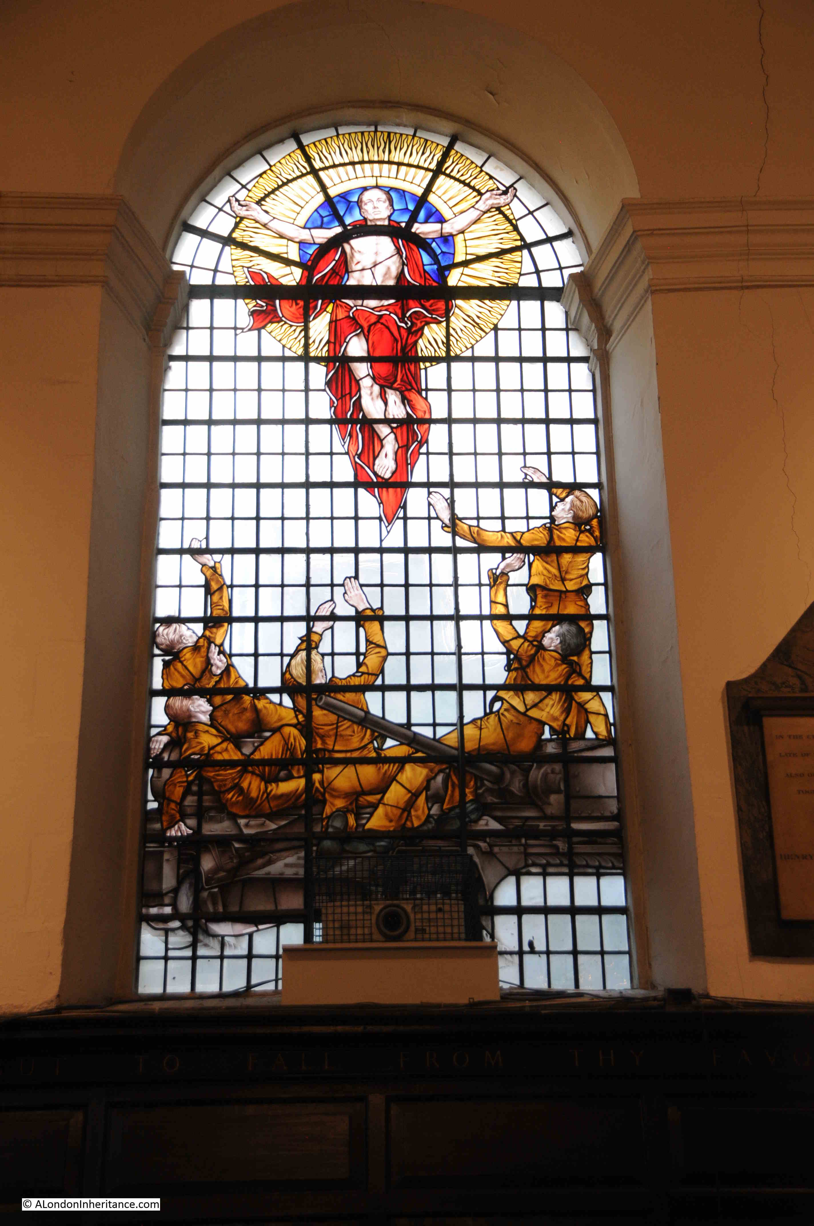
The most recent additions to the church are some stained glass. These were created by the stained glass artist, Hugh Ray Easton, and date from 1960.

The military significance of the windows is that the church was Regimental Church of the Royal Tank Regiment, between 1954 and 2007.

stained glass artist, Hugh Ray Easton

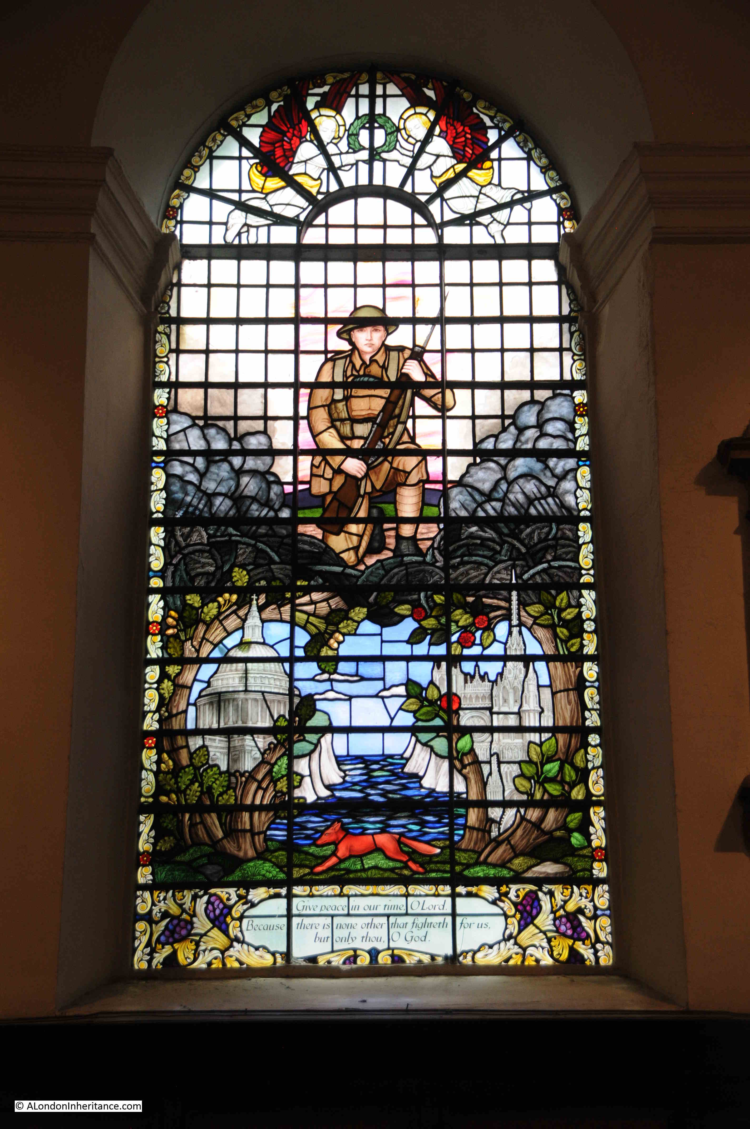
They are a strange mix of war and religious imagery, with in the following window, a group of soldiers are standing on a tank and are witnessing either the Ascension or the Resurrection:

stained glass artist, Hugh Ray Easton

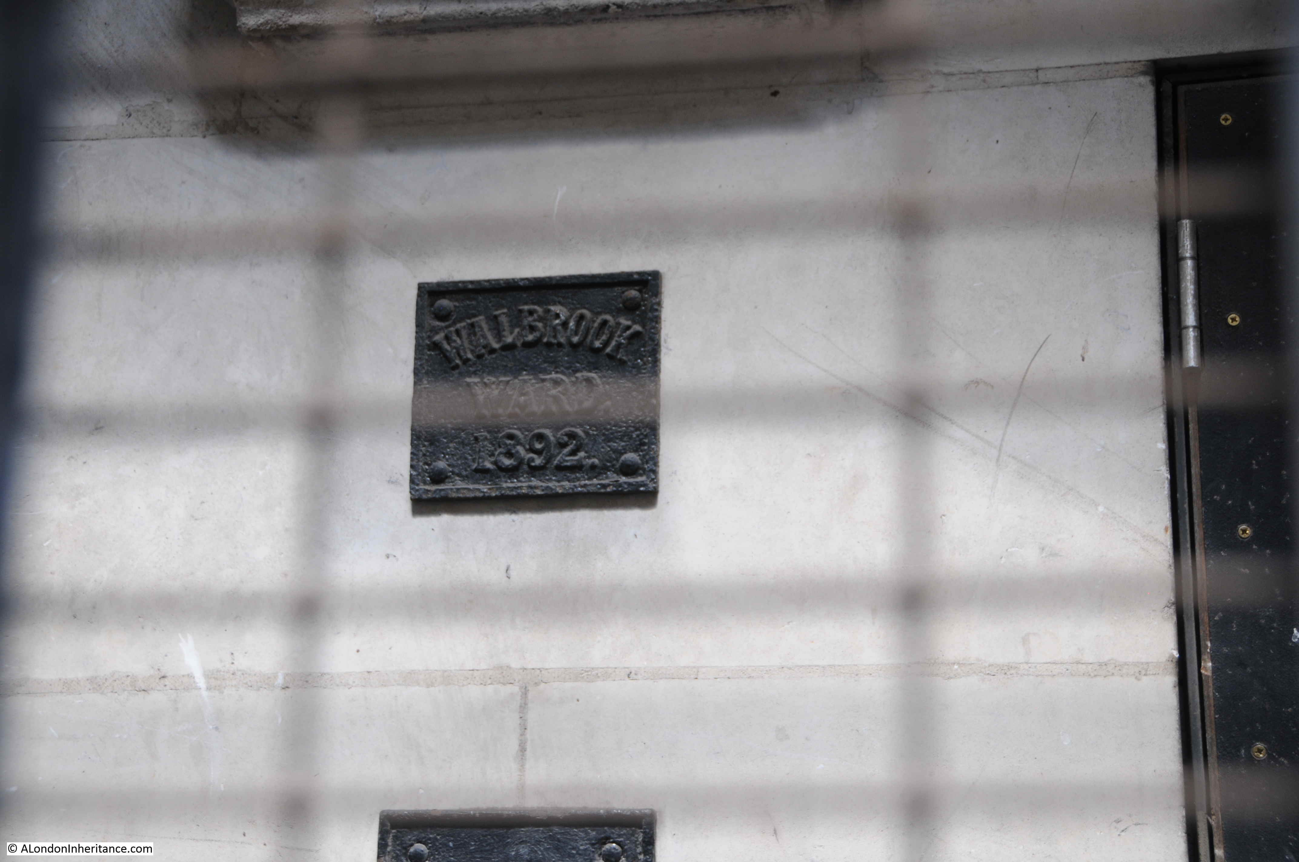
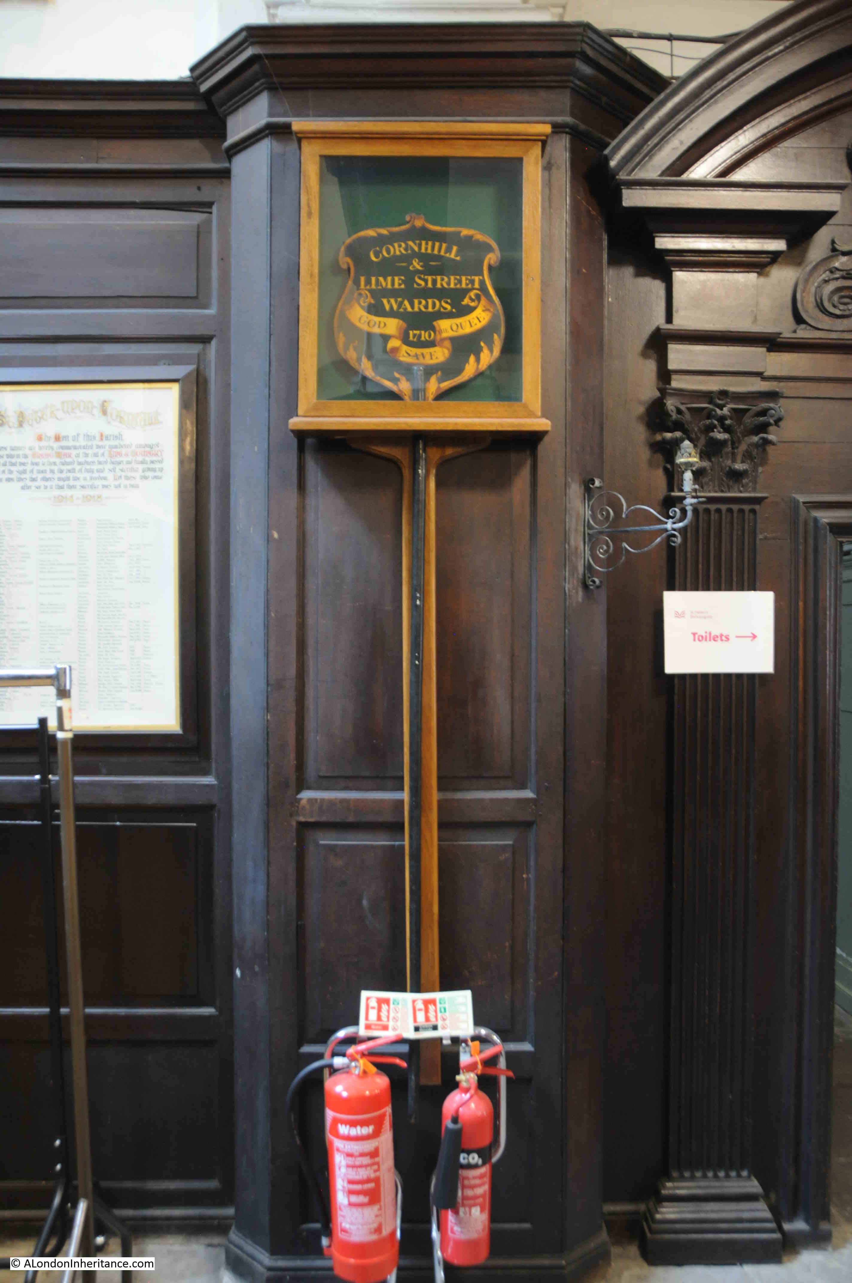
As can frequently be found in City churches, there are a number of historical relics, including the following dating from 1710 which was probably carried in a procession by representatives of Cornhill and Lime Street Wards:

St Peter Cornhill

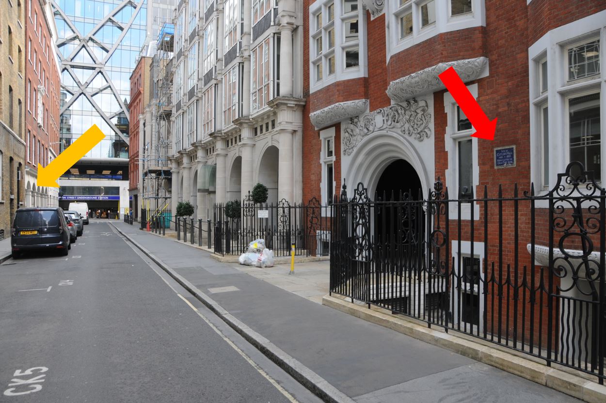
What also adds to the view of an earlier London is the building to the right of the entrance to the church. This is numbers 54 – 55 Cornhill:

54 - 55 Cornhill

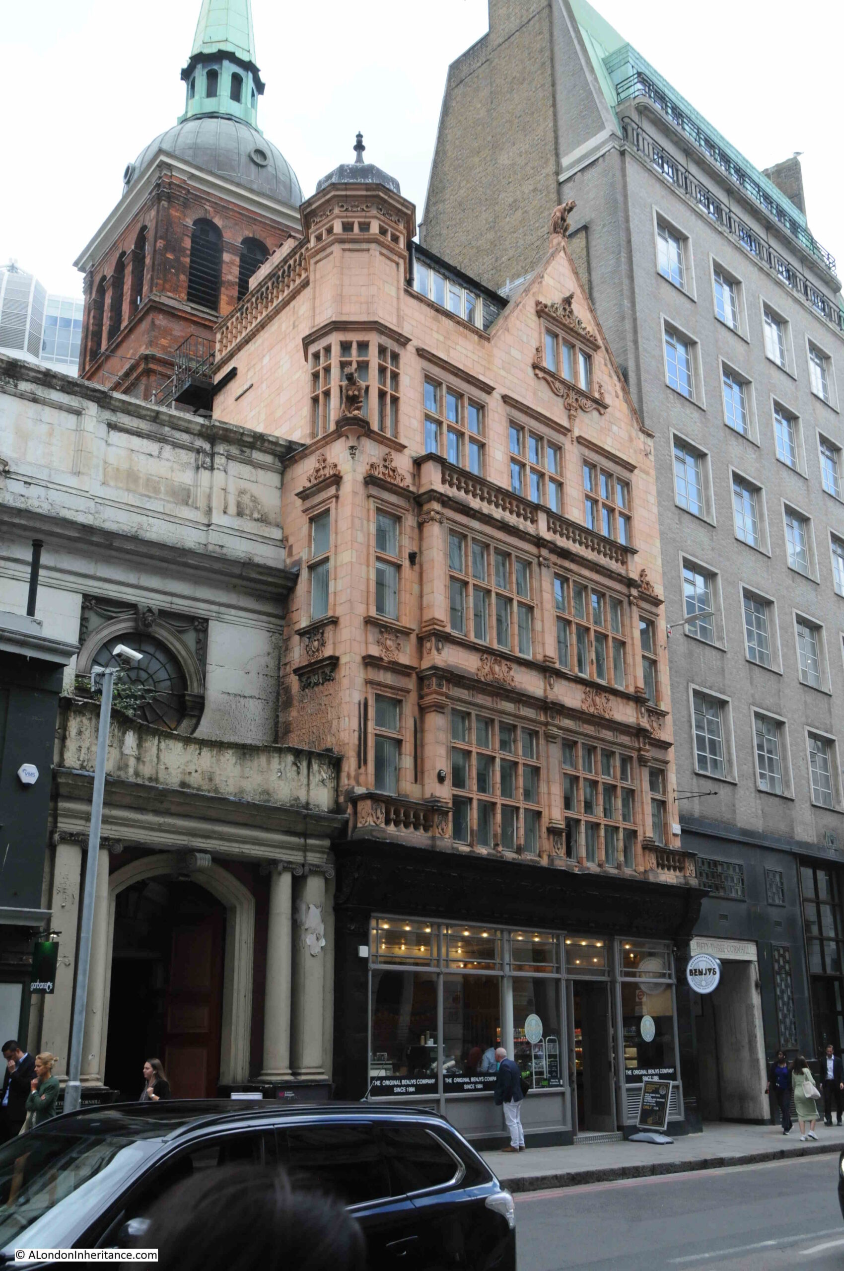
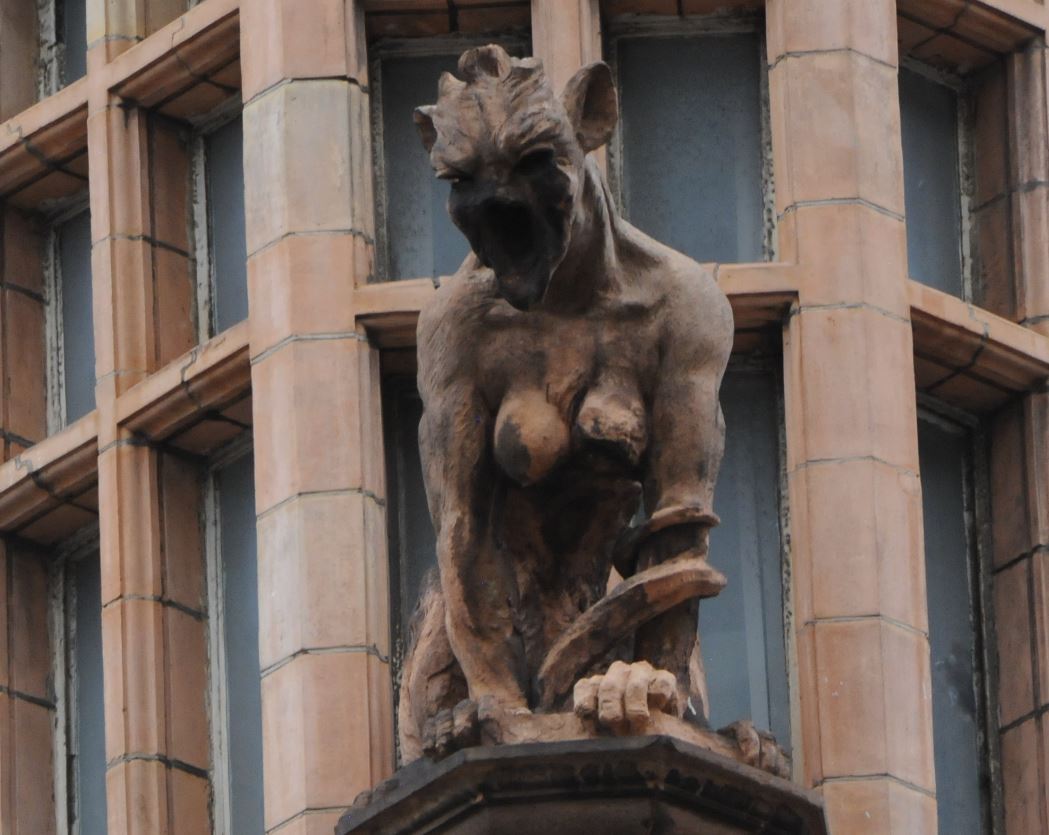
The building has a food outlet on the ground floor, but look at the terracotta upper floors, and there are details that you would not expect to find on a commercial building in the City:

54 - 55 Cornhill

Some very grotesque creatures peer down at those walking along Cornhill.

This strange building was designed by Ernest Augustus Runtz, and dates from 1893. Apparently (although I can find no contemporary confirmation), Runtz’s original plans for the building strayed onto land owned by St Peter. The vicar objected, Runtz had to rework his plans, and added the figures as an insult to the vicar.

 Ernest Augustus Runtz

The Vicar may have had the last laugh though as Runtz was declared bankrupt in 1912 following financial problems and the failure of his business.

He has though left a most unusual building on Cornhill.

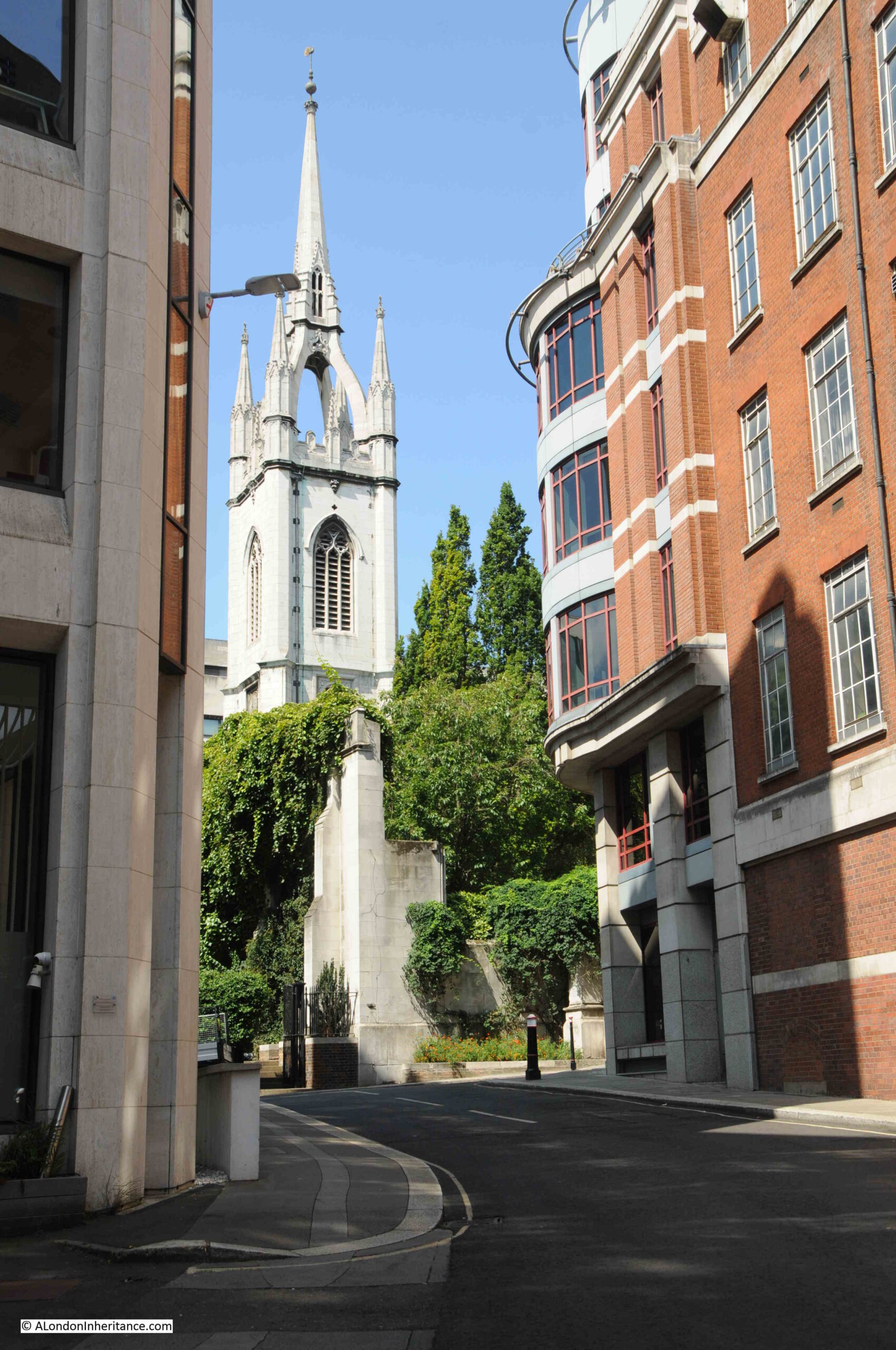
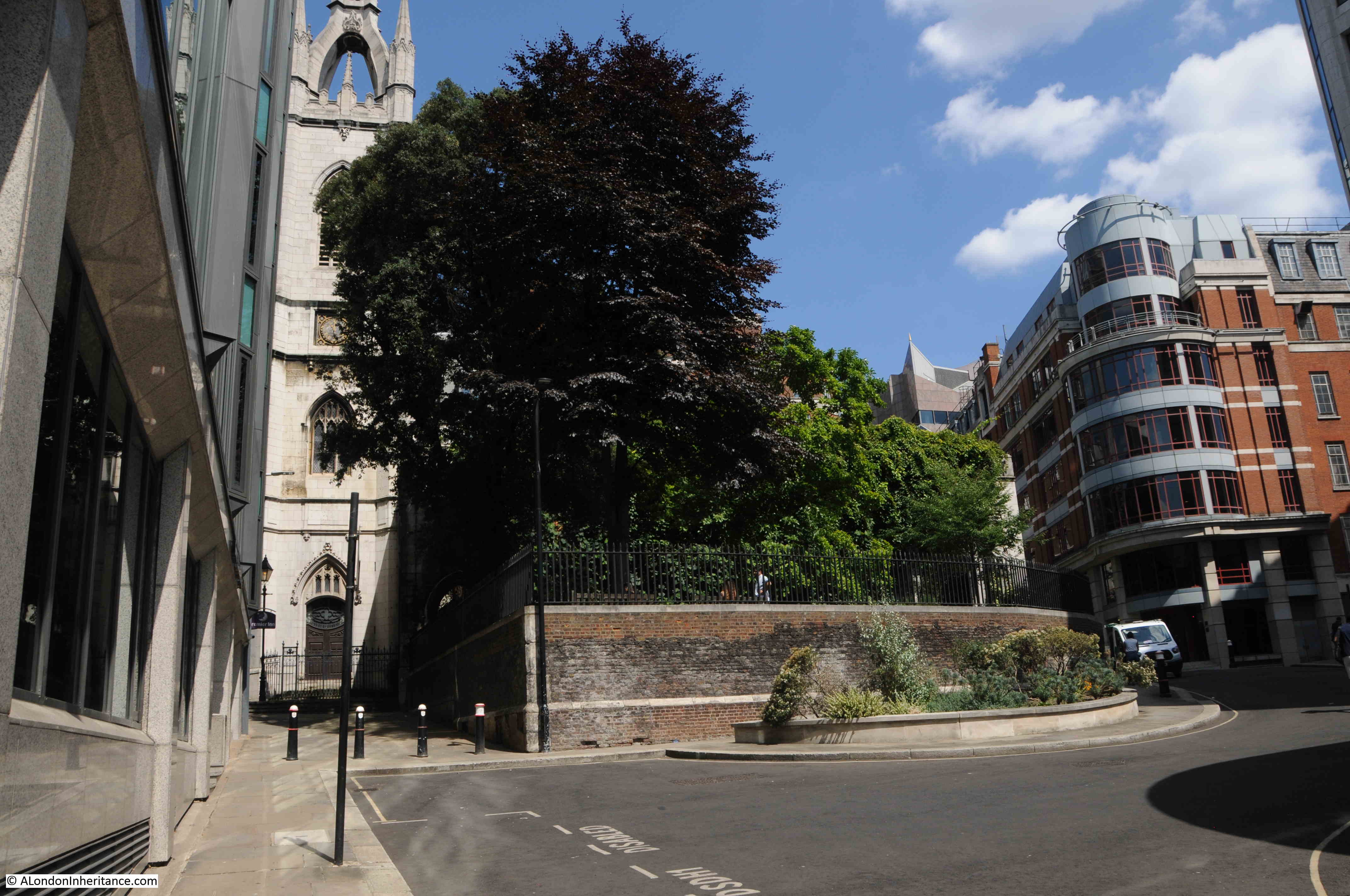
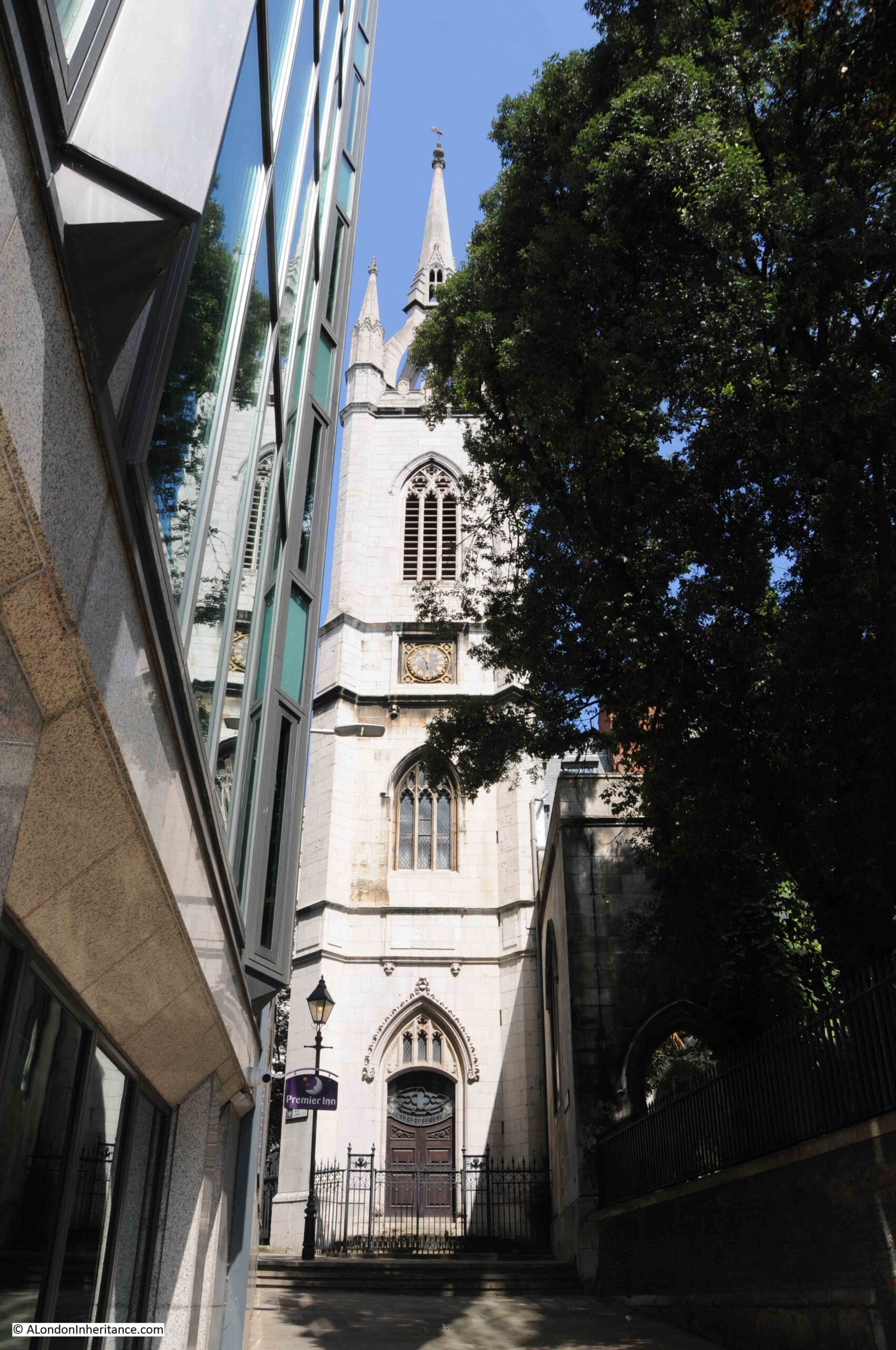
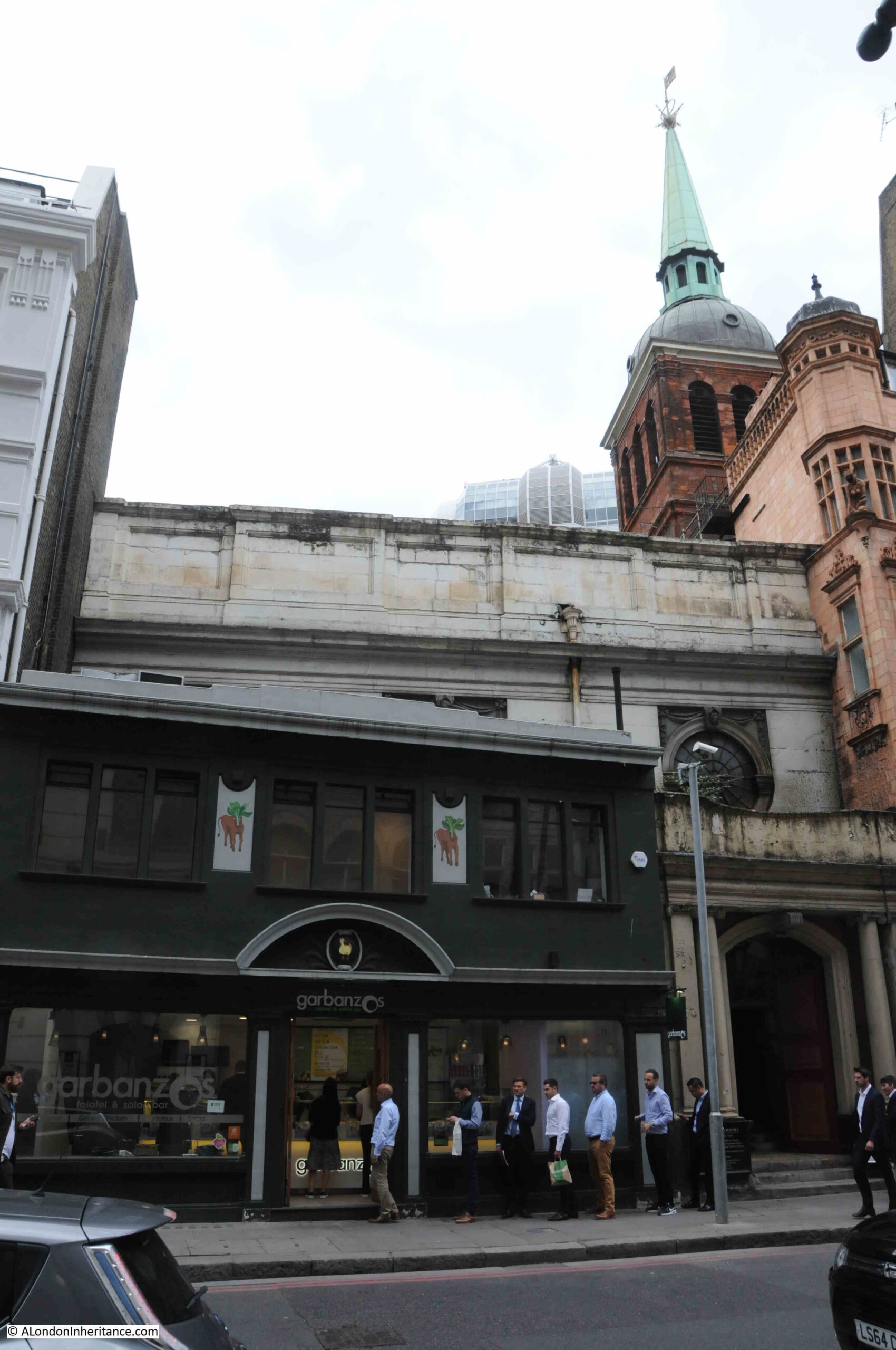
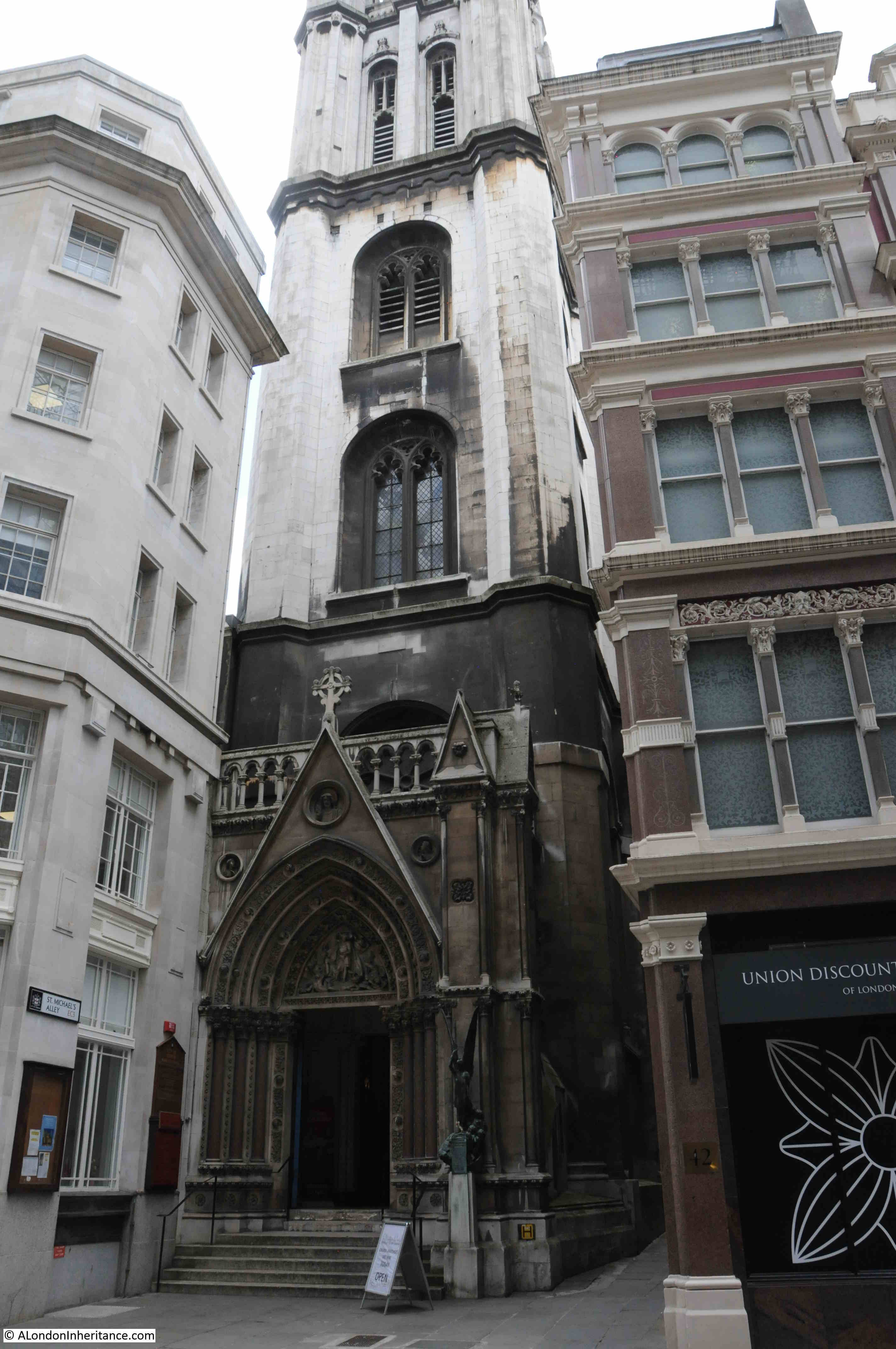
The second church, St Michael Cornhill, is a very brief walk from St Peter, and demonstrates how densely populated the City once was with churches, and again shows how buildings once surrounded City churches, as with St Michael, only the tower is visible from Cornhill, with the main entrance to the church being through an ornate entrance in the base of the tower:

St Michael Cornhill

St Michael is again an old church, however there are no firm records of just how old. The usual references where “tradition points to a church in Saxon times”, however the first written reference, according to “London Churches Before The Great Fire” by Wilberforce Jenkinson (1917) is from 1133 when the church was in the possession of the Abbott of Evesham, and the “living granted by him to Sparling the Priest”.

The tower of the church seems to feature in the majority of references to, and illustrations of St Michael.

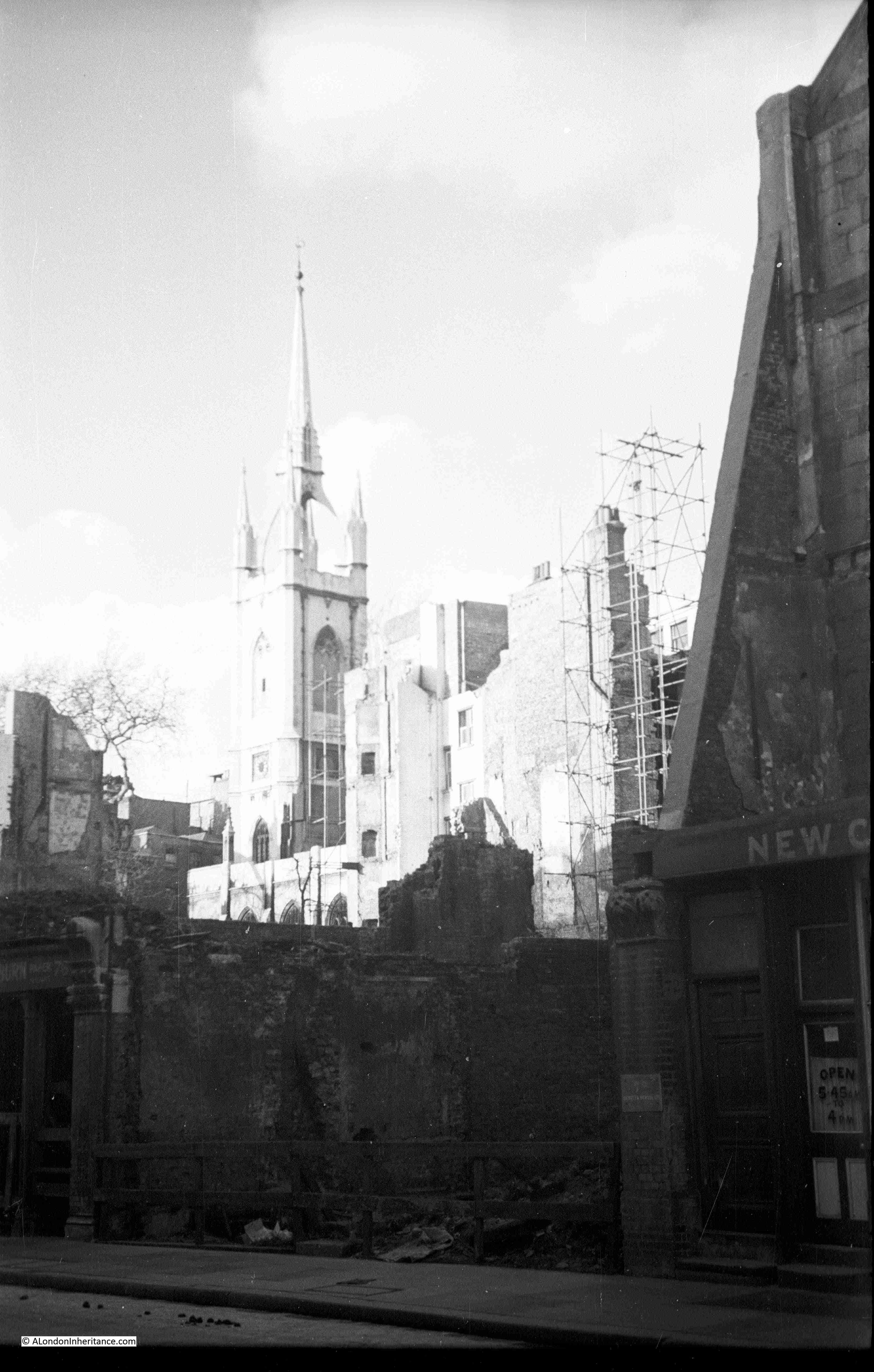
There are no illustrations of the original church, however a copy of an illustration of the fourteenth century tower, which was destroyed in 1421, has survived and shows the “Symilitude of the old Steeple 1421”:

St Michael Cornhill

The church was badly damaged during the 1666 Great Fire, but was rebuilt between 1670 and 1671 by Wren, who included the surviving tower into the reconstruction. The tower was weakened by the fire and survived for a further fifty years and was then taken down “as wanting in stability”.

Pevesner states that the new tower was probably designed by “William Dickenson who was in charge of winding down Wren’s City Church Office”, although other references state that it was to Wren’s original design.

The following print illustrates the appearance of the tower in 1850, again with only the tower being visible from Cornhill. The body of the church is behind the buildings on the left  (© The Trustees of the British Museum):

St Michael Cornhill

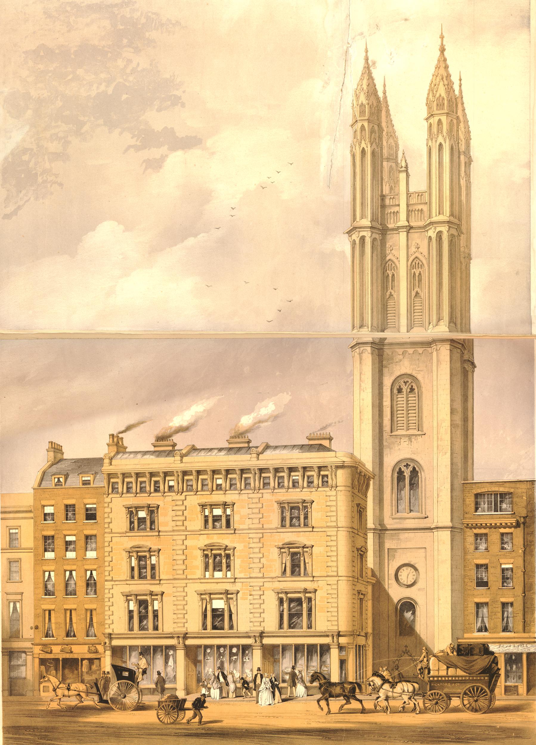
The tower in the above print is the same tower that we see today, however it was missing one vital feature, the ornate entrance to the church at the base of the tower.

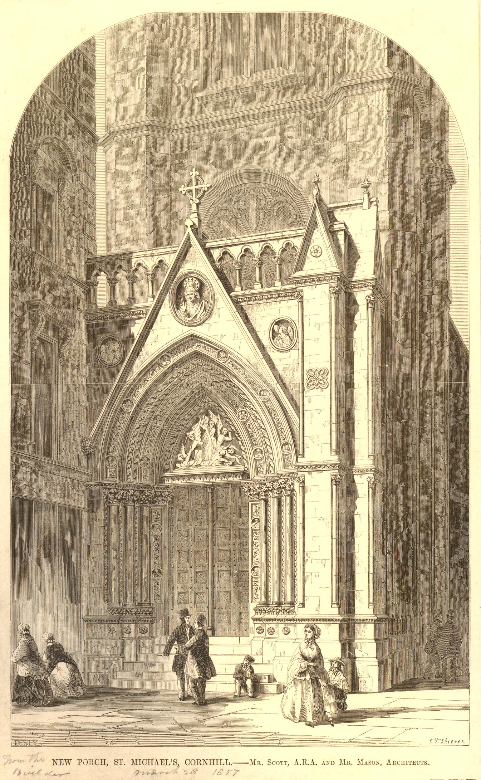
This ornate, Gothic entrance would be built between 1857 and 1860 when the church was the first in the City to be remodeled to high Victorian taste by Sir George Gilbert Scott.

The following print has a penciled note dating it to 1857. It may actually be a couple of years later, however it does show the new porch soon after it had been added to the church, and although today the stone is blackened with dirt (another feature of older City churches), it does look much the same today  (© The Trustees of the British Museum):

St Michael Cornhill

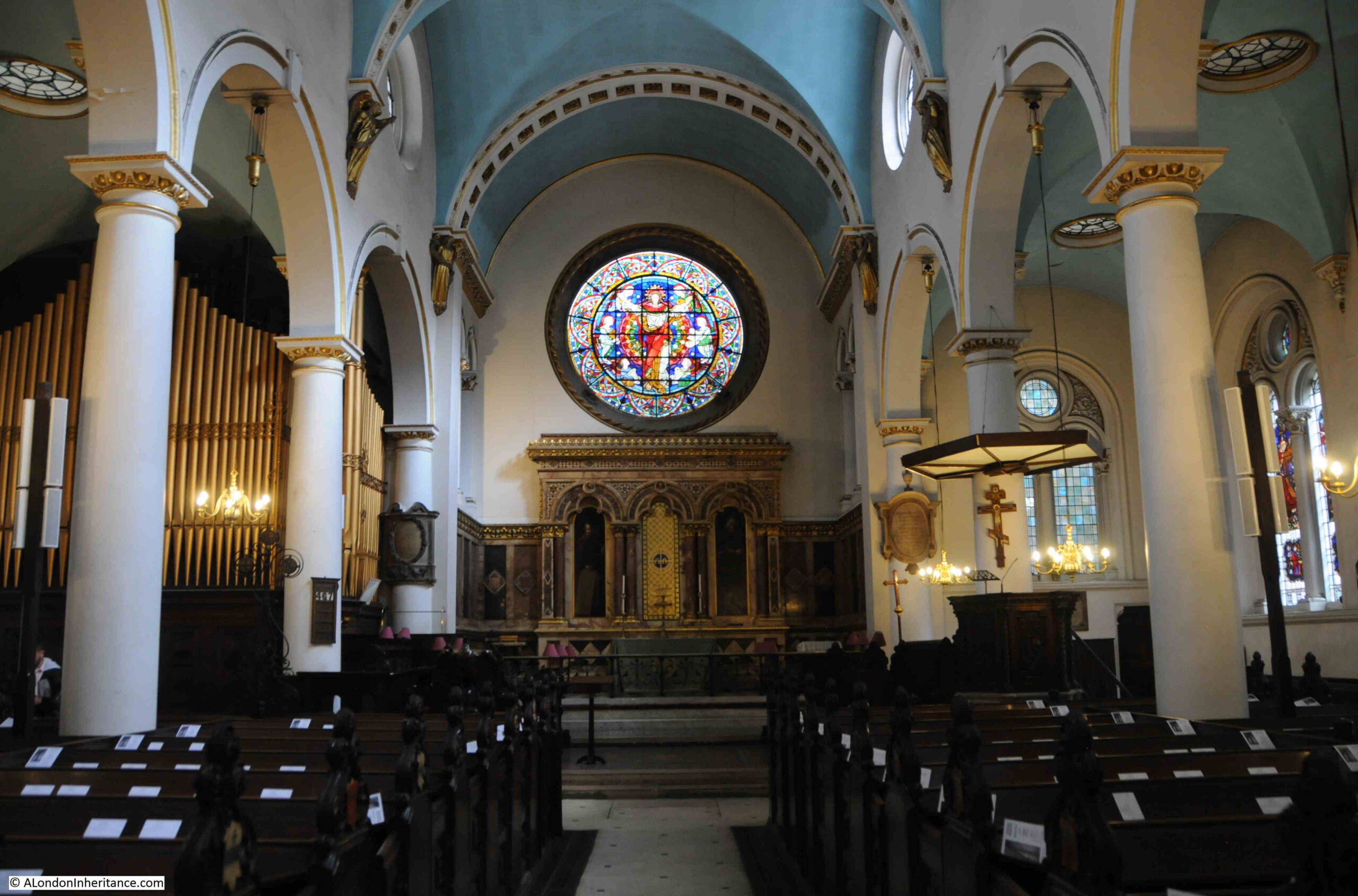
The interior of the church is mainly from the 17th century, post Great Fire rebuild with mid 19th century and later restorations:

St Michael Cornhill

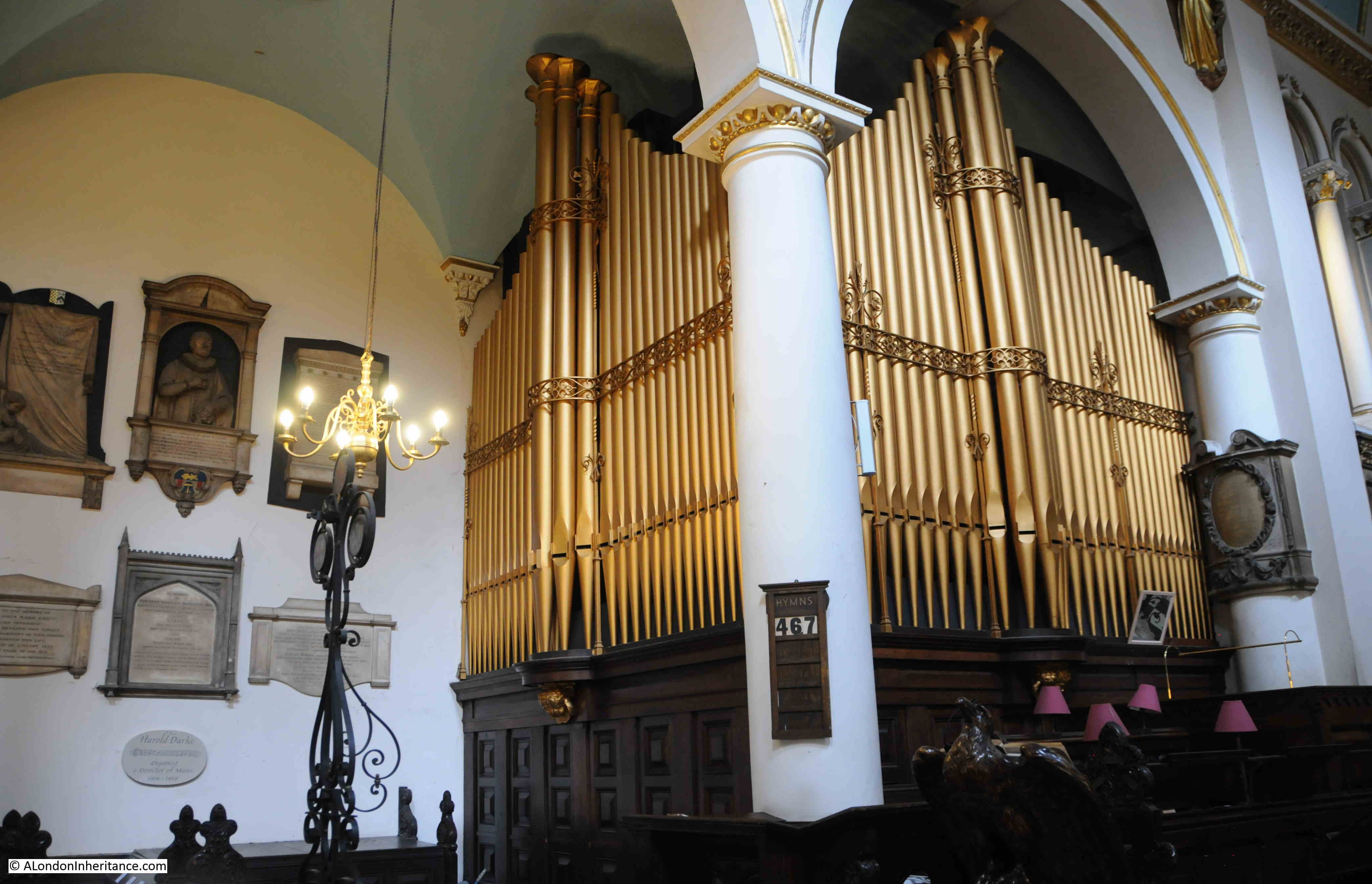
Pevsner states that the organ has been “much rebuilt”, so it is probably not that old, although there may be some surviving parts from the original Renatus Harris 17th century organ. It still looks very impressive with gleaming, gold, organ pipes occupying a corner of the church:

St Michael Cornhill

Looking back towards the base of the tower:

St Michael Cornhill

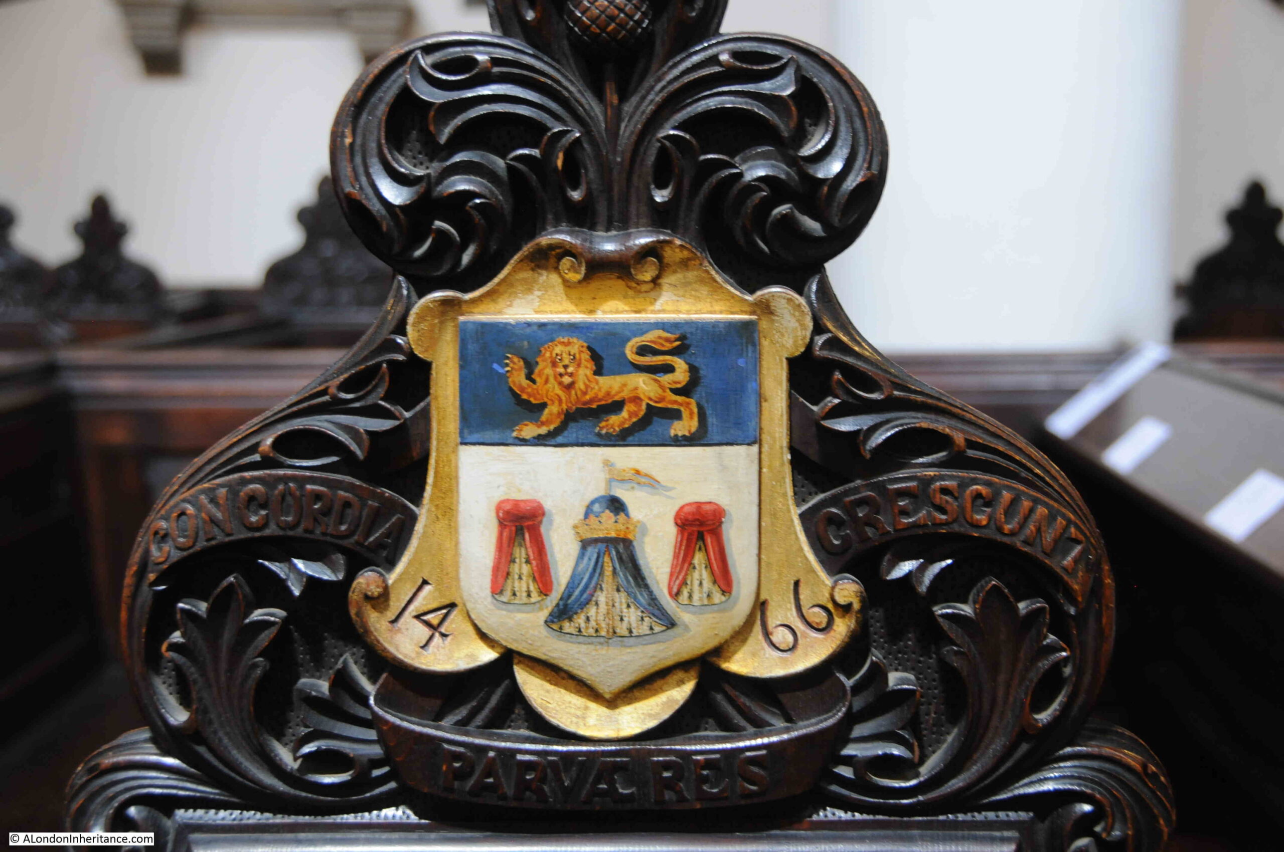
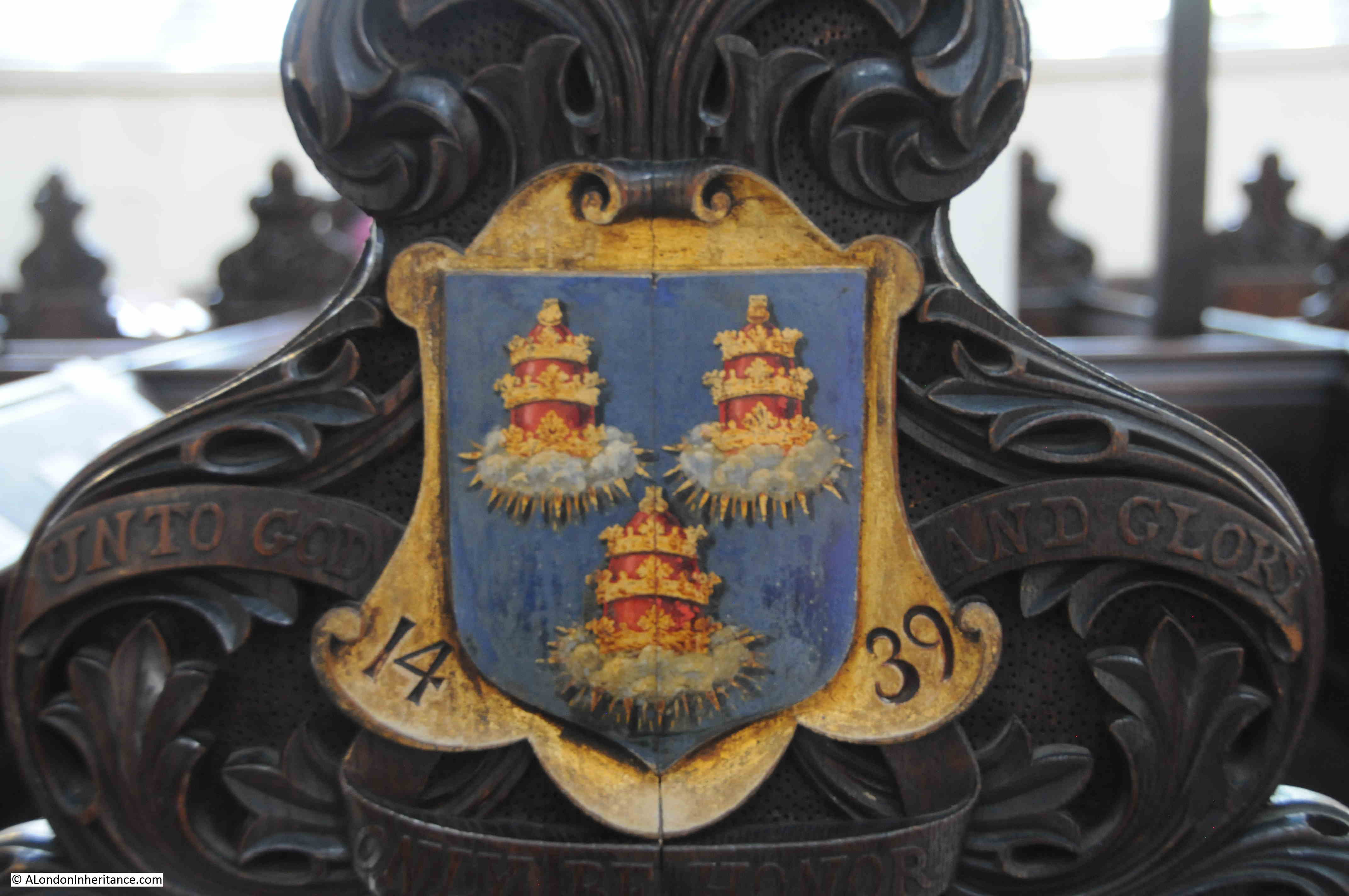
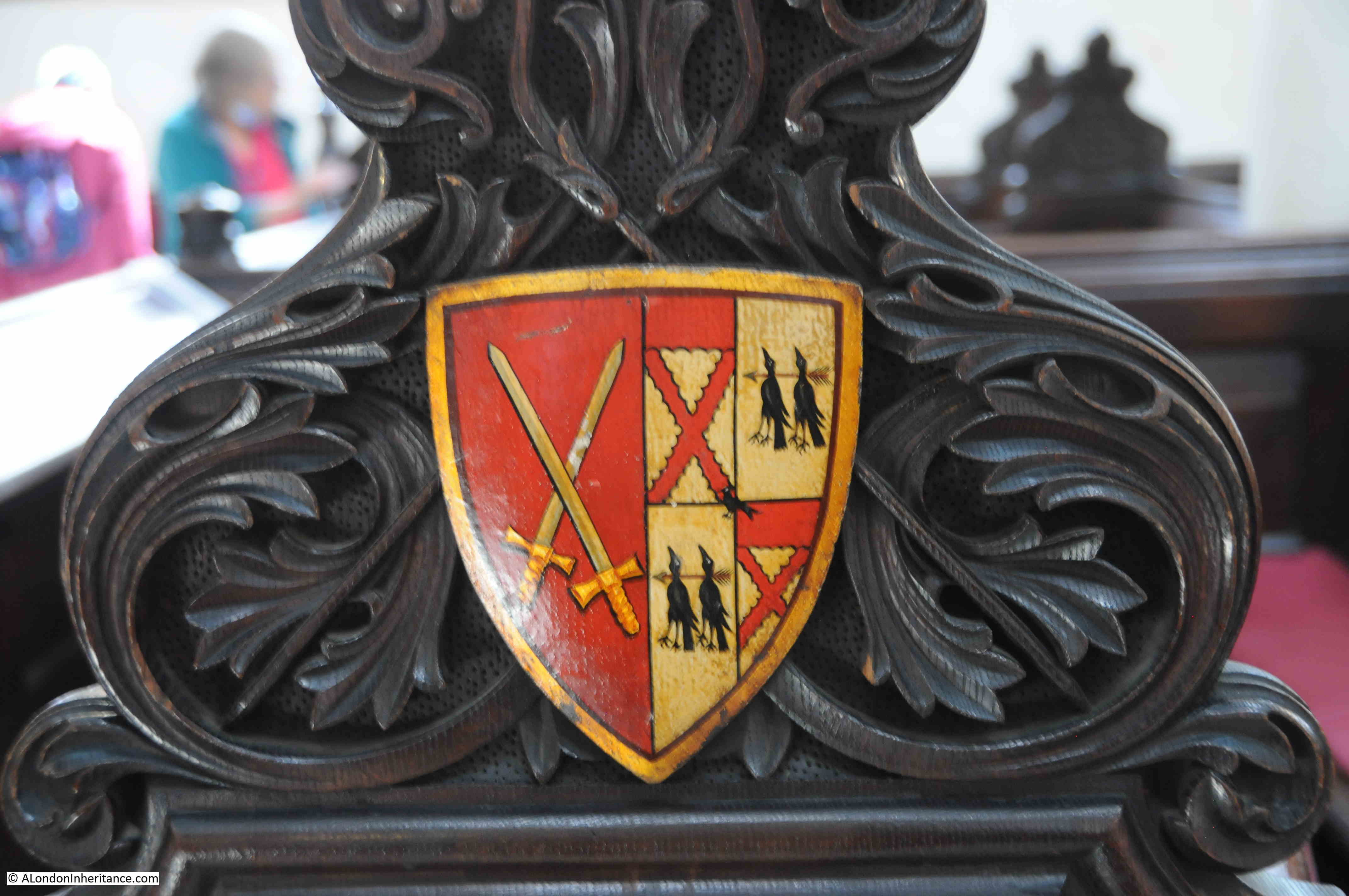
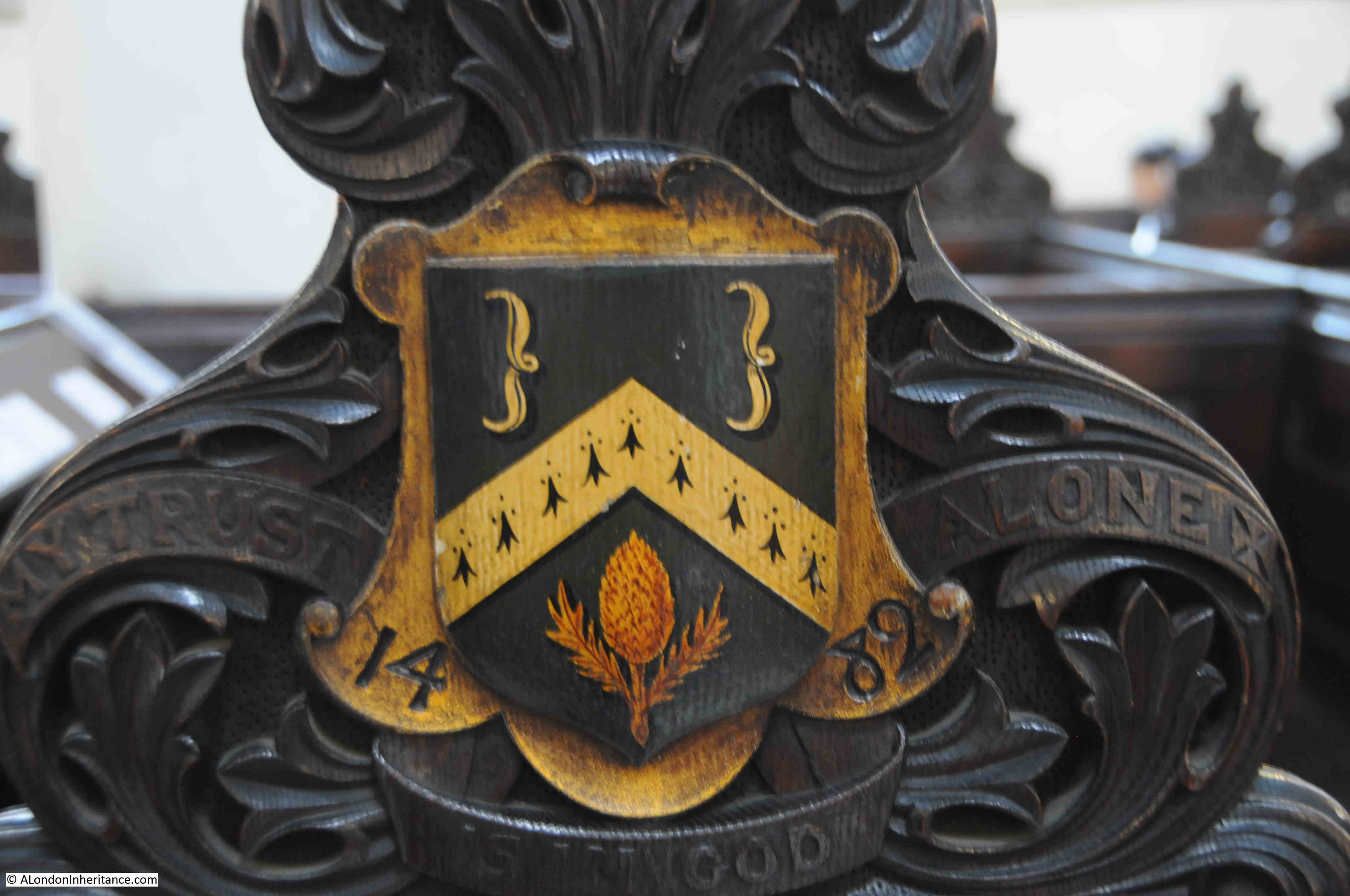
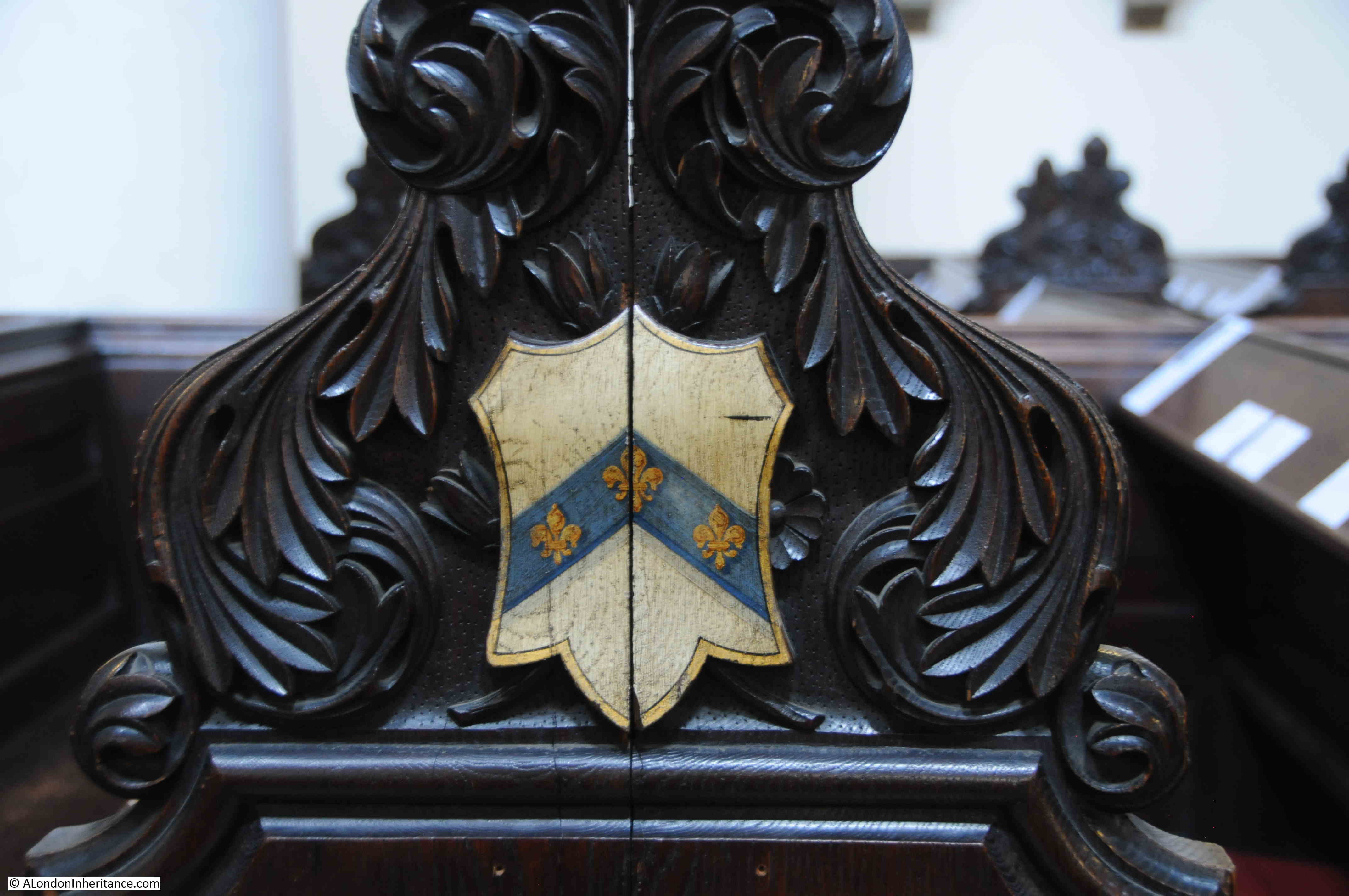
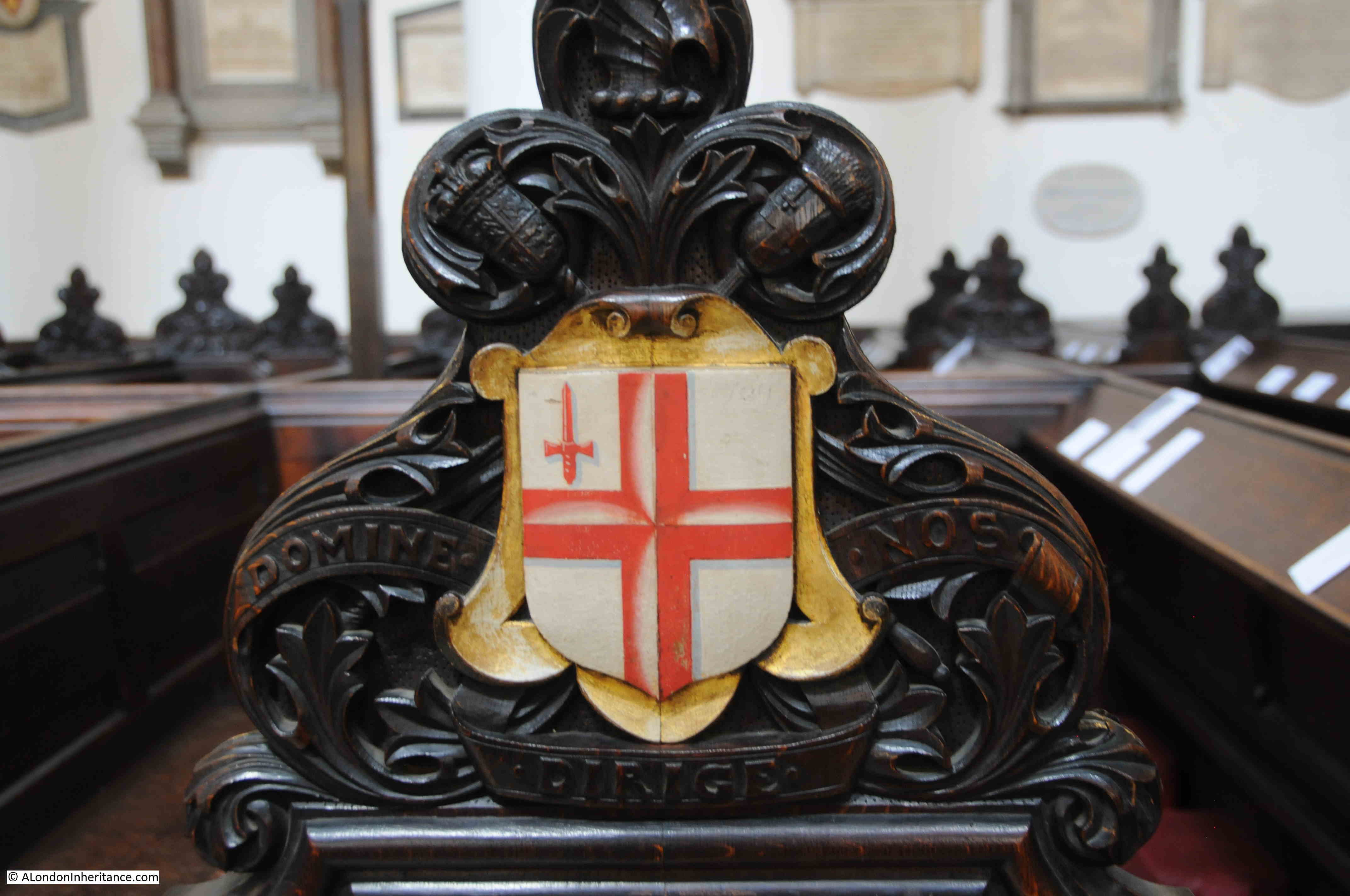
The majority of City churches have plenty of old monuments, pulpits, sword rests etc. and St Michael Cornhill is no exception. In St Peter I wanted to highlight the stained glass windows as a different feature, and in St Michael there are coats of arms on the sides of the pews. The majority appear to be City Livery Companies, however there are some I cannot identify. The following photos show a sample.

The Merchant Taylors:

Merchant Taylors coat of arms

The Drapers:

Drapers coat of arms

This one is rather strange. I cannot find a similar set of arms being used by a Company. The crossed swords may indicate the Cutlers who usually have three sets of crossed swords on their arms, however I cannot confirm that they use the images on the right of the shield:

Coat of arms

The Clothworkers:

Clothworkers coat of arms

Another I cannot identify, or find anything similiar:

Coat of Arms

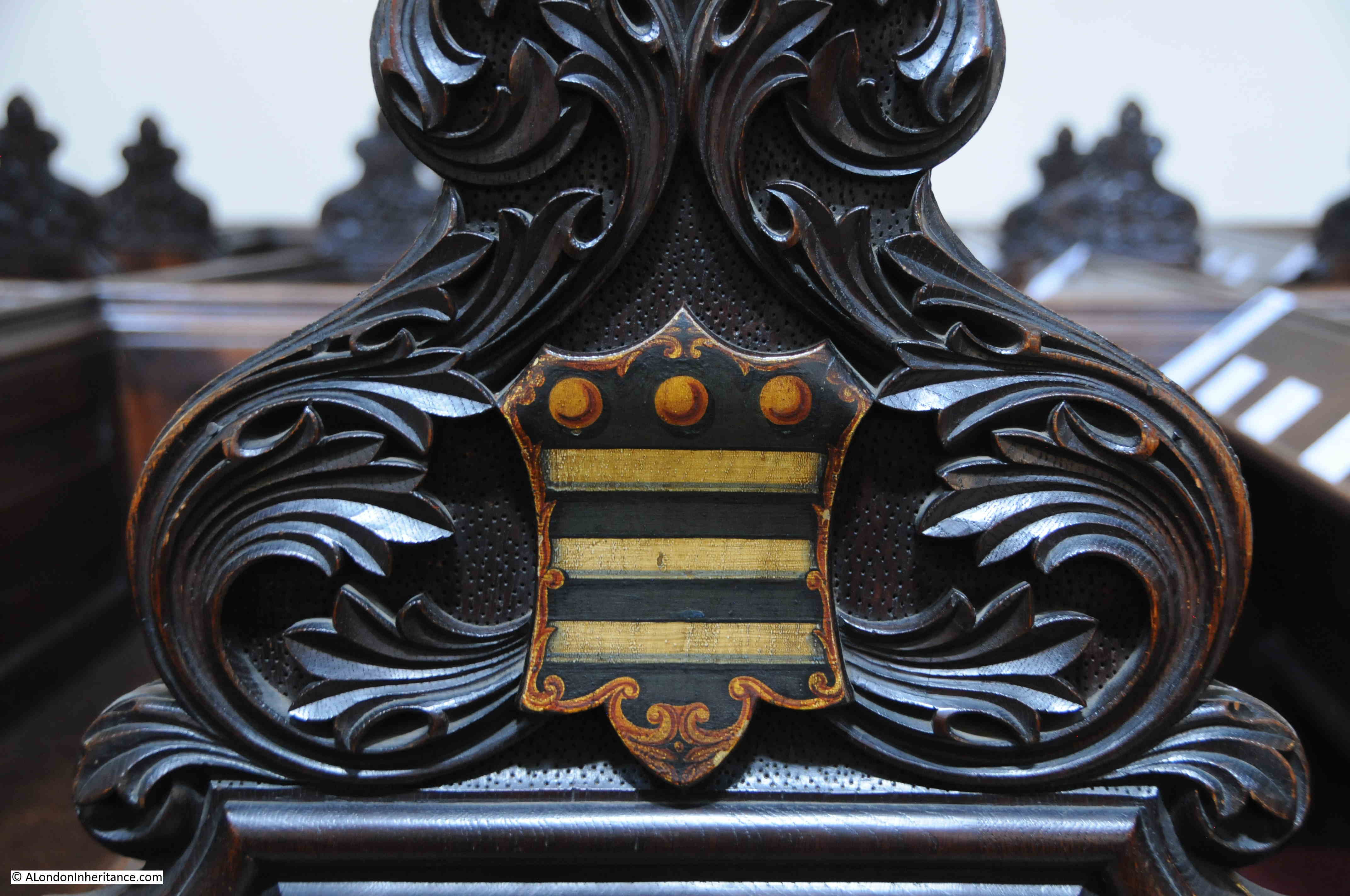
I thought I had a reasonably good understanding of the arms used by City companies, and have also been through the book “The Armorial Bearings of the Guilds of London”, but the following is a mystery as well:

Coat of Arms

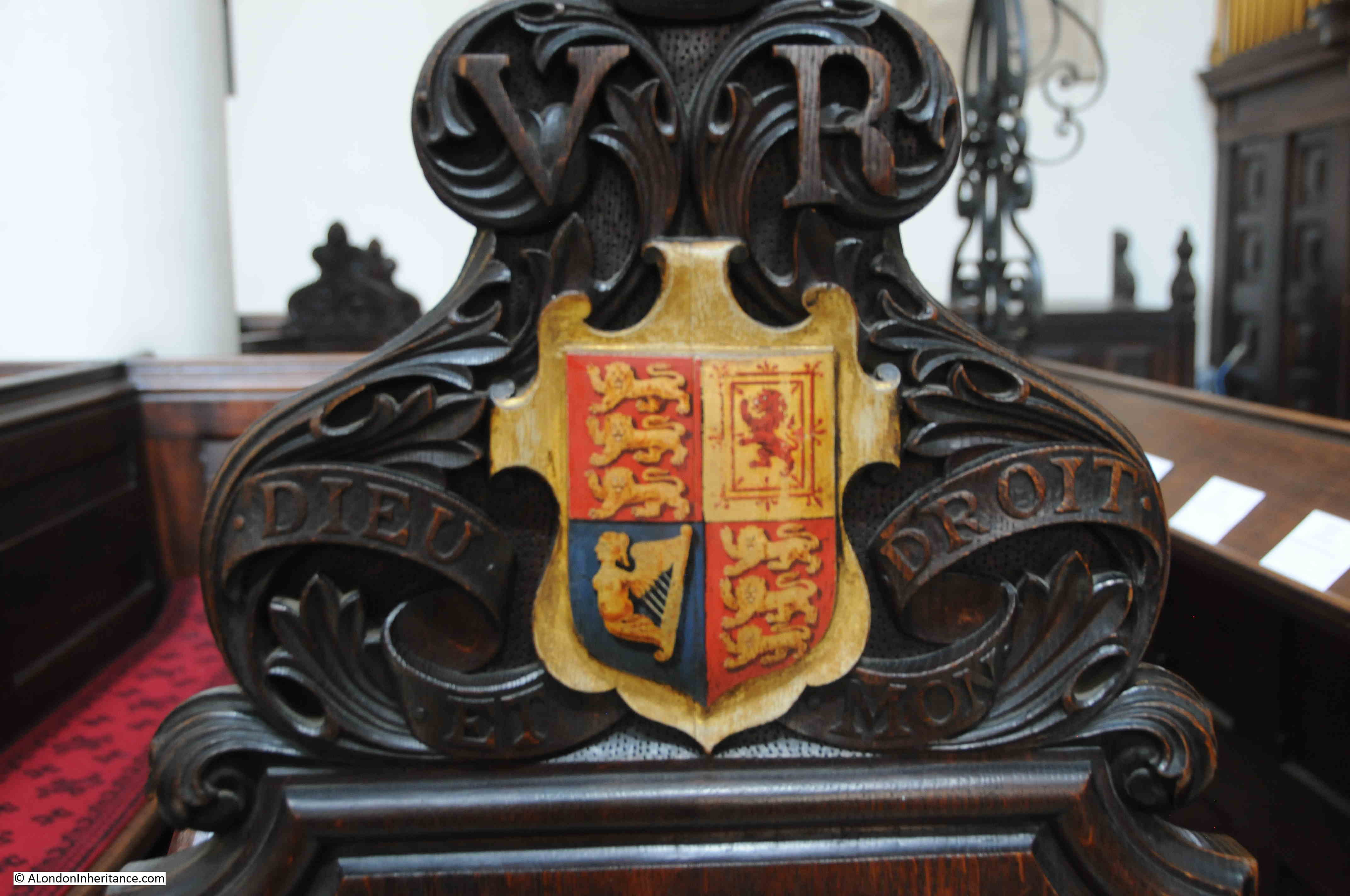
The Royal Coat of Arms of the United Kingdom – apparently this were placed on the pew at the front of the church in anticipation of a visit by Queen Victoria. Unfortunately she failed to visited the church.

Royal coat of Arms

The arms of the City of London:

City of London

When researching many of my posts, I am struck by the number of times there is a reference to a serious fire at or near the subject of the post. It is incredible just how many fires there were in 18th and 19th century London. Even after the building regulations put in place after the 1666 Great Fire, serious fires still continued.

When searching for stories about St Michael, I found the following print which shows a serious fire in Cornhill on the 25th March, 1748, with the tower of St Michael in the background  (© The Trustees of the British Museum):

Cornhill fire

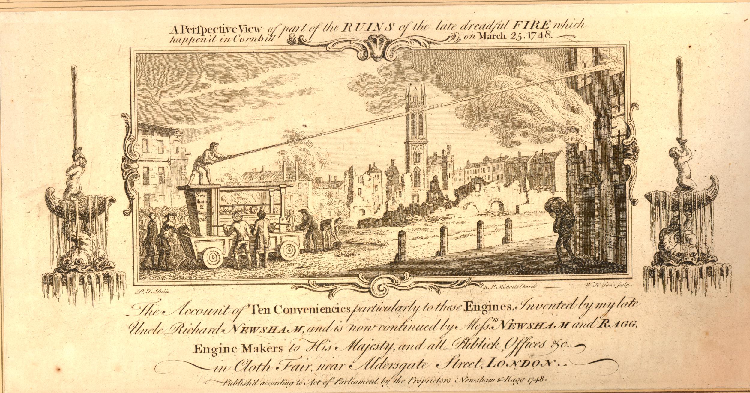
The print is fascinating for the detail it portrays. There is presumably a property owner on the right, apparently rescuing something from the burning building.

There is a very early fire fighting pump on the left, sending a jet of water at the building.

The print references the engine as “invented by my late Uncle, Richard Newsham”, an inventor who held two patents for fire engines, taken out in 1721 and 1725. Newsham appears to have dominated the mid 18th century market for fire fighting equipment.

The following photo shows the earliest known fire engine by Newsham purchased in 1728, and photographed at St Giles Church in Great Wishford, Wiltshire. The photo is almost identical to the one in the 1748 print:

fire engine by Newsham

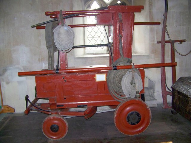
Source: Trish Steel, CC BY-SA 2.0 https://creativecommons.org/licenses/by-sa/2.0, via Wikimedia Commons

A quick visit to two Cornhill churches. They are an interesting pair of churches to visit as they demonstrate what City churches must have looked like in previous centuries. Surrounded by buildings on the main street, a small churchyard behind, but only an entrance to the street.

That they are also a very short distance apart is a reminder of how densely populated the City was with churches, before the loss of churches caused by the Great Fire, 19th century church closures, and bombed churches not being rebuilt after the last war.

You can read another of my posts about Cornhill, the Cornhill Water Pump, here.

alondoninheritance.com

Cloak Lane, St John the Baptist, the Walbrook and the Circle Line

One of the pleasures of wandering around London streets are the random memorials and objects that have survived from previous centuries, and how they can lead to a fascinating story of an aspect of the City’s history. Perhaps one of the strangest can be found in Cloak Lane, to the west of Cannon Street Station, between Dowgate Hill and Queen Street.

The ground floor of one of the buildings on the northern side of Cloak Lane has a number of arches with metal railings, and a large memorial occupying one of the arches:

Cloak Lane

A closer view, and the railings have signs that imply that there is perhaps more to discover:

Cloak Lane

The monument provides some information:

Cloak Lane

The contrast between letters and stone is not that high in the above photo, so I have reproduced the text on the monument below:

Cloak Lane

There is much to unpack from the inscription on the monument, and it does not tell the full story.

The church of St John the Baptist upon Walbrook was one of the City churches that was destroyed during the Great Fire of 1666, and not rebuilt, so after the fire, only the churchyard remained.

I have circled the location of the surviving churchyard, at the junction of Cloak Lane and Dowgate Hill in the following extract from William Morgan’s, 1682 map of London:

St John the Baptist upon Walbrook

According to “London Churches Before The Great Fire” (Wilberforce Jenkinson, 1917), St John the Baptist upon Walbrook was “Founded before 1291, and enlarged in 1412, and ‘new-builded’ around 1598. The west end of the church was on the bank of the Walbrook, hence the title.”

The Walbrook is one of London’s lost rivers, and in the following map I have marked the location of church and churchyard along with the Walbrook which made its way down to Upper Thames Street which was the early location of the Thames shoreline (© OpenStreetMap contributors):

Walbrook and Dowgate Hill

The book states that the west end of the church was on the bank of the Walbrook. This is possibly an error as the eastern end of the church would have been on the Walbrook, or it should have read that the church was on the west bank of the river.

It is possible that the Walbrook ran further to the west than shown in the above diagram, however all the references I can find are to the river running roughly on and alongside Dowgate Hill.

The text on the monument mentions the District Railway, and the title for the blog is about the Circle Line. I will explain why I have used the Circle Line later in the post, however stand next to the railings alongside the monument, and a grill can be seen in the floor. Wait a few minutes and the sounds of an underground train can be heard coming up through the grill.

Cloak Lane

After the 1666 Great Fire, the church was not rebuilt, the churchyard remained, and would do so for the next 200 years. Buildings alongside did encroach on the churchyard, however it was still there in 1880. In the next few years there was some major construction work in Cloak Lane which would result in the loss of the churchyard.

This construction work was for an underground railway that in the newspapers of the time was referred to as the Inner Circle Railway. The following article from the East London Observer on the 31st May 1883 provides some background:

THE INNER CIRCLE RAILWAY. With much less outward demonstration than might have been expected, considering the importance and magnitude of the works, there is now being contracted in the City of London an underground railway which, by uniting the Metropolitan and District systems, will complete the long looked for Inner Circle Railway, and be of immense service to the travelling public and the metropolis.

The Acts of Parliament under which these works are being carried out were obtained in the names of the joint companies – that is to say, the Metropolitan and the Metropolitan District. They authorised the construction of a railway to commence by a junction with the District line at Mansion House Station, and to run under some houses south of the thoroughfare known as Great St Thomas Apostle, crossing Queen Street, then going along the south side of Cloak Lane, across Dowgate Hill, to the forecourt of the South-Eastern Cannon Street Station. Here is to be made a station.

The line is then to pass under the centre of Cannon Street, crossing King William Street, and is then to swerve slightly south. Between this point and Pudding lane is to be a second station, which will serve the busy district around it, including Gracechurch Street, Lombard Street and Billingsgate. By arrangement with the Corporation and the Metropolitan Board of Works, the narrow thoroughfares of East Cheap and Little Tower Street are to be widened on the south side, and Great Tower Street on the north side. The railway is to pass under the centre of the roadway, and will be constructed simultaneously with the new street. the line will then branch slightly to the north, and between Seething Lane and Tower Hill, another large station is to be built.

The line is then to pass by Trinity Square Gardens, joining the piece of railway already constructed.”

So by joining existing lines at Mansion House and Tower Hill, the new line would form what we know today as the route of the Circle and District lines between Mansion House and Tower Hill.

The Railway News (which also called the line the Inner Circle line) on the 18th of August 1883, provided additional technical information on the new line:

“From the Mansion House station to Tower Hill, there is no part of the line on a curve of less than 10 chains radius; the length from Cannon Street to King William Street is straight. The successive gradients are from the level at the Mansion House to a descent by a gradient of 1 on 100, followed by a rise of 1 in 355, then 1 in 100, next to 1 in 321, for 334 yards and then a fall of 1 in 280 for the remainder.”

I never fail to be impressed by the accuracy achieved in measuring and building these early lines, without the surveying equipment that we have available today.

Look through the grills and some of the monuments from the old churchyard have been mounted on the wall behind:

Cloak Lane

The new railway was just below the surface and was partially built using the cut and cover technique where the ground would be excavated to build the railway, which would then be covered over, with roads or buildings then completed on top.

Where cut and cover was not used, the railway would be tunneled underneath buildings, undercutting the foundations, bit by bit, with arches being built as the tunneling progressed to support the building above.

Railway News provides some detail:

“Near the western end of the line 200 feet of girder-covered way has been built between Queen Street and College Hill, and a large portion of the side wall has been advanced to Dowgate Hill. In this vicinity an important work, viz, a diversion of the main outfall sewer, has been successfully completed. It was lowered about 14 feet, and the length of this work from north to south being about 600 feet. The north side wall for the Cannon Street station, is also built, and rapid progress is being made with the excavations.”

The total distance of the new line between Mansion House and Tower Hill was 1,266 yards.

Behind the grills – an 1892 Walbrook Ward boundary marker:

Cloak Lane

The above extract refers to a diversion of the main outfall sewer in the vicinity of Dowgate Hill, which possibly was the sewer running down Dowgate Hill that carried what was left of the Walbrook river.

During excavation work for the new railway, there were a number of finds, which add to the question of the original route of the Walbrook.

In the book “London – The City” by Sir Walter Besant, he quotes from the notes of the resident engineer of the works, Mr. E.P. Seaton: “At the west end of the churchyard was found a subway running north and south. The arch was formed of stone blocks (Kentish rag) placed 3 feet apart, the space between filled up with brickwork. The flat bottom varied from 2 to 4 feet in thickness and was formed of rubble masonry.

A portion of the arch had been broken in and was filled with human bones. the other parts of the subway or sewer were filled with hand-packed stones. this is supposed to be the centre of the ancient Walbrook (this supposition is quite correct) and made earth was found to a distance of 35 feet from the surface. Clay of a light grey colour was then found impregnated with the decayed roots of water plants.

The foundations (it is a matter of regret that no plan of the foundations was taken; the opportunity is now lost forever) of the old church of St John the Baptist were discovered about 10 to 12 feet from the surface and composed of chalk and Kentish ragstones. They ran about north-north-east to south-south-west. Piles of oak were found which seem to denote that the church was built on the edge of the brook, which must have been filled up during Roman occupation, as numerous pieces of Roman pottery were found.

The bottom of the Walbrook valley was reached at 32 feet below the present street level, and is now 11 feet below the level of the lines in the station. During the excavations the piles and sill of the Horseshoe bridge which crossed the Walbrook hereabouts were also found near the churchyard, together with the remains of an ancient boat. These were unfortunately too rotten to preserve, but a block of Roman herring-bone pavement, formerly constituting part of a causeway of landing-place on the brook, is now at the Guildhall Museum. It was found beneath the churchyard 21 feet below the present level of the street.”

Besant can at times be unreliable, however as he is quoting from notes by the resident engineer, and the works were not long before the book was published, they should be an accurate record of finds during the work.

The finds imply that the Walbrook did run to the west of the church, so was further west of the route shown in the earlier diagram and was slightly further west of Dowgate Hill, or perhaps it was a separate channel or ditch.

There is another reference to the Walbrook, and its route in a report on the construction of the railway in the Standard on the 21st April, 1884, which refers to the sewer along Dowgate Hill that ran along the route of the Walbrook, needing to be lowered to make space of the railway. After completion, the sewer and Walbrook ran under the new rail tracks. The report describes the Walbrook as “flowing into the sewer down a flight of steps”.

These layers of history and archeology below the current surface of the City are really fascinating. We really do walk on London’s buried history when we walk the streets, and Besant’s description hints at what has been lost over the centuries, particularly during significant construction works of the later 19th and early 20th centuries, when these sites did not have an archeological excavation before construction commenced, and before the preservation techniques were available, that would have been needed to preserve the boat and wooden piles that were found.

Another of the memorials behind the metal grill – I wonder what John (died in 1804) and Uriah (died in 1806) Wilkinson would have thought if they knew their memorial would be hidden behind a metal grill, and above an underground railway?

Cloak Lane

The extract from Besant’s book mentions the “Horseshoe bridge which crossed the Walbrook hereabouts were also found near the churchyard”. The bridge also has a connection with Cloak Lane.

According to Henry Harben’s Dictionary of London (1918), the name Cloak Lane is of relatively recent origin, with the first mention being in 1677. Prior to this, the street was named Horshew Bridge Street after the bridge over the Walbrook.

A possible origin of the name Cloak Lane is from the word “cloaca” which is a reference to a sewer that once ran along the street down to the Walbrook, however as the name of the street is much later than the sewer and when the word “cloaca” would have been used, it is almost certainly not the source, which remains a mystery.

The first mention of this bridge dates back to 1277 when it was called “Horssobregge”, and was a bridge over the Walbrook close to the church of St John upon Walbrook.

During the medieval period, property owners in the neighbourhood of the bridge were responsible for keeping it in good repair. Around 1462, the Common Council ordained that land owners on either side of the Walbrook (which was then described as a ditch) should pave and vault the ditch, and if a landowner failed to comply, their land would be given to someone who would take on this responsibility.

Following the paving over of the Walbrook, the bridge became redundant, fell into disrepair and was eventually taken apart.

The following photo is looking down Cloak Lane towards Cannon Street Station, the entrance to the Underground station can be seen at the far end of the street, across Dowgate Hill.

I have arrowed two locations in the photo. The orange arrow is pointing at the location of the memorial, and was the location of the church and graveyard.

Cloak Lane

The second arrow is pointing to the site of another building that was demolished to make way for the works to construct the new railway – Cutlers Hall:

Cutlers Hall

Cutlers Hall was the home of the Worshipful Company of Cutlers, one of the City’s ancient companies. When the Cutlers were organised into a Company, the trade consisted of the manufacture of swords, daggers and knives. As an example of how specialised a City workman was at the time, there were seperate trades for hafters, who made the handles, along with blacksmiths and sheathers (who made the sheath in which a sword or knife would be stored).

The first mention of the Cutlers dates back to 1328 when seven cutlers were elected to govern the trade, and in December 1416, a Royal Charter was granted to the company.

Hafters, sheathers and blacksmiths were gradually incorporated into the Cutlers Company.

The hall of the Worshipful Company of Cutlers was in Cloak Lane from the earliest days of the company, until the arrival of the Inner Circle Line, when the hall was demolished in 1883, having been the subject of a compulsory purchase order.

The Cutlers purchased a new plot of land in Warwick Lane, had their new hall designed by the Company’s Surveyor, Mr. T. Tayler Smith, and the new hall came into use in March 1888. The Cutlers have remained at the Warwick Lane site ever since.

The following print shows Cutlers Hall in Cloak Lane as it appeared in 1854 (© The Trustees of the British Museum):

Cutlers Hall

There were many newspaper reports on the construction of the new railway, and the methods used to minimise disruption to the City above.

Cannon Street Station originally had a forecourt between the station entrance and Cannon Street. The tunnel needed to be built under the forecourt, and the method used to avoid disruption to the station was that the contractor:

“Provided 250 men for the occasion and 50 more as a reserve, the intended work was commenced after the dispatch of the Paris night mail, and then the busy hands plied their busiest. The paving slabs were removed; the twelve inch timbers were laid on the bare ground, three-inch planking put across them, and again three-inch planking over these. And in the morning when Londoners came to their duties in the City they were astonished to see the fore-court paved with wood, and an alteration completely effected, of which there was not a symptom or indication when they went home from their duties the evening before. Having thus laid their roof on the surface the contractor could carry on burrowing to his heart’s content. Beneath the wood platform a heading was soon driven through the soil; and the contractors went on their way below, whilst the cabs and the passengers were going on above”.

The following photo shows the Cannon Street Station Hotel and entrance to the station behind. The forecourt under which the Inner Circle Line was dug can be seen in front of the hotel.

The monument in Cloak Lane is a perfect example of what fascinates me above London’s history. There is so much to find in one very small section of street, and that London is not just what we see on the surface, there is so much below the streets, lost rivers, centuries of history, remarkable examples of construction methods used to build the start of the underground system in the 19th century, and so much more.

If you take a train on the Circle or District line to or from Cannon Street Station, on the western side of the station, recall the Walbrook and the church and cemetery.

I have also added trying to find out about the fate of the finds from the construction of the railway, given to the Guildhall Museum, and which are now hopefully at the Museum of London. And if anyone from TfL reads this post – if you could let me have a look behind the metal grills in Cloak Street – it would be much appreciated !

alondoninheritance.com

Bathurst Mews – A Pub and Stables

Before exploring Bathurst Mews, a quick advert for a walk. Last year, I was involved in some walks exploring New River Head along with some colleagues from Clerkenwell and Islington Guides. For a one off in early September, we are running a series of walks that continue this theme, and for this year include a visit to see the 17th century Oak Room in the old offices of the Metropolitan Water Board, along with an external view of the Grade II listed White or Devil’s Conduit, believed to date in part back to the 14th century and originally sited in Queen’s Square, Bloomsbury.

The link for booking is here:

Bathurst Mews are located between Paddington Station and Hyde Park. One of west London’s stunning mews, but what took me back there was a couple of 1980s photos. The first of the Archery Tavern on Bathurst Street, next to the entrance to the mews:

Archery Tavern

The Archery Tavern is now the Stablehand, a bar and restaurant, which on their website is described as a gastro pub. The return to use as a pub is only in the last couple of years as following the closure of the Archery Tavern in 2006, it was a French restaurant.

Archery Tavern

The Archery Tavern was a pub for some 166 years, having opened when Bathurst Street was built around 1840. The first reference I can find to the pub was an advert placed in the Morning Advertiser on the 25th August 1841 for a “Strong, active servant of all work. One who is used to plain cooking and can make herself generally useful, with a good character, may hear of a situation by applying to Mrs. Oakes, Archery Tavern, Bathurst Street”.

One newspaper reference to the Archery Tavern, a reference that I have not seen before with other pubs, was from the Marylebone Mercury on the 24th of September 1976, and is a reminder that history almost always seems to repeat. The report was about a meeting held in the pub of the Hyde Park Ward, Young Conservatives, where Shadow Chancellor Sir Geoffrey Howe was the key speaker. His theme was that Great Britain was overspent and overtaxed, and that “Our strongest point ought to be that Conservative governments cut taxes”.

The name Archery Tavern appears to have been a reference to the land on which the pub was built being used for archery during the 1830s by the Royal Toxophilite Society. I doubt that this was a long lasting or formal use of the land as it is not mentioned on the society’s web site, who record that during the 1830s they used sites at “Canonbury House, Highbury Barn, The Honourable Artillery Company and, on two occasions, on Mr. Lords Cricket Ground”.

It is a shame that the pub name has changed from the 166 year old Archery Tavern, however the new name does continue a tradition of naming a pub after a local feature. The Stablehand refers to what we will find in Bathurst Mews.

Time for a walk along Bathurst Mews to find the second 1980s photo. This is the entrance to the mews from Bathurst Street:

Bathurst Mews

Signs on either side of the entrance provide an indication of what makes Bathurst Mews different:

Bathurst Mews Stables

Bathurst Mews have two stables. They hire out horses for riding in Hyde Park, provide riding lessons, and are a reminder of what mews would have been like when they were used for the horses and carriages of the large houses that surrounded the mews.

The first is Hyde Park Stables:

Hyde Park Stables

Hyde Park Stables are immediately on the right after passing through the entrance, into the mews, and bring the unusual sight of horses, bales of straw and hay, and riders heading off to Hyde Park.

Hyde Park Stables

Inside the stables:

Hyde Park Stables

Bathurst Mews has apparently the last two remaining stables around Hyde Park, and just around the corner from the Hyde Park Stables are the Ross Nye Stables, here photographed in 1985:

Ross Nye Stables

The stables are still there, and look much the same, although the walls have been whitewashed:

Ross Nye Stables

The stables are named after Ross Nye, who grew up in Queensland, Australia. After arriving in London, he purchased an existing stables in Bathurst Mews and they became the Ross Nye Stables, and have continued following his death in 2020.

The row of stable buildings:

Ross Nye Stables

Looking along the full length of Bathurst Mews with the Ross Nye Stables on the left:

Bathurst Mews

Bathurst Mews are just north of Hyde Park. The following map shows their location with the red arrow pointing to the site of the pub, and just above the tip of the arrow is the Hyde Park Stables. The blue arrow points to the Ross Nye Stables  (© OpenStreetMap contributors).

Map of Bathurst Mews

Bathurst Mews and the surrounding streets were built in the late 1830s / 1840s. The name of the mews and Bathurst Street comes via Robert Thistlethwaite who inherited land in Paddington leased from the Bishops of London. His wife Selina was the daughter of Elizabeth Bathurst.

A report on the construction of sewers in the London Sun on the 19th of November 1840 includes Bathurst Mews on the list, so by this time, the route of the mews had been laid out, allocated a name and construction was underway.

Land owned by the Bishops of London was transferred to the Ecclesiastical Commissioners, and the area developed as the Hyde Park Estate, which covers 90 acres and is bordered by Sussex Gardens, Edgware Road and Bayswater Road.

The Hyde Park Estate continues to be owned by the church, now in the form of the Church Commissioners.

The estate was built between the 1830s and 1850, so in London terms is relatively recent. Prior to development, the area was all fields, as the following extract from Rocque’s map of 1746 shows. I have marked the route of Bathurst Mews by a red line:

John Rocque 1746 map of Hyde Park and Paddington

The map shows that by 1746, Hyde Park was already a fully defined park, with the Serpentine running through the park (note to the left of the location of Bathurst Mews, we can see the route of the River Westbourne which was one of the main sources of water for the Serpentine).

To the north is the village of Paddington, still surrounded by fields in the mid 18th century.

The following photo is looking along Bathurst Mews towards the entrance into Sussex Place:

Bathurst Mews

We can get an idea of the first residents in the mews by looking at two who were recorded as living in the mews in the 1840s:

  • Edward Munn – farmer and corn dealer
  • Henry King – livery stable keeper

A very small sample, but it does confirm the original purpose of the mews as the provision of stabling for the large houses behind.

Looking back along Bathurst Mews gives a good view of the much larger size of the houses that surround the mews, which give the impression of the mews being located in a fully enclosed valley:

Bathurst Mews

Whilst many of the buildings in the mews would have been stables, then garages as transport in London changed from horse to vehicle, today, with the exception of the stables, they are almost all residential.

They have also functioned as small workshops and business premises.

In 1868, T. Longman occupied one of the buildings and was operating as a Bell-Hanger, Gas-Fitter and Locksmith.

In 1926, Mrs. Ann Cleave was running the Tyburn Kennels from a house in the mews.

In 1927, a Mr. Gold was advertising driving lessons and car repairs in the mews.

In 1968 a chauffeur agency was operating from the mews.

Today, they sell for well over a million pounds, and sale records show the crazy rate at which the prices of these building have risen over recent years. A three bedroom terrace house in the mews (not the house in the following photo) sold for £297,500 in 2004, and at the start of this year, was sold for £1,750,000.

Bathurst Mews

As with many of London’s mews, residents line the outside of their houses with plenty of planting:

Bathurst Mews

Whilst the majority of houses along the mews appear to be standard two storey, with the old stables / garage on the ground floor and living area above, there are a couple of different buildings, such as the building on the left of the following photo which looks to have been some form of warehouse. Again, now converted into residential.

Bathurst Mews

Looking up towards the north-eastern end of Bathurst Mews, showing the entrance through to Sussex Place:

Bathurst Mews

The above photo again shows the difference in size between the large houses surrounding Bathurst Mews, which were constructed as residential in the 1840s, compared to the mews houses where their horses and carriages, and later cars were stored, along with some very limited living accommodation.

The entrance to Bathurst Mews from Sussex Place:

Bathurst Mews

The two stables offer a glimpse of what Bathurst Mews would have looked like when built. They are a unique set of mews in London, as far as I can tell they are the only mews which have operating stables.

They were an important part of living in London for the wealthy who occupied the new, large houses of the area. Even in 1922, they were being advertised as part of a nearby house sale, as this example shows:

“The important Town residence, 26, Sussex Square, Enjoying an enviable situation, actually a few yards from Hyde Park. 10 bed and drawing rooms, 4 bath and 4 or 5 reception rooms. Complete domestic offices.

Together with the Excellent garage and stabling premises of 4 Bathurst Mews, conveniently situated close to the House. 3 stalls, loose box, garage for 2 cars, living rooms over.”

Hopefully the two stables will remain for many years to come, to recall the original use of places such as Bathurst Mews.

My other mews visits include;

Kynance Mews – Kensington

Belgrave Mews West, and;

Groom Place, Belgravia

alondoninheritance.com

St Dunstan in the East

The photo for today’s post is one of my father’s, taken in 1948 in Lower Thames Street, looking up towards the tower of the church of St Dunstan in the East:

St Dunstan in the East

Today, the same view is totally obscured by the office buildings that now line the northern side of Lower Thames Street. The following photo is the closest I could get to reproducing the view, and was taken a short distance down Cross Lane:

St Dunstan in the East

Cross Lane turns into Harp Lane and continues down to Lower Thames Street, and it was around here from where my father took the original photo. Lower Thames Street can be seen on the left and the office blocks that obscure the view on the right:

View along Lower Thames Street

The very distinctive tower of St Dunstan in the East dates from the Christopher Wren rebuild of the church after the Great Fire. The walls of the church had been rebuilt using Portland stone before the fire so did survive, however the church needed a new tower.

The church has long possessed a distinctive tower and spire. In the following extract from the Civitas Londini map of around 1600, the spire of St Dunstan in the East is one of the few labelled, and can be seen rising much higher than surrounding churches  (© The Trustees of the British Museum):

Civitas Londoni map

The book “London Churches Before the Great Fire” (Wilberforce Jenkinson, 1917) provides some background:

“The church was built not later than the thirteenth century; possibly earlier. The first rector, so far as any records go, was John de Pretelwelle, who vacated in 1310, The church is one of those termed ‘Peculiar’. It was destroyed in the Great Fire, and rebuilt by Wren, with a spire somewhat notable but not so lofty as that of the old church, which in Visscher’s map appears to be the loftiest in the City, St Paul’s only excepted.”

The term ‘Peculiar’ was given to churches that were exempt from the jurisdiction of the Bishop of London and were under the Archbishop of Canterbury. There were thirteen City of London churches in this category: All Hallows, Bread Street; All Hallows’ Lombard Street; St Dionys, Backchurch; St Dunstan in the East; St John Evangelist; St Leonard Eastcheap; St Mary, Aldermanbury; St Mary-le-Bow; St Mary Bothaw; St Mary, Crooked Lane; St Michael Royal; St Pancras, Soper Lane; St Vedast.

Saint Dunstan was a Saxon Archbishop of Canterbury, so it may be this dedication that brings the church under the Archbishop of Canterbury rather than the Bishop of London.

Wilberforce Jenkinson’s book tells the story of a 17th century rector of the church, and the penalty at the time for blasphemy:

“Dr Childerley, rector of this church, exhibited his prowess as an athlete in rather an eccentric manner. it seems that one Hackett, an imposter who claimed to be a sort of Messias, and who boasted that he was invulnerable and that anyone might kill him if he could, was arrested and imprisoned in Bridewell.

Dr Childerley repaired unto him and proffered to gripe hands with him and try the wrists, which Hackett unwillingly submitted to do. The Doctor fairly twisted his wrists almost to the breaking thereof, but not to the bowing of him to any confession or remorse.

Hackett was subsequently hanged at the cross in Cheapside, blaspheming to the last breath.”

The view looking up towards the church from St Dunstan’s Hill:

St Dunstan in the East

In my father’s photo, a clock can just be seen half way up the tower. The following closer view of the tower shows the clock today:

St Dunstan in the East

A closer view of the clock, which has the year of 1953 in numbers at the four corners of the clock:

St Dunstan in the East

1953 is the year when restoration of the tower was finished. The tower does not look in too bad a condition in my father’s 1948 photo, however it did need some significant work to make it safe.

Newspaper reports from June 1950 covered the start of restoration work:

A start has been made on the restoration of another of the City’s bomb-shattered churches, that of St Dunstan in the East. As one of Wren’s masterpieces, this church is fortunate because it has been scheduled as a national monument (it was Grade I listed in 1950) and all the difficulties of obtaining a building licence have been swept away. For some time scaffolding has surrounded the steeple, the dismantling of which is expected to take about six months.

Each stone is being numbered in order that it can readily be fitted into its old place when rebuilding begins. Meanwhile the bells which fell when the church was bombed in 1941, have been brought out from the vestry where they had been stored, and in about a year’s time will ring out again. There has been a church on this site for a thousand years.”

As usual with any City church, this was not the first restoration. I have already mentioned the Wren rebuild after the Great Fire, however in 1817 the body of the church needed a rebuild, as the walls which had survived the Great Fire, had been pushed out of the vertical by 7 inches due to the pressure of the roof.

The Public Ledger and Daily Advertiser on the 27th November 1817 reported on the start of the restoration;

“His Grace the Archbishop of Canterbury laid the first stone yesterday, with a bottle containing the coins of the realm, and a brass plate, with an inscription commemorative of the event, for the restoration of the Parish Church of St Dunstan East, assisted by the Rev. Rob Hesketh, Rector; John Howe and William Ruston, Wardens, and the Gentlemen of the Church and Rebuilding Committees. Mr. Laing is the architect, who produced a south view of the intended building, which is to be of Portland stone, entirely Gothic, and made to correspond as nearly as possible with the universally admired structure of the Steeple, built by Sir Christopher Wren.”

The main entrance to the church is in Idol Lane, where in the following photo the base of the tower and entrance can be seen on the right:

Idol Lane

Idol Lane has an interesting history. The earliest mention dates from 1666 when it was called Idle Lane. A reference to the street in 1708 refers to the street being called Idol Lane as in old records there were “makers of idols or images living there”, however there is no evidence to support this.

The following extract from a 1754 map of Tower Street Ward shows St Dunstan’s, with Idle Lane to the west. The map also provides an impression of the scale and view of the church before the 19th century rebuild  (© The Trustees of the British Museum).

Tower Street Ward

From Idol Lane we can walk into the ruins of the church.

Whilst the tower was restored in the early 1950s, the walls were left as they were following the damage caused by bombing, so we can walk around the shell of the old church.

The shell of the church and immediate surroundings were turned into gardens in 1971, and they now form one of the many remarkable sights in the City. The following photo is a view alongside the north wall of the church, with one of the old pinnacles that once stood on top of the church:

St Dunstan in the East

The south side of the church has a small fountain in the centre of the gardens which in the summer are a haven for City workers:

St Dunstan in the East

Doorway into the east entrance to the church:

St Dunstan in the East

View along the southern wall of St Dunstan in the East:

St Dunstan in the East

The 1817 rebuild by Mr. Laing, resulted in a design that at the time was quoted as being “entirely Gothic“. I doubt that Mr. Laing could have realised quite how gothic the church would appear, 200 years later:

St Dunstan in the East

The interior of the church:

St Dunstan in the East

From St Dunstan’s Hill, we can see the eastern entrance to the church, and the top of the tower. Wren’s design is wonderful. Pinnacles are placed at each corner of the tower, and behind the pinnacles, a flying buttress supports the central lantern and spire:

St Dunstan in the East

St Dunstan in the East is a short distance from the old Billingsgate Market, and workers at the market use to donate fish, geese etc. to the harvest festival at the church.

Looking back to my father’s photo, and to the right of the photo, facing onto Lower Thames Street is what I suspect was a café. The board in the window states that it is open from 5.45 am to 4 pm. I suspect the early start was to provide breakfast to the workers at the market. The photo is just one of many where I wish my father had enough film, turned to the right and took another photo.

Cafe in Lower Thames Stteer

The left of the photo shows the level of bomb damage along Lower Thames Street.

The preservation of St Dunstan in the East is rather wonderful. The tower and spire show one of Wren’s best designs across the post fire City churches, and the gardens surrounding the walls of the church are a brilliant place to sit on a summer’s day.

The church is also good to walk past on a quiet, winter’s moonlit night, when Laing’s Gothic design really comes alive.

alondoninheritance.com