Monthly Archives: July 2023

The Cyprus Street, Bethnal Green, War Memorial

One of my father’s 1980s photos was of the war memorial in Cyprus Street, Bethnal Green:
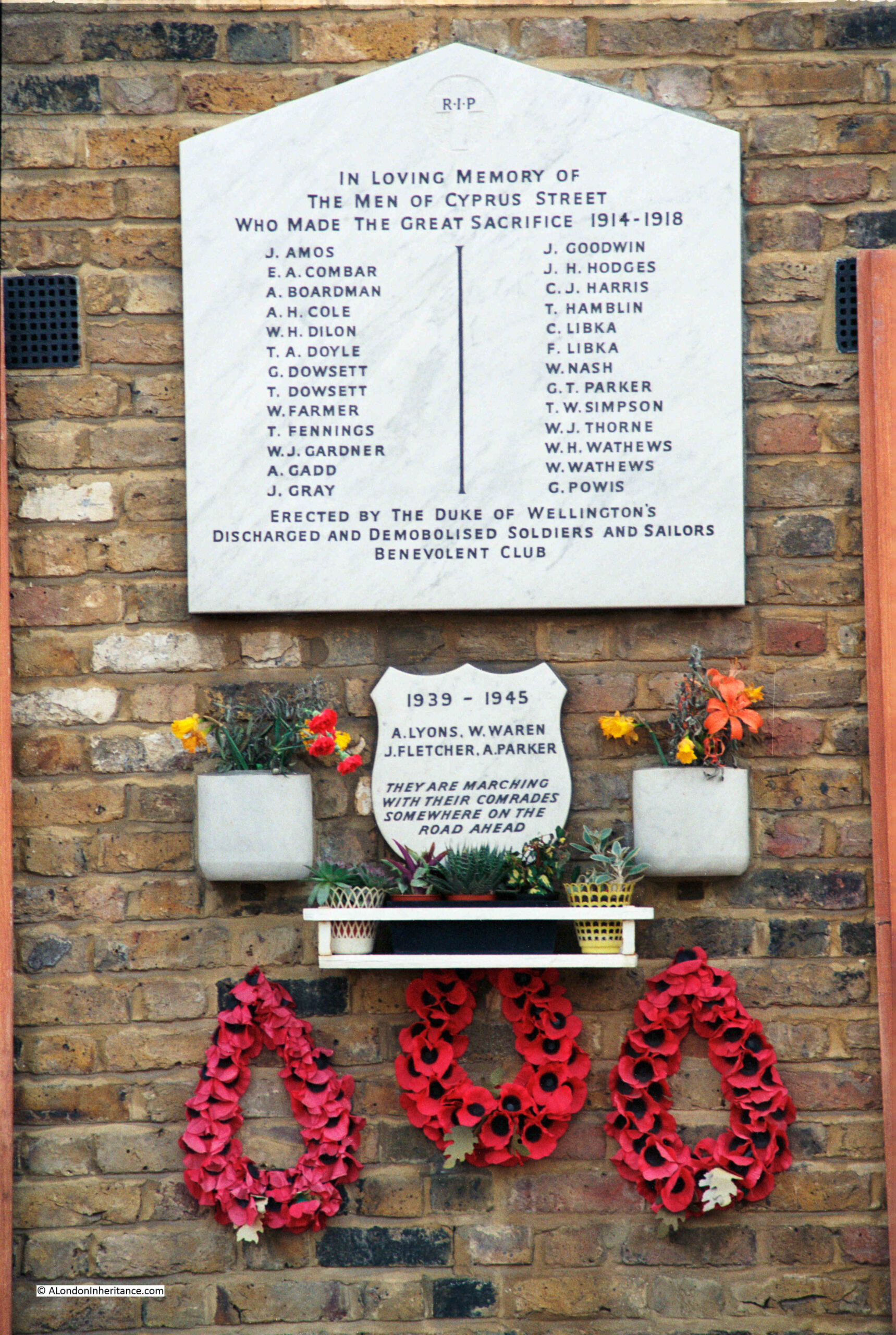
Cyprus Street War Memorial

Forty years later, I went back to take a 2023 photograph:
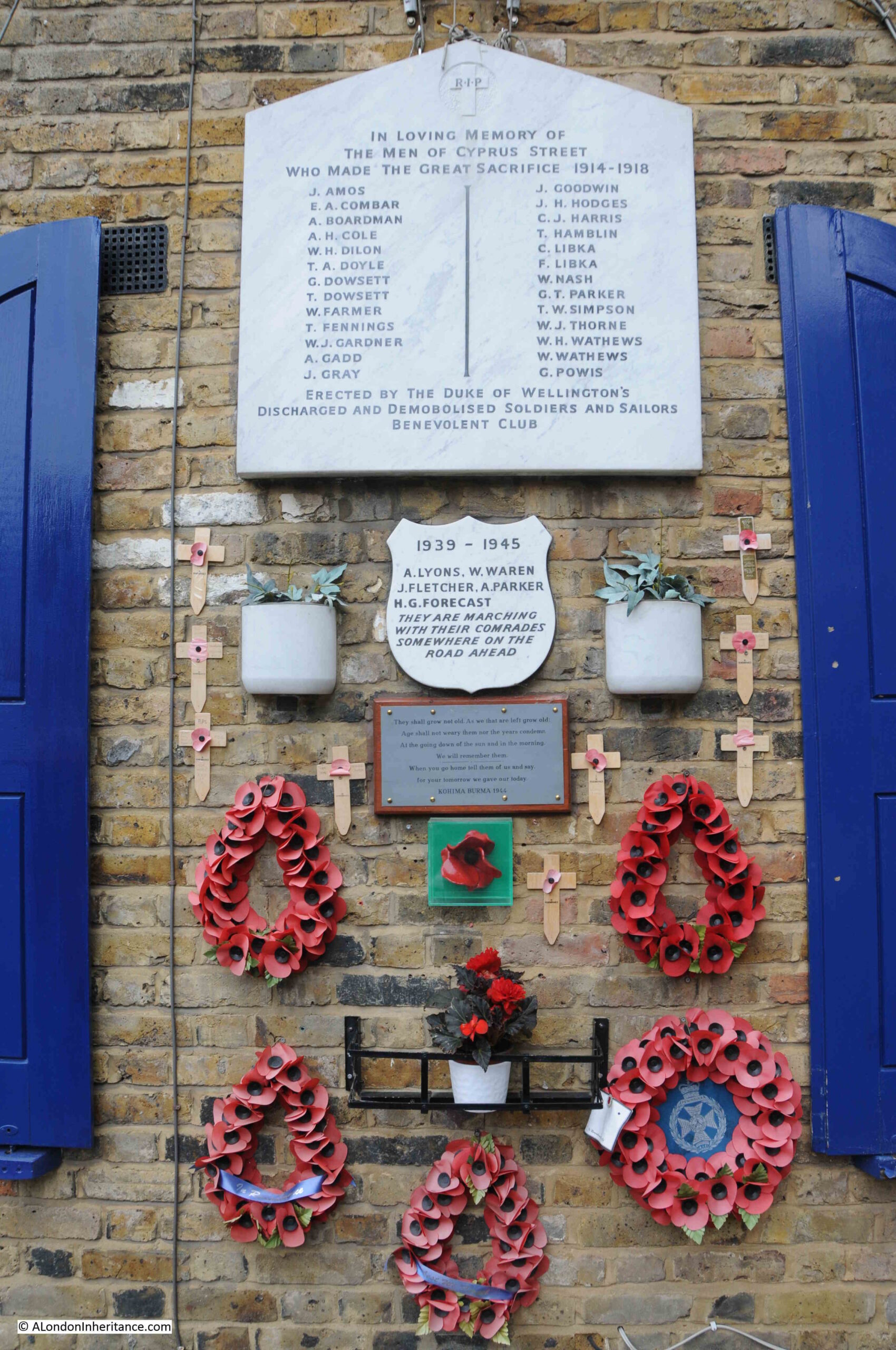
Cyprus Street War Memorial

There are a couple of interesting changes to the overall memorial. The small memorial below the main First World War memorial is for the Second World War, presumably also for those from the street who died during that war. In my 2023 photo, this plaque has had a name added since the 1980s.

Below that there is a new plaque which has been added:
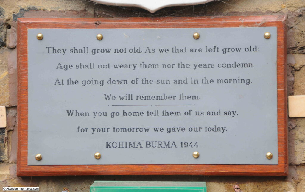
Kohima memorial

And below the above plaque is one of the ceramic poppies from the 2014 display in the moat of the Tower of London to commemorate the start of the First World War.

The memorial in Cyprus Street:
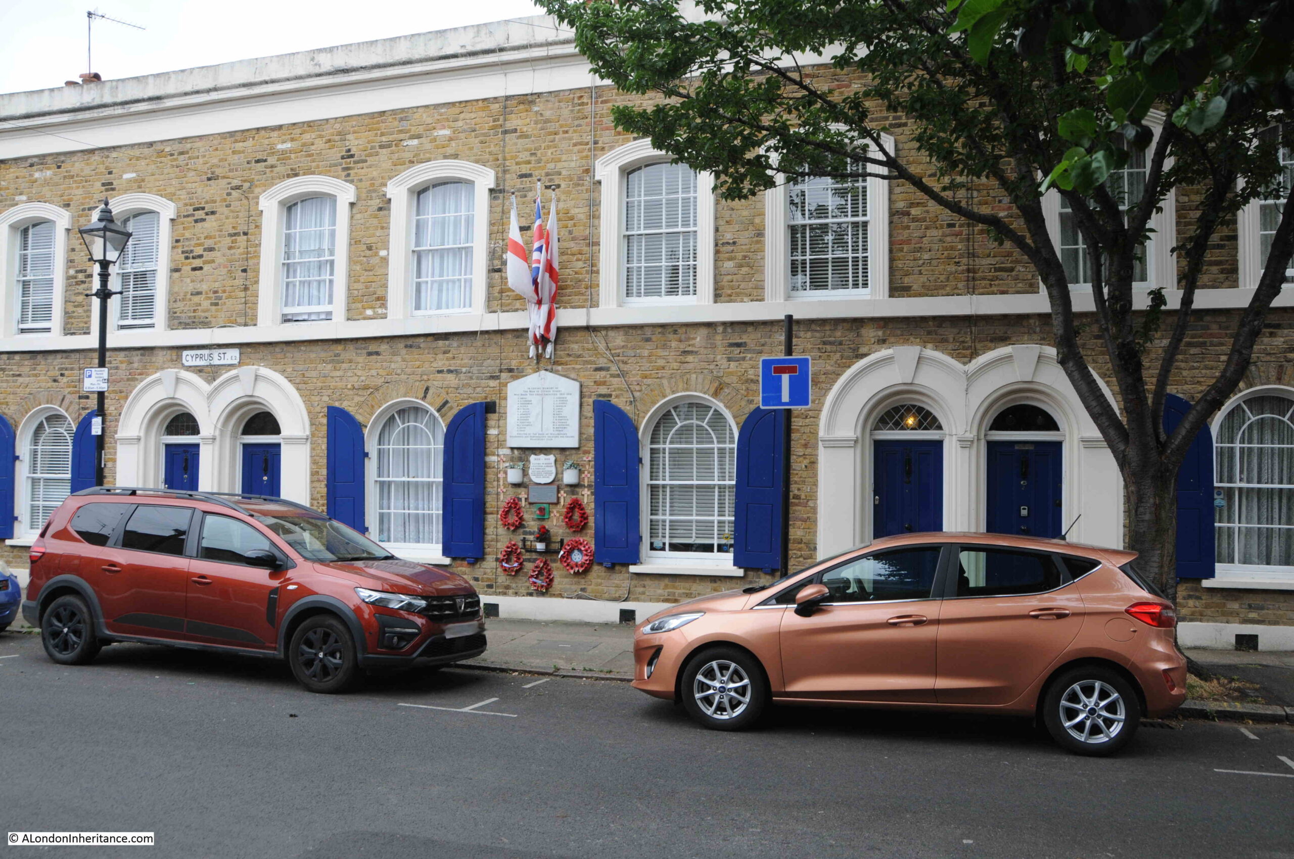
Cyprus Street war memorial

The memorial is not in its original location. I have read a number of slightly different stories online about the fate of the original memorial, and move to the current location. I will use the following quote from the publication “Not forgotten, A review of London’s War Memorials”, published by the Planning and Housing Committee of the London Assembly in 2009:

“The memorial was originally on the wall between numbers 45 and 47
but in the 1960s, when one end of the street was redeveloped for a
new housing estate, the main memorial was broken while it was being
removed. The community rescued the plaques and for a while the
fragments lay around the local pub, the Duke of Wellington. After a
number of years the community took the opportunity to use the
refurbishment of their street to make a collection to pay for a replica
of the original memorial to be made at a local stonemasons and got
permission from the housing association to relocate it to where it now
stands.”

The London Assembly document states that the current memorial is a replica of the original. I have read other accounts that state it was repaired, however if that is true, then it must have been a very good repair.

The problem with determining which sources are correct is difficult as even in the London Assembly document there is an error. It states that “The original Cyprus Street memorial was erected at the end of 1918 to commemorate the residents of the street who died in the First World War”, however I have found a number of reports from newspapers of the time which state that the memorial was unveiled in 1920, perhaps there was a two year delay between erecting the memorial and unveiling, however I doubt it.

It is always difficult to be 100% confident in many statements that are recorded as facts.

What ever the truth of the memorial, nothing can detract from what it represents – the impact of war on one small London street.

The plaque was unveiled on Saturday the 5th of June, 1920, and the East London Observer had a report of the unveiling in the following Saturday’s issue:

“A BETHNAL GREEN WAR MEMORIAL – In Memory of Cyprus Street Men. A touching ceremony took place last Saturday afternoon at Cyprus Street, Bethnal Green, where there was unveiled and dedicated a War Memorial Tablet to the men of the street, which is in the parish of St. James-the-Less, Bethnal Green, who had fallen in the Great War. The memorial was raised by the members of the Duke of Wellington’s Discharged and Demobilised Solders’ Benefits Club, of which Mr. Keymer is the Chairman.

The St. James Brass Band opened the service and after hymns, prayers and lessons, the Rev. J.P.R. Rees-Jones, Vicar of the parish, unveiled and dedicated the memorial tablet.

The tablet is of white marble with imperishable lead lettering, with a beautiful scroll, the work being executed by Messrs. B. Levy and Sons, ltd. monumental masons, Brady Street, Whitechapel, a firm which has gained much notoriety by virtue of the excellence of workmanship and design, and the tablet was greatly admired by all who attended the interesting ceremony.

The Vicar gave a short but inspiring address, and after an anthem, “What are these arrayed in white robes”, given by the St. James’s choir, and the hymn “Lead Kindly Light”, the blessing was pronounced, followed by the “Last Post”, the “Dead March” and “Reveille”. There was a large assembly, and for once in a way Bethnal Greeners stopped to think of something else than their every day cares.”

The names on the memorial joined the names on thousands of other war memorial that were erected after the First World War, and the problem with war memorial is that the sheer number of names hides that fact that these were all individuals, and I have tried to find out about some of those listed.

In the 1911 census (the nearest I can get to the First World War for a full list of those living in Cyprus Street), there were 827 people recorded as living in the street.

Given that 26 people are listed as having died during the First World War, assuming roughly the same number of people were living in the street as in 1911, then 3% of the street’s residents would die in the war.

Whilst this may initially seem a relatively low number, many families at the time would have large numbers of children, so as a percentage of adults in the street, it was much higher than 3%.

When comparing the names on the memorial, I was surprised that a relatively high number were not listed in the 1911 census, implying that they were not then living in the street, I did wonder if those commemorated were from surrounding streets, however the memorial clearly states that they are the men of Cyprus Street.

I did find a number listed in 1911, and the census records provide a more rounded view of the names on the monument, for example:

  • A. Gadd – The Gadd family lived at number 51 Cyprus Street. There were two Alfred Gadd’s in the family. The father who was 45 in 1911 and the eldest son who was 18. The father was a Cabinet Maker, and the son was Linen Collar Sorter. I suspect that it was the son who died in the war, as the father would have been approaching 50 by 1914. As well as the father and oldest son, there was the wife Elizabeth (44), daughters Rosalie (20, a Brush Hair Sorter) and Elizabeth (16, a Dressmaker)
  • J. Goodwin – The Goodwin family lived at number 91 Cyprus Street. There were two John Goodwin’s in the family, however the eldest son John was only 6 in 1911, so it is the father, who was aged 27 and listed as a Butcher who died in the war. As well as the father and oldest son, there was the wife Elisa (26) and children Robert (5), Charles (4), daughter Grace (2) and youngest son Sidney (0, born in 1911)
  • T. Hamblin – The Hamblin family lived at number 59 Cyprus Street. T. Hamblin refers to Thomas Hamblin who was 32 in 1911 and listed as a Dock Labourer. He lived in the house with his wife Elizabeth (30 and a Tailoress). No children are recorded.
  • W. J. Gardner – There was no W. J. listed in the 1911 census, but there was a William Gardner at number 64, so I assume he may have left his middle name out of the census. William Gardner was 27 and a Builders Labourer. He lived in number 64 with his wife Florence (25 and a Skirt Machinist) and daughter Florence who was 4.

Just four out of the twenty-six who are listed on the memorial, but it reminds us that these were individuals with jobs and families, who would have impacted by their loss for very many years to come. The youngest child, Sydney Goodwin would hardly have known his father and Sydney could have lived to the end of the twentieth century.

It is also interesting to compare the number of names on the memorials for the First and the Second World Wars, with far less from the street who died in the Second World War.

This comparison shows the absolutely appalling death rates from the trench warfare of the First World War.

The reference on the memorial to the Duke of Wellington’s Discharged And Demobilised Soldiers And Sailors Benevolent Club refers to the Duke of Wellington pub in Cyprus Street. The pub was built around 1850 as part of the development of Cyprus Street and surrounding streets. The pub closed in 2005, but today still very clearly retains the features of a pub, including a pub sign:
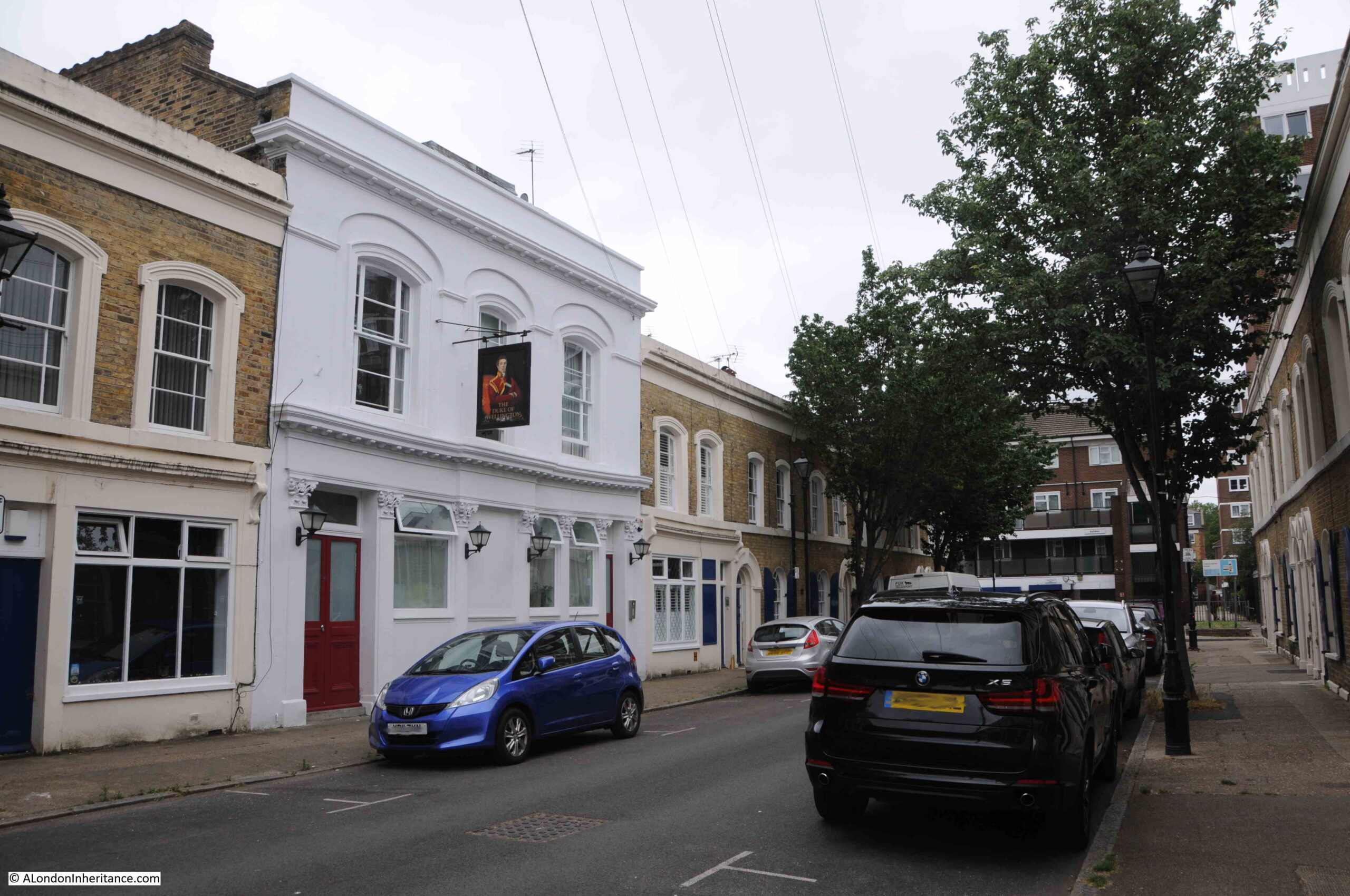
Duke of Wellington pub

The Duke of Wellington, like many other pubs in the working class areas of London, had a tradition of hosting benefit and loan societies.

In 1911 there was a large advert for the Duke of Wellington in the Eastern Argus and Borough of Hackney Times headed “Important Notice”. It was one of the very many adverts that publicans would place in the local newspapers when they took over a pub. The advert would tell potential customers that all classes would receive a warm welcome, that only the very best beers and spirits would be served, and the advert of the Duke of Wellington also included that:

“The United Brothers Benefit Society meets here every alternate Tuesday evening and the Duke of Wellington Loan and Investment Society (which has been established for over 20 years) every Saturday evening. New members to both societies respectfully invited and heartily welcomed.”

It was hosting societies such as these, as well as the very many clubs and societies involved with sports and games that put these 19th century pubs at the heart of the communities that developed around them.

The pub, as well as much of the original Cyprus Street terrace houses are Grade II listed.

A chunk of the western part of Cyprus Street was badly damaged during the Second World War and the Cyprus Street Estate was built across the area that was damaged. This has effectively separated two parts of the original street.

In the following map, the red oval shows where Cyprus Street has been separated by the new estate, with a short stub of the street to the left, and the main section of the street to the right ( © OpenStreetMap contributors ):
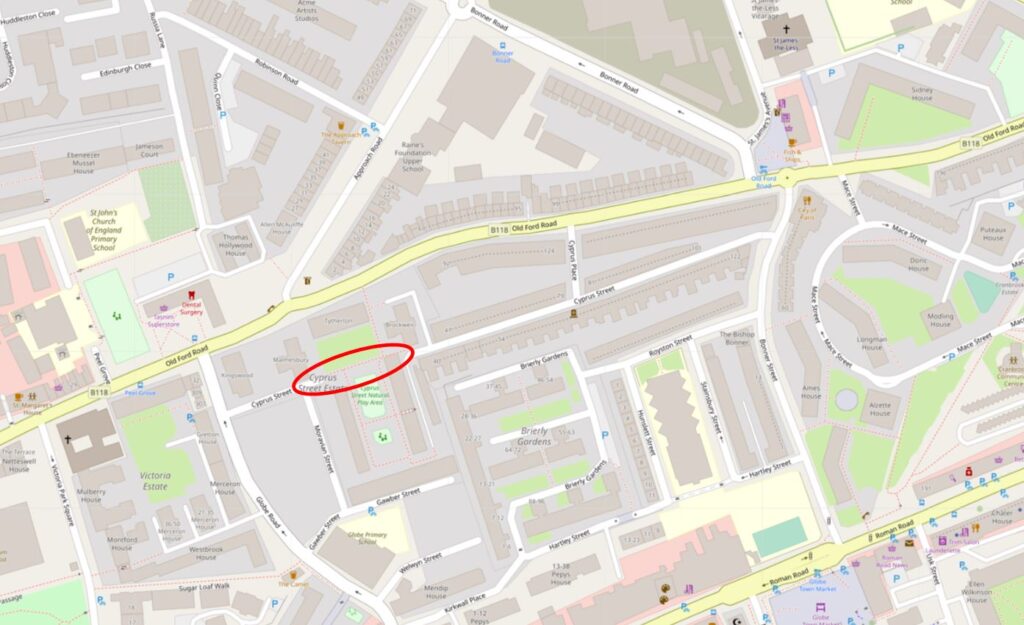
Bethnal Green map

The new estate can be seen just to the west of the old pub:
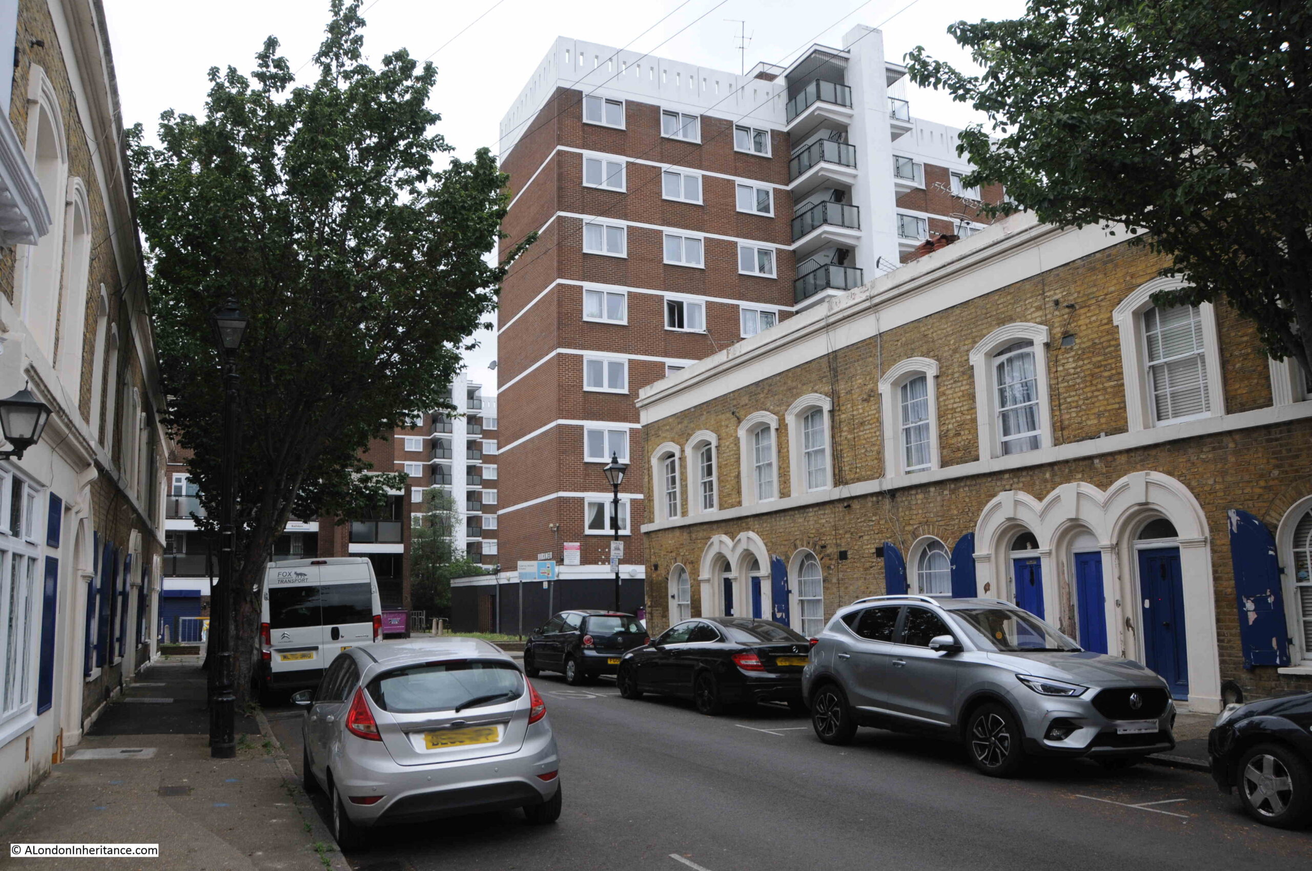
Cyprus Street

Cyprus Street is fascinating, not just for the war memorial, and architecture of the terraces, but also the way they are decorated, with many of the houses having a brightly painted front door and window shutters:
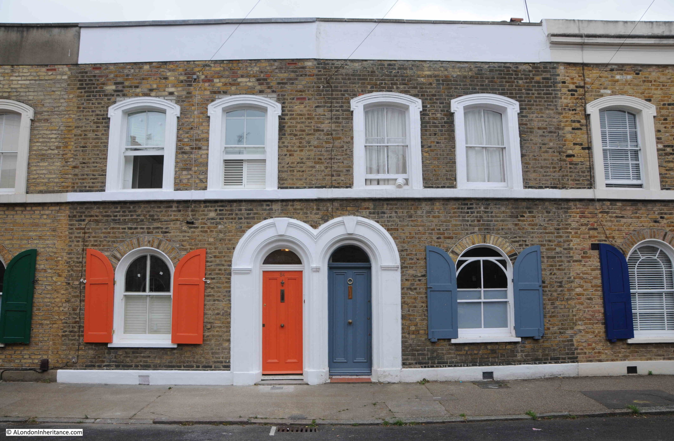
Cyprus Street

View along the main surviving section of the street:
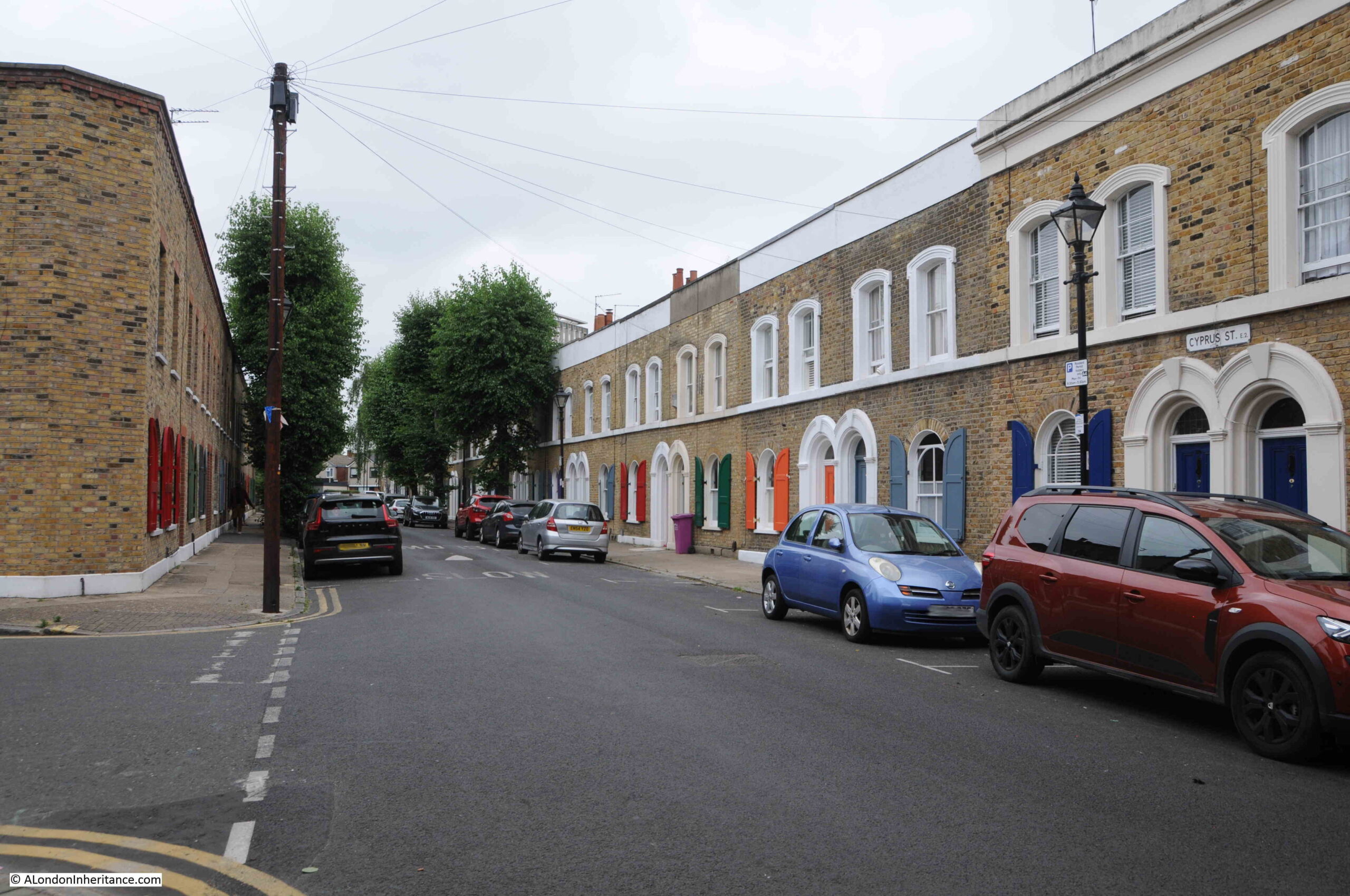
Cyprus Street

Cyprus Street is identical to many other mid 19th century streets that appeared as Bethnal Green was developed, what has made it special is the war memorial and the retention of the majority of the original terrace houses.

As indicated by the Duke of Wellington’s Benevolent Club that erected the memorial, the pub must have played an important part in the community that lived along the street.

There were so many pubs in Bethnal Green (as there was across much of London), and in Bethnal Green the majority have closed, with many being demolished or converted into flats.

As I was walking to Cyprus Street, along Bonner Street, I saw another old pub just after the junction with Cyprus Street.

This is the Bishop Bonner, on the corner of Bonner Street and Royston Street:
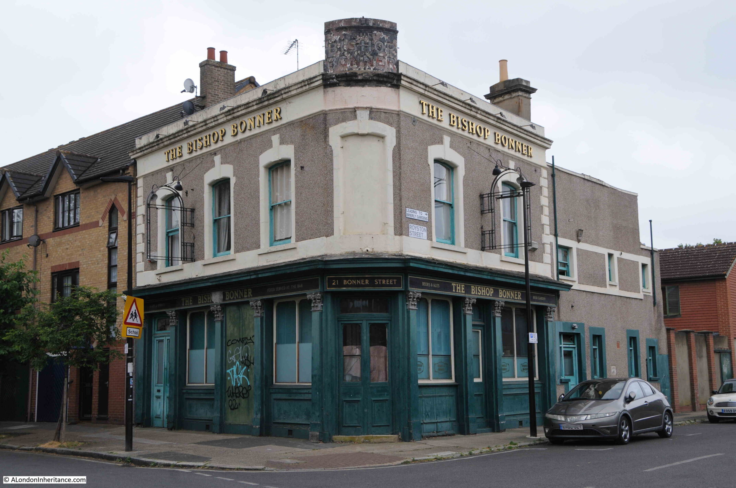
Bishop Bonner, Bonner Street

Another 19th century pub, which finally closed in 1997. The first floor appears to be flats, however the ground floor looks rather derelict. It would be interesting to look in and see if any of the remaining bar furniture survives.

Name sign on the corner of the pub:
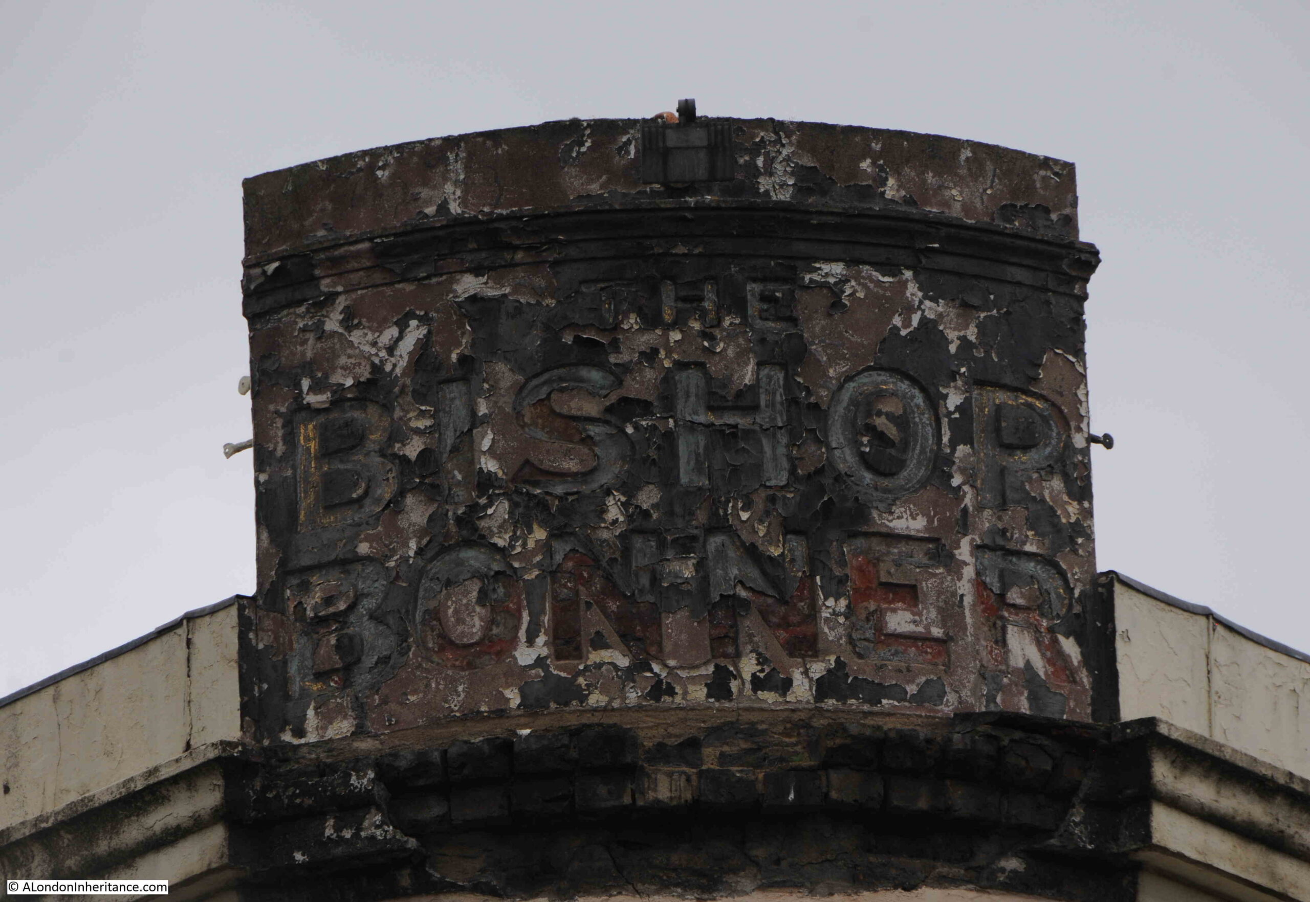
Bishop Bonner, Bonner Street

Always interesting to think of the thousands who have walked through these doors, when the pub was the hub of the local community for well over 100 years:
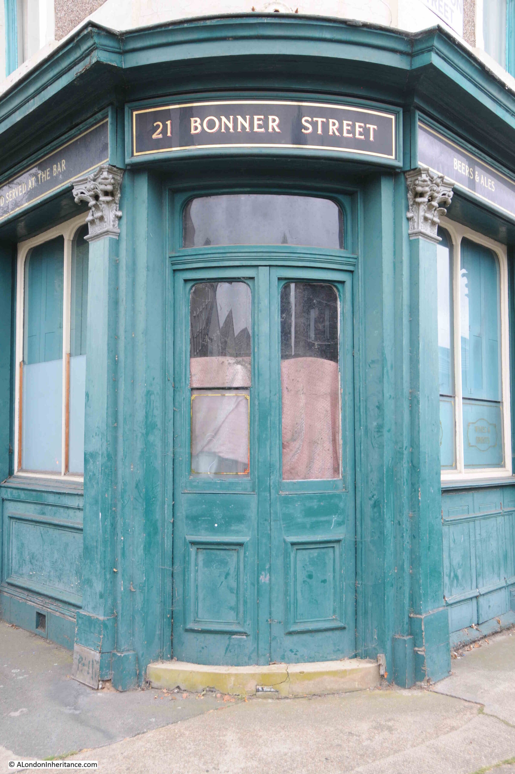
Bishop Bonner, Bonner Street

Whilst so many of London’s pubs disappear or are converted, the memorial in Cyprus Street remembers not just the residents of the street who died in the First and Second World Wars, but also remembers the community that was in the street at the time, that enabled the memorial to be created and maintained during the following decades.

alondoninheritance.com

St. Paul’s Covent Garden, the Actors Church

The tickets for all the walks of my new Limehouse walk sold out by Monday morning, so a very big thank you. The proceeds from these walks go towards the hosting, maintenance and research of the blog, so it is very much appreciated. I have had a number of requests for new dates, so have added two more, on the 31st of August and 10th September, which can be booked by clicking on the dates.
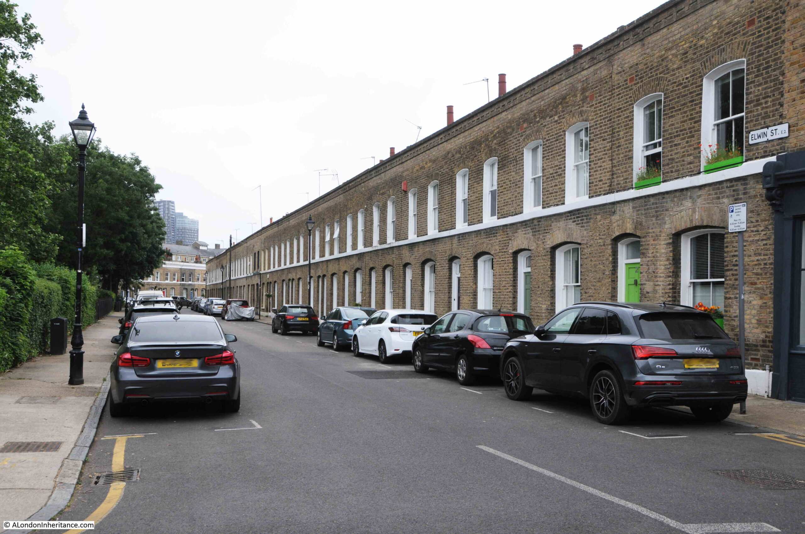
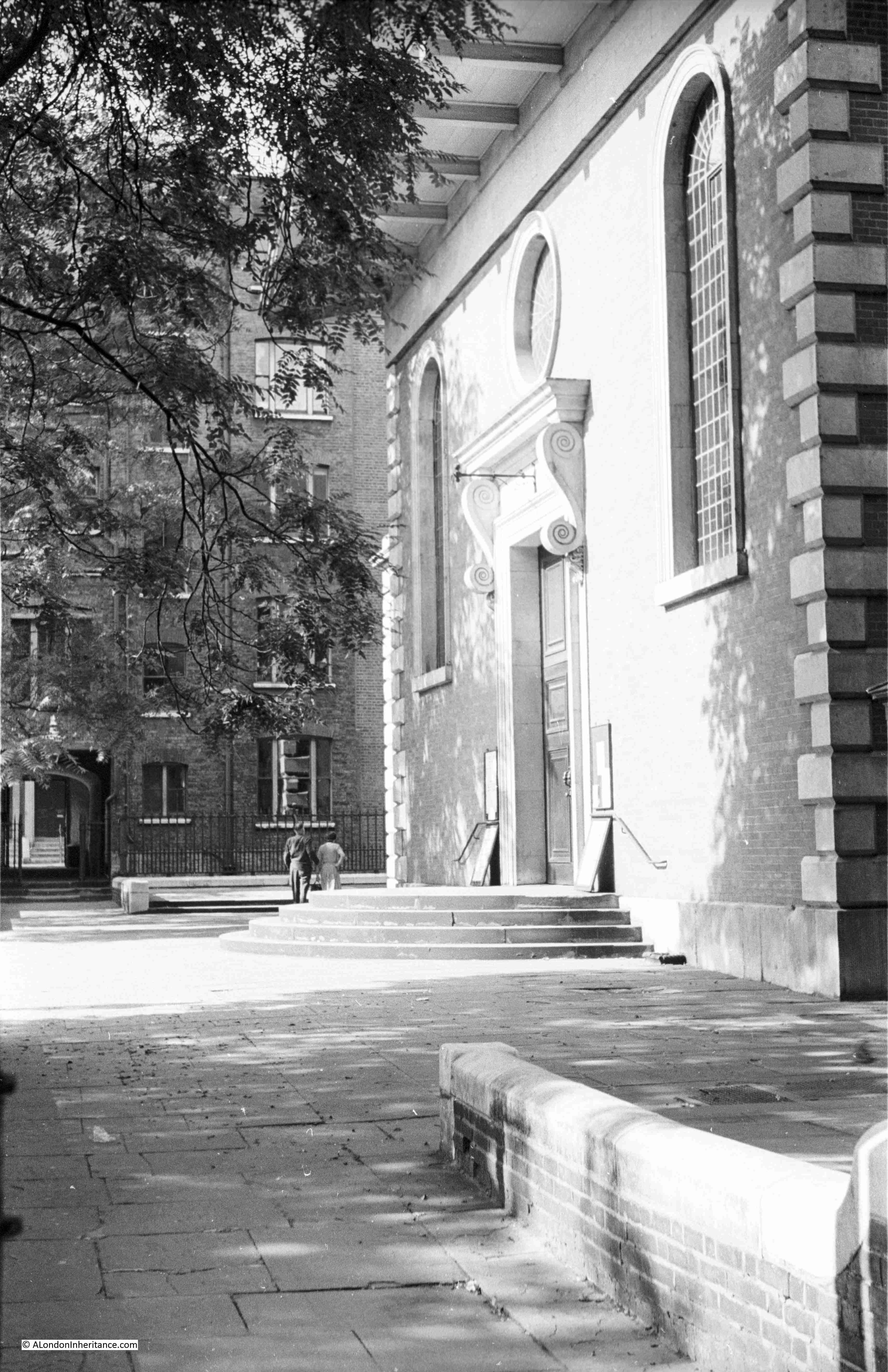
In 1951, my father took a couple of photos of the main entrance into St. Paul’s Church, Covent Garden:

St Paul's Covent Garden the Actors Church

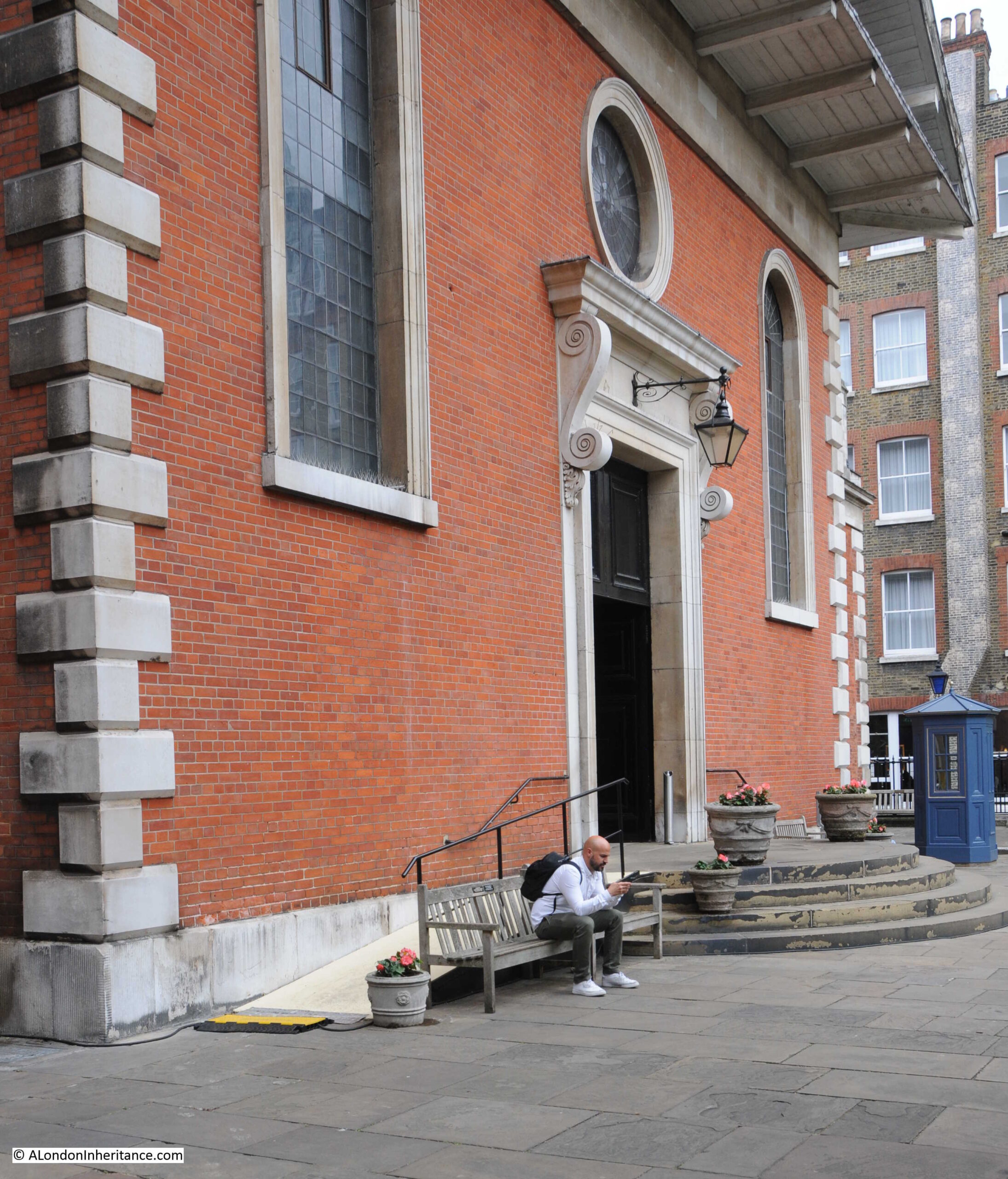
He was far better at timing the position of the sun and weather conditions than I am, however the view is much the same today, some 72 years later:

St Paul's Covent Garden the Actors Church

A view of the main entrance to the church from the opposite side of the churchyard:

St Paul's Covent Garden the Actors Church

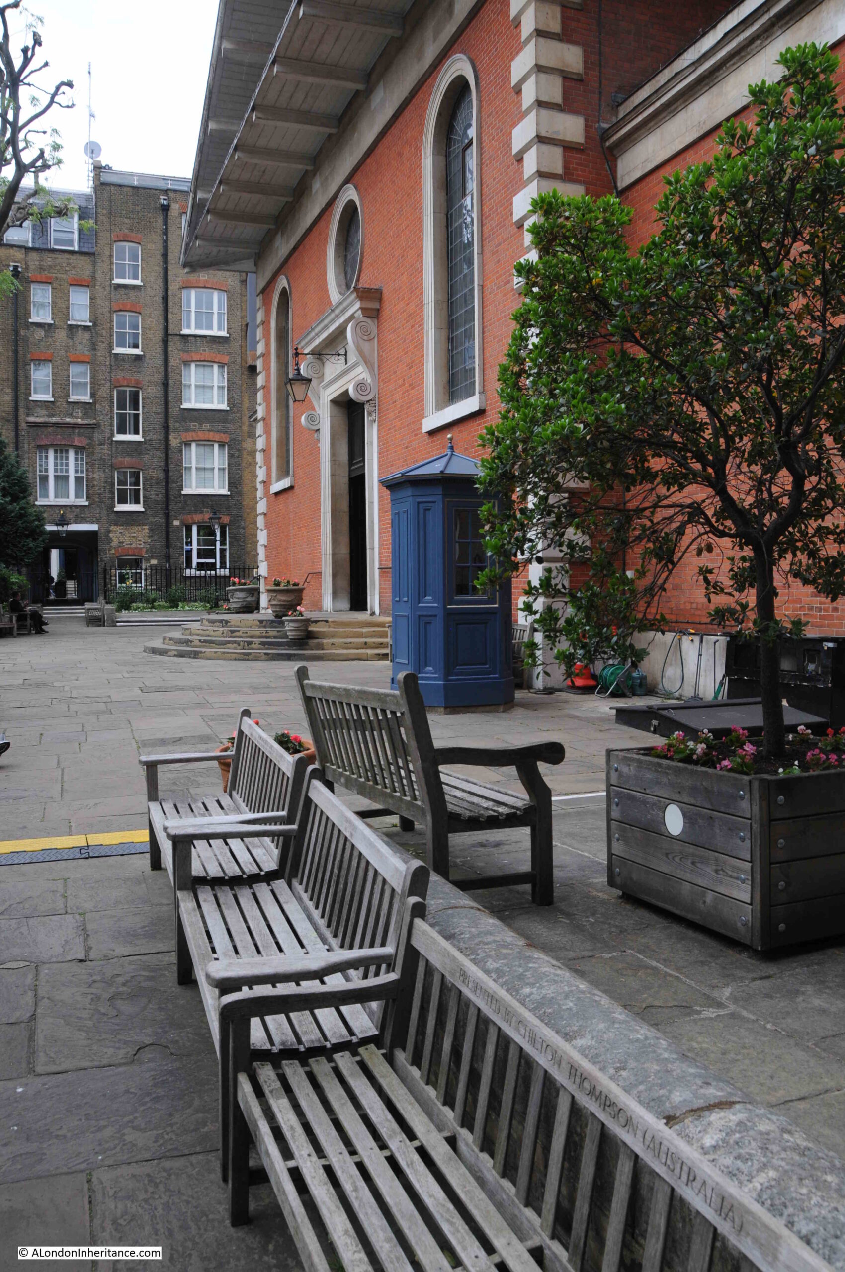
And the same view in 2023:

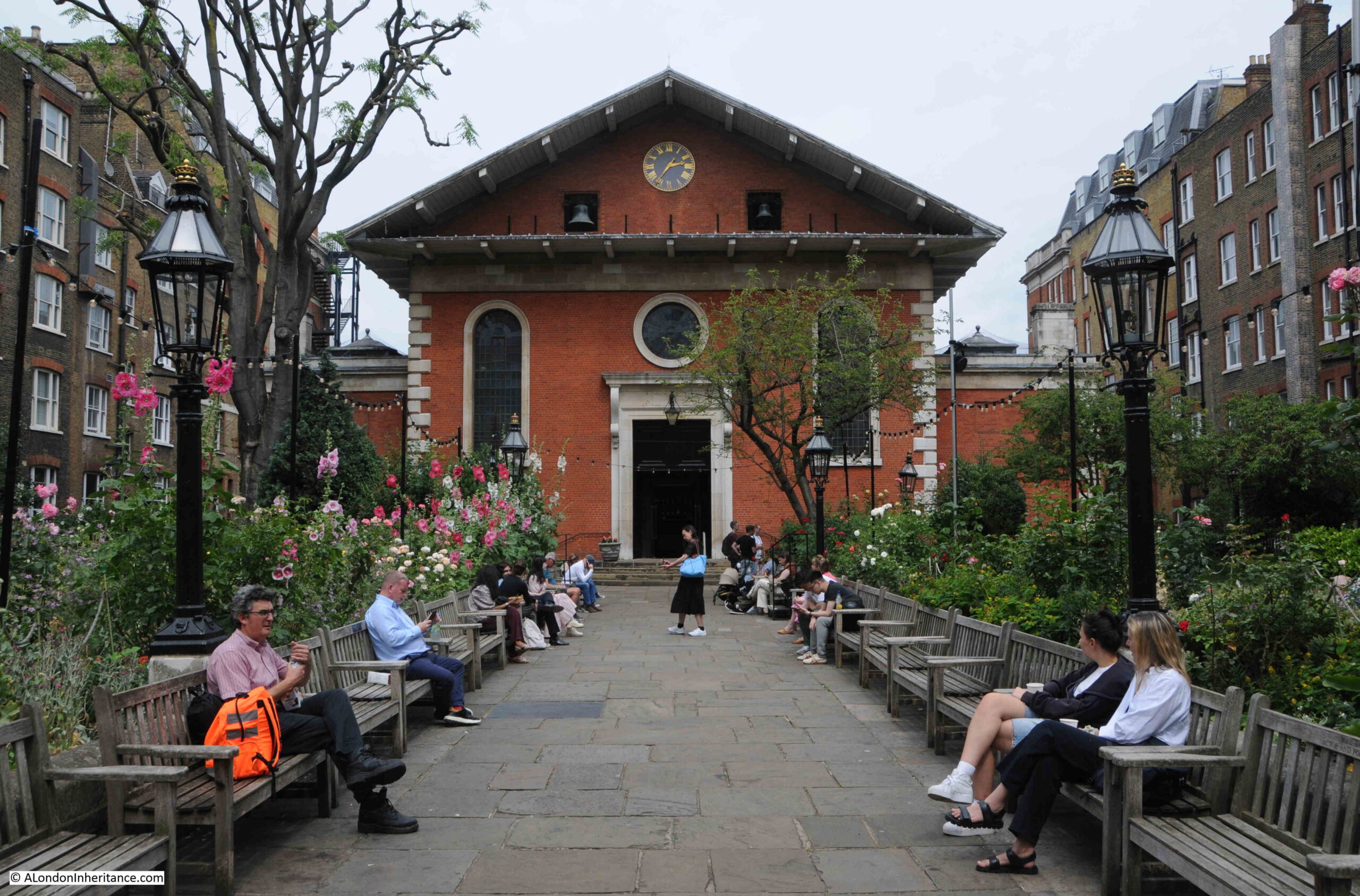
St Paul's Covent Garden the Actors Church

The church of St. Paul’s was one of the first buildings to be constructed as part of the development of the Covent Garden Piazza by Francis Russell, the 4th Earl of Bedford.

The Russell family were significant land owners, and within London this included the area around Covent Garden, along with significant holdings across Bloomsbury. The land at Covent Garden came into their position in 1552 when the first Earl was granted the land by the Crown.

Development of the Covent Garden Piazza and St. Paul’s Church commenced around 1630 when Inigo Jones designed the overall layout of the square. Construction of the church began in 1631 and it appears to have been completed and furnished by 1635, but was not consecrated until 1638 due to a dispute with the vicar of St. Martins-in-the Fields, mainly about the physical boundaries and the degree of independence of the new church. The Earl of Bedford had a family pew in St. Martin’s, but released this in 1635 when his new church in Covent Garden was ready.

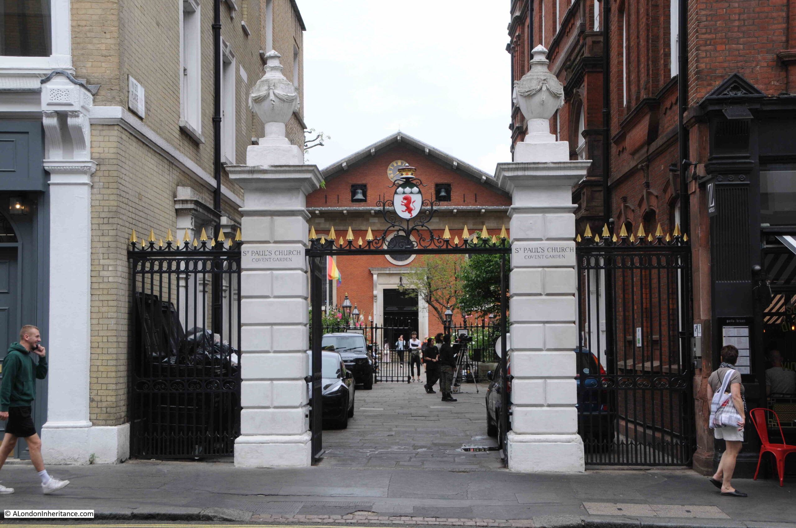
The main entrance to the church is in Bedford Street, where the brick façade of the church can be seen between two pillars with ornate railings on either side, and providing a gate between the pillars:

St Paul's Covent Garden the Actors Church

Through the gates and we are into the churchyard:

St Paul's Covent Garden the Actors Church

The churchyard was closed to burials in 1853 and in the following couple of years all the tombstones were either removed or laid flat. The churchyard was renovated between 1878 and 1882, when the ground was also lowered and flattened.

Today, the churchyard has a wide path leading up to the entrance of the church, with seating along both sides of the path. To either side of the path are gardens and grassed spaces.
As can be seen in the above photo, the main body of the church and the churchyard are surrounded by tall terrace buildings along either side, and the church has long had a complex relationship with these buildings.
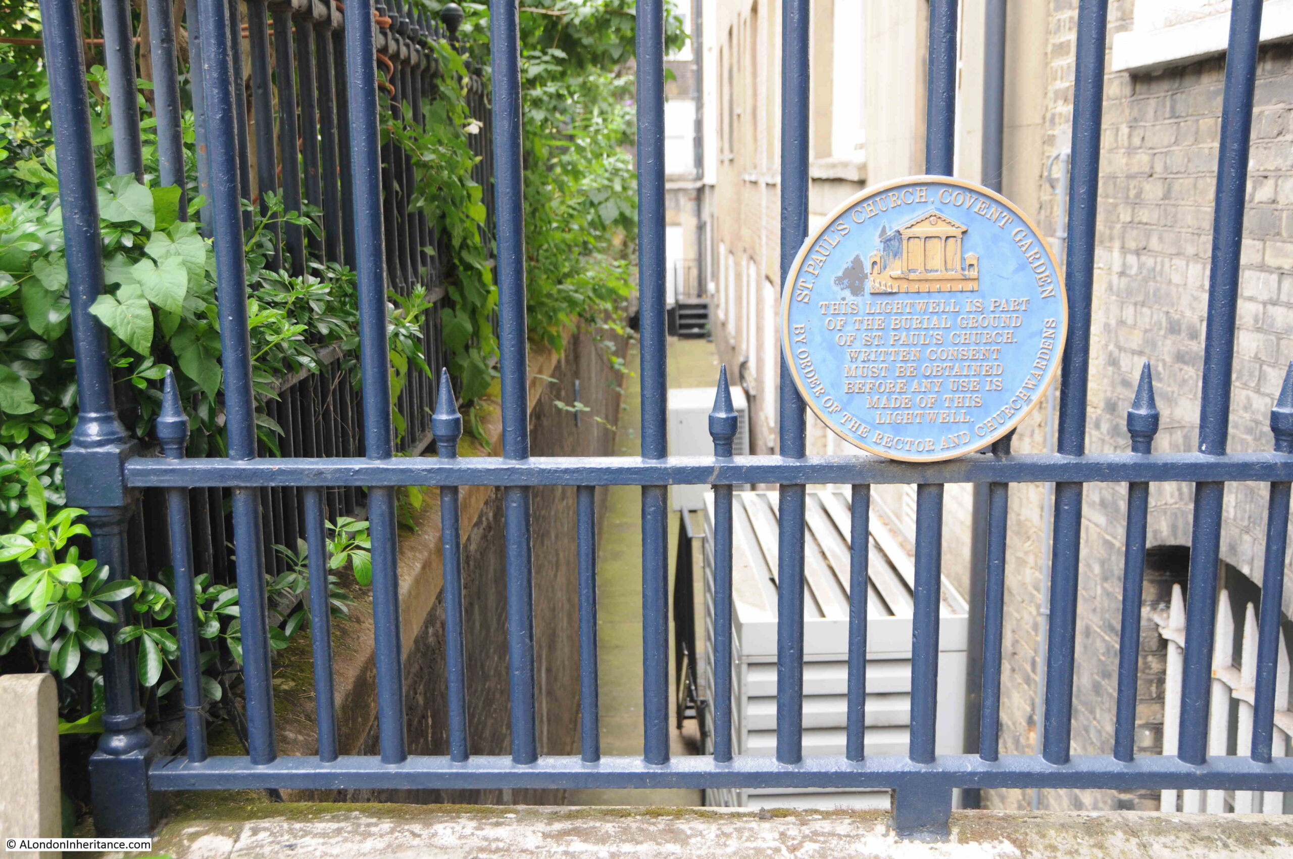
On both sides of the churchyard, there is a space between the wall of the churchyard and the adjacent buildings:

St Paul's Covent Garden the Actors Church

The plaque reads: “This lightwell is part of the burial ground of St. Paul’s Church. Written consent must be obtained before any use is made of this lightwell.”

Originally, the churchyard ran up to the walls of the buildings, and doors and windows in these buildings which provided access to the churchyard were long a cause of concern for the church, as there was an issue with people getting into the churchyard and causing a nuisance, as well as the general issue about security where all the surrounding buildings provided access.

In 1685, any door in these buildings onto the churchyard was ordered to be blocked up, unless it had been given permission by the church, who also then sold licences for the making of windows that looked out onto the churchyard.

During the later half of the 18th century, the churchwardens also had concerns regarding the rising levels of the churchyard due to the many people being buried, which seems to have included large numbers of non-parishioners as well as “with the remains of multitudes of Paupers”.

In the 1870s, the lightwell shown in the above photo was built, with lightwells on the north, west and south sides of the church. These lightwells served a number of purposes. They provided light into the lowest floors of the surrounding buildings, they provide a degree of security for the churchyard to prevent the churchyard being used for “various and improper purposes”, and as a benefit for the houses, they prevented “soakage” from the graves into the houses.

London churchyards must have been appalling places in the 18th and 19th centuries, and no wonder that burials were stopped in the mid 19th century. The vast majority seem to have been overflowing with the bodies of the dead, and the rising levels of churchyards gave an indication of the many thousands that had been buried in such a small space.

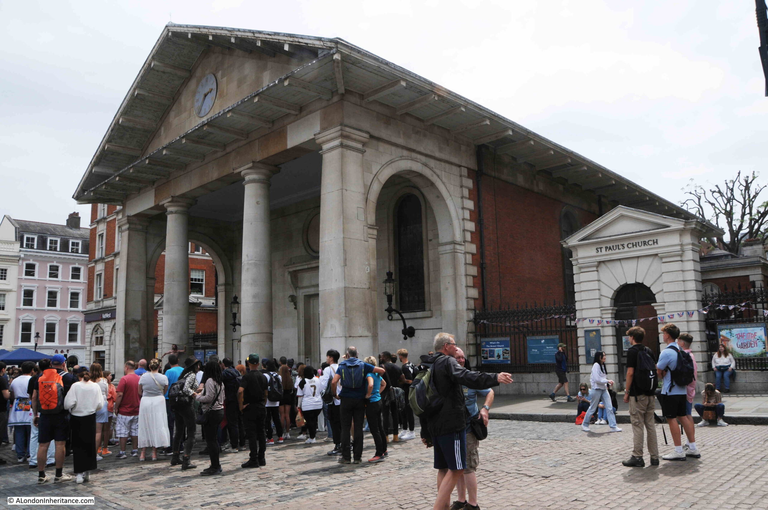
If we walk around the church into the old piazza and market area of Covent Garden, we get a very different view of the church:

St Paul's Covent Garden the Actors Church

This would have been the very visible side of the church on the new piazza that the Earl of Bedford was having built, and despite Bedford’s apparent request for a cheap church that would be “not much better than a barn”, Jones designed a grand Tuscan portico.

Whilst the portico is to the original designs, only the columns are probably original as the church was gutted by a fire in 1795, which required a significant rebuild.

The side of the church facing onto Covent Garden looks as if it should be the main entrance. When the church was built, Jones intended that it should have been the main entrance, with the altar being at the western end of the church.

This approach did not accord with the usual placement of the altar at the eastern end of Christian churches, so the entrance facing onto the Covent Garden Piazza was blocked up, and the altar is now behind this eastern wall.

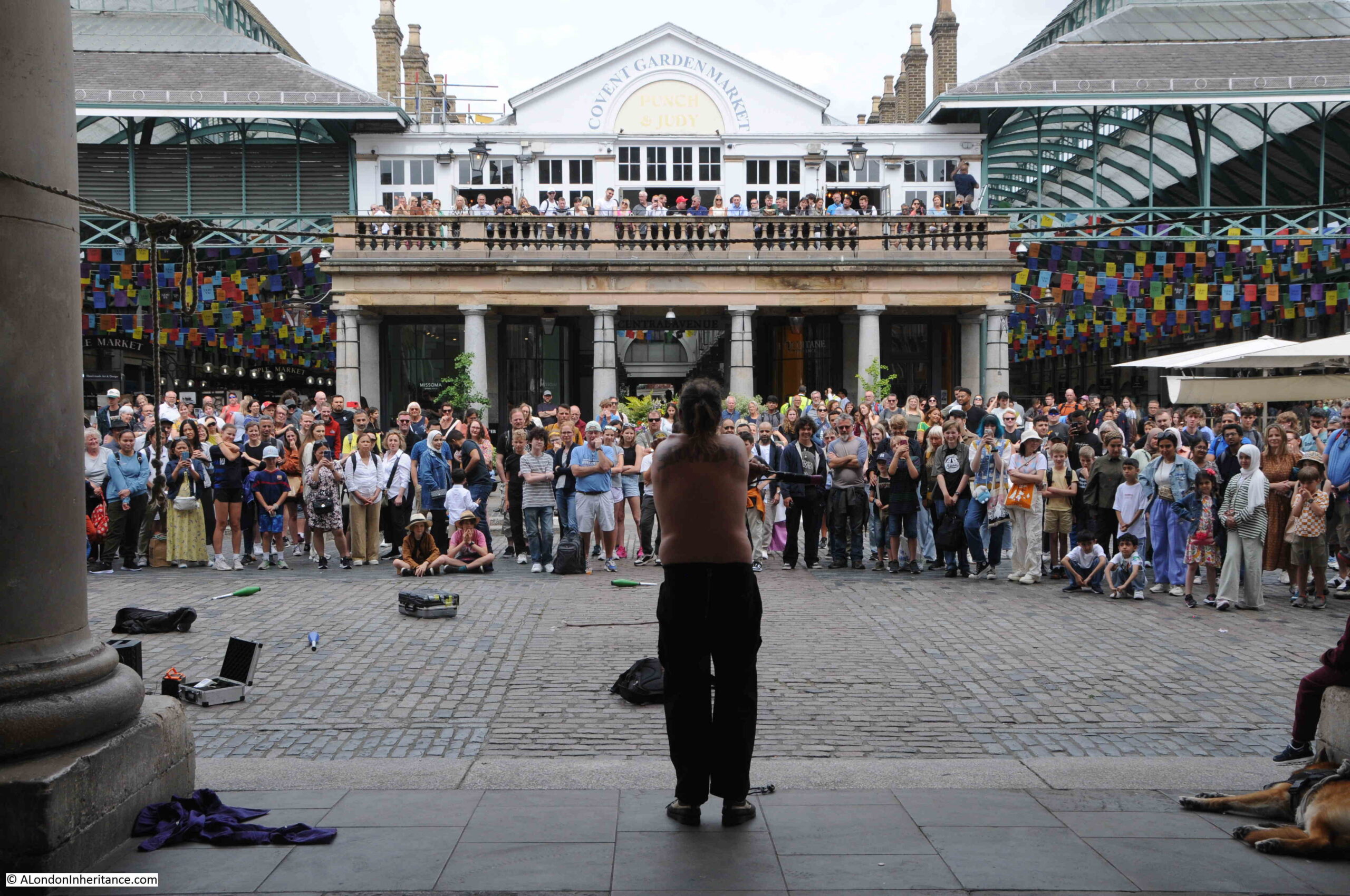
The portico does though provide an excellent place to photograph the performers in Covent Garden and the large crowds that gather to watch:

St Paul's Covent Garden the Actors Church

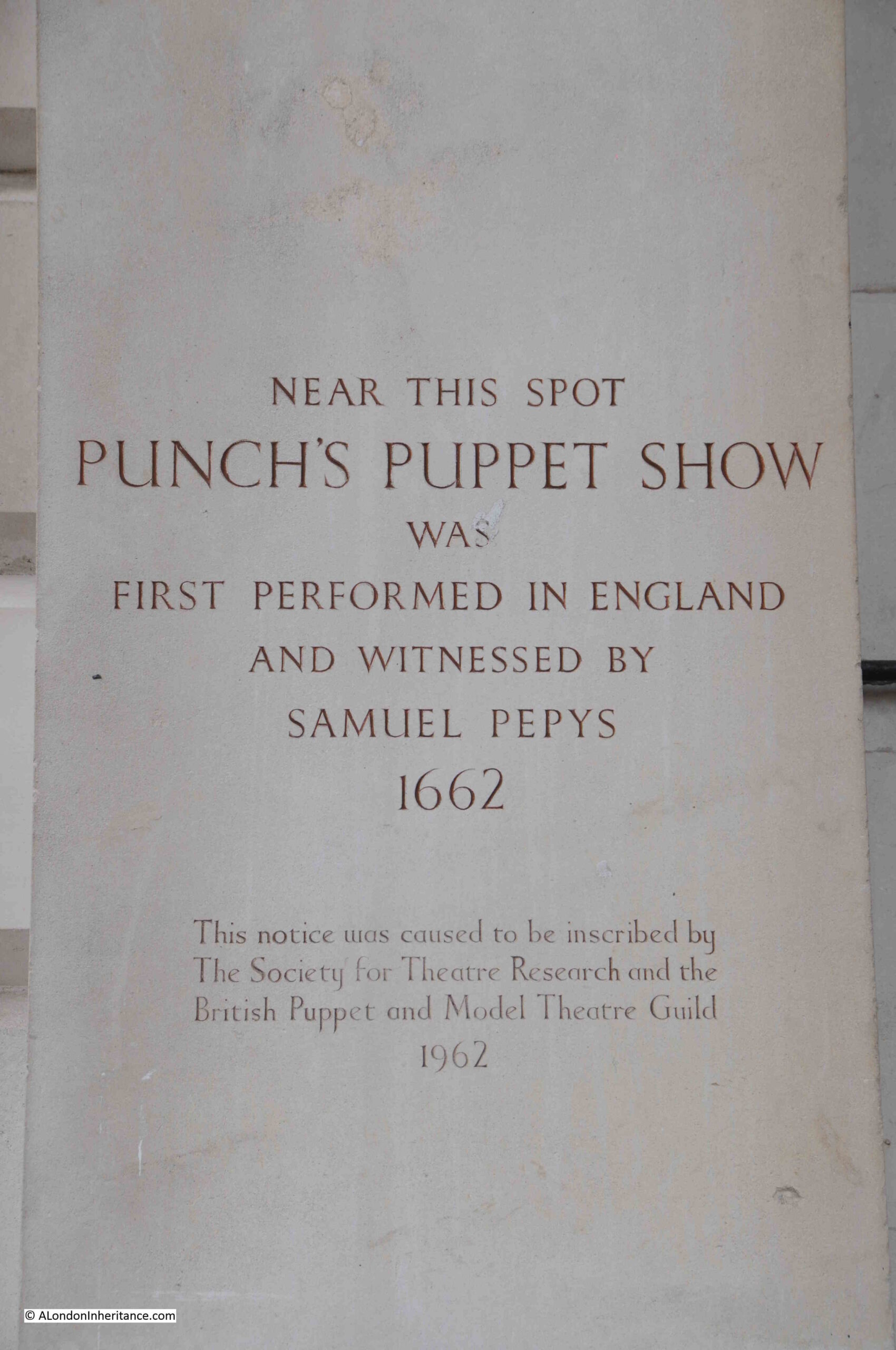
The white building above the columns is the Punch and Judy pub, and Punch has an important link with Covent Garden as indicated by this plaque on the church:

Punch's Puppet Show Covent Garden

In the years after the restoration of Charles II, a number of Italian entertainers came to England, including the puppet showman Pietro Gimonde who came from the city of Bologna.

It was Gimonde who Pepys saw in Covent Garden. At the time a Punch puppet show used the form of a marionette, where strings tied to a figure were manipulated by rods above the figure’s head.

Pepys must have been impressed by the show as two weeks later he returned to show his wife, and Gimonde must have made an impression on London society as in October 1662, he was part of a Royal Command Performance for Charles II.

Punch and St. Paul’s, Covent Garden featured in the first book of the Rivers of London series by Ben Aaronovitch, when the main character, Peter Grant meets the ghost of murdered actor Henry Pyke, who also takes on the personae of Mr. Punch, in the churchyard.

Whilst the Rivers of London series is fictional, some strange, violent and sad events have happened in St. Paul’s churchyard.

The London Bills of Mortality for the week of the 22nd to the 29th of January 1716 recorded that a person was “killed by a sword at St Paul’s Covent Garden”. Bills of Mortality also recorded a number of people who were simply found dead in the churchyard – possibly those who were sick, too poor, unable to find housing or food, or perhaps just found the pressures of life in 18th century London too hard to bear.

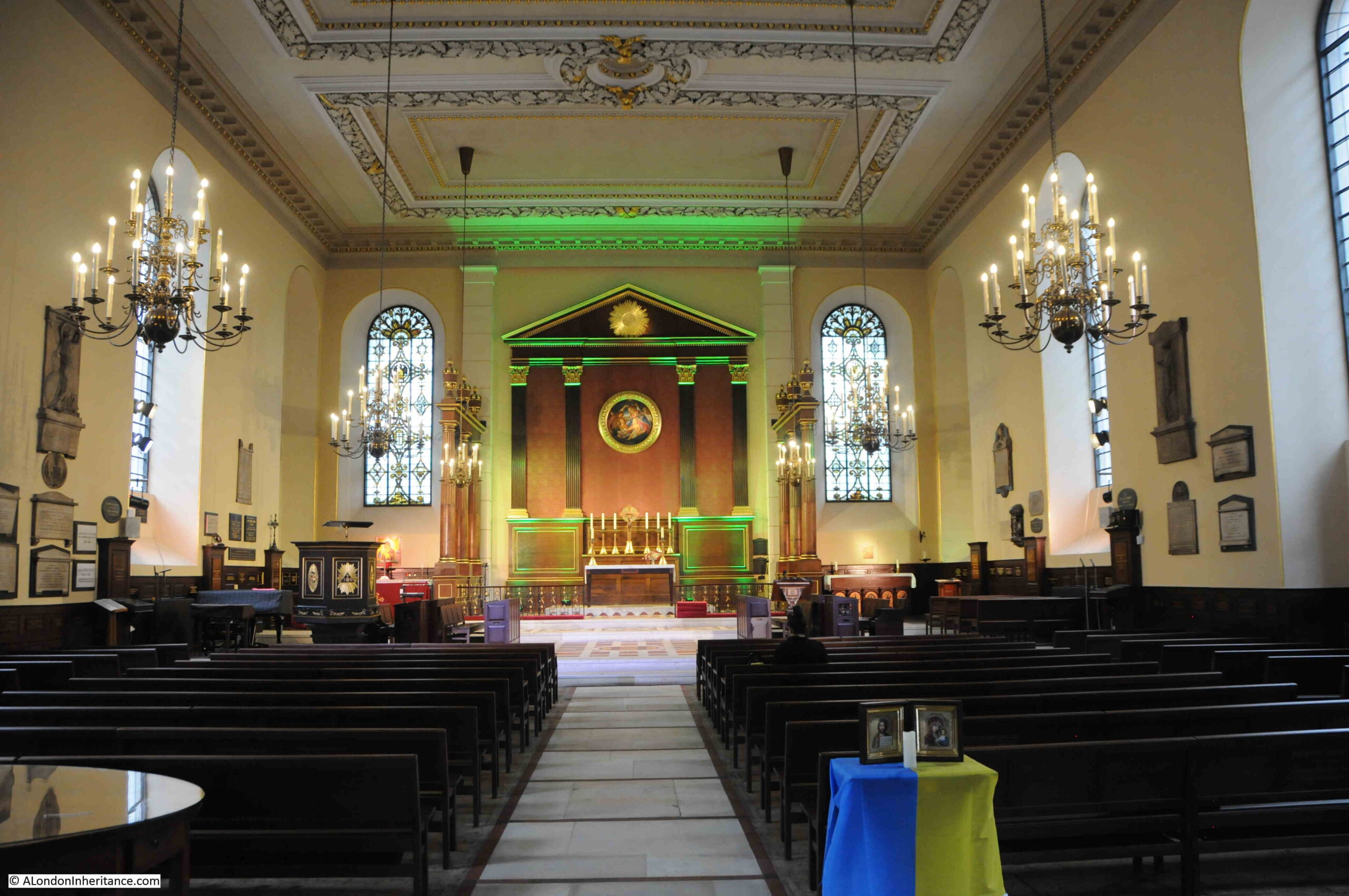
Time to take a look inside the church, away from the crowds around Covent Garden, and this is the view when entering through the main door from the churchyard:

St Paul's Covent Garden the Actors Church

As with any building of such age, it has been through very many repairs and restorations that have changed the church from its original form.

In the years after completion, the roof seems to have been a recurring cause for concern, with repairs having to be frequently undertaken, with the gradual loss of the decoration and painting across the ceiling.

By the 1780s, the church was in such a state that extensive repairs were needed. The architect Thomas Hardwick was chosen from the three that put in bids for the work. The church was closed and then followed a major programme of works that expanded as more problems were found.

From an initial budget of £6,000, the final cost when the church reopened in 1789 was £11,723.

This could have been money very well spent, however just six years later in 1795, some plumbers were carrying out work in a bell turret. They left the church for a midday break and left an unguarded fire still burning.

The fire escaped to the surrounding fabric, and soon spread to rapidly to gut the majority of the church.

The church apparently looked like one of the City church’s after the bombing of the 1940s, with only the exterior walls standing, the roof collapsed and the interior gutted.

You can probably imagine the feelings of the churchwardens when they viewed the gutted church just a few years after the period of closure and expense of a major rebuild, and they were now faced with a much larger challenge, and the difficulty of trying to raise yet more large sums of money, not long after having sought funds for the 1780s restoration.

Thomas Hardwick was again appointed for the rebuild, and money to fund the project was raised by the levy of a rate of one shilling in the Pound, and by selling annuities based on the security of the local rates.

The church was rebuilt and reconsecrated in 1798.

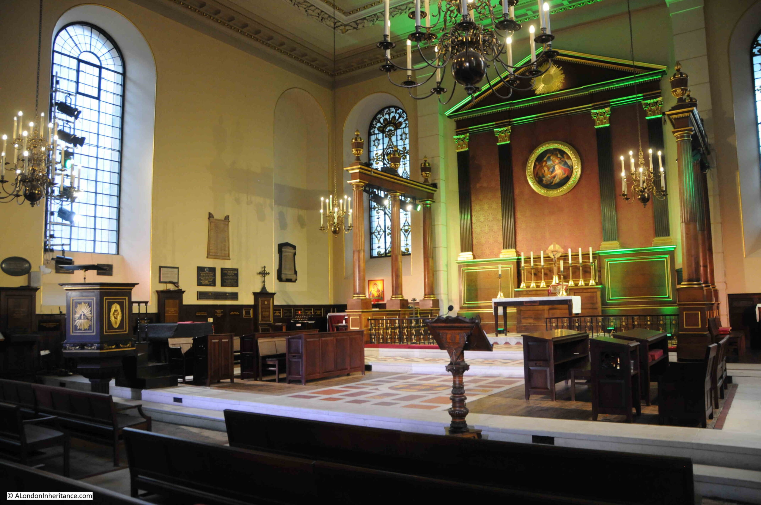
The pulpit (on the left of the following photo) is possibly by Grinling Gibbons, or by one of his pupils. Above the altar, is a copy of the Madonna and Child by the artist Botticelli:

St Paul's Covent Garden the Actors Church

There seems to have been an almost continuous programme of repair work to the church, along with occasional significant restorations, including one in the early 1870s by William Butterfield, which focused on the interior of the church, with an aim of making the interior a brighter and more pleasant place to worship. Butterfield’s work included the removal of the majority of the monuments on the internal walls.

Henry Clutton, who was architect to the Duke of Bedford made a number of proposals for restoring and improving the church in the late 1870s. Clutton’s view was that Inigo Jones had almost gone along with the original Earl’s requirement for a barn-like church, with a simple brick body to the church and with only the stone portico embellishing a simple brick barn.

Some of Clutton’s proposals were taken on by the architect A. J. Pilkington in the late 1880s. The major change to the church at this time was the replacement of the ashlar exterior (square cut stones used as a facing on a wall), by the red bricks we see today.

Following Pilkington’s work, the church has stayed much the same apart from repair and decoration work. There was some bomb damage to buildings around the church, but St. Paul’s survived the war without any damage.

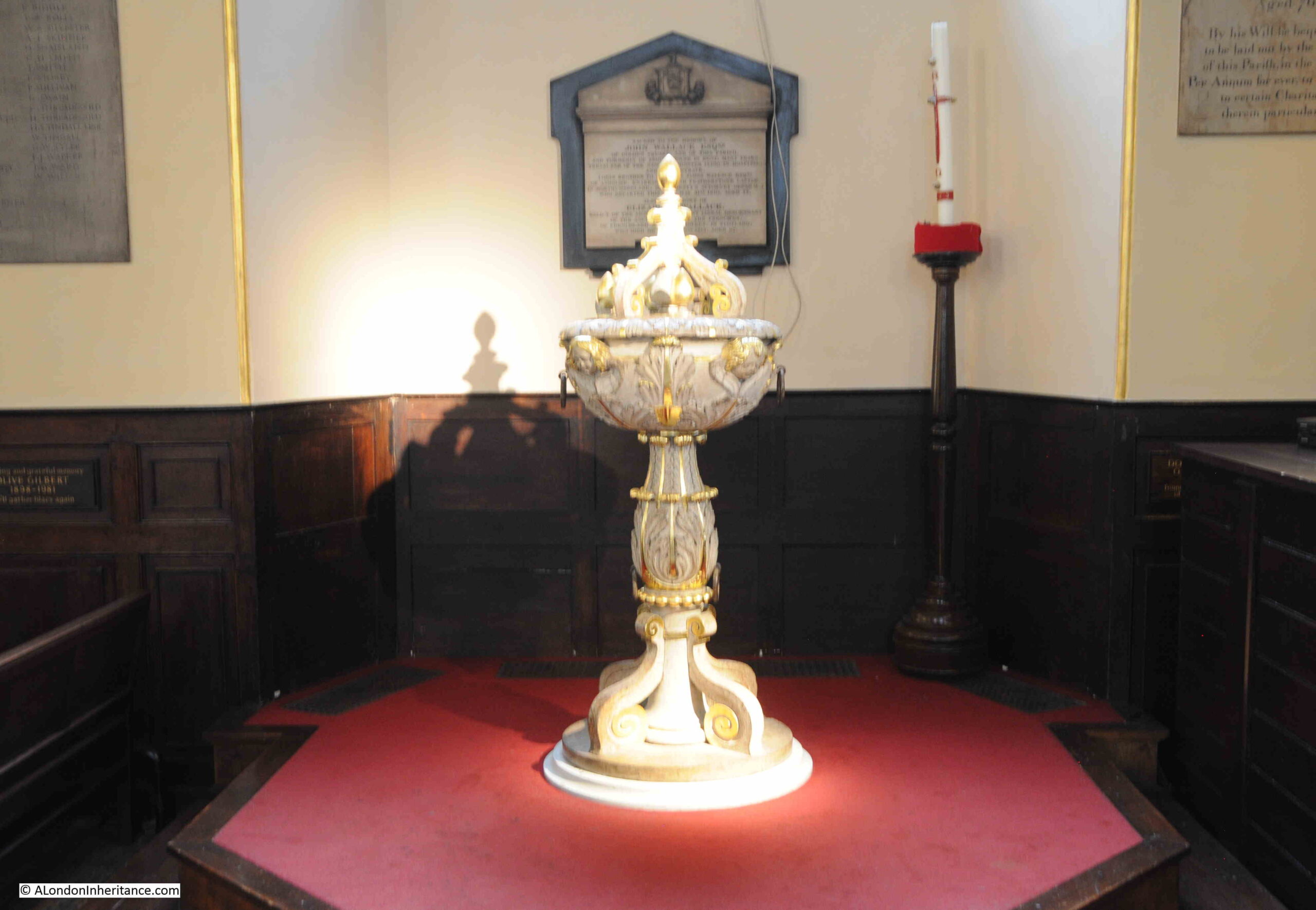
The font in St. Paul’s church:

St Paul's Covent Garden the Actors Church

St. Paul’s Church is known as the Actors Church. The area around Covent Garden has long had an association with the acting profession. The Theatre Royal Drury Lane which was built by Thomas Killigrew in 1663, just thirty years after the church is nearby. Killigrew had received a Royal Charter from King Charles II allowing the theatre to be built.

In 1723, the Covent Garden Theatre was built. This is now the Royal Opera House.

The association with the acting profession can be seen in a number of ways. Performances are put on within the church and in the churchyard, and St. Paul’s has the Iris Theatre, its own professional theatre company.

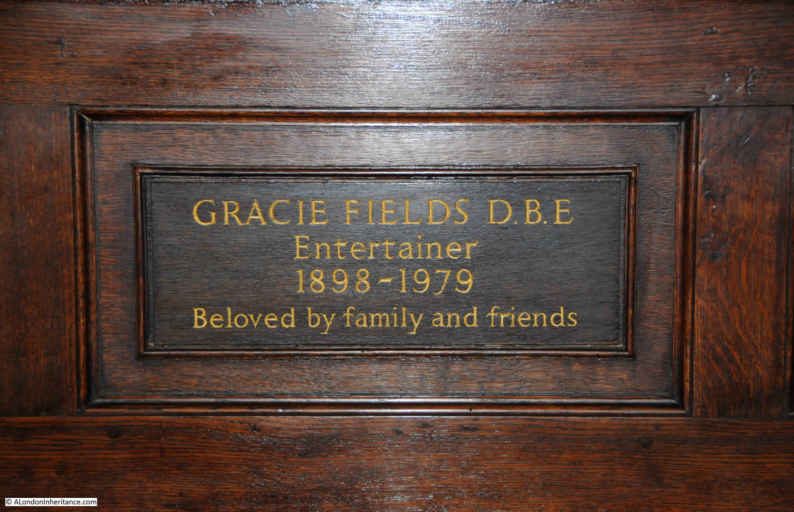
Walking around the interior of the church and there are very many memorials to actors and those associated with the profession, including Gracie Fields:

Gracie Fields memorial

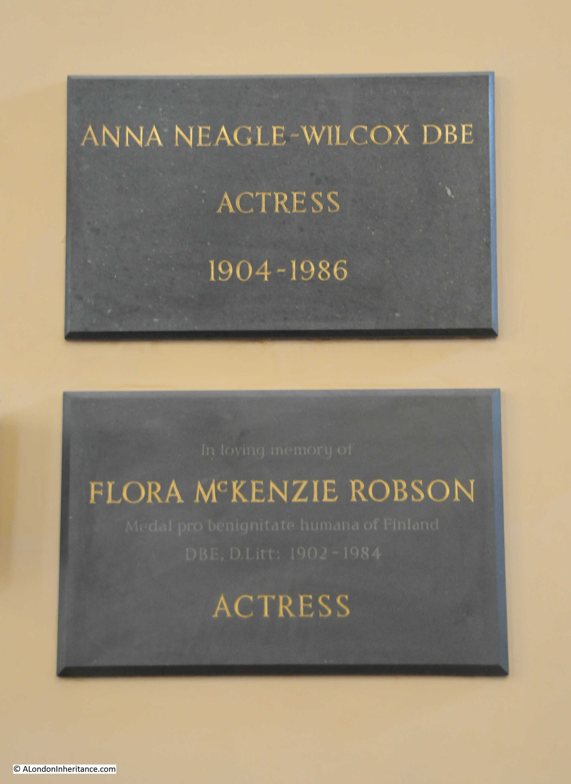
Dame Anna Neagle-Wilcox. Usually better known as just Anna Neagle, but on the memorial including the surname of her husband, Herbert Wilcox, and below is Flora McKenzie Robson who had a long career in film, theatre and the stage:

Anna Neagle memorial

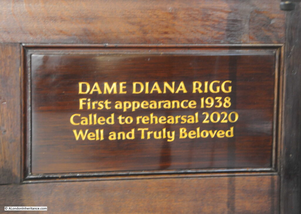
Dame Diana Rigg, again another actress with a long and wide ranging career, and who was still working right up to the year when she was “Called to rehearsal”:

Diana Rigg memorial

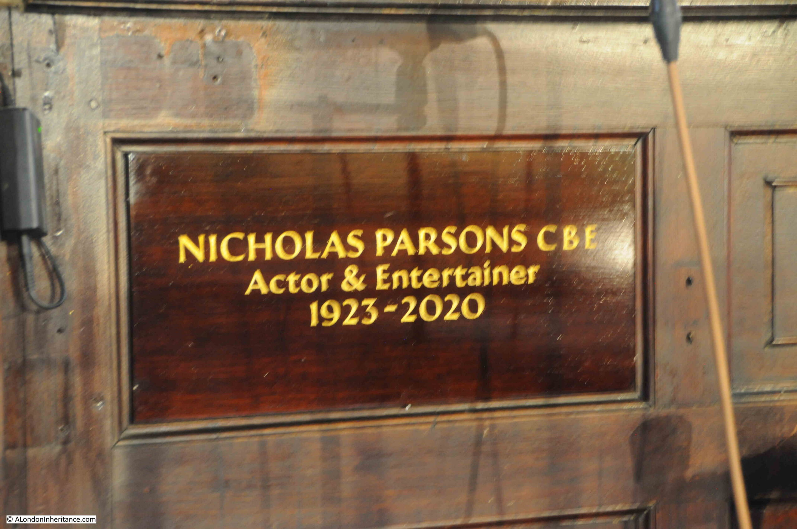
Nicholas Parsons, again another long career, and probably best known for Sale of the Century on TV in the 1970s and the BBC long running comedy show Just a Minute:

Nicholas Parsons memorial

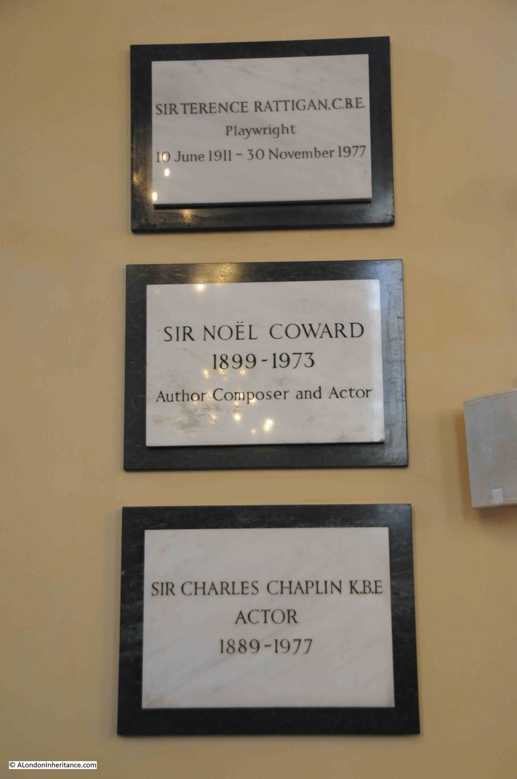
Three “Sirs” of the theatrical and film world who all died within 4 years of each other, Sir Terence Rattigan, Sir Noel Coward and Sir Charles Chaplin:

Charles Chaplin memorial

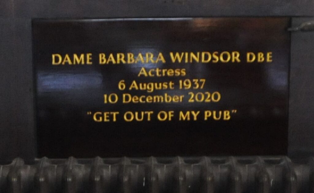
Memorial for Dame Barbara Windsor, with her well known line from the BBC soap EastEnders:

Barbara Windsor memorial Get out of my pub

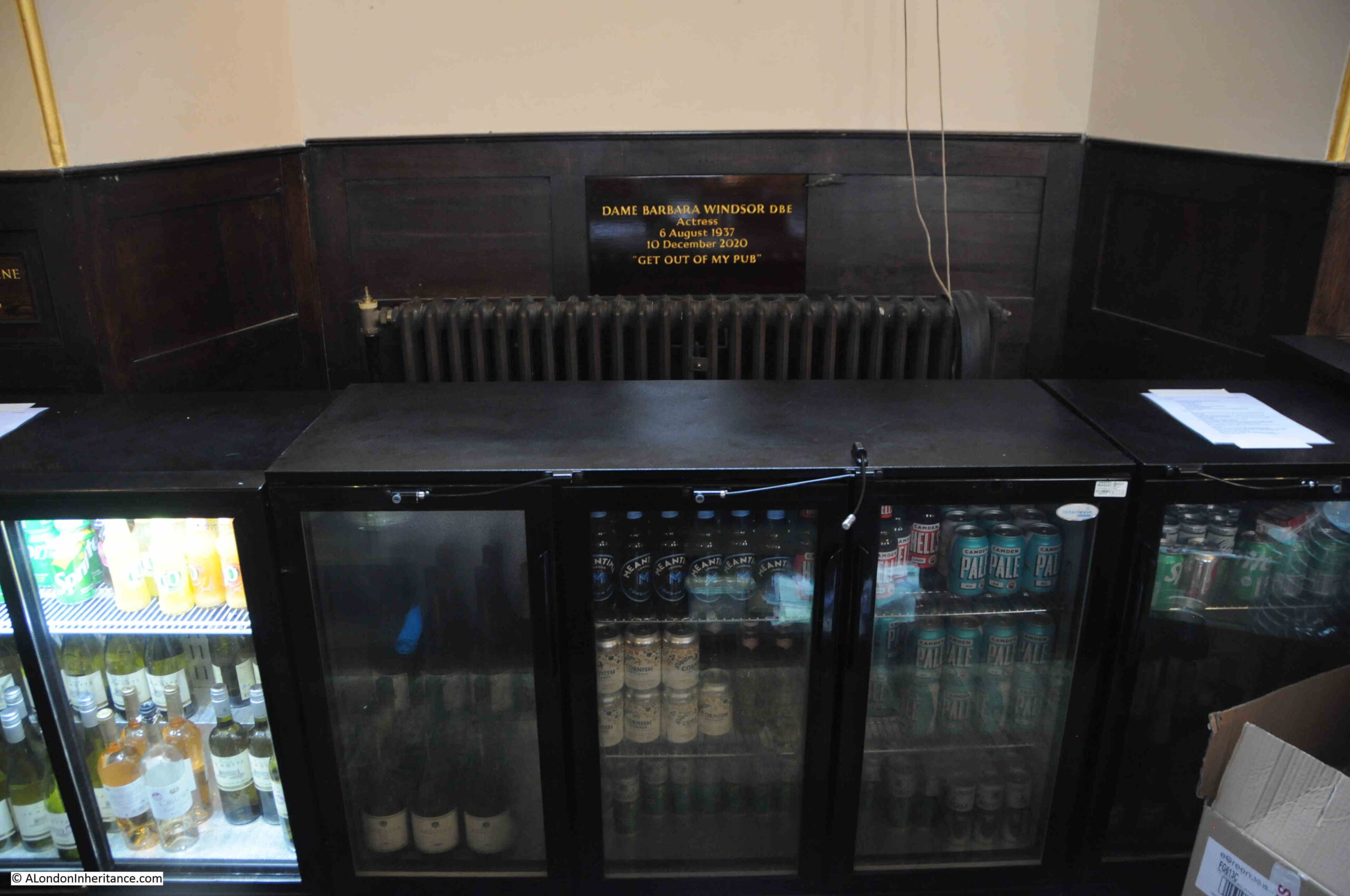
In what is a brilliant bit of placement, which cannot be a coincidence, the memorial for Barbara Windsor is located behind the small bar in the church:

Barbara Windsor memorial

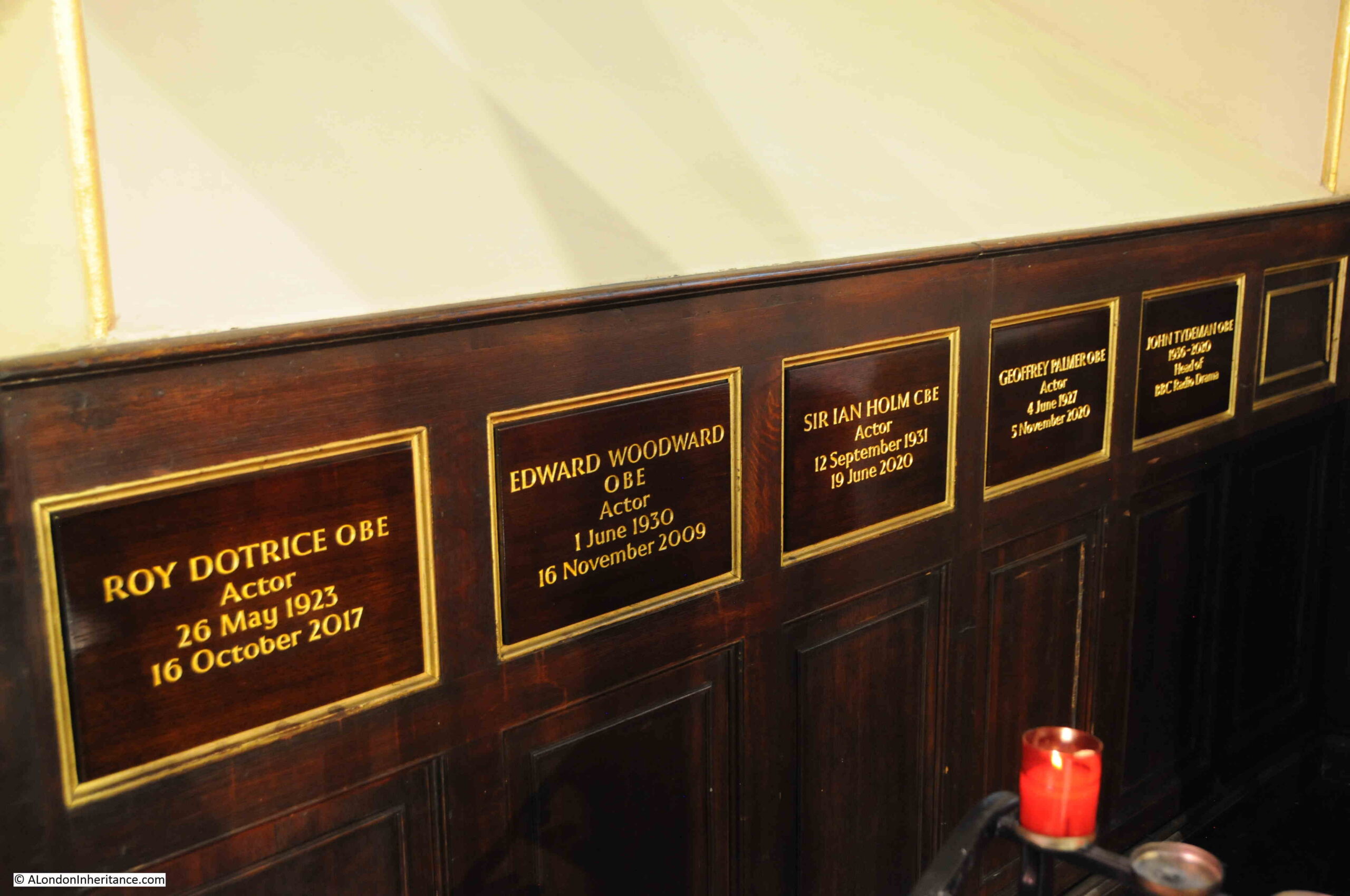
Memorials to actors Roy Dotrice, Edward Woodward, Sir Ian Holm, Geoffrey Palmer and John Tydeman, a former BBC Head of Radio Drama:

Edward Woordward memorial

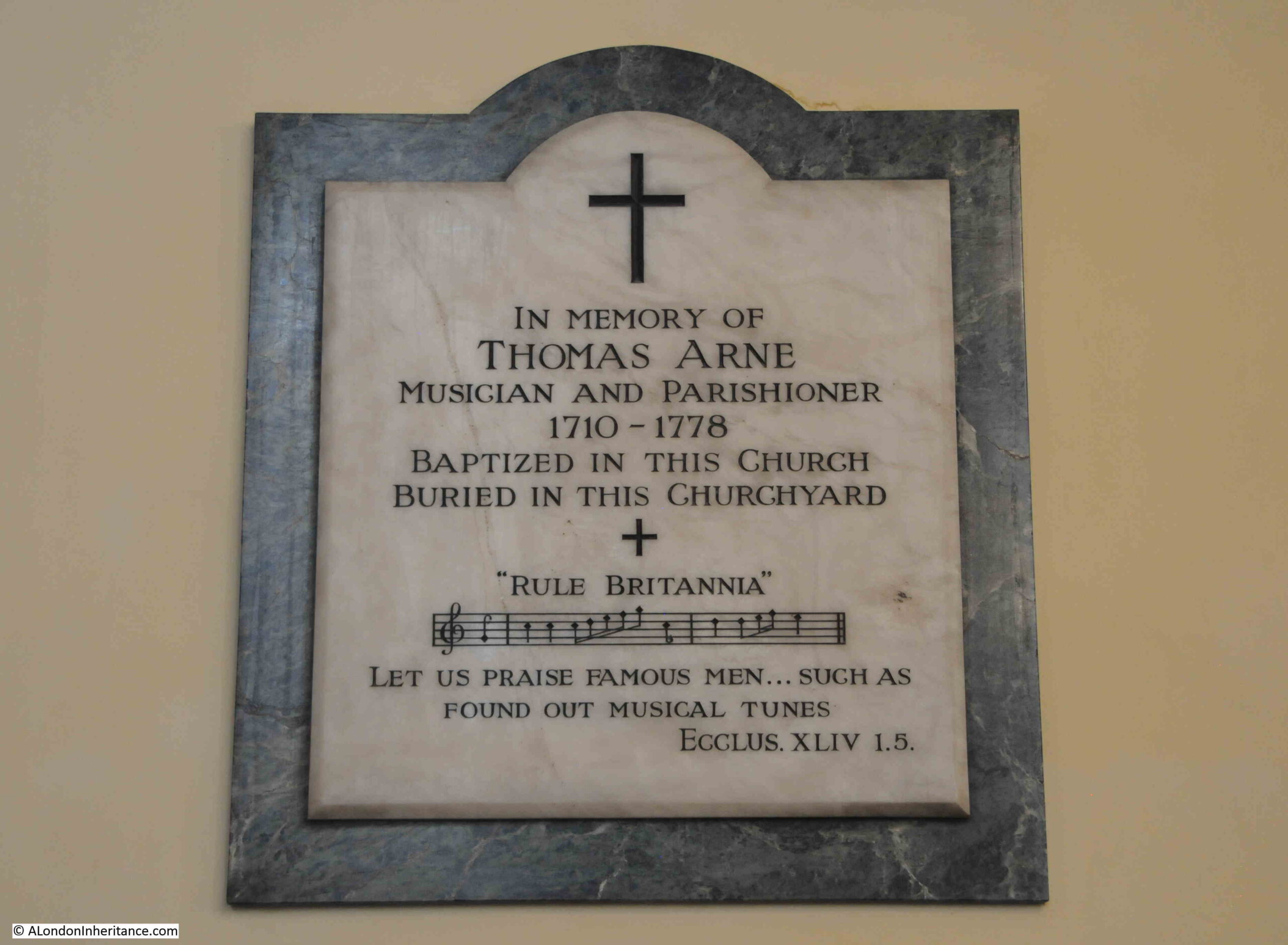
There are very few early plaques remaining in the church, as mentioned earlier in the post, William Butterfield’s work on the church in the 1870s removed many of the monuments that lined the walls of the church. A few remain including that of Thomas Arne, who wrote the music for a large number of stage works between the years 1733 and 1776, including works performed at Drury Lane and the Covent Garden Theatre.

Thomas Arne also put the words of a poem by James Thomson to music, to create the song Rule Britannia, as is recorded on his memorial, which also records that he was baptized in the church and buried in the churchyard:

Thomas Arne memorial Rule Britannia

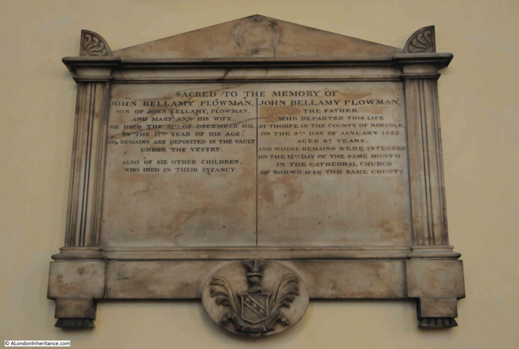
There are very few memorials to those outside of the entertainment industries. One though records the dreadful death rate of children. On the right is recorded John Bellamy Plowman, the father who died aged 67, however on the left is what must have been his oldest son, also called John Bellamy Plowman who died aged 17 and was buried in the vault under the vestry, along with six other children who all died in their infancy:

John Bellamy Plowman

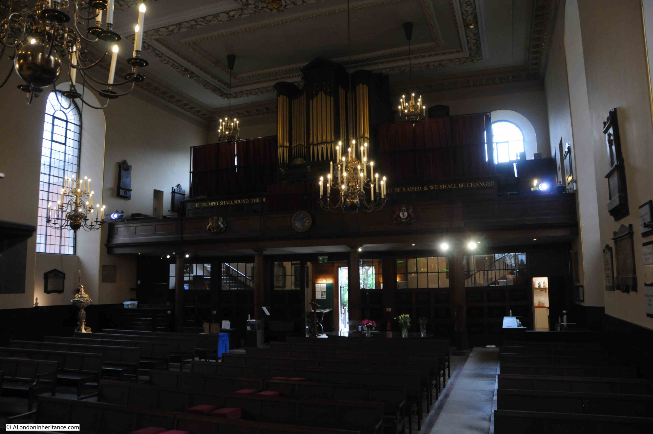
View of the rear of the church, with organ and gallery.

St Paul's Covent Garden the Actors Church

There were once galleries down either side of the church which provided additional seating at an upper level. These must have made the church seem very crowded when full, and they were removed during an early restoration.

St. Paul’s Covent Garden will soon be 400 years old. Although it was rebuilt significantly after the fire in 1795, and restored and repaired many times over the centuries, it still is an Inigo Jones church, and goes back to the time before the market, and when the Piazza was first established.

It is also a church that connects to the profession that is still so important in this part of London.

alondoninheritance.com

Limehouse – A Sink of Iniquity and Degradation. A New Walk.

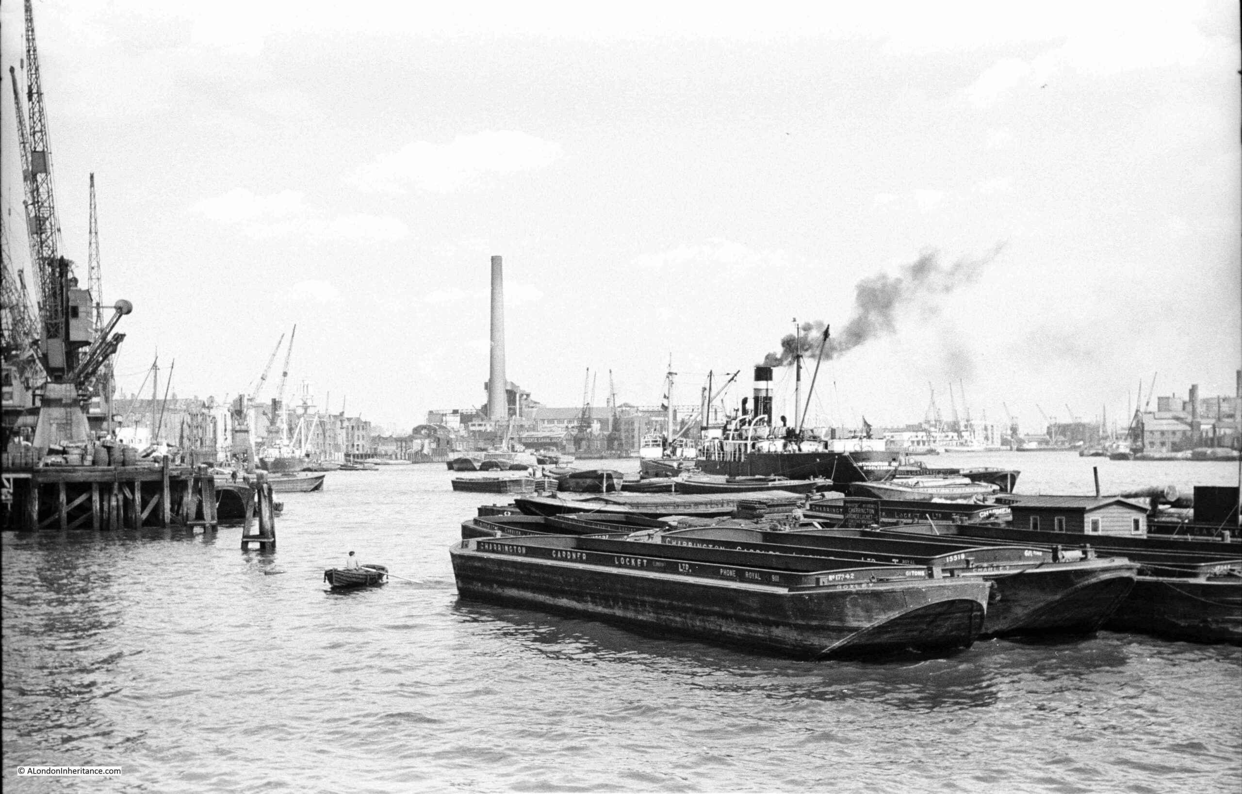
(Dates for my new walk at the end of the post) The following photo was taken by my father from the eastern end of the King Edward VII Memorial Park in Shadwell. It is looking east along the Thames towards Limehouse:

Limehouse

The photo shows this stretch of the river as it was in the late 1940s. A busy place with docks, wharves and cranes, with barges and ships along the river.

The tall chimney is that of Limehouse (also called Stepney) power station. An electricity generating station that ran on coal transported along the river. The power station was built in 1907, however the tall chimney was added 20 years later in 1927 due to complaints about the amount of pollution that was being spread around Limehouse by the much smaller original chimneys. At the time of building, it was the tallest chimney in London at a height of 351 feet.

The power station was closed in 1972 and demolished soon after.

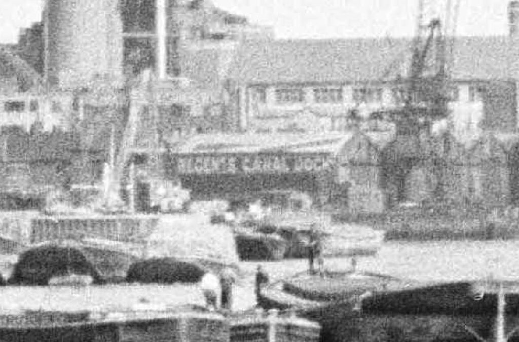
Just in front, and to the right of the power station chimney is the entrance to the Regent’s Canal Dock (now Limehouse Basin). Although the entrance is hard to see, the warehouses with the name of the dock, on the east side of the entrance to the dock from the river can be seen in this extract from the above photo:

Limehouse Regent's Canal Dock

The title for the walk “Limehouse – A Sink of Iniquity and Degradation” came from the book “Limehouse through Five Centuries” written in 1930 by the Reverend J.G. Birch of St. Anne’s, Limehouse. He used the phrase in his introduction to the book, and also added that he hoped that the book would help dispel this myth.

Limehouse has always had an air of mystery and intrigue, an exotic and dangerous place to those who did not live or work along the river.

The 1916 book Limehouse Nights by Thomas Burke featured a number of short stories centred on Limehouse, the opium dens and the Chinese community, which were also the background to the stories of Dr. Fu-Manchu by Sax Rohmer. The works by Burke and Rohmer featured appalling stereotypical views of the Asian community then living in Limehouse.

Stories about Limehouse exploited themes of violence, crime, sex and drugs and how the import of opium resulted in the exploitation of English women, often to sell opium in the fashionable West End.

The image of Limehouse as a place of intrigue and mystery continues to this day, with the 1994 book Dan Leno and the Limehouse Golem by Peter Ackroyd, on which the 2016 film The Limehouse Golem was based.

Whilst there were opium dens, crime and violence, Limehouse was a hard working place, based around the trade and industry that grew along the Thames. The Chinese population were frequently sailors who had settled in Limehouse and married local women, along with a temporary increase in numbers when ships with Chinese crew docked. Their numbers though were relatively low, not as large as popular literature of the time might suggest.

Limehouse was an early site of ship building. From Limehouse, sailors and traders set out along the Thames to cross the oceans of the world. Industry, warehouses and docks lined the river, with cramped housing alongside polluting factories.

Limehouse provided access to the Thames for the inland waterways, with the Limehouse Cut and the Regent’s Canal providing access to the river from the rest of the country. In the Regent’s Canal Dock (now the Limehouse Basin), ships unloaded all manner of cargo, including coal, timber, fruit and ice.

There was technical innovation, hydraulic power and an electricity generating station running on coal delivered via the river. The London & Blackwall Railway cut through Limehouse on a brick viaduct, paving the way for the Docklands Light Railway.

The decades after the 2nd World War were not kind to Limehouse as trade along the river slowly declined and industry closed or moved away.

From the late 1980s onwards, Limehouse was transformed, with some major projects being driven by the developments on the Isle of Dogs just to the east.

I have long been fascinated by Limehouse, a place that for centuries was shaped by the relationship between the land and the river. Whilst today that contact is maintained by Limehouse Basin, the rest of Limehouse is now just a spectator to the activity on the river.

This walk will explore the history and development of Limehouse from the 15th century to the present day. The people, those who settled in Limehouse, the relationship with the River Thames, trade, waterways, tunnels, streets, pubs and church, along with some of the reality of the opium dens.

As with the Reverend J.G. Birch, my aim with the walk is to dispel some of the myths about Limehouse and focus on the real history of this fascinating part of east London.

The walk will start at Limehouse DLR station and end at Westferry DLR station. It will take around 2 hours 30 minutes and is a walk of slightly over 2 miles.

The schedule of walks is listed below. Click on each date to get to the Eventbrite booking page:

Just added a couple of new dates as the original set sold out:

Or for an overview of all the walks on Eventbrite, then click here.

I look forward to showing you around this fascinating part of east London.

alondoninheritance.com

Two Pubs and the Jesus Hospital Estate

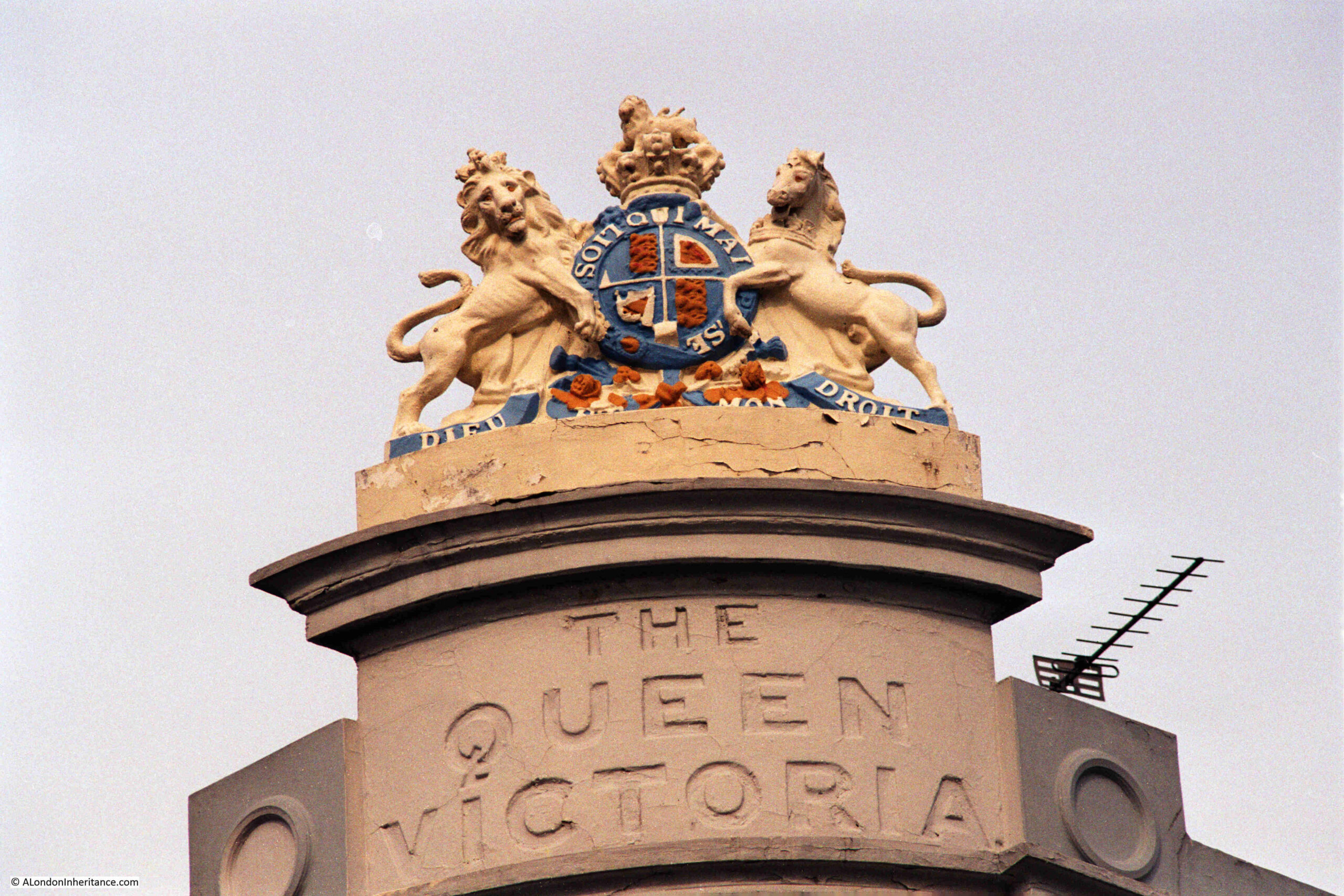
Following last week’s post, I am staying in Bethnal Green, and after finding Ron’s Gents Hairdressers, I walked to find the location of the Queen Victoria pub and the Jesus Hospital Estate. The decorative features at the top of the Queen Victoria was the subject of one of my father’s 1980s photos:

Queen Victoria, Jesus Hospital Estate

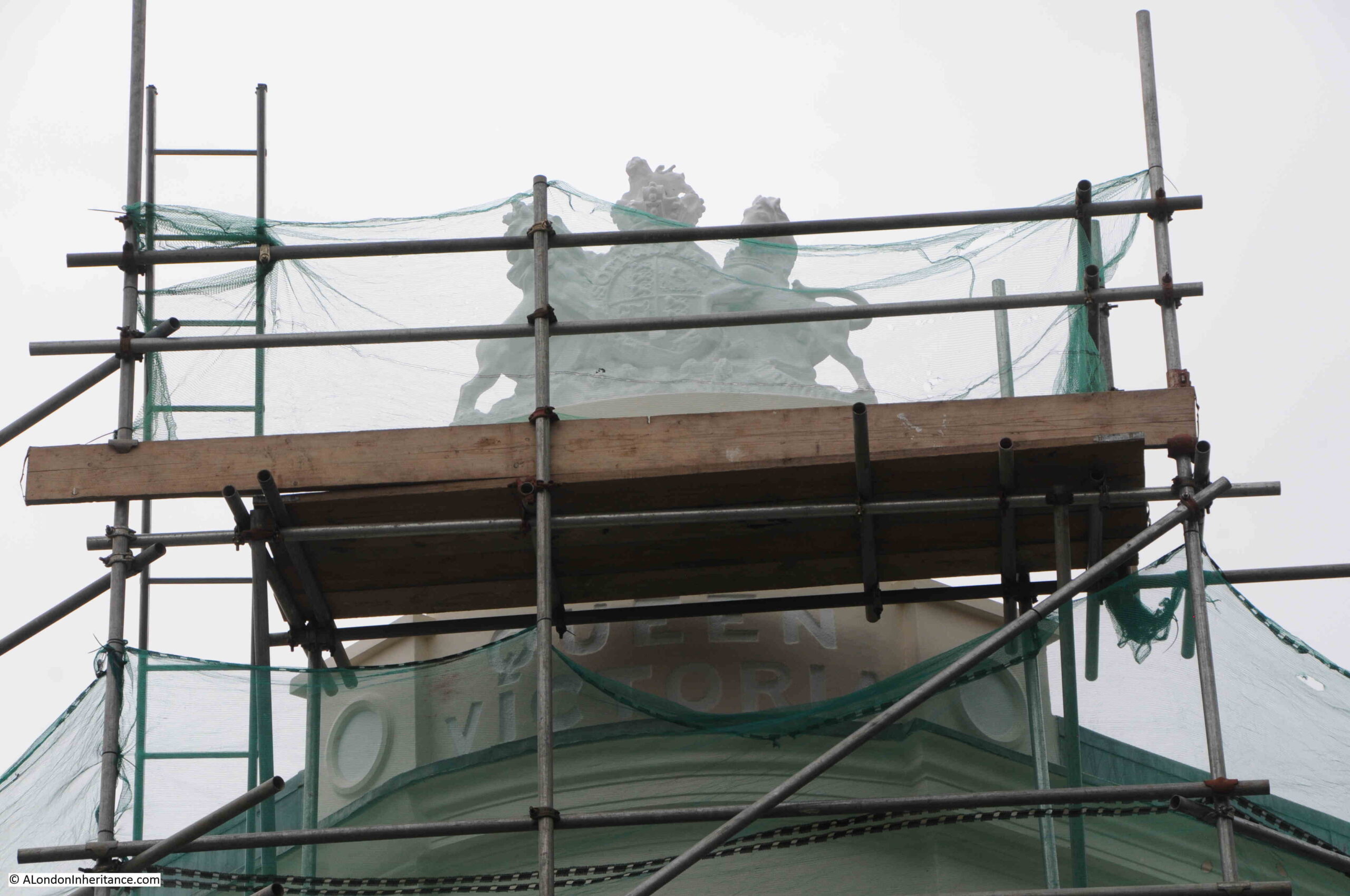
When I found the pub, it was covered in scaffolding, and whilst the royal coat of arms at the top of the pub are still there, they had been painted white:

Queen Victoria, Jesus Hospital Estate

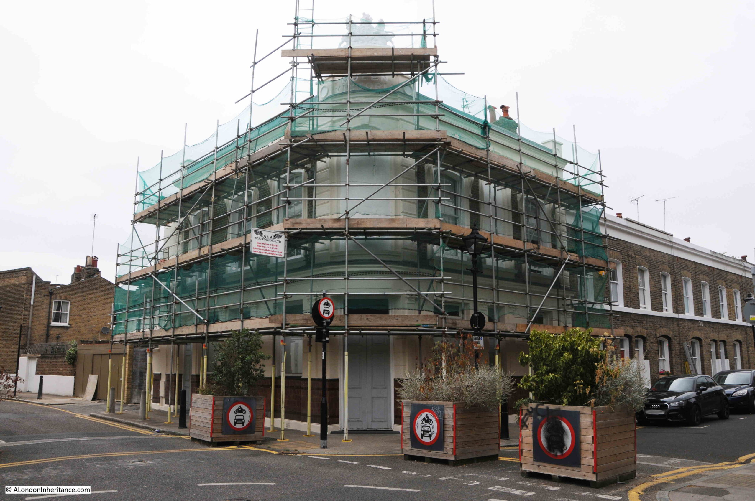
Unfortunately, my father did not take a photo of the whole pub building. I suspect due to the limited number of photos available when using a film camera. The pub today:

Queen Victoria pub, Barnet Grove

The Queen Victoria is on the corner of Barnet Grove and Wellington Row, a short walk north from Bethnal Green Road towards Columbia Road.

The pub has suffered the fate of so many pubs across London in that it has been converted to residential. The Queen Victoria closed as a pub in 1993.

I have mentioned a number of times in my posts about just how many pubs there were in London prior to the closures that started slowly after the 1940s, and accelerated quickly from the late 1980s onwards, and the location of the Queen Victoria is a prime example, as directly opposite, there was another pub:

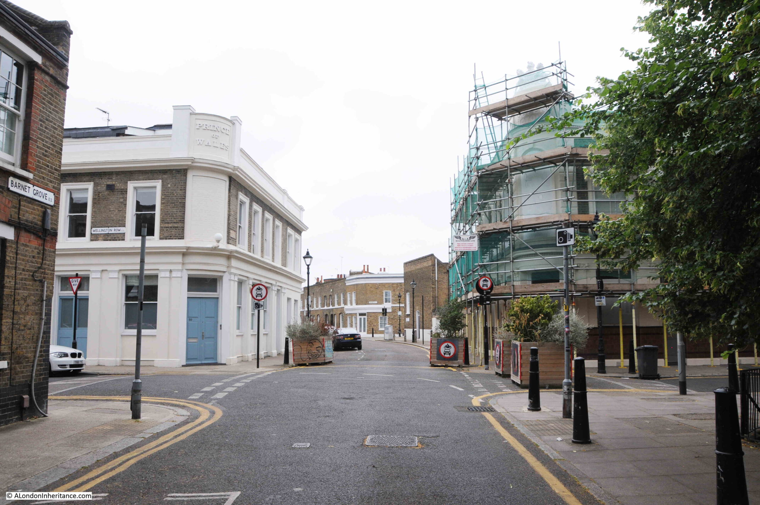
Prince of Wales and Queen Victoria pubs, Barnet Grove

In the above photo, the Queen Victoria is on the right and the Prince of Wales is on the left, with Barnet Grove passing between them.

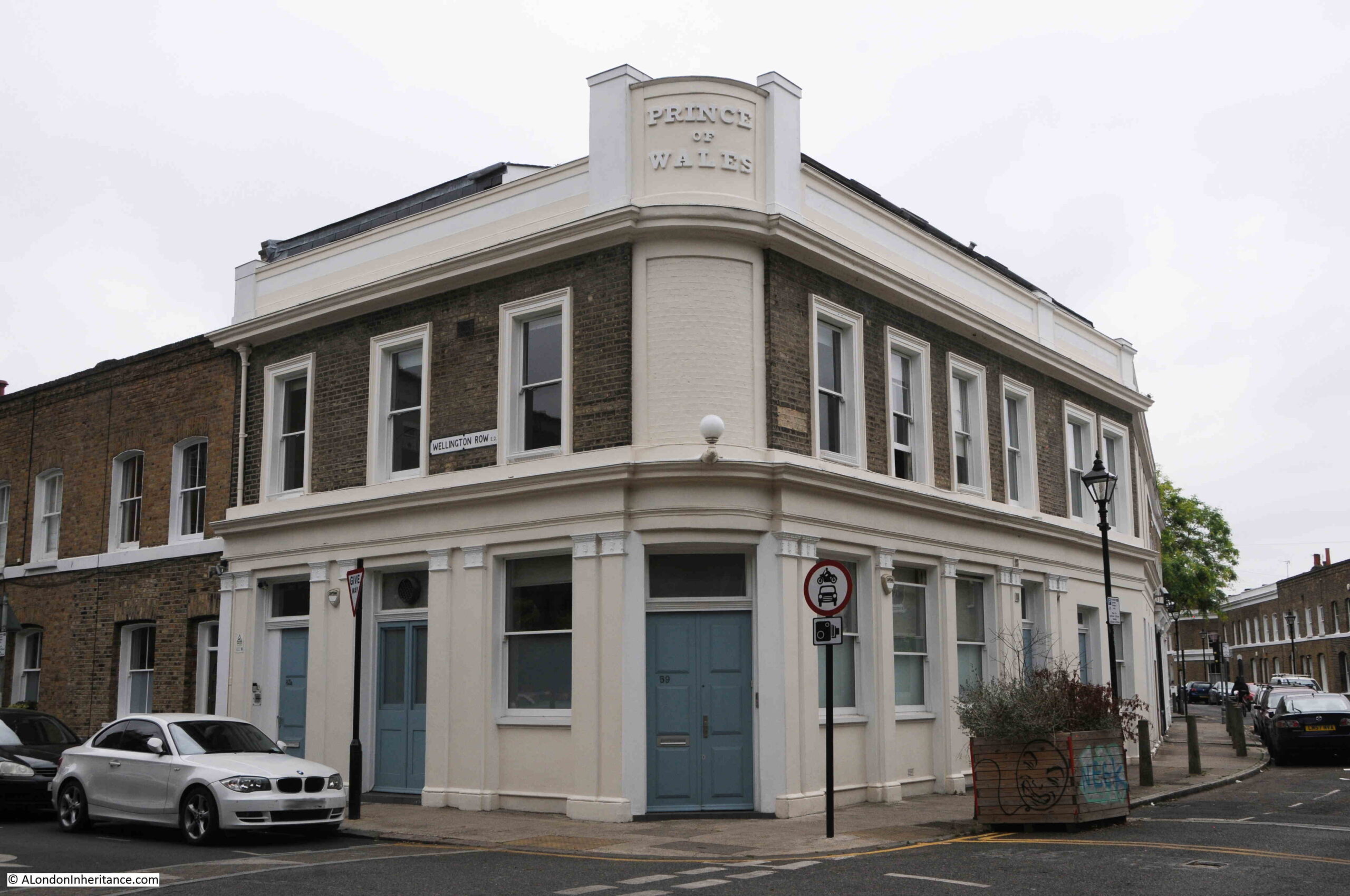
The Prince of Wales closed in 1995, and as with the Queen Victoria, it was converted to residential. Whilst the Prince of Wales has the pub’s name at the top of the corner of the building, there are no coat of arms:

Prince of Wales, Jesus Hospital Estate

The pub did once have the impressive arms of the Prince of Wales, as can be seen in the photo at this link from the alamy stock image site.

The building today is a shadow of its former self. I suspect the arms at the top of the pub were missing in the 1980s as I am sure my father would have taken a photo of them, as well as the Queen Victoria.

Both pubs seem to have opened in the late 1860s, and in the Hackney and Kingsland Gazette on the 28th of May, 1870, the new owner of the Prince of Wales was advertising:

“THE NEW Wine and Spirit Establishment, Conducted by the old caterer for public favour, C.H. Davies, of the ‘Prince of Wales, Barnet-Grove’, who begs to call attention of his friends and the public to his new premises replete with every comfort for the gentleman and mechanic, also to families who can be supplied with every article of the finest description including MALT LIQUOR, from the eminent Brewers of the day; SPIRITS (both foreign and British) of the highest strength and excellence, and WINES of the rarest vintage. Special arrangements have been entered into with the celebrated firm of Messrs. REID & Co. for a constant supply of their Splendid STOUT and PORTER.

Extensive and Commodious Rooms for large or small parties.

An Harmonic Meeting every Tuesday Evening at eight o’clock for gentlemen. An early visit is respectfully solicited.”

By 1907 a W. Tozer was the owner of the Prince of Wales, as in the Eastern Argus and Hackney Times he was thanking “the residents of the district and the public generally for the patronage they have accorded him since he took the proprietorship off this well known and old-established tavern 3 years ago.”

In the same article, it was mentioned that “The United Order of Druids, Baroness Burdett-Coutts Lodge (No. 948) meets at the house on the 1st and 3rd Tuesday in the month.”

The United Order of Druids was more of a fraternal and benefit society, and was open to all classes. I doubt there was much wandering around the streets of Bethnal Green in white gowns.

The branch that met in the Prince of Wales was the Burdett-Coutts Lodge. The lodge was named after Angela Burdett-Coutts, a remarkable women who was known as the wealthiest woman in the country after she inherited a fortune from her maternal grandfather Thomas Coutts, of Coutts Bank.

Angela Burdett-Coutts was a philanthropist who supported a diverse range of projects and causes. The link between the lodge that met in the Prince of Wales and Burdett-Coutts may have come from her charitable activities in the area with social housing and her founding of Columbia Market in 1869.

There are very few newspaper references to the Queen Victoria. Mostly licence changes, and in one report about an “Exciting Quoits Match”, the pub is named as the Queen Victoria Hotel, when a Mr Sayer, who appears to have been their champion Quoits player, was being challenged by Copeman and Wilstead, for £5.

The challenge was to take place on neutral territory at the May Pole in Chigwell. (Quoits is the game where a ring of iron or rope is thrown in an attempt to land it around a peg).

That there were two pubs directly opposite each other (as well as other pubs in the local area), shows the population density in this part of Bethnal Green. One of the reports mentioning the Prince of Wales covered above, may hint at the diverse range of people who lived here where the pub was advertised as having “every comfort for the gentleman and mechanic“.

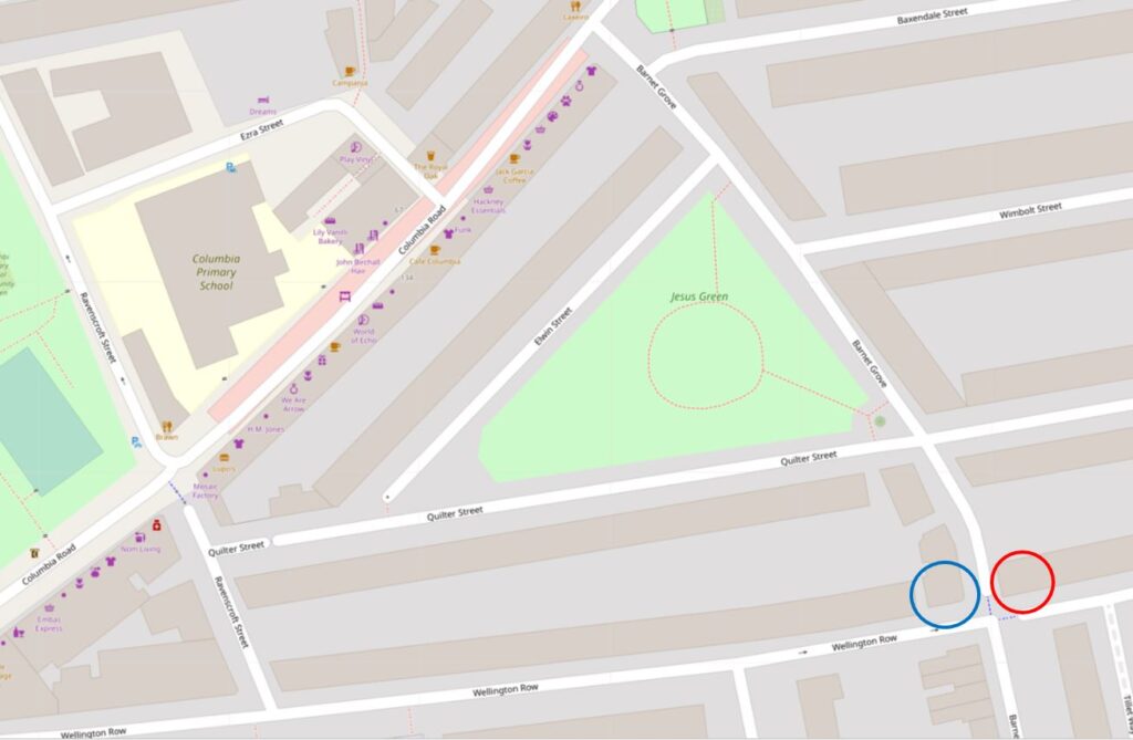
In the following map, I have marked the locations of the Queen Victoria (red circle) and Prince of Wales (blue circle), and the surrounding streets show a dense network of terrace houses  ( © OpenStreetMap contributors:

Jesus Hospital Estate

Walking north along Barnet Grove, and continuing after the Prince of Wales pub is a short terrace which still retains the shop fronts, when as well as local pubs, this street also had local shops to serve those who lived in the surrounding streets:

Jesus Hospital Estate

The title of this post is “Two Pubs and the Jesus Hospital Estate”, and I have covered the two pubs, but what about the Jesus Hospital Estate?

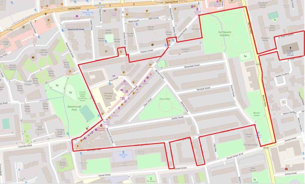
As a starter, the two pubs are on the southern edge of the “Jesus Hospital Conservation Area”, and I have marked the approximate boundary of the conservation area in the following map  ( © OpenStreetMap contributors:

Jesus Hospital Estate

The area covered by the current conservation area has changed slightly over the years, however it started as an estate in the 17th century when the land was owned by James Ravenscroft in 1670. At that time, this was, as much of Bethnal Green still was, fields and farm land.

In 1679, James Ravenscroft founded the Jesus Hospital Charity in Barnet, Hertfordshire, and he bestowed the land in Bethnal Green to the charity.

The aims of the Jesus Hospital Charity were to provide for the support and maintenance of lady residents living in Ravenscroft Cottages in Wood Street, Barnet.

The charity is still in operation and has expanded the number of properties it owns in Barnet, and now “provides 63 unfurnished dwellings for ladies aged 50 plus, who reside alone and are fit and able to care for themselves”.

James Ravencroft’s son, George, made his name in the manufacture of lead crystal glass. He was primarily a merchant and came into contact with the glass trade after living for a couple of years in Venice.

On his return to London, he set up a glass works in the area of the Savoy, however he left the glass business in 1679, the same year as his father set-up the Jesus Hospital Charity. His father died the following year in 1680 and George died in 1683.

They were both Roman Catholics which, in the final decades of the 17th century, may not have made the family very popular.

In the early 19th century, the land was still being leased from the charity by farmers, and there had been very little change for the past 150 years, however limited building work did commence in the 1820s and 1830s.

One of the problems with the land in Bethnal Green was that it was some distance (given travel options at the time), from the trustees of the charity in Barnett. The trustees rarely visited. I assume they were happy as long as the money from leasing the land continued to flow to fund the charity’s responsibilities.

During a visit, the trustees found that the land had been developed with very poorly constructed, single storey houses, and that many were in a very dilapated condition. The streets in the area were also in a poor state, as were the sewers.

In 1862, a London surveyor based in Bishopsgate, by the name of George Clarkson was appointed to manage the redevelopment of the charity’s land.

The whole area of the Jesus Hospital Estate was cleared of the original buildings, new sewers were built along with new streets, and a total of 372 houses were built, as well as a number of pubs, including the Queen Victoria and the Prince of Wales.

It is these houses that we see when we walk the streets today.

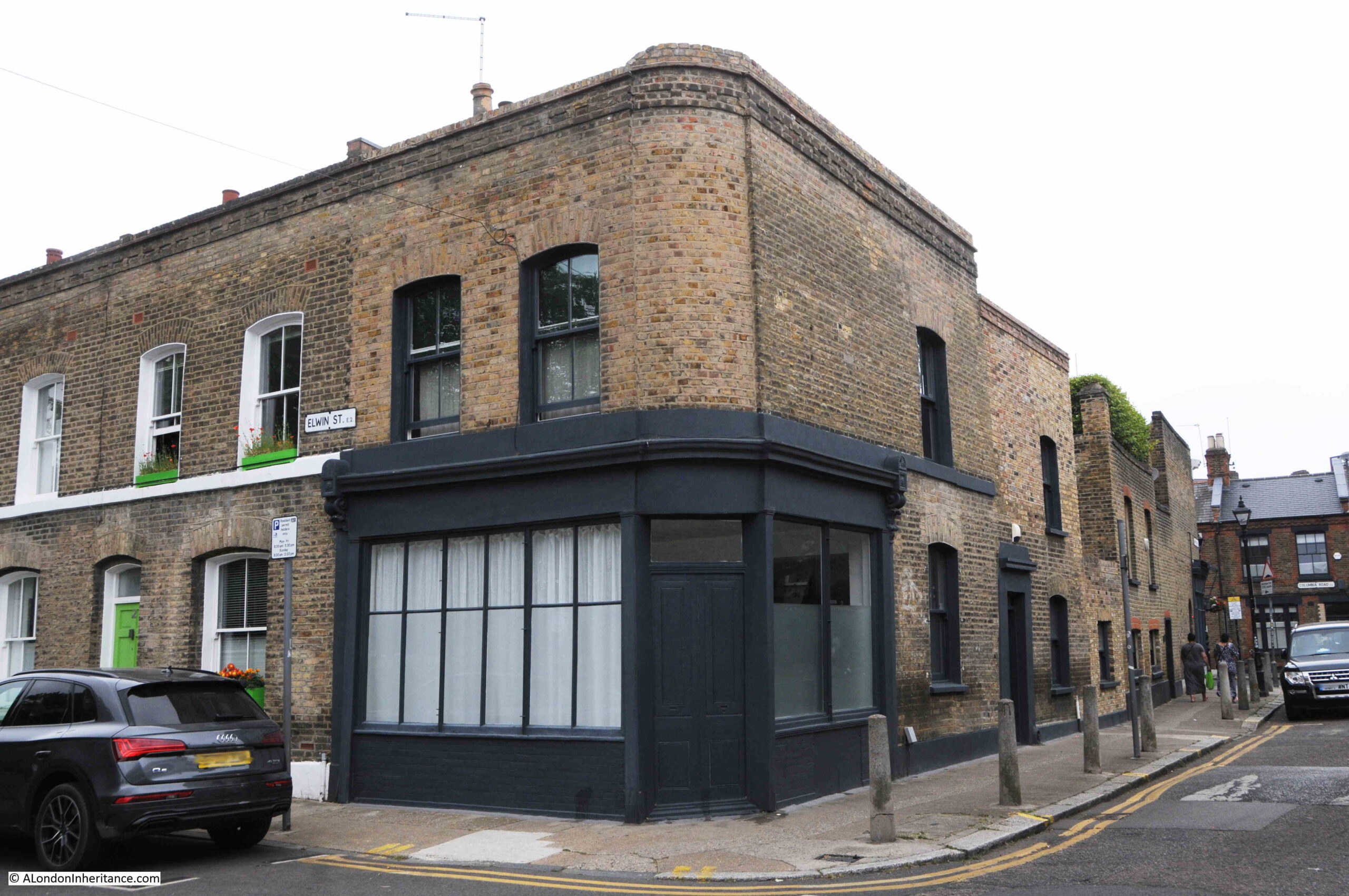
Another old corner shop on the corner of Barnet Grove and Elwin Street:

Barnet Grove

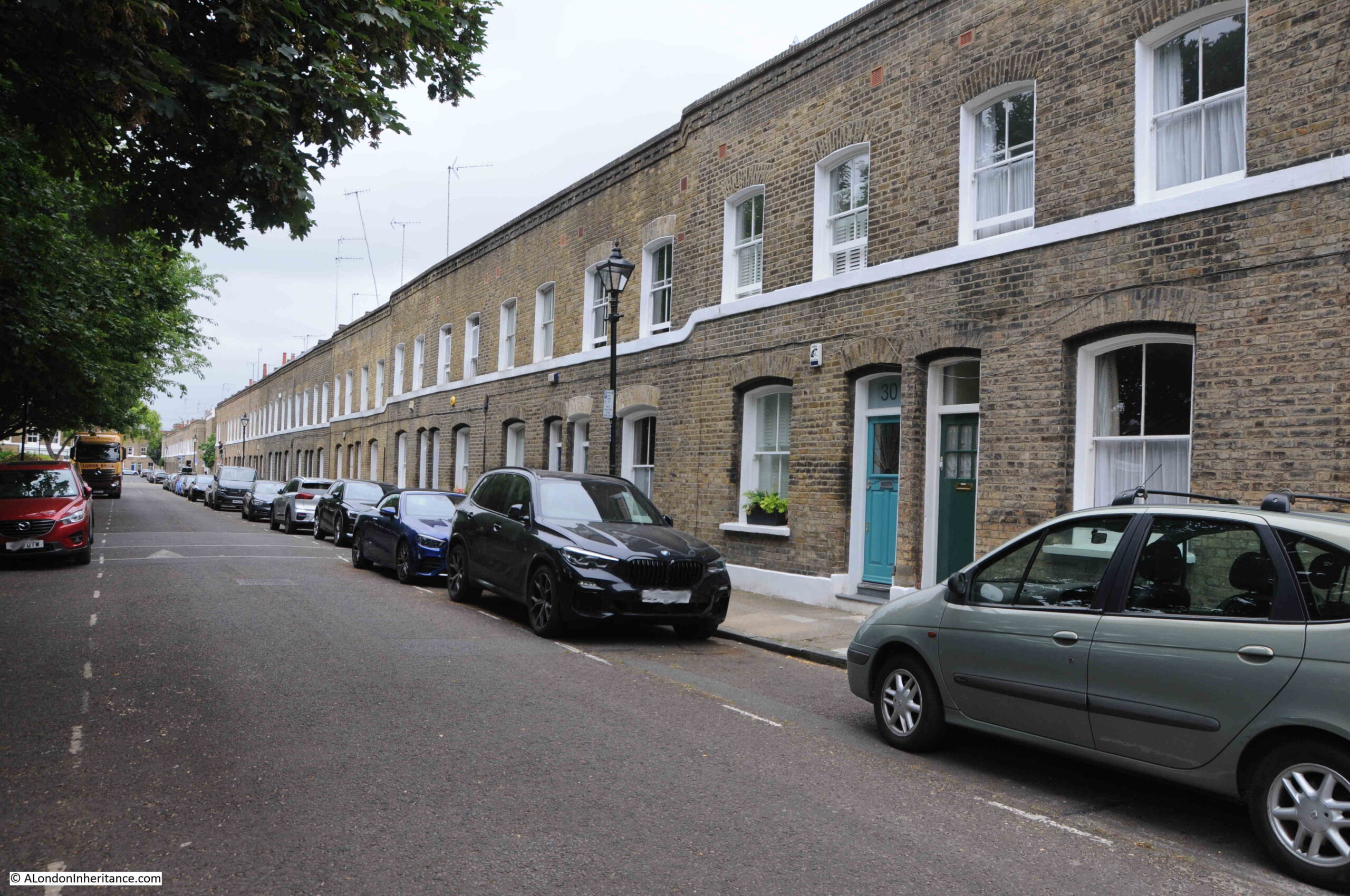
View along Elwin Street, showing a continuous line of almost identical terrace houses:

Elwin Street

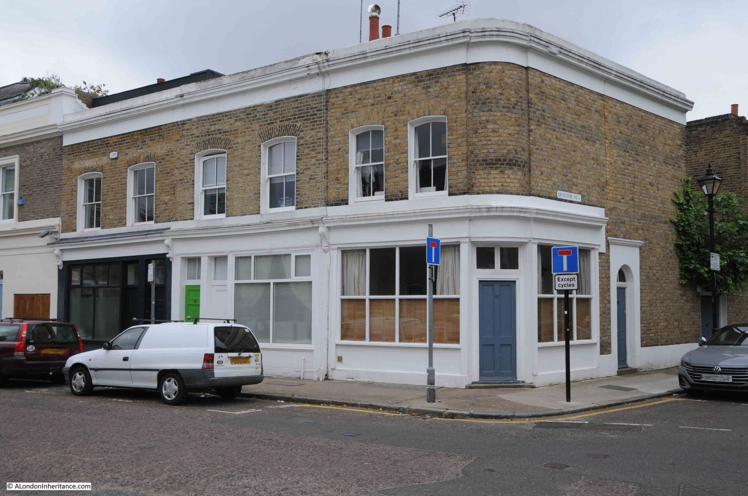
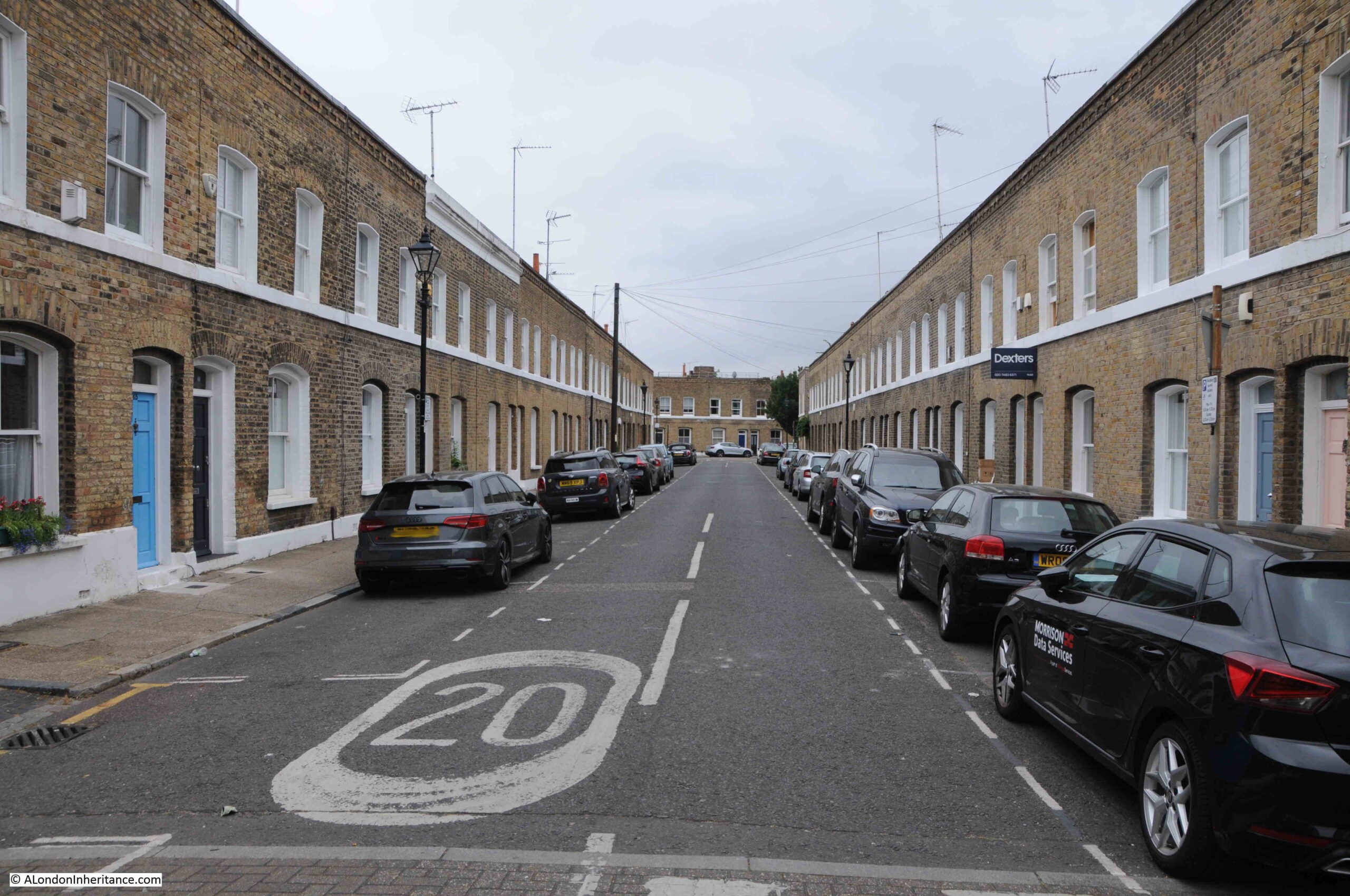
With an almost mirror image along Quilter Street, although along this street there is a slight descent in the height of the land, which is accommodated for along the terrace by a step change in height as the terrace progresses, which can be best seen by the white bar that runs along the terrace just below the first floor windows:

Quilter Street

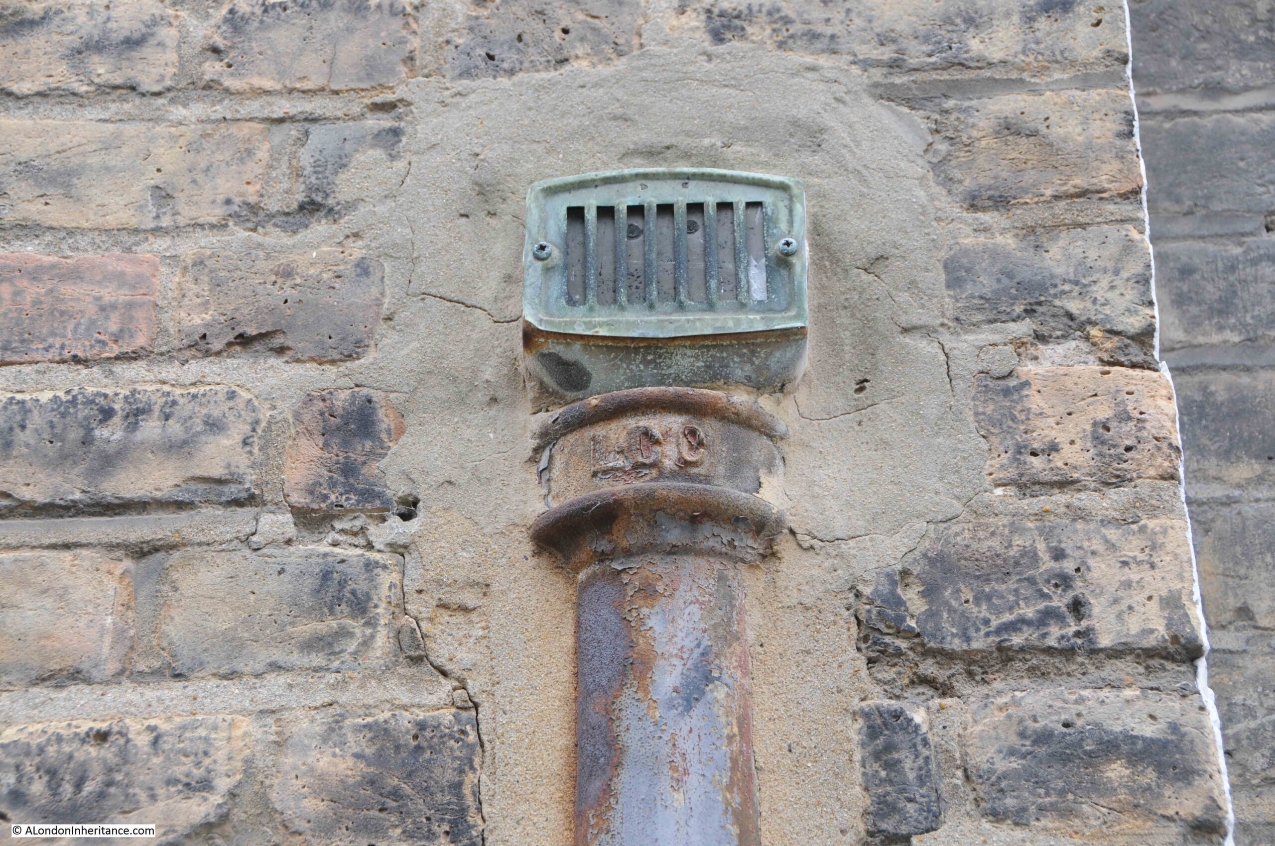
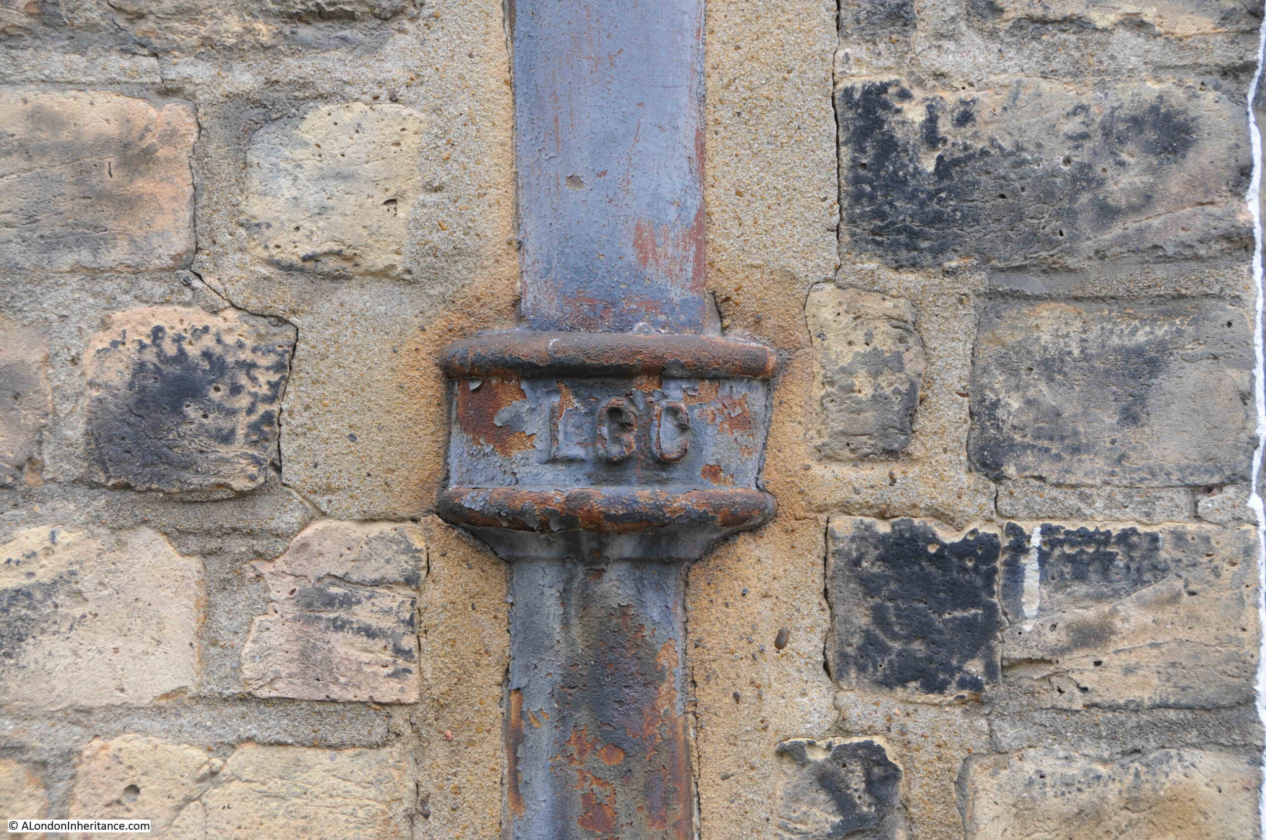
Along the street there are a couple of houses which have pipes set into the wall, with LCC which I assume is for London County Council:

LCC

An example of which rises several feet above street level to a vent:

LCC

The London County Council never owned the houses along the street, but they would have taken responsibility for the sewers, so I wonder if they were installed as part of upgrades to the sewage system, or the Jesus Hospital Charity paid the LCC for drainage work to the houses.

In 1970, the Greater London Council served a compulsory purchase order on the land owned by the Jesus Hospital Charity. The GLC intended to demolish the estate, and there were plans to construct a large road through the area to link Victoria Park with the City.

There were ten years of legal negotiations between the GLC and the charity, and the estate was finally sold to the GLC in 1980 for a sum of £1.2 million.

Proposals for demolition were abandoned as there were many objections, including from the Jesus Hospital Estate Residents Associations which was formed in 1979 to fight against the GLC’s plans.

The Jesus Hospital Estate is today described by Estate Agents as a highly desirable place to live, and to show the incredible rise in house prices in this part of east London, in 1980 the charity sold the whole estate to the GLC for £1.2 million. Today, there is a single terrace house in Barnet Grove for sale, also for £1.2 million, so the sum you could have purchased the whole estate for in 1980 now buys you a single terrace house.

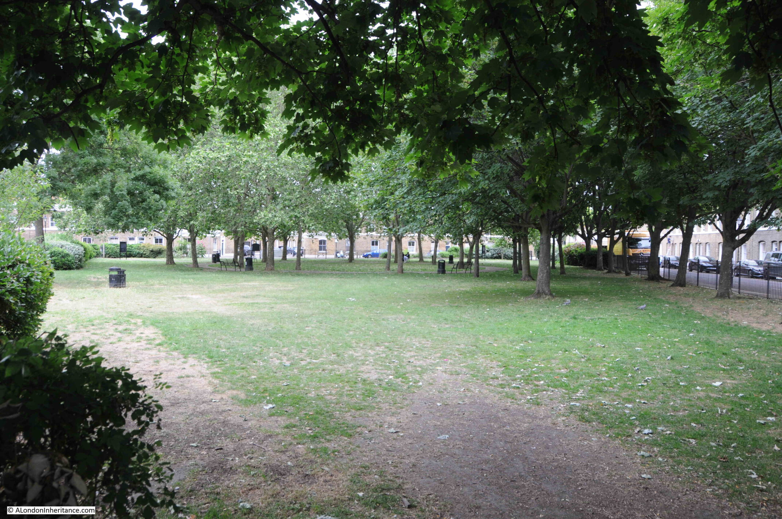
One of the reasons for the Estate Agents description of the area is that there is a large triangular green almost at the centre of the estate:

Jesus Green

This is Jesus Green, but it was not part of the original 1860s development, when the 19th century approach was to pack as many terrace houses into the area as possible.

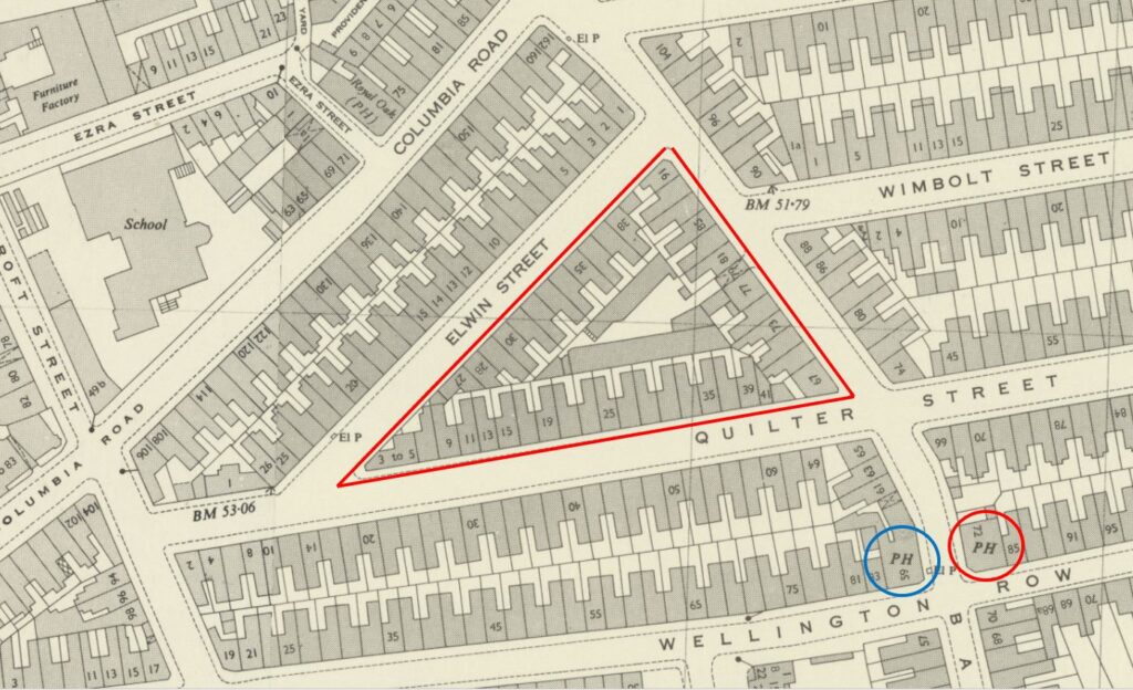
In the 1949 revision of the OS map, the area covered by Jesus Green today, is shown as a dense area of terrace houses, with an archway under one the houses in Barnet Grove leading into a central courtyard which housed a number of workshops (‘Reproduced with the permission of the National Library of Scotland“):

Jesus Hospital Estate

I cannot find an exact date, or reason for the demolition, however I believe the houses in this central triangle, outlined in red in the above map, were demolished in the 1970s. The LCC Bomb Damage maps show that this central area was almost untouched, so whether demolition was part of the GLC’s rebuilding plans, or for some other reason, I do not know.

I assume that after plans for demolition, road building and redevelopment were abandoned, the central area was turned into the green space it is today.

We can get an idea of what the streets surrounding the central gardens looked like before the houses in the centre were demolished.

The photo below is the view looking east along Quilter Street from Barnet Grove. There are terrace houses along both sides of the street. Quilter Street continued behind where I was standing to take the photo, but today, the central gardens are on one side and terrace houses on the other.

Quilter Street

The name of the open space, Jesus Gardens is a reminder of the charity that owned the land for around 300 years. There are also a number of other reminders in the street names, for example;

Barnet Grove is obviously a reference to Barnet in Hertfordshire, where the charity was based, and where money generated by leasing the land in Bethnal Green was used to fund the homes for women. Barnet Grove predates the 1860s redevelopment so is one of the oldest streets, and street names in the estate.

Quilter Street is named after James Quilter, a solicitor, who was one of the charity trustees, during the 1860s redevelopment of the estate.

Elwin Street was named after the Reverend T.H Elwin, who was the Chairman of the charity at the time of the redevelopment.

The earlier pub advert referred to “the gentleman and mechanic”, so I had a look in the 1921 census to see who was living in Quilter Street, one of the streets of the Jesus Hospital Estate. A very brief sample:

  • At number 34 was Philip Samuel Hurman, aged 45 and listed as a French Polisher for Bradstad Brothers Pianoforte Manufacturer, along with his wife Esther (45), his son Philip Samuel (21) a Carman for Saunders & Nephew Provision Merchants, a daughter Jane (19) who was a Trousers Machinist for Lockwood & Bradley Wholesale Tailors, and a daughter Ivy Lilian (15) who was a Card Board Box Maker for Wright Brothers, Box Manufacturers
  • At number 47 was Frederick Tayor, aged 66, a retired Brewers Cellarman, along with his three daughters, Emily (34), Ellen (32) and Amy (28) who were all Tie Makers, working for J. Paterson.
  • At number 64 was Charles Moore, aged 40, an out of work cabinet maker. He was living in the house with his wife Emily (45), daughters Emily (20) and Rhoda (15) who were both listed as a Tailoress for Rego Clothing Company, and his son James (18) who was a Labourer for a Mr. Loveday, Glass Silverer
  • At number 90 was Wallace Henry Norris (32) who was a Carman for J.E. Read, Carman & Contractor, along with his wife Elizabeth (28) listed as having Home Duties, and their one year old daughter Ada May. There were also three sons aged 14 and below. the 14 year old son was listed as just having left school.

A very small sample of the thousands who lived in the streets of the estate, but they are typical of all I looked at. Manual workers, employed from a young age and the majority working in one of the very many manufacturing industries that were to be found around Bethnal Green in the 19th and early 20th centuries.

The Jesus Hospital Estate is a fascinating area, away from the bustle of Bethnal Green Road and Columbia Road, an estate which owes its existence to a charity in Barnet, Hertfordshire, and an estate that narrowly avoided full demolition by the GLC in the 1970s.

alondoninheritance.com

Ron’s Gents Hairdresser, Three Colts Lane, Bethnal Green

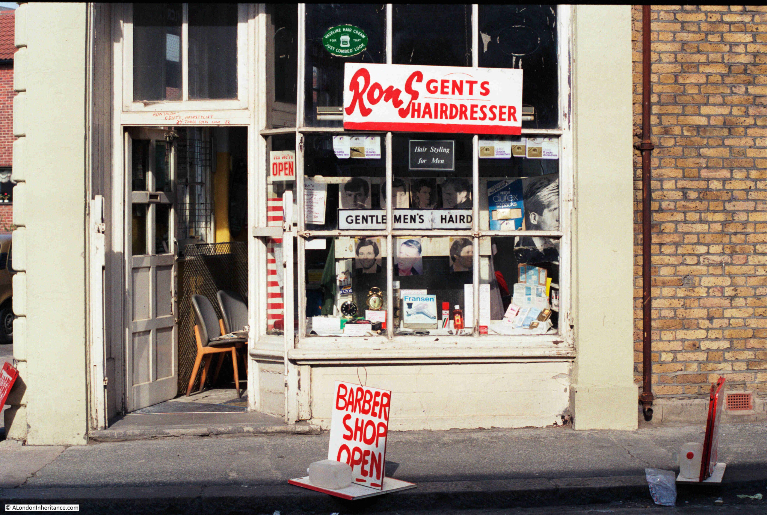
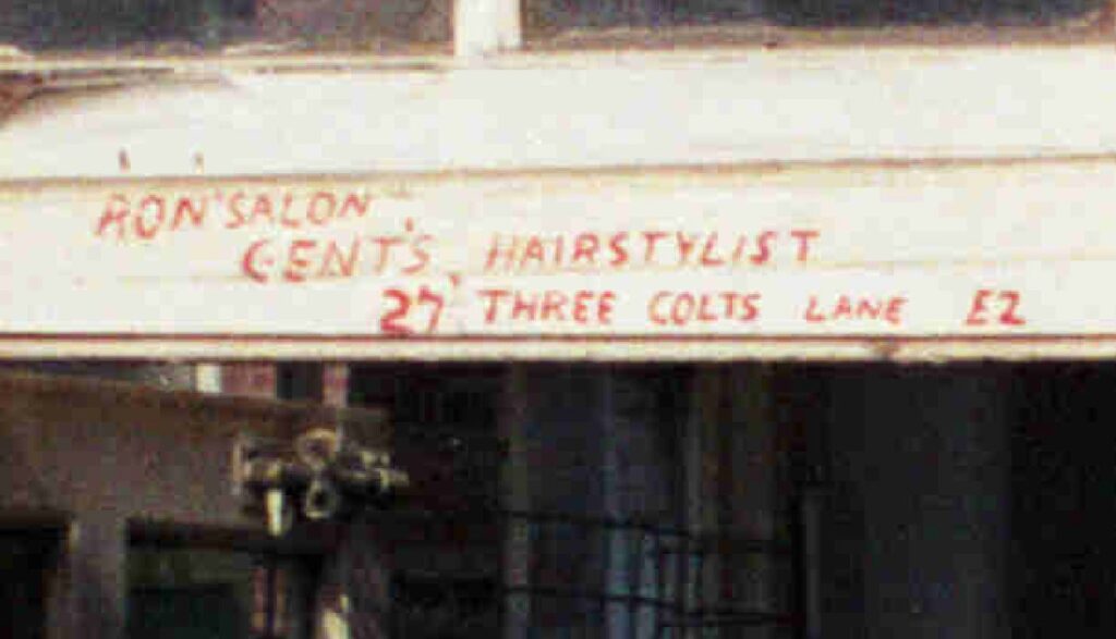
In 1986, my father photographed Ron’s Gents Hairdresser’s in Three Colts Lane, Bethnal Green:

Rons Gents Hairdresser, Three Colts Lane, Bethnal Green

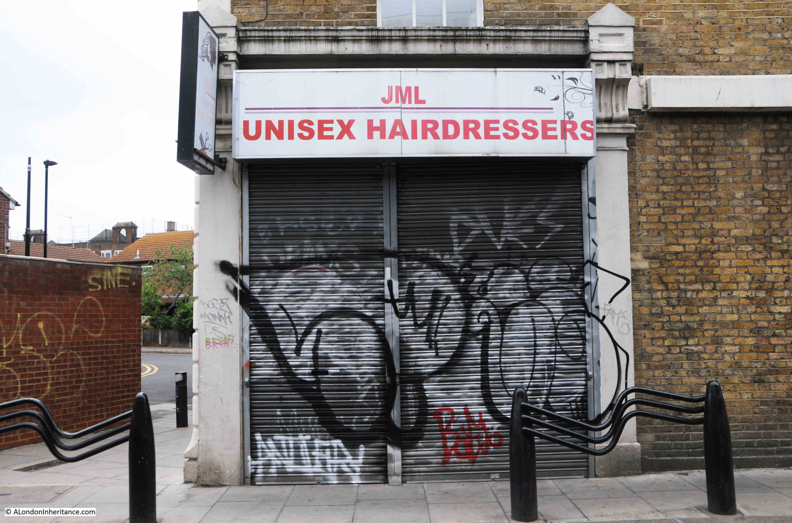
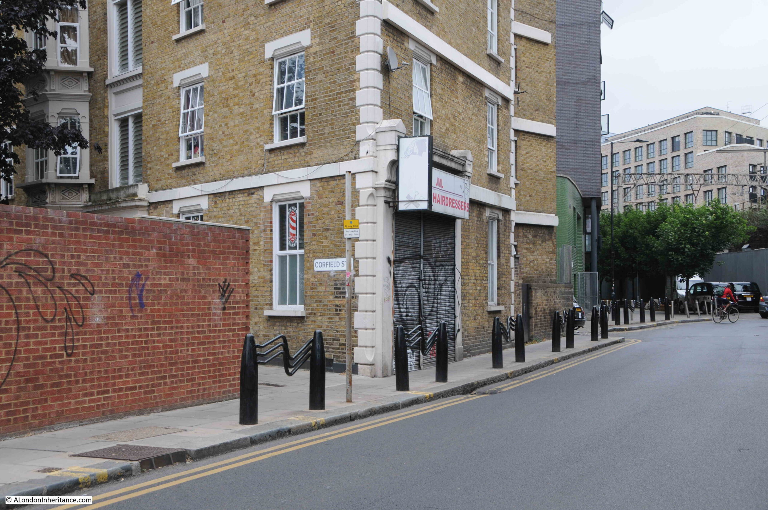
I have walked past the same place over the last few months, hoping that the business which occupies the site today would be open, but gave up last week, so here is a photo of what was Ron’s shop today, JML Unisex Hairdressers, which has not been open when I have been in Three Colts Lane over recent months.

Rons Gents Hairdresser, Three Colts Lane, Bethnal Green

The last review on Google was three months ago, so hopefully this is a temporary closure. It is interesting how businesses such as hairdressers do seem to occupy the same sites for very many years, often through several different owners.

They tend to be local businesses, do not need much space, and are not being replaced by an online service.

Covid probably led to an increase in home haircuts, but I suspect after lockdowns ended there was a rush to get a professional haircut.

It would be good if the shop front behind the shutters is much the same as in the 1986 photo.

I hope I have the name of the business right in the 1986 photo. The large S at the end of Ron threw me a bit, and there is no apostrophe between the end of Ron and the S, but Ron’s would make sense.

Looking above the door, the business is called Ron Salon Gents, Hairstylist:

Rons Gents Hairdresser, Three Colts Lane, Bethnal Green

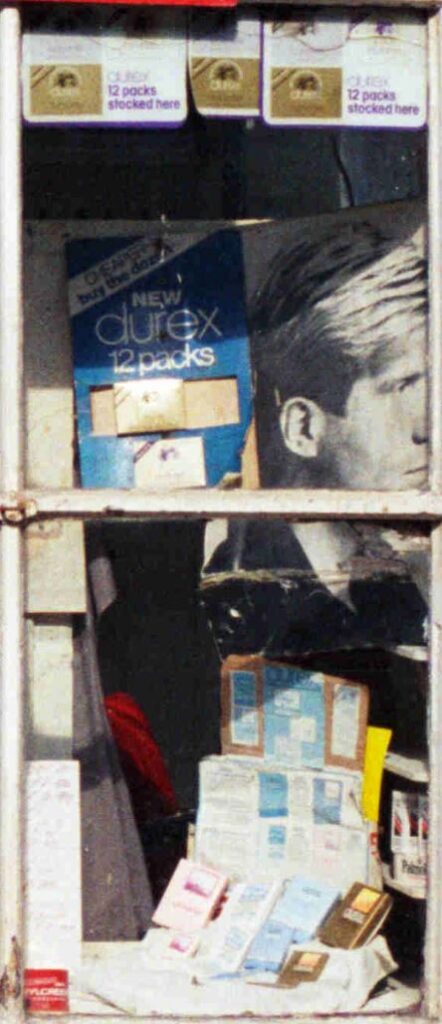
The displays in shop windows from the past often cast a light on life at the time, and the large display on the right of Ron’s main windows shows that the hairdressers were very much of the “something for the weekend” type:

Rons Gents Hairdresser, Three Colts Lane, Bethnal Green

The shop is in the corner of a long block of flats that runs from Three Colts Lane up along Corfield Street. The following photo shows the shop, and in the first window down Corfield Street is one of the red and white striped signs that have long been the symbol for a barbers.

Three Colts Lane

Three Colts Lane runs from Cambridge Heath Road in the east to Brady Street in the west. For a large part the route, the street has the brick viaduct carrying the railway through Bethnal Green towards Liverpool Street Station, along the southern edge.

Within this brick viaduct, there are rows of arches, many of which have been occupied by various businesses, the majority being in the motor trade.

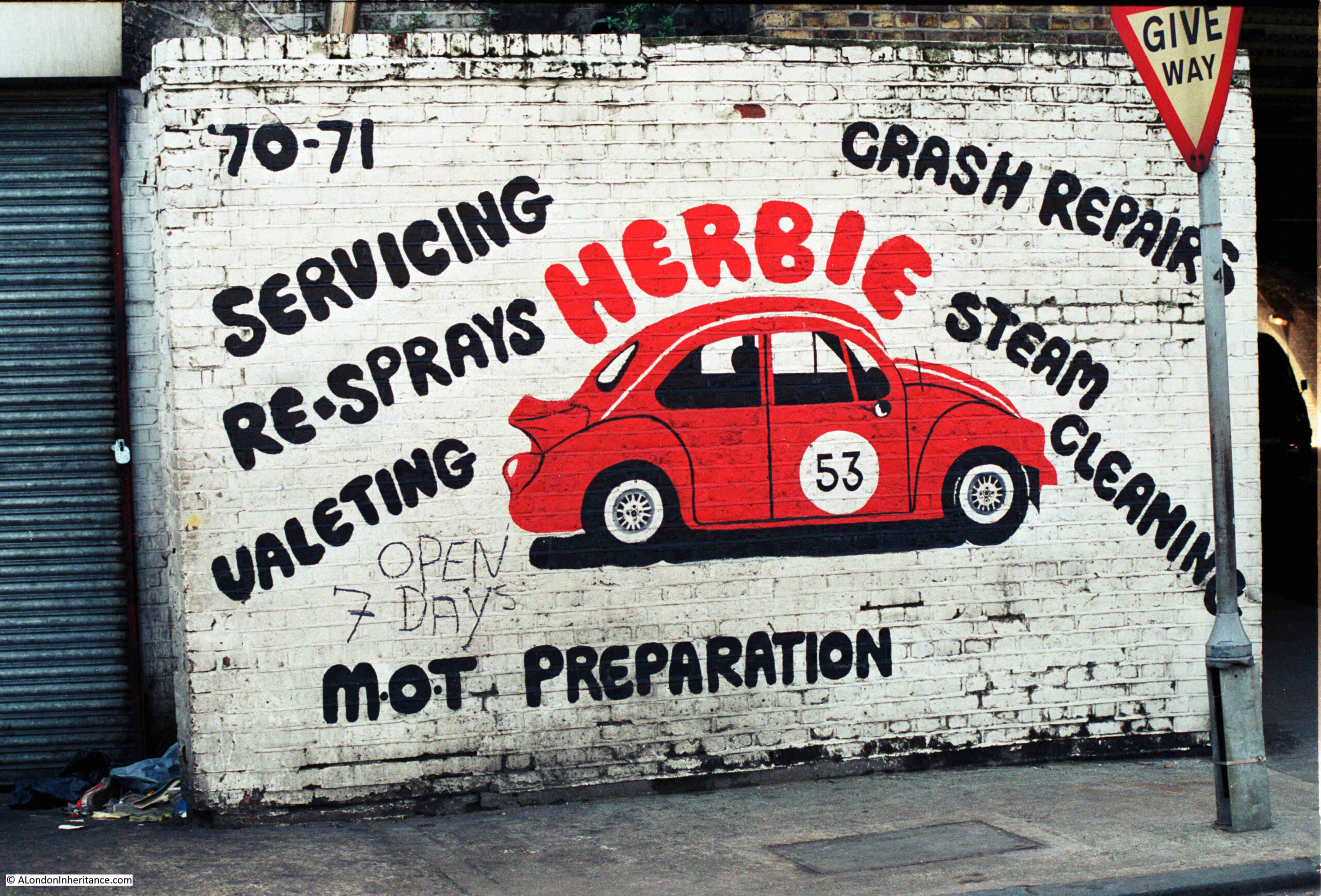
Next to the 1986 photograph of Ron’s Hairdressers on the strip of negatives, there were two photos of signs advertising typical businesses for the area. The first features the Volkswagon Beetle, Herbie, made famous in the 1968 film The Love Bug:

Three Colts Lane

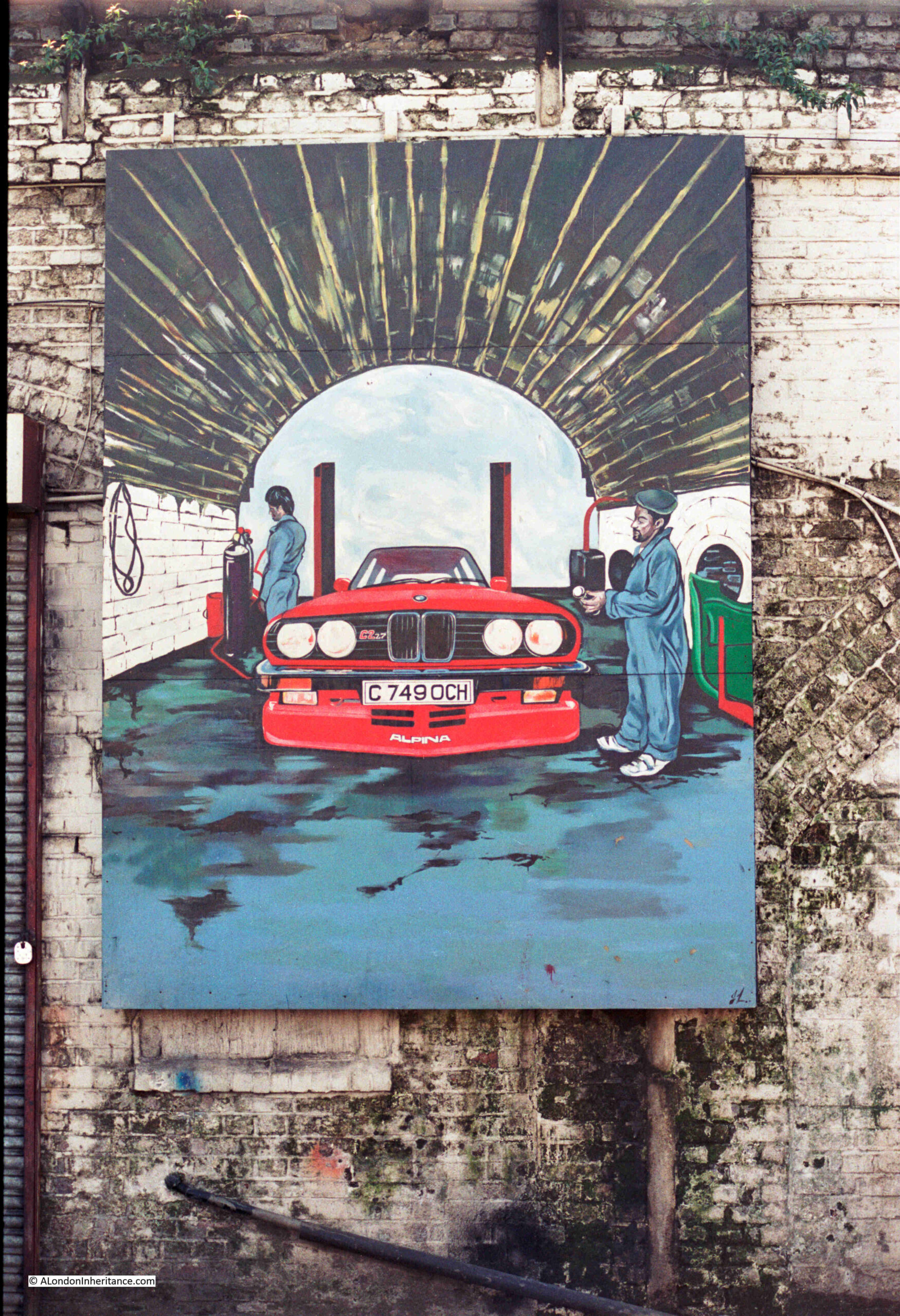
The second was a large mural showing a BMW in one of the arches:

Three Colts Lane

I wondered if there was any relevance to the registration number of the car, and a quick Google found that it was a BMW E30 Alpina C2 2.7 3-Series, and the car was subject to a road test which was published in the 19th of April 1986 issue of Motor magazine, which reports that the car would have cost you just over £19,000.

The road test article is available here. It was obviously the car to aspire to in 1986.

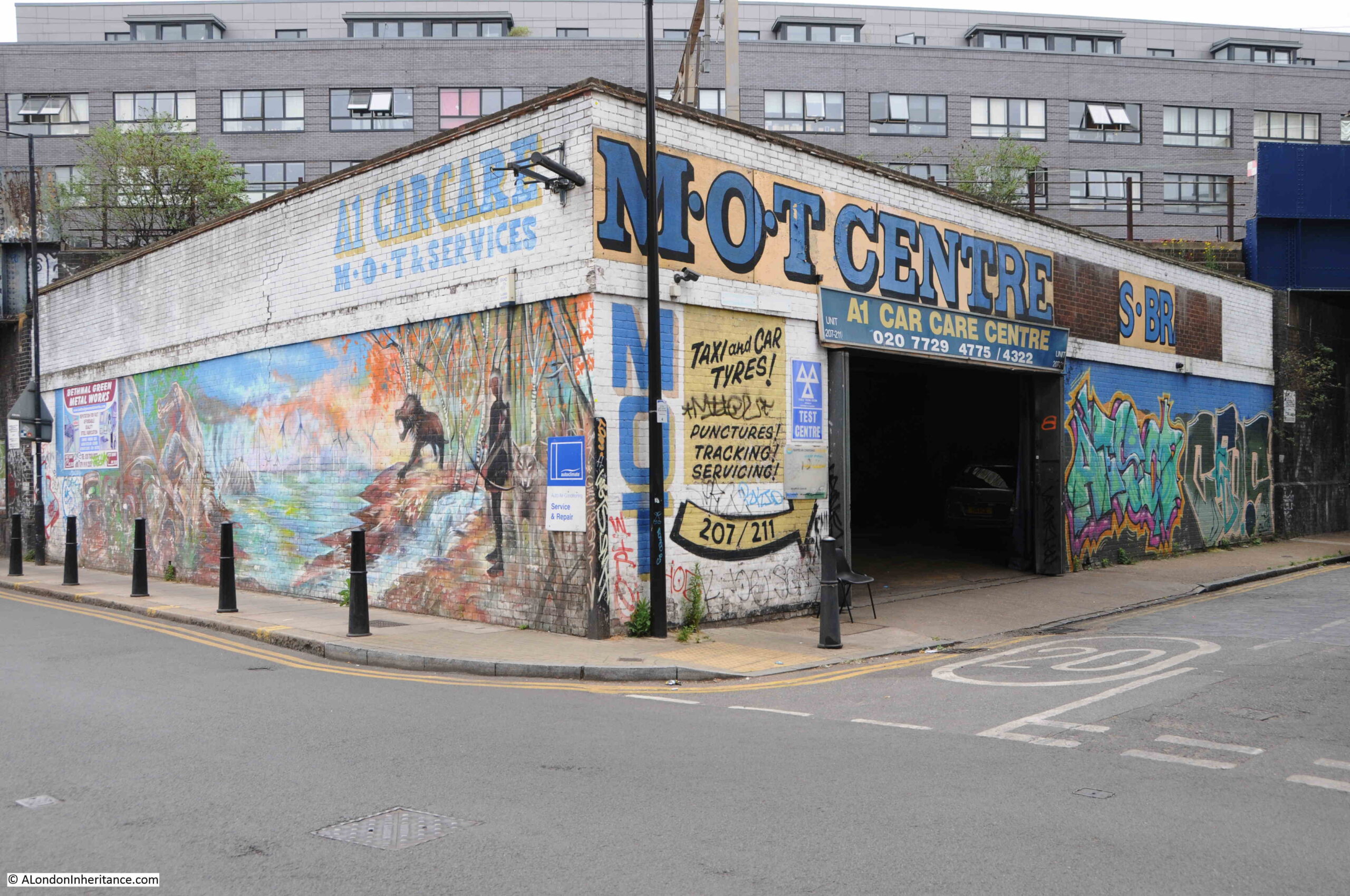
Although these photos were taken 37 years ago, I took a walk along Three Colts Lane and surrounding streets to see if any trace of them remained. I could not find anything, but the area is still a hub of car and taxi repair businesses, and some rather impressive graffiti and murals, as the following example of the A1 Car Care Centre on the corner of Three Colts Lane and Coventry Road illustrates:

Three Colts Lane

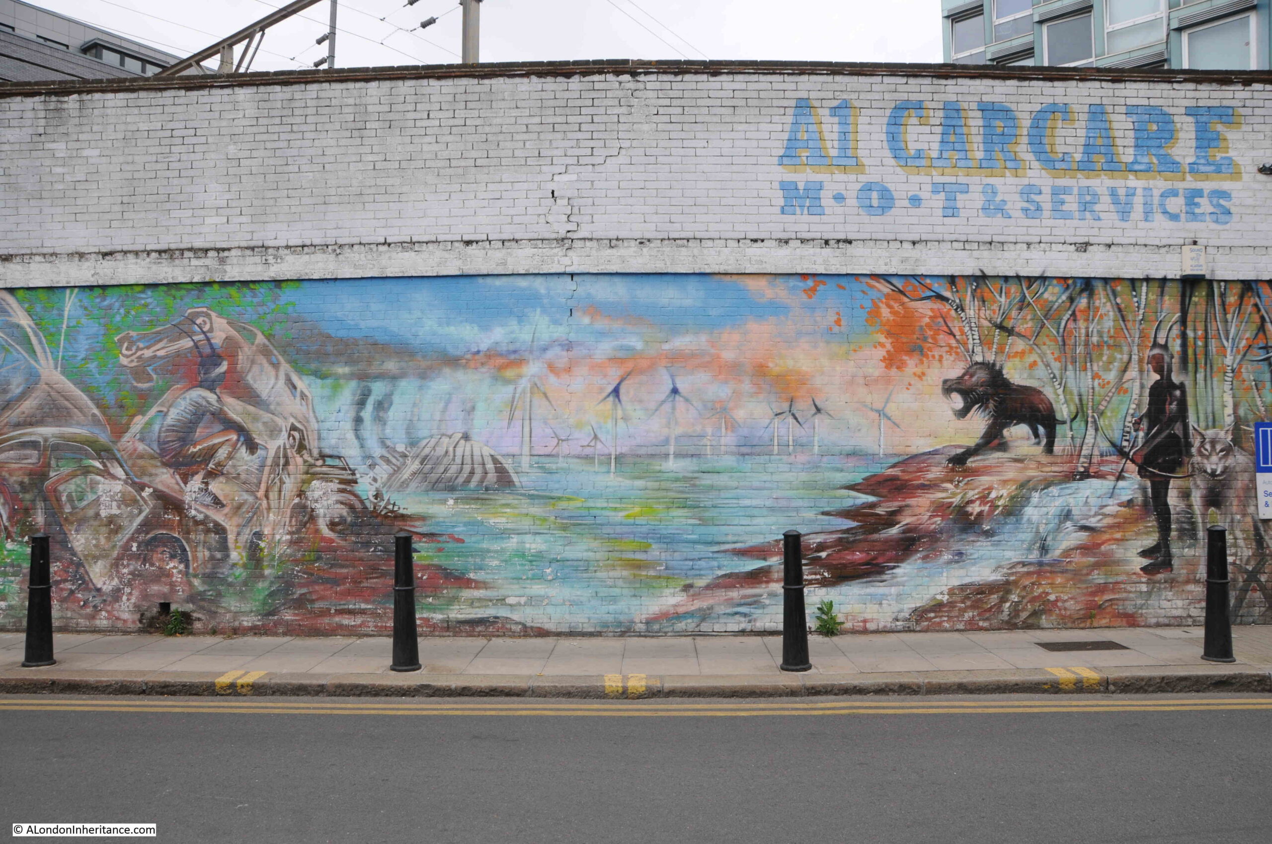
Detail of the mural on the side of the building in Three Colts Lane:

Three Colts Lane

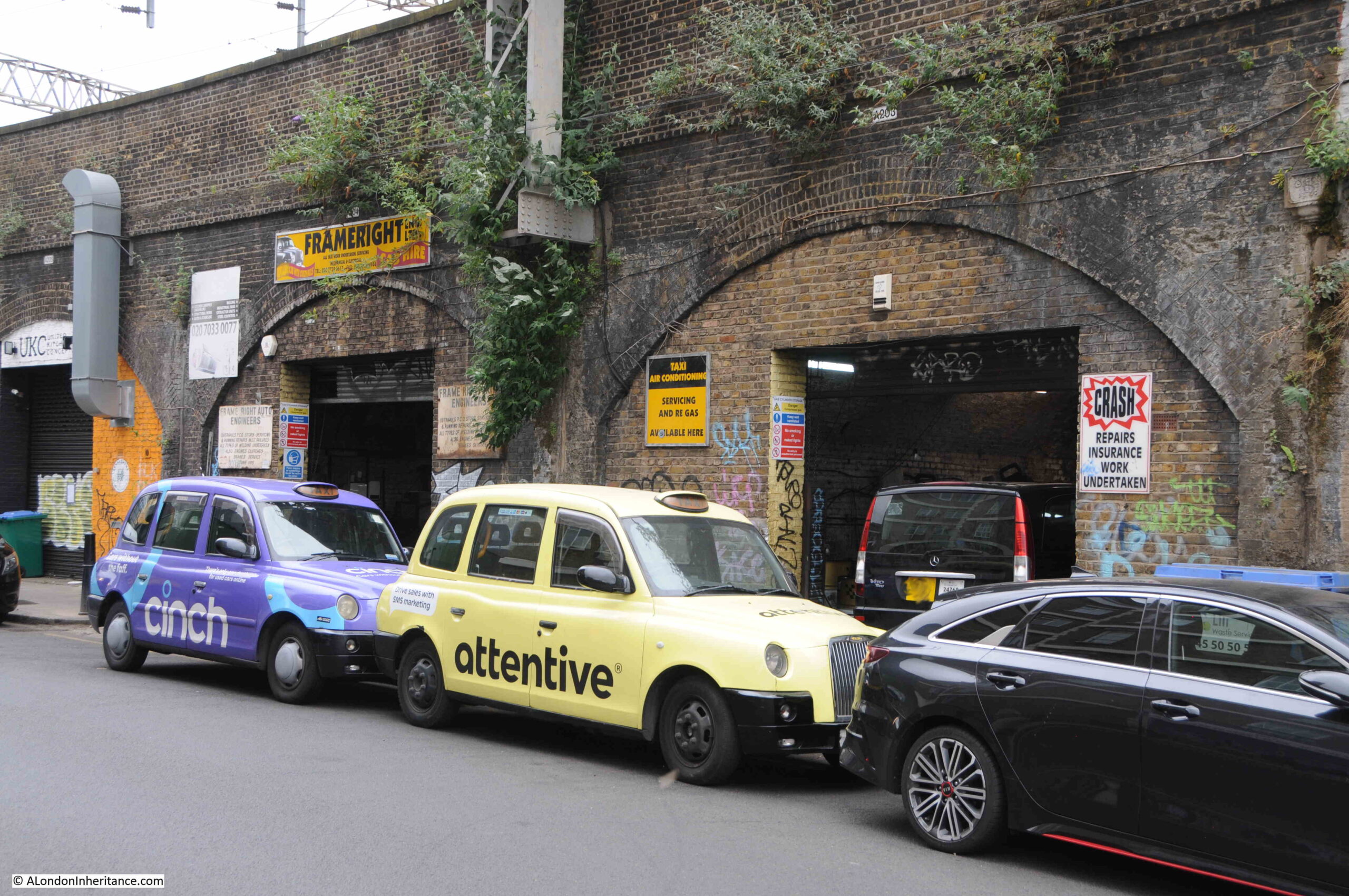
The arches along Three Colts Lane have many businesses which support the taxi trade, and spend a short time in the street and you will see a number of taxis arriving and departing from these arches:

Three Colts Lane

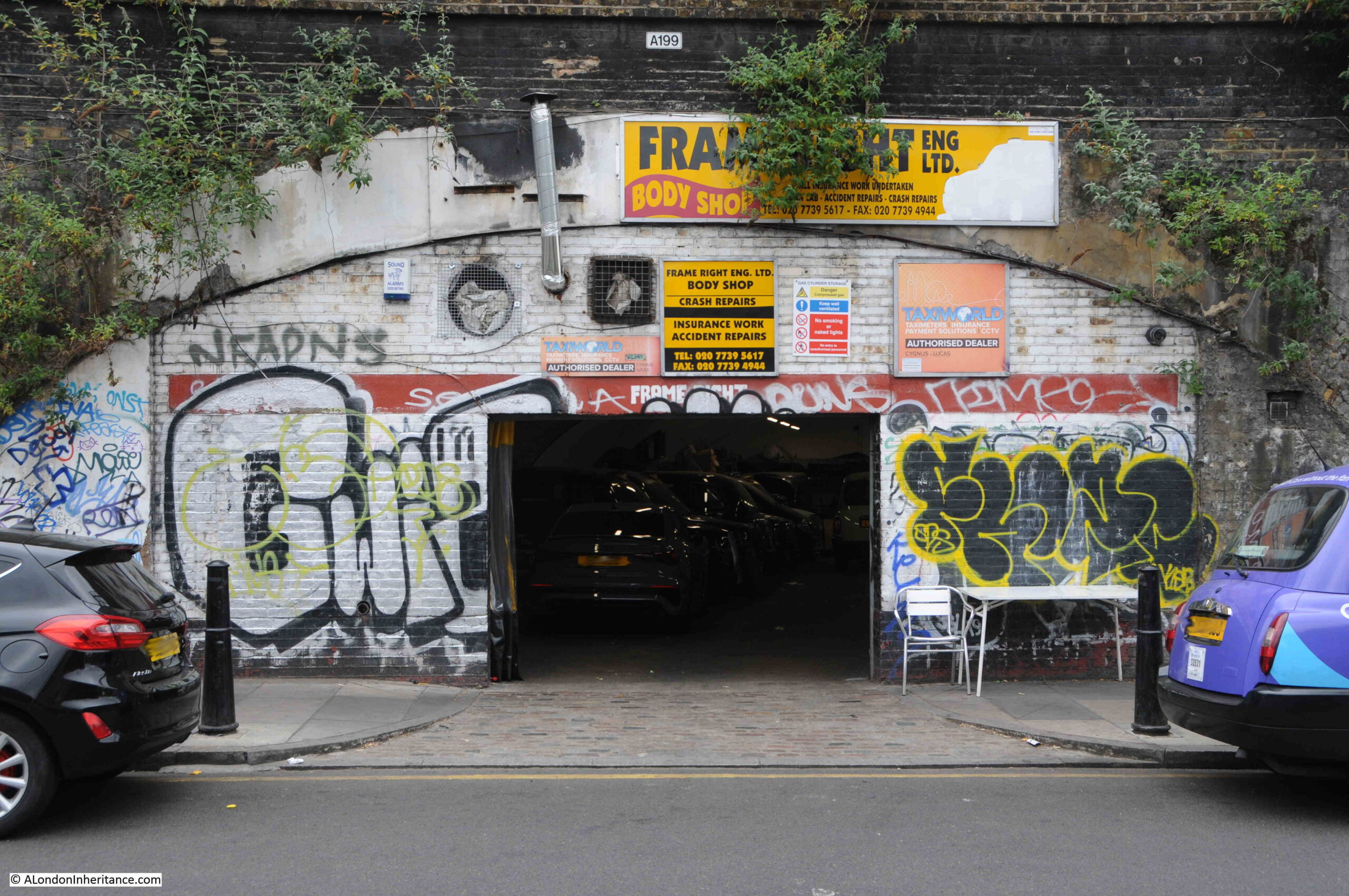
Entrances into these arches show dimly lit interiors where vehicles are serviced and repaired, as at Frame Right Eng. Ltd.’s Body Shop:

Garage in the railway viaduct

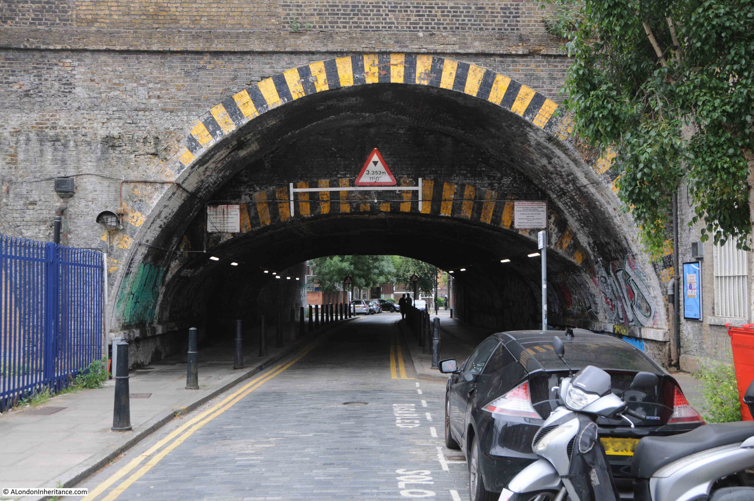
The size of these arches can be seen where roads pass through the viaduct. The differing heights of the arches also show how the viaduct into Liverpool Street Station has expanded over time:

Tunnel under the railway viaduct

At the end of Three Colts Lane, it turns into Brady Street which heads under the viaduct, and Dunbridge Street which continues along the northern side of the viaduct.

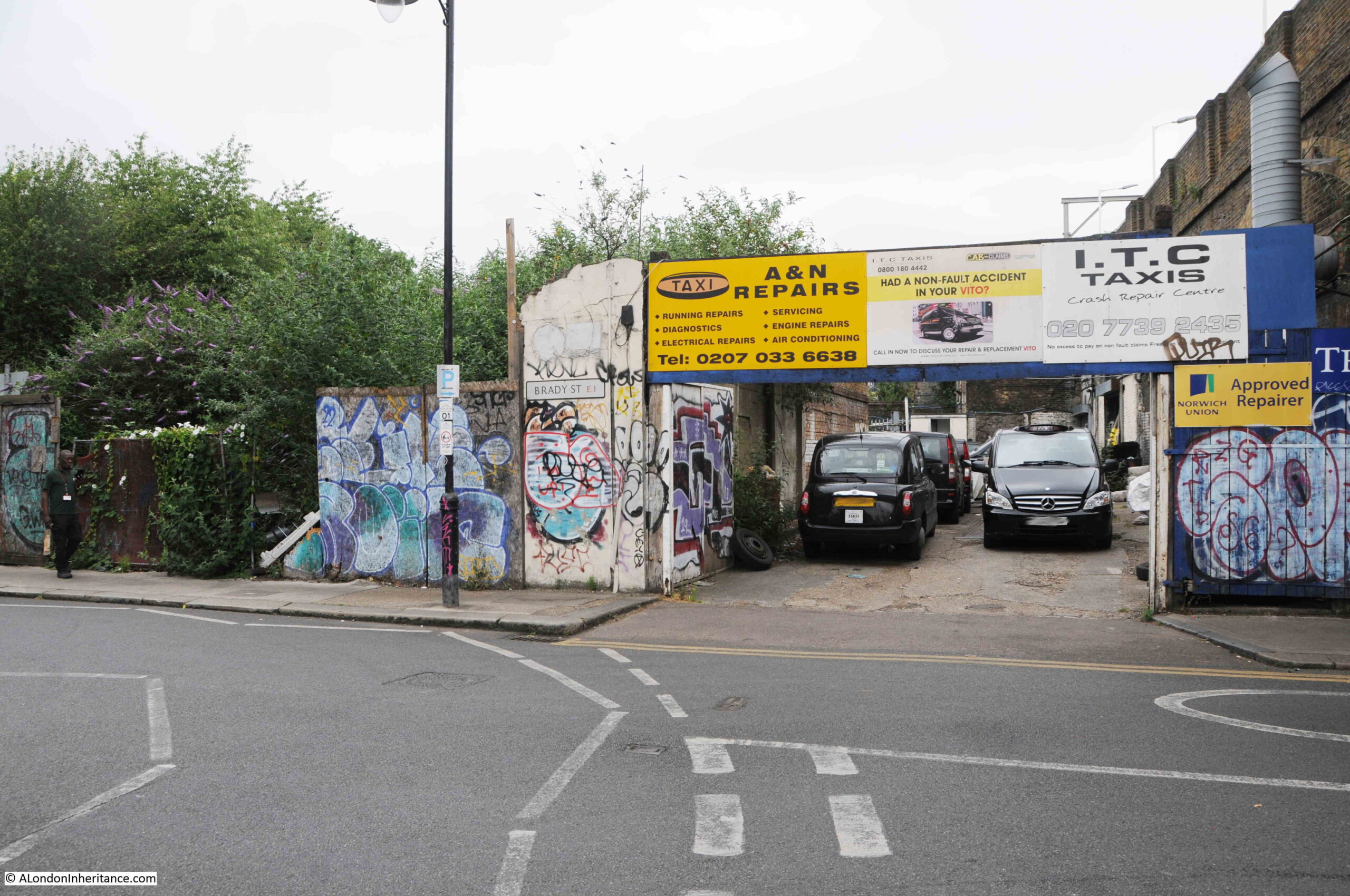
At this road junction, there is a derelict patch of land on the left, with another repair business in the arches on the right:

Dunbridge Street

The derelict land on the left of the above photo was once the site of a pub, the Yorkshire Grey, which closed in 1998, and was then in residential use for a while, until the building was demolished around 2014. Surprising that the land has not been developed in the past nine years.

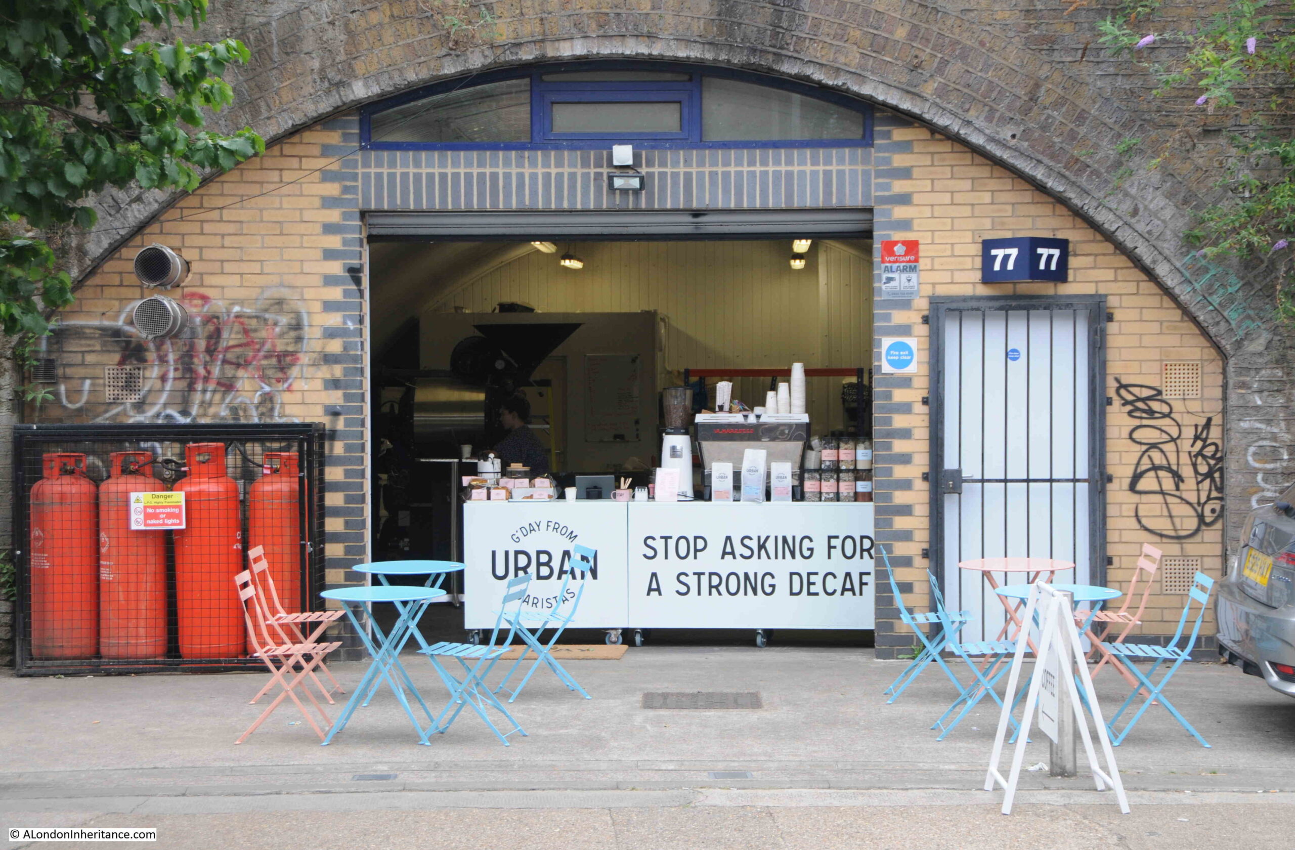
Continuing along Dunbridge Street, and there are a couple of very different businesses operating within the arches, including Urban Baristas:

Dunbridge Street

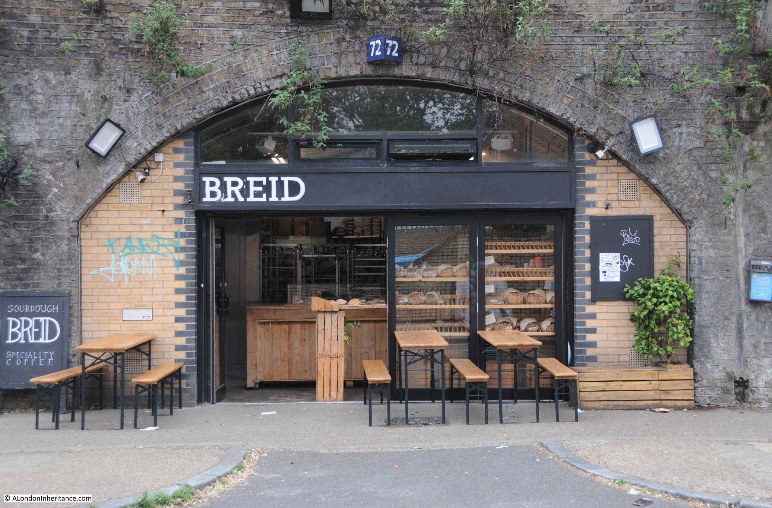
And Breid Bakers:

Dunbridge Street

I can never resist looking at old maps when I visit a place, and the outline of the street that would become Three Colts Lane seems to date from the end of the 18th century.

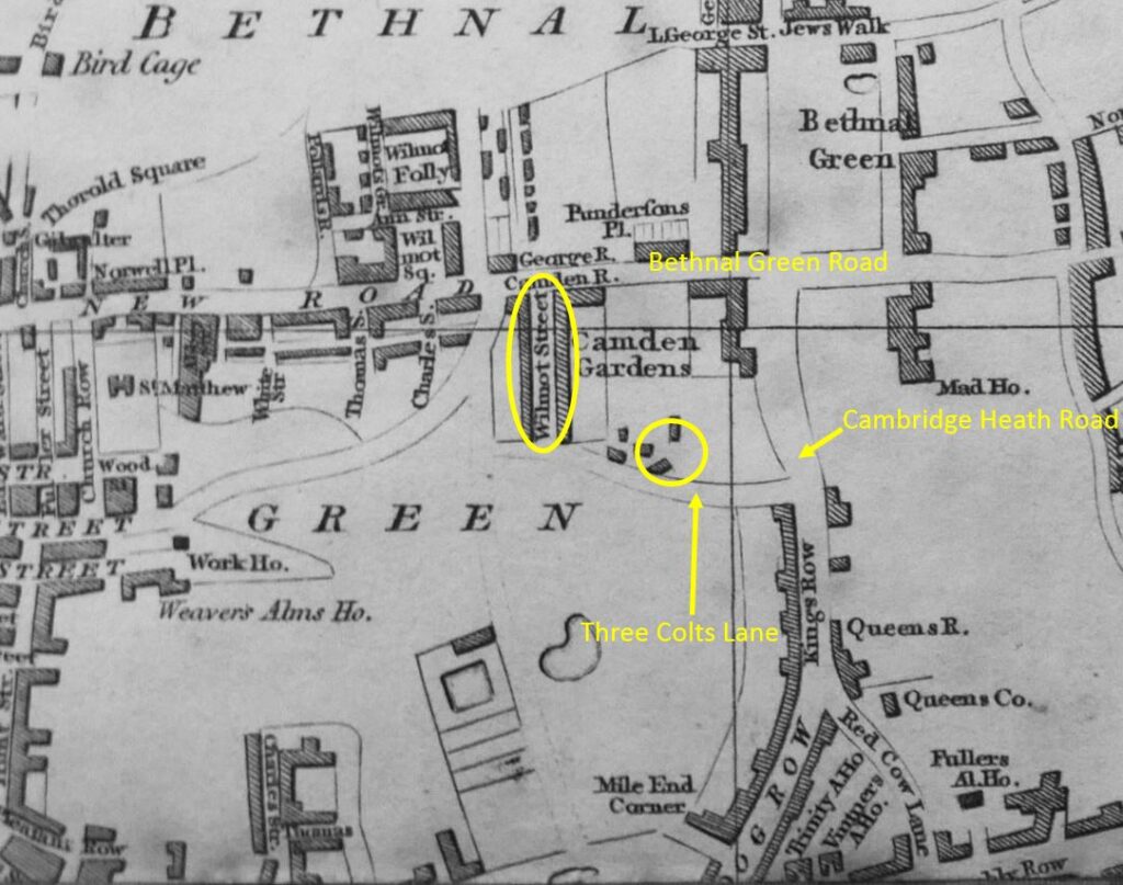
The following extract is from Smith’s 1816 New Plan of London. I have marked what would become Three Colts Lane, and the circle is around the area where Ron would open his hairdressing business:

Bethnal Green in 1816

The one constant in the map is Wilmot Street, shown within the yellow oval. The street has kept its original name, and still leads off from Three Colts Lane today, although the houses lining the street are today very different to the terrace houses that were built at the start of the 19th century.

Bethnal Green Road was then New Road, and Cambridge Heath Road was Dog Row and Kings Row.

In the early 19th century, there was still a fair amount of open space in this part of Bethnal Green. Over the next few decades, this would all be built over.

I cannot find a source for the name of the street. In 1818 it was Three Colt Lane, by the end of the 19th century it was Three Colt’s Lane, and today, the street sign has the name Three Colts Lane, so it has been Colt, Colt’s and Colts.

A colt is a young male horse, and as there was open space to the south of the early incarnation of the street, I wonder if there were three colts in this field, and the use of Lane rather than Street or Road may imply a route through what was a semi-rural area? It is this sort of visual imagery that was often used to name a location before streets were formally named, and when literacy levels were low.

There is also a Three Colt Street in Limehouse, but again I cannot find a firm reference as to the source of the name.

Ron’s was very much a barbers of its time, and I doubt that today you would find a barbers where a third of their window is taken up with advertising for contraceptives.

alondoninheritance.com