Monthly Archives: December 2014

London’s Railways – Planning For Peace

Around this time of year, a number of London stations are in the news for the considerable amount of work that is on-going for rebuilding, the creation of new lines and what always seems to be the inevitable overrunning engineering works. The work at London Bridge and for Crossrail being just two examples.

Major schemes have always been in various stages of planning to address London’s ever increasing transport requirements. Some schemes have reached completion, others never moved from the conceptual stage.

For this week’s post, I want to illustrate one set of schemes that were published in January 1946 and show how usage of the main London stations has changed over almost 80 years.

In the middle of the last war, there was a general feeling that the tide was starting to turn and planning could start for what London would look like in the decades after the war. How could the city be developed, what would be the transport needs of Londoners in the future, how could both the city’s infrastructure and landscape be improved and better use made of the limited space available?

In 1943 the London County Plan was published, then in February 1944 a committee was established :

“To investigate and report upon the technical and operational aspects of those suggestions made in the County of London Plan of 1943 which relate to the main line and suburban railway system of London, both surface and underground, bearing in mind that these suggestions are intended to contribute towards and form part of a comprehensive scheme for the re-development of the area in question.”

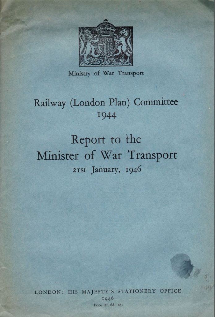
The report from the committee was published in 1946 and made some very far-reaching proposals, that had they been implemented would have had a dramatic impact on the transport system we see in London today.

Report Cover 1

Before getting into some of the details of the proposals, it is fascinating to compare the use of London stations between the 1930s and today. The 1946 report details passenger numbers of all mainline terminals up to the end of 1938 , the latter being the last year free from the influence of war.

The following table compares passenger arrival numbers during maximum morning peak hour  pre-war and in 2010 (the 2010 figures are taken from the “Central London Rail Termini: Analysing Passengers’ Travel Patterns Policy Analysis Research Project” published in September 2011 by Transport for London):

Station 1938 Peak Hour 2010 Peak Hour
Paddington 4,800 10,500
Euston 5,800 11,500
St. Pancras 2,100 9,000
Fenchurch Street 10,500 11,500
King’s Cross 9,000 7,500
Liverpool Street 34,700 32,500
Marylebone 3,900 5,500
Waterloo 24,300 45,500
Victoria 16,400 28,500
Charing Cross 17,000 15,500
Cannon Street 18,100 15,000
London Bridge 31,300 31,000
Totals 177,900 223,500

Whilst overall numbers have increased considerably there are some fascinating individual station comparisons. I bet if you use London Bridge on a daily basis the fact that in 2010 passenger numbers were still slightly below the 1938 level is of little comfort.

Perhaps reflecting the different options for transport and the changes in home locations for those working in central London, there are some significant swings. Paddington, Euston, St. Pancras, Waterloo and Victoria all showing significant increases in passenger traffic whilst King’s Cross, Liverpool Street, Charing Cross, Cannon Street and London Bridge are all showing reductions.

There were a couple of major themes within the 1946 report, perhaps reflecting the “anything can be done” attitude needed during the war, and a realisation that the changes caused to London by heavy bombing presented a major opportunity to improve London for everyone who lived and worked in the city. A similar approach to that taken by Wren after the Great Fire of 1666 when he proposed the creation of a city more along the lines of Paris than London had been with an ordered city with straight boulevards and a logical planning approach rather than the numerous small lanes and alleys of pre-fire London .

The major themes of the 1946 report were:

  • The removal of the head on terminals at Charing Cross and Cannon Street and the high level stations at London Bridge and Waterloo Junctions and the associated bridges across the River Thames
  • The construction of an extensive series of deep level tunnels and interchanges to replace the above ground infrastructure and to provide improved passenger and freight transport across London, capable of meeting the expected increase in both freight and passenger volumes.

As well as the removal of the bridges across the Thames, the viaducts across south London were also seen as a problem. Not just as a wasted space, but that they also split communities and their replacement by tunnels was seen as a way of integrating the many communities of south London. This was one of the areas where the rebuilding of the rail system would contribute into the overall London plan by making redevelopment of large areas such as the South Bank possible without the extensive railway infrastructure across the area.

In these proposals it is also possible to see the ideas behind Crossrail where trains from outside the immediate underground network are routed in tunnels across London with deep level interchanges with the tube and other rail networks and with the surface. Whilst the destinations are different, the concept is the same.

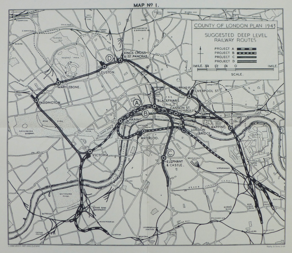
The following map from the report identifies the possible routes:

Map 1

The options shown in the map are:

Project A: A new deep-level North Bank link from Battersea to Deptford via Victoria, Charing Cross, Blackfriars, Cannon Street, Shadwell, Wapping and Surrey Docks

Project B: A new deep level-loop connecting Waterloo Junction, Charing Cross, Blackfriars, Cannon Street and London Bridge and then by tunnel via the Surrey Canal rising to join the existing surface systems in the south and south-east.

Project C: A north-south tunnel, an underground link to replace the existing viaduct from Snow Hill to Loughborough Junction

Project D: A northern arc suburban passenger route, passing below the main line stations at Paddington, Marylebone, Euston, King’s Cross and Liverpool Street with interchange facilities.

The projects also included the electrification of all remaining lines into London. I did not realise how much of the rail network leading into London had been electrified by the start of the last war. We tend to think that this was still the age of steam, but into London, the percentages that were already electrified after completion of the 1935 / 40 New Works Programme were:

Southern Railway: 86%

London and North Eastern Railway: 26%

London Midland and Scottish Railway: 32%

One of the other projects considered for the rail terminals was “The reconstruction of terminals at two levels, with flat roofs for future air landing”. Just shows the difficulties in trying to forecast how transport will be used in the future.

Removal of the bridges across the river was considered important as “the merit of a clean sweep of the three rail bridges over the Thames between Westminster and London Bridge cannot be denied”. How different the river would look today without the rail bridges.

Some of the themes driving the need for change are the same now as they were in 1946:

“Size and Distribution of Population. For many decades past, London has embraced a rising proportion of the total population of the whole country, which has itself been rising. During the inter-war years approximately half of the increase in London’s population could be attributed to immigration from the provinces

Decentralisation of employment, for it is one of the guiding principles that industry also should be de-centralised and there are proposals for satellite towns to be located, and existing towns expanded beyond the green belt.

Increasing traffic. Experience shows that, as income rises, the demand for transport rises more than proportionately, irrespective of transport to and from work.”

These words could equally have been written in 2014 as they were in 1946, and in 2014 to support the second point could also be added the ever-increasing price of property in central London driving people further out in search of affordable housing.

The following map from the 1946 report shows the proposed routes in their wider context and the considerable complexity of these proposals (click on the map to open a large copy):
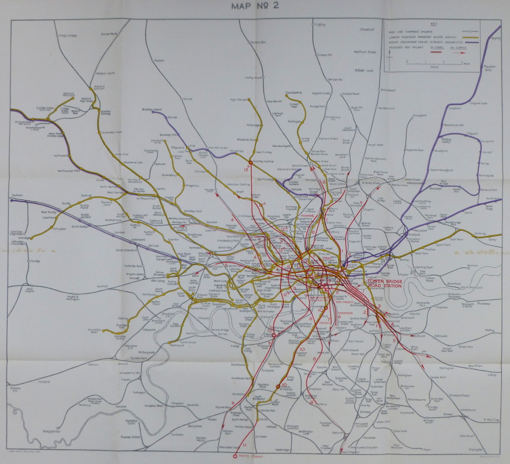
Map 2
London Bridge Station was singled out for special interest. Total passenger numbers in the peak hour in 1925 was 38,000 and grew to 55,000 in 1938. In planning the proposed changes to the rail system, an expected 75,000 passengers was considered the level for which an upgrade should be planned.

As well as moving part of the station underground, an alternative site was considered and a major new underground / overground station was planned for a site adjoining Tower Bridge Road (as marked in Map No. 2 above)

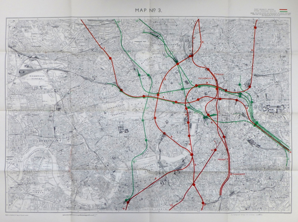
The following map shows the first and second priority routes and also tunnels for the use of passenger and freight traffic. This was still at a time when significant volumes of freight traffic were carried by rail. The explosion of road transport, the motorway network and the considerable use of lorries for freight was not forecast to have a major impact on the rail system in 1946 (again click on the map to open a larger copy).

Map 3

The cost for the priority works were estimated as:

North Bank Route Cost (£)
Main Route 20,920,000
Clapham Branch 2,640,000
Brixton Branch 1,940,000
Deptford Branch 530,000
New Cross Branch 1,380,000
New Cross Gate Branch 1,620,000
Lay-over at Charing Cross 1,840,000
South-east, City and West End Route  
Main Route 5,590,000
Lay-over at Charing Cross 460,000
North-South Route  
Main Route 4,800,000
Lay-over at Holborn 920,000
Northern Arc Route  
Main Route 6,450,000
Lay-over 460,000
Total Scheme 49,550,000

This was rounded up to £50 Million, which was then doubled to take into account the cost of land, property, traction equipment, rolling stock and signalling, plus a further £10M for other ancillary works, giving a total estimated cost of £110 Million. A considerable sum just after the war, also given the financial situation of the country at the time.

The cost of all proposals in the plan was estimated at between £228 Million and £236 Million and these costs did not include the cost of electrification or any other works outside of the proposed tunnels. Estimates of construction time were “under the most favourable conditions, would not be less than 30 years”.

New types of train were also recommended. The majority of overland trains on the Southern Railway comprised carriages with six-a-side compartments, however the safety needs of operating these trains underground required the provision of rolling stock with some form of through corridor to enable passengers to pass in emergency from one coach to another. The types of trains in use at the time were made up of six-a-side compartments and an overall train could carry 1,050 passengers. A 10-coach train of similar length with through corridors reduced passenger carrying capability down to 600 passengers. A challenge with the proposed approach as an increase in the number of trains would be required to carry the same number of passengers without any capacity for the expected increase in numbers.

So what happened to these proposals which would have had a very dramatic impact on the train services and stations in London as well as the view along the Thames if the removal of the rail bridges had gone ahead?

As well as the very significant costs of the proposals, shortly after they were published alternative committees were also set-up to look at options for upgrading London’s transport services.

London Transport planners also prepared their own report which was published the following year in March 1947. On the 1st January 1948, the British Transport Commission took over London Transport as well as the main line railways. The Commission also set-up a new working party to report on transport services within London and a report was completed in late 1948.

The multiple reports, high costs and the economic state of the country in the late 1940s and early 1950s put on hold this type of far-reaching proposal and development of transport within London followed a more individual project approach. Some of the 1946 proposals did get included in alternative projects. For example the Brixton branch proposed in 1946 was eventually covered by the routing of the Victoria Line to Brixton.

London Bridge Station in all it’s complexity is still there and perhaps after the ongoing considerable rebuilding work including the work over this year’s Christmas break, will see the station reach the potential envisaged by the 1946 planners, although with the significant difference of being above ground rather than below.

The sources I used to research this post are:

  • Railway (London Plan) Committee 1944 Report to the Minister of War Transport – 21st January 1946
  • Central London Rail Termini: Analysing Passengers Travel Patterns. Policy Analysis Research Report. published by Transport for London, September 2011

alondoninheritance.com


The Ghosts Of London

I first started walking London in the very early 1970s when as children we had family walks exploring the city. We were too young to appreciate exploring a London that would soon be changing so dramatically, so probably to try and keep our interest my father would tell stories of some of the myths and legends of where we walked, including tales of the ghosts of London that haunted many of the locations we passed.

Many of the locations that would be expected to have ghost stories associated with their history do not disappoint. The Tower of London has several reported apparitions. Lady Jane Grey seems to be the most frequent having been seen in the Bloody Tower as a long-haired woman dressed in a long black velvet dress with white cap and in the Salt Tower where she was seen as a white shapeless form. Anne Boleyn has been allegedly seen in the White Tower and on Tower Green. A bear has also been seen by some of the military inhabitants of the Tower, perhaps a survivor of the time when the Tower was used as a menagerie. Sir Walter Raleigh’s ghost has also been reported near the Bloody Tower.

Westminster Abbey has the ghost of a monk gliding some distance above the floor, presumably due to changes in floor level due to alterations to the Abbey over the centuries. In the Deanery the ghost of John Bradshaw, president of the court which condemned Charles the 1st has been seen.

There are also many stories of ghosts in the more unexpected locations.

So, as we reach the shortest days of the year, when the long cold nights open the imagination to the more mythical aspects of London, join me on a walk across the city to hunt down some of the ghosts of London. Characters that do not make much of an appearance now with the bright lights, noise and pace of the city crowding out the more fleeting visions of past lives.

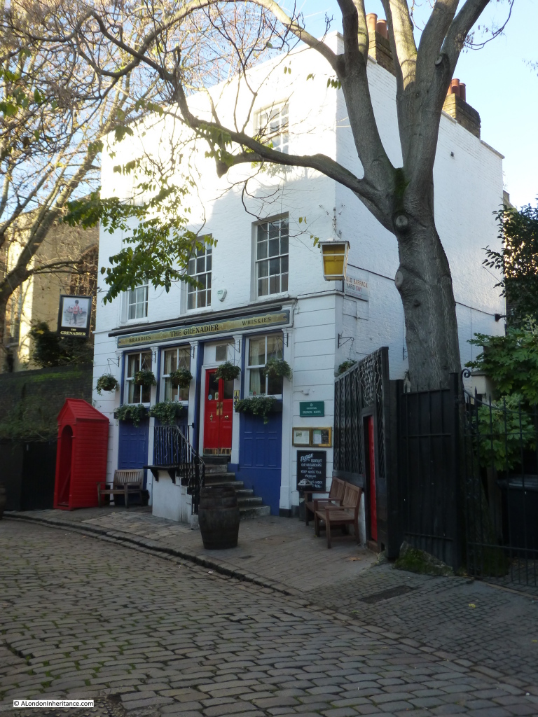
Belgravia is our first stop. Find Wilton Row, just off Wilton Crescent and almost at the end of this hidden street is the Grenadier.

Grenadiar 1
The Grenadier has been a pub since 1818 but was originally the Officers Mess of the First Royal Regiment of Foot Guards and was built-in 1720.

The pub is proud of its supernatural heritage, allegedly being haunted by the ghost of Cedric, a young Grenadier who was apparently beaten to death by his comrades after being found cheating at cards. Apparitions, footsteps, noises and an icy chill have all been reported by both landlords and visitors to the pub over the years.

Well worth a visit, even if you are not lucky enough to witness one of Cedric’s manifestations.

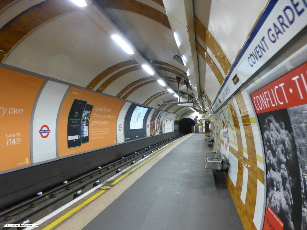
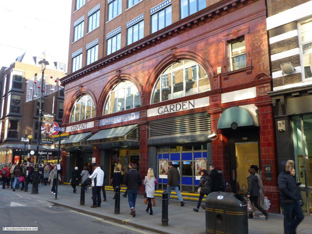
Now take the short walk up to Hyde Park Corner Underground Station and take the Piccadilly Line to Covent Garden Underground Station where as you queue for the lifts, or regret the decision to take the stairs, you may meet the ghost of the actor William Terriss who was murdered outside the Adelphi Theatre in 1897, but for some unknown reason started haunting the underground station in 1955.

covent garden 1

In November 1955 the foreman ticket-collector was in the staff room of the station. He recalls that:

“the door was open and in the other section of the room there appeared the figure of a tall man, grey of face and wearing white gloves”

He assumed it was a passenger and asking if he could help, the figure silently turned and disappeared behind a partition. A week later, another station employee was found shaking with fear announcing that he had seen a ghost, claiming ” he stood in front of me and put his hands on my head”

A séance was later held at the station and the ghost claimed to be the Victorian actor William Terriss. He was seen many times later on the platforms, passageways and emergency stairs of the station, along with station workers hearing phantom footsteps and feeling an icy chill.

covent garden 2

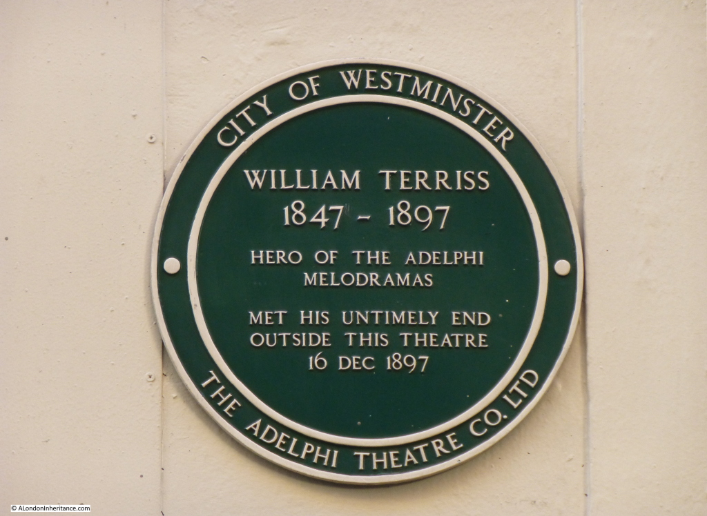
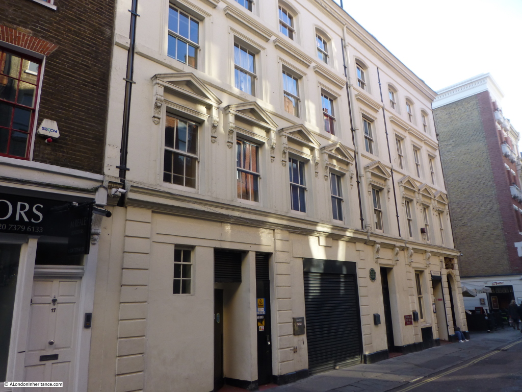
William Terriss was stabbed by a fellow actor as he entered the stage door of the Adelphi Theatre. The murderer, Richard Prince was jealous of the popularity of Terriss. Whilst he was found guilty, he was also diagnosed as insane and died in Broadmoor.

There is a plaque to William Terriss at the rear of the Adelphi in Maiden Lane.

adelphi 1
The rear of the Adelphi, it was here that William Terriss was murdered. He is also said to haunt the theatre, but why he should be haunting the Covent Garden Underground Station rather than just the scene of his murder remains a mystery.

adelphi 2

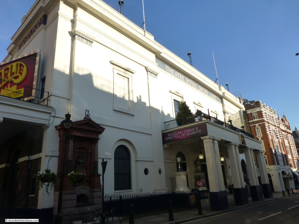
The next stop is the Theatre Royal, Drury Lane, (which although includes the name Drury lane, the main frontage is actually on Catherine Street) which has no less than three possible ghostly inhabitants. The first, and perhaps best authenticated is a “man in grey” who appears between the hours of 9am and 6pm, not the typical hours for a ghostly appearance. The ghost has been seen many times over the years by actors working at the theatre including Harry Secombe who was appearing in The Four Musketeers in the early 1960s. He said “the whole ruddy cast saw him once. He always made his appearance before 6pm and then popped off again. Haunting to rule, I suppose.”

The identity of the man in grey is a bit of a mystery. Possibly that of the actor Arnold Woodruffe who was killed by Charles Macklin some 200 years ago in a burst of anger. When the theatre was rebuilt around the 1850s a small room was found which contained the skeleton of a man with a dagger in his ribs. His identity was never found, and he is also one of the possible candidates for the man in grey.

Other ghostly appearances at the Theatre Royal have been a man with a long white-painted face who was occasionally seen sitting behind people in the boxes. He was thought to be the famous clown Joe Grimaldi.

The comedian Dan Leno was also allegedly seen at times, but was one of the more infrequent ghostly visitors to the Theatre Royal.

The Theatre Royal, Drury Lane, frontage on Catherine Street:

drury lane 1

A theatre has been on the site of the Theatre Royal since 1663. The theatre went through several phases of demolition and rebuilding until the present theatre which was built-in 1812.

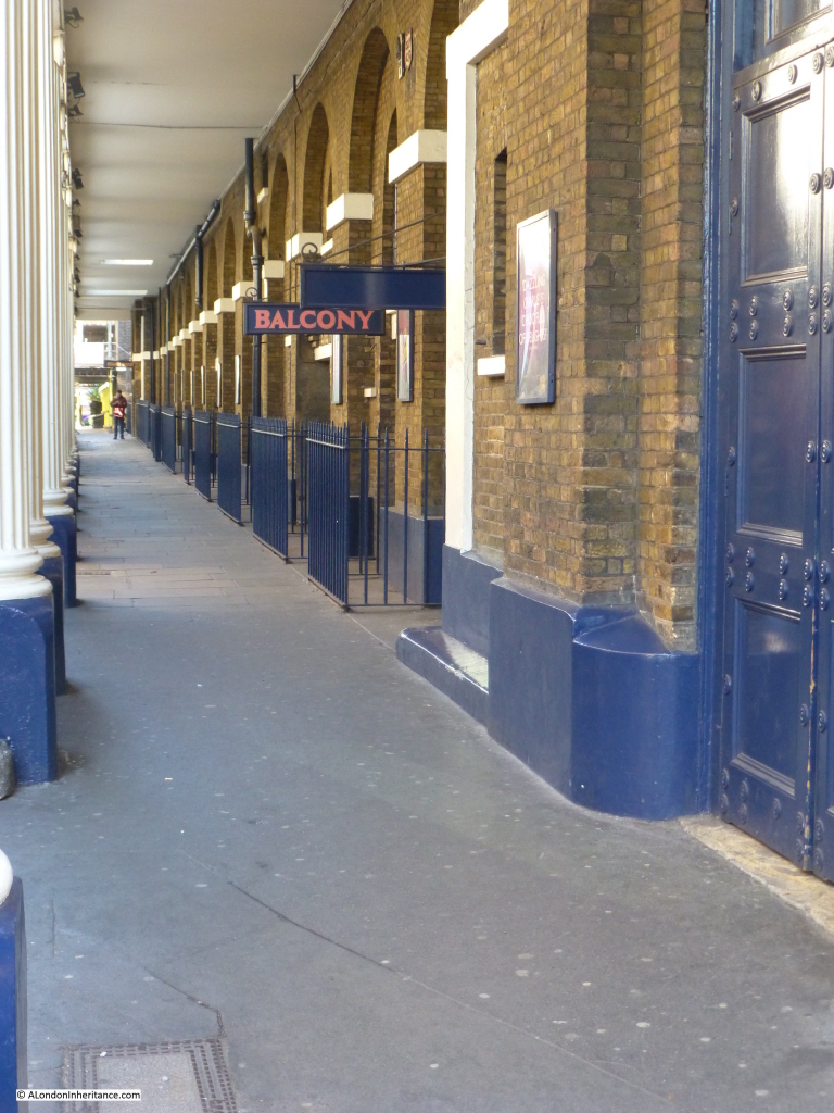
The colonnade walk alongside the Theatre Royal:
drury lane 2
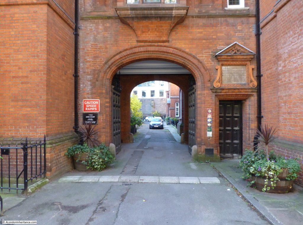
Now we head into the City of London. Walk up Ludgate Hill and just before reaching St. Paul’s turn left into Ave Maria Lane. A short distance along, on the left is Amen Corner and Amen Court. At the far end, through the gateway in the following photo can be seen a wall, the old city wall built on Roman foundations.

amen court 1

This wall separates Amen Court from Dead Mans Walk where those hanged at Newgate Prison were buried in quick lime. This is a possible explanation for a “Thing” that has been seen at night creeping along the top of the wall. No one has been able to see this vision close enough to identify what it may be.

So when out in London during the dark nights of winter, keep an eye out for the ghosts of London, shadows from London’s past who may still retain a fleeting presence in today’s city.

The sources I used to research this post are:

  • Memories from walking London with my father in the early 1970s along with 60 years of notes he kept in the book Unbidden Guests – A Book of Real Ghosts by William Oliver Stephens published in 1949. He kept notes on London covering subjects such as architectural, historical as well as ghost stories in a wide range of books about London. One of the many reasons I much prefer books to eReaders.
  • Our Haunted Kingdom my Andrew Green published 1973

alondoninheritance.com


Baynard’s Castle, A Roman Monument And The Last Working Crane In the City

I was recently scanning some negatives of photos I had taken in London in 1982 and found a series of photos of archaeological excavations around St. Peter’s Hill and Upper Thames Street, all in the region of the church of St. Benet which I covered in a post a couple of weeks ago.

In the early 1980s a site was needed to relocate the City of London School and the site chosen was adjacent to St. Benet and unusually across the new routing of Upper Thames Street which was in the process of being boxed into a tunnel and onto the embankment of the Thames with space left for a new Thames Path.

As well as the foundations of the Victorian warehouses that ran along this part of the river and an enormous range of finds from the 1st to the 18th centuries, the excavations found two significant finds:

  • A corner of Baynards Castle
  • The foundations for a significant Roman monument

But before discussing these finds, let’s start with a view of the area facing the Thames.

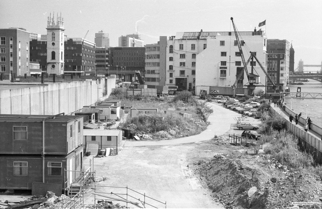
I took the following photo standing on the new White Lion Hill, looking along the area that had already been cleared ready for construction of the City of London School. The concrete tunnel on the left is the new routing of Upper Thames Street, the school will soon be built over this tunnel.

baynards2
An interesting feature of this photo is the crane at the far end of the cleared area. This was the last working crane in the City and operated by the company LEP (Lanstaff, Ehremberg and Pollak) who ran their Transport and Depository business from the white building behind the crane which was LEP’s Sunlight Wharf building, which would soon be demolished in 1986. the crane was dismantled earlier in January 1983.

The Sunlight Wharf building was originally constructed on an area owned by and for Lever Brothers (now Unilever). Plans for the new warehouse were submitted in 1903 and the warehouse was completed in 1906.

Sunlight Wharf specialised in the unloading and storage of furs, silk and tinned fruit. Sunlight Wharf also carried on the tradition of this small area of being the landing point for stone destined for St. Paul’s Cathedral. The original landing point used by Wren during the construction of St. Paul’s was the adjacent Paul’s Wharf. During later repairs to the cathedral, Sunlight Wharf was used with one of the last sailing barges to carry stone to central London arriving at Sunlight Wharf in August 1927 after a five day voyage from Dorset carrying a cargo of 50 tons of Portland stone,

Before the war there were four swinging cranes along Sunlight Wharf. After the war as the number of barges decreased, these were replaced by the crane in the photo which was a ten ton Butters crane, able to lift a larger load and place this directly onto a waiting vehicle. A clear sign of why the docks in central London were not able to continue in business.

Although the Millennium Bridge which is now adjacent to where this building stood is a relatively recent construction, plans for a bridge between Southwark and St. Paul’s stretch back to 1851 and almost came to be built following the Bridges Bill of 1911. Needless to say, the occupiers of the area including Lever Brothers strongly opposed the building of the bridge. An architectural competition was held in 1914, but the outbreak of the first world war prevented any further progress and immediate plans for the bridge came to an end.

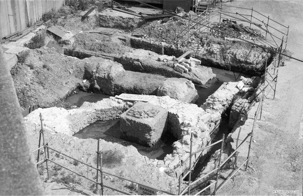
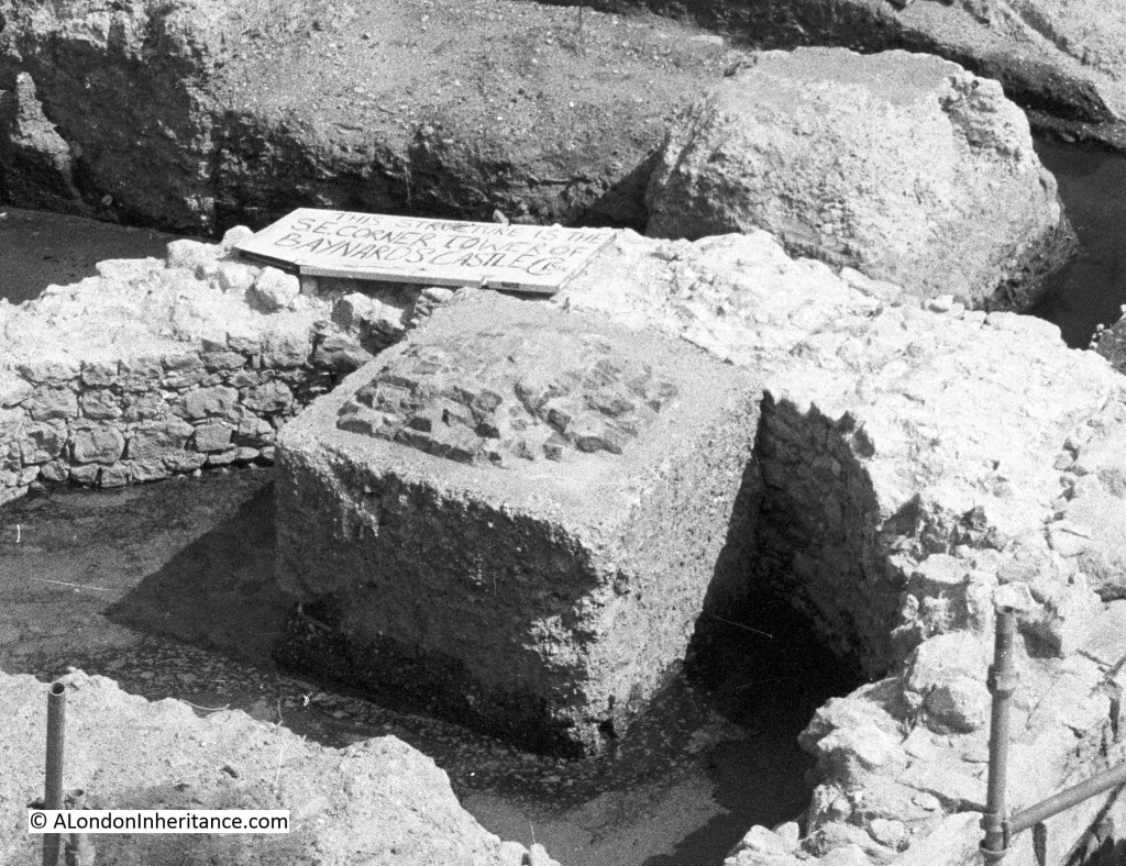
At the bottom of the above photo can be seen a fence. Looking down into this fenced off area we can see the base of the 15th century tower at the south east corner of Baynard’s Castle.

baynards3

Note the no expense spared sign to inform onlookers:

baynards4

The original Baynard’s Castle was built just after the Norman conquest and takes it’s name from Ralph Baynard who came over with William the Conqueror. Baynard’s being the castle at the west end of the City with the Tower of London at the east end.

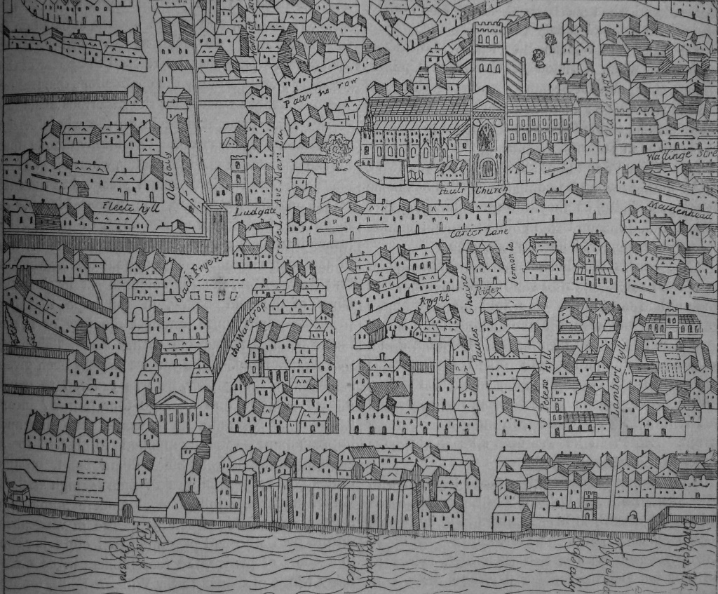
The excavated tower is the east end of the castle which extended back along the Thames river front towards Puddle Dock. The following extract from Agas’ Plan of London from 1563 shows Baynard’s Castle at the centre of the frontage along the Thames.

baynards map

The original castle burnt down in 1428 and was rebuilt by Humphrey, Duke of Gloucester and it is these foundations that were discovered in 1982. After Humphrey’s death, the castle passed to the crown and was made a royal residence by Henry VI.

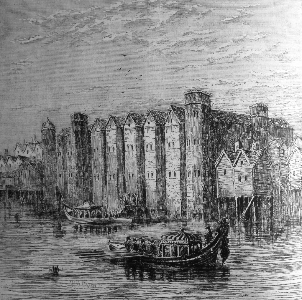
The following gives an impression of the appearance of Baynard’s Castle.

baynards old picture

Henry VIII spent a large sum to turn the castle from a fortress into a palace, and after Henry’s death it was in Baynard’s Castle that the council was held which confirmed that Mary would be Queen of England, for her short lived and generally unpopular reign from 1553 to 1558.

Queen Elizabeth I occasionally used the castle, but royal usage declined and the castle was taken on by the Earls of Shrewsbury until the castle became one of the casualties of the Great Fire.

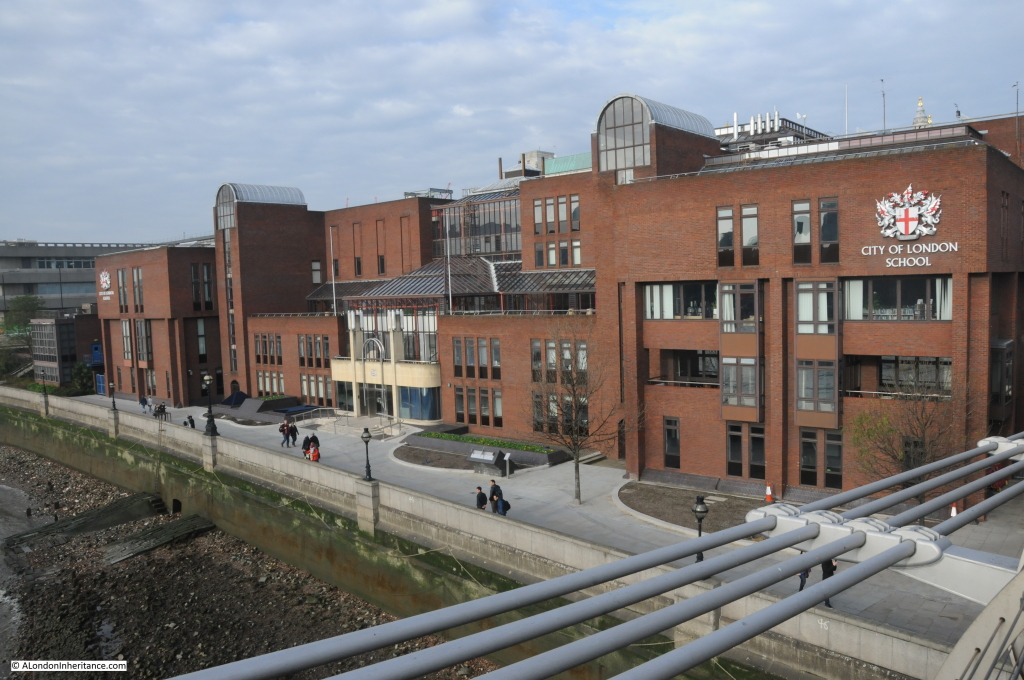
The area of the photo is now fully occupied by the City of London School. I walked along White Lion Hill to try and take a photo from the same position, but all you would see is the wall of the school. The Millennium Bridge is the best vantage point for a view of this area now. I took the following photo which is looking from the bridge (at the far end of the original photo) towards White Lion Hill which is at the far left of the photo. The school, along with the Thames Path occupies the area at the front of my original photo and continues back over the Upper Thames Street tunnel.

baynards13

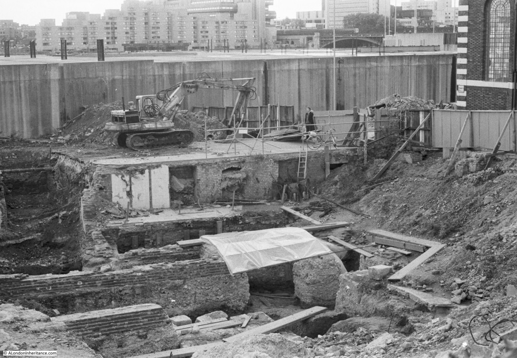
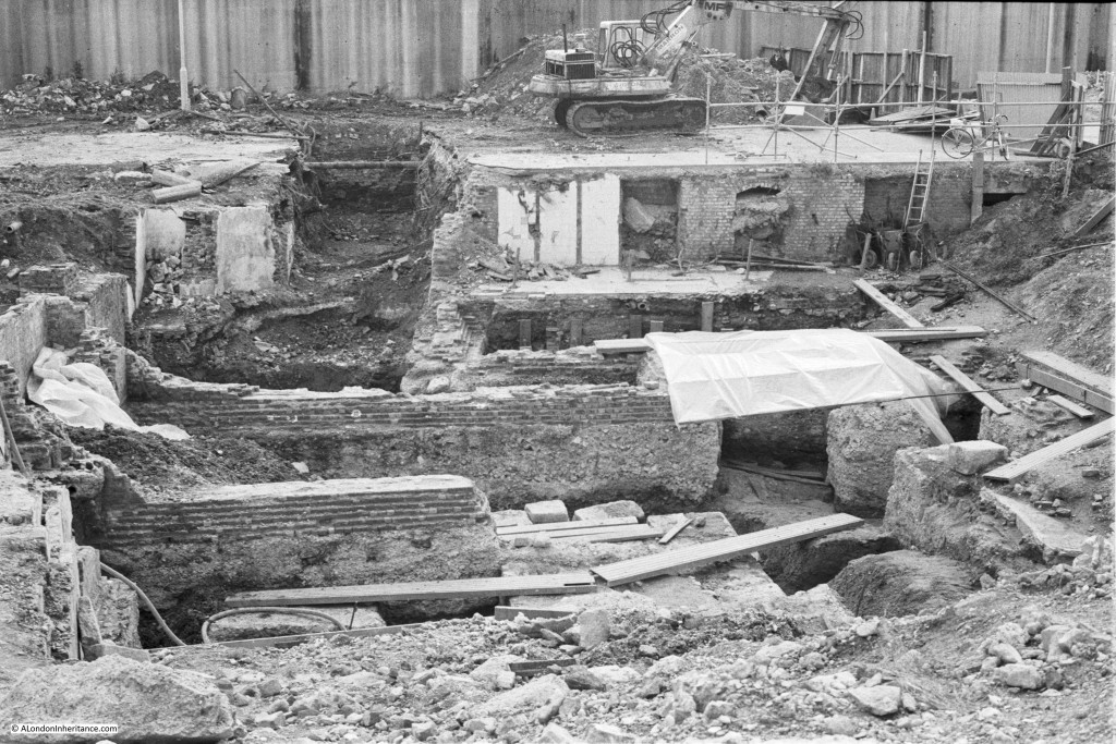
Now let’s move back up to Queen Victoria Street to the area now occupied by the school, adjacent to St. Benet’s. In 1982 I took the following photo from Queen Victoria Street overlooking the excavations towards the corner of St. Benet’s. The other side of the Upper Thames Street tunnel to that shown in the previous photo can be seen.

baynards6

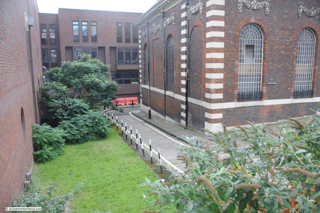
I could not take a photo of this area from the same position as it would be looking straight into the walls of the school. The following photo is my 2014 photo from Queen Victoria Street which shows the school to the left and is looking towards the church. The black and white posts in the 2014 photo are along the same line as the fencing on the right of the above photo which protected the site from St. Bennet’s Hill, the side street running past the church.

baynards12

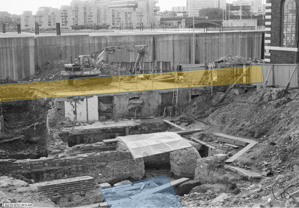
I have marked some of the features that can be seen in the following photo. Upper Thames Street originally ran directly past the church. The redevelopment seen in these photos relocated this street slightly to the south, closer to the river. The original route of Upper Thames Street is marked in yellow in the photo below.

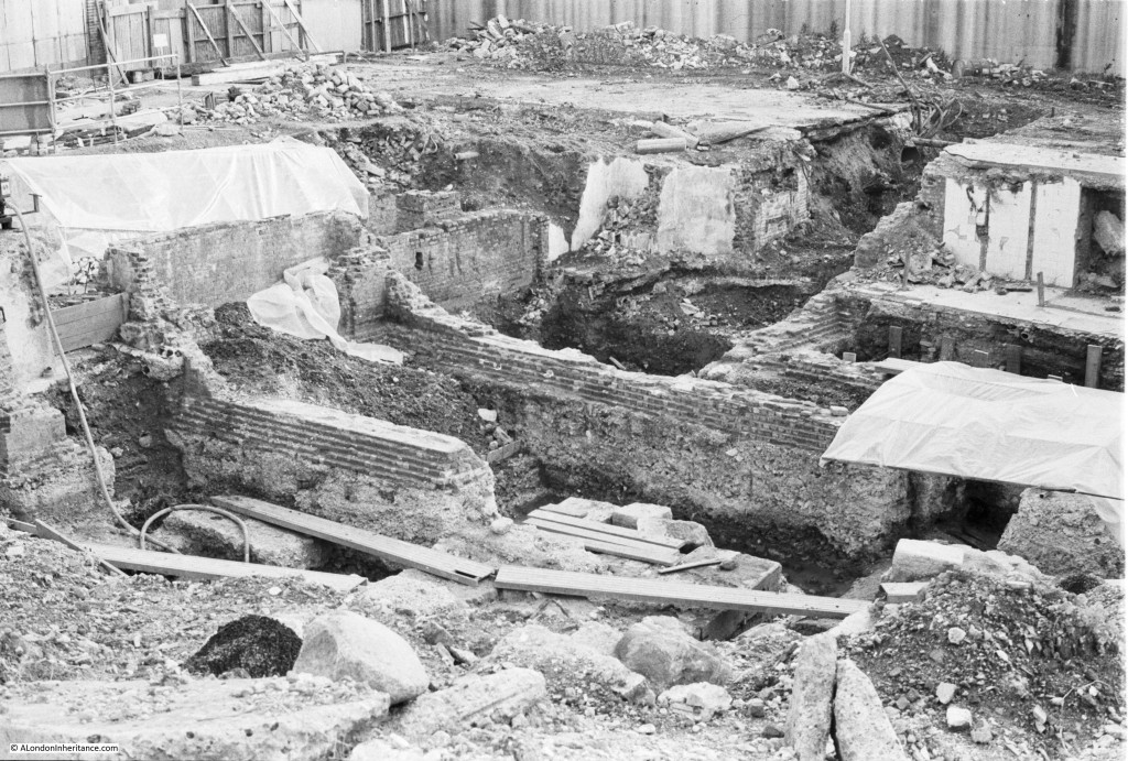
The majority of the foundations that can be seen in this photo are of the Victorian Warehouses that covered this area (see my post on St. Benet’s to see a photo of this area as it was), however what excited much interest during this excavation was the find of a large monumental base from the Roman period. This is highlighted in blue in the following photo.

baynards7

There was not that much Roman activity in this area in the 1st and 2nd centuries as the area was at the far south west of the main Roman settlement. This area was at the bottom of a hillside extending back up away from the river, with terraces being cut into this hill. The monumental base was found on the lowest terrace and was of limestone blocks and ragstone masonry and was built on a raft of oak piles and rammed chalk.

Although only a small part can be seen in the above photo, the actual size of these foundations extended 4m along the western edge and possibly 8 meters along the southern edge. What was built on these foundations was not clear. Other excavations produced evidence of what could have been a temple in the area. A Roman altar was found rebuilt into a wall at Blackfriars and fragments of a monumental archway and a Screen of Gods were found in the riverside wall a short distance to the west, so it may have been possible that a temple was built on these foundations facing the river and being cut back into the hillside. These were dated from the third century.

There is also evidence that Upper Thames Street in it’s original route prior to the 1980s redevelopment had strong connections with remaining Roman structures. It may have been possible that the southern terrace constructed in the Roman period was still visible in the 11th Century when development of this area started to get underway again. St. Benet’s being one example of this as the first mention of the church is from the year 1111, when it was built up against the original Upper Thames Street. Reference is made to a wall next to the river at the end of the ninth century when King Alfred made two grants of property to the Bishops of Worcester and Canterbury with the wall being described as the southern boundary of the property.

The following photo gives another view of the site with the monumental base in the centre foreground with the two planks meeting on the top of the base.

baynards5


And in the following photo we can just see the end of the monumental base with some of the blocks which were dislodged by robbing when much of the stonework was removed for reuse in building work (just above the three planks).

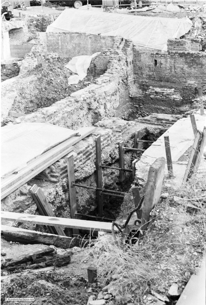
baynards8The following photo gives some idea of the depth of excavations. After the Great Fire large quantities of fire debris were dumped over this area which had the effect of raising the area by 2 to 3 metres.

baynards9

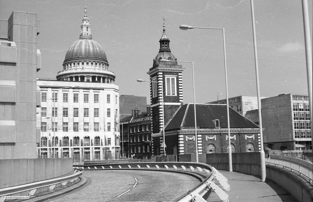
I took the photo looking down towards the Baynard’s Castle tower foundations from White Lion Hill. I also took the following photo from the same position on this road looking back up towards St. Benet’s and St. Paul’s.

baynards1

And in 2014 from exactly the same point. The big difference again being the school which now occupies the whole area to the right.

baynards11Although small, this is a fascinating area of London and demonstrates the multi-dimensional aspect of London which I find so interesting. In this post I have covered the site of today, along with early Roman foundations and the later medieval castle. If you refer to my post of a couple of weeks ago which can be found here you can also see the streets that once ran across this site and one of my father’s photos showing the original warehouses before demolition.

The London we see today is just one instance of the City. Standing in the same position, there are many different going back for two thousand years and occasionally we can catch a glimpse of what the City looked like at a specific time.

The sources I used to research this post are:

  • St. Paul’s Vista (A history commissioned by the Lep Group plc to mark the redevelopment of the Sunlight Wharf site) by Penelope Hunting published 1988
  • Popular Archaeology magazine July 1982
  • London by George H. Cunningham published 1927
  • Old & New London by Edward Walford published 1878
  • Stow’s Survey of London. Oxford 1908 reprint
  • Bartholomew’s Reference Atlas of Greater London published 1940

alondoninheritance.com


The Garden Bridge – A Personal View

The majority of my posts have been covering the changes in London over the last 70 years, showing where London has changed, and the few locations where there has been very little change.

Change in London is a constant, some good, some not so good and often we do not recognise and appreciate what we have in London until it is lost. For this week’s post I want to offer my personal view of a proposed very significant change to London and to the River Thames that now looks likely to get the go ahead and to be built.

The Garden Bridge is a proposal to construct a pedestrian bridge over the River Thames between the Southbank and Temple Underground Station. As the name suggests, this will be far more than a simple pedestrian bridge, the deck of the bridge will be planted with trees, shrubs etc. to give the impression of a walk through a garden as you cross the River Thames.

The proposal has already been granted planning permission by Lambeth Council and last Tuesday evening was granted permission by Westminster Council.

The bridge will span the Thames, across the sweep of river known as Kings Reach between Waterloo and Blackfriars Bridges, from the Southbank to land on the roof of Temple Underground Station on the north bank.

I am not going to argue against the concept, the design or the economics of the Garden Bridge, there are already a number of articles covering these topics. In this post I will question the location, and show what will be lost as a result of the Garden Bridge.

The bridge will cross the river between Waterloo and Blackfriars Bridges. It needs to be high enough to provide sufficient clearance for river traffic at high tide, and the overall apparent height of the bridge will be increased by the planting of trees.

The website of the Garden Bridge Trust can be found here where there are photos and videos of the bridge.

The sweep of the Thames between these two bridges is one of the longest between Westminster and Tower bridges and provides superb views of the river from both north and south embankments and from Waterloo and Blackfriars Bridges.

Rather than crossed by themed bridges, the River Thames and its relationship to the city and the built environment should be the object of interest. The River Thames is central to the history of London. It is the reason why London was established in this location. It was the artery which carried shipping to and from the rest of the world to the docks of London that were central to the development of London as a major global trading city. The Thames has also divided north and south London, providing two parts of the larger city with very different characters. The Thames also provides a key open space in a very congested city.

The proposed landing point on the north bank of the Thames will be at Temple Underground Station. This is a relatively quiet area and the level of visitor numbers to the bridge (anticipated by the Garden Bridge Trust at 7.1 million per annum – paragraph 8.6.2 of the Environmental Statement Main Report Volume 1) will significantly impact and change this area.

Last Saturday I took a walk round the area where the Garden Bridge is to be constructed to understand the impact and see how the area will change.

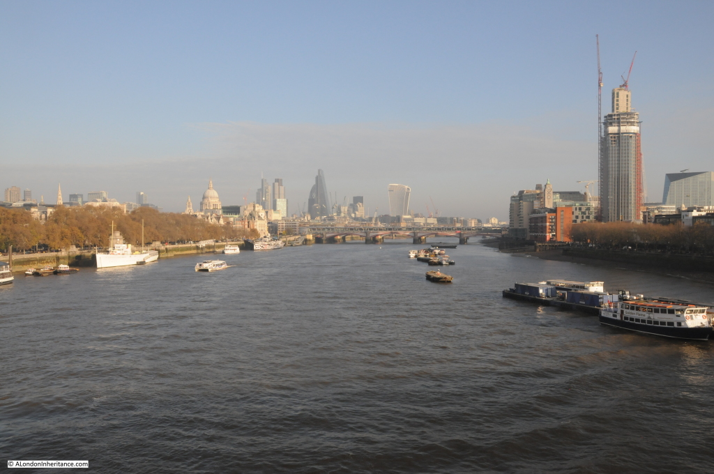
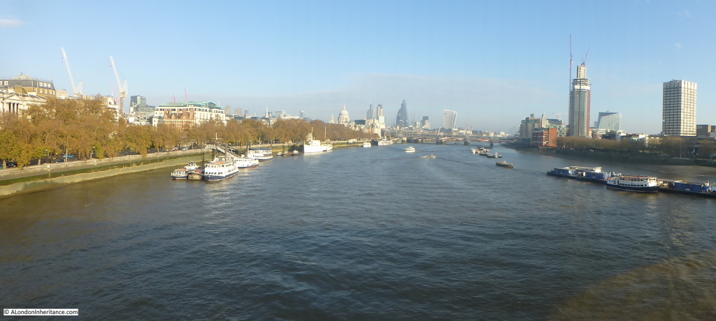
I started on Waterloo Bridge, looking east down the Thames and across to the City. The current view is shown in the following photo, where we look down Kings Reach towards Blackfriars Bridge with St. Paul’s and the City in the background. The spire of St. Brides can seen above the trees on the left. The Garden Bridge will run across the centre of the river from in front of the white ship on the left to the south bank on the right.

garden bridge 12
The long view of the sweep of the Thames will be lost with the bridge now running across the river and dividing Kings Reach in two, obscuring the view down to Blackfriars Bridge and having an impact on the view across to St. Paul’s and the City.

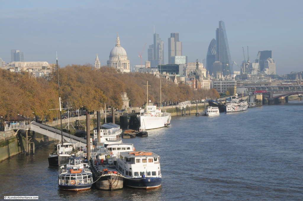
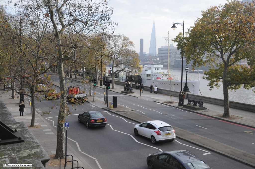
Walking along Waterloo Bridge to the north bank, we pass this view of the north bank of the river. This will change considerably as the bridge will be landing in front of the white ship and cutting across to Temple Station which is behind the trees on the left.

garden bridge 10

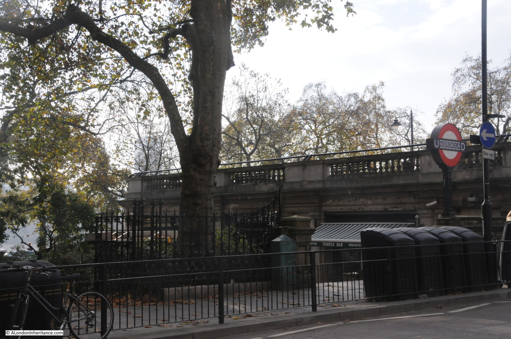
Compared to the south bank of the Thames, the north bank in this area (apart from the traffic) is still very quiet. The bridge will land on top of the building housing the Temple Underground Station, with steps running down to street level. In the following photo, the bridge will come across the gap between the station entrance and the railings to the right, with access ramps and two lifts onto the roof of the station and down to ground level.

garden bridge 19

The rooftop area on top of the station and the adjacent bar is shown in the following photo. This will become the landing point for the northern side of the bridge.

garden bridge 6

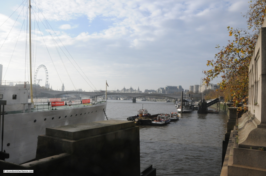
The following view is from the top of Temple Underground Station. The ship is the Head Quarters Ship (HQS) Wellington. Built in 1934 and having seen service across the world, was berthed on the Embankment in 1948 as a floating livery hall of the Honourable Company of Master Mariners. The ship is now owned by a charitable trust, the Wellington Trust. The Garden Bridge will come across the Thames, in front of HQS Wellington and onto the Temple roof to the left.

garden bridge 7

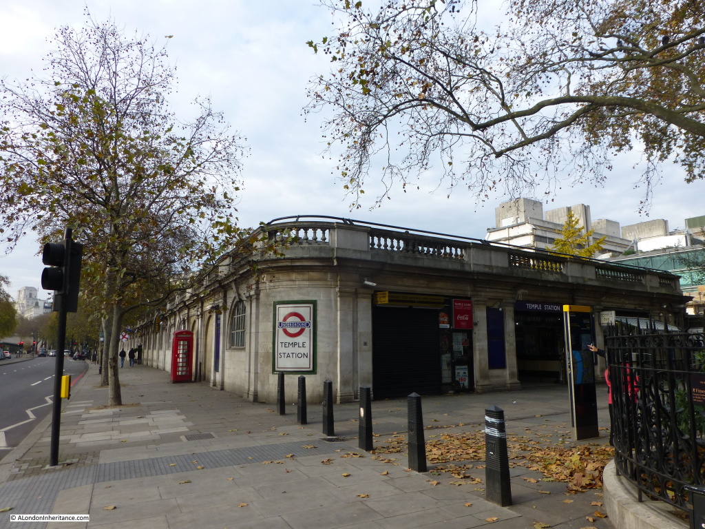
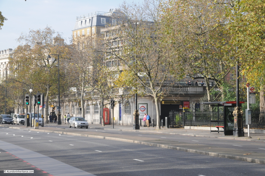
A view of the station entrance and building as it currently stands. Again, the bridge would be coming across the Embankment and landing on the roof of this building, with the associated steps and lifts to support the expected volume of visitors to the bridge.

garden bridge 9

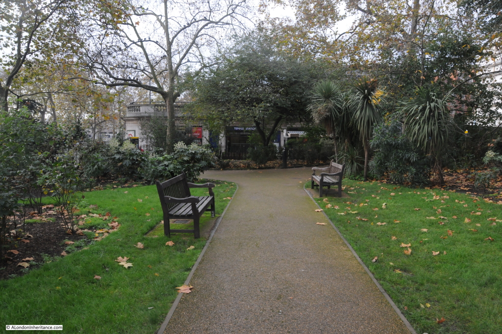
Adjacent to Temple Underground Station are one of the Embankment Gardens. This garden currently provides a quiet area to walk and get away from the traffic on the Embankment.

Remember that the Garden Bridge Trust anticipate 7.1 million annual visitors to the bridge.

During peak periods there will probably need to be some method of crowd control / waiting for access to the bridge. The impact on this garden and the area surrounding Temple Underground Station will be very significant, potentially making this area as busy as the Southbank is today.

One of the arguments for the Garden Bridge appears to be that the Temple area is underused and the bridge will bring visitors, but I do not see why there is a need to make everywhere in London busy? One of the pleasures of living, working or visiting London is finding areas that are not crowded, not too commercialised and still having some unique character. The Garden Bridge will significantly change this area of the north bank and bring significant numbers of people to the area around Temple Underground Station and the adjacent gardens, with the almost certain additional commercialisation that the availability of large numbers of people often attracts.

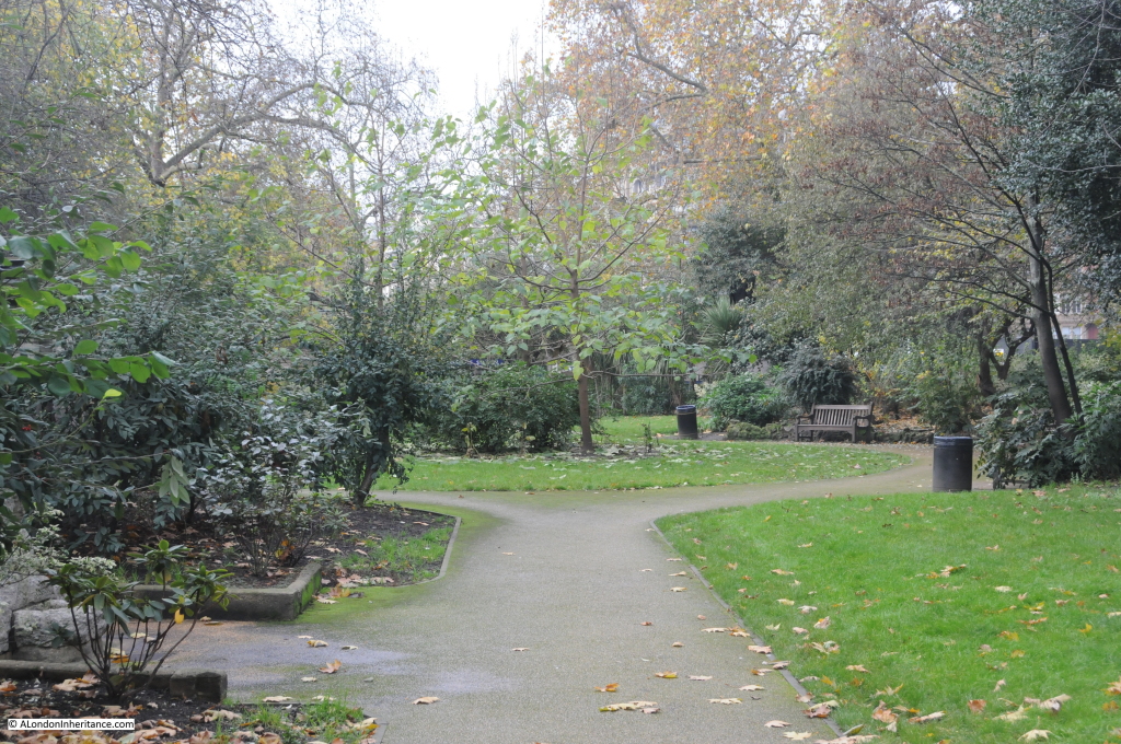
The Embankment Gardens adjacent to Temple Underground Station:

garden bridge 2

Looking back from the gardens to Temple Underground Station:

garden bridge 3

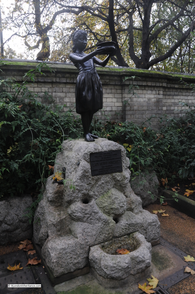
These gardens have some interesting statues. The statue in the gardens to Lady Isabelle Henry Somerset “in memory of work done for the temperance cause”, from the “Children of the Loyal Temperance Legion”. According to the plaque, she was also the founder of the first “industrial farm for inebriate women” whatever that could have been !

garden bridge 1
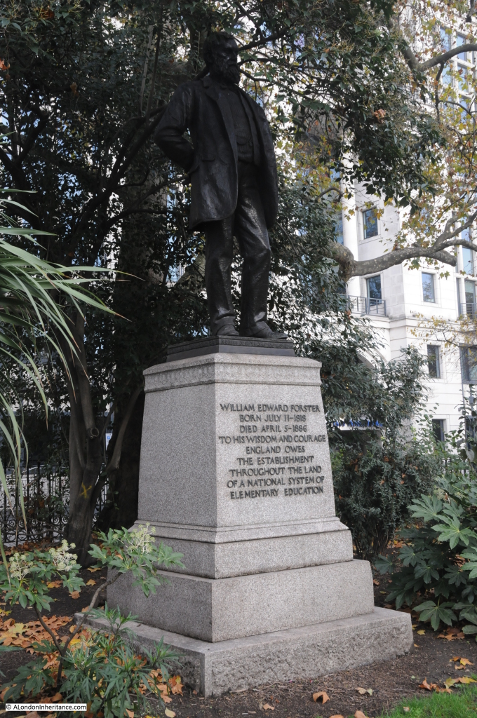
And the statue to William Edward Forster “To his wisdom and courage England owes the establishment throughout the land of a national system of elementary education”. His Education Act of 1870 set the framework for a system of primary school education:

garden bridge 4

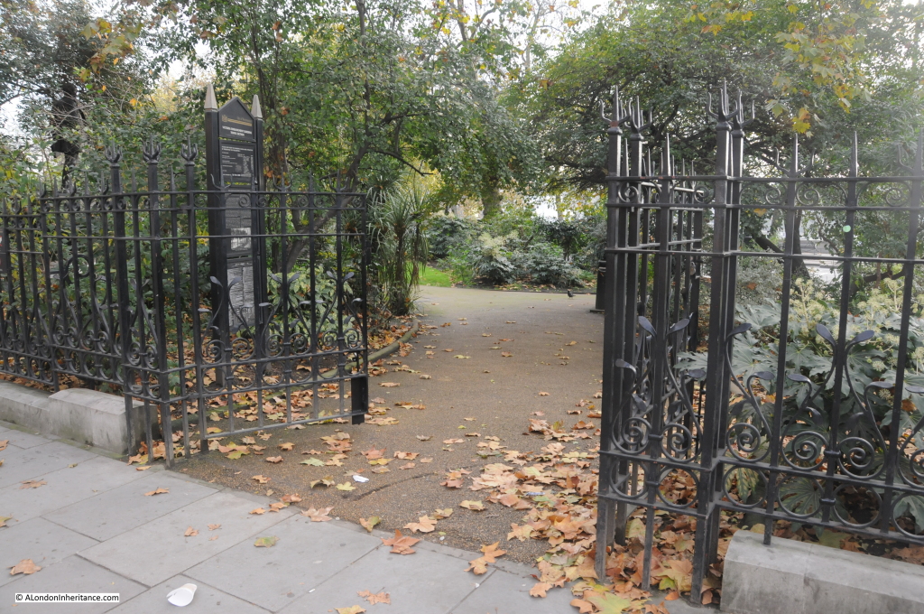
The entrance to the gardens from Temple Place:

garden bridge 5
Hard to believe that the Garden Bridge Trust anticipate 7.1 Million visitors per annum will be crossing the bridge and passing through the northerly landing point at Temple:

garden bridge 17

Walking along the Embankment towards Blackfriars Bridge we can look back at Temple Underground Station. The Garden Bridge will cross the Embankment and land on the roof of the Underground Station. (If Westminster Council want to improve the area, it would be good to replace or remove the “Welcome to Westminster” sign in the central reservation, not the most inspiring of signs or integrated with the surroundings).

garden bridge 8

A short distance along the Embankment we can walk onto the pier where HQS Wellington is berthed and look back towards Waterloo Bridge. The Garden Bridge will cross the river just in front of the Wellington;

garden bridge 18

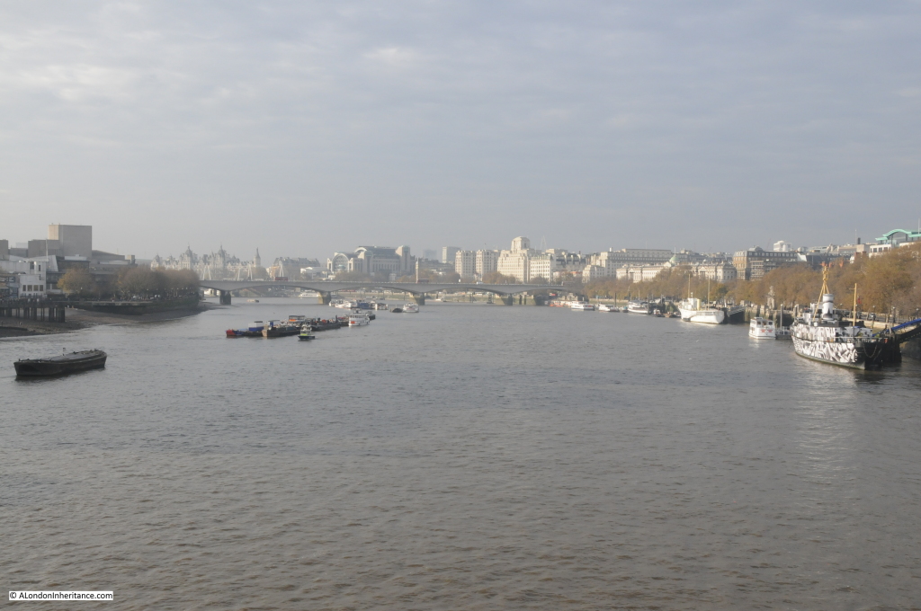
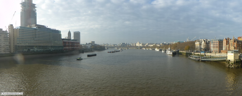
Continuing along the Embankment, we walk up to Blackfriars Bridge and walk to the centre to look back up river to Waterloo Bridge. The first ship on the right is HMS President, painted in a “dazzle” colour scheme. Further along the north bank we can see HQS Wellington marking where the bridge will cross the Thames to the area with trees on the Southbank to the left. I doubt that very much of Waterloo Bridge will be visible and the planting on top of the bridge may well obscure the buildings running along the north bank.

garden bridge 16
As well as the Garden Bridge, additional future development work is planned to take place for the Thames Tideway Tunnel on the Blackfriars Bridge foreshore where there will be reclamation of land in the foreshore and construction of a new permanent area with ” several ventilation columns, a kiosk and public realm furniture will be permanent above ground features”. See the Blackfriars site on the Thames Tideway Tunnel website here for an illustration.

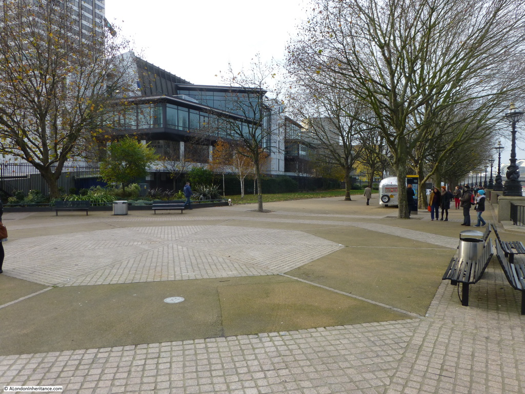
Continue across Blackfriars Bridge and walk along the Southbank towards Waterloo Bridge. Just past the Oxo Tower building, we pass Bernie Spain Gardens and arrive at the southerly landing point of the bridge, photographed early on a Saturday morning.

In this area will be access to and from the bridge, along with a new building to house maintenance, storage and welfare facilities for the bridge staff and a combination of approximately 410 square meters of retail and/or restaurants and/or visitor centre / community / educational use.

garden bridge 15

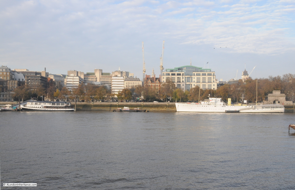
Walking a bit further along we come to where the bridge will cross the river. Looking directly across, the bridge will pass over the smaller boat in the middle of the photo, with Temple Underground Station being just behind the trees.

garden bridge 14

To me, the Garden Bridge, however good the concept and design, will be in entirely the wrong location.

1. A significant stretch of the Thames will be changed for good. Kings Reach will be broken up into two smaller segments and the bridge will detract from the focus that should be on the river and the relationship between the river and the City.

2. Views from Waterloo Bridge and the Southbank will be changed for good, with significant loss of the view over to the City. The view from Waterloo Bridge will now be of a much shorter stretch of the Thames.

3. The view from Blackfriars Bridge will likewise change. The view of Waterloo Bridge and the arc of buildings along the north bank will be obscured.

4. A relatively quiet area of the north bank will be subjected to significantly raised numbers of visitors. The area will need to accommodate 7.1 million visitors per annum with the associated infrastructure and commercialisation that this number will attract. The current environment of the Temple will be changed for good.

5. The Southbank is already a very successful cultural and visitor location. It can be incredibly busy at weekends and during the peak summer periods. Can it cope with the additional visitor numbers that the Garden Bridge will bring?

6. Why in this location? What needs to be connected between these points on the south and north banks and what is the purpose of building the bridge in this location?

The last bridge to be built in central London, the Millennium Bridge was for a very specific purpose, to connect Bankside and Tate Modern with the area around St. Paul’s. It is a well designed bridge built for the purpose of moving people, it does not pretend to be something else.

Having received approval from both Lambeth and Westminster Councils, the final decision is now with the Mayor of London.

For further information, the site of the Garden Bridge Trust is here.

Newspaper articles covering the recent decisions are from the Guardian, the Independent and the Daily Telegraph.

Final views of the key locations. From the south bank looking along the line of the bridge towards the north bank:
garden bridge 20
The area on the south bank where the bridge will land along with the staff and maintenance buildings, retail etc:

garden bridge 21
The view from Blackfriars Bridge: garden bridge 23

The view from Waterloo Bridge:
garden bridge 22
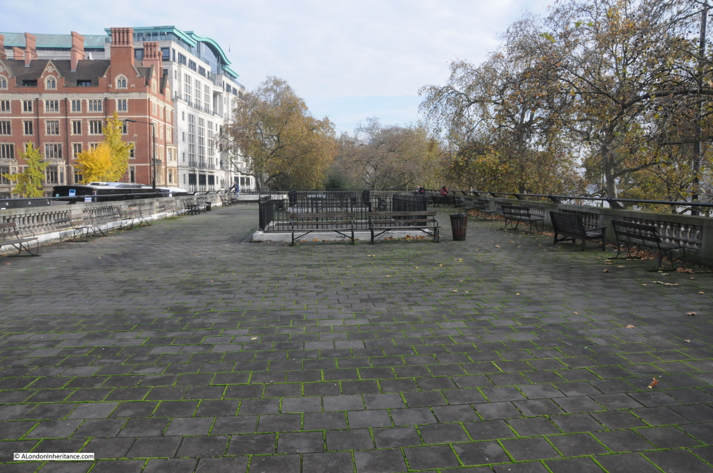
The Embankment Gardens at Temple: garden bridge 24


alondoninheritance.com