Many of London’s streets have lost much of their local character over the last few decades. Many long term trends have contributed to this. The spread of global brands, online shopping, local population change, quick profits through a conversion of a building to flats, architectural styles etc.
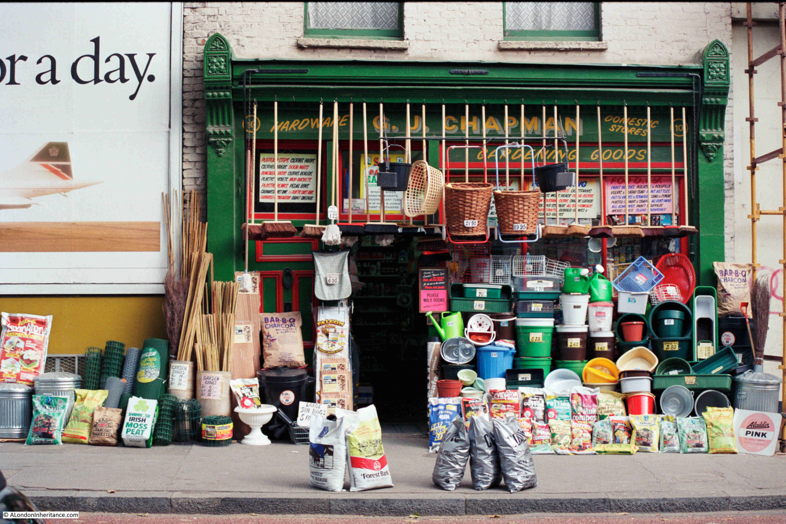
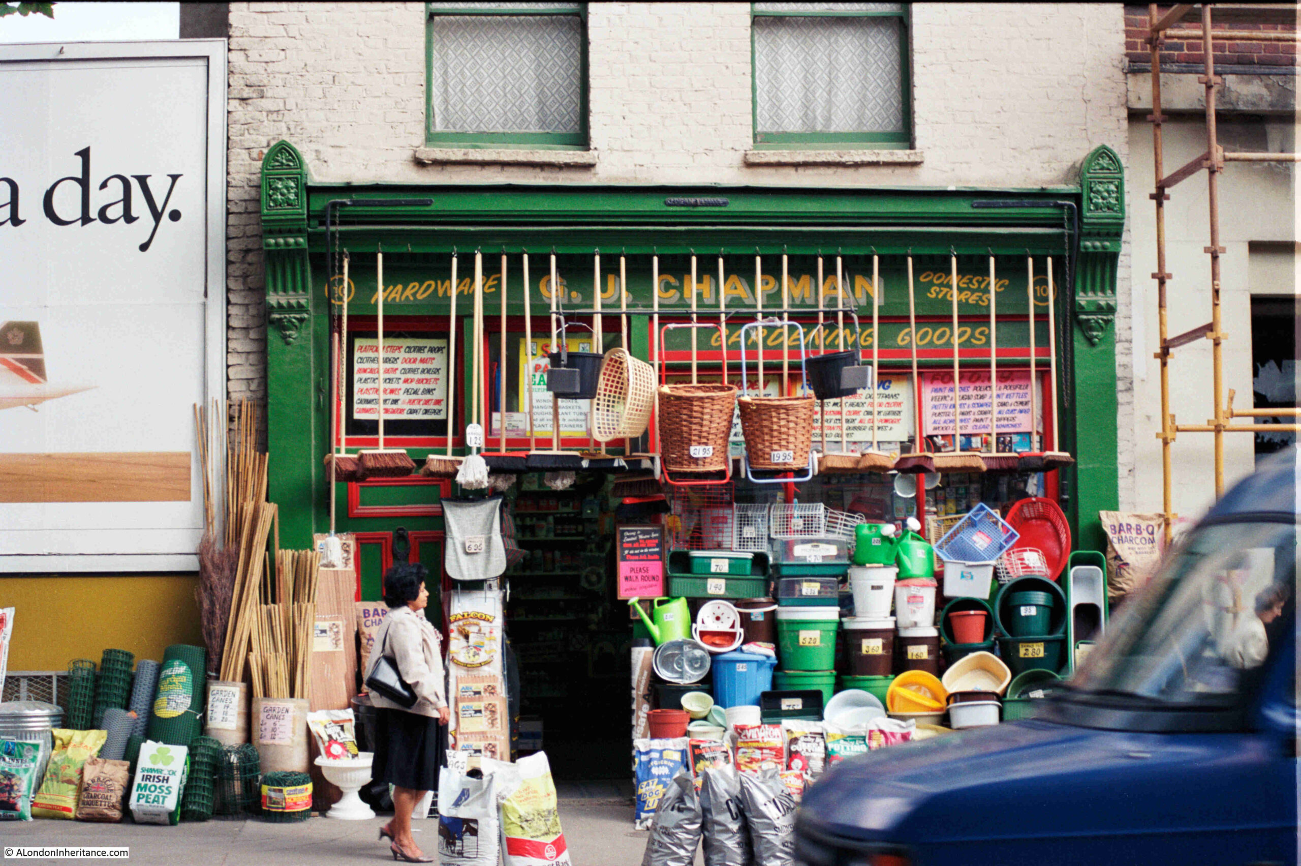
An example can be found in Penton Street, a turn off from Pentonville Road, just to the west of the Angel, where, in 1985, at number 10 Penton Street could be found the shop of G.J. Chapman:
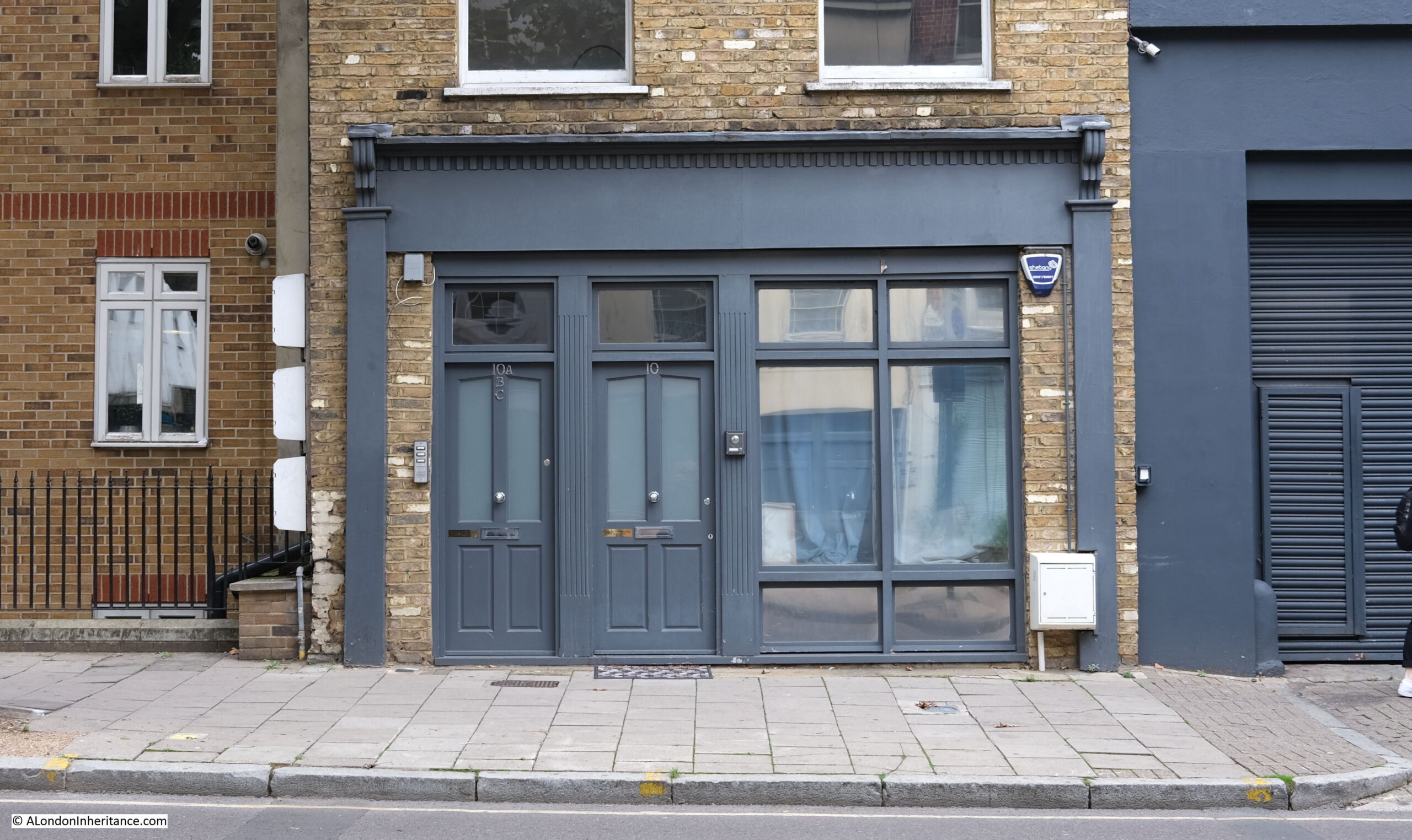
The same view, 37 years later, in September 2022:
Chapman’s was a very different shop. Whilst there were plenty of general hardware stores, also shops that stocked gardening supplies, they did not usually have so much stock on display outside the shop. I cannot find exactly when Chapman’s closed, I do remember it was still open in the mid 1990s, but after that it became one of the ongoing changes that are so easily missed.
I assume that the building has become flats, with two front doors, mirroring the doors in the original shop. The white paint has been cleaned from the brickwork, and it is not clear how much of the original wooden surround to the shop front remains.
The space behind the BA Concorde advert on the left in 1985 is now occupied by a new block of flats.
Penton Street was one of the first streets built as part of the Pentonville development. The name comes from the owner of the estate on which the development was built, Henry Penton, the MP for Winchester. The addition of the French “ville” to Penton’s name may have been to give an upmarket feel to the estate, which was helped by the rural setting at the time of the original development, with much of the land to the north still consisting of fields.
Penton Street seems roughly aligned with a lane that ran through fields along what is now Amwell Street to the south, then up to Copenhagen Fields, although only a small part of the original lane, along Penton Street retains the original route.
The first terraces along Penton Street were built in the 1770s, and the area between Penton Street and the Angel was fully developed by the end of the 18th century.
The southern end of Penton Street joins Pentonville Road, opened in 1756 as the continuation of the New Road, an 18th century north circular around the north of the city, providing access to the docks, and for drovers driving sheep and cattle to market in Smithfield, whilst avoiding the crowded City streets.
The northern end of the street joins Barnsbury Road which continues north. It is a relatively short street and can be walked in a matter of minutes.
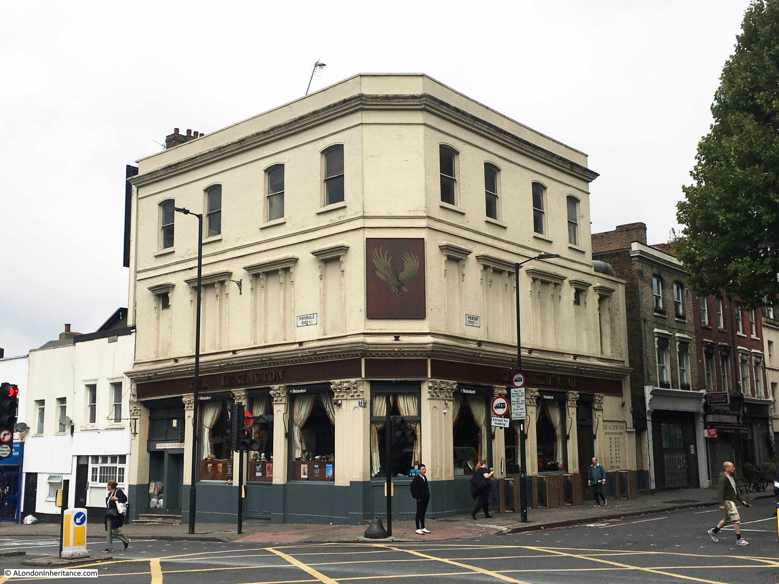
On the corner of Penton Street and Pentonville Road is the Lexington. A pub on the ground floor and music venue on the first floor. It was originally built in 1875 and was named the Belvedere, replacing an earlier pub on the site, with the same name, and dating from the development of Penton Street.
The Lexington today:
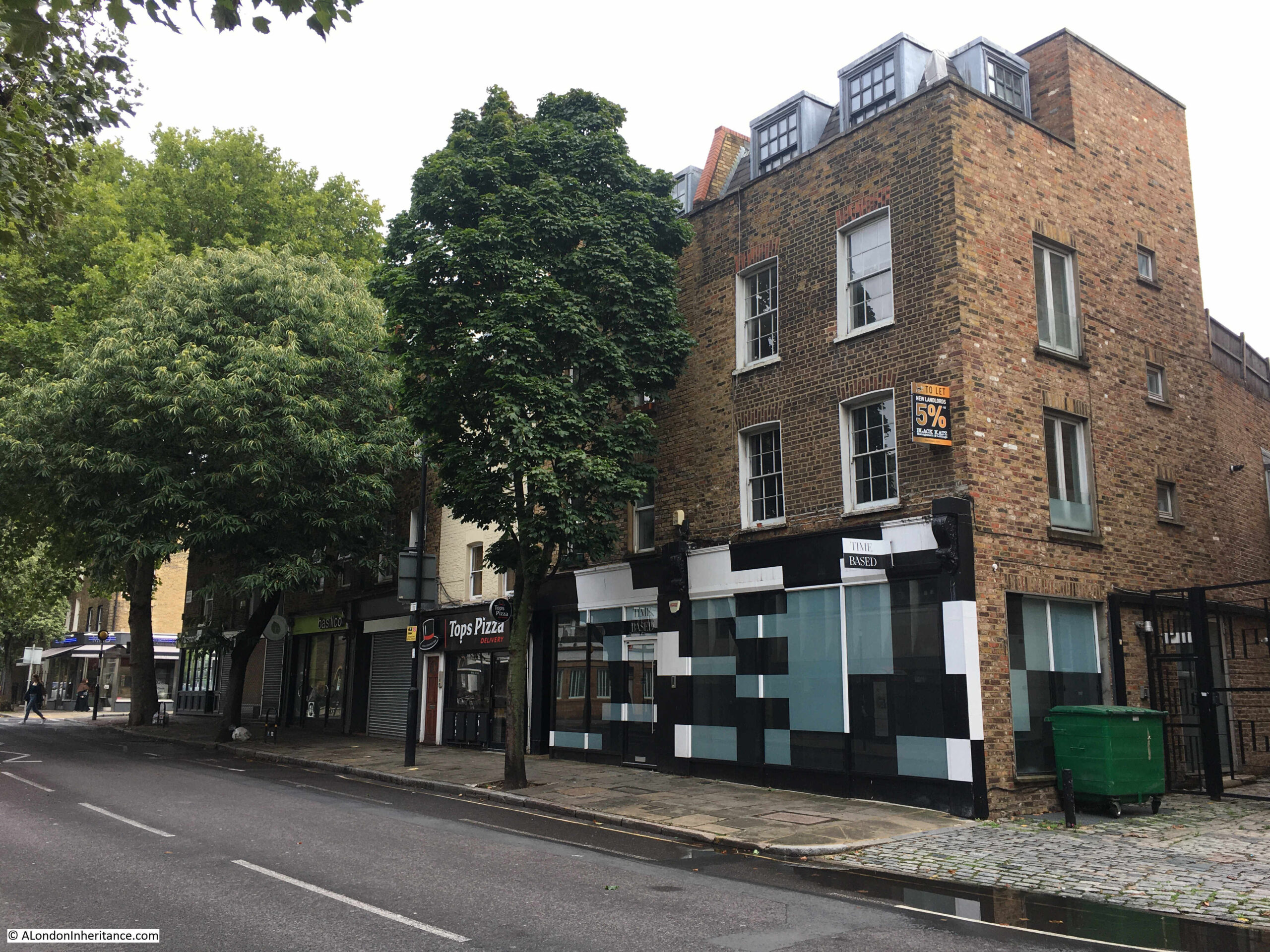
Penton Street seems to have been developed as a residential street, with terrace housing, however commercial premises and shops gradually took over parts of the houses, and there has been considerable redevelopment so even when the façade facing onto the street looks original, a glance behind will show a later rebuild, as can be seen in the example in the following photo where later brickwork forms the side wall to an earlier front wall:
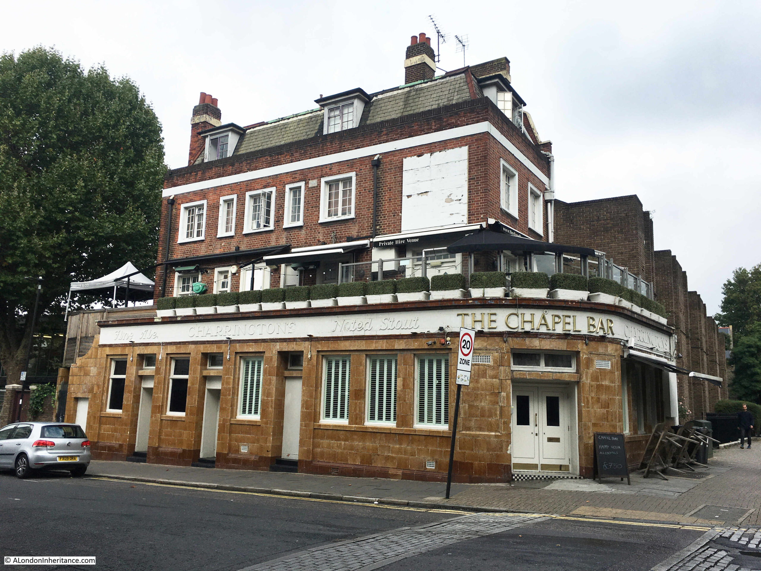
Further along Penton Street is another large pub, the Chapel Bar. Again, another pub that has had a recent name change. It was originally the Queen’s Arms, and seems to date from around 1848 which is the year of the first newspaper mention that I can find:
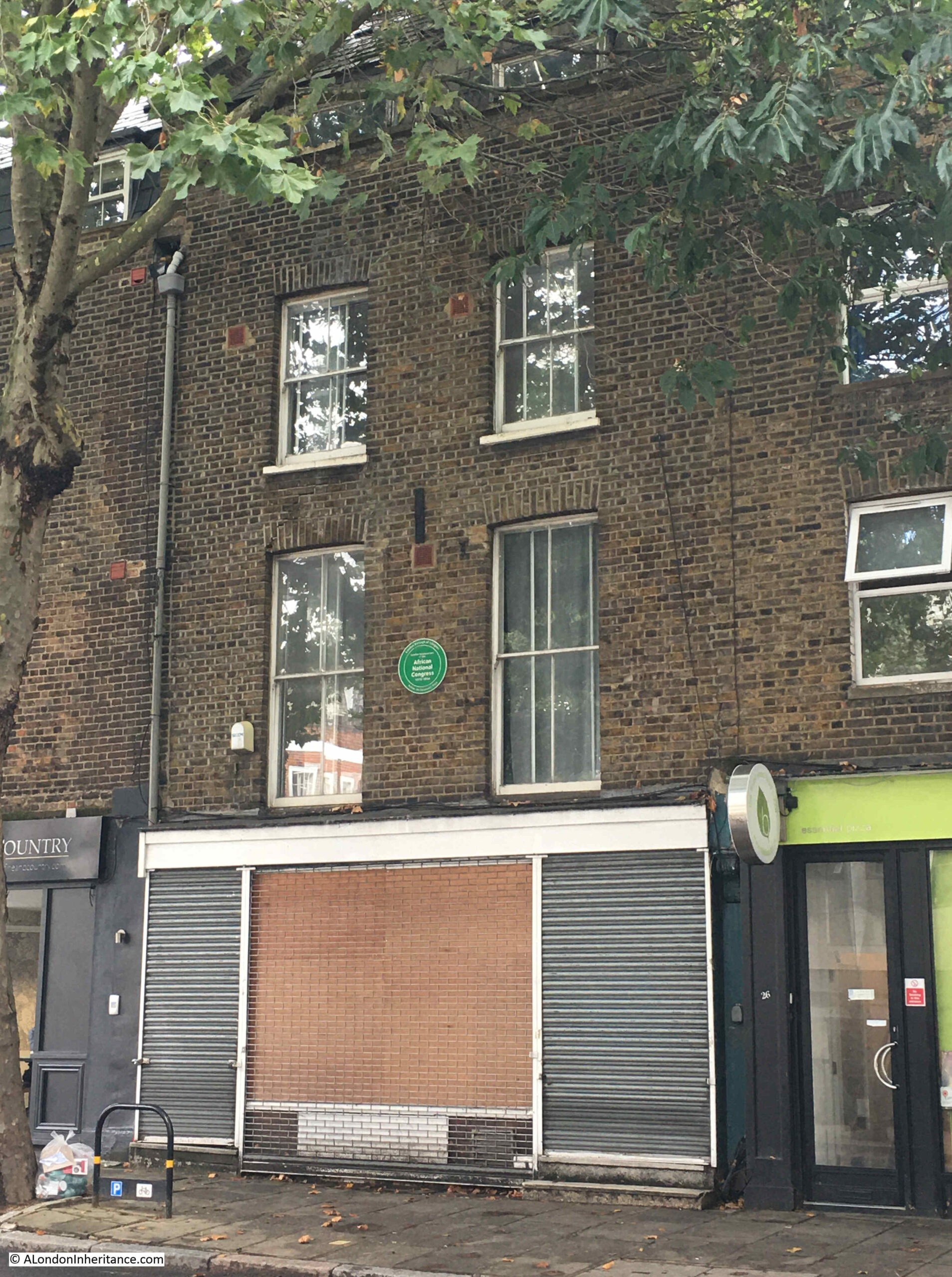
The clown, Joseph Grimaldi, lived in Penton Street at what is now number 44 between 1799 and 1800, although I could not find any plaque on the building. There is a plaque on number 28 recording that the building was the London headquarters of the African National Congress between 1978 and 1994:
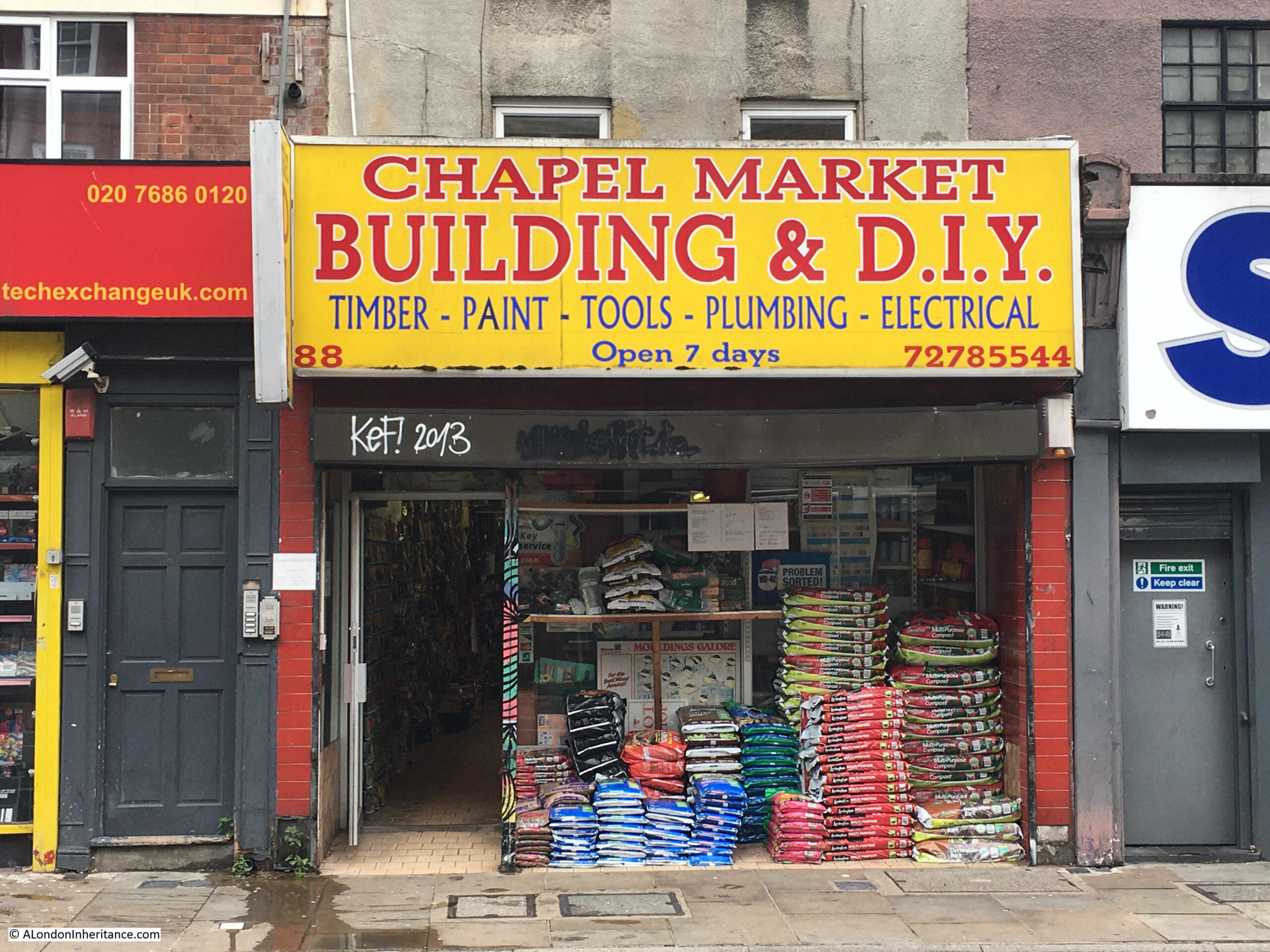
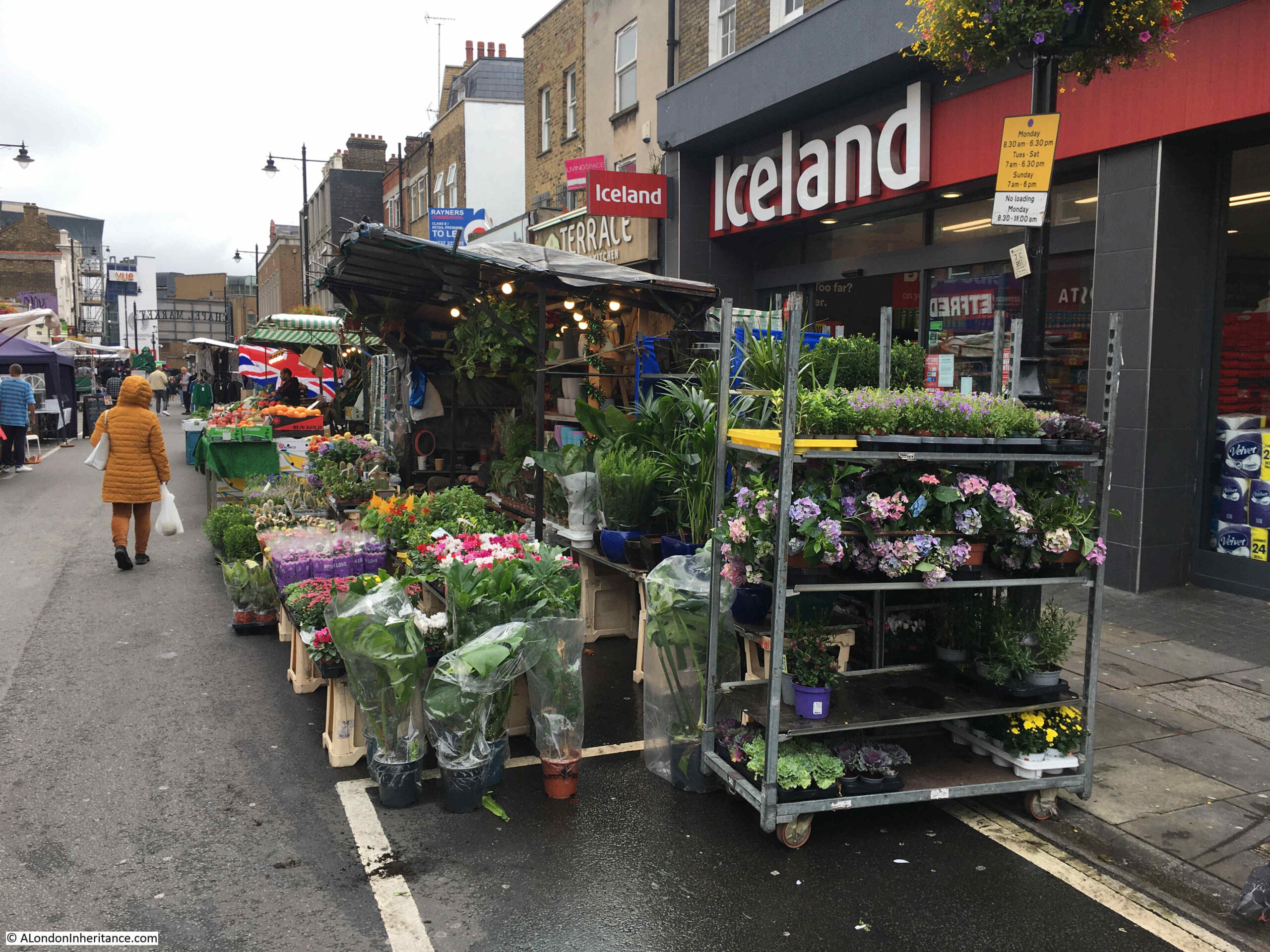
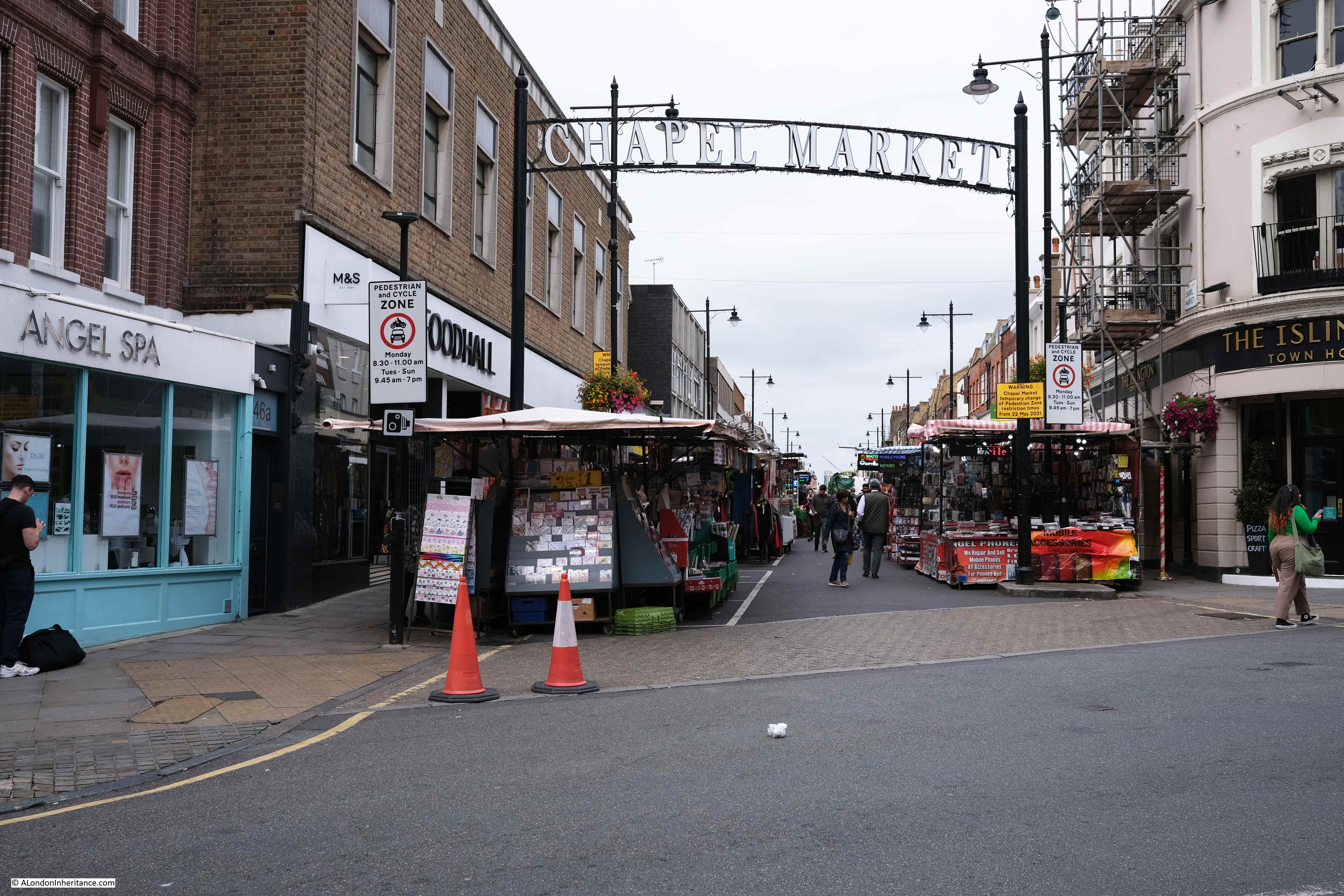
Although G.J. Chapman’s shop has gone, if we turn off Penton Street into Chapel Market, we find a street market, and a shop with a similar stock to Chapman’s, but without the impressive display of goods for sale on the street. Chapel Market Building & D.I.Y:
Originally Chapel Street, the street was developed soon after Penton Street and was lined with terrace houses by the 1790s. The street would stay residential for the first half of the 19th century, but would take on a much more commercial character from the 1850s onwards. This was probably down to the rapidly growing local population, and the commercial opportunities that such a population offered.
The ground floors of the large terrace houses were converted into shops which were extended over an original small front yard to bring the shop up to the edge of the street.
As well as shops, the street became the hub for a street market. The market may predate the arrival of shops in the 1850s, but again it was from 1850 onwards that the street became the venue for a large street market.
The mid 19th century also saw the large terrace houses turn into multi-occupancy houses and there were contemporary reports of much poverty and squalor in the street.
Over the years, the street has also seen many of the original terrace houses demolished and replaced with office blocks and large shops.
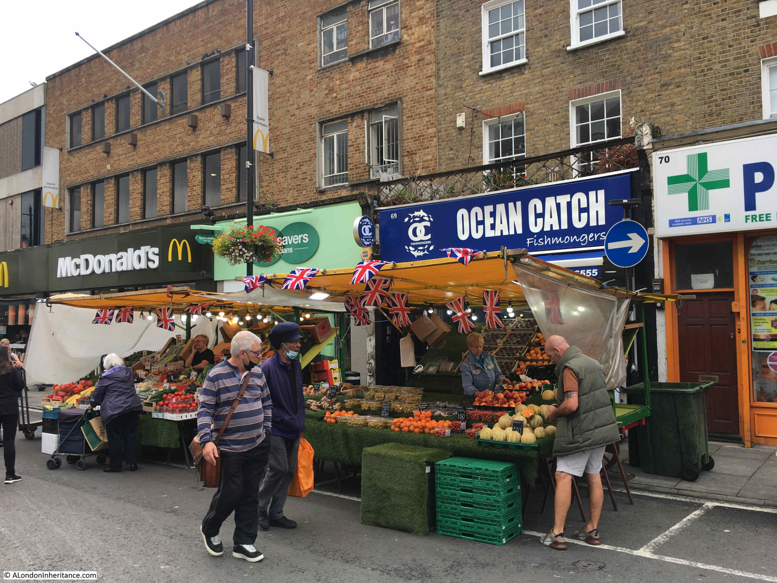
The following photo sums up the changes to Chapel Market, with stalls of the street market in the foreground, terrace houses to the right, with ground floor shops extended over the original yard to the street, and much later buildings on the left which replaced the original terrace houses:
Both the market and the shops now offer a very wide mix of goods and services from fast food, to fruit and veg, fishmongers, supermarkets, cafes, pharmacies, opticians, florists etc. with the stalls in the market changing during the week.
The name change from Chapel Street to Chapel Market came in 1936 to recognise the size and importance of the market.
The name chapel does not refer to any local chapel. There appears to have been an intention around 1770 to build a chapel of ease around Chapel Market and Penton Street, however a chapel was built much further to the west along Pentonville Road, but the name stuck with the intended original location near Chapel Street, now Chapel Market.
The market was open all day and all evening during the second half of the 19th century. An article in the Clerkenwell News in September 1870 reports on the raging of a “fever” in the area and the precautions that the local Parish Vestry were trying to implement. This included more frequent removal of refuse from Chapel Market and the application of disinfect along the gullies of the street.
The problem was that the market was seldom closed before midnight, so the best that the Vestry could do was to ensure that the street was swept and refuse removed by seven of the following morning, ready for the market to open again.
Chapel Market was the site of the first branch of Sainsbury’s in 1882 following on from their original shop in Drury Lane. The Sainsbury’s archive has a number of photos of the original shop, and Chapel Market in the late 19th century, and can be viewed here.
Marks and Spencer would also arrive in 1930. They now have a Food Hall on the street, and Sainsbury’s have moved to a much larger store, close by in Liverpool Road.
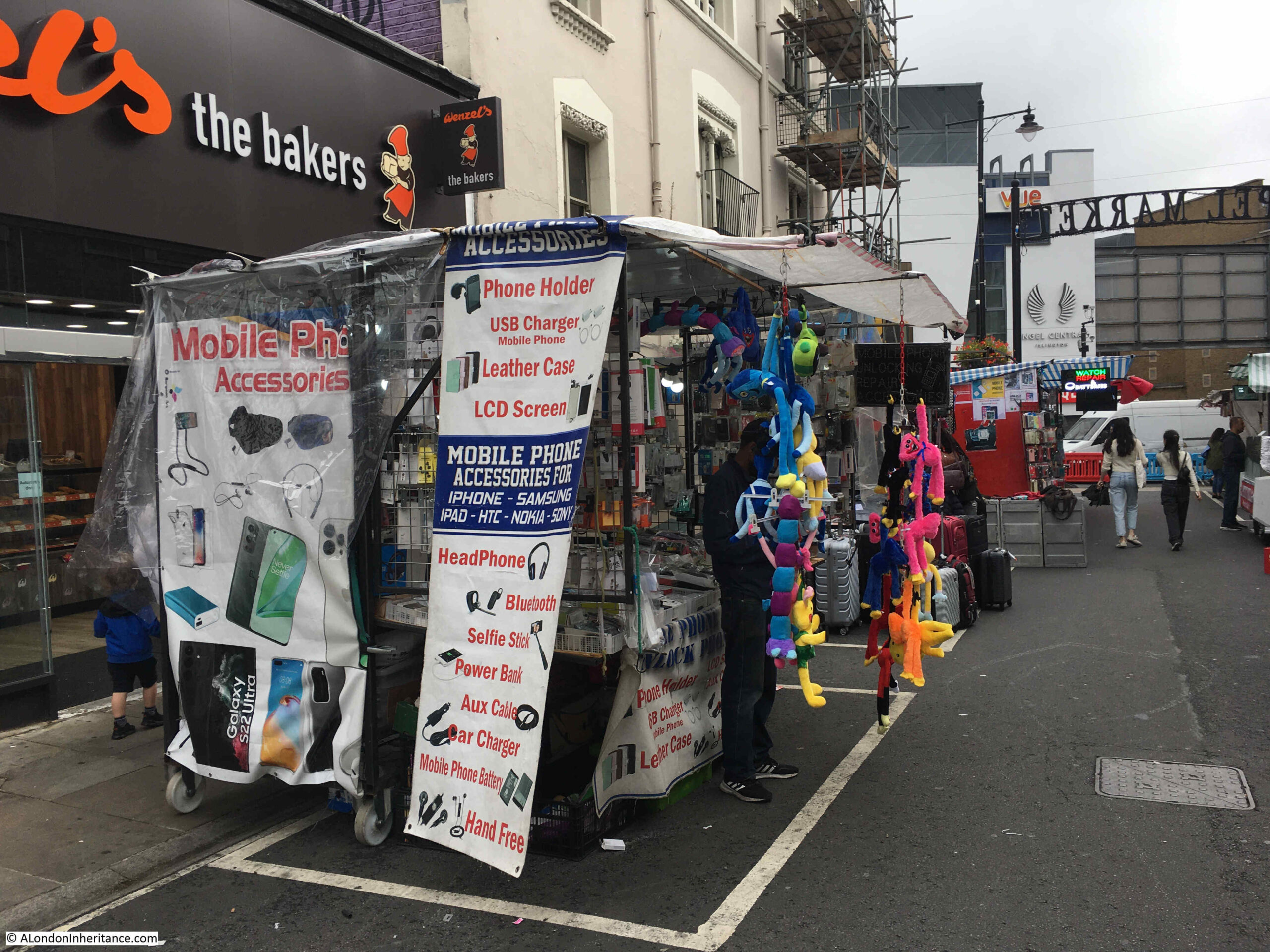
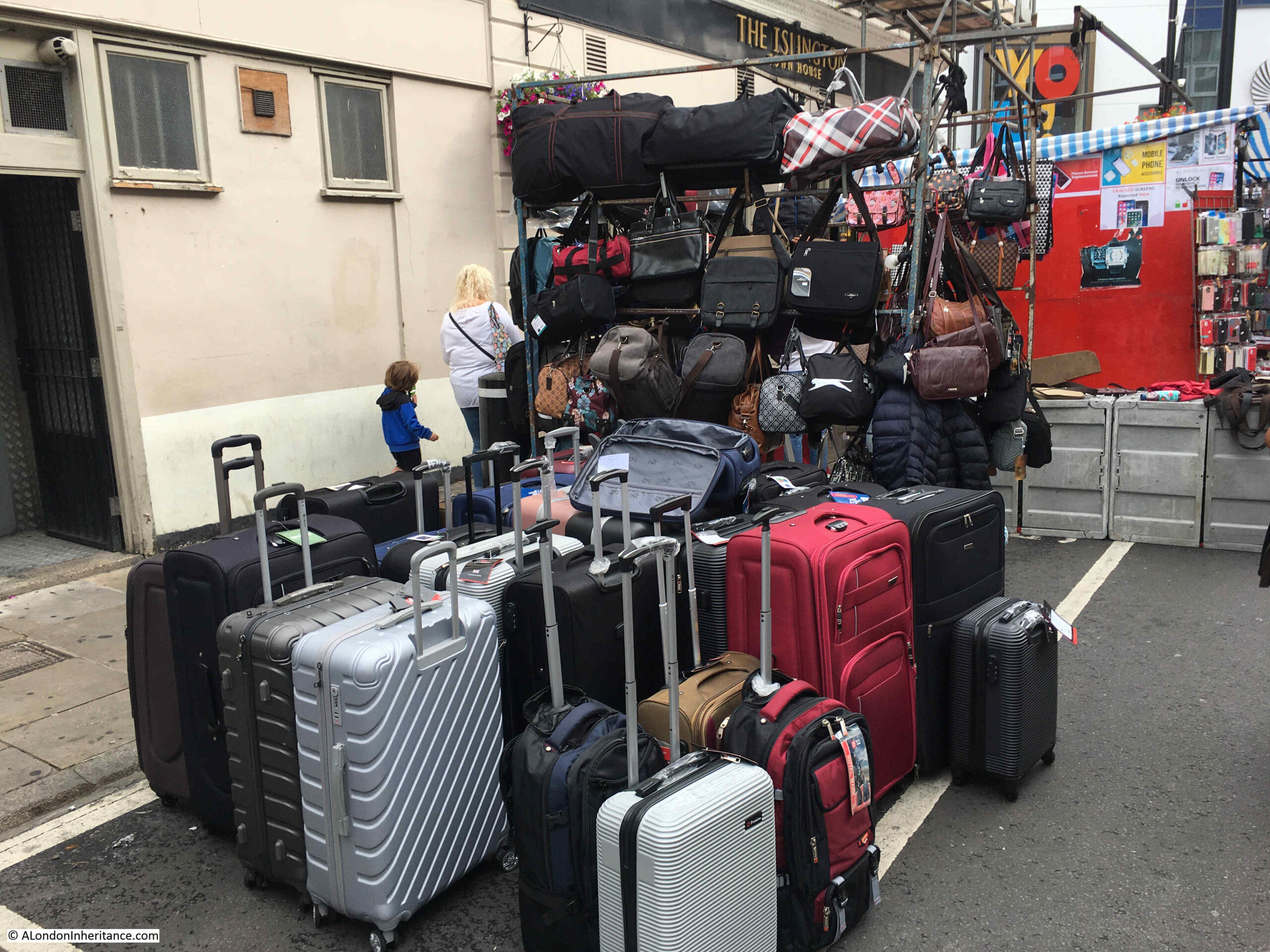
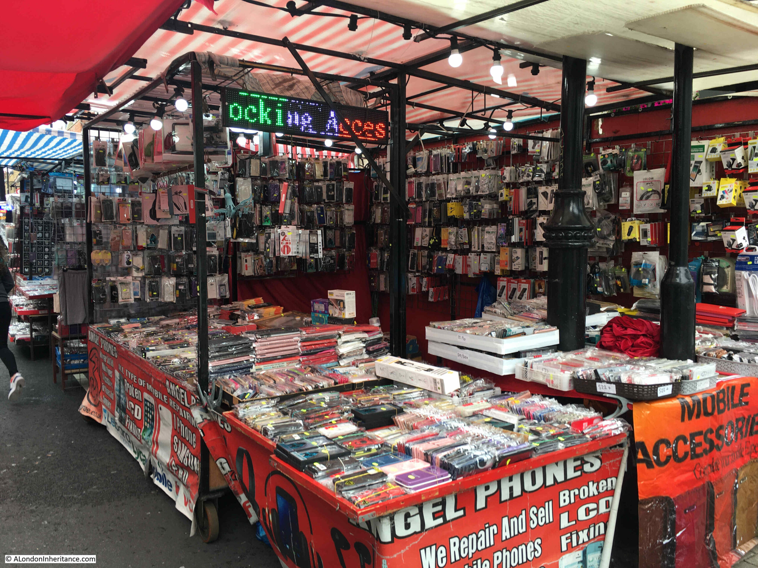
Today, the market sells things that in the 19th century would have been considered science fiction:
The entrance to Chapel Market from Liverpool Road:
So although G.J. Chapman’s shop has gone, and been replaced by a rather bland façade onto Penton Street, there is still a thriving local cluster of shops around the market in Chapel Market, which will hopefully continue to serve the local population for many years to come.
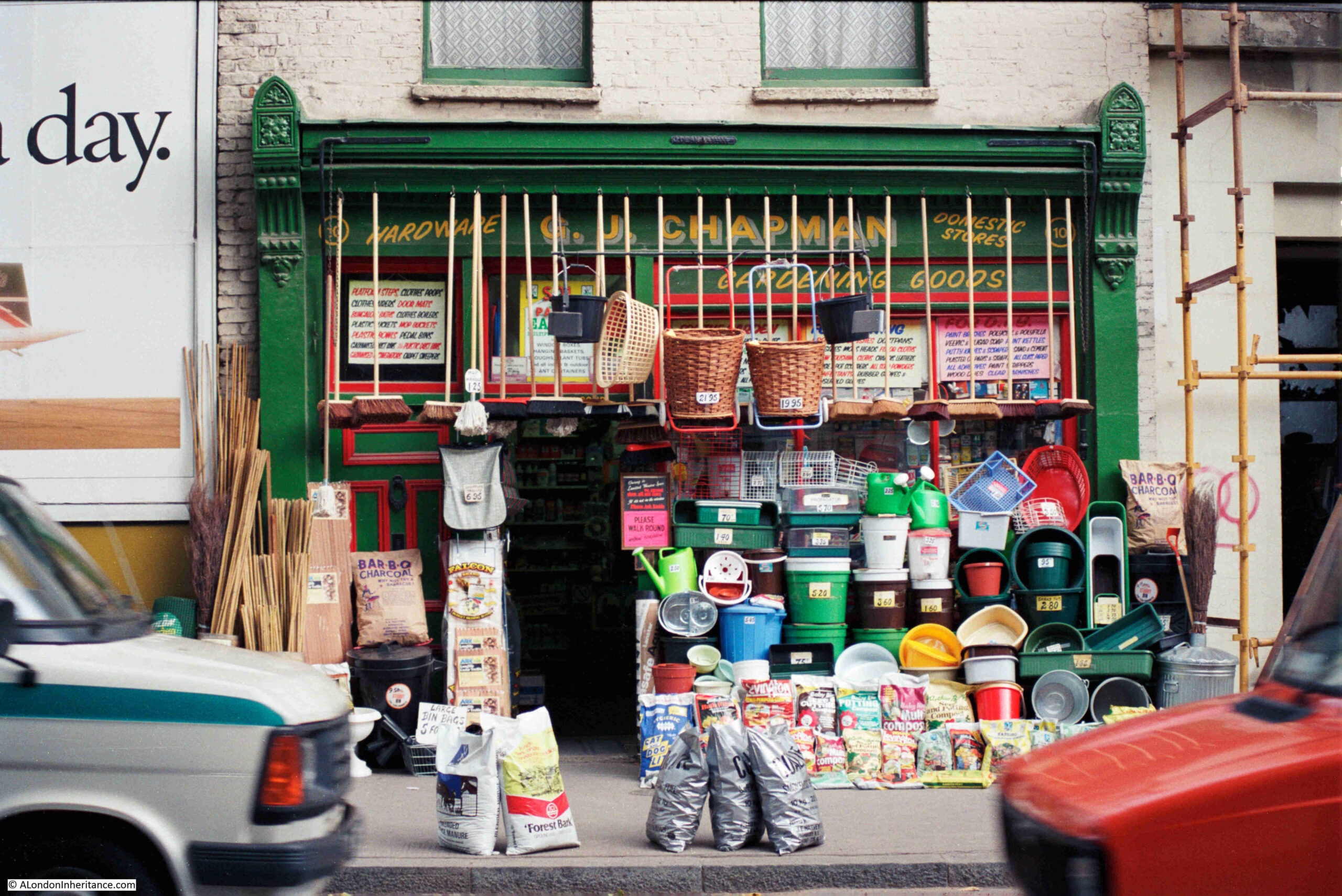
The 1985 photo of G.J. Chapman’s was taken by my father, and when I scanned the strip of negatives with this photo, there were a couple more which brought back the challenges of using film. There were two other photos of the shop, but in each photo a vehicle had just intruded into the photo:
Penton Street has always been a relatively busy road, and framing a photo, then trying to avoid any passing traffic is still a challenge.
I was using a digital camera where the number of photos is limited by the size of memory card, and each photo is basically free. This was not the case with film, and I well remember the challenges of trying to get the wanted photo in a busy environment with a 36 exposure film in the camera. Luckily, my father finally got a vehicle free photo of G.J. Chapman.
It is a long post this week, however I hope you find it interesting as it tells some of my family history, the story of the first East Ham fire station and the local fire brigade. But first, some advertising. After all my walks sold out this summer, I have added a final few for the year.
The South Bank – Marsh, Industry, Culture and the Festival of Britain: Sunday, 30th October
Bankside to Pickle Herring Street – History between the Bridges: Sunday, 9th October
I hope to see you on a walk. Now, to East Ham:
My Great Grandfather was born in 1854, and as a young man, he went to sea and travelled the world.
He became a fireman in 1881, joining the Metropolitan Fire Brigade (MFB) at Rotherhithe, south east London, later moving to West Ham in 1886 as a Fire Escape man, where he remained for ten and a half years. At the time the MFB recruited only ex seamen and naval personnel as the Brigade was run on Naval discipline with a requirement for familiarity of climbing rigging and working at heights.
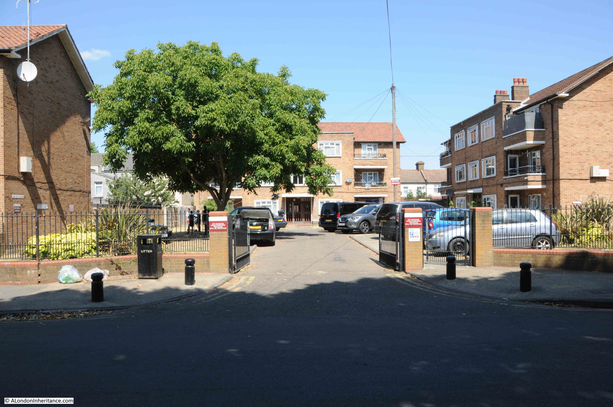
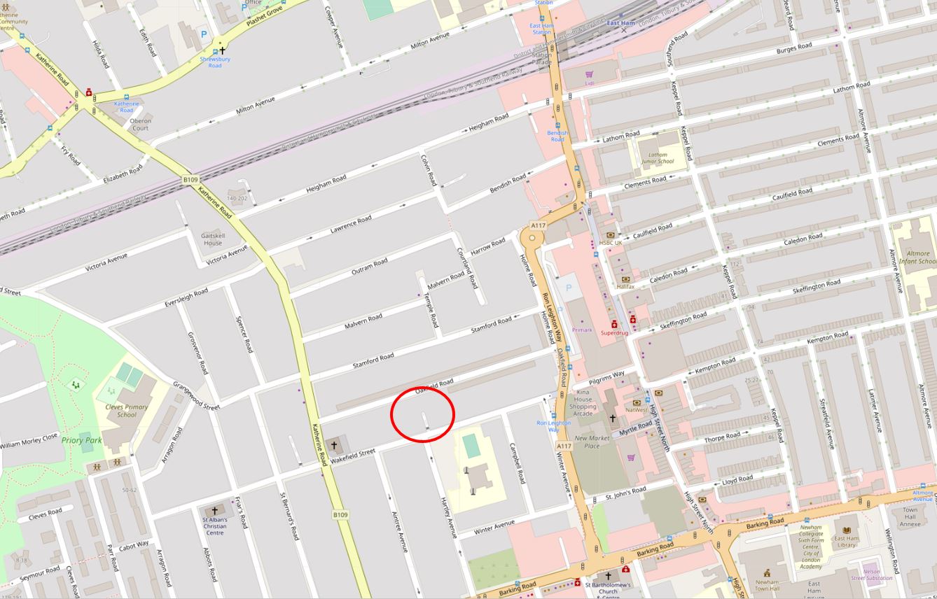
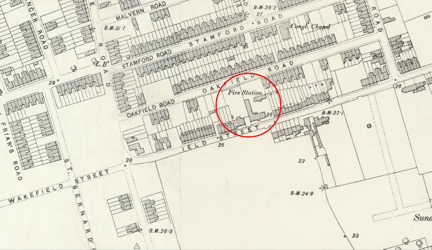
In 1896 he became the Superintendent of the new East Ham Fire Station, and I recently completed one of the many tasks on my to-do list by visiting the site of the Fire Station in Wakefield Street, East Ham:
I cannot find the exact year when the fire station was demolished, it was at some point after 1917, and the location is now occupied by the flats shown in the above photo.
When the fire station was built, East Ham was growing over the fields that once covered this part of east London (although at the time it was part of Essex). In the following extract from the 1897 edition of the Ordnance Survey map, I have circled the fire station in a developing Wakefield Street. The upper part of the map showing that the whole area would soon be covered by terrace housing (‘Reproduced with the permission of the National Library of Scotland“).
Growth of East Ham, and Pressure for a Fire Brigade
In 1861, the number of houses in East Ham had risen to 497 and the population to 2,858. Fire protection for the village would have been provided by a Fire Insurance Brigade, and there is some evidence that the Hand-in-Hand Insurance Company operated in the area. This was the time when insurance companies operated their own private fire fighting services.
The first meeting of the Board for the East Ham Local Government District was held on the 4th February 1879, at the Parochial Building, Wakefield Street.
The provision of fire fighting cover was exercising the minds of the Members of the Board at a very early stage. A letter was received from a Mr. Rowley asking the Board to pay for the attendance of two engines of the North West Fire Brigade from Walthamstow at a fire at Plashet. The sum of £6 was subsequently paid for this service.
Later on in the year a letter was sent to West Ham Local Board relative to the attendance of their Brigade at fires in East Ham. West Ham replied in the affirmative and it is recorded that they attended a fire at Beckton on the 13th January, 1880.
A letter was received from Mr. Angel of West Ham, regarding a fire in the East Ham Match Factory on the 10th February, 1880, and an account enclosed for the attendance of the Brigade. The Clerk to the Board was instructed to write to the insurance company for the payment of the amount paid to West Ham.
In December, 1880, the Board wrote to the famous Captain Sir Eyre Massey Shaw, KCB, Chief Fire Officer of the Metropolitan Fire Brigade, asking for fire cover in the North Woolwich area. (See my post on the historic fire boat named after Massey Shaw). The Metropolitan Brigade had a small fire station in North Woolwich to protect the London County Council property in that area. Captain Shaw agreed to provide fire cover, and an agreement was signed the following month.
The population of East Ham had risen to 10,706 on 1881. it is interesting to note that the census was arrived at by counting the houses and estimating the number of people.
In 1882 the Clerk to the Board wrote to the Commissioners of Police asking for the establishment of a Police Station within the district. This was refused.
The first petroleum licence was issued to a Mr. Harding on the 14th of February, 1882.
The provision of fire hydrants exercised the minds of the Board members in 1884. The East London Water Works Company was asked to install a number of hydrants in North Woolwich and other places at a cost of £3 and 10 shillings each. The lack of pressure in the mains was the subject of much correspondence between the Board and the Water Company over the next few years.
A letter was received from the National Fire Escape Institution on the 12th of May, 1885, asking whether the Board would be prepared to accept a fire escape at a cost of £10 per annum. The Board refused to pay the price. The same year, North Metropolitan Tramway Company gave notice of their intention to commence the tramway in Romford Road. Reference is made to a Ratepayers Association who seemed determined to veto any proposal for improved fire cover, if the project was going to cost money.
An interesting entry appears on the 9th of February, 1886, from a Mr. Palmer, enclosing a list of fires attended by Mr. Clamp of the Royal Standard Hostelry in North Woolwich and claiming payment for these. The sum of £95 was paid for this service. In view of the agreement with the Metropolitan Fire Brigade to attend fires in North Woolwich, it is remarkable that payment should have been made to an individual in this case.
The Board turned down a request by the Liberal Club, Manor Park, for a fire engine to cover the district. The Board replied “No, not necessary”.
On the 21st of July 1891, a letter was received from a Mr. Drury enquiring whether the Board had anything to do with the South West Essex Fire Brigade. The Clerk replied that the Board had an arrangement with the West Ham Corporation to attend all fires in the district but have nothing to do with the private brigade mentioned. About this time many private brigades were in operation in the London area. One enterprising man, a Mr. Cook, wrote to the Board from Lewisham about this time offering to provide a fire engine and two men at a cost of £250 per annum. His offer was turned down.
By the end of 1892 the Ratepayers Association excelled themselves; they decided that a Fire Brigade was required for East Ham and asked the board to receive a deputation “to urge the necessity”.
The following year the Board purchased fire appliances from the Lewisham Fire Brigade at a cost of £140 and appointed Mr. Tom Willard as Superintendent. The Fire Station was located in Wakefield Street, opposite the Hartley Avenue School. The Brigade was what is today called a part-time retained unit with a total establishment of twenty firemen. The men who formed the Brigade consisted mainly of Council employees, such as the Town Hall Porter, the Parks’ Superintendent, the Foreman of Dustmen, and the Roads Foreman who lived in Bernards Avenue and drove the Council’s steam roller.
To call the firemen to attend a fire a man ran around the streets and lanes of the Borough shouting for members of the Brigade. Then it was touch and go whether the old horse drawn, manually operated pump reached the scene of the fire without mishap.
The names of only a few of these Auxiliary firemen are known, Ted Lukas, Parks’ Superintendent, Mr. Flowers, the Turncock, Charlie Hare, Jimmy Ward, Mr. Richards, Mr. Redmond, Edwin Roberts and George Cook who both joined the regular brigade and served for many years. The firemen received a payment of two shillings and six pence for each fire attended.
About this time, the Board were considering the installation of a fire alarm system to cover the district. This shows that electricity was becoming a commercial proposition.
One Sunday morning the Brigade were called to a fire at No. 2, High Street South. Owing to an oversight the regular coachman was not called, so one of the firemen drove the two horses to the fire. Unfortunately, the fireman was unused to such restive horses and, as he threw down the reins before getting out the hose to fight the fire, the horses bolted. They made their way to their home in North Woolwich and reached Manor Way when they capsized the engine into a ditch at a sharp bend by Beckton School. The Board reprimanded the Superintendent for not “properly calling the firemen”.
The poor Superintendent continued to be in hot water over many small incidents, so that on the 20th of October 1896, the Board resolved “Having regards to constant complaints, the Brigade Town Committee recommend that steps be taken at once putting an end to the present arrangements of the Fire Brigade pending the establishment of a permanent brigade”.
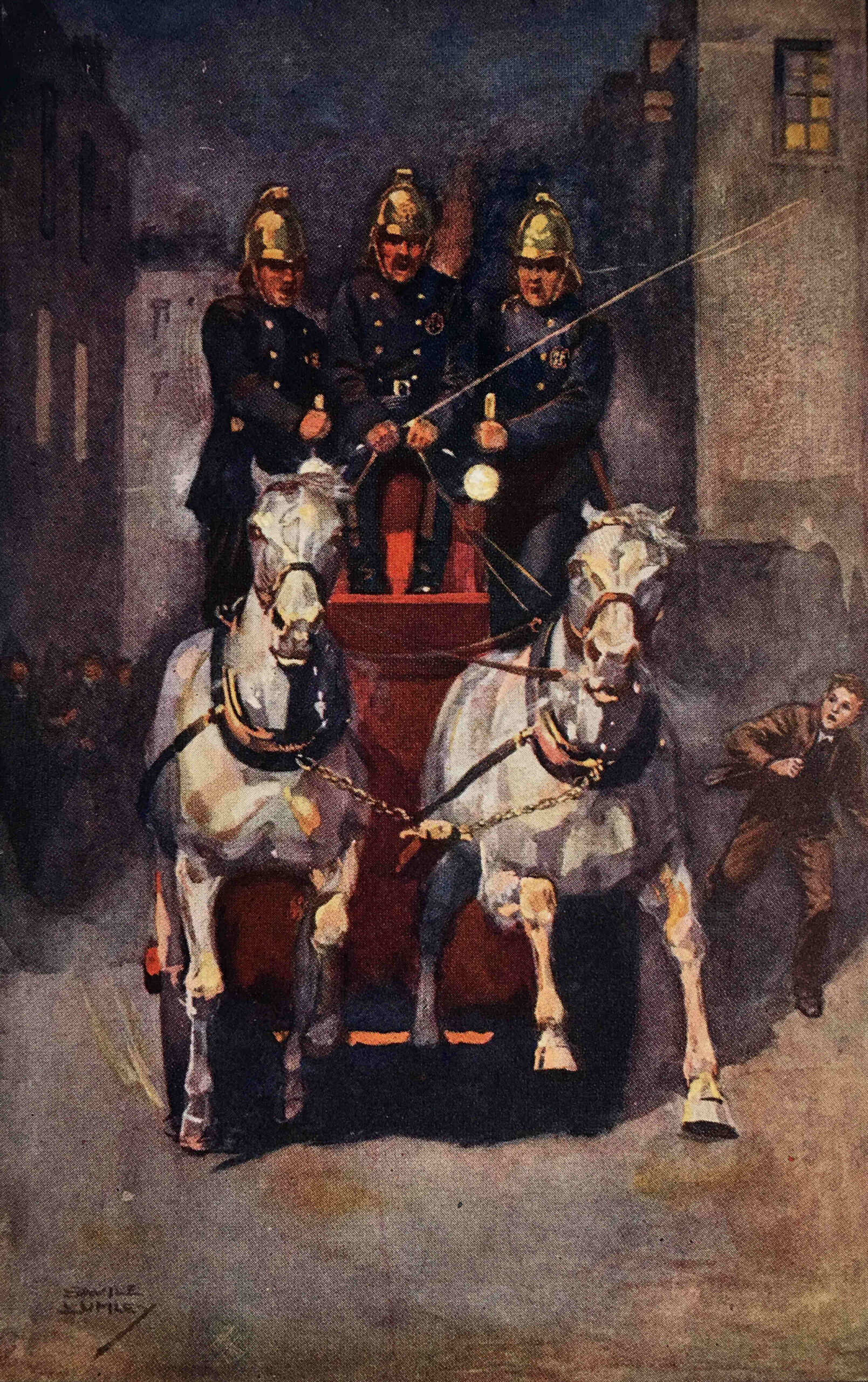
The following painting titled “Top Speed” by Savile Lumley shows horses pulling firefighters through the streets at speed:
A Full Time Fire Brigade for East Ham
The Committee wasted no time and immediately advertised for a Superintendent (Engineer Fireman) at £2 and 2 shillings a week, with free house, fire, light and uniform, and three firemen at £1 and 10 shillings a week.
Twenty one applications were received for the Superintendent’s post, and thirty one for the post of firemen. The interviews were held on the 17th of November 1896, and my Great Grandfather was appointed to be Superintendent. Three firemen were also appointed. A new Steam Fire Engine and Curricle (a two wheeled carriage drawn by two horses abreast) were purchased at a cost of £400.
My Great Grandfather’s First Annual report makes interesting reading:
“I have the honour to present my first Annual report of fires for the year commencing 1st January 1897 to 25th December 1897. Total number of calls received for fires during the year were 54, of these 14 were F.A. (false alarms), 3 chimney fires, 37 actual fires – 6 were serious in damage and 31 slight damage, 4 were beyond East Ham boundary, viz., West Ham.
In addition to ordinary fires, there have been 3 chimney fires requiring the attendance of firemen with hand pumps.
Of 37 fires, 17 were extinguished by means of steamers, hydrants and standpipes and firemen; 6 were by hand pumps and firemen; and 14 were by buckets and firemen.
The strength of the brigade is as follows: 1 Station; 1 Steamer; 1 Manual; 1 Curricle Fire Escape; 1 Telephone (2 more to be provided); 7 F.A. Points; 4 Bells leading to Firemen’s Houses; 1,800 feet of Canvas Hose – all in good condition; 4 Firemen (including Superintendent; 1 Coachman; 2 Horses.
The number of firemen employed on watch are 1 by day and 2 by night. The members of the brigade keep in a smart and proper condition. The men have been regularly drilled in their various duties and their conduct has been very satisfactory. Summary of how fires were reported to the F.B. for 1897:
Fire Alarm 17; Telephone 7; Police 1; Strangers 10
During the year there have been only 10 mischievous false alarms by fire alarms and 4have been caused by wires in contact.
The brigade have pumped out 1 cellar (after a storm) with the steamer during the year.
Details of lives endangered:
In this case which occurred at an oil shop on the 12th of April 1897. David Hollingsworth, a member of the brigade, was cut on hand by broken glass and had to be attended to by a doctor.
In this case which occurred at a private house on the 13th of June 1897, Thomas West age 25 was burnt on left arm and hand and Mrs. L.N. West aged 18 years was severely burnt on face, neck, both arms and shoulder caused by the explosion of a mineral oil stove. Both have since recovered.
In this case which occurred at a general shop on the 7th of December 1897, Mr. Robert Baker aged 54 was burnt on both hands caused by an explosion of a mineral oil lamp. He has since recovered.
In conclusion, I take this opportunity of thanking you for your valuable co-operation with me in all matters tending to the success of the brigade.”
The incident where David Hollingsworth was injured was reported in the Barking, East Ham & Ilford Advertiser:
“FIRE – At a few minutes before two o’clock on Monday afternoon a fire broke out at an oilshop, 101, Plashet-grove, occupied by Mr. C. Maitland Dods, and owned by Mr. W.A. Lee. Alarm was at once given at the East Ham Fire Station, and within a few minutes the Superintendent and his men were on the spot and vigorously combating the flames, which they managed to subdue after an-hour’s hard work. They were heartily congratulated by the crowd of bystanders who watched the operations. Fireman Hollingsworth was badly cut on the left hand. the shop was completely gutted, and the contents of nine rooms were severely damaged.“
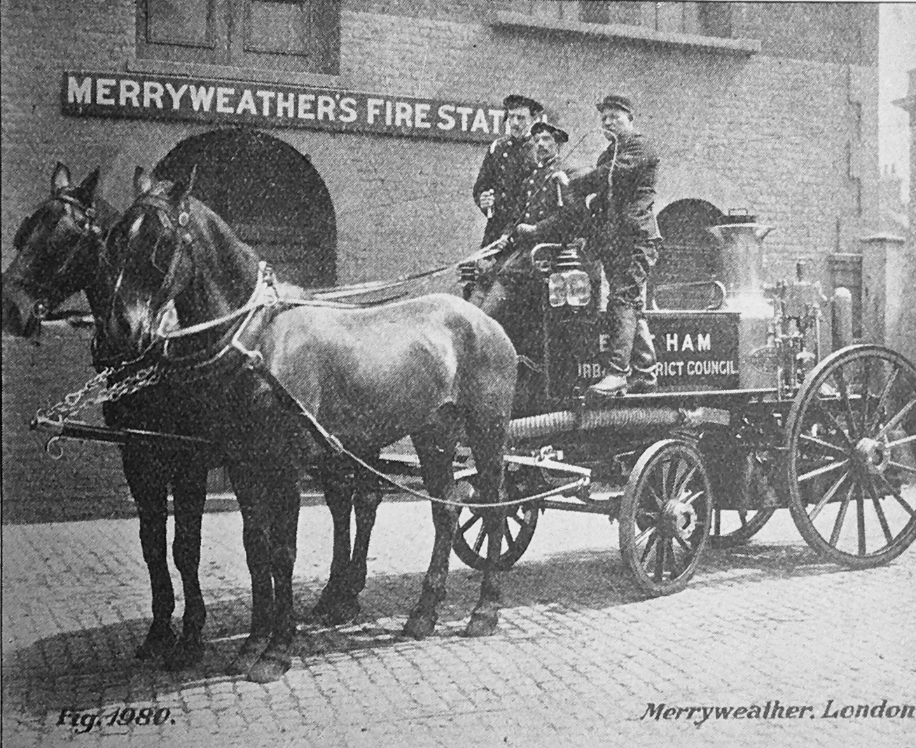
I found the following photo in a book published by West Ham County Borough Council in 1936 to celebrate fifty years as a Borough. It shows an early horse drawn steam engine.
Although it is from a book about West Ham, the sign on the side of the appliance shows the E of East Ham. I suspect it is a promotional photo by the Merryweather company who built fire engines in their factories in south London.
Unfortunately the firemen in the photo are not named, although they may be Merryweather staff rather than firemen from East Ham fire brigade, however it must have been a fire engine that my Great Grandfather would have used.
The main fire risk in the Borough was represented by the Royal Albert Dock, at the time the largest and finest dock in the world. The Beckton Gas Works was also one of, if not the largest in the world and represented another severe fire risk. Until closure both the Docks and the Gas Works continued to form the main fire risk covered by the brigade.
There was an agreement in 1897 between East and West Ham that border fires be attended without charge. A few years later a similar arrangement was agreed between East Ham and Barking.
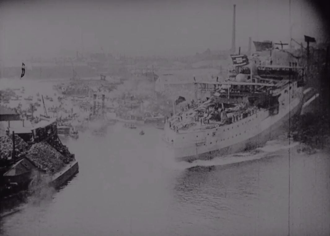
On the 7th of June, 1898, it was reported to the Board that two firemen attended the launching of H.M. Battleship “Albion” (in company with four members of the late volunteer brigade) at Blackwall to form a guard of honour to the Duchess of York and a sad incident occurred by the collapse of a jetty which caused several deaths. The firemen were praised for their work of rescue. This really deserves a dedicated post. The following is a still from the launch of the Albion which you can watch on the BFI Player here.
A serious fire on the 6th of July, 1898 on the S.S. Manitoba at shed 22, Royal Albert Dock, caused an explosion amongst cartridges which killed 5 persons and injured 6 others.
The cost of fodder for Fire Brigade horses is recorded as being 11 shillings per week. The animals must have been well fed because a fireman had to keep his wife and usually large family on 30 shillings a week.
The leave enjoyed by professional firemen in these early days was just 24 hours a month – if he could be spared.
In December 1898, the Council purchased the horses and contents of the stable of the Hand in Hand Insurance Company for £250.
Fireman Atkinson was appointed as Assistant Officer “to take charge in his (Superintendent’s) absence”, at a weekly rate of 35 shillings.
A severe fire occurred on the S.S. Magnetic involving heavy damage to engine room, store and cabins.
Fire alarms were being installed throughout the Borough by 1898 and many references are made to Malicious False Alarms.
Christmas Day, 1898 saw “Firemen acting disorderly at Wakefield Arms – Superintendent was there and found Fireman Dunn intoxicated. Told Dunn to go home whereupon assaulted; got him to station, assaulted once more. Dunn dismissed – approved by Committee.” Two other firemen were given a week’s notice.
On the 25th September 1899 there was a false alarm call. A small boy aged 12 years was detected pulling the alarm bell at the corner of St Stephen’s Road. The father was told that the next time he would be prosecuted. In September 1958, another small boy, the grandson of the original boy was found pulling the alarm bell again.
On the 11th of July 1900, a new sub-station was opened at Manor Park. The station was situated at the corner of Manor Park Road and Station Road and cost £118 to build. It contained a 50ft Bayley Escape – and was manned by two firemen, who had to drag it to the fires on its two wheeled cart. The cost of telephones to Wakefield Street from one fire alarm point and from the sub-station at Manor Park was £16, 5 shillings per annum.
The Waiting Room and Porters Room at East Ham Railway Station was severely damaged by fire on the 25th of April 1901.
An unusual accident occurred on the 16th of July 1901, whilst proceeding to a fire, when the wheel of the old manual engine caught in the tram lines and was wrenched off. The North Metropolitan Tramway paid £5 compensation. The fire engines and the trams seem to have been in conflict from time to time because it is reported that the new motor engine was in collision with a tram at Savage Gardens whilst returning from a fire at the docks. The lovely new machine finished up in a rhubarb field belonging to a Mr. Northfield the Farmer. It was ignominiously chained to the tram and towed home to the station.
The Superintendent asked for the authority to summon the assistance of the Metropolitan Fire Brigade in case of an emergency at big Dock fires, but the Committee refused to recommend the Council to incur liability for charges for this purpose.
The annual report for 1900 shows the following equipment held by the Brigade – 1 Station; 1 Sub-Station; 1 Steamer; 1 Manual; 1 Hose Tender and 50ft Escape with sliding carriage. 1 Curricle Escape, 40ft; 6 scaling ladders; 2,500 feet of canvas hose; 5 leather branches, 5 metal branches’ 44ft of rubber suction hose; 3 jumping sheets; 4 horses.
The establishment now had – 1 Superintendent; 1 assistant Superintendent; 7 Firemen and 2 Coachmen.
It was also reported that Fireman J. Mandell fell from the first floor to ground at a fire and was subsequently retired due to his injuries. Fireman E.L. Roberts was badly injured when part of a roof fell in and smashed his helmet. Fireman H. Gear sustained a severely cut wrist from a falling slate and H. Chittock, Turncock, received a broken leg when he was thrown off the steamer.
East Ham Fire Station had increased by 1904 with the addition of two firemen. My Great Grandfather, the Superintendent, had his salary increased to £597 per annum. The salaries of other officials at this time make an interesting comparison:
Town Clerk £300; Assistant Town Clerk £200; Librarian £150; Medical Officer £200; General Clerk £120. A council steamroller driver was paid £2 a week and a foreman Bricklayer was paid £2 5 shillings a week. The Superintendent’s role appears to have been very well paid.
On the 20th of June, 1905, a surprise trial call was given to the fire brigade. The Committee members expressed their satisfaction that the time taken for the firemen to arrive at the Town Hall was only 3 minutes 20 seconds from the time of the call. Perhaps the firemen were not so surprised by the call as the Committee imagined.
In 1905 the brigade had 1 Steam Fire Engine; 1 Manual Fire Engine; 1 Hose Tender and 50 feet sliding carriage escape and two 40 feet Curricule Escapes.
An incident occurred on the 28th of February, 1906 involving 50 feet of electrical cable which fused under the pavement. Six persons were removed to hospital suffering from partial suffocation.
In July 1906, the Superintendent reported that the clothing contractor who supplied uniforms, had failed to carry out his work satisfactorily, and the contractor would go on to loose the brigade contract. In 1906, a new smoke helmet cost £2, 5 shillings.
About this time, Council Minutes appear relating to the totally inadequate surroundings and arrangements of the present fire station in Wakefield Street. The Committee were in favour of building a new station and instructed the Surveyor to prepare plans to incorporate the building into the area surrounding the new Town Hall.
A Mr. Kennersly made application to the Council to be allowed to explain his “patent for facilitating the life saving capacity of the Council’s fire escapes”. The apparatus consisted of a canvas chute attached to the head of the escape and down which persons were passed after rescue from upper floors. these chutes were in common use in the Metropolitan area from about 1850 onwards. There is no record that this method was adopted in East Ham.
In 1908 the Council looked into the question of hiring horses instead of keeping their own. An advertisement was placed in the Daily Telegraph inviting tenders from firms willing to hire horses. The offer from Messrs. C. Webster Ltd was accepted at a cost of £65 per horse, per annum and £150 for purchase of the brigade’s live stock.
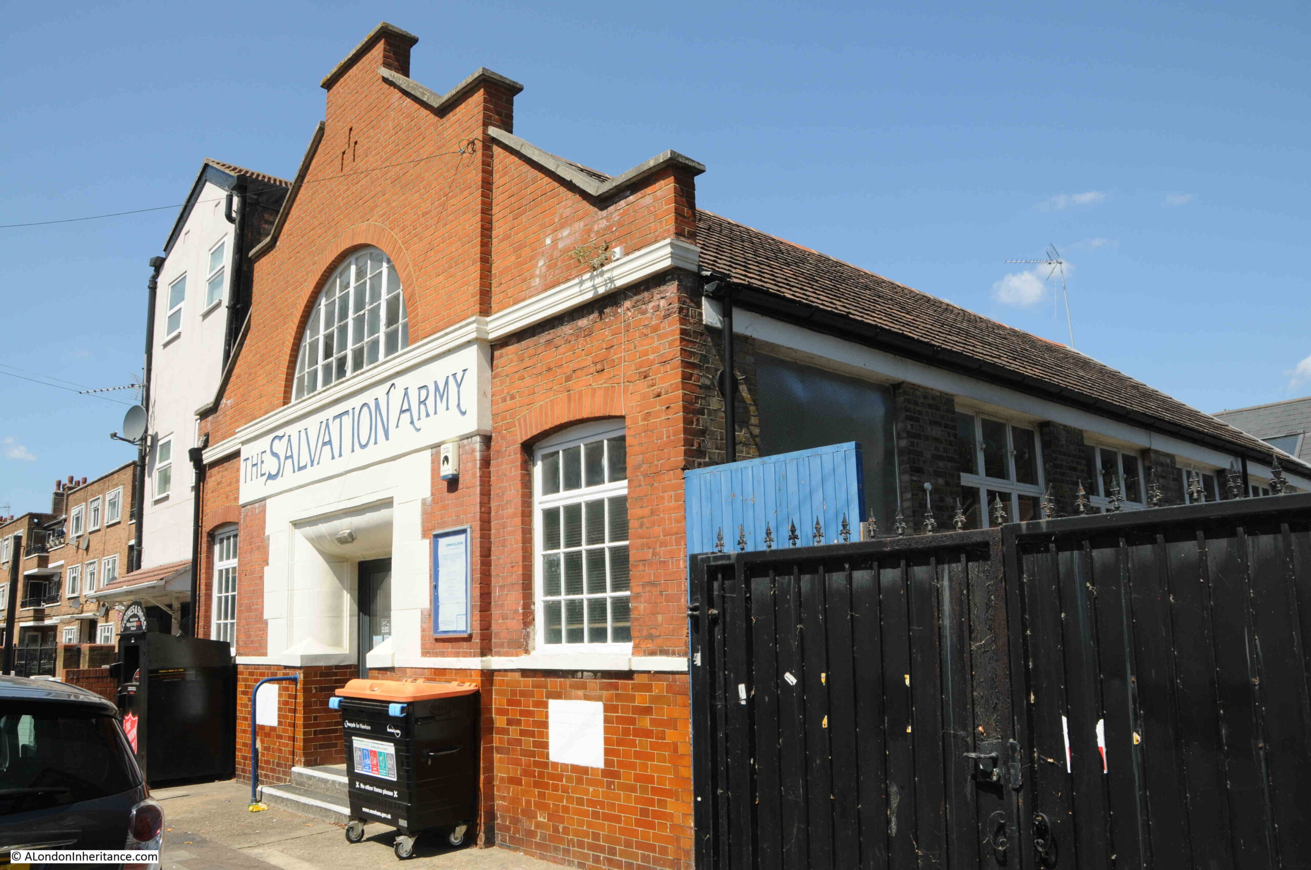
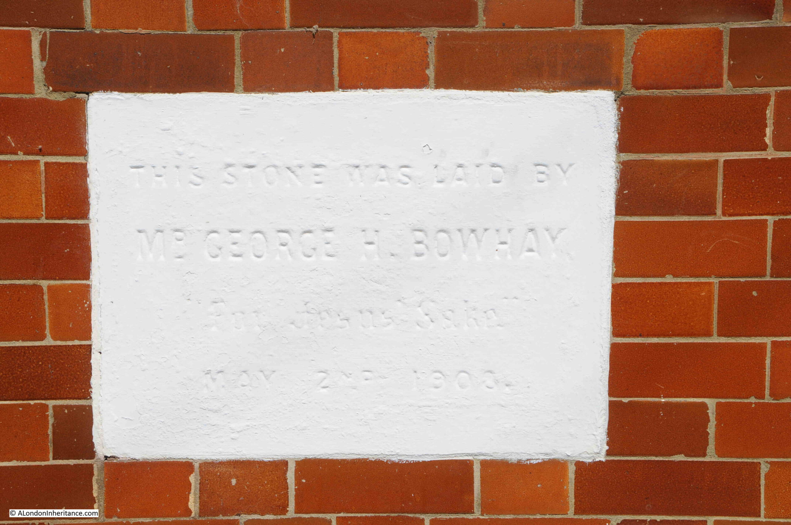
Throughout the years of the development of the fire brigade, East Ham was also expanding, and Wakefield Street, the street with the fire station had been fully developed as a street lined with terrace houses. There were some exceptions. A large school almost opposite the fire station, and also a Salvation Army Hall:
The plaque on the hall dates the opening to 1908:
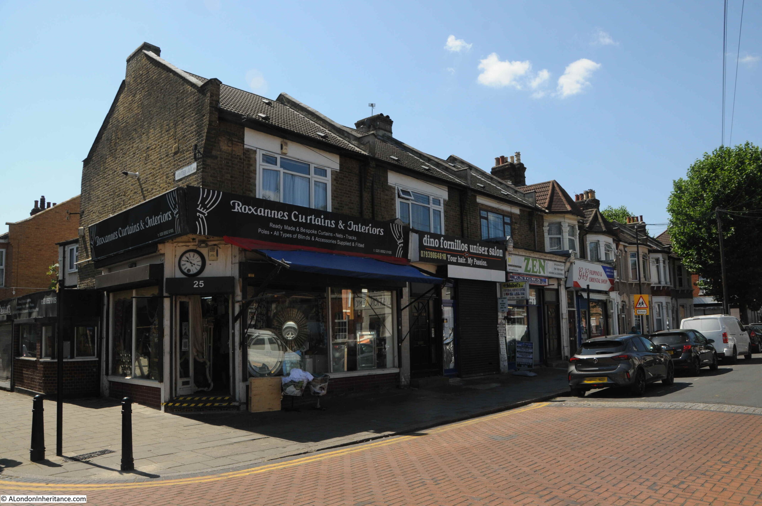
Wakefield Street’s eastern end was at a junction with High Street North, however Ron Leighton Way (named after the MP for Newham North East. he won the seat in 1979) now slices through Wakefield Street as it nears High Street north. Where Wakefield Street now ends is this row of shops – essential additions to any London development of rows of terrace streets.
In earlier years, there would have been a number of pubs along the streets of developing East Ham. There were, and are, very few in the vicinity of Wakefield Street, and I suspect it was the late Victorian approach to alcohol for the masses, and that so many of the people who lived in the area, worked in the docks, where employers would not have wanted their employees under the influence of alcohol.
Back to the East Ham fire brigade, and there were some remarkable turn out times achieved by firemen in the days of horses. The record held by a London station being 11 seconds during a test turnout, but it is likely that much of the work for the callout had already been anticipated.
Under normal conditions, times of 30 seconds for a turn out were quiet common and this included attaching the horses to the shafts and securing the necessary harness.
Permission was given at regular intervals for the fire brigade to attend Carnivals in neighbouring Boroughs. The attendances of the brigade at such functions appeared to be an essential feature of the carnival. no doubt the fire engine with its brass work gleaming, drawn by proud horses and carrying its load of brass helmeted firemen would make a brave sight as it galloped round the park. From past records it is evident that the engines were “got to work” and demonstrated the skill of the men and the efficiencies of the pumps.
The Second East Ham Fire Station
Plans and estimates were submitted to the Council on the 21st of November 1911, for the building of a new fire station in High Street South. the cost of the project amounted to £8,628 including quarters for the Superintendent and 11 men. This was approved, along with approval to borrow the amount for a period of 30 years.
The new station was urgently required as the original in Wakefield Street was designed and built to accommodate horses, with the result that the doorways were only 8 ft., 10 inches wide. The appliance room was not deep enough to house the turntable ladders which were soon to be made available for the fire services.
On the 28th of May 1914, the new Fire Station was opened by Mayor, Alderman O.R. Anstead, and at the opening he said that “Great praise is due to the Borough Engineer and his Deputy for the way in which they have constructed the building which is one of the best anywhere around London”.
Little did he know that within three months the appliance room of the new fire station would be considered out of date for the latest fire fighting equipment. Little foresight was shown by the designers of the Station because many Fire Brigades in different parts of the country were at that time purchasing motor fire appliances and it should have been obvious that the day of the horse was numbered.
The opening of the new fire station, the transition from horse to motorised equipment was followed within three years by the death of my Great Grandfather. The West Ham and South Essex Mail included this obituary in April 1917, which included that:
“In early life he had been a petty officer in the mercantile marine. On leaving the sea he joined the Metropolitan Fire Brigade in 1861, and saw service in Norwood, Battersea, Rotherhithe and other districts, coming to West Ham in 1886 as fireman and steam man. He was for eleven years in West Ham where his good work was recognised by all grades of the service.
On leaving that centre when he received the appointment of the East Ham Fire Brigade he was presented by his colleagues with a clock, ornaments, tea service and a purse of gold. The excellence of his work in East Ham was also recognised both by the authorities and those who served under him. He had had a wide and varied experience and had attended some of the biggest fires in the London district.
Unfortunately, about two years ago he was in the somewhat serious motor accident which resulted in one of two members of the Brigade receiving injuries. Deceased himself was so badly shaken that he was never again quite the same, and had to relinquish his more arduous duties on a small pension, though he filled up his spare time as consulting engineer and inspector of hydrants. He had been ailing for some time before his death, and his illness took a turn for the worse about a week ago, He leaves a widow and three children.”
The fire station that took over from the one in Wakefield Street is still there, however now converted into flats. What is, as far as I know, the third version of East Ham Fire Station is at 210 High Street South, towards the Newham Way – equipped with fire fighting equipment that would have amazed my Great Grandfather.
Continuing my series of posts, tracking down all the City of London’s blue plaques, here are another selection of the wide range of people and places commemorated across the City, starting with:
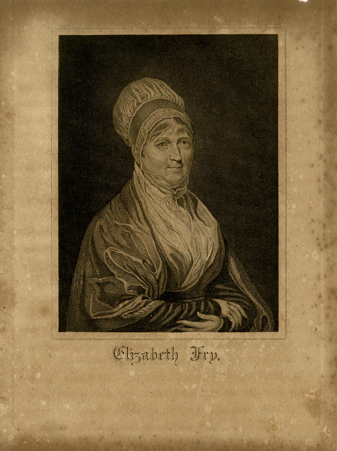
Mrs. Elizabeth Fry – Prison Reformer
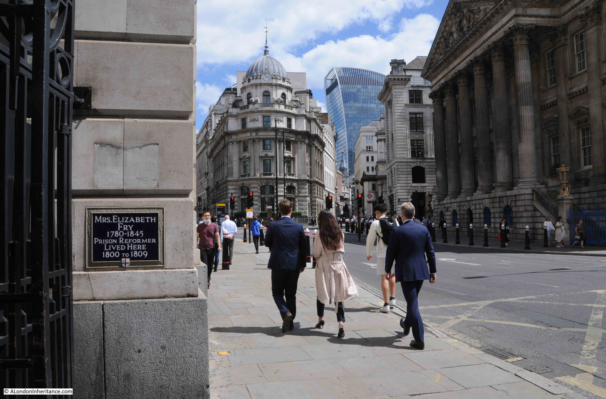
Where Poultry meets the Bank junction, there is a plaque on a side wall recording that Mrs. Elizabeth Fry, Prison Reformer, lived here between 1800 and 1809:
Elizabeth Gurney, as she was before marriage, was born in Norwich in 1780. Her parents were Quaker’s, which probably influenced her future work.
She came to London in 1800, the same year that she had married Joseph Fry, so the plaque commemorates her first London home.
Her prison reform campaigning started around 1813 following a visit to Newgate prison. This visit was described in the book Prison Discipline by Sir Thomas Powell Buxton, and it really must have been a shocking sight:
“She found the female side in a situation which no language can describe – nearly three hundred women, sent there for every graduation of crime, some untried, and some under sentence of death, were crowded together in the two yards and the two cells.
Here they saw their friends and kept their multitude of children, and they had no other place for cooking, washing, eating and sleeping. They slept on the floor, at times one hundred and twenty on one ward, without so much as a mat for bedding, and many of them were nearly naked.
She saw them openly drinking spirits, and her ears were offended by the most terrible imprecations. Every thing was filthy to excess, and the smell was quite disgusting. Everyone, even the Governor was reluctant to go amongst them. He persuaded her to leave her watch in the office, telling her that his presence would not prevent its being torn from her.
She saw enough to convince her that everything bad was going on. In giving me this account, she repeatedly said ‘all I tell thee is a faint picture of the reality; the filth, the closeness of the rooms, the ferocious manners and expressions of the women towards each other, and the abandoned wickedness which everything bespoke, are quite indescribable’. Two women were observed in the act of stripping a dead child, for the purpose of clothing a living one.”
As a result of this visit, Elizabeth Fry started to campaign for improved conditions for women prisoners. She started bible lessons in Newgate and in 1817 formed the Association for Improving the Condition of Female Prisoners in Newgate”. It was initially assumed that the association was doomed to failure and that prisoners in Newgate could not be reformed, however the association pushed forward. As well as the women, their concern was the condition of the children who were imprisoned with their mothers. The Association opened a school dedicated to children within the prison.
The Association’s work gradually brought about change:
“The efforts of the committee to induce order soon began to produce visible effects. It even excited surprise to watch their rapid progress to an almost total change of scene. The demeanour of the prisoners is now quiet and orderly, their habits industrious, their persons clean, their very countenances changed and softened. The governesses of the schools for children, and for adults, are themselves prisoners, whose steadiness and good conduct procured their selection, and have justified the preference.”
As well as work within Newgate, Elizabeth Fry campaigned for change in how prisoners were managed and in 1823 prison reform legislation was introduced in Parliament.
Her work expanded. She would sit with those who were condemned for execution, she visited convicts in prison ships prior to their being transported to Australia, and provided items such as blankets to provide some comfort during the voyage. She visited many other prisons to inspect their conditions and campaign for change. This included prisons across England and Scotland as well as France.
She corresponded with those in power across Europe, including the King of Prussia and the Dowager Empress of Russia.
Many people went to visit Newgate to see the improved conditions, and watch the work of Elizabeth Fry. Prince Albert and the Duke of Wellington met with her.
She was also interested in causes outside of prison reform, for example she also sent bibles and reading material to isolated coastguard stations across the country. She also campaigned for improved conditions for working women, improved housing for the poor, and she established a number of soup kitchens.
From 1809 to 1829 Elizabeth Fry lived in East Ham at Plashet House, then moved to a house in West Ham, where she lived until 1844. She then possibly moved to Kent as a year later she died at Upton, Ramsgate in Kent.
She was buried in the Friends burying ground in Barking.
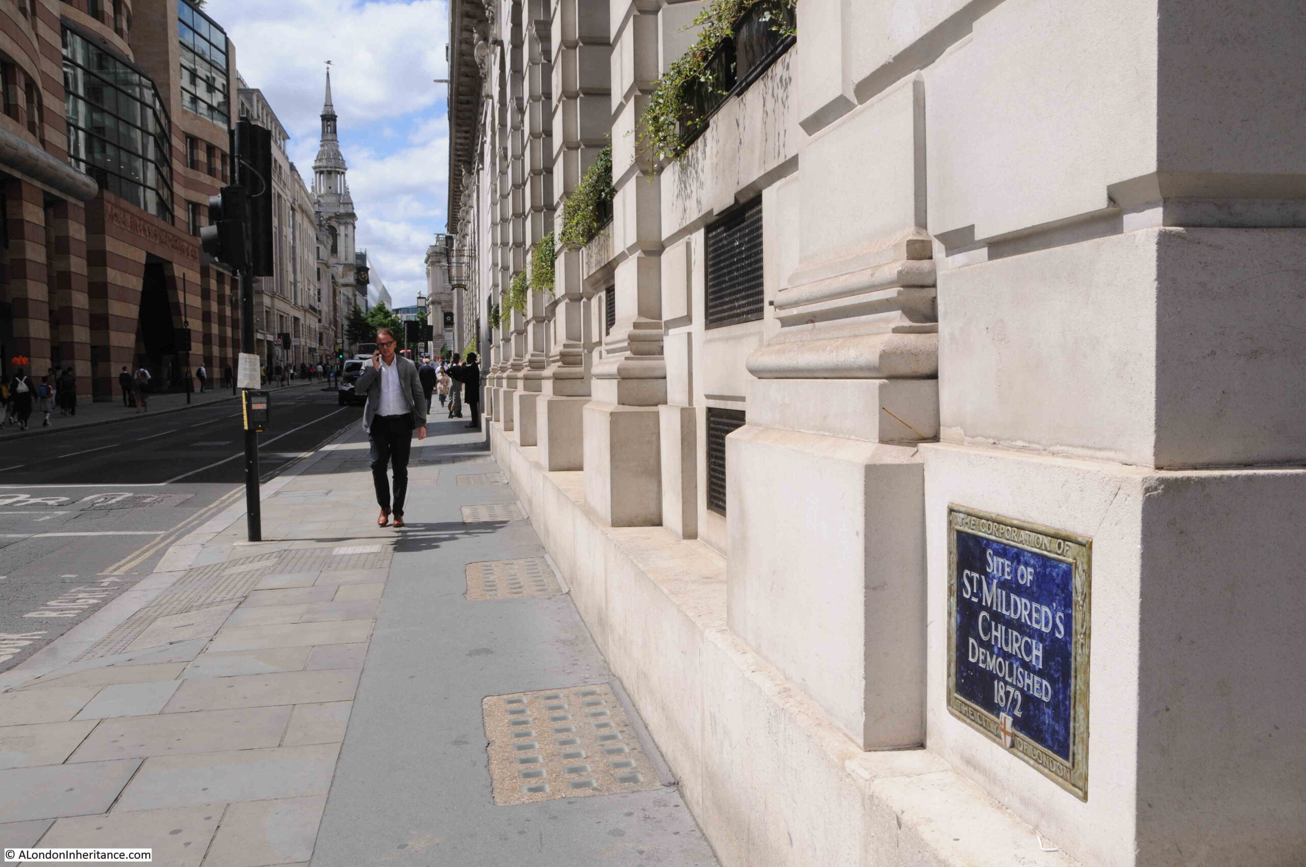
Elizabeth Fry apparently lived in St Mildred’s Court. I cannot find an exact location, however another blue plaque, a very short distance away indicates where the name of the court would have come from.
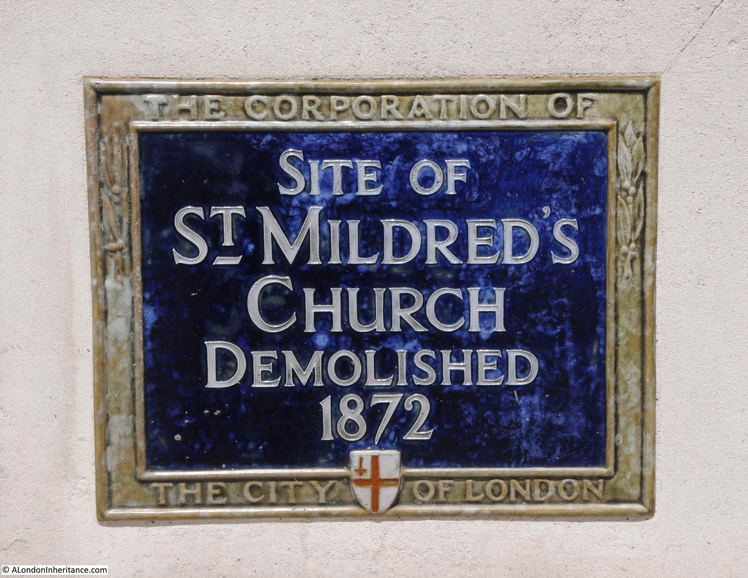
St. Mildred’s Church
Facing onto Poultry is another blue plaque:
Recalling the site of St Mildred’s church, demolished in 1872:
St Mildred’s church was one of the many City churches demolished during the second half of the 19th century. The City had been rapidly developing as a commercial centre. This reduced the number of residents and the size of church congregations. Space was also needed for road widening, additional office and commercial space, so many City churches, such as St Mildred’s were demolished.
An article in the Morning Post on the 18th of May 1872 provides some background to the church:
“The church of St. Mildred, Poultry, built by Sir Christopher Wren, is about to be sacrificed to the widening of the thoroughfare. It was erected in 1676 in the place of a decayed fabric which had dated from 1420, and which had superseded another of great antiquity that had fallen into dilapidation.
Previous to the first erection of the church, Thomas Morstead, surgeon to King Henry IV, V and VI, gave a piece of land adjoining the church, 45ft long and 35ft wide, for a burial ground.
Among persons of interest buried in the old church was Thomas Tusser, born in 1515, who wrote a book called ‘Points of Husbandrie’ which passed through 12 editions in 50 years. He is said to have led a wandering and unsettled life, being at one time a chorister, then a farmer, and afterwards a singing master. A quaint epitaph in verse commemorated his name and services. Previous to suppression of religious houses St Mildred’s belonged to the priory and canons of St. Mary Overy.
The length of the fabric now about to be taken down is 56ft, the width 42ft and the height 36ft. the tower is 75ft in height and is surmounted by a gilt ship in full sail.”
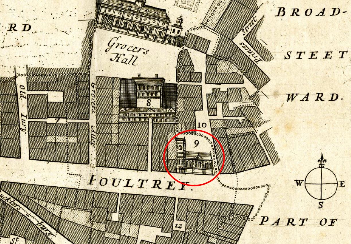
St. Mildred’s was shown on a 1754 map of Cheape Ward. I have circled the church in red in the following extract from the map:
In the above map, number 9 refers to St. Mildred’s church, and number 10 to Scalding Alley. I cannot find St Mildred’s Court on a map, so wonder if this was the alley by the side of the church.
When the church was demolished, the dead were relocated to the City of London cemetery at Ilford, Poultry was widened and new commercial buildings constructed on the site.
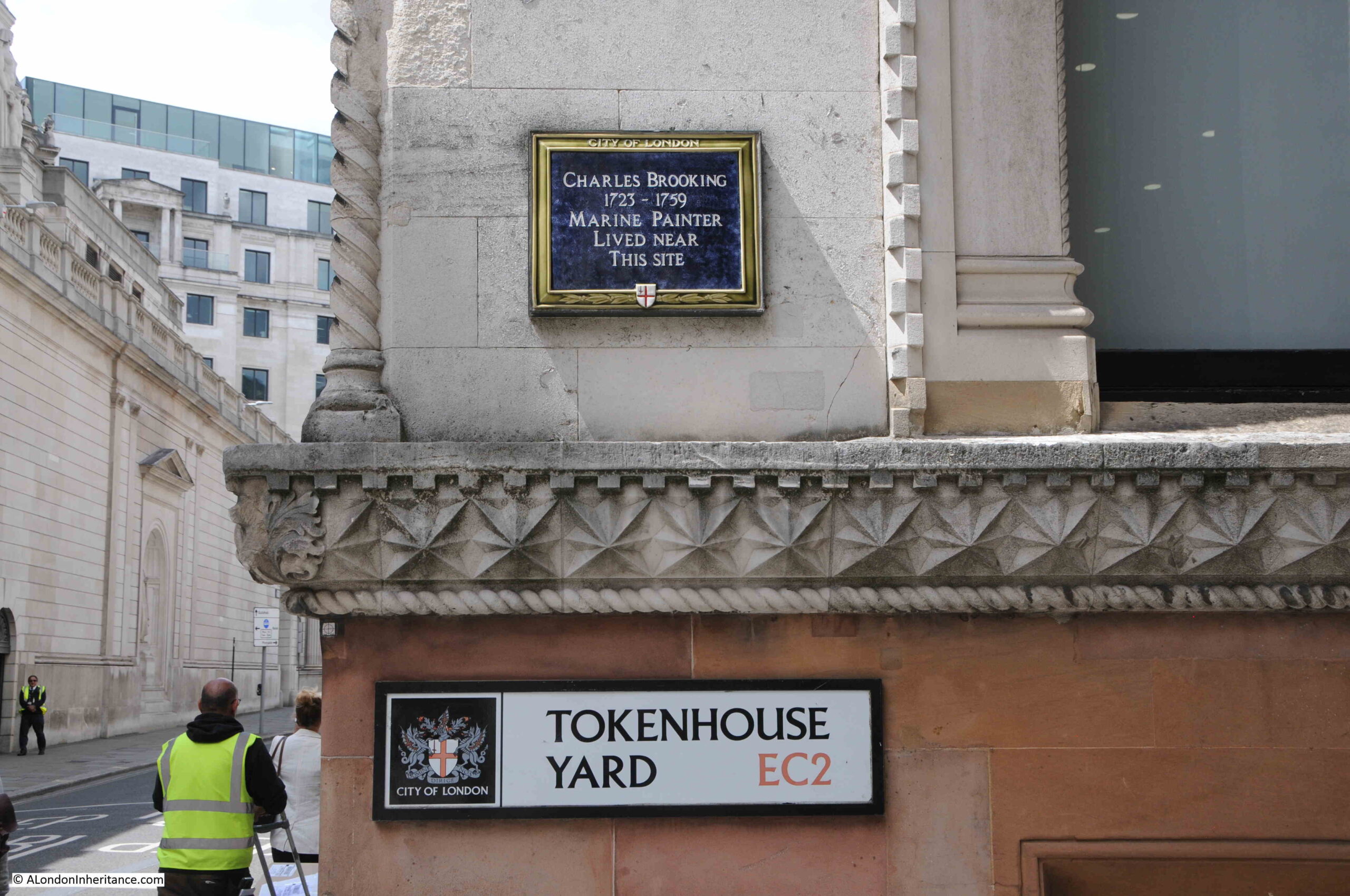
A short walk from Poultry, we find Tokenhouse Yard, a turnoff from Lothbury, where there is a plaque to:
Charles Brooking – Marine Painter
At the entrance to Tokenhouse Yard is a plaque to Charles Brooking who lived near the site of the plaque.
Not that much is known of the life of Charles Brooking. It is believed that he was born in Greenwich and he died at the relatively young age of 36. The plaque gives the years of his (assumed) birth (1723) and death (1759), not the years that he lived near the site of the plaque, and I cannot find when he did live near the site, or for how long.
The Illustrated London News provided some additional background on Charles Brooking at the time of an exhibition of his work at the Paul Mellon Foundation for British Art in 1966:
“A meticulous knowledge of shipping and a poetic lyricism in his observation of natural phenomena combine to make Charles Brooking the greatest of all marine painters. Born as he was in the 18th century his talents were perfectly fitted to satisfy the chauvinism engendered by Britain’s naval supremacy. What is remarkable is that Brooking’s painting avoids all forms of brashness and conceit which one almost expect. His high proficiency in technical detail and his emotional restraint are even alien to much of modern taste, which is a possible reason why Brooking has become a classic example of the great painter overlooked.
Brooking’s extraordinary technical ability in painting all kinds of naval gear make it reasonable to accept the inconclusive literary evidence that he came from Deptford and was trained in the dockyard there as the son of a master-craftsman at Greenwich Hospital. Seventeen twenty-three is an acceptable date for his birth, as he is known to have died in 1759 and was very probably 36 at the time.”
Most references to Charles Brooking put the brilliance of his work down to his early years being spent in and around Greenwich where he would have seen so much of the multitude of different types of ships in use during the early decades of the 18th century.
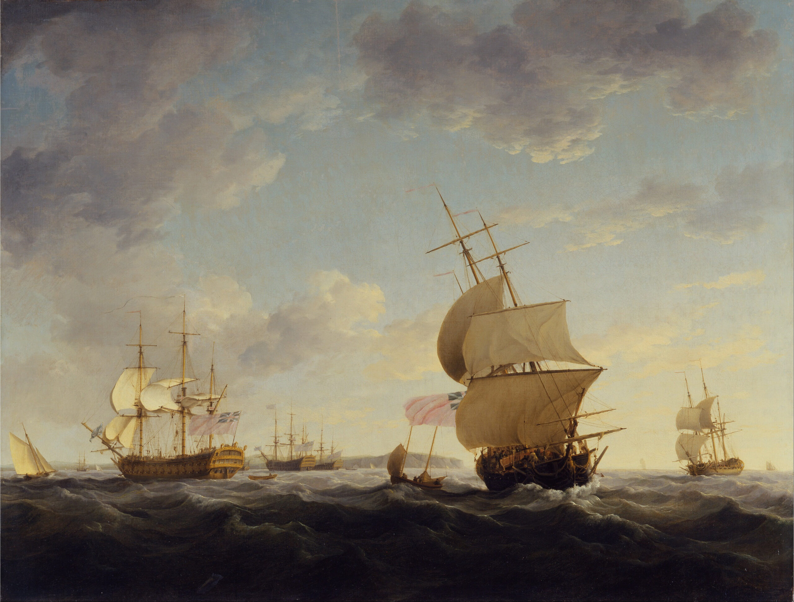
The following image shows one of Brooking’s works, dated from around 1755 and titled “Shipping in the English Channel”:
Tokenhouse Yard is an interesting little street. Built during the reign of Charles I on the site of a house and garden owned by the Earl of Arundel. The name comes from a building in the vicinity where the tokens issued by small traders as a replacement for small value coins, could be exchanged for legal tender
At the far end of Tokenhouse Yard, a small alley leads through the buildings at the end of the street through to Telegraph Street / Copthall Buildings:
Tokenhouse Yard, and the surrounding streets deserve a dedicated post, however the plaque to Charles Brooking at the entrance to the street does provide a reminder of a brilliant marine artist, who captured naval scenes during a couple of decades at the first half of the 18th century.
Also in Lothbury, is the site of the next plaque, to:
Founder’s Hall
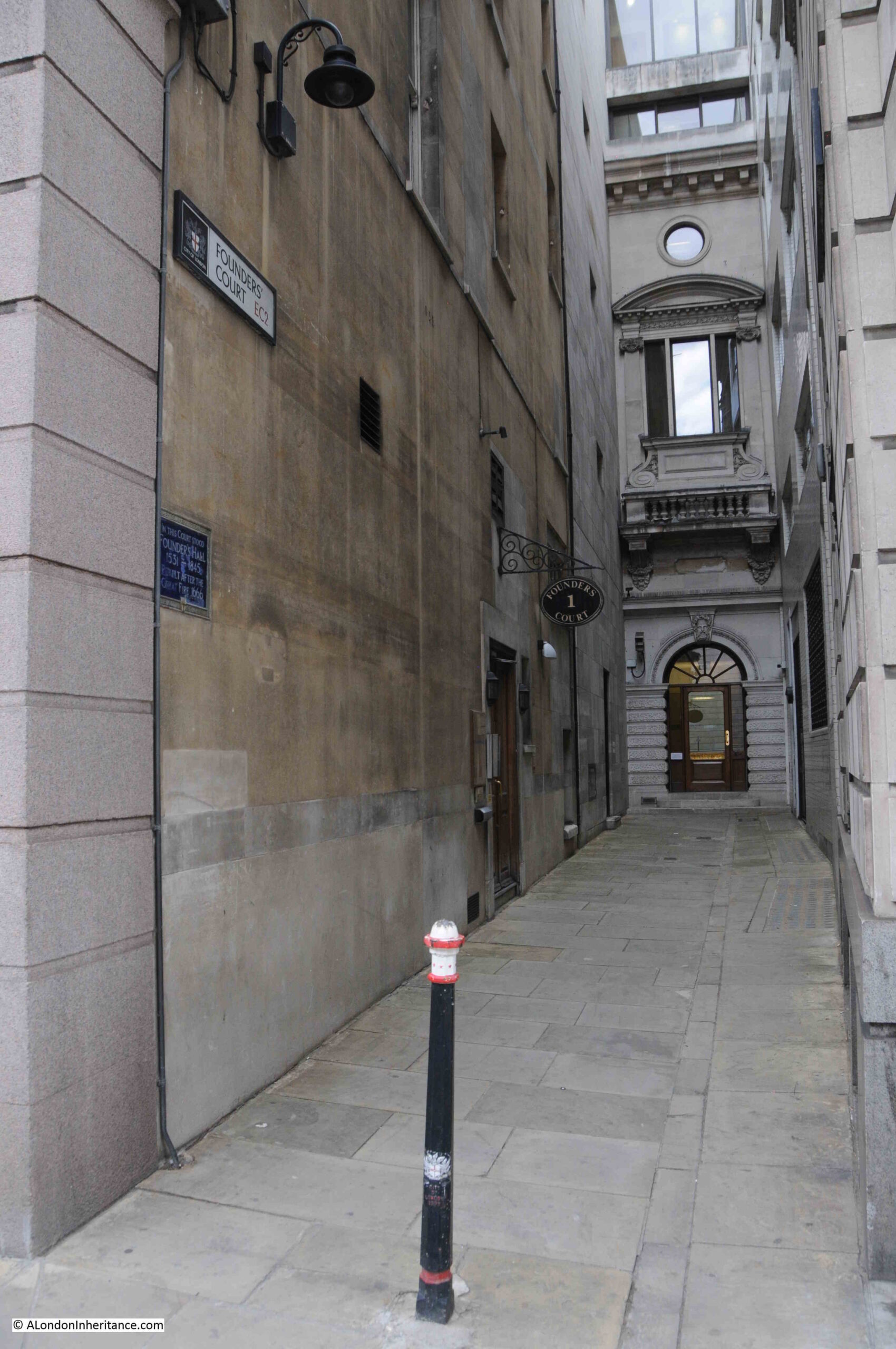
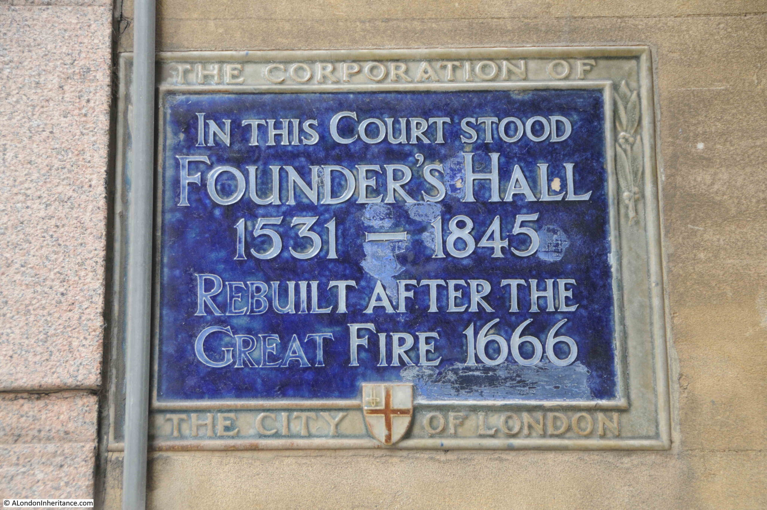
Where Founders Court joins Lothbury there is a plaque recording that Founder’s Hall stood in the Court between 1531 and 1845:
Founder’s Hall was the hall of the Worshipful Company of Founders, one of the old Company’s of the City of London, dating back to 1365, when “In 1365 the men of the mistery of founders presented a petition to the mayor and aldermen stating that some of the mistery made ‘works of false metal and false solder’ and requesting that ordinances be approved to regulate the trade”.
The company may have been in existence prior to 1365, but it is this date which seems to be the accepted date for when the company came into existence, as a company that had powers to regulate aspects of their members trade.
Founders worked in brass, alloys of brass and tin, and produced articles such as candle sticks, stirrups for horses, pots etc. The basic materials of everyday life.
Their hall was built in 1531 when members of the Company purchased a number of houses and a garden in Lothbury, and constructed their hall.
Lothbury seems to have been the location of many who worked in the founders trade. Stow goes so far as to say that the name Lothbury comes from the number of founders who worked along the street, with their noise being found loathsome to those walking on the street, with the street attracting the name of Lothberie.
A Dictionary of London does not place much faith in Stow’s explanation, and suggests that the name comes from “lode” (a cut or drain leading into a large stream), with Lothbury leading over the Walbrook, or more probable the name coming from a personal name of Lod, or Loda.
The area around Lothbury has long been part of London’s populated history, as a Roman tessellated pavement was found opposite Founder’s Court at a depth of 12ft, along with a Roman pavement. Copper bowls were also found nearby at a depth of 10 ft. in wet, boggy soil.
I cannot find much about why the Founder’s vacated Founders Court. I did find a couple of newspaper articles from 1847 which hint at why they moved “TELEGRAPHIC CENTRAL STATION – The whole of the extensive buildings, including Founders Hall and Chapel in Founders Court, Lothbury, fronting the Bank of England, are being demolished, the Electric Telegraph Company having purchased the property for the formation of their central metropolitan station”.
The Electric Telegraph Company had been founded in the previous year, 1846, and was the world’s first public telegraph company.
Prior to the founding of the Electric Telegraph Company, the telegraph as a technology had mainly been used by the railways with wires being strung along railway lines in order to send messages between stations.
The Electric Telegraph Company was formed to offer the technology to potential users across business and the public. The Electric Telegraph Company could be compared with the earliest Internet service providers such as Compuserve, AOL, DELPHI and Earthlink, who took a technology that was used by a limited research and scientific community and opened it up to the wider public.
Some of the earliest users of the Electric Telegraph Company were the newspapers who suddenly had a means of receiving news at almost the instant it was happening. Initial use of this service was reported with some care, for example in a report in 1848, newspapers were detailing news of rebellions in Ireland, and included:
“The Electric Telegraph Company vouched for its arrival in Liverpool. On the whole, therefore, we did not feel justified in refusing to publish it. we inserted it just as it reached us, giving the authority, and at the same time stating that we have received nothing of the sort from our own correspondents”.
This statement from the papers of 1848 is a fascinating foretaste of what was to come, when new technology would continue to grow exponentially, the ability for news to flow in, before any trusted authority had been able to verify the source and factual basis of the news.
The Electric Telegraph Company grew during the following years, and merged with similar companies, eventually becoming part of the Post Office, and today, British Telecom.
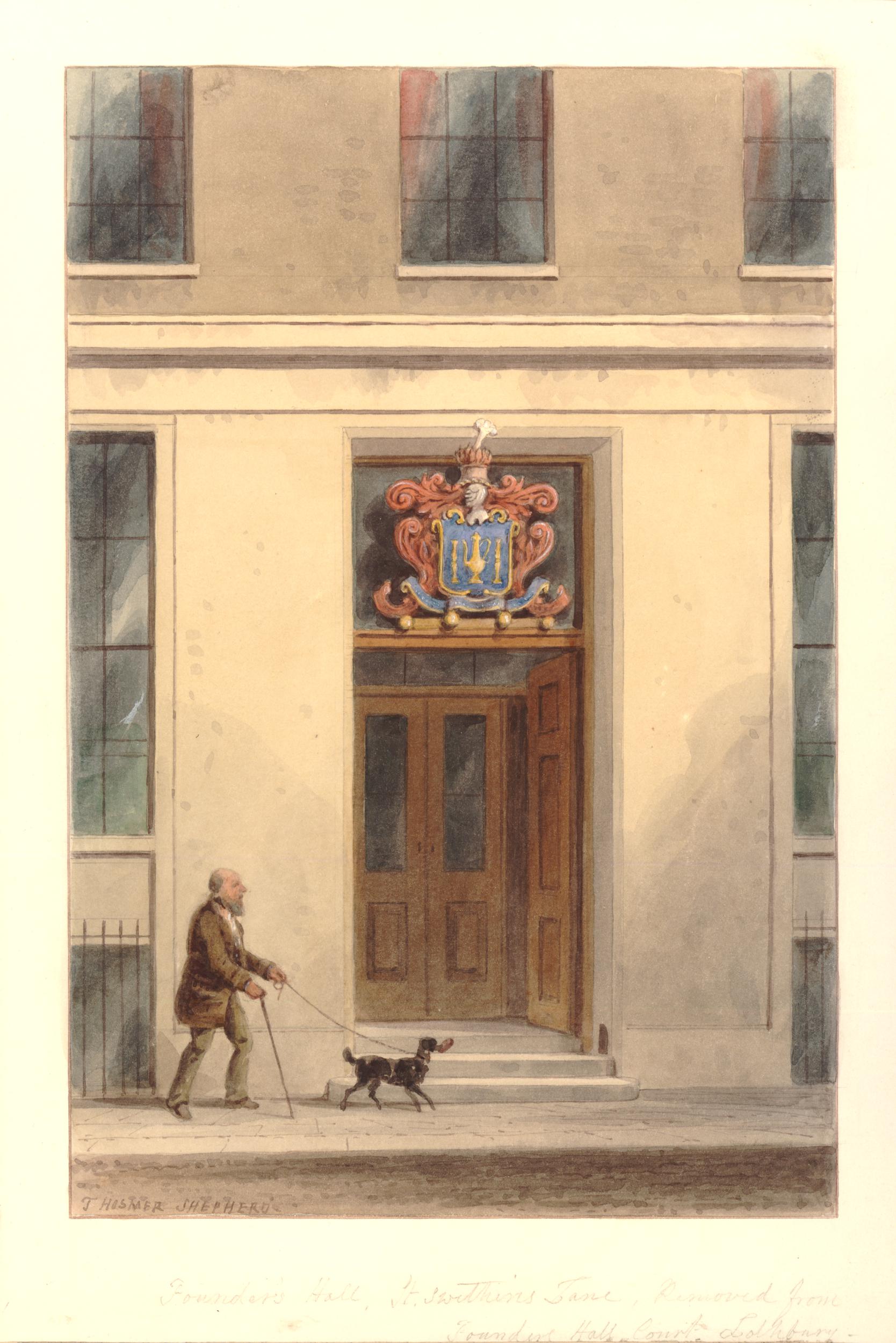
The Founder’s then seem to have moved around a bit. Their next hall was in St Swithin’s Lane, and the current hall, dating from 1987, is located in Cloth Fair, opposite the Hand and Shears pub.
Above the door is the coat of arms of the Founder’s, which consists of two taper candlesticks on either side of a laverpot (a container for filling a washing bowl) – both being examples of the Founder’s art.
Four more plaques which commemorate some of the people that have lived in the City and the buildings that have often been on the streets for centuries, but are now just recorded by a plaque on a wall.
Before heading to Campden Hill, a quick reminder that if you are interested in discovering the history of the New River, New River Head, the Oak Room and Devil’s Conduit, there are a few tickets remaining for a walk by Islington Guides starting this coming week. I will be guiding on a couple of these walks and they can be booked at this link.
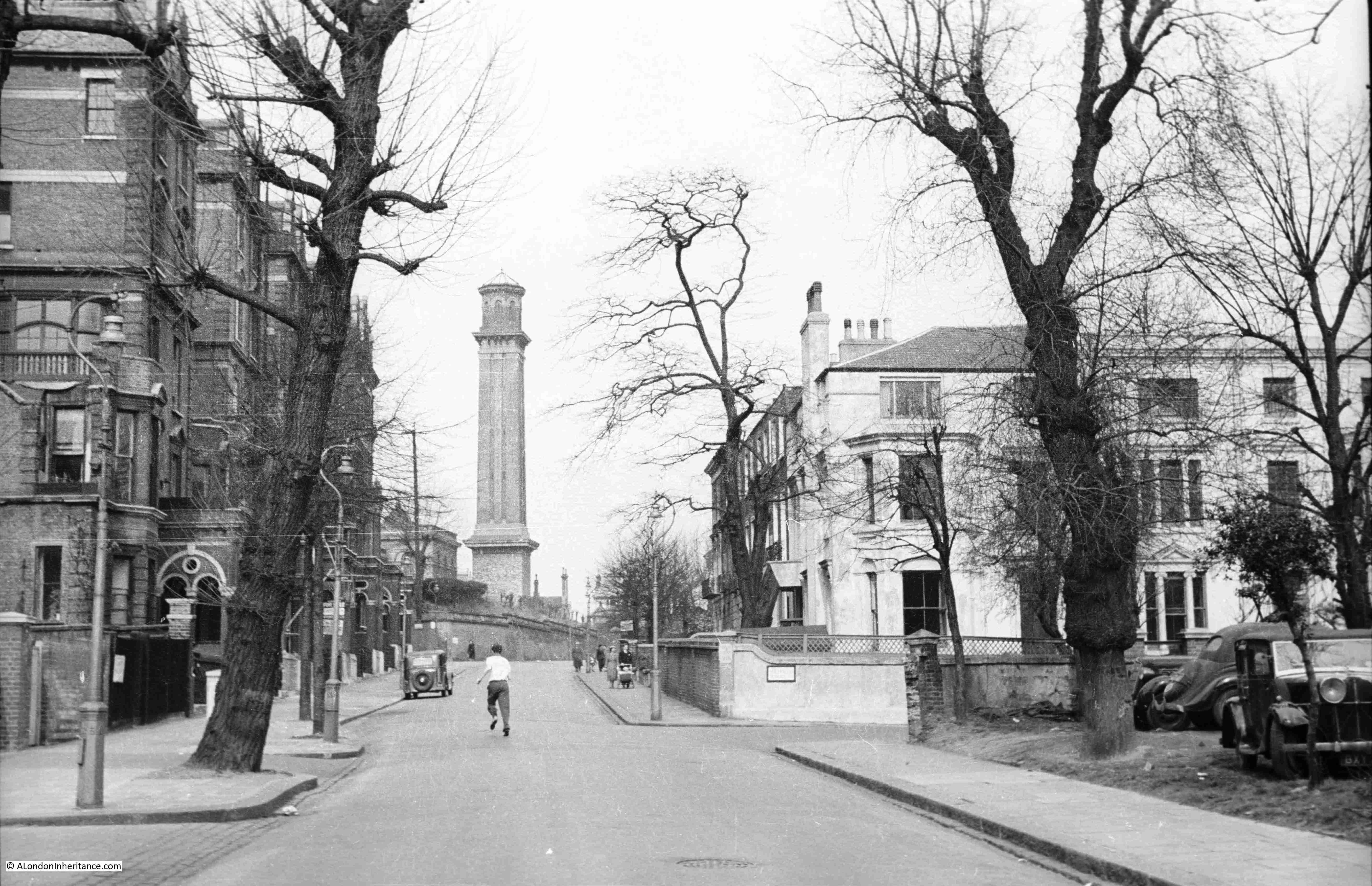
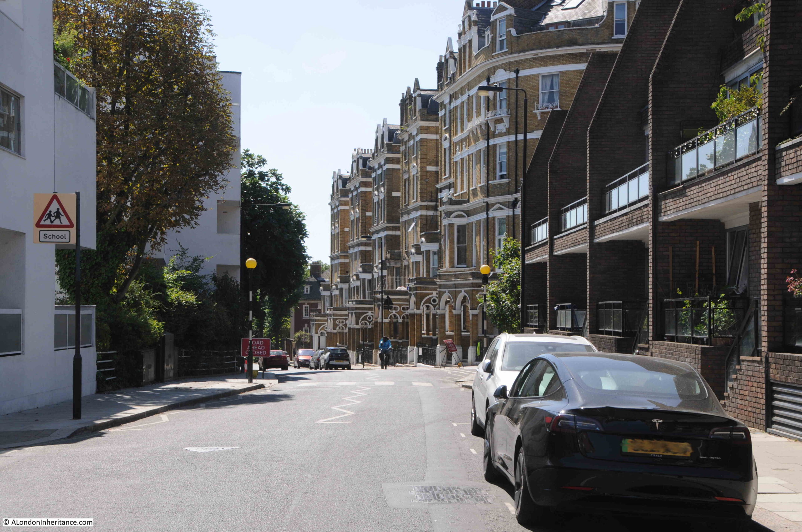
For this week’s post, I am in the area between Kensington Gardens and Holland Park, in Campden Hill Road, looking up the street towards the now demolished water tower as seen in this photo by my father, and dating from 1951:
The same view in August 2022:
The view nearest the camera has hardly changed. The buildings on either side of Campden Hill Road are the same. What has changed is the view in the distance where the water tower once stood is now a development of flats.
The Campden Hill water tower was built as part of the 19th century roll out of water supplies across an expanding London.
The Grand Junction Water Works Company purchased the land at the top of the road in 1843, and built a reservoir. This was followed by a pumping station and the water tower. (I have also read reports that the water works opened in the 1820s on land purchased from the Dowager Marchioness of Lansdowne, and that the water tower was built in 1847).
The water tower is unusual in that it did not hold a water tank. Instead, large pipes ran up the tower, and these would hold water, with the height of the pipes adding to the pressure of water supplied from the location.
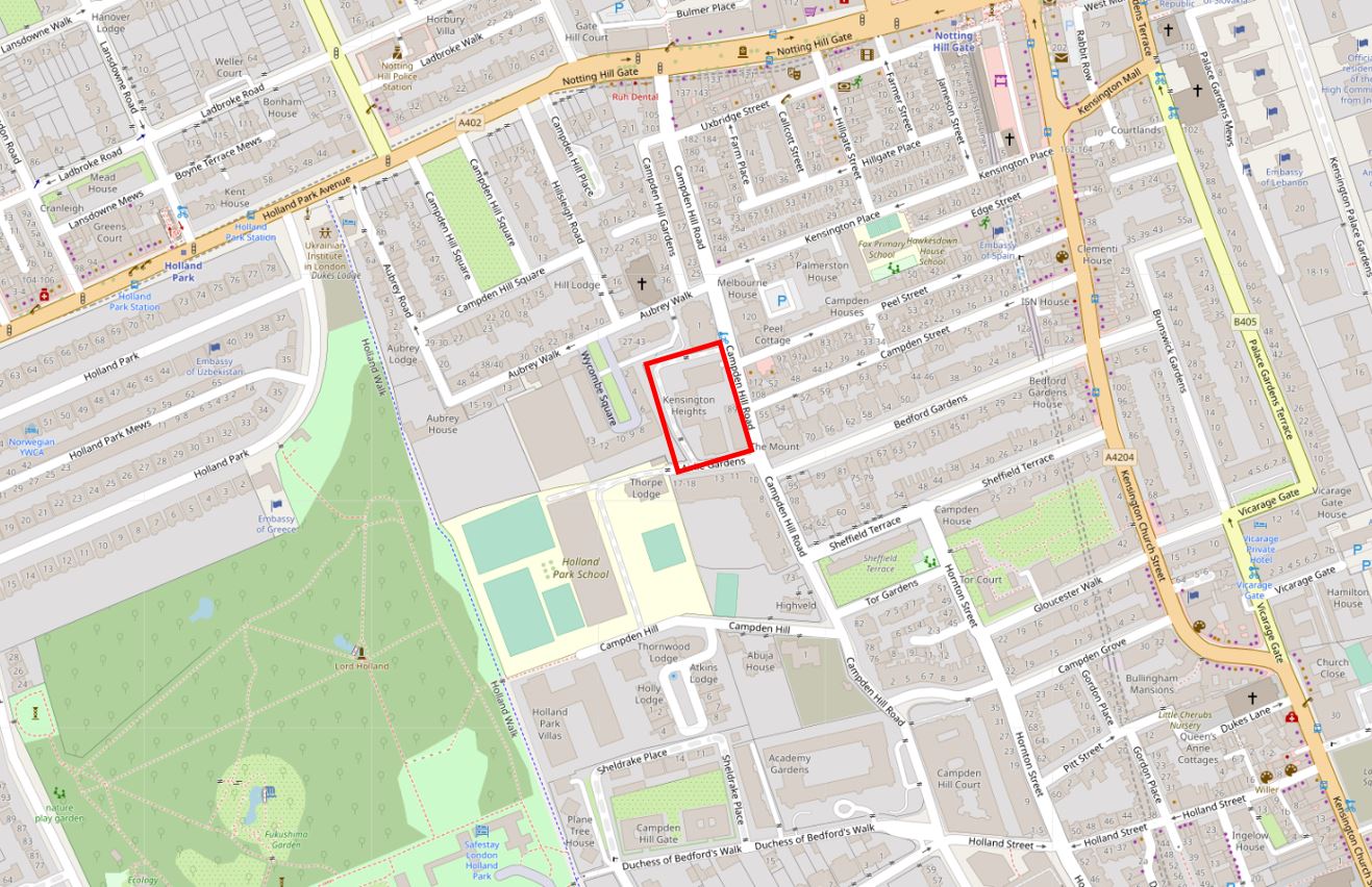
I have shown the location of the water tower, and the associated water supply infrastructure, within the red rectangle in the following map:
The map shows that the water tower was just over half way up Campden Hill Road, but we need to look at another type of map to understand why it was located at this point in Campden Hill Road.
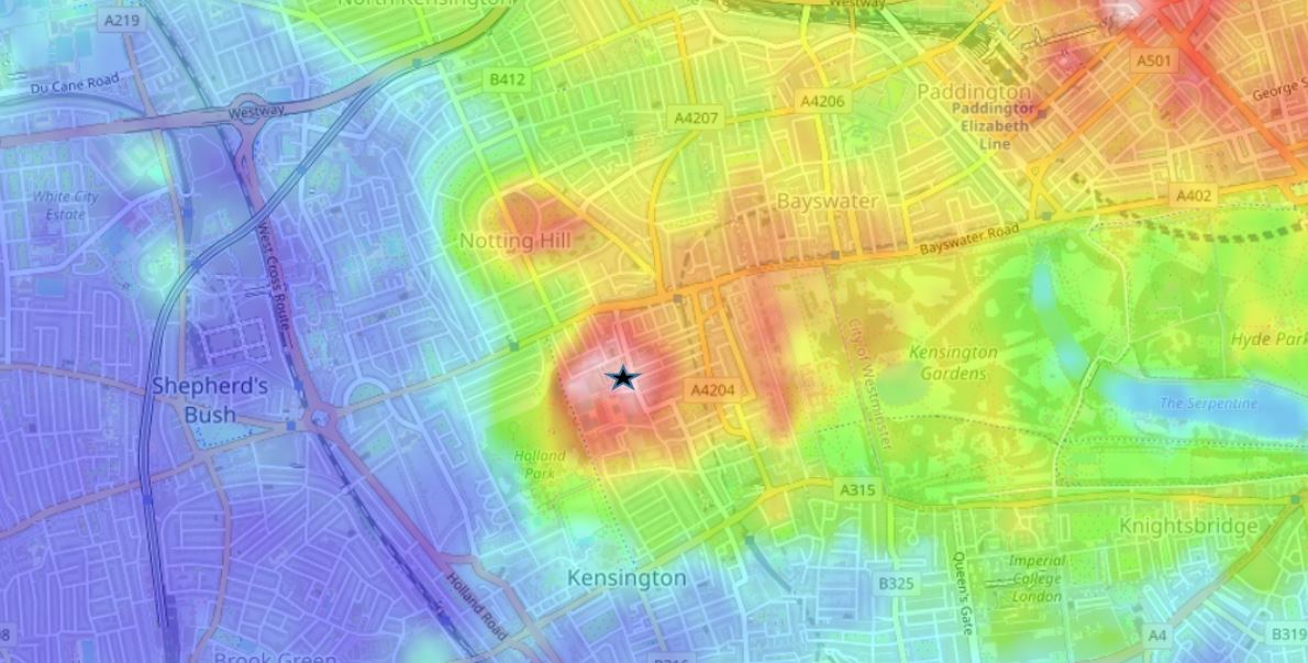
The following map (from the excellent topographic-map.com) shows land height as different colours, with blue as the lowest height, up through green, orange, red and pink as the highest. I have placed a black star symbol at the location of the water tower, and as can be seen by the surrounding colours, this is the highest point in the area, and the natural height of the land would have given a pressure advantage to water from the site, to which the water tower would have added.
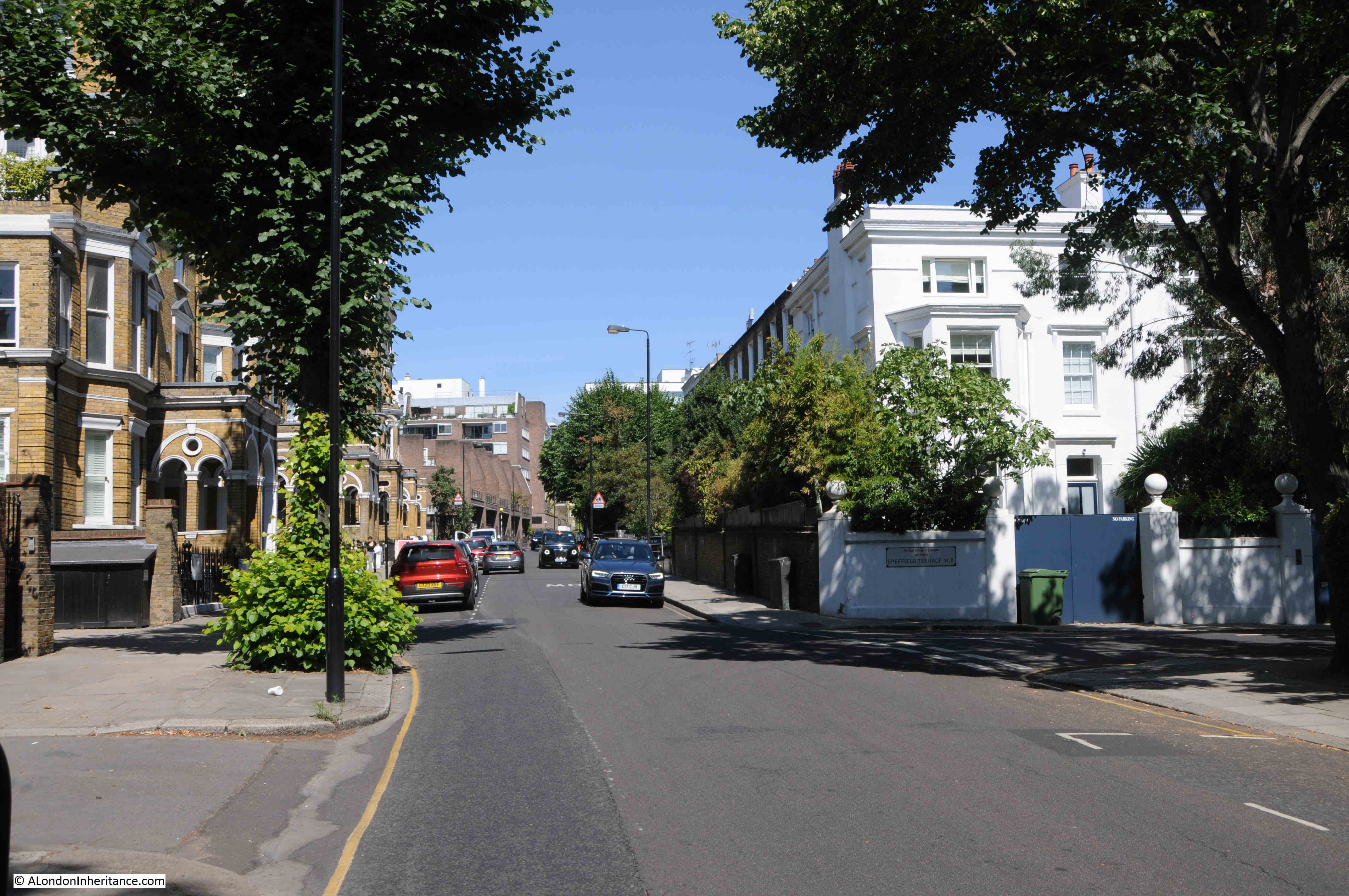
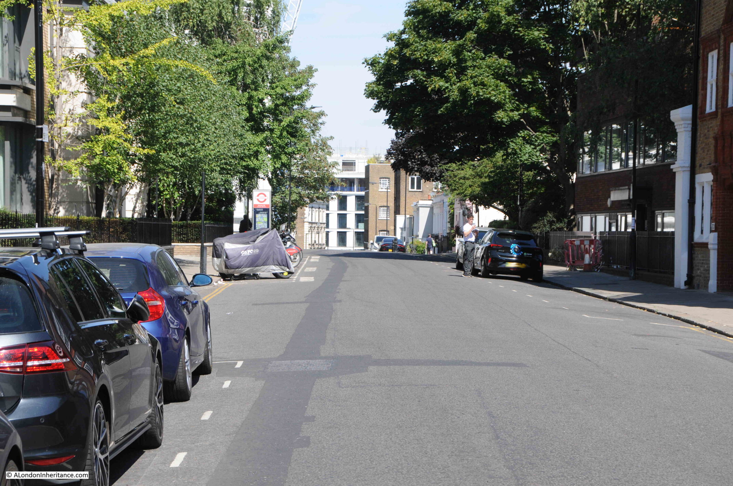
The name of the road – Campden Hill Road – also highlights that the road runs both up and down a hill. Next to the original location of the water tower, we can see the road descending in both directions. Looking north:
And looking south:
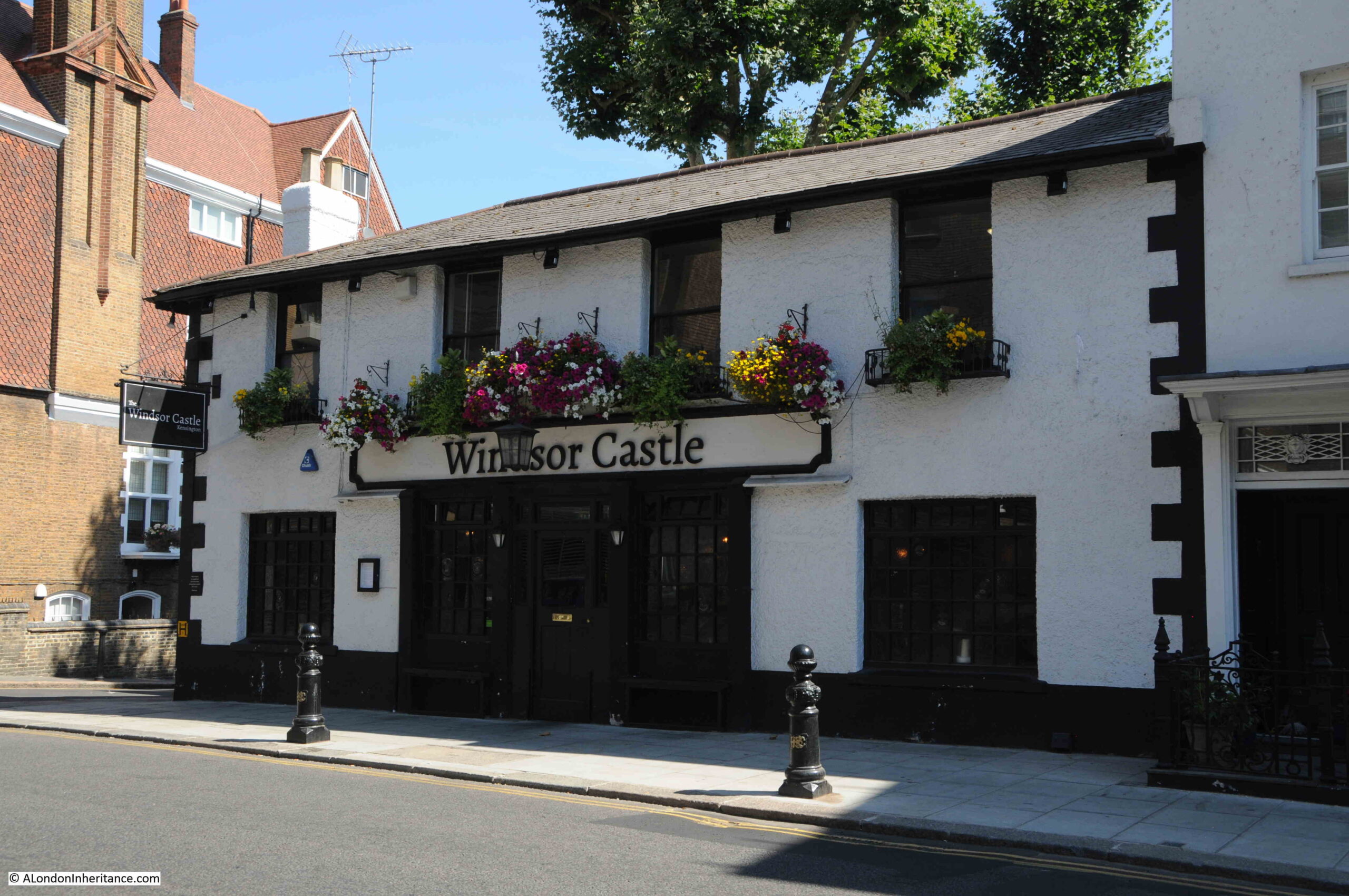
There was a local myth that involved the height of the land where the water tower was located. Almost opposite the location of the water tower is a pub called the Windsor Castle, and the myth was that before the water tower was built, a keen eyed observer could see the real Windsor Castle from this high point, hence the name of the local pub.
This myth was certainly still going into the 1950s when a letter in the Kensington Post disputed that you could have seen the castle from this point, and it was even doubtful that you could see the castle from the top of the tower.
This source of the name is not mentioned on the pub’s website, which does though claim the 1820s as the age of the pub, so it does pre-date the water tower.
The water tower and associated infrastructure became part of the Metropolitan Water Board in 1904 when the MWB took over the assets of the many water companies operating in London, and brought these under the control of a single, London wide, water supplier.
The water tower was last used for the storage of water within it’s pipe in 1943, and was then redundant for a number of years. Plans to demolish the tower started in the early 1050s and in the 28th of March 1952 edition of the Kensington News and West London Times, there was an article with the headline “Goodbye to the Great Grey Tower”. The newspaper had asked local residents how they felt about the loss of the tower and reported that their general reply was that they would “Miss it dreadfully”.
The tower would though remain for many years, and during the 1960s it was leased to Associated Rediffusion who had equipment to relay television signals mounted on the tower.
There were a number of proposals for what would replace the tower throughout the 1960s, many reported in the Kensington Post, who also sent a photographer to take some photos of the view from the top of the tower.
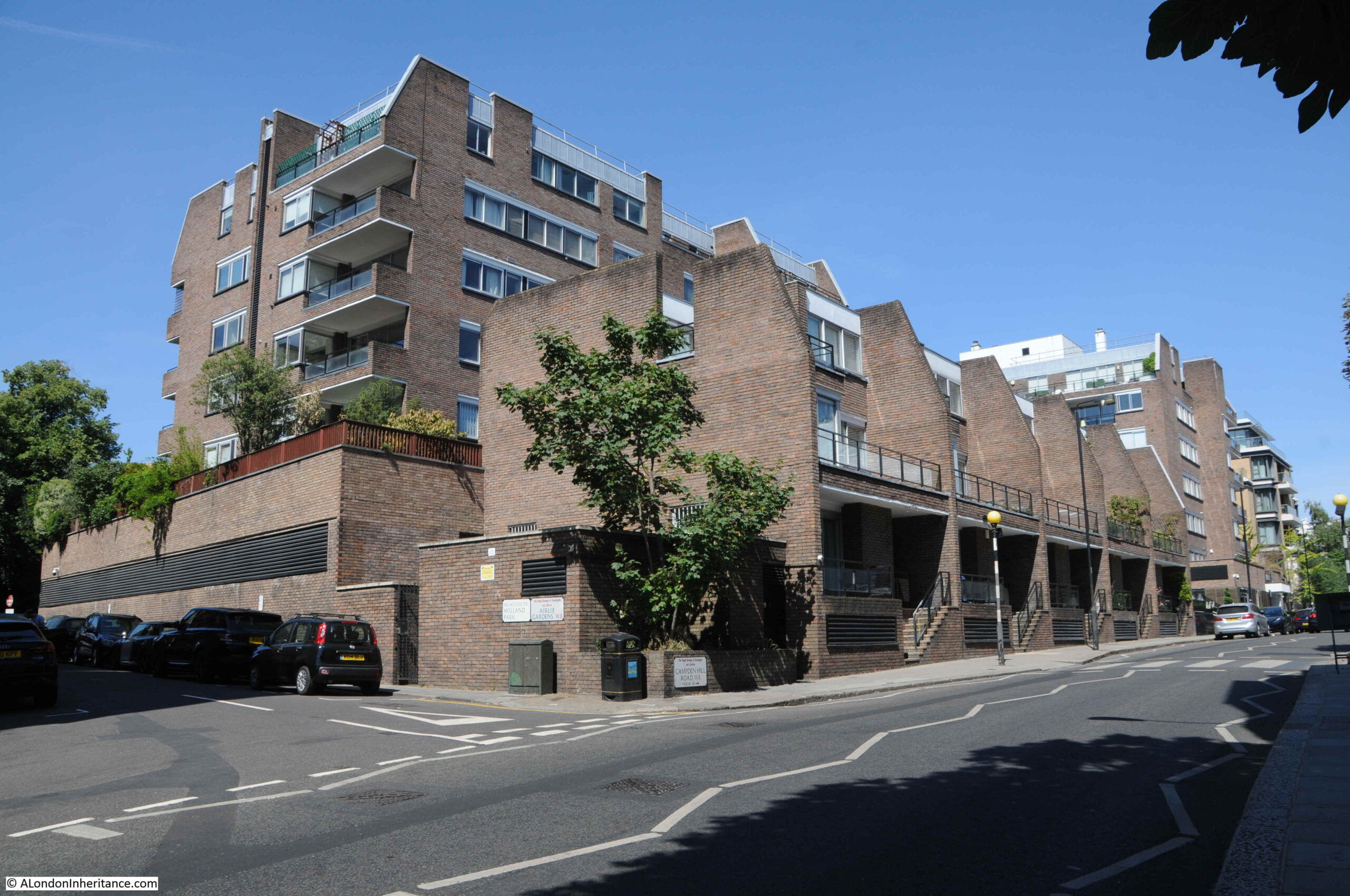
It would finally be demolished in the first months of 1970, and the site of the water tower and associated works is now occupied by the housing seen in the following photo:
As well as being part of London’s water supply, and a local landmark, the Campden Hill water tower is also unique as it is (as far as I know) the only water tower to feature in, and on the cover of a work of literature:
The Napoleon of Notting Hill by G.K. Chesteron is a rather unusual book. Published in 1904, it tells of the story an alternative reality, where the country is ruled over by a randomly selected head of state, one Auberon Quinn who had been a clerk. Quinn decides to turn London into a form of medieval city. One man, Adam Wayne, takes this very seriously, and uses it as a means to support local pride. Wayne even went to the length of setting up a Notting Hill army to fight invaders from other neighbourhoods – hence the title of the Napoleon of Notting Hill.
Theoretically set in a London of the future, the book describes technology and the city as it was when the book was written.
The water tower features many times in the book, including in Chapter Three —The Great Army of South Kensington, where the various forces of different streets and local areas assemble and where battle takes place, for example:
“Morning winked a little wearily at me over the curt edge of Campden Hill and its houseswith their sharp shadows. Under the abrupt black cardboard of the outline, it took some little time to detect colours; but at length I saw a brownish yellow shifting in the obscurity, and I knew that it was the guard of Swindon’s West Kensington army. They are being held as a reserve, and lining the whole ridge above the Bayswater Road. Their camp and their main force is under the great Waterworks Tower on Campden Hill.”
and:
“In the event of your surrendering your arms and dispersing under the superintendence of our forces, these local rights of yours shall be carefully observed. In the event of your not doing so, the Lord High Provost of Notting Hill desires to announce that he hasjust captured the Waterworks Tower, just above you, on Campden Hill, and that within ten minutes from now, that is, on the reception through me of your refusal, he will open the great reservoir and flood the whole valley where you stand in thirty feet of water. God save King Auberon!”
The reason why Chesterton set his book in the area, and uses the water tower as a key feature must be that he was born in Campden Hill on the 29th of May, 1874, so he knew the area very well, and the water tower would have been a very familiar feature.
The Napoleon of Notting Hill is a really strange book, but good to have the Campden Hill water tower recorded in a work of literature.
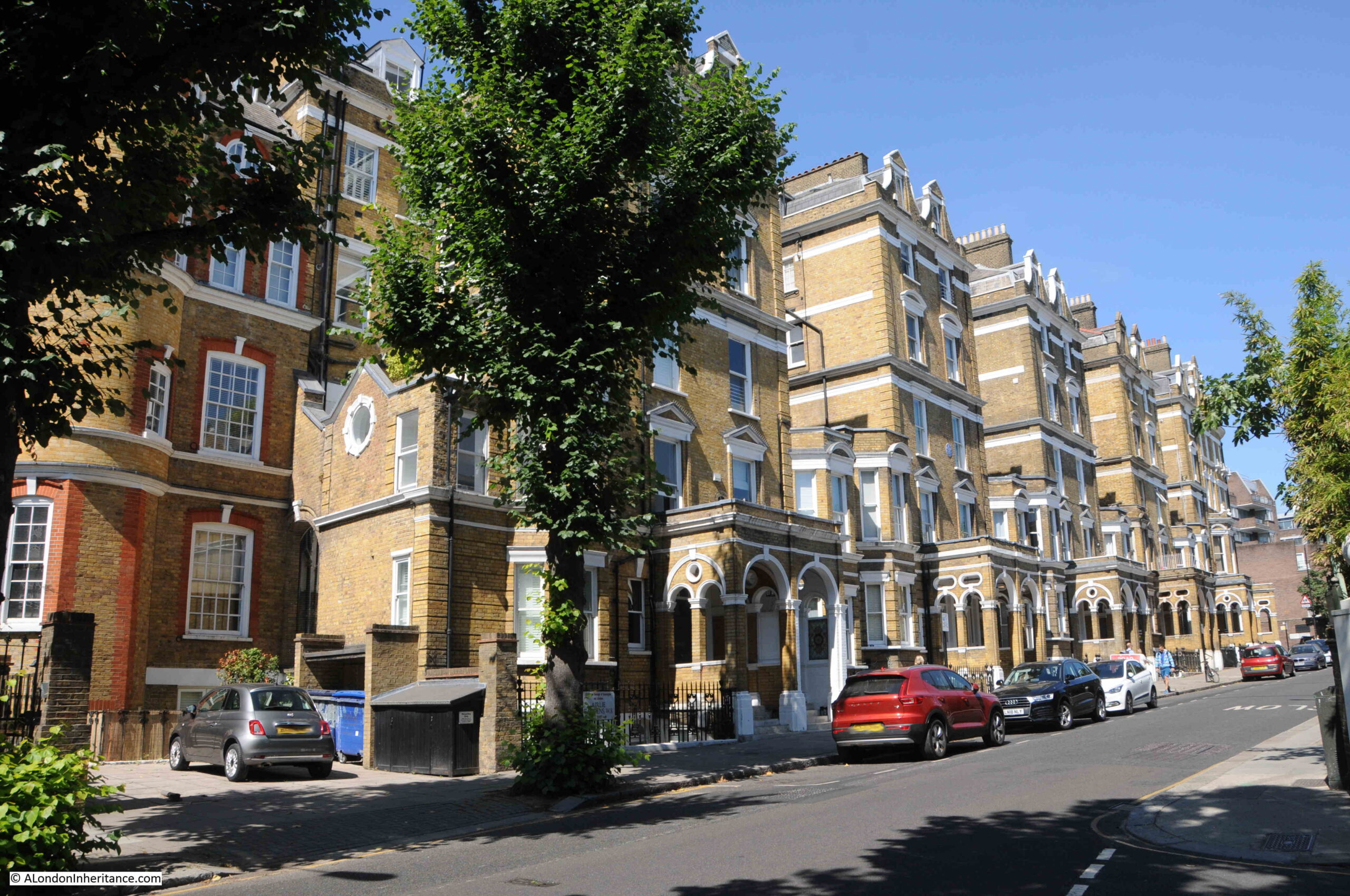
Walking south, down the hill from the location of the water tower is this terrace of large residential buildings:
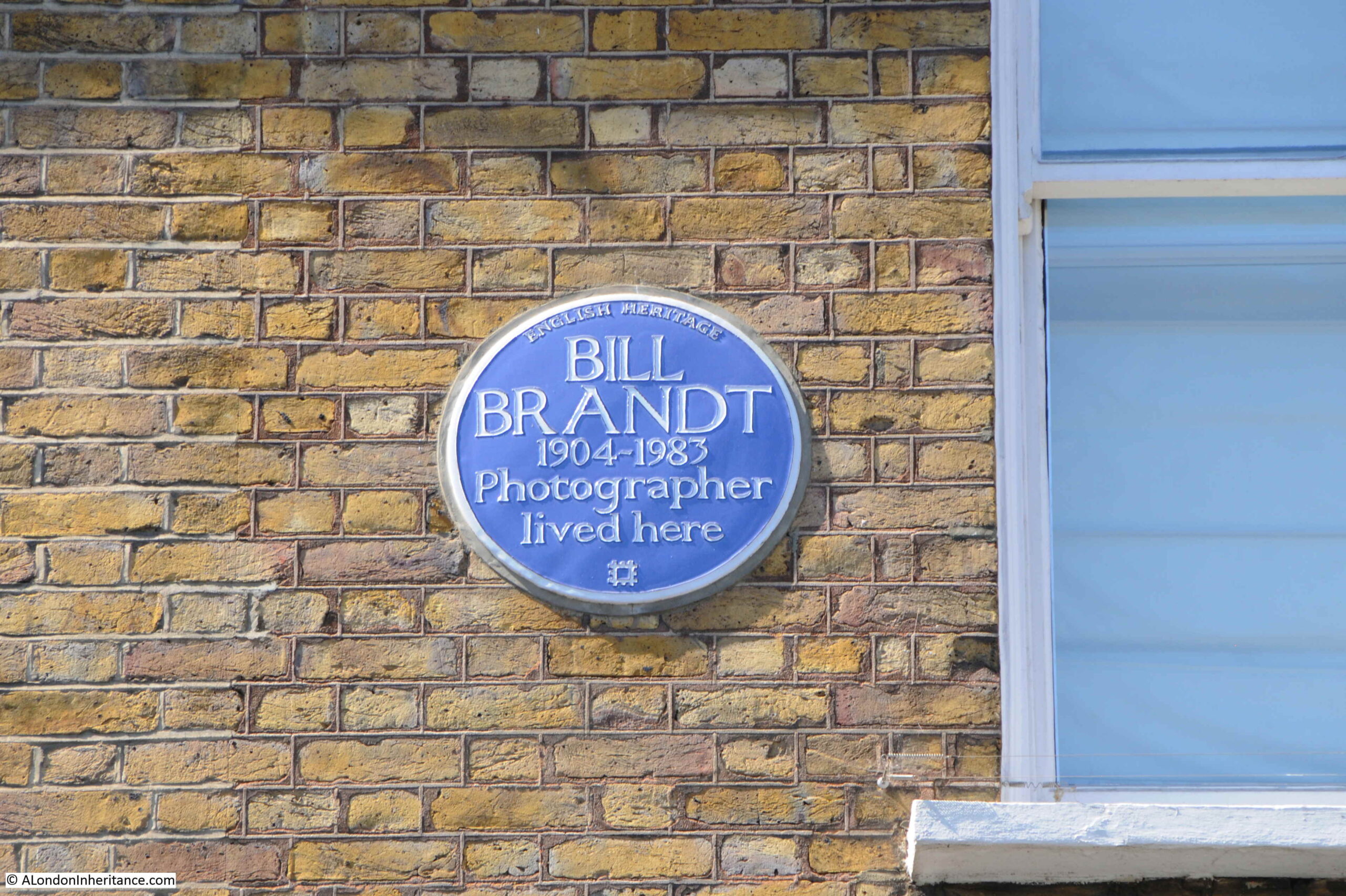
One of which has a blue plaque recording that the photographer Bill Brandt lived here:
I felt rather guilty taking the photo of Bill Brandt’s plaque on a modern digital camera, when I should have been using my father’s old Leica film camera.
Brandt was a master of film photography. Born in Germany in 1904, he moved to London in 1933, and would spend the rest of his life in the city until his death in 1983.
I have no idea when, and for how long he lived in Campden Hill Road, however a number of his photographs were taken inside the building, many of which date around the 1940s, so he was there for some of that decade.
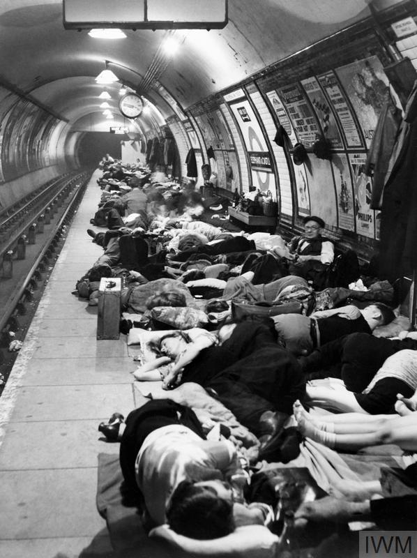
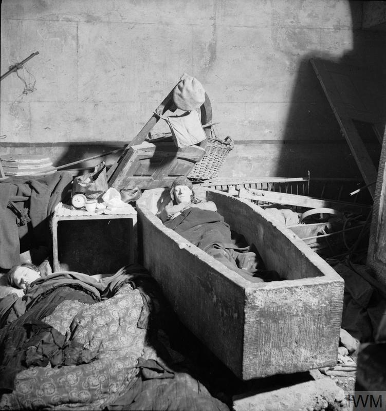
Brandt took a series of photos of London during the war, and his photos of the Underground being used as air raid shelters have become representative of that period in London’s history. Many of his wartime photos of London are in the collection of the Imperial War Museum:
Continuing on down Campden Hill Road, and the area around the road is full of interesting architecture and plenty of history and interesting characters. I cannot cover everything I would like to in the space of a weekly post, so I will pick one small street which has plenty of interesting stories to tell.
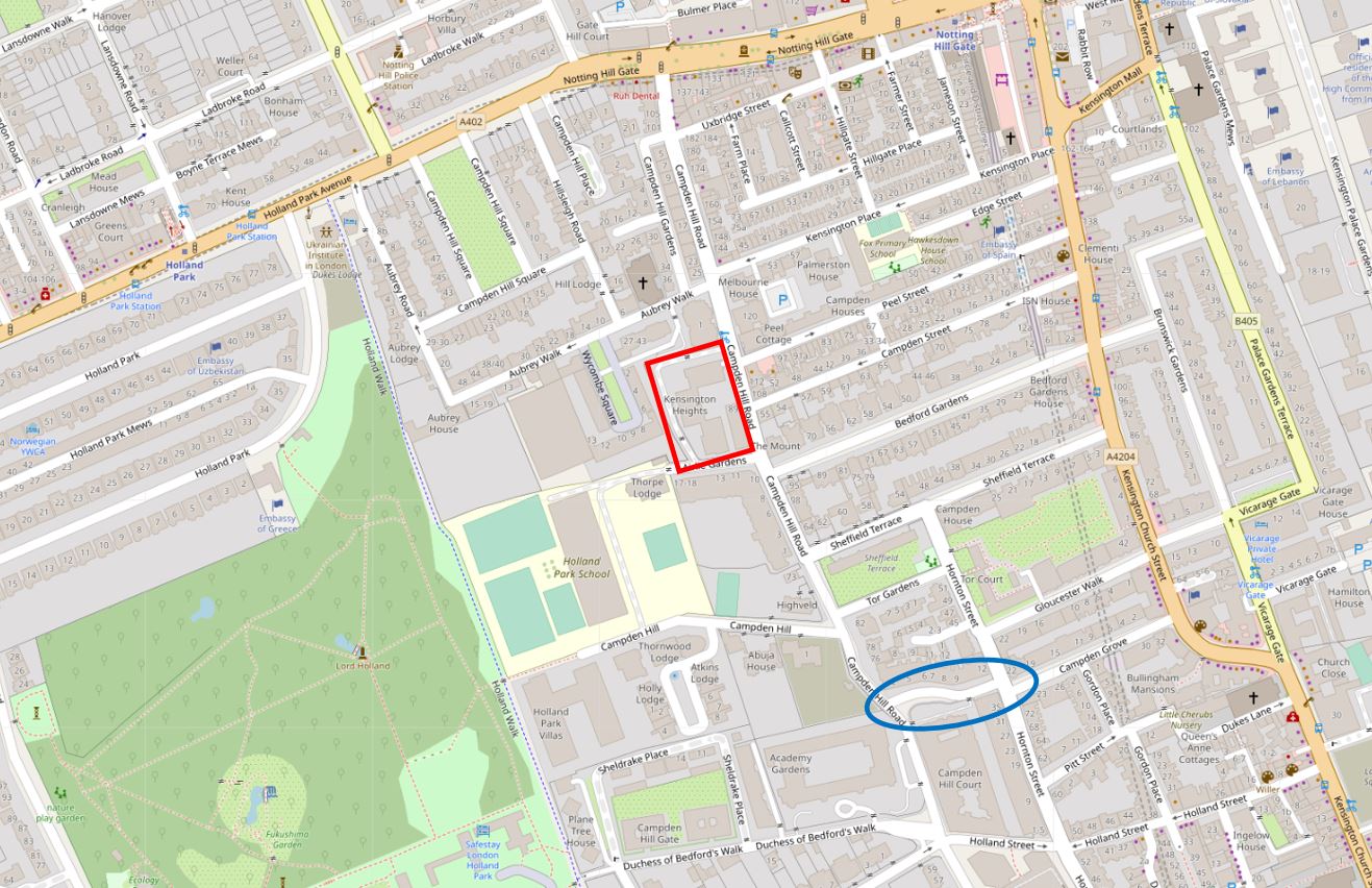
In the map below, I have put a blue oval around Observatory Gardens, a small street that leads from Campden Hill Road to Hornton Street:
I will come on to the origin of the name Observatory Gardens, however lets have a look at the buildings first.
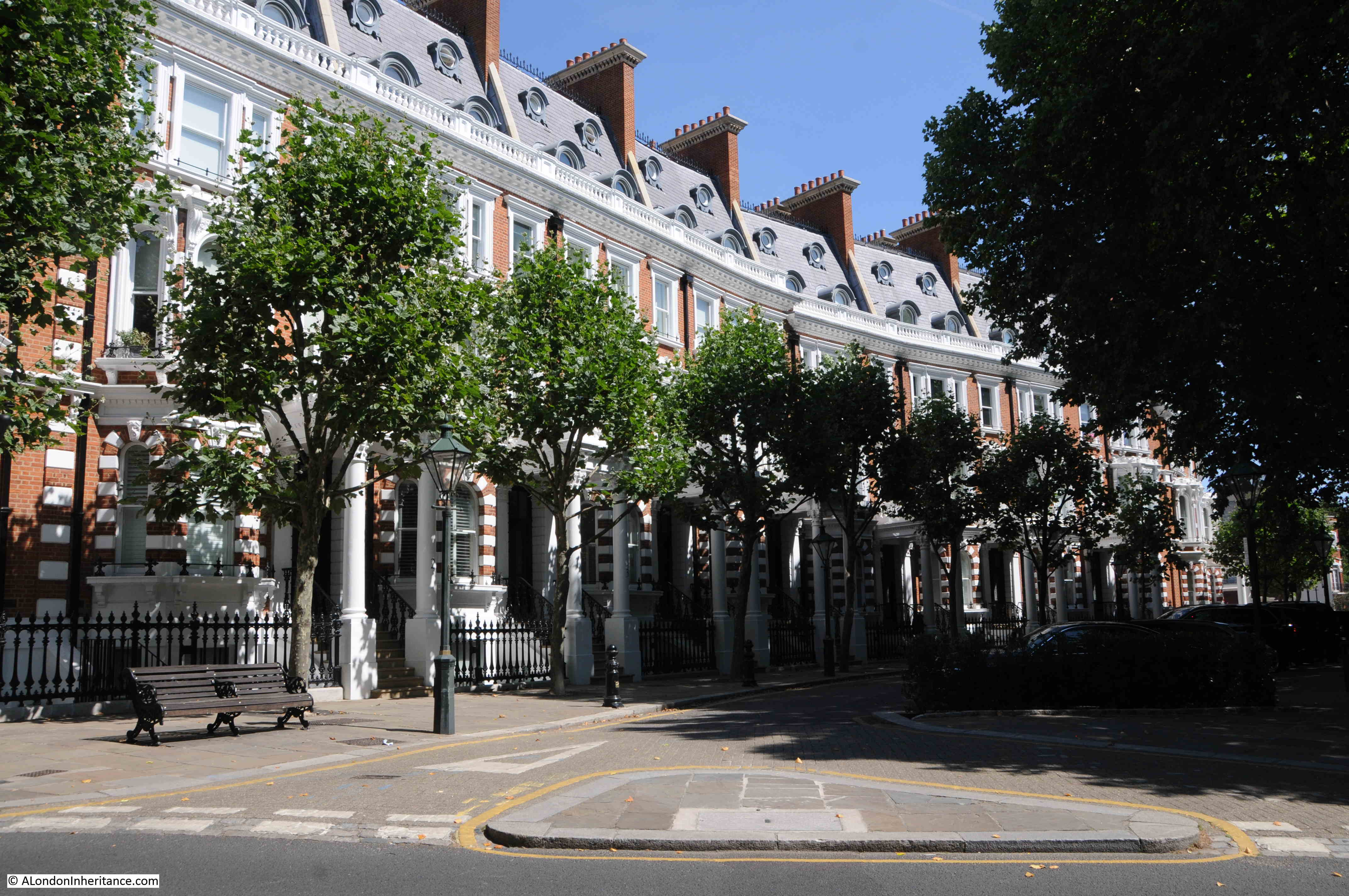
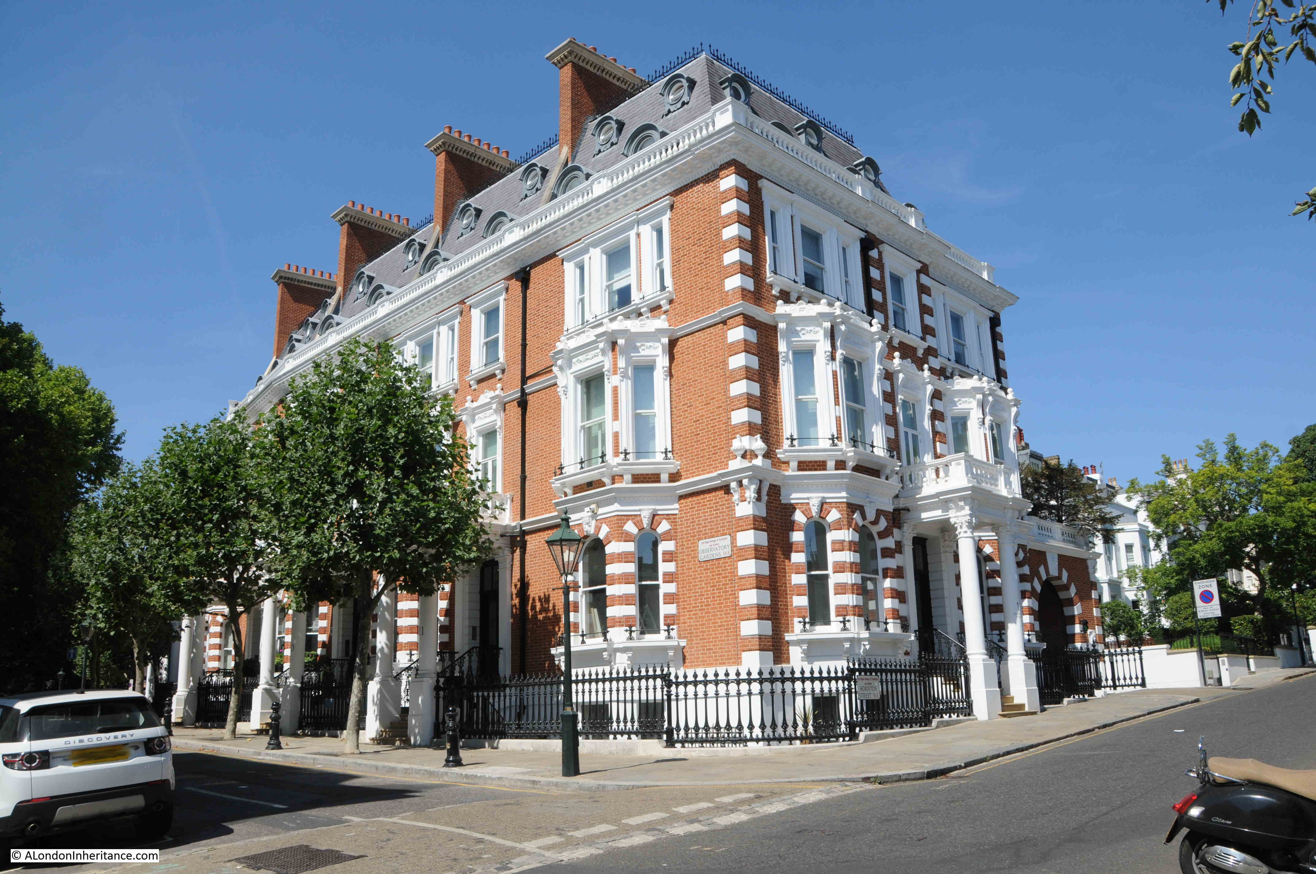
Along the northern side of Observatory Gardens is a continuous terrace of brick houses with white painted detailing.
By 1870, the land now occupied by Observatory Gardens had been purchased by Thomas Cawley, a local south Kensington builder. He subcontracted the construction of the street, however his subcontractors went bankrupt, so Cawley completed the work himself, and the street was finished in 1883.
The street suffered some severe damage during the last war when a German bomber crashed into Campden Hill Road, having taken off a large roof in Observatory Gardens, and the crater in the street causing additional damage. A report in the West London Observer on Friday the 18th of April 1941 tells the story:
“London experienced one of the heaviest raids of the War during Wednesday night and early Thursday morning and numerous heavy, high-explosive missiles as well as thousands of incendiary bombs were dropped. Damage was on a large scale and many people were killed.
The German radio yesterday (Thursday) declared that the raid was the heaviest ever on London and the biggest raid of the War, and that 100,000 fire bombs were showered down.
On Thursday morning thousand of Londoners made their way to work over hose-pipes and broken glass, while firemen, begrimed and exhausted, still dealt with the smoldering ruins. Many had to make extensive detours to reach their place of business and thousands found their offices and shops bombed out when they got there.
Altogether five Nazi planes were brought down, one of which crashed in Campden Hill Road, a turning off Kensington High street. Actually the plane hit the roof of a large house in Observatory Gardens before crashing into the roadway about 50-feet away. Bombs from the plane must have crashed into the road in front of this house as there is a very large crater.
The German plane finally came to rest by the side of a large Hostel, part of the University of London.
At the controls was a dead pilot. No traces of other members of the crew could be found, so it is assumed that they had jumped. Later the bodies of two Nazi airmen were discovered in the locality, badly mutilated.
Residents at Campden Hill Road heard the whistle of the approaching aircraft before it crashed. There was no engine noise. Wardens say that it was not on fire.
The bomber touched chimney pots and then disintegrated in small pieces. Its heavier parts, one of the engines and two propellers, landed on the top of a block of flats where some Maltese evacuees were billeted.
An oil tank burst at the same time, and two rooms of the top floors of the flats, which were being used for bedding and linen, caught fire.
During the day, thousands of people passed the spot to see the scattered remains of the bomber. By the afternoon there was little to see as army lorries had conveyed the debris to one of the various scrap bases set aside for this purpose.”
Observatory Gardens was left badly damaged by the crash of the bomber, and as with so many streets across London, the street would not recover for a couple of decades.
In the years after the war, Observatory Gardens became very run down, and it was not until the 1990s that the street we see today emerged. Whilst the exterior of the buildings were restored, much of the interior of the buildings appears to have been considerably rebuilt.
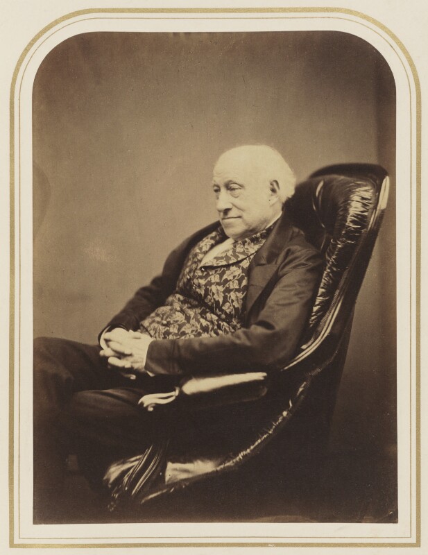
Before Thomas Cawley purchased the land and developed Observatory Gardens, the land was owned by Sir James South, a fascinating character who made astronomical discoveries and also appears to have spent a fair amount of time in the courts.
Sir James South purchased a house and land in 1827 from the Phillimore family, and set about building an astronomical observatory in the grounds.
He started a career as a surgeon in Southwark, and there established an observatory in Blackman Street. He worked with the astronomer John Herschel on the observation of double stars, but he was often difficult to work with, and was frequently drunk.
Despite this, he became President of the Astronomical Society in 1829, but after arguments with a number of Fellows, his involvement with what would become the Royal Astronomical Society faded.
He continued his observations from his house on the land that is now Observatory Gardens, and got involved in a number of disputes with the council who were proposing to extend Camden Hill Road. He believed that the vibrations from traffic on the extended road would impact his telescopes and his observations.
His legal disputes were not just about issues that threatened his observations, he would take legal action on many issues that he daily encountered. One was in 1855 when he took a conductor of a Paddington omnibus to court for deceiving him.
South had apparently hailed the omnibus near King’s Cross and had asked the conductor if it was the Royal Oak omnibus. The conductor confirmed that it was, so South boarded.
The bus continued to Chapel Street by when all the passengers had left the bus, with the exception of South. The conductor stated that the bus would not be going any further than the next stop, and South got into an argument with the conductor regarding the destination of the bus, and that the conductor had informed South that it would go to Royal Oak.
At court, the conductor denied that he had told South the omnibus was going to Royal Oak, stated that South had got on the bus without speaking. Despite this, the court sided with Sir James South and convicted the conductor with a penalty of 20 shillings plus costs.
Whatever the truth of the matter, the case of Sir James South and the conductor of an Omnibus shows that South would take an issue to court no matter how trivial it was, and with the unequal resources and reputation of an omnibus conductor and Sir James South.
Sir James South:
The Illustrated Times published an obituary for Sir James South on the 26th October, 1867:
“We have to announce the death of Sir James South, F.R.S. at an advanced age. He wasthe son of a dispensing druggist, who towards the close of the last century carried on in business in Blackman-street, Borough; but James South entered upon a higher branch of the medical profession, and became a member of the Royal College of Surgeons. For some years he practiced his profession in Southwark, and in the intervals in business pursued the study of astronomy, in connection with which he made some extremely valuable observations. In 1822 and 1823, in conjunction with Sir John Herschel, he compiled a catalogue of 380 double stars.
After this he removed to Campden-hill, Kensington, where he constructed an observatory, to which he devoted the closest attention during the remainder of his life, and which has achieved European fame. He was one of the founders of the Royal Astronomical Society, and was for a time its president. In 1830, on the recommendation of the Duke of Wellington, who was then prime Minister, he received the honour of knighthood, and for several years past he has enjoyed a pension of £300 a year on the Civil List for his contributions to astronomical science.
The account of Sir James South’s astronomical observations during his residence in Southwark is published in the Philosophical Transactions for 1825, and is accompanied by a description of the 5 foot and 7 foot equatorials with which they were made. one of these instruments is still mounted and in excellent condition at the Campden-hill Observatory. There are also in the observatory a 7 foot transit instrument, and a 4 foot transit circle. Sir James South was born in 1785.”
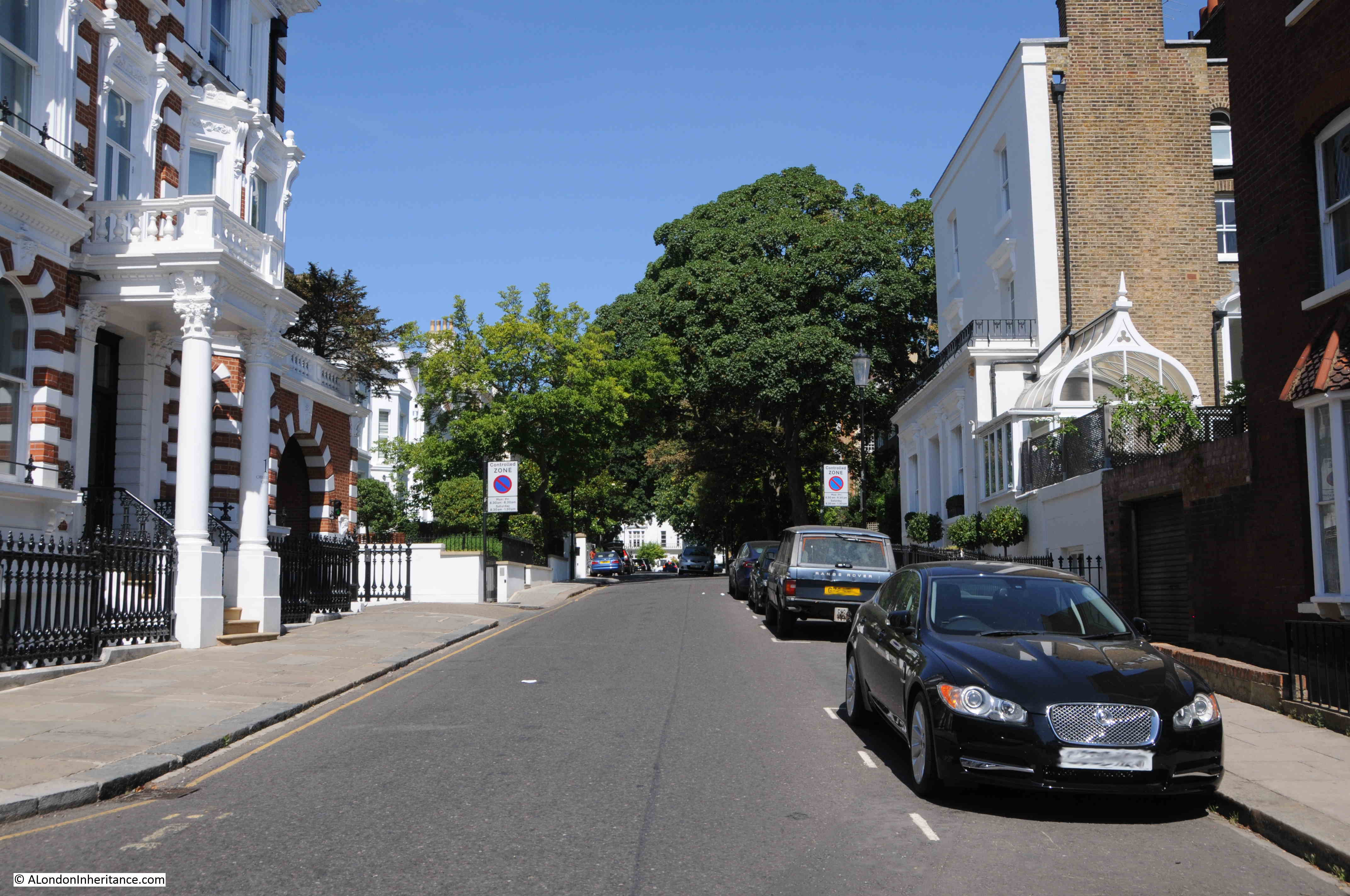
The street name Observatory Gardens is therefore named after Sir James South’s observatory that once occupied the land. The following photos shows the end of Observatory Gardens, where the street meets Hornton Street:
One of the newspaper reports I read about the water tower is that the arrival of the Grand Junction Water Works Company, and the resulting reliable supply of water, was one of the reasons why the area developed rapidly during the first half of the 19th century, and that much of that development was of large, ornate, houses.
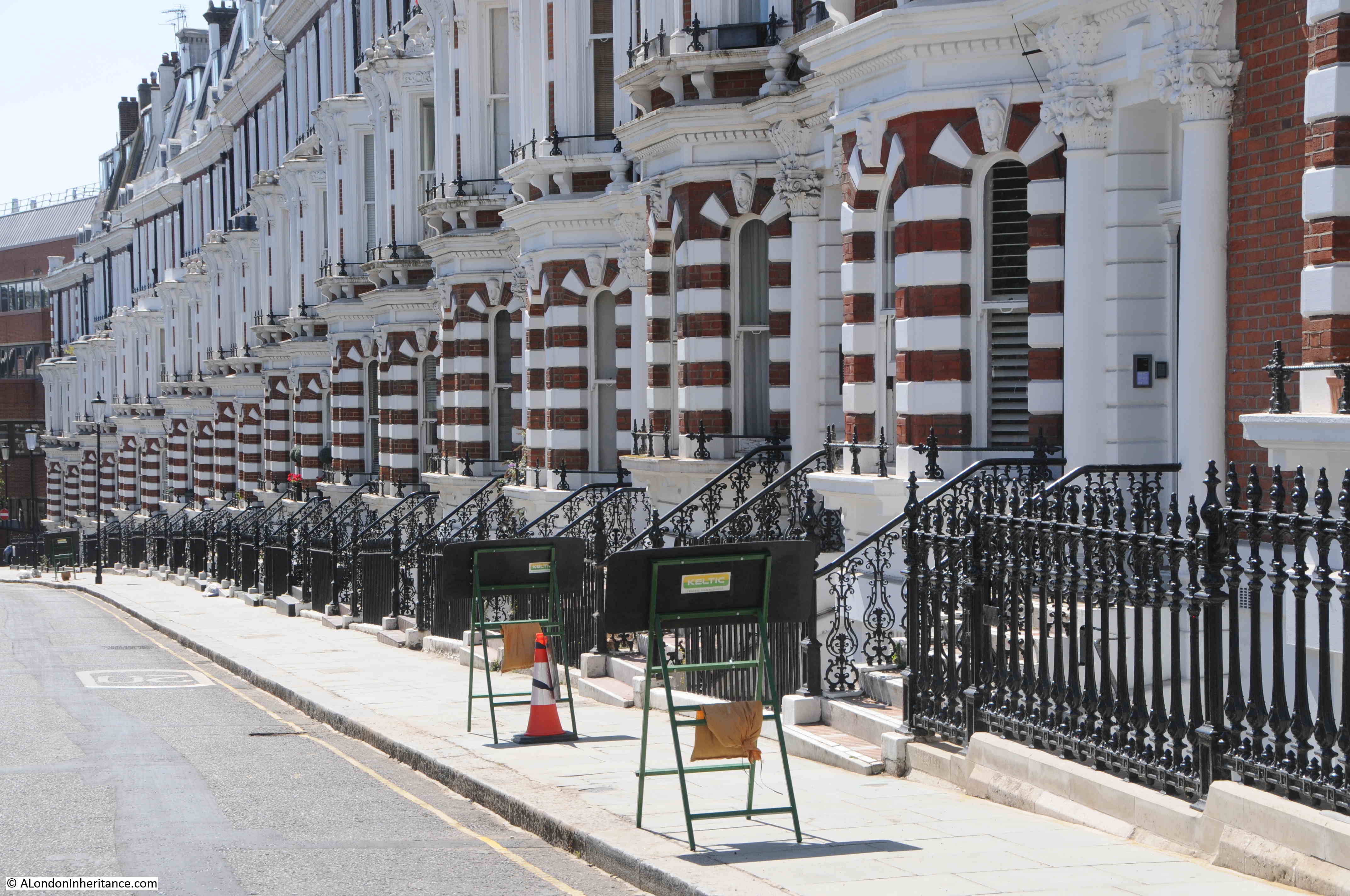
At the eastern end of Observatory Gardens is Hornton Street, and this is the view looking north – of many of those large, ornate, houses:
And the view looking south, as the hill which gave the area its name continues to descend towards Kensington High Street. Lots more red brick and white decoration:
One thing I realised as I get towards the end of the post is that I have not explained the origin of the name Campden Hill. The Hill element obviously comes from the hill on which the area is built, and that resulted in the water tower being built here. Campden came from Campden House, a large house that was built here by Baptist Hicks, 1st Viscount Campden in the 17th century. The Camden in his title came from Chipping Campden in the County of Gloucester.
In the 19th century and much of the 20th century, there was a considerable amount of infrastructure supporting the provision of water, gas and electricity across London. As with the Campden Hill water tower, so much of this has disappeared, as the technologies used to distribute these services has changed.
Campden Hill is a fascinating area to explore, and I hope this post has provided an indication of what can be discovered across some of the streets.