Category Archives: London Villages

Vale of Health

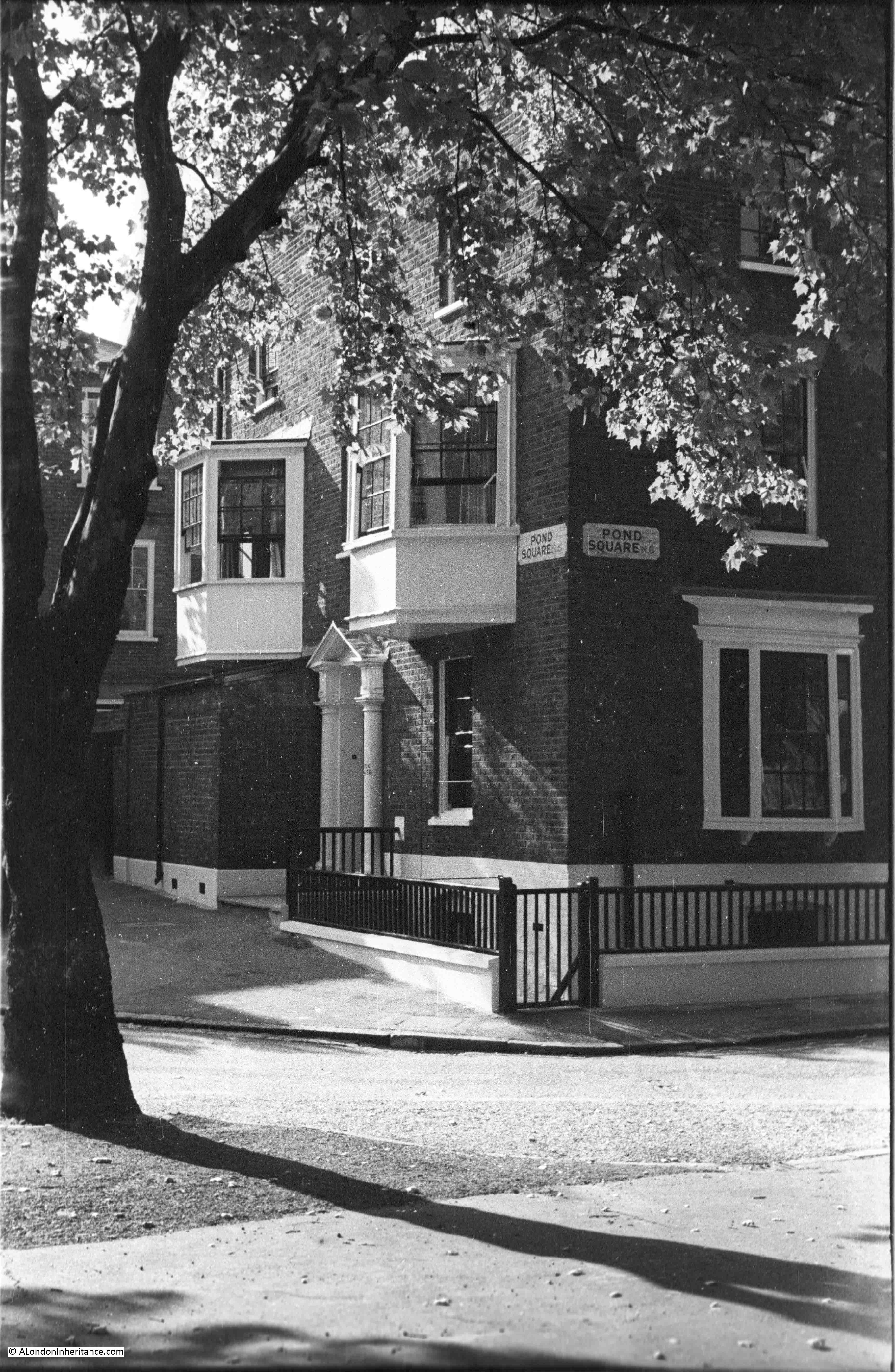
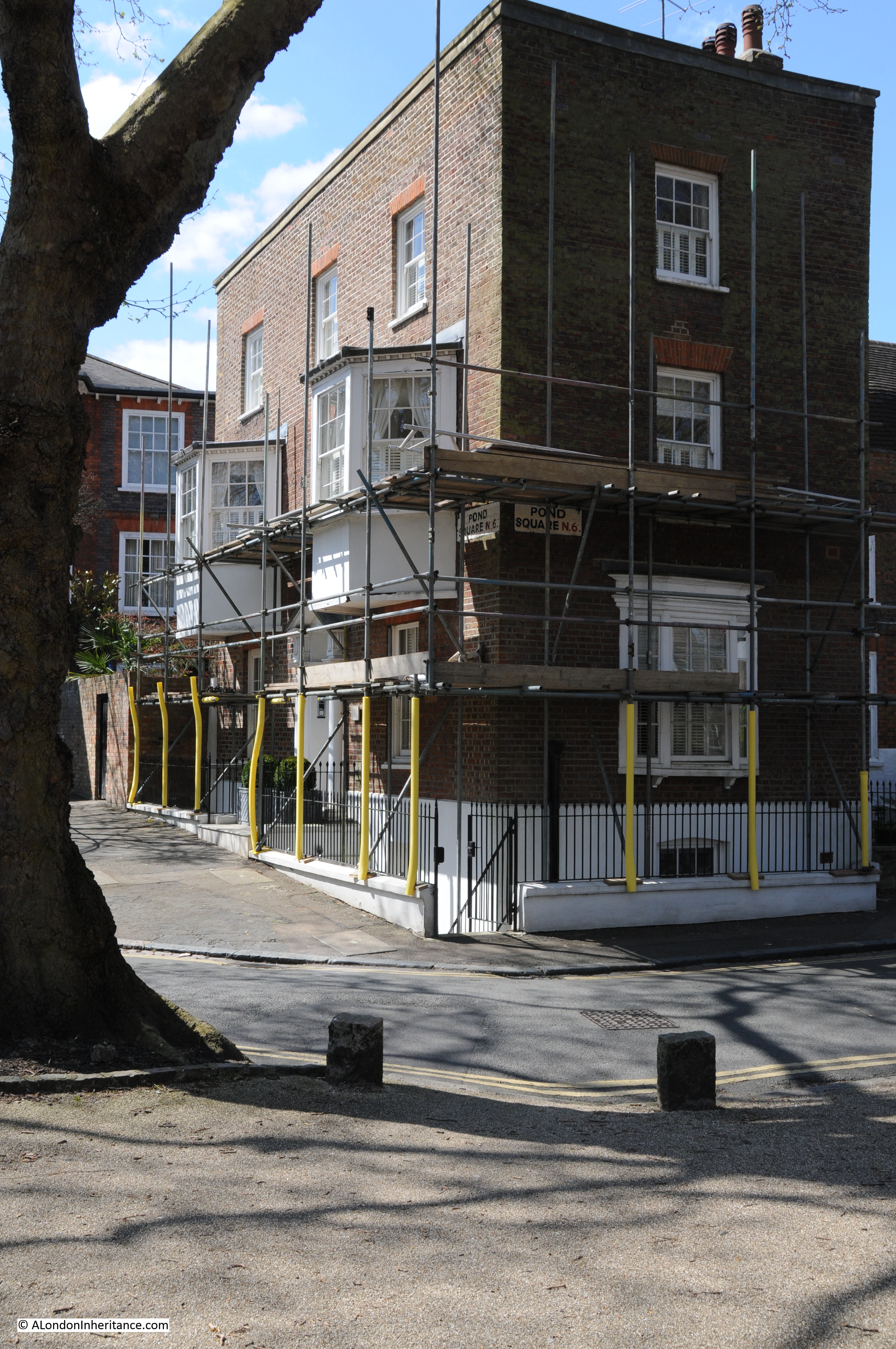
The Vale of Health is a rather unique place. To the north of Hampstead, the Vale of Health is a small enclave, surrounded on all sides by the heath and accessible only via a single road.

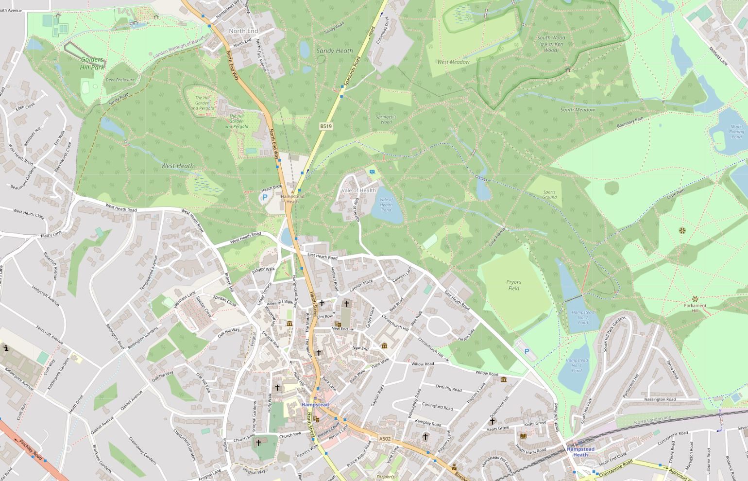
In the following map, the Vale of Health is in the centre of the map, with the blue for a pond on the eastern edge, surrounded by the green of Hampstead Heath, with a single road leading down from East Heath Road (Map © OpenStreetMap contributors).

Vale of Health

I had a recent visit to the Vale of Health, the reason being was to track down the location of some photos my father had taken of the general area, and a couple of photos showing the lost Vale of Health Hotel.

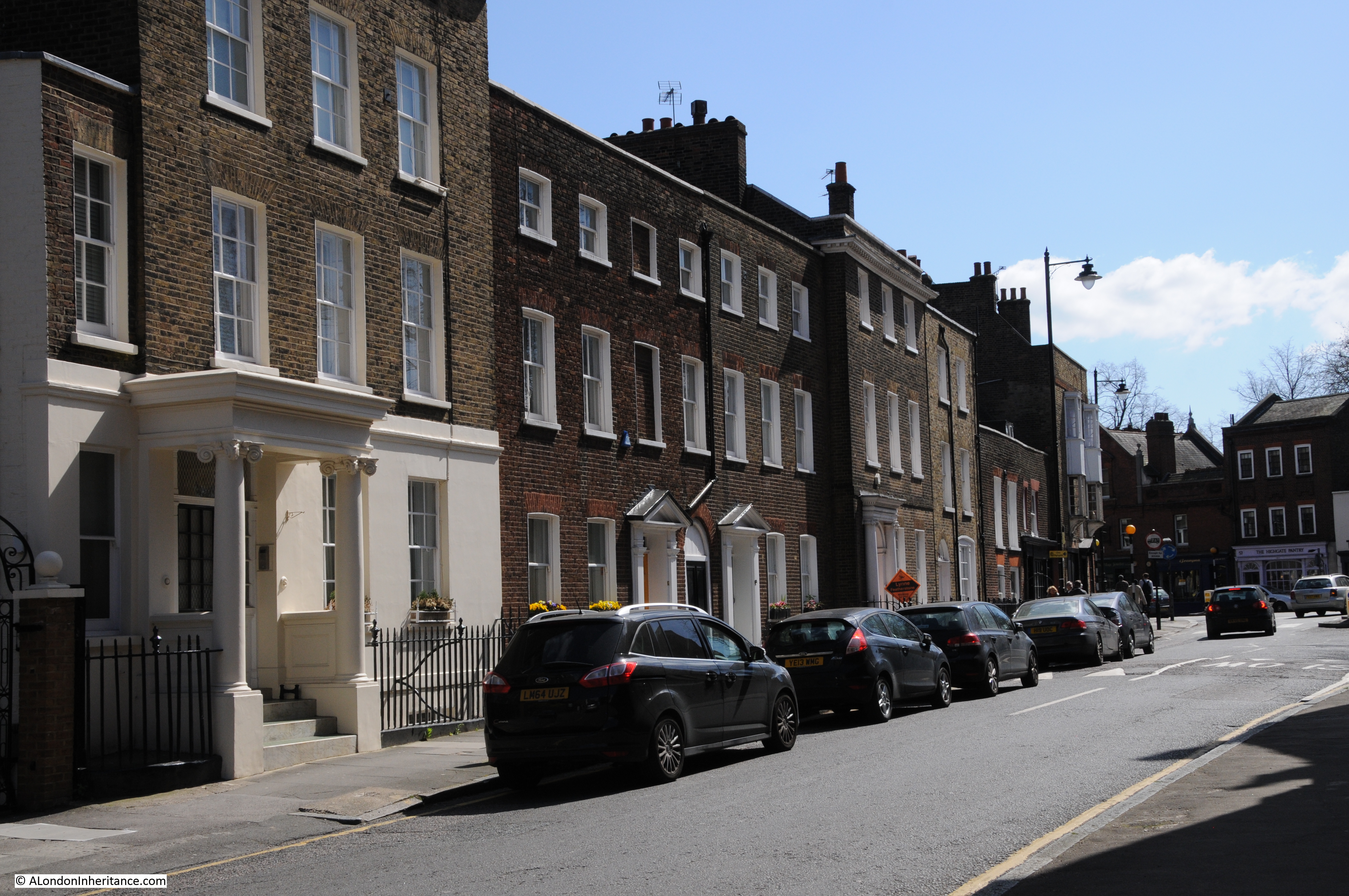
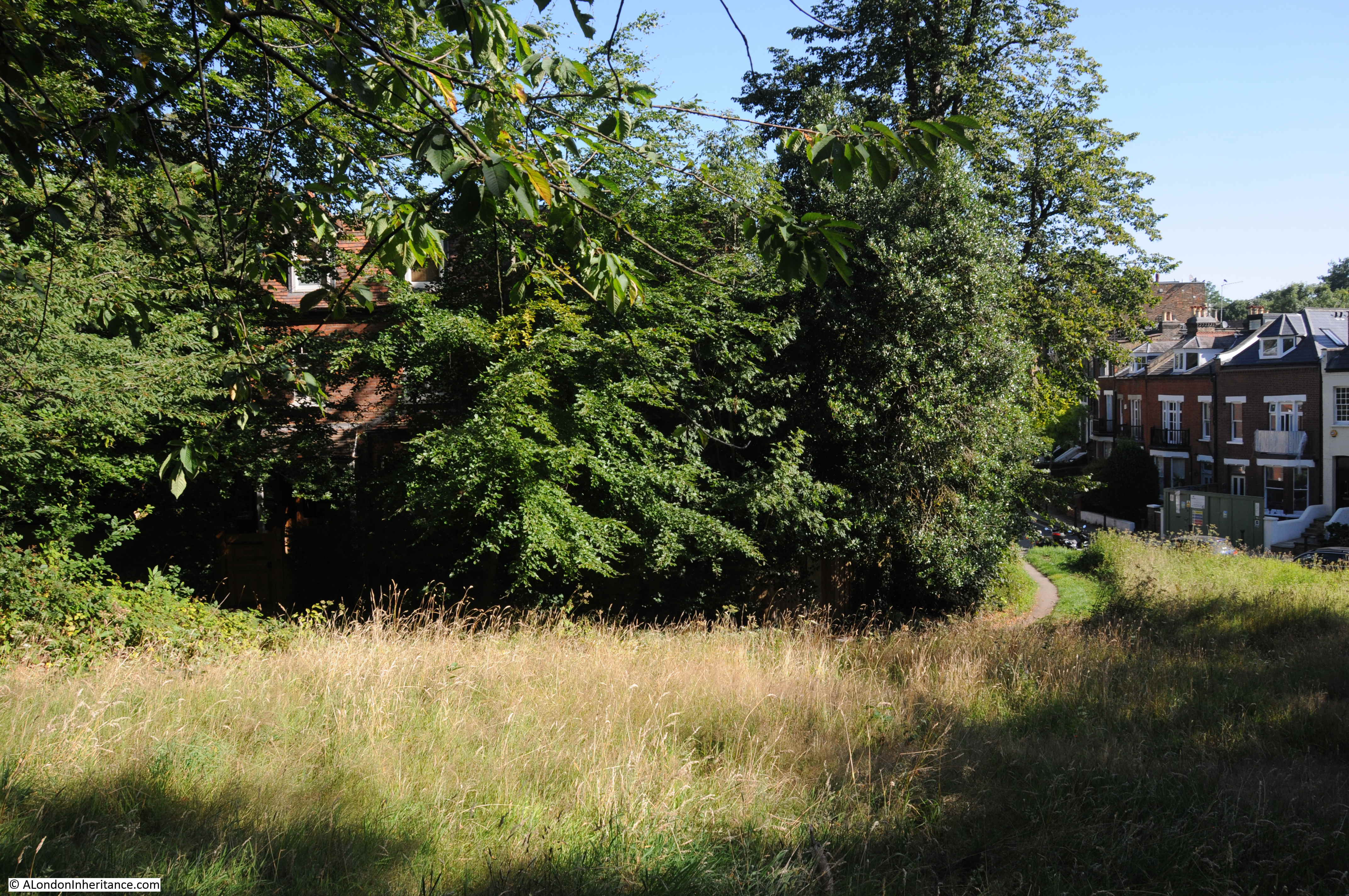
The first photo was a general view from the higher ground on the left, as you arrive on the single road that leads into the Vale of Health:

Vale of Health

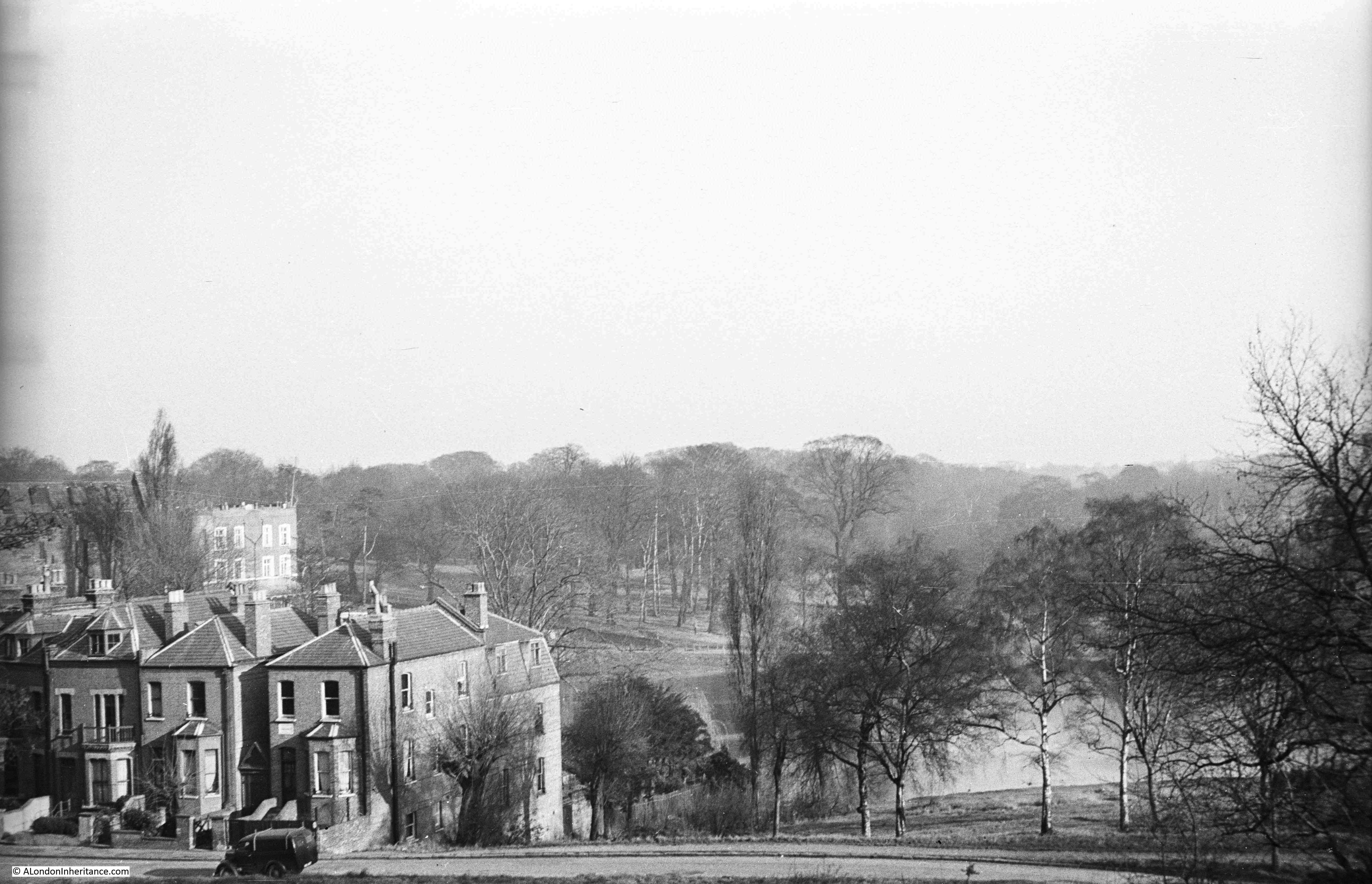
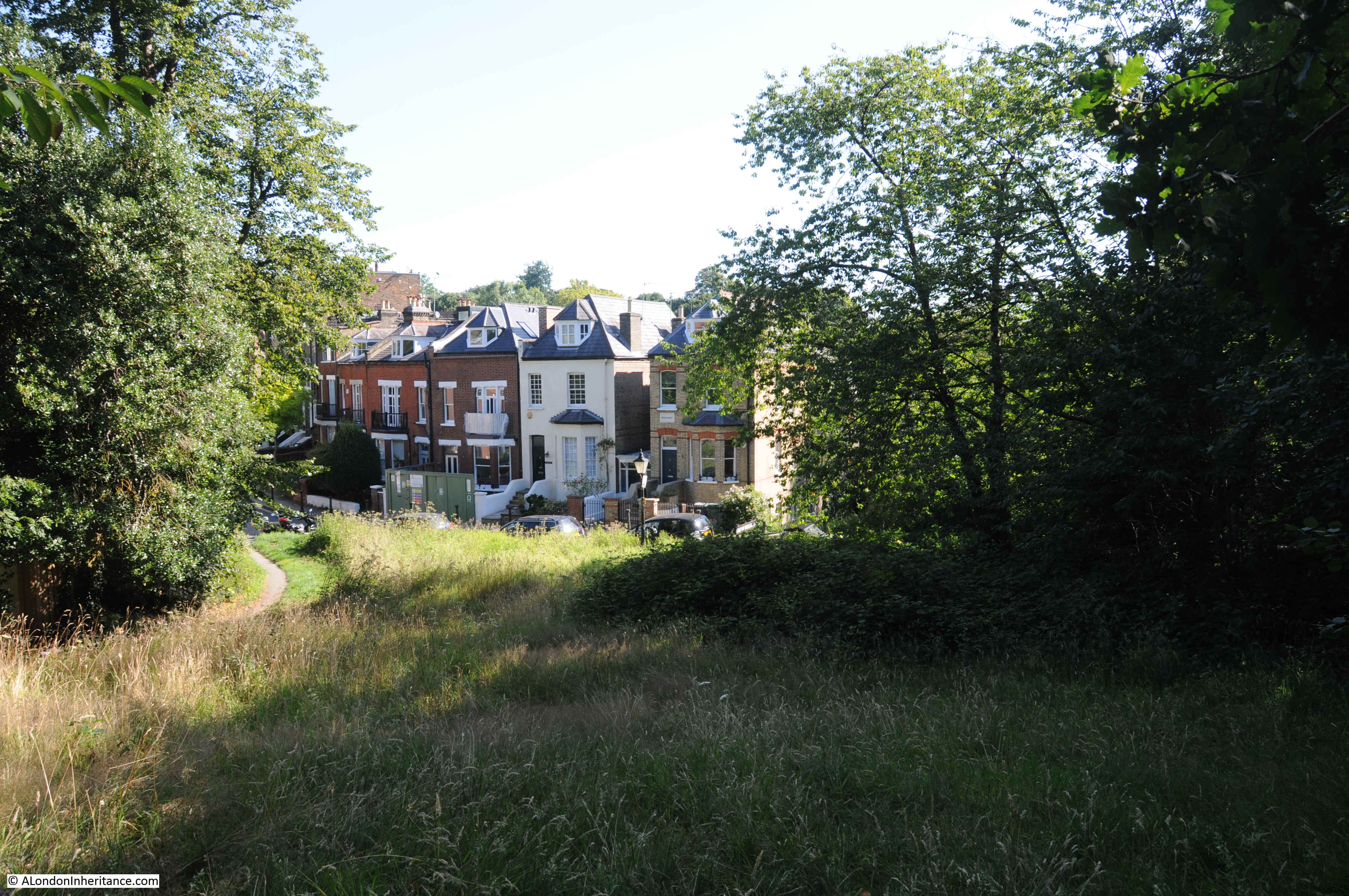
Although my father’s photos were taken in winter and mine in summer, so in my photos the trees are in leaf, the area is far more wooded today than it was, and the higher viewpoint for my father’s photo is today in among the trees and bushes with no clear view, so my comparison photo was slightly lower down, however the first houses along the road into the Vale of Health can still be seen:

Vale of Health

For his second photo from the same spot, may father turned a little to the left. Much the same view, however a large house on the left of the street comes into view.

Vale of Health

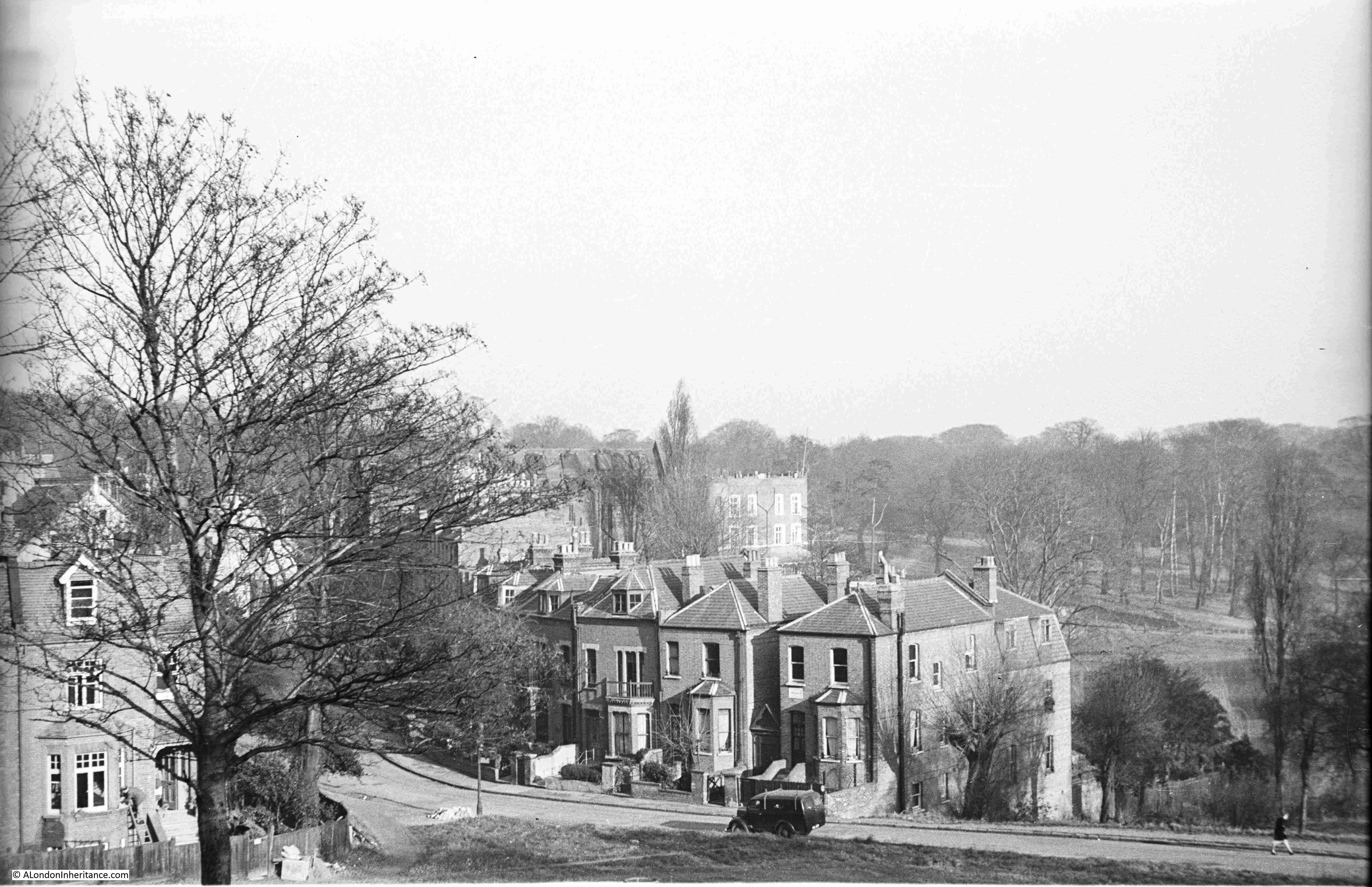
Again showing how much more overgrown this area is today, in the following photo the house is still there, but almost completely hidden by tree growth.

Vale of Health

The Vale of Health is a really unusual place. A single access road leads down into a cluster of houses, with a large pond to the east, and the whole place surrounded by the rest of Hampstead Heath.

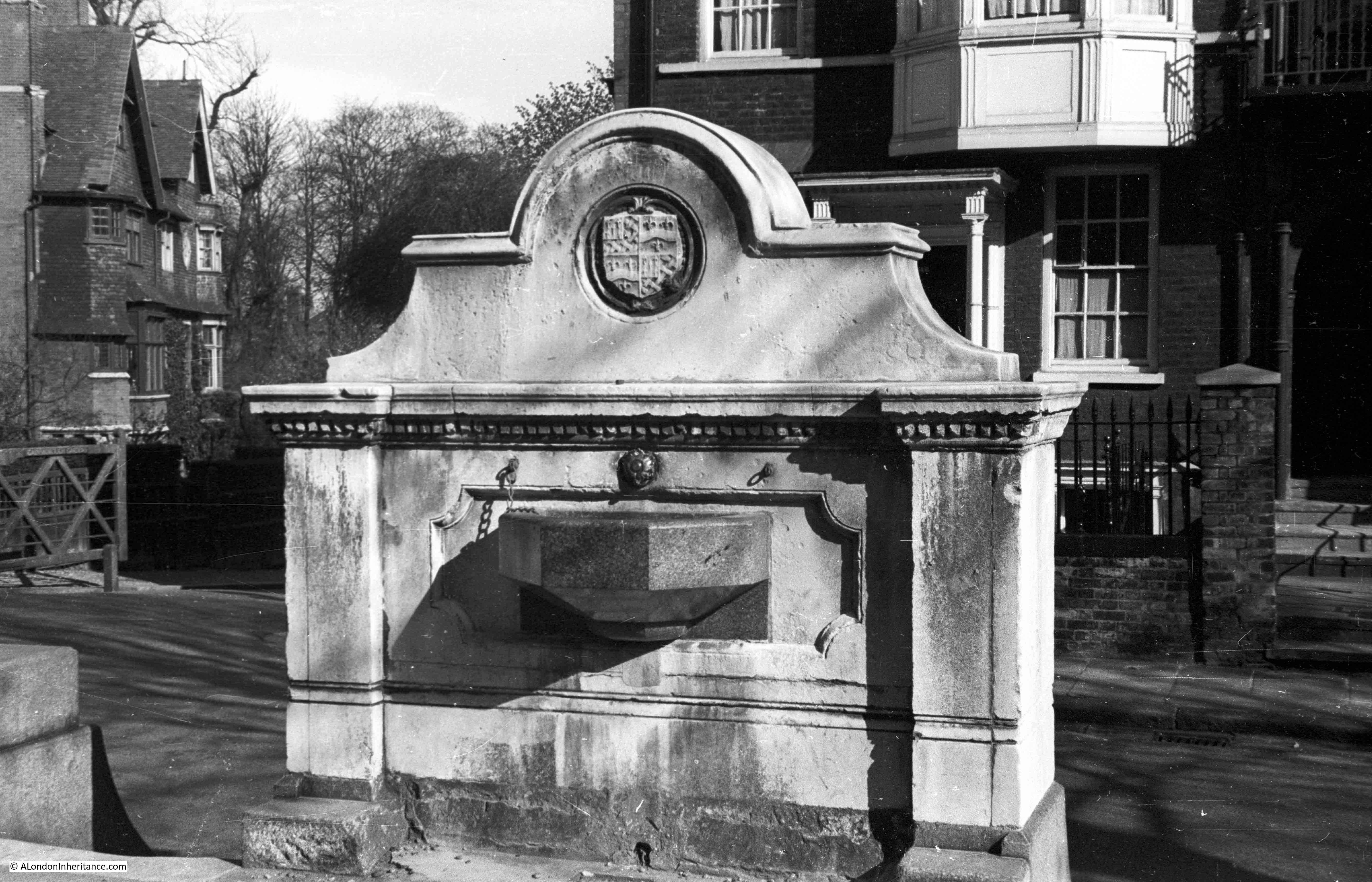
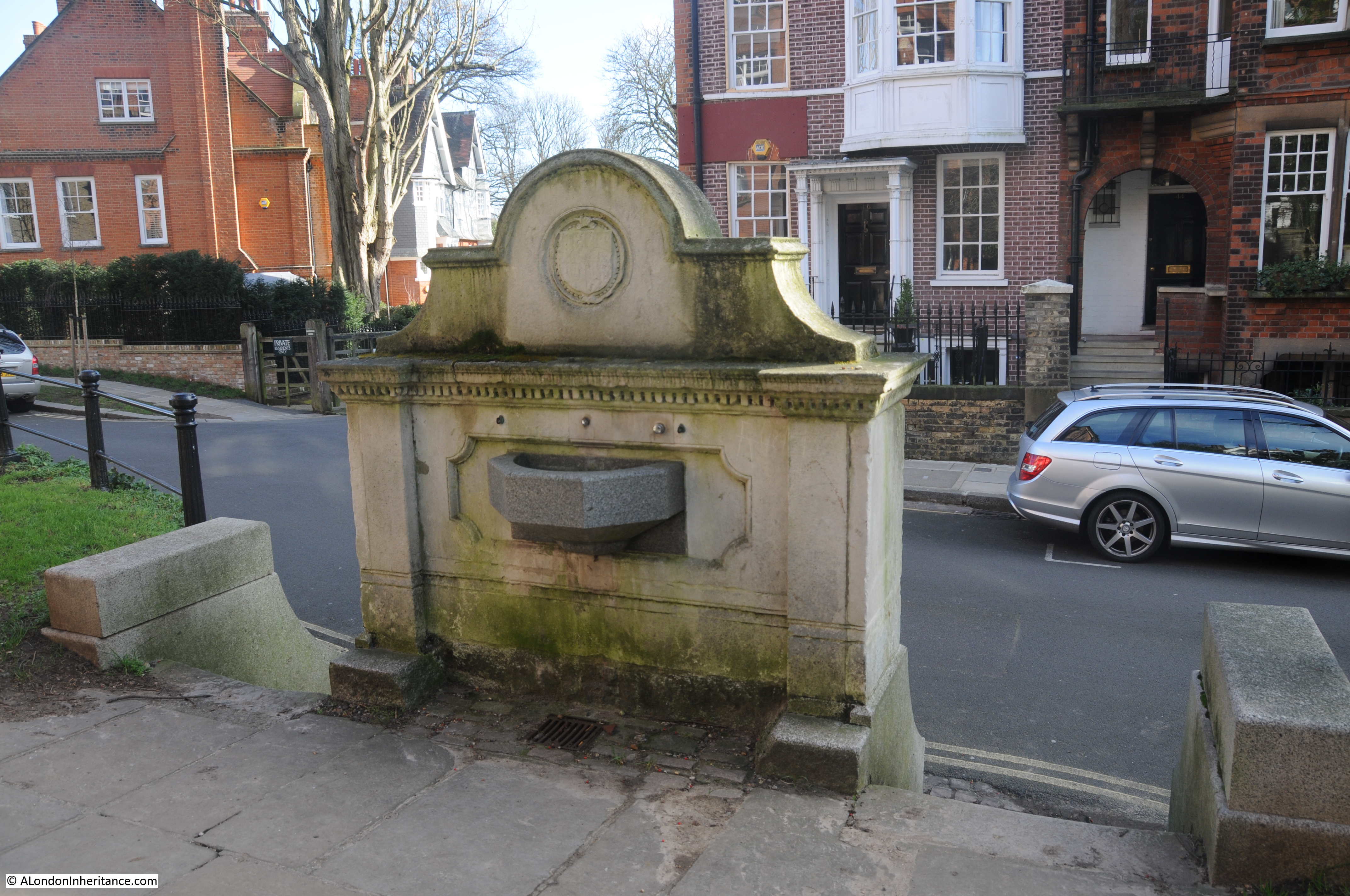
The pond is a clue as to why the Vale of Health developed. Originally the area occupied by the Vale of Health was wet and marshy. The springs that pop up around the heath fed into this hollow of land. The area was originally called Hatches or Hatchett’s Bottom, and was also referred to as Gangmoor.

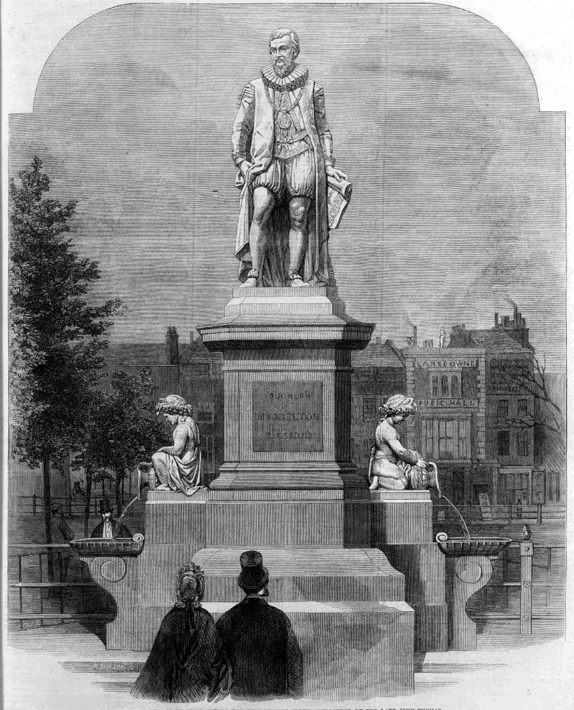
The history of the area really starts with the City of London’s insatiable thirst for clean water. In the 16th century, three reservoirs had been built on the heath to provide water for London, however demand kept growing as the population expanded.

in 1692 the Hampstead Water Company was formed and the Corporation of the City of London granted the company leases on the Hampstead Heath reservoirs.

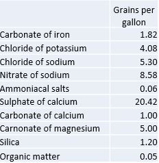
Demand exceeded the capacity of these reservoirs, so in 1777 the Hampstead Water Company drained the marshy area that was Hatchett’s Bottom and formed a new pond to store and supply water for the City. During the 19th century the Hampstead ponds continued to supply water to the City, but by the mid 19th century, water was only used for non-domestic purposes as the quality was rather poor, described as “somewhat disagreeable to the taste and small and was rather turbid; the sediment deposited was considerable, and contained numerous living organic productions”.

The way that land was given over to ownership and house building on Hamsptead Heath was rather complicated. Long before the heath had the protection it does today, it was open for encroachment and squatting, and frequently those encroaching on the heath, could stay providing they paid a fee to the Lord of the Manor.

Applications for the use of “waste land” were made to the Manor and if approved these were allocated on the basis of a “copyholder” where if the person who was allocated the land died, or sold the land, the person inheriting or buying the land had to pay a “fine” to the Lord of the Manor.

One of the early allocations of land, around 1770, was to a Samuel Hatch, which could be why the area was originally named Hatches or Hatchett’s Bottom.

After the new reservoir or pond was constructed in 1777, more applications for grant of waste land were made. Three cottages for the parish poor of Hampstead were built – the choice of area aware from Hamsptead possibly because the land was cheap and Hatchett’s Bottom was not yet an area where the wealthy aspired to live.

Houses continued to be built, and the area started to change into a desirable residential location. Surrounded by the heath, away from the noise and traffic of Hamsptead, Hatchett’s Bottom was starting to be a desirable location, however the name was probably associated with the marshy ground before being drained for the pond, and the location for parish poor houses so perhaps a new name was required.

The name Vale of Health starts to appear at the start of the 19th century.

There are many theories as to the source of the name, however it is probably simply down to a new name to differentiate the place from earlier conditions and usage.

Although the Vale of Health started to be used from around 1801 onward, the name Hatchett’s Bottom would still be used for several decades after.

Houses continued to be built in the Vale of Health, and the Hampstead Heath location meant that the Vale of Health attracted those who left the city on weekends and Bank Holidays to find somewhere for fresh air and entertainment, and it was the location of one of these places that I went looking for next.

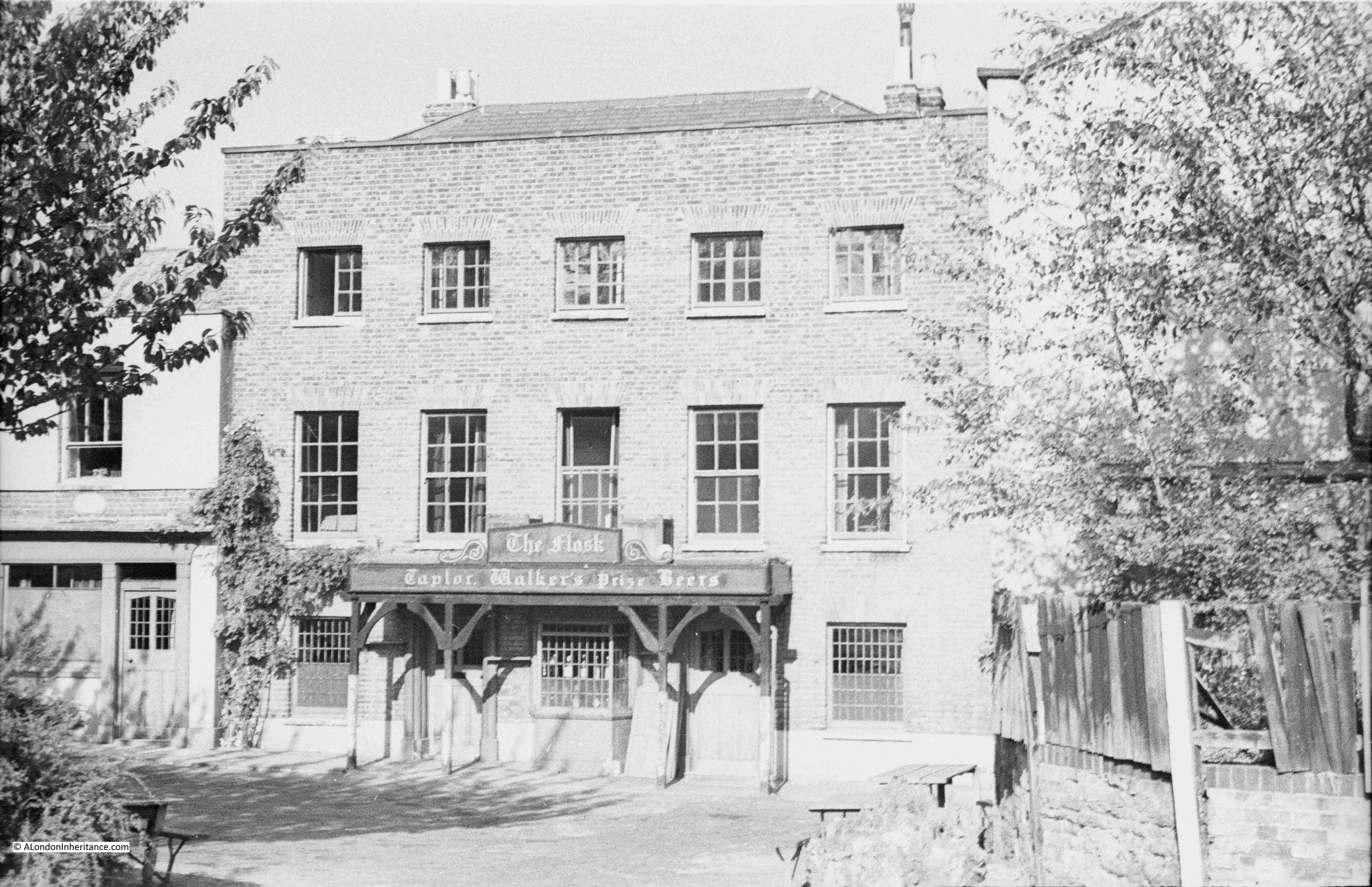
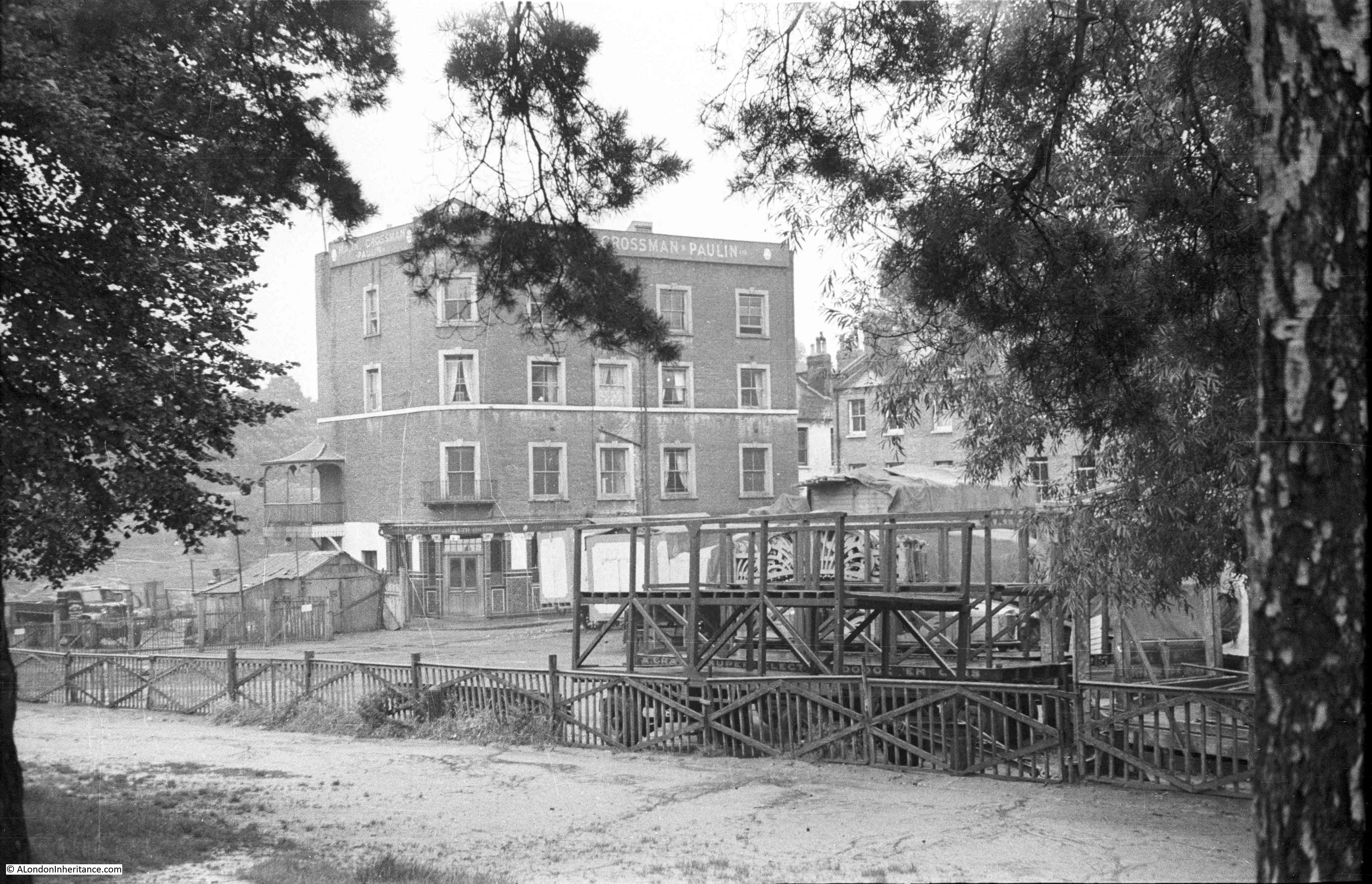
The following photo is my father’s photo of the Vale of Health Hotel. A large 4 storey building facing onto the pond. The view is across an area used as a fairground, and for the storage of fairground rides when not in use. The wooden frame nearest the camera has the words “dodgem cars” just above the top of the fence.

Vale of Health

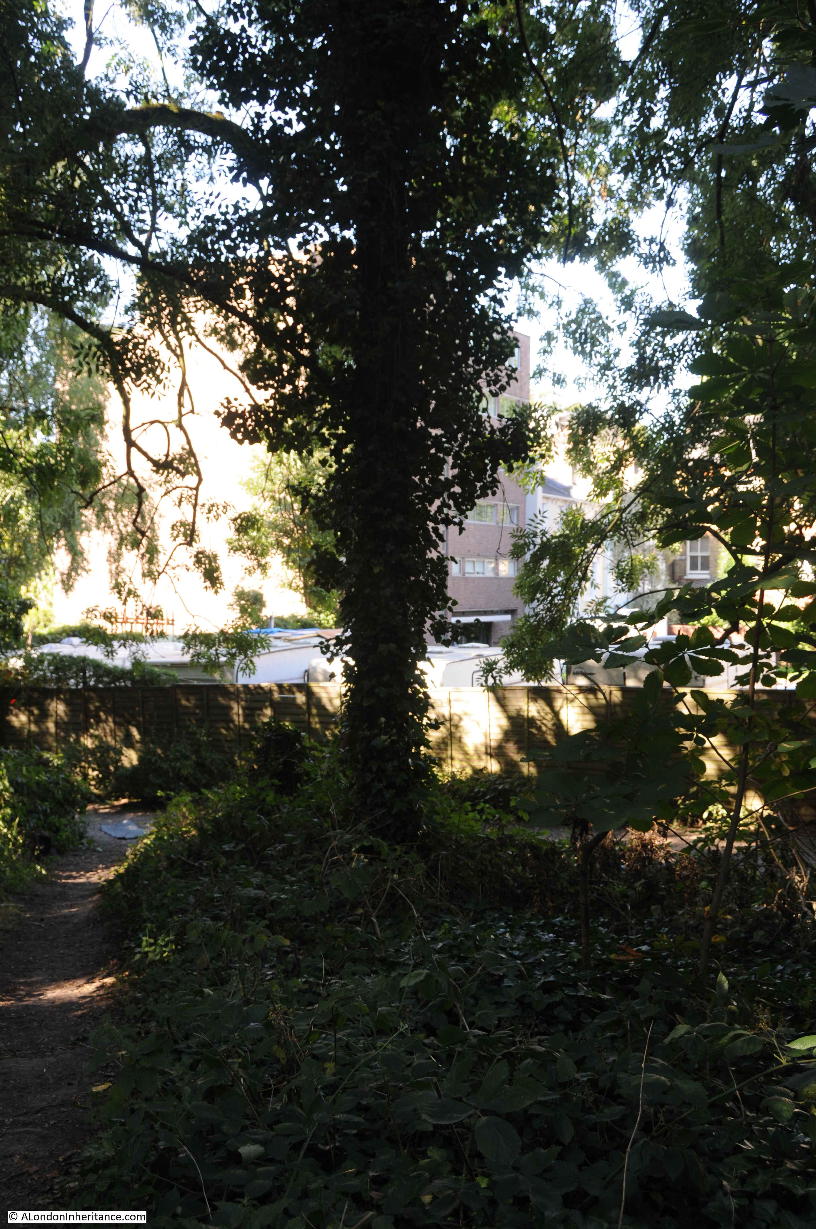
Roughly the same view today. I should have been a little further back, but this would have taken me into the trees and bushes.

Vale of Health

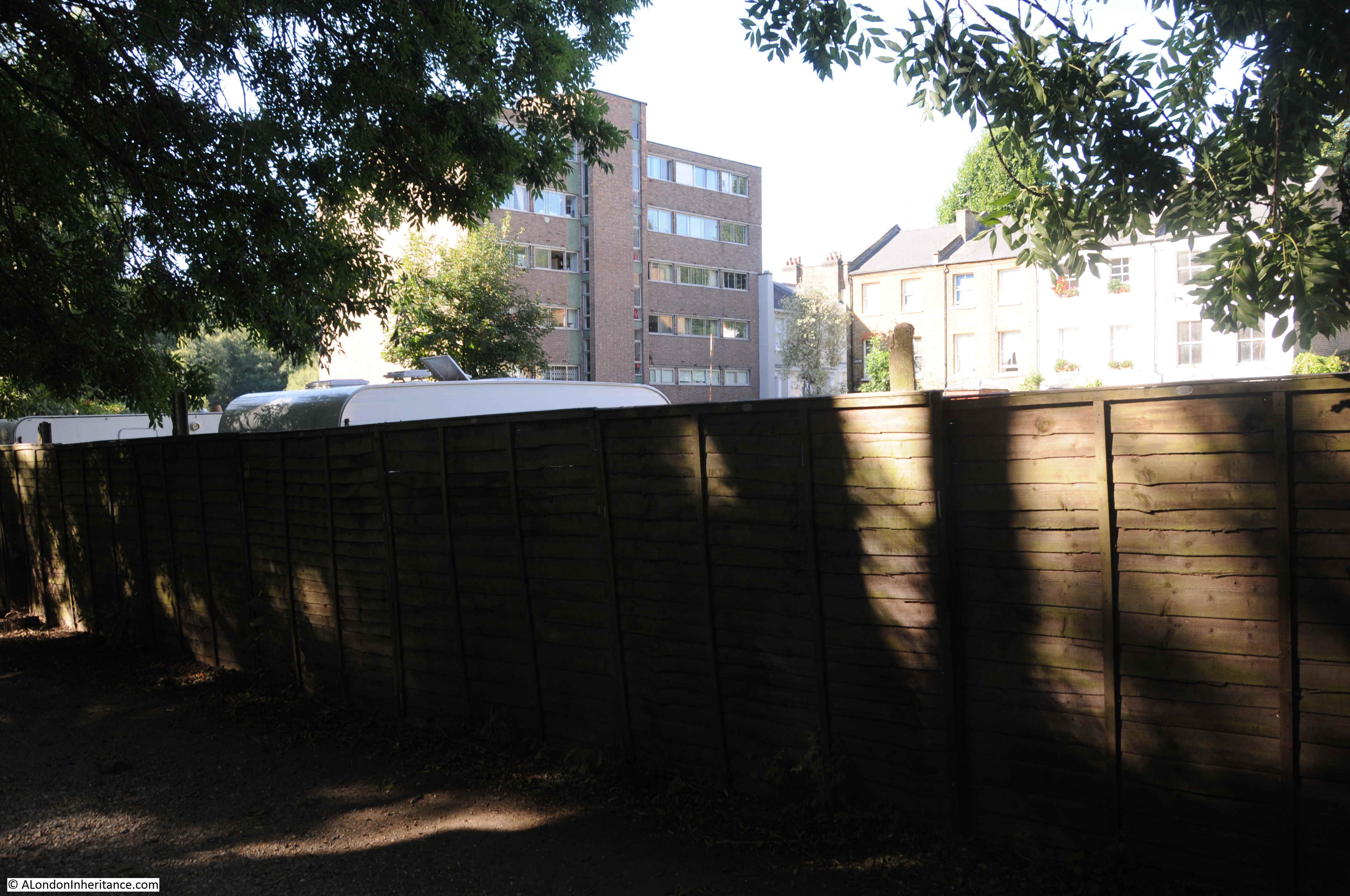
In the 2020 photo, there is a high wooden fence blocking off the area that was used for fairground storage. The Vale of Health Hotel has been replaced by a high block of flats. The terrace of houses on the right are the same in both photos.

The Vale of Health was a focal point for summer weekends and Bank Holidays when thousands of Londoners would stream up to the heath to escape the city. The hotel offered rooms, bars, food, and verandas overlooking the pond. The area behind the hotel was used as a fairground. The Era on the 17th April 1909 had a small article about the fair:

“In the Vale of Health: Harry Cox, the local showman, proudly boasts that he never exhibits his show concerns away from the Heath. By the side of the Vale Waters you will find him ready to entertain you. Here you will see steam roundabouts, boats, swings, shooters and variety stalls. Harry Cox, Vale of Health Perpetual Pleasure Fair is the great central constellation around which many lesser lights live and shine”.

The following article from the Hampstead and Highgate Express reviewing the April 1888 Bank Holiday Monday on the heath provides a good impression of what it must have been like, and what went on across Hampstead Heath and in the Vale of Health:

“BANK HOLIDAY ON HAMPSTEAD HEATH. On Easter Monday there were probably not far short of 80,000 visitors to Hampstead Heath. The weather was not all that could have been desired, but remembering what a comparatively few days ago it was since the Heath was covered white with snow, the holiday makers may be congratulated that at the beginning of April they were able to get as much outdoor fun as they did.

The fineness of the early morning led many to start from town soon after breakfast to spend a long day on the people’s favourite and beautiful Heath. Trains, tram-cars and omnibuses brought them up in goodly numbers from all parts and ‘all the fun of the fair’ had commenced when at about half past ten, down came a heavy shower of rain from a sullen-looking sky, threatening to spoil the whole day’s proceedings. Fortunately, however, this proved to be but a passing shower, and thenceforth for several hours fairly fine weather prevailed.

By midday the people were swarming onto the Heath, and for a long time it seemed as if the metropolis was sending all its juvenile population especially in this direction. There was plenty of amusement to be found of the kind in which the Cockney holiday-makers most delight on such occasions. Swings, skipping, pony and donkey riding, peep-shows, and exhibitions of curiosities with numberless coconut shies and try your strength apparatus, were in full operation, as to refreshments, tea and coffee stalls, fried fish establishments, and fruit and ice barrows offered their attractions, and by no means in vain, to the ruralisers around with sharpened appetites.

Conjurers, men on very high stilts, a fire-eater, and Punch and Judy also attracted very large crowds, and numerous pennies, and the swings and steam round-about in the Vale of Health did see a large amount of business.

In spite of some horse-play, especially in the Vale of Health, the holiday makers as a whole, behaved themselves well, and only one or two police charges arose out of the day’s holiday”.

The article mentions the “horse-play” around the Vale of Health and it does seem to have been the location of petty crime – perhaps the large numbers of people attracted to the steam fair was the ideal location for crimes such a pick-pocketing. A report in 1885 regarding the August Bank Holiday mentions the arrest of one William Mitcham, aged 16 from Gunn Street, Spitalfields, who was charged with being a suspected person loitering in the Vale of Health for the purpose of committing a felony by picking pockets.

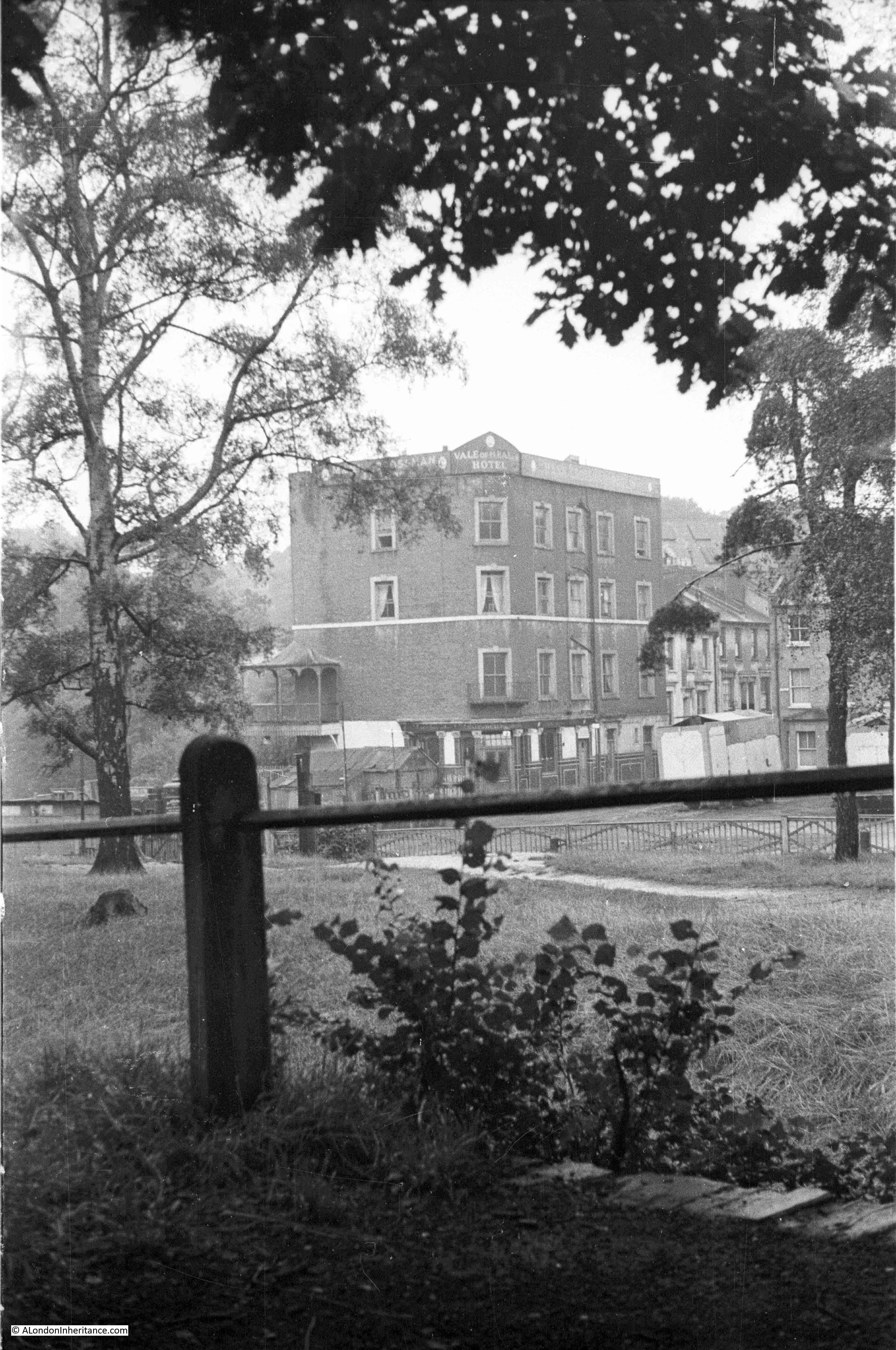
Another of my father’s photos providing a clearer view of the Vale of Health Hotel:

Vale of Health

From roughly the same position today, but again showing how much the trees and undergrowth have claimed back the area which presumably was once relatively clear due to the crowds of people that once attended the fair here.

Vale of Health

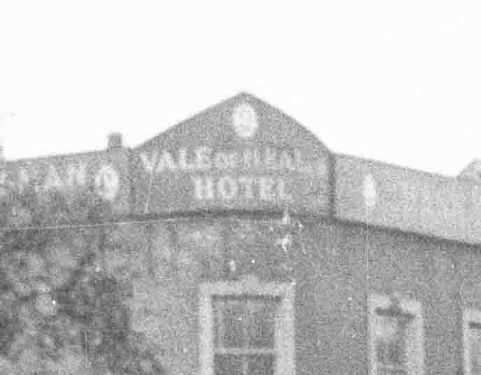
To confirm the name, the following is an extract from the above photo, showing the name on the corner of the signage along the roof line.

Vale of Health

The Vale of Health Hotel was demolished around 1962. The Vale of Health was also changing character. No longer the focal point for large numbers of potentially rowdy bank holiday visitors, the area was changing to a rather expensive enclave of housing. A 1962 newspaper article sums up these changes in an article titled “Vale of Wealth”:

“Van horses-what else? There is, of course. Battersea Park, and some people will never forgive Herbert Morrison – Lord Morrison of Lambeth – for setting that up in perennial competition with the old three-times-a-year tradition of the Hampstead Heath Fair.

That fair, in any case, is not what it used to be, what with the etiolated gaieties of the pin-tables. And even the Vale of Health hotel is under threat of being pulled down and made into something rather different.

So Battersea can go on with no serious challenge from the old traditional site. There is, indeed, some rebuilding there and some old Hampsteadians tend to call it now the Vale of Wealth”.

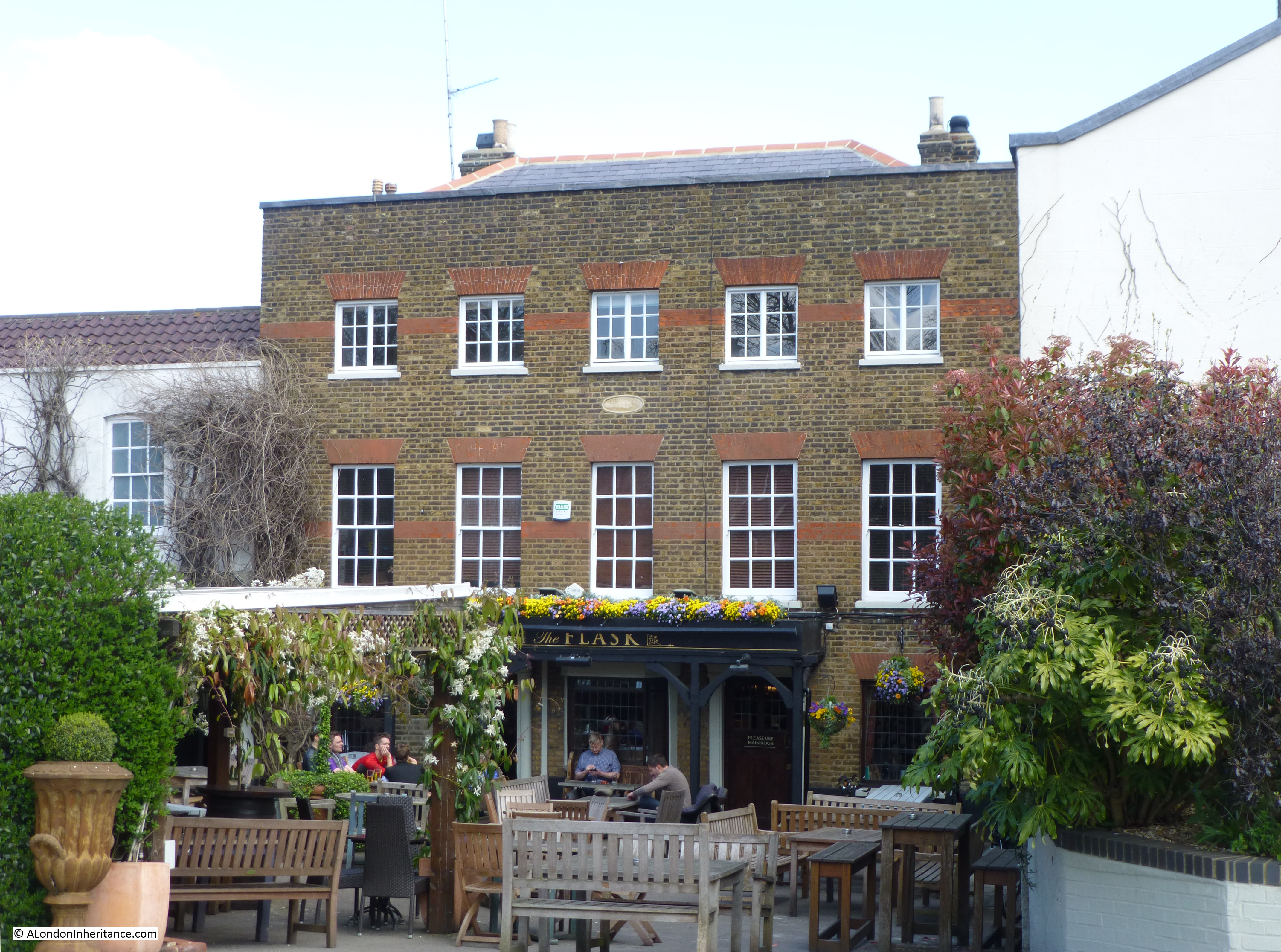
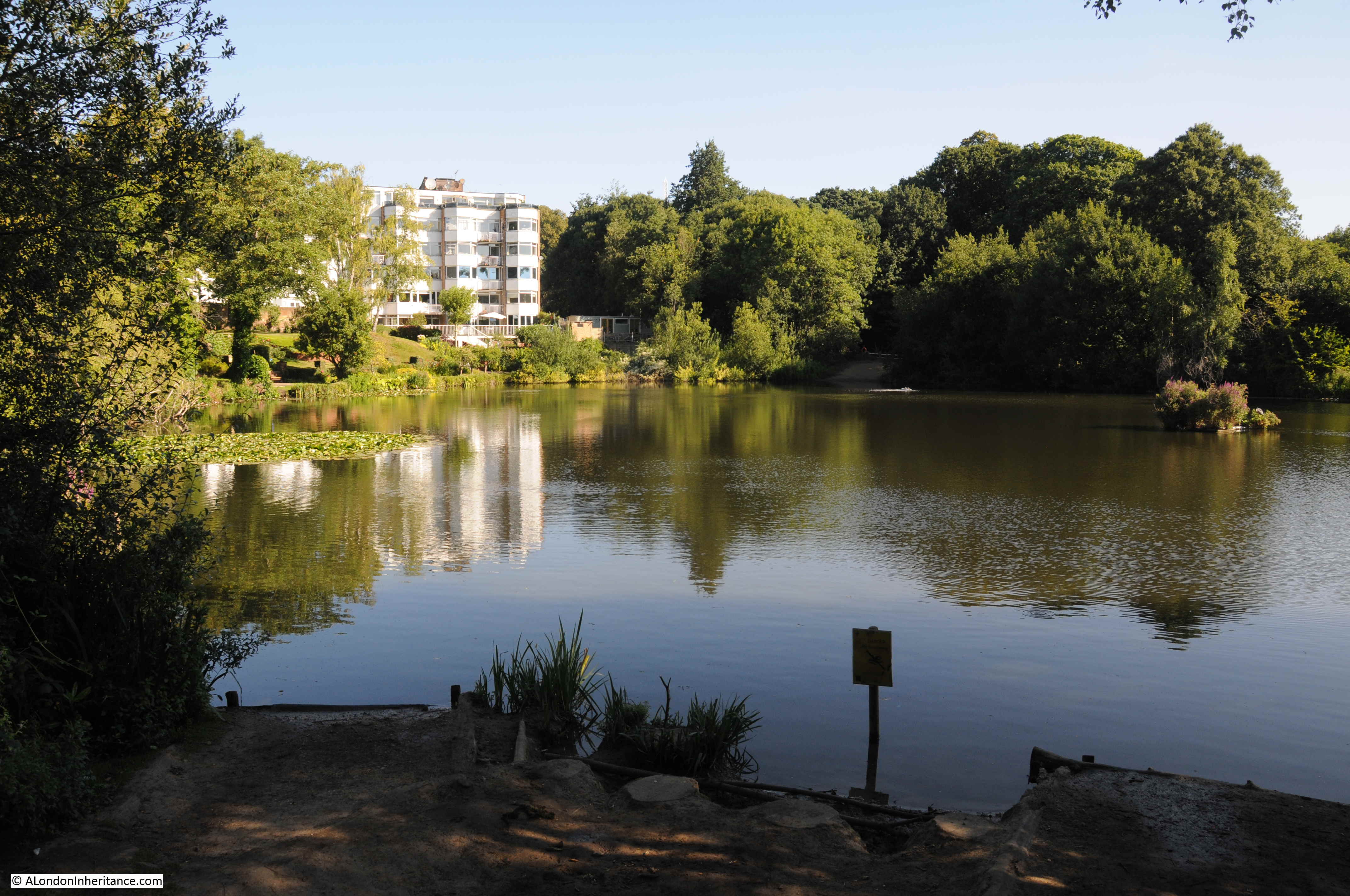
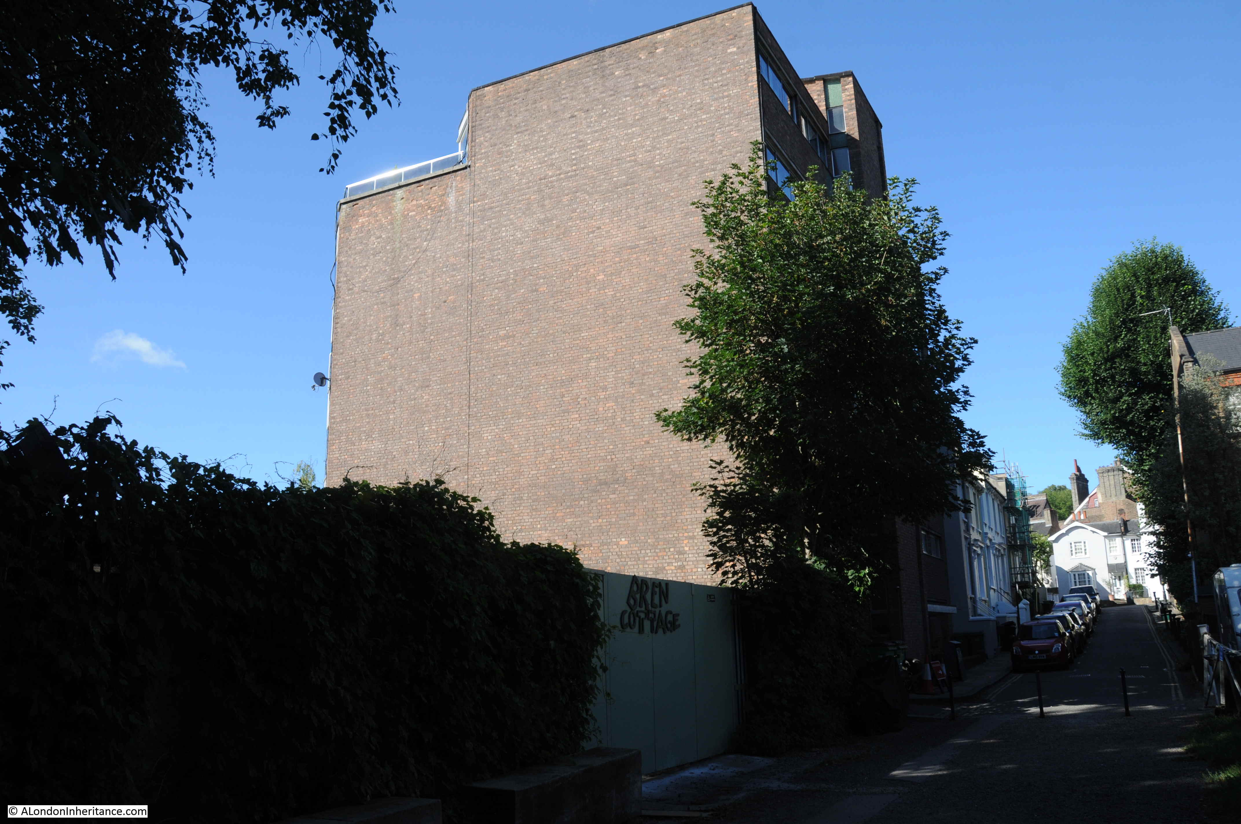
The brick building seen in my 2020 photos on the site of the old Vale of Health Hotel are the flats that were built on the site. They look rather bland from the landward site of the Vale of Health, but walk around the pond and they look very different.

In the following photo, looking across the pond, which was once the Hampstead Water Company  reservoir, built after the 1777 draining of the marshy Hatchett’s Bottom, the new flats are within the mainly white coloured building.

Vale of Health

The Vale of Health Hotel once faced onto the pond, with verandas around the lower floors providing a lovely location for drinking and eating with a view across the pond.

The following photo from the LMA Collage archive shows the view across the pond to the Vale of Health Hotel, with the fair ground set up to the right of the hotel in the space shown in my photos being used for the storage of fair ground equipment. Comparison of the photos also shows how densely the trees have grown up around the pond.

Vale of Health

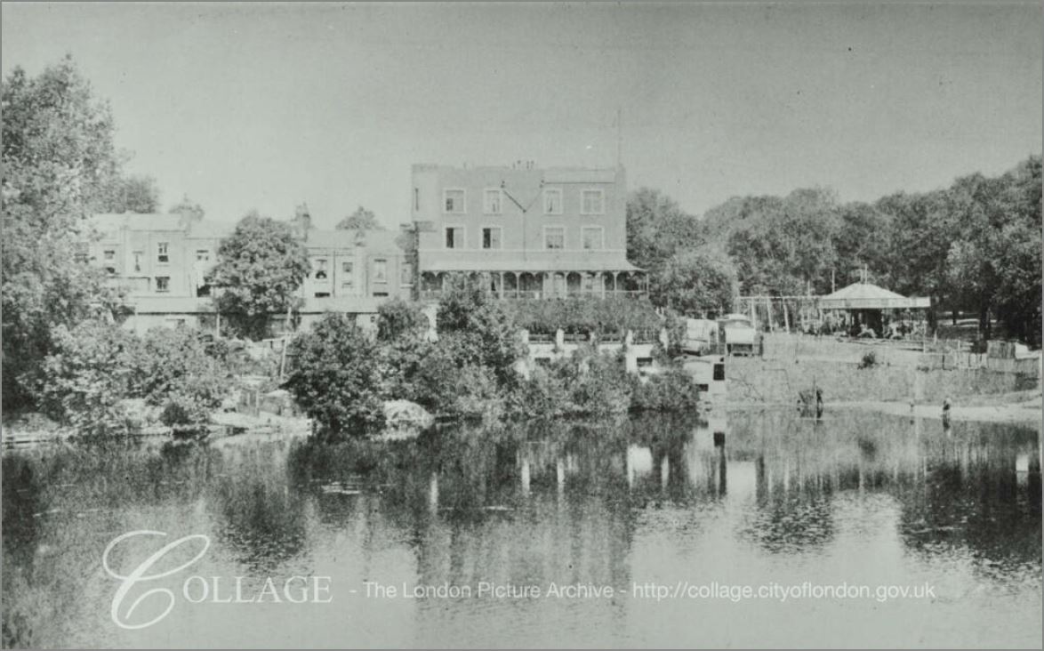
Image credit: London Metropolitan Archives, City of London: catalogue ref: SC_PHL_01_143_80_3444

A walk around the pond, and the Vale of Health is a lovely way to spend a Sunday morning. There is a walking route around the unbuilt parts of the pond, starting by the road leading into the Vale of Health.

On the north east side of the pond, this is paved and is one of the many walking routes across the heath, which on a Sunday morning seems to be mainly used by joggers and the occasional dog walker.

Vale of Health

Island in the middle of the pond:

Vale of Health

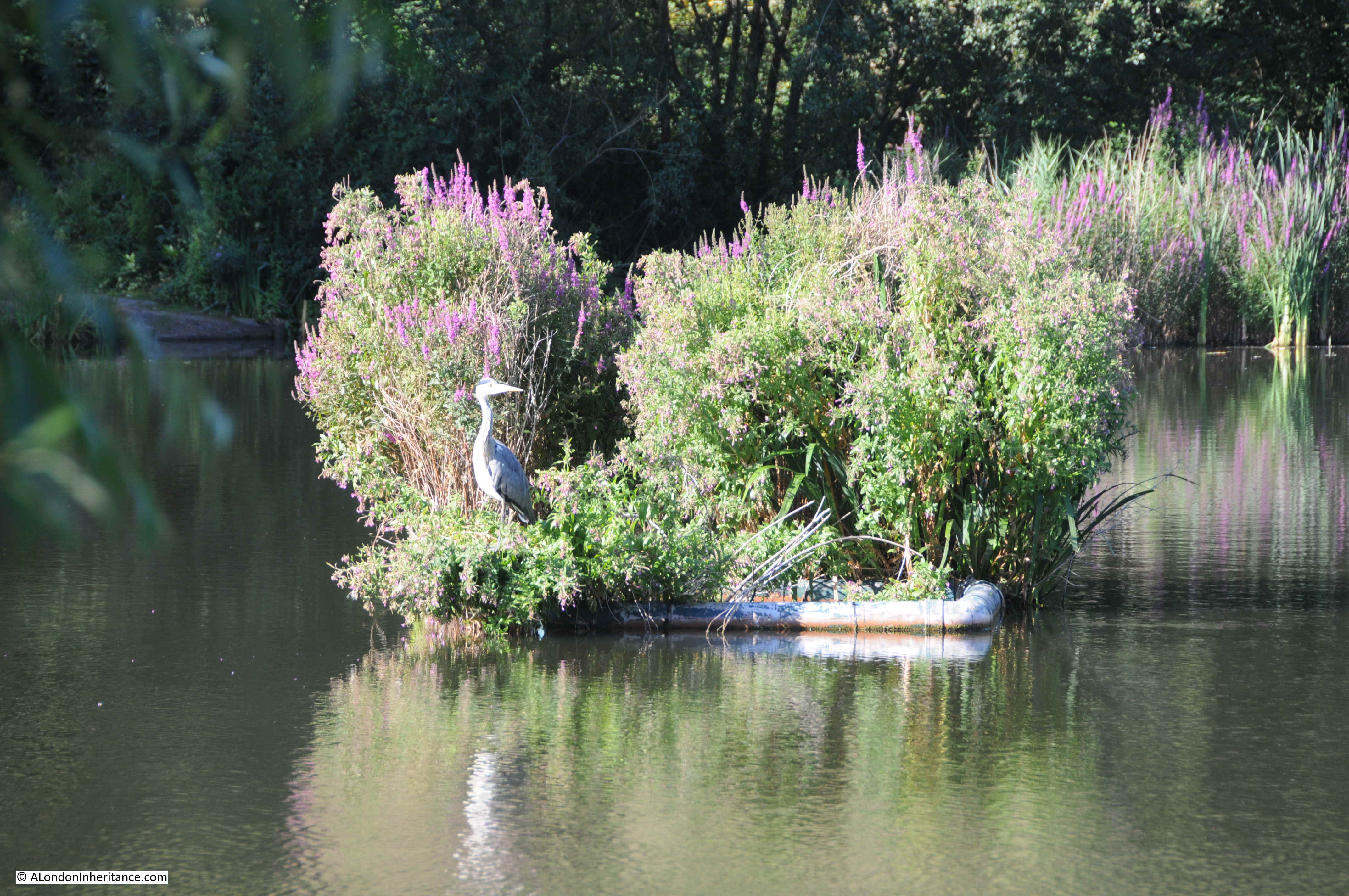
View across to the western edge of the pond:

Vale of Health

The rear of the flats occupying the site of the Vale of Health hotel. The corner of the block behind the tree is the same corner with the name of the hotel on the top corner of the hotel.

Vale of Health

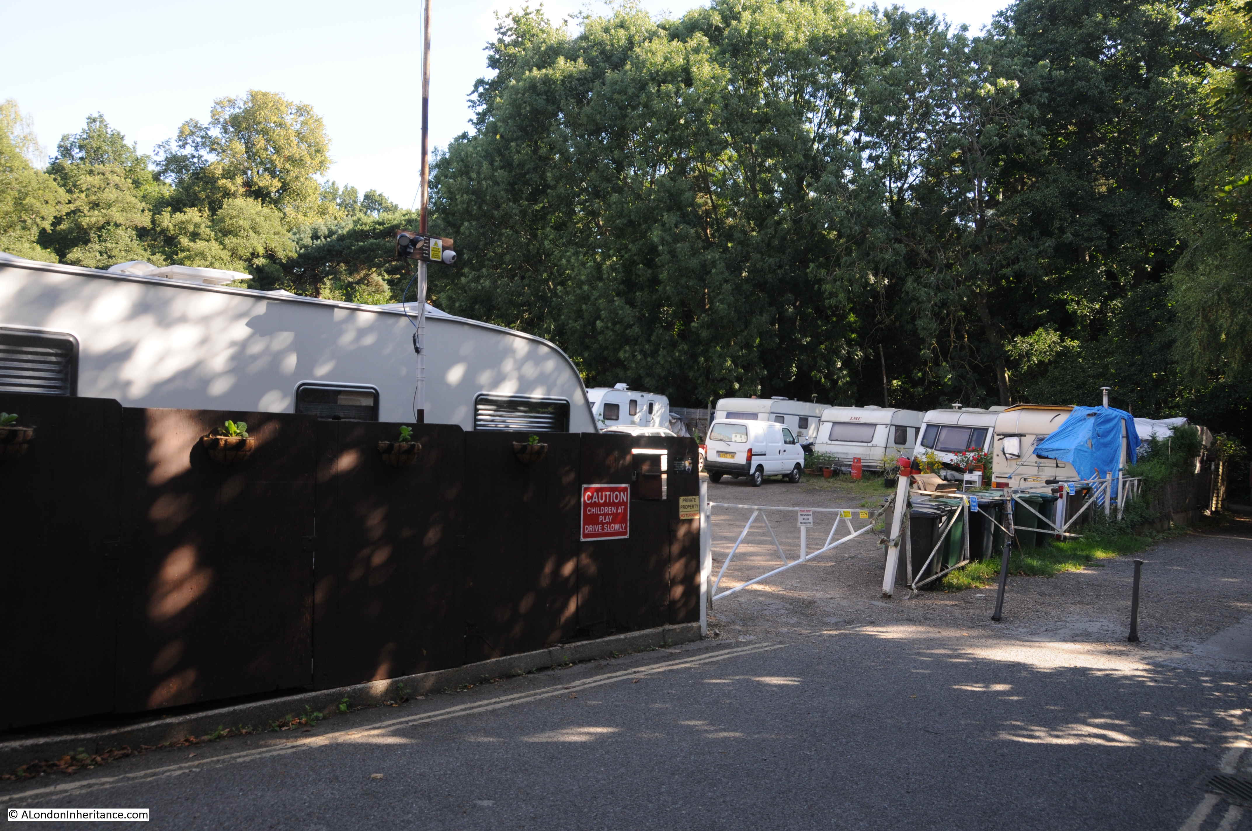
There is a street leading to a dead end that runs in from where the rear of the hotel used to stand. The street also leads to the place where the fair ground equipment was stored in my father’s photo. Although the site of the hotel now has a different use, the area for the fairground is still used for the storage of fairground equipment.

Vale of Health

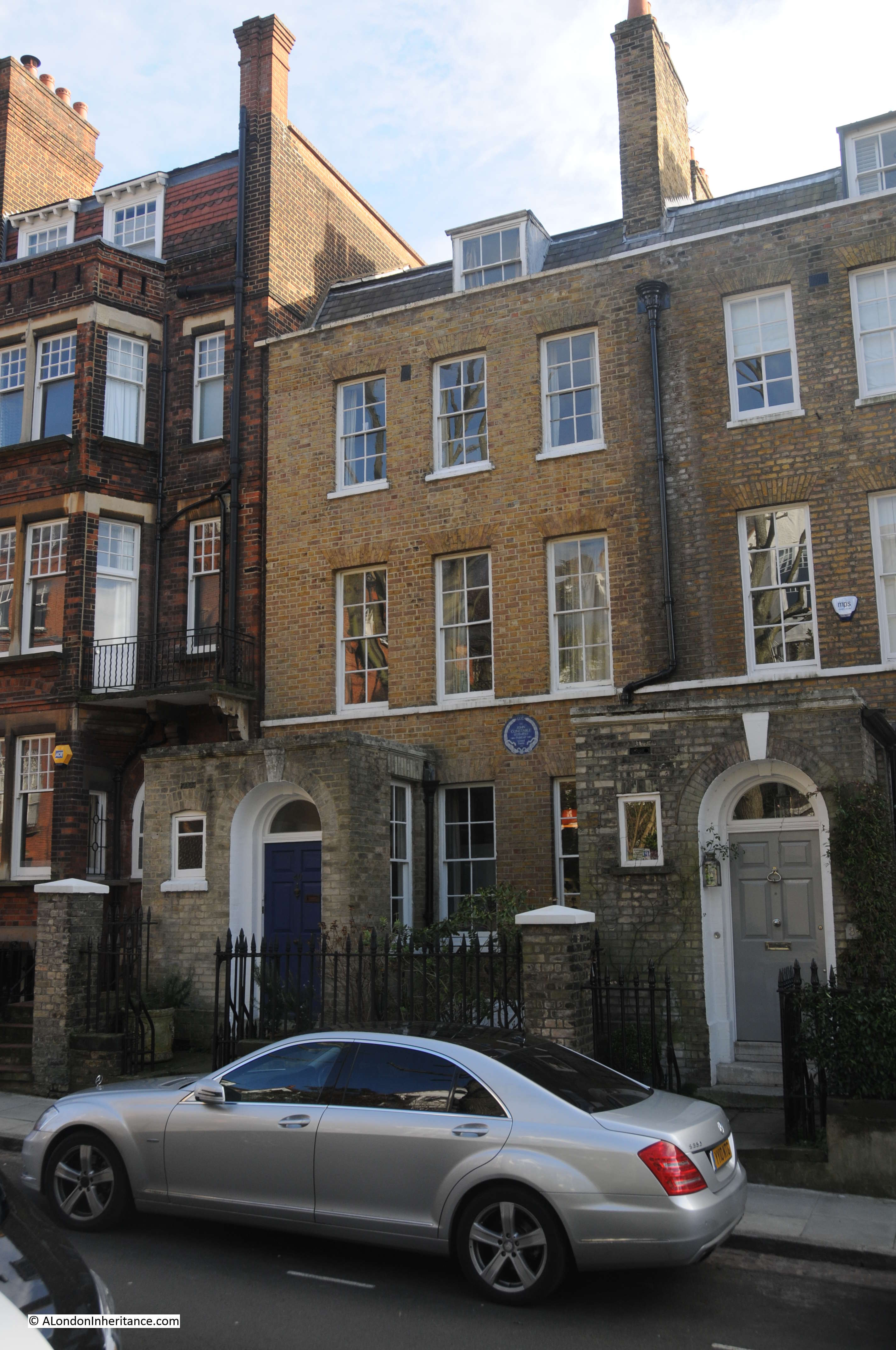
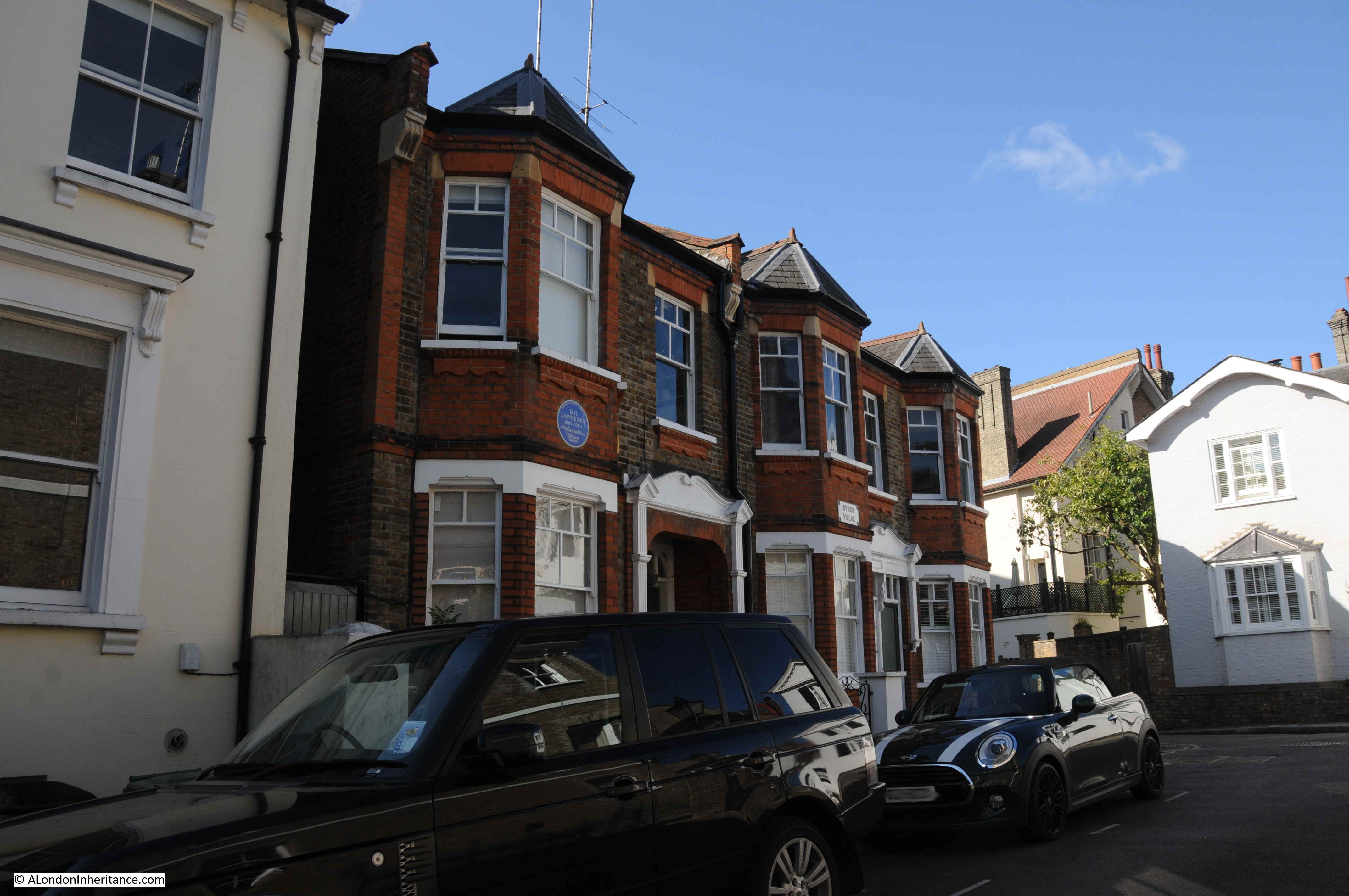
At the top of the street is a brick terrace called Byron Villas, built in 1903. This terrace of houses occupies the spot of another tavern / smaller hotel that once serviced the needs of visitors to the heath. The blue plaque records that the novelist and poet D.H. Lawrence lived in one of the houses in 1915.

Vale of Health

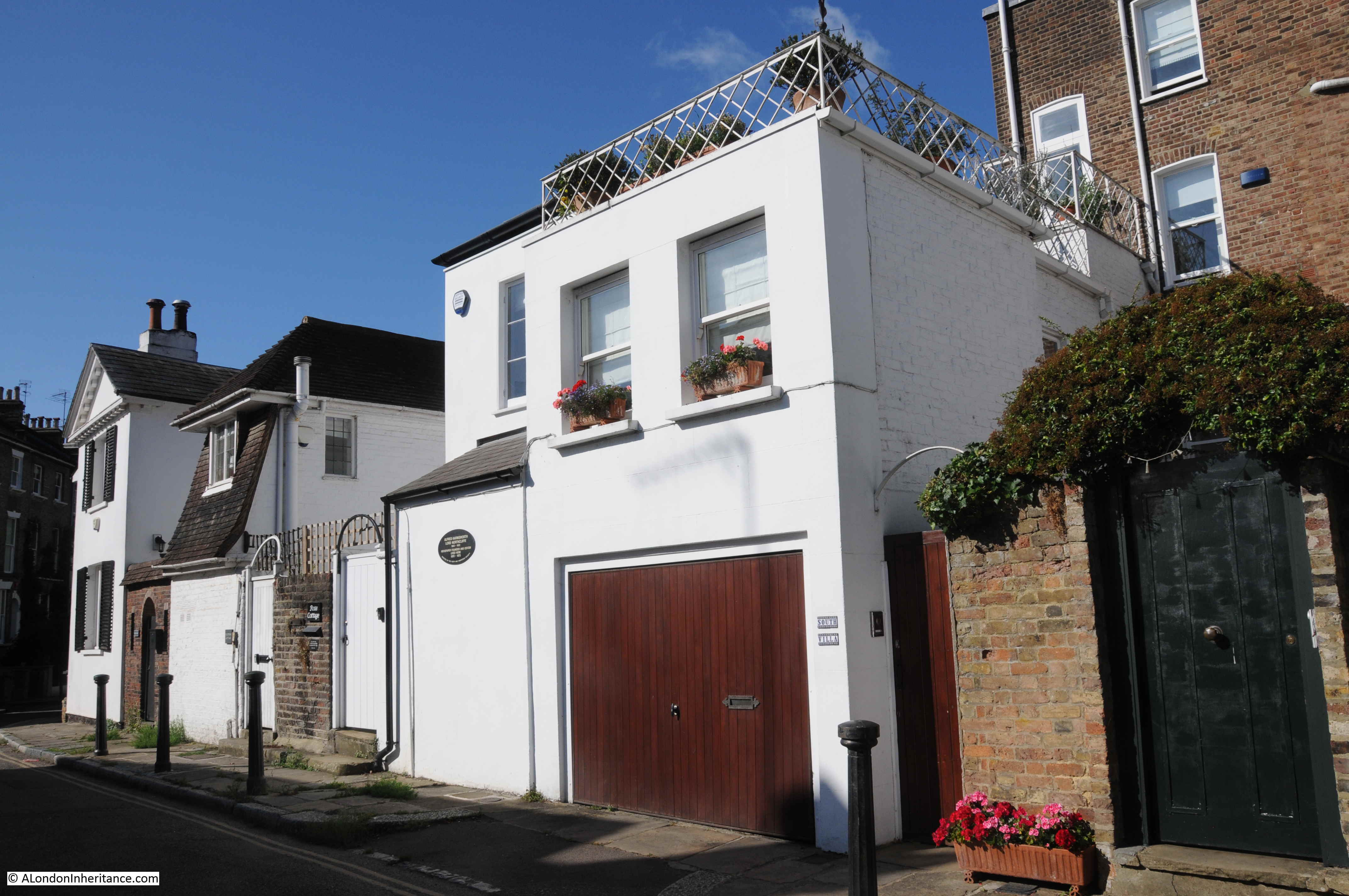
The oval plaque on the following building records that newspaper founder and editor Alfred Harmsworth, Lord Northcliffe lived in the house between 1870 and 1873.

Vale of Health

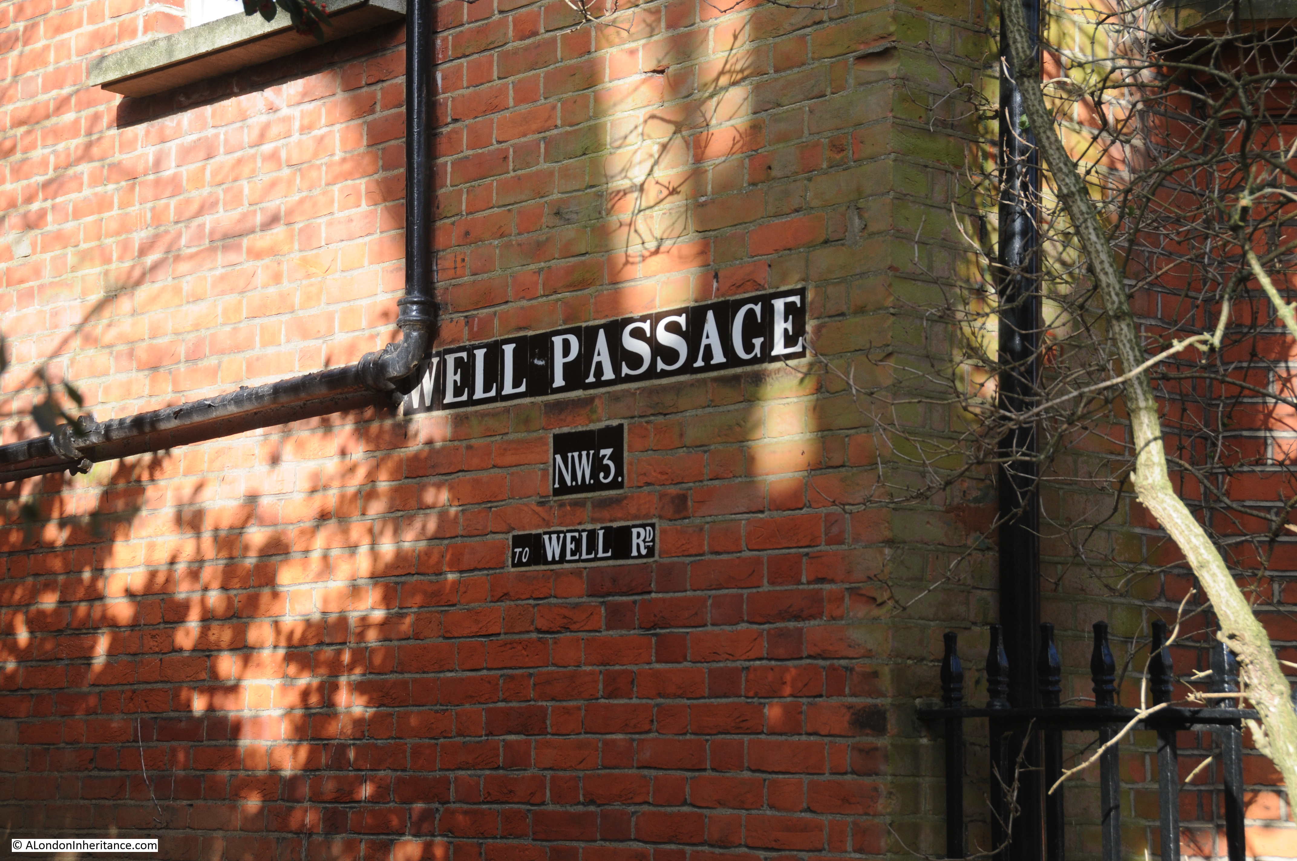
There is a single road in the Vale of Health, conveniently called Vale of Health. Even the spur down to where the old hotel was located has the same name.

Maps show what looks like a road called East View where the fair ground equipment store is located, however in reality, this is a small footpath between the front of the houses and the fairground land.

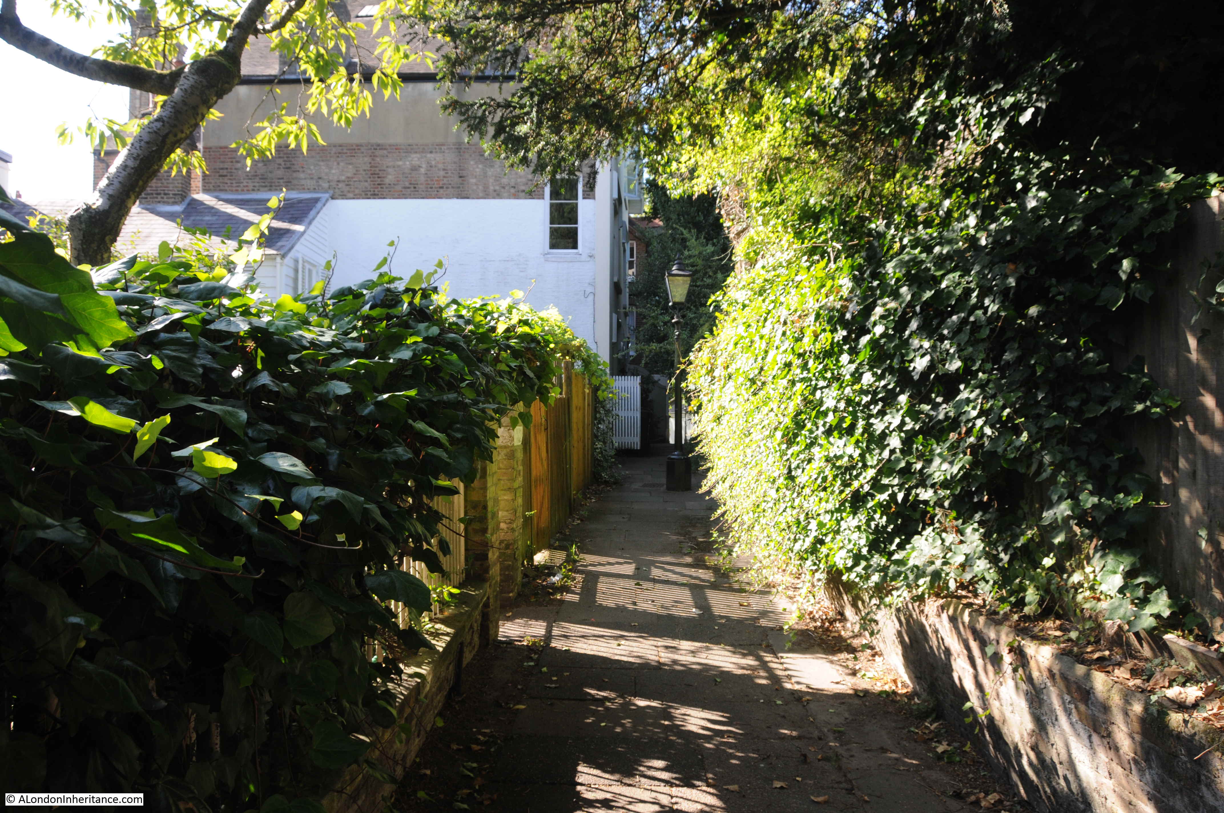
As well as the single road, there are a couple of alleys alongside the rear of the houses.

Vale of Health

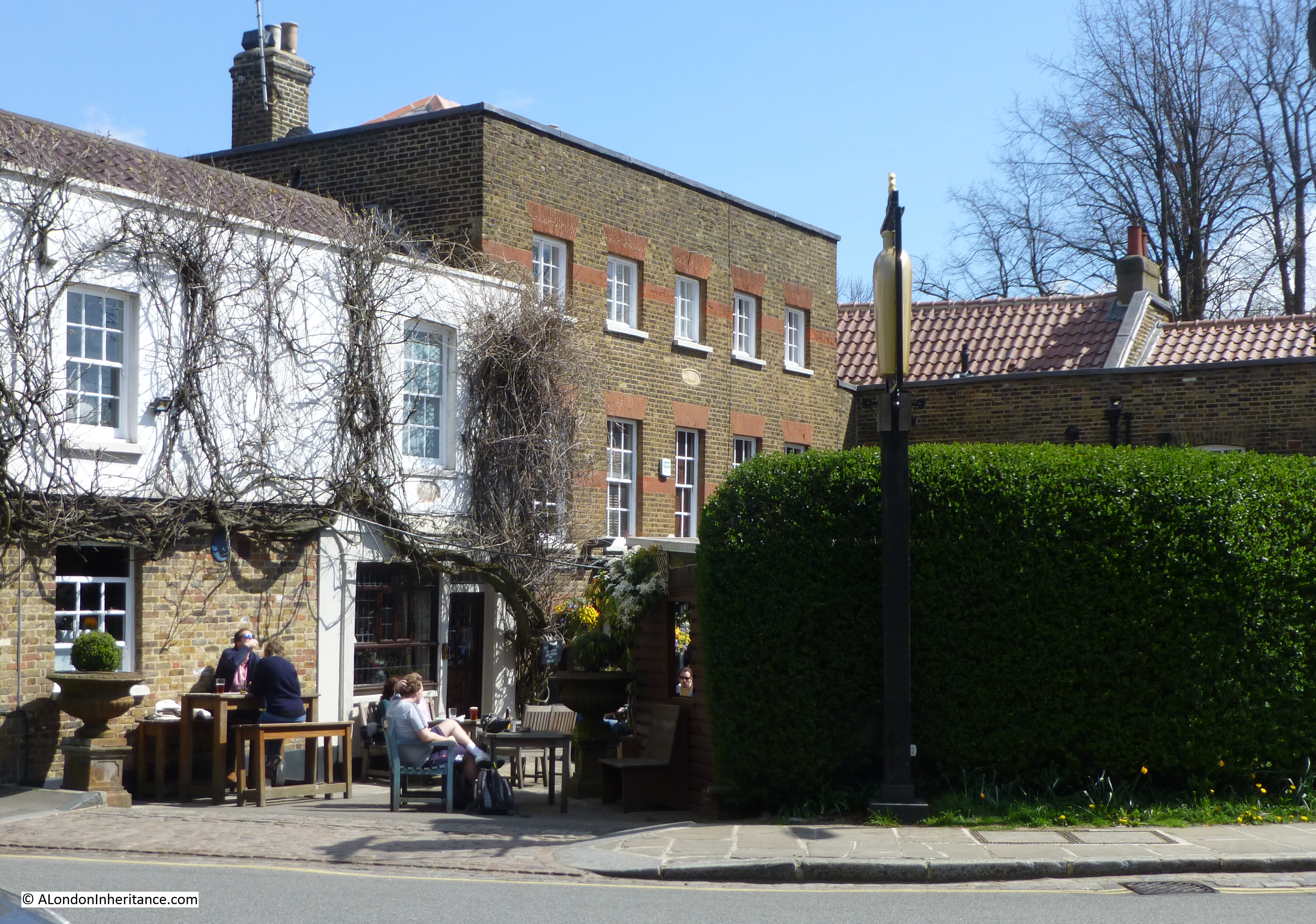
House in which Leigh Hunt, the English critic, essayist and poet lived for a time in the Vale of Health.

Vale of Health

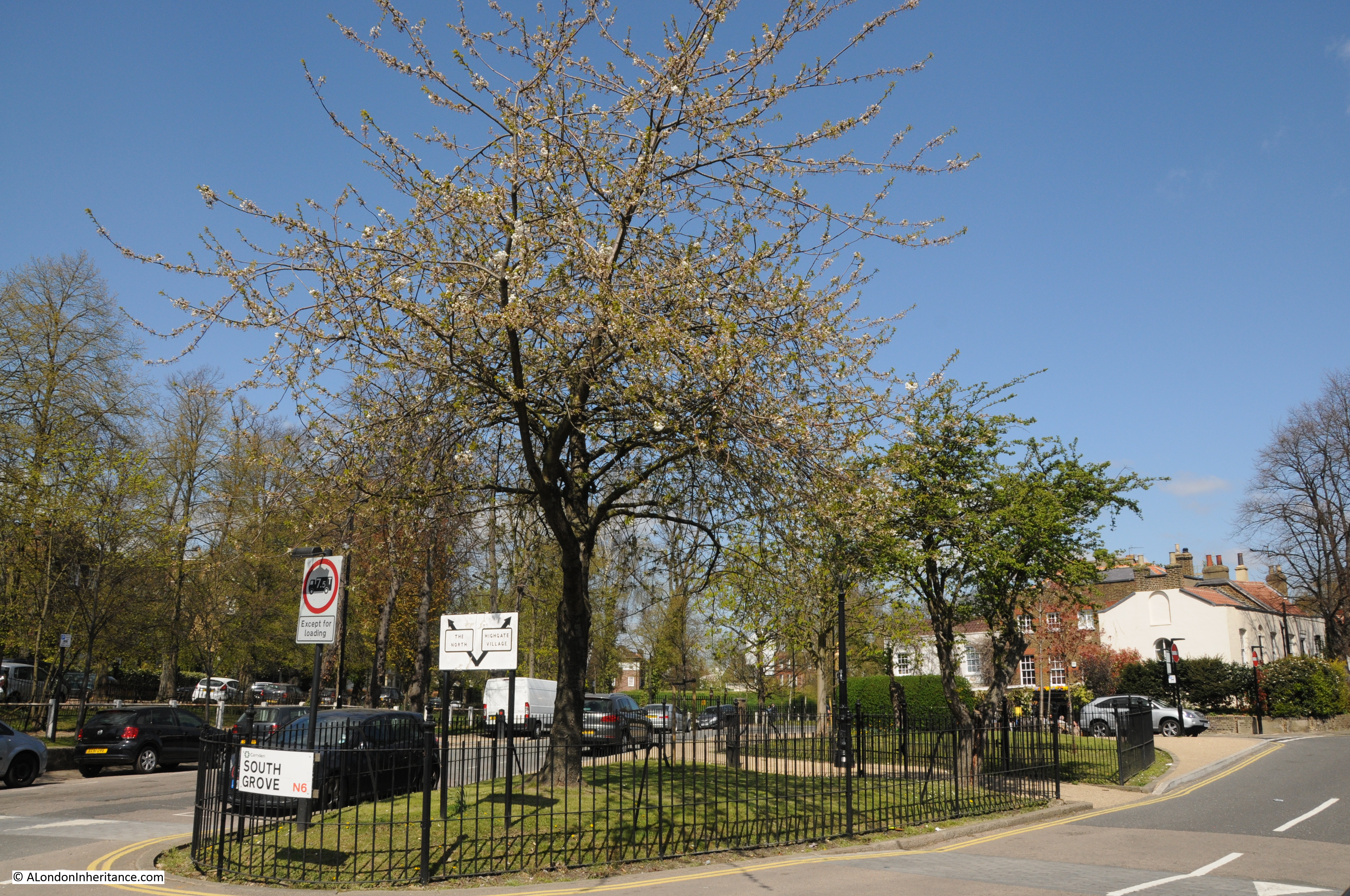
The Vale of Health is a rather unique area. A small collection of houses embedded in Hampstead Heath, accessed via a single road.

When the new flats were being built on the site of the Vale of Health hotel, there were considerable difficulties with the amount of water that was continuously seeping into the foundations, so perhaps the marshy hollow of Hatchett’s Bottom is still there below the surface,

alondoninheritance.com

The Dome at Islington Green

Last weekend I was in Islington Green for the first time in a few years. It was a perfect opportunity to photograph a rather unusual building, last photographed in 1985:

Islington Green

The same building in February 2020:

Islington Green

Before getting into the history of the building, there are two key differences between the views in 1985 and 2020 which typify what has happened across all London streets, not just Islington.

The first is the loss of many one-off shops, many of which were traditional to a specific area. There were a number of antique shops around Islington Green, today they remain clustered around Camden Passage. All too often chain shops have taken over from so many one offs.

The second is the CCTV camera. Initially I was frustrated with having the pole, CCTV camera and equipment boxes in front of the building, however they do provide a perfect demonstration of the growth of CCTV monitoring across the city, and the amount of street furniture. These are all too often installed without any apparent consideration of the impact on the surrounding street scene and buildings, as the 2020 photo illustrates.

The building has an interesting history. It was purpose built as the Electric Theatre and opened in February 1909. The domed section was originally open at the sides and formed the entrance vestibule to the cinema. Passing through the vestibule was the foyer which was built into the ground floor of the three storey building we can see from the street, and behind that was the single storey auditorium.

The Bioscope on the 11th February 1909 recorded that “The new Electric Theatre at 75, Upper Street, Islington, opened on Saturday last, is a very handsome and artistically decorated hall, both inside and out. Everything for the comfort of its patrons has been studied, and as it is owned by Electric Theatres (1908) Limited it will no doubt prove as successful as the other well-known theatres run by that company.”

The Electric Theatre company was one of the first to open a chain of cinemas across London. The interior of vestibule leading into the Electric Theatre is shown in the following photo. The decorated interior of the dome can be seen. Imagine this view if you walk in today for a coffee.

Islington Green

There is an interesting statue on top of the dome. The following photos show the 1985 statue (left) and 2020 version (right).

Islington Green

The figure on top of the dome, in 1985, was painted and holding a lighted torch above the figure’s head. By 2020, the coloured paint had been removed and the lighted torch appears to be missing.

The Electric Theatre in Islington did not last too long, closing in 1916. It is good to see this unusual building still facing onto Islington Green, and being Grade II listed, the building is protected.

Islington Green is a reasonably small, triangular green space to the east of Upper Street (the main A1 road). The street to the east of the green space is called Islington Green. The following map extract shows Islington Green as the triangular green space in the centre (Map © OpenStreetMap contributors).

Islington Green

The area is very built up today, and was part of the late 18th, early 19th century expansion northwards of London, however the twin roads and road junction that forms the triangular space where Islington Green can be found has long been a feature.

The following extract from John Rocque’s 1746 map of London shows the familiar shape of Islington Green where the two roads come together. There was ribbon development along the roads and some streets just to the north, but the rest of area is still fields. Note the New River running through the area between Hertfordshire and New River Head, just to the south.

Islington Green

One hundred years later in 1847, Reynolds’s Splendid New Map of London shows the area has transformed from fields to streets. Islington Green is still a feature where Upper and Lower Streets meet towards the top centre of the map.

Islington Green

This is the green space of Islington Green looking north. There was a council event occupying the wider northern width of the space at the time.

Islington Green

If you look to the top right corner of the green and you can just see a row of terrace houses.

I wanted to find this terrace as it provides a good illustration of Islington before it transformed to the area of expensive housing it is today, and how you can never really trust the age of a building by looking at the exterior.

Walking to the north-east corner of Islington Green and this is the view of the terrace across the road. The view shows what looks to be a complete row of late 18th, early 19th century terrace houses.

Islington Green

This was the same view in 1979:

Islington Green

Image credit: London Metropolitan Archives, City of London: catalogue ref: SC_PHL_01_188_79_1227

To confirm that this is the same view, look at the building on the far left of both photos, just across the side road where the terrace stops and it is the same building, although the terrace looks very different and the fourth house from the left is missing.

Although many of the 18th / 19th century buildings in Islington were in a poor state in the 1970s, the reason for the condition of this terrace is a bomb in the last war. The London County Council bomb damage maps have the terrace marked as “general blast damage”. The bomb that caused the damage probably landed behind the terrace as the building behind is marked as “damaged beyond repair”. The house on the far left of the terrace still looks as it probably did after the war with smoke marks and missing top floor window frames.

The fourth house in the terrace from the left is completely missing – metalwork can be seen supporting the walls of the houses on either side of the missing house.

But look at the terrace today, and it looks original. The missing house has been replaced with a house identical to the others, and just looking at the terrace you would assume a complete survivor from the time of the original build.

The open space to the right of the 1979 photo was a Gulf petrol station – today the space is occupied by a Tesco store.

The following print of Islington Green from 1750, just a few years after the 1746 map shown above, shows what appears to be the same terrace to the right of the green. The view is looking north, with the church of St Mary in the background.

Islington Green

Image credit: London Metropolitan Archives, City of London: catalogue ref: p5379292

90 years later, and more substantial building lines the northern edge of the green.

Islington Green

The structure on the green in the above print, is probably the one mentioned in the following extract from a report in the Islington Gazette on the 12th of March 1859, which also provides an indication of the state of the green, prior to Victorian improvements:

“A short time since the police gave up possession of their old quarters, the Watch-house on Islington Green, which was built in 1779, and this elegant structure now belongs to the parish. The best use it can be put to is to sell it as old building materials, and this will immediately be done. The Green will then pass into perhaps its final condition.

This open space, for which so strenuous a battle was lately fought and won, was formerly a piece of waste ground, uninclosed, and was granted to Trustees for the use of the parish by the lord of the manor in 1777.

For a long time, however, it was made the common laystall for a great part of the dirt and filth of the parish.

A watch-house, together with a cage, engine-house, and a pair of stocks, stood in the middle of the Green until the present watch-house was built. Upon its site, the Vestry have now determined to place a drinking fountain and a better situation could certainly not be found for it. it will be erected at the apex of the Green which divides the Upper from the Lower street.”

The word “laystall” refers to a place where  “waste and dung” is deposited, so this gives a good idea of how Islington Green would have been used for prior to the mid 1700s.

In the 1860s Islington Green was “improved”. The green was grassed, trees and shrubs were planted, and Islington Green was transformed to the Victorian view of an improved city green space.

The next time that Islington Green would be transformed was in 1938 when in preparation for the expected war with Germany, and the use of air power to bomb cities, air raid trenches, along with more substantial shelters were being dug across the green.

The following photo from 1938 shows “labourers engaged in the construction of trenches in one of the smaller open spaces of north London”.

Islington Green

Whilst the following photo from 1939 shows the conversion of one of the trenches from an open trench to a more secure, enclosed shelter made of concrete and steel. The photo shows Sir John Anderson, Lord Privy Seal inspecting the new shelters.

Islington Green

It would be interesting to know if there are any remains of the shelters still under Islington Green.

Time for a walk around the green. The following photo is looking north along Upper Street with the dome of what was the Electric Theatre on the left.

Islington Green

As well as the location of the Electric Theatre, the above photo shows the location of a second, early 20th century cinema on Islington Green. To the right of the photo is “The Screen on the Green” cinema, the wonderful facade of the cinema is shown in the photo below.

Islington Green

The cinema opened four years after the Electric Theatre, in 1913 and named the Empress Electric Theatre. In the early years of the 20th century, cinemas still used the name theatre, and the word “electric” was often included, as in Islington, to accentuate the modernity of the form, and the use of electricity in the display of film.

Not long after opening, the “Electric” was dropped and the name changed to Empress Picture Theatre, which was retained to 1951 when the name changed to the Rex Cinema, followed by Screen of the Green after the Rex closed in 1970.

Watching a film at the Screen on the Green is a very difference experience to the typical multi-screen cinema.

In addition to the two cinemas, another building facing onto Islington Green was an entertainment centre, although this was music hall rather than film.

Facing the northern side of the green is the facade of the building that was Collins Music Hall.

Islington Green

The building is now a Waterstones bookshop, but it is still possible to imagine the building as it appeared when it was entertaining the people of Islington:

Islington Green

A pub, the Lansdowne Arms originally occupied the site, and in 1862, Sam Vagg, a chimney sweep who had built a stage career as Sam Collins  turned the pub into a music hall. Three years after opening, Sam Vagg died at the age of 39, however the music hall would continue and retained the name of Collins in honour of the founder.

The entertainment on offer can be appreciated by taking a random edition of the Islington Gazette and checking what was on the bill. The 15th September 1887 edition details the following “Varied Star Programme”:

“The Five Jees, in the Musical Smithy, Sisters Bilton, the enchanting duettists; Dan Leno, the champion comic of all comics; Ethel Victor, the dashing serio-comic; Florrie West, the charming serio-comic; Brothers Passmore, variety artists; Arthur West, extempore vocalist; Sisters Dagmar, the pleasing duettists; Charles Murray, comic; Jessie Hart, the sprightly serio-comic; Fred Carloss, the ‘Sloper’ comedian, Professor Wingfield, with his educated dogs; Swiss Mountaineers, the vocal trio.”

How was that for a night out in Islington – who could not be tempted by Professor Wingfield, with his educated dogs.

The music hall was rebuilt in 1897, this date is still visible on the front of the building.

In the following decades, Collins would continue to put on variety shows in the music hall tradition, and names such as Norma Wisdom, Benny Hill and Tommy Copper performed at Collins in the early years of their careers.

Collins Music Hall was very badly damaged by fire in 1958. Only the front and side walls survived, and the core of the music hall was lost, and the remains of the building (apart from the front wall) was demolished in 1963.

Collins Music Hall was also used for other purposes, which also give an indication of the poverty that existed in Islington. On the 24th December 1912, the islington Gazette carried a report titled “Christmas Dinners – Distribution Today at Collins Music Hall – Over 8,500 Dinners”:

“Through the medium of the Daily Gazette fund between 8,500 and 9,000 persons, or one in every 40 of the population of Islington, will participate in these Christmas gifts. the dinner parcels consist of meat, tea, milk, sugar, cake, rice and sweets, and will represent something like 10 tons of food.”

Up to 9,000 people sounds an enormous number, however this appears to have been only a proportion of those who applied. At the end of the article, the following appears in large, bold text:

“The Editor regrets exceedingly that he is unable to reply to the large numbers of letters received from poor and needy people in the four divisions of Islington, asking to participate in the distribution of dinners to-day at Collins’ Music hall.

Having regard to the enormous population of Islington, and the wide-spread poverty existing in the borough, it naturally follows that large numbers of applicants cannot be administered to.

The Editor hopes that the applicants who have been turned empty away will accept this explanation. Had the fund been half as large again as it is, most of the cases which unfortunately have been rejected could have been dealt with. Some of these, it is hoped, will be relieved from other charities.”

A clear reminder of the poverty that existed across London on a considerable scale.

The following photo shows the Fox on the Green. A pub at the north-west corner of the green.

Islington Green

Originally called just the “Fox”, reference to the pub dates back to the start of the 19th century, however I am not sure if the current building is the original. There are a number of newspaper references to the widening of the road north from Islington Green, starting from the Fox, and also one reference specifically referring to the Fox when describing how the Metropolitan Board of Works would preserve a licence to sell alcohol when they had demolished a pub, and before the replacement had been completed.

Apparently the Metropolitan Board of Works would install a temporary “shanty” on the site which would sell a minimum of a single drink a day. This would allow the licence to be preserved.

One newspaper report from 1881 which covered many of the improvement schemes in the area stated that St Mary, Islington was the “most populous in the metropolis”. An indication of how the area had developed from the fields of the 1746 map.

I need to research more to check the date of the current Fox, however whether this building, or a previous version, there are very many references to a large number of inquests held in the pub, adverts for staff, a suicide from one of the upper floor windows, theft and fatal accidents outside the pub – it was a busy place.

A view along Upper Street, to the west of the green showing a mix of architectural styles.

Islington Green

The larger brick building in the centre has a blue plaque stating that the singer and entertainer Gracie Fields lived here.

More mixed architecture and colour schemes.

Islington Green

At the southern end of Islington Green is a statue of Sir Hugh Myddelton, the wealthy City Goldsmith, who took up the scheme for the New River, and saw construction through to completion. He is facing towards New River Head, a short distance further south where the New River terminated, and water was distributed onward to consumers across London.

Islington Green

The statue was erected in 1862, with the statue being funded by Sir Samuel Morton, and the pedestal and fountains on either side of the pedestal, by voluntary subscriptions and aided by a grant from the Vestry of Islington.

The following drawing from the year the statue was unveiled shows the fountains in operation. It also shows the words “New River” on the plan Myddelton is holding in his left hand – not sure this is still visible today.

Islington Green

Walking back to the Angel underground station, and this is the view looking back up to Islington Green with Upper Street to the left, the street with the name Islington Green to the right, and the green in the centre, with Hugh Myddleton looking back towards New River Head.

Islington Green

Although it is only a small bit of grassed open space, Islington Green is a very old feature. Formed where the road from the City split into two, the green was there when the rest of what is now Islington was still covered in fields and open space.

It has been used as a dumping ground, improved by the Victorians, seen a tremendous growth of traffic on the surrounding roads, along with building on all sides.

The green has seen the changing forms of entertainment, from pubs, to the Electric Theatre, the Music Hall, and now retaining one of London’s unique small cinemas.

Bombed at the north-east corner, and dug up for air raid shelters, Islington Green continues watching the changes in one of London’s northern villages.

alondoninheritance.com

The Chalybeate Well – Hampstead

The high ground of Hampstead Heath, to the north of central London has a fascinating geology which helped to drive Hampstead’s original development and is also the source of rivers such as the Fleet and the Westbourne.

The highest point on the heath reaches some 133 meters above sea level. If you stand on the heath, under your feet will be a thick layer of sand and gravel, known to Geologists as the Lower Bagshot Sands, which at the highest point is 24 meters thick. The thickness of this layer fluctuates across the heath, for example when the shafts were sunk for the Hampstead Underground Station, the layer was found to be only 5 meters thick, and the layer disappears as height descends running down from Hampstead.

Underneath the layer of sand and gravel is a layer of sandy clay which extends for 15 meters at the thickest point. Underneath this layer is the thick and impermeable London Clay which extends over much of London.

The following map from “Hampstead Heath – It’s Geology And Natural History” by the Hampstead Scientific Society published in 1913 shows the area covered by the Bagshot Sands.

Chalybeate Well 13

Hampstead and the heath can therefore be considered as a sandy peak sitting on top of a layer of thick clay.

It is this geology which gives rise to the large number of springs which can be found across the heath. Rainwater can easily pass through the layers of sand before reaching the layer of London Clay which presents a barrier. Water then runs horizontally along the boundary between the sand and clay to come back out from the ground in the form of a spring at the point lower down the heath where the sand layer stops.

When emerging from the ground, the water carries with it the properties of the sand through which it has passed, and it is these springs and the properties of the water that have been so important in Hampstead’s development.

So what relevance does this brief geological introduction to Hampstead have to this week’s post? Among my father’s photos is this photo of a well taken in 1949:

Chalybeate Well 1

The same well in 2016:

Chalybeate Well 3

This is the Chalybeate Well in Well Walk, Hampstead. In the context of water, the name chalybeate means that the water contains iron.

The springs of Hampstead have a long history of providing supplies of water for the rest of London. Conduits were built to channel water from the springs along the heath to the centre of the city. During the search for sources of water, the chalybeate springs must have also been found, and whilst not suitable for drinking water, the high iron content gave rise to the believe that the water had medicinal properties.

On the 20th December 1698 the infant Earl of Gainsborough and his guardian and mother, the Countess of Gainsborough gave six acres of land in the region of the Chalybeate Well, to be used to benefit the poor of Hampstead. The deed that transferred the land refers to “the Wells lately made there for medicinal waters”. The transfer was to a charity managed by 14 trustees.

This gift of land is recorded on the plaque on the Chalybeate Well:

Chalybeate Well 5

The land in this area of Hampstead was poor quality and rather boggy due to the number of springs. Despite the gift of the land, there was little from the land that would benefit the poor of Hampstead, apart from the springs and it is these that the trustees started to develop.

An advertisement posted by the trustees in the “Postman” on the 18th April 1700 reads:

“The Chalybeate Waters at Hampstead being of the same nature and equal in virtue with Tunbridge Wells and highly approved of by most of the eminent physicians of the College, as likewise by many of the gentry who formerly used to drink Tunbridge Waters, are by direction of the Trustees of the Wells aforesaid, for the conveniency of those who yearly drink them in London carefully bottled up in flasks and sent to Mr. Phelps Apothecary at the Eagle and Child in Fleet Street every morning at the rate of 3d per flask and if any person desires to have them brought to their own houses, they will be conveyed to them upon their leaving a note to Mr Phelps’ aforesaid at 1d more, and to prevent any person being imposed upon the true waters and nowhere else to be procured unless they are sent for to the Wells at Hampstead, and the said Mr Phelps to prevent Counterfeits hath ordered his servants to deliver to each person who comes for any of the waters aforesaid, a sealed ticket viz: a wolf rampant with 7 Crosslets. Note! the messengers that come for the waters must take care to return the flasks daily.”

So the Chalybeate Wells of Hampstead were in competition with those of Tunbridge Wells. It also provides a fascinating insight into the need to guarantee that the waters provided in flasks were original – the use of a sealed ticket with a wolf rampant sounds very dramatic.

The waters were bottled on the site of the present pub “The Flask” on Flask Walk which leads directly into Well Walk.

The source of the water that was sold in London was not from the existing Chalybeate Well in Well Walk, the source was a spring and pond (filled in about 1880) about 100 yards further up the hill.

As well as the sale of the water in London, the trustees also looked at other opportunities for how they could gain further benefit from the 6 acres of land.

On the 2nd June 1701, a John Duffield was granted possession of the land for a period of 21 years for an annual rent of £50. John Duffield must have realized the opportunities that the land and the associated springs provided with their close location to the rest of London. He immediately started building work, constructing buildings that would enhance the local springs with a Great Room or Long Room, Assembly Rooms and a Pump Room. To these rooms were soon added a tavern, chapel and shops along with formal gardens and a bowling green.

The following map from George Potter’s “Hampstead Wells” published in 1907 provides an overview of the area around 1761. The original source for the Chalybeate waters is at point C. The walkway between Well Road and Well Walk terminates on Well Walk directly behind the current Chalybeate Well so the locations of the Great Room, Pump Room etc. can be positioned along the current Well Walk.

Chalybeate Well 12

The type of entertainments provided in these rooms can be identified from another advert in the “Postman” on the 9th September 1701:

“In the Great Room at Hampstead Wells on Monday next being the 15th, exactly at 11 o’clock of the forenoon will be performed a Consort of vocal and instrumental Musick by the best Masters, and at the request of several gentlemen, Jeremy Bowen will perform several songs and particular performance on the violin by several masters. Tickets to be had at the Wells and at St. Stephen’s Coffee House in King Street, Bloomsbury at 1s per ticket. There will be dancing in the afternoon as usual.”

A later advertisement mentions that the room will hold 500 people which gives an indication of the size, and also at 1s per ticket the amount of money that the new buildings at the Hampstead Wells were generating.

John Rocque’s map published in 1746 shows the village of Hampstead still as a village surrounded on all sides by fields and the heath. The new developments around Well Walk are to the upper right of the village.

Chalybeate Well 11

The rear of the Chalybeate Well in 1949. On the left of the basin is a chain which presumably had a cup attached to allow the waters to be drunk from the basin.

Chalybeate Well 2

The rear of the well in 2016. The chain and cup have disappeared. Just above the right hand-side of the basin is a modern push button which appears to offer a pump-action to bring water to the basin – I tried it several times but there was no water.

Chalybeate Well 4

The chalybeate waters, the Long Room, Pump Room etc. enjoyed a number of years of great popularity with those who could afford to travel and pay for the entertainments, with Londoners flocking to Hampstead. However after a number of years their popularity declined, there were a number of scandals and trouble at the tavern. It was also found that the poor of Hampstead who should have benefited from the original grant of land had not received anything as John Duffield had not been paying his annual £50 rent, and by the 1720s when the situation could not last for much longer, eleven of the original fourteen trustees had died so the trust had also become rather ineffective.

After this initial development of the grant of the 6 acres of land, and the chalybeate waters, the area continued under the management of what became the Wells Charity. Continued efforts were made to promote the waters and the entertainments that were provided in the buildings along Well Walk and during the 19th century the houses that currently line Well Walk gradually replaced the 18th century buildings, constructed to promote the spring waters.

The original public basin that held the spring waters was on the opposite side of the road from the current Chalybeate Well which was built around 1882. Water has never run freely from the well. Digging of sewers in the road and other building works appears to have disrupted the underground flow of water. Even if water was flowing into the well, it would not be wise to drink.

A Dr. Atfield analysed the water from the well in 1884 and found that it contained:

analysis

There was a note at the bottom of the above table which read:

“Note – This appears to be chalybeate water mixed with ordinary surface water. If this could be excluded a purely chalybeate water would probably be obtained.”

Not that there was much to drink. In 1907, George Potter of the Wells and Campden Charity recorded that:

“The traveler requiring a draft of it would have to spend at least an hour to obtain a moderate one from this source, and when he had obtained it he probably would not relish it very much.”

So, despite the new well being constructed, there was very little water and what was available was not very drinkable.

George Potter tried to find other sources of water which could be run to the well. A number of shafts were sunk in the gardens of houses along Well Walk and spring water was found, however on analysis it was found that:

“With reference to the analyst’s report on the two samples of water, Nos 2 and 3, a copy of which I forwarded to you on the 10th, it appears to me that I cannot allow it to pass without representing to those in whom is vested the Chalybeate Spring that persons drinking this water run a serious risk of injury to their health.”  (Letter from Dr. Herbert Lttlejohn, Medical Officer of Health to George Potter on the 17th November 1902.)

George Potter described his disappointment with these results: “The handsome new fountain in Well Walk, a fountain without water, is now only a monument – a monument to commemorate the memory of the departed glories of the once famous Hampstead Spa. But even now I am not without hope that a supply of this water, practically pure, may yet be found and let to this fountain – a fountain only in name at present.”

The Well Charity continues to this day in the form of the Hampstead Wells and Campden Trust. Although having been through amalgamation with other charities and changes in status, the charity is rooted in the original donation of 6 acres of land by the Earl and Countess of Gainsborough

The well provided a common source of street names in the area. Chalybeate Well is on Well Walk. Just behind the well is Well Passage which leads up to Well Road.

Chalybeate Well 6

Well Walk has been the location for a number of drawings and paintings of Hampstead over the years. The following print being an example, and reads: “A Prospect of Hampstead from the Corner of Mrs Holford’s Garden, opposite the Well Walk” and shows Hampstead in 1745 (print by William Henry Toms)

816585001

©Trustees of the British Museum

The following print by a Captain Thomas Hasting is from 1828 and titled Near the Well Walk Hampstead”

1169785001

©Trustees of the British Museum

Hampstead has also long been the residence of artists. A blue plaque along Well Walk identifies one of the two houses in which the artist John Constable lived in Hampstead. He frequently visited Hampstead in the summer then moved there permanently until his death in Hampstead in 1837. He took the lease on the house in Well Walk from the summer of 1827 until 1834.

Chalybeate Well 7

Constable delighted in the view of London from his house in Well Walk and worked on a number of paintings of the view. The following is a watercolor painted in the drawing-room at 6 Well Walk looking across to the City and St. Paul’s Cathedral. An inscription on the rear of the painting reads: “Hampstead. drawing Room 12.oclock noon Sept.1830”

9206001

©Trustees of the British Museum

Walking back into Hampstead, at the junction with Christchurch Hill is the Wells Tavern. This was built on the site of the original tavern, the “Old Green Man” which was pulled down in the late 1840s.

Chalybeate Well 8

At the Hampstead end of Well Walk, the road splits into Flask Walk and Gayton Road. Follow Flask Walk towards Hampstead to find The Flask. Both the walk and the pub are named after the flasks that were filled here with spring water ready for dispatch to London.

Chalybeate Well 10

The Chalybeate Well is a reminder of how the geology of a location has played a part in the development of London. The springs helped the early development of laundry services in Hampstead, the waters were channeled to the City through conduits and they have shaped the development and natural history of the heath.

I hope to cover this in more detail in future posts (and it provides a good excuse to walk more in Hampstead and visit Hampstead pubs).

The sources I used to research this post are:

  • Springs, Streams and Spas of London by Alfred Stanley Foord published in 1910
  • Hampstead Heath. Its Geology and Natural History by the Members of the Hampstead Scientific Society published in 1913
  • Hampstead Wells – A Short History of their Rise and Decline by George W. Potter published in 1907
  • For the poor of Hampstead for ever – 300 years of the Hampstead Wells Trust by Christopher Wade published in 1998

alondoninheritance.com

Highgate – Pubs, History And Architecture

Highgate has been high on my list to visit as some of my father’s photos from 1948 are of the pubs and buildings around the centre of Highgate and with the recent good weather, a destination with a pub seemed perfect.

Highgate is probably better known for the cemetery of the same name, however the village at the top of the hill is well worth a visit to view some of the architecture and stop at some of the many pubs.

Coming out of London, up Highgate West Hill, after a long climb up to the heights of Highgate we reach the Flask. This is how the Flask looked in 1948:

Highgate 2

And my April 2015 photo shows the pub looking very much the same:

Highgate 1

It is really good that in the intervening 67 years there has not been too much change to the pub. The main difference being the courtyard area in front which is now a seating area, although in the 1948 photo you can just see some tables and chairs to the right and left of the courtyard so perhaps even this has not changed that significantly.

Internally, the pub has avoided the conversion to a large open space, the fate of so many other pubs. The Flask still has many small bar areas and rooms at different levels and is probably much the same as when my father visited in 1948.

The name of the pub is apparently from the flasks that were sold from the pub to collect water from the local springs.

Hogarth allegedly drank at the Flask. From Old and New London:

“During his apprenticeship he made an excursion to this favourite spot with three of his companions. The weather being sultry, they went into a public-house on the Green, where they had not been long, before a quarrel arose between two persons in the same room, when, one of the disputants having struck his opponent with a quart pot he had in his hand, and cut him  very much, causing him to make a most hideous grin, the humourist could not refrain from taking out his pencil and sketching one of the most ludicrous scenes imaginable, and what rendered it the more valuable was that it exhibited the exact likeness of all present.”

Fortunately the Flask was very peaceful during my visit, and it was the perfect location to enjoy the spring sunshine.

Another view of the Flask from the side, passing along Highgate West Hill in 1948:

Highgate 4

And today in April 2015:

Highgate 3

The Flask is now a Fuller’s pub. In 1948 as can be seen from the sign above the entrance it sold Taylor Walker’s Prize Beers.  Taylor Walker was founded in Stepney, East London in 1739 and originally brewed beer in Limehouse. It has been through a number of changes in ownership and is now a brand owned by Spirit Pub Company. At some point since 1948, it was acquired by Fullers who still brew beer in Chiswick, West London.

Part of the Green referred to in the Hogarth reference is still in front of the Flask and gives the impression of being in a country village rather than north London:

Highgate 14

The direction sign gives the very stark choice of either entering Highgate Village or going to the North. Highgate obviously has a very low opinion of the value of visiting anywhere else in the local area.

Highgate 15

Leaving the Flask and completing the walk up the hill, we find another pub, the Gatehouse. Highgate does seem well provided with pubs. In 1826, Old and New London records that there were nineteen licensed taverns. The pubs of Highgate practiced a custom whereby strangers visiting a pub had to swear an oath on a set of animal horns (each pub having their own). Byron referred to the ceremony in Childe Harold’s Pilgrimage:

“Some o’er thy Thamis row the ribboned fair,
Others along the safer turnpike fly;
Some Richmond Hill ascend, some scud to Ware,
And many to the steep of Highgate hie.
Ask ye, Boeotian shades, the reason why?
‘Tis to the worship of the solemn Horn,
Grasped in the holy hand of Mystery,
In whose dread name both men and maids are sworn,
And consecrate the oath with draught and dance till morn.”

The custom died out in the 19th century.

I did not count how many are there today, but there does still seem to be a good number.

This is my father’s photo of the Gatehouse from 1948:

Highgate 6

And from the same location in 2015:

Highgate 5

In 67 years it is remarkable how little change there has been, apart from the style of cars, it is mainly cosmetic.

The Gatehouse may look relatively new, however this is one of the key locations in Highgate and the Gatehouse has a long history.

The name Highgate was first recorded in the 14th century, and refers to one of the Gates that provided access to the park, owned by the Bishop of London that stretched from Highgate, to the Spaniards pub in Hampstead and to East Finchley. There is also a view that the name has an earlier source and is based on “haeg”, the Saxon word for a hedge, where a hedge would also have been used to fence around a park.

At some point early in the 14th century, the Bishops of London had allowed a route through their parkland which due to the height of the land around Highgate, provided a more passable route in winter than the main route north through Crouch End and up to Muswell Hill.

The Gate here, or Gatehouse was to collect tolls from travellers along this route and is on the site of the earliest recorded building in Highgate.

The Gatehouse in 1820:

Highgate 11

The Gatehouse also stood in two different parishes as evident from the parish boundary markers still found on the wall of the building:

Highgate 12

The Gatehouse was split between the Parish of Hornsey and St. Pancras Parish. Being split between two parishes caused problems during some of the functions performed within the building. When used as a court, a rope had to be strung across the floor to divide into the two parishes and ensure that the prisoner did not escape into the other parish.

Boundary changes in 1994 took the whole of the building into the London Borough of Camden.

The gates that gave the Gatehouse its name were removed in 1892 with tolls having finished a few years earlier in 1876.

The location of Highgate, on hills to the north of London made it a popular location to live, close to London, but just far enough away to avoid the dense population, pollution, smoke, smells etc. of the city. There was much development of Highgate in the 18th and 19th centuries and many of these buildings remain today.

Close to the Gatehouse is Pond Square. My father took this photo in 1948:

Highgate 9

And in 2015, remove the scaffolding and the building is much the same.

Highgate 10

The name Pond Square comes from the ponds that were originally in the centre area of the square. The ponds were created by the digging of gravel for maintenance of the roads, however the ponds were filled in during the mid 19th century due to the poor state of the ponds and the associated risks to health (being also used as cesspools).

Looking across Pond Square today, there is no evidence of the ponds, although there is still evidence of what Ian Nairn described in Nairn’s London as:

“Ruined by traffic and a weary flow of municipal improvements – asphalt and crazy walling – which is at its worst in Pond Square. The place could be transformed without altering anything but the surface of the floor.”

Highgate 13

Walking round Highgate I was really pleased to find the location of the following photo. This is one of the many that I was not sure if I would find the location. There is no information, street names, recognisable buildings etc. to identify the location of the photo. It was on a strip of negatives that had one Highgate photo but also had photos of central London.

Highgate 8

This is Southwood Lane looking up into Highgate, and in 2015 it is remarkably much the same:

Highgate 7

Highgate is a fascinating location to visit and as shown by the photos my father took in 1948 and my 2015 photos has changed very little.

As usual, in the space of a weekly blog I have only been able to scratch the surface of the history of Highgate, but it is a location I will certainly be back to explore again.

alondoninhertitance.com

Shepherd Market – A Village in Piccadilly

Throughout London there are many small areas that have their own distinct history and unique atmosphere. One of these is Shepherd Market and part of the title of this week’s post “A Village in Piccadilly” is taken from the book of the same title by Robert Henrey, first published in 1942 and describing life in Shepherd Market during the early part of the last war.

Shepherd Market is the core of the area between Curzon Street and Piccadilly, the site of the original May Fair that gave the district its’ name. The following map is taken from the book A Village in Piccadilly:

map from book

Robert Henrey was a journalist, however his wife was the French writer Madeleine Gal who also wrote under the name of Robert Henrey. Writing was a joint enterprise with much of the material being hers and he supplied the editorship. Their son, Bobby Henry was the child star of the British 1948 film “Fallen Idol”.

See the Guardian obituary of Madeleine for more information.

The Henrey’s lived in Shepherd Market during the 2nd World War and the majority of the book is a fascinating account of the impact of the war on life in Shepherd Market and the immediate area around Piccadilly.

Shepherd Market was the site of the original May Fair. This had started in the reign of Edward 1 as the annual St. James Fair after Edward 1 privileged the hospital of St. James to keep an annual fair “on the eve of St. James the day and the morrow, and four days following”. By the reign of Queen Anne it had become the May Fair. The fair had a considerable reputation. A review by the editor of the Observator from the reign of Queen Anne (1702 – 1707) states:

“Oh! the piety of some people about the Queen, who can suffer such things of this nature to go undiscovered to her Majesty and consequently unpunished! Can any rational man imagine that her Majesty would permit so much lewdness as is committed at May Fair, for so many days together, so near to her royal palace if she knew anything of the matter? I don’t believe the patent for that fair allows the patentees the liberty of setting up the devil’s shops and exposing his merchandise for sale”

Unfortunately he does not state the nature of the merchandise for sale !

From 1701 the fair was growing considerably in scope and occupied the area on the north side of Piccadilly, in what would become Shepherd Market, Shepherd Court, White Horse Street, Sun Court, Market Court and the area as far as Tyburn (now Park) Lane.

Within the area of the May Fair was a cottage built in 1618 which was the home of the herdsman who looked after the cattle during the annual fair. This cottage lasted until 1941 when it was destroyed in an air raid. One of the many examples of the large loss of historic buildings during the bombing of the last war.

Robert Henrey’s book describes how the area that held the May Fair became Shepherd Market:

To the north of our village in 1708 was a low house with a garden embowered in a grove of plane-trees. Here lived Mr Edward Shepherd. In 1708 Mr Shepherd had seen a lot of disorderedly behaviour at the May Fair so much that the fair was abolished by Grand Jury presentment, “the year riotous and tumultuous assembly …in which many loose, idle and disorderedly persons did rendezvous, draw and allure young persons, servants, and others to meet there to game and commit lewdness”

The fair did return after a short pause (the temptation of gaming and lewdness probably too much for Londoners of the time), however with London expanding the land started to be built on. Mr Shepherd noticed that the market value of the land made building profitable and he bought the irregular open space on which May Fair had been held and in 1735 built Shepherd Market.

The core of the market consisting of butchers’ shops and the upper floors containing a theatre.

In the map at the top of the post, Hertford Street can be seen to the west of Shepherd Market. In this street was the “Dog and Duck” public house with its duck pond and shaded by willows. Duck hunting was described as one of the “low sports of the butchers of Shepherds Market”.

My reason for tracking down Shepherd Market was to identify the location of two photos taken by my father in the late 1940’s.

The first is of the pub “Ye Grapes” and can be located in the top right hand corner of the map at the start of this post. The following photo is my father’s original:

Ye Grapes

Almost 70 years on, the area is still very much the same. Ye Grapes is still a pub, the alley leading through to Curzon Street is still there and the newsagents to the left of the alley is still a newsagents.

DSC_1156

Ye Grapes is recommended for a drink after some London walking. The bar area is many years old and is what a local London pub should be.

The following is my father’s photo of Market Street:

market street

And the following is my 2014 photo:


I recommend Robert Henrey’s book, A Village in Piccadilly as it provides a very detailed description of life in a small part of London at the start of the war, when the bombing of London was at its most intensive. The book is a very personal account of the impact on individual shopkeepers and inhabitants of the area through the dramatic early years of the last war.

Whilst the buildings of Shepherd Market have not changed significantly, the area is now home to many small restaurants and does almost have a “village” atmosphere after the noise and congestion of Piccadilly, just a short distance away.

Looking back down towards Shepherd Market from the alley that leads to Curzon Street:

DSC_1159

The following is from the book “A Village in London” and shows an area in 1910 which was later destroyed in an air raid. As the text states, it was kept by the newsagent to remember the “old days”.

shepherd market in 1910

So, if you are in the Piccadilly area, take a short detour to Shepherd Market. Enjoy the restaurants and the pubs, but be moderate with the drink otherwise the riotous and tumultuous assembly and lewd behaviour that was the defining feature of this area for so long may still be just below the surface.

DSC_1152

 alondoninheritance.com