Monthly Archives: August 2015

A 1943 View Of A Redeveloped London

In 1943, although the end of the last war was still two years away,  the thoughts of the London County Council were focussed on the post war reconstruction of the city.

London had yet to suffer the barrage of V1 and V2 weapons, but in 1943 the London County Council published the County of London Plan, a far reaching set of proposals for the post-war development of the city.

I find the many plans for London that have been published fascinating to read. They show the challenges of trying to forecast the needs of a city such as London for decades to come. They provide a snapshot of the city at the time, and they demonstrate that time after time, development of London has reverted to ad-hoc rather than grandiose, city wide schemes.

In the forward to the plan, Lord Latham the Leader of the London County Council wrote:

“This is a plan for London. A plan for one of the greatest cities the world has ever known; for the capital of an Empire; for the meeting place of a Commonwealth of Nations. Those who study the Plan may be critical, but they cannot be indifferent.

Our London has much that is lovely and gracious. I do not know that any city can rival its parks and gardens, its squares and terraces. but year by year as the nineteenth and twentieth centuries grew more and more absorbed in first gaining and then holding material prosperity, these spaces were over-laid, and a tide of mean, ugly, unplanned building rose in every London borough and flooded outward over the fields of Middlesex, Surrey, Essex, Kent.

Athens was the glory of Greece, Rome the great capital of a great Empire, a magnet to all travellers. Paris holds the hearts of civilised people all over the world. Russia is passionately proud of Moscow and Leningrad; but the name we have for London is the Great Wen.

It need not be so. Had our seventeenth century forefathers had the faith to follow Wren, not just the history of London, but perhaps the history of the world might have been different.

Faith, however was wanting. It must not be wanting again – no more in our civic, than in our national life. We can have the London we want; the London that people will come from the four corners of the world to see; if only we determine that we will have it; and that no weakness or indifference shall prevent it.”

The 1943 plan provides plenty of detailed analysis of London at the time, with some graphical presentation using techniques I have not seen in any earlier London planning documents.

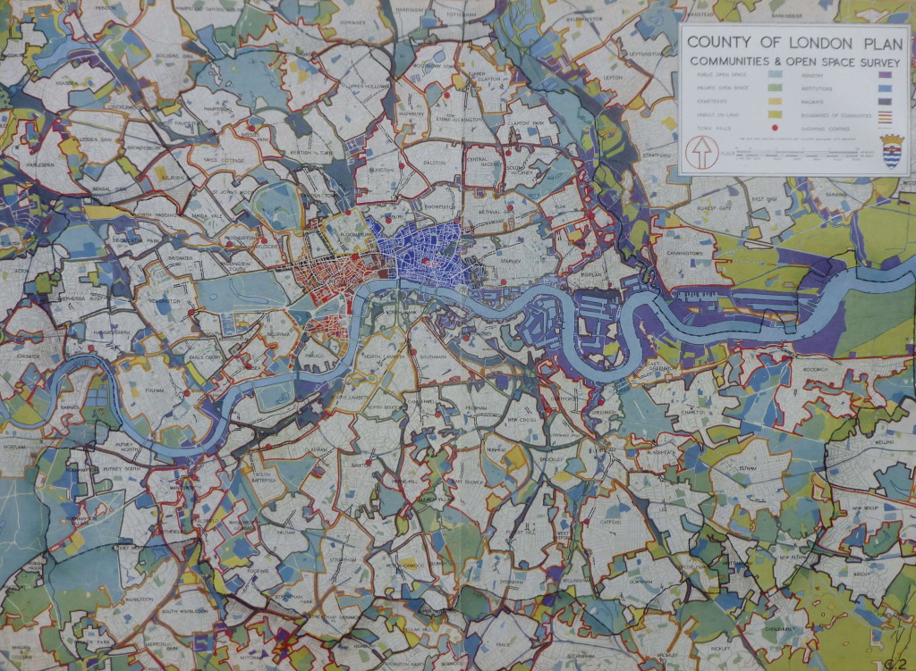
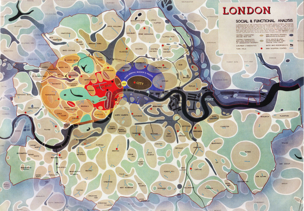
The following diagram from the report provides a Social and Functional Analysis of London. This divides London into individual communities, identifies the main functions of the central areas, shows town halls, man shopping centres and open spaces.

The City is surrounded by an area of “Mixed General Business and Industry”. Press (Fleet Street) and Law (the Royal Courts of Justice) provide the main interface between the City and the West End, which also contains the University and Government areas of the city.

The darker brown communities are those with a higher proportion of obsolescent properties. (click on any of the following maps to enlarge)

Social and Functional Map 1

The plan placed considerable importance on community structure within London:

“The social group structure of London is of the utmost importance in the life of the capital. Community grouping helps in no small measure towards the inculcation of local pride, it facilitates control and organisation, and is the means of resolving what would otherwise be interminable aggregations of housing. London is too big to be regarded as a single unit. If approached in this way its problems appear overwhelming and almost insoluble.

The proposal is to emphasise the identity of the existing communities, to increase their degree of segregation, and where necessary to reorganise them as separate and definite entities. The aim would be to provide each community with its own schools, public buildings, shops, open spaces etc. At the same time care would be taken to ensure segregation of the communities was not taken far enough to endanger the sense of interdependence on the adjoining communities or on London as a whole.”

The following map shows a more traditional view of the Communities and Open Spaces within the Greater London area.

Communities and Open Space 1

The plan identifies a number of issues that divide communities, chief among them the way that railways, mainly on the south of the river have divided local communities with railway viaducts acting as a wall between parts of the same community.

The plan used the following photo of the railway viaducts on the approach to Cannon Street Station and down to Waterloo to illustrate the impact. The report, as with a number of other proposals for the post war development of London, placed considerable importance on moving the over ground railways into tunnels to remove viaducts, bring communities together and to remove rail bridges, such as the one shown leading into Cannon Street Station, from across the Thames.
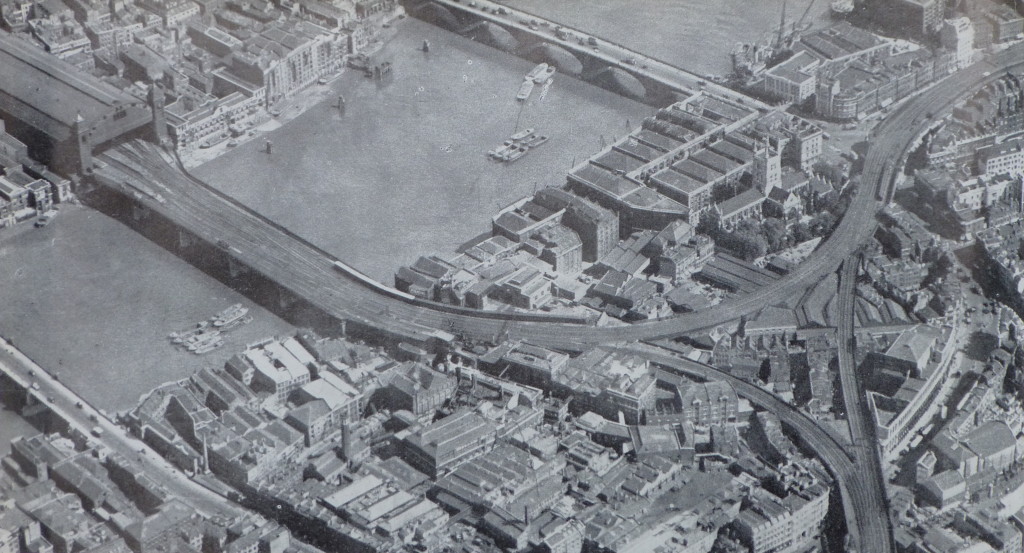
The Southbank 2

The first sentence in the section on Roads is remarkable, remember this was written in 1943, not 2015:

“The need for improved traffic facilities in and around London has become so acute, that unless drastic measures are taken to relieve a large number of the thoroughfares, crossings and junctions of their present congestion, there will be a grave danger that the whole traffic system, will, before long, be slowed to an intolerable degree.”

The plan also emphasises the dangers resulting from traffic on London roads with in 1937 a total of 57,718 accidents in the Greater London area that involved personal injury.

At the time of planning, the ratio of cars to population was one to twenty two. The plan expects a considerable increase in car usage after the war, stating that the war has “made a vast number of people for the first time mechanically minded, and has given a great impetus to the production of motor vehicles.”

Parking this number of cars was also expected to be a problem. The plan includes the provision of underground car parks and that legislation should be passed that enforces the provision of car parking facilities for all buildings of a certain size.

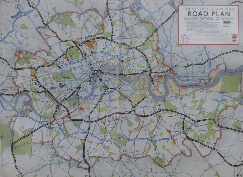
A new ring road was planned for fast moving traffic.  This is shown as the B Ring Road in the following map. Circling the central area of London and with a tunnel under the Thames running from the Isle of Dogs to Deptford. Roads radiating out from the B Ring Road would allow traffic circulating around London to quickly leave to, or arrive from the rest of the country.

Road Plan 1

The plan also identifies the “cumulative effect of street furniture on the appearance of London and on the convenience of pedestrians and vehicular traffic is very considerable” and recommends the formation of a Panel to provide a degree of control over street furniture, with a preference for embellishing streets with tree-planting and green-swards. With the level of street furniture on the streets today, perhaps a Panel to control this would have been a good outcome.

The provision of more open space was seen as a key component of the future development of London with the standardised provision of space for Londoners.

At the time the plan was written there was a considerable variation in the amount of open space available to Londoners in different boroughs, for example the inhabitants of Woolwich benefited from the availability of 6 acres per 1,000 inhabitants, whilst for those of Shoreditch the amount of open space available was 0.1 acres per 1,000 inhabitants.

The provision of 4 acres of open space for every 1,000 inhabitants across London was adopted as a key strategy for future development.

Examples of how open space could be made available to the public included the use of Holland Park, the grounds of the Hurlingham Club and the Bishops Palace Grounds in Fulham.

Indeed at Hurlingham, after the war, the London County Council made a compulsory purchase of the polo grounds to build the Hurlingham Park recreation grounds, along with the Sullivan Court flats and a school, leaving the Hurlingham Club with the 42 acres retained today.

The plan also states that “The difficulty of finding alternative housing accommodation for people displaced when open spaces are provided in built up areas, has been partly removed through the destruction of many houses by bombing.” I am not sure what the view of those who had lost their homes through bombing would have been, that there was a plan to replace their homes with open space.

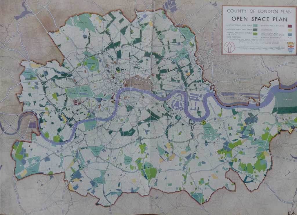
The following Open Space Plan shows the proposed new public open space in dark green:

Open Space Plan 1

The 1943 plan presents a fascinating view of the industrialisation of London.

The East End of London and the London Docks were well known industrial areas, however every London borough had a significant amount of factories and industrial employment. The report includes a summary of industry for every London borough. I have shown a sample below to indicate the range of factory numbers, employment levels and types of industry across some of the London boroughs.

Borough Principal industries according to numbers employed Size of Factories Factory numbers in 1938 Factory employees in 1938
Bermondsey Food, engineering, and chemicals, including tanneries Each of the principal industries has a large number of factories 711 31,058
Bethnal Green Furniture and clothing Furniture factories very small, clothing small with a few large premises 1,746 15,945
Finsbury Clothing, printing and engineering, though appreciable numbers are employed in all other industries Mostly medium to small, though each industry has a number of large factories and the average size if bigger than in Bethnal Green, Shoreditch or Stepney 2,523 66,556
Islington Engineering, clothing, furniture and miscellaneous (principally builders’ yards, cardboard boxes and laundries) Mostly small, though engineering, furniture and miscellaneous each has a number of medium sized factories 1,998 35,649
Stepney Clothing, food (including breweries and tobacco) and engineering Mostly small (especially clothing) but each industry has a number of large factories 3,270 58,073
Westminster Clothing, printing and engineering, though appreciable numbers are employed in all other industries Mostly small (especially clothing), but each industry has several large factories 4,414 46,528

The plan identifies a trend of decentralisation which had already being happening for a number of decades with the gradual migration of industry from central to outer London and also identifies the improvement in transport facilities as enabling industry to move away from the main residential areas.

Even in 1943 the report identifies the importance of the new industrial estates at Slough, Park Royal, along the Great West Road etc. as the future home for more of London’s industry.

What the plan does not identify is how the Docks would change over the coming decades. The expectation was that the London Docks would continue to provide a key role in both London and the Nation’s global trade.

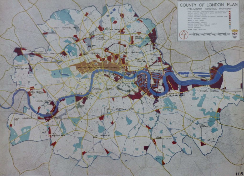
The following map shows the proposed approach for how industry would be located across the Greater London area. Note the concentration of industrial areas around the Docks and along the Thames.

Industrial Proposals 1

In addition to planning at the Greater London level, the 1943 report also focussed on a number of specific areas that had suffered extensive bomb damage and were therefore important redevelopment locations.

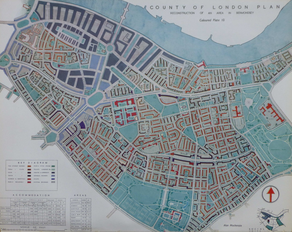
An example is the redevelopment of Bermondsey. The following plan shows the proposed post-war reconstruction of Bermondsey:

Bermondsey 1

The plan for Bermondsey illustrates how the 1943 plan proposed:

  • replacing the long runs of railway viaducts with underground rail tunnels thereby avoiding the way the viaducts divided communities
  • a considerable increase in the amount of public open space
  • wide through roads to carry traffic efficiently across London
  • reduced housing density

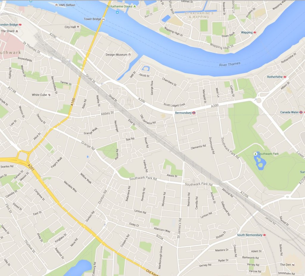
How far these plans were actually implemented after the war can be judged by comparison with the following 2015 map of Bermondsey. The railway viaducts still remain, cutting across the borough, and the street layout remains largely unchanged. Southward Park provides a large amount of open space, however there is not the amount proposed in 1943 and the large park planned to run adjacent to the Old Kent Road was not constructed.

New Bermondsey Map 1

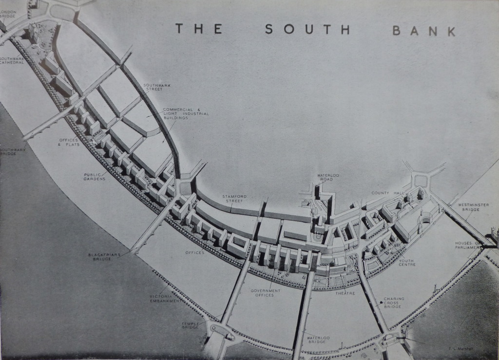
Another focus for significant redevelopment was the South Bank. Starting from Westminster Bridge and County Hall at the right of the following picture, the plans consisted of:

  • a Youth centre to the left of County Hall
  • a new road bridge across the Thames leading to Charing Cross to replace the rail bridge after the railways had been diverted underground
  • a Theatre between Charing Cross and Waterloo Bridges (which did get built in the form of the Royal Festival Hall)
  • Government offices running to…..
  • a new bridge – Temple Bridge – across the Thames from the South Bank to Temple Station, in exactly the same place as the proposed Garden Bridge
  • offices then running to Blackfriars Bridge
  • followed by office and flats leading up to a landscaped area around Southwark Cathedral
  • with public gardens running the length of the Thames embankment

The South Bank 1

When reading the plan I was really surprised to find that in 1943 there were proposals for a bridge across the river at Temple. Although this would have been more functional than the proposed Garden Bridge, it would still have blocked some of the view from Waterloo Bridge and the South Bank across to St. Paul’s and the City.

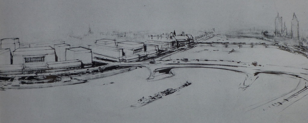
The following picture is an artist impression from the 1943 report of the proposed new Charing Cross road bridge:

Charing Cross Bridge 1

The 1943 report places considerable importance on the need for housing after the war, claiming that “Of the many aspects of London’s future in so far as replanning is concerned, that of housing must claim first attention.” and that “The provision of new housing accommodation will be a most urgent task to be tackled immediately after the war.” Some things do not change, although in 1943 the plans for housing in central London were very much the provision of affordable housing for Londoners rather than the endless development of luxury apartments we see today.

The 1943 plan proposes a comprehensive housing plan to address the need to improve the housing conditions for Londoners as well as providing the number needed.

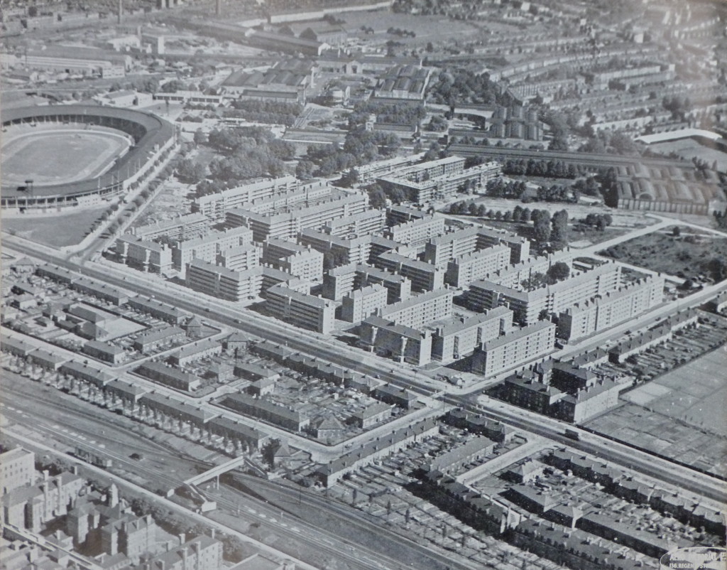
The following photo from the 1943 plan shows some of the building commenced prior to the war. This is the White City Housing Estate, Hammersmith. Construction started in 1936 and was suspended in 1939. The plan states that when work recommences, the estate will cover an area of 52 acres and comprise 49, 5 storey blocks with accommodation for 11,000 people.

The White City Stadium can be seen on the left of the photo. Completed in 1908 for the Summer Olympics of the same year, the stadium was demolished in 1985 following which the BBC occupied the site. The BBC are now gradually vacating the site so it will be interesting to see what happens with this significant site in the future. (There is plaque on one of the BBC White City buildings at the point of the finishing line of the 1908 track)

White City 1

The 1943 plan recommends the development of housing estates and uses the Roehampton Cottage Estate in Wandsworth as an example of the type of estate that should be built, including the preservation of trees which “adds greatly to the attractive lay-out”
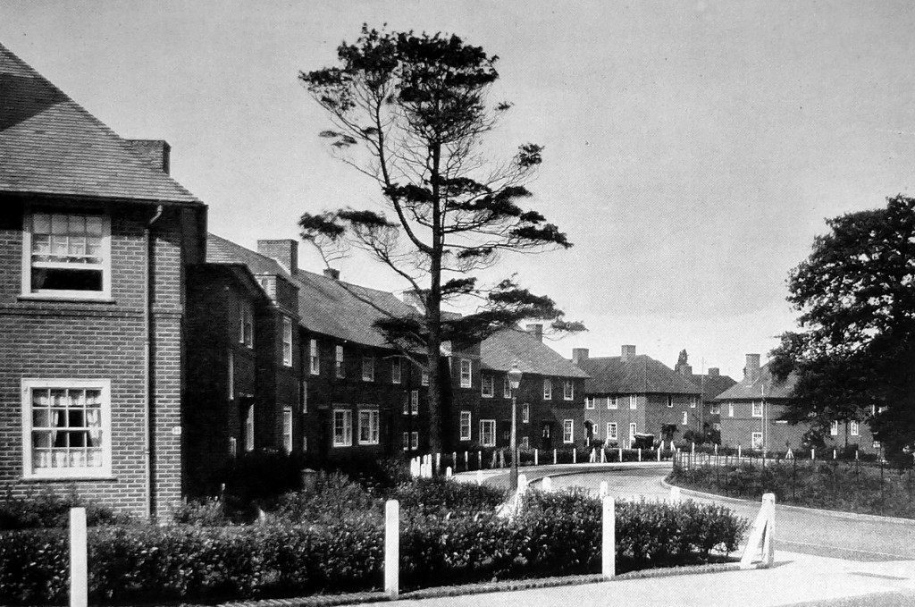
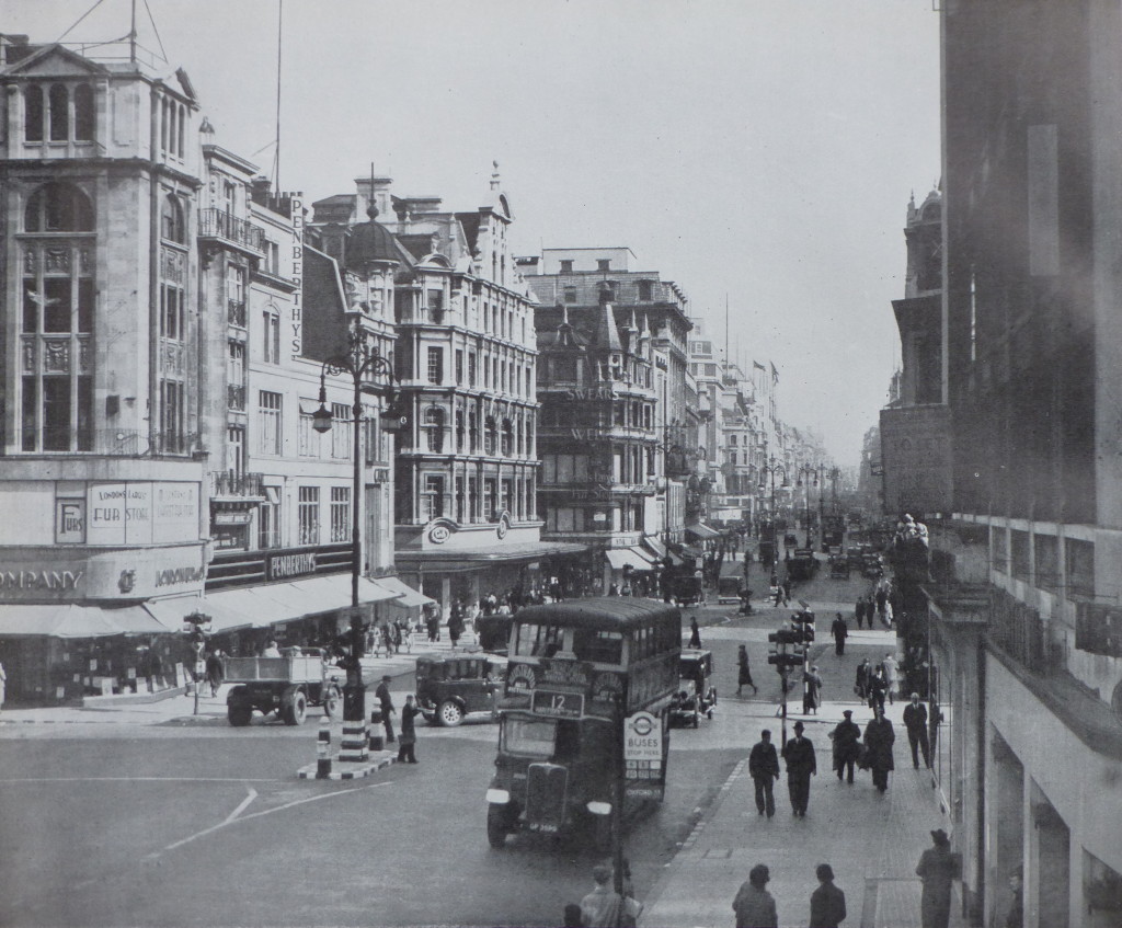
Roehampton 1The 1943 plan also makes recommendations for greater architectural control and uses the following view of Oxford Street as an example of “the chaos of individual and uncoordinated street development” 

Architectural Control 1

The plan recommends “that Panels of architects and planners might be set up to assist the planning authority in the application of a control for street design, similar to those already in operation in other countries, notably in America and Scandinavia. Cornice and first floor levels, as well as the facing materials used, should be more strictly controlled so as to give a sense of continuity and orderliness to the street”. 

The 1943 plan is a fascinating read, not only covering London at the time, but also how London could be today if these plans had of been adopted in full. I have only been able to scratch the surface of the report in this week’s post.

Reading the plan it is clear that some issues do not change, for example housing and traffic congestion.

The plan also highlights the difficulty in planning for the future. There is only a very limited reference to “Aerodromes”, beginning with “All the portents indicate that, after the war, there will be a very considerable expansion in air transport for passengers and, perhaps, for freight. Any plan for the future of London must have close regard for these eventualities.”

The plan does seem to rule out the construction of a large airport within the central London area as this would be “inimical to the interests and comfort of large sections of the population to embark on a scheme of this kind” The post war development of Heathrow was not considered in 1943.

In many ways I am pleased that many of the plans for the large scale redevelopment proposed in the 1943 plan did not take place. As with Wren’s plans for the City after the Great Fire, London tends to avoid large scale planning and seems to evolve in a haphazard manner which contributes much to the attraction of the city, although I feel that this is now under threat with the rows of identical towers that seem to be London’s future.

alondoninheritance.com


Mystery Locations

Firstly, a really big thank you to everyone who identified the majority of the sites in this post. The feedback as comments or on Twitter has been fantastic. I have updated the post with details of the location. These are in italics to separate out from my original post. You will see I made one big mistake by assuming a location was in London!

The main theme of my blog is to track down the locations of photos taken by my father across London in the late 1940s and early 1950s, photograph the scenes as they are now, and in the process learn more of London’s history. The majority I have been able to identify and I still have to visit the location as it is today for a large number, however there are also many mystery locations that I have not been able to identify.

Although living in Camden, he took photos across London cycling through the city with his camera.

Many of the photos are easy to identify, my father either wrote the location on the back of a printed copy, the scene is recognisable, or there is a street name, pub name etc. within the photo.

Some I have been able to find through accident. I carry the photos on an iPad whilst walking London and occasionally I have recognised a street scene and am able to check with the copy on the iPad.

However there are a number I cannot place and for this week’s article I am publishing some of these in the hope that a reader may be able to help identify the location or event.

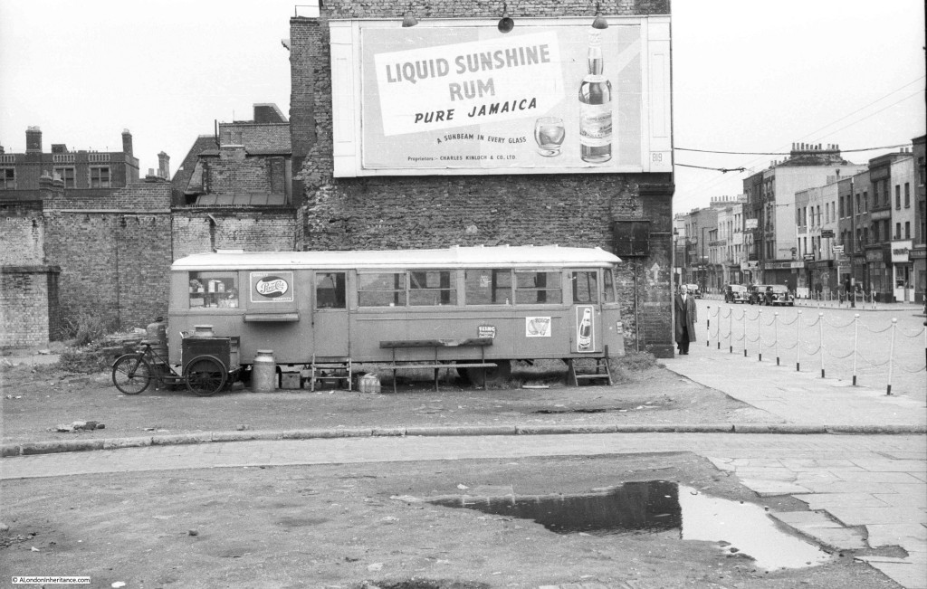
So, to start, the following photo just has “a temporary café on a bomb site” written on the back but unfortunately no further details. I am not exactly sure what the vehicle used to be. It looks to have been something that would have run on rails, but appears to have normal tyres. I like the three wheeler bike with the milk churn, either used for collection or perhaps a delivery service.

Unknown Locations 9

The above photo is the corner of Greenfield Road and Commercial Road, E1. Whilst the view in the immediate foreground is now completely different, the buildings along Commercial Road on the right are much the same.

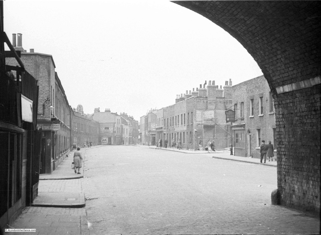
I suspect the following photo was taken in East London, possibly around the Docks judging by other photos on the same strip of negatives. It appears to have been taken from underneath a railway arch. There is a pub on the right, but the grain of the film does not allow the name to be read when zooming in.

Probably all these buildings were demolished over the last 60 years with only the railway arch remaining.

Unknown Locations 8

The above view just does not exist anymore. The whole street has disappeared and has now been replaced by a rather desolate view of buildings surrounded by high security fencing. This is Hardinge Street, E1, looking north from under the railway arches.
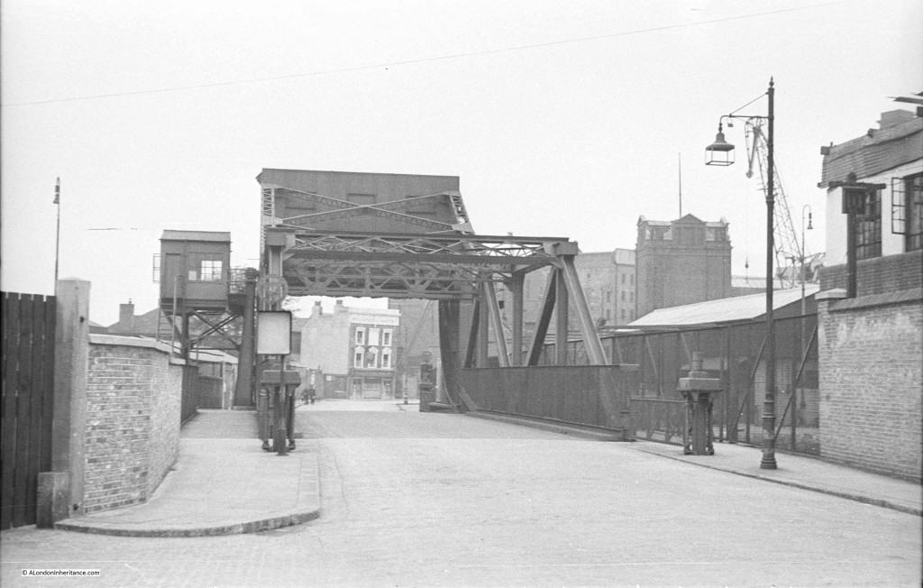
This photo also appears to have been taken around the Docks and I am sure I recognise the bridge from walking round the area but cannot place the location. Again there is a pub in the distance but the grain of the film does not allow the name to be read.

Unknown Locations 7

The above photo I should of known. I knew I had seen the bridge but could not place the location. The pub at the end is the Prospect of Whitby and the photo is looking along Glamis Road. The bridge is over part of the Shadwell Basin. The pub and bridge are still there but the surrounding area has changed considerably. 

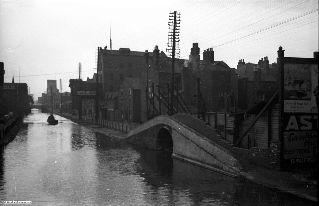
And again somewhere around the Docks. Given how straight the channel is I suspect it may be the Limehouse Cut, but from limited walking in the area I have not been able to place the photo. I need to walk the area again, however I suspect the buildings have also long gone.
Unknown Locations 6

And now for my big mistake. After the war, as well as photographing London, my father took lots of photos around the UK and Holland during cycling trips and National Service. The above photo was on the end of a strip of negatives with photos of East London so I wrongly assumed this was the same area, however it was taken in Chester. Must have been the last photo on the roll of film. See this link, there is a photo towards the end of the page showing almost the same view.
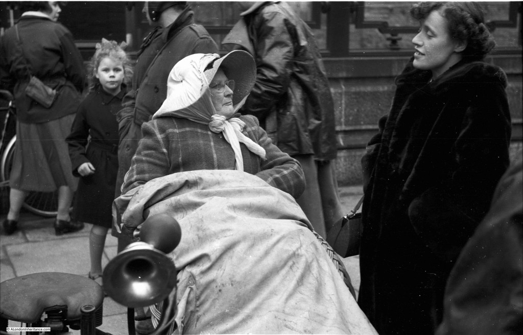
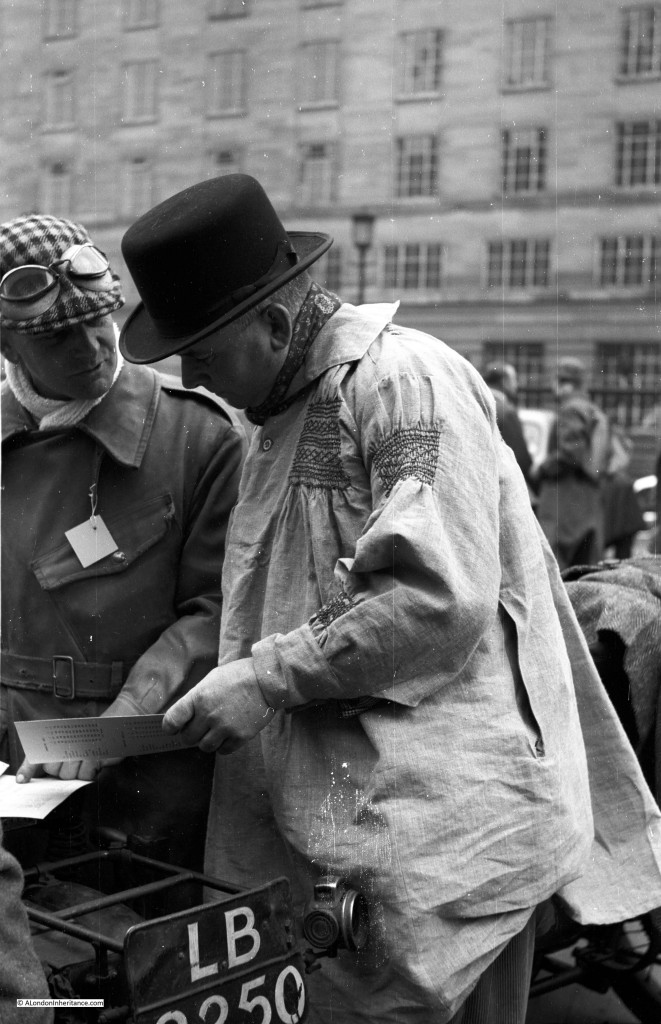
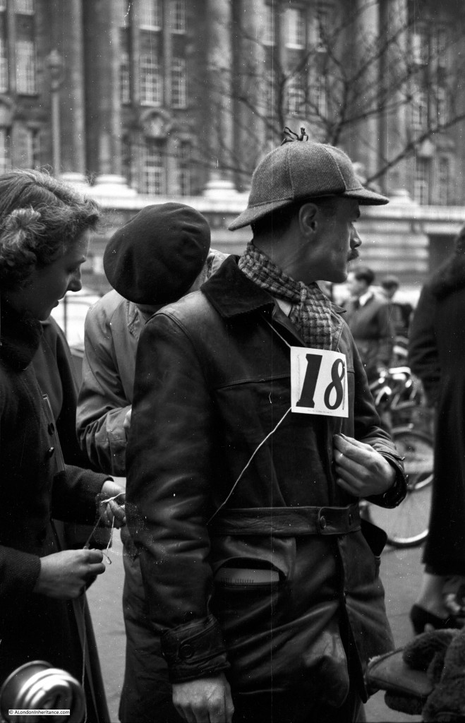
Now three photos of an event I cannot place. Judging from other photos on the same strip of negatives this was either 1949 or 1950. The girl in the background looking at the photographer would probably now be in her early 70s.

The following three photos could be the Pioneer Run from London to Brighton for pre 1915 motorcycles. the event had a Westminster start but the buildings could be around County Hall on the south of the river.

Unknown Locations 4

It seems to have been the start of some form of motorbike race. I thought the building in the background could have been the Ministry of Defence building on the Embankment, but on checking the style of the windows, it would appear not.

Unknown Locations 3

Same event, but a different building in the background.

Unknown Locations 5

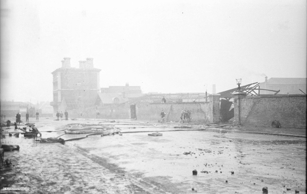
This photo appears to show the aftermath of a fire, but I have no idea where. Hoses are still scattered across the street and there appears to be much destruction beyond the wall.

What I like about this photo is the group of boys by the wall in the centre of the photo, also one having climbed to the top of the wall. This fits in with the stories my father told me about being a boy in London during the war and the freedom to explore bomb sites, collect shrapnel, remains of incendiary bombs etc. There were no real restrictions on where you could go and London was an open book to explore.

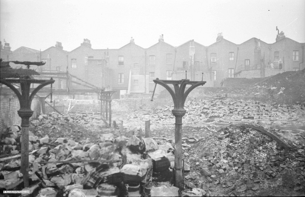
The following two photos could be around the Caledonian Market estate in Islington, with the building in the background being one of the pubs on the corner of the market.

Unknown Locations 2

The scene through the gate of what must have been a really bad fire. Note the man on the right, standing on the roof of his outbuildings surveying the scene.

Unknown Locations 17

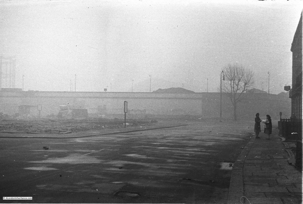
This photo probably has a cleared bomb site on the left. I wish I could read what was on the signs around the site. It is photos like this that bring home what a grey and desolate place many areas of London must have seemed just after the war. Reconstruction had not started, reminders of wartime damage were still very much in evidence and day to day life was still tough.

Unknown Locations 16

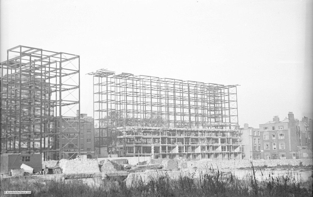
Some limited reconstruction had started and this photo shows the framework of a new building, almost certainly on a bomb site which extends into the foreground of the photo. It would be fascinating to know if this building is still there. From other photos on the same strip of negatives I suspect it may be in Holborn.

The following photo was taken looking across towards Harpur Street. The construction work is for new flats which are still there. It is not possible to reproduce the view due to new building, however the following Google Street View shows the flats today and the original buildings along Harpur Street to the right.

Unknown Locations 1

Back to another event I cannot place. It must be in one of London’s parks but I cannot identify either the location or the event.

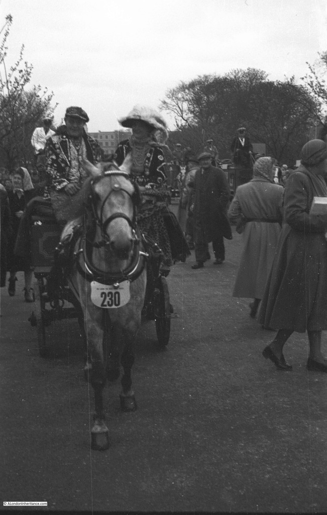
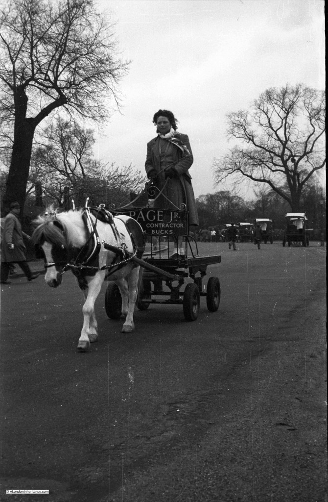
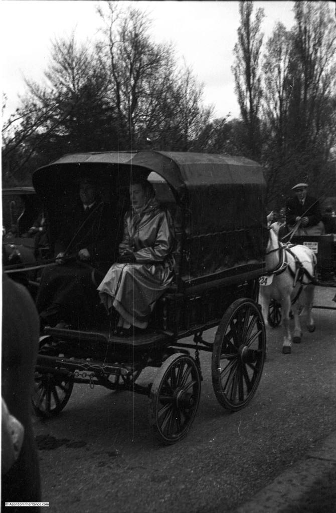
The following photos could be of the Van Horse Parade or the Cart Horse Parade, held in Battersea Park on Easter Monday. The parades merged into the London Harness Horse Parade and although still held on Easter Monday’s, the parade has now moved to Ardingly, West Sussex.

Unknown Locations 15

It seemed to be an event with all forms of horse drawn vehicles from the simple…..

Unknown Locations 14

….to the more comfortable, but I have no idea of the location or event.

Unknown Locations 13

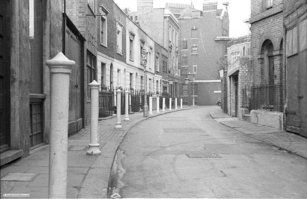
Many photos show streets and alleys which have probably long since been demolished, despite that with some modernisation of facilities they could still be perfectly good homes. I always try to avoid romanticising the past, living conditions and life in general for so many Londoners was very tough but this style of street and home looks far better than many that have been built since.

Unknown Locations 11

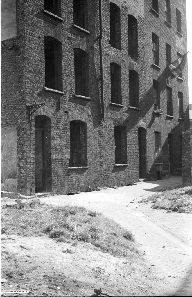
An empty building, probably through bomb damage, awaiting demolition. The far right of the building with the Union Jack still looks occupied. There were so many buildings like this across London in the late 1940s and early 1950s. Awaiting their fate, but some inhabitants still clinging on.

Unknown Locations 12

And finally an unknown street scene. Other photos on the same strip of negatives were taken in Campden Hill Road, Kensington, however I have been unable to locate this street.

Unknown Locations 10

The above photo is Tryon Street, off the Kings Road in Chelsea. Still very much the same.

When starting out on this project, I had the probably very unrealistic target to locate all the photos and visit and photograph the current location, learn about the area and understand what aspect of the scene interested my father to photograph these locations.

Although I am making reasonably good progress, any help with the photos shown above would be very gratefully received.

alondoninheritance.com

The Brewery At The End Of Sutton Walk

Chances are, if you have walked from Waterloo Station down to the Royal Festival Hall, or the Southbank, you have walked along Sutton Walk without really being aware that you have.

Today, Sutton Walk is a short stretch of pedestrian walkway through one of the rail arches under the rail tracks leading up to Hungerford Bridge, however it was once a short street leading down to the Lion Brewery on Belvedere Road.

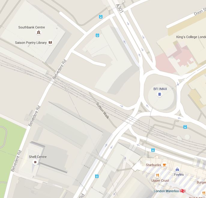
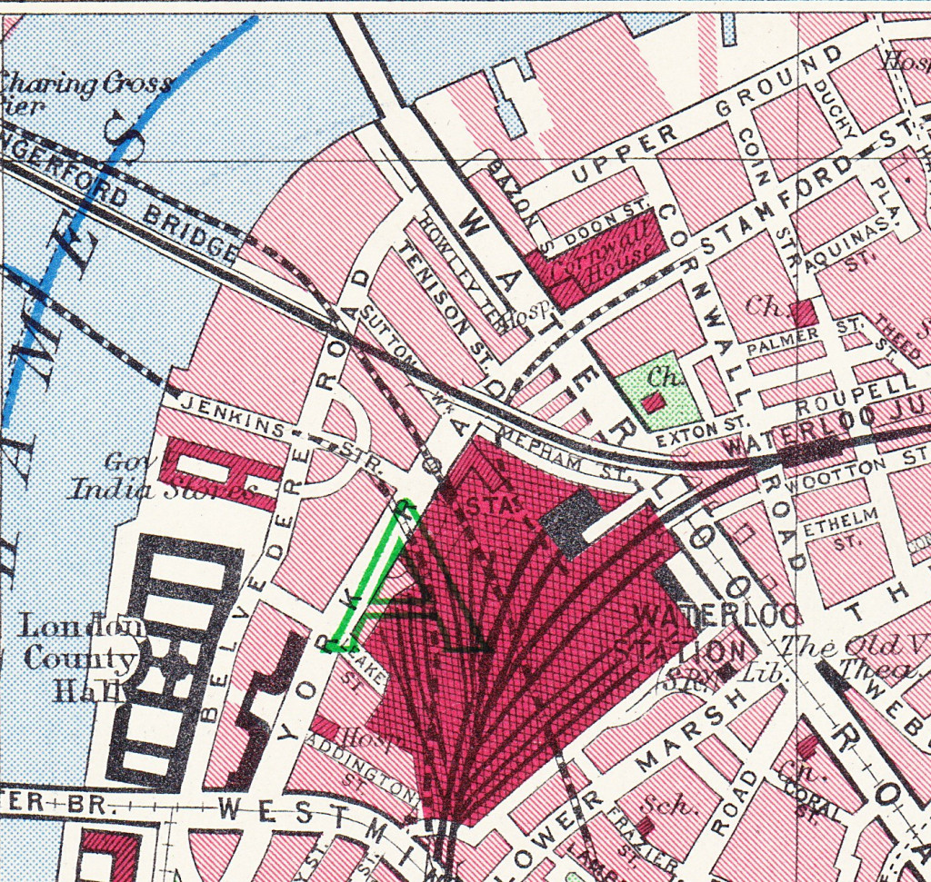
This is the location of Sutton Walk in 2015, in the centre of the map, the short stretch under the rail tracks:

Sutton Walk Map 2

Before the post war development of the area for the Festival of Britain, the 1940 Bartholomew’s map showed the original Sutton Walk:

Sutton Walk Map 1

Before the demolition of the original buildings along Belvedere Road, my father took some photos in 1947 from the junction of Sutton Walk with Belvedere Road. These show part of the old Lion Brewery that are not often seen. There are many photos from the river (including some my father took here), but in this article I want to show the other side of the brewery.

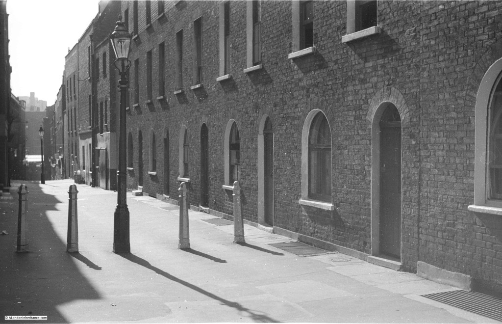
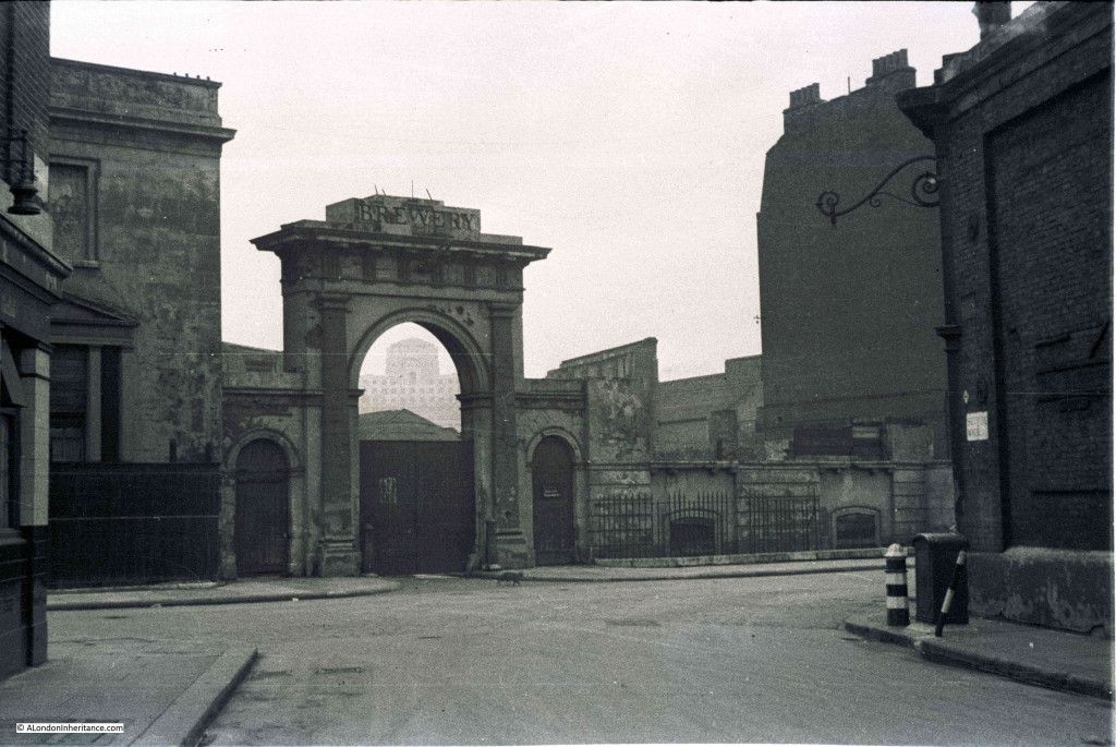
In the first photo, we are standing in the original Sutton Walk. The road running left to right is Belvedere Road. Straight ahead is the archway leading into what was the Lion Brewery. The word “Brewery” remains on the block at the top of the arch, however the stone Lion that originally sat on top of the arch has already been removed, leaving only the stubs of metal rods that would have held the Lion to the arch.

Sutton Walk 2Framed within the archway is Shell-Mex House on the north bank of the river. Originally on the right of the arch was a building of identical design to the building remaining on the left, and the main brewery buildings would have been visible through the arch. It must have been an impressive sight when the brewery was in full production.

One can only imagine the number of barrels of beer that have come through that archway.

The brewery was built between 1836 and 1837 on the site of a Water Works that supplied water to the local area using water taken directly from the river. Prior to the water works, a house called Belvedere (the origin of the road name) occupied the site. This became a tavern in 1781 and along with the gardens, was opened to the public following the tradition of “pleasure gardens” being opened along the south bank of the river.

The brewery building was seriously damaged by fire in 1931, after which it was used for a brief period as a storage place for waste paper.

This whole area was demolished in the late 1940s ready for the construction of the Royal Festival Hall and many of the streets were either lost or considerably changed. Although Sutton Walk does not now extend down to Belvedere Road it is still easy to find the location of my father’s photos by extending the line of the remaining pedestrian stretch under the railway.

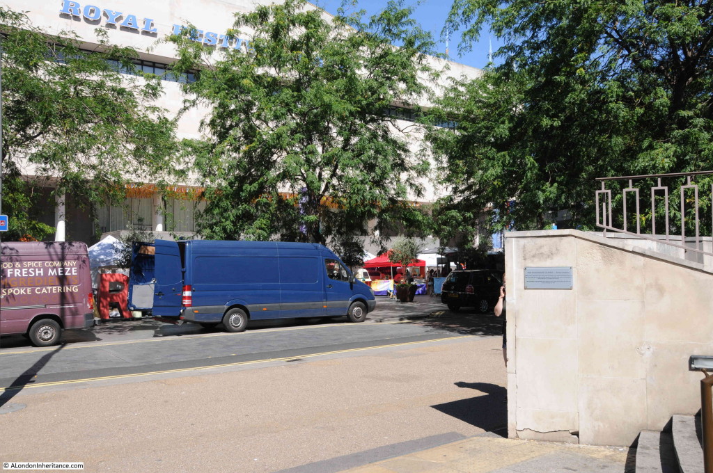
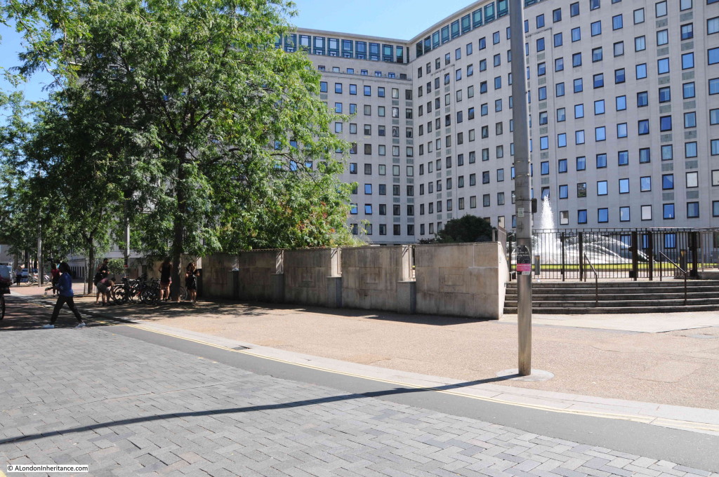
The same view today from roughly the same position:

Sutton Walk 6The Royal Festival Hall now fully occupies the site of the Lion Brewery between Belvedere Road and the Thames.

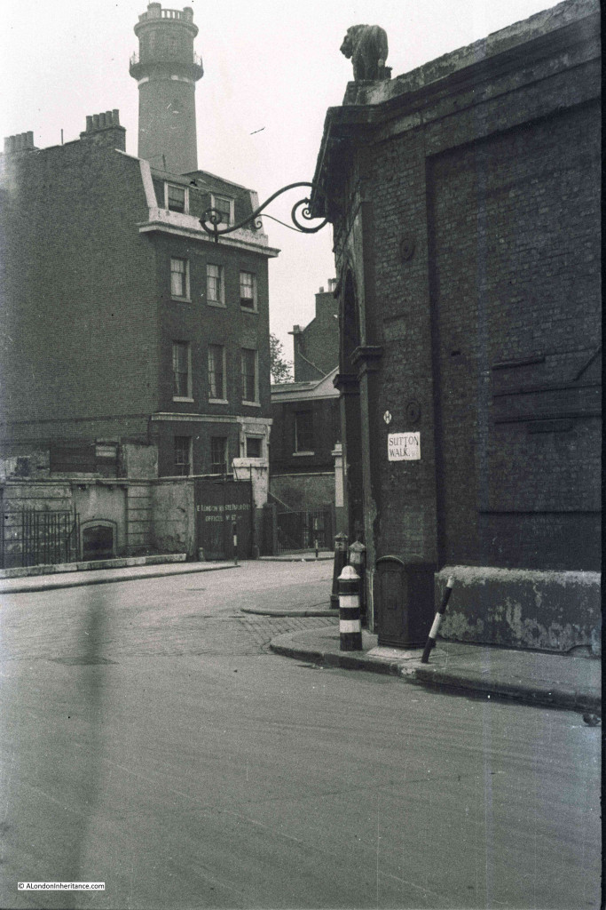
The next photo is from the end of Sutton Walk and looking to the right along a short stretch of Belvedere Road. Behind the building we can see the top of the Shot Tower. The top of the tower still in the original state prior to the modification for the Festival of Britain. The lettering on the wooden gate in the centre of the photo spells out the name of the London Waste Paper Company Ltd. After the brewery closed, the site was used for storage of waste paper by this company.

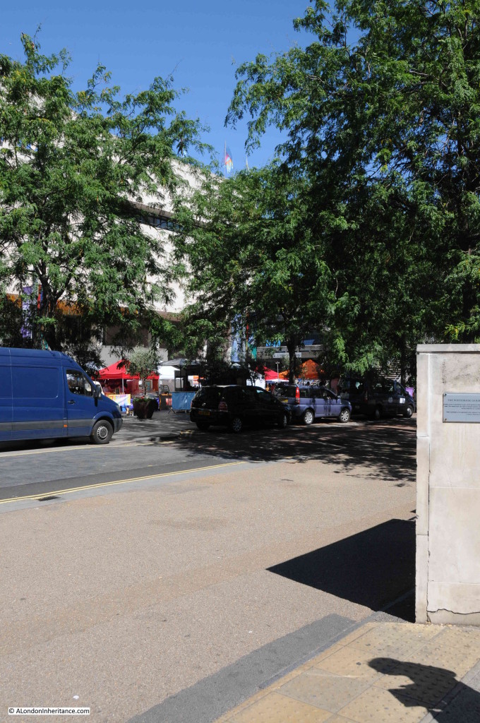
Sutton Walk 3The same view in 2015 looking at the edge of the Royal Festival Hall and towards the Hayward Gallery (hidden behind the tree):

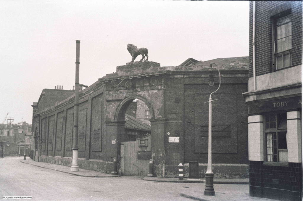
Sutton Walk 7Now we can cross over Belvedere Road and look back at the junction with Sutton Walk and we can see another part of the brewery with the same style of entrance arch, but still retaining the lion. This part of the brewery site contained warehousing and the stables.

Sutton Walk 4Also in the above photo, there is a pub on the right. There were several pubs along Belvedere Road as before the war, this was a very busy light industrial and residential area. It looks still occupied, but when the photo was taken in 1947 this area had mainly been cleared and the pub would soon be demolished.

And the same view in 2015. The building is the old Shell Centre Downstream building which is now “The Whitehouse”, one of the many office to luxury apartment conversions that now seem the norm across so much of central London.

From extending the remaining stretch of Sutton Walk down to Belvedere Road, the lamp posts on the right in the two photos seem to be in exactly the same position.

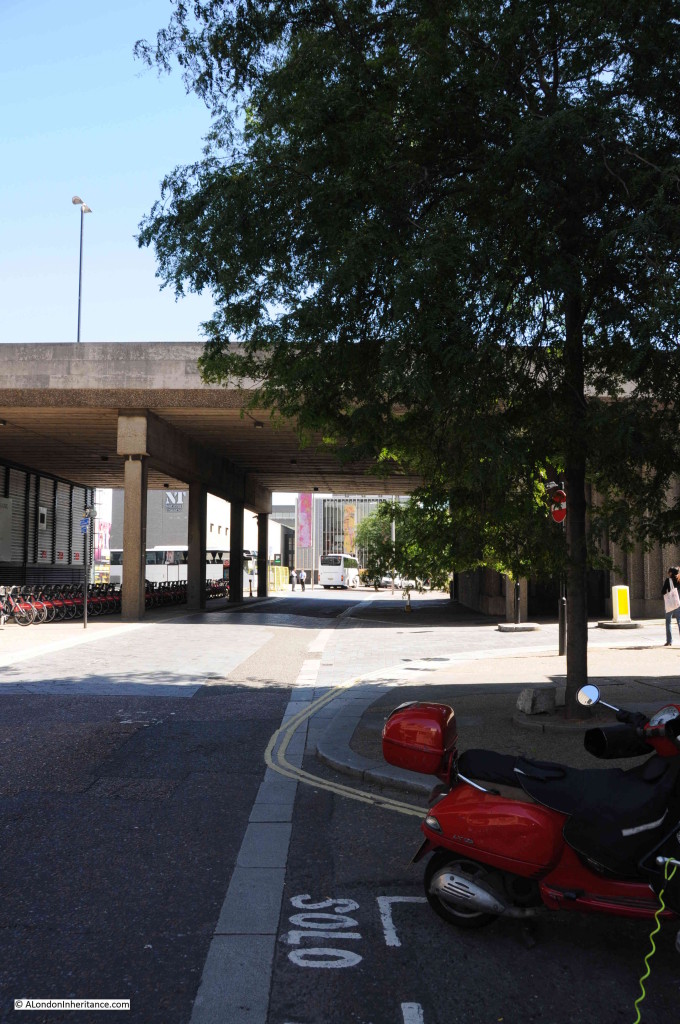
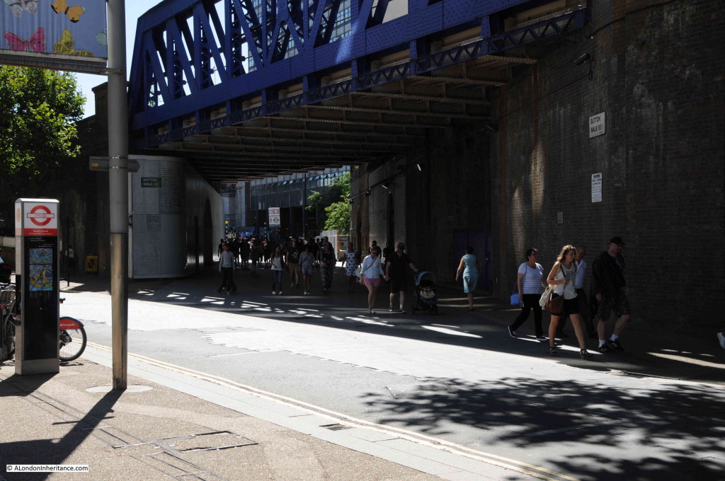
Sutton Walk 5This is all that is left of Sutton Walk today, the short pedestrian stretch under the railway. The road running left to right is Concert Hall Approach, a new road (if you call more than 50 years old, a new road !!), built as part of the redevelopment of the area.

Sutton Walk 10Although Belvedere Road was named after a house on the site of the Lion Brewery, a number of other roads in this area were named after Archbishops of Canterbury (no doubt due to  Lambeth Palace, the London residence of the Archbishop of Canterbury being not that much further along the Thames).

Sutton Walk was named after Charles Manners-Sutton (Archbishop between 1805 and 1828).

The nearby Tenison Street, (see the 1940 map, next street up towards Waterloo Bridge, lost during the construction of the Shell buildings) was named after Thomas Tenison (Archbishop from 1694 to 1715).

Although the street is not named in either the 2015 or 1940 maps, the street that runs from the corner of County Hall towards Leake Street is Chicheley Street. This street is still there and is named after Henry Chichele (Archbishop from 1414 to 1443).

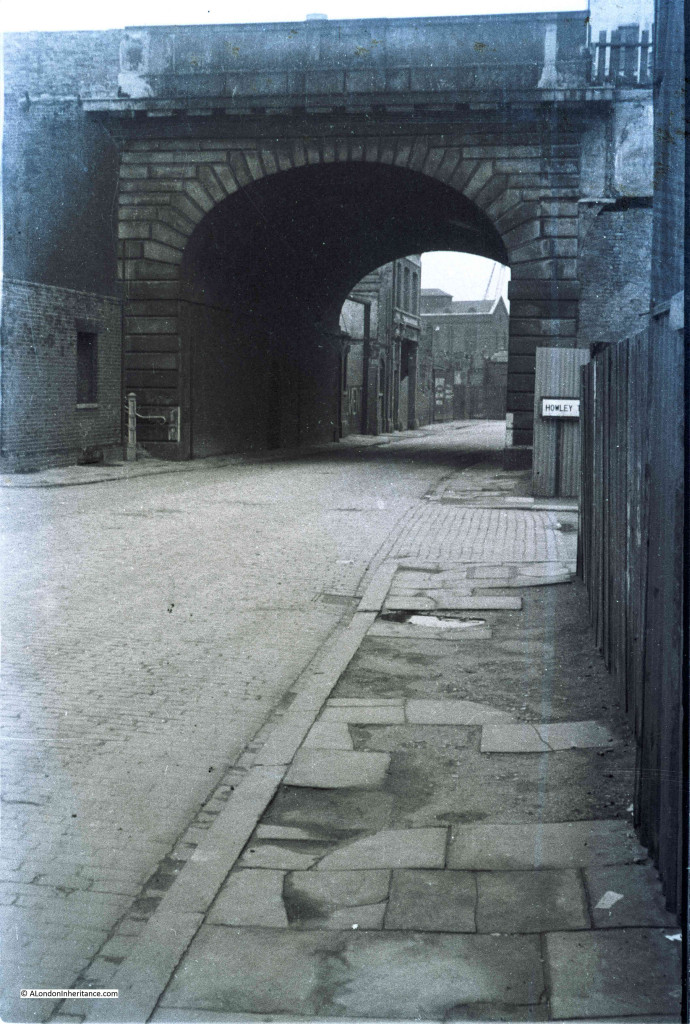
Returning to Belvedere Road, we can walk to the right, eastwards towards Waterloo Bridge. This was the view in 1947 with the approach to Waterloo Bridge crossing over Belvedere Road:

Sutton Walk 1Although the current Waterloo Bridge was built in the early 1940s and opened in 1945, it still used the original approach road and the arches over the roads on the southbank. To confirm that this is indeed the location, look to the right of the above photo and part of a street sign can be seen.

This is Howley Terrace and using the 1940 street map, Howley Terrace can be seen running parallel to the Waterloo Road as it runs up to the bridge (and continuing the street name theme, Howley Terrace was named after William Howley, Archbishop from 1828 to 1848 – this also provides a good estimation of when these streets were named, probably around1848 as William Howley is the last Archbishop to have a street named after him in this area).

Sutton Walk Map 1

The naming of streets after Archbishops extended beyond the area between York Road and Belvedere Road. The street in front of Waterloo Station, Mepham Street (seen in the above 1940 map and still in existence) was named after Simon Mepeham, Archbishop of Canterbury from 1329 to 1333). The history of the church appears to be written across this area of Lambeth.

The view is very different now. The new approach road to Waterloo Bridge, built as part of the redevelopment of the area provides a very different crossing of Belvedere Road. There is still a road turning off to the right. This is now a slip road down from the roundabout at the end of the road to Waterloo Bridge, down to Belvedere Road. Unlike Sutton Walk, the slip road does not appear to have any name, therefore the name Howley Terrace looks to be consigned to history.

Sutton Ealk 8

I find the Southbank fascinating. It is one of the areas in London that has undergone such significant post war development that there are very few traces of what was there before. The railway running up to Hungerford Bridge is the only remaining structure that has survived, but it is good that some of the streets can still be found, even though, as with Sutton Walk, it is now a shadow of its former state.

 alondoninheritance.com

Postcards From London

The photos we as a family have been taking of London only go back to 1947, so to go back further I also collect any old London postcards I can find with photographs of London. These really help to understand how London has changed, what specific areas looked like at a moment in time and what it would have been like to have been walking the streets when the photographs for these postcards were taken.

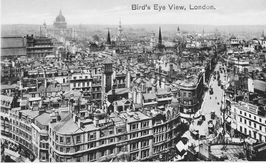
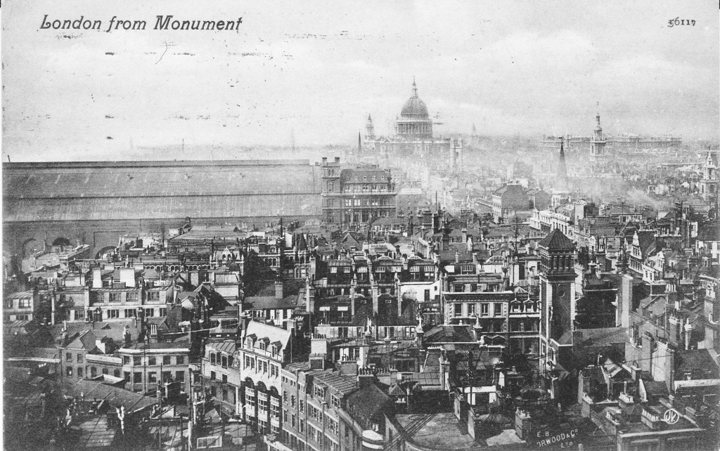
The following postcard is from the top of the Monument and shows how much the London skyline has changed over the last 100 years. Long gone are the days when the City churches stood well above their surroundings.

The road to the right is King William Street running up to the Bank. On the left of the photo is the original Cannon Street Station. The platform roof running off the edge of the photo with the station hotel being the large building to the right of the station roof. One of the adverts on the building to the lower right is for the “Aerated Bread Company” – a company formed in 1862 by a Dr. John Dauglish using a special yeast free process to produce an additive free bread. the company also had well over 200 tea shops, many of which were in London.

Postcard 2

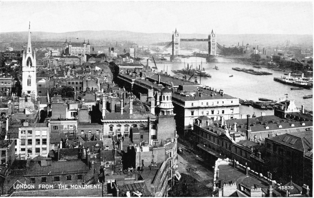
The next postcard is also from the Monument but this time the photographer has moved to the left and much of Cannon Street station is now visible. These old postcards also show how dominant St. Paul’s Cathedral was on the London skyline.

Postcard 8

In the following postcard the photographer has moved further round the viewing platform at the top of the Monument and is now looking towards Tower Bridge. Billingsgate Market is to the lower right. Opposite Billingsgate Market is the London Coal Exchange, the building with the ornate tower on the corner. The church tower on the left is that of St. Dunstan in the East.

Postcard 12

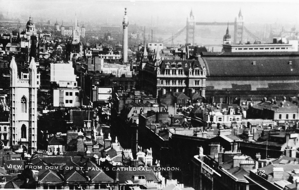
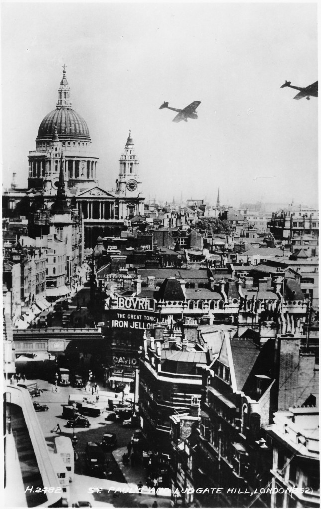
As it still is today, St. Paul’s Cathedral was another favourite spot for views of the London skyline. This time we can look back at the Monument. Compared to today where the Monument is surrounded by much taller buildings,  in the early years of the last century it was one of the City’s highest points. This photo also provides another view of Cannon Street station and the substantial hotel / station entrance at the front.

Postcard 13

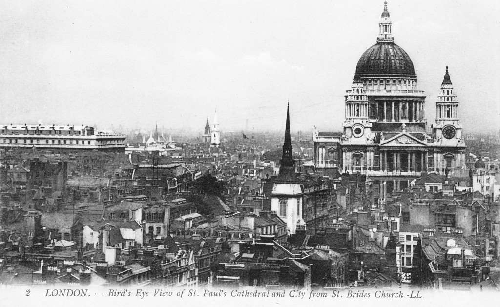
We can continue past St. Paul’s and now have a look at the City from the tower of St. Brides Church, Fleet Street. This photo again shows how dominant the cathedral was and by far the tallest building in London. The church in the foreground is St. Martin-within-Ludgate. The large building to the left is the old Post Office headquarters.

Postcard 1

The following postcard is from the Second World War. On the rear of the postcard is an extract from a broadcast speech made by Winston Churchill on the 11th September 1940 at the time when the major air raids on London had begun:

“This is a time for everyone to stand together, and hold firm!”

Postcard 4

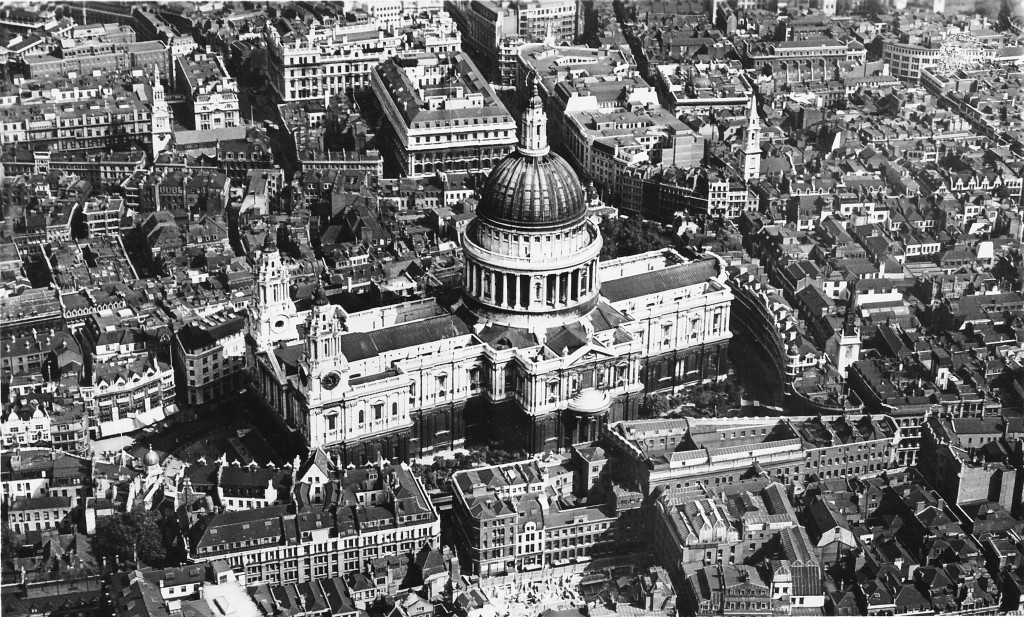
The next postcard also has an aerial view of St. Paul’s Cathedral before the devastation of the area by bombing. This shows how close the buildings used to press up against the cathedral. The area behind the cathedral, Paternoster Row and Square was a major location for the publishing trade with many book sellers and book warehouses. For a view of the devastation to this area see my posts with my father’s photos taken just after the war which can be found here and here.

Postcard 14

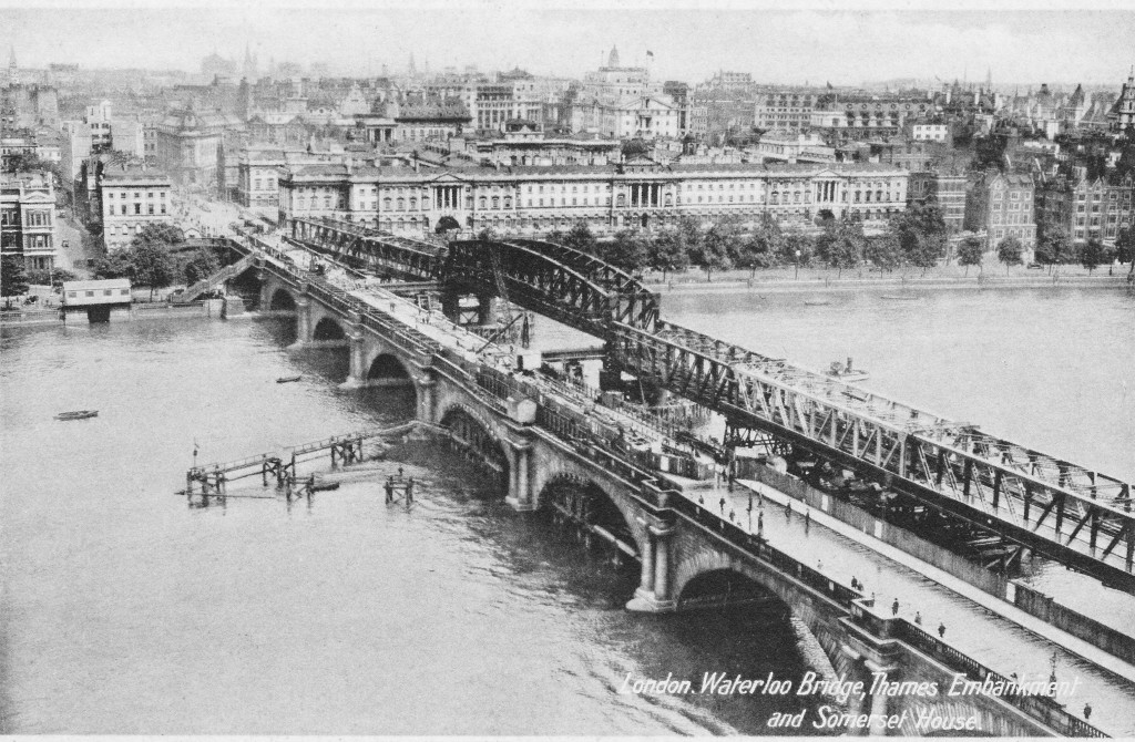
Some old postcards capture a moment of major change in London. The following postcard shows not only the original Waterloo Bridge, but also the temporary bridge to the right that was constructed to carry traffic during the demolition of the old bridge and construction of the new.

Postcard 5

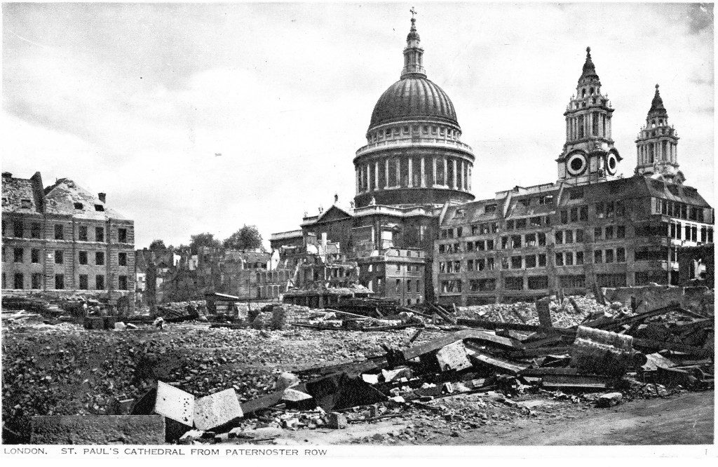
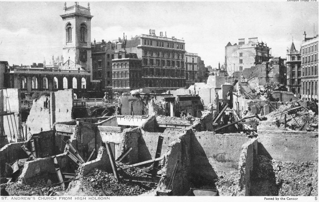
I find the subject matter of some postcards rather surprising. The following two postcards show bomb damage in London during the last war. I would have thought to maintain morale, postcards showing significant bomb damage in the heart of London would not have been available, alternatively they could also have been used to inspire when coupled with the speech extracts on the reverse of the cards.

The first postcard shows the damage to Paternoster Row to the north of St. Paul’s. Both postcards carry extracts from speeches made by Winston Churchill. The first postcard has the same extract as the one above.

Postcard 6

The following postcard shows St. Andrew’s Church from High Holborn. Note the “Passed by the Censor” statement on the lower right of the card.

On the rear of this postcard is the following extract from one of Winston Churchill’s speeches:

“Let us all strive without failure in faith or in duty”

Postcard 7

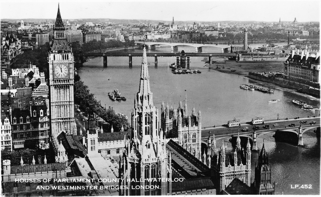
The following postcard shows the view from the Victoria Tower of the Houses of Parliament. This is a post war card of the late 1940s / very early 1950s, and what I find interesting with this one is the empty patch of land on the right between Hungerford Bridge and County Hall. The photo for this postcard had been taken at a moment in time when the land had been cleared in preparation for the construction of the Festival of Britain. The Shot Tower can also be seen between Hungerford and Waterloo bridges.

Postcard 10

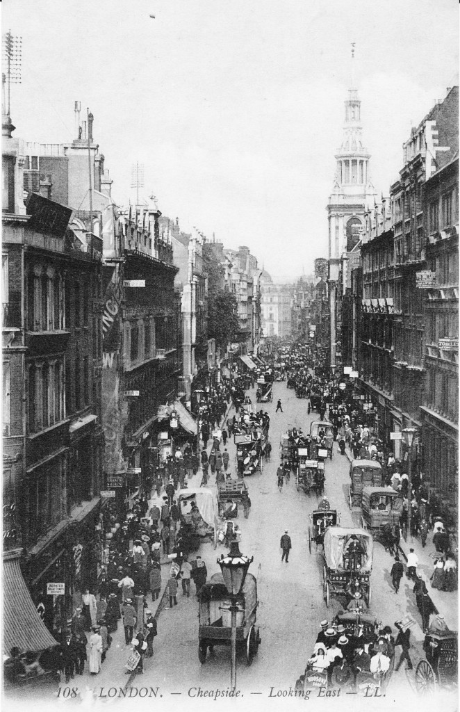
Postcards also show the busy streets of London during the first years of the 20th century. The following postcard shows the view down Cheapside with the church of St. Mary-le-Bow on the right. If you look on top of the buildings on the left you can see the telegraph poles that carried the wiring for the early telegraph / telephone system in the City. This was before the installation of underground cabling and much of the wiring was carried across the roofs of the City.

Postcard 3

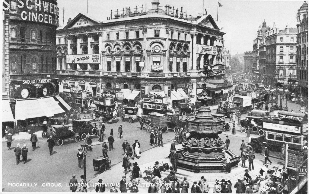
And this postcard shows a very busy Piccadilly Circus.

Postcard 9

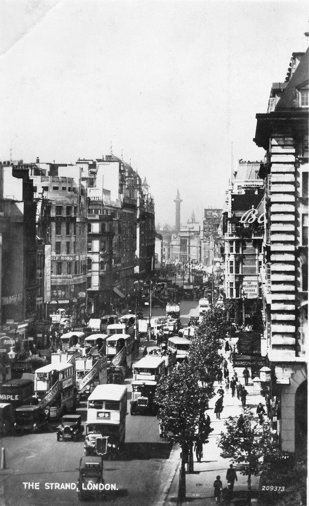
The following postcard is looking down the Strand towards Trafalgar Square. The building to the right is Marconi House. Originally built as the Gaiety Restaurant, it was taken over by the Marconi Company in 1912 and played a key part in the development of wireless. During 1922 and 1923, the original 2LO – London Broadcasting Station was broadcast from this building.

Wrapped around the stairs on the buses are adverts for some of the consumer brands of the time – Wrigley’s, Swan Vestas and Dunlop.

Postcard 11

Postcards also show that London has always been a centre for tourists and visitors with some of the postcards above being sent from London to destinations across the world.

Today, with the ability to take a photo on a phone and instantaneously send it across the world, the future of postcards looks rather bleak, however for roughly the past 150 years they provide a fascinating view of a changing city.

alondoninheritance.com

A Brief History And Walk Around Cordwainer Ward

Although they do not have so much of a physical presence today, the Wards of the City of London are centuries old partitions of the City into individual areas with their own administrative, financial and governance functions. The history of the Wards goes back to Medieval times with their origins almost certainly being earlier. They were probably the ancient estates within the City of someone in a role similar to a lord of the manor and had some level of civil and criminal jurisdiction over the Ward.

Documents written in the 12th Century refer to the Ward system and to the names of Alderman of the Wards who held a largely hereditary position with the role of Alderman becoming an elected role during the reign of Edward III (1327 – 1377), by which time the Wards appear to have assumed names similar to those of today.

In walking and exploring the City of London, I find it is the Streets, Churches and Wards that provide tangible contact with London’s long history.

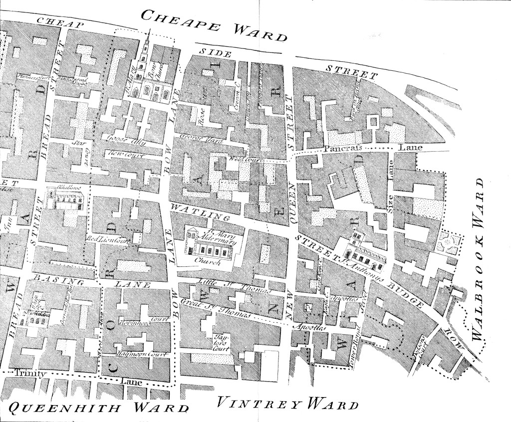
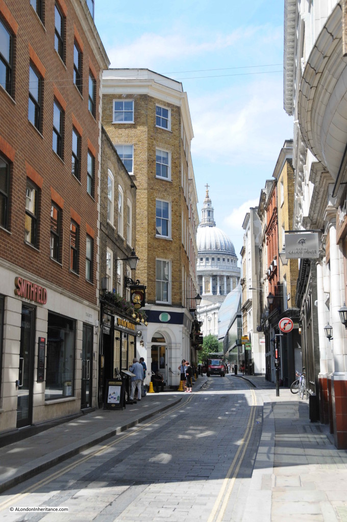
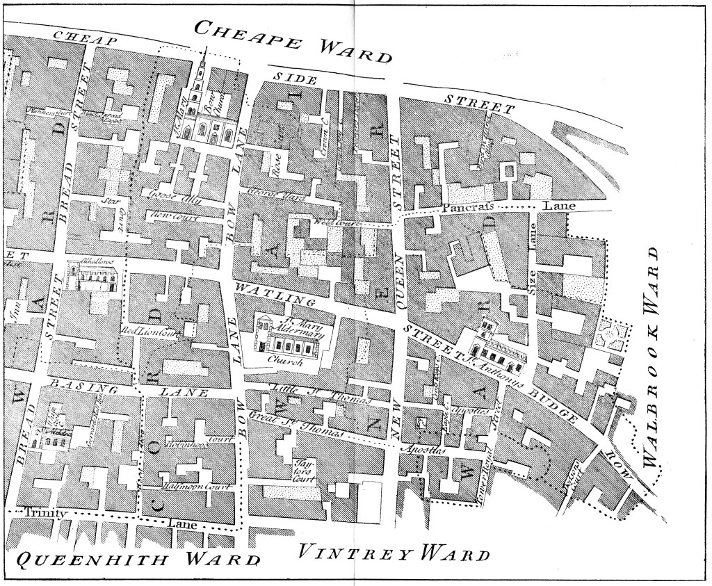
One such ward is Cordwainers Ward, just to the east of St. Paul’s Cathedral and to the south of Cheapside. The following map from 1755 shows Cordwainer Ward, south of Cheapside with boundary wards shown along the edge. Breadstreet Ward is not marked, but is to the left, the boundary being the street of the same name.

Cordwainer detail map

Cordwainer Ward is one of the few examples of where wards have been named after the trade practiced by the inhabitants. The name is derived from the early English word “cordwaner” meaning a worker in “cordwane” which was leather from the town of Cordova in Spain and the name dates back to around the 12th / 13th Century.

Shoe manufacture and sale was one of the key trades within the ward and in Henry 2nd’s reign (1154 to 1189) the sale of shoes was only allowed in the shoe market in Cheap between Cordwainer Street and Soper Lane (now Bow Lane and Queen Street).

Cordwainers were among the first of the craft organisations having received ordinances from the Mayor of London in 1271. Despite holding a prominent position in the early trades of London, in 1303 the Cordwainers were the subject of public complaints of fraud, in that they were using inferior leathers mixed in with the superior Cordova leather.  There was also an ongoing rivalry with the Cobblers, and the Cordwainers were forbidden to mend shoes and the Cobblers forbidden to make them.

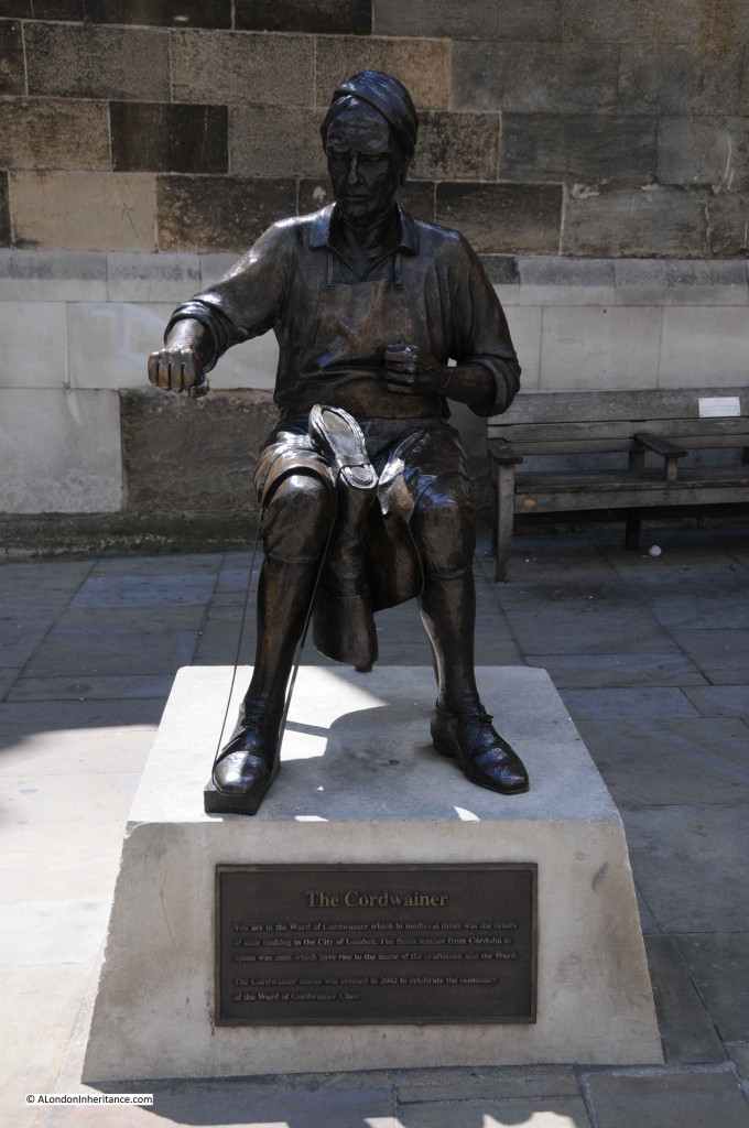
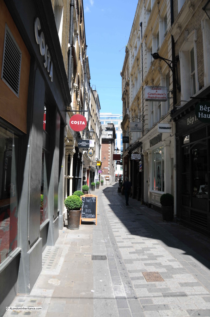
The craft is now commemorated by a Cordwainer statue erected in 2002 by the Ward of Cordwainer Club, which can be found in Watling Street, and is a good place to start a walk exploring Cordwainer Ward.

Cordwainer 1

The plaque reads ” You are in the Ward of Cordwainer which in medieval times was the centre of shoe making in the City of London. The finest leather from Cordoba in Spain was used and gave rise to the name of the craftsmen and the Ward. The Cordwainer statue was erected in 2002 to celebrate the century of the Ward of Cordwainer Club.”

Records of the names of the Aldermen of Cordwainer Ward go back to circa 1115 and appear to be continuous to the present day. The trades of each Alderman demonstrate the range of activities carried out in the Ward over the centuries, for example:

1313 Simon Corp, Pepperer

1375 John de Northampton, Draper

1599 William Craven, Merchant Taylor

1687 John Gardner, Skinner

1774 George Hayley, Armourer

1784 Brook Watson, Musician

1875 George Swan Nottage, Spectacle Maker

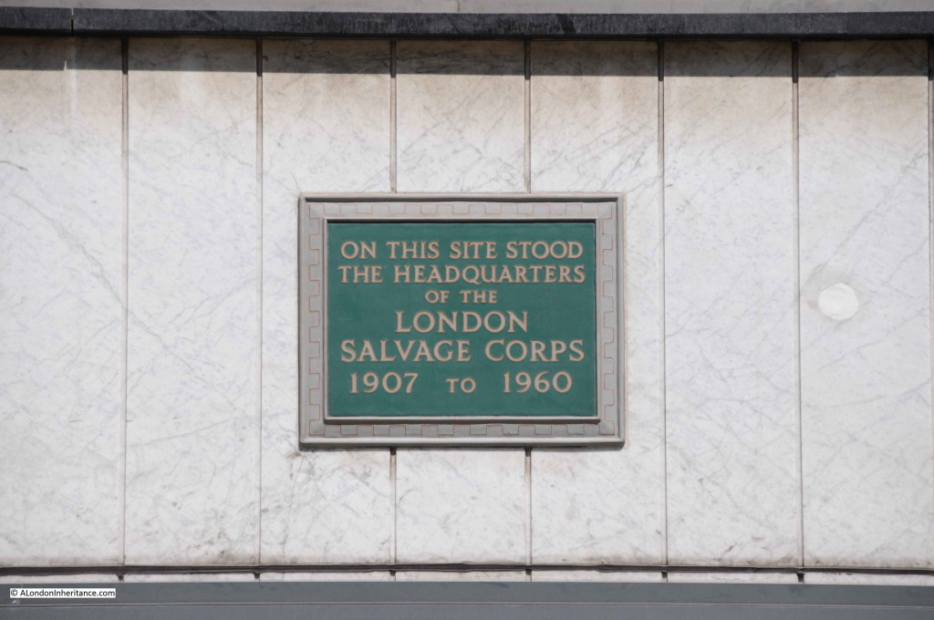
Opposite the Cordwainer statue in Watling Street is the site of the headquarters of the London Salvage Corps. Formed in 1865, the London Salvage Corps was effectively a private service operated by the London insurance companies. Their primary task was salvage both during and after a fire. During a fire, the Core would try to protect and recover goods and property and after a fire the Corps was responsible for the salvaged goods and property if insured, or until the insurance position could be ascertained.

The London Salvage Core operated until 1982. The change in building usage in the City from warehousing to offices meant that the risk of fire was reduced and there were no longer goods to be salvaged.

Cordwainer 2

Watling Street is considered to be one of the oldest streets in the city and originally a Roman road running from Dover through to Chester. Watling Street outside of London can easily be traced on Ordnance Survey maps, or by driving the route. Long straight roads passing through Dunstable, Towcester, to the east of Rugby, between Nuneaton and Hinckley clearly demonstrate the Roman origins of this street.

On approaching central London, the original Watling Street passed down Edgware Road to the area where Marble Arch is currently located where it split into two. One branch headed to Thorney Island (Westminster) whilst the other branch ran along Oxford Street and Holborn, crossing the Fleet and then entering the City by the New Gate. It met up with the current City Watling Street just south of Bow Lane. The part leading up to St. Paul’s is a relocation of the original route following a fire in 1136 after which a market had sprung up on the course of the old road.

Looking up Watling Street towards St. Paul’s Cathedral (Cordwainer Ward ends and Breadstreet Ward starts roughly where the red van is located):

Cordwainer 3

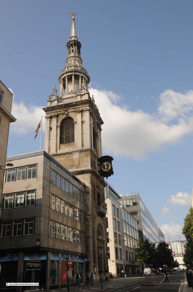
Running across Watling Street is Bow Lane, here leading up to the church of St. Mary-le-Bow and Cheapside.

Cordwainer 4Bow Lane is a good example of how street names have changed over the centuries.

The name Bow Lane came from the church, but was not used until the middle of the sixteenth century. Prior to being named Bow Lane, the lower part was called Cordwainer Street with the upper part approaching Cheapside named Hosier Lane due to the hosiers who lived in the lane.

The section of Bow Lane that originally extended south of Cannon Street, is now Garlick Hill.

The following photo shows the church of St. Mary-le-Bow. I explored the church in a post which can be found here which included my father’s photos showing the devastation in the area following the last war.

Cordwainer 17

William Maitland writing in 1756 records Wren’s observations on the discovery of a Roman Causeway during the rebuilding of St. Mary-le-Bow:

The church stood about 40 feet backwards from the high street, and by purchasing the ground of one private house not yet rebuilt he was enabled to bring the steeple forward so as to range with the street houses in Cheapside. Here, to his surprise, he sunk about 18 feet deep through much ground and then imagined he was come to the natural soil, and hard gravel but upon full examination, it appeared to be a Roman causeway of rough stone, close and well rammed, with Roman brick and rubbish at the bottom, for a foundation and all firmly cemented. This causeway was four feet thick. Underneath this causeway lay the natural clay over which that part of the city stands, and which descends at least 40 feet lower. He concluded then to lay the foundation of the Tower upon the very Roman Causeway, as most proper to bear what he had designed, a weighty and lofty structure.” 

This account really brings home that everything we see in London today is built on centuries of earlier construction, and it is fascinating to stand in Cheapside, look at the tower of St. Mary-le-Bow and if Wren was right there is a Roman causeway below, supporting the weight of the tower.

As well as St. Mary-le-Bow there were a number of other churches in Cordwainer Ward.

Walk back down Watling Street, turn left up Queen Street then across to Pancras Lane. Before the Fire of London there were two churches in this short lane which gives an indication of the population densities in the area (in March 1587, Cordwainer Ward contributed 301 fully armed and equipped men following the request of Queen Elizabeth 1st for soldiers from the City during one of the many invasion scares during the Tudor period. The full table of all City Ward contributions is in my post on Tilbury Fort). William Maitland states that in 1631 there were 2238 persons living in the Ward.

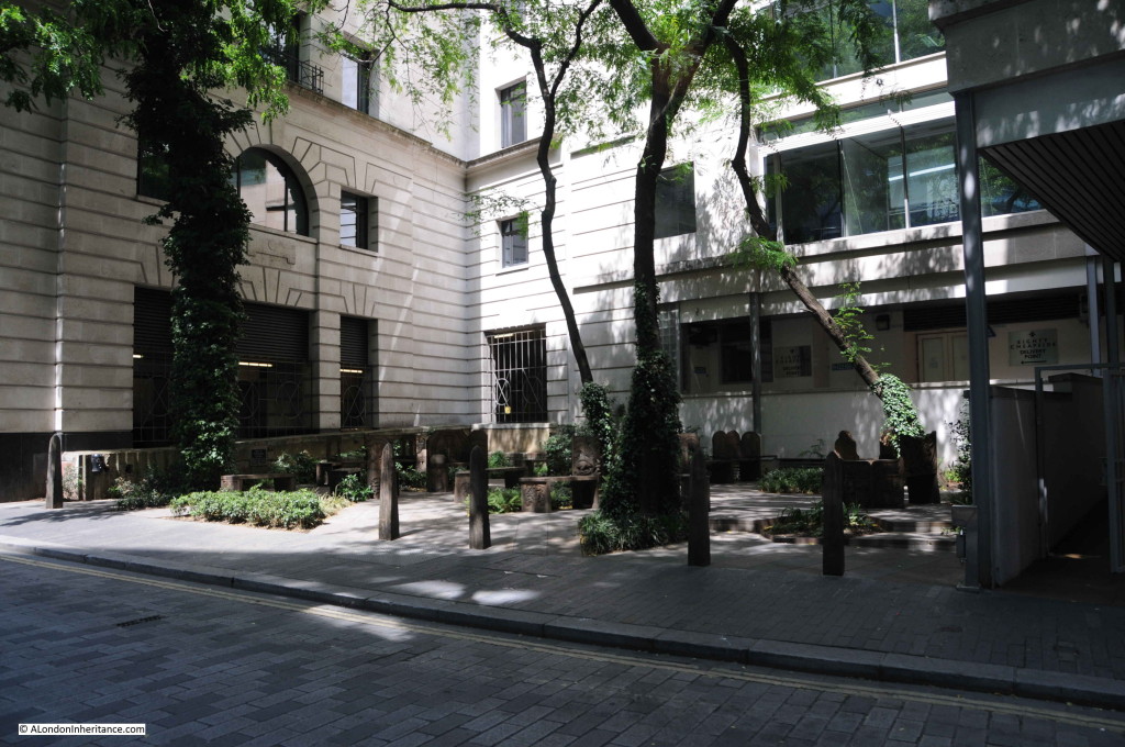
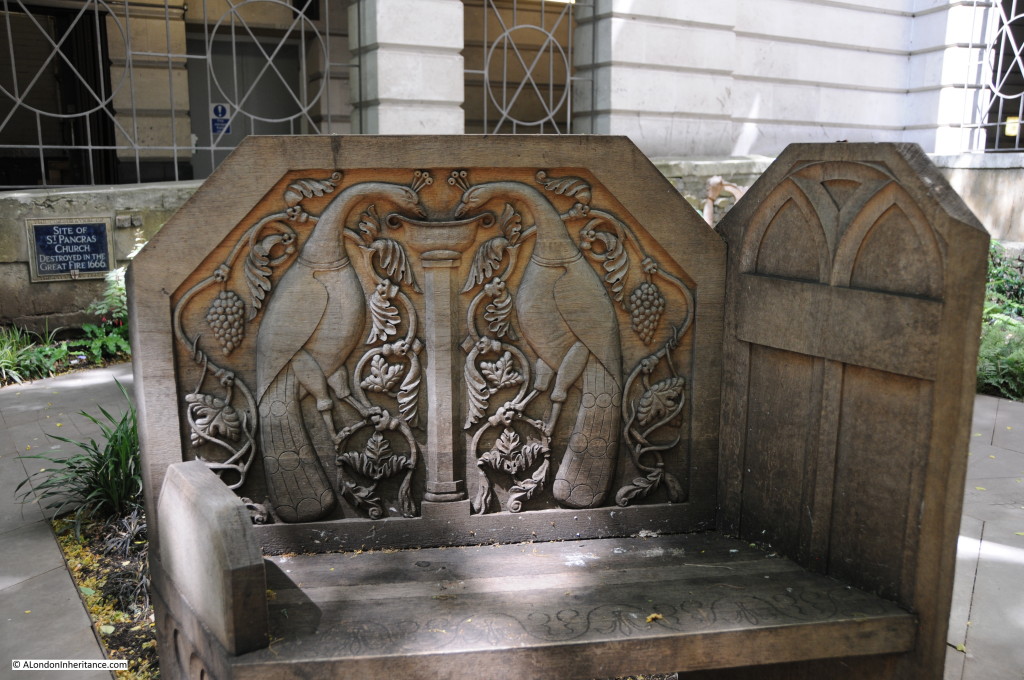
Walk down Pancras Lane and we come to the site of St. Pancras Church. This was one of the churches destroyed in the Great Fire that was never rebuilt although the graveyard continued to be used until 1853. The land was left derelict for many years, but was recently purchased by the City of London and transformed into a small garden.

Cordwainer 9

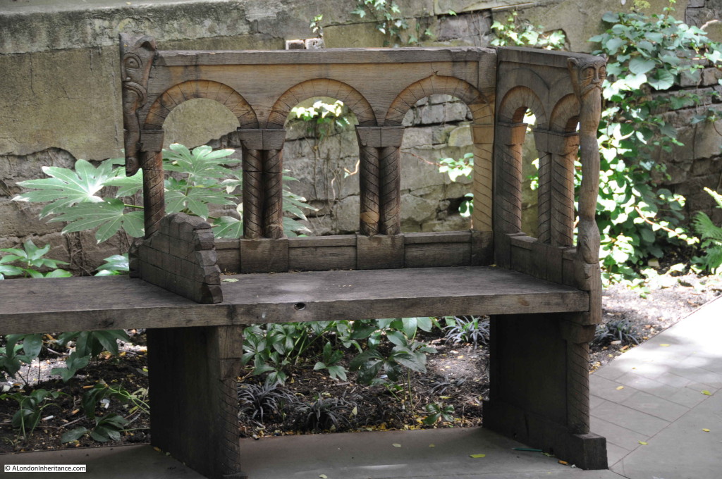
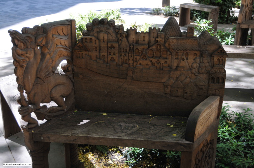
As part of the transformation, a competition was held and the winning design included the installation of a range of beautifully carved benches with their designs based on the Romanesque architecture of the church rising afresh from the ground after the Great Fire.

Cordwainer 6

The benches were carved by students from the City & Guilds of London Art School.

Cordwainer 7

The background to the design of the garden and the carved benches can be found on the website of Studio Weave.

Cordwainer 8

Writing in 1910, Walter Besant states that the graveyard of St. Pancras “bears a great similarity to all that is left of the others; it is covered with dingy gravel and decorated by blackened evergreens. the iron gate bears a little shield telling that it was erected in 1886. There are one or two tombs still left.”

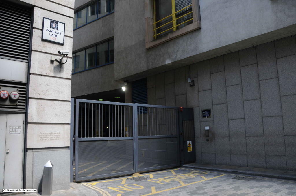
Continue the short distance down Pancras Lane to where it turns right into Sise lane and this is the location of another church lost in the Great Fire, the church of St. Benet Sherehog.  There are two plaques recording the church. On the left of the gates, just above the silver bollard is a reproduction of the original stone slab that reads: “Before the dreadful Fire, Anno 1666, stood the church of St. Benet Sherehog” The blue plaque on the right of the gates records the church on one of the standard city plaques.

Cordwainer 10

There are a couple of possible sources for the name St. Benet Sherehog. The church was originally dedicated to St. Osyth, however it was repaired by one Benedict Shorne, or Sherehog in the reign of Edward II and as a result of the repair the benefactor gave his name to the church. An alternative source is from the hogs that may have wallowed on the shores of the Wallbrook, or the ditches that ran into the stream.

The most frequent reference is to Benedict Shorne, but as with many of the street and church names in the city, the real source of the name is hidden in the centuries that have passed. It is an old name, appearing as early as the twelfth century.

Again writing in 1910, Walter Besant states there remains “the railing and low wall were put up in 1842. Within the enclosure stands a tomb over the Family Vault of Michael Davison, 1676”.  At the time of his death, Michael Davison left a charitable gift to provide £5 per annum for keeping his family vault in repair.

The Museum of London excavated the graveyard of St. Benet Sherehog between 1994 and 1996 as part of the No. 1 Poultry development. There were 274 burials excavated and following analysis of 270 of these, 39 were identified as being from the Medieval period.

At the end of Pancras Lane, the street bends to the right to all that remains of Sise Lane.

Sise Lane is a corruption of St. Osyth, a Mercian Queen reputedly martyred around the year 700.

From the end of Sise Lane we can walk south along Queen Victoria Street. We cut across Queen Street which runs down towards Southwark Bridge and north to Cheapside. Queen Street is another that has changed name. Originally known as Soper Lane, or Soapers Lane from the soapmakers who lived in this area. The name was changed to Queen Street soon after the Fire of London in honour of the wife of King Charles II, Queen Catherine of Braganza.

Queen Street / Soper Lane appears to have a history for markets. In 1297 there was an evening market here called the “New Fair”, set-up without the approval of the mayor by “strangers, foreigners and beggares” and was the scene of much “strife and violence”. It was soon shut down. It was later the market place for the Pepperers, then the Curriers and Cordwainers and in the reign of Queen Mary it was a street known for shops selling pies.

Not much of that in Queen Street today:

Cordwainer 12

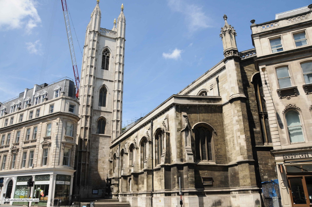
Continuing down Queen Victoria Street we come to the church of St. Mary Aldermary. An old church with written references back to the thirteenth century, but probably older. The church was repaired after the Great Fire and considerably restored in 1877 when the nearby church of St. Antholin was closed as one of the many 19th century city church closures. The funds generated by the sale of the site were used to restore St. Mary.

Wren’s restoration after the Great Fire was unusual in that it was not based on a new design. The funds for restoration came from one Henry Rogers who left a legacy of £5,000 for the restoration of the church. His widow required that the restoration should be an exact copy of the original Gothic style of church. St. Mary Aldermary and St. Alban, Wood Street are the only known examples of Wren’s restoration based on the original church.

Cordwainer 13

Opposite St. Mary Aldermary is the junction of Cannon Street and Queen Victoria Street. These two streets have had a significant impact on Cordwainer Ward.

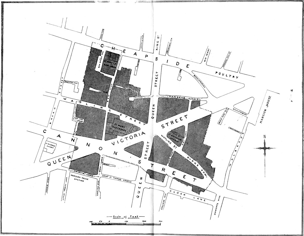
Construction of Queen Victoria Street commenced in 1867 to provide a direct route from the Embankment through to Mansion House. Cannon Street was extended through Cordwainer Ward in 1853-4 to reach St. Paul’s Cathedral. The following two maps provide a very clear view of the impact of these two streets. Firstly the 1755 map of the ward:

cordwainer Map 1755

Now the Ward in the early part of the 20th Century showing the impact of Cannon Street and Queen Victoria Street:

Cordwainer Map early 20th centuryThe development of these two streets had a considerable impact on Cordwainer Ward, sweeping away a number of original streets and carving into two, many streets that had originally run down to Thames Street. It is this layout of the Ward that we see today.

This is how Queen Victoria Street appeared in the first decade of the 20th Century.

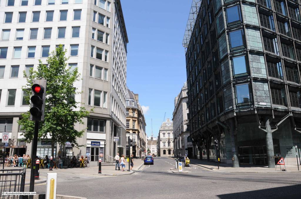
Cordwainer 18Much of Queen Victoria Street has changed considerably since this photo was taken, however in the above photo the church of St. Mary Aldermary is on the left and there is an ornate building on the right, curved with Queen Victoria Street passing to the left and Cannon Street on the right. This is one of the few buildings to have survived and is still much the same as when the above photo was taken as can be seen in the following photo:

Cordwainer 20

A brief walk around the history of Cordwainer Ward. One of the smaller Wards of the City of London, but with a fascinating history of which traces can still be found despite the process of continual change which is also part of  London’s heritage.

The sources I used to research this post are:

  • London, The City by Sir Walter Besant published in 1910
  • The History of London from its Foundations to the Present Time by William Maitland published in 1754
  • Cordwainer Ward in the City of London by A. Charles Knight published in 1917
  • Medieval Towns – The History of London by Henry B. Wheatley published in 1922
  • Stow’s Survey of London . Oxford 1908 reprint of 1603 edition
  • London Churches Before The Great Fire by Wilberforce Jenkinson published in 1917

alondoninheritance.com