Monthly Archives: November 2014

The Lost Wharfs of Upper Thames Street and St. Benet’s Welsh Church

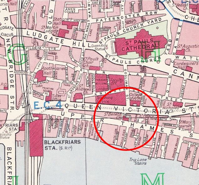
This week’s post is about one small area of London which has changed considerably since the 1940s. The following map is taken from Bartholomew’s Reference Atlas of Great London  published in 1940.

Between Upper Thames Street and the River Thames was a network of streets and wharfs leading down to the river. Small inlets such as Puddle Dock, Wheatsheaf Wharf and Castle Baynard Wharf were part of the central London network of docks where goods were unloaded to the warehouses that stood along this stretch of the river.
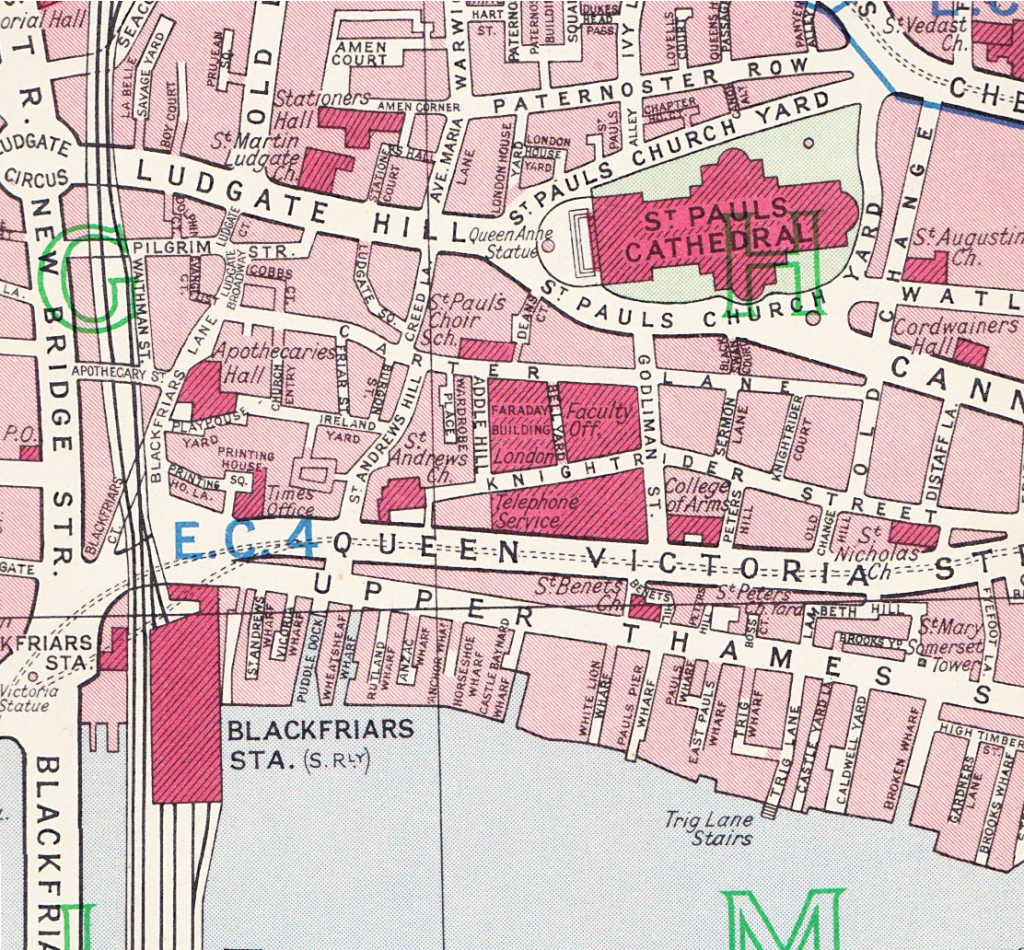
1940 map
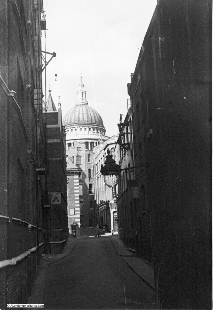
The following photo is one my father took in 1948 and is one that I was having trouble trying to locate despite the very obvious landmark of St. Paul’s Cathedral. The streets are sloping down from St. Paul’s, a clear sign that this photo was taken from the southern side of St. Paul’s, where the land slopes down towards the river. Apart from the cathedral, the only other building with any distinguishing features is the building further up the road with the white brickwork down the corner of the building.

dads st bennets photo 2

On the building on the left is a small crane located towards the top of the building. A further demonstration of activity in these narrow streets. I imagine that goods being taken to or removed from the warehouse by road would be loaded onto lorries in this side street using the crane to lower from the warehouse. Typical activity that could be found in all the streets and wharfs leading down to the Thames.

Following a walk around Upper Thames Street and Queen Victoria Street, I finally found the location of this photo, however the surrounding area has changed so significantly and the street my father took the photo in does not now exist.

The building with the white brickwork on the corner is the church of St. Benet and the road in which the photo was taken and is running up to the church is Pauls Pier Wharf. I have repeated the map below and circled the area. The church is in the centre of the circle and Pauls Pier Wharf can be seen running down to the river.

1940 map 2

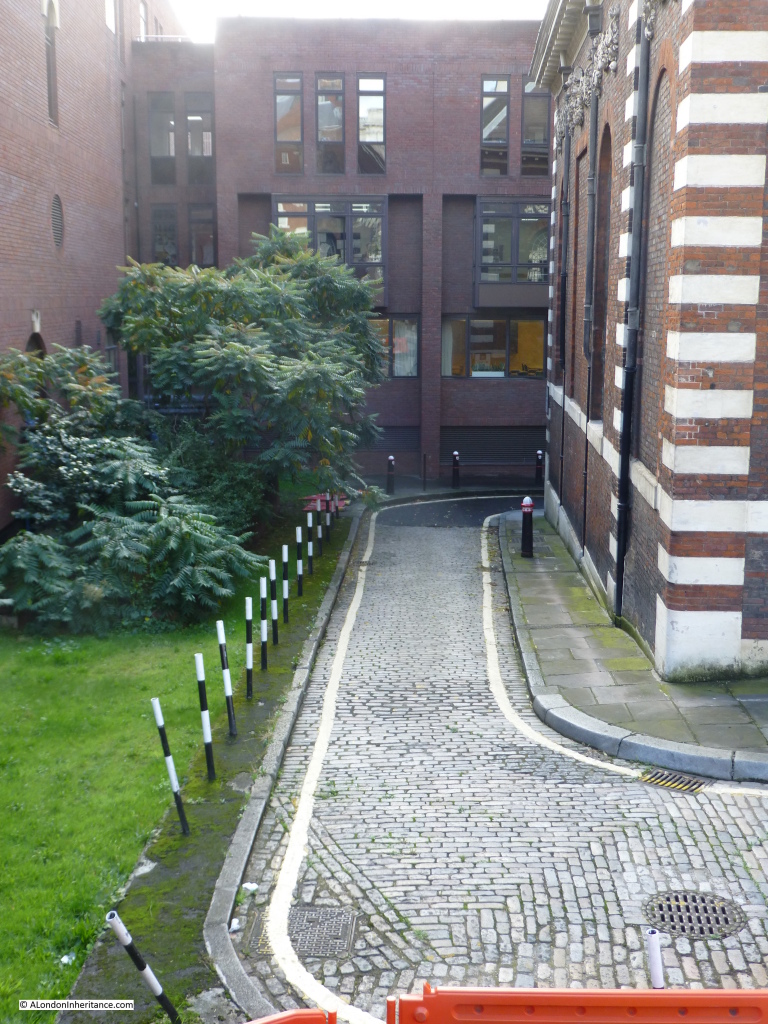
So what is there today? The church remains, but everything else has been lost. When this whole area was redeveloped, Upper Thames Street was widened and rerouted slightly to the south. I could not get to the position where my father took the 1948 photo, however to give some idea of the area now, the following photo is from the elevated Queen Victoria Street. If you go back to the original photo, this is roughly from the same position as from the first floor window of the building at the very top of the street, looking past the church and straight down Pauls Pier Wharf (which is now covered by the building behind the church).

2014 st bennetts 11

The cobbled road is the remains of Bennets Hill and where it turns right, behind the church, that is the original position of Upper Thames Street. The whole area south of the church, where once Pauls Pier Wharf, Pauls Wharf and East Pauls Wharf used to be is now the 1980’s City of London School which occupies the entire site.

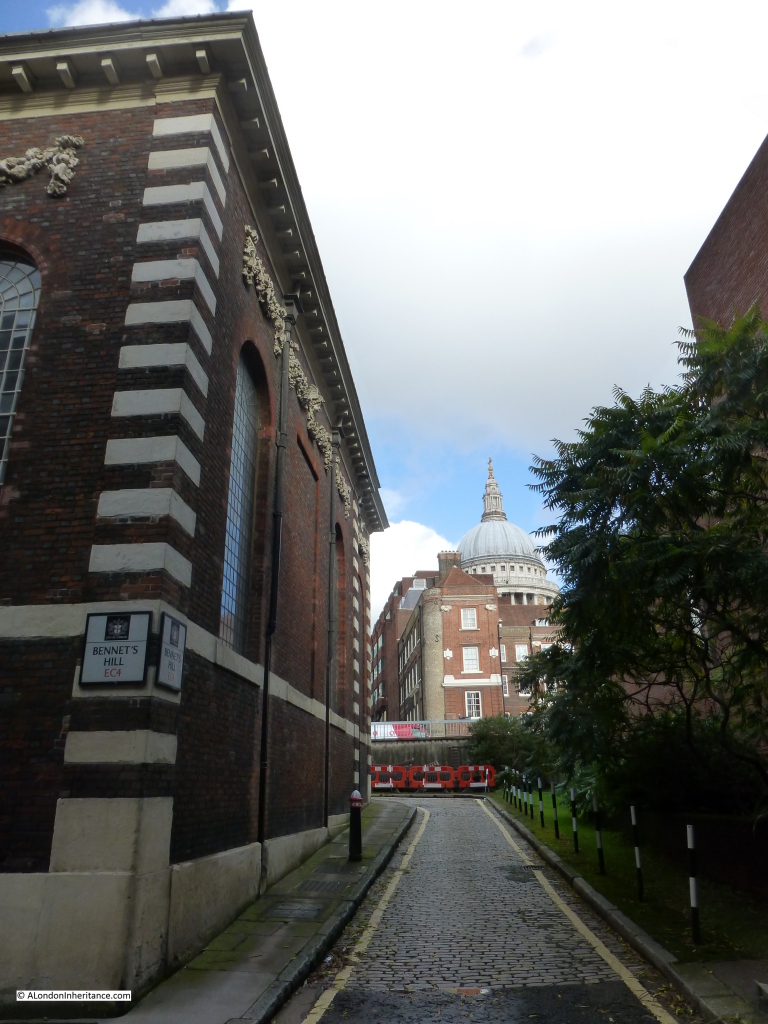
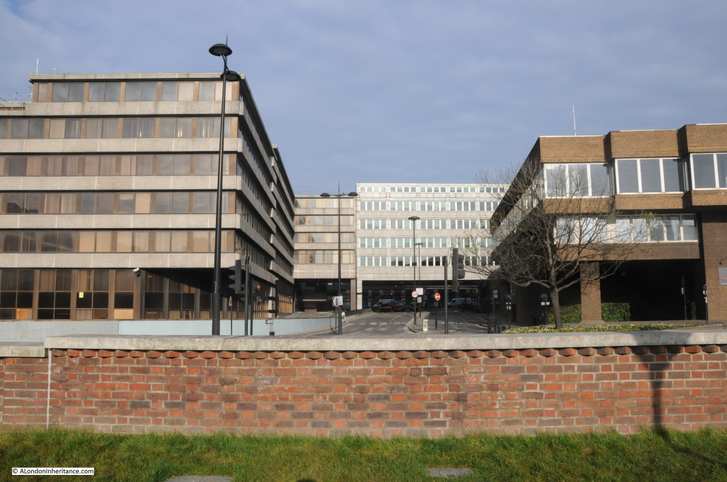
As part of the development of the entire area, Upper Thames Street was moved slightly south and along this stretch it is enclosed within a concrete tunnel with the school being built across the tunnel and down to the frontage on the Thames. The nearest I was able to get to recreate my father’s original photo was up against the wall of the school looking back up Bennet’s Hill. This shows how much of the original street has been lost. To take this photo I was standing roughly where the person crossing the road in the original photo is standing.

2014 st bennetts 8

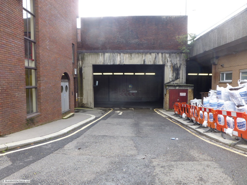
If you walk round to the other side of the church, it is possible to see the original route of White Lion Wharf. Again, this street has been lost and we are looking down into the concrete tunnel that carries Upper Thames Street (the first road in the tunnel is Castle Baynard Street and on the other side of the concrete wall is Upper Thames Street, also in the tunnel). Castle Baynard Street did not exist and is a creation of the redevelopment. It has continued the use of the Castle Baynard name as Castle Baynard Wharf, which was slightly to the west has also been lost. The eastern extremity of Castle Baynard was on this location. More on this in a future post.

On the right is the elevated White Lion Hill which leads from Queen Victoria Street down to the Blackfriars Underpass. Interesting that the White Lion part of the original street name has been retained but is now a Hill rather than a Wharf.

2014 st bennetts 7

If you walk along the Thames Path a short distance in the direction of Blackfriars Station, and look to your right the road coming down from Queen Victoria Street is what was Puddle Dock as shown in the 1940 map. The road still retains the Puddle Dock name.  This is what the old dock looks like now:

2014 st bennetts 17

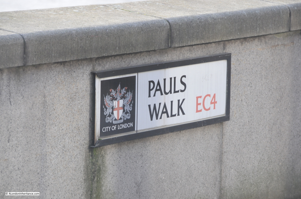
A further example of the re-use of the names of the streets and wharfs along this short stretch of the Thames, the Thames path in this section is named Pauls Walk. There were three wharfs with the name Paul; Pauls Pier Wharf, Pauls Wharf and East Pauls Wharf.

2014 st bennetts 18

Returning to the church of St. Benet’s, this is an interesting church and well worth a visit. As with many City churches, first records of the church are from the 12th Century. The original church was destroyed in the Great Fire of London and the current church is one of Wren’s rebuilds of the City churches (although probably the design of the church was by Wren’s assistance Robert Hooke). Unlike many of the City churches, it was not damaged in the 2nd World War, indeed unlike so much of Queen Victoria Street and the docks onto the Thames, the small area between St. Benet’s and the river did not receive any significant damage. The church is one of the very few in the City that has not changed that much since construction after the Great Fire.

There was a time though when St. Benet’s was almost lost. In the later half of the 19th century there was a wave of church demolition of those that were perceived to be redundant and St. Benet’s was one of the churches scheduled for demolition, however Welsh Anglicans petitioned Queen Victoria for permission to use the church for services in Welsh. This right was granted and since then services have been conducted in the Welsh language. The Welsh connection is a very strong part of the identity of the church.

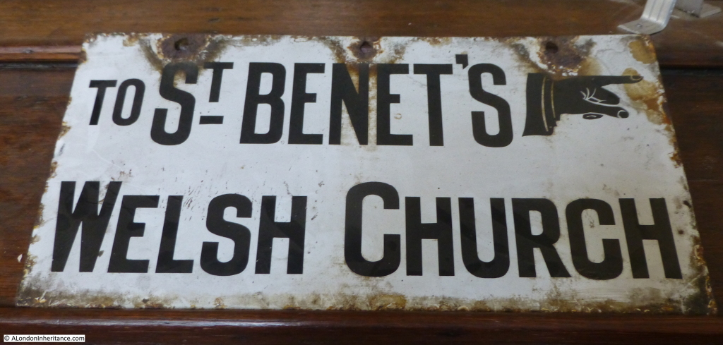
An old street sign, now stored inside the church:

2014 st bennetts 3

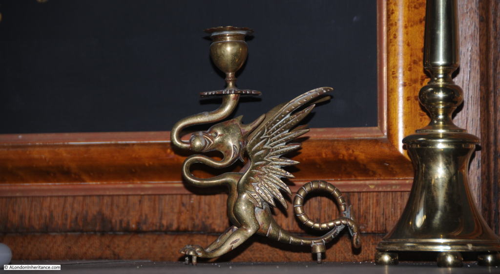
The Welsh Dragon as a candle holder:

2014 st bennetts 13

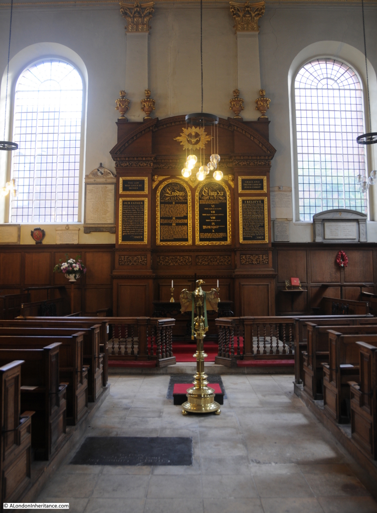
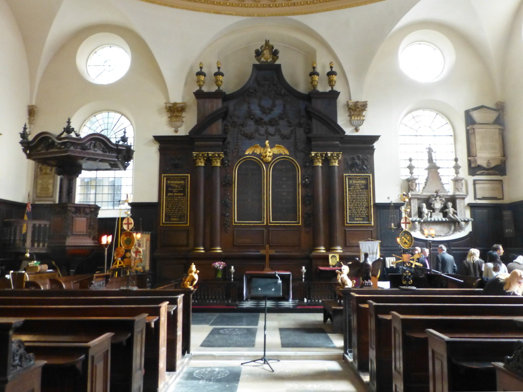
The interior of the church is bright, but with plenty of wood panelling and a large carved, but simple reredos behind the altar.

2014 st bennetts 12

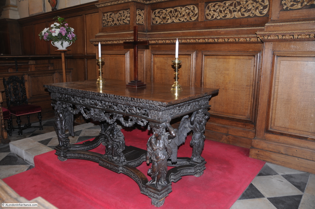
The 17th century altar / communion table with winged angels supporting a rich cornice and under the table is a figure of Charity with her children:

2014 st bennetts 14

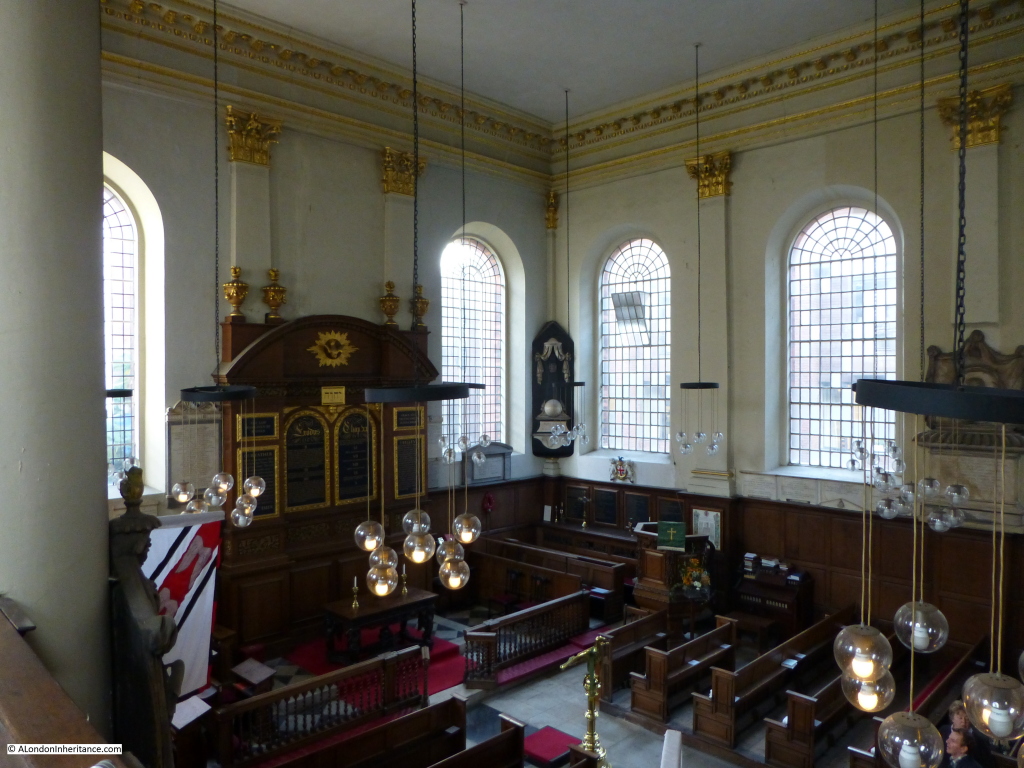
The view from the gallery:

2014 st bennetts 4

Back outside the church, and standing on Queen Victoria Street we can look down on the church and Bennet’s Hill. The area north of the church was the original churchyard, however this was lost in the original 19th century widening of Queen Victoria Street.
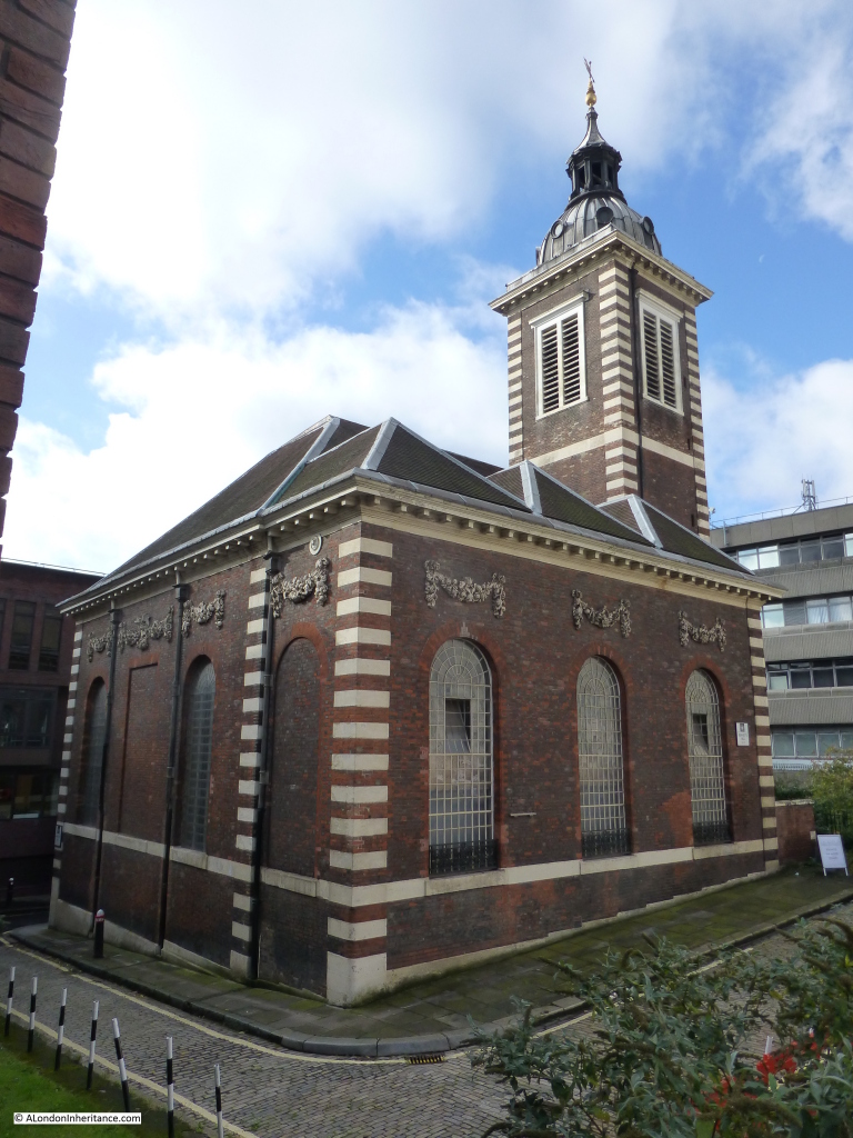
2014 st bennetts 1

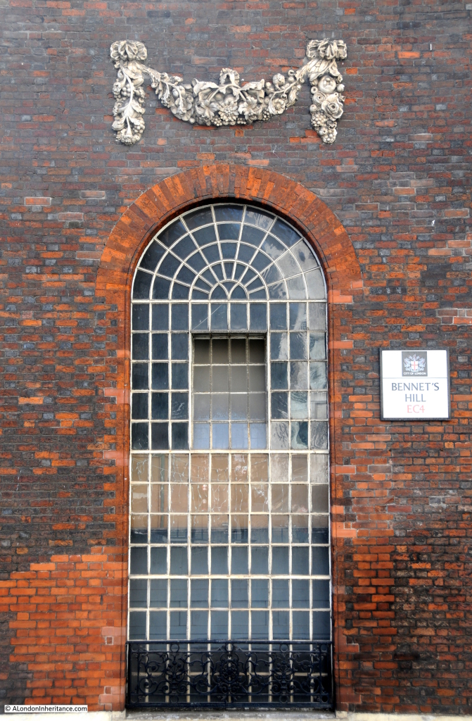
There is some confusion as to the spelling of Benet in the name of Bennet’s Hill. The church has a single “n” in the name as does the hill in the 1940 street map, however as can be seen below, the modern day street name has “nn”. I have been unable to find whether this spelling change was for a reason or an accident with the new street signs.

2014 st bennetts 15

Good to see that the original stone carvings above the windows still survive.

Names though do change over the centuries. Stow in 1603 stated that the church was called St. Benet Hude (or hithe) and was up against Powles Wharffe (presumably the same as Pauls Wharf in the 1940 map). Whilst the names change slightly in their spelling it does demonstrate that they have been in existence for many hundreds of years, and for the wharfs and streets they lasted down to the reconstruction of the area in the decades after the war.

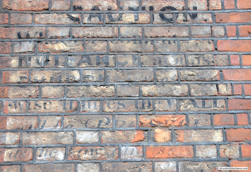
Old ghost sign on the side of the church:

2014 st bennetts 16

Which seems to read:

CAUTION

Whoever commits NUISANCE against …. church … otherwise injures the WALL will be PROSECUTED ….

One wonders whether the church’s current position, squashed between Queen Victoria Street, the Upper Thames Street tunnels and the elevated White Lion Hill would be considered as committing a nuisance against the church?

The sources I used to research this post are:

  • Bartholomew’s Reference Atlas of Greater London published 1940
  • The Old Churches Of London by Gerald Cobb published 1942
  • London by George H. Cunningham published 1927
  • Old & New London by Edward Walford published 1878
  • Stow’s Survey of London. Oxford 1908 reprint

alondoninheritance.com


Tower Hill And The Growth In London Tourism

Much of what I have written so far has been about the physical change across London. How the buildings and streets have changed so considerably over the last 70 years, however there are many other ways in which London has changed and for this week’s post I want to use a series of photos to show that whilst a specific area has not changed that much physically, it is now playing a very significant role in London’s position as one of the major world tourism destinations.

Tower Hill is the area to the north-west and western side of the Tower of London. Tower Hill, in the words of Stow was:

“sometime a large plot of ground, now greatly straitened by encroachments (unlawfully made and suffered) for gardens and houses. Upon the hill is always readily prepared, at the charges of the City, a large scaffold and gallows of timber, for the execution of such traitors or transgressors as are delivered out of the Tower or otherwise, to the Sheriffs of London by writ, there to be executed.”

There is a long list of those executed on Tower Hill, with the last being the execution of Lord Lovat on April 9th 1747. At this execution, a scaffolding built to support those wishing to view the execution collapsed with nearly 1,000 people  of which 12 were killed. Apparently, Lovat “in spite of his awful situation, seemed to enjoy the downfall of so many Whigs”.

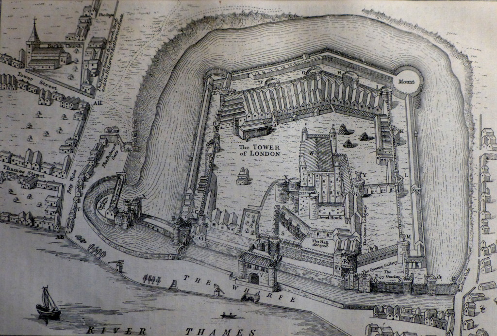
The following shows the Tower of London from a survey in 1597 showing the moat and the area to the north-west and west that formed Tower Hill.

tower of London 1597

The western end of Tower Hill. as can seen in the above picture, has long been the main land based gateway to the Tower of London, countless numbers of people must have walked down Tower Hill on their way to the Tower of London, for many, not in the best of circumstances.

The moat was drained in 1843 having long been described as an “offensive and useless nuisance”. After being drained workmen found several stone shot which were identified at the time as being missiles directed at the Tower during a siege in 1460 when Lord Scales held the Tower for Henry VI and the Yorkists cannonaded the fortress from a battery in Southwark.

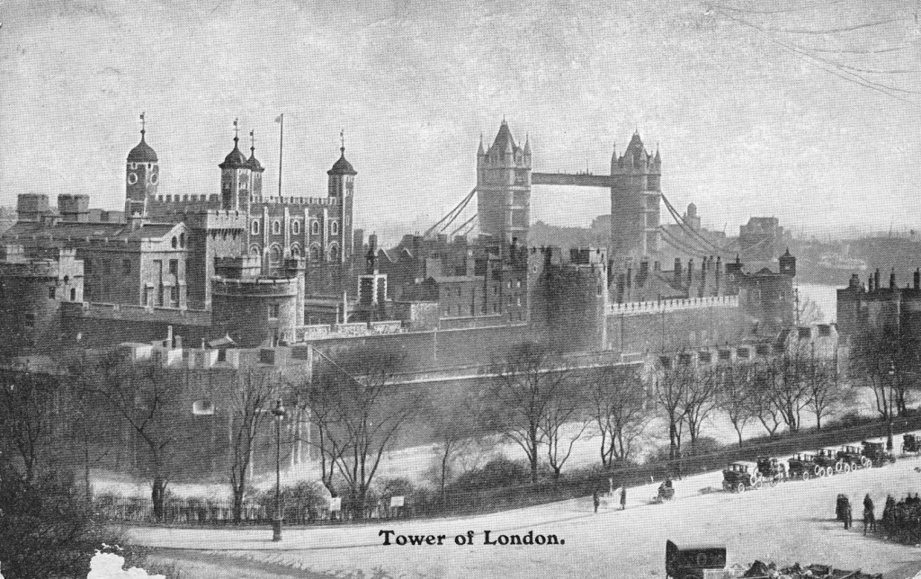
The following postcard is from the first decade of the twentieth century. I suspect it was taken from the top of the tower of All Hallows by the Tower looking over the Tower of London with part of Tower Hill in the foreground with the approach running down towards the main entrance on the right. Transport is lined up along the approach, taking visitors to and from the Tower.

tower hill postcard 2

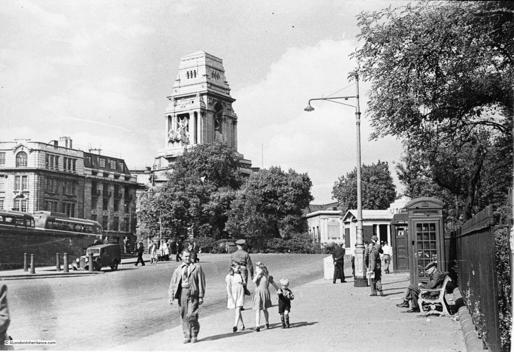
My father took the following photo looking up Tower Hill from a position to the extreme right of the above photo in 1948 (all of the following three photos from 1948, 1977 and 2014 were taken in the summer at roughly the same time, early afternoon as can be seen by the direction of the shadows).

The moat is just over the railings to the right. The large building behind the trees is the Port of London Authority headquarters. From the Face of London by Harold Clunn:

“Many courts and alleys were swept away between 1910 and 1912 to make room for the new headquarters of the Port of London Authority. This magnificent building, designed by Sir Edwin Cooper, stands on an island site enclosed by Trinity Square, Seething Lane and the two newly constructed thoroughfares called Pepys Street and Muscovey Street. Constructed between 1912 and 1922, it has a massive tower rising above a portico of Corinthian columns overlooking Trinity Square, and the offices are grouped around a lofty central apartment which has a domed roof of 110 feet in diameter”. 

The “massive tower” is a very striking local landmark both from the surrounding streets and from the Thames.

dads tower hill

The colonnaded building which can partly be seen at the top right of Tower Hill is the memorial to the men of the Merchant Navy and the fishing fleets who died in the two world wars. Some 36,000 names are listed of men who “have no grave but the sea”.

I find the detail of these photos fascinating, from left to right below. An Ice Cream seller in a white coat with his ice cream cart, one of which was bought for the boy in the middle photo and on the right behind the phone box is a Police Box, probably better known these days as a Tardis. Note also how common military uniforms were on the streets of London, even three years after the war had ended.

detail - 1

Now fast forward 29 years and I took the following photo in 1977 when I first stated taking photos of London with a Russian Zenit camera (all that pocket-money could stretch to at the time). The camera had a tendency for the shutter to stick and unlike digital cameras, you did not know this until after the film had been developed. This is one of the photos where it actually worked.

my 1970s tower hill

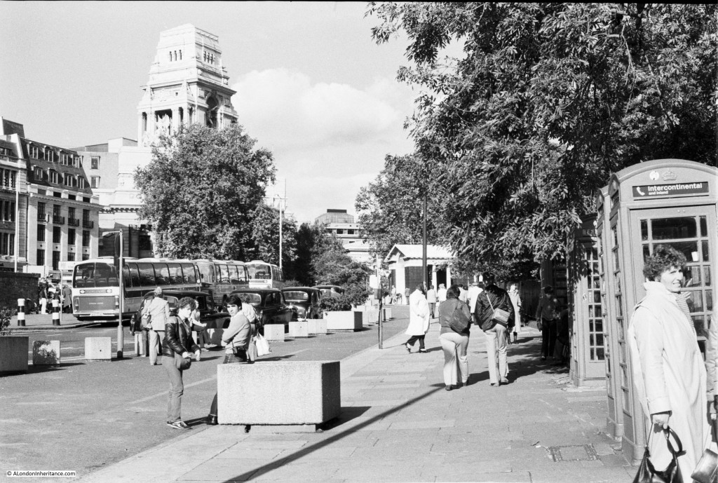
The scene is very similar. the coaches show the start of mass tourism to London and there are additional telephone boxes including one for Intercontinental Calls  (this was still at a time when intercontinental calls were the exception and expensive to make).

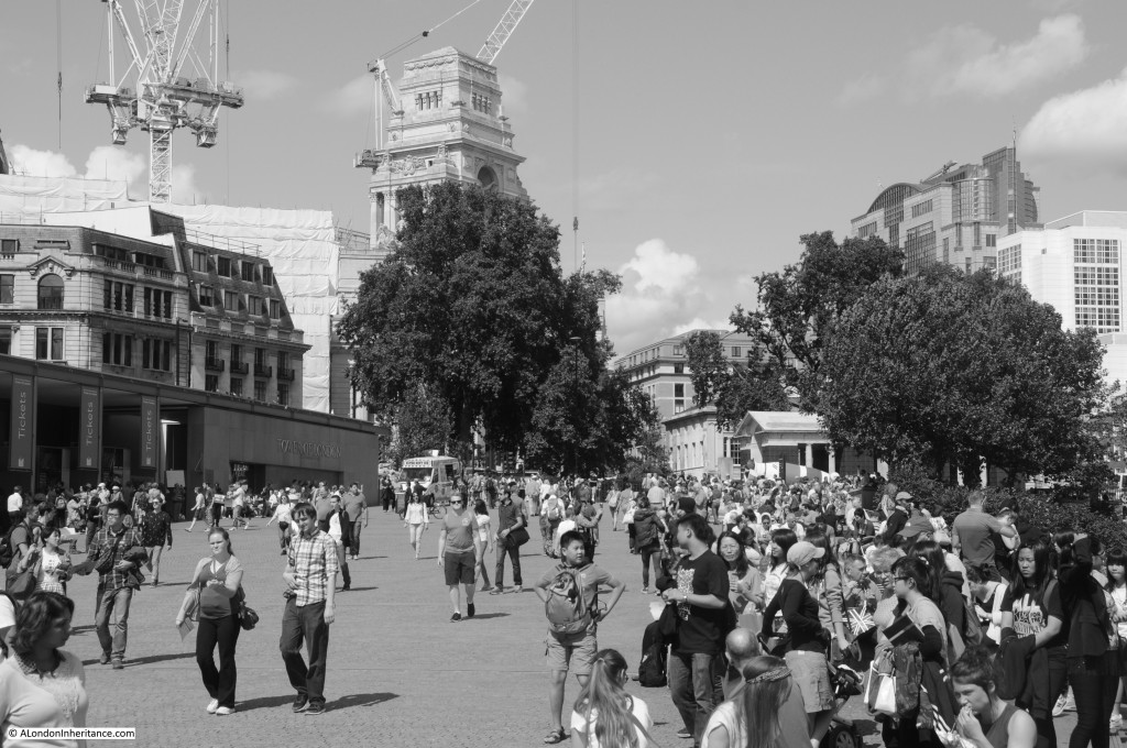
Now fast forward again another 36 years and I took the following photo in early August 2014. Fortunately I now have a much better camera and I thought converting to Black and White would allow a better comparison with the previous photos.

When I took this, planting of the poppies for the “Blood Swept Lands and Seas of Red” installation had only just begun and it had not generated the level of visitors seen in October and the start of November. This was a typical summer’s day on Tower Hill.

This photo also has cranes in the background which now appears to be mandatory for any photo within the City.

my 2014 tower hill

The Tower of London is now one of the major tourist attractions in London as can be seen on almost any day in Tower Hill. New ticket offices, food outlets and visitor displays have been built down the left hand side, the telephone boxes have disappeared and the ice cream seller with his ice cream cart from 1948 would be hard pressed to manage the industrial scale of ice cream vending now seen on Tower Hill on a summer’s day.

Visitor numbers to London have risen dramatically over the last few decades. In the last ten years they have risen from 11.696 million in 2003 to 16.784 million in 2013 and the first half of this year’s numbers show a 7% increase over the first half of last year.

Of these visitors in 2013, 2.894 million visited the Tower of London in 2013. I doubt that these numbers could have been imagined on that summer’s day in 1948.

Tourism is one of the many factors that are changing the face of London, and with numbers continuing to increase this influence will continue.

I recommend a visit to Tower Hill late on a cold winter’s evening, when it is possible to look over the moat, across to the Tower without the noise and hustle of the crowds and with a little imagination, see the Tower as it has been for centuries as a functioning garrison, fortress and prison. There is also an opportunity to briefly experience the Tower at night. The Ceremony of the Keys takes place every night with admittance starting at 9:30 pm. Whilst with modern-day security systems this ceremony is now probably more ceremonial than functional it does provide a glimpse of the Tower at night and of a ceremony which has been in existence for at least 700 years. Again, a cold winter’s evening is the best time to experience this event. Tickets are free from Historic Royal Palaces and can be found here.

You may also be interested in my post on the Tower Hill Escapologist which can be found here

The sources I used to research this post are:

  • London by George H. Cunningham published 1927
  • Old & New London by Edward Walford published 1878
  • The Face of London by Harold Clunn published 1932
  • The London Tourism numbers are from the Greater London Authority Data Store which can be found here
  • Figures for visitors to the Tower of London are from the Association of Leading Visitor Attractions and can be found here (which also has a fascinating list of visitor numbers to the majority of UK attractions)

alondoninheritance.com


St James Garlickhythe And A Monument To The Nesham Family’s Struggle

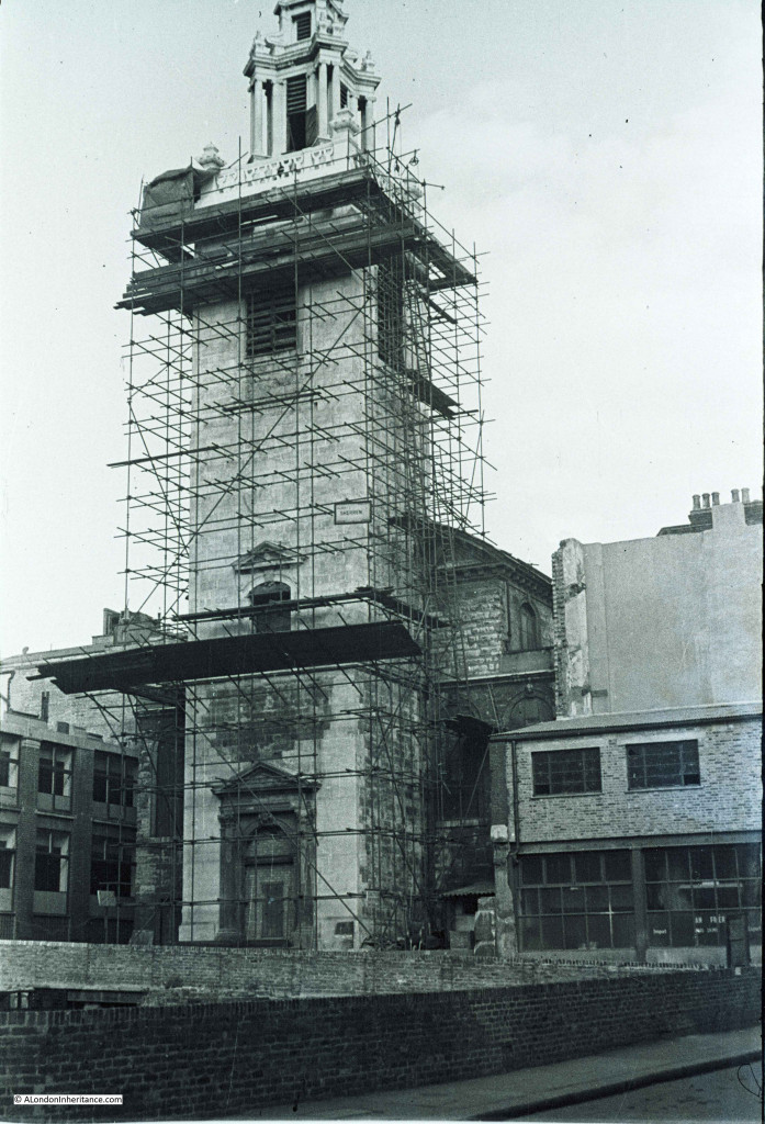
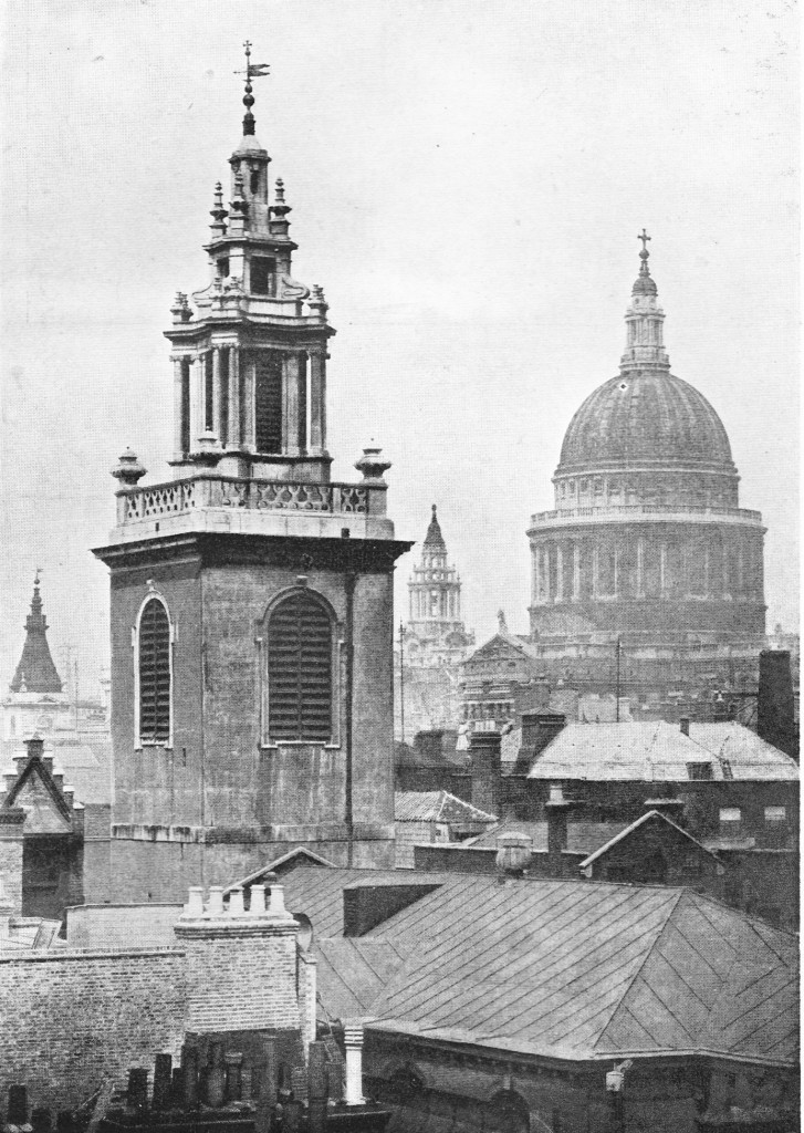
This week, I am visiting the Wren church of St. James Garlickhythe on Upper Thames Street. The following photo was taken just after the war when repairs were taking place to the tower.

St. James did not suffer major damage during the bombing of London unlike so many other of Wren’s City churches. There was some damage to the tower, including the loss of the original 1682 clock that stood out from the tower,  and a very lucky escape when a 500lb bomb fell into the church but failed to explode.

st james - dads

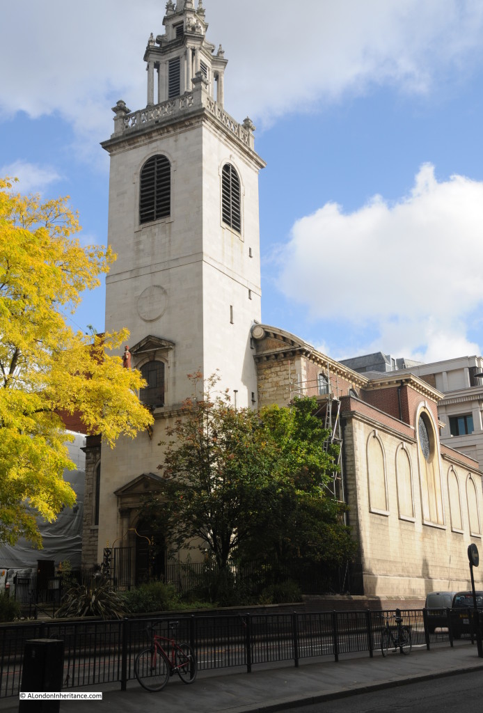
The church today is much the same, however the surroundings have changed considerably with the church now right up against the considerably widened Upper Thames Street. The buildings to the right of the church in the above photo were destroyed to make way for the extra lanes as Upper Thames Street was widened from a single road to dual, two lanes of road to carry traffic  between the east and west ends of the City.

st james exterior 1

Although now up against Upper Thames Street, the church is on Garlick Hill. The church is dedicated to the apostle St James, and the Garlickhythe part of the name is from “hythe” being the Saxon word for a landing place or jetty, with Garlick coming from, as explained in Stow’s Survey of London for both church and hill, “for that of old time, on the banks of the river of Thames, near to this church, garlick was usually sold”. 

A pre-war view of the tower and steeple of St. james Garlickhythe with St. Paul’s in the background is shown below. As was typical of the pre-war city, the steeples of the City churches stand well above the surrounding buildings which cluster close around the church.

old st james 2

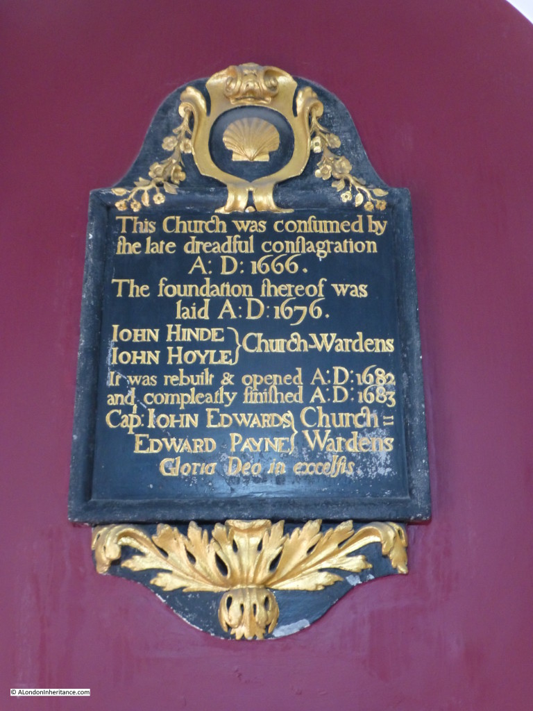
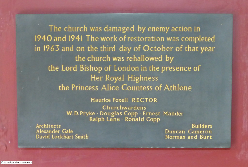
A church was first mentioned on the site in 1170, although it had probably stood on the site for some considerable time before this. It was rebuilt in around 1326 by Richard Rothing, Sheriff, who also left money for the maintenance of the fabric.  As with the majority of other City churches, it was then destroyed in the 1666 Great Fire with the current church being built by Wren,  and completed in 1683. A monument in the church records the rebuilding:

plaque 1 There is also one to record the restoration work carried out after the war:

plaque 2

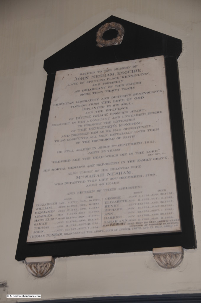
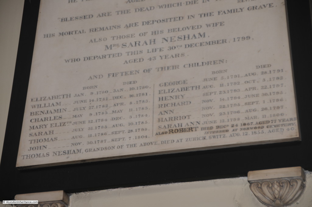
Among the monuments Inside the church, there is one of the saddest I have found in a City church. Whilst we may romanticise  about the London of centuries past, the lost buildings, streets and ways of life, London was a hard place to survive and raise a family. The following monument records the Nesham family who lived in the parish for more than 30 years.

Sarah Nesham lived to the age of 43, “departing this life 30th December 1799”. The monument also records the death of fifteen of their children, the majority of whom did not reach the age of one, with the oldest of the fifteen making it to thirteen.

A sixteenth child was added later, Robert had reached the age of 77 when he died in 1867, one child out of sixteen living past their thirteenth birthday.

plaque 3

The detail of the children are shown in the following photo. One can hardly imagine what Sarah must have gone through in her 43 years, and I am sure that whilst fifteen children may have been the exception, this high level of child mortality was not unusual in London in the 18th Century.

plaque 4

It would also be interesting to know what their Grandson (presumably by their one child Robert surviving to adulthood) was doing in Zurich when he died in 1855 at the age of 40.

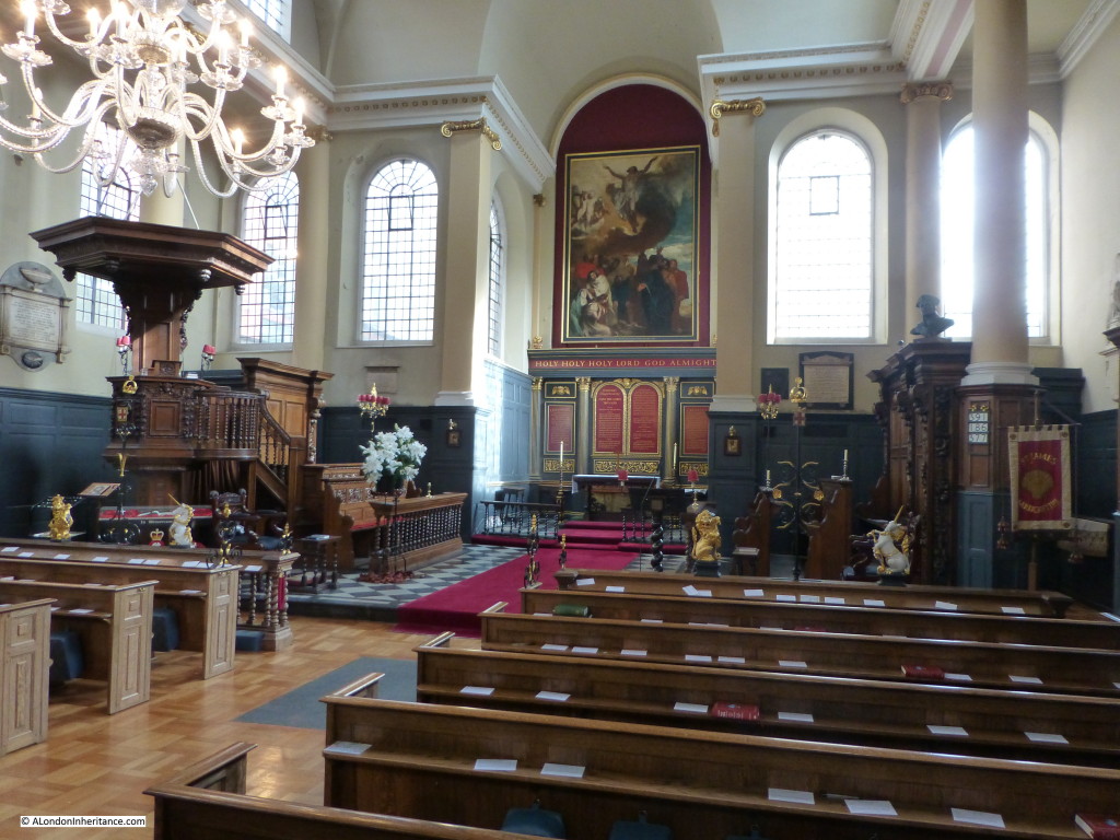
The nave of the church is one of the highest in London, large windows provide a very light interior. Up until the war the church had stained glass windows which must have resulted in quite a dark interior. The use of plain glass in the restoration of the church allows light to stream into the interior. Behind the altar is the 1815 painting of the Ascension by Andrew Geddes.

st james interior 1

The accounts for the church record many of the expenses associated with the building and opening of the church, for example in the Vestry Book for July 19th, 1682 an entry records that Mr Thomas Osborn, Churchwarden was to pay Sir Christopher Wren’s two clerks 40s each for “their care and kindness in hastening the building of the church and to do the like for the more speedy finishing of the steeple.”

When the church was nearly finished, of the many items recorded as being paid for are the following:

For Church Bible and Common Prayer Book….£3 3s 0d

Two bottles of sherry and pipes at the opening of the Church ….. 3s 4d

Hire of 3 dozen cushions and porterage….. 13s 4d

Wine when the Lord Mayor and Aldermen were at our Church….. £1 11s 0d

Wax Links to enlighten my Lord Mayor home….. 4s 6d

old st james 1Up until around 1808 there was an open churchyard in front of the church, after this time it was enclosed by iron railings.

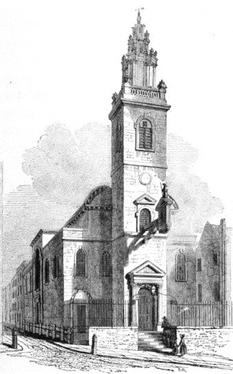
The picture to the left shows the church as it appeared in the 1830’s, looking much the same as now, with the railings at the front and the clock on the tower.

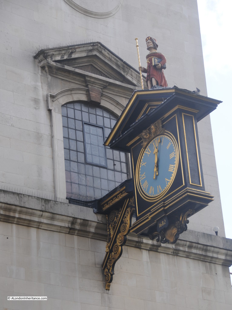
The clock was one of the victims of damage sustained by the church during the war. A restored clock was installed  in the same position which is shown in the photo below.


st james clock 1

The church is associated with many of the City Livery Companies, including the Vintners’ Livery Company who contributed considerably to the restoration of the clock.

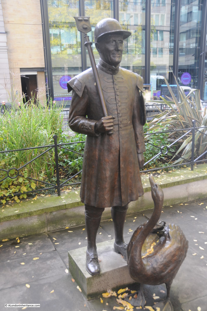
In front of the church is a small statue of the Barge Master and Swan Marker of the Vintners. The Vintners have held the right to own swans for many centuries and continue to hold the annual Swan Upping to count the swans on the Thames.

swan 1

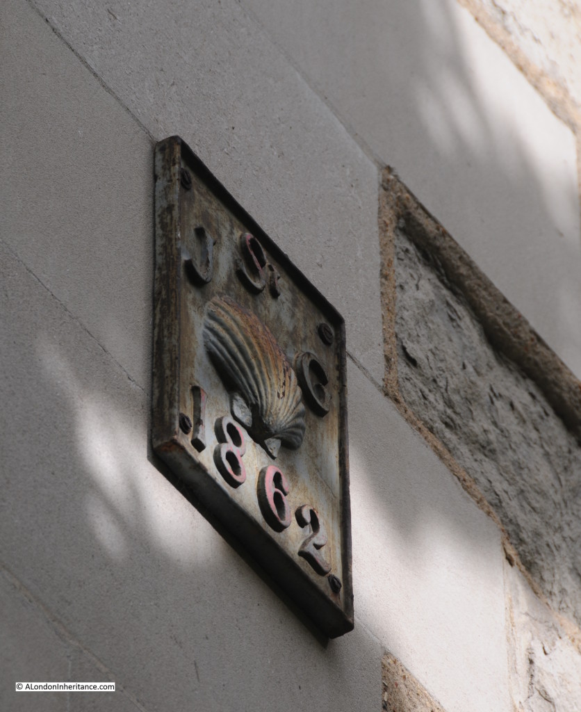
The Scallop Shell is the symbol of St. James and there are many shell symbols around the church including the one shown in the photo below on the exterior of the church.

st james shell 1

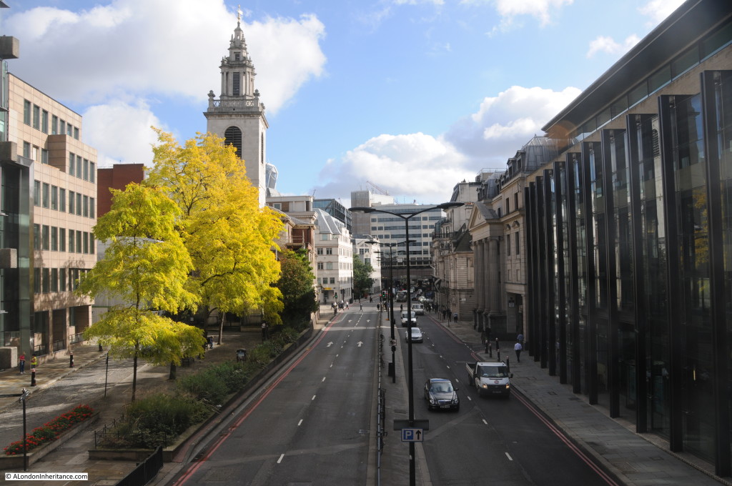
We can see how the area around the church has changed by walking across the footbridge over Upper Thames Street. Originally Upper Thames Street was just the two lanes on the right of the photo. The lanes on the left were buildings that faced onto Upper Thames Street. reconstruction after the war and the need to provide routes through the City between east and west resulted in the considerable widening of this road, which took the boundary of the road right up against St. James Garlickhythe.

st james by upper thames 1As with all the City churches, St. James Garlickhythe is well worth a visit and when there spare a thought for Sarah Nesham and her fifteen children. Life was extremely tough and challenging for so many during London’s long history.

St. James Garlickhthe is opened regularly by the Friends of the City Churches.

The sources I used to research this post are:

  • The Old Churches Of London by Gerald Cobb published 1942
  • London by George H. Cunningham published 1927
  • Old & New London by Edward Walford published 1878

 alondoninheritance.com

The London to Brighton Veteran Car Run – 1948 and 2014

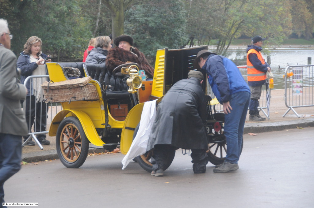
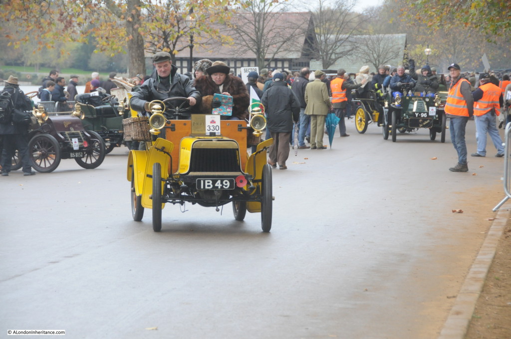
In 1948 my father took a number of photos of the start of the London to Brighton Veteran Car Run. Last Sunday was the date for this year’s event, so following an early start I arrived at Hyde Park at 6 am to watch the cars assemble and prepare for the first cars to depart on the 60 mile run to Brighton at 6:57 am (sunrise).

Even at 6 in the morning, the first cars have already started to assemble along Serpentine Road in a very dark Hyde Park.

my car run 1

The very first run was held in 1896 to celebrate the passing into law of the “Light Locomotives on the Highway Act” which defined a new category of vehicle, a Light Locomotive which had to be under 3 tons of unladen weight. It was this act which raised the speed limit from 4mph to 14mph, and although the requirement for a man to walk in front carrying a red flag had been abolished in 1878, a red flag was symbolically destroyed at the start of the 1896 run.

H J Lawson was a London-based motor industry promoter who had floated the British Motor Syndicate Limited  and in 1896 formed the Daimler Motor Company Ltd. It was H J Lawson who organised the 1896 London to Brighton Run, at the time called the Emancipation Run, in order to celebrate the freedoms that the new Act gave to motoring enthusiasts and the fledgling British motor industry.

This is also the reason why the Run is held in November, not the ideal month for open top motoring. The Act came into force just after midnight on the 14th November and the first Run was held on that day with November being the traditional month for the run ever since.

The following is from the history of the run on the website of the Veteran Car Club of Great Britain, which can be found here:

The Run on Saturday 14th 1896 was a demonstration that the automobile had come to stay. The organisers’ instructions stated: “Owners and drivers should remember that motor cars are on trial in England and that any rashness or carelessness might injure the industry in this country.

The Run from the Metropole Hotel in London to the Metropole Hotel in Brighton had 58 vehicles listed to start but 25 dropped out before the day. (The numbers do vary from one publication to another as no true report seems to be made.)
Only 13 or 14 reached Brighton, although it was hinted that one car or possible more had been taken down to Brighton by train and covered with mud before crossing the finishing line!

In 1897 (29 November) the Motor Car Club drove 44 cars to Sheen House, West London. In 1898 on a November day the Motor Car Club took 135 entrants for a run to Brighton. The following day, the Automobile Club organised a run with over 50 cars on a revisit to Sheen House. The Automobile Club had a Run in 1900 to Southsea. A rerun was made in 1901 with 174 cars that started in Whitehall Place, London. 1902 saw a Run to Oxford with 193 cars. 
In 1903 the speed limit was raised to “the lightning velocity of 20mph” and with no further need to celebrate a 12mph limit the Runs stopped.

The runs then stopped until 1927 when the first re-enactment of the Emancipation Day run was held. Apart from the war years and 1947 due to petrol rationing, the run has been held every year since, again from the Veteran Car Club of Great Britain:

In 1927 the Run, keeping as close to the original 1896 day as possible, was reintroduced by the DAILY SKETCH and the SUNDAY GRAPHIC. The Run has been run annually ever since with the exception of the war years (1939~45) and petrol rationing (1947). It has been reported that one car did the Run in 1947 using his precious petrol ration.
In some publications it has been reported that not all of the Runs started in Central London or finished in Brighton, it seems that they were correct if you take in the years before 1927. All Runs from 1927 to the present day, according to the official programmes, started in London and finished in Brighton and kept almost to the A23 the main London to Brighton road.

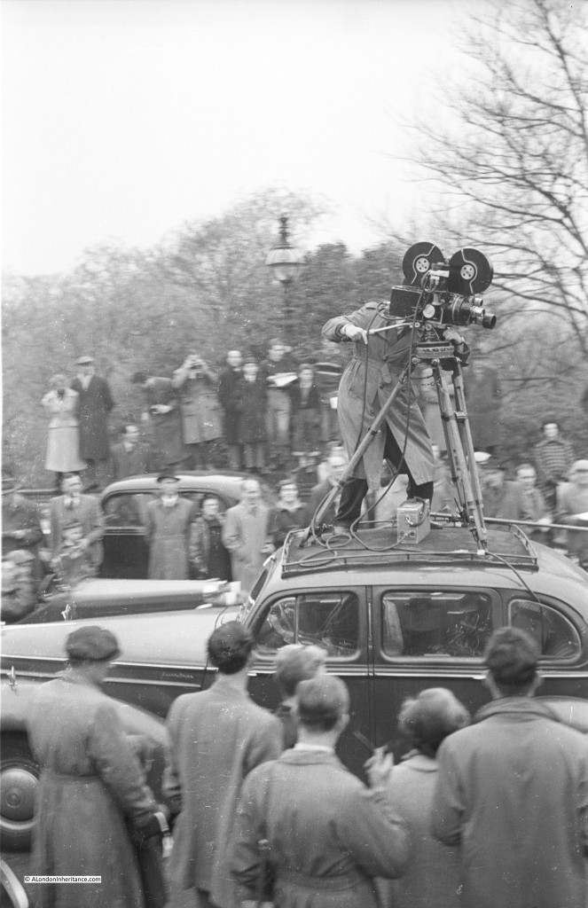
This was an event to record and the first of my father’s photos shows the somewhat precarious method used for filming the event. Not sure what today’s Health and Safety assessments would make of this:

car run dads 6

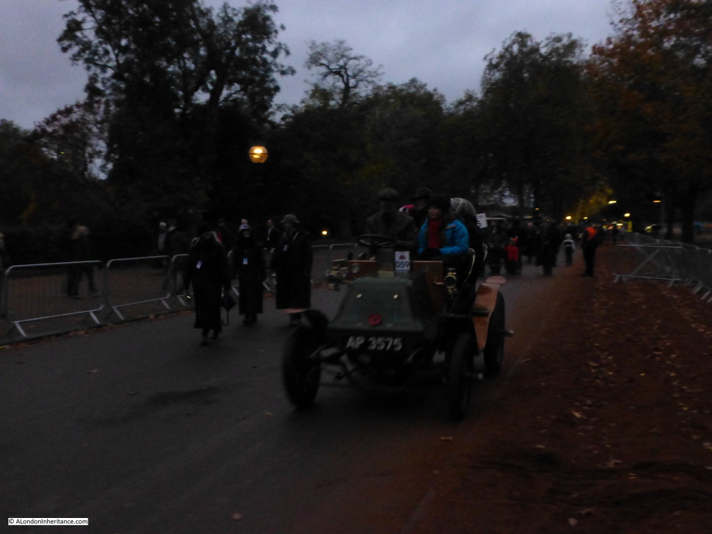
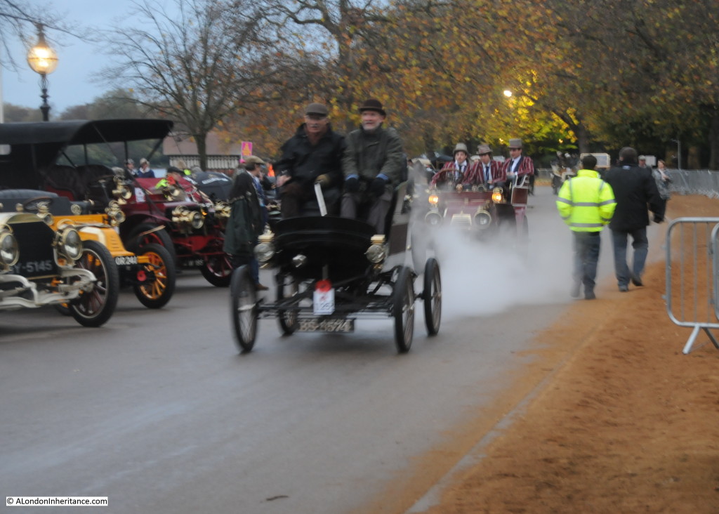
In 2014, cars continue to arrive as weak autumn light creeps across the park:

my car run 8

To take part in the run, cars have to be of pre-1905 vintage and there is a very good chance that many of the cars taking part in 1948 were also in the 2014 run.

The start of the run was moved to Hyde Park in 1936.

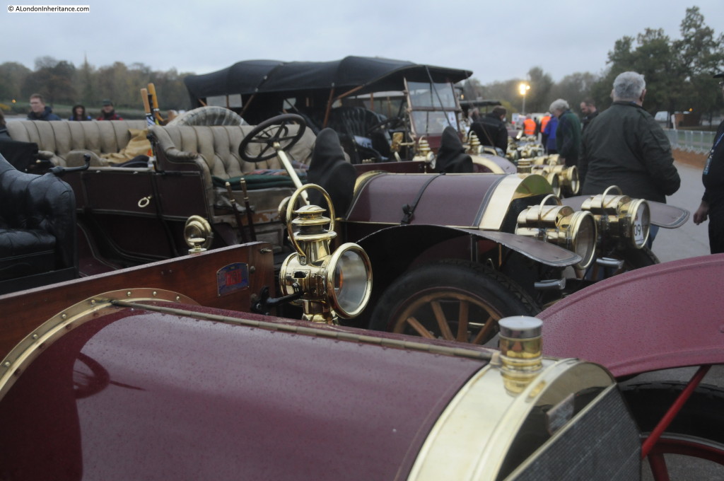
Cars start arriving and lining up along Serpentine Road well before dawn ready for the start. This is a time for final checks of the cars, last-minute adjustments and repairs and admiring the other cars that have assembled for the run.

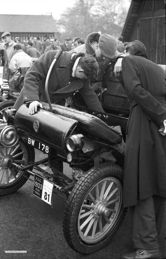
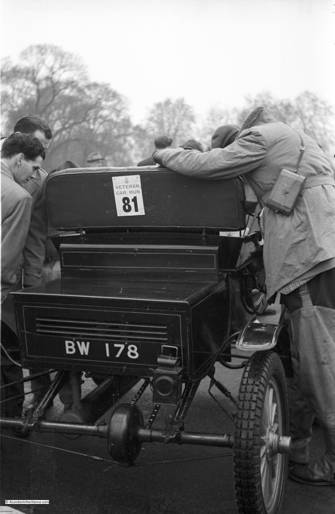
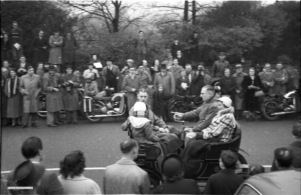
The car in the following of my father’s photos, BW 178 is a 1903 Curved Dash Oldsmobile. I checked with the Veteran car Club of Great Britain and this car is still running but was not entered in the run this year. Note the two boathouses in the following photo from 1948:

car run dads 4

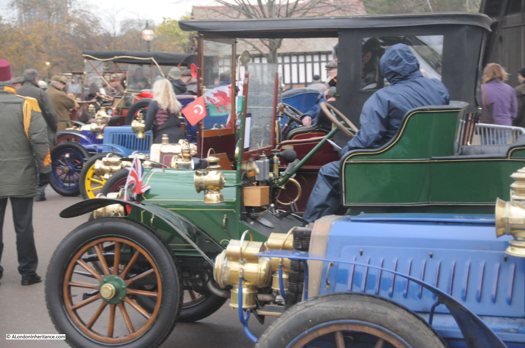
The following photo is from the same position with the boathouses in the background (although I did not realise the original photo on my iPad was in portrait rather than landscape so I took in the wrong orientation). I find it fascinating that I can stand in the same position, 66 years later, and see the same event in the same surroundings. The only real change in those 66 years are the clothes that people are wearing, and todays event is more controlled with barriers to keep spectators away from the road.

my car run 14

From a photography perspective, there have been considerable changes. My father took nine photos, the black and white ones in this post. I took about three hundred. After the war, film for amateur photographers was expensive and in short supply so the opportunities during a large event to take many photos were very limited. Digital photography and the use of large memory cards has almost made irrelevant any restrictions on photo numbers.

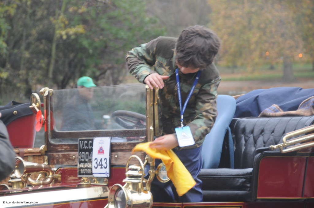
Final polishing takes place so the cars look their best on the 60 miles to Brighton. Really good to see such a range of ages involved in the event:

my car run 5

And cars are admired from all angles.

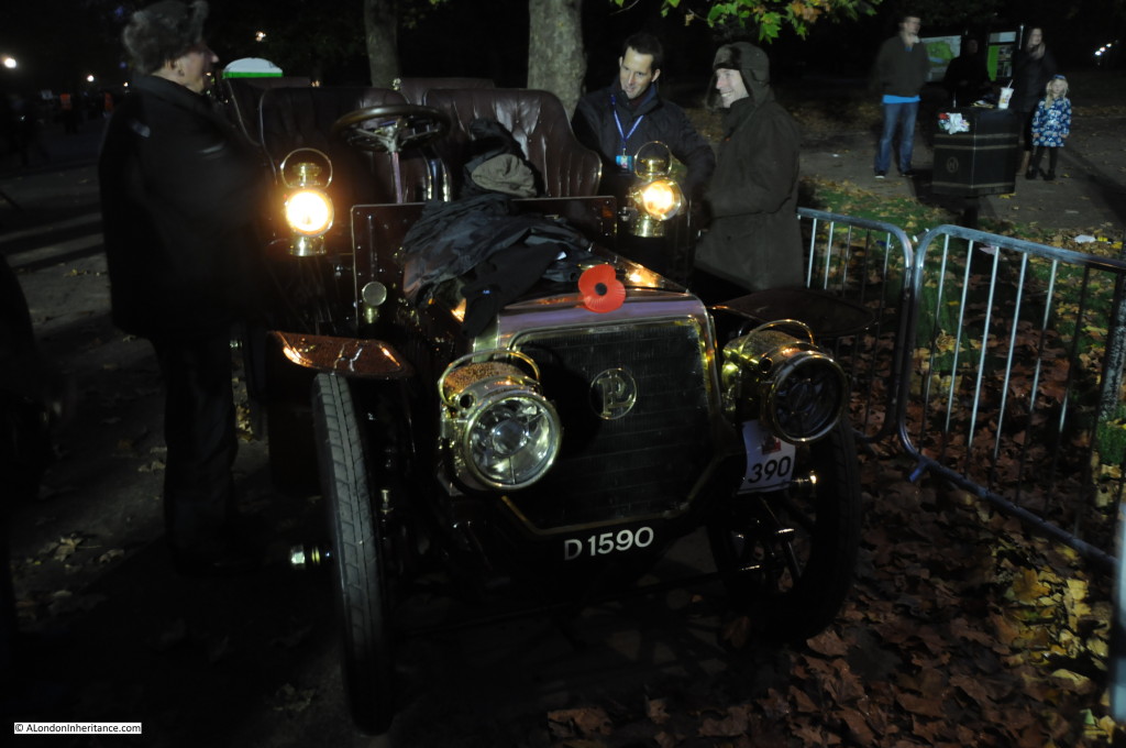
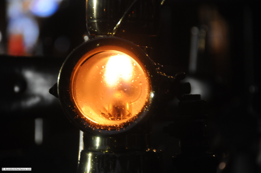
car run dads 5Note the hand-held oil lamp hanging on the rear of the above car. As we walked up Serpentine Road before the sunrise, oil lamps were still very much in evidence and their warm, flickering glow lit up a damp morning:

my car run 2

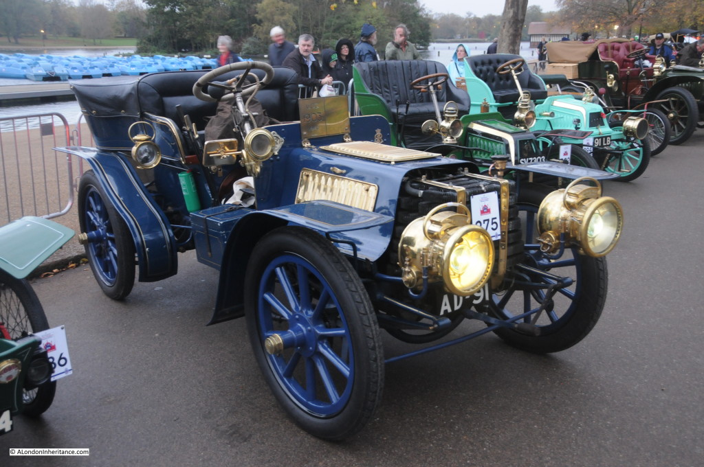
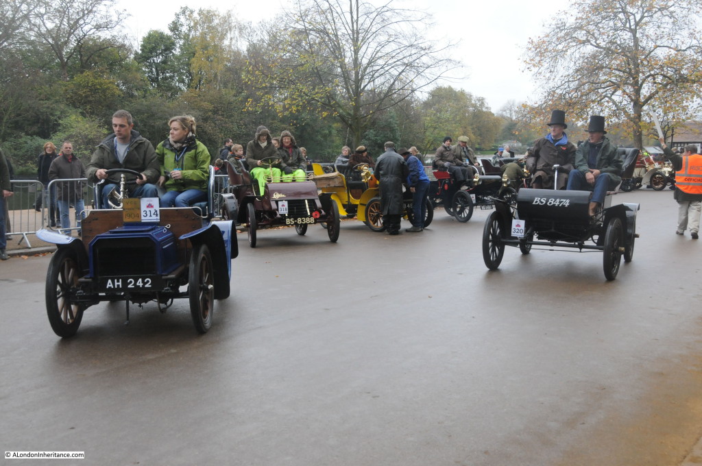
Cars line up in 2014 waiting for the start:

my car run 10

With plenty of gleaming brass on a dull, overcast autumn morning:

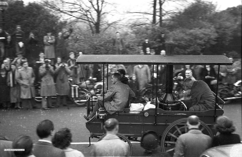
my car run 4The run starts at sunrise, 6:57 am and cars (about 440 this year) gradually depart over the next hour and a half. The participants include examples of the different types of powered transportation pre-1905:

car run dads 1

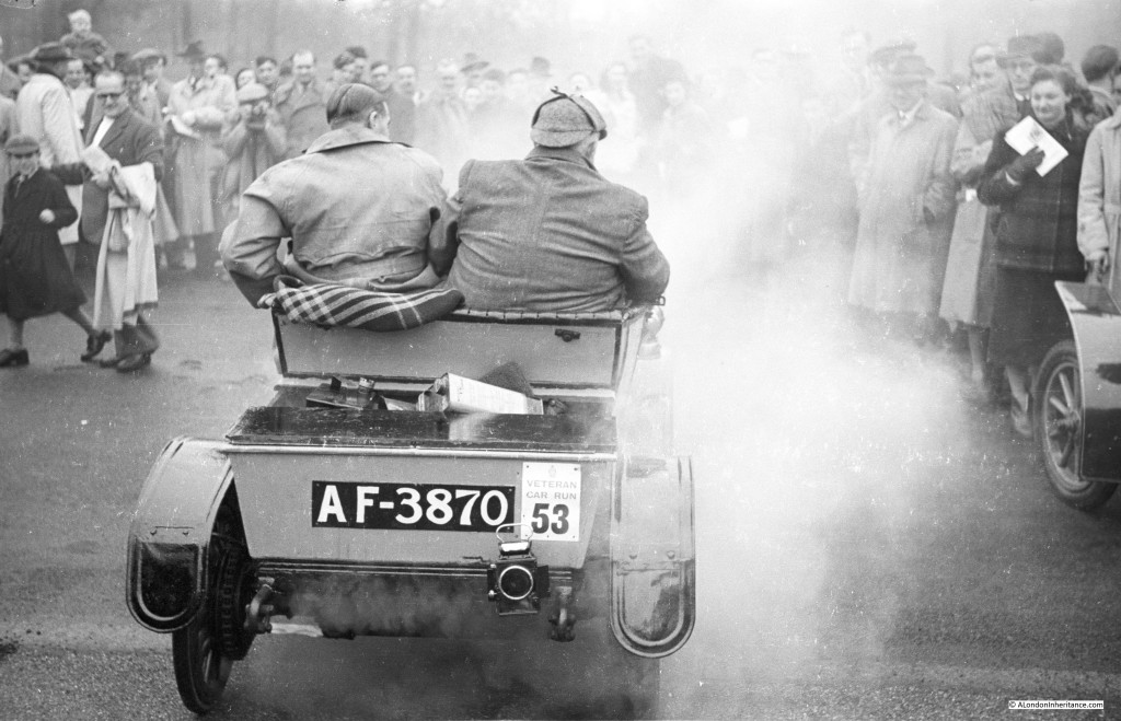
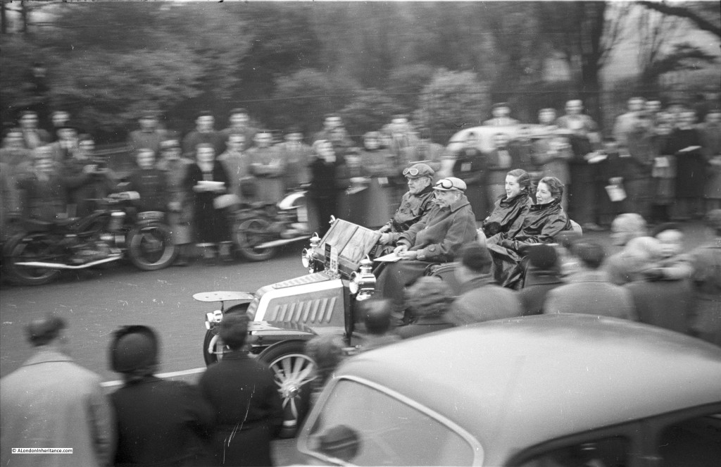
I also tried to find the following car AF-3870 but it was not in this year’s run. Again the Veteran Car Club of Great Britain confirm that this car is still running. It is a 1904 Star. In 1948 there was plenty of steam as cars arrived and left on the run:

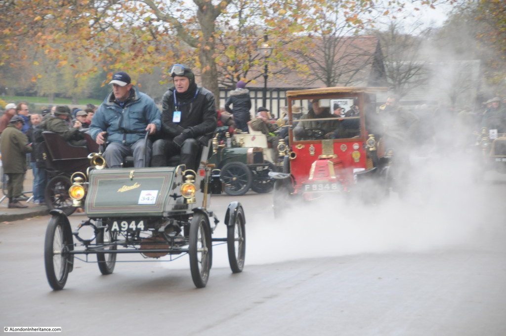
car run dads 3Which is still the same today as cars make their way down Serpentine Road, steam billowing in all directions:

my car run 12Cars continue to arrive in the early morning light:my car run 3

The 1948 run gets underway:

car run dads 9As today, the driver and passengers were well wrapped up against the elements. Driving 60 miles to Brighton on a November morning in an open vehicle requires some protection:

car run dads 8

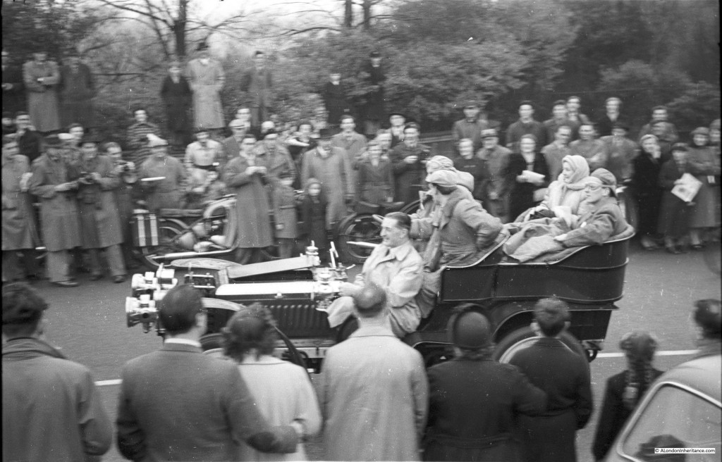
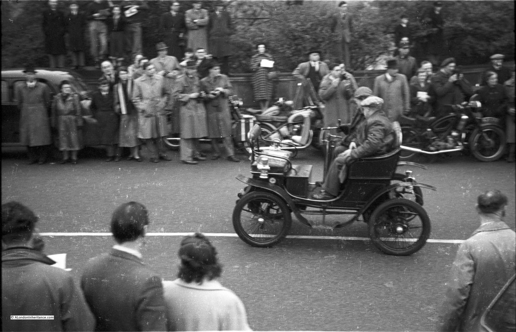
To my untrained eye in the matters of veteran cars, the following car:

car run dads 7

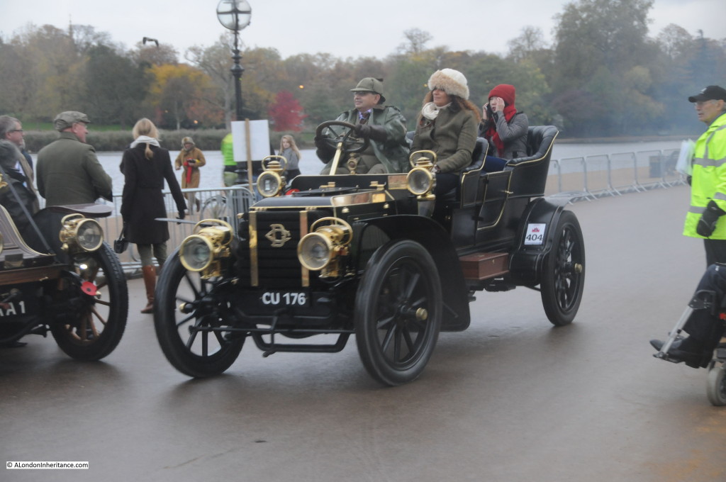
Looks to be the same (or at least the same model) as the following car from 2014. Entrant 404, a 1904 Delaugere et Clayette, 4 cylinders and 24 horse power:

my car run 16

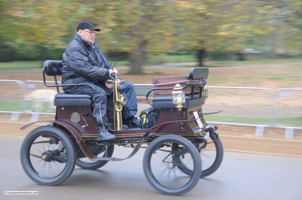
The nearest I could get with finding the following car from 1948:

car run dads 2Was this one, entrant 417, an 1899 De Dion Bouton. Whilst the top of the bodywork is different, the basic chassis of the car looks the same. It may be the same car with some bodywork being done in the intervening 66 years, or a different variant of the same model.

my car run 17

In 2014 the run is underway:

my car run 15Although some still need some final work in order to get started:

my car run 6But these fantastic old cars manage to get underway ready for the challenge of the next 60 miles:

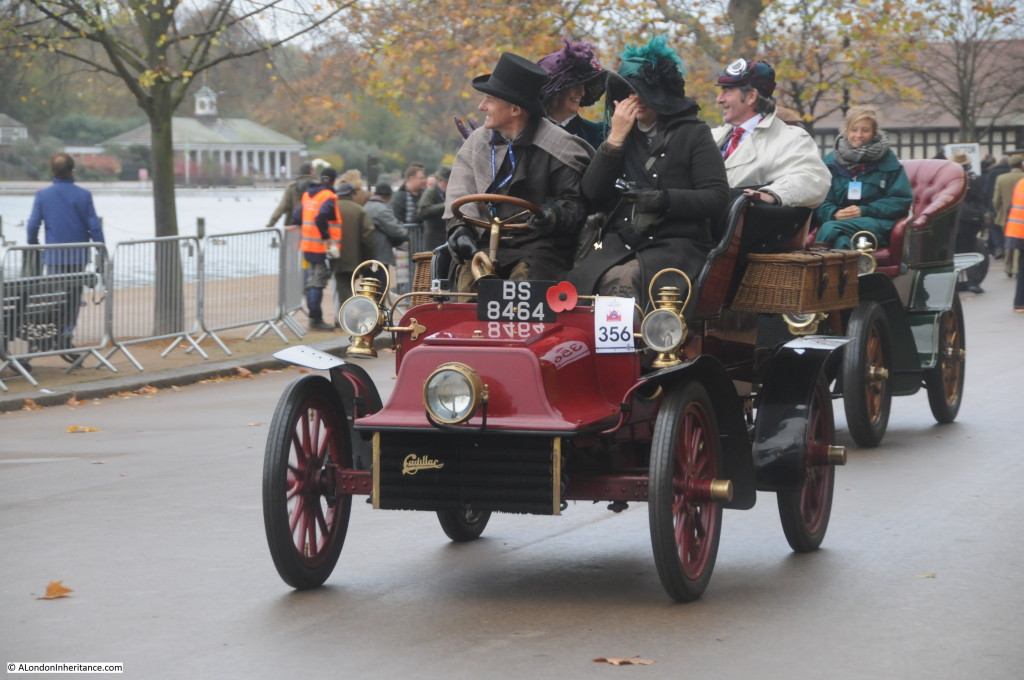
my car run 7Some dressing up adds to the occasion. Entrant number 356, a 1904 Cadillac with 1 cylinder and 8.25 horse power:

my car run 13And gradually they all make their way down Serpentine Road, entrant 362, a 1904 Peugeot with 2 cylinders and 9 horse power:

my car run 9

After leaving Hyde Park, the route passes down Constitution Hill, The Mall, over Westminster Bridge through Lambeth and onto the A23 which, apart from minor detours for roadworks or for safety reasons, takes the cars all the way to Madeira Drive on the seafront in Brighton, where they start to arrive from 10am through to the final arrivals up to 4:30 pm.

The 2015 run is on Sunday 1st November. If you can get to Hyde Park at 6am, I thoroughly recommend the experience of watching these old cars start to arrive in the dark, a unique event in London which has been running since 1896.

For further reading the official website of the run is here and website of the Veteran Car Club of Great Britain which has a detailed history of the run is here.

A full set of my photos taken at Hyde Park are at my Flickr site here.

alondoninheritance.com


St. Mary Abchurch and Grinling Gibbons

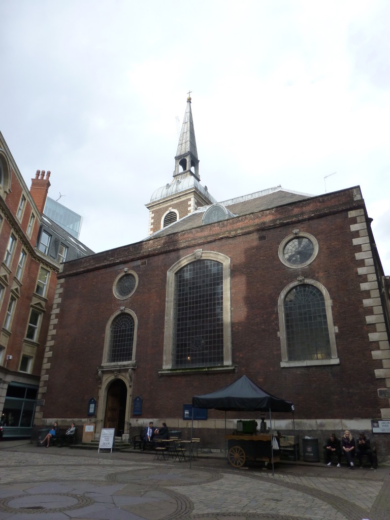
If you walk down Cannon Street towards Eastcheap, it is easy to miss Abchurch Lane, however it is well worth a quick detour as a short distance along Abchurch Lane is the church of St. Mary Abchurch, one of Wren’s churches rebuilt after the Great Fire of London and one that has altered least since it was built.

Abchurch square 1

St. Mary Abchurch is not one of the City’s most well know churches and it does not sit directly on one of the main thoroughfares through the City. From the outside, there is nothing to suggest what may be found within, but it is well worth a visit.

In front of the church is a small paved churchyard, now mainly used for City lunch breaks, whilst the church with its relatively short tower and steeple just manage to hold off the surrounding offices.

Looking around the churchyard and Abchurch Lane are restaurants catering to today’s city workers. This has long been a service provided by establishments in Abchurch Lane, as described in George Cunningham’s London:

Pontack’s Tavern was located in this street. It was a French House, very fashionable and famous for its wines and good dinners. The dinners of the Royal Society were held at Pontack’s until 1746. Evelyn mentions the place in 1683, 1693 and 1694 when he dined with the Royal Society. In 1699 Dr. Bentley asked Evelyn to dinner there to meet Sir Christopher Wren.”

I am sure that many of the City workers entering and leaving the restaurants here today would equally enjoy the “wines and good dinners” of the 17th Century.

A church has stood on the site since the 12th century. As with the majority of other City churches, the Great Fire destroyed the church that stood on the site in 1666. Work on the new church commenced in 1681 with completion in 1686.

According to Stow, the parish church is named after “Saint Marie Abchurch, Apechurch or Upchurch” and in medieval documents the church is referred to as St. Mary Upchurch.

Once inside the church we can see one of the unique features of St. Mary Abchurch, the superb carved reredos (the large wooden screen covering the wall at the back of the altar). The carving on the reredos is the work of Grinling Gibbons, the greatest of decorative wood-carvers and the only known work of his in any London City church apart from St. Paul’s Cathedral.

Abchurch interior 2. rotate

Grinling Gibbons was born in Rotterdam on the 4th April 1648 to English parents. Gibbons moved to England in 1667 firstly to York, then to London. John Evelyn was instrumental in introducing Gibbons to Christopher Wren and Samuel Pepys. His work was extensive, the King’s Chapel in Windsor Castle, Badminton House, Burghley House, Trinity College Library, Cambridge, Blenheim Palace and St. Paul’s Cathedral to name a few, however St. Mary Abchurch was the only City church to include his work during the rebuilding after the Great Fire.

Carving DetailThe dark varnishing of the wood is from the Victorian era. Gibbons carvings were originally in their natural Limewood finish and must have looked fantastic.

The close-up photo to the left shows the carving (although the same dark varnishing as the backing does not make this easy to see) but the gilded Pelican stands out well. Gibbons original 1686 receipt for this work is held in the Guildhall Library.

St. Mary Abchurch as it was pre-war is shown in the following photo.

St Mary Abchurch pre 1940

Look up, and you will see the superb painted dome of the church. It is the dome that gives the large open area of the church, uncluttered by pillars. The dome, which is over 40 feet across rests on the four brick walls which is an architectural achievement as there are no buttresses to support the walls. The whole weight of the dome is supported by and distributed down through the walls. Wren’s use of the dome enabled what is a relatively small space to appear very spacious.

Abchurch ceiling 1

The original painting of the dome was by a parishioner of St. Mary’s, William Snow.

The dome was badly damaged by bombing during 1940, but has been very skilfully repaired.

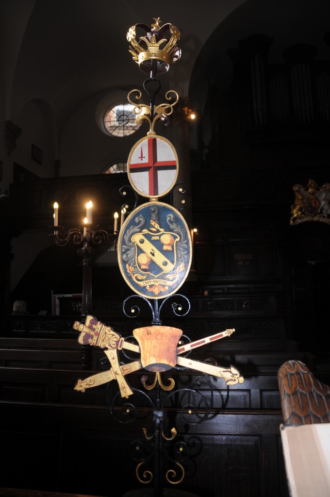
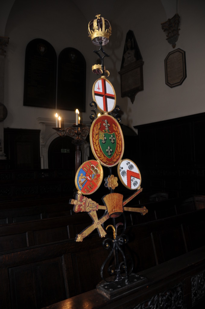
On the front pews are two ceremonial wrought iron sword-rests used to support the civic sword when the Lord Mayor of London attends a service at the church. The arms on the sword-rests are those of two former parishioners who were also Lord Mayors of London, George Scholey (1812) and Samuel Birch (1814). The first:

Abchurch sword holders 2

and the second:

Abchuch sword holders 1

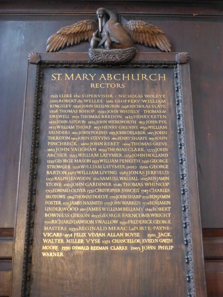
Sometimes looking at City churches, particularly those rebuilt after the Great Fire, it is difficult to fully appreciate the age and continuity of use of these building. St. Mary’s has a very clear demonstration of both age and continuity. Look at the carved board listing the names of rectors of St. Mary Abchurch.  This details the names of rectors from 1323 through to the present day. Fascinating to stand and look at these names and pick out events that must have been such key events in the rector and parishioners. John Vaughan was rector when Richard III was killed on Bosworth Field in 1485 which resulted in Henry Tudor taking the throne as Henry VII and which ushered in the Tudor dynasty. Benjamin Stone was rector in 1649 when Charles I was beheaded after the English Civil War, and John Gardiner was rector in 1666 when the Great Fire destroyed the predecessor of the current St. Mary’s.

Abchurch rectors 1

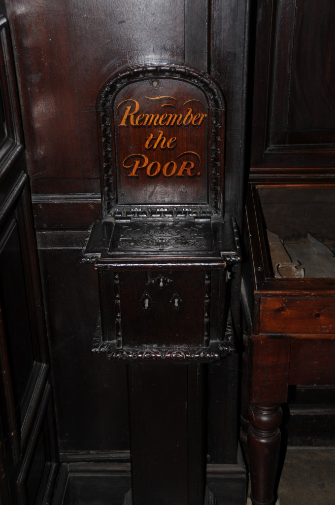
Just inside the church, by the entrance is an original Alms Box dating from 1694.

Abchurch poor box

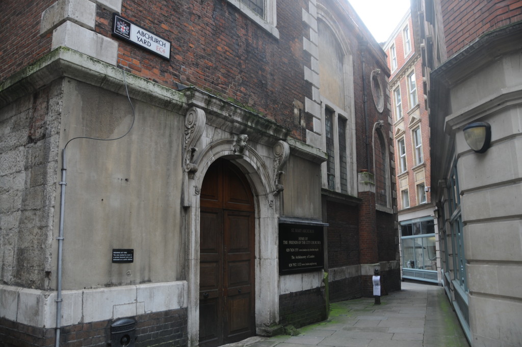
Come back outside the church, turn right and up through Abchurch Yard. This small alley was quiet even during a weekday lunchtime and gives a feel of what much of the City was like when buildings pressed closely together and small lanes ran between the major streets.

Abchurch Alley 1

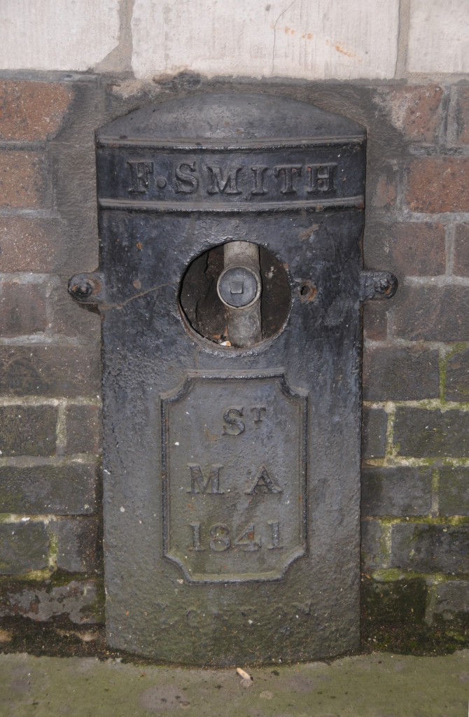
Just to the bottom left of the above photo is an old hydrant cover from 1841. This is one of the best preserved I have found so far of these. The pipe and outlet are clearly seen in the hole in the centre. Only the cover that was originally across this hole is missing.

Abchurch water and plague 1

I recommend a visit to St. Mary Abchurch, a beautiful Wren church much unchanged since completion.

The sources I used to research this post are:

  • The Old Churches Of London by Gerald Cobb published 1942
  • London by George H. Cunningham published 1927
  • Stow’s Survey of London – Oxford 1908 reprint
  • London: The City Churches by Simon Bradley and Nikolaus Pevsner published 1998

alondoninheritance.com