Monthly Archives: August 2014

Route 159 – Marble Arch to Shrewsbury

Imagine you are a young Londoner in the late 1940s. Apart from a very brief period being evacuated to the countryside, you spent the whole of wartime in London. National Service then gave you experience of the world outside of London. You want to travel and explore but money is still very tight, international travel is still limited, petrol rationing is still in force, what would you do?

For many Londoners the answer was a bike and the Youth Hosteling Association. Membership of the YHA had reached 100,000 during the war and continued to rise for the first few years after the war due to challenges with travelling outside of the UK and the need for a cost-effective method of travel within the UK.

Cycling magazine had published a series of routes centred on London giving directions and distances across the country. The title of this week’s post is the route covering the 160 miles from Marble Arch to Shrewsbury, route number 159.

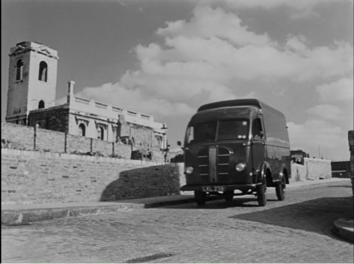
Main roads just after the war were very different to roads today. This was before the Motorway network, most long distance goods transport was still via train rather than lorry, and petrol rationing (which did not end until May 1950) restricted the amount of private cars on the road.

So for this week, let’s head out from London, along the old A5 and see how the area around Shrewsbury has changed.

old road

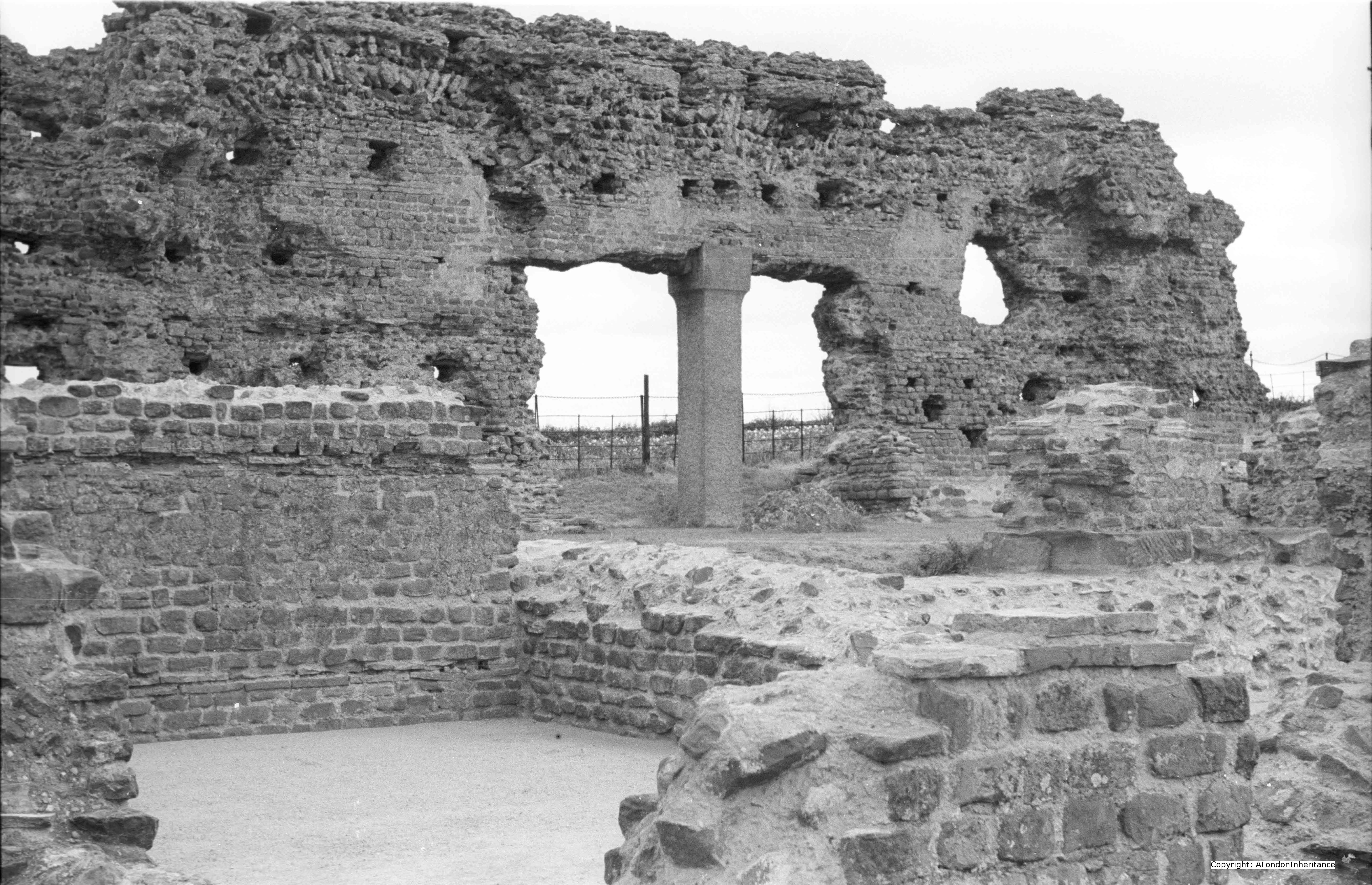
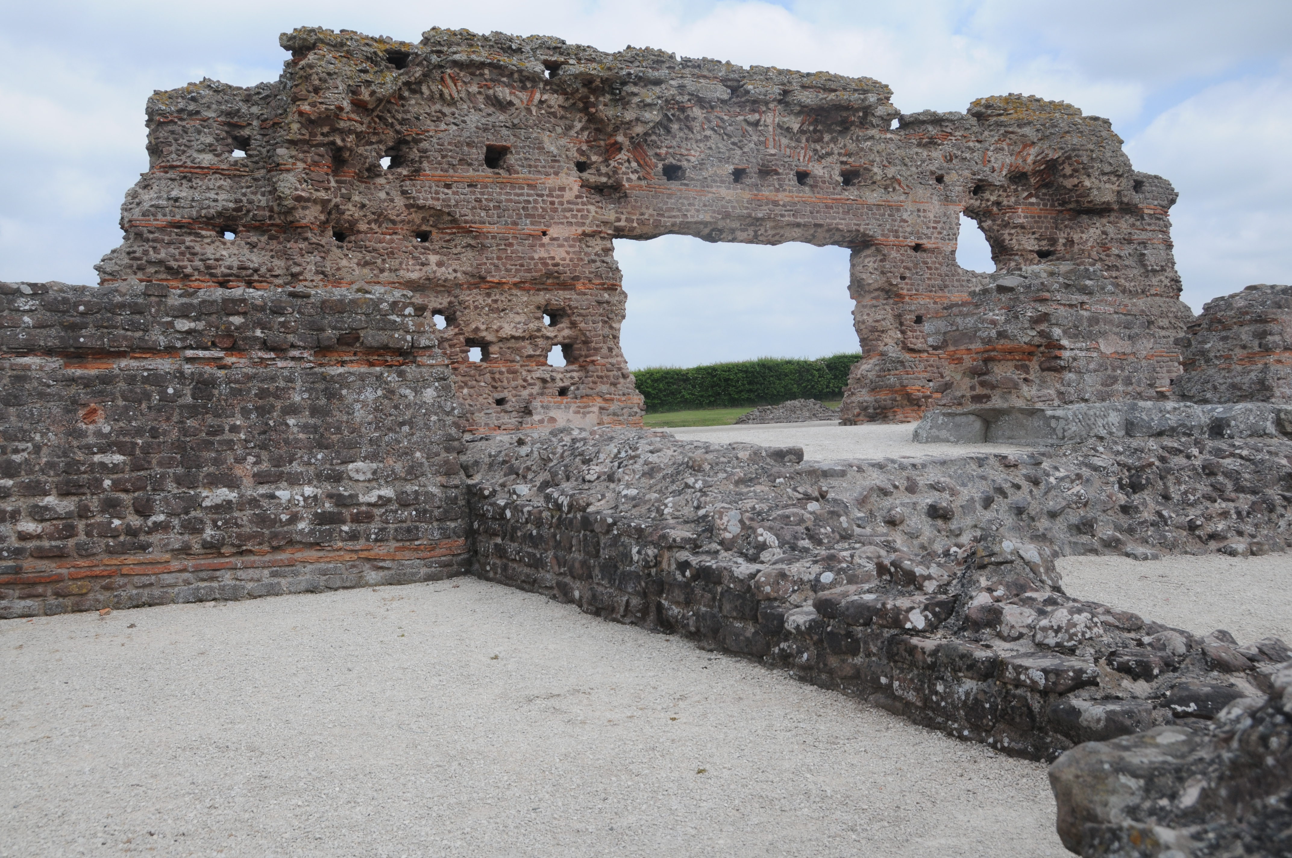
Our first stop is just to the south of Shrewsbury and the ruins of part of the old Roman town of Wroxeter (or ‘Viroconium’), which was the fourth largest city in Roman Britain, almost half the size of Roman London. The town was established in around 58AD and lasted for about 500 years during and for sometime after the Roman occupation.

Wroxeter was on Watling Street which started in the channel ports of Dover and Richborough, to London then up-country following a route with parallels to the original A5 (before the current A5 which has been considerably re-routed). Wroxeter also had a quay on the River Severn which gave the town access to the sea.

I would imagine there would have been considerable travel between London and Wroxeter during Roman times.

Much of the town still lies below ground, however the ruins of the Municipal Baths have been excavated and exposed.

This is how they appeared in the late 1940s:

old wroxeter

And in 2014 as an English Heritage site. Much the same as you would expect for something that has already lasted for over 1700 years.

new wroxeter

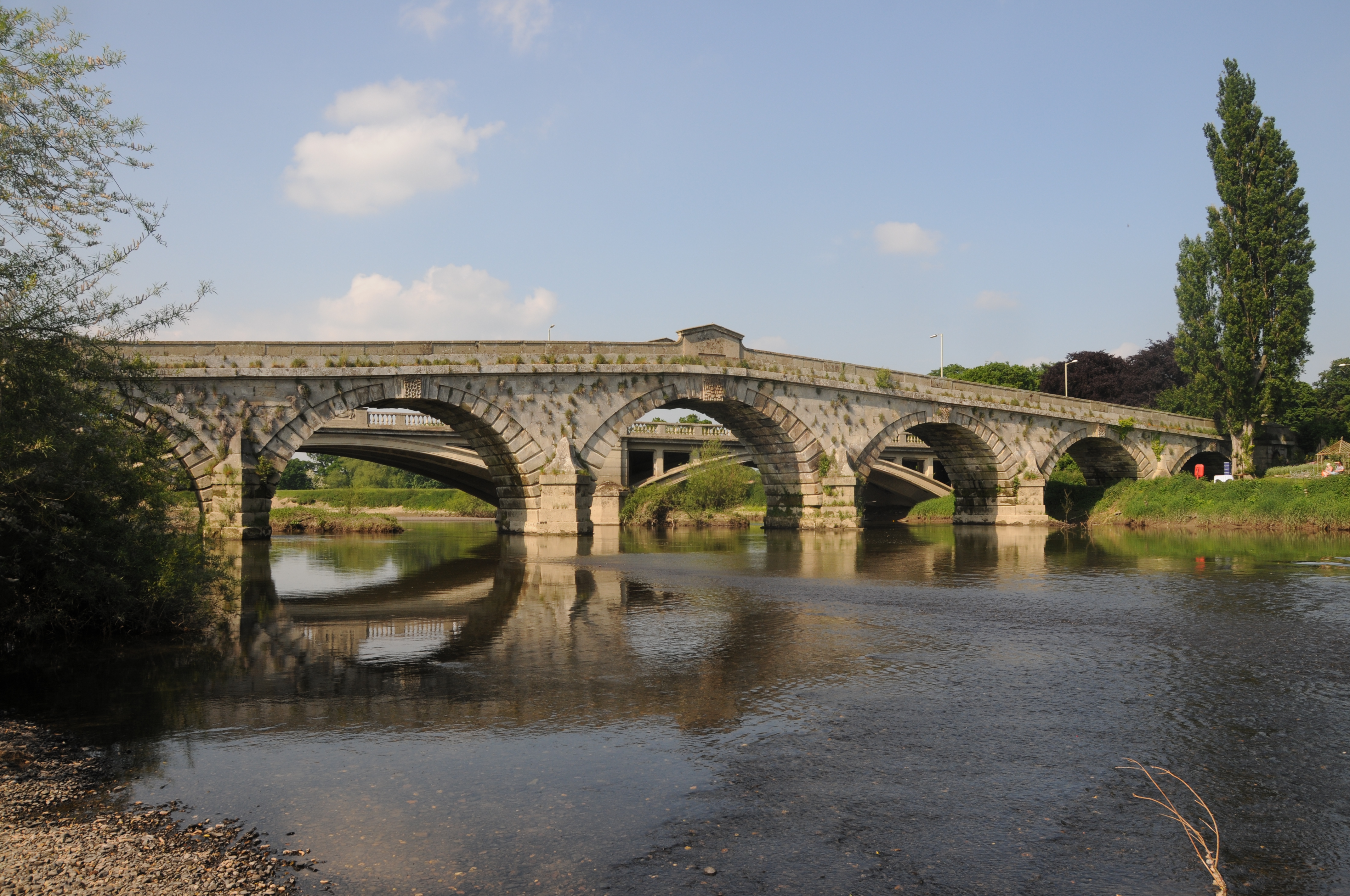
Leaving Wroxeter, we continue on the old A5 (now the B4380) and cross the River Severn at Atcham. This is an unusual river crossing as whilst a new, wider bridge was built in 1929 to support increasing levels of traffic, the original bridge built in 1774 was left in place and can still be crossed on foot.

My father took the following photo of the original bridge, with the new bridge in the background in the late 1940s. A summer photo with a slow flowing River Severn and a spot of fishing taking place just into the river.

old bridge

Again, the scene is virtually the same today as my 2014 photo shows. Apart from some minor changes to the river bank and the sand banks in the river, nothing has changed, however I did not have the luck of finding someone fishing in the river.

new bridge

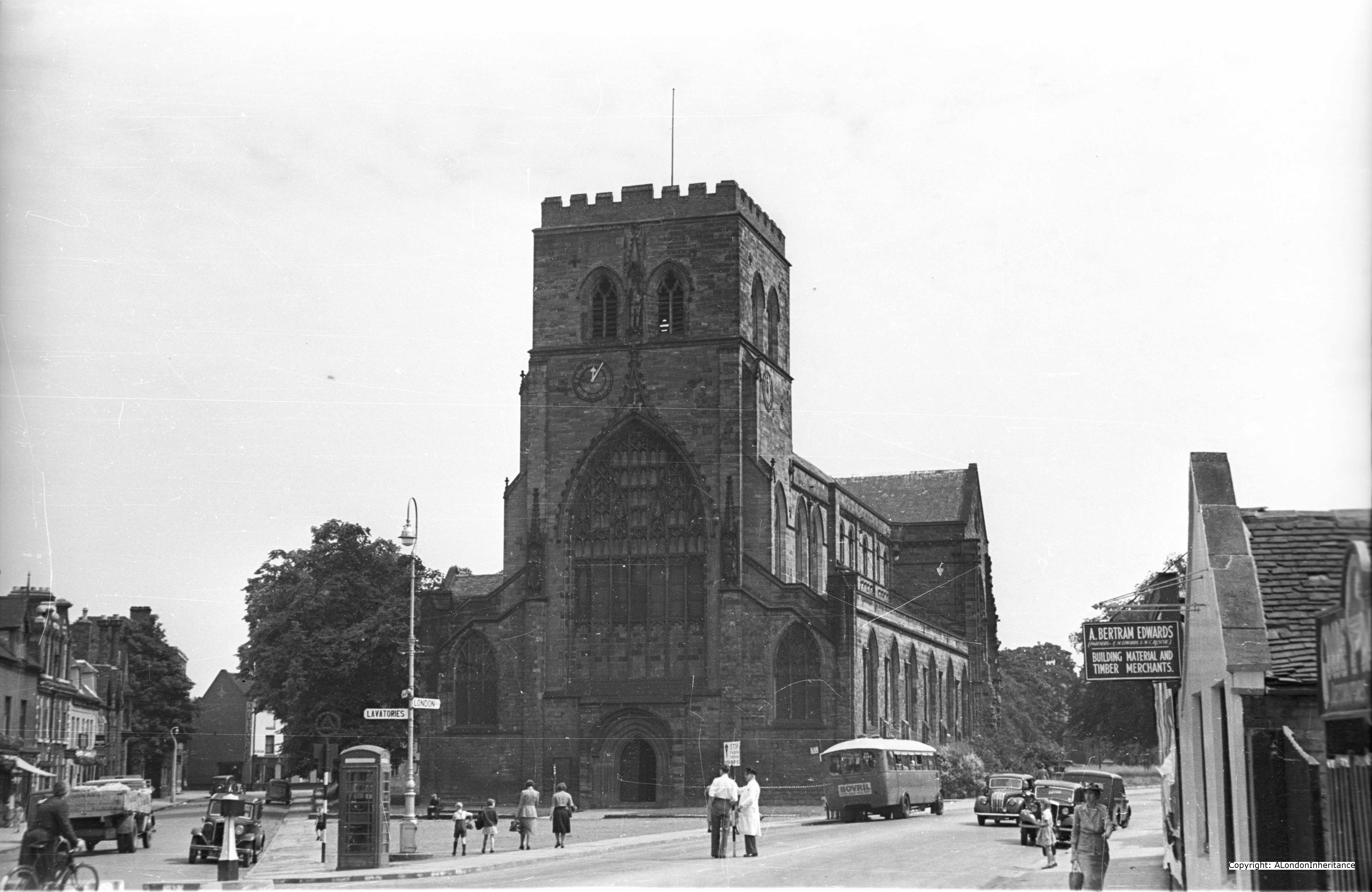
Next we reach Shrewsbury, and one of the first landmarks we pass, just prior to crossing the River Severn to enter the main part of Shrewsbury is Shrewsbury Abbey. The following was the late 1940s view of Shrewsbury Abbey:

old shrewsbury cathedral

And the 2014 view from roughly the same position is below:

new shrewsbury cathedral

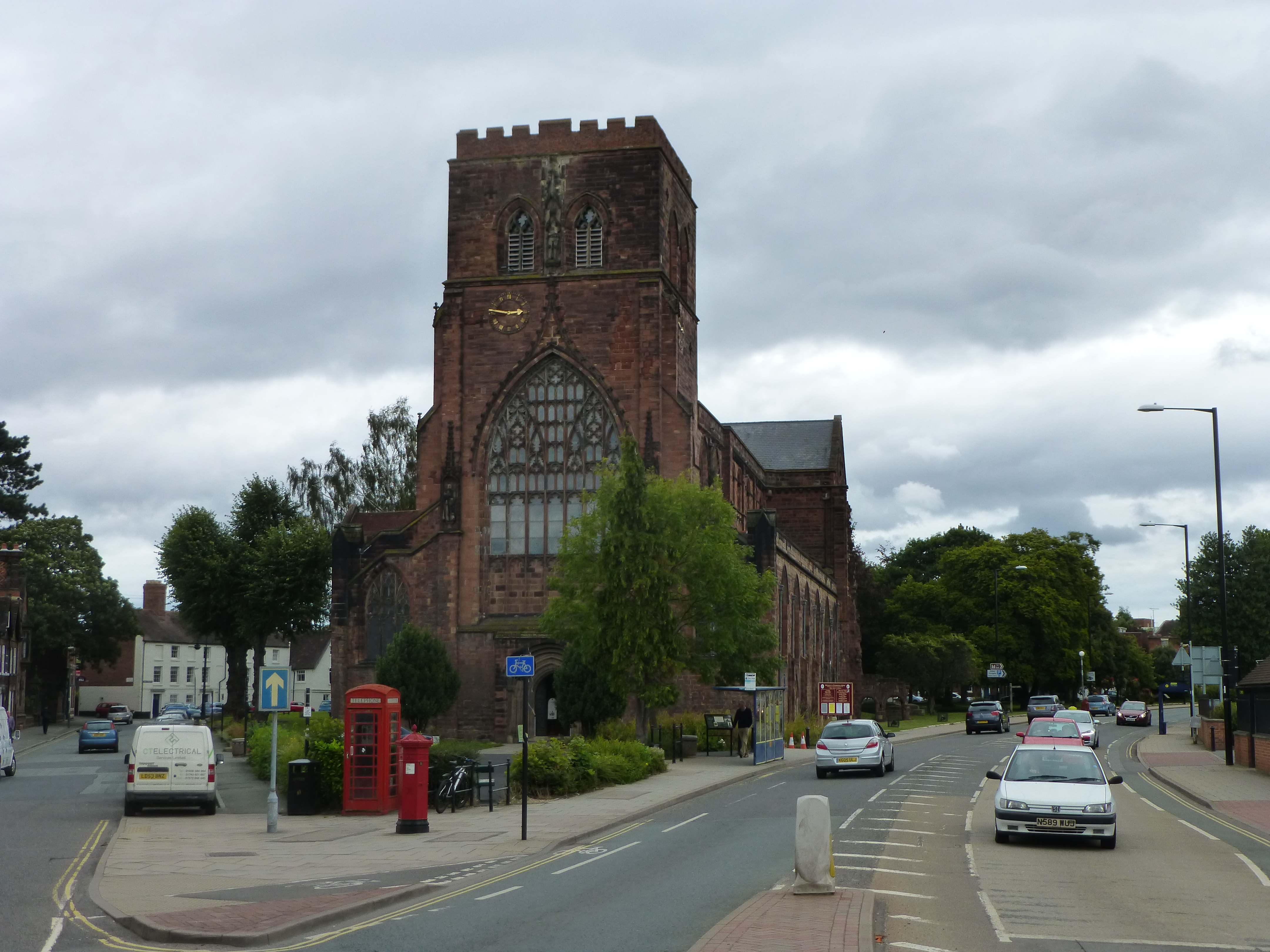
A few changes to road layout and street furniture, however very similar to the scene some 65 years ago.

The Abbey is close to the River Severn and unfortunately suffers from flooding relatively frequently. The Abbey was founded in 1083 although today only the nave survives from the original Abbey as it suffered much destruction and damage during the dissolution and the post-reformation period and also during the Civil War as Shrewsbury was a Royalist town.

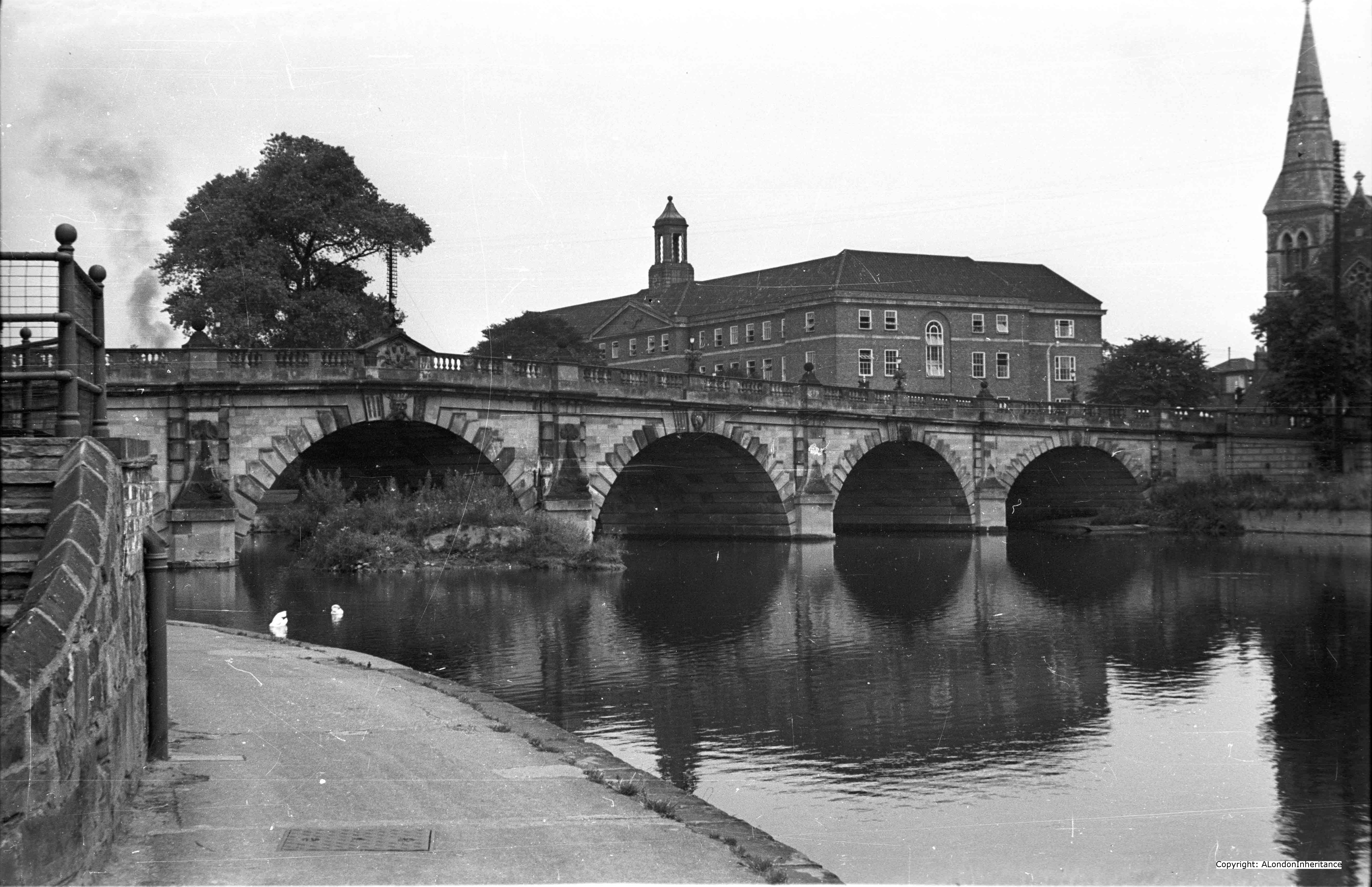
To enter the centre of Shrewsbury we now cross the English Bridge. Again, this was on the original pre-A5 road from London and Thomas Telford used this bridge as part of the route from London to Holyhead for onwards sea travel to Ireland. The bridge is named the English Bridge as it is facing the road route into the heart of England, whilst the bridge on the opposite side of Shrewsbury continuing the road onwards is called the Welsh Bridge as it is facing the onwards route into Wales.

Although the present bridge is a 1926 rebuild of the bridge completed in 1774, a bridge has been on the site for many centuries.

The following is the late 1940s view of the bridge from the side of the River Severn closest to the centre of Shrewsbury:

old english bridge

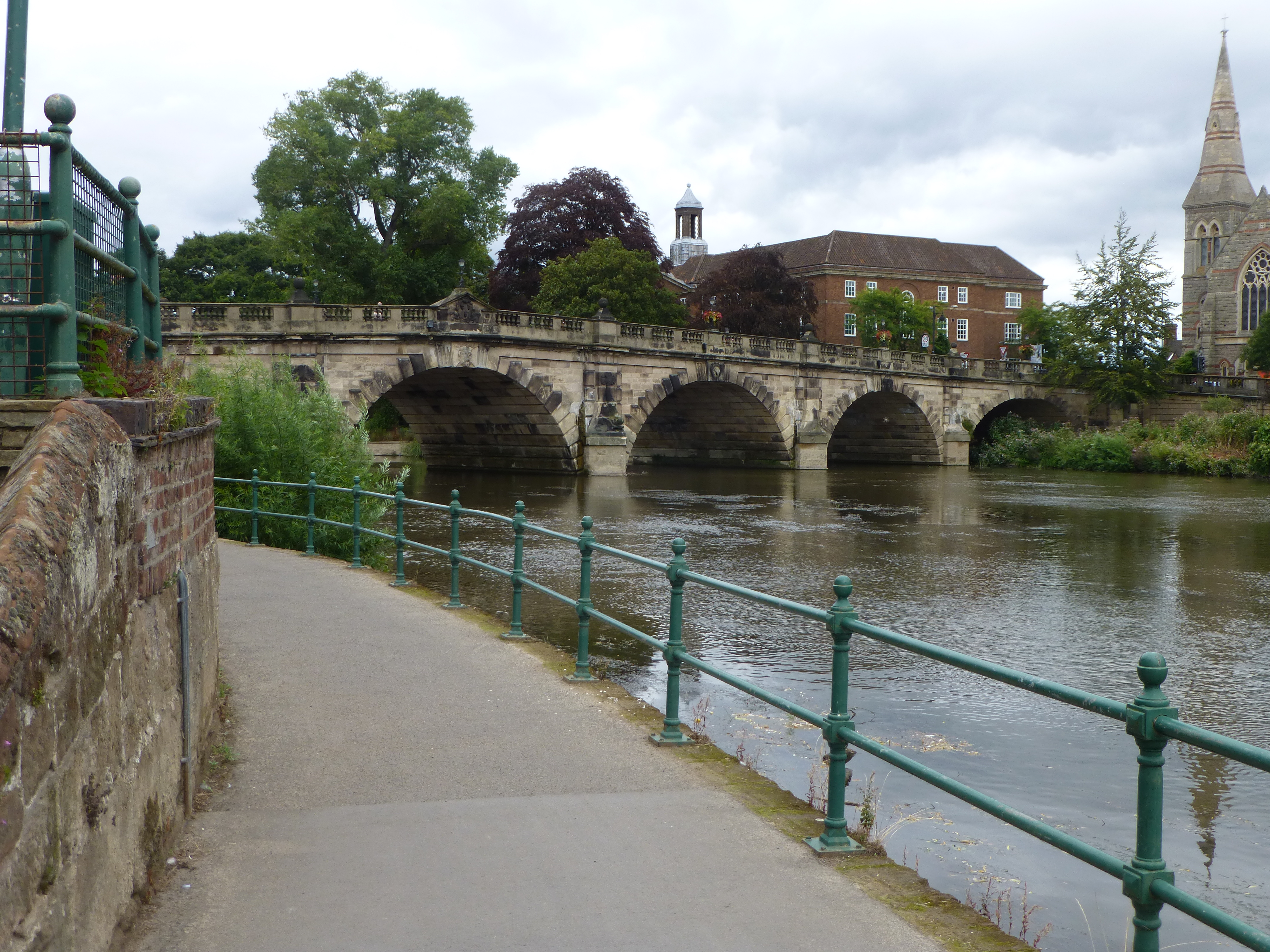
And the following is my 2014 photo from roughly the same spot. Incredible how, some 65 years later, the view is almost identical.

new english bridge

And now after cycling 160 miles after leaving central London along the original A5 road with light traffic and through some beautiful countryside, we now reach our destination, the centre of Shrewsbury.

Shrewsbury is a very historic market town and county town of Shropshire. The centre of Shrewsbury has many timber-framed buildings from the 14th and 15th centuries and a street plan that is largely unchanged since the medieval period.

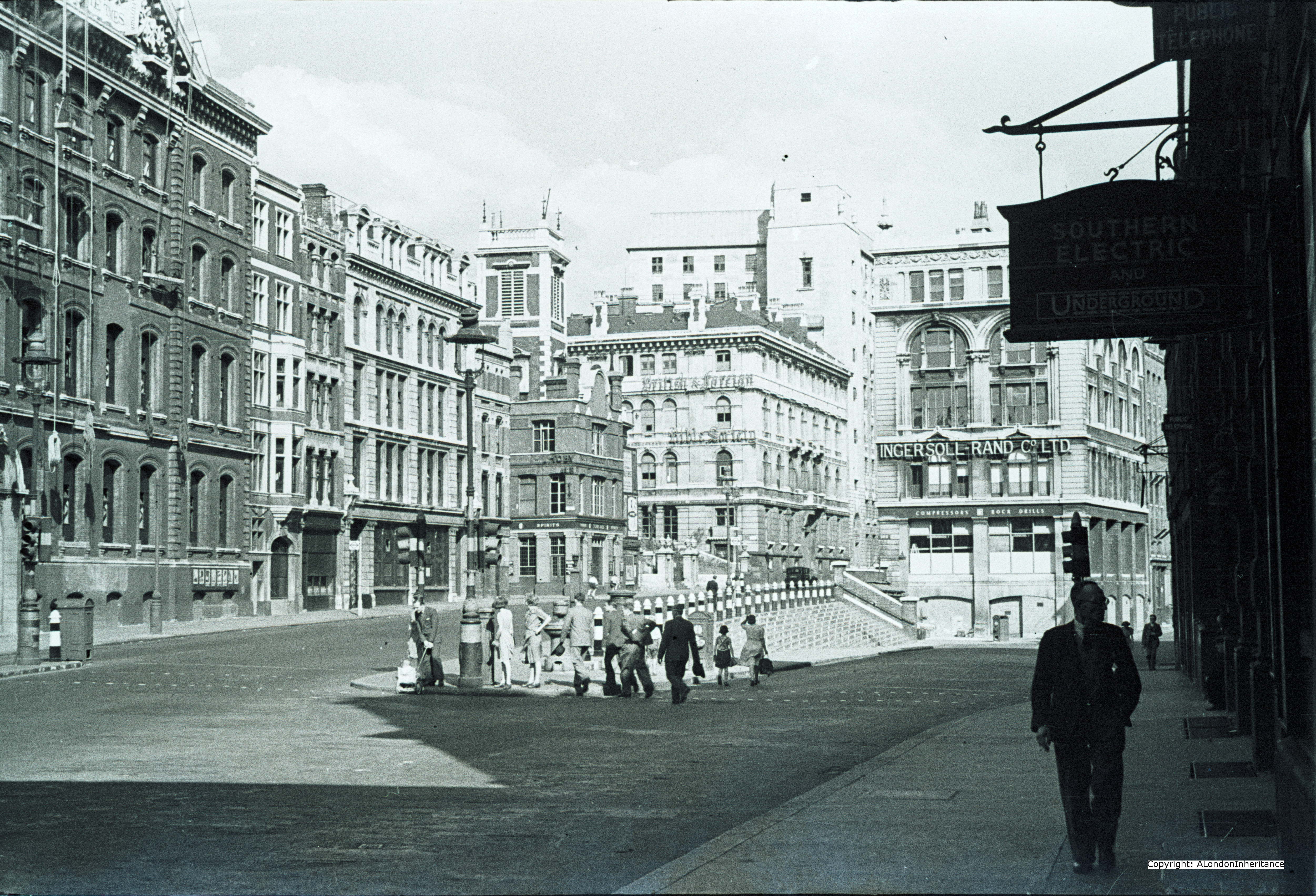
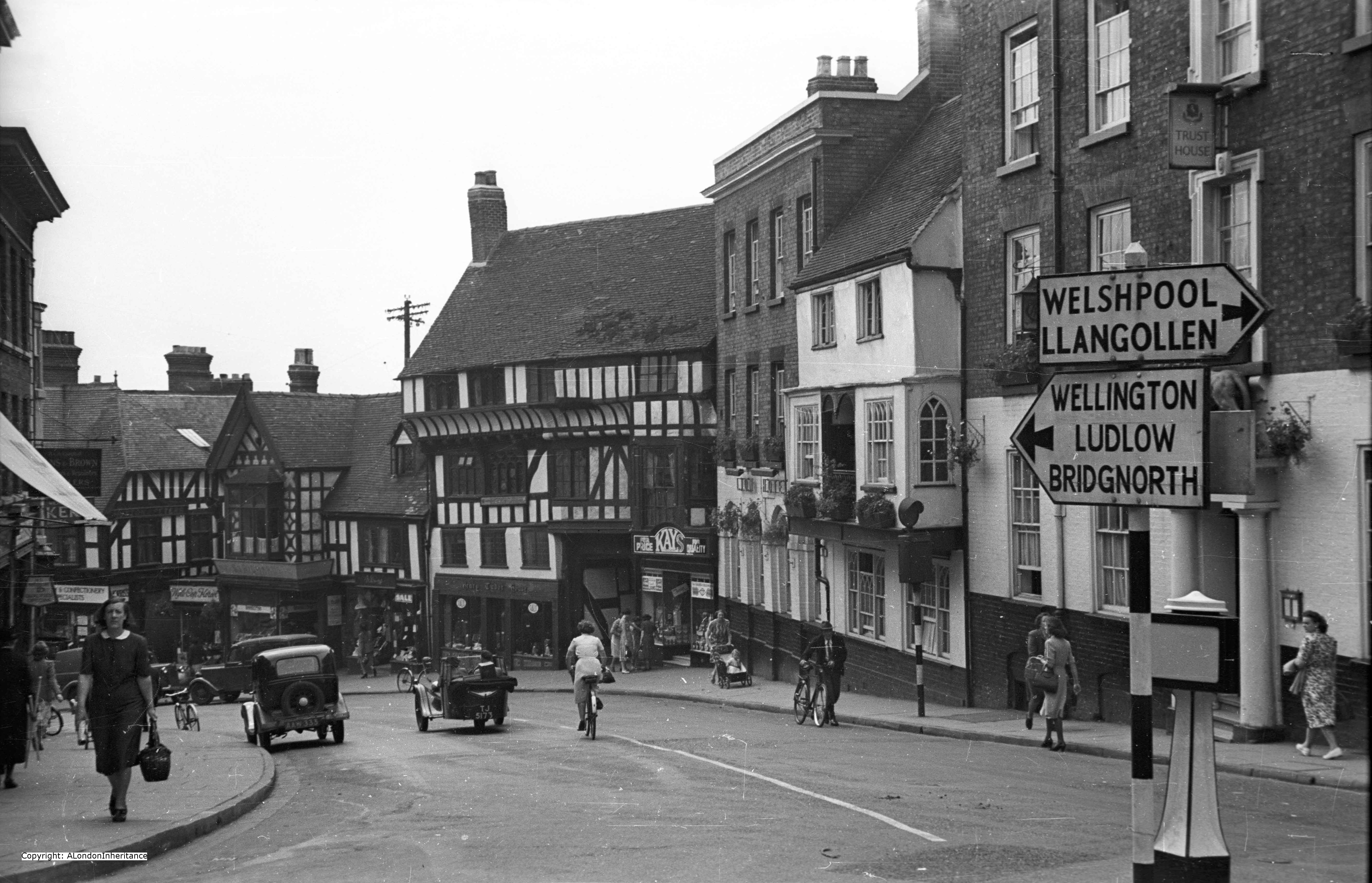
This is how one of the main road junctions appeared in the late 1940s:

old shrewsbury street

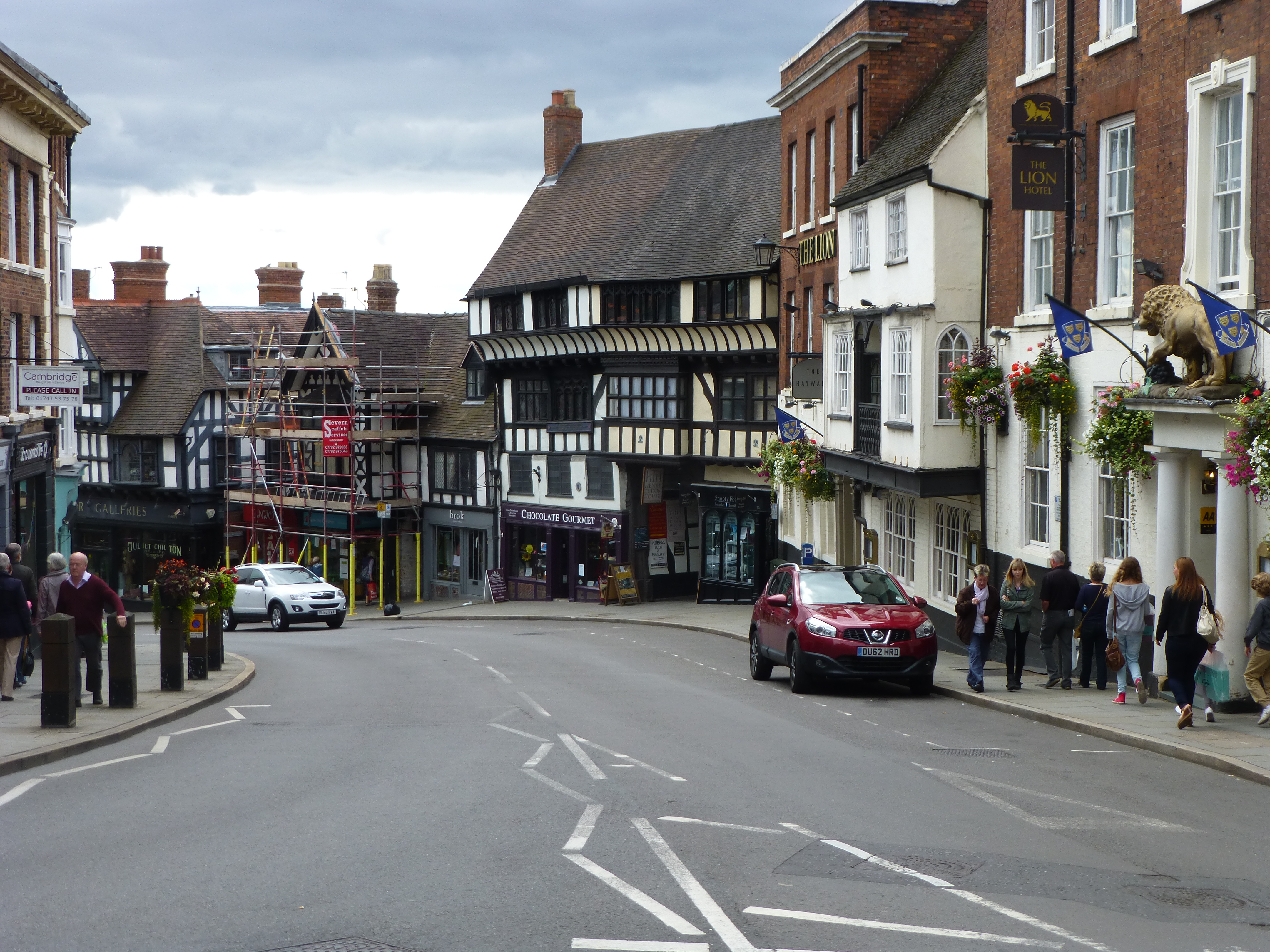
And again in 2014, apart from minor changes, very few differences in some 65 years.

new shrewsbury street

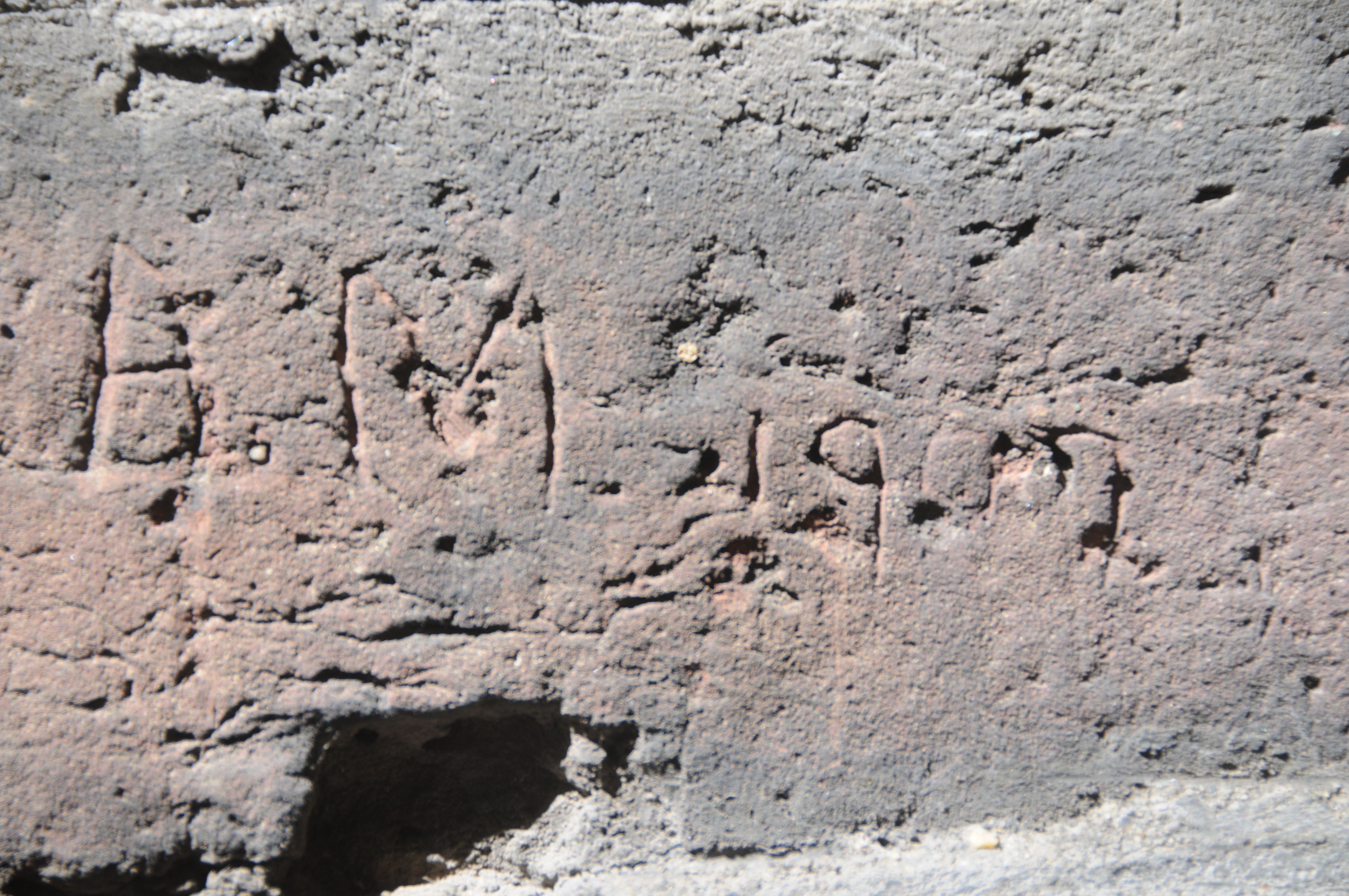
The timbered building in the centre of the picture is Henry Tudor House, built in the early 1400s and originally a collection of different shops and houses. Henry Tudor (Henry VII) sought refuge here on his way to the battle of Bosworth. This is where the Tudor dynasty replaced the Plantagenet dynasty as Henry’s army killed Richard III.

This is recorded by a sign on the front of the building:

plaque shrewsbury

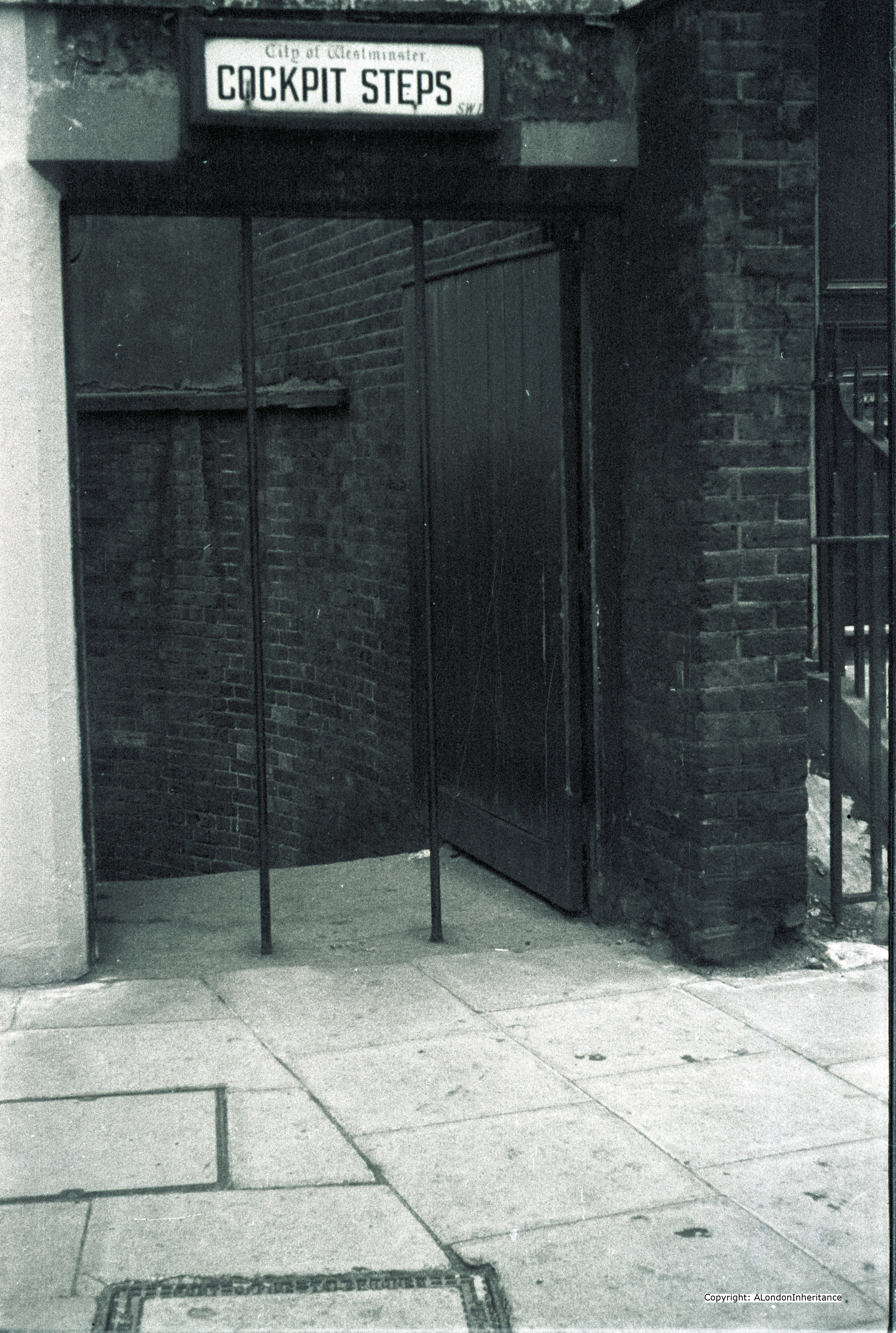
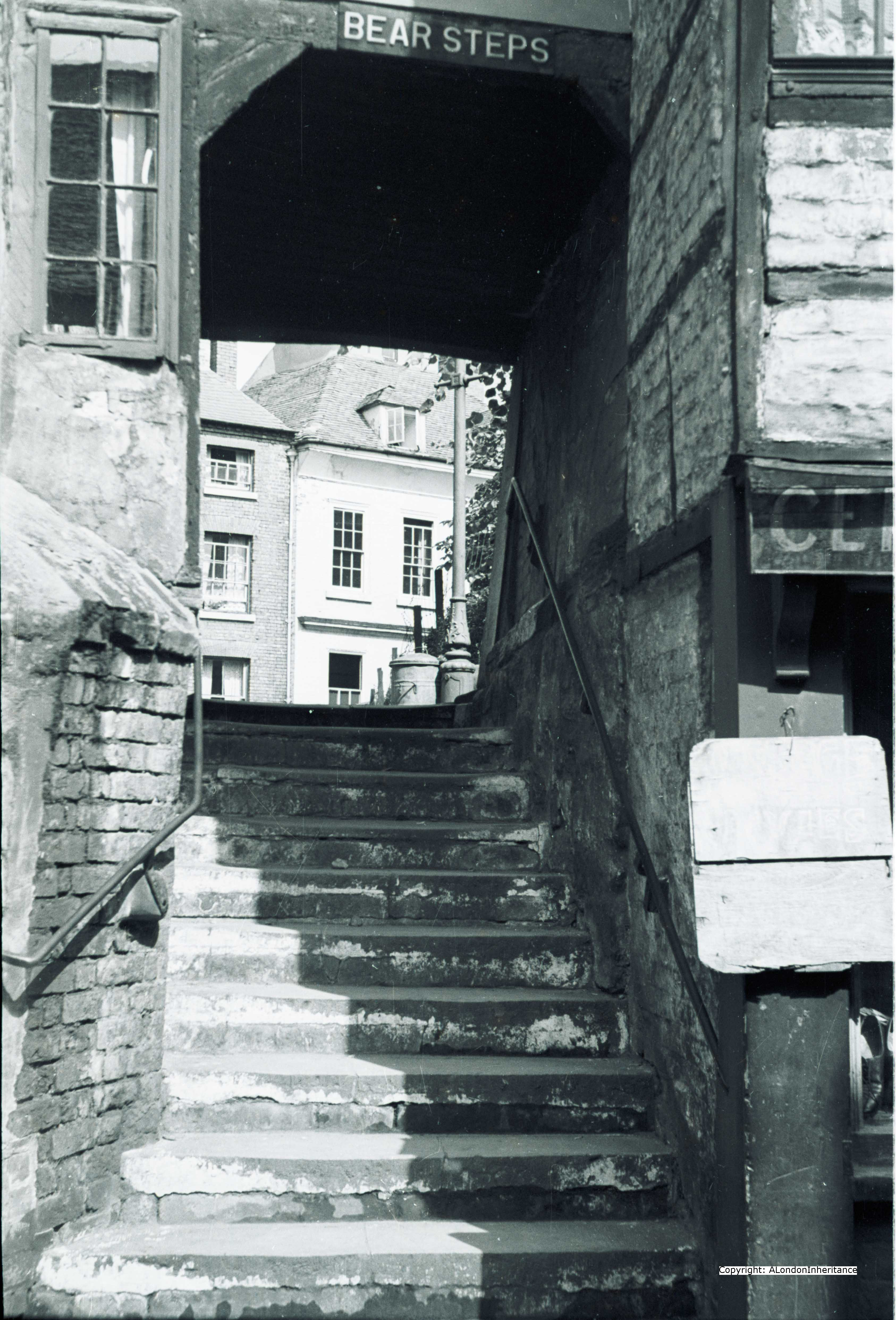
And as proof that many of the original lanes and steps have survived, here is Bear Steps in the late 1940s:

old bear steps

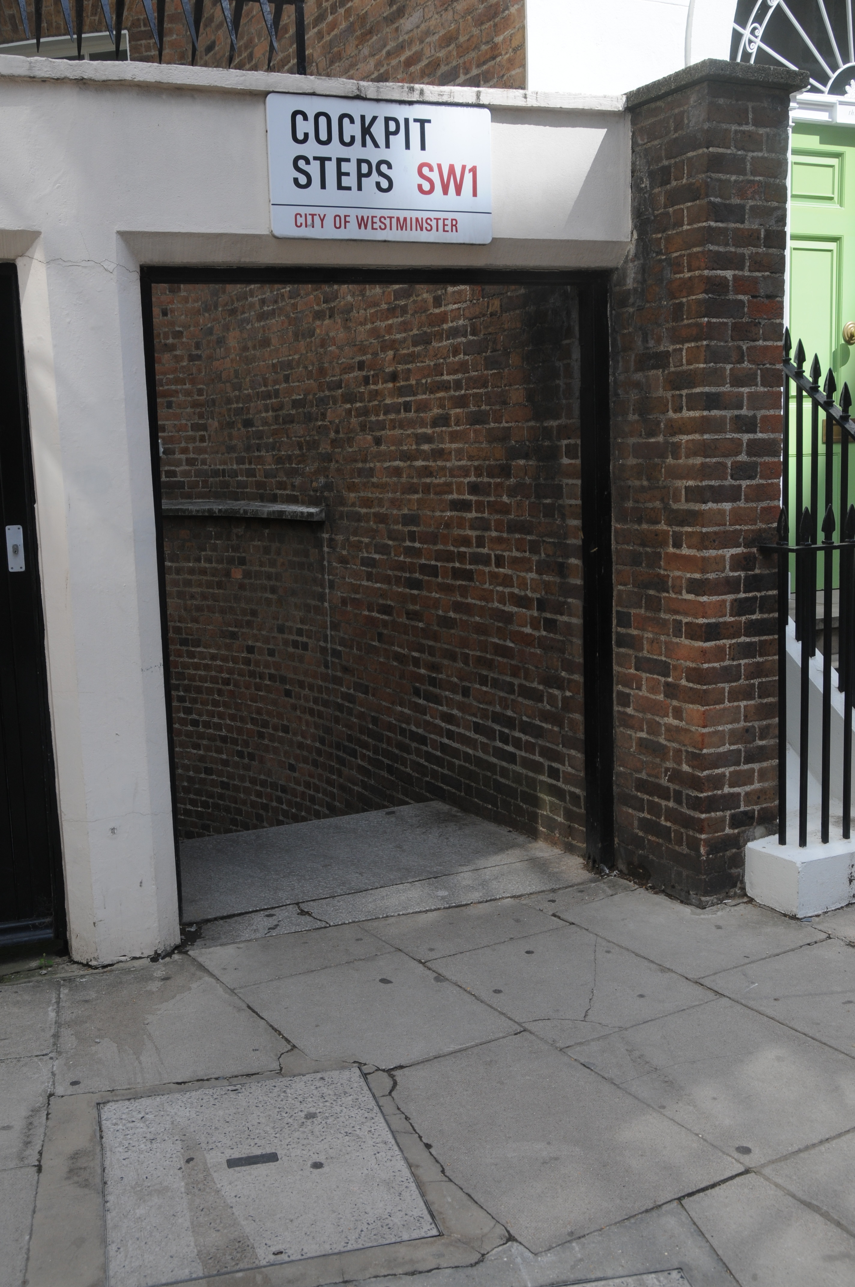
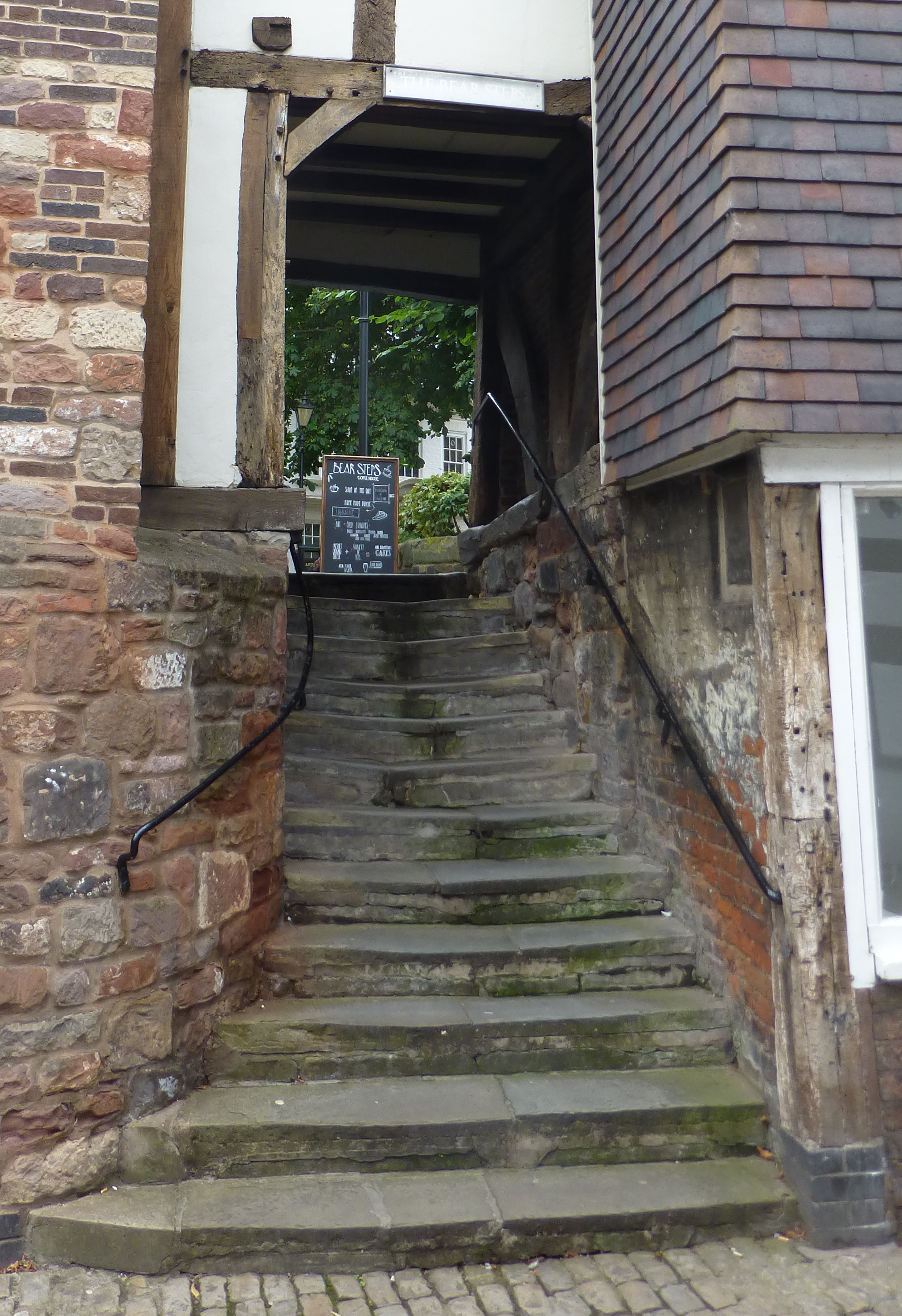
And as they remain in 2014:

new bear steps 1

Although many of the views are very similar over a period of 65 years, as with London, the way of life would change dramatically. Roads, transport, tourism would not be the same again. The days of long distance cycling for pleasure and to experience countryside and towns would be soon long gone.

alondoninheritance.com

St. Nicholas, Cole Abbey – A Bombed Church and Film Location

This week’s photo taken in 1947, is looking across to St. Paul’s Cathedral from just south of Queen Victoria Street.

Dads Nicolas Cole

The photo clearly shows the devastation that wartime bombing caused to this area of the city and how amazing that despite this, St. Paul’s survived with relatively minimal damage.

The areas that were bombed were quickly cleared of any standing structures to make these areas reasonably safe, with just rubble, foundations and cellars remaining.

The exceptions to this were the churches of the city which, despite suffering terrible damage, were left standing ready for rebuilding.

The church in the foreground is St. Nicholas, Cole Abbey on Queen Victoria Street. The rebuilt church still stands, however finding the exact location of the original photo is impossible due to the amount of rebuilding and loss of many of the smaller streets.

The following is my 2014 photo:

2014 St Nicolas Cole Abbey

I am not in the exact position, my father’s photo was taken further back towards Upper Thames Street, however I could not get to the point I wanted due to the building that is now across the site.

The view across to St. Paul’s is also totally obscured by building with the exception of the very top of the dome.

As with the majority of City churches, it has been a location for a church for many centuries as the original St. Nicholas, Cole Abbey was founded before 1144. The church on the site was destroyed in the Great Fire and rebuilt by Wren as the first rebuilt after the Fire. The name of the church is somewhat misleading as it was never the site of an abbey. Some sources attribute the name to a derivation of coldharbour.

This is what St. Nicholas Cole Abbey looked like in the 1930s (from The Old Churches of London by Gerald Cobb):

old nicolas

Interesting to compare the 1930s drawing with the rebuilt church of today and admire how accurately the steeple on top of the tower has been rebuilt after complete destruction during the war.

St. Nicholas, Cole Abbey has also featured in film. The excellent Lavender Hill Mob released in 1951 was filmed in a number of London locations, including the bombed landscape between St. Paul’s and the river. The theme of the film is a gold bullion robbery which takes place outside of St. Nicholas when the van carrying the gold is hijacked and driven to a warehouse on the edge of the river.

This film is very well worth purchasing, not just for the story, the excellent Alec Guinness and Stanley Holloway along with a very early appearance by Audrey Hepburn, but also for the many scenes shot in the City just after the war and prior to the start of any rebuilding.

The following still from the film shows the hijacked van with the gold bullion being driven past St. Nicholas:

Lavender Hill Mob 1

And approaching the warehouse with St. Nicholas very clear in the background:

Lavender Hill Mob 2The area is so different today, however fortunately as across the City, the Wren churches continue to provide landmarks to the earlier topography of the City.

The sources I used to research this post are:

  • The Old Churches Of London by Gerald Cobb published 1942
  • London by George H. Cunningham published 1927
  • Old & New London by Edward Walford published 1878
  • And the film “The Lavender Hill Mob” released 1951 (and currently available on a remastered DVD)

alondoninheritance.com

The Canopies and Carving of Queen Anne’s Gate

In tracking down the locations where my father’s photos were taken, there are three distinct categories of photo:

  1. Those with a very recognisable scene
  2. Some have a street name or some other indicator of the location in the photo
  3. Many have no clue within the photo as to where it was taken

Today’s photo falls into the last category. It is one I have looked at many times, mainly fearing that like many London streets from the 18th Century, this one had been lost forever, however whilst tracking down Cockpit Steps for last week’s post I turned a corner and suddenly found myself looking at a street scene where the buildings had hardly changed in 60 years. I had come out of St. Jame’s Park Underground Station, walked up the first leg of Queen Anne’s Gate, turned to the right to head down to Cockpit Steps and found myself facing the same street scene that looked like this over 60 years ago:

Dads original photo QAG

My 2014 photo from the location:

2014 QAG

There have been some minor changes to the buildings, however apart from the ever-present impact of the car, the scene is basically the same.

Queen Anne’s Gate is a fascinating road. It was originally a street and a square. The section nearest the camera was Queen Square and the part furthest from the camera was Park Street. They were separated by a wall until 1873  when the two areas were combined into Queen Anne’s Gate. The building of the wall has many echoes with traffic concerns of today. Queen Square was constructed first, then when Park Street was constructed, residents of Queen Square were so concerned that the road would be used as a cut through for carriages to avoid the traffic of King Street, the Sanctuary and Tothill Street that a subscription was collected for the building of the wall to avoid the residents having the peace of their square disturbed.

The wall was just over halfway down the street and although the wall is long gone, the statue of Queen Anne still stands at this point:

DSC_1287

The street name sign still retains faded versions of the different street names. Note also the plaque underneath the street name sign. There is a another of these on the junction with Carteret Street:

carteret street

This is the symbol for Christ’s Hospital and is used to show that these buildings were owned by Christ’s Hospital. I believe that Christ’s Hospital owned these buildings until as recently as the mid 1990’s. Queen Square was originally the freehold estate of Sir Theodore Janssen, one of the directors of the South Sea Company in 1720, and when the South Sea crash came Queen Square was seized and sold to help pay of the debts of the institution.

The buildings in what was Queen Square (the part of Queen Anne’s Gate covered by my old and new photos) were completed around 1704 in the reign of Queen Anne (1702 to 1714), a monarch that does not get much visibility these days, however she was on the throne at a crucial time in the history of the United Kingdom when the Acts of Union came into force on the 1st of May 1707 which united Scotland and England into the single Kingdom of Great Britain.

Anne was therefore the first Queen of Great Britain and Ireland.

Intriguing to think that these buildings were completed before the act of union and dependent on the outcome of the Scottish vote in September may see a very changed situation.

Queen Anne’s Gate has a large number of Blue Plaques.  The following plaque is for Sir Edward Grey in what was the Park Street end of the road. Sir Edward Grey was the Foreign Secretary at the time of the outbreak of the First World War.

DSC_1345

Other Blue Plaques along the street:

Blue Plaques all

The architecture of the buildings in the original Queen Square part of Queen Anne’s Gate is superb, and the main doors to the majority of buildings have very elaborate decorated wooden canopies, the following being a typical example:

DSC_1356

Also along the buildings are elaborate stone carvings of which the following two are examples:

carved figures

This type of decorative stone carving and the carved wooden canopies were soon to be replaced by the Georgian style of architecture which was neater (less intricate carving) and more magnificent stone work. One of the key drivers behind this change was the considerable number of books published by craftsmen for craftsmen from about 1715, which led to the gradual standardisation of ornamentation. Architectural pattern-books resulted in much standard Georgian architecture across London. These Queen Anne’s Gate buildings were very much the end of an era.

The following map is a repeat of last week’s map showing the location of Cockpit Steps. Queen Ann’s Gate can be seen just to the left of the location of Cockpit Steps. The map also shows how the first part of Queen Anne’s gate is a cut through from St. James Park Underground Station through to Birdcage Walk.

cockpit map 2

As it was in 1940 it continues to be now, and whilst I was stood on the corner waiting to take a photo down what was Queen Square, there was an almost constant stream of people walking from the station area to Birdcage Walk with hardly a glance at the magnificent buildings that are over 300 years old.

The following is a sample of the doors and carved canopies along Queen Anne’s Gate:

DSC_1366

DSC_1364

DSC_1363

DSC_1362I am really pleased to have found the location of this photo. Not just for finding the location, but also that these buildings have survived the developments of the last 60 years.

If you arrive at St. James Park underground station, do not cut straight through to Birdcage Walk, take a detour down Queen Anne’s Gate and admire these superb buildings.

The sources I used to research this post are:

  • Georgian London by John Summerson published 1945
  • London: The Art of Georgian Building by Dan Cruikshank and Peter Wyld published 1975
  • The Face of London by Harold P. Clunn published 1951
  • London by George H. Cunningham published 1927
  • Old & New London by Edward Walford published 1878
  • Bartholomew’s Reference Atlas of Greater London published 1940

alondoninheritance.com


Cockpit Steps – A Hidden Alley Leading To Birdcage Walk

Unlike my posts of the previous two weeks, the location of this week’s post was very easy to find and also unlike the previous posts the location has hardly changed and I was able to work out the exact position to take 2014 photos some 65 years after my father took the originals.

The following photo from about 1950 was taken halfway down Cockpit Steps, looking up towards the corner of Dartmouth Street and Old Queen Street. The steps link this corner with Birdcage Walk, alongside St. James Park.

Dads Cockpit 1

The following is my 2014 photo taken from the same location:

My Cockpit 1

The scene is very similar. The lamp-post is still the same and although there is still a post box in the same position, it is a later model.

Walk down the steps, and there is nothing to suggest any history to the location, however the name is a clear indication of what was here a couple of centuries ago as this was the location of one of the three main cock-pits in London (the others were in Whitehall and Drury Lane) where the sport of cock-fighting was held. Whilst to us this is a barbaric sport, for centuries it was very popular and had royal patronage.

The location of the steps is shown in the following map from Bartholomew’s Reference Atlas of Greater London, where they are shown as a continuation of Dartmouth Street, however they do have their own unique identity.

cockpit map 2

The cock-pit was finally taken down in 1816.

The cock-pit was a typical London scene for Hogarth and the following is Hogarth’s view of the cock-pit at the end of Cockpit Steps:

Hogarth_The-cockpit

It is easy to imagine the intrigue, secret meetings and arguments that would have taken place in such a place. It was here that Robert Harley, afterwards Earl of Oxford was stabbed, though not fatally, with a penknife by a French noble refugee, the Marquis de Guiscard who was brought before him and the rest of the Cabinet Council by the Queen’s Messenger, charged with treacherous correspondence with the rival court at St. Germain, whilst drawing a pension from the English Court.

My father’s original photo of the entrance to Cockpit Steps also shows that very little has changed.

Dads Cockpit 2

And my 2014 photo from the same position:

My Cockpit 2

Whilst walking down the steps, I noticed some very worn graffiti carved into the brickwork. Probably wishful thinking but is this one from 1907?

Initials

The lower entrance to Cockpit Steps is from Birdcage Walk and is the location of the original cock-pit. Even on a busy Saturday morning the steps were very quiet. Lots of tourists and walkers passing along Birdcage Walk between Buckingham Palace and Westminster but hardly a glance at this hidden location.

The entrance from Birdcage Walk:

Cockpit Entrance

Looking down Old Queen Street with the entrance to Cockpit Steps in the bottom left:

Old Queen Street


The sources I used to research this post are:

  • The Streets of London by Gertrude Burford Rawlings
  • Old & New London by Edward Walford published 1878
  • Bartholomew’s Reference Atlas of Greater London published 1940

alondoninheritance.com

Queen Victoria Street and Upper Thames Street – A Lost Road Junction

Very much like last week’s post, this week’s was initially a bit of a puzzle and I could not locate where the following original photo had been taken.

Dads photo qvs

There are no street names and no instantly recognisable buildings. I could not recall anywhere in central London with two streets joining, separated by a long length of steps. My only clue was the rather dark sign on the right hand side stating Southern Electric and Underground.

After checking the London stations of the Southern Railway I finally found where the photo was taken, but only because the buildings in the middle distance of the photo are still there, the rest of the scene is completely different.

The location is outside Blackfriars Station, looking east up Queen Victoria Street and my 2014 photo from the same position is shown below:

P1020341-BW

The foreground has completely changed, but what confirms the scene is the church tower (St Andrew by the Wardrobe) and the buildings around the church (the building behind the church is the British & Foreign Bible Society and the taller building behind that is the original Post Office Faraday building, opened on the 4th May 1933 and one of the main hubs for London telephone services).

John Stow in his 1603 Survey of London was rather dismissive of the church of St. Andrew, with the single sentence “then turning up towards the north, is the parish church of St. Andrew in the Wardrobe, a proper church, but few Monuments hath it”.

The “Wardrobe” reference in the church name is to the King’s Wardrobe that was moved out of the Tower of London in the reign of King Edward the Third. This was in a great house built by Sir John Beauchampe, Knight of the Garter, Warden of the Sinke Portes and Constable of Dover. He died in 1359 and his executors sold the house to King Edward the Third. Following this sale, the parson of St. Andrew’s complained to the King that “the said Beauchamp had pulled downe divers houses in their place to build the said house.”

As well as the buildings in the foreground, even the level of the streets has been changed with the level on the right being taken up to that of Queen Victoria Street thereby removing the steps at the road junction. It would be good to think that some part of those steps were left and are buried beneath the current street level adding to the layers of history buried beneath the City’s surface.

This small area is also a good example of how continuous development has reshaped London over the years, not just the buildings, but also the main thoroughfares through the City, and how the City has tried to manage the increasing volume of traffic passing within and through the City.

Queen Victoria Street is the main street on the left of both photos. In the long history of London, this, as the name implies, is a recent road.

It was fully opened to the public on Saturday 4th November 1871 and to quote from “The Face of London” by Harold P. Clunn:

“Queen Victoria Street was constructed by the late Metropolitan Board of Works as a continuation of the Victoria Embankment, with the object of providing London with a new main artery from the Mansion House to Charing Cross. It was the greatest improvement carried out in the City of London during the nineteenth century. Not only did it provide invaluable relief to the enormous traffic of Cheapside, but it completely altered the appearance of the City centre.”

The photos also demonstrate how the City has responded in recent decades when even Queen Victoria Street and the centre of the City were unable to manage the increasing volumes of traffic.

In the original photo there is a road that drops away to the right. This is the original route of Upper Thames Street which, with Lower Thames Street was the main through road running parallel to the River Thames and connected to all the short lanes and wharfs leading down to the river.

The following map is from Bartholomew’s Greater London Street Atlas of 1940, with the area of today’s post identified by the red oval.

QVS Map 1

The original photo was taken in front of Blackfriars Station looking up Queen Victoria Street and the road turning right below the steps can be clearly identified in the map as Upper Thames Street.

In recent decades the route of Upper Thames Street has been relocated to run far closer to the river, and rather than joining Queen Victoria Street, it nows runs underneath the river side of Blackfriars Station, underneath Blackfriars Bridge straight into the Embankment.

The following Google map shows the area as it is now with the re-routing of Upper Thames Street.


View Larger Map

Not clearly visible in the 2014 photo is the road, just past the bus stop, that leads down underneath the complex of buildings around Blackfriars Station to Upper Thames Street. This road is Puddle Dock, a reference to the original dock that was on this site.

Stow names this as Pudle Wharfe in 1603 and states almost against this wharf there is “one ancient building of stone and timber, builded by the Lords of Barkley and therefore called Barklies Inne. This house is now all ruine and letten out in severall tenements”

Puddle Dock was also probably the landing place for the first Baynard’s Castle which was built in this area by William the Conqueror. The role of Baynard’s Castle was to protect the western edge of the city as the Tower of London protected the east. The first Baynard’s Castle lasted from the 11th to the 14th century following which it was replaced by the second Baynard’s Castle further to the east.

Development of the Puddle Dock area started in 1952 when the Corporation of London offered the trustees of the Mermaid Theatre the lease of a bombed warehouse at Puddle Dock. The theatre opened in 1959 and is just under the building to the right on the road named Puddle Dock. The theatre has survived many attempts at closure and redevelopment and is now mainly a conference and events centre.

Returning to the original photo, I find it fascinating to look at the people in these photos. The following is an enlargement of the group of people in the centre.

QVS people

The photo was taken on a weekend but note the very formal dress of the men. They have all probably just arrived on a train into Blackfriars and are heading off into the City. The man on the left appears to have a typical pushchair of the time. The adult and child on the right possibly heading down Upper Thames Street to visit the Tower of London?

The streets around them must have seemed permanent. I wonder what they would have thought of the same location today?

The sources I used to research this post are:

  • The Face of London by Harold P. Clunn published 1951
  • London by George H. Cunningham published 1927
  • Old & New London by Edward Walford published 1878
  • Bartholomew’s Reference Atlas of Greater London published 1940
  • Stow’s Survey of London by John Stow, 1603 (Oxford 1908 reprint)

 alondoninheritance.com