Monthly Archives: December 2018

Operation Textiles – A City Warehouse In Wartime

Yesterday evening, the 29th December, was the anniversary of one of the most intensive bombing attacks on London, when on the 29th December 1940 a mix of high explosive and large numbers of incendiary bombs created significant destruction across the City. It was during this raid that the image of the dome of St. Paul’s Cathedral, rising above the smoke and flames of the surrounding destruction was symbolic of both the suffering of the City and the will to survive.

I have written about the raid in a couple of previous posts including The Second Great Fire of London and the St. Paul’s Watch, and for this week’s post I would like to bring you another perspective from the same night.

Of the many buildings that surrounded the Cathedral to the north along St. Paul’s Churchyard and Paternoster Row were the offices, factory and warehouses of Hitchcock, Williams & Co. I am not sure how best to describe the company, but at the time they were a form of Fashion House and drapery, manufacturing and selling a wide range of clothes, hats, fabrics, ribbons etc.

The firm was established in 1835 by George Hitchcock and a Mr Rogers, who would leave in 1843.  George Williams who originally joined the company as an apprentice, became a Director with Hitchcock in 1853 when the partnership Hitchcock, Williams & Co was formed. Always based in St. Paul’s Churchyard, firstly at number 1, then at number 72, with the firm expanding to take in many of the surrounding buildings.

George Williams originally joined the business as an apprentice, and as well as becoming a partner with Hitchcock, received a knighthood from Queen Victoria for services, which included the inauguration of the Young Men’s Christian Association (YMCA)  which was founded in a room of the company’s premises in St. Paul’s Churchyard.

The buildings of Hitchcock, Williams & Co. were destroyed during the raids of the 29th December 1940. A paragraph in the newspaper reports of the raid included a mention of the company:

“The historic room in which the Young Men’s Christian Association was started was among the places destroyed on Sunday night. With seven other buildings, the George Williams Room – named after the founder, the late Sir George Williams – was burned to ashes. It was situated in the premises of Messrs. Hitchcock, Williams and Co, manufacturers, warehousemen and shippers, of St. Paul’s Churchyard, and was originally one of the bedrooms used by the 140 assistants employed in the Hitchcock drapery business.”

Just after the war, a small book was published by the Company, titled “Operation Textiles – A City Warehouse in War-time”, written by H.A. Walden, an employee of the company.

It is a fascinating book and provides not just a detailed account of an individual business in the City of London, but also as being written at the time, by an employee, provides a view of how a typical City company operated.

The book includes a number of photos which show daily life in the company before the war, during preparations for war and the results of the raid of the 29th December.

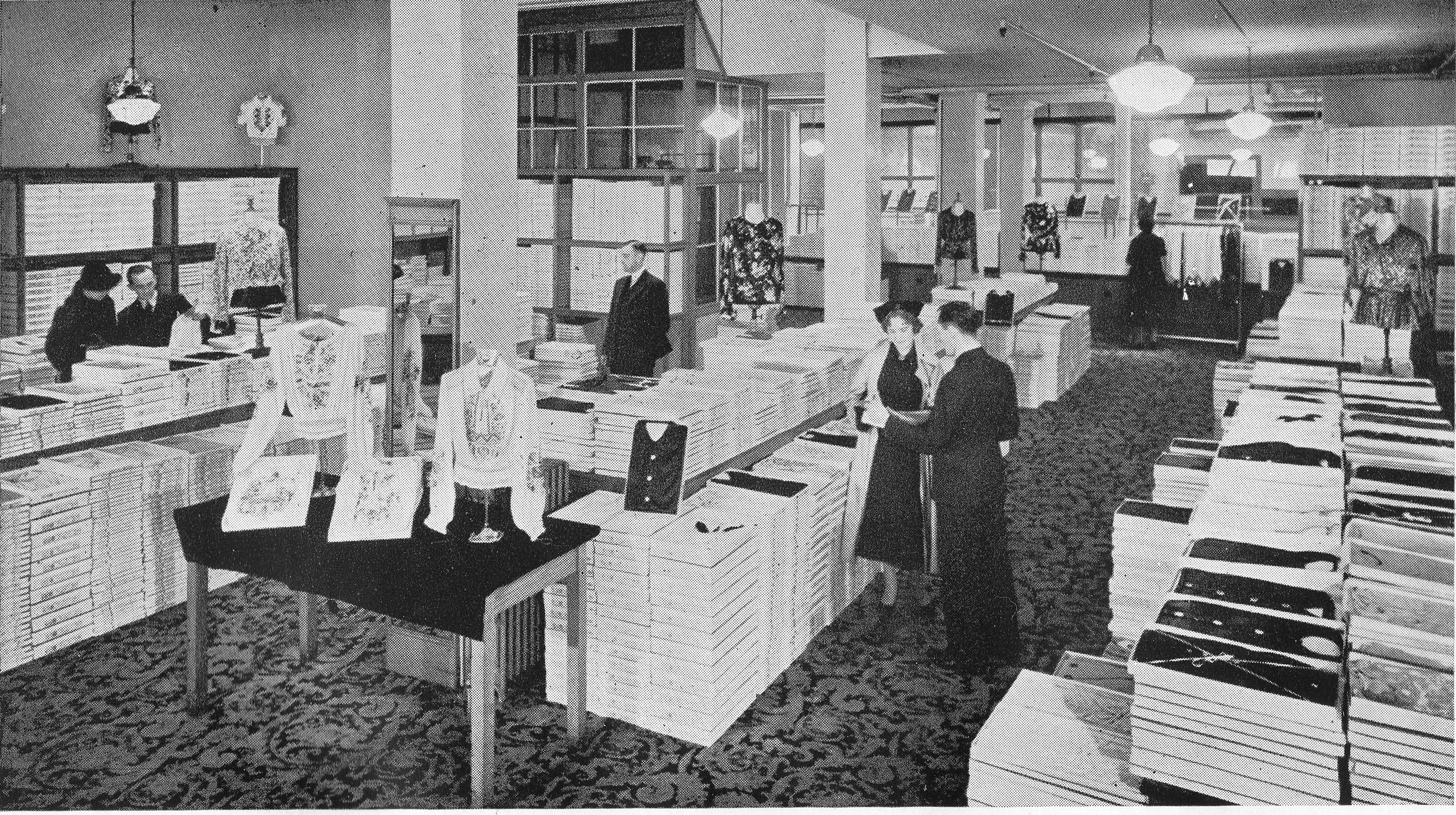
The following photo is titled “A Pre-Blitz View of our Blouse Department”:

29th December 1940

“Staff Quoit Competition” – This photo helps show exactly where the Hitchcock, Williams building was located with the main entrance to St. Paul’s Cathedral, facing Ludgate Hill, seen in the background.

29th December 1940

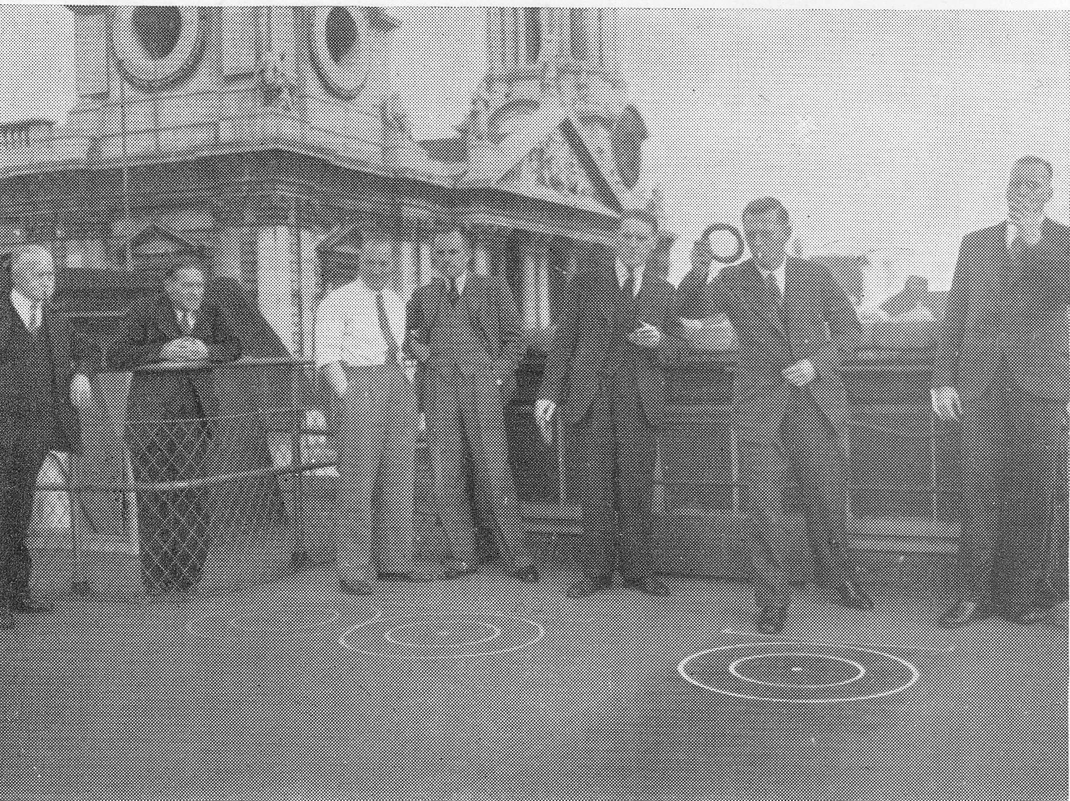
In fact St. Paul’s Cathedral features in the background of many of the photos in the book. The following photo taken in 1940 is titled “Our Firefighting And First Aid Units”:

29th December 1940

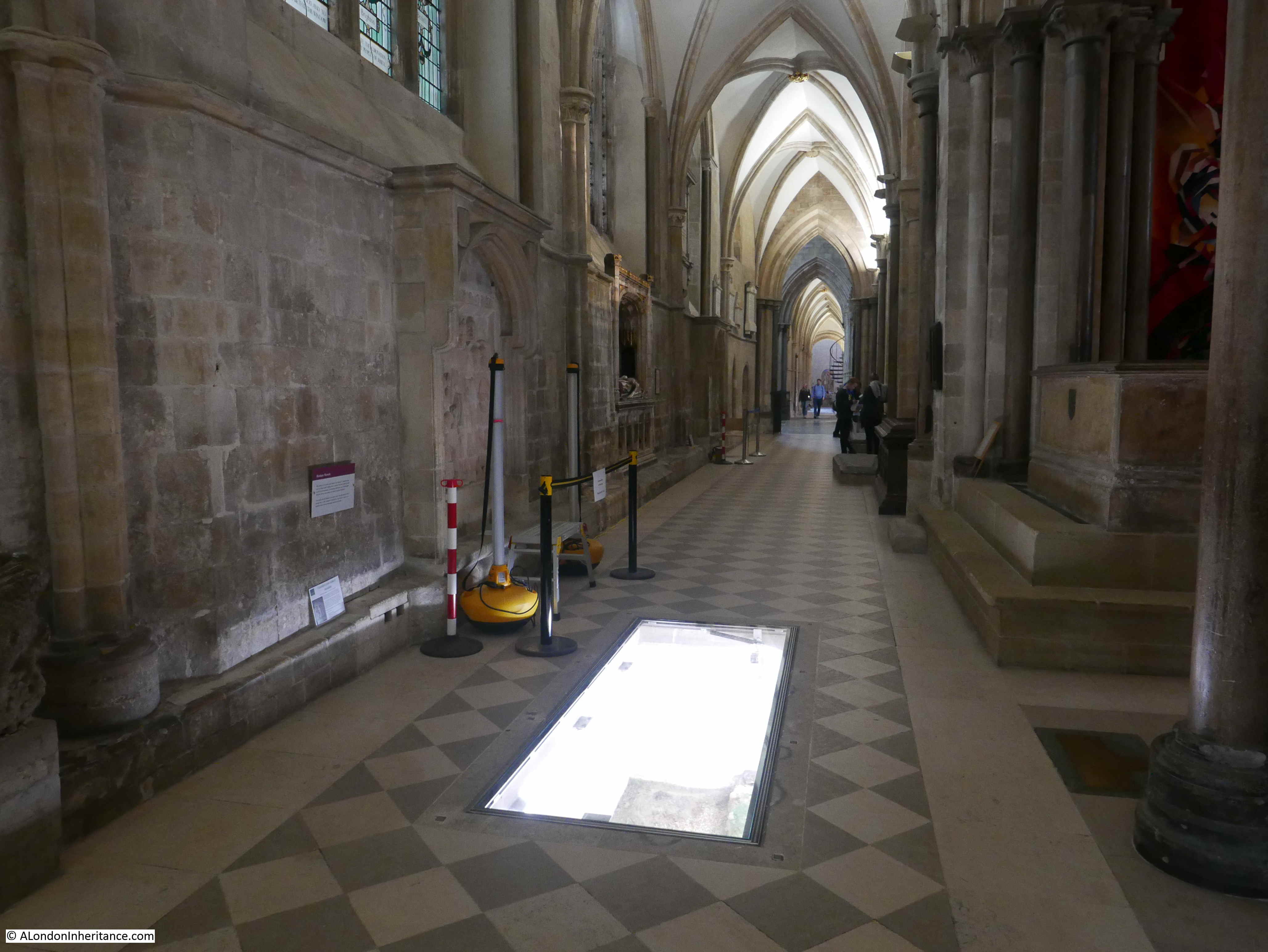
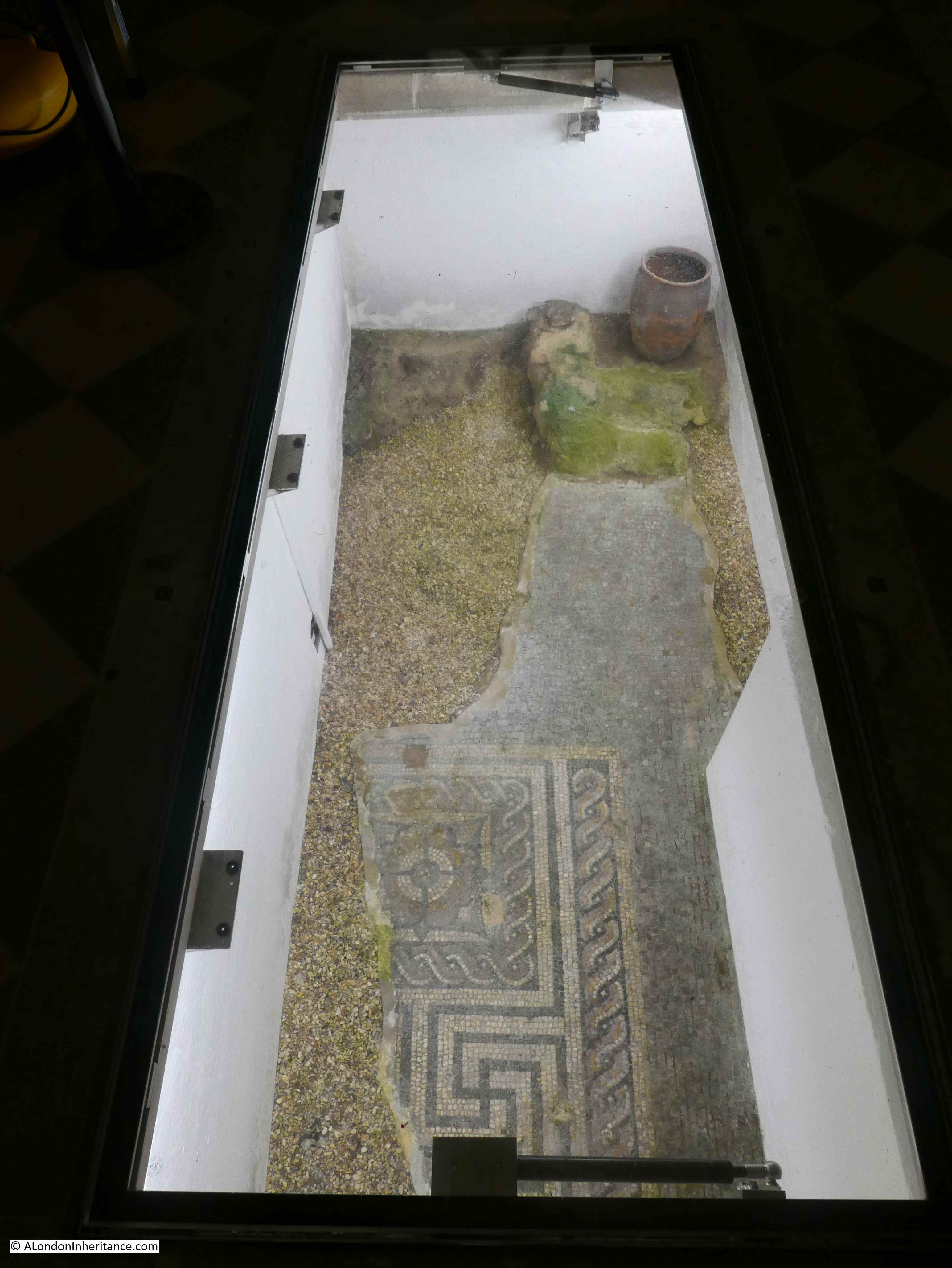
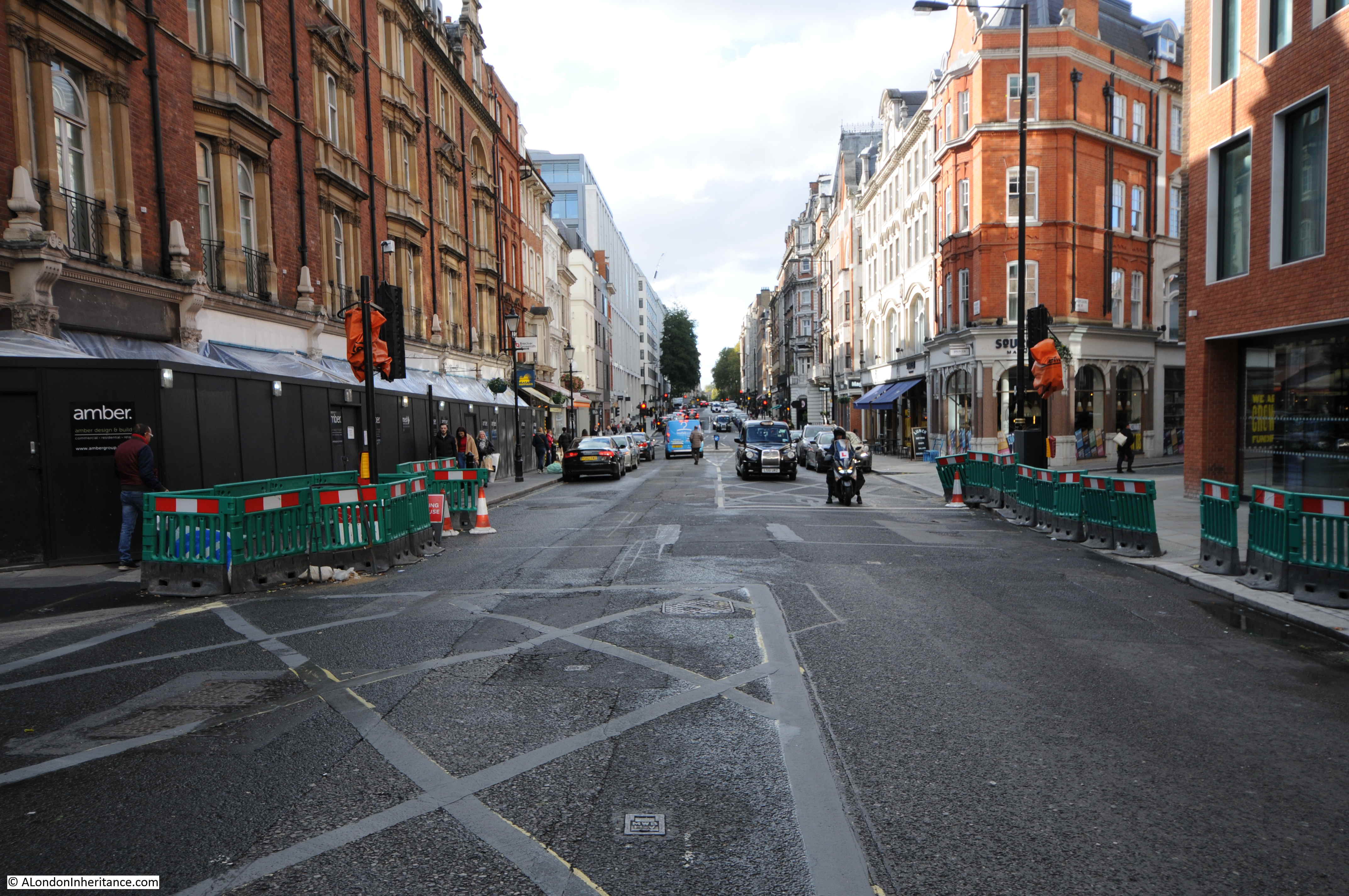
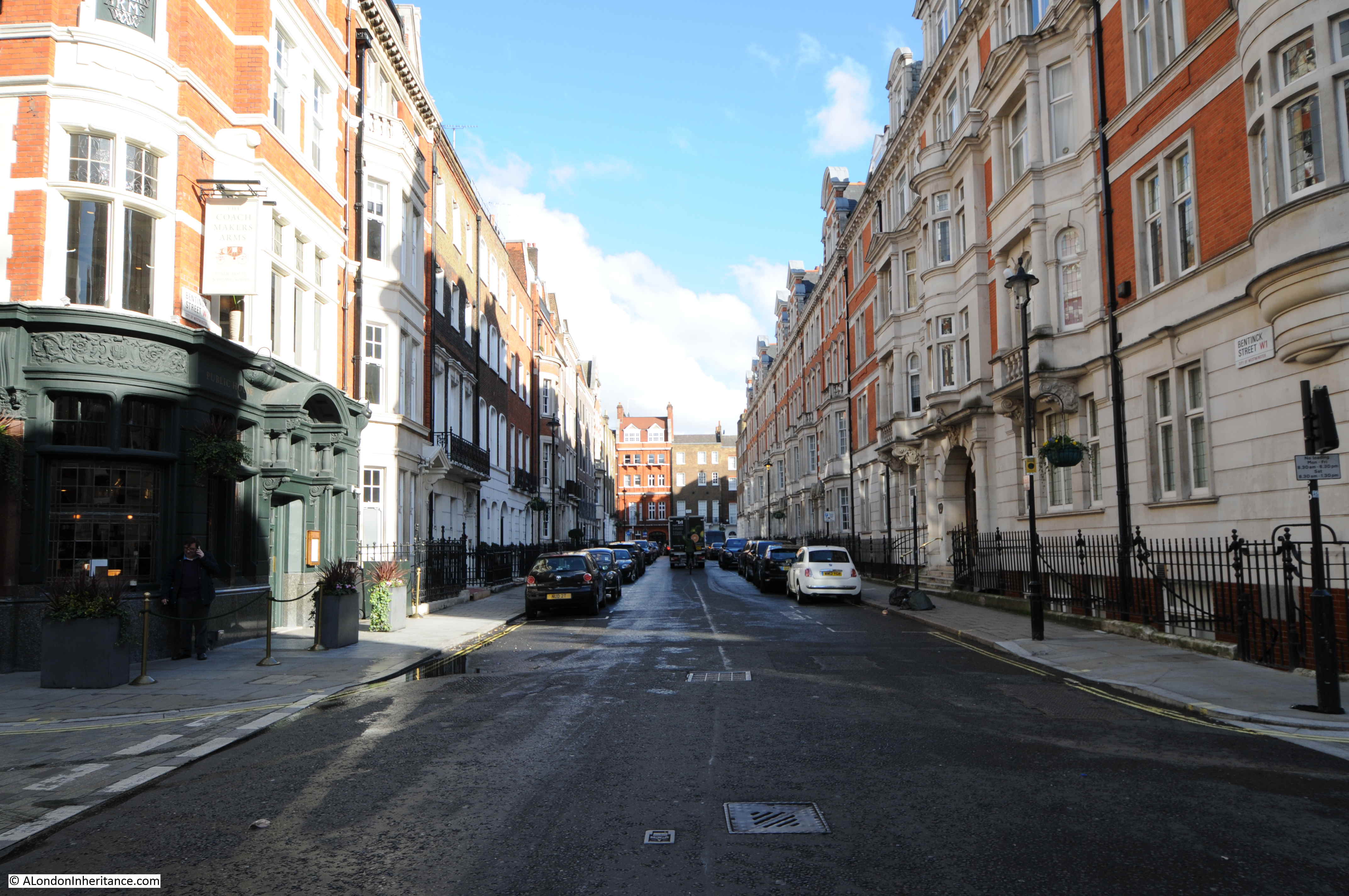
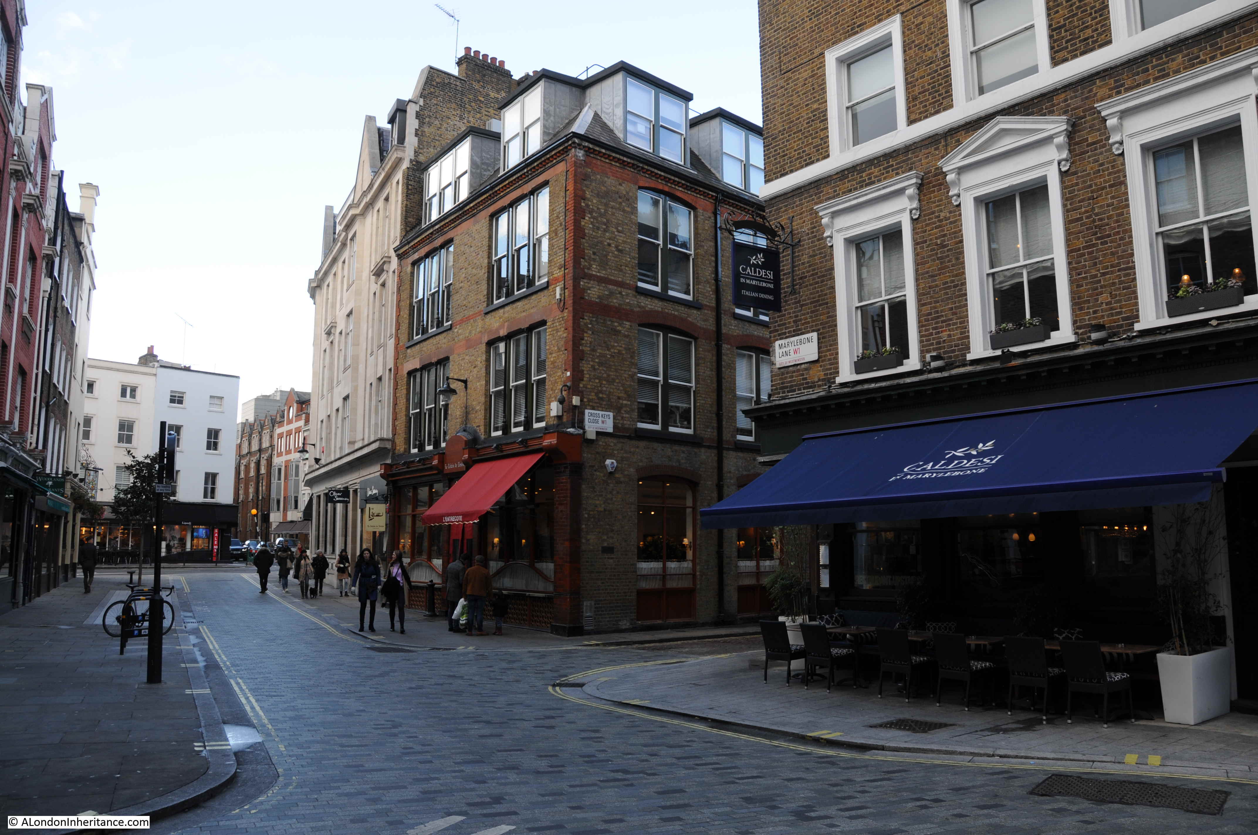
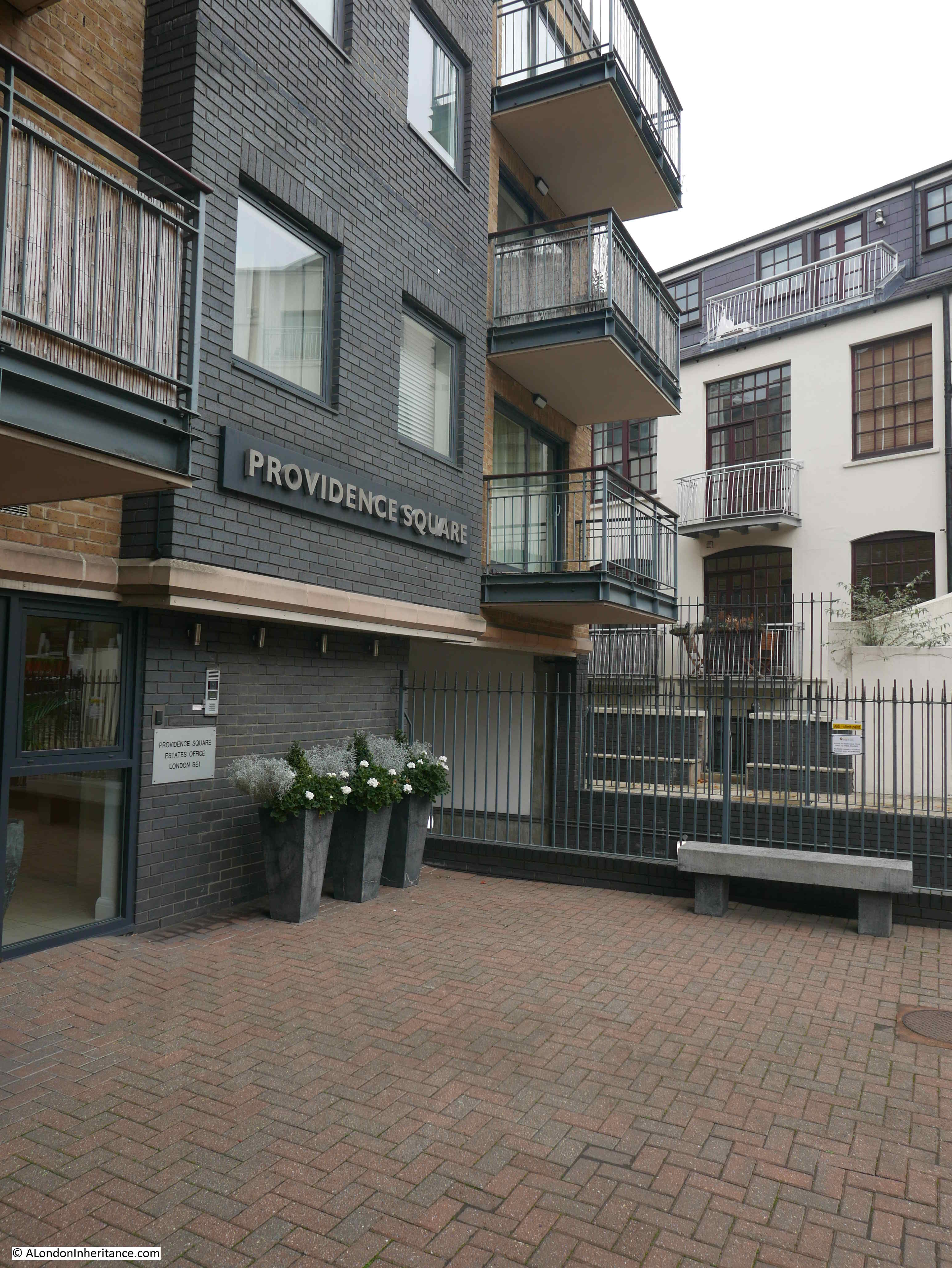
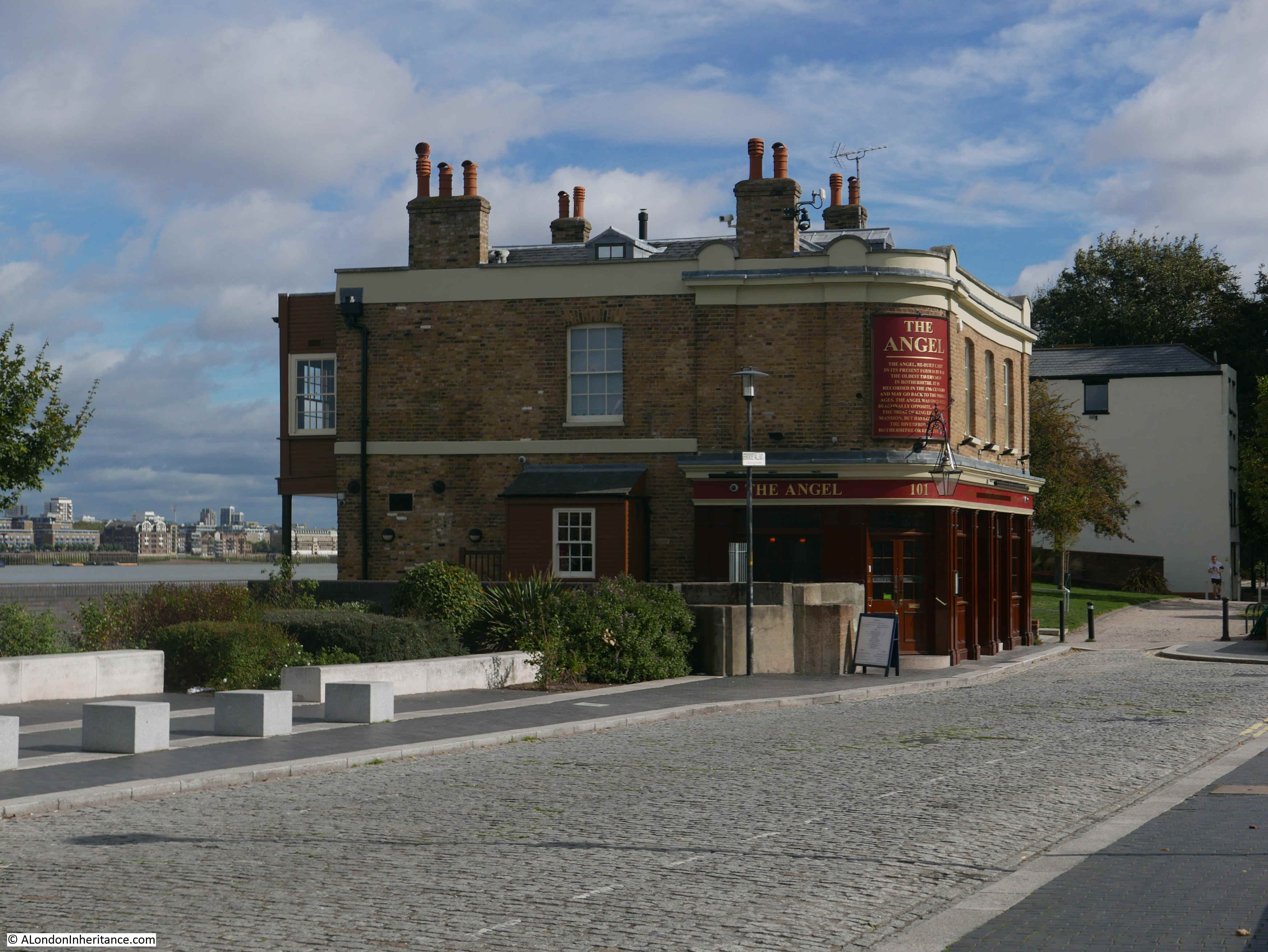
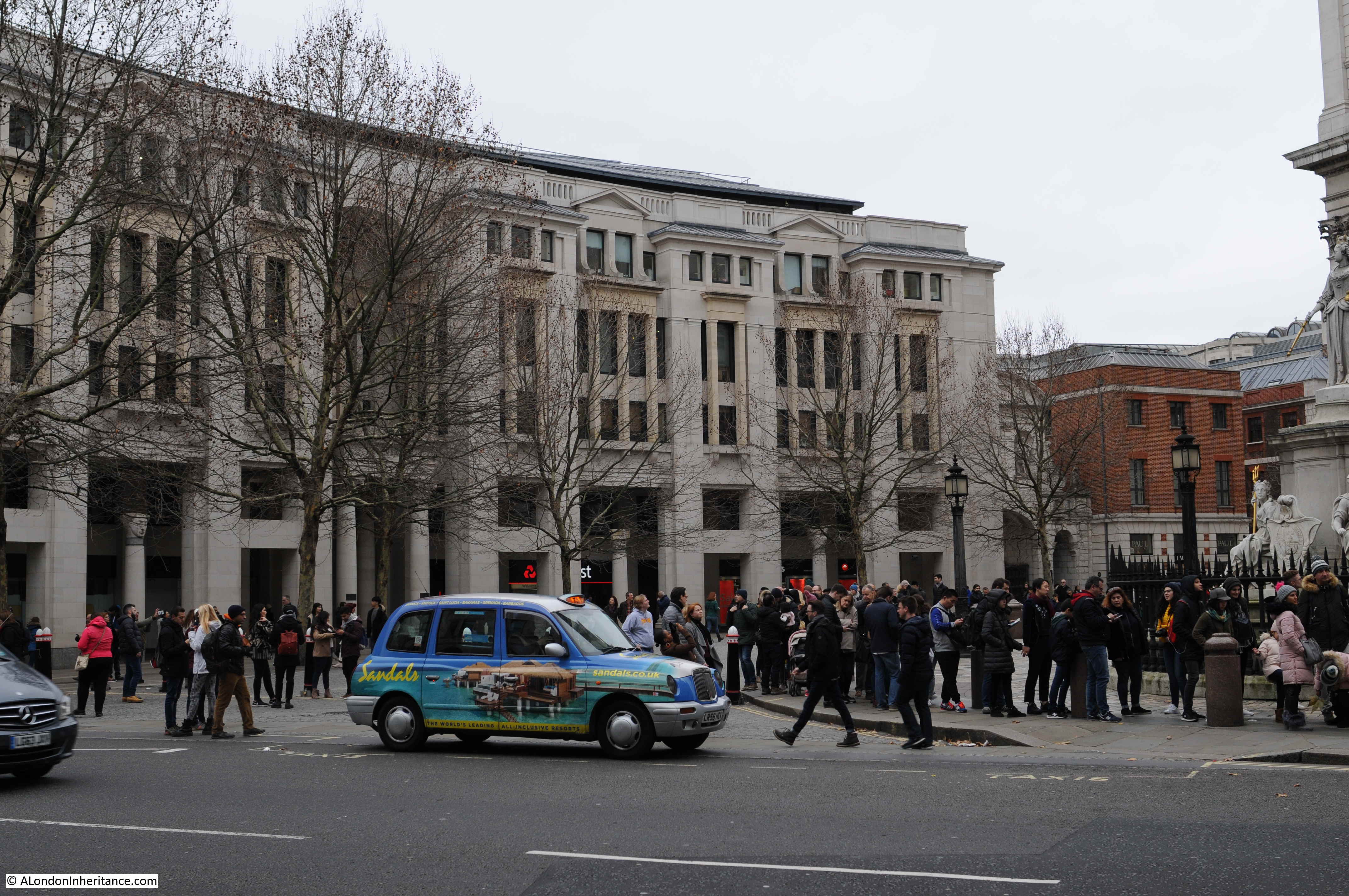
In the following view of St. Paul’s Churchyard today, the buildings of Hitchcock Williams & Co occupied the majority of the space now occupied by the buildings, starting with the brick faced building on the right, where the old Temple Bar now stands and the majority of the space occupied by the taller building curving from right to left.

29th December 1940

In the early stages of the war, building owners were encouraged to form their own fire fighting teams, and many City buildings were manned by employees of the company to help defend the building from what was expected to be attacks from explosive and incendiary bombs, although they were mainly equipped with buckets of sand and stirrup pumps, which were to prove of limited use on the night of the 29th December.

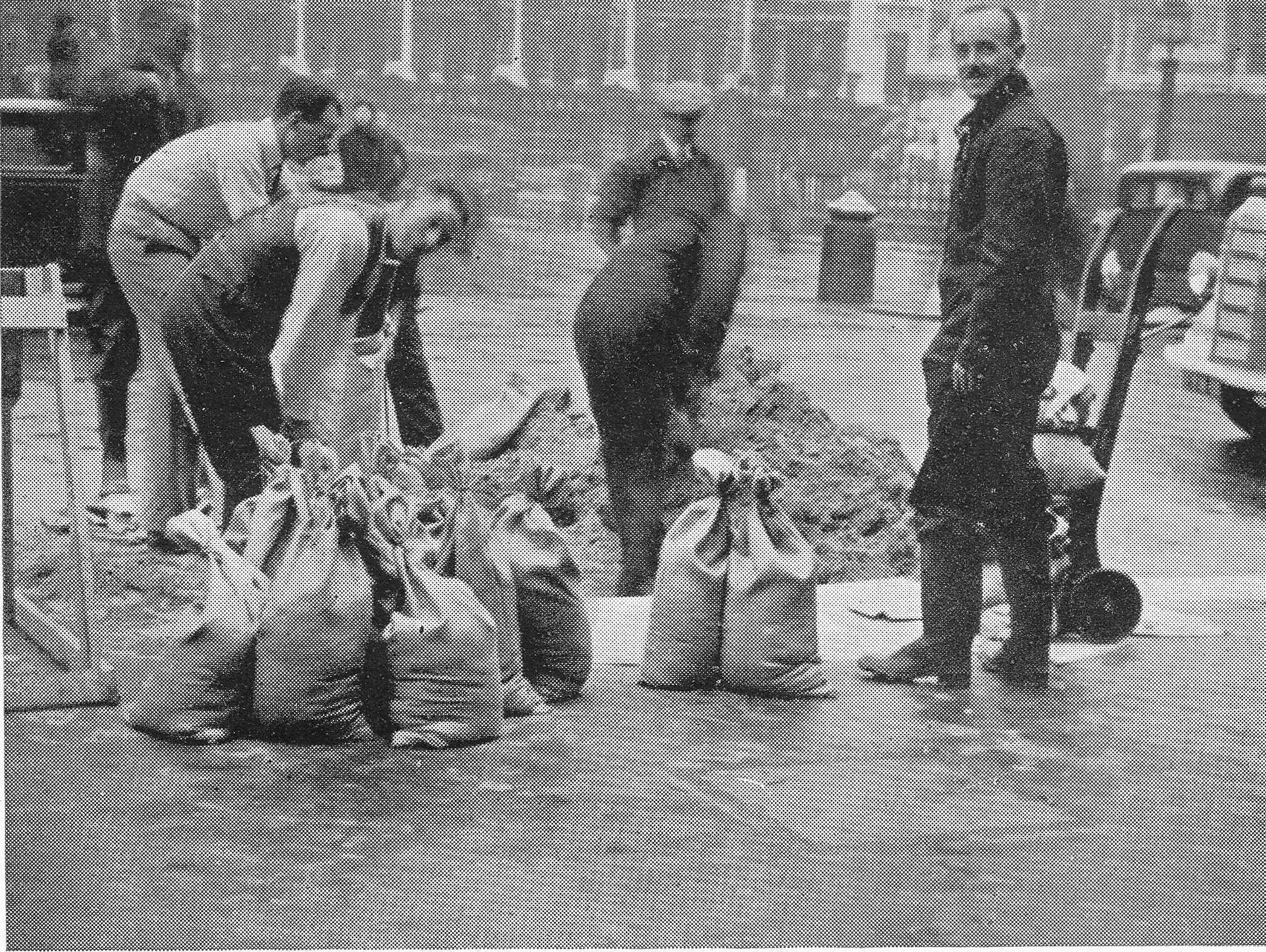
Preparations for war included not just the formation of fire fighting and first aid teams, but also protecting the building with sandbags as this photo titled “Sand Shifting Volunteers” demonstrates:

29th December 1940

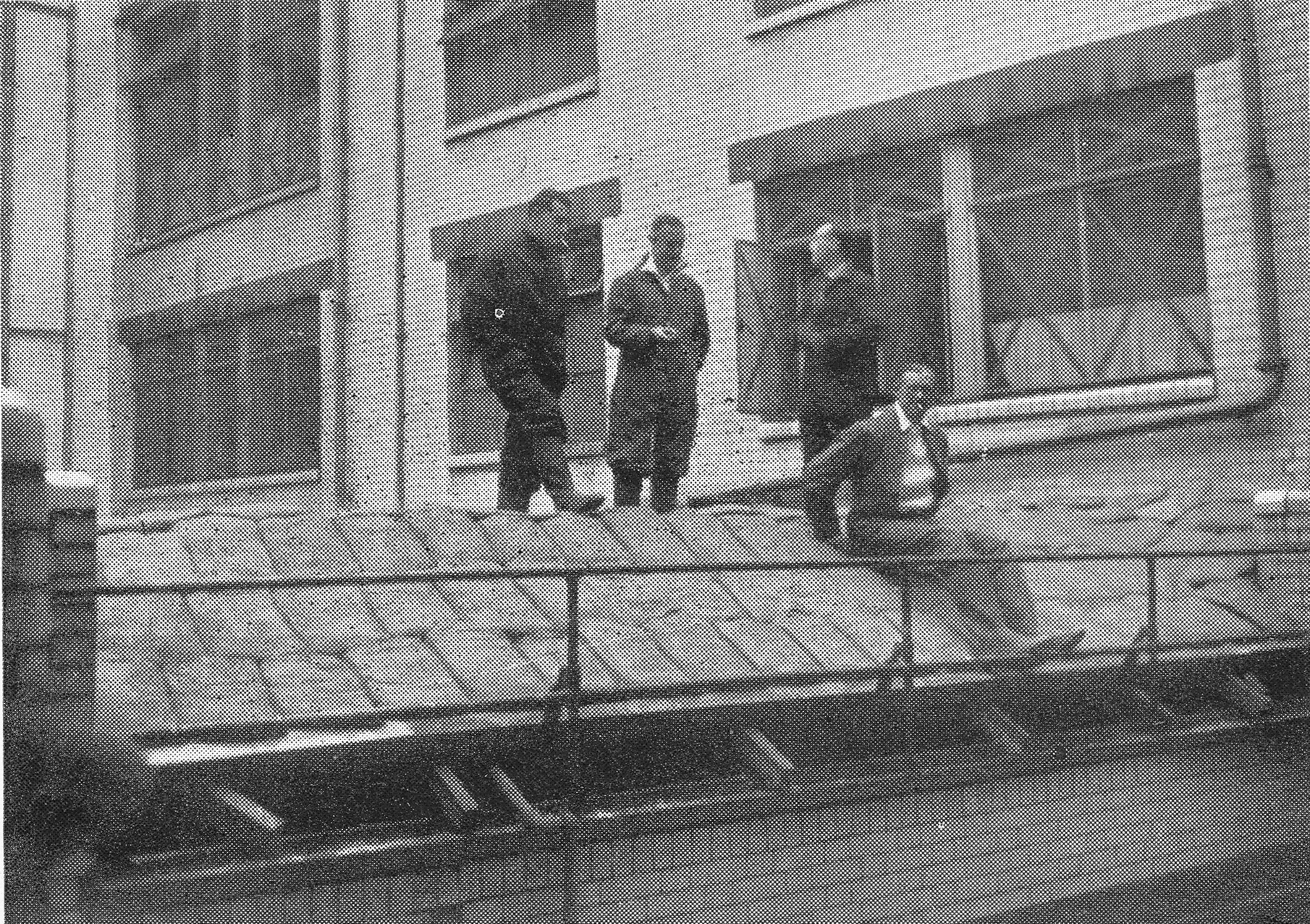
This photo titled “Stand Easy” shows part of a roof apparently lined with sandbags.

29th December 1940

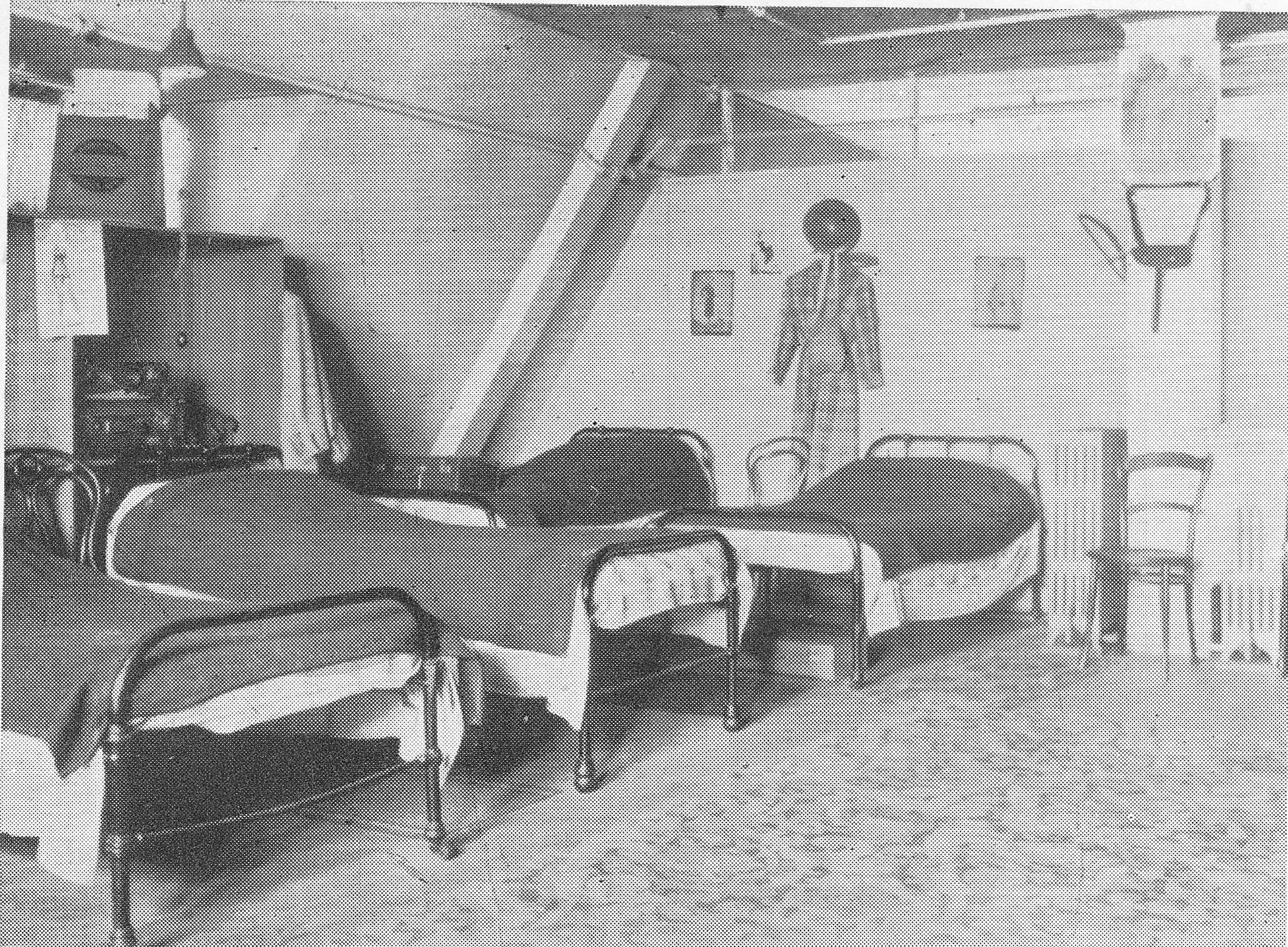
Hitchcock Williams & Co, as practiced by other large City companies, had a number of residential employees and during the war preparations included converting rooms to overnight shelters for residential staff and those assigned to fire watching shifts. This photo titled “Squeezin Hotel Bedroom” shows one of the converted rooms.

29th December 1940

Judging by the preparations and planning detailed in the book, Hitchcock Williams & Co. was probably as well prepared as any City company at the start of the war, however such was the intensity of the raid on the 29th December 1940 that even with incredibly dedicated staff and detailed planning and preparations, they were insufficient to save the buildings in St. Paul’s Churchyard.

Rather than precis the events described in the chapter of the book that covers the 29th December, the following are the words written by H,A. Walden who was there on the night. The chapter has the perhaps rather understated title:

“The Great City Fire Blitz And How It Affected Our Personnel And Premises”

“It has been said, and written, that not since the Great Fire of 1666 has there been such a conflagration in the City of London as occurred on Sunday night, December 29th, 1940, the result of Nazi incendiary bombs. In this ‘blitzkrieg’ whole areas of the City became smoking ruins within a few hours. Narrow thoroughfares, old familiar places and historic landmarks, were obliterated. To write adequately of the scenes of destruction seems beyond the limit of one’s descriptive powers.

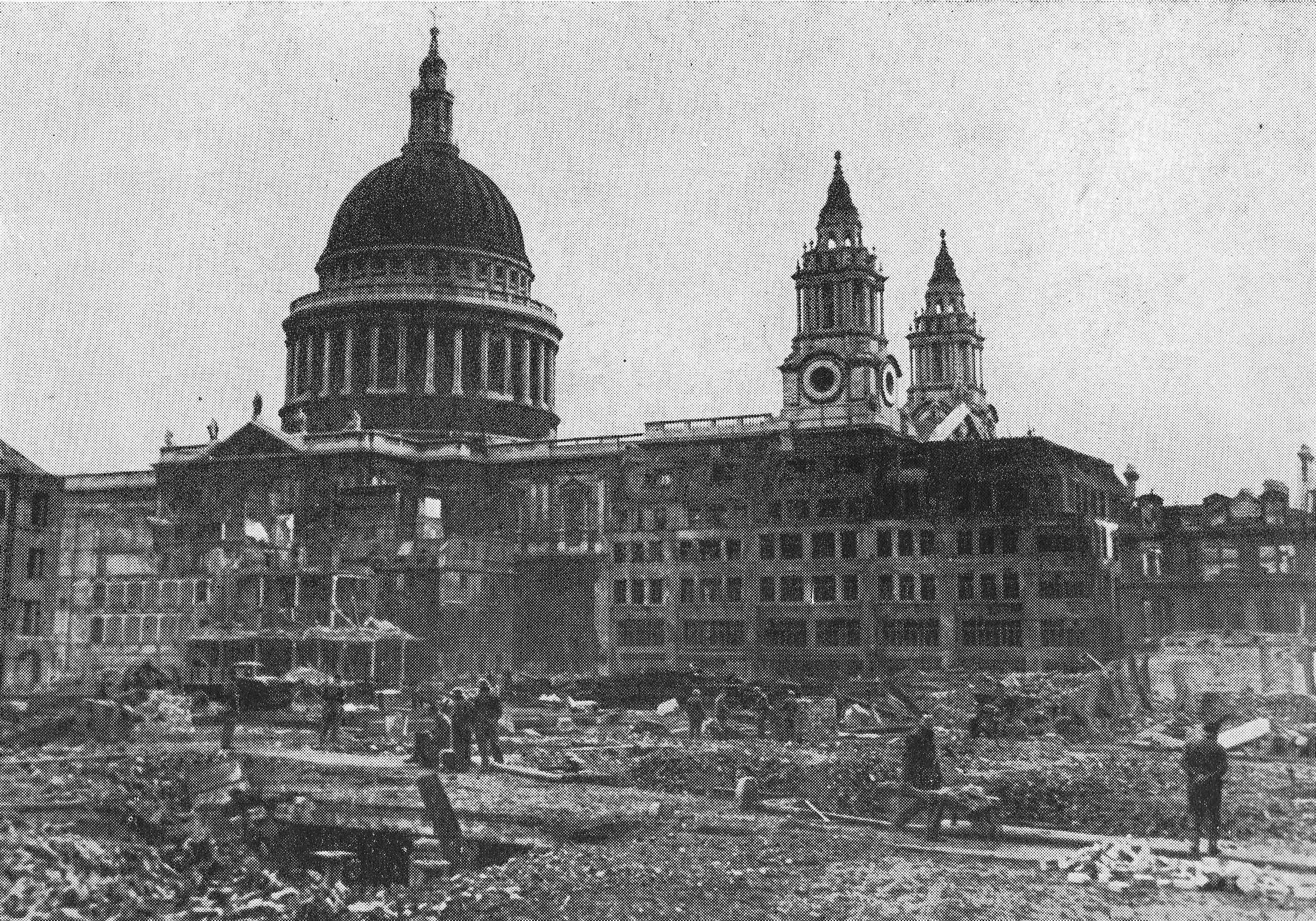
It was an awe-inspiring sight for those of us who witnessed it. St. Paul’s Cathedral, ringed by raging fires and falling masonry, its great dome superimposed and reddened all night by the reflected flames, seemed to take upon itself an even greater dignity, as it stood in the midst of this example of ‘Man’s inhumanity to man.’

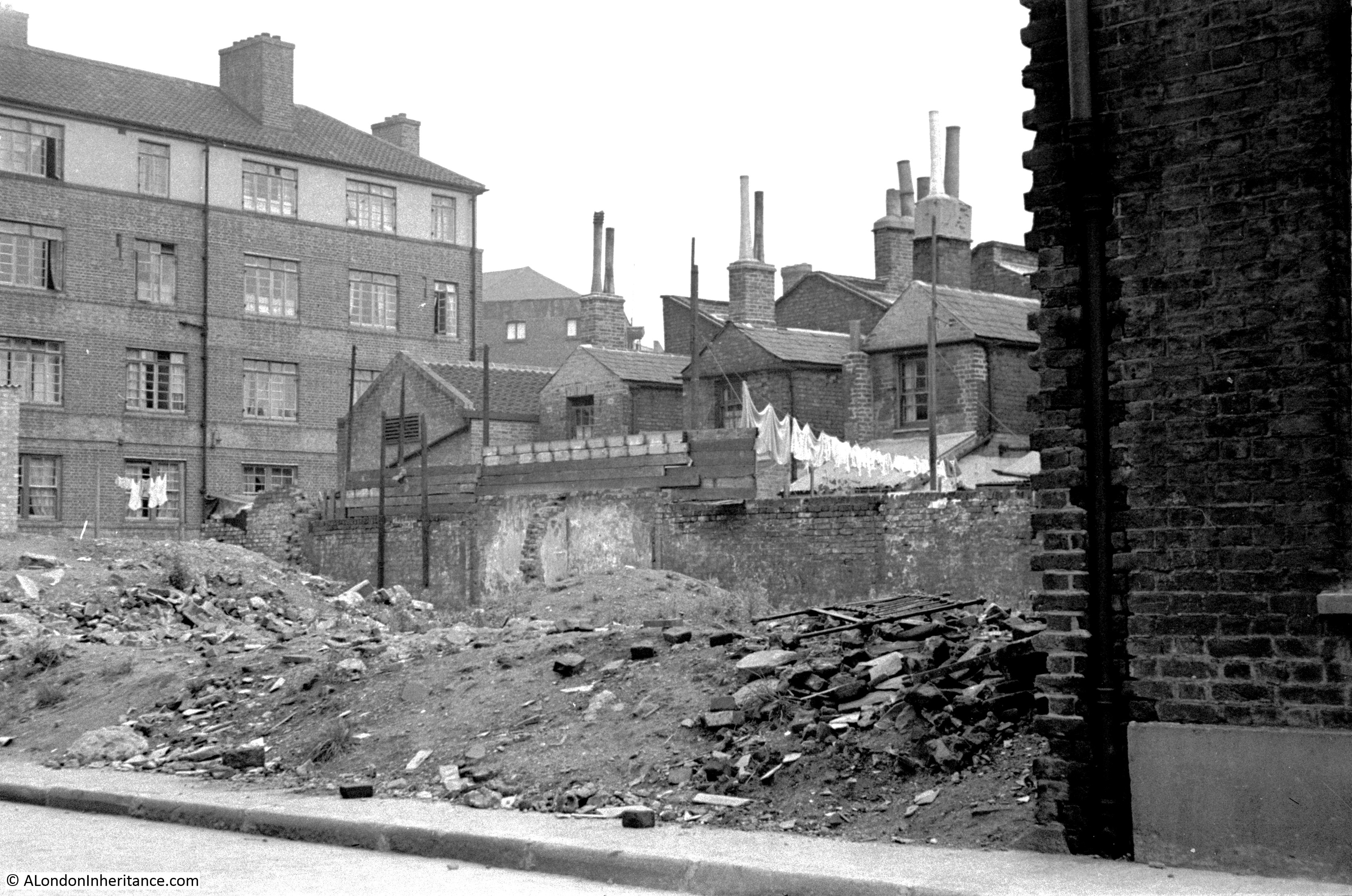
Approaching the City from the South, I saw by the lurid sky that the fires must be near the Cathedral, and felt apprehension about our own premises. The journey on foot along Cannon Street, deserted but for firemen, was of a nightmare variety. Several big fires were in progress, particularly a large Queen Victoria Street block, the smoke and sparks of which filled the air. the sound of hostile planes roaring overhead and the hiss of great numbers of falling incendiary bombs, seemed more menacing than usual. Taking cover in various doorways en route, and reaching the Cathedral, I found that our near neighbours, Debenham and Company’s premises were almost gutted and Pawsons and Leaf’s roof alight in several places. The roadway was a mass of fallen masonry, and hose-pipes interlaced towards the brow of Ludgate Hill, where other fires were taking hold. Various buildings in Paternoster Row, Ivy Lane, Warwick Avenue and London House Yard were burning furious, and I shall not forget seeing the faces of some of our fire fighters in the glare, with every detail defined at a considerable distance. It should have been possible to read clearly by the light of the many fires.

Passing into the Warehouse, I learned that hundreds of firebombs had fallen in the near vicinity, some even on the Cathedral. Those which fell on our roof were effectively dealt with by our own squads, some of whom went out into the street to extinguish other incendiaries.

Here it must be recorded that many fires might have been avoided if other Warehouses and buildings nearby had had organised watchers and fire fighting staffs, such as our own. Perhaps, indeed, our premises would have been spared, for there appears to be little doubt that we became the eventual victims of other negligence, or lack of precaution.

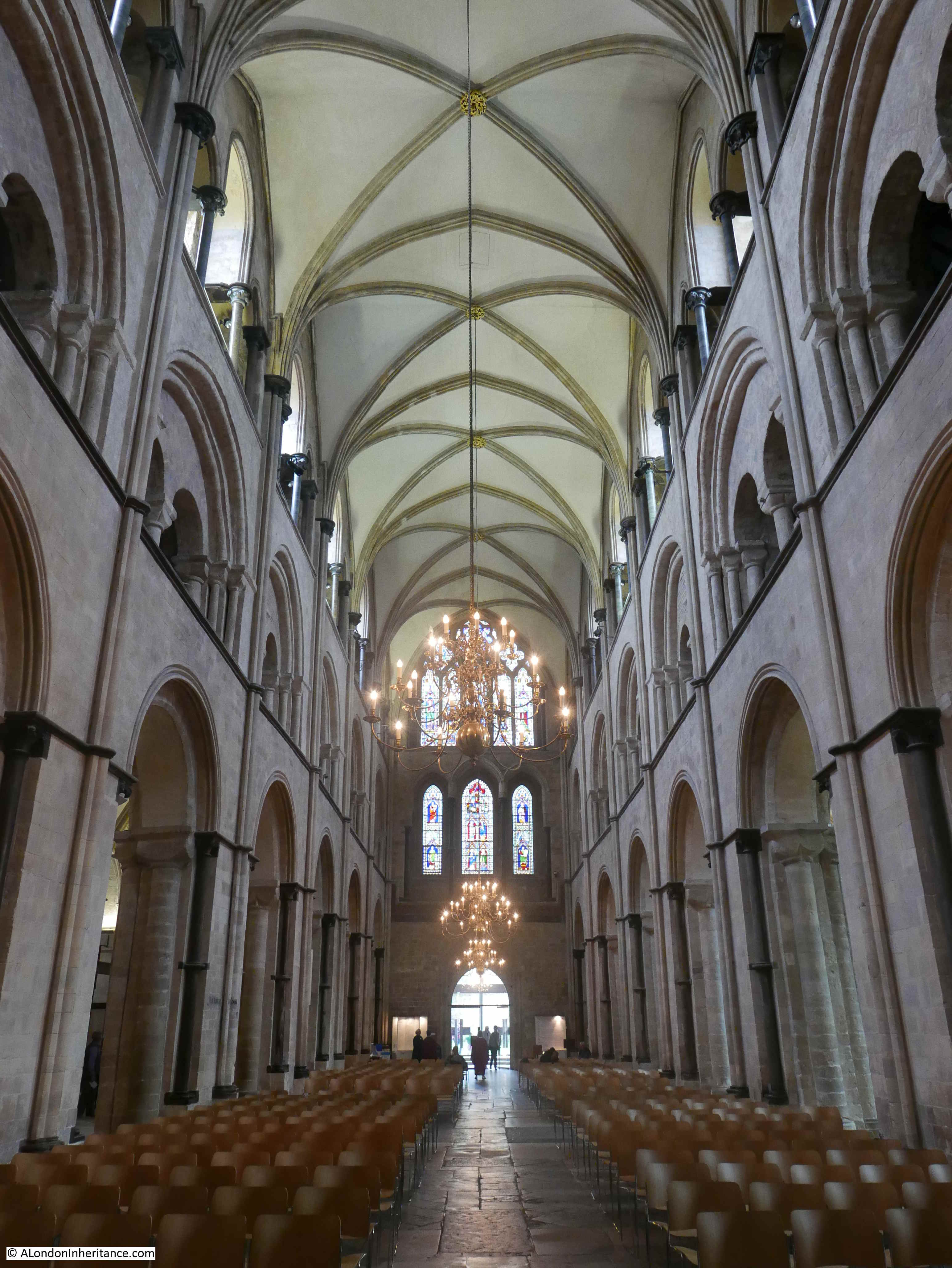
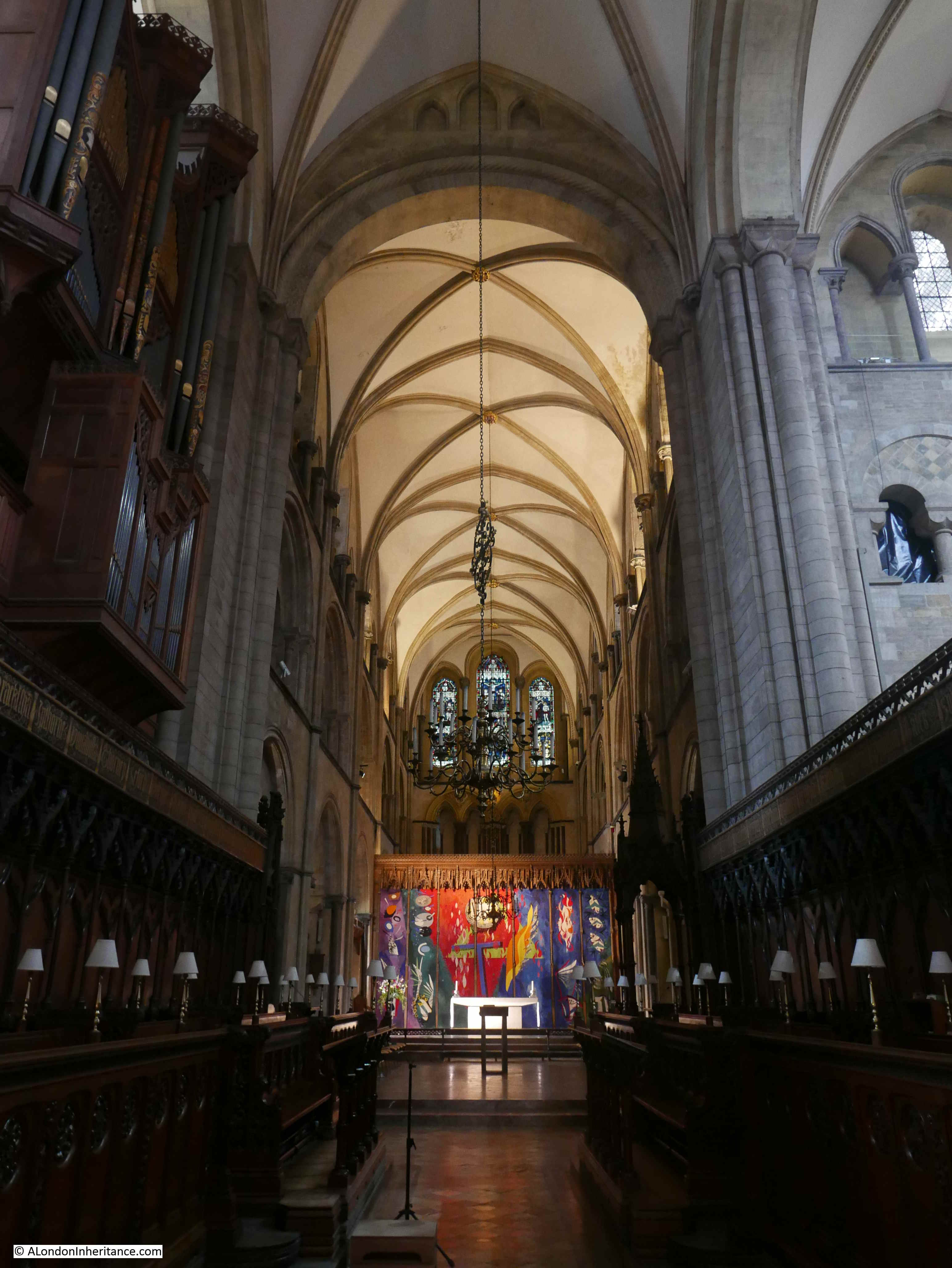
In addition to our own fire fighters and first aid men on duty, there were about 80 other occupants of our basement shelters, comprising assistants of both sexes and domestic staff, most of whom were unaware of the close proximity of the fires or the danger outside. Soon word was received that our premises must be evacuated at once, and Mr. Lester instructed me to conduct the women members of the staff immediately to the Crypt of St. Paul’s , where arrangements had been made to receive them. They quietly collected their necessities and blankets, and with one or two excusable exceptions, the calm manner of their journey despite the sight of flames and sparks which greeted them upon coming out of doors at ground level, is worthy of very special mention. The men followed shortly afterwards. All were most kindly received by Canon and Mrs’ Cockin and other clergymen and helpers. We were given cocoa and made as comfortable as possible on pews and forms. The quiet atmosphere of the Crypt made it seem miles away from the outside world. It was the first visit for some of the staff, and one clergyman was soon answering questions from a young lady regarding the Duke of Wellington’s huge funeral carriage standing nearby. By this time, Wren’s Chapter House adjacent to our own premises, was ablaze, and our old building, 69/70 St. Paul’s Churchyard, despite the firemen’s efforts, had caught fire.

It was a hopeless fight from the start. memories of this old part of the House, with its Victorian outline, came crowding in. How it had witnessed so many of the Cathedral ceremonies! How, in happier days, over many years, it had been made colourful and bedecked with flags and bunting to welcome Royalty and others visiting the City and St. Paul’s, the personalities who had worked there and long since passed on – old friends who used to visit its departments – the present staff which manned them, and their reactions when on the morrow they would come and find the old place a ruin of twisted steel! The quiet, philosophic bearing of Mr. Hugh Williams and the Manager as they stood and watched the burning warehouse were an example to us all.

To define in praise the work of our fire fighters would be to limit the extent of their great service. Three times the Police instructed them to leave as the building was becoming dangerous; but they refused to go, and eventually Mr. Lester had personally to order and almost drag them away. Even then they asked to stay and continue the unequal struggle. Stirrup-pumps were futile weapons to deal with such a fire. many of our men were utterly exhausted when finally they withdrew.

As we feared, there was worse to follow. The flames of burning buildings in narrow Paternoster Row fanned by a strong wind contributed to the succumbing of the newer blocks of our premises, the rear portion of which was soon doomed – steel and concrete have their limitations. The task of the squads of regular and auxiliary firemen was hopeless and overwhelming. Water was at a low pressure because of its universal demand over a wide area. Many of us could neither rest nor remain in the Crypt, but came out at intervals to stand and stare, fascinated – and dejected – at the scene confronting us but a few yards away; we were even warmed by the heat of the blaze. It was eerie to see the hoses lit up by the flames. They resembled giant snakes sprawling across the roadways and pavements. Most of the staff had by now put down their blankets on the stone floor of the Crypt and endeavoured to obtain some sleep. My own blanket covered a flat gravestone, the inscription of which recorded the death in 1787 of Elias Jenkins, a former verger of the Cathedral. It was surprising that so many actually slept, particularly those who were shouldering the great responsibilities and anxieties of the future.

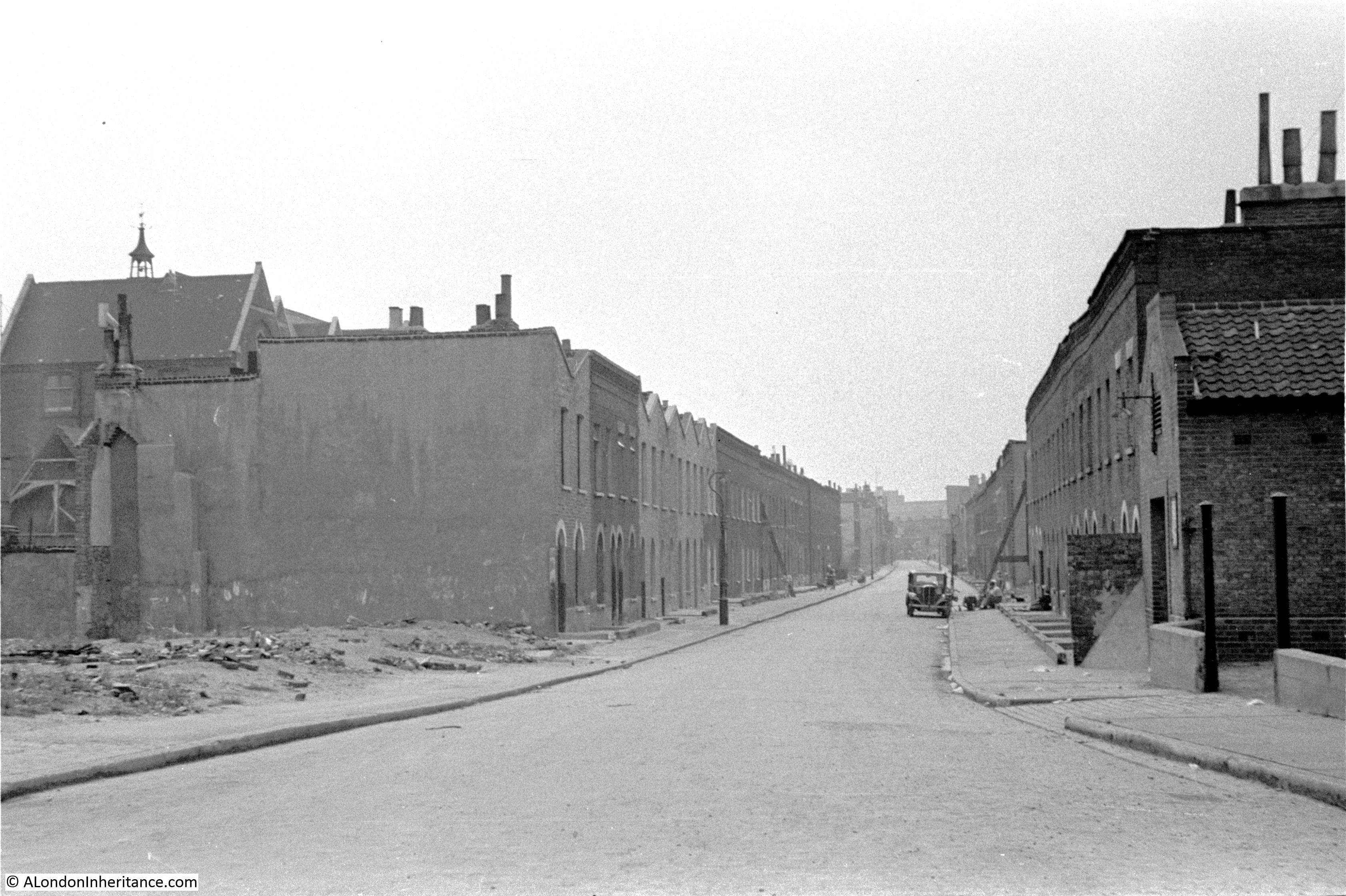
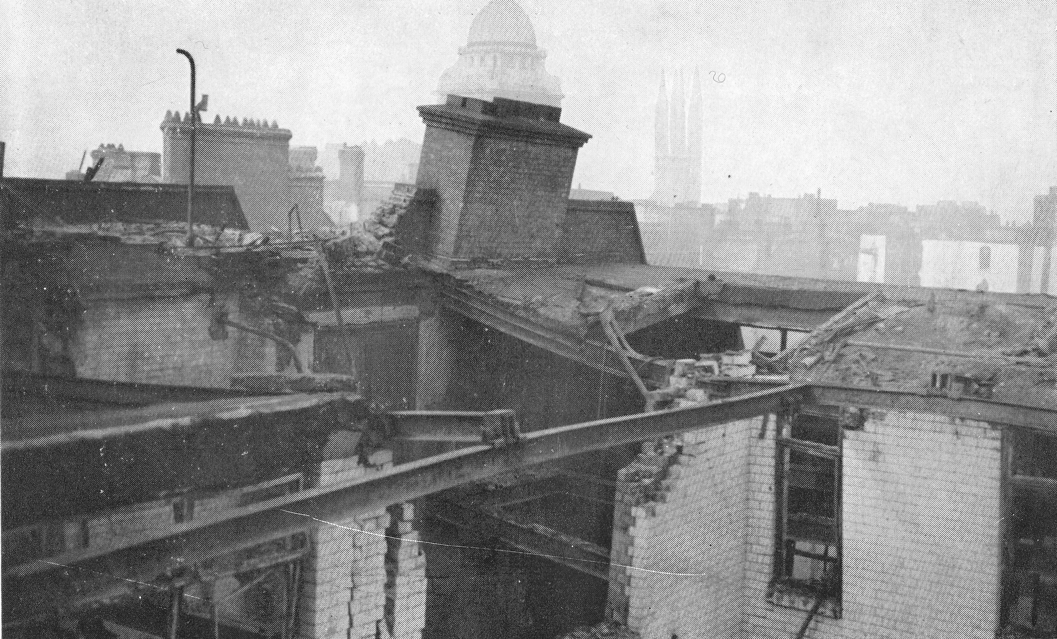
The following photo is titled “Our Old Building, December 29th, 1940”:

29th December 1940

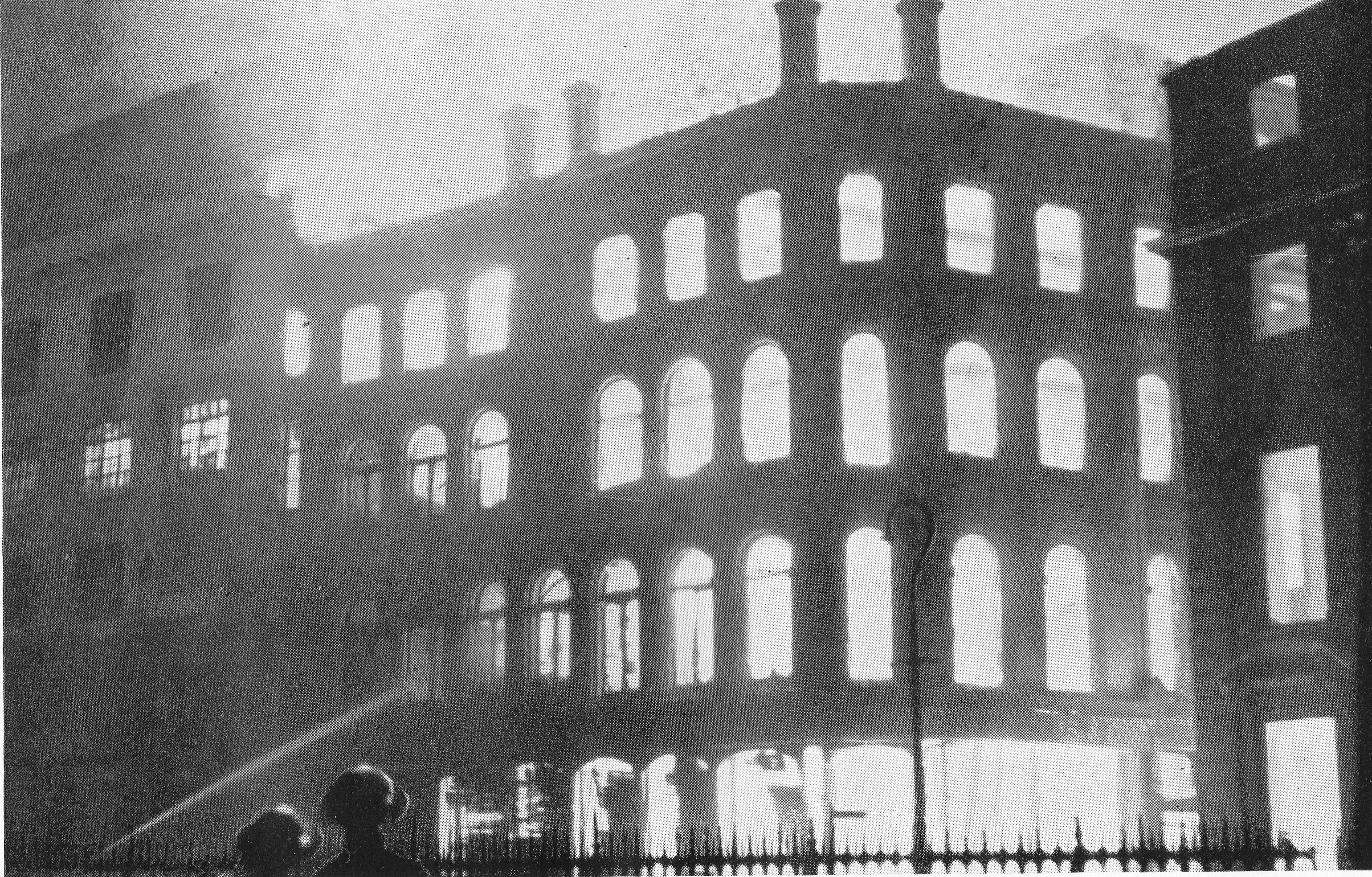
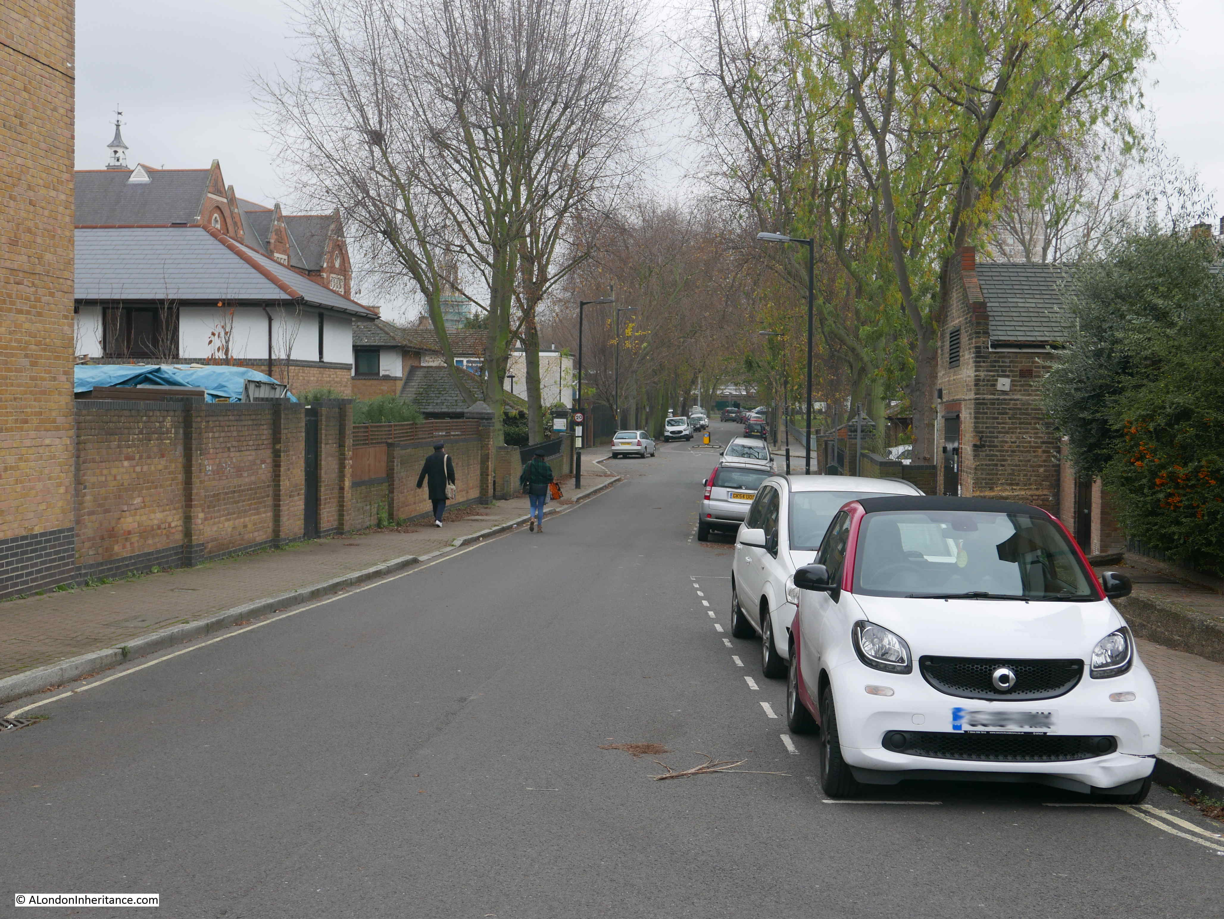
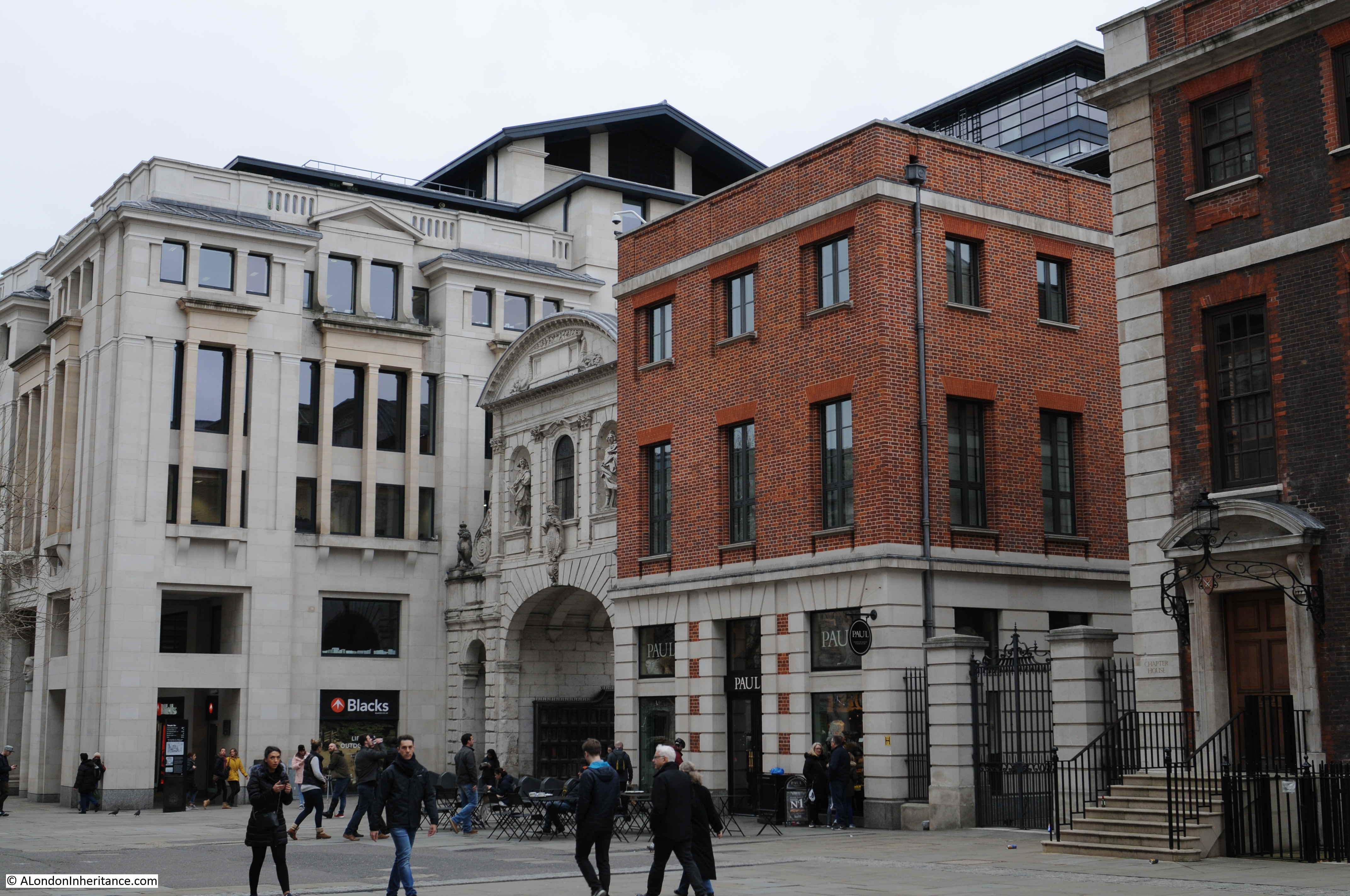
On the 29th December 2018 I took the book with me to St. Paul’s Churchyard to track down the location of a couple of the photos. The following photo is of the same view as the above. Part of the Chapter House can be seen on the right of both photos. This is the only building that was rebuilt after the war and remains to this day.

29th December 1940

In the grey light of a chaotic dawn, with buildings still ablaze, breakfast was where one could find it. There was very little water, and it was a strange sight to see people walking about with kettles in their hands trying to obtain it. Most of the staff who had been there all night were now sent home. The Headquarters of the Firm were made temporarily at Messrs. Evans’ Restaurants (next to our own premises), which had, apart from water damage, escaped the fire. We record our grateful thanks and admiration of Miss Richards and Miss Sheer, of their staff, who literally took us in and fed us. They made tea and cooked under the most irksome conditions, and were indefatigable in their cheerful assistance. They had slept in our basements for many weeks previously.

Our staff assembled here on Monday morning, seeking advice and instruction. The addresses of all were registered, and, with a few exceptions they were told to return home and await orders. This went on for two or three days, and about a dozen of us occupied the Crypt for a second night. Parts of our building were still burning, and it was late on this second occasion that some of us had the unusual sight of the Dean of St. Paul’s in his shirtsleeves, surveying our premises from the Crypt door. With a smile he remarked, ‘It takes Hitchcock, Williams an awfully long time to burn’.

The Firm had by now sought and found temporary offices at Textile Exchange, in the Churchyard, overlooking our still smoldering premises. The main room of these offices became a meeting place for everyone seeking information or giving it. A small Counting House and Entering Room staff were occupied acknowledging all mail and dealing with inquiries and urgent affairs. Mr Lillycrop had, fortunately, before leaving our stricken building, removed some books containing our customers’ names and addresses, thus enabling us to inform some thousands of them by January 7th of the calamity which had befallen our premises. A great number of replies were received expressing sympathy and offering help in some form or another. These greatly heartened and encouraged the Firm and staff in their determination to carry on. One letter concluded with, ‘Heil Hitchcock’s! Damn Hitler’.

The following photo is titled “Our Paternoster Row Frontage (after December 29th, 1940)”:

29th December 1940

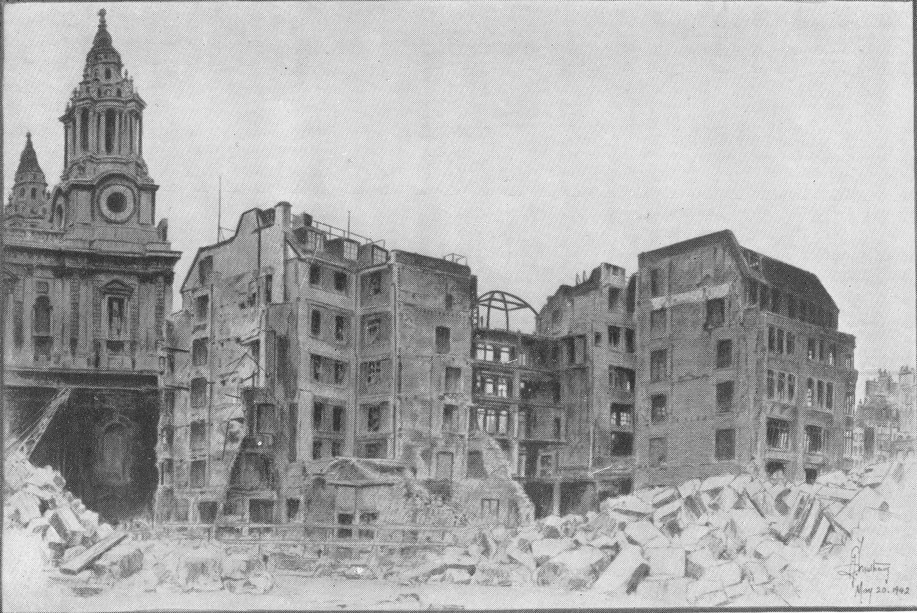
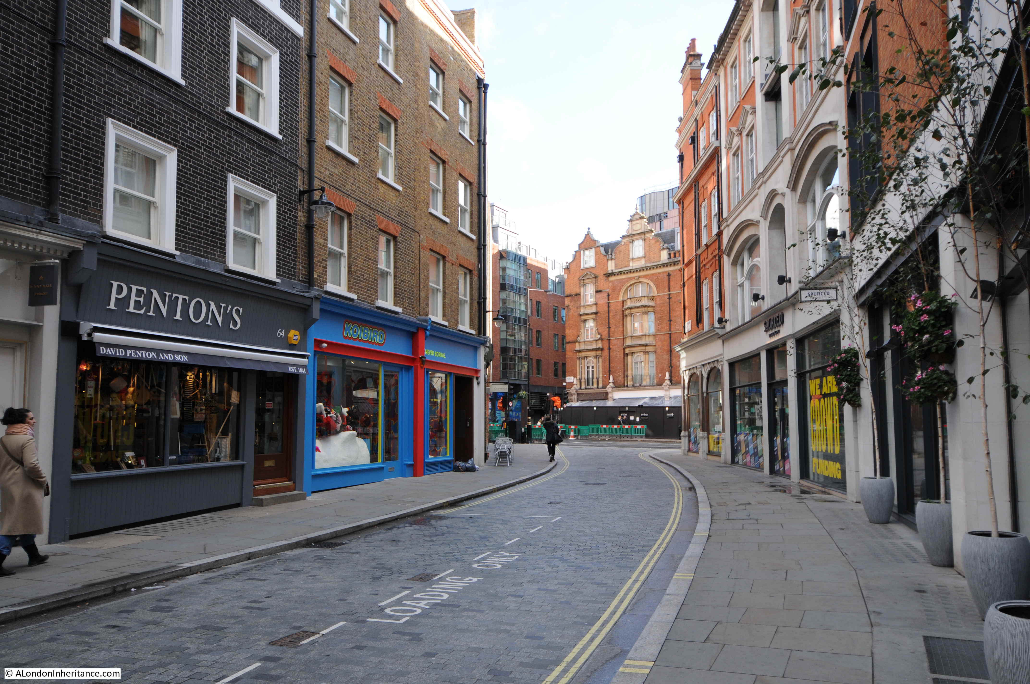
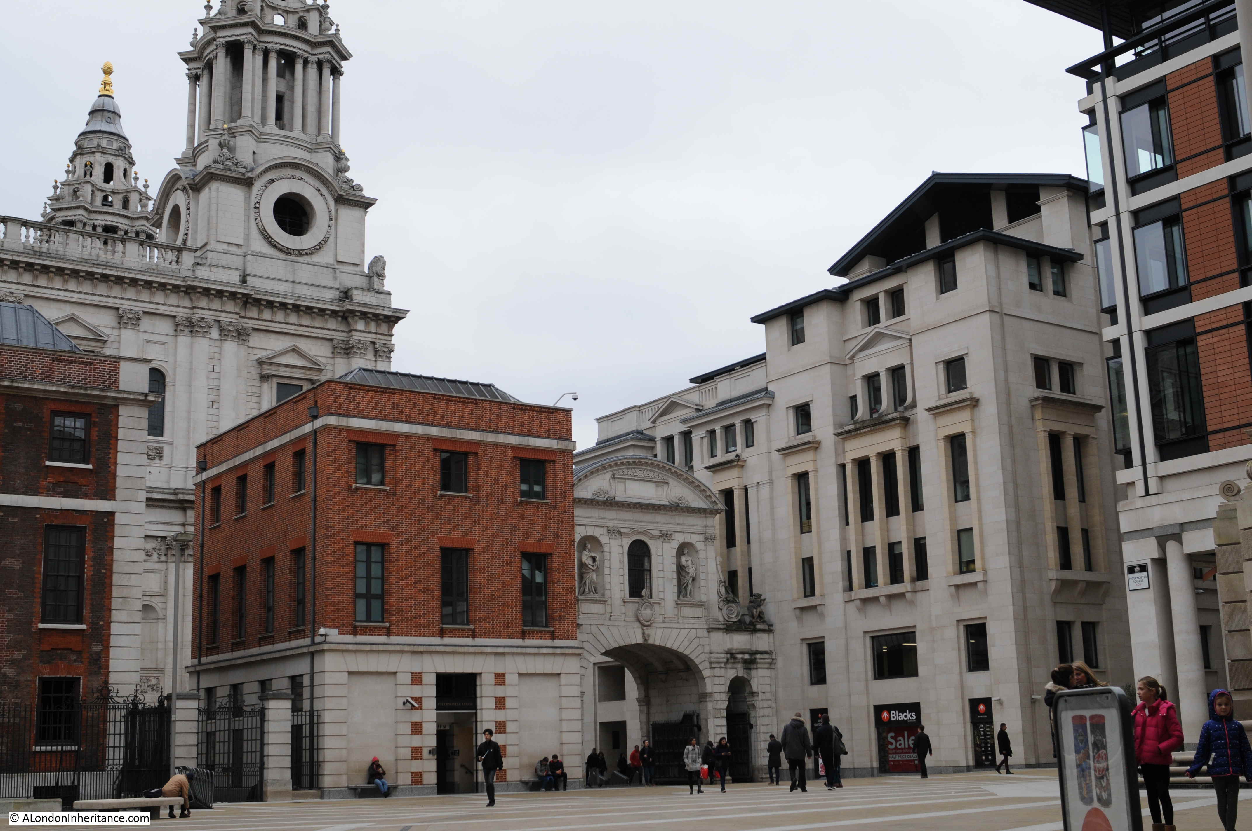
The following photo is of roughly the same scene today. The above photo extends further to the right than the photo from today, however that part of the view is obscured by the building on the right.

29th December 1940

The following photo is titled “One Of Our Departments After The Fire”:

29th December 1940

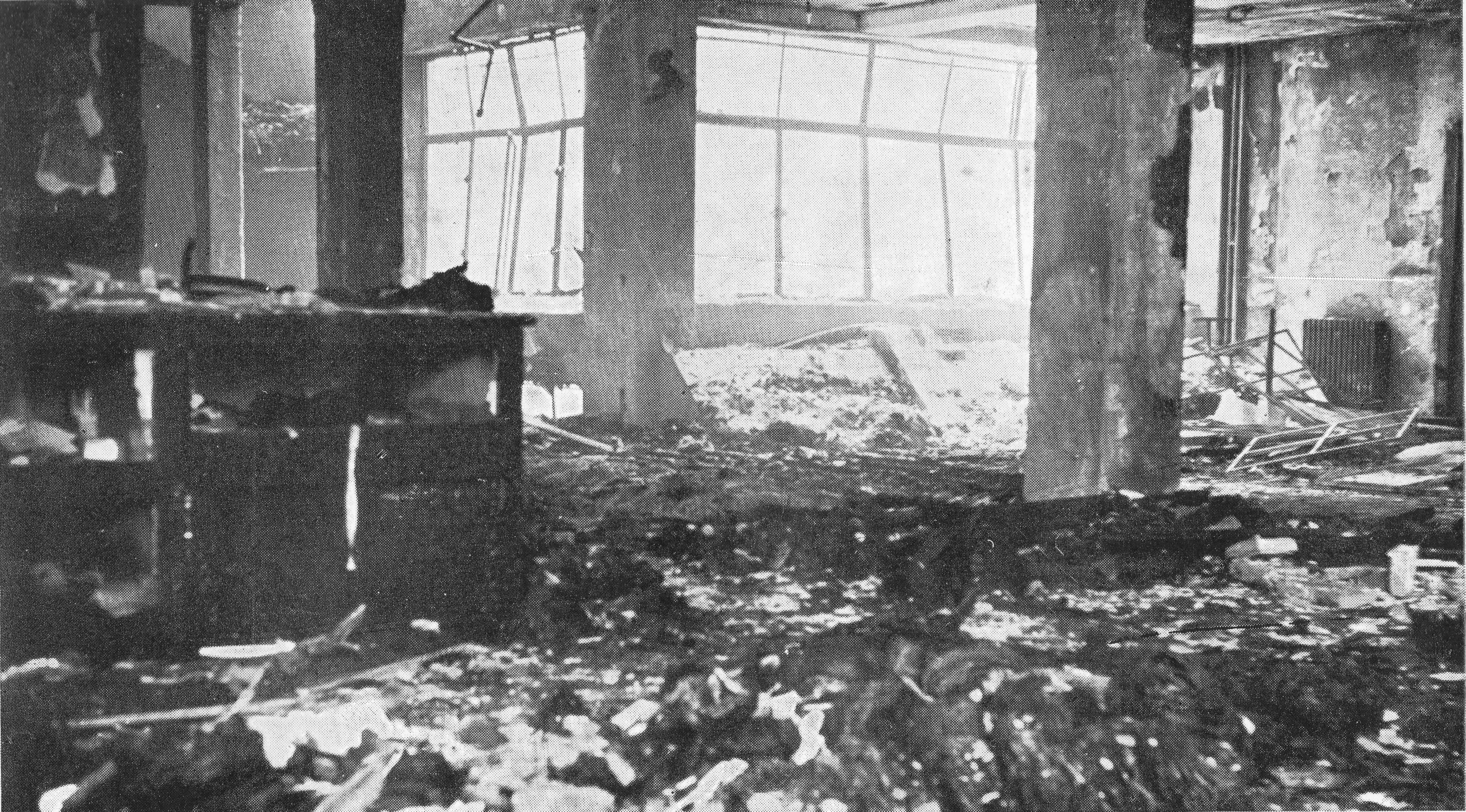
The following photo is titled “Main Roof Damage”:

29th December 1940

The following photo is titled “Our Warehouse After Hitler Passed”:

29th December 1940

Many problems were now being dealt with, to give but a few – Where should we find premises to house our Departments? In what state were the hundreds of ledgers and account books in the strong room which had now been submerged in debris and 14 feet of water? Where to obtain new stocks with the ‘Limitation of Supplies Act’ in operation? The claims of many members of staff who had lost their personal possessions in the fire? Where to accommodate the previously ‘living in’ staff, of whom there were approximately 150, when they returned to business? Immediately on seeing the staff on Monday morning, Mr. Hugh Williams, the Manager and some of the buyers went to inspect various places with a view to securing the premises and were able to obtain possession of four warehouses in the West End, and two showrooms in Cannon Street. By January 13th all these premises were in occupation by the various Departments which began establishing stocks and dispatching goods, though handicapped by a complete lack of counter fixtures etc.

The floor space in those early days was but a shadow of our former capacity, and indeed still is.

In addition to the complete loss of our main premises, there were also completely destroyed our four factories and workrooms, maintenance workshops at Warwick Lane and resident quarters at Crown Court, with everything they contained. Only Soft Furnishing and Piece Goods Departments were re-established in the City, at Scott House, Cannon Street, but on May 10th 1941, this building was also totally destroyed by enemy action. These departments were eventually transferred to the rehabilitated first floor of what remained of our 72 St. Paul’s premises.

The problem of the flooded basements containing our strong room and in it all our books and records was a serious one. Pumps were installed and operated for several days before the water was cleared, and debris removed, to allow an examination to be made of the contents. The strong room was found to have been badly flooded, and the removal of sodden books and documents and the process of hand drying every page by our already augmented staff will not soon be forgotten. The drying and de-ciphering continued for many months, in many cases figures became obliterated by mildew setting in. The practical help given by our customers who, when remitting, forwarded copies of their own ledgers was of great assistance to us. Many were themselves in a similar case and the difficulties of reconciliation of indebtedness can be appreciated. One customer at Hull had his premises destroyed on three occasions. Our bankers placed their special drying rooms at our disposal for some important documents and books – even a laundry gave assistance through the medium of its special apparatus.

Many of our ‘living in’ assistants and fire fighters had lost most of their clothes and personal belongings and for a few days the Guildhall (also badly damaged) was besieged by claimants for compensation. Each was interviewed by the Relieving Officer, and, in most cases, a cash payment on account was made for immediate necessities. A comprehensive form, setting out personal losses had to be completed and returned within 30 days. The administration at the Guildhall was sympathetic and businesslike. There must have been thousands of claims made as a result of the night of December 29th, 1940.

For some time, members of the staff worked among the debris and basements, clearing and salvaging whatever possible. The builders erected scaffolding at certain points with a view to rendering first aid to that part of our remaining building which might be made habitable for business. Meanwhile in Paternoster Row the Royal Engineers and Pioneers were in full possession continuing their work of demolition of unsafe buildings and walls. What remained of the older portion of our building was finally demolished by explosive charges on February 7th, 1941. Despite great damage, it fell only after great reluctance. Paternoster Row and London House Yard remained closed thoroughfares for the rest of the war.

This scene of desolation in the area at the rear of our buildings was terrible. It could be likened to the result of an earthquake. Publishers, publicans, booksellers, scent makers, cafes, solicitors – in fact, all branches of the professions and industry suffered. Notices and papers strung along railings and ropes indicating location of new or temporary addresses could be compared with washing hanging on a line.

The salvaging, drying and storing of a quantity of packing paper and string provided extremely useful, as these commodities became scarcer in supply. Our artesian well which pumped water from a depth of 500 feet in sufficient quantity to supply all our needs, was rendered useless. The reserve tank, for three days’ supply had a capacity of 18,000 gallons and weighed 90 tons. This provided useful salvage and ‘tank-busters’ was no misnomer for the men who were eventually employed to dismantle it.

Finally, we were indeed thankful that no lives were lost, nor serious injury received by any of our staff. Despite the great material losses the Firm sustained they set an example to all in their determination to rise again, Phoenix like, from the flames. Meanwhile over the front entrance door, the sculptured stone figure of ‘Industry’, undamaged, still smiles serenely down on our undertaking.

What further symbol is needed for this great century old business?”

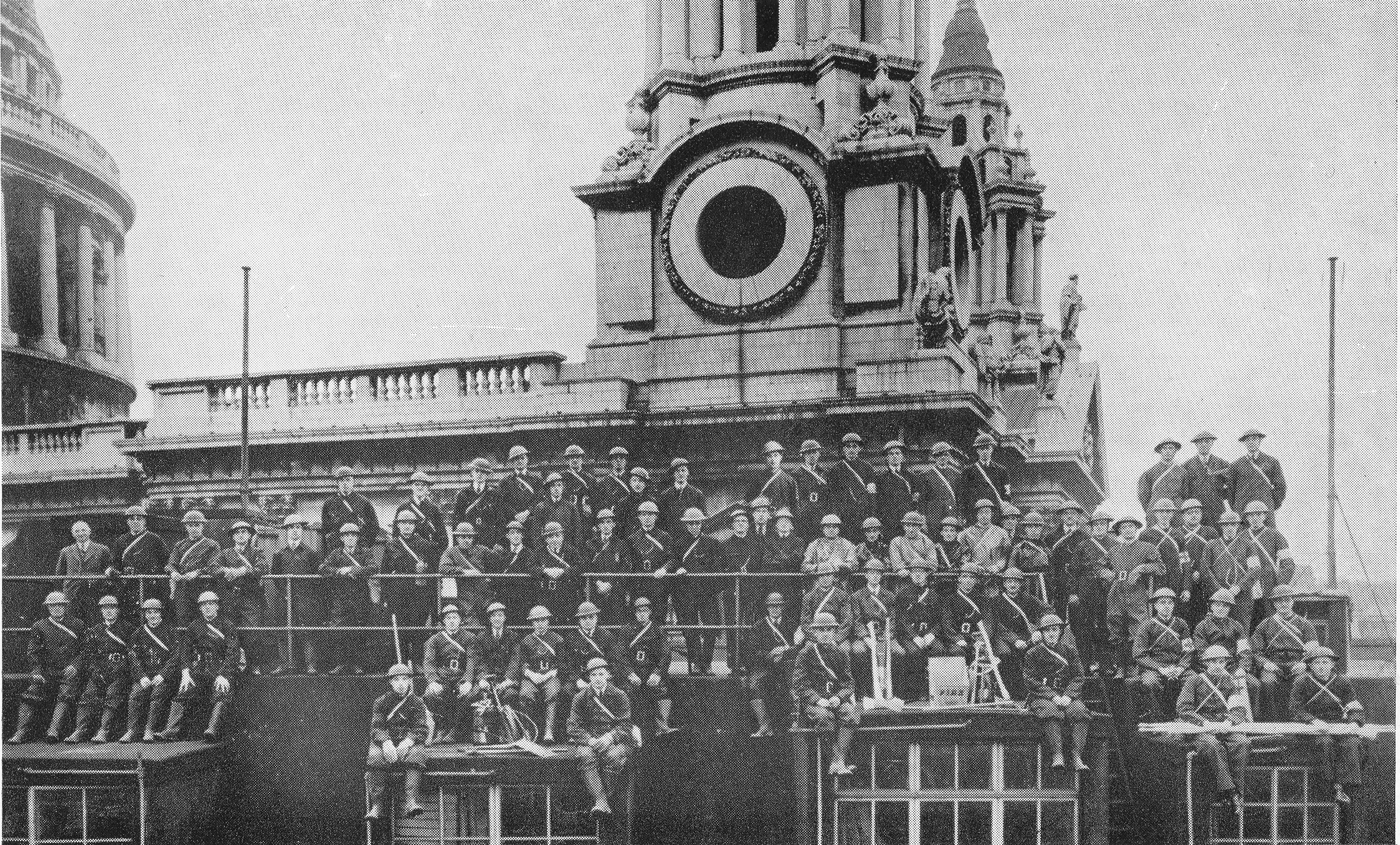
The following photo is titled “Our Block, December 1940”:

29th December 1940

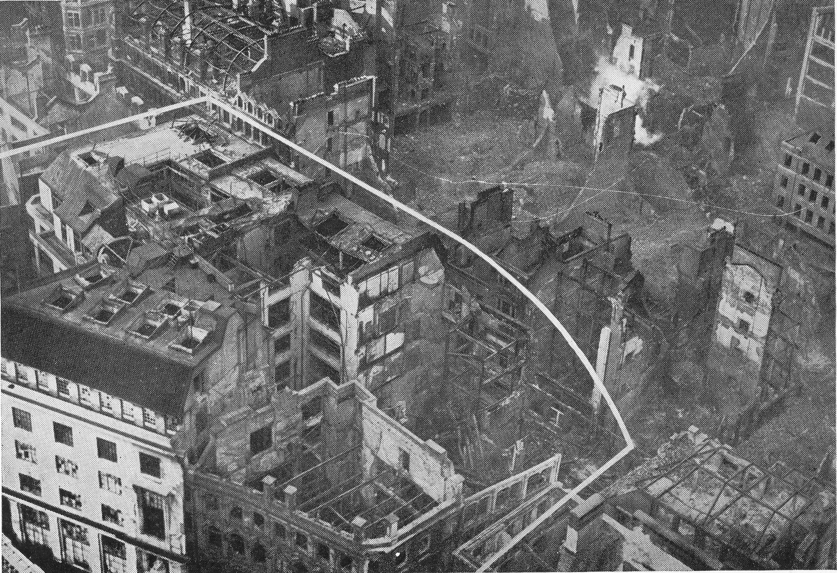
In the above photo, the white lines shows the boundary of the premises of Hitchcock Williams & Co and demonstrate the size and scale of their operation around St. Paul’s Churchyard and Paternoster Row. In the lower right corner, part of the shell of a building can be seen with a rather distinctive chimney with lighter colour lower section and darker upper section. This building is the Chapter House of St. Paul’s Cathedral.

My father took a series of photos from the Stone Gallery of St. Paul’s just after the war (I covered these in two posts here and here).

He did not take a photo that exactly covers the area of the Hitchcock Williams building, however he did take the following photo showing the Chapter House with the same distinctive chimney.

29th December 1940

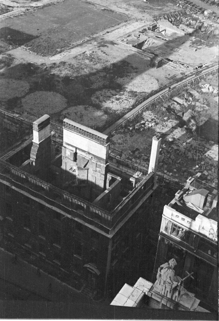
In the above photo, the area occupied by the buildings of Hitchcock Williams are to the left and have now been cleared. The round circles are the marks left from the siting of large water tanks that were built after the raid of the 29th December on cleared land. This was to address the problem of water availability and low water pressure as described in the account of the raid.

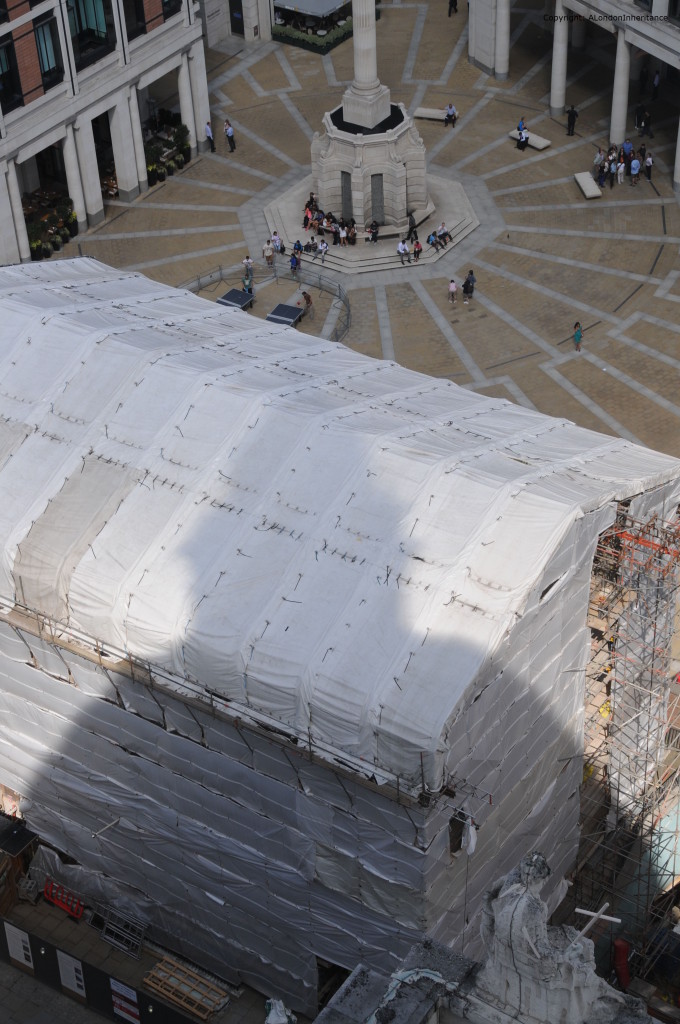
To help locate where Hitchcock Williams stood in the area around St. Paul’s today, this is a photo I took a couple of years ago when the Chapter House was being restored showing the same view as in my father’s photo above. The premises of Hitchcock Williams were to the left of the Chapter House.

29th December 1940

Operation Textiles – A City Warehouse in War-time is a fascinating little book, not just for the account of the 29th December 1940, but also for the background as to how a company operated in the City of London covered in the rest of the book. It is amazing how the company tried to operate as normal in the first months of war, including sending sales representatives with samples to the Channel Islands – they just escaped on the last boat as the islands were being invaded.

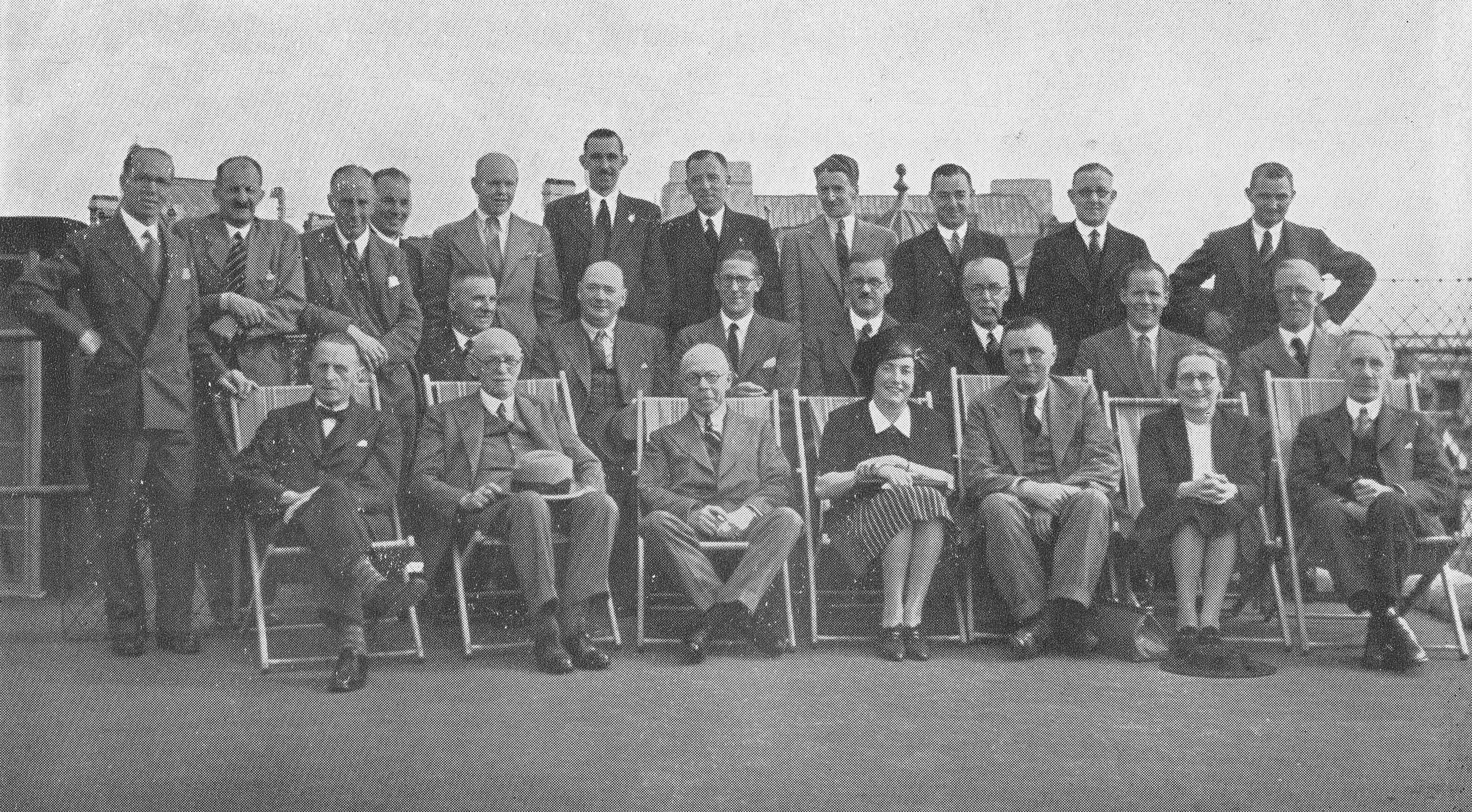
The company also appears to have had a very paternalistic approach and was very male dominated as were the majority, if not all of City companies of the time. A photo in the book taken on the roof shows the buyers meeting. Of the 25 staff of buyers, only two were female.

29th December 1940

Hitchcock Williams & Co rebuilt their operations during and after the war and continued trading, however changing tastes, foreign competition and the economic recession of the early 1980s all took their toll and Hitchcock Williams closed in 1984. The company had been trading for 149 years and when it closed a fifth generation Williams was a Director of the company.

The area around St. Paul’s Churchyard and Paternoster Row are very different today, having been rebuilt twice since the destruction of the 1940s. Nothing remains of the buildings of Hitchcock Williams, however it is intriguing to wonder if the remains of their 500 foot deep artesian well can still be found somewhere deep under the current incarnation of buildings – something for future archaeologists to wonder about.

To close, here is a poem from the book which describes what must have been the feelings of those who looked over the bombsites of buildings that had been a significant part of their lives:

City Street, 1942

Desolate and gaunt the ruined buildings brood,

And gargoyles from a long dead sculptor’s mood

Still peer, unseeing, grinning in the dust,

Athwart with twisted girders etched with rust,

Who looks unmoved upon these rubbled mounds

Which once knew friends, and heard familiar sounds?

Has compensating Nature spread its gown

Far from the Country to the heart of Town?

Where basements newly greet the sun and showers,

And nourished rockeries grow Summer flowers

My thoughts rebuild the place I used to know

And sadness comes unbid; my voice is low.

alondoninheritance.com

Chichester Market Cross And The First Fatal Railway Accident

The main aim of this blog is to trace the location of my father’s photos of London. He also took many photos across the country whilst out cycling between youth hostels in the late 1940s and early 1950s and I occasionally take a trip out of London to explore the location of these photos. For this week’s post I find the Chichester Market Cross, a link with London and the first fatal railway accident.

This is the Chichester Market Cross photographed in 1949.

Chichester Market Cross

The same view of Chichester Market Cross, 69 years later in 2018.

Chichester Market Cross

Market crosses were mainly built during the medieval period and often formed a hub for a market, with the Cross providing a location where transactions could be formerly validated. They also served other functions in the daily life of a town, for example as a central point for meetings, preaching, proclamation through both verbal announcements and the use of posters.

They came in many forms, from a basic cross through to the highly ornate structure that forms Chichester Market Cross. The complexity of the design was usually down to the level of funding available and the importance of the primary sponsor.

A view of the Chichester Market Cross in 1797 (©Trustees of the British Museum).

Chichester Market Cross

The Chichester Market Cross was constructed in 1501 and was funded by Bishop Edward Story who allowed the poorer residents of the town to trade basic goods without payment of a toll, provided they did so within the confines of the market cross.

The stone market cross we see today is not the first, it replaced a wooden structure that dated from the 14th century.

The market cross is much the same as when first built, however there has been damage to the decoration of the cross over the years, particularly during the Civil War. The market cross has been repaired over the years and in 1724 a belfry and clocks were added so the market provided a central reference for the time.

The Chichester Market Cross is Grade I listed, and the English Heritage listing states that the cross is believed to have originally stood in a large market place, rather than the small space within the town centre of today. Over the centuries, surrounding buildings have gradually encroached on the structure and taken up space allocated to the market, particularly after 1808 when the market moved location to find a larger space to serve the growing town.

The central location of the market cross is indicated by the names of the fours streets that radiate out from the market cross. They are North, East, South and West Streets with Chichester market cross sitting in the centre of a compass laid out in the streets.

Another drawing of the market cross, with the spire of Chichester Cathedral in the background (©Trustees of the British Museum).

Chichester Market Cross

Chichester Cathedral is a magnificent building. It is believed to be built on an earlier Saxon church dedicated to St. Peter. Construction of the cathedral was down to a decree by the Council of London in 1075 that seats of Bishops should be in towns rather than villages. The local bishopric was based in the village of Selsey so in the early 12th century the construction of the new cathedral building commenced.

Chichester Market Cross

The majority of construction was completed by the early 15th century when around this time the spire was completed. Over the centuries the building has been through numerous renovations, additions and changes. Fires during the first centuries when construction was ongoing, and severe damage to the internal decoration during the Civil War, however the most significant event occurred in 1861 when the original central tower and spire collapsed.

Cracks had been observed in the piers supporting the tower and spire in the months preceding the collapse, and the Illustrated London News of the 2nd March 1861 recorded the events that led up to the collapse:

“After the usual Sunday services in the nave, which had been temporarily screened off, the church was taken possession of by workmen, who have, with but little intermission, pursued their task by night and day down to the hour of the final catastrophe. It soon became evident that the heart or core of the piers was rotten; the task of sustaining a weight on each pier exceeding 1400 tons thrust forward the facing on every side, and when the masonry was restrained in one place by props and shores the restraint caused it to bulge on the adjoining surfaces faster than it was possible to apply remedies. The terrific storm of wind on Wednesday night caused these difficulties to increase with alarming rapidity; but the efforts of sixty workmen appeared still to offer some possibility of ultimate success when, at three hours and a half past midnight they quitted the building.

On their return however, after less than three hours’ absence, it was found that the shores and braces exhibited many signs of suffering from the enormous strains to which they had been subjected. The force of men was increased, and various expedients to strengthen what was strained were put into requisition.  The crushing and settlement of the south-west pier poured out, crushed to powder, and the workmen were cleared out of the building, and the noble spire left to its fate. Not more than a quarter of an hour later the tower and spire fell to the floor with but little noise, forming a mass of near 6,000 tons of ruin in the centre of the church, and carrying with it about 29ft in the length of the end of the nave, and the same of the transepts and choir.

The spire in its fall, at first inclined slightly to the south-west, and then sank gently into the centre of the building. The appearance of the fall has been compared to that of a large ship quietly but rapidly foundering at sea.”

The Illustrated London News quickly dispatched one of their artists to draw the following print of the collapsed tower and spire, and the severe damage to the building.

Chichester Market Cross

The spire was quickly rebuilt in 1866 by Sir George Gilbert Scott and reaches the height of 82 metres.

Entrance to Chichester Cathedral:

Chichester Market Cross

Surrounding buildings makes it difficult to get a good view of the cathedral, however this view from 1812 provides a good impression and shows the original tower and spire, confirming that the later 19th century rebuild is very similar to the original (©Trustees of the British Museum).

Chichester Market Cross

Chichester Cathedral is unusual for the location of the bells. In the above drawing, there is a large tower to the left of the cathedral building. This is the separate bell tower:

Chichester Market Cross

There is no firm date for the construction of the tower, however it appears to date from the early 15th century. There is no written explanation from the time as to why a separate bell tower was needed. One theory appears to be concerns that vibrations from the bells in the main tower could have caused damage to the tower and steeple, therefore a separate tower was constructed to house the bells.

Time to visit the interior of the cathedral. The view along the nave to the main entrance.Chichester Market Cross

The screen separating the nave from the choir.

Chichester Market Cross

The choir.

Chichester Market Cross

As could be expected in a church of this age, numerous monuments, tombs, carvings and artworks can be found around the church.

This is one of two carved panels, currently under restoration, depicting the raising of Lazarus. Dating from around 1125, they were concealed for many centuries, only being rediscovered in 1820 and installed in their current location.

Chichester Market Cross

There is one historical display that personally, I found the most interesting in its dimensional representation of layered buildings and time. Set into the floor is a clear panel with the interior space brilliantly lit.

Chichester Market Cross

Peer below the surface of the floor to find part of a Roman mosaic.

Chichester Market Cross

An adjacent information panel informs that this is a section of a second century mosaic belonging to part of a large Roman building that extended under the cathedral wall. Remains of part of the Roman city of Noviomagnus which lies about a metre below the surface of modern Chichester.

It is a brilliant way to display the mosaic. It demonstrates the physical layers of history in that the Roman city is below the current cathedral floor, as well as the layers of time, standing in the 21st century on the floor of a cathedral started in the 12th century, looking at the remains of a building from the 2nd century – it gets the imagination going.

There are many tombs around the cathedral, including that of Joan de Vere, daughter of Robert, Earl of Oxford who died in 1293.

Chichester Market Cross

In the south transept are a series of paintings on wood from the 16th century by Lambert Barnard, court painter to the Bishop of Chichester.

Chichester Market Cross

This is the Arundel Tomb with the figures of Richard Fitzalan, the 3rd Earl of Arundel and his second wife Eleanor “who by his will of 1375 were to be buried together without pomp in the chapter house of Lewes priory“. After the dissolution the tomb, along with some others now in Chichester, were moved from Lewes into the cathedral.

Chichester Market Cross

To understand one of the unique aspects of the Arundel Tomb, you need to look at the detail of the two figures:

Chichester Market Cross

The legs of Eleanor appear crossed and turning towards her husband. The right hand of Richard is across to Eleanor and they are holding hands. A sign close by the tomb informs that the hand holding was originally though to have been due to 19th century restoration, but recent research has confirmed that it is original.

This display of affection by a knight is highly unusual for the 14th century.

Close by there is a monument from several centuries later. This is the monument to William Huskisson.

Chichester Market Cross

The text underneath the statue provides some background:

“To the memory of William Huskisson, for ten years one of the representatives of this city in Parliament. This station he relinquished in 1823. When yielding to a sense of public duty he accepted the offer of being returned for Liverpool for which he was selected on account of the zeal and intelligence displayed by him in advancing the commercial prosperity of the empire. His death was occasioned by an accident near that town on the 15th of September 1830, and changed a scene of triumphant rejoicing into one of general mourning. At the urgent solicitation of his constituents he was interred in the cemetery there amid the unaffected sorrow of all classes of people.”

William Huskisson has the unfortunate distinction of being the first fatality from a railway accident in Great Britain. The following extract from “The Face of London” by Harold Clunn explains:

“Huskisson was killed by a locomotive at the ceremonial opening of the Liverpool and Manchester Railway on 15 September 1830. The procession of trains had left Liverpool, and at Parkside, the engines stopped for water. Contrary to instructions, the travellers left the carriages and stood upon the permanent way. Huskisson wanted to speak to the Duke of Wellington, and at that moment several engines were seen approaching along the rails between which he was standing. Everybody else made for the carriages, but Huskisson, who was slightly lame, fell back on the rails in front of the locomotive Dart, which ran over his leg; he was carried to hospital, where he died the same evening.”

The London connection is that there is also a statue of William Huskisson in Pimlico Gardens. The following photo is from my post on the area and shows Huskisson in a very similar style, looking more like a Roman senator than an English MP.

Chichester Market Cross

There must be a Roman theme as a statue of Huskisson was also commissioned for display in Liverpool. The following drawing from the Illustrated London News shows the Liverpool statue looking very similar to those in Pimlico and Chichester.

Chichester Market Cross

The text with the drawing provides a possible explanation in that the Liverpool statue was cast in Holland from a statue executed in Rome by Gibson (John Gibson, the sculptor born in Wales in 1790, and who provided works of the Duke of Devonshire and a statue of Queen Victoria for Buckingham Palace). So poor old Huskisson has ended up in all his public sculpture looking like a Roman Senator, although I suspect he will always be known as the victim of the first, fatal railway accident.

The interior of Chichester Cathedral is magnificent, however there is more to explore outside as the cathedral has extensive grounds surrounding the building.

Firstly a wonderful set of cloisters, walled on one side and perpendicular windows on the opposite side.

Chichester Market Cross

Alleys and lanes thread their way through the buildings in the cathedral grounds, and provide wonderful glimpses of the cathedral. This is St. Richard’s Walk. Hard to imagine the sight described in the Illustrated London News of the collapse of the tower and spire.

Chichester Market Cross

Canon Lane runs roughly east to west along the southern edge of the cathedral grounds. At each end of Canon Lane there is a substantial gatehouse.

Chichester Market Cross

This is the gatehouse leading from Canon Lane into South Street, one of the four main streets radiating out from the market cross.

Chichester Market Cross

The gatehouse as seen from South Street,

Chichester Market Cross

Chichester market cross is another of my father’s photos I can tick off, but by going to these locations they provide the perfect opportunity to explore the wider area and Chichester is a fantastic place to explore and I have only touched on the cross and cathedral.

The Roman mosaic on display beneath the floor of the cathedral was for me, the most fascinating. Seeing this type of feature always heightens my awareness that we are walking on layers of history and time. Southwark Cathedral has a very similar feature, as does All Hallows by the Tower.

alondoninheritance.com

Marylebone Lane And Welbeck Street Car Park

London is so built up that it is hard to imagine that anything from the original rural environment remains. Major streets tend to follow much earlier alignments, and there is one street north of Oxford Street that still follows the same route from the time when the street ran through fields. This is Marylebone Lane.

In the following map extract, Oxford Street is the orange street running from the bottom left corner, across the map to the right. Just to the right of the middle of the stretch of Oxford Street shown below, there is a pair of streets, forming a triangle and branching northwards. This pair of streets then combine and continue northwards. The angled and curving shape of the street stands out from the grid pattern of the surrounding area.

Marylebone Lane

Map  © OpenStreetMap contributors. 

Back in 1746, when John Rocque was mapping London, this area was on the edge of the built city. In the map extract below, the top of the triangular section can just been seen at the bottom of the map. Marylebone Lane then runs northwards with the same outline as can be seen today. The first evidence of the grid layout of streets that will soon cover the whole area can be seen in the lower right corner. Fields cover much of the rest of the map with the formal Marybone Gardens at the top of the map.

Marylebone Lane

On an autumn afternoon, I went for a walk along Marylebone Lane, trying to imagine the fields, ponds and streams that once lined the lane, as well as discovering how Marylebone Lane acted as a boundary between the estates and developments that were springing up on either side of this old lane in the 18th century.

I also wanted to take some photos of Welbeck Street Car Park before what now looks like a certain demolition and replacement with a hotel building that will look similar to so many other hotels across London.

I turned off a very busy Oxford Street into the relative quiet of Marylebone Lane, passing the bulk of the Debenhams store, to the junction with Henrietta Place where I turned round to see the two branches of Marylebone Lane, with the triangular plat of land in the middle.

Marylebone Lane

This plot of land and the split of Marylebone Lane can be seen in detail in the following extract from Rocque’s map.

Marylebone Lane

Today, the road at the bottom is Oxford Street. In 1746, according to Rocque, the junction with Marylebone Lane appears to mark the junction where the name Oxford Street ends, and the name Tyburn Road takes over and continues up to Tyburn, roughly where Marble Arch is today. This change of names as streets cross Marylebone Lane will be a recurring theme.

Before the expansion of London built over these fields, Marylebone Lane ran from Tyburn Road, through the village of Marylebone to what were the northern parts of the parish, and ended within the current location of Regent’s Park.

In 1746 Marylebone Lane still ran the full length of this route, however building in the later half of the 18th century, including construction of Marylebone High Street, truncated Marylebone Lane to the southern portion of the route, so the section we can walk today is only part of the original full route.

The triangular plot of land, with the frontage onto Tyburn Road / Oxford Street has long been a significant location. Originally home to the parish church of Tyburn, then the first church of St. Marylebone, then being the location for a number of administrative functions for the parish, including a court and watch house. The book “London” by George H. Cunningham (1927) simply refers to this plot of land “Supposed to be the site of the ancient church of Tyburn, from a mass of skeletons that were dug up here in 1724”.

The watch house was photographed in 1920 and shows the same triangular layout with the two branches of Marylebone Lane leading down to Oxford Street.

Marylebone Lane

Image credit: London Metropolitan Archives, City of London: catalogue ref: SC_PHL_01_316_79_7322

The first junction we come to is that with Henrietta Place, or Henrietta Street as it was in 1746. The map at the top shows that a short distance along Henreitta Place, there is a junction with Wellbeck Street, today the street name only has a single L.

It is between Marylebone Lane and Welbeck Street that we can find the Welbeck Street Car Park.

Marylebone Lane

Proposals for post war planning of the city all generally accepted that there would be rapid growth in the numbers of cars that the city would have to accommodate. This led to some schemes that did get built, such as the Upper and Lower Thames Street through route, as well as many schemes that fortunately did not get built. I will write about some of these schemes in a future post. Actively accommodating the car continued through the closing decades of the 20th century and one result was the rather wonderful Welbeck Street Car Park.

The car park, designed by Michael Blampied and Partners for the adjacent Debenhams store was built between 1968 and 1970. It was a condition of approval for the Debenhams store that the car park was built as Westminister Council’s planning regulations required developments such as the store to have appropriate parking facilities.

Internally, it is a functional, multi-storey car park, but externally it has a remarkable design with prefabricated concrete diamonds covering all floors above the ground floor.

The car park is under threat of demolition after having been purchased by a developer with the intention of building a hotel on the site. Attempts have been made to get the building listed, or alternate uses which retain the exterior fabric of the building, but these appear to have been rejected and demolition awaits.

Marylebone Lane

The building is stunning from a distance, but get up close and the repetition of the triangular concrete shapes creates some fascinating patterns. I wonder if it is just coincidence that the triangular shape mirrors the shape for the land opposite the car park, where Marylebone Lane reaches Oxford Street?

Marylebone Lane

The car park from the junction of Henrietta Place and Welbeck Street.

Marylebone Lane

Leaving the Welbeck Street car park, and continuing along Marylebone Lane, we come to the junction with Wigmore Street.

In 1746 this street was named Wigmore Row and came to an abrupt halt at the junction with Marylebone Lane as the land to the west was still field, and had yet to be developed.

The following photo is in Marylebone Lane, looking across Wigmore Street. On the left can be seen the curving, continuation of Marylebone Lane. The slightly offset continuation of the street is the same as shown in the 1746 map.

Marylebone Lane

In 1746, the area directly opposite was field and just behind where the buildings now stand there appear to have been a couple of large ponds.

This is looking along Wigmore Street towards the west and shows the straight street approach of the grid layout in the area which helps Marylebone Lane stand out as being different, and older than the rest of the area.

Marylebone Lane

Although the 18th century onward developments follow a grid pattern, there are still many, small side street, alleys and mews. These provide access to the central core of the buildings within the square of the grid. The pub directly opposite Marylebone Lane is the Cock and Lion and the entrance to Easleys Mews takes up part of the ground floor space of the pub.

Marylebone Lane

In the 18th century, the area was very different. The following print from 1759 is titled “View of Marylebone from Wigmore Row”

Marylebone Lane

One of the City Conduits that stood near Marylebone Lane is shown in the print. In the large field north of Wigmore Row in the 1746 map there is a small black dot labelled conduit.

Crossing over Wigmore Street, we continue along Marylebone Lane and the curved nature of the street is apparent.Marylebone Lane

Marylebone Lane retains a number of one off shops, including the hardware store Penton’s which claims to be the oldest store on Marylebone Lane having been established in 1841.

Marylebone Lane

At number 35 is Paul Rothe & Son. If you look to the left of the shop there are several pages of information which tell the fascinating story of the shop.

Marylebone Lane

Paul Rothe was a German who worked his way to London in 1899 and opened a delicatessen on Marylebone Lane in 1900. The store has been in the same family ever since.

We now come to the junction with Bentinck Street, another of the wide streets that cut east – west across the old lane. The slightly curving Marylebone Lane can be seen directly across the street.

Marylebone Lane

On the corner of Bentinck Street and Marylebone Lane is the Coach Makers Arms.

Marylebone Lane

The current building dates from the early 1900s, however there has been a pub on the site since the 18th century. The pub has been through a couple of name changes (the O’Conor Don and the Conduit of Tybourne) but has returned to the original name for the pub.

Looking east along Bentinck Street, again showing the straight streets that make up the grid layout of this area of Marylebone.

Marylebone Lane

Bentick Street ends at the junction with Marylebone Lane and continues on as Hinde Street. These name changes in otherwise straight streets shows how Marylebone Lane acted as a boundary as estates developed in the area with separate estates to the east and west of the lane.

As we cross over Bentinck Street / Hinde Street, the Hinde Street Methodist Church can be seen to the left.

Marylebone Lane

The first Methodist Chapel was built on the site in 1810 and the current building dates from 1887.

Continuing along Marylebone Lane, the next junction is with Bulstrode Street and on the corner is another 19th century pub, the Golden Eagle, described on the corner sign as an “Imbibing Emporium”.

Marylebone Lane

Unlike the Coach Makers Arms, the Golden Eagle retains the feel of a local London pub. Lacking the expensive refurbishment and decor, the pub is the perfect stop for a “local” drink and has a wonderful atmosphere.

Marylebone Lane

The pub provides more evidence of how Marylebone Lane acted as a boundary as the area developed. Just below the Bulstrode Street sign, there is a painted sign on the brickwork stating that the name was “Late William Street”.

Marylebone Lane

Although today, Bulstrode Street is the name of the full length of the street that cuts across Marylebone Lane, originally, Bulstrode Street was the name of the street up to the Marylebone Lane junction. From then on, the street continued as William Street.

It is fascinating to see how this ancient lane provided a boundary as the estates developed from the mid 18th century onward and these boundaries can still be seen, reflected in the street names we see today.

Opposite the Golden Eagle is the haberdashery shop of V V Rouleaux. brilliantly decorated to reflect the colour of the goods for sale inside the shop.

Marylebone Lane

Crossing over Bulstrode Street takes us into the final section of what remains of Marylebone Lane. There is a new building on the north eastern corner of the junction which has an interesting stained glass art work that records another feature of the area.

Marylebone Lane

A plaque alongside the window provides these details:

“Light in the Darkness 2000 by Julian Stocks. This stained glass window celebrates the River Tyburn that flows beneath Marylebone Lane….it takes the form of a lantern which, when illuminated will act as a beacon. During the 18th century the River Tyburn was an open stream that ran from the hills of Hampstead Hearth down to the River Thames. Marylebone Lane follows the banks of the river, the course of which has since been culverted, but still maintains a presence most noticeable in it’s serpentine form.”

The Tyburn is possibly one of the reasons for the route of Marylebone Lane, if the lane did follow the bank of the river. Nicholas Barton in his book “The Lost Rivers of London” (1960), provides the following background:

“Marylebone Lane was originally on the left bank of the stream, and its winding line indicates the course of this part of the steam”. The book includes a photo from 1957 showing a muddy stream at the bottom of some sewer excavations in Marylebone Lane. Whilst it would be hard to prove that this was the Tyburn, it does show that there is running water beneath the ground.

Continuing on from the junction with Bulstrode Street, we now reach the point in Rocque’s 1746 map where Marylebone Lane makes a sharp left turn at the junction with another street that runs in from the east. The same turn to the left can be seen today.

Marylebone Lane

A road still joins from the east, although today this street (Bulstrode Place) is a short street terminated by buildings with no exit.

This is the view looking west at the turning point with the last short run of Marylebone Lane before it meets with Thayer Street, the street marked on the Rocque map as St. Mary Le Bone which ended here rather than continuing on down to Hinde Street, as Thayer Street does today.

Marylebone Lane

At this corner, Cross Keys Close, one of the many little mews and dead end streets that lead  from Marylebone Lane, can be found. Cross Keys Close was developed in the 1760s. These little side streets provide access to the centre of the blocks built within the grid pattern of streets.

The view from within Cross Keys Close, looking down Marylebone Lane.

Marylebone Lane

And at the end of Marylebone Lane is Thayer Street. This is the view looking back into Marylebone Lane. On the right is the pub, Angel in the Fields.

Marylebone Lane

This pub can be found on the 1746 map. Where Marylebone Lane turns left and meets the road marked as St. Mary Le Bone, at the junction there are a number of buildings. The lower right building within a small patch of land with trees edging the boundary, is the Angel pub. The pub was first recorded in 1720, and was rebuilt in 1770 as the area was being developed.

The “in the Fields” addition is from the refurbishment of the pub in 2001.

This is the view north from the junction with Thayer Street where it becomes Marylebone High Street. Another example of the straight streets that contrast with the narrow, winding nature of Marylebone Lane.

Marylebone Lane

John Rocque’s map provides a glimpse of this part of London, when fields, streams and ponds still cover the land. The future for the area can be seen in the lower right of Rocque’s map as the grid of streets and buildings continues London’s northward expansion.

Walking Marylebone Lane is to walk a street that existed long before the buildings that now dominate the view. The street also acted as a boundary between the estates and developments on either side. evidence of which can still be seen in the way that the names change of the long, wide streets as they cross this narrow lane.

Having walked the lane, rather than return to the crowds of Oxford Street, the best option was to continue an almost 300 year tradition, and stop for a drink in the Angel.

alondoninheritance.com

A Return To Bermondsey Wall – Bevington Street, George Row And Bridge House

A couple of months ago, I featured a photo that my father had taken in Bermondsey. He had written the following notes to explain when and where the photo was taken “Flockton Street looking south from Bermondsey Wall. 19th century slum dwellings ravaged by the blitz – Summer 1948”. When I visited what remains of Flockton Street I was doubtful that this was the right location. Many features of the existing streets and in the photo did not line up.

I am really gratefull to a number of readers who identified the correct location as being Bevington Street in Bermondsey, and that a couple of the features in the original 1948 photo can still be seen to confirm. A quick look at Google Streetview clearly showed the location, however I was not content just to use Streetview as the purpose of this project is to revisit and photograph from the same viewpoints as in my father’s photos, so a couple of weeks ago I took another walk to Bermondsey to photograph Bevington Street – a location I have walked past a number of times, but for reasons I will explain later in the post, I was looking in the other direction.

My revisit also enabled the location of another photo to be confirmed, and I also found the location of a building photographed for the Wonderful London series of books published in 1926.

This is the view of Bevington Street from Bermondsey Wall photographed by my father in 1948:

Bermondsey Wall

And this is the same view today:

Bermondsey Wall

There are only two features that remain the same, but serve to confirm the location. The school on the left and the small brick building on the right which now appears to house an electrical substation – remarkable that in all the redevelopment of the area this small building has survived.

So where is Bevington Street? The following extract from the 1940 Bartholomew’s Atlas of Greater London shows the location. Bevington Street can be seen just to the right of the large Y. The school is further to the right, just across Farncombe Street.

Bermondsey Wall

Flockton Street, the wrongly identified location can be seen to the left, leading off from Bermondsey Wall, so these streets are very close. I suspect my father wrote up his notes for the photos after developing the negatives and looking at his route on the map, accidentally picked the wrong street.

I have used this 1940 map as it helps to explain a feature that can be seen today.

Bevington Street ends at Bermondsey Wall, and directly across from Bevington Street, between Bermondsey Wall and the River Thames is Fountain Green Square. The following photo is the view from the end of Bevington Street, looking across Bermondsey Wall to Fountain Green Square.

Bermondsey Wall

The name is very appropriate as there is a central green with a stone fountain in the centre. New housing is arranged around two sides of the green and the River Thames is alongside the far side of the green.

Looking back at the 1940 map and there is a feature here called Fountain Dock. The 1895 Ordnance Survey Map provides some additional detail and shows the shape and location of Fountain Dock.

Bermondsey Wall

Credit: ‘Reproduced with the permission of the National Library of Scotland’ 

The Southwark Council Conservation Area Appraisal (February 2013) confirms that the site of Fountain Green Square was the site of Fountain Dock, and that the dock was one of the few dry docks that operated along this part of the river.

Checking the overlay feature on the National Library of Scotland site, the dry docks appears over the easterly part of the green and partly under the houses on the eastern edge of the green, rather than occupying the full space of the green.

I checked the London Metropolitan Archives, Collage site and there are two photos from 1929 that show the dry dock. The first is looking from the north west corner of the dock, back towards where Bermondsey Wall runs right to left.

Bermondsey Wall

Image credit: London Metropolitan Archives, City of London: catalogue ref: SC_PHL_02_0912_A52734

The second photo, also from 1929, is looking from the south east corner of the dock, towards the river and the direction of the City.

Bermondsey Wall

Image credit: London Metropolitan Archives, City of London: catalogue ref: SC_PHL_02_0912_A5273

These photos from 1929 show Fountain Dock much as it must have been in the 19th century. Dry docks are important as they allow the hull of a ship to be inspected and worked on. The ship was moved into the dock, gates to the river closed and water pumped out from the dock, so somewhere alongside there must have been a building that housed the pump.

In an advert for the dry dock in Lloyd’s List on the 13th May 1893, the dimensions are given as a length of 161 feet and depth of 16 feet. The dock was owned by Mills & Knight who also owned the larger Nelson Dry Dock in Rotherhithe.

In addition to numerous adverts for the dry dock, 19th century newspapers included reports of accidents at the dock, as well as ships for sale. It appears to have been standard practice to offer a ship for sale when the ship is in dry dock for repair. The earliest example I could find was from the Shipping & Mercantile Gazette on the 27th August 1850, when the following ship was in Fountain Dry Dock and advertised for sale:

“The A1 Liverpool-built Barque BRAZILIAN, 345 tons, now lying in the Fountain Dry Dock, and ready for inspection; is in the course of re-coppering, &c., and, if not sold within a reasonable time, will be sent out again by her present owner. Length, 107 feet; breadth, 23 1-10 feet; depth 13 3-10 feet; carries a large cargo at an extraordinary light draught of water, and shifts without ballast”.

The following photo is the view taken from roughly the same viewpoint as the above photo. Today there is a fountain in the centre of the green.

Bermondsey Wall

The 1895 Ordnance Survey Map does not show a fountain, so I do not know if the fountain was moved here when the green was created to provide some relevance to the name. I doubt the fountain was here originally as it looks of rather fine construction to have been in such an industrial area – however I also do not know how Fountain Dock was named.

The origin of the name Bevington Street is interesting. When looking for this street on the 1895 OS map, whilst the street is there, in 1895 is was named Princes Road. It had changed to the current name sometime between 1895 and the 1940 map.

Although I have not been able to find any written confirmation of this, I suspect the name change may have been in the first decade of the 20th century. Bevington probably refers to Colonel Samuel Bourne Bevington. 

When Bermondsey Borough Council was formed in 1900, Samuel Bevington was the first mayor and he was reelected the following year. He came from the family that had established  Bevington and Sons, a company that manufactured leather products at Neckinger Mills in Abbey Street, Bermondsey. He was also a Colonel of the West Surrey Regiment, Justice of the Peace, on school boards and coming from a Quaker background, used family money to support a number of philanthropic activities.

Samuel Bourne Bevington died on the 14th April 1907 leaving a considerable estate to the value of £133,195. His will included money to provide income for four men and four women over the age of 60 who had been engaged in the leather trade.

Because of his role in the leather trade in Bermondsey, that he was the first mayor of Bermondsey Borough Council, and his other activities, I suspect that after his death, the council looked at ways to commemorate him, and one of the ways within their power was to rename one of the local streets, so Princes Road became Bevington Street.

There is much else of interest to be seen from the junction of Bevington Street and Bermondsey Wall.

A very short distance to the east along Bermondsey Wall is a rather unique, listed pub – the Old Justice.

Bermondsey Wall

The pub, as with so many London pubs, has closed, however the building is Grade II listed.

The reason for the listing is that the pub is a rather well preserved example of a style of pub design from the inter-war period. The majority of Victorian London pubs were small and focused on drinking. The design initiatives after the First World War, focused on improving the pub environment, the provision of space for other activities apart from basic drinking, for example with the provision of restaurant space and a function room.

The Old Justice was designed by Sidney C Clark in 1933 for the Hoare & Co brewery. It followed a mock Tudor design that was frequently used on many pubs of the period.

Hoare & Co were taken over by Charringtons and the pub has a pair of Charrington lanterns on the frount, these probably date from the 1960s.

Bermondsey Wall

Alongside one of the lanterns is a plaque recording that Sir Paul McCartney used interiors and exteriors of the Old Justice as locations in his film “Give My Regards To Broad Street” and in the music video to “No More Lonely Nights”.

As well as the pub, the film also has some fascinating shots of the front of the warehouses along the Thames in Bermondsey.

I looked in through the windows of the Old Justice and the interior looks to have been reasonably well gutted, although the wooden paneling remains on the walls and the fireplace is still intact.

The Old Justice is just to the east of the junction of Bevington Street and Bermondsey Wall. To the west is another building that is earlier than the majority of buildings in the area. This is Fountain House:

Bermondsey Wall

I am not sure when Fountain House was constructed, or whether the name is original. however it did feature in another of my father’s photos of Bermondsey. I have now been able to identify the following photo as having been taken in Loftie Street, which runs parallel to part of Bevington Street.

Bermondsey Wall

The rear of Fountain House is on the left of the photo, but what confirmed the location was the rear of the electrical substation building that was one of the surviving features in the photo of Bevington Street. The rear of this building can be seen in the above photo, to the right of Fountain House.

The houses are the rear of the houses that front onto Bevington Street. Washing is hanging to dry at the rear of one house, and I am fascinated by the height of the chimneys on these houses.

What must be the remains of a bomb site is to the front of the photo.

I tried to take a photo from a similar position today, but it was not easy with the buildings and fences that now occupy the area, however in the following photo, the rear of Fountain House can be seen, and just to the right, a small part of the top of the rear wall of the electrical substation building is just visible.

Bermondsey Wall

There was one additional place I wanted to track down. When I was looking for Flockton Street, I walked along George Row, which runs parallel to the original route of Flockton Street. The name George Row was familiar and I recently remembered where I had seen the name.

In 1926 a three volume set of photos and articles titled “Wonderful London” was published and the first main photo in volume 3 was titled “The Bridge House In George Row, Bermondsey”.

Bermondsey Wall

The caption with the above photo read:

“Bermondsey has had its royal palace dating perhaps from Edward the Confessor, and it was only in 1805 that the North Gate of its Abbey was taken down. The building in the photograph is called the Bridge House, since it stands where a bridge was built over one of the creeks that entered the river and made, with what is called St. Saviour’s Dock, Jacob’s Island. This was a densely populated quarter a hundred years ago, and its many canals and ditches had a Dutch air, according to the chroniclers”.

George Row today is a wide street that runs from Jamaica Road down to Bermondsey Wall. There are no buildings that look like the above photo and I was doubtful that I could find the location, however I turned to the 1895 Ordnance Survey map, and at the northern end of George Row, close to the junction with Bermondsey Wall, there is a building clearly labelled Bridge House. The map also shows the steps leading down from the building with what appear to be steps leading down from the building on the eastern side and sidesteps on the western side. This would confirm that the photo from Wonderful London was taken of the eastern face of the building.

Bermondsey Wall

Credit: ‘Reproduced with the permission of the National Library of Scotland’ 

It was easy now to find the location of Bridge House, the map overlay feature helped confirm exactly where to look. Bridge House was not directly on George Row. In the above map there is a space, which appears to be open space between the building and street, and this configuration remains today.

The following photo shows the location of Bridge House today, with a 4 storey block of flats – Providence Square – now standing in what appears to be almost the same footprint of Bridge House.

Bermondsey Wall

It would be interesting to know why the new building did not extend to George Row. Developers tend to maximise the amount they can build and make use of every available bit of space and the area between the building and George Row serves no apparent purpose.

I walked up to the edge of the building to take a photo from roughly the same position as the photo from Wonderful London.

Bermondsey Wall

The caption to the photograph in Wonderful London explains the source of the original name for the building: “The building in the photograph is called the Bridge House, since it stands where a bridge was built over one of the creeks that entered the river and made, with what is called St. Saviour’s Dock, Jacob’s Island”.

There are no signs of the creek today, however maps provide some indications.

In the 1895 Ordnance Survey map the word Neckinger can be seen running alongside George Row. This refers to the River Neckinger. I have read many different accounts of where the Neckinger entered the River Thames, most claim that St. Saviour’s Dock was the main estuary of the Neckinger into the Thames, however this was always low lying marsh land, and there have been many canals and ditches built in this area (I mentioned the 19th century walled drain in my post on Flockton Street, and the outline of this drain can still be seen running across the street).

The book “Bermondsey, Its Historic Memories And Associations” written by E.T. Clarke and published in 1902 provides a location for the creek and bridge. The book includes the following map of the area.

Bermondsey Wall

The so called Jacob’s Island is in the centre of the map, bounded by the Thames at the bottom of the map, St. Saviours Dock to the right, a canal running alongside London Street to the top, and on the left, a canal running along the full length of George Row.

Based on the locations of streets that can still be found today, I have circled in red the bridge that gave Bridge House its name.

This is pure speculation, but it may be that Bridge House is the rectangular building on the above map to the lower right of the red circle.

I do not know when this canal or extension of the Neckinger was filled in – it had disappeared by the time of the 1895 map, but it is interesting that the open space between George Row and the building that now occupies the location of Bridge House would have been where the canal ran.

Finding the location of Bridge House helps to understand how this area has developed over the centuries. Fountain Green Square provides a link to the dry dock that once occupied the site, and Bevington Street records the first mayor of Bermondsey and the leather industry of area.

Finding Bevington Street means I can tick off another of my father’s photos from 70 years ago. My thanks again to everyone who identified the correct location of the photo.

alondoninheritance.com

The Angel Rotherhithe

There are many good reasons for a walk along the River Thames, east from Tower Bridge to Rotherhithe. Views over the river, the historic streets, historic architecture and a number of excellent pubs. One of which is the subject of this week’s post – The Angel Rotherhithe.

My father took the following photo of the pub from the foreshore of the river in 1951:

Angel Rotherhithe

I have been meaning to take a photo of the same view for a couple of years, however my previous walks here have been when the tide has not been low enough, or last year when the tide was low, but the pub had scaffolding around the building.

I was lucky on my recent visit as the tide was low, building work had finished and after some early morning rain, the weather was improving. This is the same view of the Angel Rotherhithe in 2018 from the foreshore of the River Thames:

Angel Rotherhithe

The pub looks much the same despite the 67 years between the two photos. Cosmetic changes, and I suspect some of the woodwork has been replaced.

There is one aspect of my father’s original photo that is a mystery. If you look along the balcony facing the river, there is a wooden panel with what appears to be two badges. I have zoomed in on the original negative scan and I cannot make out what they are. I have enlarged and cropped these out to show in the photo below:

Angel Rotherhithe

They both look to have some form of cross. The lower with a darker cross is a bit more clear than the one above. I do not know if the lower badge is that of the City of London.

They are on the balcony facing the river, so I suspect have some relevance to the working river. I would really appreciate any information as to what these symbols may mean.

There is easy access to the foreshore here, there are stairs just to the right side of the pub in the above photo, these are the Rotherhithe Stairs with a better view in the photo below:

Angel Rotherhithe

A short distance along the river to the east are another set of stairs, the stairs I used to walk down to the foreshore, shown in the photo below. These are the modern replacement for the King’s Stairs. One of the many sets of stairs that used to exist down to the river.

Angel Rotherhithe

From the foreshore it is possible to appreciate the tidal range of the River Thames. The green algae on the walls show the normal tidal range, with occasional high tides reaching further up the wall.

The King’s Stair’s and Rotherhithe Stair’s have been providing access to the river for many centuries. They were both shown on the 1746 Rocque map of London, although the Rotherhithe Stair’s were recorded as Redriff Stair’s (one of the earlier names for Rotherhithe).

Angel Rotherhithe

I suspect that the wooden posts supporting the balcony of the pub have been replaced since my father’s photo. The remains of the angled post shown in the 1951 photo can still be seen, the top part of the post showing considerable signs of decay. The posts also look as if the upper parts have been renewed but the lower section is older. The upper parts are smoother than the lower and they appear of different age.

Angel Rotherhithe

The Angel Rotherhithe is a wonderful early 19th century pub. Grade II listed and dating from the 1830s. The listing states that the building potentially includes material from a 17th century building that occupied the same position.  The entrance is on the westerly facing corner of the building, adjacent to the stairs leading down to the river.

Angel Rotherhithe

Over the years the pub has served the many, varied functions of a public house, over and above selling alcohol. It has hosted inquests, been the meeting place of clubs and societies, sales have taken place and the pub has been used as a contact address. Customers have occasionally attempted fraud (a common method appears to be demanding change when not originally having handed over any note or coin), along with the time in 1845 when the landlady was charged with allowing drinking in the Angel at 11 in the morning on a Sunday.

The Angel has open space on either side of the pub building. Space once occupied by the many working buildings along the river, but today transformed into a space to admire the full sweep of the Thames.

To the west of the Angel, a cat sits on the river wall.

Angel Rotherhithe

The cat is part of a group of figures by the sculptor Diane Gorvin titled “Dr Salter’s Daydream”.

Angel Rotherhithe

The Salter’s were a family who had a considerable impact on the lives of those living in Bermondsey.

Ada Brown was born in 1866 and moved to Bermondsey to work in the slums in one of the Settlements established across London. Alfred Salter was a student at Guy’s Hospital when he met Ada at the Bermindsey Settlement.

They married in 1900 and lived in Bermondsey. Both Ada and Alfred worked tirelessly to improve conditions in Bermondsey and Rotherhithe.

Ada became a Labour councilor, the first woman councilor in Bermondsey in 1909 and set about recruiting women workers to trade unions to organise against the terrible working conditions in the area’s factories.

Alfred was elected MP for Bermondsey in 1909, the same year as Ada was elected Mayor.

Health for those living in Bermondsey and Rotherhithe was not good. Tuberculosis was rife and average life expectancy was at the low end of what could be expected across the whole of London.

Long before the NHS they promoted free medical treatment and education on how hygiene could improve health and prevent disease.

These initiatives resulted in the death rate being reduced from 16.7 per 1,000 down to 12.9 per 1,000 of population in the five years following 1922.

Alfred worked on slum clearance programes whilst Ada focused on how the appearance of an area could improve living conditions, initiatives such as tree planting, public gardens and flower planting.

Ada died in 1942 and Alfred three years later in 1945. The group of statues next to the Angel reveal a tragedy in the lives of the Salter’s. The third statue, up against the river wall is that of a young girl. This is Joyce, their only child who died from scarlet fever in 1920, aged 8.

The title of the group is “Dr. Salter’s Daydream” and represents Alfred in his old age, dreaming of happier times with his wife Ada, their daughter Joyce and her cat.

I am not sure what Alfred would have thought with the statues being located next to the Angel pub as newspaper reports of his death included:

“An advocate of total abstinence, Dr. Salter once declared that he had seen many M.P.s drunk in the House and added that no party was exempt from that failing. He refused to withdraw the statement, and later spoke of Labour Members who ‘soak themselves until they are stupid’. Clergymen and ministers who drank in moderation, he declared, were worse enemies to the temperance cause than clergymen who were drunkards.”

He was also a pacifist. In coverage of local elections in 1907, the London Daily News reported that:

“Bermondsey’s other Councillor, Dr. Cooper, was also elected to Parliament last year. He immediately resigned from the L.C.C. and the seat was retained by Dr. Alfred Salter, who is again before the electors. Dr. Salter is a Quaker and life abstainer, and has resided at the Bermondsey Settlement for several years. He got his municipal training on the Bermondsey Borough Council. As a Passive Resister he has been to prison nine times.”

Dr. Alfred Salter in 1907:

Angel Rotherhithe

The open space next to the Angel provides some wonderful views of the river. Starting with the westerly view towards the City and Tower Bridge:

Angel Rotherhithe

Directly across the river to Wapping:

Angel Rotherhithe

Looking east along the river towards Shadwell:

Angel Rotherhithe

Three years before my father took the photo of the Angel at the top of the post, he took a river trip from Westminster to Greenwich and took photos along the way. The following photo shows the Angel in August 1948.

Angel Rotherhithe

Barges fill the river and large warehouses fill the space to the right of the Angel.

The large, flat roof warehouse was relatively recent. This was a bonded tobacco warehouse built in the 1930s in place of a previous 1907 warehouse (which was probably in place of earlier warehouses).

The LMA Collage archive includes a photo from 1956 of the Angle and the large, 1930s warehouse:

Angel Rotherhithe

Image credit: London Metropolitan Archives, City of London: catalogue ref: SC_PHL_01_040_81_9834

Surprisingly, given the size of the warehouse building, the remains of a much earlier building survived underneath. Much of the space that was occupied by the warehouse is now a large grassed space just to the south west of the Angel. There are the remains of some walls visible above the grass, the remains of King Edward III’s Manor House.

Angel Rotherhithe

Edward III reigned for a surprising long 50 years (for the fourteenth century) from 1327 to 1377. The manor house was constructed on a low lying island when much of the land here was still marsh.

The manor house consisted of a central open courtyard surrounded by buildings with a moat around three sides. The fourth side was open to the River Thames as the land on which Bermondsey Wall now runs had not yet been reclaimed.

There is no written record of why Edward III had a manor house in what must have been a rather damp and isolated place in the 14th century. The information panel states that there is documentary reference to the housing of the king’s falcons ‘in the chamber’ so perhaps it was the isolation and marshy land that provided the perfect place for falconry, at a location easy to access from the river and not far from the City.

The growth of industry eastwards from the City resulted in construction of embankments and walls along the river which cut off the house from the river by the end of the 16th century. The buildings were sold and used for a variety of purposes, before being integrated within the expanding warehouses along the river in the 18th and 19th century.

Some of the walls were still standing at the start of the 20th century when they were part of a 1907 warehouse.

The walls that remain above the current ground level may not look all that impressive (although to me, finding 14th century remains in Rotherhithe is impressive), however much of what was found when the site was excavated in the 1980s was buried for protection.

The buried southern wall includes the remains of what may have been a staircase. The manor house extended beyond the grassed area to include the houses that can be seen to the south and three medieval stone lined cesspits were found during excavations and preserved under these houses.

Excavations also identified a possible late Bronze Age ditch, two Roman pits and additional medieval features, so perhaps this area close the river was reasonably dry and attracted people to build, live and work here for many centuries.

The view from the opposite corner to the above photo, looking back over the remains of the manor house towards the Angel Rotherhithe.

Angel Rotherhithe

This is a fascinating area. Within such a small area there are two historic stairs down to the river, a group of statues commemorating a couple that did much to improve the conditions of the people of Bermondsey and Rotherhithe, as well as the grief they must have felt in the loss of their only child, along with the remains of a 14th century Manor House.

Angel Rotherhithe

The Angel Rotherhithe is also one of my favourite places to stand with a pint on a sunny day and watch the Thames flowing past.

alondoninheritance.com