Monthly Archives: February 2017

Gray’s Inn Place, Sun Yat-sen And A London Kidnapping

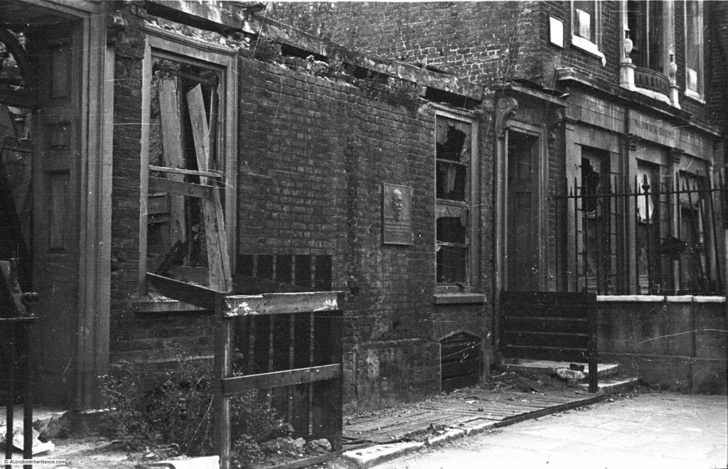
The subject of this week’s post is another post war photo taken by my father showing a bombed building with only the lower part of the front facade remaining.

The one distinguishing feature is the plaque on the remaining wall. The location is Gray’s Inn Place, a small gated area within Gray’s Inn. The gate separates Gray’s Inn Place from Warwick Court which leads down to High Holborn.

Gray's Inn Place, Sun Yat-sen

The same location today:

Gray's Inn Place, Sun Yat-sen

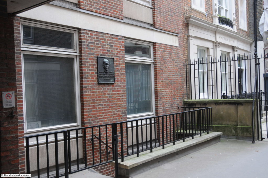
The building on which the plaque is now mounted is the City Law School. The building to the right is the same in both photos and appears to have been faithfully restored with the majority of the external features remaining the same.

The wall and railings in both photos also appear the same, confirming that the physical separation of Gray’s Inn from the local area has been in place for many years.

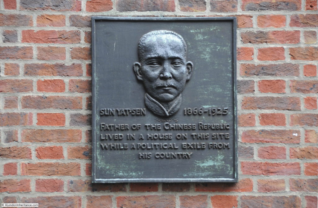
The plaque is to Sun Yat-sen and given that it appears to be undamaged in the post war photo, I have no reason to doubt that it is the same plaque in place today.

Gray's Inn Place, Sun Yat-sen

Sun Yat-sen is recognised as the father of the Chinese Republic and is honoured in both China and Taiwan. I am not going to attempt to explain his role in the complex Chinese politics of the time. I have read a number of histories and chronologies of his life on the Internet and it would take a much better understanding than I have of Chinese history at the end of the 19th Century and start of the 20th to try and explain his role. The key fact is that he was the first President of the Chinese Republic and worked to bring about a modern approach in a country that had been under Imperial rule for many centuries. In this post I will focus on his brief time in London and the affair that made headlines in the country’s newspapers in 1896.

Sun Yat-sen originally studied medicine at a college in China run by a Dr James Cantlie and qualified in 1892. Sun was also involved in a number of political activities including a coup attempt in 1895 which went wrong and resulted in Sun having to escape from China and a long period in exile.

In 1896 he arrived in London where he again met Dr James Cantlie who had returned to London in 1895 and it was Cantlie who arranged the lodging in Gray’s Inn Place for Sun.

The impact of Chinese politics extended to London. Sun would walk regularly to study in the British Museum and also to visit Cantlie and whilst on one of these walks on Sunday October 11th 1896, close to the Chinese Legation in Portland Place, he was tricked by some Chinese men into entering a building which was part of the Legation.

Cantlie received word of Sun’s imprisonment at the Legation and started to campaign for his release trying both the Home and Foreign Office and the newspapers, initially with The Times (who did not appear interested and would not publish the story) to The Globe who did publish with such graphic headlines that it resulted in the Government taking action, and Sun being released on Friday 23rd October 1896.

The Globe article on the 23rd October was titled “The Kidnapping Case” and read:

“We have received information this afternoon of the fact that depositions reached the Home Office yesterday to the effect that Sun Yat Sen was detained at the Chinese legation, and these were immediately communicated to the Foreign Office. Lord Salisbury has, in consequence, addressed a request to the Chinese Minister for the immediate release of the prisoner”.

The Globe article also included Dr. Cantlie’s statement which makes for a fascinating read of what was happening on the streets of London in 1896:

“A representative of “The Globe” called to-day at the house of Dr. James Cantlie, Dean of the College of Medicine for Chinese who is the friend of Sun Yat Sen, referred to in the accounts of the kidnapping case which has been published. Dr. Cantlie had drawn up a full statement of the affair which the following is the substance:

Sun Yat Sen says the Doctor is a Chinese friend of mine, and has been detained in the Legation since last Sunday week. I knew Sun in Hong Kong intimately. He studied medicine at the College there, at which I was a lecturer, from the year 1887 until he qualified. He was a brilliant student and started to practice in Macao, a settlement some 13 miles from Hong Kong. He was, owing to the success which attended his practice there, induced by his friends to go to Canton. I then lost sight of him for some months, but fortunately he called upon me in Hong Kong, and said he had got into some trouble with the Chinese government. I recommended him to consult a lawyer. I saw a lawyer the next day, but he would not tell me where Sun was, in case the news should get about. I next saw Sun in Honolulu, on my way home in March of this year.

I found he was going England, and I urged him most strongly to prosecute his medical studies in England, and advised him to come to London in October, when the medical classes opened.

This he did for he called upon me in London on the 1st October. He spent the day with me at my house. I then found lodgings for him for a few days. He came backwards and forwards to my house, but suddenly his visits ceased, and I learned from his landlady that he had not been seen at his lodgings for a few days.

On Saturday evening, October 17th at 10:30 I received information from a source there was no gainsaying that Sun was a prisoner at the Chinese Legation, and that in a few days he was to be sent out to China, where he would certainly lose his head. I immediately went to Sir Halliday Macartney’s house at 3, Harley-place, but the house was shut up, and the constable on duty in the road told me they had gone away for six months. I then went and reported the matter to the Marylebone Police station. Not receiving any offer of immediate help, I then went to Scotland Yard and laid the matter before the authorities.

On Sunday, October 18th, I again called at 3 Harley Place in the hope of finding a caretaker from whom I might get Sir Halliday’s address. Not gaining admission, I went to seek the advice of Dr. Manson, as he knew Sun while his pupil, and who had seen him at his house in London a few days previously. Whilst I was there we received confirmation of the previous night’s report from another source. This was communicated in, if possible a still more definite way and we were able to get at the truth.

A note from Sun placed the matter beyond all doubt, especially as his handwriting is familiar to us. Dr. Manson took the case up, and we went to Scotland Yard to report further particulars. Afterwards we called at the Foreign Office and reported the matter there. Dr. Manson then called at the Chinese Legation and asked for Sun. He was told there was no such person there, and he then told the Chinese that we knew Sun to be there, and the fact of his detention had been communicated to the Foreign Office and the police,

We then had the further satisfaction of knowing that should the Chinese ascertain that something had leaked out, Sun light be saved. I posted a private detective to watch the Legation, in case an attempt should be made to smuggle him away in the night. Our information was that he would be smuggled away and that in all probability the attempt would be made on Tuesday, the 20th.

The time at our disposal was so short that we did not know how best to obtain protection. On Sunday night, October 18th, I called at the office of the Times and reported the matter there, asking if they thought it better to delay publication of the news until it was seen how things would turn out. On Monday 19th, I had again a private detective employed in watching the house. I kept him there until Tuesday, when I removed him, as I learned that a Scotland Yard official had taken up the duty of watching the premises.

Since then I have had surreptitious communications from Sun. and have been able to convey a message to him, stating that Dr. Manson and my self were doing everything possible to secure justice. He had taken his food better since and has also slept better. He was afraid to eat previously, being in the greatest dread of Poison. At one time he threatened to commit suicide, but our communications allayed his fears. His guards have been doubled since the Chinese got to know the circumstances, and his window has been secured, as it was found that he was writing notes and throwing them out the window. The endeavor to obtain his release, I believe proceeded satisfactorily, and unless deferred hope causes him to give way to extreme measures, all may yet be well.

Sun thus briefly describes the procedure of his capture. Whilst passing the Chinese Legation on his way to my house, on October 11th, he was accosted by two China men, who quietly go on either side of him, and, as they were opposite the Legation, hustled him in and locked the door. He was then pushed into a room by an English gentlemen, who locked his door, and stationed a guard over it. The report given out by the Chinese Legation that Sun is a lunatic is ridiculous, but it was on that pretence that his passage was engaged on board a vessel that was to take him to China.

The latest report from the Legation is that the Emperor of China does not want Sun now,

At one time in this singular affair it was put in our power to effect a rescue. we were sorely tempted to do this on being constantly met at the legation with the direct lie that Sun was not there. Considering however, the slur cast upon the laws of this country by the Chinese, we thought, and were advised, that it would be more in keeping with the dignity of British law that justice should be more effected through the ordinary channels.

When the matter is concluded and Sun is set at liberty, I will ask the public to reward my informants, who have, no doubt, been the direct means of saving a man’s life. they made the communication at great personal risk and sacrifice.

(Signed) James Cantlie. M.B., F.R.C.S”

After his release from the Chinese Legation and the threat of certain execution had he been smuggled out to China, Sun continues to spend many years in exile, travelling the world to gather support for his cause, before finally events in China allowed him to return on January 1st, 1912.

On May 5th 1921 he was sworn in as President of the Republic of China, something that would not have been possible if not for the efforts of Dr. James Cantlie in London in 1896.

Returning to Gray’s Inn Place, I cannot find a date for when the plaque was made and installed, but it must have been pre-war. It was made by the Estonian sculptor Dora Gordine who moved to London in the early 1930s, so I suspect the plaque was made between then and 1939.

Dora Gordine married Richard Hare and set up a studio home at Dorich House in 1936, which Dora had designed, near Richmond park. The house is now the Dorich House Museum.

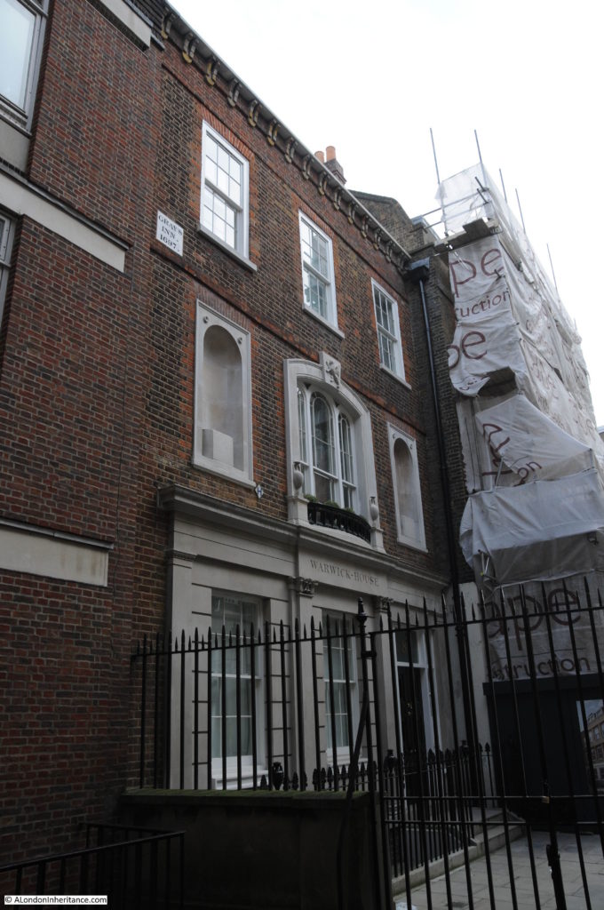
The following photo shows the house at the end of Warwick Court, next to the building on which the plaque is mounted. Compare this with the post war photo and as well as the main features of the building, there are a couple of other survivors.

On the first floor, to the left of the central window is a Hydrant sign which was in the pre-war photo, where there was also a plaque on the extreme left of the building at the same level. Whilst the plaque is not there, the outline of the plaque remains. I wonder if this was the Gray’s Inn boundary marker (dated 1697) now on the second floor the house.

Gray's Inn Place, Sun Yat-sen

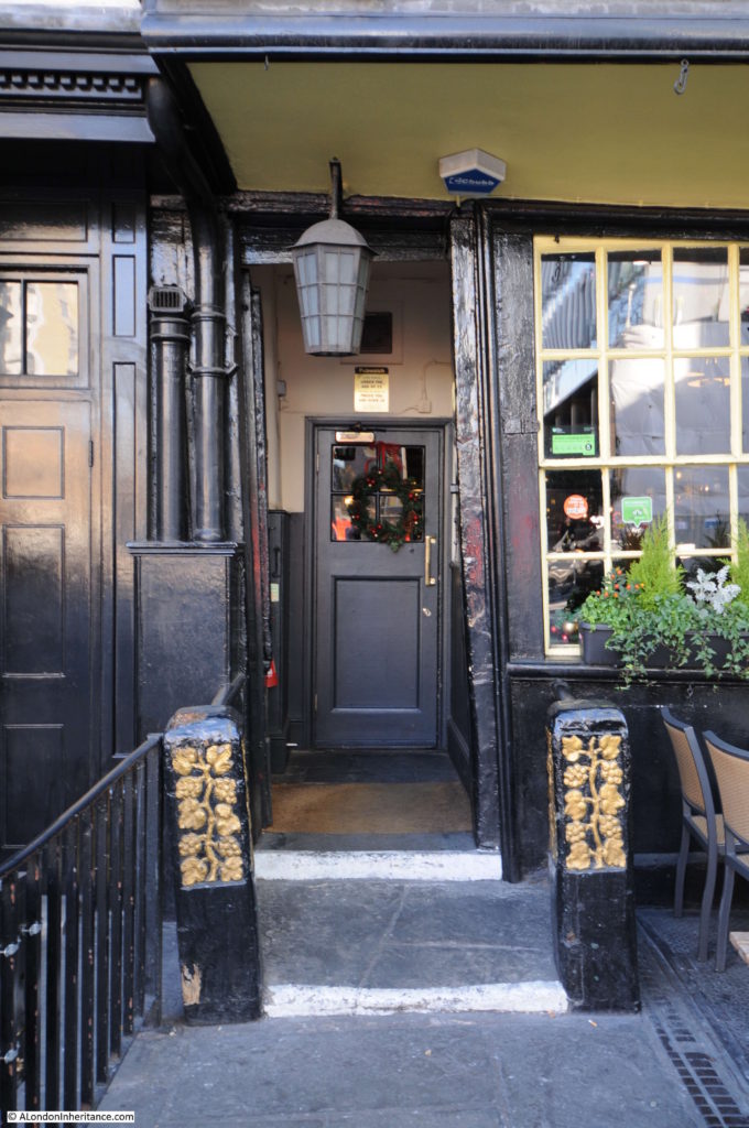
The best place to see the plaque is in Gray’s Inn. If you walk up Warwick Court and entrance is closed, you can still see the plaque on the wall to the right. Even here, the conversion of so many London buildings to luxury apartments continues.

Gray's Inn Place, Sun Yat-sen

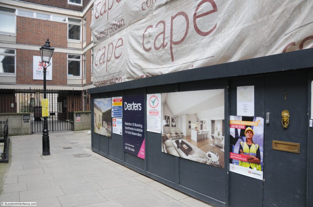
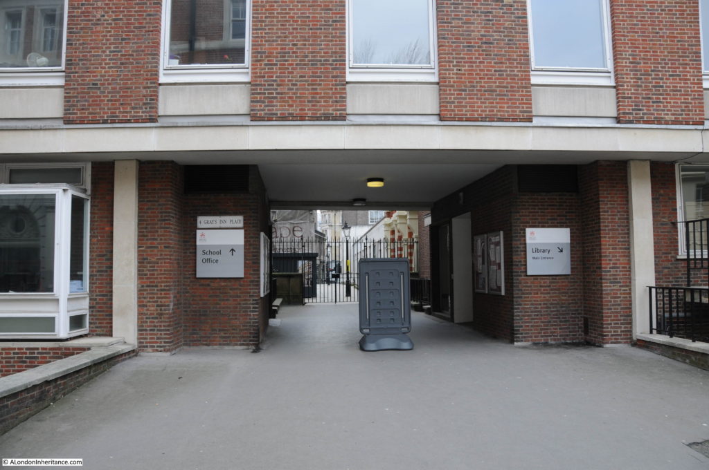
The following photo shows the entrance to Gray’s Inn Place today.

Gray's Inn Place, Sun Yat-sen

A fascinating story of a London kidnapping, a story that I did not know about until I found the location of my father’s photo of a bombed building and a single plaque that had survived the considerable damage inflicted on Gray’s Inn.

There is a chronology of the life of Sun Yat-sen on the web site of the Dr. Sun yat-sen Memorial Hall in Taipei.

alondoninheritance.com

My Third Year Of Exploring London – Readers Comments

This week is the end of my third year of exploring London and of writing this blog – a point I must admit I am surprised I have reached.
My purpose is the same as when I started, to trace the locations of the photos my father took of London and to give me a push to get out and explore the city.

I would really like to thank everyone who reads, subscribes and comments to my posts. I would also like to apologise to all those who comment and e-mail as I am really bad at responding. Writing and researching a weekly post as well as all the normal work and family commitments is a challenge. When I complete one post it is then into panic mode to focus on the next post. I can only admire those who write more frequently.

As a thanks for all the comments I have received, I would like to use this opportunity to publish a small sample of comments to my posts from over the last year. I learn so much from these, they provide personal background to the locations I cover, more information about the sites, answers to questions, point out errors (thankfully not too often) and provide links to other resources including a number of fascinating films.

So, to start with a post I published in March of last year.

Chelsea Old Church

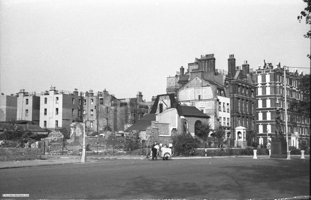
Chelsea Old Church was destroyed during the last war and my father took the following photo of the site. The church was rebuilt after the war to an identical design as the original, and many of the interior monuments were restored and now make the church a fascinating place to visit on the Chelsea Embankment.

I received a comment from Paul on his experiences around Chelsea Old Church:

I started my school life at Cook’s ground in 1939. I entered through the right hand gate on Old Church Street that had an overhead engraved stone sign saying “Girls and Infants”. The left gate’s said “Boys”. I didn’t have far to walk because we lived at Rectory Chambers almost next door. In front of our house was McCauley’s grocery. He had two girls and I went to school with them. Between our house and the school was Roma’s cafe, Rosemary was my mother’s best friend. In front was the “Pig’s Ear”. Wooden beer barrels were off loaded from horse drawn wagons and slid into the pubs cellar through a trap door in the pavement. Coal was also delivered to all the houses by horse cart and unloaded through small iron “manholes” in the pavements. The were no cars parked on the streets. Trams ran down Beaufort St. from Kings Road to Clapham Juction. A fellow on a bicycle lite the gas street lights with a flame at the end of a pole. 

Then all of a sudden ALL the lights went out. My mother got a summons because a light showed through the tiny bathroom window! Like all the other windows it should have been covered with black cloth.

The year after I started school we were labeled and posted by train to Cornwall. I returned home a year later because I had contracted diphtheria. The whole area at the end of the street was now a pile of rubble and a part of the church left standing was boarded up so we could’t get in, though we tried. There were still some of my friends around and we used the bricks to make dugouts and play “war” games throwing rocks at each others trenches. I was once knocked out and awoke in a neighbor’s kitchen while the lady bathed the back of my head. I have a photo of me on the rubble with my baby brother and mother nearby. It was taken by my father before he left for Africa. A neighbor named Bill Mallett became my best friend. He drove a lorry which he had parked in next to the damaged area in front of his house. He told me what had happened while I was away. He helped my mother repair our front windows. She had tomatoes planted in flower boxes on the roof. Paulton’s Square had “victory” gardens planted around the half buried shelters there. All the railings had been removed. I hated to go down after the air raid siren sounded because they smelt so bad. The wardens allowed me to site at the door with them and watch the planes until the noise got too loud. After the “all clear” my friends and I ran through the streets looking for bombs and shrapnel. One of us found a whole incendiary so he became our leader. He took it home for his collection and never did tell his parents! I found a small bomb and we tried to set it off by repeatedly throwing it in our “war zone”. Finally it broke apart and it was filled with a yellow putty. Notices were pasted all around with photos of “booby” traps that were dropped by the Germans. They looked like toys but we never found one! I could have been one of the kids by the ice-cream cart shown above or at least they were my some of my friends.

I left Kingsley (Cook’s ground) for the last time through the left gate in 1948, Dr. George Walsh was head master. 

Manchester Square, The Marchioness Of Hertford And A Very Old Lane

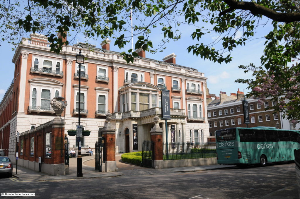
Then in May I wrote about Manchester Square, home to Hertford House and the Wallace Collection.

Geraldine shared an experience when walking through the square in 1969:

I lived at 25 Manchester Street (near the junction with Dorset Street) for five years, from 1968 till 1973. Back then, EMI Records occupied a post-war office building in the north-west corner of the square (since demolished). The cover shot for the Beatles’ first album shows them leaning over a street-side balcony at EMI House, grinning like cheeky chappies. Quite by happenstance, I was walking home from work through the square in 1969, saw a small crowd gathered outside EMI, looked up & there were the Fabs in their hippie pomp, being photographed by Angus McBean again, for what was intended as the cover of their album-in-progress. (It’s on the Blue Album: 1967-1970.)

And from Henry, a wonderful family link to Manchester Square:

My great-grandfather Stopford Brooke (the founder of the Wordsworth Trust at Grasmere) lived at 1 Manchester Square between 1866 and 1914. His large study was at the top of the very tall house, where he would entertain the likes of Robert Browning, Alfred Lord Tennyson, W.B.Yeats and Henry James. An unmarried sister looked after his seven motherless children, for whom Sunday lunch was the only time when they could be sure to see their father. who sat at the end of the long dining-room table. His long sermons stirred the conscience of late Victorian London.

It Can Now Be Revealed

It Can Now Be Revealed is the title to one of the many booklets published at the end of the war to record the experiences of specific organisations or London boroughs during the war and also looking forward to post war reconstruction.

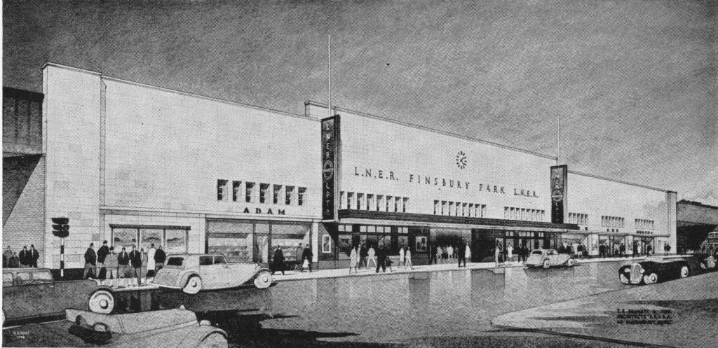
It Now Can be Revealed covered British Railways and as well as covering the war, also provided a very positive view of the future development of the railways, and included this drawing of a new Finsbury Park station which will be rebuilt “on the most modern lines”.

Within the text of the booklet there was a reference to News Theatres, which I had not come across before:

“The future British railway station will incorporate as spacious a concourse as possible, equipped with all the facilities that passengers need, conveniently situated and easily identifiable. Both concourse and public rooms will be light, cheerful and attractively decorated. News theatres (no idea what these were), newsagents, fruiterers, chemists, confectioners shops and Post Office facilities will be included whenever needed. Special attention will be given to the standard of food, drink and service provided in the refreshment rooms. Finally the platforms will be kept as free as possible of obstructions and passengers given the clearest indication and guidance about their trains, and how to get to them, by means of carefully designed train indicators and signs, supplemented by loudspeakers.”

I had some feedback about News Theatres, from M D West:

News Theatres were small cinemas for showing film newsreels etc….they built one in the Queens Building public foyer at Heathrow (opened 1956) and I think there was one at Victoria Station.

From Colin:

There was certainly a news cinema at Victoria Station, the entrance was shared with the parcels’ office on the Buckingham Palace Road side and was parallel to the road. I used to walk there to see the ‘toons in the ’50s it must have been

From Anne:

Up until the 1970s or so it was common to be able to walk in and out of a cinema at any point in the performance, so I guess the idea of a news theatre (in pre-TV days) at a station would be to pop in and pass the time while you waited for your train.

And from Guy which included a link to a photo of the Victoria Station Cartoon Cinema as the News Theatre became:

Here’s a link to details of the news cinema at Victoria Station that later became a cartoon cinema, before shutting in 1981:
http://cinematreasures.org/theaters/1248/

Smith Square – Architecture, History, And Reformers

In June I went to Smith Square.

Eddie wrote with his experience of working in the area and gave me a challenge I have not yet completed:

I spent many many hours walking around it during the 1970’s being a Police Officer at Rochester Row. Harold Wilson, Prime Minister twice, used to live at number 5 Lord North Street and he and the house had 24 hour armed protection, just one of many armed protection posts on Rochester Row and Cannon Row’s ground. Next time you visit see if you can find the two ‘ducks’ in Smith Square.

The Festival Of Britain – Maps, Football, Guidebooks. Science And Abram Games

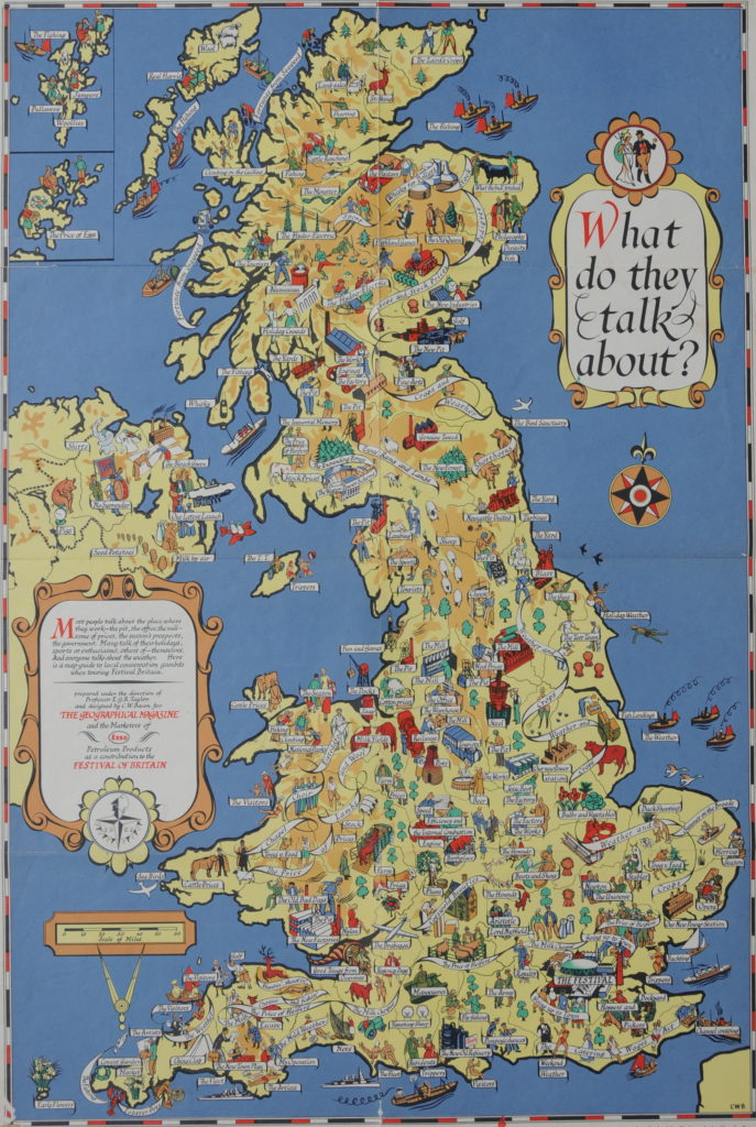
Then in July I wrote a number of posts on the Festival of Britain, one of which included this fantastic map published to illustrate the “local conversational gambits when touring the country”.

Comments gave personal experiences of the Festival, including from Patsy:

At the age of 6, I attended the festival of Britain.
I only have snatched of memories of it. Yet it is something I will never completely forget. I remember particularly the huge ‘pole’ rising into the sky – the Skylon – I couldn’t understand what it was for. There were squirrels in the trees – models of squirrels – I wondered why they didn’t have real squirrels.
I remember being bewildered by the crowds and I remember an overhead cable car. Other than that, memory fades.

And from Veronica:

I went to the Festival of Britain and it was a memorable experience for someone especially who had lived through the war years , as well as going to the Festival itself we saw much of London still showing all the dreadful damage still awaiting re-development. As well as that we got to go into the Dome of Discovery and saw the actual “largest piece of Plate Glass ever made at that time” My father worked on that and Pilkington Brother Glass manufacturers of St Helens, Lancashire had to have a special “low-loader vehicle” made to bring it down to London. We all lined the streets to see it go on its way.

And from Geraldine Terry:

My father was a joiner from Tyneside who traveled to London and found work on the Royal Festival Hall construction site. He helped to make some of the concrete shuttering. He returned to Tyneside after the Festival of Britain, but it was an important period in his life. He told me that the construction workers were given free tickets to the inaugural concert, which he enjoyed.

I am researching my father’s life and would love to know more about what it was like to be involved in building the Hall. If anyone knows of any workers’ accounts, I’d appreciate hearing about them.

Unfortunately I have not found any accounts from those who worked on building the Royal Festival Hall and the Festival in general – they would be fascinating to read.

Canterbury – 1948 and 2016

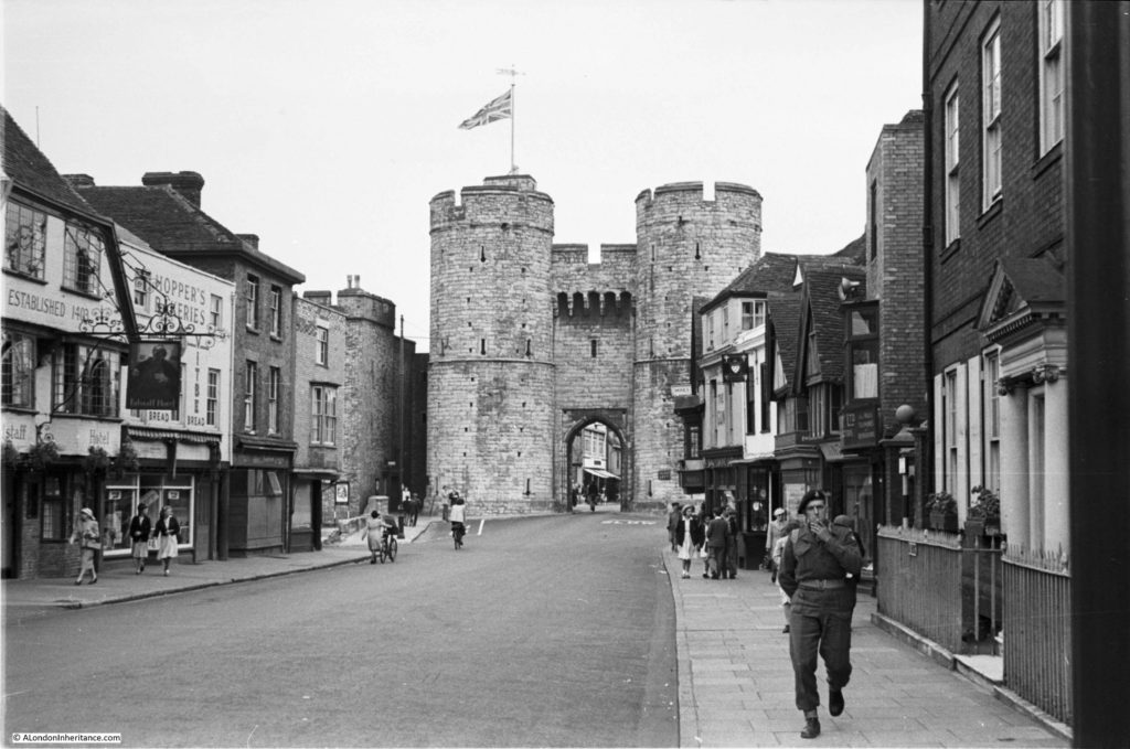
As well as London, my father also took lots of photos across the country whilst during National Service and on cycling holidays across the Youth Hostels of the country. In August I visited a number of these locations across England and Scotland. One was Canterbury in Kent and this is one of the photos my father took.

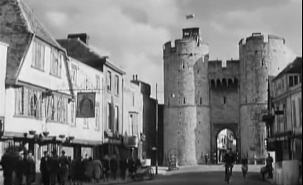
Both Annie and Geraldine directed me to the 1944 film A Canterbury Tale which can be viewed online here. A really good film, but obviously of the period and the end of the film includes a number of shots in and around Canterbury showing how badly the city was bombed. One scene includes the following clip taken from almost exactly the same position as the photo my father took.

The Furthest Object Visible From The Shard

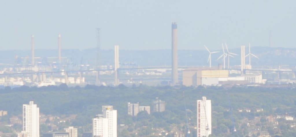
In September I spent a day climbing five of the highest locations in London starting with one of the earliest (The Monument) to the latest (Shard). From the Shard I wondered what was the furthest object I could see from the top (see the ghostly image of a chimney on the horizon towards the right of the following photo)

There are loads of good viewpoints in and around London and Pimlico Pete mentioned one which is on my list for this year:

Barnet church tower is open on Saturdays in July and August. It’s well worth the climb up the claustrophobic stairwell because the views are outstanding. I have clocked Wrotham transmitter mast at 31 miles and St John’s church tower in Higham at 32.4 so not quite matching the feat we see here. I found it useful to manipulate the contrast and colour tint in Photoshop to bring out the fuzzy detail. Wrotham would have remained unspotted otherwise.

I also had some interesting comments on the blog and via Twitter correctly advising that actually the Sun, or perhaps even the Andromeda Nebula would be the furthest things that could be seen, so perhaps I need to correct the title to terrestrial objects, and with the level of light pollution in London I suspect you could never see the later.

St. Pancras Old Church, Purchese Street, Gas And Coal Works

in October I went to the area around St. Pancras Old Church to find the location from where this and a couple of other photos were taken. The church is in the background on the right behind the trees.

The area was home to a number of coal storage depots, from where coal would be collected for onward distribution across London. Some comments on how this worked, and how dangerous this could be. Firstly from Keith:

Howdy! The Purchese Street depot was built in 1898 by the Midland Railway. The depot took the form of drops – the coal fell from a wagon on the high level directly into dealers’ wagons avoiding the time and expense of transhipment but generating noise and dust. Last time I was up that way there was a rather nice red brick retaining wall. There was a flying bomb dropped around here and maybe that is why the place looks rather messy. 1940-41 damage was usually tidied up more neatly than that.

From Denis:

Coal was held in a hopper, and the coal merchant would park the lorry underneath and hold an empty sack under the hopper outlet, press a pedal to open the hopper, allowing coal to fall into the sack, which was then stacked on the back of the lorry where they stood. Made loading a bit easier. My dad used this yard a lot. One day a fellow coalman had a seizure/fit whilst filling a sack and was just rooted to the spot with his foot on the pedal as coal fell all over him. The other coalmen fortunately were on hand to save him. I was just a kid and was there with my dad that day, I’ll never forget it.

Warehouses And Barges In The Heart Of The City

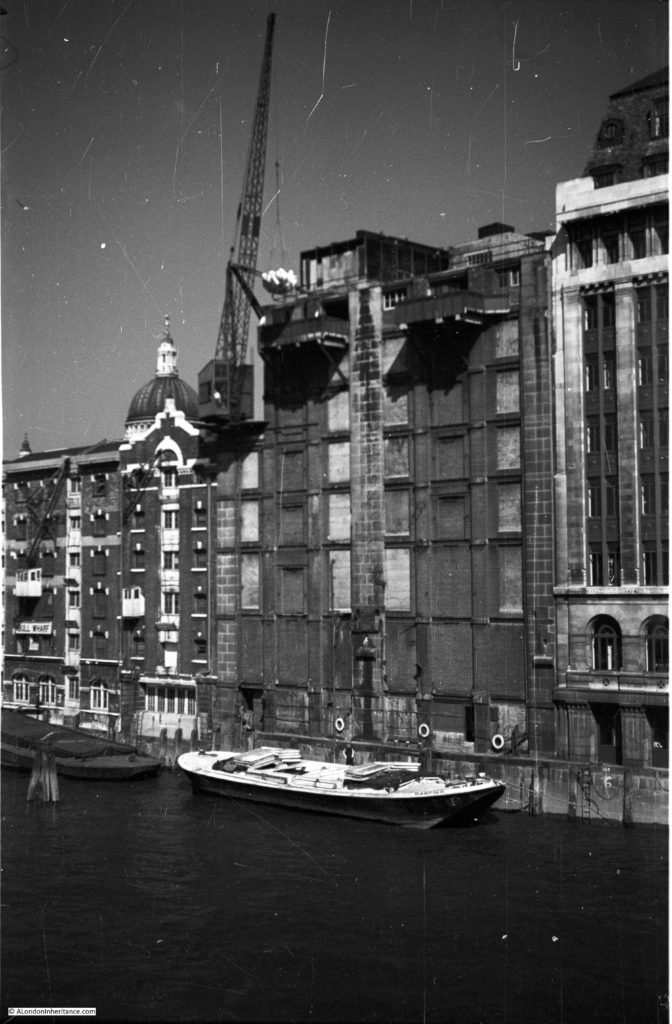
Also in October I published some of my father’s photos of when the warehouses were still working in central London:

Thanks to Jerry who pointed out that I had got my captions round the wrong way (probably as a result of late Saturday night writing) and also recalling the terrible working conditions of those working in the streets along the river:

Pickle Herring Street ( where incidentally there were a number of fish stalls) is the image that you’ve associated with the large ship actually shown in the neighbouring photograph, swap the captions and you’ve done it. My own father who was born in 1924 actually grew up around the Shad Thames an Pickle Herring Street area, playing amongst the barges along the Thames, an activity made famous by the 1950 Film The Mudlarks. His mother apparently worked on the family fish stall on Pickle Herring Street, as mentioned above and not surprisingly contracted severe arthritis in her hands, working in such freezing conditions in the winter here, must have been dreadful. I recall walking around Shad Thames in the 1980’s before major redevelopment and restoration and finding abandoned Wharehouses still with the produce they handled pouring out of rotten doorways, this included flour that probably would have been used by the nearby Peek Freans and Jacobs biscuits factories.

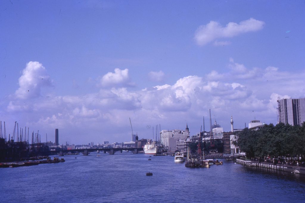
I was also sent some wonderful photos from David Smith. His mother had taken them in the 1960s including this photo looking up the Thames from Tower Bridge.

The Lord Mayor’s Show In The Early 1980s

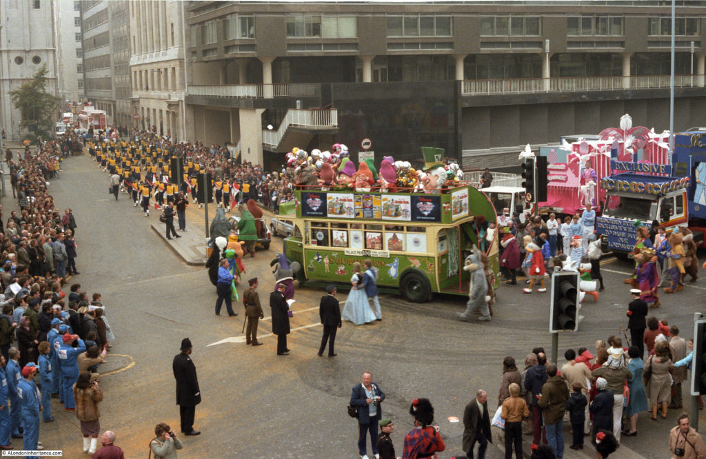
In November it was the turn for some of my photos from the 1980s, this time photos from the Lord Mayor’s Show,

It was really good that someone saw the post and also themselves in one of the photos – from Julie:

Every year, my kids have to endure, as we watch the Lord Mayor s parade on TV, my trip down memory lane recounting the year Tom ( husband) and I took part, alongside many of our fellow Disney workers in this wonderful parade
I couldn’t believe it when, upon opening your blog, daring to hope that we might have been snapped…….. there we are! Me ( Cinderella) and other half Tom, (Bert) ……
I remember, it rained that day too, as it so often does for the parade!
But nobody minded… Long live the parade!

The photos also showed the high level walkways that were once a feature along London Wall. For some more information on these MikeH wrote:

The walkways above street level, which can be seen in the views of London Wall, are all part of the ‘Pedway’ scheme for The City of London in the 1950’s and 60’s. It was planned to separate pedestrians from the road traffic and provide a continuous walkway from building to building and across roads, all new buildings were required to provide this and as adjacent sites were developed the pedway would gradually expand to cover the whole of the city. Many buildings had included this and quite a few bridges were built but inevitably there were many dead ends awaiting further development and the whole plan was abandoned by the 1980’s.

MikeH then provides the link for a film about the walkways:

Further to my previous reply this documentary contains lots of old film including the bomb sites around St Pauls. Its called Elevating London by  Chris Bevan Lee.   http://vimeo.com/80787092

The film is a brilliant account of the rebuilding of this part of London and the Pedway scheme as the walkways were called. I highly recommend watching the film.

The Tiger Tavern At Tower Hill

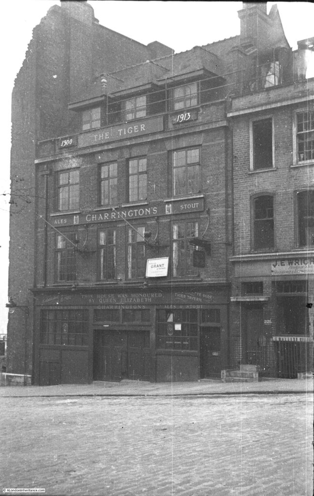
Also in November I wrote about the Tiger Tavern pub that was once on Tower Hill.

There were rumours about an underground tunnel linking the pub and the Tower of London although I could find no evidence, however Barbara wrote:

You mention a blocked off tunnel in the basement of The Tiger, I have been in that tunnel and also seen the mummified cat, I spent many hours there as my uncle was once the manager.

It would be really interesting to know if any of the tunnel remains under Tower Hill.

Russell Square And Librairie Internationale

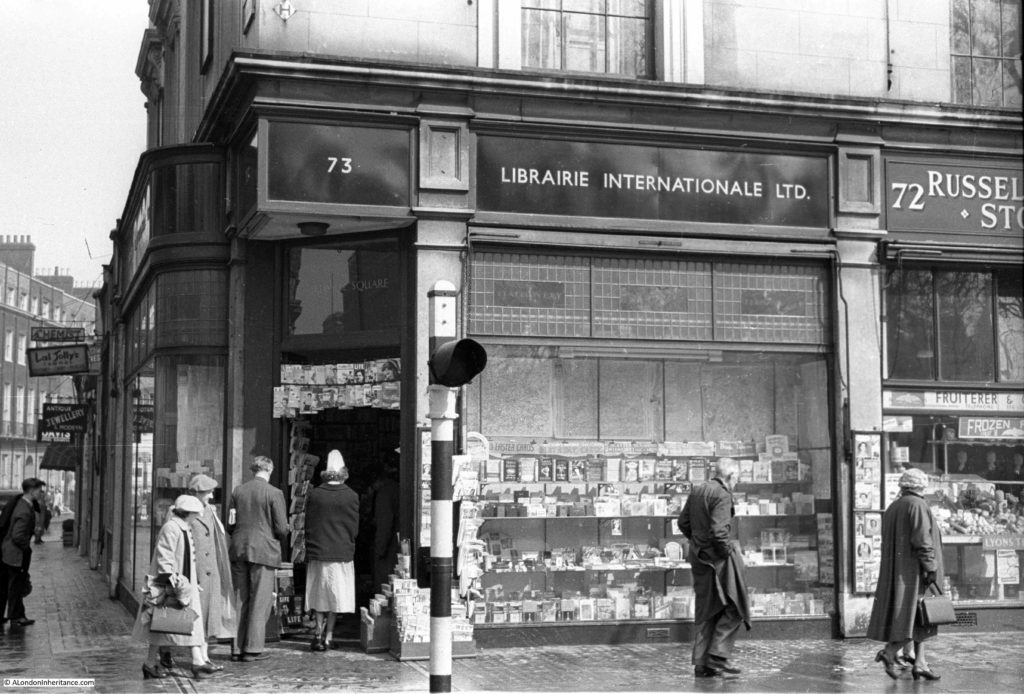
In January I wrote about the Libraire Internationale in Russell Square.

I found evidence of anarchist magazines being sold at the Librairie Internationale, however they seemed very polite anarchists as also found by Rob:

The Times of 1/2/1935 reported on a case in which Gladys Marie, the Duchess of Marlborough, claimed damages from a number of defendants for circulating a libel. “Mr Theobald Matthew, for Librairie Internationale [of Russell Square, W.C.], said that his clients expressed their regret as soon as the libel was brought to their attention and they now offered a sincere and unqualified apology to the Duchess.” Polite radicals indeed!

Then some more information from the excellent London Remembers site

Thanks for publishing the photos of the ‘Turkish Baths’ corner. We’d already stretched our definition of a ‘memorial’ and published that sign on our website. But your photos prompted us to do some more research, trying to understand the history of the site and to find out exactly where the Baths and the Arcade were. With the info from your photos and some maps we’ve got a bit closer: https://www.londonremembers.com/memorials/turkish-baths-in-russell-square

And from Peter:

My eye was taken by the Imperial Hotel. The magnificent edifice dating from the early 20th century was itself a replacement of a previous incarnation. My 4x great-uncle, George Heald, wrote a letter from the Imperial Hotel in 1846 to George Mould in the Railway Office, Carlisle concerning the costings of the new railway that Heald was being asked to engineer between Skipton and Lancaster. Heald travelled the length and breadth of the country and stayed in the best hotels as might be expected for such a prominent engineer. His story is on Wikipedia. Mould was another pioneer of railways who lived longer than Heald (1816-1858) and built some of the main railways in Spain

And that was just a small sample of the fascinating and informative comments I received over the last year. Again my thanks for every single comment, all the feedback and additional information. And now to start next week’s post.

alondoninheritance.com

New Deal For East London – Spitalfields

Before continuing on from last week’s post, it is interesting to understand why so much of East London had reached the state described by the Architects’ Journal in 1972. Such changes do not usually just happen, there is some underlying influence at work to cause so much gradual dereliction over such a large area.

The following extract titled “Planned Depression” from the 1972 article goes someway to describing how this had come about:

“Perhaps the most cheering factor in the situation is that it has now been recognised by Greater London’s planners that the economic depression existing throughout east London is the result not of thoughtless neglect, but of national planning policy. This was explained convincingly by Dr. David Eversley, now chief strategic planner to the GLC, when he spoke to the conference of municipal treasurers last year. As that important speech was not widely publicised (municipal treasurers not being regarded as newsworthy by the national press), this seems a good opportunity to present his argument in some detail.

First perhaps, one may recall that, whereas in the ‘hungry 30s’ when Ramsey MacDonald was prime minister of a national government, everybody burst into despairing laughter when he promised that progress was going ‘on and on and on, and up and up and up’, since 1945 this has in fact been the assumption of most of our economic advisers – at least until recently.

Founded on that assumption, it was a major goal of post-war planning policy to prevent London from going on and on and on (though it has certainly gone up and up and up) by inducing people to leave the capital and go to new towns. This was done by bribing industry, to establish itself in these towns by the system of industrial development certificates accompanied by various financial encouragements to leave overcrowded London, and other over-developed industrial centres and go to the new towns. As Dr. Eversley pointed out, the characteristic of the British approach has been for at least 30 years, ever since the intra-urban approach to the city’s problems concentrates largely on large-scale redevelopments; slum clearance followed normally by high-density, high-rise rebuilding; above all ambitious city centre schemes, designed to preserve the local and regional dominance of the older centres at a time of changing settlement habits….and into the age of private motor transport.

The distinguishing characteristic of British planning for urban problems in the last two decades, Dr. Eversley pointed out, has been that compared with most other countries, it has been extraordinarily successful… that the stated aims of national planning have by and large been implemented. Cities have held on to their Green Belts, the seven conurbations all had lower populations and London will by 1981 have fewer than 7,000,000 inhabitants – that is, about 2.5 million less than there would have been but for planned and voluntary out-migration.”

Although there was rebuilding across East London (but much of the high-density and high-rise housing as mentioned by Dr. Eversley), the inducements for both industry and people to move out to the new towns, (with the Essex new towns of Harlow and Basildon being the new homes for significant numbers of east Londoners), contributed to a lack of employment opportunities and a reducing population across east London.

Following last week’s walk around Whitechapel, my next stop following the Architects’ Journal 1972 map is Spitalfields. The last of the category A sites on the map which the Architects’ Journal classified as “Areas that were developed as overflow from the City of London”.

I must admit to feeling somewhat nervous in writing about this area of London which continues to be described in such detail by the excellent Spitalfields Life blog and in the books by Dan Cruickshank who was so instrumental in the years following the Architects’ Journal report in saving so much of this area. (Dan Cruikshank’s latest book “Spitalfields: Two Thousand Years of English History in One Neighbourhood” is sitting on my shelves waiting to be read)

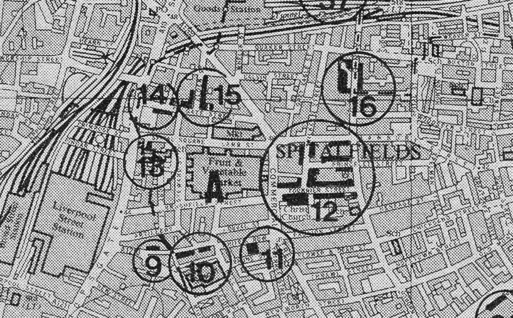
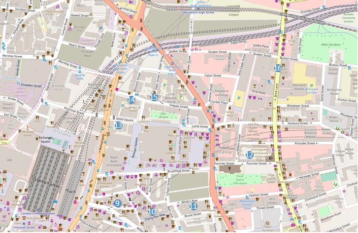
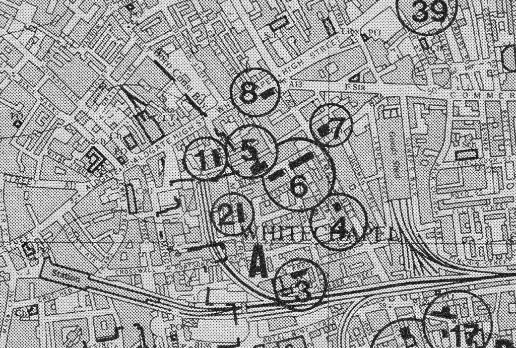
The following map is an extract from the large map in the 1972 Architects’ Journal covering the eight locations around Spitalfields.

I have marked the locations on the following extract from OpenStreetMap to show the area as it is today. Comparison of the maps show the loss of Broadstreet Station, adjacent to Liverpool Street Station in the lower left corner. The Goods Yard at the top centre of the map, and the market in the middle of the map when it still the original fruit and vegetable market in 1972.

The first stop is site 9 on the above two maps. To follow the locations numerically, Widegate Street is reached by turning off Bishopsgate into Middlesex Street where a short distance along we reach the turn into:

Site 9 – Late 17th Century Widegate Street

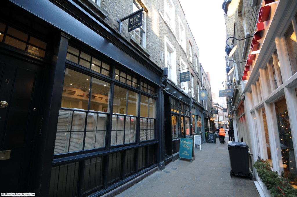
On walking into Widegate Street we enter a series of narrow streets that retain their original layout and give a glimpse of what this part of London would have looked like from the time they were built until post war development.

As you walk down Widegate Street, the buildings on one side are recent all the way down to the building just before the Kings Stores pub with the buildings on the opposite side being a mix but appear to be mainly from the 19th century.

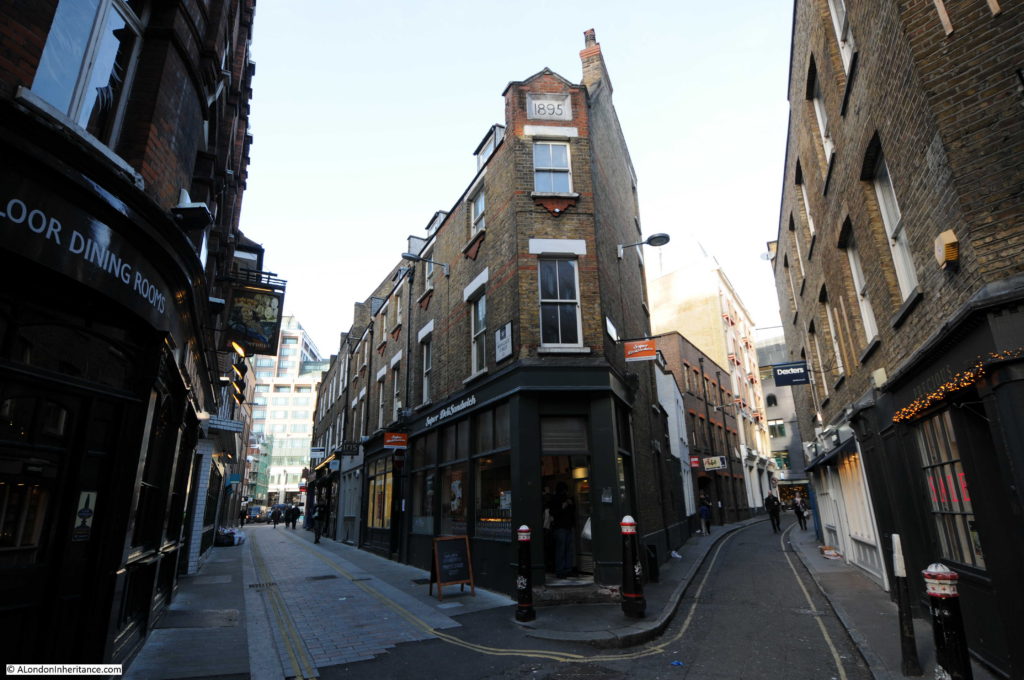
The following view is from the junction of Widegate Street (on the left) Sandy’s Row (on the right) and Artillery Passage. The corner building displays a construction date of 1895.

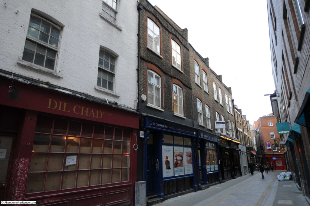
Looking down Widegate Street from the Middlesex Street end. Most of the buildings appear of 19th century vintage. The Architects’ Journal title for this location is “Late 17th century Widegate Street” and the black location mark on the map is on the left side of the street near the junction with Middlesex Street which may refer to the white-painted building on the left. This is a different style to the rest of the street and therefore may be a late 17th century building, but I would not apply this description to the whole of Widegate Street.

I assume that the buildings that once lined the opposite side of Widegate Street were of similar style to those that remain on the left.

The next stop is at the end of Widegate Street where we enter Artillery Passage.

Site 10 – Artillery Passage and Artillery Lane

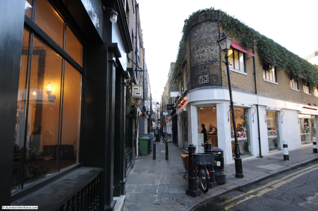
Artillery Passage is a narrow foot passage that leads down from Widegate Street to a curve in Artillery Lane.

In the photo below I am standing in Artillery Lane looking down Artillery Passage. Just behind me are numbers 56 and 58 Artillery Lane which are from around 1720, with replacement Georgian facades from the 1750s. Number 56 retains its Georgian shop front.

When I was taking these photos there were two large white lorries parked in front of these buildings. I returned later and another set of large delivery vans were parked immediately in front. This corner of Artillery Lane seems to be the parking place of choice for lorries making their deliveries to the shops and restaurants here, and in Artillery Passage. I shall have to return on a Sunday when hopefully the area is free of deliveries.

Despite trying to read the faded sign on the first floor of the corner building from many different angles, I could not decode the faded lettering. I have found sites on the internet that state it reads “Fresh Milk Daily from The Shed”. Perhaps it would be clearer in better lighting than on a December day.

In the photo above, Artillery Lane is the road curving round to the right where it heads to Bishopsgate. Today, Artillery Lane continues behind where I was standing up to the junction with Crispin Street and Bell Lane. Up until 1895, this short stretch of road was known as Raven Row. Just to the northeast of this point was the five acres of land that until the end of the 17th century was used for longbow, crossbow and gun practice and was known as the Old Artillery Ground. Interesting to speculate whether Ravens also frequented this open area and gave this short street the name Raven Row.

Artillery Passage remains a narrow passage between what appear to be mainly 18th century buildings. It gives a good idea of what this small area of London would have looked like, despite the shops and restaurants now being rather upmarket.

Coming out of Artillery Lane turn right then immediately left into the next location.

Site 11 – Single 1720 house in White’s Row

White’s Row is a narrow lane running from Artillery Lane to Commercial Street. The Architects’ Journal map has location 11 roughly half way along White’s Row and described as a single 1720 house.

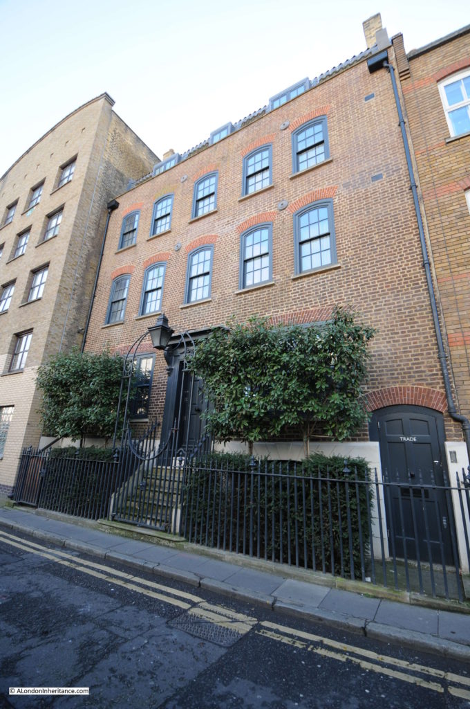
White’s Row is narrow, made worse at the moment as part of the pavement on one side is boarded off due to the large building site between White’s Row and Brushfield Street, meaning that as you walk towards Commercial Street there is nothing on the left. Most of White’s Row one remaining side appears to be either 19th or 20th century. There is one building in roughly the position shown on the Architects; Journal map that answers the description of a single house, however I have some problems with confirming this as a 1720 house.

My photo of the building is shown below. Whilst there are some elements of 18th century design, the building just looks too new. The window casements are also flush with the brickwork. Buildings of the period typically had recessed casements.

My assumption is that design elements of the original 1720 house have been retained, however the majority of this building must be of recent construction.

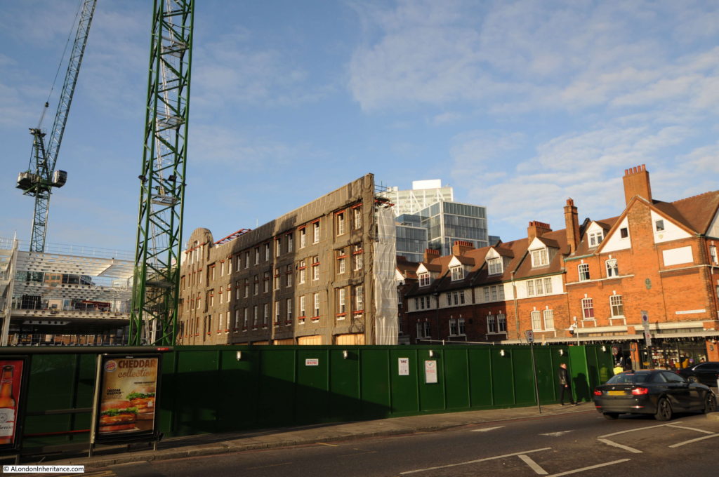
Leaving White’s Row, I walked up Commercial Street towards Christ Church and this is the view on the left of Commercial Street. The rear of the facade of the old Fruit and Wool Exchange building in Brushfield Street are all that remain, whilst a completely new building rises to the rear of the facade.

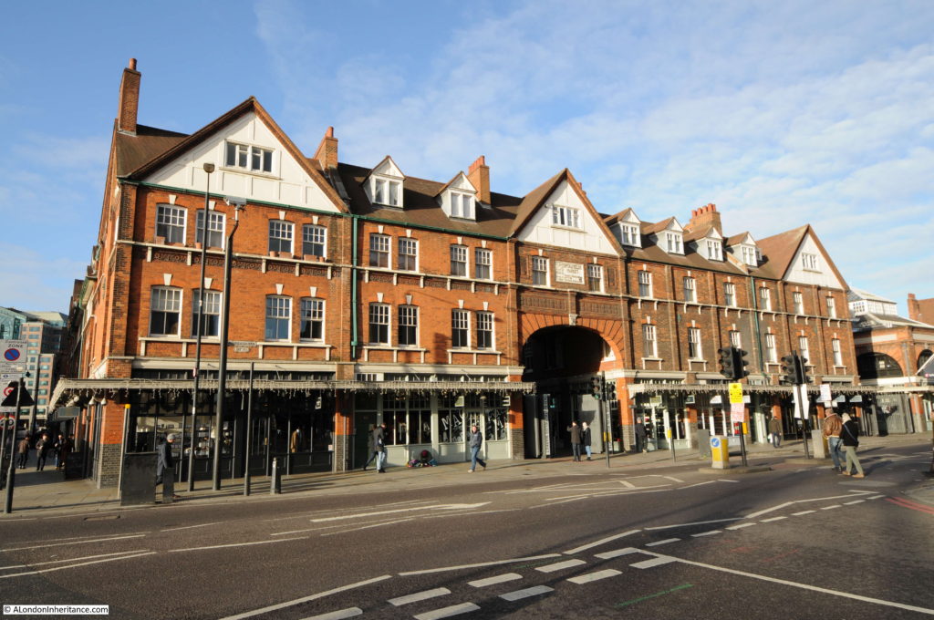
To the right of the above photo is the Fruit and Vegetable Market building, with the frontage onto Commercial Street shown in the photo below. The low winter light bringing out the colour of the brick walls – one of my favourite building materials.

Site 12 – Network of early 18th century streets around Hawksmoor’s Christ Church

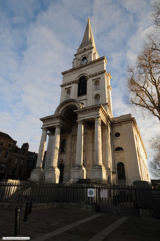
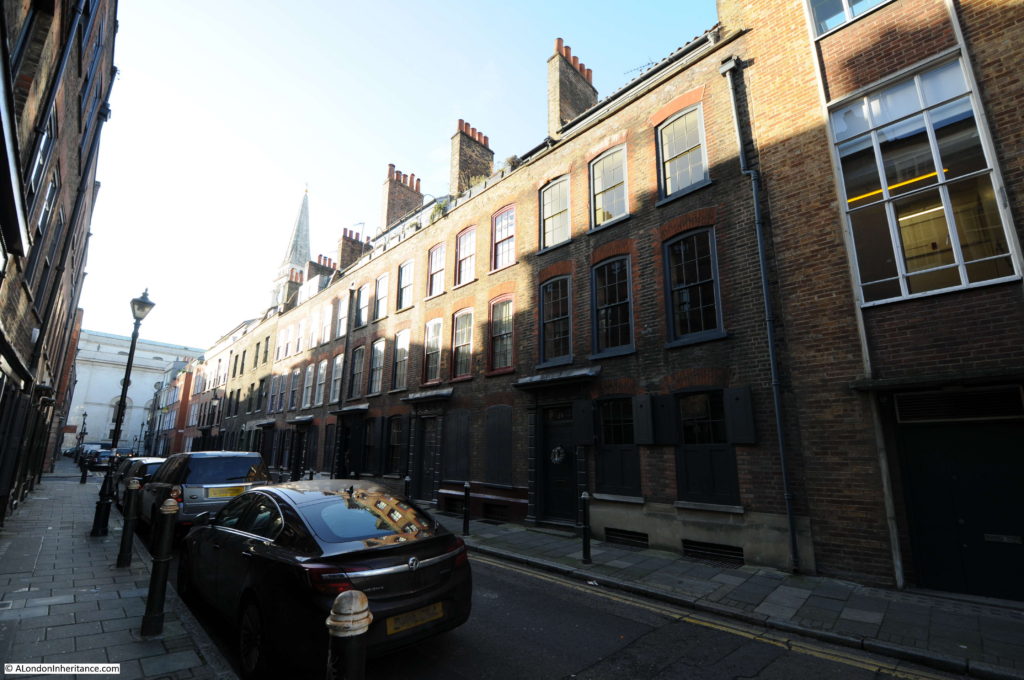
Site 12 in the Architects’ Journal map covers the network of streets north of Hawksmoor’s magnificent Christ Church including Fournier Street, Princelet Street, Hanbury Street and Wilkes Street.

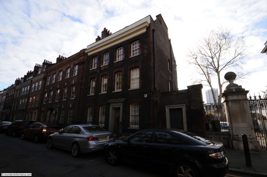
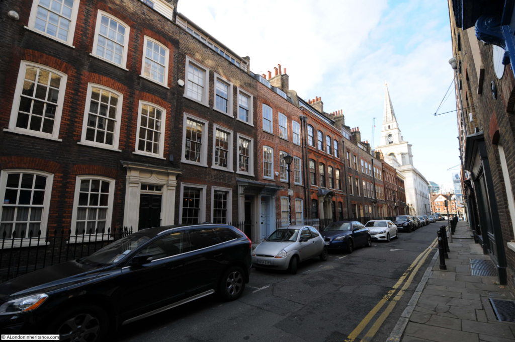
The first building on the right in Fournier Street is Hawksmoor’s 1726 Rectory. This is a very substantial building, emphasised by the windows being set back a full 9 inches from the facade of the building. The 1709 Building Act required windows to be set back by 4 inches, but Hawksmoor went back a further 5, perhaps to show the depth of the walls.

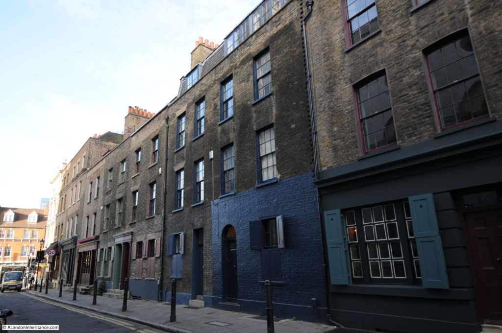
Opposite the Rectory, Fournier Street is lined with 18th century houses. Note also the deeply recessed sash windows. The 1709 Build Act justified this on the basis that is would be harder for fire to propagate along a street if wooden window frames were recessed and not flush with the facade. It also set the style for how sash windows would develop. A later 1774 Building Act took this further by requiring the sash box (the wooden part of the window surrounding the glass framed panels) also to be recessed into the fabric of the building to reduce further the exposure to fire.

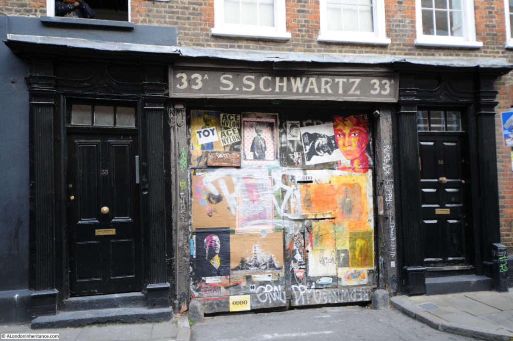
Here is 33A Fournier Street. The boarded up entrance between the two doors is the entrance to a yard behind these houses.

I can find no record of S. Schwartz or the age of the sign, however there are photos from the 1950s showing this as the entrance to the Express Dairy including the following from the Collage collection:

The Architects’ Journal details some of the challenges facing the restoration of Fournier Street: “Built in the 1720s it was one of the most fashionable and solidly constructed streets in the area and shows the obvious mark of the Huguenots. They established Spitalfields’ silk weaving industry and in their houses, to brighten their workrooms, they built large attic windows. The GLC is adamant that this street should be preserved, yet so far has done little to maintain it. Tower Hamlets will pay no money for restoration as the houses, due to their wooden construction, could be inhabited only as single units (quarter-inch wainscot partitions do not correspond to fire precautions and noise insulation specified for flats). If they cannot be restored to council flats, they can be saved only by individuals restoring them to their original purpose as private houses. Any rehabilitation of these houses would demand much greater social change than was necessary in other areas.”

View looking down Fournier Street.

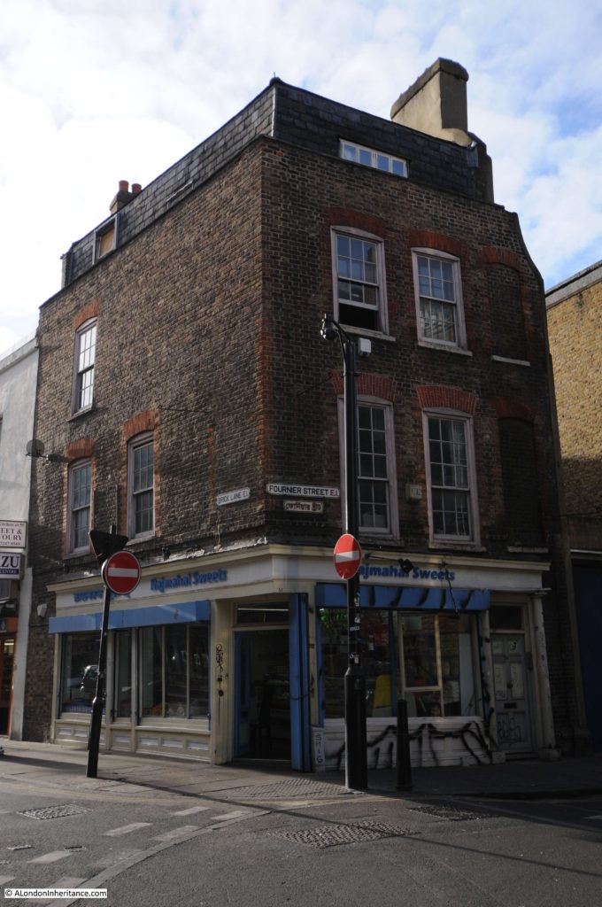
Corner of Fournier Street and Brick Lane.

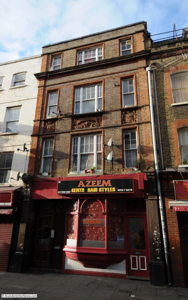
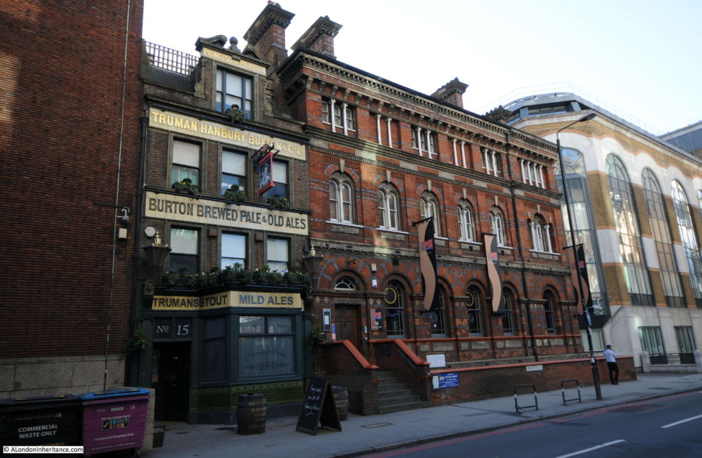
Leaving Fournier Street, I walked a short distance along Brick Lane, and although Brick Lane is not included in the list of sites in the Architects’ Journal, there are many fascinating buildings, including the following building which was the Laurel Tree pub, built in 1901. The name of the pub is on the middle plaque, the year on the right, and on the left plaque are the initials THB for Truman Hanbury Buxton. A very similar set of decorations can be found on the old Three Suns pub on Wapping Wall (see my post here). Perhaps a project to track the remaining pub buildings that have this type of decoration could go on my list?

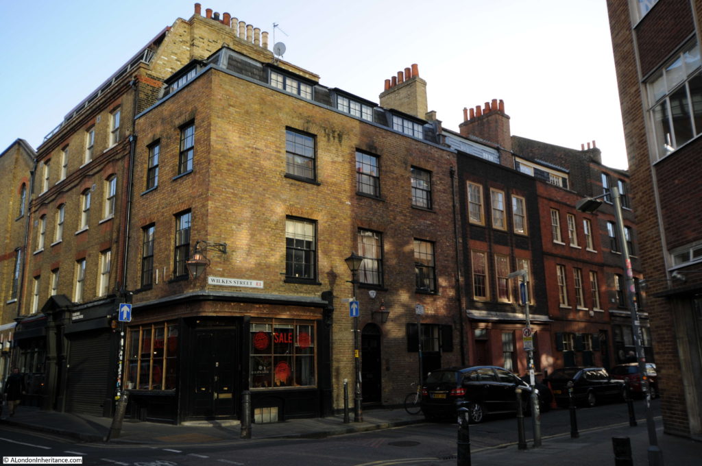
Along Brick Lane we now come to Wilkes Street, the next street marked within site 12 of the Architects’ Journal map. The junction of Wilkes Street and Hanbury Street.

Much of the area I am walking across for site 12 was land originally owned by two lawyers from Lincoln’s Inn, a Mr Charles Wood and a Mr Simon Michell. A large area of land between Commercial Street and Brick Lane was purchased by the pair around 1717 and the streets were laid out between 1718 and 1728.

Difficult to see in the following photo due to the deep shadow. The terrace of identical houses running to the left of the modern building on the right were built by the speculative builder Marmaduke Smith in 1723.

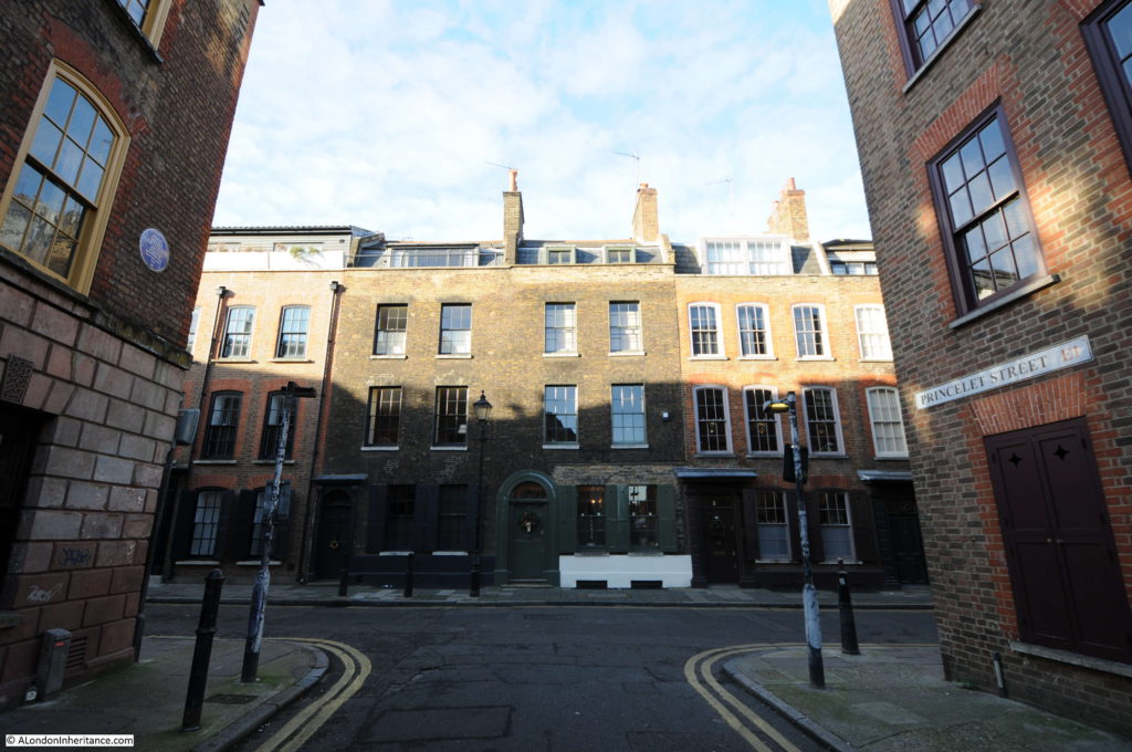
Half way along Wilkes Street is the junction with Princelet Street. The Blue Plaque on the left is to Anna Maria Garthwaite (born in 1688 and died in 1763). Anna Maria was a designer of Spitalfields silks and lived and worked in this building on the corner of Princelet Street.

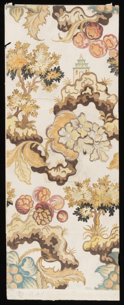
Anna Maria was originally from Lincolnshire but moved to Spitalfields to be with her widowed sister. She became a celebrated designer of fashionable silk fabrics and specialised in botanical designs. Many of her original designs are now held in the Victoria and Albert Museum.

The following (© Victoria and Albert Museum, London) is an example of one of Anna Maria Garthwaite’s designs from when she was living and working in the house on the corner of Princelet Street.

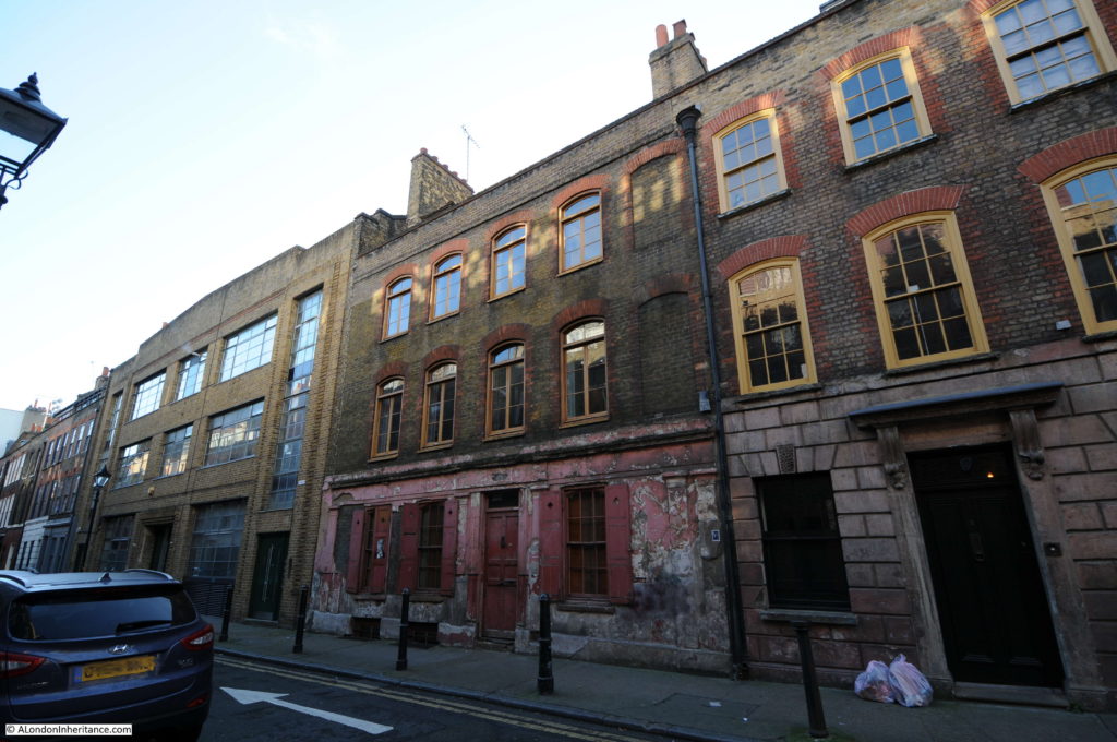
Houses in Princelet Street.

With interesting window decoration.

As well as recessed windows, the photo above also shows one of the other identifying features for the age of Georgian building – the narrow mortar course between the bricks.

House in Princelet Street showing signage from the previous use of many of the buildings in this area.

The final street within site 12 is Hanbury Street with buildings marked on the southern edge of the street at the junction with Brick Lane:

Fortunately there are many buildings that have survived in the area covered by site 12 and the above photos are just a sample. Many houses were not so lucky to have survived and the Architects’ Journal records how developers worked around the risks of preservation orders in Folgate Street along which we will be walking to reach the next site:

“Around the corner, two houses in Folgate Street and most houses on the unrestored Elder Street are owned by a private developer. On the site in Folgate Street he wants to build offices, which the GLC oppose.

The day before a preservation order was to have been served on them, one was gutted by fire, and one Sunday soon after, they were demolished. There is a feeling that he will not restore his side of Elder Street to residential use, unless he is given permission to build offices on the now vacant site in Folgate Street.”

Site 13 – Much restored 17th century house in Spital Yard and the last 18th century house in Spital Square

To reach site 13, I left Hanbury Street, crossed over Commercial Street, walked down Folgate Street then turned into Spital Square.

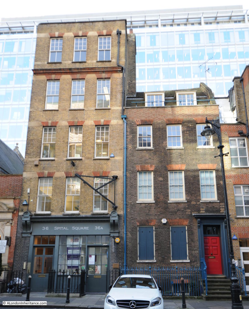
The map locates the house almost adjacent to the entrance to Spital Yard and if I have located the correct building it is the one on the right in the photo below.

The above photo also demonstrates the impact that the ever growing glass and steel office blocks that are surrounding these 18th century streets in Spitalfields have on the views of the buildings.

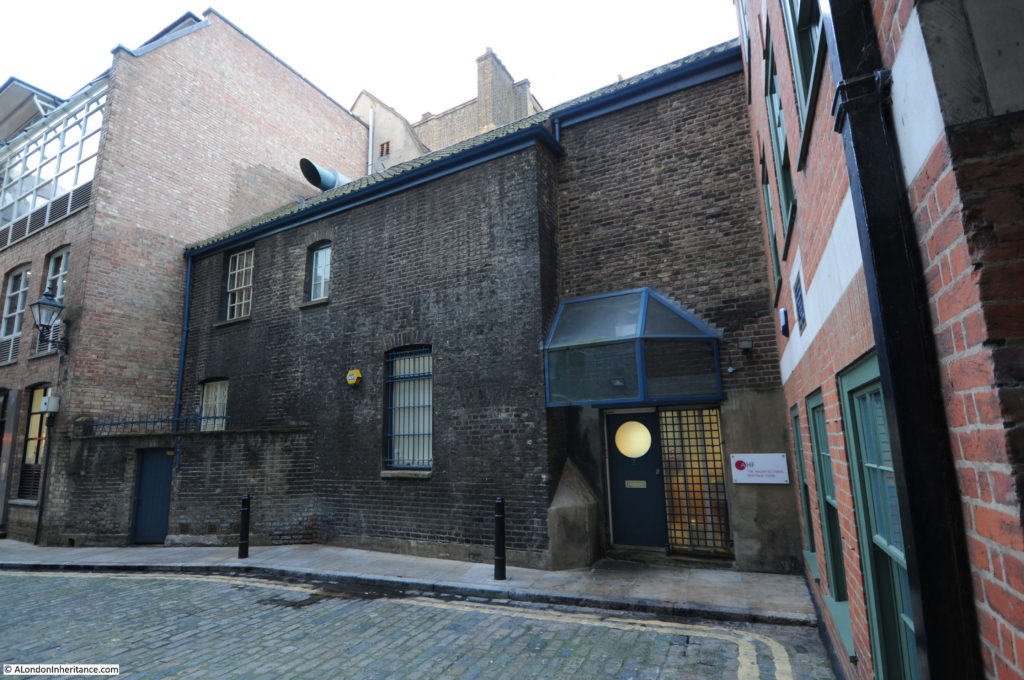
Just along from the above buildings is the entrance to Spital Yard.

The house at the end of the yard fits the description of being “much restored” and the blue sign reads “In this house, Susanna Annesley mother of John Wesley was born January 20th 1669” which also fits with the 17th century description, although I am also fascinated by the adjacent building which is the head office of the Architectural Heritage Fund as this also looks to be of some age.

Site 14 – 1724 group in Folgate Street

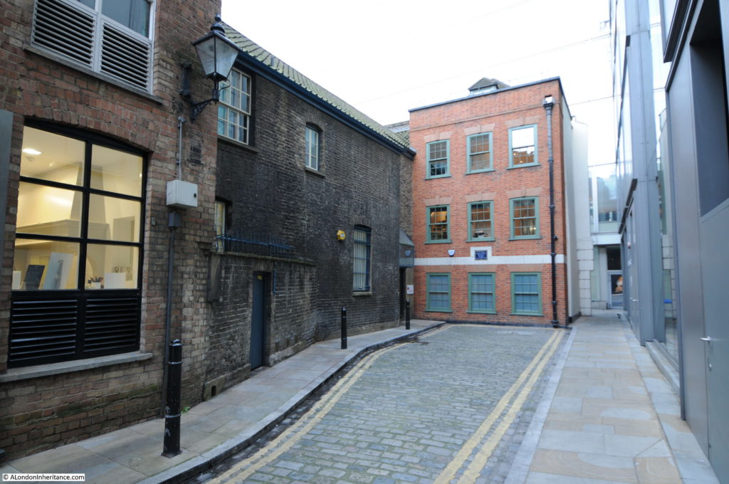
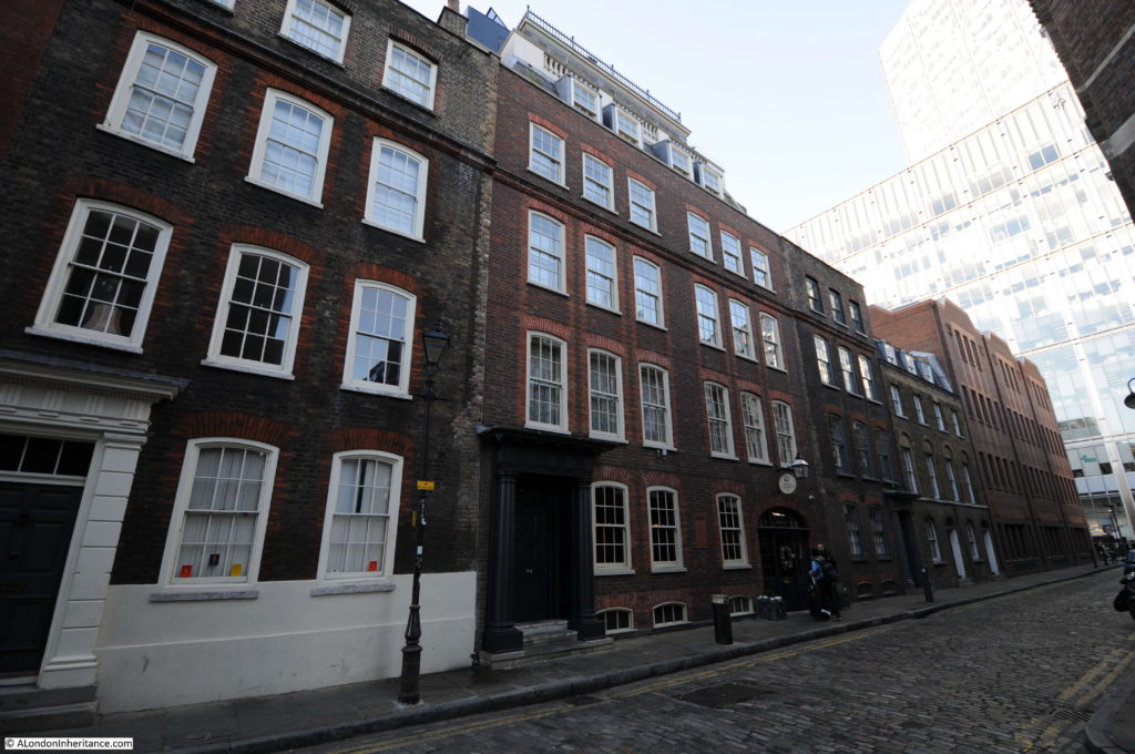
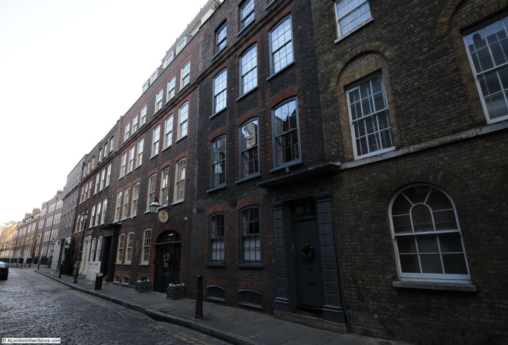
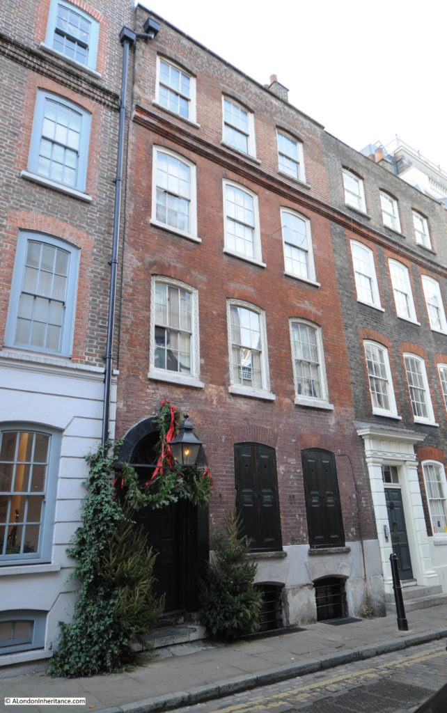
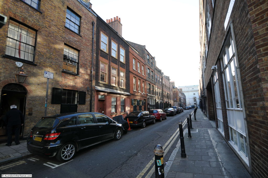
Folgate Street between Bishopsgate and Commercial Street has a fine mix of buildings. The 1724 group are marked on the map as nearer the Bishopsgate end of the street and I believe are the houses shown in the photos below.

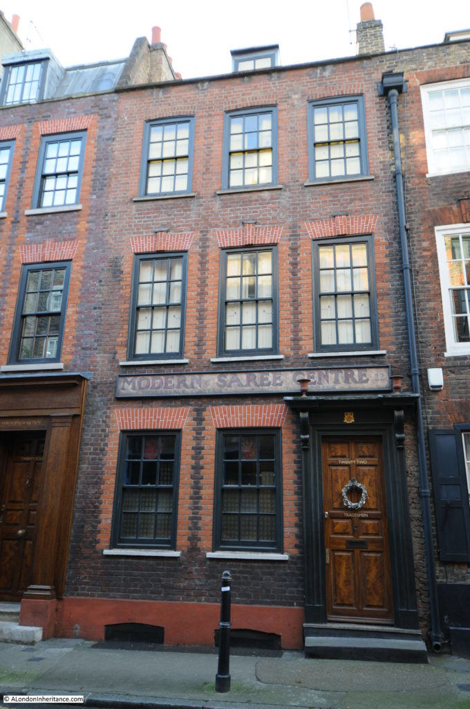
Including the wonderful Dennis Severs’ House, with the doorway dressed for Christmas as I walked passed in December.

Site 15 – Groups in Folgate Street and Elder Street

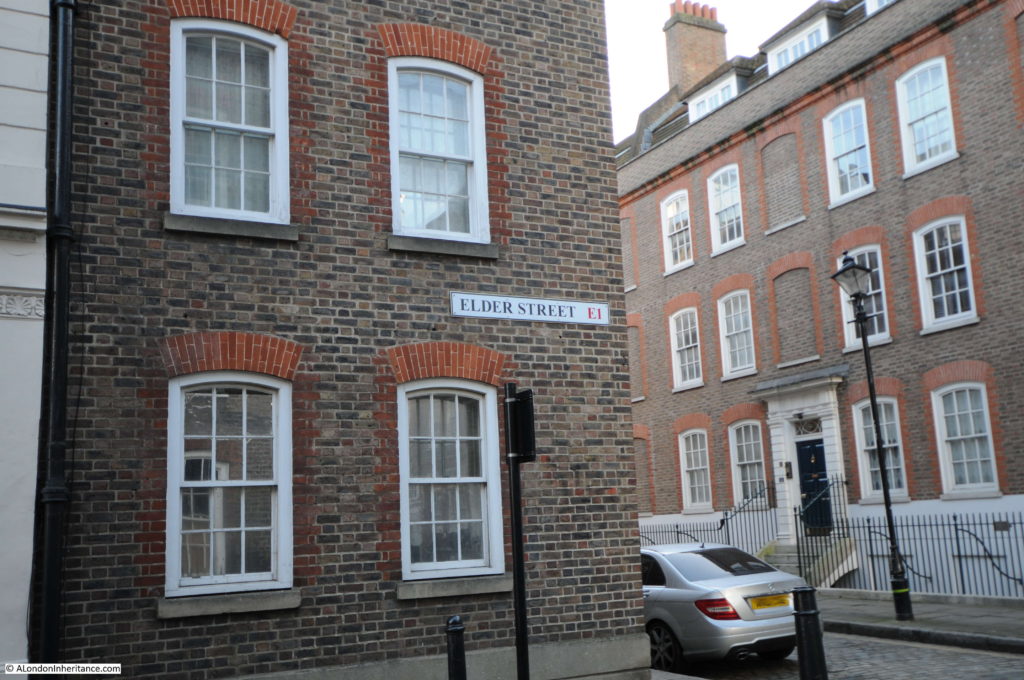
Elder Street can be found roughly half way down Folgate Street.

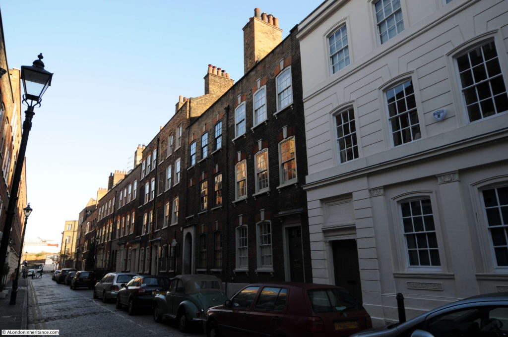
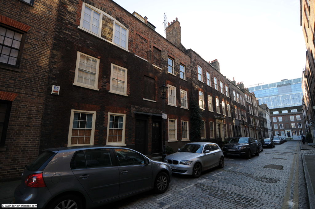
In the Architects’ Journal it is described in 1972 as “depopulated and isolated between the market area and a busy main road”. In the extract above about the fire at the house in Folgate Street there is the implied threat by the developer that he would not restore his side of Elder Street. Elder Street was in a bad way in 1972, however today the street is lined by restored buildings.

When restored the developer was selling the houses in Elder Street for £20,000 apparently with no lack of buyers. I could not find any houses for sale in Elder Street today, but estate agent estimates value houses at between £1.5 and £2.5 million – a considerable return on £20,000 in 45 years.

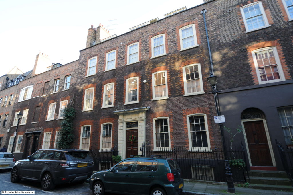
The mix of different styles and architectural features indicates the individual construction of each of these buildings rather than an identical terrace which can be found in a number of other streets such as Wilkes Street.

Note the building on the left with the bricked windows in the photo below. These are dummy window features added to break up what would have been a continuous slab of brick. The internal layout of the houses does not allow a window at these locations, as can be clearly seen on the first floor with the window across the two doors on both sides of the two houses.

Site 16 – Truman’s Brewery, 1740 – 1800

The final location in the group across Spitalfields is the Truman’s Brewery complex which can be found along Brick Lane.

Whilst the Architects’ Journal identified Truman’s buildings as worth preserving, they also identified the brewery company as a potential threat “It is not just small private developers exploiting this environment for personal gain – big businesses are expanding – Truman’s Brewery removed one side of early 18th century Hanbury Street and replaced it with a brick wall. The houses were in need of restoration, but no cosmetics could make a brick wall do anything but detract from a community.”

Reaching site 16 completes my walk around the category A sites in the Architects’ Journal map from 1972. It is good to see how many of the buildings of Spitalfields have survived since 1972, however as the article in 1972 predicted with comments about how Fournier Street could be restored, whilst the majority of the buildings have survived the area is socially completely different.

I have only just scratched the surface of these two areas, Whitechapel and Spitalfields, and I look forward to exploring them in more detail in the future.

In the coming months I will work on category B from the Architects’ Journal – Linear development along the Thames and Lea rivers due to riverside trades.

alondoninheritance.com

New Deal For East London – Whitechapel

I read in the week that the bookshop Waterstones reported an increase in sales of physical books after years of decline due to competition from electronic alternatives.

I have always preferred physical books as they can become so much more than the original contents. Second hand books that have the original owners name and date of purchase recorded, notes written in the margins and additional pages of information inserted in the book all help a book tell a much more comprehensive story than when it was originally published.

One of my father’s books, London’s Georgian Houses by Andrew Byrne, published in 1986 is stuffed full of pages and cuttings from professional journals such as the Architects’ Journal, newspapers and magazines such as Period Home from the 1970s, 80s, and 90s. These provide so much more additional information, updated over past and future time from the original contents of the book.

Included in these was a complete copy of an Architects’ Journal from forty five years ago, dated the 19th January 1972. This issue has a lengthy, special feature titled “New Deal For East London”.

The feature reported on the challenges facing the whole area to the east of London, which by the 1970s had been in continuous decline since the end of the last war, along with the future impact of some of the very early plans for major developments across the whole area to the east of London.

The article identifies a range of these challenges and developments, including:

  • The impact on the London Docks of the large cargo ships now coming into service
  • The lack of any strategic planning for the area and the speculative building work taking place, mainly along the edge of the Thames
  • The location of a possible Thames Barrage
  • The impact of the proposed new London airport off the coast of Essex at Foulness
  • The need to maintain a mixed community and not to destroy the established communities across the area

For this last point. the article provides an example of what happens when small pockets of more prosperous families move into an area: “some well-to-do families moved into a small terrace of new houses by the river, and were approached by the small boys of the neighbourhood with offers of ‘Guard your car, sir?’ for some trifling weekly sum. The car-owners brushed these knowing offers aside, but soon found their cars, if left in the street, being persistently vandalised, scratched and mucked about by those they had casually frozen out.”

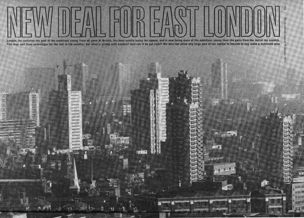
The title page for the article shows the view from south of the river of the new tower blocks being built across east London.

East London Header 1

The text underneath the title highlights the challenges facing London in the early 1970s:

“London, for centuries the goal of the ambitious young from all parts of Britain, has been quietly losing her appeal, and is now losing more of the ambitious young than she gains from the rest of the country. This may well have advantages for the rest of the country, but what is wrong with London? And can it be put right? We dare not allow any large part of our capital to become in any sense a distressed area.”

Very different to today when London is often seen as sucking in jobs, resources and talent from the rest of the country.

The article paints a very depressing picture of East London at the start of the 1970s:

“This is the poorest part of the capital, with the greatest need for all the social services provided (or permitted to be provided) by the local authorities, and – not surprisingly  – with the highest rates. Today this is a going downhill area in which neither the growing tourist industry, nor the entertainment industry, nor the new light industries show any interest. Such industries prefer to expand near the prosperous West End or in some part of the country, such as the new towns, where they will be eligible for an industrial development certificate and all the financial assistance that implies.

The rag trade may still flourish in the east, but its best products will be sold in the boutiques and department stores of West London, none of which consider the East End area worth opening up in. Even the great chain stores seldom open up a new branch in this area, while there are obviously more profitable sites to be found to the west. The entertainment industry, too, takes little interest and one reason for this may well be the very poor public transport system in those parts, which must inevitably limit both the catchment area and the enjoyment of an evening out.

There is no comparison between the provision of public transport in the west and the east. The Underground provides a fast network of frequent trains, north, south, east and west – on the west of the City of London. No such network serves the East End, and even the newly proposed Fleet Line only touches north-east London at Fenchurch Street.”

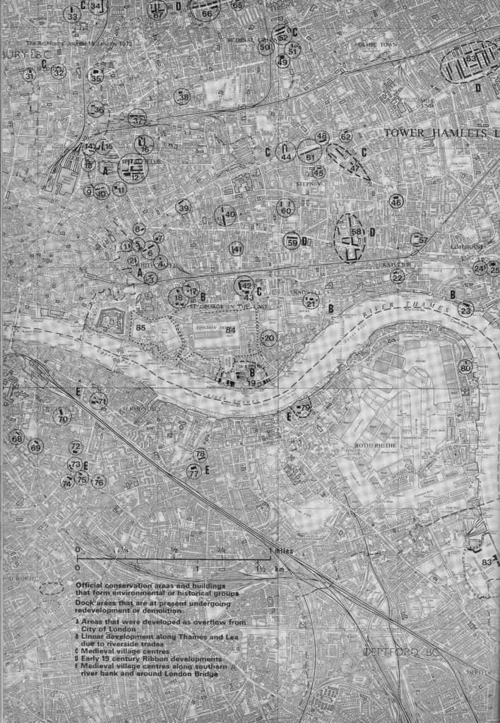
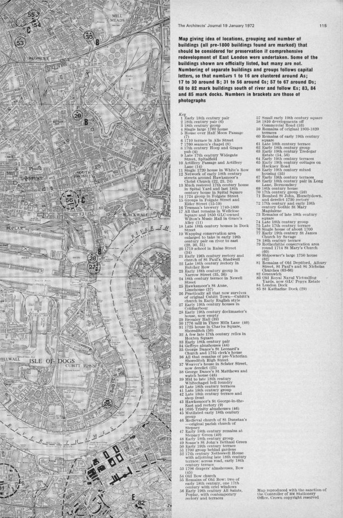
A key focus of the article is a concern that should there be comprehensive development of the area in the coming years, then a range of pre-1800 buildings should be preserved. The article included a map that identified 85 locations where there are either individual or groups of buildings that should be preserved. The area includes parts of south London, although still to the east of the central city area, therefore considered as being east London.

The map was split across two pages and is shown below. The locations were divided into five categories, identified by their historical origins:

A – Areas that were developed as overflow from the City of London

B – Linear development along Thames and Lea due to riverside trades

C – Medieval village centres

D – Early 19th century ribbon developments

E – Medieval village centres along southern river bank and around London Bridge

East London Full Map 1

The second page of the map included a list of the buildings.

East London Full Map 2

When I see an old map with locations marked across the map I always wonder what is there now (although 45 years is not that old, but London was a very different place in the early 1970s).

There was only one thing to do, and start a project to visit all these locations and see if the buildings identified in 1972 as worthy of preservation have survived the considerable development of East London over the last 45 years.

I had some time off at the end of December and so started with category A – Areas that were developed as overflow from the City of London and in today’s post I will visit the sites clustered around Whitechapel and in next week’s post conclude category A with those clustered around Spitalfields. I intend to visit all the sites on the map across the coming months.

Sites 1 to 8 – Whitechapel

East London Map A

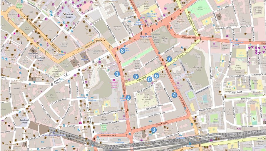
I have marked these on an up to date OpenStreetMap of the same area. Note that the Architects’ Journal appears to have the location of site 8 wrong on the above map, I will come to this later.

East London Map B1

Comparison of the two maps also shows how the road layout has changed. In the 1972 map, Commercial Road coming from the upper right side of the map ran straight to the large junction with Whitechapel High Street, Leman Street and Commercial Street. In the map of the area today, Commercial Road makes a sharp right turn and has its own junction with Whitechapel High Street.

Also see the rail tracks turn off the main line into Fenchurch Street and heading north a short distance into an area marked as Goods Shed. Both the Goods Shed and the length of rail track have been removed and the area labelled Goodmans Fields now covers part of this area. Although the name includes the word Fields, this area is mainly covered with new housing developments.

So, to start finding these sites, it is time to walk to:

Site 1 – Early 18th Century Pair

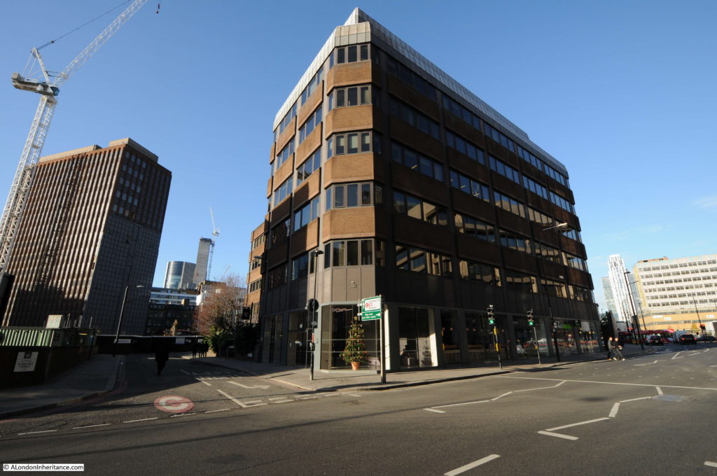
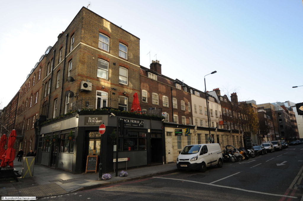
Turning off Aldgate High Street, I walked down Mansell Street to where site A should be according to the Architects’ Journal map, on Mansell Street at the junction with Little Somerset Street. There was nothing to be found that resembled an early 18th century pair of buildings on this side of the road, and if the location on the map is correct, the site of these buildings is now occupied by the office block shown in the photo below.

Not a very good start with the very first location lost at some point since 1972.

East London A1

Site 2 – 18th Century Pair

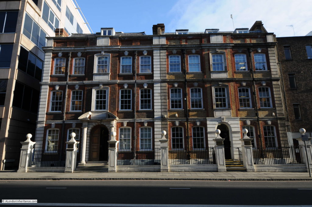
The next location was further down Mansell Street, on the opposite side of the road and at the location marked on the map I found the following pair of well preserved buildings.

East London A2

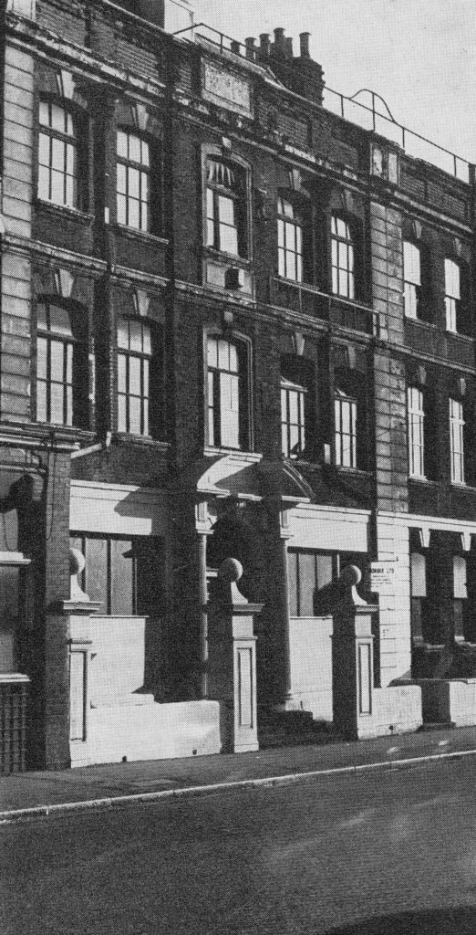
These are from the 1720s, with some possible Victorian updates to the facade. The entrance doorways would originally have been symmetrical. The doorway on the right has lost the pedimented Doric doorcase and the cornice above the door.

The photo below from the Architects’ Journal shows the state of the buildings in 1972 and they continued to crumble into the 1980s when the ground floor housed an Indian take-away.

East London A2B

I am not sure when they were restored, however after a worrying start, it was good to see the second location in fine condition.

Site 3 – 18th Century Group

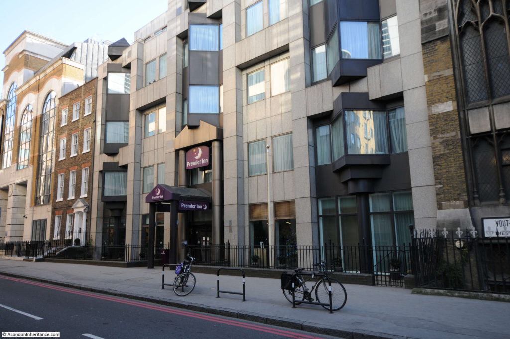
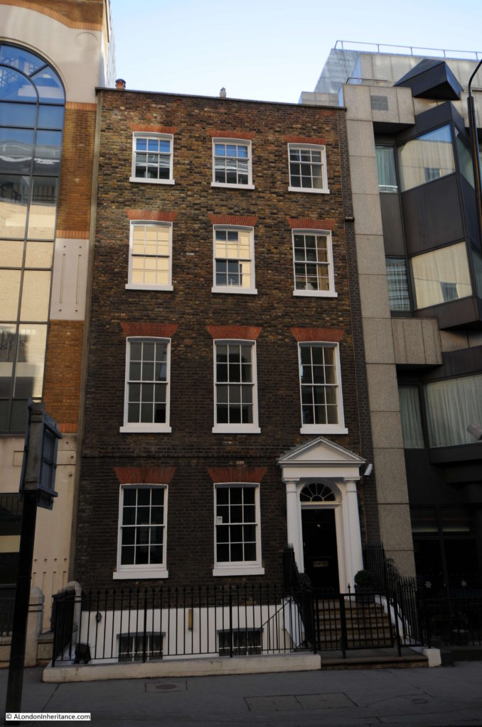
To reach site three, I walked to the end of Mansell Street and turned left into Prescot Street. Here I was looking for a group of 18th century buildings on the south side of the western end of the street. Looking along the street I could only see one building of an appropriate architectural style and age, squashed between a Premier Inn and an office building.

East London A3

The Architects’ Journal described this location as a “group” so I assume that originally there were similar buildings on either side of this one survivor, possible of terrace of identical buildings.

Strange to see this building sandwiched between two very different and much more recent buildings.

East London A3B

Although not mentioned in the Architects’ Journal, there are a couple of interesting buildings further along Prescot Street. The building to the right is the old Whitechapel County and Police Courts, completed in 1859 and on the left is the Victorian pub the Princess of Prussia, built in the 1880s.

East London A3C

Site 4 – Single Large 1760 House

Now to site number four. At the end of Prescot Street I turned left into Leman Street and walked along the street to roughly where the map showed the location of a single large 1760 house.

In the expected location I found this cluster of three buildings. I assume that the single large 1760 house is the building on the right.

East London A4

I am now heading to Alie Street, but before I look for the next location, some information on the area I have been walking around.

If you look at the map at the top of this post, Mansell Street, Prescot Street, Leman Street and Alie Street form a square around another square of streets, North, East, South and West Tenter Street.

According to the Architects’ Journal article, Alie Street was laid out by Sir William Leman in 1710.

Checking in the book “The Streets of London” by Gertrude Burford Rawlings:

“Mansel Leman, towards the end of the 17th century, married Lucy Alie of St. Dunstan’s in the East. hence Leman Street, Great and Little Alie Street and Mansel Street”.

One refers to William Leman and the other to Mansel Leman. On checking the wonderfully named “Synopsis of the Extinct Baronetage of England” from 1885, Sir William Leman was the son of Mansel Leman.

In the middle aisle of St. Dunstan’s in the East, there was an inscription to Alice Alie and Lucy Alie dated 1678 which is presumably the date of death. Mansel Leman died in 1687 (the name Mansel is the maiden name of his mother, Mary Mansel).

So, given that the streets were laid out in 1710, Sir William Leman must have named the streets after the first and last names of his father and the maiden name of his mother.

An earlier member of the Leman family, Sir John Leman (1544 to 1632) was Lord Major of London in 1616 and was a member of the Fishmongers Company.

Within this square of streets is another square of Tenter Streets. The origin of this name is from the Tenter Ground that was enclosed by these streets. A Tenter Ground was an area of land where wooden frames called tenters were placed. These were used to stretch woven cloth so that it would dry.

Before the Tenter Ground, the area was part of Goodman’s Fields.

Site 5 – House Over Half Moon Passage

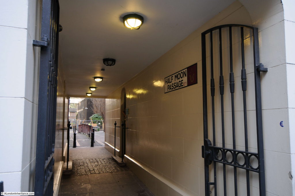
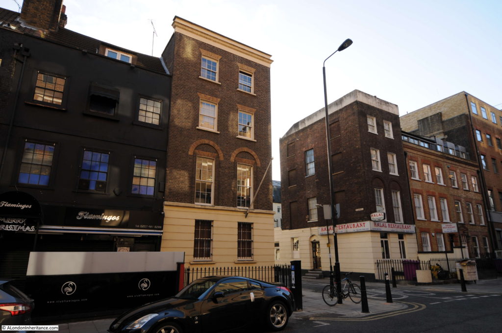
Continue along Leman Street and turn left into Alie Street. Walk along Alie Street to location number 5 where we find the house over Half Moon Passage.

East London A5

The building and passage are still here. I have found a couple of references to the origin of the name Half Moon Passage. One that refers to the graphic representation of an unpaid sixpence on a person’s tally used in pubs and ale houses in the 17th and 18th centuries, the other was that a tenement building that stood here in Tudor times was called the Half Moon.

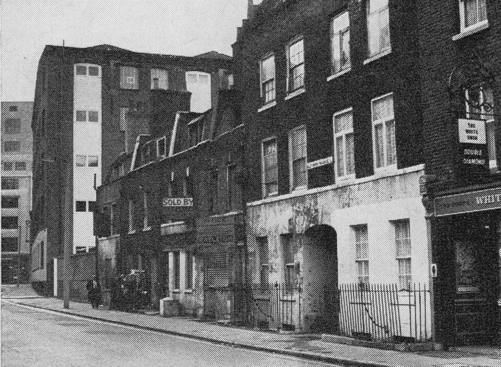
The photo below from the Architects’ Journal shows Half Moon Passage and the building around the passage in 1972. The buildings on the left have been replaced by a later office block. The pub on the right, the White Swan is still there, although impossible to get a pint of Double Diamond there today.

East London A5D

View through Half Moon Passage:

East London A5B

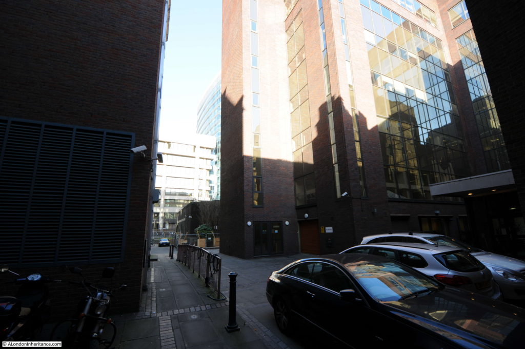
The name of the passage gives you some hope that it would open out into a hidden square of 18th century buildings, however at the end is a small car park and office entrance all thrown into shadow by the tall surrounding buildings.East London A5C

Site 6 – 1710 Terrace In Alie Street

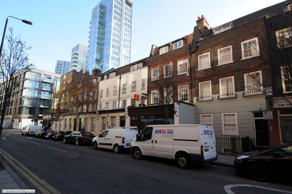
Opposite the White Swan is the start of the next set of buildings, a terrace that runs along Alie Street on either side of St. Mark Street.

East London A6A

A pair of symmetrical, four storey buildings stand on each side of the junction with Mark Street.

The terrace continues along Alie Street towards the junction with Leman Street. Changes to the ground floor, including extensions to the edge of the pavement obscure the lower floor, however the upper floors of this original terrace are still visible.

East London A6B

At the junction of Alie Street and Leman Street. The design along Alie Street appears to have been four storey buildings on the corners of road junctions with a terrace of three storey buildings between these four storey corner buildings.

East London A6C

Site 7 – 1760 Seamen’s Chapel

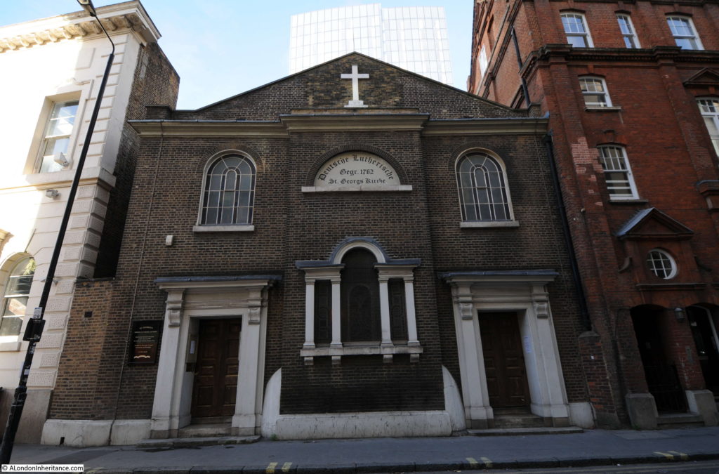
Just past the junction with Leman Street, still on Alie Street is the German Lutheran Church of St. George dating from 1762, or in the original German from the front of the church “Deutsche Lutherische St. Georgs Kirche”

East London A7

The church of St. George is the oldest German Church in the country and dates from a time when the area around Aldgate and Whitechapel was home to a large population of German immigrants, which grew to such numbers that during the 19th century the area was home to the largest number of German speaking people outside of Germany.

The church would have looked more impressive prior to 1934 when standing above the centre of the church was a large bell tower capped by a weather vane. These were taken down in 1934 owing to the poor and unsafe condition of the structure with the plain roof we see now put in place.

As with much of the surrounding area, the church was falling into a state of considerable disrepair during the 1970s, 80s and 90s. Such was the state that when the church was acquired by the Historic Chapels Trust, almost £1m was needed to repair the fabric and structure of the building.

The church was closed during my walk, however the interior contains many original features from the 18th and 19th centuries.

Site 8 – 17th Century Hoop And Grapes Pub

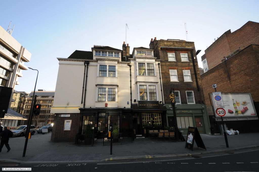
The final site in the Architects’ Journal cluster of buildings in Whitechapel is the Hoop and Grapes pub. This is the building that is incorrectly marked in the Architects’ Journal map which shows the building at the junction of Whitechapel High Street and Leman Street where it is actually at the junction of Aldgate High Street and Mansell Street.

East London A8

The Hoop and Grapes has foundations going back to the 13th century. There are various dates for the main building with both the 16th and 17th Centuries being claimed. The Architects’ Journal states that the building is from the mid 17th century and Pevsner moves this to the late 17th century.

I suspect that this was due to the the way buildings evolved rather than being built as a new single construction, parts of the building could well date to the 16th century with additions to the facade being added to meet the 17th century dates of both the Architects’ Journal and Pevsner. If you look at the construction sites across the City today, buildings are completely cleared away allowing a new building to be constructed without any of the earlier foundations, reuse of materials etc. The only exception being the hideous practice of removing all parts of a building with the exception of the facade (although whilst i deplore this practice it does at least retain the original street appearance despite a completely new building behind).

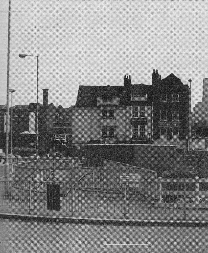
The photo below from the Architects’ Journal show the Hoop and Grapes in 1972 with a more industrial set of buildings in the background. The photo also had the statement that the pub is marooned by the road system around Aldgate and is grotesquely situated, but gives a glimpse of what the City was like before the great Victorian and later rebuildings.

East London A8C

This is still somewhat true with the pub being at the very busy junction of Whitechapel and Aldgate High Streets, Mansell Street and Middlesex Street, with the surrounding ever rising office blocks.

The rather crooked entrance to the Hoop and Grapes. An ideal place to stop after a walk around Whitechapel on a cold December day.

East London A8B

Forty five years after the original Architects’ Journal article, I was pleased to find that seven out of the original eight buildings, or clusters of buildings that the article proposed should be considered for preservation have been restored and survive into the 21st century.

In my next post I will be visiting the final set of buildings in category A – the cluster around Spitalfields.

alondoninheritance.com