Category Archives: London Infrastructure

Crossing the Thames at Woolwich

Woolwich has the distinction of having two unique ways of the crossing the River Thames. There is one of two, dedicated foot tunnels under the river (the other is at Greenwich), and it is the only place on the river where there is a combined vehicle and foot passenger ferry across the river, which has the added bonus of being free.

I have not used either of these crossings for around 20 years, so when I was walking around the Royal Docks for my previous posts, it seemed the idea opportunity to use the tunnel and ferry again, and I could also use London’s latest bit of transport infrastructure, the Elizabeth Line which runs to Woolwich, to get there.

The river is a short walk from the Elizabeth Line station, and a short distance away, there is a sign offering the two choices to cross the river:

The location of the entrance to the foot tunnel is not immediately clear. There is a small street (Glass Yard) heading off Woolwich High Street, where the above sign is located, you need to walk to the end of this street, turn right, and the tunnel entrance is hidden behind the Waterfront Leisure Centre:

The entrance on the north bank of the river is far more obvious as it stands alone, as can be seen in the following photo from across the river:

Although the entrance to the foot tunnel is hidden behind the leisure centre, it is the crossing point of a number of walking and cycling routes as illustrated by the rather comprehensive sign outside the entrance:

The Thames Path – where to the east it is 8.75 miles to Crayford Ness. The Capital Ring, where it is 35 miles to Richmond Bridge, The Thames Cycle Path with Greenwich to the west (6 miles) and Erith to the east (6.5 miles),

The bottom left sign informs that North Woolwich Station is a quarter of a mile away via the foot tunnel, which is rather out of date as North Woolwich Station closed in 2006.

The brick entrances to the Woolwich foot tunnel are Grade 2 listed, and the Historic England listing describes these structures in a far better way than I can:

“II Rotunda. 1910-12, by Sir Maurice Fitzmaurice. Red brick with blue brick plinth; roof mostly of lead. One storey. Canopied entrance with decorative bargeboards and foliate capitals to cast-iron columns. Segmental arches over paired fifteen-pane sash windows with wrought-iron grilles set in square recessed panels; stone cornice beneath panelled stone-coped parapet. Conical roof with circular lantern.”

Despite the fact of the Grade II listing, the unique status as being one of only two foot tunnels under the Thames in London, and that the tunnel is still in use, the Leisure Centre has been built up against the structure, as closely as it possibly could be, as illustrated by the following photo:

The Woolwich Foot Tunnel opened in 1912, when Woolwich already had a free ferry across the river, so you may well ask, if there was a ferry, why go to all the expense of building a tunnel under the river?

The local newspapers covered the opening of the tunnel, and the first paragraph in their accounts provides the justification for the tunnel:

“In spite of the County Council’s efforts to provide a frequent and regular service between North and South Woolwich, two causes have mitigated against the continuous working of the ferry – fog, and, in exceptionally severe winters, ice. The stoppages, especially those from fog, usually occurred during the early morning when workpeople had to cross the river to their labours, and serious hardship was thus inflicted on a large number of people. With these facts before it, the County Council recognised that the service would have to be supplemented, and in November 1908, they submitted to Parliament a scheme for the construction of a tunnel for foot passengers between the north and south districts.

It was pointed out that if such a tunnel were constructed it would no longer be necessary to provide a continuous service of ferry boats. The necessary sanction having been obtained tenders were invited and that of Messrs. Walter Scott and Middleton Ltd., amounting to £78,860 was accepted.”

My last few posts on the Royal Docks has hopefully highlighted the size of these docks, and therefore the amount of people needed to work across them. Add to that, the industry that occupied the land between the docks and the river, all contributed to a significant demand for workers, many of whom would have lived on the south of the river in Woolwich, and for whom, the ferry would have been essential to their employment on the north of the river.

The following postcard was issued to mark the opening of the tunnel on the 26th of October, 1912 by Lord Cheylesmore, who was Chairman of the London County Council:

The photo for postcard was by a Woolwich photographer, although I cannot be sure whether the photo is off the Woolwich or the North Woolwich tunnel entrance. The opening ceremony was held at the southern entrance, however I cannot place the features seen around the entrance in maps of the area around the time of the tunnel opening.

When the tunnel was opened, the entrance was in Nile Street, a short, wide street that led to the South Pontoon, from where the Woolwich Ferry could also be taken, so unlike today, the foot tunnel entrance was collocated with the ferry approach, so if the ferry was not running, the passengers could simply divert down the tunnel.

Today, the tunnel entrance is separate to the tunnel approach.

Early photos and postcards often had crowds looking at the photographer, possibly the novelty of seeing a photographer. In the above photo there is a baby or young child in white, in the centre of the crowd. It would be fascinating to know the stories of these young Woolwich residents:

Walking into the entrance to the tunnel, and there is a large No Cycling sign above a spiral stairway that leads down to the tunnel:

The view along the tunnel from the base of the southern entrance:

Lift at the base of the southern entrance:

The newspaper article covering the opening of the tunnel provides some background to its design and construction:

“The new tunnel, which was begun in May, 1910, was designed by, and carried out under the supervision of the Chief Engineer of the London County Council, Sir Maurice Fitzmaurice. It closely resembles the Greenwich Tunnel, which was opened in 1902. It consists of a cast iron tube, of 12ft. 6in. outside diameter, connecting two vertical shafts of 25ft. inside diameter, and about 60 ft. deep.

The length between the shafts is 1,635 ft., or nearly one third of a mile. The thickness of the river bed between the top of the tunnel and the river is about 10 ft. at the deepest place. Electric lifts have been provided to accommodate forty passengers each. A fair day’s progress in tunnelling was 8ft. 6in. The ground passed through was almost entirely chalk, with numerous fissures, which were in free communication with the river. The cost has been about £85,000.”

The Greenwich foot tunnel referred to above was opened in 1902, and both tunnels used a very similar construction technique. I wrote a detailed post about the construction of the Greenwich Foot Tunnel, here.

Sir Maurice Fitzmaurice, who designed and supervised the construction of the Woolwich foot tunnel was also responsible for the Rotherhithe tunnel, where construction started in 1904 and the tunnel opened in 1908.

As you walk through the tunnel, it is good to know that there is 10 feet between the top of the tunnel and the bed of the River Thames:

There are plenty of very obvious signs that state there is to be no cycling through the tunnel. During my walk through there were two cyclists. One was wearing a high-vis jacket, obviously going either to or from work, and was cycling very slowly – which was fine given how empty the tunnel was of walkers (only me and one other), however half way along I heard a whooshing sound behind me, and one cyclist, on a racing bike, wearing a helmet, sped past, looking like he was doing a time trial through the tunnel. In the time between passing me, and me lifting my camera, he was the distance from me as shown in the following photo:

The problem of cycling through the tunnel has been around since the tunnel opened. In June 1913 the Woolwich Gazette and Plumstead News reported the following:

“FOOT TUNNEL CYCLING – Hebert F. Clarke of 1. Chertsey Road, Leytonstone was summoned for riding a bicycle through Woolwich Foot Tunnel. George Hunter of 28 The Parade, Grove Green Road, Leytonstone, was also summoned. Each fined 2s.”

It is remarkable how many tunnels under the Thames opened in a very short period of time, and much was made of the cost of the Woolwich tunnel compared with the others:

  • 1897 – The Blackwall Tunnel. Cost £1,300,000
  • 1902 – Greenwich Foot Tunnel. Cost £180,000
  • 1908 – The Rotherhithe Tunnel. Cost £1,000,000
  • 1912 – The Woolwich Foot Tunnel. Cost £87,000

Infrastructure getting cheaper is something we can only dream of today.

Approaching the southern end of the tunnel:

The decision to build a foot tunnel at Woolwich, highlights the challenges of planning for the future.

At the opening ceremony, it was stated that the need for a subway had been emphaised by recent fogs, which had interfered with the working of the ferry.

Lord Cheylesmore stated during his speech at the opening ceremony that (referencing the decision to open the ferry. twenty-one years earlier) “If future requirements had then been realised it was possible that a vehicular tunnel would have been constructed in the first place.”

It is always a problem when constructing any large transport / infrastructure project, to know whether an alternative design would better serve future requirements. The problem is that waiting for those future requirements to become clear, results in nothing being built. Building now risks it being outdated in the future.

The opening ceremony was held in Nile Street, the access road to the ferry, with the tunnel entrance alongside. Nile Street is now under the Waterfront Leisure Centre, and the ferry pier has moved slightly to the west.

At the southern end of the tunnel, the lift was not working, so it was up the stairs for the 60 ft. of the access shaft:

Back up to the surface on the north of the river, and here the access building is identical to that on the south of the river, although here it is in open space, with no surrounding buildings:

Outside there are direction signs for the Capital Ring and on a separate post, direction signs for local buses and a DLR station. Fortunately no sign for North Woolwich Station on this side of the river:

One of the new Superloop branded buses stops outside the tunnel entrance:

New building close to the entrance to the tunnel which is alongside the approach road to the Woolwich Ferry:

The new tunnel had an impact on one of the oldest professions on the river. In the year after the tunnel was opened, the London County Council paid out £15 to each of the sixteen remaining Woolwich ferrymen, who once rowed people across the river.

One of the ferrymen was a 60 years old who had been on the river “since he was six weeks old”, and knew “every mudbank and creek from Kingston to Dover and Yarmouth”, and as well as a ferryman had worked on lighters, as well as being a sailor.

He complained that “I’ve worked hard and straight, I’ve helped the police and I’ve helped my passengers. I have saved lives and property. I have been proud to be a freeman of the river, and now, when I am old, they go and dig a hole below it and rob me of my trade. It isn’t fair.”

Following the opening of the tunnel, there were ongoing challenges with the costs of running and maintaining both the ferry and the tunnel, with some attempts to reduce the hours that the lifts down to the tunnel operated (which were soon restored), and the number of ferry crossings, which were reduced slightly, however the ever increasing volumes of motor traffic meant that any reduction in ferry crossings was short lived.

The northern tunnel entrance:

From close to the tunnel entrance, we can see the current terminal of the Woolwich Free Ferry:

The northern tunnel access which is in a very different environment from the hidden and enclosed location of the southern. Hopefully with all the new building planned for this part of North Woolwich, it will stay in the open:

The opening ceremony for the tunnel was held in Woolwich on the southern side of the river. After the speeches and formal parts of the ceremony, Lord Cheylesmore along with the other dignitaries who had attended the ceremony descended down to the tunnel and walked to North Woolwich.

After emerging from the tunnel entrance shown in the above photo, they took the Woolwich Free Ferry back to Woolwich, and that it what I will now do.

Walking to the pier that leads to the ferry – the access road bends to the left at the end of the end of the orange cones:

As you walk onto the road leading up to where the ferry boards, we can see the old walkway that was to the immediate west of the approach to the ferry. In the following photo, there is a large anchor in the gap between the bushes:

Looking along the approach to where the ferry boards:

As you walk up to the ferry, there are some brilliant views along the river. In the following photo, the Thames Barrier stretches across the river, and on the right is where the ships carrying sugar cane dock for unloading into the Tate & Lyle factory:

Where vehicles and foot passengers board the ferry:

The Woolwich Ferry is currently a two ferry service, with a departure every 15 minutes from five in the morning until nine in the evening. Whilst waiting for the ferry to arrive, you can watch the two ferries perform their synchronised crossing of the Thames:

Facilities are basic, but then with a 15 minute service there is no need for anything more sophisticated. The footpath on the western side of the approach road takes you up to the boarding point, where a bus shelter provides some limited protection from the elements:

The earliest references to a ferry at Woolwich date back to 1308, when it was included in the sale of a house by a waterman named William de Wicton.

The ferry in the 14th century, and the following centuries would have been similar to services provided by watermen along the length of the Thames, where for a fee they would row you across the river.

These services were generally provided from a defined point, usually a set of Thames Stairs or a named place where a street reached the river. This was the case for the ferry at Woolwich, where it ran from Warren Lane at Woolwich (circled red in following 1746 map extract):

To and from the end of the lane in the following map. This point was covered by two separate pages in my copy of Rocque’s map so I have had to show two different map extracts. Where the tip of the red arrow is located was where the lane met the Thames:

The ferry service run by a waterman must have been a very ad-hoc serviuce and he probably spent more of his time rowing people up and down the river. During the 18th century there was very little where North Woolwich is now located. It was all fields, marsh and streams as the above extract demonstrates.

The early years of the 19th century saw the start of more formal ferry services, with the military setting up a ferry for their own use, from Woolwich Arsenal in 1810, and in 1811 a ferry was established by an Act of Parliament, and was run by a company that was called “The Woolwich Ferry Company”, however this service only lasted until 1844.

The demand for a regular, high volume service would come with the development of the area to the north of the river with the Royal Docks and associated industry in the 19th century.

On the 16th of October, 1880, the Kentish Independent reported that “A meeting is advertised for Monday next at the Town Hall to consider the proposed establishment of better communications between South and North Woolwich, embraced in the scheme of the Thames Screw Ferry Company. From the company’s prospectus we learn that they contemplate building two large twin screw boats, with turn-tables on deck and other conveniences for transporting horses and vehicles, together with a saloon for passengers, and that they propose to have landing stages at various positions below London Bridge. As we are chiefly interested in the Woolwich section of the river, where facilities of communication are perhaps more needed than anywhere else, we hope that the promoters will give us their earliest attention. At a moderate calculation it is computed that some 200 carriages will cross the river daily, and with a charge of 6d to 2s according to the number of horses, it is estimated that the speculation will be a profitable one.”

On the same page as the above report, there was a fascinating article on the impact of the electric lights at the Royal Albert Dock, which had only just opened, and was the first London dock to be lit by electric lighting.

Consider that the following was written when London must have been very dark at night, very limited electric lighting, some gas lighting, and not much else after dark:

“THE ALBERT DOCKS – The appearance of the electric lights at the new docks, seen from any eminence where a full view of the whole sweep can be obtained, is on a clear night very striking and beautiful, especially if a position is chosen from which any of the brilliant sparks are seen reflected in the river. In another sense beyond pleasure to the eye, they are beacons of satisfaction to the people of Woolwich, for they typify better days in store, increase in trade, and reduction of local burdens.”

It must have been quite something to stand in Woolwich and look across the river to see the light from the new electric lights along the new dock, and the article also highlights the positive impact that the docks were hoped to have on Woolwich – and for which a ferry was really important, so the residents of Woolwich could benefit from the opportunities opening up on the north of the river.

One of the two Woolwich ferries arriving at the northern pier:

The two new ferries entered service in early 2019, after being delivered from where they were built in Poland.

The ferry in the above photo is named the Ben Wollacott, after the 19 year old deck hand who died in the river in 2011, after being pulled from the ferry while mooring ropes were being untied.

Serco, the company then in charge, was found guilty of failing to ensure the health and safety of its crew, and fined, with costs, a sum of £220,000.

The second of the two new ferries was named the Dame Vera Lynn.

The above photo shows a packed ferry, with a mix of lorries, vans and cars making the free crossing across the river.

And whilst I was waiting for the ferry to arrive, there was a queue of vehicles building to cross from north to south:

There is no ceremony for foot passengers boarding the ferry, the barrier across the walkway lifts and you walk onboard, whilst vehicles are still leaving the ferry:

Which provides a perfect opportunity to see the deck of the ferry before any vehicles have boarded:

The ferries before the current pair had a passenger area below the vehicle deck. With the two new ferries, there is a passenger area at deck level, on one side of the ship, where a corridor is lined with blue plastic seating:

The meeting in Woolwich Town Hall in October 1880 was strongly in support of a new ferry, with the “rapid growth of townships on the north of the river” being a key driver of the need for Woolwich residents to be able to cross the river via regular and reliable services.

In the October 1880 meeting, we also see the demands that the ferry should be free. Many of the bridges over the Thames in west London had recently had the fee dropped for a crossing, so west London bridges were now free to cross, and the Woolwich argument was that the three million people east of London Bridge were paying their rates, which went towards the Metropolitan Board of Works ability to drop the charges for west London bridges, east Londoners should have the same facilities.

Plans then moved quickly, and in 1884, the Metropolitan Board of Works agreed to deliver a free ferry across the river, and in 1887, the construction company Mowlem (who were also responsible for much construction work across the whole of the London docks right up to their closure), was awarded a contract to build the approach to the ferry, pontoons and boarding infrastructure.

The Woolwich Free Ferry opened on the 23rd of March, 1889, and such was the importance of the event that reports of the opening also mentioned that it was made “the occasion of a public holiday in the neighbourhood of Woolwich”.

The service was opened by Lord Rosebery, the chairman of the London County Council, who had just taken over the responsibilities of the Metropolitan Board of Works (and after whom Rosebery Avenue was named).

Two steam ferries had been built for the opening of the service, the Gordon and the Duncan, and they were reported as being “capable of carrying a thousand people and at least a dozen vehicles upon the upper deck”.

The ability to take a thousand people and only twelve vehicles highlights the original need for the ferries, being able to transport large numbers of residents from Woolwich and surrounding areas, to the new employment opportunities that were opening up across the Royal Docks, and the industry along the river.

Local business soon took advantage of the new free ferry in their advertising, with, for example T. Gordon, a maker of hand-sewn boots in 9 Hare Street, Woolwich, heading his adverts with the opening of the Woolwich Free Ferry, and that residents of South and North Woolwich, Silvertown, Canning Town, Plumstead, Charlton and the Surrounding Vicinity could all now “Come and judge for yourselves”, the quality of his boots.

The new service was not without its problems. The ferries were built of pitch-pine “a wood chosen for its self preservative qualities, but unfortunately very inflammable”, and there were occasional fires on the ferry as a result.

There was also a case where the steering on a ferry jammed mid river, with the Captain stopping power so it would not ram the jetty, however the ferry then started drifting in a busy river. On checking the steering gear it was found that a bolt had dropped and jammed the gear, and on removal, the ability to steer was restored.

The bolt was found to be unlike any used in the ferry, so it was assumed to be sabotage.

The ferry crossing in the 1970s:

The following photo shows two of the three ferries built in 1963, and which were replaced by the ferries that we see on the river today. The photo dates from the 1980s, as behind the ferry, on the left edge of the photo, some of the dishes of the BT Docklands Satellite Ground Station, can be seen:

I took the following photo on a Sunday in 2015, I know it was a Sunday as two of the three ferries are moored in the river just to the right of the pier on the left, where there is a single ferry docks:

The following photo shows the Duncan – one of the first boats built for the opening of the ferry service:

The deck is crowded with passengers with what appears to be a mix, including children along with men in military uniforms. The upper deck is crowded with vehicles.

The following photo shows the Gordon, the second of the three ships built for the opening of the ferry. It was named after General Gordon of Khartoum:

Although it does not look that much different from the above ferry, the photo below is of the Will Crooks, built in 1930 as one of the replacements for the original fleet of ferries:

The following photo from the 1920s books “Wonderful London” shows the ferry crossing the river, with a man at one of the Thames stairs in the foreground. There is a rowing boat tied up, so perhaps he is one of the old waterman still hopeful of some business:

The text with the above photo claims that the ferry “conveys about half a million vehicles a year free of charge”, and that the cost to run the ferry was about £25,000 a year.

My view from the ferry of the landing place on the north of the river, from where the ferry had just departed. The round brick building of the tunnel entrance can be seen to the right:

The Tate & Lyle factory:

As I arrive at the southern pier, the Dame Vera Lynn is arriving at the north:

The crossing between Woolwich and north Woolwich is brief, however it does provide the opportunity for some wonderful views across the river. Another view of the Thames Barrier, with the towers of the Isle of Dogs in the background:

Arriving at Woolwich:

The ramp descending:

As with boarding the ferry, when leaving, the barrier lifts and you walk off. A quick look back at the ferry:

The Woolwich ferry approach road:

As I was leaving, a queue was building up ready for the following ferry, and at Woolwich, there is a separate queuing area where vehicles queue before be let on to the approach to the ferry.

The route from south to north seemed much busier than that from north to south. That may just be a time of day thing. I tried to find any detailed statistics of ferry usage on the Greater London Authority and the Transport for London websites, but after a quick search, nothing seemed to be available.

The headline statistics seems to be that the Woolwich ferry carries around two million passengers a year. The vast majority of these will be the occupants of vehicles rather than foot passengers.

The following photo shows the entrance to the ferry at Woolwich:

I did not notice one on the north of the river, but at Woolwich on the south, the ferry has a “River” TfL roundel:

The combination of the two methods of crossing the river at Woolwich are unique. Whilst there is another foot tunnel at Greenwich, there is no other large passenger / vehicle ferry.

The fact that the Woolwich ferry continues to be free is remarkable in today’s financial environment, where so much starts to be attracting a price.

When the new Silvertown tunnel opens, there will be a fee for using the tunnel, and to stop people continuing to use the currently free Blackwall tunnel, a new fee will be introduced for using this old tunnel, the first time in 130 years.

It will be interesting to see if the Silvertown tunnel has an impact on traffic levels on the Woolwich ferry. Theoretically not, as the Silvertown Tunnel follows a similar route to that of the Blackwall tunnel. It could be that traffic on the Woolwich ferry increases to avoid the fees at the Blackwall and Silvertown tunnels, such are the unintended consequences of change.

To introduce a fee for the Woolwich ferry would require an Act of Parliament to amend the act originally brought forward by the Metropolitan Board of Works to introduce the ferry, which specified that the ferry should be free to use.

Today, foot passengers wanting to travel between the north and south sides of the river at Woolwich also have the choice of the DLR which runs from Woolwich Arsenal to the north, as well as the Elizabeth Line which runs from Abbey Wood, to Woolwich, before heading north of the river.

The loss of the docks in the 1980s significantly reduced the number of jobs for residents of the south to commute to on the north. The DLR and Elizabeth Lines have added alternative options, however for a quick, free crossing of the river, the Woolwich Ferry is a wonderful way of seeing the river and getting between north and south Woolwich, and the foot tunnel provides an historic alternative using one of only two surviving foot tunnels under the Thames.

alondoninheritance.com

King George V Dock – The Last of the Royals

In my final post exploring the Royal Docks, I am looking at the King George V Dock, the last of the three docks that make up the Royals, and was opened in 1921.

I have a copy of the book that was issued to commemorate the opening of the King George V Dock, and at the back of the book are some fold out paper maps, one with a view of all the docks from St. Katherine out to Tilbury, and the following is an extract from the map showing the Royal Docks as they were following completion of the new, third dock (the map is a bit creased. It is 100 years old and of very thin paper so I did not want to put too much pressure on the folds):

The King George V Dock is the dock on the right, below the Royal Albert, and in the map it is marked Royal Albert Dock Extension (South). The book and map were issued in advance of the formal opening by King George V, so I assume it was the wrong thing to do with royal protocol to give the new dock’s name before the King had officially opened and named the dock.

Another point with the map, is that the Port of London Authority were considering a fourth dock for the Royals complex. The red lettering above the Royal Albert Dock is marked as a “Site for dock”. This additional dock was never built, and future expansion by the Port of London Authority would be focused on Tilbury.

It is not possible to walk alongside the majority of the King George V dock. London City Airport occupies the northern side of the dock, whilst other parts of the airport (car parks, offices etc.) occupy much of the southern side, and the one road that ran alongside the dock is fenced off.

So to look at the dock, I am taking a walk along Woolwich Manor Way and the Sir Steve Redgrave Bridge, which provide a good view along the length of the King George V Dock, as well as the lock entrances and the Royal Albert Dock.

The route I am taking is shown by the red dashed line in the following map, starting from the bottom of the line, looking to the west, then returning on the other side of the bridge, looking at the view to the east (© OpenStreetMap contributors):

Detail from the map at the top of the post shows the Royal Albert Dock Extension, or the King George V Dock as it would be officially known following the opening ceremony:

The road I am following in today’s post is shown in the above map, running over the lower of the three locks to the right, before bending to avoid the Basin, although today the road is straight and a bridge runs over the Basin.

There is no access to the south of the King George V Dock, the road that runs along the south side is fenced off from the east. The blue sign is offering a welcome to London City Airport, although there is no public access from this direction:

A look through the gates, and the road disappears off to where the car parks for the airport are located, with access being from the terminal building at the far west of the dock:

So I am continuing along the Woolwich Manor Way, up to the bridge that runs over the lock between the dock and the river:

Looking along the lifting bridge over the lock:

And from the middle of the bridge, we can look to the west, along the full length of the King George V Dock:

The new dock was needed because the size of ships continued to grow, and there were now ships that were larger than could be accommodated by the Royal Victoria or Royal Albert Docks.

The book published for the opening of the dock provides some insight:

“The largest work yet undertaken by the Port Authority has been the construction of the great dock which his Majesty King George V, has graciously consented to open, and which, in point of importance, is surpassed by no other undertaking of a similar nature carried out during recent years. The improvement in Port facilities by its completion may be illustrated by the fact that, whereas the largest vessel which hitherto could be accommodated in the docks was limited to about 19,000 gross register tons and that only at Tilbury, a distance of 26 miles below London bridge, the new dock will permit of vessels up to 30,000 tons being berthed within six and a half miles of the heart of the City.”

The above text shows that in the early 1920s, the proximity of the docks to the heart of the City of London was still an important factor. There were still many warehouses and trading establishments in the City which received and traded goods coming into the docks.

The text also illustrates why, despite the opening of the new dock, their long term demise could have been foreseen. The story of all the London docks is one of expansion and movement east along the Thames. This was to move to locations where there was sufficient space for very large docks, and where the River Thames was deep enough for large ships to sail.

Ship sizes would continue to grow, and the eventual lack of available space, and the limited depth of the river, would seal the fate of the docks from the Royals, west towards central London. A fate that was confirmed with the arrival of containerisation.

The book published for the opening of the dock starts with a wonderful artwork showing the ship carrying the King, entering the King George V dock, under the lifting bridge, with probably PLA staff and other dignitaries standing on the side of the lock:

The coat of arms are those of the Port of London Authority, with individual components from the arms on the flag. The motto of the PLA “May the Port of the Empire Flourish” is below the arms.

Again, as mentioned earlier, the book does not mention the name King George V Dock. The new dock on the title page is simply the “Southern Extension of the Royal Victoria and Albert System”.

The King George V Dock was of a considerable size. Last week’s post on the locks connecting the Royal Docks to Gallions Reach described the entrance lock, and the following is again taken from the same book, and describes the scale of the dock, as well as the infrastructure that enabled flexible loading and unloading between ship and multiple land-side methods for storage or onward transport:

“The wet dock has a water area of 64 acres and a depth of 38 feet, and is surrounded by quay walls of an aggregate length of approximately 10,000 feet, providing fourteen berths for steamers of the largest size. The length of the dock is 4,578 feet and the width varies from 710 feet at the eastern end to 500 feet at the western end.

A swing bridge, weighing about 1,800 tons, carries the dock road and the rail traffic across the passage which communicates with the Royal Albert Dock.

On the north side of the dock, three double storey sheds, each about 1,100 feet long, are being erected with a width on the ground floor of 110 feet. Reinforced concrete has been adopted for the framework and floors of the sheds, with brick panels, and the roofs have been constructed on the ‘North Light’ principle with steel trusses. Two lines of railway are laid along the quay, 50 feet wide, and a loading platform and three lines of railway have been provided at the rear of the sheds.

Twenty-four 3-ton electric level-huffing cranes constitute the cargo handling appliances on the North Quay itself, but each shed is further equipped with eight 1-ton electric underhung revolving jib cranes travelling transversely through the shed, which are capable of dealing with goods from the quayside or from the railway trucks or carts on the land side and depositing them on any portion of the upper floor or through hatchways on to the lower floor. The quay cranes are capable of lifting three tons at a radius of 60 feet, or a slightly reduced load at a maximum radius of 65 feet.”

The book for the opening of the King George V Dock included some wonderful paintings showing the appearance of the dock after completion, and in operation:

The painting shows the lock to the Thames at lower right, and the passage to the Royal Albert Dock at upper right, with the swing bridge for road and rail traffic. Also shown is the lifting bridge over the end of the entrance lock, where it meets the dock – the point where I was standing to take the photo of the whole of the dock earlier in the post.

The painting also shows the sheds and cranes lining both side of the dock, as described in the book, which also includes an aerial photo of the Royal Docks, with the King George V Dock labelled as “The New Dock” on the left (the photo shows the new dock as being far wider than the Royal Victoria or Albert docks)

Another painting from the book shows the dock as it would be when full of ships up against the quays, along with barges being pulled by tugs:

And another painting showing some detail of the southern quayside, with the Thames in the background:

in the above painting we can see how the south side of the dock differed from the north. Along the northern side of the dock, ships moored directly alongside the quay, however on the southern side:

“Here are seven reinforced concrete jetties, each 520 feet long and 22 feet wide, have been constructed at a distance of 32 feet from the face of the wall, the only shore connection being by means of a timber footbridge.

Ships will berth on the outside of the jetties, and the electric cranes, six to each jetty, will discharge goods direct from the ship’s side either on to the quay for delivery to carts or railway trucks, or for sorting and temporary storage in the sheds behind, or direct into barges lying in the space reserved for them between the jetties and the wall. this arrangement has been specially designed to facilitate the discharge of the large proportion of goods arriving for delivery direct into barges.”

Again, flexibility was key, and as well as the ability to take much larger ships, the king George V Dock also offered multiple methods of transferring cargo.

Photo of the sheds along the north the of the dock, before the cranes were installed:

When we look at the dock today, we see a large expanse of water, with just a few feet of concrete above the water along the quayside. What we cannot see is the significant amount of construction below the ground / water level, and the book to mark the opening of the dock includes some illustrations where we can see the depth and width of the concrete quayside, and the depth of piling needed to support the warehouses:

The drawing also shows how flat bottomed ships of the day were, which enabled the ship to carry large amounts of cargo. I mentioned this in the previous post where the lock into the Royal Victoria Dock was originally a slight V shape, which matched the shape of the hulls of Victorian shipping, but had to be flattened to accommodate ships in later decades.

The following photo shows the north quay in use, with a floating crane moored alongside a ship to assist with unloading into barges:

View along the south side of the dock, showing the cranes installed on their jetties:

And this is the drawing showing the construction of the southern side of the dock, with the crane on a jetty and space for barges between the quayside and the jetty. Unlike the northern side of the dock, the southern side had a sloping base from the jetty up to the dock, as there was no intention for ships to be moored directly alongside the quay.

Detail of the southern side of the dock in use can be seen in the following photo:

Even with a photo of the King George V Dock without water, it is still hard to appreciate the full scale of the dock. The following photo shows the dock, which appears to be fully excavated. The view is from the east, looking west, and the southern edge of the dock is on the left, where we can see the wooden construction of the jetties which have yet to have their cranes installed:

Work on the dock started in August 1912, however work came to a standstill during much of the First World War due to shortages of men and material. Work recommenced in the Autumn of 1918.

The following describes how the docks were equipped and the enormous volumes of materials that were involved:

“The general equipment of the dock includes floating cranes, tugs, locomotives, rolling stock, electric trucks, conveyors, piling machines, and other labour-aiding appliances of the most modern type for the efficient and rapid handling of cargo.

Altogether about 5,000,000 cubic yards of material have been excavated for the works, of which 2,000,000 cubic yards have been deposited at sea. The whole of the ballast required, over 500,000 cubic yards, was obtained from the excavations on the site and use in admixture with about 100,000 tons of Portland Cement for the concrete.”

One of the more unusual features of the King George V Dock was that it had a dry dock at the western end of the dock.

A dry dock is a dock where a ship can be floated into the dock. Gates are then closed across the access to the dry dock and the water is pumped out. The hull of the ship is then in the dry, and maintenance or repairs can then be performed on the hull.

The following photo shows the dry dock just before the opening of the King George V Dock:

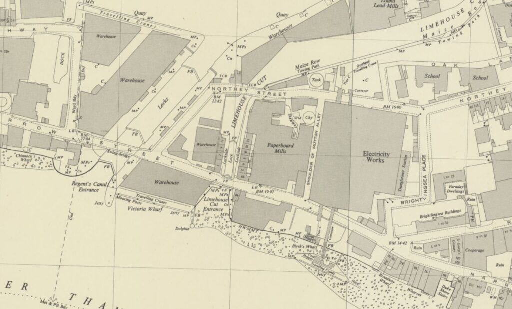
The location of the dock is within the red oval in the following extract from an early 1950s edition of the OS map. Whilst the docks are not named, the King George V is the lower dock with the Royal Albert above (Map ‘Reproduced with the permission of the National Library of Scotland“):
From the bridge, we can look across to the passage between the King George V and Royal Albert Docks. There was originally a swing bridge over this passage which carried a road and rail tracks:

Although today we cannot find any cargo vessels in the King George V Dock, there is an old light vessel. This is Light Vessel 93:

The following history of the light vessel is from the vessel’s entry in the register of National Historic Ships UK, and the entry and source of the following text can be found by clicking on the text:

“LIGHT VESSEL 93 was ordered by Trinity House in 1938 and was built by Philip & Son of Dartmouth. She is a vessel of riveted steel construction. She first served on the Galloper Station and then on mine watching duties on the Thames between 1947 and 1953. After further service on the East Goodwin and Galloper Stations she had renovations carried out by Swan Hunter in 1980 and Holman & Sons of Penzance in 1996.

After conversion to solar power in 1998 she had further service at Inner Dowsing Station, Sunk Station and Foxtrot 3 before being sold into private ownership in 2004. She is used as a photographic studio, events and exhibition space.” 

The light vessel was moored in the Royal Victoria Dock, close to the mill buildings, but was moved earlier this year in preparation for the foot bridge that is planned to be built across the Royal Victoria Dock, as part of the redevelopment of the land around the Millennium Mill.

When London City Airport was built, it was over the land between the King George V and Royal Albert Docks, with part of the airport, and a later extension of the aircraft stand area, and equipment and vehicle holding area. The extensions over the dock were built on piles, and the following photo is looking across to the airport, with the runway on the right, and we can just see part of the piles between the surface area of the airport and the water of the dock:

The bridge carrying the Woolwich Manor Way over the entrance lock is still a lifting bridge, although the current bridge is not the original. Standing in the middle of the bridge we can see where the two sides of the bridge meet, with the water of the lock visible below:

The presence of London City Airport can be felt when walking around the Royal Docks, and parts of North Woolwich and Silvertown. The bridge is also at the end of the runway, and adjacent to the approach lights, and we can look straight down to the runway and the planes taking off:

Or landing:

The above photo shows just how much this whole area has changed. Part of the dock water can be seen on the right of the photo and the grey blocks of the Millennium Mills are in the centre. These are from the time when the Royal Docks were the largest of London’s docks, with enormous volumes of cargo passing through.

In the foreground we see a plane coming into land at London City Airport – in some ways continuing the use of the area for transporting things internationally. Whilst the docks served passengers and cargo via ships, the airport now moves passengers via planes.

In the background are the towers around Canary Wharf on the Isle of Dogs, built on another London dock complex. On the left is the O2 / Millennium Dome, built on what was a highly industrial area of the Greenwich Peninsula.

Continuing along the bridge, and we pass over the Royal Albert Dock. the passage between the King George V and Royal Albert can be seen on the left:

At the end of the bridge, we arrive at the road network north of the docks, along with the DLR. Just below the road direction sign is a reminder of when the Excel Exhibition Centre was a Nightingale Hospital:

This section of the bridge is named “The Steve Redgrave Bridge” (possibly because of the Royal Docks rowing centre nearby):

I am now walking back along the eastern side of the bridge, the side that faces towards the Thames, and therefore the locks from the Royal Docks to the river, and here we get another view of the impounding station that pumps water from the river into the docks to maintain water levels. From this perspective we can also see the new development at this end of the Royal Albert, surrounding the impounding station:

We then come to the first of the locks from the docks to the river. This is the lock from last week’s post where the width of the lock has been considerably reduced so a much smaller (and cheaper) set of lock gates could be installed. just how much the width of the lock has been reduced can be seen when looking through the lock:

And then the second lock. This is the one that has mainly been filled in, with only a small part remaining at the dock, and into the river:

And we then come to the derelict area between the Royal Albert Basin and the lock into the King George V dock:

View over this area:

In the following photo is where Gallions Road joins Woolwich Manor Way. Gallions Road is the road where I found the other end closed in last week’s post, requiring an alternative route along the bush and butterfly alley that ran next to the Thames, which was in fact, a far better route:

There is a blue sign just visible to the left of the above photo. The sign is for Gallions Point Marina which was once reached down this closed road.

Gallions Point Marina was in the Basin between the eastern end of the Royal Albert Dock and the lock into the Thames.

In my walk around the Royal Docks I could find no evidence of a marina, and the space once occupied by Gallions Point Marina is empty. Strangely, their website is still online.

The marina was a casualty of plans to redevelop Albert Island, the derelict area between the locks for the Royal Albert and King George V.

The Greater London Authority (GLA) had been trying to take possession of the land used by the marina, and despite attempts of mediation between the company and the GLA, there was no agreement.

The GLA then took legal action and evicted the staff of the Marina on the 9th of October 2018, and took possession of the land.

In 2017, the GLA had selected London and Regional Properties  as the developers of the site, and in 2021 outline planning approval was granted for the redevelopment scheme, which does include a boat yard, storage buildings and warehouse, and according to the original requirements of the GLA, facilities for repair and maintenance work on ships that use the Thames.

The development has a website which can be found by clicking here, and the home page includes an image of some impressive ship repair facilities.

If the area is developed as the GLA originally intended, it will be a suitable development for the site, maintaining the relationship with the river and shipping that has been the whole history of the Royal Docks.

The rather good alley along the Thames with the hundreds of butterflies will be lost though, but there is planned to be public access – hopefully still along the river and across the locks, and hopefully the redevelopment will include many references to the heritage of the site.

Continuing along Woolwich Manor Way, and I have now reached the point where the bridge crosses the lock into the King George V dock, this is the lifting bridge shown earlier in the post, and I can look along the lock out to the Thames:

The area to the right of the lock in the above photo has already been redeveloped. Albert Island is the area to the left, and in this website (click here), there is an image of the proposed new development, showing buildings up to the lock.

As mentioned earlier in the post, when you look at the docks, it is hard to appreciate their size. Water up to a few feet below the sides of the dock does not give an appreciation of the depth, however the following photo is of the lock into the King George V dock under construction, the same lock as shown in my photo above, and illustrates the size, and the complexity of the lock’s build:

The bridge I was standing on to take a photo of the lock is the latest version of the bridge carrying Woolwich Manor Way across the lock, and dates from 1990.

The original version of the bridge, completed at the same time as the King George V dock is shown in the following photo, looking from the lock into the dock:

I have repeated below the painting from the front of the book issued to commemorate the opening of the King George V Dock, as the painting is of the same view as in the above photo:

The dock was opened on the 8th of July, 1921 by King George V, who, during the ceremony to open the dock said that “I have much pleasure in acceding to your request that the dock shall be known as the King George V Dock.” I assume that this is why all documentation and references to the dock prior to the opening used terms such as “new dock”, of as the “Southern Extension of the Royal Victoria & Albert Dock”, as in the front page shown above.

It was probably not royal protocol to assume the name before the King had publically granted his approval.

The opening ceremony started with a “river pageant”, with the King boarding a boat at Westminster Pier and changing to a larger boat after passing under London Bridge. There was a Royal salute fired by the gun battery at the Tower of London, shipping, warehouses, wharves and buildings along the river displayed flags and bunting, and the sides of the river were lined with people cheering as the King and Queen passed.

After two hours, they reached the entrance to the King George V Dock, and entered the lock, with children singing “patriotic airs” along the lock edge, which was also lined by seamen from H.M.S. Pembroke and boys from the Royal Hospital School at Greenwich, as well as a number of naval ships.

The King’s ship (the Rover) entered the dock through the lock, and moored alongside a transit shed at the north side of the dock, where there was a large assembly of Government and Port of London Authority officials, as well as members of the Royal Household, Ambassadors, Royal Watermen, the Archbishop of Canterbury and the Bishops of Southwark and Barking.

In reply to an address by the chairman of the Port of London Authority, the King’s speech at the quayside included references to the history of the London docks:

“Your address reminds us of the great antiquity of London as a port. Even in the far-off days of the Romans it was frequented by foreign merchants and trading ships, and the history of its development into the largest port in the world must appeal to every sailor and every merchant who has any feeling for the romance of his calling. The port in which Chaucer worked as a Custom House official, in which Drake, the founder of our sea power, entertained his Sovereign on board the Golden Hind is deeply interwoven with the fabric of English history. From those times onward the traffic and discoveries of our ancestors have brought an increasing commerce to the shores of the Thames until it is not to much to say that here the highways of the oceans meet.

You have referred to the natural advantages of the Thames estuary and to the enterprise of the trading community as the two great factors in the advancement of the Port of London. For many centuries seamen and merchants were content to rely on the first of these, but during the last hundred years improvements in ship building and the growth of the trade of London have rendered it necessary in an increasing degree to call in commercial effort and engineering skill to supplement natural advantages.”

The King continued in the same vein and also remarking on the increasing size of ships that the new dock would be able to support, and finally the King declared the new dock open as the King George V Dock, and unlike the two hour pageant down the river, the royal party took cars back from the docks to Buckingham Palace.

The north side of the dock, and from the images of the redevelopment of Albert Island, the PLA building on the side of the dock will disappear:

The lock, as well as the dock, is used as a temporary holding place for the equipment that performs much of the infrastructure work along the river, and this leads to some very strange vessels to be seen – I have no idea what the following vessel does:

The south side of the lock into the King George V dock:

A final look as I continue south along Woolwich Manor Way. In years to come, this view will be very different:

And the above view concludes my exploration of the Royal Docks, an absolutely fascinating area that demonstrates the sheer size and ambition of the London Docks, the civil engineering, the enormous volumes of trade that passed through these docks, and the passengers who departed and arrived on ships from across the world – a history that I hope will be told in future development.

As mentioned earlier in the post, the need for the King George V Dock to support ever increasing ship size should have hinted at the future closure of the London dock system, when there was not enough land for docks, and the Thames was not deep enough to bring any larger ships up to the Royals. Dredging the Thames to provide a channel was already an ongoing problem.

The docks at Tilbury continue in operation, and the really large container ships do still use the Thames, arriving at the London Gateway port, just to the west of Canvey Island. The London Gateway continues to expand, and a couple of days ago, the shipping company Maersk announced that in 2025 it is moving from the Port of Felixstowe in Suffolk, to the London Gateway in the Thames.

I have not really covered the working history of the docks – something hopefully for a future post, There are a couple of places in Silvertown I still need to cover, probably the subject for an extra post, but for now, that is the Royal Docks – well worth a visit and long walk.

I have used many excellent books, LDDC publications, newspapers etc. to research the Royal Docks. The following are a sample of some of the books, which are often available online:

  • Dockland – An illustrated historical survey of life and work in east London, published by the North East London Polytechnic (1986)
  • A London Docklands Guide by Tony Phillips (1986)
  • History of the Port of London by Sir Joseph Broodbank, Chairman of the Dock & Warehouse Committee of the PLA (1921)
  • London Docklands. Past, present and future by Professor S.K. Al Naib (1994)
  • Liquid History by Arthur Bryant (1960)
  • The Port of London Yesterday and Today by D.J. Owen, General Manager of the Port of London Authority (1927)
  • The Said Noble River by Alan Bell (1937)
  • London Docks 1800 – 1980. A civil engineering history by Ivan S. Greeves (1980)
  • Discover London Docklands. An A to Z Illustrated Guide by Professor S.K. Al Naib (1992)
  • The Port of London – A brief survey of its History with outline of its present facilities and Trade. Published by the Port of London Authority (1931)

The Royal Docks are a fascinating area to walk (if there is interest, I may do a walk around the Royals next year), but until the weather improves, and if you read this on the day of publication, as Storm Bert sweeps the country, you may be interested in the following films on life on the river and the Royal Docks.

The first, from the British Film Institute does not feature the Royal Docks, but it is from the 1930s and shows much of the working river in colour:

https://player.bfi.org.uk/free/film/watch-colour-on-the-thames-1935-online

There were once tours via boat into the Royal Docks, and the following colour film from 1966 shows a cruise along the river, before entering the Royal Docks, at the King George V lock, the bridge carrying Woolwich Manor Way opening, and then a tour through the Royal Docks:

A British Pathe film showing the working docks:

alondoniheritance.com

The Gallions Reach Entrances to the Royal Docks

In this week’s post I am continuing my walk around the Royal Docks, starting from where I ended last week’s post, at the eastern end of the Royal Albert Docks, and where the entrance locks to the Royal Albert and King George V docks from the Thames at Gallions Reach can be found. In North Woolwich I also find a sad example of how a pub’s façade has been included in a new development.

The red dashed line in the following map shows my route, starting at upper right, crossing over the entrances to the docks, then walking through parts of North Woolwich towards Silvertown (© OpenStreetMap contributors):

The above map shows just two entrances, one to the basin which connects to the Royal Albert Dock, and a longer entrance that connects to the King George V Dock, however there were originally three entrance locks, as shown in the following map from when the docks were operational:

The lower entrance to the Basin has been filled in, although there is a short stretch remaining of the old lock where it meets the Basin, and where it originally entered the Thames.

The upper entrance, the locked stretch of water between the Thames and the Basin remains, however today has a much smaller lock gate, as the point in the lock where the gate is located has been narrowed by a rectangular block of land built over the channel where the lock gate is located.

In the following photo, the impounding station that was at the end of last week’s post is just behind the new block of apartments on the right, and you can see how the lock has been narrowed, as I am standing on the infill, and the original width of the lock can be seen after the last lamp post:

The following photo is from Britain from Above and shows the three locked entrances (Source: EAW008722 ENGLAND (1947). The Royal Albert Dock and the King George V Dock, North Woolwich, 1947):

The red rectabgle on the right is the infill over part of the lock, with the new lock gate being the red line. The infill enabled a much smaller lock gate to be fitted (and presumably at much lower cost), than the original lock gates.

The yellow rectangle over the middle lock is the area that has been filled in, and the red dashed line is the walking route I took to bypass a closed road, and get from the old position of the central lock to the large lock that connected the Thames with the King George V Dock, on the left of the photo.

The three locks in the above photo became the only route into the Royal Docks complex after 1928. By that time, the lock gates at the western entrance to the Royal Victoria Dock had reached the end of their useful life, and the roller paths at the bottom of the gates were causing problems.

There was also very little left of the original concrete base to the lock. It appears that dredging had gradually removed the concrete base over the 70 years that the lock had been in use.

The lock was repaired and strengthened, although a decision was made to restrict the western entrance to the Royal Victoria Dock to barge traffic only, with the three entrances at Gallions Reach then becoming the only entrances for shipping.

Standing in the lock and looking towards the Basin shows the much smaller width of the lock gate:

On the left of the above photo is a small building which I think houses the switch gear to control the lock gates. A sign on this building shows one of the rules to prevent rabies infection:

Although the original lock gates have been removed, some of the machinery that was used to control them can still be seen, embedded in the side walls, and below this (although difficult to see) are numbers indicating the depth of water, carved in the stone of the side wall:

Looking out to the Thames from the lock – just imagine how many ships have arrived to, and departed from the Royal Albert Dock through this entrance:

Buildings, and bollards for ship’s ropes still line the side of the lock:

On both sides:

View across the lock showing the proximity of the new housing developments:

At the end of that part of the lock where the width has been narrowed, looking up towards the Basin, along the original width of the lock:

The Gallions entrance lock to the Albert Dock was upgraded in the early 1950s.

The floor of the lock was found to be curved, and whilst this was acceptable for Victorian shipping with curved hulls, shipping by the 1950s had almost flat bottoms to maximise cargo space.

The lock was also chain operated, and the system was 70 years old, and reaching the end of its useable life.

The problem with upgrading the lock was that it needed to be empty of water, and a wall of some type was needed towards the Thames and towards the Royal Albert Dock, as if water flooded in from the dock it could cause an incredible amount of expensive damage to the ships in the dock, if the water level suddenly reduced.

The first method used was by building a dam of granite blocks across the end of the lock. When the dam was tested, there was horizontal movement within the layers of blocks, and a scour hole of some 20 feet deep had formed in the chalk below the lock.

The dam of granite blocks was replaced by a dam of a double layer of sheet piling with 70 foot long piles driven 15 feet into the chalk below the lock.

The area around the lock also had to be de-watered to reduce the pressure pushing on the lock walls from the land surrounding the lock. This was done by installing 34 deep wells around the lock of 24 inches diameter, with a 12 horse power submersible pump in each that worked to reduce the level of ground water around the lock, and hence the pressure on the lock walls.

The work to reshape the bottom of the lock, and to make repairs were completed by 1956 when the lock reopened.

Standing by the side of the lock it looks like a stable volume of water within concrete walls, however the details in the paragraphs above show the complexity of the structure, the huge forces that water at either ends of the lock, and within the surrounding ground, exerted on the lock.

They are remarkable examples of complex civil engineering.

Nine years ago, I took the following photo of the entrance to the lock from the river, when the new apartment buildings next to the lock were being built:

If you have walked the Capital Ring, then the route I am taking across the lock entrances to the Royal Docks is probably familiar:

Once across the lock, and I enter a very different landscape. Where all of my walk around the Royal Albert Dock so far, has been through developed land, or open space waiting to be developed, the space between the old dock entrances is an area devoid of people, a number of apparently derelict buildings, and empty space:

They really do not want you to stray off the road, probably sensible as the docks are of deep water:

The road has a name – Gallions Road, and it runs from the first lock that I crossed, up to Woolwich Manor Way, although do not expect to see any people, cars or lorries on this road:

The road is called Gallions Road and the title of the blog post is “The Gallions Reach Entrances to the Royal Docks”, so where does Gallions come from?

If you want to locate a place, then it needs a name, and this is no different with the River Thames. So much once went on along the river, that names were useful to refer to each stretch, and Gallions Reach was the name given to the part of the Thames roughly from Woolwich to Barking Creek.

The Gallions name comes from the Galyons family, who owned land along this part of the river in the 14th century.

With the way we use the river today, names such as Gallions Reach are not often heard, although the original Galyons is in use for the hotel in the previous post and the Gallions Reach Shopping Park is in nearby Beckton.

The name was used very many times to describe events on the river in previous centuries, and I have seen both Gallions, Gallion’s and Galleons used as spellings. Many of the uses describe some very dramatic events, such as in May 1816 when there was a armed fight on the Thames.

A boat carrying dollars to India was moored on the river at Greenwich. Due to the value of the cargo, armed guards were on board. A boat appears with two men onboard and comes up against the boat carrying the dollars. As there are only two people on board there is not much concern.

As the boat comes alongside, 20 armed “pirates” emerge from under a tarpaulin and swarm onto the cargo boat, threatening to kill the crew. A shooting fight breaks out as the crew fight back with blunderbusses.

The pirates manages to grab boxes of dollars (to the value of £7,000 in 1816), and they then flee on their boat. The report continues:

“It would seem from the speedy approach of day-light and the slackness of the tide immediately after the robbery was committed, the villains were afraid to venture on shore with their stolen property, and had therefore deemed it expedient to sink the whole, or part of the chests, as they supposed within the low water mark, in Gallions Reach; for about seven o-clock, at low water, three of the chests were observed uncovered on the shore, where they had been just left by the tide.”

In some respects, in past centuries, the Thames was a city in its own right, there were so many people working and travelling on the river and there were newsworthy events on the river almost every day.

The report on the theft of the dollars (they were in chests, so I am assuming some form of silver dollar) concludes by saying that of the £7,000 stolen, only £3,000 had been recovered, so perhaps there are some early 19th century dollars still to be found in the muds of the Thames at Gallions Reach.

Back to the 21st century, and I am continuing along Gallions Road, with the approach lights to London City Airport to my right. The proximity of the land between the dock entrances and the runway probably limits what can be built here as any high rise buildings would extend too far into the approach path:

And here the road is closed. No mention of why, but I cannot get any further:

However there is another route, and just to the left of the above photo is this footpath which heads up towards the river (the footpath is marked by the red dashed line in the Britain from Above photo earlier in the post):

In the above photo there is a car on the left. There was a large dog in the rear barking at me as I walked past, with a security man sitting in the front seat.

What they were guarding is shown in the following photo – some derelict land and a large shed. The lower lock into the Basin at the end of the Royal Albert Dock once ran across the land in the foreground of the photo below (the orange rectangle in the Britain from Above photo earlier in the post):

Nine years ago, I took the following photo of the block up entrance to the lower lock from the river:

At the end of the first stretch of footpath, it does a ninety degree bend and ruins alongside the Thames on the left, with thick bushes on the right hand side. It was a sunny, warm day, and what was remarkable about this footpath were the huge number of butterflies in the bushes, and as I walked along the footpath, they would rise from the bushes then fly back in. I have never seen so very many in one place.

Looking back along the footpath, with the Thames just visible on the right:

And at the end of the stretch that runs parallel with the Thames, there is another ninety degree bend, again with thick bushes and butterflies on the right, and some derelict land on the left:

At the end of which, there are steps:

And over the steps, a footpath which leads down to the lock that connects the King George V Dock to the River Thames:

At the end of the footpath, I reach the walkway over one of the lock gates:

This lock is massive, and I believe is still of the same dimensions as when the King George V Dock was built, and opened in 1921.

The following photo is looking towards the King George V Dock from the middle of the lock gates closest to the Thames. There are two other sets of lock gates, and the bridge in the distance carries the Woolwich Manor Way over the lock, where it joins the main dock:

The lock is still in use, providing access for ships to and from the Royal Dock complex, and the bridge in the distance, carrying Woolwich Manor Way over the lock is a Bascule Bridge and consists of two cantilevered steel box girder leaves which taper towards and meet at the middle. The bridge opens much as Tower Bridge does, with the two sections rising from the middle, and can swing by roughly 90 degrees, therefore opening up almost vertically.

The current bridge dates from 1990, replacing an earlier bridge, which also opened to allow ships to move between dock and lock.

Looking out to the Thames from the middle of the lock gate (standing in the middle of the relatively narrow lock gate, you get the feeling that you are suspended above two huge, dynamic stretches of water):

The King George V Dock was the last major dock to be built in London, and, as with the other two docks that make up the Royal Docks was on a massive scale. The lock entrance between the dock and the Thames was the largest entrance on any London Dock.

I have a one of the book’s issued to mark the opening of the dock on the 8th of July 1921, and the book describes the lock as follows:

“Ships will enter from the river through an entrance lock 800 feet long by 100 feet wide with a depth of water on the sill of 45 feet below Trinity high water, equivalent to 41 feet 8 inches at high water of ordinary neap tides. Its length is divided into two compartments of 550 feet and 250 feet by three pairs of steel lock gates, each leaf of which weighs 309 tons, operated by direct acting hydraulic rams. By the use of a floating caisson, for which provision has been made at the inner end, the effective length of the lock can be increased to 910 feet.

The lock walls have been constructed of eight to one mass concrete with a four to one face, and are founded in chalk, 65 feet below coping level, the thickness of the wall at the bottom being 21 feet. The floor, also of concrete, is 11 feet 9 inches thick in the middle.

Two entrance jetties project a distance of 480 feet into the river, and form a bellmouth 675 feet wide across the outer extremity.”

The details of the thickness of the lock walls and base give some idea of some of the pressures that the lock had to withstand – water pressure, added to when large ships passed through the lock, and pressure from within the land surrounding the dock, acting on the inside of the lock walls.

The lock seems to be in the same configuration today, with three pairs of lock gates, with a shorter section between the two gates nearest the river, and a longer section between the two gates nearest to the dock.

With the lock being full of water, it is difficult to see the massive scale of the structure. The book issued at the opening of the dock includes a number of photos which show the lock under construction, the first shows the lock being built, empty of water:

The second photo shows “one of the three pairs of lock gates”, and as described in the text, each side of the lock gates weighs 309 tons:

To put the scale of the above photo of the lock gates into context, look at the very bottom centre of the photo, and you can just see two figures, I have enlarged just this small section in the photo below:

In the above photo you can also see the roller and the roller path at the outer edge of one of the lock gates. This roller supported the gate as it was opened or closed.

Looking back over the walkway over the outer lock gate:

The three lock gates in the lock to the King George V Dock are still fully operational, and part of the opening and closing mechanism can be seen coming from the side of the quay, where the rest of the mechanism is located:

A final look out to Gallions Reach, the part of the Thames where the three locks at the eastern end of the Royal Albert and King George V provided access to and from the Royal Docks:

Again, imagine all the ships, cargo and people who have passed through this lock. One example is the Blue Star Line “Almeda” shown in the following photo in the entrance lock to the King George V Dock on the completion of her maiden voyage with passengers from Argentina on the 6th of April, 1927:

The area between the upper lock to the Royal Albert Basin and the lower lock to the King George V is a really interesting area. Empty and derelict, the only person I saw was the security man with his dog sitting in the car.

On leaving the lock into the King George V dock, the area changes dramatically, and we enter streets lined by housing that has been built over the last couple of decades:

I walked through this new estate, and onto Woolwich Manor Way, and where the name changes to Albert Road at the junction with Woodman Street, on the corner was a large, closed pub, now converted into residential:

This was the Roundhouse. The pub does not appear in the 1895 OS map, but there was a large corner pub on a street corner just to the north.

This pub was demolished when the King George V dock was built, and I wonder if the Roundhouse was built after this nearby pub was demolished.

The Roundhouse closed in 2003, and then converted to residential.

Directly opposite the pub is Barge House Road:

Barge House Road has pre-war housing on the western side of the street. There is a plaque up on the wall of the house facing onto Albert Road, but the date on the plaque has been worn a bit too much to be read.

In the 1895 OS map, the street is shown (but without a name), and there is no housing on either side of the street, so I suspect it was built as part of the development of the area when the King George V dock was built.

There was though a pub (called the Barge House) at the southern end of the street, and a small dock into the river.

The dock is listed in the PLA 1980s listing of “Steps, Stairs and Landing Places on the Tidal Thames”, as the “Old Barge House Drawdock”. A drawdock was a place where boats could be drawn out of the river for loading / unloading, for maintenance etc.

The dock is still partly there, and I will visit in a future post.

The next street along is Woolwich Manor Way, a continuation of the street that runs over the lifting bridge over the lock into King George V Dock, with houses on the eastern side of the street and the Royal Victoria Gardens opposite (again, the date on the plaque on the end house is too worn to see the date of construction):

I walked from Albert Road up to Woodman Street as there was a pub I wanted to see, all that is left of the Royal Oak in a remarkable example of where the façade of the pub has been retained, and a very different building completed around and above:

Close up showing the lovely green tiling of the old Royal Oak and a “Truman’s Beers, Eagle Brand” tiled sign:

The Royal Oak was in business by the early 1870s, and was a typical east London pub, however bombing during the Second World War resulted in the loss of the upper floors.
Remarkably, the Royal Oak continued to trade using just the remaining ground floor.

The pub finally closed around 2010 / 2011, was purchased for redevelopment as apartments, with planning permission that new apartments could be built, but the lower floor had to be retained, and possibly reopen as a pub.

Whilst the new apartments have been completed and appear occupied, what remains of the Royal Oak looks to be gradually deteriorating. I have no idea if anything remains of the interior of the orginal pub, or whether it is just the outer facade that has been retained.

There appears to be no progress in converting / restoring or reopening the ground floor as a pub, or as any other business.

A real shame:

When writing the blog, I really do try and get all my facts right, and I am very grateful to readers who point out any errors (thankfully very few).

The Internet can be an excellent source of factual information, and it can also propagate errors, and I am very conscious of this when writing a post, as I do not want to include errors that others may therefore take as fact.

When researching the Royal Oak, I found a number of websites that associate the Royal Oak in Woodman Street, North Woolwich with the naming of Arsenal Football Club.

Arsenal was originally named Dial Square, after one of the workshops at the Woolwich factory.

After a win in December 1886, the club met in the Royal Oak, and decided to change name to  Royal Arsenal, a name which lasted until 1893 when the name changed to Woolwich Arsenal.

A number of websites claim the Royal Oak was the one I have photographed, for example one site stating the Royal Oak in north Woolwich, and another the Royal Oak at 83 Woodman St, London, E16 2LN, but also mentioning the Woolwich Arsenal Station which is south of the river.

The official history of Arsenal, on the club’s website also refers to the Royal Oak, but next to Woolwich Arsenal Station, which is the correct location of the Royal Oak in question.

Probably an issue with two pubs called the Royal Oak, but one south of the river next to Woolwich Arsenal, and the other north of the river in North Woolwich.

The King George V dock is very close, but nothing can be seen of the dock due to buildings and high walls, however there is an occasional a glimpse that the dock is there down some of the side street off Woodman Street, where, for example, the top of Light Vessel 93, moored in the King George V dock can be seen:

I will cover the light vessel in a future post.

At the end of Woodman Street is Pier Parade, where North Woolwich library can be found:

North Woolwich Police Station, which opened in 1904 on the corner of Albert Road and Pier Road:

The building still appears to be in use as a Police Station, but the “front counter” was closed in 2013.

There is a very detailed spreadsheet available on the Metropolitan Police website that details all the station closures between 2010 and 2023, listing the 126 closures during this period, and whether it was the just the front counter, or the whole police station.

For those fully closed, the spreadsheet also lists the purchaser of the site and the price paid. The spreadsheet can be found here.

Opposite the police station is the Royal Standard, seems to be open as a pub, but also as a resturant:

Diagonally opposite to the pub is the following terrace of buildings of mixed age and style, but mainly pre-war, on Pier Road, the street that leads to the Woolwich ferry:

A bit further along Albert Road, on the corner with Fernhill Street is a rare sight in east London, a relatively modern pub, the Henley Arms:

The current Henley Arms was opened in 1966, replacing an 1860s pub with the same name that stood closer to the corner of Albert Road than the current pub.

The Henley Arms is a survivor from a time when there were so many pubs in the area. I have walked a relatively short distance along Albert Road. Between the Roundhouse and the Henley Arms is 900 metres, and the 1956 edition of the OS map shows nine pubs, so one every one hundred metres. This does not include pubs such as the Royal Oak or the Barge House which were between Albert Road and the docks, and the river.

The majority were large corner pubs, and all would have been busy.

The closure of the Royal Docks started their decline, and in the following decades there was the typical story of closure and redevelopment as residential.

That is another part of the area around the Royal Docks, North Woolwich and Silvertown explored. The area where the three locks were, between the docks and the Thames at Gallions Reach is a very unique area, and I hope that when it is developed, as it inevitably will, the locks, their scale, construction and history is retained and highlighted, as the place where very many thousands of ships and people, and millions of tons of cargo entered and left London’s largest dock complex.

alondoninheritance.com

Royal Albert Dock and London City Airport

After last Sunday’s diversion, I am back in the Royal Docks, this time exploring the second of the three individual docks that make up the overall “Royals” dock complex – the Royal Albert Dock.

The following map shows the Royal Albert Dock (the top of the two docks), and the red dotted line shows the walk I am covering in today’s post, with some of the key buildings circled. I am starting at the red oval to the left of the map. There is so much to find around this part of east London, that it will take a couple of posts to cover  (© OpenStreetMap contributors).

I also have an error to own up to. In my original post on the history of the Royal docks, I included a number of photos that my father had taken, describing them all as being of the Royal Victoria Dock. From some comments and emails received (thanks for all the comments, they are all read and appreciated), from people who had worked in, and known the area well, the photo showing ships lining the sides of a dock was in fact the Royal Albert Dock:

Whilst all the other photos had identifiable features, and were of the Royal Victoria Dock, my father must have started his walk around the Royal Victoria Dock at the eastern end of the dock, where it joined the Royal Albert, and where there was a good view along the Royal Albert, so the above photo is of the Royal Albert Dock, and is where I am walking in today’s post.

I started the walk at the appropriately named Royal Albert Station on the Docklands Light Railway:

One of the few surviving buildings from when the docks were operational is located right next to the DLR station, this is the Compressor House (light blue oval in the map):

The Compressor House dates from 1914 and was originally a warehouse providing cold storage for cargo shipped via the Royal Docks:

The Compressor House featured in a document released by the Mayor of London back in May 2024. The document covers the “leasehold disposal of Compressor House, for 10 years, to Really Local Group to deliver a project that addresses priorities of good growth, levelling up and Royal Docks placemaking; and provides best value for the GLA Land and Property Limited commercial asset.”

Apparently the building retains many original internal features such as hoists, rails and winching machinery. Plans for the building include a café, rooms for hire, including for exhibitions and performances, and a learning / meeting room.

I love the terms used in documents talking about the benefits of a project, as the Mayor of London document talks about linking the surrounding communities with the Royal Docks, through “in this case through the lens of digital inclusion”. I have no idea what this means.

It would be really good to make publicly accessible use of the building – providing the original features are retained, along with the story of how the building was once part of the Royal Docks success.

Arms of the Port of London Authority and the date of 1914 displayed above the door.

From the Royal Albert DLR station, and the Compressor House, it was a very short walk to the side of the Royal Albert Dock:

There is a wide walkway along the northern edge of the dock, with some recent developments along the side, but what impresses is the enormous expanse of water. The above view is looking east, and the view below is looking to the west, where the bridge can be seen that marks the point where the Royal Albert meets the Royal Victoria Dock:

Whilst there has been less development along this side of the Royal Albert Dock, along the south of the dock, where there is a strip of land between the Royal Albert and King George V dock, there is the result of one of the first major infrastructure projects around the Royal Docks, that was, and continues to be an issue for many local residents, and which made the Royal Docks a significant transport hub for London. This is London City Airport, where from the north side of the dock, you can watch planes landing and taking off, where there were once warehouses:

View across to the terminal buildings at London City Airport:

The idea for an airport in the docklands came from the London Docklands Development Corporation in the early 1980s. The concept was for an airport that would service the business centres of the City of London, and the proposed development centered on Canary Wharf in the Isle of Dogs.

The airport would offer swift access from these centres of business, with minimal waiting time at the airport. Almost a “turn up and fly” approach, rather than the longer travel out to airports such as Heathrow and Gatwick, with the lengthier times for check-in, security etc. as well as often delayed take-offs and landings.

The airport was built by the civil engineering and construction company, Mowlem, between 1986 and 1987.

Incidentally, one of the best books I have on the construction and engineering of the London Docks is “London Docks 1800 – 1980 by Ivan Greeves (1980)”. (I will give a long list of the books and sources I have used in the final post on the Royal Docks).

Ivan Greeves was a fellow of the Institution of Civil Engineers and a Director of John Mowlem, and Mowlem had been involved with many of the civil engineering projects around the London Docks. Greeves’ book is a wonderful detailed civil engineering history of the London Docks.

There were many publications by both the LDDC and other publishers, as the development of the docklands got underway. I collected as many as I could, and one was the magazine “Vistas”, published by the London Docklands Publishing Consortium, and in issue 2. Spring 1987, the first two airlines that would use London City Airport, which would open later in the year were featured:

The first two airlines were Brymon Airways and Eurocity Express, and an article in Vistas explains the airlines plans, and the type of service they intended to operate from the new docklands airport.

There is also a photo showing London City Airport under construction, when it occupied just the land between the Royal Albert and George V docks:

The article continues, with both airlines explaining the benefits of flying from London City Airport, with Brymon fully focused on the business traveler, and Eurocity Express also focused on the business traveler, but also expecting a share of leisure travelers:

It was a Brymon flight that had helped prove that planes could take off and land from short landing strips in the docklands, when in 1982 a Brymon Dash 7 aircraft landed at Heron Quays in Canary Wharf.

Eurocity Express changed name to London City Airways in 1988 to more closely align the identity of the airline with London City Airport, but would suffer financial collapse two years later in 1990.

In the late 1980s I worked for a company that was split between London and Amsterdam and did use London City Airport a number of times. It was a really fast airport to get through, whether arriving or departing, and the best bit was always coming into land, with the steep approach, and good views of the surrounding docklands.

I did take my camera a number of times, but cannot find the negatives. Hopefully one day.

Old and new industries / business around the Royal Docks – planes at London City Airport, with the Tate and Lyle factory in the background:

After opening, the airlines operating from London City Airport used propeller driven airplanes such as the Dash 7. These carried relatively few passengers when compared to larger jet aircraft, however they were more than capable of landing and taking of from a short runway.

The airport served business centres close to the UK, such as Amsterdam and Paris, and in the following years the destinations served, as well as the number of passengers grew considerably (including New York for a short time).

An extension to the airport opened in 1992. Access to the airport improved in 2005 when a DLR station was opened at the airport, and in 2008, additional aircraft parking space was opened on an extension to the airport built on piles over part of the King George V dock.

Jet aircraft started to use the airport in the early 1990s, and today jet aircraft run the majority of services, with a small number of propeller driven aircraft still operating.

In the first full year of operation, 133,000 passengers passed through London City Airport. In August of this year, the Government approved the expansion of the airport to increase capacity from 6.5 million to 9 million, with more weekend and early morning flights.

Flight destinations and the target traveler have also moved on from the initial business market, and when I had a look in the terminal building there seemed to be just as many people, if not more, going away for leisure, including families, than business.

I am writing this on a Friday evening, and I had a look at the first flight on Saturday morning which is a British Airways flight to Ibiza – definitely not one of the original target markets.

There is not much going on along the north bank of the Royal Albert Dock, and whilst I was walking, on a summer’s weekday morning, there were very few people around., so in this quiet place, it is strange to hear the sound of a jet aircraft taking off, or the quitter sound of a landing, at regular intervals:

There is a certain symetry between the airport and the old docks. The docks transported cargo all over the world and the airport is now flying people.

The north bank of the dock is really quiet, as this view along the walkway demonstrates:

And with it being such a peaceful environment, it is hard to imagine just how busy the Royal Albert Dock was, and what a sight it must have been, with so many ships coming and going, and vast amounts of cargo being shifted between warehouses, transit sheds, quayside, lighters and ships, as the following photo of the dock demonstrates:

The warehouses that ran alongside the length of the dock were not meant for long term storage, most were transit sheds as this was their main purpose, to temporarily hold cargo as it transited from ship to destination, or from source to ship.

The following photo shows a typical transit shed at the Royal Albert Dock:

And an innovation across the Royal Docks was the use of the railway as a means of transport. The docks were threaded through with rail lines allowing the movement of goods within the docks, and out onto the wider mainline rail networks, as the following photo of a cold store, along with overhead conveyors between buildings, shows:

Continuing the walk along the Royal Albert Dock, and I have reached a series of office blocks:

I have no idea who thinks of the slogans that often try to attract people or companies to new properties, “Regenerative Audacious Disruptive” and “Where Paradigms Shift” – totally meaningless – although I suppose that if a company moved their office to one of these blocks, with so few facilities or other businesses around, it would genuinely be “disruptive”:

Although they do have a good view along the dock, and across to the towers on the Isle of Dogs:

All these office blocks appear to be unoccupied, and they are a testament to an over hyped scheme that was entirely dependent on foreign investment and foreign businesses.

A headline in the Guardian on the 30th of May, 2013 read “Chinese to develop slice of British imperial past: Royal Albert Dock due to be Asian business park by 2023: Transformation of London site could bring 20,000 jobs”.

The article below the above headline reported that the Chinese developer Advanced Business Park had signed a £1 billion agreement with London Mayor Boris Johnson to develop a 35 acre site alongside the Royal Albert Dock with offices and shops, with the aim of attracting Asian businesses to set-up their European head quarters at the site, as well as British companies who do business in Asia.

At the signing of the agreement, Boris Johnson said that it would be “London’s third great business area” and that it “will restore jobs and growth to the Royal Docks, an area . . . that has been in more or less continuous decline for 50 or 60 years”.

The parts of the development that have been completed seem to have been mainly empty since completion, and the 20,000 jobs have not materialized.

In 2022 newspaper headlines reported that the “Royal Albert Dock a ghost town as developer goes bankrupt”. This was ABP Investment Ltd, the Beijing based original property developer.

In May, 2024 the Greater London Authority was looking for a new developer for the land alongside the northern edge of the Royal Albert Dock, as from the original 2013 agreement, only about 10% had been built, and this 10% was mainly empty office blocks.

The central street through the existing office blocks is called Mandarin Street, reflecting the Chinese heritage of the original developer and investment:

Leaving Mandarin Street, and the empty office blocks behind, I continue walking on past the empty land that should by now, based on the 2013 agreement, have seen 20,000 people working here:

Look left from my position when taking the above photo and there are some really good, original buildings from the time of the working docks, and this is the Dock Manager’s Offices (green oval in the map at the top of the post):

Grade II listed and built in 1883 by Vigers and Wagstaffe. The name of the building should explain what went on here – it was from where the Royal Docks were managed, where the dock records were kept and administered.

A second building, alongside the Dock Managers Office is the Central Buffet, also by Vigers and Wagstaffe, dating from 1883, and is also Grade II listed.

The Central Buffest appears to have been a café / restaurant for workers and for passengers traveling via the Royal Docks. It also appears to have been used as a pub, as this report from the 6th of December 1897 explains;

“BETTING AT THE ROYAL ALBERT DOCKS – At Stratford Police court on Saturday, Thomas Clarey, a lighterman, of 49, freemasons-road, Custom-house, was summoned on six information’s for using the Central Buffet, a public-house in the Royal Albert Docks, for the purpose of betting with other persons, and Henry James Morgan, the secretary of the London and India Docks Joint Committee, the holder of the licence of the Central Buffest, was summoned for permitting the place to be used for the purposes of betting.”

A “barmaid” was also called to give evidence, so the Central Buffet was certainly also working as a pub.

The Dock Managers Office and the Central Buffet are remarkable buildings, and from their appearance they would be more expected in the suburbs, or as a country house, rather than in the industrial east London docks.

Winged figure with trumpet on top of the Central Buffet:

A look along the Royal Albert Dock, and there is still much of the dock behind me, and in the distance, out of sight in the photo below, is the Royal Victoria Dock. You really need to walk alongside the Royal Docks to fully appreciate the sheer scale of these manmade temples to London’s trade:

Vessels berthed at the Royal Albert Dock:

More shipping in the Royal Albert Dock:

New Quays added to the Royal Albert Dock in the 1930s:

The following photo shows how cargo could be loaded to and from lighters as well as the quayside. The Royal Albert Dock was known as a dock where goods of all sorts could fine the appropriate facilities for unloading, storage and distribution:

All very different today as I walk along a mainly silent quayside, with just the occasional take off or landing on the other side of the water to disturb the peace.

London City Airport is on the south side of the Royal Albert Dock, however there was a second, short term airstrip on the north side of the dock.

In 2007, the Red Bull air racing event took place in London, and the long open space alongside the north of the dock proved ideal for the pits area and runway for the event.

If I remember correctly, the Red Bull race was also held in docklands in the following year, 2008, and these events had quite an impact on the London City Airport, as flights from the airport had to be suspended whilst Red Bull racing was underway.

Peer over a fence as you walk along the north side of the Royal Albert Dock, and parts of the overgrown runway can still be seen:

The RB in the runway designation of RB 28 stands for Red Bull. There is a photo of the runway in as new condition, and when in use for Red Bull Racing on the Abandoned Forgotten & Little Known Airfields in Europe website, which can be found by clicking here.

Further along the Royal Albert Dock, there are some recent buildings which have brought activity to the area, although as I was there during August, they were again very quiet.

These are educational establishments, and first is the London Design and Engineering UTC (University Technical College):

A UTC is a government funded school that offers 14 to 19 year olds a more focused technical and scientific educational, taught in a different way to a normal school.

The next building is the University of East London:

The area around these buildings should be much busier in school term time, but during August they just added to the sense that the northern section of the Royal Albert Dock needs a considered development plan to bring in more life, and benefits for the local community just outside of the dock, not just yet another area flooded with identikit apartment blocks.

Next to the university buildings there is the student accommodation, which includes several rather different, round blocks:

They are described as “having a nautical theme in homage to the shipping heritage of the area”:

They certainly have a good view, looking out on the dock, and with views of planes arriving and departing at the airport on the opposite side of the dock:

The Royal Albert Dock was opened on the 24th of June, 1880, and cost £2,100,000 to construct – a considerable sum of money at the time. I described the opening ceremony in my first post on the Royal Docks, here.

Although built not that long after the Royal Victoria Dock, the Royal Albert was needed to accommodate ships of larger size and deeper draught than the earlier Victoria Dock, as well as providing a significant amount of additional space for ships to dock, and the associated infrastructure for moving and storing cargo.

The Royal Albert Dock was 27 feet in depth (just 1.5 feet deeper than the Royal Victoria, but suffcient for the expected larger ships). The entrance from the Thames to the Royal Albert Dock was 550 feet in length and 80 feet wide.

The water area that the Royal Albert Dock occupied was 73 acres, compared to 66 acres for the Royal Victoria.

The Royal Albert Dock was the first London Dock to be lighted by electricity, and this helped the dock to be in use by both night as well as day.

Between the main dock area of the Royal Albert, and the locked entrance to the Thames was a basin. In the following photo, I am almost at the basin, and looking along the full length of the dock. A little way along the dock edge on the left, you can just see the entrance to the King George V Dock, which is to the south of the Royal Albert

Looking in the other direction at the basin, the area of water between the dock and the Thames:

The following map extract shows the eastern end of the Royal Albert Dock (upper length of water) with the basin connecting the dock to two entrances to the river:

Today, the area to the north of the basin has been redeveloped, and there are blocks of new apartment buildings to be seen. The area from the upper entrance to the river and down to the large entrance to the King George V dock is undeveloped, and is where we can see some of the old dock infrastructure, and get an impression of the size of the dock entrances.

Changes within the basin have added some routes across, including lifting bridges:

From this point, I took a very short detour to find another of the building that remain from when the docks were operational, the Galyons Royal Docks (purple oval in the map at the start of the post):

Originally the Gallions Hotel, it is Grade II* listed, and as with the Dock Managers Office and the Central Buffet, it was by George Vigers and T R Wagstaffe  and dates from the same period as it was built between 1881 and 1883:

The Civil & Military Gazette on November the 8th, 1893 carried an account of a visit to the Royal Docks, which included this description of the Gallions Hotel:

“At the Gallions Hotel you meet old salts and ships captains of all types; some, of the old-fashioned style, look as if they have just foregathered with their friends, Cap’en Cuttle and Bunsby, and shake their grizzled heads dolefully (as is the custom of grizzled heads all over the world) over the present degenerate age; they drink rum and hot water, with an enticing piece of lemon floating on the top out of fat glasses with a leg, called very appropriately ‘rummers’ and stir up the seductive beverage thoughtfully with a fat glass spoon.

Of a different stamp, and yet of the true British sailor breed are the smart young captains and mates who are standing each other whiskies and sodas (plenty of whisky and very little soda). The genial landlady knows them all, and has a greeting for each; they come and go at intervals, and in the meantime, have been round the world. It is a small journey now-a-days, this circumnavigation of the globe, and is thought nothing of at the Gallions. Many and curious are the tokens of affection and esteem brought home by these sailor men to their kind hostess; her parlour walls are simply covered with curios of every conceivable kind.”

The interior of the Gallion’s is interesting, and is perfectly described in the Historic England listing: “Notable interior with diagonal timber bracing of massive proportions to ground floor. Oak staircase with enriched balusters and newels. Main saloon contains huge timber bar and original fittings.”

The exterior is equally interesting, with a “roughcast first floor with plaster frieze by Edward Roscoe Mullins”:

According to the excellent book “Docklands – An illustrated historical survey of life and work in east London” (North East London Polytechnic – 1986), the Gallions Hotel was for the “use of liner passengers embarking at the adjacent jetty. A subway used to connect with the Royal Albert Dock Basin”. I have also read that the subway was more a covered walkway between hotel and boarding point for liners.
Whilst the Gallions Hotel (or Galyons using today’s spelling) is still a pub / restaurant today, it is now serving a very different clientele. Not a liner passenger or “old salts and ships captains” in sight.

There is another building nearby which is also still serving the same purpose. This is the Royal Docks Impounding Station (yellow oval in the map at the start of the post):

The purpose of an impounding station is to maintain the water level in the enclosed area of the docks.
The docks gradually loose water through evaporation, seepage through the walls of the dock, and through the lock gates, although this is less of a problem as the lock gates are infrequently opened these days.
To replace lost water, the impounding station pumps water into the docks from the Thames, and on the day of my visit, possibly difficult to see in the following photo, the impounding station was active, and water was upwelling in the area in front of the four pipes which route the water into the basin. The water was very mud coloured compared to the rest of the dock:

The impounding station was built in 1912 and was originally equipped with three steam driven pumps. These were replaced by four electrically powered pumps in 1954. 

There is a water intake in the Thames at Gallions Reach, and a 4m by 5.5m intake culvert connects to the impounding station, below which is a large wet well, where water from the intake is then pumped into the dock.

To put the operation of the building into perspective, each of the four pipes leading from the building into the dock are 70 inches in diameter, and through these, each pump and pipe carries 7150 litres of Thames water a second into the dock, and as an Olympic swimming pool is the usual measure when water is concerned, when all four pumps are working they would fill one of these swimming pools in one and a half minutes.

Whilst I have not seen inside the Royal Docks Impounding Station, a few years ago I did visit the impounding station at West India Dock, which you can read about in this post.

Arms of the Port of London Authority and date of construction on the impounding station:

The rear of the impounding station, also showing the new apartment buildings that have been recently built around the west end of the Royal Albert Dock:

By the end of the 19th century, the Royal Victoria and Royal Albert Docks were very busy places. Their colossal length could handle very many large ships at the same time. Cold stores, general warehouses and transit sheds were integrated with a rail network that ran within and around the docks, interconnecting the docks and with the wider national rail network.

Ships were getting larger and faster, and refrigerated shipping brought new opportunities to bring cargo into the country, however the success of the docks was also seen as a threat to many traditional businesses within the UK, as the following extract also from the Civil & Military Gazette on November the 8th, 1893 explains:

“The ships of this line (at any rate those employed in the frozen meat trade), go out with general cargoes round the Cape of Good Hope, and return around Cape Horn; they are away altogether about five months each trip. In addition to the mutton and lamb, a great trade is gradually springing up in butter and cheese, and many tons of these commodities are now imported into England. It seems a poor look out for the wretched British farmer, and something will have to be done for him before long, or the agriculturist in Britain will become as extinct as the dodo; he is undersold at all points, and cannot make a living from the soil.”

As has always been the case, the ability to import large quantities of a product frequently causes a conflict with internal producers which often cannot compete.

There is so very much to see around the Royal Docks, and in next week’s post, I will be walking through the more derelict part of the area, where the entrances between the Thames and the dock are located, walking across a large locked entrance, and then into North Woolwich and Silvertown.

alondoninheritance.com

Royal Victoria Dock in 2024 – Part 2

One ticket has just become available for my walk this Saturday, the 2nd of November, exploring the Lost Street of the Barbican. Click here for details and booking.

In today’s post, I am continuing my walk around the Royal Victoria Dock, completing the second half of the walk, along with a couple of short diversions to look at how the area around the dock along with Silvertown has, and continues to be, redeveloped.

The following map shows the route of today’s post, starting at the circle at lower right, which was where I ended the walk in the previous post, and ending at Royal Victoria DLR station at upper left  (© OpenStreetMap contributors):

And this was my first diversion away from the dock, with a walk down to see the Thames Barrier Park:

Thames Barrier Park was completed, and opened in November 2000. Whilst it is a “normal” park, consisting of open green space, trees etc. there is one really unique feature in the park, which can be seen in the map on the poster.

This is a slightly angled, 130 foot long sunken garden, which has parallel lines of planting and hedges, which have been trimmed to give the impression of a series of waves running along the length of the garden.

The following view is looking along the sunken garden from the north, down to the Thames Barrier, which can just be seen in the distance:

I did wonder if the sunken garden occupied the space of a dock, however after checking OS maps of the area, there was no dock covering the length of the garden, although there was a small dock that covered part of the lower section of the sunken garden, towards the river, so whilst this may have been the inspiration for the sunken garden, the large area we see today was down to the construction of the park.

The site was occupied by chemical works (as was so much of the Silvertown riverside), with petrochemical and acid products being processed and manufactured. So great was the contamination of the soil, that a six foot layer of crushed concrete was placed on top of the original ground level to protect the new topsoil.

Whilst I can see that this applied to the area of the park surrounding the sunken garden, as this part of the park is slightly raised, the land of the sunken garden must have been specially treated.

Looking north along the sunken garden, where a DLR train can be seen entering the Pontoon Dock station:

The park is named after the Thames Barrier, and there is a good view of the barrier from the southern end of the park:

The following photo is looking to the east along the river, showing the gently sloping foreshore along this part of the river, along with new apartment buildings and industrial sites on the far side of the river:

Walking back up to North Woolwich Road, and we can see one of the defining industrial features of the area, the Grade II listed Grain Silo D:

Grain Silo D was built in the early 1920s alongside one of the finger channels in Pontoon Dock, off the south side of the Royal Victoria Dock.

The silo was used to extract and store grain from ships moored in the channel alongside, using either a bucket conveyor or by a suction elevator. Grain in the silo would be transported onwards, either by barge, or by the rail network that crossed the area between the mills to the south of the Royal Victoria Dock, and the wider rail network.

Silo D was built on the site of an original silo which was damaged in the Silvertown explosion of January 1917 (the subject of a future post). The following 1921 photo from Britain from Above shows Silo D under final construction to lower left, with the original silos A, B, and C surrounding the new silo (Image Source: EPW006144 ENGLAND (1921). Industrial buildings and wharfage, Silvertown, 1921):

In the above photo, you can see the rail tracks to the left of the silos, with a shed covering part of the track next to each silo. Grain would have been transported by conveyor belt from the silos to the sheds, where is was loaded onto the goods wagons on the rail network, for processing in the nearby Millennium Mills.

Silo D is Grade II listed, and will be retained within the extensive redevelopment which is taking place around Pontoon Dock. It will have its own “Quarter” – the Silo D Quarter, where the building will sit alongside the retained dock water, but surrounded by new developments.

You can see an image of the future location of Silo D by scrolling down a short distance on the Lendlease Silvertown website, by clicking here.

.Another “Quarter” in the redevelopment of the area around Pontoon Dock is the Mills Quarter, which will be based around the old Millennium Mills. At the top of the Lendlease Silvertown website page accessed via the above link, is an image of the rear of the Millennium Mills buildings, once development of the area is complete.

The rear of the building as seen in 2024:

The map at the top of the page on the Lendlease Silvertown website shows just how large the redevelopment is, along the south east section of the Royal Victoria Dock.

Whilst redevelopment of the area that has been derelict for so long is much needed, as are the homes that will be built, the issue I have is the identikit design of the buildings, very similar to almost all other areas of London also undergoing development.

Also, the way (particularly with Silo D), new buildings appear to crowd around those that remain from the working docks.

Having said that, this type of identical housing blocks is a similar approach to the streets of terrace housing that covered so much of the land over which London expanded during the 19th and early decades of the 20th centuries.

There is very little left of pre-war housing around Silvertown. One stretch is along Mill Road just to the west of Silo D, where there is a row of houses on the eastern side of the street, although only the first ten are pre-war, the rest of the street (from just past the lamp post along the street) dates from the late 1950s / early 1960:

In the above photo, a chimney can be seen at the end of Mill Road, and walking to the northern end of the street, close to the Royal Victoria Dock, we can see the chimney in the centre of a roundabout:

I will show the original surroundings of the chimney later in the post as it is a remarkable survivor, however at the end of Mill Road, we can see the western side of the Millennium Mills complex:

Along with the rear of Silo D:

And by the roundabout with the chimney at the centre, if we look at one of the turn offs from the roundabout, which ends abruptly at a gate, we can see the Millennium Mills buildings:

The Millennium Mills we see today are not the original buildings bearing the name.

The Royal Victoria Dock was long a centre for grain storage and flour milling, and the company William Vernon & Sons built the first Millennium Mills in 1905 to mill flour.

Vernon’s produced flour using the brand name “Millennium Flour”, and they won awards and gained a considerable market, based on advertising which featured the quality of their flour, and the expertise that went into their milling process, for example, from the Evening News on Saturday the 13th of February 1909:

“Science controls the ‘Millennium’ Mills. It dictates the operations resulting in ‘Millennium’ Flour, which the good housewife knows makes the best-flavoured and most nutritious bread on the market. Say ‘MILLENNIUM’ to Baker – always.”

And from the Evening News on Friday the 23rd of April 1909:

“Millennium Flour cannot be surpassed. All that science can do has been done at ‘Millennium’ Mills to ensure the production of perfect flour. only the highest grade wheat is used, and absolute cleanliness in every process is insisted upon. Say ‘Millennium’ to Baker – always.”

Vernon’s milling and cleanliness was such that they also advertised that their flour was the purest white on the market.

As well as alongside the Royal Victoria Dock in London, Vernon’s also had a similar mill in Liverpool, another port where imported grain was received. In 1910 they were advertising “Remarkable Facts” about the capacity of their two mills, with:

“The daily capacity of the Millennium Mills is equal to an output of 9,600 bags of 140 lbs. each; i.e. about 3,000,000 per annum – sufficient to supply the seven million people of London with bread for two months and a half.

The loading out capacity into barges or lighters at each mill is 3,000 bags per hour. the Granary departments have a storage capacity of 250,000 sacks of wheat.”

The original Millennium Mills buildings were damaged in the Silvertown explosion, with the mill back in full operation in 1920 as William Vernon & Sons were advertising an auction of all the surplus material left over from the rebuilding process, which included 30,000 stock bricks, 3 Tons of bolts, ladders, barrows, tools etc.

In the same year, William Vernon & Sons amalgamated with Spillers Ltd, another business who started as flour millers in Bridgewater, Somerset in 1829, (although it looks more like a take over by Spillers).

Throughout the 1920s, the business was expanding rapidly, and in the following decades, the buildings alongside the Royal Victoria Dock were rebuilt. Luckily, the buildings have their year of construction at the very top, so going back to the photo above, the smaller building on the right dates from 1933:

And the larger building on the left dates from 1954, which was part of the post war rebuild of the site following bomb damage during the Second World War:

Whilst the name of William Vernon, the company that originally started milling at the Royal Victoria Dock has disappeared, the brand name of their flour “Millennium” can still be seen on the mill building today, alongside the name of the company that took them over – “Spillers”:

The end came n 1981 with the closure of the Royal Docks, although the mill had been in decline for some years before.

And since closure it has remained empty and derelict, but has been been used in numerous films, TV programmes, music videos and, in the case of Jean-Michel Jarre’s Destination Docklands, the building was painted white and used as a backdrop for the concert.

Music videos that have included the mill, along with other views of the docks include Ask by the Smiths:

And Take Back the City by Snow Patrol:

Along with Fluorescent Adolescent by the Artic Monkeys:

There are many others.

From the roundabout, there is a view of the chimney and the Millennium Mills:

And using one of the photos from Britain from Above, it is possible to locate where the chimney was, in relation to the rest of the buildings that were on the site, both remaining and demolished (Image source: https://www.britainfromabove.org.uk/image/EAW035762)

The arrows point to the following:

  • The red arrow is pointing to the chimney that now stands alone at the centre of a small roundabout
  • The oranage arrow is pointing to the 1933 building that can be seen today
  • The yellow arrow points to the 1954 building, which can also be seen today
  • The green arrow is pointing to the infrastructure that was used to extract grain from ships and move to the mill buildings. i have included my father’s photo of these structures from his 1953 visit, below:

I have now reached the edge of the dock, and one of the first areas that was redeveloped around the Royal Victoria Dock – Britannia Village:

Britannia Village occupies the south west corner of the Royal Victoria Dock and was built during the 1990s and consists of, by today’s standards, relatively low rise housing, typically up to four or five floors.
Between the houses that face onto the dock, and the dock, there is a walkway along the old quay, where a number of original cranes have been retained:

The cranes are all Grade II listed, and were made by Stothert and Pitt Cranes of Bath. The majority date from 1962, however there are two 1950’s cranes included in those still standing around the dock.

All the industry that once surround the Royal Docks has long gone, as has the majority of industry along the river, however there were two places that I wanted to find that have survived, because they are dependent on the river rather than the docks.

I will cover the main site when I walk around the Royal Albert and King George V docks, but for today, it was a short walk south from the south west corner of the Royal Victoria Dock to find the factory that makes Lyle’s Golden Syrup:

Abram Lyle was born in Greenock, Scotland in 1820 and operated a cooperage and shipping business, with many of his ships transporting sugar cane.

In 1881, he expanded on this involvement in the sugar trade, by building a sugar refinery along the Thames.

Part of the process to refine sugar produces a thick treacle like substance, and Lyle used this byproduct to produce a syrup which could be used in cooking and as a sweetener. This was originally called “Goldie”.

The name soon changed to Lyle’s Golden Syrup, and in 1885, the syrup was sold for the first time in tins, with the same branding that has survived to this day (the company holds a Guinness World Record for the longest running brand), and the company today has one of the tins on the corner of their building:

The trademark on the tin names Abram Lyle & Sons, Sugar Refiners, with an image of a lion in the centre surrounded by bees. This image is a result of Abram Lyle’s religious convictions as the image is based on a story in the Old Testament of the Bible of Samson’s lion and bees, which results in the slogan “Out of the strong came forth sweetness”, which can be seen just below the lion.

Abram Lyle’s company merged with the sugar refining company of Henry Tate, who also had a nearby sugar refinery (in a later post), to form Tate & Lyle.

Tate & Lyle sold their sugar refining business, which included Lyle’s Golden Syrup in 2010 to American Sugar Refining, Inc. (part of their ASR name can just be seen in the above photo), with Tate & Lyle focusing on specialty ingredients. Part of the sale included American Sugar Refining continuing to use the Tate & Lyle and Lyle’s Golden Syrup branding.

The factory on the banks of the Thames today produces over one million tins of Lyle’s Golden Syrup, which is also sold in different formats such as plastic bottles, and is exported across the world.

A wonderful survivor from when this part of the river was end to end industry.

To the east of the Lyle’s factory is a large open space, which is not included in the main Silvertown development to the south of the Royal Victoria Dock, and around Pontoon Dock, however its location next to the river makes it a prime future redevelopment site:

After this brief diversion, I have returned to the Royal Victoria Dock, and am now at the south west corner, looking east along the dock:

To the left, I can see the western end of the Royal Victoria Dock, indeed of the whole Royal Docks complex. Where the white floats in the water are located was the locked entrance between the River Thames and the Royal Victoria Dock, the original and only entrance when the Victoria Dock was first built:

This locked entrance was completely filled in after the closure of the docks, but the outline of the entrance can still be seen at this corner of the dock. To the right is the latest site of City Hall – the location of the Mayor of London and London Authority.

And from the end of the dock, I can look east along the full length of the Royal Victoria Dock, a view which shows the sheer scale of this dock, just one of three that eventually made up the Royal Docks complex:

In the above photo, the thin line of the walkway bridge that spans the dock roughly half way along can be seen in the distance.

Zooming in, we can see the bridge, and behind that the Connaught Bridge where the Royal Victoria meet the Royal Albert Dock, and this later dock is much longer than the Victoria:

There is very little that has survived from the time when the docks were operational. The cranes are the most obvious features, and at this western end of the dock there is an old capstan:

Which was also made by Stothert and Pitt of Bath, the same company that made the cranes that remain around the dock:

Looking across the western end of the dock, and we can see the start (or end) of the cable car that runs over the river to the Greenwich Peninsula:

Before continuing round the western end of the docks, I took another quick diversion down towards the river, to see a construction site for a new route across the river that will soon be operational:

This is a large area between the west end of the Royal Victoria Dock, and the river, all to the west of the Lyle Golden Syrup factory. Boarded off so it is not yet possible to walk down to the river, and with part of the Docklands Light Railway running across, which provides a good view of the site:

This is the site on the north of the river where the Silvertown Tunnel is being constructed.

The Silvertown Tunnel is expected to open in 2025 and and as well as lanes for traffic, it will also include a dedicated bus lane. First proposed in 2012, the tunnel is intended to address congestion issues at the Blackwall Tunnel by providing additional capacity across the river.

Construction of the Silvertown Tunnel along with ongoing operation and maintenance has all been privately financed, and when the tunnel opens there will be a charge applied to vehicles using the tunnel, and to stop people continuing to use the Blackwall Tunnel as a free alternative, a charge will also be introduced to use the Blackwall Tunnel.

Looking through one of the access gates to the construction site, we can see the distinctive building that is on top of the northern access portal to the tunnel, where traffic running to and from Silvertown Way and Lower Lea Crossing, will be able to access the tunnel to and from the Greenwich Peninsula:

When complete, the area around the tunnel portal will be landscaped, and completion of construction work will free up a considerable area of land around the portal, and down to the Thames for further development.

It will be interesting to return towards the end of next year when the tunnel should be in operation. It will continue to be a construction site, but then probably lots of apartment blocks.

Returning to the western end of the Royal Victoria Dock and this is the new City Hall building, home of the Mayor of London and the London Authority:

The building was originally called the Crystal and was built by the engineering company Siemens and opened in 2012 as an exhibition centre, learning and global knowledge hub focusing on the future of the city and on sustainability.

When it opened, Boris Johnson, the Mayor of London said that “It is a clear sign of the confidence in London’s ability to nurture and support eco-enterprises that Siemens has chosen to locate its flagship centre of sustainability here in the UK capital. The Crystal is set to sit at the heart of a brand new Green Enterprise District, which will sweep across east of the city. We envisage that the district will be a vibrant, international hub incubating dozens of low carbon businesses.”

Four years later, Siemens sold the building back to the Greater London Authority and left the building a few years later after an early surrender of their 7 year lease on the building.

In 2021, the London Authority used a break clause in their lease of the City Hall building on the south of the Thames, next to Tower Bridge. The London Authority did not own the original City Hall, it was leased from the the Kuwaiti owned St Martin’s Property Group, who also own the surrounding land and buildings between Hay’s Wharf and Tower Bridge.

The move to a building the London Authority already owned was planned to saved a large amount of money over the following years, along with being part of the regeneration of the Royal Docks complex, by moving a significant London institution, along with a large number of staff, to the docks.

It is interesting that the London Authority and Mayor of London are now based in a building that was until 1965, part of Essex, when the implementation of the London Government Act 1963 transferred the area to the east of the River Lea from Essex to Greater London.

The same comment applies to the Royal Docks, as for most of their operational life, they were in Essex, rather than London.

in the same year as the Crystal building opened (2012), the cable car also opened, taking passengers across the river to the Greenwich Peninsula, and opposite the new City Hall building is the Royal Victoria Dock entrance to the cable car, where gondolas start their journey across the river:

The Cable Car has never been the success expected during planning, and after an initial peak of users after opening in 2012, the annual number of travelers on the cable car has dropped considerably, with summer peaks showing that the cable car is mainly used by visitors to the Royal Docks and Greenwich Peninsula, rather than commuters or workers.
The following graph shows the number of travelers in millions from 2012 on the left to April 2024. For the reporting period of 2023 / 2024, the maximum usage was 180,000 a month, with the minimum usage being 70,000 a month.

Gondolas leave and arrive over the Royal Victoria Dock:

I am now on my final part of the walk around the Royal Victoria Dock, and leaving the dock at the north west corner, I cross the Western Gateway, which is the main approach road to the Excel exhibition centre. Fully redeveloped with a bit of retail, hotels, restaurants and residential:

On the opposite side of the Western Gateway, where Seagull Lane heads to the DLR station, is this strange structure:

This was built between 1987 and 1988 as one of the early projects in the regeneration of the Royal Docks.
The building is one of the storm-water pumping stations around the docks, and the surface structure conceals the majority of the infrastructure which extends 25 metres below ground level. There are some interesting diagrams and photos of the pumping station here.
The blue painting of the circular structures is now rather faded. When completed, this was a deep blue, with red and yellow for additional features of the station.

These colours were chosen as “from the outset the building was meant to be a visual delight, an oasis in the drab industrial environment of Silvertown”.

Much of the area around the Royal Victoria Dock has changed considerably in the years since the pumping station was completed, and there is not that much of the “drab industrial environment” left.

And a short distance further, I reached the Royal Victoria DLR station, a fitting end to a walk around the whole of the Royal Victoria Dock:

I hope the last three posts on the Royal Docks and a walk around the Royal Victoria Dock has shown just how interesting the area is, from the vast area of the water that made up the original dock, to the way that the dock evolved and developed, the industries that surrounded the dock, and the potential future of the dock.

The development around Pontoon Dock, the old Millennium Mill and Silo D will be transformative in one way or another.

I just hope that some reference to the history of the docks survives and the story of those who built and worked at the docks is embedded into the new developments, and that the area does not become another densely packed area of identikit towers.

And to finish, if you would like to relive the Jean Michel Jarre, Destination Docklands concert back in 1988, held in the Royal Victoria Dock, with the mill buildings in the background, including the building that was in one of my father’s photos in last week’s post, before it was demolished a few years later, the film is here:

If I remember correctly, the concert was on a barge on the dock (which was probably why children in the choir were wearing lifejackets). I have no idea how the electrical equipment they were using continued to work given the very wet weather on the day.

I still have to cover the Royal Albert and King George VI Docks, however rather than a continuous run of posts on the Royal Docks, for next week’s post I will be visiting a very different place.

alondoninheritance.com

Royal Victoria Dock in 2024 – Part 1

The Royal Docks decline started in the late 1960s / early 1970s with the gradual shift in goods transport to containerisation and much larger ships. The Thames was not deep enough to allow these ships to travel all the way to the London Docks, and the much larger ports specialising in supporting container traffic were being developed in Felixstowe and Southampton.

The last ship to be loaded in the Royal Docks left on the 7th of December 1981, and after that, the docks fell into a state of gradual dereliction.

The Docklands Joint Committee was formed in January 1974, and published the “London Docklands – A 1976 Strategic Plan”, which I have written about in this post. Apart from the development of some local housing, the report did not lead to any significant redevelopment of the London Docks, including the Royal Docks.

This would come in the 1980s, with the founding in 1981 of the London Docklands Development Corporation (LDDC), an agency set up specifically to drive the redevelopment of the docklands to the east of London, both north and south of the river.

The Royal Docks came within the LDDC’s responsibility, and their many publications provide a record of their intentions for the docks, plans for redevelopment, and how this was being achieved.

One such publication from 1990, as development of the Royal Docks was underway was “London Docklands – Royal Docks”, one of a series of publications covering each of the main dock areas:

The photo on the front shows the renovation of one of the locked channels between the Thames and the docks. I suspect this is the lock between the King George V dock and the river, as it is the only remaining entrance to the docks that remains in place today, much as it did when the docks were fully operational. The photo gives an indication of the sheer scale of the dock entrances.

Unfolding the brochure provides a map of the Royal Docks, with details of:

  • Schemes Proposed, Underway or Completed
  • Major Development Schemes Being Discussed with Developers
  • Sites Expected to Become Available

The map shows the sheer scale of development proposed or planned, and this was just the Royal Docks, although they were by far the largest set of docks in London.

Many development sites were completed as expected, however there were many other sites that took much longer to be developed and ended up with very different use to that planned in 1990. Large areas of the Royal Docks are still be developed, and there are still places of dereliction.

It is a very interesting area to walk. The water area of the docks are slightly smaller than they were when operational, however they are still of a significant scale, and are very impressive as a man made structure.

There are a few buildings and features left from when the docks were operational, and much to see of what the Royal Docks have become.

So starting with today’s post, I am walking the first part of the Royal Victoria Dock. There is so much to see that I have had to split the overall walk into two posts. The map below shows the route covered in today’s post by the red line:

I am starting midway along the southern side of the Royal Victoria Dock, and one of the developments that was not included in the 1990 LDDC brochure is a very impressive pedestrian bridge that crosses the full width of the dock:

The bridge was commissioned by the LDDC and was opened on the 7th of October, 1997 by Glenda Jackson, the actress, who was also an MP and Minister of Transport in London at the time.

There are lifts at each end of the bridge, however these have always been unreliable and were not correctly designed for their exposed location. Challenges with sourcing spares, which often had to be custom made, ever increasing cost and unreliability has resulted in the Royal Docks Management Authority Limited suspending any further maintenance of the lifts, and they did not appear to be working on the day of my visit.

Instead, I took the 80 steps up to the top of the footbridge, and it is well worth the effort for the views.

Although the lifts are not maintained, the rest of the bridge is, and when I walked across there were repairs to the floor of the walkway being undertaken:

A walk across the bridge provides an idea of the sheer scale of these docks. This is a view looking east of just over half of the Royal Victoria Dock, with the old Millennium Mills buildings on the right and the Excel Exhibition Centre on the left:

At the far end of the Royal Victoria Dock are the Royal Albert and King George V docks, and between these is the runway of London City Airport:

On the other side of the bridge, along the south west corner of the dock, there has been considerable residential development with cranes along the edge of the dock providing a reminder of the dock’s heritage (this is area 38 in the LDDC map):

A close up of Millennium Mill – I will be looking at these buildings in detail in part 2 of the walk:

The view looking to the west, the remaining half of the dock from the footbridge:

At the far end of the dock. to the left is the outline of the old entrance between the Royal Victoria Dock and the Thames, just a small part of where the locked entrance reached the main dock area. This was one of the first parts of the old dock infrastructure to be filled in and was not shown in the 1990 LDDC brochure.

To the right is the City Hall building, the latest home of the Mayor of London, London Assembly and the Greater London Authority, after leaving the building on the south of the river by Tower Bridge:

The Excel Exhibition Centre occupies the majority of the north bank of the dock:

Go back to the LDDC brochure, and the map shows that at area 31 there was planned a “Mixed development comprising arena and exhibition centre, housing, business accommodation, leisure, retail and community facilities”.

This mix does generally seem to have been achieved. Using the bridge as a dividing point, to the left of the bridge there is residential, business accommodation, hotels and some retail and leisure, and to the right of the bridge is the Excel arena and exhibition centre.

At the base of the bridge on the north side of the dock is the Sunborn London Yacht Hotel:

When writing this post, I had a quick look at pricing for a room on the yacht, and if you read this on the Sunday of publication, this evening, you could have a room with a dock view for £141 with an additional £35 for breakfast. This goes up to £977 for a suite with the “Ultimate Romantic Getaway” package.

A very different ship, and very different use to when the dock was originally in use.

In front of the main entrance to the exhibition centre is one of my favourite London statues:

The statue shows three dockers. At the rear is a Tally Clerk who is recording in his notebook the goods being moved, on the left is a docker attaching the chains from a crane to the pallet holding the cargo being moved, and on the right is a docker pushing a trolley that was used to move goods between the quayside and transit shed / warehouse.

The figures depicted are based on real dockers, Johnny Ringwood, Patrick Holland, and Mark Tibbs. It was Johnny Ringwood who campaigned for the statue, and the Royal Docks Trust, ExceL Exhibition Centre and a contribution from the Queen Mother raised the £250,000 needed to complete the work by the sculptor Les Johnson.

It was put in place in 2009, and there is a article on the BBC website showing Johnny Ringwood visiting the sculpture earlier this year. The article can be found here.

The importance of the role of the Tally Clerk (the figure in the sculpture with the notebook) can be seen in the following newspaper article from 1951:

“More tally clerks from London docks struck today in sympathy with tally clerks at the Royal group of docks who struck yesterday.

The National Dock Board announced that 913 tally clerks are on strike and 2,770 dockers are unable to work without them.

London’s biggest docks – the Royal group – were almost idle today because the Dock Board engaged a tally clerk who was a member of the union but not of the local branch.

More than 200 tally clerks staged a lightning unofficial strike last night claiming the Dock Board had broken the agreement not to recruit more tally clerks.

More than 30 ships in the docks are held up, including the Eva Peron with the first shipment of Argentine beef since the new agreement was signed.

Warehouses and dock space are choked with export goods waiting to be loaded after food and raw materials are unloaded.”

As well as the figures being of real dockers, the other feature I like requires a close look at the cargo. A bit difficult to see, but the various items on the pallet are marked with the country of origin – Kuala Lumpur, Hong Kong, Australia, and below the name of Hong Kong is Johnny Ringwood’s name:

The main entrance of the Excel Exhibition Centre:

Rather than Excel, I should use the correct name format of ExCeL, which stands for Exhibition Centre London – which does make the use of a second London at the top of the main entrance rather redundant.

The first phase of the building opened in November 2000, with a second phase, which extended the building along the side of the dock, opening in 2010. There is a third phase currently under construction.

In 2008 it was purchased by the Abu Dhabi National Exhibitions Company, as can be seen on the main entrance.

The centre has hosted numerous large and small events. One that made use of the dock was the London Boat Show where large and small boats and ships were transported to the centre via the river and into the dock. Large ships were often moored alongside the dock when the show was on.

If you have not visited an exhibition or conference at the centre, you are probably aware of it from publicity in 2020 when it was one of the NHS Nightingale Hospitals, set up during the Covid pandemic.

It was equipped with 4,000 temporary beds, however I have seen references that it was only ever used by 54 Covid patients, and after opening in April 2020, it closed in April 2021.

There is an interesting video showing the transformation of Excel into a hospital, supported by the military, here:

There is not that much left from the time when the Royal Docks were operational, apart from the large expanse of water, however, just to the north of the main entrance to Excel, there is Warehouse K:

This impressive run of brick warehouses is Grade II listed and was built between 1850 and 1855, the same time as the Victoria Dock was under construction.

They were original a tobacco warehouse and was the first warehouse in London to be designed specifically for servicing by the railway. in this extract from the 1892 OS map, you can see Warehouse K marked, with the double line of a rail track running in front of the building, with the rail tracks running back to connect to the main lines of the railways supporting the Royal Docks (Map ‘Reproduced with the permission of the National Library of Scotland“):

I then headed down to the walkway between exhibition centre and dock, to walk along side the dock to the far end:

There are still plenty of these quayside mooring bollards in place, and they look identical to the bollard in one of my father’s 1953 photos in the last post:

One of the pleasures of writing the blog, is that I learn loads from the comments, and apparently these bollards were also called Dockers’ Mistresses. See this post from Jane’s London for an explanation.

A short distance along, and the pathway was blocked by an event at the Excel, and by construction work on phase 3 towards the far end of the centre. Very frustrating as I could not get to the point where my father had taken a couple of photos looking across the dock to buildings on the far side.

View looking across to the Millennium Mill:

And to the area which appears to have been in the background in my father’s photo of a bollard in the last post:

So the only way to get to the far end was to retreat back to the main entrance of the Excel Centre, and catch the DLR from Custom House to the next stop at Prince Regent.

The bridge at Prince Regent Station provides an interesting view of the network of railway lines that can still be found around the Royal Docks.

In the following photo, the rail track on the right is the DLR leavoing Prince Regent Station and heading to the Royal Albert Station.

The tracks on the left are those of the Elizabeth Line, which are about to enter the Connaught Tunnel, which takes the Elizabeth Line under the docks to Silvertown, where it then enters another tunnel to pass under the Thames. I will cover the Connaught Tunnel later in this post:

Because of construction work for phase 3 of the Excel Centre, there was no direct route from Prince Regent Station to the dockside, so I took a slightly longer route via Royal Albert Way, and then via a footpath towards Connaught Bridge, as I wanted to find the building shown in the following photo:

This is the Fox Connaught which advertises that it is a “traditional pub in London’s Royal Docks” – and there are very few of those left.

The pub was built in the early 1880s, and was called simply the Connaught. The pub’s website claims that “our pub began by serving passengers arriving at the bustling Victoria Docks” however the following is an article from Building News on the 1st of August, 1884 which claims a different first use;

“CONNAUGHT TAVERN, ROYAL ALBERT DOCK – This tavern was the first of a group recently built by the London and St. Katherine’s Dock Company, for the accommodation of workmen employed at the New Royal Albert Dock. On account of the nature of the subsoil – which for about 30 feet under the ground level is composed of peat – a secure foundation was obtained by piling. The walls are faced with red bricks and the roofs covered with tiles. The building was erected by Messrs. Perry and Co., Tredegar Works, Bow. Mr. George Vigers is the architect.”

The above article is interesting on a number of levels. Firstly it describes the nature of the subsoil, with a 30 foot layer of peat below ground level. This was Plaistow Marsh, and it did complicate the construction of the main dock complex.

The article references the Connaught Tavern being built for the accommodation of workmen employed at the new Royal Albert Dock. The number of workmen on the dock would have far exceeded the number that could have been housed in the building, and I would also be surprised if the dock company had built such a quality building for workmen constructing the dock. It may have been built for the more managerial workers, those responsible for the design, engineering and construction of the dock.

When the dock was completed, it probably was used, as the tavern’s website states, for passengers arriving at the docks, as well as a growing local population.

The walls of the pub have some lovely decoration, including this brick relief of a large sailing ship:

Walking from the Connaught Tavern, I am back at the Royal Victoria Dock, looking west along the dock with the exhibition centre on the right:

Looking down the full length of the dock:

It is here, at the eastern end of the Royal Victoria Dock, that I cross the channel between the Victoria and Albert Docks. There are a couple of relics from the old docks to be found:

Including this round brick structure:

The structure is one of two air vents to the Connaught Tunnel, a tunnel that was built to take the railway underneath the docks, at the point where the Victoria and Albert Docks meet.

The Connaught Tunnel is not a bored, deep tunnel, rather a tunnel constructed using the cut and cover technique.

It was built in 1878 to take the Stratford to North Woolwich line under the dock. This railway line was George Parker Bidder’s original railway to North Woolwich, built before the Royal Docks, (see the first post on the Royal Docks), and was running to the eat of the Victoria Dock, and was therefore an obstruction to the construction of the Albert Dock.

The Dock Extension Committee formed to manage the construction of the Albert Dock, looked at a number of options, including rerouting the railway (this was impossible as the combination of the Victoria and Albert Docks formed a continuous run of water between the Thames in the east and in the west), and also a bridge, but the issues with this option were the number of times that the bridge would need to be opened to allow ships to pass, and difficulties getting the railway company to accept this, as well as the compensation they would almost certainly claim.

A tunnel was the only option for rerouting the railway and getting it across the dock complex.

The tunnel consists of a cutting on either end with arched buttresses to provide support for the side walls, then the tunnel which was built using a concrete roof.

The tunnel is not far below the surface as in 1935, the Connaught Passage – the name of the channel of water between Victoria and Albert Docks, was deepened, requiring the central section of the tunnel which passes below the Connaught Passage to be lowered. When this work was carried out, the central brick lined section was replaced with a steel lining.

Air vents were required, as when designed and opened, the railway carried steam trains so a method was needed to vent steam and smoke to the surface.

The railway to North Woolwich closed in 2006, and the tunnel fell into disuse.

The Connaught Tunnel was a perfect route to get beneath the dock and head to a tunnel to cross below the Thames when Crossrail / the Elizabeth Line was planned.

A significant amount of restoration work was required to get the tunnel into a condition that it could be used for the Elizabeth line, but today, if you take the Elizabeth Line to Woolwich, you are travelling along the route of this old tunnel, and crossing underneath the Royal Docks, just below the Connaught Passage.

The following OS map from 1951 shows the Connaught Passage, which is the channel between Victoria Dock on the left and Albert Dock on the right.

The route of the tunnel is highlighted by twin dashed lines and I have highlighted the location of the two brick air vents with red arrows (Map ‘Reproduced with the permission of the National Library of Scotland“):

The overall height of the air vent, including the sub-surface structure is 14.69m, from the track bed of the railway to the top of the exterior brickwork of the surface air vent.

There is a good Crossrail video on the Connaught Tunnel, here:

And another Crossrail video showing a journey through the Connaught Tunnel in its new role as a route for the Elizabeth Line, here:

As well as the two vents to the tunnel, there was a brick pump house on the surface, which contained equipment and a shaft down to where a culvert brought in water from the tunnel, where it was then pumped into the Royal Albert Dock.

The pump house has disappeared (this structure, as well as the two air vents are not listed), however there is a new circular structure in (if my memory is right) the same place, so possibly there is still a need to pump water from the tunnel, or possibly Crossrail work waterproofed the tunnel.

I will leave the Elizabeth Line running below the surface, and I will cross over the Connaught Passage, between the Albert and Victoria Docks, via the footbridge, which, as the green light demonstrates, has the capability to open, when a ship needs to pass between the two docks.

Looking under the Connaught Road Bridge to the Royal Albert Dock:

Looking along the full length of the Royal Victoria Dock from the passage into the Royal Albert:

After crossing the Connaught Passage, I find the second air vent, along with these strange metal vents. No idea of their purpose, and whether they are connected to the Elizabeth Line tunnel below:

The Connaught bridge carries the road over the Connaught passage, but I am walking underneath the bridge between the north and south side of the docks:

When looking at the bridge, it is hard to imagine that this large structure is actually a swing bridge, or more accurately, a cable stayed swing bridge.

I found the following rather shaky but remarkable video of the swing bridge in operation:

And by the side of the approach road to the Connaught Bridge, we are also along side London City Airport, and the yellow poles and lighting for the runway approach:

At the southern end of Connaught Road is a roundabout with the statue “Athena”:

Athena was installed in 2012, and at 12 metres high, is the tallest bronze sculpture in the country. It was the work of Nasser Azam, a contemporary artist based in London.

Although there is a road on the roundabout leading into the area to the south of the Royal Victoria Dock, it is fenced off, with no access, as this part of the Royals is still small industrial / derelict land.

It is the areas labeled 40 and 39 in the LDDC map at the top of the post.

My only route to get back to the dock was to walk down to the North Woolwich Road and follow that for a while before returning to the dock.

This is the view to the east whilst walking from the roundabout down to the North Woolwich Road. Part of the Excel exhibition centre can just be seen between the trees on the right, indicating where the dock is located.

How streets end in this area to the south of the Royal Victoria Dock:

A lucky photo – a British Airways flight taking of from London City Airport next to the Royal Albert Dock, with a higher aircraft turning over east London to join the south London approach to Heathrow airport:

Another dead end:

This whole area to the south of the Royal Victoria Dock (39 and 40 in the LDDC map) is scheduled for significant development over the coming years.

The Royal Docks Delivery Plan 2024 – 2029 by the Royal Docks Team, Mayor of London and Newham Council describes this part of the Royal Docks as the 20 hectare site around Pontoon Dock, being developed by the Silvertown Partnership, with a target of over 6,500 new homes.

The plan also includes a new curving bridge across the Royal Victoria Dock. This bridge will be slightly above ground level to provide a much easier pedestrian and cycling route across the dock, if you do not want to take the high level bridge, or the lifts are not working (which appears to be almost all the time). The bridge will connect the new Silvertown development around Pontoon Dock with Custom House DLR station.

The Royal Docks Delivery Plan is a glossy document of almost 90 pages, but what I find rather depressing about the plan is what appears to be an almost complete lack of any inclusion of the industrial heritage of the place – why the docks are here, what they did, why they were important and the people who worked in the docks.

I did a search for the word “heritage” in the document, and there are ten uses of heritage, but they are all rather bland uses such as “We want to unlock the area’s remarkable heritage, landscape, and character to establish a vibrant new waterfront for the city where people can live, work, and thrice for generations to come.”

And in the Mayor of London’s Forward: “With its strong transport links and rich heritage, we’re harnessing the Royal Docks unique landscape and character to create a stunning new waterfront for London – a place where people can live, work and thrive for generations to come.”

But will there be anything to inform all those people living and working in those future generations of the history of the Royal Docks rather than it just being a rather nice waterfront to drink your expensive coffee alongside?

Information panel showing development plans:

Walking along the North Woolwich Road, I came to probably one of the most photographed derelict buildings around the Royal Docks (apart from the Millennium Mill). This is Georges Diner:

Georges Diner has been closed and empty for almost 20 years, the business having left the building in 2005.

The land is owned by the Greater London Authority, and a list of the GLA’s vacant buildings published in 2015 listed the diner with a statement that it “will form part of the Silvertown Quays project”, and ten years later, the building is still waiting.

The diner was well known for serving one of the best fried breakfasts in the area, and was frequented by workers from the surrounding building sites, lorry drivers, utility workers, many attracted not just by the menu on offer, but also by the car / lorry park to the left of the building, which is still there, but fenced off along with the diner.

The diner sits on the land in Silvertown planned for development by 2029 in the Royal Docks Delivery Plan 2024 – 2029, so Georges Diner will probably be another part of the Royal Docks heritage consigned to history within the next few years.

That is the first part of my walk around the Royal Victoria Dock, and I hope it demonstrates that there is so much to explore around this historic dock. The very few buildings that remain from when the dock was operational, the way the dock is being developed, and the potential for future development..

In the second post, I will complete the walk around the Royal Victoria Dock, with a brief diversion to the Thames Barrier, see a unique industrial site, where a new tunnel is being built, and end at the Royal Victoria DLR station.

alondoninheritance.com

The Royal Docks – Victoria, Albert and George V

For this week’s post, and for the next couple of weeks, I am visiting an area of London that I have not touched before in the blog. This is the area covered by Silvertown and North Woolwich, along with the Royal Docks – the Royal Victoria, Royal Albert and King George V Docks, the largest and last docks built in London (although at the time in the County of Essex), that covered a considerable amount of what had been Plaistow Marshes.

I am here because it is an interesting area, lots of history, has changed, and is changing after the closure of the docks, and because my father took a number of photos of the Royal Victoria Dock on a visit on Saturday the 11th of July, 1953, and the first photo is looking along the length of the Royal Victoria Dock, showing a large number of ships moored alongside the dock:

The rest of my father’s photos are later in the post, but first, a look at the history of the Royal Docks.

They can be found on a bend in the river, to the east of the Isle of Dogs, between Bugby’s Reach and Galleons Reach. The dock complex is seven miles from London Bridge.

The following map shows the area today (within the red oval), with the majority of the water surface area of the docks still to be found, although there has been some small loses to this space. I have marked the locations of the three component docks that make up the Royal Docks:

The Victoria, Albert and George V are all connected, so they can be considered as one single dock complex, and when the final dock, the King George V was completed, they were the largest sheet of open dock water in the world.

Between the westerly entrance to the Victoria Dock and the east entrance to the Albert Dock, is a length of three miles.

The three docks were constructed in stages:

  • The Victoria Dock was first, and opened in 1855:
  • Then came the Albert Dock in 1880, and;
  • The King George V Dock was the final dock, opened in 1921.

As with all the London Docks, from opening to final closure, they were continually modified and upgraded to take account of changing trade flows, cargos, ship sizes and methods of cargo handling.

When the Victoria Dock was opened, it was simply known as the Victoria Dock, the Royal was added when the Albert Dock opened, as the company building the dock applied to Queen Victoria for approval to use both the name Albert and add the word Royal to the two docks.

The following map shows the Royal Dock complex in the late 1920s:

Why were these new, large docks needed?

In the mid 19th century, ships were increasing in size, and the first steamers were starting to be used for the transport of goods across the oceans. The volume of trade across the London docks was also expanding rapidly.

The existing docks of St. Katherine Docks, London Docks, West India, South and Millwall Docks and the Commercial Docks in Rotherhithe, were all too small to handle the new ships that London would be expected to support to maintain its position as one of the major ports of the world.

The first of the Royal Docks, the Victoria Dock opened in 1855, and the following report from the same years provides some background:

“NEW VICTORIA DOCKS – To those acquainted with the statistics of the trade of the Port of London, it is notorious that the existing dock accommodation is becoming, year by year, more inadequate to meets its increasing requirements. to supply this want, the Victoria Dock Company purchased a large tract of land in Plaistow Marshes. on the Essex shore of the Thames, below Blackwall.

These magnificent docks were commenced in June 1853, and the works have been unceasingly persevered in. A truly English spirit of ‘business’ appears to have directed the operations of all concerned. It was at one time proposed to open the docks sooner; but on a careful review of all contingencies this plan was not adopted. the spacious basins in connection with their quays and warehouses occupy no less than ninety acres of ground, a space far exceeding that of our East India Docks.

We may remark here, that the marsh, as far as Gallows Reach, was also purchased by the Company, and will be used as occasion requires. The advantage of situation possessed by these docks is sufficiently obvious, and the immediate neighbourhood of several lines of rail, present unusual facilities for communication with town. The Victoria Docks are announced to be opened on Monday next.”

Note that at the time, this whole area was within the County of Essex, and that although it was marsh, the benefit was that there was a very large area of undeveloped land, close to the Thames, and reasonably close to central London.

Around 1930, the Port of London Authority published a wonderful little booklet on the Port of London, covering a “brief survey of its history, with an outline of its present facilities and trade”:

The booklet included the following overview of the combined Royal Docks, and demonstrates the sheer size of the Victoria, Albert and George V docks:

  • Total area (including land for extension): 1,102.5 acres
  • Water area: 246 acres
  • Length of principal entrance: 800 feet
  • Width of principal entrance: 100 feet
  • Depth of principal entrance below T.H.W. at centre of cill: 45 feet
  • Quayage: 12.75 miles

These docks are in reality one huge dock divided into three sections and form the largest sheet of enclosed dock water in the world. They are 40 miles from the sea and only 5 miles by road from the heart of London.

Many vessels belonging to some of the best known Shipping Companies regularly use the Royal Victoria & Albert & King George V. Docks. Frequent cargo and passenger services to all parts of the world are based on these docks and as many as 50 to 60 vessels with a total displacement of about 500,000 tons are sometimes discharging or loading simultaneously in these docks. Vessels bring:-

  • from AUSTRALIA AND NEW ZEALAND – enormous quantities of frozen meat, wool , butter, cheese, fruit, wine and grain;
  • from SOUTH AMERICA – chilled beef and frozen meats, dairy produce, grain, wool and coffee;
  • from AFRICA – grain, wool, skins, tobacco, etc.;
  • from NORTH ATLANTIC PORTS – grain, flour, tobacco, and manufactured articles;
  • from BERMUDA – rum, sugar and fruit;
  • from VANCOUVER AND NORTH AMERICA (PACIFIC COASTS) PORTS – grain, timber, fresh fruit and canned fruit and fish;
  • from CHINA AND JAPAN – silk and cotton goods, soya beans, bamboos, canned salmon, hardwoods, hemp seed, cotton seed, vegetable wax, rapeseed oil, peppermint oil, lacquer-ware, porcelain and glassware, tea, rice, carpets, etc.;
  • from INDIA AND THE STRIATS SETTLEMENTS – tea, rubber, spices, canes, rattans, pineapples, mother-of-pearl shells, gums, carpets, cocoa, desiccated coconuts, shellac, tobacco, hemp, jute, gunnies, yarn and hessian cloth.

A couple of things to notice about all the above imports. With a couple of exceptions, they are all either raw materials or food stuffs. There are very few manufactured goods being imported. At the time, Great Britain was still a major manufacturing centre, one of the largest in the world, and was an exporter of manufactured goods to the world, so whilst the country need to import food and raw materials, exports would have been of manufactured goods.

The list also shows how patterns of trade have changed over the last 90 years, as we now import a vast amount of manufactured goods from China and other low cost manufacturing countries in the Far East.

The Port of London Authority booklet included the following image, showing why the Port of London was considered such an important centre of trade, just under 100 years ago:

The drive to develop the Victoria Dock came from a number of those engaged on the development of the railways around London.

George Parker Bidder was an experienced mid 19th century railway engineer who was working on the Eastern Counties Railway running from London to Southend. He had heard of the idea for building a dock on the Plaistow Marshes from a Mr. Blyth who was the manager of the West India Dock Company, who, perhaps surprisingly, took no action on expanding the West India Dock Company to include new docks to the east.

George Bidder joined with Thomas Brassey who was the contractor for the London to Southend railway, and they added another contractor, Samuel Peto, along with Edward Betts, his brother-in-law, and they privately financed a new railway line to run from Stratford to end in a field at North Woolwich.

This railway line was known as “Bidders Folly” after George Parker Bidder, as it seemed to serve no purpose.

As well as the railway, they started buying up land. Much for as little as £7 per acre, however the Dean and Chapter of Westminster owned some 647 acres, and they held out for £250 per acre, having heard that there was the possibility of a new dock being built.

Although the Victoria Dock opened in 1855, it was not until 1858 that it reached it fullest, original extent, and was;

  • 4050 feet in length and included four jetties, 581 feet long and 140 feet wide;
  • There were almost 3 miles of quays;
  • The entrance lock from the Thames was 80 feet wide, 326 feet in length and 28 feet deep.

Building a railway that ended in a field became a major benefit for the new dock, as it provided good transport links with London, and via the Great Northern Railway, gave access to the industrial Midlands towns.

The following extract from the 1927 edition of the Railway Clearing House Official Railway Map of London and its Environs shows the railways around the full Royal Docks complex:

When the docks closed, the railways around the docks became the ready made routes for the Docklands Light Railway, so the “Bidders Folly”, the route of the railway that ended in a field, has continued to serve this part of London to this day.

As well as the railway, the Victoria Dock benefited from the latest hydraulic machinery which operated equipment around the dock, such as cranes, capstans, lifts etc. as well as the lock gates at the entrance to the dock. to give an indication of the savings this type of machinery could provide, the large lock gates could be opened in 1.5 minutes, compared to between 10 and 20 minutes at the other London docks, and with the hydraulically powered capstans, a single man could do the work of up to 40 men, when hauling in a rope from a ship.

All these capabilities put the new Victoria Dock at a considerable advantage to the other London Docks, and as an indication of their immediate success, in April 1858, when the dock was fully operational, 2,500 barges and 508 ships entered the Victoria Dock in a single month.

The following photo from Britain from Above shows the Royal Victoria Dock in 1930. The photo is looking to the west, and we can see the western entrance to the Royal Dock complex to and from the Thames. on the right of the dock are the jetties that extended from the dock edge (source: EPW032928 ENGLAND (1930):

The Victoria Dock had been built using a large amount of debt, and as is so often the case, there was a financial crash which led to further consolidation of the London docks.

A total of £1,076,664 had been borrowed to build the dock, and by 1866 there was still almost £800,000 outstanding on the loan.

The financial houses of London had lent considerable sums to fund the railway building boom from the 1840s, and in 1865 the collapse in the Indian cotton market resulted in many of these financial institutions running short of liquidity.

The bank lending rate was raised to 10%, and a wave of bankruptcies followed, with Samuel Peto, one of the original contractors involved at the start of the Victoria Dock, being one of the first.

Thomas Brassey was left with the liability for the whole of the loan, and being unable to finance the loan, he had to sell the Victoria Dock to the London and St. Katherine Dock Company.

This left all the main docks to the north of the river in the hands of just two companies – the London and St. Katherine Dock Company, and the West India Dock Company, and challenges for the West India Dock Company were about to get worse.

The following photo shows the full Royal Dock complex in 1946, from the east, looking west. In the distance is the Royal Victoria Dock. To the right is the Royal Albert Dock and on the left is the King George V Dock (source: EAW000057 ENGLAND (1946):

By the 1870s, the volume of trade handled by the Victoria Dock had increased considerably, and the size of ship using the London Docks was continuing to increase.

The London and St Katherine Dock Company therefore decided to make use of the land to the east of the Victoria Dock to build a new, large dock complex.

This was the Royal Albert Dock and was opened on the 24th of June, 1880 by the Duke of Connaught.

The lock providing the entrance to a dock was often the limiting factor in the size of ship that could be accommodated. To allow larger ships to use the Royal Albert, the entrance for the new dock was 27 feet deep, compared to 25.5 for the Victoria Dock. The entrance was 550 feet in length and 80 feet wide compared to the Victoria Docks entrance length of 325 feet.

In future expansions of the Royal Albert Dock, a second entrance would be added with a greater depth than the original entrance.

As well as now being the largest of all docks in London, the Royal Albert Dock was also the first dock to use electricity for lighting, and it was planned that work at the dock would be able to continue by night as well as by day.

Another difference with the Royal Albert Dock was in the buildings alongside the dock edge. Rather than storing goods alongside the dock, it was planned that goods would be quickly moved between ship and land, so single storey transit sheds were built to provide a temporary home for goods before they quickly moved on.

Queen Victoria gave permission for the use of the name Albert and for adding “Royal” to both the Victoria and Albert Docks, and whilst the opening of the Victoria Dock seems to have been a quiet affair, the opening of the Royal Albert Dock was a very different matter, as described in the following newspaper report from the time:

“THE ROYAL ALBERT DOCK – The Duke and Duchess of Connaught, as representing the Queen, was to publicly open to-day the Royal Albert Dock, an extension of the London and Victoria Dock Companies’ works at North Woolwich. For the purpose the Royal party will leave the Speaker’s Stairs at half-past eleven in the steamer Victoria, and Mr. George H. Chambers (Chairman of the Company) and other officials will be in attendance. The visitors will be conveyed down the river in fourteen steamers, and upwards of 8,000 persons will be admitted by ticket to witness the ceremony.

At Woolwich the Duke and Duchess and suite will be transferred to the Vestal, which will pass the entrance jetties and enter the lock under a royal salute fired by the 3rd Essex Artillery Volunteers, pass through the basin between the lines of steamers, and the dock under a second royal salute – the bands playing the National Anthem. An address will be presented to the Duke and Duchess of Connaught by the Chairman of the Company, to which the Duke will reply; and he will afterwards name the Victoria Dock, the Royal Victoria Dock, the Victoria Dock extension, the Royal Albert Dock, and the docks as a whole, the Royal Victoria and Albert Docks. A luncheon will follow, and the Royal party will return to and arrive at the Speaker’s Stairs about half-past four.”

And since that opening ceremony, the docks have jointly been know as the Royals.

It must have been quite a sight seeing 14 steamers coming down the river carrying those attending the ceremony. The Duke of Connaught was Arthur, the seventh child and third son of Queen Victoria and Prince Albert. The Duchess of Connaught was Princess Louise Margaret of Prussia.

The name Connaught can still be found at the Royal Docks as the road bridge that crosses the docks, between the Victoria and the Albert docks is called Connaught Bridge.

As with the other London Docks, the Royal Docks were continually evolving to support different trade routes, different types of cargo, improved machinery and transport systems, ways of moving cargo between ship and shore, changes in ship design and size etc.

Even during the First World War, upgrades were being made to the docks. New 3 ton electric cranes were installed along with track on the north side of the Albert Dock. An additional 6,000 yards of railway sidings were installed at Victoria Dock.

After the First World War, the importation of large quantities of meat from Australia, New Zealand and South America became a new challenge requiring new buildings at the docks.

A new cold store was built in 1920, which had two, 3 inch layers o cork to keep the interior refrigerated space cold. A second cold store quickly followed at the west end of Albert Dock. This cold store was of two storeys, 1,100 feet long and 123 feet wide. This addition provided four million cubic feet of capacity, and allowed almost a million carcasses of mutton to be stored.

Meat handling facilities were also added to the Royal Victoria Dock. Rather than a cold store, a method of rapidly moving meat from ship to road and rail.

This comprised a dedicated berth for the Royal Mail Line who operated a route between London and South America and imported beef into London. 6,000 feet of mechanical runways were installed, along with automated weighing machines, with the runways transporting beef from ship to insulated rail and road transport, ready for delivery across the country.

Other additions included two large, modern flour mills built on the south side of the Royal Victoria Dock. One for Joseph Rank Ltd. and the other for William Vernon and Sons Ltd. Both mills had warehouses and silos for storing grain.

The flour mills and grain stores can be seen in the upper left cornet of the following photo of the Royal Victoria Dock dated 1937 (source: EPW055308 ENGLAND (1937):

Back to the photos taken by my father on Saturday the 11th of July, 1953, and this was the view along one of the Royal Victoria Dock quaysides. Cranes on rails on the left and transit buildings on the right:

Strangely, there does not seem to be anyone at work in the docks in these photos. It was a Saturday, although I assumed that the docks were 7 days a week operations. It may also be that given the docks were so large, he was in areas where there was no active loading or unloading.

Another view along the quayside:

Lighters are moored in the dock to the left, there is a mechanical grab in the foreground which would have been used to unload raw materials from the hold of a ship. A numbers of barrels, presumably waiting for transport, and note the rail on the right which allowed goods wagons to move along the quayside for movement of goods directly between wagon and ship.

I believe my father was at the dock as part of a visit organised by the St. Bride Photographic Society, then part of the St. Bride Institute next to the church off Fleet Street, as many of the photos are carefully composed for their artistic quality, rather than just documenting the docks. The following is an example, showing the mooring ropes leading up to the bow of a ship:

The following photo is very similar, as it focuses on one of the quayside mooring bollards:

However, the above photo does allow the location to be identified. In the background of the photo there are a number of buildings, and the building on the left has a much taller, small extension projecting above the rest of the building. There is also a ship going in, between the two buildings.

In the following extract from one of the Britain from Above photos, we can see these buildings, with the building with the taller extension standing out (on the left of the oval). The ship that can just be seen in the above photo was in the channel that leads from the main Royal Victoria Dock to the much smaller pontoon dock that can also be seen in the following photo:

So my father’s photo of the mooring bollard was taken from the opposite side of the dock, looking across to the buildings on the other side, next to the entrance to the pontoon dock.

The above image is dated 1946, and you can see that all the jetties that were part of the Royal Victoria Dock (and seen in the earlier 1937 photo), have now ben removed.

These jetties were fairly weak structures, and became difficult to use as ship sizes increased. Goods also needed to be moved along the jetty, between quayside sheds and ship – an inefficient way of operating, so the jetties were removed, and post-war, all ships simply moored alongside the quay.

Cranes – photo 1:

And crane – photo 2:

I do not know if the cranes in the following photo were being built or demolished. I suspect they were being built:

In the earlier photo with the mooring bollard, there was a building in the background with a taller extension to a small part of the roof. In the following photo, my father had walked slightly to the east along the northern side of the Royal Victoria Dock, and in the background we can see the eastern end of this building, between two moored ships:

Bow of a moored ship, with another in the background:

In the following photo, my father had walked to the southern side of the Royal Victoria Dock, and photographed the area in front of the flour mills and grain stores, with the specialised equipment that unloaded grain from moored ships and transferred to the grain stores:

I have highlighted the location of these structures in the following extract from one of the Britain from Above photos, and you can clearly see the two tall structures in front of the grain stores and next to a moored ship:

I assume that these structures used suction to take off the grain from the ship and move to the grain store. Another photo showing more detail:

Not my father’s photos, but a couple of photos that show how goods were handled at the Royal Docks.

The first photo is the interior of a transit shed alongside the Royal Albert Dock:

Whilst the Royal Victoria Dock developed specialised buildings and transport methods for grain, floor and meat, the Royal Albert Dock was a more general dock, handling almost any cargo that needed to be transported to or from a ship.

These cargos were not meant to be stored for long at the dock, rather they were quickly sorted and held in a transit shed, then moved to either road or rail transport for onward delivery across the country.

The above photo shows the transit shed holding a vast quantity of cargo of different types, in boxes, sacks and rolls.

The following photo shows meat being unloaded from a ship to the quayside, where it looks as if it is being put on large trolleys for transfer:

That is a quick look at the Royal Docks, and a slightly more detailed look at the Royal Victoria Dock.

I have not covered the King George V dock yet, and will cover this in a future post, as well as posts covering a walk around the entire perimeter of the Royal Docks today, and through part of Silvertown to explore more history of this very large dock complex, what is left from when the docks were operational, and how the docks have, and continue to change and develop, for example with the London City Airport.

alondoninheritance.com

Royal Commission on Local Government in Greater London 1957-60

Two new dates for my walks are now available on Eventbrite. Walks, dates, and link for details and booking, here:

Bankside to Pickle Herring Street – History between the Bridges – Sunday 29th September

Limehouse – A Sink of Iniquity and Degradation – Sunday 6th October

The Royal Commission on Local Government in Greater London, 1957-60 was a significant investigation into the governance of London, with a target of recommending whether any, and if so what, changes in the local government structure and distribution of local authority functions in the area, or in any part of it, would better secure effective and convenient local government.

The 1957-60 report, with some modifications led to the London Government Act 1963, which resulted in the creation of the Greater London Council in 1965, along with the formation of 32 London borough councils.

The report is an interesting read, not just for its recommendations, but also for the descriptions and statistics of London at the time of the report, the challenges facing London, how London, and the governance of the city had developed etc.

I find it fascinating how, when you explore much of London’s history, many of the themes are much the same today, and the following paragraphs from the introduction to the report could have been written today, rather than 64 years ago:

“Throughout its history London has had this astonishing quality of vitality which has shown itself in two main ways. London has constantly attracted people to itself from the outside, and it has also grown constantly from the centre outwards. These centripetal and centrifugal forces have worked at varying paces at various times; but viewed in perspective the two processes have been continuous. Both forces have been working with accelerating impetus since the year 1900 and they have never been more active than they are today.

At intervals attempts have been made to contain this growth. Sometimes the Court has tried to restrain the growing power of London. Sometimes social reformers have shaken their heads over the problems of size this growth has engendered. Nowadays restriction through planning and other controls is the order of the day. If London remains true to its historic character, it will continue to attract and to try to expand; to attract for business and residence, and to a lesser extent for industry, and to try to expand outwards as its population grows and as the demand for more spacious surroundings grows, a demand which a rising standard of living gives people the means to satisfy.

Already London is leaping over the green belt which as recently as twenty years ago was designed to contain it. Many of the problems with which we deal with in this our Report are direct reflections of the phenomena to which we have referred. The fundamental question is not ‘How can growth of London be stopped?’ but ‘How can London’s abounding vitality be guided and directed for the general good through the medium of self-government?’. The problems we have to consider are the problems of vigorous growth, the growth of a living organism which has earned a better title than the cold, ugly, and in this instance misleading term ‘conurbation’. Such a term would certainly have repelled visionaries such as William Blake whose poetry perhaps brings us nearer the truth than we should get by too exclusive adherence to the prosaic details of the machinery of government:

I behold London, a Human awful wonder of God!

He says: ‘Return, Albion, return! I give myself for thee.

My Streets are my Ideas of Imagination.

Awake Albion, awake! and let us awake up together.

My Houses are Thoughts: my Inhabitants, Affections,

The children of my thoughts walking through my blood-vessels

So spoke London, immortal Guardian! I heard in Lambeth’s shades.

In Felpham I heard and saw visions of Albion:

I write in South Moulton Street what I both see and hear

In regions of Humanity, in London’s opening streets.

The report is almost 400 pages of considerable detail, far more than I can explore in a weekly post, however one thing I can cover are the maps.

At the back of the 400 pages is a large pocket, and in the pocket are 12 maps which illustrate the report, and also provide us with a snapshot of London over 65 years ago, the proposals contained within the report, and how London had developed to the late 1950s.

Map 1 – The Review Area

The first map in the series shows, appropriately, the area covered within the review. This was the extreme boundary of what could be considered Greater London.

As will be seen in a future map, parts of the review area were excluded from the reports’ recommendations for the administrative boundaries of a Council for Greater London.

Map 2 – Proposals for Reorganisation

This map shows how the report proposed the reorganisation of London governance, with the outer boundary showing the “Area of Council for Greater London” (and with modifications, would become the Greater London Council), along with the proposed Greater London Boroughs and their population estimates in thousands:

The thick grey line from the original review area shows that the report concluded that parts to the north west, the north and a small area to the east, should not be included in a new Council for Greater London.

Map 3 – The Growth of London

This is a fascinating map as it shows how the city had grown since the year 1800, with the land area covered in the following 155 years identified by different colours to show expansion.

The map also identifies the outer boundary of the London green belt, major open spaces within the growing city, and the planned new towns, all orbiting the growing city:

Map 4 – Where Does London End?

There is no title to this map, so I have given it my own title – Where Does London End?

I suspect an often asked question, and one that is difficult to answer. London has far outgrown the original City. Over the centuries, it has expanded and consumed all the villages that once surrounded the original City of London.

Add to this complexity, there are different interpretations of London by the different authorities and service providers involved in many aspects of London governance and critical service provision, and this was the focus of the report.

The map shows these different boundaries as they were at the time of the report, and included the boundaries of, for example, the Registrar General’s Greater London Conurbation, the Metropolitan Water Board, Metropolitan Police District, London Transport Executive Area etc.:

Map 5 – Built-Up Areas 1958 and London Green Belt

This map shows “Built-up areas, which include the residential, industrial and business areas of towns, villages and other closely developed settlements, together with the educational institutions, allotments and smaller open spaces which they envelop. Large industrial and service establishments in rural areas are also included. Golf courses and most airfields are excluded. The Greenbelt is that shown in approved Development Plans at 1/1/60”:

There has been a conflict between the green belt and the need for development for as long as the green belt has existed. The 1960 report included the following in the introduction “Already London is leaping over the green belt” which demonstrates that over 60 years ago this was a problem.

The green belt featured again in the recent General Election with Labour’s proposals for more building and the possible inclusion of areas of the green belt in a building plan.

I suspect that the conflict between preserving green belt, and the need for new development and housing will be an ongoing issue for very many decades to come.

Map 6 – Population Density 1951

A colour coded map of population density as it was in 1961 is the next in the map series.

As could be expected, the map shows the highest density of people per square mile towards the centre of the city, with density reducing as you move further away from the centre.

The exception to this is with the City of London and the City of Westminster, where population density, particularly in the City of London has always been low.

Map 7 – Travel to Work into Central London

One of the impacts of the 19th century revolution in rail travel was the ability to live in the London suburbs and travel into the centre of London to work, and map 7 shows the percentage of “total occupied persons resident in each local authority area who worked in Central London in 1951”.

The definition of central London was The City of London, City of Westminster and Metropolitan Boroughs of Finsbury, Holborn and St. Marylebone.

The map shows that in 1951, the majority of travel into central London was from within the area under review, however there were significant areas to the north west (showing the impact of the Metropolitan line), and to east London, and an area to the east in south Essex from Brentwood to Southend:

Map 8 – Changes in Population and Employment

This map shows the changes in population and employment in a single decade, the 1950s.

This was an unusual decade as London was still in the process of recovering from the destruction of the Second World War, and both industry and populations were changing dramatically.

The map shows there was a decrease in population across the majority of London, but increasing population along the boundaries of Greater London.

The map also shows changes in employment, with decreasing employment in east London and to the north and south of the City, but increasing employment further out, and to the west.

The decrease in employment seems to have been more significant in the small area bounded by the City, Shoreditch, Islington and St. Pancras, with a decrease of 8,000 workers in just six years. By contrast, central London from the City of London to the City of Westminster increased employment by 136,000 workers in the same six year period.

There are large increases in employment in some of the surrounding new towns, as these start taking both jobs and people from London.

Map 9 – Classification of Service Centres

In the report, a Service Centre is a place where there is a concentration of services such as theatres, cinemas, banks and shops.

The location of these service centres was calculated using the concentration of these services as well as the analysis of bus services to identify where there were nodes that concentrated bus services as well as the banks, shops, etc. that people would want / need to travel to and use.

Map 10 – Educational Administration

The provision of education across London was a key part of the report, and the following map shows how education services were administered in 1960:

Throughout the report, there are themes and challenges which are the same now, as they were when the 1960 report was published.

The report talks about the importance of delegation of responsibility to heads of schools and teachers, the importance of Youth Services, including the Youth Employment Service and that these should be fully integrated with schools.

School Health Services were considered key, and again should be integrated with health services provided by local authorities and central government.

The report stated that “As standards of education have risen, both as to actual teaching and as to the quality and amenity of buildings, more and more subsidies from tax payers money have been needed and more and more money has had to come from the rates.”

It seems a recurring message with public services, that if you need good services you need to invest, and public services should be fully integrated to work efficiently and deliver an effective service.

Map 11 – Sewerage and Sewage Disposal

A topic which is much in the news today, but had very little commentary in the 1960 report. The report saw little further scope left for further centralisation, following the Report on Greater London Drainage in 1935, and in 1960 these services were provided by a mix of authorities, ranging from the London County Council, and various other boards within urban and rural districts, as shown by the following map:

There is no comment in the 1960 report on sewage discharges into rivers, so I have no idea whether this was a problem in the years between 1935 / 60, however today, it really is a serious problem, and for London, it happens all along the Thames.

I wrote about the London Data Store a couple of months ago, and within the vast amount of data on London available, there is an interactive map of Sewer Overflows across London.

Taking just a small section of central London, between Blackfriars and Tower Bridges, there are the following sewer overflows on the north bank of the Thames:

  • Fleet Main Line Sewer
  • Paul’s Pier
  • Goswell Street
  • London Bridge
  • Beer Lane
  • Iron Gate

When I check the map whilst writing this post, the Fleet Main Line Sewer, Paul’s Pier and Iron Gate were all recorded as “This storm overflow discharged in the last 48 hours. This means there could be sewage in this section of the watercourse.”

If you walk along the Thames foreshore, and want to touch anything, I would wear disposable gloves. If you want to check the map, it can be found here.

Map 12 – Central Areas

Map 12 shows the area that was defined as the central area of London, and the boundaries of various authorities who operated within this central area:

The report makes very little reference to infrastructure projects, which is understandable as it was a report on the governance of London, however are two specific projects which received some attention in the report.

The first was on the Narrow Street Bridge in Stepney. This was the swing bridge that carried Narrow Street over the entrance to the Regent’s Canal, now Limehouse Dock.

The bridge was 100 years old, and since the 1930s had suffered increasing amounts of damage from heavy traffic.

By 1952, the bridge was in such a bad state of repair, that it was closed to motor vehicles and horse drawn traffic. There were too many worn and rusted main girders that even after repair, it could not be operated safely without traffic limitations.

In 1955, the bridge was closed to all traffic, and during the period of closure, “vehicles carrying goods to and from the wharves and warehouses in the area, including the Regent’s Canal Dock, have had to make a detour of 2.5 miles, part of which is along a main road”.

The issue was money and who was responsible to pay for a new bridge. The bridge was owned by the British Transport Commission, but there had been discussion with the London County Council, the Ministry of Transport and Stepney Borough Council about sharing the costs of the bridge.

It seems that finally, the London County Council agreed to accept the whole liability for the additional costs of building a bridge as a special case, and at the end of 1959 approval for the work to go ahead was given.

I did not know that such a key bridge was closed for so long, when use of the docks, wharves and warehouses in the area was still considerable. Trade through the docks was still increasing in the 1950s.

The case of the Narrow Street Bridge is very similar with that today of Hammersmith Bridge, where a bridge in need of repair is closed, stays closed for a considerable period, with the issue being who covers the costs for the considerable repair work needed.

The second infrastructure project in the report was the “Cromwell Road Extension Scheme with particular reference to the Hammersmith Roundabout and Flyover”.

The report goes into some of the challenges with getting approval for the roundabout and flyover (restrictions on capital expenditure, objections by Hammersmith Borough Council etc). These were gradually overcome, with the roundabout opening in 1959 and the flyover in 1961.

Hammersmith flyover is now over 60 years old, and is the main route between central London and Heathrow, and to the west of the country via the M4, and carries around 90,000 vehicles a day.

There were concerns that it might have collapsed in 2011 due to corrosion and weakened support cables running through the structure. This required much repair work, with a second phase of repairs carried out which ended in 2015.

Around this time, there was talk of replacing the flyover with a tunnel, but this proposal does not seem to have made any progress, and would be hugely expensive and disruptive.

So the Hammersmith Flyover is gradually getting older, and at some point will become a major problem, with, no doubt, the same “what can be done” and “who pays” issues that have long been an issue with any infrastructure project across London.

The 1957-60 Royal Commission on Local Government in Greater London paved the way for the creation of the Greater London Council, a body that would only last from 1965 to 1986.

The report highlights that whilst the way London is governed and administered changes over time, many of the issues and themes at the heart of London’s development, growth, provision of services, finance, and relationship with the areas of the south-east that border London, are the same today as they have always been – and I suspect, will continue to be the same for very many years to come.

alondoninheritance.com

King’s Road, St. Pancras Power Station

Walk around London today, and for a major city, the air is generally good to breath. Much of this improvement has been down to the move away from coal as a fuel for heating homes. The change has also been due to the loss of industry from the city, much of which used coal as a fuel source, and some of the worst were electricity generators, which, in the days before any form of national grid, were located across the city, close to where electricity was needed.

My grandfather was the superintendent of two of these electricity power stations, both of which were in the area under the authority of the St. Pancras Vestry.

I have already written about the first of these in my post on the Regent’s Park Power Station and the First Electric Lighting in Tottenham Court Road, and for today’s post I am exploring the second of these, the much larger King’s Road Power Station, which my father photographed in 1951:

The photo was taken in Camden, at the junction of Royal College Street and Georgiana Street, just by where Lyme Street meets Georgiana Street.

The following photo shows the same view, 73 years later in 2024:

There is a new building in the final stages of construction on the site of the power station, although the view is now obscured by trees which were not there in 1951. The road layout is the same, although the streetlamp in the middle of the road, surrounded by bollards, has gone. The alignment of the footpath and kerb on the right, where Royal College Street meets Georgiana Street is exactly the same.

The 1951 photos shows something you could not do today, as a mother is pushing a pram with a child along what appears to be the middle of the street:

Given that the photo was taken 73 years ago, the child in the pram must now be around 75 years of age. I wonder if they still live in Camden?

I have marked the location from where my father’s 1951 photo and my 2024 photo were taken, with the red circle in the following map of the area today, with the red dotted rectangle showing the block of land occupied by the King’s Road power station (© OpenStreetMap contributors):

The new building which occupies the site of the power station:

Before the construction of the building shown in the above photo, the site was occupied by small industrial units.

The St. Pancras Vestry was at the cutting edge in the generation and use of electricity in London, and wanted to provide electricity across St. Pancras, and show residents what could be done with this new form of power.

In March 1891, there was an “Electrical Exhibition” held in the Vestry Hall of St. Pancras, which was open to the public, and ran for several days. The London Daily News reported that:

“The display of electrical appliances was as beautiful as it was complete; it must have astonished more than nine-tenths of the people present, for the simple reason that comparatively few are aware of the rapid progress made since 1885 in electric lighting, decorative as well as merely utilitarian, and in the use of electricity as a mechanical force.”

The article mentioned that the 260,000 inhabitants of St. Pancras are not the only persons interested in electrical enterprises, but that every municipality will sooner or later be taking the same approach.

The Vestry had a plan to build four power stations to serve St. Pancras. The first power station was the Regent’s Park power station, explored in my earlier post, close to the Euston Road and bounded by Longford Street and Stanhope Street.

The King’s Road Power Station was the next to be built, and in an interesting take on the costs of electricity provided by private or municipal organisations, it was reported at the time that with electricity generated by the St. Pancras Vestry, “the price is to be one-sixth lower than that charged by the private companies, of which there are now twelve or thirteen in London; but it is believed that the price many be considerably lowered by the time the four central stations which it is proposed to build in St. Pancras are in full working order”.

The Electrical Exhibition at the Vestry Hall was full of the household and industrial wonders that could be powered by electricity, including what was described as a new word, the “electrolier”, a new light that would hang from the ceiling and take the place of the gas chandelier.

The Vestry started to build the power station on a large site, which had been occupied by industrial buildings, in 1893, and the first electricity was generated two years later in 1895. It was designed to burn both coal along with commercial and industrial rubbish.

If you know the area, you may well be wondering why the power station was called the King’s Road Power Station?

The following map from 1895 should help explain. Firstly I have outlined the site of the power station using red dotted lines, and you will see that only part of the overall site was occupied by the power station, with terrace houses still running along Royal College Street. This was the first phase of the power station, and over the coming decades it would grow to take over the whole block as electricity demand increased.

Regarding the name, the red arrows point to what was King’s Road. This street was renamed in the early 20th century (I suspect to avoid a clash with King’s Road in Chelsea), and today is St Pancras Way (Map ‘Reproduced with the permission of the National Library of Scotland“):

You will see that the first phase of the power station faced the Regents Canal and the large area of railway coal depots, and this was one of the reasons why the power station was located here – the easy access to supplies of coal, whether delivered to the power station via train to the depot opposite, or along the canal from Regents Canal Dock (now Limehouse Dock), brought in from the north east of the country using colliers.

St. Pancras were a large consumer of coal, and frequently invited tenders for the supply of coal. For example, a 1937 advert in the St. Pancras Gazette, the Metropolitan Borough of St. Pancras (as the old Vestry had evolved to through local government changes) invited “Tenders for the supply of Coal for the Electricity Generating Station, the Public Baths and other Departments”.

In the first decades of the 20th century, the use of electricity was growing rapidly, and in February 1914, at a meeting of St. Pancras Borough Council “The Electricity Committee recommended ‘That the proposals for extensions at the King’s-road electricity generating station be approved and adopted, and that authority be given for the preparation of the necessary specifications, and for the invitation by advertisement of tenders for the boilers and steel work.”

The recommendation was approved, and the power station was extended, now including the area once occupied by the terrace houses along Royal College Street.

The King’s Road power station eventually took on the final form as shown in the following extract from the 1951 OS map (the red circle shows the position from where the 1951 and 2024 photos were taken, the power station is now labeled St. Pancras Generating Station, as by 1951, King’s Road had been renamed St. Pancras Way (Map ‘Reproduced with the permission of the National Library of Scotland“):

Having a power station in the heart of the borough of St. Pancras was a wonderful innovation for residents in that they now had a regular supply of electricity to power all the innovative new appliances for use in the home, and to power the industry of the area, however there was one major problem – grit.

Before burning, coal was pulverised to turn it into a black dust that was blown into a combustion chamber where it rapidly burnt, thereby creating the heat for the boilers, where water was turned into steam to power the electricity generators.

Some of the pulverised coal, and the end results of burning coal were expelled via the chimneys of the power station, and being heavier than much of the gasses produced as a result of combustion, this fell as grit in the local area.

Newspapers were full of letters to the editor, campaigns, and reports of the problems that this grit caused to those living in the area. For example, in July, 1928:

“A LONDON GRIT COMPLAINT – The latest revolt against the dirt and discomfort arising from the use of pulverised fuel for the generation of electricity is at Camden Town, where residents near the St. Pancras Council’s generating station have decided to call a meeting of protest”.

This was following a letter written to the St. Pancras Gazette from Mr. H.R. Williams who was the Councilor for Ward 3. He wrote:

“Dear sir, For a long time past the residents of Ward 3 have suffered a great annoyance from the pollution of the air by the chimneys of the King’s-road generating station. Appeals and petitions have been in vain, and the nuisance from the smoke, grit, soot and ash continues.

A large number of my friends and neighbours – including many shopkeepers – have asked me to form a committee in order to enforce a consideration of their complaint. Will any of your readers who wish to associate themselves with this committee please communicate with me.”

This was a London wide problem, with complaints against nearly all the coal fired power station in the city (for example, see my post on Stepney Power Station, Limehouse, and on Bankside Power Station).

All these power stations were initially built with multiple, smaller chimneys (see the photo of King’s Road power station at the start of the post). The technology of the early 20th century required a chimney per boiler, and as these were relatively low in height, the pollution did not escape high enough into the atmosphere.

When Bankside was rebuilt, it was changed from coal to oil, with a single, much taller chimney. Stepney power station had a new, much taller chimney installed, which at the time was the tallest chimney in London, and the same approach was used with the King’s Road power station, where a much taller chimney was built, which my father photographed when in use:

As well as a single, tall chimney, other measures were introduced to try and restrict the amount of grit that would descend on the residents of St. Pancras.

One such measure was reported in the Holloway press in July 1932: “Grit arrestors and collectors, at a cost of £3,825, are to be fitted at the St. Pancras Generating Station in King’s Road”.

Whilst the tall chimney and the grit arrestors and collectors helped, it was impossible to get rid of all the pollution from a coal fired power station that would fall on the residents of the area.

When my father took these photos, he was working as a Draughtsman for the St. Pancras Borough Council Electricity and Public Lighting Department in nearby offices in Pratt Street. I wrote about these offices, and the work that took place in the building, along with photos from the roof of the building, in my post on the View from Pratt Street, Camden.

A photo I did not feature in the previous post was the following photo showing part of the power station and some of the original chimneys, along with the gantries at the corner of the power station, which were also marked on the OS map. The map also shows a “hopper” adjacent to the gantries so it may have been here that coal was fed into the power station:

The photo shows just how close this major generator of electricity was to the dense terrace houses of the surrounding area.

One of the buildings in the above photo has a set of adverts on the side, for National Savings and Oxo. I cannot identify the advert at top right:

Despite all the complaints about the pollution generated by the power stations, there were concerns that it might be forced to close down.

In 1928 Parliament had sanctioned electricity proposals which would split the country into electricity areas, and London was in the South-East England area, from the English Channel to the Wash.

Within this area, electricity undertakings were to be divided into three classes, generating stations, distribution centres only, and places to be closed down at once.

The St. Pancras, King’s Road Power Station was defined as a class two station, therefore to become a distribution centre, meaning that the power station would close, and the site used for distributing electricity generated from outside London.

These proposals would not come into effect for a further forty years, but they do define the way a nearby site is used today.

The King’s Road / St. Pancras Power Station was still working into the early 1960s and there seemed no immediate risk of closure, as on the 24th of April, 1963, the power station, which was now part of the Central Electricity Generating Board, was advertising for Boiler Operators.

The Power Station closed in 1968. By the late 1960s there was no need for power stations operating within cities. The national grid had been built to transport electricity across the country. Technology was such that large scale generation was possible within a single site, although city locations did not offer enough space, and power stations were now built out of towns to avoid local pollution.

By 1968, the first nuclear power stations were operating and in the year of the St. Pancras closure, the Ratcliffe-on-Soar Power Station opened in Nottinghamshire. Close to local coal fields and with many times the generating capacity of a small station in St. Pancras.

Coincidently, the power station at Ratcliffe-on-Soar which opened in the same year as the King’s Road / St. Pancras Power Station closed, is due to close in four weeks time, by the end of September, almost at the end of the use of coal for electricity generation.

I suspect those working in the power station, would have left a shift rather thirsty, especially after working in what must have been a polluted atmosphere, and they would probably have frequented the three pubs that surrounded the power stations.

I covered the Golden Lion, on the corner of Pratt Street and Royal College Street in my previous post on the view from Pratt Street, and facing the north-west corner of the power station is the Prince Albert, hiding behind one of the trees that also now obscure the view from where my father took the 1951 photo:

Walking along Georgiana Street, along what was the northern edge of the power station, there is another pub and a bridge:

The pub is the Constitution:

The pub is alongside the bridge, which takes what was King’s Road, now St. Pancras Way, over the Regent’s Canal:

In the above photo, the coal depot shown in the two OS maps was to the left of the canal. Being so close to the coal depot, and the Regent’s Canal provided the King’s Road power station with access to large quantities of coal which could be delivered from coal mines via train or ship / barge.

As shown with an earlier advert, the power station owners would regularly go out to tender for supplies of coal, which could then be delivered by rail, or along the coal.

There was no direct rail line into the power station, if arriving in St. Pancras by train, coal would have been unloaded and transported the short distance by road to the power station.

I wonder if the bridge that carried King’s Road over the Regent’s Canal needed to be strengthened to support these deliveries of coal, as the bridge that now spans the canal was opened a couple of years after the power station started generating:

I did find an account of the opening of the bridge, and there is no mention of the power station, only that the old bridge needed to be replaced due to “increasing vehicular traffic”. The impact of the railways can also be seen on the area, as the Midland Railway Company contributed £6,000 to the construction of the bridge, and that money from the extension of the railway in the area would also contribute to the bridge, so there was no need for any financial contribution from the ratepayers of St. Pancras.

The account of the opening of the bridge is fascinating, as it brings to life the names written on the plaque that is still fixed to the bridge.

There was a marque erected in the bridge, lots of speeches, ceremonial trips over and under the bridge, and then a trip to Reggiori’s Restaurant in King’s Cross “to further commemorate the event”.

The King’s Road power station has left its mark on the area, despite closing in 1968.

Power stations were hubs for the cabling network that distributed electricity to the local area, so when the power station closed, the network was still in place, and the area around the power station became a hub for the distribution of electricity generated from across the country, and that continues to this day with this large brick building:

Which dates from 1936, and has the date on a stone plaque on the wall, as well as the initials of St. Pancras Borough Council:

St. Pancras Vestry, then St. Pancras Borough Council seem to have been one of the more innovative of the local London authorities in the late 19th and early 20th centuries, certainly in the generation and use of electricity they clearly wanted the benefits this would bring to the borough.

The downside was the dirt and general pollution to the local area. My grandfather died relatively young, well before I was born, and I do wonder whether working in such an environment contributed to an early death.

alondoninheritance.com

Greater London 1937 Highway Development Survey

Two tickets have just become free for my walk on Sunday, the 18th of August, exploring the Lost Landscape and Transformation of Puddle Dock and Thames Street, an area that could soon change dramatically. Click here for booking and details.

The 1937 Highway Development Survey of Greater London (published in 1938), was an attempt to address the rising level of road traffic and congestion in the Greater London area. It was commissioned by the Minister of Transport and was the work of Sir Charles Bressey with Sir Edwin Lutyens acting as a consultant.

In the decades at the end of the 19th century, and the first few decades of the 20th century, traffic on London’s roads had been rising rapidly. This was the result of a number of factors, including:

  • Increasing trade, both within the City and with the rapid growth of trade through London’s docks, along with expansion of the docks
  • Growth in Greater London’s population from 7.5 million in 1906 to 9.5 million in 1935 (with one fifth of the population of Great Britain and one quarter of the working population)
  • New modes of transport (underground, railways) along with growth in buses and trams and trolley-buses, as well as growth in petrol based vehicles
  • The growth of the suburbs around London and increasing travel into the centre of the city, from home to work (central London’s population had been in a slow decline due to the growth in industry, but the population of the wider suburbs had been growing rapidly)

The number of motor vehicles in the country was also expanding rapidly, as shown by the following graphs from the report:

Based on a 1922 start point, the number of motor vehicles had grown by 185%, from 1 million, to over 2.5 million, whilst the population had only grown by around 5%, and the number of vehicles by mile of road had risen from 5 in 1922 to 15 by 1936.

The above graphs covered the whole of the country. The report also included lots of London specific data, including the following numbers in a table headed “Millions of Passenger Journeys”:

The majority of the report was the work of Sir Charles Bressey, who was a civil engineer and surveyor with a broad experience of the design of road systems. He was already a surveyor, working in his father’s practice in the City of London, and during the First World War, he put his experience to the construction of military roads in France whilst in the Royal Engineers.

Sir Charles Bressey:

Attribution and source: GPO Film Unit, Public domain, via Wikimedia Commons

Sir Edwin Lutyens was known mainly as an architect, designing a wide range of public and office buildings, government offices, churches and private houses. he also designed a number of war memorials, including the Cenotaph in Whitehall.

Their report was published in 1938, and contains a comprehensive number of recommendations to address the expected continual rise in the growth of road usage through to the 1960s.

The report first identifies places which were “Centre of Congestion”, including:

  • Oxford Circus – This is the focal point of Oxford Street; at times throughout the day, and particularly at morning and afternoon peak hours, congestion here is excessive, and saturation point is reached.
  • Gardiner’s Corner, Aldgate – This is probably the key point to the east end. A large proportion of the traffic from the east and the eastern suburbs to the City and vice versa pass this point. It is adjacent to the Docks, to Spitalfields Market and to the manufacturing and trading districts of Stepney, Whitechapel, Spitalfields, Shoreditch, etc. Five roads converge on the point and there is a substantial proportion of turning traffic from and to all the thoroughfares involved.
  • Hammersmith Broadway – A complex and badly arranged six way junction in which four of the converging roads are so close together that, without the most extensive alterations, adequate weaving space for roundabout work could not be obtained.

As part of the data collection process to help form the recommendations of the report, four routes across London were selected, and a 16 H.P, Austin Light-Six Touring Car drove along each of the routes every day (excluding Sundays), from 8 am to 7pm (1pm on Saturdays).

The car was “driven by a steady and competent chauffeur, who had no inducement to attempt to break records or to take risk”, and an observer was also in the car armed with a stop-watch and clip board to record times of sections along each of the routes.

Of all routes and sections along the routes, the slowest were:

  • between Ludgate Circus and Commercial Road on the west – east route where the average was only 5.85 miles per hour, while of the slowest journey, the pace dropped to 3.6 miles per hour, and;
  • between Euston Road and Trafalgar Square, via Tottenham Court Road, on the north-west – south east route. here the average pace was 7.7 miles per hour, while on the slowest journey, the figure dropped to 6.3 miles per hour.

Road improvements included the greater use of roundabouts which were seen as a way of improving traffic flow where several roads met at a junction. The first roundabout in the country was in Letchworth Garden City in 1907, but they would not really proliferate until the 1960s,

The report included several suggested designs for roundabouts, including the following two:

Slow roads were not the only problem identified in the report, there were many other factors identified, including one which showed the expected increase in air travel.

In the 1930s, there were a large number of airfields surrounding London, as the following table from the report identifies:

The number of airfields was expected to increase, with the following table identifying possible new locations:

The recommendations of the report covered new roads, city loops, motorways, street widening, changing the configuration of junctions, including the use of roundabouts, and a comprehensive list of schemes was included in the report:

and:

The recommended schemes include lots of proposals within London, such as the Piccadilly Improvement, Mayfair – Soho route etc. and the report is one of the first I have read which recognises that travel to and from London is dependent on the wider network across the country, so we have proposed schemes such as the Cambridge Road Northern Extension past Ware, Improvement of London to Ongar Road (A.113) and Extension to Norwich, and the London – Birmingham Route.

London to Birmingham would later become either the M40 or the combination of M1 and M6.

Another proposal in the list which would later become a new motorway is the Coulsdon – Crawley – Brighton route, which today is the M23 and A23.

The published report included a pocket at the back of the book in which there were a couple of very large maps.

The proposed new routes and changes were drawn on the maps, and I have reproduced these below.

It was difficult to photograph the maps due to their large size, and as they are almost 90 years old, I wanted to be very careful to avoid any tears or other damage, however I hope the following images provide a view of what was proposed back in 1937:

The above map shows the wider area surrounding London, and we are starting to get a map that is recognisable today, for example:

  • A new outer ring road for London, which for 1937 was a considerable way from the centre of the city. This outer ring road (with some changing of routing) is today the M25. Strange though that where the road crosses the Thames to the east, the north and southern routes do not meet at the location of what would become the Dartford Crossing.
  • The Motorway network spreading out from London. There are thick red lines running out from London across the wider country. These were the proposed major routes that would connect London with the rest of the country – an urgent need given the increasing number of motor vehicles of all types, both private and commercial.
  • The growth in the docks to the east of the city, with the thick red line to the right, leading north from the area around Tilbury, Corringham and Canvey Island.

The list of proposals shown on the map was included in the following key:

The following map shows the Great London proposals:

Along with the following key to the proposals:

Proposals included adding a second tunnel to the Blackwall Tunnel (which would not be completed until 1967), as well as the Rotherhithe Tunnel, which would not get its second tunnel, and would stay to this day as a tunnel with traffic running in both directions in a single bore.

The City Loop-Way was described in the report as follows:

“To relieve the almost intolerable pressure on the main routes which now traverse the heart of the City, converging upon the Mansion House and St. Paul’s Cathedral, the creation of the City Loop-Way is recommended, with a view to encouraging drivers to avoid the most congested central area.

The most important section of the Loop-Way would extend from Blackfriars to the Tower, thus forming a continuation of the Victoria Embankment eastwards to the Tower, thus forming a continuation of the Victoria Embankment Route, through a dingy part of the City, which stands urgently in need of renovation. From the Tower, the Loop-Way would follow approximately the general line – Crutched Friars – Duke Street – Camomile Street – London Wall to Wood Street; from here a new cut would be necessary to reach Aldersgate Street; Bartholomew Close is traversed and replanned, and a proper outlet formed into Farringdon Street, down which we turn to Blackfriars, thus completing the circuit.”

Whilst the Loop-Way did not get built, what is interesting about many of these proposals is how they, or variations of the proposals get included in future plans for London, so for example, parts of the Loop-Way can be seen in the 1944 City of London report covering Post-War Reconstruction of the City of London, where northern and southern routes around the City were proposed extending from Aldgate to Holborn via London Wall, and the Tower to Blackfriars along Lower and Upper Thames Street.

The following map from the 1944 report illustrates these routes as thick red lines to north and south:

Lower and Upper Thames Street did get considerably widened and now form a southern route to bypass the centre of the City of London, with the connection through to Blackfriars being completed in the late 1970s. All that got built of the northern route was the dual carriageway section along London Wall and part of Wormwood Street.

Some detail from the Greater London map shows some of the proposals. The following extract shows the area around the Victoria, Royal Albert and King George V Docks, and the Woolwich River Crossing:

These were the last docks to be built in the central London area, and their size enabled the largest of ships (at the time) to be accommodated in numbers, which resulted in a large amount of products and raw materials to be moved.

These docks were connected into the railway network, but their road connections were considered inadequate for the size of the docks. For example, the road between the Victoria and Royal Albert Docks was “the Connaught Road Swing Bridge which carries but one line of vehicles; its approaches are tortuous and interrupted by level crossings”.

To improve the roads to these docks, the North-South Lea Valley Road was proposed, although it was recognised that “considerable demolition would be required in West Ham and Leyton”.

The Woolwich ferry crossing was also a problem, and the report considered three options:

  • the construction of a high level bridge
  • the building of a barrage which might accommodate a road
  • the driving of a vehicular tunnel

The construction of a bridge in combination with a Thames barrage was the subject of a 1944 report which included the following illustration of what it could look like:

In the almost 90 years after the report was published, we still have the Woolwich Ferry.

One proposal that did get built, and in a far more comprehensive way than proposed in the 1937 plan, was the “Cromwell Road Extension to Great West Road” shown by the red lines in the following extract from the map:

This proposal would evolve into what is today the route from where Cromwell Road turns into West Cromwell Road (by the large Tesco at Warwick Road), and then runs along to the Hammersmith Flyover, down to the Hogarth Roundabout, then to the elevated section of the A4 through Brentford, then to the M4, which runs all the way to Pont Abraham in Carmarthenshire, south Wales.

Bressey wrote the conclusion to the report, as follows:

“The discussions that Sir Edwin Lutyens and I have had during the past three years with representatives of public bodies throughout Greater London have shown how widespread is the desire that the lines of new routes should be authoritatively laid down for rigorous observance as permanent governing features in the ceaseless development and transformation of the Metropolis, where, hitherto, so much uncertainty has prevailed as to the official status of various road schemes which are protected in one area and neglected in another.”

The 1937 report was published just before the start of the Second World War which put a hold on all such forms of development. Many of the proposals in the 1937 report were included in some form in the 1944 Reconstruction of the City of London report and the Greater London Plan by Abercrombie.

Post war lack of finance held up many projects, and it was not until the 1960s when some major projects were completed, such as the first Dartford Tunnel which opened in 1963.

Bressey and Lutyens could not have foreseen the closure of the London Docks and the impact that would have on transport requirements in that area of the City, where today, as well as roads, the Docklands Light Railway has been a considerable success in opening up the area.

As usual, in the context of a weekly bog post, I have only scratched the surface of the information contained within the report. The report contains lots of statistics and information on travel across London, and although getting on for 90 years old, many of the aspects of the report are just as relevant today.

Bressey’s comment in his conclusion about how his discussions had: “shown how widespread is the desire that the lines of new routes should be authoritatively laid down for rigorous observance as permanent governing features “, could I suspect. equally apply to today.

I suspect that there is still such a desire for “rigorous observance” today. As a country, we just do not seem very good at completing large scale infrastructure projects.

For example, the last government cancelled much of HS2 and there is still uncertainty on whether it will end at Old Oak Common or Euston, the current government has cancelled a range of infrastructure projects, including the Stonehenge Tunnel, and there is continuing uncertainty over whether Heathrow will ever get a third runway.

Whether you view these projects as good or bad, uncertainty, change or cancellation just costs and wastes yet more money.

I am sure you will be able to write the same thing in another 90 years time, but it would be really interesting to know what transport infrastructure would have been built across London by 2114.

Will HS2 terminate at Euston, will Crossrail 2 have been built, will there be a new Thames Barrier, and will the Bakerloo Line finally have new trains? Unfortunately, I will probably never know.

alondoninheritance.com