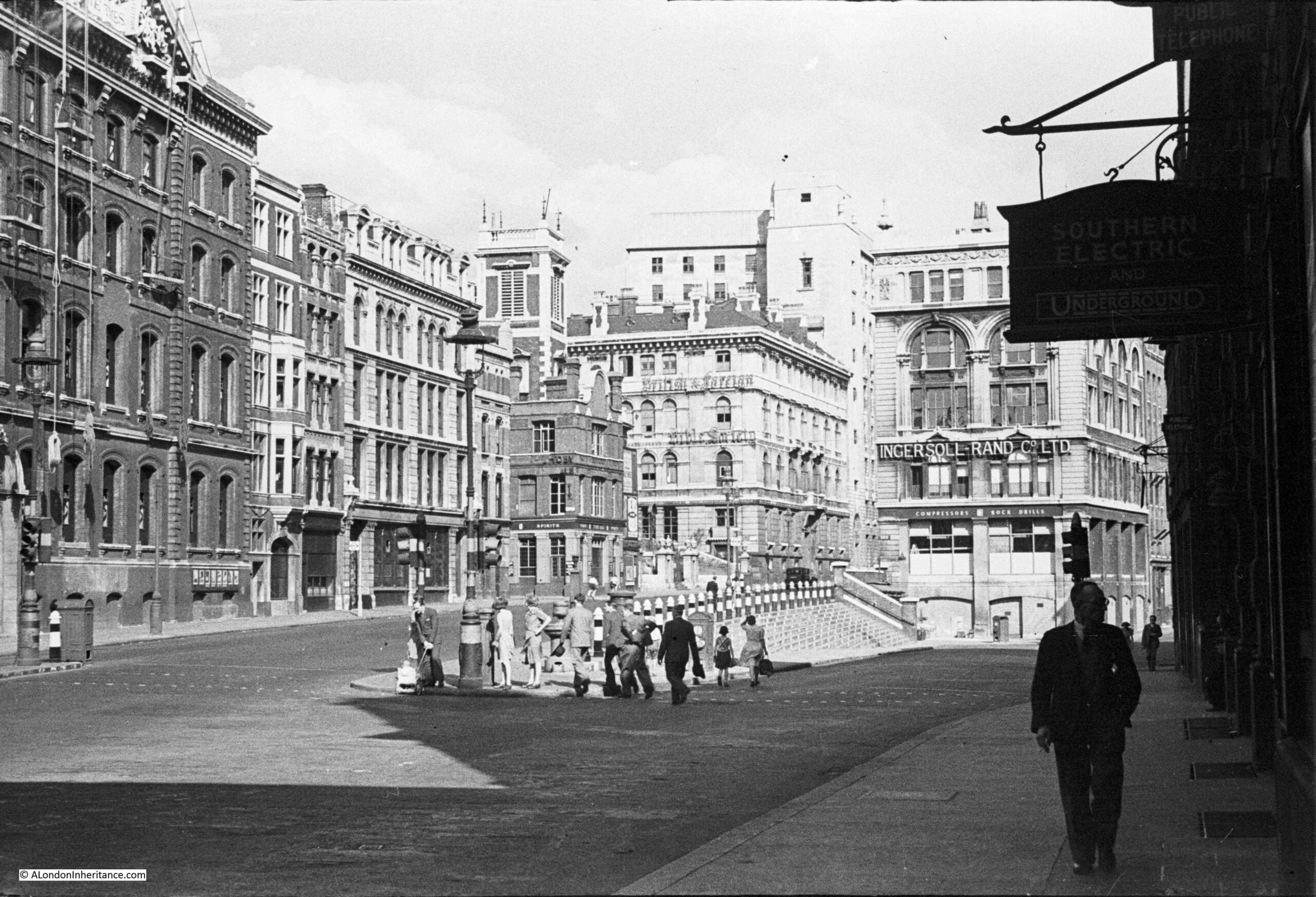
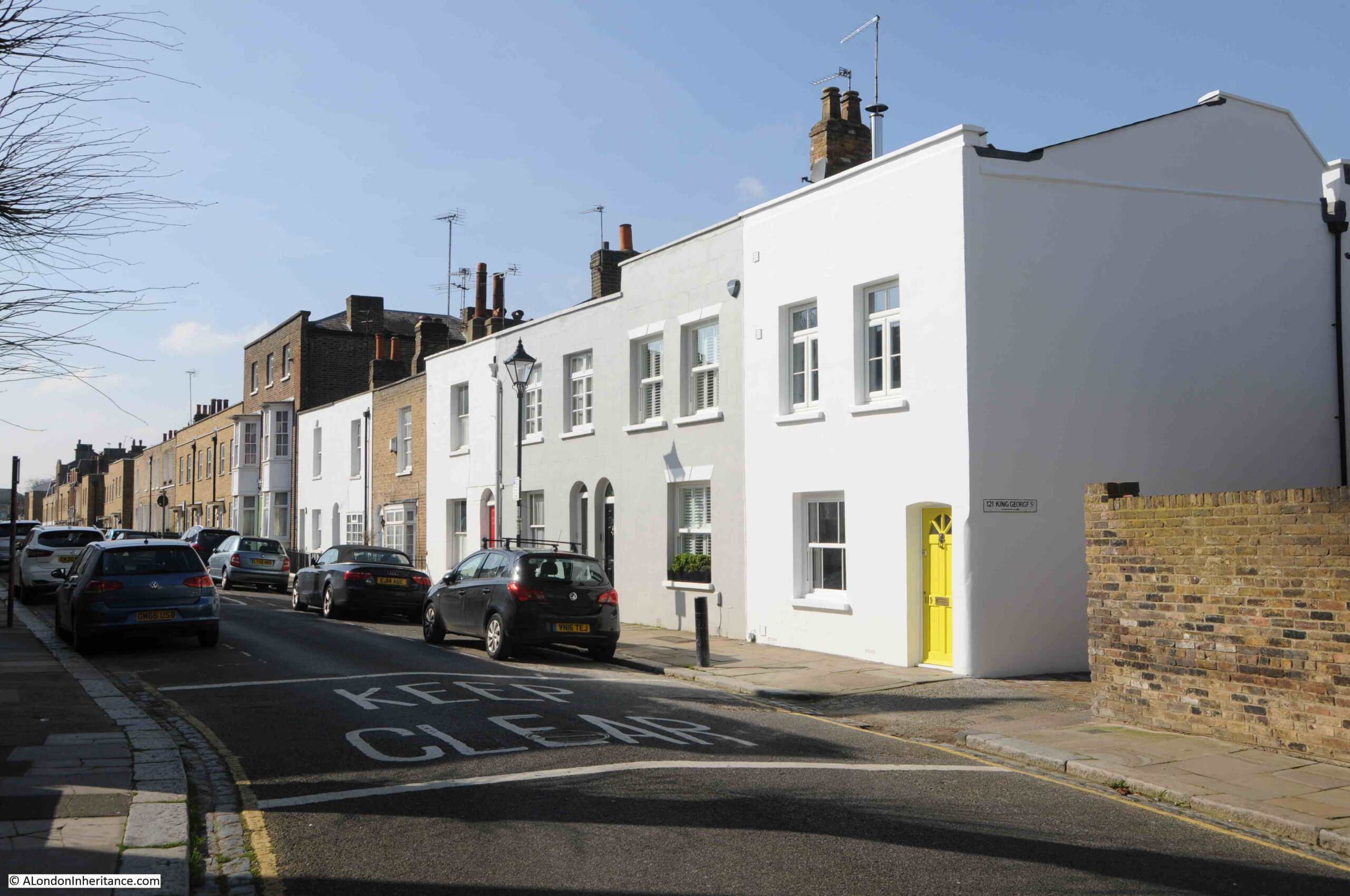
I will have dates for my existing walks covering Wapping, Limehouse etc. in the summer, but for April and early May I have a new walk, which has the rather long title of “The Lost Landscape and Transformation of Puddle Dock and Thames Street”.
Dates and Eventbrite links for booking are as follows, and more details of the walk are below.
In terms of distance, this walk is shorter than my Wapping and Limehouse walks. It starts at one end of Queen Victoria Street, outside Blackfriars Station, and ends further up Queen Victoria Street not far from Mansion House, and covers the historic area between Queen Victoria Street and the Thames.
The walk tells the story from the Roman period up to post-war redevelopment, and why the area is as we see it today.
Having been transformed after the war, the area may soon be transformed again as there are plans for the possible redevelopment of the area around Puddle Dock, Baynard House and St Benet’s Church, between Queen Victoria Street and the Thames.
This area is in need of some change. It is a product of planning first developed in the 1940s for the post-war transformation of London. A plan where the car was a priority for transport through the City.
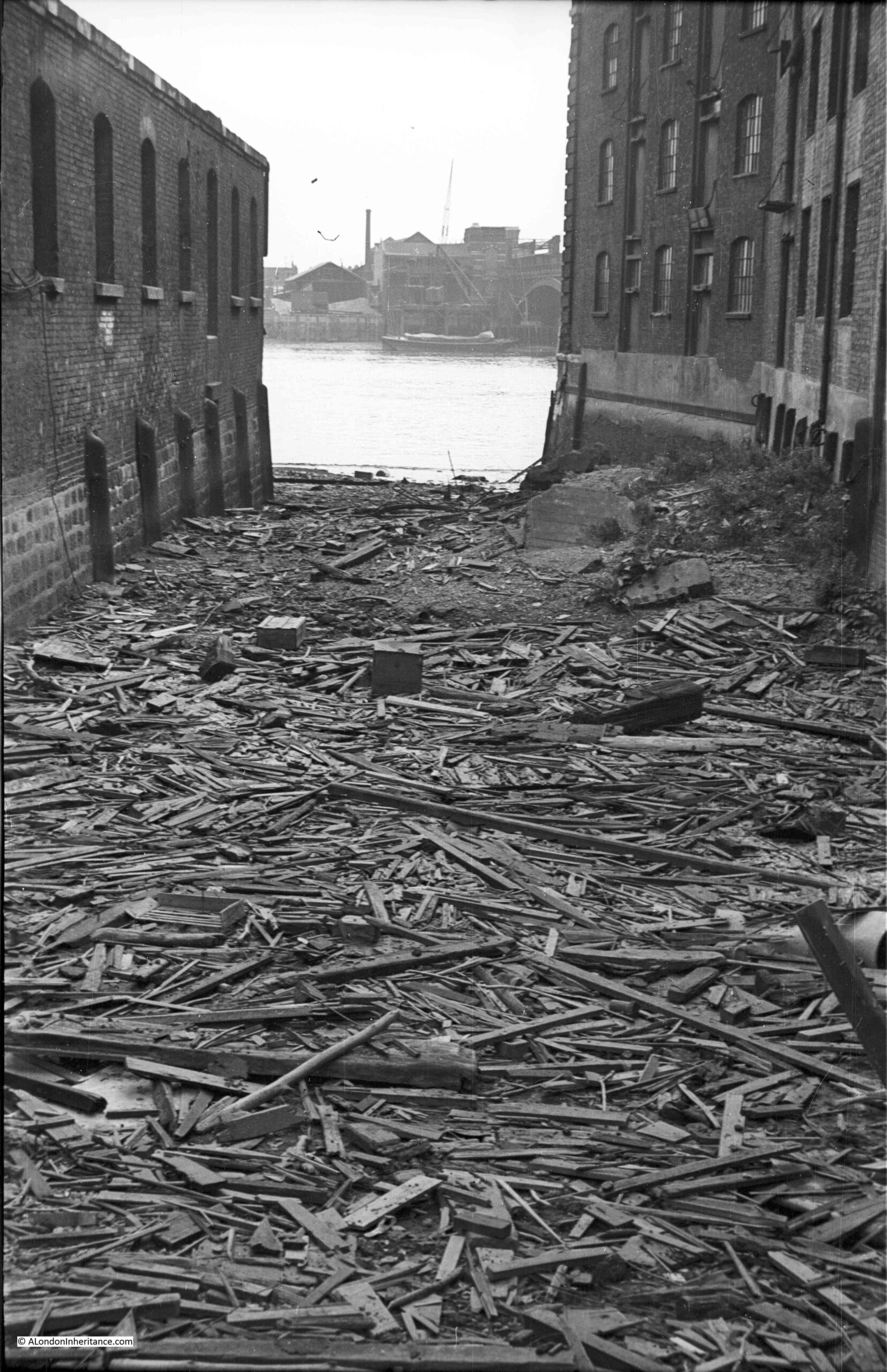
Post-war redevelopment exposed the remains of 15th century Baynard’s Castle. Puddle Dock was filled in and Upper Thames Street extended on land reclaimed from the river.
The original route of Upper Thames Street was lost, and St. Benet’s Church isolated between roads and the City of London School.
The walk explores this long history of the area between Queen Victoria Street and the Thames.
Rubbish dumps, Thames Stairs, Roman and Medieval remains, post war planning, and how this created a very unfriendly environment for the pedestrian. How apparently historical streets are not what they seem. The first theatre built in the City of London for 300 years, within the walls of an old warehouse, St. Paul’s sightlines and some remarkable industrial building decoration.
The possible future development of the area will also be considered.
The walk will use plenty of my father’s photos from the late 1940s, and my photos from the late 70s / early 80s, along with 1940s and 1950s redevelopment plans, and earlier maps to show how the area has changed.
The walk will take about 2 hours and starts outside Blackfriars Station and finishes at the northern end of Queen Victoria Street with a look at a driving force behind the post-war greening of the City.
I look forward to showing around part of the City of London that could well be changing in the coming years. All booking dates here:
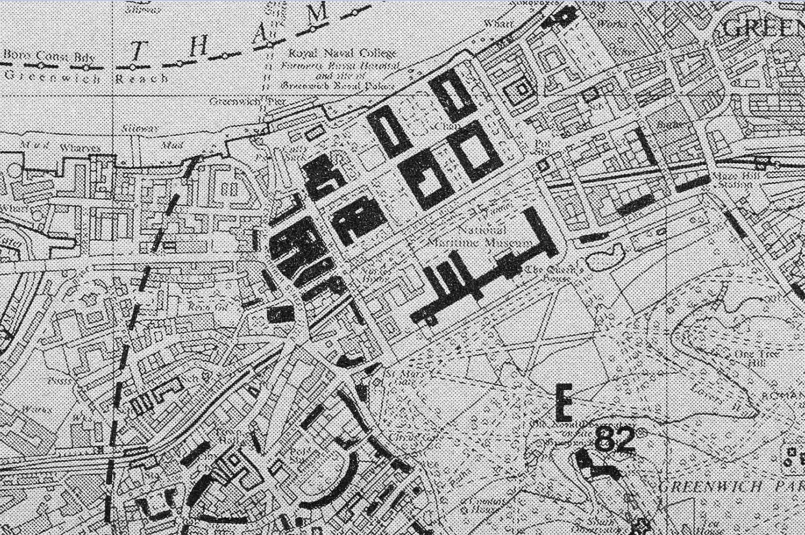
Following last week’s post, this is part two of my exploration of Greenwich, looking for the locations marked as potentially at risk from development in the Architects’ Journal of 1972.
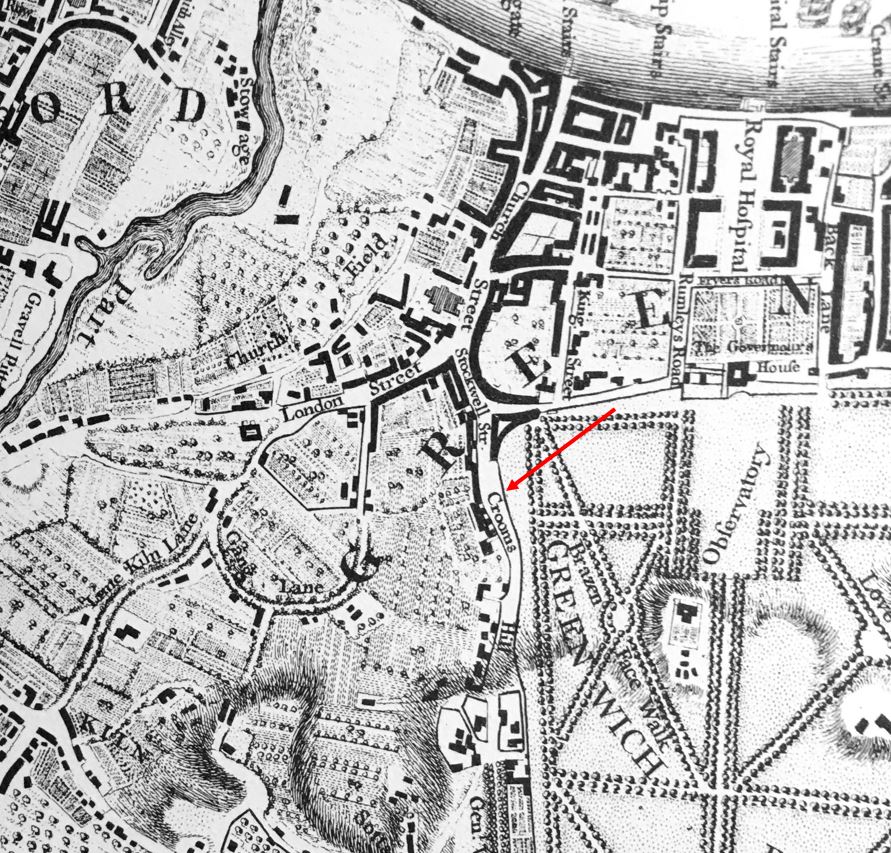
In last week’s post, I started at the Royal Observatory (the black buildings under number 82 in the following map), and then explored the streets and buildings to the lower left of the map.
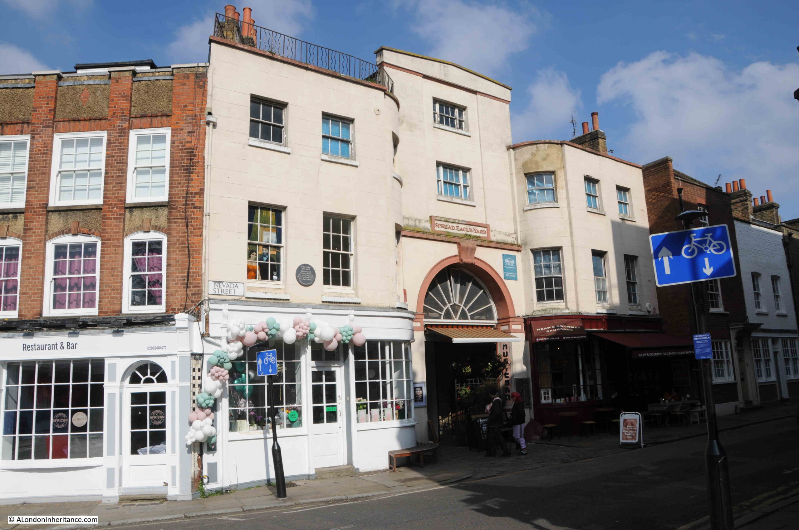
In today’s post, I am working through the upper part of the map, either side of the old Royal Naval College and National Maritime Museum, starting with the following building in Nevada Street, on the corner with Crooms Hill:
This was the Spread Eagle, an old coaching inn, which still has the name Spread Eagle Yard above the arched entrance to the yard where horses were stabled to the rear of the building.
The current building dates from a 1780 rebuild of the inn, and it was closed comparatively recently in 2013.
The brown plaque on the left of the building is to Dick Moy (1932 to 2004) who was an historian and art dealer who restored and worked from the inn.
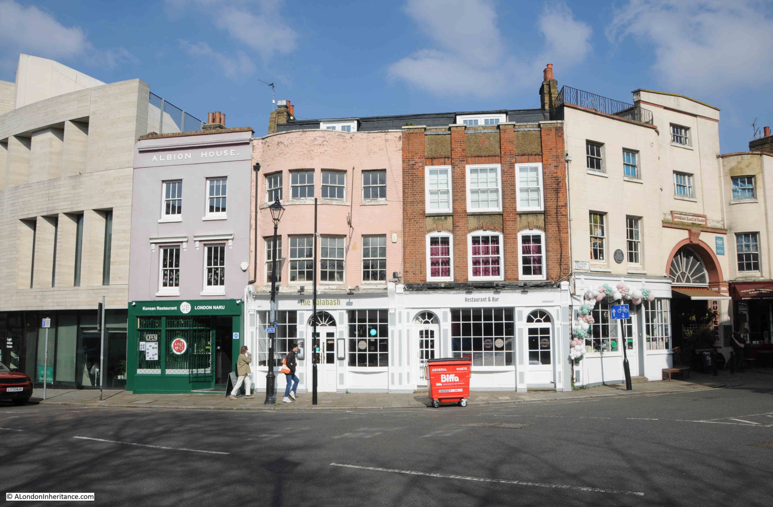
Just to the left of the Spread Eagle, Croom Hill changes to Stockwell Street, and we can see a mix of architecture, with buildings from the 18th century through to the 21st century University of Greenwich Galleries on the left:
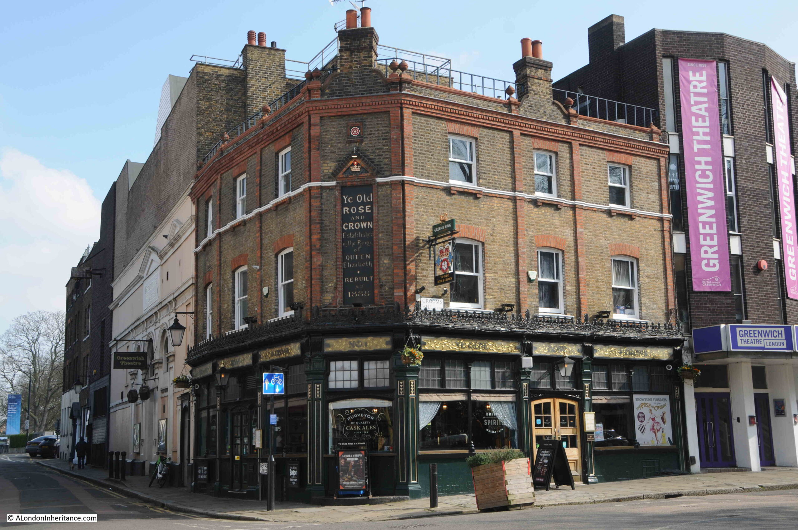
On the corner of Crooms Hill and Nevada Street, opposite the Spread Eagle is Ye Old Rose and Crown which claims to date from the reign of Queen Elizabeth I, however the brick building we see today dates from 1888:
You can also see from the above photo that the Rose and Crown is surrounded by the Greenwich Theatre, with a new entrance on the right and original buildings on the left.
The original buildings date back to 1855 when it was a Music Hall. A change to a cinema followed in 1924, and the theatre opened in 1969 following a campaign to save the building from demolition in the 1960s.
St. Alfege
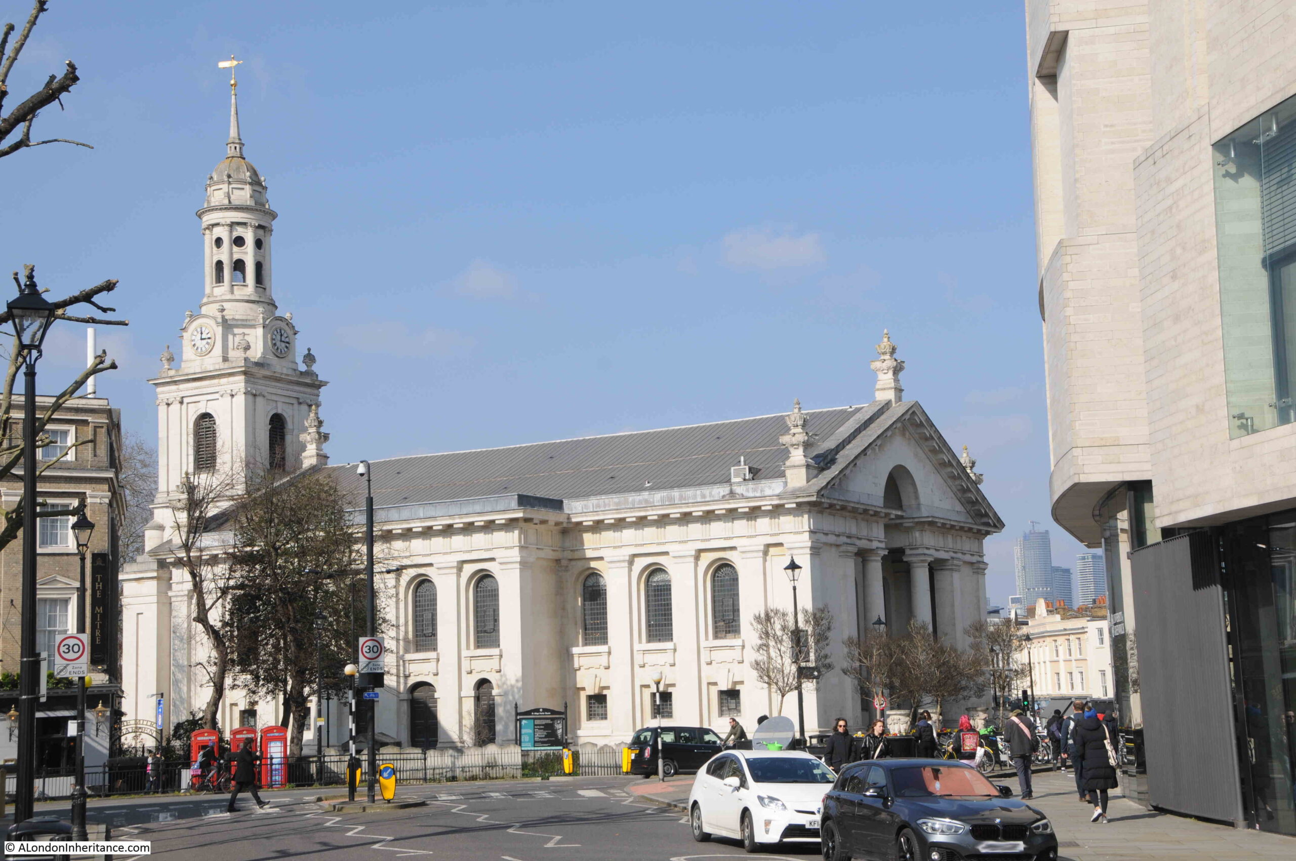
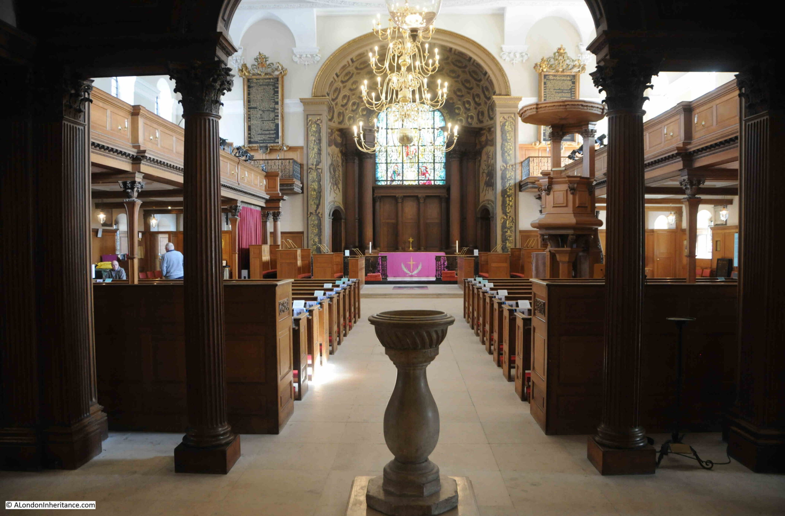
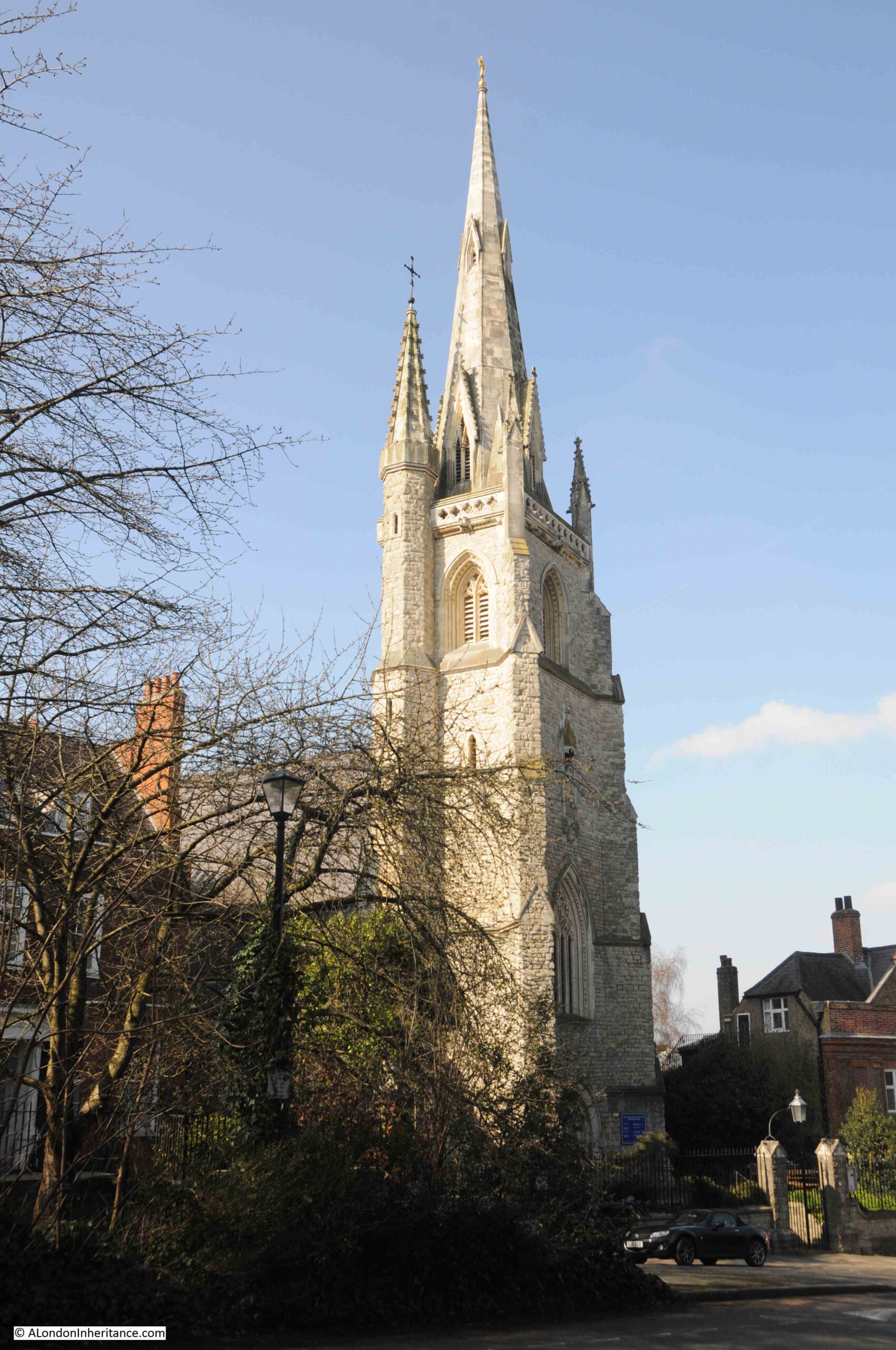
Continuing down Stockwell Street, and we find a superb view of the church of St. Alfege:
There has been a church on the site for around 1000 years, however the church that we see today dates from between 1712 and 1718 and was designed by Nicholas Hawksmoor. It was one of the so called fifty new churches planned to be built in the areas around the then outskirts of London, in the places that had been expanding rapidly and did not have the number or size of churches needed to support increasing populations.
The previous church on the site had suffered a roof collapse during a storm, and to save money, the tower of the earlier church was included in the new church, although this was not Hawksmoor’s original plan.
In 1731, the earlier medieval tower was extended and clad in limestone, so presumably, parts of the medieval tower are still within the structure today.
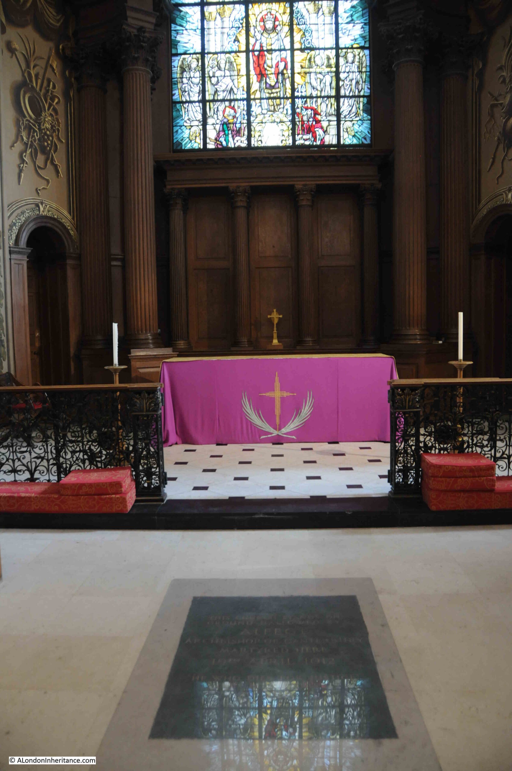
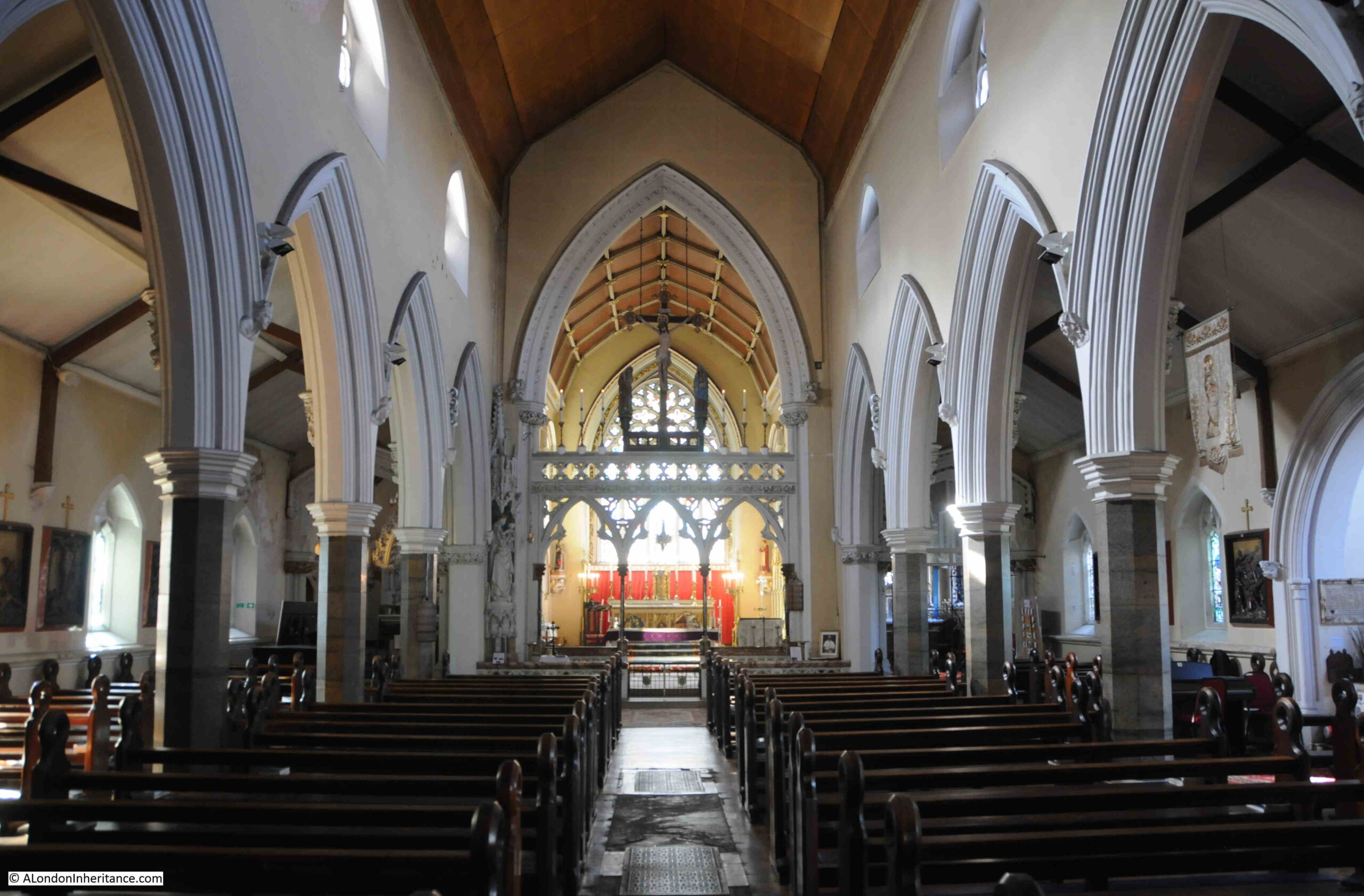
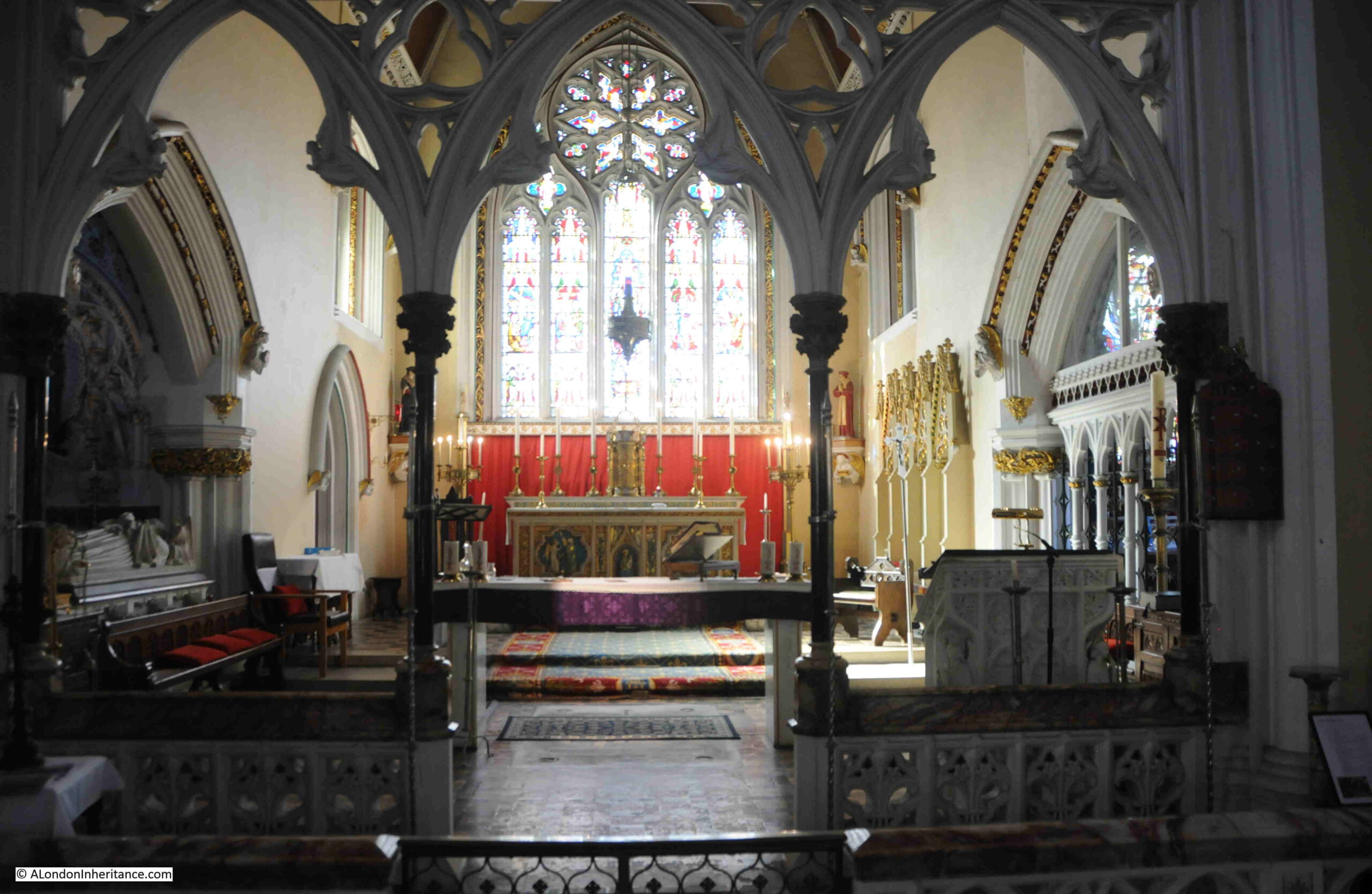
On entering the church, we see the altar at the eastern end, and two galleries running either side of the church:
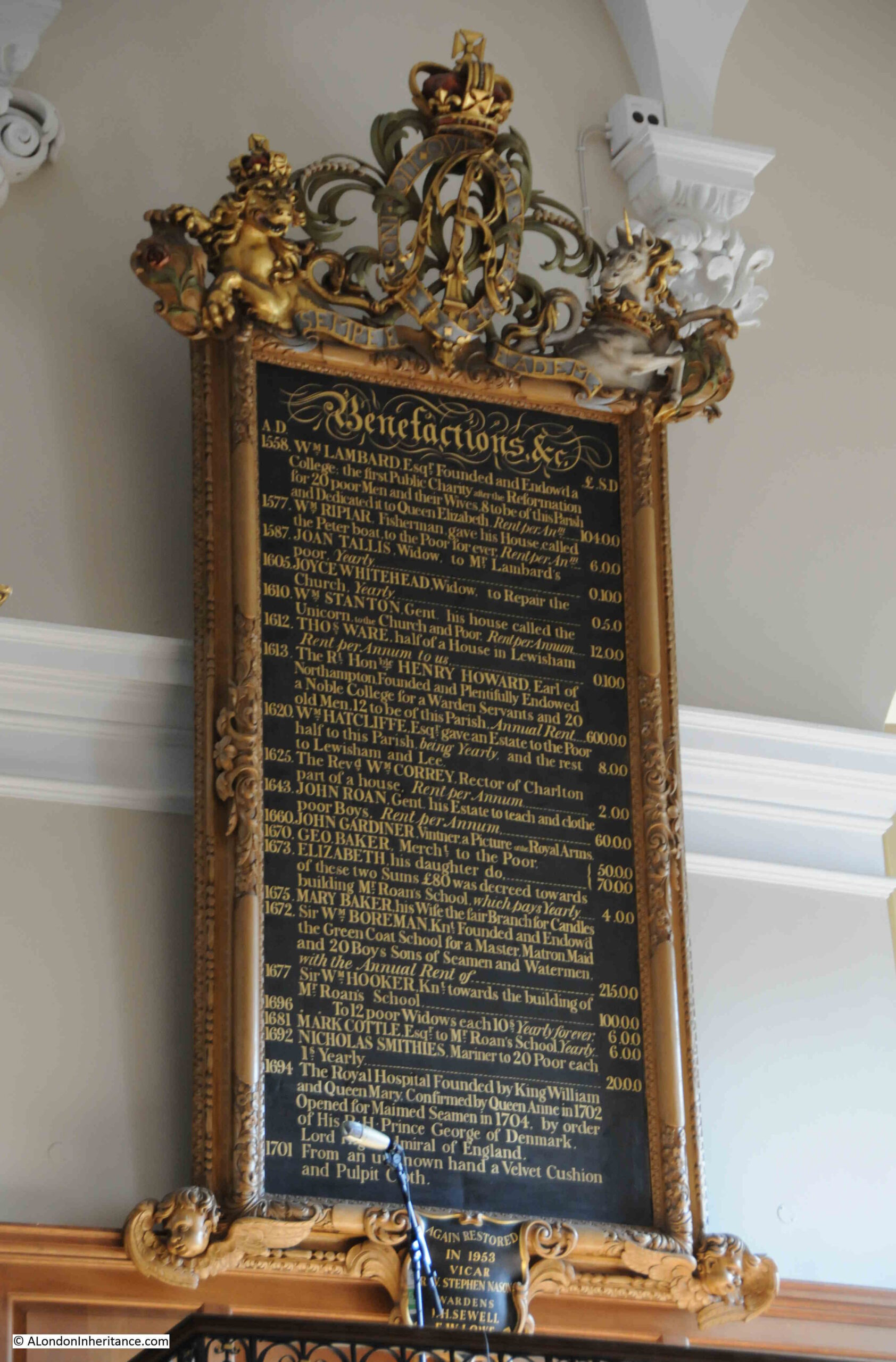
In the above photo, on either side of the arch leading to the altar, there are two ornate panels, which list benefactors dating back to 1558, when William Lambarde “Founded and Endowed a College, the first Public Charity after the Reformation for 20 poor men and their wives. 8 to be off this parish and dedicated to Queen Elizabeth”:
Other benefactors include in 1577: “William Riplar, Fisherman gave his house called the Peter boat to the poor for ever” and in 1605, Joyce Whitehead gave 5 shillings to repair the church every year. All fascinating local tales of charity.
In front of the altar is a plaque which records why the church is dedicated to St. Alfege, and why it is on this site:
The plaque is hard to read in the photo, but it states that “This church stands on ground hallowed by Alfege Archbishop of Canterbury martyred here 19th April 1012”.
St. Alfege (the spelling of the name includes variations such as Alphege), was born in a village near Bath, and became the Abbot of Bath and then the Bishop of Winchester. In 1005 he was appointed the Archbishop of Canterbury.
In the early decades of the 11th century, the Danes were invading much of southern England and in 1011 they attacked Canterbury, burning the Cathedral and plundering the city.
Alfege was taken hostage, apparently to be held for ransom, and he was transported by ship to Greenwich.
It was here that he was killed. It is impossible to know exactly how this happened, but many stories tell that Alfege told his captors that the ransom was too high, and that it should and would not be paid. In a drunken rage, they pelted him with cattle bones and an axe head, which killed him.
It was this event which resulted in Alfege being made a Saint (although there has been some dispute about this, and whether he died because of his faith, or the size of the ransom), and to the first church being built on the site of his death later in the 11th century.
St. Alfege is not buried in Greenwich. After his death he was buried in St. Paul’s, then soon after, his body was moved to Canterbury Cathedral, where it remains to this day.
Although Alfege is not buried in the church, there are a number of well known names who have been, including one who may also have left musical evidence of his connection with the church.
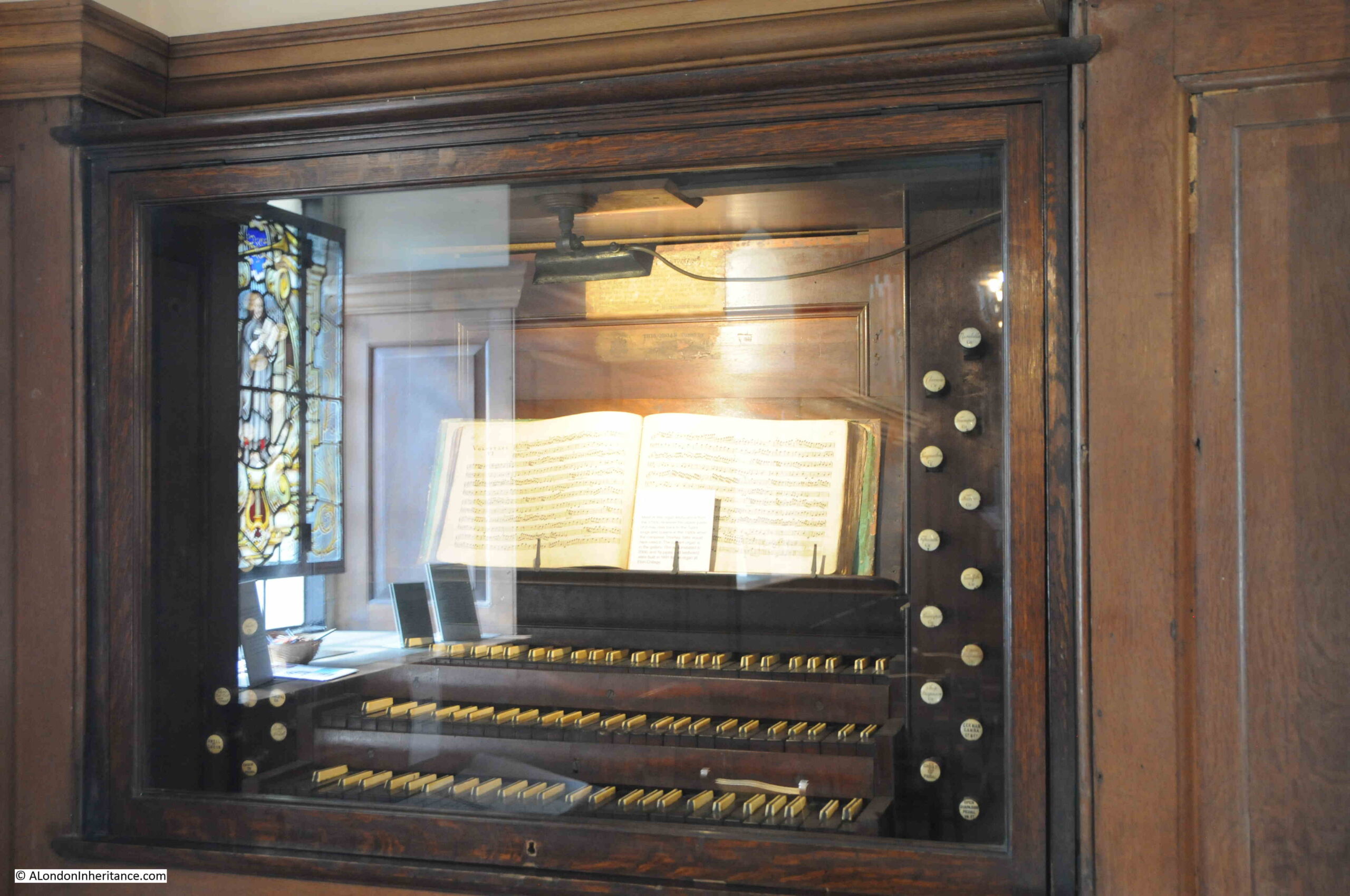
Thomas Tallis was a 16th century English composer who was organist in St. Alfege from 1540 to 1585, and is believed to have lived in Stockwell Street close to the church during the later years of his life.
In the church is the keyboard from one of the earlier organs. The majority of the keyboard dates from the 18th century, however it is believed that parts may date back to the 16th century and may have been in use when Tallis was the organist:
Another burial in the church is that of General James Wolfe (Wolfe’s statue is the one on the hill next to the Royal Observatory – see last week’s post). Wolfe had a house in Greenwich and also a family vault in the church.
He died in Canada during a battle to take Quebec from the French, and it is for his part in the wars to capture French possessions in north America that Wolfe is best known, although this was the culmination of a long military career.
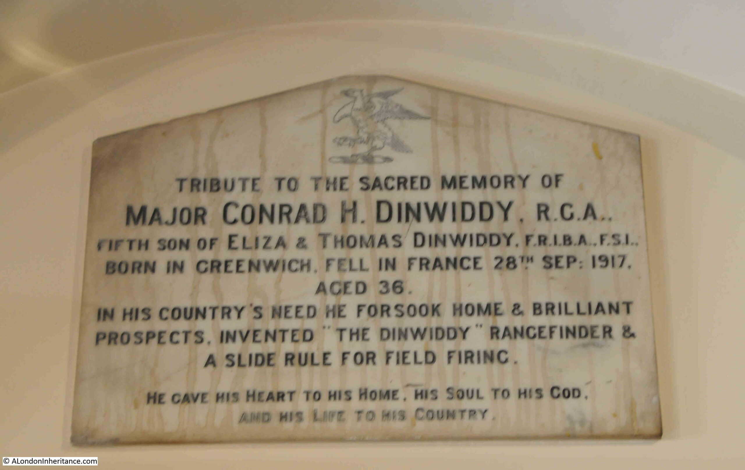
There is an interesting monument in the church that includes a reference to the invention of the “Dinwiddy Rangefinder”:
Conrad Dinwiddy was born in Greenwich in 1881, and was the son of London architect and surveyor, Thomas Dinwiddy who had an architectural practice based in Greenwich.
During the First World War, German Zeppelins were making bombing attacks on London and Conrad Dinwiddy saw one of these attacks on Woolwich by Zeppelin L13. He saw that although there were several searchlights trained on the Zeppelin and many guns attempting to hit the attacker, none were actually hitting, and that it appeared impossible to accurately aim a gun and fire a shell to hit a target at height, which was also moving at speed.
Like his father, Conrad was also a surveyor, so was familiar with use of instruments such as theodolite, however working out the positions of a moving target were far more complex that traditional surveying of fixed objects.
He came up with a plan for two stations, based 500 yards apart. One was a primary observation station and was connected by telephone to the secondary station.
The rangefinder worked by the primary observation station making measurements of position and height which were then adjusted to improve accuracy with the measurements of the second station which was, at 500 yards distant, on a fixed baseline.
The Dinwiddy Rangefinder was put into production, but as the war progressed, the threat from bombing changed from Zeppelin’s to aircraft, and rapid technical advances improved other methods for defending London against aerial threats, however the Dinwiddy Rangefinder remains as an example of the rapid response to a threat from a Londoner who saw the potential impact to their city.
Conrad Dinwiddy joined the Royal Garrison Artillery in 1916, where he was posted to the Western Front in charge of a six inch howitzer battery. He would continue inventing improvements to how guns were aimed, firing from barges, and the methods for transporting ammunition.
He was wounded by German battery fire on the 26th of September, 1917, and died the following day. He is buried in a military cemetery in Belgium. The memorial in St. Alfege has the wrong date, as he died a day earlier on the 27th of September.
A fascinating story from this small plaque in the church.
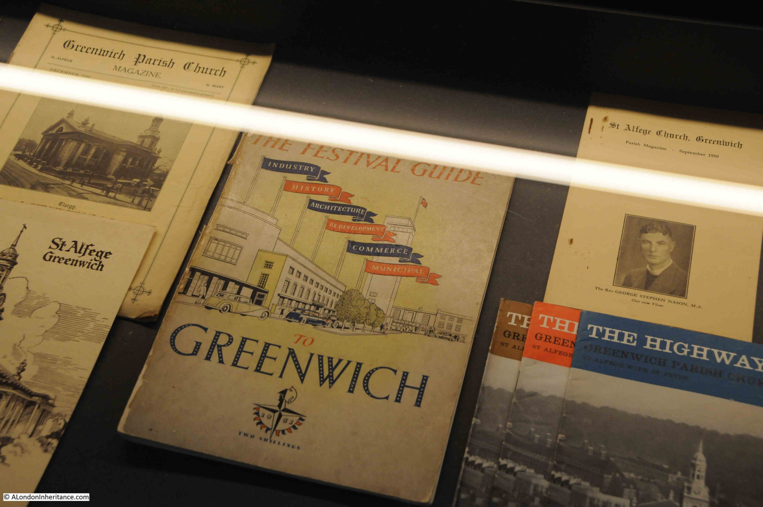
As I left the church, I had a look in a small room on the left as you exit, which has a number of display cabinets on the history of the church and I noticed the following: The Festival Guide – Greenwich
If you have read the blog for a while, you are probably aware of my interest in the Festival of Britain, and this guide is another example of how the festival was intended to reach across the country, and towns and villages, and suburbs of London were also having their own interpretation of the festival, with local events and guides.
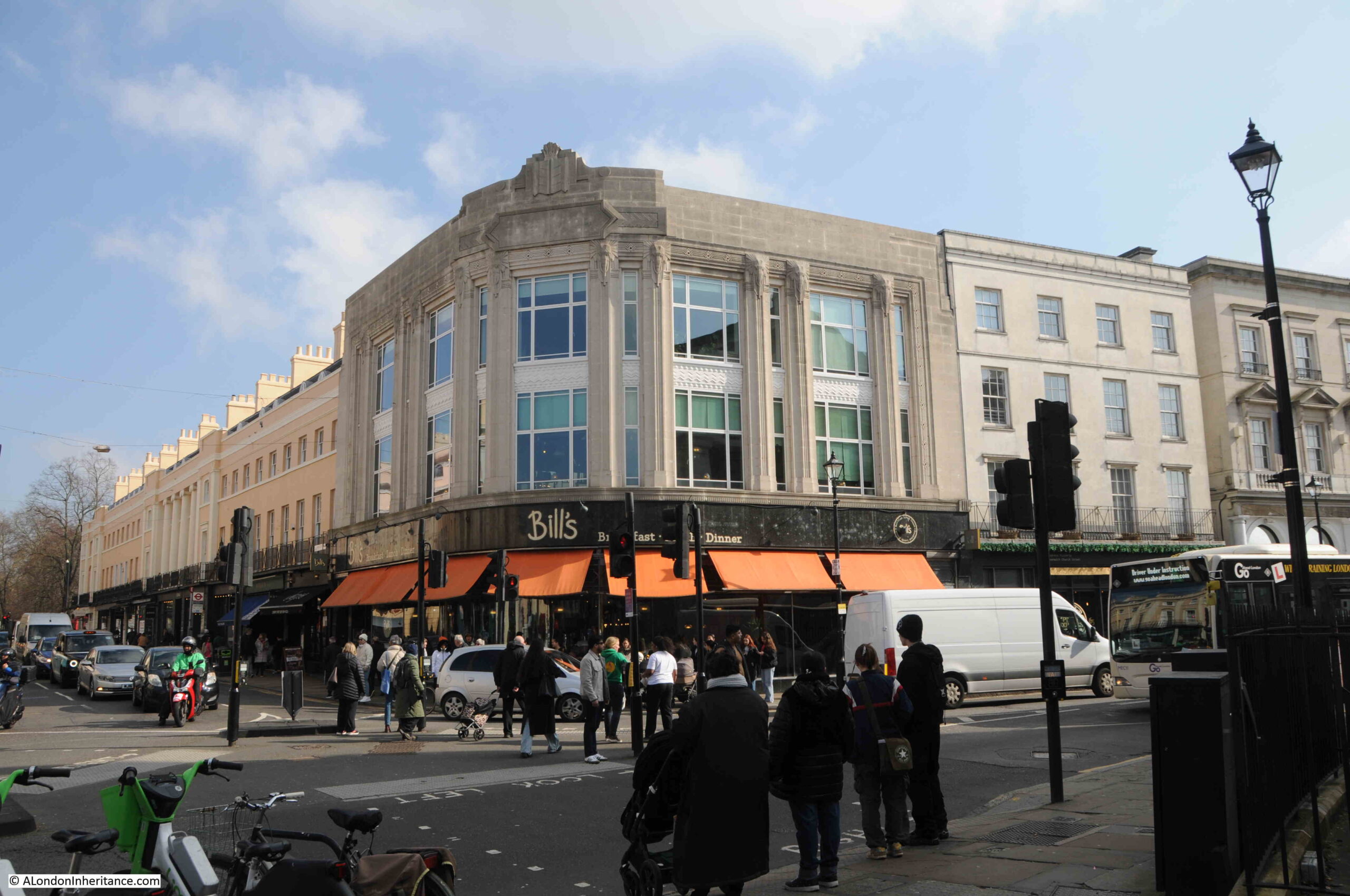
Outside the church, on the corner of what is now Greenwich High Road and Nelson Road is a Bill’s restaurant in a rather ornate corner building:
I did wonder if the building was a new build on the site of bomb damage to the terrace you can see to the left, however the style of the building shows that it is pre-war, and it was indeed built in the early 1930s for the Burton menswear chain.
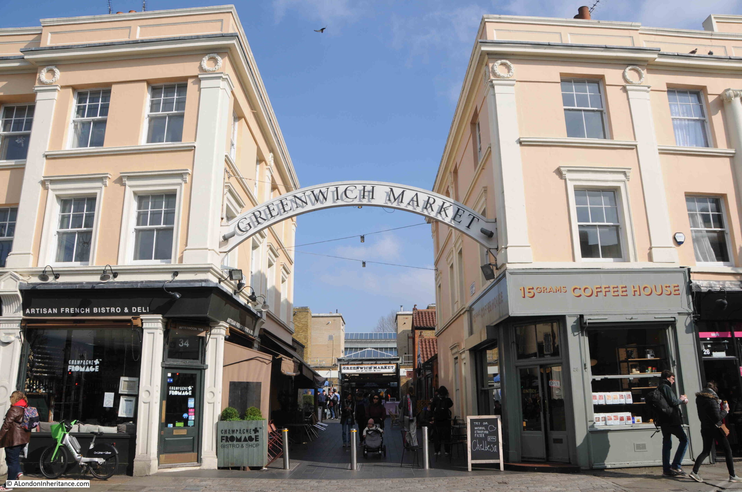
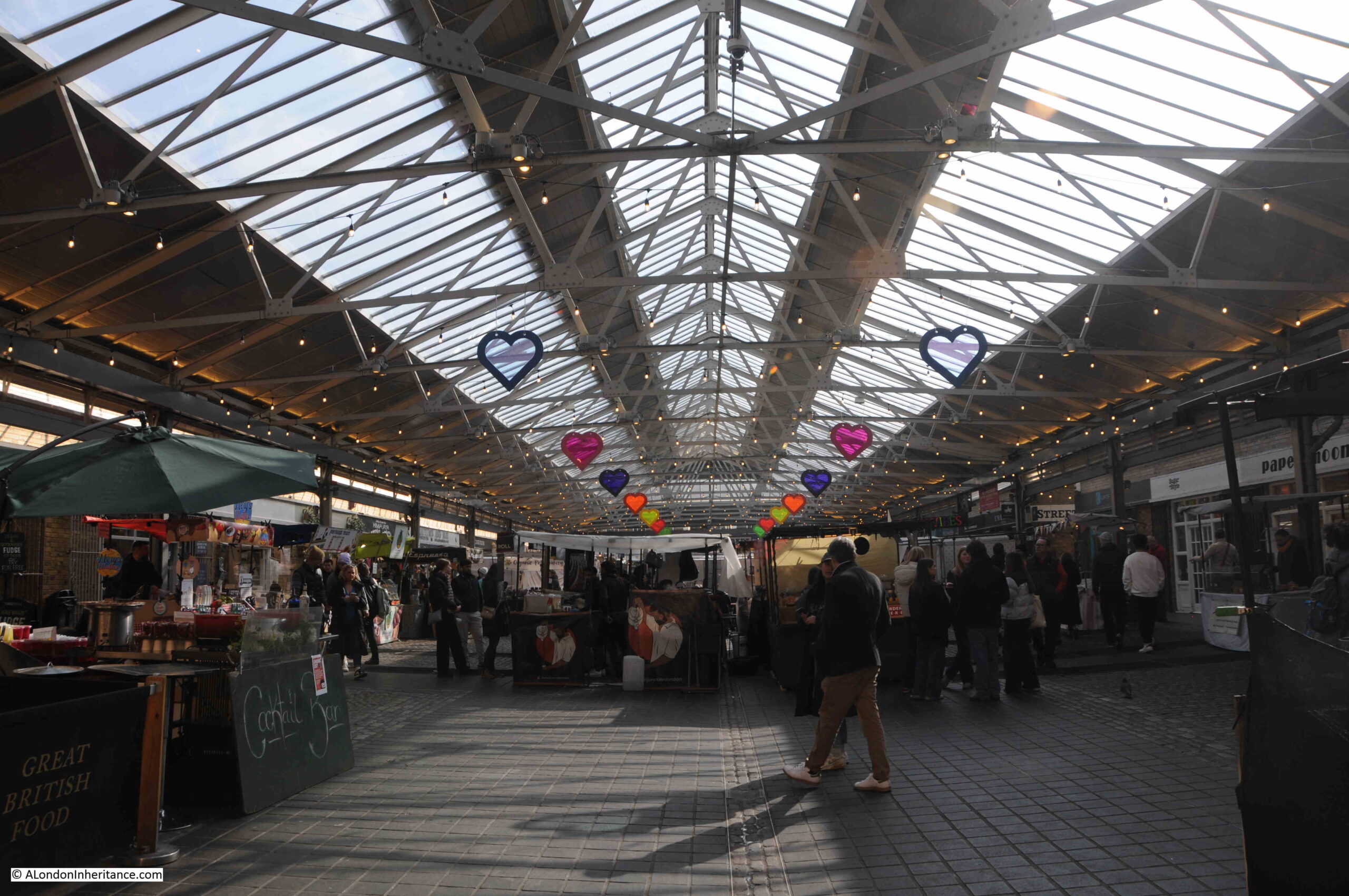
The road then changes to Greenwich Church Street, and here we find one of the entrances to Greenwich Market:
The terrace buildings on either side come to what looks like a designed end where the entrance to the market is located, and this indeed was the plan.
The terraces on either side of the entrance were built as part of an overall redevelopment of the market area around 1829 / 30. They are all Grade II listed, and if we look to the left we can see how the symmetrical design of the terrace curves along the street:
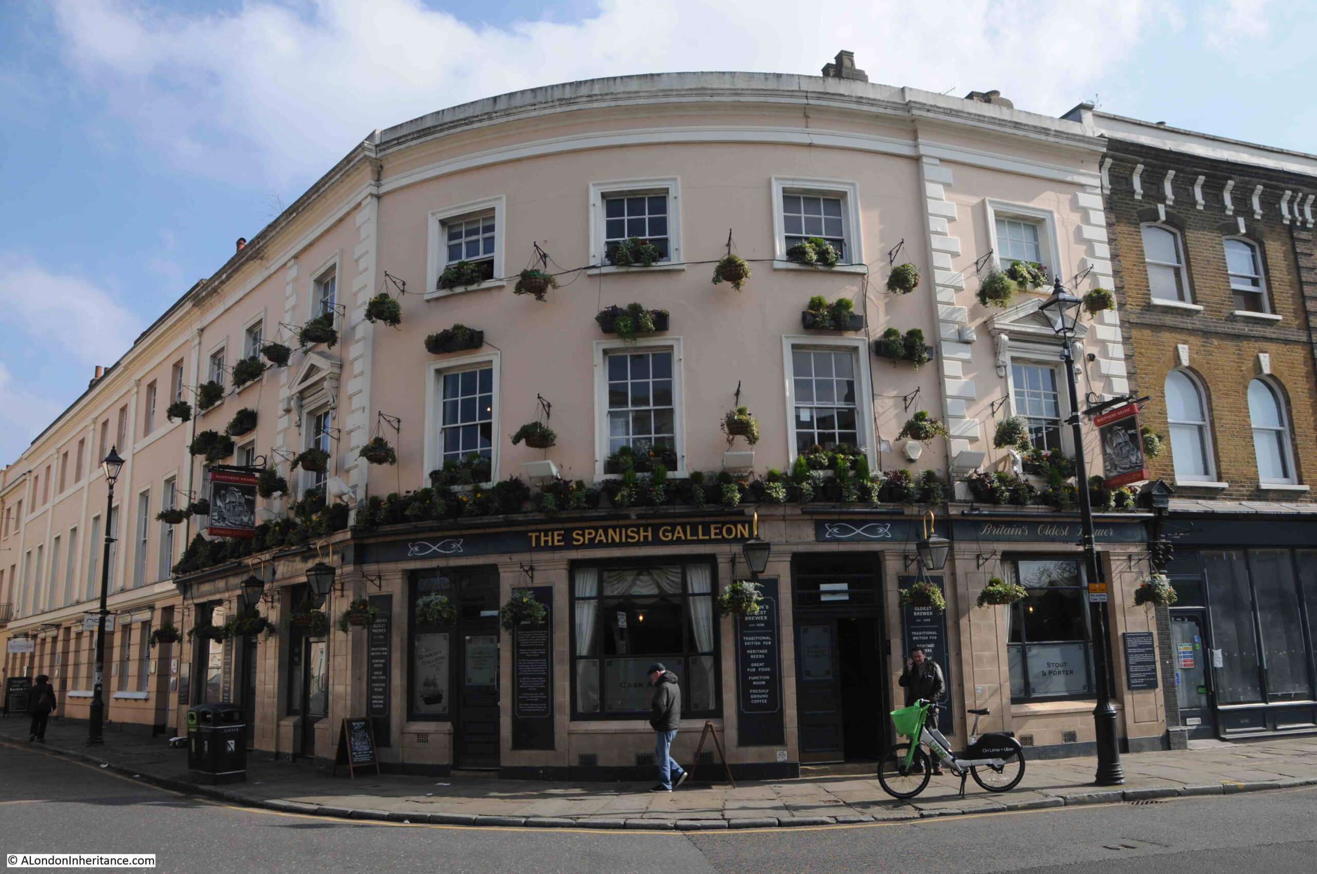
Further along Greenwich Church Street, at the junction with College Approach, the Spanish Galleon pub is on the corner:
The Spanish Galleon pub dates from the same market redevelopment as the terrace houses featured above. As with so much of Greenwich, the pub is Grade II listed. A pub is believed to have been on the site for many years prior to the 1829 / 1830 redevelopment.
Up until the start of the 19th century, this was an area of narrow lanes and alleys, and with the growing importance of Greenwich, a redevelopment of the area was needed, and the architect Joseph Kay was commissioned, and it is his work we see today.
Joseph Kay (1775 to 1847) worked on a wide range of building projects across the country. In London, he was appointed surveyor to the Foundling Hospital in 1807, he laid out the gardens in Mecklenburgh Square, he was employed by the Marquis Camden on his Camden Town Estate, and in 1823 he was appointed surveyor of Greenwich Hospital.
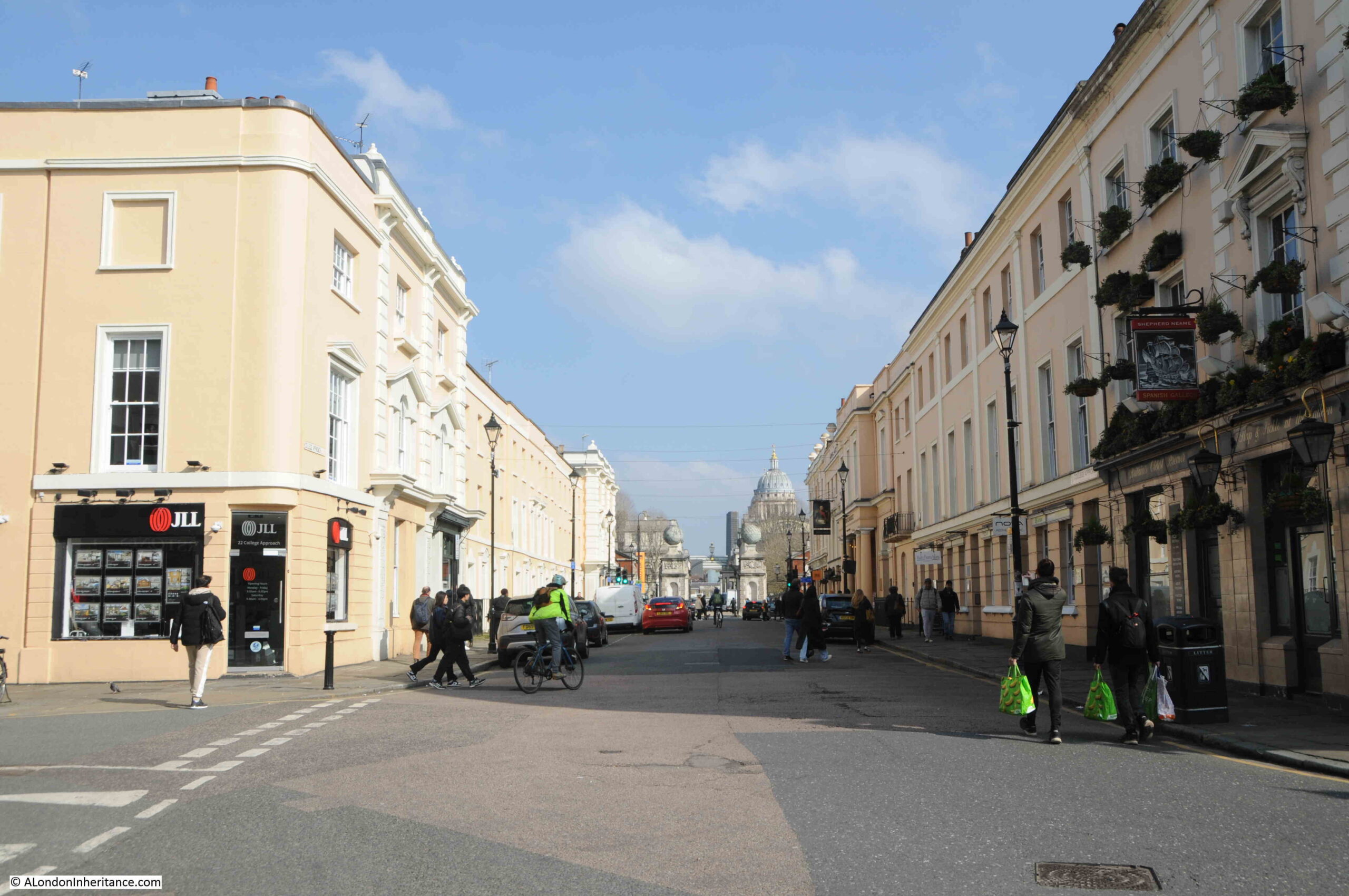
The view along College Approach, with the Spanish Galleon on the right, and the terrace along the right being on the northern side of the market:
Greenwich has had a market since the 14th century, however the current market dates from a charter granted in 1700. It was originally located on part of the Seamen’s Hospital site, close to the West Gate. It relocated to the current site as part of Joseph Kay’s redevelopment of the area, and was originally a market selling fruit and vegetables, fish caught by Greenwich fishermen, plants and seeds, with sellers of pottery, glass and household goods around the edge of the main market area.
In the 1970s and early 1980s, the popularity of the market as a place for fruit, vegetables etc. declined, and the market transformed into in place where stallholders sell all manner of arts and crafts products, with a cluster of food stalls at the northern end.
The market is open seven days a week, but gets really busy at the weekends.
A view through the market:
The market, and the surrounding buildings of the 1830 redevelopment are part of the buildings marked in black in the Architects’ Journal article, and with the decline of the traditional use of the market, the market could have been so easily lost during the 1970s / 80s, however the market is owned and managed by Greenwich Hospital who fortunately have both a historic and long term view of the importance of the area.
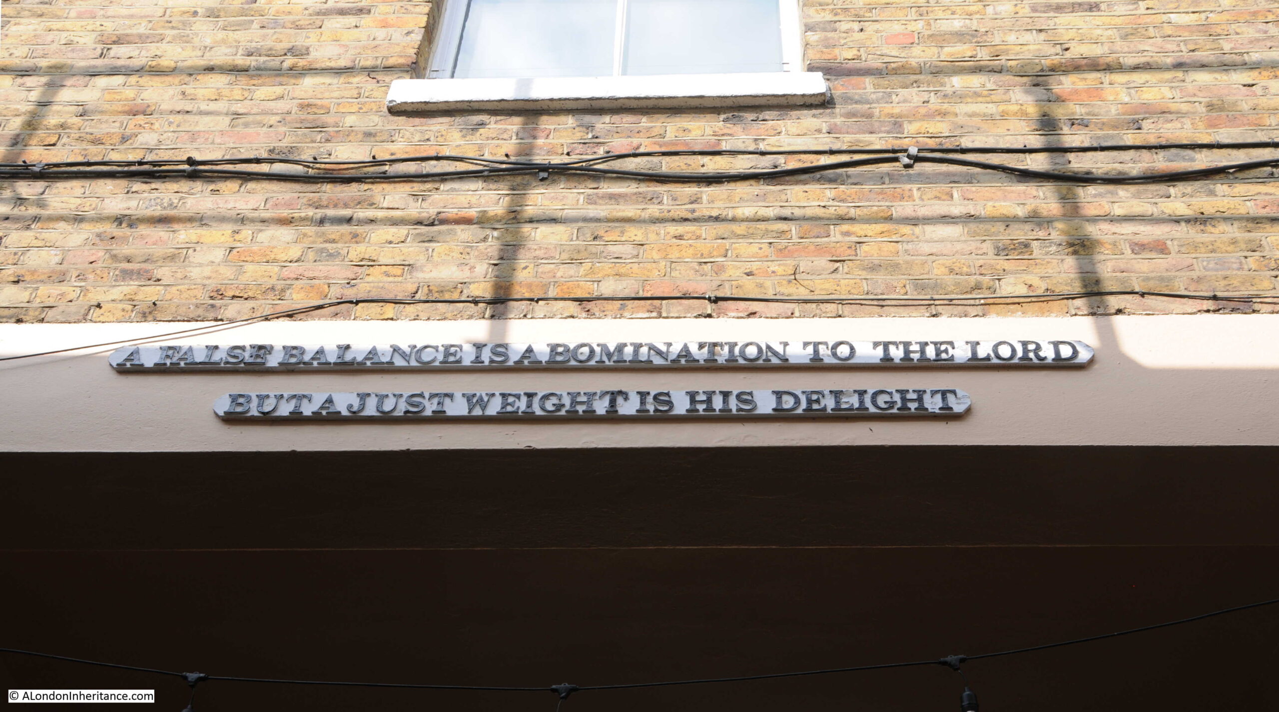
A message to those leaving the market:
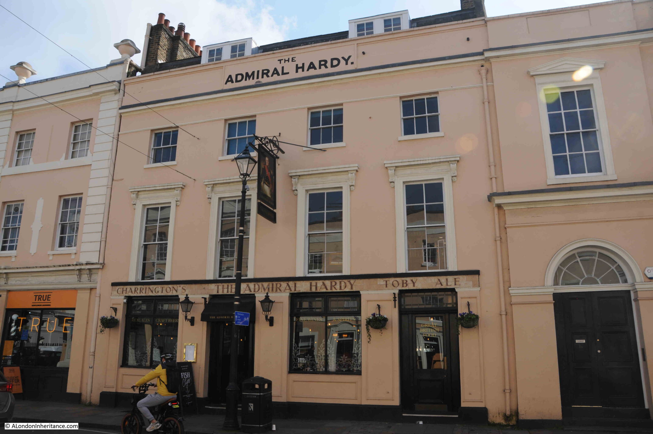
Just to the east of the market entrance in College Approach is another Grade II listed pub, the Admiral Hardy:
Greenwich is very well served with pubs. The Admiral Hardy was again part of the 1830 redevelopment, and to the right of the pub in the above photo is a small part of what was the Royal Clarence Music Hall, built over the entrance to the market.
The music hall was named after the Duke of Clarence, later King William IV, and the street outside, College Approach was originally Clarence Street.
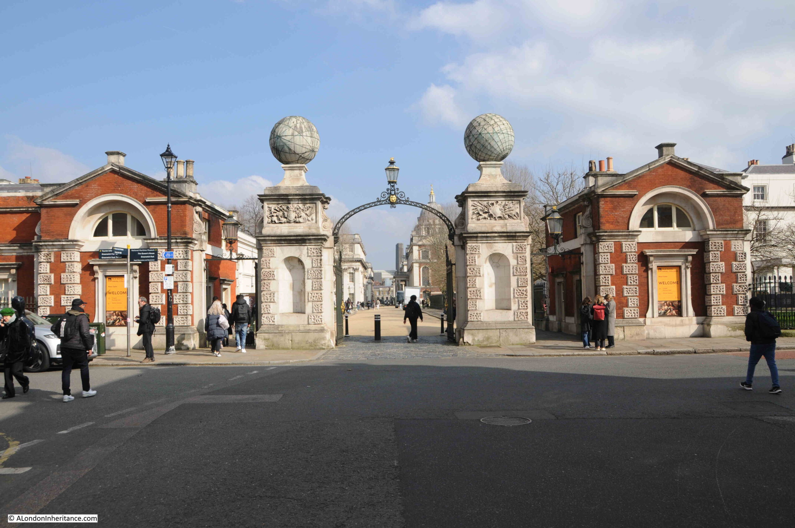
At the end of College Approach is the Grade I listed West Gate into the old Royal Naval College. The listing includes the gates, piers, globes and brick lodges on either side:
The globes on top of the piers are fascinating. Each globe is of Portland Stone, of 6 feet diameter and weighs around seven tons.
The globes date from the early 1750s, and were installed to commemorate Commodore George Anson’s around the world voyage, which is a remarkable story, and resulted in the surviving crew becoming rich through the capture of a Spanish treasure ship.
The globes are marked with lines of latitude and longitude in copper strips
It was common practice in the 18th century for the story of voyages such as Anson’s to be published as partworks, and Anson’s voyage was covered in 15 issues starting in August 1744, and was written by “An Officer of the Fleet”.
Adverts for the publication enticed the reader with hints of the dangers faced by the crew and descriptions of a part of the world that the majority of people knew very little about:
“This Work contains a very faithful and exact relation of the many Difficulties and Dangers the Fleet met with in the Voyage. An Account of the Loss of their Ships, and what dreadful Miseries and Hardships the poor sailors met with, being forced on desolate islands, where many of them perished for want. Also an Account of the manner of their Living in the Voyage on Seals, Wild Horses, Dogs and the incredible Hardships they frequently met with for want of Food of any Kind. The Loss of the Wager (one of the ships) and the Behaviour of the Captain (who shot one of his Mates), his Officers and Crew, fully and faithfully related. Their plundering and destroying of the City of Payta, where the Commodore got immense Riches, and his sailing afterwards into the East-Indies, where he was well received by the Vice King of China, who furnished him with Provisions and Necessaries to enable him to pursue his Voyage to England. With a particular Account of his taking the rich Aquapulco Ship.
This Book will give a complete Description of the several places where the Fleet touched, how they plundered and distressed the Spaniards; the Manners, Customs, Religion, Trade and Manufactures of the People who inhabit this large and almost unknown Part of the World.”
All for two pence an issue, with a free print of Commodore Anson with the first issue.
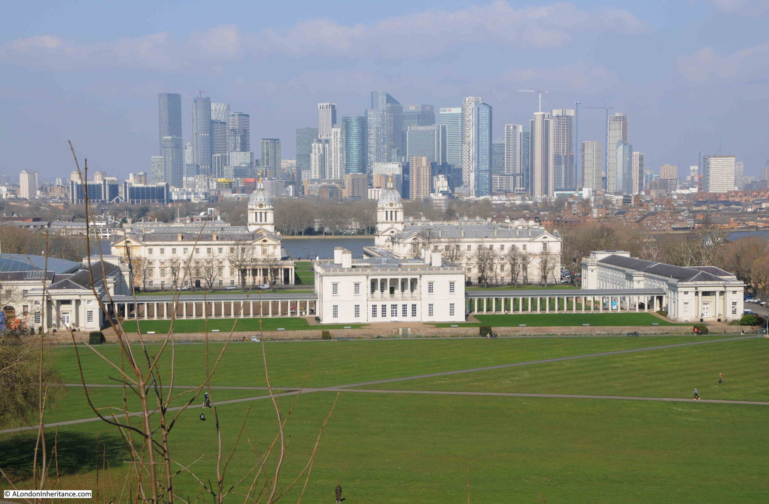
Looking through the old Royal Naval College, to Queen’s House, with the Royal Observatory just visible on the hill in the distance:
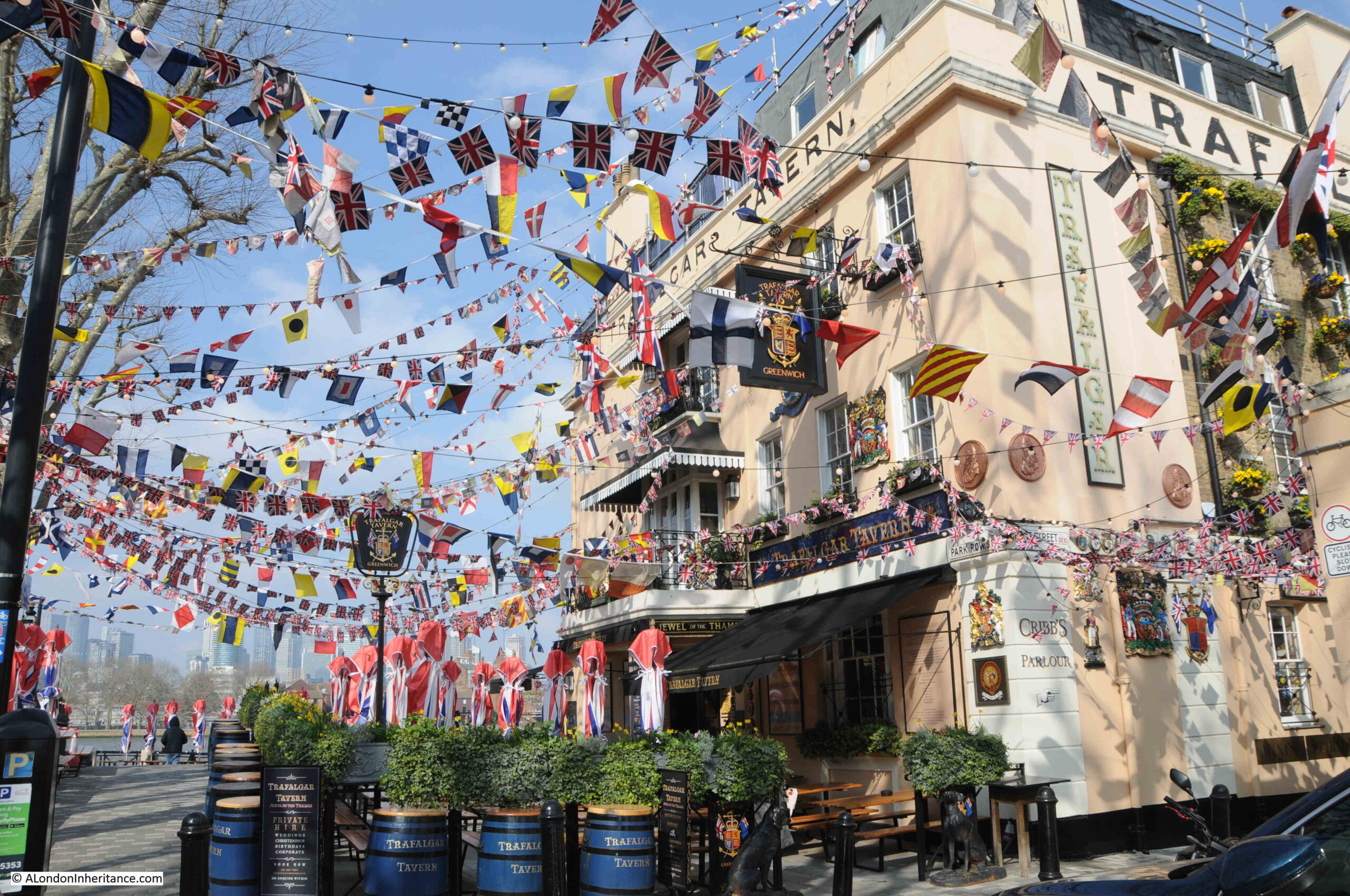
At the end of the walkway alongside the river is the Grade II listed Trafalgar Tavern, which has a remarkable display of colourful flags outside:
Greenwich must have been a hive of building activity around 1830. As well as the market development and of the surrounding streets, the Trafalgar Tavern also dates from the same time. It was built on the site of an earlier pub, the Old George Inn.
The Historic England listing states 1830, however the pub website states 1837, and in this instance the pub website seems more accurate than Historic England as I found a newspaper report mentioning an event at the pub in 1833.
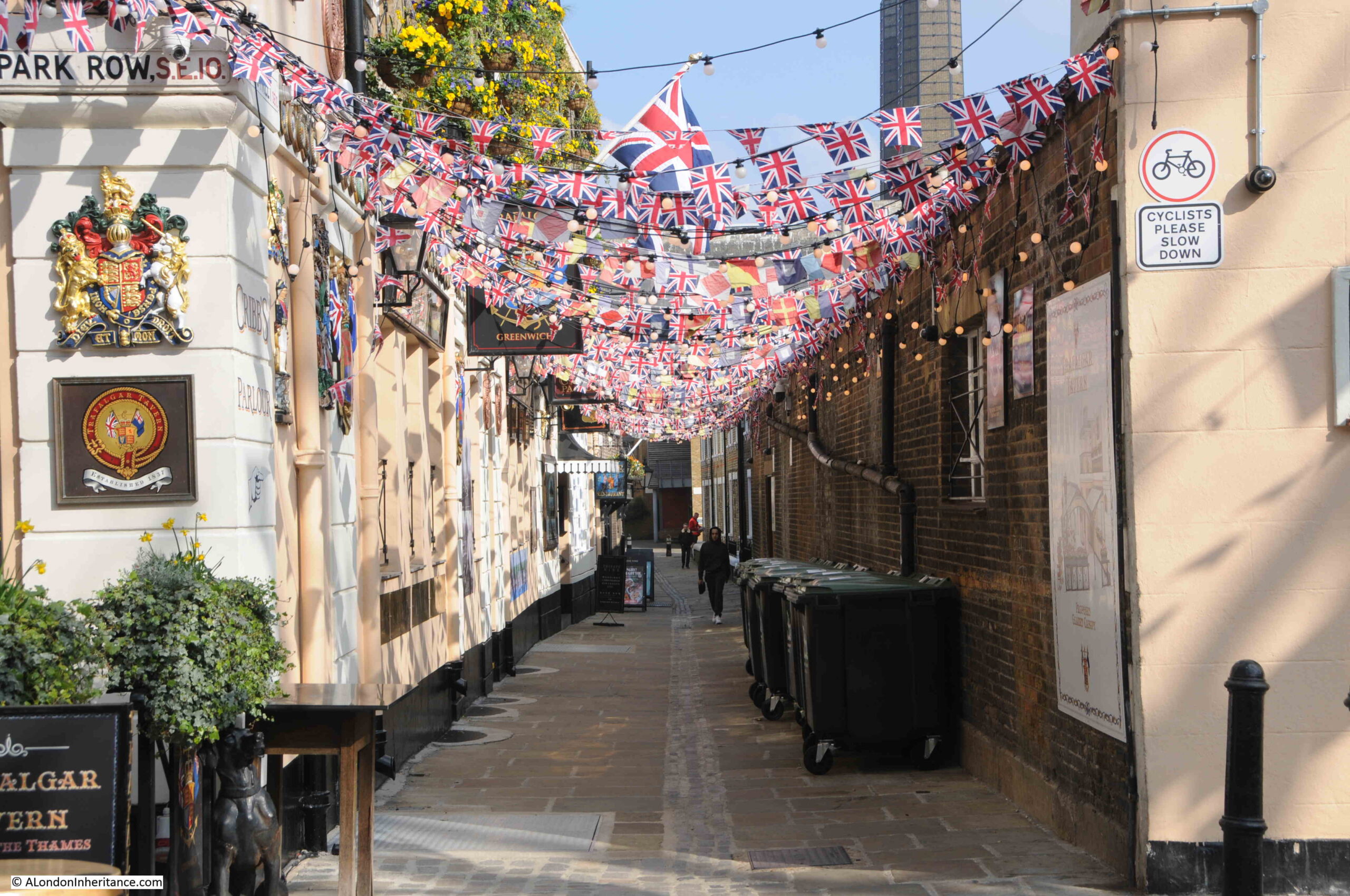
Crane Street alongside the pub was equally decorated, and it was along here that I walked to get to more sites on the Architects’ journal map.
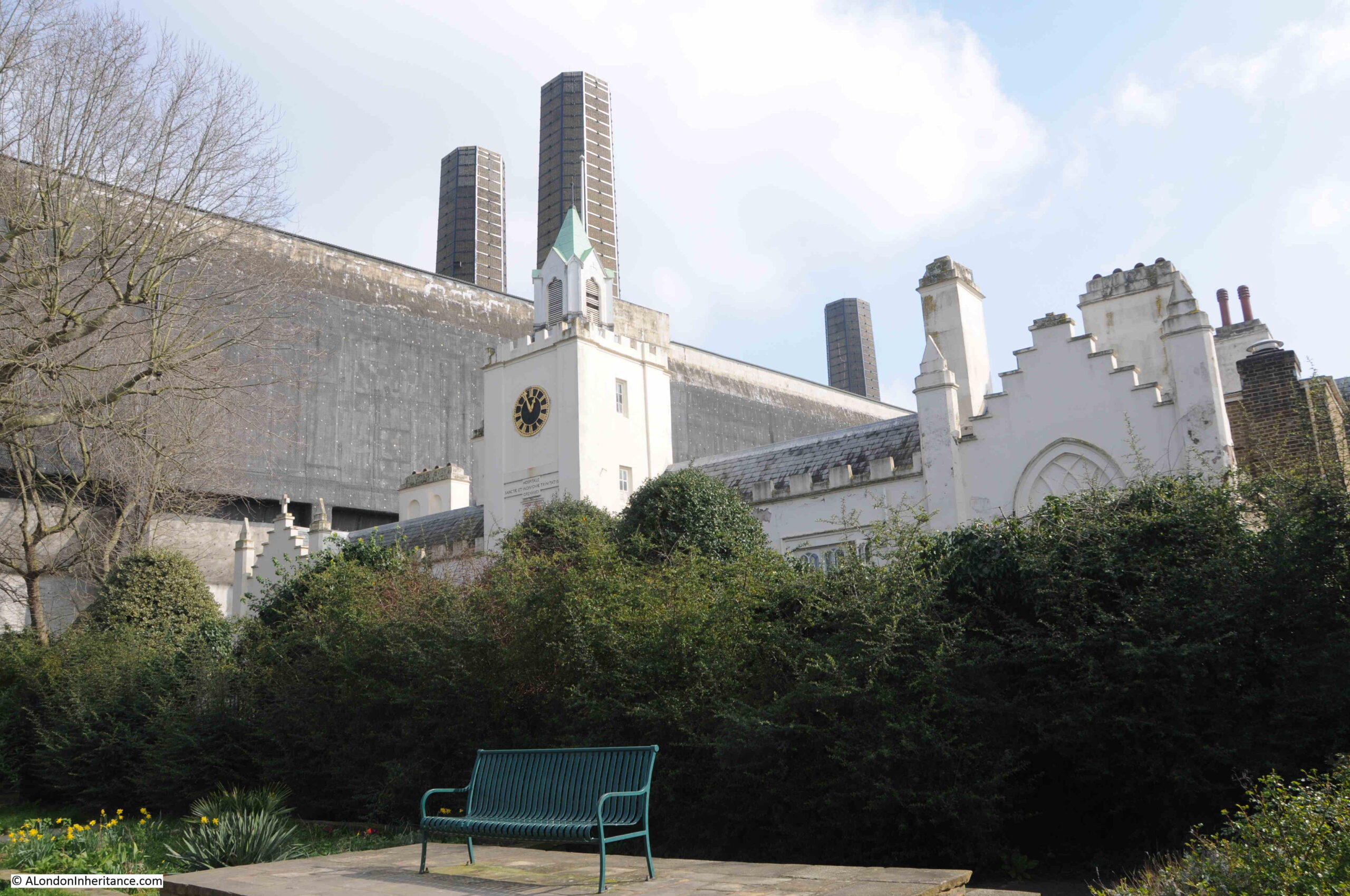
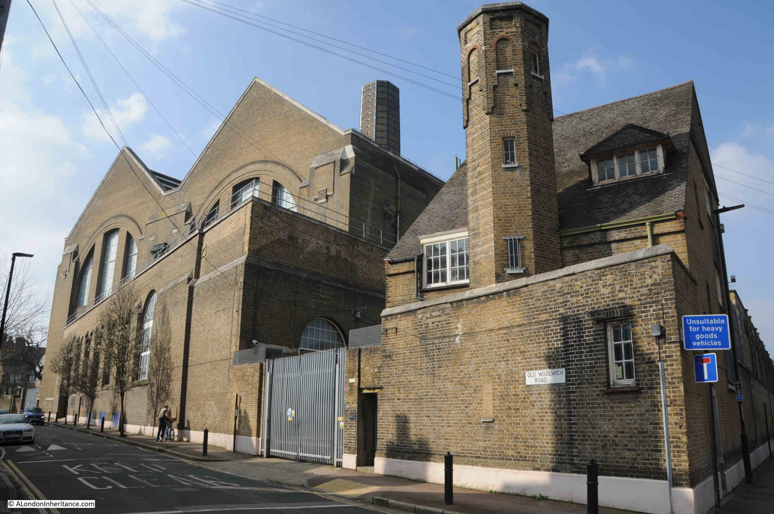
At the end of Crane Street is the (Grade II*) Trinity Hospital and Greenwich Power Station:
In the Architects’ Journal map, Trinity Hospital is coloured black, indicating a building of concern, and one that should be protected from potential future development of east London, however the power station was not.
I suspect that if today there were plans to demolish the power station there would be a campaign to save the building. As well as part of Greenwich’s industrial history (off which there is not much left), it is also a major landmark, made prominent with the chimneys.
The power station is not listed.
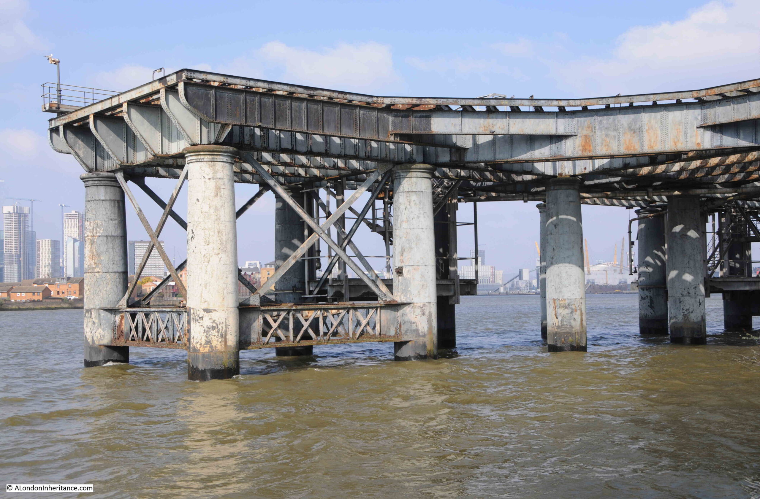
View of part of the jetty where ships bringing coal for the power station once docked and unloaded:
Ships moored in the river:
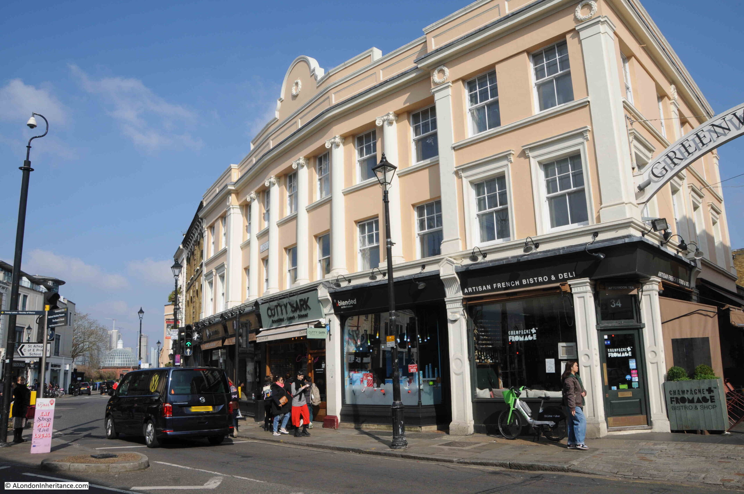
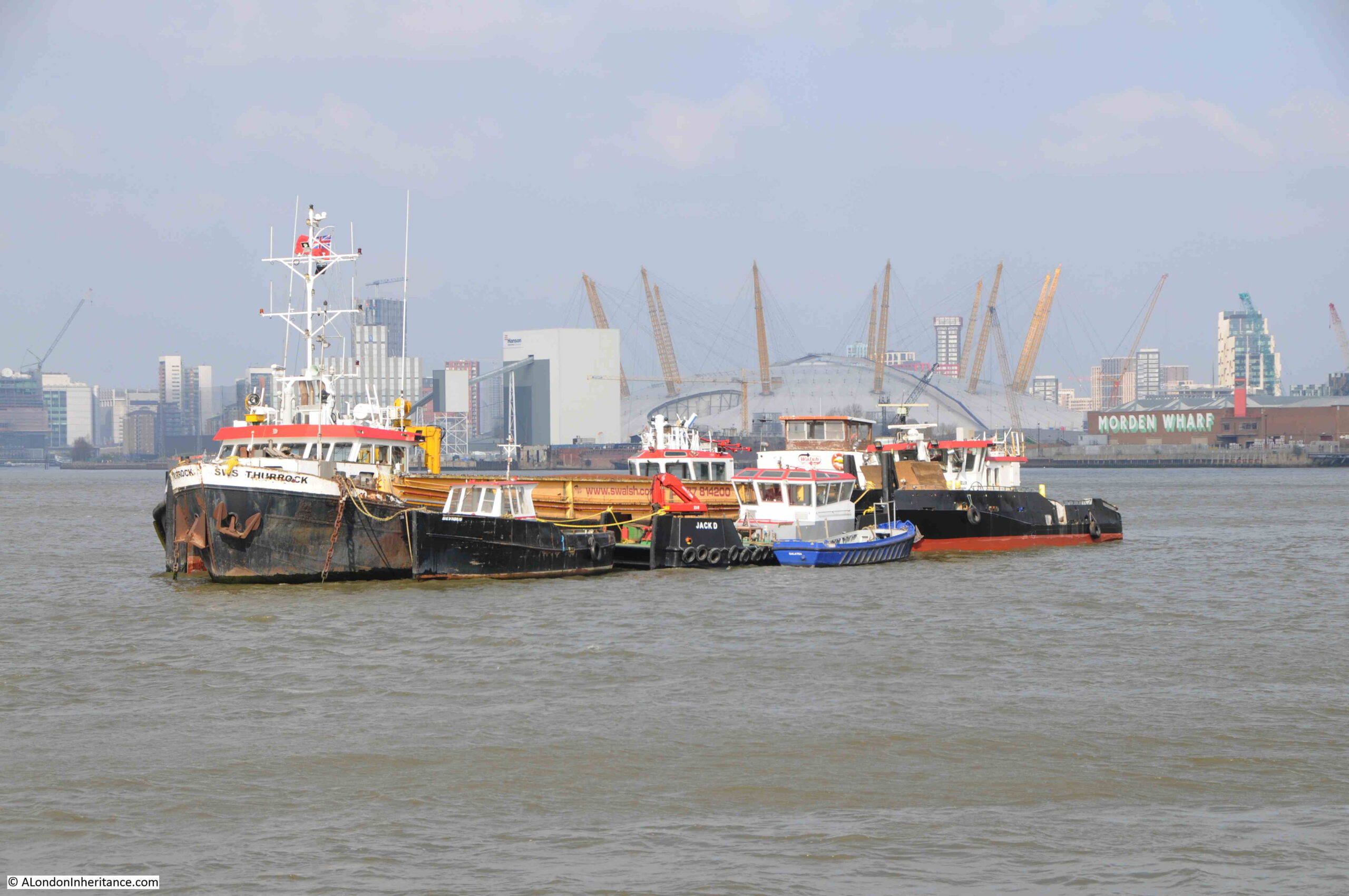
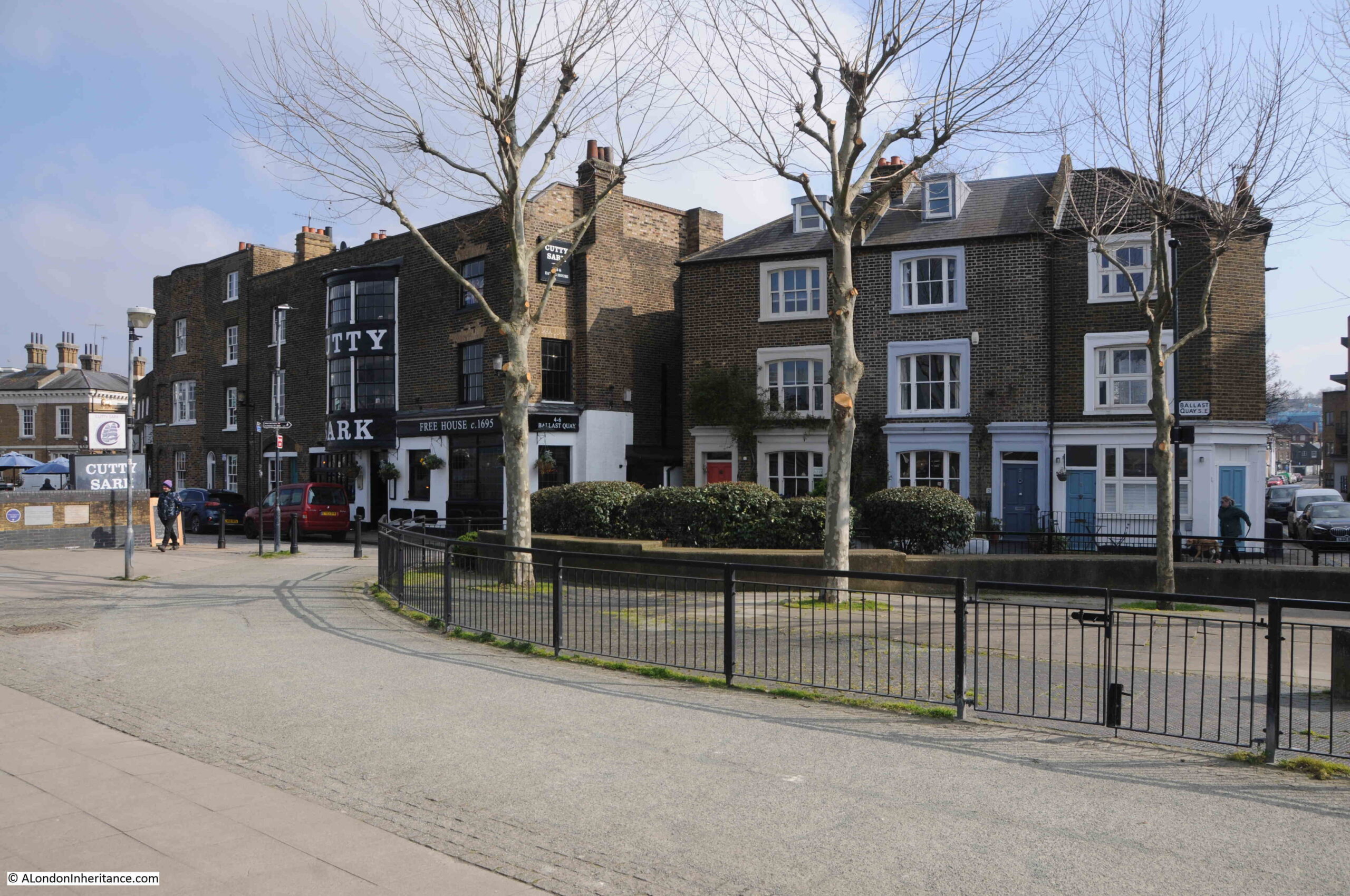
Walking past the power station, I reached the eastern end of the Greenwich buildings in the Architects’ Journal map, which included the Cutty Sark pub (Grade II listed):
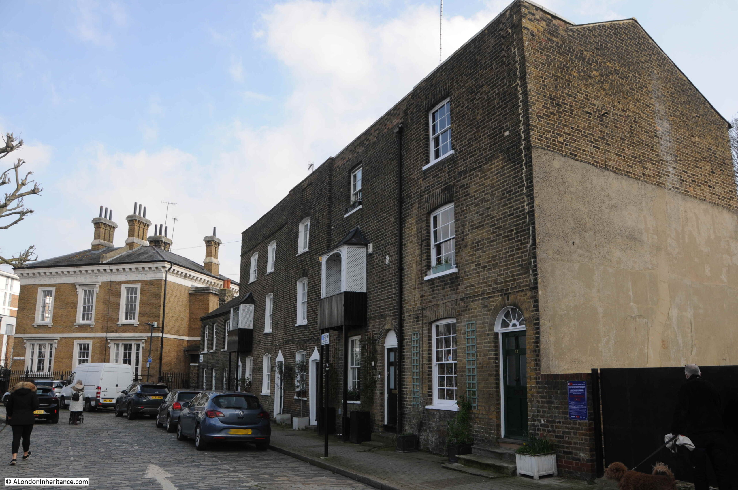
With the terrace of houses and at the end the Grade II listed Harbour Master’s Office for Ballast Quay:
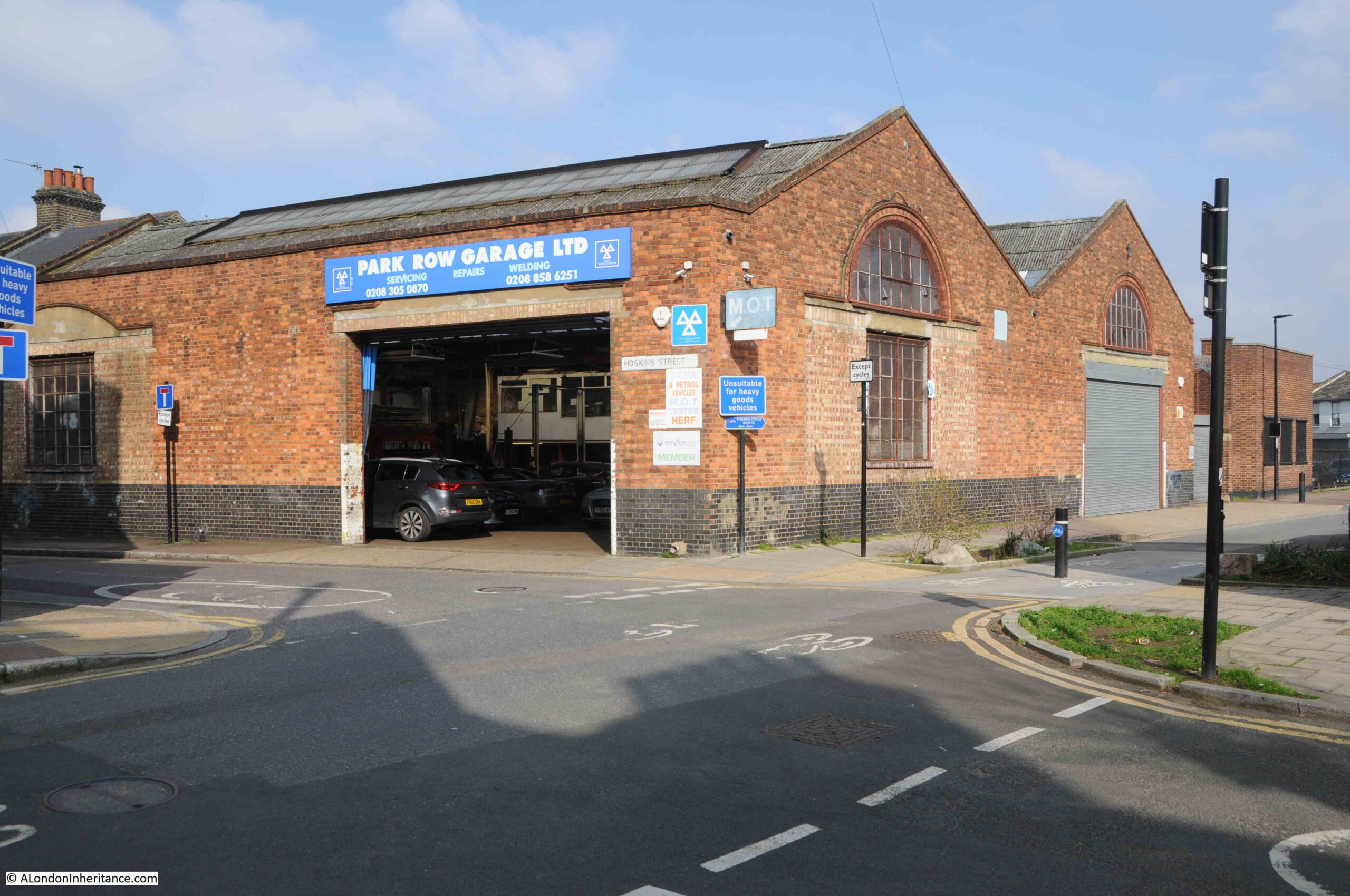
I still had to visit the buildings shown on the map that are between the power station and Greenwich Park, so I headed back past the Cutty Sark pub, along Hoskins Street, where there is an interesting example of how most of a terrace was demolished leaving only two houses remaining.
The LCC Bomb Damage Map does show bomb damage here, so this may have been the cause of the loss of the rest of the terrace.
This is a very different part of Greenwich to that which I have explored in the first post and so far in this post. Here are the houses built for those who worked in the industries between Greenwich and Woolwich, and on the river, and the essential businesses that frequently occupy such areas:
Rear of the power station:
I do not know the purpose of the tower on the right. It may have been for water storage, but it looks rather small.
The road alongside the rear of the power station is the Old Woolwich Road, and as the name describes this was once the main route between Greenwich and Woolwich.
A nice reminder of the original purpose of the power station, and who consumed the electricity generated:
The rear of Trinity Hospital:
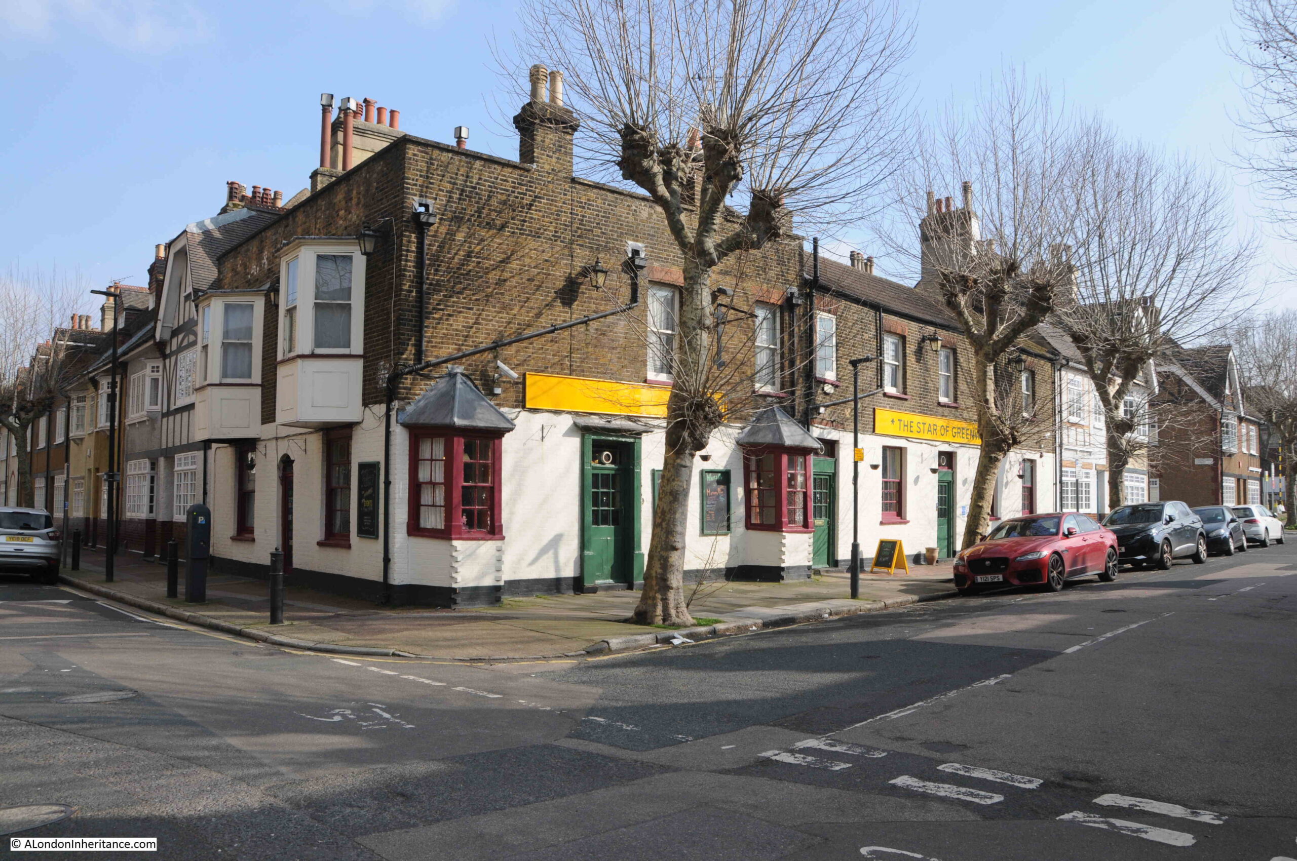
At the corner of Old Woolwich Road and Greenwich Park Street is the Star of Greenwich pub:
I really like the bay windows projecting from the pub on the two sides of the building.
The Star of Greenwich is a wonderful story of a pub saved from closure by the community.
A mid-19th century pub and originally called the Star and Garter, the pub closed in August 2021.
Three friends worked to reopen the pub as a community pub, a pub that would support a wide range of community services and would be an inclusive place for the people of Greenwich.
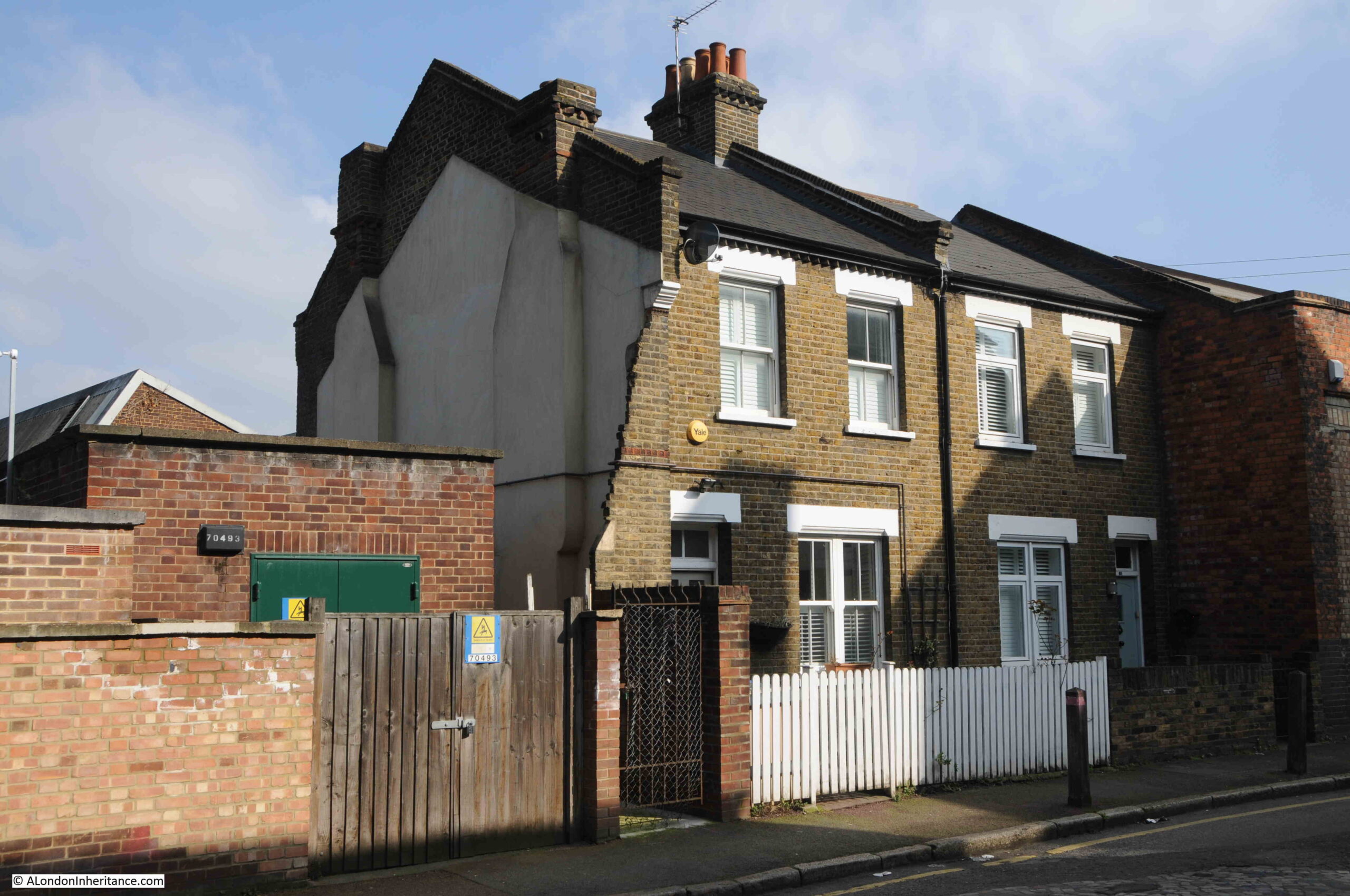
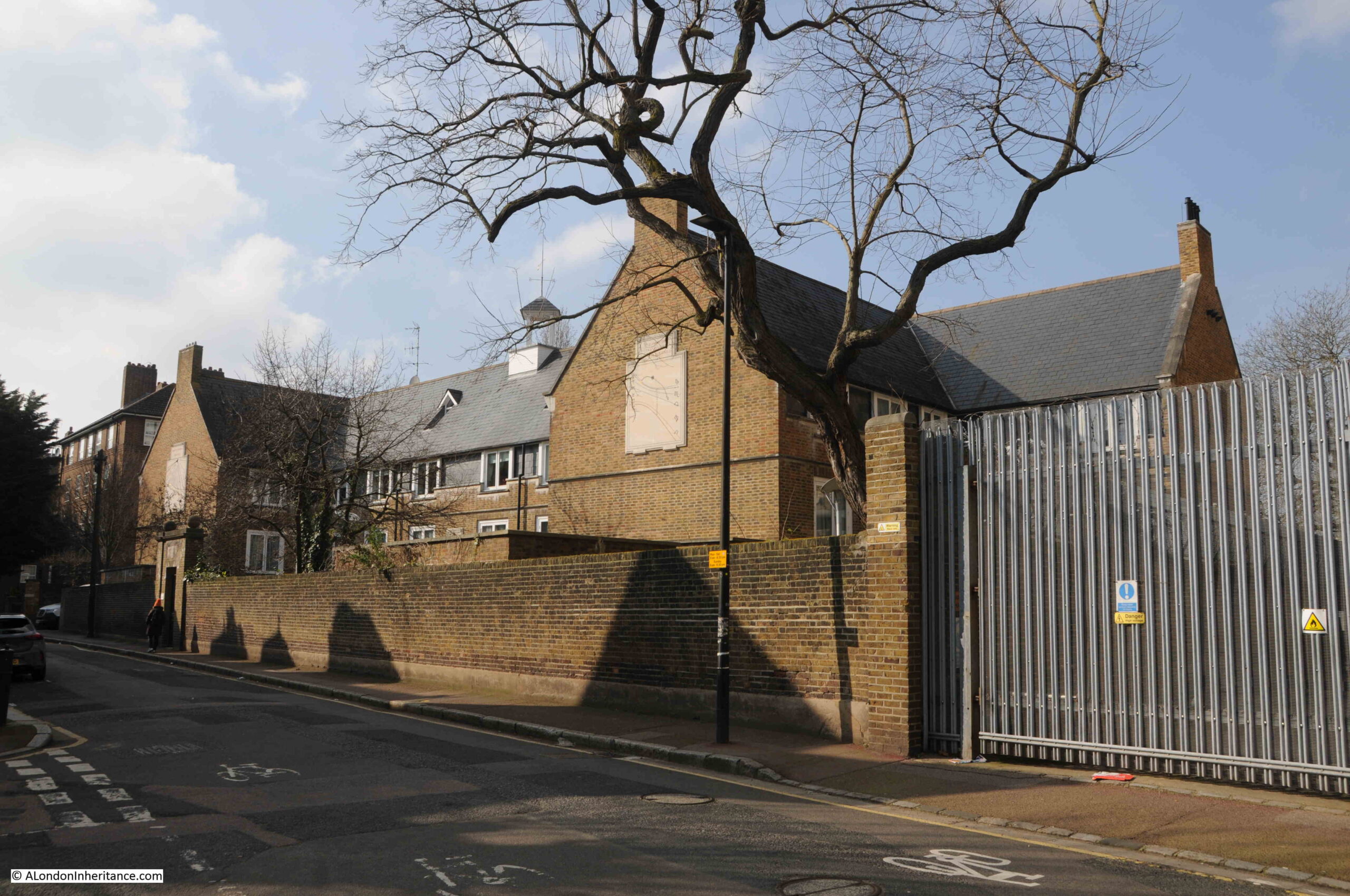
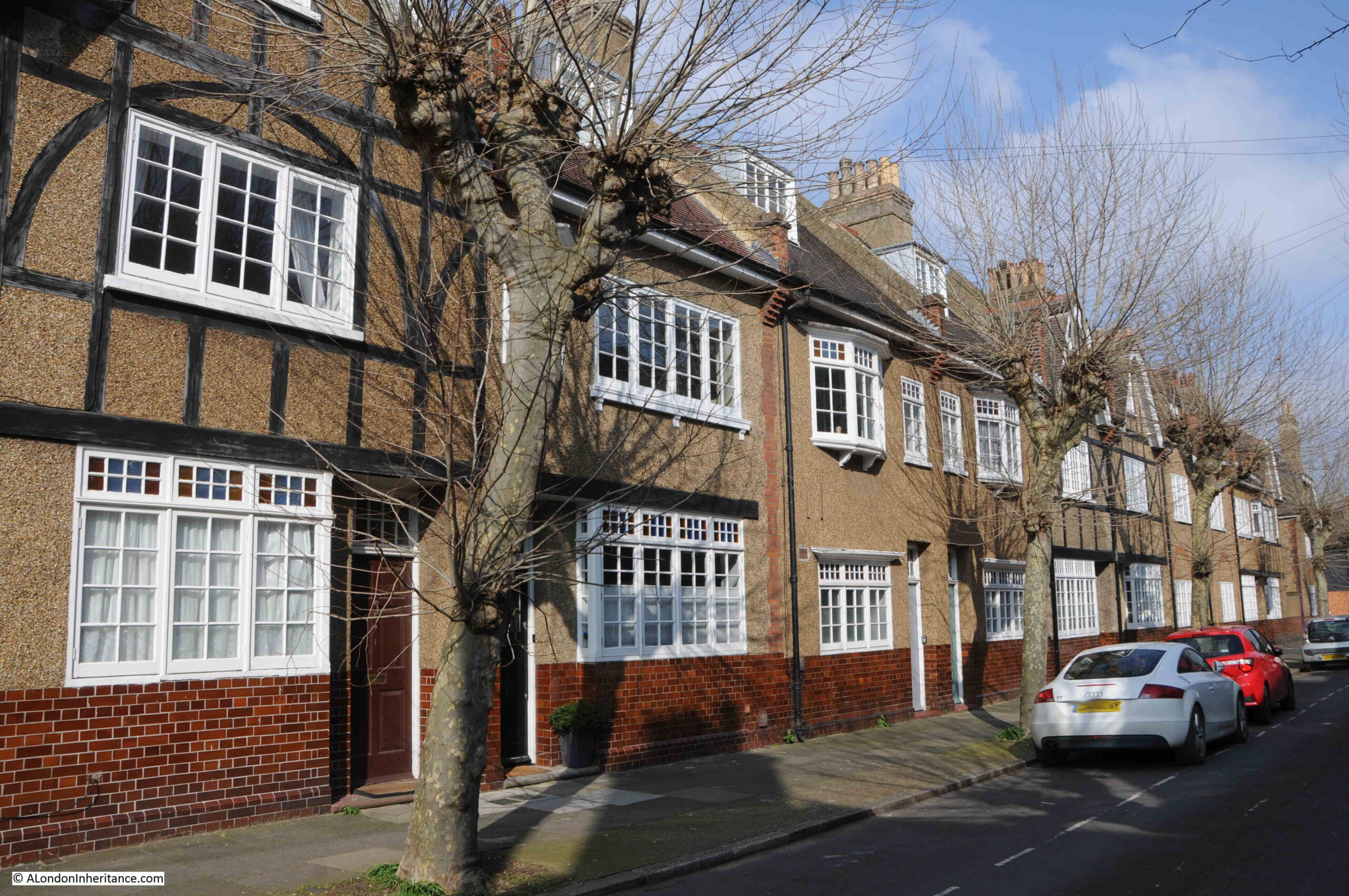
A side street off Greenwich Park Street is Trenchard Street, which has some wonderful houses:
These houses, along with others in the surrounding streets are part of the Trenchard Street Estate, and were built by the Greenwich Hospital Estates from around 1913 and into the 1920s.
They are a considerable improvement on typical 19th century housing, and from the outside they can be seen as larger buildings, and have sizeable windows to let in as much light as possible.
At the end of Greenwich Park Street is Trafalgar Road, the main road today between Greenwich and Woolwich, and the road which replaced the Old Woolwich Road that runs at the rear of the power station and Trinity Hospital.
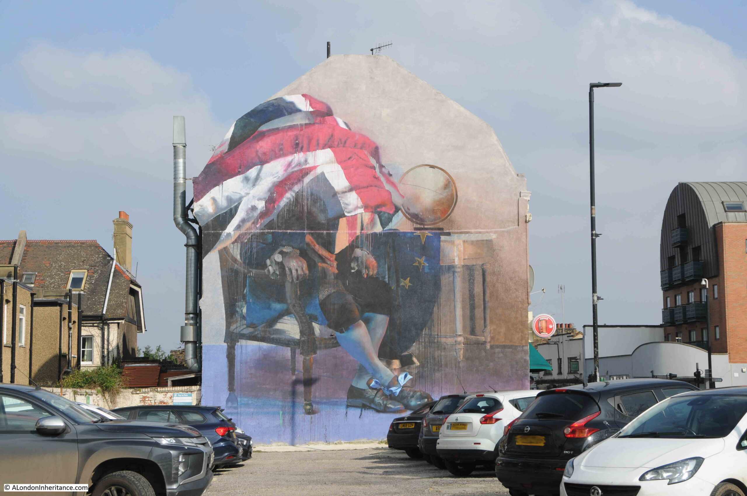
Mural on the side of a building alongside Trafalgar Road:
Crossing Trafalgar Road, and I am heading back to the northern side of Greenwich Park, and the proximity to the park can be seen by the type of house, which are generally larger and more expensive than those between Trafalgar Road and the river.
This terrace is alongside the southern section of Greenwich Park Street:
Park Vista runs along the northern edge of the park. There are no houses alongside the park, and houses line the northern side of the street, and as the street name suggests they have a wonderful view across into Greenwich Park.
The buildings are far from uniform, and show a wide range of styles and dates.
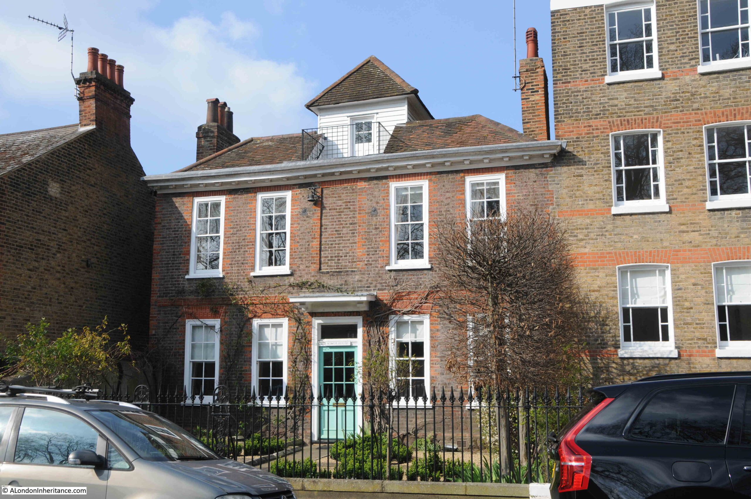
This is the Grade II listed Manor House, which the listing records as being early to mid 18th century:
The whole house is wonderful, however the roof has a unique feature, which the listing describes as “Hipped, tiled roof broken in centre to hold renewed weatherboarded gazebo with pyramidal, tiled roof.”
The gazebo is ideally placed for providing a view across the park, and would be a brilliant place for a summer evening with a beer.
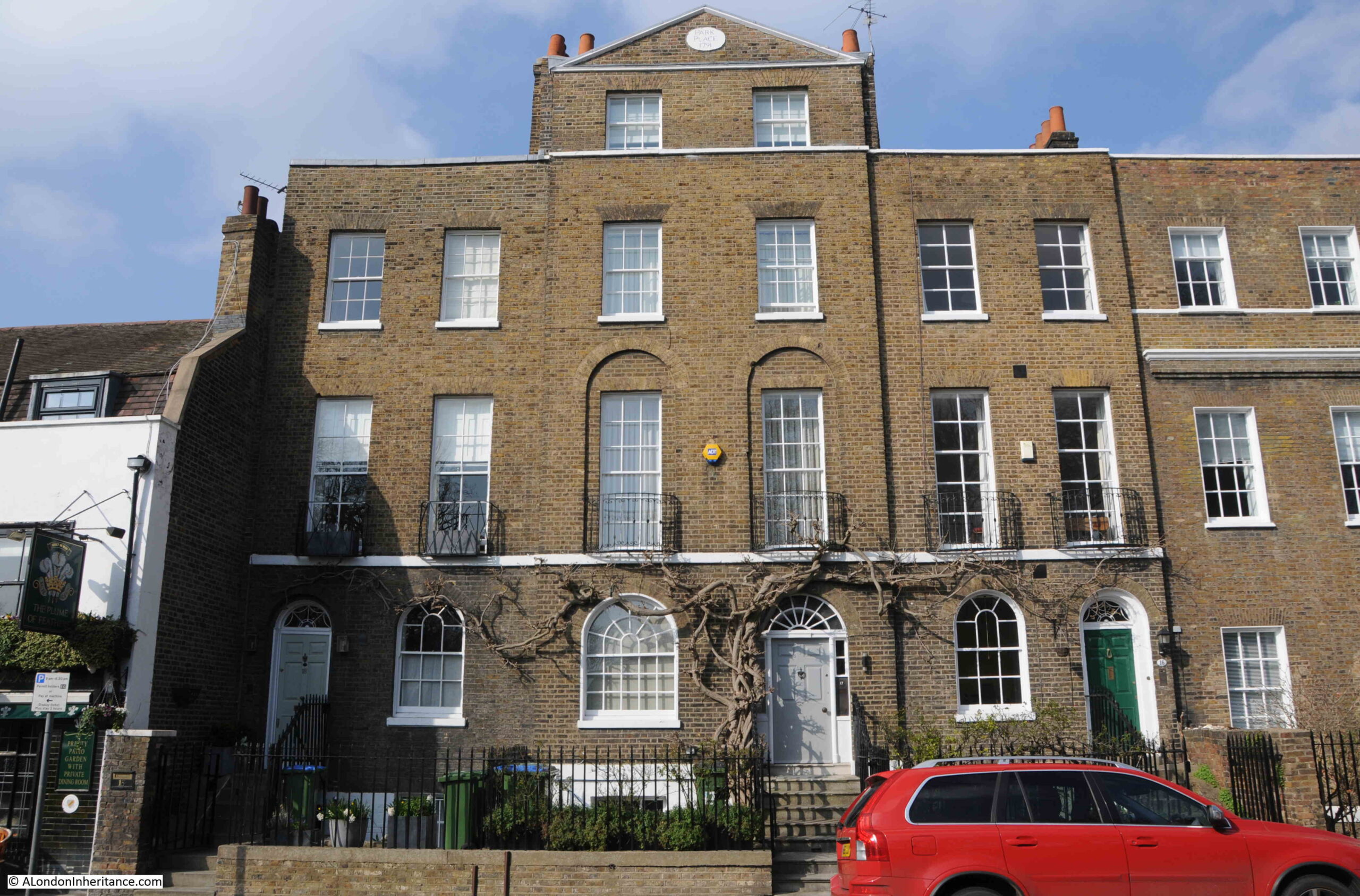
In contrast is Park Place, dating from 1791:
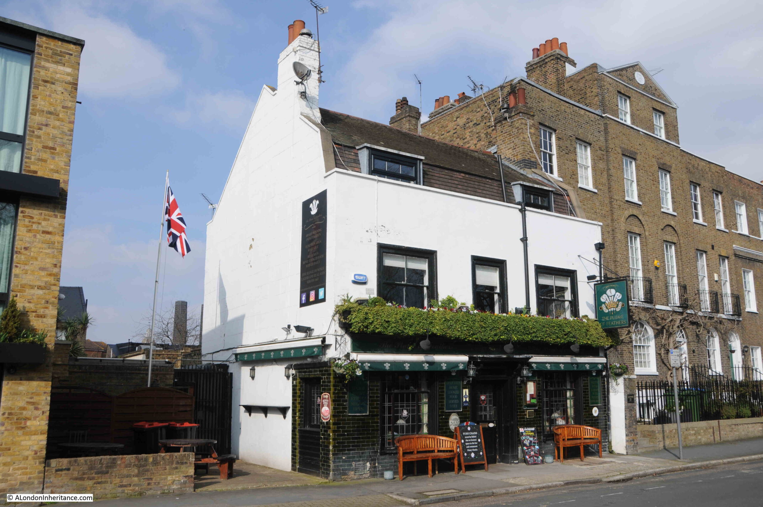
To the west of Park Place is another Greenwich pub – the Plume of Feathers:
The pub’s website claims that it is the oldest pub in Greenwich and dates from 1691.
There is a small cluster of buildings in Samuel Travers map of Greenwich from 1695 in what seems to be the right place for the pub, so this could well be true. It is a really good pub, and well worth a visit.
Just past the pub, Park Vista curves slightly to the north, allowing houses to have been built between the street and park. A strange mix of styles, ages and later additions:
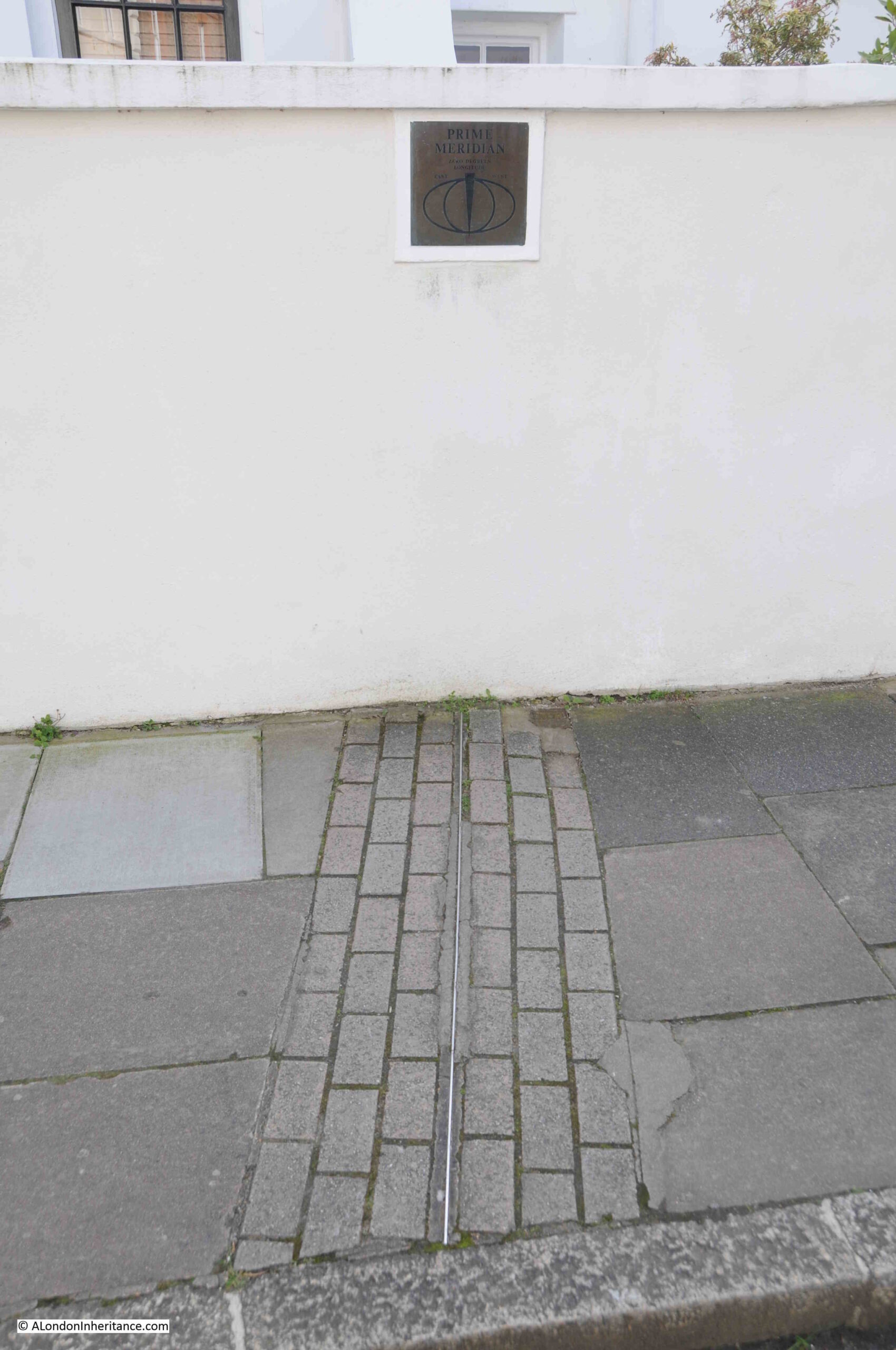
But one of these houses has a rather unique feature. There is a small square sign on the wall to the left of the lamp post in the above photo.
The sign refers to the Greenwich Meridian, and there is also a metal strip in the pavement:
Which continues with studs across the road:
So you do not have to join the queue for a photo of a foot in each hemisphere at the Royal Observatory, just head to Park Vista where you can take as much time as you want for photos.
The building at the western end of this cluster of houses is the Grade II listed St. Alfege’s Vicarage:
The listing starts the description of the building with “Rambling building of various dates”, although most of the building seems to date from around 1800, however at the very end of the listing there is the following “The old parts of this building formed part of Henry VIII’s palace of Placentia”, which is intriguing and would dates parts of the building back to the 16th century.
From here it was a short walk to the open space in front of the Queen’s House and the National Maritime Museum:
And just to show how everything has had some form of building work over the years, the large grassed area hides the cut and cover railway that runs underneath (part one of these Greenwich posts showed a view of the railway), as it runs between Greenwich and Maze Hill.
And from here there was only one place to go. It was a lovely sunny March day, so I headed back to the Cutty Sark pub, one of my favourite places to watch the river:
In these two posts, I have covered area 82 from the Architects’ journal map and list of places identified as worthy of preservation, and at risk of possible development as the east of London (north and south of the river) was expected to radically change in the following decades after the closure of the docks, and the loss of the industry and businesses associated with the docks and trade on the river.
From memory, there was never any significant risk to Greenwich, but the 1972 article has served as a reminder that Greenwich really is a wonderful part of the wider London.
Wander away from the park and there is plenty to be explored.
Back in 2017, I started a series of blog posts about an article in the Architects’ Journal on the 19th of January 1972. This issue had a lengthy, special feature titled “New Deal For East London”. The feature reported on the challenges facing the whole area to the east of London, which by the 1970s had been in continuous decline since the end of the last war, along with the future impact of some of the very early plans for major developments across the whole area to the east of London.
The article identifies a range of these challenges and developments, including:
The impact on the London Docks of the large cargo ships now coming into service
The lack of any strategic planning for the area and the speculative building work taking place, mainly along the edge of the Thames
The location of a possible Thames Barrage
The impact of the proposed new London airport off the coast of Essex at Foulness
The need to maintain a mixed community and not to destroy the established communities across the area
A key focus of the article is a concern that should there be comprehensive development of the area in the coming years, then a range of pre-1800 buildings should be preserved. The article included a map that identified 85 locations where there are either individual or groups of buildings that should be preserved. The area includes parts of south London, although still to the east of the central city area, therefore considered as being east London.
The map was split across two pages and the locations were divided into five categories, identified by their historical origins:
A – Areas that were developed as overflow from the City of London
B – Linear development along Thames and Lea due to riverside trades
C – Medieval village centres
D – Early 19th century ribbon developments
E – Medieval village centres along southern river bank and around London Bridge
Between 2017 and 2019, I went in search of a large number of locations listed in the article, and followed up with posts documenting what had survived, and also where there had been changes, however after 2019 I did not finish working through the list of 85 locations, so today’s post is the first in a final set of posts for 2024, to finish of writing about all the 85 locations recorded as places at risk of redevelopment in the years following 1972.
The second page of the map included a list of the buildings, along with the area that is the focus of today’s post – Greenwich:
Greenwich is a bit of an outlier in the article. There is very little written about Greenwich in the article, and where many other individual buildings had their own numbered entry, the whole of Greenwich is covered by a single number, 82 in the map of “locations, grouping and number of buildings that should be considered for preservation if comprehensive redevelopment of East London were undertaken”.
Of the five categories of location in the article, Greenwich is identified as “E – Medieval village centres along southern river bank” and the map highlighted pre-1800 buildings in black:
In the first series of articles, there were a number of comments raised about classing places south of the river as being in East London.
This was the definition used in the article, and if you ignore the traditional north or south of the river,, they are all to the east of London. They also all shared a common relationship with the working river. They were the location of docks, industry dependent on the river, people would live and work on opposite sides of the river, they had institutions that were there because of the river, people who arrived by the river would stay and live on both sides etc.
So classing these places as East London is a classification I rather like as they had much in common, and a considerable amount of their development was dependent on the river, and of being east of London where the major developments needed to support the growing trade and commercialization of the river, had space to be built.
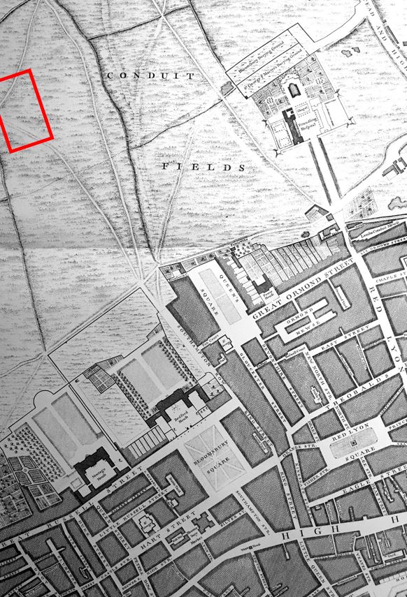
The map for Greenwich covers a considerable area, from all the streets to the west of Greenwich Park, through the centre of Greenwich, the Royal Observatory and the old Royal Hospital and Naval College buildings, then to the east with some houses along the river, then around the power station.
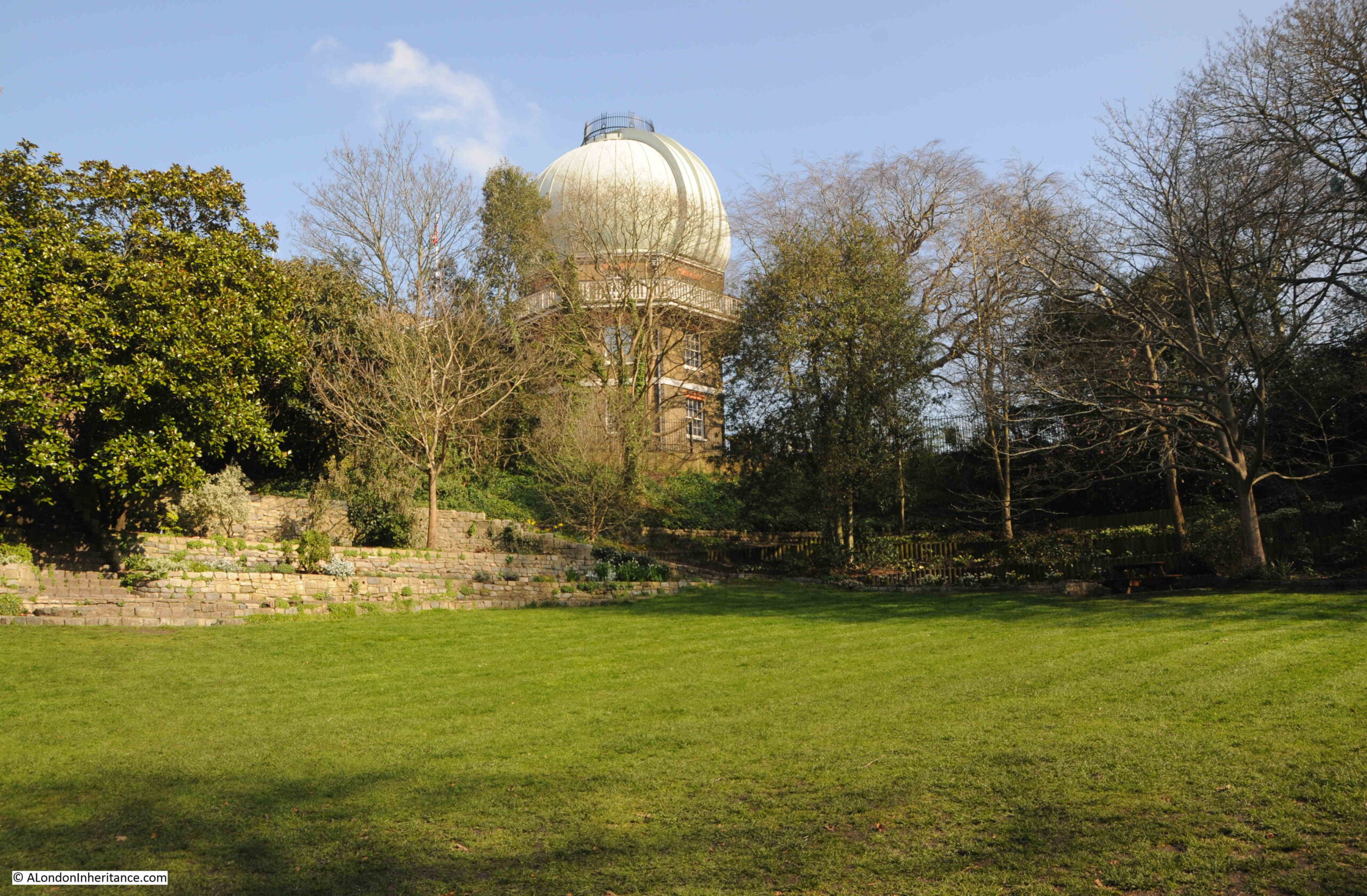
Rather than have one extremely long post, I will therefore cover the Architects’ Journal map of places that should be preserved in two posts, with today’s post covering the Royal Observatory and the streets to the west, so starting at the top of the hill in Greenwich Park, where we find the:
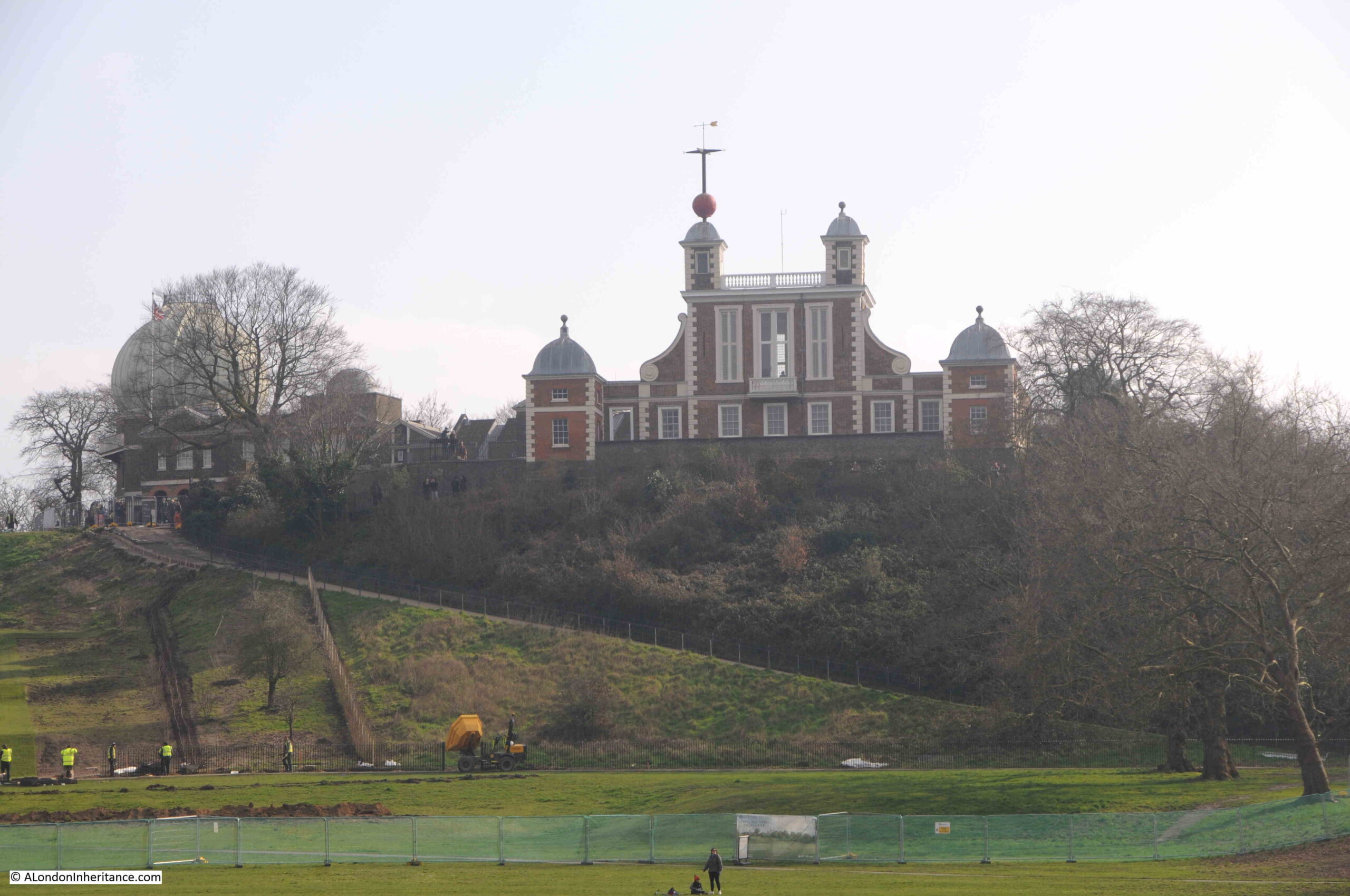
Royal Observatory
The Royal Observatory sits at the top of the hill that rises from the land alongside the river, and through the Prime Meridian, or 0 degrees Longitude, which runs through the observatory as defined by the astronomer Sir George Biddell Airy, and recognised internationally in 1884. The Prime Meridian is one of the reasons for the Greenwich name to be known internationally.
The Royal Observatory was founded by a Royal Warrant of King Charles II in 1675, and the first building was designed by Sir Christopher Wren, and still stands at the top of the hill, and is named Flamsteed House after the Reverend John Flamsteed, the first Astronomer Royal at Greenwich:
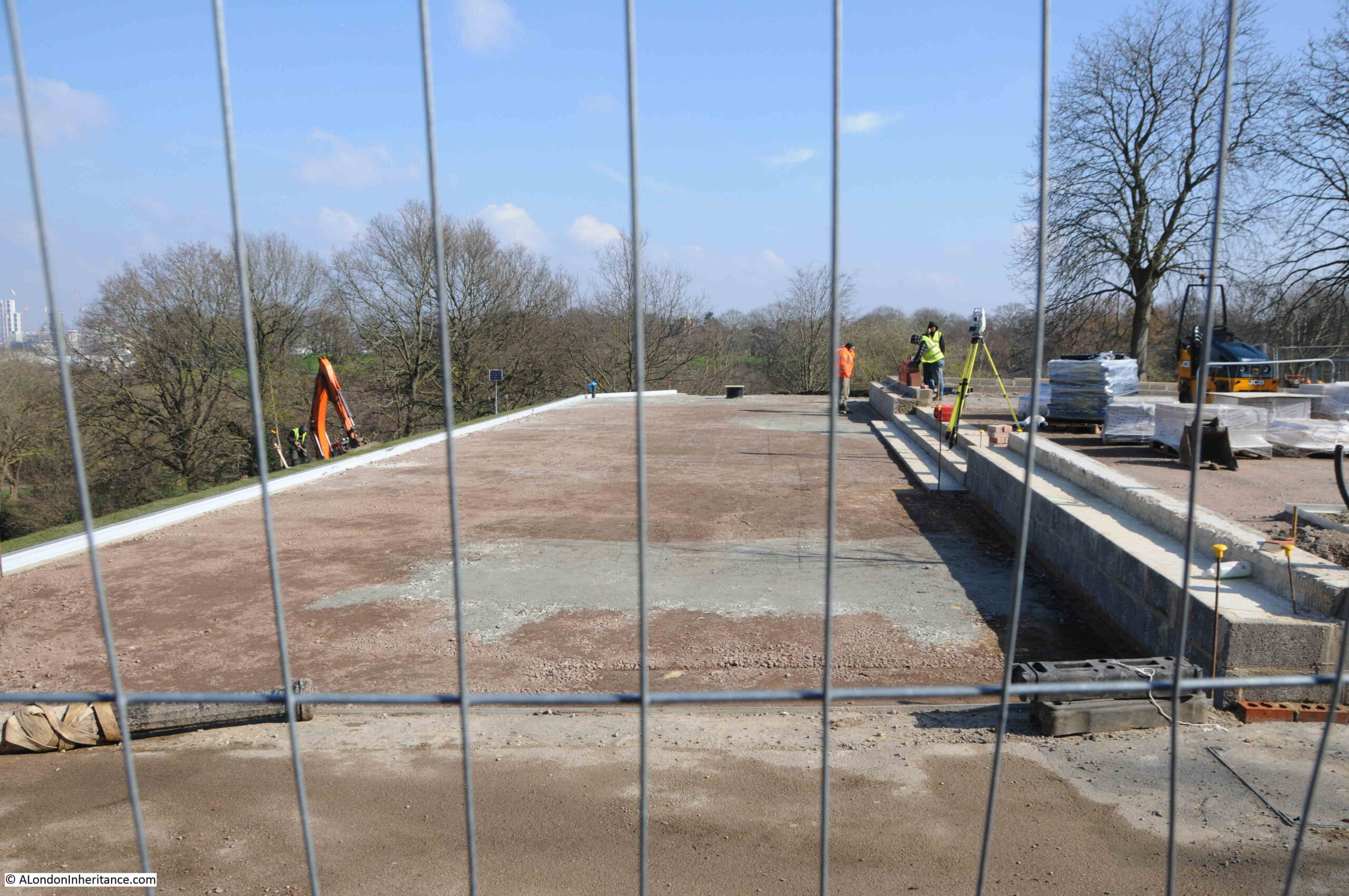
Whilst the Royal Observatory has hardly changed in the 50 plus years that I have been visiting Greenwich Park, the area around General Wolfe’s statue, and the hill in front, are undergoing some major changes:
The statue of General Wolfe was unveiled on the 5th of June 1930, and is by the sculptor Dr R Tait McKenzie. The statue is Grade II listed, and the Historic England listing includes the reference “Plinth much pitted by bomb fragments”, so hopefully these physical reminders of the way Greenwich was bombed will be retained.
It looks like a larger viewing area is being built in front of the statue. The view from this area must have been photographed millions of times and in summer does get very busy, so the additional space will help.
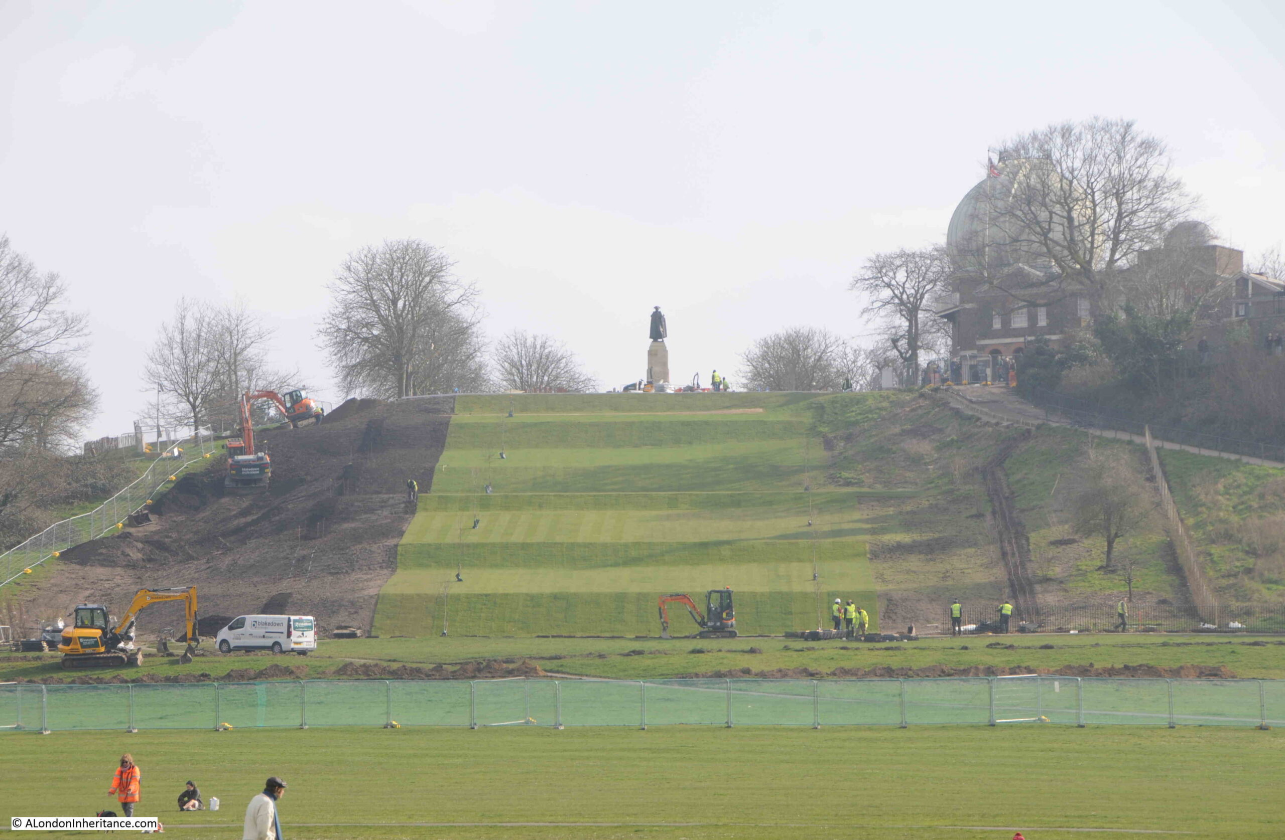
The current work is not limited to the area around the statue, the hill in front of the statue is also being changed:
This hill was a rough grassy slope running from the viewing area down to the flat grass in front of Queen’s House, however this hill is now being terraced:
The work is to restore the 17th century landscape of the park. Greenwich Park had been a hunting ground, but Charles II wanted a more formal Baroque landscape, so he engaged André Le Nôtre who had designed the gardens at the Palace of Versailles.
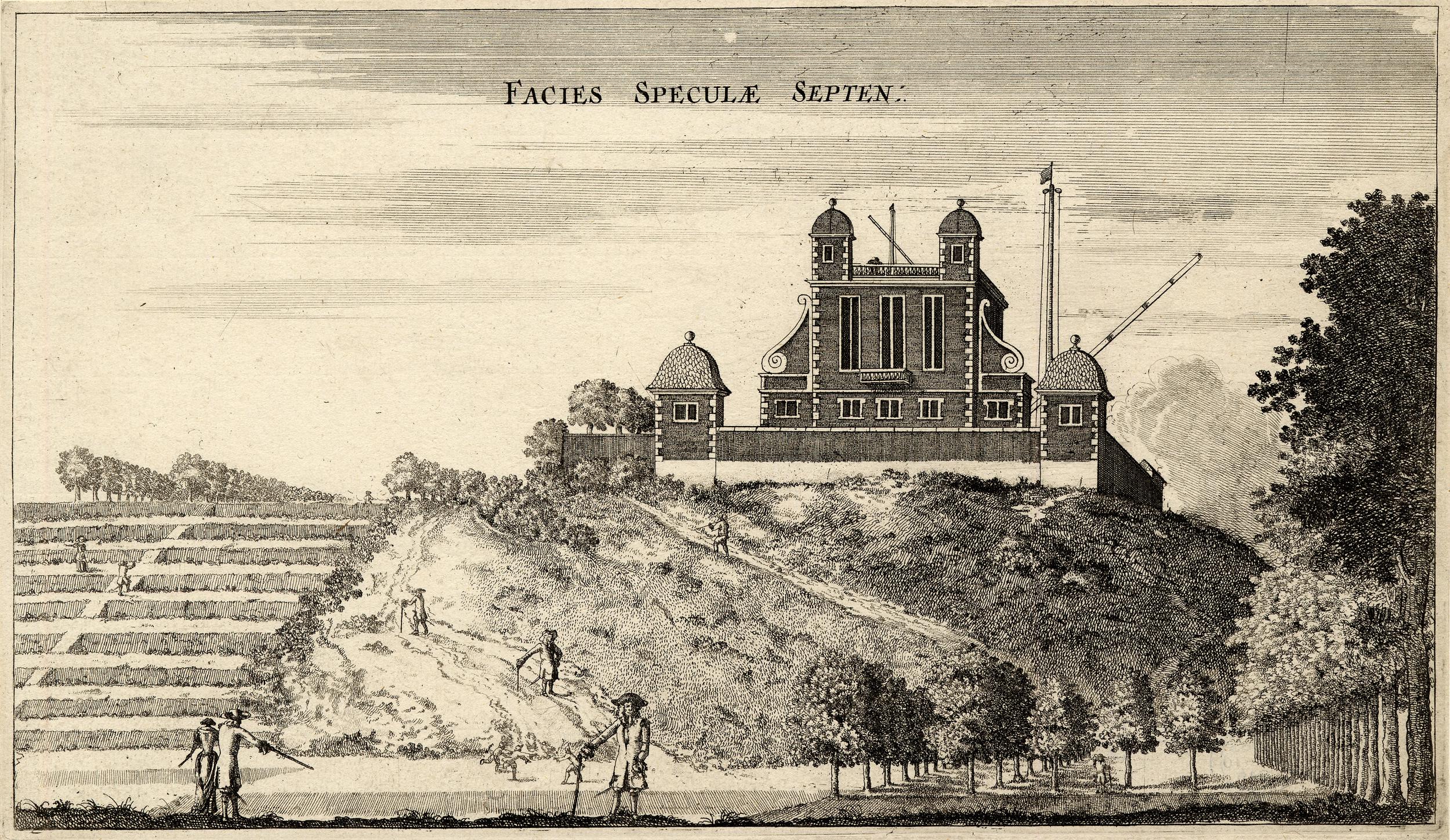
The following print from 1676 shows the new observatory on the hill, and to the left is a formal set of terraces running up the hill, confirming that these were a feature of the park in the 17th century:
Comparing the above print from 1676, with the photo below from 2024 shows that this view has hardly changed in 348 years. the main change to the building being the addition of the post on the left of the two central small towers with the red ball.
The red ball was added in 1833 and was possibly one of the world’s first public time signals, and was installed on the observatory so it was visible from the ships on the Thames, for whom time keeping, and being able to accurately set their clocks and watches was important for tides and navigation.
The ball rises to the top by 12:58 pm, each day, and then drops at 1pm as an early, visible equivalent to the “pips” which would provide an accurate time signal years later on radio transmissions.
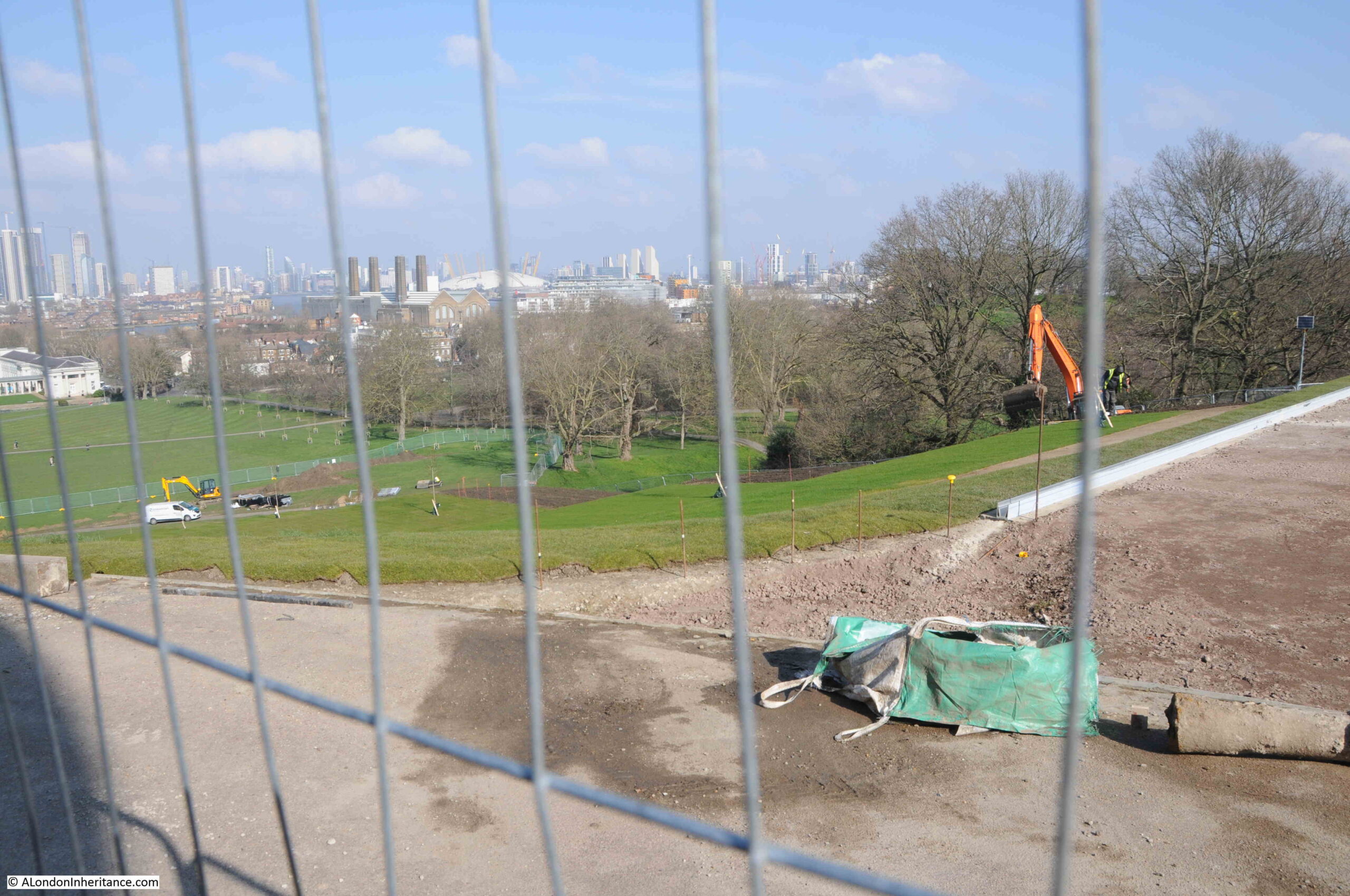
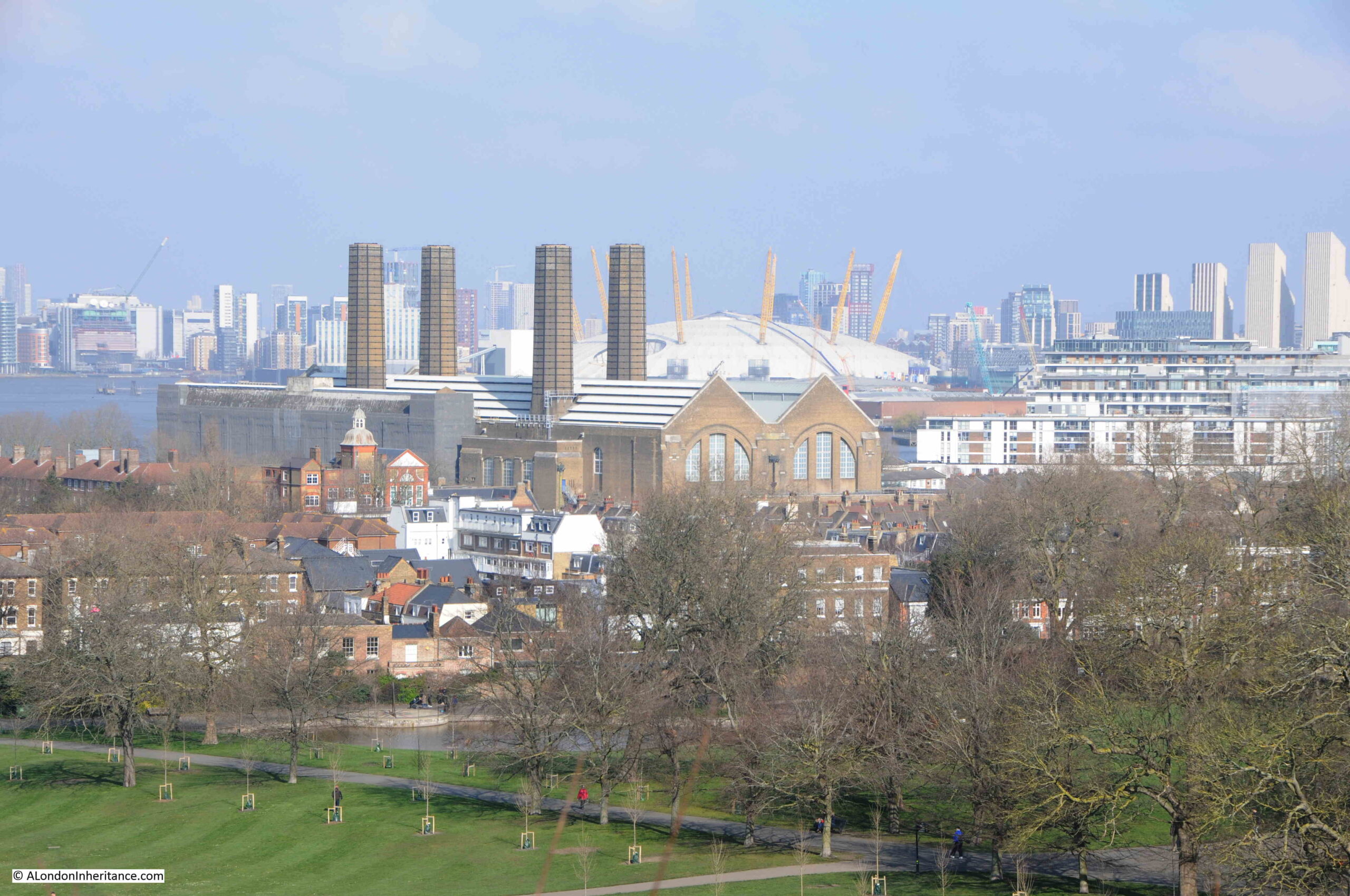
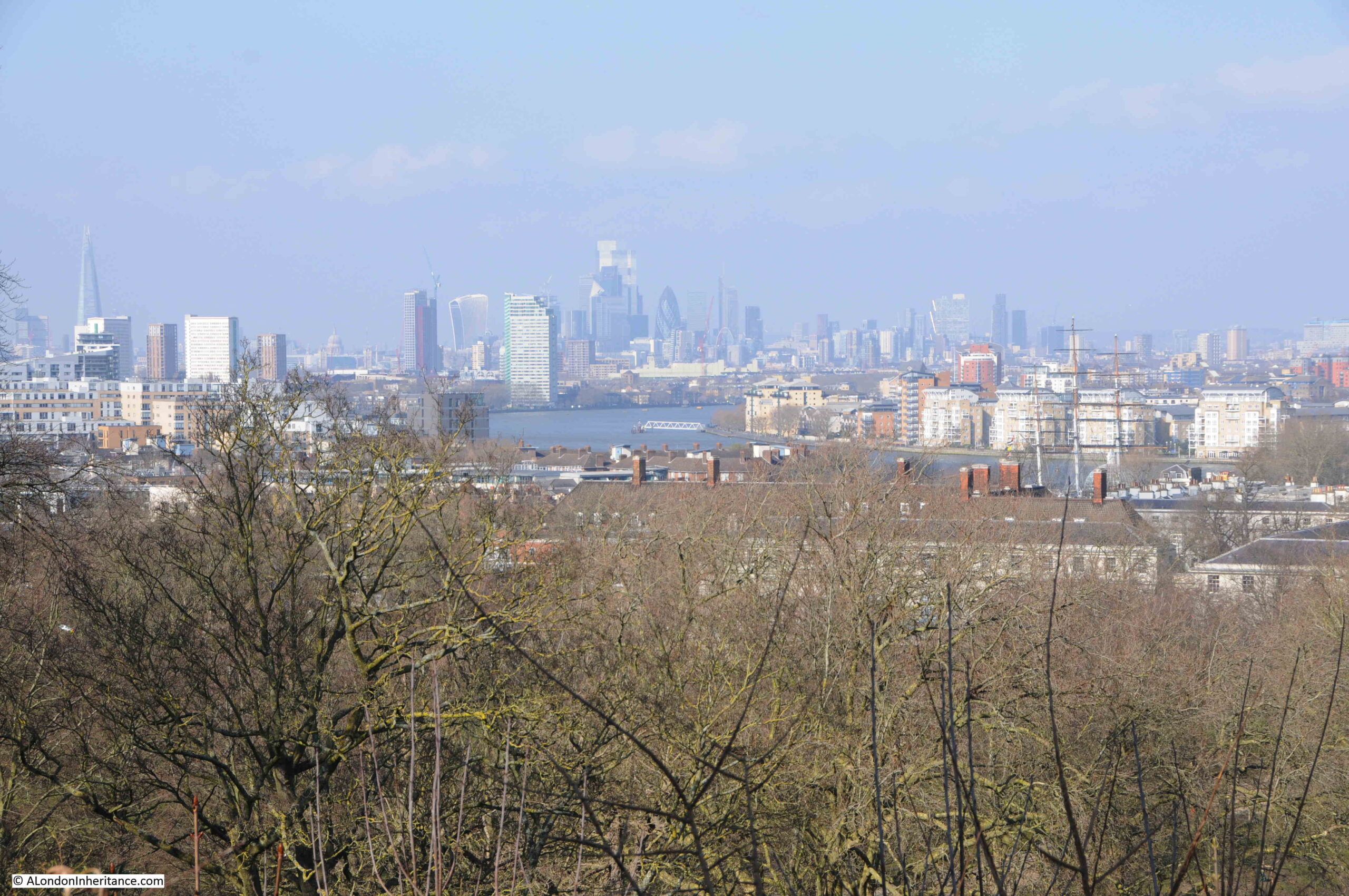
Although you cannot look at the view from the area in front of General Wolfe, the walkway directly around the base of Flamsteed House is still open, and from here we can still look at the view.
To the east, with the Dome and Power Station:
The ever growing field of towers that now inhabit the Isle of Dogs:
Looking west to the City of London:
This path runs around the back of the oberervatory buildings and through gardens:
The Royal Observatory in Greenwich started closing in 1948 when the move to a new site in Herstmonceux, East Sussex commenced. The buildings were too dated for modern equipment, and the pollution of London was not ideal for visual astronomy.
Flamsteed House opened to the public in 1960, so I doubt the site was ever really at risk, despite being one of the black coloured buildings in the Architects’ Journal map, although being at risk is not just about the building, but also the wider environment and if large new tower blocks had been built in Greenwich and around the park, the setting of the observatory would today be very different.
To find more of the buildings highlighted in the map, I am leaving the park by one of the gates on the west, to find:
Crooms Hill
Crooms Hill runs along the western edge of the park and has a range of buildings of different architectural style and ages. It is the type of street where you are never more than a few seconds walk from a listed building.
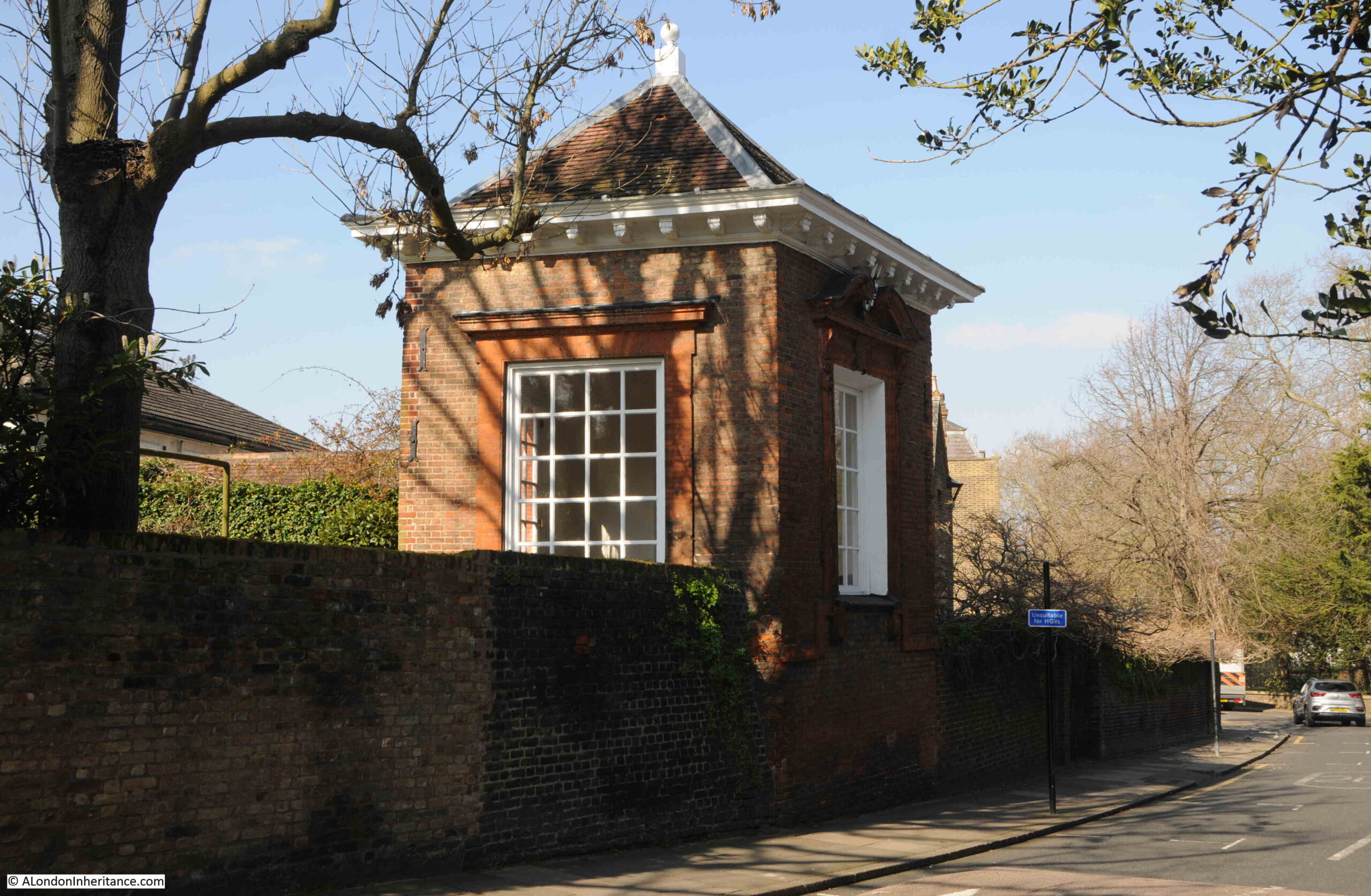
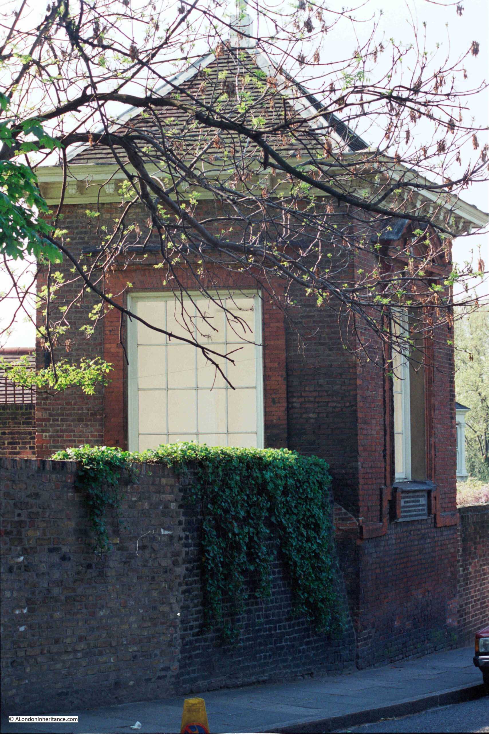
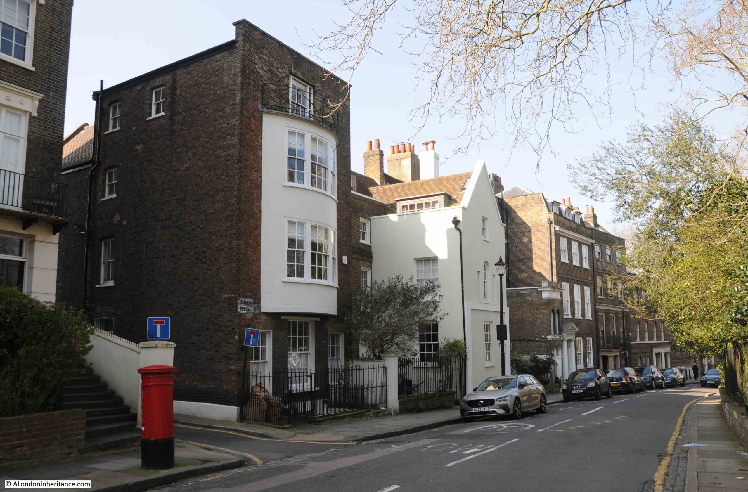
Close to the exit from the park is this structure:
Which my father also photographed in the 1980s:
In the 1980s photo above, there is a plaque below the window on the right, which presumably provided some information about the building, however that has disappeared by 2024.
I did though find some information in the Historic England listing, as both the wall and the building are Grade II listed, and are of some age. From the listing:
“C17 high red brick wall. Gazebo of 1672, probably by Robert Hooke, perched on wall but accessible from higher ground level inside. Pyramidal tiled roof with oval wood finial. Moulded wood eaves cornice with carved modillions. Red brick North-west wall blank. South-west wall has open round arch which once contained detached Roman Doric columns and entablatures with moulded round architrave above. South-east wall has square headed opening, with shouldered, moulded brick architrave and cornice, which once contained a round inner arch. On North-east (road) front square opening with moulded brick architrave resting on band raised in centre.”
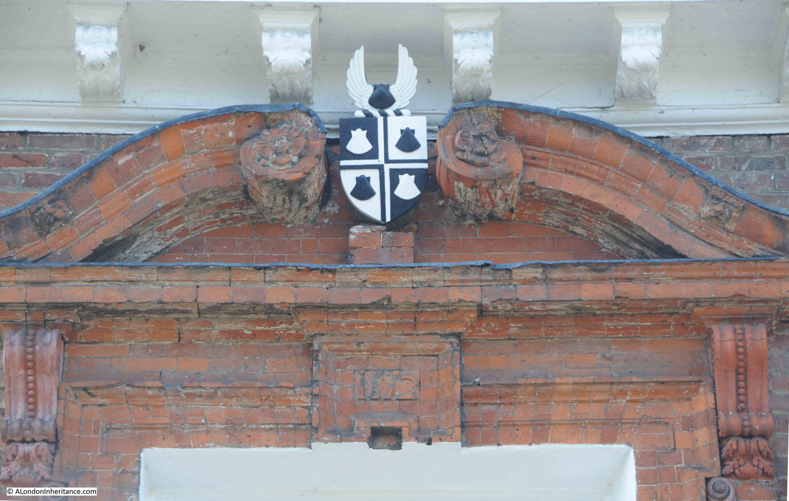
On the side of the building facing the road, there is a shield with presumably a coat of arms. The Historic England record does not mention the arms, and I can find no reference to what appears to be four scallops or shells in black and white and in this arrangement:
One of the things about a street such as Crooms Hill is the sheer diversity of architectural styles and the building materials used, as well as the changes that have been made to the buildings over the centuries.
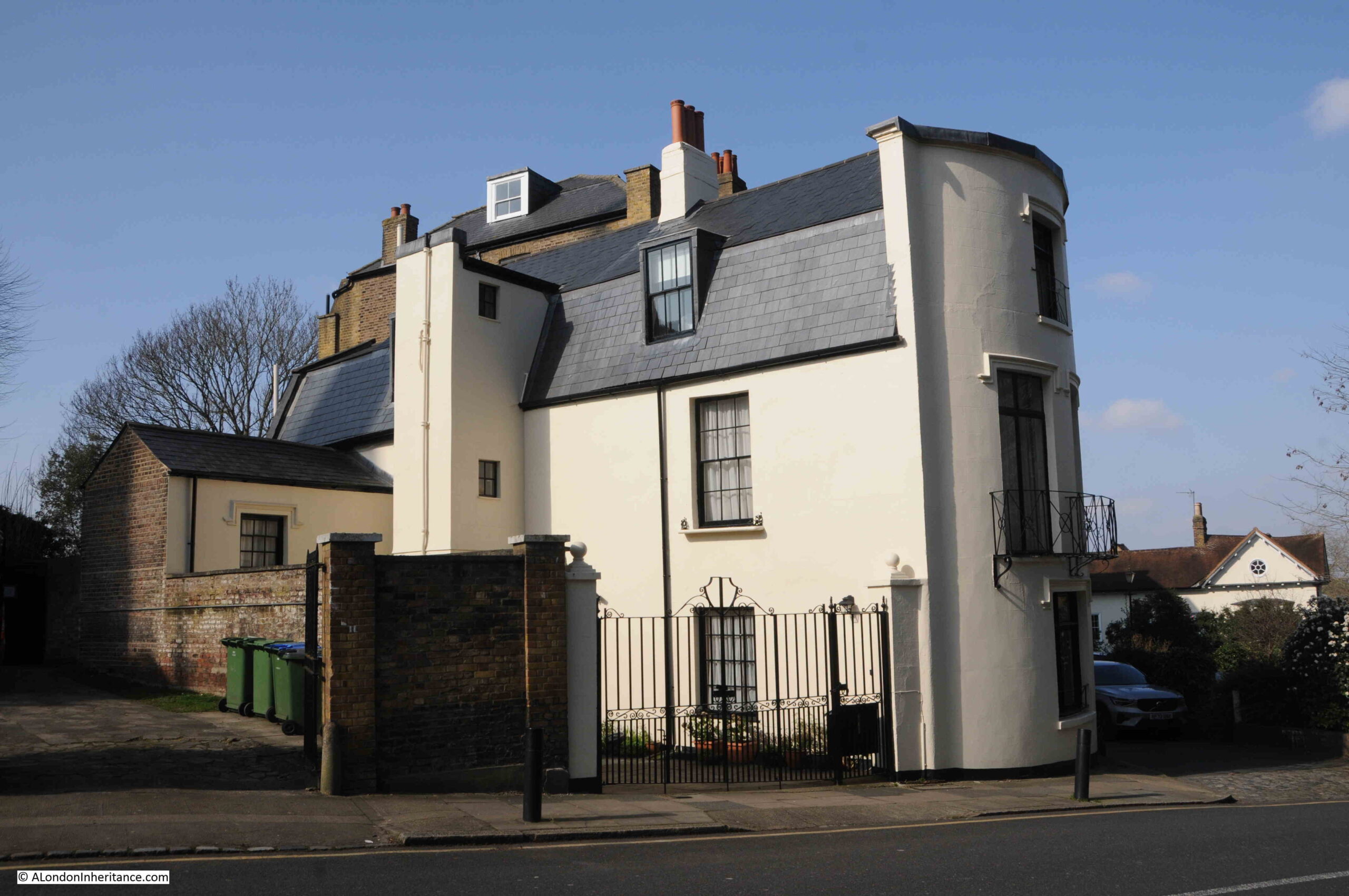
I cannot find the following building in the Historic England list of listed buildings, but it still is of interest, with a large three storey curved end to the building, which then steps back as a relatively normal house:
In 1746 not that much of Greenwich to the west of the park had been developed. Rocque’s map shows Crooms Hill along the western edge of the park, with a number of buildings lining the western edge of the road. These are many of the buildings that we can still see today (Crooms Hill marked with red arrow):
One of the buildings that was marked in Rocque’s map is the Presbytery. Grade II* listed and dating from 1630, but with some 18th century alterations:
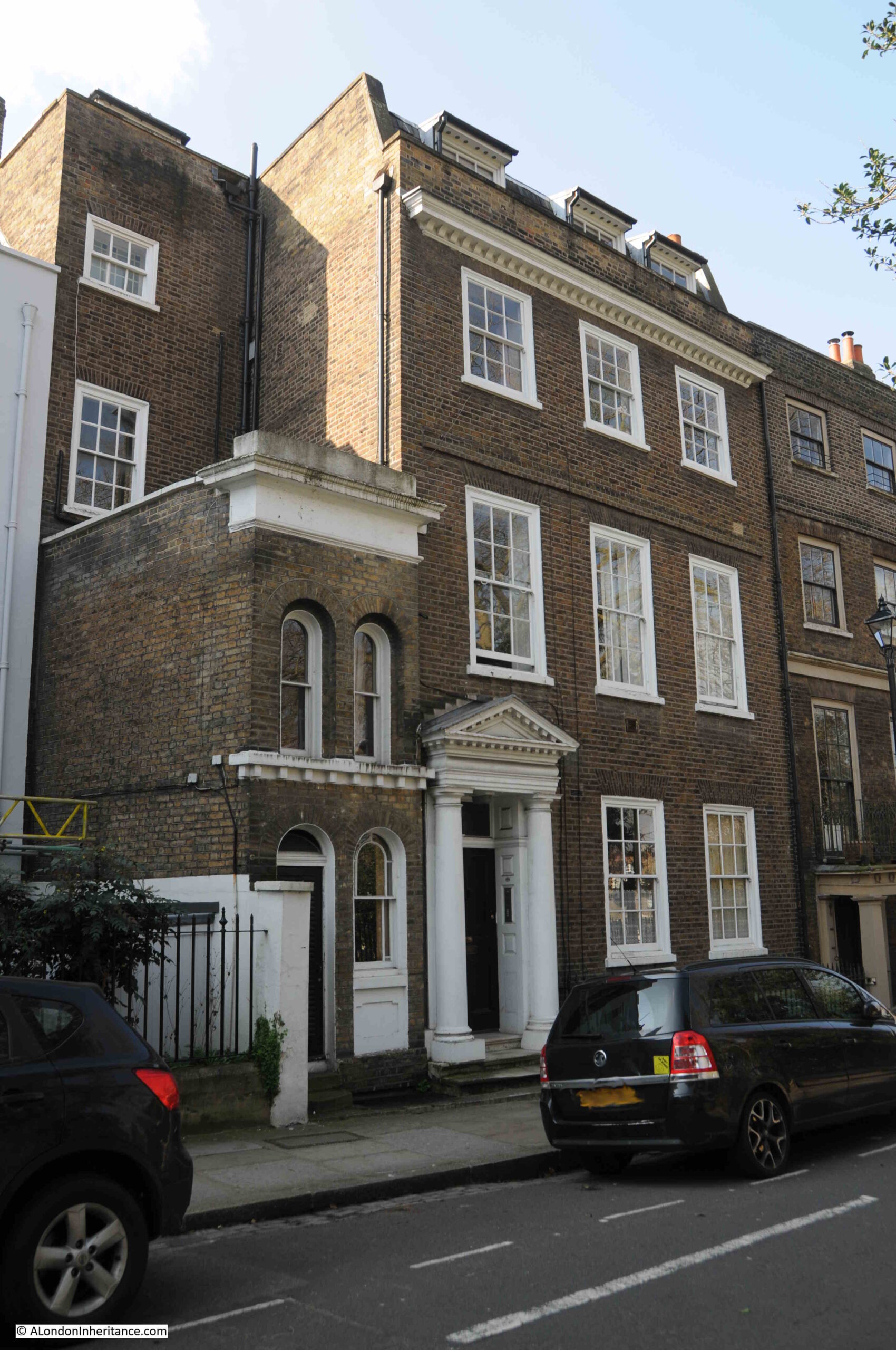
The following house dates from the mid 18th century, and the house, railings, wall and gate are all Grade II listed:
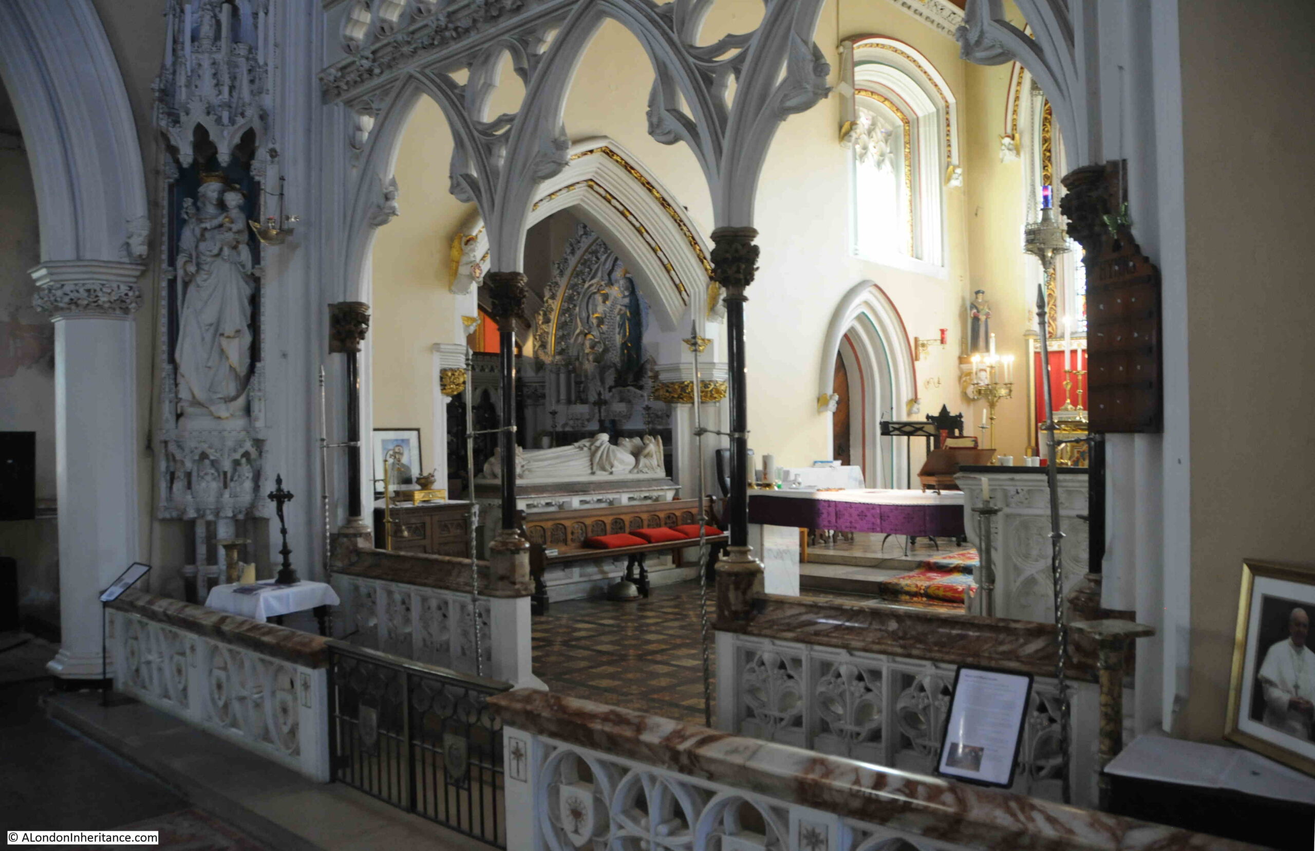
Just to the right of the above photo can be seen the edge of a church. This is the Roman Catholic Church of Our Ladye Star of the Sea, which again is Grade II* listed:
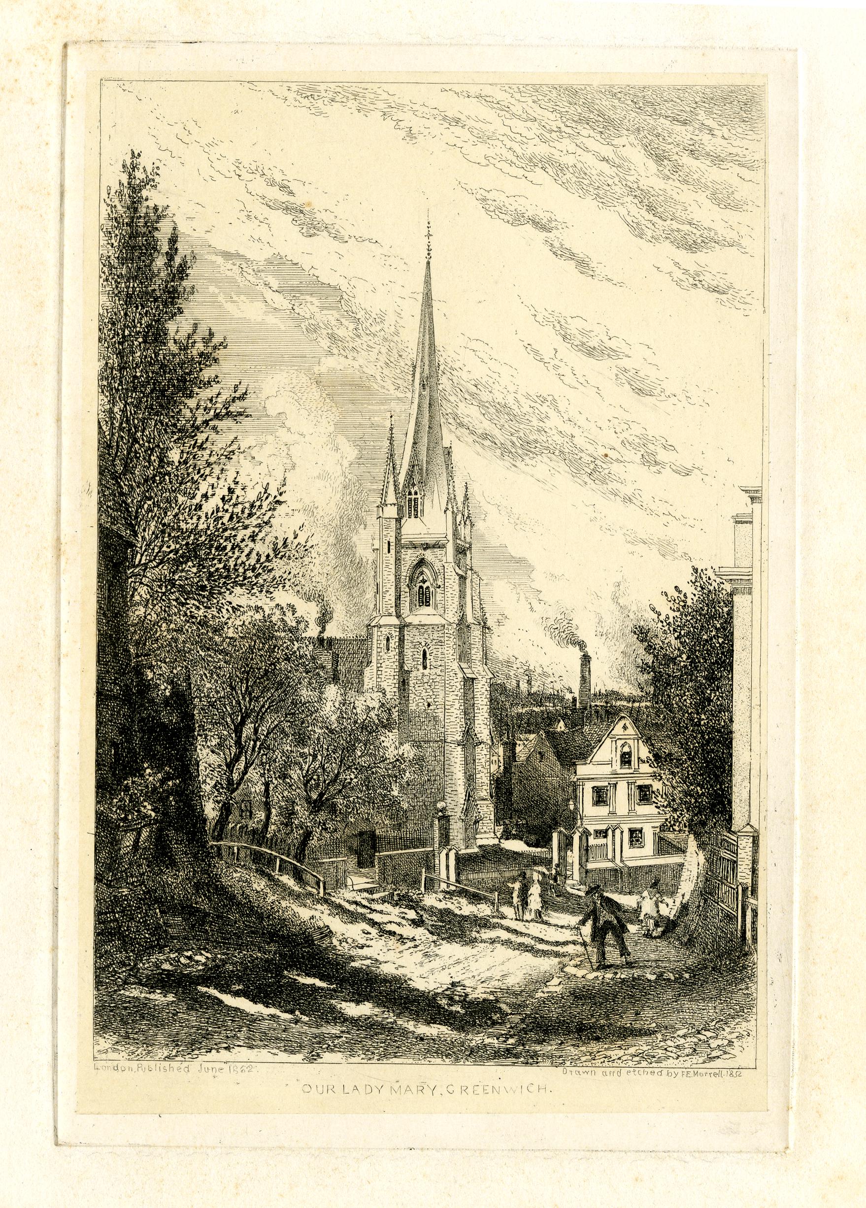
The following print from 1862 shows the church and Crooms Hill, which at the time appears to have been a relatively narrow, unpaved track. It is not that much wider today:
The church owes its origins to the maritime history of Greenwich.
In the late 18th century there were many Catholic occupants of the Royal Hospital at Greenwich. Estimates of up to 500, with numbers coming from Catholic countries such as Portugal which gives an indication of the residents of the hospital.
In 1793 a Chapel of St. Mary was built for these Catholic seamen. in the following decades, the chapel became rather inadequate, and a proper church was needed.
There is a tradition associated with the church that following the rescue of her two sons following an accident on the Thames, a Mrs. Abraham North vowed to build a church.
Fund raising covered the majority of the costs for building the church, and in recognition of the importance of the church to the maritime community, the Admiralty donated £200.
The North family donated the land for the church, and the architect William Wilkinson Wardell was employed.
Wardell was a friend of W N. Pugin, and Pugin worked on the design of the majority of fittings and furnishings within the church. Work started in 1846 and the church was completed in 1851.
Walking through the main doors into the church reveals a rather impressive interior:
The high altar was by William Wilkinson Wardell, and it was exhibited at the 1851 Great Exhibition:
Side chapel:
The Church of Our Ladye Star of the Sea is a magnificent example of mid 19th century church design and decoration, and a reminder of the connection between Greenwich, and those who worked and sailed on the Thames and the sea.
Continuing along Crooms Hill and we see plenty of one off house designs.
The tall house with the bay along the first and second floors in the following photo is Grade II listed, and indeed all the buildings in the following photo appear to be listed:
There is no single design theme running along Crooms Hill, and here is another example of the mix of styles. I suspect much of the building was speculative, made use of available plots of land, for different occupants, and variable amounts of money available to build and decorate etc. Whatever the reasons, it has resulted in a fascinating street:
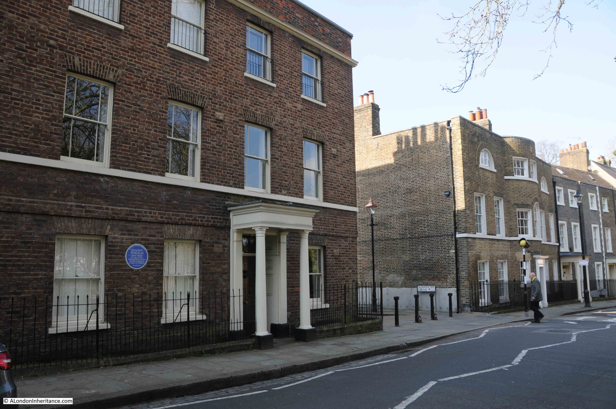
The house on the left has a Greater London Council blue plaque recording that Benjamin Waugh, the founder of the National Society for the Prevention of Cruelty to Children lived in the house:
Again, the houses in the above photo are listed, and looking further along the street there is another house with a tall, central bay running up all three floors.
There is enough in Crooms Hill to fill an entire post, and one of the buildings in the street houses the Fan Museum, however the Architects’ Journal map included more streets to the west of Greenwich Park, so I turned down King George Street to find more of the buildings marked on the map.
King George Street
The houses to the west are generally smaller. Those on Crooms Hill were facing Greenwich Park, and were the first buildings in this part of Greenwich. They were larger, and in a better position and were therefore built and occupied by the more wealthy residents of Greenwich. As we head into the streets to the west, we find houses that were built from the late 18th century onwards and were probably for the working class, tradesmen and those who worked in the many river related professions.
This large three storey building stands out along the terrace of two storey houses. Whilst it is now a private house, it was once a pub – the Woodman:
And almost opposite the Woodman is another closed pub. This one looking more like a pub. This was the Britannia:
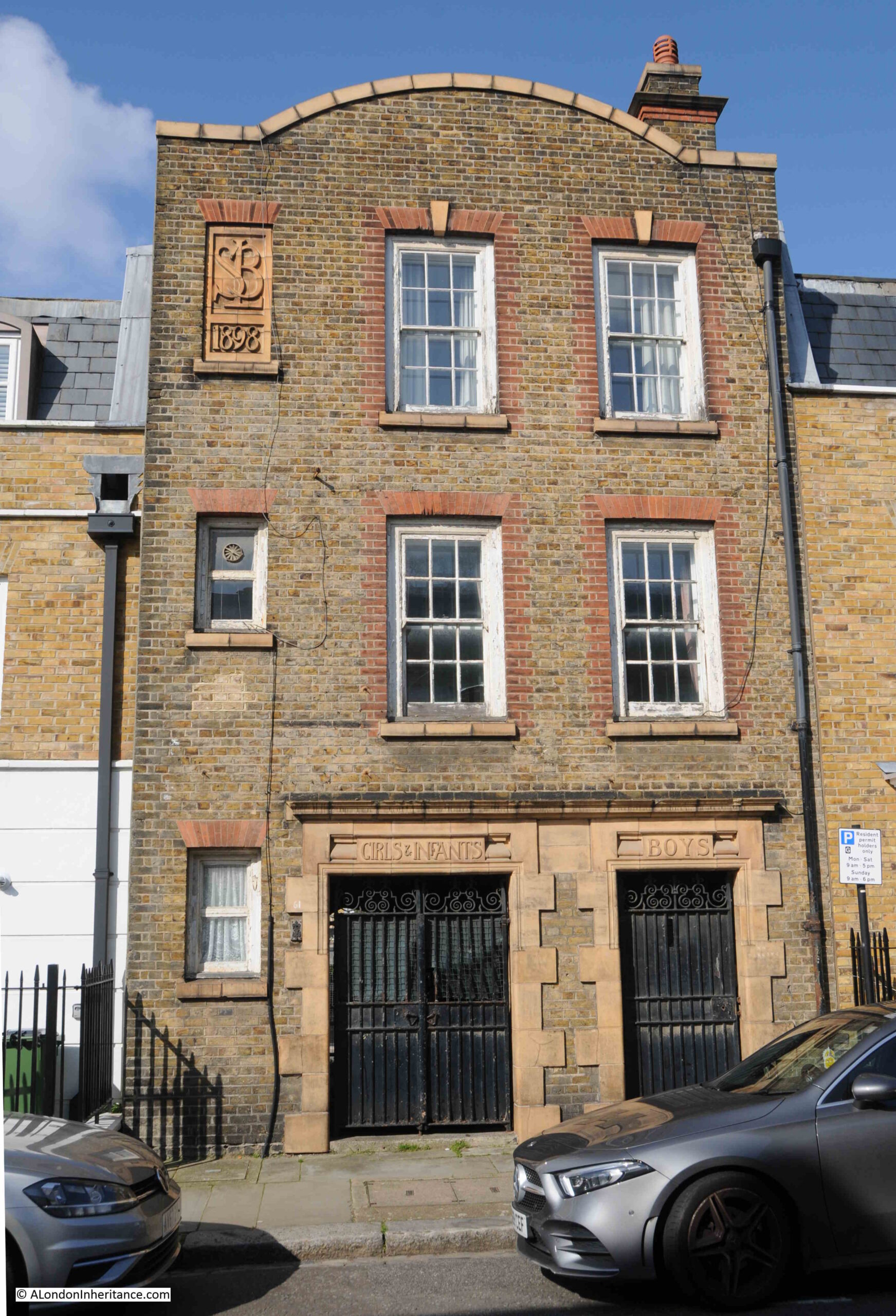
Hidden behind the terrace houses on King George Street is a large, 19th century school, one of the impressive schools built by the London Schools Board. There is an entrance to the school playground from King George Street, with separate entrances for Girls & Infants, and for Boys:
Whilst the main school building behind is still a school, it looks as if the old entrance has been converted to residential.
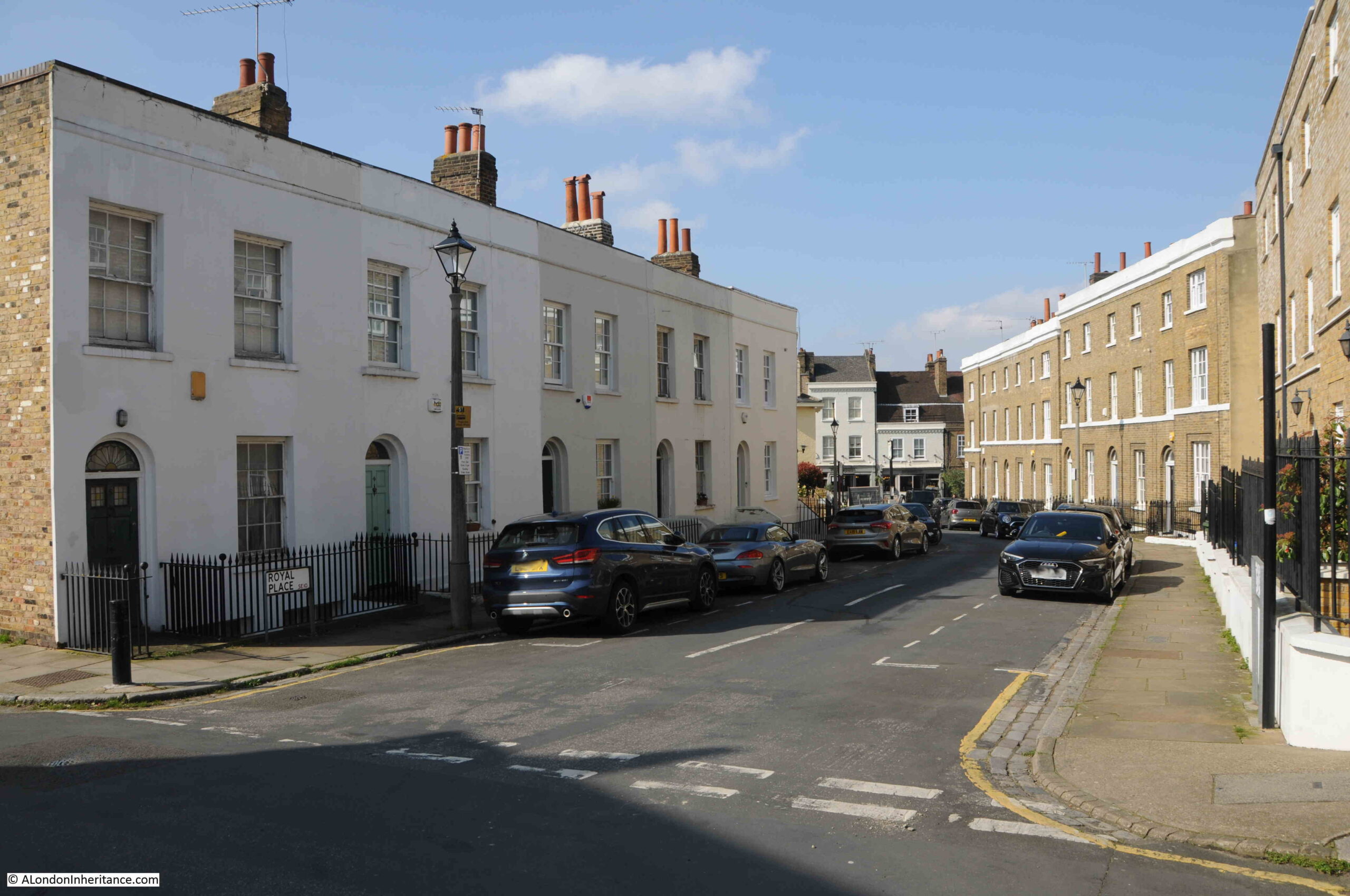
Half way along King George Street is Royal Place, which has two storey workman’s houses on one side, and three storey, presumably more expensive houses on the opposite side:
At the end of Royal Place, we come to:
Royal Hill
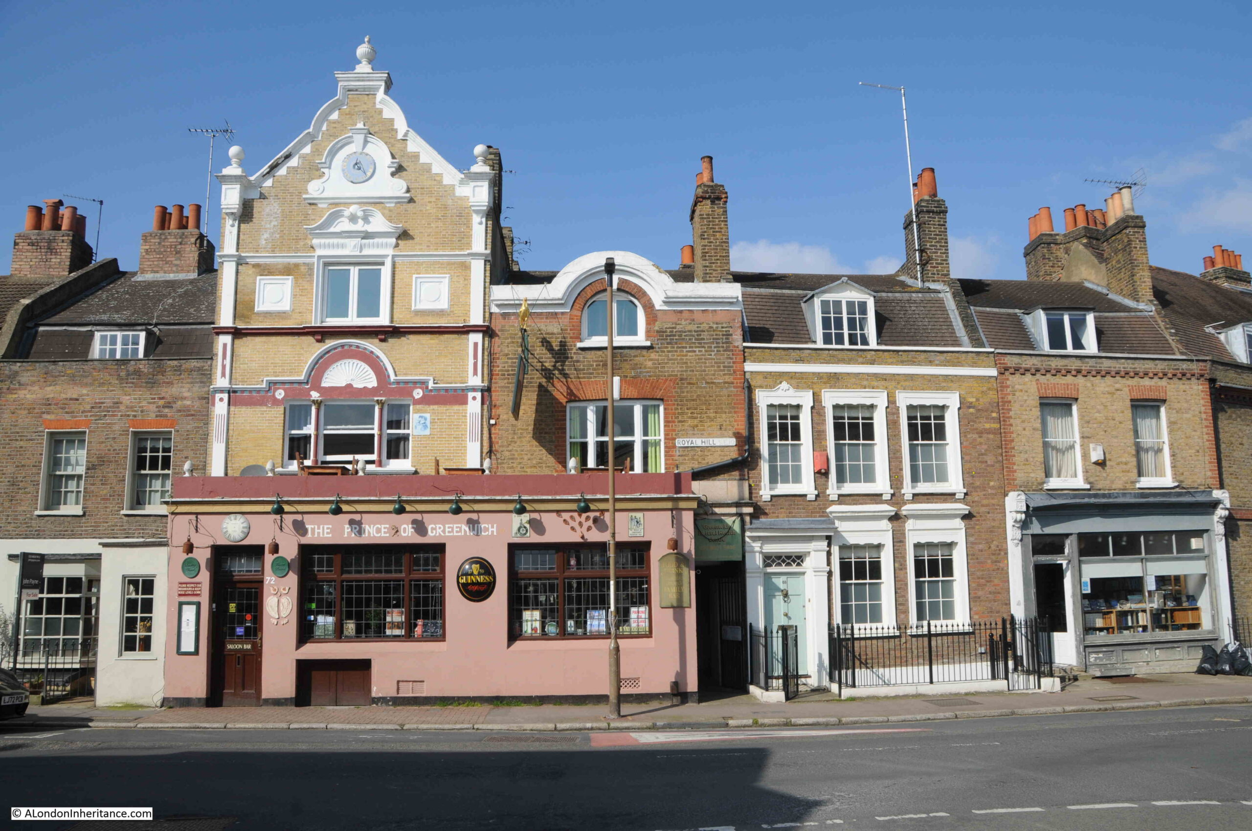
And turning left along this road, we find a pub that is still open – the Prince of Greenwich:
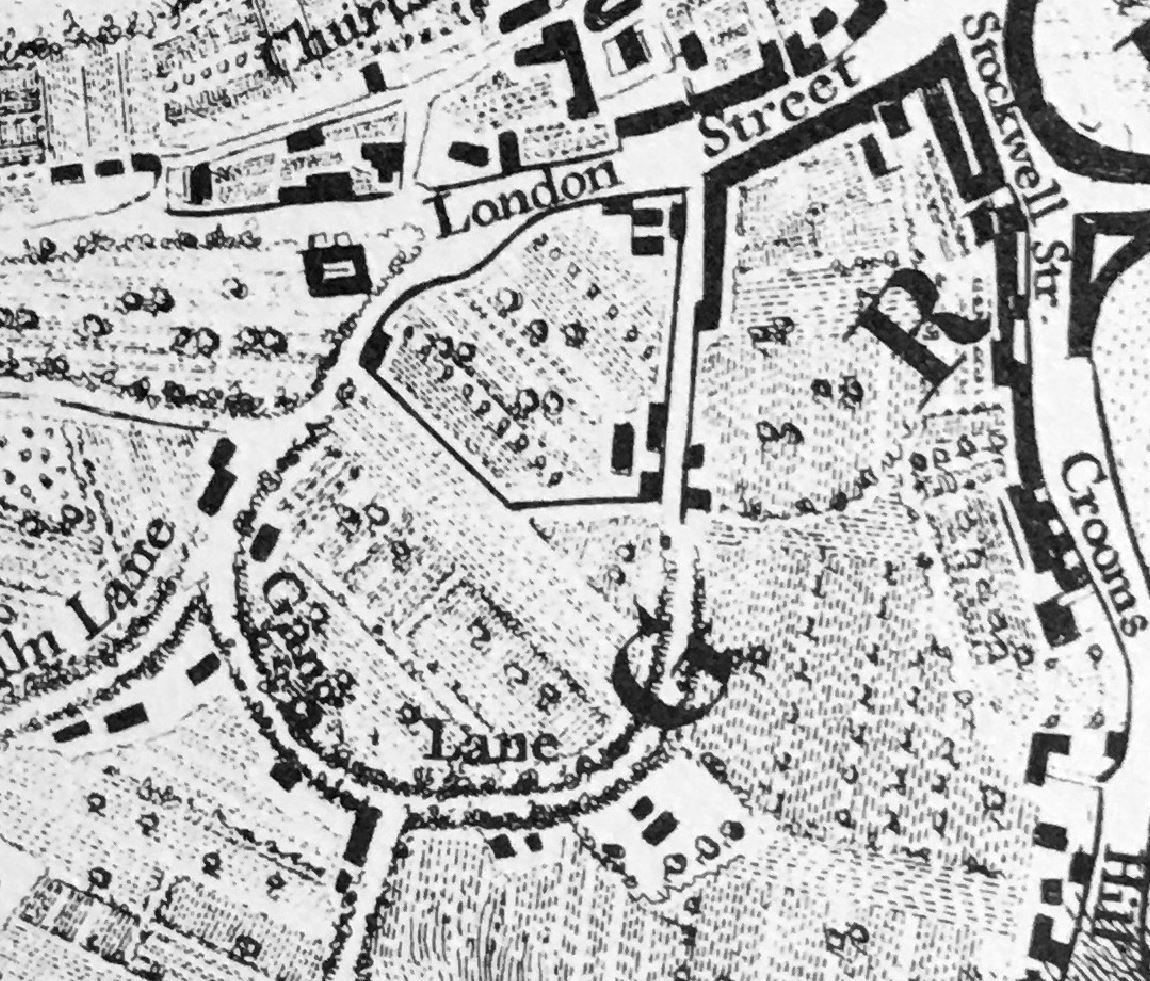
The Prince of Greenwich is not the original name of the pub, it was originally the Prince Albert, and the street Royal Hill has an interesting history. It was originally Gang Lane, but renamed Royal Hill after Robert Royal, the builder of a theatre in Greenwich in 1749.
The street, Gang Lane is shown in Rocque’s map below, and is believed to date from the medieval period:
In the above map, it is shown running from London Street, then curving round to Lime Kiln Lane. Today, only the section to the right of the “L” in Lane remains, and to the west, the street now continues as a straight street, rather than continuing the curve.
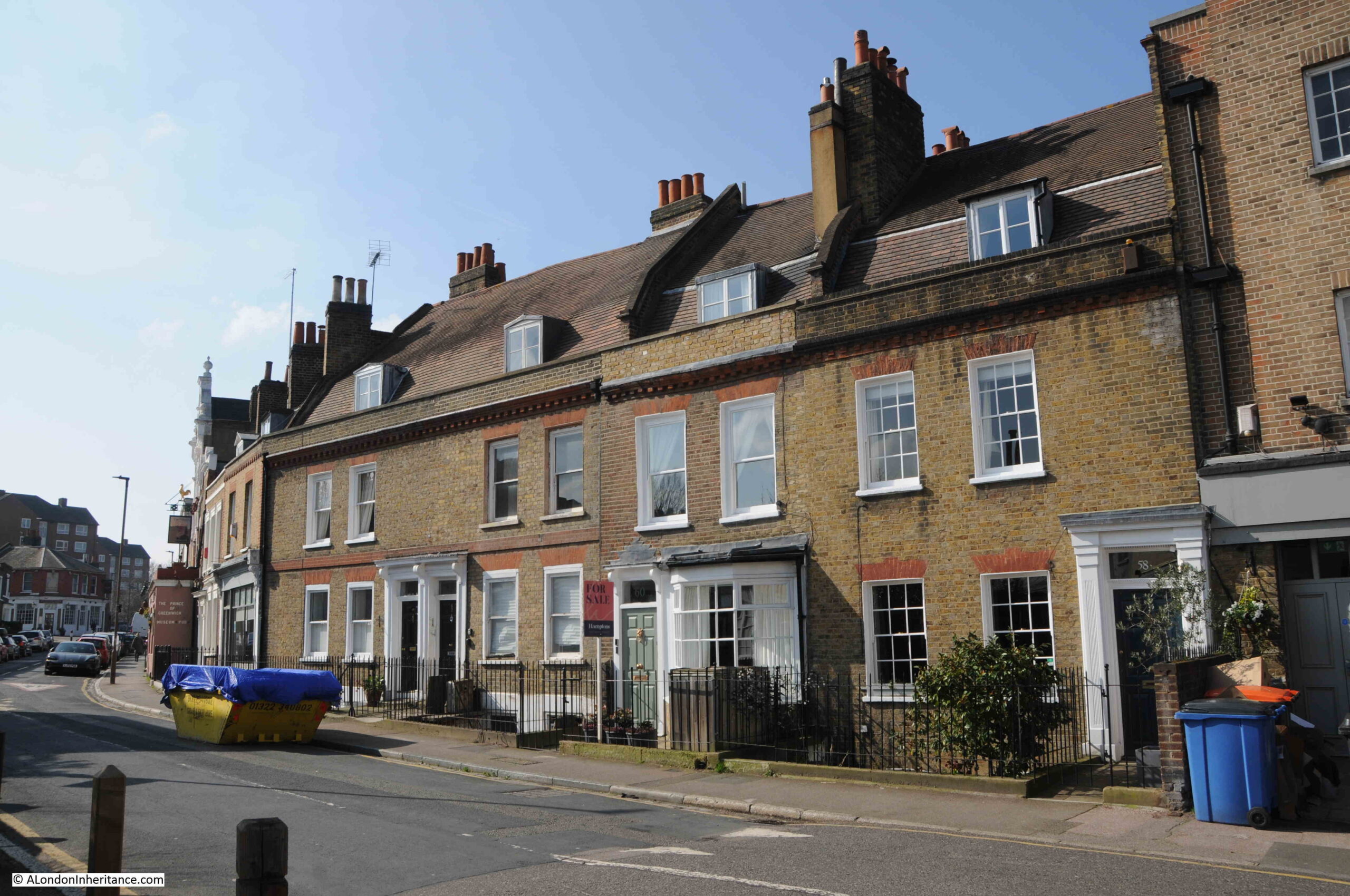
Terrace houses in Royal Hill:
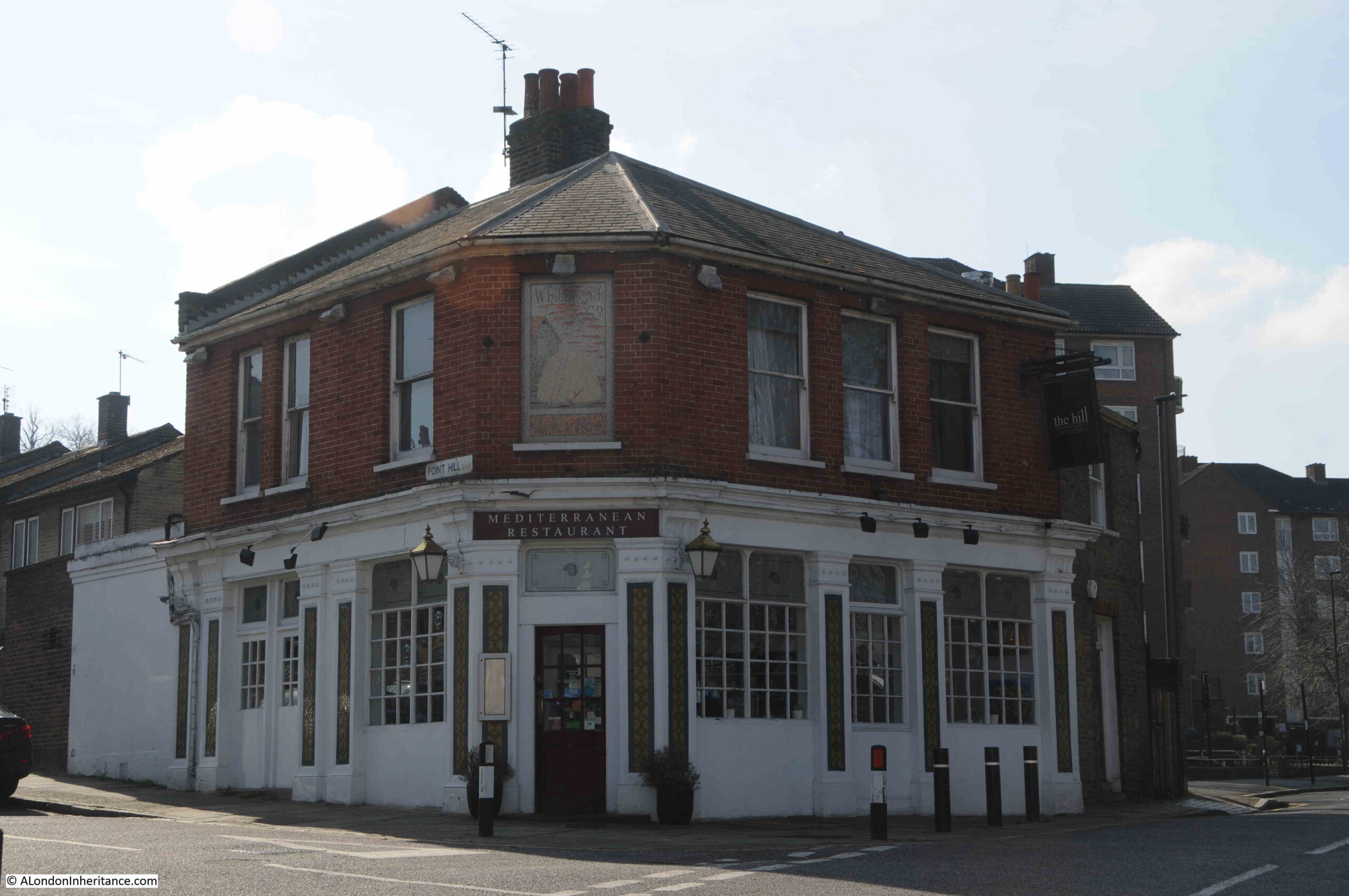
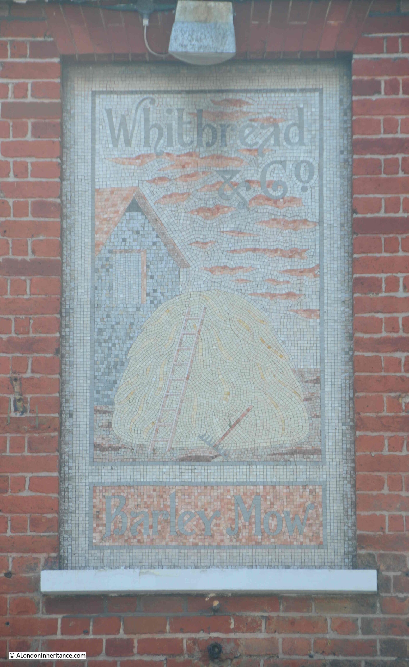
Along Royal Hill is another closed pub, the Barley Mow, although rather than residential, after closure in 2003, it was converted into a restaurant:
Above the main corner door is a lovely mosaic sign which dates from the time of the Barley Mow, with the Whitbread brewery name at the top and the pub name at the bottom, with presumably what was meant to be a stack of barley as the main feature:
After the Barley Mow pub, the buildings become more recent, although there is a stub of Royal Hill to the right with buildings from the 19th century, but here I turned around and headed back as there was still much to find from this section of the Architects’ Journal map.
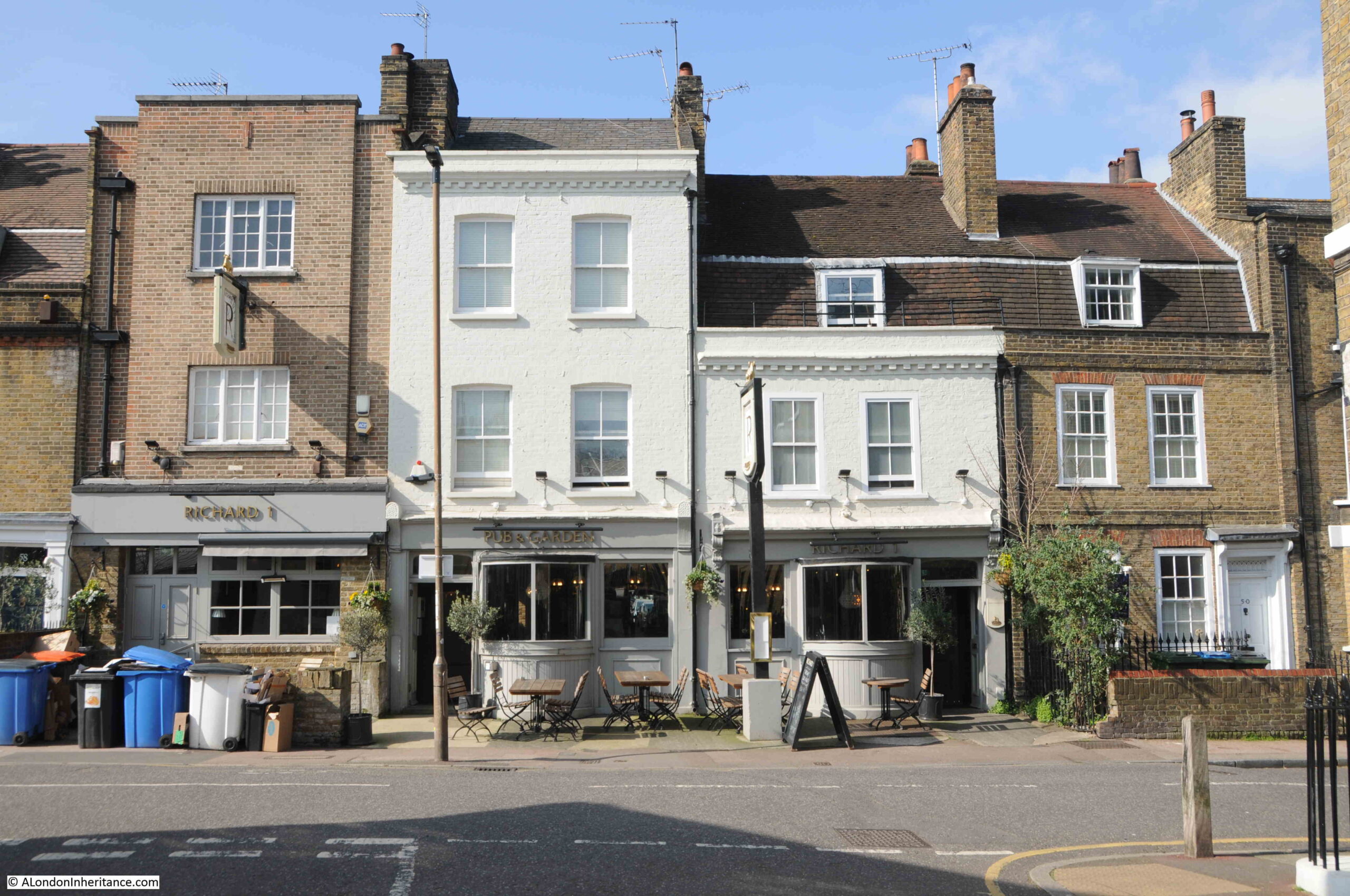
Further back along Royal Hill, is another pub, thankfully still open. This is the Richard 1st, and comprises the two lime green buildings and the slightly taller building to the left. The pub dates from around 1843:
Going back to the Architects’ Journal map, and to the west of the park, there is a longer, slightly curvered section where the houses have been marked in black:
This is leading off Royal Hill and is:
Gloucester Circus
Large building with full height bay to the rear at the western end of Gloucester Circus:
As can be seen in the Architects’ Journal map, the highlighted section is along the south east side, with an open space in the middle, and unmarked buildings to the north west of the open space.
View along Gloucester Circus from the southern end, near Royal Hill:
The development of his area was in two stages. The curved terrace shown in black was built by Michael Searles and completed between 1791 and 1809. This work included the gardens in front of the terrace.
In the 1840s, a terrace was added along the other side of the gardens, and the curved terrace was known simply as The Circus, and the 1840s terrace as Gloucester Place.
Wartime bombing resulted in the destruction of the 1840s terrace which is why there is post war building along this stretch with the Maribor Estate, named after Maribor in Slovenia, one of the three towns that Greenwich is twinned with.
There was also damage to the curved section, the Circus, including considerable damage requiring a rebuild to part of the central section.
The houses damaged during the war were rebuilt in the same style, but the difference can be seen today by the different coloured brick of the original and post war building work:
The terrace is Grade II listed, and is a lovely example of a late 18th / early 19th century terrace design and construction.
Renaming of all the buildings around the central gardens as Gloucester Circus came in 1938. The northern end of the curved terrace:
View along the central residents gardens, the curved terrace is to the left, and the post war buildings following bomb damage are to the right:
And at the end of Gloucester Circus, I have almost come full circle as I am back at Crooms Hill, and at the junction between the two streets is this large Grade II listed building:
Built during the late 18th century, there has been some significant rebuilding of the upper floors.
The chimney stack along the Gloucester Circus side of the house has a nice feature which my father photographed in the 1980s:
The Circus – the original name of the curved terrace that is now part of Gloucester Circus.
And that was just the western section of the Architects’ Journal map.
It is strange to consider that in the early 1970s, places such as these buildings and streets to the west of Greenwich Park were considered at risk from redevelopment, but London was a very different place then.
With the closure of the docks, loss of industry, population reducing considerably after the war, so much of east London was becoming derelict, and the vision to see what these places could really become was not, with some exceptions, really there.
So many lovely 18th and 19th century buildings were demolished in the post war period, and it is good too see places such as Greenwich, where they have survived as whole streets, rather than isolated blocks.
In part two, I will be following the Architects’ Journal map, heading towards the area of Greenwich around the Cutty Sark, then along the river to the streets surrounding the power station where there are some gems to be found.
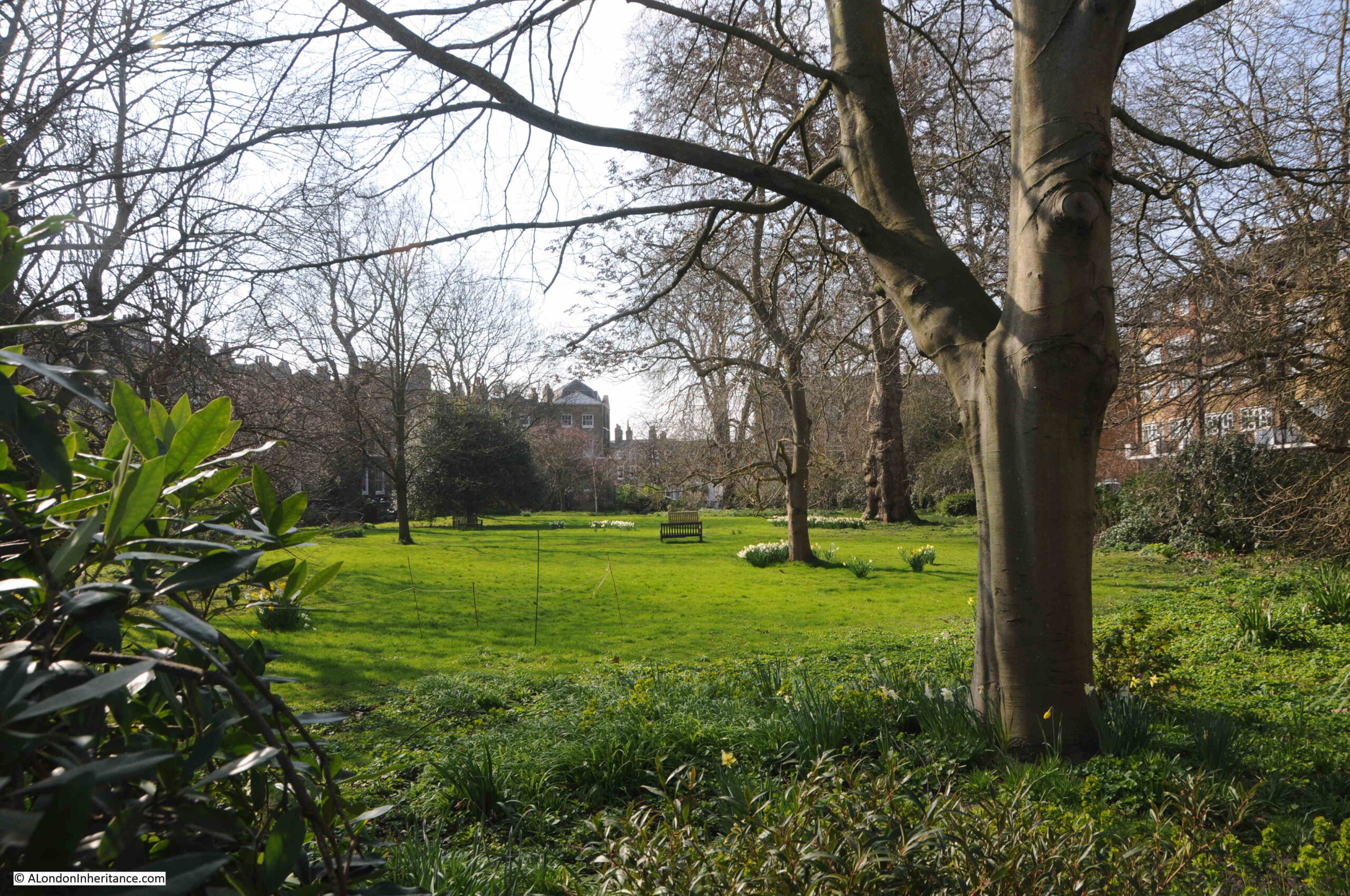
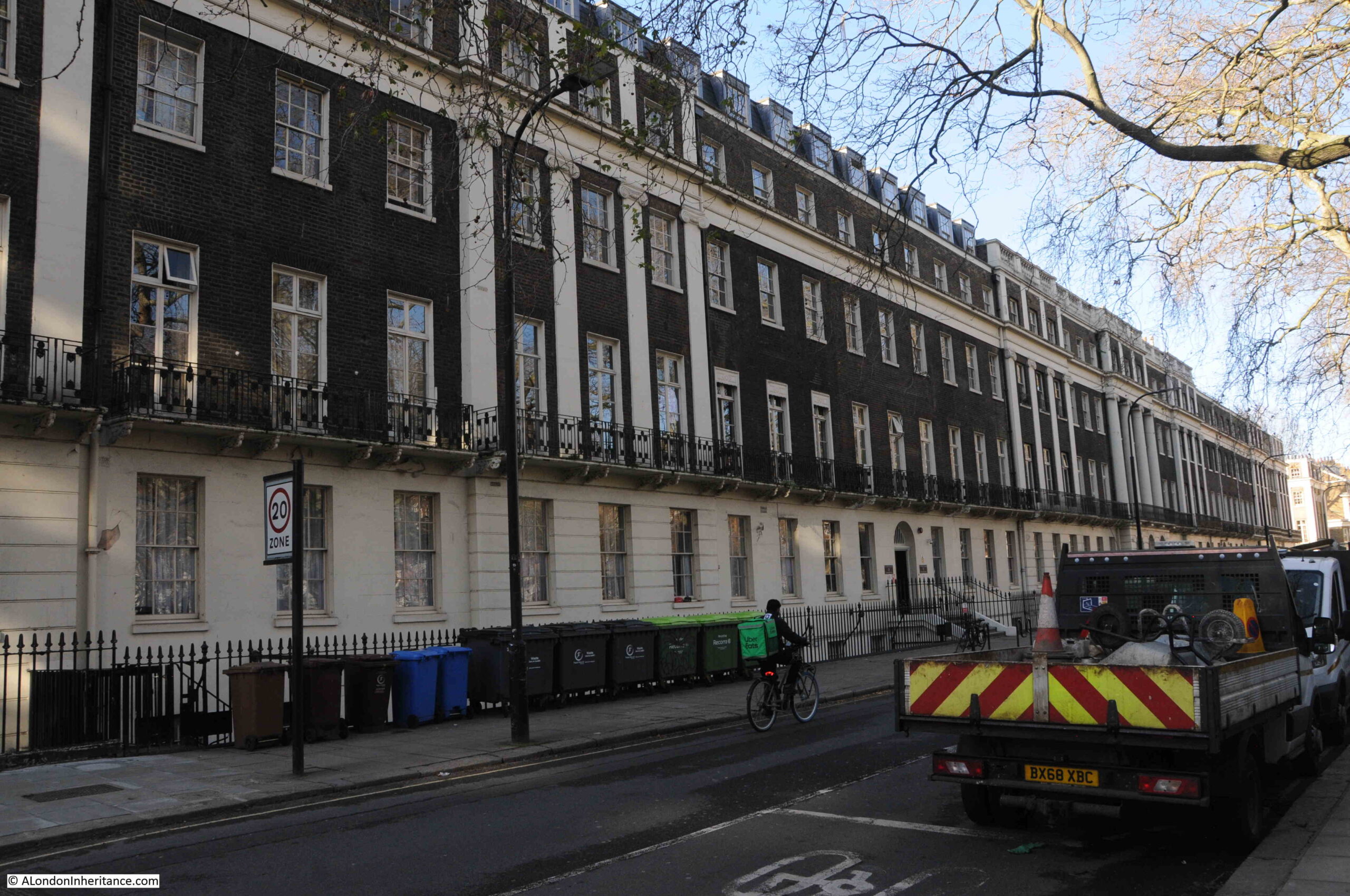
Tavistock Square is one of the many open spaces in Bloomsbury, built during the development of land owned by the Dukes of Bedford as London expanded north from the mid 18th to the early 19th centuries.
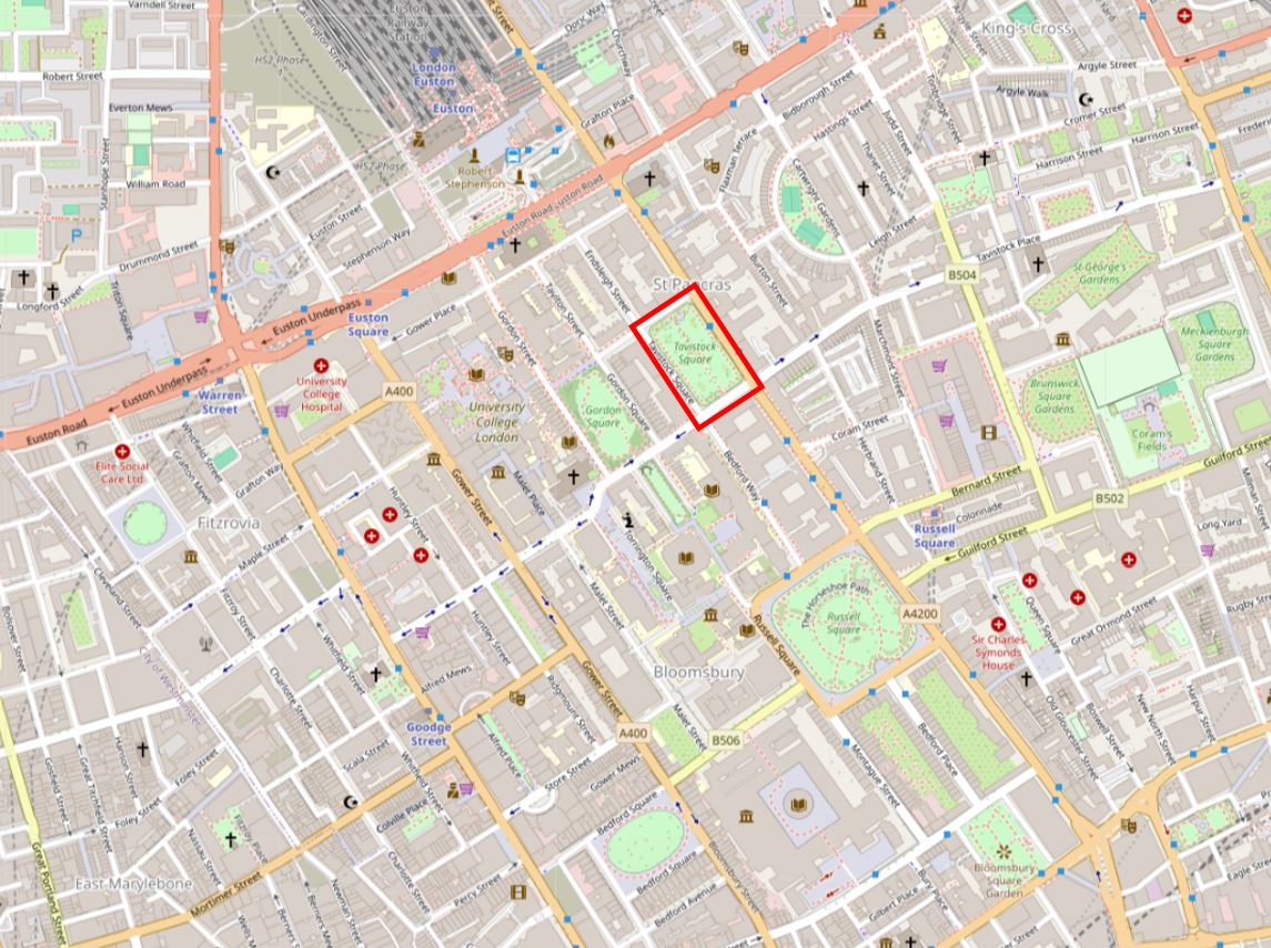
I have marked Tavistock Square with a red rectangle in the following map:
The name comes from the Duke of Bedford’s second title, the Marquis of Tavistock, a title created in 1694, and named after the grant of land belonging to Tavistock Abbey to the family.
As can be seen from the above map, Tavistock Square is one of a number of open spaces in a built up area. The Euston Road is just to the north, and the A4200 runs along the eastern side of the square, a busy road that carries traffic between the Euston Road and Holborn.
Euston Station is a short walk to the north.
Standing in places such as Tavistock Square today it is hard to imagine that a couple of centuries ago (a relatively short period in the history of London), all this was fields and pasture on the northern boundary of the built city.
An area crossed by tracks and walkways across the fields, streams and ponds.
Rocque’s 1746 map of London shows the northern limits of the city. Queen Square had recently been built, along with Bedford House, and Montague House is located where the British Museum can be found today. I have marked the location of Tavistock Square with the red rectangle:
Russell Square would be built just north of where Bedford House is shown (Russell is the family name of the Dukes of Bedford / Marquis of Tavistock), and the family were major landowners across this part of London.
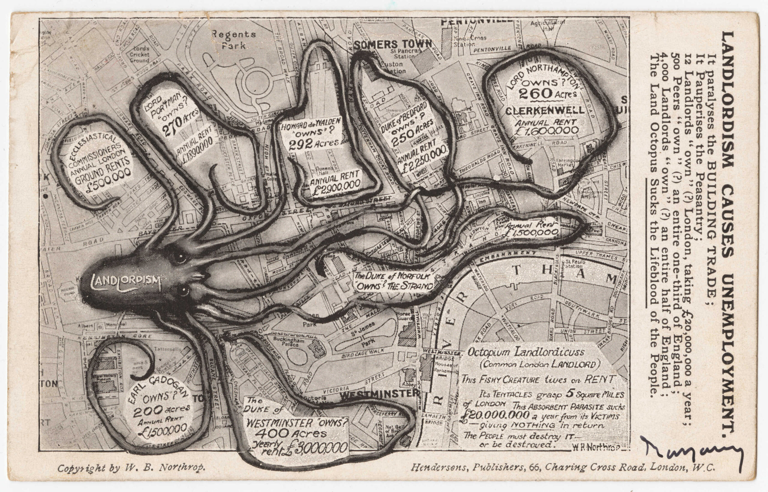
The Duke of Bedford and his landholdings featured in a map created in 1909 by William Bellinger Northrop and titled “Landlordism Causes Unemployment”.
The aim of Northrop’s map was to show how “Landlordism” was strangling London, with large areas of the city being owned by the rich and powerful. Northrop claimed that the Duke of Bedford owned 250 acres, and that this estate produced an annual rent of £2,250,000.
500 Peers “own” (?) and entire one-third of England;
4,000 Landlords “own” (?) and entire half of England:
the Land Octopus Sucks the Lifeblood of the People.
In many ways, this has not changed that much across the country, although in many instances the landed aristocracy has been replaced with very wealthy individuals, foreign investment, often state owned companies, and private development companies.
Tavistock Square was laid out in the late 18th century, and a terrace of houses along the eastern side of the square had been completed in 1803. These are believed to have been built by James Burton, a prolific London builder, and perhaps one of the most important since Nicholas Barbon.
The houses built by Burton in Tavistock Square had an unusual feature, where the staircase was configured to rise towards the front door, so when you went upstairs, you were walking towards the front of the house, with a landing at the front of the house, and the main rooms towards the rear, looking on small gardens at the rear of the houses, rather than the square.
These houses were demolished in 1938.
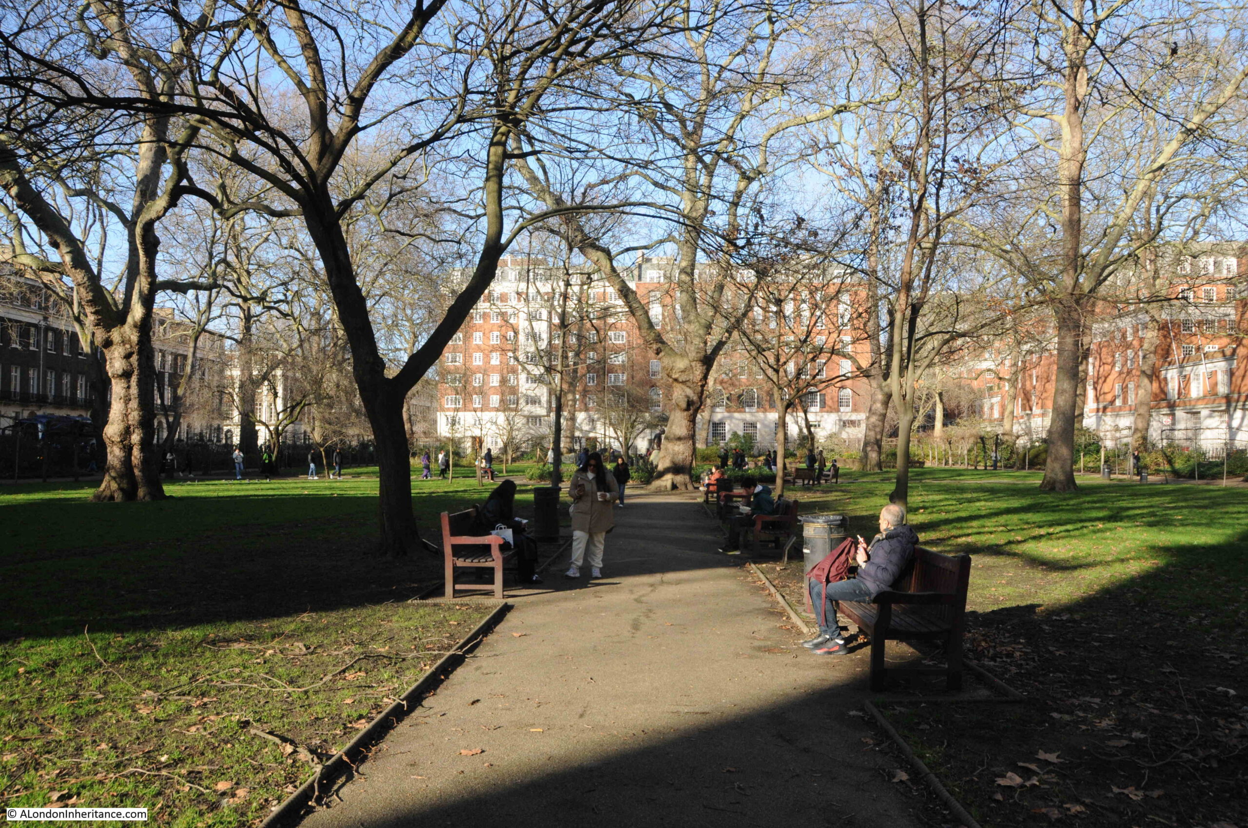
The following photo was taken from the southern part of the central gardens, looking north:
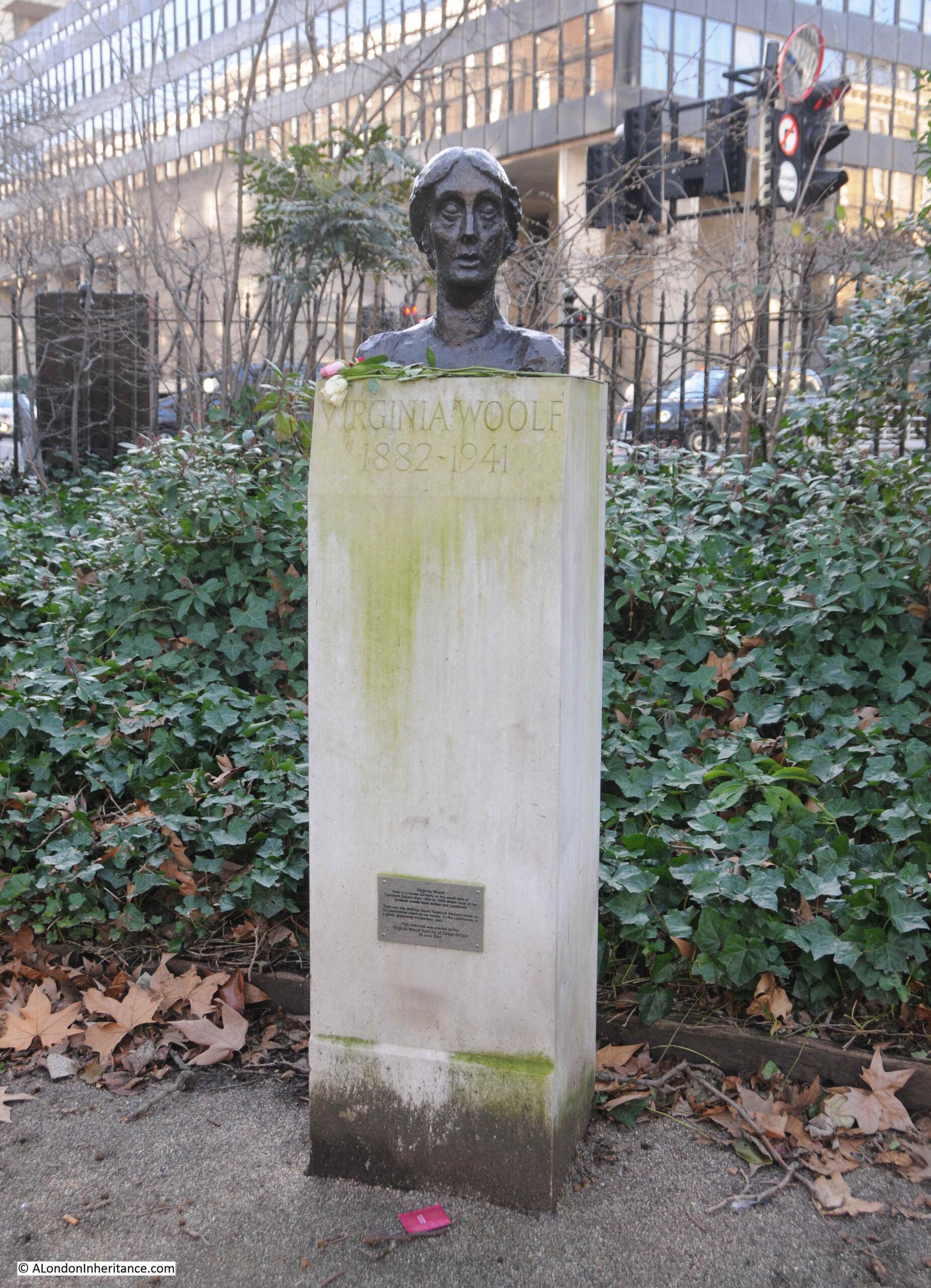
On the south west corner of the central gardens, we find Virginia Woolf:
Virginia Woolf, the writer, lived in Tavistock Square between 1924 and 1939, in a house along the southern side of the square, which was destroyed by bombing during the Second World War, indeed there was a considerable amount of bomb damage around Bloomsbury, which explains why many of these squares, and some of the surrounding streets, have lost their original terraces of houses, and why you often find a post-war building in the middle of an early 19th century terrace.
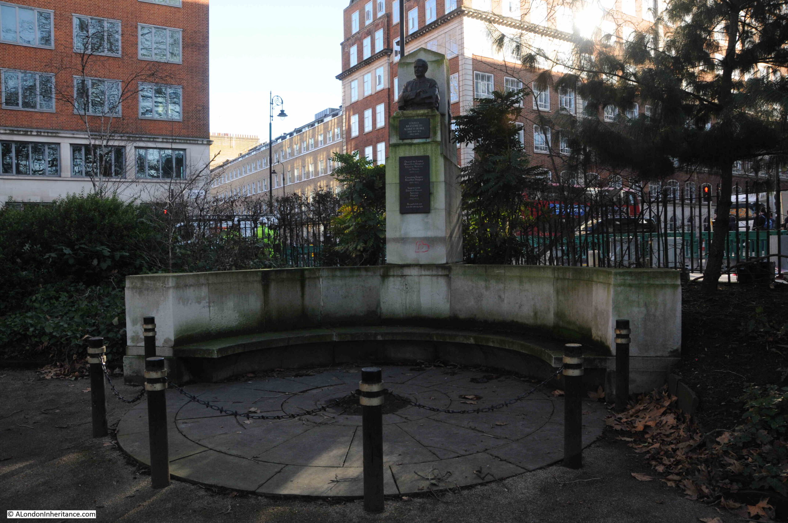
In the south east corner of the gardens, is a memorial to Louisa Brandreth Aldrich-Blake (1865 to 1925):
Louisa Aldrich-Blake was a pioneering surgeon, from a time when it was difficult for women to have such roles in the medical profession. She was Dean of the London School of Medicine between 1914 and 1925, a Consulting Surgeon at the Royal Free Hospital between 1919 and 1925, and a Surgeon to the Elizabeth Garrett Anderson Hospital between 1895 and 1925.
The memorial dates from 1926, and the base, seating and plinth were designed by Sir Edwin Lutyens, with the bust of Louisa Aldrich-Blake being by the sculptor A. G. Walker.
The monuments to two pioneering women sets the tone for the rest of the gardens, as they contain different memorials to the normal London square, and there is not an aristocrat in sight.
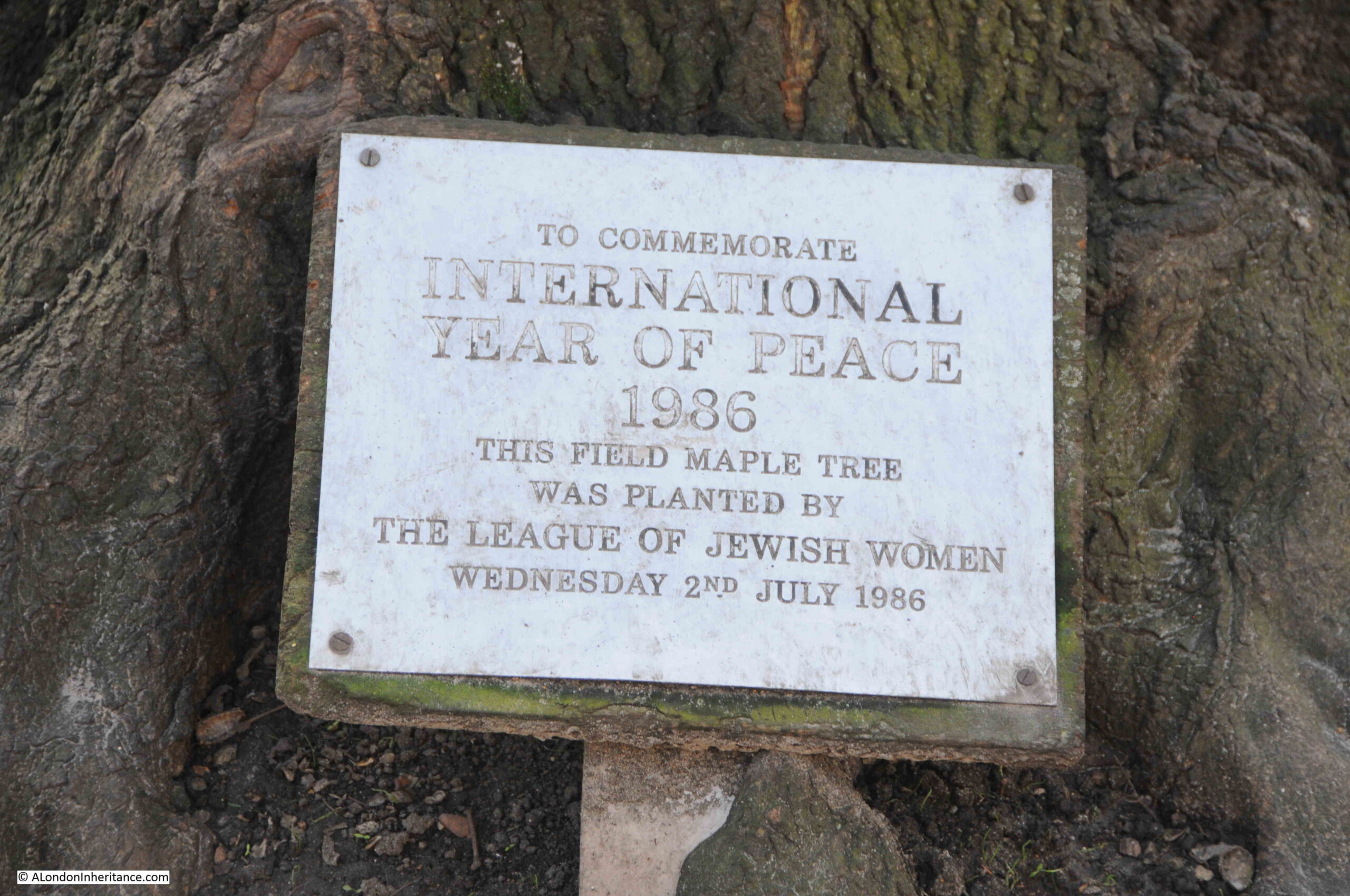
Walking along the central path in the gardens, to the north, and there is a Maple Tree which was planted in 1986 by the League of Jewish Women:
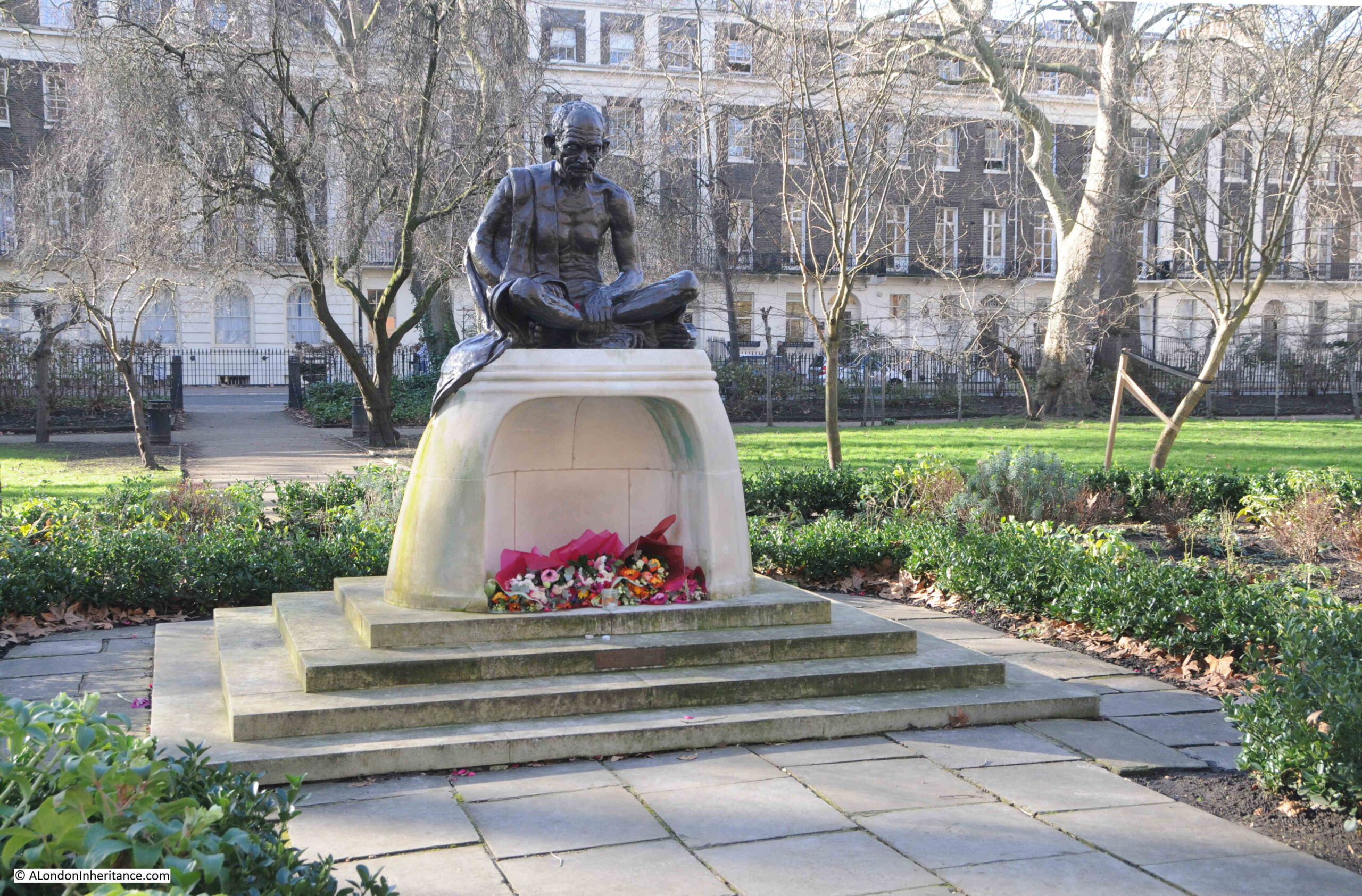
In the centre of the square is a memorial to Mahatma Gandhi, the lawyer and campaigner for India’s freedom from British rule:
The memorial looks recent, but dates from 1968, and was unveiled by Prime Minister Harold Wilson in May of that year. It is Grade II listed, with a base of Portland Stone, with the bronze figure of Ghandi by the sculptor Fredda Brilliant.
The relevance of Tavistock Square to Gandhi is that he attended University College London in Bloomsbury where he studied English literature, and also learning law at the Inner Temple.
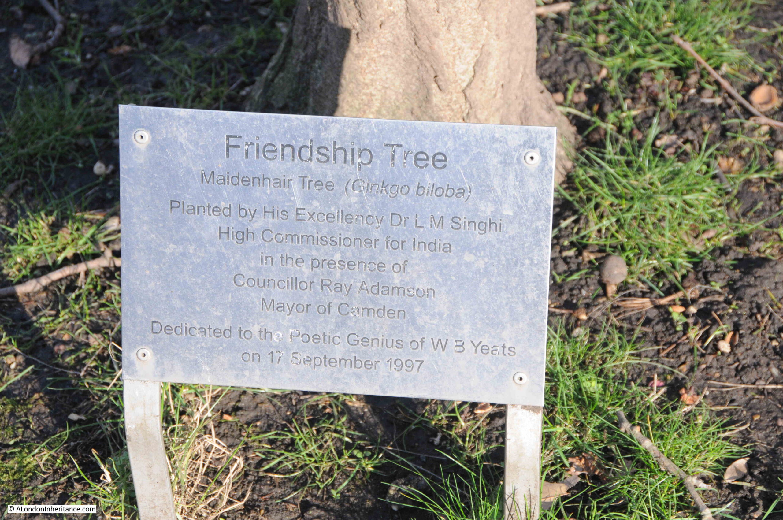
Ghandhi’s approach to non-violent protest is reflected in many of the memorials in Tavistock Square, such as the International Year of Peace shown above, and also with another tree, the Friendship Tree planted in 1997 by the High Commissioner for India:
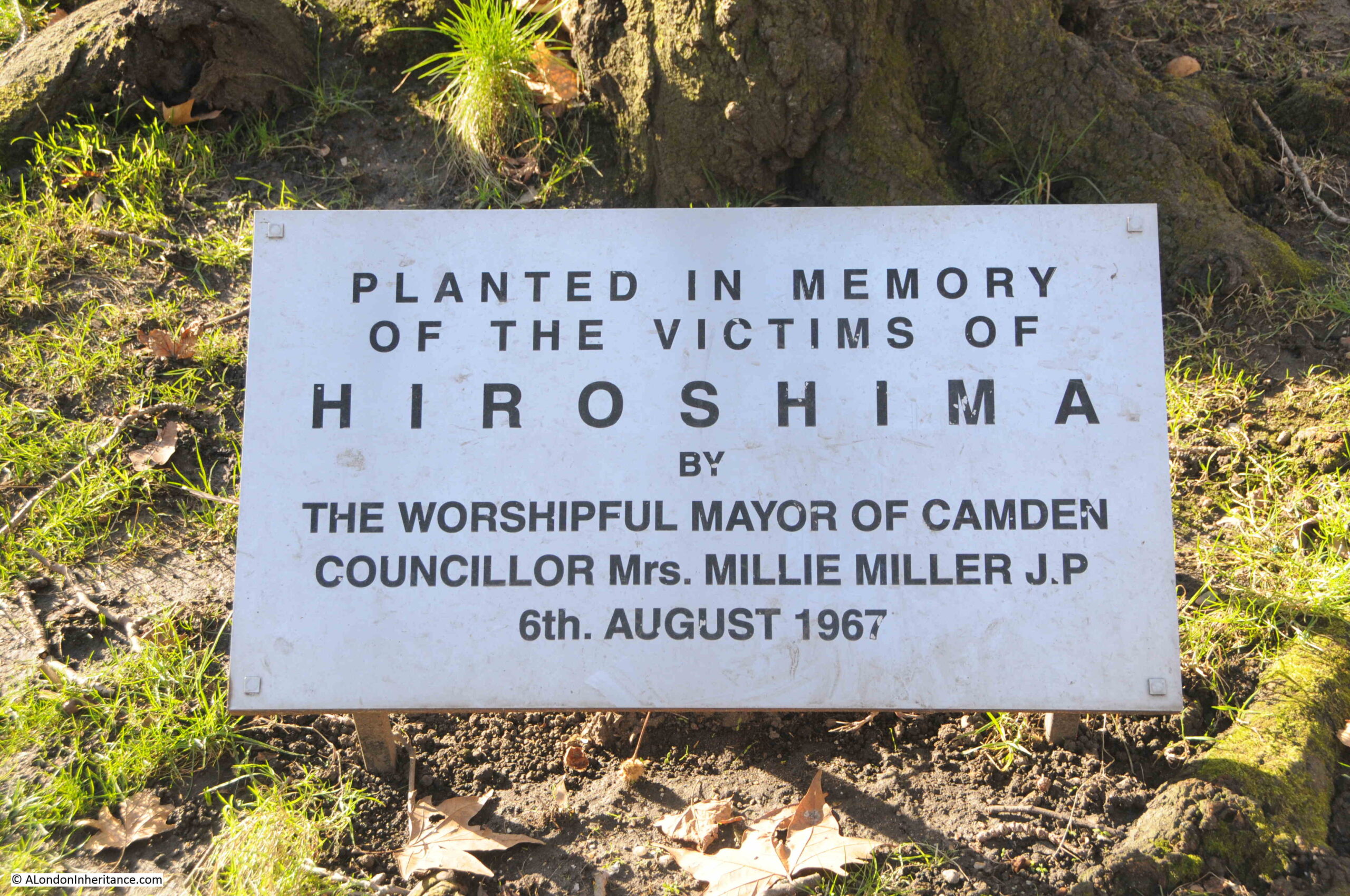
And another tree was planted in 1967 in memory of the victims of the atomic bomb dropped on the city of Hiroshima in Japan:
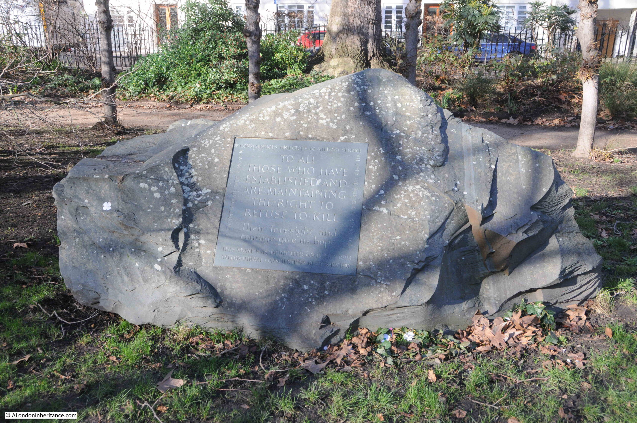
At the northern end of the gardens is a large stone memorial which dates from 1994 and is to Conscientious Objectors, “To all those who have established and are maintaining the right to refuse to kill“:
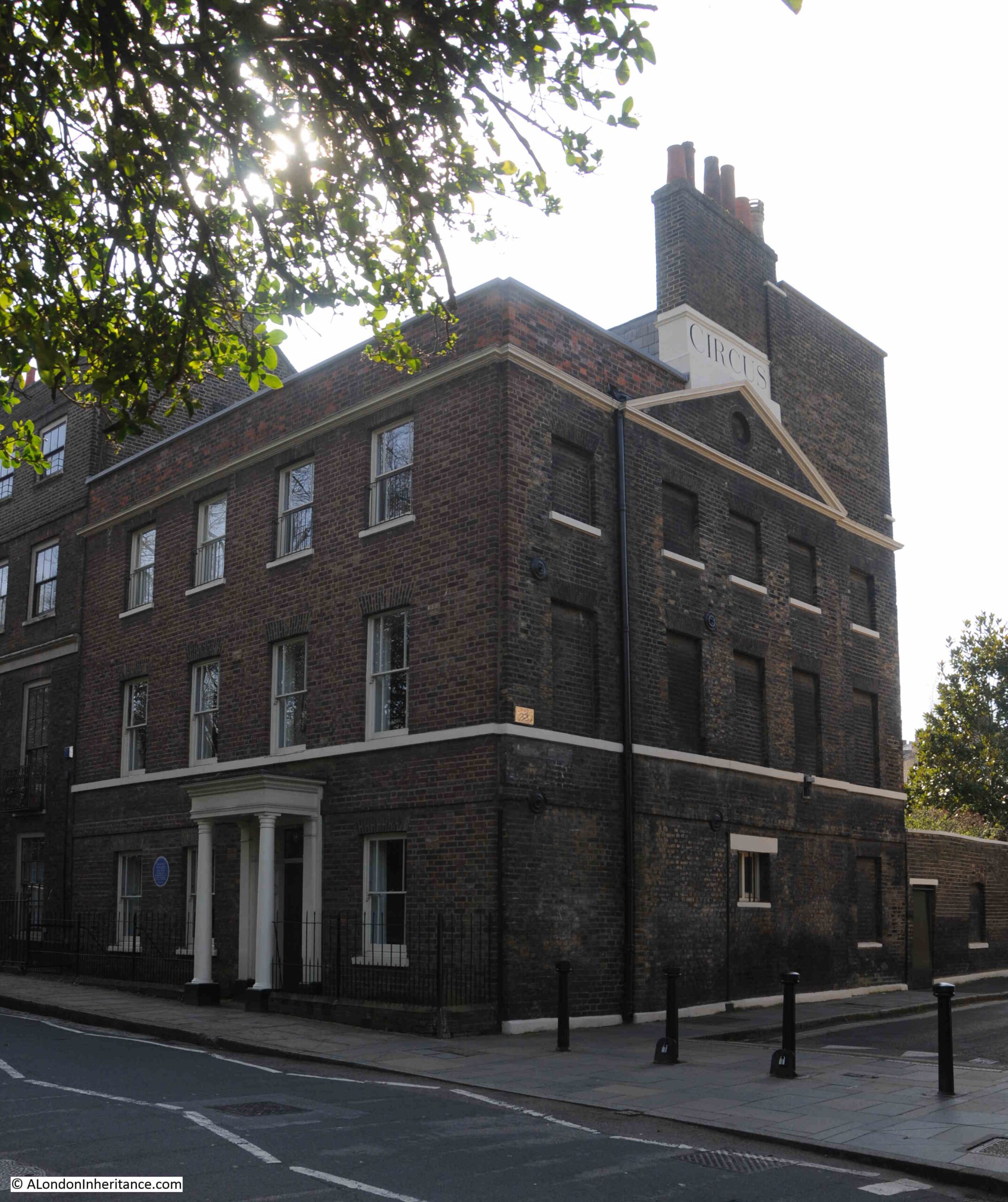
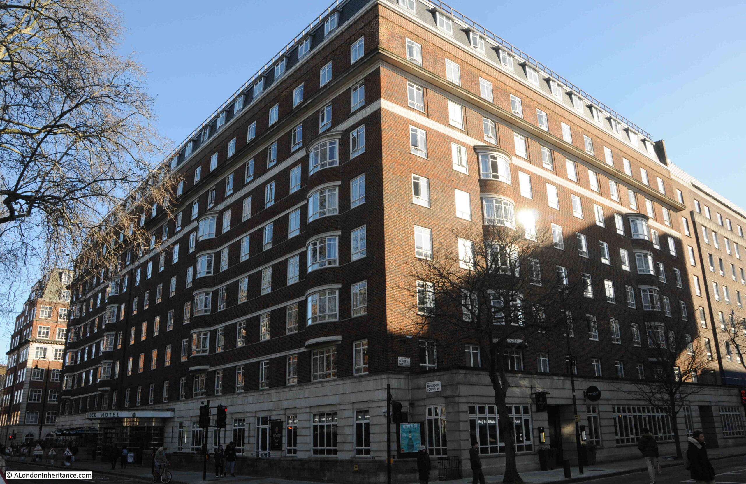
The Tavistock Hotel is a large, red brick building, that occupies the whole southern part of the square:
The space occupied by the hotel was originally a run of terrace houses. but these were badly damaged during the war. The remains of these buildings were demolished, and the Tavistock Hotel was built in 1951, and became the first hotel built in London after the war.
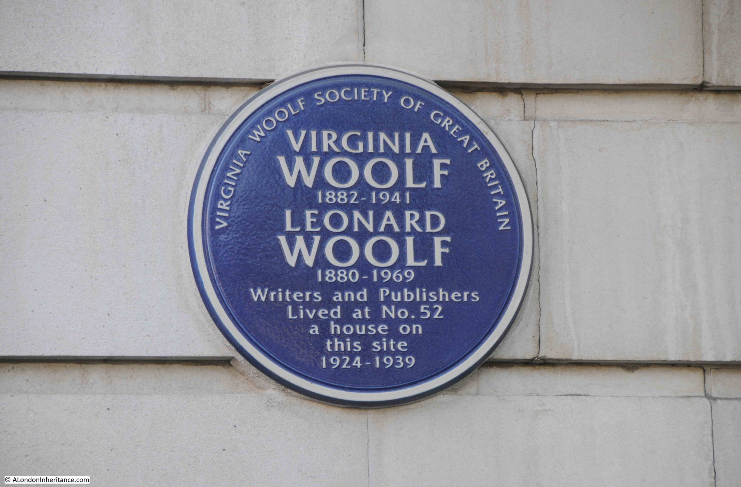
One of the houses that once occupied the site, was the one where Virginia Woolf and her husband lived whilst in Tavistock Square, and to the side of the entrance to the hotel there is a plaque recording her residence on the site:
All sides of Tavistock Square suffered bomb damage, with the southern, eastern and northern sides being completely rebuilt.
The western side of the street suffered bomb damage at the ends of the long terrace, leaving the majority of the terrace undamaged:
This lovely stretch of terrace houses was completed in 1824, and were built by Thomas Cubitt. Although Burton’s terrace on the eastern side of the square were demolished long ago, they were described as being inferior to Cubitt’s terrace, and the terrace is well built, with a pleasing symmetry along the length of the terrace, which is in an Italianate style, with Ionic columns in rows of four, running the height of the terrace from above the ground floor to the balustrade and roof line.
A number of the houses in the terrace are Grade II listed.
Although the terrace looks as if it is comprised of individual terrace houses, the terrace is owned by the University of London and University College of London, and the interiors have been modified and combined to accommodate this new use.
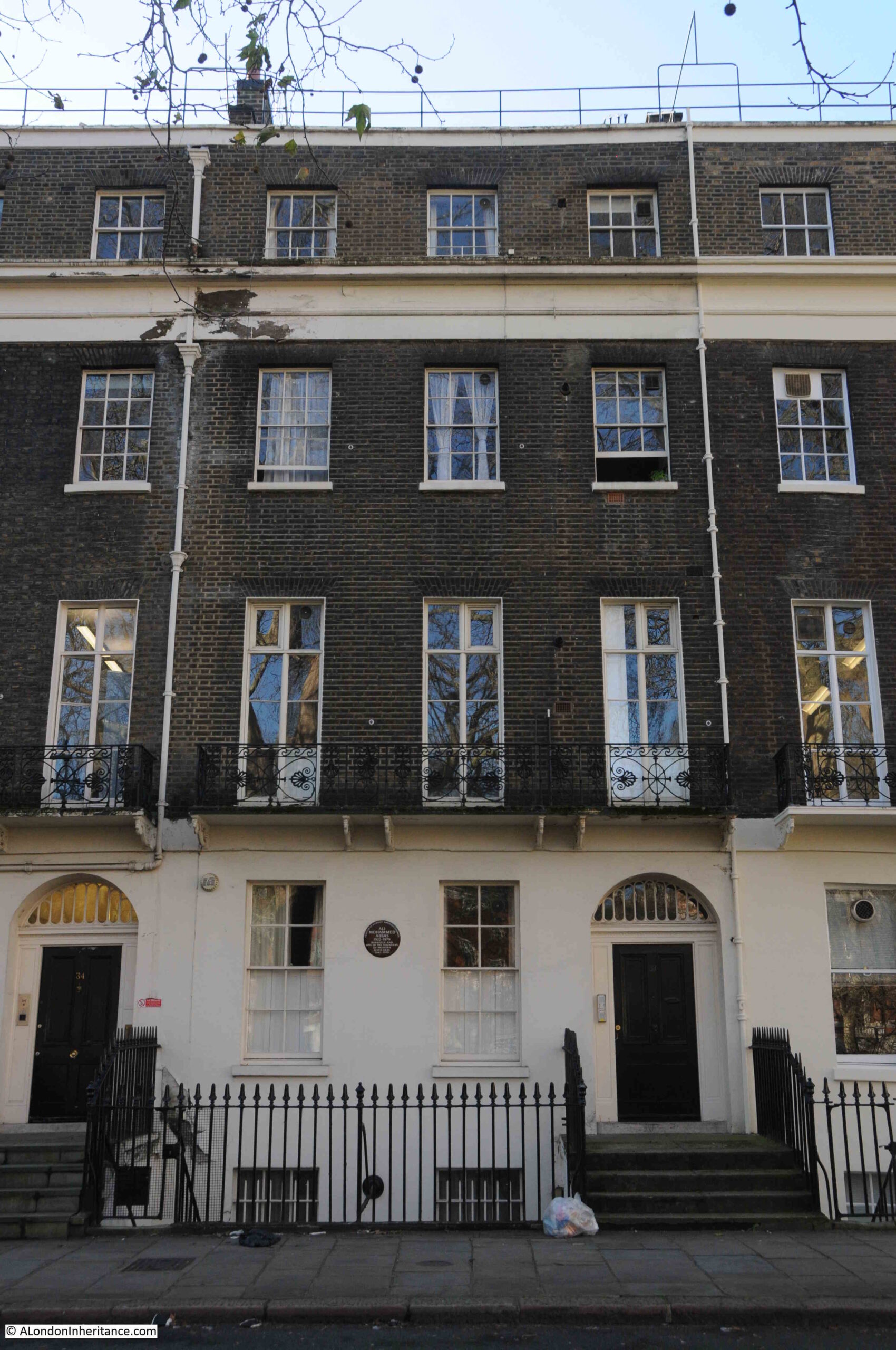
Along the terrace, at number 33, is a plaque between the two ground floor windows:
The plaque records that Ali Mohammed Abbas lived in a flat in the house between 1945 and 1979.
Abbas arrived in London from India in 1945 to study law and became a Barrister. Following the partition of India and the creation of Pakistan on the 14th of August 1947, Abbas used his flat as an unofficial Pakistan Embassy until the new country set up a full embassy in London.
After Pakistan became an independent country, Abbas remained in London and continued work as a barrister. He also helped set up twenty eight schools all over the country to help Pakistanis who had arrived in the country, speak, read and write in English.
The house in Tavistock Square was his home until his death in 1979.
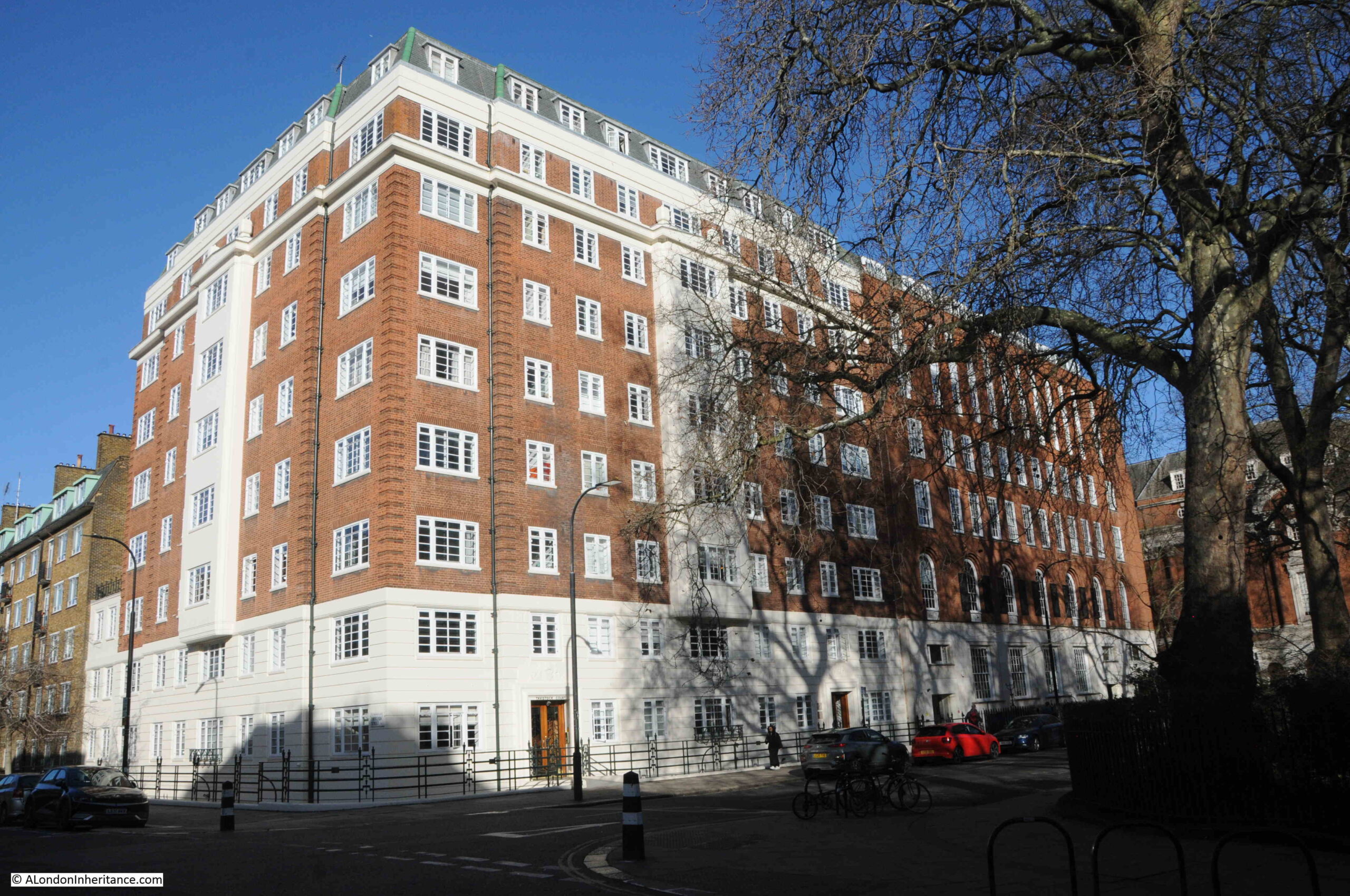
At the north western corner of the square is another red brick / Portland stone building – Tavistock Court:
Tavistock Court is an apartment block, built between 1934 and 1935. It did suffer some light damage during the war, but this was repaired, and the building today looks impressive in the sun, hopefully as the original architect intended.
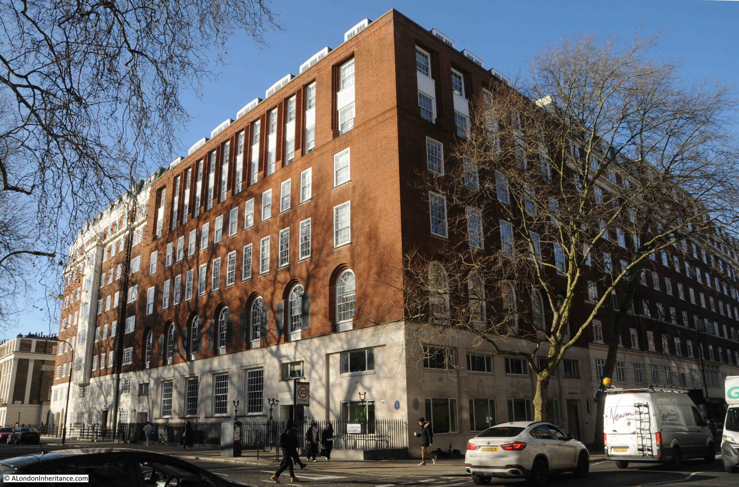
Next to Tavistock Court, along the north side of Tavistock Square is Woburn House:
This a post war building, due to bomb damage to the building originally on the site.
The building is owned by Universities UK, the organisation that represents 140 member universities across the UK, and is another example of the concentration of educational establishments across this part of Bloomsbury.
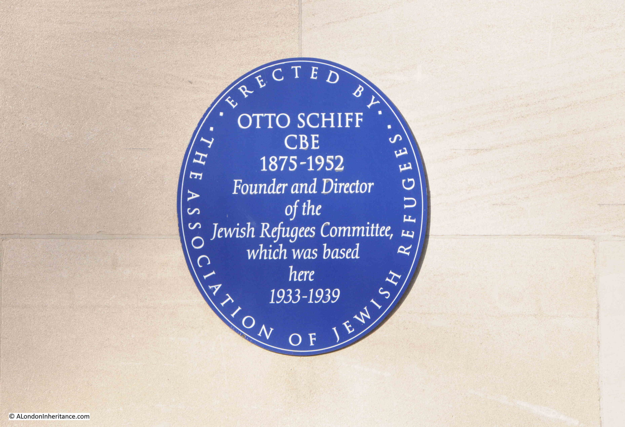
There are two plaques on the corner of the building which can just be seen in the above photo. The one on the left is to Otto Schiff, who was the founder and director of the Jewish Refugees Committee, which was based in a pre-war building on the site:
Otto Schiff and the Jewish Refugees Committee were responsible for persuading the Government to allow Jewish refugees to enter the country, and that they would be funded by Jewish organizations, charities and individuals. The committee also helped with the travel arrangements of transporting refugees from Germany to the UK, and their housing and general support after they had arrived.
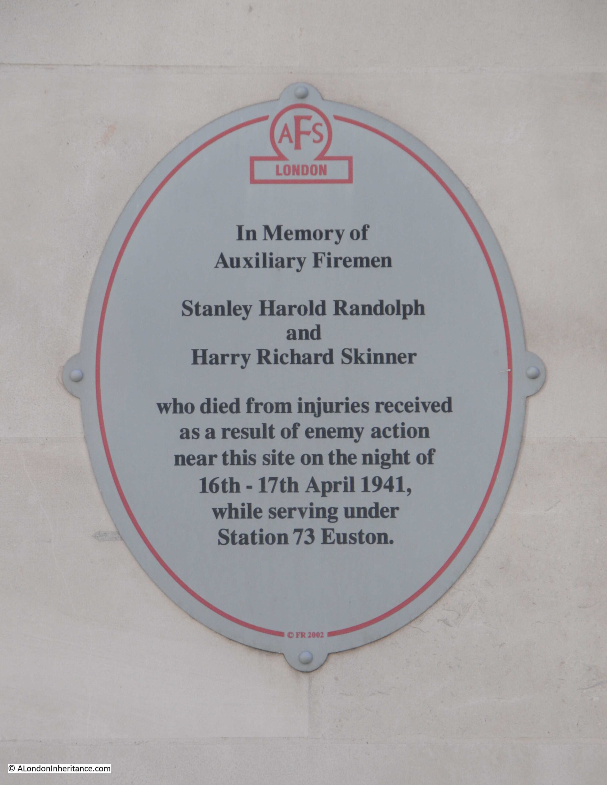
The plaque illustrates the dreadful impact on the Jewish population of Europe before and during the second World War, and the second plaque on the corner of the building illustrates another way the war impacted London:
There was a significant amount of bomb damage around Bloomsbury. Whether this was trying to target the railway stations along the Euston Road, or just the indiscriminate bombing of London, I do not know, but the plaque does provide a reminder of those in the fire service across the City.
The Auxiliary Fire Service was formed in January 1938 to provide a large uplift in the number of fire fighters to assist the full time fire service. Those who staffed the Auxiliary Fire Service were usually those who were too young or too old for service in the armed forces,
Although being an auxiliary force, they faced the same dangers as the main force, and Stanley and Harry were two of the 327 fire fighters who lost their lives across London during the war.
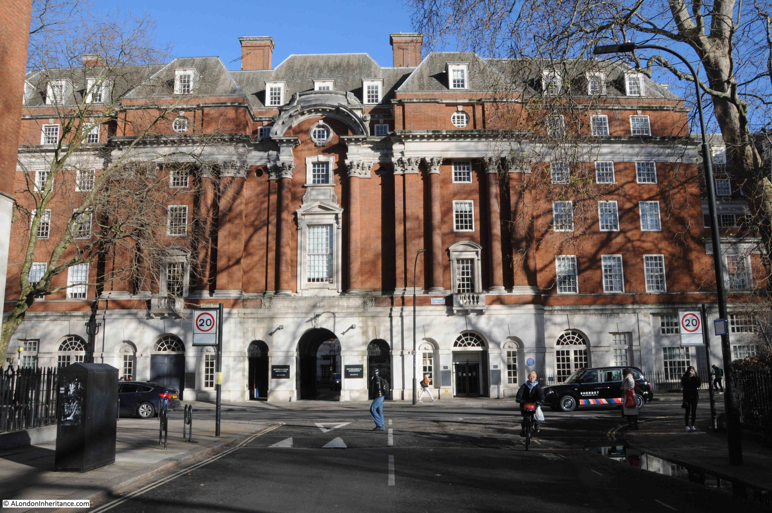
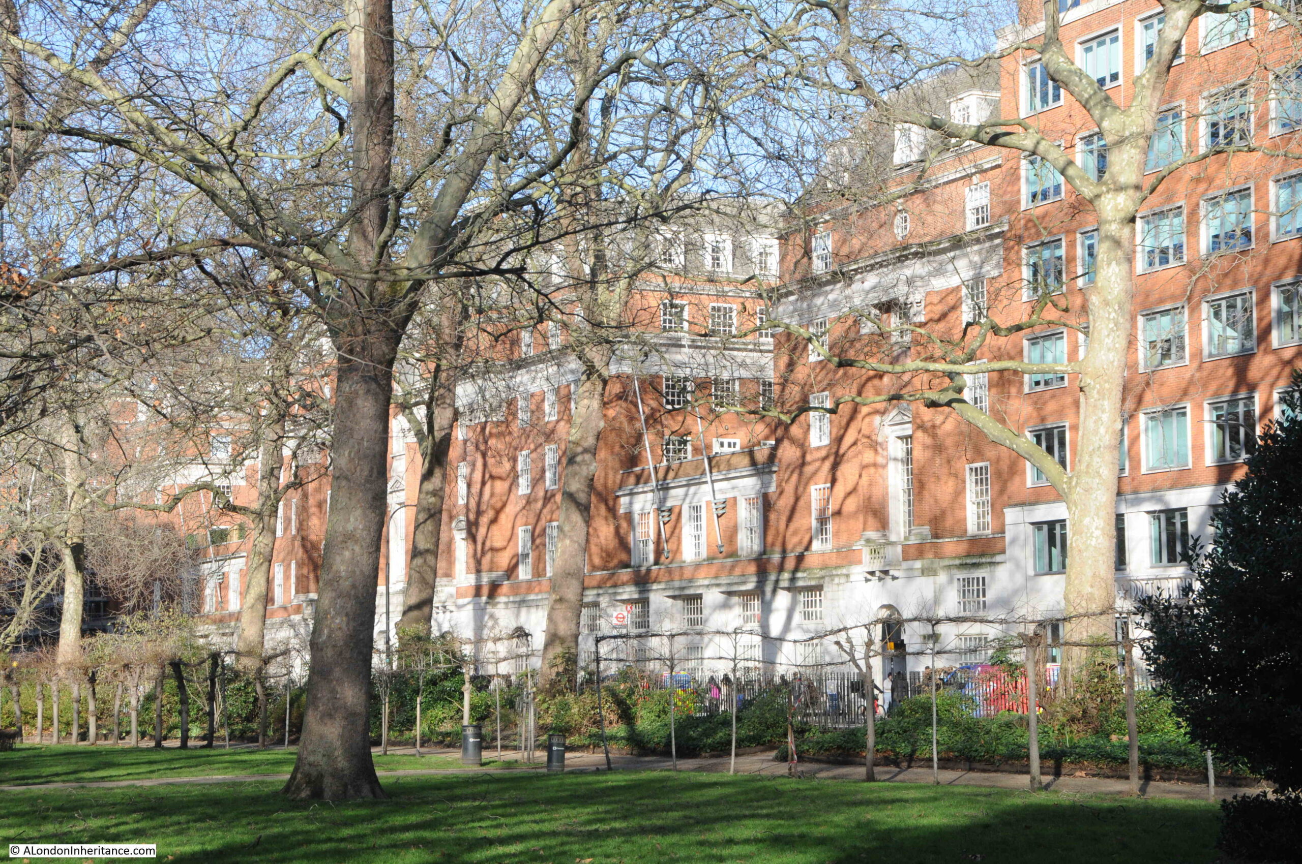
Standing next to Woburn House, and looking at the north east corner of Tavistock Square, we can see the northern part of the buildings of the British Medical Association:
The rest of the BMA building is shown in the following photo taken from the gardens at the centre of Tavistock Square:
BMA House is an impressive building, and the organisation have occupied the building since 1923 when they purchased the lease. The BMA had originally been based in the Strand.
BMA House was originally designed by Sir Edwin Lutyens for a very different organisation, the Theosophical Society, as the future site for their offices and temple. Construction started in 1913, however the First World War intervened and the parts of the building that had been completed were taken over by the Army Pay Office.
When the war ended, the Theosophical Society appears to have run out of funds to complete construction, and the site was taken over by the BMA. The Theosophical Society are still based in London, but at much smaller premises at 50 Gloucester Place.
Sir Edwin Lutyens was reemployed to complete parts of the building and the interior, and to finish the overall site, Cyril Wontner Smith completed the central entrance from Tavistock Square between 1928 and 1929, and Douglas Wood worked on extensions to the overall building between 1938 and 1960.
The building is Grade II listed.
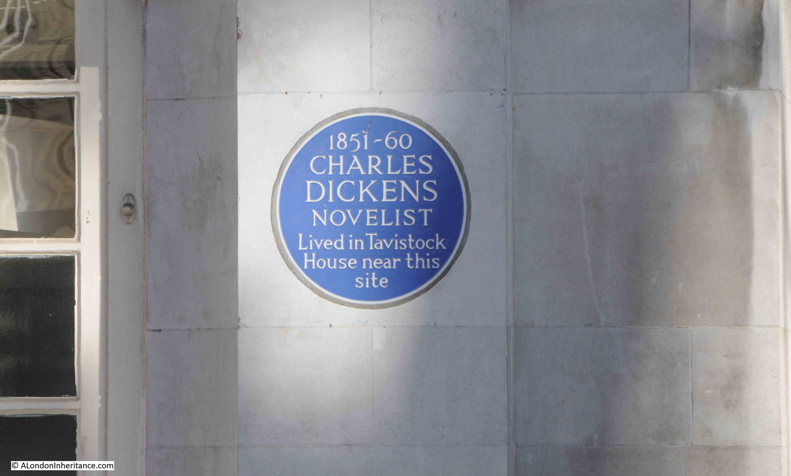
There is another plaque on the BMA building, recording that Charles Dickens lived in a house near the site of the plaque between 1851 and 1860, his last London home before moving to Gads Hill in Kent.:
So there is much to discover in Tavistock Square, where just over 220 years ago there were just fields.
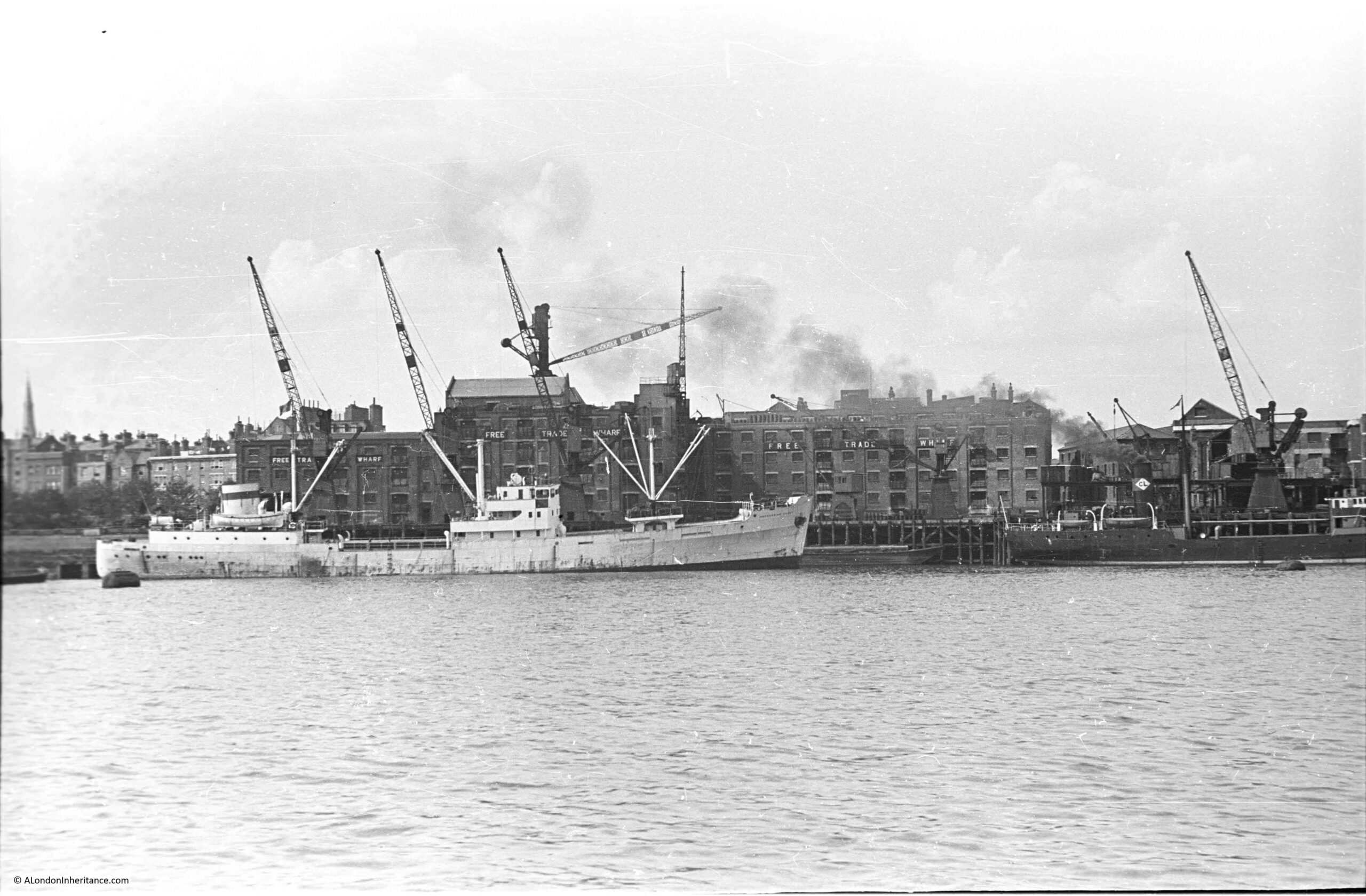
The following photo was taken by my father in August 1948, and shows the buildings of Free Trade Wharf in the old area of Ratcliffe:
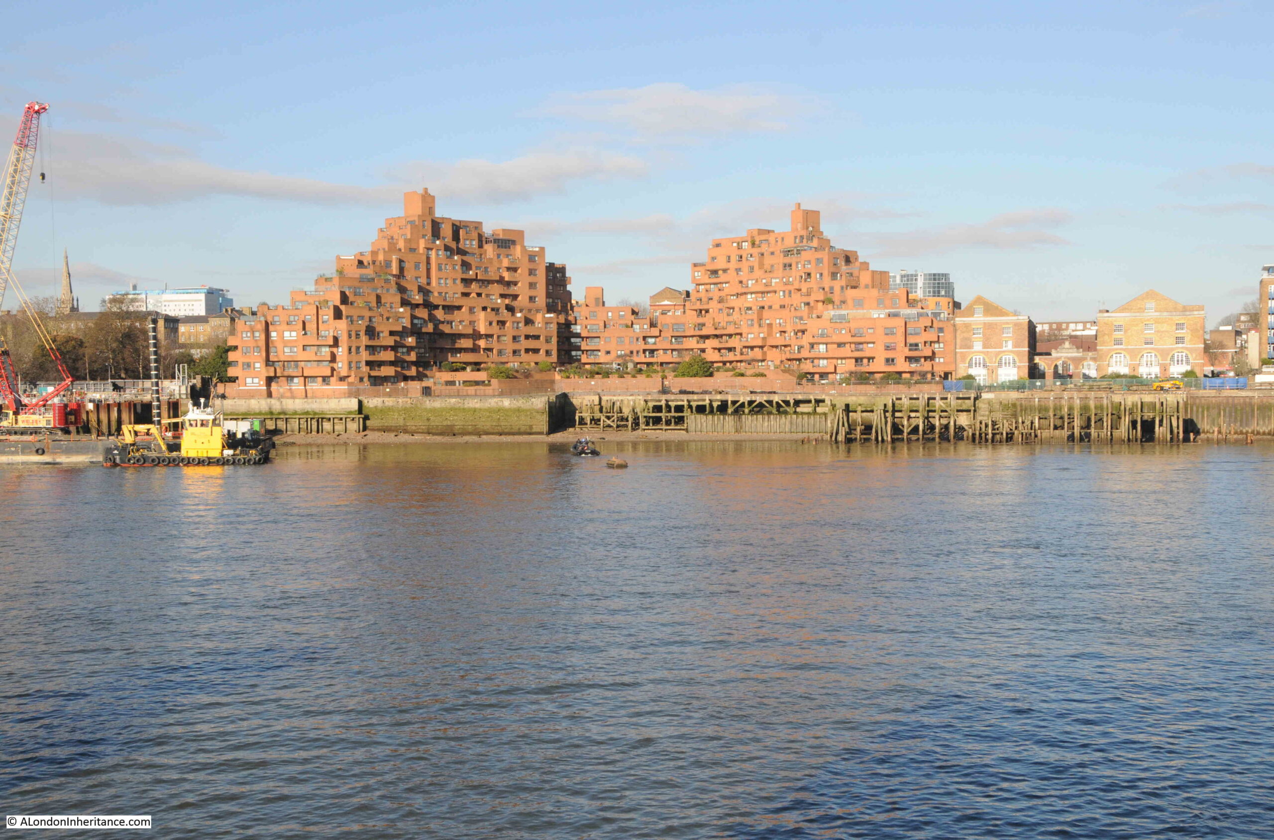
The same view, seventy six years later in 2024:
Despite the loss of the central Free Trade Wharf buildings, there are some features that can be found in both photos.
On the left of both photos, there are no buildings along the edge of the river, and trees can be seen in an open space leading back from the river. This is the King Edward VII memorial park.
Staying on the left of both photos, a church steeple can be seen in the background. This is St. Mary’s Cable Street.
The central part of the photo is very different. The Free Trade Wharf was purchased by the Inner London Education Authority in 1977 with the intention of building a campus for the City of London Polytechnic, which had been formed in 1970 with the consolidation of the City of London College, Sir John Cass College and the School of Navigation.
These plans did not follow through, and the site remained vacant until the early 1980s when the growing trend for the construction of residential properties along the banks of the Thames resulted in the purchase of the site for residential development, and the building on the site we see today was built.
It is one of the more distinctive residential buildings along the river, and was designed by the architects Holder Mathias Alcock, who are still practicing today, although the name Alcock has been dropped.
Their distinctive design has been described as being of “dramatic ziggurat-style terraces”, and also looking as if it could have been made out of Lego.
Faced by red brick, the building does look good in direct sunlight, and the from what I have read, one of the reasons for the shape of the building, where the sides step back towards the centre, was to maximise the number of apartments that had a river view, rather than being a flat building along the river.
This new development retains the name Free Trade Wharf, and looking at an extract of the 1948 photo, we can see this name was displayed in white lettering along the side of the building facing the river:
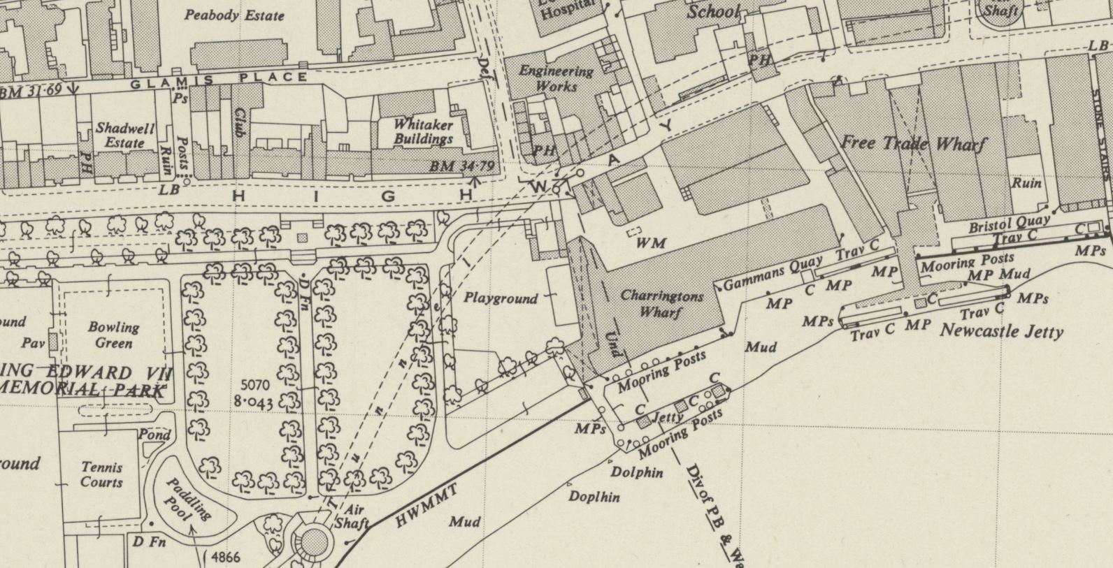
Although this very clear naming of the Free Trade Wharf did throw me into a momentary bit of doubt about whether I had identified the correct location for the photo, as in the OS map, published a couple of years after my father’s photo, the building is marked as Charringtons Wharf, as can be seen in the following map, along the river and to the right of the park (‘Reproduced with the permission of the National Library of Scotland“):
To confirm, I checked in the book “London Wharves and Docks”, published by Commercial Motor in 1953, and the entry for Charringtons Wharf included a reference that “Occupier: Free Trade Wharf Co. Ltd”.
The Charringtons name came from the ownership of the site by Charrington, Sells, Dale and Company, who traded in coal and coke. I cannot find exactly when this part of the site became known as Free Trade Wharf, however as you can see from the above map extract, this name was also in use for the buildings to the right, which are on the right of my father’s photo, but hidden behind the cranes, and the black coloured ship on the right.
The Commercial Motor book provides some detail on trade at the wharf in 1953:
“Facilities: a. General, b. Rubber, matches, canned goods. Maximum cranage (cwt) 45, Storage space (cubic feet, covered); 869,450, Storage Space (cubic feet, uncovered): 5,000.
Customs facilities included Sufferance Wharf, Dry Bond, Captain’s Imperfect Entry (a Sufferance Wharf is a licensed private wharf where goods can be kept until the duty is paid. A Dry Bond is where goods can be stored before customs duty is paid. Dry refers to the type,, so dry goods unlike wet goods such as alcohol. Captain’s Imperfect Entry is a strange one. Captain’s Entry is where the Captain of a ship has provided the details of the goods he wants to unload to the warehouse, but I am not sure what Imperfect refers to).
The wharf had a jetty and a quay, with 250 feet being the maximum length of ships accommodated at the jetty and 210 feet at the quay. and the depth of water went from 24 feet at high water down to 2 feet at the jetty, and from 19 feet to drying out at the quay. “
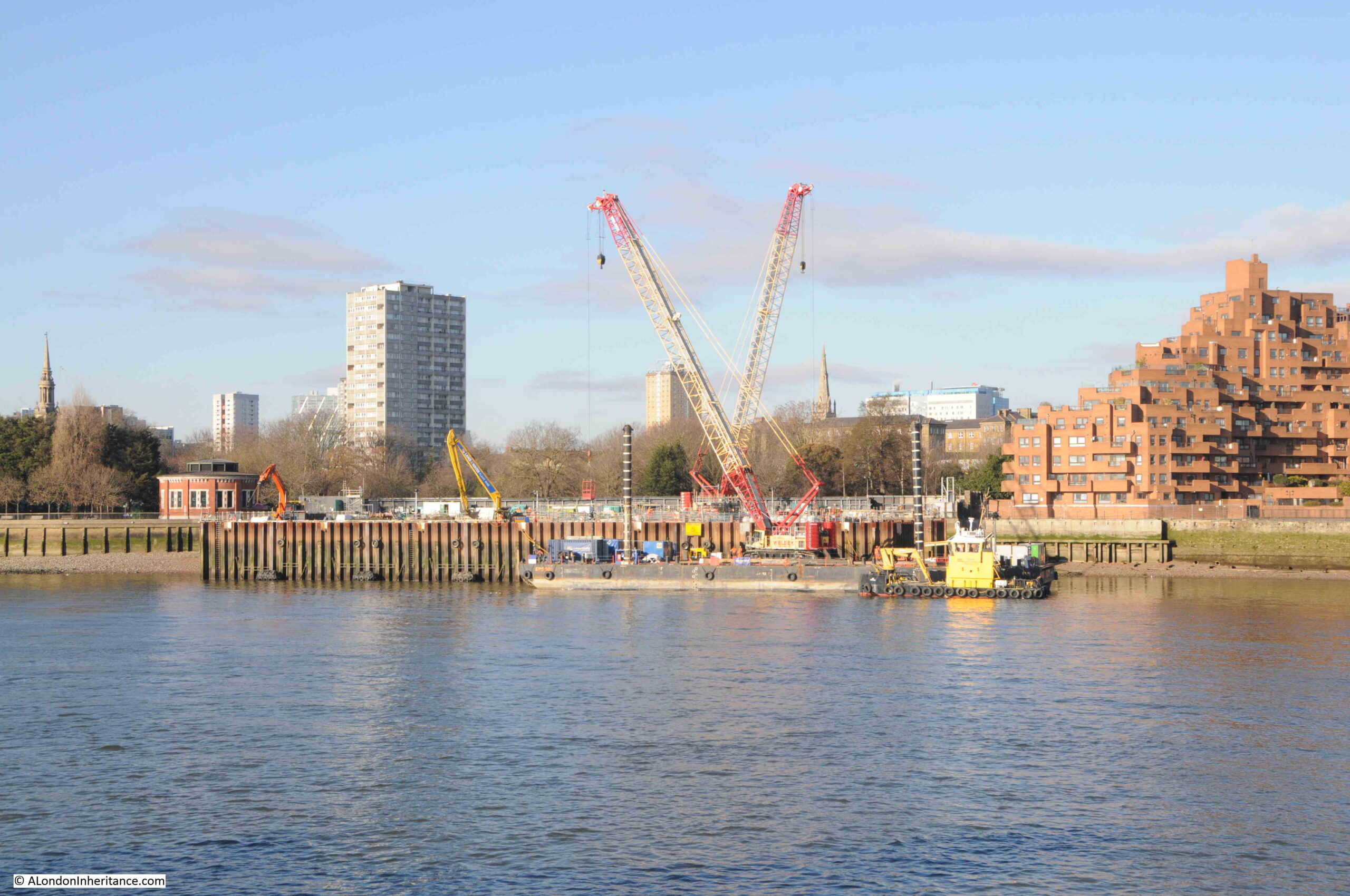
Just to the left of the site today, is one of the construction locations for the Thames Tideway Tunnel:
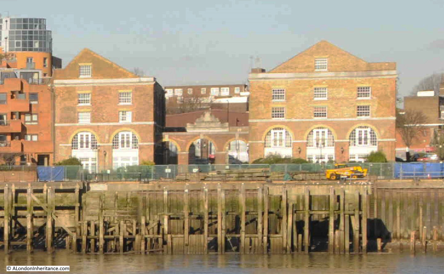
The OS map shows the buildings to the right of my father’s photo, labelled as Free Trade Wharf. These buildings are much earlier than the main block, but are hidden behind the ship and cranes in my father’s photo.
An extract from this photo showing the dark coloured ship, with part of these buildings just visible in the background:
The buildings, the ones labelled as Free Trade Wharf in the OS map as can be seen in 2024:
These buildings are Grade II listed and they date from 1796, although there have been many alterations over the years.
They were built for the East India Company, and handled a variety of goods, including saltpeter, which was used in the manufacture of gun power.
The site later became a place where colliers from the coal fields in the north east of the country would unload, and is presumably where the Charringtons connection comes from.
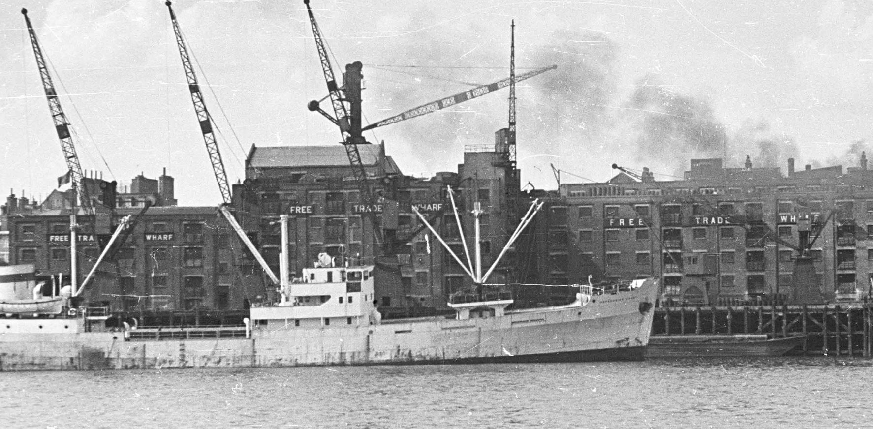
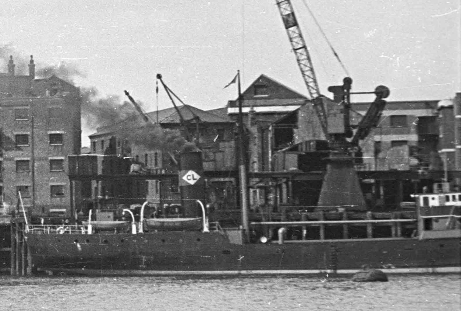
There are two ships in the 1948 photo. the ship on the left has no visible feature to help with identification. I use a high resolution scan for my father’s photos, and despite this, I cannot read the name of the ship on the bow.
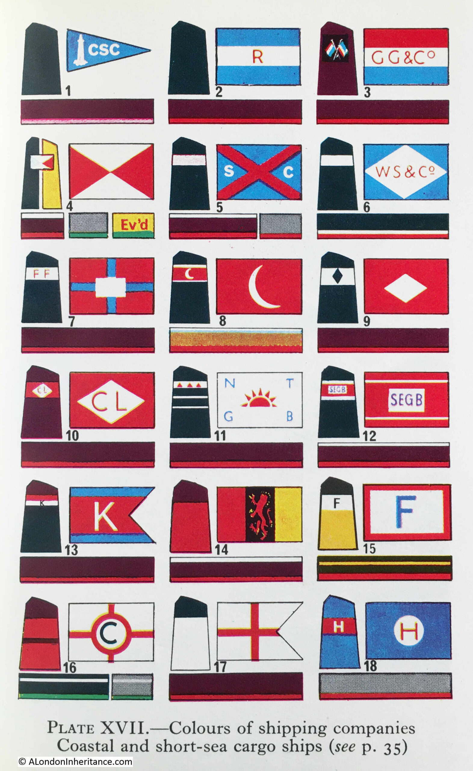
The ship on the right has no visible name, presumably it is on the bow and only the rear section of the ship is visible in the photo. What can be seen is the funnel, and this has the letters CL in a white diamond.
Ships with the identifier of the owning / operating company were once a frequent sight on the Thames, and as kids in the late 1960s / early 1970s, we would often go down to the Thames by Coal House Fort, through East Tilbury (which always fascinated with its village and Bata shoe factory in this isolated part of Essex).
I had the Observer’s Book of Ships and used this to check of the passing ships. I still have the book and checked it to see if the CL in a white diamond is listed, and fourth down, on the left column, I found it:
Turning to page 35, and CL is for Comben Longstaff & Co. Ltd of London, and who were listed as Colliers.
The company was named after William Comben Longstaff, who was born in Lambeth in 1896.
Comden Langstaff & Co. Ltd was originally involved in a range of maritime services including insurance, owning, managing and operating a fleet of ships that delivered raw materials and goods to the ports around the coast of the UK.
Newspapers of the time have many references to the purchase of new ships, sale of older ships, trade, routes etc. and the company seems to have been reasonably active.
The majority of their ships seem to have been built by John Lewis of Aberdeen, and the following article from the Aberdeen Press and Journal on the 9th of June 1948 is typical of the company’s coverage in the press:
“STEAM COASTER LAUNCHED – I have great faith in this country, but its only salvation is hard work, said Mr. Comben Longstaff at a gathering after the launching yesterday of the steam coaster Lancasterbrook, built by Messrs John Lewis and Sons Ltd, Aberdeen, for his firm, Messrs Comben Longstaff and Co. Ltd, London.
Mr. Andrew H.S. Lewis said the Lancasterbrook was a sister ship of the Londonbrook, built by his firm two years ago. She was an oil burner and was fitted with patent steel hatch covers.
They were building two other ships for the same owners.
Mrs. Comben Longstaff named the vessel which is 200ft in length and is of the raised quarterdeck type. The rudder is semi-balanced and streamlined and was made to the owners’ own design.”
The article mentions the Londonbrook, which had been built by the firm two years earlier, so presumably in 1946, and from checking photos of the Comben Longstaff ships, I believe the ship to the right of my father’s photo is the Londonbrook.
The company was sold in 1954, and William Comben Longstaff died in 1966.
Their ships continued operating around the coast of the country and in the late 1970s, two new ships were built, the Durhambrook and Devonbrook, continuing the Comben Longstaff tradition of adding “brook” to the end of their ship names.
The company ended operations in 1981, and all the ships were sold.
Both the Free Trade Wharf and the ships that docked at the wharf are from a time when you could sit on the river wall at Tilbury on a summer’s evening, and watch the ships passing along the river, checking them off in your Observer’s book.