Monthly Archives: June 2022

Pleasure Boats on the Thames

This photo was taken by my father in 1951, from one of the bridges over the Thames (no idea which one), and shows one of the pleasure boats that have been a feature of London’s river for many years.

Pleasure boats on the Thames

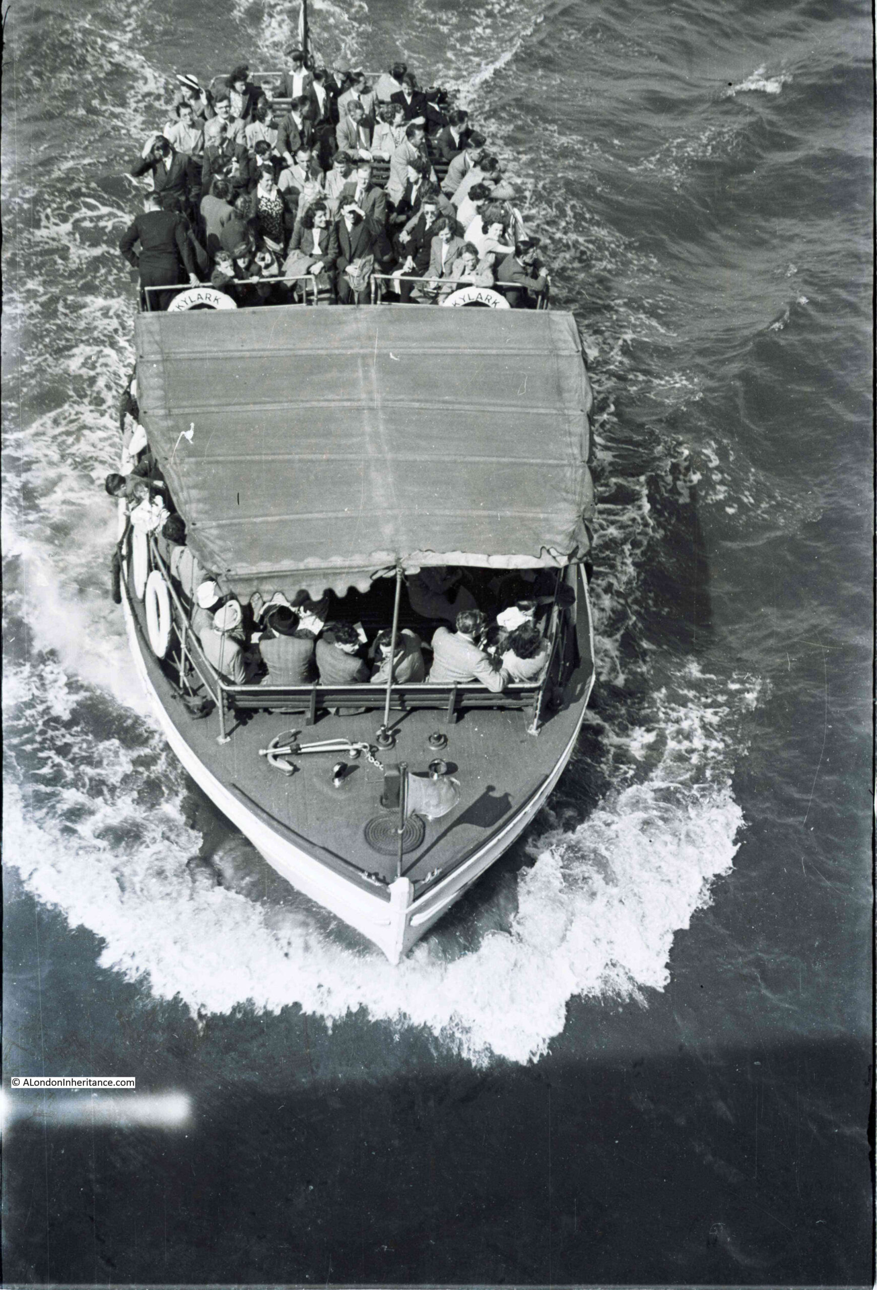
It was the only photo featuring the Thames on the strip of negatives, so I suspect he was walking over the bridge, saw the boat about to pass under the bridge, and quickly took the photo.

It is one of those photos that probably seemed of not much importance at the time. A scene that was, and continues to be, very common on the river, but 71 years later it is a snapshot of a group of people travelling along the River Thames.

The boat was called the Skylark. I cannot find any details about the boat, however the year was 1951 and I vaguely remember reading somewhere that the Skylark was one of the boats that served the Festival of Britain site on the Southbank, taking people to and from the pleasure gardens at Battersea. I have checked the indexes in my books on the Festival, but cannot find a reference to the Skylark so it may be my memory playing tricks – a lesson to keep better notes.

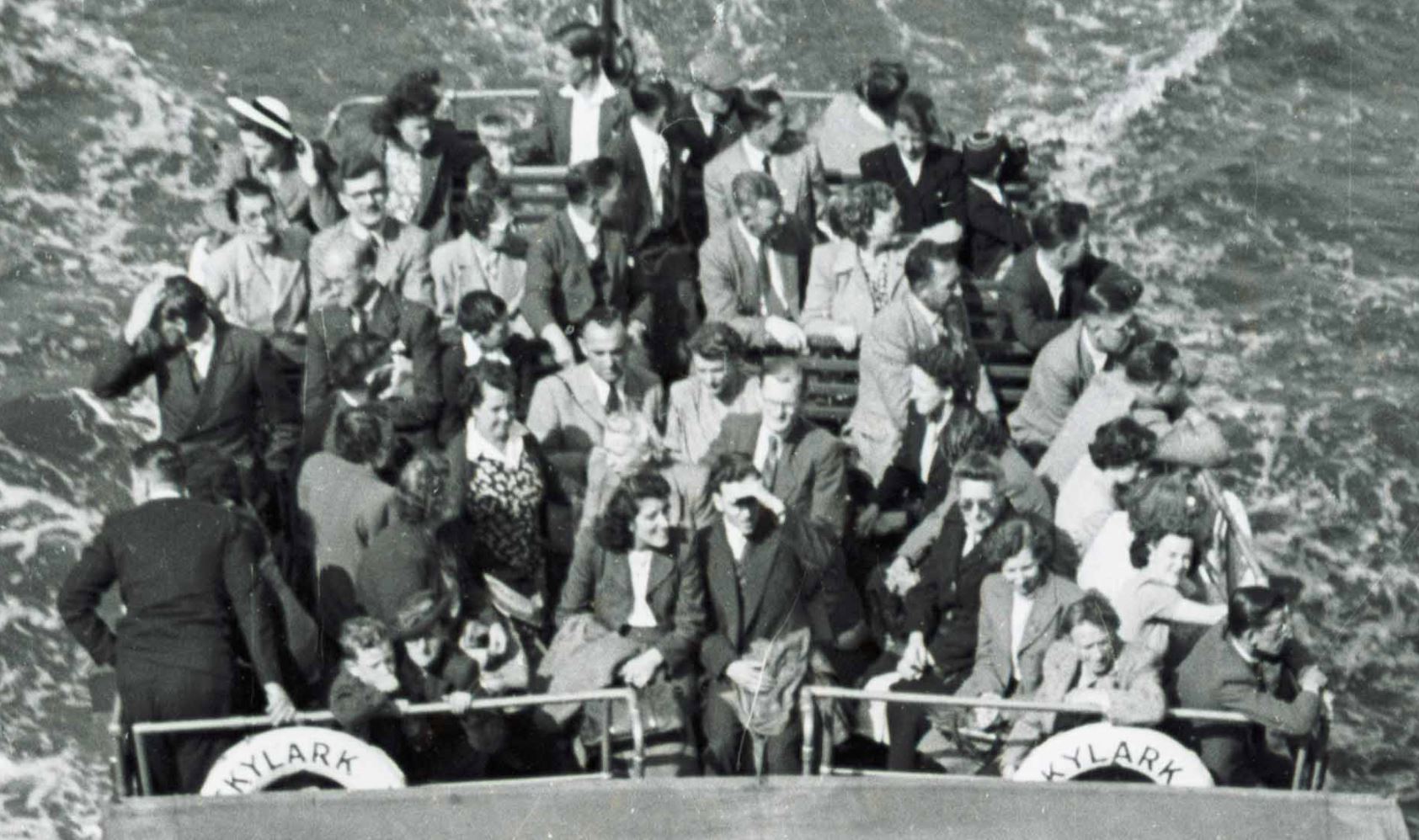
The following extract from the photo shows the people on the rear deck. Mainly adults, a couple of children, and all rather formerly dressed for a trip on the river:

Pleasure boats on the Thames

Pleasure boats have been a feature of the Thames since the 19th century, when newspapers were full of adverts for pleasure trips on the river. The majority of these seemed to be a trip to somewhere, rather than a trip along the river with no stopping point, apart from a final return to the point of departure.

For example, in 1899, a return trip in the “magnificent new steamers Boadicea or Cleopatra” from Westminster to Gravesend to see the gardens could be had for one shilling and six pence.

The number of ships on the river did cause passengers some concern. A letter writer to the London Evening Standard complained of two steamers appearing to race each other on the river, and one almost crashing into his boat in attempt to overtake. He finishes off his letter with “I for one, will never again take a pleasure trip on the Thames”.

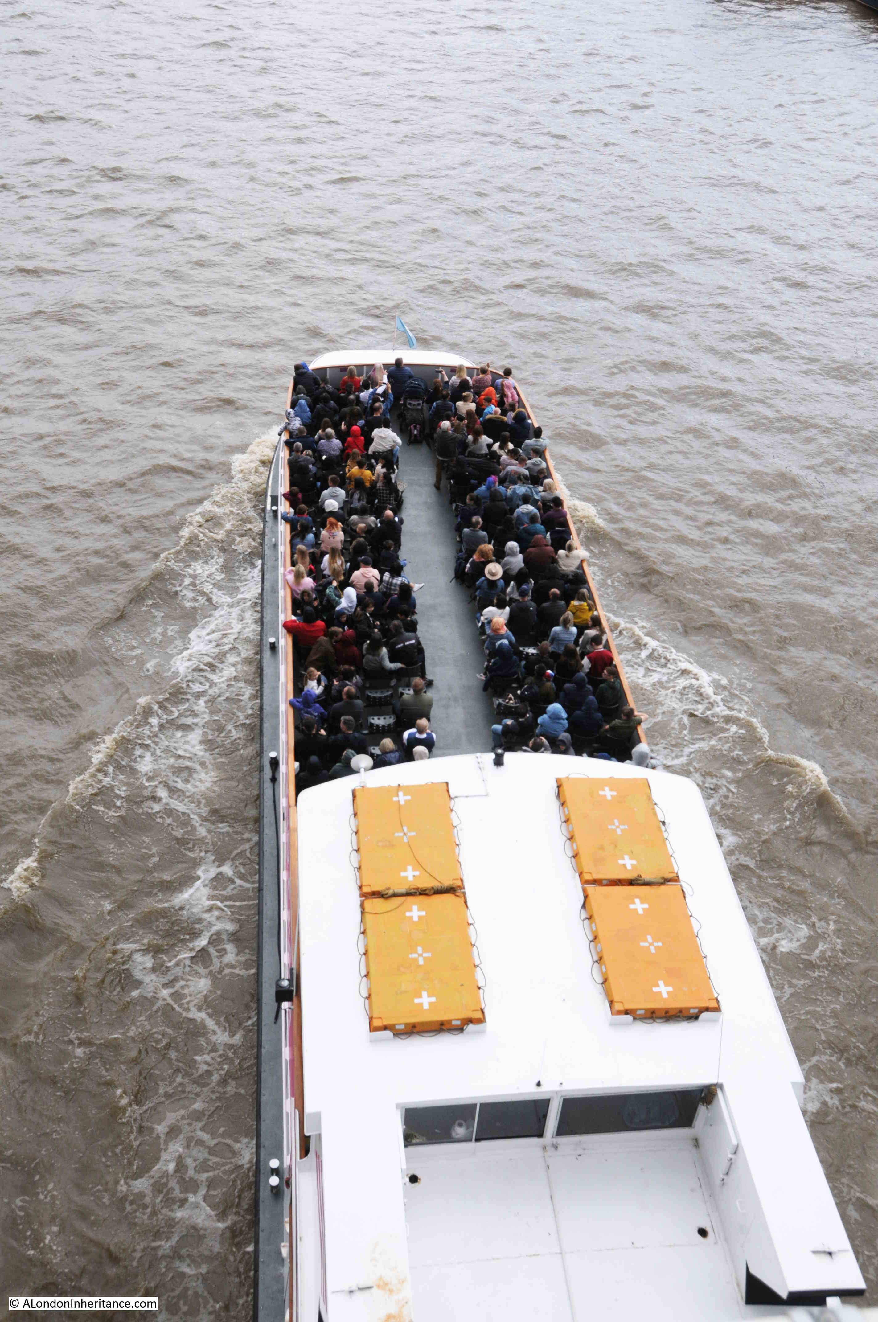
The river is much quieter today, but with the return of tourism to London, the pleasure boats are again filling up and can be seen taking passengers on tours up and down the river.

This was my attempt to emulate my father’s photo:

Pleasure boats on the Thames

This is the view from Waterloo Bridge showing one of the mooring places for pleasure boats:

Pleasure boats on the Thames

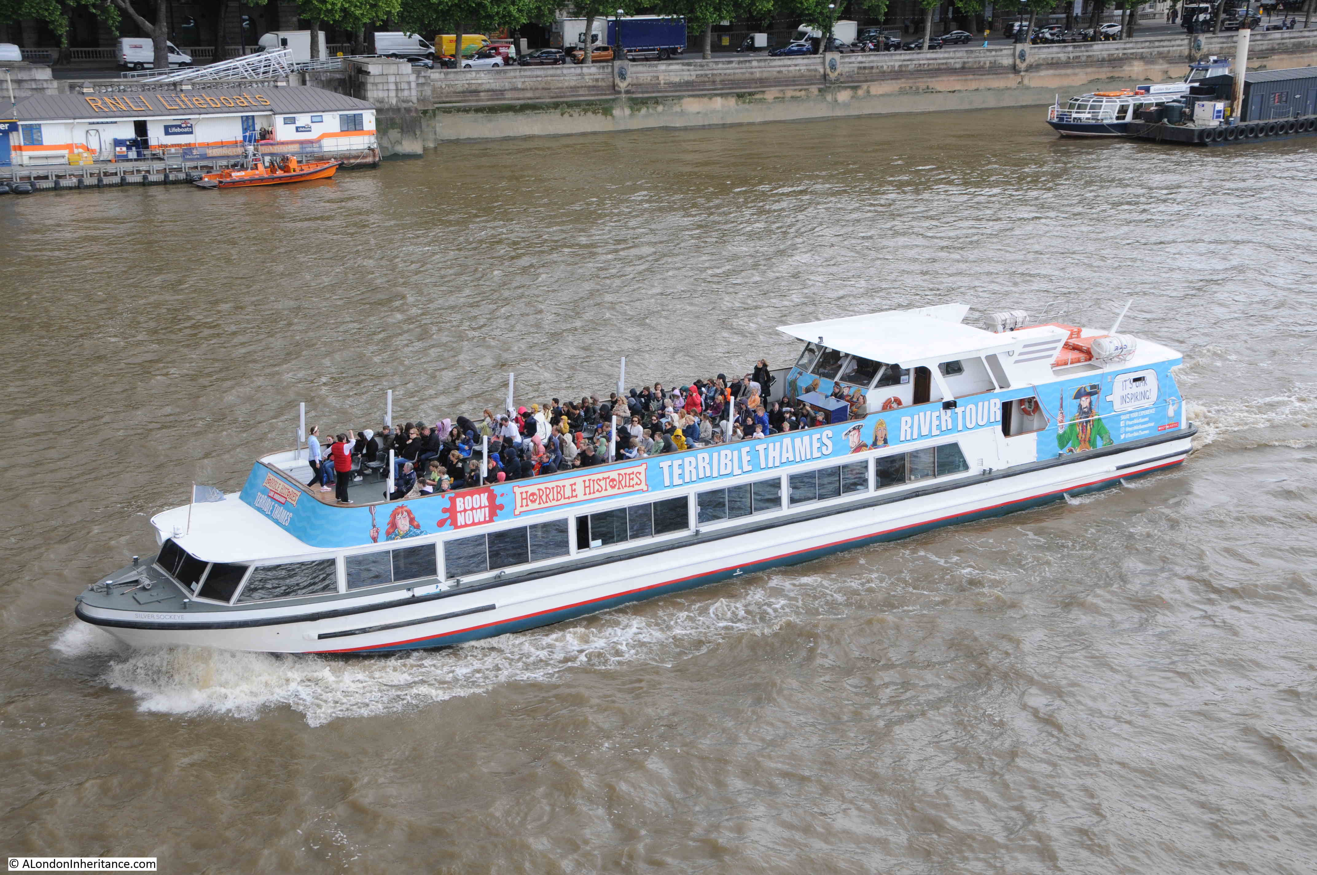
As well as general tours, you can take a Horrible Histories themed tour telling the story of the Terrible Thames:

Pleasure boats on the Thames

A full City Cruises boat with one of the smaller Thames Clippers on the left:

Pleasure boats on the Thames

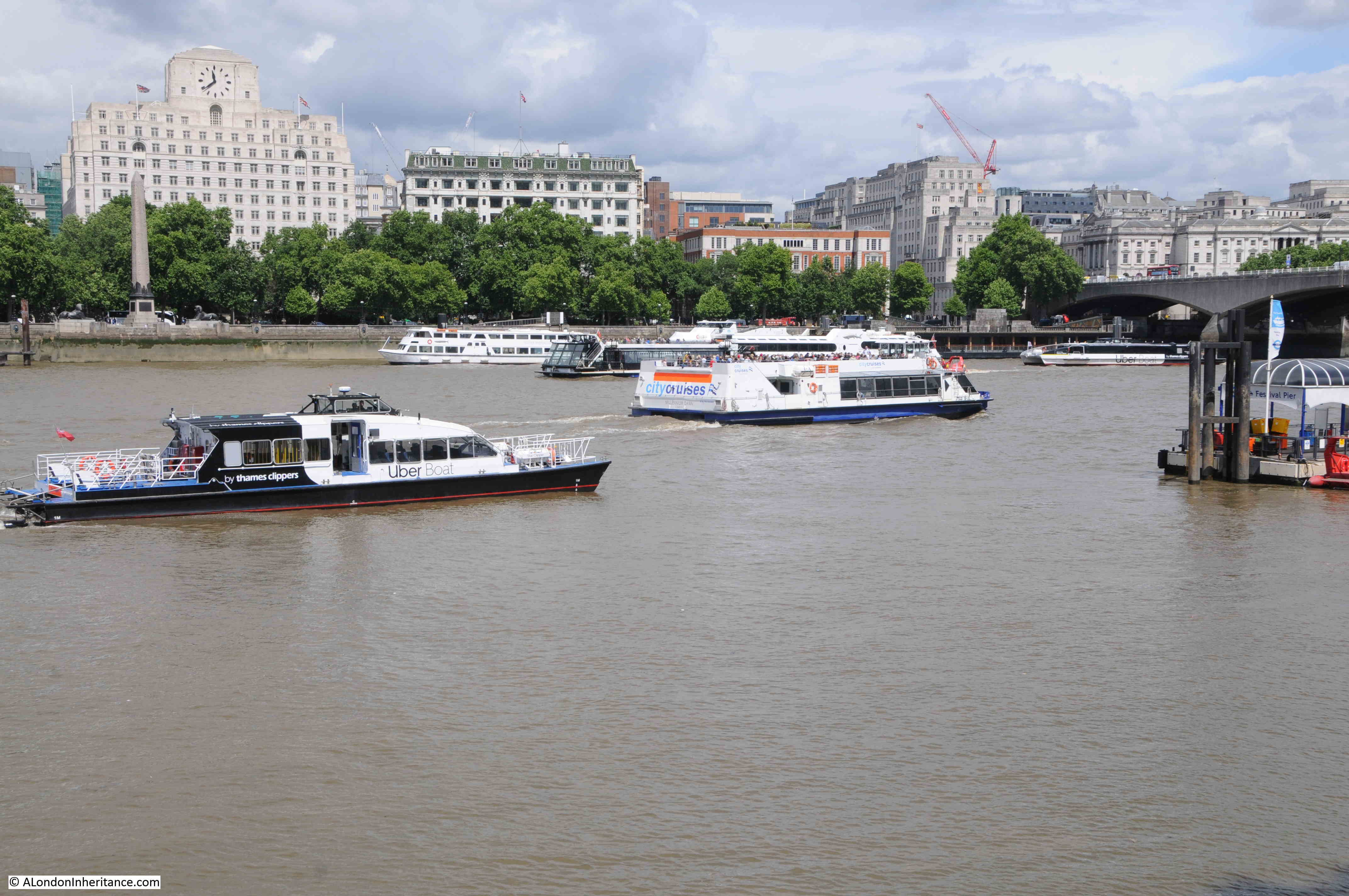
The small Thames Clipper boat seems to have a specialised role to shuttle passengers from the cruise ships that moor alongside HMS Belfast, across the river to Tower Stairs.

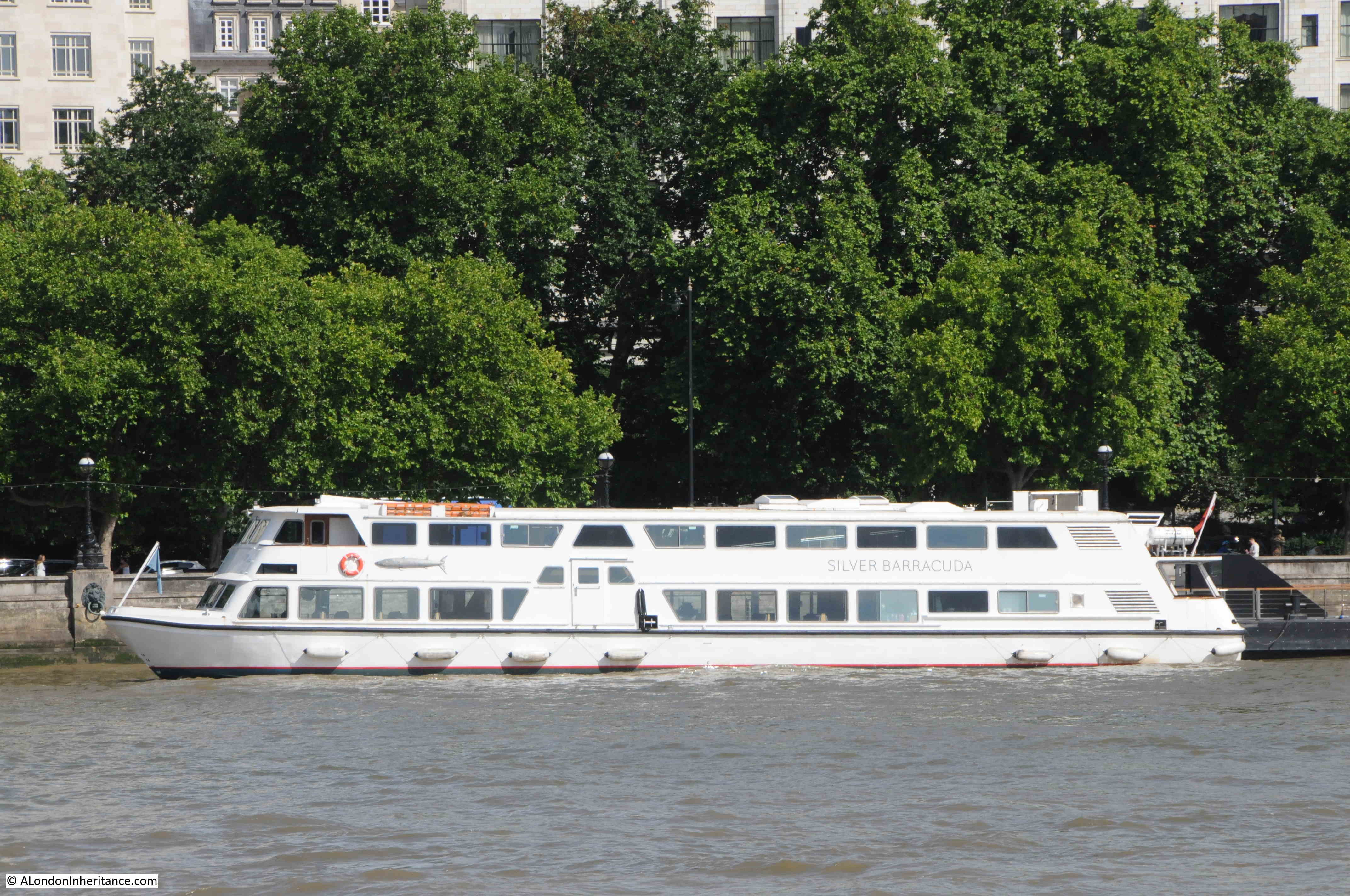
The Silver Barracuda, one of the Woods Silver Fleet, owned by a family who have been Thames Watermen for over 150 years:

Pleasure boats on the Thames

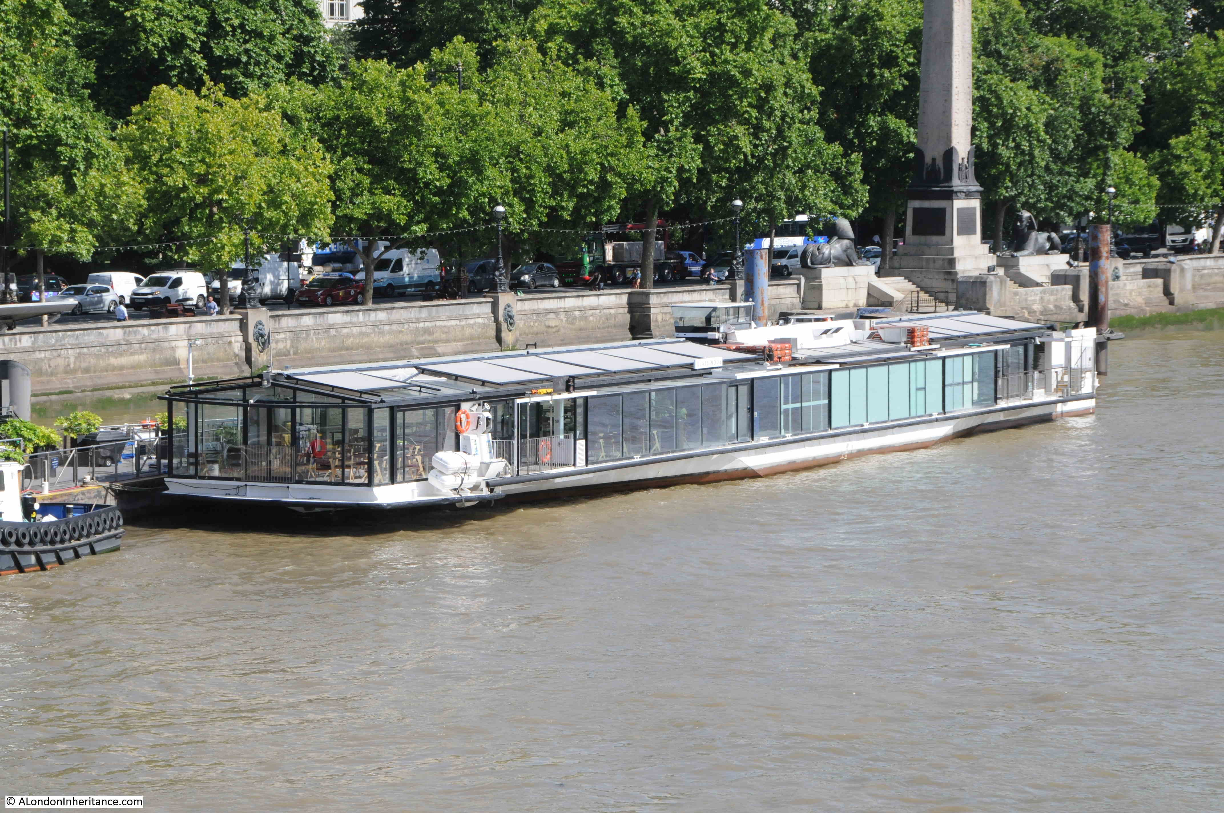
One of the dining boats that cruise up and down the river:

Pleasure boats on the Thames

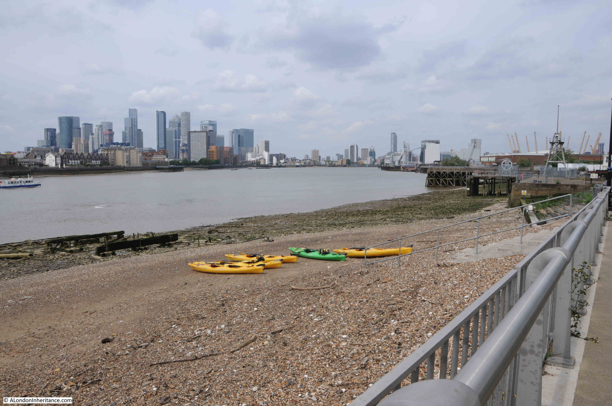
With the closure of the London docks, traffic on the river significantly declined with the late 1970s and early 1980s being a period where it was so sad to see the quiet river.

The river has though, long been a way to travel across London – a liquid Central Line.

Going back centuries, it was often the fastest and safest method of travel, with watermen being the taxis of the day, rowing passengers between the numerous Thames stairs. Although they did have frequent accidents, and negotiating a fixed price was often a challenge until the gradual regulation of watermen services on the river helped to clamp down on poor practices.

Today, the ferry services once provided by a waterman rowing you along the Thames has been replaced by the Uber Boats run by Thames Clippers:

Uber Boat

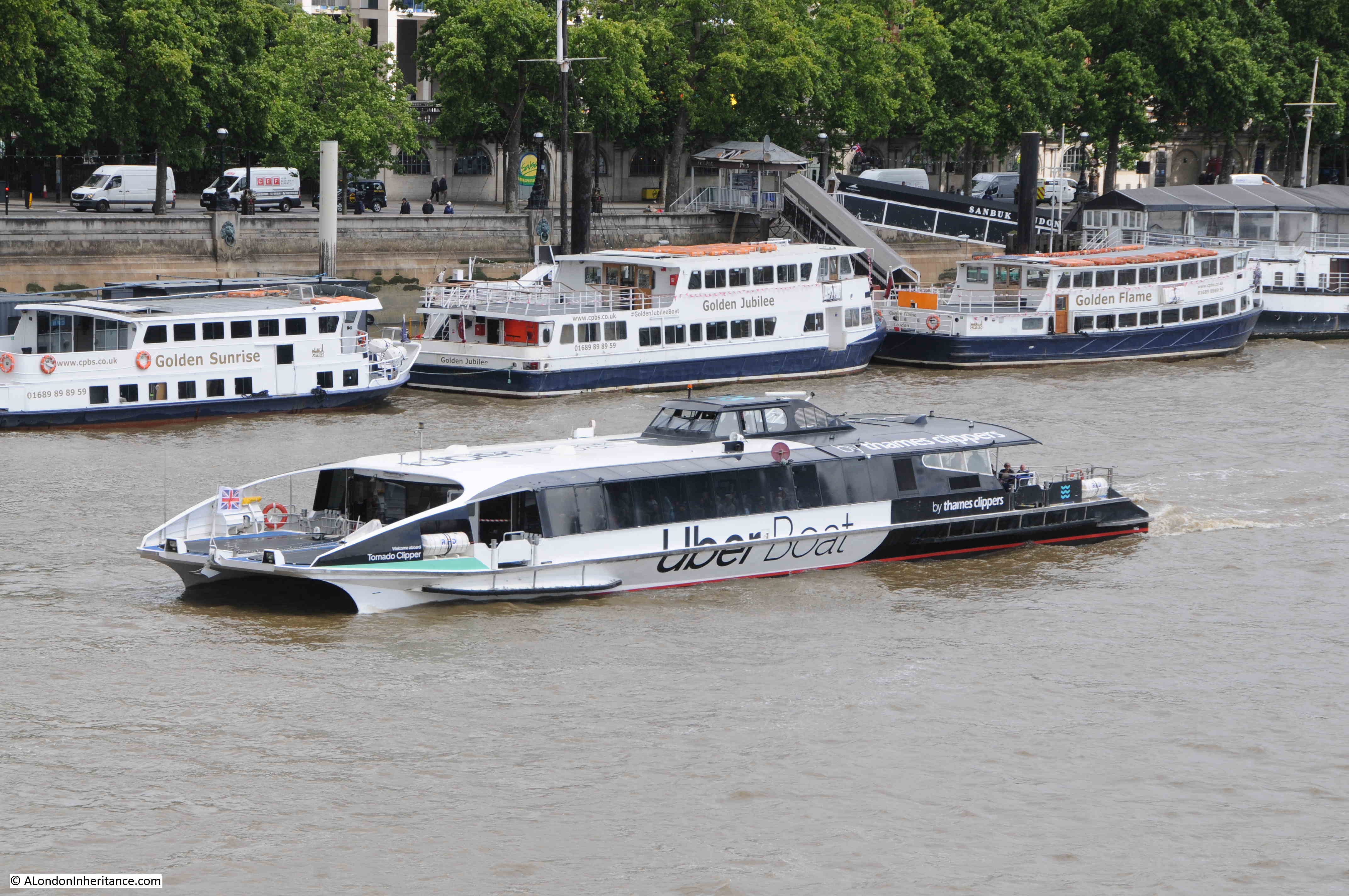
The Thames Clippers have been a 21st Century success story along the Thames. Since starting with a single boat in 1999, the company now has around 20 boats serving passengers on the Thames. The majority were made in Australia, however three, Jupiter, Mercury and Venus, were built on the Isle of Wight.

Each of the boats has their own unique flash of colour on the side of the bow (front) of the boat. In the above photo, the colour is (I think), mint, which identifies the boat as the Tornado Clipper (helpfully the name is also above the flash of colour, however the colour helps with identification at a distance).
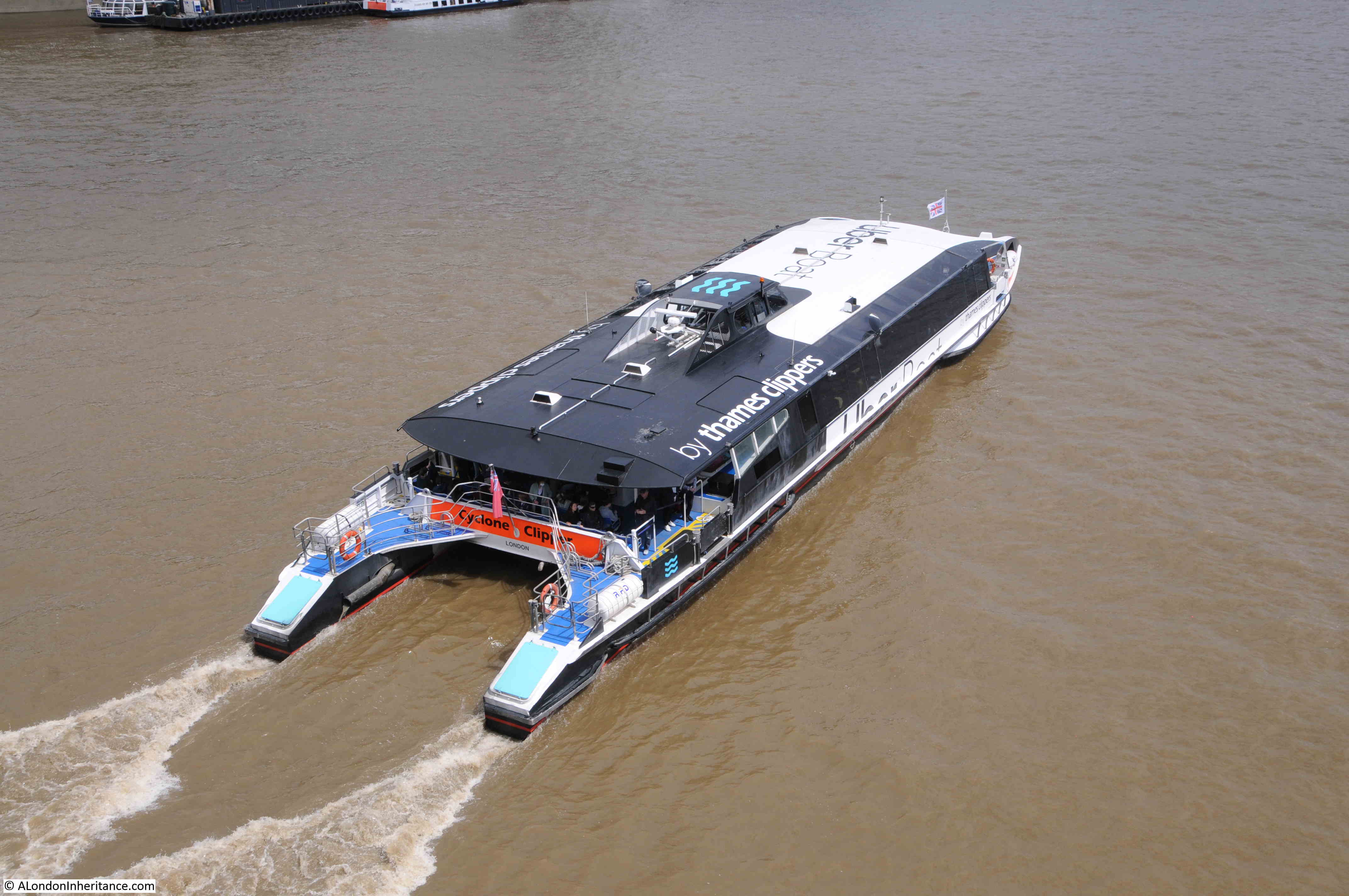
Cyclone Clipper:

Thames Clippers

The Thames Clippers are the latest in a series of post-war attempts at running passenger services on the river. Some more successful than others.

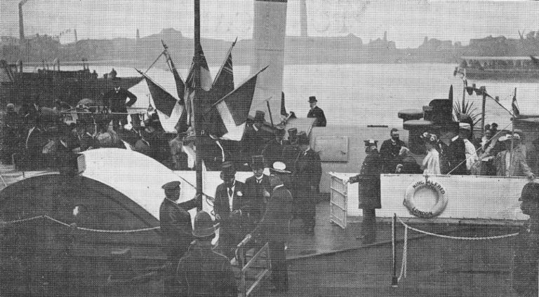
Starting in 1905, the London County Council launched a number of steam-boat ferries along the Thames, with 30 boats at the peak of services. The following photo shows the “Opening of the L.C.C Steamboat Service by H.R.H The Prince of Wales”.

Thames ferries

The post-war reduction in the population of east London, along with the closure of industry and docks along the river reduced the need for a ferry service, however there were a number of attempts at launching ferry services.

1968 saw a Hovercraft service along the river. The first hydrofoil, Shearwater 5 started passenger services in 1969. In 1988 Thamesline offered a service between the developing docklands and the City and a limited River Bus service was launched in 1989.

The launch of the Thames Clippers in 1999 came at a time when the redevelopment of the docklands resulted in increasing populations of residents and office workers, as well as significant increases in tourist numbers. investment by the company that owned the O2 also helped with the growth of the Thames Clipper services that we see today.

In 2019, the last year before Covid, Thames Clippers carried a total of 4.3 million passengers.

An addition to the Thames over recent years has been the ribs that offer visitors a high speed trip down the river to the east of Tower Bridge. Yellow ribs:

Thames Rib Experience

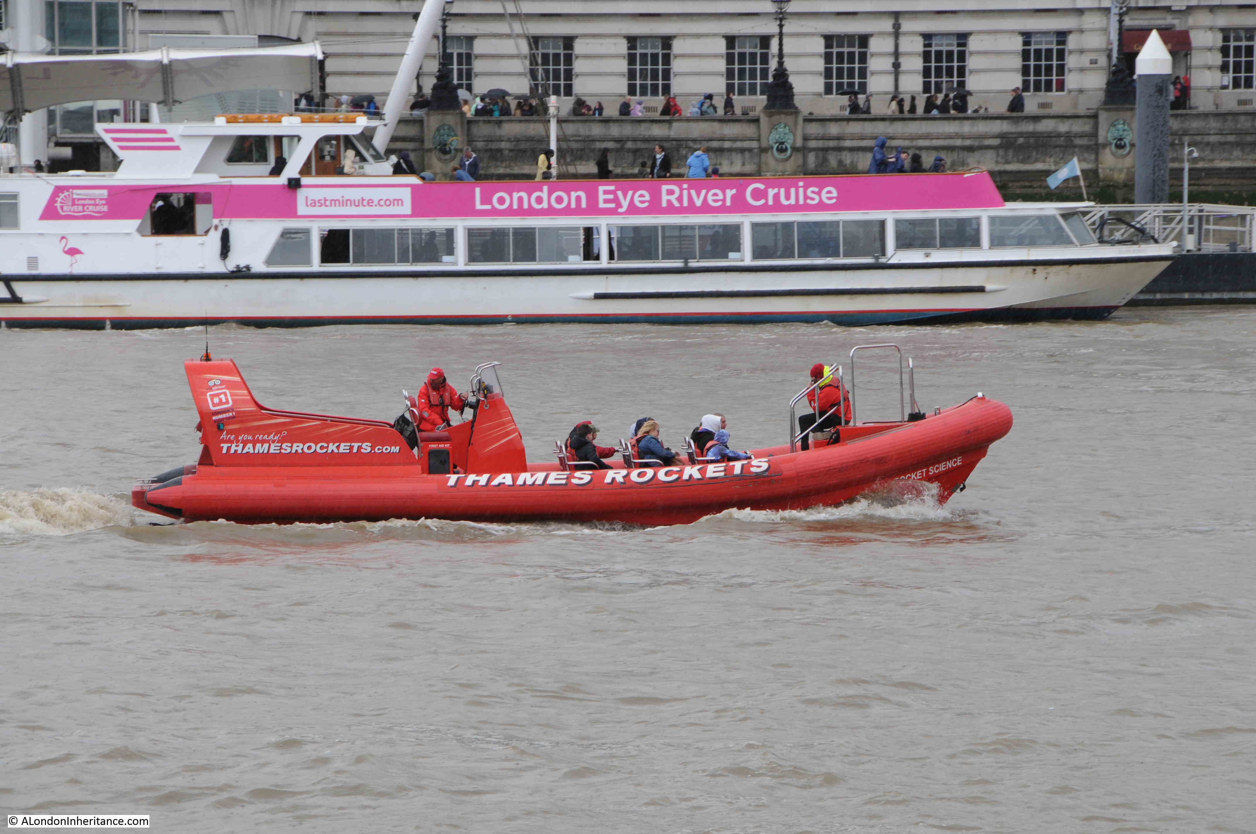
And red ribs, with a London Eye River cruise moored at the London Eye pier in the background:

Thames Rockets

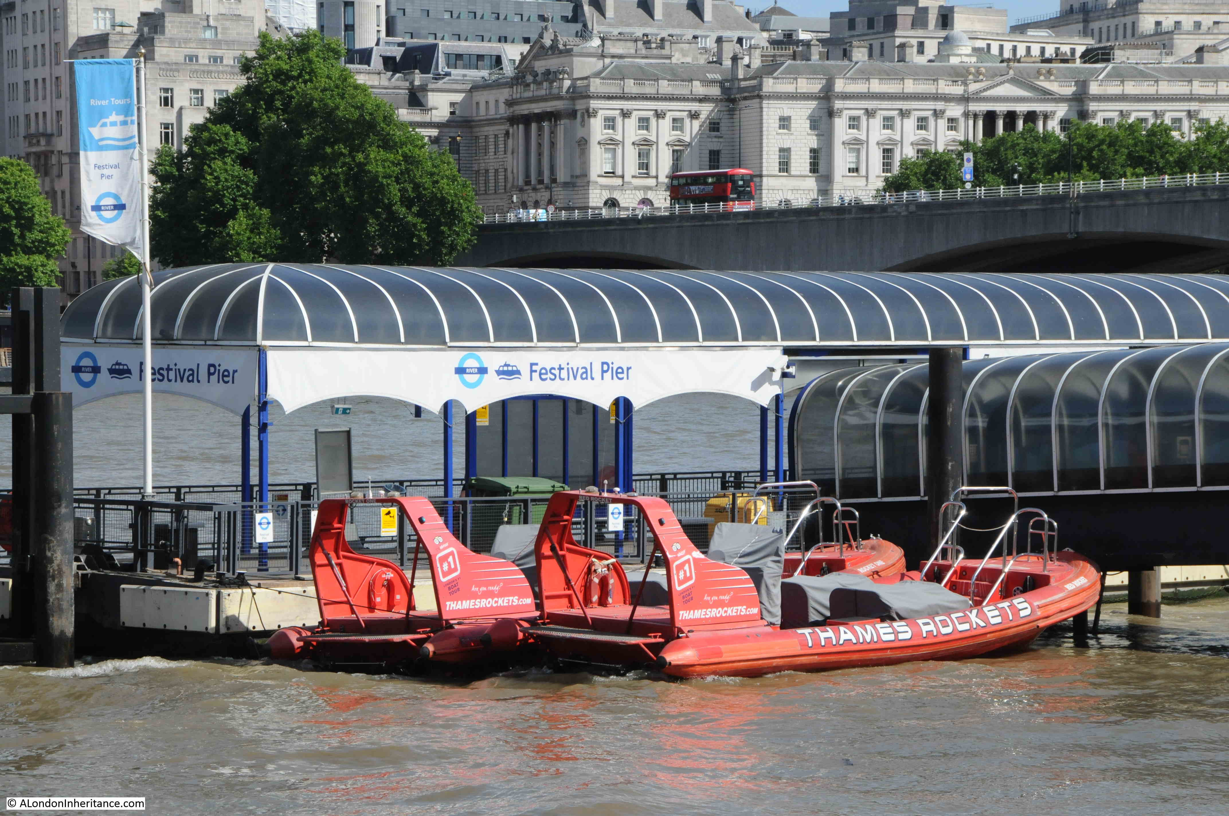
Ribs moored up at the Festival Pier on the Southbank:

Thames Rockets

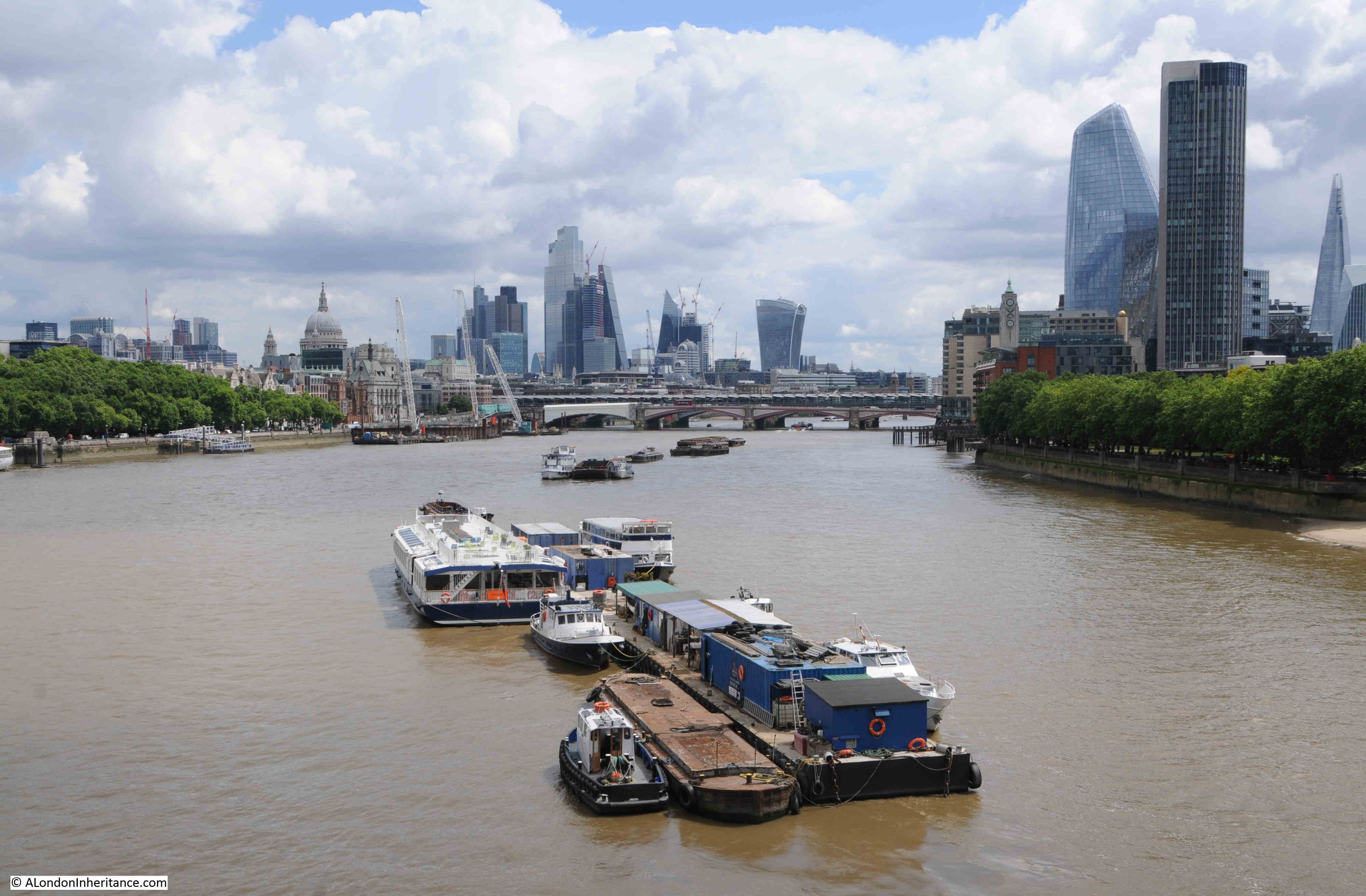
As well as tourist and passenger traffic, there are many other users of the Thames.

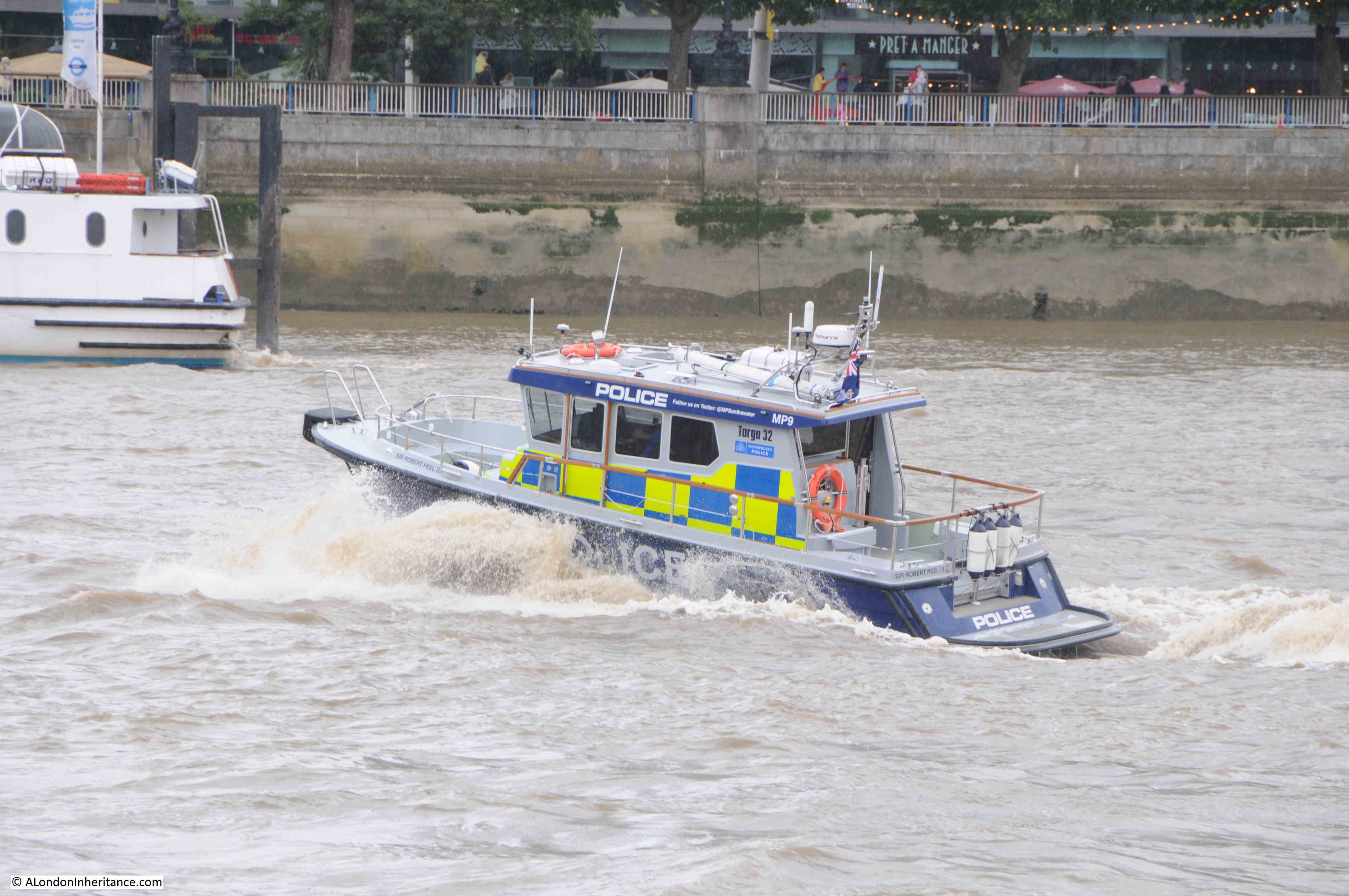
The Thames River Police can frequently be seen speeding along the river:

Thames River Police

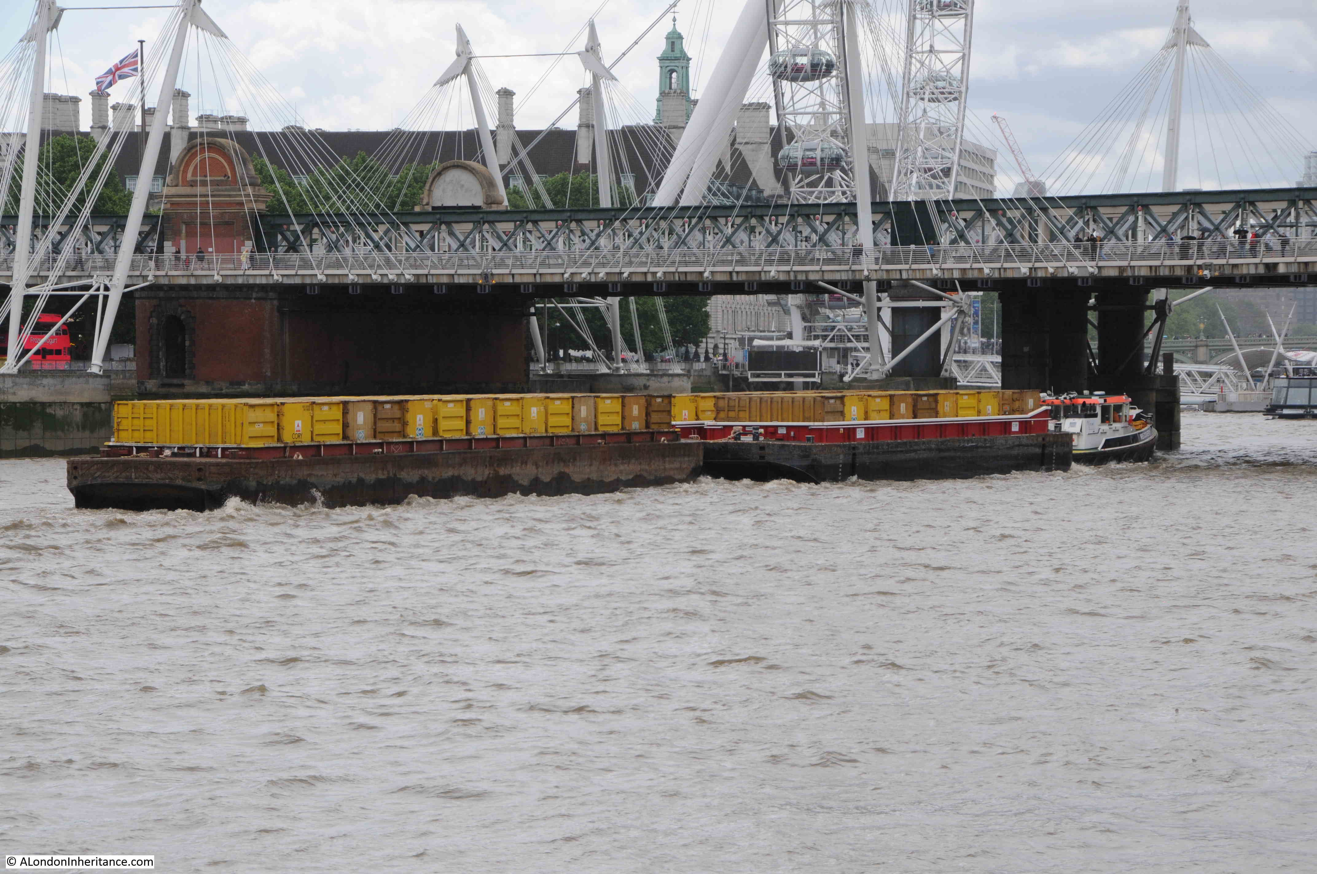
And much of London’s waste is compacted into containers at depots along the river, from where it is then transferred by barge to an incinerator in Belvedere, where it is burnt to generate electricity.

Waste transport on the Thames

Although the central Thames alongside the City will not see the cargo shipping that was a feature of this part of the river for centuries, it is good to see that the river is busier than it was in the late 1970s.

Tourist boats, work boats, and the Thames Clippers, ensure that there is much to see along the river.

One of the best Twitter accounts and blogs for monitoring the range of traffic on the Thames, is the Tidal_Thames95 Twitter account and the Tidal Thames blog, both by Patricia Stoughton.

Hopefully there will be pleasure, ferry and work boats on the River Thames for many years to come.

alondoninheritance.com

Lovells Wharf and Enderby House, Greenwich Peninsula

I recently scanned some negatives from 1986, and came across three photos taken in Greenwich, where the walk along the river heads past the power station and the Cutty Sark pub, and joins the Greenwich Peninsula. This is the first of the three:

Lovells Wharf

Very roughly the same view today – despite lots of walking around I could not get exactly the same view, as the area has been remodeled considerably since the mid-1980s.

Lovells Wharf

Along the wall in the 1986 photo there were painted white letters for C. Shaw & Sons Ltd and Lovell’s Wharf:

Lovells Wharf

The books by Mary Mills are my go to source for anything about the Greenwich Peninsula, and Mary has recently published “The Greenwich Riverside. Upper Watergate to Angerstein”:

Greenwich Peninsula

For a detailed history of the peninsula and the considerable industrial heritage of the area, the book is invaluable.

The book states that the company Shaw Lovell leased the site in the 1920s. A company with a Bristol heritage, their business was as a “Shipping and Forwarding Agent”.

The company handled non-ferrous metals, including in the 1920s, scrap from the Great War battlefields.

A view of the methods that the company used to transport material between shipping on the river and the land is shown in the following photo from a bit further along the Greenwich Peninsula:

Greenwich Peninsula

The same view today:

Greenwich Peninsula

I found the exact position for the above photo. The chimneys of the power station, and domes to the right help, but in the foreground there is the low concrete wall on the left, and behind the barges in the 1986 photo is where the shore wall extends out into the river. If I had timed my visit better, I could have got the tide in the same position.

The main differences between the two photos is the lack of shipping moored alongside the wharf, and the cranes being used to transport materials.

The cranes were significant local landmarks. They may have dated from around 1950 and were originally in use in Dublin. The cranes moved to Greenwich in the 1970s, and remained on site until 2000, when the owner of the land had them removed.

To put the locations of this week’s post in context, the following map shows where I will be covering. Starting at the red circle, with the above photos just north of this circle, and finishing at the end of the post at the blue circle  (© OpenStreetMap contributors).

Greenwich Peninsula

As can be seen by comparing the above then and now photos, the area has changed considerably. What was an area of considerable industry has been derelict for some years, and over recent years the northward expansion of apartment buildings has started along the western side of the peninsula, and will no doubt meet the southward run of buildings close to the O2 dome.

Greenwich Peninsula

Looking along the foreshore towards the dome at the northern tip, with new apartment buildings replacing the industries that once occupied the area:

Greenwich Peninsula

View across the river to the towers of the Isle of Dogs:

Greenwich Peninsula

Two colour apartment blocks:

Greenwich Peninsula

Of the many industries along this stretch of the river, one was a company that was key in the provision of a technology that enabled communications across the world. This was the manufacture of submarine communication cables which took place at Enderby Wharf and it is here that we can see the remains of some of this activity.

Here was manufactured the first cable to cross the Atlantic and up until the mid 1970s much of the world’s subsea communication cables had been manufactured here. The web site covering the history of the Atlantic Cable and Undersea Communications has a detailed history of Enderby Wharf.

The tower structure that can still be seen is part of the mechanism, along with the smaller wheel on the left, used for transferring cable from the factory on the right to cable ships moored in the Thames on the left. Cable would be run across the walkway to the top of the tower then to the round hold-back mechanism on the left then onto the ship:

Enderby House

It was here that I was really surprised to see a new pub – Enderby House:

Enderby House

Enderby House is a historically important building. Grade II listed, the Historic England listing provides more details about the building:

Enderby House belonged to the firm of Samuel Enderby, the largest whalers and sealers in Britain, and pioneers of Antarctic exploration. Hermann Melville describes their flagship and crew in “Moby Dick”. The decline of British whaling led to the Enderbys ceasing to have an interest in Enderby’s Wharf in 1854.  It was then taken on by Glass, Elliott and Company, a contractor for the first transatlantic telegraph cable (lost while being laid in 1857) then the second in 1858 which operated for a few weeks.  The business was reconstituted in 1864 as the Telegraph Construction and Maintenance Company, who manufactured cable at Enderby’s Wharf to an improved design for another attempt in 1865, and a fourth in 1866, both times with the Great Eastern as the cable-laying ship, and by the end of 1866 had achieved the first successfully working transatlantic telecommunications cable connection. “

The last time I walked along this stretch of the peninsular in 2015, from Cutty Sark pub to O2 dome, Enderby House was looking in a very poor condition:

Enderby House

I walked around the outside of the pub, but could not see any references to the history of the site, or to the impact on communication technologies that the products manufactured here would bring, however the pub sign did appear to illustrate what I assume to be a representation of a telecommunications cable:

Enderby House

Opposite, within the fenced off wharf, was an example of a length of cable and the housing for the repeater equipment that would amplify the signal as it travelled for thousands of miles under the sea:

Enderby House

I get really conflicted when I see a building such as Enderby House. I am pleased that it is still there, and that it is a new pub (too many of these are closing), however it appears to be heavily altered, and does not appear to offer any information as to the importance of the site, apart from retaining the name and the pub sign.

Perhaps there is information inside and I am being unfair. I did not have time for a visit, having a meet arranged at the Cutty Sark pub on the walk back.

View of the northern side of Enderby House – if I was responsible for decorating the building I would have an artwork representing a trans-Atlantic cable running along the side of the building to break up the rather bland cream paintwork.

Enderby House

Fenced off access to the wharfs near Enderby House:

Tunnel Wharf

There is a flat wall of stone to be found among the apartment buildings and facing on to the walkway along the river:

Greenwich Peninsula

Rather than repeat what the information panel to the right of the wall states, I will summarise Mary Mills comments from her book.

There was a road that ran underneath the new apartment buildings between Lovell’s and Granite Wharf (which was to the north of Lovell’s).

Much of the boundary wall of Granite Wharf along this roadway was made up of an extraordinary range of what appeared to be random stone, and was thought to have been quarried in Dorset, shipped to Greenwich where it was stored until it was sold for use in a construction project. Some of this stone had been used to construct the wall.

This stone wall was important as it was a visual demonstration of the stone trade from along the English Channel.

When the wall, along with the rest of the site was being demolished, Mary Mills was instrumental in getting the importance of the stone recognised, however the wall created by the developer using the stone is very far from how it was originally used, and what had been rough stone had been tided up considerably and placed in what is now a smooth wall of stone. Again, good that it has been retained, but it could have been so much better.

Soon after walking past Enderby House, development has stopped and the river path changes from a new, wide path in front of apartment buildings, to a narrow path alongside the derelict sites that are probably scheduled for development:

Greenwich Peninsula

Where tour buses go to park:

Greenwich Peninsula

I really love this part of the walk along the peninsula. A narrow path along the river’s edge, quiet, and a chance to think about what was here:

Greenwich Peninsula

I still had my third 1986 photo to track down, and I suspect it was taken from the following pier:

Greenwich Peninsula

This was the view looking back towards central Greenwich in 1986:

Greenwich Peninsula

The following photo was the closest I could get to recreating the above. The landmarks of Greenwich all line up reasonably well. The barges moored alongside the pier in 1986 have all disappeared.

Greenwich Peninsula

To the side of the footpath, there are the remains of structures that once provided access to the long gone industrial premises that lined the river:

Greenwich Peninsula

A long closed gateway:

Greenwich Peninsula

Looking back along the footpath – this stretch of the river is so very different to that which has already been developed, and I assume that at some point in the future, this footpath will become the same wide pedestrianised area next to new apartment buildings, as found at the start of the post:

Greenwich Peninsula

A welcome sign:

Morden Wharf

The sign points to what looks like a temporary bar / pizza area built in front of Morden Wharf:

Morden Wharf

Morden Wharf was named after Morden College, the freeholder of much of the land in the vicinity of the wharf.

The last time I walked along the peninsular, Morden Wharf was fenced off from the footpath with high, wooden panels, these have now been removed with only their vertical metal supports remaining.

Having reached Morden Wharf, I turned back towards Greenwich.

The area that I have walked which has not yet been developed, is planned to undergo a significant transformation. The footpath winding its way between the river and the derelict industrial sites will disappear and large new towers will be built.

The developed is called Morden Wharf, and the website describing the development can be found here.

Scroll to the bottom of the page, on the Morden Wharf website, and the area I have walked can be seen to the right of the old brick Morden Wharf building, and the bar and pizza area will apparently become “The reinstated Sea Witch pub”, a very different recreation of a pub that was once close to the river, and that was badly damaged by a V1 flying bomb on the 12th of July 1944.

The 1986 photos captured some of the last years of some of the industry along this side of the Greenwich Peninsula. It would then remain derelict for some years, and is now undergoing a significant transformation. It is a good time to walk the western side of the peninsula before this happens.

My 2015 walk along the peninsular to the O2 dome can be found here and shows how the area is changing, and the final part of the walk.

alondoninheritance.com

Westminster School Gateway

In 1949, my father photographed the Westminster School Gateway:

Westminster School Gateway

I am really grateful to the Archivist at Westminster School who provided access during the Spring half term, and told me about the history of the gateway and the surrounding area (although any errors are down to my memory).

The same photo of the Westminster School Gateway at the end of May 2022:

Westminster School Gateway

There has been very little change in the 73 years between the two photos. The main change being a couple of CCTV cameras to the left of the gateway.

The Westminster School Gateway is a historic feature of the school for two main reasons. The age and purpose of the gateway, and the inscriptions that cover almost all the stones of which the gateway has been built.

The day of my visit was one of those days where London weather changes from sunshine to pouring rain in a matter of minutes, and that is exactly what happened when I arrived. The sky clouded and the rain fell, resulting in an overcast view of the gateway in my photo, compared to my father’s photo taken in bright sunshine.

Due to the different lighting conditions, the inscriptions are far more visible in my father’s photo than mine. In the 1949 photo, the stones are generally dirtier due to the amount of pollution from coal fires and other industrial sources across London. This blackened the inscriptions in the 1949 photo which helps them to stand out.

The Westminster School Gateway is in Little Dean’s Yard, which is accessed from Dean’s Yard. I have circled the location of the gateway in the following map  (© OpenStreetMap contributors):

Westminster School Gateway

The view looking across Little Dean’s Yard towards the gateway, with the Victoria Tower of the Palace of Westminster in the background:

Westminster School Gateway

The School Gateway was built in 1734 and was the main entrance to the school. Little Dean’s Yard was originally occupied by buildings, and a passageway led from Dean’s Yard (via Liddell’s Arch) through these buildings to reach the school gateway.

The gateway is believed to have been built by Lord Burlington. This was Richard Boyle, the 3rd Earl of Burlington, who as well as the gateway, was responsible for the construction of a dormitory at the school between 1722 and 1730.

The school gateway is therefore also known as Burlington’s Arch.

The following print from 1880 shows the school gateway with the route of the passageway, although by the time of the print, the buildings surrounding the passageway had been demolished (© The Trustees of the British Museum).

Westminster School Gateway

The view looking back towards Liddell’s Arch from near the school gateway:

Liddell’s Arch

On the right of the above photo is a sculpture of Queen Elizabeth I, who became the royal patron of the school in 1560 and is celebrated as the founder of the school, although the foundations of the school are much earlier, the school having its origins in a charity school run by the Benedictine monks of Westminster Abbey.

The following map is an extract from the 1950 edition of the Ordnance Survey (a year after my father’s photo). The school gateway is circled, and the map shows the area in detail as it was, and within the area of the school, as it is today (‘Reproduced with the permission of the National Library of Scotland“).

Little Dean's Yard

To the south of Little Dean’s Yard are the two remaining buildings of an 18th century terrace of three. This is the Grade I listed numbers 2 and 3 Little Dean’s Yard:

Little Dean's Yard

The building on the right of the above terrace, which has broken up the symmetry of the original terrace is a rebuild of 1896, and is Grade II listed number 1 Little Dean’s Yard.

Listed buildings continue on the northern side of the yard, with the Grade II listed Turle’s House, dating from 1884 on the right. This building was built over fragments of an 11th century reredorter (a communal latrine), and part of the original monastery’s cloisters.

Little Dean's Yard

On the left of the above photo is the Grade I listed Ashburnham House, which includes parts of various structures that have occupied the site over the centuries.

The building includes the masonry structure and kitchen and hall walls from the 14th century Prior’s Lodging. The building became a substantial town house in the mid 17th century, when red brick was added to the 14th century rubble walls.

A west wing (furthest from the camera) was added in 1910, and this later wing can be seen in a slightly different colour brick, and the arched entrance on the ground floor of the earlier wing.

The following print shows the north east corner of Little Dean’s Yard in 1808, showing the school gateway, and to the left is what was described as Dr Bell’s House, along with an entrance to the cloisters. These buildings were replaced by Turle’s House in 1884 (© The Trustees of the British Museum).

Little Dean's Yard

The school gateway in 1808 (© The Trustees of the British Museum):

The entrance to Westminster School

Westminster School Gateway is a fascinating historical structure simply as a gateway, but what adds further interest are the names and dates carved onto the gateway on almost every available space:

Westminster School Gateway

Westminster School has created a dedicated website to the gateway, which includes a remarkable degree of research to provide an inventory of the names carved on and around the gateway, with background details to the names.

The website can be found here.

An example from the inventory, covering the name in the following photo:


LEGGE, GEORGE AUGUSTUS, eldest son of Hon. and Rev. Augustus George Legge FSA, Chancellor of Winchester, and Honora, eldest dau. of Walter Bagot 
Westminster School Gateway

The website also provides advice for those aspiring to leave their mark, and uses George August Legge’s carving as an example of why punctuation is important and that his name really needs a “.” between the initial and surname.

There are a couple of inscriptions in non English languages, as shown in the following photo with inscriptions in Hebrew and Devanagari (a North Indian script):

Westminster School Gateway

The Westminster School Gateway website has discovered the background to the above inscriptions, which can be found here.

Five brothers:

Westminster School Gateway

The quality of the carving on the gate is excellent, the reason being is that the majority of the inscriptions were carved by stonemasons from Westminster Abbey, paid by the pupil to carve their name.

This is obvious when looking at the five Ryde brothers in the above photo as each instance of Ryde is identical to the other four.

There are a number of names which have obviously been carved by the pupil, and the quality of these is very different from those by a trained stonemason as shown in the following photo:

Westminster School Gateway

As well as the main body of the gateway, the side walls running up the stairs behind the gateway also have plenty of names:

Westminster School Gateway

And they are also on the rear of the gateway:

Westminster School Gateway

The school gateway leads to a small flight of stairs, a left turn which then opens out into the main school room, which on my visit was set-up for exams:

Westminster School room

This room was originally part of the monks dormitory in the time of the Benedictine monastery and it was first used as a schoolroom in 1599.

The LCC Bomb Damage maps show damage to some of the buildings on the eastern side of Little Dean’s Yard, including the schoolroom. This resulted in the refurbishment of the space, including the installation of a new roof which can be seen in the above photo.

The following print shows the schoolroom in 1850. Desks and benches are set against the side walls (© The Trustees of the British Museum).

Westminster School room

On the walls between the windows there appear to be lots of inscriptions, so I assume the approach of carving inscriptions on the school gateway extended also into the schoolroom.

I could not see these inscriptions in the schoolroom today, so I suspect they were covered up during restoration work following the wartime bomb damage.

I was really pleased to recreate my father’s photo, one of those rare places in London where the view is almost exactly the same.

My thanks to the Archivist for providing access and information.

I have kept the post relatively high level as the school’s website dedicated to the gateway is comprehensive and fascinating.

I really recommend a read of the dedicated site to the gateway: “The School Gateway – The story behind Burlington’s Arch”

.alondoninheritance.com

A Coronation and a Wedding – Royal Events in London

In my second post of the Jubilee weekend, I am looking at a couple of royal events in London. The 1953 Coronation and 1981 Royal Wedding. Some of these photos have been in previous posts, some are new, and they show how in many ways royal events in London are much the same today as they were seventy years ago.

Many of my father’s photos were taken on bike rides around the city, early on a Saturday or Sunday. This worked due to periods away on National Service, work during the week, and other commitments. The following photos were taken early on Sunday, 31st May 1953, and look at some of the street decorations for the Coronation.

A decorated café in Hoxton, with my father’s bike leaning against the wall.

London cafe decorated for the Coronation

The above photo has been in the header to the blog since I started in 2014, however I have not yet found the location, apart from it being in Hoxton. The building has almost certainly been demolished.

Appleby Street, also in Hoxton:

Coronation at Appleby Street

Ivy Street, Hoxton, between Hoxton Street and Pitfield Street:

Coronation at Ivy Street

Shenfield Street, between Kingsland Road and Hoxton Street:

Coronation at Shenfield Street

The northern end of Whitecross Street, close to the Old Street junction:

Coronation at Whitecross Street

Another view of Whitecross Street:

Coronation at Whitecross Street

The expectation at the time was of a new Elizabethan era with comparisons back to Queen Elizabeth I as shown by the following tableau along the route of the procession. The text on the left is abbreviated from a speech given by Queen Elizabeth I to the Houses of Parliament on April 10th 1593 (1558 was the year that Elizabeth I became Queen) and that on the right from Queen Elizabeth II from her first Christmas broadcast in 1952.

Royal Events - the new Elizabethan age

A map of the Coronation route was produced jointly by the London Transport Executive and the Commissioner of Police of the Metropolis for the Coronation of Elizabeth II on Tuesday 2nd June 1953:

1953 London Transport map of the Coronation route

Some of the elaborate decorations that lined the Coronation route:

Coronation street decoration

Whitehall:

Coronation street decoration

The ornate decorations that suspended a crown over the Mall:

Coronation street decoration

The 2nd of June 1953 was Coronation Day in London and a public holiday. As usual for such an event, people started lining the route between Buckingham Palace and Westminster Abbey well before the procession to ensure a good position to see the new Queen.

The weather during the previous May had been excellent with lots of warm, sunny weather broken only by the occasional thunderstorm. This weather broke by the end of May, for the last week of May and the rest of June the country was under many low pressure areas moving from the Atlantic bringing rain and cold temperatures for June. It was the coldest June for a century.

My father took a number of photos of people as they lined the route, along The Mall and round into Trafalgar Square and surrounding streets.

These show people wrapped up for the weather:

Waiting for the Coronation

These two look cheerful despite the long wait and the weather:

Waiting for the Coronation

The newspaper between them was the Daily Mirror from the 29th May. The headline “The Shame Of Piccadilly” and “The rich street forgets” refers to the complete lack of decoration in Piccadilly for the Coronation. There are two photos on the page. The top photo shows Piccadilly without any decoration, the bottom photo shows, what is assumed to be an ordinary working class street decorated with flags and bunting and a Long Live The Queen banner stretched across the road:

The Shame of Piccadilly

The morning of the 2nd of June was more like an autumn day with rain showers and temperatures reaching only 12 degrees centigrade. Very low for early June.

This is Trafalgar Square:

Coronation at Trafalgar Square

On the left is one of the commentary boxes set-up along the route. This was the first Coronation to be televised:

Coronation at Trafalgar Square

Photo of the small group of people on the lion. Not sure how long the man on the far left was going to balance in that precarious position:

Coronation at Trafalgar Square

A wider view of a very busy Mall:

Royal Events in the Mall

The weather did improve later in the day. Again in The Mall and the crowds are growing. In the top left is the faint outline of one of the arched decorations that spanned the Mall (see earlier photo for the suspended crown), and the legs of one of these decorations can be seen among the crowd sitting at the street edge:

Waiting for the Coronation

The following two photos were taken on the day before the Coronation as people found their place ready for the next day’s events. Sleeping in The Mall:

Waiting for the Coronation

This photo was also taken in The Mall. They look well prepared for the wait. The man is obviously not interested in people watching, he looks engrossed in his book. The group in the background also seem very well prepared judging by the number of boxes they have around them.

Coronation

Royal events have always brought people out to the streets of London, and whilst fashions change and the clothes they are wearing look different, there is a common thread between all the street scenes at this events.

I did photograph the 1977 Jubilee, but cannot find these photos / negatives. Hopefully I have not lost them in the intervening 45 years.

I have found photos of another of London’s Royal events, of crowds building for the wedding of Charles and Diana that took place on the 29th July 1981. On the evening of the 28th July I took a walk from St. Paul’s Cathedral and along Fleet Street and the Strand to take some photos.

Starting at St. Paul’s Cathedral, this is where the best positions were and large crowds had already found their place ready for an overnight stay.

I must have had a couple of photos left on some Black and White film before moving to colour.

Outside St. Paul’s Cathedral:

Royal Events outside St Paul's Cathedral

Crowds at this perfect position looking across at the steps leading into the Cathedral:

Royal Events outside St Paul's Cathedral

I must have then switched to a colour film:

Ludgate Hill

Ludgate Hill:

Ludgate Hill

Looking back up Ludgate Hill. Although this was the evening before, the road had been closed and a large number of people were just walking the route, taking in the atmosphere and watching the people who were settling in for the night along the edge of the route. It was a warm evening and I remember there being a real sense of a big event taking place the following day.

Ludgate Hill

The Old King Lud pub, decorated for the event. This was a lovely Victorian pub, built-in 1870:

Old King Lud pub decorated for the Royal Wedding

Now in Ludgate Circus. This was when the railway bridge still ran across the start of Ludgate Hill. The Old King Lud pub is on the left:

Royal Wedding at Ludgate Circus

Moving up into Fleet Street. This road was still open and the pavements were busy with those walking and those waiting:

Royal Wedding in Fleet Street

This was when Fleet Street was still occupied by newspaper publishers. The Express offices on the left and those of the Star on the right. I remember walking along Fleet Street and the side roads leading down to the Thames on a late Saturday afternoon / early evening and listening to the sound of the newspapers being printed and the amount of activity to get the next day’s edition distributed. All very exciting when you are young and exploring London.

Royal Wedding in Fleet Street

Most of the decorations were put up by the owners of the buildings along the route. “Official” street decoration was very limited, mainly these pennants hanging from lamp posts. Union Jacks along with red, white and blue bunting was out in abundance:

Royal Wedding

The George pub in the Strand which fortunately is still there:

Royal Wedding

Along the side of the Royal Court’s of Justice:

Royal Wedding

Prepared for a long night’s wait:

Waiting for the Royal Wedding

Royal events show a rather timeless side to London. Whilst so much in the city changes, the streets repeat previous appearances whenever one of these events take place.

They continue to attract people in their thousands to line decorated streets, many reserving their place on the preceding day, and braving whatever the weather brings down on London.

A shame though that Transport for London no longer issues any special maps for such events.

alondoninheritance.com

Jubilee Beers

As it is the Jubilee Weekend (or rather four days), I have a Jubilee related post on both Saturday and Sunday. Tomorrow’s post is one of my usual posts, with photos of previous events. For today’s post, I dug out my collection of 1977 Jubilee beers and 1981 Royal Wedding beers from the cobweb filled corner of the garage.

The late 1970s and early 1980s involved a lot of pubs. For some reason that I cannot really remember, in 1977 I collected any special Jubilee beer that I could find in pubs across London and Essex. Probably the novelty of finally being able to legally buy alcohol in a pub without any issues.

They have been boxed and stored away for the last 45 years, but I thought I would get them out for this weekend and see how many of the breweries, brewing Jubilee beer in 1977 still exist.

Young & Co – Silver Sovereign, brewed at the Ram Brewery in Wandsworth:

Silver Jubilee beer

Young’s closed the Ram brewery in 2006, and are now a pub company. Their beers were initially brewed by a joint venture with Charles Wells in Bedford, but they have since sold their share in the brewery venture.

They still have a head office in Wandsworth, close to the location of their original brewery.

Wadworths – Queen’s Ale:

Silver Jubilee beer

Wadworths are still brewing beer at their brewery in Devizes, Wiltshire, but according to their website, they do not appear to have a Jubilee beer for 2022. They had an impressive beer label in 1977.

Greene, King & Sons – Jubilee Ale

Silver Jubilee beer

Greene, King & Sons are still brewing at their brewery in Bury St. Edmunds, however again according to their website they do not appear to have a Jubilee beer for 2022.

Shepherd Neame – Silver Jubilee Ale

Silver Jubilee beer

Shepheard Neame are also still brewing at Faversham, Kent, and have produced a “Celebration Ale” for the 2022 Jubilee, however this is only available in casks in pubs rather than bottled.

Paine & Co – Silver Jubilee Ale

Silver Jubilee beer

A company that appears to have sold their pubs and brewery to a rival brewers in the 1980s. The name disappeared and the brewery would later close.

Fullers – Celebration Brew

Silver Jubilee beer

Fullers seem to have gone with a rather basic label for their Celebration Brew, although is does include a picture of a Griffin, from their Griffin brewery in Chiswick. They are still at the Chiswick brewery, however the Fullers company sold the brewery to Japanese international drinks company Asahi, and Fullers are now just a pub company with Asahi owning the brewery and producing beers under the Fullers name.

Fullers do not appear to be brewing a beer for the 2022 Jubilee.

Ridleys – Jubilee Ale

Silver Jubilee beer

Ridleys were brought by Greene King, who then closed their brewery near Chelmsford, Essex, and stopped producing the majority of beers under the Ridleys name. A rather nice silver label for their Jubilee Ale.

Morells – Celebration Ale

Silver Jubilee beer

The Morells company, along with their Oxford brewery closed in 1998.

Hall & Woodhouse – Bicentenary Ale

Silver Jubilee beer

Hall & Woodhouse appear to have ignored the 1977 Jubilee, preferring to celebrate their 200 year anniversary.

They are still in business with pubs and the same brewery in Blandford, Dorset, however as with the 1977 Jubilee, they do not appear to have a Jubilee beer for 2022.

Adnams – Royal Ale

Silver Jubilee beer

Adnams based in Southwold, Suffolk are still in operation, and producing beers from their own brewery. Unfortunately there appears to be no Jubilee Ale for 2022, although Adnams have branched out to produce Gin and Vodka as well as beers.

Royal Wedding Beers – 1981

On the same theme, the Royal Wedding in 1981 between Charles and Diana also resulted in a number of breweries producing special beers to commemorate the event.

Gibbs Mew & Co – Royal Heritage

Royal Wedding beer

Gibbs Mew & Co of Salisbury brewed a Royal Heritage beer, and their bottle featured St Paul’s Cathedral.

The company closed their Salisbury brewery in 1997 and continued as a pub chain, however the pubs and the company were sold to Enterprise Inns in 2011.

Devenish – Wedding Ale

Royal Wedding beer

Devenish was another Dorset brewery, and followed the same fate as Gibbs Mew.

Devenish closed their brewery in 1985, and continued as a pub operator until 1993 when the company was sold to Greenalls.

Berni – Royal Reception

Royal Wedding beer

If you fancied a beer in 1981 to go with your Berni Prawn Cocktail, Steak and Chips and Black Forest Gateau, then a bottle of their Royal Reception strong ale could be yours.

Berni was one of the pub / restaurant chains that would bring the experience of going out for a meal in the 1970s to the masses. Relatively cheap, good service and a simple, standard menu helped with the popularity of the chain, and the most brought meal of Prawn Cocktail, Steak and Chips and Black Forest Gateau becoming representative of eating out in the late 1970s.

Berni Inns was sold to Whitbread in 1995 who rebranded the chain to become part of the Beefeater resturants.

Brains – Prince’s Ale

Royal Wedding beer

Brains offered their Prince’s Ale in 1981. The brewery was based in Cardiff, where they are still brewing, but no special beers for the Jubilee that I can find on their website.

Fullers – Celebration Brew

Royal Wedding beer

Fullers Jubilee beer had a rather simple label, however they went with a more ornate label for their Celebration Brew to mark the 1981 Royal Wedding.

Greene King – Royal Wedding Ale

Royal Wedding beer

Greene King produced their Royal Wedding Ale. The label looks as if it was only designed at the last moment when it would have been too late to produce a more ornate label, so they went with a simple text based label.

St Austell Brewery – Prince’s Ale

Royal Wedding beer

The St Austell Brewery’s Prince’s Ale was rather unusual in that it was a Barley Wine.

Barley Wine is a type of beer, but is generally much stronger than a normal beer, probably why their bottle was smaller than the typical bottle of the time.

The St Austell Brewery is located in St Austell, Cornwall and the brewery and company are still in operation. They do have a Jubilee Beer called “Thank Brew” which apparently is part of an initiative by breweries, pubs and communities to produce a special beer for the Jubilee, and they are selling a bottled Platinum Jubilee Ale, which has a rather nice label.

J. Arkell and Sons – Royal Wedding Ale

Royal Wedding beer

Arkell’s had a rather impressive, gold label to their Royal Wedding Ale.

The company, based in Swindon is still brewing beer, but does not appear to be brewing a Jubilee beer.

Camerons – Royal Wedding Ale

Royal Wedding beer

Camerons featured a drawing of St Paul’s Cathedral on the label of their Royal Wedding Ale.

Camerons are still brewing in Hartlepool, Teeside, and whilst they do not appear to have a Jubilee beer, they have teamed up with the band Motorhead and have a Road Crew beer available both in draft and bottles.

Based on that small survey it seems that there are a very small number of beers brewed for the 2022 Jubilee, and I have not seen any on recent pub visits.

Probably brewers have to be more commercially focused these days, and the costs of producing a one off product outweigh the potential benefits.

What I did notice when revisiting all these bottles was that the labels do not show the alcohol content / ABV. If you were drinking a bottle of Berni’s Royal Reception Strong Ale, then you had no idea what strong actually meant.

The excellent Boak & Bailey site has researched the introduction of this labelling and found that it was a result of the UK implementing an EEC (European Economic Community) directive, and that labeling beers with the alcohol content became law on the 17th July, 1989.

All these 1977 Jubilee beers and 1981 Royal Wedding beers are unopened, although I very much doubt their contents are drinkable. and probably very unwise to try.

They will now be returned to a very dusty corner of the garage.

Whatever you are drinking (or not), I hope you are having a very good Jubilee four days.

alondoninheritance.com