Firstly, an update to the second part of the Rocque Ring walk: I have been away for the last couple of weeks with very limited Internet access, so have been unable to correct an error I made in the post on the 30th of August. I stated that the memorial in Christchurch Gardens was to Chopin, where I should have stated that it is a memorial to Henry Purcell. Another example of a disconnect between brain and fingers as I had written Purcell in my notes when I walked the route. Thanks to those who pointed this out, and the post is corrected.
Now to a new walk exploring the Ancient and Interesting Borough of Bermondsey.
I can remember the first time I heard the name Bermondsey. It was in the early / mid-1970s (cannot remember the exact year), and the radio was on at home. It was Good Friday, and they were broadcasting a feature about events on the day in London.
Part of the feature was on the Widow’s Son pub in east London, when on Good Friday, a bun is added to the net hanging over the bar.
The other part of the feature was about an event in Bermondsey. I cannot remember what the event was, but the name Bermondsey, an area in south London, and whatever the event was, sounded fascinating and rather exotic (I was very young at the time).
Over the years, I have been to various places in Bermondsey more times than I can remember, it is a fascinating place to explore, but that early memory of somewhere a bit different has always stayed.
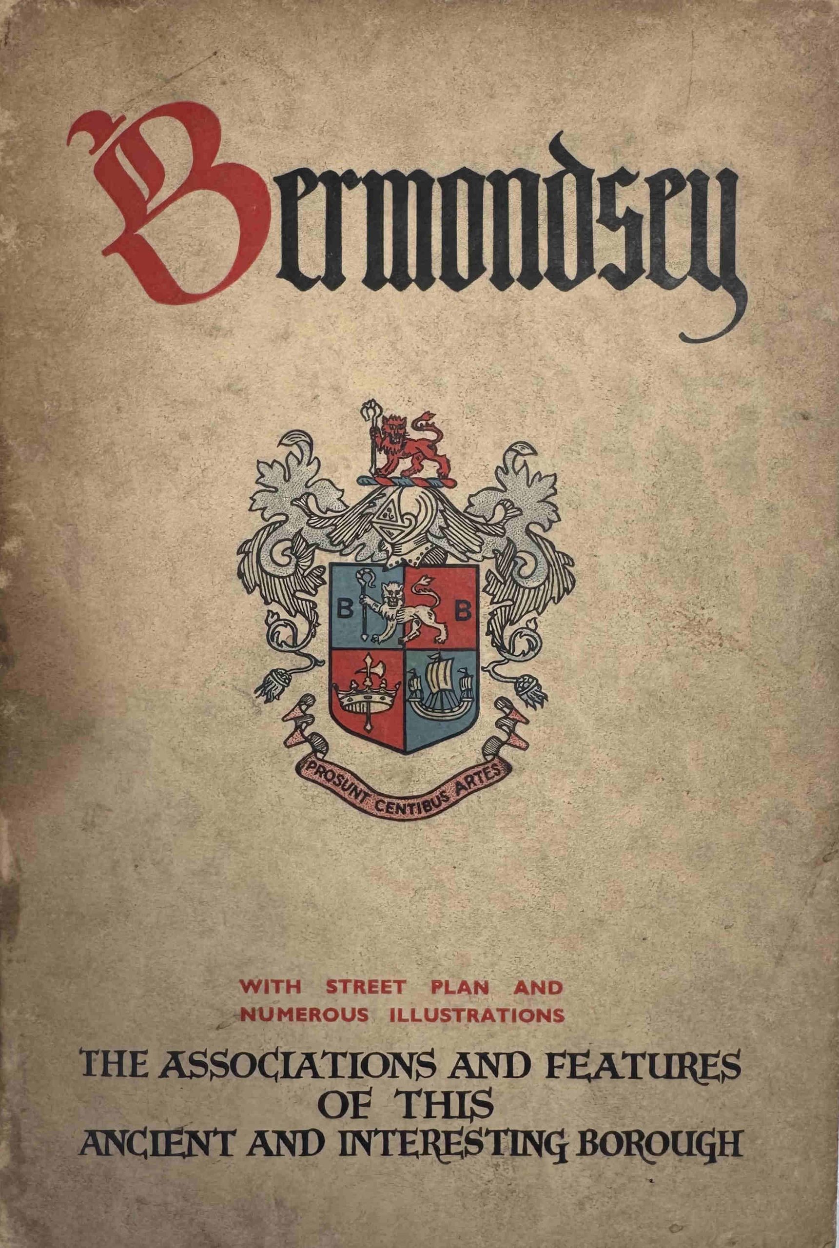
The title of this walk comes from a 1930s edition of a guidebook produced by the Metropolitan Borough of Bermondsey, and highlights that whilst in the 1930s Bermondsey was a centre of industry, with a population of over one hundred and eleven thousand, it was also a very old and historic borough.
The industry which was so much a part of 1930s Bermondsey and described in the guidebook, is also now part of that long history.
This walk explores Bermondsey’s transformation from a land of marsh and water, and includes the historic Abbey, London’s first railway terminus, industries such as the production of leather and processing of seal skins and furs, a ground-breaking charity that supported girls who worked in factories, Jacob’s Island, the slum made famous by Charles Dickens in Oliver Twist, pubs, Thames river stairs, the remains of a medieval manor house, and much more.
The walk starts from London Bridge Station (southern exit from the concourse of the railway station (not the underground) into St Thomas Street, next to Café Nero) and ends at the Angel pub, which is about a 7 minute walk from the Bermondsey Jubilee line station.
The walk lasts around 2 hours 30 minutes and covers just under two and a half miles.
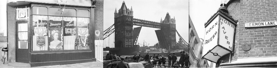
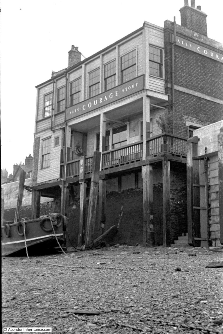
The Angel, where the walk ends, photographed by my father in 1951:
All dates for this new walk can be found on my Eventbrite page at the following link:
I will be adding some more dates for this walk (and my other walks), so if a convenient date is not available, click the Follow button at the Eventbrite page, and you should get a notification when new dates are online,
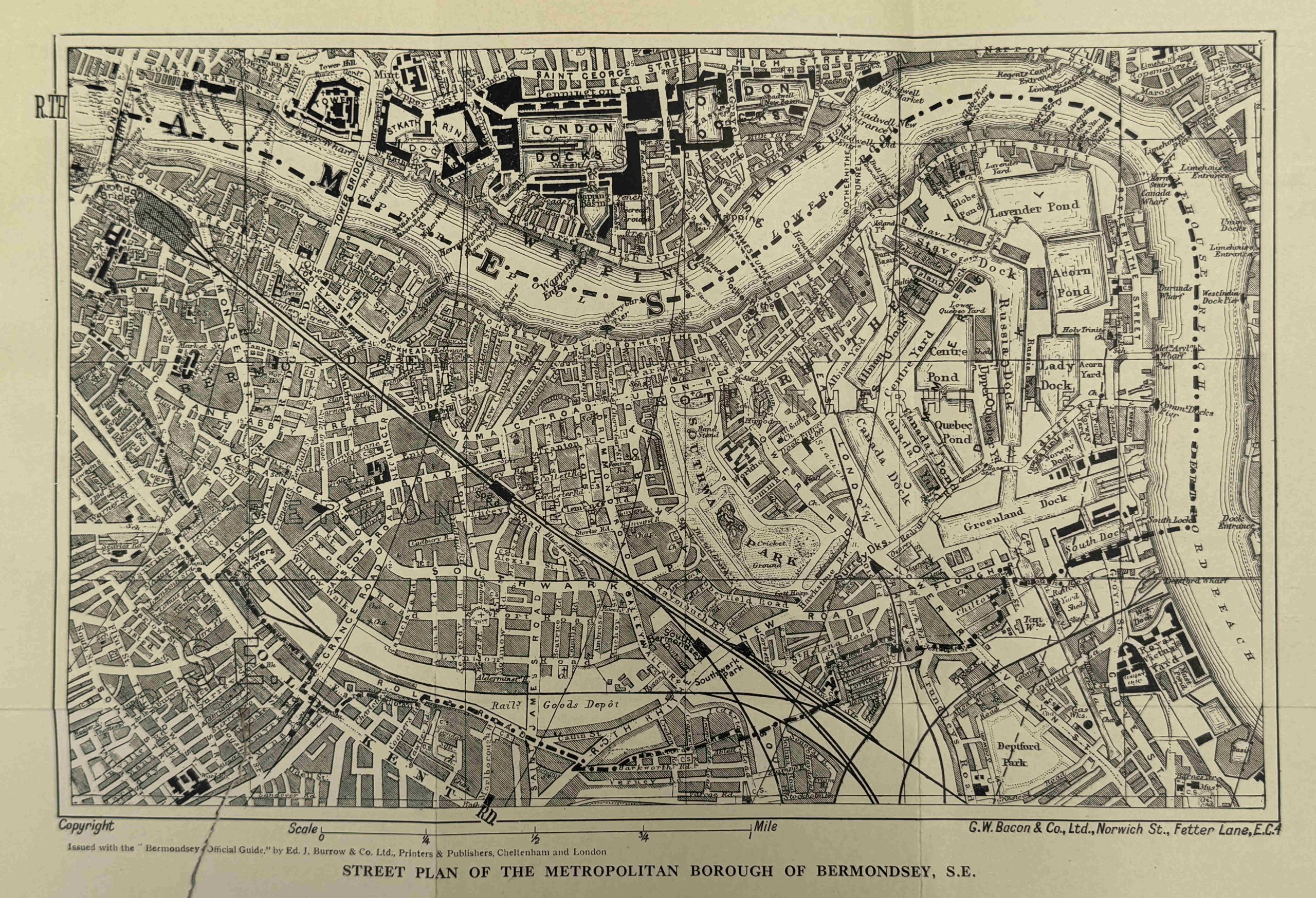
A small sample of images from the 1930s guide, including a Street Plan of the Metropolitan Borough of Bermondsey:
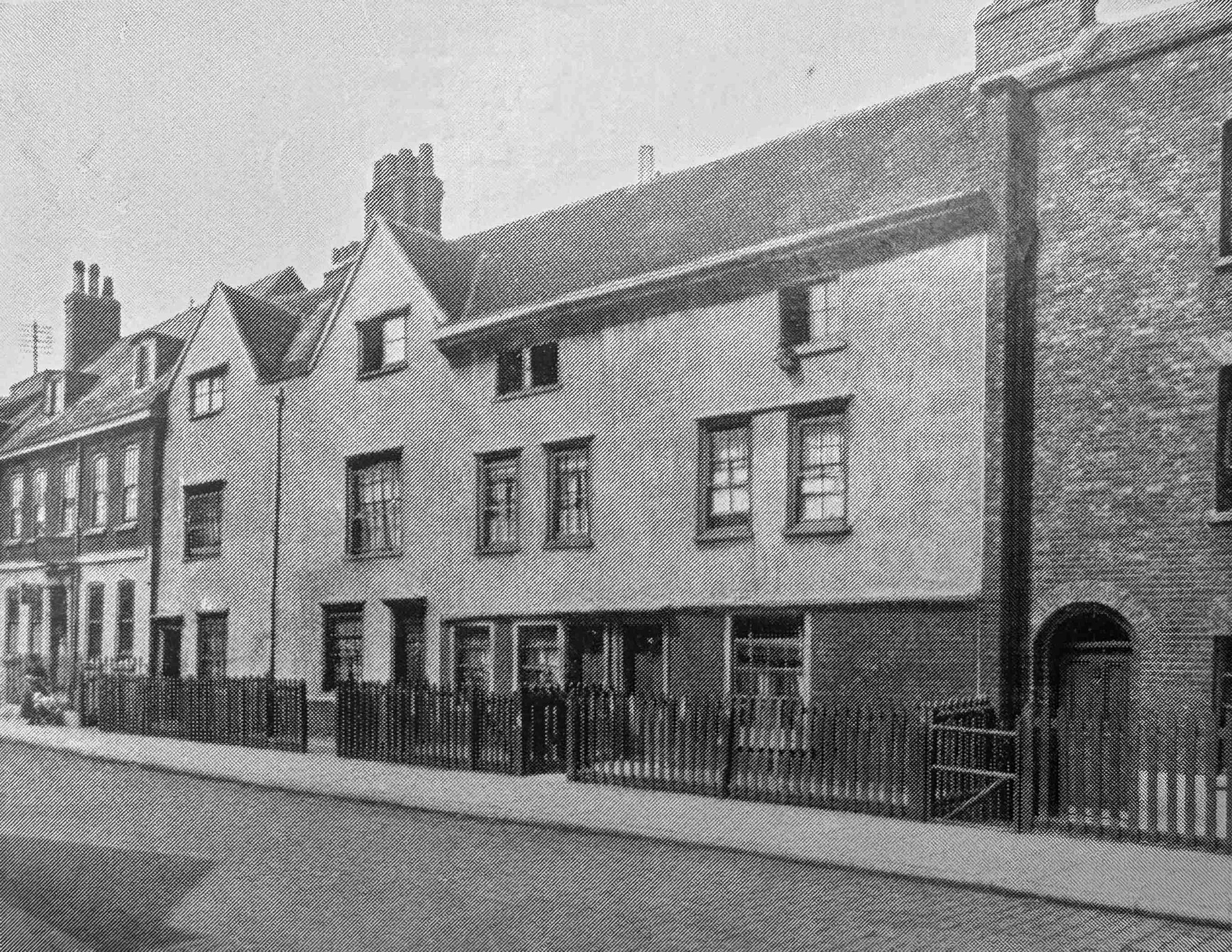
Old houses in Grange walk:
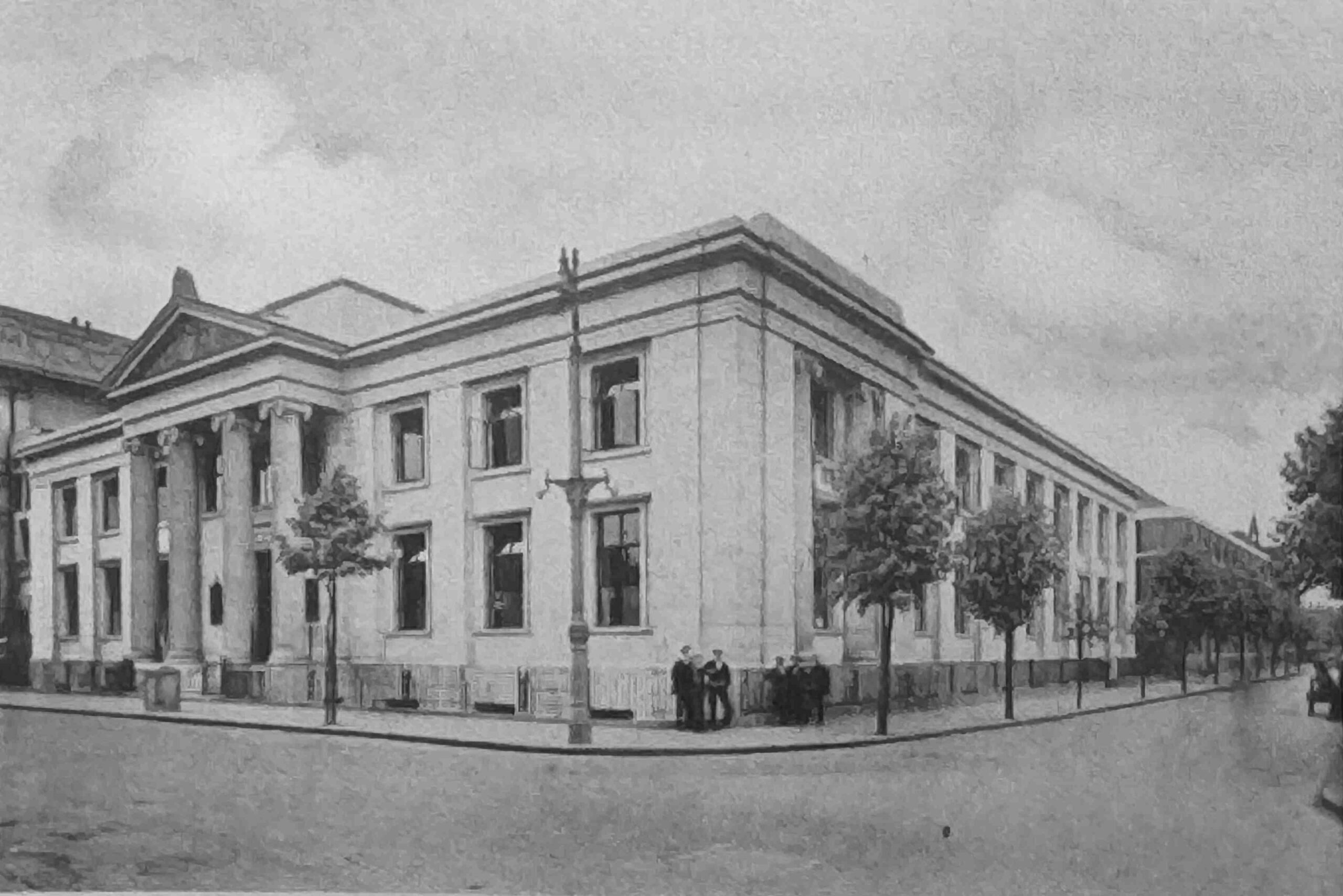
Municipal Offices, Spa Road:
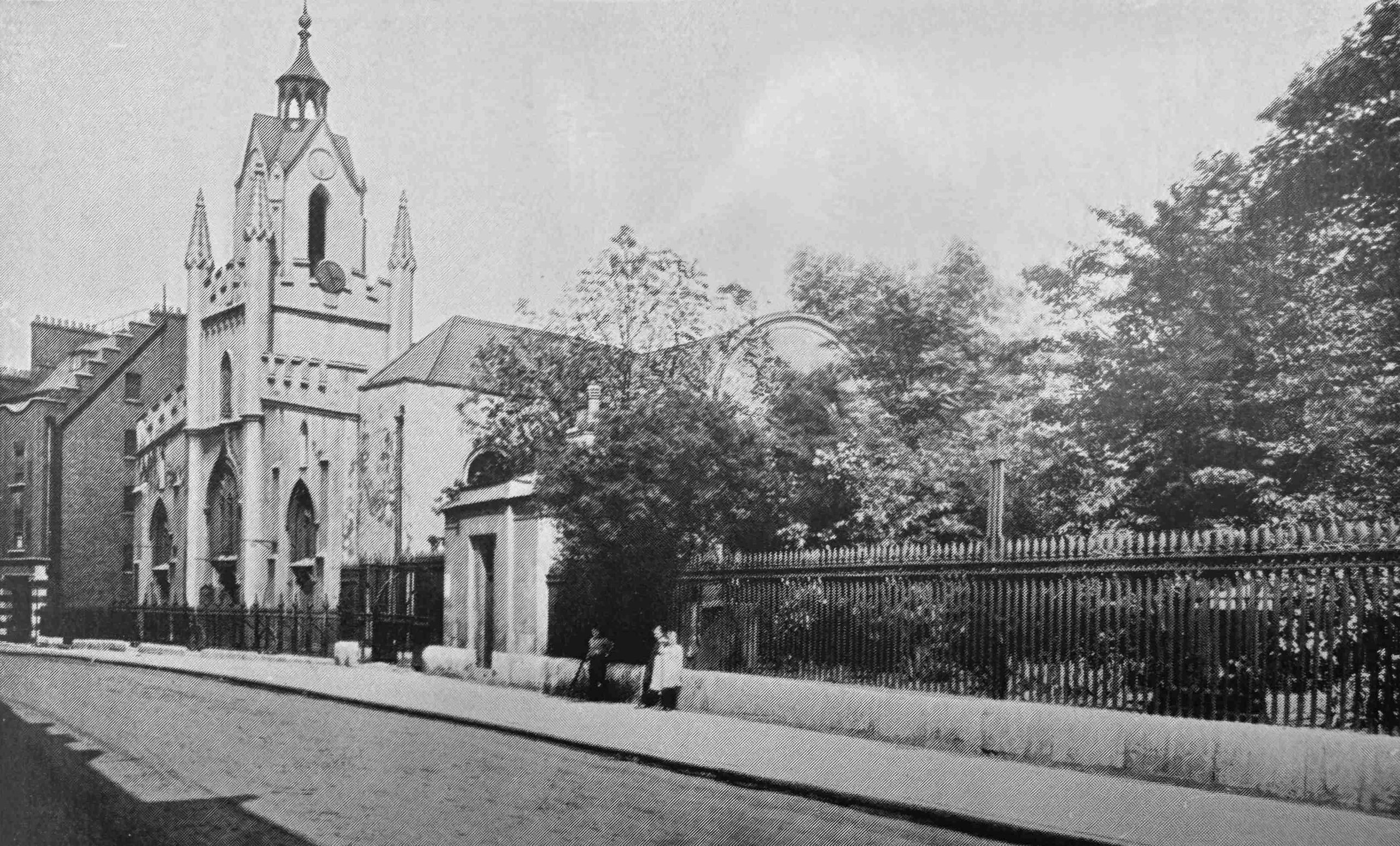
Bermondsey Parish Church with Recreation Ground Adjoining:
As well as a detailed history of Bermondsey and description of the borough in the early 1930s, the guide book includes numerous pages of adverts for the businesses that manufactured, exported, imported, and traded in Bermondsey.
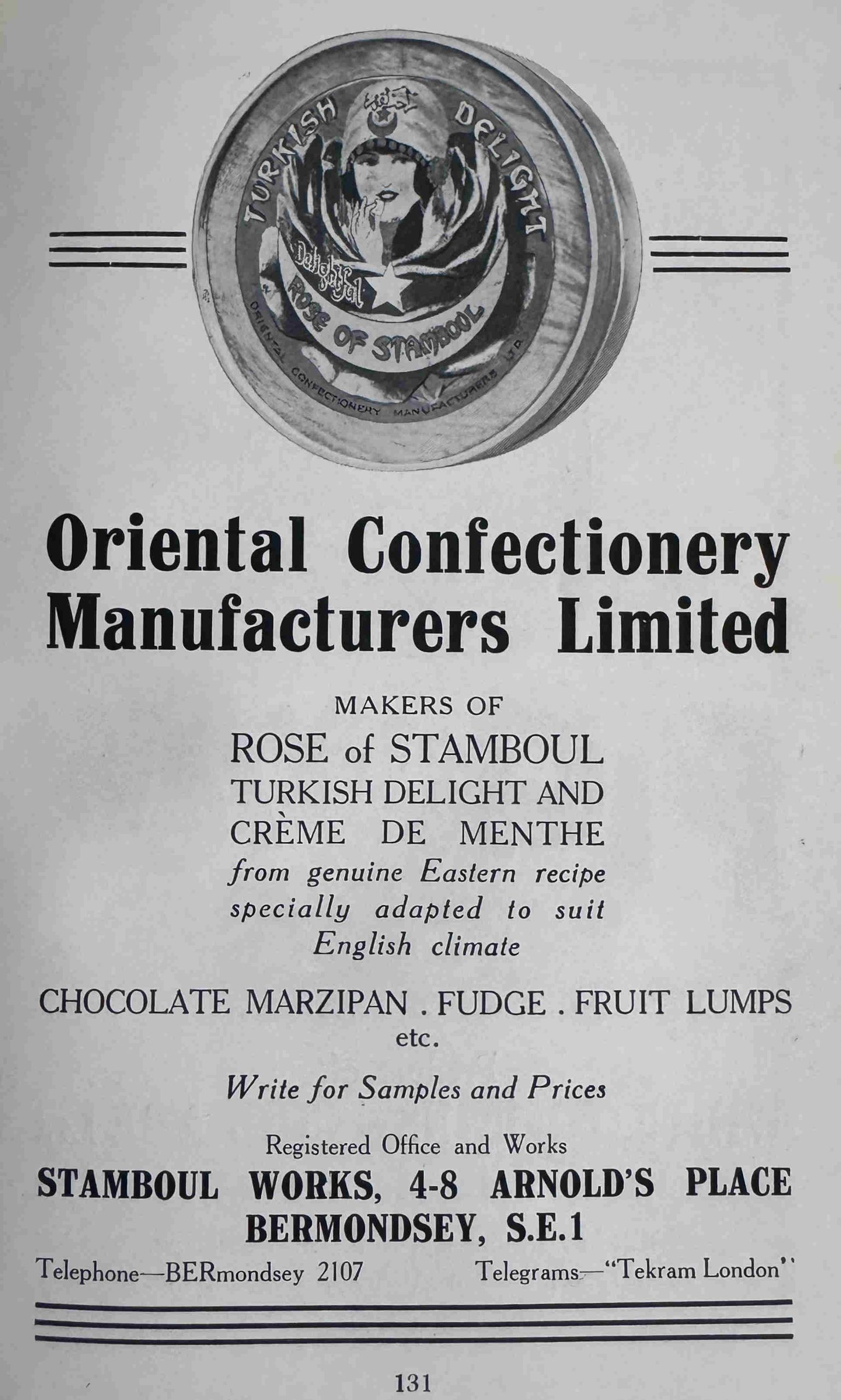
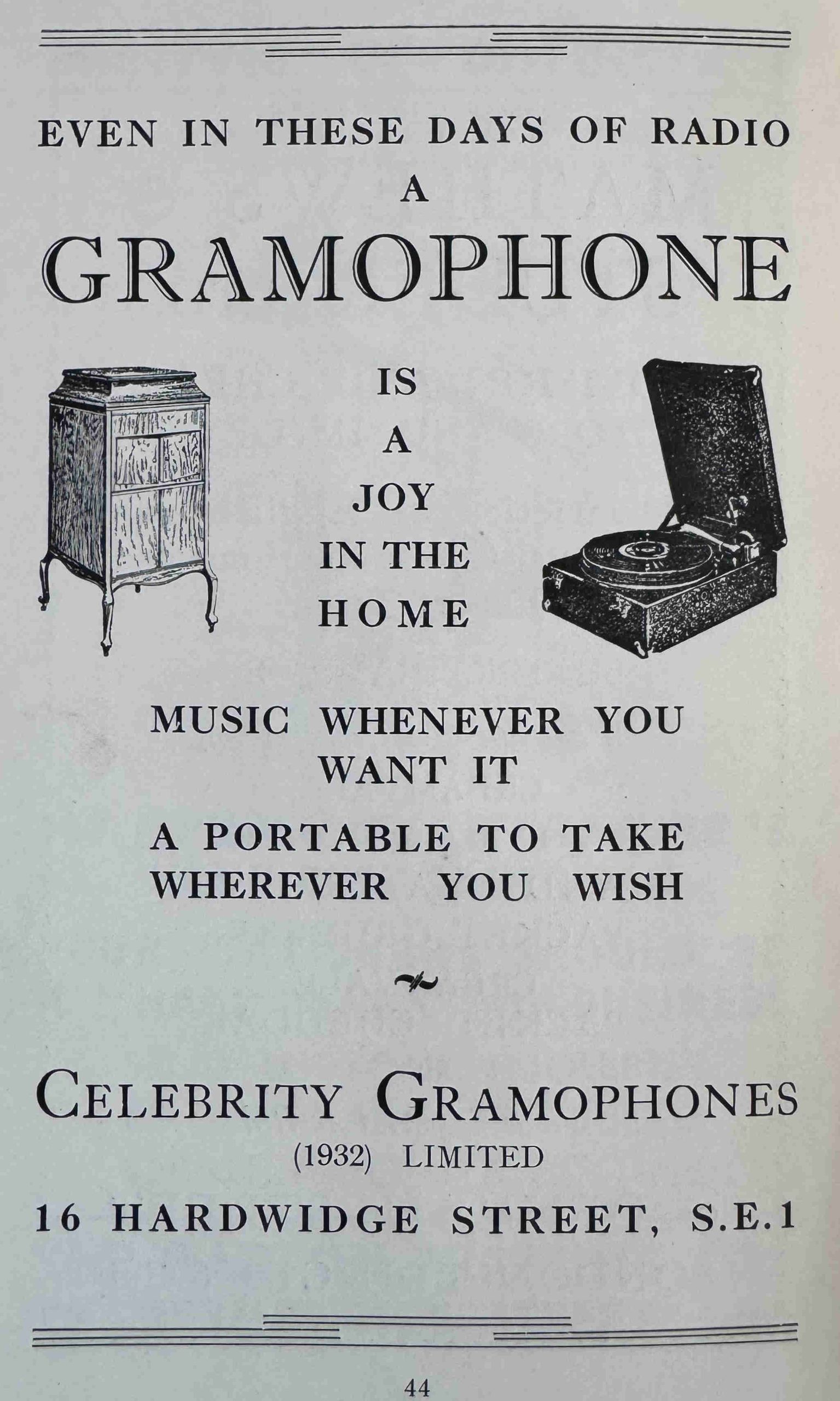
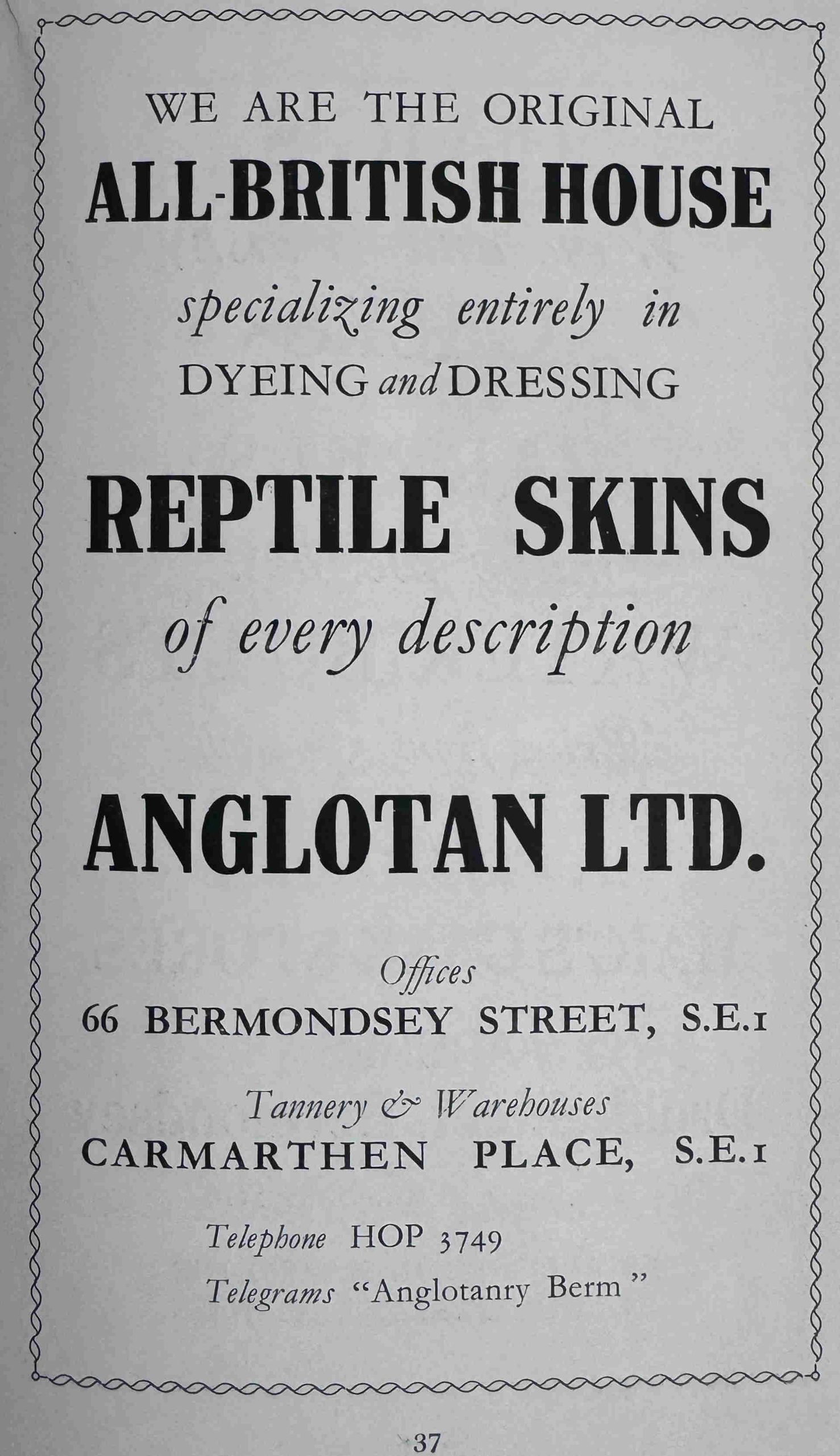
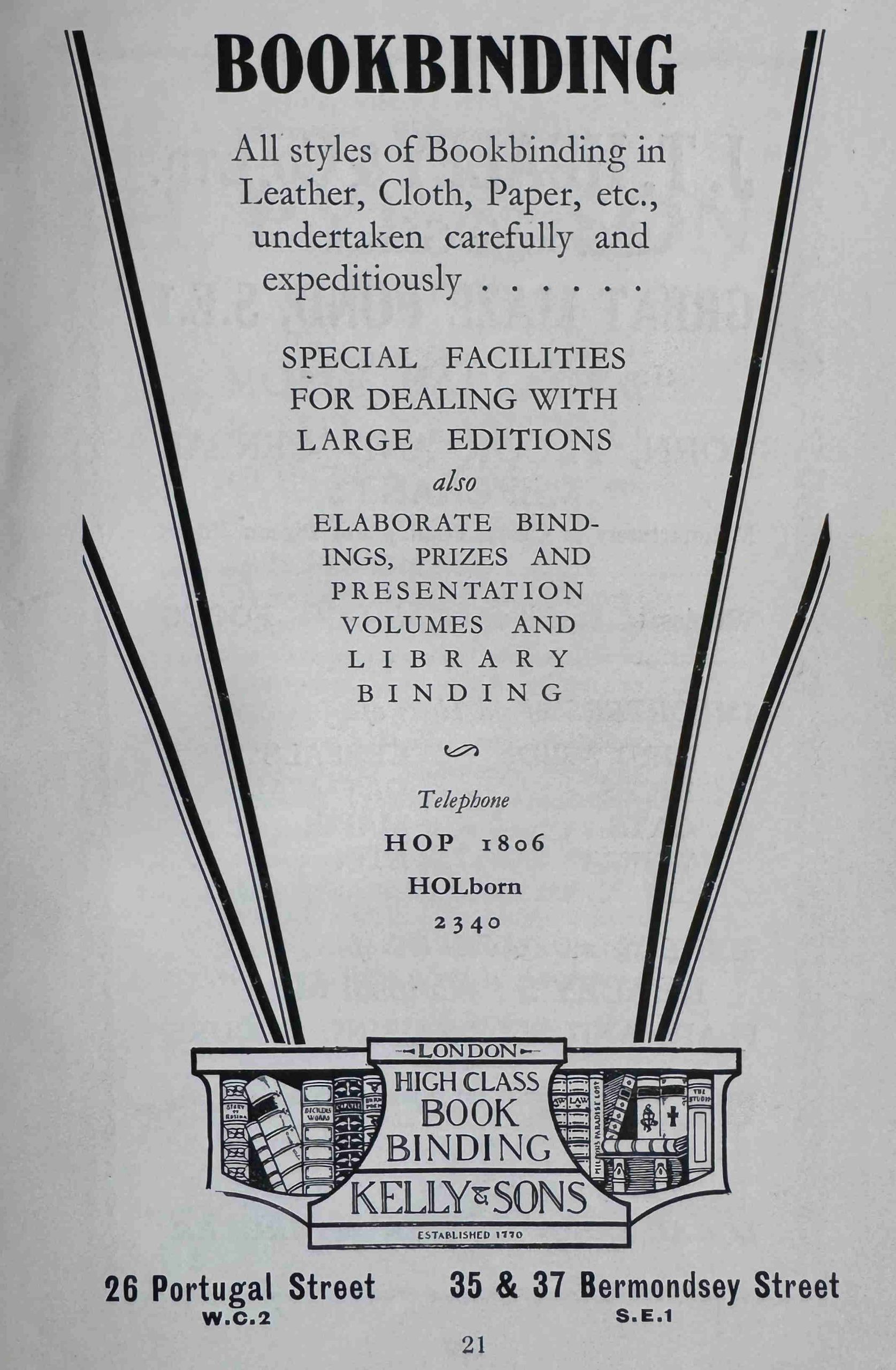
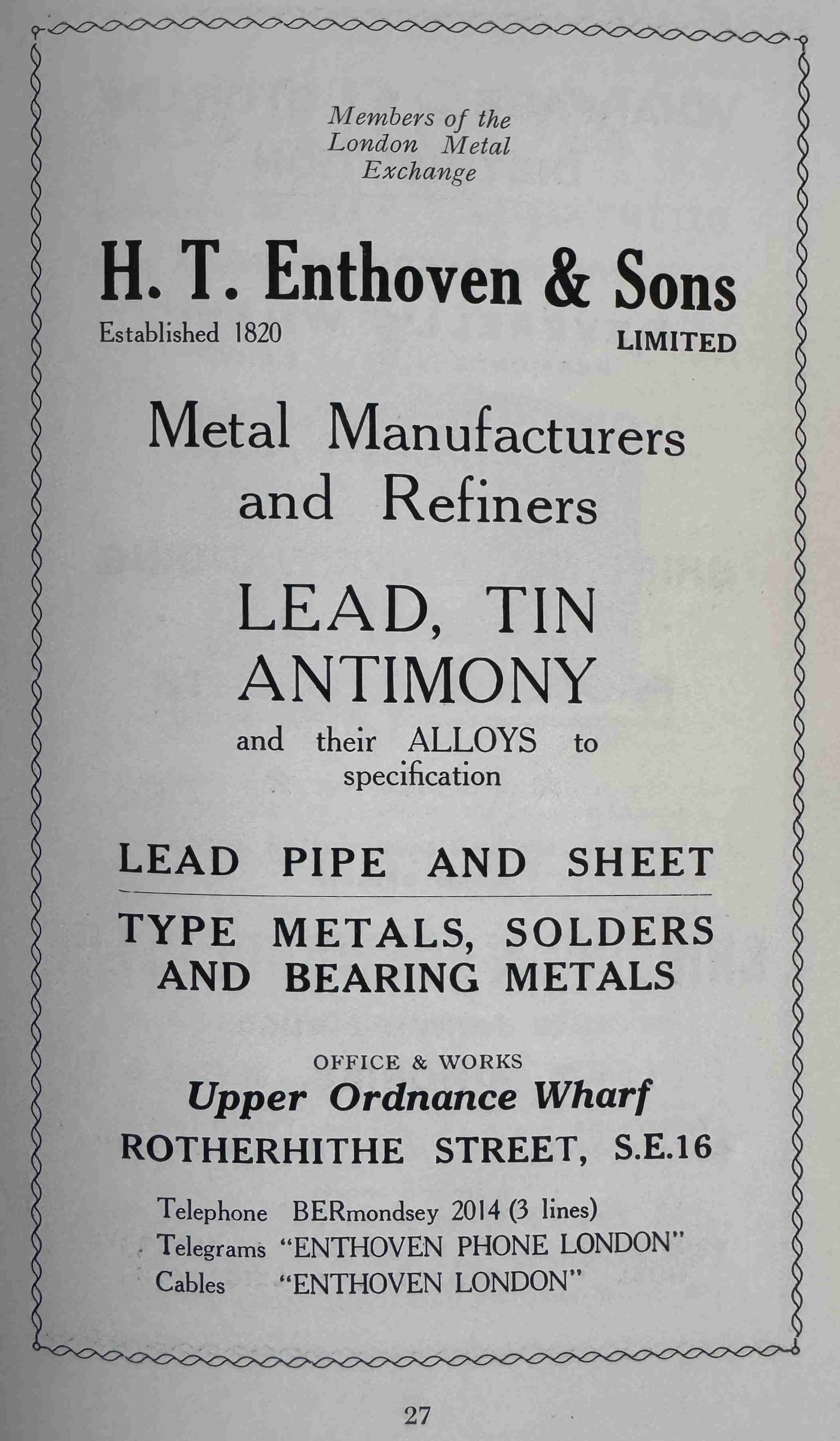
A small sample which gives an idea of the breadth of industry and business in Bermondsey, which included the Oriental Confectionary Manufacturers Limited:
Celebrity Gramophones:
Anglotan Ltd. – the All-British House for Reptile Skins:
Kelly & Sons – High Class Book Binding:
H.T. Enthoven & Sons Limited – Metal Manufacturers and Refiners:
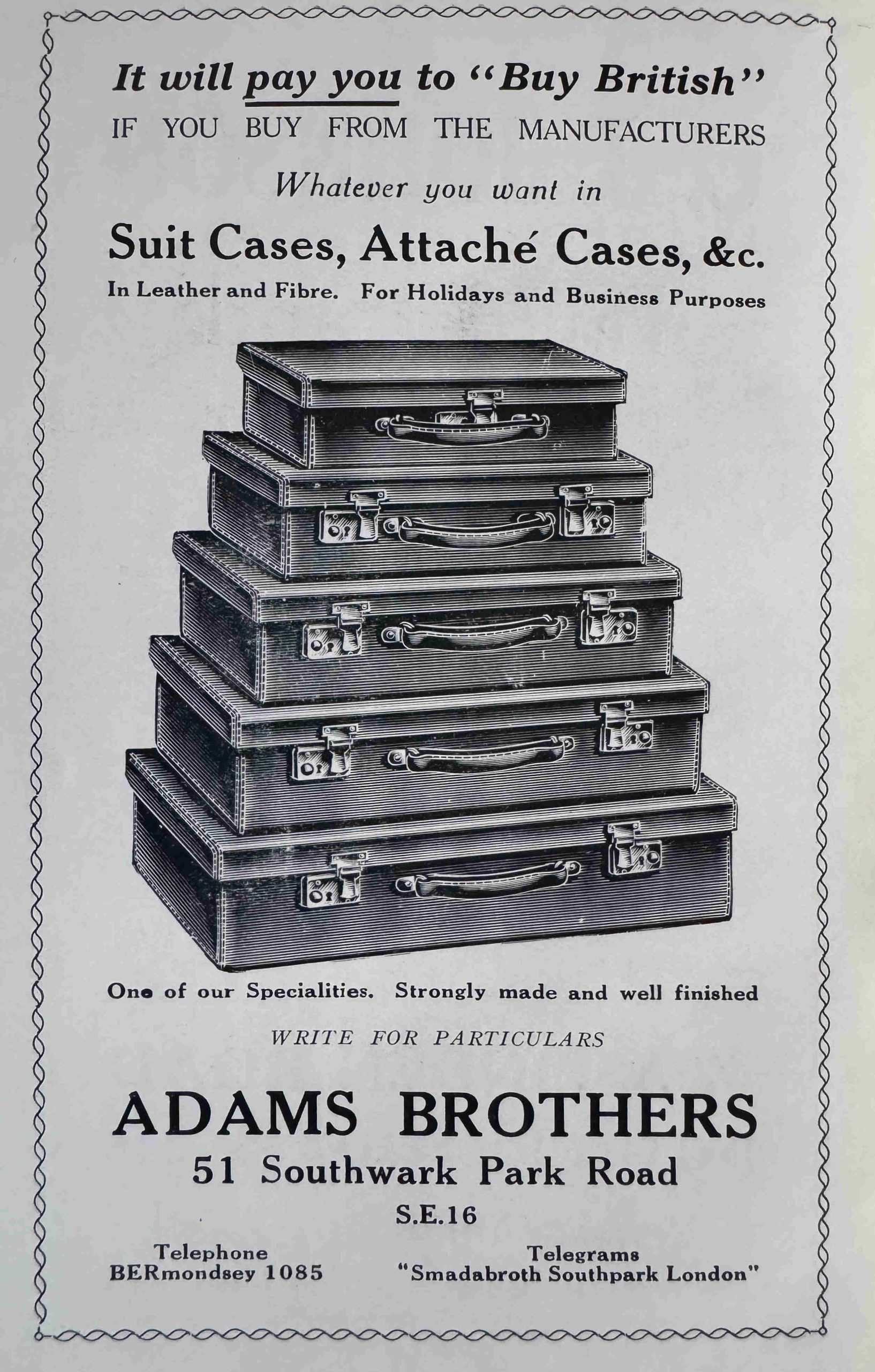
Adams Brothers – Suit Cases, Attaché Cases, &c. It will pay you to Buy British:
Bermondsey today is a very different place to that described in the 1930s guide book, but these adverts show only a small snapshot of the long history of an Ancient and Interesting Borough.
There were a number of comments to last Sunday’s post on A. Tattam who ran a shoe repair business in Hackney. These comments provided much more information about Albert.
Unfortunately, I created the post so it was ready for Sunday, and then initiated the transfer of the site to the new hosting provider. This took a while to complete, test and fix a number of minor problems, and I switched the Internet address over to the new site last Tuesday, which meant all the comments were on the old copy of the site with my previous hosting provider.
I do have copies of all these, but cannot add as comments, so will add within the post, as they really added some fascinating detail to his life.
The move means that I am happy to report that A London Inheritance is now hosted with SiteGround.
Now to today’s post:
A few week’s ago, my post was about Putney and Fulham – Bridges, Church and Thames Stairs, and was the first part of a walk from Putney Bridge to Hammersmith Bridge, not just because it is an interesting walk, but also to find the Thames stairs and landing places listed in the Port of London Authority’s directory for this stretch of the river.
My last post finished at Bishops Park Upper Stairs, and this post continues onward, all the way to Hammersmith Bridge.
Exploring this area shows just how rapid London was expanding to the west in the beginning of the 20th century, and that there was still a considerable amount of industry this far to the west along the river.
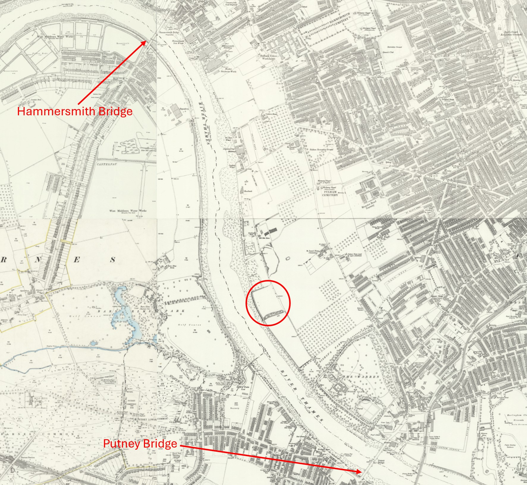
The following Ordnance Survey map dates from the end of the 19th / early 20th century. I have marked Putney and Hammersmith Bridges, and also put a circle around Craven Cottage, the home of Fulham football club, which I will come to later in the post.
I will be walking along the right hand side of the river as it is orientated in the following map, and around 120 years ago, the land along the river and a distance in land was still open space, although to the right, dense streets of housing can be seen approaching (‘Reproduced with the permission of the National Library of Scotland“):
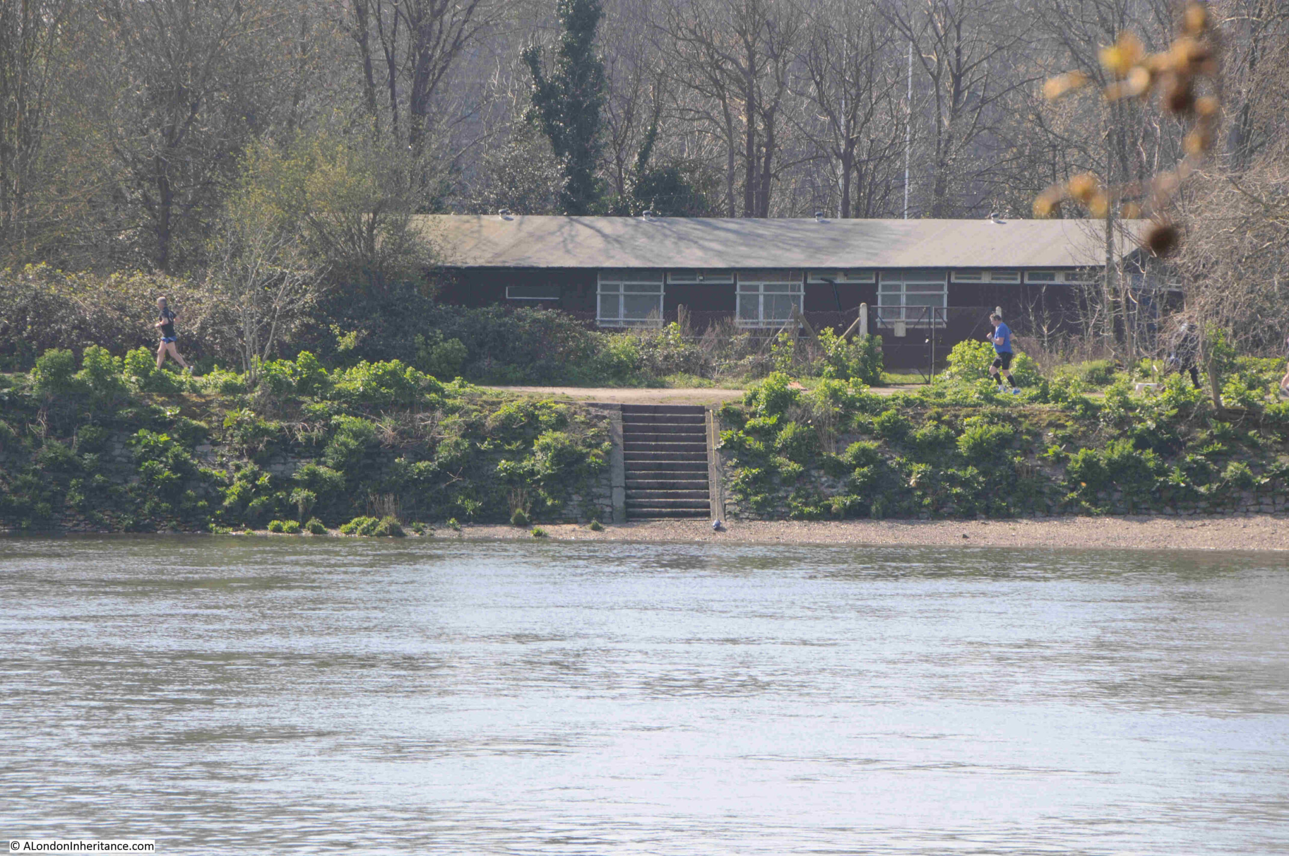
As well as the two sets of stairs by Bishops Park, the Port of London Authority listing has another access point to the river close to Hammersmith Bridge. That is three places to access the river along this side of the river between Putney and Hammersmith Bridges. The listing does not include any stairs or slipways on the other side of the river, although some do exist, such as the stairs shown in the following photo:
I wonder if this is because the stairs on the eastern side of the river were up against industrial developments and businesses that used the river, and were therefore classified as working stairs, whilst the opposite side of the river had no similar development, and whilst there may have been stairs providing access to the river, these were not classed as working stairs.
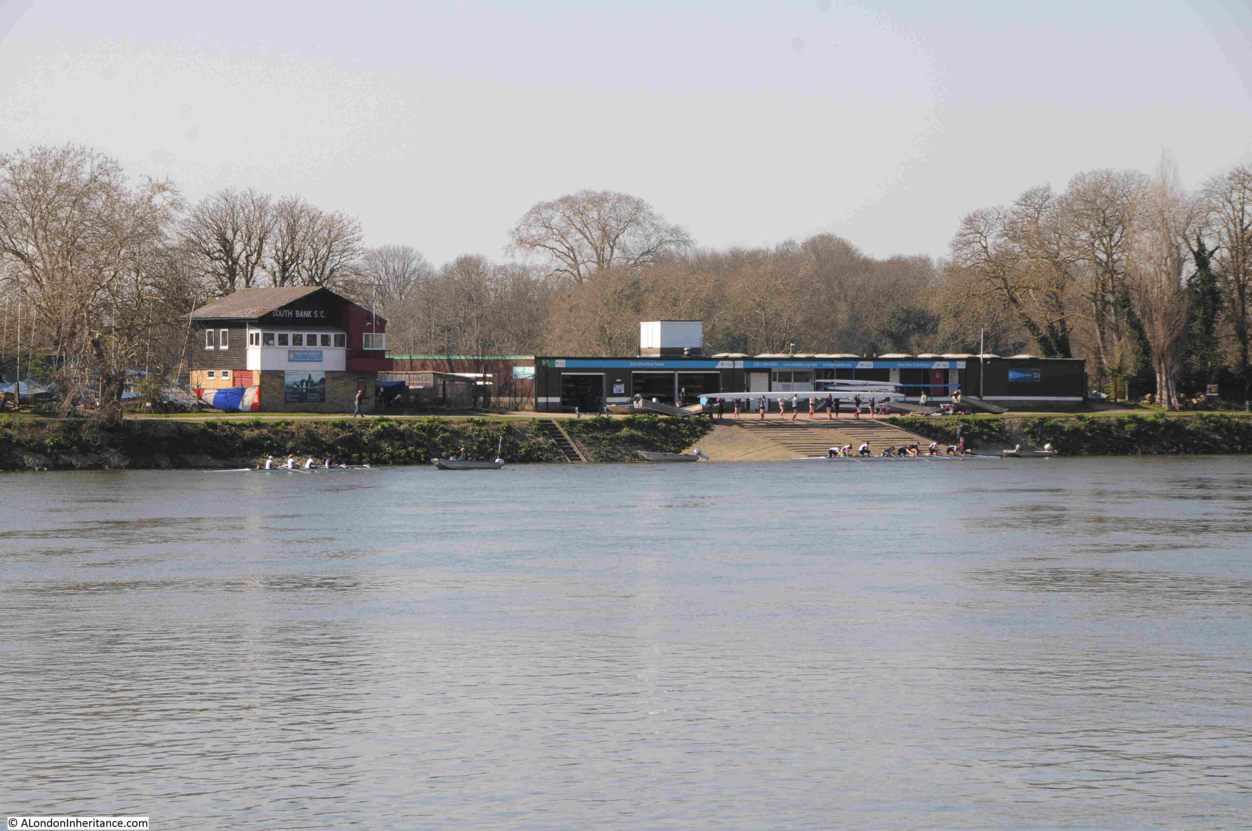
The western side of the river is home to a couple of rowing centres, such as the Barn Elms Boathouse:
A short distance along from Bishops Park is the home of Fulham football club – Craven Cottage:
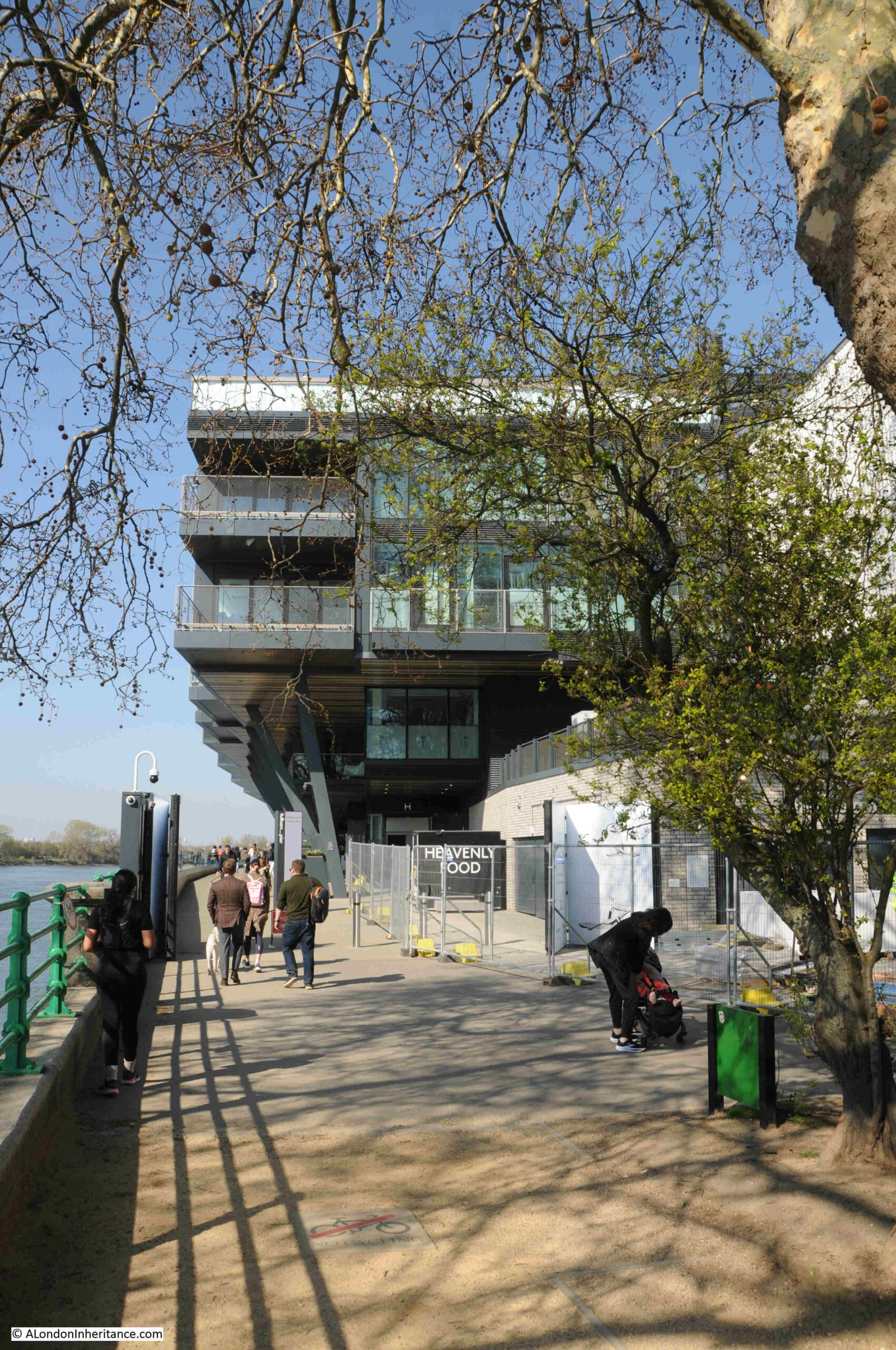
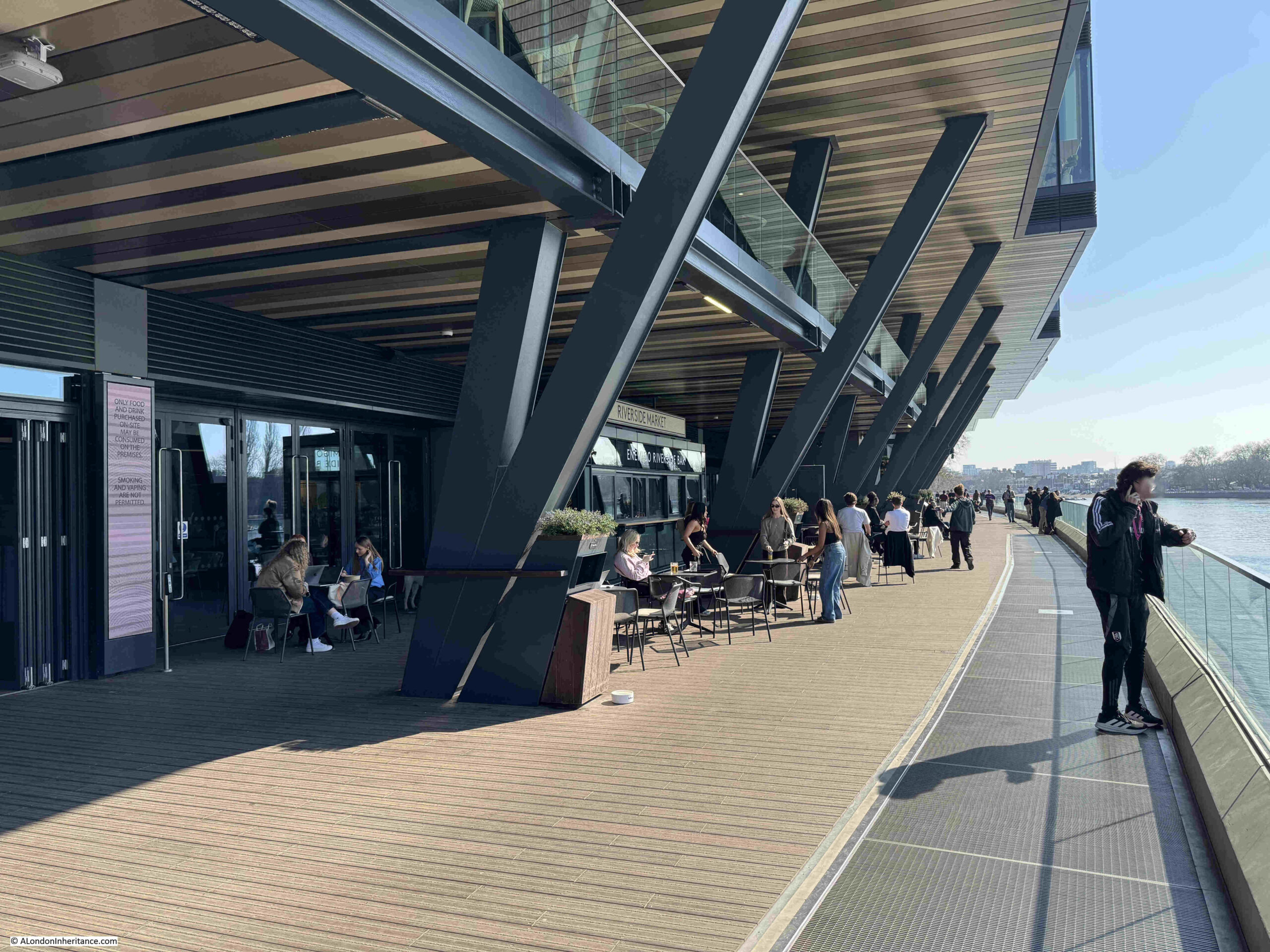
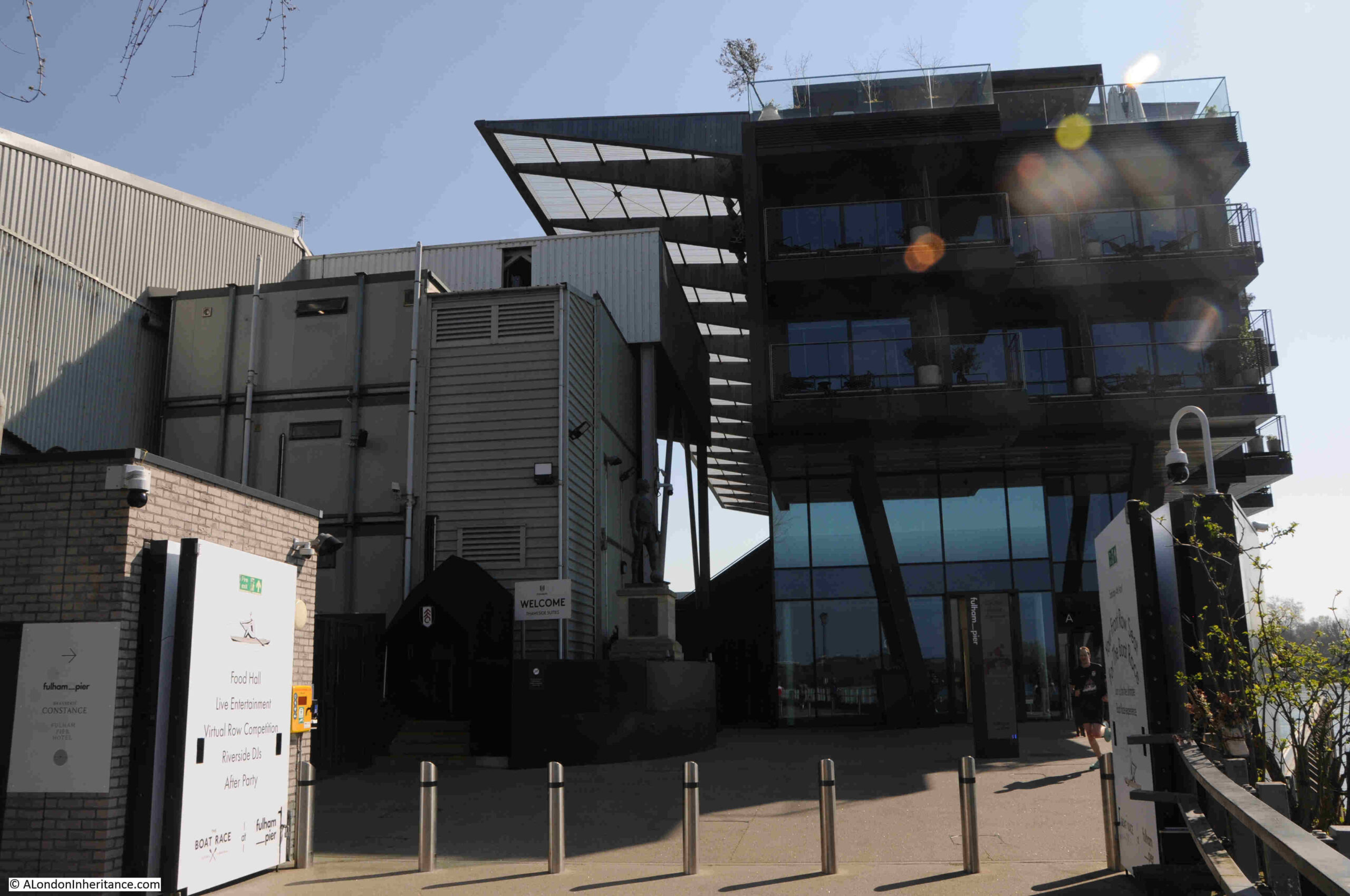
And walking along the river, the most obvious part of Fulham’s ground is the new Riverside Stand, which extends out and over the new walkway along the river:
Inside the ground floor of the new stand are a range of food and rink outlets, with seating alongside the river walkway. These are open during the day, not just on match days, when it is ticketed only, so if you are walking the river between Putney and Hammersmith, this is a good place to stop for a drink.
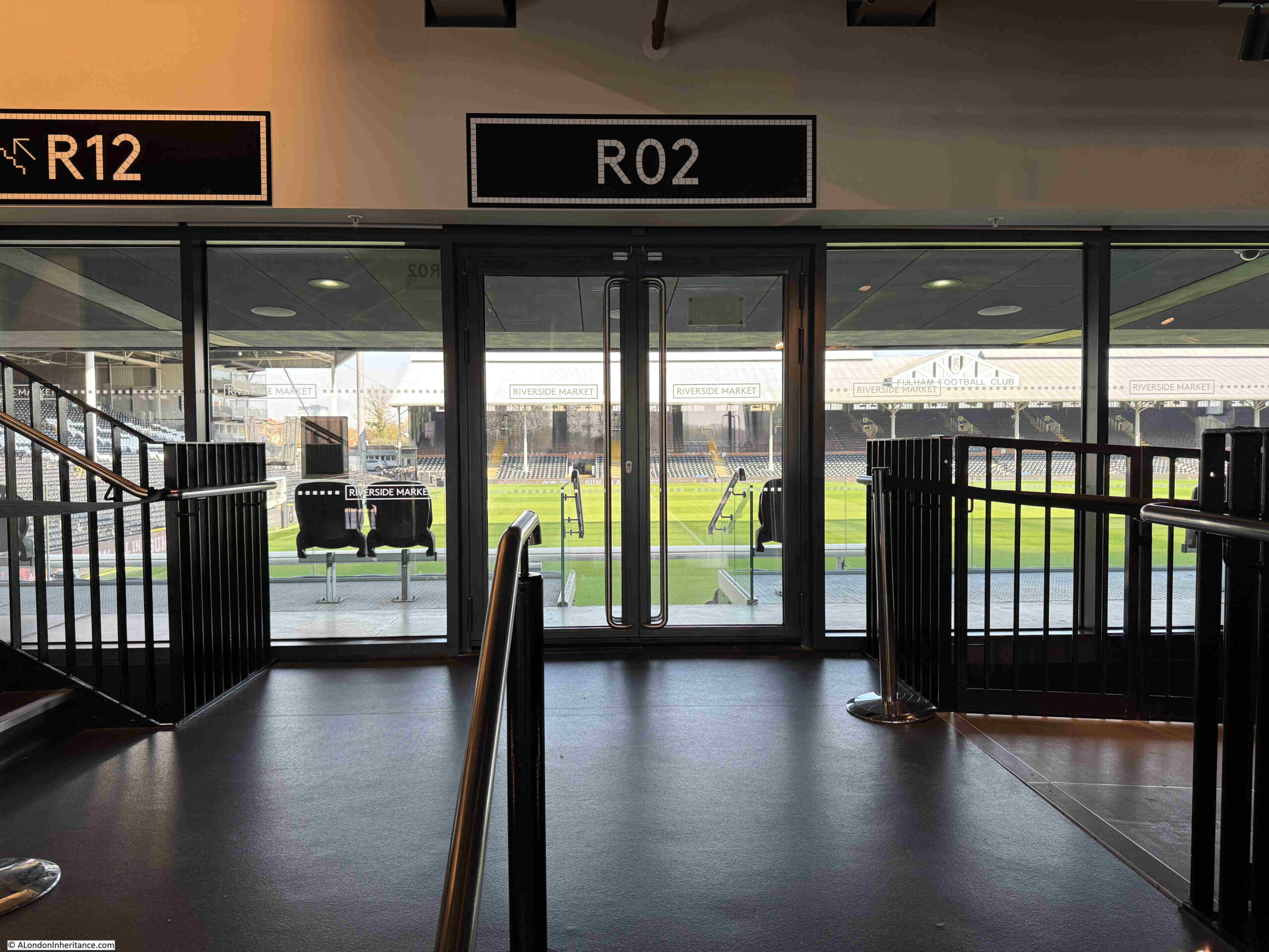
Inside, there are views through to the ground:
Fulham claim that Craven Cottage is the oldest football ground in London. They played their first match at Craven Cottage on the 10th of October 1896.
The club was formed in 1879, and before the move to their current site, had played at a number of locations around Fulham and Barn Elms. The club had purchased the land in 1894, and it had taken two years for the land to be cleared, a derelict house removed and the ground prepared.
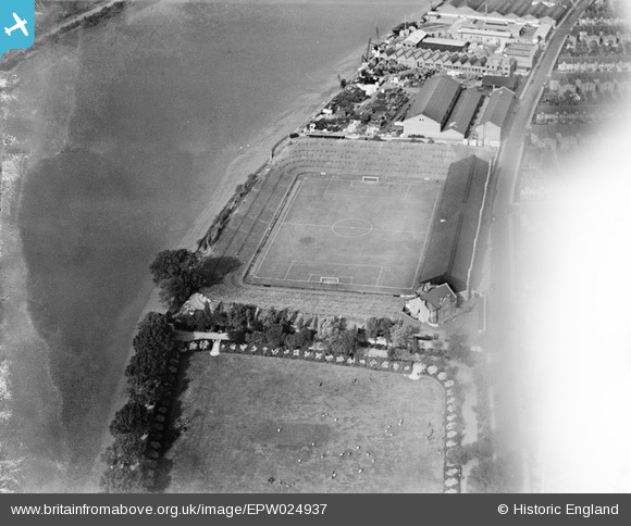
This first, simple ground, was the one shown in the first map in the post. There were banks surrounding the pitch made from earth excavated during the construction of Shepherd’s Bush underground station.
A wooden stand was constructed but this only lasted a few years before being replaced by a new steel stand in 1905, and at the same time, the earth banks were terraced.
It is this configuration of Craven Cottage which can be seen in the following 1928 photo from Britain from Above:
In the above photo, the earthen bank along the river, to the left has now been replaced by the Riverside Stand, the northern edge of which can be seen in the following photo, where the stand and seating can be seen in the gap, and the photo shows just how close the stand is to the river on the immediate right:
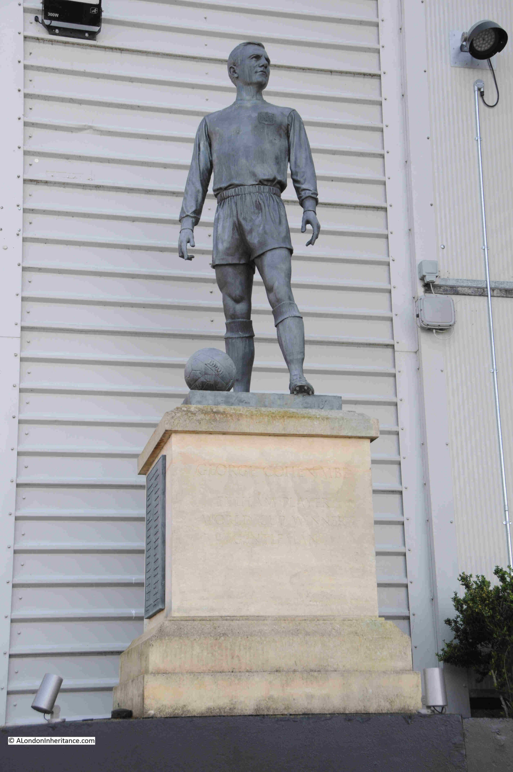
Next to the stadium, alongside the river walkway is a statue of George Cohen MBE, a player who spent his entire professional life at Fulham, as well as playing for England, including the World Cup in 1966, where he played in the final against Germany.
The statue was unveiled in 2016 to mark the 50th anniversary of England winning the 1966 competition:
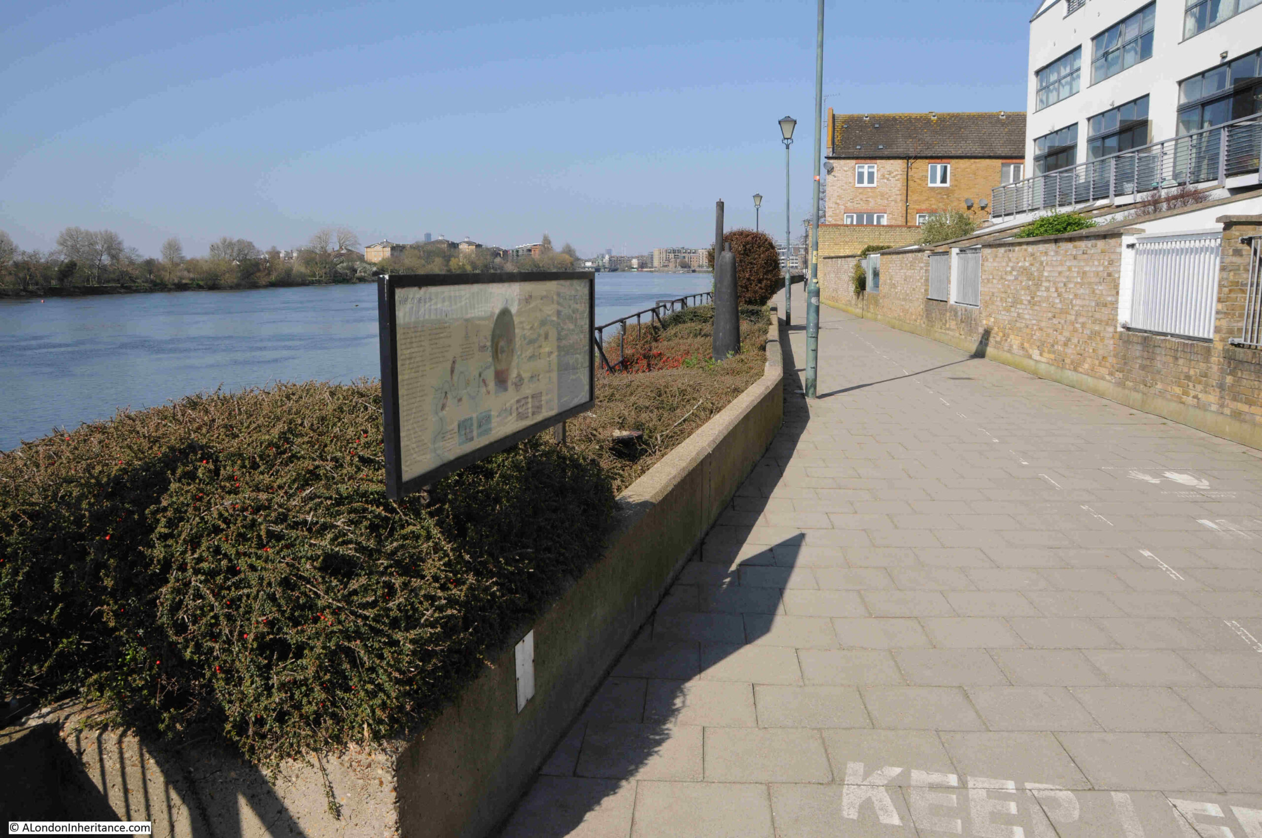
Leaving Craven Cottage, and the view along the walkway towards Hammersmith:
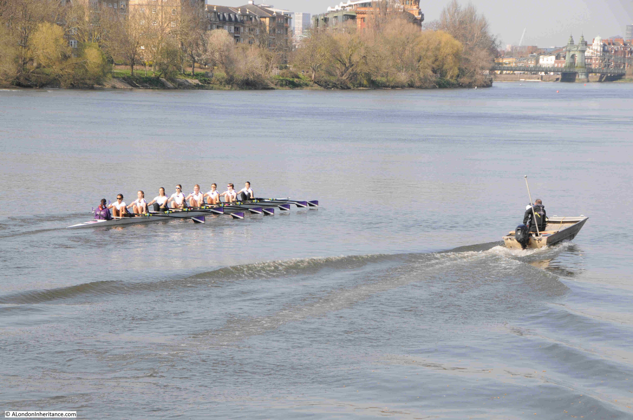
There is plenty of rowing along the river:
Not sure what these strange features are along the wall of the walkway:
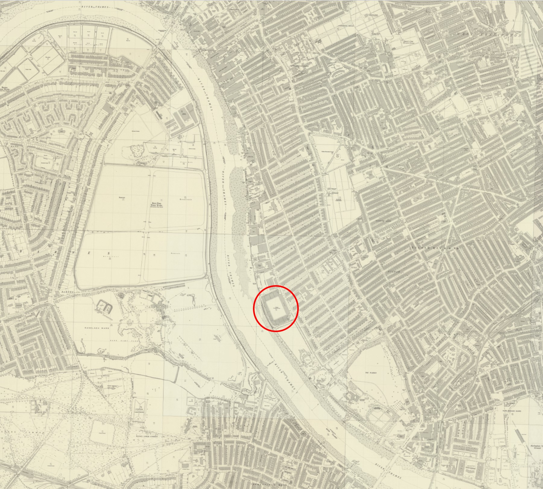
It is hard to image that this entire walkway from Craven Cottage up to Hammersmith Bridge was once lined by industry, but a look at the second of the OS maps at the top of the post shows just how much there was.
A surprisingly high number of oil storage and distribution depots along with an oil refinery, a coal depot, a plaster manufacturer, sugar refinery, preserved food factory, joinery works, a distillery, wharves and warehouses.
Their proximity to the river allowing raw materials to be delivered, and finished products transported.
Nearly all evidence of these industrial sites has gone, replaced mainly by housing, but some traces can still be found.
Along the walkway, there is a small, green open space called Rowberry Mead. This was originally Roseberry Meade, where in 1638 there was a house with a cherry orchard which was recorded as being the finest in England. In 1661, a lease granted by the Bishop of London estimated the size of Rowberry Meade as being six acres.
In the late 19th century, it was a place where osiers (a type of willow tree), and reeds were grown for the basket making industry:
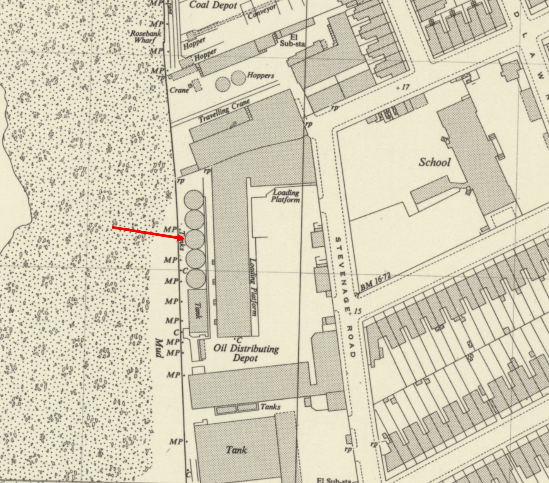
However by the 1940s, the cherry orchards, osiers and reeds had all gone, and the site was an oil distribution depot, with five circular oil storage tanks lining the river.
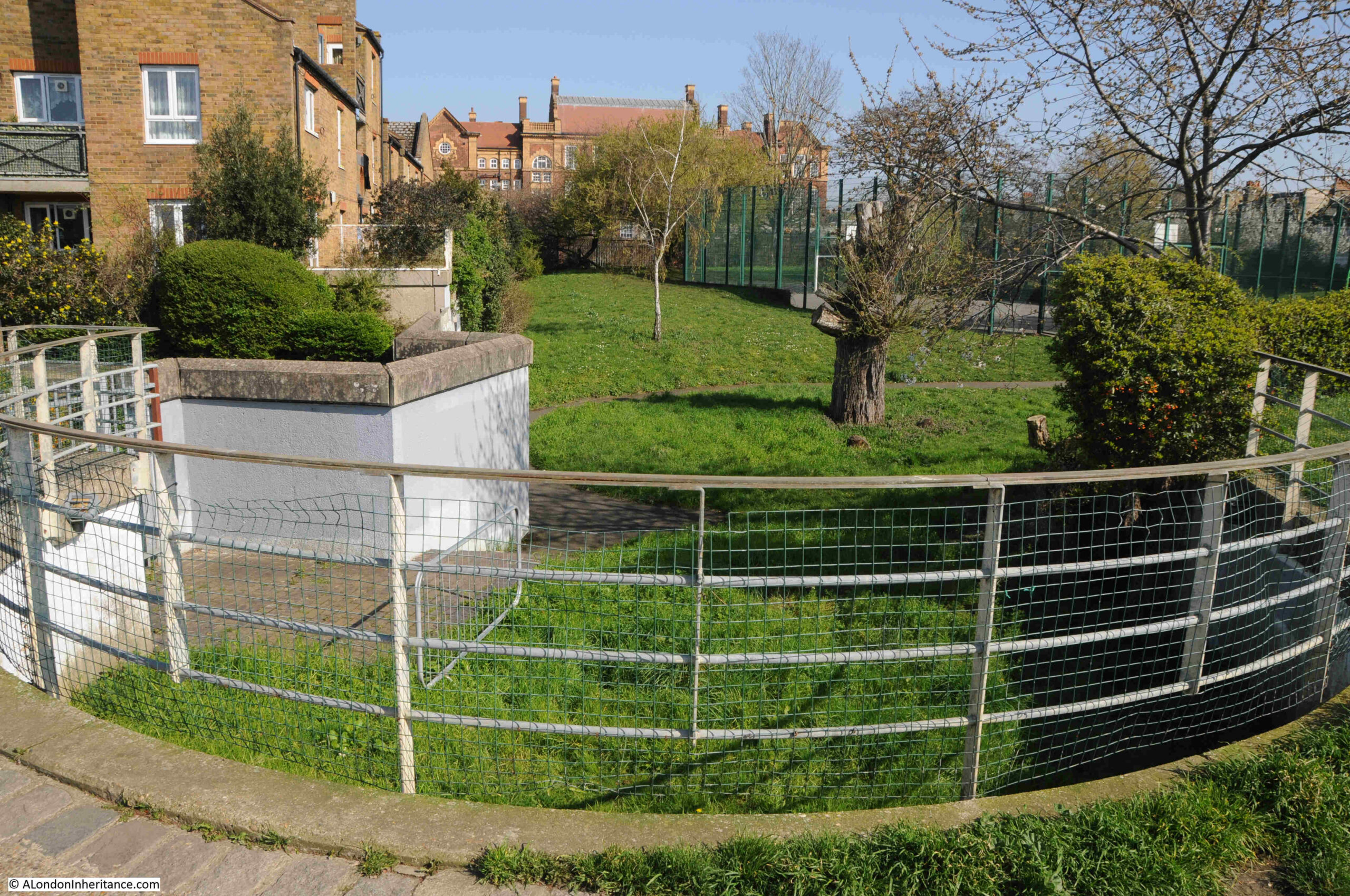
Whilst the tanks have disappeared, the outline of a couple of the tanks have been preserved in the layout of the park:
In the above photo, the curved fencing and concrete wall below is the riverside edge of the tank arrowed in the following map:
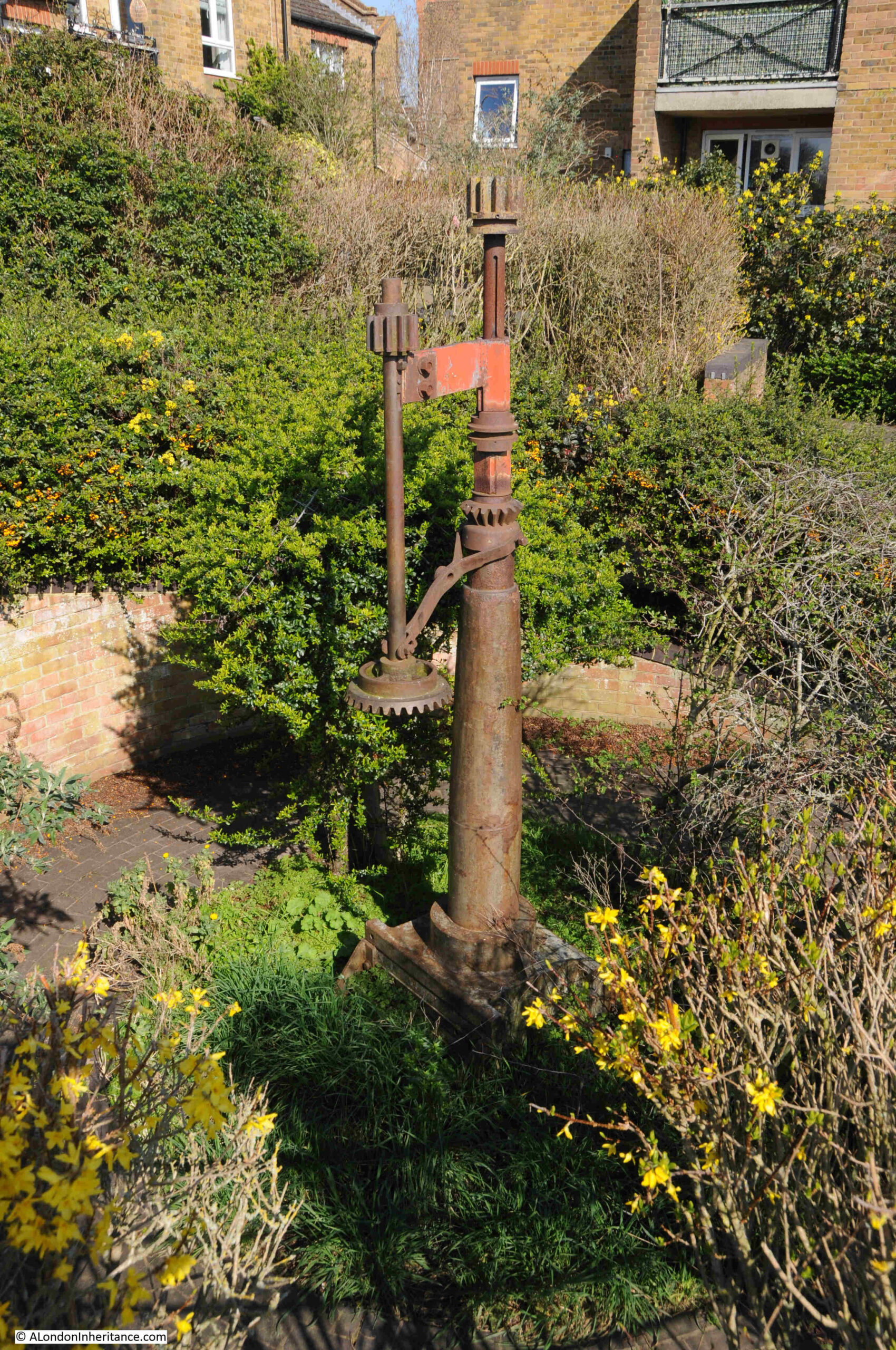
And the outline of the tank above the one with the red arrow is also part reserved, and this includes a mechanism which is placed in the centre of where the tank was located:
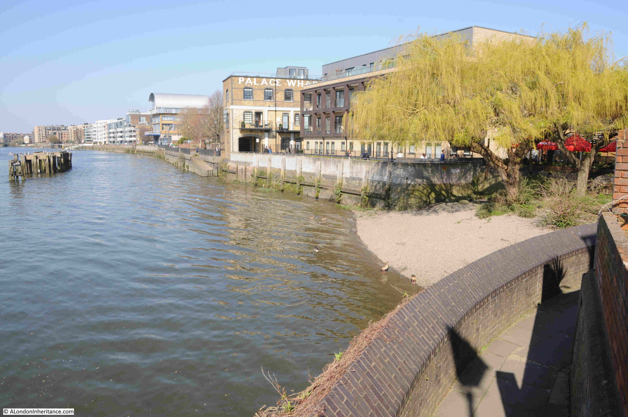
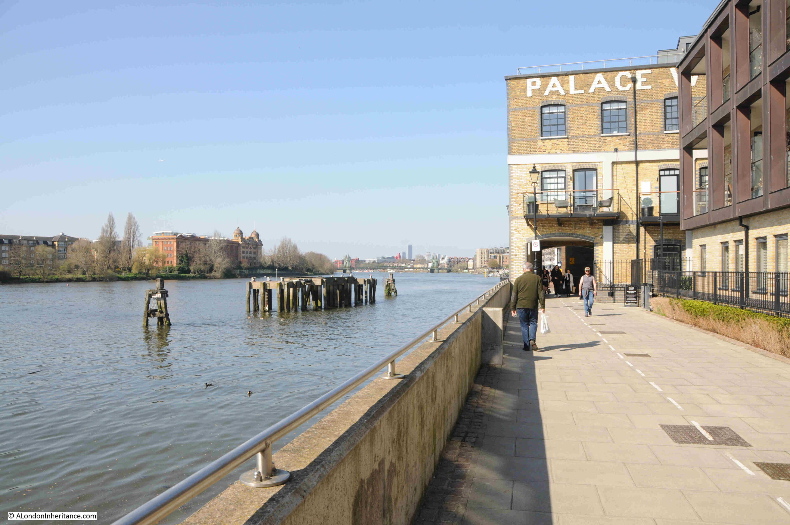
From a curve in the walkway, we can look across at the building which is still signed as Palace Wharf, which in the second OS map was the northern edge of the building complex that formed the Rathbone Works, where fibrous plaster and joinery was manufactured.
Also, in the following photo, it is interesting that whilst today there are no osiers / willows at Rowberry Mead, willows can still be seen growing on the river foreshore:
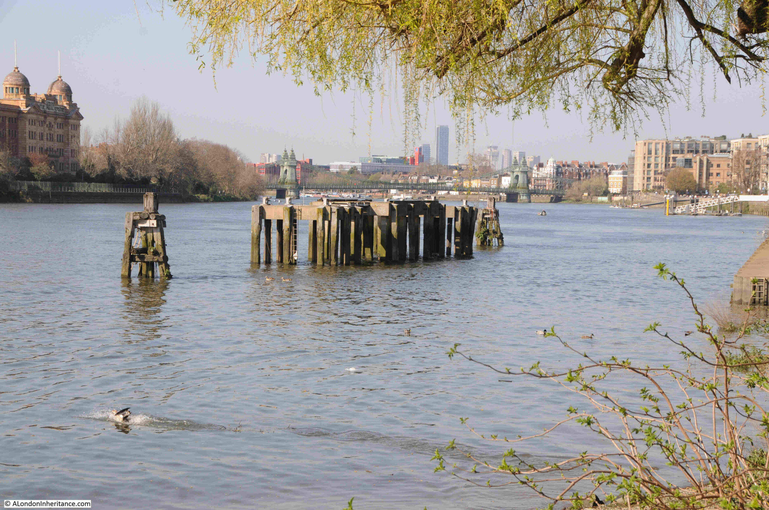
All the industry along the river required infrastructure to support the boats that brought goods to and from the storage depots and factories, most of this infrastructure has gone, but there still the remains of some wooden piers along the river:
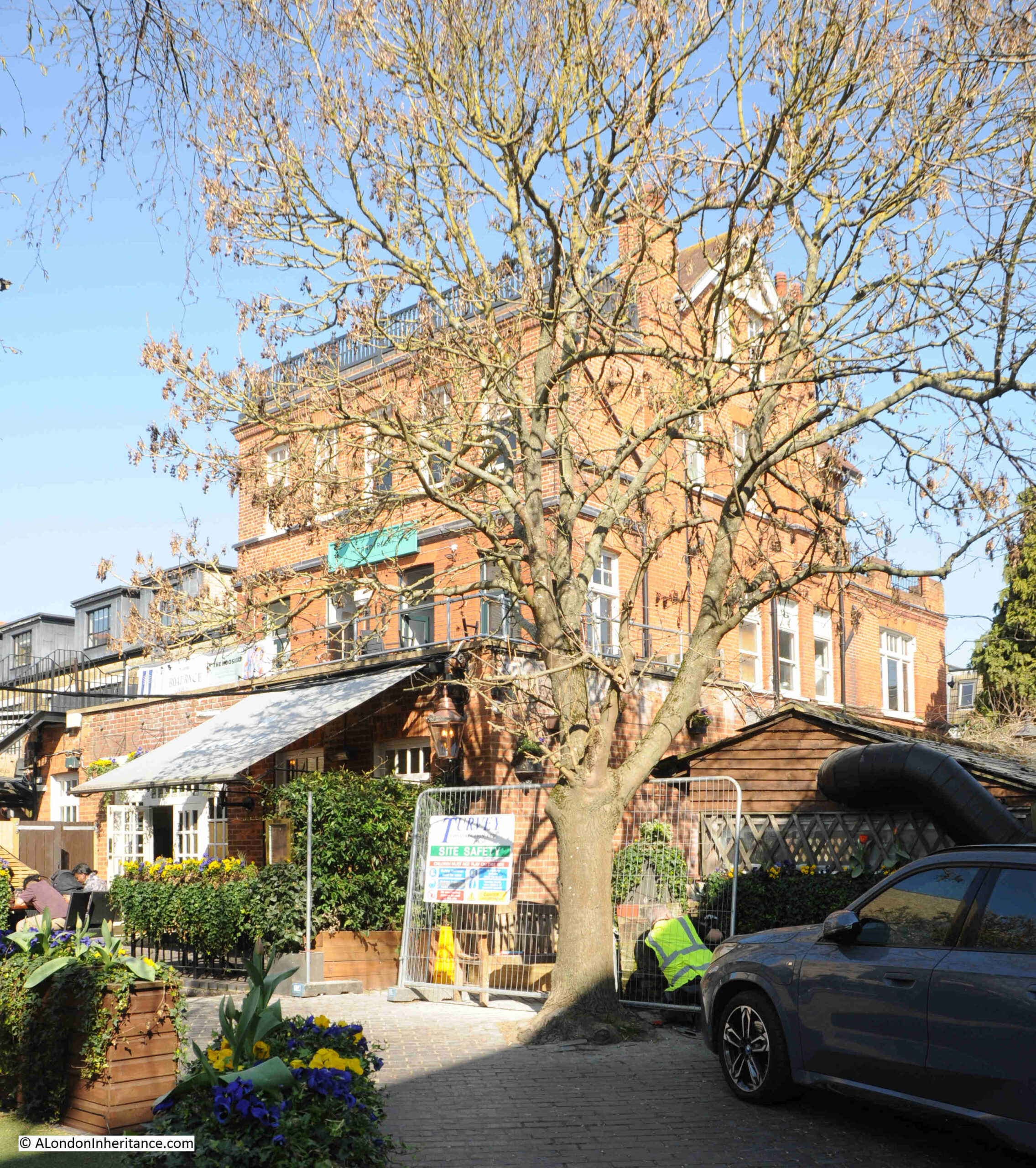
In the following photo, the large brick building is the Crabtree pub:
There has been a pub on the site since at least the 1830s, with the large building we see today being a reconstruction of the pub in 1898 by Sich’s Lamb brewery of Chiswick.
The name of the pub, the Crabtree comes from the Crab Tree, or wild apple tree, of which there were once many in this part of Fulham.
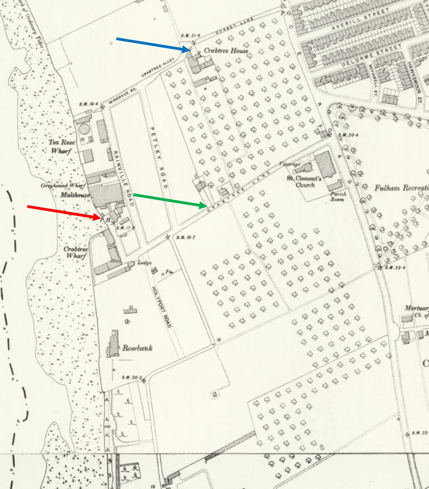
In the following extract from the late 19th century OS map, the red arrow points to the first Crabtree pub, the green arrow points to Crabtree Lane, and the blue arrow points to Crabtree House. There are tree symbols covering many of the fields, presumably these were the crab trees which gave their name to the house, lane and pub:
Continuing along the walkway which heads under part of the original Palace Wharf buildings:
To show how industries changed along the river, in the late 19th century OS map, the area occupied by Palace Wharf was a malthouse, around 45 years later the site was manufacturing fibrous plaster.
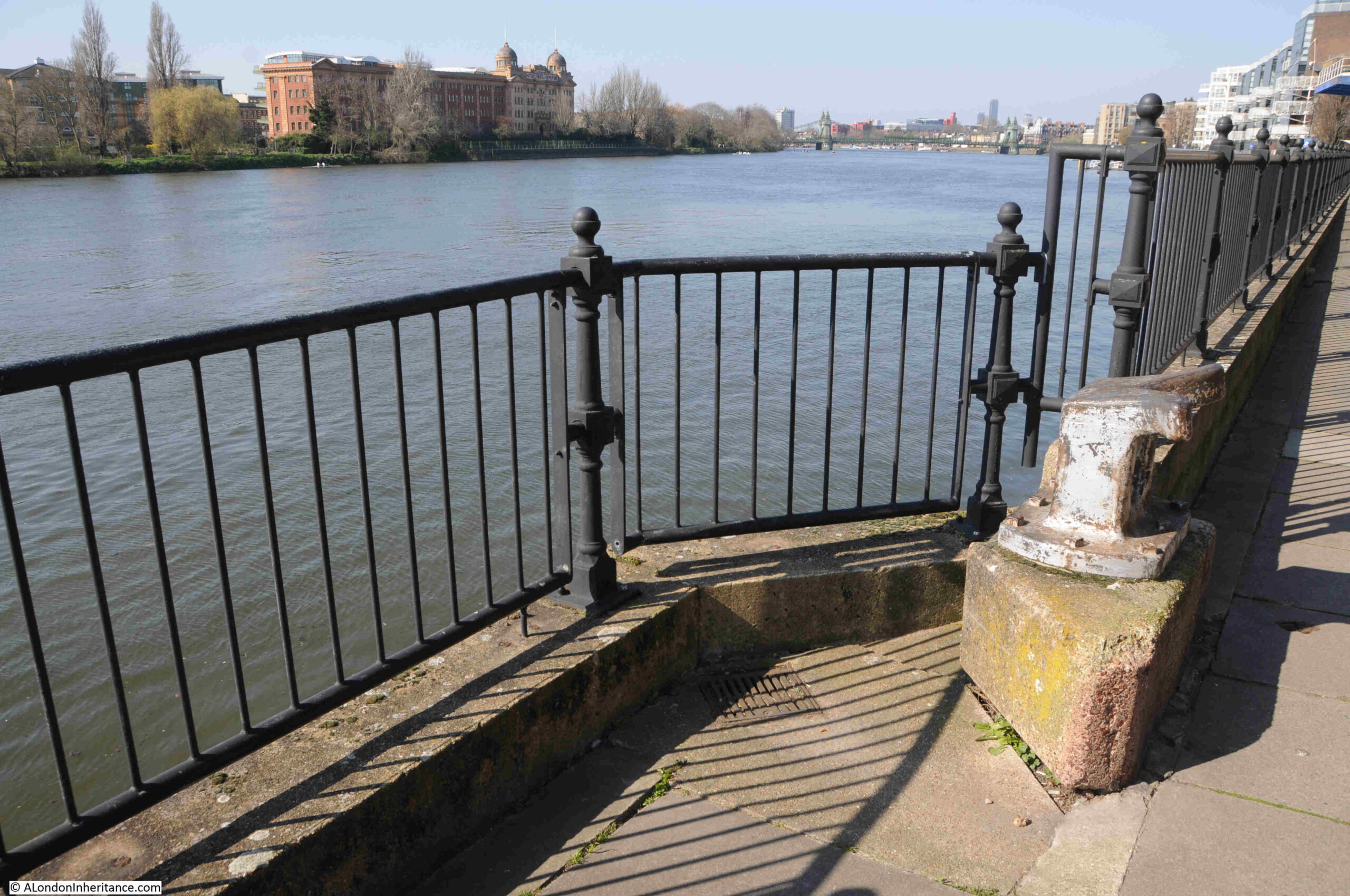
Another reminder of just how connected with the river this stretch of the shore once was, along the walk there are features such as in the following photo, where mooring lines would be tied from the boats transporting goods to and from the industrial premises:
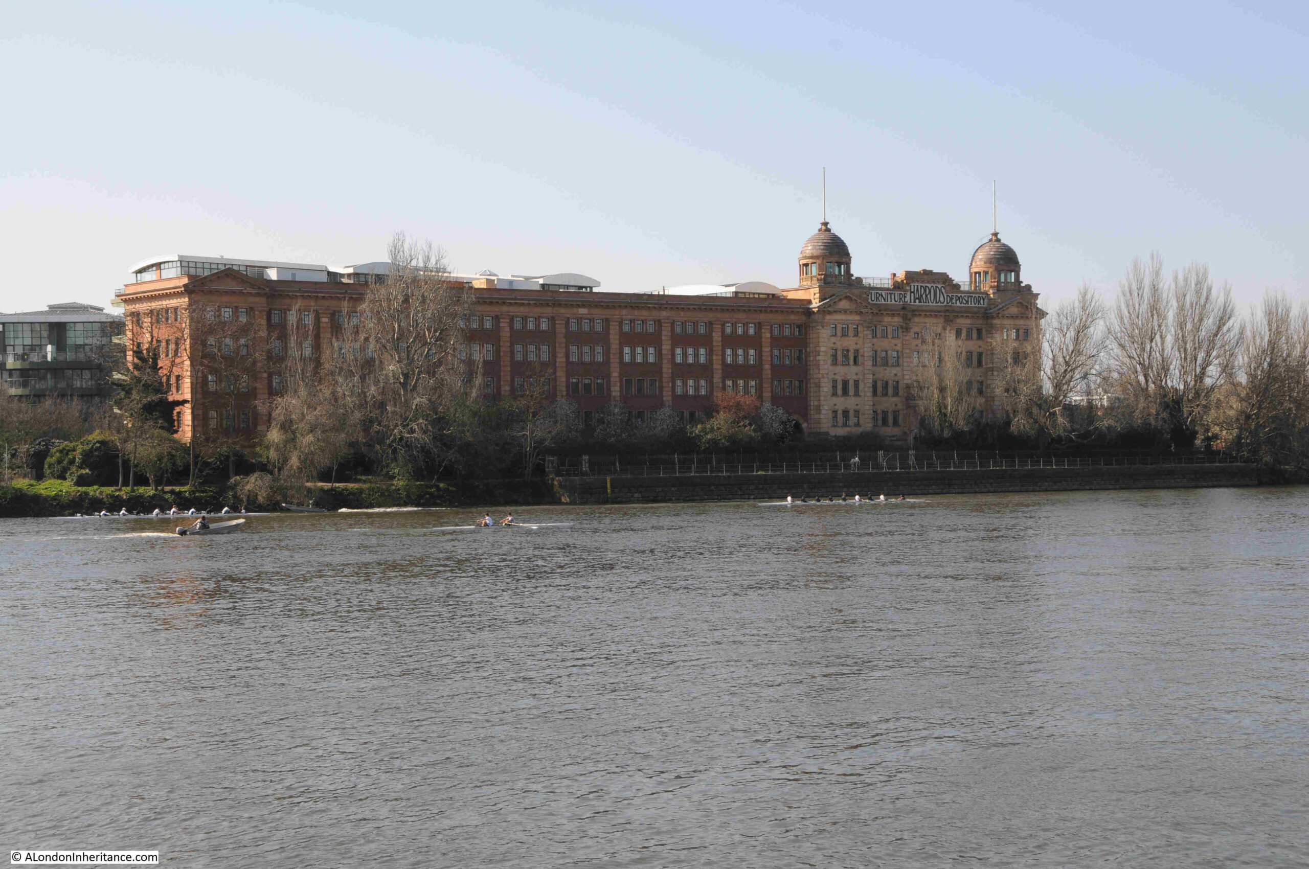
On the opposite bank of the river is the Harrods Furniture Depository:
The Harrods Furniture Depository was built between 1894 and 1913, having been designed by the architect W.G. Hunt.
As the name suggests, it was built to store furniture over and above what could be on display at the Knightsbridge store, and was also used to distribute furniture ordered by customers. The river was a key means of transport, and there was a pier on the river where boats could moor to deliver or take on furniture. Furniture was also repaired and restored in the building.
Harrods made use of the site in other ways to serve their customers, as the following from The Lady on the 30th of March 1895 shows:
“Many of our readers, and especially many ladies, will be glad to learn that there is a possibility this year of viewing the Boat Race from particularly comfortable quarters without the crushing inconvenience usually inseparable from such occasions. The directors of Harrods Stores have decided to fit up their wharf in front of the old Soap Works (now Harrods Furniture Depository), for the accommodation of a limited number of sightseers, and the race may be seen for at least a mile from this point for the very moderate charge of 2s 6d, light refreshments included.”
The Depository became redundant in the 1980s as delivery models moved from the retailers storing large volumes of goods, to a more just in time approach to minimise the need for costly stock holding and storage facilities.
The site was then converted into residential, with the large and impressive façade facing the river, being retained.
Getting closer to Hammersmith Bridge:
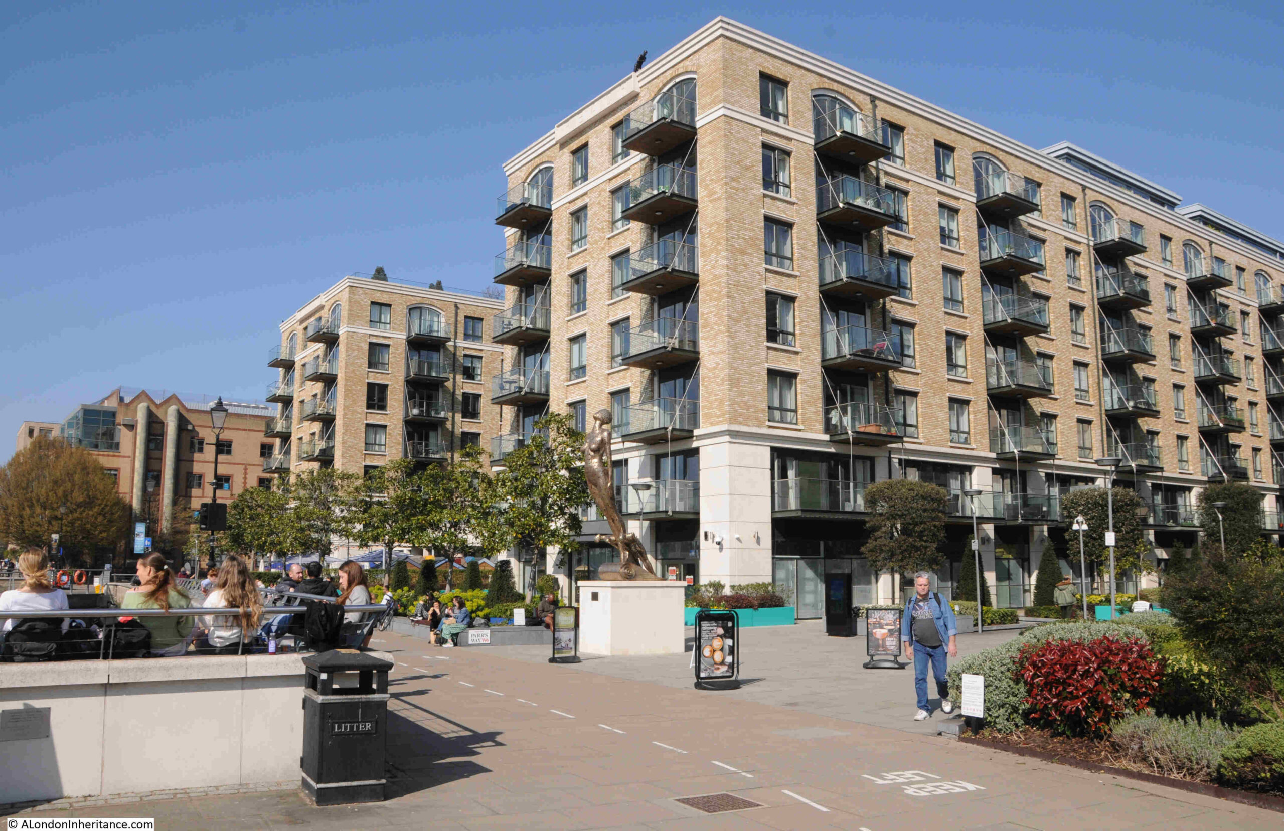
There has been a considerable amount of residential development along the land facing the river as we get towards Hammersmith Bridge.
These apartment buildings all follow the standard style of such developments of recent years, and they have the obligatory balcony:
The London Housing Design Guide published by the Mayor of London in 2010 defined in Section 4.10 Private Open Space that dwellings should have adequate private open space, in the form of either a garden, terrace, or balcony, and that 5 square metres should be provided for a two person dwelling.
This has probably led to a building design that in future decades will probably be recognised as an early to mid 21st century apartment design, much as today we recognise a Georgian or Victorian terrace.
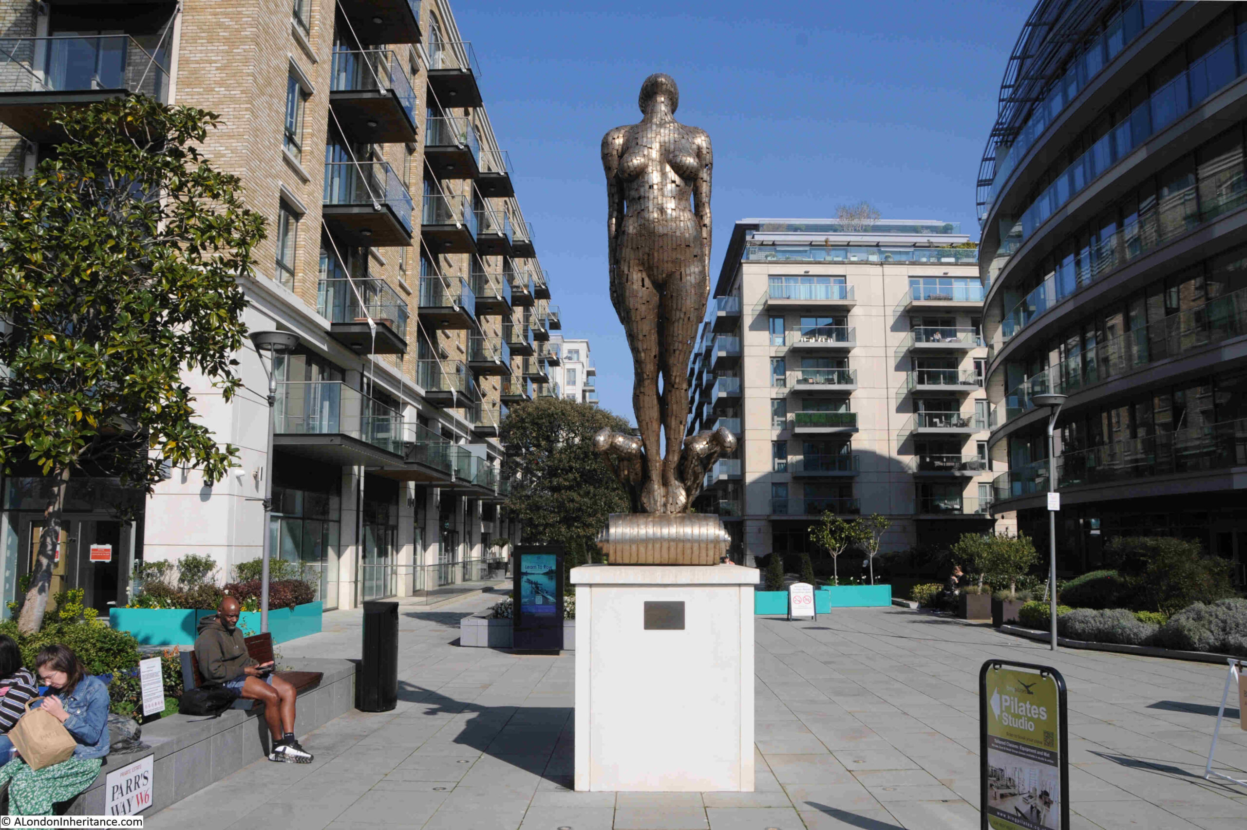
Figurehead by the artist Rick Kirby between the riverside walkway and the new residential development:
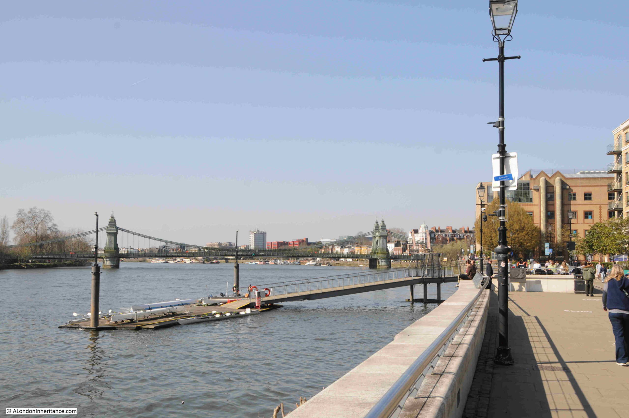
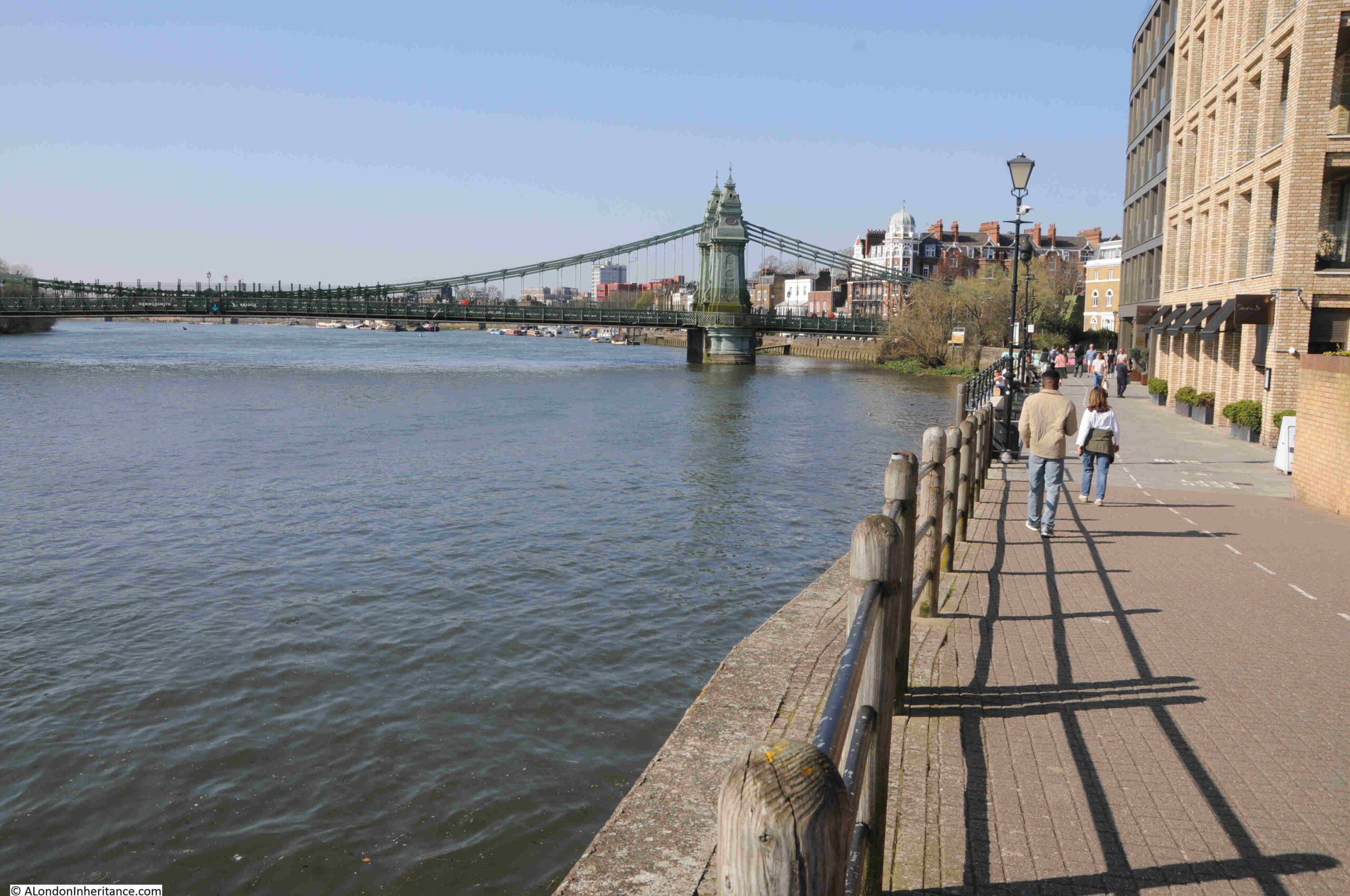
The final approach to Hammersmith Bridge:
And as I approached Hammersmith Bridge, I found the last of the three places listed in the Port of London Authority’s guide to access points on this stretch of the river.
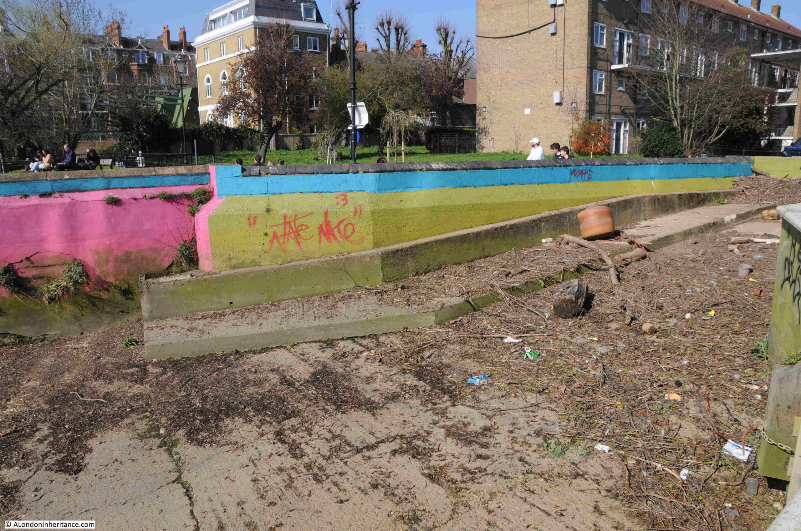
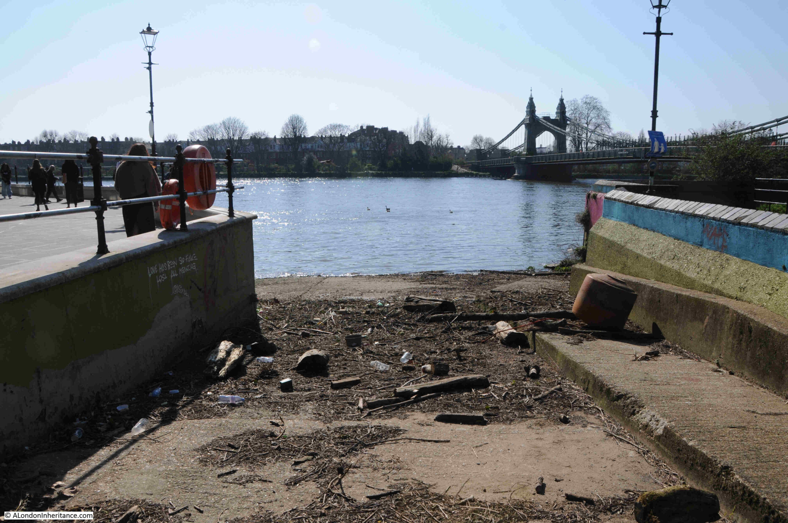
This access point goes by the simple name of “Hammersmith Landing”, and is a simple concrete slipway into the river surrounded by concrete walls:
The slipway was marked on the 1893 to 1896 revision of the Ordnance Survey map, where is was located directly at the end of Queen Street (now Queen Caroline Street). Rocque’s map of 1746 shows an unnamed street following the alignment of Queen Street and running through agricultural fields, with a number of buildings along the road, The street ran directly into the river, so as a point of access to the river, the site is probably at least 300 years old:
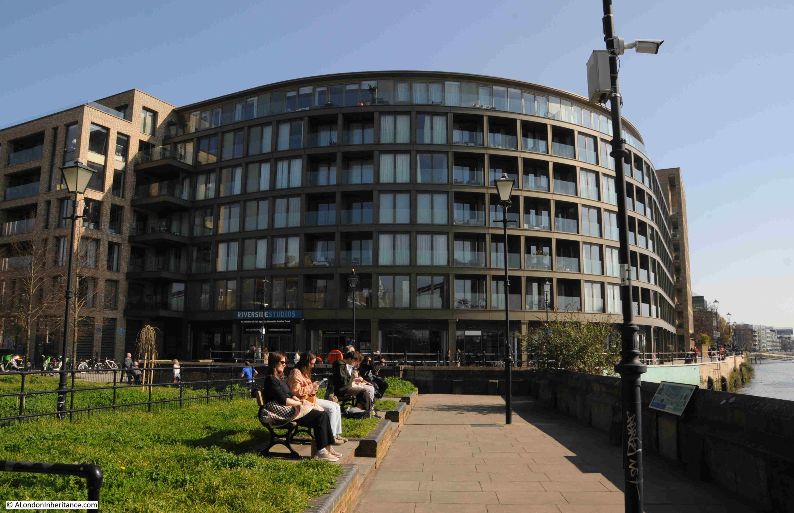
The building in the following photo is the Riverside Studios:
The Riverside Studios are another example of the transformation from industrial. The site was originally the 19th century and early 20th century Hammersmith Iron Works.
In 1933 the iron works was converted into a film studios with two sound stages, and films made here included “The Seventh Veil”with James Mason from 1945, and in 1950 “The Happiest Days of Your Life” with Margaret Rutherford.
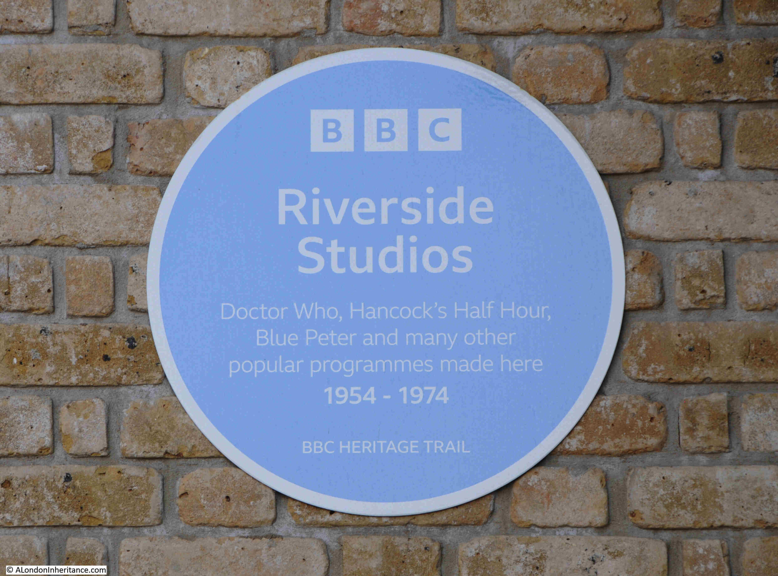
In 1954 the studios were taken over by the BBC, who purchased the studios from the Alliance Film Company. BBC productions including Doctor Who and Quatermass and the Pit were then made here, along with Hancock’s Half Hour and Blue Peter, which are recorded on a plaque on the building:
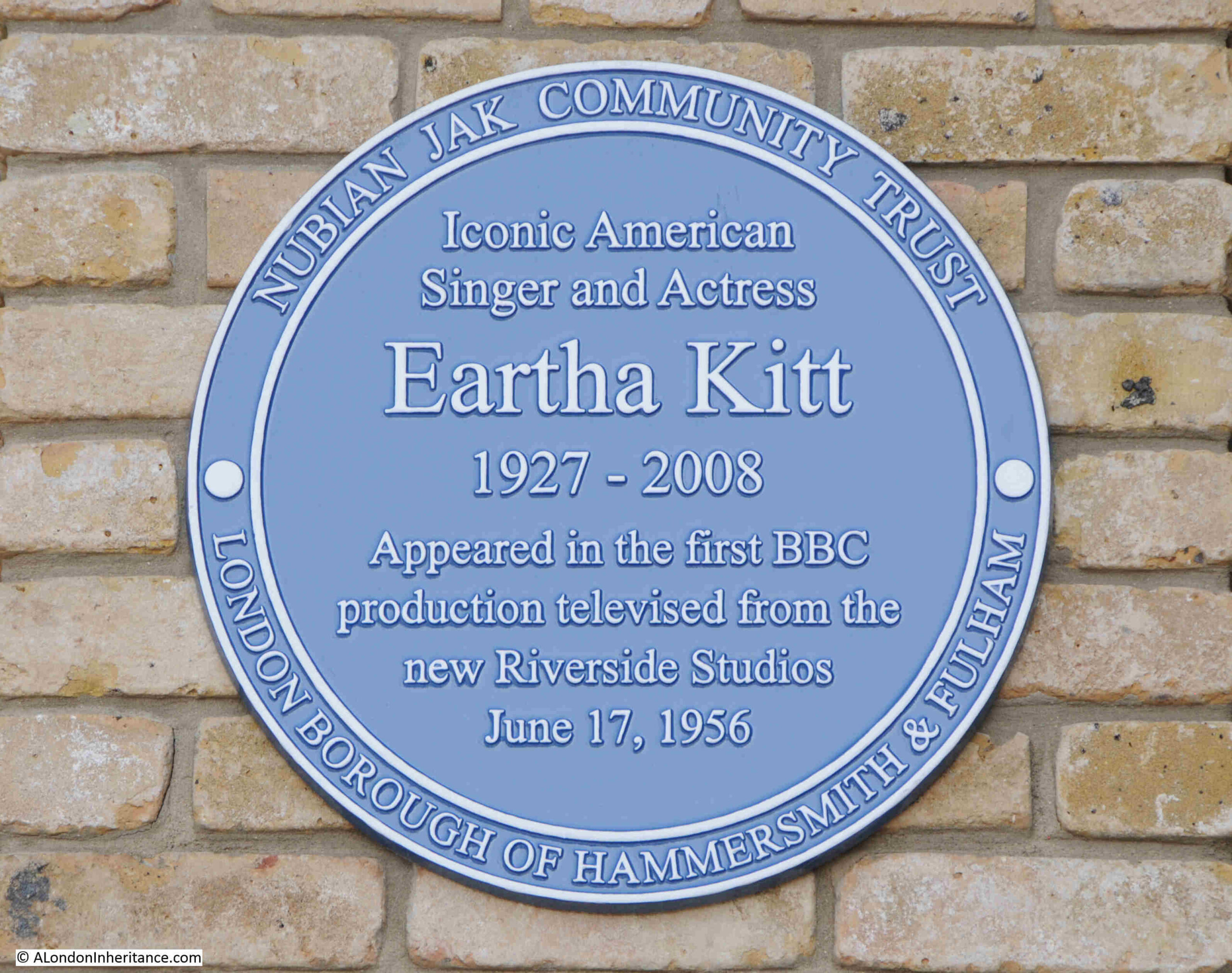
And in June 1956, the American Singer and Actress, Eartha Kitt appeared in a BBC production at the studios, an event which is also recorded by a plaque on the building:
The BBC moved out of the Riverside Studios in 1975 as additional studios had been added to Television Centre in White City, and the Hammersmith buildings were then taken over by a charitable trust formed by Hammersmith and Fulham Council.
The current building dates from a major redevlopment of the site between 2014 and 2019.
Not long after the new site opened, the studios went into administration, and in 2025 were brought out of administration and brought under the control of a new charitable trust, the Anil Agarwal Riverside Studios Trust.
It was then up to the approach to Hammersmith Bridge, which continues to be closed to any form of traffic apart from pedestrians and cyclists.
Not only has Hammersmith Bridge been closed for some years, but Albert Bridge also recently closed, again apart from pedestrians and cyclists, as a crack in a cast iron component had been discovered in the north eastern abutment.
Work is now underway to restore Hammersmith Bridge, but this will probably take a number of years, and a 12 month plan is underway to repair Albert Bridge.
Two examples of the problems that can happen due to the age of much of London’s infrastructure:
If you are looking for a really interesting walk along the Thames, then the path between Putney and Hammersmith is well worth an exploration, and from Hammersmith there is an equally interesting walk to continue all the way to Chiswick, a route that has the added benefit of a number of good pubs. I wrote about the Chiswick to Hammersmith section in this post.
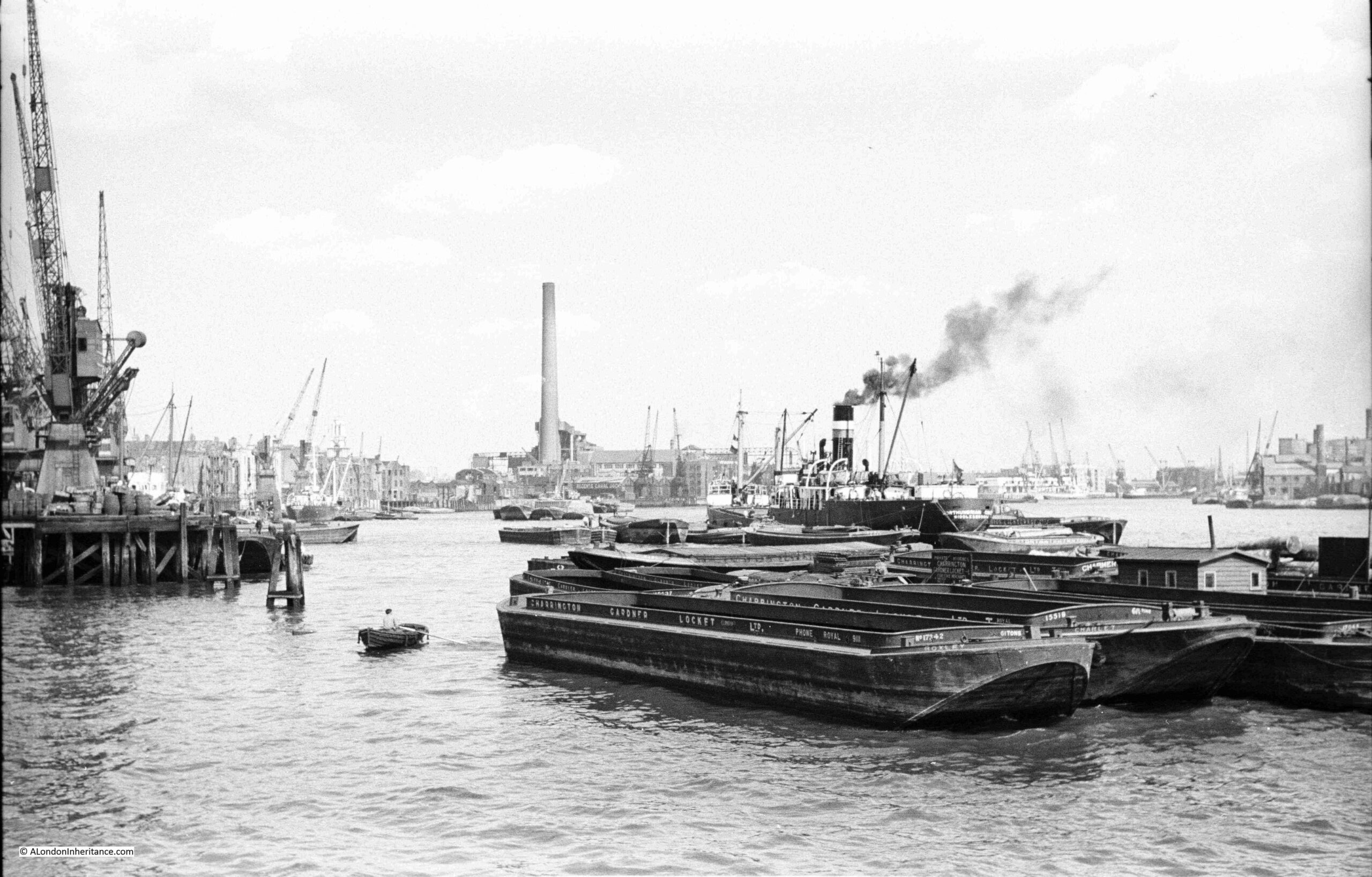
(Dates for my new walk at the end of the post) The following photo was taken by my father from the eastern end of the King Edward VII Memorial Park in Shadwell. It is looking east along the Thames towards Limehouse:
The photo shows this stretch of the river as it was in the late 1940s. A busy place with docks, wharves and cranes, with barges and ships along the river.
The tall chimney is that of Limehouse (also called Stepney) power station. An electricity generating station that ran on coal transported along the river. The power station was built in 1907, however the tall chimney was added 20 years later in 1927 due to complaints about the amount of pollution that was being spread around Limehouse by the much smaller original chimneys. At the time of building, it was the tallest chimney in London at a height of 351 feet.
The power station was closed in 1972 and demolished soon after.
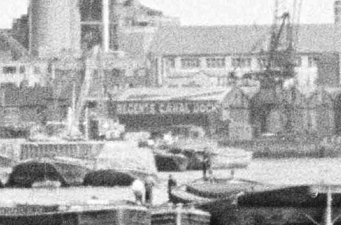
Just in front, and to the right of the power station chimney is the entrance to the Regent’s Canal Dock (now Limehouse Basin). Although the entrance is hard to see, the warehouses with the name of the dock, on the east side of the entrance to the dock from the river can be seen in this extract from the above photo:
The title for the walk “Limehouse – A Sink of Iniquity and Degradation” came from the book “Limehouse through Five Centuries” written in 1930 by the Reverend J.G. Birch of St. Anne’s, Limehouse. He used the phrase in his introduction to the book, and also added that he hoped that the book would help dispel this myth.
Limehouse has always had an air of mystery and intrigue, an exotic and dangerous place to those who did not live or work along the river.
The 1916 book Limehouse Nights by Thomas Burke featured a number of short stories centred on Limehouse, the opium dens and the Chinese community, which were also the background to the stories of Dr. Fu-Manchu by Sax Rohmer. The works by Burke and Rohmer featured appalling stereotypical views of the Asian community then living in Limehouse.
Stories about Limehouse exploited themes of violence, crime, sex and drugs and how the import of opium resulted in the exploitation of English women, often to sell opium in the fashionable West End.
The image of Limehouse as a place of intrigue and mystery continues to this day, with the 1994 book Dan Leno and the Limehouse Golem by Peter Ackroyd, on which the 2016 film The Limehouse Golem was based.
Whilst there were opium dens, crime and violence, Limehouse was a hard working place, based around the trade and industry that grew along the Thames. The Chinese population were frequently sailors who had settled in Limehouse and married local women, along with a temporary increase in numbers when ships with Chinese crew docked. Their numbers though were relatively low, not as large as popular literature of the time might suggest.
Limehouse was an early site of ship building. From Limehouse, sailors and traders set out along the Thames to cross the oceans of the world. Industry, warehouses and docks lined the river, with cramped housing alongside polluting factories.
Limehouse provided access to the Thames for the inland waterways, with the Limehouse Cut and the Regent’s Canal providing access to the river from the rest of the country. In the Regent’s Canal Dock (now the Limehouse Basin), ships unloaded all manner of cargo, including coal, timber, fruit and ice.
There was technical innovation, hydraulic power and an electricity generating station running on coal delivered via the river. The London & Blackwall Railway cut through Limehouse on a brick viaduct, paving the way for the Docklands Light Railway.
The decades after the 2nd World War were not kind to Limehouse as trade along the river slowly declined and industry closed or moved away.
From the late 1980s onwards, Limehouse was transformed, with some major projects being driven by the developments on the Isle of Dogs just to the east.
I have long been fascinated by Limehouse, a place that for centuries was shaped by the relationship between the land and the river. Whilst today that contact is maintained by Limehouse Basin, the rest of Limehouse is now just a spectator to the activity on the river.
This walk will explore the history and development of Limehouse from the 15th century to the present day. The people, those who settled in Limehouse, the relationship with the River Thames, trade, waterways, tunnels, streets, pubs and church, along with some of the reality of the opium dens.
As with the Reverend J.G. Birch, my aim with the walk is to dispel some of the myths about Limehouse and focus on the real history of this fascinating part of east London.
The walk will start at Limehouse DLR station and end at Westferry DLR station. It will take around 2 hours 30 minutes and is a walk of slightly over 2 miles.
The schedule of walks is listed below. Click on each date to get to the Eventbrite booking page: