Monthly Archives: July 2021

Carter Lane – 17th Century Houses, Hairdressers and Alleys

Tickets available for my final walks of the year exploring Wapping, Bankside, Barbican and the Southbank. Click here for details and booking.

As with my Roupell Street post a couple of weeks ago, for this week’s post, a mid 1980s hairdressers is the reason why I am revisiting Carter Lane in the City of London. Initially to find the location of the Gentlemen’s Hairdressing Salon and Nichola’s Hair Designs of St Paul’s, but then to explore a very historic street, alleys, and two houses that have their origins back in the 17th century.

But first, here is the hairdressers on the corner of Carter Lane and St Andrews Hill, photographed in 1986:

Carter Lane

The same place in July 2021:

Carter Lane

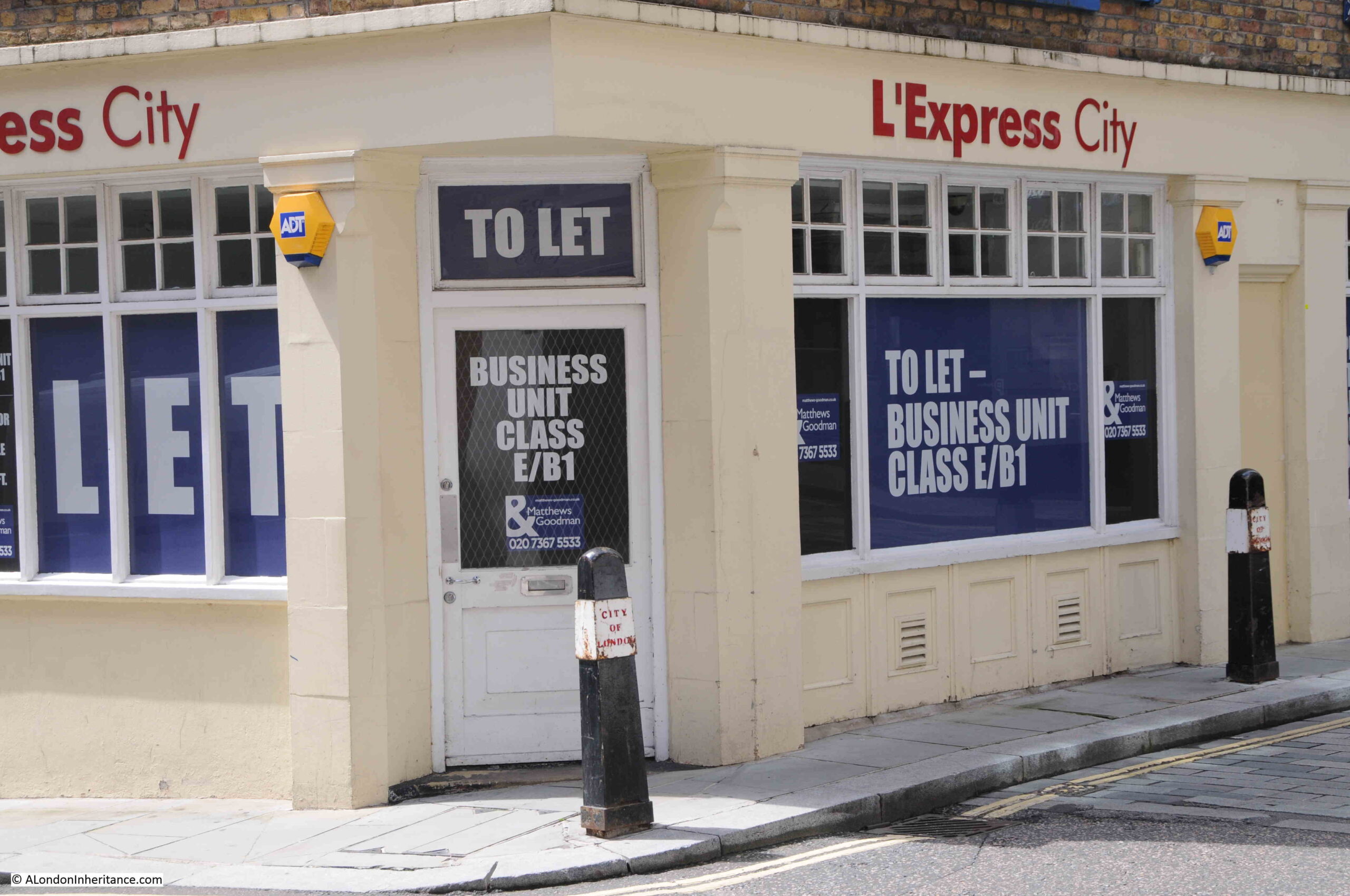
The hairdressers are no more, and the latest occupier of the site, L’Express City, part of the L’Express chain of restaurants / coffee shops, has since closed. Possibly one of the casualties of the lack of customers in the City since the start of the pandemic.

The above two photos are on the corner of Carter Lane and St Andrews Hill. Carter Lane is an old street, but today is much longer than in previous centuries.

In the following map, St Paul’s Cathedral is the large building in the upper centre. Saint Paul’s Church Yard is the street immediately to the south of the cathedral. Keep going south, and the next street you will come to is Carter Lane  (Map © OpenStreetMap contributors).

Carter Lane

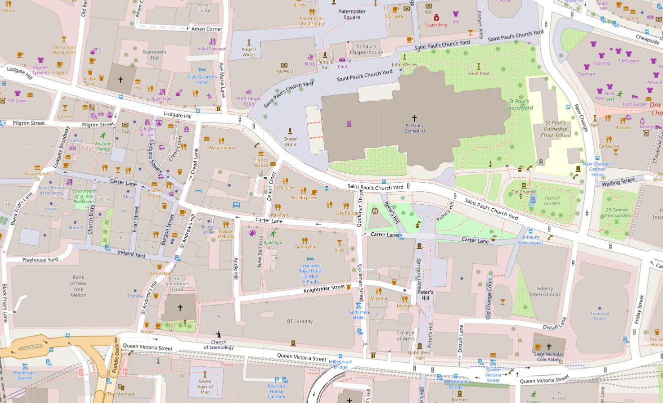
As can be seen in the above map, Carter Lane is a relatively long street. It has a central section in white, and the two outer sections are in grey. As we walk along the street, the relevance of the different colouring of the street will become clear.

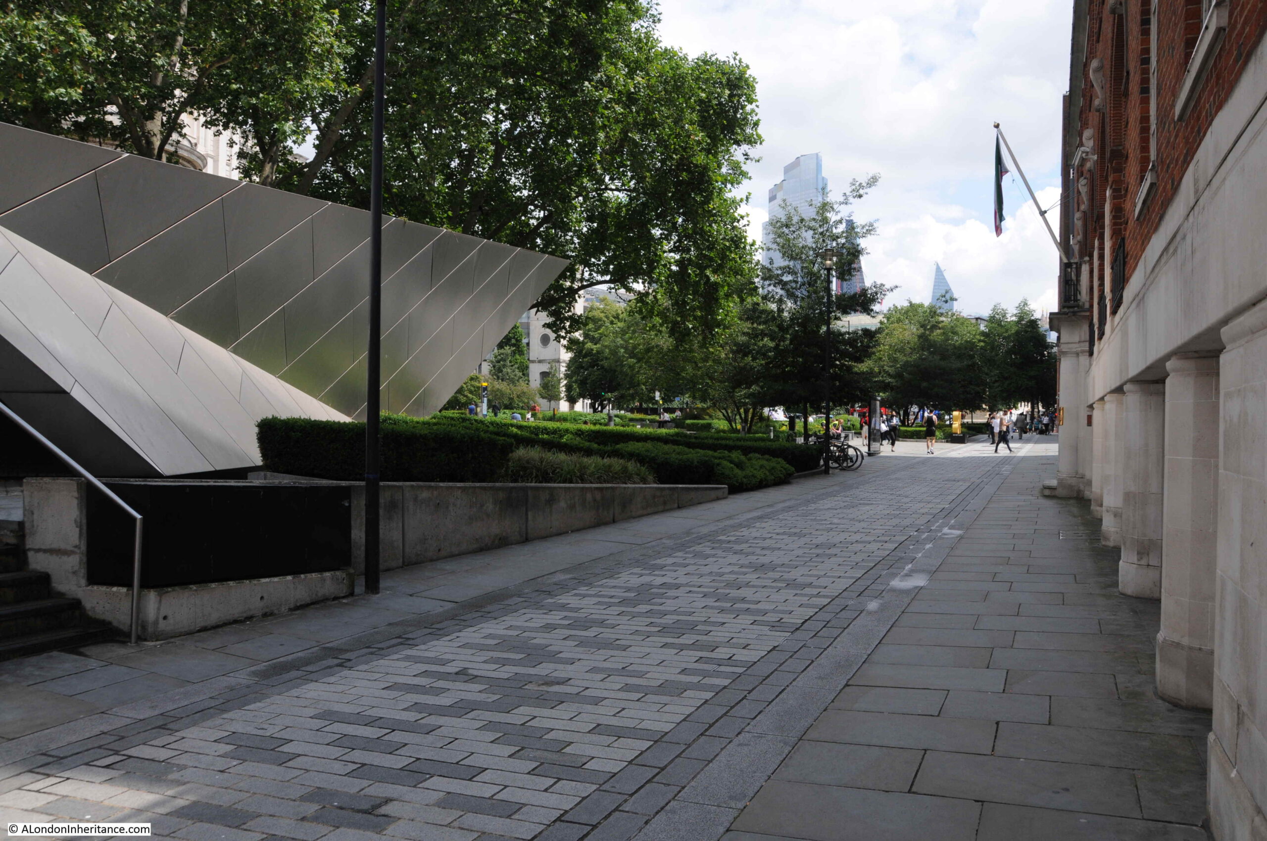
In the above map, the eastern section to the right has green space between Carter Lane and the cathedral. This space is today the location of the City of London Visitor Centre, and an expanse of gardens, however this was once a densely built area.

The following map is from the 1940 edition of Bartholomew’s Reference Atlas of Greater London.

Carter Lane

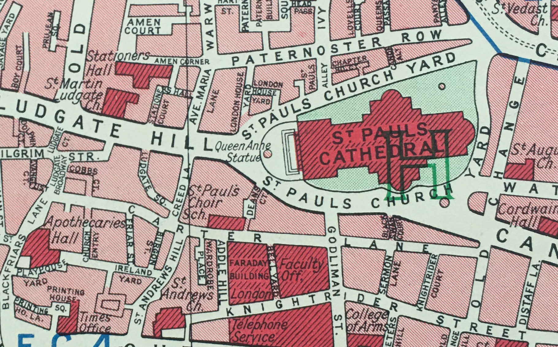
Here we can see Carter Lane running from Blackfriars Lane in the west, to Old Change in the east. The area above the right section of the street, above the word “Lane”, now the site of gardens and visitor centre was then built up, with Black Swan Court running between Carter Lane and St Paul’s Church Yard.

There are a couple of key buildings highlighted in dark red in the above map, which I will come to later in the post.

The Carter Lane of the above two maps, was not the original Carter Lane. To see the original Carter Lane, and many of the side streets and alleys that we can still find today, we need to look at Rocque’s map of 1746:

Carter Lane

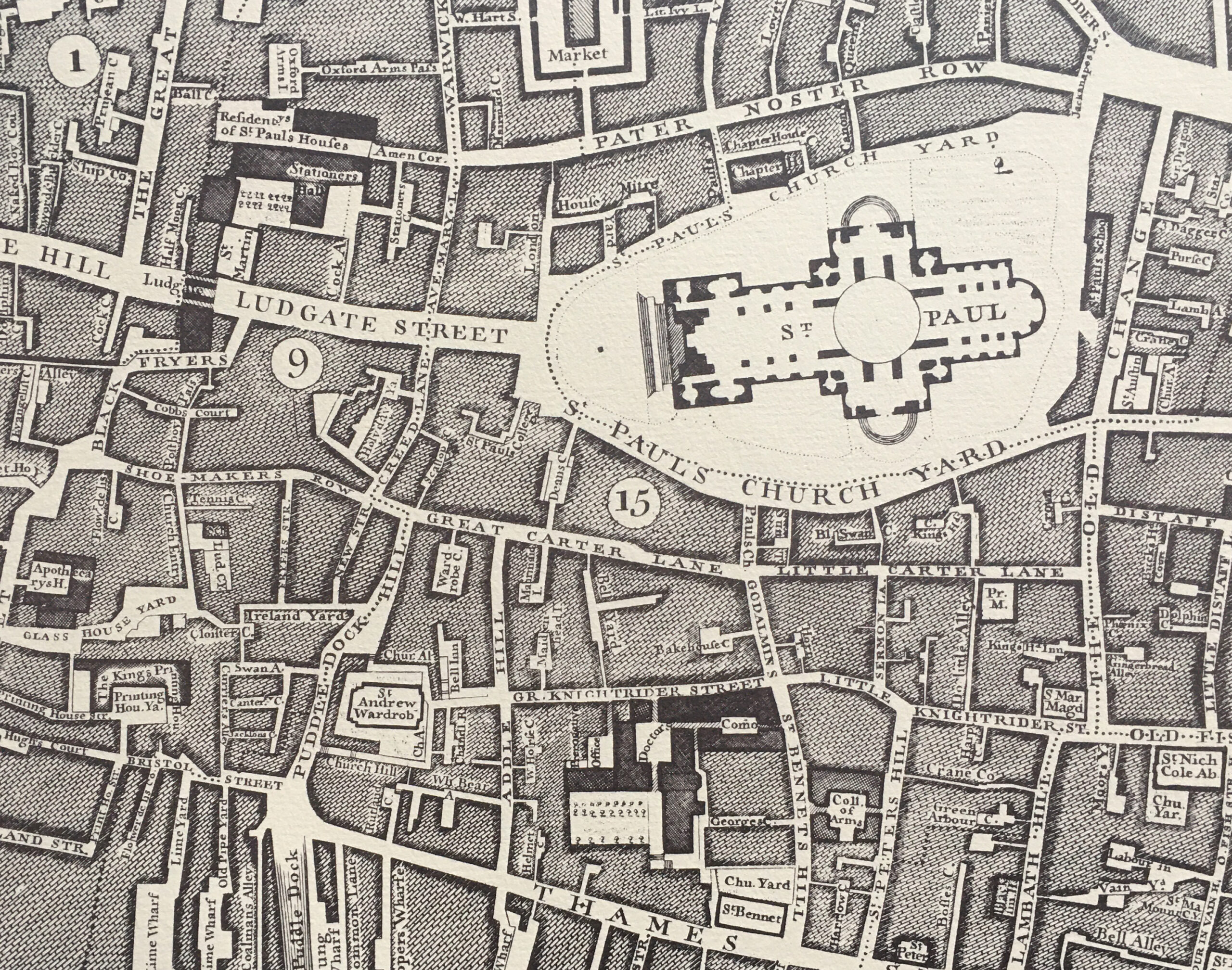
In the above map, running where Carter Lane is today, we find three named streets. From left to right: Shoe Makers Row, Great Carter Lane (underneath the circled number 15), and Little Carter Lane.

Harben’s “Dictionary of London” gives the first mention of the street as Carterstrete in 1295, with Great and Little Carter Lane’s appearing prior to 1677.

Great and Little Carter Lane, along with Shoe Makers Row were abolished in 1866 when the whole street became simply Carter Lane.

Many references on the Internet refer to the name of the lane being associated with carts, however Harben attributes the name: “the early forms of the name suggest that it was intended to commemorate a former owner of property there”. Many streets were named after either owners of the land, property on the street, or an original builder, so whilst is is impossible to be sure of the source of a centuries old name, Harben’s does sound the most probable.

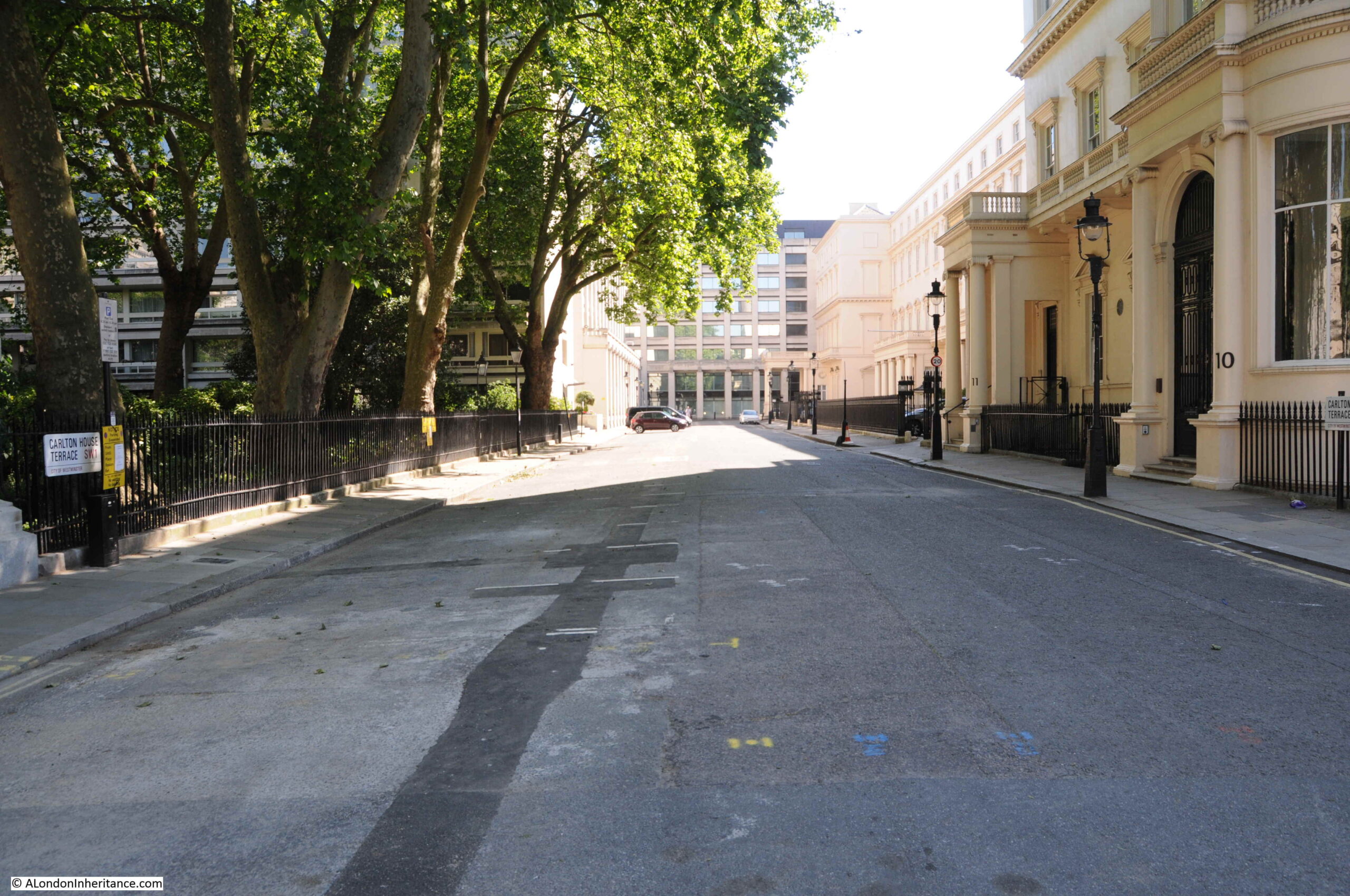
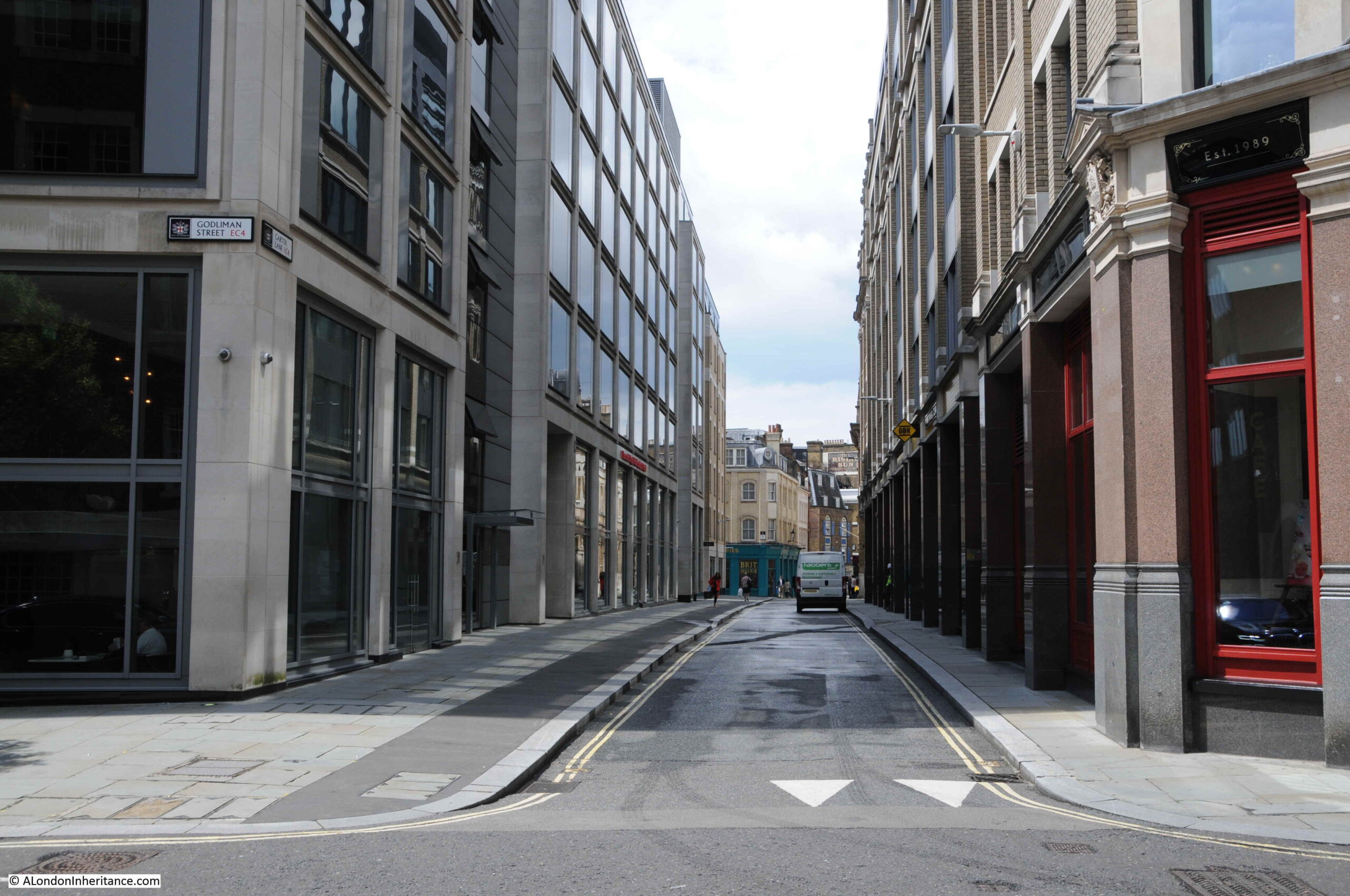
Time for a walk along Carter Lane. In the following photo, I am standing at the junction of Carter Lane and Godliman Street, looking east.

Carter Lane

This is the section that was Little Carter Lane in Rocque’s map.

Today, only one side is built, and the lane is a pedestrian walkway with gardens to the north. The area was badly damaged by fire during bombing on the night of the 29th December 1940 and the northern side of Carter Lane was not rebuilt after the war. It is now gardens, with the building on left being the City of London Visitor Centre.

Looking in the opposite direction, and the following photo shows the section that was Great Carter Lane in Rocque’s map of 1746:

Carter Lane

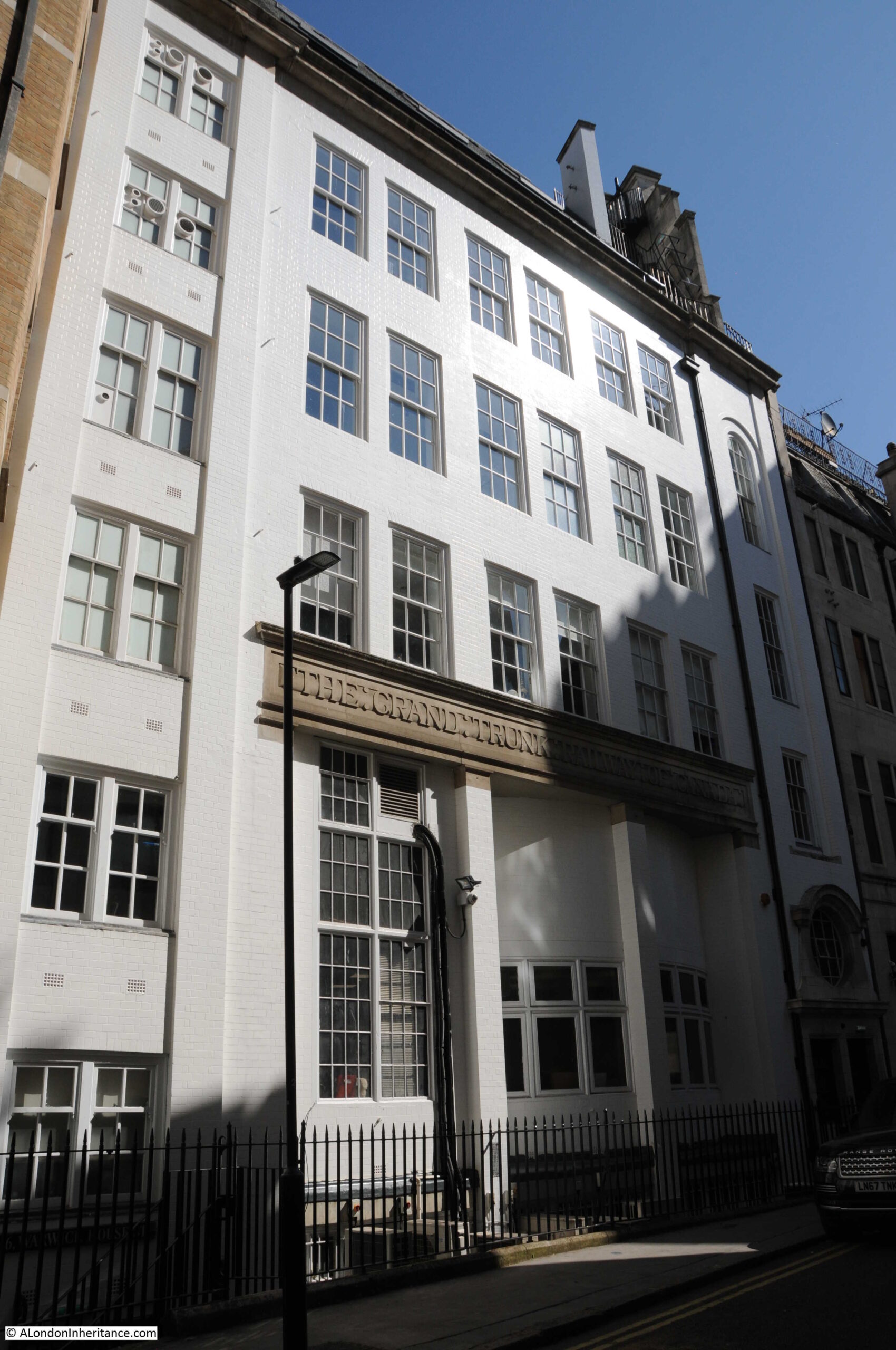
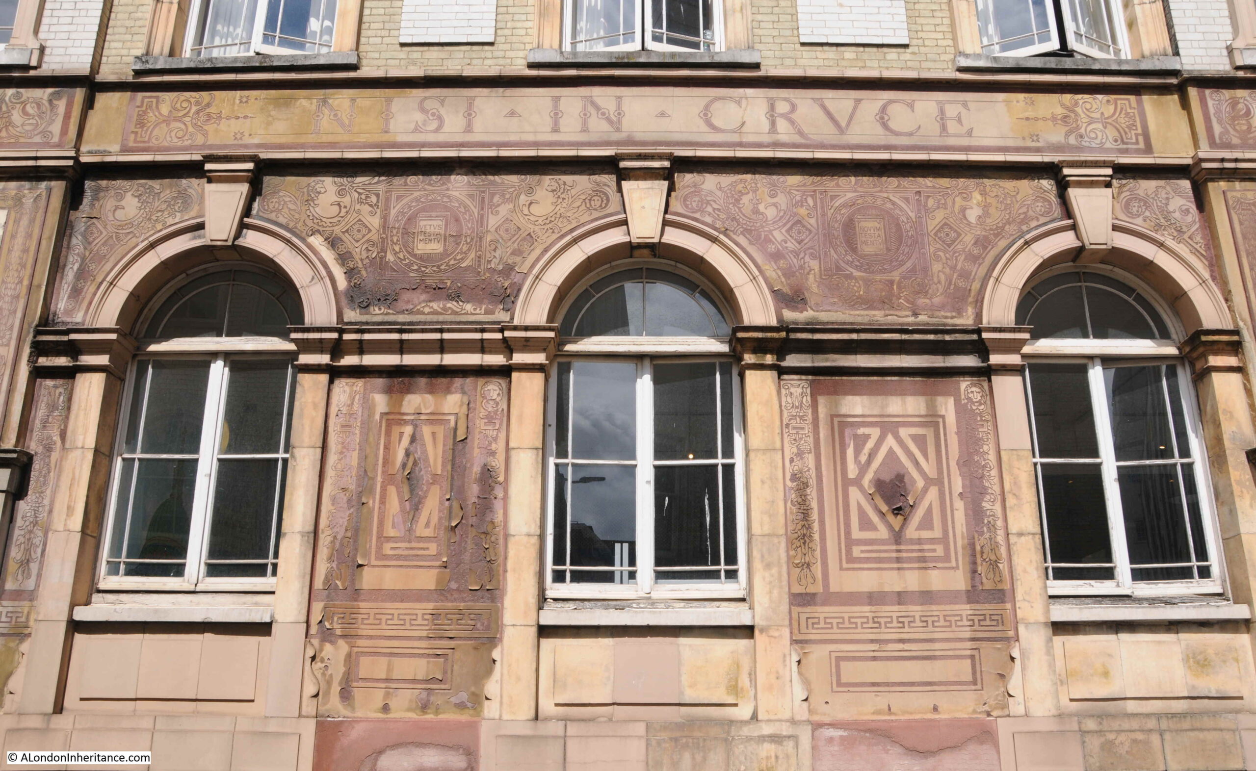
Walking along the street, and the building on the right is the old home of the St Paul’s Cathedral (Choir) School.

Carter Lane

Purpose built for the school in 1874, the school moved to a new building in New Change during the 1960s, when Carter Lane was threatened with a road widening scheme which thankfully was not carried out. The building is now one of the hostels of the Youth Hostels Association.

There is some rather ornate decoration on the walls of the old St Paul’s Cathedral School:

Carter Lane

To the left of where I was standing to take the above photo, there is a modern building. Look carefully on the pillar to the right and there is a plaque:

Carter Lane

The plaque records that the Bell originally stood on the site, and it was in the Bell that Richard Quiney wrote to William Shakespeare, and his letter is the only letter addressed to Shakespeare known to remain.

The Bell tavern

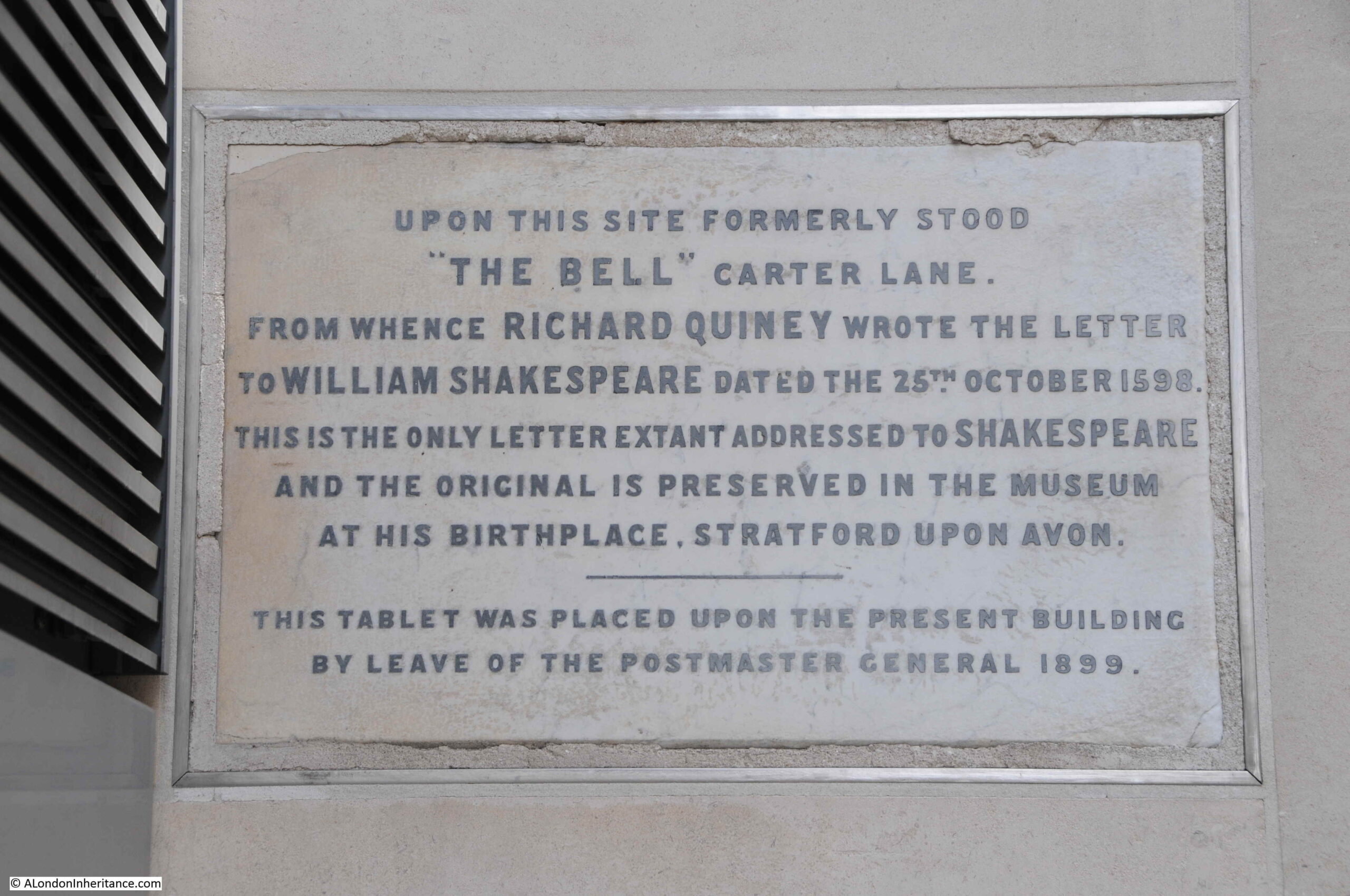
A photo of the letter can be seen on the site of the Shakespeare Birthplace Trust here.

The Bell was a very old pub. The earliest written reference I could find to the pub dates from a report in the Kentish Gazette on the 12th October 1776, when it was reported that on the previous Sunday, Mr Milward, master of the Bell inn, Carter-lane, Doctors Commons had died.

The address of the Bell inn in the above report included “Doctors Commons”. Doctors Commons was the general name used for an area between Carter Lane and what is now Queen Victoria Street that included the College of Advocates and Doctors of Law, along with Ecclesiastical and Admiralty Courts.

The buildings were demolished in 1867 after the functions of the College and Courts had been consolidated into other roles, or been abolished.

In David Copperfield, Charles Dickens had Steerforth describing Doctors Commons as:

“It’s a little out of the way place, where they administer what is called ecclesiastical law, and play all kinds of tricks with obsolete old monsters of acts of Parliament, which three-fourths of the world know nothing about, and the other fourth supposes to have been dug up, in a fossil state, in the days of the Edwards. It’s a place that has an ancient monopoly in suits about people’s wills and people’s marriages, and disputes among ships and boats”.

The Bell was demolished at the end of the 19th century to make way for the Post Office Savings Bank building referenced in the plaque by the mention of the Post Master General. Prior to demolition, the Bell seems to have been a thriving establishment, as can be seen from this advert in the Morning Advertiser on the 24th February 1869 when the Bell was for sale due to the ill-health of the current proprietor:

BELL TAVERN AND WINE-VAULTS occupying a most commanding corner position in one of the busiest and most improving parts of the City of London, close to St. Paul’s in a much frequented thoroughfare, and surrounded by many vast mercantile Establishments, affording an almost unlimited variety of sources of the best class of trade. The billiard-tables alone realise sufficient to pay the rent, and the extremely profitable nature of the business generally in the City is universally admitted”.

A shame that after the above sale, this centuries old pub would have less than thirty years left.

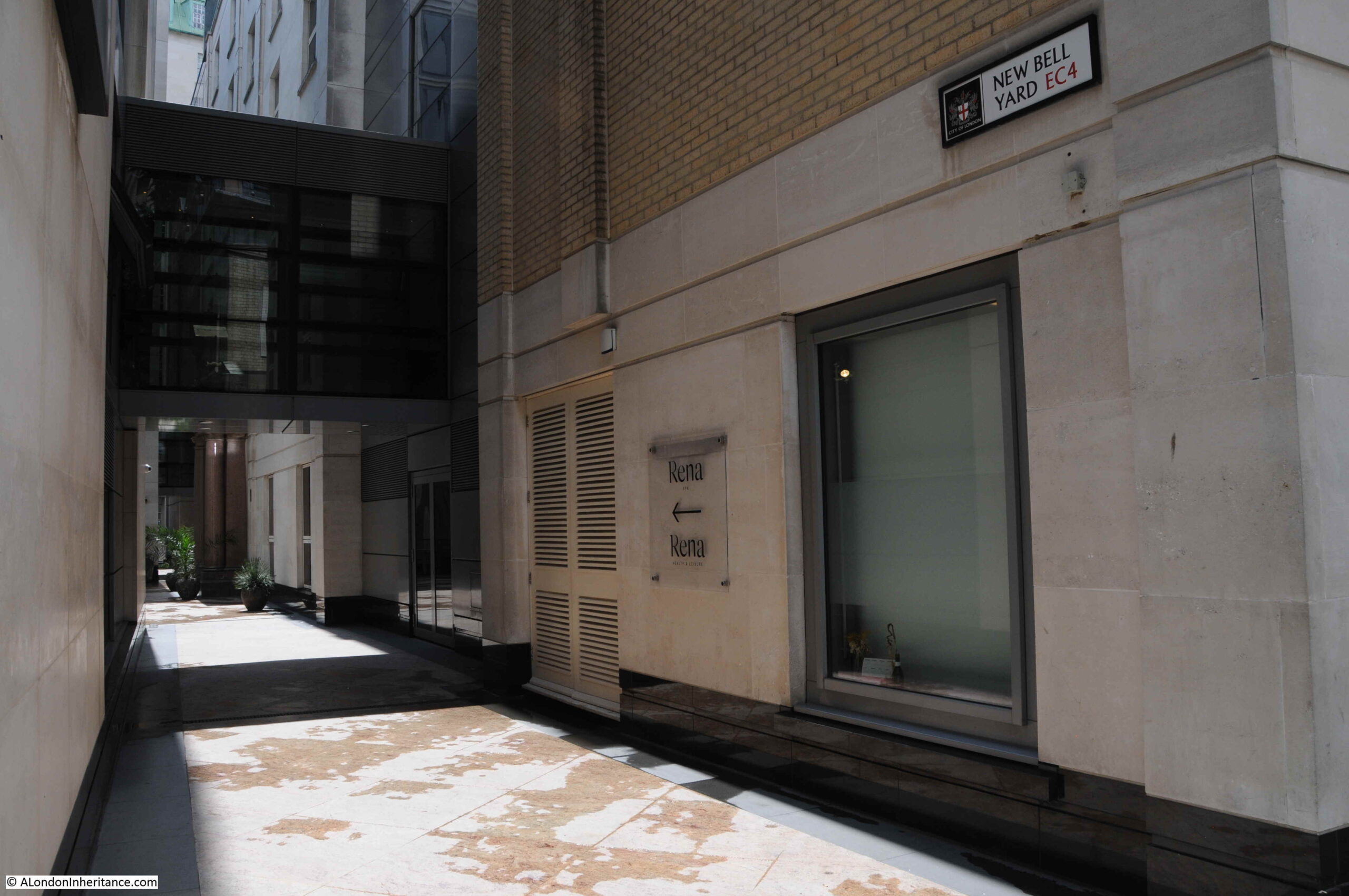
The Bell inn was on the corner of Carter Lane and Bell Yard which can be seen in the Rocque map. Bell Yard sort of still exists as New Bell Yard, an alley between two modern buildings:

New Bell Yard

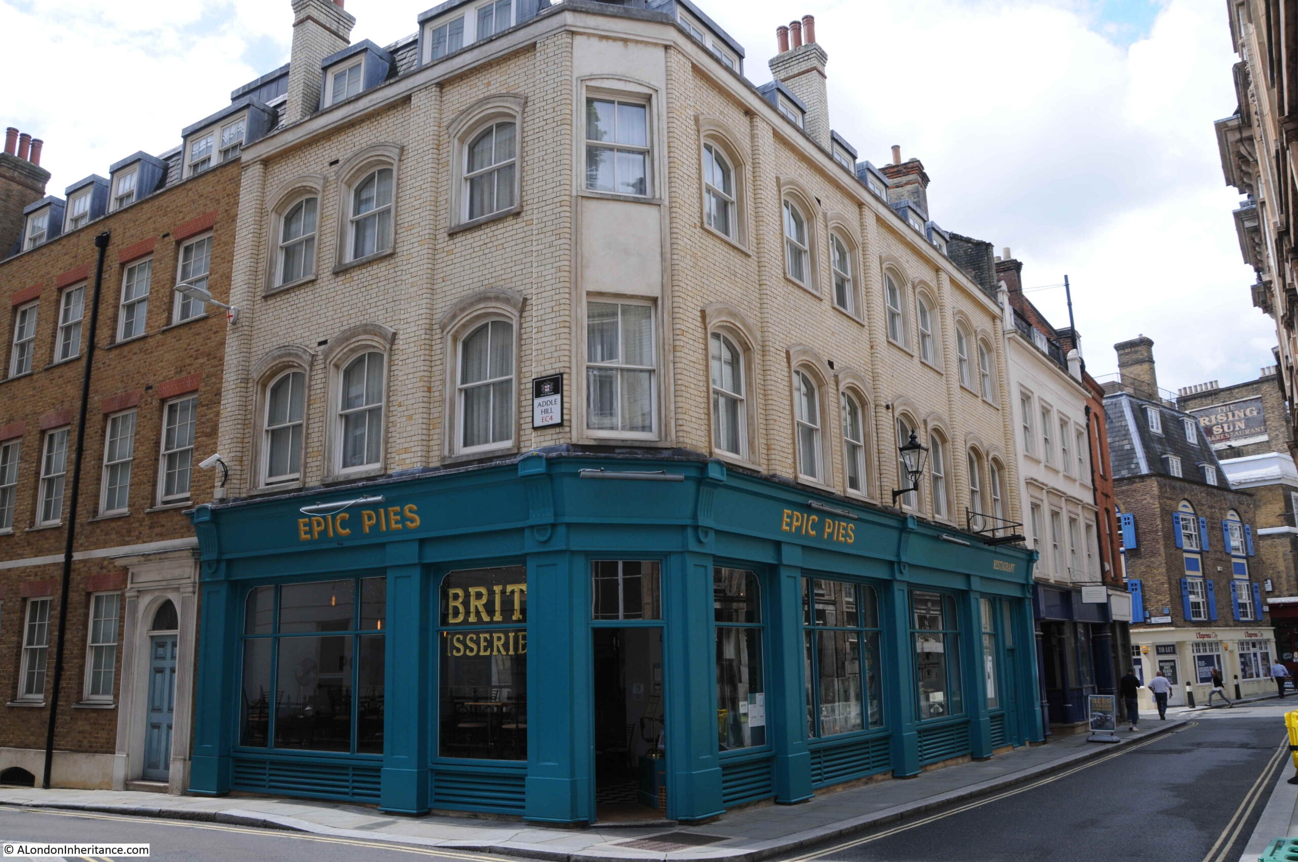
As we walk further along Carter Lane, we come to the part that survived the fires that surrounded St Paul’s Cathedral during the 1940s. Epic Pies on the corner of Carter Lane and Addle Hill:

Carter Lane

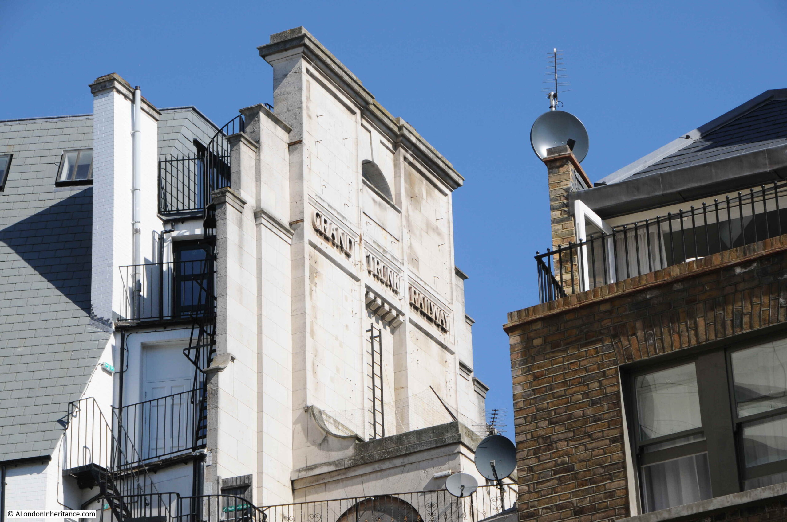
Addle Hill is worth a quick walk down, to see a survival from the late 19th century Post Office building, which can be seen half way down the building on the left:

Addle Hill

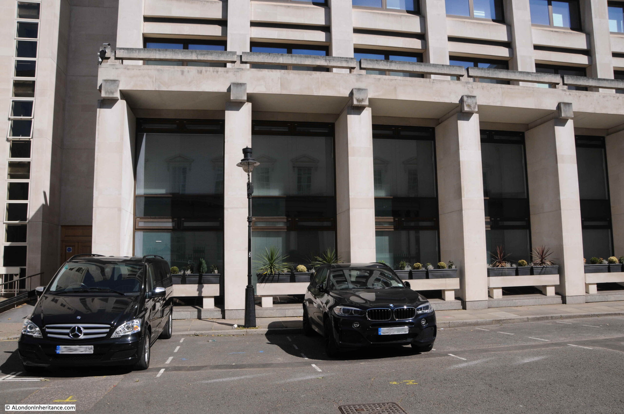
Go back to the 1940 map, and on the block occupied by the building on the left of the above photo was a building called Faraday Building. This was part of the complex of Post Office buildings in the area that formed one of the London hubs of the growing telephone network.

The original late 19th century door surround to the Post Office building has been retained:

Faraday Building

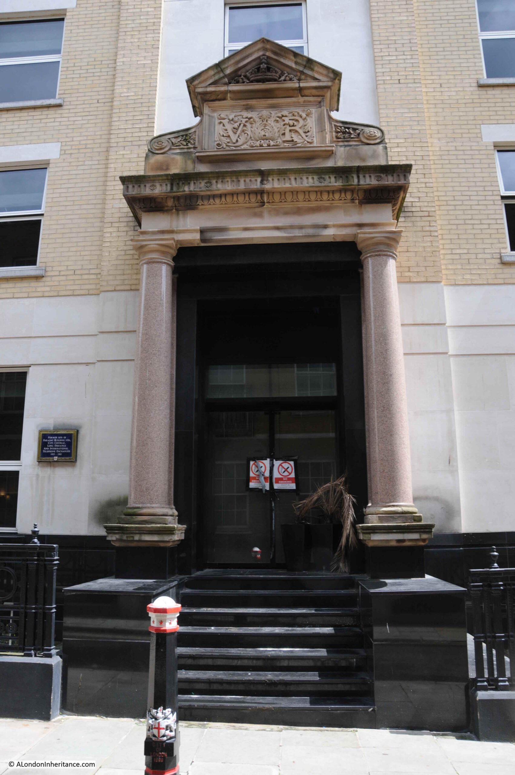
The plaque records that this was the “Former site of Faraday Building North, City, Central, Long Distance and International Telephone Exchanges, 1902 to 1982”.

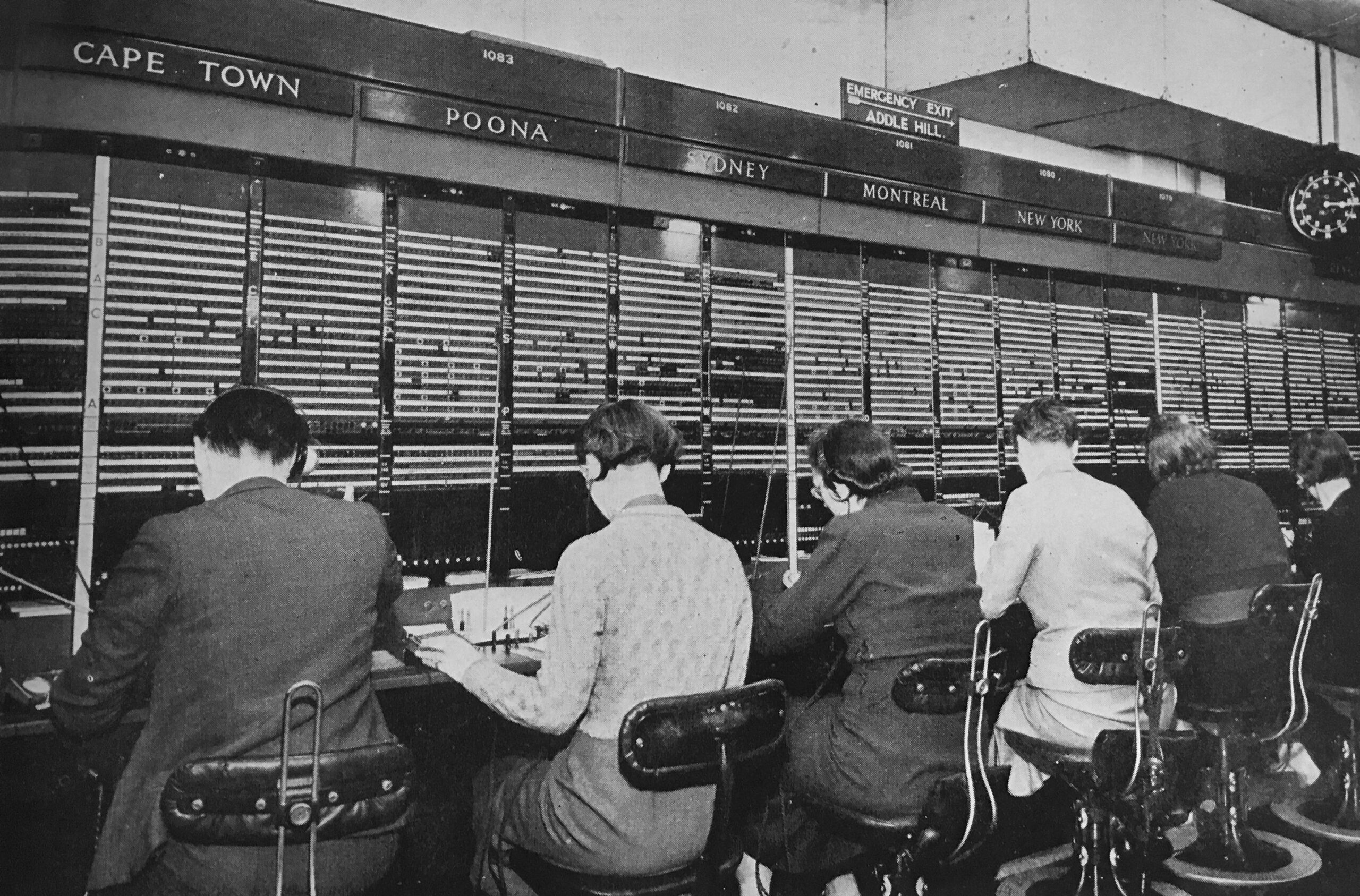
For much of the life of the Faraday Building, long distance and international telephone calls would need to be connected by an operator, and hundreds of operators worked in the building, sitting at desks labelled with the country that was connected to their desk. the operator would manually plug in patch cables to connect a caller to the destination’s telephone network.

An example of a small part of the operator positions in the Faraday Building is shown in the following photo (with Addle Hill labelled as the emergency exit above the Montreal position – from the booklet “The Post Office Went To War“):

Telephone Operators Faraday Building

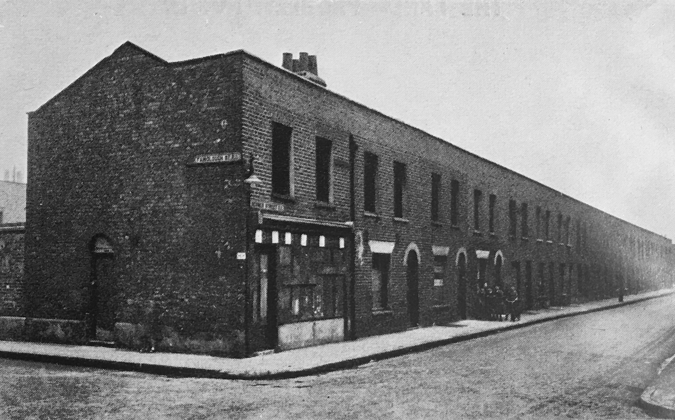
Continuing down Carter Lane, and we can see the building that was the hairdresser in the photo at the top of the post, along with the Rising Sun pub:

Carter Lane

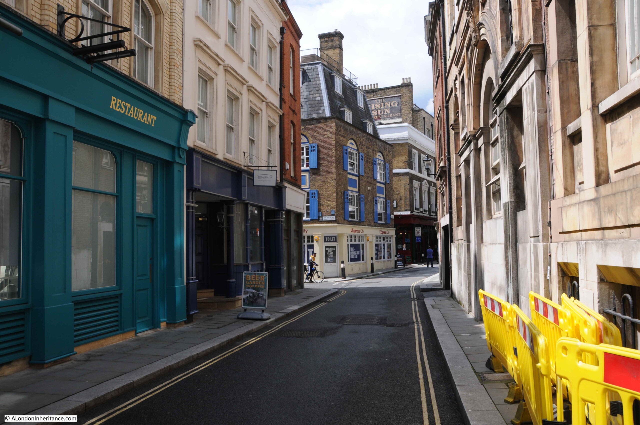
But before we come to the home of the hairdressers, we pass the entrance to Wardrobe Place.

Wardrobe Place

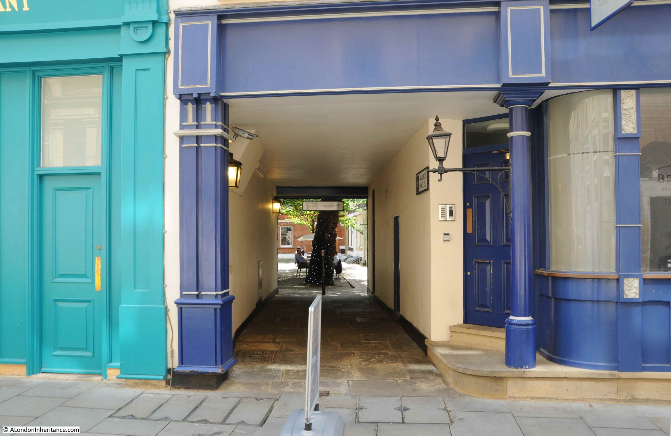
Wardrobe Place was so named as up until the Great Fire of 1666, it was the site of the King’s Wardrobe (the storage, administration and expenditure office for the King). The Wardrobe was moved here from the Tower in the 1360s into the mansion owned by Sir John Beauchampe. From Stow’s Survey of London:

“Then is the kings greate Wardrobe, Sir John Beauchampe, knight of the Garter, Constable of Dover, Warden of the Sinke Portes builded this house, was lodged there, deceased in the yeare 1359.  His Executors sold the house to King Edware the third”.

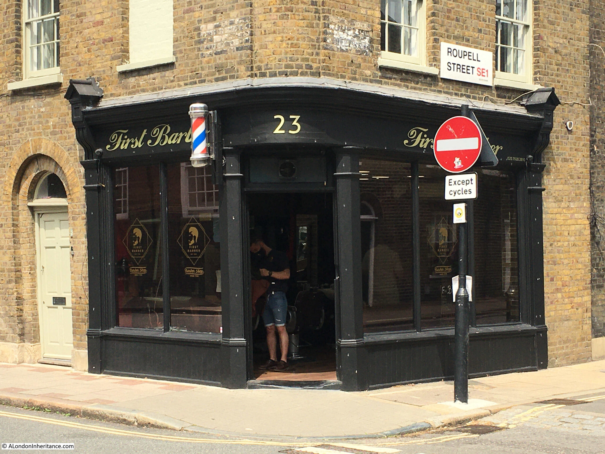
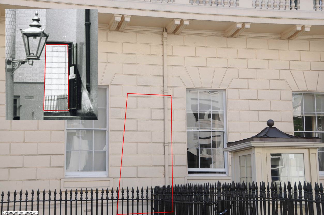
We then come to the site of the 1980s hairdressers at number 59a Carter Lane. which was on the corner of Carter Lane and St Andrew’s Hill:

Carter Lane

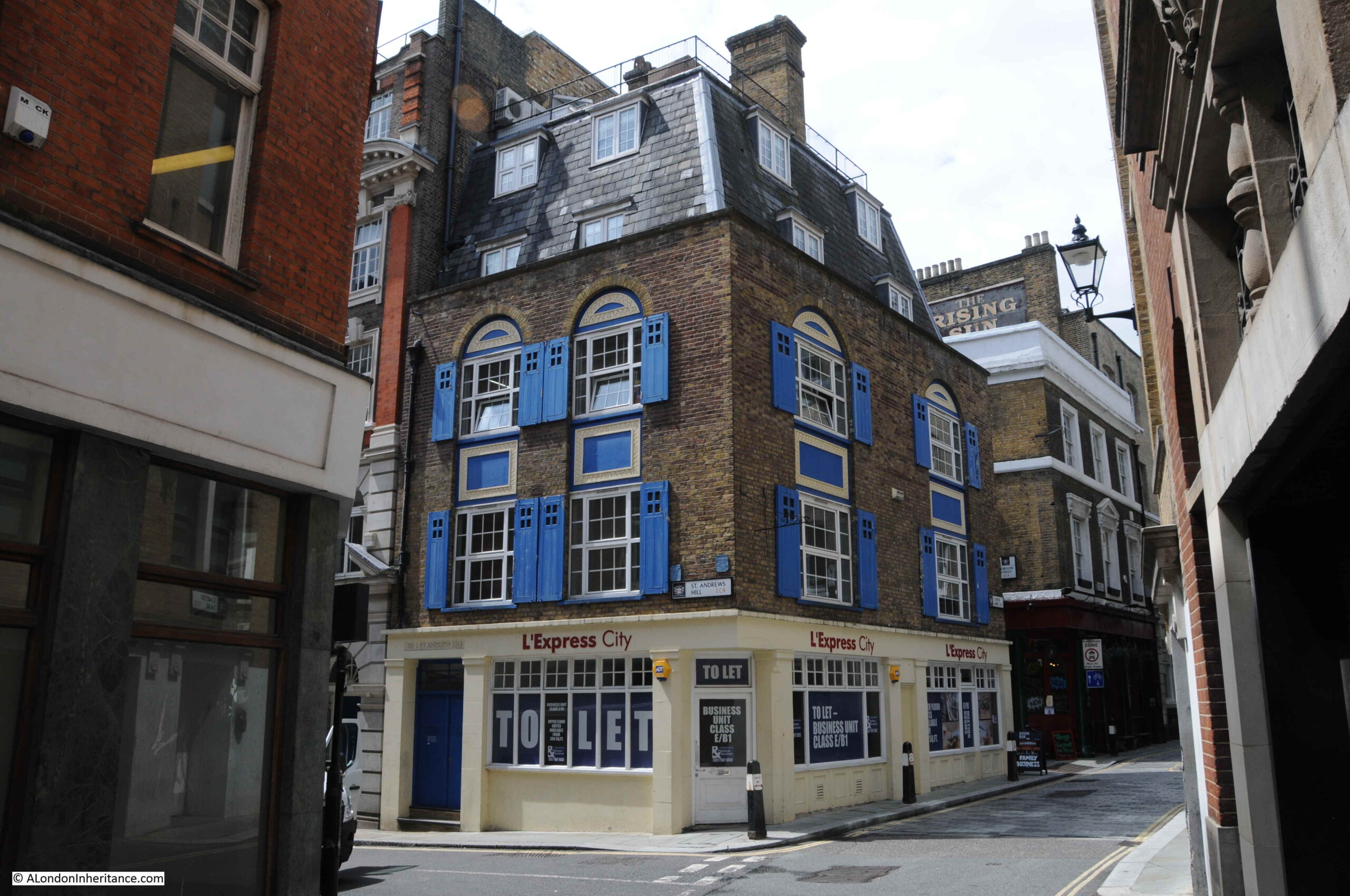
In between the hairdressers and becoming a food / coffee take-away and cafe, the site was home to KK Newsagents in the 1990s.

Although the café / takeaway has now closed, there are still a number of these in Carter Lane. We perhaps think that the vast number of such establishments on London’s streets is a recent phenomena, however there has always been a need to provide food and drink for those who lived and worked in the City.

In the 1895 Post Office directory, there were five listed:

  • Number 29: Florence Jones-Albrt, Dining Rooms
  • Number 55; Miss Sarah Ann Ash, Coffee Rooms
  • Number 66; Miss Eliza Louise Catchpole, St Ann’s Coffee House
  • Number 75; William Clemenace, Dining Rooms
  • Number 79; Charles Batchelor, Dining Rooms

I suspect the number of such establishments can be used as a measure of the number of people working in the City, and similar to number 59a, many of these have closed over the last year.

St Andrew’s Hill leads down to Queen Victoria Street, opposite where Puddle Dock was originally located and according to George Cunningham in his 1927 Survey of London, was originally called Puddledock Hill (although I have been unable to find any other reference that confirms this, however it could well have been an earlier or alternative name as the street leads up from both Puddle Dock and the church of St. Andrew’s by the Wardrobe.)

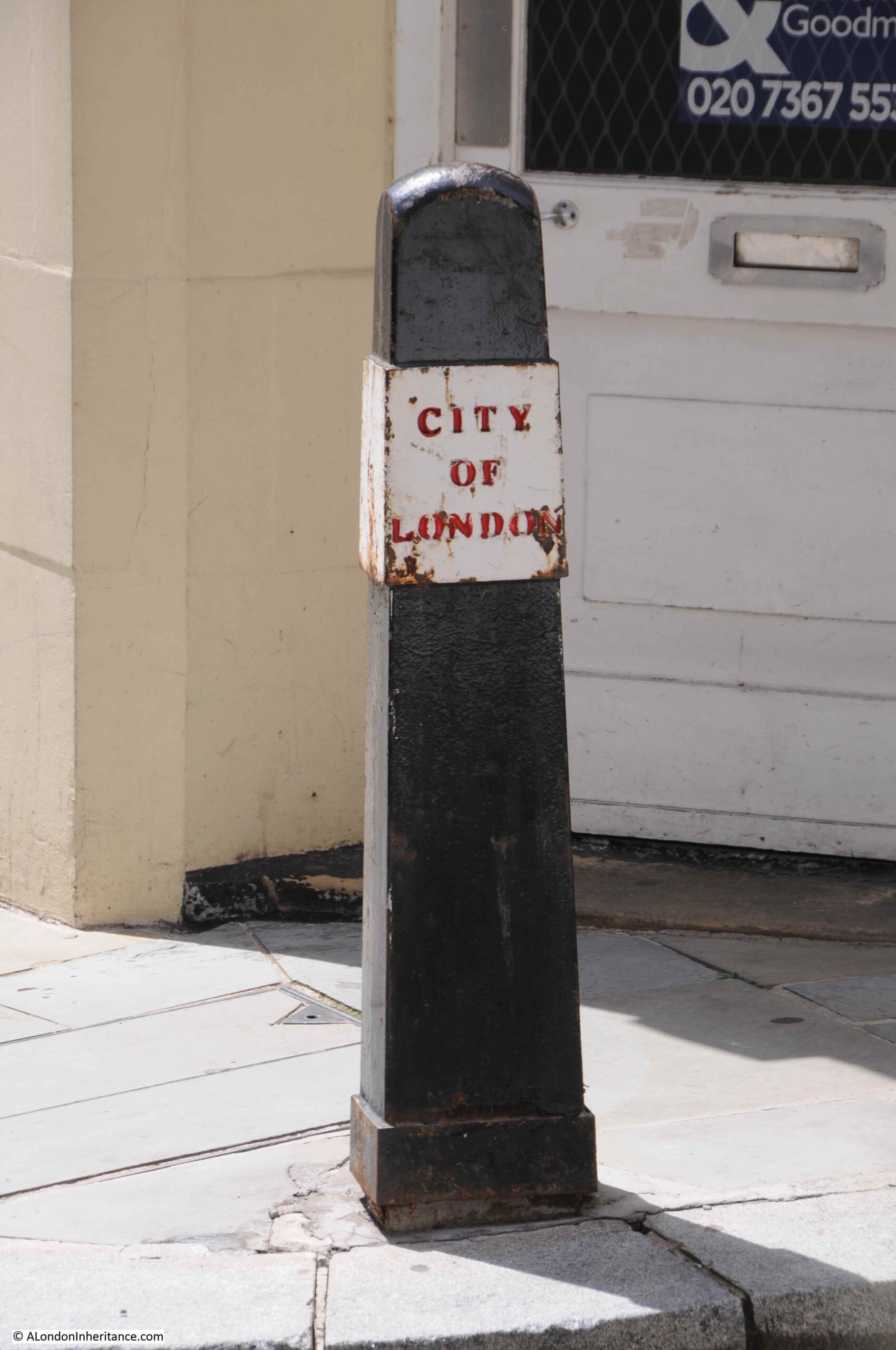
One of the Bollards outside number 59a. This is different to the 1980s photo, and I am not sure of the age of either the bollard, or the City of London name panel which appears to slot over the bollard.

City of London

On the St Andrews Hill side of number 59a is a boundary marker on the right:

At Andrews Hill

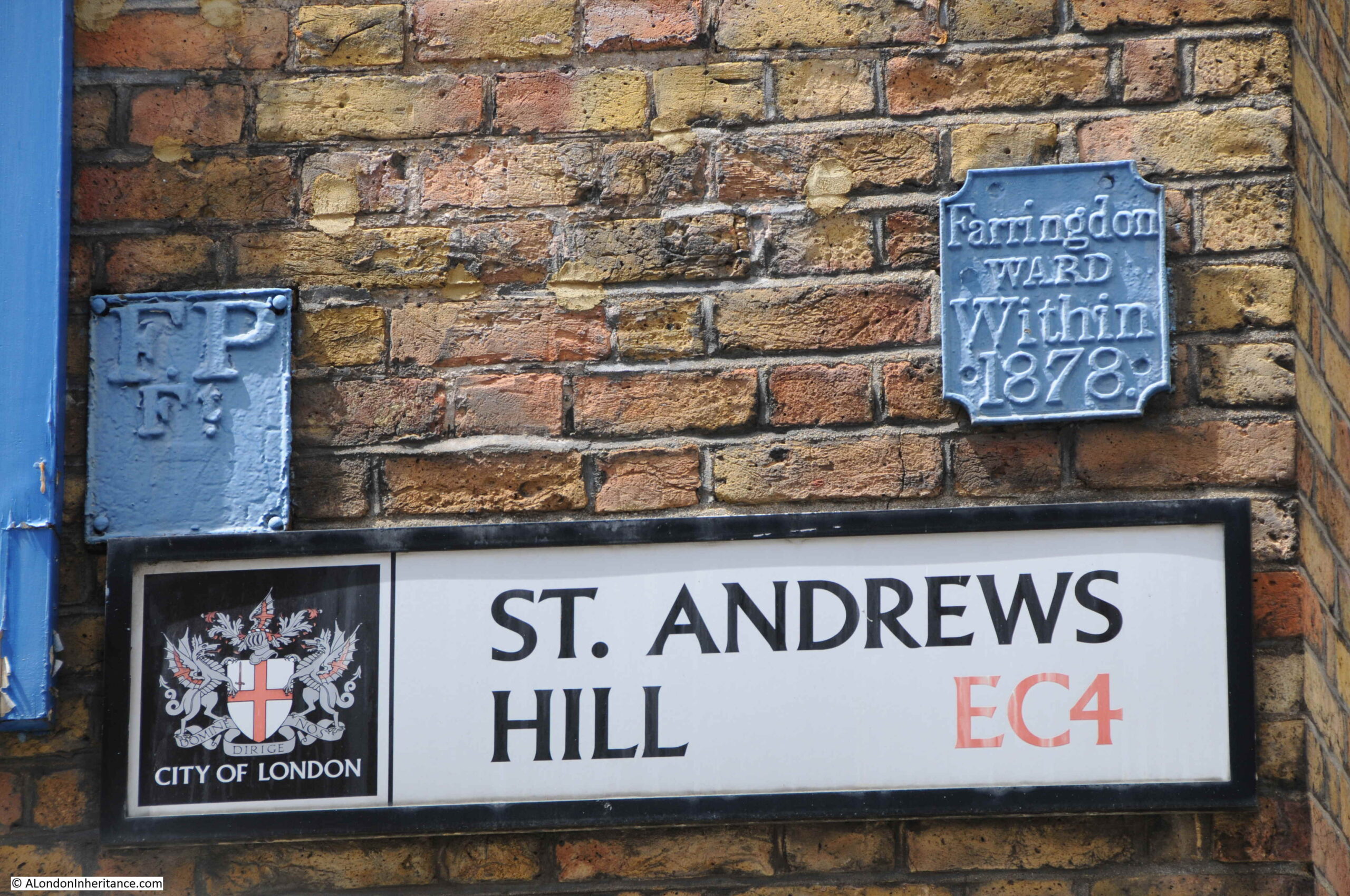
And an FP plate on the left. According to a document on the Essex Fire Brigade web site, FP stands for Fire Plug. Apparently in the early days of the fire service, and when many underground water pipes were made out of wood, firemen would dig down to the water main and bore a small, circular hole in the pipe to obtain a supply of water to fight the fire.

When finished, they would put a wooden plug into the hole, and leave an FP plate on a nearby wall to alert future firefighters that a water main with a plug already existed.

When wooden pipes were replaced by cast iron pipes in the 19th century, workmen would often bore a small hole in the pipe and fit with a wooden plug when they saw an FP plate.

This would later be replaced with the Fire Hydrant method, which would be identified by a large H.

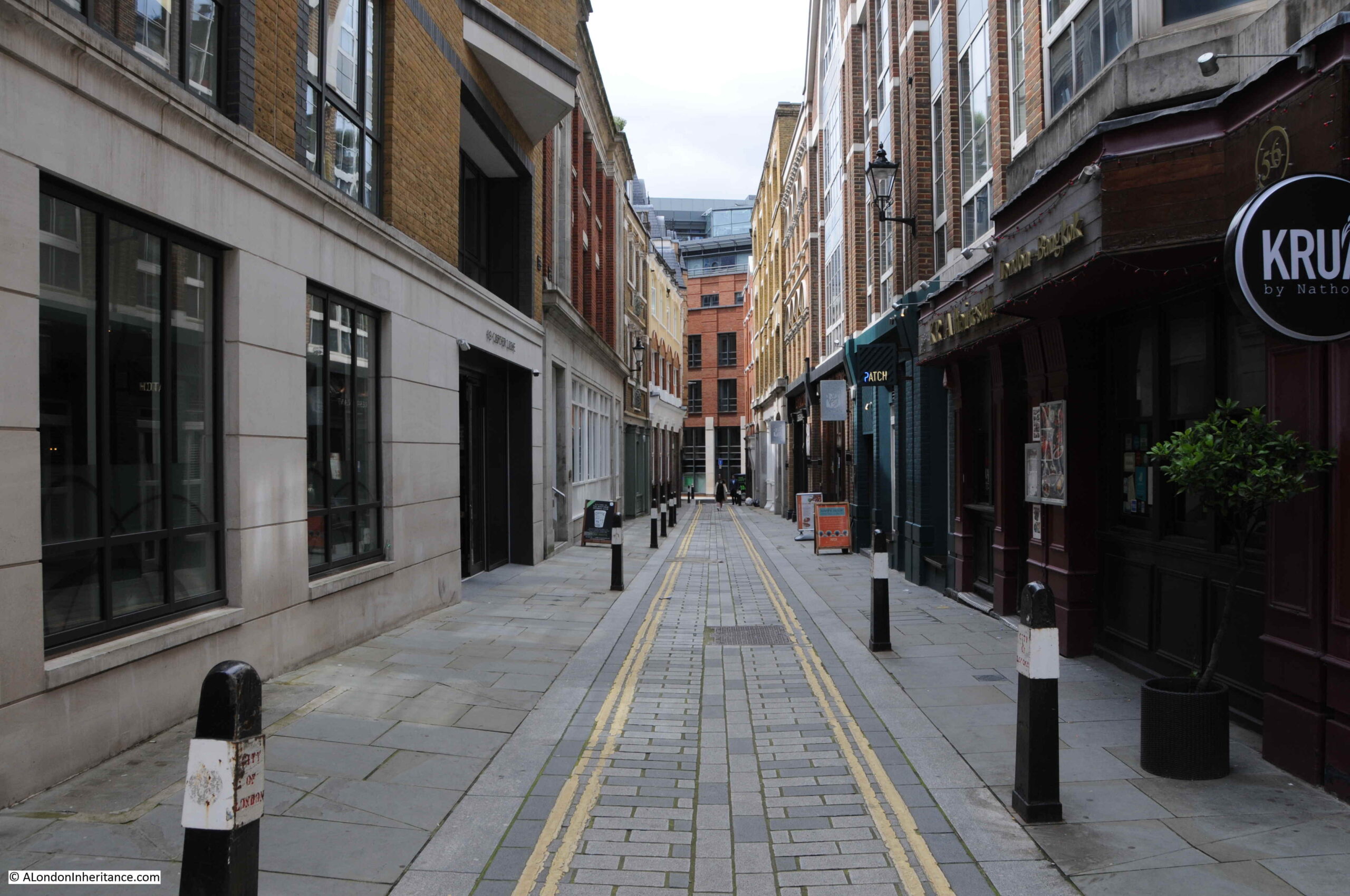
Just after number 59a, we come to the part of Carter Lane, that on Rocque’s map was in 1746 called Shoe Makers Row:

Carter Lane

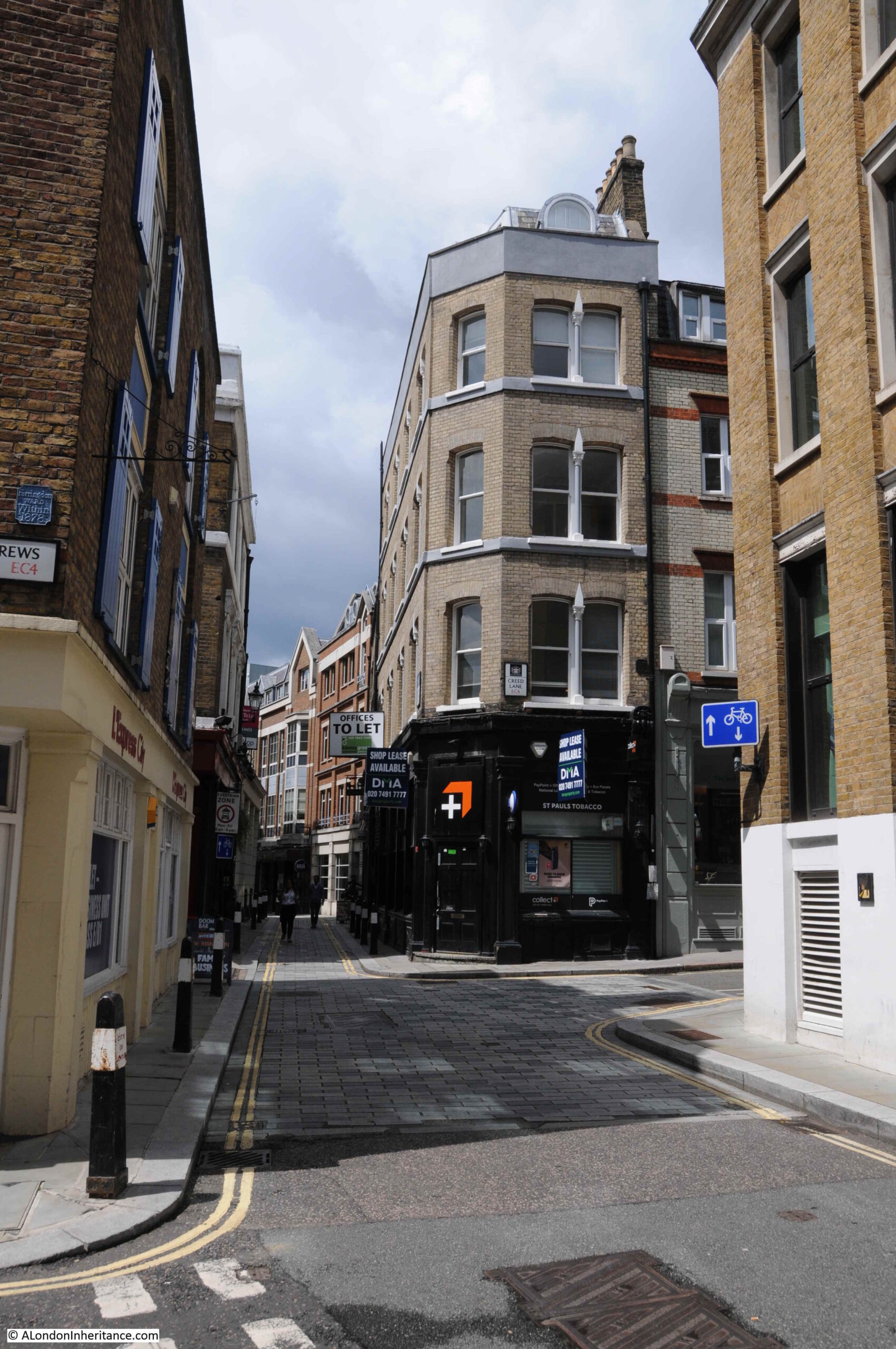
It is still a distinctive section of the overall street, as at the end of what was Great Carter Lane, the street narrows considerably into Shoe Makers Row.

However, before continuing further, there are a number of interesting buildings and streets at this junction of streets.

The building in the middle of the following photo once had a ground floor with symmetrical doors on either side, and possibly a much grander entrance or windows in the centre. It has now been modified somewhat by an entrance cut into the face, possibly as access to a goods loading bay or car parking. It is often how buildings survive over time in the City if not completely demolished, by being modified for different use.

Carter Lane

On the corner of Carter Lane and Burgon Street is the Rising Sun, a Grade II listed, early / mid 19th century building, the Rising Sun is a typical City pub.

Rising Sun pub

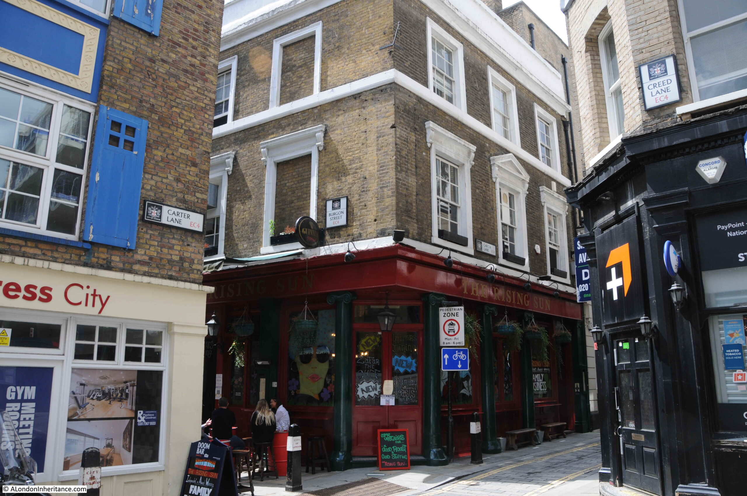
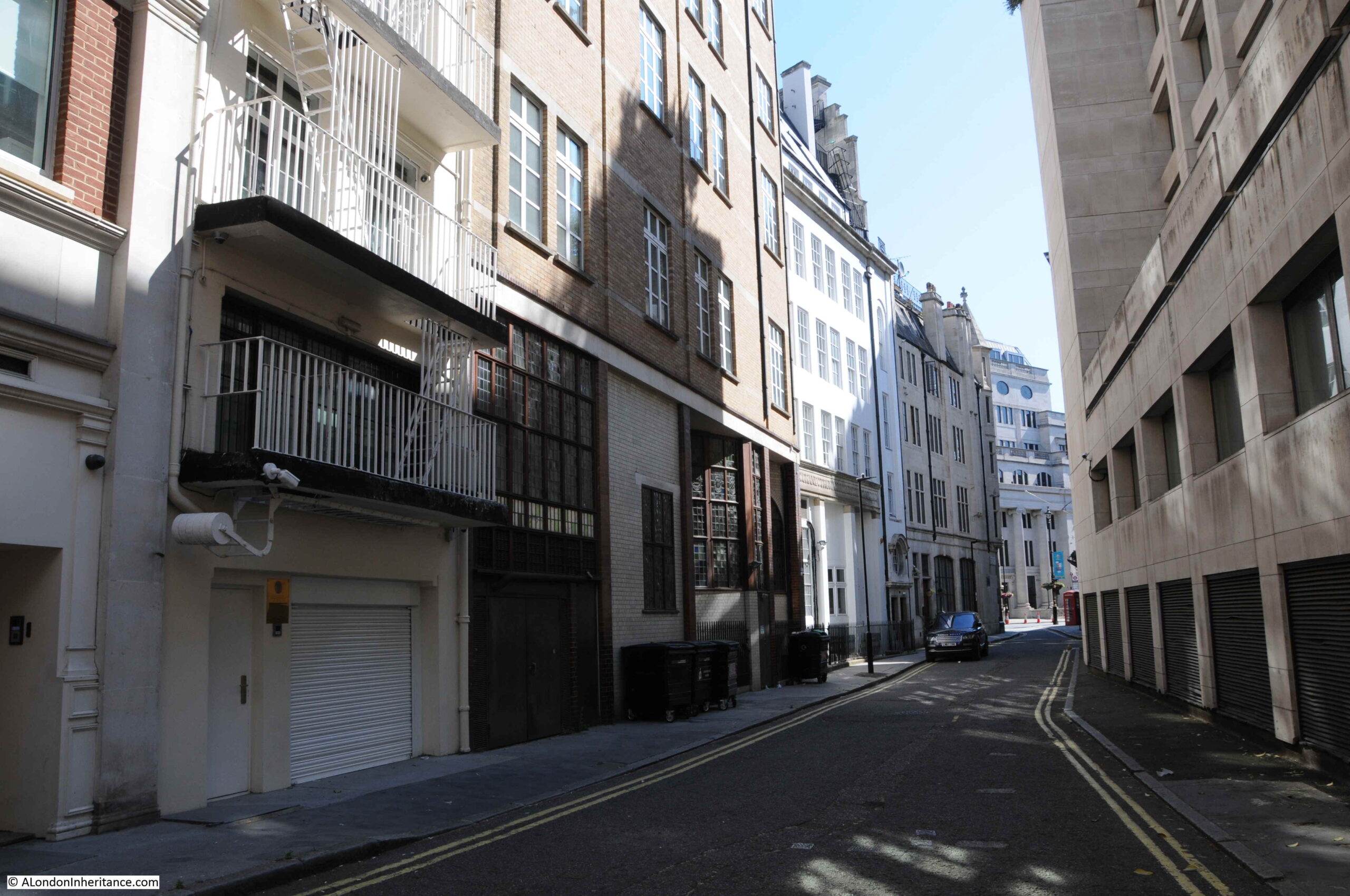
And to the right of the above photo, leading north from Carter Lane, is Creed Lane, another old City street that is currently blocked off as part of a building site:

Creed Lane

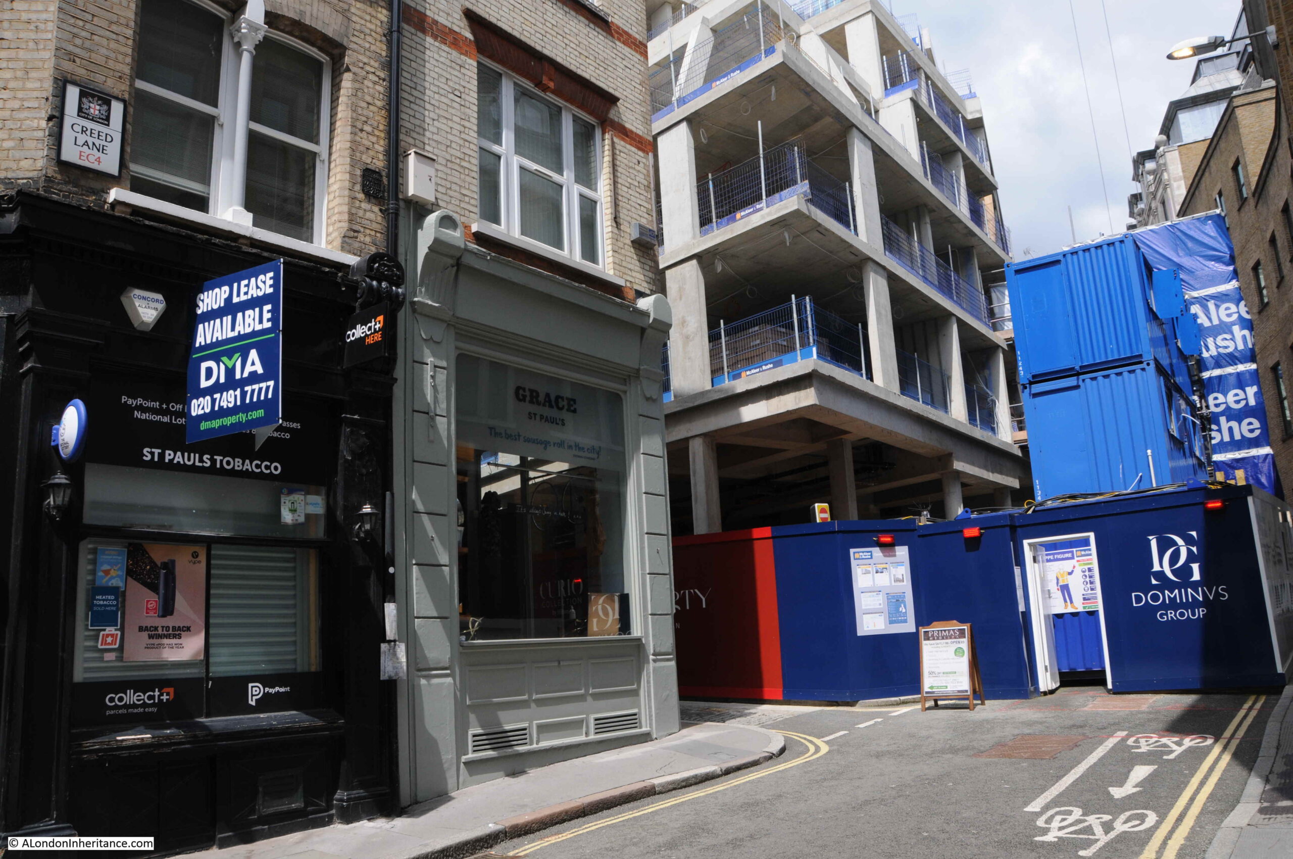
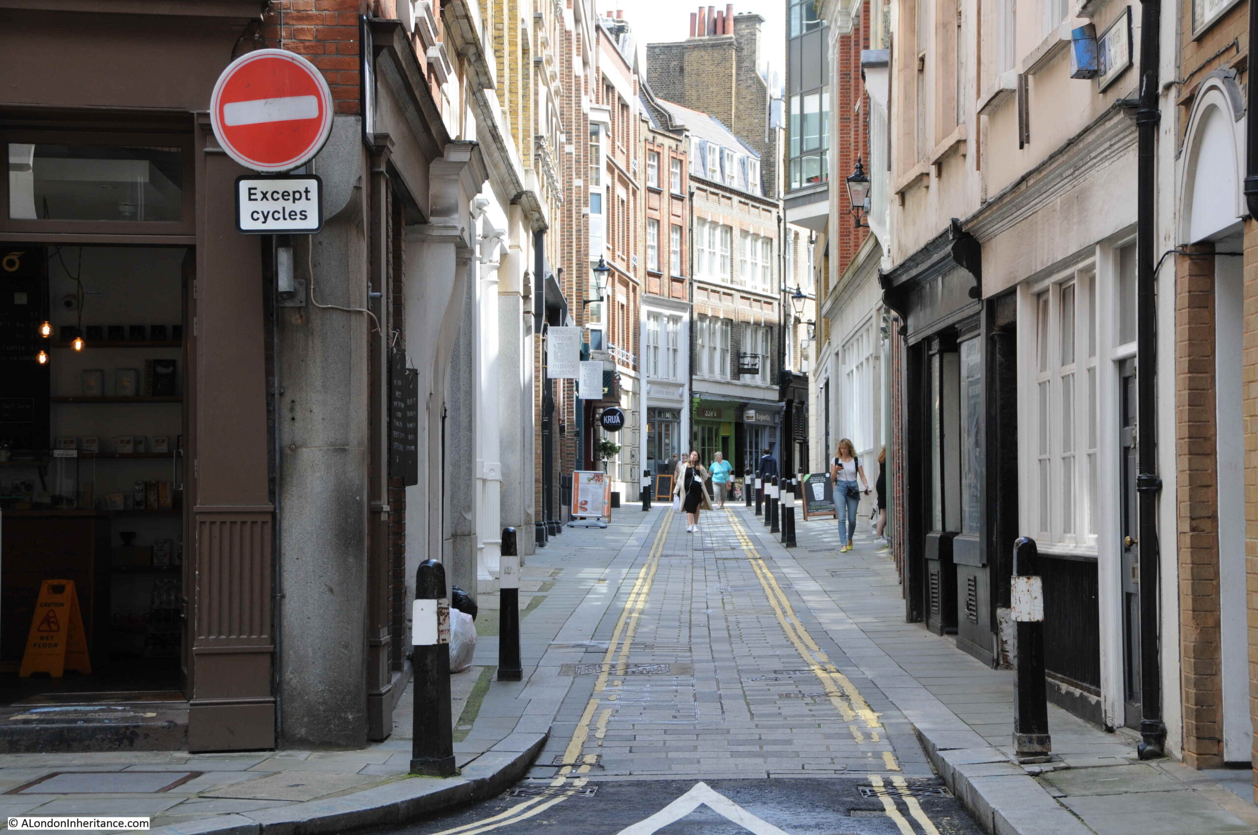
Continuing on down Carter Lane, and although the previous section of the street was not that wide, the section that was Shoe Makers Row is a much narrower street. There are very few written references to the street, and I suspect that the original name of the street refers to the trade that was carried out here.

Carter Lane

This section of the street feels older than the rest of Carter Lane, and leading off from the street are a number of alleys.

In the following photo is Cobb’s Court:

Cobb's Court

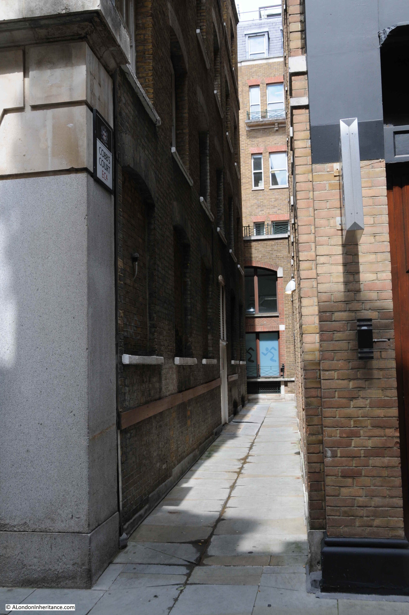
According to Harben, Cobb’s Court was first mentioned in 1677, and the name originally referred to a central court, with the passage leading down to Carter Lane (the section shown in the above photo) called Postboy Passage. We can see this original name in the extract from Rocque’s 1746 map at the start of the post.

Standing in Cobb’s Court, we can look across Carter Lane to another alley, this time leading south:

Cobb's Court

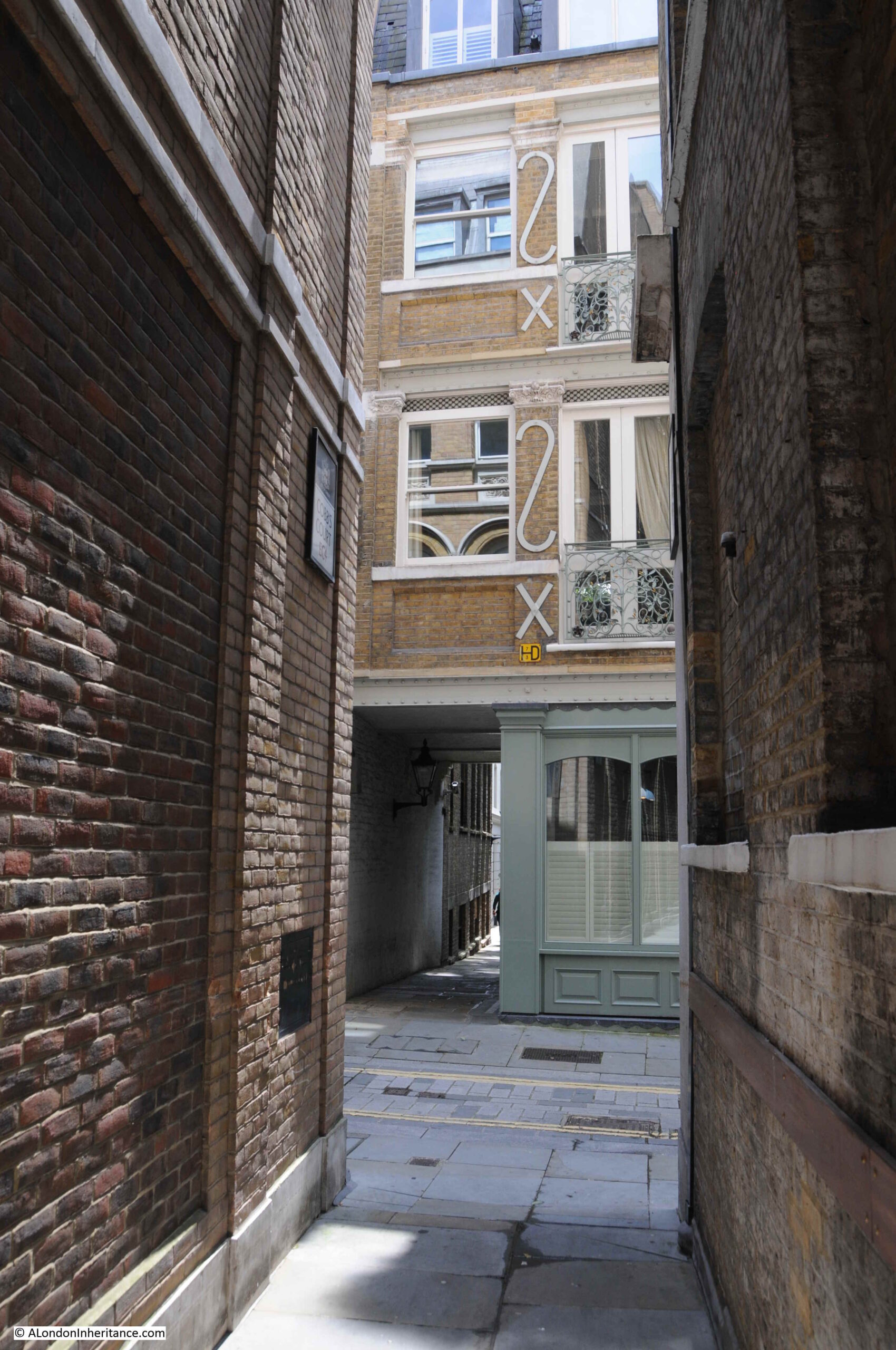
This alley has the rather unusual name of Church Entry:

Church Entry

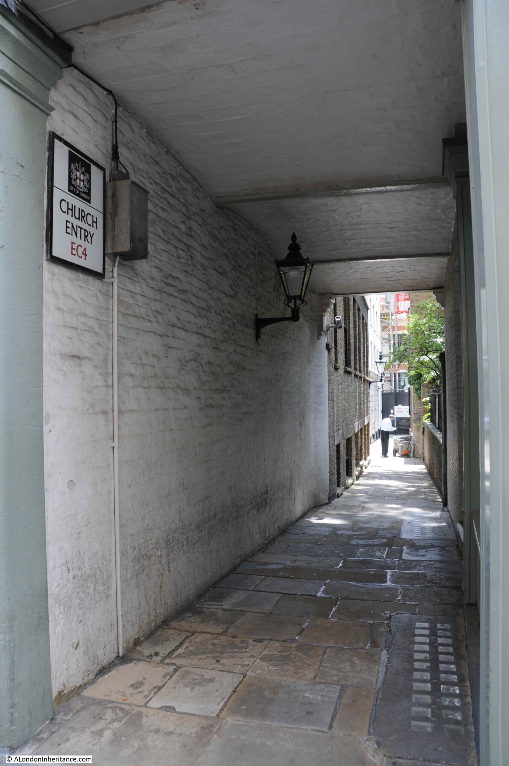
Harben records that the name was first mentioned in 1677, and in 1559 was called Church Lane.

A short distance along Church Entry, there is a raised garden:

Church Entry

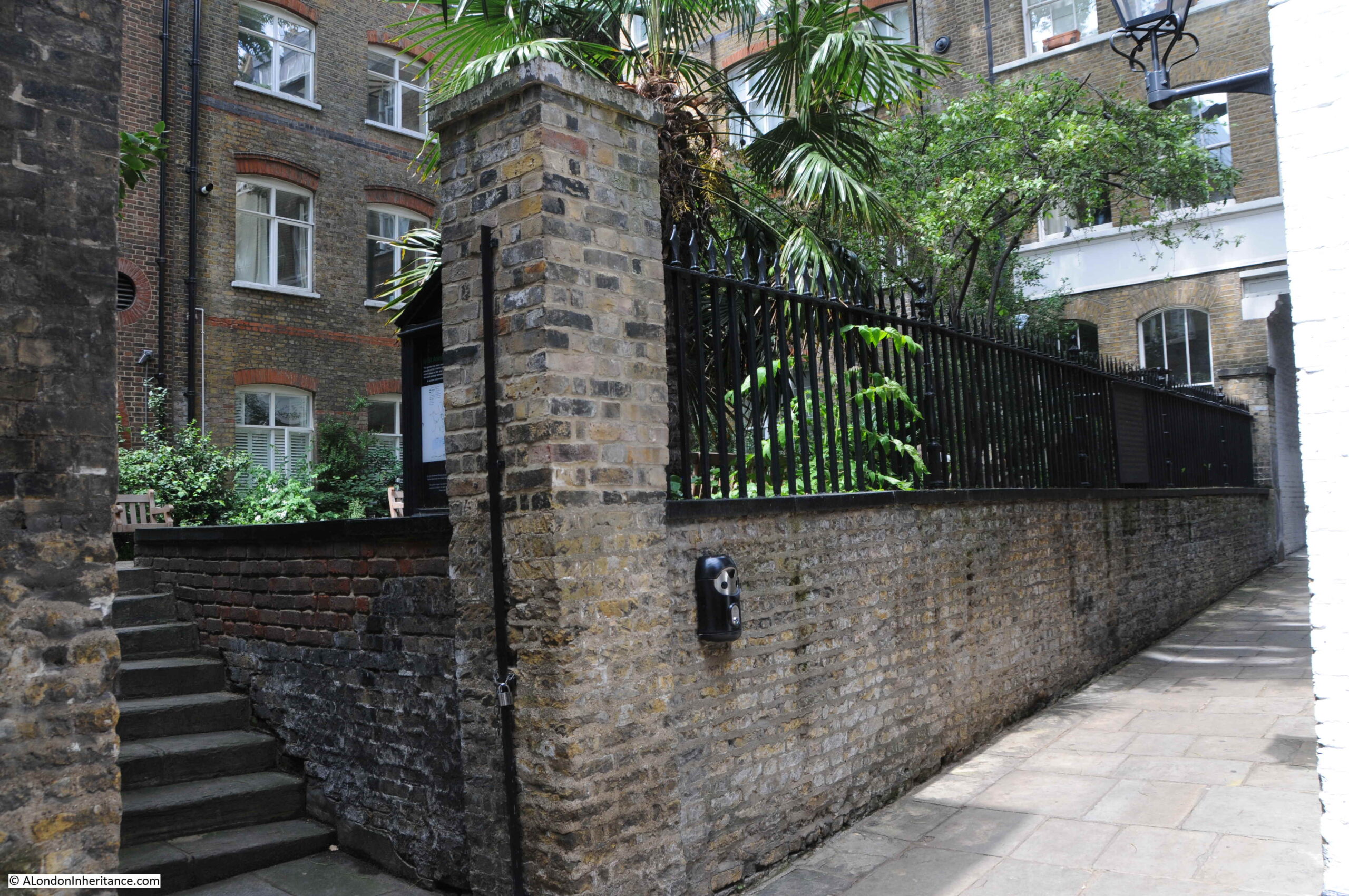
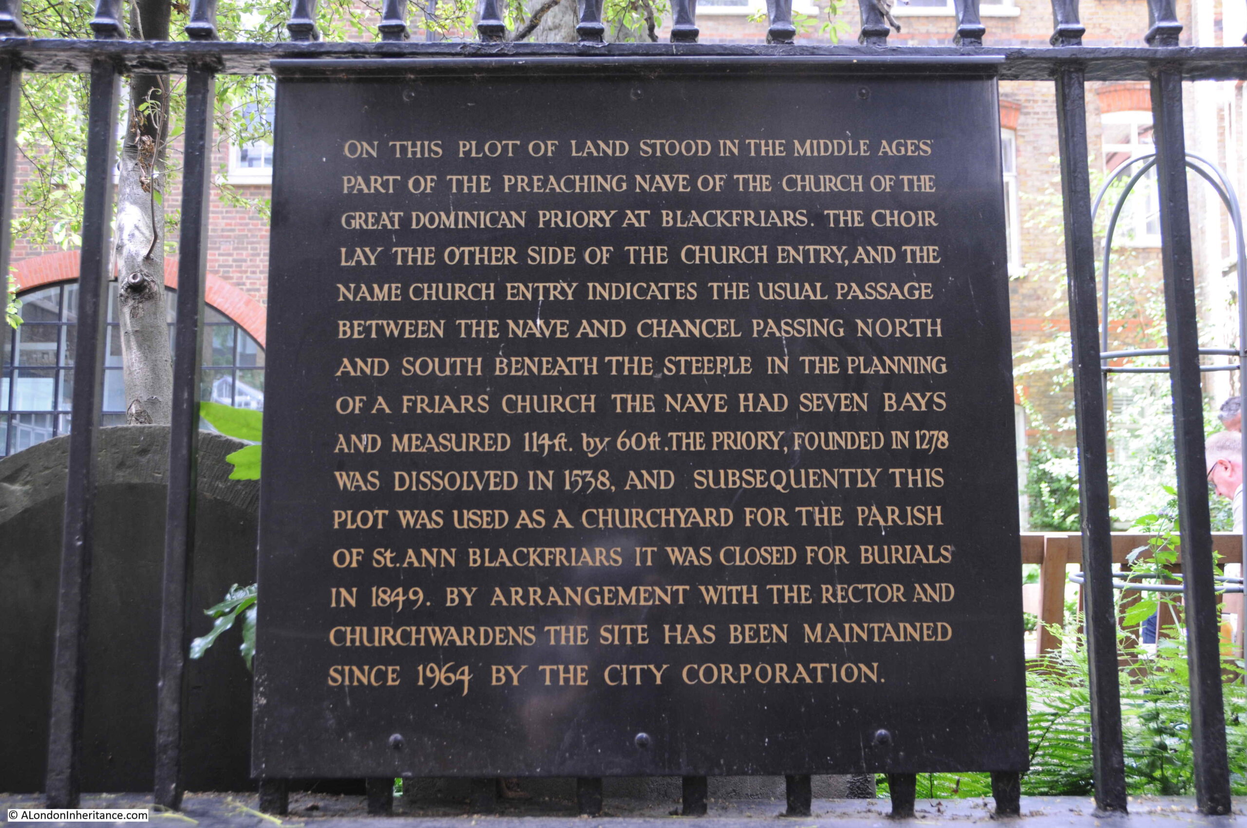
A plaque mounted on the railings providing some background as to the name of the alley, the garden, and the location being part of the church of the Dominican priory at Blackfriars.

Church Entry

After the dissolution, the land and buildings were sold, and it appears that Church Entry may have been formed when new, or perhaps a division of the existing buildings, allowed the alley to be formed.

The earlier religious nature of the area changed considerably over the following years, and we can get an impression of the street in the middle of the 18th century from the following report from Pope’s Bath Chronicle and Weekly Gazette on the 9th June 1763:

“Yesterday morning, about Three o’Clock, two young men, one a Peruke-maker, the other a Watch-maker, went into a House of ill Fame in Church Entry, Black-friars, when a Dispute arose about paying the Reckoning; on which the old Bawd gave the Barber a violent blow on the Head with a Poker, and called a soldier, who was then in the House, to her Assistance, who fell upon them with the aforesaid Weapon; the Watch-maker, in his Defence, drew a Knife and cut the Soldier cross the Belly, who was carried to St Batholomew’s Hospital, where he lies dangerously ill. The Barber has received a most dreadful Blow on his Head, several inches in length, quite to his Brain; and, with the Mistress of the House and one of the prostitutes, is committed to Clerkenwell Bridewell; and the Watch-maker, who is charged with wounding the Soldier, is committed to New Prison, Clerkenwell”.

It is fascinating to think about these events when standing in the alley, and the amount of individual stories that could be told about every London street and alley is one of the overwhelming things about researching the city.

There is one rather unqiue building remaining in Church Entry:

Church Entry

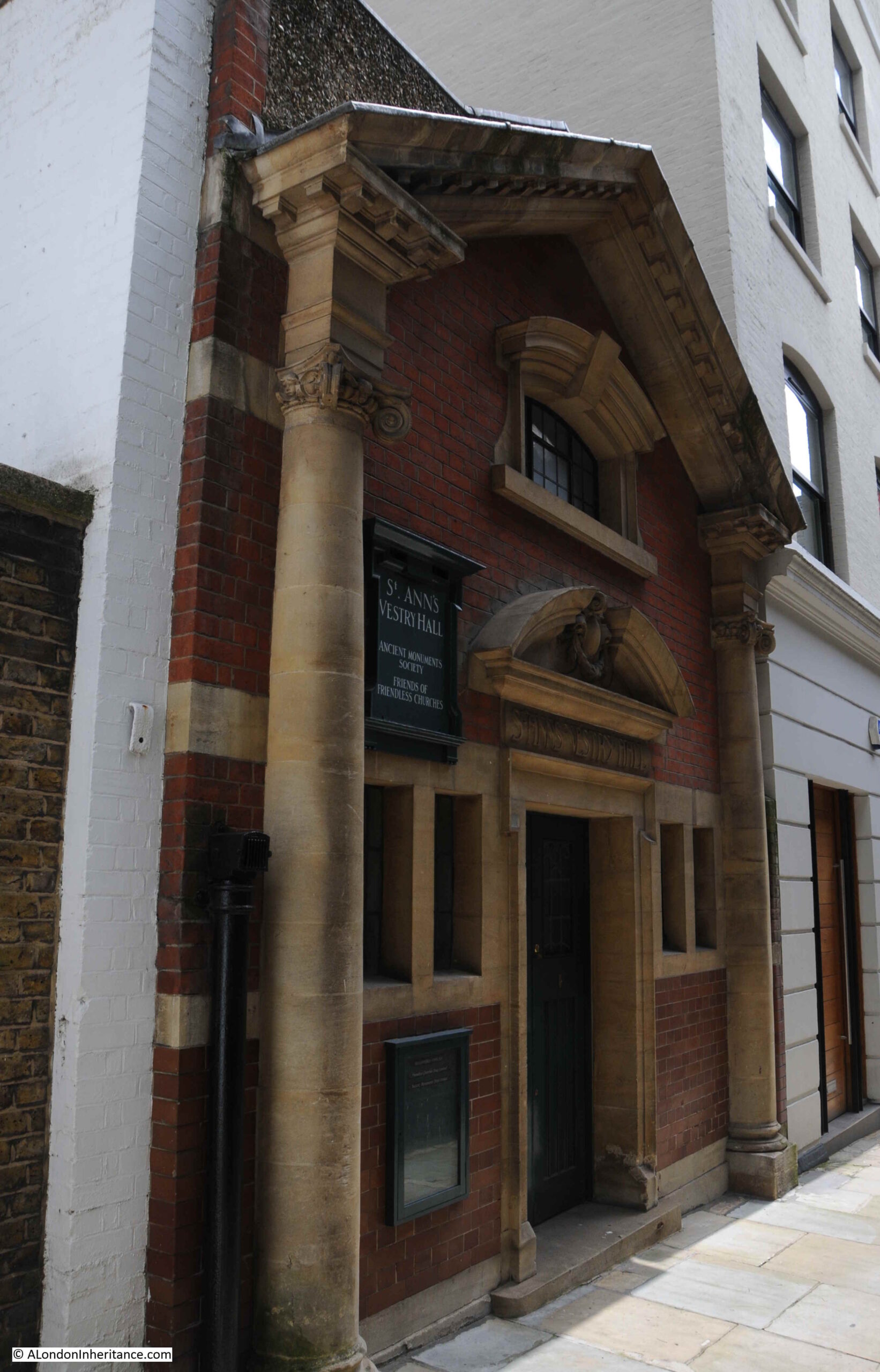
This is the Vestry Hall of St Ann’s Church.

Although the church of St Ann’s was not rebuilt after the Great Fire in 1666, the vestry hall seems to have continued. The building we see now is much later than the original church, having been built in 1905 and is now Grade II listed.

St Ann’s Vestry Hall is now home to the Ancient Monuments Society and the Friends of Friendless Churches.

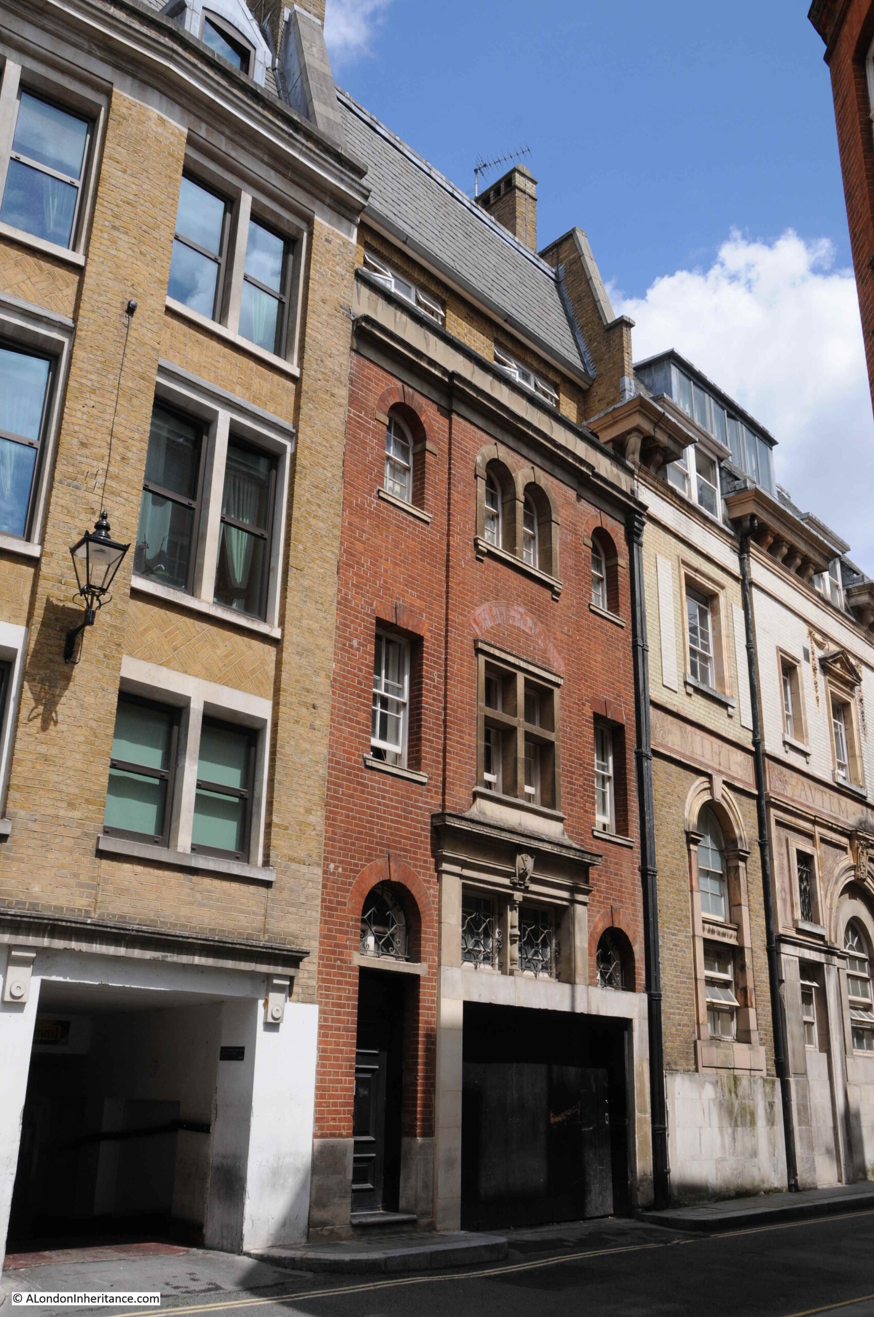
Walking back up to Carter Lane, and a little further along are two rather special buildings. Both of these buildings, although considerably changed over the years, date back to the late 17th century. On the left is 79 Carter Lane, and part of number 81 is on the right.

17th Century houses

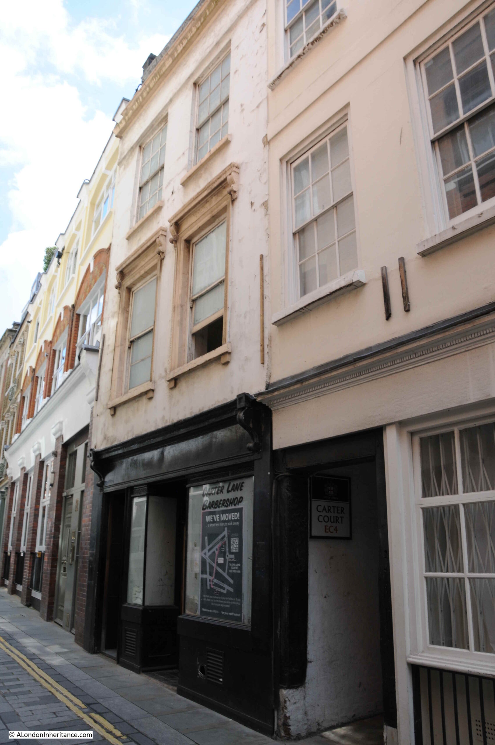
They are both Grade II listed, and the Historic England listing for number 79 reads:

“Possibly late C17, stuccoed in C19. 3 storeys plus continuous dormer. 2 windows. Shop. Corniced 1st floor windows. Crowning cornice and parapet.”

And for number 81:

“Late C17, stuccoed and altered. 3 storeys plus continuous dormer in roof. 3 windows. Shop and passageway. Storey-bands. Parapet.”

Remarkable to think that there could be buildings that at their core date back to the late 17th century in the heart of the City.

I started the post with a hairdresser / barber, and I am almost finishing the post with another one, as at ground level at number 79 is the closed Carter Lane Barbershop.

Carter Court

Under number 81, and between numbers 79 and 81 is another alley, Carter Court:

Carter Court

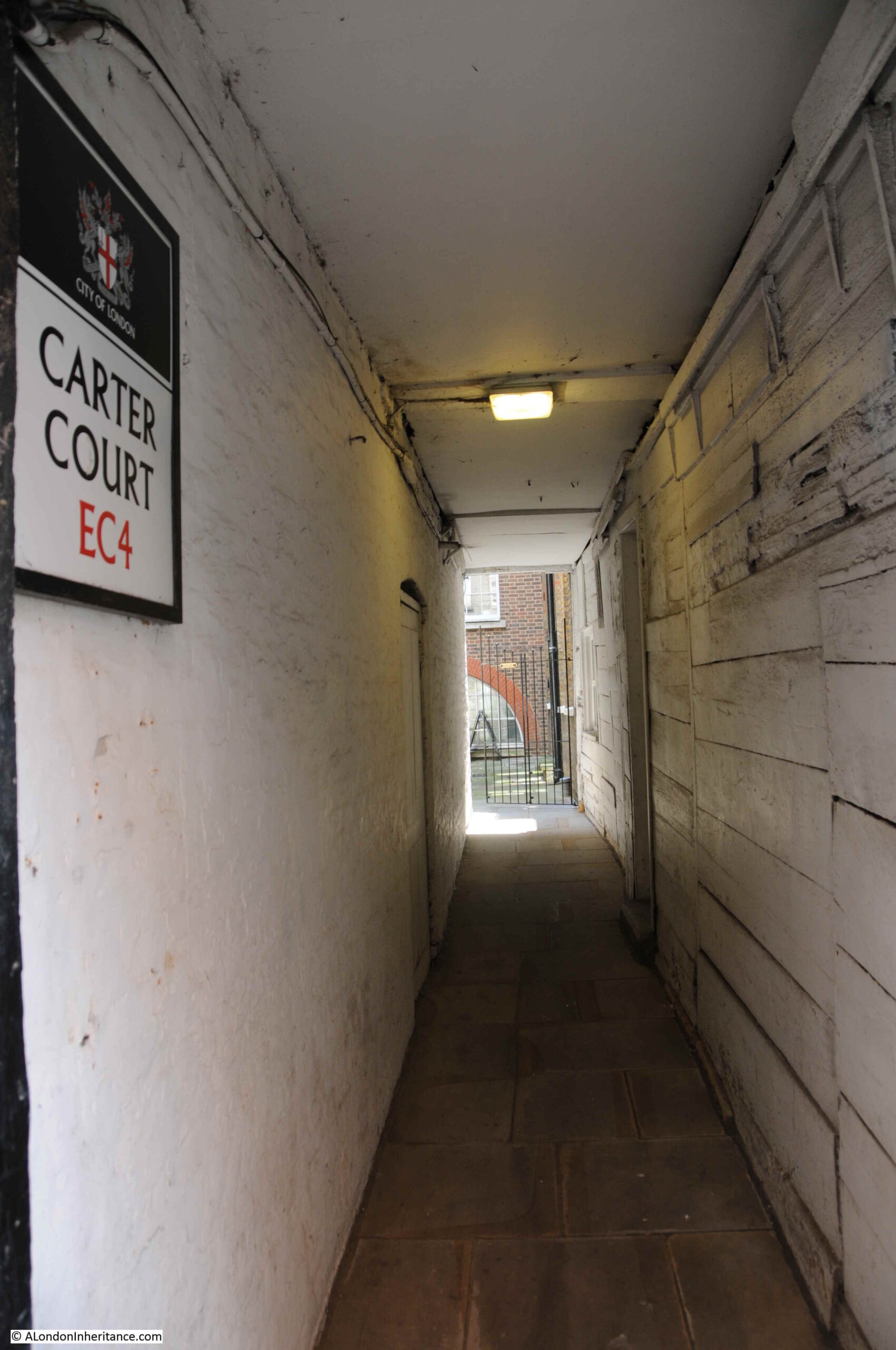
Referring back to the Rocque map, and in 1746, Carter Court was called Flower de Lis Court. I double checked this with Richard Horwood’s map of 1799, and the same name appears to cover the court.

There were a number of alleys and courts in London with variations on the Flower de Lis name, and no clear source for the name, with a number of possible origins including the name of a wharf, a tenement, or a tavern.

Walking down what is now Carter Court, and looking at the wall of number 81 we can get a sense of the age of the building and the construction methods and materials used as the building has been repaired and modified over the centuries. It is extremely rare to see this exposed form of construction.

17th century houses

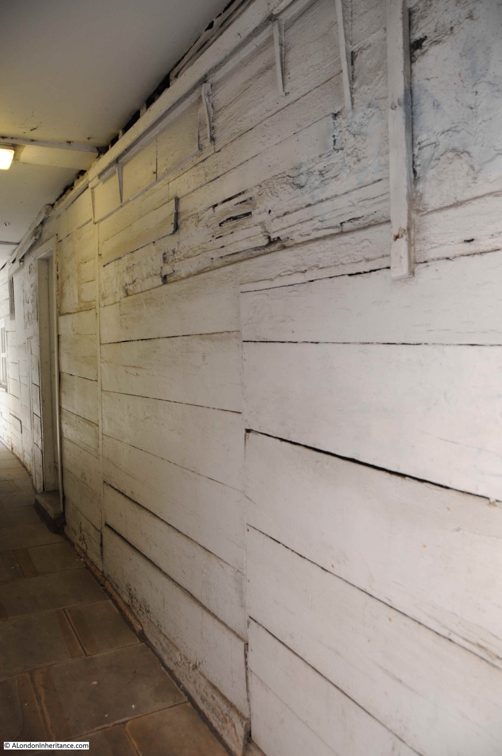
Further down the court, there is more evidence of the early date of construction, and at the end, a small window opening into the court.

17th century houses

I have now reached the end of Carter Lane, the point where the street meets Ludgate Broadway and Black Friars Lane. Looking back up the street, to what was Shoe Makers Row, with the oldest buildings on the street, numbers 79 and 81, on the right.

Carter Lane

With the exception of the part of the street that was Little Carter Lane, and the western end of Great Carter Lane, the rest of the street was not destroyed by wartime bombing. Victorian building along the street was relatively modest, and much of this 19th century and early 20th century building occupied the original plots of land.

Carter Lane is today part of the St. Paul’s Cathedral Conservation Area which should give the street some protection.

A street that is well worth a walk, and where a sense of the historic City of London can still be found.

alondoninheritance.com

Living in Stepney

Build Back Better has been a slogan much in evidence over the last year, however without a clear understanding of the problems that need to be fixed, or a plan for how to fix them, slogans often end up as meaningless statements.

In the 1940s there were a number of studies and plans published, recommending how London should rebuild after the devastation of the war. How this was an opportunity, to use the current slogan, to “Build Back Better”.

I have covered a number of these plans in previous posts such as the 1943 County of London Plan, 1944 Post War Reconstruction of the City of London, and the report of the 1944 Railway (London Plan) Committee.

London’s boroughs also wanted to improve the living conditions of their residents, and to fix many of the problems that had built up over decades of unrestricted growth that had resulted in some boroughs having the most over crowded, densely built housing in the country.

One such borough was Stepney, and the independent Stepney Reconstruction Group, Toynbee Hall published their report in 1945, detailing the past and present in Stepney with proposals for the future.

The report was titled “Living in Stepney”:

Living in Stepney

The Stepney Reconstruction Group was an unofficial group, led by Dr. J.J. Mallon, the Warden of Toynbee Hall. The group had been working through the early years of the 1940s, studying the causes of bad living conditions in the borough and the impact of various London wide plans that were being developed. In 1943 the group held an exhibition titled “Stepney Today and Tomorrow” at the Whitechapel Art Gallery.

The 1945 written report, Living in Stepney, was the group’s attempt to summarise the past, present and possible future of the borough, and to encourage those who lived in Stepney to engage with their elected representatives to ensure that their views were taken into account.

The first chapter of the report gives an indication of the themes that the report would address – Crowding, Congestion and Chaos.

The borough of Stepney was formed in 1900 through the consolidation of a number of east London parishes. It would last as an indepent borough through to 1965 when it was in turn consolidated into the larger London Borough of Tower Hamlets.

The key driver to the growth of Stepney was the Thames, along with the docks that would take over the southern part of the borough along the river. Docks, industry and the need to house thousands of workers created uncontrolled growth that would lead to dense housing with many people to a house. Lack of green space, health problems, poverty and misery would characterise much of the area.

Living in Stepney provides a comparison with the City of Plymouth. Before the war, Stepney had a population almost as large as Plymouth, but occupied less than a fifth of the area of Plymouth.

Proximity to the docks resulted in much damage through wartime bombing. The report highlights the democratic test for the future of the borough “Here came the blitz, where many had died before through poverty and slums, and little was done. Here the sincerity of democracy will be tested”.

The central area in the following map dated from 1833 shows the area that would become the Borough of Stepney.

Living in Stepney

Building had initially extended along the river from the City to the left, and then continued in land to where the original village of Stepney was located, around the church of St. Dunstan And All Saints. In 1833, the area from Bow Common onwards was still mainly open land, but this would change during the rest of the 19th century as London continued its eastward expansion.

The report identifies four phases in the growth of the borough:

  • 1000 to 1800: The Riverside Village
  • 1800 to 1870: Unplanned Growth
  • 1870 to 1914: No More Room
  • 1919 to 1939: Half-Planned Social Services

The period from the end of the First to the start of the Second World Wars were characterised by Borough Council and London County Council attempts to improve housing conditions as these were the only organisations undertaking any new building, apart from some limited building by housing associations and larger private owners. Almost no rebuilding was undertaken by private estate owners and very few houses were reconditioned to modern standards and repairs to the housing stock were frequently neglected.

In the late 19th century, where rebuilding did take place, it was often at the expense of those living in the buildings to be demolished. The following photo from Living in Stepney is titled “Tenants evicted from slums for the new model blocks to be built”.

Living in Stepney

Also illustrated are some of the dense housing and limited outside space of many of the buildings in Stepney, including Paragon Mansions, Stepney Green:

Living in Stepney

Pre-war housing development by the London County Council, also had the effect of reducing the population of Stepney by relocating people as the slums were cleared. The following map shows the distribution of 3,478 Stepney families as they were moved out of the borough to new LCC estates during slum clearances between 1932 and 1938.

Living in Stepney

Whilst these clearances started to reduce overcrowding in the borough, the impact of these relocations was the break-up of established communities. The report states that whilst the new estates to which people were moved were more healthy locations, they “did not have the social amenities of Stepney. There were not enough pubs, or shops, and far too few clubs or social centres”.

Living in Stepney illustrates the pre-war choice offered to those being moved, from: “A crowded flat”:

Living in Stepney

“With work on top of you”:

Living in Stepney

To a “modern house with a garden in the suburbs (in Dagenham)”:

Living in Stepney

“But with a long journey to work”:

Living in Stepney

This was the challenge with pre-war housing strategy. The London County Council was making considerable improvements in housing standards, however these often meant relocation and the break up of communities which would take time to reestablish, along with the failure to provide social facilities in the new estate.

The impact to these communities was very clear to me when I went to find one of my father’s photos from east London in 1949. I wrote about Hardinge Street, Johnson Street And Ratcliffe Gas Works, with Hardinge Street being a street just off Cable Street, a third of a mile east of Shadwell Station. The was the view of the street in 1949:

Hardinge Street

And following post war redevelopment, all the streets, shops and pubs in the above photos were demolished and the population dispersed. This was exactly the same view a couple of years ago:

Hardinge Street

The arch of the railway bridge being the only part of the 1949 view that remains.

Living in Stepney has a section on “community”, and includes a description of the old parishes that consolidated into the Borough of Stepney. These parishes still had their own characteristics which the report describes:

Wapping is an island which lives to itself. Access is not easy, as no buses pass that way, and there is only the underground line from Whitechapel. The nearest market is Watney Street, and there is no cinema nearby. The population is largely Irish in origin and is strongly attached to the area.

The areas adjoining the City are crowded with factories and warehouses. Spitalfields is a largely Jewish area, where old eighteenth century weavers’ houses, factories workshops, and old fashioned tenements jostle with a large number of common lodging houses. There are few open spaces.

Whitechapel is not so crowded, but presents similar problems. It is in these areas that industry has taken over space from housing, and there has been the largest fall in population.

Mile End and Bow Common were laid out at a later date. Around Burdett Road, once lived a wealthy class who kept carriages. The houses are larger, with gardens, and there are trees in the streets. There is not the same congestion as in the other areas in the West of the Borough.

Limehouse is still a place of ships and seamen and many work to provide their needs. It suffers from being cut up by the canal and railways, and from too much industry, but the old centre remains.

St George’s is one of the most crowded areas of Stepney. In the west live foreign seamen, and a coloured population. There are many Jewish people, but they do not extend much east of Cannon Street Road.

Towards Shadwell are to be found some of the most typical East End streets. Shadwell and Ratcliffe merge into St George’s and Limehouse, but across Commercial Road, Stepney is different. Here are better houses and squares and some well laid out streets, and the houses are old. But around the Commercial Road Gas Works, there was, before the blitz, an area of bad houses”

Living in Stepney illustrated a section titled “What is Wrong With Stepney”:

“Old Damp Houses, mostly 100 years old, with no bathrooms, usually only one tap and the lavatory outside and often shared”

Terrace housing

Crowded Houses, with no space for a garden or proper yard, block out light and air. Dull monotonous streets waste space”

Living in Stepney

“Overcrowding, which is intense, mainly hits large families with children. Stepney had more overcrowding than any London borough. 60 per cent of all families share houses”

Living in Stepney

“Small workshops crowd the ground, using valuable space, and creating unhealthy working conditions. This court was partly cleared in 1937, but there are many like it”

Living in Stepney

“Clubs and Social Centres have not proper buildings. Voluntary bodies have done wonders, but all needs have not been met. Some areas are badly served”

Living in Stepney

“Open Spaces hardly exist in Stepney – 45 acres for 200,000 people in 1938. Children have to play in the street, the great playground and meeting place”

Living in Stepney

“Commercial Road – typical combined main road and commercial centre, causing accidents and traffic congestion. With control of advertisements and buildings it could be a fine street”

Living in Stepney

Living in Stepney includes the following graphics which highlight the impact of overcrowding and compares Stepney with the more affluent and less crowded Lewisham:

Living in Stepney

The lower part of the page identifies the causes of crowding, although in 1945, and just before the start of the war, the population of Stepney had been in decline since the start of the 20th century. The report provides the following summary of Stepney’s population:

Stepney population

Along with some facts on the 1938 population:

Housing space

The themes identified in the above graphics from the 1945 report can still be seen today. In 1945 there were a higher number of deaths per thousand in Stepney than Lewisham, and a considerably greater infant mortality.

The same issues can be seen today, both nationally and within London. The following table comes from the Office for National Statistics latest release “Life expectancy for local areas of the UK: between 2001 to 2003 and 2017 to 2019 and shows that for males within Westminster and Tower Hamlets (of which Stepney is now part), the life expectancy in Westminster is currently 4.53 years longer than that in Tower Hamlets:

Life expectancy

The above graphic also identifies land prices as one of the problems with rebuilding at lower densities and with the provision of open space, with land in 1945 being worth between £10,000 and £30,000 per acre.

The situation is probably even worse today, with land prices explaining why most residential building today appears to be high density apartment blocks. According to the Economic Evidence Base published in 2016 by the Mayor of London, residential land prices in East London were £7.3 million per hectare. (A hectare is 2.47 acres, so the equivalent in 1945 would have been £74,100 to today’s £7.3M).

Living in Stepney also includes a graphic which identifies the cause of high land prices, with the landowner benefiting whilst the tenant pays in rent, rates and the cost of goods.

if landlords do not rebuild, the local authority has to house as many people on a site, so opts for higher density housing, and with more rents coming in for both private landlords and local authorities, the value of land increases – a vicious circle.

Land costs

Many of these themes still drive land prices today, and is one of the reasons why London’s skyline is growing taller, and why Vauxhall in now growing a collection of densely built apartment towers.

On the left of the above graphic is Industry, and in 1938 there was a considerable range of industry in Stepney. In addition to the Docks, there were metal working firms, paint and oil seed crushing firms, printing works, drug, soap and other chemical works, wood, furniture and building firms, and the gas and electricity works. The clothing industry was the largest employer as illustrated in the following summary of how the 140,000 workers were employed in the borough (although slightly more were employed in the general business of buying, selling and distribution):

Stepney jobs

Living in Stepney notes that although the Clothing industry was the largest employer, work was carried out in few large factories, with the majority of workers employed in small, unhealthy workshops in houses and backyards.

The 7% unemployed may give the impression that compared to some impressions of employment in east London, the percentage in Stepney was relatively low, however 7% masks the highly variable nature of employment in the Docks and the Clothing trades, as for many work was precarious, and the unemployment figure could rise or fall considerably within a short period of time.

In asking “Who Governs Stepney”, the report illustrated how the rates were spent, by the two authorities responsible for different aspects of Stepney’s governance – the London County Council and the Borough Council.

Firstly, the responsibilities of the London County Council, and the money spent from the rates on each of their responsibilities:

Stepney council rates

The Borough Council was responsible for many local services, such as street lighting, libraries, public bathes, roads and sewers:

Stepney council rates

Living in Stepney makes a number of recommendations for how Stepney should be transformed. Housing was a big concern, for many of the reasons already stated. Over 90% of families in Stepney did not have a bathroom. Two thirds of families lived in a shared house, and whilst this was less than other parts of London, in Stepney, the high number of small terrace houses meant that where they shared, families lived in much smaller and more crowded conditions.

Many houses dated back to the 18th and 19th centuries, and the borough’s character of streets of terrace houses was seen as a positive rather than a borough of streamlined flats which was considered “entirely contrary to the spirit of the East End”. It was the decayed condition of the housing stock, lack of modern facilities and overcrowding that were the problems, not the concept of terrace housing.

Living in Stepney recommended that housing the population should move from this:

Living in Stepney

To this:

Living in Stepney

Where modern terrace housing replaced the old.

it is interesting to compare the photo of the old terrace housing that the report recommended replacing with one of my photos from last week’s post on Roupell Street.

Terrace Housing

Ignore the roof line, and the design of the terrace is basically the same, even the curved top of the doorway. The key issues in Stepney were overcrowding and the lack of maintenance and upgrading the housing stock. Fix these issues and the original terrace housing would probably today be worth a fortune.

The plan also included recommendations for transport through the borough. During the 1940s, the future of personal transport was seen to be the car, and in the majority of planning for post war reconstruction, major road routes were planned through and around London to support the expected growth in car numbers.

This would also impact Stepney, and plans had already been put forward in the 1943 County of London plan. This included new arterial roads. A sub arterial road to the west of Stepney crossing below the river in a new tunnel, along with an arterial road through the eastern side of the river to what was described as a “doubled Rotherhithe tunnel”.

New routes would also traverse the borough from east to west, however all these new arterial routes were mainly for through traffic with few access points recommended within the borough.

These arterial routes are shown in the following map.

Stepney Road Plan

These routes can also be seen in the road plan from the earlier 1943 County of London Plan. I have ringed the route to the left of the above map in red. It is this route that included a new tunnel under the river just to the east of the Tower of London. This would would act as an inner ring road.

County of London road plan

Open space was a critical issue in the report. At the time of the report, Stepney had a total of 45 acres of open space. The County of London Plan recommended 4 acres for every 1,000 people, which would mean 376 acres for Stepney instead of 45, however the London County Council reduced the ratio down to 2.5 acres per 1,000.

The report recommended making use of the river front and stated that the river is the greatest advantage that Stepney has. At the time, there were three miles of river front within Stepney, but of this, only 700 yards were open to the public.

An example of how this could be achieved was provided by the following illustration where a riverside park stretching from St Katherine’s Dock to Shadwell Park would provide nearly one and a half miles of river front open to the public.

Stepney open space

The Port of London Authority were not happy with this approach, stating that the wharves which occupy the space are particularly suited for the trades which use them, and that the approach would provide less employment in Stepney.

The County of London Plan included proposals that the Living In Stepney report did not agree with. The following table compares a number of key statistics for Stepney as they were in 1938 and as proposed in the County of London plan:

Stepney statistics

The County of London plan proposed a significant reduction of people living in the borough. This figure had already been gradually reducing during the early decades of the 20th century, however the plan proposed a significant further reduction (some of which had already been achieved by bomb damage to the housing stock).

Stepney Borough Council wanted the population target to be 130,000 rather than the much lower figure proposed by the County of London plan. The Council also wanted the majority (60 percent) to be in houses, rather than flats, which the council did not regard as the ideal location for families, older residents, or for the development of a community. The County of London plan had a much higher target of 67 per cent living in flats.

The County of London plan also targeted a density of 136 people to the acre, where the Council wanted this to be 100 people or less per acre.

Living in Stepney also recommended that where industries have been bombed, they should not be allowed to rebuild and start up again, unless it was of vital national interest that they remain in Stepney.

Although the council wanted a higher population than the County of London plan proposed, Living in Stepney was not encouraging a large scale return of those who had moved out of the borough during the war – only those who for personal or work reasons needed to live in Stepney.

Mid 1940s ideas for New Towns was part of the thinking for how Stepney would evolve.

New Towns were seen as the logical destination for industry, along with the workers that industry would need.

The report mentions a number of the possible locations for New Towns, with a focus on Essex – the county that has long been the destination for much east London migration.

New Towns were proposed at Chipping Ongar, Harlow and Margaretting, along with expansion around Brentwood, East Tilbury and Romford.

Harlow did become a new town, I was aware of the Chipping Ongar proposals, but not that Margaretting in Essex was a possible location for a new town. Margaretting is a small village on the old A12 to Chelmsford with a church that dates back to the 12th century – it would have looked very different today if it had become a new town.

Living in Stepney finished with a plea to residents to make sure they told their elected officials how they wanted their borough to develop. The report was concerned that very few people voted in local elections, or take an interest in their local councils. At the time, Stepney had 3 members of Parliament, 6 Members of the London County Council, and 60 Members of the Borough Council.

The local population was encouraged to make sure their representatives knew what they wanted.

It was interesting reading the report to see how many of the issues raised are still valid. The price of land, the root cause of land prices and the type of building that this price dictates.

The best type of housing and whether flats or houses are preferred. Maintenance and modernisation of housing and the impact of landlords. Access to open space, and access to the river, and the inner city location of industry.

The build of the new towns would see continued migration to the Essex new towns of Harlow and Basildon as well as many south Essex towns.

Stepney would change considerably in the following decades, much of which was down to issues outside the control of any local planner. Containerisation and the move of cargo ships to much larger ports resulted in the closure of all the docks within Stepney.

Reports such as Living In Stepney tell us much more about life and thinking at the time, rather than how the future would develop, which is almost always influenced by events that at the time seemed impossible to consider.

alondoninheritance.com

Roupell Street and Aquinas Street – Two Streets on Lambeth Marsh

A short distance from Waterloo Station, there are some wonderful streets. Lined with terrace housing that date back to the 19th and early 20th centuries. A couple of weeks ago, I went for a walk along these streets, starting at Roupell Street and ending at Aquinas Street.

The reason for the visit was to revisit the site of a 1986 photo of a men’s hairdresser on the corner of Roupell Street and Cornwall Road:

Roupell Street

The same view 35 years later in June 2021:

Roupell Street

What was then, simply a “mens hairdresser” is now “First Barber”. Really good to see that the same type of business is in operation thirty five years later.

Getting your hair cut is a service which cannot be provided over the Internet, so hairdressers / barbers are the type of shops that will hopefully be on the streets for many years to come.

It did though get me thinking about name changes. In the 1980s I went to a hairdressers, or a hair stylist (see my post on the Hairdressers of 1980s London for lots more examples). When did the shop for a men’s hair cut change from a hairdresser to a barber? One of those gradual changes that you do not really notice until you compare street scenes.

Another 1986 photo shows the rear of the houses in Roupell Street. A jumble of chimneys and TV aerials:

Brad Street

I walked down Brad Street, which runs behind the southern side of Roupell Street, trying to find the same chimney combination as in the 1986 photo, but there seem to have been many subtle changes. The following photo is the nearest I could get:

Brad Street

The centre tower in the 1986 photo was Kings Reach Tower, the home of IPC Media, publisher of a vast range of titles from Country Life to NME. It was sold some years ago, had additional floors added to the top (hence the difference in height between the two photos) and is now apartments.

The location of the hairdressers / barbers is shown in the following map (red circle) (Map © OpenStreetMap contributors):

Roupell Street

Roupell Street runs to the right of the red circle, and Waterloo East station is below.

Part of a roundabout can be seen on the left edge of the map. This is the large roundabout at the southern end of Waterloo Bridge, and Waterloo Station is just off the map to the left.

Development of the area is relatively recent. It was long part of the area known as Lambeth Marsh. An area of low lying land, with many streams and ditches, and marshy ground. During the 17th century, much of the area was being converted to different forms of agricultural use, and in 1746, Roqcues map shows some streets, limited building, and a network of fields (red oval is future location of Roupell Street and green oval future location of Aquinas Street, which I will be coming to later in the post).

By 1816, Smith’s New Map of London was showing increased building in the area, however the area around what will become Roupell Street (red oval) was still open land, with what may have been large plots extending back from the houses on Broad Wall.

Roupell Street

The yellow oval is around the first stretch of Stamford Street. This is the road that runs to the north of the area I am walking, and is a busy road connecting Blackfriars Road and Waterloo Road.

Note the Strand Bridge. This was the recently built first bridge on the site of what is now Waterloo Bridge. Also, running south from Strand Bridge is the outline of a street labelled “Intended New Road”. This is the future Waterloo Road.

In the above map, there is a track called Curtis’s Halfpenny Hatch where the future Roupell Street would be located.

This was named after a William Curtis who was the founder of a Botanic Gardens in the area. It was a suitable location for aquatic and bog plants as the area was low lying. The Halfpenny element of the name was the cost to use the route when it was previously a short cut through the agricultural land on either side.

The 19th century would bring considerable change and development to the area with the arrival of Waterloo Station, however this had not yet been built by the time of the 1847 edition of Reynolds’s Splendid New Map Of London. Roupel Street had arrived, but apparently not yet fully built, along with the streets that would fill in the area to the north (more on this later in the post).

Roupell Street

Between the 1816 and 1847 maps, Stamford Street was completed linking Blackfriars and the now completed Waterloo Road.

To explore the area, I went for a walk from Roupell Street to Aquinas Street, shown by the dotted red line in the following map, starting at the red circled location of the hairdressers (Map © OpenStreetMap contributors).

Roupell Street

This is the full view of the corner building with the barbers at street level:

Roupell Street

On the opposite corner is an identical building, even with the same bricked windows:

Roupell Street

With a bakers shop now occupying the corner position.

Looking down the full length of Roupell Street:

Roupell Street

The name of the street comes from John Roupell, who purchased the land and built the estate in the early 19th century.

John Roupell had a Bankside metal works, and seems to have inherited the wealth needed to pay £8,000 for the land through his wife’s family.

The street was laid out and construction started around 1824. when John Roupell was 64. The houses in the street seem to have been occupied from the early 1830s as from 1835 onwards, references to those living in the street, or local events, start appearing in the press. One strange mention concerns a murder in a pub garden in Broad Wall, at the eastern end of Roupell Street, when during the inquest, one witness stated:

“John Bingley deposed he is a private watchman. On Sunday morning, about twenty minutes after two, witness was in Roupell-street; he heard a voice – apparently that of a women – exclaim ‘Here’s a villain! – he has got me down and is trying to kill me’.

By the Coroner – Did you hear any other words?

Witness – Yes, i heard the same voice say ‘Come to me’ and then in a fainter tone, ‘Have mercy on me’.

Apparently John Bingley thought it was a drunken row, and took no notice of the matter, he did not see any person answering the description of the deceased either alone, or accompanied by any other person – he does not sound perhaps the most pro-active watchman that you would want to employ on London’s streets.

Roupell built two storey terrace housing. Brick built, directly onto the street with no front garden or a small area protected by railings. Open the front door and you are directly on the street.

Roupell Street

The first time that Roupell Street features in London’s newspapers is when the London Evening Standard reported, on the 1st June 1829, the impact of Roupell’s builders working extra hours:

“On Saturday evening a fire broke out in Roupell-street in one of the new houses belonging to Mr Roupell. On the first alarm, the engines of the Palladium and West of England fire-offices promptly attended, and by the aid of a plentiful supply of water the flames were prevented from spreading, and eventually subdued in about an hour, but not before one of the houses, nearly in a finished state, was totally destroyed and the adjoining one considerably damaged.

The fire originated under these circumstances:- Mr Roupell had bound himself by contract to have both houses finished by a given time, and the period fast approaching, men were employed to work beyond the usual hours.

Some of them were in the act of pitching some gutters, when the pot boiled over and set fire to the shavings and wood with such rapidity that it was with some difficulty all the workmen succeeded in effecting their escape.

Of course none of the houses were insured, as they were in an unfinished state.”

The street was quickly finished after the fire. By the time of the 1841 census, Roupell Street seems to have had a good population, with 250 people recorded in the census as living in the street.

Roupell had built the street for what were described as “artisan workers” and the 1841 census provides a view of the professions of what must have been some of the first people living in the street. This included; painters, labourers, clerks, printers, bakers, carpenters, bricklayers, compositors, paper hanger, hatter, an excise officer, lighterman, warehouseman – all the typical jobs that you expect to find in such a street in 1840s London.

Roupell Street

This Citroen has been parked on the street for many years, and provides one of the most photographed views of the street.

Roupell Street

Walking further down Roupell Street, and a pedestrian walkway that was once a street cuts across. This is Windmill Walk.

On either side of the northern entrance to Windmill Walk are two buildings that have what appears to be shop fronts, along with what could be a very faded painted advertising sign on the wall.

Roupell Street

The 1910 Post Office Directory confirms that these were shops, and the businesses that operated in them at the start of the 20th century.

At number 61 (nearest the camera) was john Bowen Walters – Dairyman and at number 62 was Arthur Edward Cowdery – Baker.

The 2007 Conservation Area Statement records that the shop fronts are replacement / reproductions of the originals.

Directly across the street from the above old shops, is the Kings Arms, a brilliant local pub:

Kings Arms

The Kings Arms was part of the original build of the street and has retained the same name since opening in the 1830s.

The first reference to the pub in the press provides a fascinating view of the agricultural nature of the area. An advert from the Morning Advertiser on the 22nd March 1836:

“Broadwall, Blackfriars-road – to Timber-merchants, Hard Wood-turners, Veneer-sawyers and Others, By Mr. C. COULTON on the Premises, a field opposite the King’s Arms, Roupell-street, Broadwall, on THURSDAY, March 24, at Twelve.

COMPRISING two hundred Yew Trees – to be paid for on the fall of the hammer. may be viewed till the sale, and Catalogues had of the Auctioneer, No 32, Union-street, Borough”.

The advert shows that in the 1830s, reminders of the old agricultural nature of this part of Lambeth could still be found. Two hundred yew trees sounds like a reasonable number so this was not a small field. I do not believe they like water logged conditions, so the typical wet conditions of the Lambeth Marsh were also disappearing.

The trees were almost certainly being sold to release the field for building, as in the late 1830s and 1840s, the remaining open space was being built on.

The majority of Roupell Street has a uniform appearance, however walking further east along the street and there is a three storey pair of houses.

Roupell Street

These houses were not part of the original construction of the street as within the triangular pediment at the top of the building there is the date 1891 which is presumably the date of construction.

The two houses retain the same width as those along the rest of the street and the doors and windows are also much the same, so it may be that in 1891 only the top floor and pediment was added to two existing terrace houses. Perhaps some late 19th century home improvements.

John Roupell died on the 23rd December 1835, when the St James’s Chronicle reported that he had died in his 75th year at his own residence in Roupell Street. Along with Roupell Street, he had a substantial portfolio of land and property in south London, part of which gets mentioned in a news report when his son Richard Palmer Roupell was a witness to a possible murder in his grounds at Norwood. At the inquest, Richard Palmer Roupell was described as a lead merchant of Cross-street, Blackfriars who has a country residence at Brixton Hill.

It may have been Richard Palmer Roupell who developed Theed Street which runs north from Roupell Street:

Theed Street

Theed Street still consists of a terrace of two storey houses, however there is a very different treatment at the top of the buildings where instead of the rise and fall of the triangular wall in Roupell Street, Theed Street has a top wall blanking off the roof at the rear, giving the impression of a more substantial row of houses.

According to Reynolds’s Splendid New Map Of London published in 1847, Theed Street had not yet been built. See the annotated map below:

Theed Street

I am not sure whether the 1847 map is correct. Greenwood’s map from 1828 shows what would become Theed Street as an unnamed street running between two fields. It could be that in 1847 it was still unnamed and running between fields and therefore not considered worth recording – one of the challenges of trying to interpret maps of different scales and over the years as London changes.

Greenwood’s map does show that Roupell Street was originally called Navarino Street (after a naval sea battle fought by the British and allies against the Ottoman and Egyptian forces in the Greek War of Independence in 1827). This was in 1828, and Roupell seems to have quickly changed the name of the street.

Branching off Theed Street is Whittlesey Street which continues the same architectural style of Theed Street:

Whittlesey Streeet

Looking back up Theed Street towards Roupell Street – not a parked car in sight which adds considerably to the view:

Theed Street

In the above photo, the house on the right is to the same design as those in Theed Street, and the way that the top line of brick hides the rear slopping roof can be seen.

Not what you expect to see running across the street of such a densely built area:

Whittlesey Street

Where Windmill Walk crosses Whittlesey Street:

Windmill Walk

The towers in the distance of the above photo are the new blocks recently built around the Shell Centre site on the Southbank.

Reaching the end of Whittlesey Street, where the street meets Cornwall Road, the following photo is looking south with the railway bridge over the street and above that, the pedestrian walkways that take travelers down to the platforms of Waterloo East.

Cornwall Road

On the corner of Whittlesey Street and Cornwall Road is another pub – the White Hart:

Roupell Street

Another pub that has been here since the development of the area and that has retained the same name. The first record I can find of the pub dates from the 25th January 1849 when they placed an advert in the Morning Advertiser for a Barman or Under-Barman. In the advert the pub was described as “a respectable Tavern”.

From here, I am going to take a short walk from the area of Roupell’s developments as there is another street with some fantastic architecture.

Following the route in the map shown earlier in the post, I walked north along Cornwall Road to turn right onto Stamford Street, then south down Coin Street to find Aquinas Street:

Aquinas Street

Aquinas Street is early 20th century, so later than Roupell, Theed and Whittlesey Streets, but like these early 19th century streets, Aquinas Street is lined by rows of terrace houses of a continuous and unique design.

This is the south side of the street:

Aquinas Street

The south side of the street dates from 1911, and in the conservation area statement are described as Neo-Georgian, with their original doors, sash windows and railings. The terrace is Grade II listed.

The northern side of the street has a continuous terrace of houses, but of a very different style:

Aquinas Street

Substantial three storeys, each with a full height bay. They are not what you expect to find in this part of Lambeth and represent a rare example of a surviving, continuous terrace of houses dating from the early decades of the 20th century.

Aquinas Street

Aquinas Street is a perfect example of some of the wonderful streets that can be found by turning off the main streets of the city.

Aquinas Street

I started the post with the hairdressers / barbers on the corner of Roupell Street, so I will conclude the post by returning to the Roupell family.

John Roupell, the original developer of the estate, died in 1835. He died a wealthy man.

His son Richard Palmer Roupell had four children, however it appears that John Roupell was unaware of his grandchildren as Richard had the children with Sarah Crane who was recorded as the daughter of a carpenter. John Roupell would apparently have disapproved of this match, so Richard hid the relationship from him.

One of the four sons of Richard Roupell was William Roupell. He discovered that his father left his estate to his brother Richard, who was the only son born after Richard and Sarah had married (after John Roupell had died).

Richard forged his father’s will to leave his estate to his mother with Richard as executor. He was able to borrow against the estate. He also became an MP for Lambeth.

He had substantial debts and when those who had lent him money called for the debts to be repaid, he fled to Spain. He was persuaded to return, and then tried at the Old Bailey in 1862.

The trial gained considerable publicity, because of the level of forgeries, and because Roupell had been an MP.

An account of the trial was published, published in 1862 and described as “From the shorthand notes of Mr. G. Blagrave Snell – Shorthand writer to the Court of Bankruptcy”. The introduction to the account provides an indication of the sensational nature of the trial:

“The following pages contain the whole of the startling details of one of the most extraordinary series of forgeries that was ever disclosed in a court of justice in this country. No work of fiction, it may safely be said, ever was conceived, in which all the incidents that go to make up a tale of thrilling interest, can be more striking than is this bare, unvarnished tale of truth.

The principal party concerned in it was but the other day a member of Parliament, and a man of whom many prophesised that it would be no long time ere he would rise to distinction in the senate; but who by embarking on a career of reckless profligacy, has brought down absolute ruin upon himself, and upon his family an amount of calamity wholly undeserved, which would have been far greater had he not surrendered to justice by placing himself in the felon’s dock.

It was but recently that the pubic were surprised at the resignation of the Member for Lambeth. They little knew the tale that lay behind that resignation. They little knew that forgery and fraud had been the common paths and beaten ways of William Roupell for seven long years; that he had wasted the patrimony of his family, and had reduced them to comparative poverty even before his father’s death.

At length the fatal truth came out, and he was obliged either to face his father’s executors or fly the country. The family property had been fraudulently sold, and it was only when overwhelmed with difficulties, pecuniary and otherwise, that he resolved to confess the whole truth, even at the bar of the court of justice”.

A dramatic end to a once wealthy family, however we still have John Roupell’s original development as a memorial to his achievements, rather than his fraudulent grandson.

alondoninheritance.com

Carlton House Terrace

For today’s post, I am in Carlton House Terrace. It is one of my favourite types of post as I am looking for a place that has been demolished, the site has changed significantly, however I can still find part of a building that helps to confirm the location.

The following photo was taken by my father in 1949, and shows a house in some form of courtyard, with some steps to a street on the right.

Carlton House Terrace

The location should be easy to find as the house has the address 22A Carlton House Terrace next to the door. The photo appears to have been taken from underneath some form of archway.

As well as finding the location of the above photo, I took a walk through the area to the north of Carlton House Terrace to explore the stairs and streets which few people seem to walk.

The following map shows my route, starting at S, where Carlton House Terrace meets Waterloo Place, and ending at E, on Pall Mall. Also on the map, the arrow shows the location of the photo (start of the arrow) pointing in the direction of the stairs through to the wall seen in the background of the stairs in the 1949 photo. Although there is a very different building on the site today, I will explain how I found the location in the rest of the post  (Map © OpenStreetMap contributors).

Carlton House Terrace

This is the view along Carlton House Terrace from the junction with Waterloo Place. The street is a dead end with no exit for vehicles.

Carlton House Terrace

On the right of the above photo are the houses that were originally part of the plan by the architect John Nash to enhance the background to St James’s Park as the other side of the houses face onto The Mall, with the park on the other side.

Although part of the plans developed by Nash, much of the terrace seems to have been heavily influenced by architect Decimus Burton. The terrace was constructed in 1831.

Carlton House Terrace consists of a run of terrace houses, divided by the stairs that lead down from the end of Waterloo Place down to The Mall. The houses provide an impressive background to the northern edge of The Mall, however it is in Carlton House Terrace that we find the front of the buildings with their entrances and forecourts, and facades whilst not as impressive as on The Mall, still with considerable grandeur.

Carlton House Terrace

The round plaque in the above photo records that William Gladstone, the Liberal politician and Prime Minister lived in the house.

The view along the southern edge of Carlton House Terrace. The rear of these buildings face onto The Mall:

Carlton House Terrace

On the opposite side of the street is a relatively modern development. The number on the first building – 24 Carlton House Terrace – shows that the building is close to the 22A in my father’s photo.

Carlton House Terrace

A wider view of the northern side of Carlton House Terrace.

Carlton House Terrace

The large building on the left dates from the 1970s and is the former head office of the mining company Anglo American. It is this building that is on the site of my father’s photo.

To identify the location, I turned to the 1951 revision of the Ordnance Survey map as this was only two years after my father’s photo.

In the following photo I have marked the position from where the photo was taken with the red dot (‘Reproduced with the permission of the National Library of Scotland’).

Carlton House Terrace

The red dot is under a feature which has an X arcros the dark grey for a building. The use of X is to show a building which has a walk / roadway through at ground level, and the buildings continue above. This explains the dark walls of such a feature on either side and above the immediate location of the 1949 photo.

Following the arrow across the open courtyard, and on the left of number 22A is the symbol for a set of stairs, exactly as seen in my father’s photo.

As usual, there is so much to discover in these maps. To the right of the above map is a building labelled “Old County Hall”. If we go back further to the 1895 Ordnance Survey map, we can see the same building labelled London County Council Office (‘Reproduced with the permission of the National Library of Scotland’).

Carlton House Terrace

This was the first offices of the London County Coucil after it was formed in 1889, and prior to the move to County Hall on the Southbank in 1922. Prior to the London County Council, the building was occupied by the Metropolitan Board of Works, which the London County Council replaced.

The above 1895 map also shows the same features as the 1951 map, providing confirmation of the same features in my father’s photo.

if you look at the above two maps, the arrow in the first map is pointing to the houses on the south side of Carlton House Terrace, and there is a curving feature to the edge of the forecourt in the centre of the terrace.

The same feature can be found today, with the railings curving from street to building:

Carlton House Terrace

My father’s photo is looking towards some stairs which lead up to Carlton House Terrace, and through the gap above the stairs we can see part of the wall of a building.

To the left of the hut in the above photo is a drain pipe, and this can also be seen above the stairs. In the following photo, I have outlined the area of wall in red and included an extract from the 1951 photo to show the same area of wall.

Carlton House Terrace

The following photo is from the south side of Carlton House Terrace, in front of the building in the above photo, looking across to the location of the stairs in my father’s photo. If I have worked out the exact location correctly, the stairs were just behind the car in the middle of the photo.

Carlton House Terrace

The above building was built during the 1970s. I cannot find when the buildings, courtyard and stairs in my father’s photo were demolished, however I suspect they were part of the demolitions to free up space for the building which now covers much of the northern side of this stretch of Carlton House Terrace, and occupy a large area of space back to Warwick House Street.

The following photo is from the eastern end of Carlton House Terrace, looking back to the junction with Waterloo Place and the stairs down to The Mall. The Duke of York’s Column (dating from 1834) which marks the stairs to the Mall and the split between the two sections of the terrace can be seen in the distance.

Carlton House Terrace

The street and terrace are named after Carlton House, which occupied much of the space now occupied by Waterloo Place. Carlton House had a considerable area of gardens which covered the space where today we can find the two sections of the terrace, on either side of the Duke of York’s Column.

I will save the story of the house and the rest of the terrace for another post, as my walk explored a couple of the streets to the north, between the terrace and Cockspur Street / Pall Mall (see map at start of the post).

Although Carlton House Terrace is a dead end for traffic, there is an exit for pedestrians, with some stairs at the far north eastern corner of the terrace.

Carlton House Terrace

Looking back up the stairs, and there is an artwork by the sculptor David John Kent titled “States of Mind” at the top of the stairs:

Carlton House Terrace

Close up view of “States of Mind”:

Carlton House Terrace

The stairs take us into a short street called Cockspur Court that leads from Spring Gardens. Cockspur Court is a dead end, and its only function seems to be to provide a service access to the surrounding buildings.

In the centre of Cockspur Court appears to be the loneliest tree in London. No other trees within view, and a tree that must spend much of its time in shade due to the height of the surrounding buildings.

Cockspur Court

Looking across the court, and a building on the far side has the words “Grand Trunk Railway” displayed.

Cockspur Court

The following photo was taken towards the end of Cockspur Court, looking back towards Spring Gardens, again showing the lonely tree. The stairs down from Carlton House Terrace are behind the tree, and the large building behind the tree, and also running over Cockspur Court is the British Council Building, much of which occupies the space where the first London County Council building was located.

Cockspur Court

Although a dead end for vehicles, at the end of Cockspur Court, there is another set of steps:

Cockspur Court

Walking up these steps, and between two buildings:

Warwick House Street

Which leads into Warwick House Street:

Warwick House Street

Despite appearing to be just a service road for the buildings on either side, Warwick House Street is actually a very old street, which predates Carlton House Terrace, and survives from the time of Car;ton House and the extensive gardens just to the south.

In the following extract from Rocque’s map of London from 1746, I have ringed Warwick Street, now Warwick House Street:

Warwick House Street

Referring back to the maps earlier in the post, it can be seen that the street follows the same route as the much earlier Warwick Street, apart from a slight change at the final junction with Cockspur Street.

In the 1747 map above, large gardens can be seen to the south. Carlton House Terrace now occupies this space.

Warwick House Street consists of the backs of buildings that face onto other streets. To the north is Cockspur Street and Pall Mall, and there are a number of interesting buildings that have their backs on Warwick House Street, for example, this interesting mix of materials and shapes:

Warwick House Street

And on the same building that had “Grand Trunk Railway” displayed at the top, has “The Grand Trunk Railways of Canada” inscribed above the ground floor of the rear of the building:

Warwick House Street

Looking back along the street towards Cockspur Street and Trafalgar Square along a street that was here in 1746:

Warwick House Street

To take a look at the front of these buildings, I walked round to Cockspur Street.

The Brazilian Embassy occupies the buildings which has the ground floor with a mix of materials and shapes:

Brazilian Embassy

And the building with the railway references also has one on the front with the “Canadian National Railway Company”, the company that the “Trunk Railways” became part of. It is now the London Visitor Centre, and if I remember rightly, in the 1980s was the US Visitor Centre.

Canadian National Railway Company

Confirming the building’s Canadian heritage, between the windows of the upper floors are the coats of arms of the provinces and territories of Canada:

Canadian National Railway Company

I am pleased I found the location of the photo at the top of the post. Buildings and a view that have long been lost, however it is always good to find the exact location, and some remaining part of the view.

The sides streets are very close to Trafalgar Square, but are very quiet, mainly as they are basically service roads to the buildings on either side, but finding one that has been here since at least 1746 shows that whilst major houses and gardens come and go, and spaces are significantly reconfigured, in London, it is always possible to find traces of the past.

alondoninheritance.com