Category Archives: The Netherlands

Arnhem Oosterbeek War Cemetery

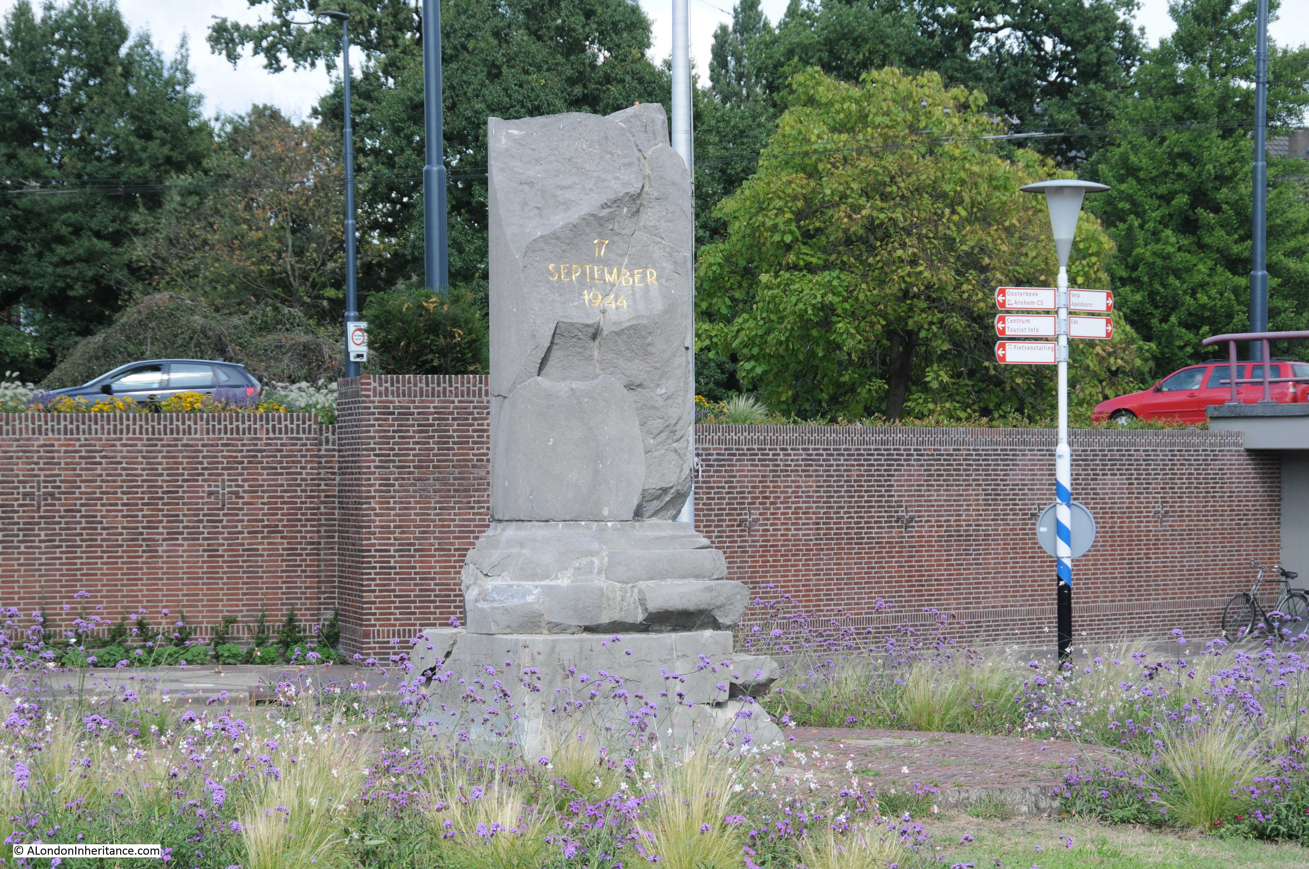
Today, Remembrance Sunday, the focus will quite rightly be on the 100 year anniversary of the end of the First World War. 1918 was the end of what was hoped to be the “war to end all wars”, however in just over 20 years time, the world would descend into yet another global conflict.

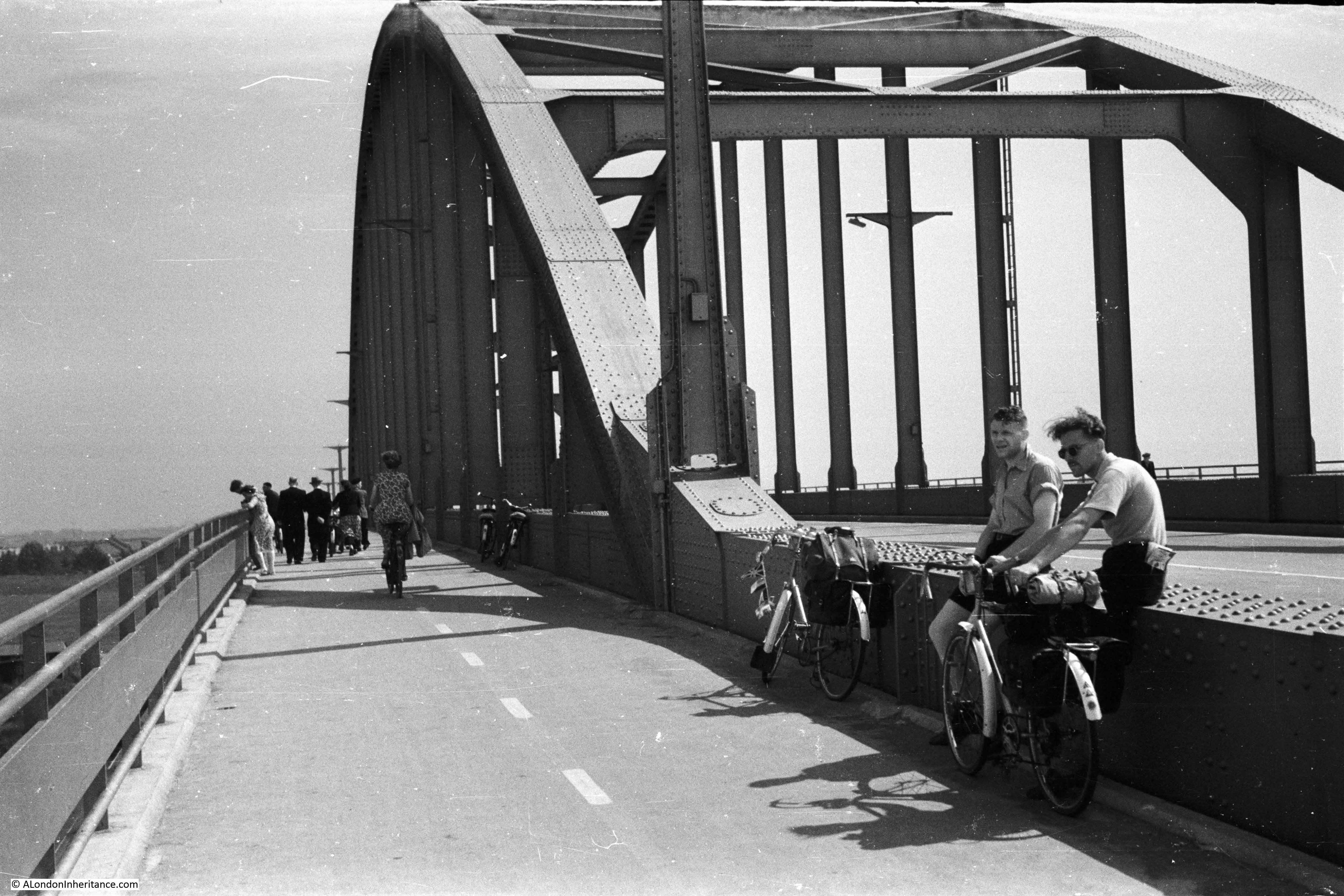
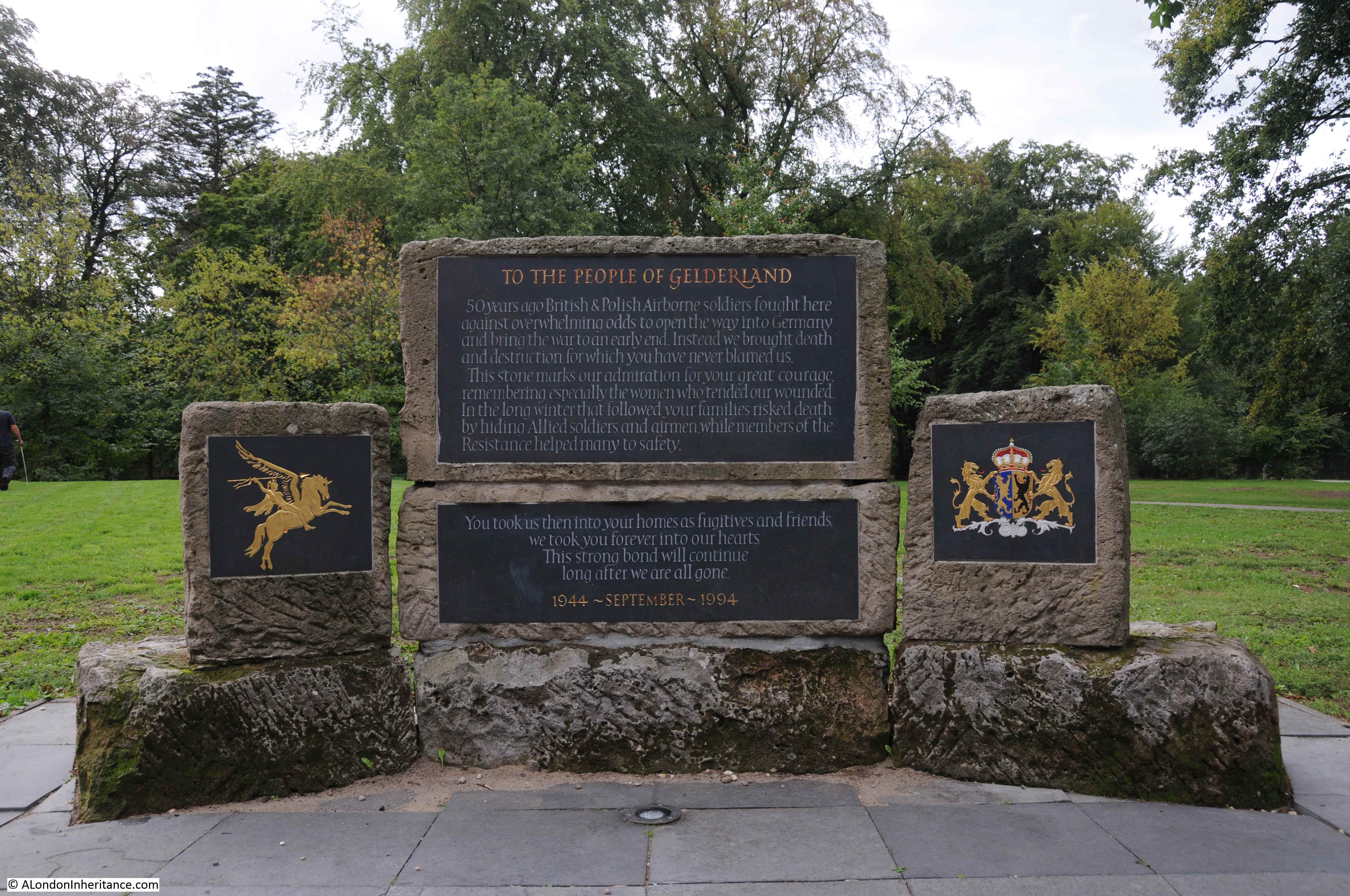
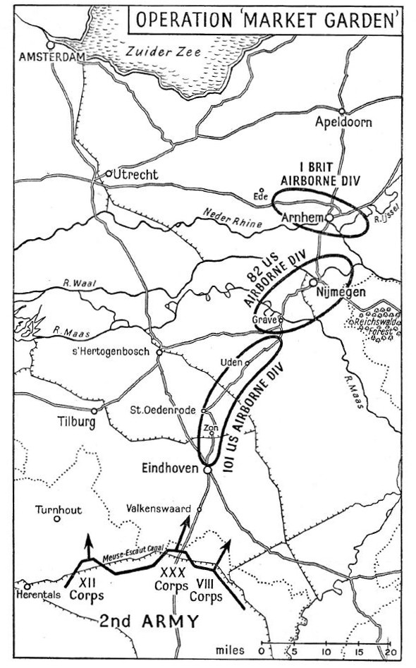
The Second World War would add to the cemeteries created for the victims of the first war and during my visit to the Netherlands this year I went to the Arnhem Oosterbeek War Cemetery, a place that my father had already photographed during his visit to the Netherlands in 1952, not long after the cemetery had been created for the dead of Operation Market Garden and other  conflict in this part of the Netherlands.

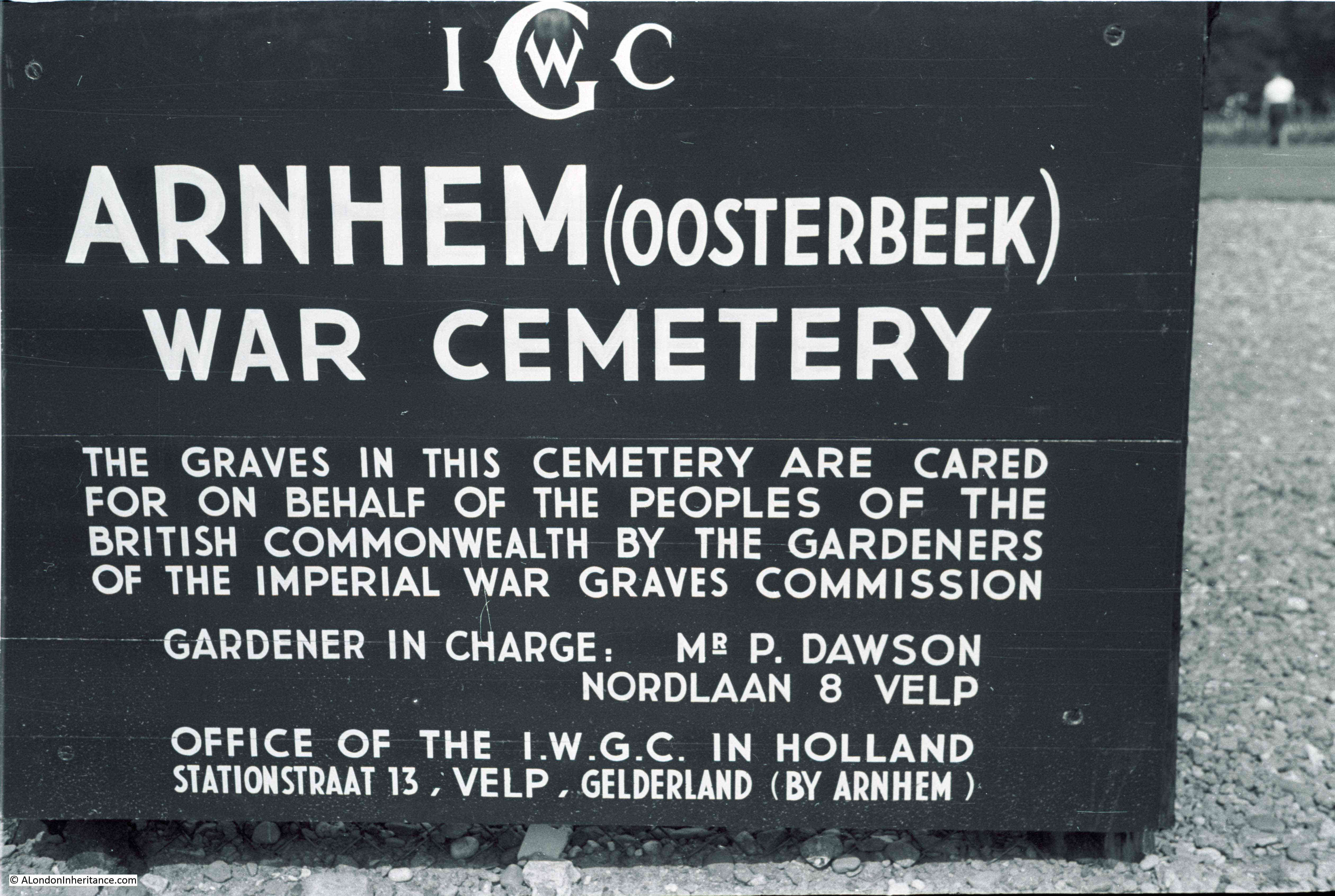
In 1952, this was the sign at the entrance to the cemetery:

Arnhem Oosterbeek War Cemetery

The entrance to the cemetery today:

Arnhem Oosterbeek War Cemetery

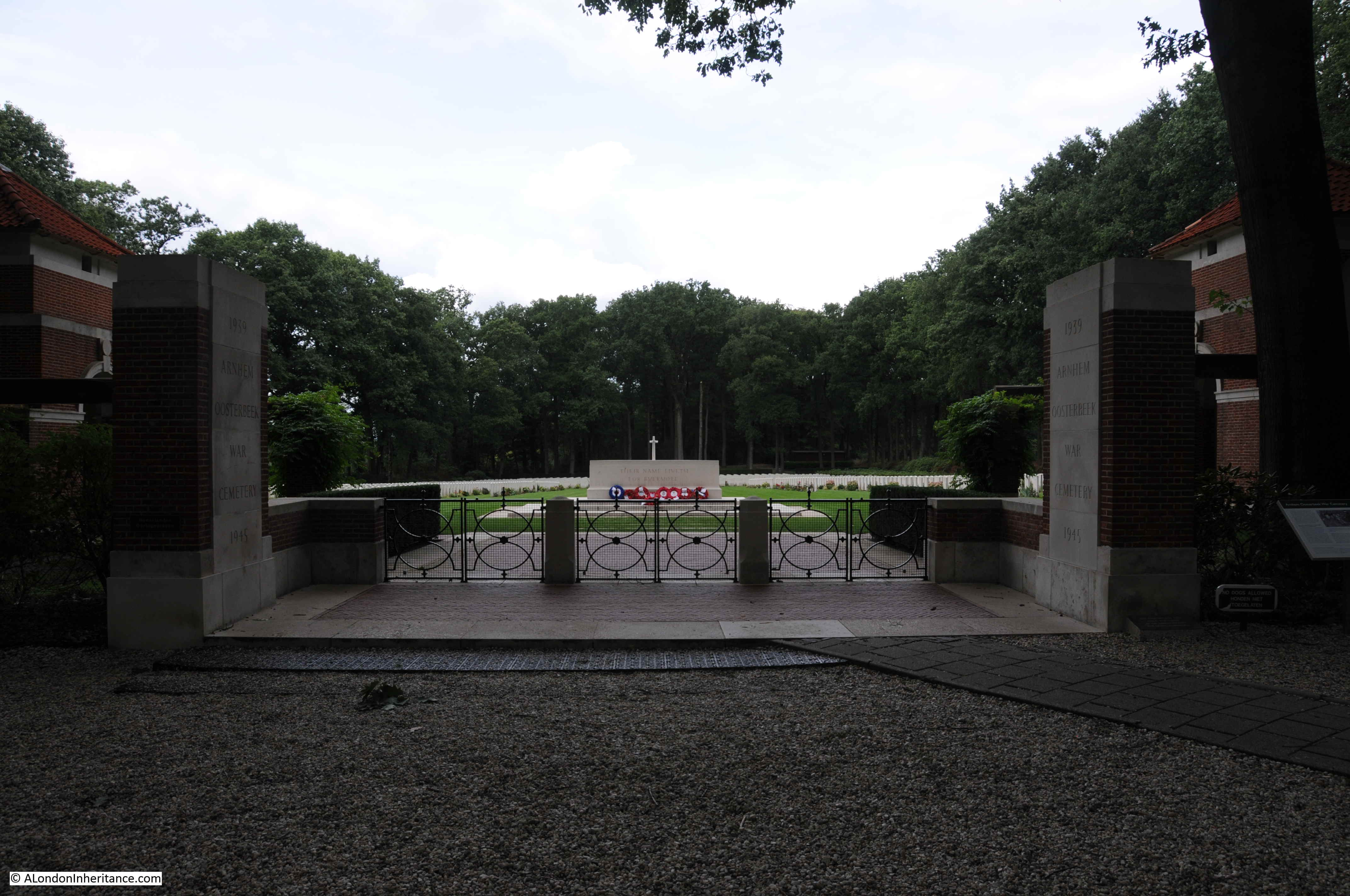
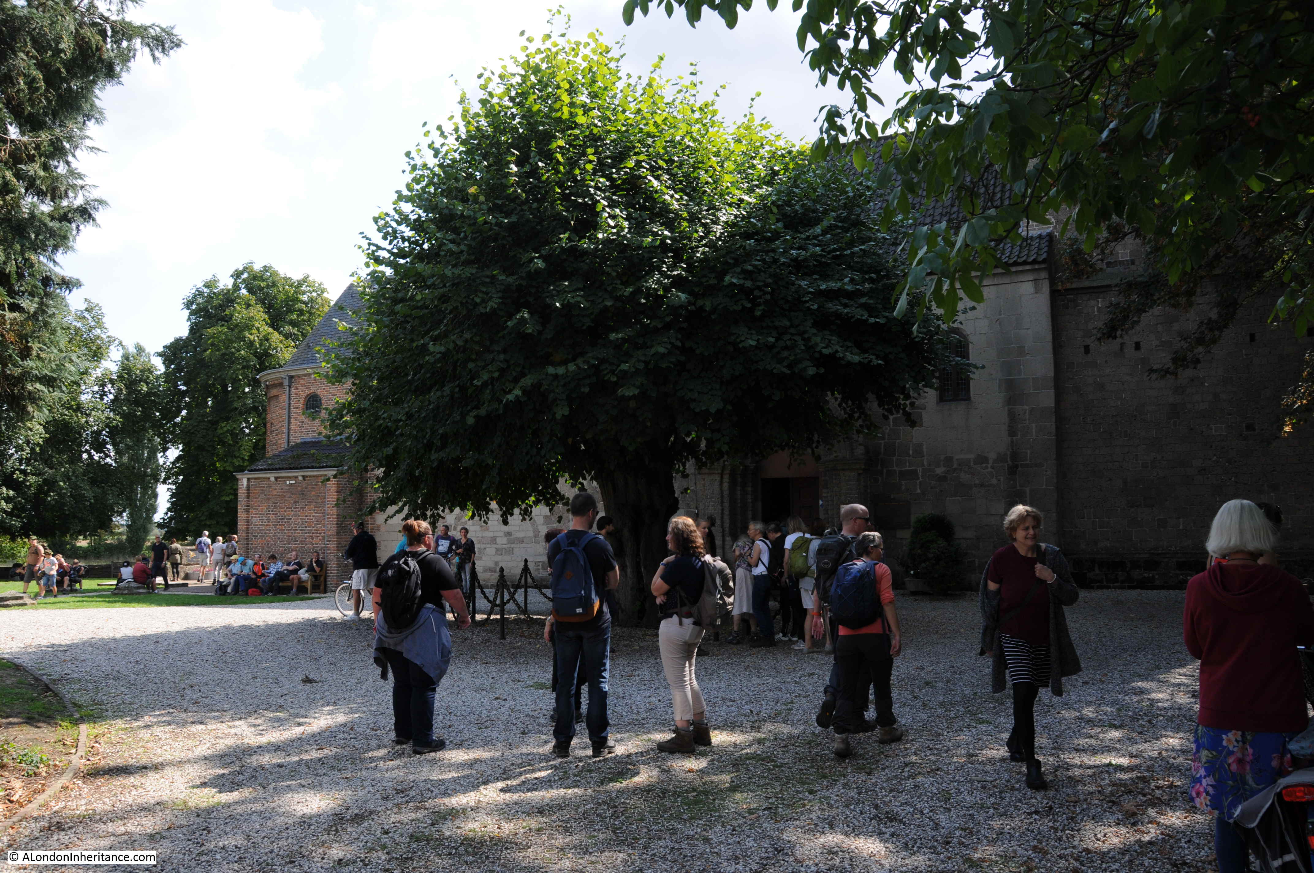
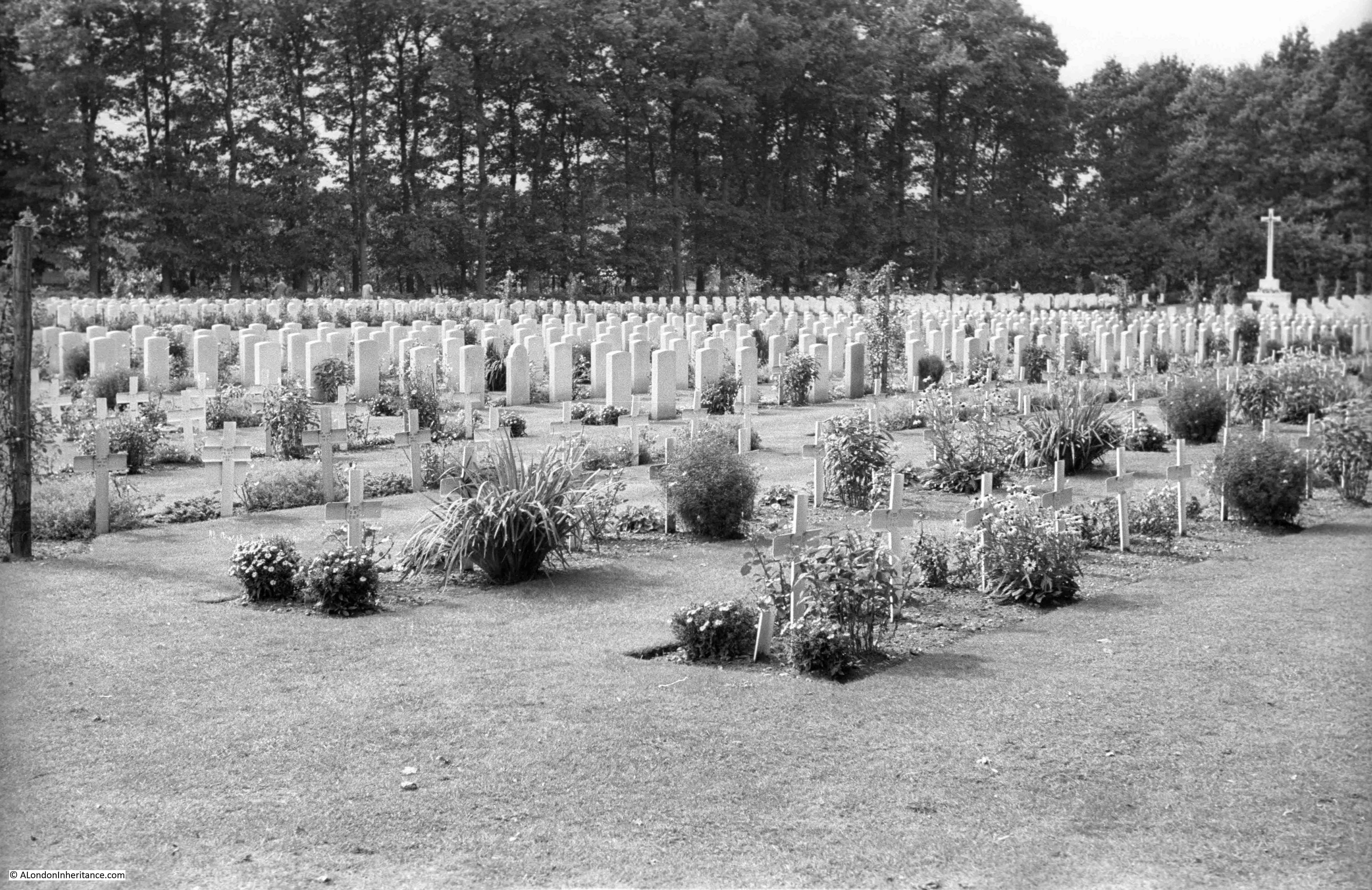
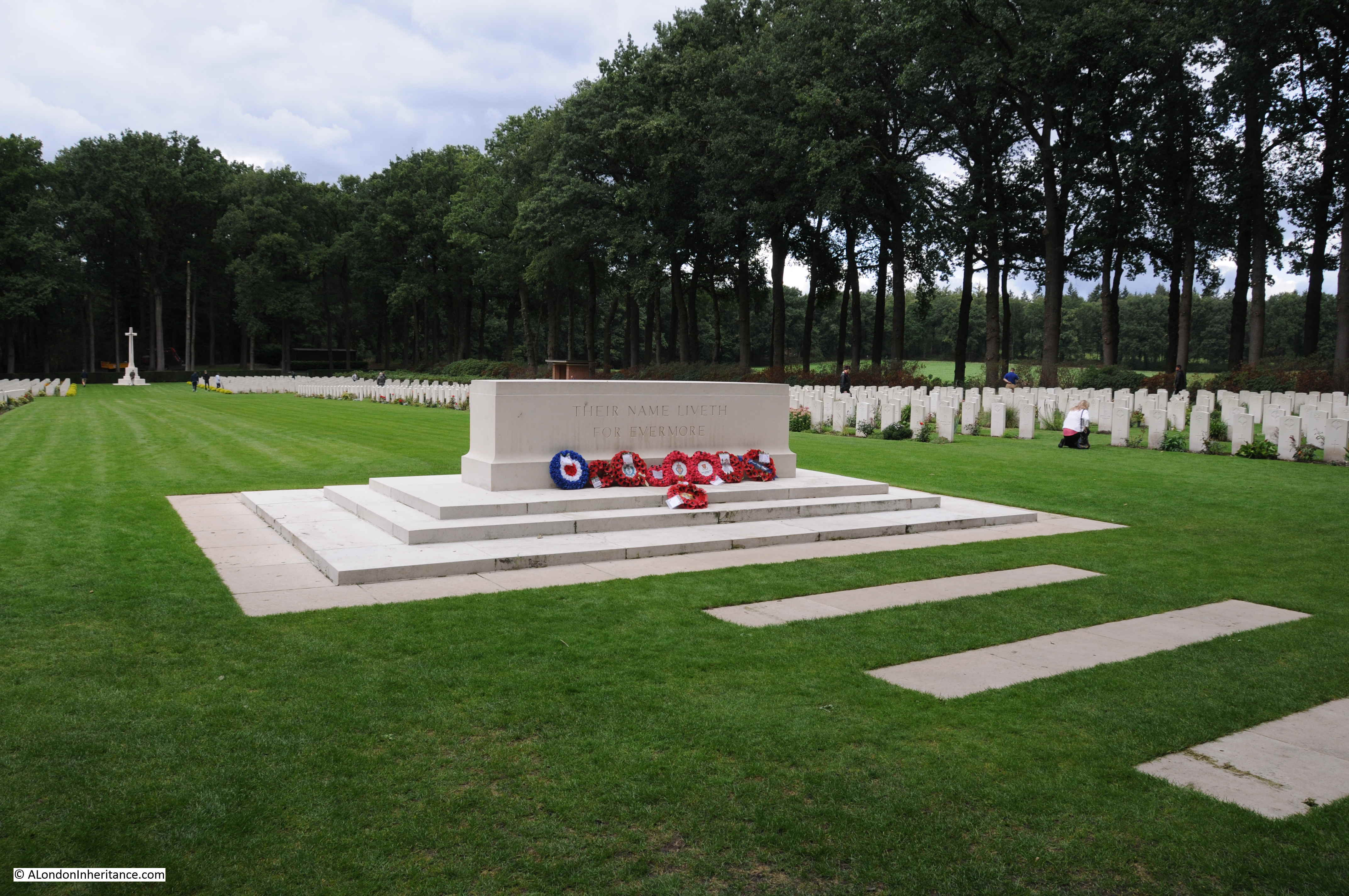
The following photo provides some indication of the size of the Arnhem Oosterbeek War Cemetery. A central grassed space runs down to a cross at the far end. On either side there are row upon row of gravestones, each representing a person, someone who died in the fighting around this part of the Netherlands.

Arnhem Oosterbeek War Cemetery

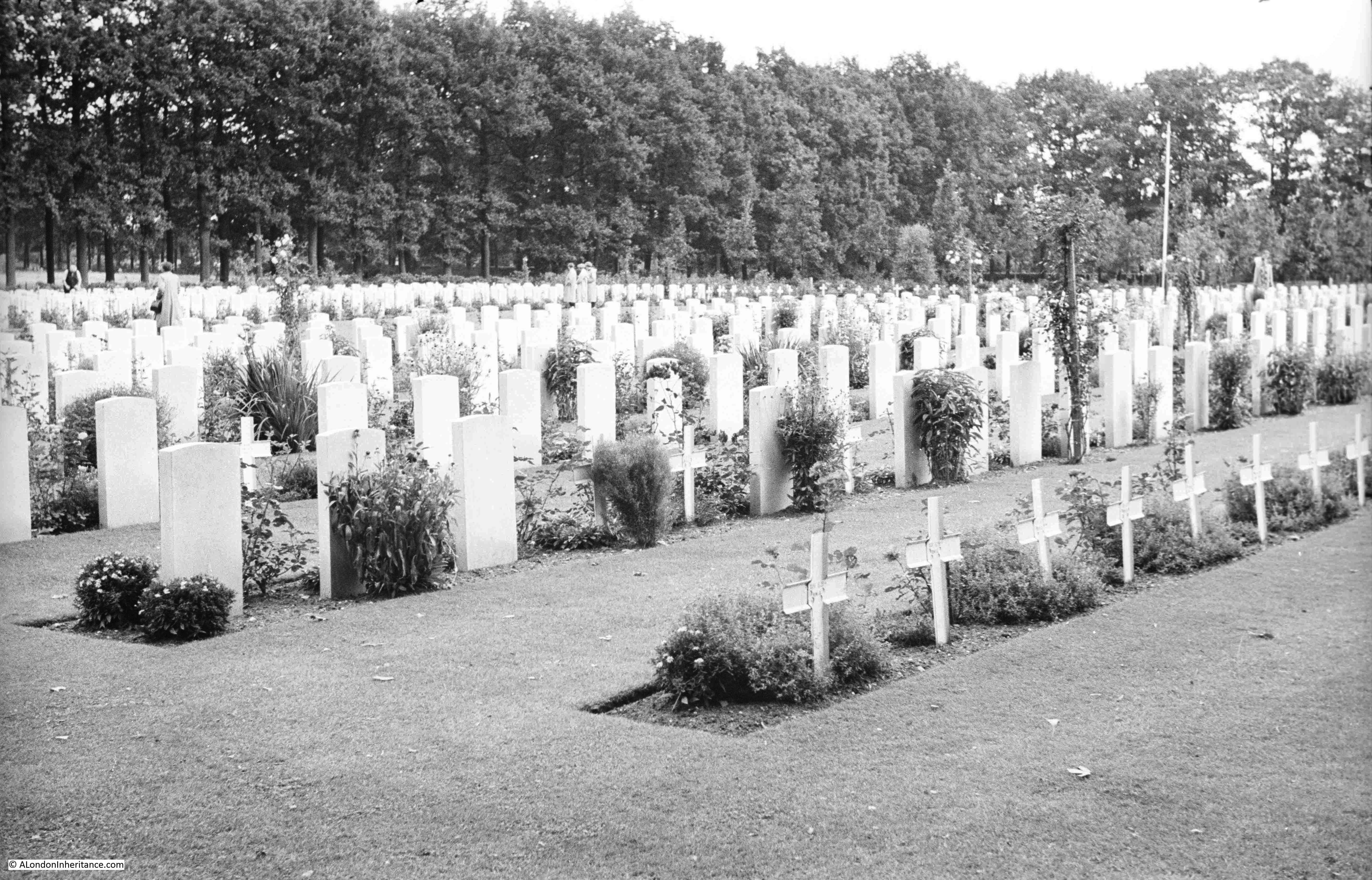
When my father was at the cemetery in 1952, it was still being completed. At the end of the war, the task began of recovering the bodies and burying them in the cemetery. During Operation Market Garden, the dead would usually be buried where they fell, and the grave marked with a temporary wooden cross made from whatever materials were to hand.

Identities had to be confirmed and stone gravestones were made for each grave. In 1952, a number of graves still had the temporary crosses used for the initial burial at Oosterbeek.

Arnhem Oosterbeek War Cemetery

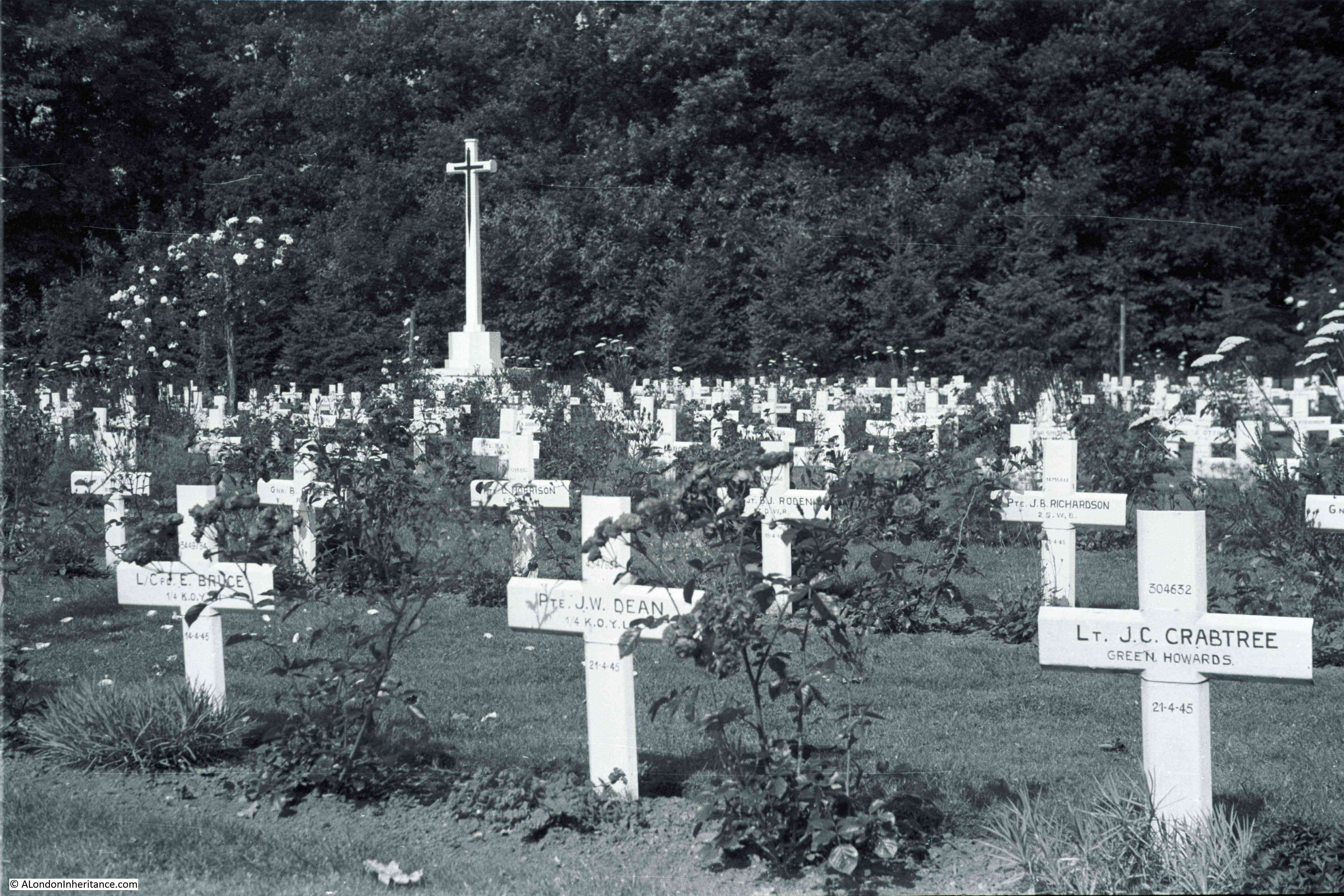
There were a number of graves that I wanted to find as the names were clear in my father’s photos. The first was Lieutenant J. C. Crabtree, named on a cross at the end of a line of graves towards the far end of the cemetery. In 1952, this section of the cemetery still had the temporary crosses.

Arnhem Oosterbeek War Cemetery

The same graves today:

Arnhem Oosterbeek War Cemetery

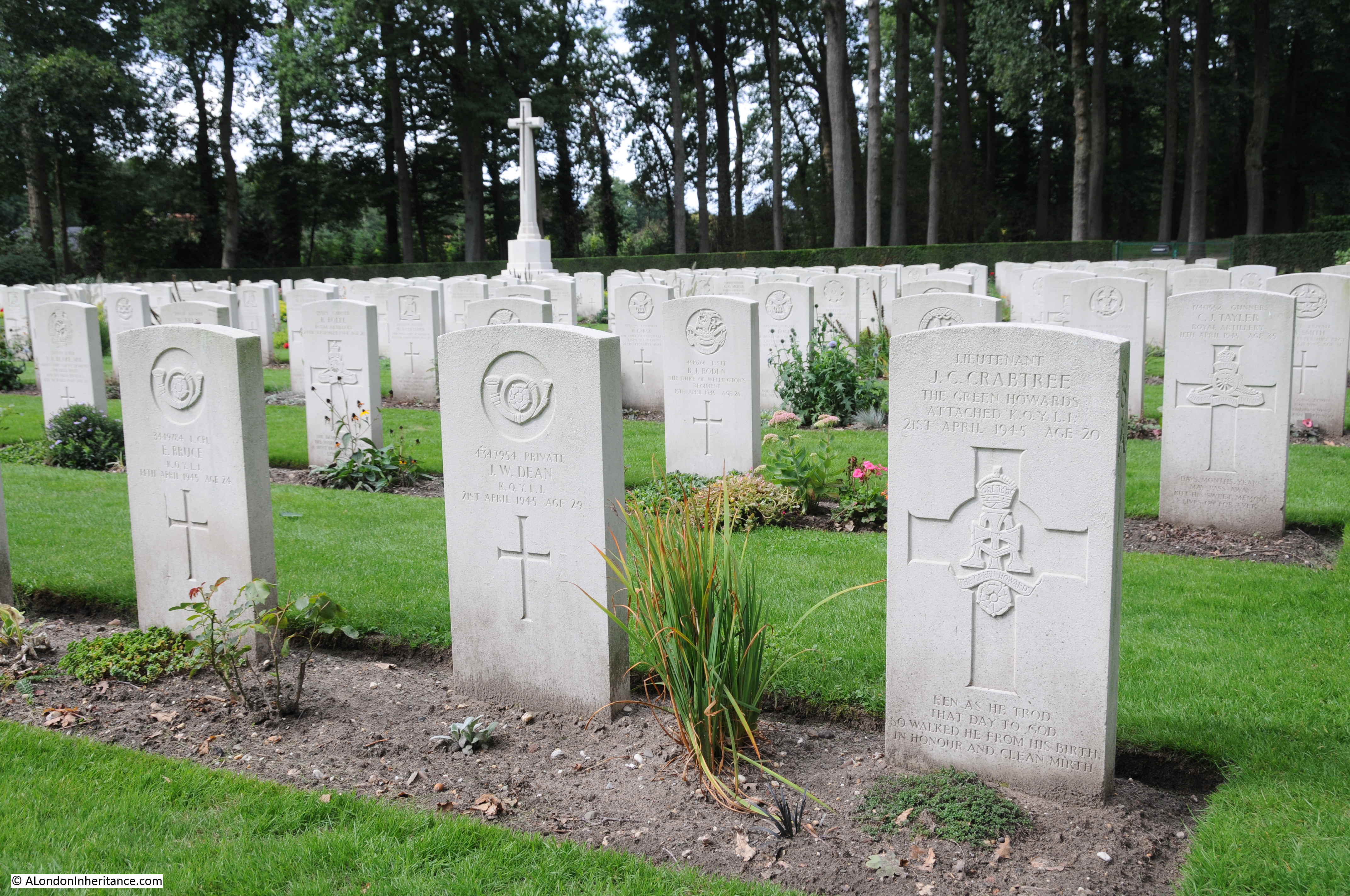
J.C. Crabtree was Jack Colin Crabtree who died on the 21st April 1945 at the young age of 20.

The son of Herbert Beaumont Crabtree and Dorothy Crabtree, in the 1939 census they were recorded as living at 13 St. Margaret’s Avenue in Luton, the house is still there. Jack’s father was listed as a Suprt Body Builder Motor and was obviously employed in Luton’s car manufacturing industries. Dorothy was described as Unpaid Domestic.

Jack Colin Crabtree was a Lieutenant in the Green Howards (Yorkshire Regiment). His death was in the closing months of the war, the Netherlands were fully liberated in May 1945 when the surrender of the German forces in the country was negotiated on the 5th May 1945.

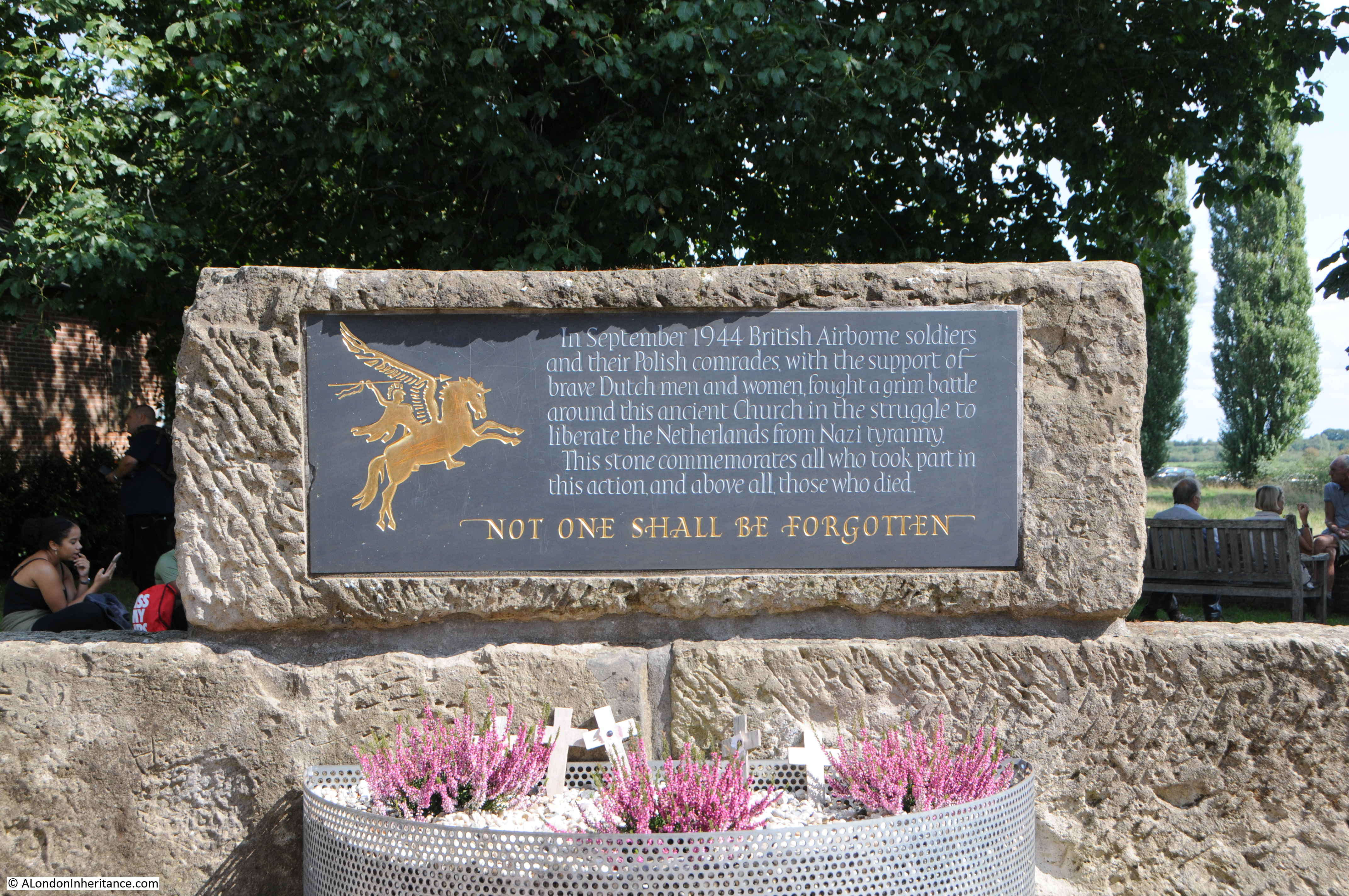
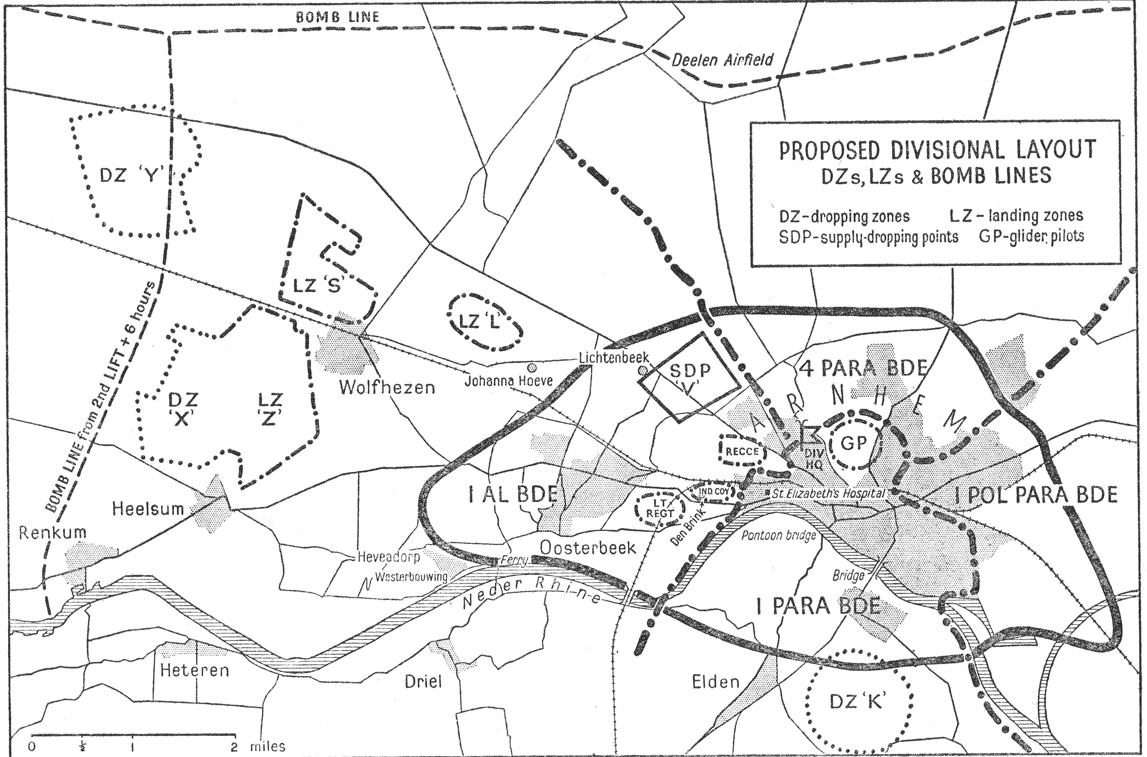
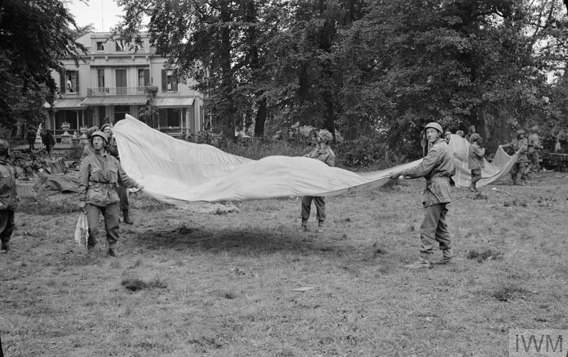
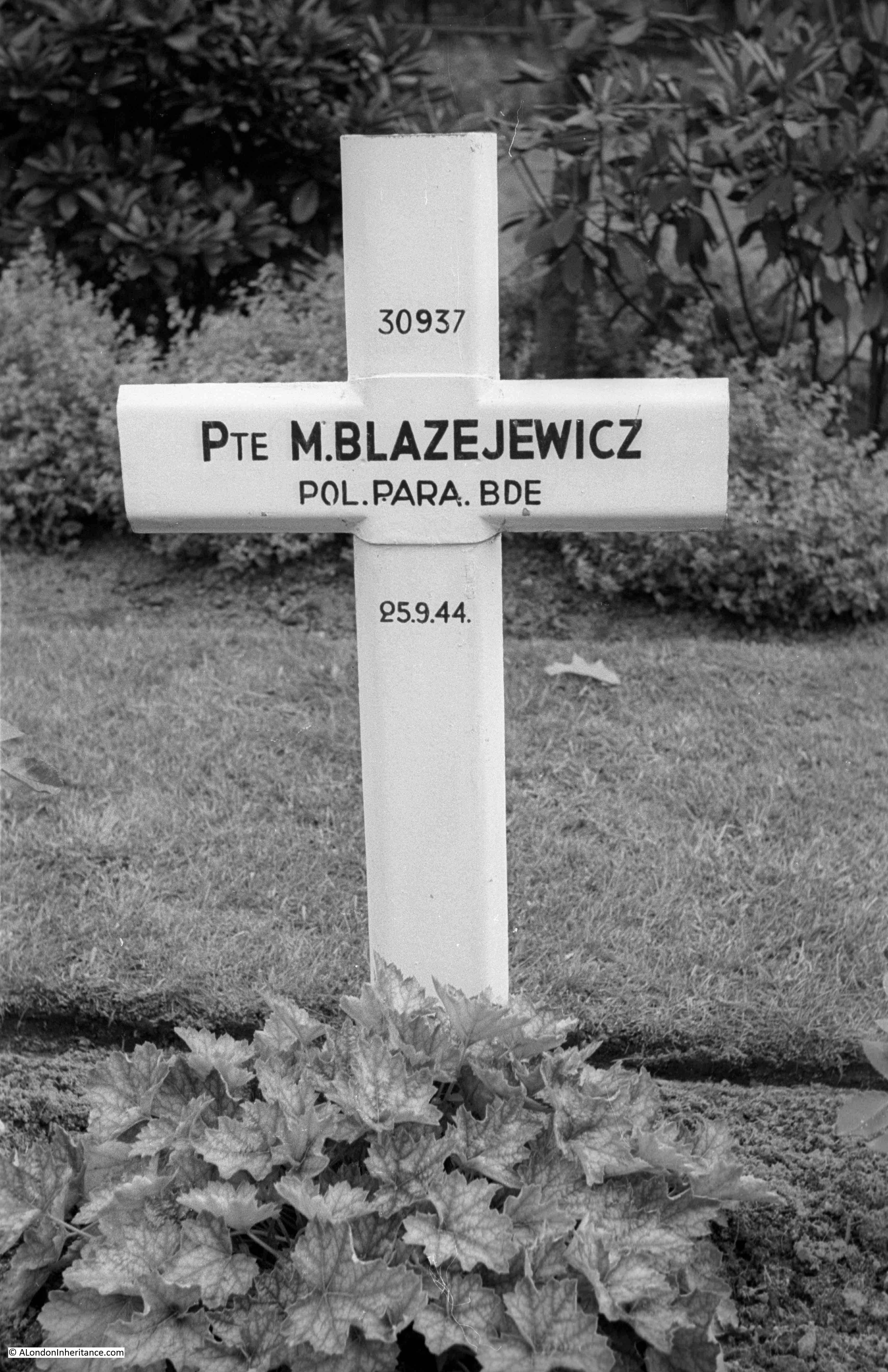
Another grave I wanted to find was of a soldier in the Polish Parachute Brigade. The Polish parachute forces landed south of the river, opposite Oosterbeek in the closing days of  Operation Market Garden when the British forces were being pushed into a tight perimeter in Oosterbeek. The Polish landing date had been delayed by fog on the English airfields and when they landed the Germans were prepared for their arrival and the Poles suffered terrible casualties.

They managed to establish and hold a perimeter south of the river until the arrival of the main land forces which enabled the withdrawal across the river of the surviving British troops from Oosterbeek. A number of the Polish soldiers made it across the river to help man the ever shrinking Oosterbeek perimeter,

This is the original, temporary cross at the grave of Private M. Blazejewicz:

Arnhem Oosterbeek War Cemetery

This year, I photographed the permanent gravestone:

Arnhem Oosterbeek War Cemetery

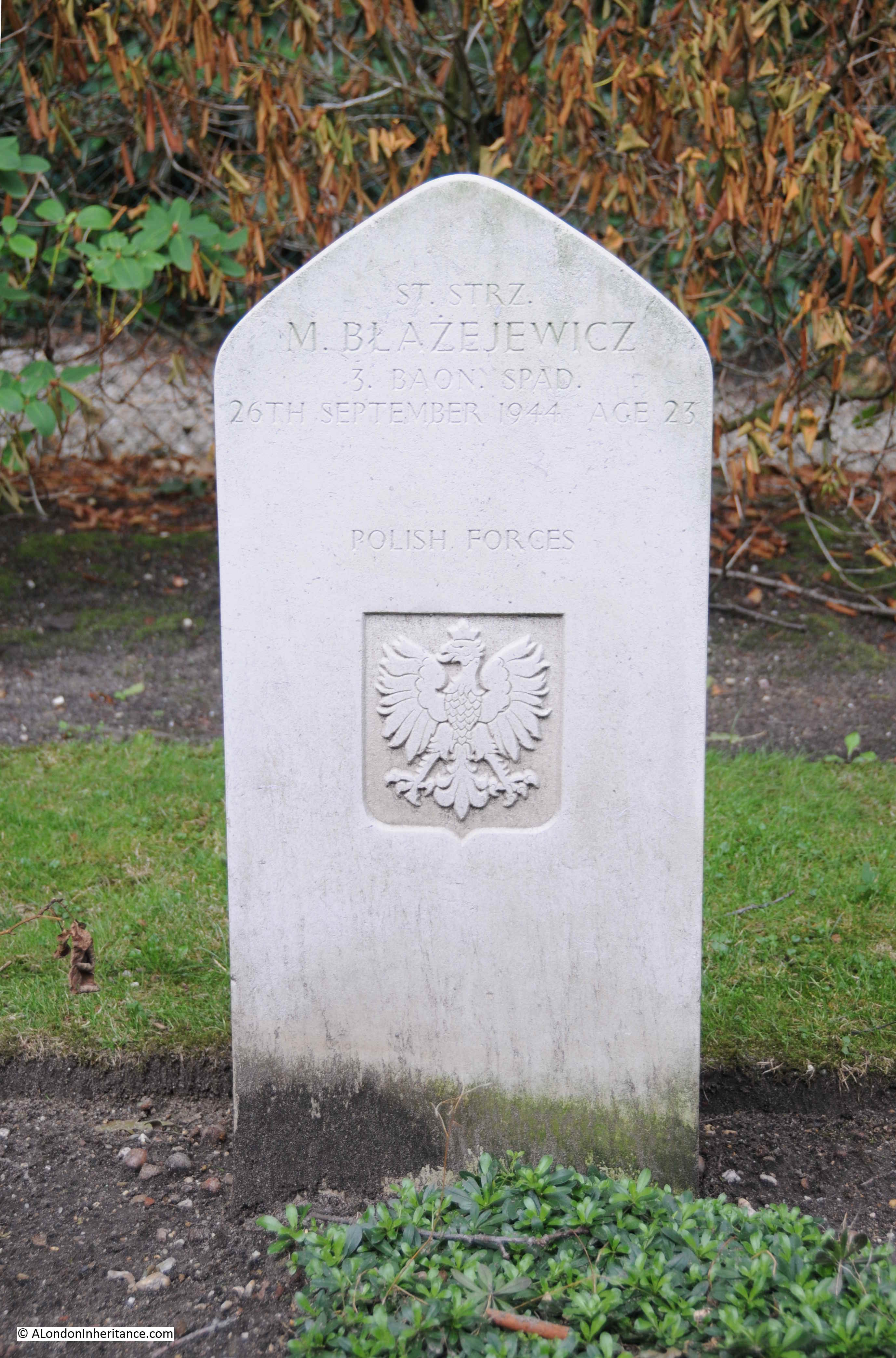
Some of the details on the original cross appear to have been corrected on the later headstone. The date of death has changed as well as his rank.

The grave is of Mieczyslaw Blazejewicz, with a rank of Starszy Strzelec (this seems to translate to a Senior Private or Lance Corporal) in the 3rd Parachute Battalion of the 1st Polish Independent Parachute Brigade. He was born on the 24th November 1920 at Lancut, a town in south eastern Poland.

He was killed whilst trying to cross the River Rhine to get to Oosterbeek on the 26th September 1944. As with many of those killed whilst trying the cross the river, his body would drift downstream and his body was recovered from the river at Rhenen on the 9th October. He was 23, just two months short of his 24th birthday.

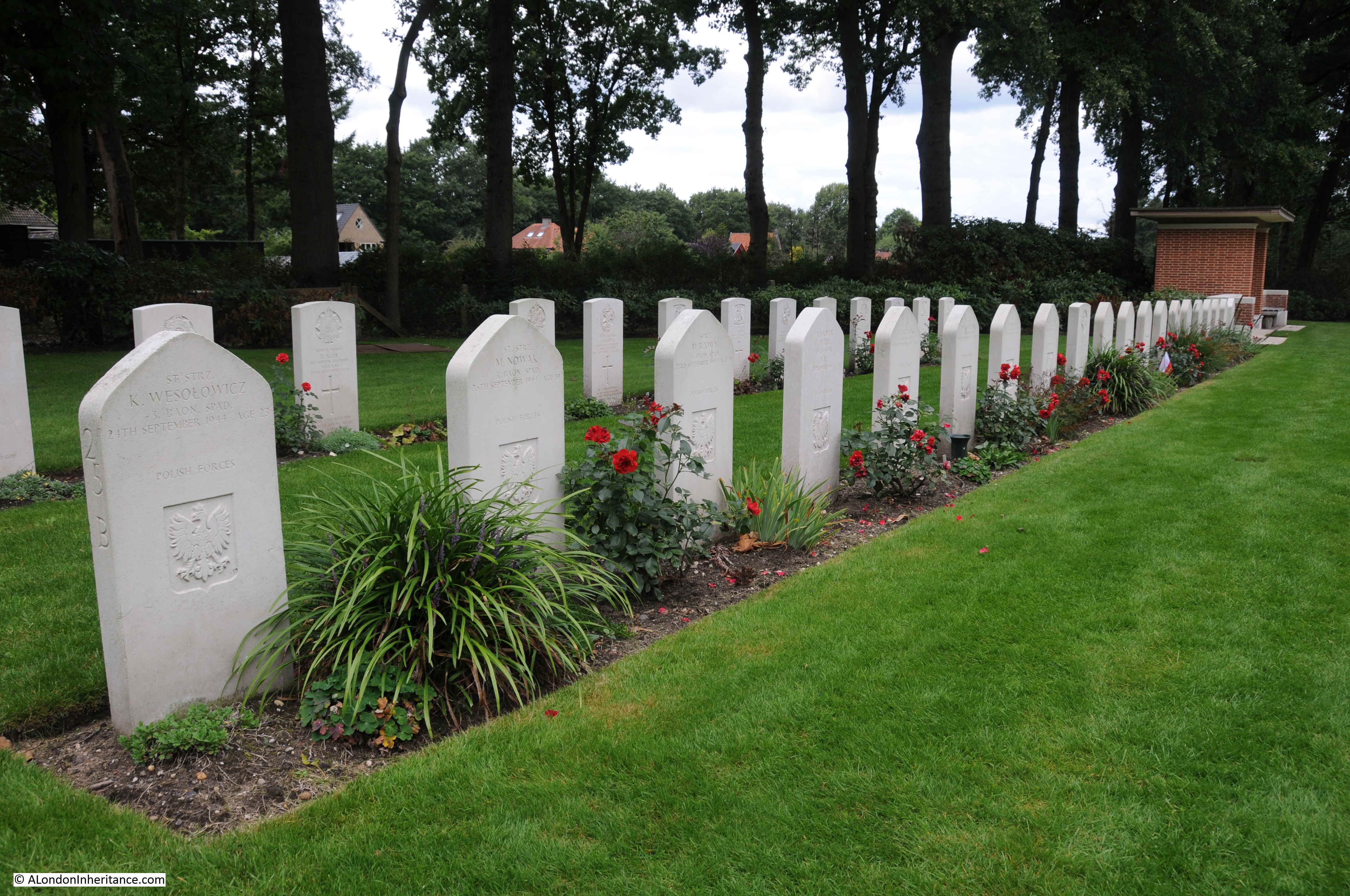
There are a number of Polish soldiers buried in the Arnhem Oosterbeek War Cemetery. Their gravestones are distinctive by having a more dome shaped top, unlike the other gravestones.

Arnhem Oosterbeek War Cemetery

As you walk along the rows of graves, reading the inscriptions, one thing that always stands out is the very young age of those who fought and died. The majority are in their twenties, however there are many who were 18 or 19.

This is the grave of Private Dennis William Harrison of the 2nd Airborne Battalion of the South Staffordshire Regiment. Dennis was 18 years of age when he died on the 24th September 1944, the day before the survivors who still held a shrinking perimeter in Oosterbeek were given the order to withdraw across the Rhine.

Arnhem Oosterbeek War Cemetery

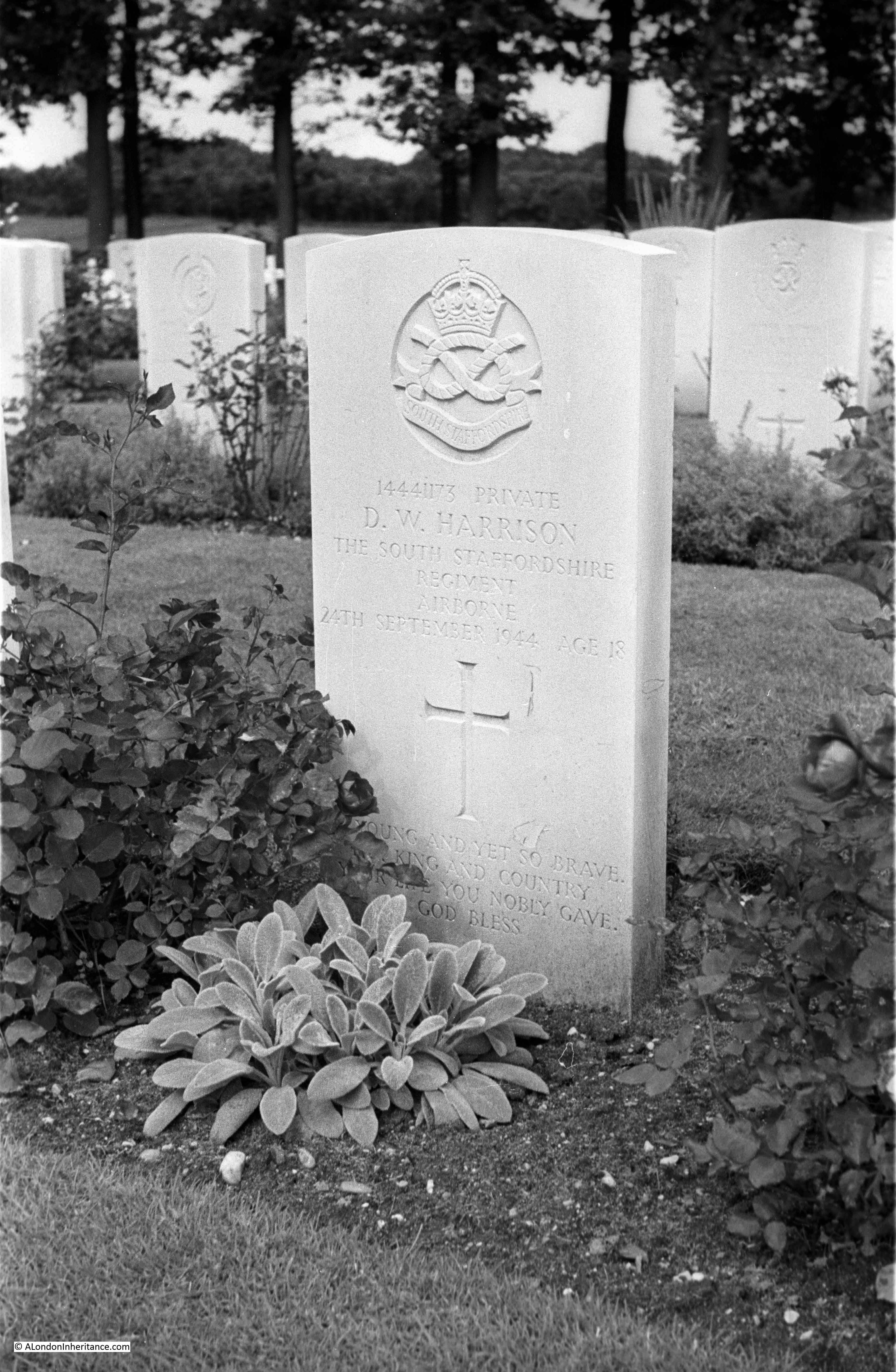
The South Staffordshire Regiment arrived over two days. The majority arrived in the first day of the campaign, Sunday 17th September, with the remainder of the regiment arriving on the following day. It is probable therefore that 18 year old Dennis William Harrison was fighting from the 17th September until his death on the 24th September.  In the 1939 census, Dennis father was recorded as a Coal Mine Charge Hand and his mother Annie was recorded with Unpaid Domestic Duties. They lived at Ballinson Road, Blurton Stoke-on-Trent, in a house that is still there.

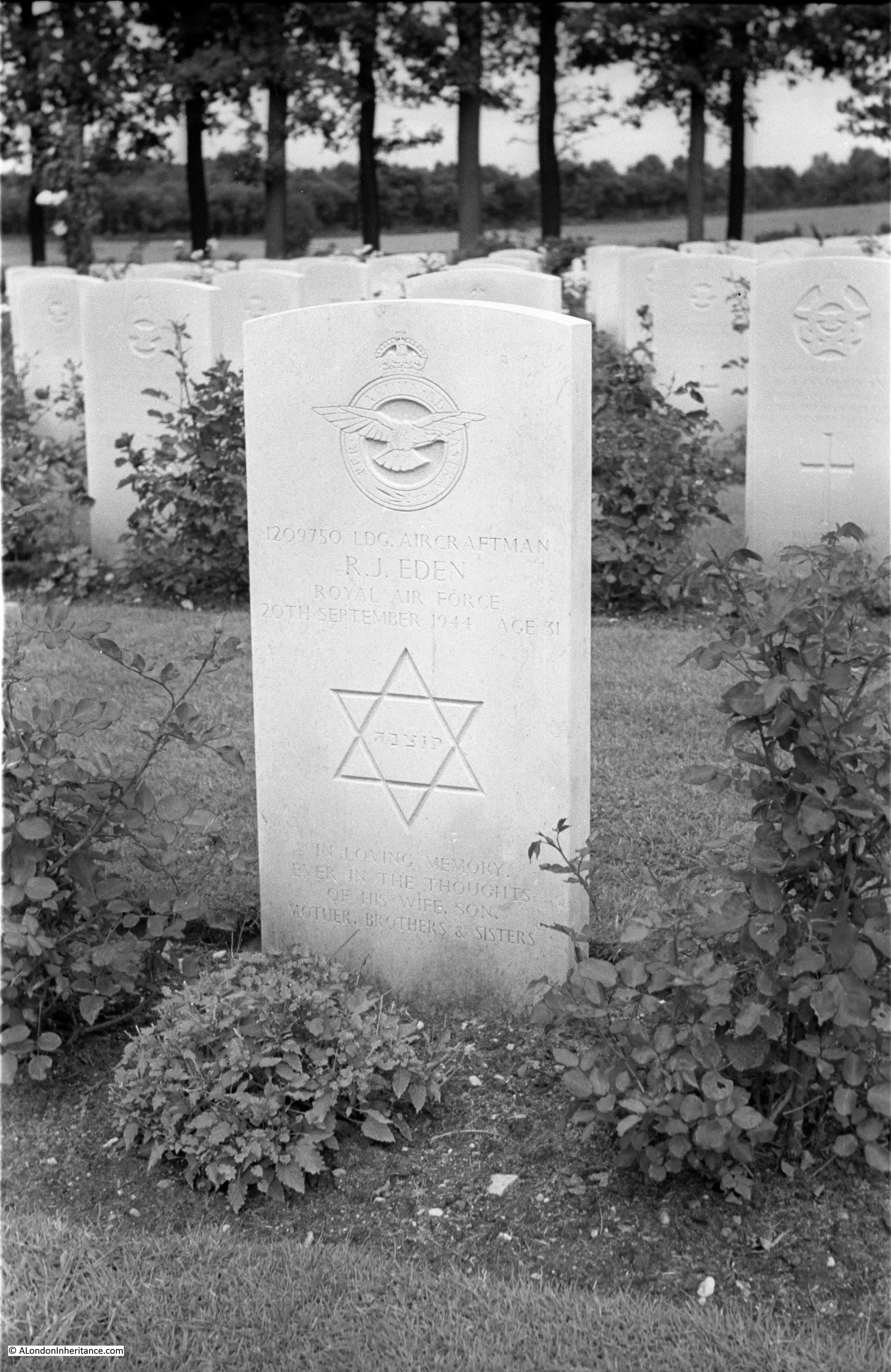
This is the grave of Leading Aircraftman R. J. Eden in 1952:

Arnhem Oosterbeek War Cemetery

The same gravestone in 2018:

Arnhem Oosterbeek War Cemetery

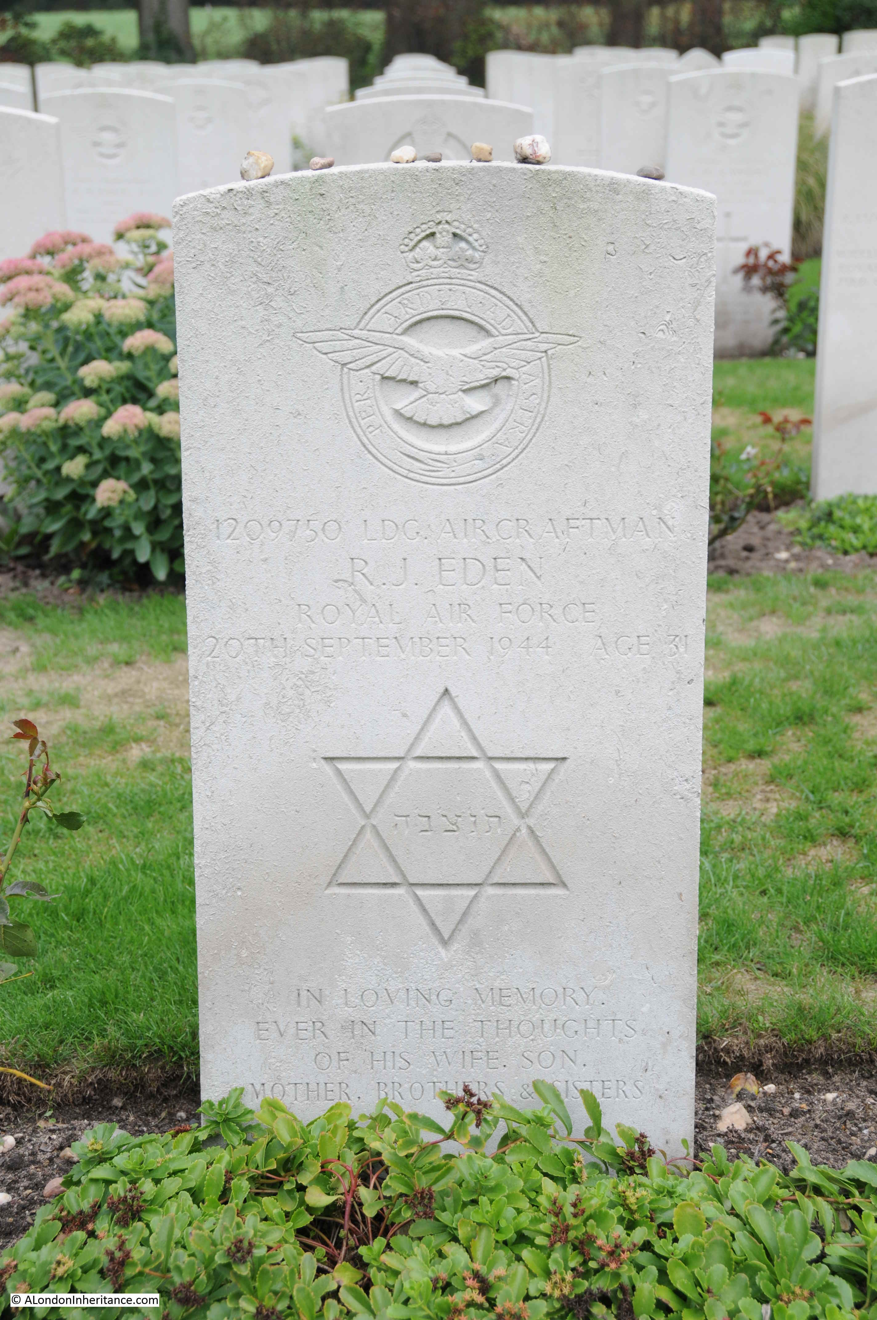
It is lovely to see that the Jewish tradition of leaving stones on the gravestone to show that you have visited the grave is in evidence on R.J. Eden’s grave, as well as a number of other graves of Jewish soldiers in the cemetery.

According to the Arnhem Oosterbeek War Cemetery records, R.J. Eden was Roffer James Eden, serving with 6080 Light Warning Unit as part of the Royal Air Force Volunteer Reserve.

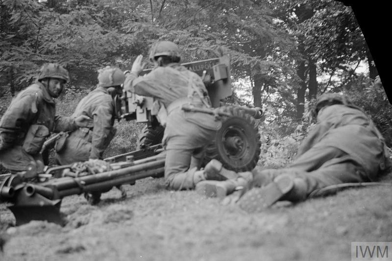
The Light Warning Units were one of the many specialised roles in an airborne force.  They were equipped with Light Warning equipment which was used to signal and coordinate with fighter aircraft providing cover for the ground forces. The Light Warning equipment was just about small enough to fit into a pair of Horsa Gliders. Four gliders were used to transport the Light Warning equipment on the second day of the campaign. Each pair of gliders held a complete set of equipment so in theory loss of one, or a maximum of two gliders would allow one set to arrive safely, however the transport plane for one glider was hit by flak and crashed, and the second glider was also hit by flak and crashed. By chance, both the crashed gliders were the same one from each pair, so the two gliders that arrived safely were each carrying the same half of the equipment needed to build an operational Light Warning Unit.

Once on the ground, and if they could not perform their primary role, Roffer James Eden, along with other roles such as glider pilots would fight alongside the other forces.

The Commonwealth War Graves Commission records that Roffer was the husband of Annie Eden of Victoria, London. Despite the unusual name, I have not been able to track down any details of Roffer James Eden. The transcript of RAF deaths records his first names as “Roffer J or Eckstein Jacob”, however I have also not been able to find an Eckstein Jacob Eden.

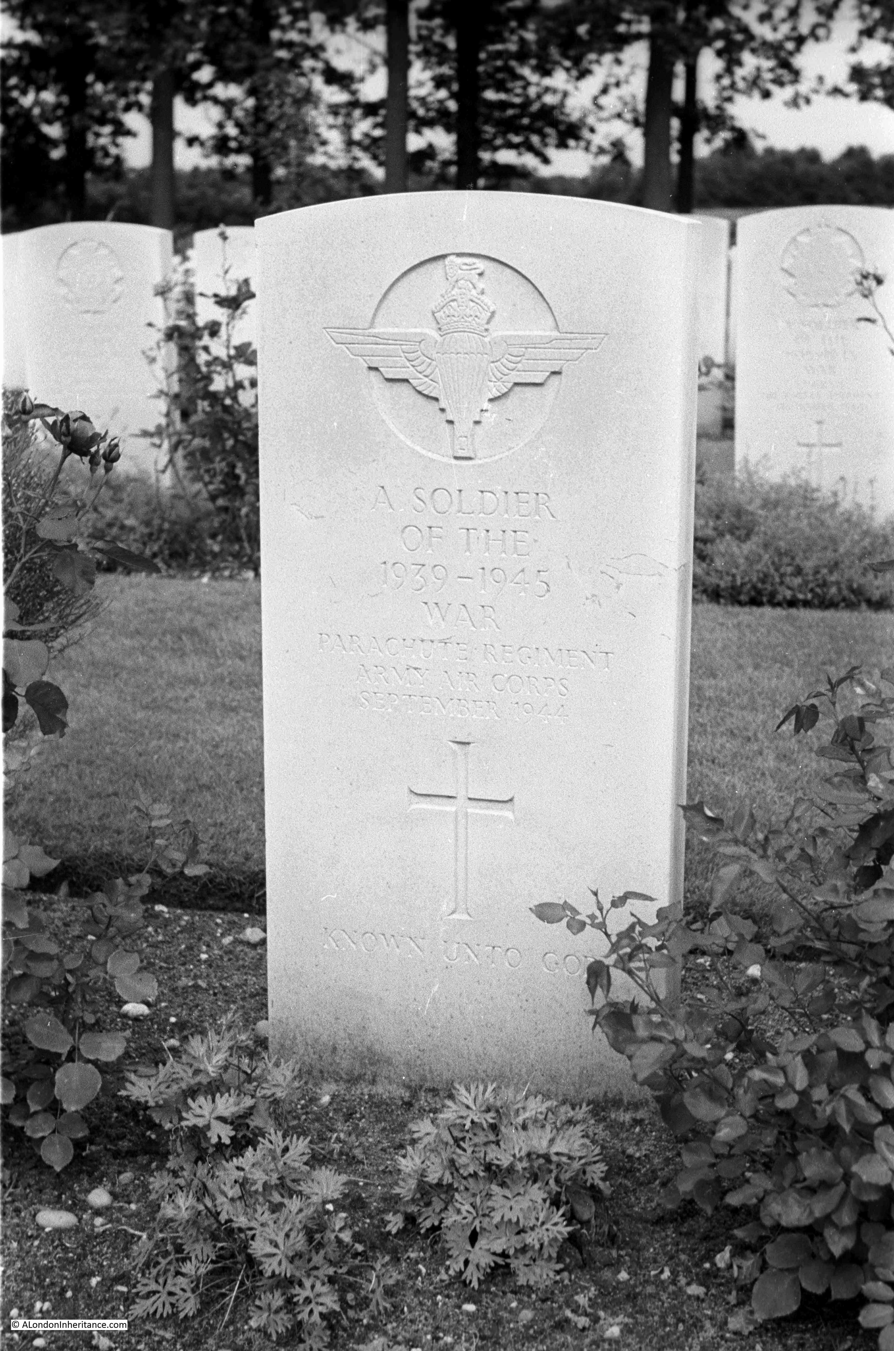
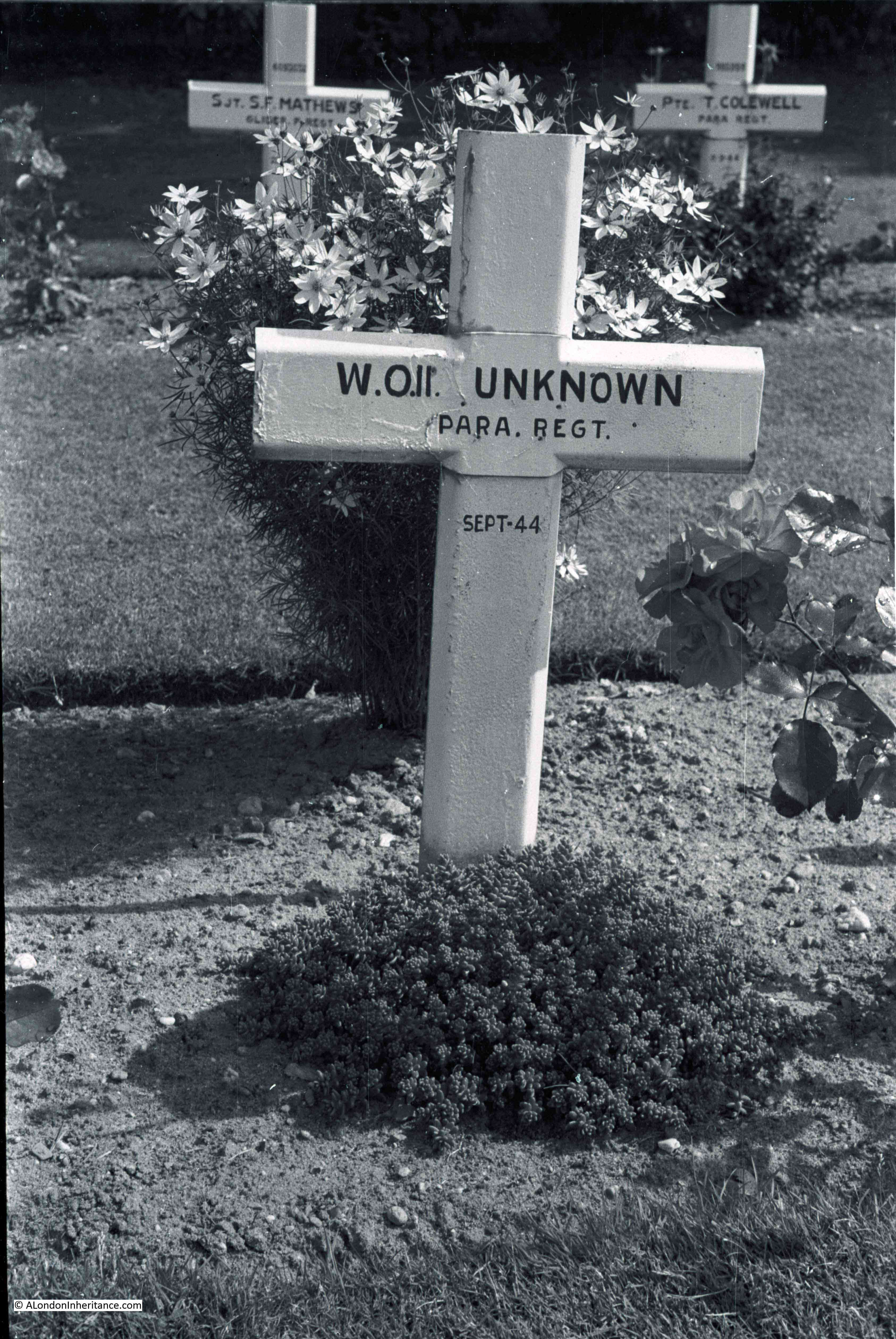
There are many graves across Oosterbeek cemetery where the identity of the person is unknown.

Arnhem Oosterbeek War Cemetery

In the following photo from 1952, a block of graves have the temporary crosses. The grave nearest the camera is marked as ‘unknown’ that on the right only has a date. Behind there is the grave to a Corporal, but with no name, and a bit further to the right another unknown soldier.

Arnhem Oosterbeek War Cemetery

In the following photo from 1952 there is a cross on the left with 6 names.

Arnhem Oosterbeek War Cemetery

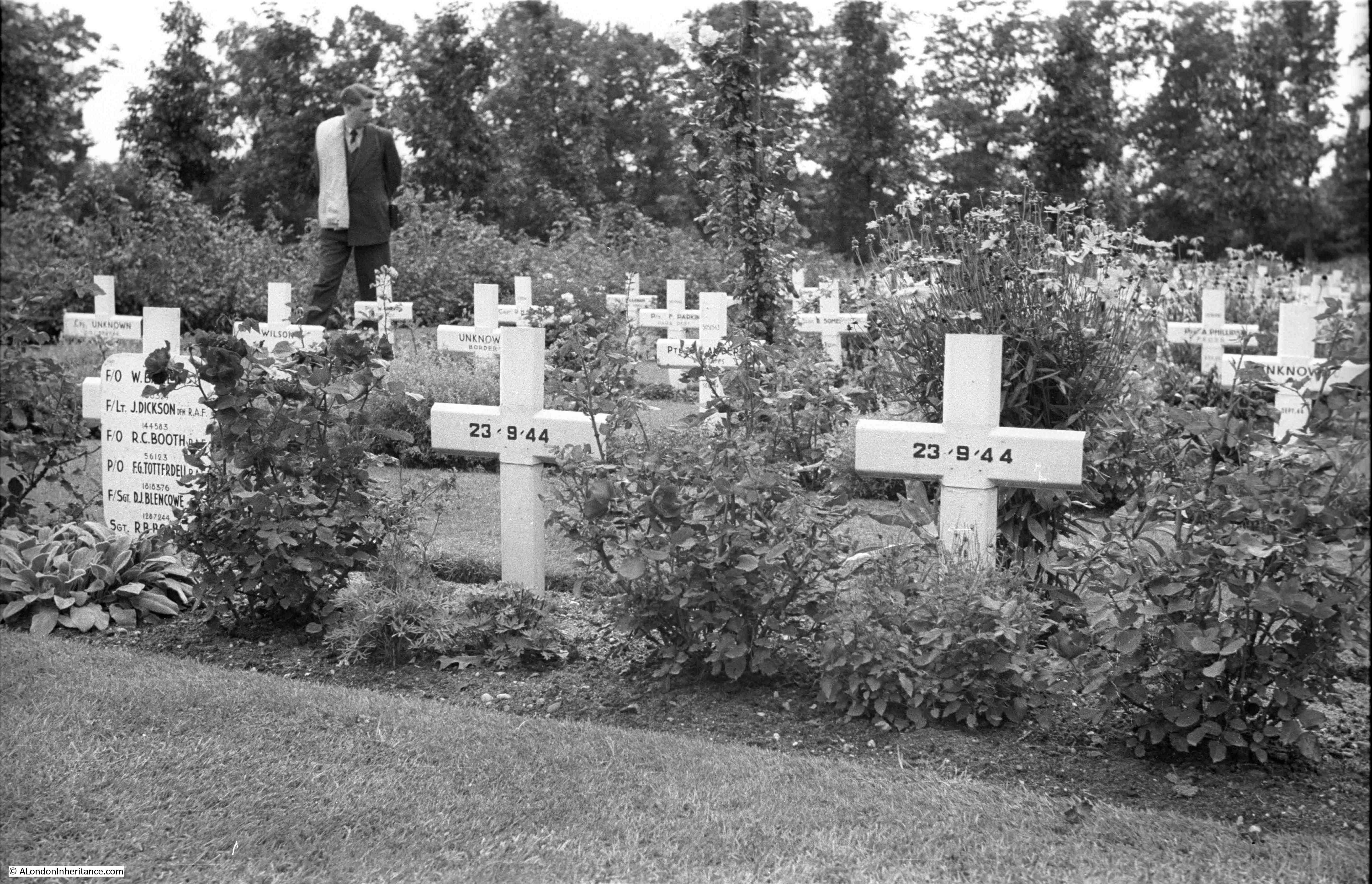
I checked the names which are fully visible and they are all from 570 Squadron of the Royal Air Force. and they appear to be a full crew from a single plane.

Robert Carter Booth, aged 22 was a Flying Officer, Navigator. Francis George Totterdell, aged 24 was a Pilot Officer, Wireless Op./Air Gunner. Dennis James Blencowe (no age recorded) was a Flight Sergeant, Air Gunner. John Dickson, aged 24 was a Flight Lieutenant, Navigator.

To add to the evidence that they were all on the same plane, their date of death was the same, the 23rd September 1944.

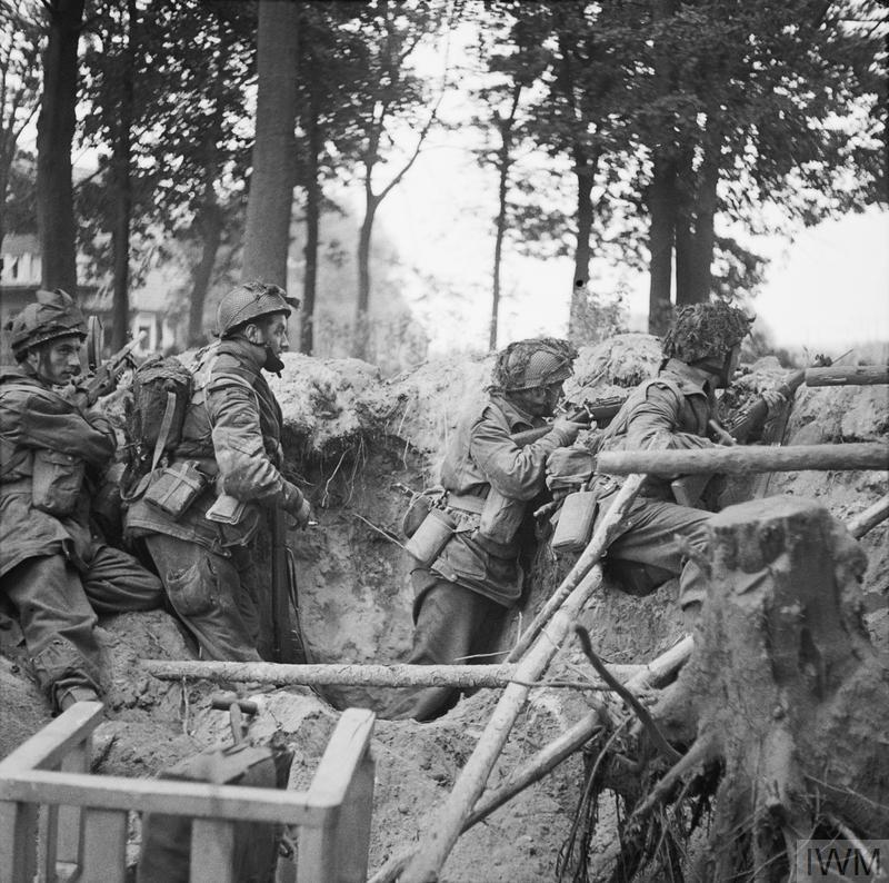
570 Squadron was based at RAF Harwell in Berkshire. They flew Short Stirling aircraft and during Operation Market Garden they operated as tugs for the Horsa Gliders for the initial drops, then until the force at Oosterbeek was withdrawn they ran supply drops. Most of these were unsuccessful as the Germans had overrun the drop zones and the soldiers on the ground had no working radios to communicate with the aircraft.

Written accounts from those on the ground at the time tell of the bravery of the RAF crews making the supply drops. They would fly in relatively low and slow and many aircraft were lost after being hit by high levels of German fire from the ground and attacks by German fighter aircraft.

In his book Arnhem by Major-General Urquhart, the commanding office in Oosterbeek, he writes of the supply drops:

“Twice in the afternoon the RAF tried to get supplies to us. Their first mission at 12:45 pm was disastrous. The aircraft were shot up by ME109s before our eyes and there was some evidence that the Germans were using our signals to attract some of the supplies. The second mission at 4 pm was much more successful and we acquired a small proportion of the sorely needed ammunition and rations as they fell. It was a costly day for the RAF, whose losses were twenty per cent of the aircraft taking part”.

Also on another drop “Again, the ground signals were laid and lit, and the troops held out parachute silks. But the aircraft kept to the planned dropping points and the Germans again found themselves receiving gifts from their enemies. only the overs reached us. Some crews, overshooting, came round in the face of most appalling flak. Some aircraft were on fire. Hundreds of us saw one man in the doorway of a blazing Dakota refusing to release a pannier until he had found the exact spot, though the machine was a flaming torch and he had no hope of escape.”

As their date of death was the 23rd September, this was towards the end of the campaign and would have been during one of the attempted supply drops.

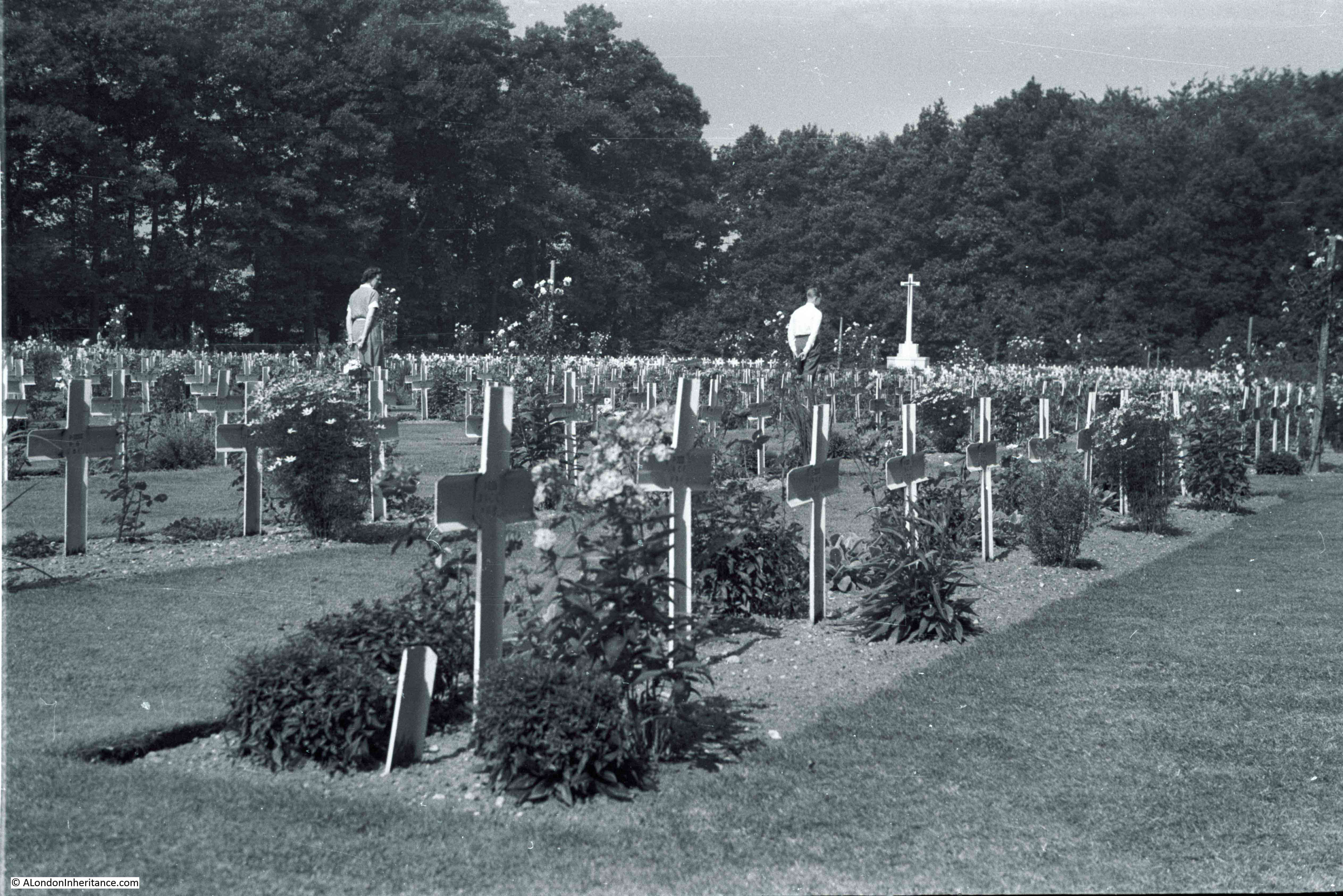
Another of my father’s photos of the cemetery in 1952.

Arnhem Oosterbeek War Cemetery

And another of the many graves to unknown soldiers.

Arnhem Oosterbeek War Cemetery

Temporary crosses:

Arnhem Oosterbeek War Cemetery

Some of the graves have photos of those buried.

Arnhem Oosterbeek War Cemetery

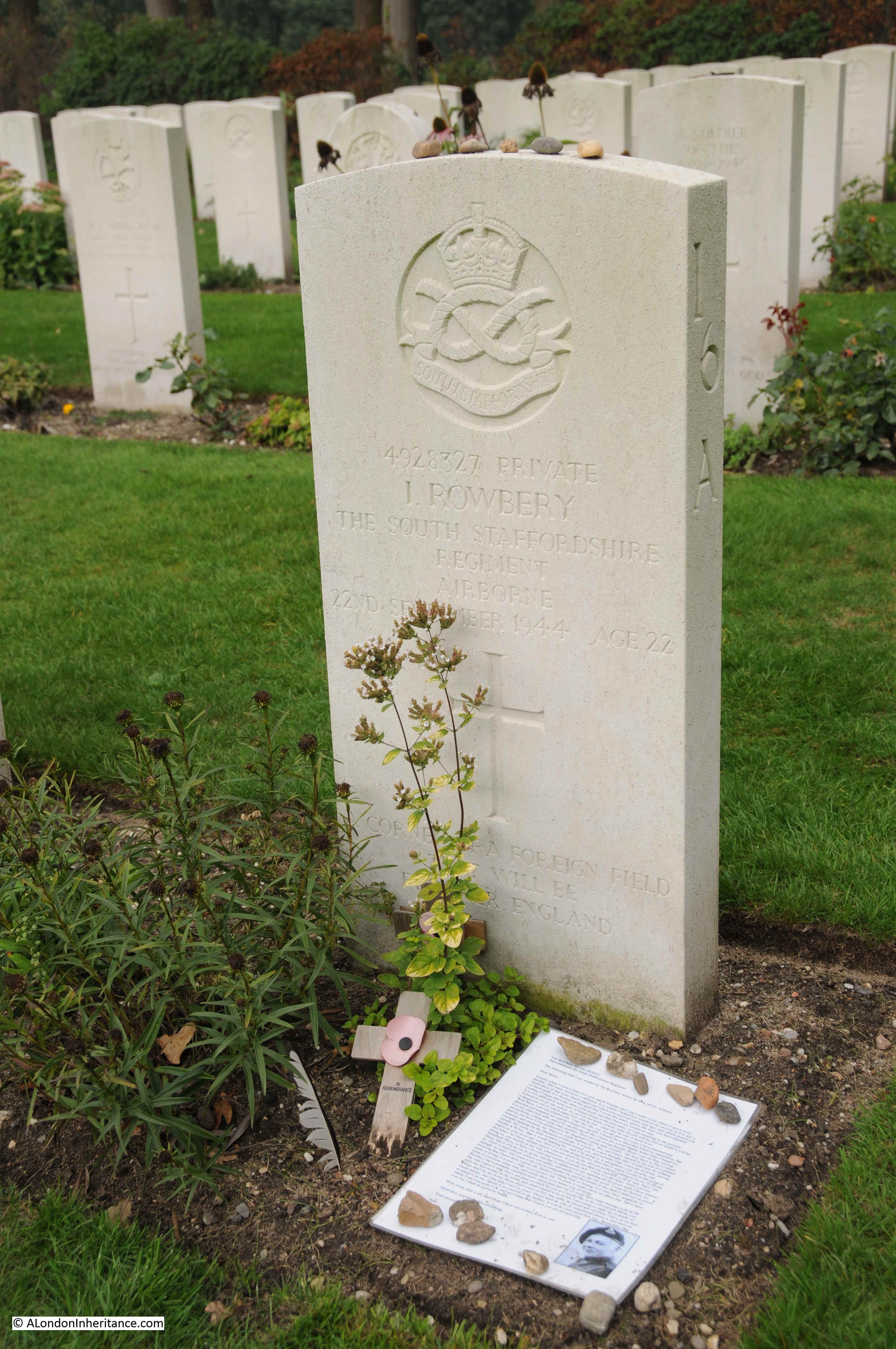
This is the grave of Private Ivor Rowbery of the South Staffordshire Regiment. He was 22 years old when he died on the 22th September 1944 when a mortar hit his gun pit near the Oosterbeek Old Church.

By the gravestone is a copy of a letter he wrote just before leaving the UK for Oosterbeek and Arnhem. It was the letter that would be sent to parents, wife, next of kin in the event of the soldier’s death in battle. Ivor Rowbery addressed the letter to his “mom”. (Click on the photo for a larger photo – it is a letter that should be read)

Arnhem Oosterbeek War Cemetery

It is a wonderful letter, no nationalistic flag waving, just a quiet pride in his home and family, and concern for his mother should he be killed in the conflict.

Next is the grave of William Frank Lakey, aged 23 and a private in the Parachute Regiment. He came from Upper Holloway, London. A photo provides a reminder that all these gravestones are for individuals who died at far too young an age.

Arnhem Oosterbeek War Cemetery

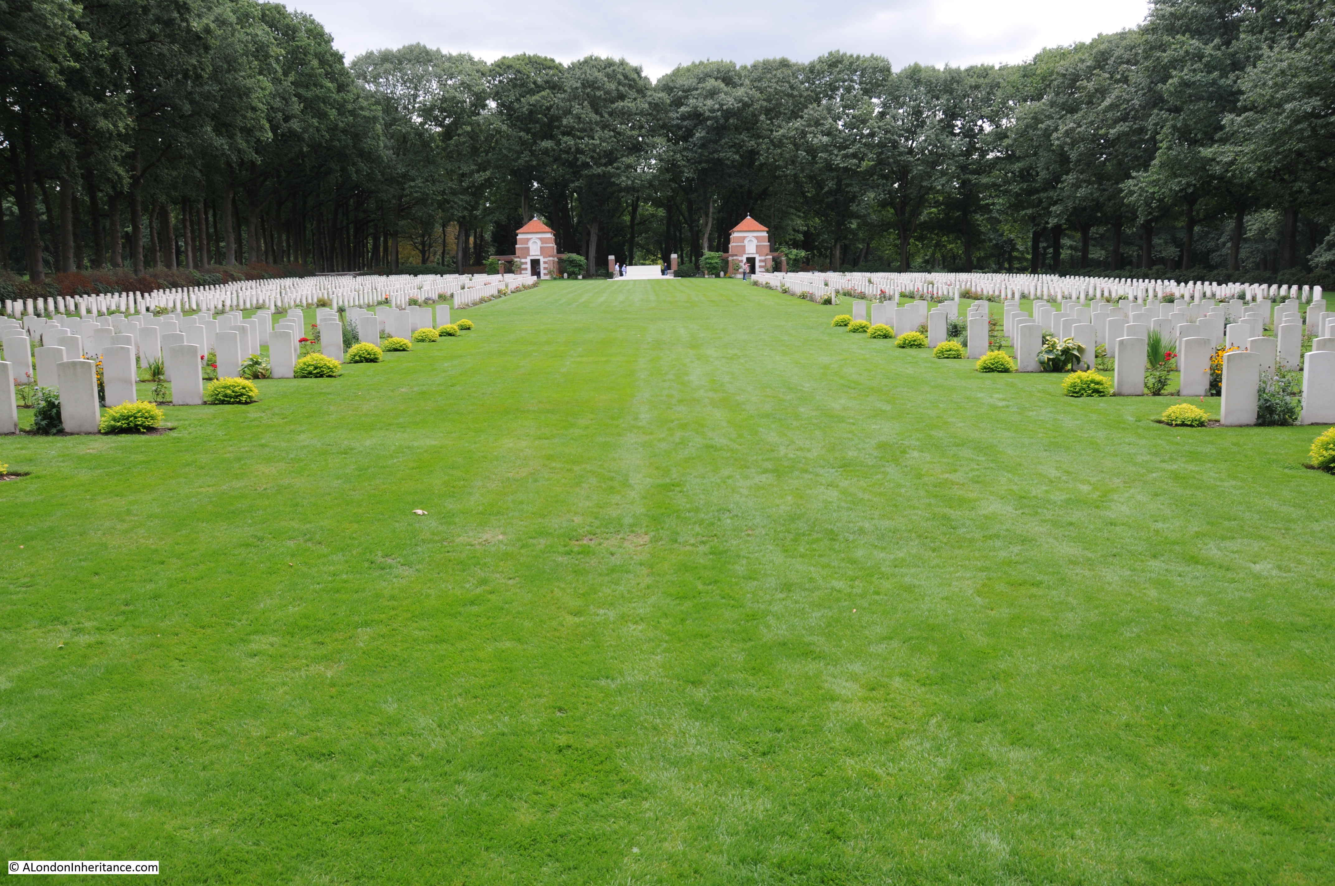
Looking down from the entrance to the rear of the cemetery:

Arnhem Oosterbeek War Cemetery

The view from the cross at the far end of the cemetery towards the entrance. Row upon row of gravestones for those killed in action during Operation Market Garden or from other fighting as this part of the Netherlands was liberated.

Arnhem Oosterbeek War Cemetery

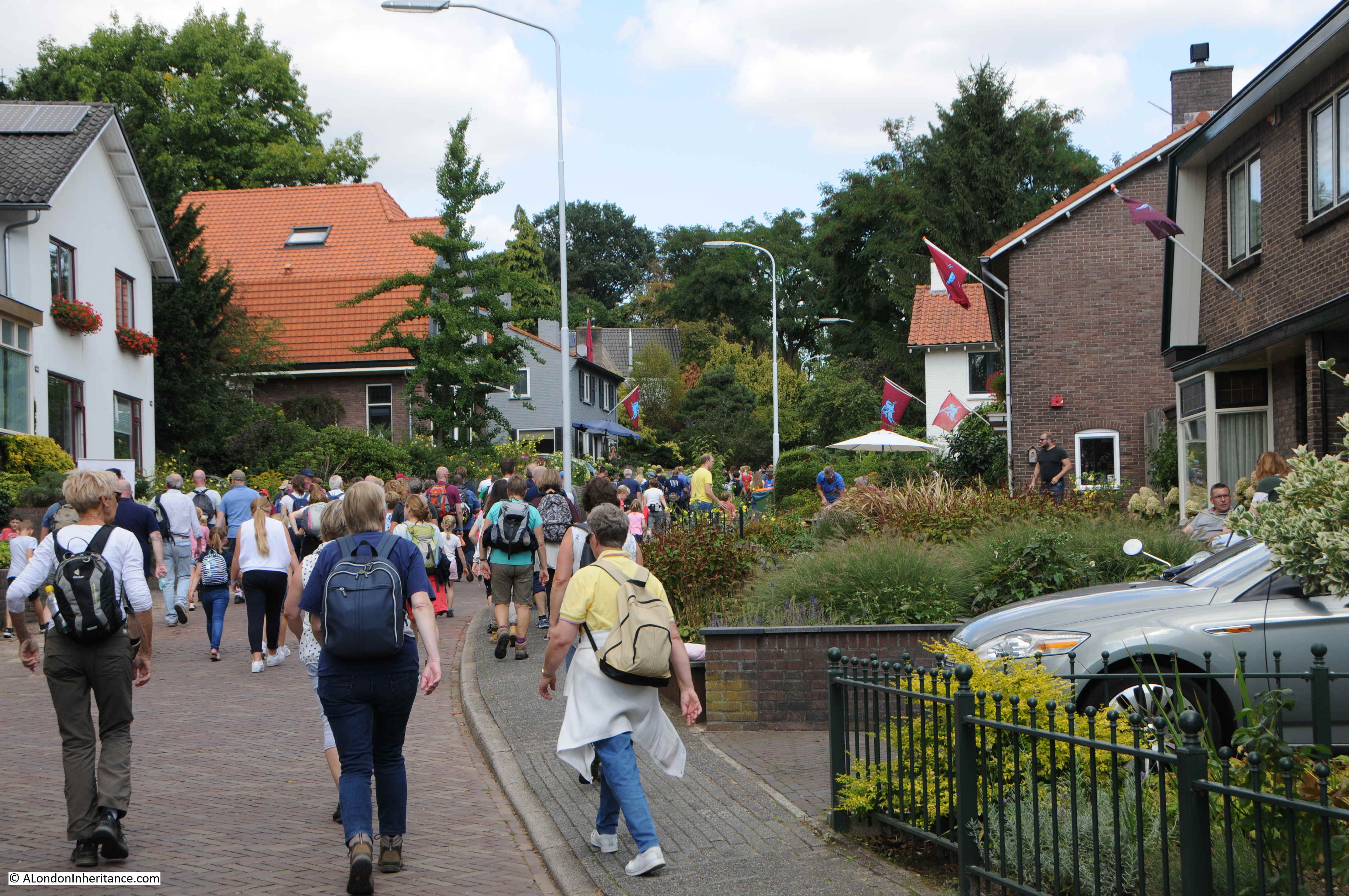
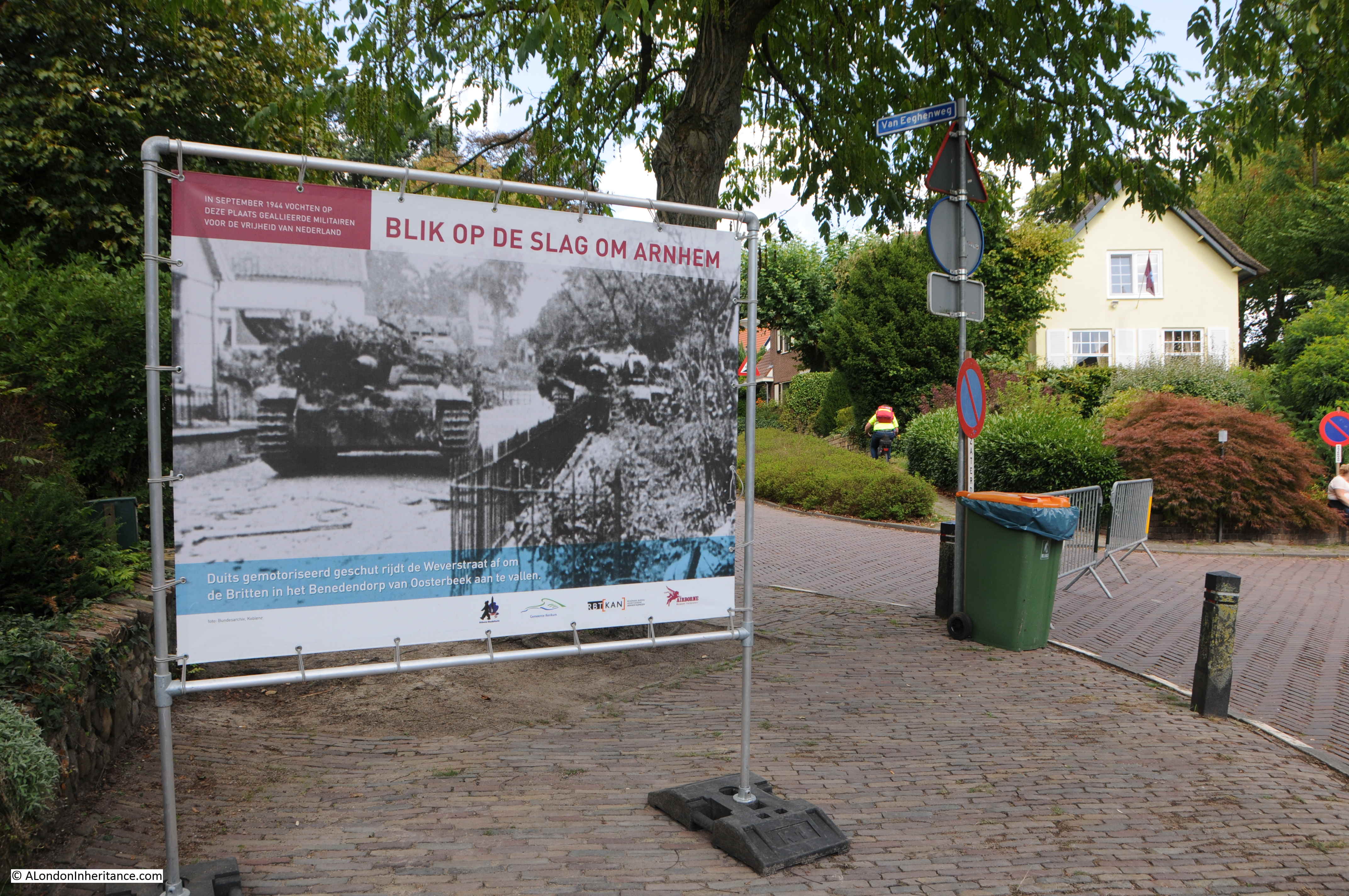
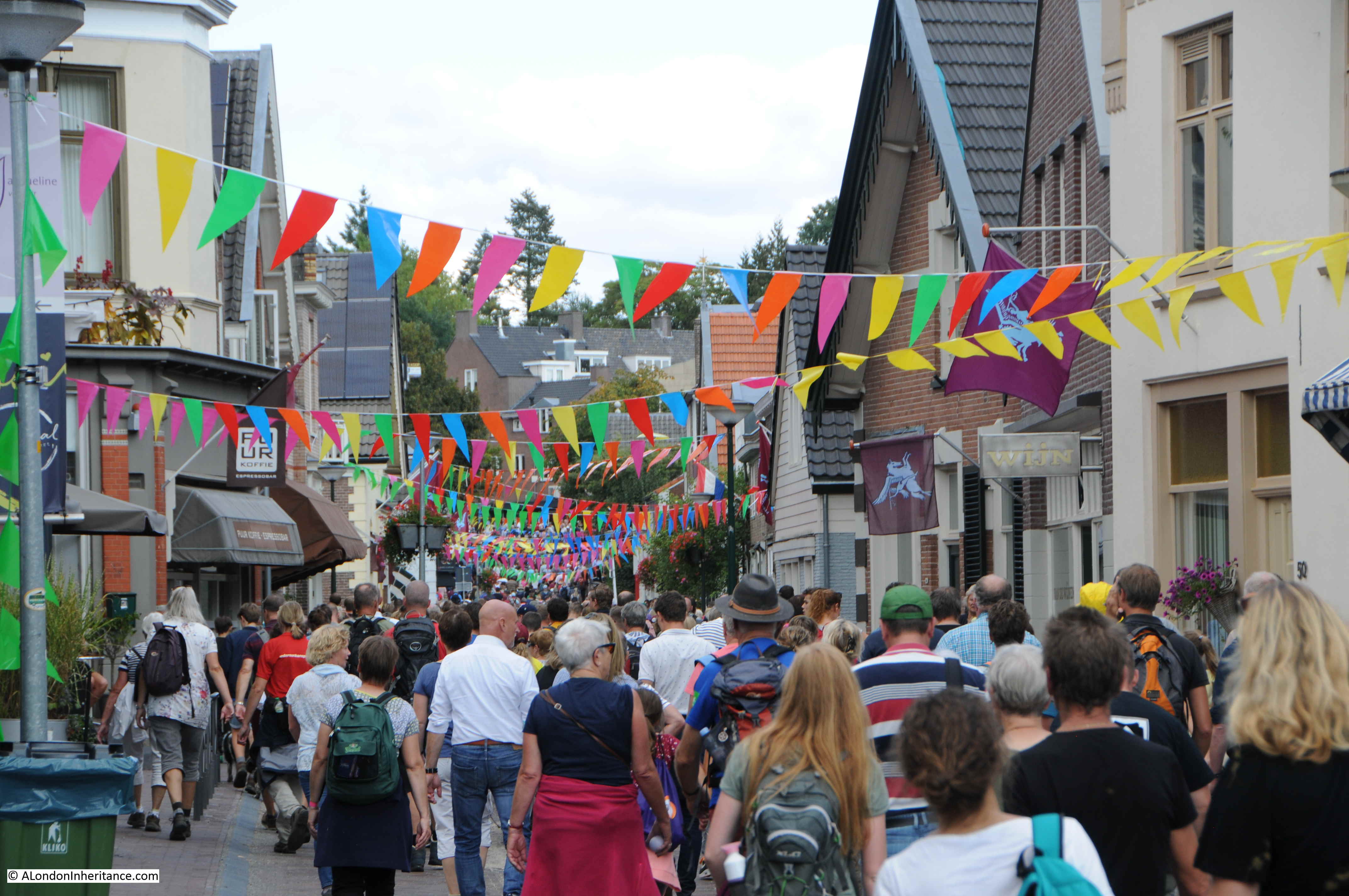
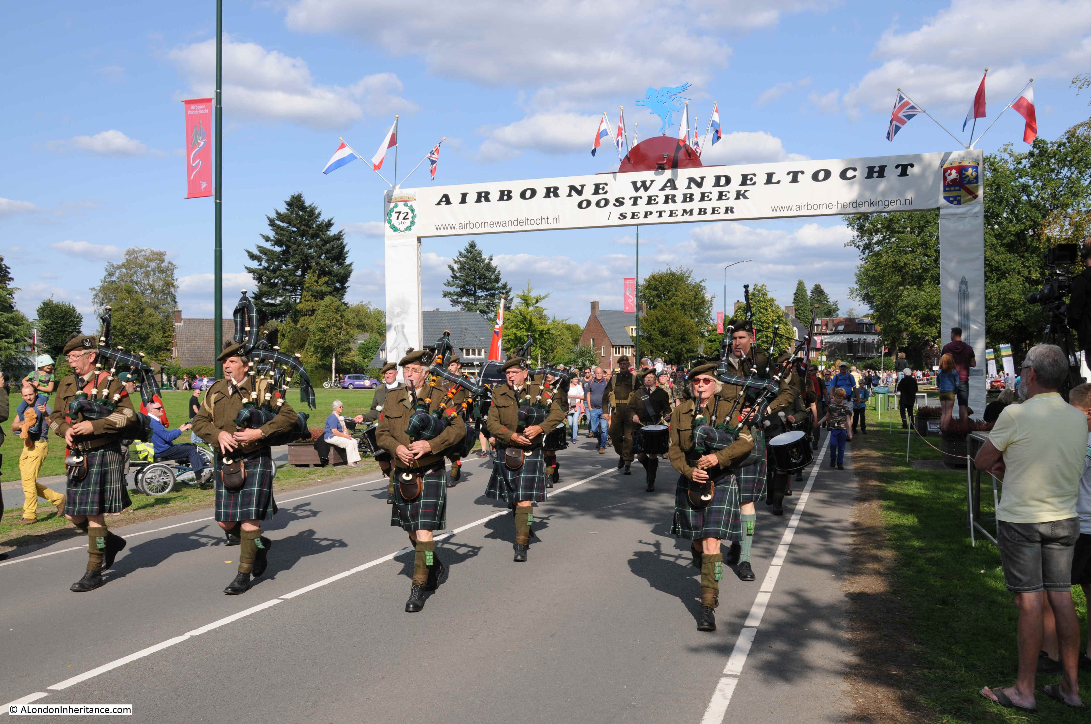
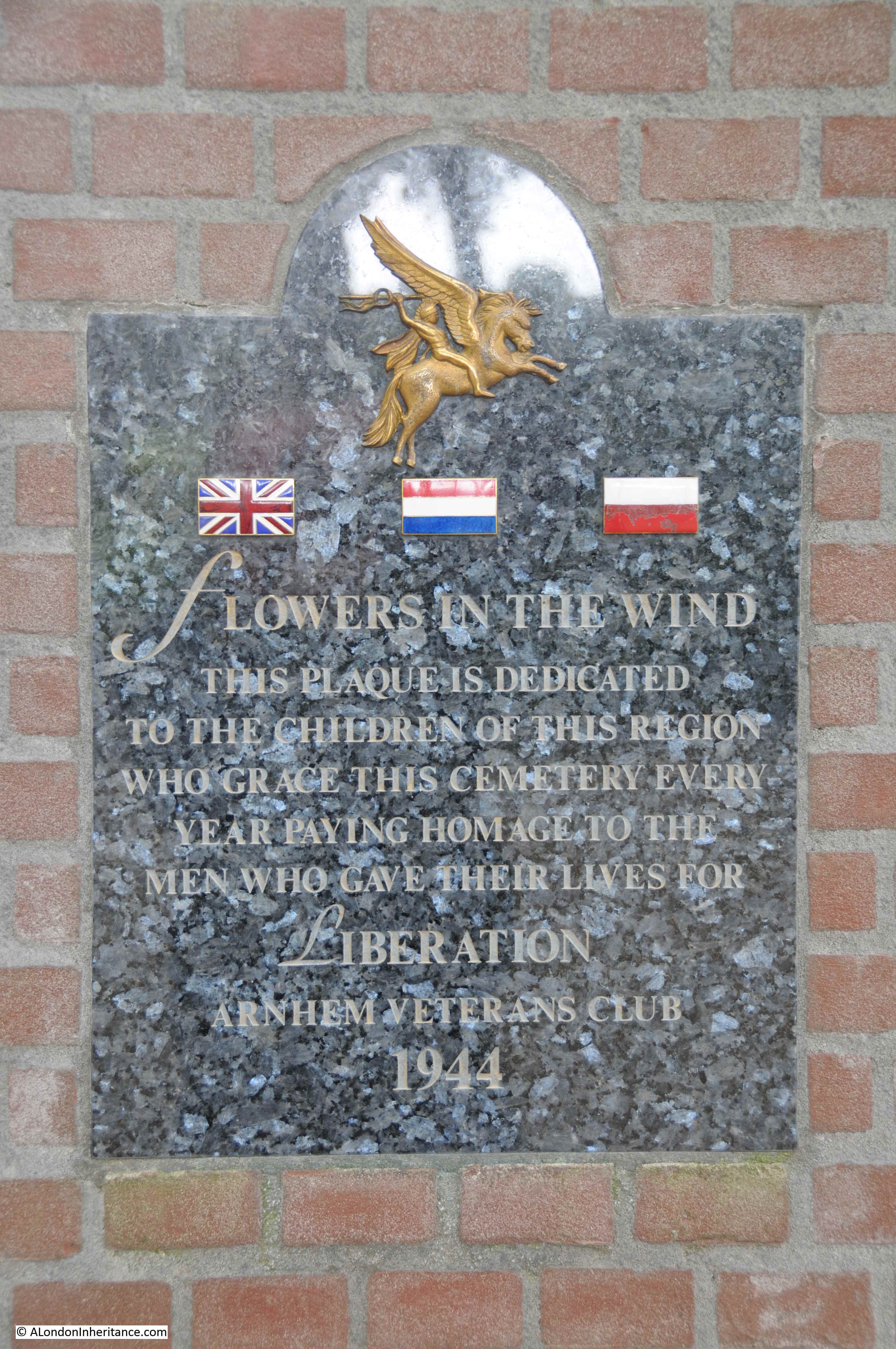
The events in and around Arnhem and Oosterbeek in September 1944 are still commemorated every year with events such as the Airborne Wandeltocht and other commemorative ceremonies. One of which is when children of the area place flowers on all the graves in the Arnhem Oosterbeek War Cemetery. A plaque in the entrance commemorates this annual event.

Arnhem Oosterbeek War Cemetery

A photo from the Imperial War Museum archive shows the first time this ceremony took place.

Arnhem Oosterbeek War Cemetery

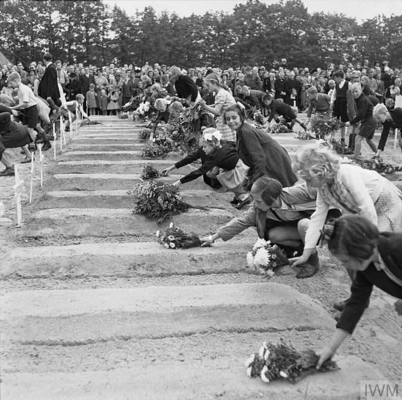
THE BRITISH AIRBORNE DIVISION AT ARNHEM AND OOSTERBEEK IN HOLLAND (BU 10741) Dutch children pay their respects to the fallen and lay flowers on the graves. Copyright: © IWM. Original Source: http://www.iwm.org.uk/collections/item/object/205192049

The ceremony still takes place, and this year on the 23rd September the children whispered the name of the person buried as they place flowers on the grave.

It is too easy to be overwhelmed by the number of graves in war cemeteries, however it is so important to remember that each one was an individual with hopes and ambitions for the future, with a family, with a life back in their home country.

Today, as well as my Great Uncle Arthur who died in the First World War, on the 30th October 1918, I shall be remembering William Frank Lakey, Ivor Rowbery, the crew from 570 Squadron on a resupply mission in their Short Stirling aircraft, Roffer James Eden, Mieczyslaw Blazejewicz, Jack Colin Crabtree and all those buried in the Arnhem Oosterbeek War Cemetery.

alondoninheritance.com

The Airborne Wandeltocht

My final post from the Netherlands before returning to London for next Sunday’s post. The Airborne Wandeltocht (or Airborne Walking Tour) is an annual event on the first Saturday in September where a series of different length walks takes participants around the sites in Oosterbeek that featured in the events of September 1944.

The first walk took place in 1947 and walks have been held annually since, to commemorate and remember those who fought and died around Oosterbeek and Arnhem, and to raise money for charities associated with military veterans and youth projects.

Airborne Wandeltocht

This year, on the 1st September, the 72nd walk took place and 32,809 walkers took one of four route options around Oosterbeek. The routes start at 10km with longer options up to 40km. All routes take in the Hartenstein Hotel (now the Airborne Museum), the Oosterbeek War Cemetery (which I will write about in November) and the Oosterbeek Old Church on the edge of the town and river which featured in the defence of the critical length of river needed to escape to the south.

The 40km walk extends to include the landing grounds to the north west of Oosterbeek.

The walk formally starts at 11 o’clock with a parade along the main road in front of the Airborne Museum, although many of the longer distance walkers will have started earlier in order to complete the walk during the mid-afternoon.

Across the whole event the flags of Poland, the United Kingdom and the Netherlands are very much in evidence to commemorate the airborne forces, the resistance and the civilians who fought and died in and around Oosterbeek.

The opening ceremony makes very clear that this is not a glorification of war, it is to remember those who fought, were wounded and died in the liberation of the Netherlands and the restoration of freedom and democracy.

Airborne Wandeltocht

The parade to formally start the walks includes a wide range of groups – those from the emergency services, scouts, charities along with current armed services and cadets, including representatives from the UK,

Airborne Wandeltocht

In between there are groups of walkers. The walk is very much a family day out.

Airborne Wandeltocht

Along with marching bands – a Dutch specialty.

Airborne Wandeltocht

The formal start / end point on the Utrechtseweg, the main road running through Oosterbeek and one of the roads taken by the airborne forces as they moved from the landing grounds towards Arnhem.

Airborne Wandeltocht

A number of British veterans attend the event each year, they have pride of place in the marquee next to the start / end point. Here, they are standing by the memorial to commemorate the 65th Airborne Wandeltocht – 74 years after they fought in the surrounding area.

Airborne Wandeltocht

All around Oosterbeek there are permanent signs telling the story of September 1944. In the following photo of a house on Utrechtseweg, a pillar can be seen on the pavement to the right of the front door.

Airborne Wandeltocht

The pillar records that the 10th Parachute Battalion fought here to virtual extinction, and that on the 23rd September the remnants of the battalion were withdrawn.

Airborne Wandeltocht

A key point on the route is the Oosterbeek Old Church. The church is on the outskirts of the modern day town, close to the flat stretch of open land that runs between town and river. The church is one of the oldest in the Netherlands, dating at least back to the year 900. In restoration work after the war, pre-christian features were found under the church so the site has been of importance for many centuries.

The church is open on the day of the Airborne Wandeltocht and all four routes pass by the church. It makes a good resting point and a fascinating location to explore.

Airborne Wandeltocht

As well as the permanent pillars, there are also photo signs at various points along the walk showing what the site looked like following the events of September 1944. The church was badly damaged in the fighting.

Airborne Wandeltocht

There are still plenty of bullet holes to be found in the walls.

Airborne Wandeltocht

The church was a central point in the fighting to defend the gradually shrinking pocket of land held by the airborne forces. Keeping a length of the river and the route open to withdraw to the river was critical in making sure that the airborne forces were not cut off in Oosterbeek. Towards the end of the battle, the width of land occupied by the British, and the Polish forces that had made it across the river was down to 700 yards.

Airborne Wandeltocht

The restored interior of the church – very busy on the day of the Airborne Wandeltocht.

Airborne Wandeltocht

The Pegasus emblem of the Parachute Regiment can be found across Oosterbeek and Arnhem. In the Oosterbeek Old Church it is on the kneeling cushions, wall memorials and on the font.

Airborne Wandeltocht

Another view of the church.

Airborne Wandeltocht

A small plaque underneath the tree reads:

“In the thick of the fighting when a patrol of five Airborne warriors was standing by this lime tree, a mortar shell hit the place and killed four of them.

Only Mark Leaver survived. Staff sgt. G Squadron, Glider Pilot Regiment, born 20th January 1920, died 31st October 2000″

Another memorial in the churchyard to the British, Polish and Dutch men and women “who fought a grim battle around this ancient church to liberate the Netherlands from Nazi tyranny.”

Airborne Wandeltocht

The flat lands between the church, the southern edge of Oosterbeek and the river in the distance. A bridge over the river can be seen in the distance. It was over this land that the final overnight withdrawal took place, across the river to the southern shore where advance parties of the British 2nd Army and the Polish forces who had landed a few days earlier, had taken the river bank.

Airborne Wandeltocht

The Airborne Wandeltocht threads its way through the streets of Oosterbeek, walking through streets that were once the scene of deadly fighting. Pegasus flags of the Parachute Regiment fly from the majority of houses.

Airborne Wandeltocht

Another example of the information posters along the route showing the same scene in 1944.

Airborne Wandeltocht

Crowds of walkers returning through the central streets of Oosterbeek:

Airborne Wandeltocht

Returning through the formal end point of the Airborne Wandeltocht. The walkers return to the main assembly field to collect their medals.

Airborne Wandeltocht

Not something you expect to see, a bagpipe band in the Netherlands. These are the Seaforth Highlanders of Holland. They were formed to commemorate the Seaforth Highlanders of Canada, who were part of the Canadian armed forces who liberated parts of the Netherlands during 1945. They were formed in Vancouver in 1910 following the large number of Scottish immigrants to Canada.

Although the Airborne Wandeltocht is just one of many events held during September to commemorate the impact of Operation Market Garden in Arnhem and Oosterbeek, it is by far the biggest event with this year well over 32,000 people of all ages taking part.

The walk does an excellent job of weaving together the history of September 1944, events at key locations and remembering the sacrifices of the British and Polish airborne forces and the Dutch civilians.

Next year’s event will take place on the first Saturday in September and details can be found on the web site of the Airborne Wandeltocht. (There is an English version, but Google translate does a good job with the full site).

alondoninheritance.com

Operation Market Garden – Arnhem And Oosterbeek

For my last Sunday post from the Netherlands, I have reached Arnhem, the final bridge in the chain of bridges that were to be taken during Operation Market Garden, and by doing so, clearing a path across the rivers to a point where the Allied forces could turn east with an unobstructed path into the heart of industrial Germany.

As well as Arnhem, I will also visit Oosterbeek, a suburb to the west of Arnhem that became the centre for British forces during the operation when German attacks prevented the majority of the airborne forces from fighting their way through to the bridge.

Operation Market Garden involved the landing of airborne forces that would capture key towns and bridges from Enindhoven in the south through to Arnhem. Capture of these towns and bridges would allow the British 2nd Army to break out from the Belgium border and drive north along the corridor of captured land through to the final bridge at Arnhem.

The 101 US Airborne Division would capture the city of Eindhoven and key points north where they would meet up with the 82 US Airborne Division which would capture the route from Grave through to the bridge at Nijmegen. This would allow the British 2nd Army to move on to Arnhem and the bridge that was to have been taken by the 1st British Airborne Division and the 1st Polish Independent Parachute Brigade.

The plan was that the bridge at Arnhem would only need to be held for two to three days before the ground forces reached the airborne forces, however delays along the route, as well as the failure to immediately capture the bridge at Nijmegen and the fighting in the town before the bridge could finally be taken resulted in significant delays.

The expectation was that only light German forces would be found in Arnhem, however the quick reactions of the occupying forces along with SS Panzer Divisions being in the area meant that the British airborne troops faced much stronger defending forces than expected.

The British Airborne forces also had to land several miles to the west of Arnhem. The area chosen was the only flat land suitable for both parachute and glider landings, as well as being away from a German airfield to the north west of Arnhem, with significant anti-aircraft fire.

The operation started on the 17th September 1944 with parachute drops and glider landings to the west of Arnhem. Troops were organised to hold the landing grounds for future drops and to move forward to capture both the bridge and other strategic locations around Arnhem.

The following map from the book Arnhem by Major General Roy Urquhart shows the Drop Zones and Landing Zones to the west of Arnhem along with Drop Zone K to the south for the later drop of the Polish airborne. The map shows the intended plan to capture the bridge and the defensive positions to be taken whilst waiting for the 2nd Army to reach them from the south. The suburb of Oosterbeek can also be seen just to the west, alongside the river.

Arnhem

The German forces were much stronger than expected, with more, experienced and better equipped opposition both already in the area, and hastily assembled.

The 2nd Battalion led by Lt. Col. John Frost reached the bridge on the first day and took the buildings either side of the northern end of the bridge, however stiff resistance prevented the rest of the 1st Parachute Brigade from reaching the bridge, and fighting would take place from the landing zones through to Arnhem as the Germans pressed in on the attacking force.

The small force from the Parachute Brigade would hold the northern end of the bridge from Sunday 17th to Wednesday 20th September. Intensive attacks on the occupiers over the four days with a gradually shrinking perimeter and occupied buildings being demolished by German tank and gun fire, as well as very high numbers of dead and wounded and running out of ammunition resulted in the remnants of the parachute battalion being taken into captivity in the early hours of Thursday 21st September.

My father only took a few photos of Arnhem, not as many as Nijmegen, so I am not sure if Arnhem was to the end of the route he was taking through the Netherlands and he was running low on film.

The first is of the bridge, and includes his two friends and their bikes:

Arnhem

During my visit I walked over the bridge to the same position:

Arnhem

The bridge as seen from the east, just in front of a new, and very busy “Airborne at the Bridge” visitor centre:

Arnhem

The view from the bridge looking north east into the city. The buildings that originally stood here were occupied by the parachute brigade:

Arnhem

Fighting took place at several sites across Arnhem as British forces attempted to get to the bridge. On the right in the above photo can be seen the tops of two church towers. My father took the following photo of the church in 1952. Whilst the church had been repaired, the surrounding land has been cleared of buildings damaged during the fighting.

Arnhem

I could not get the same view of the church today, as buildings obscure the view, so the following shows the front of the church as it is today:

Arnhem

Back to the bridge – on the lamp post on the left can be seen a sign with the Pegasus symbol of the Parachute Regiment and that the name of the bridge is John Frostbrug.

Arnhem

After the war, the bridge was named after John Frost, the commanding officer of the Parachute forces who lasted so long on the northern end of the bridge.

On the right, there is a small building, again with the Pegasus symbol and a plaque:

Arnhem

The plaque reads:

“On the 17th of September 1944, the 1st British Airborne Division began to land some eight miles to the west of Arnhem with the object of forming a bridgehead north of the lower Rhine.

The 2nd Battalion the Parachute Regiment fought its way into Arnhem and occupied the buildings which commanded the site of the bridge. Here it was joined by elements of other units of the division.

For three days and four nights the bridge was held against far greater numbers of the German 2nd Panzer Corps, until with ammunition expended, with few survivors unwounded and all the buildings destroyed around them they were finally overwhelmed.

The gallant defence of this detachment, cut off by enemy action from the remainder of the division had a marked influence on the conduct of the campaign in Holland, and the delay imposed on German reinforcements moving south to stem the allied advance enabled crossings over the Rhine at Grave and Nijmegen to be firmly secured.”

Another plaque alongside the bridge gives some background as to the naming of the John Frost Bridge, finishing that “the bridge with his name in now proudly wrought.

Arnhem

One of my father’s photos shows one of his friends looking at what appears to be a monument in Arnhem with the 17th September 1944 date engraved on what looks like a damaged pillar from a building. There were no identifying features so I was dubious that I would find the location of this photo:

Arnhem

However walking north off the bridge and through some pedestrian tunnels under the roundabout at the end of the bridge revealed the same monument:

Arnhem

I have no idea if the monument is in the same position today as in 1952. The area around the bridge has been significantly altered and rebuilt with a number of large roads converging on the spot.

The Imperial War Museum have a number of photos showing the bridge during the battle. The following two photos show the northern end of the bridge in the early days of the battle. The debris of the initial German attack over the bridge can be seen.

Arnhem

THE BRITISH AIRBORNE DIVISION AT ARNHEM AND OOSTERBEEK IN HOLLAND (MH 2062) An aerial view of the vital bridge at Arnhem, taken immediately after the operation. This shows more clearly the wrecked German vehicles at the north end of the bridge. Copyright: © IWM. Original Source: http://www.iwm.org.uk/collections/item/object/205084668

The buildings either side of the bridge are occupied by the Parachute Brigade. In the coming days, German tanks and guns would systematically destroy these buildings.

Arnhem

THE SECOND WORLD WAR 1939 – 1945: THE ALLIED CAMPAIGN IN NORTH-WEST EUROPE JUNE 1944 – MAY 1945: THE BRITISH AIRBORNE DIVISION AT ARNHEM AND OOSTERBEEK IN HOLLAND (MH 2061) Aerial view of the bridge over the Neder Rijn, Arnhem; British troops and armoured vehicles are visible at the north end of the bridge. Copyright: © IWM. Original Source: http://www.iwm.org.uk/collections/item/object/205193321

After leaving the centre of Arnhem, we then traveled out to Oosterbeek.

After the initial success with the 2nd Battalion the Parachute Regiment reaching the bridge, German defences responded quickly and built a blocking defensive line between Arnhem and Oosterbeek to prevent further British forces from reaching Arnhem and the bridge.

The main body of the 1st British Airborne Division therefore started to collect around Oosterbeek, building a defensive perimeter leading up from the river to north of the main road from Utrecht into Arnhem.

Adjacent to what was the main Utrecht to Arnhem road through Oosterbeek was the Hartenstein Hotel. When the airborne forces were landing, the hotel was being used by the German General, Field Marshall Walter Model. Thinking he was the target of the airborne attack he quickly left the hotel.

The hotel was taken over by Major-General Roy Urquhart as his headquarters for the 1st British Airborne Division operations in Oosterbeek and Arnhem.

The hotel continued to be used until the point where the airborne forces were running out of ammunition and the number of dead and wounded were severely reducing the numbers available to fight and hold and gradually reducing perimeter. On the evening of Monday 25th September, 9 days after the initial landings, those who could were finally withdrawn from Oosterbeek across the Nederrijn as by then allied forces had reached the river bank south of Oosterbeek.

My father’s 1952 photo of the Hartenstein Hotel:

Arnhem

The building today:

Arnhem

In 1978 the building opened as the Airborne Museum, a role it continues to this day, indeed in a much expanded format.

Directly opposite the hotel, across the original Utrecht to Arnhem road is a memorial to the events of September 1944:

Arnhem

During my 2018 visit, the memorial was decorated ready for a major annual commemoration which I will cover in a mid-week post. The flag of the Netherlands, along with the flags of the United Kingdom and that of Poland fly together at the base of the memorial.

Arnhem

The Polish flag is in recognition of the 1st Polish Independent Parachute Brigade. The Polish brigade’s flight from England was delayed due to weather and when they did land they were met with heavy fire from German forces and suffered significant casualties.

A number of Polish forces did make it across the river to support the 1st British Airborne Division  and they also helped with the link up to the advancing British army from the south.

Around the base of the memorial are representations of the participants in the events around Oosterbeek (the bright background sunlight resulted in the two photos on the right being in shadow).

Arnhem

From left to right:

  • the attention given to the wounded by the women of Oosterbeek
  • the landing
  • the support of the Dutch underground resistance
  • the last stand in Oosterbeek

The original Hartenstein Hotel building has been magnificently restored and recently considerably extended to add additional displays to tell the story of the events around Arnhem and Oosterbeek. The view of the rear of the building:

Arnhem

During Operation Market Garden, the building was used as headquarters for British operations. It was constantly under attack with shelling, mortar fire and snipers who had infiltrated into the surrounding woodland.

In the first days of occupation of the building Major-General Roy Urquhart was photographed standing at the rear of the building. The photo is from the Imperial War Museum archives:

Arnhem

OPERATION ‘MARKET GARDEN’ – THE BATTLE FOR ARNHEM, SEPTEMBER 1944 (BU 1136) Major-General Robert E Urquhart, commanding 1st British Airborne Division, with the Pegasus airborne pennant in the grounds outside his headquarters at the Hartenstein Hotel in Oosterbeek, 22 September 1944. Copyright: © IWM. Original Source: http://www.iwm.org.uk/collections/item/object/205192016

The same view today:

Arnhem

The Airborne Museum provides a very comprehensive overview of Operation Market Garden and the events around Arnhem and Oosterbeek, using a mix of display items from the time of the battle, as well as multi-media recreations of the events. The museum was very busy during our visit and is a perfect example of what a small museum can achieve.

The following map from the museum provides an overview of the battle and the location of British, Polish and German forces.

Arnhem

There are several rooms full of weapons used during the battle, uniforms, documentation as well as items recovered from the battlefield, including this piece of wallpaper from a house at Pietersbergweg 34 in Oosterbeek showing the dark humour of the battlefield:

Arnhem

There are recreations of the rooms within the hotel during the battle, including this view of how the cellars were used as the headquarters offices during the battle:

Arnhem

And there is a large multi-media recreation of street fighting during the battle. A single photo does not recreate the intensity of walking through with the sounds of battle all around.

Arnhem

A large memorial outside the museum, erected in 1994 on the 50th anniversary of the battle. The memorial is from the British and Polish forces in recognition of the impact that Operation Market Garden had on the people of the area, the support of the women of the Oosterbeek and Arnhem in helping the wounded and the Dutch resistance who supported the British and Polish forces during the battle.

Arnhem

After the battle had ended, the Dutch people continued to help by hiding members of the Parachute Brigade who had escaped capture and there was a slow trickle of soldiers returning back to allied lines as soon as it was safe to do so.

The Imperial War Museum has a number of photos from the battle in Oosterbeek. Along with the fighting troops, three Army Film and Photographic Unit photographers landed with the 1st Parachute Brigade and documented the fighting as it took place in the days leading up to the withdrawal across the river. Despite taking photos in the front line, all three survived.

The following photo shows Sgt D M Smith, Sgt G Walker and Sgt C M Lewis the day that they arrived back at the Army Photographic Unit at Pinewood. Sgt. Smith had been wounded in the shoulder.

Arnhem

OPERATION ‘MARKET GARDEN’ – THE BATTLE FOR ARNHEM, SEPTEMBER 1944 (BU 1169) The three Army Film and Photographic Unit Photographers who took the graphic still and cine pictures of the 1st Airborne Division epic fight at Arnhem. Copyright: © IWM. Original Source: http://www.iwm.org.uk/collections/item/object/205192044

A small sample of photos, the initial advance along the road entering into Oosterbeek from the west:

Arnhem

OPERATION ‘MARKET GARDEN’ – THE BATTLE FOR ARNHEM, SEPTEMBER 1944 (BU 1089) Men of the 2nd Battalion South Staffordshire Regiment entering Oosterbeek along the Utrechtsweg on their way towards Arnhem, 18 September 1944. Copyright: © IWM. Original Source: http://www.iwm.org.uk/collections/item/object/205216205

The same street today, the area is wooded, there are trees lining the streets and houses set back from the road. Very different to when the perimeter was roughly across this photo in September 1944:

Arnhem

A 6-pounder anti-tank gun of No. 26 Anti-Tank Platoon, 1st Border Regiment, 1st Airborne Division, in action in Oosterbeek, 20 September 1944. The gun was at this moment engaging a German PzKpfw B2 (f) Flammpanzer tank of Panzer-Kompanie 224 and successfully knocked it out:

Arnhem

OPERATION ‘MARKET GARDEN’ – THE BATTLE FOR ARNHEM, SEPTEMBER 1944 (BU 1109)  Copyright: © IWM. Original Source: http://www.iwm.org.uk/collections/item/object/205203182

The German forces had over run the planned drop zones for resupply of the airborne forces. The aircraft were under instruction to ignore signals from the ground as they could have been enemy diversions so the majority of dropped supplies landed in German held territory. There was also significant loss of the aircraft dropping supplies.

1st Airborne Division soldiers use parachutes to signal to Allied supply aircraft from the grounds of 1st Airborne Division’s HQ at the Hartenstein Hotel in Oosterbeek, 23 September 1944.

Arnhem

OPERATION ‘MARKET GARDEN’ – THE BATTLE FOR ARNHEM, SEPTEMBER 1944 (BU 1119) Copyright: © IWM. Original Source: http://www.iwm.org.uk/collections/item/object/205203183

The same view today is shown in the photo below. The grounds have been beautifully landscaped. The large construction extended from the ground is the recent extension to the basement which holds the multi-media exhibitions.

Arnhem

Another example of front line Photography by the Army photographic unit during the battle. Troops of the 1st Paratroop Battalion take cover in a shell hole in Arnhem, 17 September 1944.

Arnhem

OPERATION ‘MARKET GARDEN’ – THE BATTLE FOR ARNHEM, SEPTEMBER 1944 (BU 1167) Copyright: © IWM. Original Source: http://www.iwm.org.uk/collections/item/object/205192043

There are reminders of the battle to be found all around Arnhem and Oosterbeek, from superb museums, to memorials large and small and bullet market buildings.

Of the 8,905 officers and men and the 1,100 glider pilots who had originally landed west of Oosterbeek, only 2,163 would escape. Over 1,200 officers and men died in the battle and the rest would be taken into captivity.

There is a major Commonwealth War Graves Commission cemetery at Oosterbeek – I will report about my visit to the cemetery in a post later in November.

I will also have a mid-week post on the major commemoration held in Oosterbeek in September.

Next Sunday I will be returning to London, and hopefully for my long suffering e-mail subscribers, shorter posts (thanks for bearing with me during my visit to the Netherlands.)

alondoninheritance.com

Nijmegen City Centre – 1952 and 2018

After exploring the Valkhof and the bridge over the River Waal in my last post, I have now walked into Nijmegen city centre to hunt down the locations of my father’s remaining photos of Nijmegen.

I am starting in the large market square, or Grote Markt, looking across to this typically Dutch building:

Nijmegen city centre

The same view in 2018:

Nijmegen city centre

The building is De Waagh and is the original market weigh-house.

When buying a product in the market, you would want to make sure that you were getting the amount of a product that you have paid for. This was the purpose of the weigh-house where products such as butter could be weighed and then sold with the assurance that you were getting the expected amount.

A weigh-house had been established at the market in Nijmegemn city centre in the medieval period, however the current building dates from 1612-13, and as well as weighing products to be sold in the market, the building also held a small meat market and the upper floor was used as a guard room.

Like most buildings that have been in a city centre for over 400 years, there have been a number of changes, however a restoration in 1886 restored the building to its original design, and this is the building we can see in the 1952 photo and the same today.

Part of the building is now a restaurant, also with open air tables facing onto the market square.

A different view of the building:

Nijmegen city centre

A wider angle view of the same scene today, to show the proximity of the church:

Nijmegen city centre

To the left of the weigh-house is this terrace of buildings. The building on the left with the two arches leads through to a small open space leading to the main entrance to the church.

Nijmegen city centre

Again, a wider angled view of the same scene today:

Nijmegen city centre

Nijmegen city centre suffered badly in the final stages of the 2nd World War.

On the 22nd February 1944, allied forces bombed the city by mistake, killing 800 people.  Bombers from the American 8th Army Airforce were on a mission to attack the industrial centres over the border in Germany, however low cloud caused the mission to be abandoned and the bombers dropped their bombs on what they thought was a German town (Nijmegen is very close to the border with Germany).

During Operation Market Garden in September 1944, the defending German forces set fire and destroyed parts of the city centre to create difficulties for the allied forces trying to get to the bridge.

The resulting destruction was still very visible in 1952 as shown in my father’s photos.

In the above two photos, the building on the right of the archways was a hotel, and this must have been where my father stayed in 1952 as there are a number of photos which were taken from one of the upper windows.

The first is looking across the market square towards the tower on the old town hall. The tower is under repair and there is a large open space on the right.

Nijmegen city centre

Looking to the right of the above photo is this view:

Nijmegen city centre

I could not replicate the first of the above two photos as there is no public access to the old hotel building. I did walk up the stairs to the platform on the side of the old weigh-house and took the following photo which is looking in the same direction as the above photo, showing that the buildings of the original historic Nijmegen city centre have been replaced with typical post war shops.

Nijmegen city centre

The following photo from 1952 was taken looking down to the tables outside of the restaurant outside the old weigh-house:

Nijmegen city centre

The view today from the top of the steps alongside the weigh-house.

Nijmegen city centre

In the centre of the shopping area of Nijmgen is a large square named “Plein 1944” in memory of the events of 1944 and those who died.

The following photo from 1952 is looking from Plein 1944, across to the church. There is a large statue in the centre of the square:

Nijmegen city centre

The statue is of a soldier who kneels down with a wounded comrade and is in memory of all the Dutch solders from the Nijmegen area who died during the 2nd World War.

The statue was unveiled on the 5th May 1951.

I took the photo below of the statue in 2018. I could not get the same angle as a pavement cafe was immediately to the right of the statue, however is not the exact same statue, or in the same position in the square.

When work was carried out on Plein 1944 in 2012, the original statue was temporarily removed. The original sandstone statue had deteriorated and could not be repaired, so it was replaced with a bronze copy of the original statue on a new plinth – hence the change in colour in the two photos from a light coloured sandstone to a darker bronze.

Nijmegen city centre

The following photo is looking across from the edge of Plein 1944 to the church:Nijmegen city centre

Difficult to replicate the photo, however today the derelict space in 1952 has been covered with shops:

Nijmegen city centre

In the 1952 photo above, a terrace of houses still remain in front of the church, these can still be found:

Nijmegen city centre

The church, Stevenskerk, has very old foundations, dating back to the middle of the 13th century, and has been through several rebuilds and extensions since.

The interior of the church is typical of Dutch churches with a very plain decoration.

Nijmegen city centre

The church was badly damaged in the bombing on the 22nd February 1944 when a large part of the tower collapsed and the south western quarter of the church was also badly damaged. The restoration was almost complete in 1952 as shown in my father’s photos.

I was fascinated to find the following inside the church – a text that I have not seen before:

Nijmegen city centre

I had to take the photo at an angle otherwise the reflection in the glass would have been me with a camera, click on the photo for a larger version to read.

The document dates form the 13th June 1939, a few months before the start of the war. It is written in the languages of the three European powers (German, French and English) as well as Dutch. The title of the document is “Care of Ancient Monuments”, and the English paragraph reads:

“Her Majesty’s Government having exempted this organ from requisition as a work of the foremost rank from a musical and historical point of view, instantly begs the Commanders of military forces of Foreign Powers to respect it likewise. “

The document was created by the Dutch government and Her Majesty’s Government refers to Queen Wilhelmina who was Queen of the Netherlands before and during the 2nd World War.

I assume that the Dutch Government had a programme to identify ancient monuments across the country in the months when war seemed inevitable and put up texts asking that military forces from Germany, France and the UK respect these works.

Despite the bombing in February 1944 and the battle for the bridge in September of the same year, the organ did survive, although it was severely damaged during the collapse of the tower and when bits of shrapnel hit many of the organ pipes. A full restoration was completed in 1974.

The reason for the concern expressed in the document is that the organ dates from 1773 and was built by the Cologne organ builder Ludwig König.

The restored organ looking magnificent today:

Nijmegen city centre

Nijmegen today is a busy and prosperous city. Across the city there are memorials to the events of 1944 when so many in a relatively small city lost their lives, along with the critical and hard fought battle for the bridge.

During our visit, it must have been the Dutch equivalent of freshers week for the city’s university as there were large groups of new students attending events and activities across the city. A positive look to the future after Nijmegen’s recent past.

alondoninheritance.com

Operation Market Garden, Nijmegen And The Valkhof

The next stop for my posts on the Netherlands is the city of Nijmegen. My father took a series of photos of the town centre and also the bridge over the River Waal, one of the bridges that was part of the 1944 Operation Market Garden – the plan for allied forces to breakout from Belgium, capture key bridges over the major rivers that ran from Germany and across the Netherlands to where an unobstructed route opened up to central Germany.

A brief bit of background to Operation Market Garden – By September 1944, the British 2nd Army and Canadian forces had made considerable progress. The breakout from Normandy was followed by a dash across northern France and Belgium to the point where the 2nd Army stood on the Belgium / Netherlands border. The speed of their success meant huge problems with supplies catching up with the leading columns, despite the apparent crumbling of the German forces.

With the American army making progress to the south, there was competition as to who would make the most progress into Germany and an ambition to try and bring the war in the west to a swift end.

Airborne forces had been waiting in England since D-Day. A number of proposed parachute drops had been cancelled at the last minute, often because the land forces had moved so quickly and had already taken the objectives.

Field Marshal Montgomery put together a plan which would make use of the airborne forces to secure bridges across the Netherlands and open up a path for the 2nd Army to sweep across the rivers to the point where a turn to the east would bring them directly into the industrial heart of Germany.

The plan was given the code name Operation Market Garden, with the ground forces being the “Garden” part of the operation and the airborne forces, the “Market” element.

The following map from the 1958 book “Arnhem” by Major-General R.E. Urquhart illustrates the plan behind Operation Market Garden:

Operation Market Garden

US airborne forces with drop and hold the route from Eindhoven to Nijmegen, with British airborne forces landing at Arnhem to hold the final bridge.

Operation Market Garden has been covered in a range of excellent books from the original “A Bridge Too Far” by Cornelius Ryan from 1974 through to the most recent book published this year, “Arnhem” by Anthony Beevor. There are also earlier books, some by those who were involved in the operation, such as the book from which the above map came from.

Operational Market Garden was the subject of the 1977 film “A Bridge Too Far”, directed by Richard Attenborough. There was also an earlier film from 1946, “Theirs Is The Glory”, which included many of the actual participants recreating their role in the operation at Arnhem. It is still available on DVD and a remarkable film to watch, given that the majority of those in the film were participants, not actors.

I can probably guess why may father wanted to see Nijmegen. Having followed the war as a child, using the Daily Express map of the War in Europe pinned to his bedroom wall – seeing the places that would have been featured in news reports, newsreels and post war films would be a thing to do, once travel was easier and he had completed National Service.

The bridges would have been the first things to see – this is the bridge at Nijmegen over the River Waal, a key part of Operation Market Garden. Photographed by my father in 1952:

Operation Market Garden

Sixty six years later in 2018, I stood in roughly the same spot:

Operation Market Garden

The 82nd US Airborne had been tasked with taking Nijmegen and securing the bridge as part of Operation Market Garden. They were to hold until the XXX Corp of the 2nd Army had fought up from the Belgium border, past Eindhoven to Nigmegen.

The bridge was important as by holding the bridge, and with XXX Corp reaching Nijmegen in time, they would have been able to move up to Arnhem to relieve the 1st British Airborne Division who were dropped near Arnhem to take and hold the bridge over the Nederrijn.

There was a significant delay in taking the Nijmegen bridge, which not was secured until day 4 of Operation Market Garden. An initial lack of priority to focus on the bridge, the need to defend the landing grounds, and from assumed German forces in the Reichswald Forest (see map above) meant that German reinforcements were able to build in the town and around the bridge. The Germans also started to demolish and burn large parts of the city of Nijmegen to make it harder for an attacking force.

Another 1952 view of the bridge:

Operation Market Garden

The same view in 2018:

Operation Market Garden

The attempt to take the bridge was made difficult as airborne forces had only been landed on the southern side of the river, rather than on both sides, so the north was well defended and attempts to take the bridge were met with heavy fire from the north.

Fighting in the city of Nijmegen was intense and took some days to clear. Rather than rush the bridge, US forces crossed the river to the west under heavy, sustained fire and taking significant casualties, and after more intense fighting were able to take the northern side of the bridge.

A small number of British tanks made it across the bridge, but then halted due to supply difficulties, no supporting infantry and unknown German forces on the road between Nijmegen and Arnhem. It was a surprise that the German forces had not demolished the bridge.

The final part of Operation Market Garden, the 1st British Airborne Division and the Polish 1st Independent Parachute Brigade at Arnhem were left isolated.

I had the opportunity to explore the Arnhem area, and witness the events that are held every year by the Dutch to commemorate the sacrifice of the British and Polish soldiers a few days after visiting Nijmegen.

In the above two photos, there is a grassed area at the bottom of each photo. Moving the camera down in 1952 and 2018 provides a view of a rather elaborate floral display

Operation Market Garden

1952 above and 2018 below:

Operation Market Garden

Nijmegen is probably the oldest city in the Netherlands, with a history of occupation going back to the 1st century BC. The city was established in the Roman period and given the name Noviomagus which means “new market” – as highlighted within the floral display.

On the northeastern corner of the city is a high plateau of land. This was occupied as a fortified area, with the town being established towards the south (where the town of today is located) and along the river. It is from the high point that the above photos were taken.

I then headed down to the bridge to take a walk to the centre of the bridge. The central carriageway is for motorised traffic, with walkways along each side of the bridge for pedestrians and bikes.

The Imperial War Museum archives have some photos which show the bridge immediately after the battle. The following photo is from the Nijmegen end of the bridge:

Operation Market Garden

THE BRITISH ARMY IN NORTH-WEST EUROPE 1944-45 (B 10173) A column of lorries passes wrecked German vehicles on the bridge at Nijmegen, 21 September 1944. Copyright: © IWM. Original Source: http://www.iwm.org.uk/collections/item/object/205202526

The same view today:

Operation Market Garden

Operation Market Garden depended on a long, relatively narrow thrust of allied forces up through the Netherlands. Whilst this allowed considerable progress to be made in penetrating deep into what had been occupied territory, it did leave long exposed flanks which the Germany army continually attacked, occasionally breaking the chain from the Belgium border to Nijmegen.

The allied forces therefore had to be continually ready for an attack from the east or west of their positions, as demonstrated by the following photo with guns facing the land to the side of the bridge.

Operation Market Garden

THE BRITISH ARMY IN NORTH-WEST EUROPE 1944-45 (B 10171) 17-pdr anti-tank gun of the 21st Anti-Tank Regiment, Guards Armoured Division, guards the approaches to Nijmegen Bridge, 21 September 1944. Copyright: © IWM. Original Source: http://www.iwm.org.uk/collections/item/object/205202528

The Germans had rigged the bridge with explosives, but had held back from blowing the bridge in the expectation that they would need the bridge for a counter attack. There have been various theories for why the bridge was not blown when the capture of Nijmegen seemed certain – the wires were cut in the fighting, sabotage by the Dutch resistance, or just failed orders.

After the capture of the bridge, a considerable amount of explosive was removed:

Operation Market Garden

OPERATION ‘MARKET GARDEN’ (THE BATTLE FOR ARNHEM): 17 – 25 SEPTEMBER 1944: NIJMEGEN AND GRAVE 17 – 20 SEPTEMBER 1944 (B 10174) Nijmegen and Grave 17 – 20 September 1944: British engineers removing the charge which the Germans had set in readiness to blow the Nijmegen bridge. Copyright: © IWM. Original Source: http://www.iwm.org.uk/collections/item/object/205193889

Walking further along the bridge and it was from roughly the following point that my father took some photos along the river and back into the city:

Operation Market Garden

This 1952 photo is from the main road bridge, looking west along the River Waal towards the railway bridge:

Operation Market Garden

The same 2018 view with a new railway bridge:

Operation Market Garden

In 1952 this was the view looking back into the city of Nijmegen:

Operation Market Garden

The same view in 2018, although with a lower water level on the river:

Operation Market Garden

The water front has seen some development between the two photos, however the church, undergoing repair in 1952, can be seen in both photos, and along the front there are at least two buildings remaining. The second building from the left, along with the white building in the 2018 photo just below the church.

I mentioned earlier the Valkhof – the high plateau of land to the north east of the city, overlooking the River Waal. The area today is a park, with superb views of the river, but it has a long and fascinating history.

There is a deep cutting between the main part of the Valkhof and a steep hill overlooking the bridge.  At the top of this hill is a building, with a plaque providing the following description: “Originally a defense tower from the 15th century. Substantially changed in 1646. Restored in 1888″

Operation Market Garden

Large trees now obscure the view from where my father took the above photo, so I walked over to the tower and took a closer view. Today the main purpose of the tower appears to be as a wedding venue.

Operation Market Garden

The Valkhof, the high plateau of land in the north east of Nijmegen, overlooking the bridge, has a fascinating history. Valkhof can be translated as “Falcon’s Court”.

Initially some Roman fortifications were followed at the end of the 8th century by a castle / palace for the Emperor Charlemagne who made Nijmegen one of his residences.

After Charlemagne’s death and towards the end of the 9th century Nijmegen is attacked by the Vikings and much of the palace destroyed. Over the following centuries, the castle went through periods of rebuild and decay until the 12th century when the Emperor Frederic Barbarossa ordered a much larger castle to be built on the Valkhof.

It is from the 12th century onwards that Nijmegen grows rapidly in prosperity and size. The castle and proximity to the River Waal provides the city with an importance in European affairs, along with access to a major trading route. Nijmegen is granted the privileges of a City which allows walls to be built around the city.

The castle was badly damaged in the 18th century when the French occupied the city, and at the end of the 18th century, permission was given for the castle to be demolished, with the exception of two chapels.

The castle and the city walls,  overlooking the River Waal were an impressive sight. The following painting by the Dutch artist Frans de Hulst shows the castle on the Valkhof in the mid 17th century.

Operation Market Garden

The following map from the same period shows the castle at bottom left with the city of Nijmegen enclosed by city walls and fortifications.

Operation Market Garden

There are two structures remaining from the original castle on the Valkhof. The first is the chapel that my father photographed in 1952:

Operation Market Garden

For a building that is hundreds of years old, the change in 66 years should be minimal, which indeed is the case, apart from some changes on the wall to the right of the main entrance, which may have been uncovering features which were bricked over.

Operation Market Garden

Although the chapel dates from the very first castle on the Valkhof, the building today mainly dates from the end of the 14th century following a fire. This rebuild used brick, and the interior of the chapel was increased in height with an additional gallery running around the chapel.

To step inside the chapel is to walk from a 21st century city back into the medieval castle.

Operation Market Garden

Some remarkable decoration still survives:

Operation Market Garden

The other chapel on the Valkhof has only part of the walls remaining. This chapel dates from 1155.

Operation Market Garden

There was only one 1952 photo that I could not find today. I assume it was in Nijmegen as the following photo was in the same strips of negatives. The photo shows a statue in a park with damage caused by multiple bullets.

I had a good walk around the park, but could not find the statue, or the scene behind which looks to be a bandstand.

After exploring the Valkhof and the bridge, I took a walk along the edge of the River Waal, a circular route to head into the centre of Nijmegen to find the locations of the rest of my father’s photos. On the river edge is one of the Liberation Route information panels.

Operation Market Garden

The Liberation Route Europe is a fascinating initiative. Funded by the European Union and the Dutch Foundation for Peace, Freedom and Veteran Support, the Liberation route aims to mark out key milestones in recent European history with the liberation of Europe at the end of the 2nd World War. The route starts in southern England, follows through the D-Day beaches of Normandy, the Belgian Ardennes and the southern region of the Netherlands. The route then moves through Germany to Berlin and ends in the Polish city of Gdansk,

Information on the Liberation route can be found at their website here. The site includes a large number of personal stories.

The website also has a copy of the Liberation Route’s “Magna Carta”, a document written by several European historians to establish the historical and scientific basis for the project.

The Magna Carta includes a summary of the impact of war on each of the European countries included in the route. This summary makes very clear that the impact, both during and in the decades that would follow the war, were and are very different.

For example, the following extract is from the summary for Great Britain:

Operation Market Garden

And the following is part of the summary for the Netherlands:

Operation Market Garden

For the people of the Netherlands, it is the liberation from the appalling hardships outlined in the above text that are celebrated today, with the return of freedom and democracy that the liberation enabled. I would see how these celebrations continue to this day when I made the journey to the Arnhem suburb of Oosterbeek a few days later, where the final actions of Operation Market Garden played out.

Before that, I had some more locations of my father’s 1952 photos to find in Nijmegen – a subject for a post in a couple of day.

alondoninheritance.com

Rotterdam – A Bombed City And Modernist Architecture

Continuing my journey through the Netherlands of 1952, I have now reached Rotterdam.

The bombing of Rotterdam in May 1940 provided a warning of what would fall on London later the same year.

The invasion of the Netherlands started on the 10th of May 1940 with advance drops of parachute forces on key locations such as the Hague and the major city and port of Rotterdam.

The Dutch army within Rotterdam defended the city more aggressively than expected and by the 13th May the invading forces had made very limited progress.

On the 14th May 1940, the city of Rotterdam was heavily bombed. Indiscriminate bombing by 90 Heinkel bombers caused significant damage to the city which was made even worse by the fires that followed the initial attack. A strong wind caused the fires to extend to areas of the city that had not been directly bombed.

The attack killed between 800 and 900 people, over 25,000 houses were destroyed and 638 acres of the city left devastated.

Soon after the 14th May raid, Rotterdam capitulated, and the majority of the Netherlands surrendered on the 15th May with the whole of the Netherlands being occupied on the 17th May. The threat of similar levels of devastation on other Dutch cities was the primary reason for the rapid capitulation.

Occupation until the end of the war in 1945 prevented any significant reconstruction. After the end of the war, reconstruction commenced with a focus on the dock facilities which were back operating as one of the most efficient global ports by 1950.

When my father arrived in Rotterdam from Tilbury in 1952, much of the city centre was still in ruins, and some of his photos are similar to the photos he had taken of the worst hit areas of London.

He also found one of the great modernist designs of the Dutch architect, Willem Marinus Dudok, which although severely damaged in the 1940 raid was not finally demolished until 1960. The people of Rotterdam would also suffer badly during the occupation, and reminders of these events could (and indeed still are) be found across the city.

I had hoped to visit the city during the time we were in the Netherlands, but ran out of time due to other visits, so there are no before and after photos in this post. We had been many times when we lived in the Netherlands, but as I had not scanned these negatives, I was not aware of these 1952 photos.

In the case of Rotterdam, before and after photos would also be somewhat irrelevant as the city is so very different. Post war, and ongoing construction has resulted in a city centre that, with a few exceptions, is so very different to the city prior to the 14th May 1940.

So if you had taken the Batavier II from Tilbury to Rotterdam in 1952, stepped ashore and headed to the city centre, this is what you would have found:

Rotterdam

Although these photos were taken 12 years after the invasion of the Netherlands and 7 years after the end of the war, much of the city centre was still empty.

Rotterdam

The level of destruction was such that the decision was taken to clear the city centre rather than rebuild the ruins that remained. This resulted in a clearer demarcation between the buildings to remain and the area for rebuilding than could be seen in London.

Rotterdam

An initial plan for the reconstruction of Rotterdam included retaining much of the original street plan, however a later plan approved in 1946 called for a more significant change, moving the city away from a complex, narrow street plan to larger and more open streets, open spaces and large building plots. The devastation to such a large area of the central city had also resulted in the focus of the city moving away from the original centre and this change was also incorporated in the new development plan.

Some of the new construction under way:

Rotterdam

The following photo shows the Laurenskerk church which was very badly damaged, but in the early stages of reconstruction in 1952.

Rotterdam

The above photo includes an indication of how much the city has changed. On the right hand edge of the photo can be seen a railway viaduct. During reconstruction, the opportunity was taken to replace the above ground viaduct with an underground tunnel. As well as removing what could be considered an eyesore in the centre of the city, it also made available more space and removed the dividing effect that a large viaduct can have on different communities within a city.

A similar approach for London was included in the 1943, London County Council, County of London Plan, and also in the 1946 report to the Minister of War Transport, where many of the above ground railways through the city were proposed to move to underground tunnels. The money and will to carry out these proposals were not readily available so London’s railway routes are much as they were pre-war.

More rebuilding:

Rotterdam

To the right of the above photo can be seen part of the building shown in the following photo, A large building but I have not been able to trace the building which may have been a survivor from before the war.

Rotterdam

My father’s photos show just how large an area had been devastated by the initial bombing and the fires that would follow:

Rotterdam

One building that whilst badly damaged, was not demolished was the De Bijenkorf department store building:

Rotterdam

My father took several photos of this wonderful building from different angles so it must have been of significant interest to him.

Rotterdam

De Bijenkorf was (and still is) a Dutch department store company and after building new stores in the Hague and Amsterdam, issued a tender in 1928 for the design of a new department store in Rotterdam.

The design by the Dutch architect Willem Marinus Dudok was selected.

Dudok was the city architect for the city of Hilversum, but was also responsible for a wide range of designs across the Netherlands.

His design for the Rotterdam department store was revolutionary. It created the largest department store in Europe when the Rotterdam De Bijenkorf opened on the 16th October 1930.

The design used significant amounts of glass to maximise natural lighting with a central atrium which also let in light to the centre of the building.

On one corner of the building was a tall minaret, topped by a diamond shaped lantern.

At night, the diamond lantern acted as a beacon across the city, and the whole department store was brilliantly lit with the glass windows showing off the illuminated interior and ground floor shop windows.

The shape of the building was similar to an ocean going liner, suddenly moored in the centre of Rotterdam, bringing together goods from around the world for purchase by those wealthy enough to shop in the store.

The rear of the building was significantly damaged during the May 1940 bombing. Over half of the building had to be demolished with the rest of the building patched up as best as possible, given the wartime conditions.

The store had only lasted 10 years.

The following photo shows the rear of the building in 1952. It had originally extended much further back.

Rotterdam

The following postcard provides a view of the size of the De Bijenkorf department store soon after completion.

Rotterdam

The photo shows the long glass windows running along the length of the side wall. There is a restaurant on the terrace at the top of the front of the building. The minaret and lantern were the tallest structure in the area surrounding the store. The photo also shows the original street plan and density of building. As can be seen in my father’s photos, all these buildings will be destroyed in the bombing, subsequent fires and demolition.

Part of a rear view of the department store. It would have originally extended all the way back to where my father took this photo.

Rotterdam

After the war, the remaining part of the original De Bijenkorf store was too small. Technology had also changed, so interior lighting could be provided without large amounts of external glass which was expensive to maintain and keep clean. Post war department stores needed to have large areas of flexible internal space. Side walls could be solid, with bright internal electric lighting and only ground floor shop windows needed glass to show off their displays of goods to be purchased in the store.

A new store was commissioned, this time by an American architect, and Dudok’s building was demolished in 1960.

One of my father’s photos showing one of the new, much wider streets close to the De Bijenkorf store.

Rotterdam

The website of Frans Blok has recreations of what Dudok’s building would look like in the Rotterdam of today, as well as a fascinating video showing Rotterdam in the 1920s, the construction of the building and the interior of the De Bijenkorf store.

As a view of what was to come with the redevelopment of Rotterdam, the HBU tower block in the following photo is one of the early high rise buildings of Rotterdam’s post war development. The building still survives.

Rotterdam

More post was development, very different to the pre-war city:

Rotterdam

New shopping developments:

Rotterdam

Another view of the post war HBU building:

Rotterdam

The Dutch population suffered terribly during the occupation. Not just the day to day loss of freedom, but random selection for execution was also a risk to the population.

When trying to escape arrest, you would run the risk of being shot. After an attack by the Dutch Resistance the occupying forces would randomly select groups of people for execution – always a larger number than had been killed in the resistance attack. A revenge for the resistance activity as well as an attempt to deter such attacks.

After the war, memorials were erected at the places where shootings and executions had taken place. They carried the words “Voor hen die vielen” – “For those who fell”.

Rotterdam

These memorials are at the places where executions of between 10 and 40 randomly selected men were executed in reprisal for resistance attacks.

Rotterdam

These memorials can still be found across the city and are a strong reminder of the brutality inflicted at random on the civilian population during the years of occupation.

The following photo is on the Rotterdam negative strips, however I have no idea where it was taken, or what the photo represents. What appears to be a submarine – I assume it is real rather than some form of reproduction.

Rotterdam

Perhaps not what you would expect to find in a large city such as Rotterdam, however in 1952 my father took the following photo of a windmill that had survived the 1940 bombing.

Rotterdam

The windmill dated from 1711 and having survived the war was destroyed in a fire in 1954. It was not reconstructed, and the area (the Oostplein) is now a large open road junction with a small grassed area in the centre.

My final photo from 1952 is the following, which I also included in last Sunday’s post on Amsterdam. The photo was on the same negative strip as some of the Amsterdam photos, however I could not find the location, but assumed it to be in Amsterdam.

Rotterdam

I am very grateful to Henk Laloli who commented on the post that “The last picture with the escalator is probably in Rotterdam: the entry for cyclists and pedestrians to the Maas (river) tunnel. A lovely old wooden escalator and beautiful 1930s decorations.”

So hopefully I now have the right city for this photo of the tunnel entrance with the wonderful decoration.

Rotterdam today continues to be Europe’s largest port and the city plays host to many Dutch and international businesses, occupying the glass and steel towers that continue to grow across the city. The function of Rotterdam is the same as the pre-war city, but the architecture now is very different.

For my next post on the Netherlands, I am heading to the city of Nijmegen, to start exploring the impact of Operation Market Garden.

alondoninheritance.com

Amsterdam – Exploring The Historic Centre

Following on from last Sunday’s post from the Hague, whilst there we took a train to Amsterdam to track down the location of more photos from 1952. Rather than drive, the train provided an excellent direct service between the two cities and it was a perfect opportunity to use a type of train not available on the UK train network.

The Dutch rail system uses a combination of single deck “Sprinter” trains which are generally stopping trains and double decker trains in use as Inter City services which are faster alternatives without so many stops. The ticketing system is the same for both, and a return ticket between the Hague and Amsterdam could be used on the slower Sprinter and faster Intercity trains.

The double decker trains are not new, they were in use across the network when we lived in the Netherlands in the early 1990s and it was always a novel experience to climb stairs on a train, after using trains on the UK network.

The InterCity train in the Hague Central Station:

Amsterdam

Two decks of train capacity:

Amsterdam

Through the doors and an intriguing option – do I go up or down?

Amsterdam

Up was the obvious choice. The upper deck resembles an aircraft interior but with larger windows and no overhead luggage bins.

Amsterdam

Stopping in Leiden Station and looking down on the platform from the upper deck:

Amsterdam

After arriving at Amsterdam Central Station, I headed to the first location which was easy to recognise. This is the Royal Palace in the centre of Amsterdam, photographed in 1952:

Amsterdam

And this is the same view in 2018:Amsterdam

As could be expected, the view has hardly changed, even the overhead power cables for the trams are still in place. As with the Hague, Amsterdam has an extensive tram system which provides excellent connectivity across the city.

The Royal Palace dates from the 17th century, however the building we see today mainly dates from 1808 when King Louis Bonaparte transformed the palace during the French occupation of the Netherlands.

Very similar to Buckingham Palace in London, the Amsterdam Royal Palace is used to host foreign Heads of State and state receptions. It also plays a key part in the life of the Dutch monarchy as royal marriages and investiture ceremonies are also held in the palace.

The large space in front of the Royal Palace is Dam Square.

Dam Square has been the centre for many demonstrations and rallies over the years. The square hosts the annual National Memorial Day in May, which commemorates all members of the armed forces and civilians who have died in war.

Dam Square was also the site of one of the final actions of the last war in the Netherlands when on the 7th May 1945, two days after the German surrender, German soldiers on a balcony fired into Dutch crowds in the square. The crowds had been awaiting the arrival of Canadian forces. There were many deaths and casualties and no real reason for the shooting to have taken place.

Dam Square today is a busy centre for tourists visiting the city. As well as a natural place to congregate opposite the Royal Palace, the square is also the location for one of the Netherlands largest department stores and a Madam Tussaud’s Wax Museum.

The following map extract showing the historic centre of Amsterdam shows the sites of my father’s photos that I have been able to identify. The Royal Palace shown above is at site number 1.

(Map  “© OpenStreetMap contributors”)

My next location was a walk through the side streets from Dam Square to site number 2. I had found this location in advance. Fortunately in my father’s photo there is a street name visible so I was able to work out where the photo had been taken before arriving in Amsterdam.

This is the Staalmeestersbrug which spans the Groenburgwal canal.

Amsterdam

Sixty six years later and the view of the bridge is much the same:

Amsterdam

There has been a bridge here for many centuries, the first written record dates from 1599. The bridge in my father’s photo dates from 1928 when a replacement bridge was installed, replicating the previous bridge at the site.

The bridge in my 2018 photo is not fully the same as my father’s photo. In 1964 repair was again needed and the bridge section and counterbalance were replaced – but by comparing the two photos, the appearance of the new parts are the same as in the previous photo.

The photo does highlight one of the main differences between the Amsterdam of 1952 and that of 2018, and the same change can be seen in London, and that is the level of tourism and growth in the city’s population.

Main streets in the historical centre of Amsterdam are very busy, and you can tell from the languages spoken, and the photos being taken that a high percentage of those walking the streets are tourists.

Another view of the same bridge in 1952:

Amsterdam

And in 2018:

Amsterdam

Whilst generating economic benefit and employment, Amsterdam is struggling with the level of tourism. In 2017 there were 6.7 million hotel stays by foreign visitors, a figure which does not include day visitors. There are ten tourists for every resident of Amsterdam and local politicians and activists are calling Amsterdam the Venice of the north – not just because of the omnipresence of water, but also due to the impact of high volumes of tourists.

Standing on the Staalmeestersbrug and looking along the Groenburgwal is this view of the tower of the Zuiderkerk, located at site 3 in the map above:

Amsterdam

1952 above and 2018 below:

Amsterdam

The Zuiderkerk dates from the first decade of the 17th century when the body of the church was built., the tower was completed in 1624. There was a rebuild of the church in 1657, and the church has remained much the same since.

Comparison of the two photos shows one of the differences between 1952 and 2018 that can also be seen across London. In 1952 there were few cars parked along the roads, however today there is car parking along the majority of canals – which does require some careful maneuvering to avoid ending up in the water.

As mentioned in my previous two posts on the Hague and Wassenaar, the western part of the Netherlands suffered terribly during the final months of the war and the winter between 1944 / 45 was known as the hunger winter due to the lack of supplies of food. During this time the Zuiderkerk church was used as a mortuary.

Claude Monet painted the view in 1874. The view shows the Staalmeestersbrug with the church tower behind:

Amsterdam

The next stop was for a view of the Montelbaanstoren at site number 4. The tower was part of the city walls. The lower part of the tower, below the clock, dates from 1516 with the upper part added in 1606.

Amsterdam

The tower stands close to the main harbour area of Amsterdam, and at the junction of two major canals. There was a boat passing in front of the tower in my father’s photo above. Whilst I was looking at the view there was a constant stream of river traffic – the canals are still very much in use.

Amsterdam

My next stop was another of the towers from the original city walls. This time the Munttoren, originally part of the one of the main gates into Amsterdam. The tower had been rebuilt in the early 17th century.

This was reached by walking to where the Kloveniersburgwal canal meets the Amstel (site number 5 on the map).

Amsterdam

1952 above and 2018 below:Amsterdam

To where the Munttoren becomes visible alongside a bridge over the canal and a busy road junction:

Amsterdam

The same view today:

Amsterdam

The name “Munttoren” means Mint Tower and refers to a short period in the 17th century when the guard house alongside the tower was used to mint coins.

The Munttoren in 1952 – located at site number 6 in the map:

Amsterdam

The same view today. The tower is still alongside a busy tram route and the wires still stretch above the road, although the impressive street name sign has disappeared.

Amsterdam

As well as the above photos, there were also a number of photos where I could not identify the location, including the following two view of canals and buildings:

Amsterdam

Amsterdam

During the 17th century, Amsterdam was the wealthiest city in Europe. The city was home to the Dutch East India and West India Companies that traded across the world and the Netherlands growing list of colonial conquests. Amsterdam, was also the worlds largest financial centre during this period. Wars with England and France during the 18th century would reduce the influence of Amsterdam, along with competition from other global trading companies such as the British East India Company, one of the reasons for London’s growing influence.

The buildings that line the canals reflect this wealth and were a mix of merchant houses, town houses, workshops and warehouses.

The mix of architectural styles is fascinating. The buildings are typically narrow, but tall to maximise the amount of available space within the building on a small plot of land.

Amsterdam

The buildings alongside the canals are much the same today, although generally in better states of repair. I came across this wonderful jumble of buildings which look to be falling apart from each other:

Amsterdam

One of my father’s photos was of this canal side scene:

Amsterdam

The circular panels for advertising are still a feature in Amsterdam today. The Dutch Amstel beer in the poster above and below, the Chief Whip cigarette brand – “On everyone’s lip”.

Amsterdam

Water is inextricably linked with the history of Amsterdam. As with London’s relationship with the River Thames, it is the reason why Amsterdam is where it is, and access to water and the open sea was why Amsterdam grew to be such a major trading city, at times rivaling London.

The origin of the name is from the Dam built across the River Amstel, believed to have been where Dam Square is now located.

Walking around Amsterdam today, there is a more defined separation between the inland canals which seem mainly to be used by tourist boats, and the docks which are located on the large waterway which runs from the North Sea via the North Sea Canal to the large waters of the Markermeer and Ijsselmeer.

In 1952, boats to transport goods within Amsterdam, and throughout Europe via the canal and river network, could be found across the city.

Amsterdam

Amsterdam

However scenes like this can still be found alongside most canals, however with cars now lining the boundary between road and canal.

Amsterdam

I tried to find the location of this Punch and Judy show by looking for the large corner building in the background, but with no luck,

Amsterdam

I assume that with the pipework on the rear of this vehicle, this is a fire engine threading its way through the narrow, crowded streets.

Amsterdam

Street urinal:

Amsterdam

Traffic control:

Amsterdam

I am really not sure where the following photo was taken. It is on one of the Amsterdam negative strips, and appears to show an entrance to something below ground, I would normally think this was to an underground railway. Amsterdam does have an underground railway, however it did not open until the 1970s, long after this photo was taken.

Amsterdam

The mural on the rear wall has a number of different types of ships at the top, with symbols of fish below and possibly Neptune on either side.  The sign reads “forbidden for dogs and loaded bicycles”.  There is a small chance that the above photo was from Rotterdam if some of the negative strips have been muddled over time, but the rest of the photos on the same strip are from Amsterdam.

As with London, Amsterdam is best seen on foot. The historical centre of the city, with some imagination and by ignoring the parked cars, retains the feel of the 17th century city.

With a few exceptions, the majority of later development seems well planned. The majority of new building is outside the centre with considerable new building towards Schiphol airport.

The tourist hot spots are crowded, there is the red light district and the cafes where soft drugs are legal and readily available, however turn away from the main streets, and as with London, there is so much more to explore – and water is never far away.

alondoninheritance.com

Launch And Landing Sites Of The First V-2 On London

I was in the Hague for my last post, and before leaving I wanted to visit a site in a suburb of the Hague that has a very direct and tragic connection with London.

London had been under fire from V-1 flying bombs starting in June 1944 until October 1944 when the launch sites were captured as the allied forces progressed through France and Belgium.

In September 1944 a new weapon was first used against London. This was the V-2 rocket which had a much more flexible launch method than the V-1 and also longer range so launching against London was possible from the areas still held by German forces.

Although Allied forces were pressing up from the Belgium border, through Eindhoven and Nijmegen, the coastal west of the Netherlands was still under German control and the area around the Hague offered the ideal location to launch against London. The Hague had the rail connections to bring in the rockets and their fuel, and the suburbs of the Hague offered a large wooded area, crisscrossed by small roads which provided the perfect cover for mobile launches.

The V-2 was a highly sophisticated weapon. The supporting infrastructure allowed the rocket to be launched from a mobile launcher with fueling carried out on site along with final setting of the gyros that would guide the rocket to its destination. The speed of the rocket meant that it was almost impossible to destroy whilst in flight. The trajectory for the rocket was a parabola from the launch site up to the edge of space before descending at up to three times the speed of sound to the weapon’s target.

The following photo shows a V-2 rocket on a launch platform. Most photos of the V-2 show the black and white painted rocket, these were the test versions and the painted colour scheme ensured that any rotation of the rocket could be identified during flight. In use, the rockets did not have a colour scheme.

V-2

Black and white (CL 3405) V2 on launching platform Copyright: © IWM. Original Source: http://www.iwm.org.uk/collections/item/object/205087580

Wassenaar is a suburb of the Hague, located to the north east of the city. It is a wooded area with small roads crossing the area, concealed under trees which also line the roads. Wassenaar was one of the main launch sites for V-2s and the first rockets against London were launched from Wassenaar’s roads.

Before leaving the Hague, I wanted to find the location of the first V-2 launch against London, so headed out on the short drive to Wassenaar.

The following map shows the city of the Hague. Follow the orange road (the N44) that runs from the Hague to the north east and you will find Wassenaar.

V-2

The following map extract shows Wassenaar in detail. The first launches against London took place on the evening of the 8th September 1944. There were two simultaneous launches at two different road junctions. These were ideal locations as road junctions offered a larger space for the rocket launcher and supporting vehicles as the rocket was fueled onsite. The map also shows the wooded nature of the site and that these were side roads – good concealment for the time needed to prepare and launch.

V-2

(The above two maps are  “© OpenStreetMap contributors”).

At around 6:35 pm on the evening of the 8th September 1944, the residents of Wassenaar heard a loud roaring noise and saw two objects rising above the trees, slowly at first before quickly gathering speed, then rushing skyward.

One was from the junction of three roads shown as point 1 in the above map. This is the junction of Lijsterlaan, Konijnenlaan and Koekoekslaan. This is the view of the junction as I walked up to the site:

V-2

Looking down one of the roads leading of from the junction shows the narrowness of the roads and the tree cover. It has not changed that much since the rockets were being launched here and shows how good the area was for concealment.

V-2

The original V-1 had to be launched from a fixed launching ramp. As well as the technological development of the rocket, other innovations with the V-2 were mobility where the complete system comprising a mobile launcher, fuel tankers (including liquid oxygen), launch and control system could drive up to a new location and launch within about two hours.

The following illustration shows a V-2 rocket in launch position on its mobile transport and launch platform:

V-2

The following photo shows a V-2 just after the initial launch. Two of these being launched almost simultaneously from the wooded side roads of Wassenaar must have been a frightening sight for the local residents.

V-2

Black and white (CL 3429) German photograph of a V2 rocket in the initial stage of its flight Copyright: © IWM. Original Source: http://www.iwm.org.uk/collections/item/object/205087577

This part of Wassenaar is occupied by large houses and grounds. Reports from immediately after the launch tell of the road surface been scorched and melted, with trees being burnt for a few feet above ground level where flame from the rockets engines must have bounced of the road and been deflected onto the adjacent trees.

On the next day, the 9th September, the RAF started bombing Wassenaar. A cat and mouse game ensued with rockets, fuel and launch equipment being stored across the area and mobile launches taking place on a regular basis, and the RAF trying to locate and bomb any V-2 related infrastructure that could be found.

Another view of the road junction.

V-2

If you look at the patch of grass on the right, there is a white painted stone. Look to the upper right of the white stone, and just to the left of the tree is a small, wooden pillar.

The pillar records the junction as being the site of the first launch of a V-2 rocket on the 8th September 1944:

V-2

Soon after returning from the Netherlands, and on the 8th September 2018, I visited the site where the V-2 launched from Wassenaar landed – in Staveley Road, Chiswick where another pillar can be found recording that the first V-2 fell here. It had taken the rocket around 5 minutes to get from Wassenaar to Chiswick.

V-2

The view looking along the street from in front of the memorial pillar:

V-2

The memorial pillar is in front of a small electrical substation:

V-2

To the right of the pillar, mounted on the fence is an information panel which was unveiled by the Battlefields Trust and the Brentford and Chiswick Local History Society, on the same day that the pillar in Wassenaar was also unveiled.

V-2

The V-2 on Chiswick resulted in three deaths. Three year old Rosemary Clarke who lived at number 1 Staveley Road, Ada Harrison aged 68 of 3 Staveley Road and Sapper Bernard Browning, who was on leave, and on his way to Chiswick Station.

Destruction was considerable. The V-2 blew a crater 30 ft wide and 8 ft deep at the point of impact. The following panoramic photo from the Imperial War Museum archive shows the damage that a V-2 could inflict.

V-2

V1 AND V2 DAMAGE, 1944-45 (HU 66194) ‘Extensive damage caused by mystery explosion in Southern England.’ The photograph actually shows the site of the first V2 rocket impact on Britain, Staveley Road, Chiswick. Photograph taken 9 September 1944. Copyright: © IWM. Original Source: http://www.iwm.org.uk/collections/item/object/205070209

There was a second V-2 rocket launched at the same time, a very short distance from the location described above. This V-2 was launched from the point marked 2 in the map, at the junction of Lijsterlaan and Schouwweg. This V-2 would land minutes later at Parndon Wood, near Epping. Due to the rural nature of this location there were no casualties.

The following photo shows the junction from where this second V-2 was launched:

V-2

From the 8th September onward, there was a continuous series of V-2 launches from Wassenaar and the Hague. The area was also used for storage of rockets and fuel, launching equipment and the German forces and command structure that would launch the rockets were also housed in the surroundings of Wassenaar and the Hague.

Allied planes flew many missions over the area trying to locate and destroy V-2 infrastructure. On the 3rd March 1945 a large force of bombers mounted an attack on the forested regions of the Hague, but due to navigation errors many of the bombs fell on the Bezuidenhout suburb resulting in a large loss of life in the Dutch population.

The Dutch population also suffered when rockets misfired, and also the disruption and treatment they suffered from living in and around a place that was used to store, transport, prepare and launch such an intensive rocket programme.

One of the locations where V-2 rockets were checked and prepared was the tram depot in Scheveningen, the coastal suburb of the Hague.

This is the view of the tram depot today:

V-2

There are historical posters around the streets commemorating the 200th anniversary of Scheveingen as a seaside resort. One of these posters shows the state of the tram depot in 1945:

V-2

The text states that after the liberation, it took some time for trams from the Hofplein line to return to Scheveningen-Kurhaus station and that the tram connection was finally reestablished in 1953.

On the 27th March 1945 the last V-2 was launched against London. It fell on Orpington in Kent resulting in the deaths of 23 people. Whilst the west of the Netherlands was still occupied, rail connection with the rest of Germany had been cut and the German rocket forces had already been withdrawn from the Hague in order to avoid capture of the personnel and their equipment.

From the first V-2 on the 8th of September to the last on the 27th March, a total of 3172 V-2 rockets were launched. Of these around 1358 fell on the greater London area.

London did not suffer as badly as Antwerp, An important port for the Allied forces allowing supplies to be delivered into Belgium rather than the French ports further south, around 1610 V-2 rockets were launched against Antwerp.

Other rockets landed in France, Maastricht in Holland and even in Remagen, Germany where the use of rockets were an attempt to try and disrupt US forces by targeting the Ludendorff Bridge across the Rhine. This was the first time that rockets had been used to attack a very specific target. Eleven rockets were fired at the bridge, however none hit their target, but American soldiers and German civilians were killed.

The V-2 campaign against London killed more than 6,000 people.

The rockets were constructed by slave labour and many tens of thousands died due to the appalling conditions in which they were held and laboured.

The impact of the V-1 and V-2 weapons was considerable on those forced to build them, the areas where they were launched and their targets.

Two pillars in two countries, roughly 205 miles apart provide a reminder of the devastation that these weapons would cause.

alondoninheritance.com 

Exploring Post War Netherlands – The Hague

Although by far the majority of my father’s photos are of London, he took his camera with him where ever he went, and in the late 1940s and early 1950s, along with some friends, he cycled across the UK, staying in Youth Hostels and taking photos along the way. I have already featured a number of these locations.

In 1952 he also traveled out to the Netherlands, cycling to a number of cities, both typical tourist destinations and also places that had featured significantly in the war. (I will use the Netherlands as the full name of the country, probably better known as Holland, although this is really only the name of the western province of the country).

Coincidences are strange. My father always wanted to return to the Netherlands and in 1989 my job transferred to the country, so along with my wife and daughter I moved out to live in the Hague for the next five years. It was a wonderful experience, and during this time my parents came to visit several times and we took them to visit the places my father had been to almost forty year earlier.

I knew that he had taken photos, but these photos had not been printed so it has been only in the last few years that I have scanned and seen the photos he took during his post war visit – I had not seen any of these when we lived in the country.

We recently decided to spend a week in the Netherlands this summer to visit the places where we use to live, and as my aim with this blog is to trace the locations of my father’s photos it was a perfect opportunity to track these down as well, now that they have been scanned, rather than hidden in negative boxes.

So, with apologies that this is not London, for the next few weeks I would like to take you on a journey across the Netherlands. Not just tracking down the locations of my father’s photos, but also to discover much about the history of the country, how a suburb of the Hague will forever have a tragic link with west London, how the Dutch commemorate the sacrifices of British and Polish forces, when the war came to Nijmegen, Arnhem and Oosterbeek, and how the bombing of Rotterdam during the German invasion of the country gave an indication of the destruction that would soon visit London.

On the way there are some fascinating individual stories, street photography, some wonderful architecture and architects, and for me, given the state of the world today, some very important lessons that should not be forgotten.

But before leaving, there was some important documentation to check. My father had just bought a new Leica camera from R.G. Lewis in High Holborn and the photographic press at the time was reporting on a number of confiscations of “expensive miniatures” by customs on return to the country. Leica cameras in the post war years could be purchased in Germany for much less than you would pay in the UK so documentary proof was needed that a camera had been purchased in the country. R.G. Lewis were able to provide assurance that the receipt provided sufficient documentation:

the Hague

With the right documentation to avoid any customs problems on return to the UK, it was time to get going.

From Tilbury to Rotterdam

To start, we need to get from London to the Netherlands. At the time, the easiest method was to take the train out to Tilbury, then catch the Batavier Line ship, Batavier II from Tilbury to the port of Rotterdam.

This is the route that my father took, when, along with two friends, they took their bikes with them from London. They traveled light, each with a bike and a saddlebag containing everything they needed for the trip.

The following photo from Britain from Above shows the passenger terminal building at Tilbury with the station platforms behind the terminal building. The much larger RMS Strathaird is docked rather than the smaller Batavier II.

the Hague

I would have loved to have seen some photos of the Tilbury terminal, the ship and the outbound voyage, however one of the limitations in the days of film cameras was the cost of film and the amount that could carried, so there are only a few photos.

The first is of the Red Sands fort in the Thames estuary. Built during the war as an anti-aircraft gun emplacement to defend London from aircraft approaching up the Thames, when my father took the following photo of the fort, it was still in use.

the Hague

In 2015 I was on the paddle steamer Waverley on a trip from central London out to the forts and took the following photo with the Shivering Sands fort and the Red sands fort in the distance.

the Hague

There are also a couple of grainy and distant photos of the Thames river bank as the Batavier II headed out into the north sea, but the first detailed photos are the arrival at the port of Rotterdam. This one from the bow of the Batavier II:

the Hague

The Batavier Line was a Dutch shipping line established in 1830 by the Netherlands Steamship Company, when a regular service was operated from the Port of London to Rotterdam. In 1895 the Batavier Line was sold to Wm. H. Müller and Co, and the Batavier name was retained and a number of new ships were ordered including the Batavier II (a replacement of a ship with the same name). The ship was delivered in 1921.

The Batavier II was the only ship of the Bataview Line that survived the war. Of the immediate pre-war Batavier ships, the Batavier V was seized by the invading German forces, but sunk by the Royal Navy in 1941. The Batavier III had also been seized and sunk off Norway in 1942 after hitting a mine whilst being used as a German troop carrier.

Only the Batavier II survived the war to reenter service on the Tilbury to Rotterdam route which survived until 1958 when Batavier ended their passenger services.

The following postcard shows the Batavier II. On the reverse of the card is written “Batavier Line, London to Rotterdam”. The above photo was taken from the front of the boat, just by the railings which can be seen in the postcard.

the Hague

The port of Rotterdam is one of Europe’s largest ports, as it was when these photos were taken with industries related to shipping lining the river for a considerable distance.

the Hague

There are no passenger services from London to Rotterdam today, however the alternative would be a train journey from Liverpool Street to Harwich and then the ferry service from Harwich to the Hook of Holland.

I am not sure where the ship docked in Rotterdam. It was not at the Hook of Holland as this terminal is located at the entrance to the port. My father’s photos show that the ship traveled further into central Rotterdam.

the Hague

When we travelled to the Netherlands this year we did not take the ferry, instead we travelled on the EuroTunnel shuttle service from Folkestone to Calais, then a drive up through France and Belgium, to arrive in Holland.

I suspect my father visited Rotterdam first, and this city will be the subject of one of the coming posts, For this Sunday’s post, it is a brief visit to:

The Hague

Amsterdam is the capital of the Netherlands whilst the Hague is the administrative centre. The city where the States General of the Netherlands (the country’s parliament) is located, along with the Supreme Court and the International Court of Justice.

As with the country as a whole, the Hague has a complex history. The origins of the city date back to the early 13th century, when Floris IV, the Count of Holland established a base in the area,

The city and what was to become the Netherlands has been through a series of occupations, consolidation and separation. The Spanish occupied the city during the eighty years war, the country was a client state of the First French Empire at the start of the 19th century, the country was combined with Belgium with separation only achieved in 1830, and the country was occupied by Germany during the second world war. As with the rest of the Netherlands, the Hague suffered terribly during the last war.

The country has also had a long trading history, at times in competition and also at war with England.

Whilst in the Hague, my father took some photos of the Binnenhof, the meeting place of the States General (the equivalent of London’s Palace of Westminster) and the official residence of the Prime Minister of the Netherlands.

Considering the function of the Binnenhof, access is open and the visitor is free to walk around. Whilst there are armed police around the site, there are no searches or restrictions to exploring the open areas and taking photos.

The main entrance into the Binnenhof complex:

the Hague

Once inside and standing in the central courtyard, I found the location of the first of my father’s photos:

the Hague

As probably to be expected of the seat of Government, there has been hardly any change. The main physical change is that the fountain in the above photo has been moved slightly to the left, so just outside of the photo of the same scene today.the Hague

I always find the small details fascinating in comparing the original photos with the scene today. Despite being almost 70 years apart, there is a mobile ice cream seller in almost exactly the same place:

the Hague

One side of the courtyard is taken up by the Ridderzaal, or Knight’s Hall.

the Hague

The origins of the Ridderzaal date back to the 13th century when Floris V built his first manorial hall within the area of land first developed by his grandfather. The Ridderzaal has been used for a multitude of purposes over the centuries, and today hosts the annual opening of the Dutch Parliament by King Willem-Alexander.

The Ridderzaal today, again with hardly a change:

the Hague

I am not sure of the significance of the clothes that this group were wearing.

the Hague

But again,. the scene is much the same today:

the Hague

The Binnenhof appears to have escaped any significant damage during the war, although this was not the same for the rest of the Hague. The population suffered considerably during occupation, and the Hague, along with much of western Holland was occupied until the closing months of the war. Supplies were cut and much of the population were close to starving. When I lived in the Hague, work colleagues told stories of the time which included tinned food being floated down the canals from liberated areas into the occupied.

There was also physical destruction to the Hague, not just from the occupation forces, but also from the Allied forces. The suburbs of the Hague were used for V2 rocket launches against Antwerp and London and the RAF tried to address this threat by bombing the facilities used to store the rocket fuel, the rockets and the mobile launch platforms, however one significant bombing raid missed the target resulting in hundreds of deaths among the local population.

In the Binnenhof courtyard is a rather impressive, neo-gothic fountain. Designed by the architect P.J.H Cuypers (who was also responsible for the Rijksmuseum in Amsterdam), the fountain was in operation by 1885.

the Hague

The fountain today. Colour photography brings out the gilding of the fountain. It appears to have been relocated slightly at some point over the last 70 years.

the Hague

As the home of the Dutch Parliament, the Binnenhof has always had a symbolic importance to the Dutch population and the state. It was therefore used for rallies and ceremonies by the occupying forces not that many years before my father’s 1952 photos. The following photo is of the main courtyard with the fountain visible in the top left.

the Hague

And in front of the Ridderzaal:

the Hague

As mentioned earlier, the Dutch population suffered terribly during the war. Arthur Seyss-Inquart was the Reichskommissar of the Netherlands during the war. An Austrian and a fervent Nazi, he aggressively pursued the round up and deportation of Jews within the country. He was found guilty in the Nuremberg Trials and hanged shortly after. 

A very different ceremony was held in the Binnenhof courtyard in May 1945 following the liberation of the Netherlands by British and Canadian armed forces.

the Hague

Directly outside the Binnenhof is the Hofvijver, translated as Court Pond, although the word pond does not seem appropriate for this large expanse of water.

the Hague

The history of the Hofvijver can be traced back to the first manorial buildings here in the 13th century. It was originally a lake within the sandy landscape of the area (water is never far away in much of the Netherlands).

As part of the development of the Hofvijver, it was bounded by street and pedestrian areas on three sides with the Binnenhof on the fourth side to form a rectangular area of water, which from the sides looks remarkably shallow.

The scene has not really changed for centuries. This painting from the Dutch School, dated 1625 shows a similar view, although the Hofvijver today is not used for any form of boating.

the Hague

So if it looks much the same over almost 400 years, I would expect the views over the last 70 years to be much the same, and indeed they are:

the Hague

Apart from the expansion of high rise buildings in the background. The building on the left of both photos is the Mauritshuis, the home to a large collection from the golden age of Dutch art, and home to Vermeer’s “Girl with a Pearl Earring” – well worth a visit.

The small, circular building to the right of the Mauritshuis is known as the “Little Tower” and is the office of the Dutch Prime Minister.

the Hague

Another view along the Hofvijver:

the Hague

Although the lake that formed the Hofvijver dates from before the first buildings, the island in the middle is only about 300 years and of unknown original purpose.

the Hague

A close up view, with the Prime Minister’s office on the left:

the Hague

At the opposite end of the Hofvijver was a fountain:

the Hague

And a rather less impressive fountain can still be seen today:

the Hague

It is interesting to compare transport systems when visiting other cities and whilst the Hague is many times smaller than London, it does have a very impressive public transport system with a combination of buses and trams providing comprehensive coverage of the central city and surrounding suburbs and towns.

Trams navigate the central streets of the Hague and the pedestrian needs to keep a careful lookout for the large number of bikes as well as trams.

I was please to see the number 1 tram. This tram runs from the coastal suburb of Schvenenigen to the town of Delft. It was the tram I caught every day to and from work. The same model of tram is currently in use so these must be over 30 years old.

the Hague

However very new trams have been introduced on a number of routes.

the Hague

The public transport system is fast, efficient and reliable. A day card allowing travel on trams and buses across the Hague and the surrounding towns covered by the system costs the equivalent of £6 (and would be less, but given the current very depressed state of the Pound against the Euro),

My father only took a few photos of the Hague, he would take many more in the places he visited next. We left the Hague to Amsterdam as our next destination, but not before a trip to a suburb of the Hague which has a tragic connection with west London and that will be the subject of my next (midweek) post.

alondoninheritance.com