Monthly Archives: April 2018

Curious Southwark

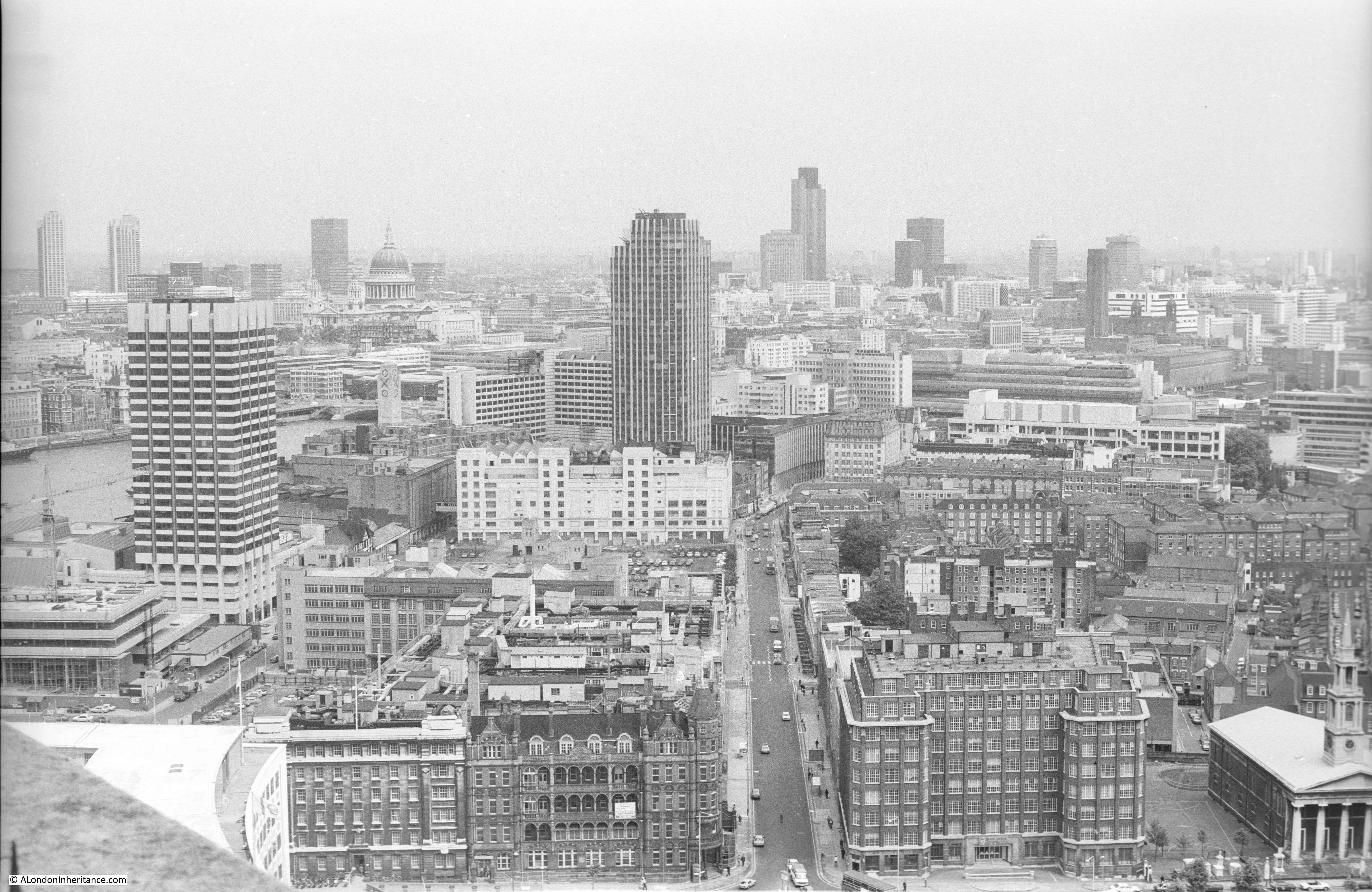
I have featured a couple of the sites from Hugh Pearman’s 1951 book Curious London in previous posts, XX Place and Goodwin’s Court, however these were individual places, so I thought I would take one of London’s “villages” as defined by Pearman and visit all six of the locations mentioned (if they still exist). I picked Southwark as I want to explore more of south London this year, so here is Curious Southwark.

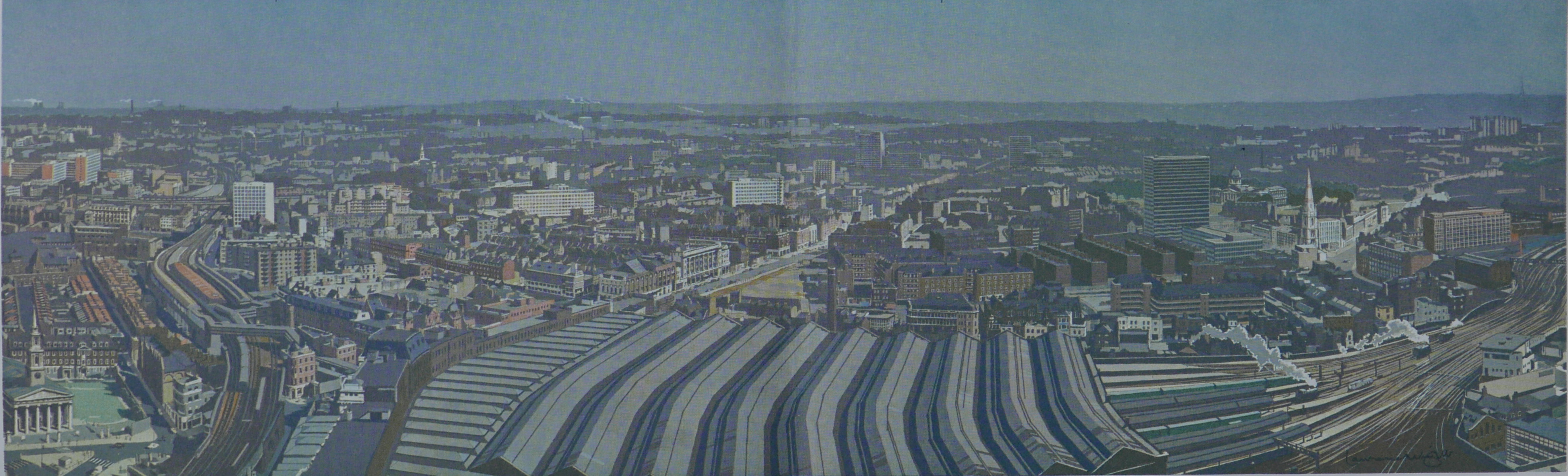
The photograph page from the two pages on Southwark in Curious London.

Curious Southwark

From 1 to 6 they are:

  1. A pub in Newcomen Street
  2. The clocks on the church of St. George
  3. Shakespeare’s Globe
  4. Clink bollards
  5. The oldest outdoor statue in London
  6. Cardinal Cap Alley

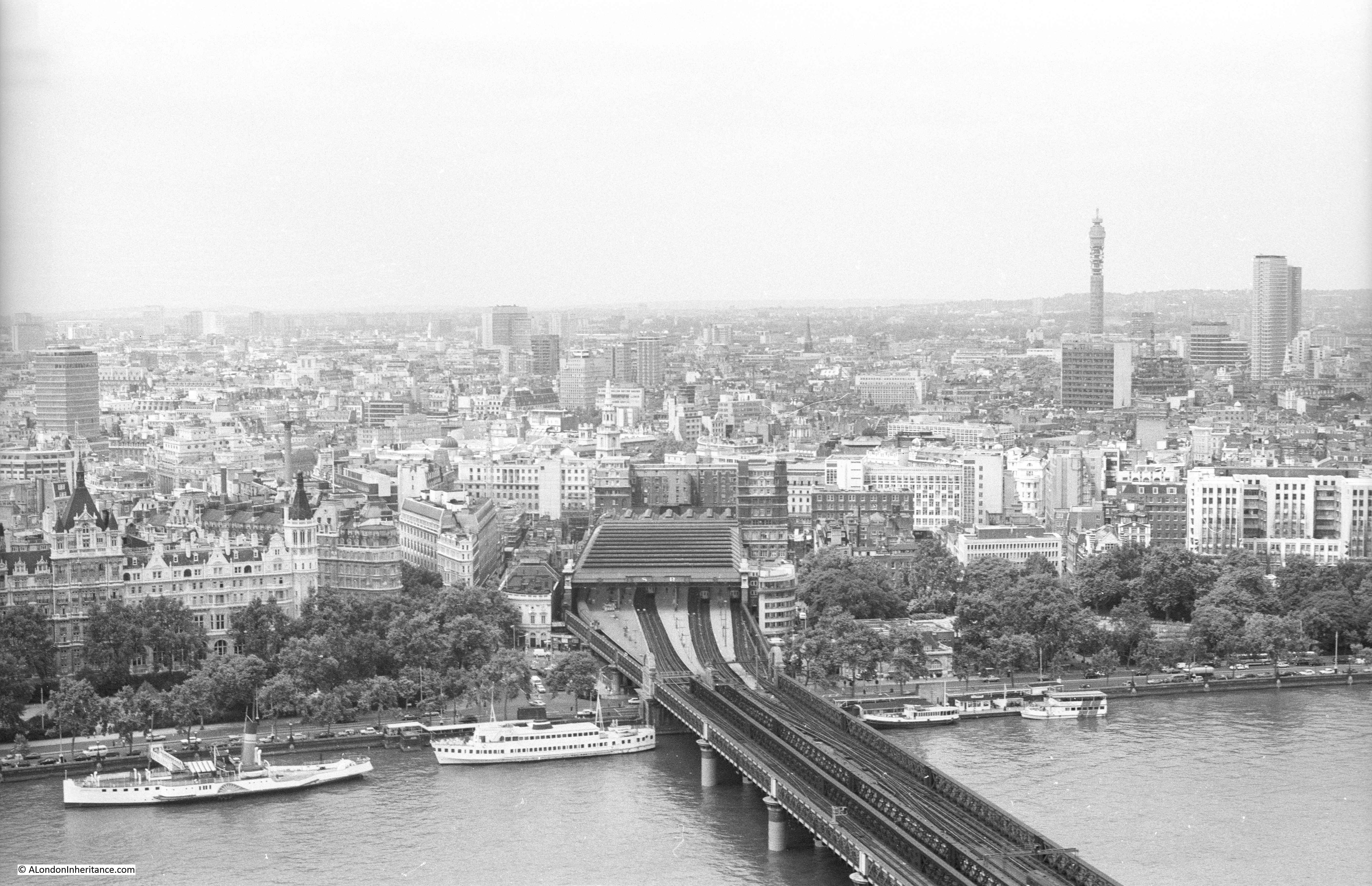
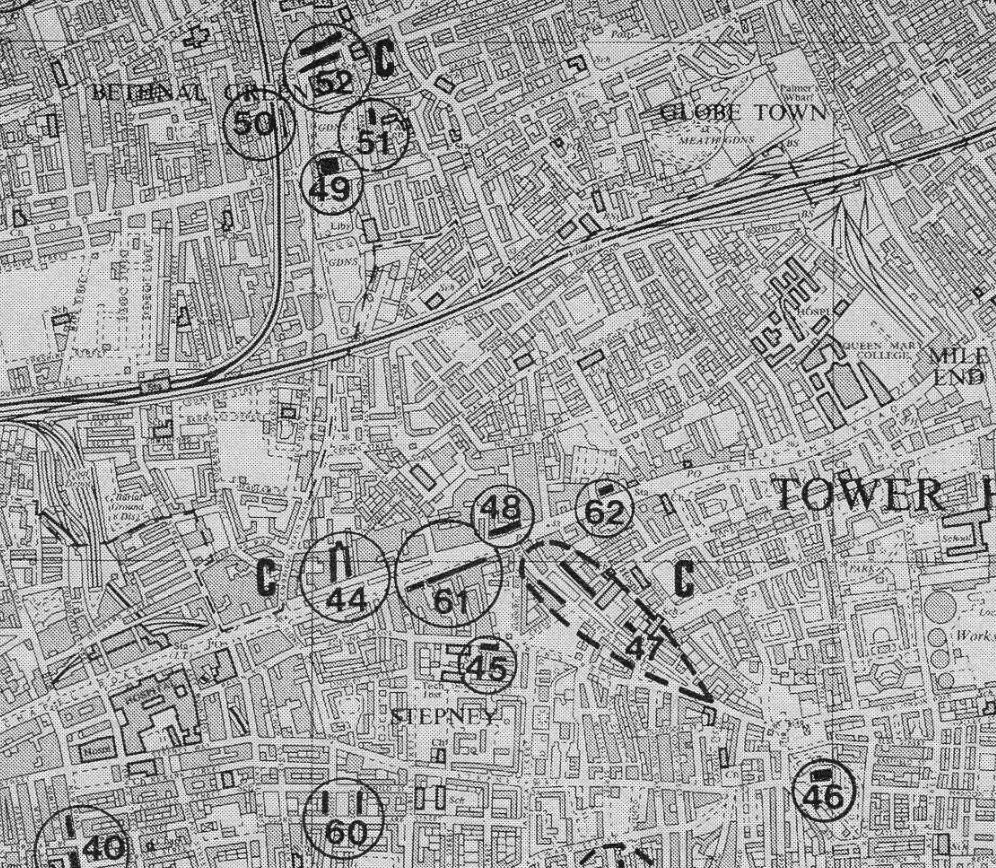
I walked the sites covered by Pearman in a different order to the way he had numbered in the book. I started at the location furthest to the south and walked back towards the river, stopping at the sites as I came to them. The following map shows the locations, with my numbering to reflect the order in which I visited each site.

Curious Southwark

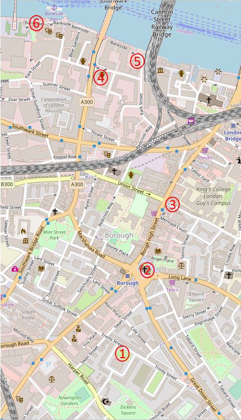
Starting at site number one to find:

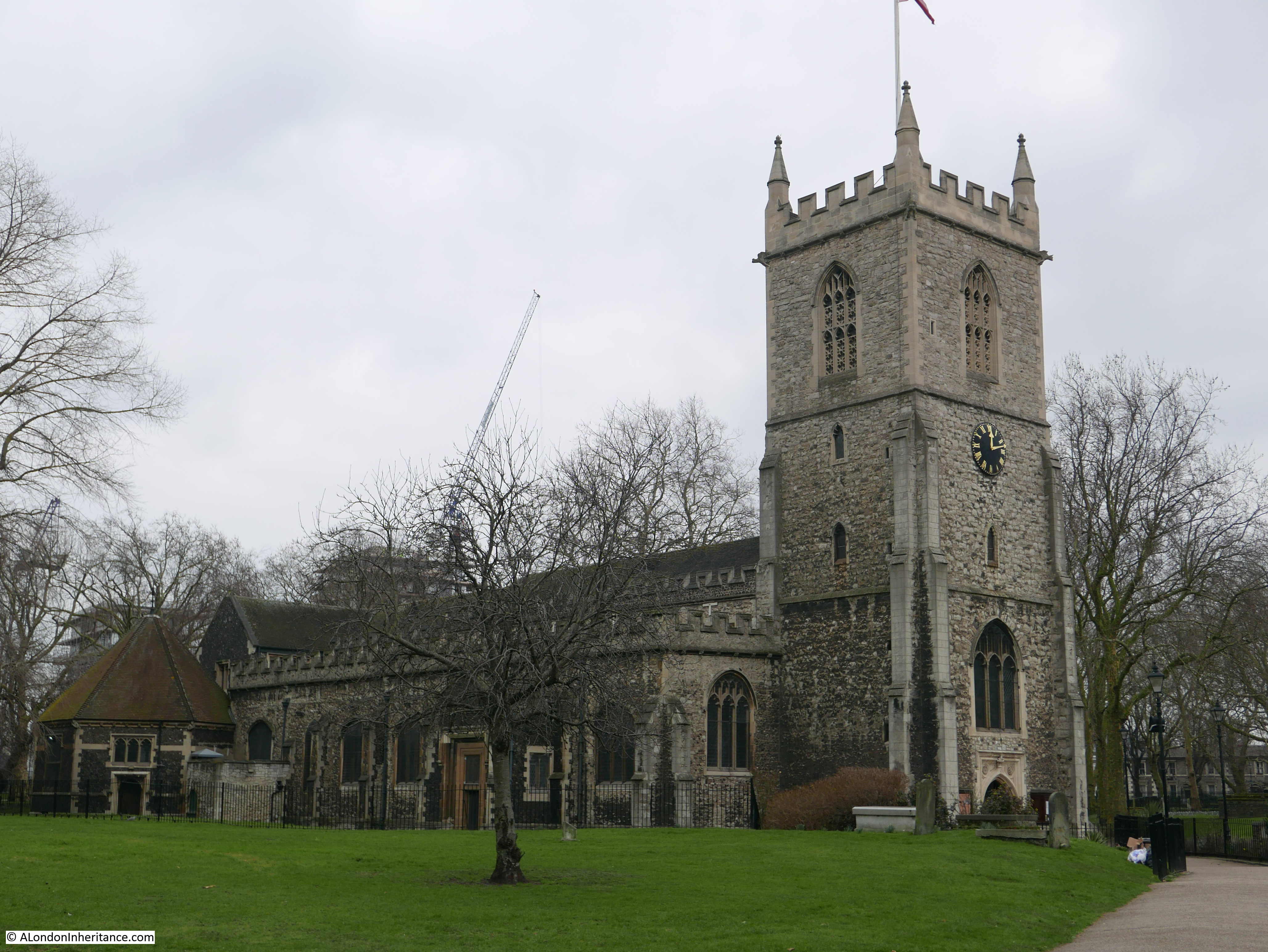
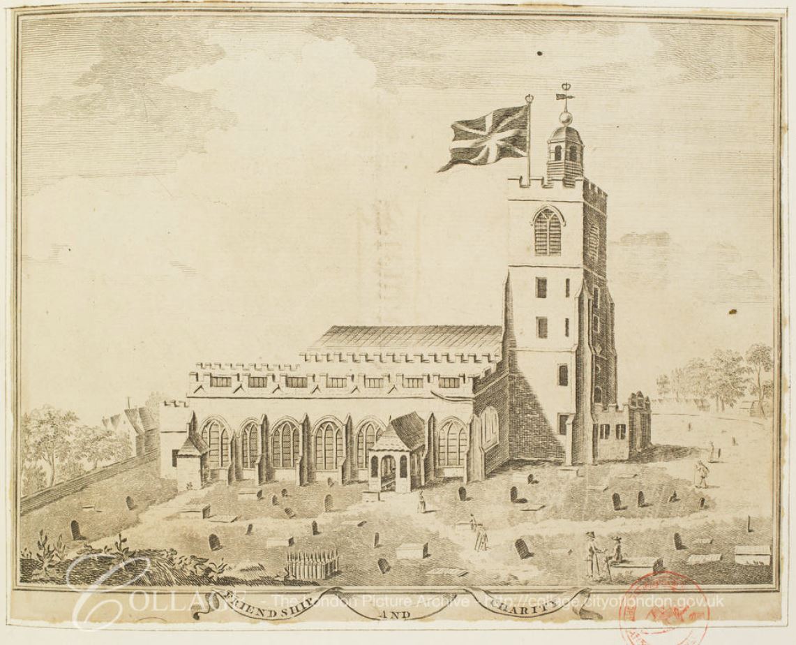
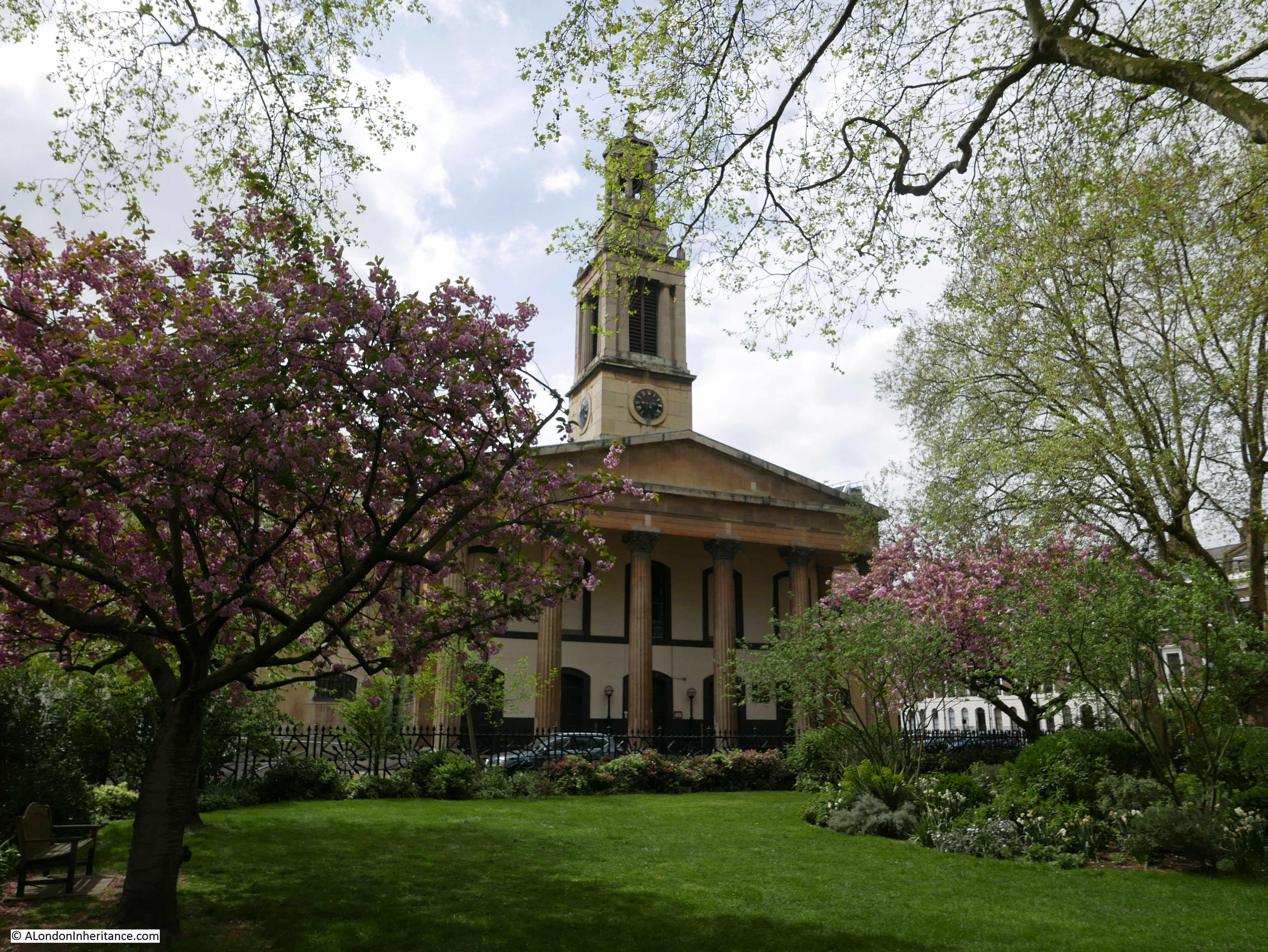
King Alfred and Trinity Square

“The oldest outdoor statue in London is this one of King Alfred. Dating from 1395 it stands in front of Holy Trinity Church, Trinity Square. Originally standing in a niche on the outside of Westminster Hall, it was removed to its present site in 1821.”

So wrote Hugh Pearman to describe the statue in front of Holy Trinity Church and which led me to point 1 on the map where I discovered a magnificent church, one I had not walked past before, so for me, a new discovery.

Curious Southwark

The statue that Pearman refers to is in the middle of the garden in front of the church.

Curious Southwark

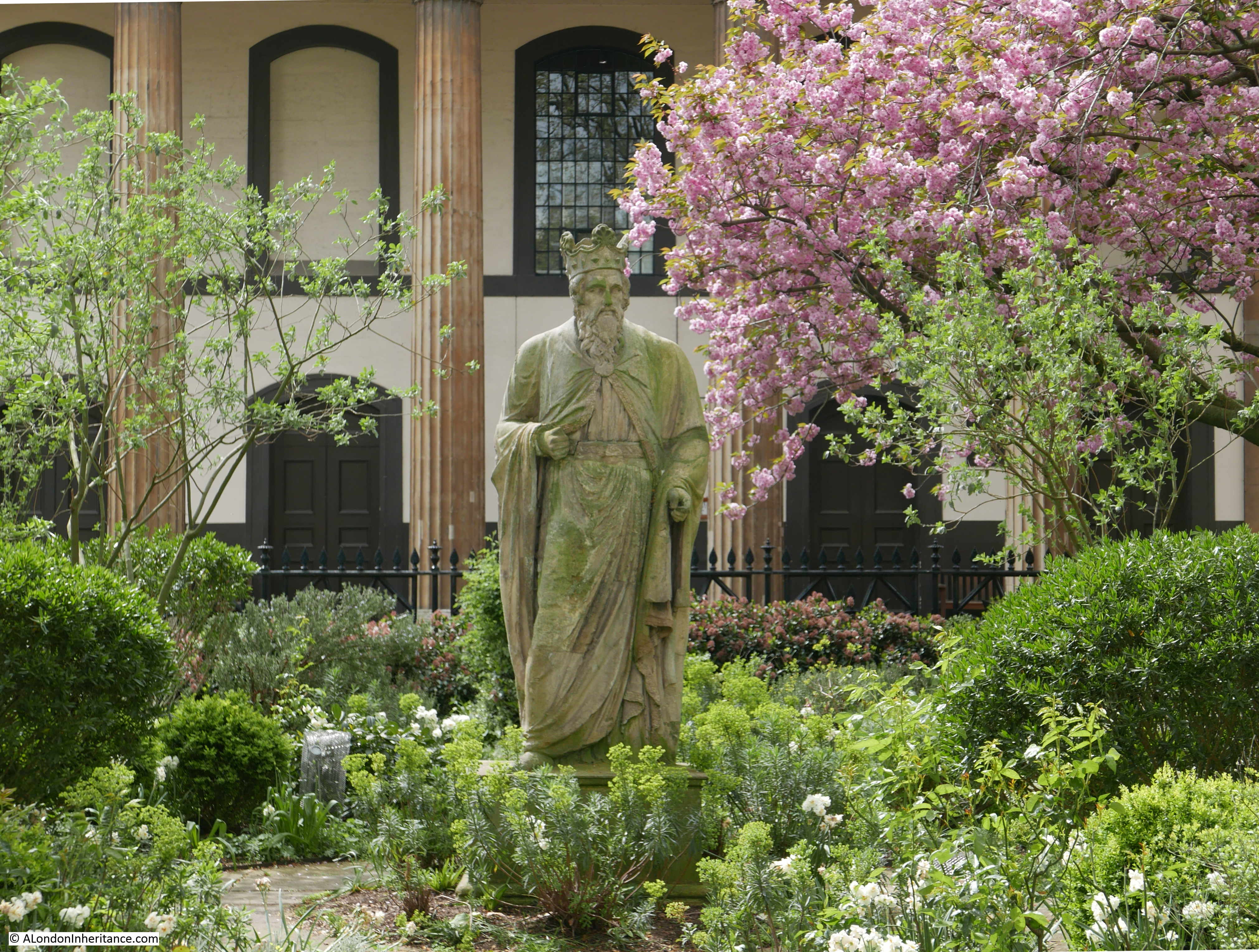
But is this King Alfred and is it really the oldest outdoor statue in London?

The church dates from 1824 (year of consecration), and there are two main theories as to the original source of the statue which appeared in front of the church when the gardens were being laid out in the 1820s.

The first theory is that the statue is one of eight medieval statues that were originally located on the towers at the north end of Westminster Hall. Five of these disappeared when Sir John Soane was re-working the front of the hall in the same years as the church was being built.

The second theory is that the statue was one of a pair made for the gardens of Carlton House by the sculptor John Michael Rysbrack in 1735. Carlton House was demolished in the late 1820s, again in the same decade as the construction of the church and the creation of the gardens.

The statue also appears to have had some extensive restoration, probably using Coade stone.

I suspect we will never know which of the two theories is correct.

This print from 1830 shows the statue in place in front of the church.

Curious Southwark

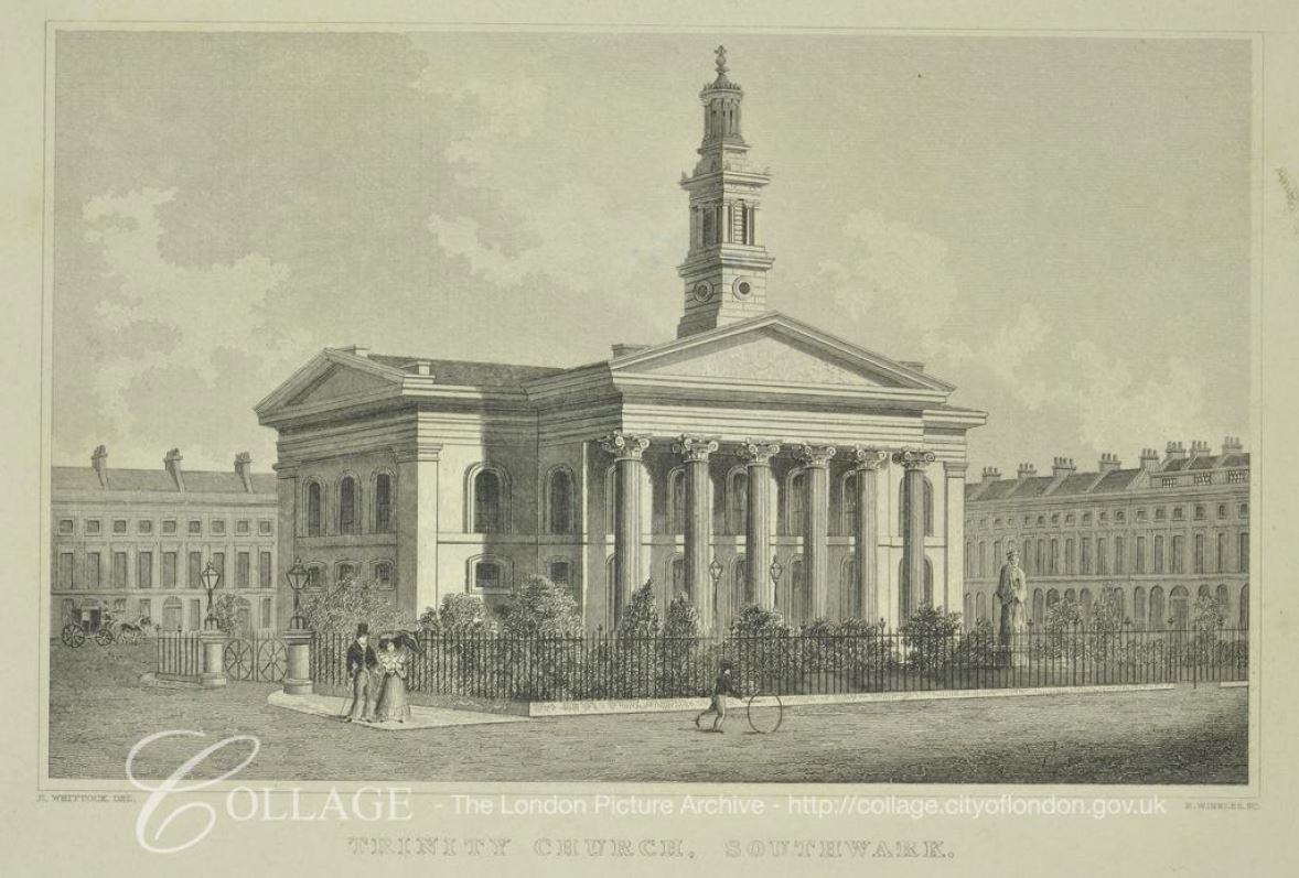
Image credit: London Metropolitan Archives, City of London: catalogue ref: 306294

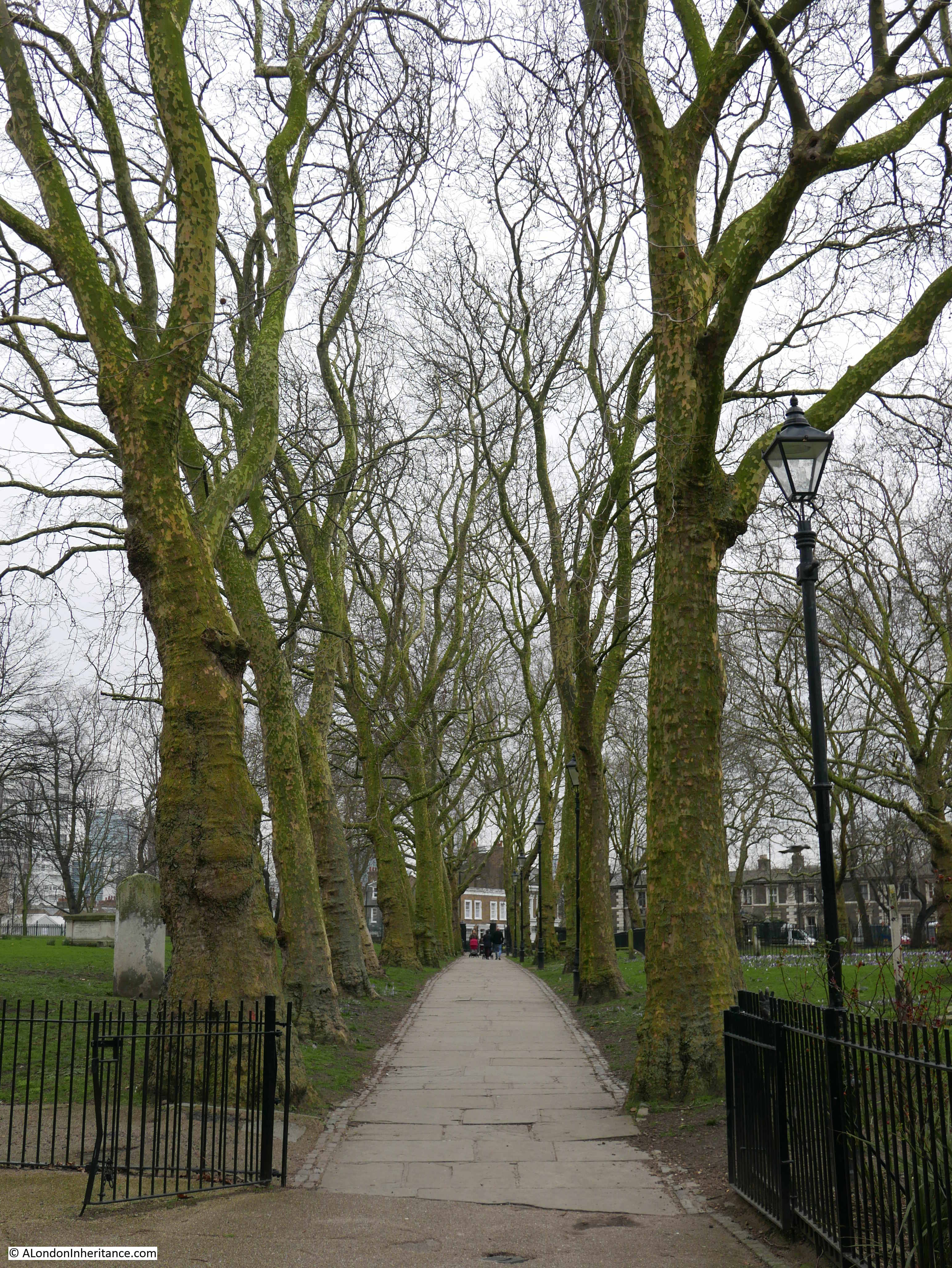
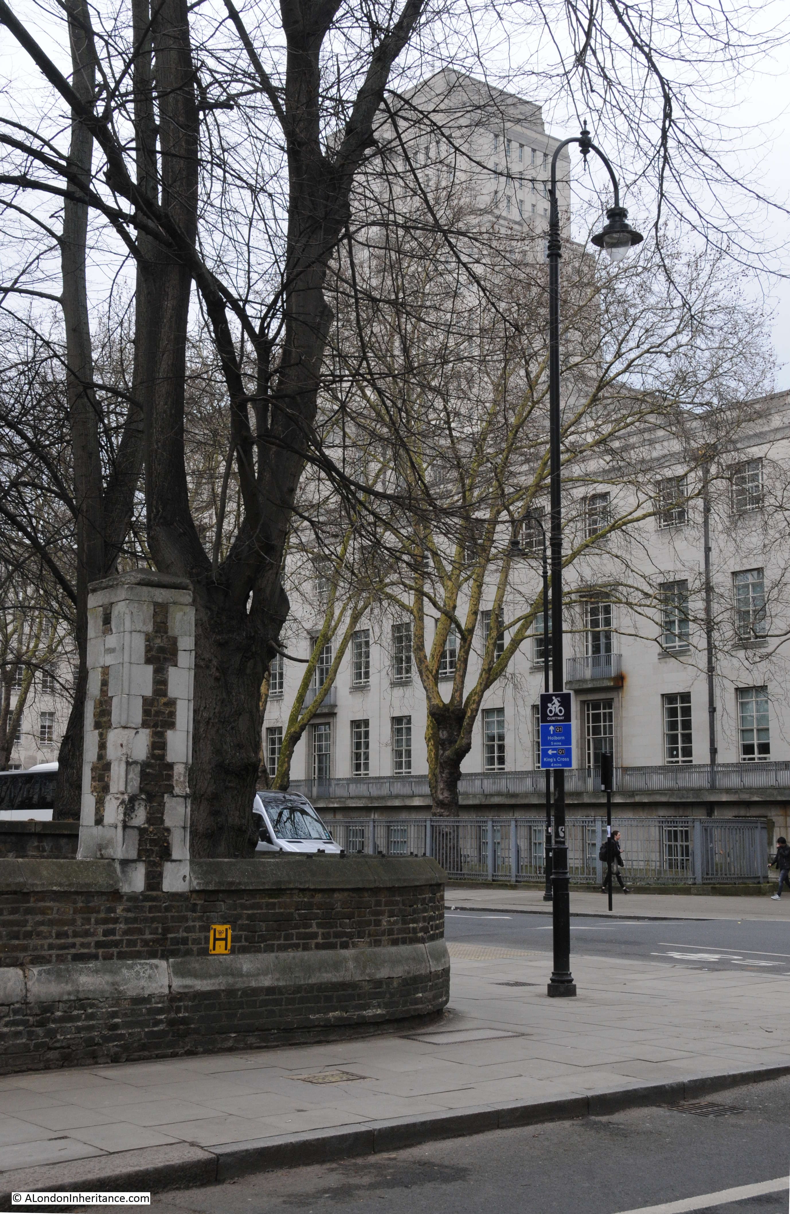
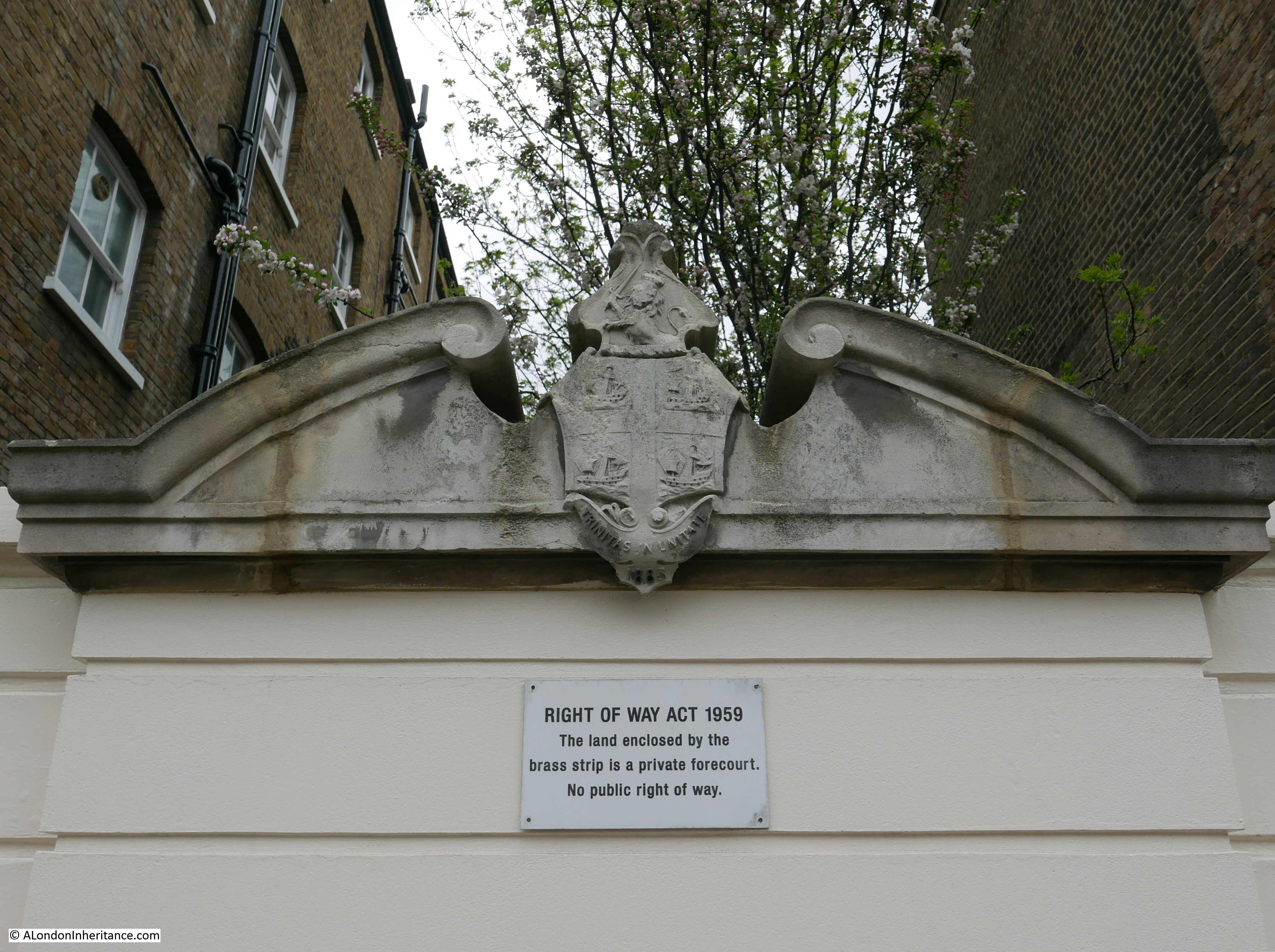
The church and surrounding streets are rather unique, both architecturally and in their ownership. The area is known as Trinity Village and is on land that originally formed the Newington Estate, owned by Christopher Merrick, who gave the land to the Corporation of Trinity House in 1660.

The estate was originally mainly used for commercial activities, however in the early 19th century the development of an estate with housing following a Georgian design commenced.

Trinity Church was part of the development, with the square that surrounds the church along with several streets that comprise the overall estate.

Trinity Church became redundant as a church in the early 1960s. In the early 1970s the London Philharmonic and London Symphony Orchestras were looking for new rehearsal space in London and commissioned a review to look for a suitable location among the redundant churches across London.

Trinity Church was identified as a suitable candidate which was confirmed in December 1972 when test rehearsals were held in the church. The buildings and land were purchased from the Church in 1973 and returned to the Corporation of Trinity House.

An extensive restoration of the church was then carried out and on the 16th of June 1975 the church was formally opened as rehearsal rooms and named the Henry Wood Hall with a concert by the London Philharmonic and London Symphony Orchestras. The name is after Henry Wood, who was associated with the Proms for almost 50 years and after a substantial donation from the Henry Wood fund to the restoration of the building.

The estate continues to be owned by the charitable arm of the Corporation of Trinity House with all rents being received by the charity.

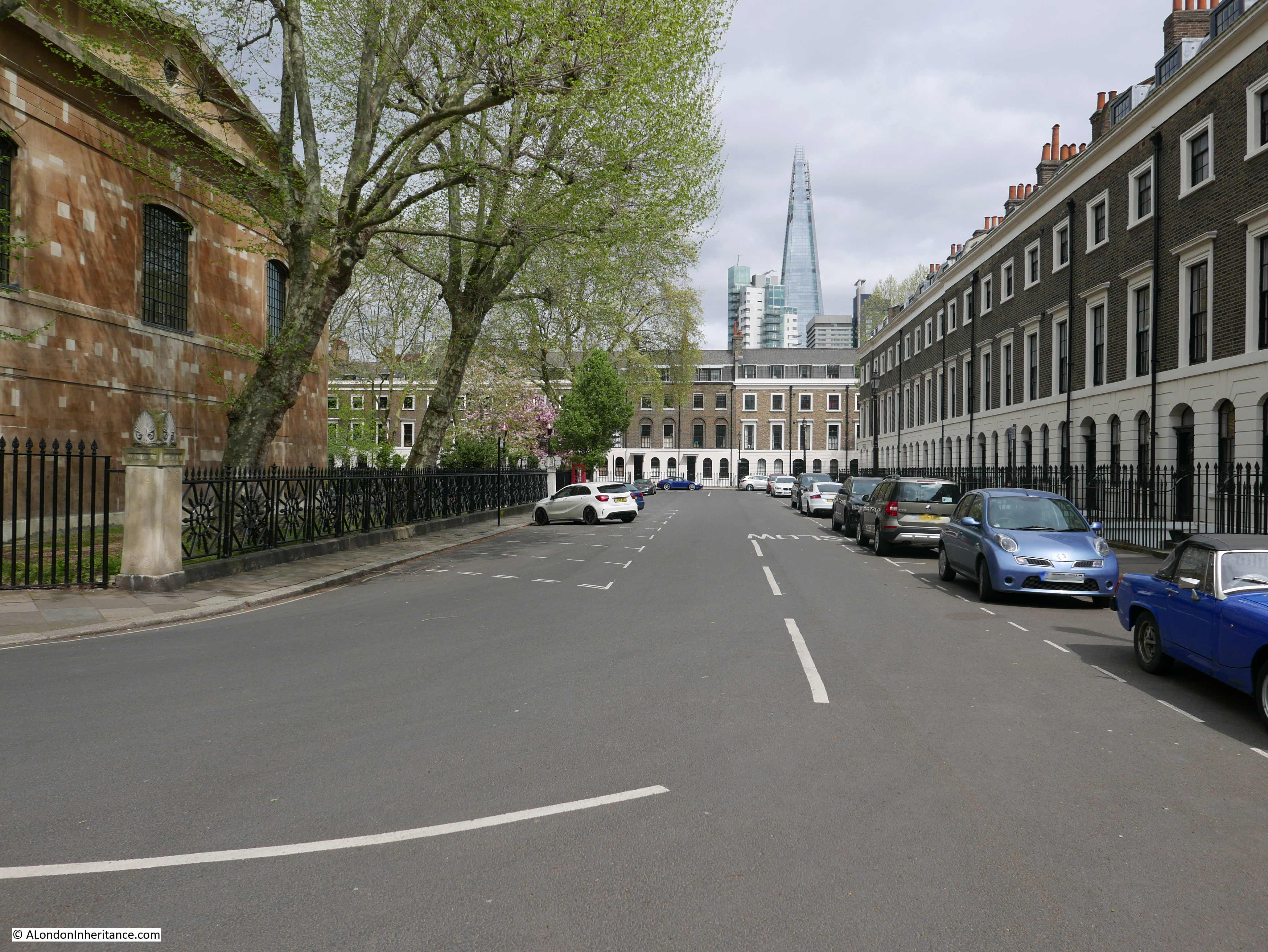
The surrounding streets are magnificent and the following photos are from a walk around the square that surrounds the church:

Curious Southwark

Curious Southwark

Curious Southwark

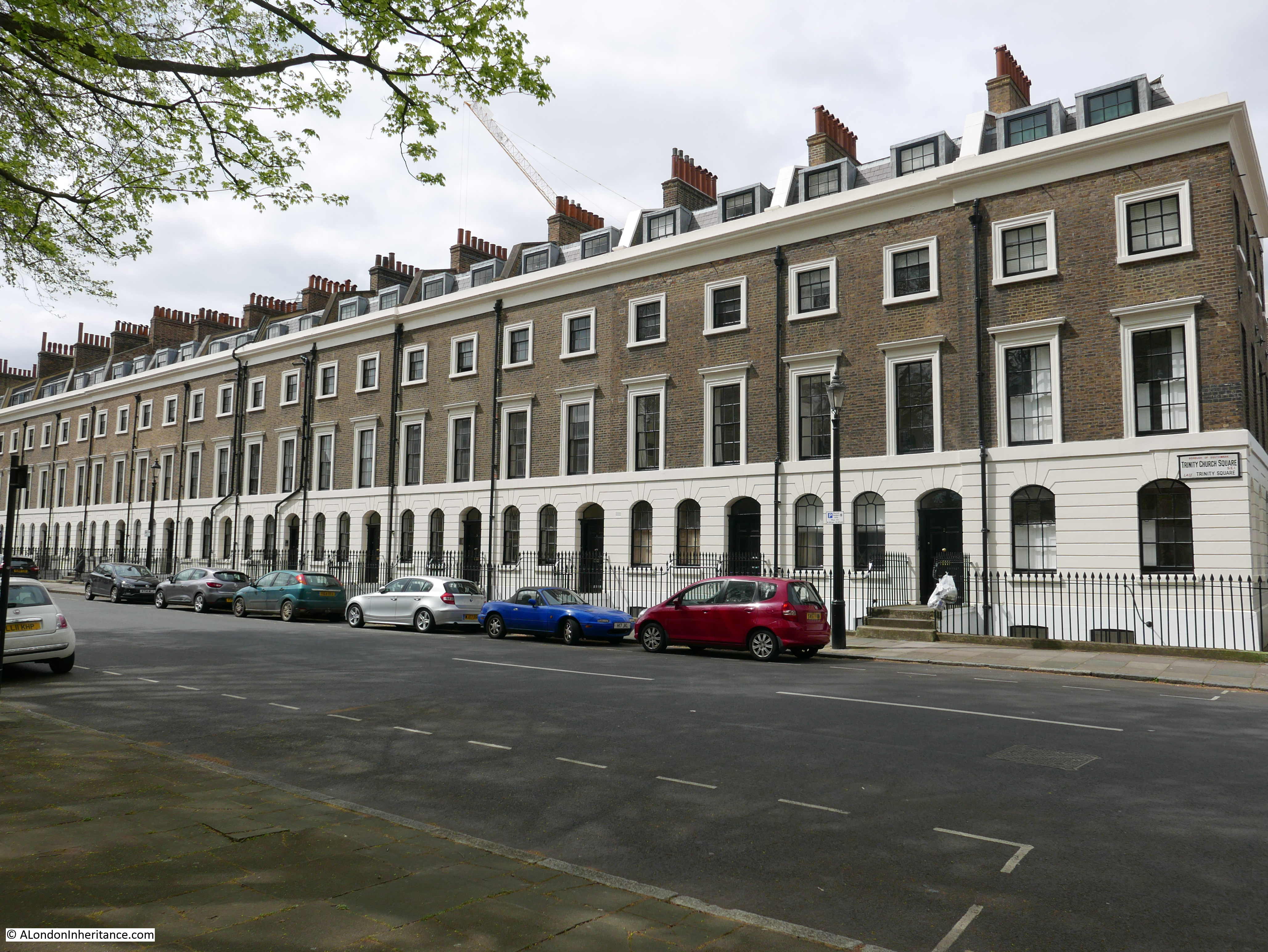
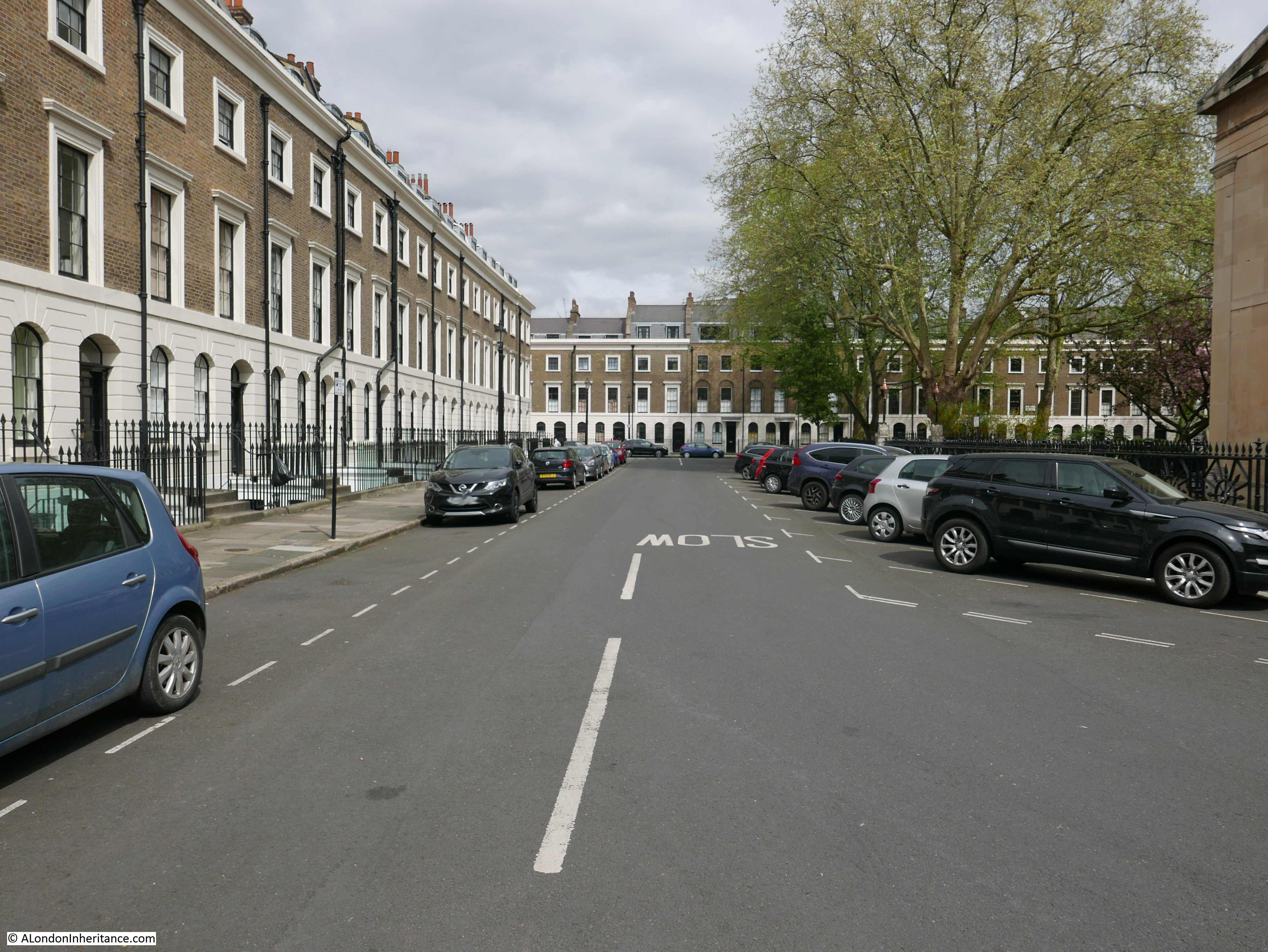
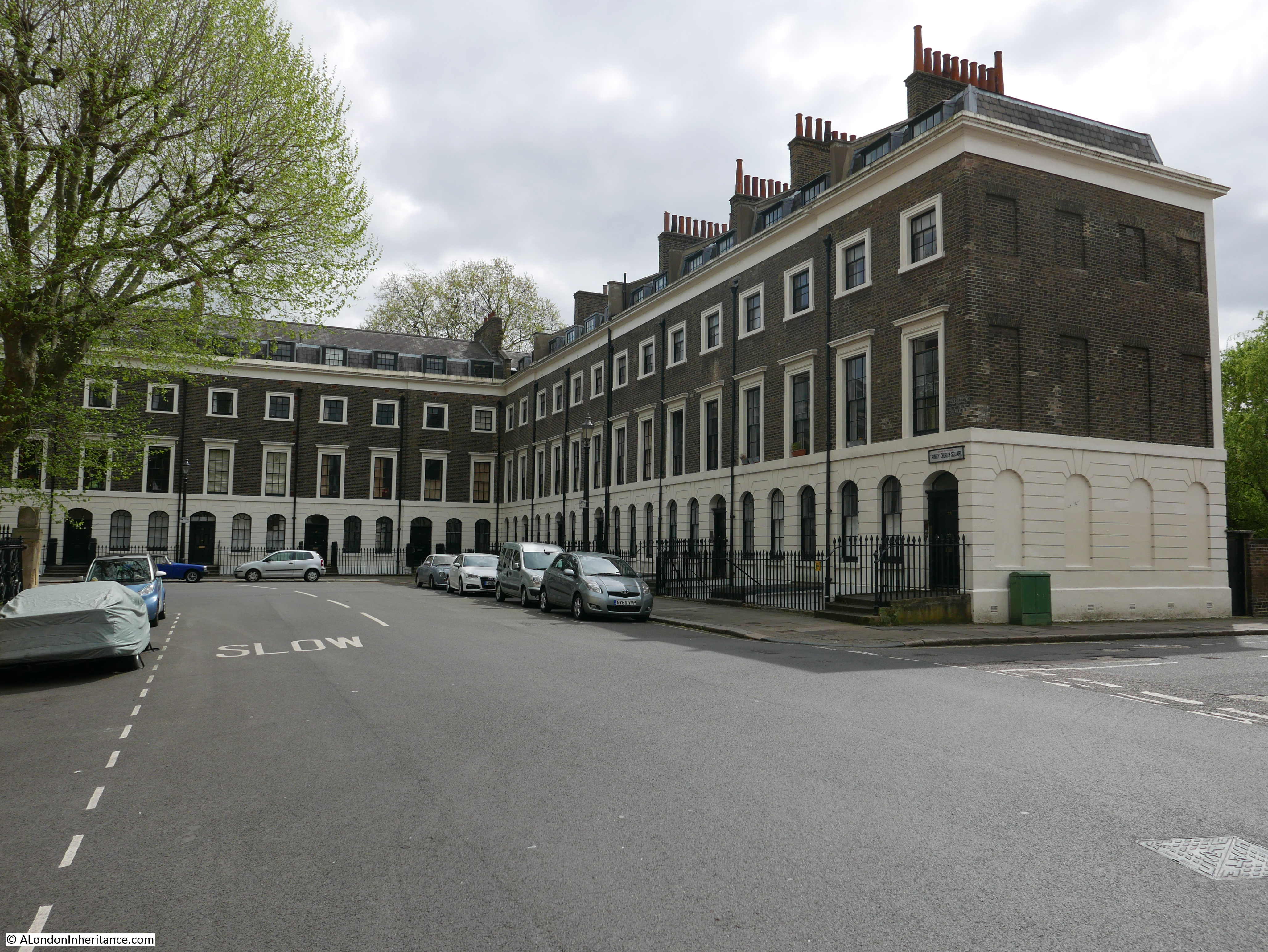
The square is very peaceful. I walked round the square in the centre of the road to take photos and did not once have to move for a car.

One side of the square shows how close this unique part of Southwark is to London Bridge.

Curious Southwark

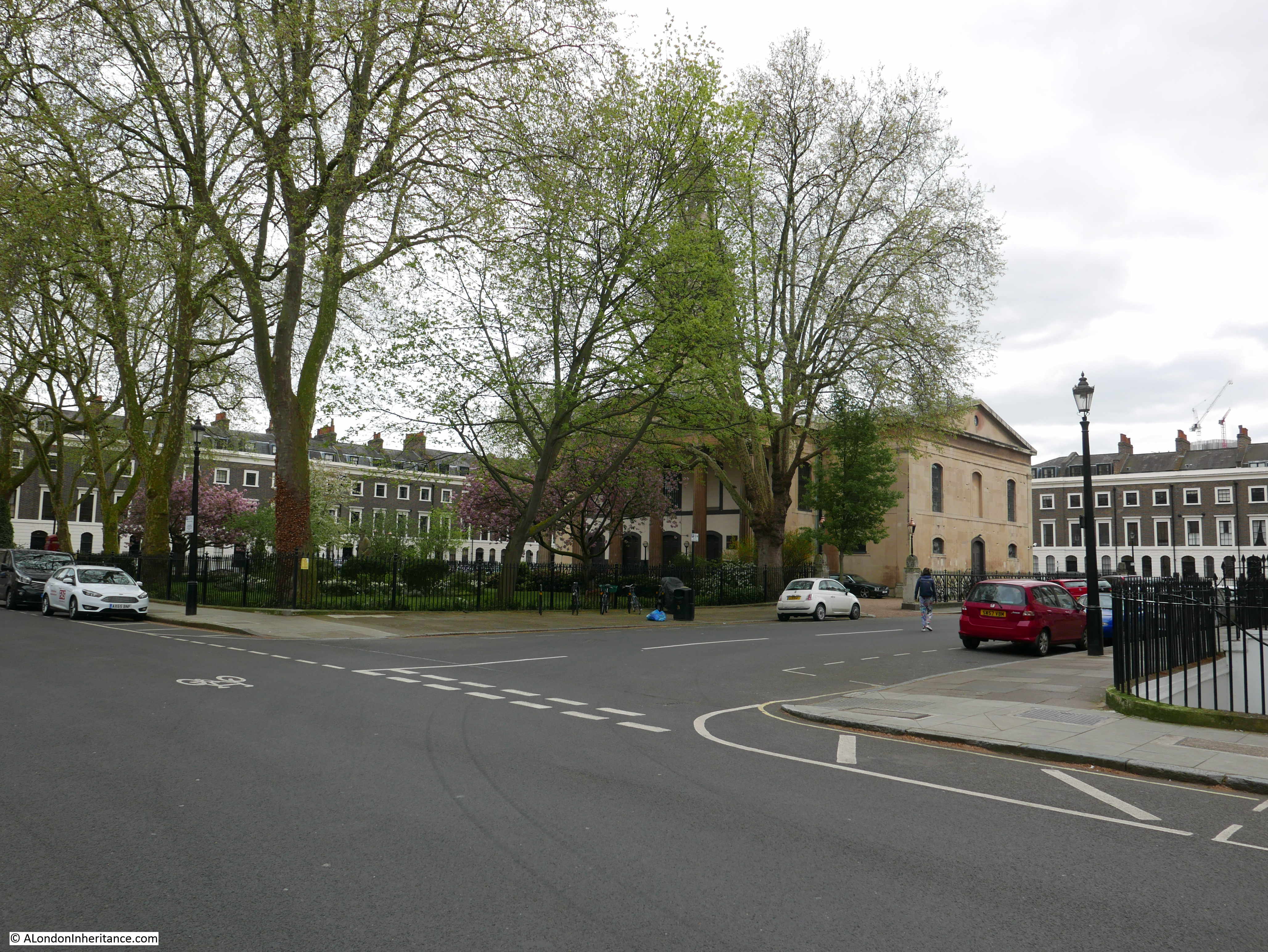
A final view of the church as I set off for the next location:

Curious Southwark

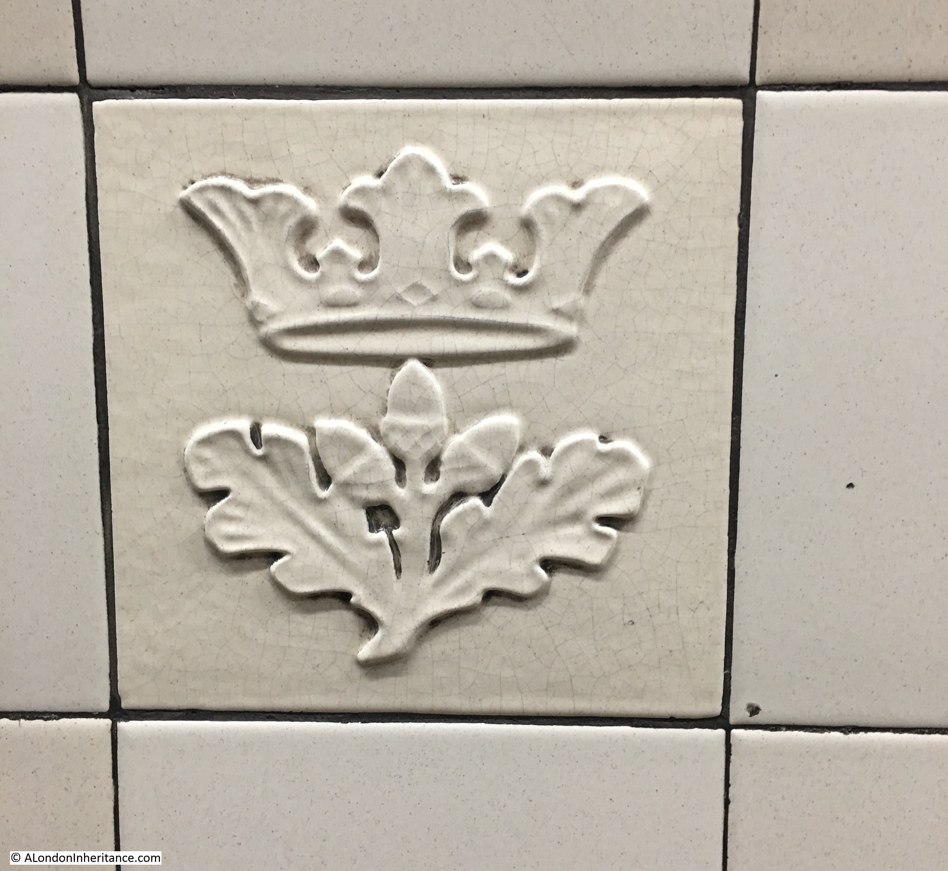
And here I found at the side of the street the Coat of Arms for Trinity House. dated 1883:

Curious Southwark

Whatever the truth of the origin of the statue, I was pleased that looking for the statue took me to a fascinating part of Southwark that I had not seen before.

It was then a short walk to point 2 on the map:

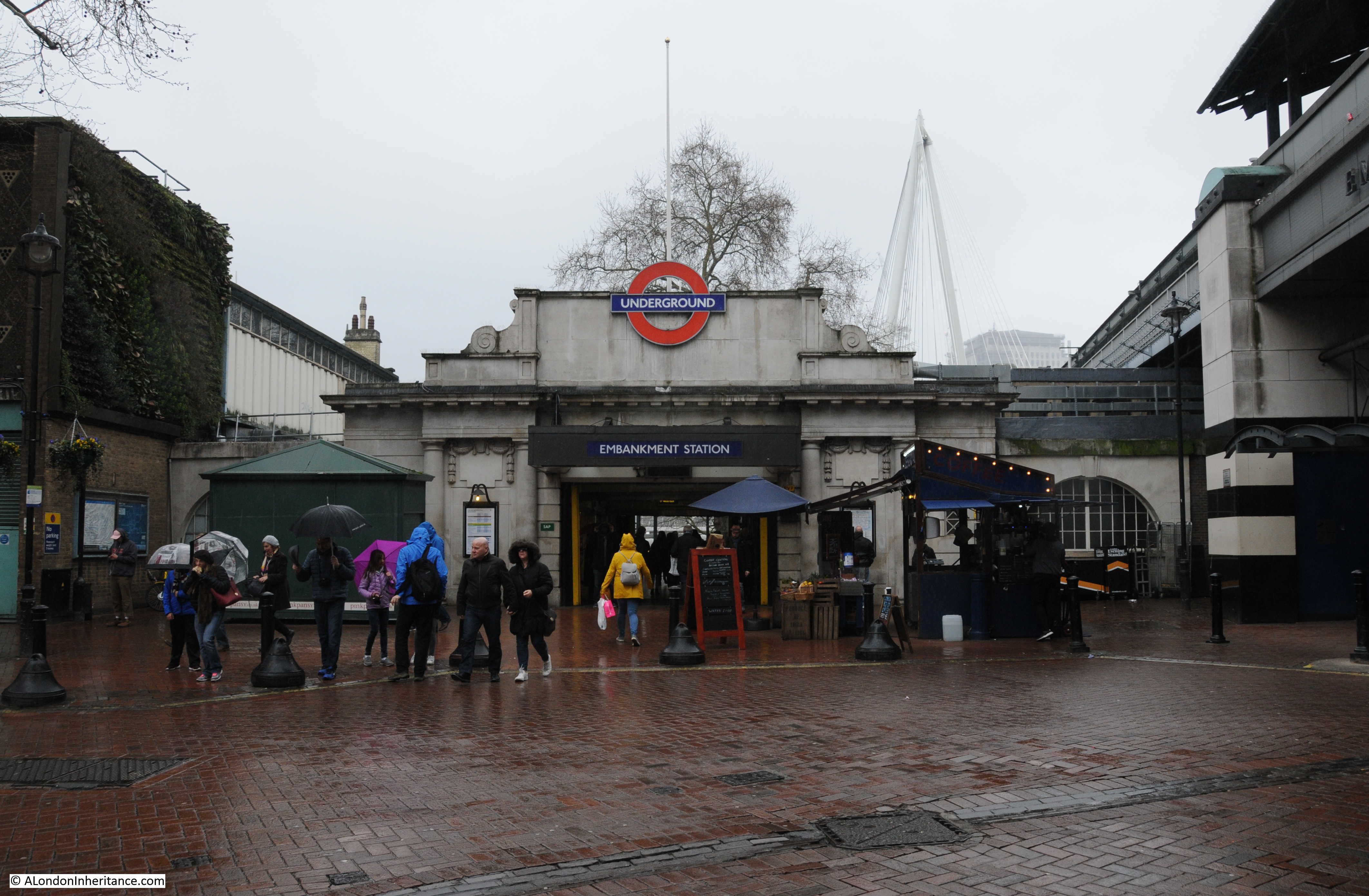
St George the Martyr, Borough High Street

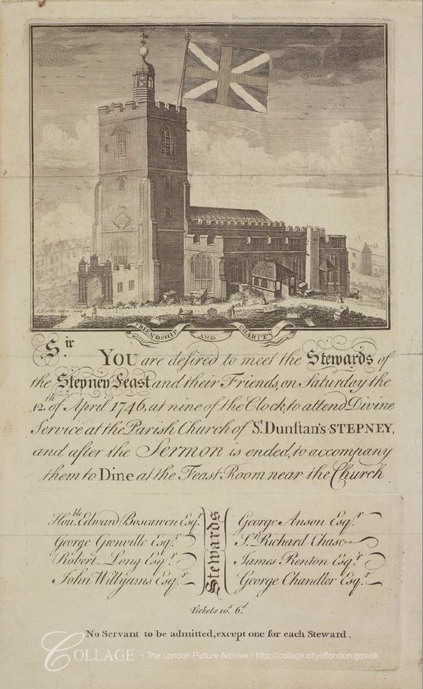
“Local tradition says that because of the meanness of Bermondsey people when an appeal was made for funds to erect the clock tower of St. George’s Borough High Street, the face of the clock looking towards Bermondsey has always been painted black.”

When I reached the church of St. George I was disappointed to find that the body of the church was surrounded by scaffolding and plastic sheeting, but relieved that the tower was still fully visible so I could confirm Pearman’s statement about the clock.

Three sides of the church have the same clock faces which presumably have internal lighting and are therefore visible at night.

Curious Southwark

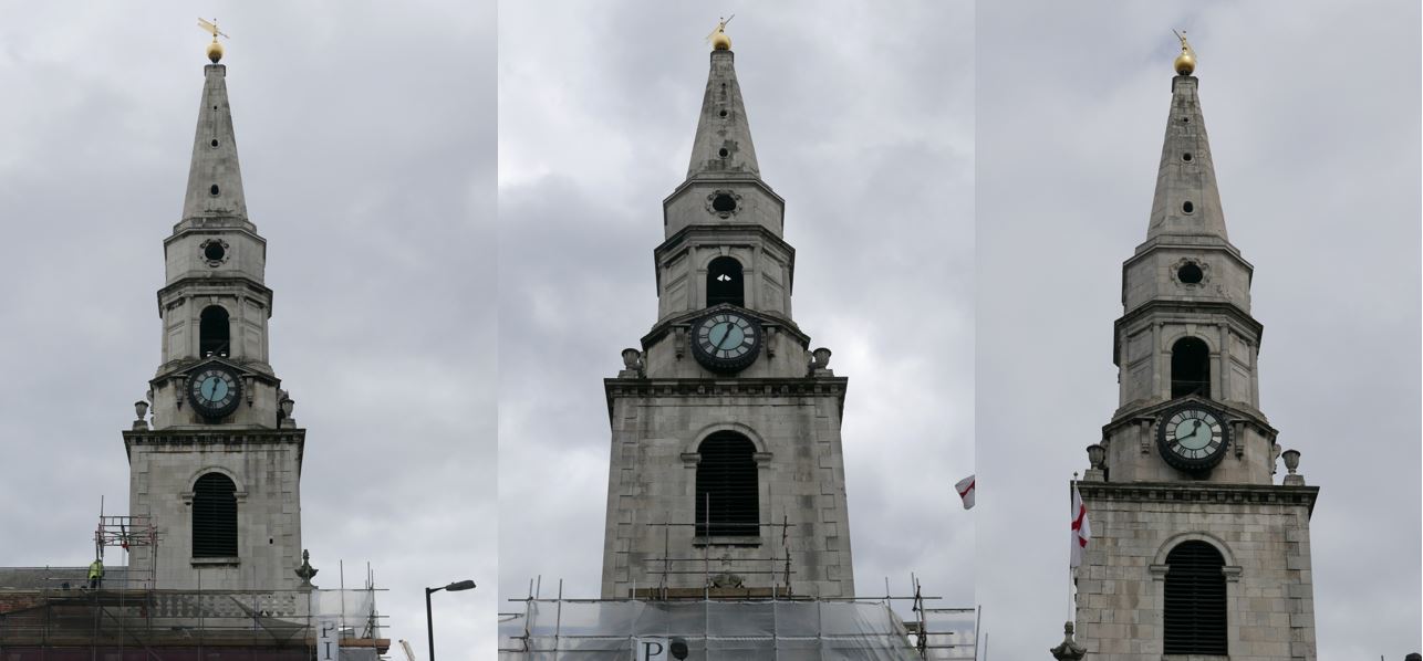
But the fourth clock face is very different.

Curious Southwark

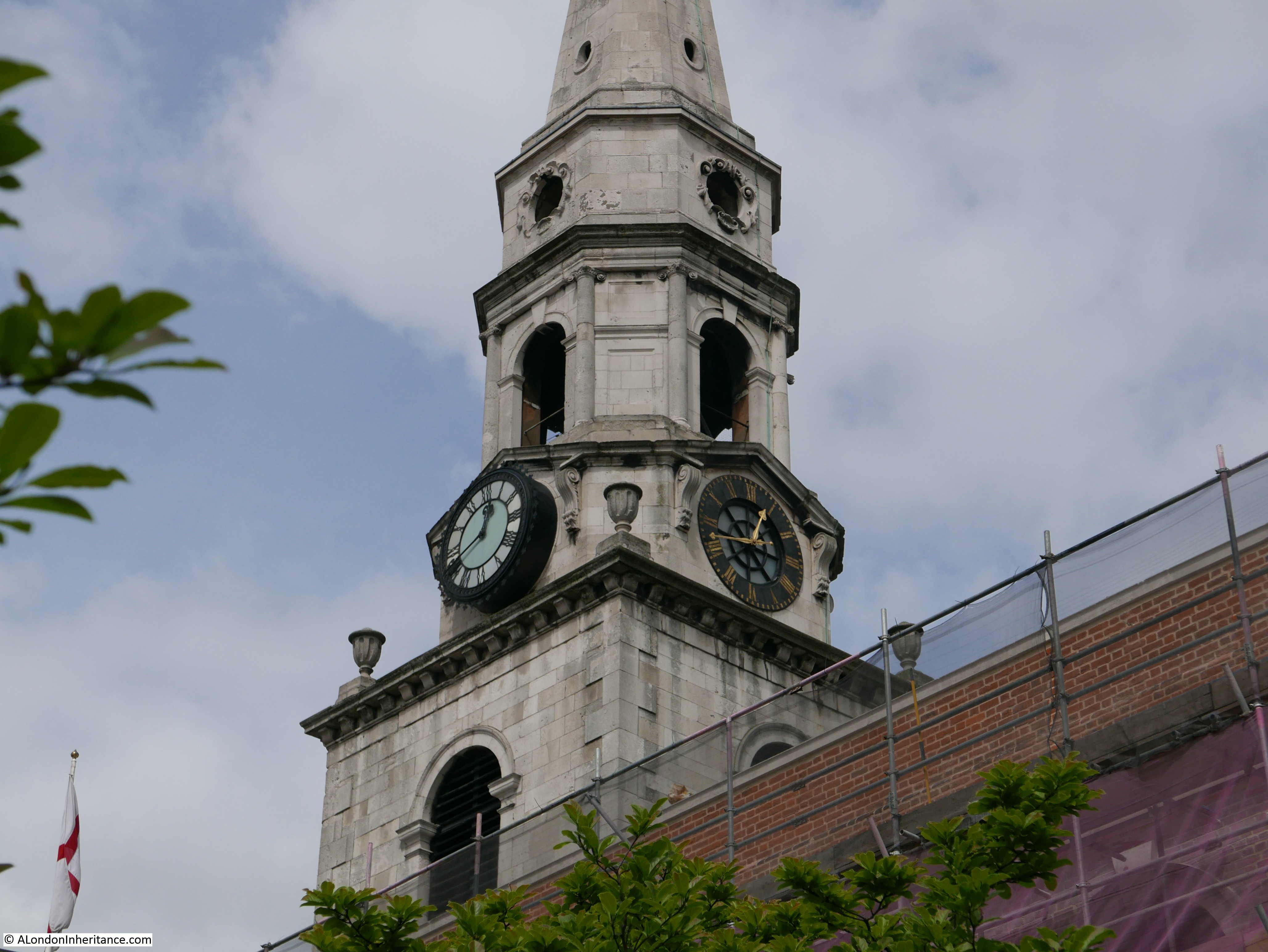
This clock is over the main body of the church and is indeed facing in the general direction of Bermondsey, however you would need good eyesight to see the clock from Bermondsey and presumably not be at street level as the tower would have been obscured at that distance by buildings.

There are very many references to the same story as told by Pearman.

My father bought a book titled “London is stranger than fiction” by Peter Jackson in 1951. Jackson was an artist who started producing cartoons detailing London’s history in 1949 in the Evening News. He would continue until the paper closed in 1980.

There was a second book of his cartoons published later and I managed to buy a copy of this second book a couple of years ago.

In the first book, there is a mention of the clocks at St. George’s in the cartoon strip that appeared in the 28th December 1949:

Curious Southwark

The current clock dates from 1868 although with post war repairs due to the considerable damage suffered by the church during the war.

Three of the clock faces were lit by gas. The church’s website states that the fourth clock face was not lit due to the cost, and also relates the story of the residents of Bermondsey, but as an apocryphal story rather than a statement of fact.

The unlit clock is above the main body of the church and so not easy to see from many angles, whilst the three other clocks are all obscured so I can understand that from a cost perspective, lighting the three fully visible clocks was more important than lighting the fourth – but again, I suspect we will never know the true story.

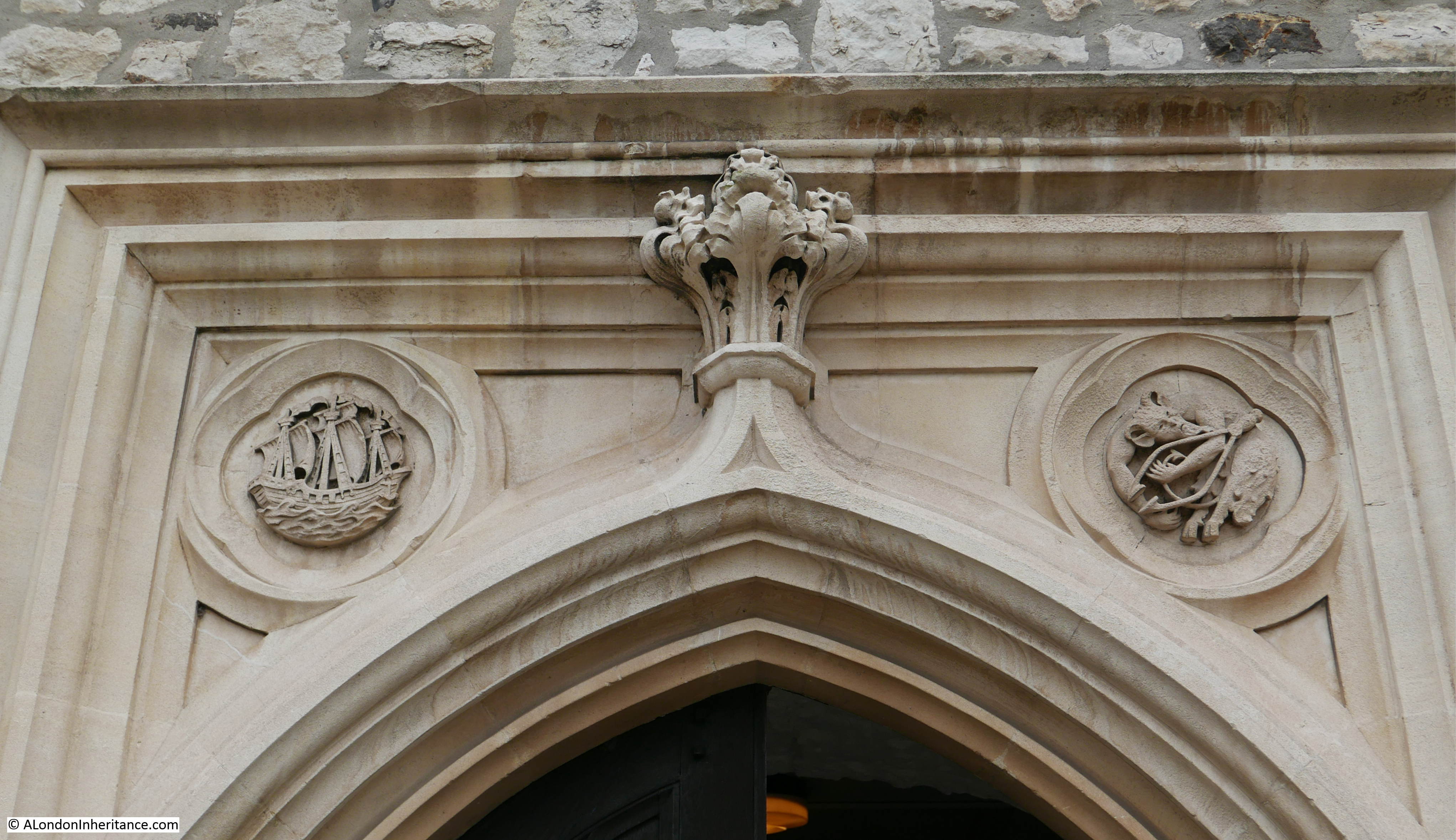
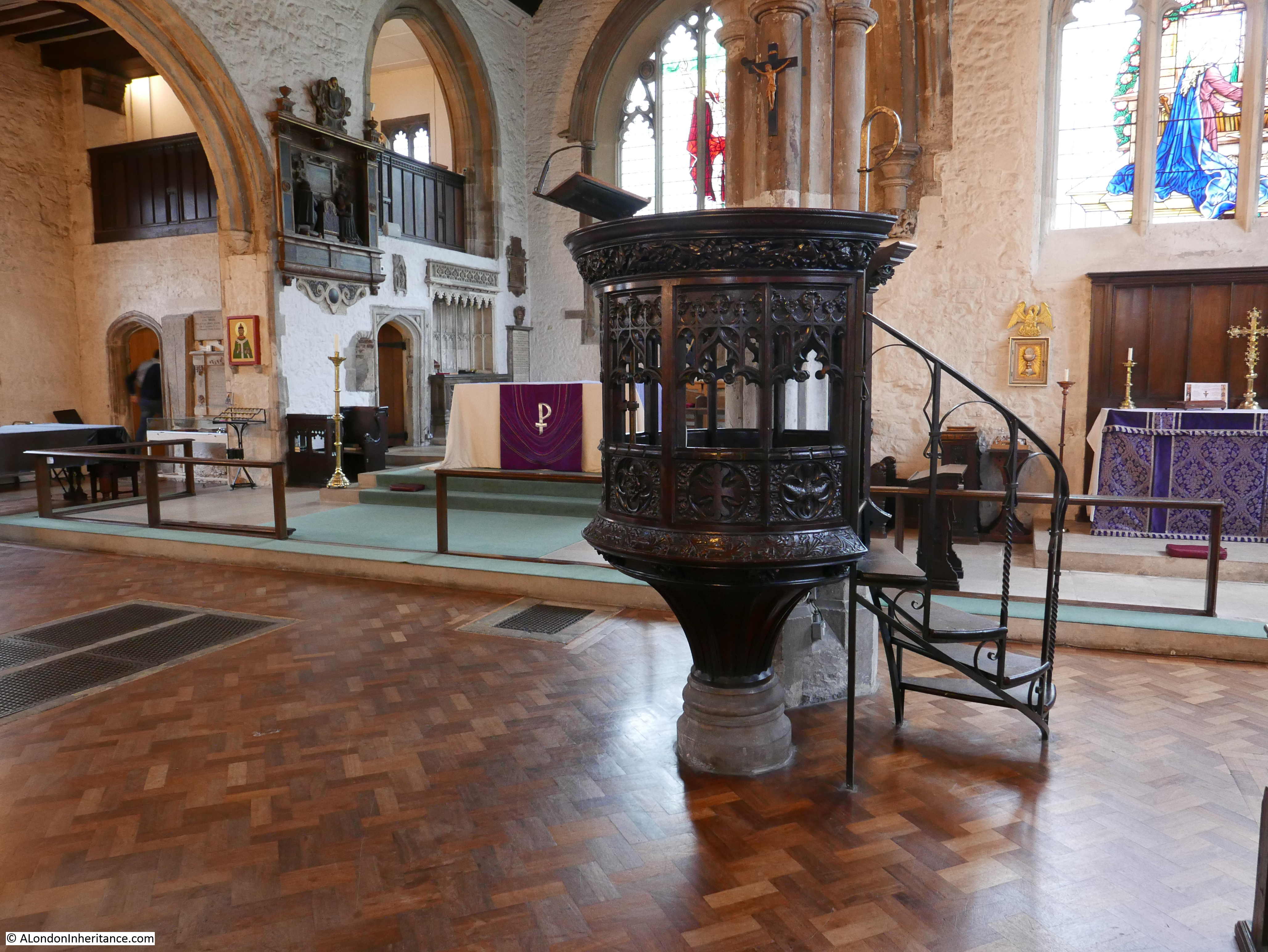
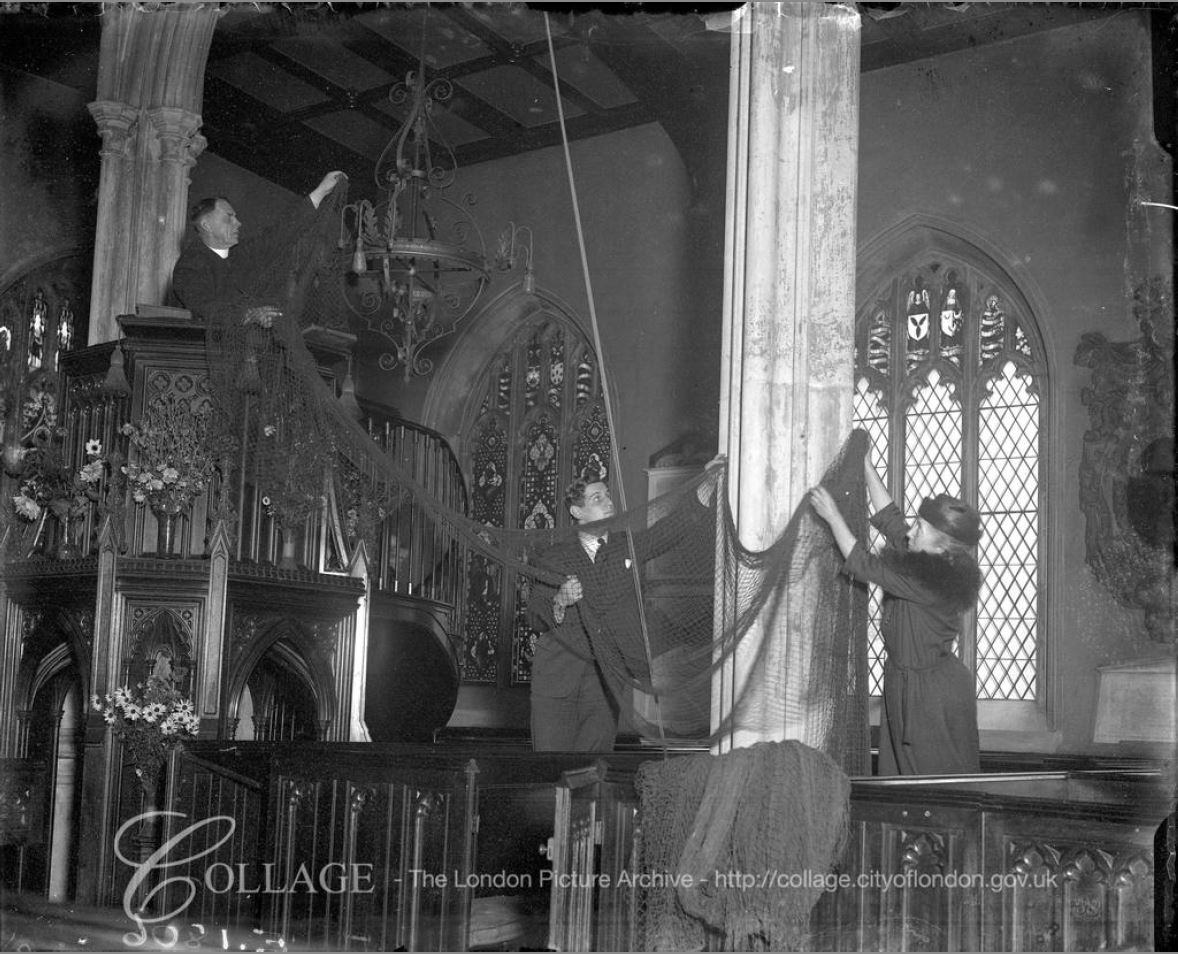
Although the church is currently covered in plastic sheeting, the interior of the church is well worth a visit.

Curious Southwark

A church may have been on the site since the 12th century, however the current church dates from 1736, although the interior of the church has undergone many changes, including the restoration needed following severe bomb damage in the war. A number of high explosive bombs landed very close to the church and a V1 flying bomb hit a short distance down Borough High Street.

An archaeological dig in the crypt of the church found evidence of possible burials that predate the 18th century church along with evidence of the earlier church and of Roman occupation.

The interior today has a magnificent ceiling, originally dating from 1897, but with considerable restoration work in the 1950s. I doubt helium filled balloons were a consideration in the original design of the roof.

Curious Southwark

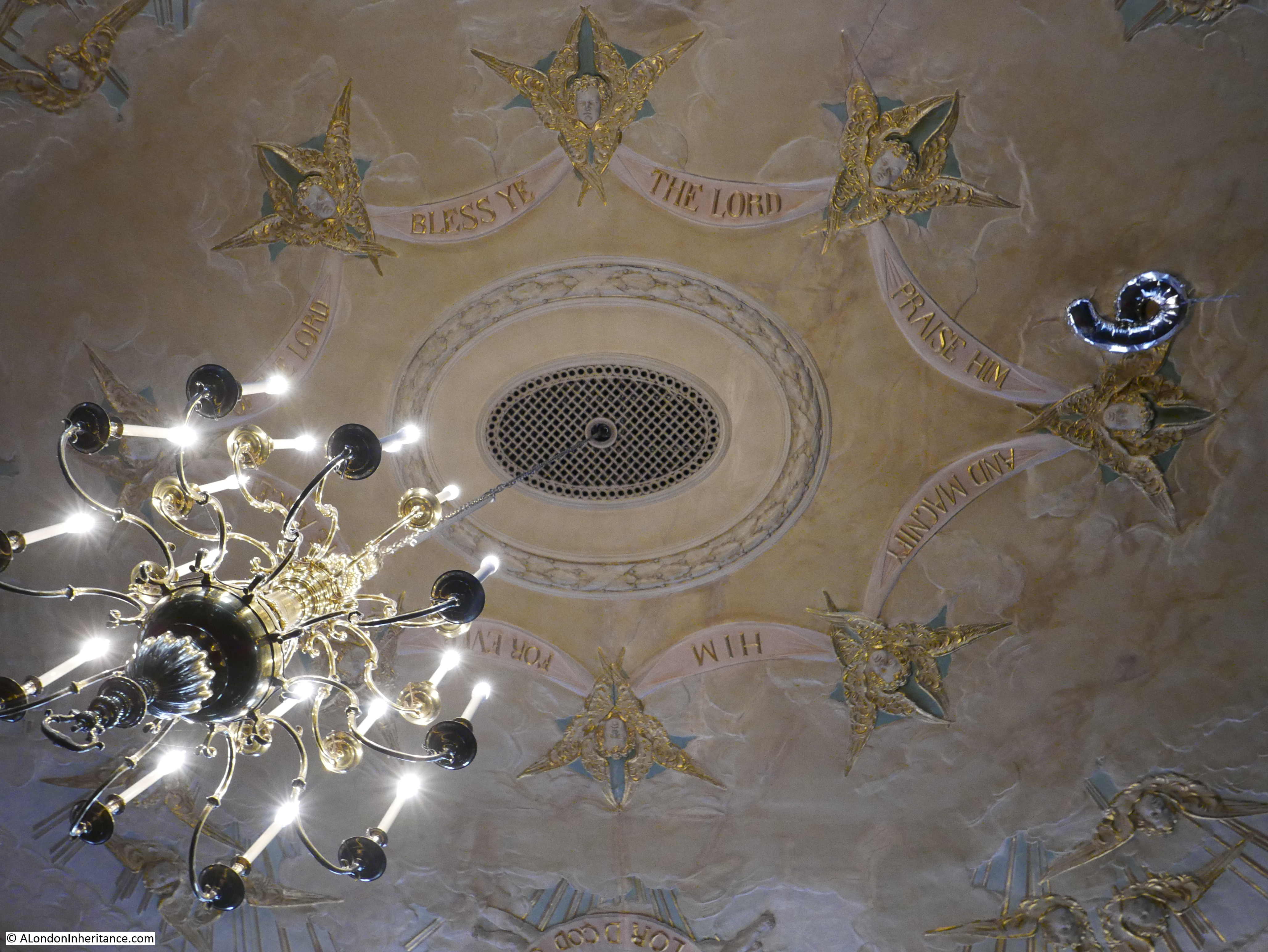
A gallery runs along the sides and above the entrance to the church were the organ is also installed:

Curious Southwark

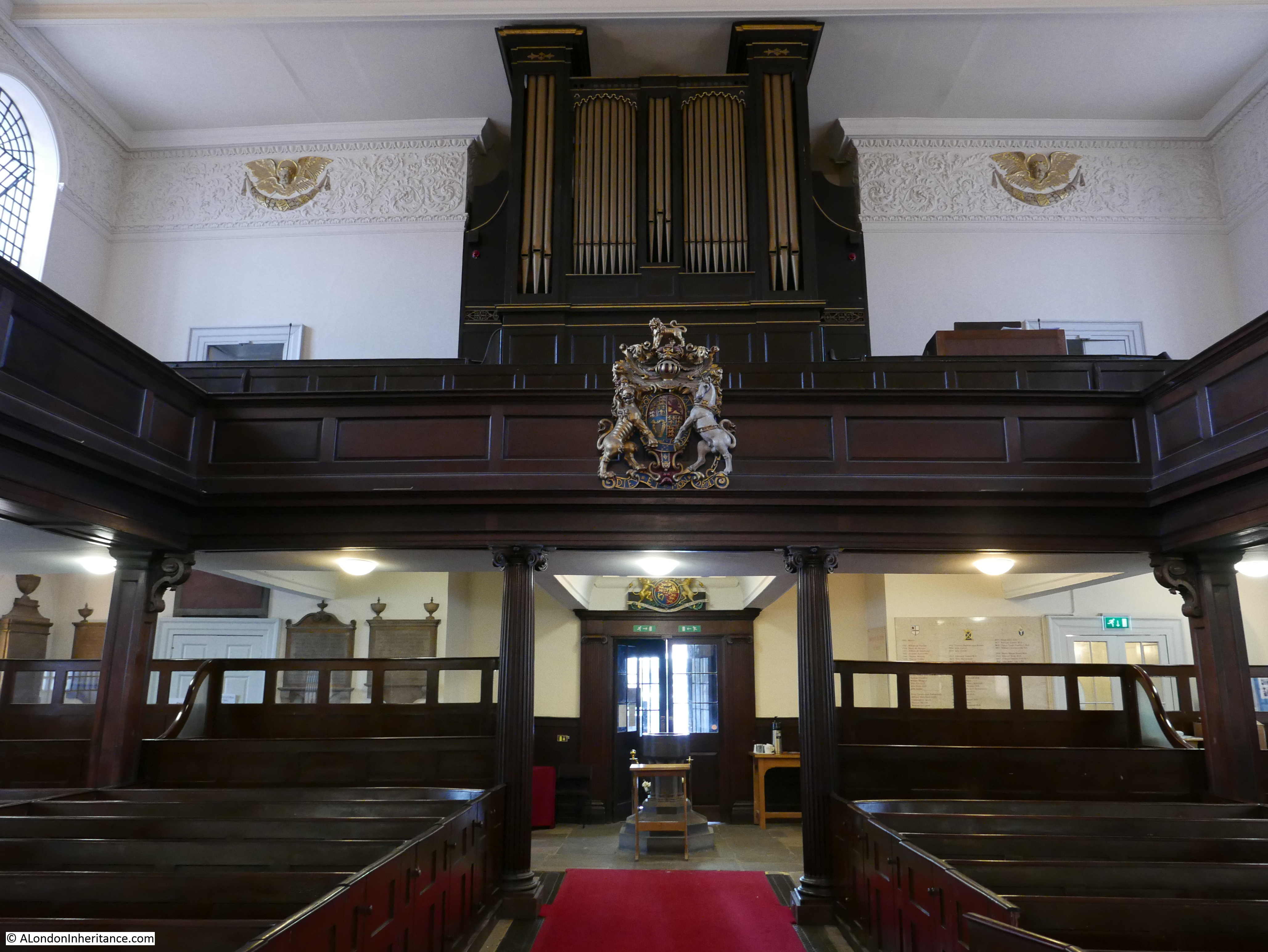
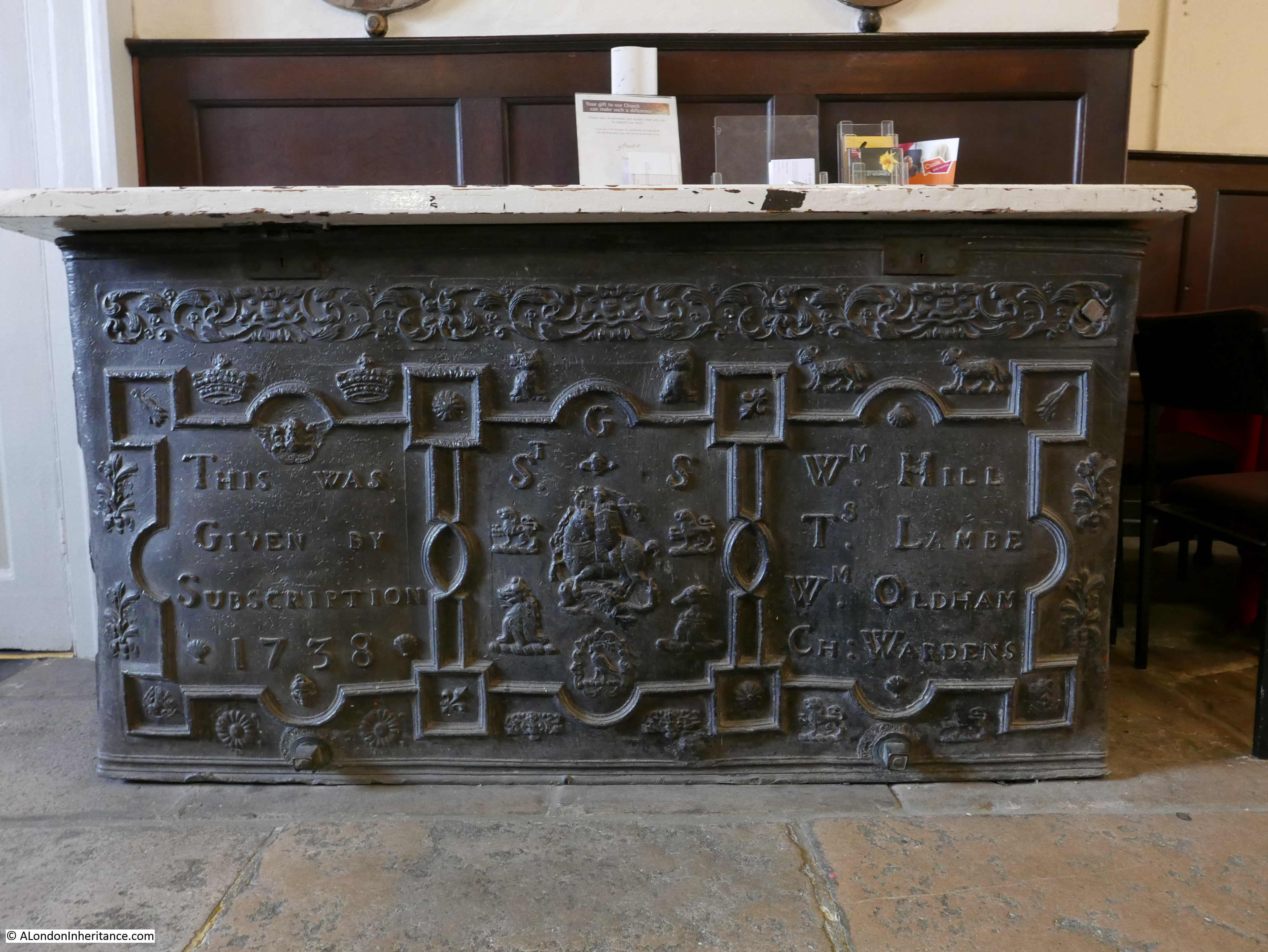
Inside the church is a lead cistern dating from 1738, The cistern was originally installed in the northwest porch of the church to hold water from the supply from the Thames. It was moved to its current position and the wooden top that now covers the cistern is made from wood recovered from the old front doors that were destroyed by bombing.

Curious Southwark

Again, whatever the truth of the story behind the clocks, Pearman’s book took me to another church that I have not visited.

After leaving the church, I then walked north along Borough High Street to find my next location:

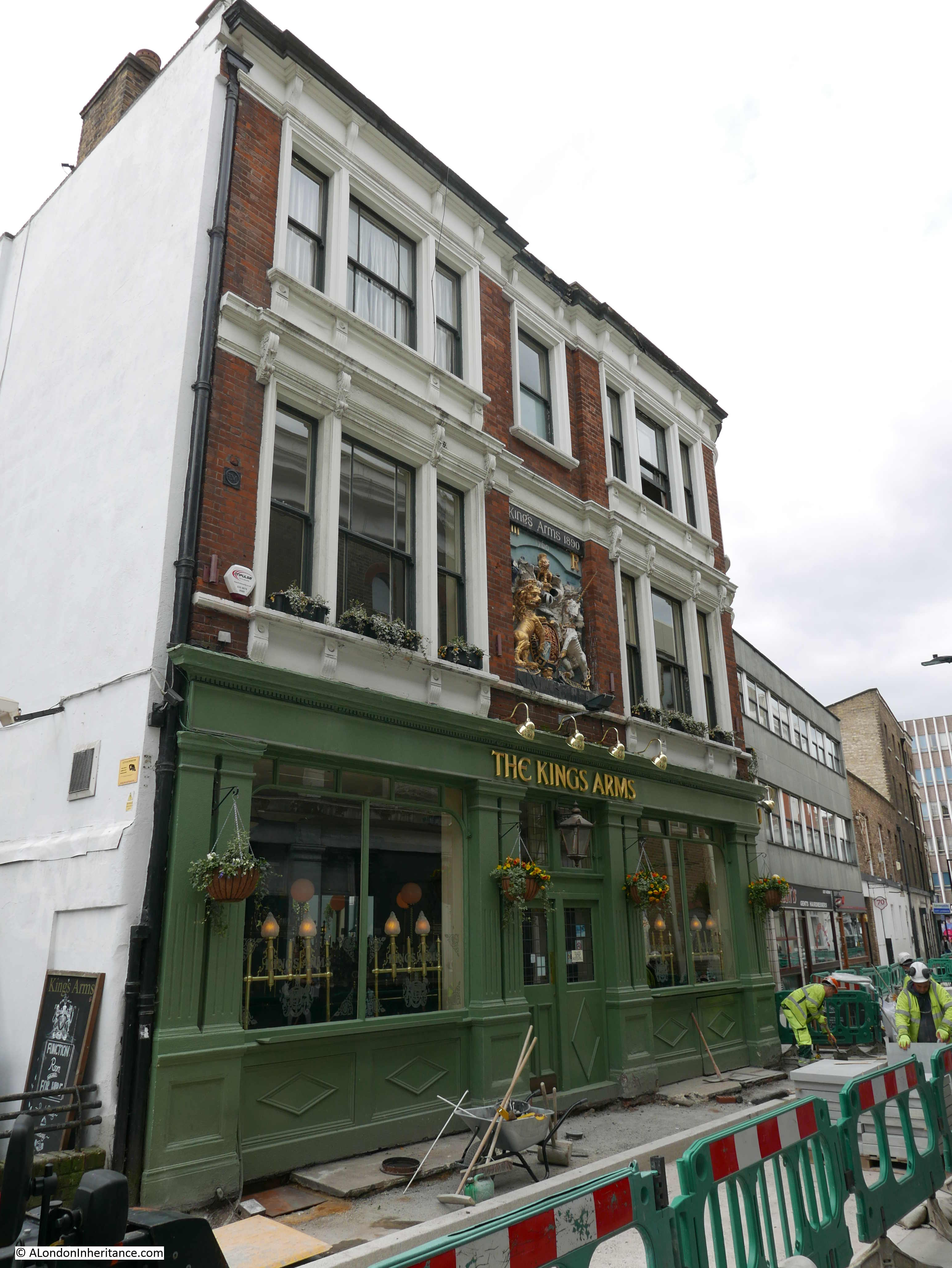
London Bridge and the King’s Arms, Newcomen Street

“London Bridge is falling down, my fair lady – so runs the old song. Well at long last just over a century ago, it did fall down, or rather was pulled down. Very few traces of it are left, but here on the wall of the King’s Arms in Newcomen Street is the coat of arms which once adorned the Southern Gateway of the old bridge.”

To find the King’s Arms pub, I turned off Borough High Street into Newcomen Street to find much of the street closed off for the repaving of the street. It will look really good when finished, but as with the church of St. George I do wonder why so many of the places I visit to photograph seem to be impacted by building works.

Curious Southwark

It was hard to get some decent photos due to the road works, however the subject of my visit was easy to find. The King’s Arms pub is a short distance down the street and extends slightly into the street resulting in a narrow length of roadway.

In the centre of the building frontage is the rather impressive coat of arms referred to by Hugh Pearman.

Curious Southwark

The coat of arms are from the gate built at the southern end of the old London Bridge and date from around 1728. The gate was demolished around 1760 and apparently the coat of arms were rescued and mounted on the pub.

Curious Southwark

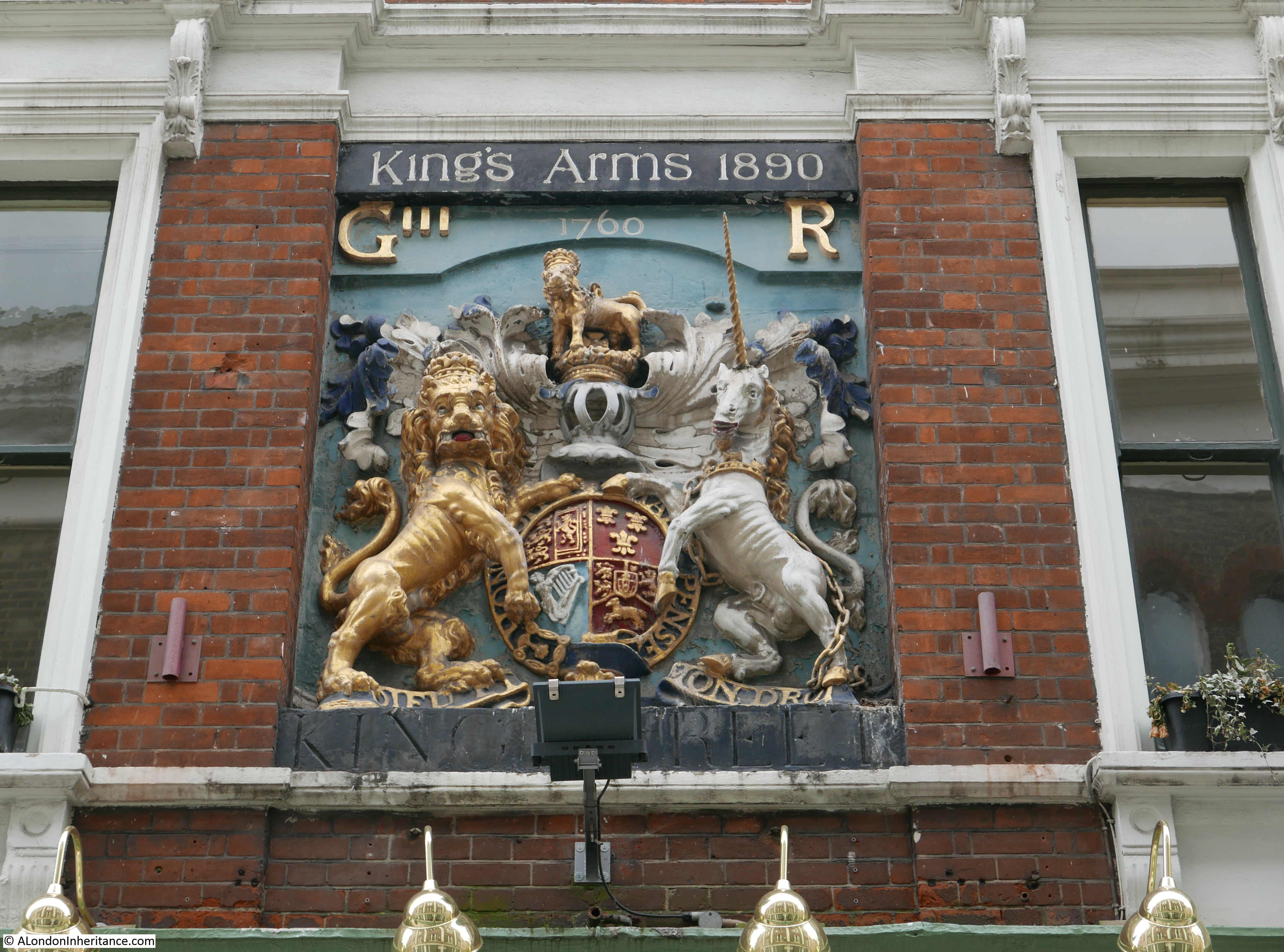
The current pub building is clearly not from the mid 18th century, and was built in the late 19th century, hence the reference to King’s Arms 1890 at the top of the coat of arms.

At the bottom is a reference to King Street. The street has undergone a number of name changes over the years.

If you walk Borough High Street, there are a number of short yards off the street. This comes from the time when Borough High Street was the principle road leading south from London Bridge.

The following map extract is from a map of the Parish of St. Saviours Southwark by Richard Blome (late 17th century but published by John Stow in 1720). Newcomen Street was originally Axe Yard, then Axe and Bottle Yard, which is shown at number 27 in the map (I have ringed the yard and also included the key which includes number 27 at the bottom as the full key is on the left of the full map).

Curious Southwark

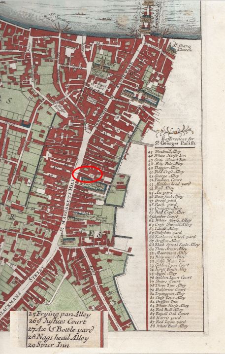
The yard was named after an inn of the same name and the yard was originally the yard of the inn.

The name changed to King Street in 1774. I cannot find confirmation of the reason why, but suspect it was due to the King’s Arms now being in the yard.

The final name change to Newcomen Street happened over 100 years later in 1879. The new name is after Elizabeth Newcomen who died in 1675 and owned property in Axe and Bottle Yard and along Borough High Street. In her will she left the income from the property to her nephew, then to his oldest son, then to the parish of St Saviour’s for the clothing, education and apprenticing of children within the parish.

Almost opposite the King’s Arms I found another interesting building, boarded up, but with some fascinating features and history.

Curious Southwark

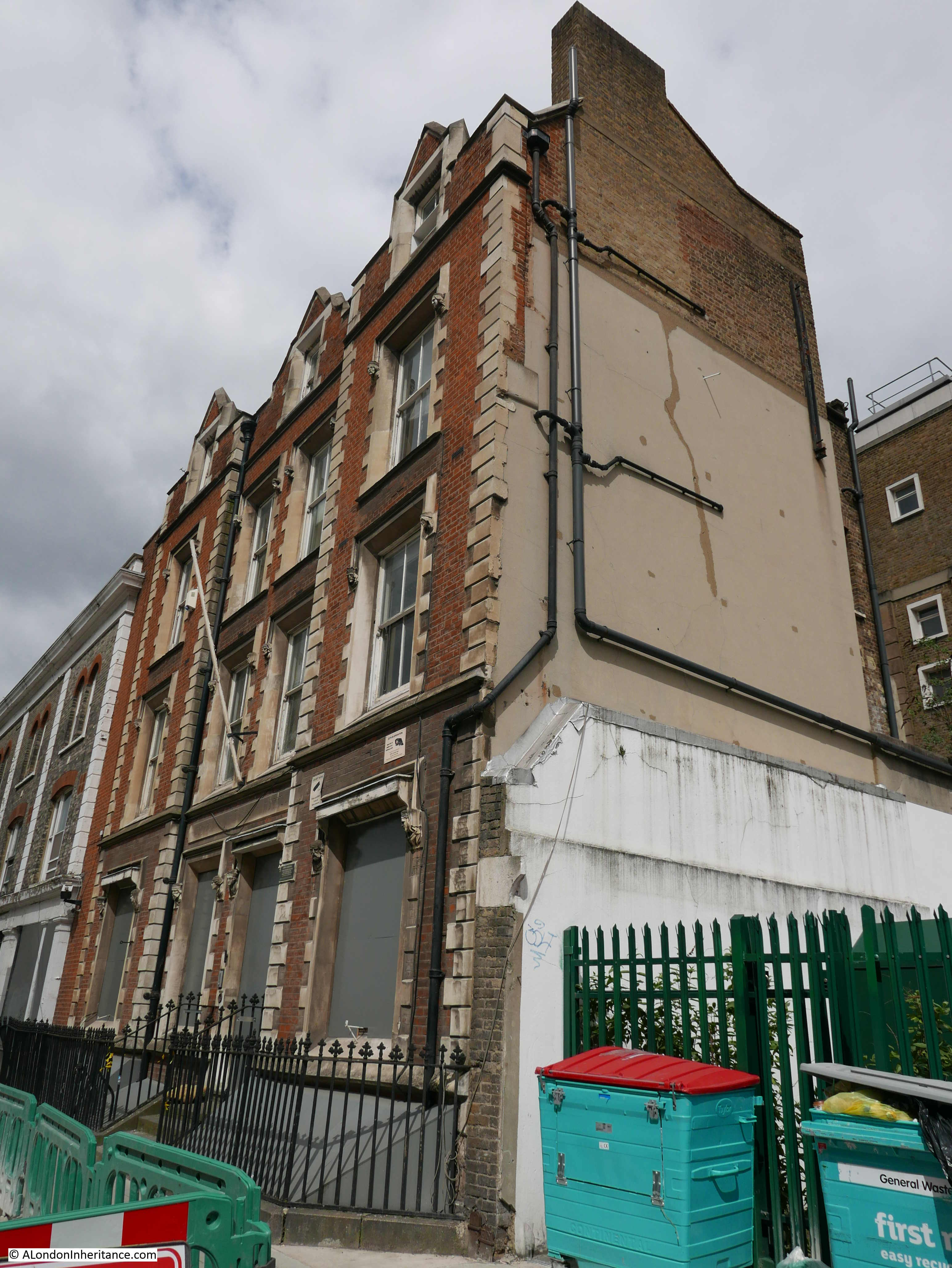
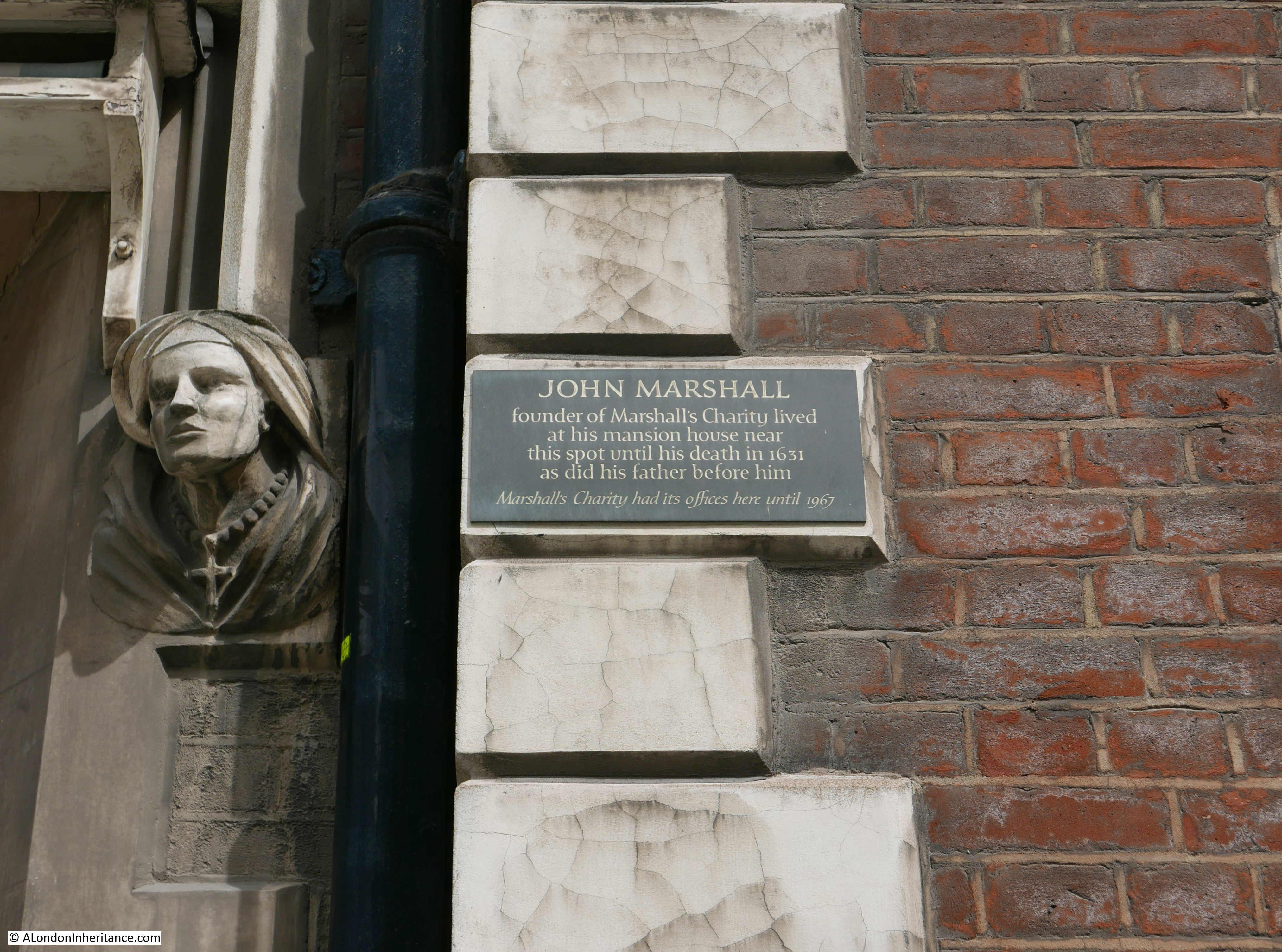
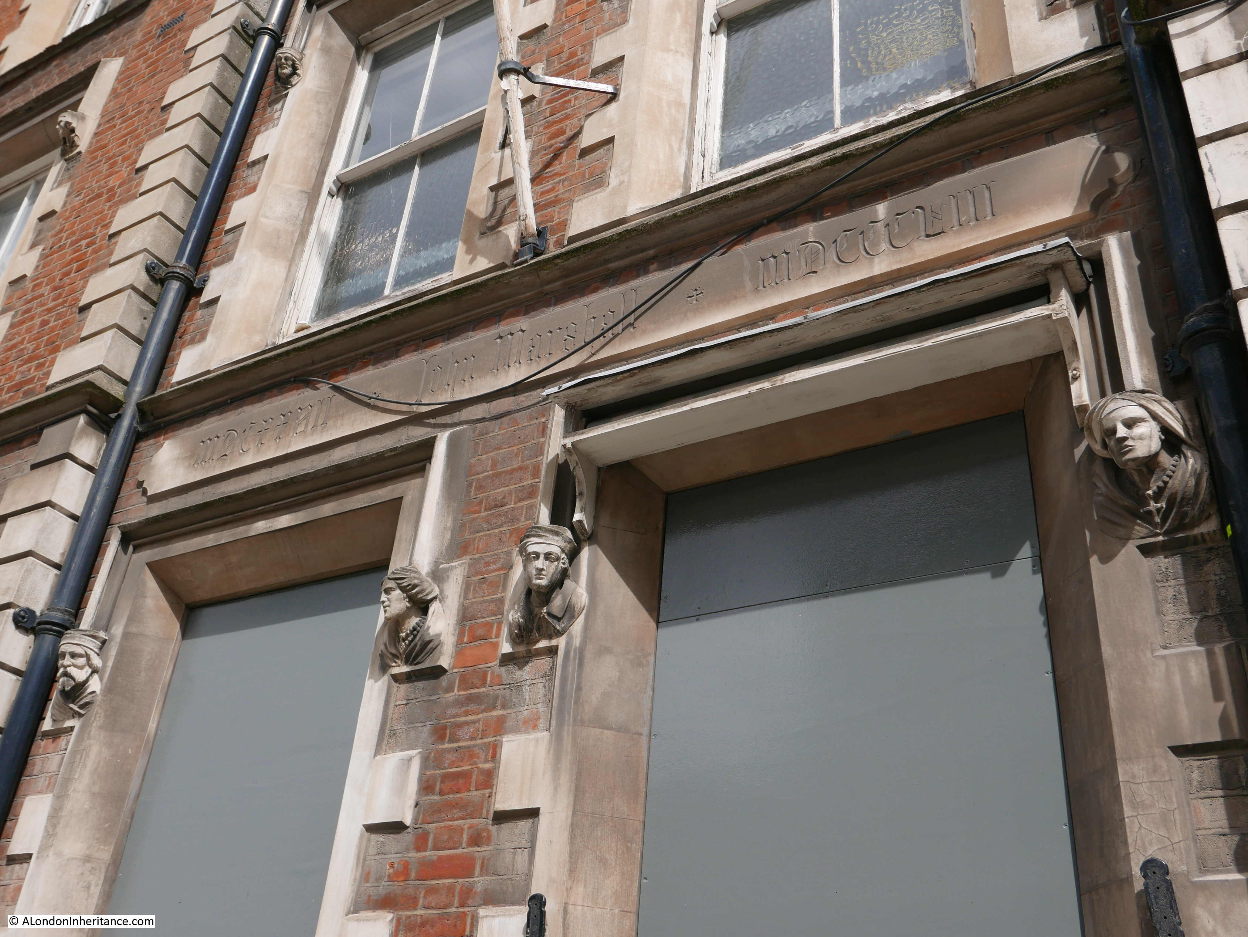
A plaque adjacent to the door records that “John Marshall, founder of Marshall’s charity lived at a mansion house near this spot until his death in 1631 as did his father before him. Marshall’s Charity had its offices here until 1967.”

Curious Southwark

It never ceases to amaze me how many small charities there are in London dating back centuries and still providing benefits from the original founder’s gift and the Marshall Charity is a perfect example.

John Marshall died childless in 1631. His will appointed trustees to build Christchurch in Southwark and to use funds from his properties for “the Mayntenance and Continuance of the sincere preaching of God’s most holie Word in this Land for ever”.

Almost four hundred years later, the charity is still in operation and based on John Marshall’s original properties from his will was able to give £831,000 in grants in 2016.

The charity supports Christ Church, Southwark, as well as providing grants for the repair and restoration of parsonages and Anglican churches in Kent, Surrey and Lincolnshire. The charity also operates the Marshall’s Educational Foundation which provides financial assistance to students in north Southwark.

Curious Southwark

Brilliant that such a charity still exists and also a wonderful building which I hope will be sympathetically restored.

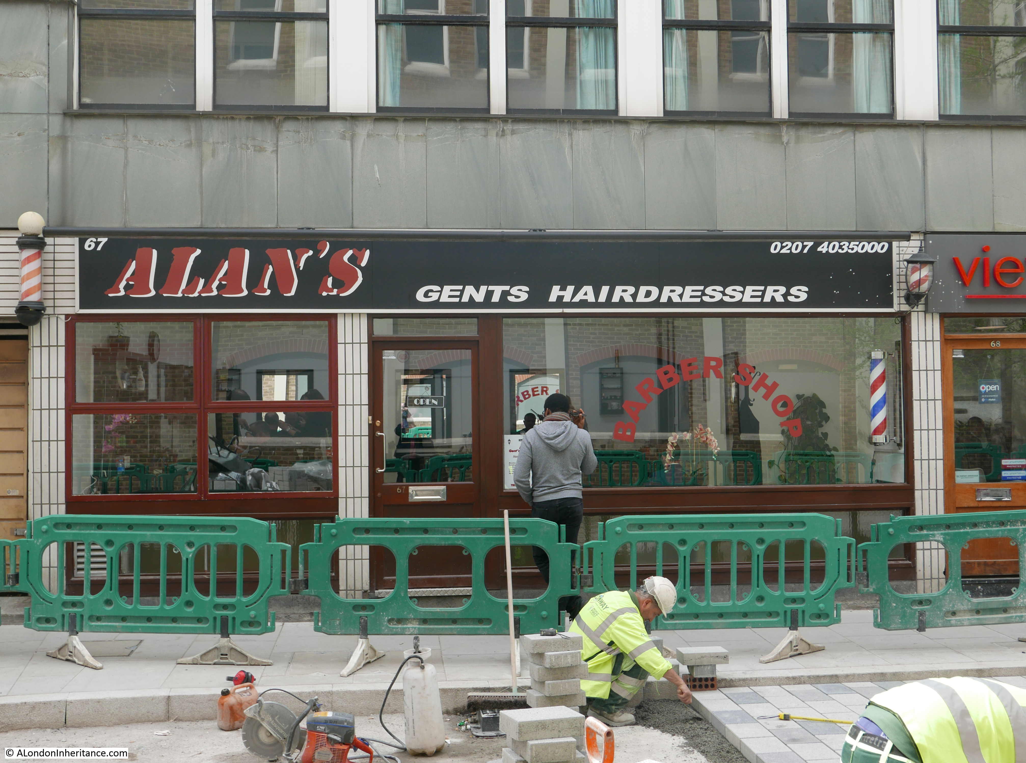
In complete contrast, in Newcomen Street I found this hairdressers. I have many themes for photography whilst walking the streets of London and this type of hairdresser is one of these themes – continuing on from the same theme my father started in the 1980s. See the post: Hairdressers of 1980s London.

Curious Southwark

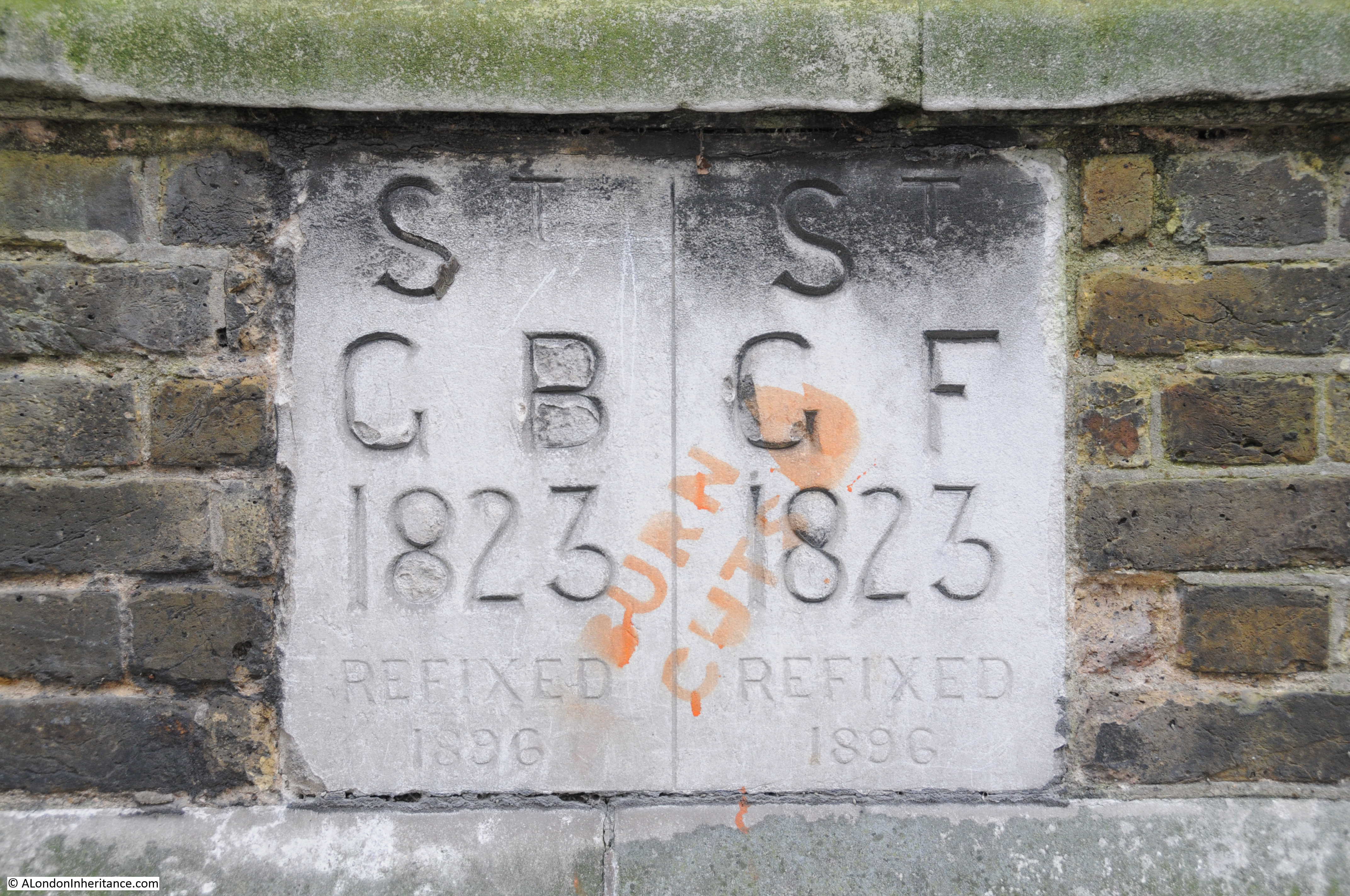
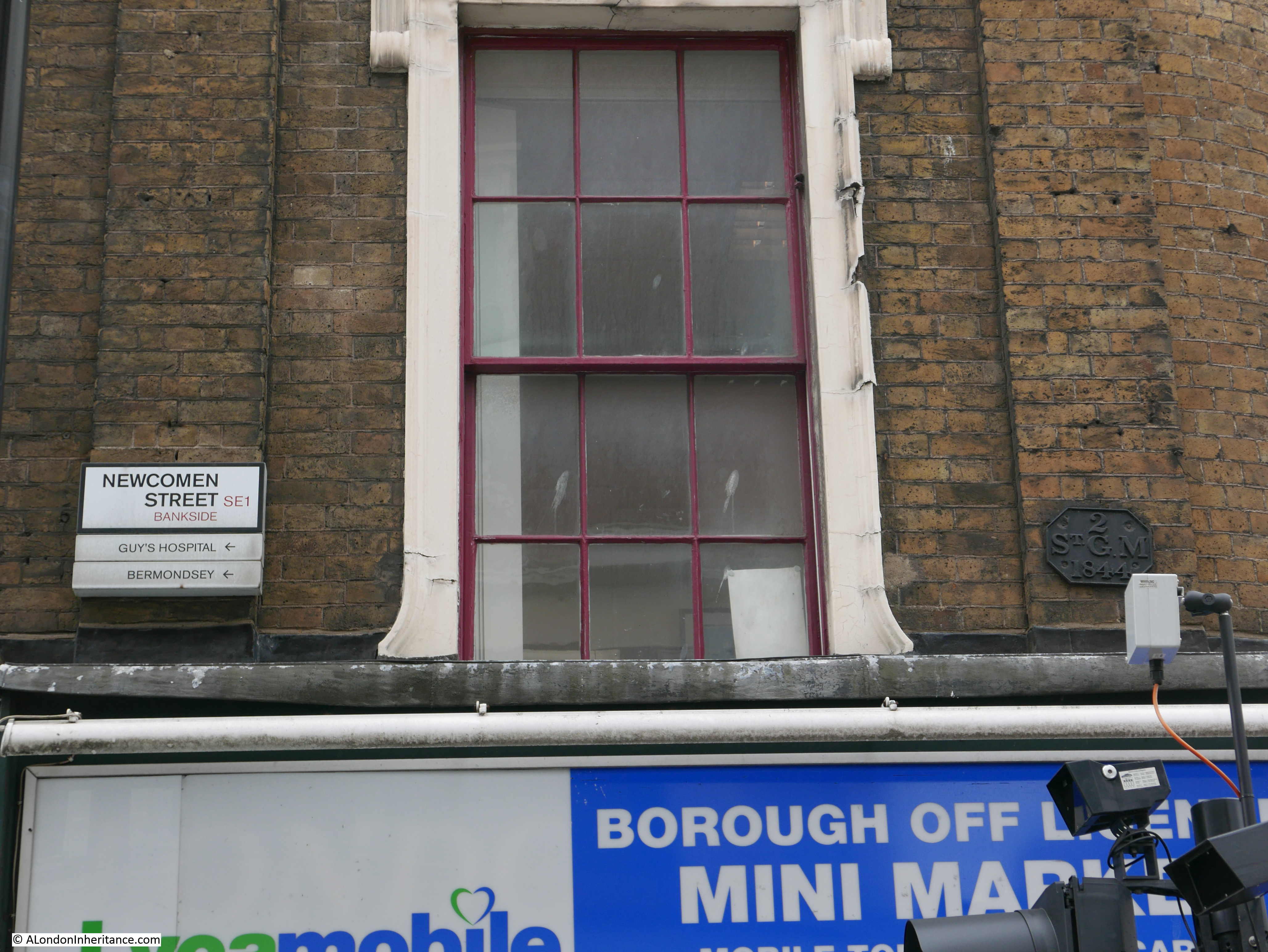
Another theme is parish boundary markers. I have photographed hundreds of these and here is one on the corner of Newcomen Street – an 1844 marker for St. George the Martyr – the church I had just visited.

Curious Southwark

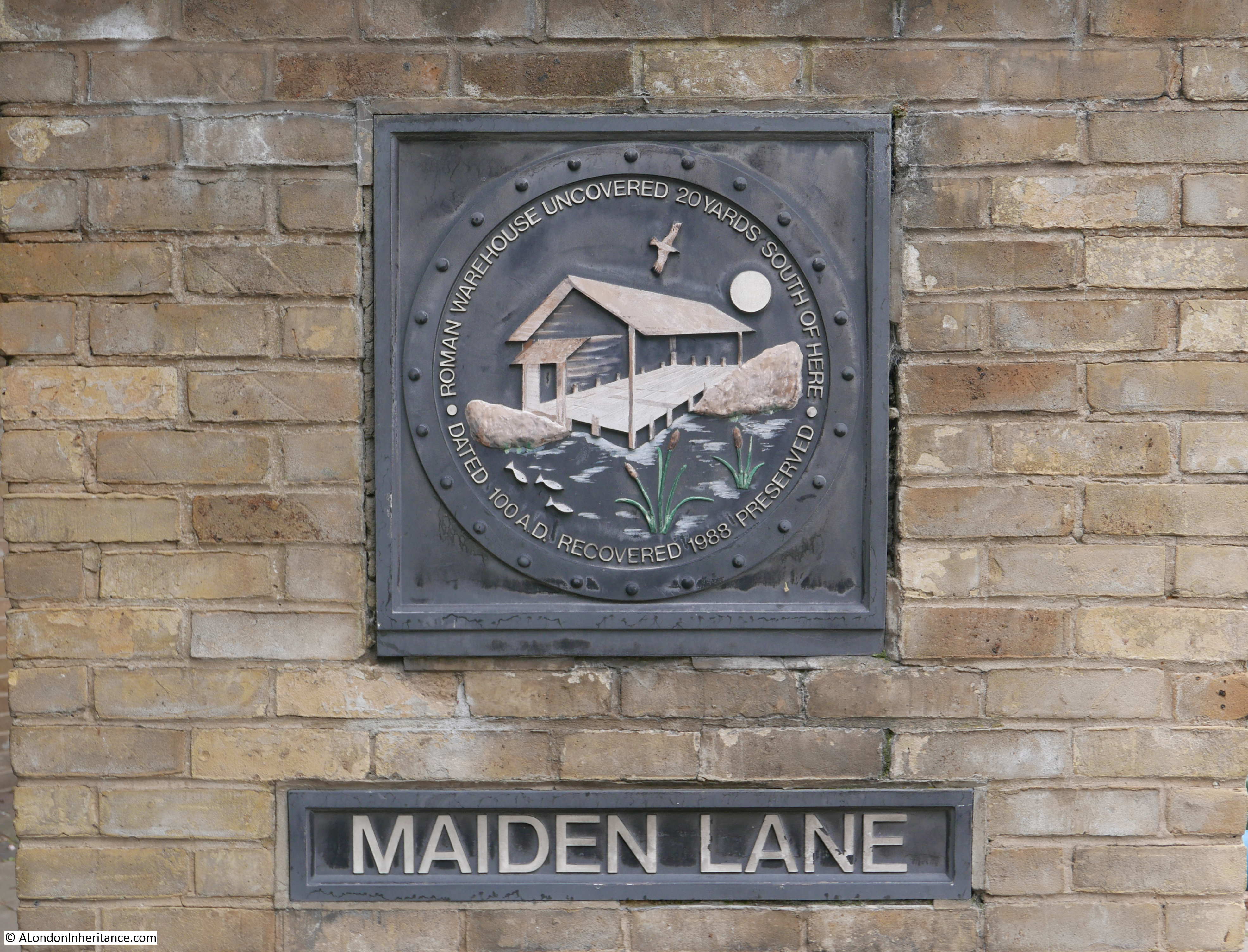
My next stop is in Park Street, a street which runs from Borough Market to Southwark Bridge Road, however before arriving at my next destination, at the junction of Park Street and Maiden Lane is this plaque recording the results of archaeology excavations just a little further north where the remains of buildings from the early years of Roman occupation were found including a warehouse.

Curious Southwark

Further along in Park Street I found my next location at number 4 on the map:

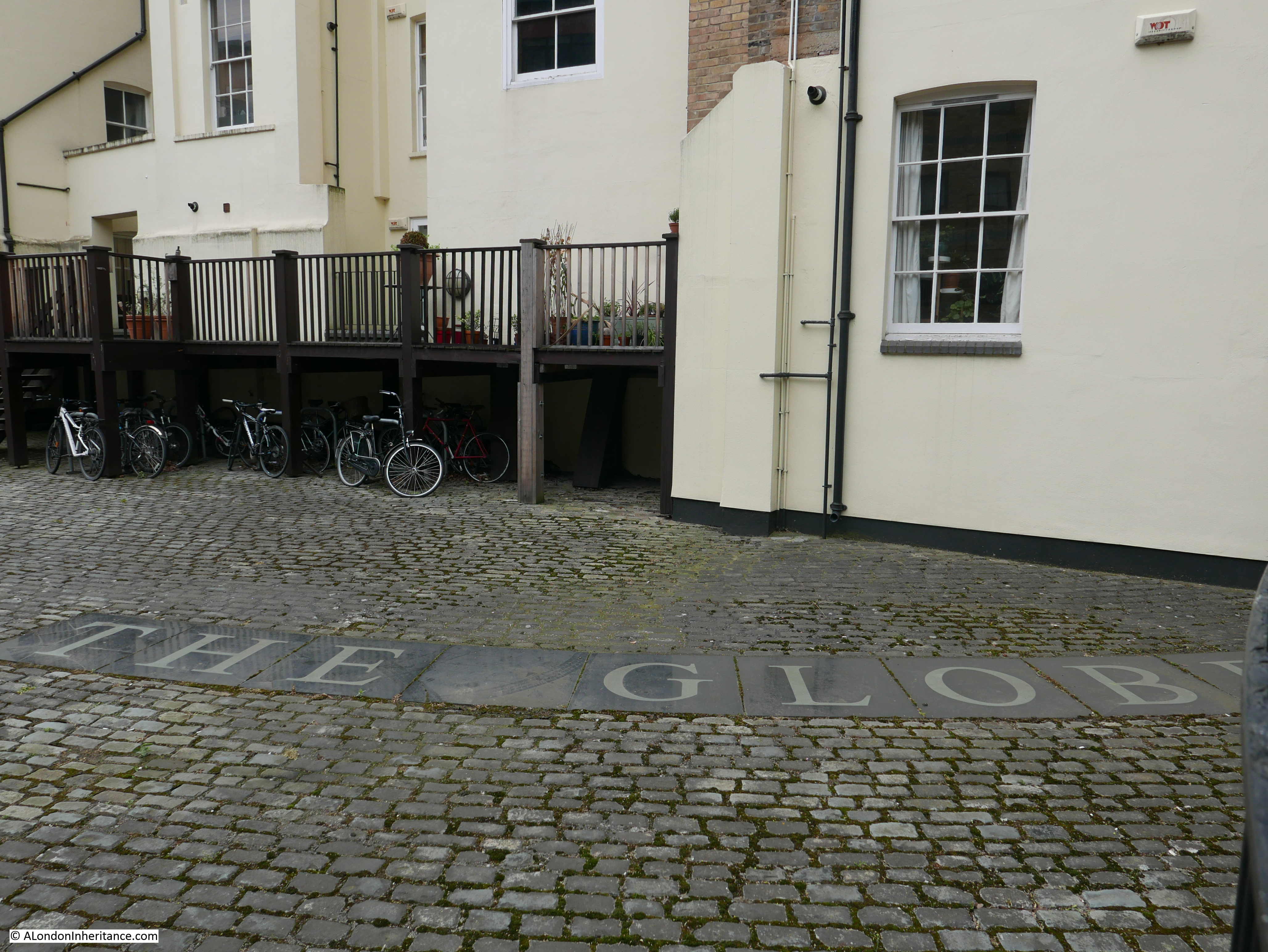
Shakespeare’s Globe Theatre, Park Street

“Running parallel with Bankside is narrow Park Street. here, on the site where this plaque is affixed to a brewery wall, was Shakespeare’s Globe Theatre. the Plaque shows the theatre, Old London Bridge and the neighbourhood as it was in those times. Every year at the time of Shakespeare’s birthday draws nigh, players, in costume, re-enact here, in the street, scenes from his plays.”

Curious Southwark

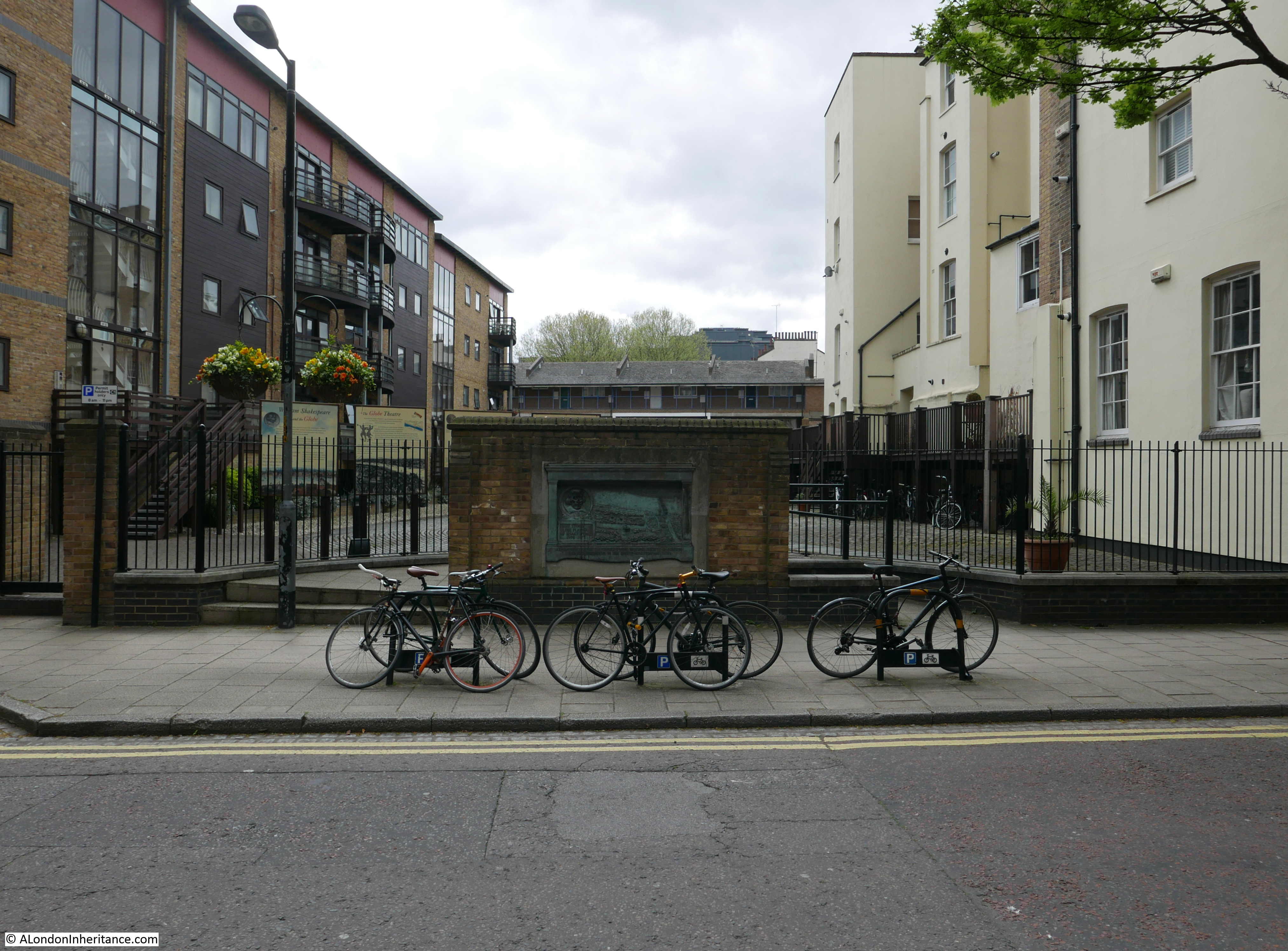
The brewery, which once ran to the east along Park Street is long gone, however the plaque has survived and is now mounted on a short length of wall in front of a semi-circular fenced area, behind which are a number of information panels which detail the history of the theatre and the excavations which located their remains.

Curious Southwark

It was in 1989 that the Museum of London carried out excavations on the site and found a small amount of remains of the theatre. Inset into the surface of the courtyard between the two buildings behind the plaque is a set of stones which show part of the circumference of the outer wall of the theatre.

Curious Southwark

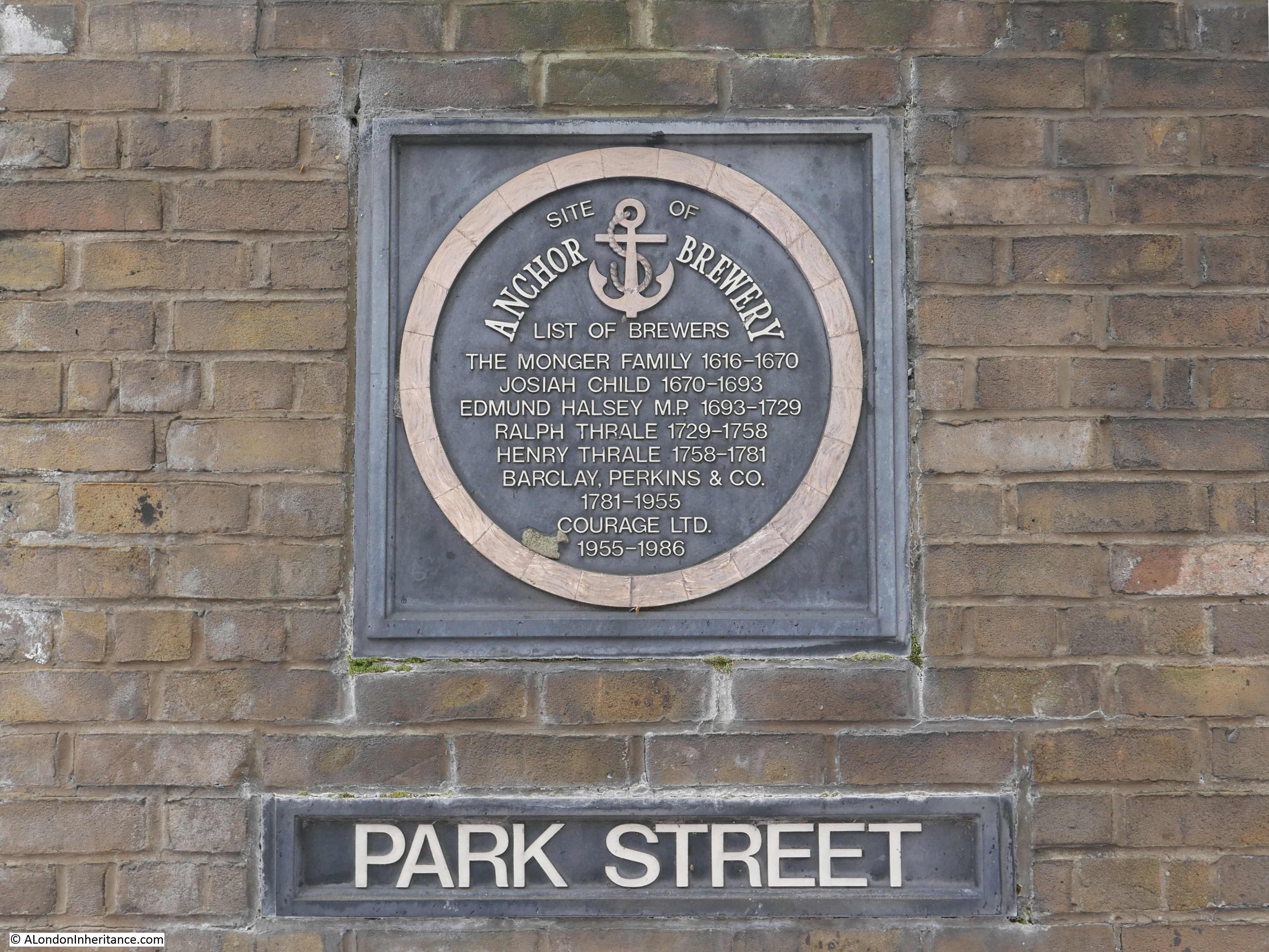
The brewery that Pearman refers to as the original mounting for the plaque was the Anchor Brewery that ran from the current location of the plaque and to the east along Park Street, where we can find a plaque recording the history of the brewers who operated the brewery.

Curious Southwark

Park Street is still a reasonably narrow street as recorded by Pearman, although I suspect the re-enactment of Shakespeare’s plays near his birthday are not held in the street since the building of reproduction Globe Theatre.

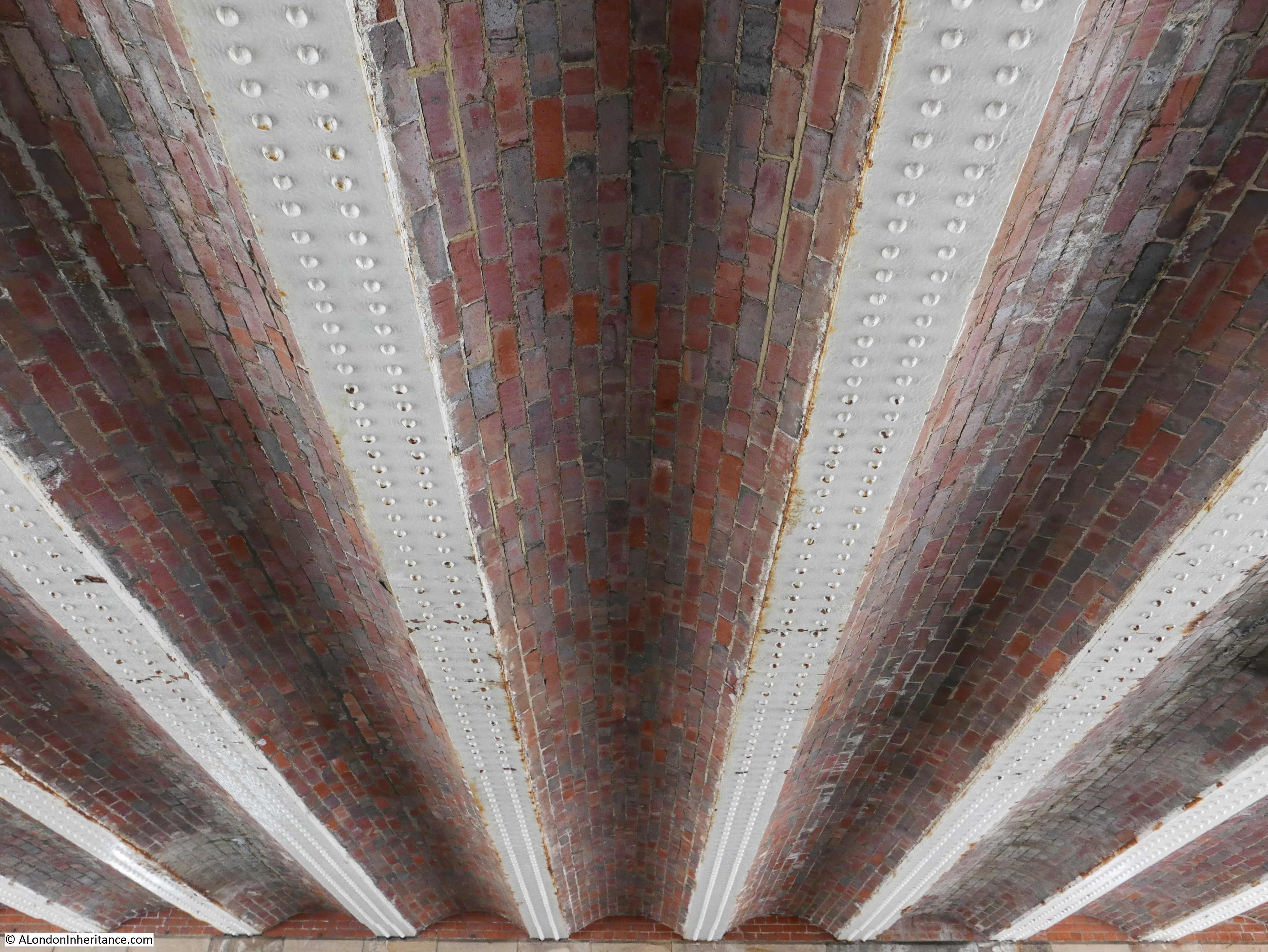
This is where Southwark Bridge Road crosses Park Street.

Curious Southwark

And where the roof of the bridge has a beautiful set of inlaid bricks:

Curious Southwark

Leaving Park Street, I then walked towards the river, to find location number 5:

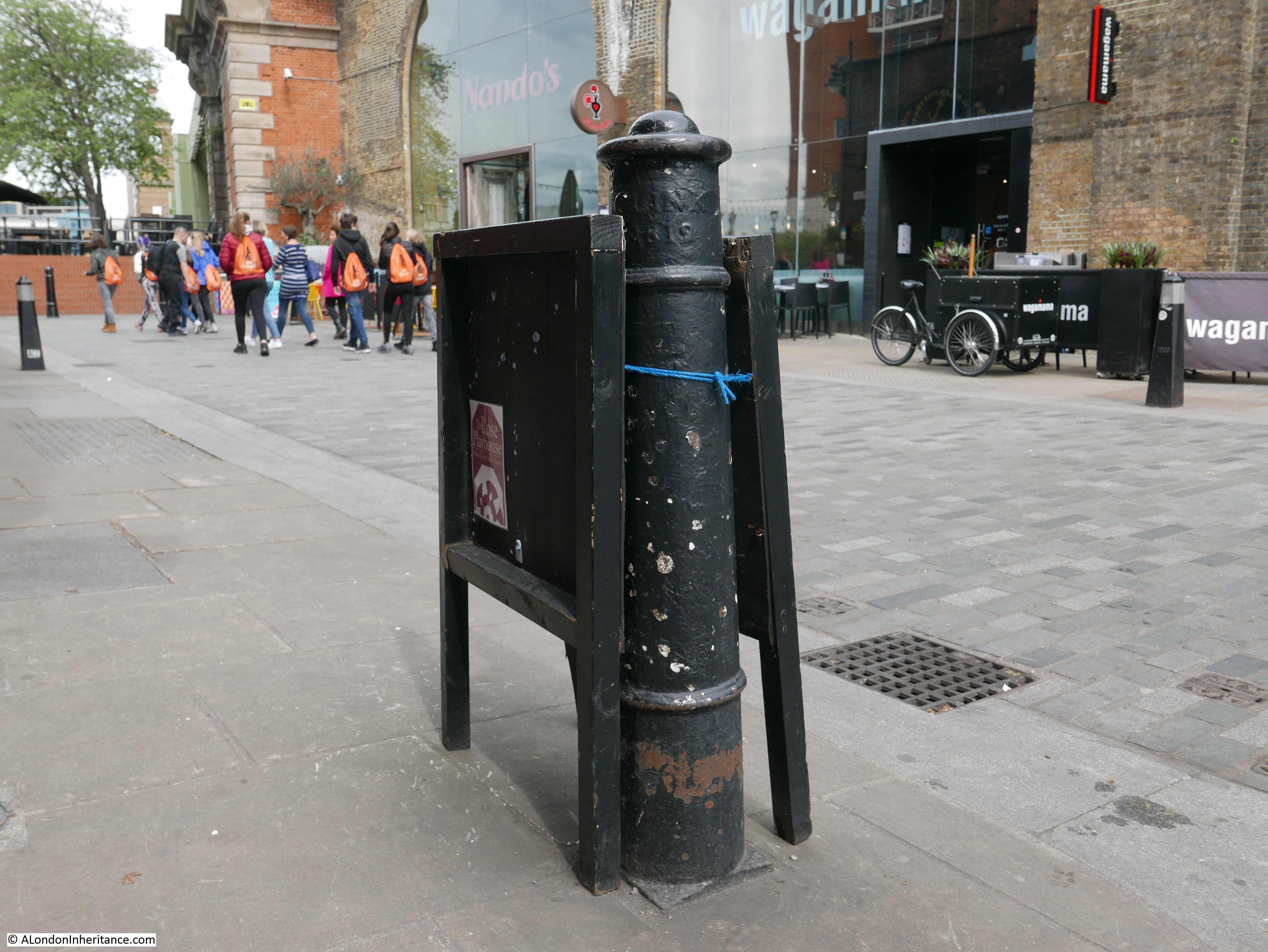
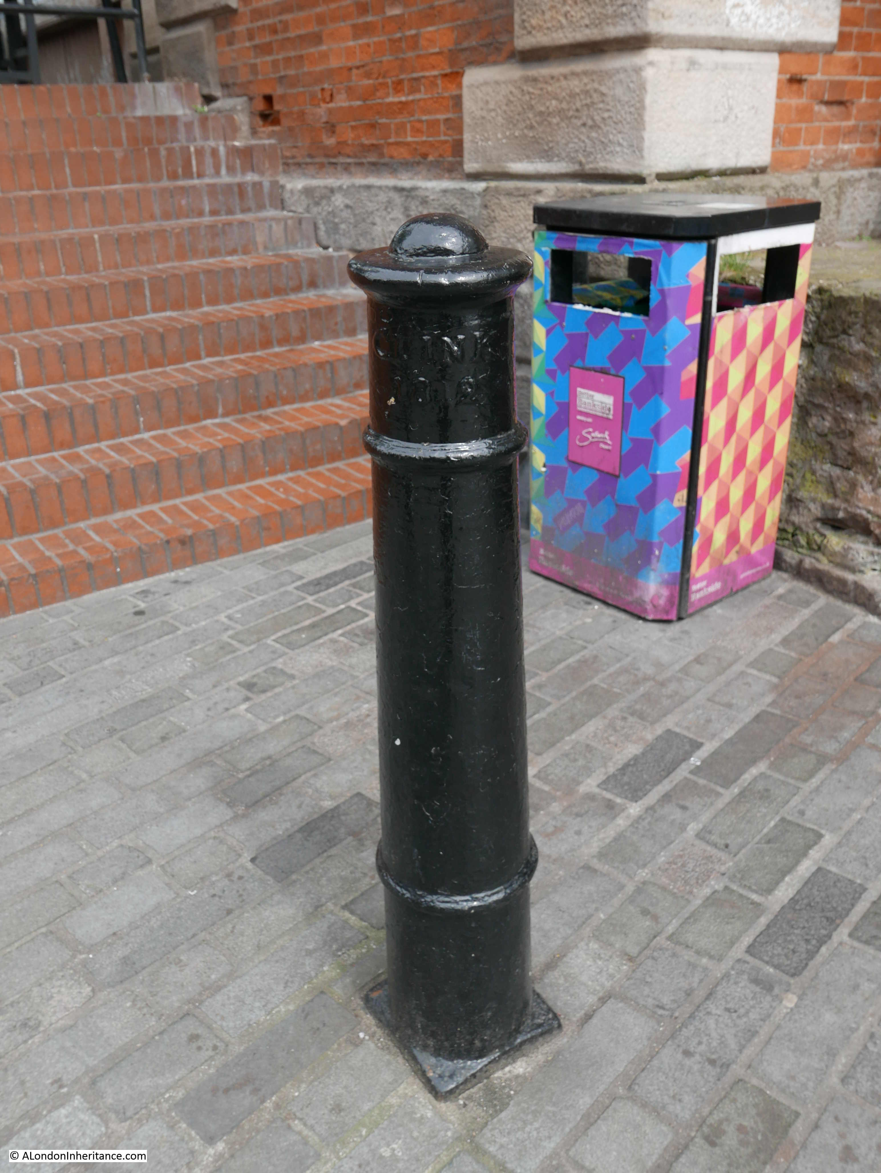
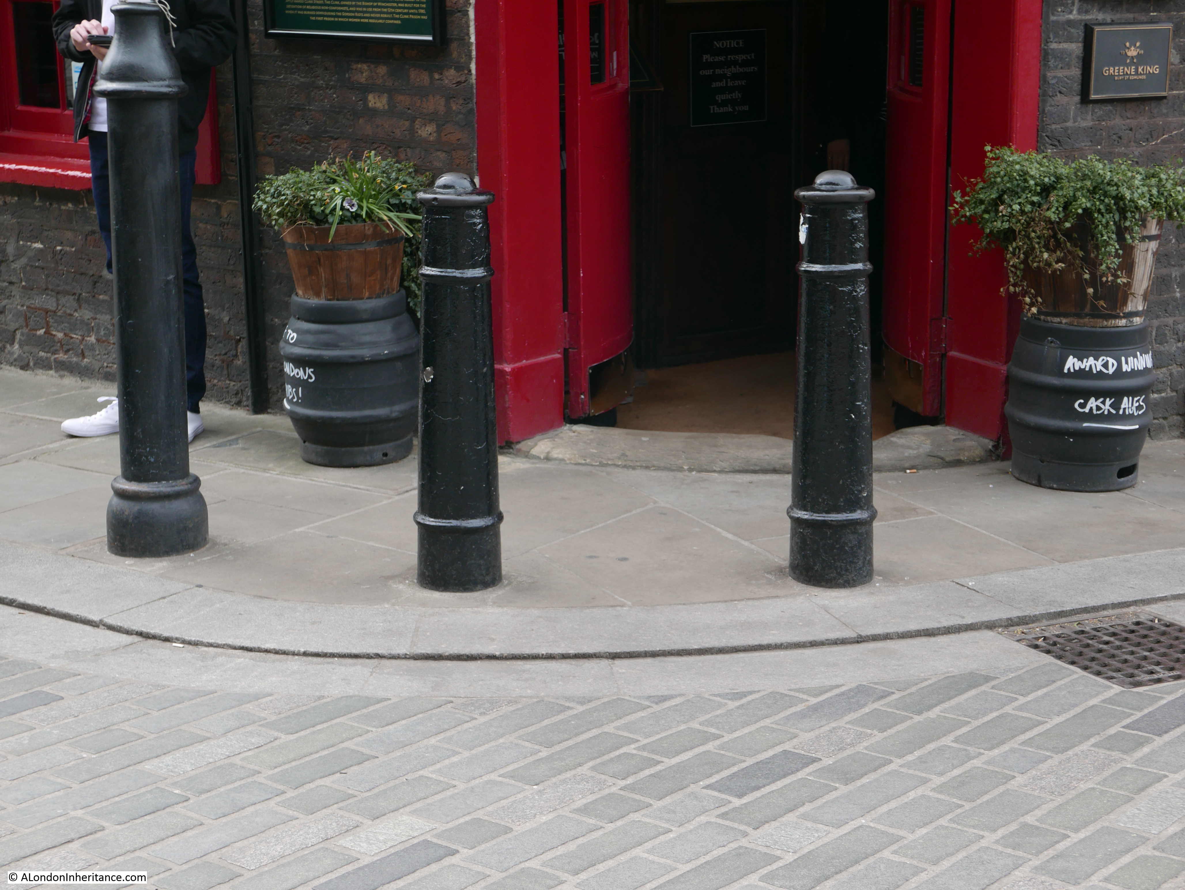
Clink Street Bollards

“The origin of the expression ‘clink’ for prison comes from the Clink prison that used to stand where is now the Borough fruit and vegetable market. This post is one of the many, still standing that mark the old boundaries.”

Curious Southwark

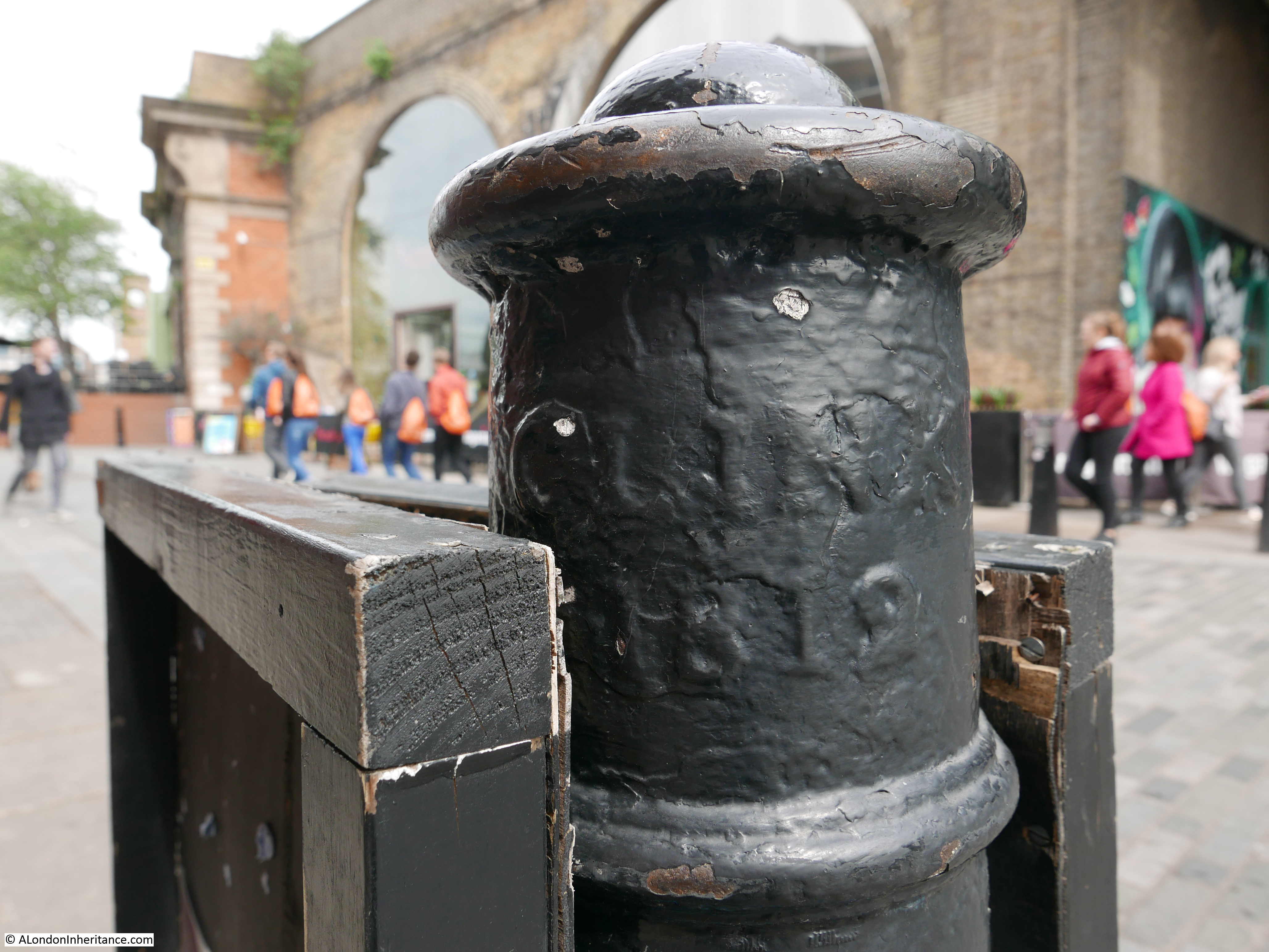
I found a number of these posts where Bank End meets Bankside, in front of the Anchor pub. Whilst they are all painted black unlike the one photographed by Pearman, they are off the same shape and have the same reference to Clink and the date 1812.

Curious Southwark

One in the corner alongside the bridge:

Curious Southwark

And a couple in front of the entrance to the Anchor:

Curious Southwark

Leaving a visit to the Anchor till later, I walked to the next location, number 6:
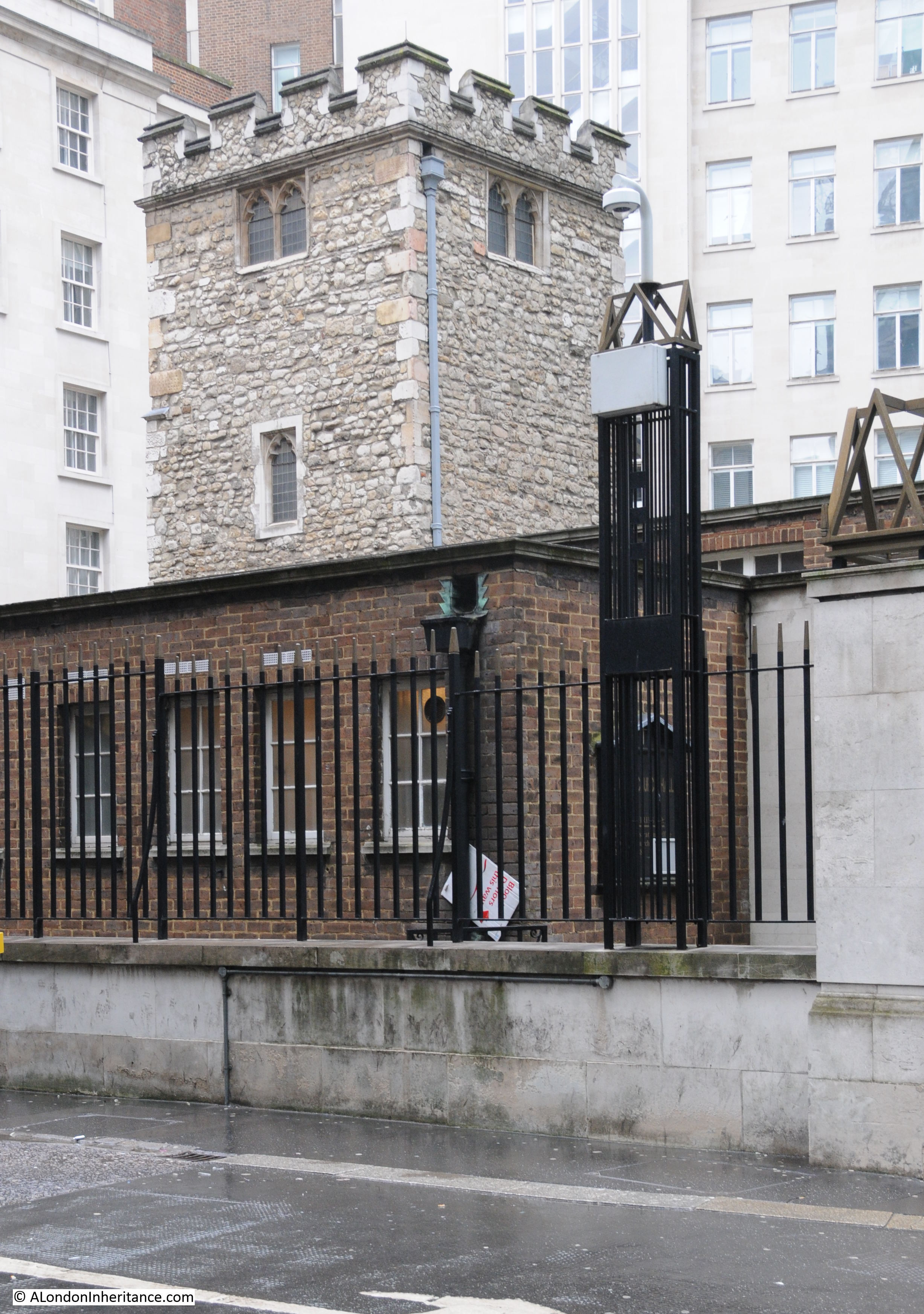
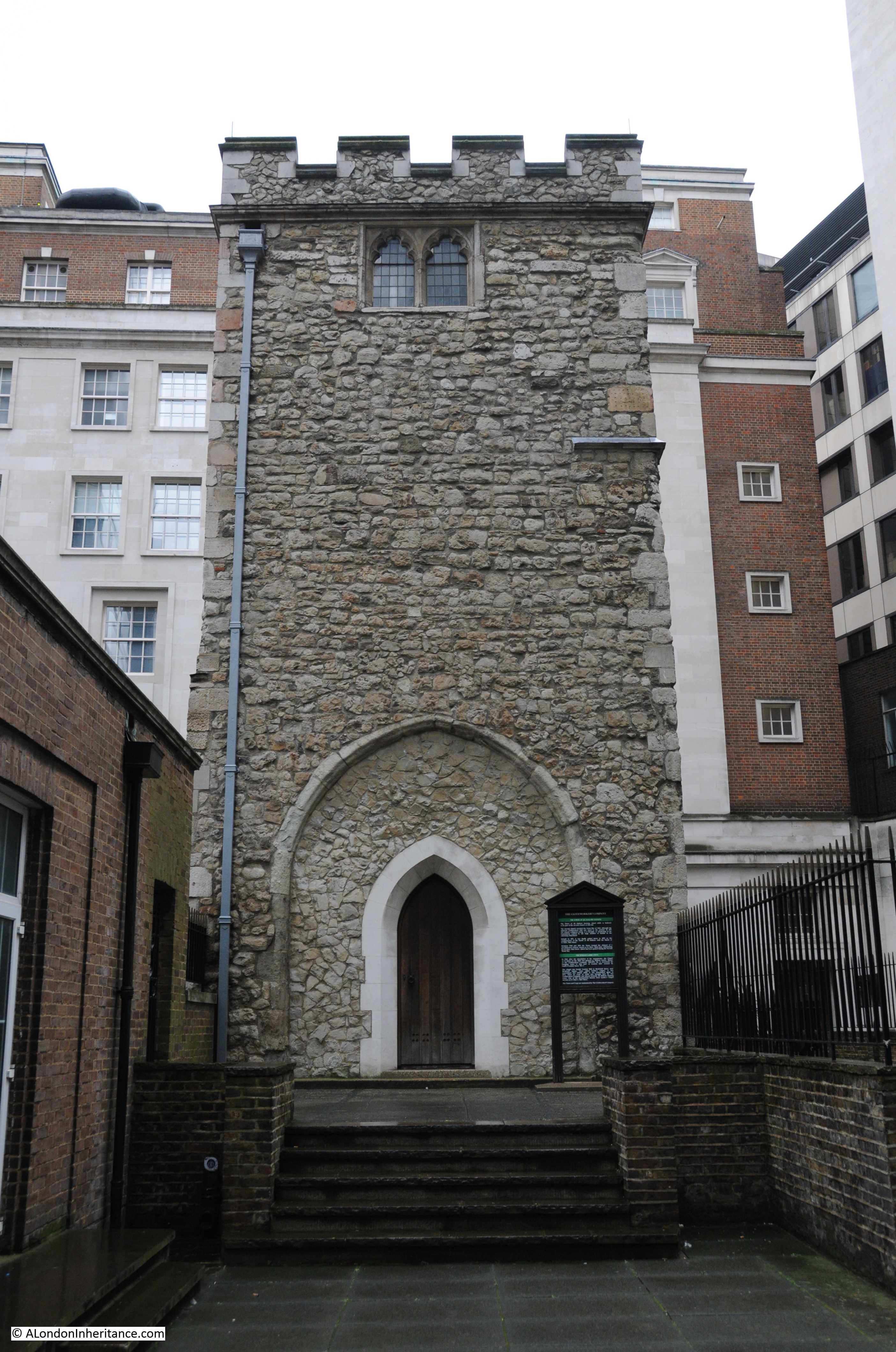
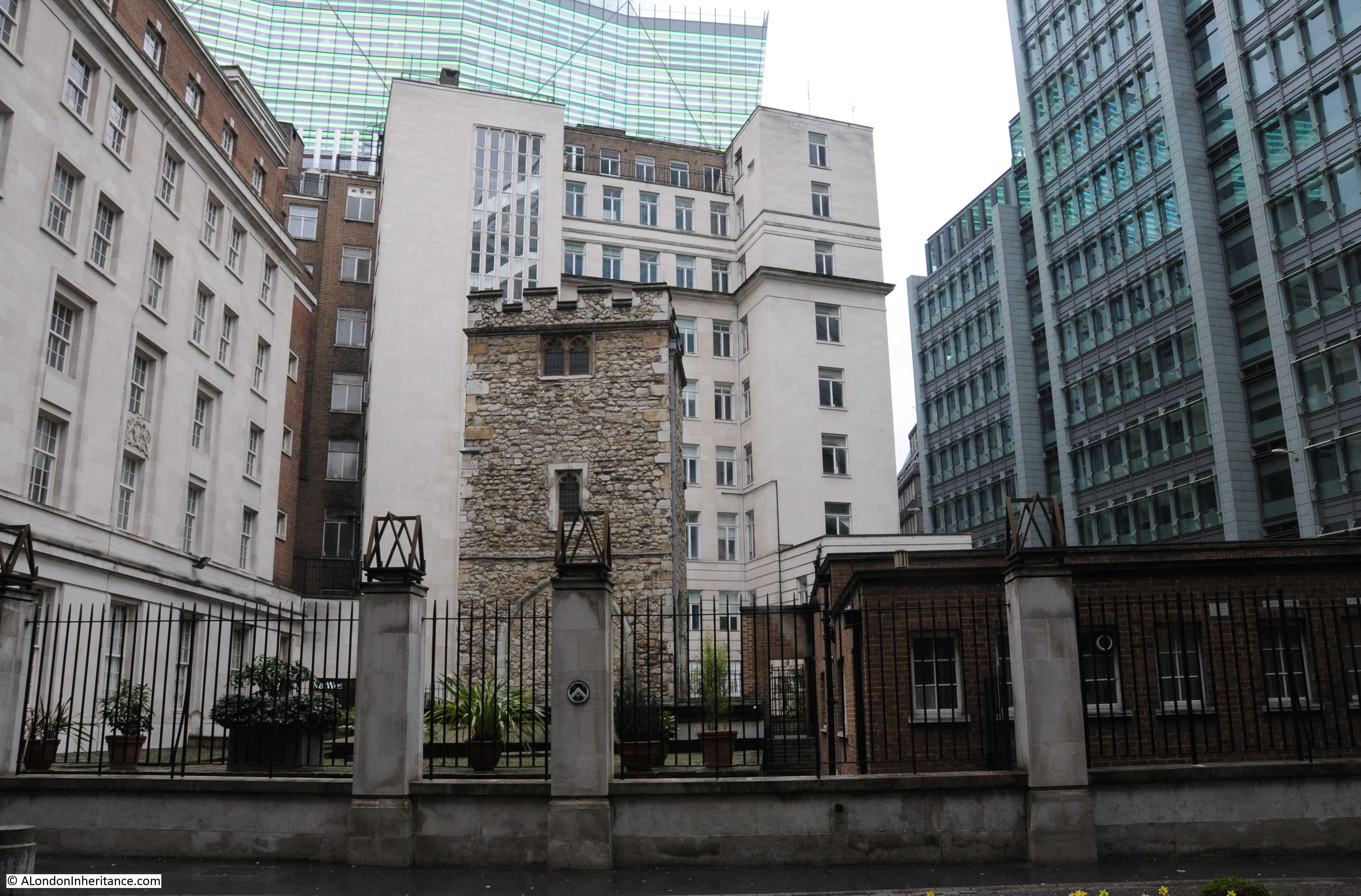
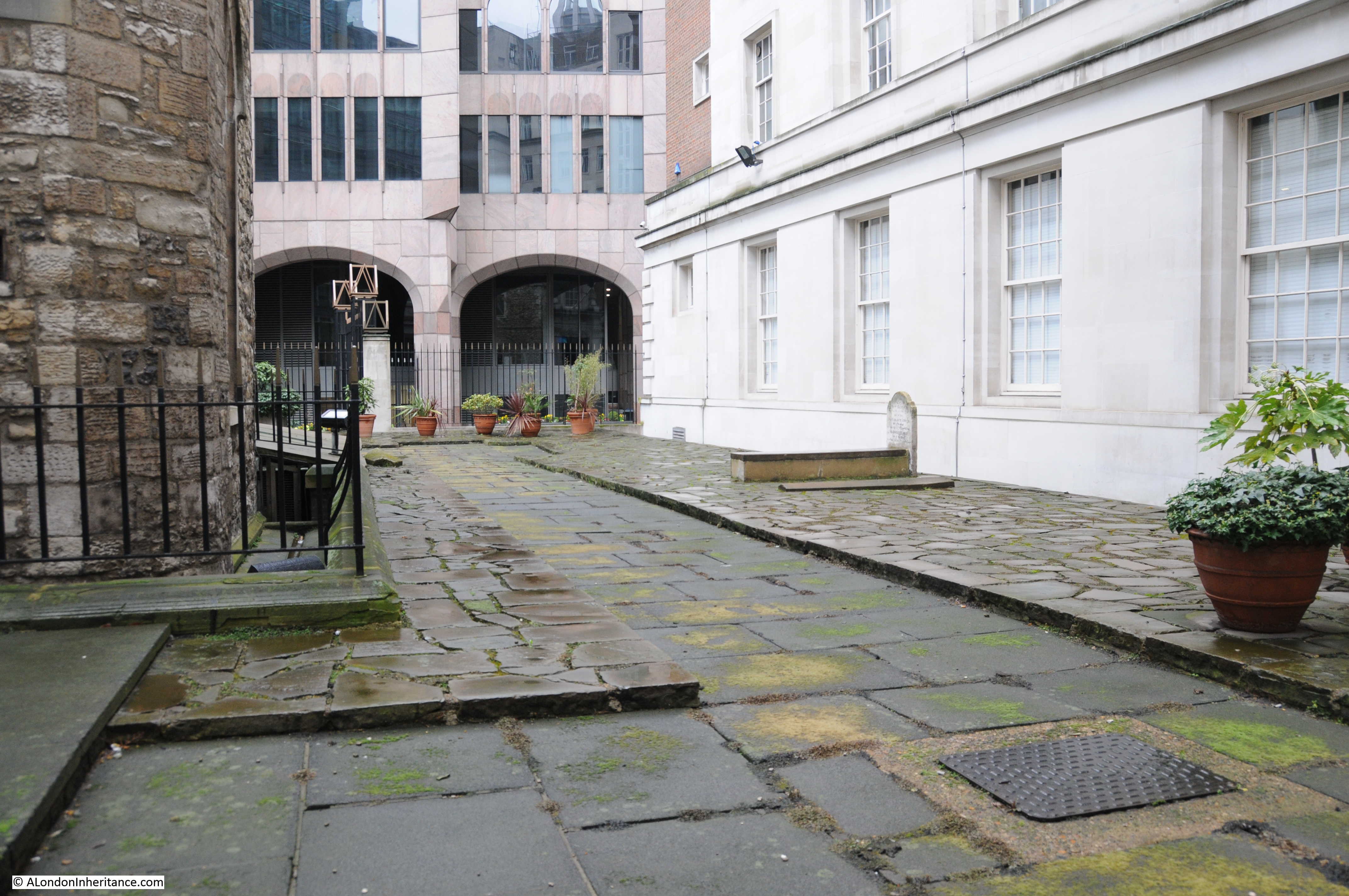
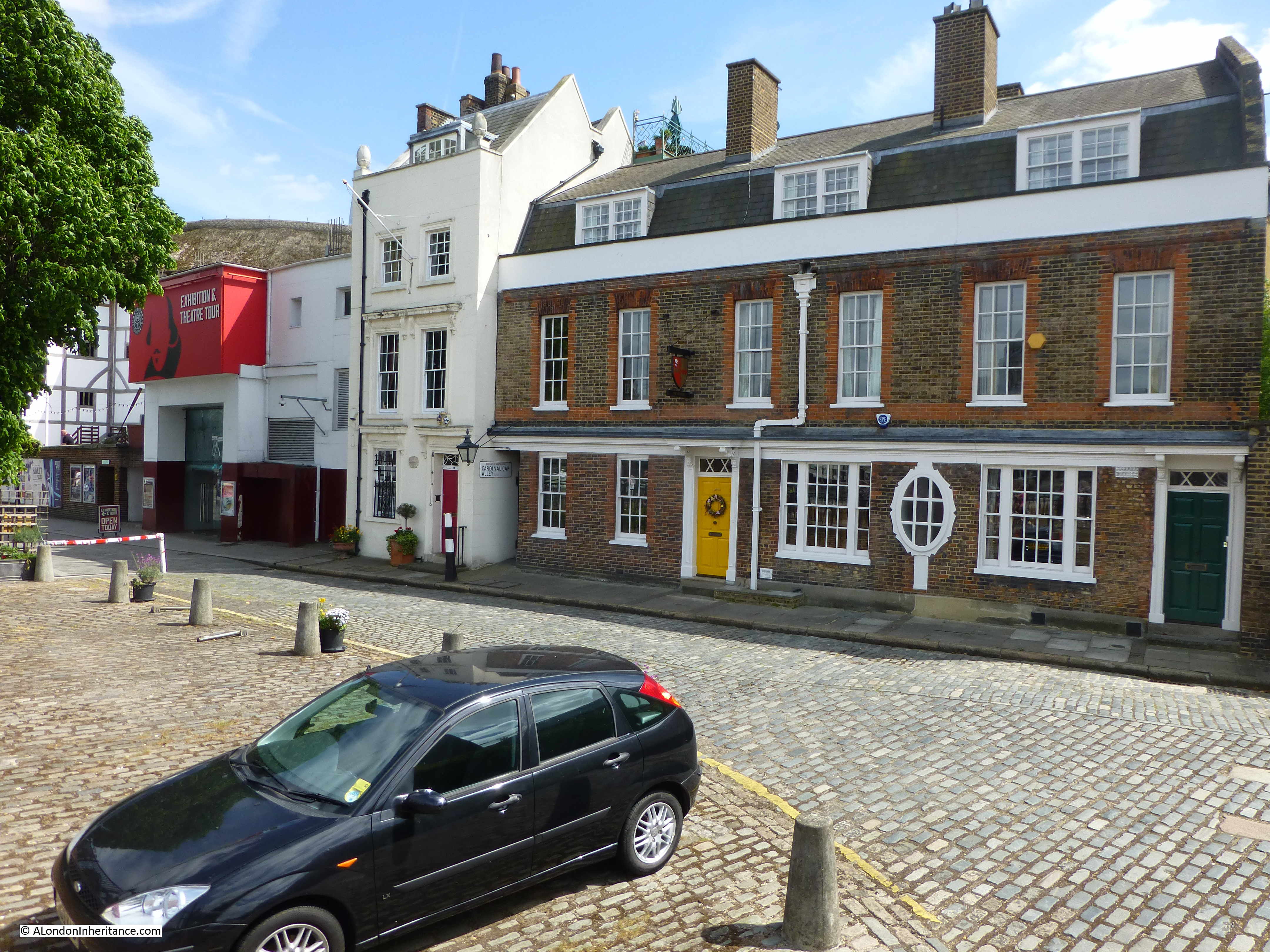
Cardinal Cap Alley

“Facing St. Paul’s Cathedral, from the South Bank of the Thames, is this little house with the odd sounding name of Cardinal Cap. At the time of the erection of the Cathedral, Sir Christopher Wren is said to have lived here and to have been ferried across, daily, to superintend the building of his masterpiece.”

I wrote an article about Cardinal Cap Alley and the house, 49 Bankside – the article can be found here.

The house was not home to Sir Christopher Wren, however it has a much more interesting history as documented by Gillian Tindall in her excellent book “The House by the Thames”  which I covered in the post, including my father’s photo of the house as it was in 1947.

This was the photo of the house and surrounding from my 2015 post.

Curious Southwark

Whilst some of the stories of Southwark in Curious London cannot be confirmed by evidence, they tell of the stories that have grown up across the city to add interest and a sense of history to the streets.

They also provided me with a new route to walk, and the discovery of a couple of places in London that I had not seen before. Trinity Square is fascinating and whilst I have walked past the church of St. George many times before, I have never had the incentive to look inside.

There are many more stories to tell of this small area of Southwark including the King’s Bench, White Lion and Marshalsea Prisons. A wall of the latter Marshalsea can still be seen near the church of St. George.

It is also still possible to make out the alleys and yards that once led off from Borough High Street – a legacy from the time when many of these would have been occupied by Inns, serving travelers before they reached the bridge leading into the City of London.

Curious Southwark is a fascinating place to explore.

alondoninheritance.com

Panorama Of London

In May 2015 I published the photos I took in 1980 from the viewing gallery at the top of the Shell Centre tower on the Southbank. The viewing gallery was closed for public viewing soon after opening, however I recently found a copy of a booklet titled Panorama of London that was part of the public visit to the gallery and provided fold out views, labelled with the sights to be seen, distances to towns surrounding London and heights of the hills on the horizon.

Walking around the viewing gallery with the booklet, visitors would have been able to pick out all the key features of the view before them. There is no date in the booklet to date publication, however I would estimate it to be from the mid to late 1960s. There is an introduction which provides some statistics on oil consumption with 1960 being the most up to date figure and 1975 being used as a date for expected future consumption.

The views also include Millbank Tower, built in 1963 so the booklet is not from the early 1960s.

The cover of the Panorama of London:

Panorama of London

The booklet starts with an introduction to the Shell Centre complex, informing the visitor that the viewing gallery is on the 25th floor of the Shell Centre tower, 317 feet above sea level. The tower block in total is 351 feet high, just 14 feet lower than the cross of St. Paul’s Cathedral.

The booklet has four fold out views, corresponding to the view from each side of the tower. Each view consists of a transparent layer, labelled with the sights to be seen, which overlays a detailed drawing of the view.

So, lets commence a walk around the viewing gallery, starting with the view to the south-east and east from the rear of the tower. (Click on the pictures to open much larger versions).

In this view, Waterloo Station occupies much of the area immediately to the frount, however moving from the east we can see Southwark Cathedral, Tower Bridge, Guy’s Hospital, the Old Vic Theatre. Elephant and Castle, and the Imperial War Museum.

On the horizon, Shooters Hill at 425 feet and a distance of 8.5 miles away, Knockholt Pound at 587 feet is 17.5 miles away and Tatsfield Gt. Farm at 784 feet is at 16.5 miles.

Panorama of London

Panorama of London

Moving to the side of the tower, we can look towards the north-east and the north. Here we can see the City of London. Bankside Power Station with a smoking chimney is on the south bank of the river. Cranes can still be seen along the south bank of the river between Waterloo and Blackfriars Bridges. St. Paul’s Cathedral is still the highest building in the City. The view moves to the north passing through Shoreditch, Islington, Holborn and to part of Bloomsbury.

On the horizon is Fox Hatch at 338 feet and 20 miles distant. Epping Forest is 14.5 miles away, and we can see Alexandra Palace on the horizon.

Panorama of London

Panorama of London

We now move to the part of the viewing gallery that is at the frount of the Shell Centre Tower, looking from the north-west to the west. On the north-western edge is Senate House of the University of London. We then come to the G.P.O. Tower (now the BT Tower), then Charing Cross Station and Hungerford Railway Bridge, Nelson’s Column, the three parks of St. James’s, Green and Hyde, then the Albert Hall and on the far west, the start of the museums of Kensington with the Victoria and Albert.

On the horizon is Elstree at 478 feet and 12 miles, Harrow Weald at 486 feet and 18 miles, and the Kensal Green Gasholder at 5 miles.

Panorama of London

Panorama of London

The final view in this Panorama of London is to the south-west and south, from the side of the Shell Centre tower. The Palace of Westminster and Westminster Abbey are across the river, and moving to the south, the chimneys of Battersea Power Station are smoking. We then come to Millbank Tower, Vauxhall Bridge, Lambeth Palace and the Kennington Oval.

On the horizon is Windsor Great Park at 20.5 miles, Oxshott at 257 feet and 15.5 miles, Coulsdon at 468 feet and 12.5 miles and finally Woldingham at 868 feet and 16.5 miles.

Panorama of London

Panorama of London

In 1980 I walked around the Shell Centre viewing gallery and created my own Panorama of London series of black and white photos of the view. Following the same route as taken in the Panorama of London booklet, I am starting at the rear of the tower, looking towards the south-east:

Panorama of London

Looking over the tracks that lead into Waterloo Station:

Panorama of London

Then round towards the east with the rail tracks running through Waterloo East and onward towards London Bridge.

Panorama of London

Now with the City coming into view with at the time the tallest tower in the City, the NatWest Tower, completed in 1980 and now known as Tower 42.

Panorama of London

In the following view, Stamford Street is leading off towards the east. Kings Reach Tower is adjacent to Stamford Street, completed in 1972 and was the home of IPC Media, the publishing group behind a diverse range of publications from Loaded and NME to Country Life and Marie Claire. The tower has now been converted to apartments with several floors added, and renamed the South Bank Tower. I took photos from the top of this tower in the late 1990s.

Panorama of London

At the junction between Waterloo Bridge, Stamford Street, Waterloo Road and York Road was this large roundabout, now the home of the BFI IMAX cinema.

Panorama of London

Looking over towards the north-east and the towers of the Barbican come into view.

The tall building closest to the camera is the London Studios – ITV’s main home in London. Built in the early 1970s as the home for London Weekend Television (seems strange now remembering the Friday evening switch over to LWT). The studios here had been hosting some of ITV’s daytime output (now moved to the remaining studios at the old BBC Television Centre at White City) and large Saturday night shows. The site is about to be redeveloped with new offices for ITV, a set of smaller studios so that the daytime TV shows can return, and (you have probably guessed) a much taller residential tower which will be built on the site of the existing tower.

Panorama of London

Moving along in my Panorama of London, this is the view over Waterloo Bridge.

Panorama of London

The white building adjacent to the river is the old Shell-Mex House building and moving back, towards the left is Centre Point, at the top of Charing Cross Road.

Panorama of London

Charing Cross Station and the BT Tower.Panorama of London

Slightly further to the left.

Panorama of London

The Ministry of Defence building along the Embankment to the right.

Panorama of London

And finally the Palace of Westminster. The London Eye would now be obscuring much of this view.

Panorama of London

The skyline of London is rapidly changing. For Shell Centre, the office blocks surrounding the base of the tower have been demolished and new apartment blocks are being built around three sides of the original tower.

It would be interesting to see if I can get back up to the viewing gallery in two years time for a 40 year then and now set of photos, as the view will be very different to the Panorama of London and my 1980 photos.

alondoninheritance.com

St. Dunstan And All Saints, Stepney

For this week’s post, I am returning to my project to track down all the sites listed as at risk, in the 1973 Architects’ Journal issue on East London. You can find my first post explaining the thoughts behind the 1973 publication and the changes that were taking place across East London here.

I had a day off work on a freezing cold day in February, and tracked down the locations in Bethnal Green and Stepney. When I started working on a post, it was looking like a very long post, and the last week has been a very busy work week, so I will cover the full walk in a future post, and today explore the church of St. Dunstan and All Saints, Stepney.

The following is an extract from the 1973 Architects’ Journal map covering Bethnal Green and Stepney. The church is number 46, in the lower right corner of the map and is listed as “Medieval church of St. Dunstan’s – original parish church of Stepney”.

St. Dunstan and all Saints

To find the church, I had walked along Mile End Road, then walked through Stepney Green (number 47 in the above map) and along to Stepney High Street where St. Dunstan and All Saints can be found within a large graveyard, although today there are not that many graves to be seen.

Approaching the church from the north:

St. Dunstan and all Saints

The church of St. Dunstan And All Saints is a very old church. A church was rebuilt on the site (implying there was an earlier church here) in the 10th century and later dedicated to St. Dunstan, the 10th century Bishop of London. Until the chapel that gave Whitechapel its name was built in the 13th century, it was the only church that served the whole of the parish of Stepney.

I have read a number of different interpretations of how and when the church received its dedication, they are generally slightly different, however one common theme seems to be as follows. The dedication to St. Dunstan was possibly made by the end of the 13th century and the full dedication to St. Dunstan and All Saints was made in 1952, apparently in recognition that the original dedication may have been to All Saints prior to St. Dunstan.

The church was rebuilt in the 15th century, and as with many other churches, was subject to changes in the Victorian period which included re-facing the exterior walls of the church.

Above the main entrance door are two carvings which both represent connections with the church.

St. Dunstan and all Saints

On the right is a carving of the devil and some tongs. This refers to a story about St. Dunstan pulling the nose of the devil with some red hot tongs. This was one of the noses illustrated by George Cruikshank in 1834 in his Chapter on Noses. The illustration of St. Dunstan and the devil is at lower right:

St. Dunstan and all Saints

The carving on the left is of a ship and refers to the long association of the church with the sea and sailors. An information panel at the entrance to the church refers to the church being the mother church of the East End, and also being known as the Church of the High Seas. Many of the prints showing the church over the centuries show a very large flag, the red ensign, flying from the top of the tower (the flag flown by British passenger and merchant ships) and the church allowed the registration of those born at sea into the parish of Stepney.

The location of the church is interesting. In the following map from 1720, the church is shown in the middle of the map, surrounded by open fields.

St. Dunstan and all Saints

Mile End is to the north and to the south are the first streets that make up Limehouse and Shadwell. I have read some sources that claim the church initially start as a small chapel on a track between the Bishops Hall (just to the north of Mile End) and the river, however I can find no firm evidence to back this up. The origin of the large graveyard can be seen in the area surrounding the church and bounded by streets.

Early street and place names are always fascinating. Look to the right of the church and you will find “Rogues Well” and a Rogues Well Lane”. It would be interesting to know the origins of these names

In 1746 John Rocque was still showing the area as rural. The church is to the left, unfortunately on the edge of a page so I could not cover the same area as the 1720 map.

St. Dunstan and all Saints

In the 26 years between the two maps, Rogues Well has changed name to Rhodes Well, although I wonder if the name had really changed and in making one of the maps, the name was heard or recorded incorrectly – I have always wondered how mapmakers identified the names of places and streets outside of the central City. There would not have been any street signs and names must have been written down based on recording the names given by the local population.

In Rocque’s map there is also what looks like a small stream leading off from the field at the end of Rhodes Well and heading to the right. Possibly one of the many small springs, wells and streams that disappeared underneath the dense streets and buildings that would soon follow.

In the 100 years after Roque’s map, the fields surrounding the church of St, Dunstan would disappear, however the church has kept its large graveyard which we can see covering the same area as shown in the two 18th century maps.

Burials ended in the main graveyard in 1854 and a small extension was used for a further two years. The graveyard became a public garden in 1886 after the majority of the gravestones had been cleared.

An article in the Tower Hamlets Independent and East London Advertiser on the 19th October 1901 gives an indication of the number of burials there must have been in the graveyard as in 1625, 2,978 people died of plague, with a further 6,583 in 1665 within the parish of Stepney. A good many would presumably have been buried within the graveyard as well as the thousands of Stepney residents over the centuries.

The interior of the church is magnificent and surprisingly bright given that it was such a dull day outside.

St. Dunstan and all Saints

There was a major fire at the church in October 1901. The same newspaper article mentioned above started with the headlines “A Stepney Disaster – Parish Church Burnt Down – immense Damage”, however in a letter on the same page, the rector of St. Dunstan’s tried to correct some of the stories about the damage, whilst also appealing for funds:

“The Rector’s Appeal – So many are interested in this ancient church, that I am sure you will allow me to state exactly what happened. The church is not burnt down; the energy of commander Wells and the efforts of our excellent fire brigade have saved us from that, though the fire, the origin of which is unknown, had obtained a strong hold before it was discovered.

Our loss briefly is that the roof of the chancel and nave, the organ and vestries and Chapter House and their contents.

Of this our beautiful fifteenth century roof, and seventeenth century organ front and the old prints in the vestry are irreplaceable.

But the plates and requisites are intact, while the tower and the whole of the interior, i.e. walls with monuments, seats etc, are practically unhurt.

I see it said that we are insured for £11,000, and that this will cover all the damage. The first statement is true; I wish the second were, for while £11,000 would more than cover all damage, much of that sum is unavailable, e.g. insurance on the tower, seats, plate etc. , and I am already learning that there are many expenses which insurance cannot cover.

A considerable sum, possibly some £2,000 will be required over and above the insurance. Such a demand comes at a terribly awkward time.

Less than two years ago £5,000 was spent on the church and only a month ago we commenced the completion of our second church, St. Faith’s for which £1,800 is still required.

The ordinary expenses of such a parish as this, with its population of 24,000 in the heart of the East End, always taxes our resources to the very utmost.

I can, therefore, confidently appeal to the generosity of the public not to allow this fresh and unexpected burden to weigh down those who already have their hands full, and their pockets empty. I am, sir, yours faithfully, Arthur Dalton, Rector of Stepney.”

Luckily the funds were raised and the church restored:

St. Dunstan and all Saints

St. Dunstan’s survived the blitz, although there was serious damage to the surrounding area, given the proximity of the church to the river and docks.

Housing was urgently needed and towards the end of the war a number of prefab homes were built on some of the bombed land surrounding the church:

St. Dunstan and all Saints

Prints from the 18th century show the size of the church, that it appears to have had a lantern at the top of the tower, and a really large flag.

St. Dunstan and all Saints

Image credit: London Metropolitan Archives, City of London: catalogue ref: 23832

And in this invitation to a service in 1746, the flag looks to have grown:

St. Dunstan and all Saints

Image credit: London Metropolitan Archives, City of London: catalogue ref: 19444

The invitation is to a service at the church to meet the Stewards of the Stepney Feast, and after the service to accompany them to the Feast Room near the church.

The Stepney Feast appears to have been a society, comprised of members from the maritime trades who collected money to “apprentice out orphans, and the children of the poor, to marine trades”.

Note the limitation on servants at the very bottom of the invitation – charity would only extend so far.

The connection between the church and the sea can be seen in the following photo from 1924. Preparations are being made for Harvest Festival and this included the hanging of fishing nets in the church.

St. Dunstan and all Saints

Image credit: London Metropolitan Archives, City of London: catalogue ref: 302170

Inside the church today are a range of memorials, including these from the 17th century:

St. Dunstan and all Saints

St. Dunstan and all Saints

St. Dunstan and all Saints

The first memorial above is to a Mariner and the trade given in the following memorial is Rope Maker. If you return to the 1720 map, you will see to the left of the church “Rope Grounds”. These would have been lengths of land needed to stretch out ropes during their manufacturer.

St. Dunstan and all Saints

In the 1746 map, there is a track shown across the graveyard to the south east corner. This track is still in place today to provide the southern exit from the church. Trees form the boundary to the track, it must look magnificent when they are in full leave on a sunny day.

St. Dunstan and all Saints

There is so much to find when walking these streets and on exiting the graveyard to the south, I found these rather lovely houses immediately opposite.

St. Dunstan and all Saints

They are an example of the many houses built by the Worshipful Company of Mercers. The plaque at the top records the original build date of 1691 and the lower plaque records that they were rebuilt in 1856.

St. Dunstan and all Saints

As I was standing in front of the houses taking the above photos, one of the residents left his house to walk to the road. He turned to talk to me, I was worried he was about to complain about me standing in front of his house, taking photos. Instead he smiled and said “lovely houses aren’t they” before hurrying on.

I can only agree, but I wonder if he realised that these were some of the first houses to be built around the church and that this little row of houses (before the 1856 rebuild) would be shown on the 1720 map:

St. Dunstan and all Saints

I will complete my Stepney walk, tracking down the sites listed in the 1973 Architects’ Journal, in a later post – but for now I am pleased to have explored one of East London’s oldest churches.

alondoninheritance.com

Senate House And The Ministry Of Information

The University of London was founded in 1836 and went through a succession of locations within London, firstly in Somerset House, then Burlington House, from 1870 in Burlington Gardens, then in 1900 to the Imperial Institute, before starting the move to their new, custom built head offices, Senate House in Bloomsbury, one hundred years later in 1936.

In 1951 my father took a couple of photos showing the building which at the time was the tallest office building in London.

Senate House

The same view is shown in the photo below, taken in 2018 from Keppel Street.

Senate House

The Senate House building looks much the same and just as impressive. The building on the left of the photo is the London School of Hygiene & Tropical Medicine. In the 1951 photo there are some wonderful street lights either side of the entrance to the building on the left. They demonstrate how today there is far more street furniture, and there is far less design of what is installed along the streets above the minimum needed for functional and cost effective operation. In the same street today there is a parking pay station, a street lamp and a number of street signs – very different to the 1951 view with a clean street scene and a pair of well designed street lamps.

The following photo was taken from Montague Place, looking across to the tower and one of the lower office blocks that radiate out from the central tower.

Senate House

The same view today is shown in the photo below. The small trees which can be seen in the above photo have grown significantly over the intervening years. Had I taken the same photo in a couple of months, leaves would have almost fully obscured the views of Senate House.

Senate House

Senate House is a very impressive building. It is surprisingly well concealed as you walk around  local streets, the view of the tower will suddenly appear then disappear between buildings. An aerial view is needed to really appreciate how the building stands out. The photo below from the Britain from Above website shows Senate House soon after completion, in the centre of the photo, with the clean Portland Stone facing of the building helping it to stand out from the surrounding streets.

Senate House

Senate House today is a remarkable building, one that I suspect that if there were proposals to demolish would result in lots of complaint and demonstrations, however it replaced a dense network of Georgian buildings.

The following extract from the 1895 Ordnance Survey map shows the area around Senate House, with the outline of the overall complex shown by the larger red rectangle, with the smaller central rectangle showing the future location of the tower.

Senate House

Although a significant part of Keppel Street was demolished to make way for the Senate House complex, a small section still survives leading up to Gower Street. Within this section of Keppel Street is an old boundary mark which illustrates the age of the streets.

Senate House

Planning for a new location for the University of London started in the 1920s when Sir William Beveridge persuaded the Rockefeller Foundation to provide funding of £400,000 for a new university head office.

A 10.5 acre site in Bloomsbury was purchased.

In 1931 Charles Holden was selected as the architect for the new building. As well as Senate House, he was also the architect for a number of London Underground stations as well as the head offices of the London Underground at 55 Broadway – he has certainly left London with some iconic buildings.

His proposals were for a building that would last 500 years and offer the University a significant amount of space to consolidate their resources and offer space for expansion.

Holden did not go for a steel structure, rather his design was based on a self supporting masonry structure with internal brickwork and stone facing, which he believed would be more durable.

Holden’s initial design proposed a much larger building than we see today. It was cut back considerably to match the funding available. This initial design is shown in the following drawing which includes the large tower and surrounding buildings that would be built, however the structure continuing back towards a smaller tower stretched the available budget too far and remains one of the many “what ifs” of building design across London.

Senate House

The following aerial photograph shows the proposed site for the new university building outlined by the white line. The photo was taken before construction started. Senate House was built on the area to the right, in the area that had already been cleared. Holden’s original plans would have occupied the whole area bounded by the white line.

Senate House

Construction started on the 29th December 1932 with over 1,300 concrete piles driven into the ground below basement level to provide support for the building that would rise above.

On the 26th June 1933, King George V laid the foundation stone for the new building. It was an impressive ceremony with over 3,000 people attending. The foundation stone is still to be found in its original setting.

Senate House

In 1934 work started on the building above ground level. Up to first floor level engineering brick was used, faced by grey Cornish granite, the walls at ground level were 3ft, 4.5 inches thick. Above first floor level, Portland Stone was used to face the brickwork.

By 1936 the lower administrative block were ready for occupation by university staff.

The tower of 209 feet would be completed in September 1937 with the lower north wing being completed one year later. Further development of the complex continued until the outbreak of war in 1939.

John Curry of Personal Films Ltd was commissioned to film the construction of Senate House, however his work only ran up to the placing of the foundation stone. To mark the 50th anniversary of Senate House, the University of London took the individual parts of the film and released as a single copy. It is a fascinating view of the initial stages of construction as well as 1930s construction techniques when health and safety equipment extended to a flat cap and rolled up shirt sleeves.

The film can be found here – it really is worth a watch.

I have taken a couple of screen shots from the film. The first shows Charles Holden (on the right) with Dr. Edwin Deller, the Principal of the University of London. They are surveying the location of Senate House in the early days of site clearance.

Senate House

Dr. Edwin Deller would later tragically die in November 1936 following an accident onsite during construction when a skip fell on a group of University staff.

Another screenshot shows a view across the construction site:

Senate House

The north and south wings of Senate House along with the tower had been completed by the end of 1938, and staff from the University of London had moved into the building, however their occupation of the new landmark building would not last for long.

The Ministry of Information

On the outbreak of war in 1939, Senate House was taken over by the Ministry of Information – a function for which the design of the building, particularly the tower seemed very well suited. After the war, George Orwell would use Senate House as the inspiration for the Ministry of Truth in his book 1984.

The Ministry of Information was responsible for an extensive range of Government communication and information, including, censorship, news, publicity and propaganda, films, radio broadcasts, pamphlets, exhibitions at home and across allied countries.

A large room was set up in the Senate House for news briefings. Other activities carried out included reviewing and censoring news and photographs, the design and build of travelling exhibitions, design of posters, planning and implementation of publicity campaigns, teams for photography and filming to support the aims of the Ministry of Information.

The following photo shows a Ministry of Information mobile film unit leaving Senate House:

Senate House

Copyright: © IWM. Original Source: http://www.iwm.org.uk/collections/item/object/205195723

One of the ongoing publicity campaigns of the Ministry of Information was to show what could be achieved despite the very significant rationing of so many different products.

This included clothing and fashion and the Ministry of Information produced photos and the supporting messages to show what could be achieved with limited resources. Many of these photos were taken in the area around Senate House, including the following photo of a model on a rooftop in Bloomsbury with Senate House in the background. The message was that austerity fashion does not have to be drab and the model is wearing a design by Norman Hartnell with the material being available for seven clothing coupons.

Senate House

Copyright: © IWM. Original Source: http://www.iwm.org.uk/collections/item/object/205192912

From the start of operation, the Ministry of Information was very unpopular with the news media. The requirement for censorship, the limited provision of information, and how information was controlled and distributed were all a cause for concern.

The speed with which the Ministry of Information was set up, along with the majority of people working for the Ministry having no media background caused a rather chaotic start.

This was not helped by the rapid change of ministers in charge of the operation. The Ministry of Information went through three different ministers before stabilising under Brendan Bracken in July 1941.

Press reaction to the Ministry of Information can be understood by the following article printed in “The Sphere” on the 7th October 1939:

The recently created Ministry of Information (it came into official being only on the outbreak of war) has aroused a storm of criticism from all sections of the nation in the brief month of its existence – both on account of its Censorship activity and on account of its meagre bulletins and ‘statements’. The position fairly stated would be (1) that what the public wants to know the Ministry will not tell it; and (2) that what the Ministry tells it the public do not want to know.

Even the Times, strong supporter of the Government, has been roused to make the strongest criticism of the Ministry.

The most serious criticism, however, came in the House of Commons last week when it was revealed that the total staff employed at the headquarters of this newest government department number 872, with a further 127 in regional offices.

But of this total of 999, only 43 were actually engaged in the profession of journalism at the time of their appointment. What the qualifications of the other 956 are for inclusion in a Ministry of Information we have not yet been told !”

The qualifications of those who worked in the Ministry of Information can be seen in the following photo which was captioned “Squadron Leader Elsdon (on left) censoring photographs at Senate House, London University”:

Senate House

Another example of photography produced by the Ministry of Information. This one titled “How a British Woman dresses in wartime: Utility clothing in Britain in 1943”

Senate House

Copyright: © IWM. Original Source: http://www.iwm.org.uk/collections/item/object/205200189

The photo shows a utility suit purchased from Dickens and Jones for eighteen clothing coupons and 82 shillings and 2 pence. the photo was taken at the entrance to Senate House.

The Ministry of Information was also concerned with countering perceived threats to the nation’s willingness to fight. The ministry also set up local committees who would take action where there was a challenge, and the following article from the Worthing Herald on the 12th March 1940 titled “Organised False Pacifism To Be Fought” illustrates the actions of the ministry:

“The Ministry of Information is going to do everything it possibly can to fight the ‘organised false pacifism’ of the Peace Pledge Union. 

This declaration was made at a Worthing meeting on Tuesday by Mr. H.S. Banner, Regional Information Officer, after he had been told by Councillor J.A. Mason that classes were being held ‘not far from here’ at which young men were given all the answers they might need when they come before Conscientious Objectors’ Tribunals.”

Travelling exhibitions were designed, tested and built at Senate House before being distributed across the country. The following photo shows part of a “Make Do And Mend” exhibition, with the poster on the left calling the population to “Make War On Moths”. The poster on the right titled “Forget About Clothes Convention” is advising people that they do not need to stick to conventions such as always wearing a hat, and that a hat was only required in specific weather conditions. This would help reduce the need for clothing materials. Campaigns such as this go some way to explaining how in pre-war photos people would nearly always be wearing hats, whilst post war, this convention had dropped significantly

Senate House

Copyright: © IWM. Original Source: http://www.iwm.org.uk/collections/item/object/205195736

The following photo shows a typical Ministry of Information travelling exhibition, parked outside Senate House.

Senate House

Copyright: © IWM. Original Source: http://www.iwm.org.uk/collections/item/object/205195734

The aim of the exhibition is to encourage the collection and recycling of materials essential for the war effort, or, as the sign on the side of the car proclaims “Private Scrap is in town…come and meet him”.

On the side of the van facing the rear of the car is a book collection point, “for the forces, blitzed libraries, and salvage”.

The Ministry of Information also had a fleet of travelling cinemas as this newspaper report explains:

“The Ministry of Information’s fleet of travelling cinemas is to give over 3,600 shows during 1942 in the Eastern region, according to a statement just issued reviewing the work of the past year and plans for the future. By the end of this year approximately 2,500 shows will have been given to an estimated audience of half a million people.

The story of the Ministry of Information’s ‘Celluloid Circus’, as it is sometimes affectionately called is a fascinating one. Since its birth a year ago the units have traveled thousands of miles, setting up their equipment each night to show their films in village halls in Norfolk, Suffolk, Essex, Hertfordshire, Bedfordshire, Huntingdonshire and Cambridgeshire.

it is a business of ‘one night stands’ – and then on to the next village next day. Sometimes it will be a ‘midnight matinée’ between shifts at a war factory; sometimes a ‘fit-up’ in a barn for a group of the new agricultural workers.”

It is remarkable how many operations and activities were undertaken by the Ministry of Information. All coordinated from the head offices of the ministry in the Senate House.

Towards the end of the war, various activities of the Ministry of Information started to wind down and academic staff and students began to return to Senate House. The Ministry of Information was finally disbanded in March 1946.

There are still some reminders of the streets that Senate House obliterated. For example in the courtyard of Senate House there is the plaque shown in the photo below to the Trollope family who lived in Keppel Street.

Senate House

The building is a remarkable example of 1930s architecture. It is intriguing to wonder whether it will last for 500 years as proposed by Charles Holden. The building could also have been very much larger if full funding had been available and this part of Bloomsbury would have been very different. London is full of such speculation.

alondoninheritance.com

The Tiles At Bethnal Green Underground Station

Writing this blog has taught me to be far more observant of my surroundings than I have been in the past. I have no idea how many times I have walked along the Central Line platforms at Bethnal Green underground station, but in all those times I cannot say that the random tiles placed along the platform walls have resulted in a second glance, or the realisation that there is a design purpose behind these tiles.

I was visiting Bethnal Green again a couple of weeks ago and spent some time walking up and down both platforms, looking for the different tiles and taking photos. I have also tried to find the inspiration for the tiles and have been successful in a number of instances, but have yet to trace the origin for all of the tiles.

So, to start on the platform at Bethnal Green:

Tiles at Bethnal Green Underground Station

The tiles appear to represent London landmarks and associations with the counties served by the London Underground.

The first tile is a rather good representation of London Underground’s head office at 55 Broadway.

Tiles at Bethnal Green Underground Station

London Transport are in the process of moving out of 55 Broadway, so the tile will provide a historic record for the future of their original head office. My photo from a similar viewpoint when I visited the building shows how accurate the representation is on the tile:

Tiles at Bethnal Green Underground Station

Another London Transport association is this tile showing the London Transport roundel:

Tiles at Bethnal Green Underground Station

The Bethnal Green name is along the centre of the roundel in the photo below. To demonstrate the random distribution of the decorated tiles and how they blend into the rest of the tiling, look to the left, at the level of the wording for Bethnal Green in the centre of the roundel, past the vertical black stripe and you can just make out a slightly raised tile. This is one of the decorated tiles.

Tiles at Bethnal Green Underground Station

The following tile shows a swan with a crown around the neck.

Tiles at Bethnal Green Underground Station

This has been used as a heraldic badge since medieval times. It was used by the 2nd Duke of Buckingham and was adopted by the county of Buckinghamshire, also being incorporated in the coat of arms of the Metropolitan Railway.

In the British Museum Collection there is an example of this symbol in the form of a brooch, made around 1400. Known as the Dunstable Swan Jewel it was found on the site of a Dominican Priory in Dunstable in 1965. Fascinating that these medieval symbols can be found on the tiling of an East London underground station (photo ©Trustees of the British Museum)

If you look just below the left hand wing of the swan on the tile, there is a letter ‘S’ which is repeated on the majority of the tiles. The ‘S’ is for Harold Stabler who designed the tiles. He was originally asked by Frank Pick, the Managing Director of London Underground and the first Chief Executive of London Transport, to design a rabbit mascot for the country buses run by London General in 1922.

Frank Pick later commissioned Harold Stabler to design the tiles representing the counties around London served by the Underground railway, along with a number of London landmarks, including the following representation of the Palace of Westminster:

Tiles at Bethnal Green Underground Station

There are two crowns and what looks like a bowler hat – I have no idea what these represent, perhaps Monarch, Lords and MPs?

Harold Stabler was born in 1872. He was a skilled designer and worked in a number of materials including gold and silver and one of his commissions was the Ascot Gold Cup.

in 1936 he was appointed by the Royal Society of Arts as the first Designer for Industry, and he provided consultancy work on design to a number of industries and public bodies. He was involved in the creation of a pottery in Poole and it was this business which would create the tiles for the underground using Stabler’s designs.

He completed the tile designs in the 1930s, however Bethnal Green station did not open until 1946 as works for the Central Line extension had been delayed by the war.

The following tile shows what I assume to be five kings. The horizontal lines have some meaning, but I have not been able to identify the inspiration for this design.

Tiles at Bethnal Green Underground Station

Another tile has five flying birds rather than kings, and they appear to be flying over water. Again, I have not been able to identify the meaning behind this design.

Tiles at Bethnal Green Underground Station

This design is of the Crystal Palace, however this tile does not have the ‘S’ to be found on all the other tiles, so I am not sure if this is one of Stabler’s original designs.

Tiles at Bethnal Green Underground Station

The number five seems a common theme for the tiles. In the following design there are five birds, with two sets of short parallel lines between the top and bottom rows of birds. This tile is one of several held by the Victoria & Albert Museum and their record identifies this design as “five martletts, is the arms of the City of Westminster”.

Tiles at Bethnal Green Underground Station

This design was easy to identify:

Tiles at Bethnal Green Underground Station

The coat of arms for the county of Middlesex, also as shown below:

Tiles at Bethnal Green Underground Station

The following design appears to show the representation of a bird, such as an eagle. Another I have not been able to identify.

Tiles at Bethnal Green Underground Station

The following design shows a crown above a pair of oak leaves and three acorns:

Tiles at Bethnal Green Underground Station

I suspect this is from the coat of arms for the county of Surrey as shown in the following shield where there a crown with a pair of oak leaves, but with a single acorn:

Tiles at Bethnal Green Underground Station

The pictures are from the book ‘The Youngest County’ published by the London County Council in 1951 to commemorate the creation of the County of London. The book includes an overview map of London and the surrounding counties which helped with identification of a number of the tile designs.

This included the following tile which has the design of a horse:

Tiles at Bethnal Green Underground Station

Which appears to be very close to the horse from the coat of arms for the County of Kent:

Tiles at Bethnal Green Underground Station

The following design appears to be some mythical winged beast. A fascinating design, but one I have been unable to identify:

Tiles at Bethnal Green Underground Station

The final design:

Tiles at Bethnal Green Underground Station

Which must be a representation of the Coat of Arms for the County of London, as shown below. Although the crown is missing, the “Cross of St. George charged with a lion of England” as described in the book The Youngest County which also describes the whole design, including the crown as “sets forth in heraldic language that London is the Royal Centre of England, situate upon the water”.

Tiles at Bethnal Green Underground Station

I hope that I found all the different designs at Bethnal Green, I spent some time walking up and down both platforms looking for, and photographing the tiles (and in the process attracting some rather strange looks from travelers on the Central Line).

Although I have shown single tiles, there are multiple copies of each of these designs on both platforms.

In 2006 many of the plain tiles along the platform were replaced with replica tiles. There are still some original panels of tiles, and I understand that the decorated tiles are also original, however I do wonder if the tile showing Crystal Palace may be a reproduction as it does not include Stabler’s trade mark letter ‘S’ and it does appear to have a slightly different finish to the rest of the tiles.

Stabler’s decorated tiles were also installed at St. Paul’s, Aldgate East, St. John’s Wood and Swiss Cottage Underground stations. I believe they are still to be seen at Aldgate, but not sure of the other stations – something to check when I can visit.

Harold Stabler died in London in 1945, however it is good to see that his designs live on at Bethnal Green.

alondoninheritance.com

All Hallows Staining And Star Alley

If you are in the vicinity of Fenchurch Street and head down Mark Lane, a short distance along you will see a church tower standing alone, surrounded by modern buildings that are significantly taller than this relic of a much earlier time. This is all that remains of the church of All Hallows Staining.

My father photographed the church tower in 1948:

All Hallows Staining

Seventy years later in 2018 I took the following photo of the tower of All Hallows Staining:

All Hallows Staining

Both photos were taken from Dunster Court, the street that runs from Mark Lane to Mincing Lane, running past the Clothworkers Hall.

The exterior of the tower is much the same in both photos, however since 1948 the windows and entrance arches have been in filled with glass and wooden doors, and there is a roof to the top of the tower.

The 1948 photo gives the impression that as with many City churches, this was all that remained following wartime bombing, however for All Hallows Staining, this was not the case as by the start of the last war, All Hallows Staining had already been reduced to just the tower for some years.

The immediate area of the church does show though, the level of general debris that could be found across the post war City.

In front of the tower in the 1948 photo is a large wooden cross. After the war a temporary church was set up adjacent to the tower to provide a temporary place of worship following the destruction of the nearby St. Olave in Hart Street.

This is the view of the tower from Mark Lane. This space was once occupied by the body of the church.

All Hallows Staining

A wider view from Dunster Court showing how the surrounding buildings now tower over the remains of All Hallows Staining.

All Hallows Staining

The building on the left of the above photo is the hall of the Clothworkers’ Company. The Hall was severely damaged during the war, and was in the gap on the extreme left of the 1948 photo. The Clothworkers’ lost a significant amount of historic items including the loss of their library.

The Clothworkers’ Company have taken on the maintenance of the tower and crypt of All Hallows Staining. The arms of the Clothworkers’ can be found on the pillars between the old churchyard and Dunster Court.

All Hallows Staining

The tower of All Hallows Staining is very different to the majority of the City churches which typically have a steeple or spire and conform to the style introduced by Wren during the post Great Fire rebuild of the City churches.

This difference in style indicates the age of the church and that it is a survivor from before the Great Fire of 1666.

Writing in his book “London”, George Cunningham describes All Hallows Staining as “one of the earliest London churches to be built of stone – possibly the very first – and if so it must have dated from very early times. The church is first mentioned in 1335, and the tower dates from about a century later. Although the church escaped the Fire in 1666, it fell down in 1671; rebuilt 1673. but removed except for the tower in 1870.”

The information plaque in frount of the church attributes the collapse of the main body of the church to the weakening of the foundations due to the large number of burials in the churchyard.

In the Pevsner guide to the City of London, All Hallows Staining is described “Pulled down in 1870 except for the humble and much-restored medieval tower. The church is recorded by the late 12th century. The tower’s lowest stage may be of this date, though the earliest firmly datable feature is the early cinquefoiled two-light west window. The northwest stair turret, late 14th or 15th century seems formerly to have extended to a vanished top stage.”

Writing in “London Churches Before The Great Fire”, (1917) Wilberforce Jenkinson describes All Hallows Staining:

“Of All Hallows Staining, Stow writes:

‘commonly called Stane Church (as may be supposed) for a difference from other Churches, which of old were builded of timber’,

but the explanation is not very satisfactory. He says of a street called Stayning Lane that it was so called of Painter Stainers dwelling there, and that the small Church of St. Mary Stayning took its name from the Lane. Mr. Kingsford, Stow’s latest editor, thinks the name is explained by a reference to the ancient ‘parochia de Stanenetha’ (Stonehithe). Stow adds that most of the ‘fayre monuments of the dead were pulled downe and swept away and that the Churchwardens accounts shewed 12 shillings for brooms’. At the present time all that is left of this church, viz. the square stone tower and part of the churchyard, can be seen from Star Court, Mark Lane.

It would appear that the church was built before 1291. According to the London Register, which commenced in 1306, the first rector was Edward Camel, who died in 1329. The church was not burnt in the Great Fire, although the flames approached very nearly, but not long after the main part of the church fell suddenly. It was rebuilt (in part) at the beginning of the eighteenth century. Portions of the old church remained, for a drawing by West engraved by Toms in 1736, shows the old tower and a portion of the church having a Gothic style window of the decorated period.”

The drawing mentioned by Jenkinson by West and engraved by Toms is shown below:

All Hallows Staining

The drawing shows a rustic view of the church with a rather empty churchyard. The enlarged, rounded corner of the church tower (which presumably enclosed spiral stairs leading up to the roof of the tower) is still to be seen and means that we can locate the position of the artist who was in the south west corner of the churchyard. The main body of the church is heading east from the tower towards Mark Lane.

The text at bottom right of the drawing also states the source of Stayning to be from Stone Church to distinguish the church from other wooden churches. The text also records that “John Costyn who died so long ago as 1244 left 100 quarter of Charcoal yearly to ye Poor of the Parish for ever.” Looking around at the buildings in the vicinity of All Hallows Stayning, I doubt there is anyone in need of Charcoal today.

Ten years after the above drawing of the church was completed, John Rocque published his map of London and the following extract shows the area, with the church shown just below the centre of the map:

All Hallows Staining

The map shows Fenchurch Street running west to east with Mincing Lane and Mark Lane running to the south. Just below Fenchurch Street and up against Mark Lane can be seen the church with the churchyard to the rear.

Star Alley is seen running alongside the churchyard before taking a sharp right turn at the end of the churchyard up to Fenchurch Street.

Between the churchyard and Mincing Lane is the Clothworkers Hall and Dunsters Court.

The area is still much the same. Star Alley continues to run alongside the old churchyard and takes a sharp turn up to Fenchurch Street. The Clothworkers’ Hall is still to be found along with Dunster Court to the south of the hall (the ‘s’ at the end of Dunsters appears to have been dropped).

The entrance gates to Dunster Court from Mincing Lane:

All Hallows Staining

The following view is of the north west corner of the tower showing the 14th or 15th century stair turret as described in the Pevsner guide.

All Hallows Staining

The photo was taken in Star Alley at the point where the alley makes a 90 degree bend towards Fenchurch Street.

From this point, a solitary grave can be seen in all that remains of the churchyard:

All Hallows Staining

The grave is from the 1790s (I could not make out the last digit) and is of John Barker, his wife Margaret and their son Robert.

It is always worthwhile looking at surrounding buildings. On walking into Star Alley from Mark Lane, I found the two tiles shown in the following photo stuck to the wall bordering Star Alley. No idea of what they mean, for how long or why they are there, but the tiles appear to be about the construction industry that is so much a part of the City.

All Hallows Staining

Star Alley runs alongside the old churchyard, and at the end of the churchyard it makes a 90 degree bend where it then runs through the surroundings buildings to Fenchurch Street. It is good to see that the exact alignment of Star Alley as shown in Rocque’s 1746 map has been retained.

All Hallows Staining

It is remarkable that the tower of All Hallows Staining has survived for so long without a functioning church. The tower, churchyard, Star Alley, Dunster Court and the Clothworkers’ Hall form a small City landscape that is the same as mapped in 1746 and may date back to around 1456 when the Shearmen (the predecessors of the Clothworkers’ Company) purchased the land in Mincing Lane.

alondoninheritance.com

Sir Stafford Cripps At Charing Cross Station

Sir Stafford Cripps at Charing Cross Station is one of the more unusual notes that my father wrote on the photos that he printed from his negatives, but that is what I found on the subject of this week’s post and was written to describe the following photo.

Stafford Cripps

The photo was taken at the junction of Villiers Street and Embankment Place at the rear of the Embankment Underground station (the rear assuming that the front of the station is on the Embankment). The same location today:

Stafford Cripps

In my father’s photo, the view is from the outside of what is today the entrance to Embankment Underground Station. At top left are the rail tracks leading from the bridge across the River Thames into Charing Cross Station, with the footbridge running alongside the main rail bridge. The brick buildings line the side of the rail tracks as they run into the main station. Across the street can be seen a couple of awnings in front of some shops in Villiers Street.

I assume the two figures with hats are Police, and it looks like a car has pulled up and the man with white hair is being greeted by the man with dark hair.

My father named the location as Charing Cross Station, but I am outside Embankment Station.

The underground stations around Charing Cross have had a rather complex series of names over the years.

The Embankment Station currently serves the District, Circle, Northern and Bakerloo lines.

Of these lines, the first to be built was the 1870 extension of the District Railway from Westminster to Blackfriars. A station was created on this extension to serve Charing Cross Station, however as the cut and cover construction technique was being used for the railway, it could not run underneath the station, so was run along the new Victoria Embankment. As the aim of the station was to serve Charing Cross Railway Station, it was given the name Charing Cross.

In 1906 the next underground line opened, the Baker Street and Waterloo Railway (the Bakerloo) which also had a station just outside and to the northwest of the main Charing Cross Railway Station which was given the name Trafalgar Square, and the station that terminated at what is now the Embankment Station was an interchange to the District Railway Charing Cross Station, but was given the name Embankment.

The next underground line was the Charing Cross, Euston & Hampstead Railway which again had a station just outside the main entrance to the Charing Cross Railway Station, called the Strand Station. The extension of this railway terminated at today’s Embankment, which then was given the full name Charing Cross, Embankment Station.

In 1915 the name reverted back to simply Charing Cross Station, hence my father’s reference to Stafford Cripps at Charing Cross Station.

In 1974, the name changed again to Charing Cross Embankment and a couple of years later, in 1976 the name changed to Embankment and has stayed the same since. The stations outside the main entrance to Charing Cross Railway Station combined and took the name Charing Cross.

I hope I have got that right – any corrections appreciated.

The following extract from a 1963 underground map shows the station configuration with Charing Cross Station where the Embankment Station can now be found with Trafalgar Square and Strand Stations just to the north.

Stafford Cripps

This is the view looking from roughly where the car had stopped in 1948 into the rear of the Embankment Station on a rather wet Saturday:

Stafford Cripps

Sir Stafford Cripps was a Labour politician and at the time of the 1948 photos was Chancellor of the Exchequer in the post war Labour Government.

Originally a lawyer, Stafford Cripps joined the Labour Party and was appointed Solicitor General by Ramsay MacDonald. He was highly critical of the National Government that was formed in 1931 and throughout the 1930s argued up and down the country for a form of revolutionary Socialism, to such an extent that a report in the Manchester Guardian stated that “if Sir Stafford Cripps continues, he is much more likely to be the architect of a British Fascism based on the fears of a frightened middle-class than is Sir Oswald Mosley”.

In 1939 he was expelled from the Labour Party after pushing for a Popular Front with the Communist Party, although he would continue to be supported by the constituents of his East Bristol constituency.

Despite being outside of the Labour Party, he was appointed to be the Ambassador to Moscow during the early years of the war, based on Churchill’s believe that a hard left representative would find favour with Stalin. During his time in Moscow, Stafford Cripps reputation grew back at home as he was seen to be strengthening Russia’s resistance to the Nazi invasion.

Back in the UK, from 1942 to 1945 Stafford Cripps was the Minister of Aircraft Production.

Prior to the 1945 General Election Cripps rejoined the Labour Party and after the Labour victory was appointed as the President of the Board of Trade, and from 1947 as the Chancellor of the Exchequer. His time in Moscow had softened his views on Communism as his experiences of Stalin had brought into question the morality of Communism, but he still retained a strong socialist viewpoint.

His training as a lawyer armed Stafford Cripps with a very logical approach to roles such as Chancellor of the Exchequer. He was faced with a country broken by years of war and in urgent need of a rapid growth in manufacturing and export to bring in much needed foreign currency and to rebuild the country after six years of war.

I searched newspapers for any reference to Stafford Cripps visit to Charing Cross Station, but could not find anything – it did not help that my father did not record the actual date in 1948. There are though hundreds of newspaper reports of Stafford Cripps speaking in his role as Chancellor of the Exchequer, calling for more steel production, the expansion of manufacturing, more export, and arguing the case for austerity due to the countries financial condition.

Despite the need for austerity, Stafford Cripps did support high levels of expenditure on social causes such as housing and health.

Stafford Cripps had suffered from Colitis for many years, and his deteriorating health forced him to resign in 1950, and he would die two years later on the 21st April 1952.

The London Daily Herald wrote on the following day:

“By the death of Sir Stafford Cripps the country loses one of its greatest servants, the Labour Movement one of its greatest members. 

His intellectual gifts won him pre-eminence, whether at the Bar or in politics. But he added to them other and perhaps greater qualities. He was a man of complete integrity, of superb courage, and of selfless devotion to duty.

He did not flinch, when the war was over, from the task of warning the country, first as President of the Board of Trade, then as Chancellor, of the bleakness of the economic outlook and of the continuing need for austerity.

That earned him for a while unpopularity and even derision in many quarters. But derision turned to respect and admiration as it was realised how sound his judgement and advice had been.”

In addition to the first photo at the top of the post, my father took a second photo which looks to have been taken from just inside the station with the walls of the station entrance to the right and above.

Two men are walking towards the station entrance, with a policeman by their side. One is wearing a chain of office and the other is wearing a bowler hat. What I do not know is which one is Stafford Cripps.

Stafford Cripps

I am not aware that the position of Chancellor of the Exchequer comes with a chain of office, however I get the impression that the man in the above photo in the middle appears to be the most important.

The following photo is of Sir Stafford Cripps in 1942. Is he the man with the Chain of Office or the man with the bowler hat? (photo NPG x88329 © National Portrait Gallery, London)

Stafford Cripps

In some ways I am left with more questions than I have answered in this post. Whilst I have found the location of the original photos, I cannot be certain which of the men is Sir Stafford Cripps and I have no idea why he was walking to the Embankment Underground Station on a wet day in 1948.

I also do not know whether my father was at the station to take the photos, or whether he was just passing and happened to see a famous politician, he nearly always had his camera with him so perhaps this was how the photographs were taken.

alondoninheritance.com