Category Archives: Out Of London

Negretti & Zambra, Admiral FitzRoy, James Glaisher. From London to Orkney via Greenwich

I have just put up the final dates until next summer for these two walks if you would like to explore these areas with me, using my father’s photos from the late 1940s:

The South Bank – Marsh, Industry, Culture and the Festival of Britain on Sunday 20th of October. Click here to book.

The Lost Streets of the Barbican on Saturday the 2nd of November. Click here to book.

This post was not in my long list of posts to write. It was a chance discovery that resulted in a fascinating set of connections that led back to London. (I am probably guilty of over using the word fascinating, but I really found this one so interesting).

And in a weird coincidence, shortly after, I found a related plaque and tree in London, that I have walked past hundreds of times and never noticed.

The story starts in early September, when we were in Orkney for a few days, the cluster of islands off the north coast of Scotland.

Orkney has long been somewhere we have wanted to visit – Neolithic stone circles, henges and standing stones, a Neolithic village older than Stonehenge and the Egyptian pyramids, lots of walking and a stunning coast.

We had taken the ferry from Scrabster on the coast of the Scottish mainland, over the Pentland Firth and arrived at Stromness, the second largest town in Orkney.

At this point, London seemed a very distant place, and London and the blog were not on my mind.

Walking along the street that runs the length of the older part of Stromness, we reached a slightly wider open space in front of Stromness Parish Church:

And on the left as you looked at the church there was a large, rectangular white box:

The box held a barometer and thermometer of some age:

And this is where the London connection comes in as the instrument was made by the scientific instrument company of Negretti & Zambra who were based in London.

In 1864 Negretti & Zambra published a little book with the title of “A Treatise on Metrological Instruments”, and the book included details of the type of instrument installed at Stromness in Orkney, as one of their public barometers:

The barometer in Stromness was one of Negretti & Zambra’s Fishery or Sea-coast Barometers, and the book included the following description of the instrument, which is shown to the left of the above page from the book:

“The frame is of solid oak, firmly secured together. The scales are very legibly engraved on porcelain by Negretti and Zambra’s patent process. The thermometer is large, and easily read; and as this instrument is exposed, it will indicate the actual temperature sufficiently for practical purposes.

The barometer tube is three-tenths of an inch in diameter of bore, exhibiting a good column of mercury; and the cistern is of such capacity, in relation to the tube, that the change of height in the surface of the mercury in the cistern corresponding to a change of height of three inches of mercury in the tube, is less than one-hundredth of an inch, and therefore, as the readings are only to be made to this degree of accuracy, this small error is of not importance.

The cistern is made of boxwood, which is sufficiently porous to allow the atmosphere to influence the mercurial column; but the top is plugged with porous cane, to admit of free and certain play.”

Detail of the scale at the top of the column of mercury, which is in the glass tube in the middle:

The scales either side are marked with the height of the mercury column in inches of mercury – the way in which atmospheric pressure was, and still is, measured (although millimeters and millibars are also used instead of inches).

On the left are the forecast weather conditions for the height of mercury if the height of the column of mercury is rising, and on the right are the expected weather conditions for a falling column of mercury.

At the very top of the scale we can see the names of Negretti & Zambra as the manufacturers of the device, and on the right we can see their locations; 1 Hatton Garden, 122 Regent Street and 59 Cornhill, so this is a company with a considerable London heritage.

The top of the scale in more detail is shown below:

The company of Negretti & Zambra was founded in 1850 by Enrico Negretti and Joseph Zambra.

Enrico Negretti (who also used the first name of Henry) was an Italian, born in 1818, and who had emigrated to London at the age of 10. In London, he served an apprenticeship as a glassblower and thermometer maker.

Joseph Zambra was born in Saffron Walden in Essex in 1822, and also had Italian heritage as his father had emigrated from Como. Zambra learnt the skills he would later use in their company as his father was an optician and barometer maker.

Zambra moved from Saffron Walden to London in 1840, living within the Anglo-Italian community which was based around Leather Lane in Holborn, and it was here that he met Negretti, and with complimentary skills, they decided to go into partnership to form the firm of Negretti & Zambra on the 23rd of April, 1850, and operating from 11 Hatton Garden, where they specialised in the manufacture of barometers and thermometers.

Whilst they did make and sell barometers for home use, their reputation came from the design and manufacture of barometers and thermometers with an accuracy, ease of use, and robustness, that could be used in very difficult locations, and for measuring temperature and pressure where they had not been measured before, for example by taking deep sea temperature measurements.

They held a number of patents in both the design and manufacture of instruments, and they were the only English manufacturers to win a medal at the 1851 Great Exhibition and as recorded at the top of the scale on the Orkney barometer, they were appointed opticians and scientific instrument makers to Queen Victoria.

The range of instruments manufactured by the company expanded rapidly, and their 1864 Treatise on Metrological Instruments includes a catalogues of instruments for the home, for portable use , for use up mountains, marine barometers, storm glasses, botanical thermometers, brewers thermometers, instruments to measure humidity, instruments to measure the amount of rainfall, and others to measure steam pressure and to measure pressure in a vacuum.

Their catalogue included a drawing of their three central London locations at Cornhill in the City, Hatton Garden / Holborn Viaduct, and Regent Street:

So the Stromness, Orkney barometer was made in London, but why is it there?

This is where Vice-Admiral FitzRoy, the next name comes into the story.

Robert FitzRoy was born on the 5th of July, 1805 in Ampton, Suffolk and he had a very wide ranging career, being an officer in the Royal Navy, a Governor of New Zealand, and was interested in scientific matters, particularly the weather and the storms that were so dangerous to travelers on the sea.

He was the Captain of HMS Beagle, when Charles Darwin was onboard on their almost five year voyage around the world between 1831 and 1836.

FitzRoy became a member of the Royal Society in 1851, and three years later was appointed as the head of a new organisation within the Board of Trade that was tasked with the collection of weather data from ships at sea and coastal ports. This would evolve into what we know today at the Met Office.

Weather data was important, as in the middle of the 19th century there was no systematic method of weather data collection from across the country and also no weather forecasting.

Whilst this was a relatively small problem for those on land, it could often be a matter of life and death for those at sea, and there were numerous ship wrecks and deaths as a result of storms that hit without any warning.

An example from 1858 in the Inverness Chronicle covering the waters around Orkney shows the impact:

“MELANCHOLY LOSS OF SIX MEN – Early last month the herring-fishing boat Margaret, of Tonque, in the parish of Lewis, after prosecuting the herring fishing here, left for home, in company with hundreds of others, which were overtaken by a heavy gale of north-easterly wind soon after passing through the Pentland Firth. the boats fled in all directions, where there was the shadow of a chance of shelter.

Many reached the lochs of the west coast of Sutherland; one reached Skaill Bay, in Orkney; one crew was picked up by an American vessel and landed here, their boat being subsequently found and taken to Stornoway. meanwhile, intelligence of the safe arrival of the Lewis crews, with the exception of that referred to, has reached; and the appearance of a portion of the wreck of their boat, driven ashore at Birsay, in Orkney, leaves no room to doubt their sad fate.

When last seen the boat was about ten miles off Cape Wreath, making for the Minch of Lews, on the evening of Friday the 10th, when other boats in their company was parted from them by the violence of the storm.”

FitzRoy wanted to make weather information, including some indication of the forecast weather, available for fishermen, such as those in the above article, and for shipping in general.

His scheme was to distribute barometers to fishing communities and coastal villages around the country, and Negretti and Zambra were responsible for the manufacture of the barometers.

According to the Treatise on Metrological Instruments by Negretti and Zambia, FitzRoy was responsible for the wording on the barometer scale, with the predictions for weather based on whether the column of mercury was rising or falling and the height of the column. Fitzroy’s wording can be seen on the Orkney barometer.

Barometers were loaned free of charge to poor fishing communities, or were funded by a wealthy local, or through voluntary donations. This last method was used for the barometer in Orkney, which is recorded at the very top of the instrument, which can just be seen in one of the photos earlier in the post.

The barometer was sent from London to Orkney on the 27th of October 1869, and it was number 98 in the chain of barometers around the coast. The first barometers in the network seem to have been sent to their coastal location in early 1861, and the network expanded rapidly over the coming years.

The arrival of the barometer was recorded in the Orcadian newspaper on the 20th of November 1869:

“BAROMETER – The barometer, which we mentioned last week was to be sent here for the guidance of fishermen and others, has arrived; but as yet no suitable site has been obtained for its erection. The barometer is the gift of the Royal National Lifeboat Institution, and was consigned to their honorary secretary here – Mr. James R. Garriock – in whose shop window it is now on view. A register of its indications is, we understand, to be kept, and will be exhibited alongside the instrument. In front of the barometer is a thermometer.”

The Stromness, Orkney barometer was installed a couple of years after FitzRoy’s death, but became part of FitzRoy’s initial barometer network, where readings of the barometer were telegraphed back to Fitzroy’s Meteorological Office in London, where the collection of data was used to put out rudimentary weather forecasts.

These first forecasts were very basic, for example the following is from the Yorkshire Gazette on the 13th of February, 1864 – one of the first forecasts sent out from London:

“WEATHER FORECAST – Admiral Fitzroy telegraphs that a gale may be expected, most probably from the southward.”

A very simple, but very valuable forecast if you were a fisherman.

In the 1860s, problems within the Meteorological Office, and the many challenges with other organisations and users of the forecasting service (for example as the forecast came from the Met Office which was part of the Board of Trade, a Government department, it was seen to be an official pronouncement and therefore subject to far more criticism and challenge than a local forecast). FitzRoy also had financial problems and suffered from depression.

Possibly due to all these pressures, Robert FitzRoy took his own life on the 30th of April, 1865.

There were many, long obituaries in the newspapers of the time, with the following being typical of the first few sentences:

“ADMIRAL FITZROY – The public have lost a valuable servant and humanity a friend, unwearied in his efforts to save life, in the death of Admiral Robert FitzRoy, the head of the Meteorological department of the Board of Trade, who committed suicide on Sunday morning. The sad event took place at Lyndhurst House, Norwood, Surrey. The unfortunate gentleman had been for several days in a very low state; but nothing in particular was apprehended by his fronds, who considered the marked change in his manners owing to over study, and this, no doubt, has been the cause of the catastrophe.”

Robert Fitzroy’s legacy was the Met Office, that is still responsible for providing weather forecasts today, along with the few remaining barometers he designed and were installed in fishing and coastal villages around the British Isles, such as the one in Stromness, Orkney.

Negretti and Zambra continued to capitalise on their relationship with Robert FitzRoy, and the barometers that they had produced for him, after his death.

Thomas Babington took over the Meteorological Office after FitzRoy’s death, and wrote to Negretti and Zambra, complaining that their advertising was implying that all barometers used by Fitzroy were made by Negretti and Zambra and that they were using the “absurd title of storm barometer”, which implied that their barometers had an ability to predict storms.

Babington’s letter does not seem to have changed Negretti and Zambra’s marketing strategy, as they continued advertising in much the same way as before.

Vice-Admiral Robert FitzRoy:

There is one other name I need to track down, along with the connection to Greenwich.

On the body of the Stromness barometer is the following label:

The statement that the barometer reads correctly with Greenwich Standard was signed by James Glaister, F.R.S.

Firstly why Greenwich?

If you were distributing a network of barometers around the country and receiving their readings centrally in London, and making forecasts based on these readings, it was essential that you could trust the reading from each barometer, and that they were correctly calibrated, so that if they were all in the same place, they would all have the same reading.

This is where Greenwich came in to the process. the Royal Observatory at Greenwich is well known for its astronomical work, but the institution was also responsible for many other scientific activities, and one of the departments at the Royal Observatory was the Department of Meteorology and Magnetism, and James Glaister was the Superintendent of this department for 34 years, including the period when the barometers were being dispatched across the country.

I assume the process must have been that they were manufactured by Negretti & Sambra in central London, then sent to the Royal Observatory at Greenwich, where they were calibrated and checked against a standard barometer reading at the observatory.

The label with James Glaisher’s signature was then attached, and the barometer shipped to the coastal location where it was to be installed.

James Glaisher was a fascinating character. Born in Rotherhithe on the 7th of April 1809, the son of a watchmaker which probably contributed to his interest in scientific instruments.

The family moved from Rotherhithe to Greenwich, and Glaisher’s first experience of the Royal Observatory came from a visit when he was aged 20.

His first job was working on the principal triangulation of the Ordnance Survey in Ireland. This was the process of measuring distances and heights, essential to producing accurate maps.

After this he worked at the Cambridge University observatory, under Professor George Airy, who would become Astronomer Royal at Greenwich in June 1835, and Airy bought Glaisher from Cambridge to Greenwich and the two continued to work together.

In 1838 Airy put Glaisher in charge of the new magnetic and meteorological department which Airy had established at Greenwich, and he would work in this role for almost 40 years. One part of his new role was making and managing the recording of meteorological observations, and he was also responsible for ensuring the accuracy of the instruments used, and by 1850 he was the recognized authority in the country for the verification of meteorological instruments, which is why his name is on the barometer in Stromness, Orkney.

He was one of the founders of the British Meteorological Society, and was elected as the society’s first secretary.

James Glaisher:

James Glaisher by Samuel Alexander Walker. albumen carte-de-visite, 1860s
NPG x22544© National Portrait Gallery, London

Although Glaisher’s work at the Greenwich Royal Observatory was important, and contributed considerably to the measurement and observations of the weather, and in the type and accuracy of the instruments used, to the general public he was best known for his ballooning exploits. These were carried out under the auspices of the British Association for the Advancement of Science, with the intention of making observations and measurements at high altitudes.

The following is a report from the 18th of April, 1902 on James Glaisher’s 93rd birthday, and covers his ballooning exploits in some hair raising detail:

“SEVEN MILES IN THE AIR – NONAGENARIAN BALLOONIST’S REMARKABLE RECORD. Mr. James Glaisher, F.R.A.S, who made the highest balloon ascent ever recorded, has just celebrated his 93rd anniversary of his birthday. Mr. Glaisher will be remembered by the world’s scientists as the father of meteorology in England. He founded the Royal Meteorological Society in 1850, and from 1841 until the present time has supplied the quarterly and annual meteorological reports published by the Registrar-General. Now he thinks it is time he handed over the task to another. It was on September 5, 1862 that Mr. Glaisher, accompanied by Mr. Coxwell, a dentist and aeronaut, made the most famous of his balloon ascents.

‘I was a married man’ he said in the course of a conversation the other day, ‘and I did not think a married man ought to go ballooning, but I found that I must go up myself if I wanted observations properly taken, so I took to ballooning and made 29 ascents.

The September ascent was from Wolverhampton. The balloon soared up above the clouds and Mr. Glaisher, as was his custom, kept his eyes on his instruments and his notebooks until he recorded a height of 28,000ft. Then he found that he had lost the use of his limbs, and he saw Mr. Coxwell climb up to the ring and try to seize the valve rope, but Mr. Coxwell’s hands were so benumbed that he could not use them. He seized the valve-rope in his teeth and thus tugged the valve open.

Meanwhile Mr. Glaisher had fallen unconscious, with his head over the side of the car. He was unconscious for 13 minutes, and when he recovered, the balloon, which had been going up at a rate of 1000ft a minute, was descending at the rate of 2000ft a minute. During the interval it is calculated that the balloon rose to a height of over seven miles.

Another of Mr. Glaisher’s adventures happened at Newhaven. While he and Mr. Coxwell were high up the clouds parted, and they found themselves all but over the sea. Mr. Coxwell hung on to the valve-rope so long that the balloon lost all its gas, and fell two or three thousand feet to the earth. The car and the instruments were smashed, but the balloonists escaped with slight injuries.”

The wonderfully described “Mr. Coxwell, a dentist and aeronaut” was Henry Coxwell, who, as well as being a dentist was a professional balloonist and Glaisher partnered with Coxwell so he could takes scientific measurements during the ascent which Coxwell controlled.

Coxwell made a number of ascents across London, many for show, including from Cremorne Gardens (Chelsea), Woolwich and Mile End Road.

The Wolverhampton ascent is remarkable. Most commercial jet airliners will travel at somewhere between 5.5 and 7 miles at their cruising altitude. Just imagine looking out of an airliner’s windows at that height and seeing two Victorian balloonists in their wicker basket.

James Glaisher and Henry Coxwell illustrated in their balloon:

James Glaisher; Henry Tracey Coxwell by Negretti & Zambra albumen carte-de-visite, late 1862 3 1/2 in. x 2 1/2 in. (90 mm x 62 mm)
Given by John Herbert Dudley Ryder, 5th Earl of Harrowby, 1957
Photographs Collection NPG x22561

Surprisingly, both Glaisher and Coxwell both lived a long life, and both died peacefully, rather than in a balloonoing accident. James Glaisher lived to the age of 93 and Henry Coxwell reached the age of 80.

The 2019 film The Aeronauts was based on Glaisher and Coxwell’s highest ascent, with Eddie Redmayne playing James Glaisher, however Henry Coxwell was completely left out of the film, with the character of the balloon’s pilot being Amelia Wren, played by Felicity Jones.

The Great Storm of 1987

Robert Fitzroy founded the Met Office in 1854, and began the process of gradually producing more and more accurate weather forecasts.

By a rather strange coincidence, soon after returning from Scotland, I was walking past Charing Cross Station, somewhere I have walked hundreds of times, and noticed for the first time, a couple of plaques on one of the pillars outside the station which record one of the most dramatic weather events for a very long time. They also remind us how over 100 years after the founding of the Met Office, forecasting was still difficult:

The top plaque records the “Great Storm” that struck south east England in the early hours of Friday the 16th of October 1987, and that in “four violent hours London lost 250,000 trees”:

I well remember that storm. I got home late that evening after a leaving do for a work colleague at, if I remember rightly, the Punch & Judy in Covent Garden, and it seemed to be getting very windy.

Overnight, the chimney on our house came apart, brick by brick, but luckily no further structural damage.

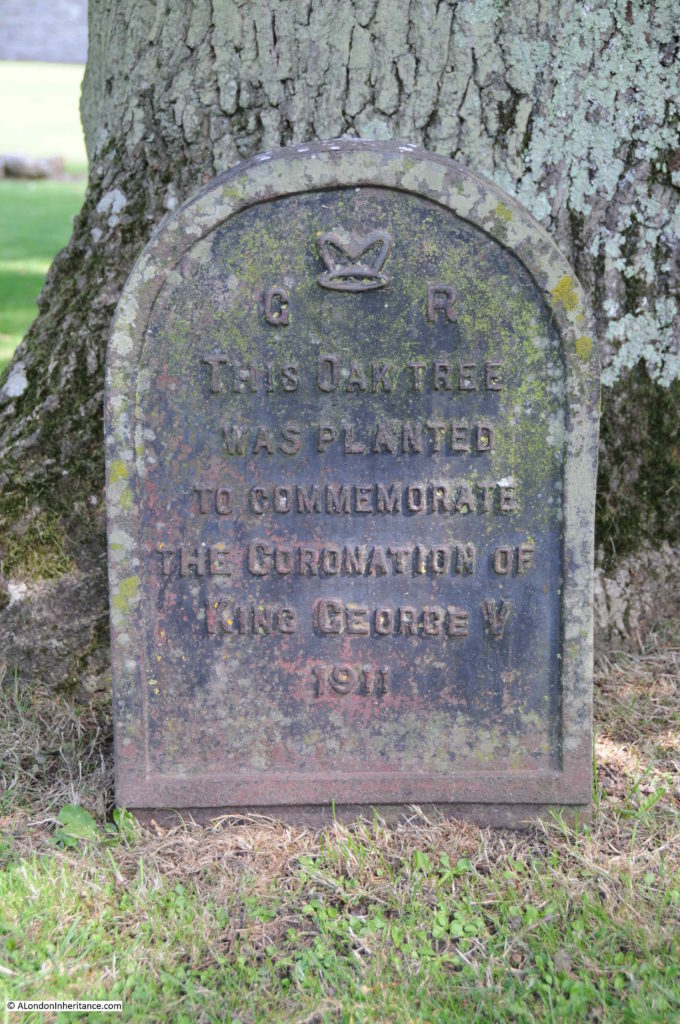
After the storm, Angus McGill of the Evening Standard launched an appeal to replace many of London’s lost trees (McGill is commemorated on the lower plaque), and the oak tree at the eastern edge of the station boundary is one of the trees planted as a result of the appeal.

The tree is in the photograph below, and the two plaques are on the left hand pillar behind the tree:

Well over 100 years after Fitzroy founded the Meteorological Office, in 1987, forecasting the weather was still a challenge, and Michael Fish’s forecast on the Thursday before the storm has become somewhat infamous as an example of getting a forecast wrong (in reality, high winds were forecast, but the storm tracked slightly further to the north and was a deeper low than had been forecast):

The Orkney Islands

The Orkney Islands are really rich in history and natural landscapes. Probably best known for Scapa Flow, the large, sheltered body of water between the islands, where the German Navy High Seas Fleet was scuttled in the First World War, and used by the British Navy of the First and Second World Wars as a Naval Base, there is much else to discover.

Some examples;

The Italian Chapel

We left Kirkwall in bright sunshine and after a short drive to the chapel found ourselves in thick fog.

The Italian Chapel was built by Italian prisoners of war during the Second World War, who were based on the main Orkney island, and were used to build the causeways between the main island and South Ronaldsway.

The chapel was mainly built and decorated using concrete, one of the few available materials at the time, and is really remarkable:

The Standing Stones of Stenness:

Four upright stones of an original twelve, that date back over 5,000 years.

Ring of Brodgar:

A 5,000 year old stone circle, originally of 60 stones, with 36 surviving today, and at least 13 prehistoric burial mounds.

Skara Brae Prehistoric Village:

A remarkable, 5,000 year old Neolithic settlement, first uncovered by a storm in 1850 when part of the site was revealed when some of the sand dunes that had been covering the settlement for centuries were blown away.

A number of the individual houses still have some of their stone furniture in place.

Brough of Birsay:

A tidal island, reached when the tides are right, across a causeway. The island has Pictish, Norse and Medieval remains.

Leaving Stromness (where the barometer is located), on the ferry to the Scottish mainland:

The Stromness barometer is number 98 of around 100 barometers installed around the coast by Robert FitzRoy’s project. It continued to be read until 2005, and was restored in 2014 using funding from the Townscape Heritage Initiative.

Stromness library includes a book about FitzRoy and his barometers, as well as the operators manual for the barometer.

Whilst the barometer aims to forecast the weather, it also tells a fascinating story of the mid-19th century, with Negretti and Zambra being London’s foremost scientific instrument makers. Vice-Admiral Robert FitzRoy founding the Met office, as part of the Board of Trade, and James Glaisher, who ran the Meteorological and Magnetic Department of the Royal Observatory at Greenwich, and who was a daring balloonist in his quest to measure temperature, pressure etc. of the atmousphere.

I know I overuse the word, but this is a really fascinating story, of which I have just scratched the surface.

alondoninheritance.com

A Wet January Evening in the City, and the Festival of Britain

A mix of subjects in this week’s post.

Firstly, if you would like to hear me say erm far too many times whilst I talk about the blog, I had a chat with Liam Davis who hosts a weekly podcast on Shoreditch Radio, where he invites guests from all walks of life to talk about London.

There is also a good discussion with Feargus Cribbin of the London Pub Map.

If the embedded widget below does not work, you can find the podcast at this link.

A Wet January Evening in the City of London

Not the most promising of headings, but hopefully I will show you why it is worth it.

The period between Christmas and the first full working week in the new year is a strange one in the City of London.

There are not too many people around, there will be those who have taken an extended break over Christmas and the first few days in January, also, working from home is a very attractive way of working at this time of year.

Although Christmas is rapidly fading from memory, there are still plenty of decorations and lights. Add to that a very wet start to the year, and an evening when the rain gets heavier by the hour, and the City takes on a very melancholy appearance.

The majority of people on the City’s streets are taking the sensible approach of heading home as quickly as possible, however it is also a good time for a little exploration.

Personally, I prefer the summer. A bit of warmth, plenty of sunshine, long evenings, however London looks good at almost any time of year, and to demonstrate, I took a walk from Liverpool Street down to the Bank, taking a series of photos as I went, with light rain to start, and heavy rain at the Bank preventing a longer walk.

I started at Exchange Square, which is an open space between office blocks at the end of the shed over the platforms of Liverpool Street Station.

It is a very unique place, providing an unusual view of the station and the structure of the roof above the platforms. I have written a dedicated post about the area, which you can find here, but the purpose of my latest visit was just to admire the view.

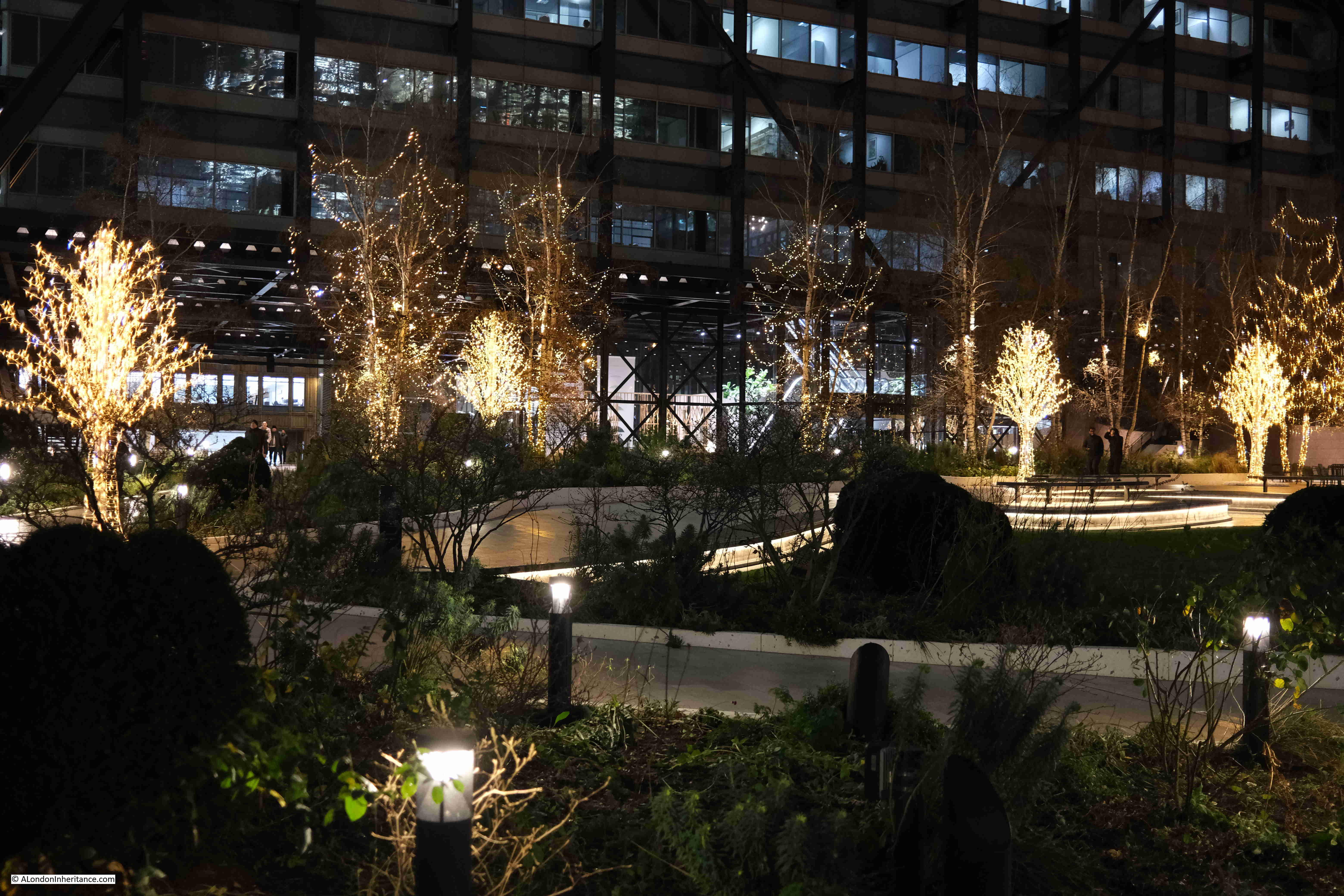
The trees in Exchange Square are currently decorated with lights:
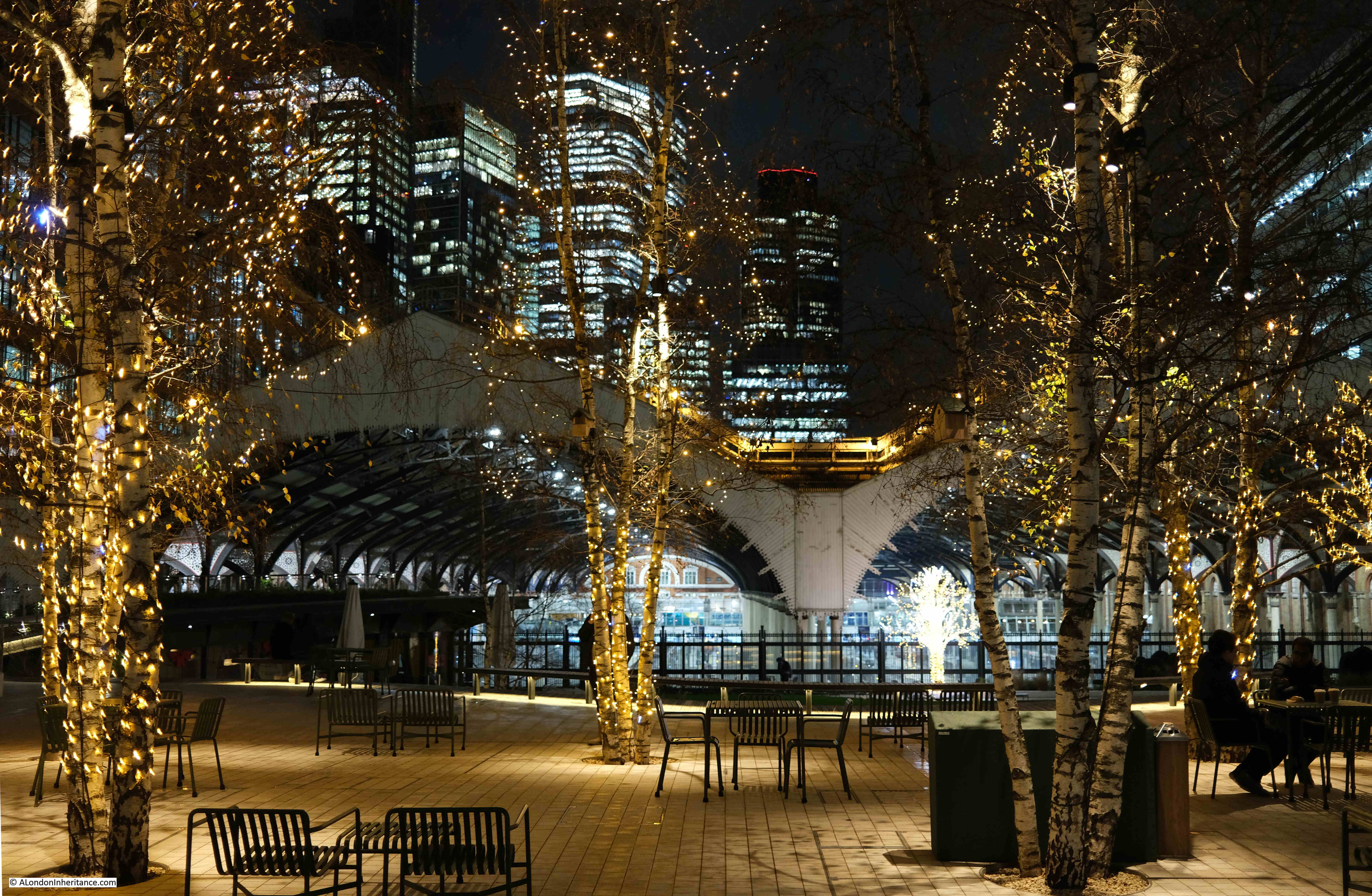
Wet January Evening in the City

The view from this space is good during daylight, but after dark it takes on a very different aspect, with the lights of the square, the station, and the tower blocks behind.

I assume that if the proposed development above Liverpool Street station goes ahead, then the view of the office blocks in the distance will be blocked by the new tower built over the station:
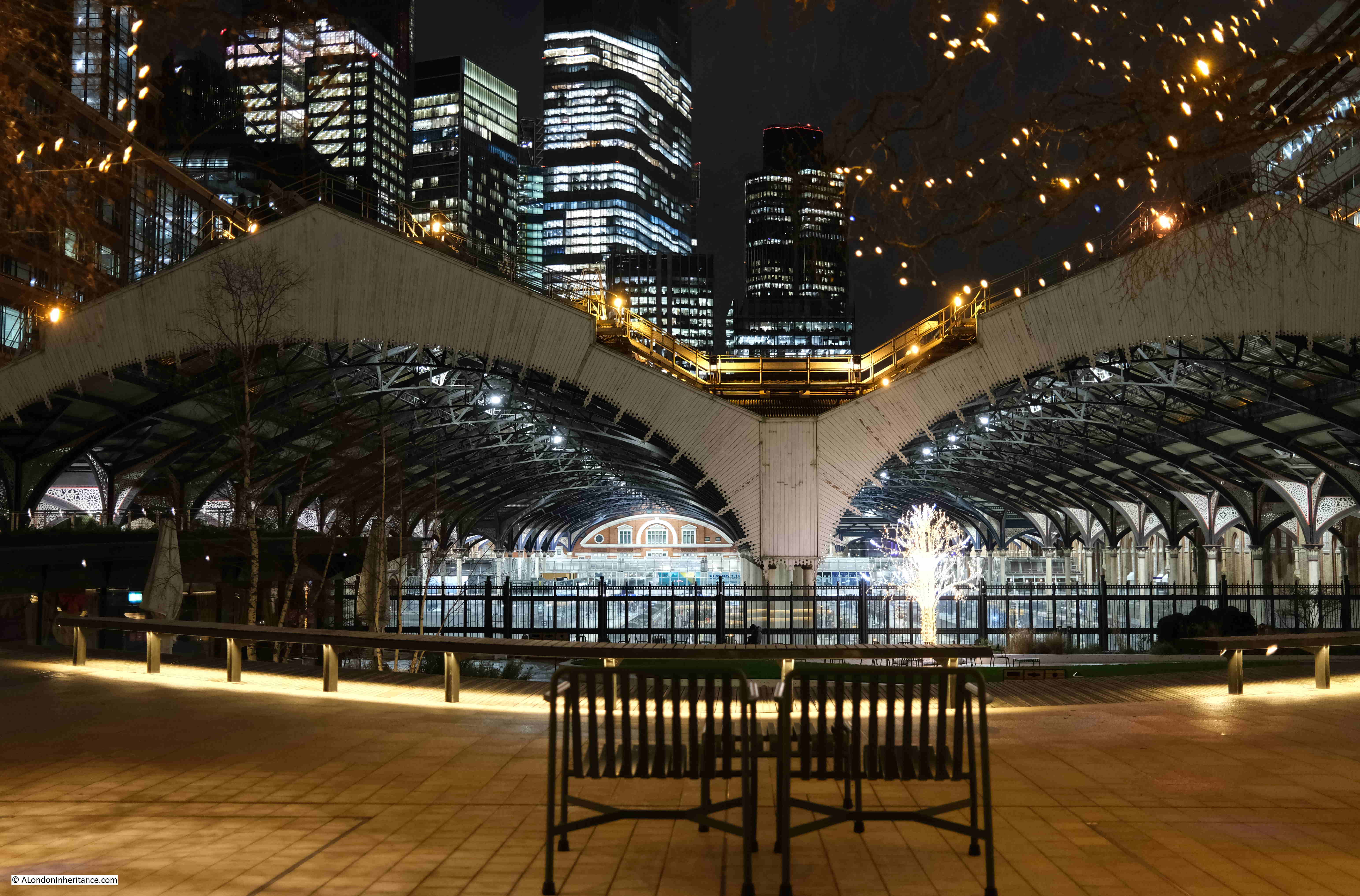
Wet January Evening in the City

From the fencing between the square and the station, we can look down on the platforms:
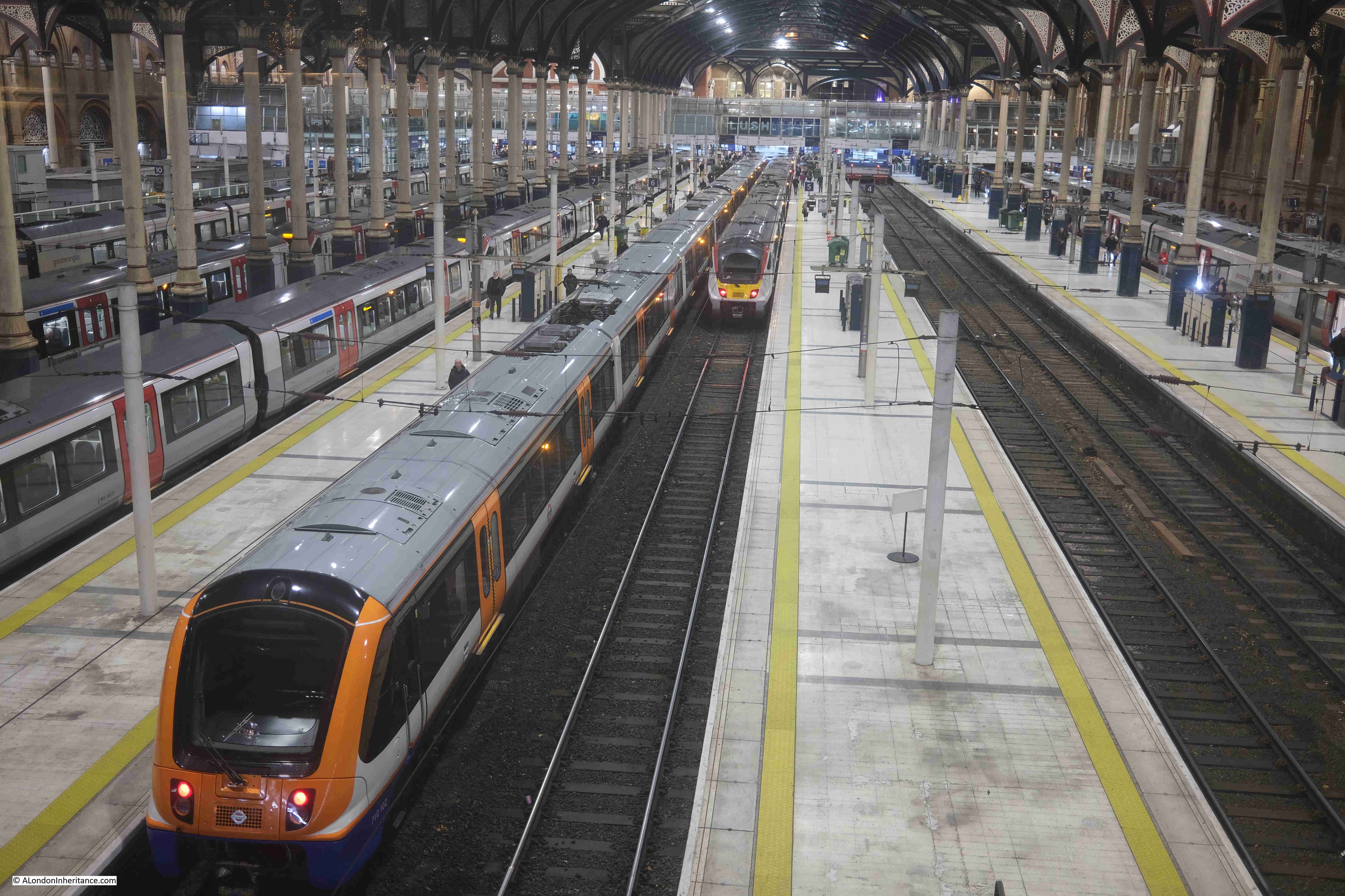
Wet January Evening in the City

Artificial lighting after dark brings out a different level of detail within the roof over the station platforms:
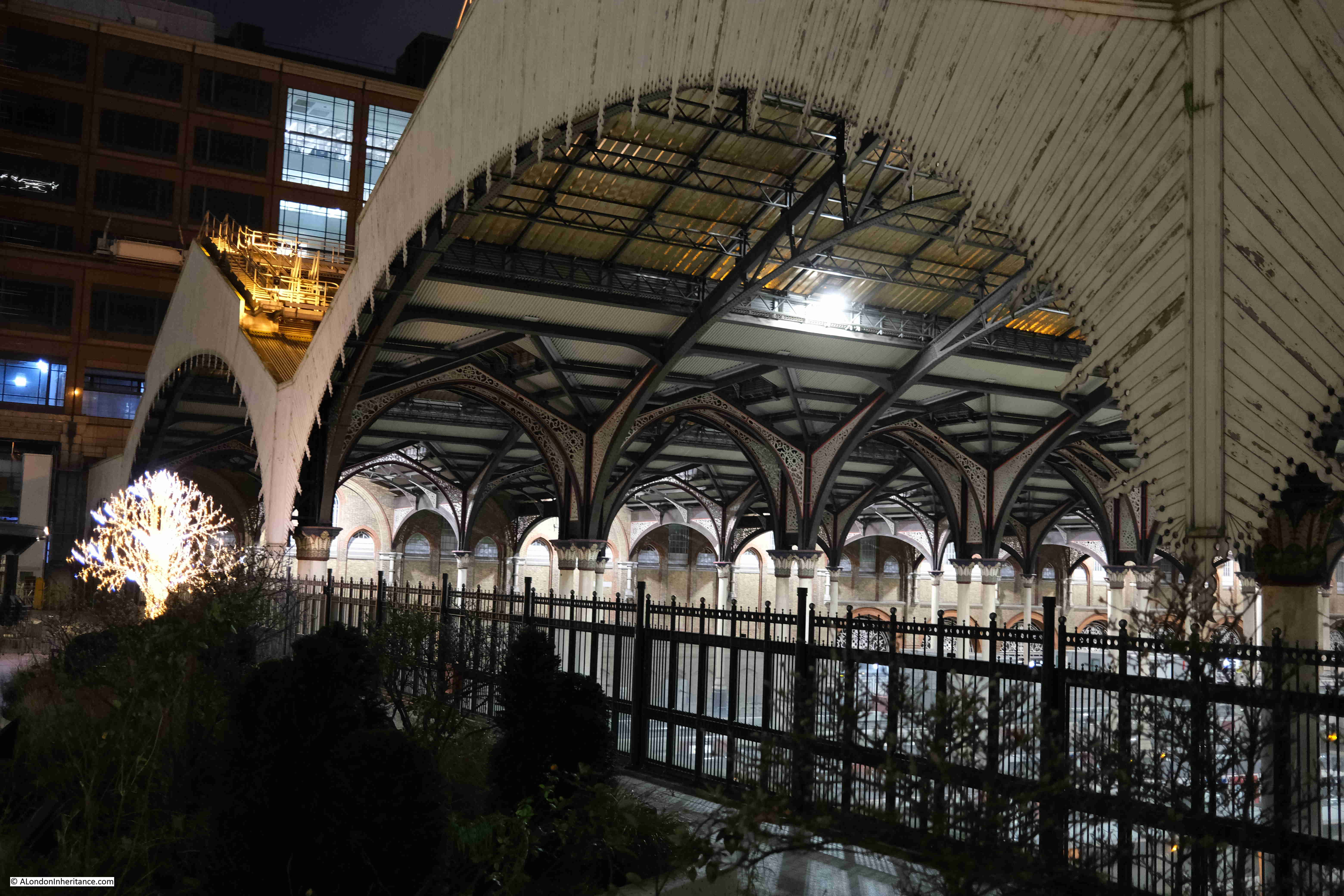
Wet January Evening in the City

Exchange Square lights:

Wet January Evening in the City

There are plenty of people using the station, but not as busy as on a working day outside of the Christmas / New Year period:
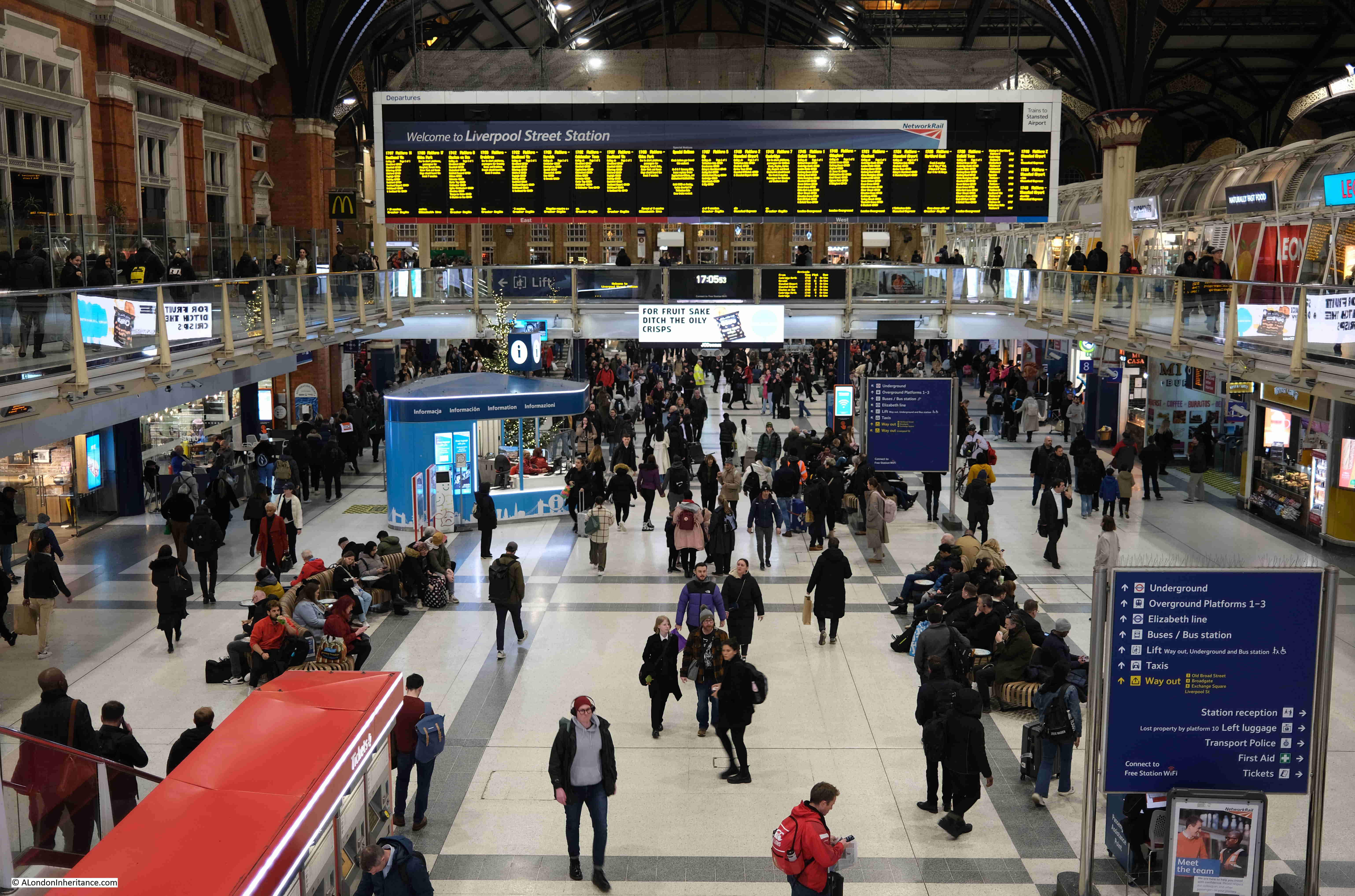
Wet January Evening in the City

The McDonald’s at the station entrance:
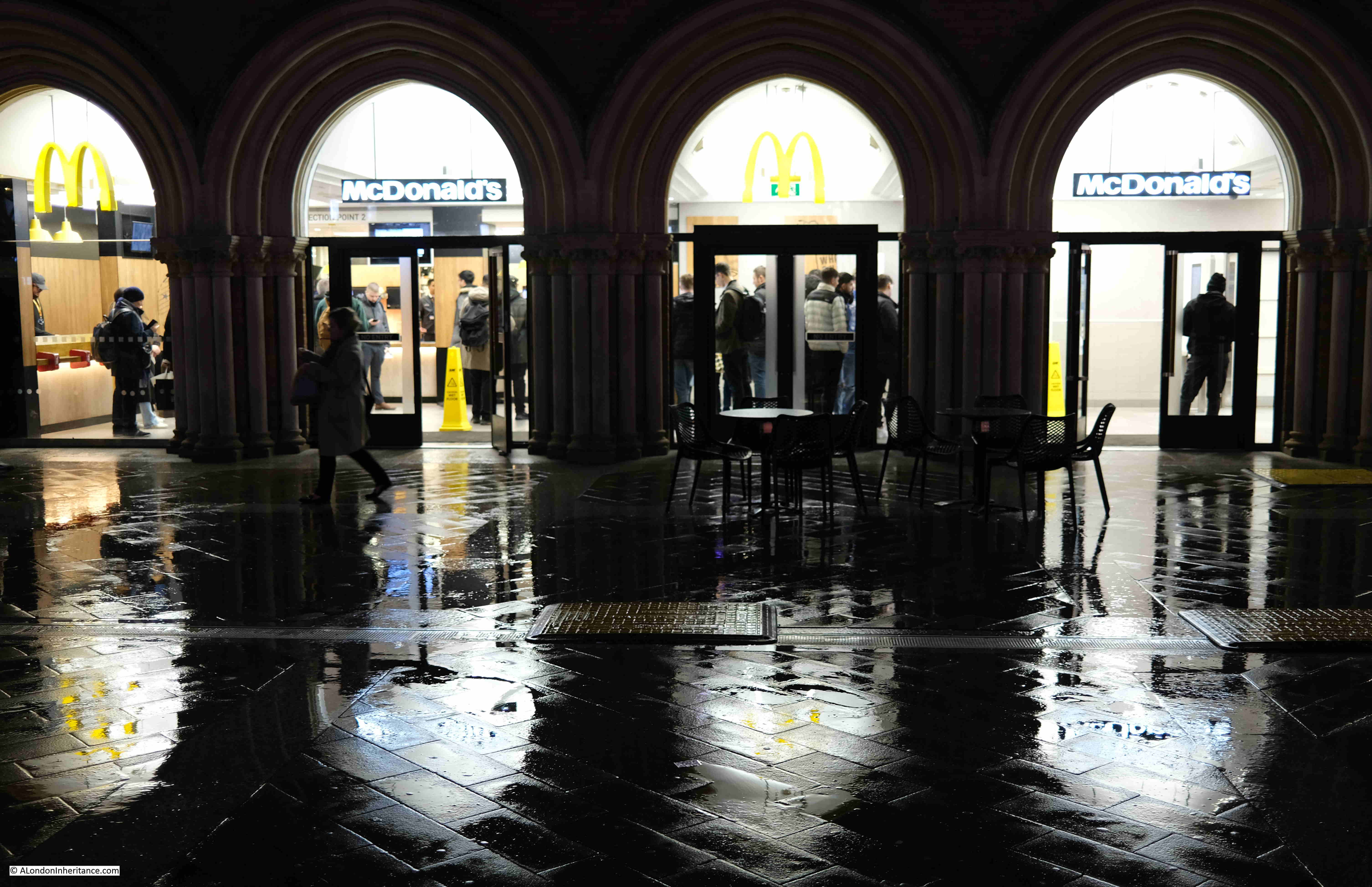
Wet January Evening in the City

One of the good things about walking while it is raining are the reflections of lights on the surface of the streets, creating pools of colour. This is by one of the entrances to Liverpool Street underground station, with the Railway Tavern at the corner on the right:
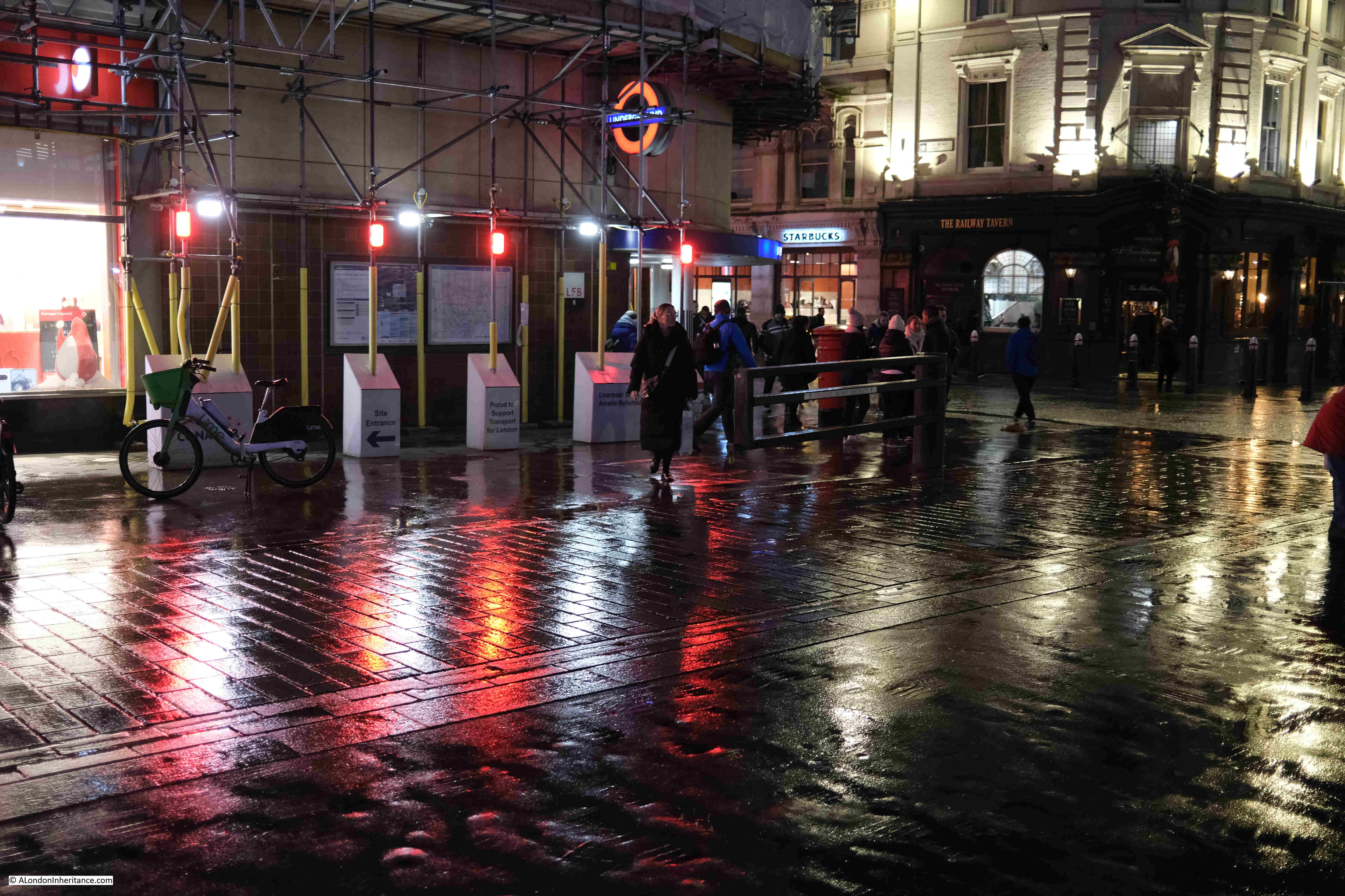
Wet January Evening in the City

Entrance to Liverpool Street Underground Station:
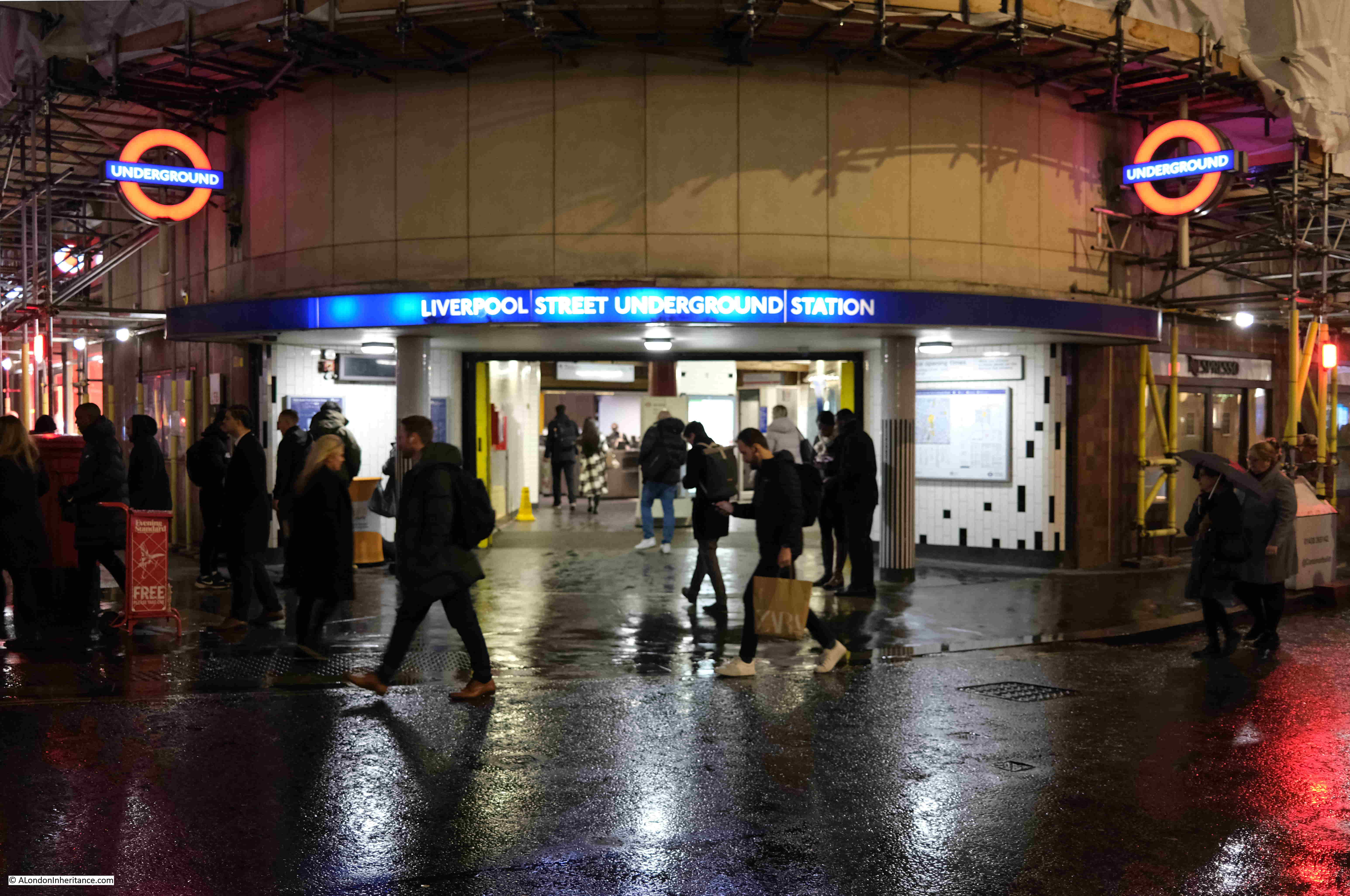
Wet January Evening in the City

View back to the station entrance, with purple lighting, and the brightly lit interior of the station in the background:
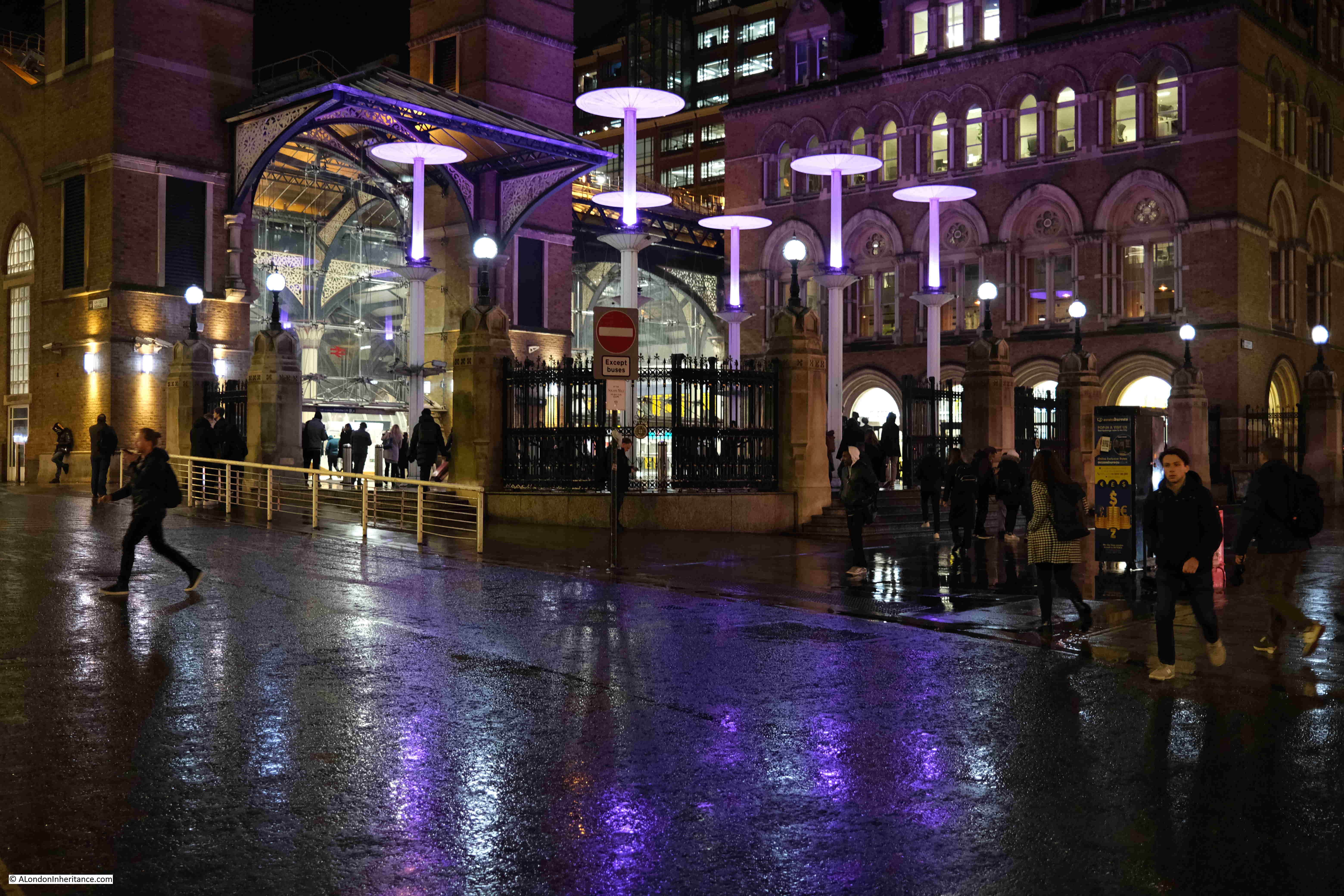
Wet January Evening in the City

Entrance to the office building that is on the site of Broad Street Station:
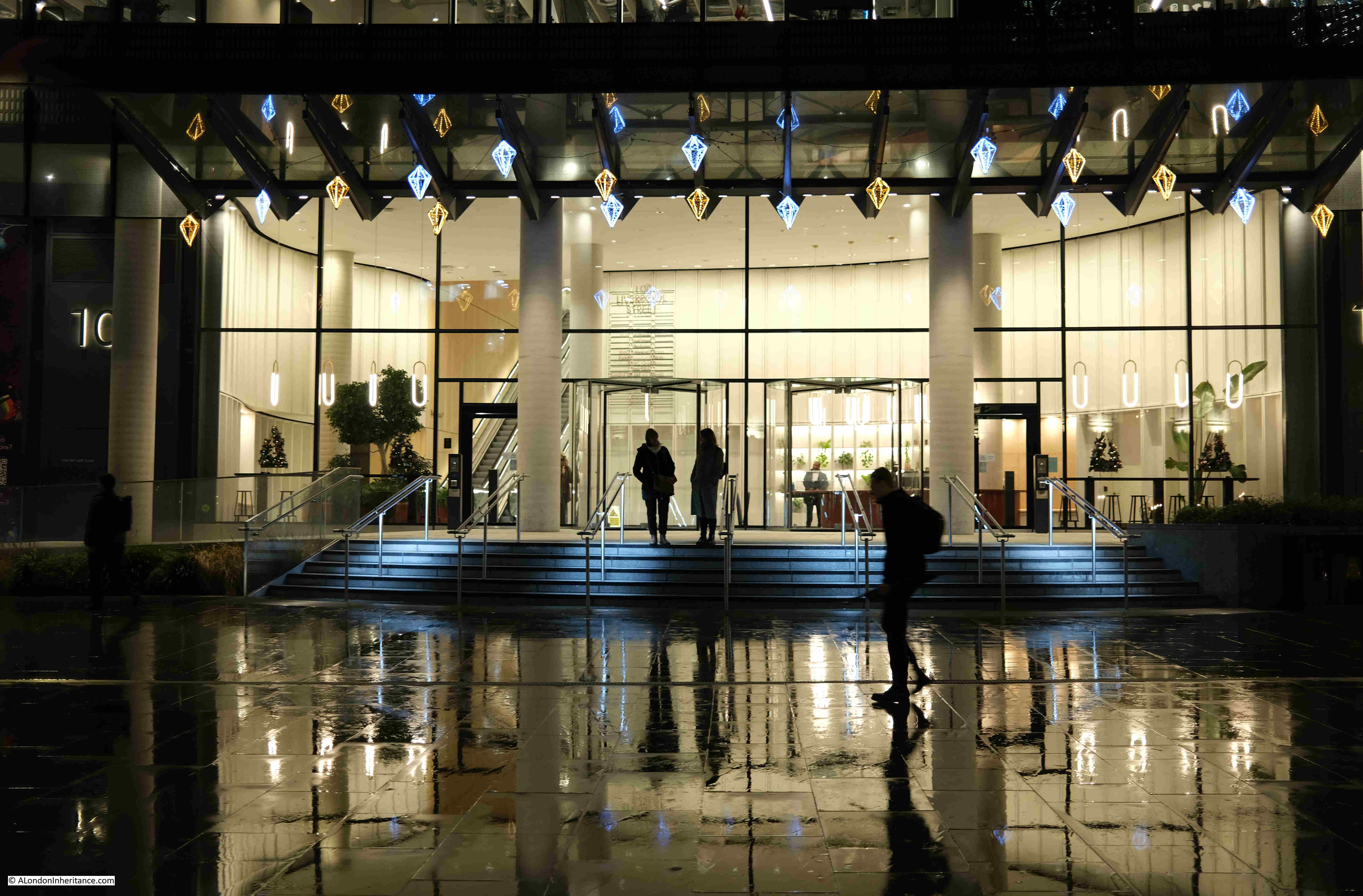
Wet January Evening in the City

View back towards Liverpool Street Station. The alternative view, if the proposed development goes ahead, can be seen in this pdf. The view does not seem to appear on the projects website, only in the pdf of Exhibition Materials.
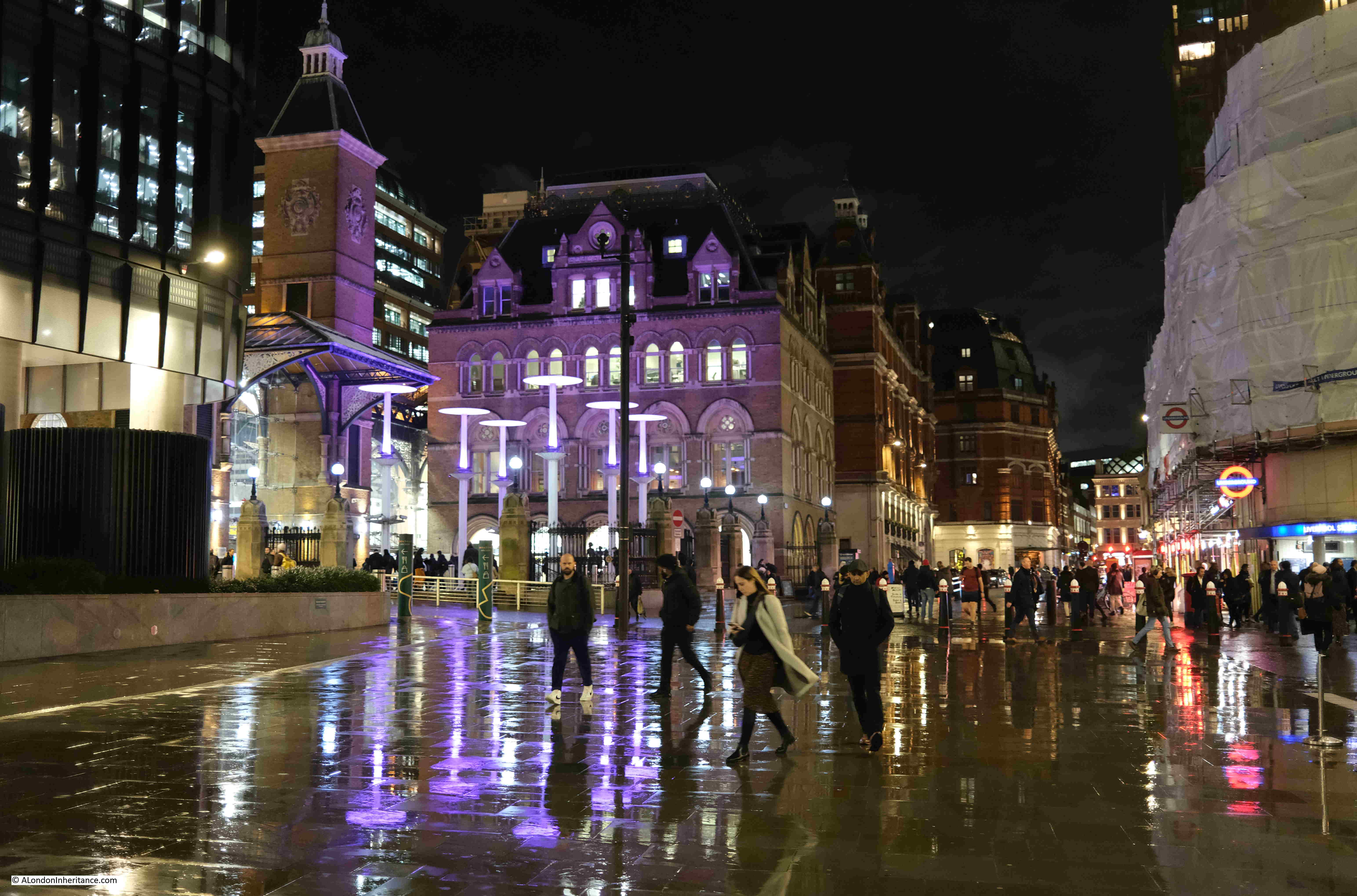
Wet January Evening in the City

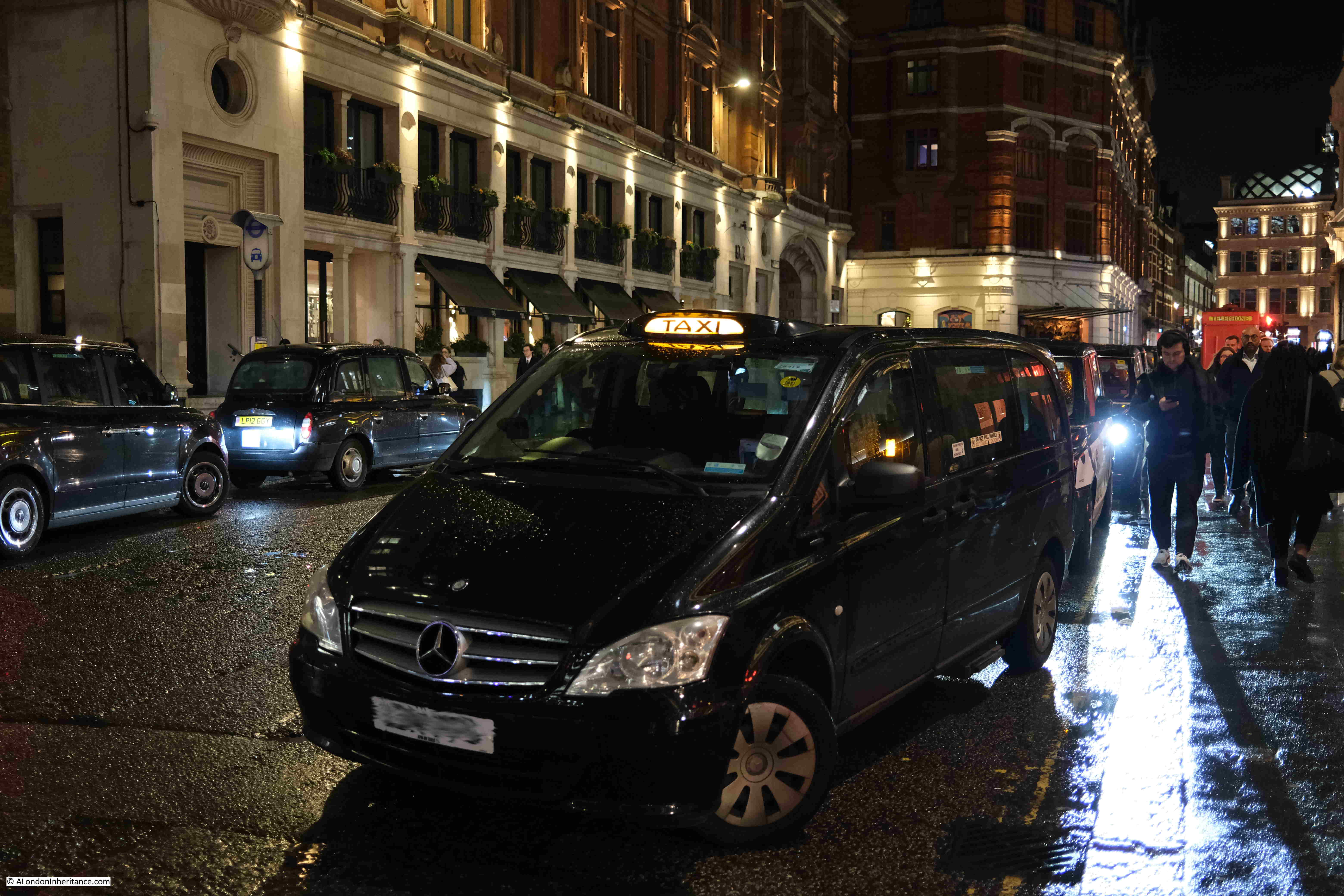
Taxis waiting outside the station:

Wet January Evening in the City

The view along Bishopsgate:

Wet January Evening in the City

The main streets are much quieter than usual, and the alleys and courts that can be found across the City are dead:
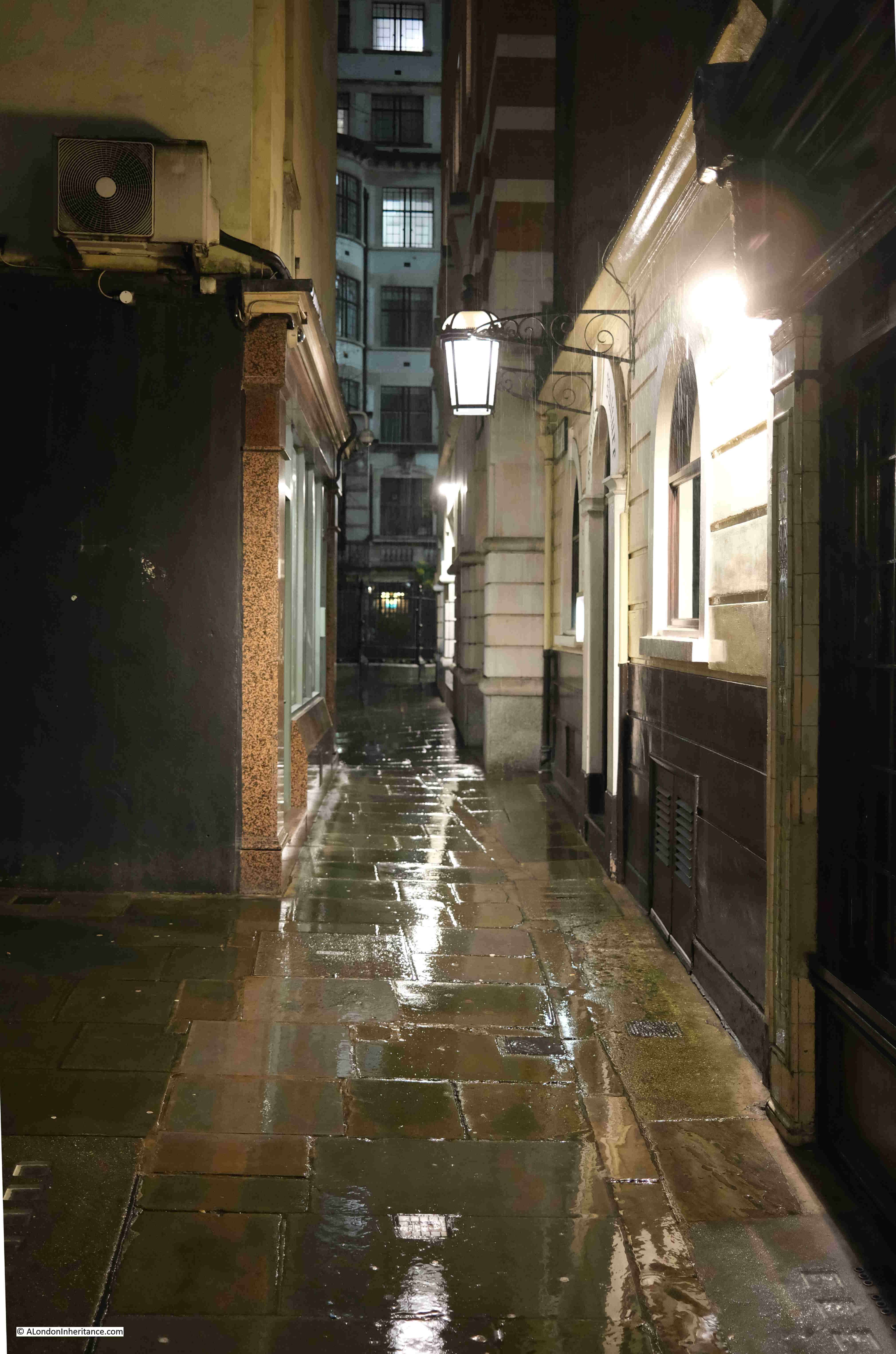
Wet January Evening in the City

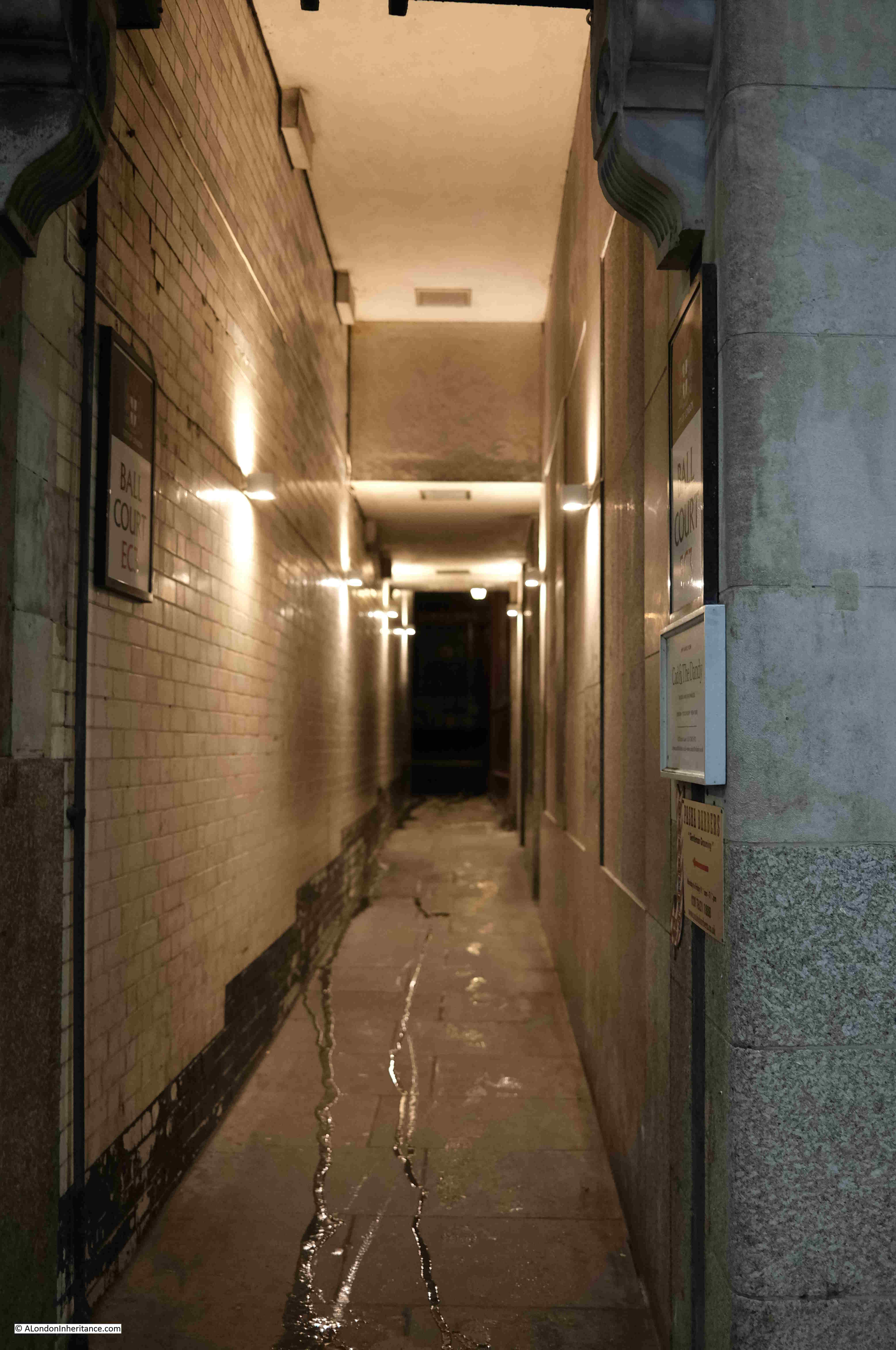
Ball Court, leading off Cornhill:

Wet January Evening in the City

The tragically closed Simpsons, in Ball Court:
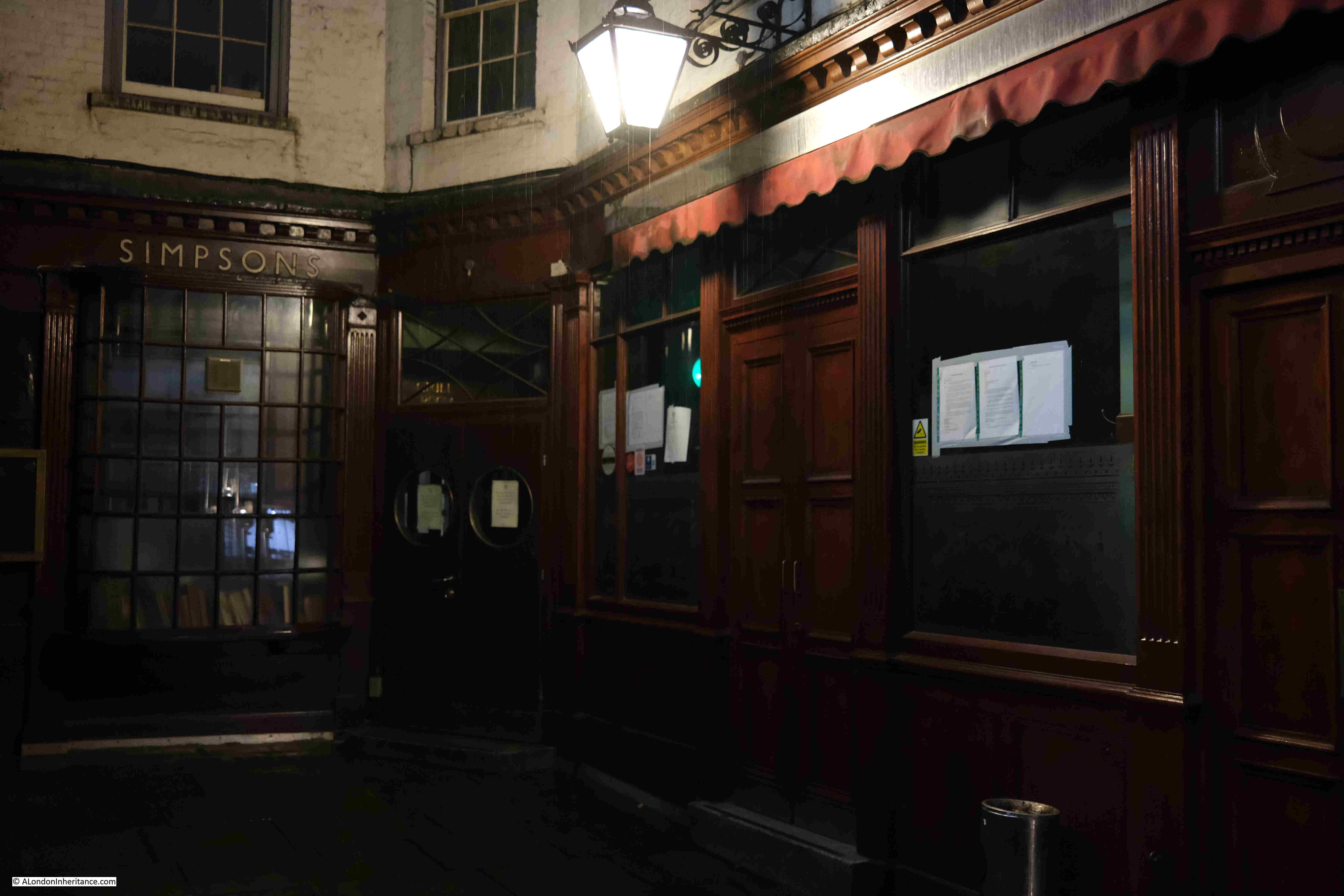
Wet January Evening in the City

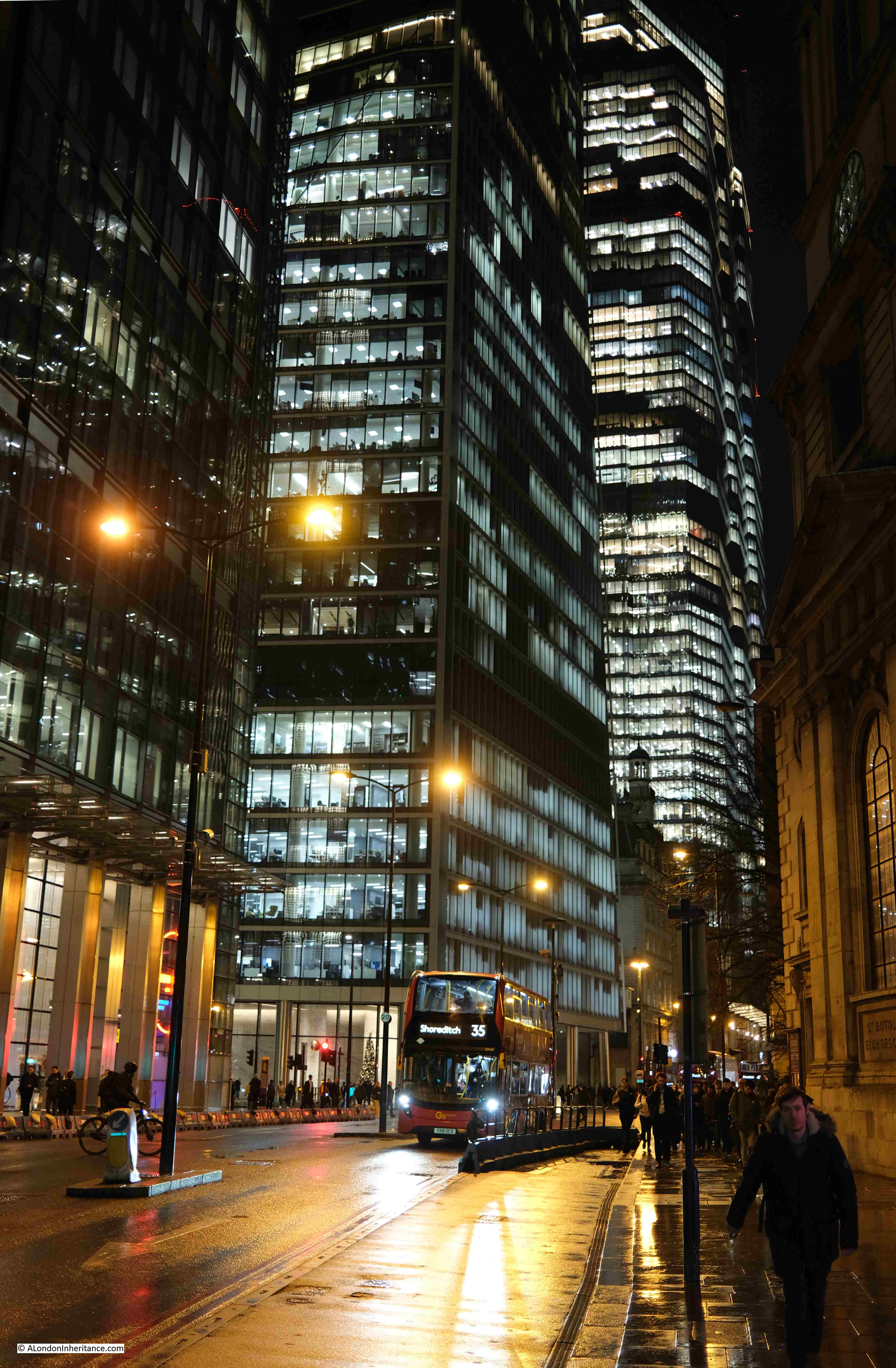
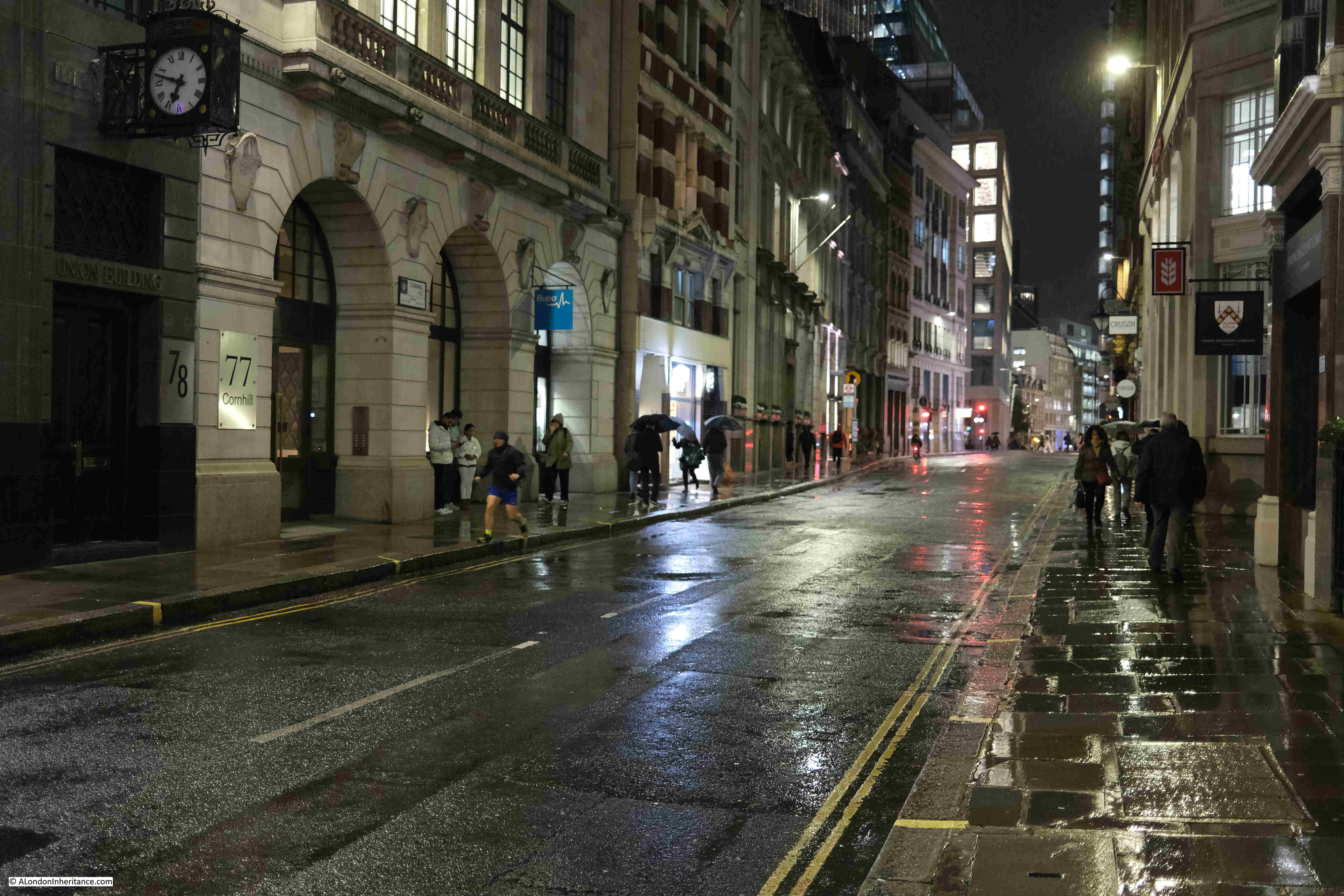
View east along Cornhill:

Wet January Evening in the City

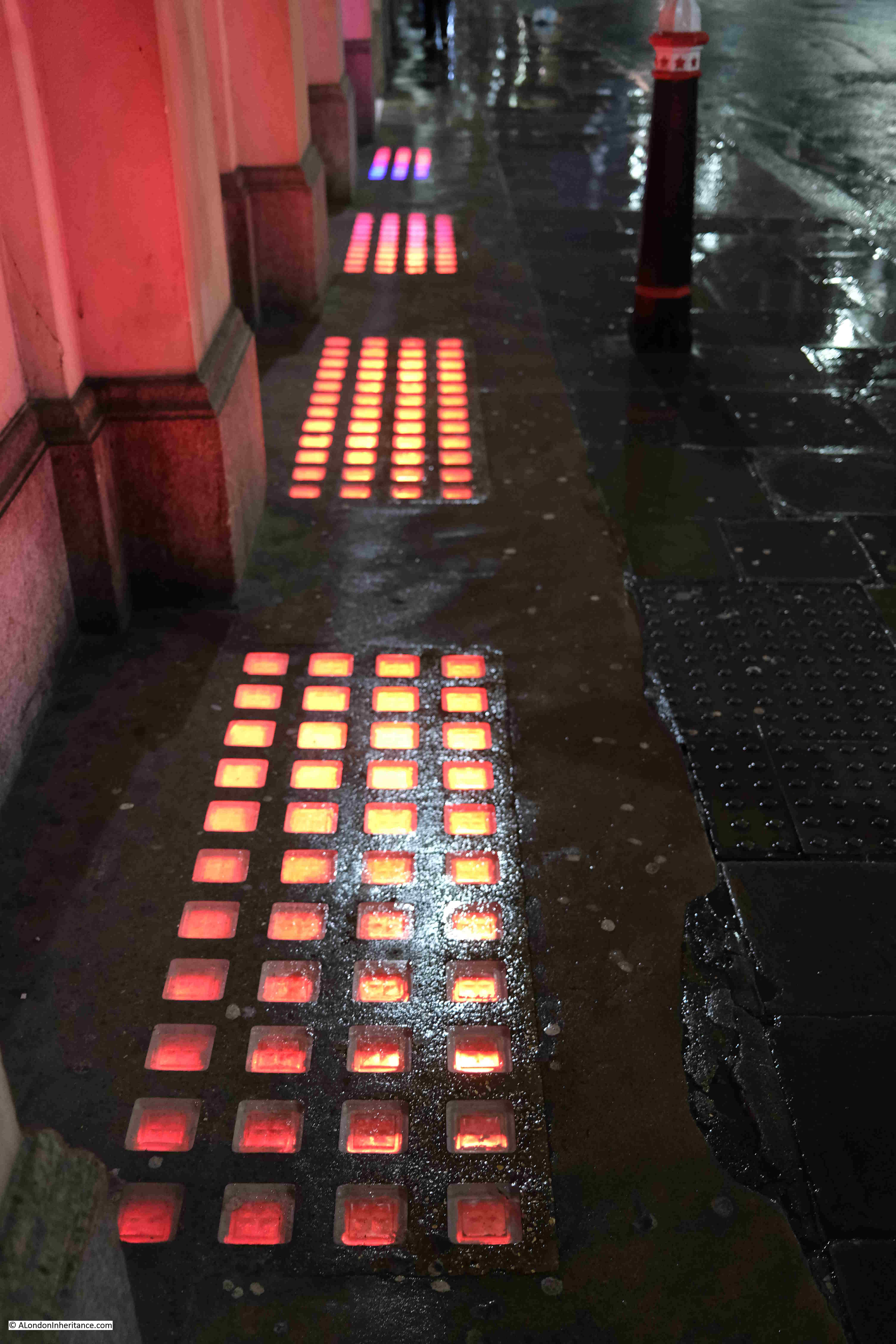
Colour from the basement:

Wet January Evening in the City

Cornhill looking west towards the Bank junction, with St. Paul’s Cathedral just visible in the distance:
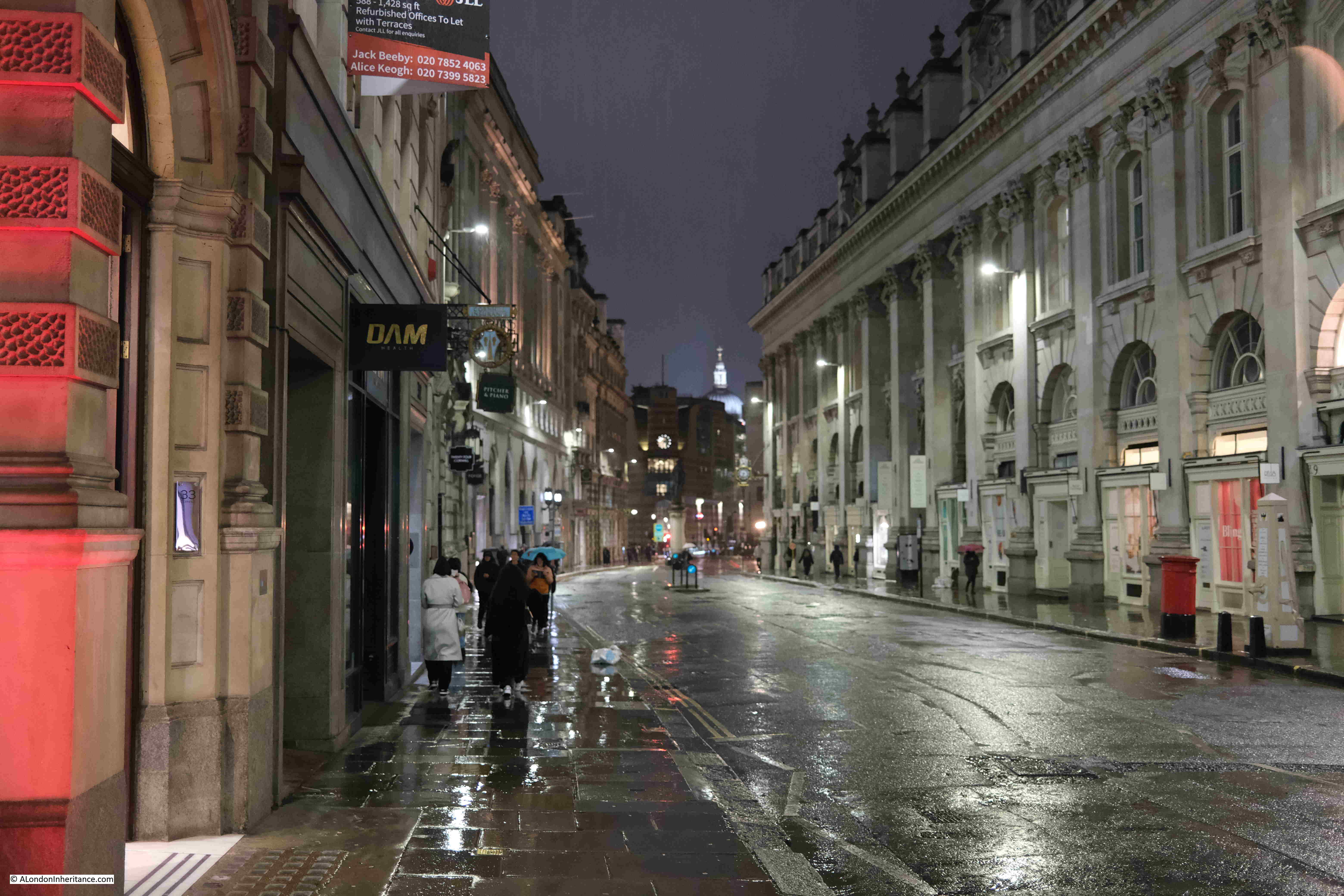
Wet January Evening in the City

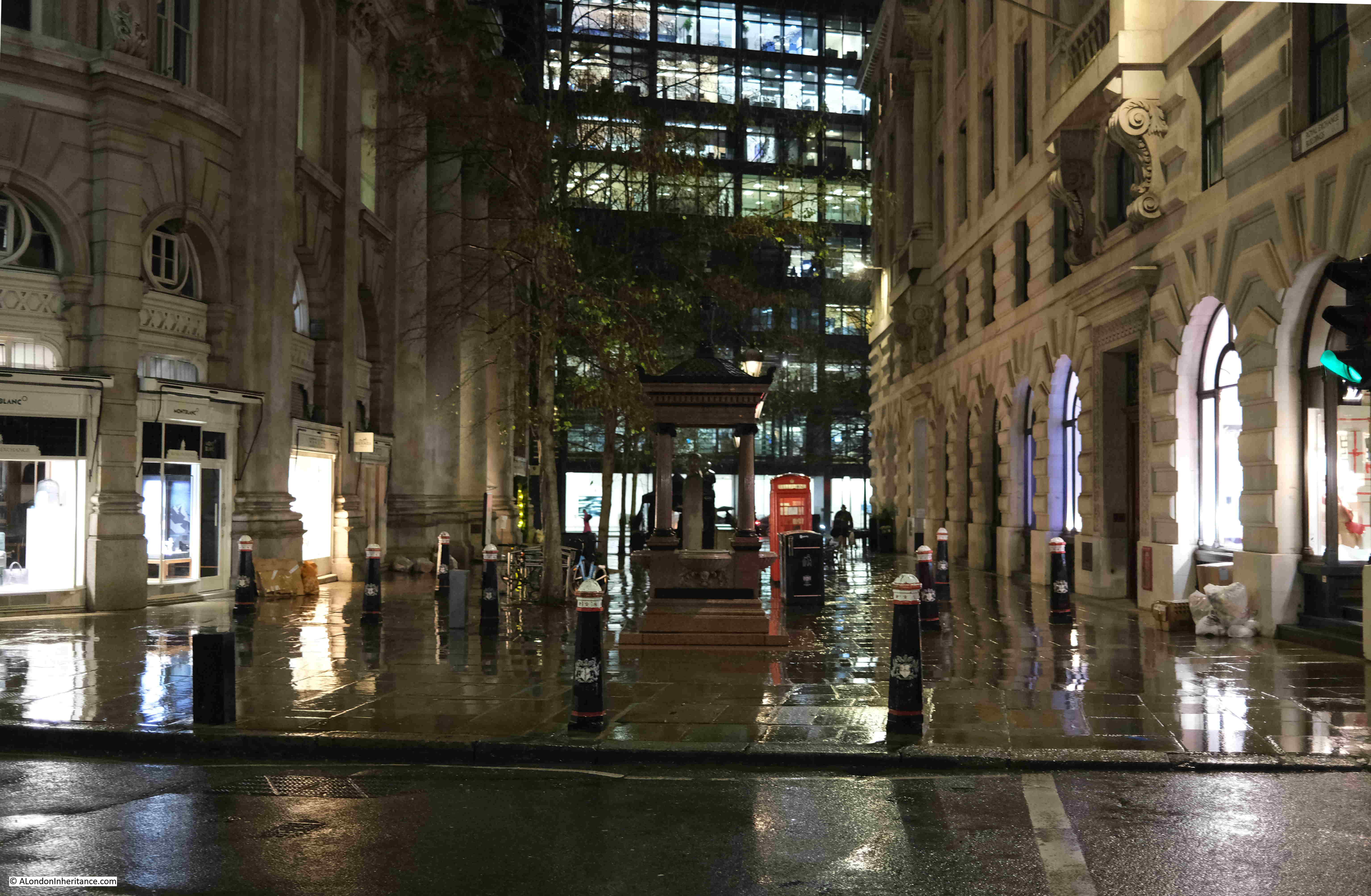
At the rear of the Royal Exchange:

Wet January Evening in the City

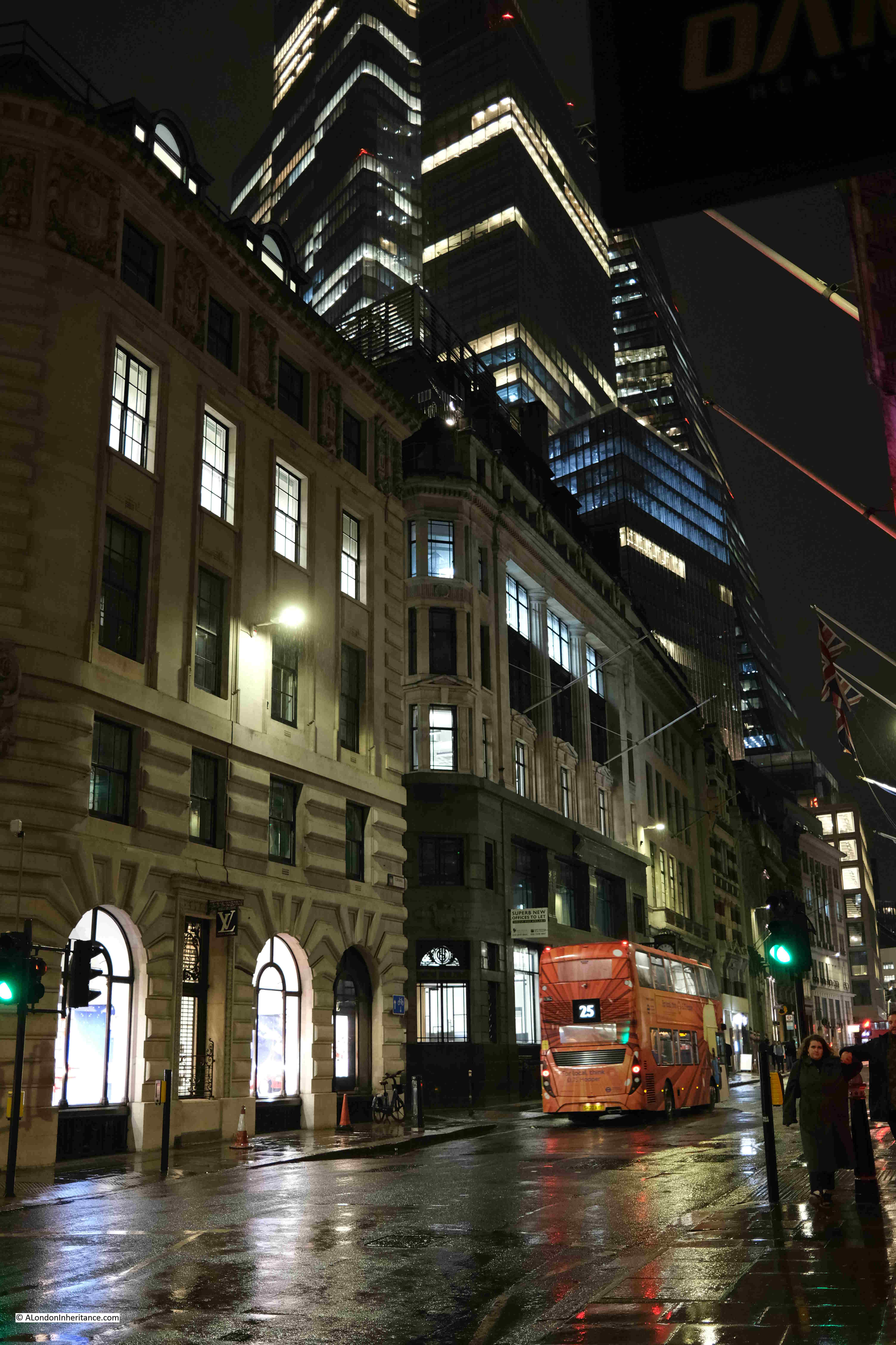
The towers of the City above the “relatively” low rise buildings around the Bank:
Wet January Evening in the City

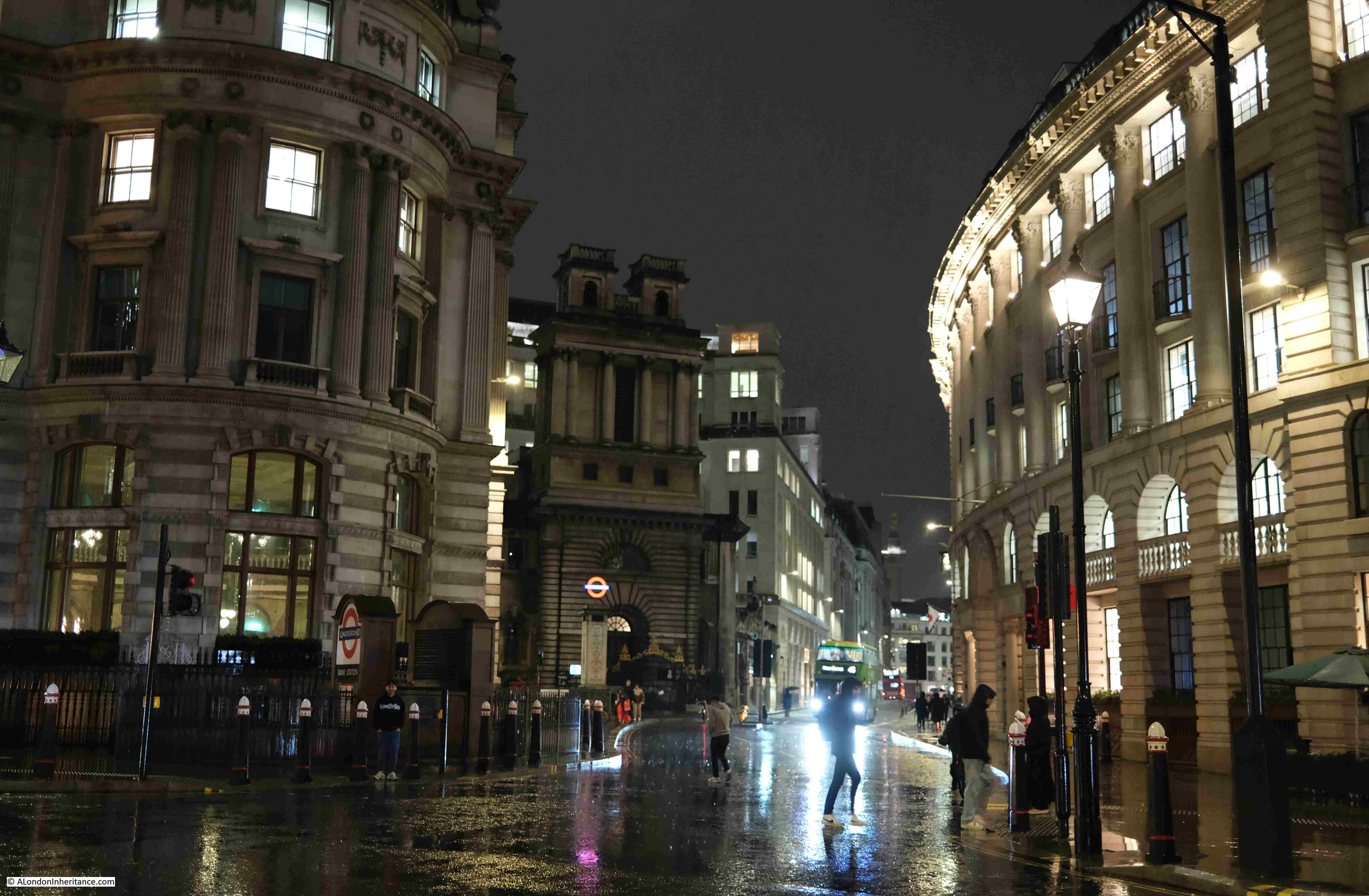
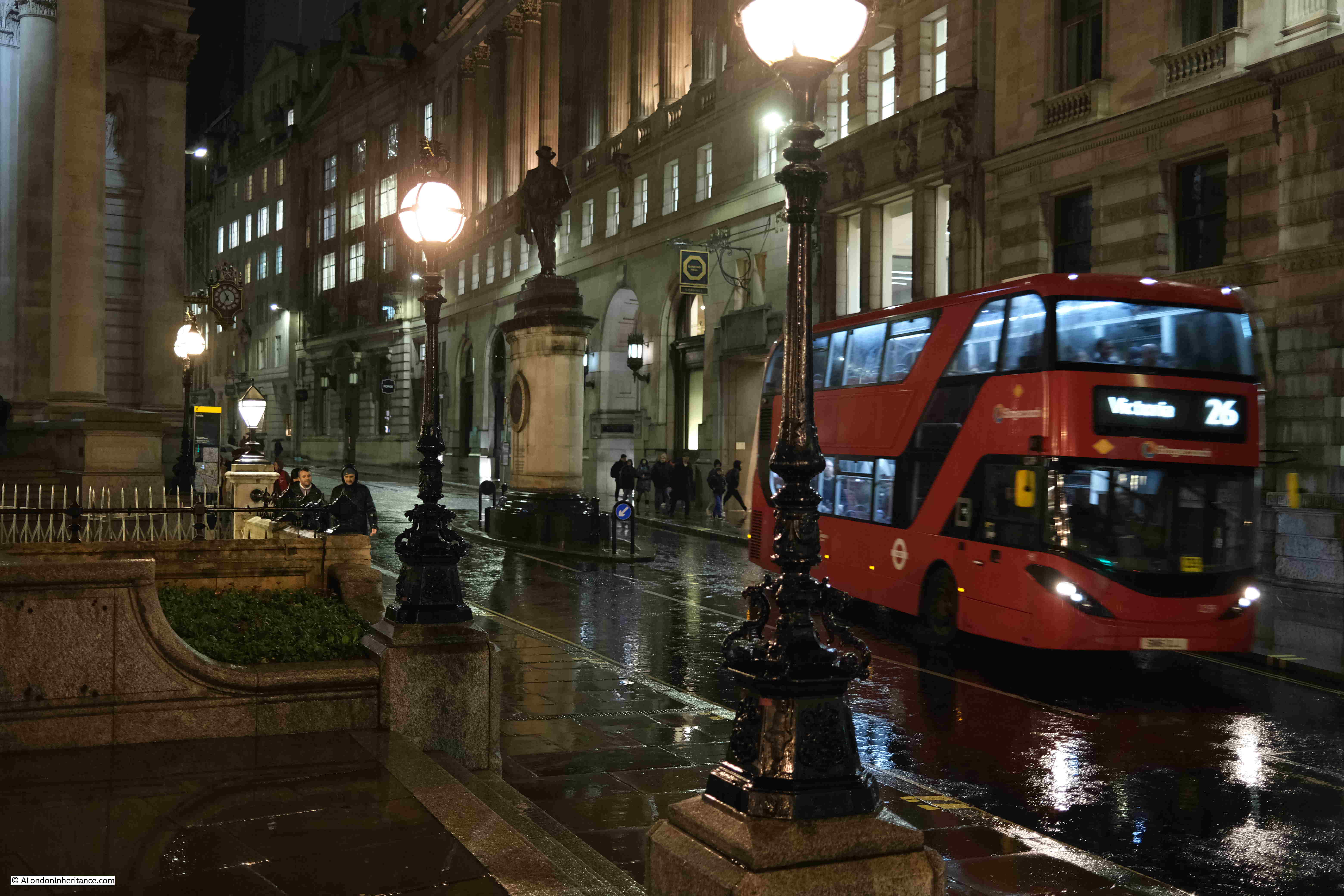
At the Bank junction, in front of the Royal Exchange looking along Cornhill, and the rain was getting heavier:
Wet January Evening in the City

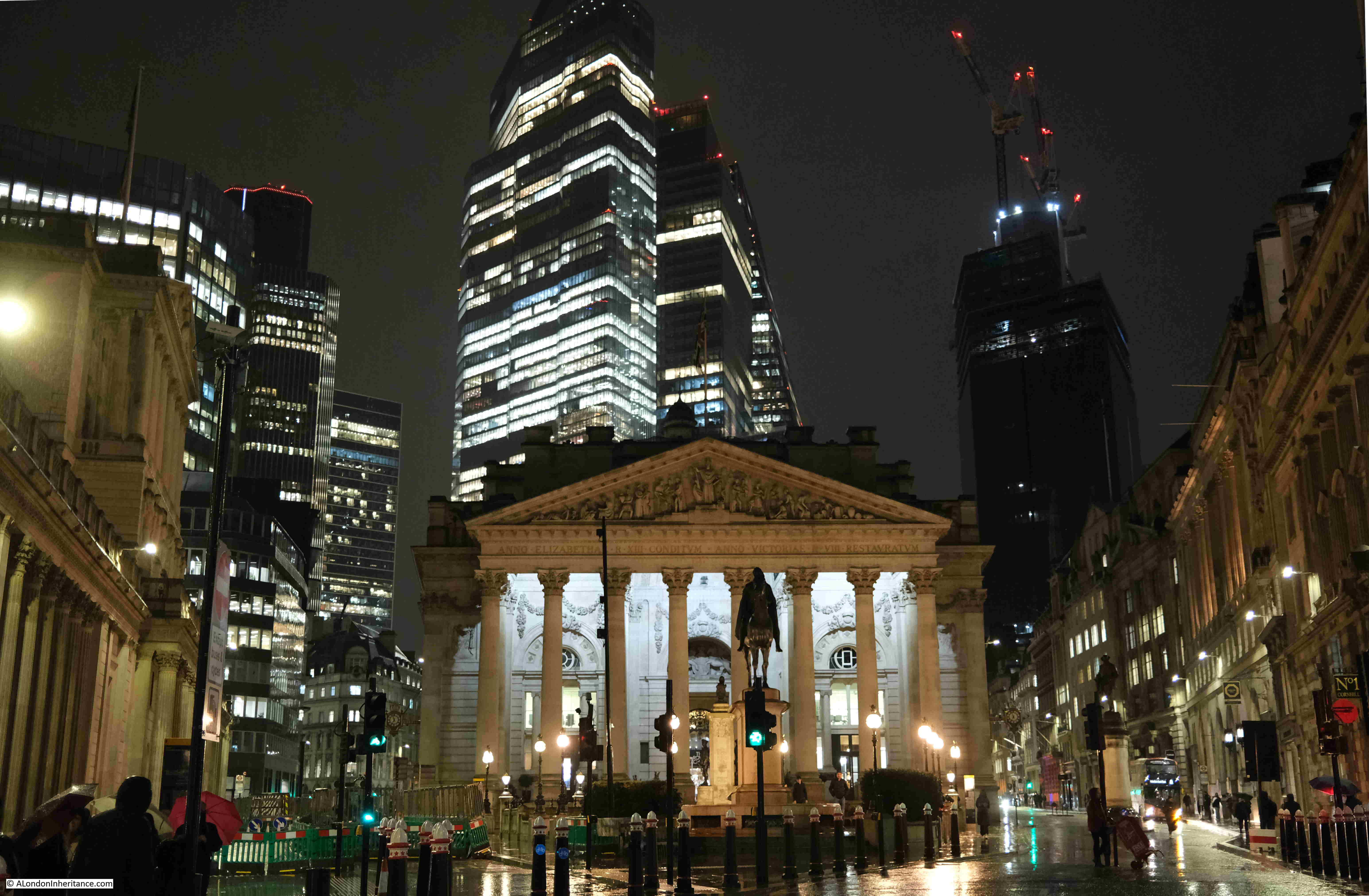
The Royal Exchange with the towers of the City:
Wet January Evening in the City

Looking down Lombard Street:

Wet January Evening in the City

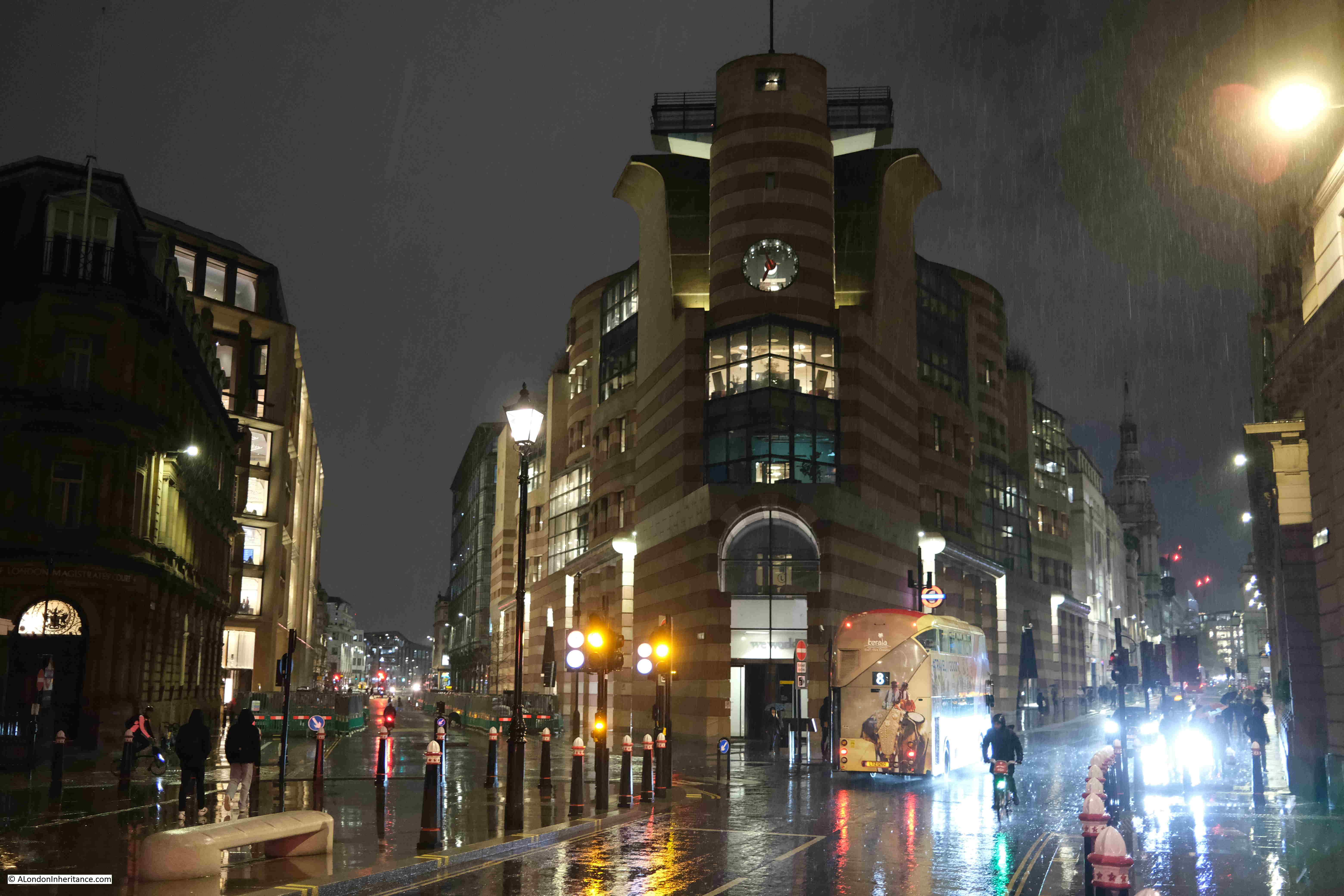
No. 1 Poultry, between Poultry (right) and Queen Victoria Street (left):
Wet January Evening in the City

A final look back towards the east of the City:
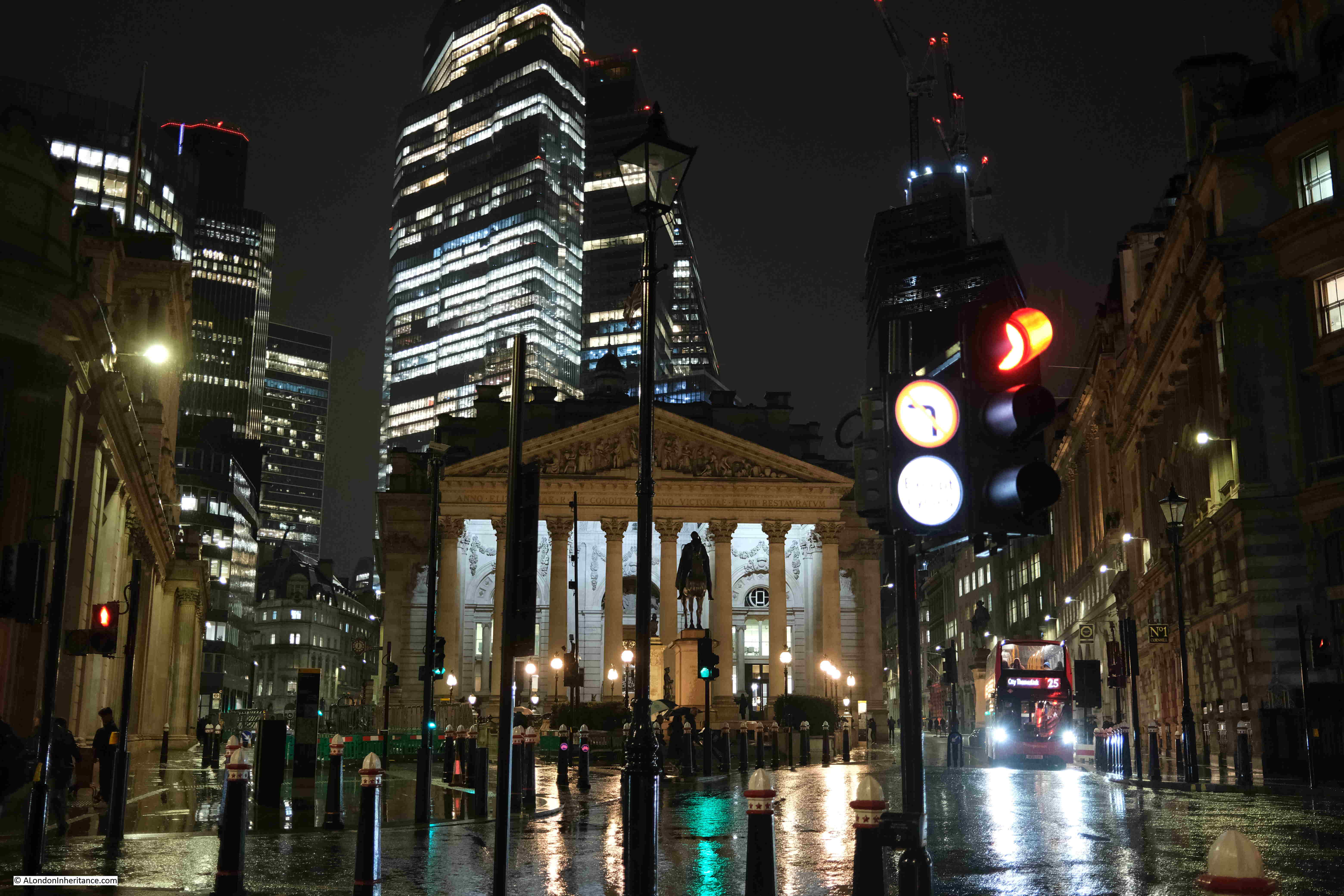
Wet January Evening in the City

The rain was very heavy by the time I reached the Bank, and as water and the electronics in a camera do not mix that well, I joined the few remaining commuters walking into the Bank station to head home.

The Festival of Britain – Land Travelling Exhibition

If you have followed the blog for a few years, you will know that I am really interested in the Festival of Britain. The primary site for the festival in 1951, was on the Southbank, in the area between County Hall and Waterloo Bridge.

There were though festival sites all across the country, as the intention was for the country to be involved, not just a London centric festival.

Each of the main festival exhibitions had their own festival guide book. All were based on the same format and design as the Southbank festival site, but with a different colour to the cover page where the Abram Games famous festival emblem featured.

I have been trying to collect all the festival guide books for some years, and I recently got hold of a copy of the guide book for the travelling element of the 1951 exhibition:
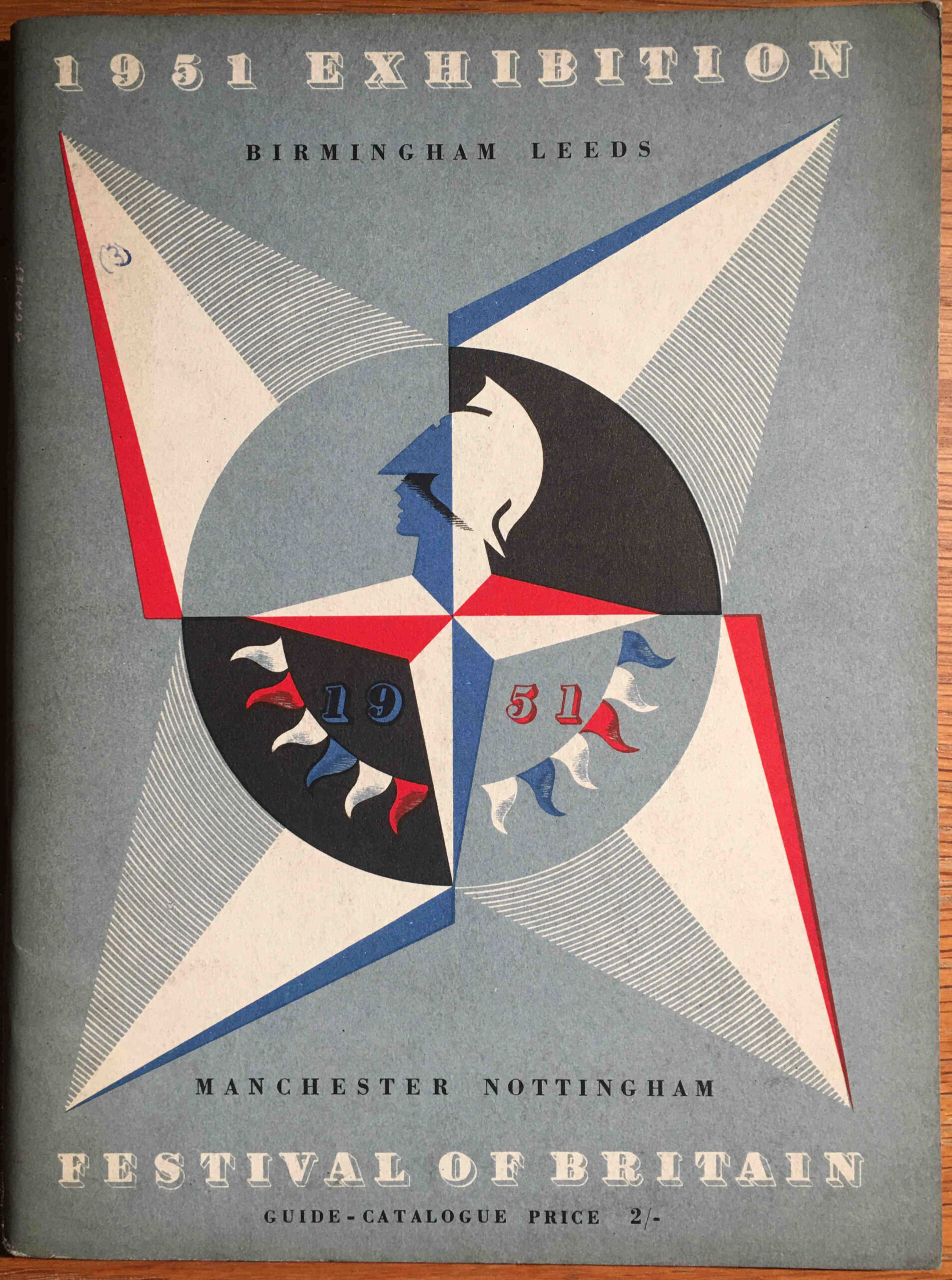
Festival of Britain Travelling Exhibition

This guide book covered the land travelling exhibition, which visited Birmingham, Leeds, Manchester and Nottingham. As the land travelling exhibition, this would reach major inland cities, where the exhibition on an old aircraft carrier covered major coastal locations (link to this at the end of the post).

The introduction provides the background to the travelling exhibition:

The Festival Exhibition is visiting four of our major inland centres of industry: Manchester, Leeds, Birmingham and Nottingham. It is therefore appropriate that the main theme of this Exhibition should be the British people and the things they make and use: our past and present achievements in technology and industrial design, and how these provide us to day with manifold opportunities to enrich our daily lives.

The things that will be seen in this Exhibition are not ordinary, average products, but some of the best things that this country is producing at the present time. They are things that we can be proud of, that can inspire and fill us with confidence in the future; and they are a challenge to British industry to emulate the achievements shown here.”

For a travelling exhibition, this was a complex undertaking with thousands of display items grouped into sections as the visitor walked through the exhibition.

The themes were: Materials and Skill, Discovery and Design, People at Home, People at Play, People at Work, People Travel, and the route and individual displays within each section are shown in the following double page map from the guide book:
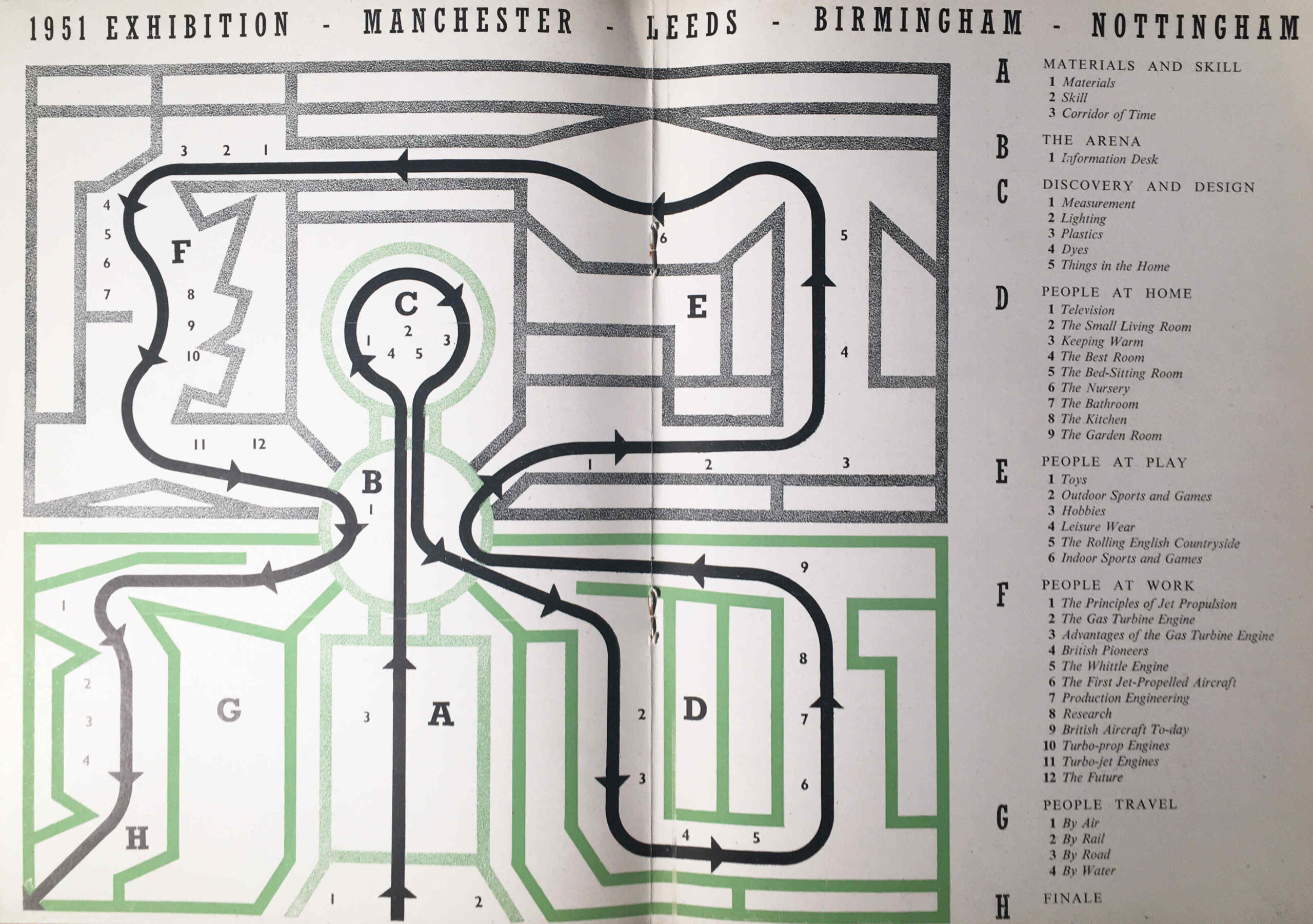
Festival of Britain Travelling Exhibition

The focus on technology and industrial design was appropriate for the locations of the exhibition as these were still major industrial centres. It also followed the overall theme of the future, presenting an optimistic view of the future following years of war, rationing and austerity. An attempt to show what the country could make, as there was still an urgent need to reduce imports, grow exports and sell for foreign currency, and to provide a unifying experience which would involve everyone across the country.

Unlike the Southbank Festival guide book, which contained long written sections describing the displays, the guide book for the Travelling Exhibition was mainly a catalogue of all the individual items on display, however it does contain some brilliant drawings of the exhibition areas.

The following image is titled “The Façade”, and shows the main entrance to the exhibition:
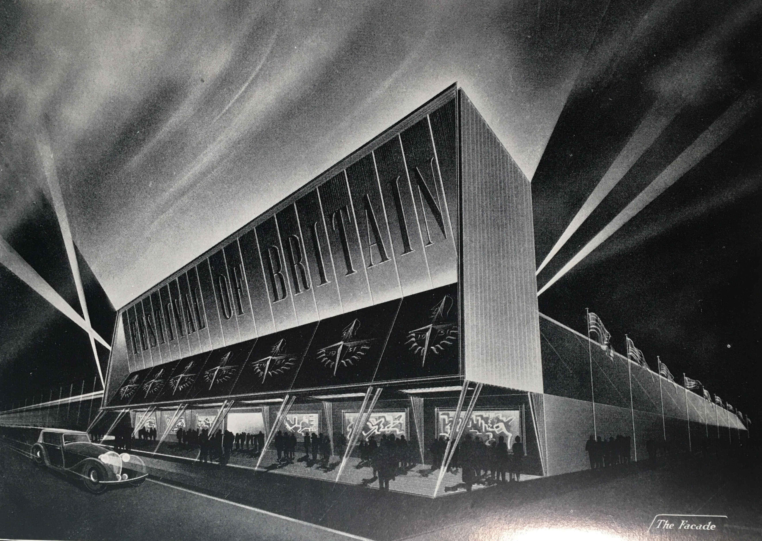
Festival of Britain Travelling Exhibition

The image looks as if it is a Hollywood film premier rather than an exhibition of technology and industrial design.

The timetable for the travelling exhibition was as follows:

  • MANCHESTER – At the City Hall, Deangate. Open from Thursday, 3rd May to Saturday, 26th May inclusive
  • LEEDS – On Woodhouse Moor (Woodhouse Lane and Raglan Road Corner), Leeds. Open from Saturday, 23rd June to Saturday, 14th July inclusive
  • BIRMINGHAM – At the Bingley Hall, King Alfred’s place. Open from Saturday, 4th August to Saturday, 25th August inclusive
  • NOTTINGHAM – At Broadmarsh, Lestergate, Nottingham. Open from Saturday, 15th September to Saturday, 6th October inclusive.

The exhibition was open seven days a week, with a morning start, and closing at 11:00 pm, including Sunday, although on Sunday’s the exhibition opened at 2:30pm, as I assume there was still an expectation that people would be going to church on a Sunday morning.

The travelling exhibition was not the only Festival of Britain event organised in these cities, for example, in Birmingham, newspapers were also advertising other Festival of Britain events such as a City of Birmingham Show in Handsworth Park, with events including a dog Show, a Rabbit Show and ending with fireworks. There was also a military tattoo at the Alexandra Sports Stadium and a Festival of Opera and Drama at the Midland Institute and Moseley and Balshall Heath Institute.

The next image shows the Corridor of Time:

Festival of Britain Travelling Exhibition

The Corridor of Time was introduced in the guide book as follows:

“The things that have been made in each age have depended upon the degree of man’s mastery over the materials of the earth and the development of his skill in making and using tools and machines. The story of the ascent of man, the ‘tool-using animal’, from the most primitive times to the present day is told in striking and symbolic form in the Corridor of Time. As we advance with time and see the achievements of the past mirrored in the future, we cannot but be optimistic of the possibilities for man that lie ahead.”

At the end of the Corridor of Time the visitor entered the arena where there was an information desk where “industrial enquiries will be directed to a special information room staffed by representatives of the Council of Industrial Design and of industry”.

It is interesting as to who the exhibition was aimed at, as at times the guide book almost sounds like a description of a trade show, rather than an exhibition that was aimed at the general population.

To help people attend the exhibition from the towns and villages surrounding the four cities, British Rail offered cheap day return tickets, and for Birmingham this offer applied to all stations within an 80 mile radius of the city.

The following image shows “The Arena” which led from the Corridor of Time to the rest of the exhibition:
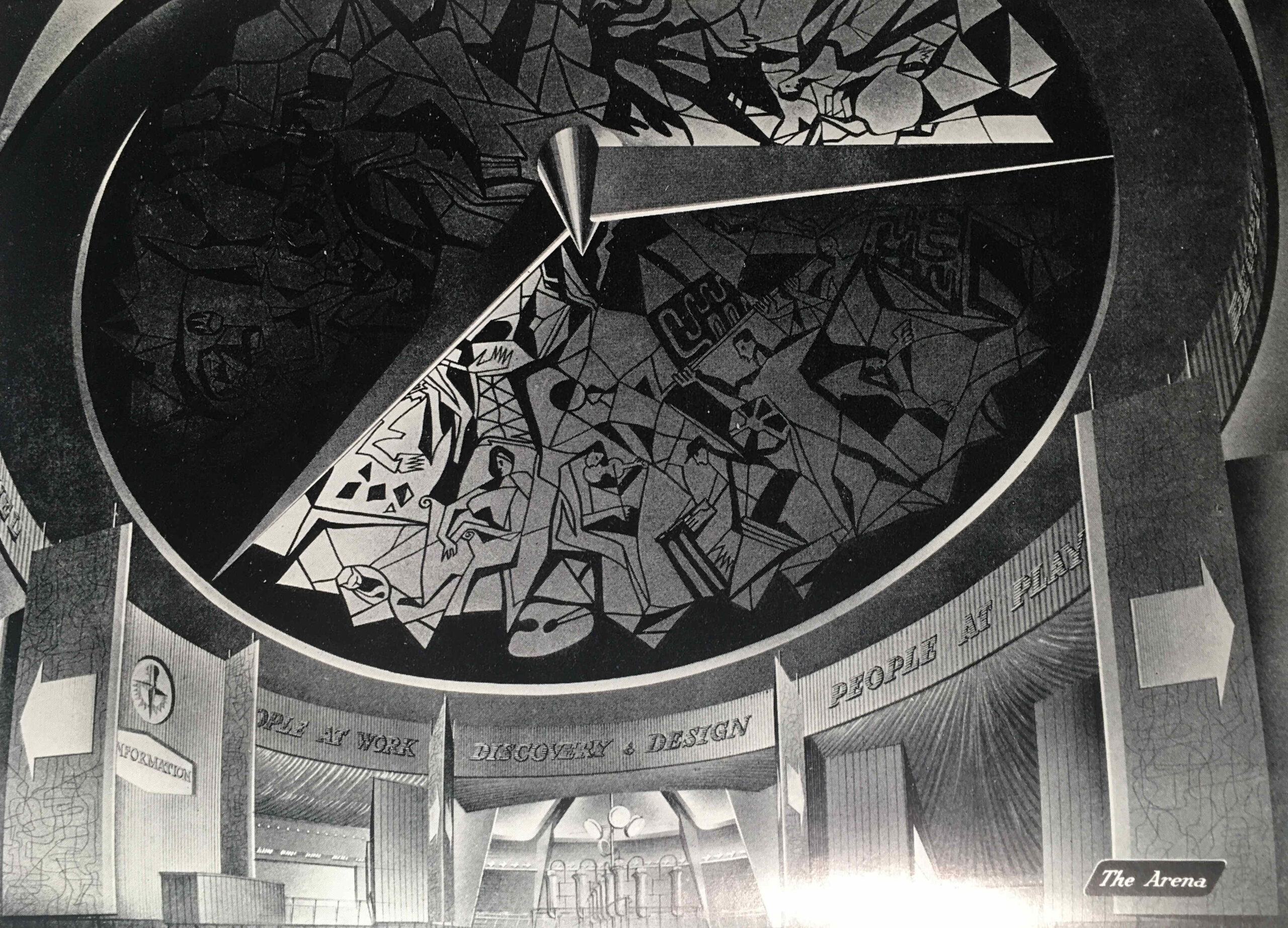
Festival of Britain Travelling Exhibition

From the Arena, we enter the “People at Home” section of the exhibition, which in the guide book is illustrated by an image of “The Garden Room” of the “House of the Future”:
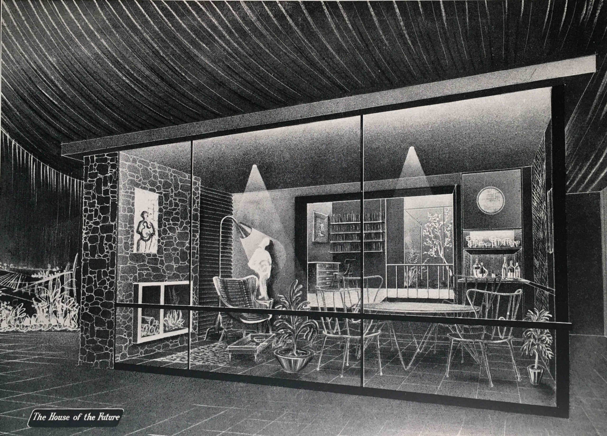
Festival of Britain Travelling Exhibition

The Garden Room is a view of what would be happening in the future with the popularity of conservatories and large windows facing onto a back garden, however in the exhibition there was a recognition of the housing problems that the majority of the population continued to face:

“THE BED-SITTING ROOM – With smaller houses and scare accommodation, this form of room has taken on a new importance in recent years. Special efforts and imagination can make the bed-sitting room very congenial, either for the adult living apart from the family or as a place of privacy for the older child.”

We then come to the “People at Play” section, which is illustrated with “The Fashion Theatre”:
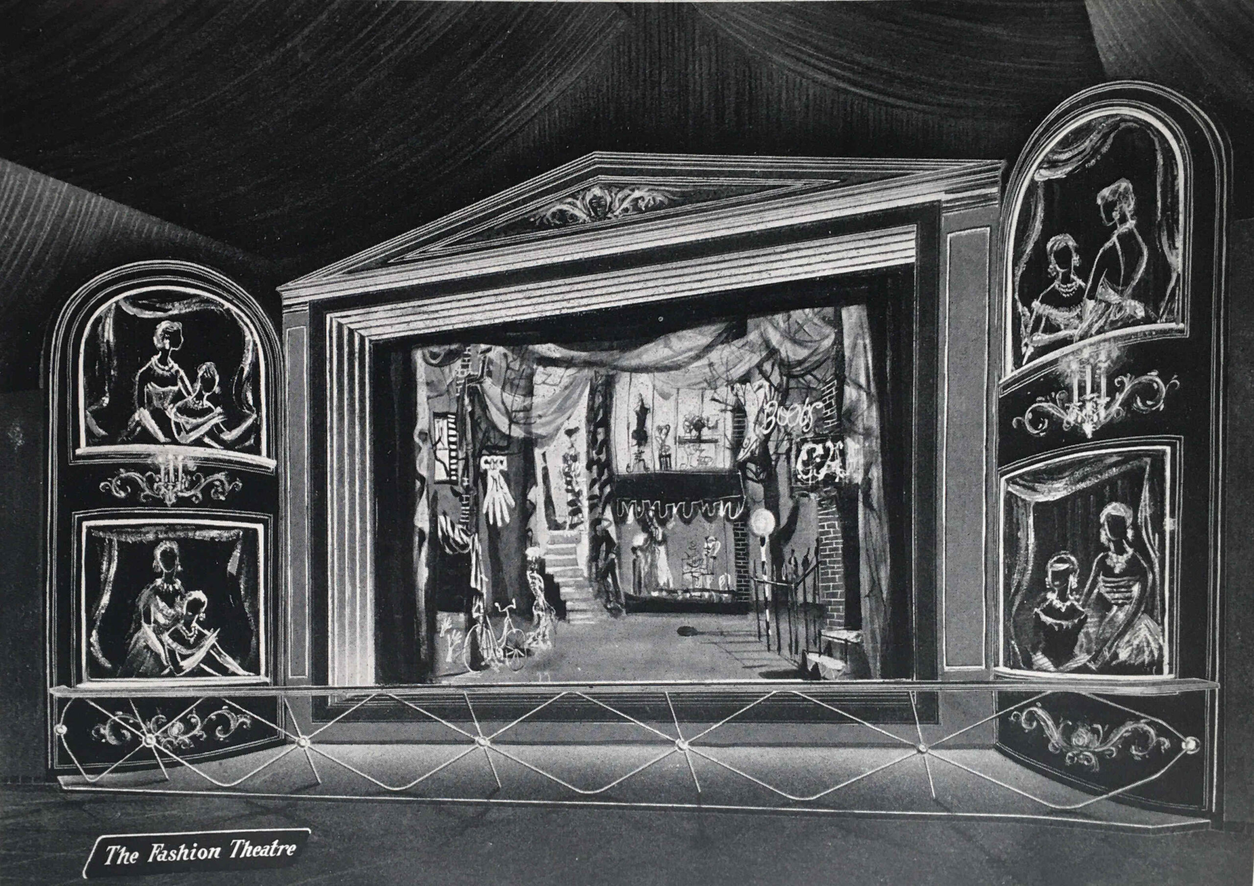
Festival of Britain Travelling Exhibition

The People at Play section included displays on:

  • Outdoor Sports and Games
  • Hobbies (Amateur Photography, Amateur Radio, Painting and Home Cinematography)
  • Leisure Wear (which was displayed by “actress mannequins” in a continuous performance in the Theatre of Fashion)
  • The Rolling English Countryside (walking, rambling, mountaineering, cycling , rowing and canoeing)
  • Indoor Sports and Games

A look at the list above might imply that the exhibition was aimed at the affluent middle class, however taking Amateur Photography and Cycling as two example, that is exactly what my father was doing in 1951. He started off with a Leica camera purchased cheaply from a serviceman returning from Germany after the war, and cycled the country with friends after National Service, staying at Youth Hostels, which was a very cheap way of seeing the country.

We then come to the “People at Work” section, with an image of the same name:
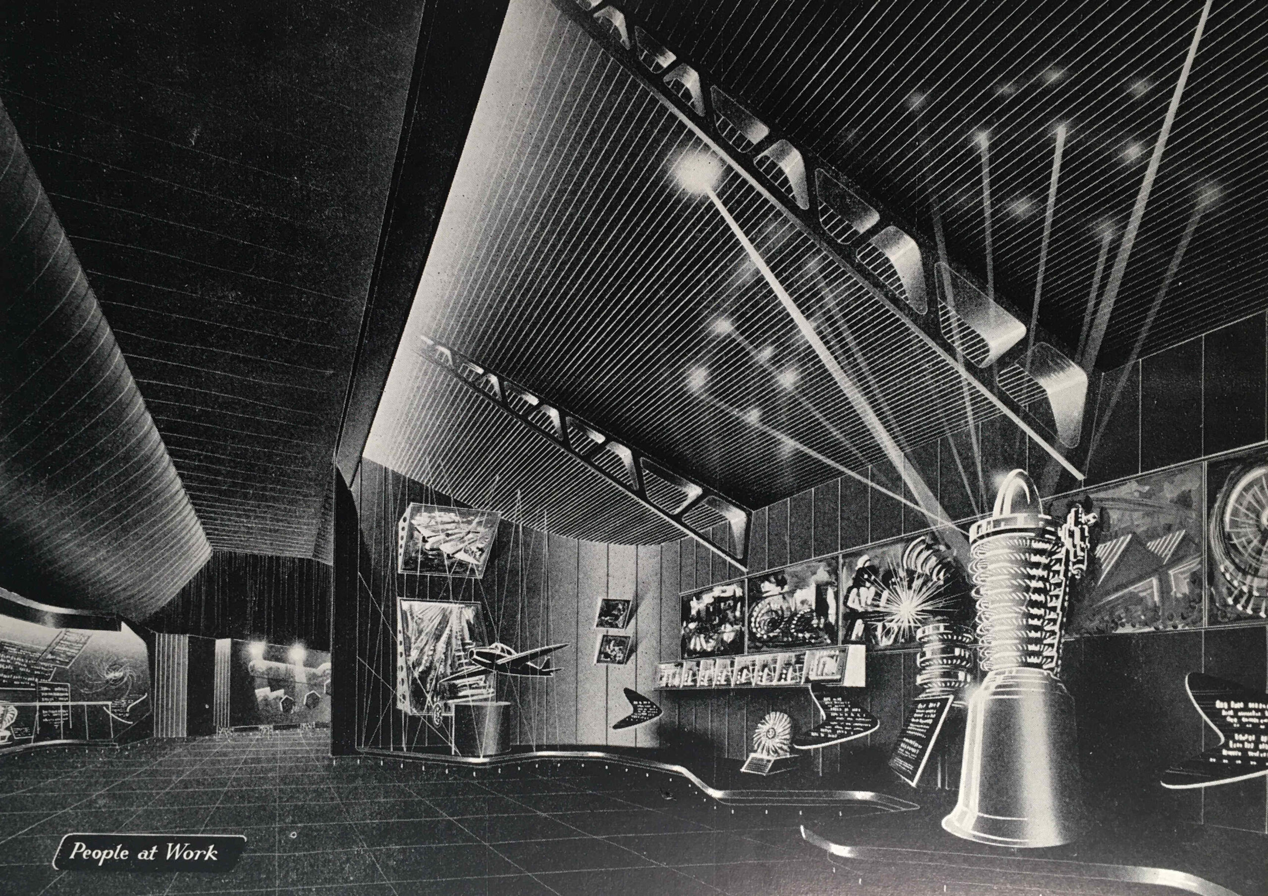
Festival of Britain Travelling Exhibition

“Britain’s industrial achievements and engineering skill are renowned throughout the world. We were pioneers and leaders in industrial engineering in the 18th and 19th centuries”, so began the introduction to the “People at Work” section. The guide book featured the jet engine, or the “Whittle Engine” as it was called in the Exhibition Guide after Frank Whittle who was instrumental in the development of the jet engine.

The guide mentions John Barber who had taken out a patent for what would become a gas turbine, the core of a jet engine, as early as 1791.

Barber’s designs were very much in advance of their time, and manufacturing technology was not at the stage where the designs could be turned into a working gas turbine.

In a perfect example of what ever you think the future will be, it will almost certainly be different, in the section on People at Work, there are some paragraphs under the heading “The Future”.

The guide explains that the future of electricity and energy production is with home supplies of coal and peat, and that cheap supplies of these, rather than the expensive oils currently being burned would help power the future.

No understanding in 1951 of the impact of burning large amounts of fossil fuels, and digging up large amounts of peat.

The next section of the exhibition is “People Travel”, with an illustration of the same name:
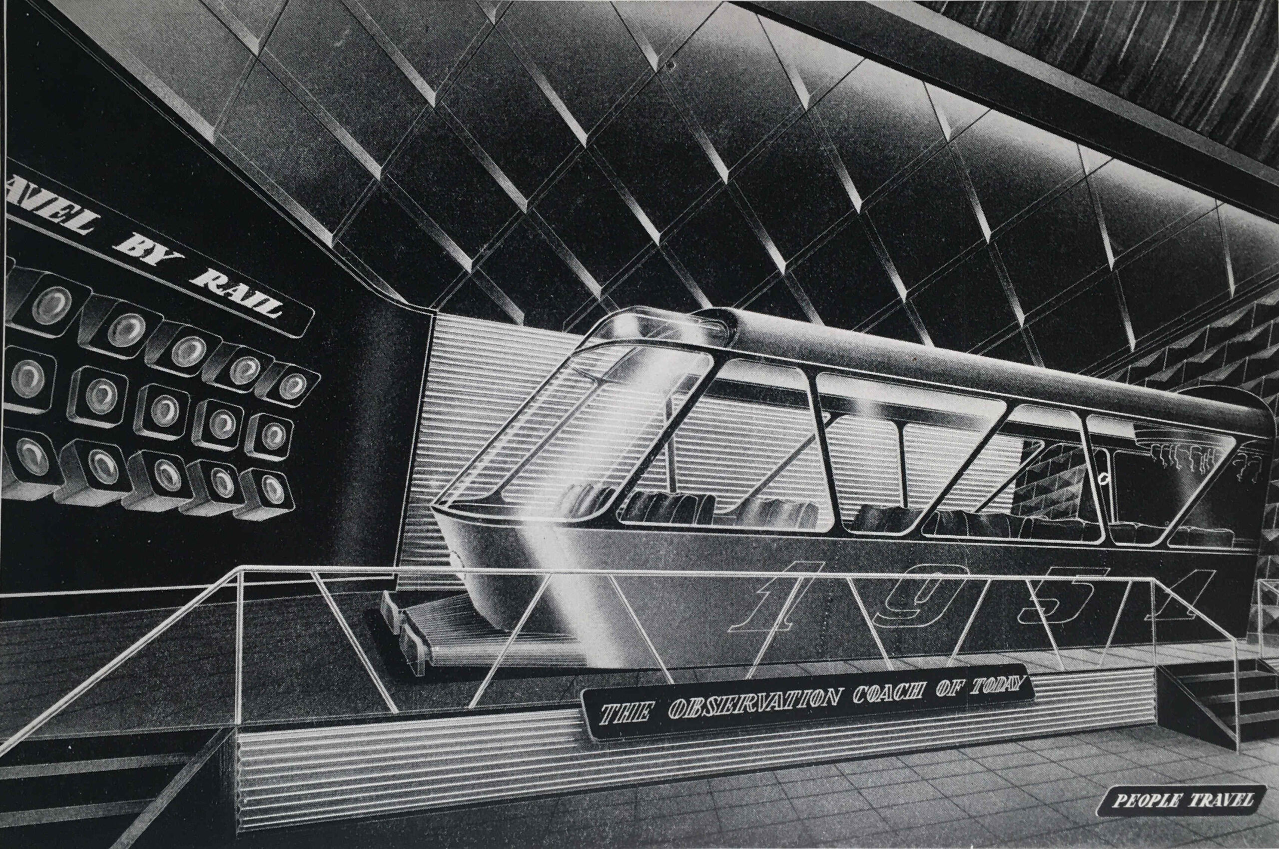
Festival of Britain Travelling Exhibition

The guide compares the arduous methods of travel at the time of the 1851 Great Exhibition, with the travel opportunities one hundred years later in 1951, with air travel and the car providing the means to explore the country and the wider world – “the private car has added a new degree of freedom to the mode of life of many people in all countries”.

To show some of the accessories that went with the freedom of travel provided by the car, the exhibition included:

  • Picnic Basket “Fieldfare”: G.W. Scott & Sons Ltd, 4-10 Tower Street, London W.C.2
  • Twin cup vacuum flask. British Vacuum Flask Co. Ltd. Lissenden Works, Gordon House, London, N.W.5
  • Coffee cups and saucers, acrylic. S.C. Errington (Hanwell) ltd, 132a Uxbridge Road, London W.7
  • Plastic sandwich box, Marris’s Ltd, 16 Cumberland Street, Birmingham

So the opportunity in the summer of 1951, if you had a car, was a drive out into the countryside, where you could stop and have lunch from your plastic sandwich box, drink coffee from acrylic coffee cups and saucers kept warm in the vacuum flask, all stored in your Fieldfare picnic basket from Tower Street.

“PEOPLE TRAVEL because now the opportunity is open to all”:
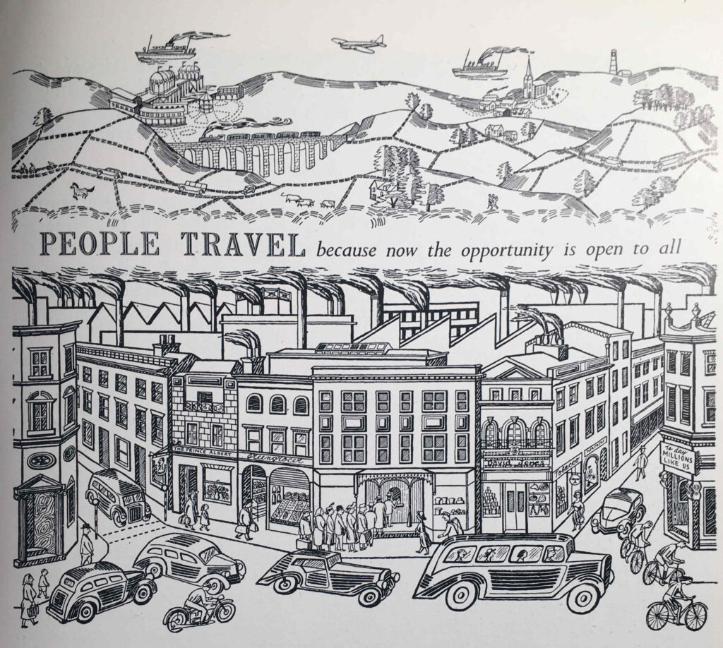
Festival of Britain Travelling Exhibition

The logistics of the travelling exhibition were impressive. It covered an area of 35,000 square feet, and was the world’s biggest transportable, covered Exhibition ever to be constructed.

It needed to be assembled and disassembled quickly due to the tight time schedule of openings and closings in the four different cities.

The exhibits were designed for quick and easy assembly, and to allow for differences between the sites, such as different floor levels, the exhibition structures were on adjustable footings. All exhibits were also completely wired for connecting up at each site.

The guide includes a photo of the Exhibition Façade under construction, and I am sure that is the main hall of Alexandra Palace:
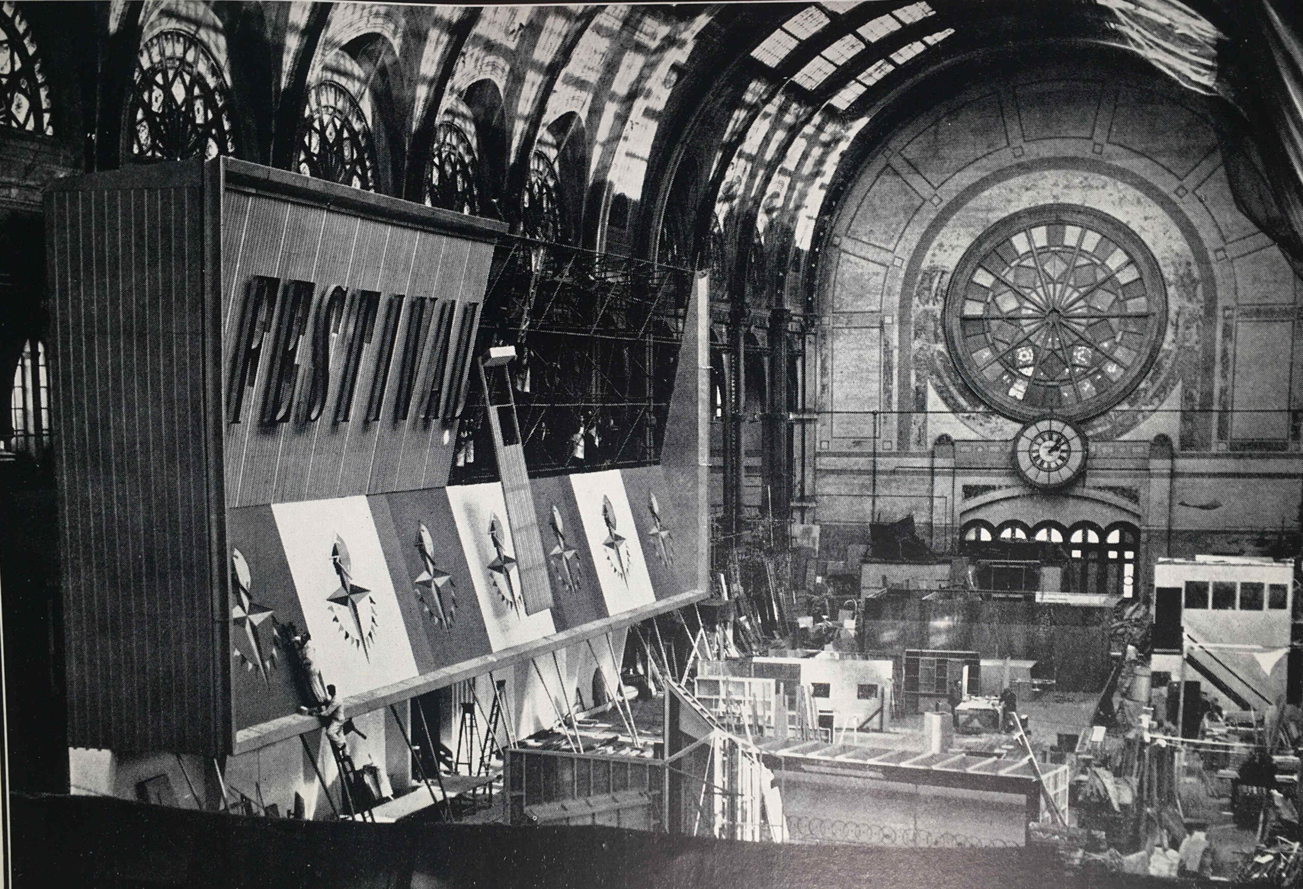
Festival of Britain Alexandra Palace

Alexandra Palace makes sense as it would have provided a large area for construction of all the exhibits, and the contractors responsible were the City Display Organisation, London.

As with all the Festival of Britain Guide Books, the one for the Travelling Exhibition included a large number of adverts, many in colour, and they feature a range of British industrial enterprises, the vast majority of which have all disappeared in the years since the 1951 festival.

In the Triumph Renown, manufactured by the Triumph Motor Company, you could get out and visit places and events such as displayed in the following photo:
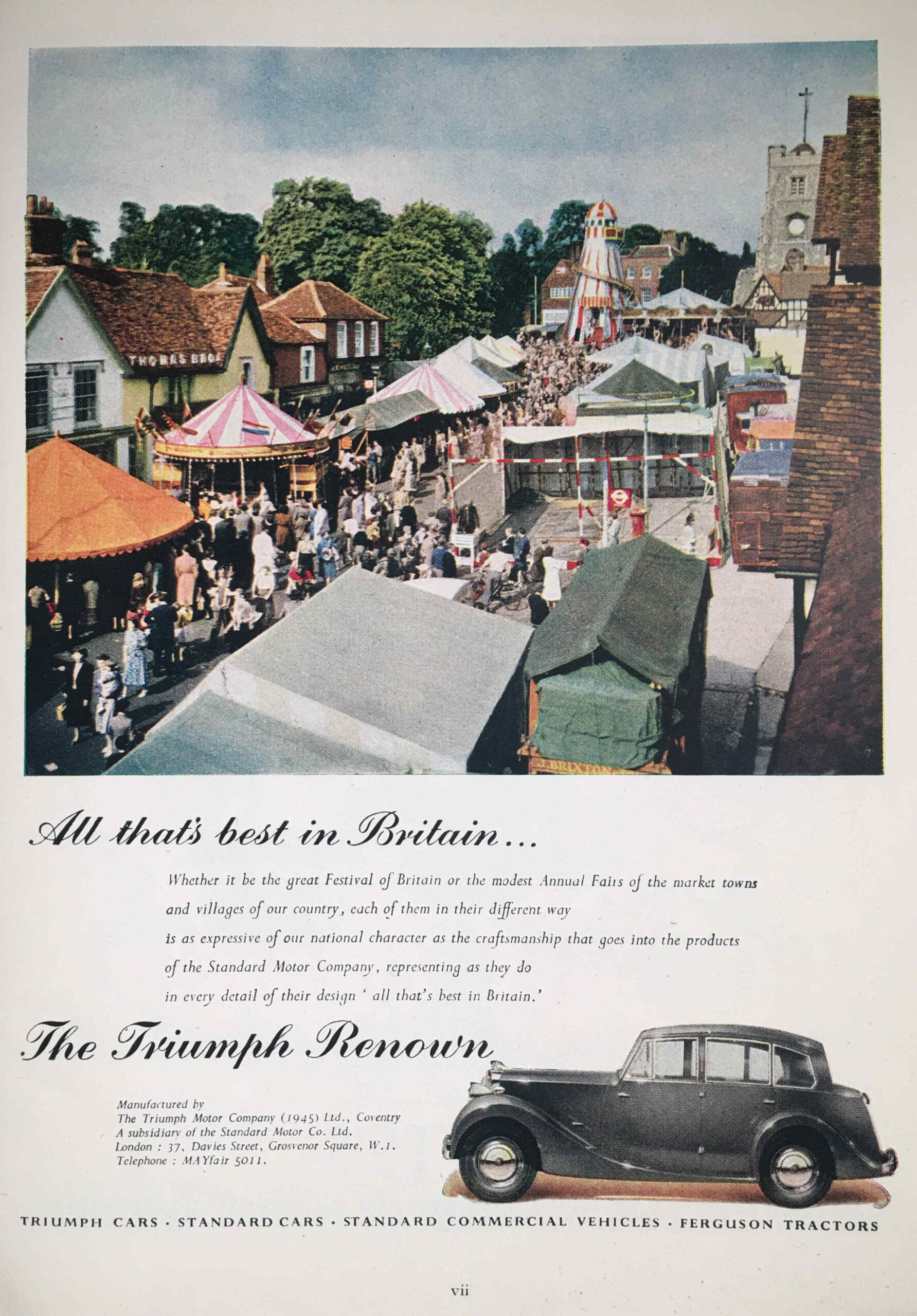
Triumph Renown

I think that is a location in outer London, as in the photo we can see the following:

Triumph Renown

Before Lego, there was Minibrix:

Minibrix

Minibrix were manufactured by the Minibrix Rubber Company, a subsidiary of the I.T.S. Rubber Company of Petersfield in Hampshire. Production started in the late 1920s.

The bricks were made out of solid rubber, and were therefore rather heavy compared to the plastic bricks that Lego would later introduce.

Competition from Lego, who used plastic for their bricks, which was cheaper to produce, and allowed a much wider range of models to be built, meant that Minibrix could not compete, and Minibrix ended production in 1976.

The fate of Minibrix sums up much of the industries and businesses featured in the Festival of Britain, with the majority disappearing in the next 40 years.

One that does still thrive is Rolls-Royce, who continue production of the jet engine in Derby.

I still have a couple of Festival of Britain Guide Books to find, but if you would like to read some of my other posts on the festival, you can find them at the following links:

alondoninheritance.com

Wells, Somerset – A Cathedral, Water and Swans

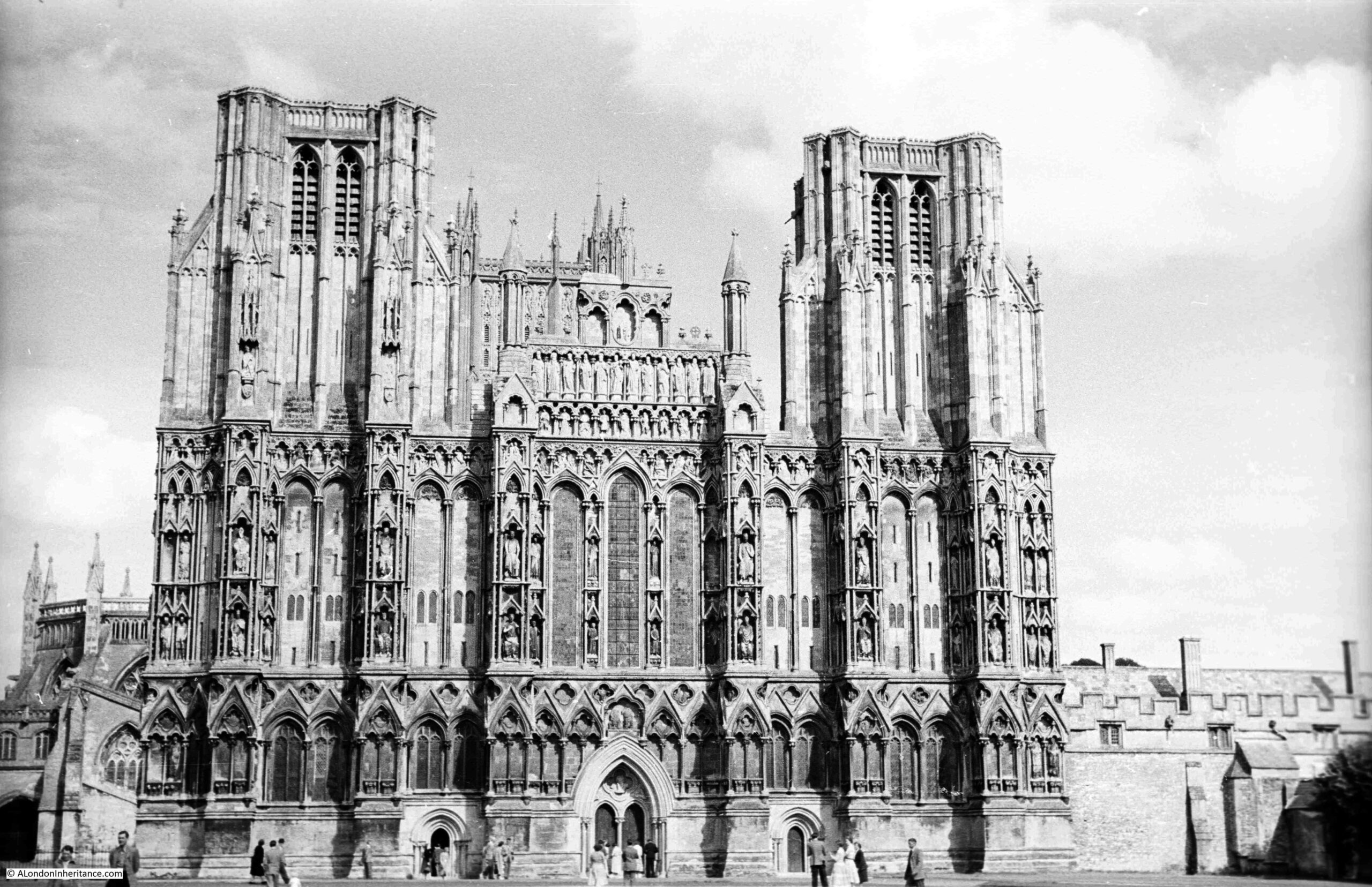
In August 1953, my father was cycling / youth hosteling around Somerset, as part of his post National Service trips with friends around the country. One of the places visited was the City of Wells in Somerset, and this is his photo of Wells Cathedral:

Wells Cathedral

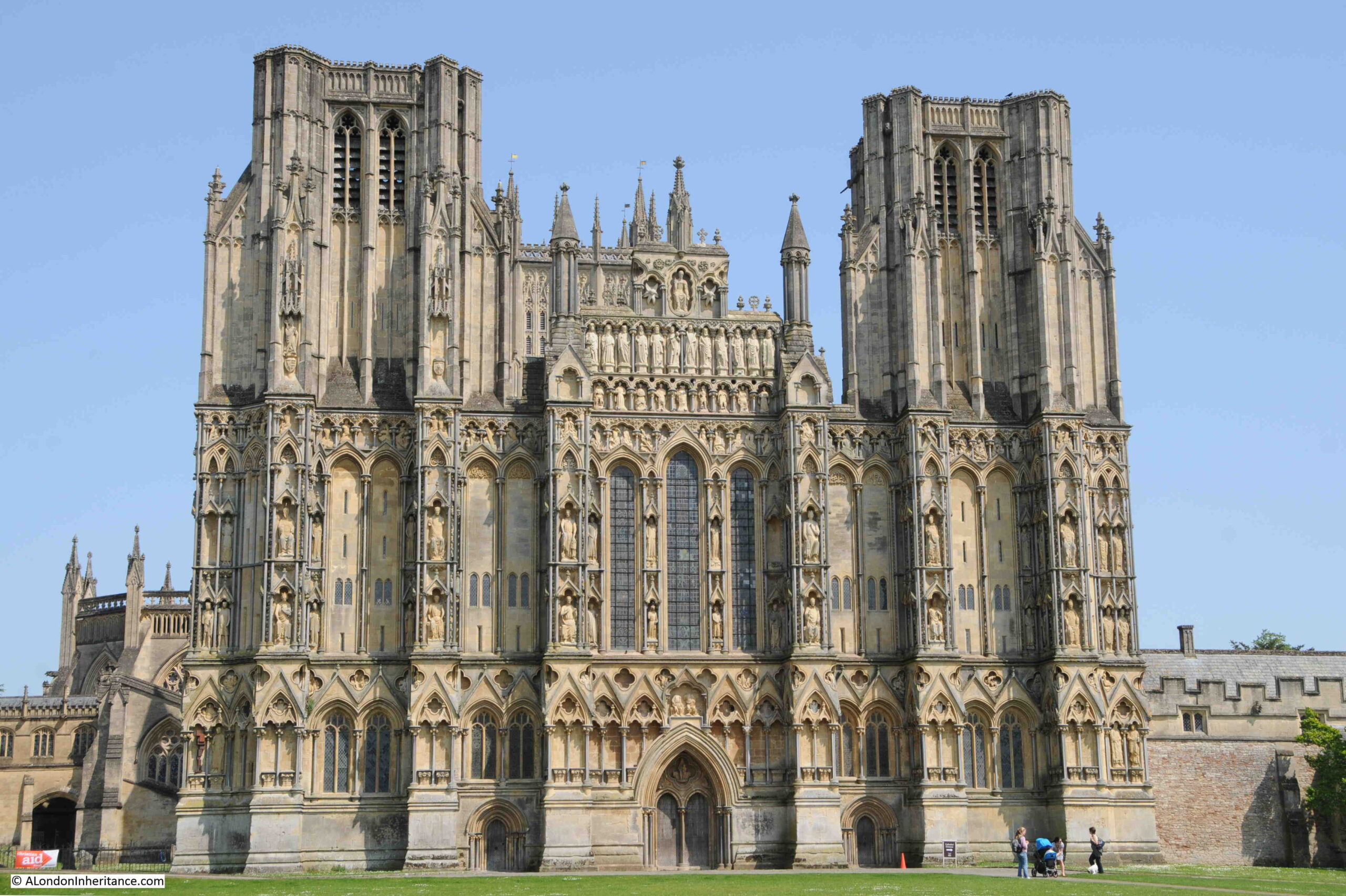
Seventy years later, and the view is the same:

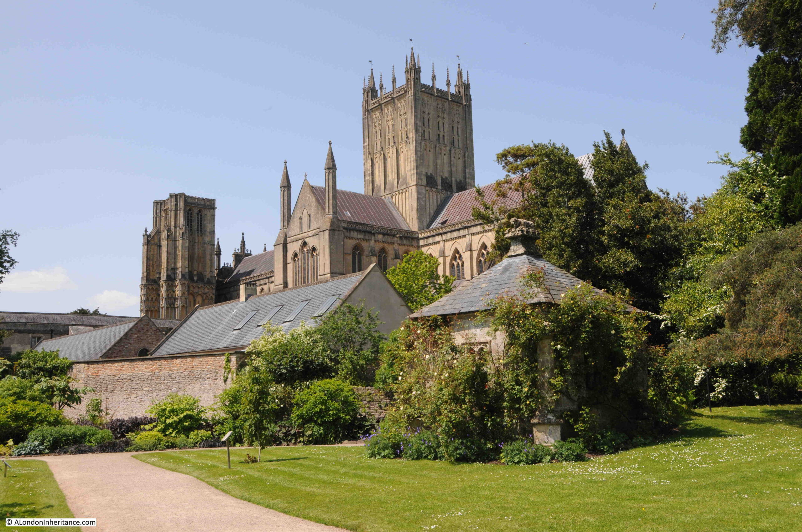
Wells Cathedral

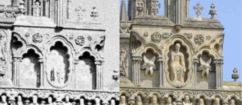
Apart from the loss of a couple of chimneys to the right of the Cathedral, the view has not changed, not really surprising given the age of the building and its significance. The only feature that will confirm the top photo dates from 1953 are the clothes worn by the people at the very bottom of the photo.

There are a couple of minor changes and restorations to the façade. For example, in 1953, some of the niches at the top of the central part of the façade were empty. Today, there is a statue and carved objects in these niches:

Wells Cathedral

Wells is a smallish town in Somerset, not that far to the north of Glastonbury. The town’s status as a City dates back to the medieval period and the importance of the Cathedral. This was formally recognised in 1974 when Queen Elizabeth II confirmed city status on Wells.

Evidence of a Roman settlement at Wells illustrates the long history of the place, and the name provides a clue as to why people would want to settle here, and why the city has such a significant Cathedral.

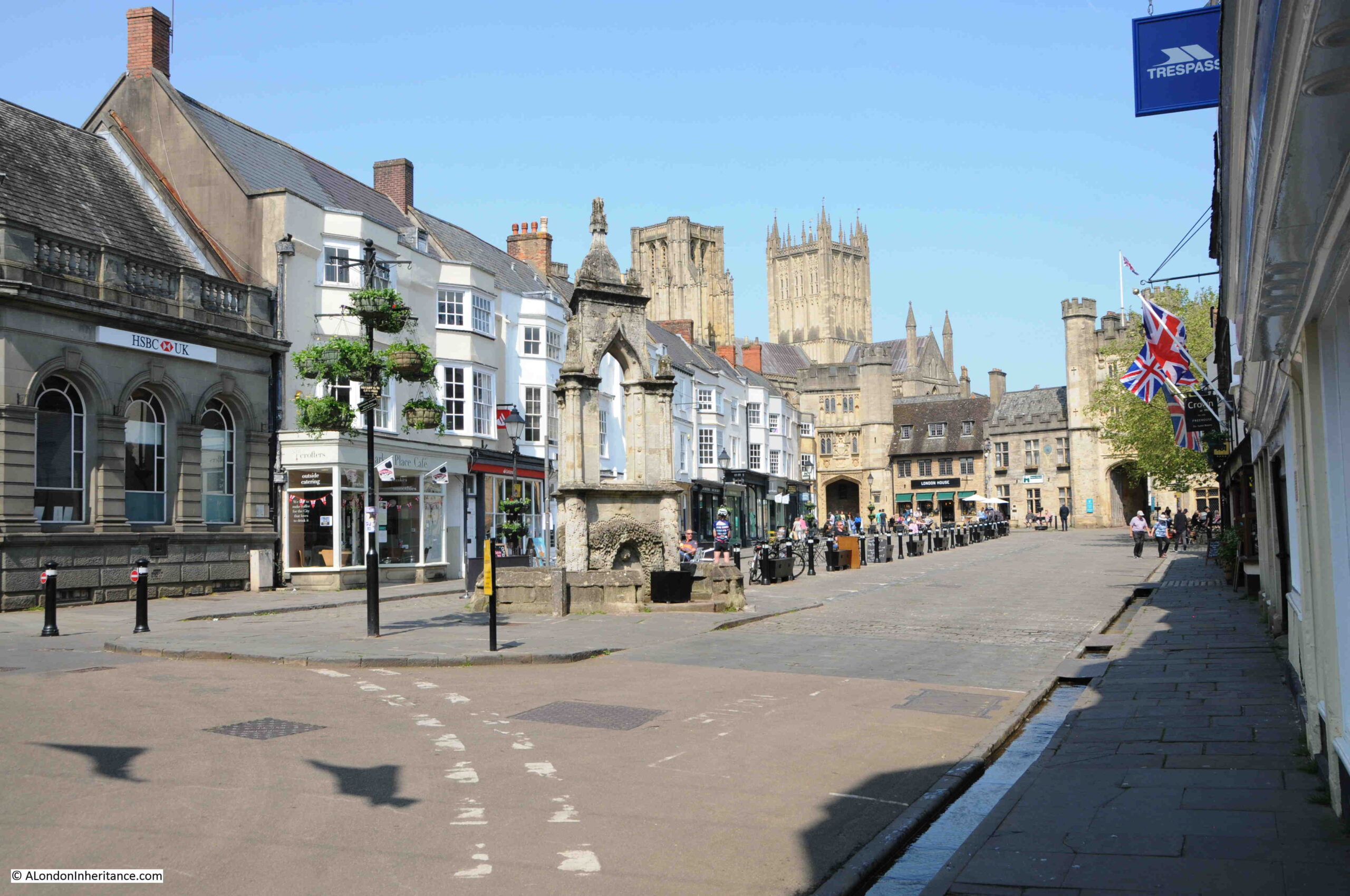
Wells takes its name from wells that can still be found, wells that seem to provide an almost continuous flow of large amounts of water, and water makes it presence known across the city, including along the High Street and the Market Place where channels of water flow between the road and the pavement:

Wells Market Place

The Market Place today is today mainly lined with shops and cafes targeting visitors, however there were a large number of locals in the cafes during our visit. The Market Place, with the towers of the Cathedral in the background, does look like the dream location for a tourism advert, but it has not always been so peaceful.

After the Monmouth Rebellion, in 1685, Judge Jeffreys held what were known as the Bloody Assizes in the Market Place and condemned 94 people to death for supporting the Monmouth rebellion. Judge Jeffreys would later be found hiding in Wapping, where he was recognised by someone who had the misfortune to come up before him. See this post for the story.

Even if you have not been to Wells, you may find some of the places in the city familiar. Wells was the location for many of the exterior scenes of the film Hot Fuzz by Edgar Wright (who grew up in Wells) and Simon Pegg.

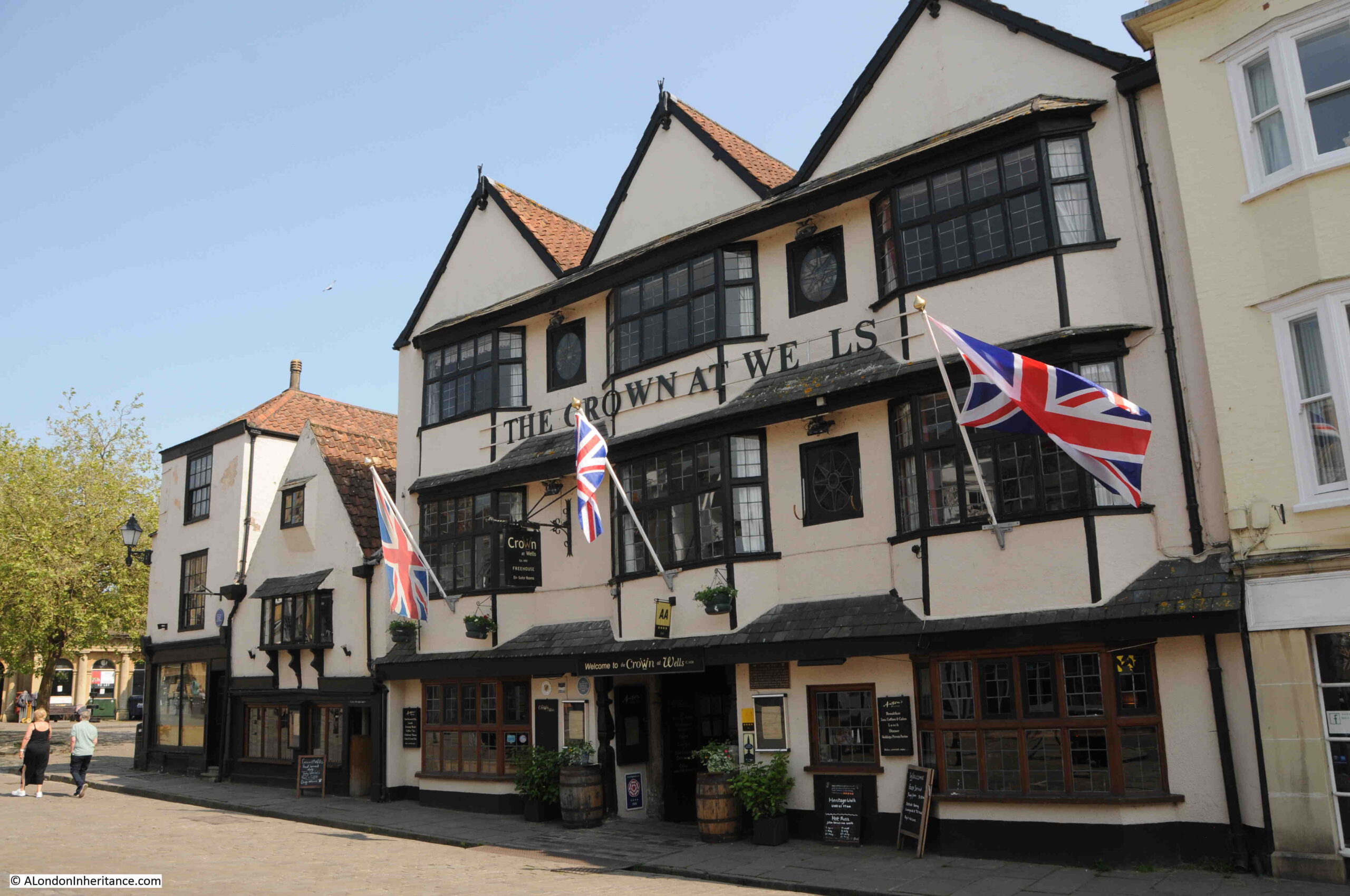
The Cathedral was digitally removed from the film, but many other locations are recognisable, including the pub, the Crown at Wells (or Sandford as the town was named in the film):

The Crown at Wells and Hot Fuzz

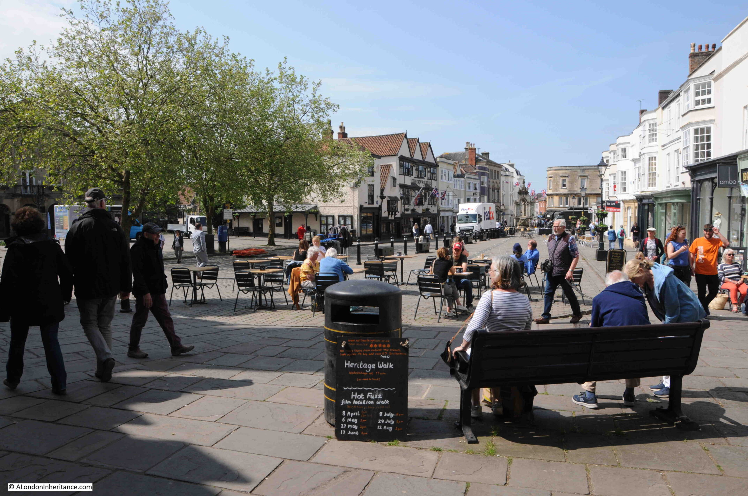
View looking back along the Market Place, close to the entrance to the Cathedral. The board in front of the bin advertises both a Heritage Walk and a Hot Fuzz Location Walk:

Wells Market Place

There may have been some form of religious establishment on the site of the Cathedral before the first known church to be built close to the current site when around the year 705, Ine, the Saxon King of Wessex built a Minster.

The first documented reference to the Minister dates from 766 when the Minster was recorded as being near the “Great Spring of Wells”, highlighting that the wells have always been a focal point for having both the church and a settlement here.

Wells prospered due to its surrounding agricultural land, the wells, and the growing importance of the church, and in the year 909, Wells became the centre of a new Somerset diocese.

Wells has long had a religious relationship with Bath, and in 1088, King William Rufus granted the estates to Bishop John of Tours, who relocated to Bath, and the church at Wells ceased to be a Cathedral.

Wells was still an important church, and in 1175, construction of the new church commenced. Work on the church continued for the next few centuries, resulting in the magnificent building we see today.

Whilst the front of the church, seen in my father’s and my photos, is really impressive, in the Medieval period it would have been even more so, as it was brightly painted, and some small remaining traces of paint have been found in niches among the statues.

The interior of the Cathedral would also have been brightly painted, however over the years it was painted over, whitewashed, and any remaining traces of paint were lost in the 1840s when the building was vigorously cleaned.

Of the statues on the front of the church, three hundred of what were around 400 of the original medieval statues survive.

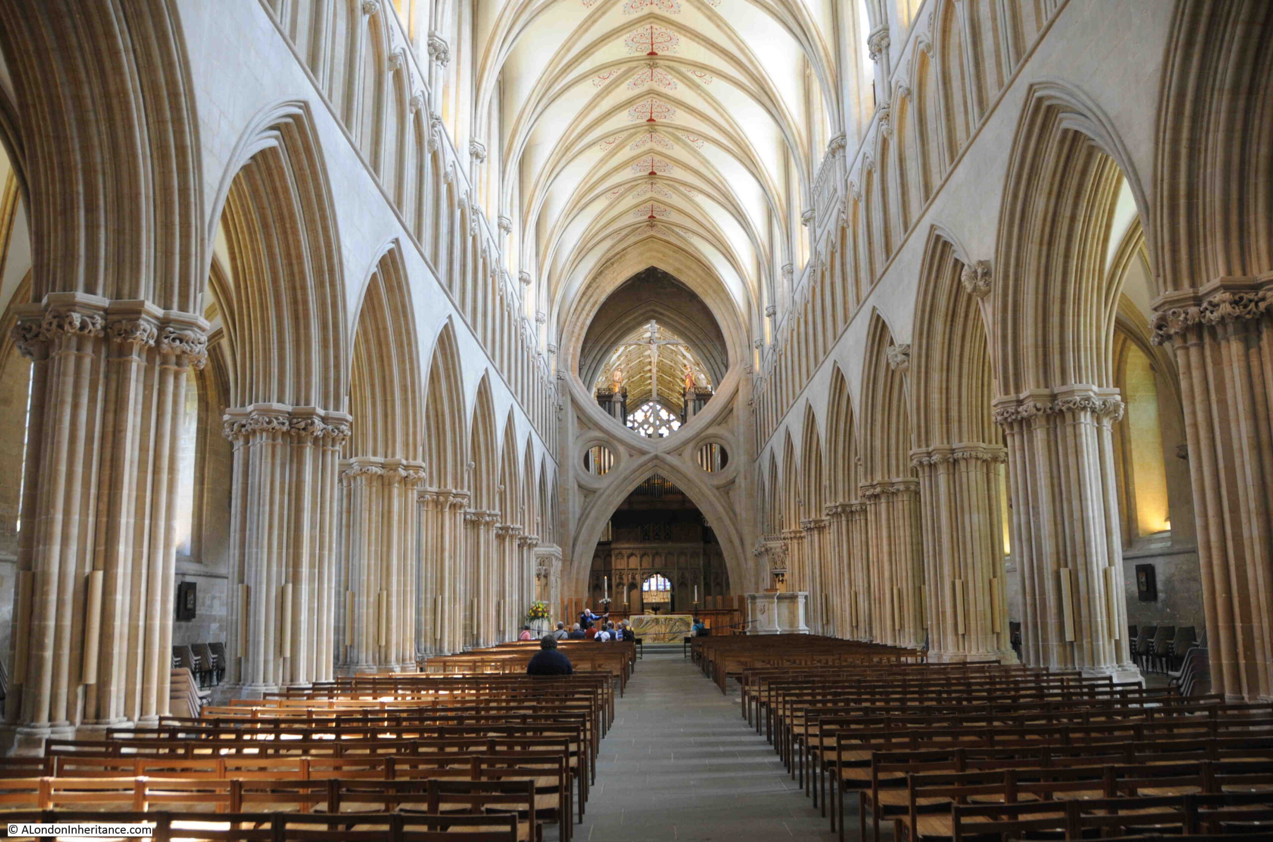
The interior of the Cathedral is magnificent, and at the end of the nave there is a scissor shaped structure:

Wells Cathedral scissor arch

The scissor arches were built between 1338 and 1348 to provide additional support to a high tower and spire that had been built above the Cathedral in 1313.

The weight of the tower caused large cracks to appear in the tower structure, and the scissor arches were the innovative solution to provide additional support. 

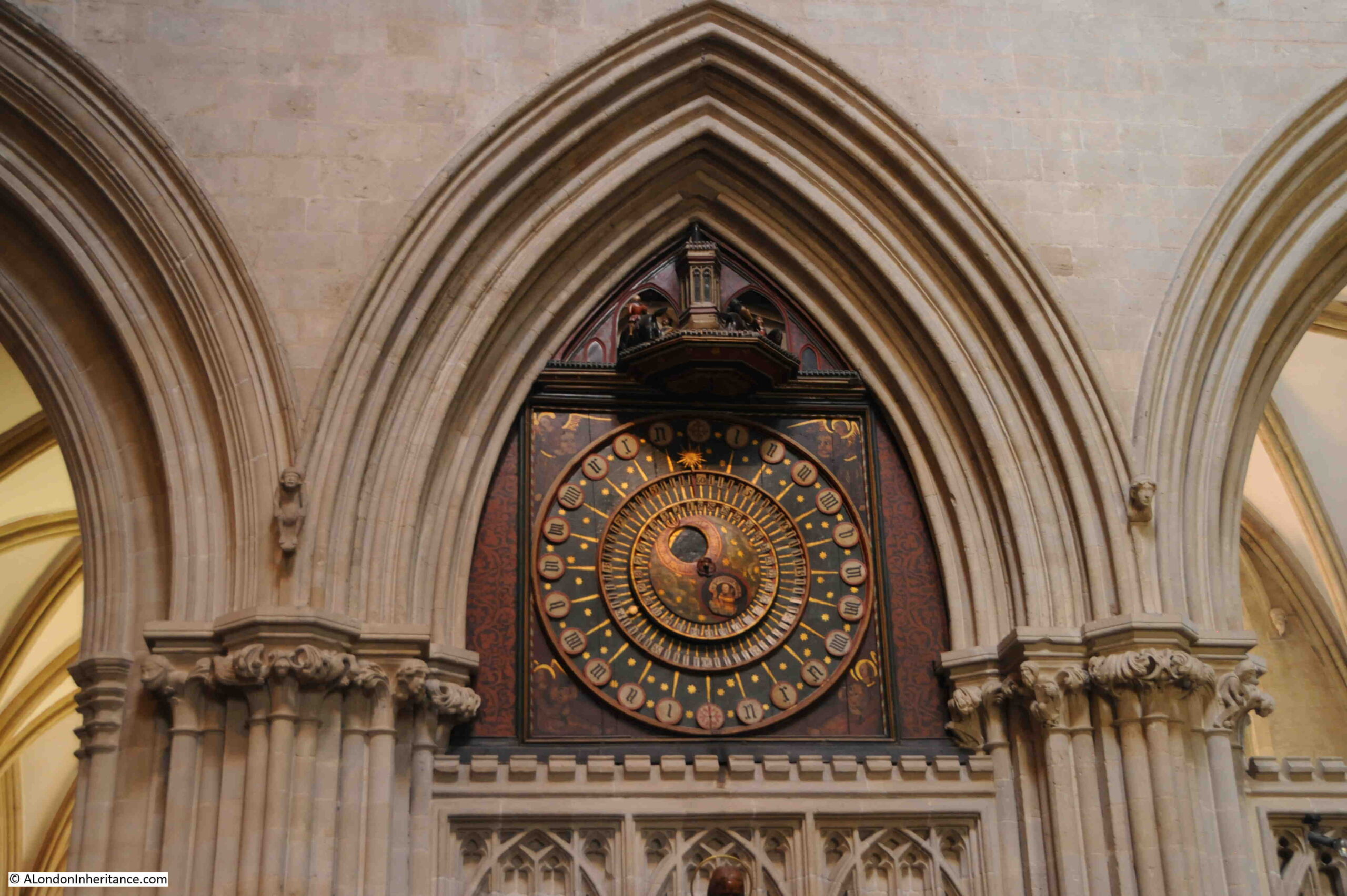
Dating from around 1390, the Cathedral has what is believed to be the second oldest working clock in the world. The mechanism was replaced in the 19th century, however the dial is the original from the 14th century. The original mechanism is now on display in the Science Museum.

Wells Cathedral clock

Above the clock face there is a turret, where every quarter hour, jousting knights appear and circle the turret. The same figure of the jousting knight has been knocked down for over 600 years.

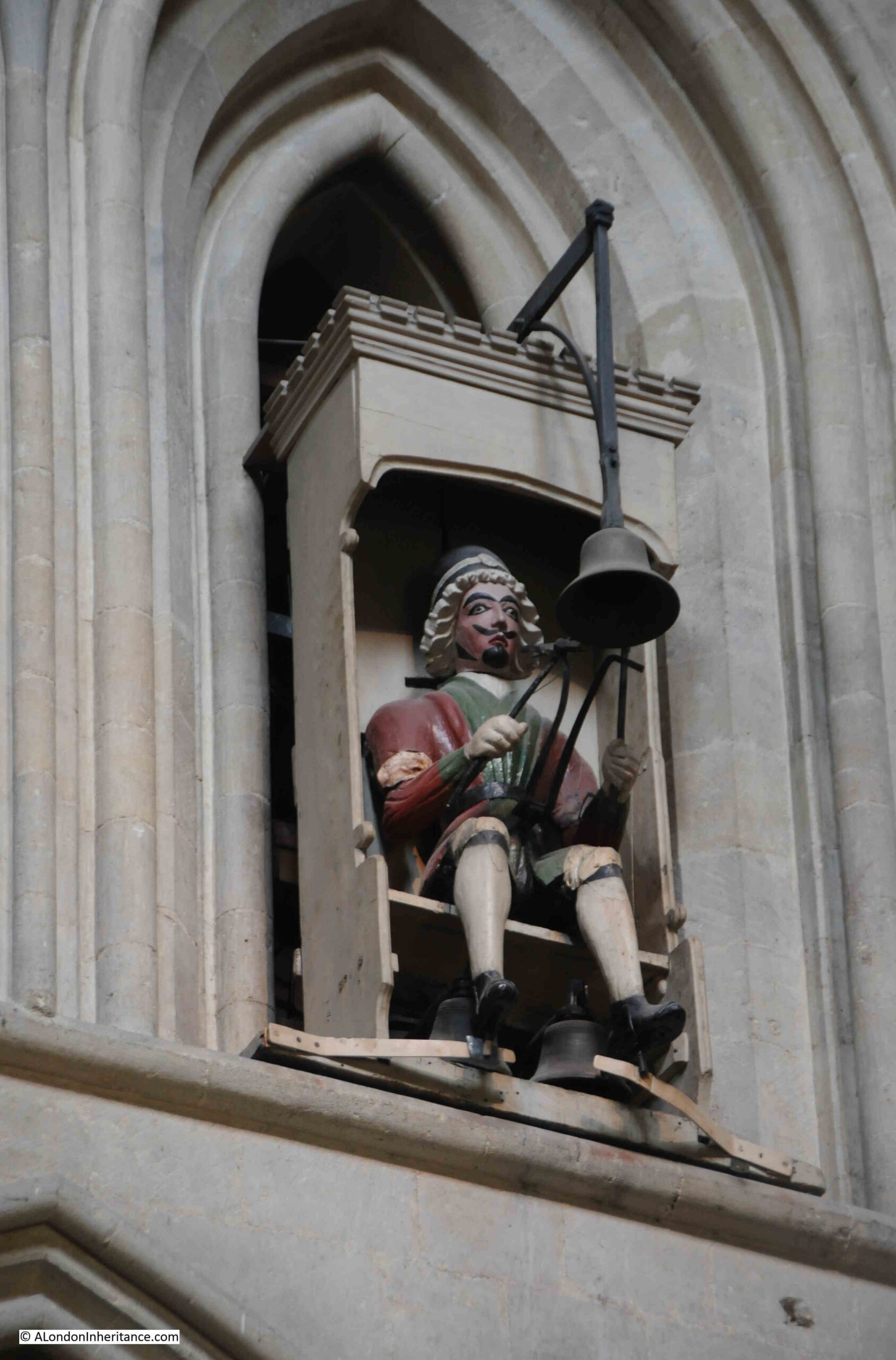
To the right of the clock, and high up on the wall, is a figure, dressed in Stuart costume, that strikes the bell at every quarter:

Wells Cathedral clock

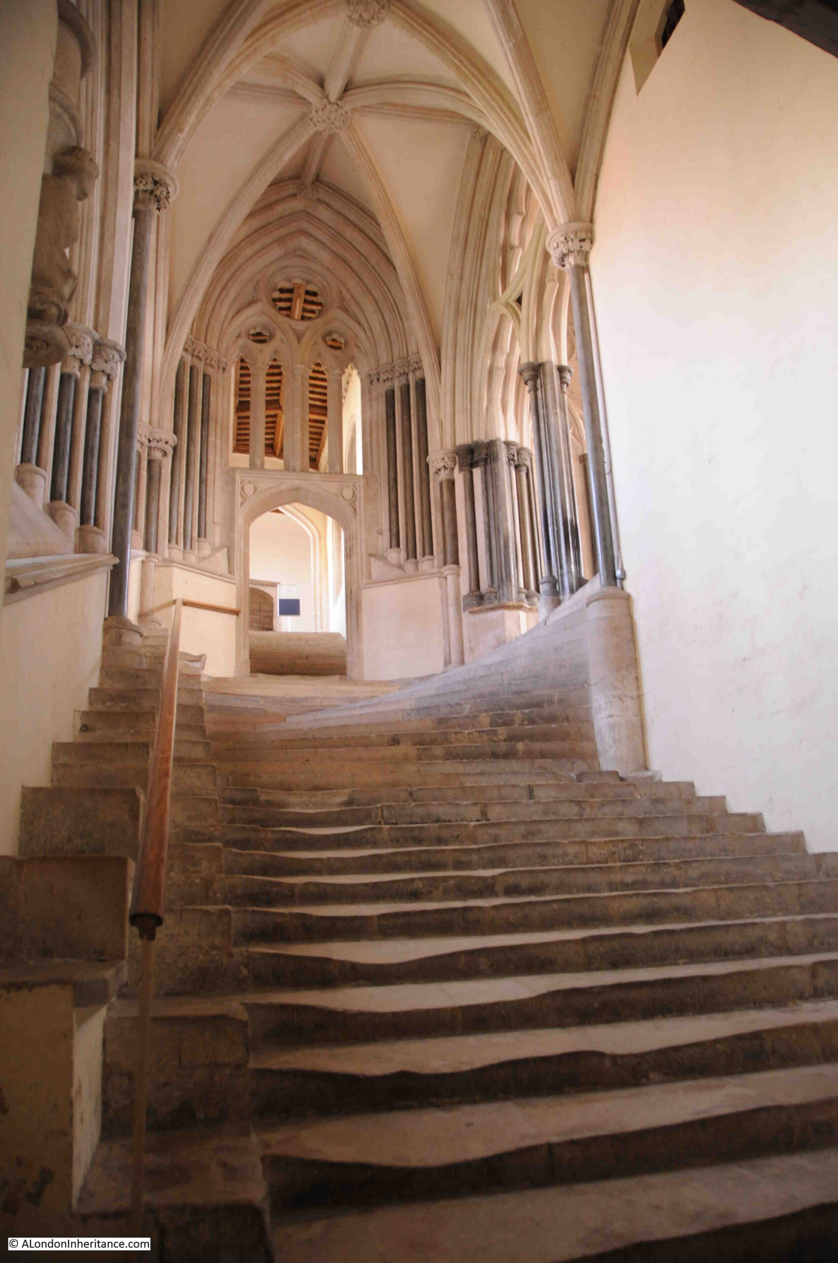
Steps leading up to the Chapter House:

Steps leading to the Chapter House

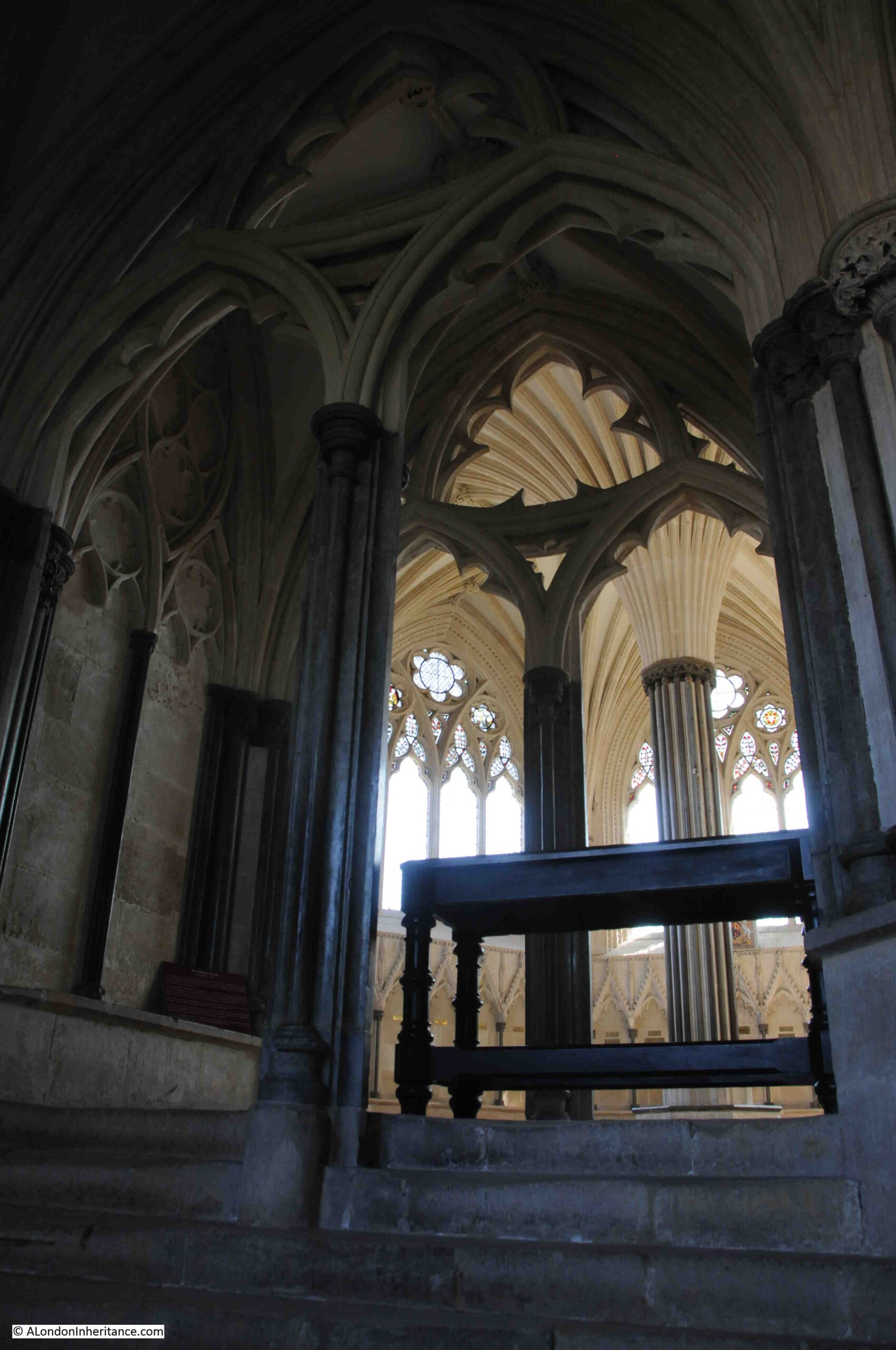
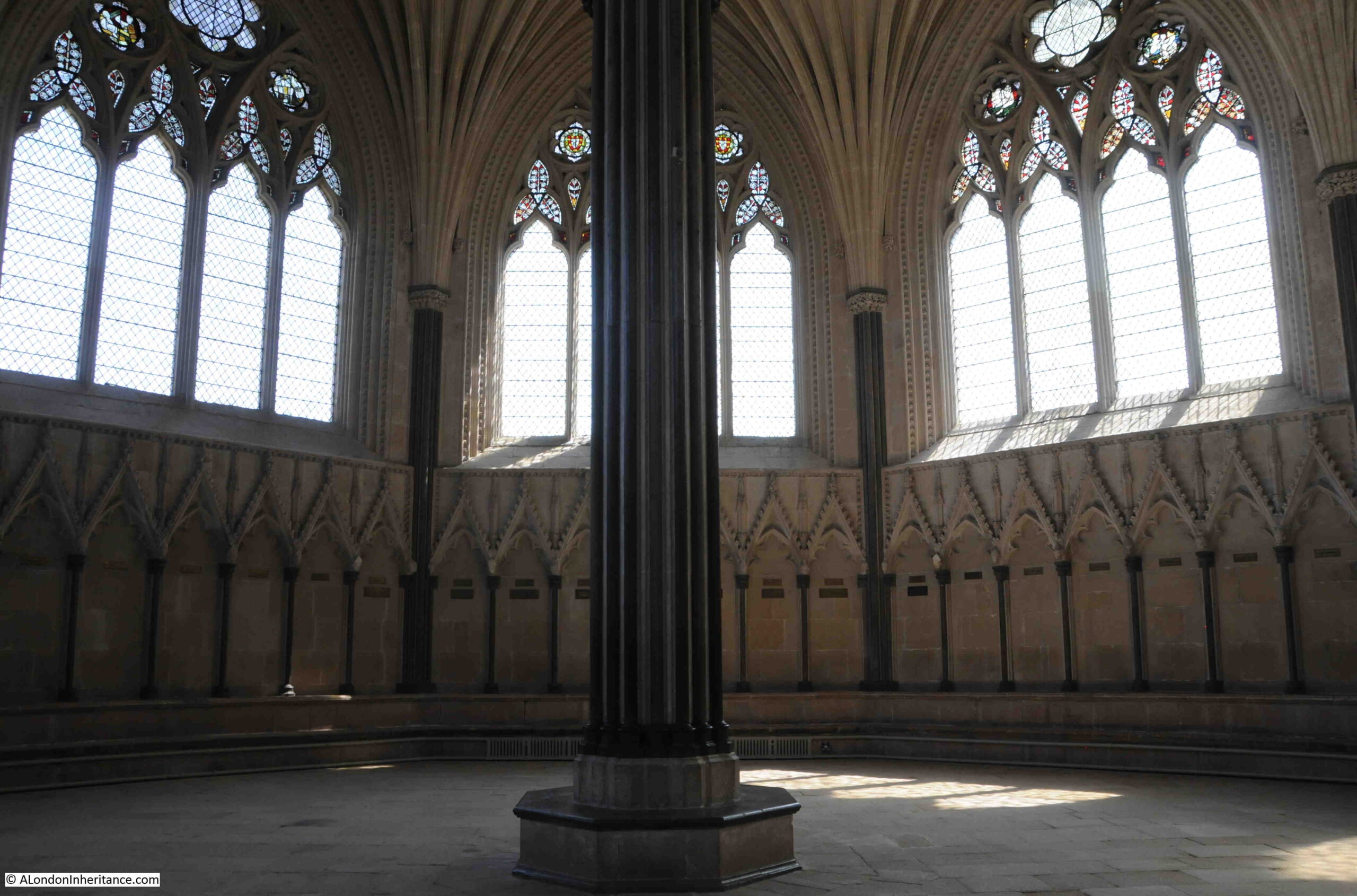
At the top of the stairs is the entrance to the Chapter House, which has a remarkable roof, consisting of thirty two ribs or tiercerons (which give the name of tierceron vault to the structure), which spring from the central pillar:

Chapter House at Wells Cathedral

The Chapter House was completed in 1306, and provided a place for the governing body of the Cathedral (called the Chapter), to meet.

Above each of the seats around the edge of the room are brass plaques which name the “Prebend” which was the farm or estate from where the income came to fund the “Prebendaries” who were the priests who were part of the Chapter.

The Chapter House did have stained glass, however it is believed that these were smashed by Cromwell’s soldiers during the English Civil War.

Interior of the Chapter House:

Chapter House at Wells Cathedral

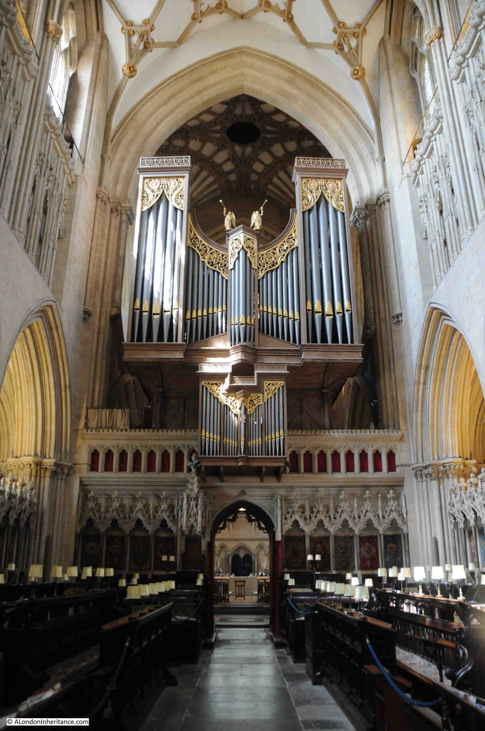
Wells Cathedral organ:

Wells Cathedral

Seating for the choir, with covered seats at the rear for Cathedral officials:

Wells Cathedral

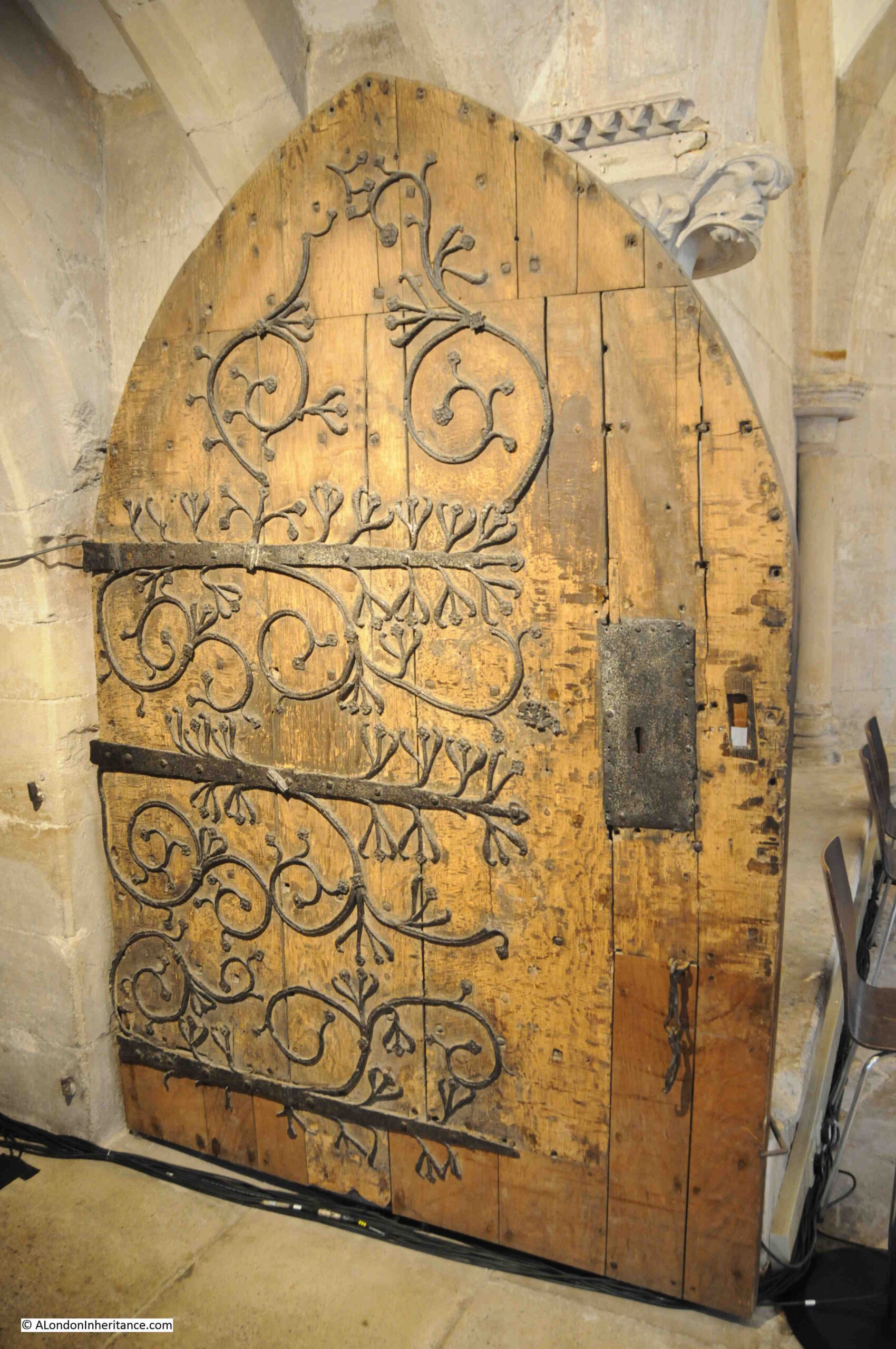
Wooden door within the Cathedral:

Old door with ornate ironwork

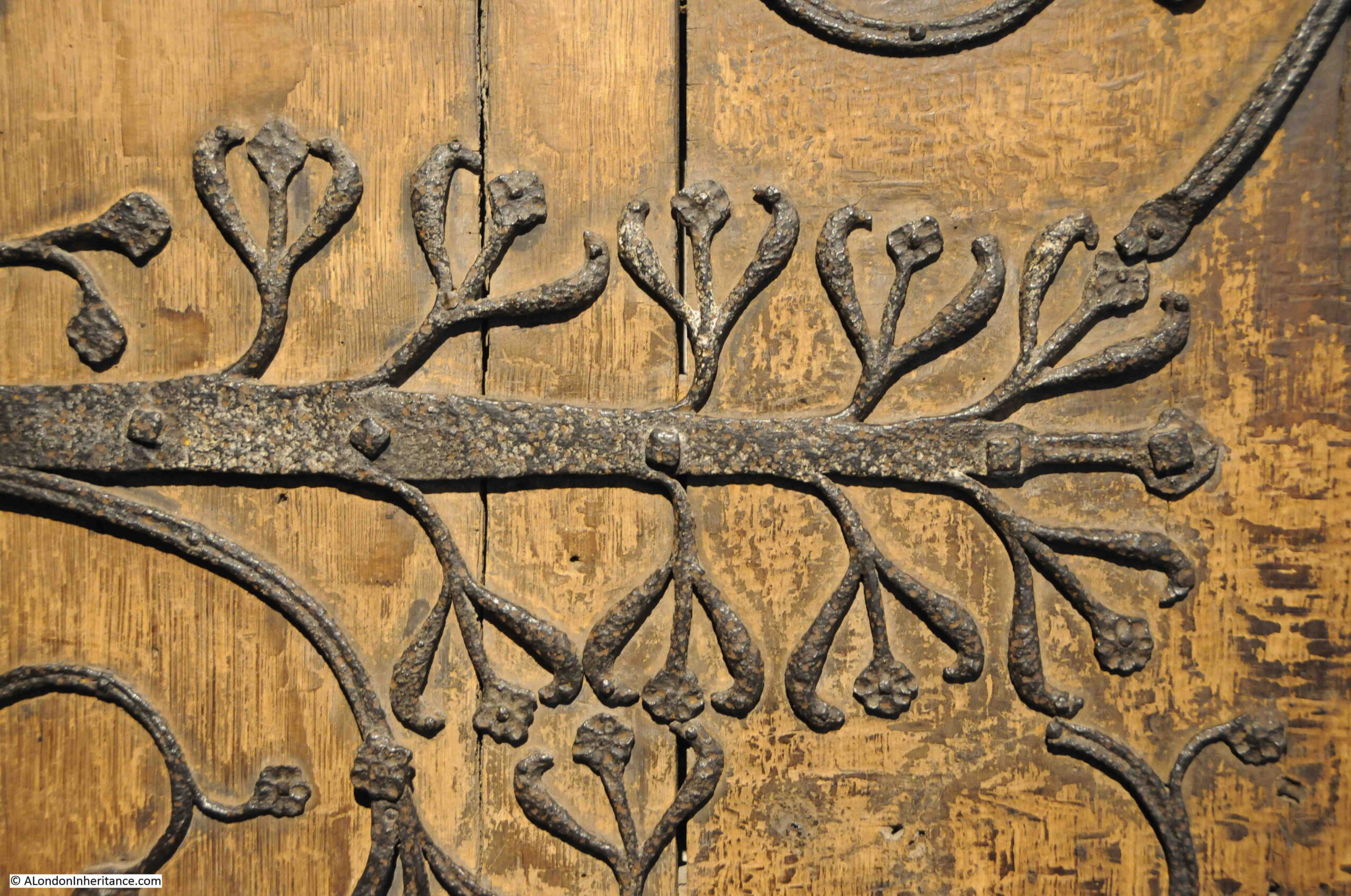
I could not find a date for the door, however the decoration is impressive. The decorative ironwork gives the impression of plants growing across the door:

Door ornate ironwork

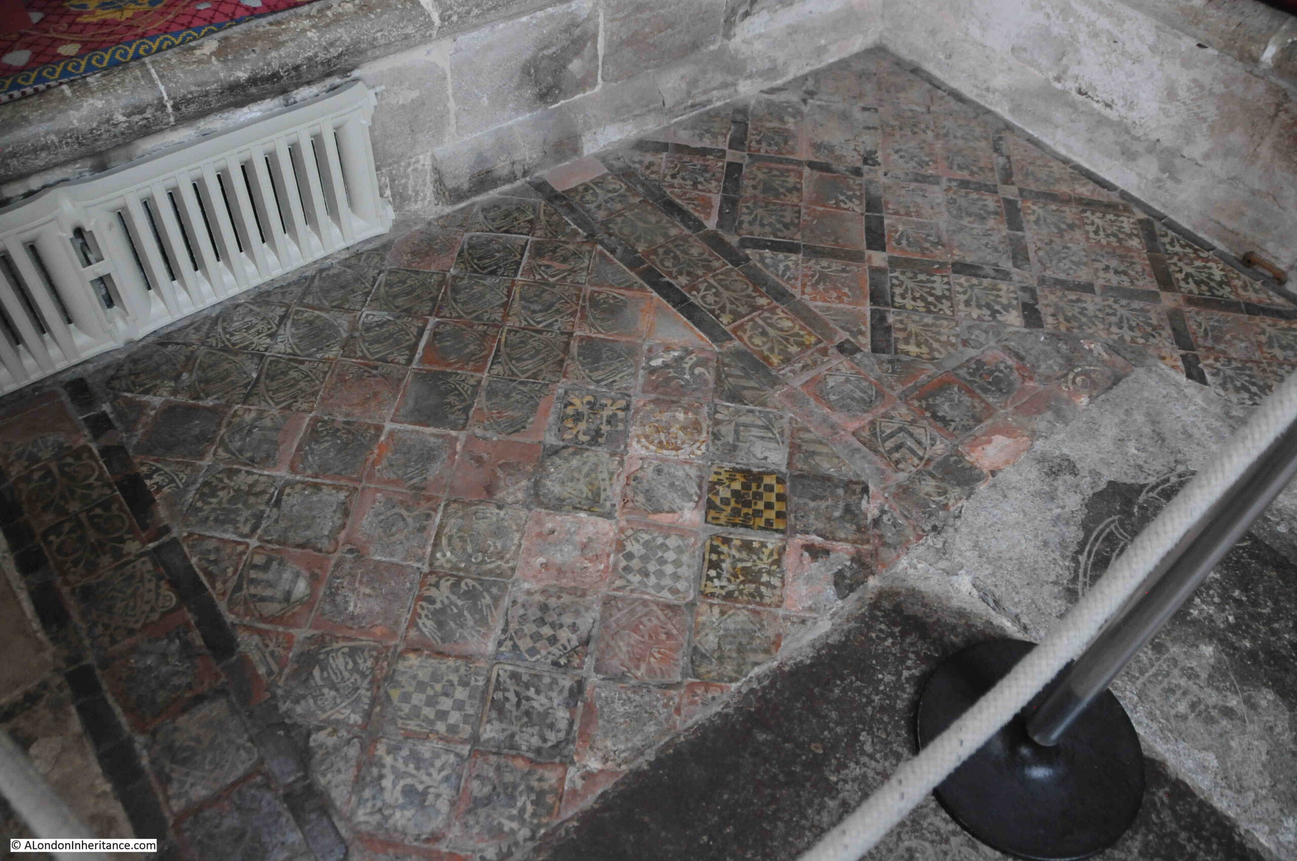
Many of the floors within the Cathedral would have once been covered with colourful floor tiles, however today, only the following small patch of medieval floor tiles remain:

Floor tiles at Wells Cathedral

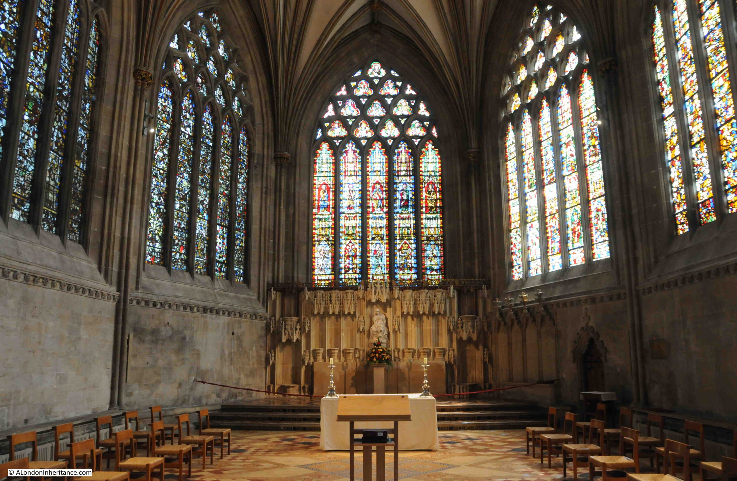
The Lady Chapel:

Lady Chapel at Wells Cathedral

The Lady Chapel was ransacked during the English Civil War, when many of the Puritan soldiers thought that the decoration and stained glass of the Lady Chapel was still adhering to the Catholic faith.

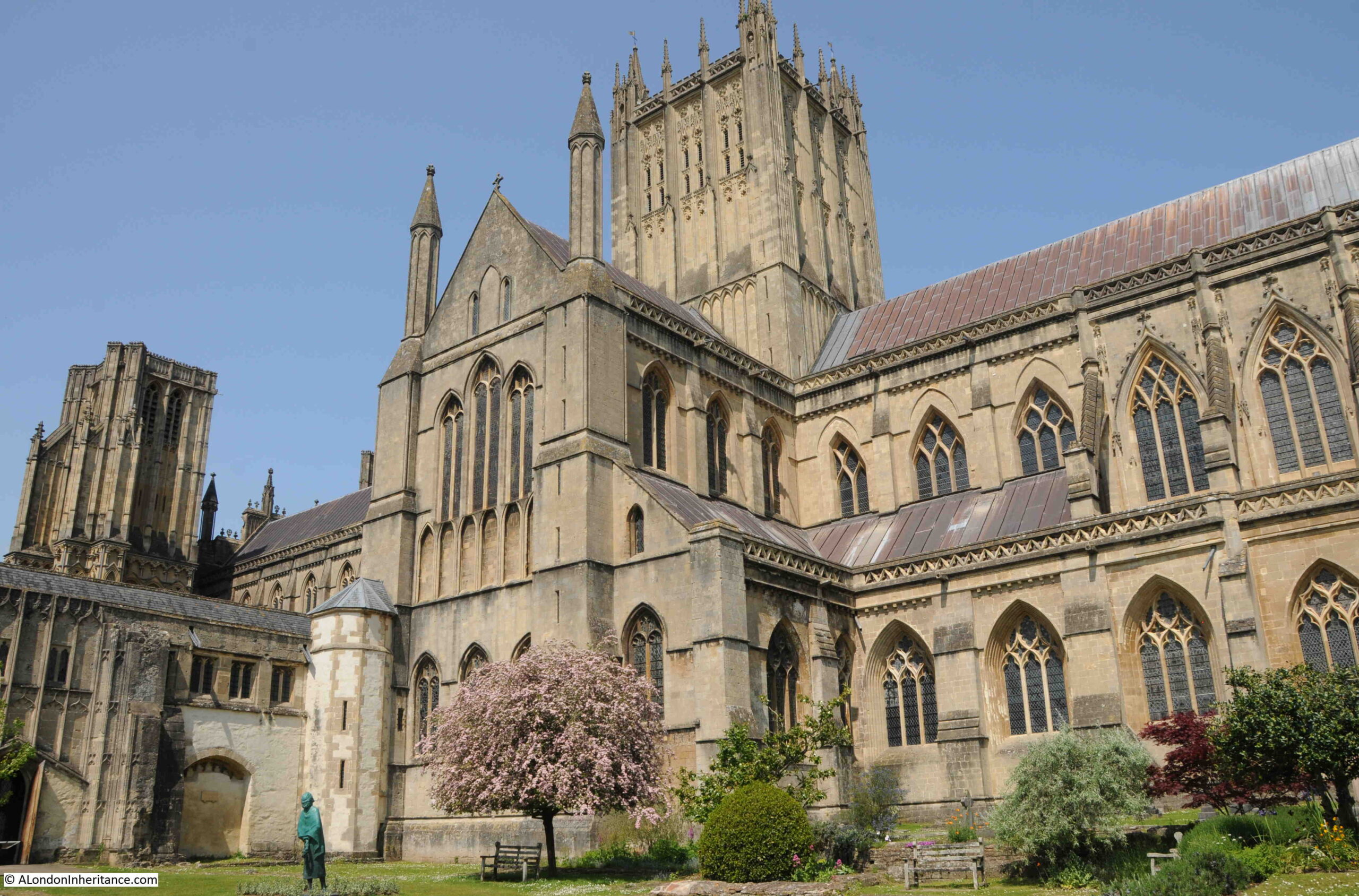
In the Cathedral gardens:

Wells Cathedral

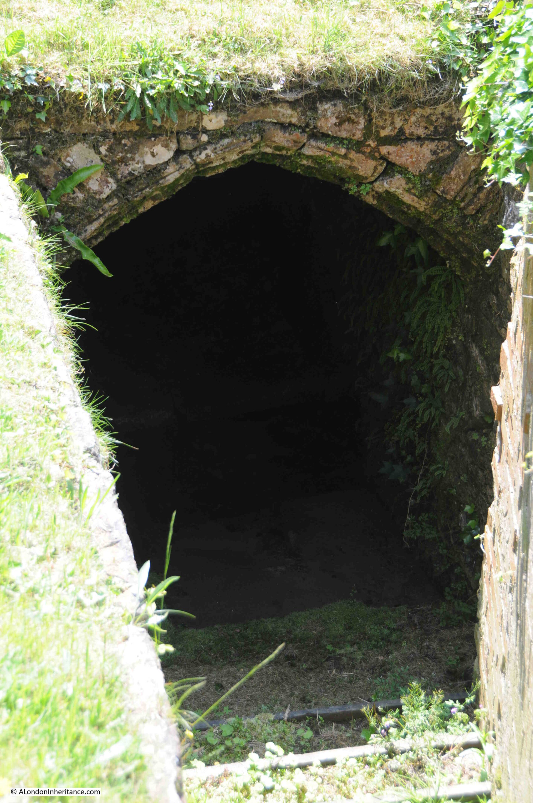
There are a number of wells and springs surrounding the Cathedral, and in the following photo I am looking down into one of these in the Cathedral gardens. The sound of running water rises from the darkness of the entrance:

Well

The Bishop’s Palace was the next place in Wells to find the location of one of my father’s photos.

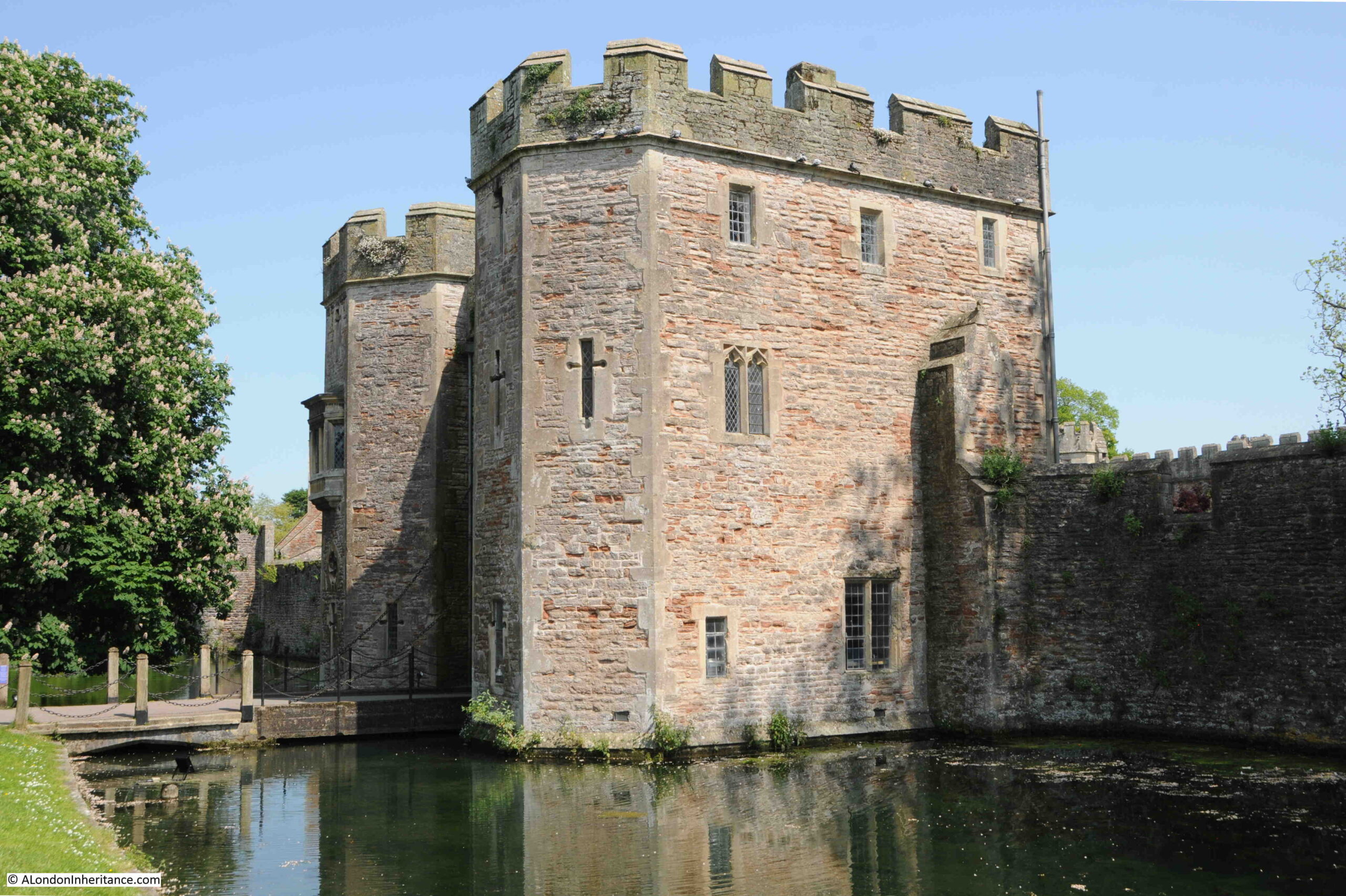
This is the entrance to the Bishop’s Palace, across a moat that surrounds much of the palace:

Wells Bishop's Palace

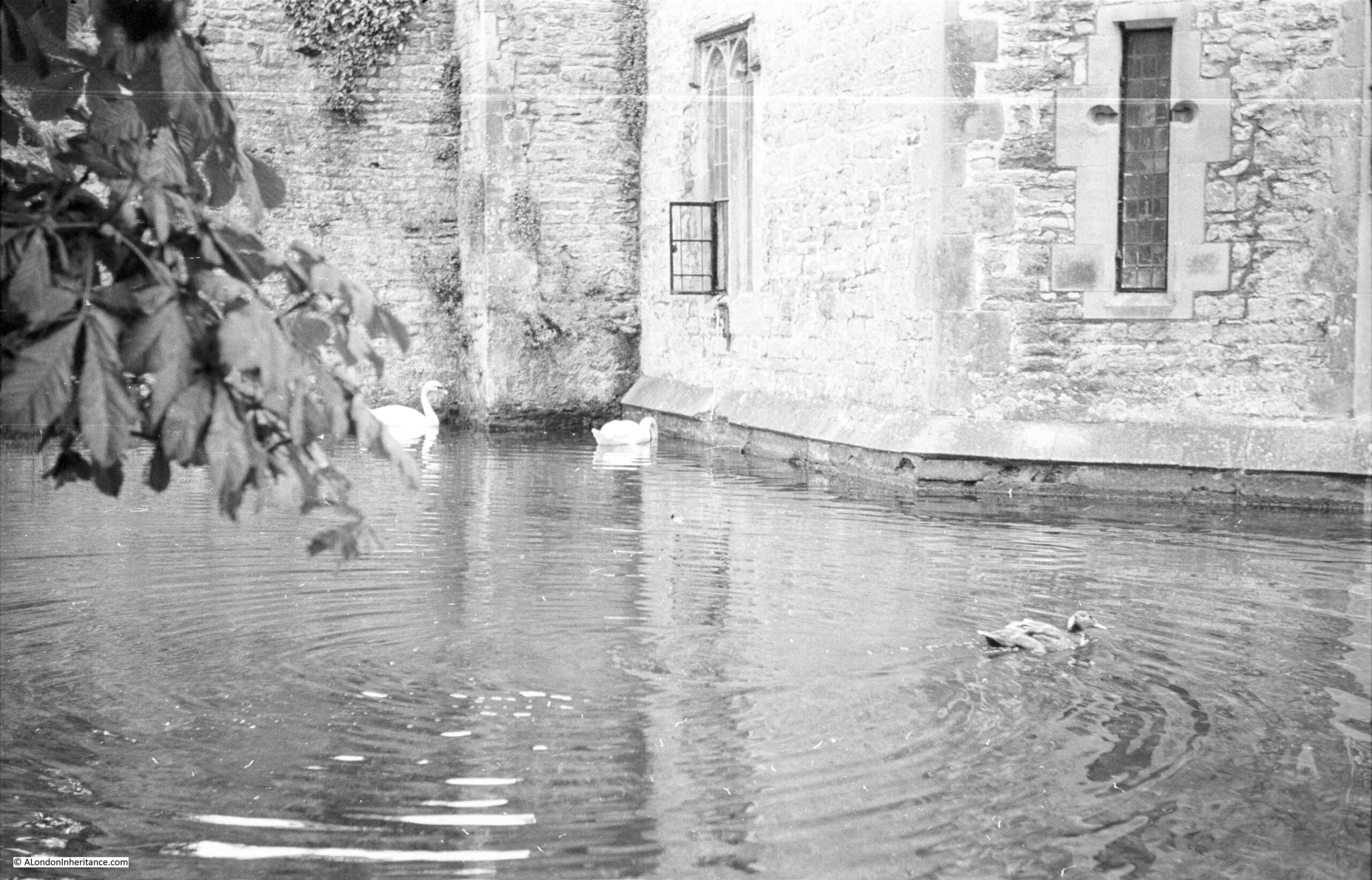
This is my father’s photo from 1953 showing the moat, a couple of swans and part of the surrounding wall / gatehouse, in which there is an open window:

Swan bell at Bishop's Palace

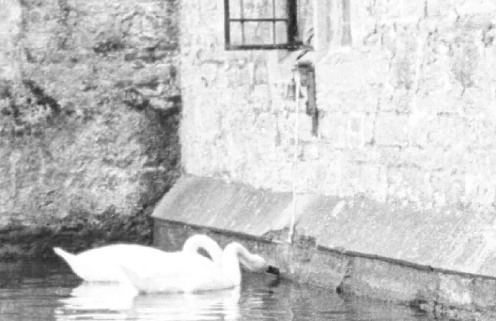
The open window is the point of interest, as zooming in on this, it is just possible to see a bell mounted on the wall, and a rope hanging down to just above the level of the water:

Swans pulling the bell at Bishop's Palace

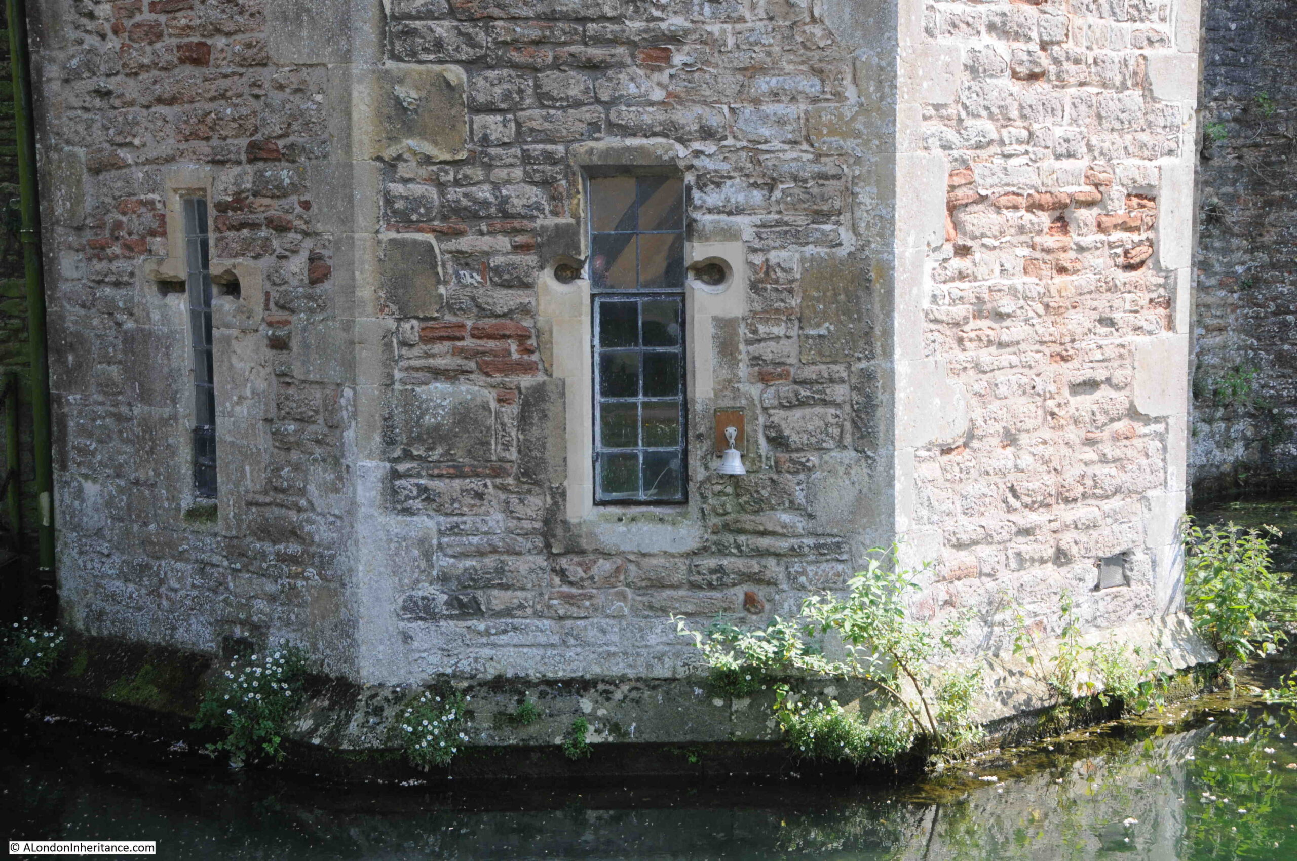
The bell is still there today, although in a slightly different position, and the rope had been taken inside the window.

Swan bell at Bishop's Palace

There is a tradition with the swans at wells, which is believed to date back to the 1850s, when a Bishop’s daughter taught the swans to ring the bell for food.

The swans still ring the bell for food, however to stop them doing it at random times throughout the day, the rope hanging from the bell is tucked into the window, until the time for feeding.

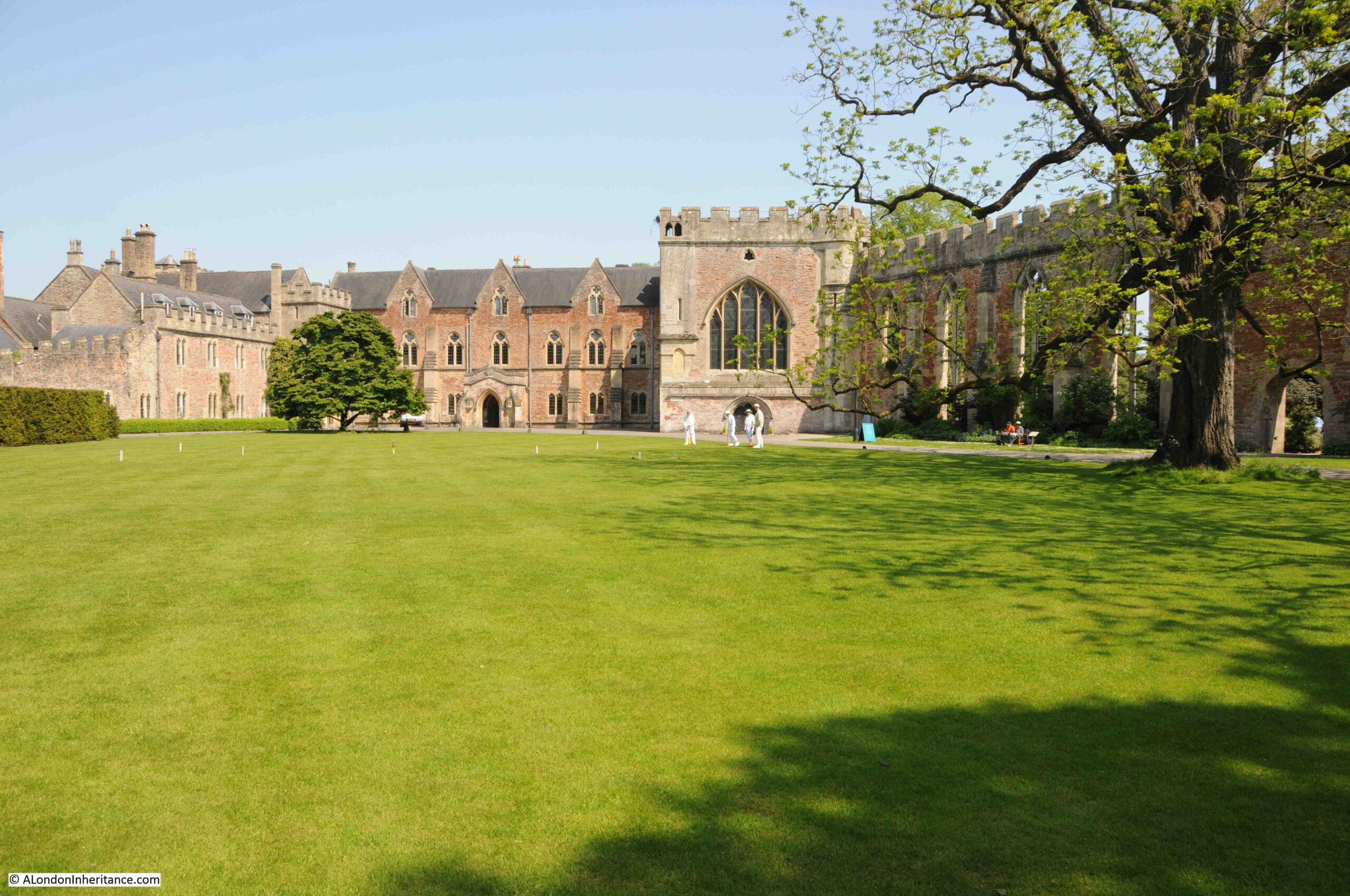
Once through the gatehouse, we can see the Bishop’s Palace. The Chapel in the centre, and the walls of the ruined Great Hall on the right:

Lawn in front of Bishop's Palace

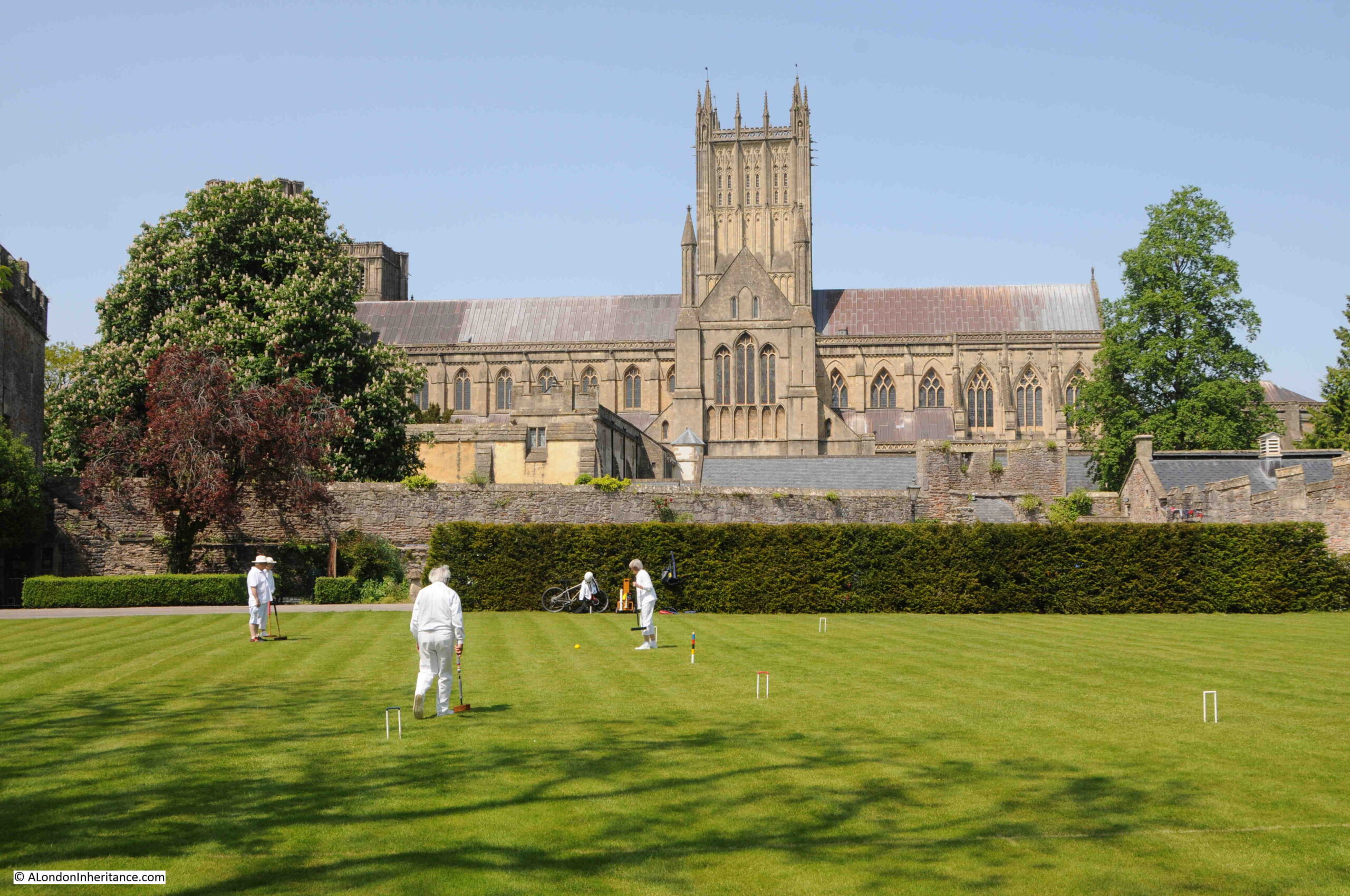
And what must be one of the most tourist friendly scenes – croquet on the lawn of the Bishop’s Palace, with Wells Cathedral in the background:

Croquet on the lawn

Inside the Chapel of the Bishop’s Palace. The Chapel was built between 1275 and 1292 for Bishop Burnell who was Lord Chancellor for Edward I. The Chapel has been used by the Bishop of Bath and Wells for many centuries.

Chapel at the Bishop's Palace

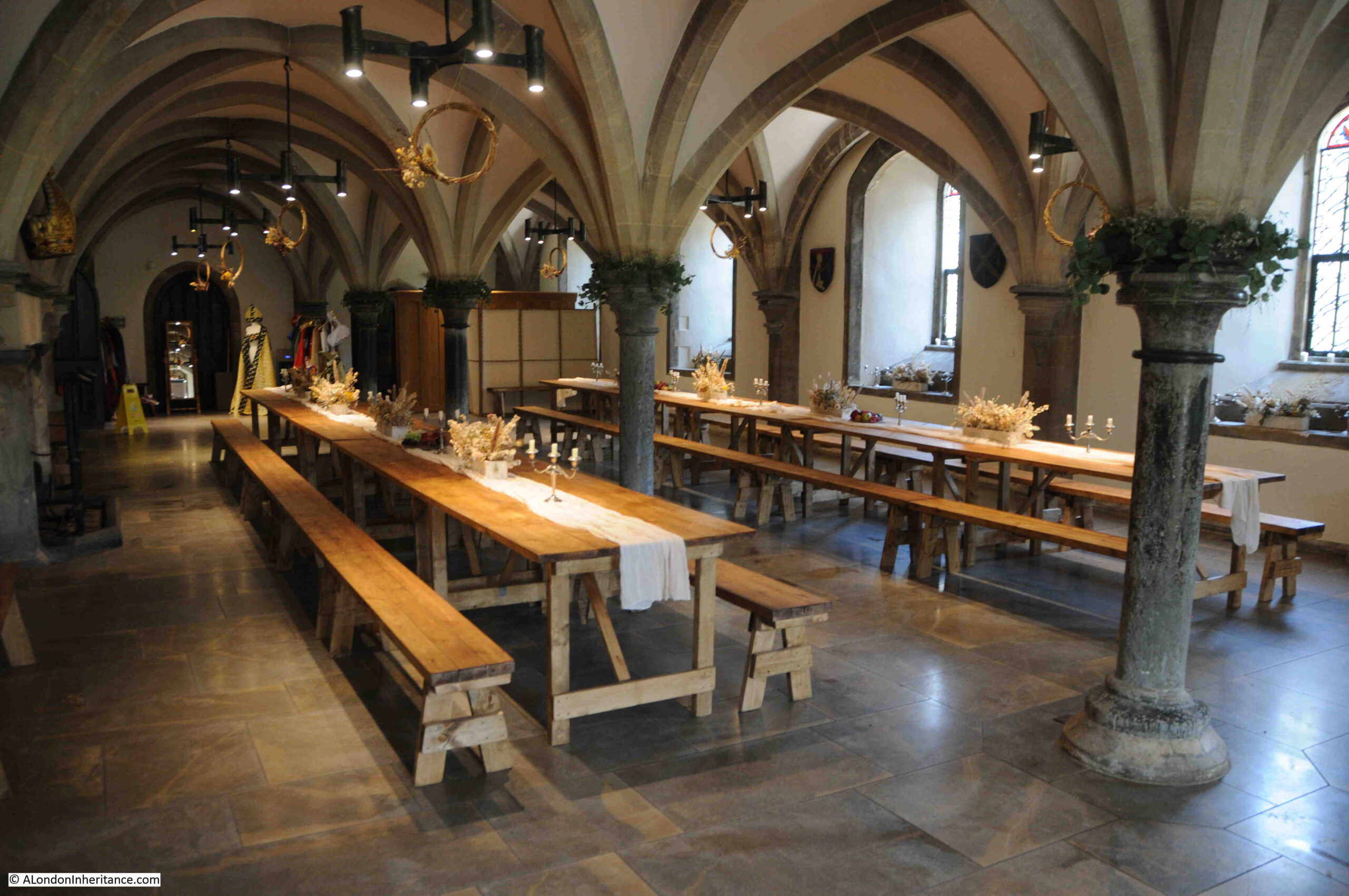
Interior of the Bishop’s Palace:

Bishop's Palace

In the gardens of the Bishop’s Palace, between the palace and the cathedral, we find the main evidence of the wells and springs that gave the city its name and led to the original religious establishment.

The Bottonless Well

The wells and the streams running from the wells have been enclosed, with large gardens around the main wells. Originally, water would have risen from the ground here, and flowed away through a number of streams and marshy land.

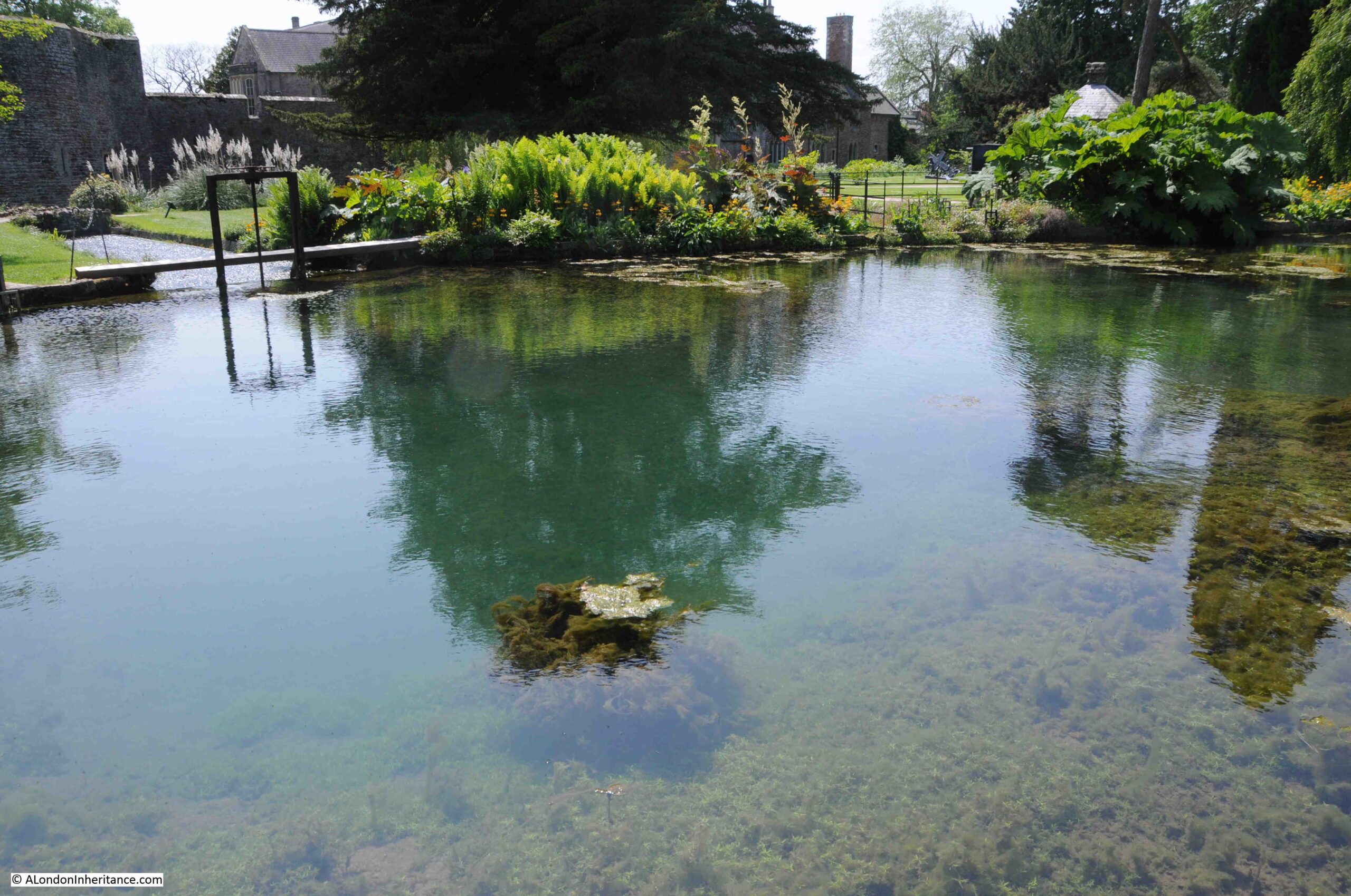
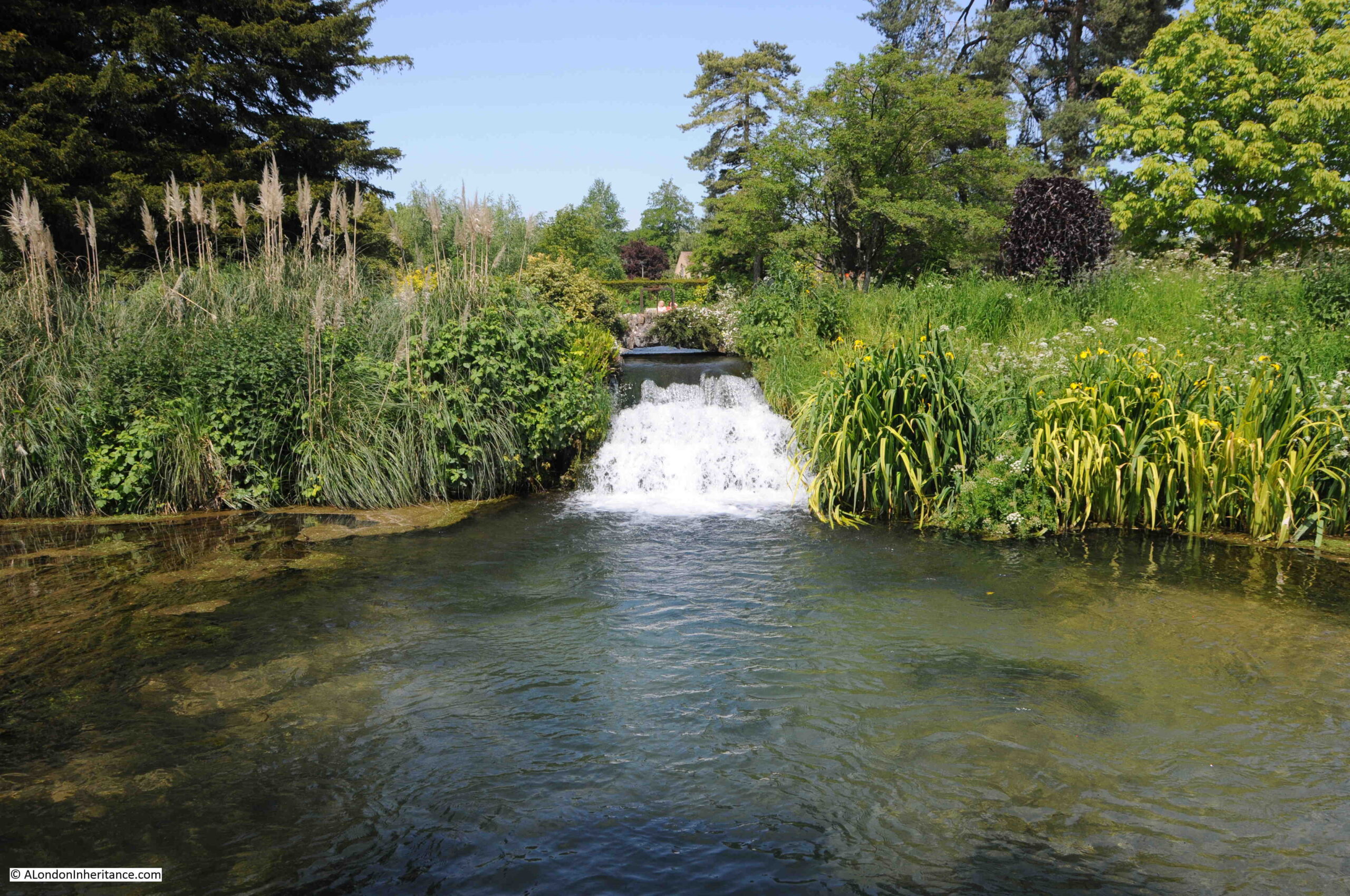
There are five large springs that rise through the artificial pond seen in the photos above and below. Four of these springs rise through the sand and gravel at the bottom of the pond. The fifth source of water is at the far end of the pond in the above photo, and is water that is piped from wells beneath the lawns close to the cathedral.

In the photo below is the spring that was once called the Bottomless Well, due to the assumed depth of the well. It has been partly filled and lined with gravel, to prevent the flow of water from undercutting the stone walls of the pond.

The features where the water rises up through the ground at the bottom of the pond are known locally as “pots”, and after periods of heavy rain, the surface can be seen to bubble with the flow of the rising water.

The Bottomless Well

The waters that rise through the ground in Wells originate across the southern side of the Mendip Hills, to the north and east of Wells.

A story of farmers in a hamlet to the east of Wells throwing waste chaff from their corn threshing, into a swallet hole, where a stream sinks into limestone, with the chaff reappearing at the springs in Wells was one of the first demonstrations of where the water was coming from, a distance of three miles.

Later tracing activities would identify eight or nine underground streams that were feeding the springs, with the time taken to travel underground dependent on the amount of rain that had fallen.

An experiment with one of the more remote swallets demonstrated that water would normally take 24 hours to reach Wells, however at times of drought it could take up to a week or more.

When dye has been used to trace the flow of water, the concentration of dye is the same at any of the springs in Wells, from any of the sources of water. This proves that the water from the remote swallets, where streams disappear below the surface, is carried to Wells along a single underground river, where it then rises to form a number of springs.

As the underground river rises in height, it breaks through the surface at different places to form the “pots” where it rises up from the limestone, through marl and finally through the gravel just below the surface.

The average daily output of the springs is about 4 million gallons. This can fluctuate between 40 million gallons after periods of high rainfall and flood, down to 1 million gallons during a drought.

Water is drawn of from the pond through an underground tunnel and a separate sluice, that both feed water into the moat around the Bishops Palace.

Water in Bishop's Garden Place

Some of the water from the springs is used to feed the streams running along the gutters of the High Street, as seen in one of the photos earlier in the post.

Whilst the springs and water from the springs rose in the land owned by the Bishop, in 1451, Bishop Beckington built a well house and laid lead pipes from the well house into the Market Place to provide water for the inhabitants of Wells.

The 15th century well house in the foreground of the following photo, surrounded by plants:

Bishop's Palace gardens

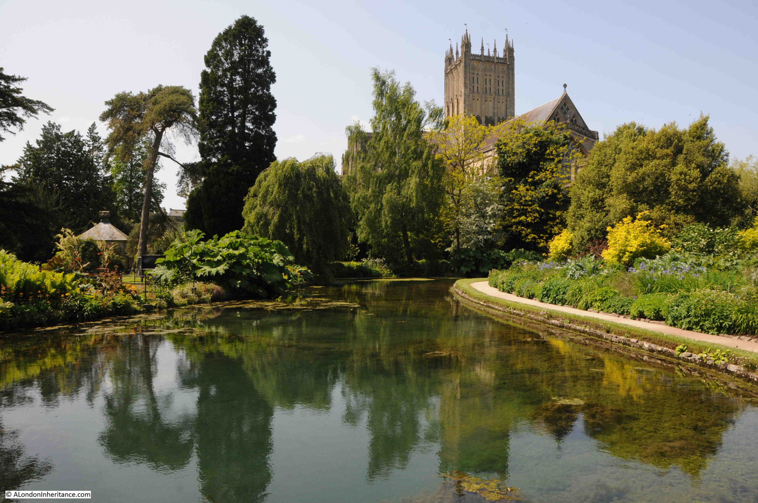
Part of the moat surrounding the Bishops Palace, with the cathedral in the background:

Moat around Bishop's Palace

The above scene creates the impression of a smooth and calm flow of water, however there have been times when the level of rainfall has created some very dramatic conditions at Wells, such as this description of the springs from 1937, when “a torrent bursting up and even heaping sand above its level, making in gardens gaping holes out of which water gushes, at times leaping into the air, overflowing lawns and, with impetuous torrent, doing its best to sap ancient foundations”.

The closest part of the cathedral to the ponds and springs is the Lady Chapel, and there has been concern over the years that the amount of water in the springs after periods of high rainfall, could damage the buildings and undermine the structure.

Pipes take water from the springs closet to the cathedral away to the ponds, but at times in the past, water has been seen to erupt through the lawns.

On a sunny and warn late spring day, the gardens are glorious and the constant presence of water provides a connection with the geology below the ground and the water flowing in from the surrounding countryside.

There was one last place that I wanted to visit, and to find it, we walked to the side of the Cathedral, where there is another clock:

Cathedral Clock

The clock on the exterior of the Cathedral is driven by the same mechanism as drives the clock inside the Cathedral. This clock is believed to have been added around the 14th and 15th centuries, but has been restored a number of times since.

Not far from the clock is Vicars Close, dating from 1348, it is believed to be the oldest, mainly original, medieval residential street in Europe:

Vicars Close

The houses were originally built to accommodate vicars, however since the 1660s, some of the houses have been leased out to other residents.

At the end of the street (see above photo), is a chapel. The Chapel, as well as a number of the houses are now used by Wells Cathedral School.

All the houses are Grade I listed.

View from the chapel end of the street, looking back to the Cathedral:

Vicars Close

Wells is a really fascinating place to visit. I wish my father had taken more photos of the place in 1953, however the cost and limitations of film at the time, as well as how much could be carried on a bike probably limited the number.

What I like about Wells is it reminds us that towns were usually built at a location due to what was there at the time. Wells was built at this site because of the springs / wells that gave the place its name. Wells that are only there due to the unique geology of this part of Somerset.

You may also be interested in my visit to nearby Glastonbury, which can be found here.

alondoninheritance.com

Hook New Town – A London County Council Plan

It is the late 1950s, and you are a resident of the village of Hook in north Hampshire. Surrounded by countryside, London seems some distance away, although the village has a direct railway route to Waterloo, and the A30, then the main road from London to the south west runs through the village.

Although London is roughly 40 miles to the east, decisions made in London, by the London County Council threatened the village of Hook and the surrounding countryside with the imposition of a New Town that would bring thousands of people and dramatically change the whole character of the place.

I have long been fascinated by the impact that London has on the rest of the country. There are many different examples of this, one of which was the post-war move of population from the city to the surrounding counties, and the development of new towns.

The proposals for Hook New Town did not make it through to construction, however they did raise significant concern in the area affected, and they also show L.C.C. thinking about how new towns should develop, and how people would want to live in the second half of the 20th century.

The London County Council were supporters of the New Town movement, and although their plans for Hook did not get implemented, they published their design work in 1961, and in the forward of the book, “The Planning of a New Town”, Isaac Hayward, Leader of the Council, wrote “I believe that Britain still needs more new towns, and the Council publishes this book in the hope that the Hook studies will be useful to those who have the good fortune to be called on to plan them.”

The L.C.C. had been searching for a site for a new town, able to support a population of 100,000 for two years before finally deciding that Hook was the best location and met their key requirements, which were:

  • Does not have a high agricultural value
  • Can be adequately drained
  • Sufficient water for the town could be produced
  • Excellent road and rail communications
  • Attractive to industrialists, whom it was hoped, would move out of London to the new town

The last requirement was considered to be the most important.

The search area had been south east of a line drawn between the Wash and the Solent. Above this line, the L.C.C. considered that a town would come under the “pull of Birmingham”, but south would be under the “pull of London”. An interesting example of just how far the L.C.C. believed came under London’s influence.

The following map from the book shows the search area limitations and the location of Hook:

Hook new town

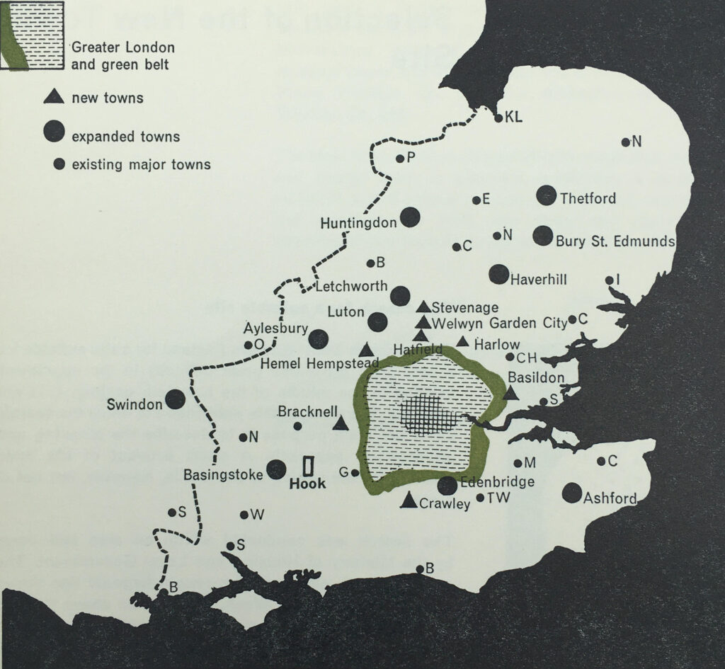
The site also had to take into account the location of other new and expanded towns. The post-war period had seen considerable growth across the south east of the country, mainly driven by the shift of population and industry from London to the surrounding counties.

As well as the criteria listed above, the search also had to ensure that the new town was not too close to other new and expanded towns and would not merge into other centers of population.

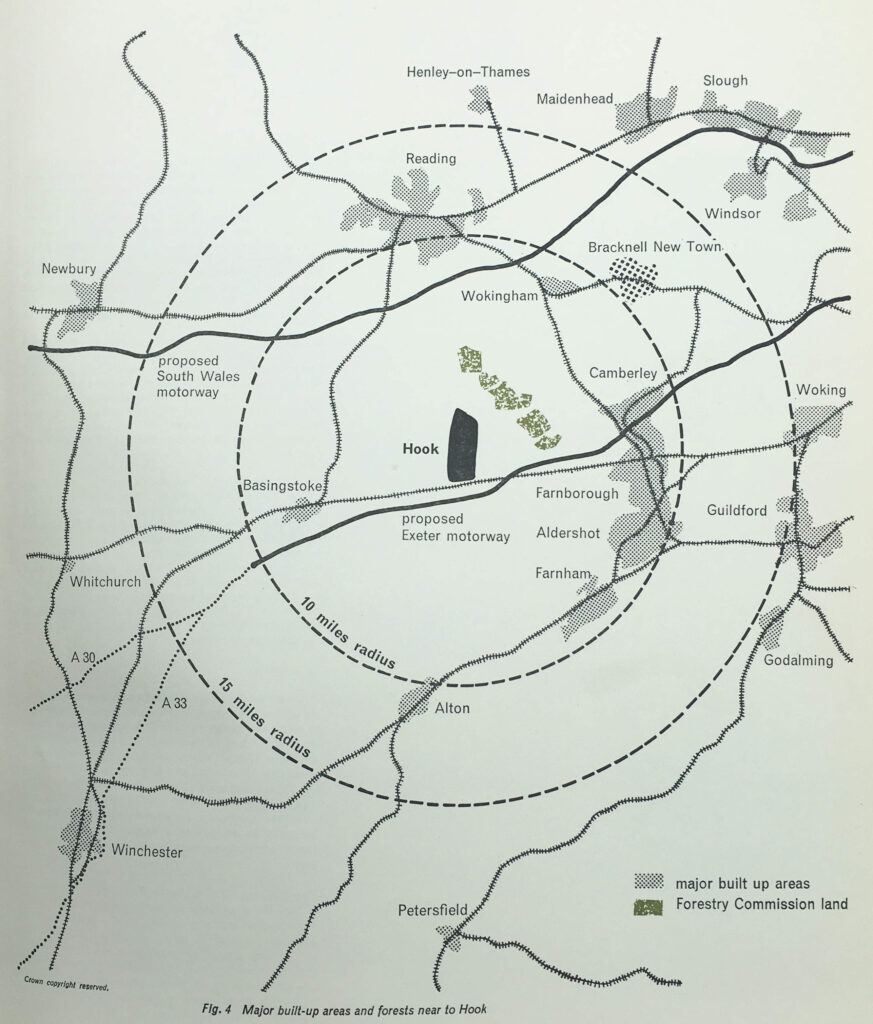
The following map from the book shows the new and expanded towns surrounding London, with the new towns of Basildon, Harlow, Welwyn Garden City, Stevenage, Hemel Hempstead, Bracknell and Crawley, all orbiting just outside London’s green belt.

Hook new town

Transport links were also important, but not for commuting into London. Whilst Hook had a good rail connection into London, planning for the new town made clear that it was not intended to be a dormitory town, with large numbers of residents commuting into the city.

Good transport was a requirement to attract industrialists to the new town, and Hook had the benefit of being close to two new proposed motorways.

As well as new towns, post war planning included the web of motorways that now reach out from London. Two proposed at the time of the Hook plan, and shown on the following map were the “South Wales Motorway”, now the M4, and the “Exeter Motorway”, now the M3.

Hook new town

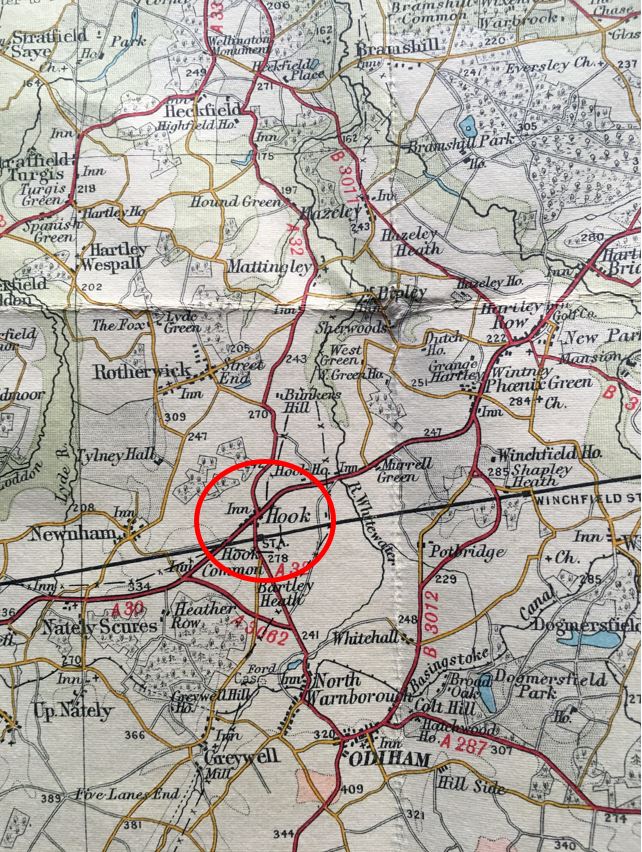
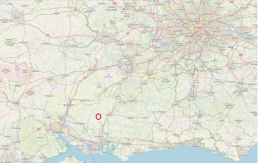
To get an idea of the rural location of Hook, the following map is an extract from a pre-war Bartholomew’s map of Berkshire and Hampshire, and shows Hook circled:

Hook new town

At the time, Hook was a very small village. A couple of old coaching inns which had served traffic on the A30 which ran through the village, and limited development along the line of the A30.

The coming of the railway to Hook had led to some expansion, and the village has seen much larger development in the last few decades, and now has a population of around 8,200.

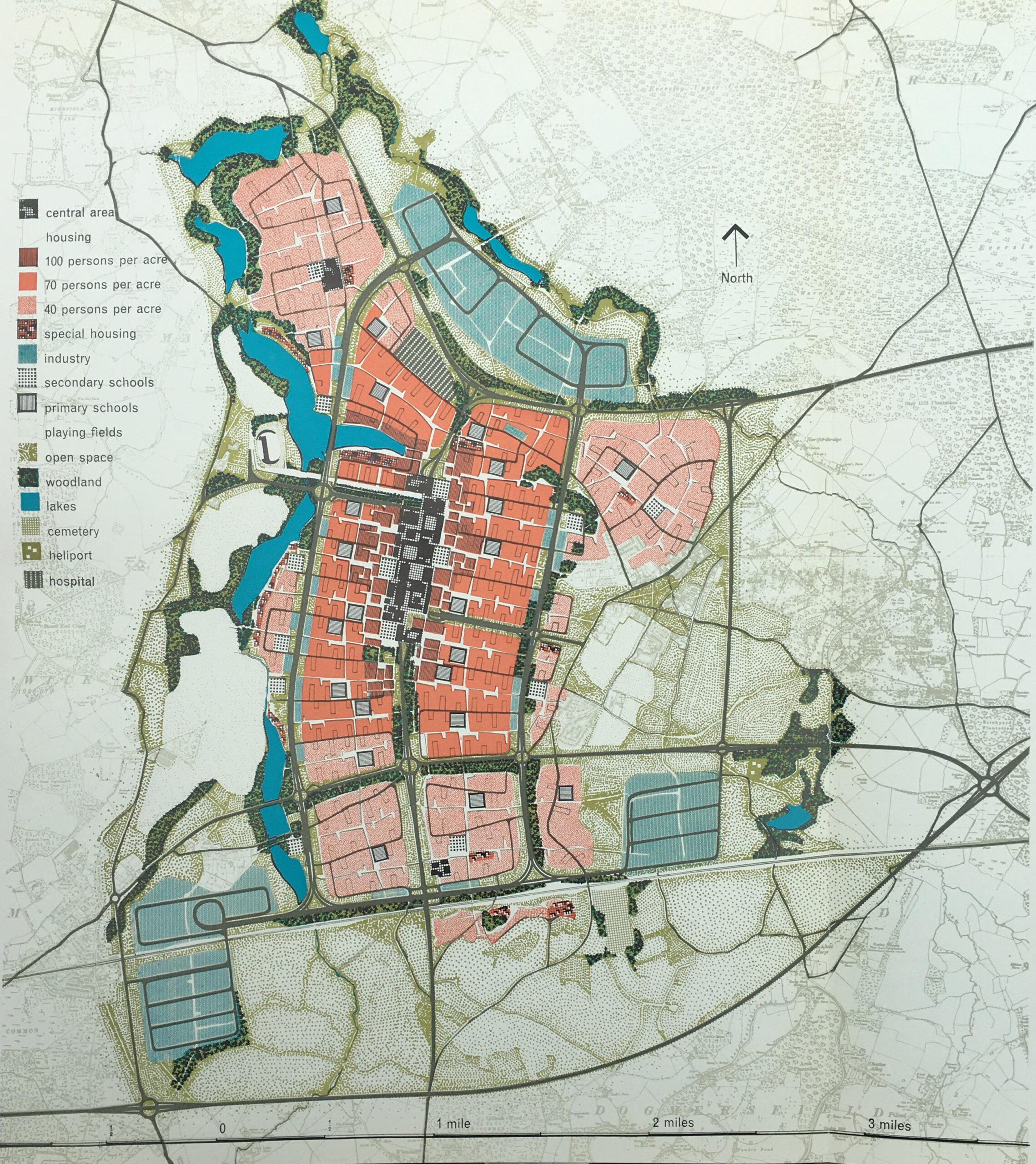
The L.C.C. plan for Hook covered a 50 year period of development, and the layout of the town after 50 years, with the full population of 100,000, with surrounding industrial zones is shown in the following Master Plan:

Hook new town

The key to the left of the above shows how the site would be used. A central core area, with reducing density of people per acre as you move from the centre. Industrial, green space and lakes surrounding the core.

The plan had a 1950s view of what the future could look like, as the town also had a heliport.

The plan for Hook included some of the ideas from post-war development of the City of London. The plan included the separation of pedestrian and vehicle traffic, and the central core of the town was to be built on a platform, free of vehicles, but containing under it and on its approaches, provision for the movement and parking of 8,150 vehicles.

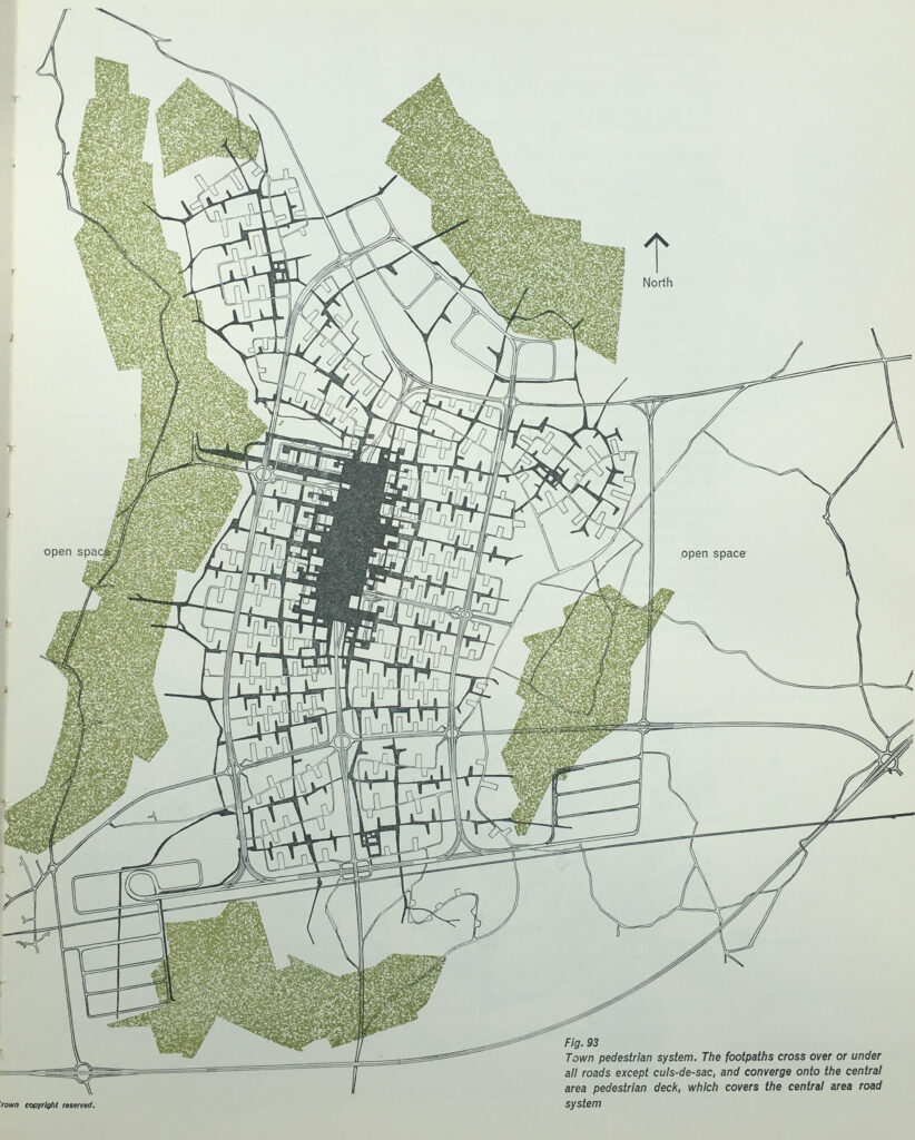
To allow pedestrians to walk freely and safely around the town, a system of pedestrian ways was important, and the following map shows the pedestrian system, with footpaths crossing over or under all roads, and converging on the central pedestrian deck which covers the central area road system.

Hook new town

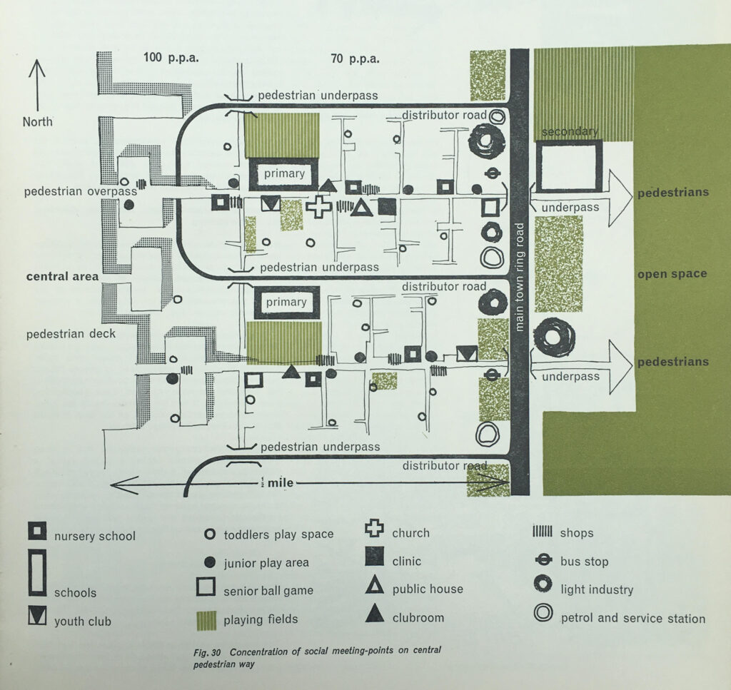
The new town was intended for young families which is illustrated in the design of some of the areas. The following plan shows the concentration of social meeting points on the central pedestrian way, and shows a remarkable number of primary schools, play space and play areas, and a repeated pattern of pubs, churches, clinics, bus stops, light industry and petrol stations, which would replicated in the same pattern across the central pedestrian way.

Hook new town

Where car parking was provided within the residential areas, the intention was to try and hide the cars as much as possible, and as the following drawing shows, car parking would be within a lowered area, with banking and planting helping to keep the roofs of cars below eye level:

Hook new town

The central pedestrian area was elevated above the traffic and parking areas, and included secondary schools, local shopping, entertainment and government zones, a department store, church, library and post office:

Hook new town

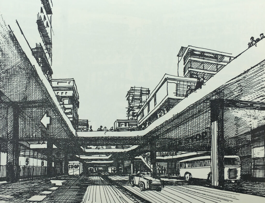
The book has a large number of drawings illustrating what Hook New Town would have looked like. and the following drawing shows the central pedestrian deck as seen from the spine road:

Hook new town

The plans for some of the areas were very forward thinking, but it must be very questionable whether these plans were cost effective, and whether any consideration was given to their ongoing cost and maintenance.

For example, the intention was that the pedestrian deck would be traffic free, however there was a recognition that the businesses and institutions on the pedestrian deck would need servicing with delivery of goods, collection of refuse, how would an ambulance get to the pedestrian deck etc.

The planners ideas included the possible use of electric trolleys to provide transport along the pedestrian deck, and to move goods between the service areas at ground level and the pedestrian deck, hoists could be installed in the communal and service areas and operated by “the local authority or some other central management organisation”.

The new town would not have the type of high rise housing that was being built across east London, but would have low rise housing, which would include gardens, off-ground outdoor rooms and pedestrian walkways to separate pedestrians from the streets and parking below:

Hook new town

Upper level gardens and off-ground rooms:

Hook new town

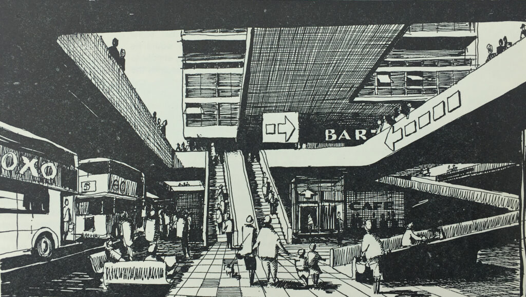
The elevated central pedestrian deck was incredibly ambitious. In the following drawing, the ground level bus stops are shown, with ramps, escalators and lift up to the pedestrian deck:

Hook new town

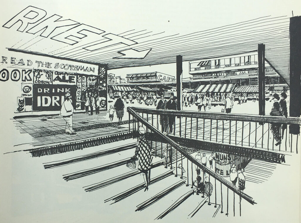
Once on the deck, there were shopping areas, along with other functions such as the entertainment and government zones, library, and a wide central space which would host a market:

Hook new town

I am not aware of any new town that had such a central pedestrian deck. New towns such as Bracknell and Basildon had central pedestrian areas, with facilities such as shops and council offices, but these were not on fully raised platforms, and transport services such as bus stations would be located at the edge of the pedestrian area.

The book demonstrates the difference in costs for Hook compared to other new towns.

The book identifies the costs for the Hook development of major roads, intersections, distributor roads, bridges, viaducts etc. as £8,707,700, whilst for the same services in an existing new town, the costs would be £3,146,900, so Hook would have cost an additional £5,560,800 – a huge amount which must have been difficult to justify.

The intention with Hook is that the area immediately surrounding the town would offer opportunities for relaxation, sport, hobbies and access to the countryside.

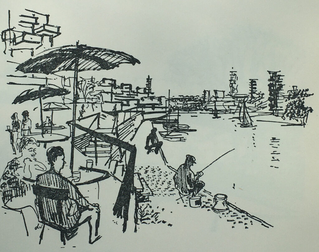
One drawing shows Lakeside Recreation:

Hook new town

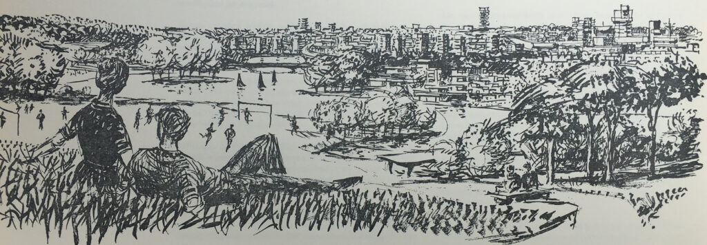
And the following drawing shows “Major open space seen against compact housing”, where a couple are relaxing on a small hill, overlooking a football game, with lake and surrounding trees, and the town across the lake:

Hook new town

The book has lots of data covering population size, age distribution, numbers employed, persons per household and mix of households etc.

Where possible, data from other new towns, or national data was used to model what could be applicable for Hook.

Some of the data provides a snapshot of the country in the late 1950s, and also how much aspects of the country would change in the following decades.

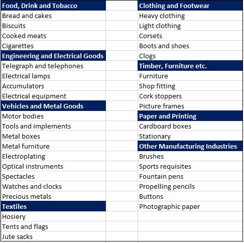
One table covers the manufacturing industries that could be attracted to a new town at Hook, with easy access to the planned M3 and M4. These were:

In the following years, many of these industries would be moving overseas to country’s with cheaper production, others would simply become redundant.

To justify the selection of the above industries as possible candidates to move to Hook New Town, the table includes figures to show how many were currently employed in these industries across the country. For example, there were:

  • 9,000 people employed making tents and flags
  • 108,000 people employed making hosiery
  • 17,000 people making corsets
  • 4,000 people making cork stoppers
  • 8,000 people making fountain pens and propelling pencils

The proposals also estimated that when the town was fully built and occupied after 50 years, employment would be split 50 / 50 between manufacturing and service industry jobs.

The London County Council’s proposals for a new town during the 1950s were met with delay and a lack of decision making. The Conservative governments during the 1950s were not really supportive of the New Towns movement, as they required state funding and their development was managed through non-elected Development Corporations.

The L.C.C. approach to various Ministers of Housing and Local Government were met with supportive noises, but no real action that would support the L.C.C. proposals.

A decision of sorts was finally made in August 1957 when the L.C.C. proposal was agreed in principle, however there would be no special funding from the exchequer, and the proposal was subject to agricultural considerations and the general economic environment.

On the 22nd of October 1958 a meeting was held in County Hall between representatives of the London County Council and Hampshire County Council, during which the L.C.C. communicated the decision to Hampshire, without the opportunity for any discussion.

After the decision was made public, it was met by a huge amount of resistance from the residents of Hook, local farmers, landowners, civic groups and local councils. Even within London there was opposition, with the London evening papers asking why Londoners would want to move out to Hampshire, and whether the new towns were forcing those living in London to move out to these new developments.

Hampshire County Council refused any cooperation with the London County Council.

The appropriately named London Road, the old A30, the main street running through Hook today:

Hook London Road

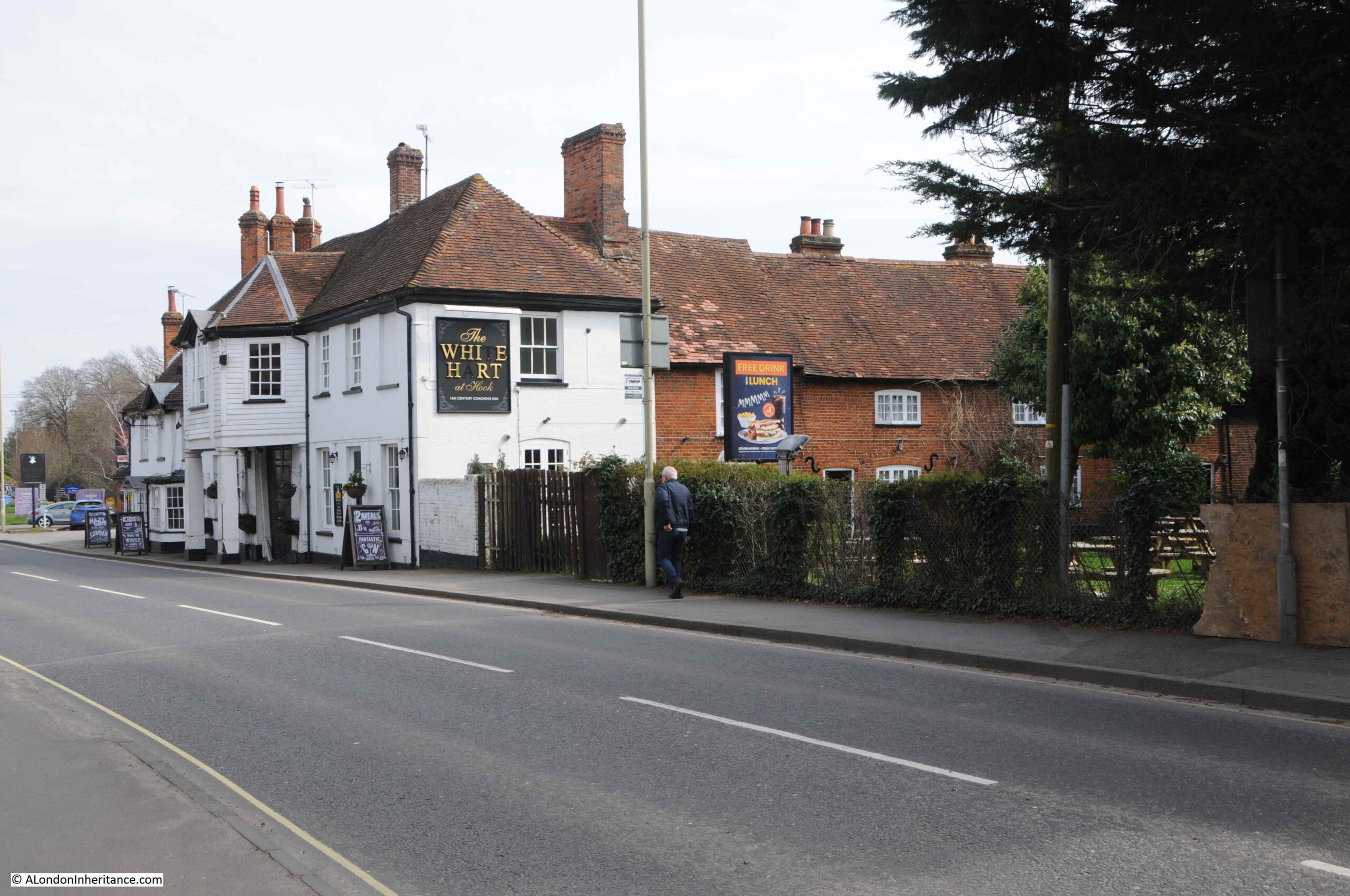
The historic importance of the road running through Hook can be understood through the Grade II listed White Hart Hotel:

Hook the White Hart

The listing states that the White Hart is “C18, early C19. Old Coaching Inn, with buildings around a yard: the front (Early C19) of 2 storeys in 2 sections”.

The local newspapers of the time were full of objections to the new town. A few articles mentioned that it was the London County Council’s intention to clear much of Wapping and Hoxton and relocate people to Hook.

There were also alternative suggestions as to were a new town should be located with the Aldershot area proposed due to the significant Army landholdings in the area. It was believed that the Army could release a large proportion of this land, however the Army objected.

The following article is from the local paper with a very long title of Reading Mercury Oxford Gazette Newbury Herald and Berks County Paper, on the 8th of November 1958:

“HOOK NEW TOWN PLAN – That Hook New Town would cover eleven square miles, absorb a seventh of Hartley Wintney Rural District and involve an expenditure of about £7 million for land purchase, were estimates given at a special meeting of the Council. The general feeling was that Aldershot and Farnborough were far more suitable areas for such mammoth development.

The Parish Council, although obvioulsy entirely opposed to the new town plan, accepted a warning from Mt. T. Chapman Mortimer to await further information before formally registering opposition.

It was agreed to write to the Rural Council and say that the new town proposal was viewed with considerable alarm and to ask for further information.

Mr. D. Franklin, chairman, said that in Bracknell New Town area the value of properties had fallen sharply. Houses within the town area were razed to allow for new building and roads.

Mr. A.R. Wright thought the site was not far enough from London. It was ludicrous to put a town as big as Aldershot and Farnborough combined in a position where many of the residents would go daily to work in London and so aggravate the traffic problems in the district, and it was criminal to put 60,000 people on the fringe of Britain’s third ranking airport.

Wapping and Hoxton were the areas which the L.C.C. proposed to clear, said Wing Commander L.H. Cooper and he visualised dockers going up daily to their work.

Hartley Wintney shopkeepers are struggling to keep their businesses going, said Mr. Wright, and the new town would have a superb shopping centre with super-markets. It would be like having Knightsbridge on your doorstep, he said. It could mean many Hartley Wintney traders losing their businesses.”

The above article is typical of the many news reports of the time. There appeared to no one in the area who was in favour of Hook New Town.

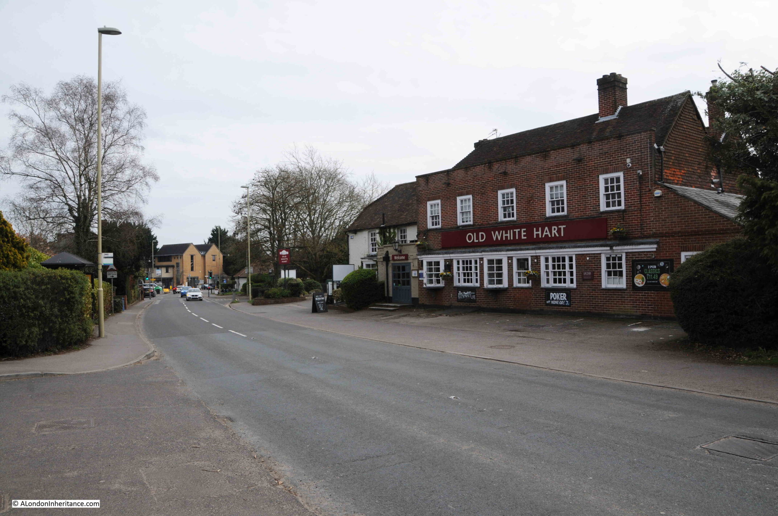
The Old White Hart, another of the pubs in Hook on what was the A30 through the village:

Hook London Road

Throughout the time that the proposal for Hook New Town was being progressed, Hampshire County Council was trying hard to avoid any involvement.

The Aldershot News reported on the 13th of February 1959 that: “Hook new town not abandoned – The Hook new town project has not been abandoned according to an L.C.C. spokesman, who this week told the Aldershot News that the Council’s Housing Committee is giving careful consideration to the position now that Hampshire County Council has said it cannot consider the establishment of a new town anywhere in the county.”

The Evening News reported on progress on the 10th of December 1959, and commented that: “Investigations have been somewhat delayed at the outset by the unwillingness of Hampshire County Council to join them, the committee added, various details will require further consideration.”

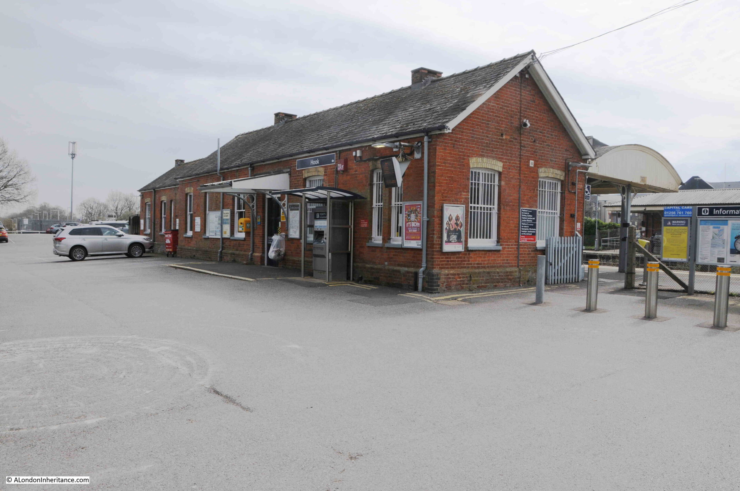
The station at Hook:

Hook railway station

Hook is on the mainline into Waterloo Station, which was one of the benefits identified by the L.C.C., as well as the two proposed motorways, the future M3 which would run to the south, and the M4 which would run to the north.

Hook railway station

The London County Council’s proposals for Hook New Town finally came to an end in 1960. There was much local opposition, and the county council has simply refused to get involved.

There was still pressure for large amounts of housing in the area around London, and Hampshire County Council, came to an agreement where this could be built, as reported in the Hampshire Telegraph and Post on the 17th of May, 1960: “Three Hampshire Towns May Expand – Proposals for the expansion of three towns in North Hampshire to accommodate overspill population in London received overwhelming support from Hampshire County Council at its meeting in Winchester on Monday.

The proposals envisage the development of Basingstoke to take 50,000 overspill population, the expansion of Andover to take 15,000 overspill and Tadley, near the Aldermaston Atomic Research Establishment, to take about 15,000.”

So Hook survived. It would grow in the following decades, but would not see migrations of people from Wapping and Hoxton. Today, the population of Hook is under a tenth of the level that the L.C.C. planned for the new town.

Emphasis shifted to the continued development of Basingstoke. It would be fascinating to know if, and how many, residents of Wapping and Hoxton did relocate to Basingstoke, or any of the other new towns.

New towns had an extraordinary impact on the villages that they took over. To get an impression of this, we can look at Bracknell, a new town that was developed in Berkshire, not that far from Hook.

The proposal for transforming Bracknell came in the immediate post-war planning for new towns, when the existing market town was identified as a new town in 1949. It would develop over the following decades.

Bracknell, as with Hook, was on a railway line into Waterloo, and was between the proposed M3 and M4 motorways.

The population of Bracknell today is around 118,000 so is probably around the size that Hook would have have achieved.

The town was designed following similar principles to Hook, but the central shopping area was not elevated. Housing was developed in community areas, traffic was directed around the central core, there was plenty of parking, new industrial areas were built around the town to encourage local jobs rather than the town acting as a dormitory for London.

The 1898 Ordnance Survey map shows the central High Street of Bracknell. It had not changed that much by the time it was declared a new town  (‘Reproduced with the permission of the National Library of Scotland“):

Bracknell New Town

Nearly every building along the High Street in the above map was demolished to make way for a new shopping centre at the core of the new town, and as the news report quoted above from the 8th of November 1958 stated “Mr. D. Franklin, chairman, said that in Bracknell New Town area the value of properties had fallen sharply. Houses within the town area were razed to allow for new building and roads”.

In the above map I have circled in red the PH symbol for a pub, which was preserved during construction of the new town, and we can still see the pub today:

Bracknell New Town

The block of flats behind the pub is recent, and was built on the site of a large office block which had been part of the new town development.

To the left of the entrance into the pub is a milestone that confirms that this was on one of the roads between London and Reading:

Bracknell New Town

The milestone confirms 28 miles to London and 11 to Reading, the same distances as shown in the map above:

Bracknell New Town

Walking along the route of the old High Street, now the pedestrian route into the main shopping centre, we come to the pub marked by the blue circle in the above map. The pub is still to be found, with the same name, but surrounded by a very different scene. This is the Bull:

Bracknell New Town

Original new town design for shops at ground level and flats above:

Bracknell New Town

Another building remaining from the original High Street:

Bracknell New Town

View along what was the High Street, now completely transformed:

Bracknell New Town

One of the problems for new towns is the need for constant reinvention. Bracknell was built with a central shopping centre that by the start of the 21st century was looking rather dated.

The shopping centre was also lacking any local character, and was the same as any other mid 20th century shopping centre. Whereas towns with a traditional High Street can evolve, a large shopping centre cannot easily do this, with large amounts of space dedicated to shops.

To try and address this, the central area of Bracknell recently went through a major redevelopment, with large parts of the original new town development demolished and replaced with a new design,

This is the view looking north from the original High Street, looking through into what were the fields behind the High Street. The view is the recent development. replacing the original new town build.

Bracknell New Town

The proposals for Hook show the influence of London on the counties around the city, and in the 1950s the London County Council considered the area south of a line between the Wash and the Solent as within the pull of London.

That description fits the map, where London sits at the centre, with a system of new and expanded towns circling around the central city, and the new towns we see today, such as Bracknell, show what could have become of the area around Hook.

alondoninheritance.com

M.R. James and a Ghost Story for Christmas

A Christmas custom for me, growing up in the 1970s, was to watch the BBC’s Ghost Story for Christmas. An almost annual event which usually featured one of the stories written by M.R. James.

Many of these stories followed some general themes. The main character was frequently a reserved antiquarian scholar, the plot often involved the discovery of something which would result in the arrival of a malevolent spirit, stories would often be set in the counties of Norfolk or Suffolk, a cathedral, abbey or university.

Many of these themes came from M.R. James own background.

He knew the counties of Norfolk and Suffolk very well. He was a medieval scholar, and was Provost of King’s College, Cambridge and then Eton. The term Provost is often used for the role of head of a university college or a private school.

His ghost stories appear to have originated from a custom where he would write, then read his ghost stories to friends on Christmas Eve. The first collection of his stories were published in book form in 1904 with the title “Ghost Stories of an Antiquary“.

M.R. James, or Montague Rhodes James, to give him his full name, was born on the 1st of August 1862, in the county of Kent and died on the 12th of June 1936 whilst he was Provost of Eton College.

He was buried in a small cemetery on the outskirts of Eton, so a recent trip to Windsor provided the opportunity to visit his grave, which seemed a suitable Jamesian thing to do in the weeks before Christmas.

M.R. James was buried in the grounds of the Eton Wick Chapel, a short walk from the centre of Eton.

The easiest way to get to Eton is from Windsor where there are car parks and train stations, and it is from Windsor that we started the walk.

The old road bridge between Windsor and Eton is now pedestrianised and crosses the River Thames:

Ghost Story for Christmas

View from the bridge over the River Thames, with Windsor on the south bank of the river, and Eton on the north:

River Thames at Eton

View looking back towards Windsor, with the castle towering above the town:

Eton Bridge

Eton High Street:

Eton High Street

The pedestrianised bridge from Windsor over the Thames runs into Eton High Street. This bridge and street was once an important road as it was one of the main routes for access to Windsor Castle. Follow Eton High Street northwards and it ran up to the Bath Road in Slough, the Bath Road being one of the main routes from London to the west.

Running across the High Street is a small watercourse called Barnes Pool. This flows from the Thames, through Eton, then back to the Thames, and originally turned the southern section of Eton into a small island.

The earliest recorded bridge over the stream dates from 1274, and it has been rebuilt a number of times since, including 1592 when a new bridge was commissioned by Elizabeth I who was concerned about being cut-off in Windsor in the event of a Catholic revolt.

The Barnes Bridge today:

Barnes Bridge

The stream is open water on either side of the bridge, however towards where the stream originates and then renters the Thames, the stream is contained within a culvert which gradually became silted up, and for many years there was no flow in the stream.

In the last few years there has been a campaign to open up the stream. The culvert has been cleared of silt, and Barnes Pool is now flowing through Eton between two points on the Thames:

Barnes Pool

Whilst Barnes Pool looks a very small stream of water today, before the culverts silted up, the stream could flood during periods of high rainfall, and on the brick wall next to the stream is a marker recording the heights of previous floods, with the highest recorded in 1774 when the flood almost reached the top of the wall (which obviously was not there at the time).

Barnes Bridge

St Mary’s Chapel, Eton:

Eton Chapel

M.R. James became Provost of Eton in 1918, and in the announcements of his new role, there is no mention of his ghost stories, the first of which were published in book form in 1904. He appears to have been the logical candidate for the role of Provost, as this report from the “The Mail” on Wednesday, 31st of July 1918 explains:

“Dr. Montagu James Appointed – Our Cambridge correspondent is officially informed that Dr. Montagu Rhodes James has accepted the appointment of Provost of Eton as from next Michaelmas Day. Dr. James has been Provost of King’s since 1905, and was Vice-Chancellor in 1913 and 1914.

The appointment of Dr. James has always been regarded as inevitable at Eton, where it will be universally popular. A devoted Old Etonian, and head for the past dozen years of the sister college at Cambridge, he has already been a member of the Governing Body of Eton during that period, and has latterly sometimes presided over it. The selection by the Crown of a layman marks a breach with recent practice, though it is not unprecedented. Dr. James, however, takes high rank as a theologian no less than as a brilliant scholar. Moreover, he has been Vice-Chancellor of the University of Cambridge; so that he will bring to Eton not only a tradition of sound learning, but a great experience of academic administration.”

He was installed as Provost of Eton in October 1918, with the King’s representative present (the Dean of Windsor), and the Headmaster of Eton, with speeches and addresses to the new Provost being read in Latin.

Opposite the chapel is Keates Lane, and this was the route out of Eton to find M.R. James grave:

Ghost Story for Christmas

View from Keates Lane back to the chapel, with buildings of the college on either side of the street:

Ghost Story for Christmas

Keates Lane, then bends right and becomes Eton Wick Road, and after a short walk, I came to the chapel and graveyard:

Ghost Story for Christmas

I have circled the chapel and graveyard in the following map. Windsor is to the south of the Thames, with Eton High Street running north, from the bridge over the Thames up to the centre of the town, where a left turn into Keates Lane takes you to Eton Wick Road, and then the chapel (Map © OpenStreetMap contributors).

Eton Wick

Visiting churches, abbeys, monasteries and historic locations in general, as well as the towns and countryside of Suffolk and Norfolk appear to have been passions of M.R. James, and clearly influenced his ghost stories.

I have copies of two guide books that he wrote and which were based on his own travel and research.

The first, “Abbeys” was published in 1925, rather strangely by the Great Western Railway, Paddington Station, and although the title of the book is simply Abbeys, the focus is on the west of the country, so presumably fitted well with the Great Western Railway network.

The book includes a large map of the Great Western Railway, showing Cathedrals, Castles and Abbeys, so the book really acts as a guide for all the places you could visit by taking a train from Paddington Station.

M.R. James Great Western Railway map of abbeys

M.R. James second guide book was of Suffolk and Norfolk, and described as a “Perambulation of the two counties with notices of their history and their ancient builds”. This book was published in 1930 by J.M. Dent and Sons, so was not a guide book for a railway company.

Reading the two books it is clear where much of James inspiration for his ghost stories comes from. His descriptions of Norfolk and Suffolk align with many of his stories, for example, his story “Oh, Whistle, and I’ll Come to You, My Lad” was set on the Suffolk coast, where a Cambridge Professor on a golfing holiday finds an old whistle while exploring the ruins of an ancient Templar building.

He then sees the outline of a person running after him on the beach, and also standing on the beach looking at his hotel room. After cleaning the whistle and blowing on it, he is troubled with bad dreams, sounds in his bedroom and the sheets on the second bed in his room being crumpled as if someone had slept in the bed.

The climax of the story comes on the second night when a figure rises in the room, and the Professor is backing towards a window, only to be saved when another guest bursts into the room.

Although I was too young to see it when first broadcast, the BBC’s 1968 version of the story with Michael Horden playing the Professor is really good and brings across the wild and open landscape of the coast, and the growing tension of the story.

Horden brilliantly portrays a probably rather reclusive, scholarly, professor. A man who is completely confident in his rational view of the world – a view that is completely shaken by the end of the story.

The 1968 version of “Oh, Whistle, and I’ll Come to You, My Lad” can be found on YouTube.

The book also includes drawings of a number of bench end carvings. These are the carved depictions of animals, human figures etc. which can often be found on the end of benches and pews in churches.

These featured in the story “The Stalls of Barchester Cathedral”, where they appear to come alive and haunt a cleric who has murdered an aged Archdeacon at the cathedral

The 1971 BBC production of the Stalls of Barchester Cathedral as their ghost story for Christmas can be found on YouTube here.

The gate leading from the road into the graveyard and chapel:

Ghost Story for Christmas

The graveyard:

Ghost Story for Christmas

Looking back at the gate into the graveyard:

Ghost Story for Christmas

M.R. James grave is at the back of the graveyard, and similar to what could be expected in an M.R. James ghost story. It is in a rather overgrown part of the graveyard. Being December, much of the vegetation had died down, but I still had to walk through Ivy and the thorn covered stems of dead bramble growth.

In the following photo, the gravestone is the small, white stone on the right:

M.R. James grave

The gravestone of Montague Rhodes James:

M.R. James grave

The grave is surprisingly simple. The gravestone records the dates of his birth and death, the dates of his time as Provost in Cambridge and Eton, along with the following inscription:

“No longer a sojourner, but a fellow citizen with the saints, and of the household of god.”

The area around the grave is overgrown, however the gravestone is clean and in good condition, which I believe is down to a campaign some years ago to clear the grave, although nature has now reclaimed much of the space.

Fortunately I did not find a whistle sticking out from between the leaves of the ivy.

A number of newspapers carried news of the death of M.R. James, and a brief obituary:

“DEATH OF PROVOST OF ETON – Mediaeval Authority and Prolific Author. The provost of Eton, Dr. Montague Rhodes James, died at his house, The Lodge, Eton, yesterday. he was 73.

Dr. James had been in ill-health since January of this year, and in April his condition became serious, but he made a satisfactory recovery.

As recently as last Thursday, at the Fourth of June celebrations, he was wheeled round the college playing fields, where he talked to a number of old Etonians.

Immediately he died the Eton flag, bearing the arms of Henry the Sixth, founder of the College, was lowered to half-mast over Upper School.

Dr. James was one of the most erudite antiquaries and one of the most prolific authors of his age. The list of his literary works fills nearly a page of ‘Who’s Who”.

He was an authority on ancient Christian manuscripts, and no surprise was evoked when in 1930 the Order of Merit was conferred upon him in recognition of his scholarship and of his eminent contributions to mediaeval history.

Ghost Stories – These serious studies, however, did not represent the sum total of his literary activity. He found time to write ghost stories – stories which would have won him wider fans but for the great reputation which he had earned in other spheres.

It was at Eton that Dr. James was educated, proceeding afterwards to King’s College, Cambridge, where he had a distinguished career, gaining the Caius Prize in 1882, and becoming Bell Scholar in 1883, and Craven Scholar the following year.

He was Provost of King’s from 1905 to 1918, and Vice-Chancellor of Cambridge University from 1913 to 1915.

Among other offices he held was that of a Trustee of the British Museum. His human quality was shown by his influence on youth.

‘The best things in life are not cars, wireless, flying, dirt track, or any other racing, league matches, or the pursuit of wealth’ he once said.

‘The best things are presented by the Bible, Shakespeare, Handel and Dickens, the Elgin Marbles and Salisbury Cathedral, the open country, the sea and the stars; the knowledge that all these may be made to disclose; honest games which are played and not merely looked at.’

His recreations were patience and piequet.”

Many aspects of his life can clearly be seen in his ghost stories. His love of Norfolk and Suffolk, religious buildings, mediaeval history, the academic life and institutions such as Cambridge and Eton.

What is not clear is how similar to the rationale scholar (the lead in Oh, Whistle, and I’ll Come to You) he was, or whether he had some belief in the supernatural, however I suspect the sentence “the knowledge that all these may be made to disclose” from his obituary hints more towards the rationale scholar.

For me, I have to thank M.R. James for some of the best programmes of Christmas TV as I was growing up, as well the published versions of his ghost stories which I have read and reread several times.

The British Film Institute have a brilliant collection of these programmes on DVD, they can be found here. They are well worth a watch during the dark winter’s evenings.

As well as M.R. James, the 1970s were a golden period for TV ghost stories, such as Charles Dickens story the Signalman with Denholm Elliot.

There were also other programmes, some of which had a bit of a moral story to them. Many of these have been on YouTube although several have now been removed due to copyright claims by the BBC.

One that is still (currently) online is The Exorcism, part of the BBC’s Dead of Night series. Broadcast in 1972 it tells the story of a couple who have moved from London and restored a derelict cottage in the Kent countryside – “still within easy distance of London”.

Another couple arrive and during the course of a dinner party, the cottage starts to take on a malevolent character, and the end of the story reflects the story of some previous occupants.

I do not beleive this is on DVD yet, but would be well worth a purchase. As well as the clothes and attitudes of the early 1970s, it also offers a view on those with money who were starting to move out of London and buying up and restoring properties in the surrounding counties. The programme can currently be found here.

Another was “The Stone Tape” which told the story of what we would now call a technology startup, who were establishing a research base in a country house, part of which included some ancient walls.

The Stone Tape has Jane Asher in the lead role, and who had a mysterious fate at the end of the programme. It was written by Nigel Kneal and in many ways builds on his earlier story for Quatermass and the Pit, where ancient memories are still retained in their surroundings and can continue to influence the present. The Stone Tape is available online as a DVD, and is currently on YouTube here.

The Ghost Story for Christmas format has been revived over recent years, with Mark Gatiss recreating a number of M.R. James stories as well as some originals.

As for me, I am on the sceptical side, although I do know a number of people who claim they have seen ghosts.

One of the most convincing, and my own Ghost Story for Christmas was when I was driving down a country lane at night. There were stories about the lane, but the person in the car with me was unaware of them. As we drove up the lane she asked me if I had seen the person in the hooded yellow anorak walking along the side of the road. I had seen nothing even though the car lights were on full and it was a narrow lane, and there was nothing to be seen in the red glow of the rear lights.

And with that, and for my last post of 2022, can I wish you a very happy and peaceful Christmas, however you are celebrating (or not), and wherever you are, and thanks for reading my posts over the year.

alondoninheritance.com

74 Miles from London

Before getting into this week’s post, can I thank readers for all the feedback on last week’s post, and the mystery building to the left of the National Theatre. This was identified as the curved riverside end of a multi-storey car park and some of the comments included links to photos which clearly show the overall building, and the end wall that was in my photo.

The building partly visible behind this structure was the London warehouse of HMSO and also the Cornwall Press print works. This building can still be found along Stamford Street, and is  now part of King’s College.

Again, my thanks for all the feedback.

Now for today’s post. I have always been interested in London’s relationship with the rest of the country. Frequently, this is seen as a negative. The north / south divide, London getting the majority of available infrastructure investment, higher wages in the city etc.

London’s central role in the country started many hundreds of years ago with the founding of the Roman City of London, located on a crossing point on the Thames, and where the new city was accessible from the sea.

Roads spread out from London, and the city became a cross roads for long distance travel. This was accentuated with the city becoming the centre for Royal and Political power, the Law and also a centre for trade and finance.

Look at a map of the country today, and the major roads that run the length and breadth of the country still start in London (A1 – London to Edinburgh, A2 – London to Dover, A3 – London to Portsmouth, A4 – London to Bath and Bristol, A5 – London to Holyhead).

Many of these major roads have been upgraded and follow new diversions, but their general routes have been the same for many hundreds of years. These A roads have now been mirrored by a similar network of Motorways.

The railway network follows a similar approach, with the main long distance routes running across the country to stations in London – (Waterloo, Liverpool Street, Euston, Paddington, St Pancras, Kings Cross etc.).

There are still tangible reminders to be found across the country’s roads that London has long been a destination for long distance routes, and in this post I will explore examples from around the counties close to London, starting with this 18th century milestone to be found in Southampton, indicating that it is 74 Miles from London.

Milestone

A number of these milestones can still be found in central London. There is a very fine example on the side of the Royal Geographical Society at the junction of Kensington Gore and Exhibition Road:

Milestone

This rather fine example, with pointing hands, dates from 1911, with Hyde Park Corner being the London point from where distances have been measured.

Milestone

To get really geeky, on the same wall as the above milestone, there is another marker that was used to measure the country. Loads of these can be found across London, and in the days before GPS they had an important role with accurately mapping and surveying the country.

This is a benchmark.

Milestone

It was used during the 1931 to 1934 re-levelling of Greater London, when the height of the city above the Newlyn reference point in Cornwall was measured. The flush bracket rather appropriately on the side of the Royal Geographical Society was on a survey line from Staines to the British Museum, and was levelled at a height of 67.8260 feet [20.6734 metres] above mean sea level at Newlyn.

This was how the Ordnance Survey were able to show all the contour height lines on their maps.

The above milestone measured the distance to Hyde Park Corner, and before there was any standard for where distances to London should be measured, routes usually used the first point at the boundary of the city that the route reached.

The Mayflower pub in Rotherhithe has a milestone set into the wall of the building.

Milestone

This example indicates a distance of 2 miles to London Bridge, which would have been the entry point to the City of London.

Milestone

The 1894 Ordnance Survey map shows the Mayflower milestone marked as M.S. to the front of the pub (P.H.) in the following map extract, and includes the distance to London Bridge.

Milestone

For centuries, London Bridge was the main crossing point from south of the River Thames into the City of London, and then to the northern routes which stretched out from the City, There is another fine example of a distance marker in Rochester, Kent where, on the front of this 1928 building above the word Furniture:

Milestone

Is this example, indicating a distance of 29 miles from London Bridge.

Milestone

Although the building dates from 1928, it replaced an earlier milestone or wall sign, as the OS map revision of 1896 shows a marker and distance of 29 miles at the same spot as the above building. This is circled red in the extract below (‘Reproduced with the permission of the National Library of Scotland’).

Milestone

Milestones marked the long distance routes from London. Camberley in Surrey is on the road that now has the designation of the A30. This was originally the main London to Exeter road.

The following photo shows the A30 at the eastern boundary of Camberley. Traffic lights, road signs, a car dealers – all the signs of 21st century travel, but look to the lower left of the photo and an old stone can be seen.

Milestone

Indicating 29 miles to London. If you were a coach traveler from Exeter, bumping along poorly maintained roads for many hours, you would be counting down these milestones till you reached your destination.

Milestone

As well as London, the milestone indicates the next village, town, turnpike boundary etc. that would be found on the route. These are shown on the side of the milestone facing traffic heading in the destination of the name. So, for example, Bagshot is on the opposite side of the milestone to the town of Bagshot as if you were travelling to Bagshot you would see the name and distance as you were heading to the town.

Coach travelers passing the above milestone would have to tolerate a very tough journey. In 1790, the typical times for a journey from London to Exeter would be:

  • Leave London at 8pm
  • Arrive Bagshot at 11:55 pm
  • Arrive Salisbury at 7:15 am
  • Thirty minute stop in Salisbury for breakfast
  • Arrive Blandford at 10:45 am
  • Arrive Dorchester at 12:55 pm
  • Thirty minute stop in Dorchester for dinner
  • Arrive in Honiton at 6:40 pm
  • Arrive in Exeter at 8:50 pm

So if you were traveling the full journey from London to Exeter, you would have been on the coach for 24 hours, 50 minutes, covering a distance of 179 miles. We can now fly from London to Australia in the same time.

In the days before any form of electronic communication, these long distance routes supported mail coaches, and individual riders who were carrying important news and information to and from London.

A good example of this is commemorated by a plaque to be seen in Salisbury which commemorates the route taken by Lieutenant John Richards Lapenotiere in October 1805 when he brought the news of the Battle of Trafalgar, and the death of Nelson from Falmouth in Cornwall to London. A journey that took 37 hours to cover the 271 miles with 21 changes of horse.

Milestone

Although Camberley is not mentioned on the map, Hartford Bridge and Bagshot are listed. These are the two locations shown on the Camberley milestone, so Lieutenant Lapenotiere would have passed along the same road carrying the news to London.

Signs indicating distance took many forms. In Wroxton, Oxfordshire, there is an unusual example:

Milestone

This Guide Post dates from 1686 and is a marker on one of the routes from Wales and the west to London. Allegedly used by salt merchants, the route follows the A422 down to Wroxton where it breaks from the road and heads to the south of Banbury.

The top of the guide post was originally a sundial and around the middle of the post are carved hands pointing to the towns along the adjacent roads.

The guide post was restored in 1974 and still looks in good condition with the directions and carved hands clearly visible.

This would have been the route to travel between London and Stratford-upon-Avon.

Milestone

As well as milestones and guide posts, the first printed route maps were of the strip map form showing the full route of a road from source to destination. John Ogilby was one of the first to produce this type of map in the 17th century and the following is one of his maps showing the route from Chester to Holyhead, one map of a sequence showing the complete route from London to Holyhead (Attribution: John Ogilby (1600–1676), Public domain, via Wikimedia Commons)

The Ogiby map includes the incremental distance in miles marked along the road, and milestones would have provided physical verification as the traveler passed along the road.

Many routes out of London still have lots of milestones tracking the distance from London.

This is the village of Ingatestone in Essex.

Milestone

Ingatestone was on the original London to Colchester road, and has now been bypassed by the dual carriageway of the A12. In the centre of the village is a Grade II listed milestone from when the road was a turnpike and carried traffic from London to north Essex, Suffolk and Norfolk.

Milestone

23 miles to London, 6 miles to Chelmsford and 5 miles in the direction of London to Brentwood.

Milestone

The passing coach trade was often a reason for the expansion of villages on major roads, as they needed Inns and horse changes to serve the coaches.

Today, if a house for sale is close to a train station with a good service to London, it will increase the value of the property, and estate agents will emphasise the fact in their advertising. This was exactly the same in 1822, when the following advert appeared in the Morning Post:

“Stock Lodge, near Ingatestone, Essex – To be Let, handsomely Furnished or Unfurnished, for a term of five or seven years. The above healthy and cheerful Villa Residence, erected within these five years, for the reception of a Family of respectability, in the pleasant village of Stock, 26 miles from London, six miles from Chelmsford, three miles from Ingatestone where numerous coaches pass daily”.

Although this was almost 200 years ago, proximity to a good transport network, with numerous coaches passing daily was just as important as it is today.

Coaches would depart London for Essex from multiple Inns. In 1804, the Spread Eagle Inn, Gracechurch Street, was advertising:

  • Chelmsford, Ingatestone and Brentwood Coach, Tuesday, Thursday and Saturday afternoon, two o’clock
  • Chelmsford, Ingatestone and Brentwood Post Coach every morning, half past seven o’clock

Today, the train has replaced the coach to carry commuters between Ingatestone and Liverpool Street station, and the eastern end of Crossrail terminates at Shenfield, one stop towards London from Ingatestone further improving connectivity for this part of Essex with London.

This stretch of the London to Colchester road still has many milestones in place. These were frequently installed at each mile point, and were often a mandatory requirement when the road was administered by a turnpike. A turnpike trust was responsible for the maintenance of a major road, and for collecting fees from those travelling along the road to fund the upkeep.

Heading out of Ingatestone towards Chelmsford is a milestone that has the original stone marker to the rear, with a later metal marker in front. We are now 24 miles from London.

Milestone

Then 25 miles from London.

Milestone

Heading from Ingatestone towards London and 21 miles:

Milestone

The coach route through Ingatestone went to Colchester, a town from where you could transfer to other coaches heading across north Essex, Suffolk and Norfolk. Many milestones extended their London connection on past Colchester. This was often the case where the end point was of some importance, and there would be frequent direct travel to London.

An example can be seen with the following milestone in the village of Bradfield in north Essex on the road to the sea port of Harwich.

Milestone

Harwich has long been an important port, serving northern Europe and also serving as a Royal Naval dockyard for periods, dependent on who the country was at war with at the time. A good coach service between Harwich and London would have been essential, and the milestones along the route between Colchester and Harwich provide a reminder.

The perils of travelling along these roads is clear from an inquest held in the Spread Eagle Inn in Ingatestone in 1828:

“Friday an Inquest was held at the Spread Eagle Inn, Ingatestone, on the body of a Yarmouth pilot, named Simkin, who was killed by the Telegraph coach, about nine o’clock on Wednesday night. The deceased was returning from London as an outside passenger on the above coach, and when at Ingatestone, the coachman, perceiving he was very much intoxicated, prevailed upon him to get inside; but this, it appears, was rather against the will of the deceased, who frequently expressed a wish to be ‘aloft’, and opening the door whilst the coach was proceeding at a brisk rate, he fell out, and the hind wheel passed over his thigh and across his body. He expired in a short time”.

There are still plenty of these milestones to be found across the country, however so many have been lost over the years. Road widening, vandalism, hit by passing vehicles, general lack of care, have gradually reduced their number.

They serve no purpose today. Travel these roads and a SatNav is probably guiding you to your destination, and telling you exactly how many miles you have to go, however they are an important link to when road travel was far more difficult than it is today, and coaches provided an important link between London and the rest of the country.

What has not changed is the importance of good travel connections, and looking at estate agent adverts for houses around Ingatestone and Stock today, they still list the benefit of frequent connections to London, but this time by train rather than by coach.

alondoninheritance.com

Pickfords Wharf and the original Seven Dials Pillar

Pickfords Wharf and the original Seven Dials Pillar. A strange title for this week’s post about two subjects. The only relationship they have is one with London. The original Seven Dials pillar is a follow-up to my post on Seven Dials a couple of week’s ago, and Pickfords Wharf is the subject of the following photo that I took from London Bridge in 1979.

Pickfords Wharf

The same view of Pickfords Wharf from London Bridge, forty one years later, in 2020:

Pickfords Wharf

Much of the south bank of the river between London Bridge and Southwark Bridge is unrecognisable compared to the late 1970s. Some of the outer walls of some buildings have survived, but as can be seen with Pickfords Wharf, where they have, they have been subject to very substantial rebuild.

In my 1979 photo, there are two named buildings on the site. Pickfords Wharf and Cole & Carey.

Pickfords Wharf was originally Phoenix Wharf and comprised four warehouses that had been built and modified at different times over the life of the complex. The original riverside warehouse was built in 1864, however, as can be seen in the 1978 photo, the front of the building does have very different architectural styles, with the section to the right almost looking like an early example of facadism, where the ornate columns and facade have been retained on a modified building behind.

Some of the warehouses of Pickfords Wharf were on the other side of Clink Street to the rear of the building seen in the photo, and included parts of the walls of the original Winchester Palace.

Originally built by wharfingers (an owner or operator of a wharf) Fitch & Cozens, with the wharf being named Phoenix Wharf. The Pickfords name came in 1897 when Pickfords & Co purchased the site and renamed the wharf.

Although the wharf still carries the Pickfords name today, the company only owned the building for twenty four years as Hay’s Wharf Ltd. took over the site in 1921.

Pickfords Wharf was used for the storage of a wide variety of different products over the years. The 1954 edition of the Commercial Motor publication “London Wharves and Docks” has the following details for Pickfords Wharf:

  • Cargo dealt with: General canned goods, sugar
  • Cargo specially catered for: General
  • Maximum cranage: 60 cwt
  • Storage space: 400,000 cubic feet
  • Customs facilities: Sufferance and Warehousing privileges
  • Parking facilities: Yes
  • Nature of berth: Quay
  • Maximum length of ship accommodated: 150 feet
  • Depth at High Water: 17 feet

The building to the left of Pickfords Wharf with the Cole & Carey sign was St. Mary Overy’s Wharf. Originally built in 1882 for a George Doo, for use as a granary.

He would only use the building for eight years as in 1890, Cole & Carey, listed as general wharfingers would take over the building. It was purchased by the company behind Hay’s Wharf in 1948 to add to their adjacent Pickfords Wharf building.

Cole & Carey were still operating at the wharf when the 1954 edition of the Commercial Motor guide was published and the details for the wharf are recorded as:

  • Cargo dealt with: General canned goods, dried fruit
  • Cargo specially catered for: Canned goods
  • Maximum cranage: 25 cwt
  • Storage space: 380,000 cubic feet
  • Customs facilities: Sufferance and Warehousing privileges
  • Parking facilities: Yes
  • Nature of berth: Quay
  • Maximum length of ship accommodated: 60 feet
  • Depth at High Water: 17 feet

Cole & Carey had the benefit that their warehouse was alongside the river and also had a small inlet, St Mary Overy’s Dock alongside.

Both warehouses ceased to be used from the late 1960s, and they were left to slowly decay. There was a fire at the Cole & Carey building in 1979, not long before I took the photo, and the exposed metal frames of the roof, a result of the fire, can be seen.

The Cole & Carey building (St Mary Overy’s Wharf), and the core of Pickfords Wharf were demolished towards the end of 1983. Pickfords Wharf was substantially rebuilt to leave the building we see today, St Mary Overy’s Wharf was not rebuilt.

A wider view of the south bank of the river, east of Southwark Bridge, with Pickfords Wharf in the centre:

Pickfords Wharf

One of the 1950s editions of the Ordnance Survey map shows Pickfords Wharf with St Mary Overy’s Wharf alongside, with St Mary Overy’s Dock. Note the walkways constructed over Clink Street to the warehouses on the southern side of Clink Street which were part of the same warehouse complex (maps ‘Reproduced with the permission of the National Library of Scotland’).

Pickfords Wharf

The 1894 edition of the Ordnance Survey Map shows the building with its original name of Phoenix Wharf. St Mary Overy’s Wharf is labelled as a Warehouse and is alongside, but is yet to be extended out, and to be integrated with the jetty running along the river facing side of both buildings.

Pickfords Wharf

In 1894, the inlet alongside the warehouse appears to have been named St Saviour’s Dock. I need to research further, however perhaps the name was changed to avoid confusion with the St Saviour’s Dock to the east of Tower Bridge in Bermondsey.

The inlet that was St Mary Overy’s Dock is still there, but is now semi-closed off from the river and the space is used as a dock for the Golden Hinde, the early 1970s replica of the ship that Sir Francis Drake used to circumnavigate the world between 1577 and 1580.

The masts of the ship can just be seen in the following photo:

Pickfords Wharf

The replica Golden Hinde had a remarkable couple of decades sailing, including a circumnavigation of the world and a number of crossings of the Atlantic.

The following photo is of the bow of the Golden Hind, the eastern side of Pickfords Wharf, and some of the new buildings, built to resemble warehouses.

Pickfords Wharf

This is a fascinating area that needs a more detailed post. Winchester Palace could be found here, and the short distance between London and Southwark Bridges form a key part of Southwark’s history.

That will be for a future post, as for today’s post I also wanted to follow-up on my post of a couple of week’s ago on Seven Dials, as I went to find the:

Original Seven Dials Pillar

A couple of week’s ago I wrote about Seven Dials, and the pillar that now stands at the junction of the seven streets. The current pillar is a recent replica, as the original had been removed around 1773 as it had become the focal point for so called undesirables and the Paving Commissioners ordered the removal of the pillar to prevent this nuisance.

The remains of the demolished pillar were stored at the home of the architect James Paine, at Sayes Court, Addlestone.

In 1822, the demolished pillar was re-erected at Weybridge, Surrey, and last week I was in the area so a short diversion took me to the place where the original, 1694, Seven Dials pillar can still be seen today:

Pickfords Wharf

The pillar stands appropriately on Monument Green, alongside the street that leads to Thames Street, which leads down to as you have probably guessed, the River Thames.

Pickfords Wharf

An information panel provides some history of the original location of the pillar (note the map of Seven Dials), and the reason for its relocation to a green in Weybridge, which was to commemorate local resident “Her Royal Highness The Most Excellent and Illustrious Frederica Charlotte Ulrica Catherina Duchess of York” who lived in the parish for upwards of thirty years, and died on the 6th of August 1820.

Pickfords Wharf

Panels added to the base of the pillar also explain why the pillar was erected in Weybridge:

Pickfords Wharf

The Duchess of York came to be living in Weybridge as her marriage to Prince Frederick, Duke of York was not a long term success and there were no children which as is often the case with royal marriages, having children appears to have been the main reason for the marriage. They separated towards the end of the 1790s, and the Duchess moved to Oatlands in Weybridge, a house owned by the Duke of York.

Pickfords Wharf

Frederica Charlotte Ulrica Catherina, Duchess of York and Albany  by A. Gabrielli, after Edward Francis Cunningham (Calze) stipple engraving, published 1792 NPG D8581 © National Portrait Gallery, London

One of the panels at the base of the pillar implies that she must have been charitable to the poor of the parish as “Ye poor suppress the mournful sigh, her spirit is with Christ on high”.

Pickfords Wharf

When plans were being developed for the renovation of Seven Dials in the 1980s, which included the return of a pillar at the junction of the seven streets, attempts were made to move the original pillar back from Weybridge, however the local council were against the move and refused to allow the pillar to leave.

Frederica Charlotte Ulrica Catherina Duchess Of York, a Prussian Princess who married a British Prince, is buried in St James Church, Weybridge, and still commemorated 200 years after her death by a pillar that was originally erected in the late 17th century development of Seven Dials by Thomas Neale.

Pickfords Wharf and the original Seven Dials pillar – two very different subjects for today’s post, but share some similarities in that they have both survived an amount of demolition, and they are now serving very different purposes to those which were intended at the time of their creation.

alondoninheritance.com

Tintern Abbey – Summer 1947 and 2019

As long-term readers of the blog will know, as well as photographing London, my father also took many photos across the country, on National Service and whilst cycling the country and staying at Youth Hostels. For this week’s post, I am visiting a site photographed in 1947. Tintern Abbey in South Wales. I returned in August of this year on a hot sunny day, when a clear blue sky emphasised the beauty of this part of the country, that runs along the valley of the River Wye.

It seemed the right time for the post, on the weekend with the shortest day of the year and the winter solstice, to remember and look forward again to long, sunny summer days.

This was the 1947 view, approaching Tintern Abbey on the road from Chepstow:

Tintern Abbey

A closer view of the abbey:

Tintern Abbey

Tintern Abbey is alongside the River Wye which forms the border between England and Wales, so the abbey sits just inside the Welsh border. The River Wye runs through a valley carved through the hills that run along both sides of the river. The majority of the hills are covered in trees, indeed there seems to be more tree cover in 2019 than there was in 1947.

The following map shows the location of Tintern Abbey (circled). The River Severn is the large area of water to the right. the new Severn Crossing is at the bottom of the map and the River Wye curves and loops up from the Severn to create the most wonderful landscape, and to pass alongside Tintern Abbey  (Map © OpenStreetMap contributors).

Tintern Abbey

Within the grounds of the abbey. The surrounding hills provide a tree covered background to the ruins.

Tintern Abbey

The origins of Tintern Abbey date back to 1131 when Walter Fitz Richard of Clare, the Anglo-Norman Lord of Chepstow founded the abbey for Cistercian monks who established a basic abbey consisting of timber buildings, alongside the River Wye. Stone buildings soon followed, but it would not be until 1269 when construction would start on the abbey we see today.

The borders between England and Wales were a frequently contested area and Marcher Lords, appointed by the Crown, held land in both Wales and England on either side of the border. It was the patronage of one of the Marcher Lords, Earl Roger Bigod, Lord of Chepstow, who contributed significantly to the funding of the abbey built from 1269. The Bigod family were also responsible for much of the construction of nearby Chepstow Castle.

Work continued through to the early years of the 14th century, when the stunning Gothic church was completed, surrounded by the building and infrastructure of an important Cistercian Abbey of the 14th century.

The abbey would last for a further 200 years, until King Henry VIII’s Reformation when Tintern Abbey was taken by the Crown in 1536.

There then followed centuries of decay. The lead roof was melted down, the arches supporting the roof of the magnificent nave would collapse, the surrounding buildings would be demolished, mainly down to foundation level and much of the stone of the abbey would be robbed and reused for other construction in the area.

The following photo shows the view in 1947, looking along the south transept. The group of men in Army uniform in the foreground were probably with my father, as from other photos he was also in uniform, as part of his National Service was in nearby Chepstow.

Tintern Abbey

After centuries of neglect, Tintern Abbey was rediscovered in the 18th century. The ruins were covered in ivy, small trees and plant growth. The remains of parts of the roof and stone work from the walls covered the abbey grounds.

This “Romantic” view of the British countryside, and antiquities from the past, were the fashion of the time, and became the focus of early forms of tourism.

The romantic view of Tintern Abbey was fed by authors such as Reverend William Gilpin, the poet William Wordsworth, and by the artist JMW Turner, who in 1794 completed the following painting of the east window of Tintern Abbey.

Tintern Abbey

The Chancel and Crossing of Tintern Abbey, Looking towards the East Window 1794 Joseph Mallord William Turner 1775-1851 Accepted by the nation as part of the Turner Bequest 1856 http://www.tate.org.uk/art/work/D00374 Image released under Creative Commons CC-BY-NC-ND (3.0 Unported)

By 1947, tree and plant growth had been removed, rubble and stone covering the floor of the abbey had been cleared, but the east window still looked exactly the same as when Turner visited the site at the end of the 18th century.

Tintern Abbey

And the east window in the summer of 2019:

Tintern Abbey

The central church of Tintern Abbey looks glorious on a sunny summer’s day. Although the roof has been lost, there is enough of the medieval architecture and craftsmanship remaining to understand what a significant building this must have been.
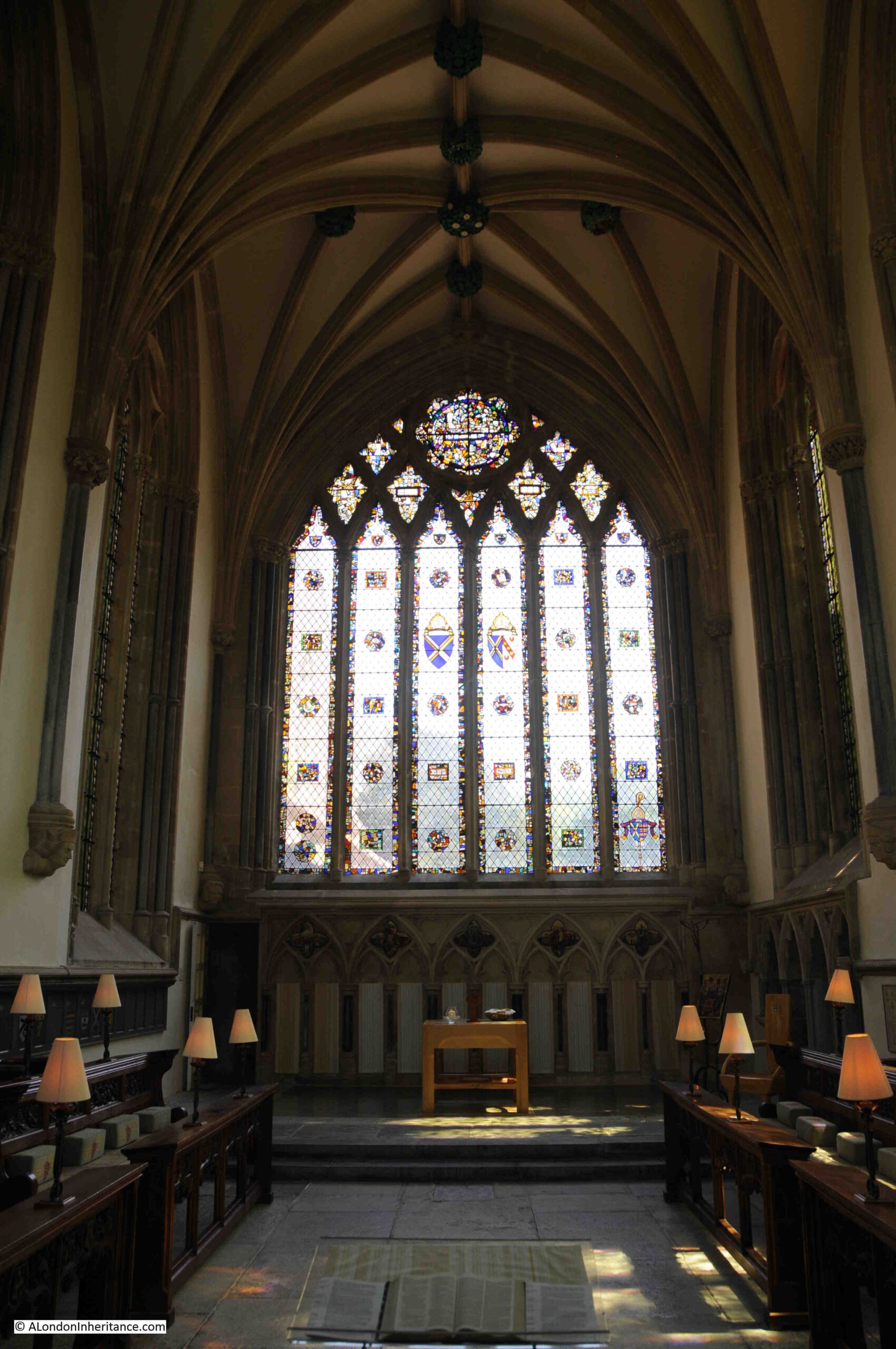
What is not obvious today, is that many of the standing piers of the abbey ruins have a steel core. After the abbey was handed to the Crown, many of the walls were found to be in such a state that temporary piers were built below the arches. This allowed the original piers to be dismantled, with steel stanchions then being installed, with the original facing stones then being replaced around the new steel core.

The following photo looks along the nave towards the west window.

Tintern Abbey

Although the nave is clear today, when Tintern Abbey was in use, the nave would have been split into separate areas with partition walls, and passages running along the length of the side walls.

The view looking towards the south transept.

Tintern Abbey

Substantial columns, arches and walls, again demonstrate the scale of the original church.

Tintern Abbey

The eastern view of the central church, with the east window:

Tintern Abbey

The view from the north is shown in the following photograph. To the north of the central church, there are the foundations and many of the remaining walls of the buildings that once supported the many functions associated with the abbey – living spaces, store rooms, kitchens etc.

Tintern Abbey

The location contributes so much to the history of Tintern Abbey. The following photo, taken slightly further north, shows the River Wye, the surrounding hills and to the right, the tops of the walls of Tintern Abbey can be seen.

Tintern Abbey

This helps understand why Tintern Abbey was built in such a location.

It was probably a suitable area of flat ground, but being next to the River Wye provided easy access to the River Severn, and therefore out to sea. The River Wye also provides access inland with the town of Monmouth being further north along the river. Transport along the river would have been so much easier than along medieval roads, and probably much safer. The river also must have provided a supply of fish to supplement the monk’s diet. The surrounding hills provided a large supply of timber and wood for burning.

As well as the painting by Turner, Tintern Abbey was the subject of a large number of paintings and drawings that focused on the Gothic / Romantic nature of the ruins.

Tintern Abbey

A south view of Tintern Abbey after S.C. Jones and dated to 1825:

Tintern Abbey

An 1805 hand coloured print of Tintern Abbey:

Tintern Abbey

From the late 18th century onward, Tintern Abbey has attracted significant numbers of visitors. Although the abbey today is not the overgrown, romantic vision which attracted early tourists to the site, it is still remarkably impressive, not just the abbey ruins, but the location which seems to complement the abbey perfectly. The 12th century monks could not have picked a better location.

Tintern Abbey was sold to the Crown in 1901 and is now the responsibility of Cadw, (the Welsh Government’s historic environment service).

Although much of the surroundings of the abbey, not occupied by the church, walls and foundations, are grass lawns, there is a large oak tree that dates from 1911, and the plaque demonstrates that the abbey grounds were seen as the appropriate place to commemorate national events.

Tintern Abbey

The abbey is named after the village of Tintern, which is strung out along the road that passes the abbey, and in the surrounding hills. Evidence of occupation in the Bronze Age can be found in the surrounding hills. In the 6th century, the West Saxons had started to expand into South Wales and in 765 a small church is recorded at Tintern Parva (little Tintern, at the northern end of the village).

According to the Penguin Dictionary of British Place Names, the name is of Celtic origin. The Welsh form of the name is Tyndyrn and means “king’s fortress”.

According to legend, Tewdric, the King of Gwent won a battle against the Saxons near Tintern. In 1849 a sculpture of the event was exhibited in the Sculpture Room of the Royal Academy. The work by J.E. Thomas shows the wounded King Tewdric urging on the pursuit of the fleeing Saxons, attended by his only daughter, Marchell and an aged Welsh bard.

Works such as this, as well as the many prints and paintings of the abbey added to the historical and romantic interest in visiting the area.

From the mid 16th century, a number of iron works were established in the surrounding hills and brass was produced for cannons. Iron works and wire production continued to the late 19th century.

Construction of the Chepstow to Monmouth road in 1829 improved access to the abbey and village, which was further enhanced in 1876 with the opening of the Wye Valley Railway. This must have been one of the most picturesque railways in the country, however it seems to have permanently run at a loss and passenger services closed in 1959, with the line continue to carry limited volumes of production from quarries close to the route, however this trade also finished in 1990 when the railway closed.

To the west of the abbey is a large, relatively flat field:

Tintern Abbey

Goal posts on the field give a clue that this is a community resource. The field also backs onto a pub and cafes between the field and Tintern Abbey.

Tintern Abbey

My father also took a number of photos in this field during his visit to Tintern Abbey in 1947:

Tintern Abbey

I have no idea what was happening, whether this was some village event, or perhaps part of the facilities put on for tourists visiting the abbey on a sunny, summer’s day – I suspect the later.

Tintern Abbey

Today, the road leading to the abbey, to the side of the field, is lined with a couple of cafes, gift shop, pub and car parks. The location is popular not just for the abbey, but for walking along the River Wye and the surrounding hills. In 2019 though, there were no horse rides available.

Tintern Abbey

Tintern Abbey

Tintern Abbey

Whether for the history, architecture, the River Wye or the surrounding landscape, Tintern Abbey is a fascinating place to visit. And revisiting on the weekend of the shortest day of the year, after weeks of rain and overcast skies, it is a reminder for me that the days will now get longer and the sun will start to rise higher in the sky.

alondoninheritance.com

London Stone Upnor, Rochester Castle and Cathedral and Cooling Church

A couple of week’s ago, I wrote about the Crow and London Stones that marked the boundary on the Essex and Kent coasts of the City of London’s jurisdiction over the River Thames.

The City of London also claimed part of the River Medway. This ran from the southern end of Yantlet Creek to a point at Lower Upnor just to the east of Rochester. Lower Upnor also has stones marking the City’s claim, so I went to find these stones, and also took the opportunity to visit a number of other sites in north Kent, and understand how London has influenced the development of this part of Kent.

The following map shows the City’s boundaries on the River Thames and River Medway, and the other places I will visit in this post (Map © OpenStreetMap contributors)..

Rochester Castle

The upper red line shows the City of London’s boundary between the Crow Stone at Southend and the London Stone at Yantlet Creek at the Isle of Grain.

Yantlet Creek did provide a navigable route between the Thames and Medway, and it is this short cut that seems to have formed the basis for the City’s claim over part of the Medway.

The eastern boundary on the Medway was from the southern end of Yantlet Creek to the opposite shore, as shown by the lower red line.

The western boundary on the Medway was at Lower Upnor, a short distance before Rochester, see the short red line on the map. This was where the City of London’s claim over the Medway met the Liberty of Rochester.

The lower black circle on the map highlights the location of Rochester which I will visit in this post, and the upper black circle covers the church of St James at Cooling which I will also visit.

Lower Upnor London Stone

My first stop was at Lower Upnor to find the City of London’s boundary stones:

Rochester Castle

There are two stones marking the City of London’s western boundary at Lower Upnor, on the roadway alongside the River Medway. The smaller stone to the right in the above photo is a footpath marker.

The stone at the rear is the older of the boundary markers and is believed to date from the 18th century.

The year 1204 is carved at the top of the stone. The refers to the original charter which granted rights over the River Thames, given by King John to the City of London, although the charter was dated a couple of years before 1204.

Rochester Castle

The City of London’s crest is also on the front of the stone, and on the rear is the legend “God Preserve the City of London”.

Rochester Castle

This section of the Medway has a rather strange history, and at times it was a very contentious issue that the City of London regarded the stretch from Yantlet Creek to Lower Upnor as within their jurisdiction.

As one point, a local landowner’s name was carved into the boundary marker stone to replace the City’s claims. This was discovered on one of the routine visits of the Lord Mayor to the stone, to re-assert the City’s claims.

The following print is dated 1830 and is titled “View of Upnor Castle near Chatham, Kent, with boats on the River Thames and figures on the river bank in the foreground“.  Upnor Castle is further to the west of the boundary stone, close to Rochester, yet the print references this being on the River Thames.

Rochester Castle

Image credit: London Metropolitan Archives, City of London: catalogue ref: k124617x

Although in Southend, the older stone was removed when a replacement was installed, at Lower Upnor, the new 1836 pillar was installed adjacent to the 18th century pillar which was left in place.

Rochester Castle

The visits of the Lord Mayor of the City of London to the Lower Upnor stones seem to be even more theatrical than their visits to the stones at Southend and Yantlet. Possibly this was down to the dubious claim of the City of London over the waters of the Medway, and therefore the need to make this claim very visible and impressive to the citizens of Rochester.

The following text is part of a report from the Illustrated London News on the 21st July, 1849 detailing the visit of the Lord Mayor and representatives of the City to Rochester and Lower Upnor. The report lists the number and roles of City representatives who attended the ceremony at the boundary stone and illustrates the impression the event must have given to the people of Rochester.

The City representatives had already been to Southend, and on the ship across from Southend to Rochester (during which there had been dancing), we now join them in Rochester:

“Shortly after ten o’clock, the Mayor and Corporation of Rochester proceeded to the Crown Hotel; and the Recorder having briefly stated the object of their visit, introduced severally to the Lord Mayor, the members of the Corporation. His Lordship expressed the gratification he felt at receiving the Mayor and Corporation of Rochester; and, after a brief address, invited them to dine with him that evening, and then introduced the members of the Corporation of London.

At the conclusion of the visit, the Lord Mayor and Lady Mayoress, accompanied by their guests, proceeded on board the steamer down the Medway, and shortly after anchored opposite Cockham Wood, near Upnor Castle, where the City boundary-stone is erected. The Lord Mayor and Aldermen landed, attended by the civic officers, and a procession was formed in the following order:-

  • Police Officers
  • Six Watermen in state liveries, with colours
  • The Band
  • The Lord Mayor’s Bargemaster in state livery, bearing the City Colours
  • City Marshal in uniform
  • The Engineer of the Thames Navigation and Port of London Committee
  • The Water-Bailiff
  • The Sword-bearer
  • The Right Hon, the Lord Mayor
  • The Aldermen (seniors first)
  • The Sheriffs
  • City Officers
  • Six Watermen in state liveries, with colours
  • Police Offices

Having made the circuit of the stone three times, his Lordship directed the City colours and the state sword to be placed thereon, asserting his right to the jurisdiction, as Conservator of the River Thames and waters of the Medway, by charter, prescription, and usage confirmed to, and enjoyed by, the City of London from time immemorial; and directed the Water-Bailiff, as his sub-conservator, to have the date of his Lordship’s visit duly inscribed on the stone. His Lordship then gave as a toast, the ancient inscription on the boundary-stone, ‘God preserve the City of London’. The band played the National Anthem, amidst the shouts of a large number of spectators who had assembled to witness the ceremony, and who were delighted by a distribution of wine, and some coin being scattered amongst them. 

The colours were placed upon the stone by Mr J. Bishop of St. Benet’s Hill, Doctors’ Commons.

The civic party returned to the steam-vessel, which then continued its progress down the Medway. On arriving off Sheerness, the company went on board Her Majesty’s ship Ocean, the guard-ship. where they were received with great courtesy; the Lord Mayor’s band, which accompanied them on board, playing the National Anthem and Rule Britannia. The Lord Mayor having also visited the Wellington, by steamer returned up the Medway, and reached Rochester in time for his Lordship to receive his guests at the Crown Hotel, facing the bridge.”

No idea how much these visits must have cost, however the expenditure in re-asserting the City’s rights must have been considerable.

The following print shows the City of London’s party at the Lower Upnor boundary stone. Upnor Castle is in the near distance. The steam-ship Meteor is lying offshore.

Rochester Castle

This print is titled “The distribution of money”, part of the ceremony at the boundary stone as money was distributed to the local citizens, although it seems to be basically throwing coins into a fighting scrum of people.

Rochester Castle

The visit in 1949 was by Sir James Duke, the Lord Mayor of the City of London between 1848 and 1849. In the report above, the water-bailiff is instructed to have the date of the Mayor’s visit carved on the stone, and we can still see this today towards the base of the pillar.

Rochester Castle

The following photo shows the view eastwards from the pillar along the River Medway in the direction of Yantlet Creek. It was these waters over which the City of London claimed jurisdiction.

Rochester Castle

These stones, along with the stones at Southend and Yantlet Creek mark the eastern boundaries of the City of London’s claimed jurisdiction.

Whilst I can understand the City’s claim along the River Thames, standing at Lower Upnor and looking out over the River Medway, the City’s claim over this river does seem rather stretched and I am not surprised that the regular visits to reinforce the claim were as theatrical as the 1849 description.

I suspect that whilst the civic authorities in Rochester participated, they were not particularly happy with the City of London approaching almost up to their town.

To follow in the Lord Mayor of London’s footsteps, it was to Rochester that I headed next.

Rochester Castle and Cathedral

Rochester is a lovely town, and one that I have not visited enough. An impressive Norman Castle and a beautiful Cathedral, along with a High Street of historic buildings make this a place worth spending more than a few hours exploring.

At the north western tip of the town is Rochester Castle, despite being almost 1,000 years old, it is still a domineering structure, built to overlook the River Medway and river crossing. This is the view of the castle from in front of the Cathedral.

Rochester Castle

As well as wanting to explore the town, I had a specific reason to visit Rochester as my father had taken a photo of the castle in 1952 from across the river. I could not get to the same place as there was construction work along the road from where the following photo was taken, however it does show how the castle appeared to anyone travelling along the river, and the nearby river crossing.

Rochester Castle

The original castle was constructed during the 1080s by Gundulf, Bishop of Rochester, and consisted of an earth mound and timber ring work fortification. The Great Keep dates from the 12th century when Henry I granted the castle to the Archbishop of Canterbury, on condition that the Archbishop constructed a stone castle.

Bishop Gundulf has a London connection as he was appointed by King William I to oversee the construction of the White Tower at the Tower of London.

Rochester dates from Roman times when it was the town of Durobrivae, built on an important crossing over the River Medway for a road from London to east Kent. The Norman fort was constructed for the same reasons as the Roman town, in that it protected the route from London to Dover, the channel ports and therefore to the Continent.

The Great Keep is today still a remarkable structure and apparently is the tallest such building in Europe.
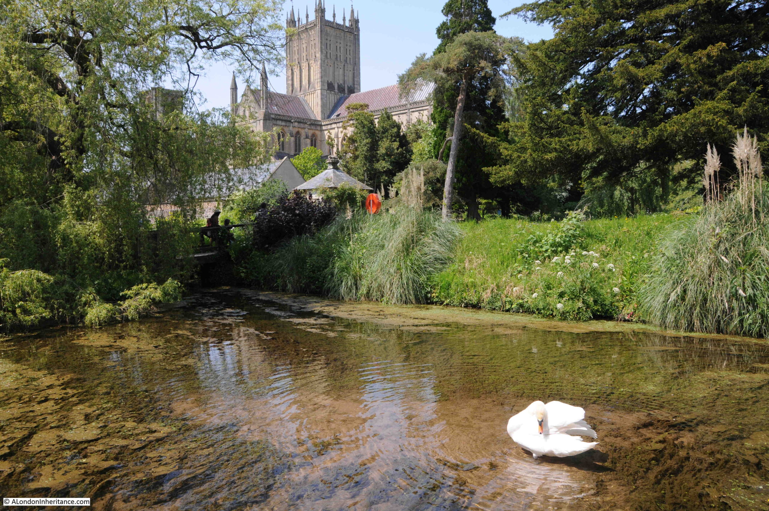
Rochester Castle

Rochester Castle was involved in a couple of sieges during the 13th century. Firstly when the castle was occupied by William de Aubigny and Robert Fitzwalter, as part of the Baron’s revolt against King John. The castle was put under siege by King John who ordered that tunnels were dug under the castle walls and keep. Fires were then set to burn the timber props within the tunnels leading to the destruction of part of the castle walls and a corner of the keep.

The second siege was when the castle was held by Royalist forces in support of King Henry III , who were defending the castle during the second Barons Revolt when Simon de Montfort, Earl of Leicester attempted to take the castle.

The defenders held out to the point where Simon de Montfort had to withdraw.

From the mid 16th century, the castle started to fall into decline, as a defensive position adjacent to the Medway river crossing was by now redundant. Stone was robbed from the castle to build nearby Upnor Castle (which was needed to defend Royal Navy moorings on the River Medway from attack by French ships). A later fire and general deterioration furthered the decay of the castle, until it was purchased in 1884 by the Corporation of Rochester and it was opened to the public.

The interior of the keep is today open to the elements and consists of the surrounding walls and a central wall that divided the keep into two sections.

Rochester Castle

Although only the walls remain, it is very clear from the architecture, carvings, holes cut into the walls to support floors etc. that this must have been an incredibly impressive structure.

Rochester Castle

Walkway along the top of the castle:

Rochester Castle

Which provides some brilliant views over the surrounding countryside.

In the photo below is the key river crossing over the River Medway. A crossing here dates from Roman times when the road from London onward to Canterbury and the channel ports crossed the river at this point. The importance of the crossing is the reason for Rochester’s location and the justification for the castle, built to defend the crossing.

Rochester Castle

The castle provides some magnificent views of Rochester Cathedral, which was my next stop in my exploration of Rochester:

Rochester Castle

On walking into the Cathedral I was greeted with a rather surprising sight. The nave had been taken over by a mini golf installation, arranged for charity, and there were families with children playing golf in a most unusual setting. The following photo is the view along the nave, above the heads of the golf players.

Rochester Castle

The earliest church in Rochester dates from 604, when King Ethelbert donated land for a church.

Building of the Cathedral we see today was commenced in 1083 by the same Gundulf, Bishop of Rochester who was responsible for the construction of the first castle.

The nave was the first part of the Cathedral to be completed, with consecration of the cathedral in 1130 in front of King Henry I.

The cathedral was badly damaged during the sieges of the castle in the 13th century, and there was further restoration work and building during the following centuries. The cathedral was damaged again during the Civil War by Parliamentarian soldiers.

George Gilbert Scott carried out major restoration work during the late 19th century and the present tower and spire were dedicated in 1904.

Rochester Castle

Rochester Cathedral has a remarkable wall painting, only part of which survives. This is the Wheel of Fortune dating from the 1200s.

Rochester Castle

The missing part of the painting was destroyed during the Civil War. It was then covered by a Pulpit and only discovered again during 19th century restoration work.

The Wheel of Fortune was a common medieval representation of how a rise in status in society could just as swiftly be followed by a fall. The women in the middle, controlling the wheel is Fortuna. The three men holding on to the wheel represent those at different levels of success within life. The man at the top of the wheel is wealthy and powerful.

The two men on the left are working their way up in life, starting from the lowest level of society at the bottom of the wheel.

The man at the top of the wheel is sitting down, an indication that he has reached the peak of society, however he is looking to the right, possibly where a warning to the powerful would be seen. Based on similar representations, on the right of the painting there would have been a man falling to the bottom of the wheel – a warning that no matter how rich and powerful you become, the risk of a fall to the lowest levels of society are always lurking in the background.

A powerful Medieval representation, but one that is also very relevant today.

There are numerous interesting memorials across the cathedral. This one was unusual with a hand originally pointing to the seal of office of Frederick Hill, who was responsible for “Providing for His Majesty’s Sick and Wounded Seamen at this Port. So Fair, So Just, Such His Love and Care for them”. A reminder of Rochester and nearby Chatham, along with the River Medway’s part in supporting the Royal Navy over the centuries.

Rochester Castle

Part of the Crypt:

Rochester Castle

This remarkable door is the entrance to the Cathedral Library.

Rochester Castle

When Henry VIII dissolved the priory attached to the cathedral, the books in the library were taken into the King’s own collection, and then into the Royal Collection and the British Library, however a number of the books have since returned to the library at Rochester.

The detail of each carved figure is fascinating, and show the level of craftsmanship that went into the Cathedral in the 14th century.

Rochester Castle

Gardens to the south of the cathedral mark the original location of the priory attached to the cathedral, and the chapter house.

Rochester Castle

Original 12th and early 13th century walls surround the gardens.

Rochester Castle

This archway originally led to the 12th century Chapter House. After the dissolution, the chapter house had briefly become part of a Royal Palace for King Henry VIII, however the roof was later removed and it fell into decay.

Rochester Castle

Although worn by centuries of weathering, it is still evident how ornate and carefully carved these walls, arches and doorways were from the 12th and 13th centuries.

Rochester High Street

Rochester High Street retains the look and feel of an important, provincial town. A straight, relatively narrow road runs along the centre of the High Street, leading originally from the crossing over the River Medway (there is now a wider road bypassing the centre of the town).

The High Street is lined by a variety of architectural styles from the last few centuries and the buildings support a variety of shops and businesses, fortunately, many still local.

Rochester Castle

In the above photo, on the left, is the type of shop that always damages my credit card. Baggins Book Bazaar is one of the most remarkable second-hand bookshops I have been in for a long time. A standard shop front, but once inside, the bookshop extends a long way back and offers multiple levels stacked high with books – I came out with several.

The building in the following photo was erected in 1706 “at the sole charge and expense of Sir Cloudsley Shovel” who represented Rochester as MP during three Parliaments in the reign of King William III and one Parliament during the reign of Queen Anne.

Rochester Castle

The following rather plain looking building has an interesting history.

Rochester Castle

The building has the name Abdication House and the plaque on the front provides the background as “King James II of England stayed at the house as a guest of Sir Richard Head before embarking for France on the 23rd December 1688 when he finally left England”.

The following building is the site of the French Hospital Almshouses.

Rochester Castle

The Almshouses were founded in 1718 for “poor French protestants and their descendants residing in Great Britain”.

This was a quick run through Rochester High Street – there are many more buildings that tell the history of the area and the importance of Rochester as a town. The above examples – King James II before leaving for France, and the almshouses for protestant refugees arriving from France highlight Rochester’s’ role as a gateway town, where people would leave and enter the country, with one of the main roads to London running through the town providing easy access to the capital, alongside the River Medway.

There was one final place that I wanted to visit whilst in this part of Kent.

St James Church, Cooling

North of Rochester on the Hoo Peninsula is the village of Cooling and it was St. James Church that was my intended destination.

Rochester Castle

Cooling church was the inspiration for the setting of the encounter between Pip and Magwitch in the opening of Charles Dickens book Great Expectations. In the book Dickens describes the area:

“Ours was the marsh country, down by the river, within, as the river wound, twenty miles of the sea.”

The river is still visible from the churchyard, flat fields and marshes provide an unobstructed view, although the traffic and business on the river is now very different to anything that Dickens could have seen, or expected.

Rochester Castle

The large container ships docked at the new London Gateway port are clearly visible to the north. A very different form of transport to Dickens’ time, but the river is still a major artery for seaborne trade in and out of the country.

My visit was during a warm and sunny day, very different to the “bleak place overgrown with nettles” on a “raw afternoon towards evening” as described in Great Expectations. It must be a very different place on a late winter’s afternoon, with rain and wind blowing in from the east, along the Thames estuary and across the Hoo Peninsula.

Among the graves surrounding the church are a tragic collection of small graves that were well-known to Dickens.

These are the graves of babies and children from the Baker and Comport families who died between 1771 and 1779. Three of the children died around the age of one month. The graves are a very visible demonstration of the dreadful infant mortality rates that must have inflicted terrible anguish on parents in the centuries before the standards of health we perhaps take for granted today.

They are lined up in what Dickens described as ” little stone lozenges each about a foot and a half long, which were arranged in a neat row beside their (parents) graves”.

Rochester Castle

Ten smaller graves are on one side of the headstone and three larger graves are on the other side.

Rochester Castle

The church of St. James’ Cooling dates from the 13th century. It is no longer an active church, and is in the care of the Churches Conservation Trust

The interior of the church is open and the white walls provide an impression of light and space. The following photo is looking along the nave, with the 13th century font in the foreground.

Rochester Castle

The pulpit dates from the 18th century, and in common with nearly all churches, there was 19th century restoration work, the majority of the church dates from between the 13th and 15th centuries.

Rochester Castle

The wooden door on the right of the photo below is around 500 years old, and there are benches that possibly date from the 14th century.Rochester Castle

The Churches Conservation Trust now offers the opportunity to stay overnight at St James Church, Cooling on one of their “Champing” experiences. I would rather like to do that on a wet and windy night.

This has been a very quick tour of a number of fascinating sites, and I have not been able to do justice to them in a single post, but there is a theme to these sites.

It is how London’s influence extends far wider than just the City. The boundary markers at Lower Upnor tell of how the City of London tried to exert authority over a much wider area than just the River Thames.

Rochester is a town that probably owes its existence to being on the site where the road from the channel coast and Canterbury to London crossed the River Medway. A crossing that dates back almost 2,000 years to the time of the Roman occupation of Britain.

The exception is St James, Cooling, however the church connects in some ways to the River Thames as the church has seen the changes in river traffic over many hundreds of years.

alondoninheritance.com

The 6th June 1944, D-Day in Maps

Firstly, an apology. This post in nothing to do with London, however on the 75th anniversary of D-day, I wanted to write a post that brings together my interests in history, books and maps to commemorate such an important event, and the sacrifice of so many in what was one of the defining days of World War 2.

In 1946 the British Field-Marshal Montgomery published his personal account of the campaign to liberate Europe, from the landings at Normandy on D-day to the eventual defeat of Germany. The book is a detailed account of the operations, the battles, the logistics of the campaign to open and fight a second front from the west.

Reading the book, the logistics of D-day are staggering. The volume of men and equipment that had to be landed, the secrecy to ensure the landing sites were a surprise to the defenders, the bravery that ensured a bridgehead had been established by the end of D-day, and the challenges of then extending that bridgehead and fighting from Normandy to Germany.

Normandy to the Baltic consists of 222 pages of text, but what makes this book rather special are the two pockets to the front and rear of the book which contain a total of 47 coloured maps and 3 diagrams. The maps detail the campaign from D-day through to the closure of the war.

The front of the book’s dust wrapper – lovely bold colours and very evocative of the time.

D-Day

The book was published when paper for publishing was still in short supply, and the book notes that “this book is produced in complete conformity with the authorised economy standards“.

The first map highlights the invasion coast – the area from Dunkirk in the north to Cherbourg in the west that was considered as possible landing sites for the invasion. Dunkirk, Calais and Boulogne were the obvious locations as these were only a short distance across the channel and would therefore make the crossing easier, however this was a very heavily defended stretch of coast.

D-Day

The logistics of managing such a large invasion force are remarkable. The army groups and all their equipment were marshaled across the south of the country, stretching from Wales through to East Anglia, and to the west of Cornwall. The following map shows the areas occupied by individual Corps and Divisions. They all had to be then transported to coastal embarkation points for transport across the channel on D-day and during the following weeks.

D-Day

This map of German forces in France and Belgium shows the heavy concentration of forces along the French and Belgium coast where the distance across the channel was shortest.

D-Day

To avoid the heavy concentration of forces across the shortest stretch of channel, the plan for the assault was to land in Normandy, which would involve a lengthy sea crossing, but hopefully maintain an element of surprise and allow the Allied forces to establish a bridgehead before the defending forces could be reinforced.

D-Day

The organisation was incredible. The following diagram shows the assault technique and covers the various different types of specialised craft that had to be moved from the south coast of England to Normandy, arranged in the right order and to perform their role at the right time.

D-Day

Although in reality, conditions such as the weather on the morning of D-day meant that the assault was not as precisely choreographed as the above diagram suggests. Landing craft often did not arrive at the right place, and in some instances, troops left landing craft when still in deep water, and many drowned as they were loaded with heavy equipment.

At the front were Landing Craft Support (LCS), craft that provided fire support to troops as they landed on the beaches. Behind them was a line of D.D. Tanks, or Duplex Drive amphibious tanks. These would be launched some distance from the shore and would make their way under their own power and flotation to the beach.

Behind then was a line of Landing Craft Tank (LCT), landing craft that carried tanks and other mechanised equipment for transport to the shore. Further back was a line of Landing Craft Assault (LCA), landing craft that carried the assault troops. As well at the LCTs, this line included Armoured Vehicle Royal Engineers (AVRE), landing craft carrying specialised equipment such as tanks fitted with flails to clear a path through mines, bridging equipment etc.

The assault was supported by Landing Craft Gun (LCG) artillery ships and destroyers tasked with bombarding the enemy positions before the landing, and providing supporting fire once the assault troops had landed.

Landing Craft Flak (LCF) were anti-aircraft variations of the landing craft, fitted out with anti-aircraft guns to defend against enemy aircraft.

After landing and establishing a bridgehead, the plan was to quickly strike in land, with the US Third Army moving south and the US First Army, British Second Army and Canadian First Army moving east and north towards northern France, Belgium and Paris.

D-Day

The distribution of German forces on the 6th June 1944, showing how every section of the coast was defended, with reinforcements inland.

D-Day

Bombing on and after D-day aimed to frustrate the move of German reinforcements to the front by destroying railways, bridges and attacking columns of transport.

The following map again highlights the challenge of attacking Normandy. A lengthy sea crossing and the coordination of forces from across the south coast, including follow-up forces from Cornwall , the Thames estuary and Felixstowe.

D-Day

The US assault on the 6th June included airborne drops of parachute forces in the early hours. They suffered heavy casualties during the landing on the town of Sainte-Mère-Église as many buildings across the town had been set on fire which illuminated the descending paratroops.

D-Day

By the end of the 6th June 1944, a bridgehead had been established and the push inland had started. 156,000 troops had landed on the first day, and an estimated 4,400 had died.

The following map shows the situation at the end of D-day.

D-Day

In the book, Montgomery described the situation at the end of the 6th June as follows:

“As a result of our D-Day operations we had gained a foothold on the Continent of Europe.

We had achieved surprise, the troops had fought magnificently, and our losses had been much lower than had ever seemed possible. We had breached the Atlantic Wall along the whole Neptune frontage, and all assaulting divisions were ashore. In spite of the bad weather the sea passage across the Channel had been successfully accomplished, and following this the Allied Naval Forces had given valuable support by fire from warships and craft; the Allied Air Forces had laid the foundation of success by winning the air battle before the invasion was launched, and by applying their whole collective striking power, with magnificent results, to assist the landings.

In spite of the enemy’s intentions to defeat us on the beaches, we found no surprises awaiting us in Normandy. Our measures designed to overcome the defences proved successful. But not all the D-day objectives had been achieved and, in particular, the situation on Omaha beach was far from secure; in fact we had only hung on there as a result of the dogged fighting of the American infantry and its associated naval forces. Gaps remained between Second British Army and V United States Corps and also between V and VII United States Corps; in all the beachhead areas pockets of enemy resistance remained and a very considerable amount of mopping up remained to be done. In particular, a strong and dangerous enemy salient remained with its apex at Douvres.

It was early to appreciate the exact shape of the German reaction to our landings. The only armoured intervention on D-Day was by 21 Panzer Division astride the Orne, north of Caen. Air reconnaissance, however showed that columns of the 12 SS Division were moving west.

To sum up, the results of D-Day were extremely encouraging, although the weather remained a great anxiety. I ordered the armies to proceed with the plan; First United States Army was to complete the capture of its D-day objectives, secure Carentan and Isigny so as to link up its beachheads, and then thrust across the base of the peninsula to isolate Cherbourg as prelude to its reduction, Second British Army  was to continue the battle for Caen, develop the bridgehead southwards across the Bayeux-Caen road and link up with the V United States Corps at Port-en-Bessin.”
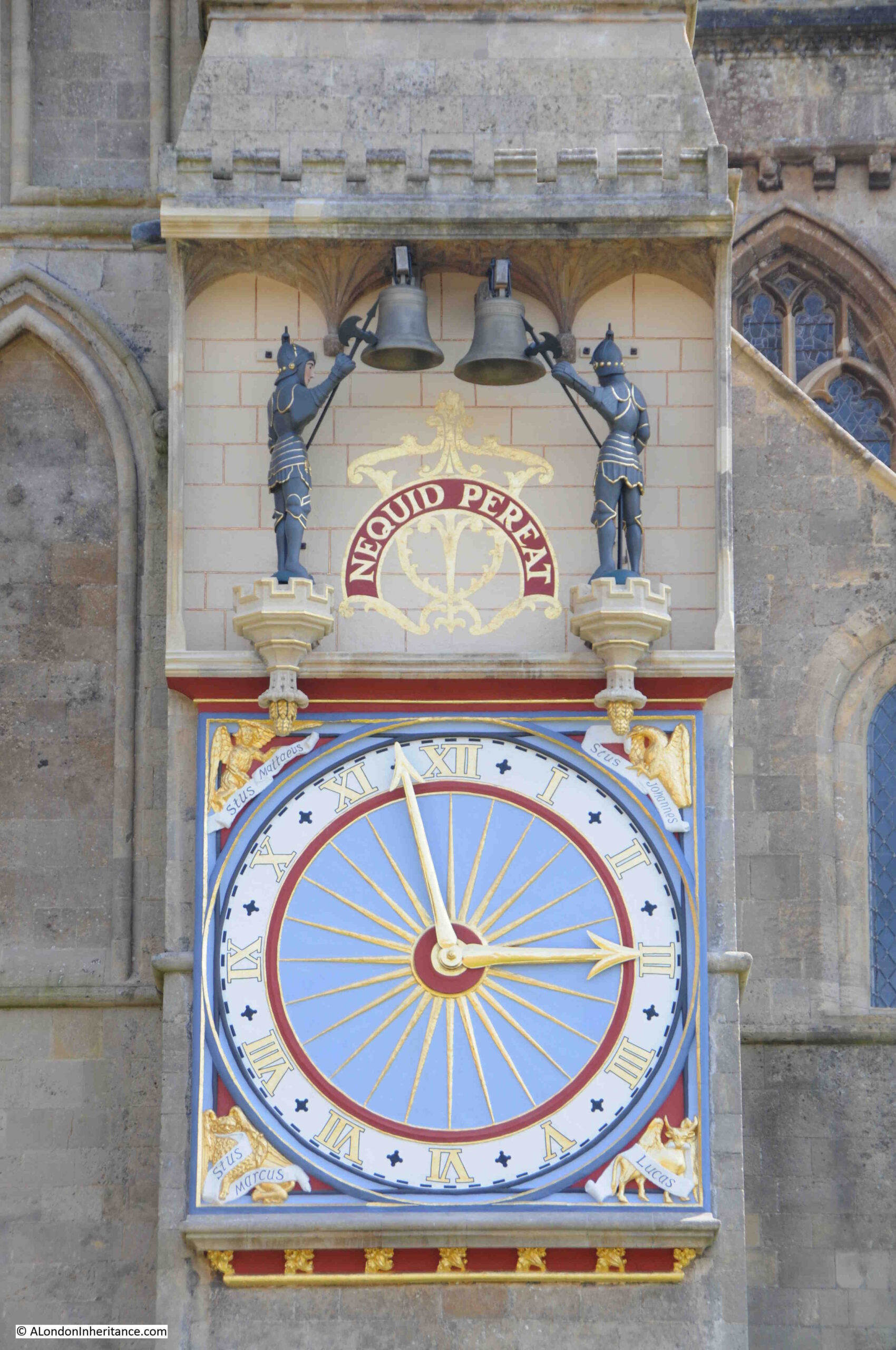
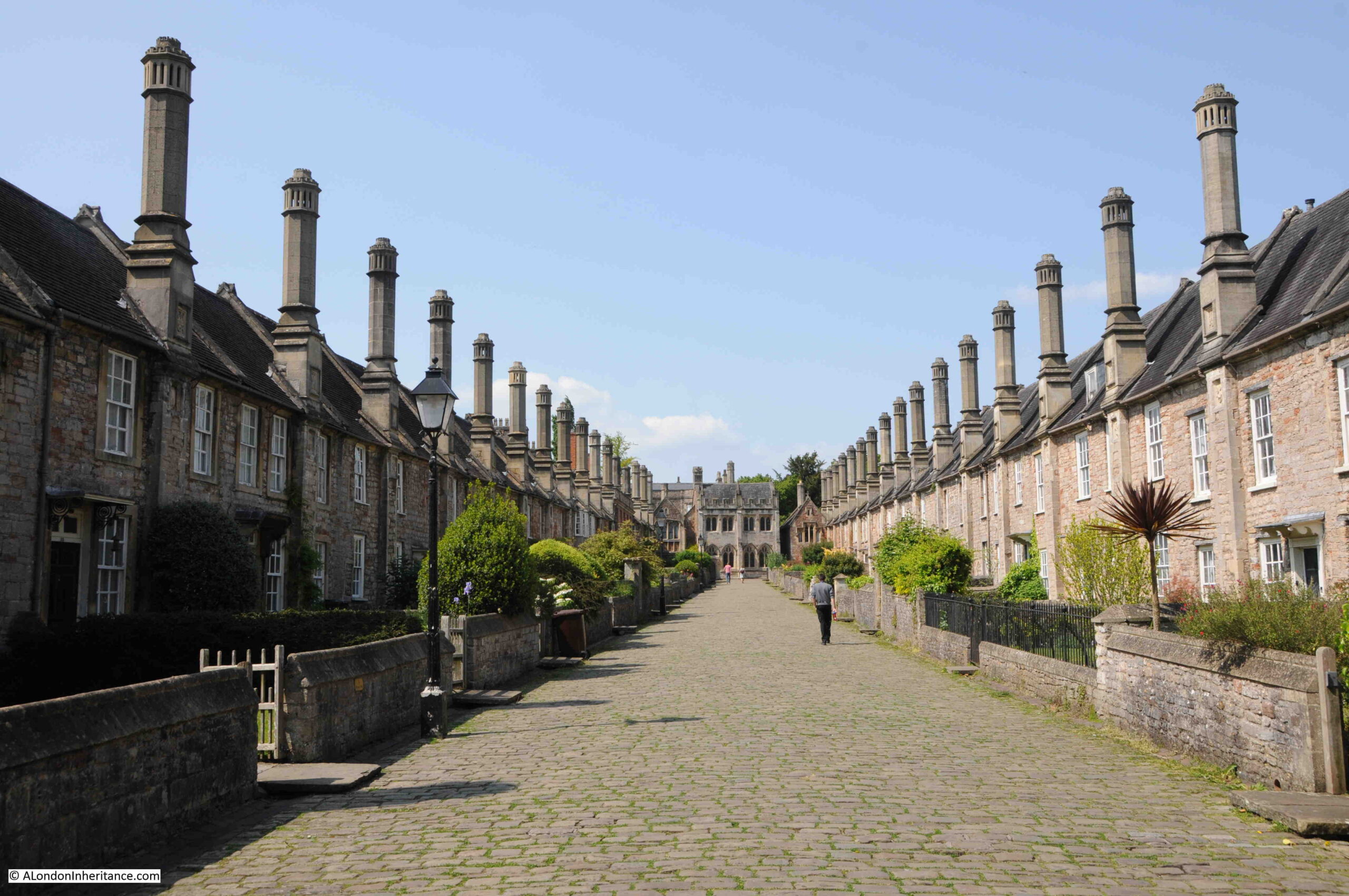
Montgomery’s comments on the fighting at Omaha beach demonstrate how parts of the invasion were a close run thing.
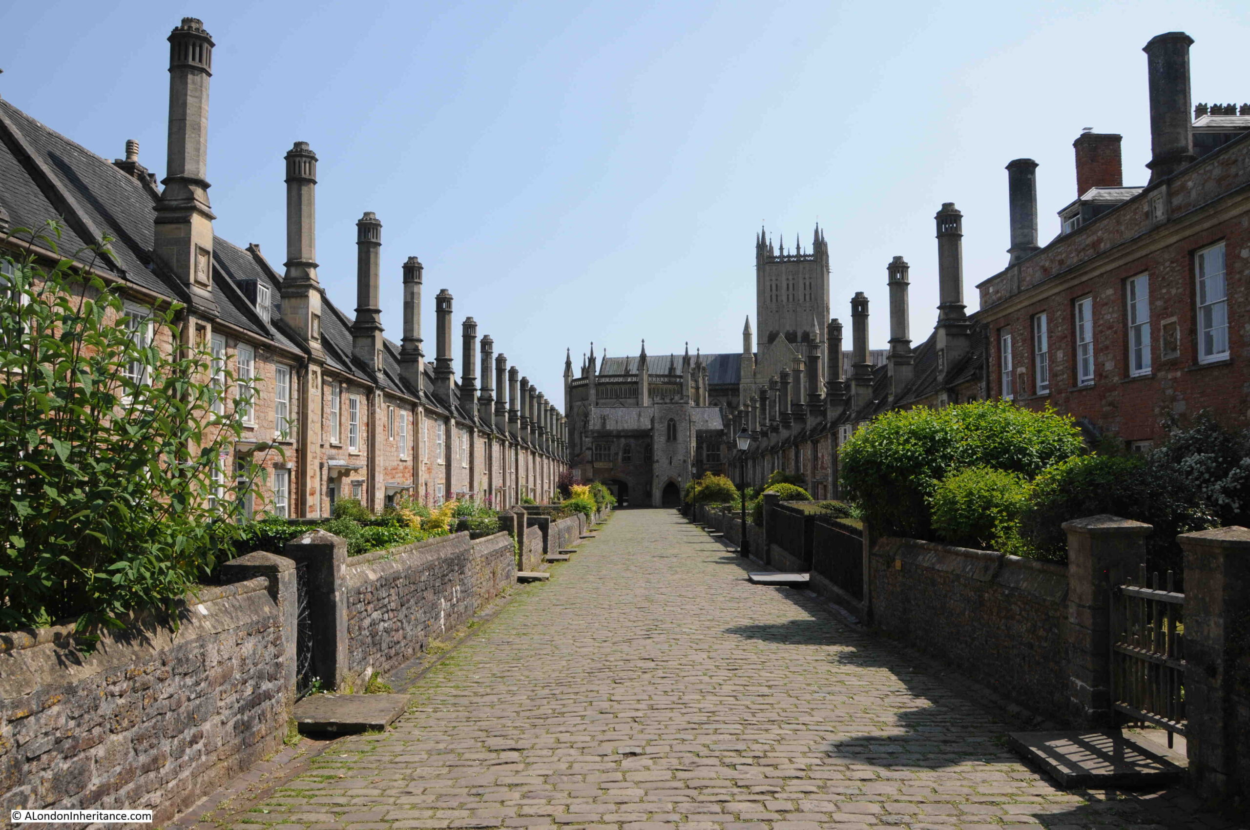
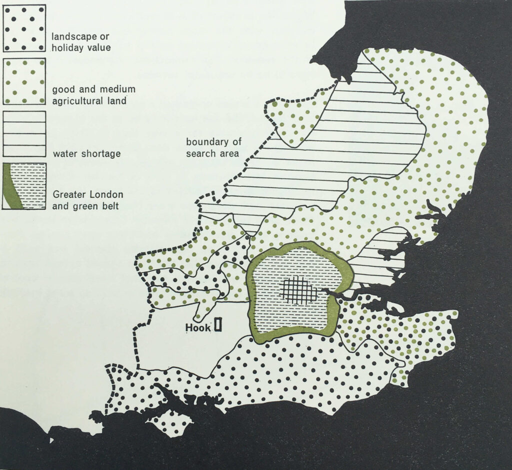
That the bridgeheads had been achieved by the end of the 6th June was down to the considerable bravery of those involved in the assault, and the logistical achievement of transporting thousands of troops and tons equipment.

The 6th of June was just the start of a long campaign that would take British, American and Canadian armies all the way into Germany.

The breakout from the bridgehead would still take some weeks.

The following map shows the situation during the week following D-day with the start of the push inland from the beaches.

D-Day

The advance after D-day was slow going. The nature of the countryside (wooded, hollow lanes, hedging lining the lanes) and growing enemy reinforcements meant that after establishing the landing, the push inland would be very challenging with considerably more killed and injured than during the initial landings.
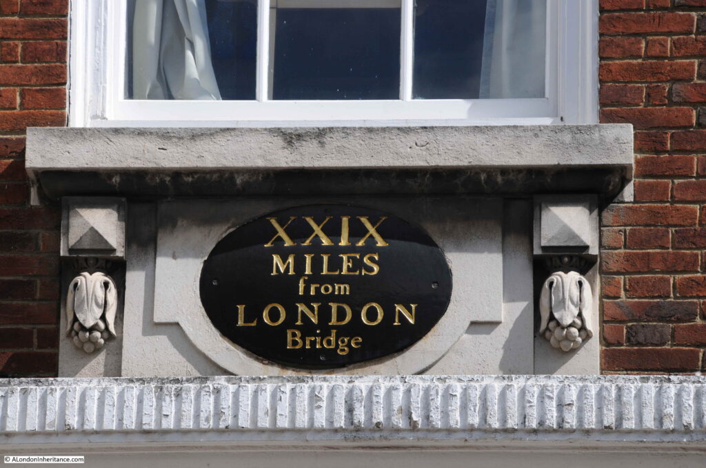
The initial development of the bridgehead during the second week after D-day:

D-Day

By the end of June, the Allied forces had made limited progress and were now up against an enemy force that was more coordinated than on D-day and with further arriving reinforcements. The following map shows the situation at the end of June, just over three weeks after D-day.

D-Day

But progress was being made – the push up the peninsula by the American forces to capture Cherbourg:
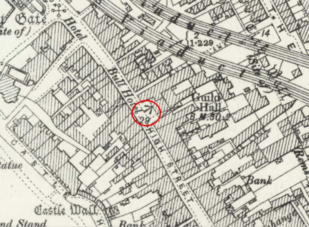
D-Day

The British and Canadian forces start to push inland and to move towards the city of Caen:

D-Day

The US Army operations during the two weeks after D-day:

D-Day

The capture of Caen:
D-Day

Operations of the Second British and Canadian Armies in July:
D-Day

Moving south after the capture of Caen in the third week of July:

D-Day

When the break out happened from the initial bridgehead, it was rapid and resulted in a breakdown in enemy resistance which resulted in the liberation of Paris when the German forces in the city surrendered on the 25th August 1944.

The following map shows the break out by the First United States Army between the 25th July and 4th August.

D-Day

After the August breakout, progress would then be relatively rapid, however the overstretched supply lines and regrouping of German forces would cause delays and set backs, for example with the failure of Operation Market Garden in September 1944 to reach Arnhem, cross the Rhine and turn into Germany.

Montgomery’s book is a fascinating account of the campaign, which started on the 6th June 1944, and would end on VE Day, the 8th May 1945. The rest of the maps in the book follow the course of the campaign between these two dates.

That D-day was a success was down to a phenomenal achievement in logistics and planning, long before the days of instant communications, computers and spreadsheets, allied with the incredible bravery and sacrifice of those who took part.

alondoninheritance.com