Last year was my first year of running a number of guided walks based on the blog.
I really enjoyed talking about some fascinating places in London, and meeting so many readers of the blog.
For 2022, I have two new walks, exploring Wapping, and Bankside to Tower Bridge. I did intend to include a Bermondsey walk, but have run out of time to complete this, hopefully later in the summer.
I am also running a few of my Barbican and Southbank walks.
The walks are based on the blog, and use some of my father’s photos to show viewpoints as they were in the late 1940s.
I hope you find something of interest, and I plan to add additional dates, so please check again later if you do not find a suitable free date.
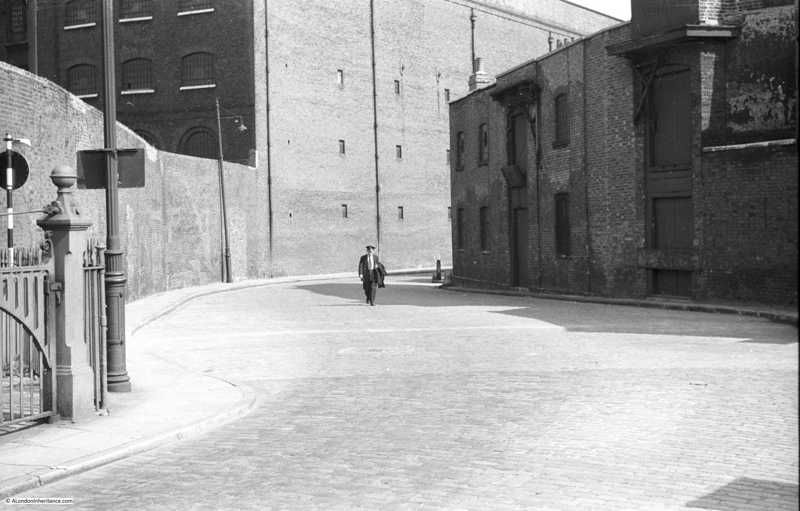
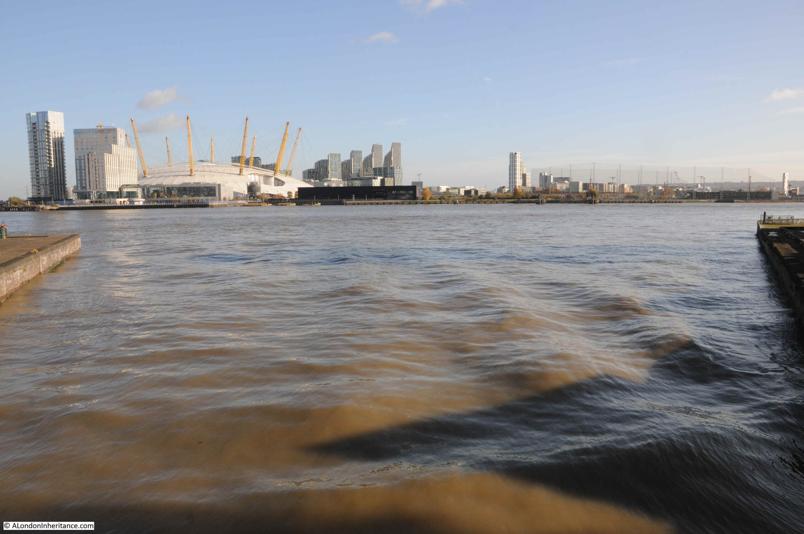
Wapping – A Seething Mass of Misery
Wapping – A Seething Mass of Misery. So wrote Francis Wey in the 1850s in his book, “A Frenchman Sees the English in the Fifties”.
As London’s docks expanded to the east, Wapping developed to serve the docks and the river, and this expansion resulted in living conditions that would lead to Francis Wey’s description.
Wapping was different to the rest of east London as it developed a nautical subculture, one that existed to serve and exploit sailors arriving on the ships that would moor on the river, and the docks and wharves that lined the river.
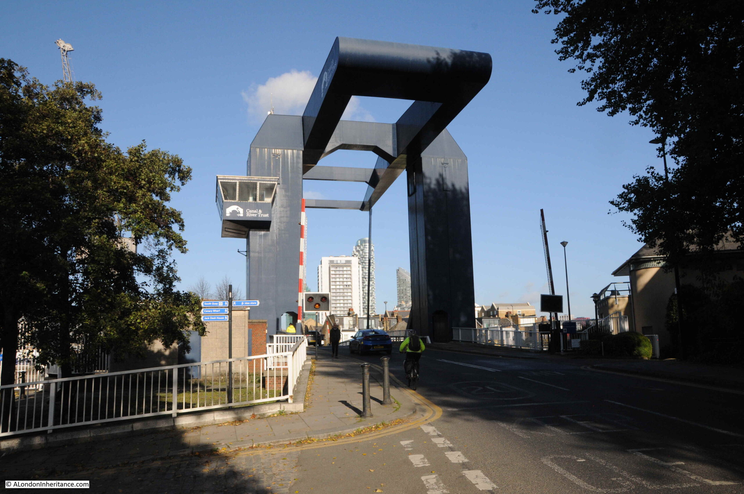
This walk will discover the history of Wapping, and will run from near Tower Hill underground station, along Wapping High Street and Wapping Wall, across the old Ratcliff Highway to Shadwell Overground and DLR stations.
We will explore the development of the docks, the ancient gateways between land and river that are the Thames stairs, lost and surviving pubs, the history of the River Police, a sailor’s experience of Wapping, warehouses, crime and punishment, murders and a burial at a crossroads.
We will also meet some of the people who lived, worked and passed through Wapping, such as the Purlmen who worked on the river, and John Morrison, a ship’s boy on a collier, who in 1832 almost froze to death whilst waiting to row his master back to his ship after a night in Wapping’s pubs.
The walk will use some of my father’s photos to show the area post-war, and will look at how Wapping has developed to become the place we see today, and should be considerably more enjoyable than Francis Wey’s description.
The walk is about 2.5 miles and will take between two and a quarter, and two and a half hours.
The following dates for my tour of Wapping are available to book on Eventbrite. Click on any of the dates to go to the site where they can be booked.
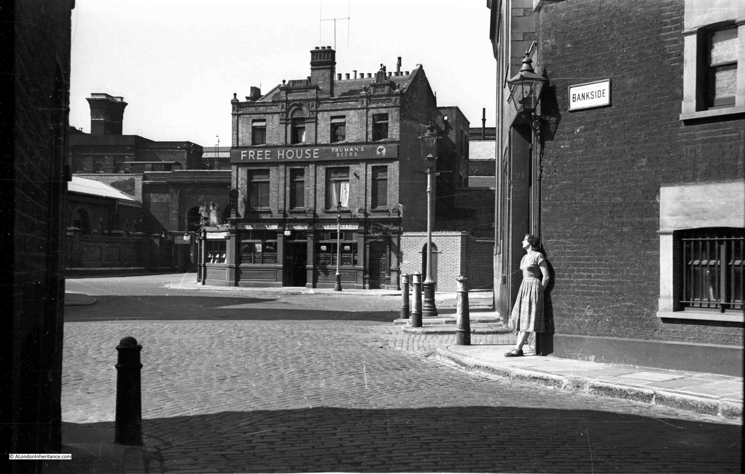
Bankside to Pickle Herring Street – History between the Bridges
This walk explores the remarkable history of Bankside and Southwark between Blackfriars and Tower Bridges.
Looking at how the river bank along the River Thames has developed, and using my father’s post-war photos to show just how much the area has changed, and what was here when this was a working part of the river.
From the sites of Roman discoveries to recent development of old wharfs and warehouses, the walk will explore pubs, theatres, Thames stairs, lost streets, the impact of electricity generation, fires, alleys, and the people who lived and worked along the river.
The walk will also look at how being opposite the City of London led Bankside and Southwark on a unique path through history.
Lasting around two and a quarter hours, the walk will start near Blackfriars Bridge and end at Tower Bridge.
The following dates for my tour of Bankside are available to book on Eventbrite. Click on any of the dates to go to the site where they can be book.
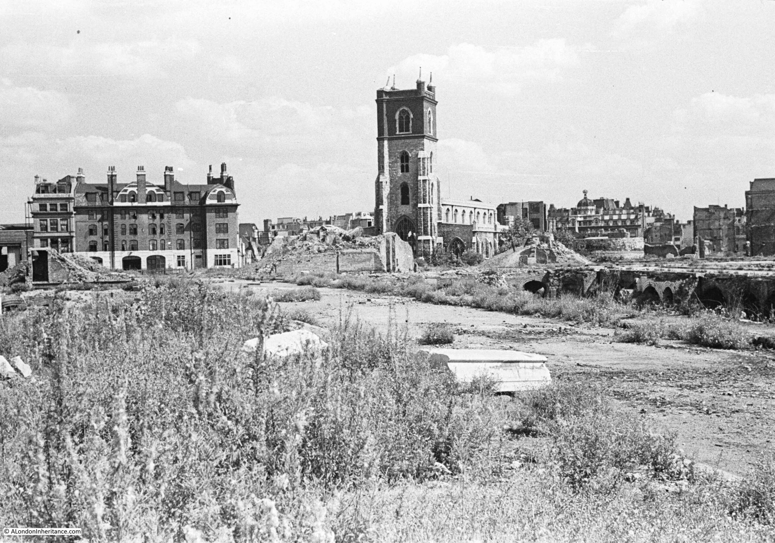
On the evening of the 29th December 1940, one of the most devastating raids on London created fires that destroyed much of the area north of St Paul’s Cathedral and between London Wall and Old Street.
The raid destroyed a network of streets that had covered this area of Cripplegate for centuries. Lives, workplaces, homes and buildings were lost. Well-known names such as Shakespeare and Cromwell and their connection with the Barbican and Cripplegate will be discovered, as well as those lost to history such as the woman who sold milk from a half house, and that artisan dining is not a recent invention.
Out of the wartime destruction, a new London Wall emerged, along with the Barbican and Golden Lane estates that would dominate post-war reconstruction. Destruction of buildings would also reveal structures that had been hidden for many years.
On this walk, we will start at London Wall, and walk through the Barbican and Golden Lane estates, discovering the streets, buildings and people that have been lost and what can still be found. We will explore post-war reconstruction, and look at the significant estates that now dominate the area.
Lasting around two hours, by the end of the walk, we will have walked through 2,000 years of this unique area of London, the streets of today, and the streets lost to history.
The following dates for my tour of the Barbican are available to book on Eventbrite. Click on any of the dates to go to the site where they can be book.
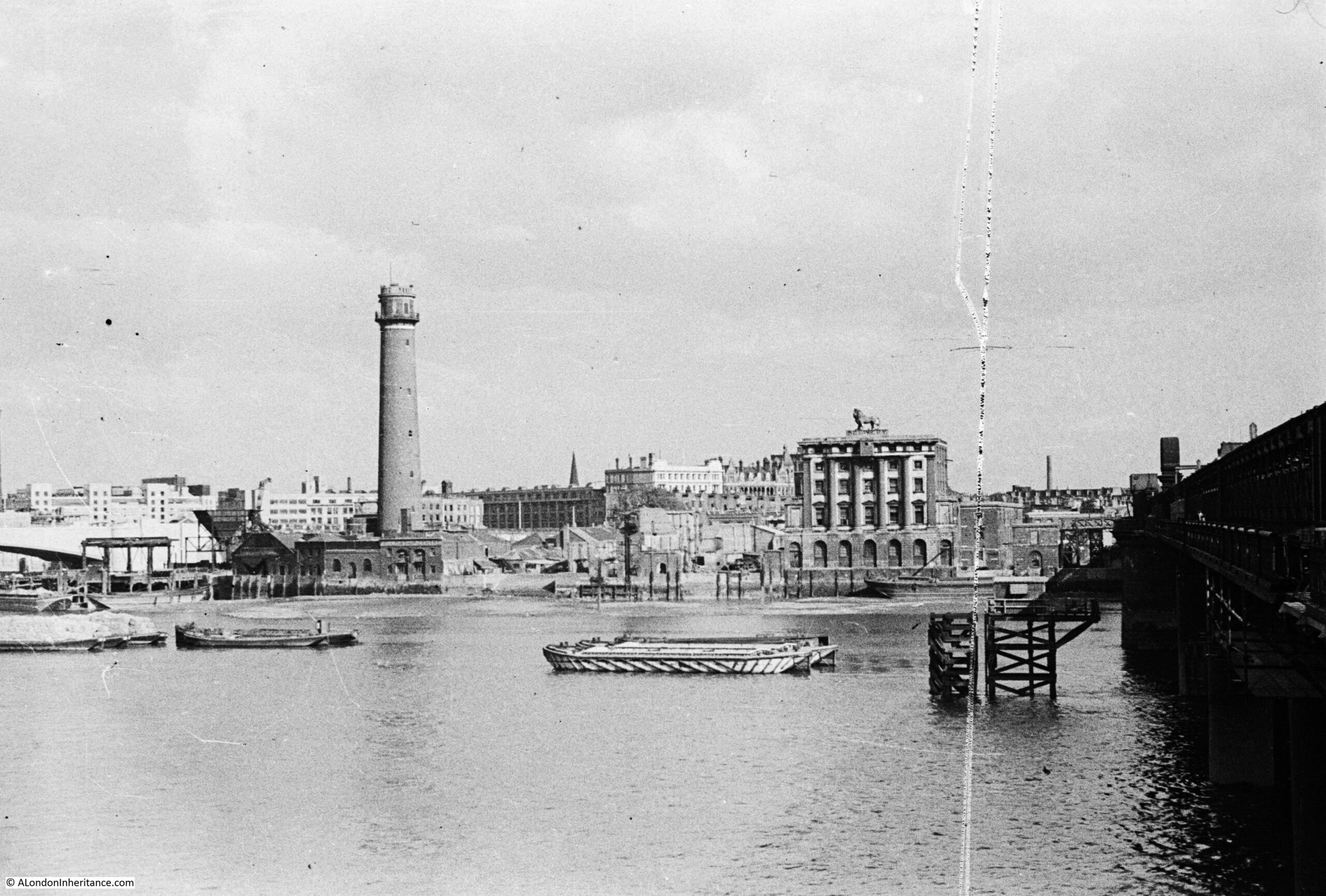
The South Bank – Marsh, Industry, Culture and the Festival of Britain
This walk will discover the story of the Festival of Britain, the main South Bank site, and how a festival which was meant to deliver a post war “tonic for the nation” created a futuristic view of a united country, and how the people of the country were rooted in the land and seas.
We will also discover the history of the South Bank of the Thames, from Westminster to Blackfriars Bridges, today one of London’s major tourist destinations, and with the Royal Festival Hall and National Theatre, also a significant cultural centre.
Along the South Bank we will discover a story of the tidal river, marsh, a Roman boat, pleasure gardens, industry, housing and crime. The South Bank has been the centre of governance for London, and the area is an example of how wartime plans for the redevelopment of London transformed what was a derelict and neglected place.
Lasting around 2 hours, the walk will start by Waterloo Station and end a short distance from Blackfriars Bridge.
At the end of the walk, we will have covered 2,000 years of history, and walked from a causeway running alongside a tidal marsh, to the South Bank we see today.
The following dates for my tour of the Southbank are available to book on Eventbrite. Click on any of the dates to go to the site where they can be book.
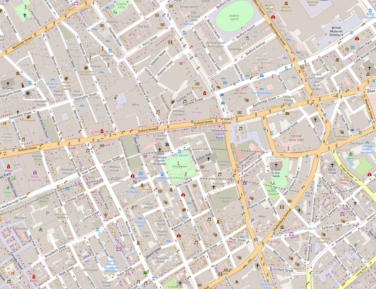
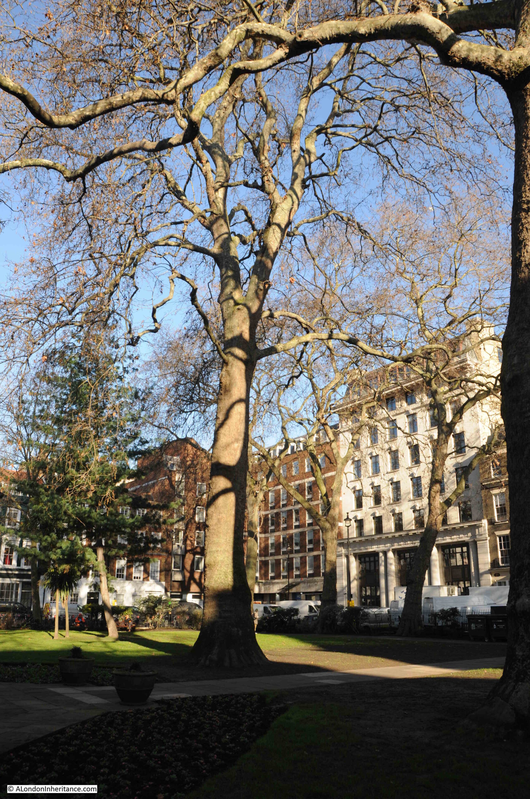
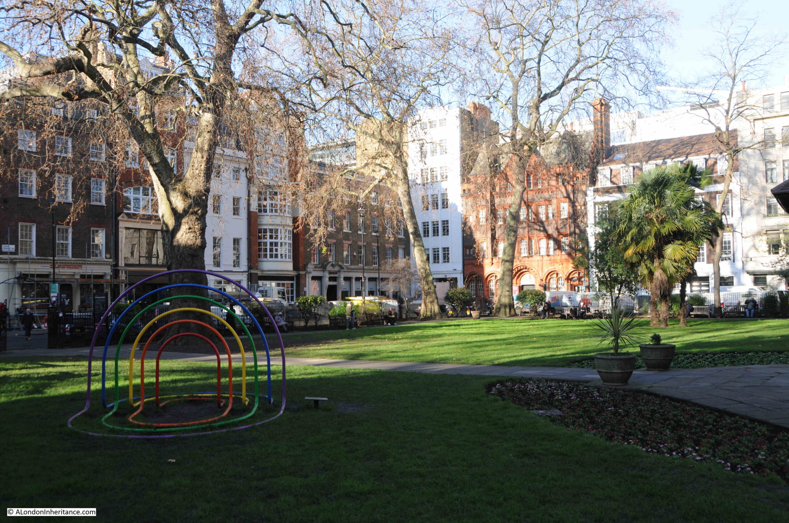
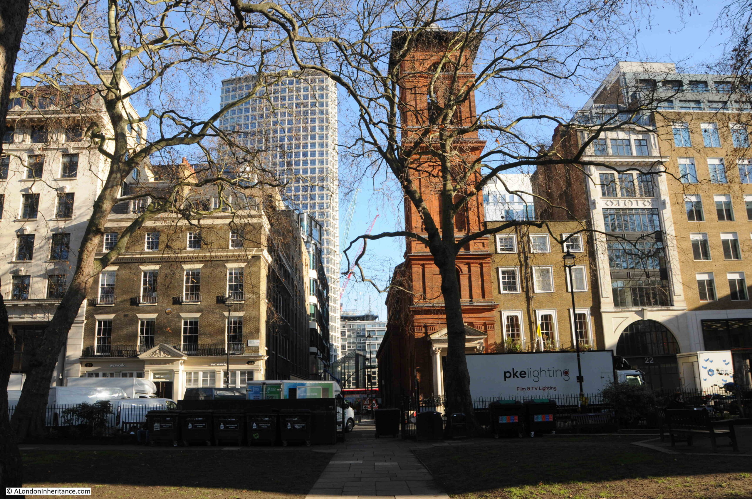
Soho Square can be found near the junction of Charing Cross Road and Oxford Street. A busy square, with lots of traffic, parking and occasionally it is used as a film set.
The centre of Soho Square is a large open space, and the square is surrounded by a considerable mix of architectural styles, reflecting the number of times that buildings have been demolished and rebuilt since the square was originally laid out, and the range of individuals. organisations and companies that have made the square their home.
Soho Square was part of London’s northwards expansion and the first houses on the square were originally built around 1670.
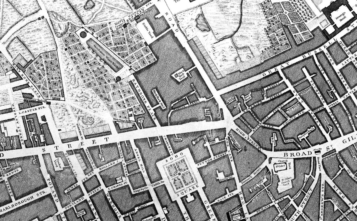
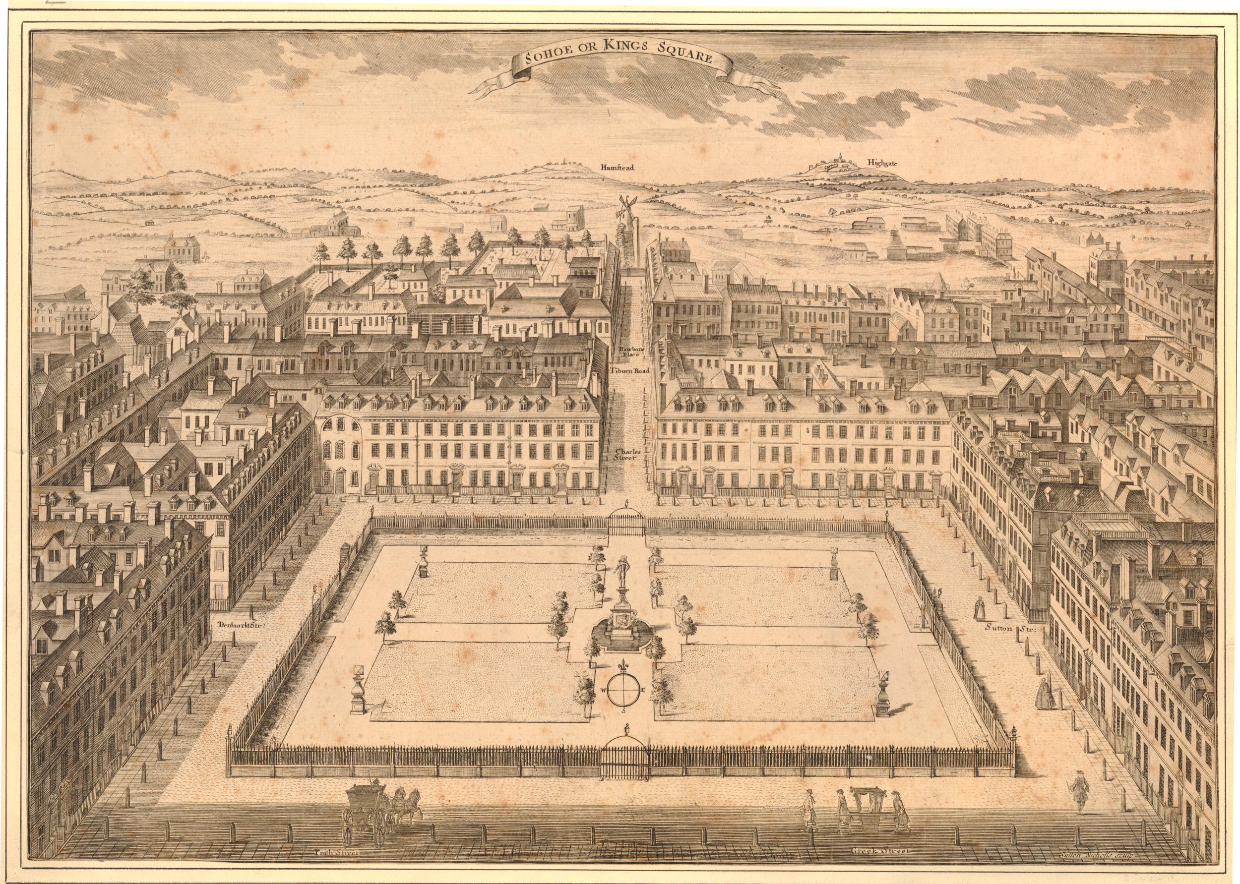
The following extract from Rocque’s 1746 map of London shows Soho Square, with Oxford Street to the north, but still much open space further north, which would be developed during the second half of the 18th century.
Soho Square, as well as many of the surrounding streets, was built on open space known as Kemp’s Field or Soho Fields.
The site of the square was leased to a bricklayer by the name of Richard Frith, who started construction of the first houses, with the first leases of these houses dating to the 1670s and 1680s.
The square was originally called King’s Square, presumably after Charles II, who was on the throne during the early years of the square’s construction. It would keep this name until the first decades of the 18th century, when it would gradually become known as Soho Square, with formal recognition of the new name of the square on maps such as Rocque’s in 1746.
Today, only a couple of the original houses remain, although in a much modified state.
Soho Square has seen continual waves of development, and a walk around the square today reveals a large range of building size and architectural type. Some buildings are on the original narrow plot, larger buildings have incorporated several adjoining plots of land.
On a weekday, the square is a hive of activity. There is a considerable amount of traffic through the square, parking along both sides of the road around the square, and on the day of my visit, filming had taken over one side of the square.
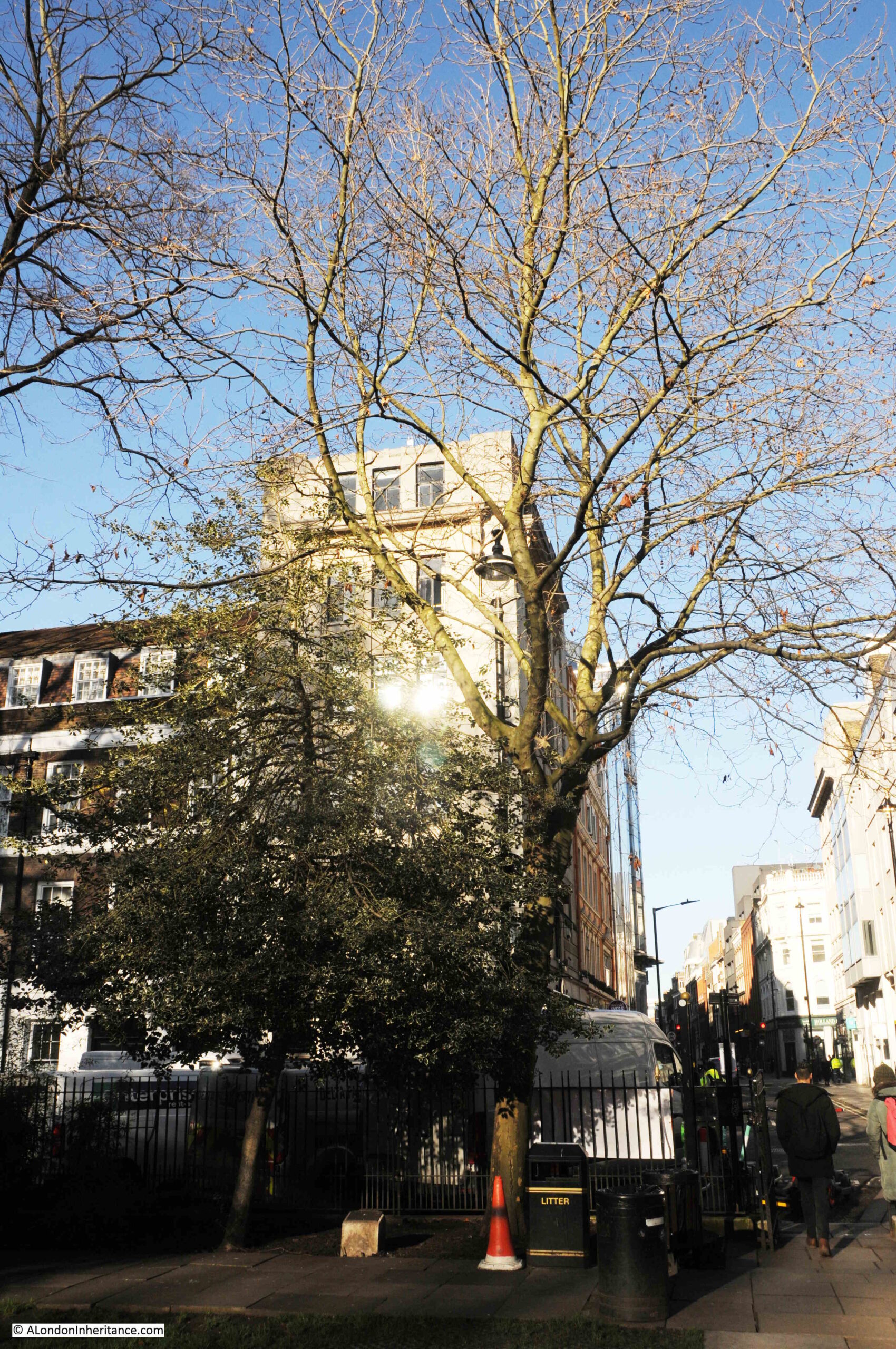
The open space in the centre of the square was separate from all this activity, and provided a space to look at the buildings surrounding the square before being blocked by leaf growth on the trees.
The following photo is looking to the east, with the tower block of Centre Point in the background.
The brick tower in the background is part of St Patrick’s Catholic Church. During the first years of the square, there were a number of large houses leading back from the square, one of these was Carlisle House, which was built by the Earl of Carlisle around 1690.
Carlisle House was leased by Father Arthur O’Leary, a Franciscan Friar, who managed to raise sufficient financial support from a number of wealthy Catholic families.
The house was converted so that it could be used as a place of worship, and was consecrated on the 29th of September 1792. It was one of the first Catholic places of worship opened after the Catholic Relief Acts of 1778 and 1791, which removed many of the restrictions placed on the Catholic faith during the reformation.
The current church was built on the site of Carlisle House between 1891 and 1893.
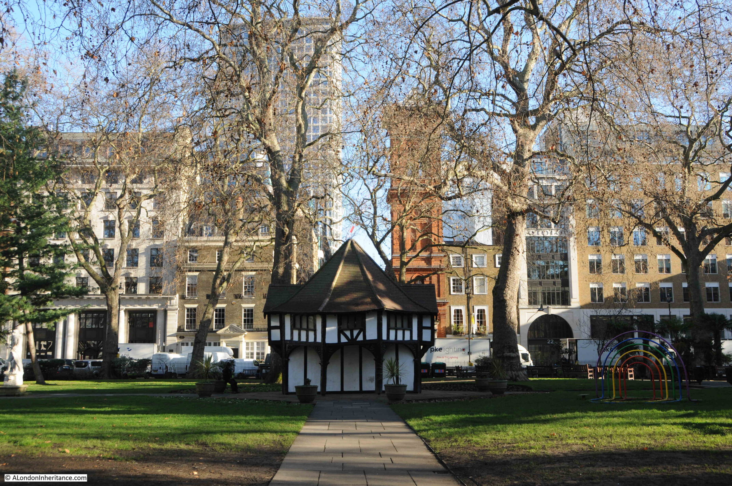
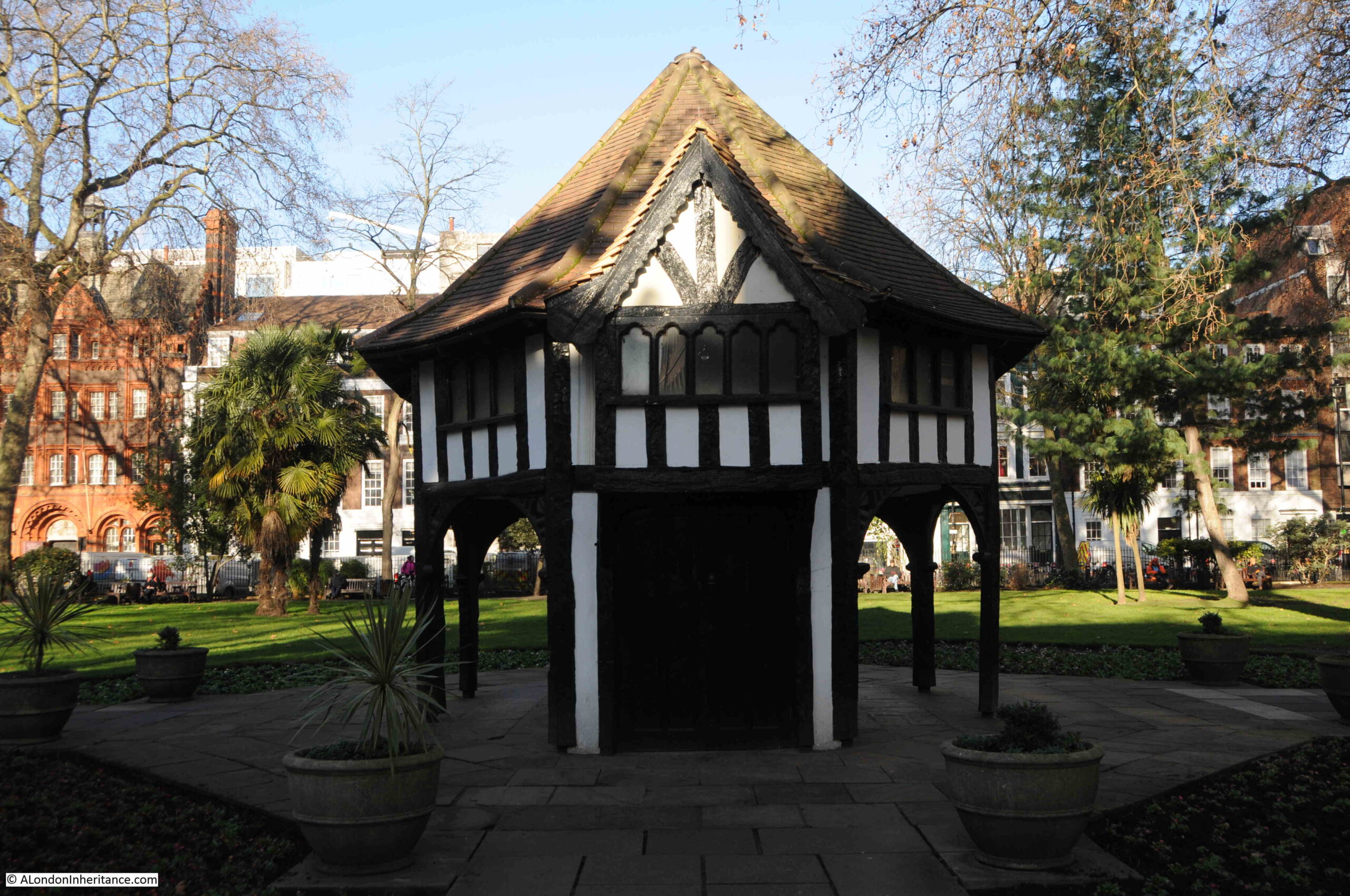
In the centre of the square is a small wooden building:
The wooden building is Grade II listed, and is described by English Heritage as a “Garden arbour/tool shed”. It was built around 1925 for the Charing Cross Electricity Company to provide access to an electricity sub-station below ground. It did not serve this purpose for too long as the underground space would become an air raid shelter during the Second World War.
The electricity substation was not the first utility to be built in Soho Square.
When the first houses in the square were built, there was competition from the water companies that served London to provide water. One of these companies was the New River Company who supplied water from their reservoirs at north Clerkenwell.
Whilst the supply worked to the City, Soho was on higher ground, and this small difference in height between the reservoir and Soho Square, along with the haphazard way in which the water distribution system had grown, resulted in a poor, low pressure supply to the new houses of Soho Square.
Sir Christopher Wren was asked to help with understanding the problems of distributing water to Soho Square and the developing area of the West End, however Wren looked at the whole system and recommended that the problems could only be addressed by effectively replacing the entire system with a new, integrated design.
The New River Company also commissioned John Lowthorp (a clergyman, who was also a member of the Royal Society) to look at the distribution problems,
Lowthorpe established that it was not water supply problems to New River Head (indeed the New River supplied enough water for the whole of London), as with Wren, Lowthorpe identified the distribution network and the organisation of the company.
This would only be fixed over a number of years, one of the short term fixes was the construction of a cistern in Soho Square to store water from the New River Company’s reservoirs for onward distribution.
The north east corner of the square:
The north west corner of the square:
The above two photos show the range of different buildings around the square, and the changes in building height and roof line.
The view is looking north, and shows that in the first decades of the 18th century, Soho Square was really on the northern edge of the built city. The name of the square at the top of the print uses the original name of King’s Square, as well as the future name of Soho Square.
The hills in the distance are those of Hampstead and Highgate, and the street running north from the square crosses Tiburn Road.
This would later be renamed Oxford Street, and was named Tiburn Road as it led to the Tiburn or Tyburn tree or gallows at the western end of Oxford Street, at the junction of Oxford Street with Edgware Road and Bayswater Road.
The above map uses the spelling of Tiburn, rather than the more common Tyburn. Rocque also uses the Tiburn spelling for the street and the gallows.
By the time of the above print, the centre of the square had been laid out as formal gardens.
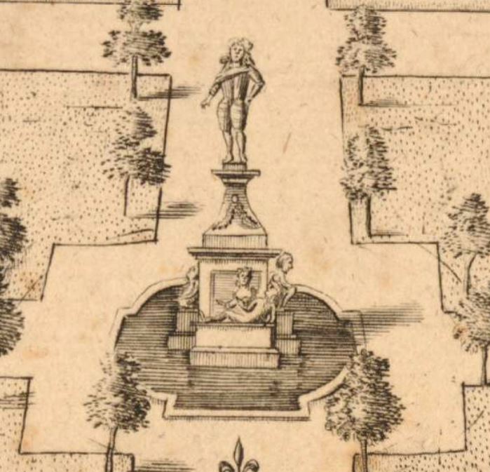
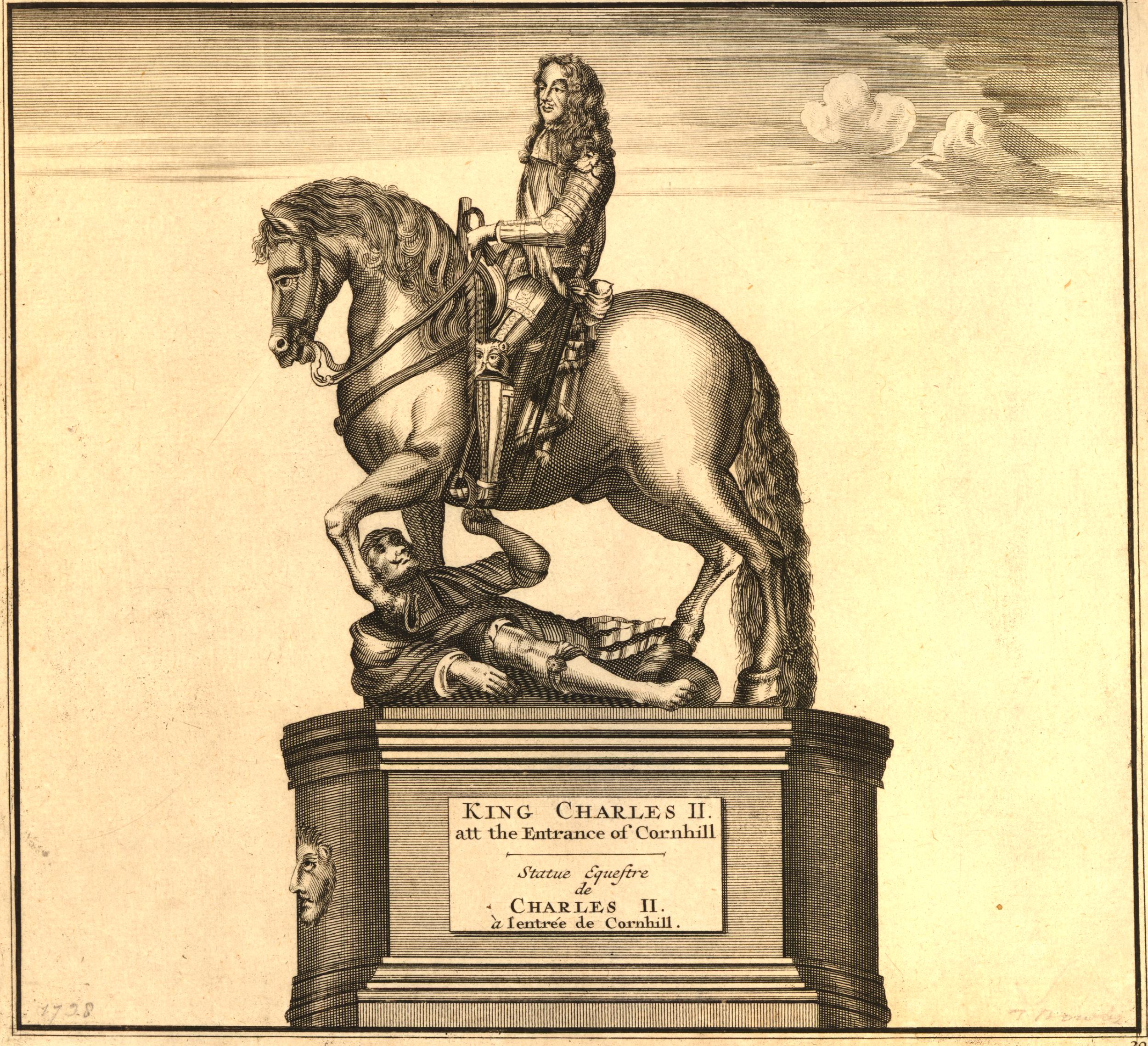
A statue can just be seen in the centre of the above print. I have enlarged this below:
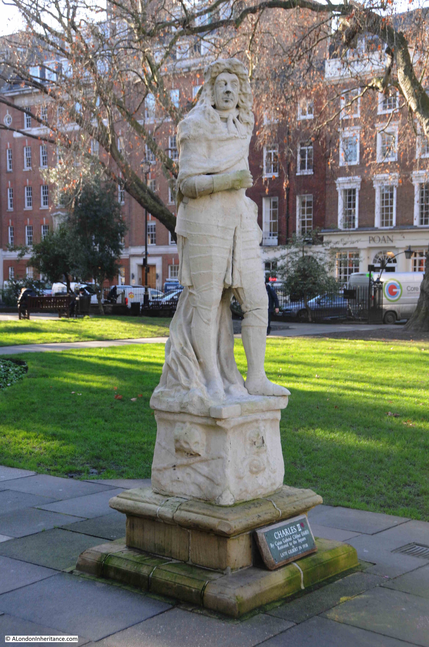
The statue is of Charles II, above a fountain with a small surrounding pond.
Old and New London included a description of the statue and fountain:
“In the centre was a fountain with four streams. In the middle of the basin was the statue of Charles II, in armour, on a pedestal, enriched with fruit and flowers; on the four sides of the base were figures representing the four chief rivers of the kingdom—Thames, Severn, Tyne, and Humber; on the south side were figures of an old man and a young virgin, with a stream ascending; on the west lay the figure of a naked virgin (only nets wrapped about her) reposing on a fish, out of whose mouth flowed a stream of water; on the north, an old man recumbent on a coal-bed, and an urn in his hand whence issues a stream of water; on the east rested a very aged man, with water running from a vase, and his right hand laid upon a shell.”
Old and New London also comments that “the statue is now so mutilated and disfigured, and the inscription quite effaced”. There is also a comment that the statue could be the Duke of Monmouth (who we will come to later), rather than Charles II, however the consensus seems to be that it is the king rather than duke.
The statue was removed around the time that Old and New London was published. An article in the Illustrated London News on the 26th February 1938, records what happened to the statue, and its eventual restoration to the square:
“The statue of Charles II, by Caius Gabriel Cibber, the father of Colley Cibber, Poet Laureate, actor and dramatist, has been restored to Soho Square after an absence of sixty-two years. It was placed in the Square, then called King’s Square, during Charles II’s reign and surrounded a fountain bearing the emblematical figures of the Thames, Severn, Tyne and Humber.
In 1876 it was in such a bad condition that it was taken down and removed to Mr Goodall’s residence at Grims Dyke, Harrow Weald. There it was re-erected in the middle of a large pond, where it remained during the subsequent tenure of Sir. W.S. Gilbert. When Lady Gilbert died in 1936 she bequeathed the statue to the Soho Square Gardens Committee, who had it skilfully restored and have placed it on the north side of the Gardens.”
So although Charles II is no longer on his high pedestal, and the fountain and pond have long gone, he is back in Soho Square:
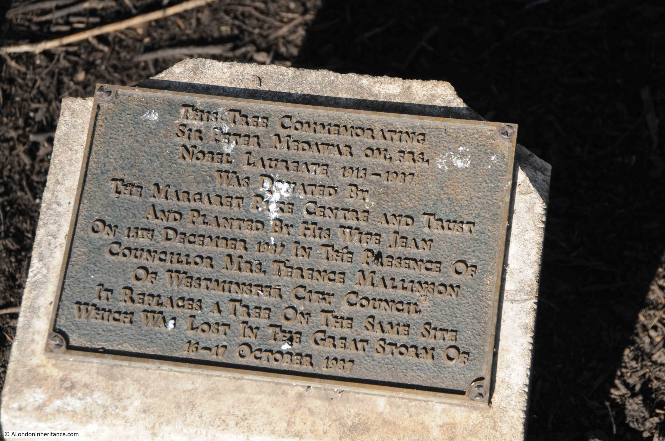
There is a small plaque near the northern entrance to the central garden that records an event in recent history.
Two trees can be seen in the following photo, with a small concrete block between them:
The plaque records that one of the trees (I assume the one on the right) was planted to replace a tree lost during the Great Storm over the night of the 16th to 17th October 1987:
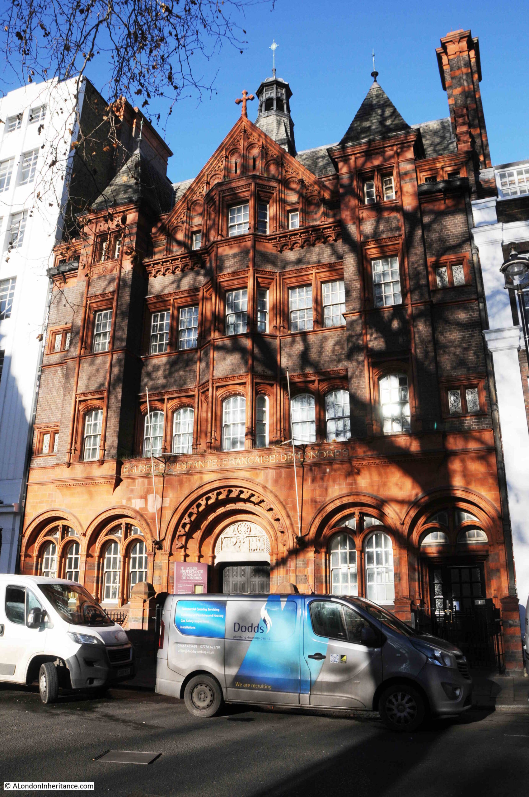
On the north west side of the square, the French Protestant church glows red and orange in the low sun of an early spring day. The church was built in 1891 on the land released when two of the original houses on the square were demolished.
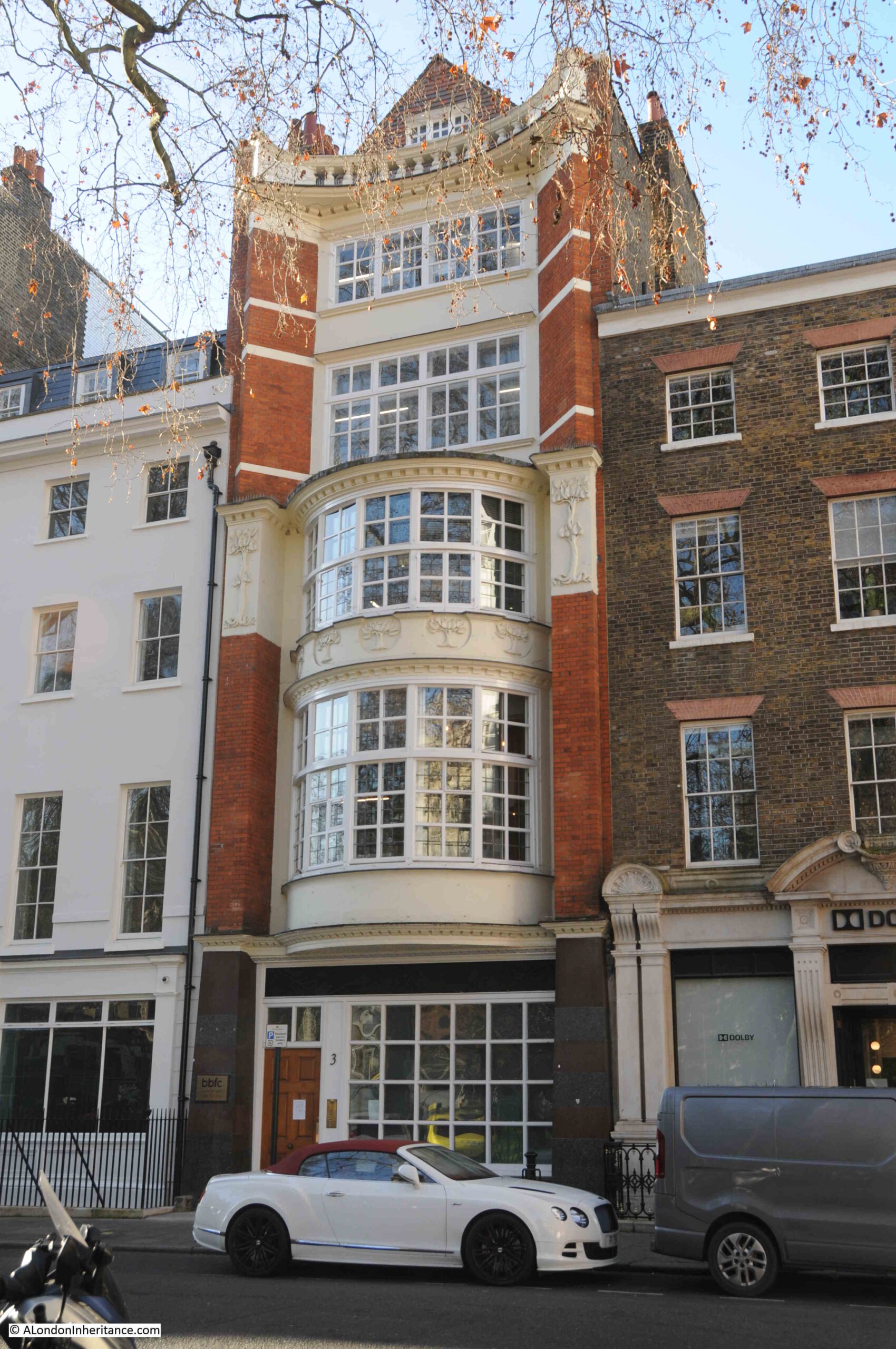
The following photo shows the rather wonderful, number 3 Soho Square:
The building is very narrow compared to many of the other buildings on the street, and although it is the third building on the site, the width of the building is because it is on the same plot of land as the original house when the square was first built.
The first house was built in 1684, it was rebuilt in 1735, which in turn was demolished for the current building which dates from 1902. The mix of the concave upper floors with the large bay windows on floors one and two, along with subtle decoration make number 3 one of the more interesting of the 20th century buildings on Soho Square.
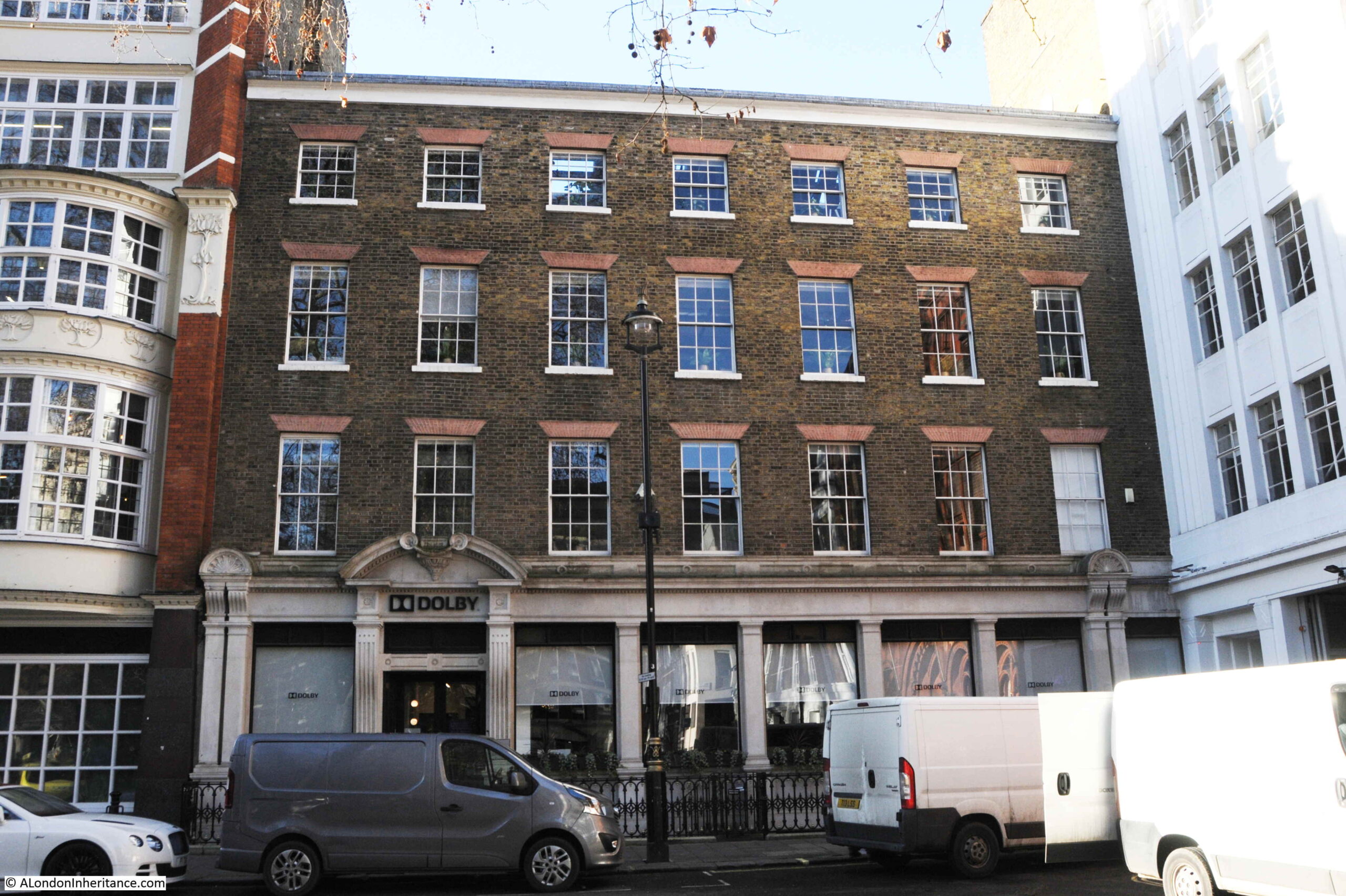
To the right of number 3, is a single building that now occupies the space of numbers 4 to 6, the corner brick building shown in the following photo:
The building was originally constructed as a warehouse in 1804 by John Trotter, a contractor for army supplies.
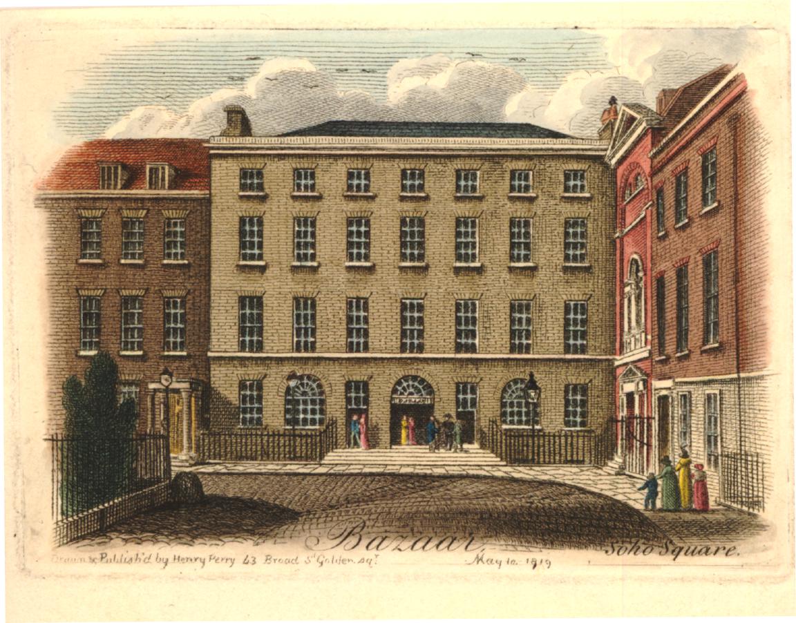
With the end of the Napoleonic Wars, just eleven years after the warehouse was completed, John Trotter converted the warehouse into the Soho Bazaar.
The Soho Bazaar was a market place for a wide range of goods, and the bazaar would last for much of the 19th century. A newspaper report from the later years of the bazaar provides a good description of what could be found inside, and also why the bazaar was under pressure from the shops opening on nearby Oxford Street, and across the city. Published on the 17th of October, 1885:
“It is a long time since I walked round the Soho Bazaar, for the pretty stalls there have been greatly superseded by the many fancy shops that are now everywhere in London. but the old place, though somewhat changed in character, is the depot for many specialties which of themselves would not pay if a whole shop had to be hired for their sale.
All sorts and kinds of fancy work, of contrivances for the comfort of invalids, and such like inventions are to be seen, and, moreover, there is a large register office for domestic servants and convenience for interviews with them, in connection with the bazaar, and one great recommendation of it to me is that all the stall holders are women, not flighty girls, and they are attentive and pleasant to inquirers or purchasers of their own sex, and not on the look out for a possible flirtation, which is the great drawback to most bazaars.
I went there the other day to see myself the ladies work stall, and its appearance is most encouraging, for the work I saw was well executed, attractive, and useful. Every lady who desires to sell her work there is expected to pay a fee of a guinea a year for expenses.”
The stalls in the bazaar seem to have sold all manner of homemade products, and there was also a kindergarten, where babies were given special rugs to play / crawl on. The rugs had cutout animals and other figures to attract attention.
Compare the above print with my 2022 photo of the building, and although the ground floor has been significantly remodeled, the upper floors are the same, after 200 years.
On the south side of the square is the Hospital for Women, which combined / rebuilt houses already on the site:
At the very top of the left building of the hospital, is the date “Founded 1842”. This refers to when the hospital was originally founded in Red Lion Square as the Hospital for the Diseases of Women, before moving to Soho Square in 1852.
Records in the National Archives state that “The Hospital was closed in 1939 on the outbreak of war, and a First Aid Post was opened in the Outpatients Department by Westminster City Council”, and that in 1948, the hospital “was amalgamated with St. Mary’s Hospital and The Hospital for Women became part of The Middlesex Hospital Group”.
The first building on the site of the Hospital for Women, was one of the earliest buildings to face onto Soho Square.
Monmouth House was built for the Duke of Monmouth, however he seems to have spent very little time there.
After Charles II’s death, Monmouth led a rebellion with the aim of taking the throne. He was defeated at the Battle of Sedgemoor on the 6th of July 1685. After capture, Monmouth was executed on Tower Hill on the 15th of July 1685.
The house was sold after Monmouth’s death, converted to auction rooms in 1717, and demolished in 1773.
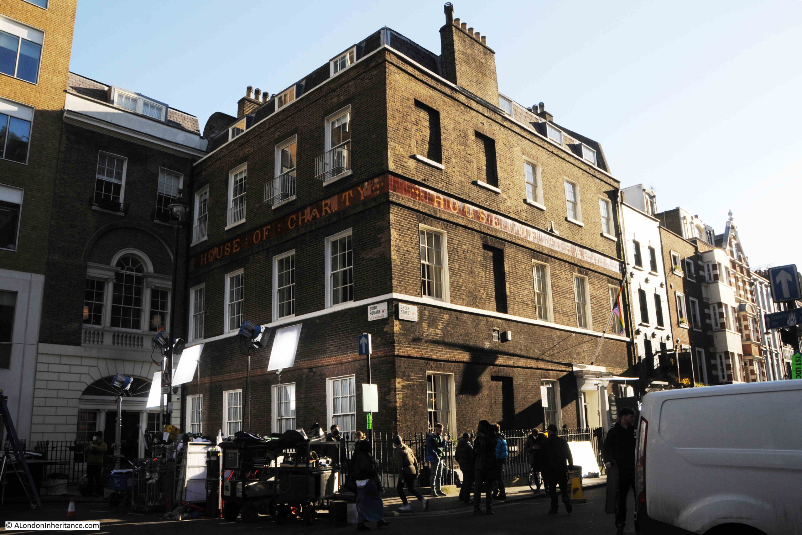
The house on the south east corner of Soho Square, at the junction with Greek Street, is the House of Charity / House of St Barnabas.
On the day of my visit, it was being used as a film set:
Despite appearances, the building is not one of the original houses on the square. The house we see today was completed in 1747 after the original house on the site was demolished.
The building was used by one of the organisations that would eventually become the GLC. In 1811, the Westminster Commissioners of Sewers occupied the building, then the Metropolitan Board of Works who stayed on Soho Square until their move to Spring Gardens, before moving to County Hall on the South Bank as the London County Council.
When the Metropolitan Board of Works moved out, it was sold to the House of Charity, which had been established in 1846 for the relief of the destitute and the homeless poor in London.
Now the House of St Barnabas, which works to get people into secure, paid employment, through training and support. The interior of the building still has many of the original features, and is why the building is attractive as a film set.
To the west of the square, Sutton Row provides a route to Charing Cross Road, and St Patrick’s Catholic Church is on the right:
On the left is Grade II listed, number 21 Soho Square, an 1838 / 1840 rebuild of the original house on the site, which, during the late 18th century had, as Old and New London tactfully described, been a “place of fashionable dissipation to which only the titled and wealthy classes had the privilege of admission”, basically a high-class brothel.
After being rebuilt, the building was taken on by Crosse & Blackwell, and numerous 19th century adverts give Soho Square as the address for Crosse & Blackwell – manufacturers of Pickles, Sauces & Jams etc.
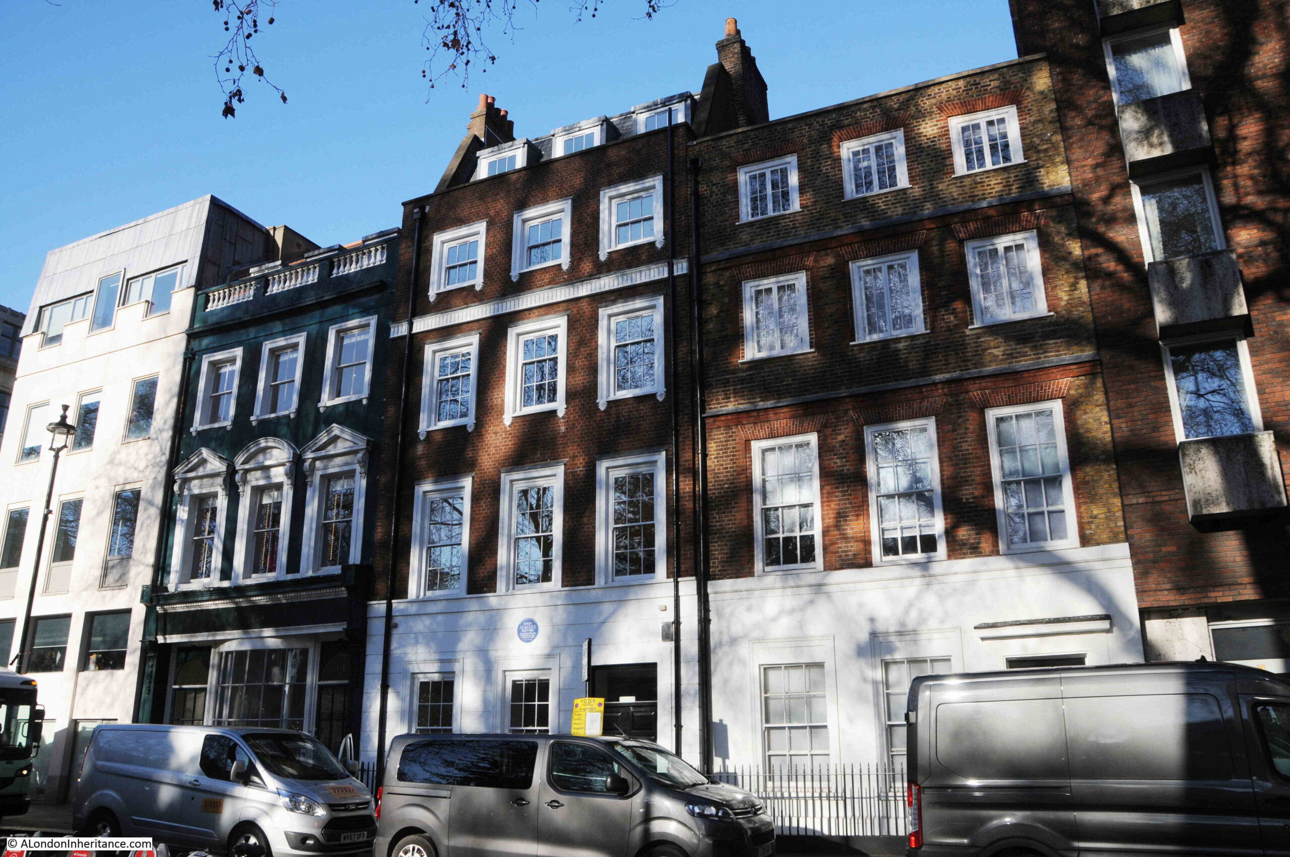
There are three interesting buildings in the north-east corner of Soho Square. The building on the right in the photo below is one of the original houses on the square. Although considerably modified, it does give an indication on what the terrace houses would have looked like as the square was completed.
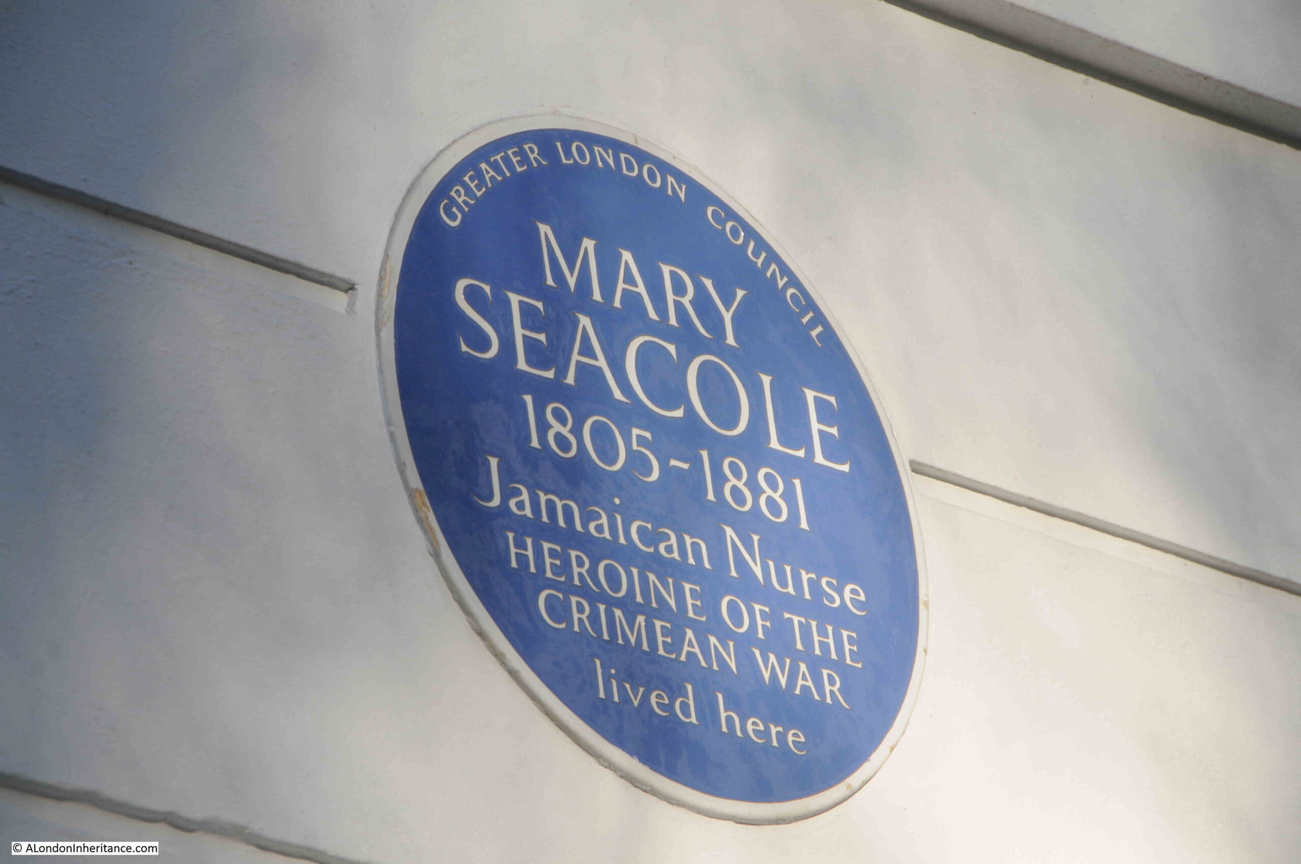
The centre house has a blue plaque, recording that Mary Seacole lived in the house:
Mary Seacole was a Jamaican nurse who learnt many of the local techniques for practicing medicine. She traveled widely, and was involved with the treatment of people suffering from cholera outbreaks in Jamaica and Panama.
In 1853 she was responsible for nursing services for the British Army in Jamaica, however she had heard about the suffering of soldiers in the Crimean War, and asked that she be sent to the Crimea to work as an army nurse.
This request was not approved, so she funded her own trip to Crimea where she set up the “British Hotel” to provide a place of rest and treatment for injured and sick soldiers. This was the same war where Florence Nightingale was also working, but Mary’s British Hotel was closer to the front.
After the end of the Crimean War she returned to Britain, however she had very little money left, having funded the trip to the Crimea, and in 1856 she was declared bankrupt, as the Globe on the 7th November 1856 reported:
“The bankrupts, Mrs Mary Seacole and Thomas Day the younger, are described as of Tavistock-street, Covent-garden, and Ratcliff-terrace, provision merchants, and formerly of Balaklava and Spring Hill, front of Sebastopol. Mrs. Seacole is a lady of colour, and has been honoured with four government medals for her kindness to British soldiery. She was present in person, and attracted much attention, the gaily coloured decorations on her breast being in perfect harmony with the rest of her attire.”
Whilst in London, she wrote and published her biography, and a review sums up how she was viewed:
“The Wonderful Adventures of Mrs Seacole in Many Lands has just been published by Mr James Blackwood of Paternoster Row. Of Mrs Seacole, Dr. Russell says in a brief preface ‘If singleness of heart, true charity and Christian works; if trials and sufferings, dangers and perils, encountered boldly by a helpless woman on her errand of mercy in the camp and battlefield, can excite sympathy and move curiosity, Mary Seacole will have many friends and many readers’. Mrs Seacole’s autobiography is interesting, includes many strange episodes, and, we doubt not, will obtain numerous readers.”
Proceeds from the book, along with a fund raised by the Prince of Wales provided Mary with sufficient funding to live in comfort for the rest of her life. She died in London in 1881, and newspaper announcements of her death started with the headline “DEATH OF A DISTINQUISHED NURSE”.
Over the following decades, her name disappeared, with Florence Nightingale being more associated with the Crimean War.
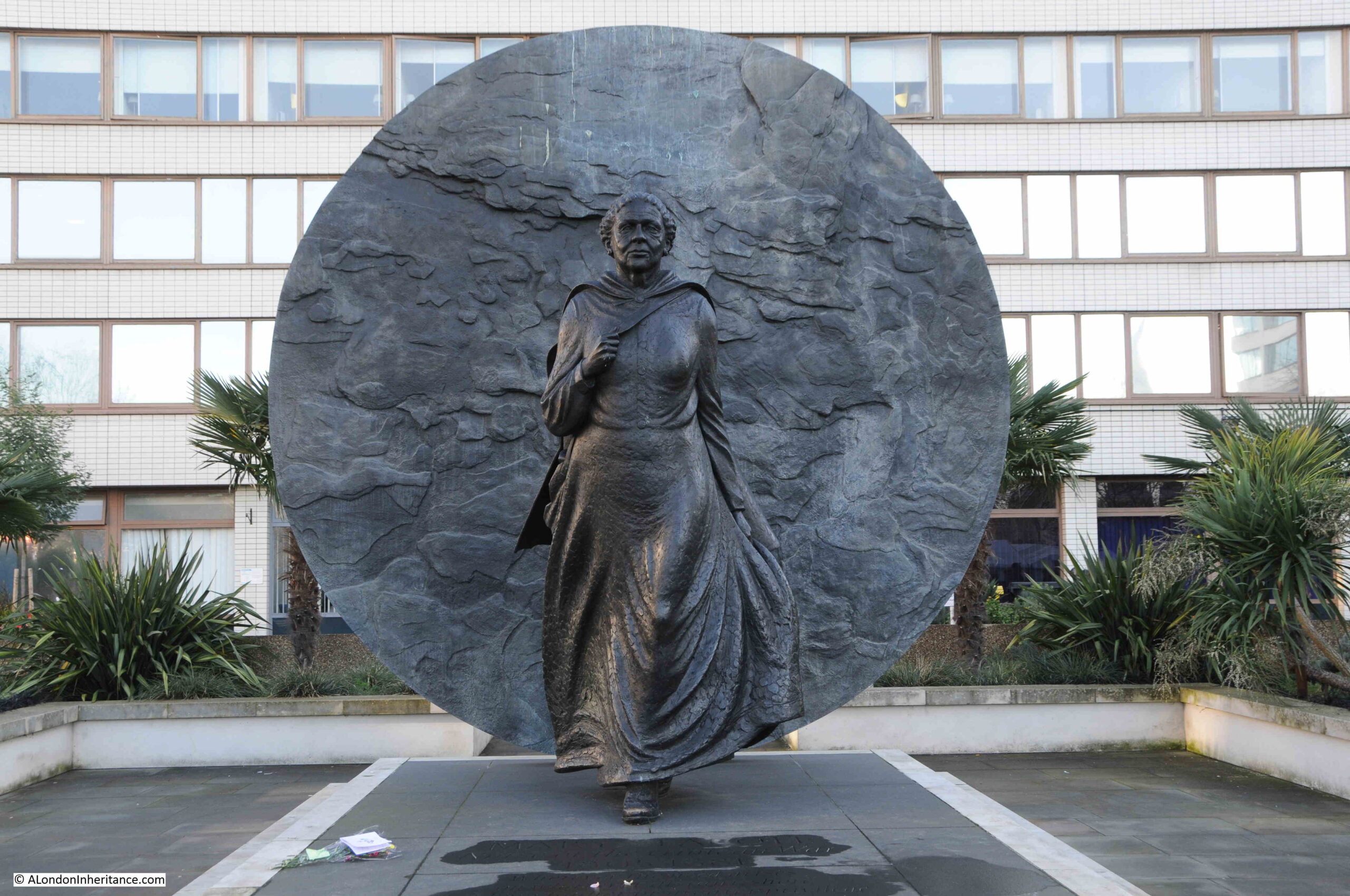
A group of nurses from the Caribbean visited Mary’s grave at St. Mary’s Roman Catholic Cemetery in Kensal Green, and started to campaign for greater recognition for her. This was supported by the local MP to Kensal Green and in 2016, a statue was unveiled in the grounds of St Thomas’ Hospital on the south bank of the Thames just to the west of Westminster Bridge.
The large disk behind the statue of Mary is an impression taken from the ground in the Crimea where Mary Seacole worked to help soldiers during the Crimean War.
I cannot find out exactly when Mary Seacole lived in Soho Square. Newspaper reports of her life after she returned from the war mention a number of different addresses in London so she seems to have moved around.
Very little of the original Soho Square remains, the statue of Charles II, and a couple of the houses, although all have been repaired and modified, but the square does show how London streets have changed and adapted to different uses over hundreds of years, and how much there is to find in a London square.
A couple of months ago, I wrote the first post of a series in which I hope I will track down the roughly 170 City of London plaques. The plaques tell a small part of the City’s long history, however due to the limited size of the plaque, they often just provide a name, leaving the viewer to wonder what is actually being commemorated.
For today’s post, I take a look at another five, some of which have plenty of information, others need some digging.
City of London plaques record the churches, Guild and Livery Company Halls, infrastructure, key events and people that have contributed to the City’s history. The majority of people are men, there are very few plaques to women, so to start this week’s wander through the City of London, let me start with:
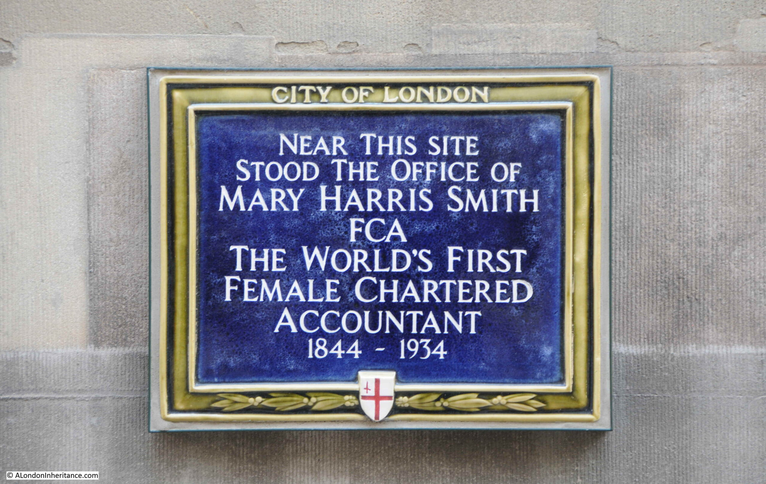
Mary Harris Smith FCA – The Worlds First Female Chartered Accountant
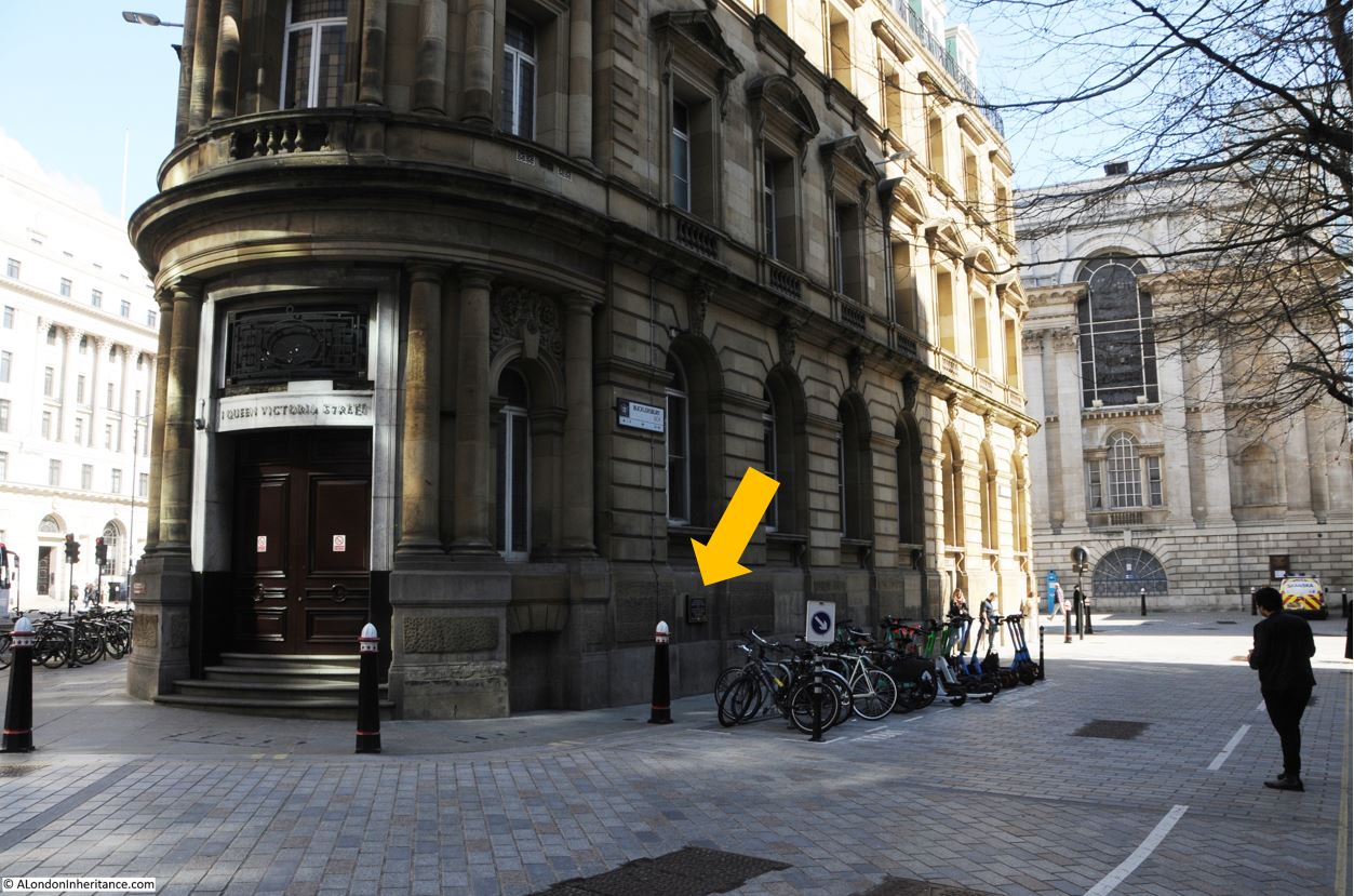
Walk north along Queen Victoria Street, and just before the junction with Poultry and the Bank, you will find number 1 Queen Victoria Street. Walk to the right of this building, along Bucklersbury, and on the side you will see one of the most recent of the City of London plaques. Arrowed in the following photo, as in the shade on a bright day:
This plaque is less than two years old, and was installed on the building in September 2020. It records Mary Harris Smith, the world’s first female Chartered Accountant:
The story of Mary Harris Smith is the story of many women who were struggling to gain recognition in male dominated professions.
Mary Harris Smith had been an accountant for many years, firstly working for a City firm before setting up her own practice in Queen Victoria Street in 1887.
Despite working as an accountant, she was repeatedly refused admission to the accountants professional body, the Institute of Chartered Accountants, either through the route of recognition of her years of work, or through taking the exams set by the Institute.
Whilst there was some support for her admission, the Institute’s solicitor advised the applications committee that the charter only used the male terms of he, him etc. to refer to members, and there was no support to change the charter.
Mary Harris Smith’s persistence eventually worked. She had been seeking the support of other City professionals, members of the Institute and MPs, and in 1919 she was finally admitted to her first professional body, the Incorporated Society of Accountants and Auditors.
The Journal and Express on the 6th of December 1919 recorded the event:
“AFTER 31 YEARS – At a recent meeting of the Council of the Incorporated Society of Accountants and Auditors it was resolved to admit Miss Mary Harris Smith to the Honorary Membership of the Society. Miss Harris Smith has been in public practice in the City of London since the date of the Society’s incorporation and first made application for admission to membership in the year 1886. After 31 years of waiting Miss Harris Smith has seen removed the last obstacle to the admission of women to the Society, and we think there will be general agreement in the profession with the compliment the Council have paid Miss Harris Smith by electing her to Honorary membership”.
Although now a member, the above article refers to her admission as being the “compliment the Council have paid Miss Harris Smith” rather then her right to membership through her ability and years of experience.
A year later, in 1920, she was admitted to the Institute of Chartered Accountants – the event which is commemorated on the plaque.
The Vote newspaper, (subtitled the Organ of the Women’s Freedom League) had been running a series of articles on women in the professions and on the 8th of February 1924 included an article on Women Accountants which featured Mary Harris Smith, who had been elected as a Fellow.
The article also mentions Ethel Watts, who was the first women to pass the Institute of Chartered Accountants exams and gain the ACA qualification:
“The Institute of Chartered Accountants has at present two women members. One of these, Miss Harris Smith, admitted a Fellow of the Institute in May, 1920, was the first woman accountant in public practice before the examination system was started, and has been engaged on highly skilled work for over 30 years.
The other, Miss Ethel Watts, B.A. passed her final examination early this year, and is the first woman to write ‘A.C.A.’ after her name. She served her articles with a Manchester firm, but took her Honours degree at London University. During the war, she became an administrative assistant at the Ministry of Food, and was at one time the private secretary to the Director of Oils and Fats in the Ministry.
She had intended to study law, but her work at the Ministry gave her an interest in business, so she turned to accountancy. In addition to these members, there are 30 women training under articles.”
No idea if there is a plaque to Ethel Watts in Manchester. If not, there should be.
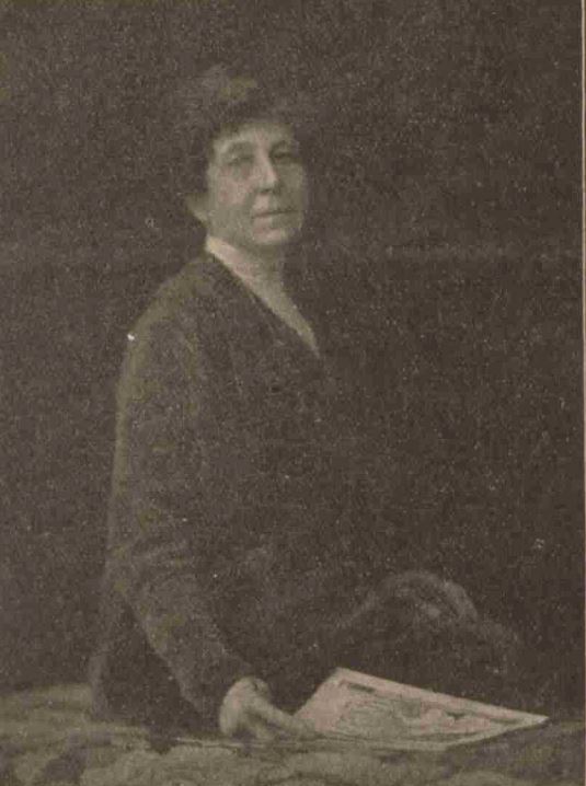
Mary Harris Smith had waited a long time for professional recognition, she was 76 when finally becoming a member. Ill heath forced her to give up work in the late 1920s and she died in 1934.
Mary Harris Smith photographed around the time of her membership of the Institute of Chartered Accountants in 1920:
I can think of only two or three City of London plaques to women, and Mary Harris Smith is a very recent addition – hopefully the first of many more to come.
The next plaque is to one of the many men commemorated across the City:
William Shakespeare and the Mountjoy Family.
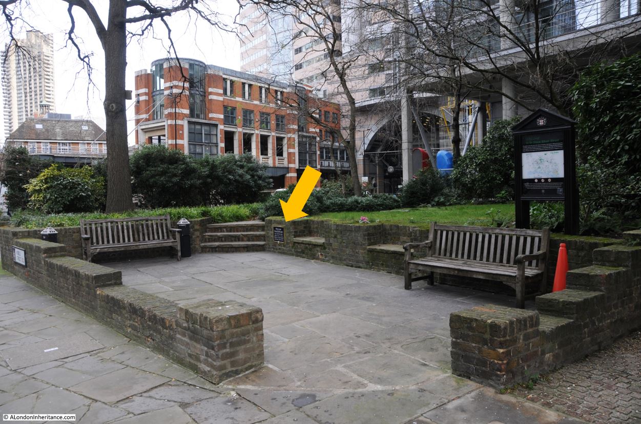
If you start at the roundabout with the Museum of London in the Centre, and walk a short distance along London Wall, you will come to a small garden which is the site of the church of St Olave, a church that was destroyed in 1666 by the Great Fire.
On one of the low walls in the seating area, there is another of the City of London plaques, highlighted by the arrow:
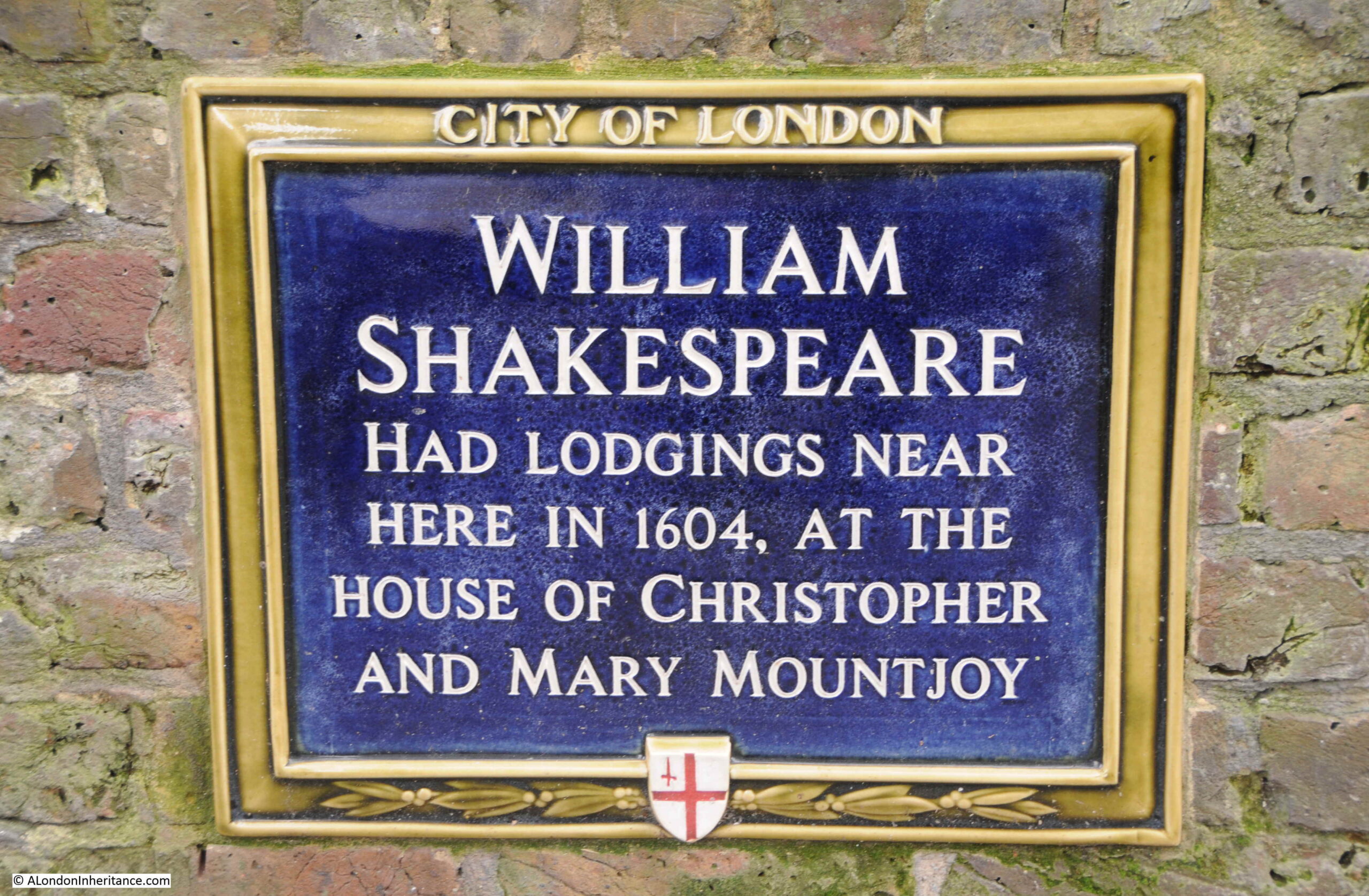
The plaque records that “William Shakespeare had lodgings near here in 1604, at the house of Christopher and Mary Mountjoy“:
The discovery that William Shakespeare lived for a time at or near London Wall was made in the first decade of the 20th century. A Dr. Charles William Wallace who was Associate Professor of English Language and Literature at the University of Nebraska, had, along with his wife, spent their holidays in records offices searching for references to Shakespeare.
They found one set of documents from a legal case dating from May and June 1612, where Shakespeare had been a witness, and the documents included a very rare signature of Shakespeare.
The Illustrated London News on the 16th of February 1910 carried an article on the discovery, which included the core of the legal case:
“Christopher Montjoy or Mountjoy, a Huguenot refugee, living in Silver Street, with a wife and only child, Mary, carried on there the business of a tiremaker. The occupation would seem to have combined the making of Ladies head-dresses with the work of milliner.
In 1598 Mountjoy took as apprentice one Stephen Bellott, whose mother, a woman of Huguenot family, had married as a second husband an Englishman named Humphrey Fludd. Young Stephen Bellott proved an apt workman, and was much liked by his master and his master’s family.
The daughter, Mary Mountjoy, was attracted by her father’s apprentice, and her parents approved a marriage between the couple. But Stephen Bellott was no ardent wooer, and some pressure had to be brought to bear on him to ‘effect’ a match.
According to the evidence, ‘one Mr. Shakespeare laye in the house’ of the Mountjoy’s when their daughter’s engagement was under discussion. The statement suggests that Shakespeare lodged at the time with the Mountjoy’s, or, at any rate, that he was then staying there. Both parents appealed to Mr. Shakespeare to use his persuasions with the young man.
According to Shakespeare’s evidence, Mrs Mountjoy ‘did sollicitt and entreat’ him ‘to move and perswade’ Stephen Bellott to marry her daughter, and ‘ accordingly he did move and perswade’ him thereunto.
The young man regarded the proposal in a sternly practical light. He asserts that he yielded on specific conditions, namely that the young lady should receive from her father the sum of fifty pounds on her marriage, and the sum of two hundred pounds on her father’s death, together with ‘certaine house-hold stuff’ of substantial value.”
The marriage of Mary and Stephen took place on the 19th of November 1604 in St Olave’s, Silver Street, the site of the plaque.
Mrs Mountjoy died in 1606, and the relationship between Stephen Bellott and his father-in-law became very strained. He claimed that the “household stuff” that Mountjoy had given his daughter was old and worthless, and Mountjoy then denied he had ever made the promises to Bellott.
Bellott then took the case to court, trying to compel his father-in-law to comply with the terms of the alleged contract, and it was because of this that Shakespeare was a witness for the plaintiff.
In his signed deposition, Shakespeare stated that he had known both Mountjoy and Bellott for ten years, that Bellott did “well and honestly behave himself”, and that Mountjoy had promised a “marriage-portion” with his daughter, but he could not remember the amount.
The documents found by Dr. Wallace in the National Archives do not record the outcome of the case, and it seems to have been refered to another authority for judgement.
Dr. Wallace assumed that Shakespeare had lived with the Mountjoy’s from 1598 to 1604, which was the period of Bellott’s apprenticeship, although there is no evidence to confirm this. Dr. Wallace also made a number of claims, including that Shakespeare used the name Mountjoy as the French herald in Henry V from the name of the family he had been living with. Again, there is no evidence to confirm this.
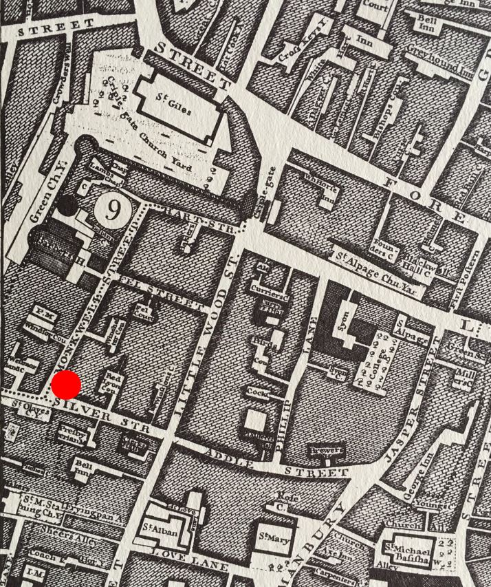
Mountjoy’s house was on the corner of Silver Street and Monkwell Street – two streets that disappeared during the rebuilding of the area following the bombing of the last war. The following map is from Roque’s 1746 map of London, and I have marked the location of the house with a red circle. Just below the red circle is St Olave’s cemetery, the site of the garden we can see today.
The location today of Mountjoy’s house is just slightly north of the location of the plaque, and is probably under the current route of the dual carriageway of London Wall.
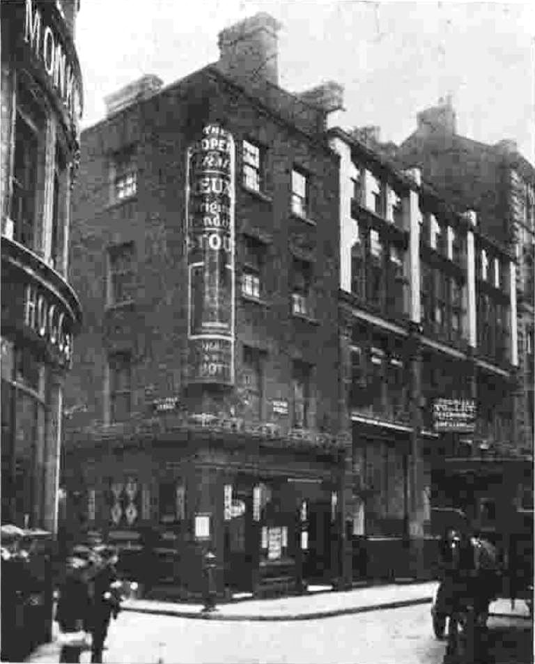
A pub, the Coopers Arms was later built on the site of the house and in 1931 it was reported that the Coopers Arms had an old inscription commemorating Shakespeare’s stay.
The Coopers Arms – Silver Street to the right, Monkwell Street disappearing to the left. Strange to think that London Wall now runs through this scene.
Two plaques covering people who have lived or worked in the City. Now for one of the staple of City of London plaques – one of the City’s Guilds or Companies.
Curriers’ Hall
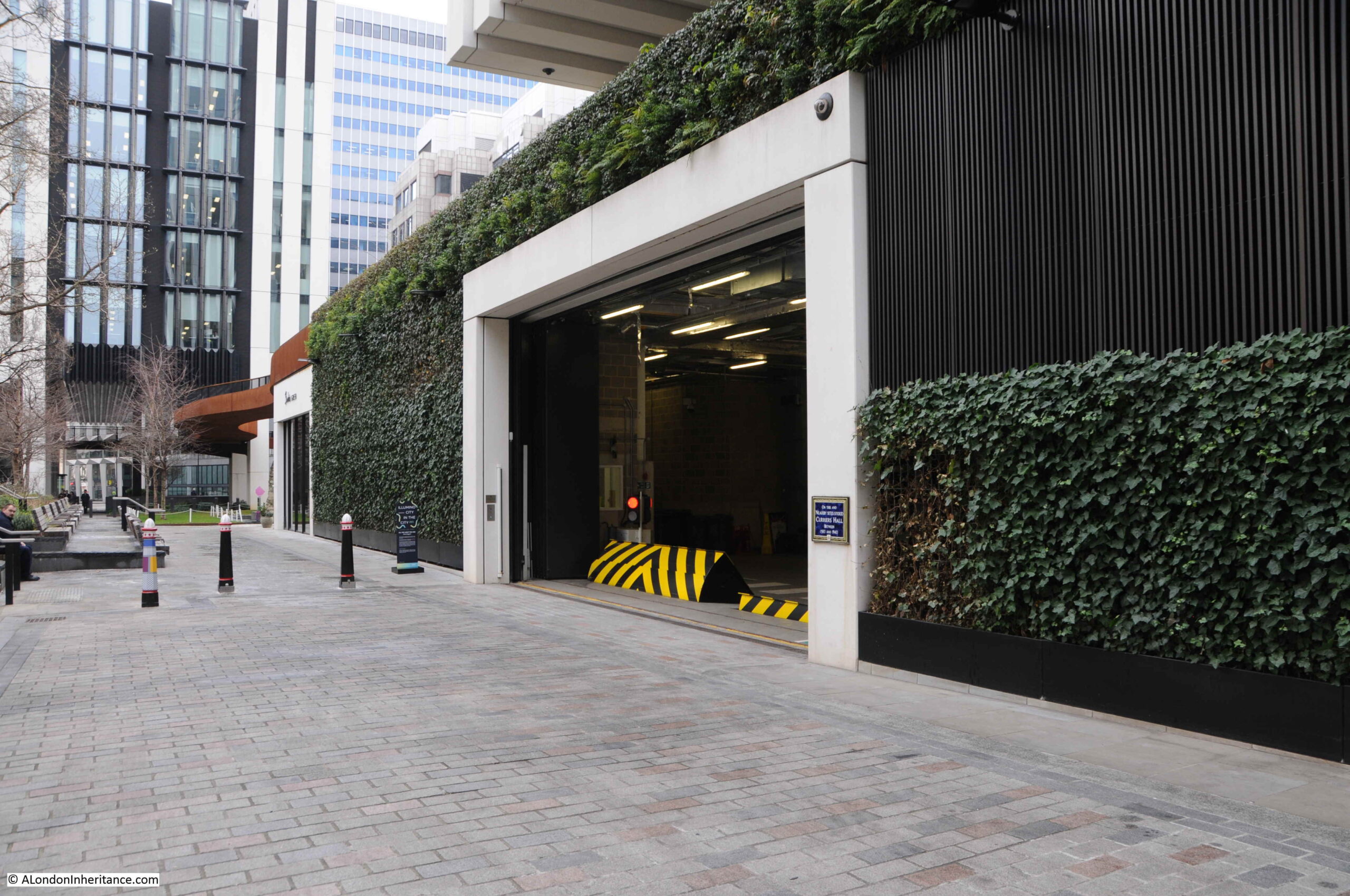
Not far from the Shakespear / Mountjoy plaque is one to mark the site of Curriers’ Hall. Walk a short distance east along London Wall, up Wood Street, and a short distance along is a pedestrianised walkway to the east, which has some remnants of the City Wall alongside.
Opposite the wall is the goods entrance to one of the new buildings that cover the area, and to the right of the entrance is a City plaque:
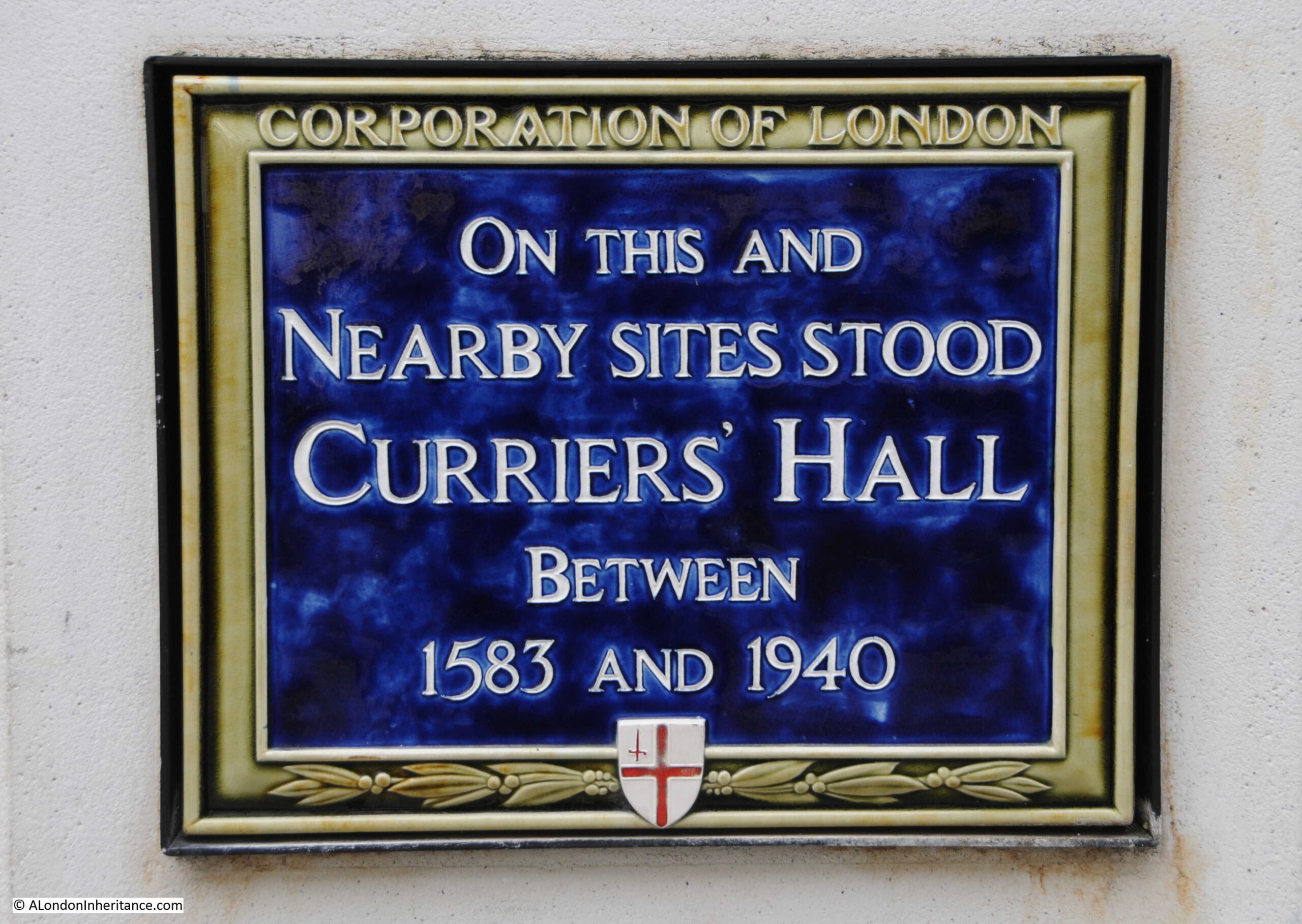
The plaque marks the nearby sites of Curriers’ Hall between 1583 and 1940:
A Currier was a leather worker. Currying leather was the process by which tanned skins were stretched and shaved into a fine finish to produce leather which was suitable for the production of leather goods, such as shoes.
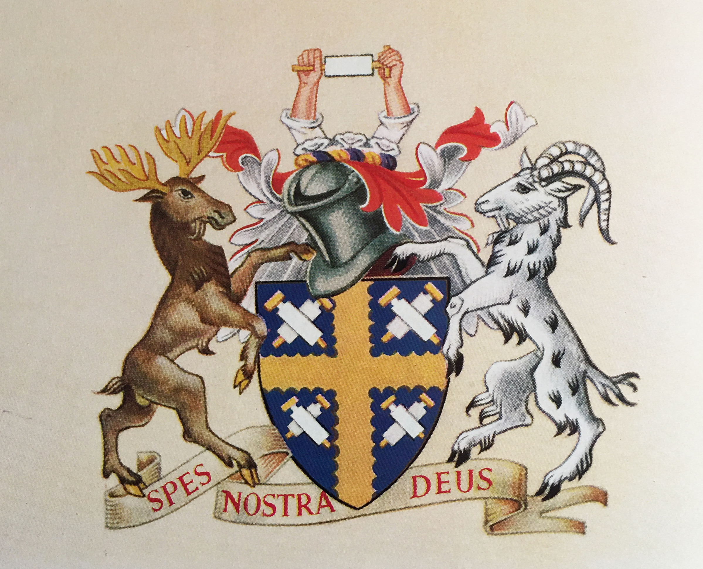
The coat of arms of the Curriers’ shows arms rising at the top, with hands holding the tool of the Currier, the shaving knife which was scrapped across a skin, gradually reducing the thickness and producing a smooth finish to the material. The tool is also shown on the shield.
Curriers were originally part of the Cordwainers’ Guild, but an ordnance of 1272 brought about the separation of the professions by requiring that they should have separate working regulations.
Full self governance by the Curriers was achieved through a 1415 ordinance, with an extension of their powers through an Act of 1516, and the grant of a Charter on the 30th of April 1606.
The grant of a Charter was rather late, and was given “by prescription” where a company that had existed for a long time was assumed to have been granted a charter, but which had been lost.
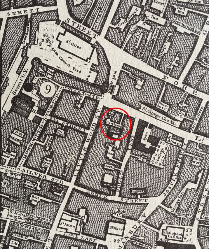
The location of the plaque is roughly where an entrance to a courtyard in front of the Curriers Hall would have been located.
The same extract from Roque’s 1746 map that I used for the Mountjoy’s house, also shows the location of the Curriers’ Hall, which I have ringed in the map below:
Halls of the City companies were often built back from the street, accessed via an alley from the street, into a courtyard with the hall. I assume this approach separated the hall from the busy street (see also my post on Monkwell Street and Barber Surgeons Hall).
The last version of Curriers Hall was destroyed during the heavy bombing and fires that the area suffered in December 1940.
The Worshipful Company of Curriers still exist today. They do not have a hall, and use the halls of other City companies for their ceremonial events. As with other City companies, they do not have regulatory powers, and today support charitable activities in trades still involved in working leather, or where leather products are used, such as horse riding.
Another City Guild or Company that produced products that would have been used along with those of the Curriers is the:
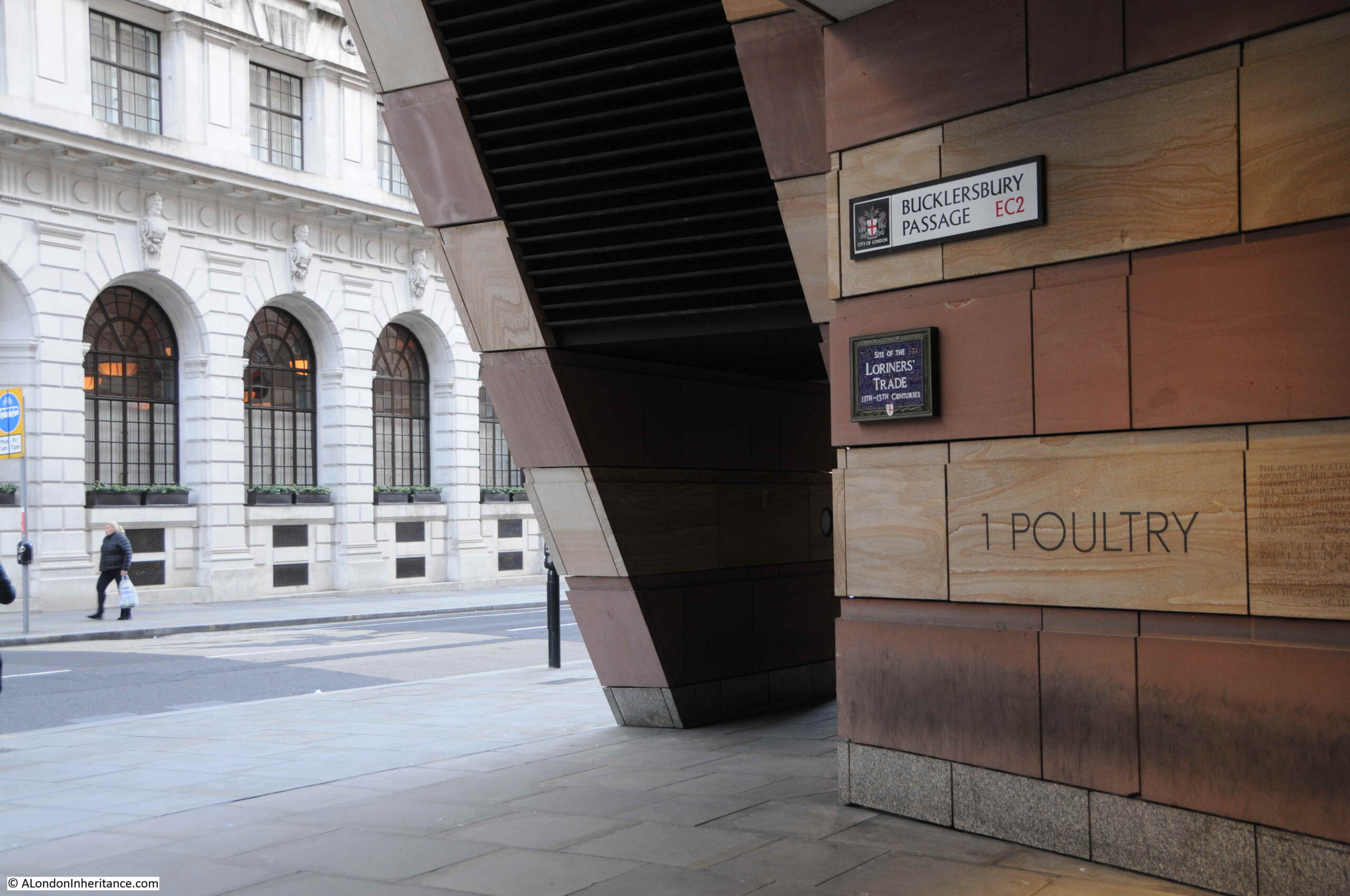
Loriners’ Trade
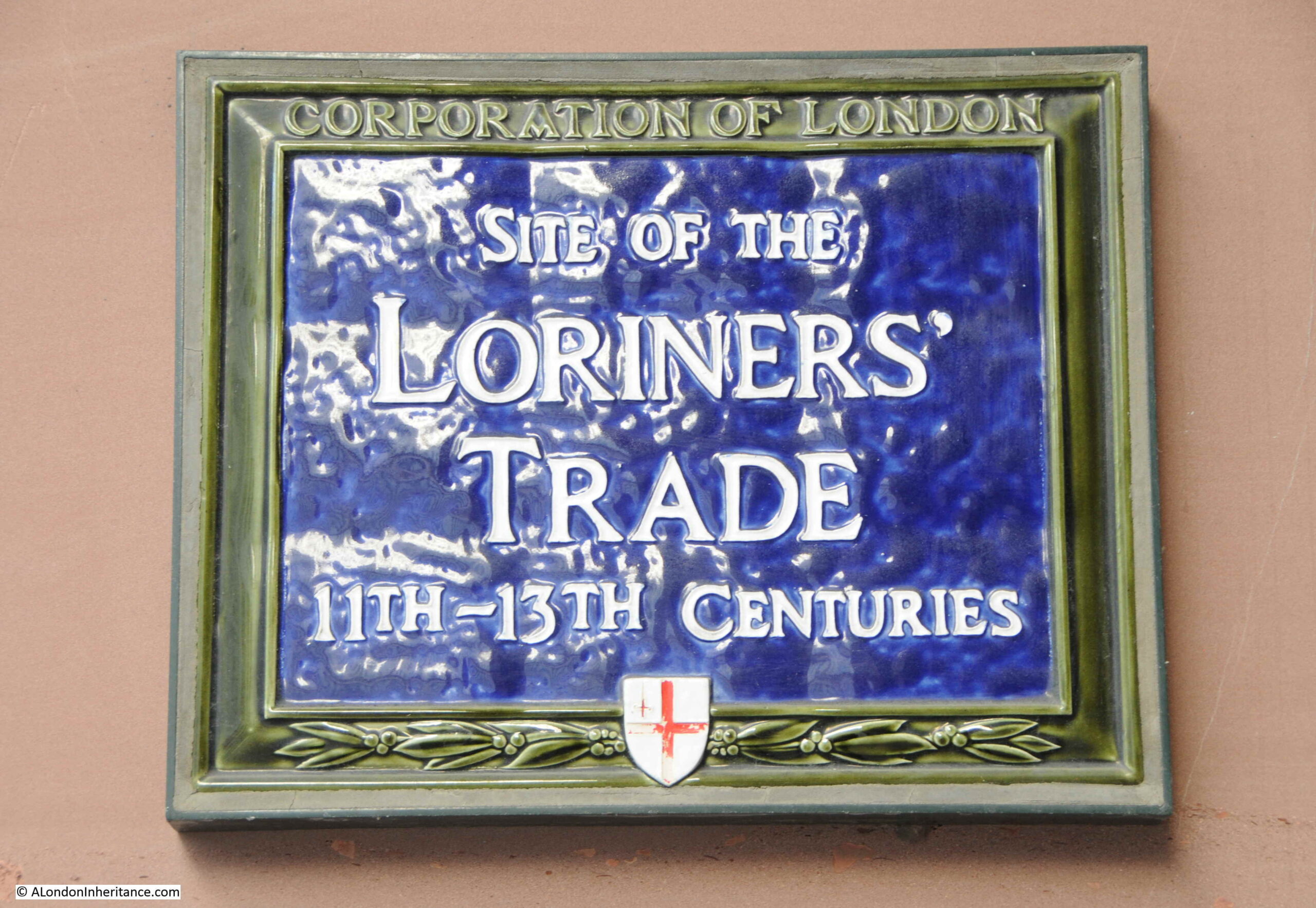
Walk along Poultry, towards the Bank junction, and on the right is 1 Poultry. There is an access under the building just before reaching the Bank junction, called Bucklesbury Passage. Underneath the name sign for the passage is a plaque:
Stating “Site of the Loriners’ Trade 11th – 13th Centuries”:
I love the City of London plaques, however they are also rather frustrating. A casual passerby would have no idea what Loriners’ Trade means.
The Loriners were an old City Guild or Mistery, and were granted ordinances in 1260 / 1261 along with their rules of self government.
A Loriner is an example of how specific many of these skilled trades were, as a Loriner was a maker of bridle bits and other examples of metal work used for horses. The Loriner was also a maker of spurs, however spurs became a separate company before joining the Company of Blacksmiths in 1571.
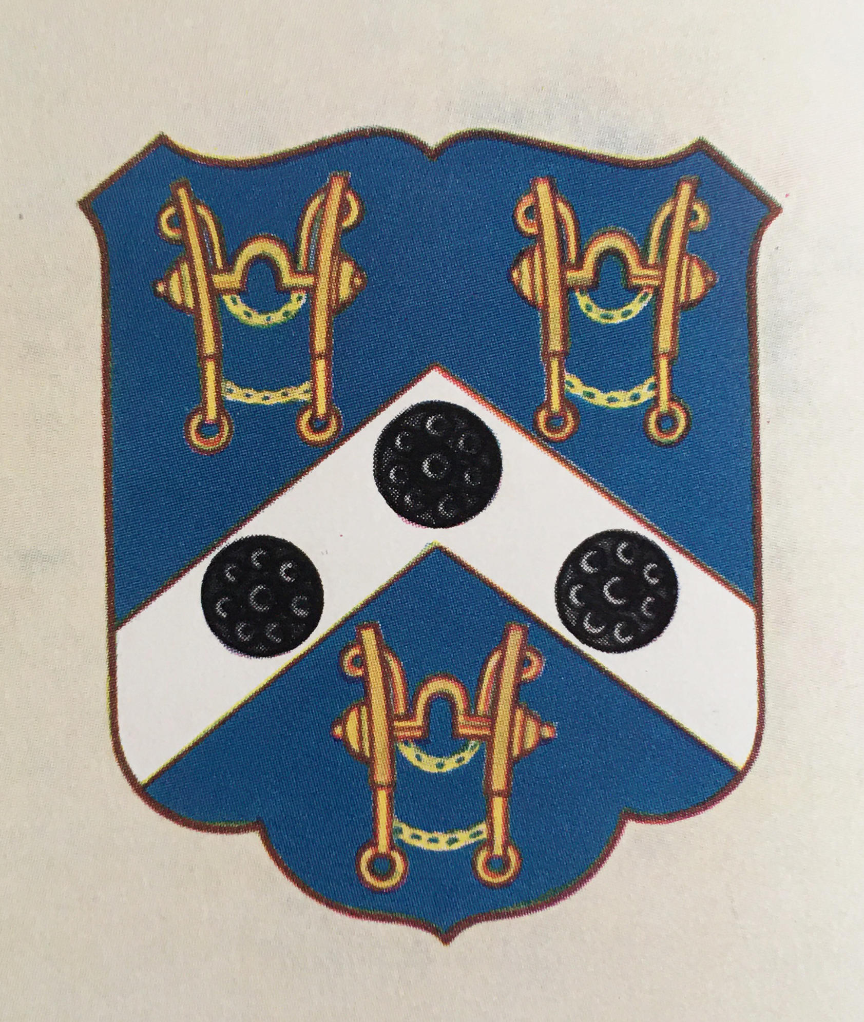
The arms of the Loriners Company show three horse’s bits, along with three black metal bosses:
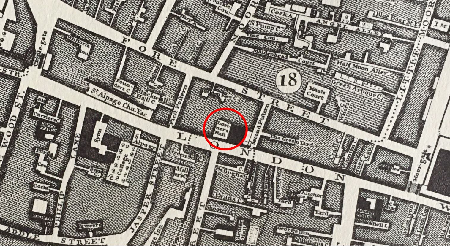
The plaque in Bucklesbury is unusual in that it is recording where the trade was carried out, rather than the location of a hall.
The Loriners’ did have a hall, which remained until the mid 19th century. The hall was located on London Wall, opposite Basinghall Street (not sure if there is a City plaque at the location of the hall – I need to check). Rocque’s map again is useful in confirming the location of the hall, as shown circled in the following extract:
By the end of the 19th century, the Loriners’ Company had very little involvement with any aspects of the old profession, and it was more a club for social and dining activities. This was common with many other City companies, as this article from the Evening News on the 21st of January 1914 implies:
“They endure, these old guilds, because of the dinner. The Loriners who have very little knowledge of the loriners’s trade. Gold and Wire Drawers who might essay in that delicate little job of drawing gold and silver wires. I know a Citizen and Fishmonger whose lore is not enough to help him in choosing a middle cut of salmon at the stores. Nevertheless, these Loriners and Fishmongers and Wire drawers still flourish, branch and root, dining as their ancestors dined.”
The Worshipful Company of Loriners is still in existence, and still dining, using some of the other City Company halls for their events, but is also involved in a wide range of charitable and educational activities.
My final location in this ramble through a number of the City of London’s plaques is not far away from the Loriners.
Walk through number 1 Poultry to Queen Victoria Street and walk up to the Mansion House, where on the Walbrook corner of the building is a plaque recording the location of:
St Mary Woolchurch Haw
Tucked away on the corner of the Mansion House is a plaque, arrowed in the following photo:
Which records that the plaque marks the site of St Mary Woolchurch Haw:
St Mary Woolchurch Haw was one of the City’s churches that was destroyed during the 1666 Great Fire, and not rebuilt. It is remarkable how many churches were in the City before 1666. Many were not rebuilt. A further wave were lost during the late 19th century rebuild of much of the City, and a number were lost and not rebuilt during and after the last war, yet still whenever on a City street we are not far from a church.
The name of St Mary is interesting, but the plaque gives no further information. The dedication is to Mary Woolchurch a name which implies that the church was near to, or had some involvement with wool, but what does Haw mean?
To find out, I referred to the book I use most for learning about pre-1666 City churches – “London Churches Before The Great Fire”, by Wilberforce Jenkinson and published in 1917.
The section on St Mary Woolchurch Haw includes the following:
“St Mary Woolchurch formerly stood near the Stocks Market, which was on the site of the present Mansion House. Stow writes that it was so called ‘of a beam placed in the church yard, which was therefore called Wool Church Haw, of the Troanage, or weighing of Wool there used’
The church was built by Hubert de Ria in the time of William the Conqueror. The first rector whose name is recorded being William de Hynelond, 1349-50. The patronage was partly with the Crown and partly with the Convent of St John the Baptist, Colchester. The church was rebuilt in the 20th year of Henry VI.
John Tireman, rector in 1641, at the commencement of the Civil War was compelled to retire in consequence of his loyalty. john Bull was preacher during the Protectorate, and was afterwards Master of the Temple. The church was not rebuilt after the Fire, but the parish was annexed to that of St Mary Woolnoth”.
So a Haw was a form of beam which was used in the weighing of wool. The Victoria and Albert Museum have a Wool Weight which would have been used with a Haw (Source Link).
The wool weight in the above photo dates from between 1550 and 1600. As can be seen in the photo, the weight has a hole at the top, and through this would have been threaded a leather strap which allowed the weight to be hung on one end of a beam or Haw.
Weights were typically of 7, 14 and 28lbs. The one in the photo is 14lbs.
The beam was pivoted in the middle, with wool suspended at one end, and weights added to the other end of the beam. When the beam balanced, the weight of the wool could be read from the number and weights of the weights used.
The extract from the book mentions that “St Mary Woolchurch formerly stood near the Stocks Market“.
The Stocks Market dates from the 13th century with a charter issued by Edward I. The market was named after the only set of fixed stocks in the City which were used for punishments, such as when William Sperlynge was pilloried in the stocks for trying to sell rotten meat, which was burnt under his nose whilst he was held in the stocks.
The market gradually specialised and by the 15th century it was known as a meat and fish market.
The market was destroyed during the Great Fire of 1666, along with the church of St Mary Woolchurch Haw.
Although the church was not rebuilt, the market was, and expanded to included the land once occupied by the church. It became a general market, which as well as meat and fish, included fruit and vegetables and was one of the major markets of the City.
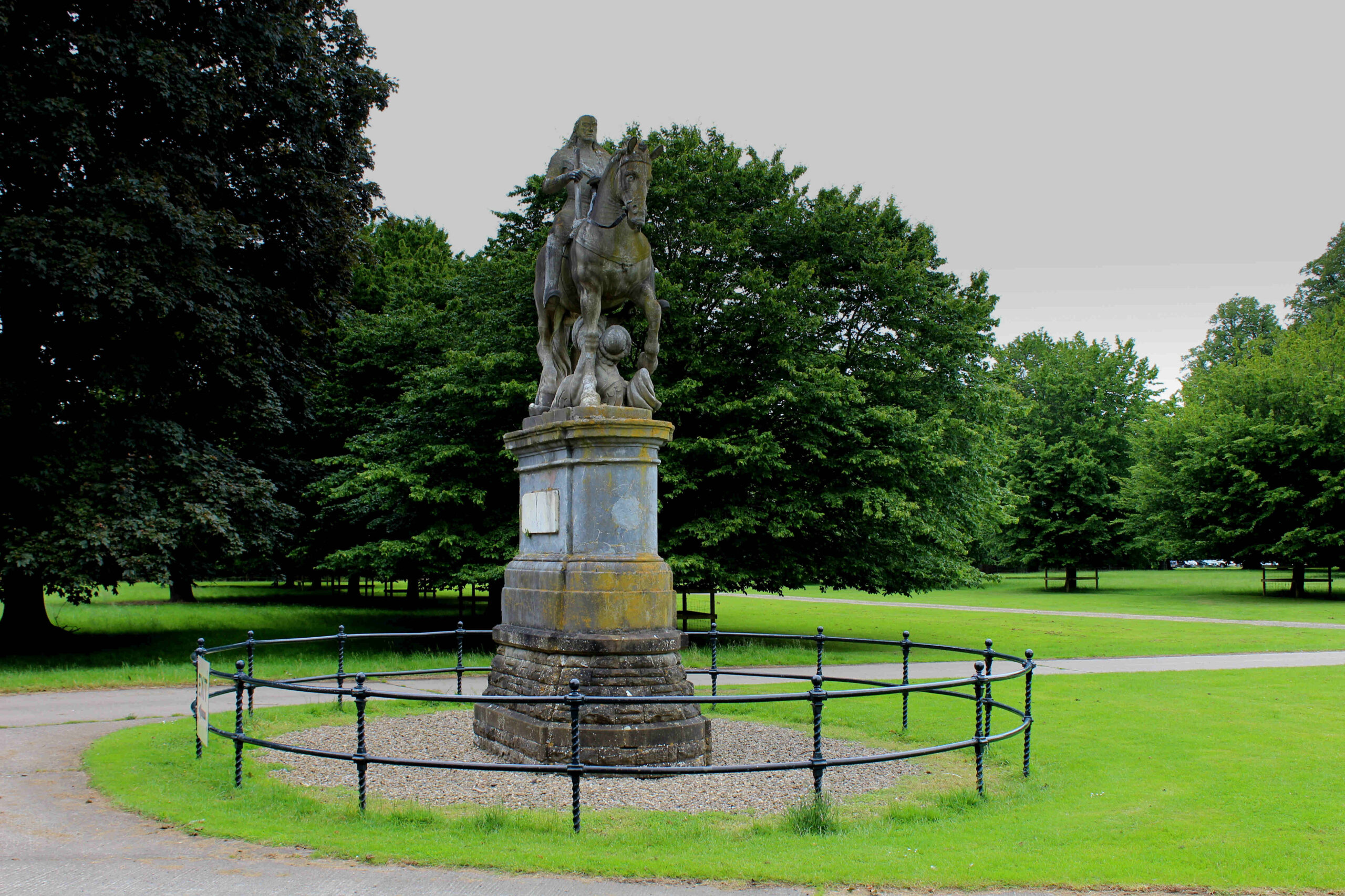
The church in the background of the above print with the dome and tower is St Stephen Walbrook. The large statue at the front of the Stocks Market is of Charles II, but it has a very interesting history.
The statue originally came from Italy and was an unfinished work showing the King of Poland, John Sobieski on his horse which was trampling on a Turk,
The statue had been brought to London by Sir Robert Vyner who was Lord Mayor of the City in 1675.
A Polish king would make no sense in a City market, and Robert Vyner had the head of the statue replaced with one of Charles II, and the head of the Turk was replaced by one of Oliver Cromwell (or possibly the original head was reworked).
When the statue was removed, it was given to a descendant of Sir Robert Vyner who apparently relocated it from the City to a family estate in Lincolnshire, from where it was later moved to Newby Hall in North Yorkshire, where the statue that was originally on the site of the Stocks Market, and what is now the Mansion House, can still be seen today:
That is five more City of London plaques. They are fascinating as each one, although brief, opens up a whole volume of the City’s long history.
I also find it interesting how bits of London can be found scattered across the country. I have found numerous examples of these, with the statue of Charles II being the latest.
Now that Mary Harris Smith has a recent plaque, I hope that many more of the women who have been a part of the City’s history will also be getting their own plaques in the years to come.
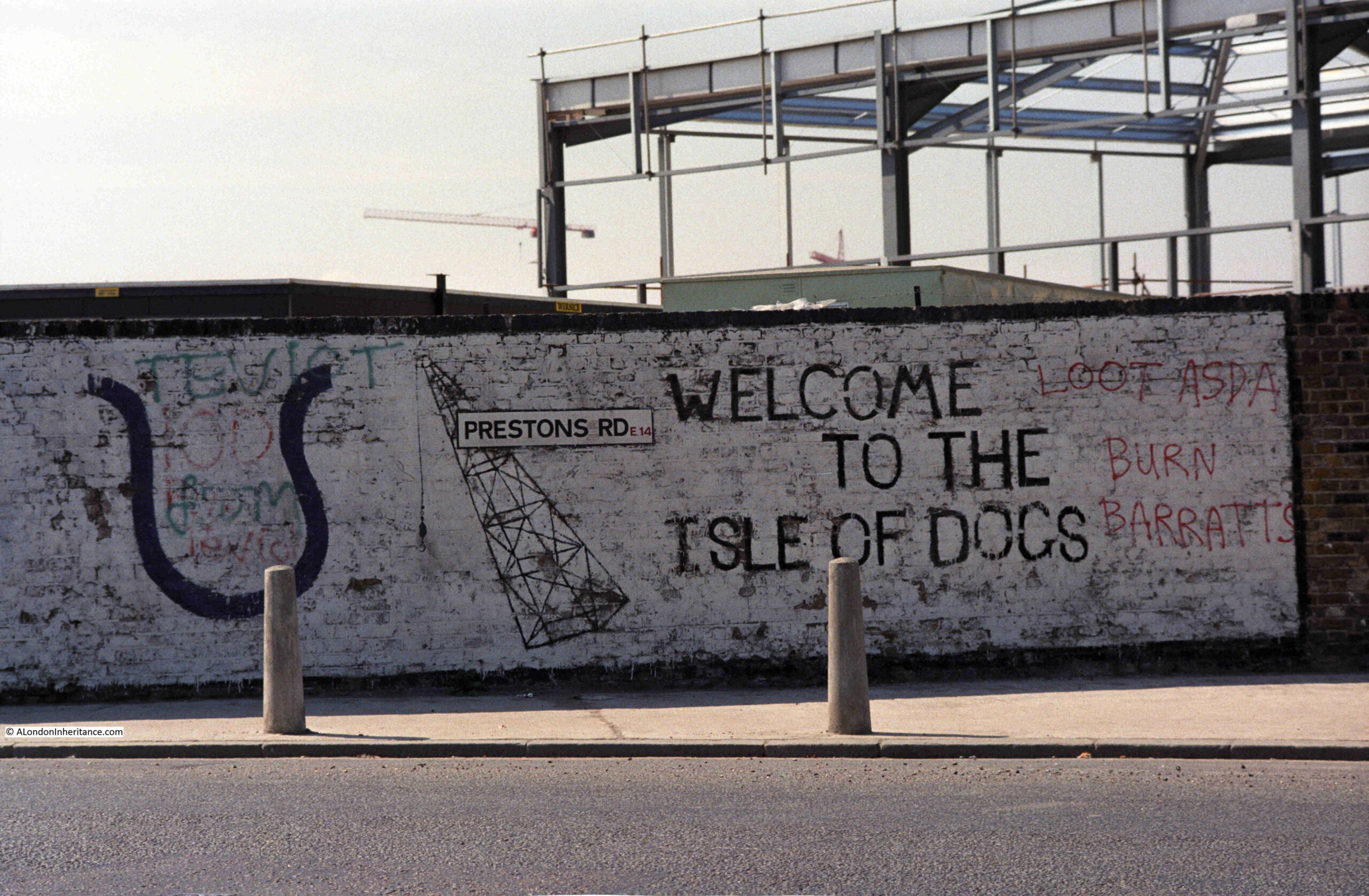
In 1986, my father photographed some graffiti on a wall in Prestons Road which runs from Poplar to the Isle of Dogs.
The 1980s were a traumatic time for the residents of the Isle of Dogs. The docks had closed and the developments that would lead to the office complex around Canary Wharf, as well as many new housing developments, were underway.
Much of this new development would not directly benefit local residents. Thousands of office jobs for those living outside of the Isle of Dogs, and new homes being built which were typically much more expensive than traditional homes in the area. Very little of the money being poured into new developments would find its way to the original residents.
The graffiti on the wall in Prestons Road reflects some of the anger and frustration felt as a result of the developments. Barratts the builders are mentioned on the right of the wall, along with Asda.
Whilst the build of a new Asda store could have been seen as a positive for residents, in reality it was one of the many cultural changes imposed, where centralised shopping would badly impact the trade of multiple small, often family owned shops.
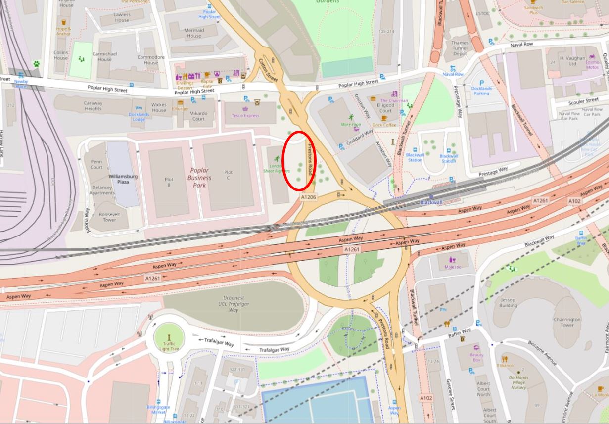
The graffiti was on a wall in Prestons Road. This road runs from a junction with Poplar High Street down to the so called Blue Bridge, which crosses the east entrance to West India South Dock from the Thames.
I think I found the location when I went for a walk along Prestons Road, and I will explain later in the post, however before walking the road, some background to a road that has changed significantly in the last decades.
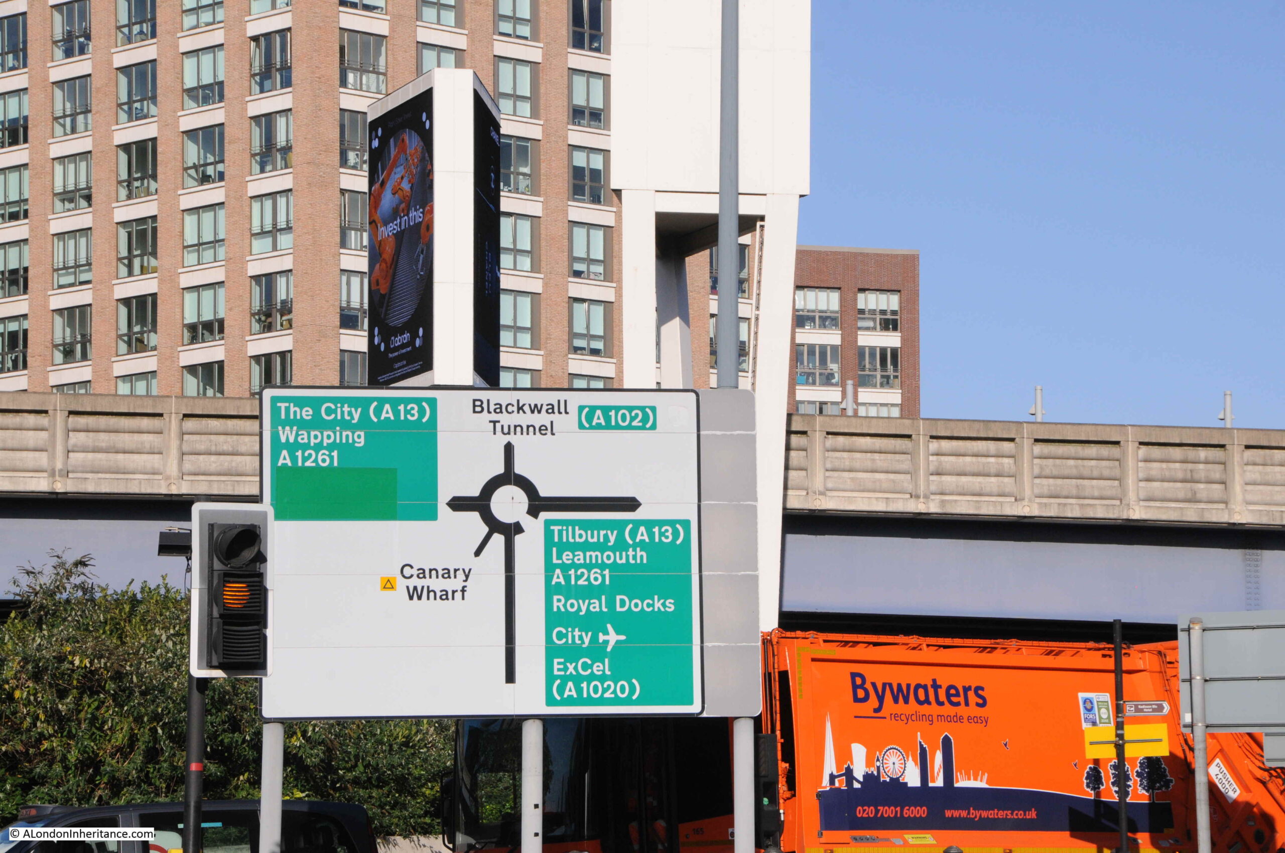
The most significant change to Prestons Road is in the northern part, up to the junction with Poplar High Street. Between the northern and southern sections of the road, it has been divided by a large roundabout and the dual carriageways of the A1261, or the Aspen Way, which is carried over the roundabout, as can be seen in the above map.
The A1261 provides a route between the A13 at the start of the East India Dock Road in the west, through to the Lower Lea Crossing in the east.
Construction of this road had significant impact on the area, and in some ways, reinforced the division between the Isle of Dogs and the rest of Poplar. The A1261 was built as part of the transformation of transport infrastructure surrounding development of the Docklands, which included other major projects such as the Limehouse Link Tunnel.
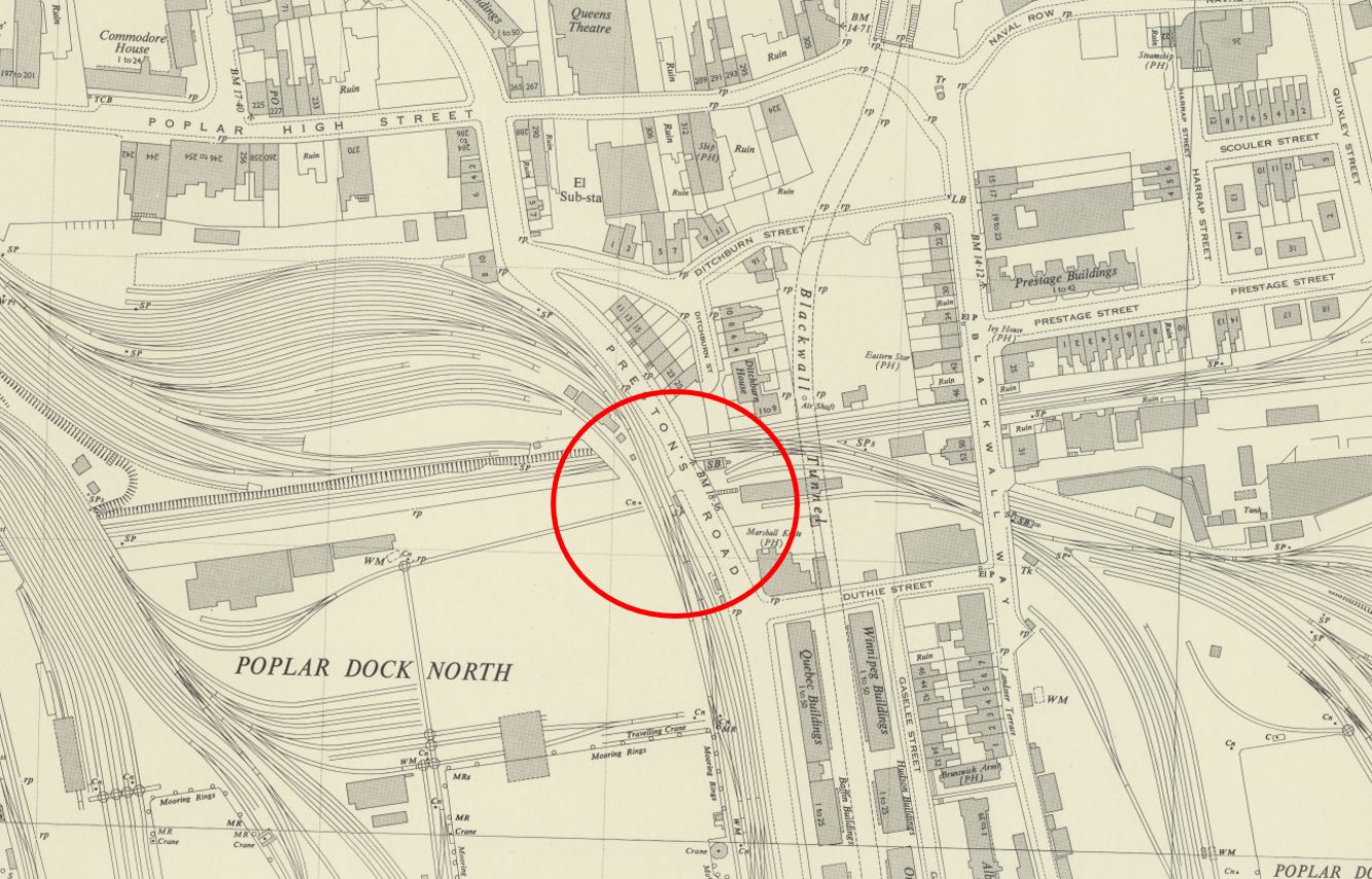
To illustrate the impact of this road, and the roundabout, the following map is from the 1950 edition of the Ordnance Survey, which covers roughly the same area as in the above map. The location of the roundabout is shown by the red circle (‘Reproduced with the permission of the National Library of Scotland“):
By comparing the two maps, it can be seen that the northern part of Prestons Road, up to Poplar High Street has changed to enable the entry and exit carriageways to the roundabout. Where Prestons Road once had a straight section down from Poplar High Street, it is now more angled to accommodate the roundabout. This will be relevant when searching for the location of the graffiti.
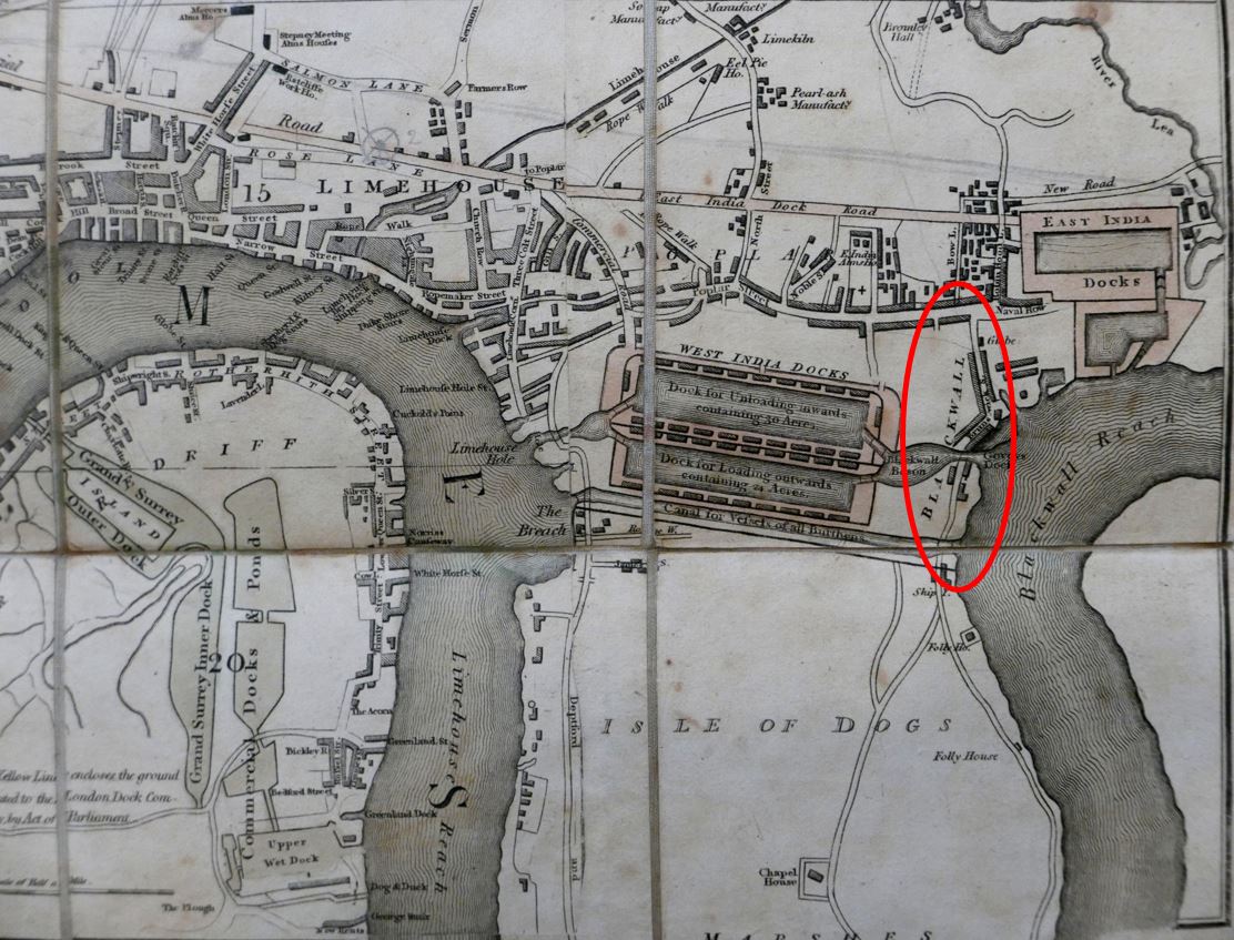
This boundary between the Isle of Dogs and Poplar has been long in the making. The following extract from Smith’s New Plan of London, dated 1816, shows that the construction of the West India Docks had created a barrier across the centre, leaving only the two roads either side of the peninsula:
In the above map, I have circled the location of Prestons Road, and whilst the southern section across the dock entrances was in place, the northern section had not been built. Instead, a turn to the right entered Brunswick Street.
I believe that the northern section of Prestons Road was built at the same time as the Poplar Docks which were located on the left of the section of the street just to the south of the roundabout.
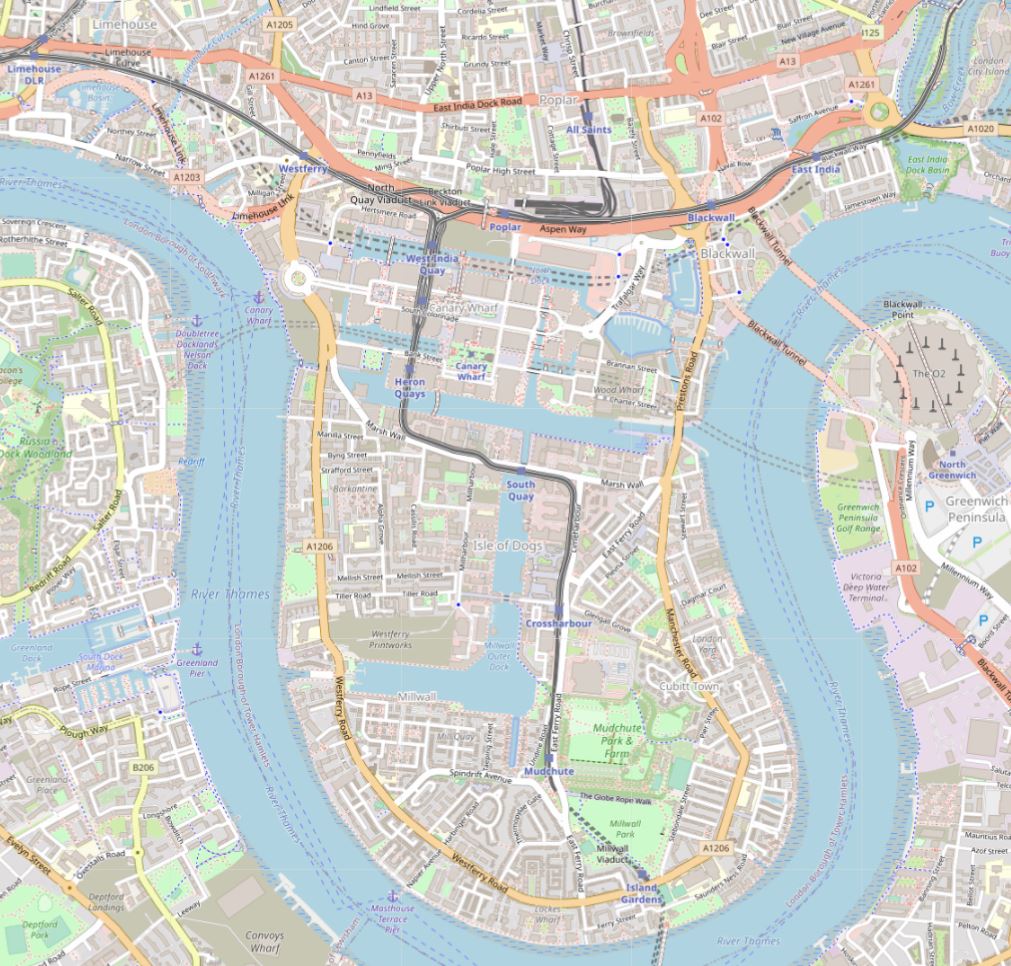
We must go back to the 18th century, to see the area before any of the docks were built to understand how the docks, and then Canary Wharf and the Aspen Way have created an apparent northern boundary to the Isle of Dogs.
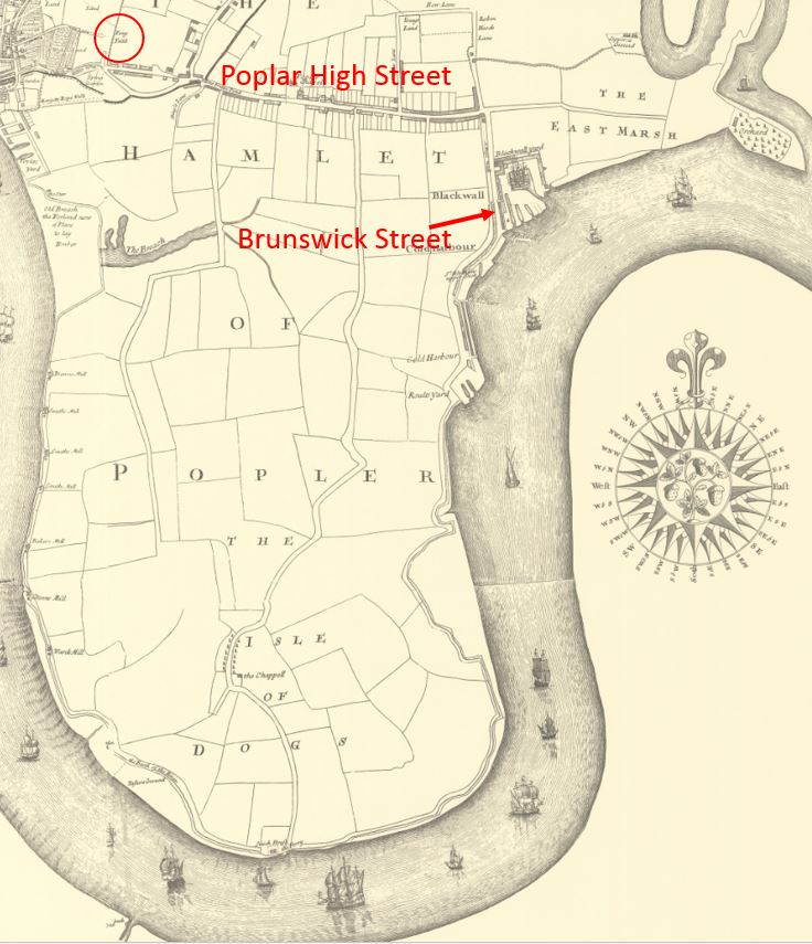
In the following map from 1703, we can see that the whole area was part of Poplar, with Poplar High Street already lined with buildings. To follow on from last week’s post, I have also circled a reference to Penny Fields to the left.
Brunswick Street is to the right, however rather than just east and west routes, up until the construction of the docks, there were to roads running down from Poplar High Street, including the central road which ran down to the ferry across the Thames to Greenwich, at the southern tip of the peninsula.
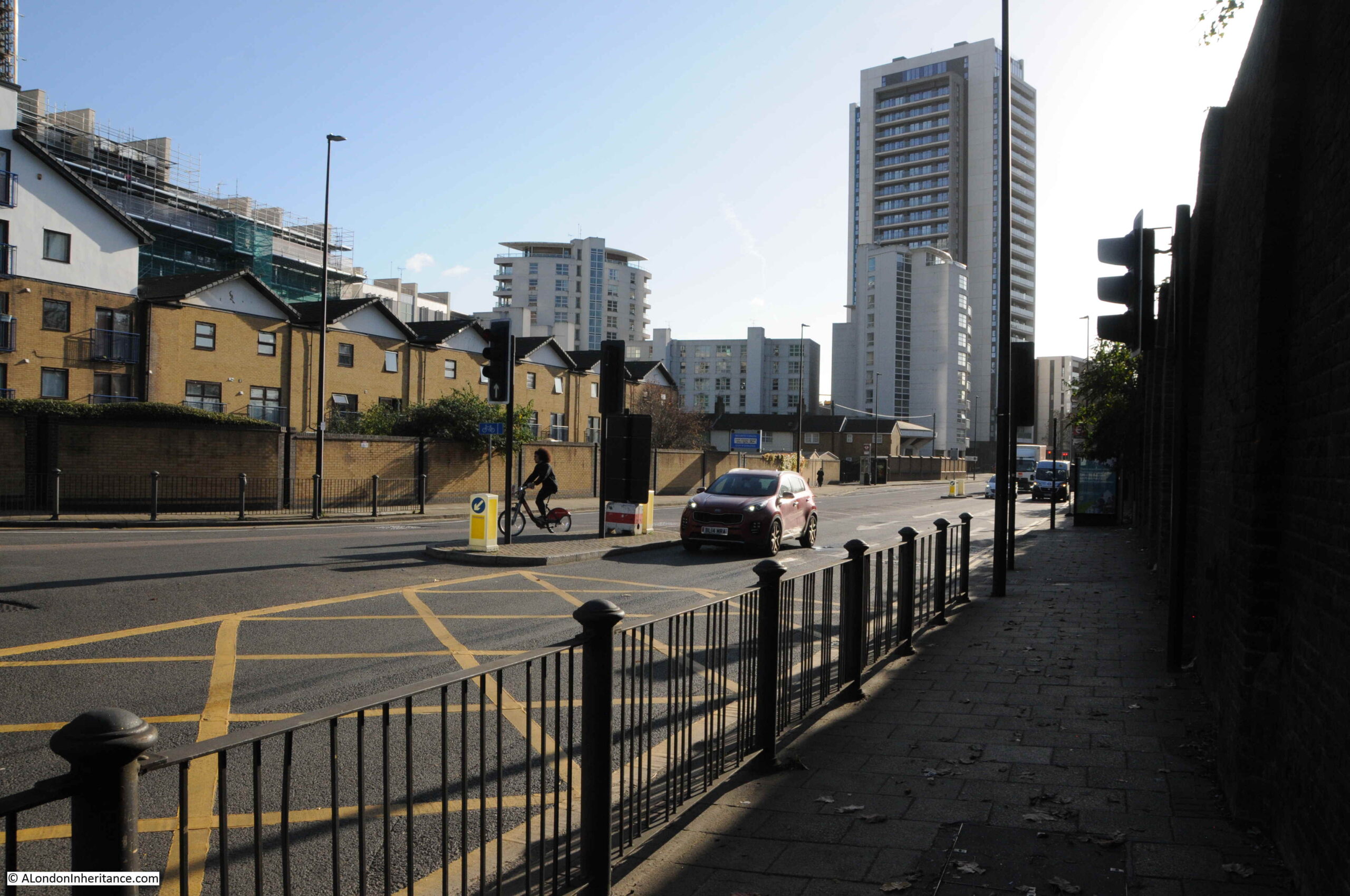
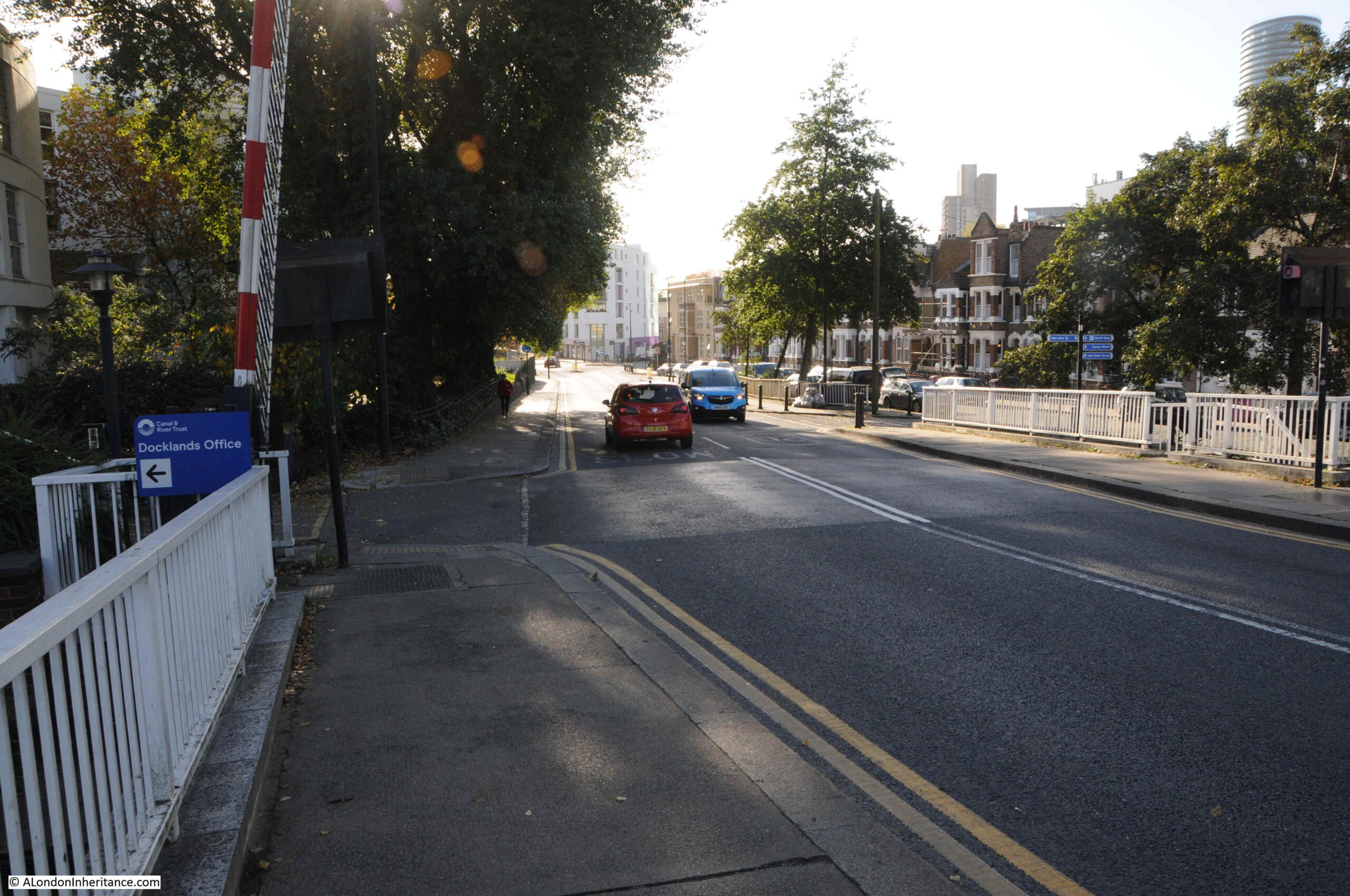
So today, when crossing under the Aspen Way, it feels like a boundary has been crossed, and we are entering the Isle of Dogs. Time to take a walk along Prestons Road:
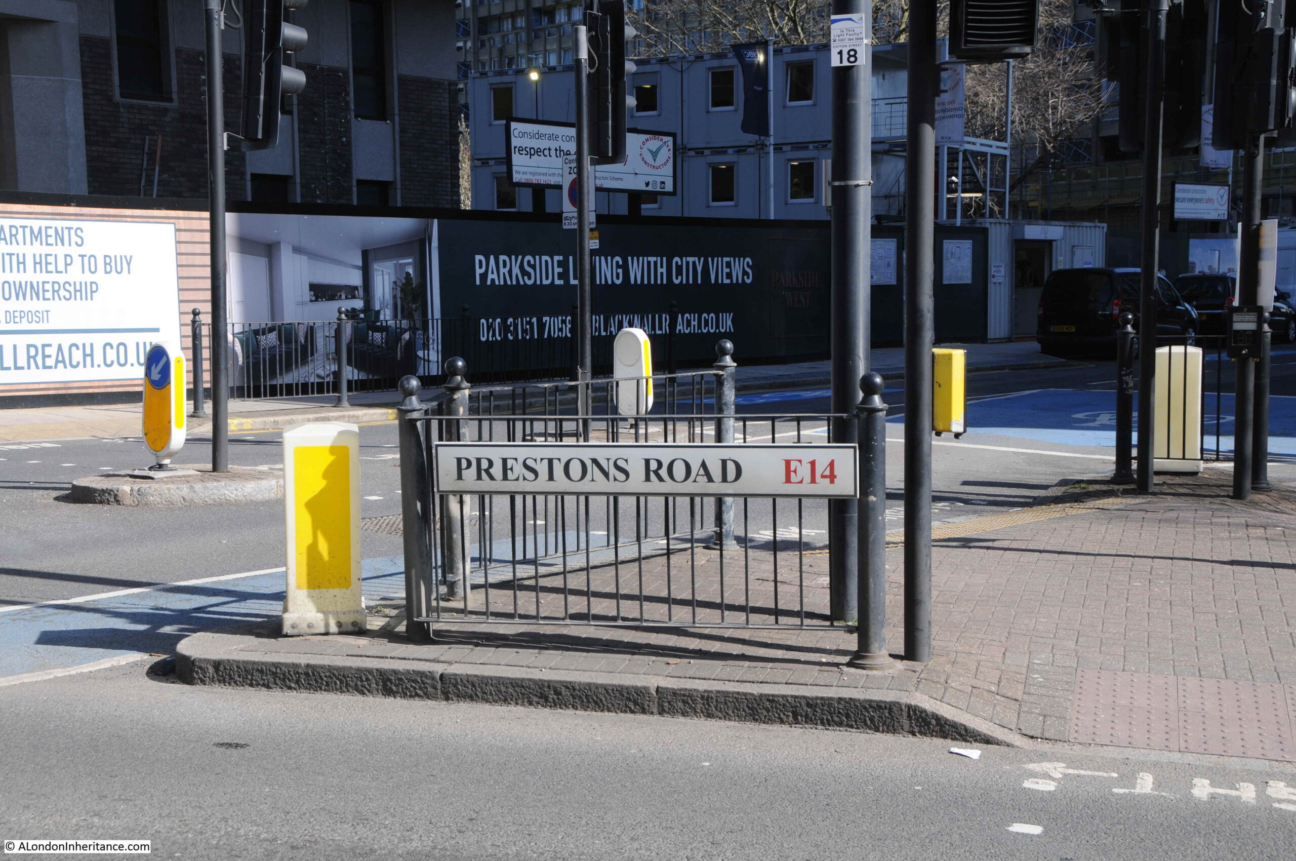
The above photo was taken at the junction of Prestons Road with Poplar High Street.
For this post, I am using the spelling of the street as seen on the street name signs in 1986 and today. Many references to the street also refer to Preston’s, however to stay with the name signs, I will leave out the apostrophe.
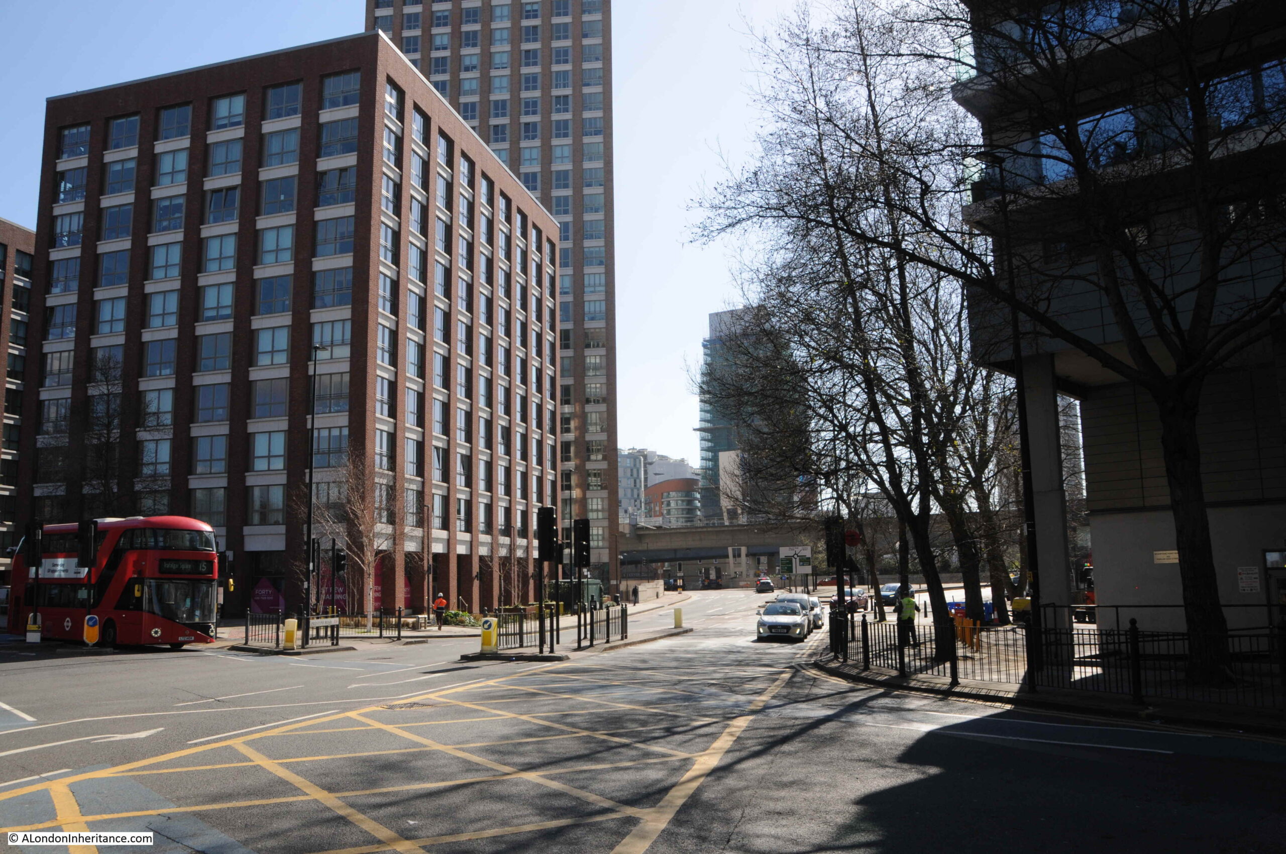
The following photo is looking south from the junction in the above photo. The upper part of Prestons Road was angled slightly to the left when the roundabout was built. If I remember rightly, the wall with the graffiti was somewhere along the right side of the street.
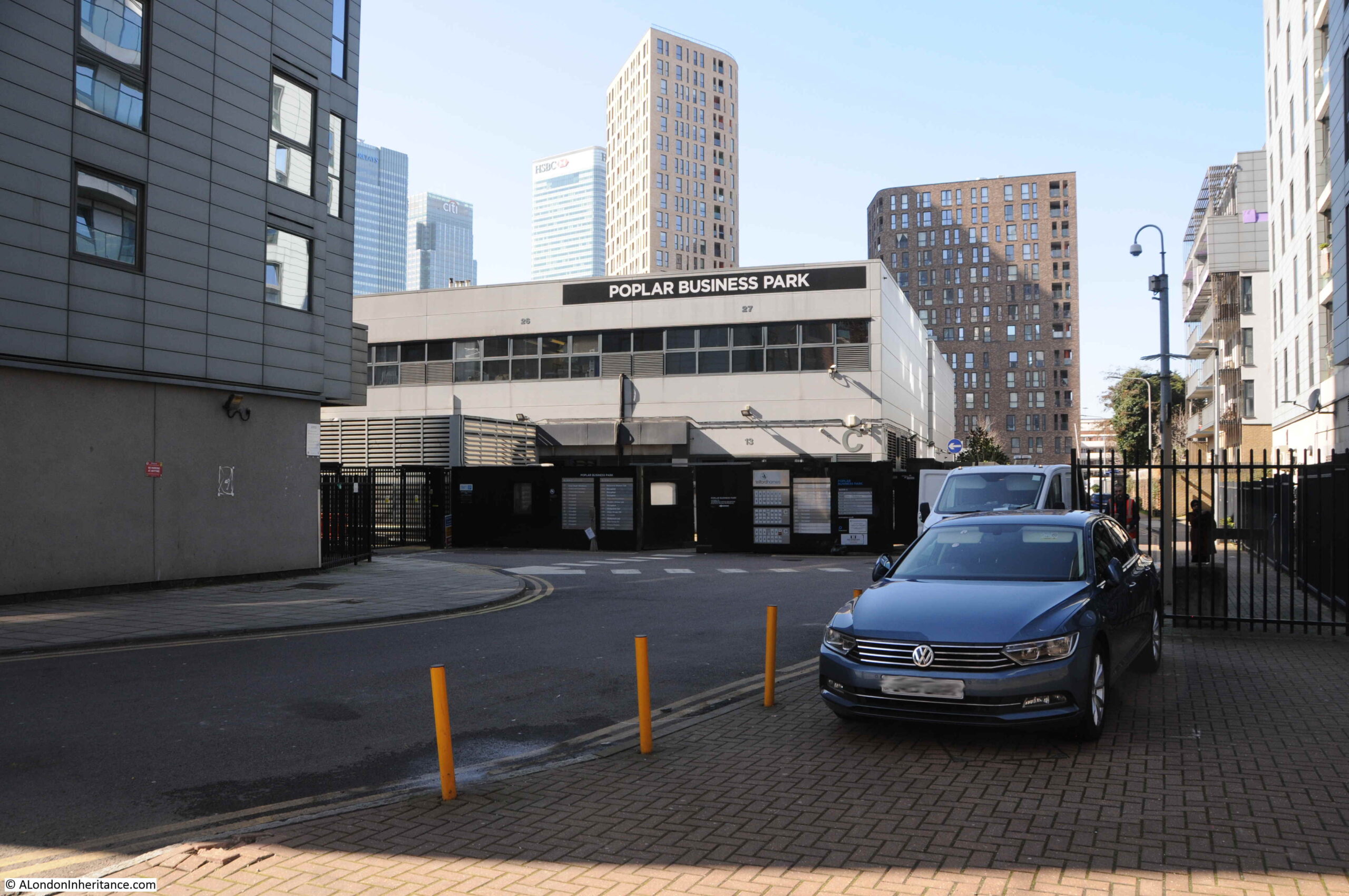
A short distance down the street is a turn off to the right with Poplar Business Park at the end:
In the background of the 1986 photo, the frame of a building under construction can be seen. The majority of buildings to the south of Poplar High Street are relatively recent, and do not date back to the 1980s, however I wondered if the Poplar Business Park could be the building which was under construction when my father took the photo.
It is certainly in the right place, if my memory is correct that the wall was around here.
I looked for references to the Poplar Business Park to try and date the building, and found an advert from 1988 for “Moat Security Doors, Poplar Business Park, Prestons Road, Isle of Dogs, E14”, who sold iron gates to add security in front of a door, or as they advertised “Never be afraid to open your front door again”.
So the Poplar Business Park was in operation in 1988, so possibly safe to assume it was the building photographed under construction two years earlier. Interesting that whilst in the Poplar Business Park, they used Isle of Dogs in the address, despite being at the northern end of Prestons Road, very close to Poplar High Street.
If I am correct, the wall would have been to the left of the above photo, or perhaps to the left of the photo below which is looking up Prestons Road, with the side road to the Poplar Business Park being the street where the grey car is about to exit:
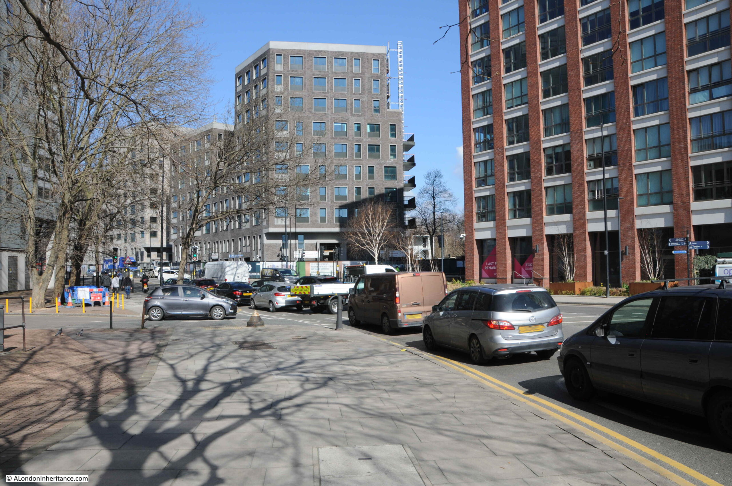
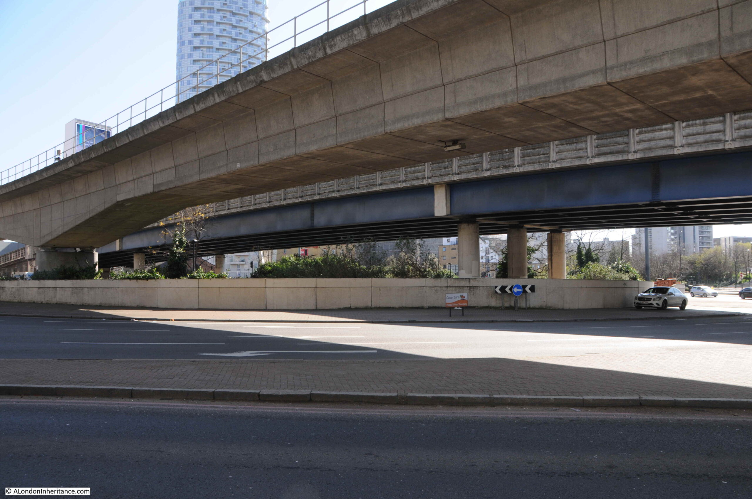
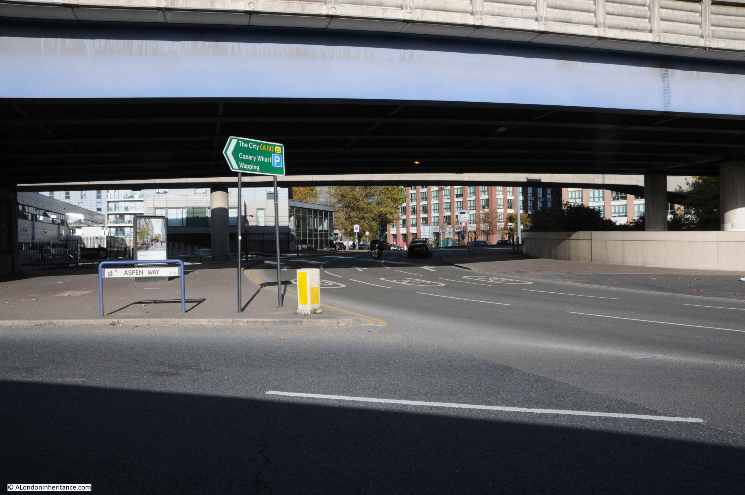
A very short distance to the south is where Prestons Road crosses under the A1261, the Aspen Way, a very significant set of new road infrastructure:
From the south, looking north, and the slip road to the east, up to the Aspen Way towards the City of London and one of the new road access points to Canary Wharf:
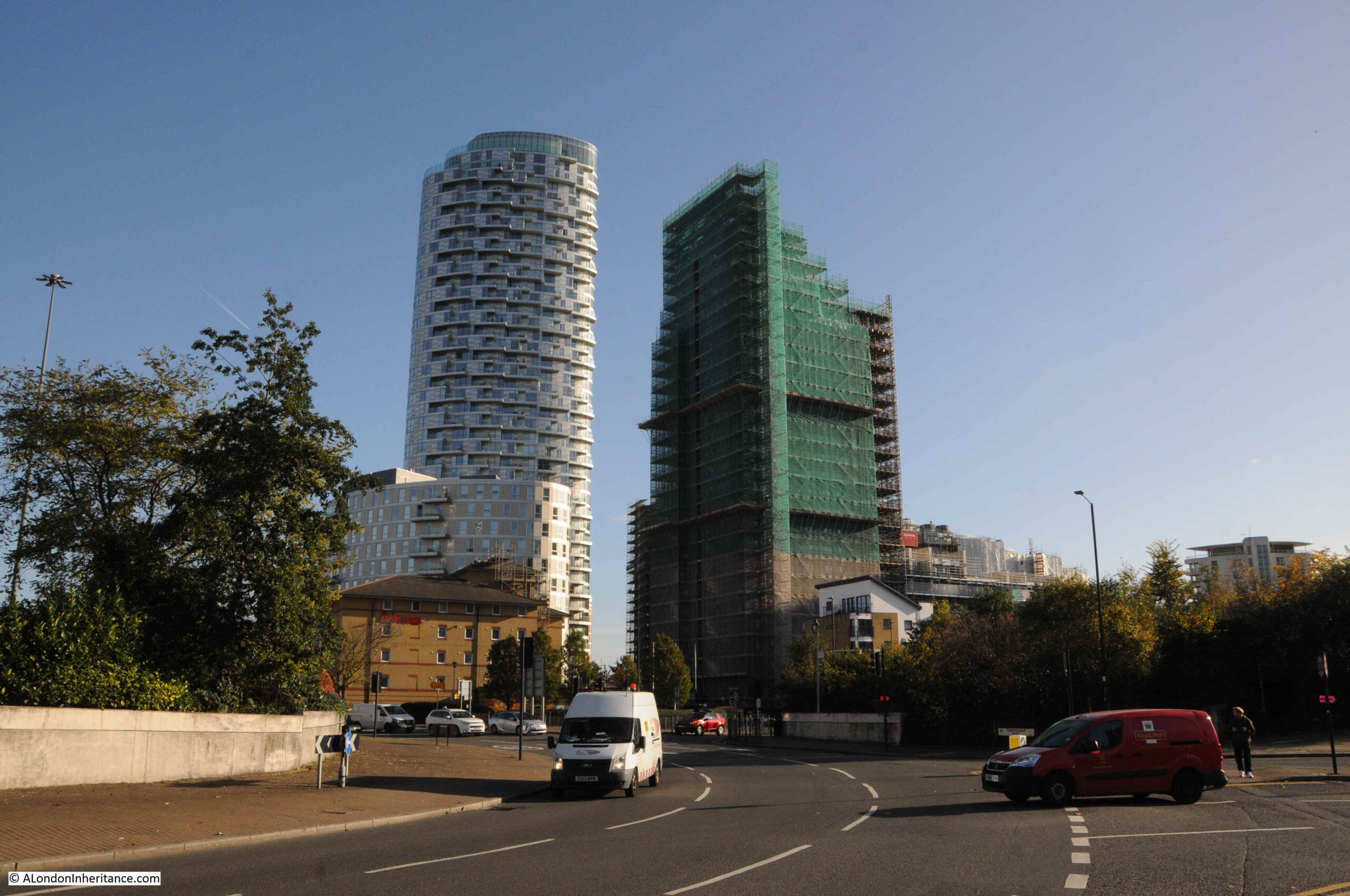
From the edge of the roundabout we can see some of the new residential towers that are becoming so common across this part of east London:
A full view of the routes that can be accessed via the roundabout that obliterated part of Prestons Road:
This is the view looking south along Prestons Road into the Isle of Dogs. I do not live there, so I am not really one to judge, but when walking the area, it is only along here that I feel I am entering the Isle of Dogs:
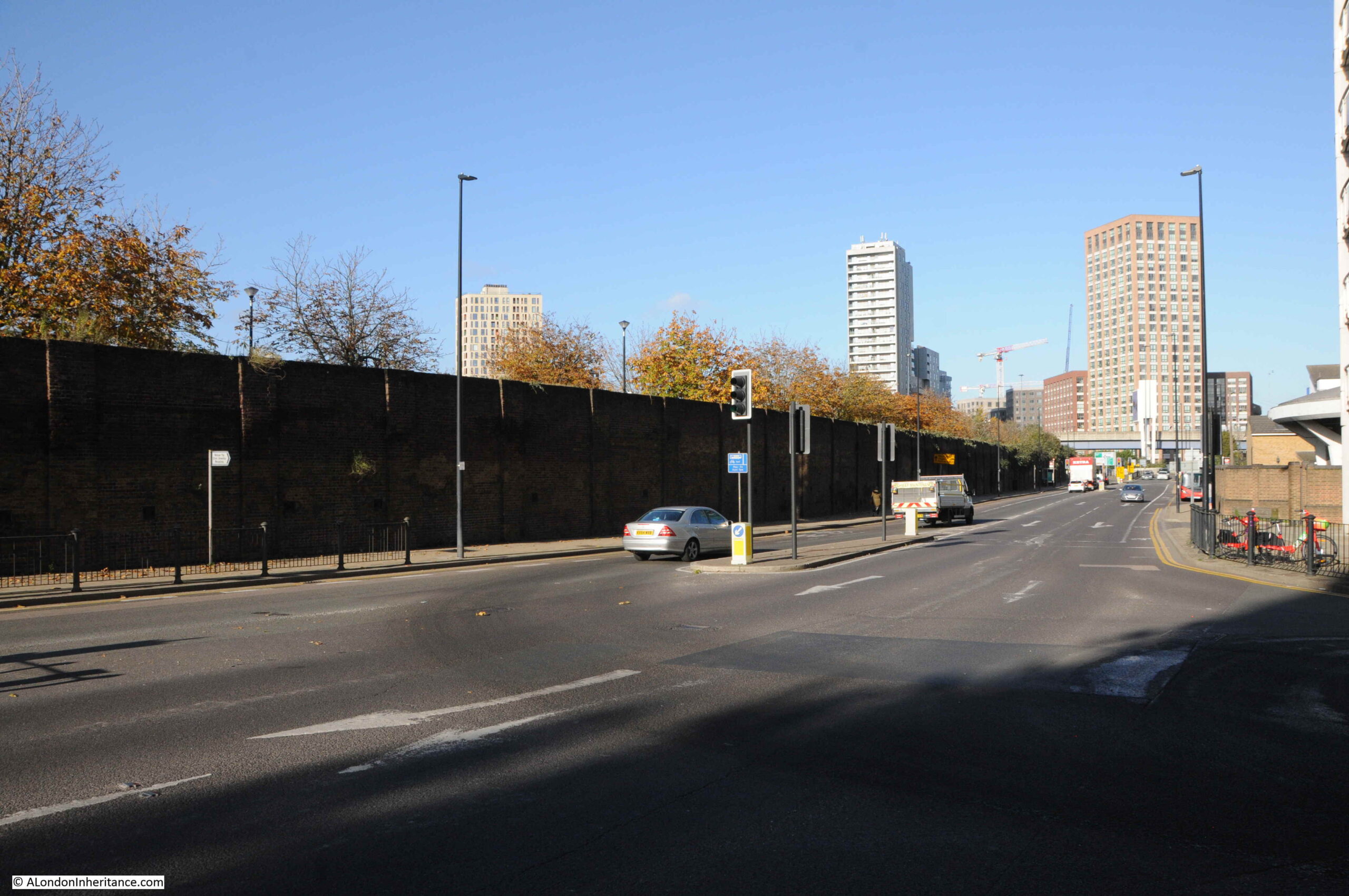
In the above photo, there is a tall brick wall, in shadow, on the right. This is the wall between the street and Poplar Docks, the construction of which I believe, resulted in the construction of this section of Prestons Road, as a road would have been needed along the boundary to serve entrances to the docks.
The following photo is of Poplar Dock today, looking west with two cranes remaining from when the dock was operational:
The site is now Poplar Dock Marina and is full with narrow boats and an assorted range of other smaller craft. Poplar Dock opened in 1851, however the site had originally been used from 1827 as a reservoir to balance water levels in the main West India Dock just to the west. In the 1840s the area was used as a timber pond before conversion to a dock.
Poplar Docks served a specific purpose, being known as a railway dock as the docks were almost fully ringed by railway tracks and depots of the railway companies.
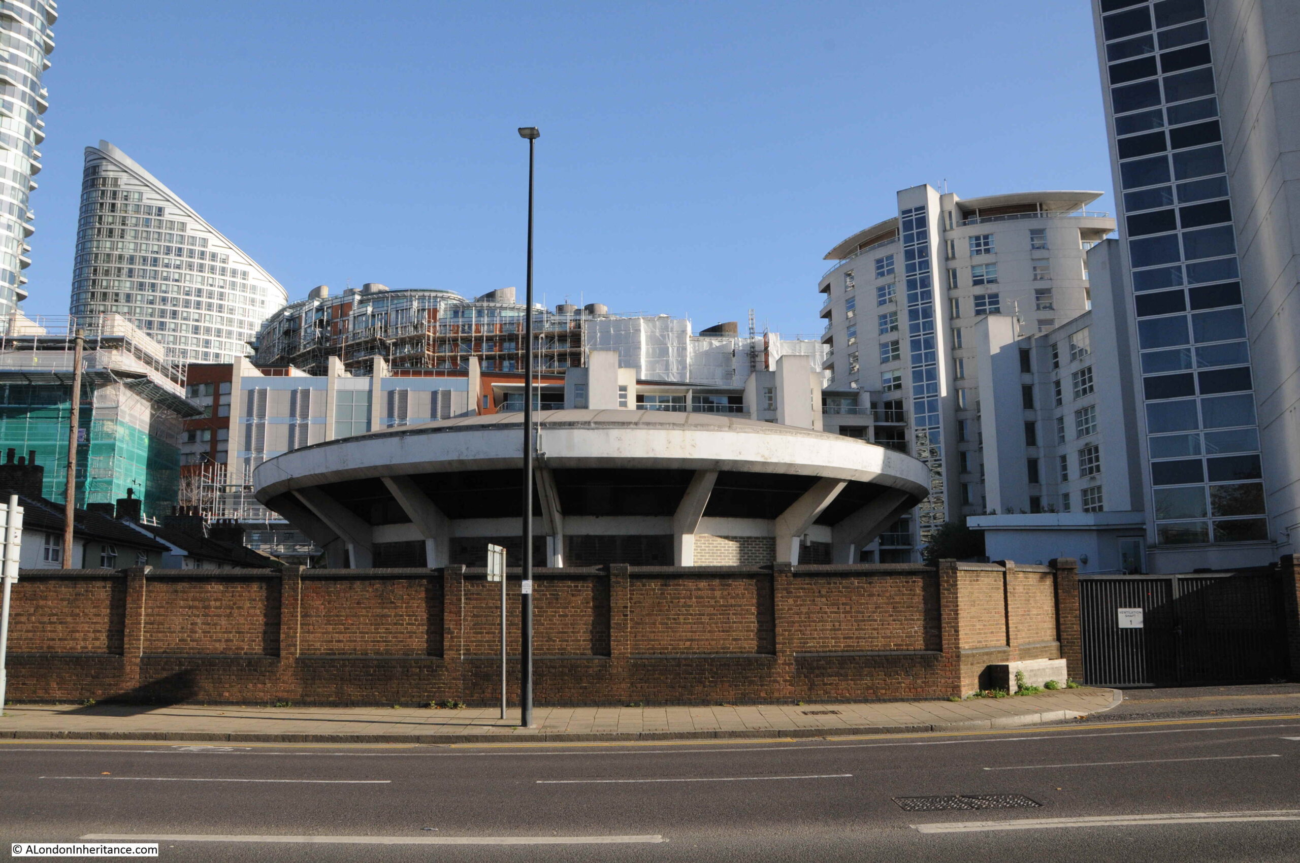
Walking south along the street, and the area between the street and the river is full of new buildings, however there is a rather strange, flying saucer shaped building to be seen:
The building is one of the air vents and access points to the Blackwall Tunnel, which runs parallel (but deeper) to the northern section of Prestons Road.
Looking north towards the roundabout, and we can see the tall brick wall that once separated Poplar Dock from Prestons Road:
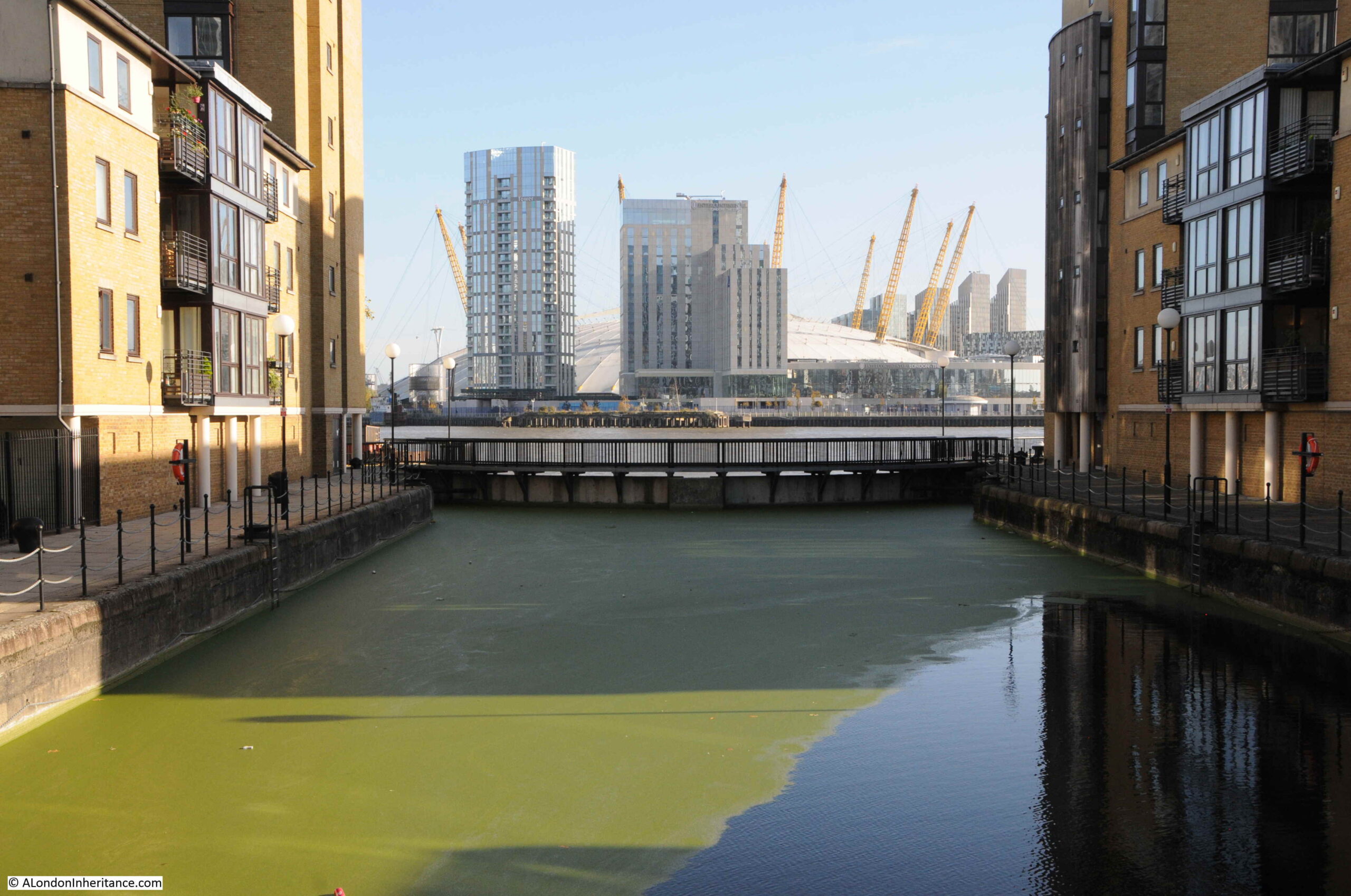
We now come to one of the crossings over the channels from the docks to the Thames:
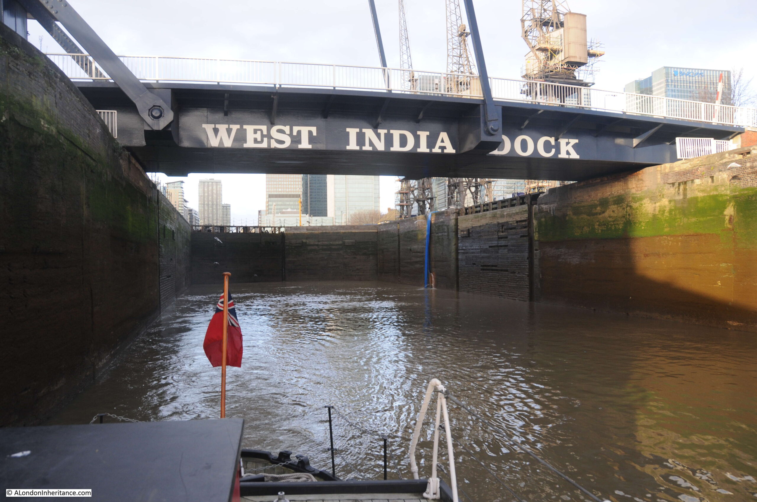
This is the channel that ran from the Thames to Blackwall Basin, and then led into the West India Docks (see the extract from Smith’s New Plan of London, dated 1816 earlier in the post).
This is the view looking east along the channel towards the Blackwall Basin. The Canary Wharf complex has been built over much of the old West India Docks.
To the right of the above photo, behind the trees is the old Dockmaster’s House:
The Dockmaster’s House is named Bridge House and was built between 1819 and 1820 for the West India Dock Company’s Principal Dockmaster. The entrance to the house faces to the channel running between docks and river, however if you look on the right of the building, you will see large bay windows facing out towards the river. This was a deliberate part of the design by John Rennie as these windows, along with the house being on raised ground would provide a perfect view towards the river and the shipping about to enter or leave the docks.
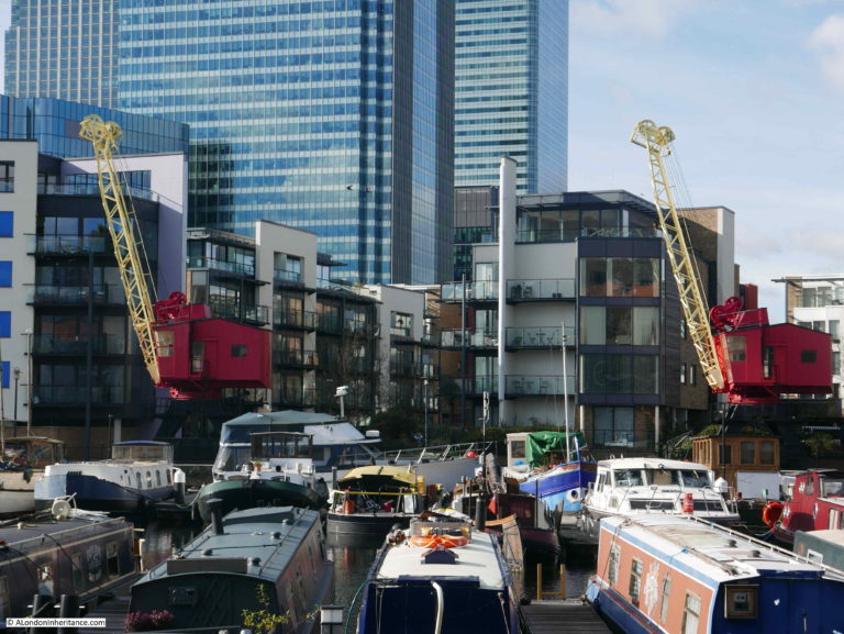
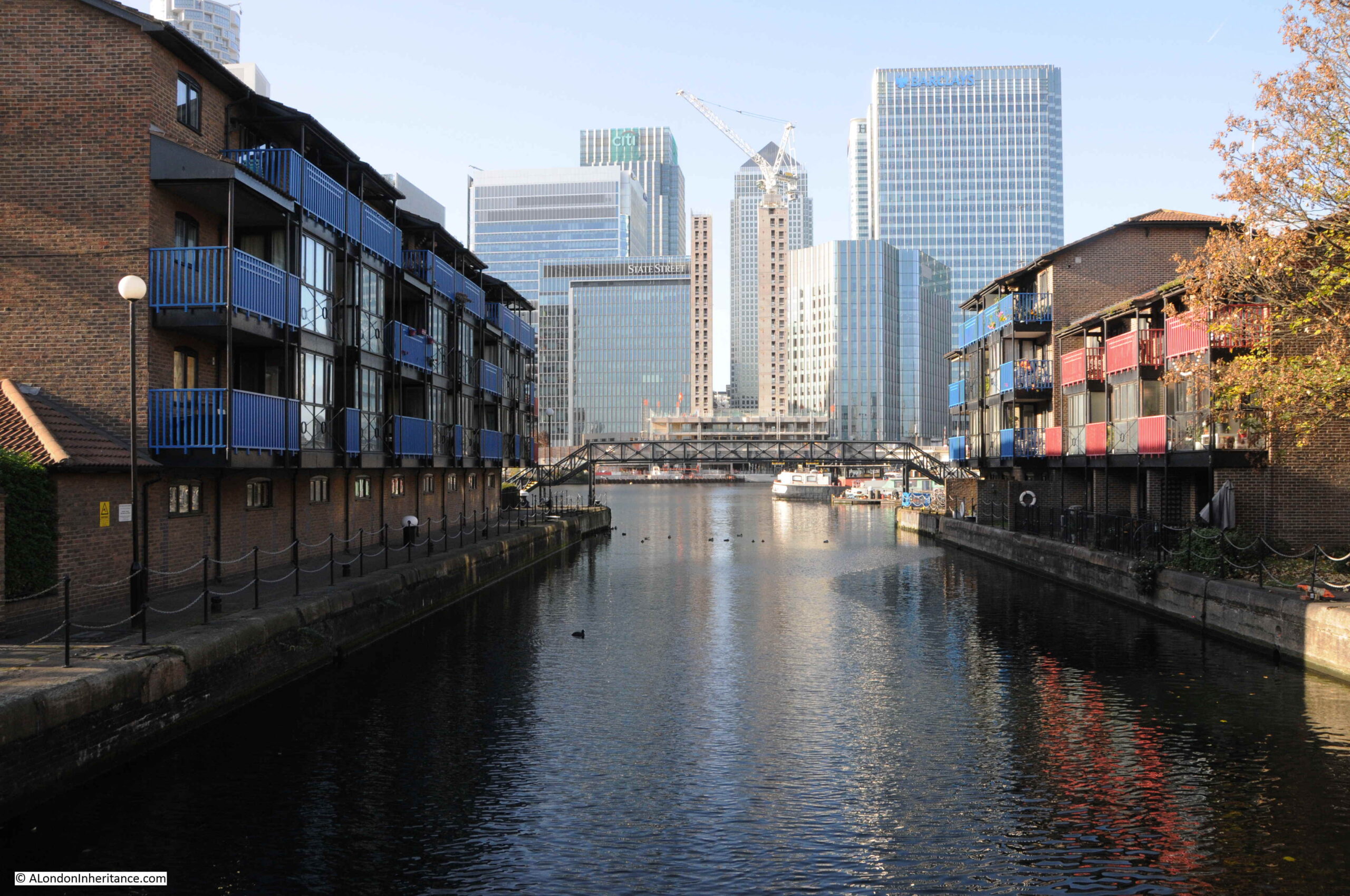
A short distance further on and Prestons Road crosses another channel between docks and river. This is the channel between the West India South Dock and the Thames, and the view west provides a stunning view of some of the recent developments:
With the Docklands Light Railway crossing the old dock in the distance:
Original cranes remaining from when this was a working dock:
It is fascinating when standing here to imagine the many thousands of ships that have entered or exited through this channel, and where they had been coming from or going to.
Looking east where the channel meets the river.
The bridge that spans the channel in the above photos is the bridge that has taken on the name of the Blue Bridge.
Built during the late 1960s, the bridge is just the latest of a number that have spanned the channel.
The bridge marks the end of Prestons Road, continuing south, the road changes name to Manchester Road, all the way to the southern tip of the Isle of Dogs, where the road again changes name to Westferry Road, which then continues along the western side of the Isle of Dogs, all the way up to the West India Dock Road, which it joins opposite Pennyfields, explored in last week’s post.
The view heading south from the bridge:
On the right of the above photo, there is a row of terrace houses that run along a street slightly offset from what is now Manchester Road. This terrace marks the original route of Manchester Road up to an earlier incarnation of the bridge.
Having come to the end of my walk along Prestons Road, there was one last place I wanted to find.
Asda was part of the graffiti on the 1980s wall, so I wanted to find the store that would change the approach to shopping on the Isle of Dogs.
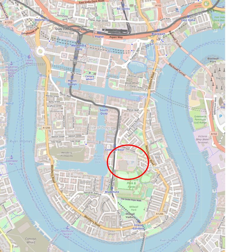
I walked along Manchester Road, then cut through Mudchute Park:
As usual, there is far too much for a weekly post, and I will return to the Isle of Dogs and places like Mudchute in future posts, however it was an area of land created by dumping the spoil when constructing and dredging Millwall Dock.
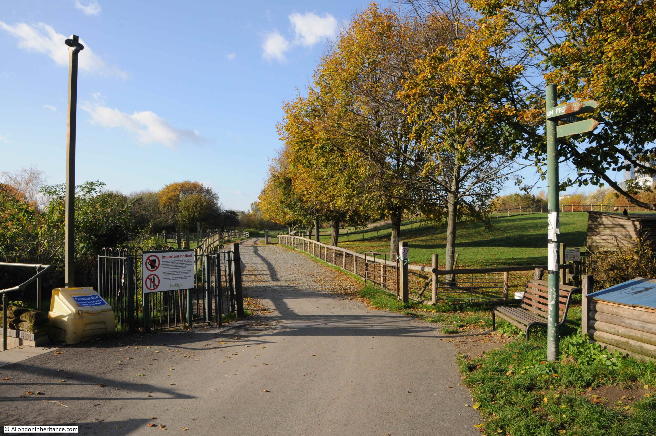
Now a large area of parkland, a city farm, and with a restored anti-aircraft gun, commemorating the Second World War when a number of these guns were based in the area, and the terrible suffering from bombing of those living on the Isle of Dogs:
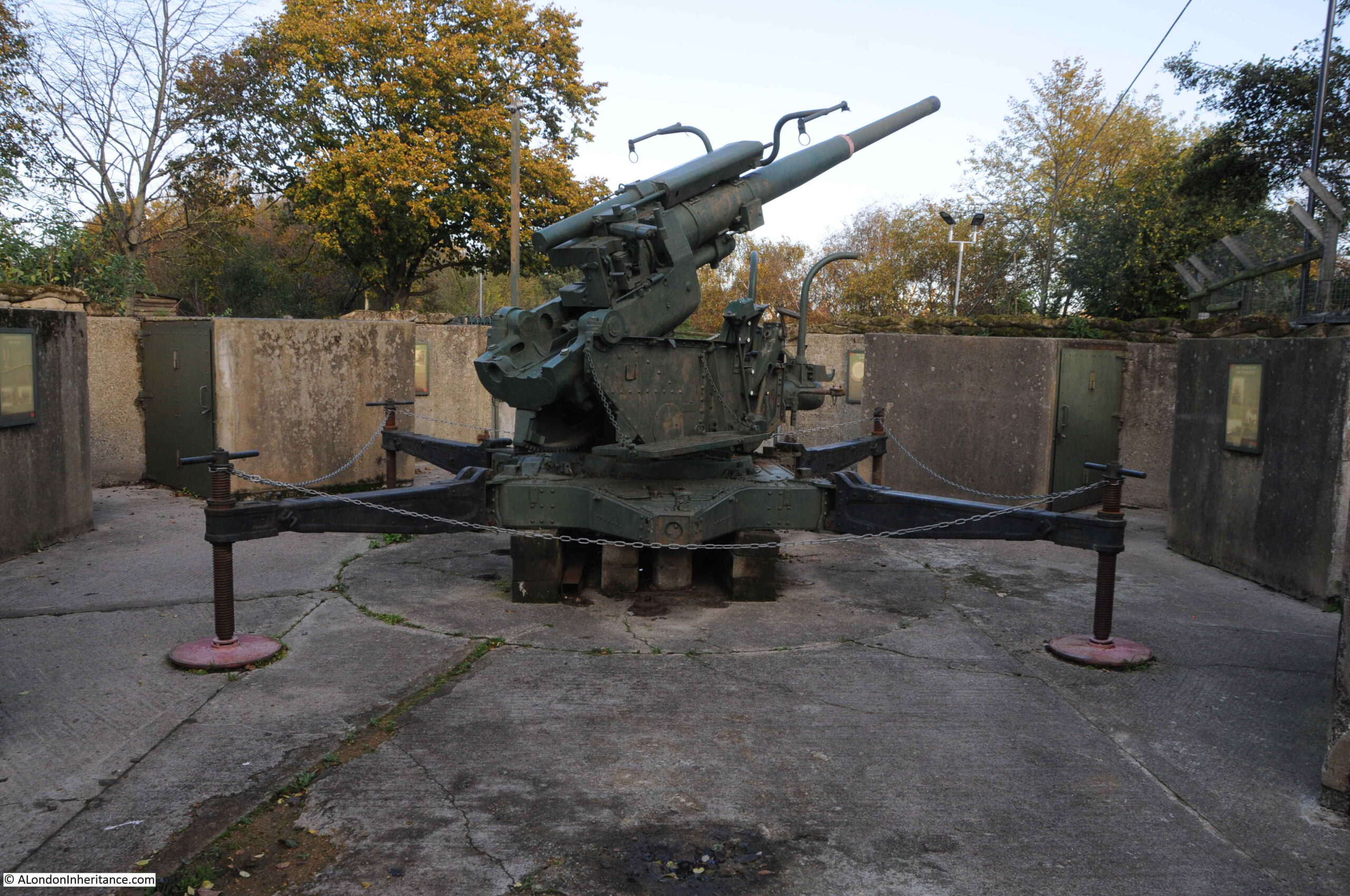
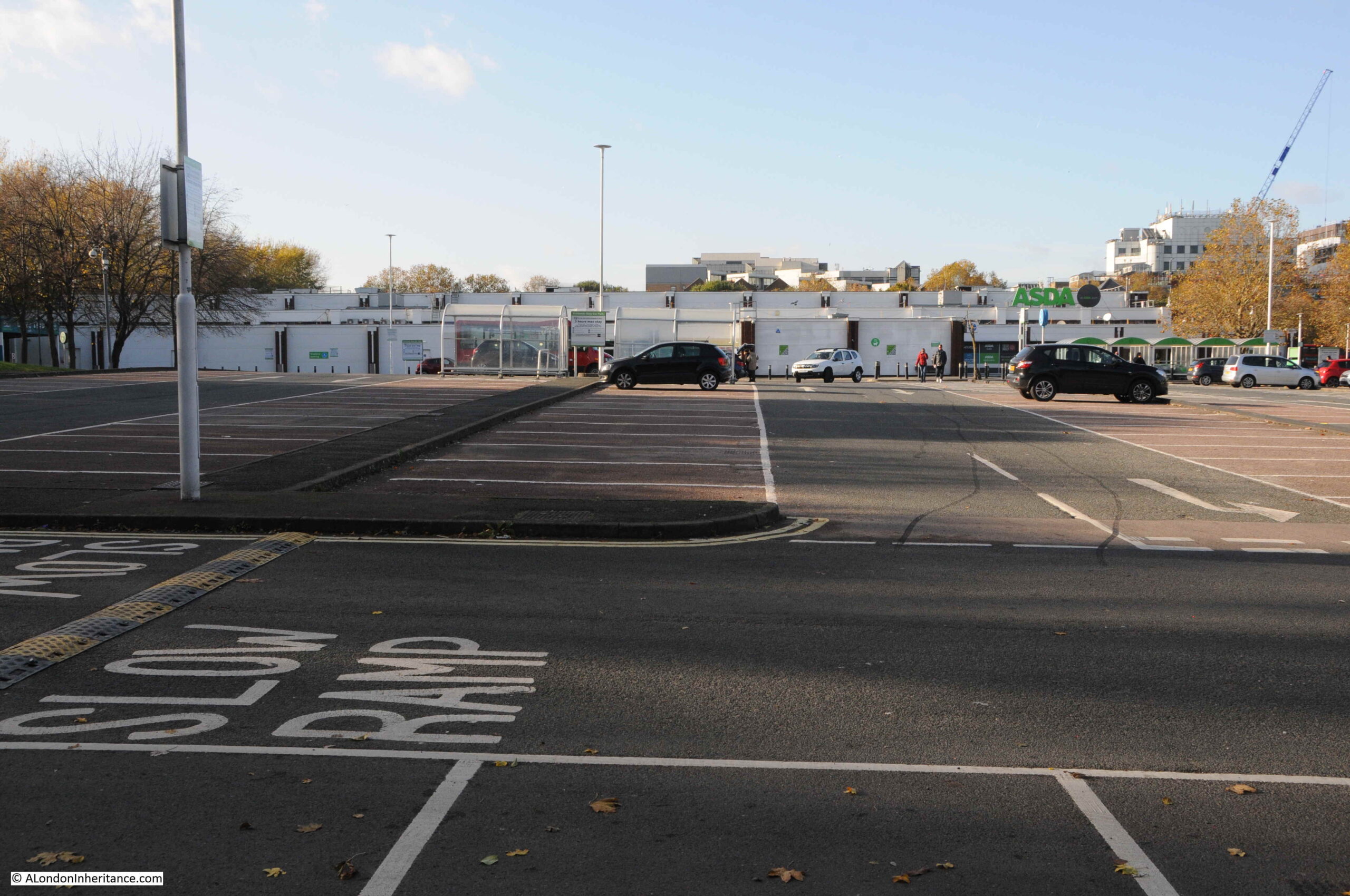
An exit from Mudchute runs directly into the Asda car park, with the many new developments gradually taking over the Isle of Dogs in the background:
This was the change in shopping in the 1980s when many of the major stores opened up large “superstores” with car parks where you could drive and do a complete weekly shop without having to go to a number of separate shops.
Perhaps more convenient, but an approach that would result in the closure of so many individual, often family run shops.
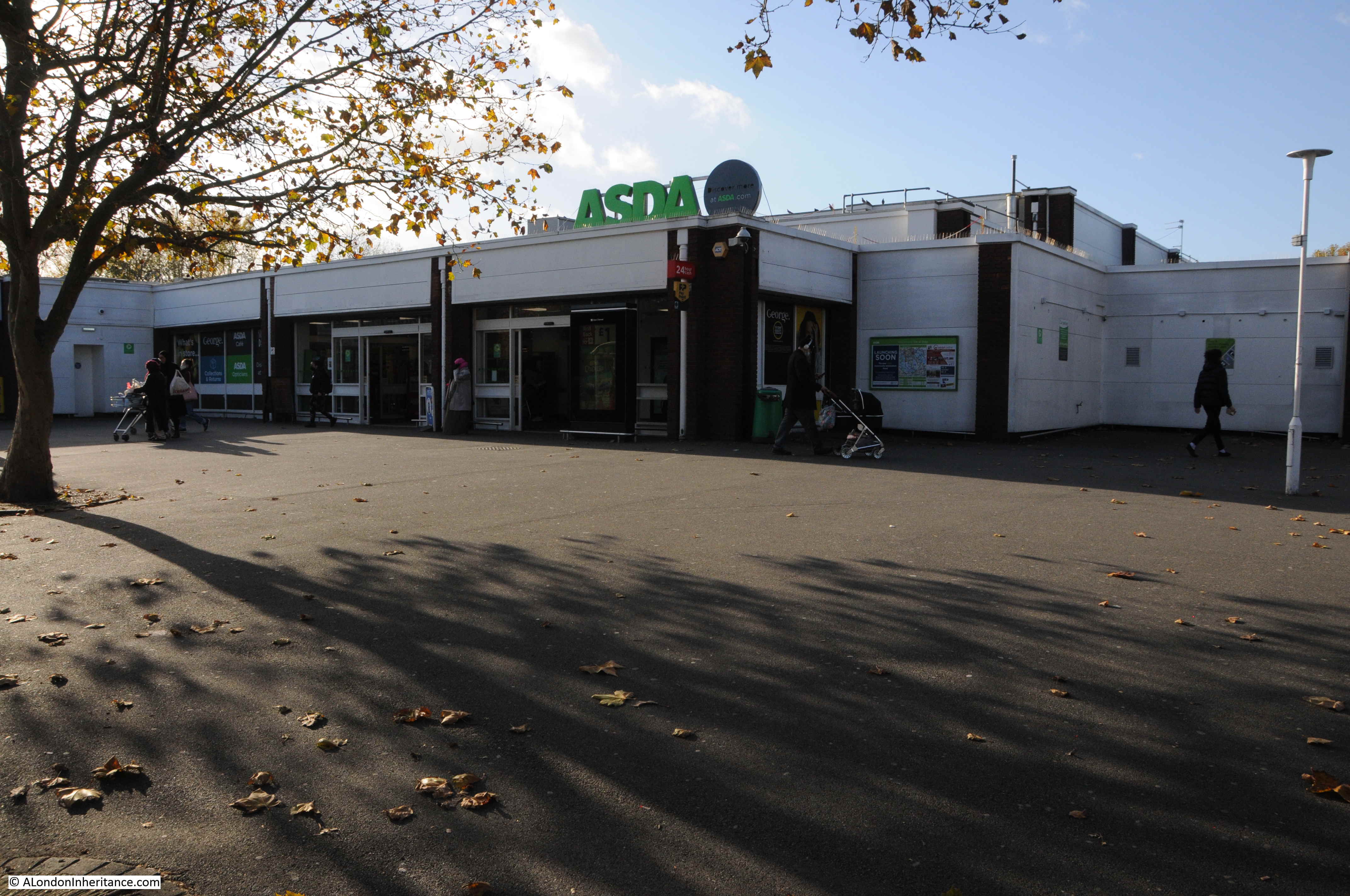
The view across the car park to the Asda store:
The store gives away its 1980s heritage by the lack of lots of glass, which is typical of the majority of recent stores of this type.
The coming of Asda marked the early years of the developments that would dramatically change the Isle of Dogs, change that is continuing as the glass and steel towers continue to grow.
It would be great to know if I have the correct location for the wall with the graffiti.
If any past or current resident of the Isle of Dogs can confirm, or advise the correct location, I would be very grateful.
I assume the wall was just demolished as part of the development of the area, and the changes as a result of the new roundabout and the Aspen Way. A real shame that the wall was not kept, as part of the historical records of the changes to this fascinating part of London.