Monthly Archives: January 2024

Stepney Power Station, Limehouse

The banks of the Thames was not just full of docks and warehouses, but was also a place of industry, attracted by the easy transport of raw materials and goods along the river. Many of these industries were very dirty, polluting the local area and blighting the lives of those who lived nearby.

One of these was Stepney Power Station, a coal fired electricity generator, that can be seen in the following photo taken by my father in August 1948 on a boat trip from Westminster to Greenwich:
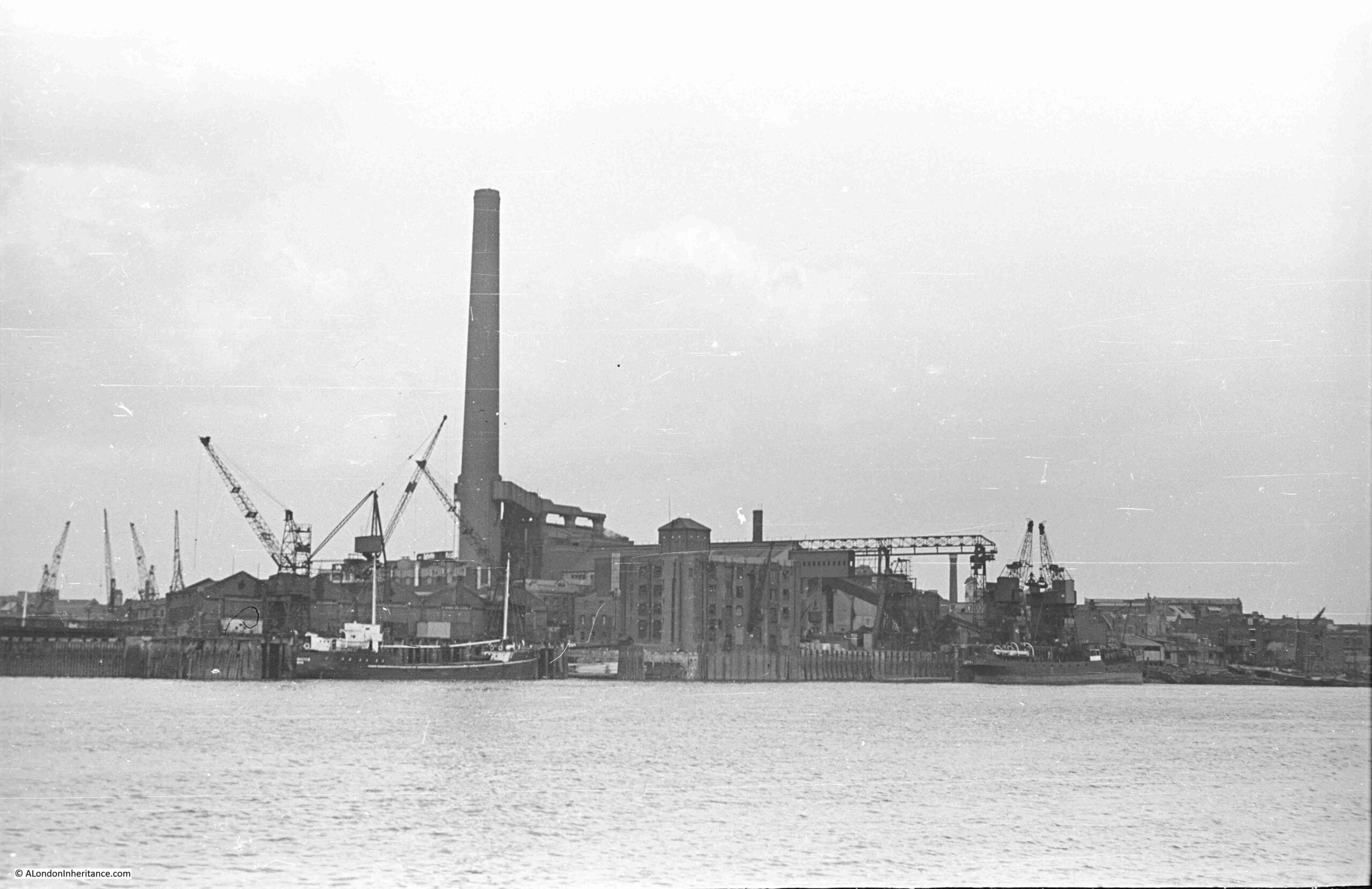
Stepney Power Station

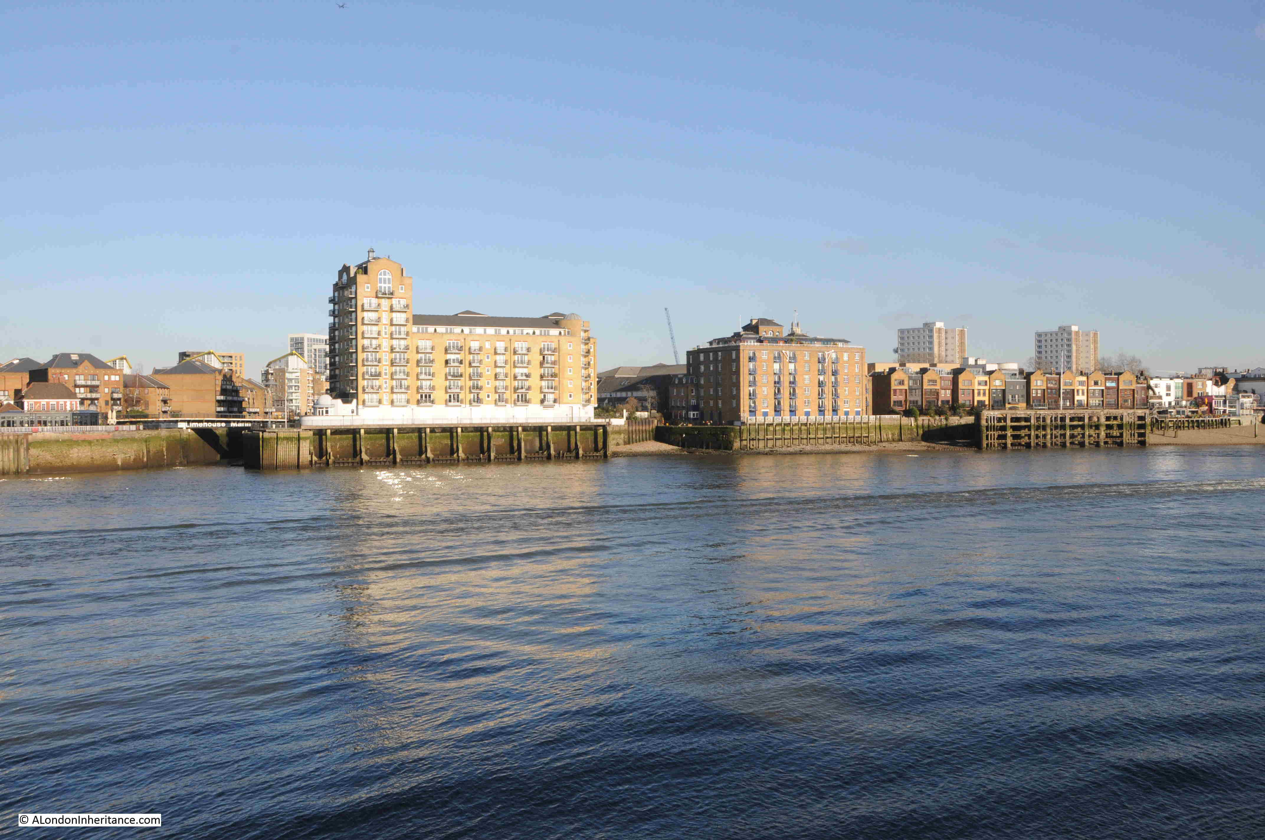
The same view in January 2024:

Stepney Power Station

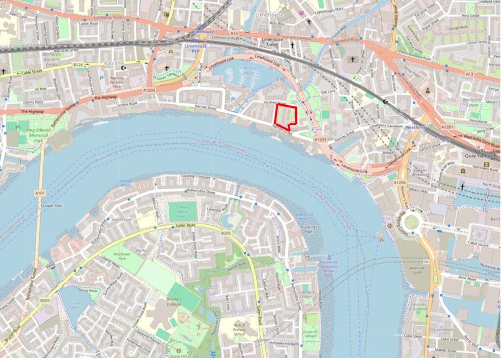
I have outlined the location of Stepney Power Station in red, in the following map of the area today (© OpenStreetMap contributors):
Stepney Power Station

As can be seen, the power station is next to Limehouse Dock (originally Regent’s Canal Dock), and the name Stepney Power Station comes from the power station being in, and originally built, by the Borough of Stepney. It was occasionally referred to as Limehouse Power Station, which more accurately referred to its geographic location.

At the start of the electrification of London, lots of small electricity generating stations sprung up across the city, funded and built by a mix of private and public bodies.

These would supply their local area, with limited, if any, connection to other power generators.

London’s Boroughs were under pressure to develop and build electricity services to provide this new power source to homes, industry, the lighting of streets etc. and there were a large number of power stations built at the end of the 19th and the first decades of the 20th century.

My grandfather worked in two power stations in Camden (see this post for one of these), and my father worked for the St. Pancras Borough Council Electricity and Public Lighting Department which then became part of the London Electricity Board.

Stepney Power Station formerly opened on the 27th of October, 1909, as recorded by a report in the Morning Leader on the following day;

“An extension of the Stepney electricity undertaking was opened yesterday by the Mayor and Mayoress (the Hon. H.L.W. and Mrs. Lawson).

The new generating station is situated at Blyth’s Wharf on the river, which gives the advantages of cheap sea-borne coal and an ample supply of condensing water.

Councilor Kay mentioned yesterday that the whole station had been erected by the council’s officials, so that it was in every respect a municipal undertaking.”

The 1909 power station was relatively small, but in the following years it would rapidly grow as demand for electricity increased and the cables needed to carry electricity across Stepney were installed and spread out across the Borough.

The version of the power station in my father’s 1948 photo shows the power station at its maximum size, with the tall chimney, which was added in 1937. There would be further upgrades in the following years, but from the river, this is how the station would have looked.

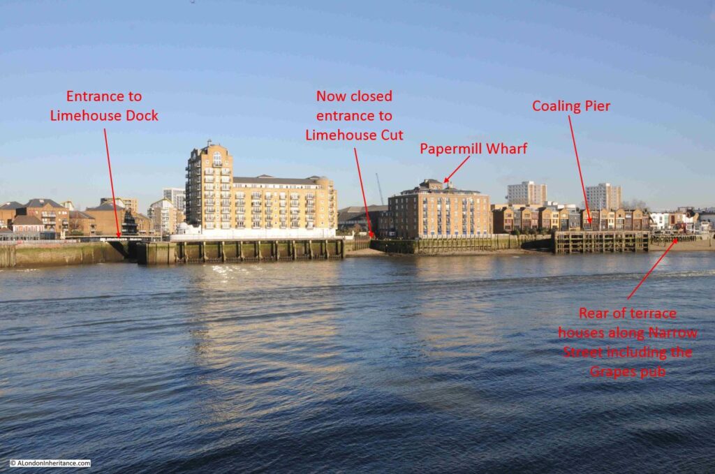
To help identify the location of the power station, features of the power station, and a comparison with the same view today, I have marked up the following two photos, starting with the view in August 1948:
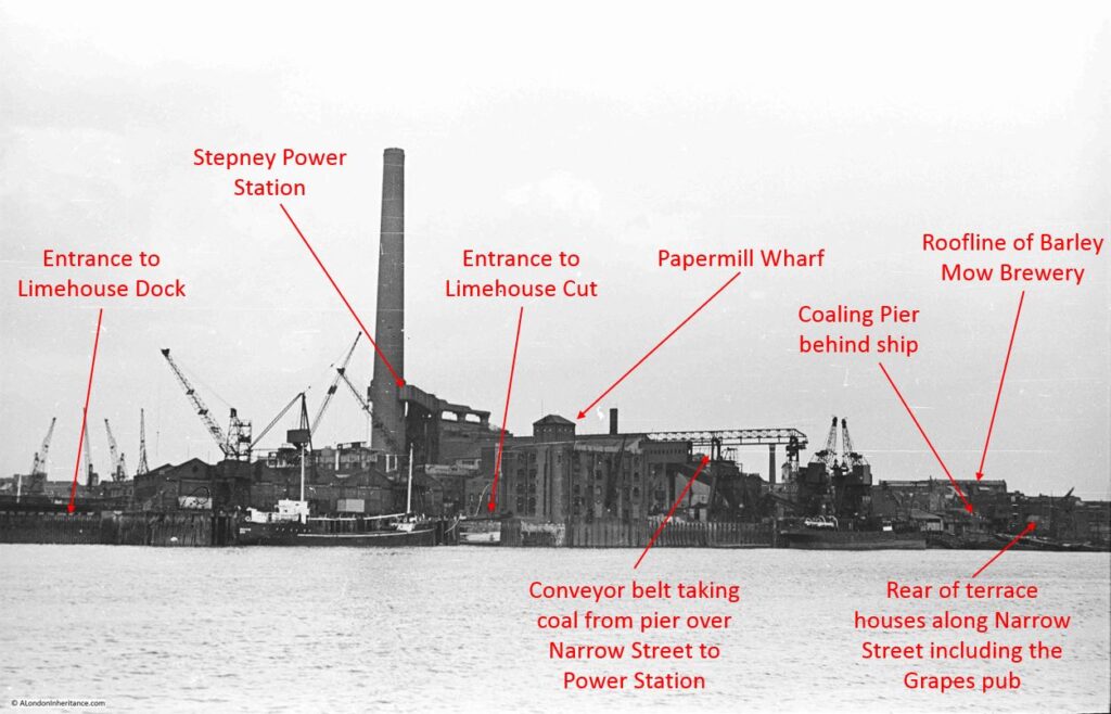
Stepney Power Station

And January 2024:

Stepney Power Station

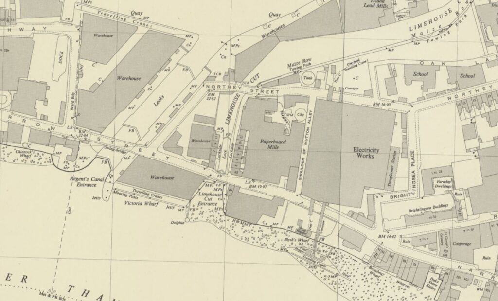
The following extract from the OS map shows the location of Stepney Power Station, labelled as “electricity works”. The conveyor transporting coal from the coaling pier to the power station can be seen, and between the coaling pier and Narrow Street, there is an open space. In the 1909 report of the opening, there is a reference that the “new generating station is situated at Blyth’s Wharf on the river”, and this open space was Blyth’s Wharf  (‘Reproduced with the permission of the National Library of Scotland“):
Stepney Power Station

Being right next to the river was a perfect location for the power station. It enabled supplies of coal to come from the north east of the country, via sea then along the Thames. The river also provided ample supplies of cooling water and water for steam generation in the boilers.

As the generation capacity increased, and therefore the demand for coal, the coaling jetty was built in 1923 to simplify the transport of coal from ship to where it would be burnt.

Newspapers in the 1920s were full of adverts by Stepney Borough Council advertising that their supply of electricity was the cheapest in London due to the prime location of their power station.

Whilst good for the price of electricity, the location was not good for those who lived, worked, and went to school near Stepney Power Station. There were many complaints about the dirt and pollution from the power station, and if you look at the above map, just to the top right of the power station, there are two buildings marked “school”. These are mentioned in the following newspaper article.

From the East End News and London Shipping Chronicle on the 2nd of December, 1949:

“COAL DUST COMPLAINT – Stepney Council is joining the L.C.C. in ‘strong representations’ to the British Electricity authority about nuisances caused by the Stepney power station.

It is said that coal dust dispersed by the movement of coal at the power station can penetrate into class rooms at the Cyril Jackson school even when the windows are closed and the schoolkeeper’s house – about six yards away from the station – cannot be occupied.

Another nuisance is caused by grit from the chimney of the station, the council was told last week. The council point out that when they were in control of the chimney as electrical supply undertakers in 1935 they improved conditions there.”

As the article highlights, it was not just pollution from the chimney, it was also the dust created by the use of coal.

Coal had to be unloaded from ships, transported across Narrow Street, stored, and then pulverised reading for burning. All these activities would have created coal dust, much of which would have contaminated the local area.

Another example can be found in the East End News and London Shipping Chronicle on the 6th of April 1950:

“GRIT AND COAL DUST, COMPLAINT ABOUT STEPNEY POWER STATION – The public health committee reported to the last meeting of Stepney boro council:

Representations have been made to the Minister of Fuel and Power and the British Electric Authority with a view to securing an abatement of the nuisance caused by the emission of grit from the chimney of the Stepney power station and by coal dust distributed as the result of the movement of coal.

The representations have been duly acknowledged by the Ministry and British Electric Authority, in a communication to the Minister dated January 24, 1950, deprecates the suggestion that the condition has worsened since this station vested in the Authority; state that the Authority is fully alive to the responsibility for ensuring that only the minimum interference is caused in the vicinity; and suggest that the chief engineering inspector of the Ministry should visit the site for the purpose of determining whether any further remedial measures are practicable.

We are fully alive to the fact that the operation of a generating station in a highly congested district must, to some extent, detract from the amenities of the persons residing therein but we are seriously concerned that the health of the children attending the Cyril Jackson school, which adjoins the station, may be prejudiced by the emission of grit and coal dust. We understand the extent of the coal dust nuisance varies with the climatic conditions and, it appears to us that since pulverised fuel is being used the coal storage bunkers should be effectively covered in. before making further representation, however, we have directed that inquiry be made of the Minister of Fuel and Power as to whether the Ministry’s chief inspector has visited the site, if so, what further remedial measures are considered necessary.”

I can only imagine what the long term impact on the health of the children attending the Cyril Jackson school would have been. The mention in the above article to the “British Electric Authority” is to the post-war nationalisation of the country’s electricity generating and distribution industries, which brought together all the private and public generating stations, and their distribution networks, into single bodies.

The British Electricity Generating Authority would late become the Central Electricity Generating Board, which would build the national transmission network (the pylons, or towers as they should be known), which allowed the small power stations in London to be closed, and electricity transported from much larger stations across the rest of the country.

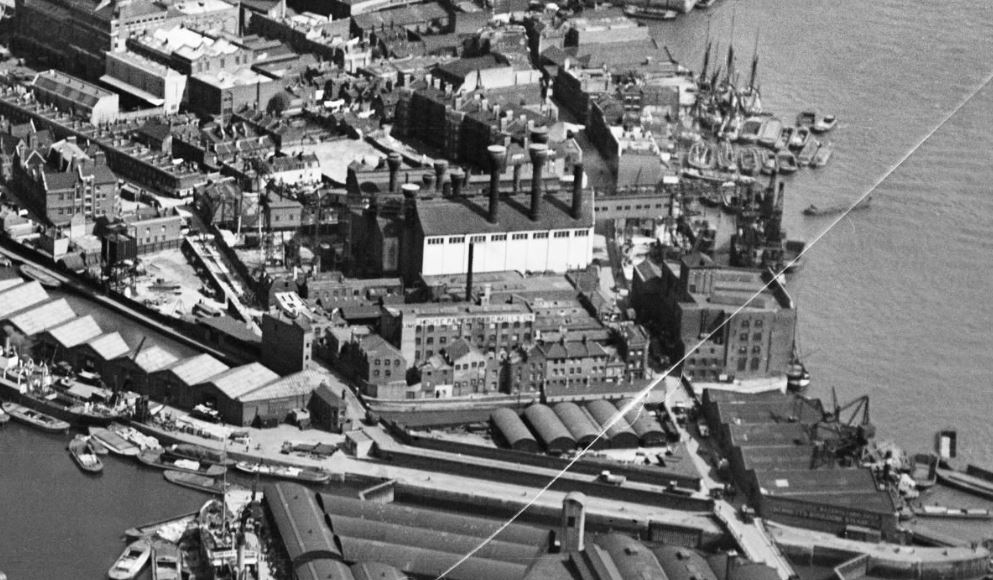
When Stepney Power Station was first built, each of the boilers had it’s own chimney. This was standard construction in the first decades of the 20th century (see this post which includes a photo of the first Bankside power station with its rows of chimneys).

In this 1928 photo, we can see the power station as the white building, with a number of chimneys rising from the roof. Note that the chimneys are relatively low in height:
Stepney Power Station

Photo from Britain from Above at this link.

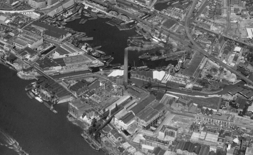
The low height of the chimneys did not help with the dispersion of smoke, gases and grit from the chimney so by 1937 a much taller chimney had been built, which can be seen in the following 1949 photo and is the chimney seen in my father’s photo:
Stepney Power Station

Photo from Britain from Above at this link.

There was a rather glowing report about the new chimney in the Evening Telegraph and Post on the 2nd of August 1937:;

“An Almost Invisible Chimney – There is nothing mars a city more than unsightly chimneys sprouting from factories and power stations. London’s East End must have hundreds of these chimneys, which are, of course, necessary to carry away dangerous smoke and fumes.

There is, however, one chimney in London, its 354 feet making it one of the highest in Britain, which cannot be called unsightly, for it cnnot be seen a mile away. It is situated in Limehouse, and is part of the Stepney Power Station.

The reason for its invisibility is that it is constructed of square bricks, some brown, some a light creamy colour. At close quarters it looks spotty, but from the distance it seems to have no real colour of its own, and is just a faint shadow on the sky.”

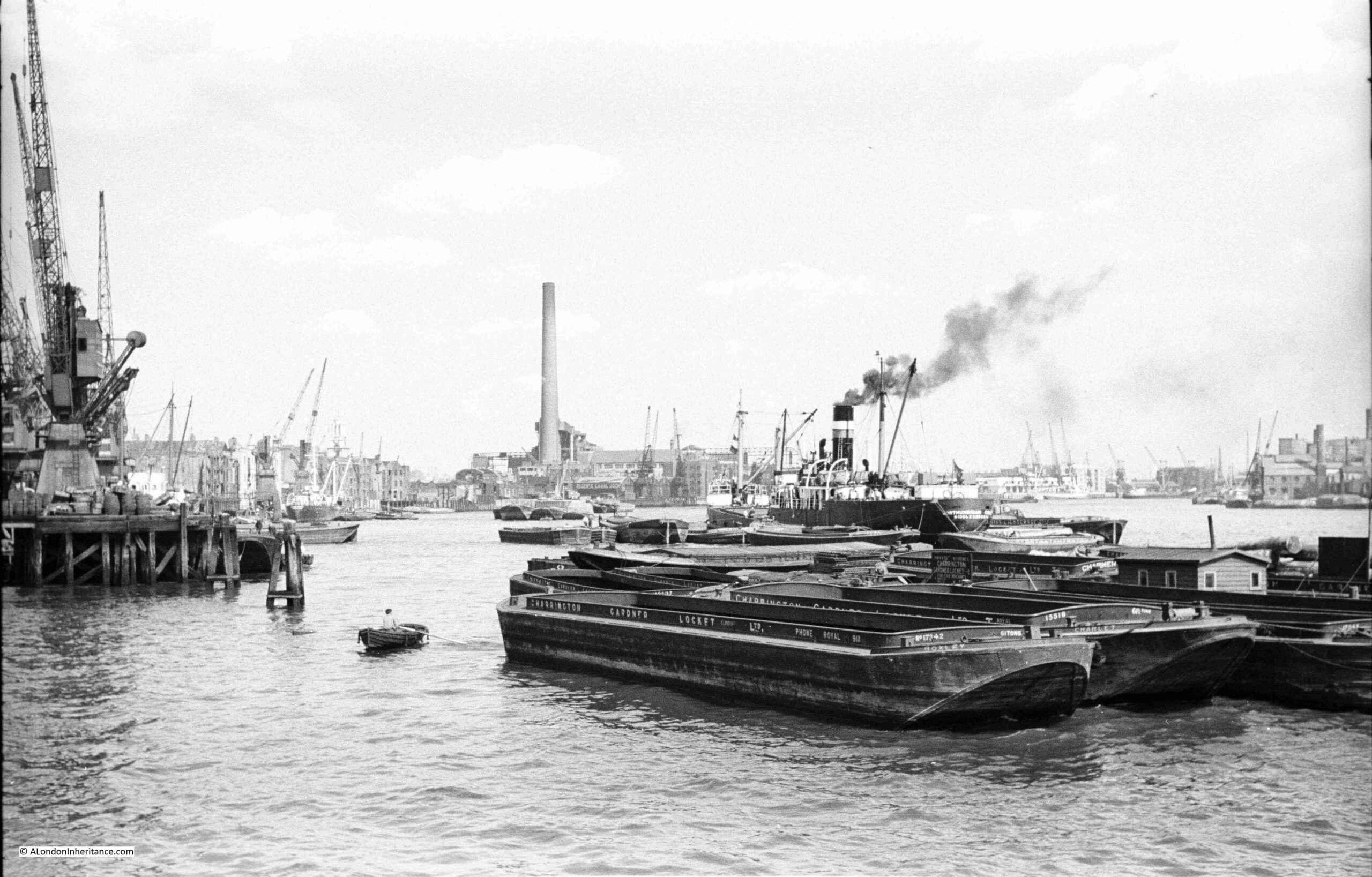
I know for certain that it could be seen from more than a mile away, as the chimney appears in other photos taken by my father, and the “light creamy colour” would have turned dark in a short time due to the level of pollution in the air in the industrial West End of London.

For example, this is my father’s photo of the view from the east of King Edward VII Memorial Park in Shadwell, and clearly shows a very visible chimney rising above Stepney Power Station:
Stepney Power Station would continue in operation until 1972 when it was decommissioned.

During the 1950s and 1960s large new coal and oil fired power stations had been build along the Thames, and a distribution network connected London up with the rest of the country, so there was no need for small power stations in congested areas of London.

All that remains today of Stepney Power Station is the coaling pier. The buildings and chimney were all demolished years ago, and the building that now occupies the majority of the site is the Watergarden complex of apartments.

This is the view of the Watergarden apartments facing onto Narrow Street:
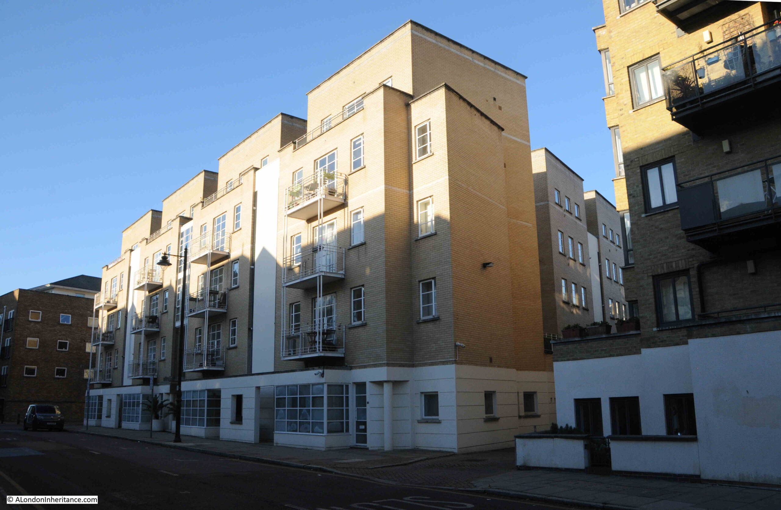
Narrow Street

Stepney Power Station was instrumental in providing electricity to the factories, warehouses, docks and homes of the borough, and in 1917, Stepney had entered into an agreement with Bethnal Green Council, under the London Electricity Supply Act of 1908, to help develop and supply electricity in Bethnal Green.

The growing dependence on electricity can be seen by the impact that failures in supply had on the local area.

On the 8th of May, 1926 it was reported that:

“LIGHT CUT OFF, London Hospitals Have To Stop X-Ray Work: Three important London hospitals are still without electric current owing to the Stepney power station cutting off the supply. They are the London Hospital, the Whitechapel Infirmary, and the Whitechapel Dispensary for the Prevention of Consumption.

The work of these hospitals becomes more and more hampered by the loss of electrical power, and all X-ray has had to be stopped.”

And on the 27th if July, 1955, the Daily Herald reported that:

“POWER FAULT BLACKS OUT HOSPITALS: Three East London hospitals and the whole borough of Stepney were blacked out last night by a four-hour power failure.

It was the third in a week, and the third time cinema audiences get their money back. Police were sent in vans to all major crossings because traffic lights failed.

And while engineers sweated at Stepney power station, hospitals, homes and public houses switched to candles.

At the London Jewish Hospital the water supply failed too. It is kept up to pressure by electric pumps.”

From the London Daily Chronicle on the 22nd of August, 1922:

STEPNEY IN DARKNESS – Two Men Injured at the Electricity Works: Two workmen named as Tindall and Armstroong were injured last evening in a mishap at Stepney Borough Council’s electricity generating station in Narrow-street, Limehouse.

The switchboard burst into flames, and the two men sustained burns in trying to put out the fire. Their injuries, however, were not serious, and after treatment at Poplar Hospital they were allowed to go home.

For a time part of the district was deprived of Light and Power.”

The view today, looking into the Watergarden complex from Narrow Street, into what was the core of the power station:
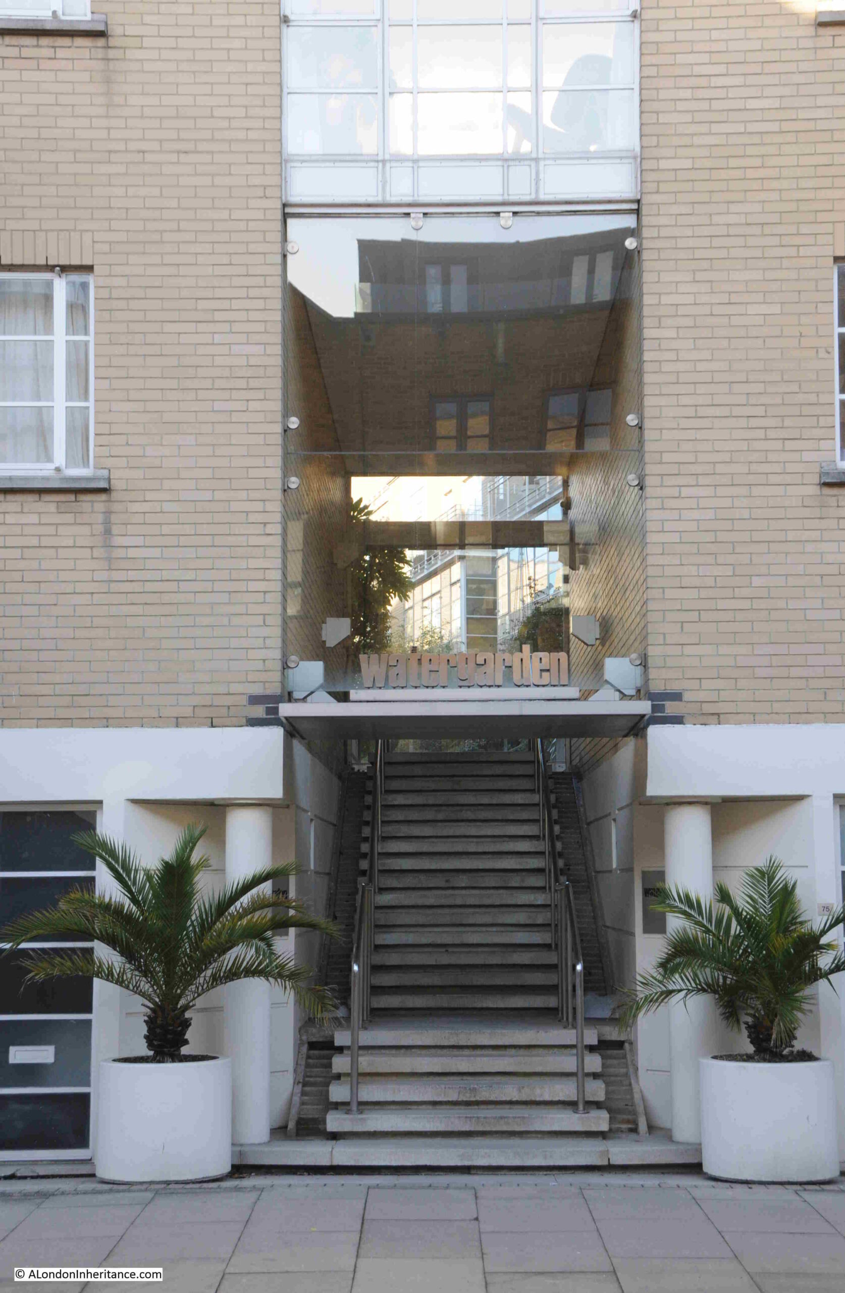
Narrow Street

The view from the west – no coal dust, dirt, smoke or grit covering Limehouse today:
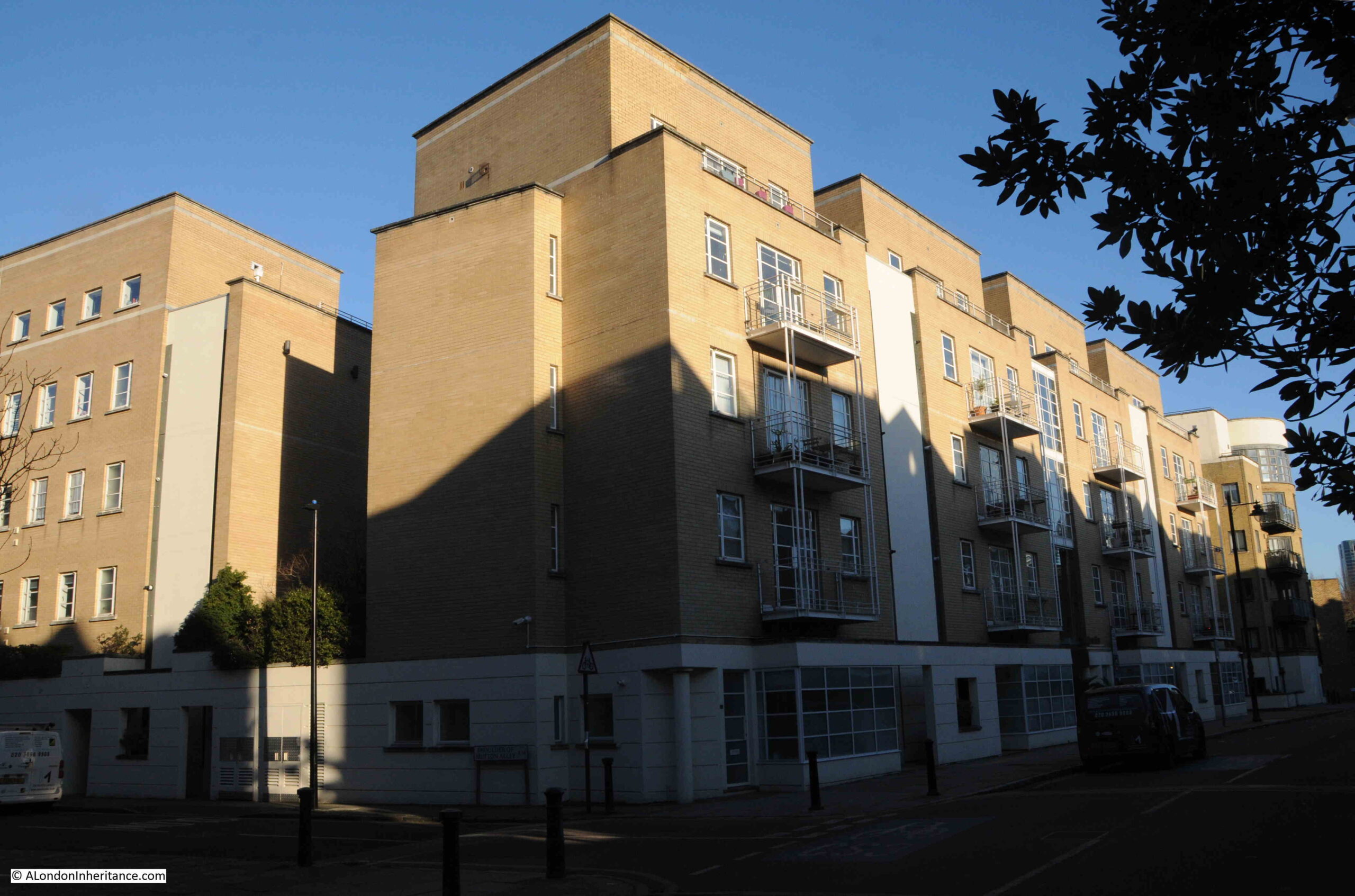
Narrow Street

To the west of the power station site was Shoulder of Mutton Alley, which can still be found today, as can be seen in the following photo where the power station would have been on the right, and a paperboard mill on the left, with the power station chimney being at the far end of the street:
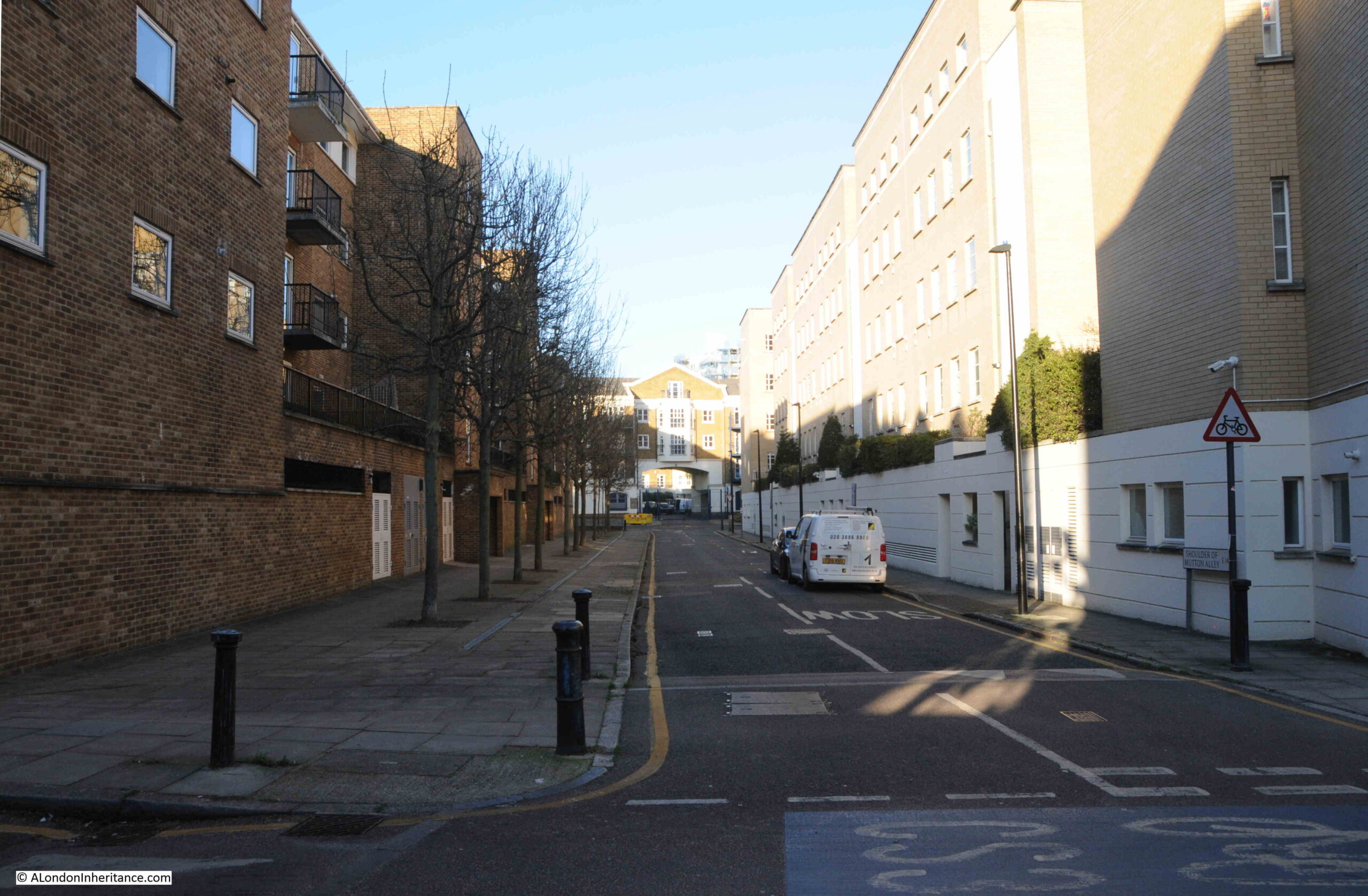
Stepney Power Station

Walking along Narrow Street today, it is hard to imagine just how much industry there was along these now quiet streets, along with the noise and dirt which these industries generated. In just the above photo there was the power station and a paper mill on opposite sides of the street.

Stepney Power Station does help tell the story of how electricity came to London, and became an essential part in the ability of the city to operate in the modern world.

The Cyril Jackson school is still in Limehouse, however it has moved slightly east to a site along Limehouse Causeway, where today the children breath much cleaner air than their predecessors.

alondoninheritance.com

Jays for Jeans, Surrey Quays, Rotherhithe

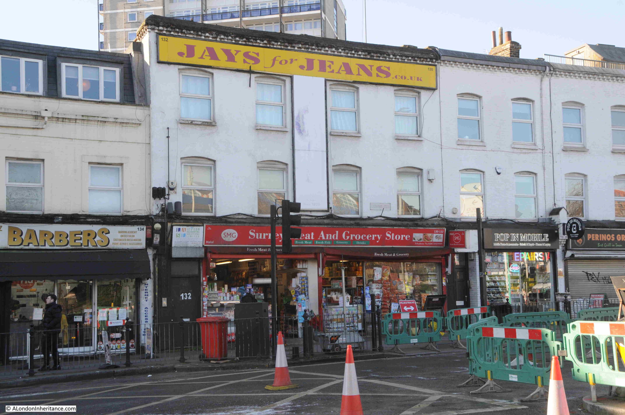
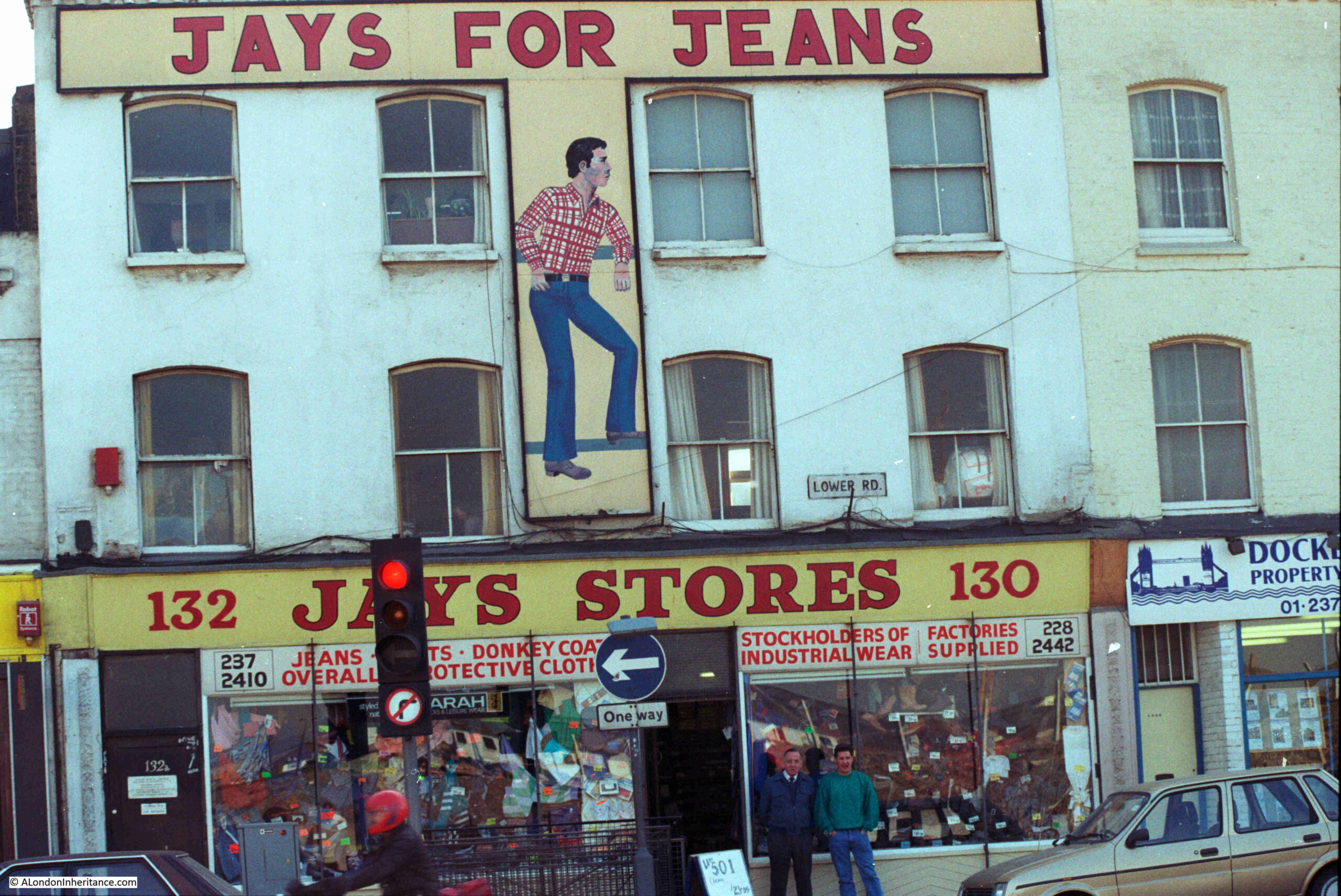
Jays Stores was a store in Lower Road, Rotherhithe, that had a large sign advertising Jays for Jeans at the top of the building, above an illustration of a man presumably dressed in clothes available from the store.

My father photographed Jays Stores and the Jays for Jeans sign in 1986:

Jays for Jeans

I could not get exactly the same view as in 1986 due to road works occupying the space directly opposite, however an almost the same view of Jays for Jeans, 38 years later in January 2024:

Jays for Jeans

I am not sure exactly when Jays Stores opened, but the store closed in 2016. I suspect that the location of the store opposite the shops of the Surrey Quays shopping centre, Internet shopping, and the loss of local industry, with the resulting loss of trade for industrial wear, donkey jackets etc. (as advertised in the 1986 window) resulted in the store being economically unviable.

The store did make it onto the Internet though, as the surviving sign on the top of the building in 2024 shows that Jays for Jeans had a.co.uk address for the store, a different sign to the one in 1986.

The central panel has either completely faded, or perhaps been over painted.

To the right of the store, in the 1986 photo, can be seen part of one of the estate agents set-up to market the new properties being built as part of the redevelopment of the docklands.

Jays for Jeans is one of those local landmarks that defines an area for a specific period of time.

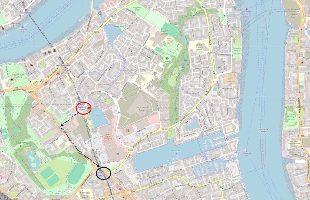
I walked down to the location of Jays for Jeans from Canada Water station, having arrived on the Jubilee Line.

It was a short walk, by the most direct route (that avoided the Surrey Quays shopping centre), but a route that confirmed that you can find things of interest in almost any London street, and is one of the joys of walking.

The following map shows my route from Canada Water station (within the red circle) down to the site of Jays for Jeans, next to the Surrey Quays station which is over ground only (dark blue circle). the dark blue dotted line shows the short route  (© OpenStreetMap contributors):

Jays for Jeans

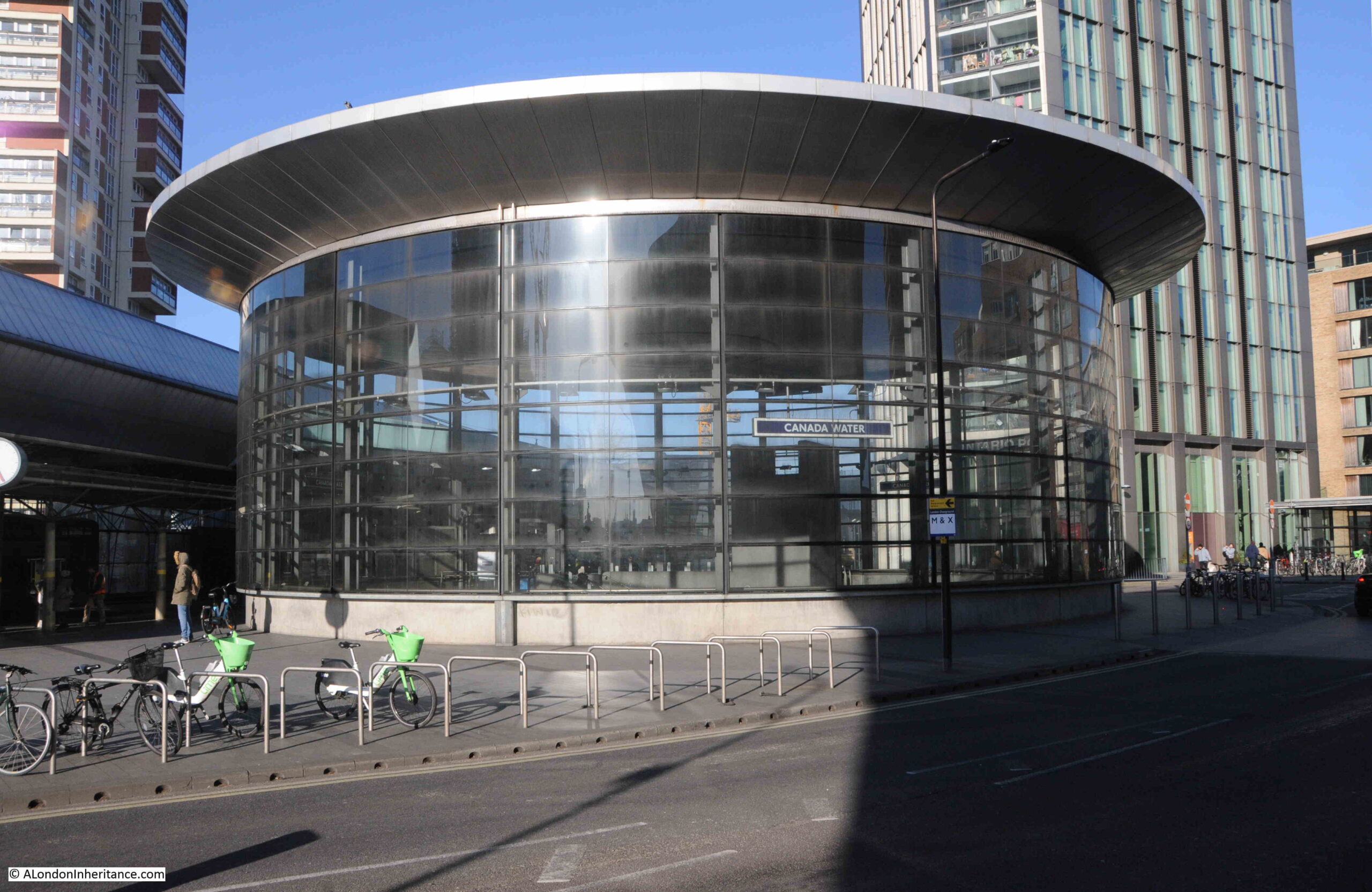
Staring with the wonderful drum structure over Canada Water station, a design which allows a large amount of natural light to get into the station below. The drum is above the escalators which run between the ticket hall and the platforms below:

Canada Water Station

From Canada Water Station, I headed down Surrey Quays Road, a street which was one of the main entrances into the Surrey Commercial Docks which once occupied the majority of this part of Rotherhithe.

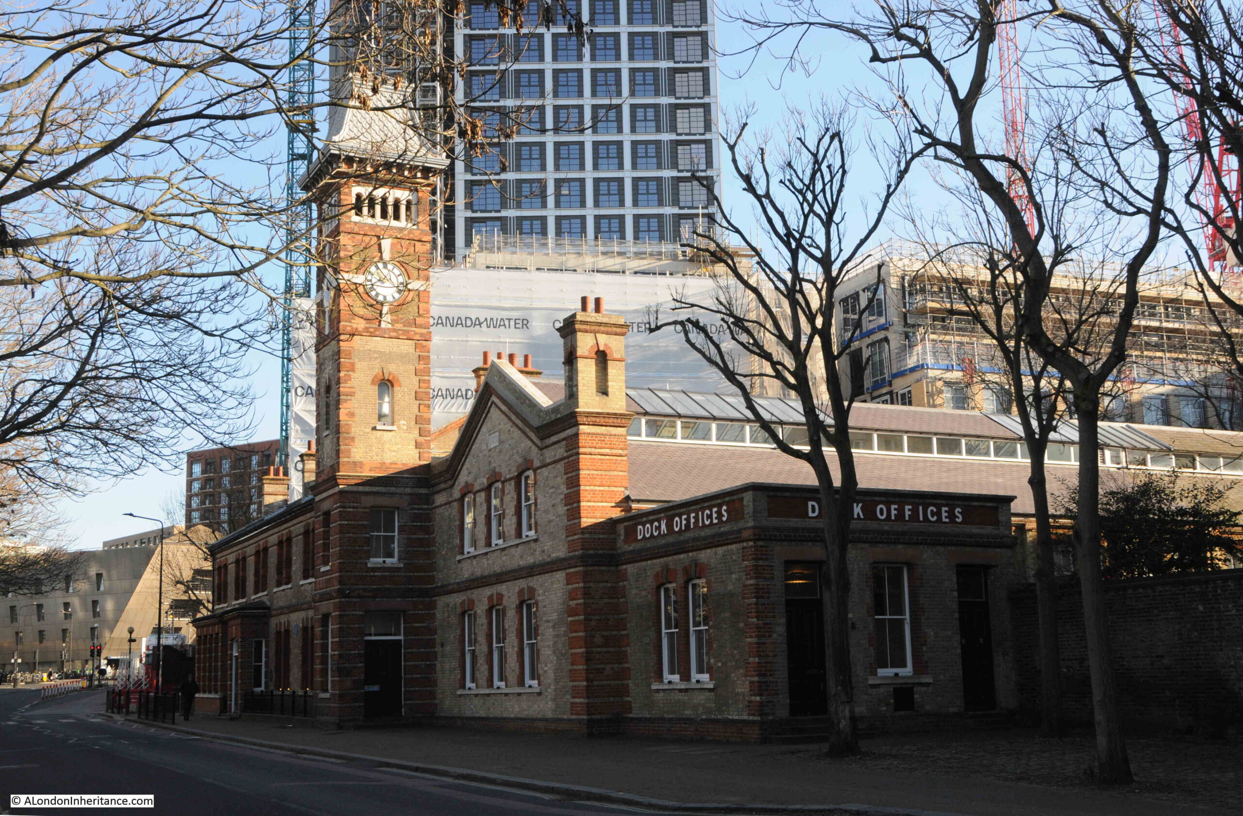
Along this street is one of the very few remaining buildings from the docks – the Dock Manager’s Offices:

Dock Manager's Offices

This glorious buildings is Grade II listed, and dates from 1892 when it was built by the Surrey Commercial Dock Company.

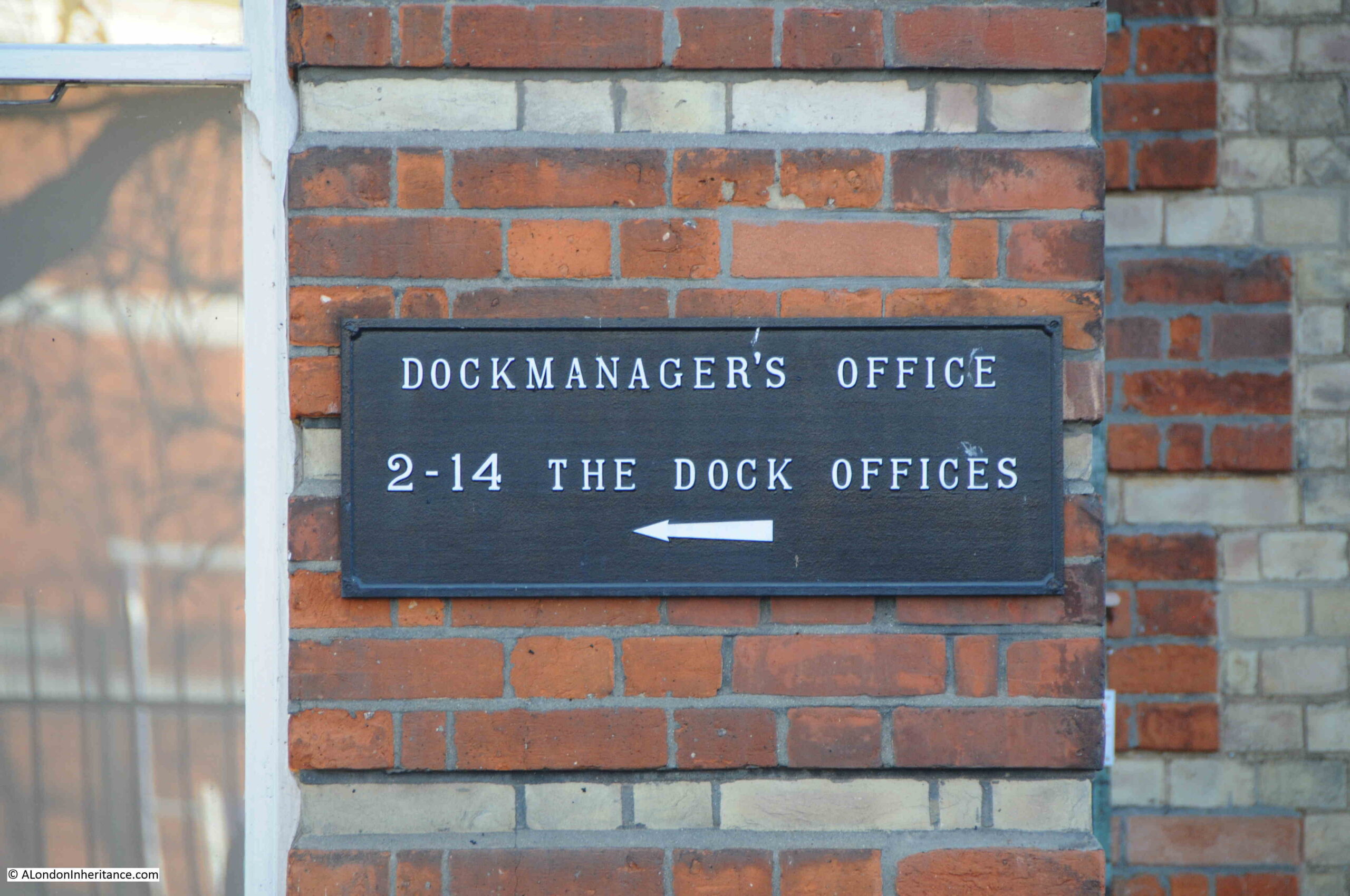
The building is very well preserved, and when in use as the dock offices, it consisted of three main parts: the Superintendent’s Office with clock tower, a Janitor’s House, which is the smaller block closest to the camera with the Dock Offices signage, and a large open plan General Office, which can be seen in the above photo receding to the right.

Dock Manager's Offices

The building is now owned by British Land, and I believe part of the interior has been designed to showcase the flats that are being built as part of the significant redevelopment going on around the Surrey Quays area.

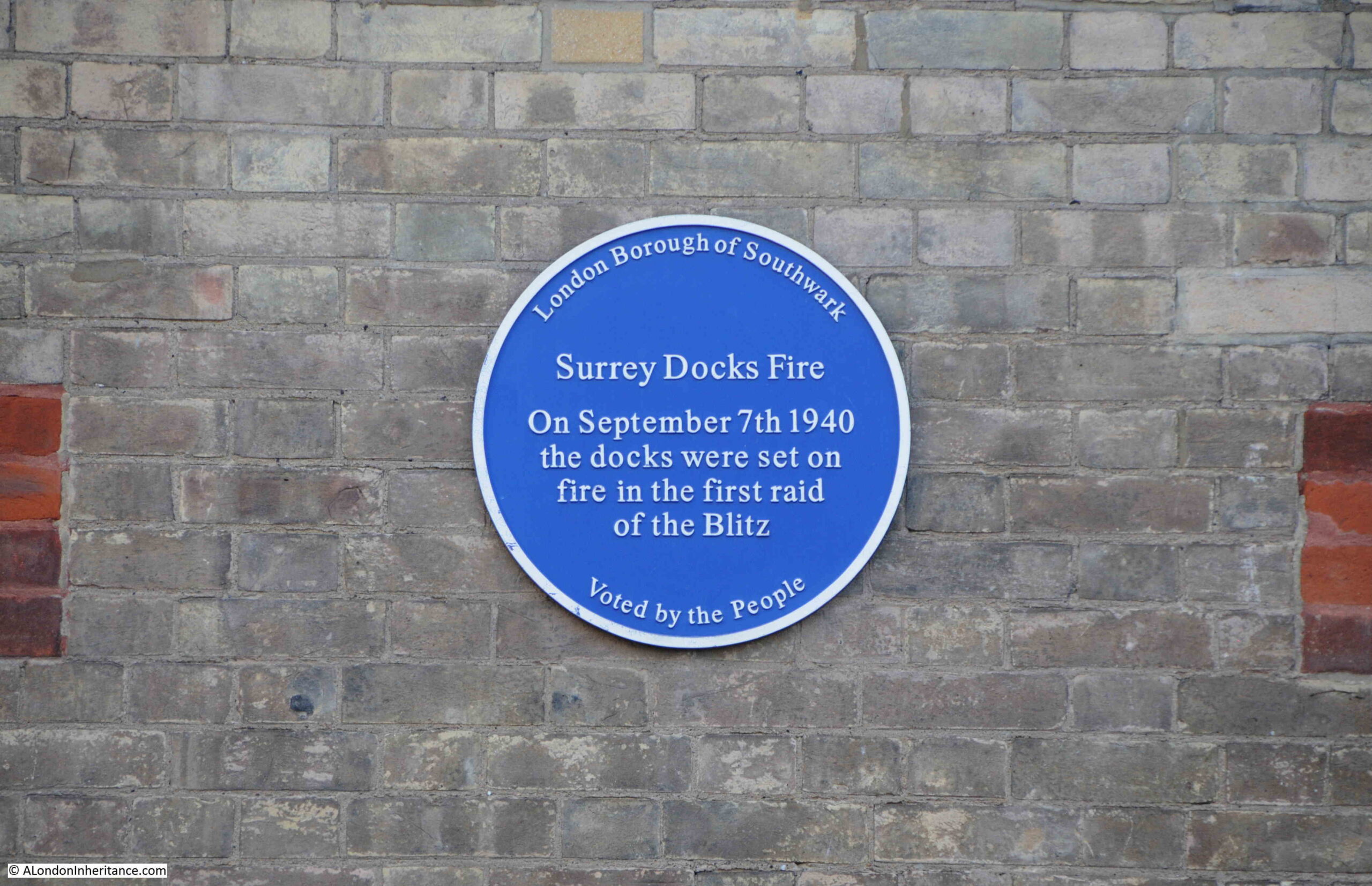
There is a plaque on the side of the Dock Manager’s Office which records a major event during the last war:

Dock Manager's Offices

I am going to save the story of the docks here in Rotherhithe for some later posts as there is so much to tell about this part of London, and for now, I will continue on to Jays for Jeans.

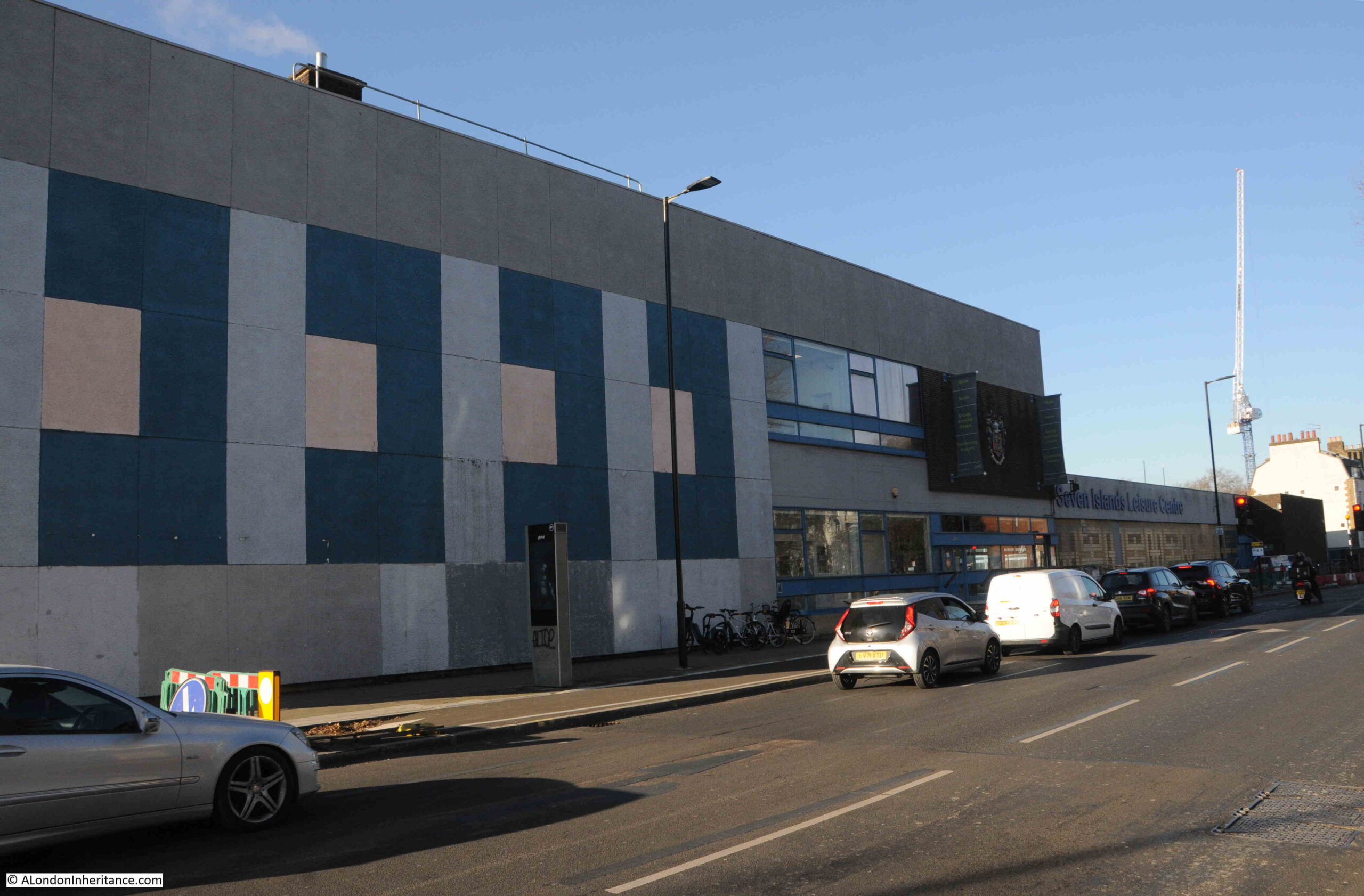
At the end of Surrey Quays Road, the street meets Lower Road, and on the western side of Lower Road is the Seven Islands Leisure Centre:

 Seven Islands Leisure Centre

Opened as the Rotherhithe Bath and Assembly Hall on the 27th of November, 1965, the building included a swimming pool, assembly hall with stage and dressing rooms, crèche and play area for children and a place for sunbathing.

The name comes from what were believed to have been seven islands in-between the streams that drained Rotherhithe and Bermondsey into the Thames.

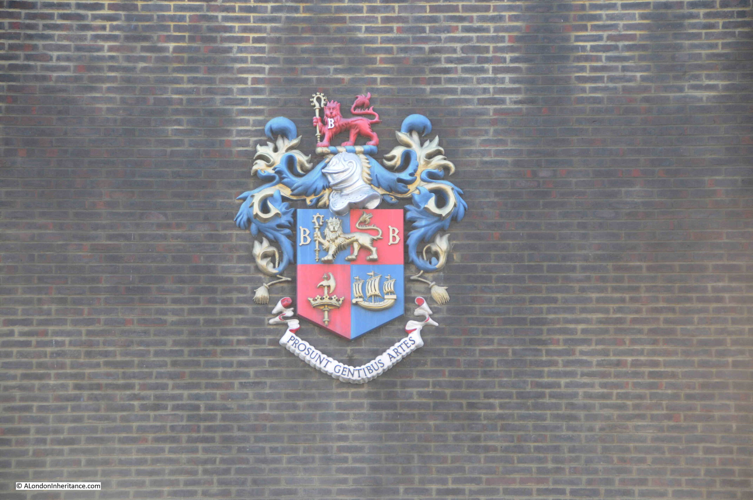
The building retains a wonderful example of the coat of arms of the old Metropolitan Borough of Bermondsey:

Bermondsey Coat of Arms

Bermondsey, as a Metropolitan Borough existed from 1900 (when it brought together the old parishes of Bermondsey, Rotherhithe and St. Olave), until 1965 when it was replaced by the London Borough of Southwark.

Within the coat of arms, the lion and the two letter B’s on either side, are from the Bermondsey Vestry and have their origins in Bermondsey Abbey.

The crown and the axe are from St. Olave, and come from the Royal Arms of Norway (see this post for more details on the origins of St. Olave and the connection with Norway).

Rotherhithe and the docks are represented by the ship at bottom right.

The Latin motto at the bottom of the arms, “prosunt gentibus artes” means “Arts profit the people”

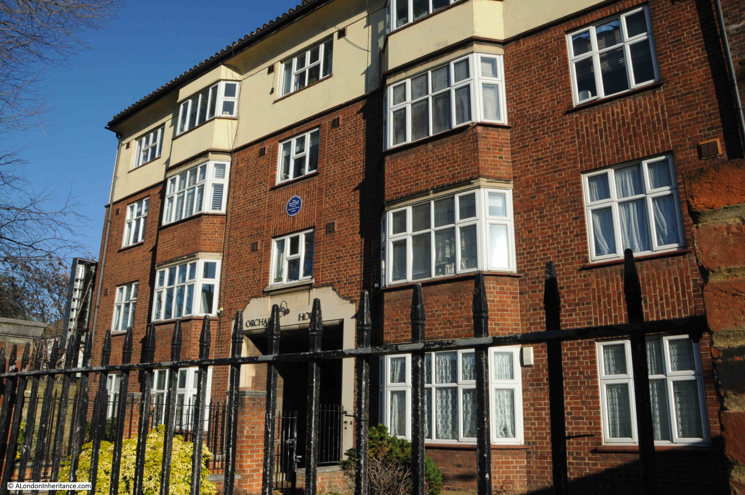
On the opposite side of Lower Road is a brick built block of apartments, with a blue plaque between the first and second floors, above the central arch:

King Edward Frederick Mutessa

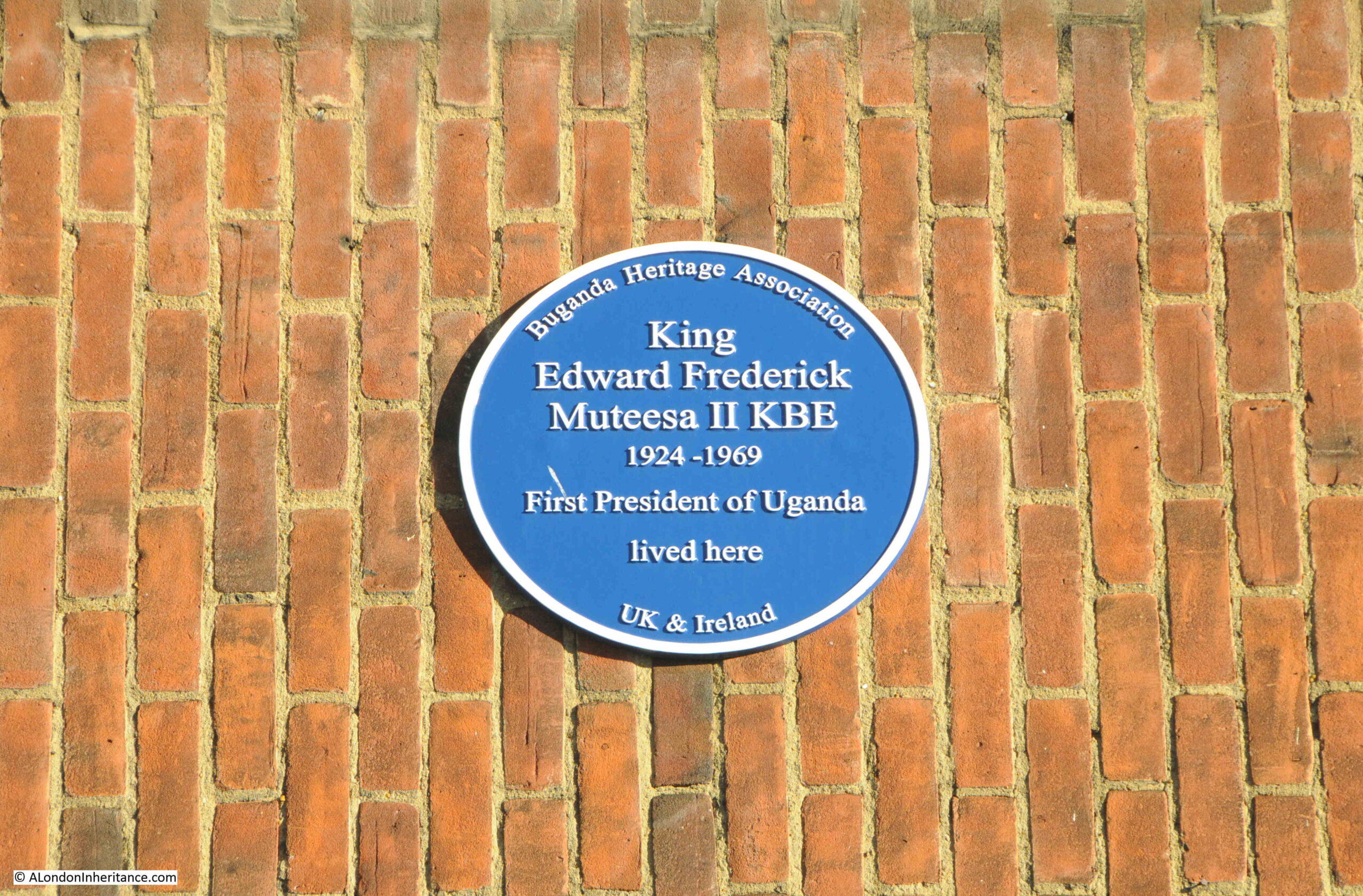
The blue plaque is to King Edward Frederick Muteesa II, the first President of Uganda:

King Edward Frederick Muteesa

Muteesa was the Kabaka (king or ruler) of Buganda, one of the individual kingdoms that make up the country of Uganda.

When Uganda became independent from Britain in 1962, Milton Obote became the Federal Prime Minister, and Obote negotiated an agreement with Muteesa that he would become President of Uganda, an agreement which was implemented by secret vote in Parliament on the 4th of October, 1963.

In the following years, there was infighting between the coalition that made up Parliament and between Obote and Muteesa, and it finally got to the point where in February 1966, Obote suspended the Federal Constitution and declared himself President, thereby deposing Muteesa.

Muteesa fled into exile and arrived in London, penniless, and without any support from the Government of Uganda.

During his earlier years he had been educated at Cambridge, where he also joined the university’s officer training corps, which led to a commission as a Captain in the Grenadier Guards.

It was this military connection that was to help with accommodation in London, and an old military contact provided him with the apartment in Orchard House, Lower Road.

He was not there for too long as on the 21st of November, 1969, he was found dead in the apartment, apparently of alcohol poisoning. A few hours before his death he had been interviewed by the BBC correspondent John Simpson, who found him sober, and there have been theories that he was murdered.

He was temporarily buried in England until the political situation changed in Uganda when Idi Amin overthrew Milton Obote and Muteesa’s body was returned to Uganda and given a state funeral and burial.

As with so much of London, there are a number of closed pubs in Lower Road, places that recall the working class history of the area.

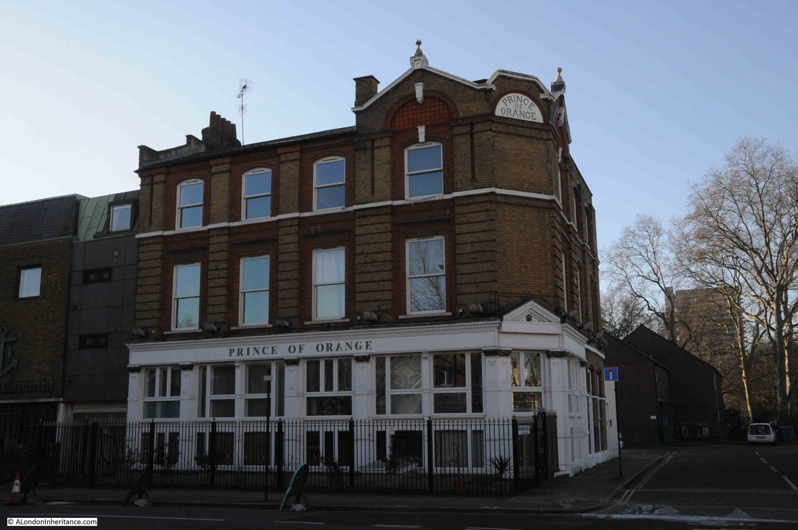
The first of these is the Prince of Orange:

Prince of Orange

The pub seems to have opened around the late 1830s / 1840s as it is during these years that I find the first mentions of what appears to be the Prince of Orange pub.

In the following decades there are all the usual mentions of events that you would expect to find in a London pub in the docks, with crime, fights, jobs available etc.

in the pubs last few decades, it seems to have been a venue for jazz, as in newspapers there are plenty of adverts, such as for Pete Boulter’s Blues Jam session (1995), and Mr. B Plays Basie (1983). In the Stage and Television Today in October 1982, it was reported that “on the pub front, let us applaud the Prince of Wales, Buckhurst Hill and the Prince of Orange, Rotherhithe, both presenting jazz practically every night of the week”.

At times, the pub was on BBC Radio 2, for example the listings for the 25th of January, 1988, included “Jazz Score, where Benny Green is in the chair at the Prince of Orange, Rotherhithe, and on the panel are Acker Bilk, Peter Clayton, Alan Elsdon and Ronnie Scott”.

The Prince of Orange is now apartments.

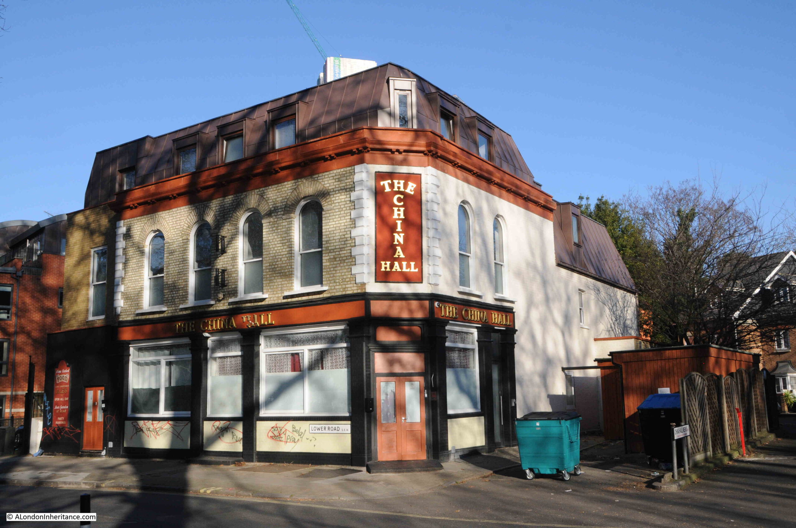
A short distance further along Lower Road is another closed pub, the China Hall:

The China Hall

There has been a pub on the site for a number of centuries and in 1719 a pub on the site was apparently called the “Cock and Pye Ale House.” 

The earliest written reference I can find to the name China Hall is in the Oracle and Daily Advertiser, on the 27th of February, 1802, when “A few afternoons since, about half past four o’clock,, as Mr. Witts of the Europa Inn, Rotherhithe, was travelling near China Hall, in the lower Deptford Road, he was stopped by a single foot-pad, who robbed him of a £2 note and his cash”.

The road was originally called Lower Deptford Road, but has since dropped Deptford and is now simply Lower Road.

The site of the pub has a long history. In 1776 the pub appears to have been leased to a trader in tea and china called Jonathan Oldfield, and who built a theatre next to the pub, called the China Hall. The name may have come from his trade in china, and the name appears to have transferred from the theatre to the pub.

Edward Walford, writing in Old and New London (1878), has the following to say about the China Hall: “In former times a narrow pathway, called the ‘Halfpenny Hatch’ extended through the meadows and market-gardens from Blue Anchor Road to the Deptford Lower Road, where it emerged close by an old and much-frequented public-house called the ‘China Hall’. The ancient tavern, which was a picturesque building partly surrounded by an external gallery, was pulled down within the last few years, and in its place has been erected a more modern-looking tavern, bearing the same sign.

Our old friend Pepys mentions going to China Hall, but gives us no further particulars. It is not unlikely, says Mr. Larwood in his History of Signboards, that this was the same place which, in the summer of 1777, was opened as a theatre. Whatever its use in former times, it was at that time a warehouse of a paper manufacturer.

In those days the West End often visited the entertainments of the East, and the new theatre was sufficiently patronised to enable the proprietors to venture upon some embellishments. The prices were – boxes 3s; pit 2s, gallery 1s; and the time of commencement varied from half-past six to seven o’clock, according to the season. The Wonder, Love in a Village, the Comical Courtship and the Lying Valet were among the plays performed. The famous Cooke was one of the actors in the season of 1778. In that same year the building suffered the usual fate of theaters, and was utterly destroyed by fire”.

The China Hall pub closed at the end of 2018, after a local campaign failed to save it, although it appears to have been a going concern, was wanted by the local community and had publicans who wanted to continue.

The ownership of the pub has been very controversial, and since closure the upper floors have been converted to residential, with extra space from the addition of a mansard roof.

The ground floor did appear to be undergoing conversion however council planners issued a warning notice to stop. A planning application was made for conversion of the ground floor, this was turned down, and the council issued an enforcement notice requiring removal of residential partitions and fixtures.

The owner has since appealed against the planning refusal – I do not know the status of this appeal.

The China Hall illustrates the sad fate of many London pubs, that even when they are still viable businesses, and wanted by the local community, they are all too easily sold to a developer who can find more profit in the conversion of the property to residential.

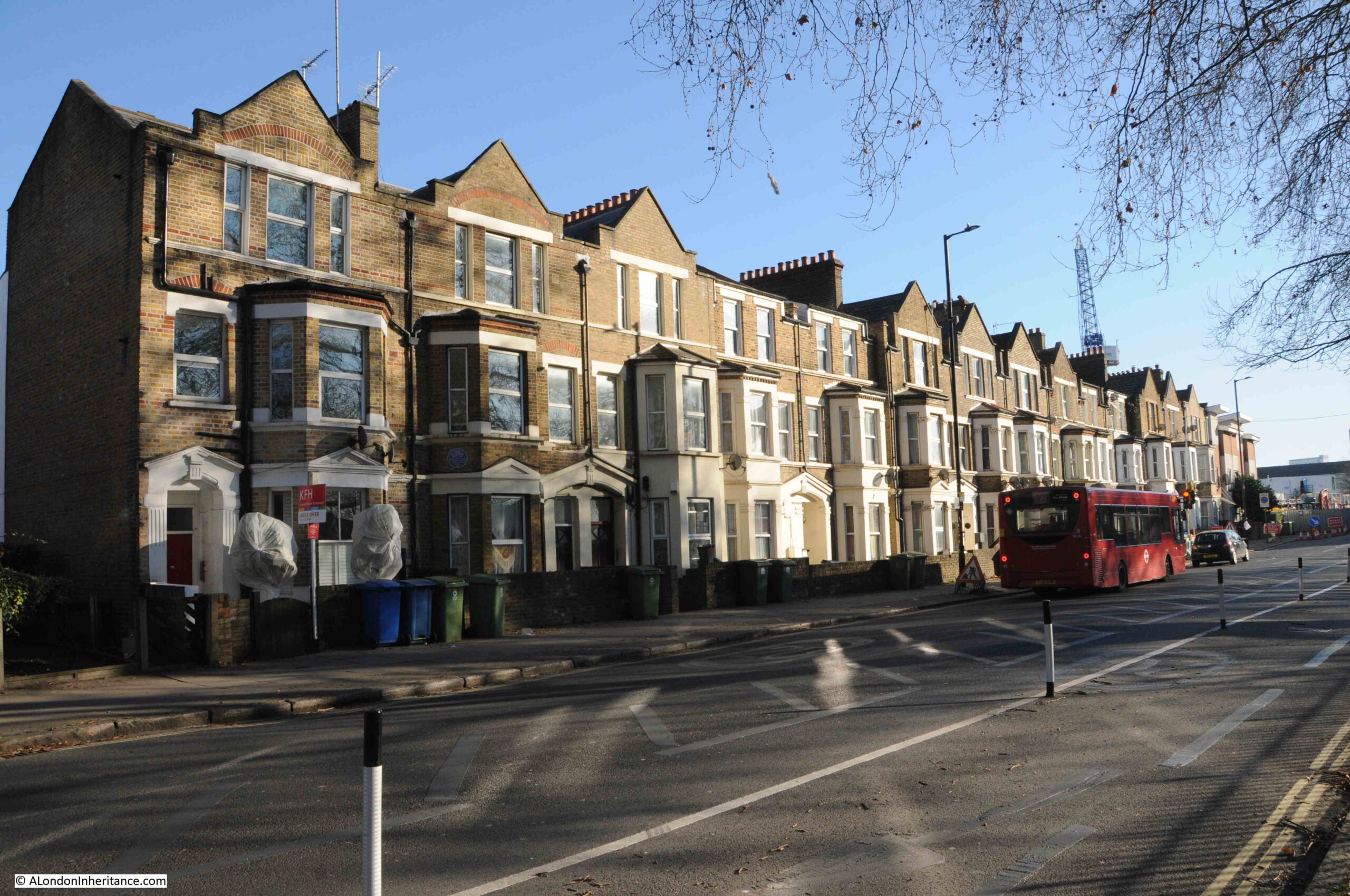
Continuing down Lower Road, and on the eastern side of the street is a row of late 19th century, terrace houses. The second house on the left has a plaque to Ada Salter, just above the ground floor bay window, directly above where green bins can be seen:

Ada Salter

Ada Brown was born in 1866, a child within a Wesleyan Methodist family in Raunds, Northamptonshire. She moved to London in 1896, where she joined the West London Mission of the Wesleyan Sisters of the People, before moving to their Bermondsey Settlement in 1897.

Alfred Salter was a student at Guy’s Hospital when he met Ada at the Bermondsey Settlement. They married in 1900 and lived in Bermondsey. Both Ada and Alfred worked tirelessly to improve conditions in Bermondsey and Rotherhithe.

The house with the plaque is at 149 Lower Road, and was the Women’s House of the Bermondsey Settlement. Ada lived in the house for two periods in 1897 and 1898.

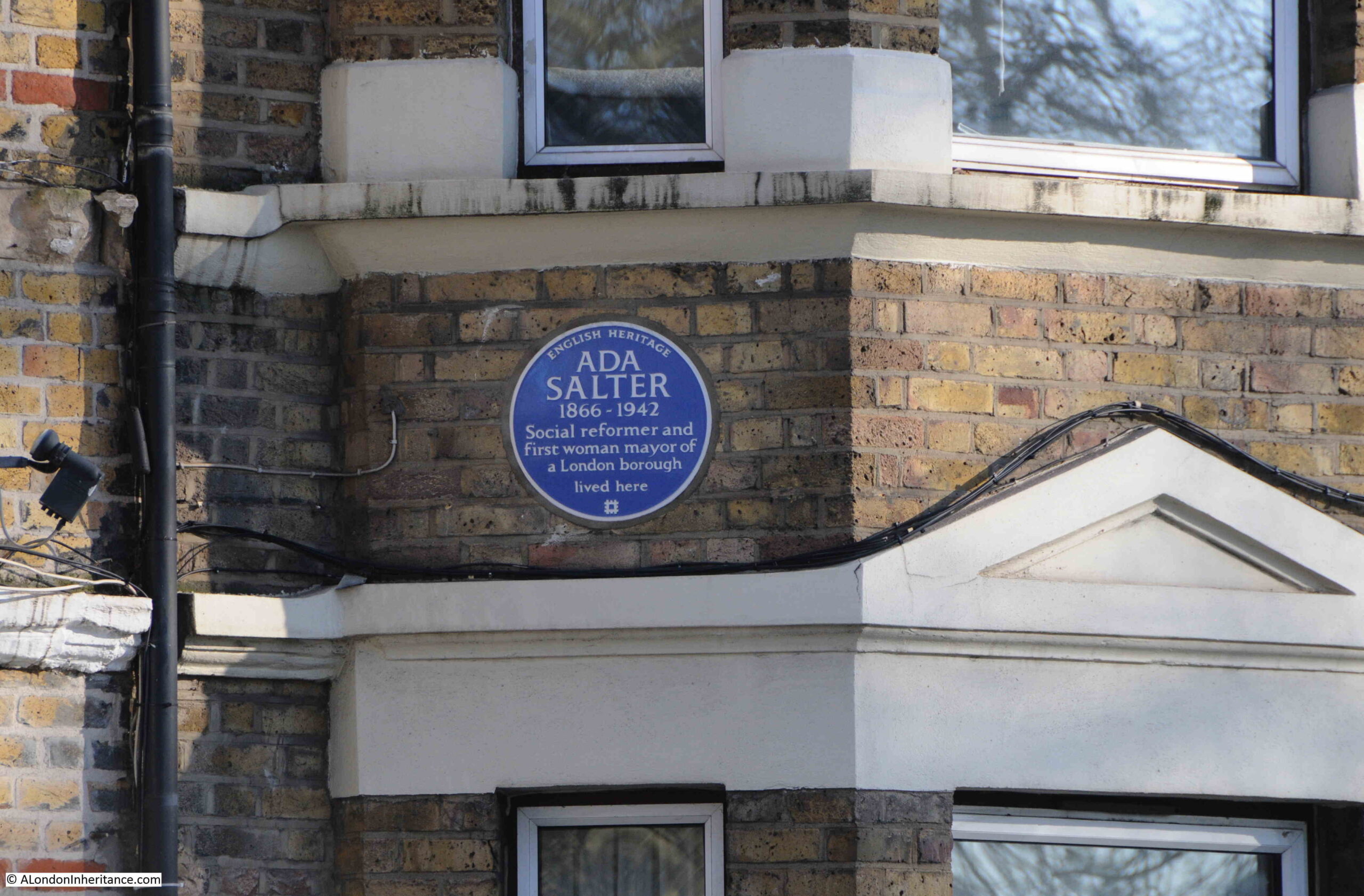
The plaque is very recent as it was installed on the house in 2023:

Ada Salter

Ada became a Labour councilor, the first woman councilor in Bermondsey in 1909 and set about recruiting women workers to trade unions to organise against the terrible working conditions in the area’s factories.

Alfred was elected MP for Bermondsey in 1909, the same year as Ada was elected Mayor.

A view of Ada’s campaigning approach to improving the living conditions of Londoner’s, can be seen in the following first two sections from an article she wrote in the Daily Herald on the 28th of February, 1934, titled: “Don’t forget the HIDDEN LONDON”:

“London is the most wonderful and romantic city in the world. London leads. What London thinks to-day Great Britain will do to-morrow.

Underlying its romance, its magnificence, its power, its wealth and its resources, is a vast morass of sorrow and misery, of poverty and struggle, of unrequited toil and unmerited suffering.

Watch some hundreds of thousands of citizens pouring each evening out of their office and work places in the centre of London and follow them to their homes. You will have glimpses of drab, featureless streets, rows of Early Victorian terrace houses, huge blocks of tenement dwellings. In these industrial dormitories the workers are not housed, but warehoused. Observe the daily fight for tram or bus and all the discomfort that it involves. Note the imperfect education given to children, too large classes, insufficiency of secondary schools, inadequacy of playing space in all working-class quarters.

Compare the dullness and ugliness of grace and colour which constitute the environment of the poor with the stateliness and magnificence of the West End and the pleasing amenities of the middle-class suburb.

Contrast the narrow, shut-in back yards with the spacious gardens surrounding the houses of the well-to-do. Remember the acres and acres of playing fields attached to all the public schools of England where the sons of the rich are educated, and then turn to the cramped, asphalted play grounds of the elementary schools in Bermondsey, Southwark, Bethnal Green, Stepney and Poplar.

It is this London of the mean streets to which our thoughts should turn at a London County Council Election rather than the ‘show’ London which visitors from the country and abroad come to see.”

Ada Salter in the early 1920s:

Ada Salter

Ada was also featured in “The VOTE -THE ORGAN OF THE WOMEN’S FREEDOM LEAGUE” on the 1st of December 1922, when she was the fifth in a series of features on women mayors. In the article, she wrote:
“As the first woman in London to be offered the position of Mayor, I am proud that I live and work in a borough, the elected representatives of which are prepared to choose an individual who belongs to what is sometimes described as the weaker sex. As a woman, I am naturally eager that the woman’s share in responsibility of government should be a direct one. There is still a tremendous leeway to be made up in all departments of life that affect women, but the failure to catch the vision of a free humanity, where men and women can act together, and not in antagonism, is not confirmed to one sex.

By common consent, the Bermondsey Borough Council has for some years dispensed with the wearing of the Mayoral and Aldermanic robes, but I also do not intend to wear the chain of office. This, of course, is a purely personal matter. For brilliant colouring, and for the brightness of gold, I have the greatest admiration, but I desire them not as symbols of place and power. The ideal for which we must strive is to secure respect for the authority and decisions of the Chair, rather by personality and character, than by decorations of office.”

I suspect we need more Ada’s in politics today.

Ada Salter died on the 4th of December, 1942. One of the newspaper reports of her death started with “The death of Mrs. Ada Salter, who was London’s first woman Mayor, is a reminder of the many hitherto exclusively masculine fields in which women have now staked out a claim”.
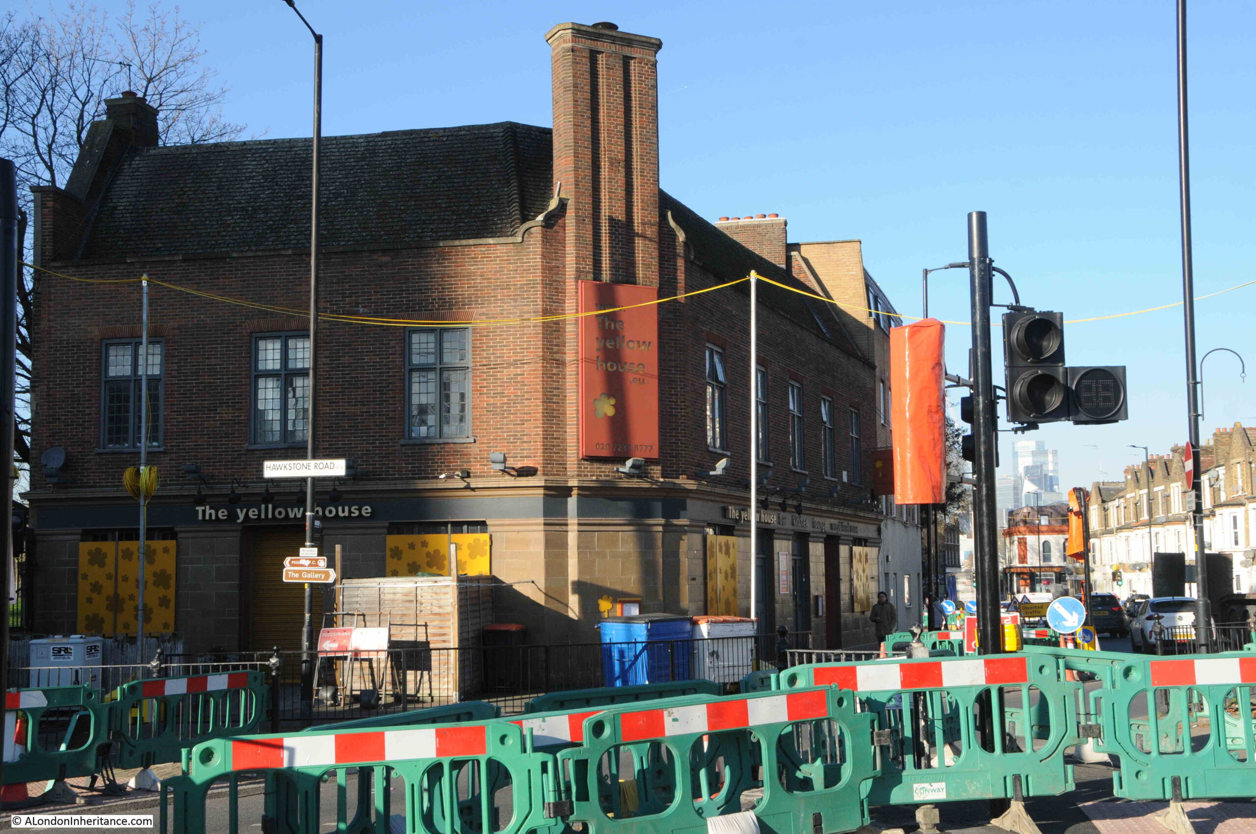
Continuing down to the site of Jays for Jeans, and the third pub in this short walk. This is still open as a bar and restaurant but with a new name of the Yellow House:

Jolly Caulkers

The was the Caulkers, originally the Jolly Caulkers, and in a couple of references, the Merry Caulkers.
A Caulker was the person who had the job to fill in any gaps in a ship, to make it watertight. Filling the gaps between originally wooden planks and later the metal sheets that would make up the hull of a ship.
A profession that would have been found across the docks of Rotherhithe.

The earliest reference I can find to the pub is in the 1840s, however the design of the pub does not look 19th century, and I suspect it may have been rebuilt in the 1910s, as in the South London Gazette in 1919 there are references to the New Jolly Caulkers, and which therefore may be a reference to the pub we see today.

And a very short distance on from the Yellow House / Caulkers, was Jays for Jeans.

A short walk, which has revealed one of the few remaining buildings from the time when Rotherhithe was covered in docks, the coat of arms of the Metropolitan Borough of Bermondsey, the first President of Uganda, Ada Salter, a campaigner for the living conditions of London’s working class and London’s first woman mayor, and three historic pubs.

There is so much more to write about this area, and the large dock complex that once occupied much of this part of Rotherhithe, and I hope to return in future posts.

alondoninheritance.com

From Bread Street to Australia – More London Plaques

For this week’s post, I am returning to the plaques that can be found around the City of London. I originally started this series of posts with just the City Blue Plaques, however there are so many interesting stories to be found in other types of monuments and plaques around the City of London, that I have since broadened the scope of these posts.

Today’s post starts with a monument to Admiral Arthur Phillip, who provides the connection that is the title of the post – From Bread Street to Australia.

Admiral Arthur Phillip, R.N. Citizen of London

If you walk to the western end of Watling Street in the City of London, towards St. Paul’s Cathedral, you will come to an open space, with gardens on the left and the shops of One New Change on the right.

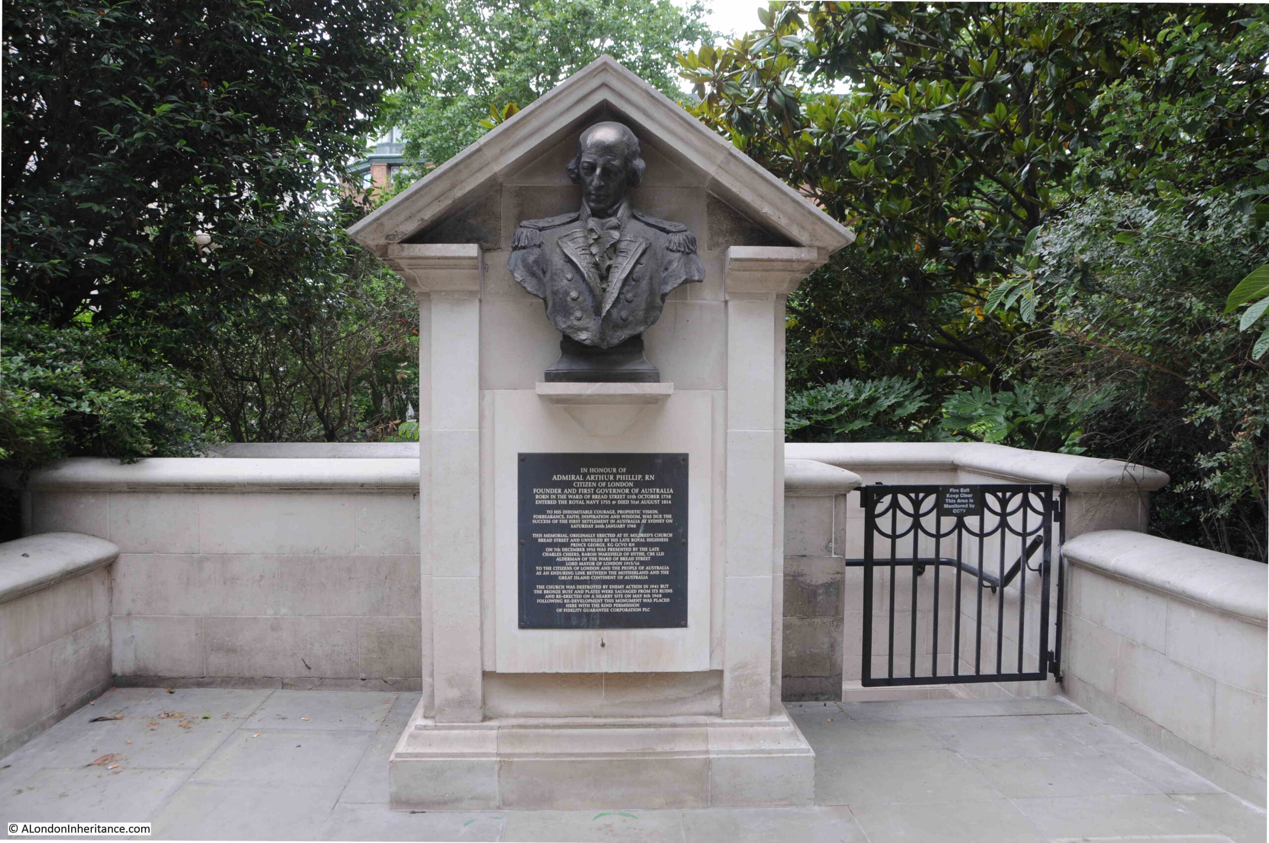
Tucked in the southern part of the space, up against the gardens is a small monument:

Admiral Arthur Phillip, R.N. Citizen of London

The monument is to Admiral Arthur Phillip, Royal Navy, and it is a bronze bust of Phillip that sits at the top of the monument. The bust was rescued from the church of St. Mildred, Bread Street, after the church had been destroyed by bombing in 1941.

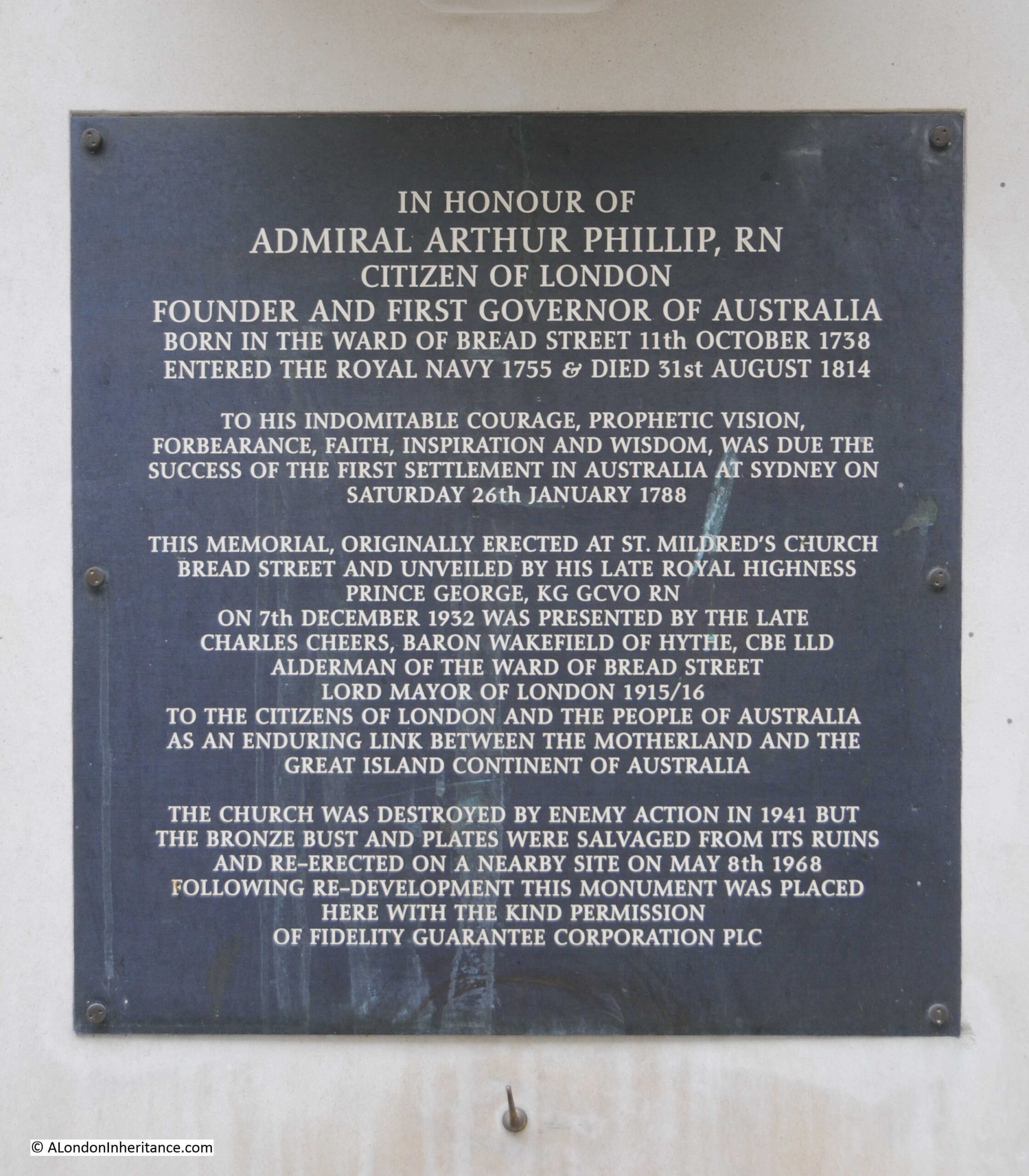
A plaque below the bust provides some background:

Admiral Arthur Phillip, R.N. Citizen of London

As the plaque states, Admiral Arthur Phillip was born in the ward of Bread Street on the 11th of October 1738. He went to the Royal Hospital School at Greenwich, and joined the Royal Navy in 1755.

In his time in the Navy, he was involved in the Battle of Menorca and the Battle of Havana, but after these battles he was left without a ship, and as was the custom at the time, naval officers had to find other sources of employment and Arthur Phillip took up farming in Hampshire.

In 1769, he rejoined the Royal Navy, and in the following years was involved in a number of battles around the world.

Although his time in the Navy appears to have been successful, if he had not been appointed the first Governor of Port Jackson, which he also named Sydney, after his friend Lord Sydney, his name would probably have been very little known today, and not commemorated in the City of London.

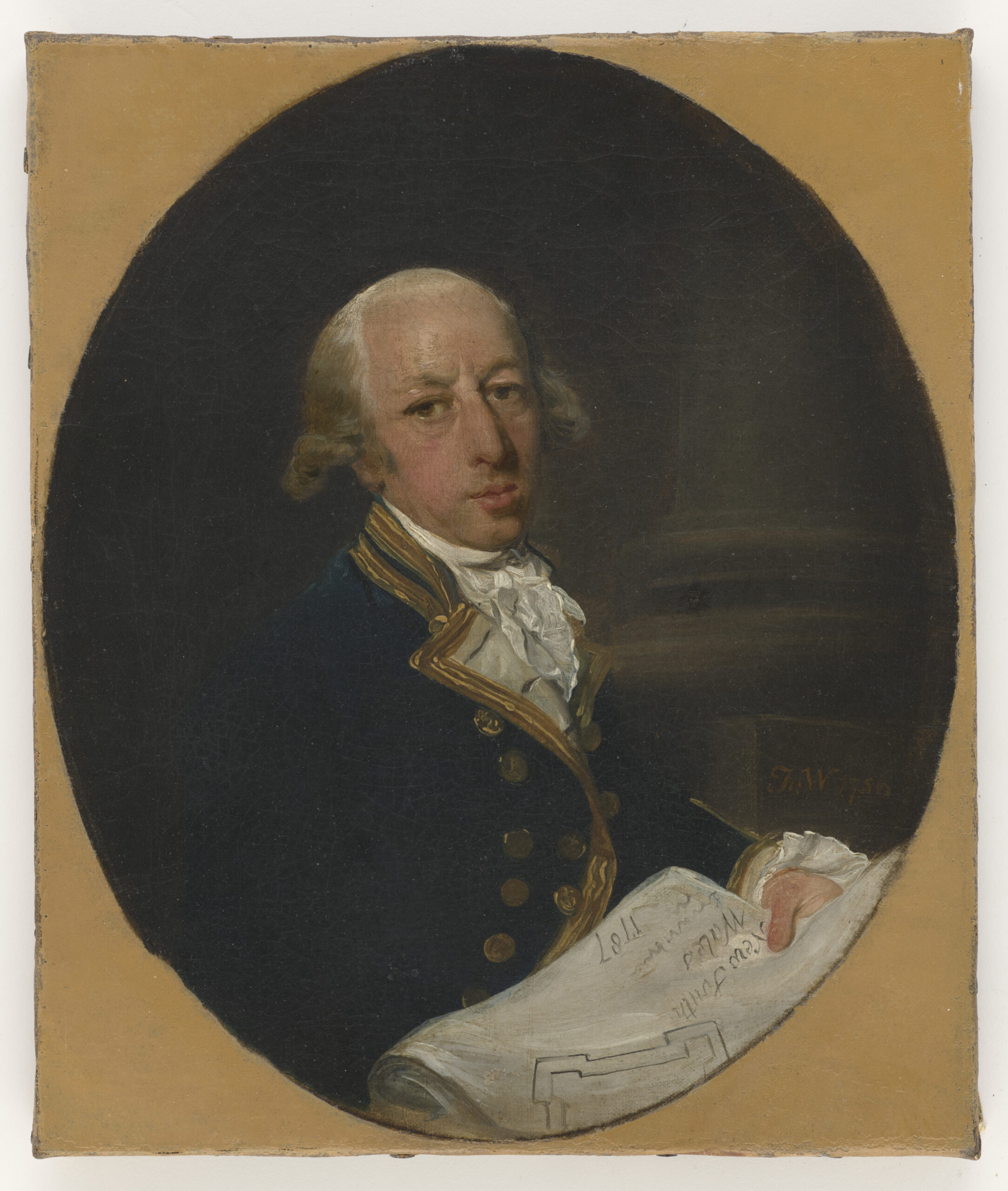
The following portrait shows Captain Arthur Phillip, as he was in 1786. The portrait is by Francis Wheatley:

Admiral Arthur Phillip, R.N. Citizen of London
Source: State Library of New South Wales. Out of Copyright

I found a newspaper report from 1936 regarding a commemoration service to be held in St. Mildred’s, Bread Street for Admiral Arthur Phillip, and the article provides some additional information on his expedition to Australia, and the founding of the settlement at Port Jackson, which would later become part of the city of Sydney.

“Admiral Arthur Phillip, for whom a commemoration service will be held at St. Mildred’s Church, Bread Street, London on Tuesday, commanded the Sirius on an expedition to New South Wales some years after it had been discovered in 1770 by Captain Cook.

The expedition, which first arrived at Botany Bay, consisted of an armed trader, three store ships, and six transports. The persons on board the fleet included 40 women, 202 marines of various ranks, five doctors, a few mechanics, and 756 convicts. The live stock included cows, a bull, a stallion, three mares, some sheep, goats, pigs, and a large number of fowl. Seeds of all descriptions were provided for planting in the strange land, but Botany Bay was found unsuitable for settling upon. The expedition finally ended at Port Jackson, near the present site of Sydney.

Later on, other convict ships arrived, and in 1793 came the first free settlers, who were presented with grants of land.

The memorial service in London to the admiral will be attended by the Lord and Lady Mayoress of London, Lord Wakefield of Hythe, and the Sheriffs of the City, while Sir Archibald Weigall, Governor of South Australia from 1920 to 1922, will give the address”.

As the plaque states, St. Mildred’s, Bread Street, was destroyed during the Second World War, and was not rebuilt.

Although the original church has been lost, the memorial service continues to this day, and is currently held annually in St. Mary-le-Bow, Cheapside.

Arthur Phillip was in charge of the first fleet of convicts that had sailed from England to start the first colony in Australia.

The first fleet was the result of ideas that had been put forward for how Australia should be colonised, and what to do with the numbers of convicts which were seen to be a cost to the state, and how they could be usefully employed.

The following newspaper extract is from the 5th of November 1784:

“A plan has been presented to the minister, and is now before the cabinet, for instituting a new colony in New Holland. In this vast tract of land, which is so extensive as to participate of all the different temperaments or climates which affect the globe, every sort of produce and improvement, of which the various soils of the earth are capable, may be expected.

It is therefore proposed to send out the convicts to this place, under such regulations as may tend to the establishment of a new colony.

The only inhabitants which are thought to possess New Holland, are a few tribes of harmless uncultivated people, who loiter on the shore, and are only to be found in some creeks which seem convenient at once for shelter and provision, so that from there the European can have but little to fear, especially as it may be supposed no settlement will be attempted without sufficient force, at least in the first instance, to protect it from every species of surprise or depredation.”

It is horrendous to read, 240 years later, the lack of any interest in the history and culture of the indigenous population, and to understand what their fate would be over the years after the first fleet’s arrival.

The name New Holland in the above article is the first European name given to the continent of Australia in 1644 by the Dutch explorer Able Tasman who was employed by the Dutch East India Company, and after whom the island of Tasmania would be named.

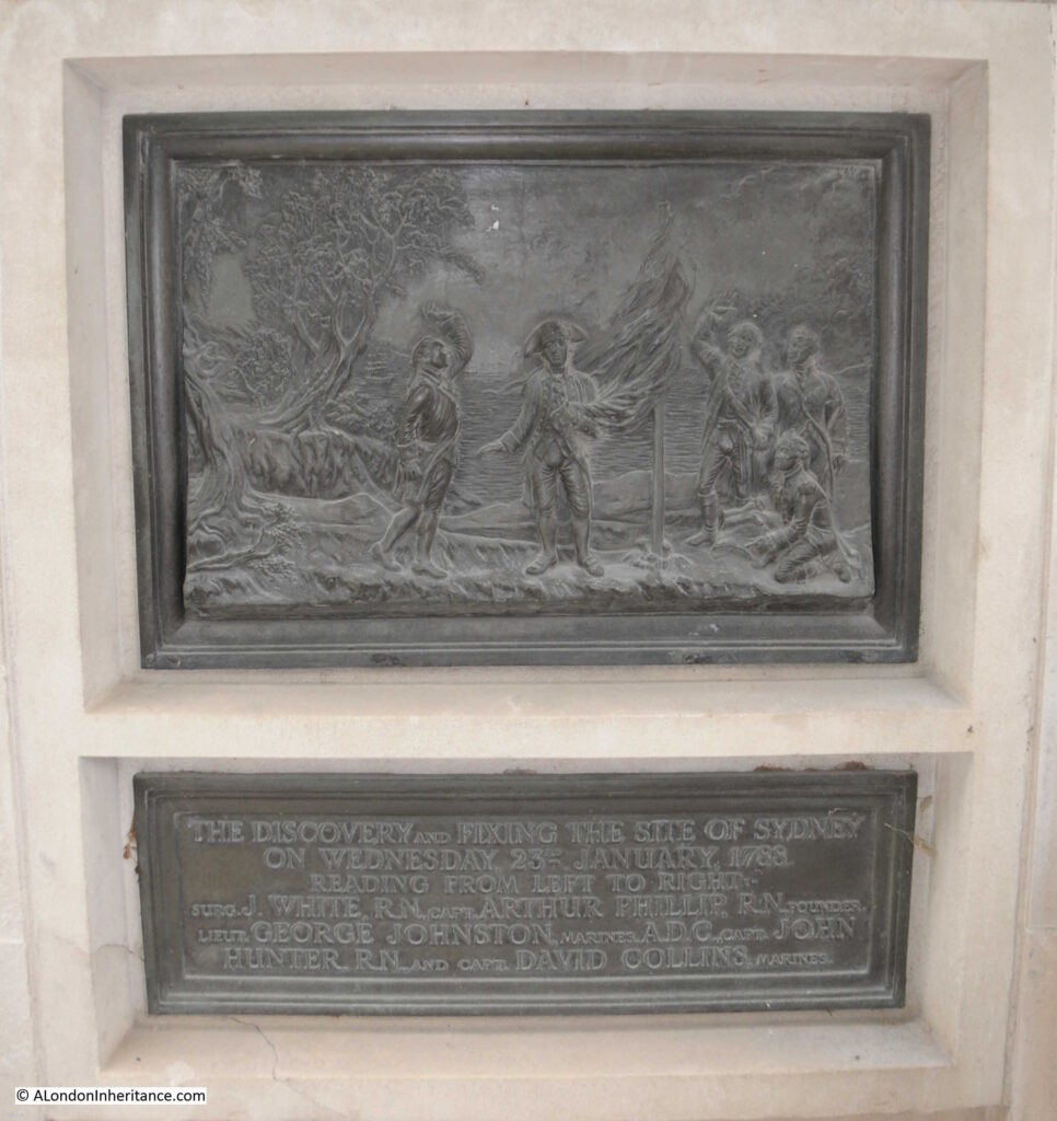
There are a couple of reliefs on the monument, one on each side. The following shows “The discovery and fixing of the site of Sydney on Wednesday 23rd January 1783. Reading from left to right, Surg. J, White, R.N. Capt. Arthur Phillip, R.N. Founder, Leut. George Johnston, Marines, A.D.C. Capt. John Hunter, R.N. and Capt. David Collins, Marines”.

Admiral Arthur Phillip, R.N. Citizen of London

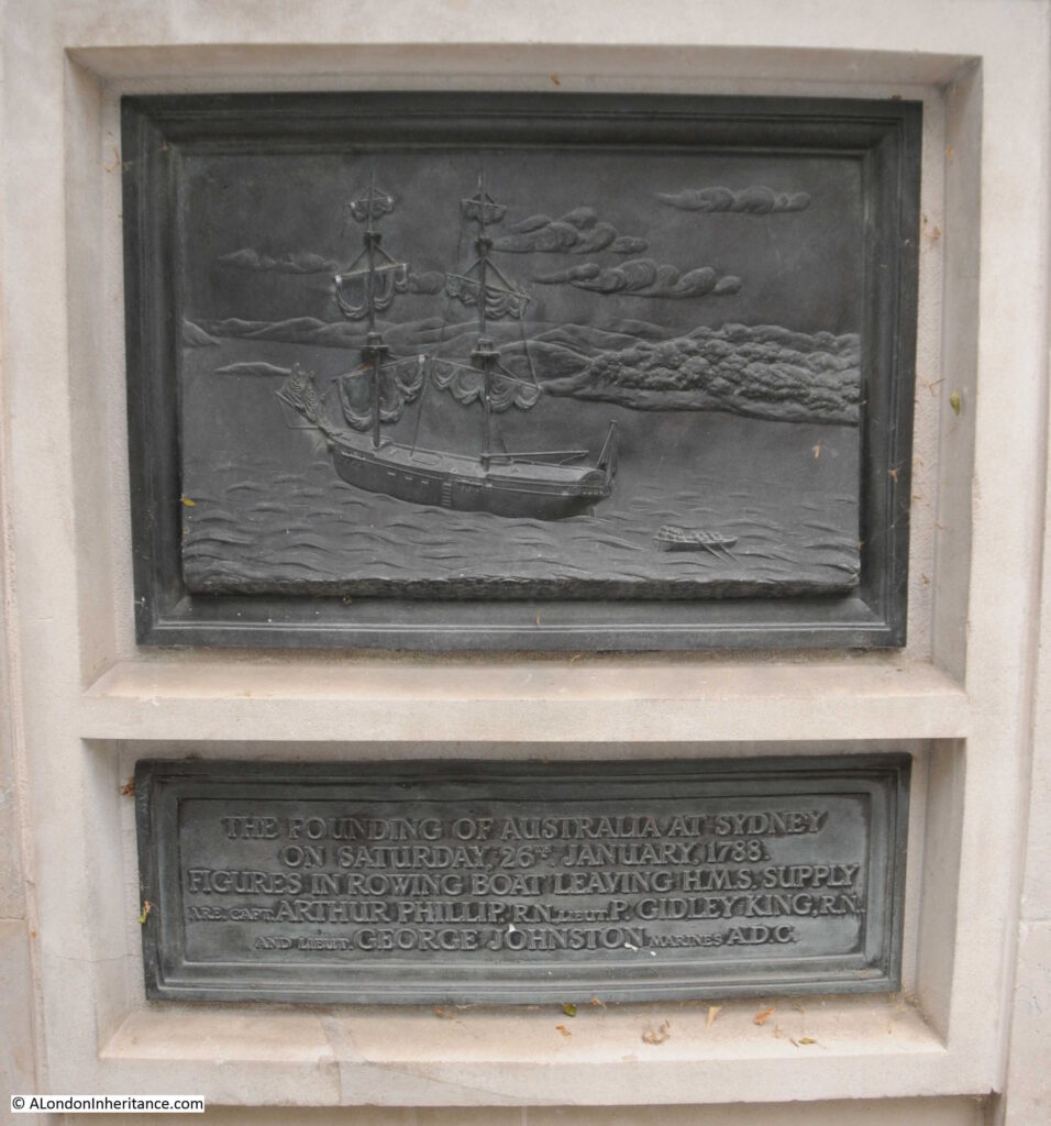
The second relief shows “The founding of Australia at Sydney on Saturday, 26th January 1788. Figures in rowing boat leaving H.M.S. Supply are Capt. Arthur Phillip, R.N. Lieut. P. Gidley King, R.N. and Lieut. George Johnston, Marines A.D.C.”:

Admiral Arthur Phillip, R.N. Citizen of London

Whilst the reliefs show a heroic view of the arrival at Port Jackson / Sydney, the reality of living at the settlement in the years after was rather challenging.

The following letter is from the Kentish Gazette on the 2nd of June, 1789. It provides a very honest view of the terrible conditions of the first settlers, and also their interaction with the indigenous population, who are described as “savages”.

“The following from Port Jackson, is written by a female pen; and as from a particular circumstance it seems an upright picture of the place, we lay it before our readers.”

The letter was written in Port Jackson on the 14th of November, 1789, and the author of the letter is not named.

I take the first opportunity that has been given us, to acquaint you with our disconsolate situation in the solitary waste of the creation. Our passage, you may have heard by the first ships, was tolerably favourable; but the inconveniences since have suffered for want of shelter, bedding &c. are not to be imagined by any stranger. However, we have now two streets, if four rows of the most miserable huts you can possibly conceive, deserve the name; windows they have none, as from the Governor’s house, &c. now nearly finished, no glass could be spared; so that lattices of twigs are made by our people to supply their places.

At the extremity of the lines, where, since our arrival, the dead are buried, there is a place called The Church Yard; but we hear as soon as a sufficient quantity of bricks can be made, a church is to be built, and named, St. Philip’s after the Governor’s namesake. Notwithstanding all out presents, the savages still continue to do us all the injury they can, which makes the soldiers duty very hard, and much dissatisfaction among the officers. I know not how many people have been killed. As for the distress of the women, they are past description, as they are deprived of tea and other things they were indulged in, in the voyage by the seamen; and as they are all totally unprovided with clothes, those with young children are quite wretched. Besides this, though a number of marriages have taken place, several women who became pregnant on the voyage, and are since left by their partners, who are returned to England, are not likely, even here, to form any fresh connections.

We are comforted with the hopes of a supply of tea from China, and flattered with getting riches when the settlement is complete, and the hemp the place produces is brought to perfection. Our Kangaroo cats are like mutton, but is much leaner; and here is a king of chickweed so much in taste like our spinach, that no difference can be discerned. Something like ground ivy is used for tea; but a scarcity of salt and sugar makes our best meals insipid. The separation of several of us to an uninhabited island was like a second transportation. In short, every one is so taken up with their own misfortunes that they have no pity to bestow on others. All our letters are examined by an officer; but a friend takes this for me privately. The ships sail tonight.”

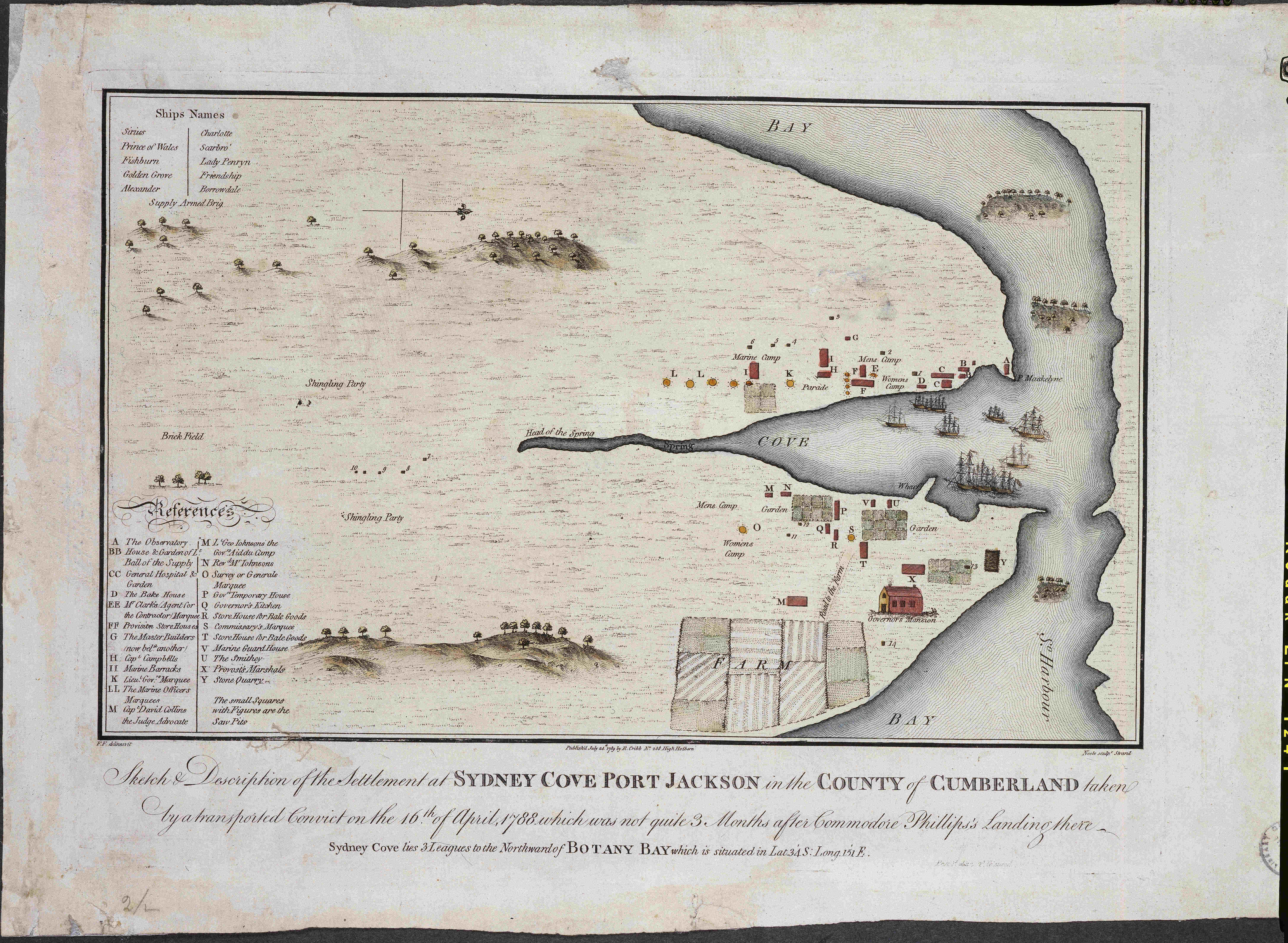
The following map is from 1789, the same year as the above letter, and shows how small the settlement at Sydney Cove Port Jackson was, and features from the letter can be seen in the map. Arthur Phillip’s ship, the Sirius, is shown in the bay. The ships are numbered and identified at top left.

Admiral Arthur Phillip, R.N. Citizen of London

Map source: State Library of New South Wales

The description to the map is “Sketch & description of the settlement at Sydney Cove Port Jackson in the County of Cumberland taken by a transported convict on the 16th of April, 1788, which was not quite 3 months after Commodore Phillips’s landing there”.

When looking at the above map, it is remarkable that this small settlement developed into what is now the city of Sydney.

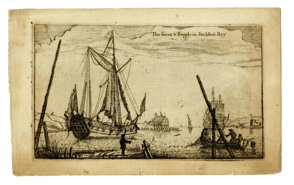
The following print shows H.M.S. Sirius and Supply, the ships of the First Fleet to arrive at Jackson’s Bay © The Trustees of the British Museum):

Admiral Arthur Phillip, R.N. Citizen of London

The majority of people arriving in the new settlement in the years at the end of the 18th century were convicts, and these featured in many prints of the time.

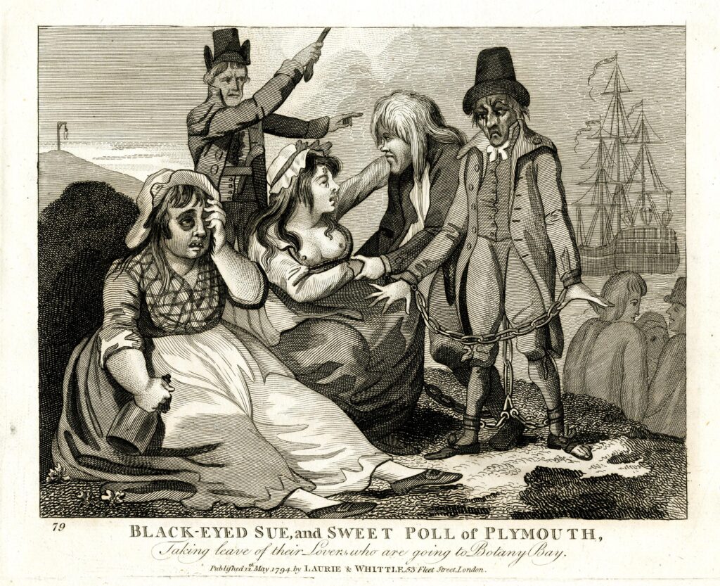
The following print shows “Black-Eyed Sue and Sweet Poll of Plymouth, taking leave of their lovers who are going to Botany Bay” © The Trustees of the British Museum):

Admiral Arthur Phillip, R.N. Citizen of London

In the print, the jailer is shown urging the two convicts to get on the ship which will take them to Australia, and perhaps to remind them of what they have escaped, there is a gallows on a hill in the background.

After a challenging start for the colony at Port Jackson, the rest of Australia would gradually be colonised, and the original site of Port Jackson would grow into the city of Sydney that we see today.

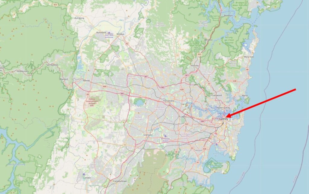
The following map shows the size of the city of Sydney, and I have marked the location of the original colony in the area around Sydney Opera House and the Sydney Bridge (© OpenStreetMap contributors):

Admiral Arthur Phillip, R.N. Citizen of London

In just under two weeks time, on January the 26th it will be Australia Day, which commemorates the landing of the First Fleet, and the day on which Arthur Phillip from Bread Street in the City of London raised the Union flag at the first colony.

St. John the Evangelist, Friday Street

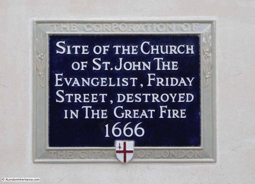
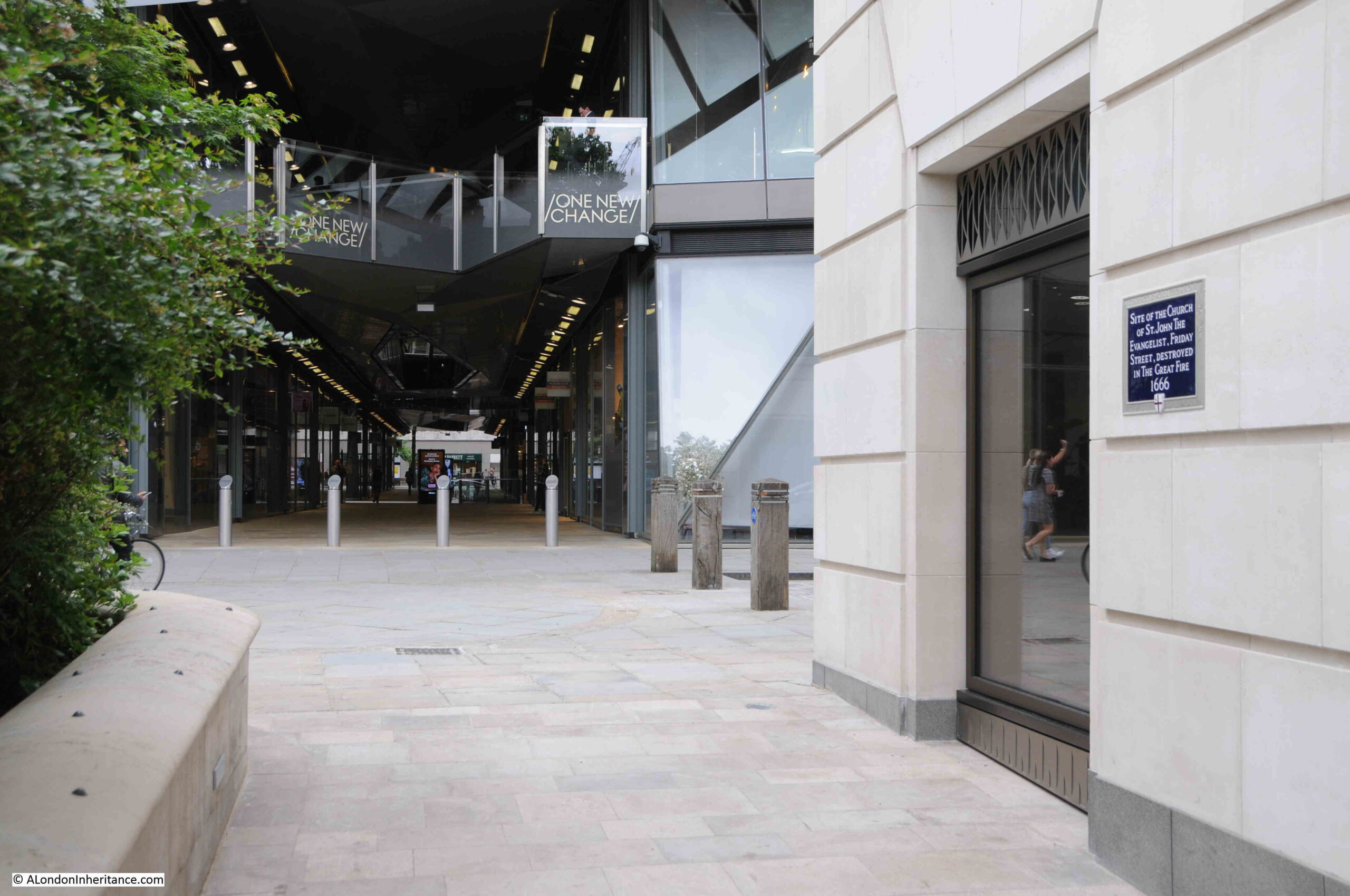
Next to the monument to Arthur Phillip is one of the City of London blue plaques, recording that it was the site of the church of St. John the Evangelist on Friday Street, and that the church was destroyed in the Great Fire of 1666:

There is not much to be found about the history of the church. In “London Churches Before The Great Fire” by Wilberforce Jenkinson (1917), there is the following paragraph about the church:

“At the end of Friday Street, at the corner of Watling Street, stood the church of St. john the Evangelist, one of those known as a ‘Peculiar’. In 1361 a chantry was founded by William de Augre. The first rector was Joh. Hanvile, who retired in 1354. The income of the benefice was returned in 1636 as £76, 10 shillings. After the Fire the parish was annexed to that of All Hallows, Bread Street. A small portion of the churchyard at the corner of Watling Street may still be seen.”

The church was known as a ‘Peculiar’, and the book gives the following definition:

“Peculiars were exempt from ordinary jurisdiction. The name of Peculiar was given to thirteen churches, of which Bow Church was the chief, and signified that they were exempt from the jurisdiction of the Bishop of London and were under the Archbishop of Canterbury”.

The plaque can be seen in the following photo on the wall on the right. One New Change is the building in the background, and the monument to Arthur Phillip is on the left, behind the greenery.

The church stood in Friday Street, and according to “London Past and Present” by Henry Wheatley (1891), the origin of the name is:

“So called, says Stow of fish mongers dwelling there, and serving Friday’s market.”

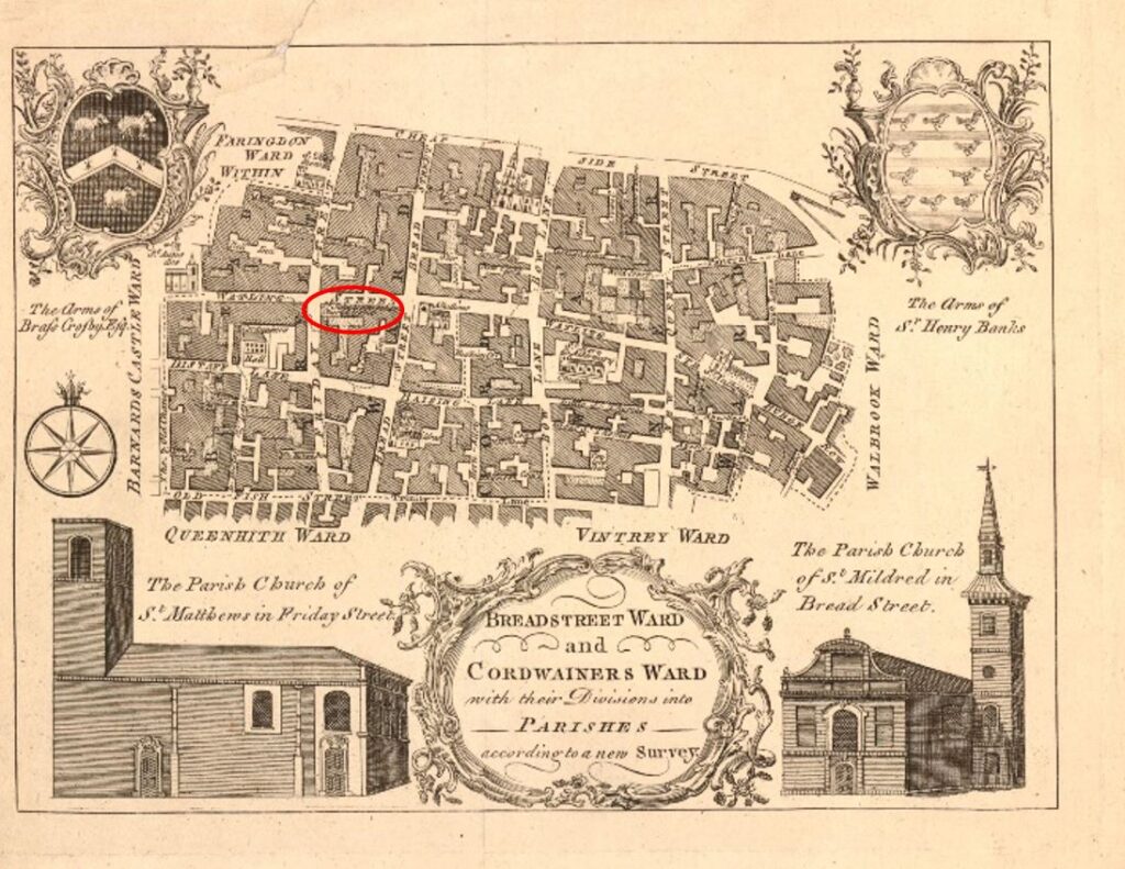
The location of the church was still marked in this 1772 Ward map of Breadstreet and Cordwainer’s Wards:

In the lower right corner of the above map is a view of St. Mildred’s, Bread Street. This was the church that was bombed during the last war, and from where the bust of Arthur Phillip was recovered from the ruins.

St. Paul’s School, Founded by Dean Colet

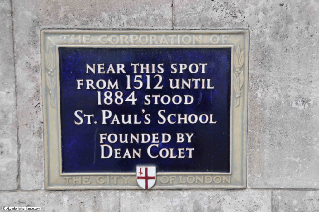
A very short walk to the west from the site of the above monument and plaque is the street New Change, and on the western side of this street is the following plaque, recording that St. Paul’s School, stood near the site of the plaque, from 1512 to 1884:

St. Paul's School, Founded by Dean Colet

Although the plaque states 1512, there has been a school associated with the cathedral for many centuries before the 16th century.

Some form of school where those who sung in the cathedral were taught was probably in existance at some point after the cathedral’s founding in the early 7th century.

In the early 12th century, a Choir School was established where boy choristers were taught. The boys were typically those in need, and as well as being taught, the Choir School provided them with food and a place to live. The boys in the Choir School would have sung in the Cathedral.

As the school developed, two forms of education emerged. There was the Choir School and a Grammar School, the later concentrating less on the teaching of singing.

This is where Dean Collet comes in, and where the plaque may need a bit more detail for those casually looking at it.

Dean was not a first name. The plaque refers to John Colet who was Dean of St. Paul’s Cathedral. John Colet was the son of Sir Henry Colet, who had been the Lord Mayor of London for two terms.

On Sir Henry Colet’s death, John inherited a substantial fortune, and with part of this inheritance, endowed and refounded the Grammar School at St Paul’s.

Dean Collet’s refounding of the church is interesting as he seems to have taken a very “renaissance” approach to education and governance of the school.

As would have been expected, education was based on Christian principles, but also employed a humanist approach. He also started a separation of the school from the Cathedral, as he chose members from “the most honest and faithful fellowship of the mercers of London” as school governors, rather than clergy from St. Pauls.

The choir and grammar schools continued to diverge and have separate premises, and today, the school founded by Dean Collect has been based in Barnes, West London since 1968.

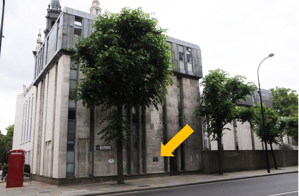
The location of the plaque is shown in the following photo:

St. Paul's School, Founded by Dean Colet

Although St. Paul’s School has moved to Barnes, the building where the plaque can be found is still as school, as the St. Paul’s Cathedral School, which is the school that the original Choir School has evolved into.

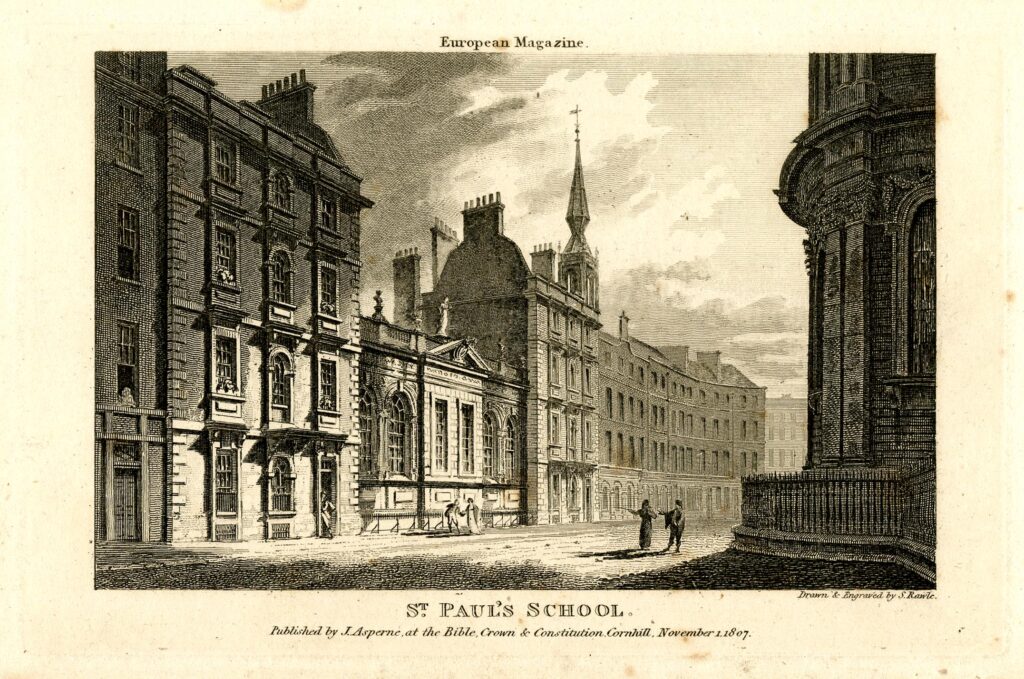
St. Paul’s School in 1807 is shown in the following print, looking across St. Paul’s Churchyard (part of the cathedral is on the right):

St. Paul's School, Founded by Dean Colet

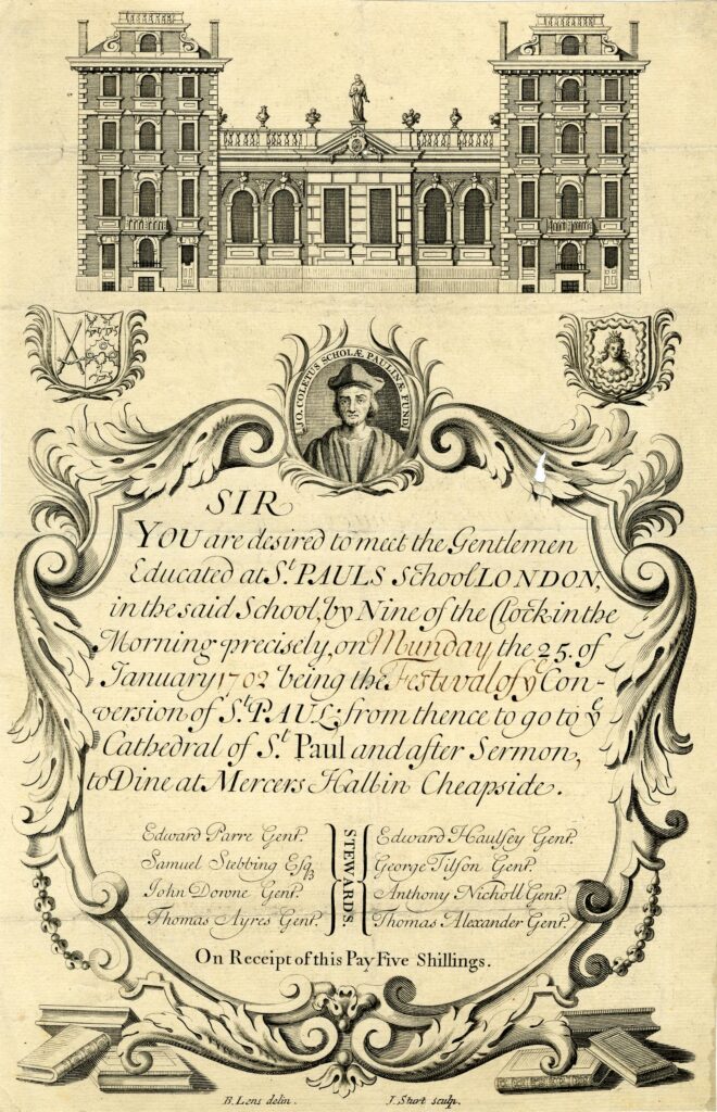
I believe that the school shown in the above photo is that founded by Dean Colet, as the following invitation to an event involving the school shows the same buildings, and the final part of the event is to “Dine at Mercers Hall in Cheapside”, and it was Dean Colet who employed members of the Mercers Company as Governors of the school © The Trustees of the British Museum):

St. Paul's School, Founded by Dean Colet

Although Dean Colet’s school has moved to west London, the survival of a school on the site, associated with the Cathedral, is one of the places of centuries long continuity that can be found across the City.

Water Fountain by the Company of Gardeners of London

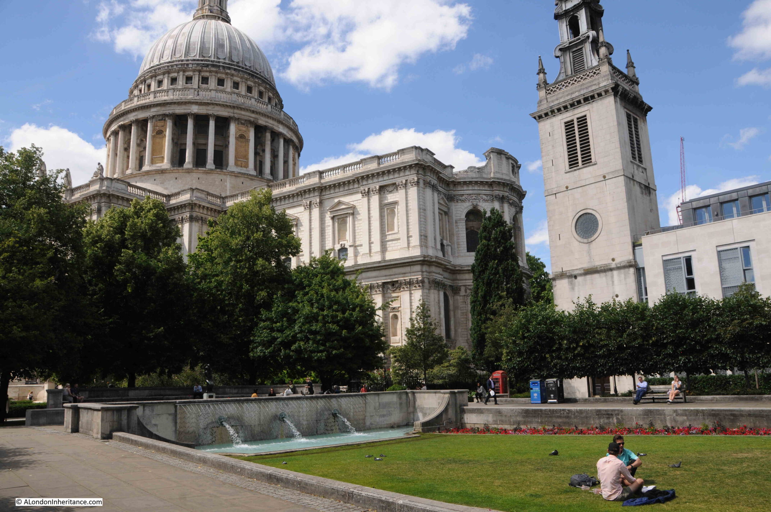
If you walk from the location of the plaque to Dean Colet’s school, you will find to the south east of St. Paul’s Cathedral a grassed area, with fountains, surrounded by paving and seats:

Water Fountain by the Company of Gardeners of London

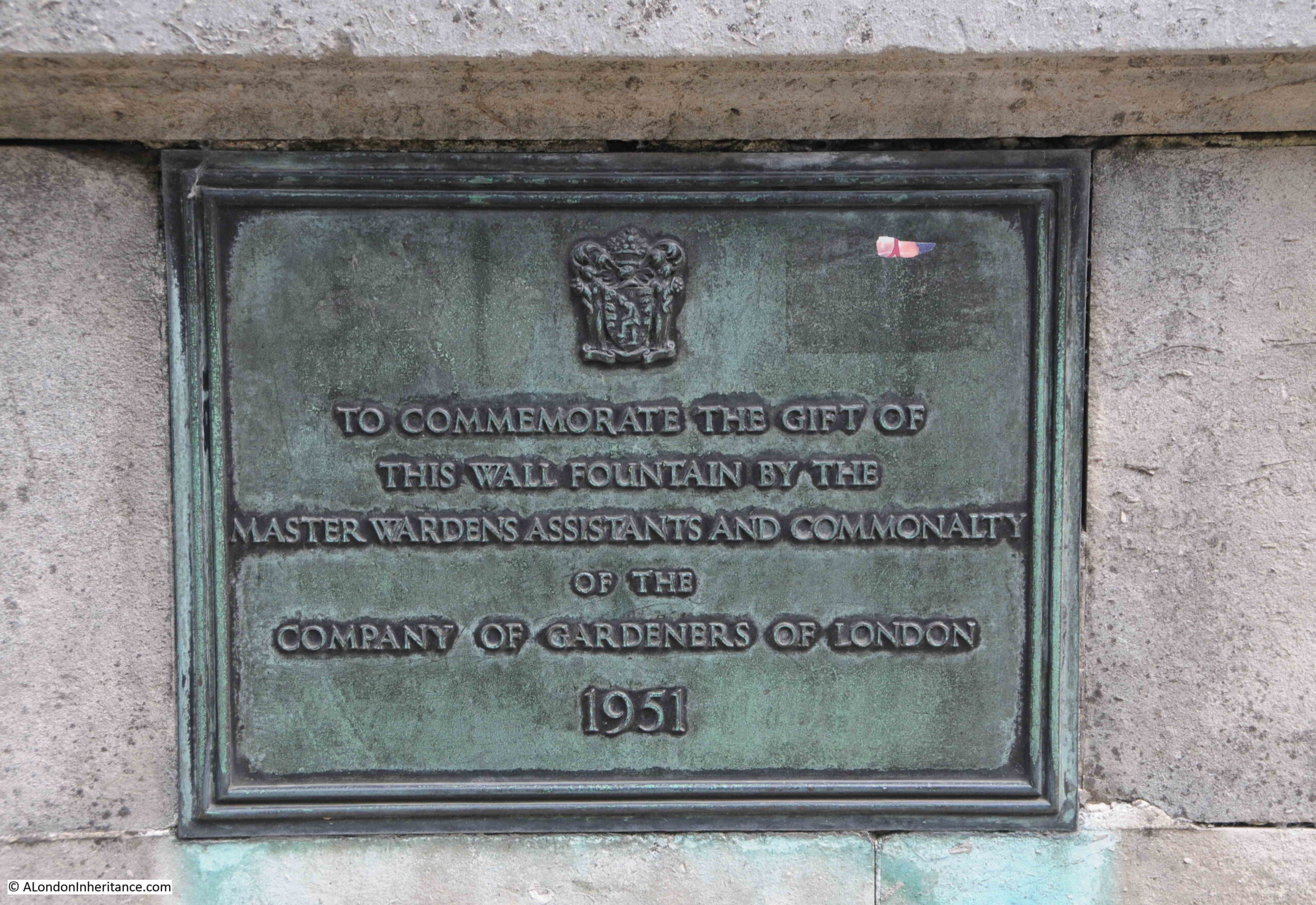
Set into the surrounding wall is a plaque that records that the wall fountain was the gift of the “Master Wardens, Assistants and Commonality of the Company of Gardeners of London – 1951”.

Water Fountain by the Company of Gardeners of London

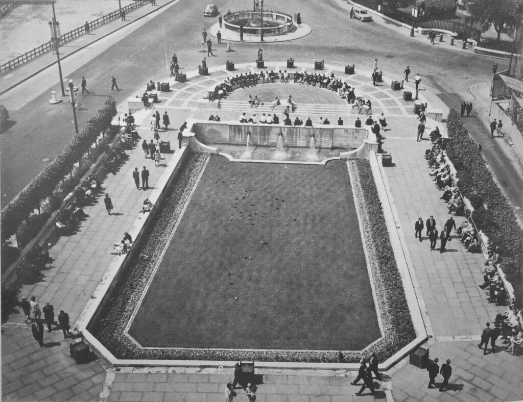
The year of 1951 should offer a clue as to why the gardens are here. They were part of efforts to improve the post-war environment of the City, and their completion was timed to coordinate with the Festival of Britain, which is why they are called Festival Gardens.

The following photo shows the gardens soon after opening in 1951:

Water Fountain by the Company of Gardeners of London

The street at the top of the above photo that runs to the right was St. Paul’s Churchyard, and this street, along with the circular feature at the very top of the photo, have since disappeared in the creation of gardens running along the south side of the cathedral.

Another street that has been lost is also recorded:

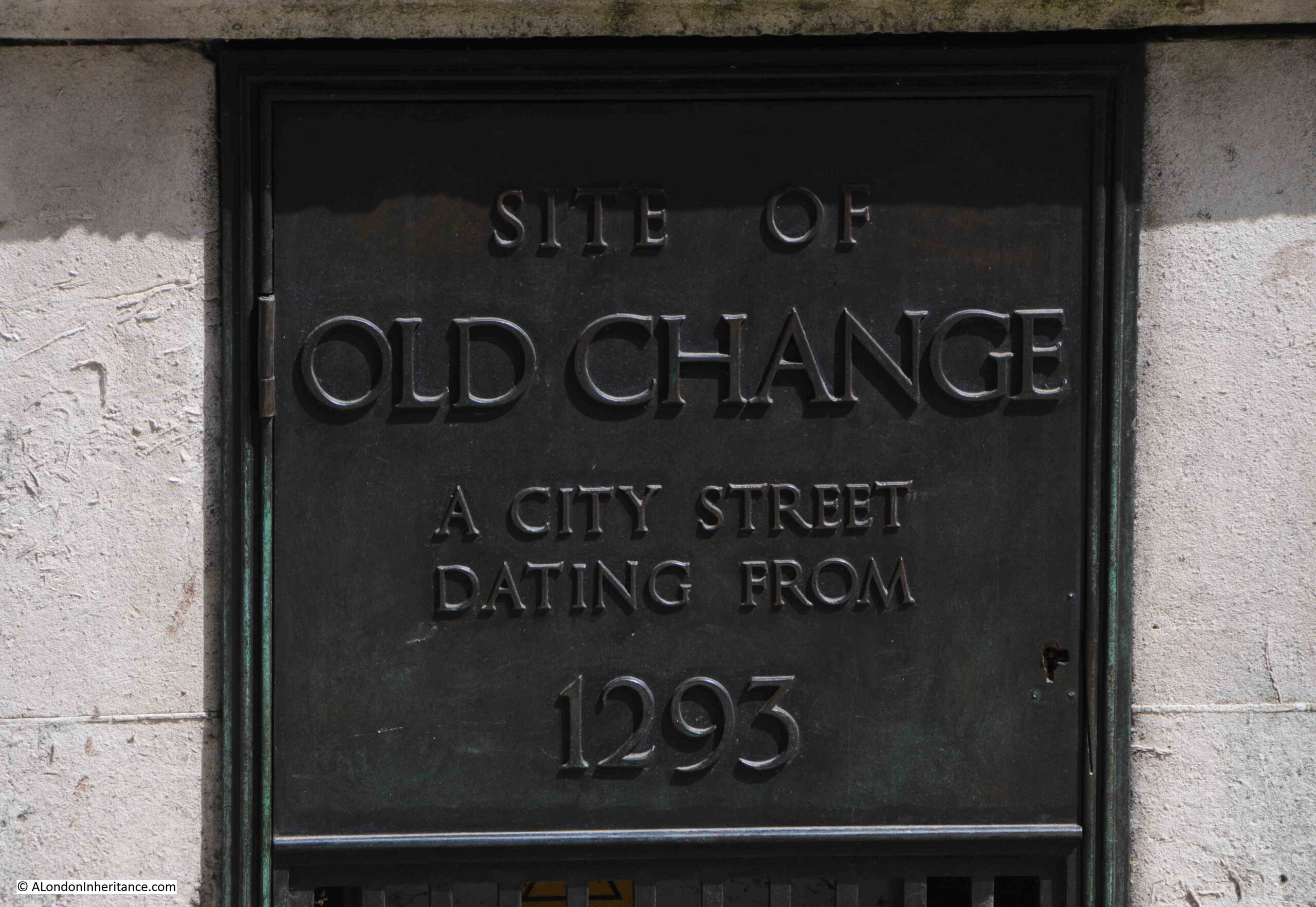
Site of Old Change – A City Street Dating From 1293

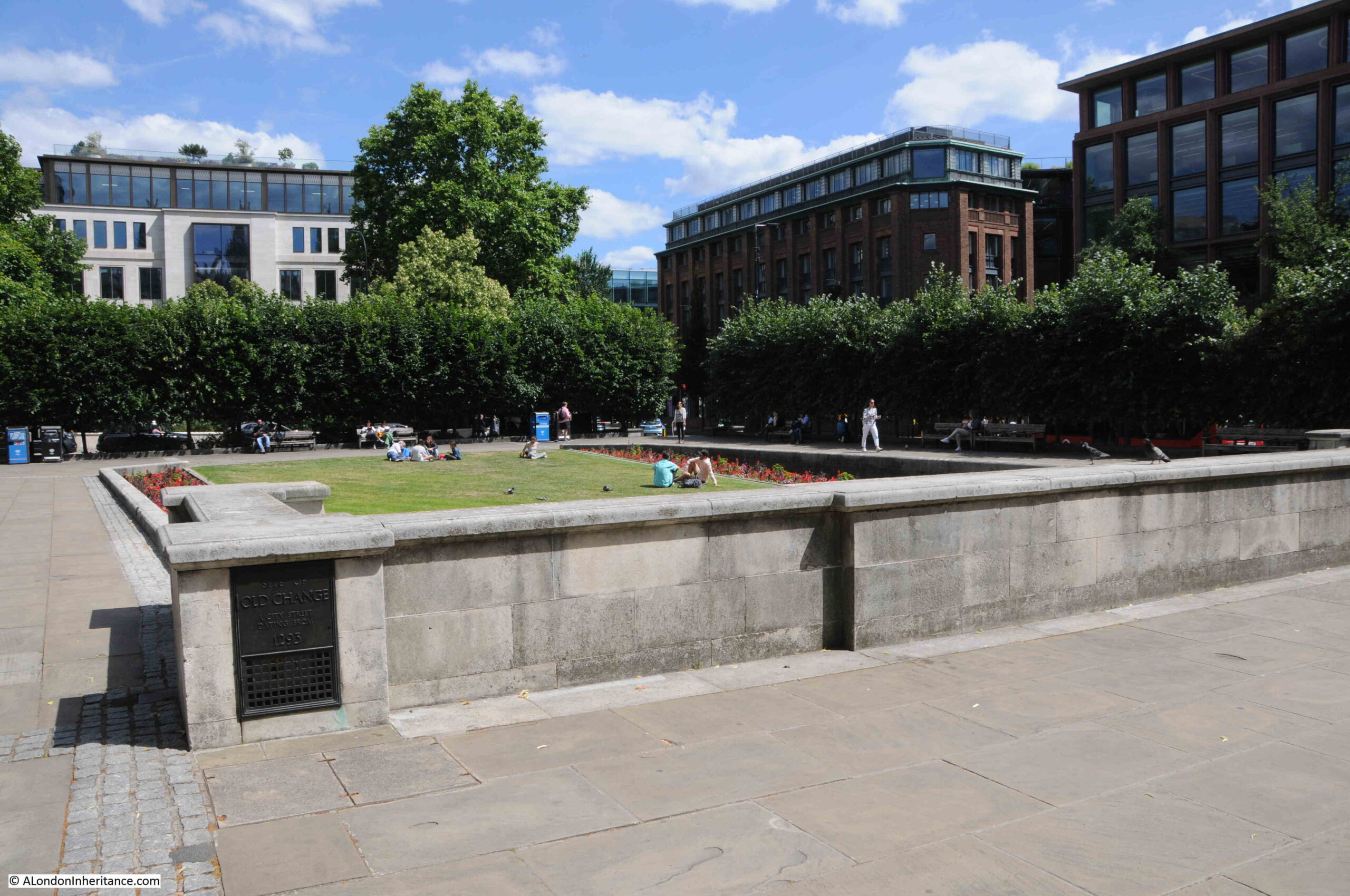
At the western end of the gardens is a wall, with fountains facing onto the grassed area. At the back of this wall there is a plaque on the northern corner of the wall:

Old Change

The plaque records that this was the site of Old Change, a city street dating from 1293, and as you walk along the paved area to the side of the wall and plaque, in the lower right of the above photo, you are walking along part of the original route of Old Change:

Old Change

“London Past and Present” Henry Wheatley (1891), provides some historical background to the street, along with its original name, and the source of the name:

“Old Change, Cheapside to Knightrider Street, properly Old Exchange, but known by its present name since the early part of the 17th century.

Old Exchange, a street so called of the King’s Exchange there kept, which was for the receipt of bullion to be coined. Stow, p.129.

The celebrated Lord Herbert of Cherbury lived in the reign of James I, in a ‘house among the gardens near the Old Exchange’. At the beginning of the last century the place was chiefly inhabited by Armenian merchants. At present (1890) it is principally occupied by silk, woolen and Manchester warehousemen. On the west side were formerly St. Paul’s School and the church of St. Mary Magdalen, on the east is the church of St. Augustin.”

As I have mentioned before on the blog, it is always difficult to know what is really true. The above extract states that the name Old Change applied from the early part of the 17th century, however the reference to the street in “A Dictionary of London” by Henry Harben (1918) states that “First mention ‘Old Change’ 1292-4”, however Harben’s book does confirm the name Old Exchange also applied, and that the name came from the Kings Exchange, which was “situated in the middle of the street”.

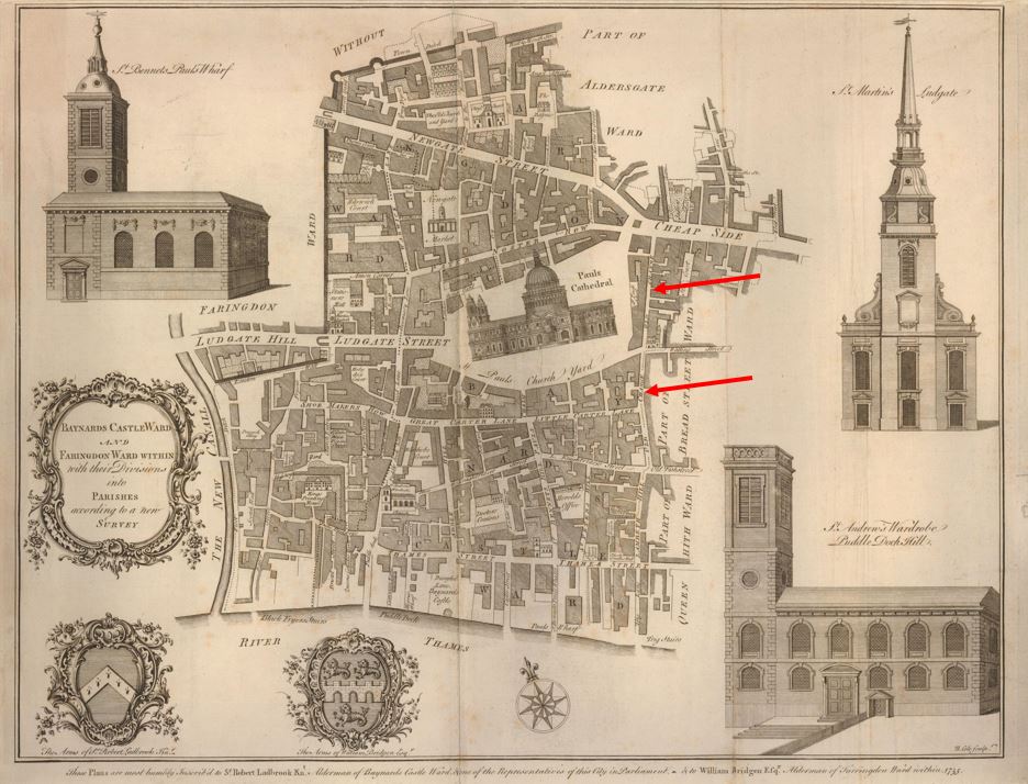
I have marked the location of Old Change in this ward map from 1755.

Old Change

The uppermost red arrow shows the section from Watling Street to Cheapside, and the lower arrow shows the section from Watling Street down to the junction of Old Fish Street and Knightrider Street.

The map shows how built up the area immediately surrounding the cathedral was, and which lasted until the post-war development, which opened up some of the surroundings of the cathedral.

I have marked the location of Old Change in the following photo which is from my father’s series of post-war photos from the Stone Gallery of St. Paul’s Cathedral:

Old Change

The wall at the back of the fountain on which the plaque is mounted is along the side of the street at the position of the arrow head in the above photo.

The plaques and monuments to be found across the City of London tell some remarkable stories of the City’s history, and of those who were born and have lived in the City.

Well worth more than a quick glance when walking the City’s streets.

alondoninheritance.com

A Wet January Evening in the City, and the Festival of Britain

A mix of subjects in this week’s post.

Firstly, if you would like to hear me say erm far too many times whilst I talk about the blog, I had a chat with Liam Davis who hosts a weekly podcast on Shoreditch Radio, where he invites guests from all walks of life to talk about London.

There is also a good discussion with Feargus Cribbin of the London Pub Map.

If the embedded widget below does not work, you can find the podcast at this link.

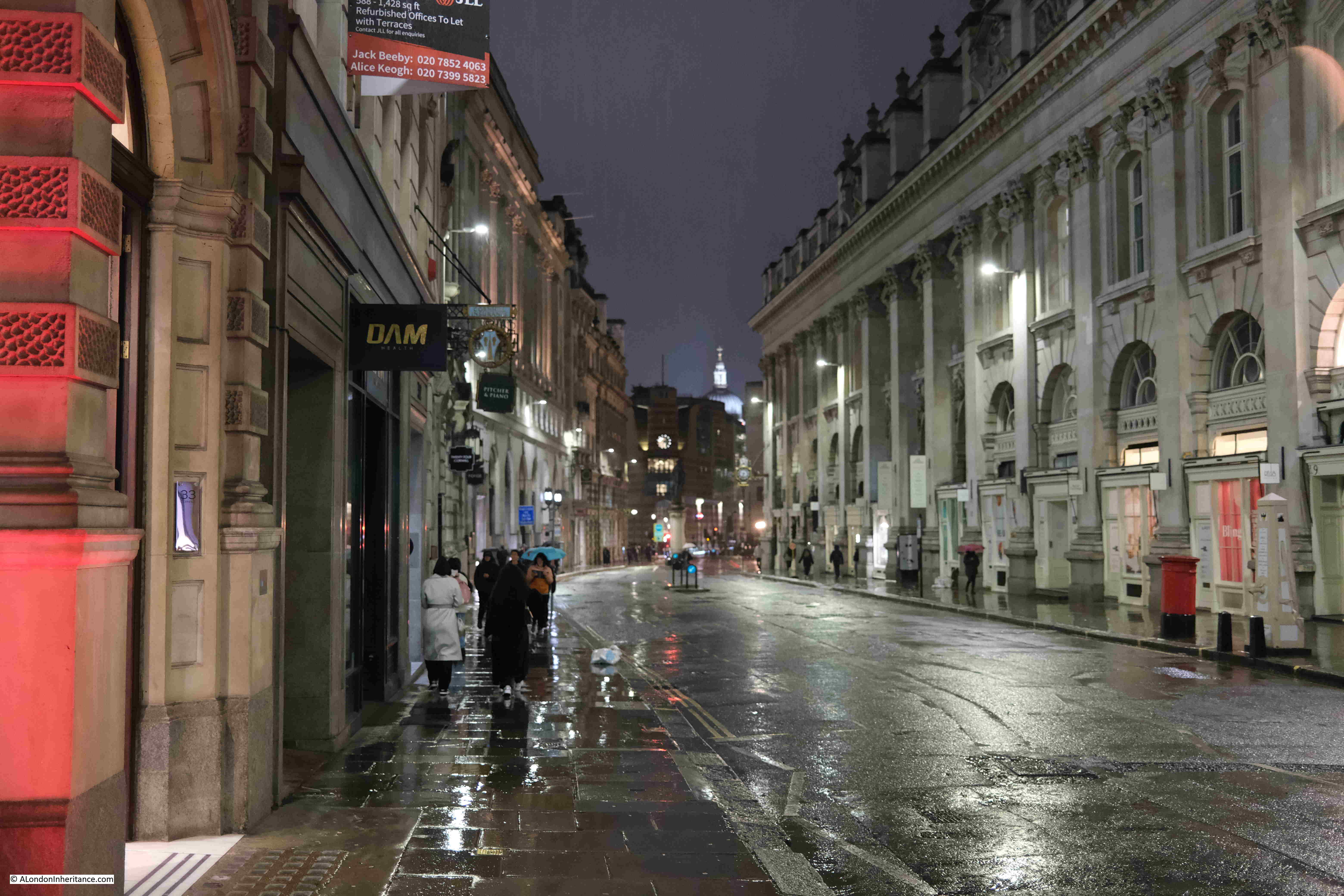
A Wet January Evening in the City of London

Not the most promising of headings, but hopefully I will show you why it is worth it.

The period between Christmas and the first full working week in the new year is a strange one in the City of London.

There are not too many people around, there will be those who have taken an extended break over Christmas and the first few days in January, also, working from home is a very attractive way of working at this time of year.

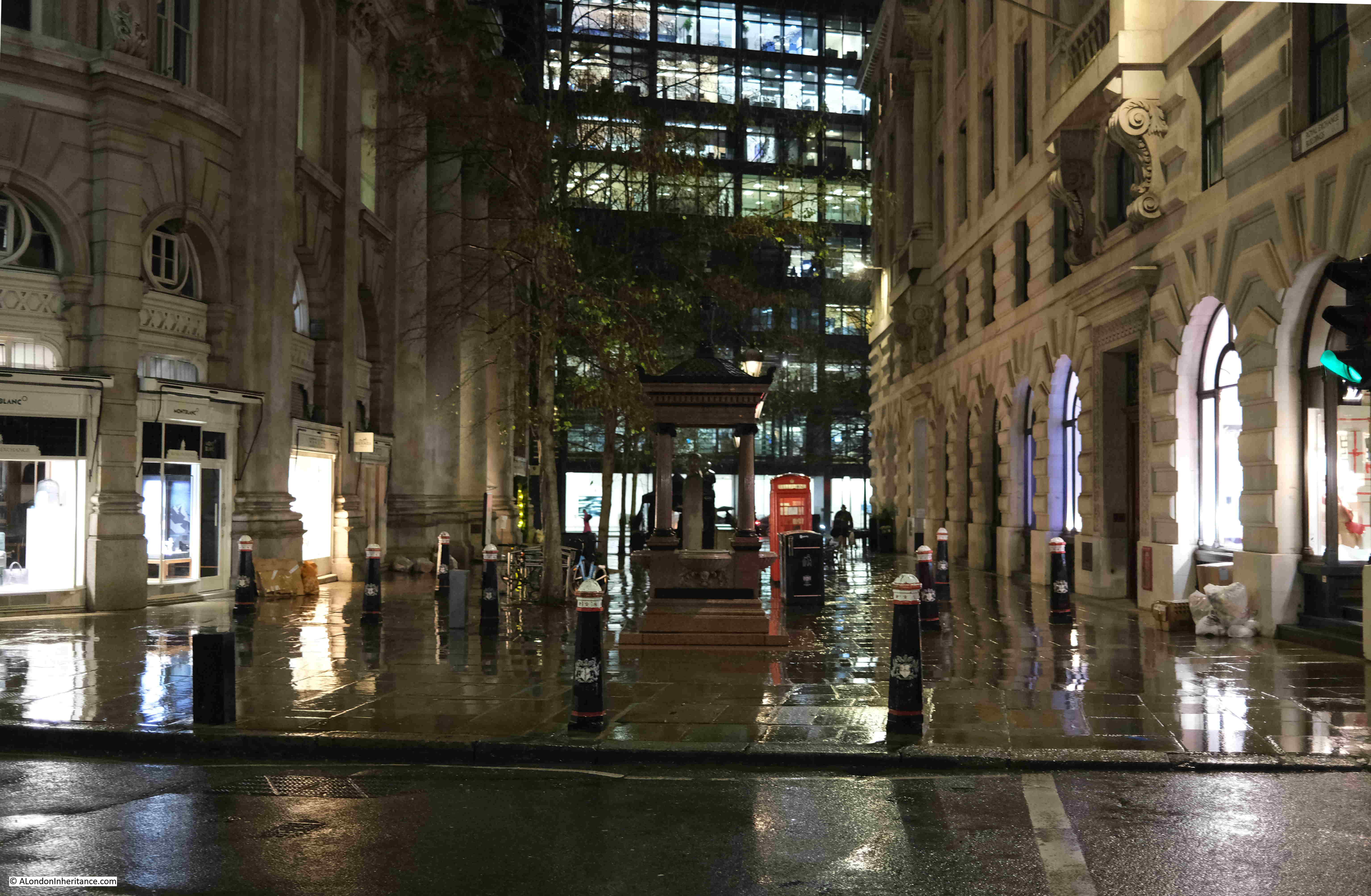
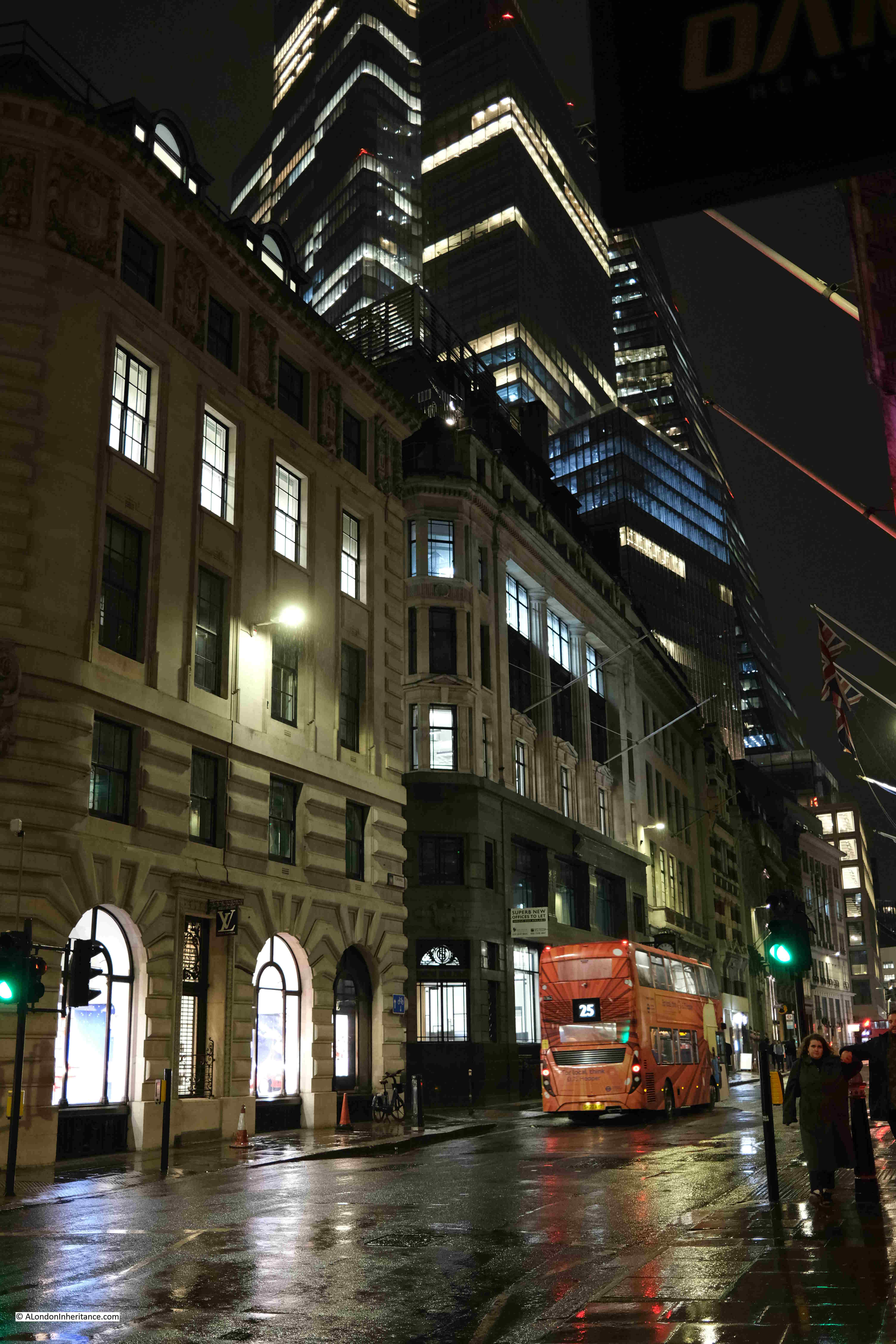
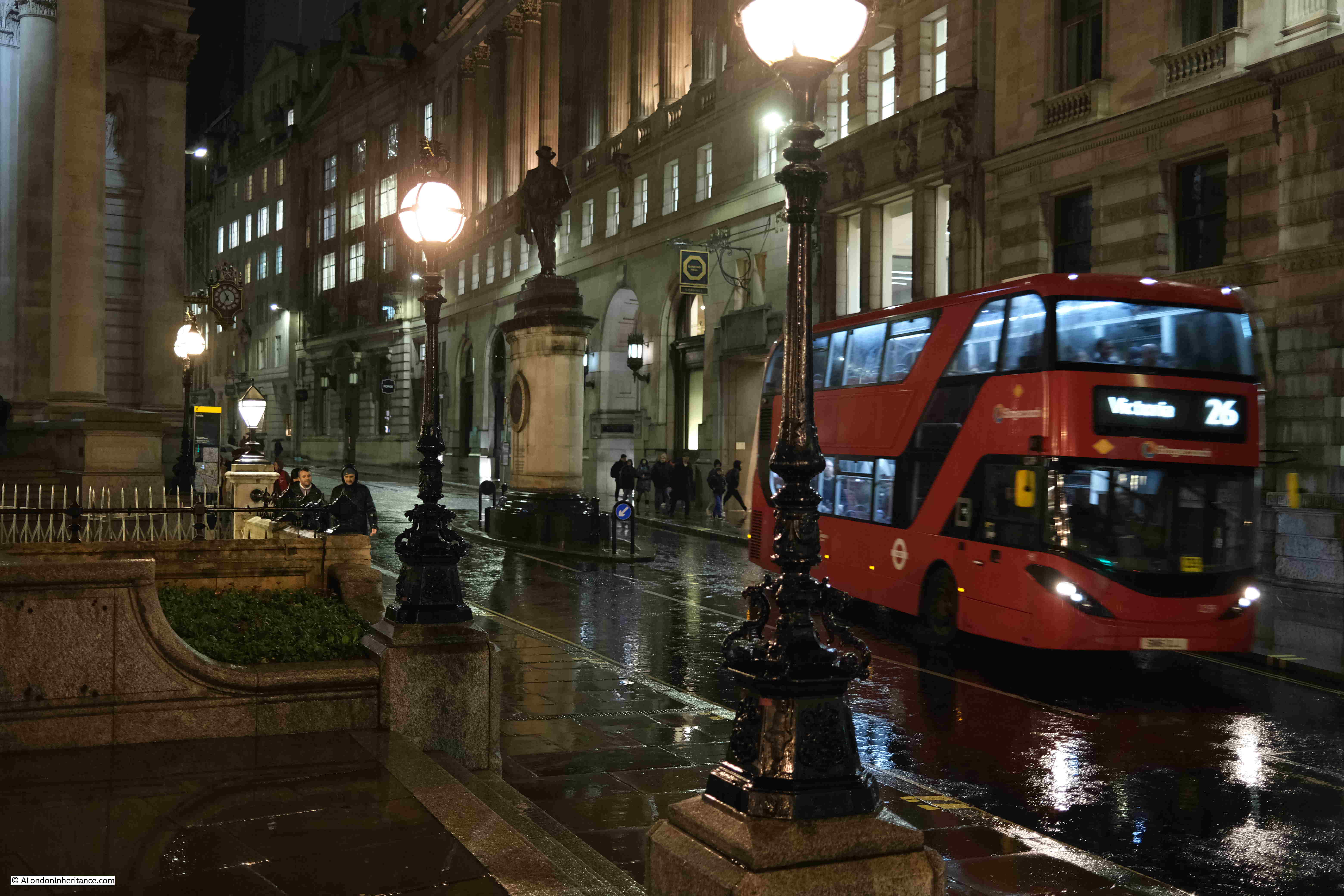
Although Christmas is rapidly fading from memory, there are still plenty of decorations and lights. Add to that a very wet start to the year, and an evening when the rain gets heavier by the hour, and the City takes on a very melancholy appearance.

The majority of people on the City’s streets are taking the sensible approach of heading home as quickly as possible, however it is also a good time for a little exploration.

Personally, I prefer the summer. A bit of warmth, plenty of sunshine, long evenings, however London looks good at almost any time of year, and to demonstrate, I took a walk from Liverpool Street down to the Bank, taking a series of photos as I went, with light rain to start, and heavy rain at the Bank preventing a longer walk.

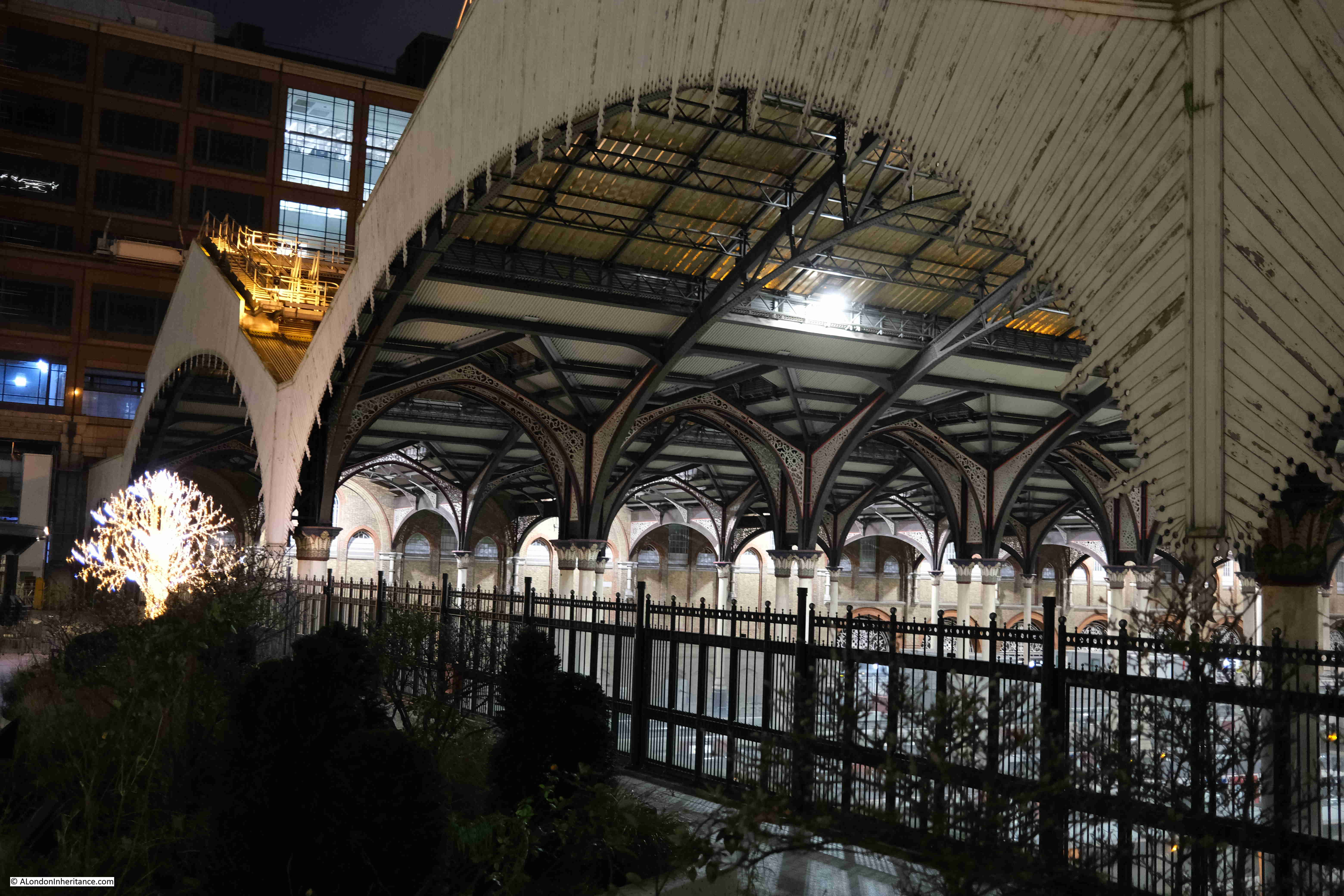
I started at Exchange Square, which is an open space between office blocks at the end of the shed over the platforms of Liverpool Street Station.

It is a very unique place, providing an unusual view of the station and the structure of the roof above the platforms. I have written a dedicated post about the area, which you can find here, but the purpose of my latest visit was just to admire the view.

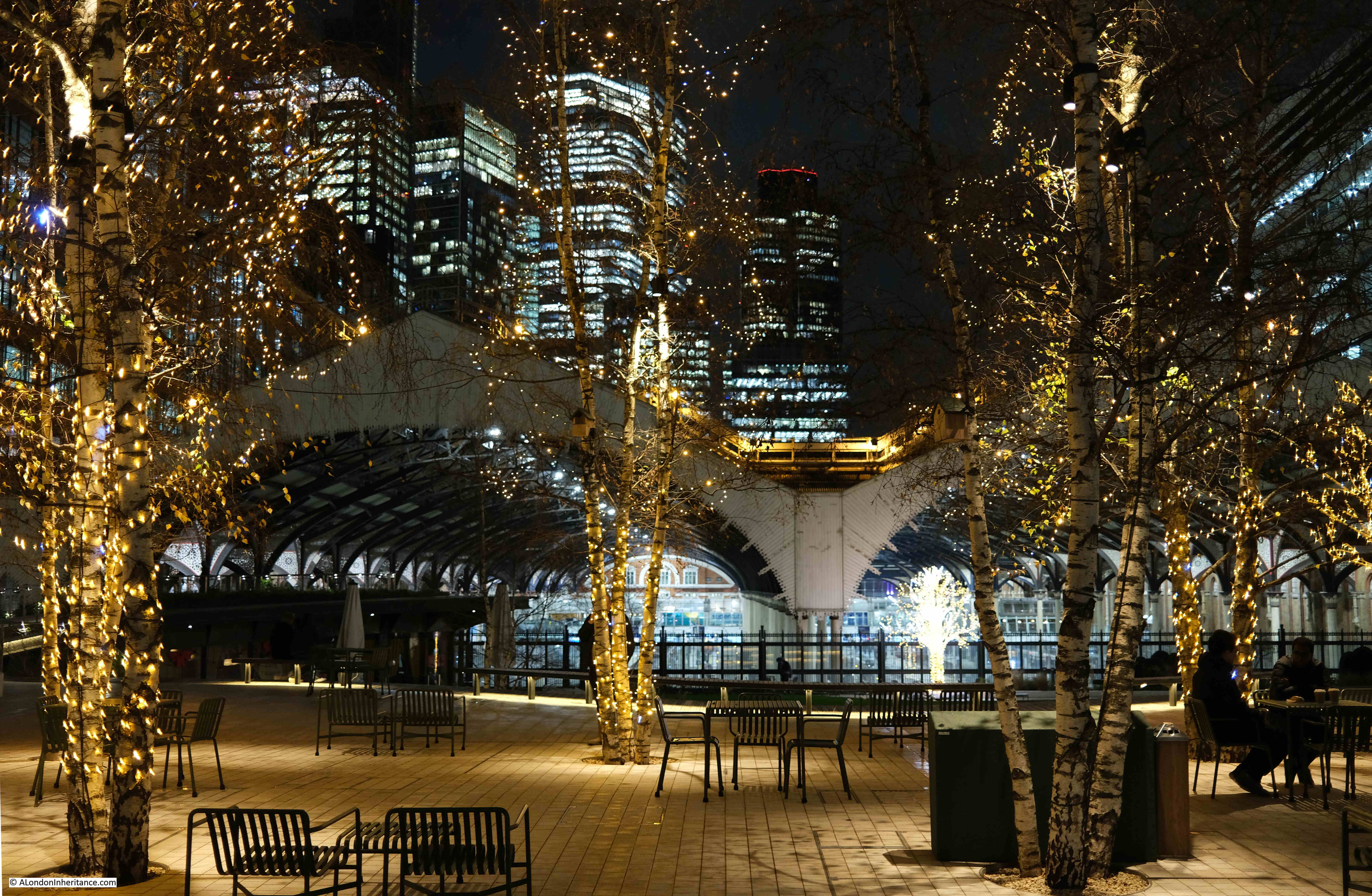
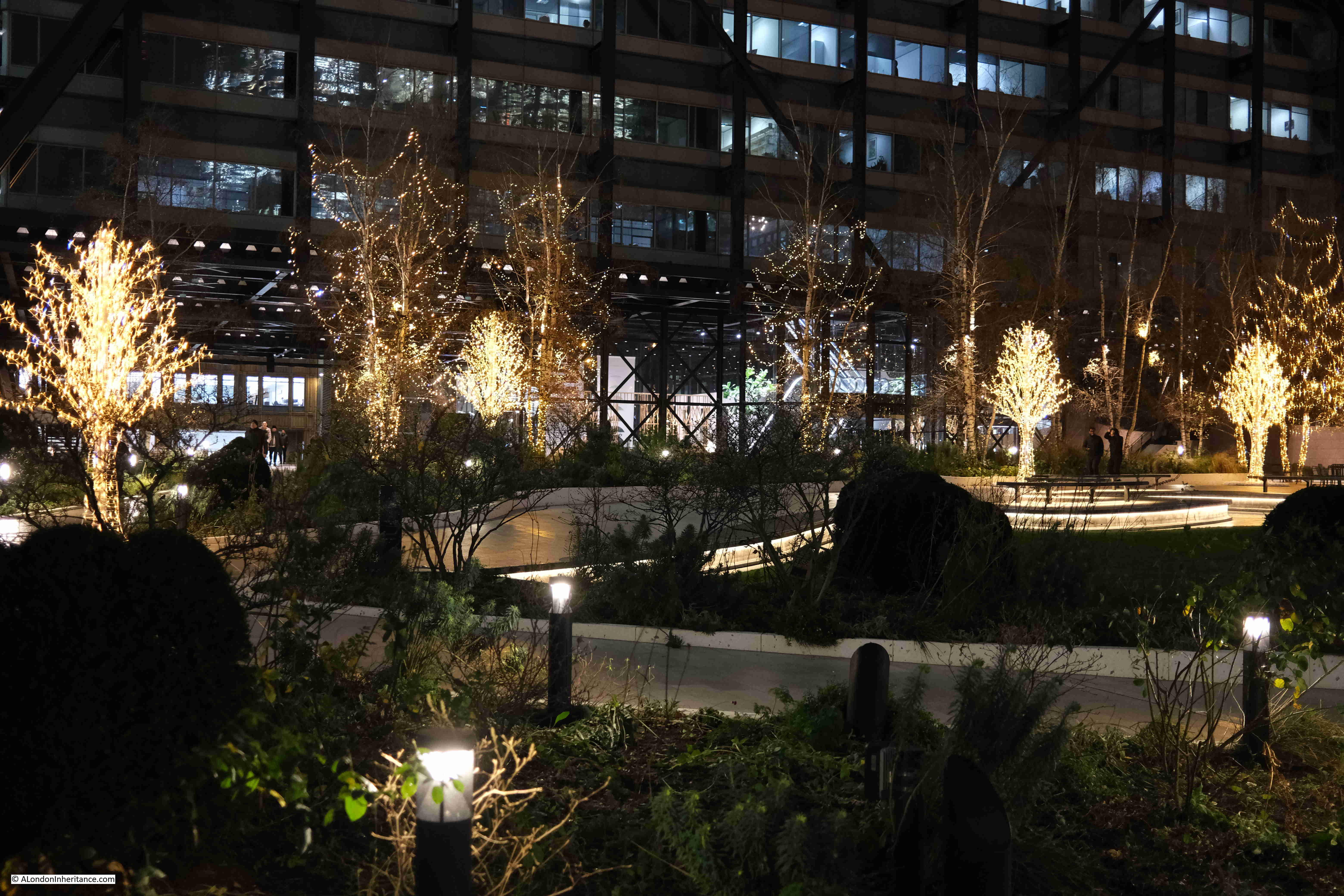
The trees in Exchange Square are currently decorated with lights:

Wet January Evening in the City

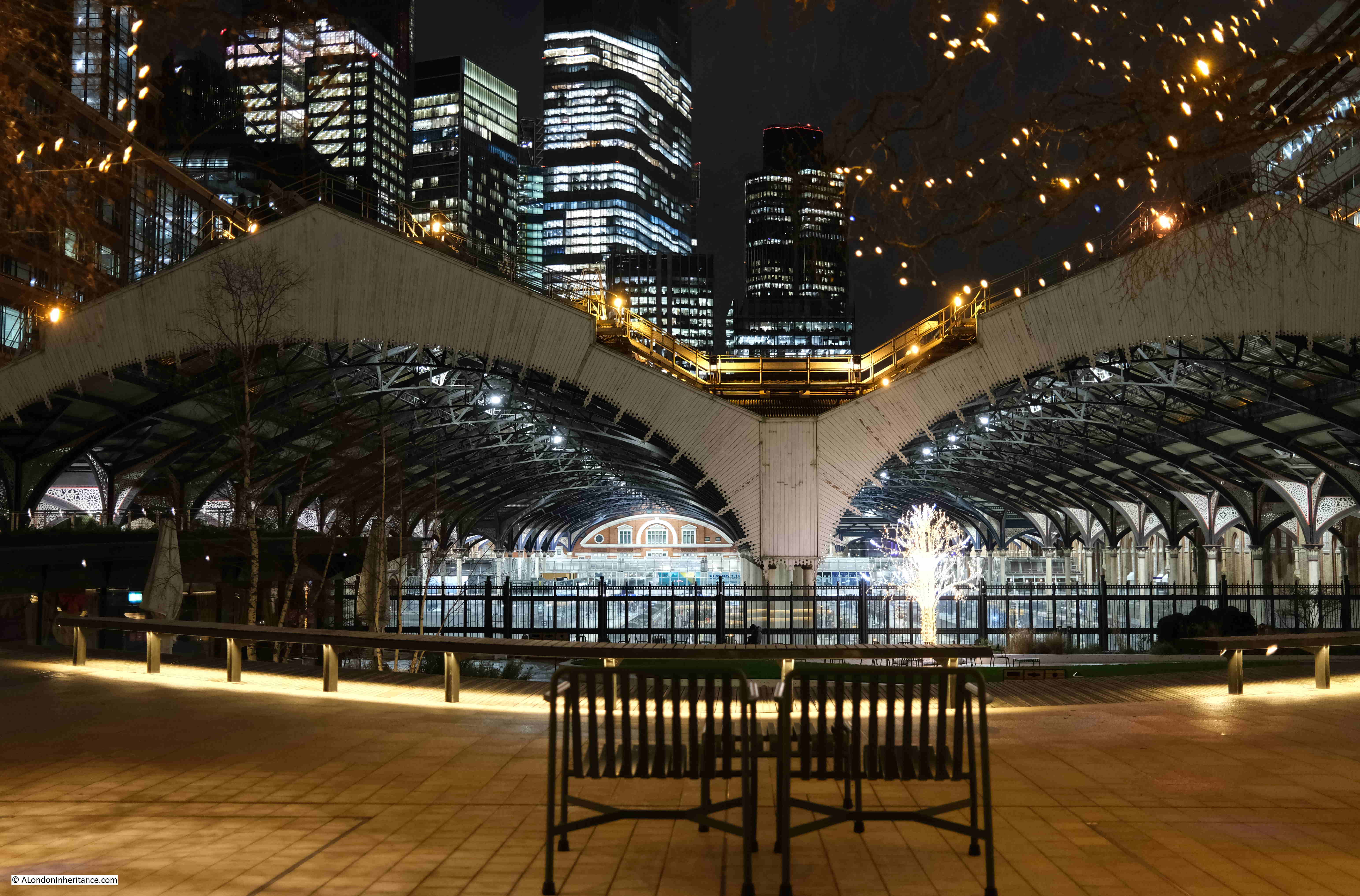
The view from this space is good during daylight, but after dark it takes on a very different aspect, with the lights of the square, the station, and the tower blocks behind.

I assume that if the proposed development above Liverpool Street station goes ahead, then the view of the office blocks in the distance will be blocked by the new tower built over the station:

Wet January Evening in the City

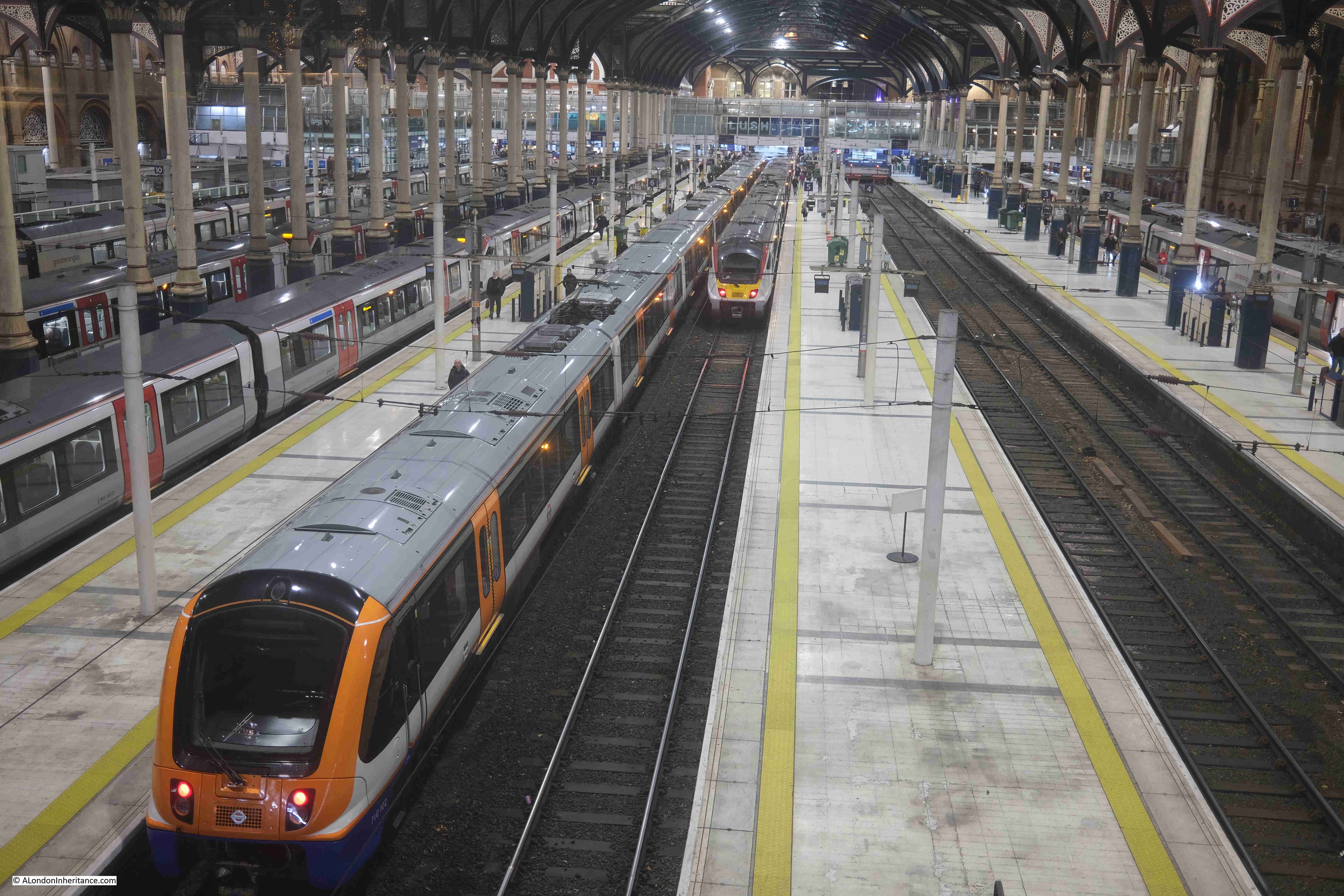
From the fencing between the square and the station, we can look down on the platforms:

Wet January Evening in the City

Artificial lighting after dark brings out a different level of detail within the roof over the station platforms:

Wet January Evening in the City

Exchange Square lights:

Wet January Evening in the City

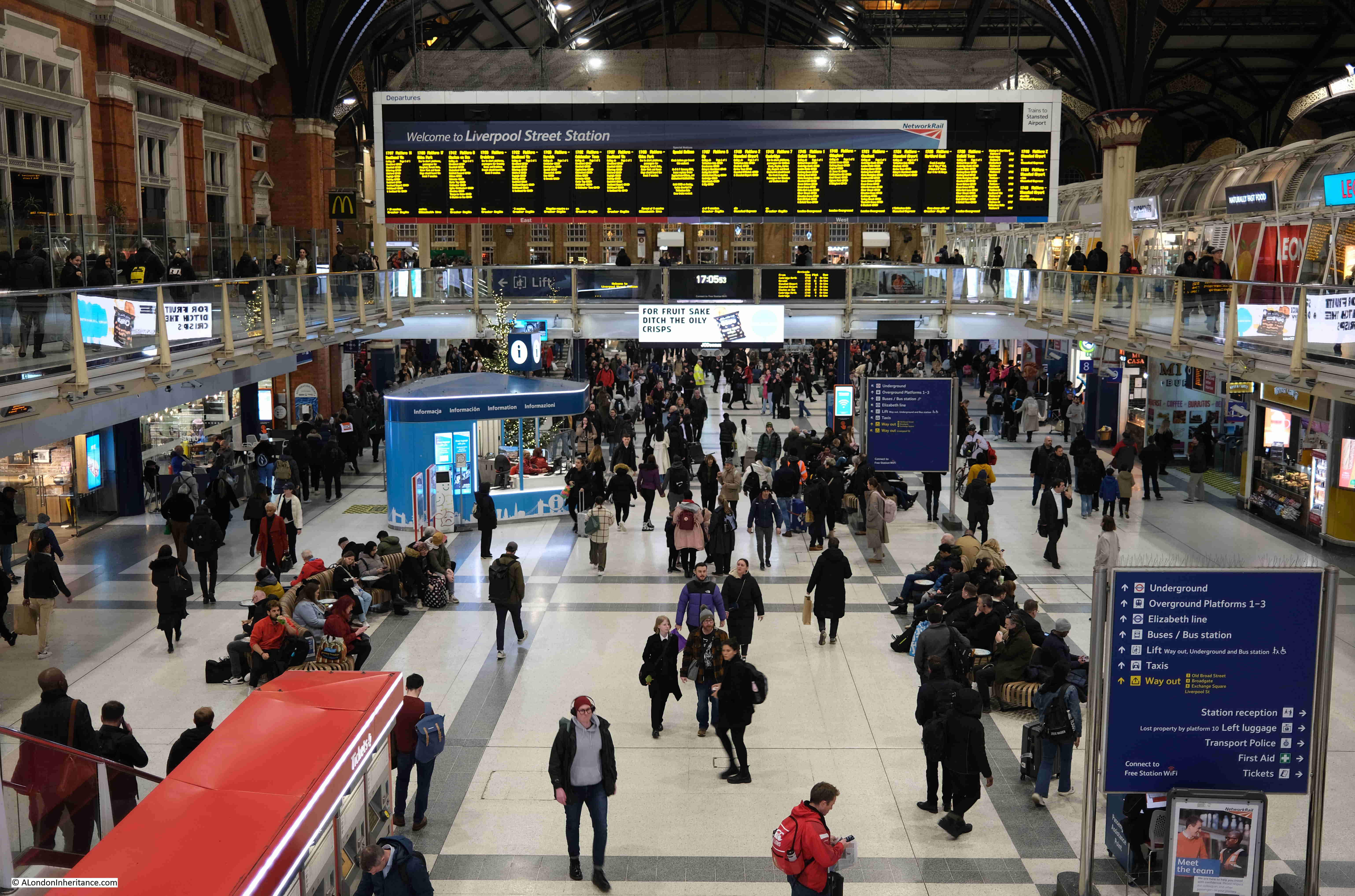
There are plenty of people using the station, but not as busy as on a working day outside of the Christmas / New Year period:

Wet January Evening in the City

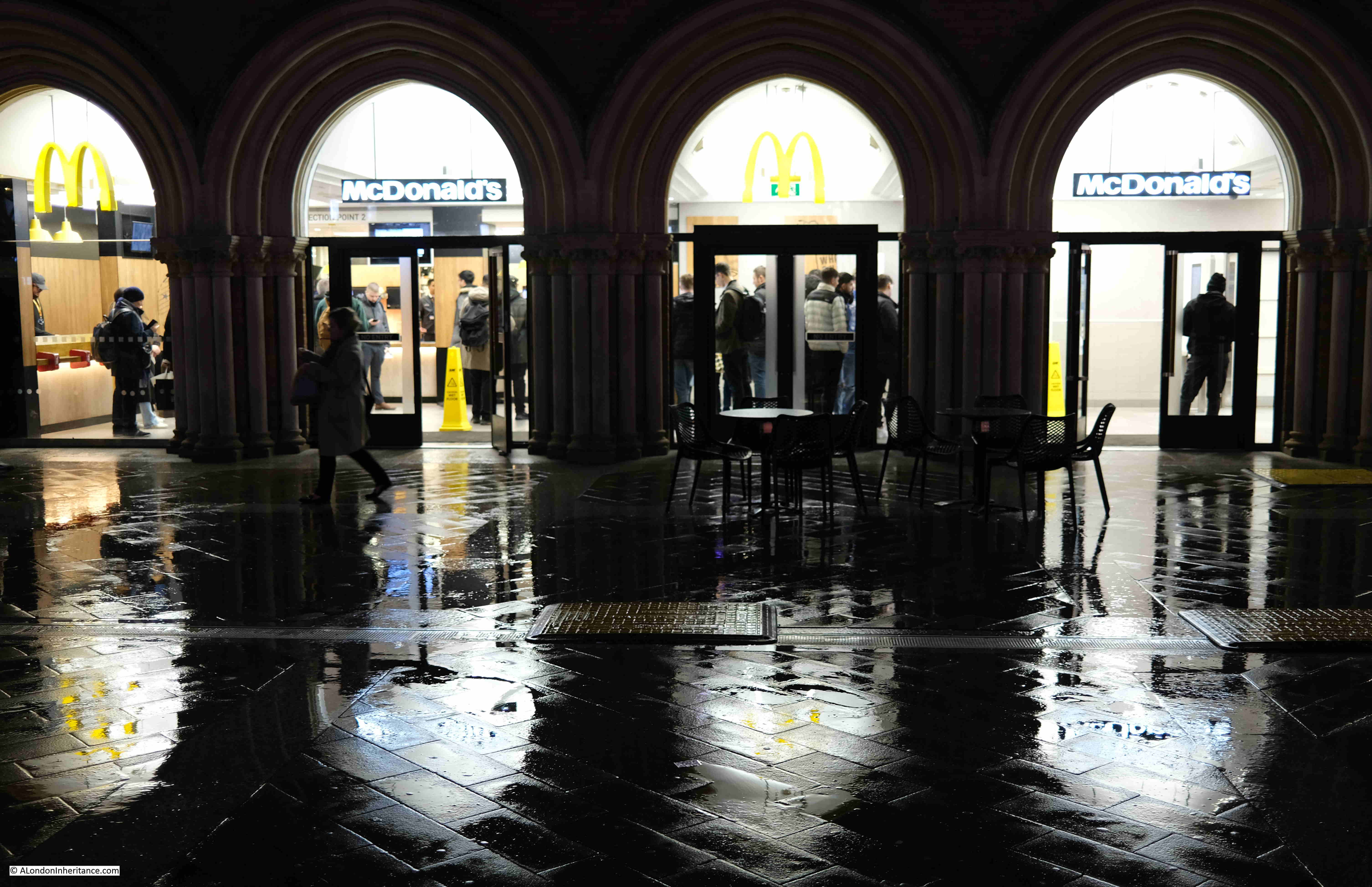
The McDonald’s at the station entrance:

Wet January Evening in the City

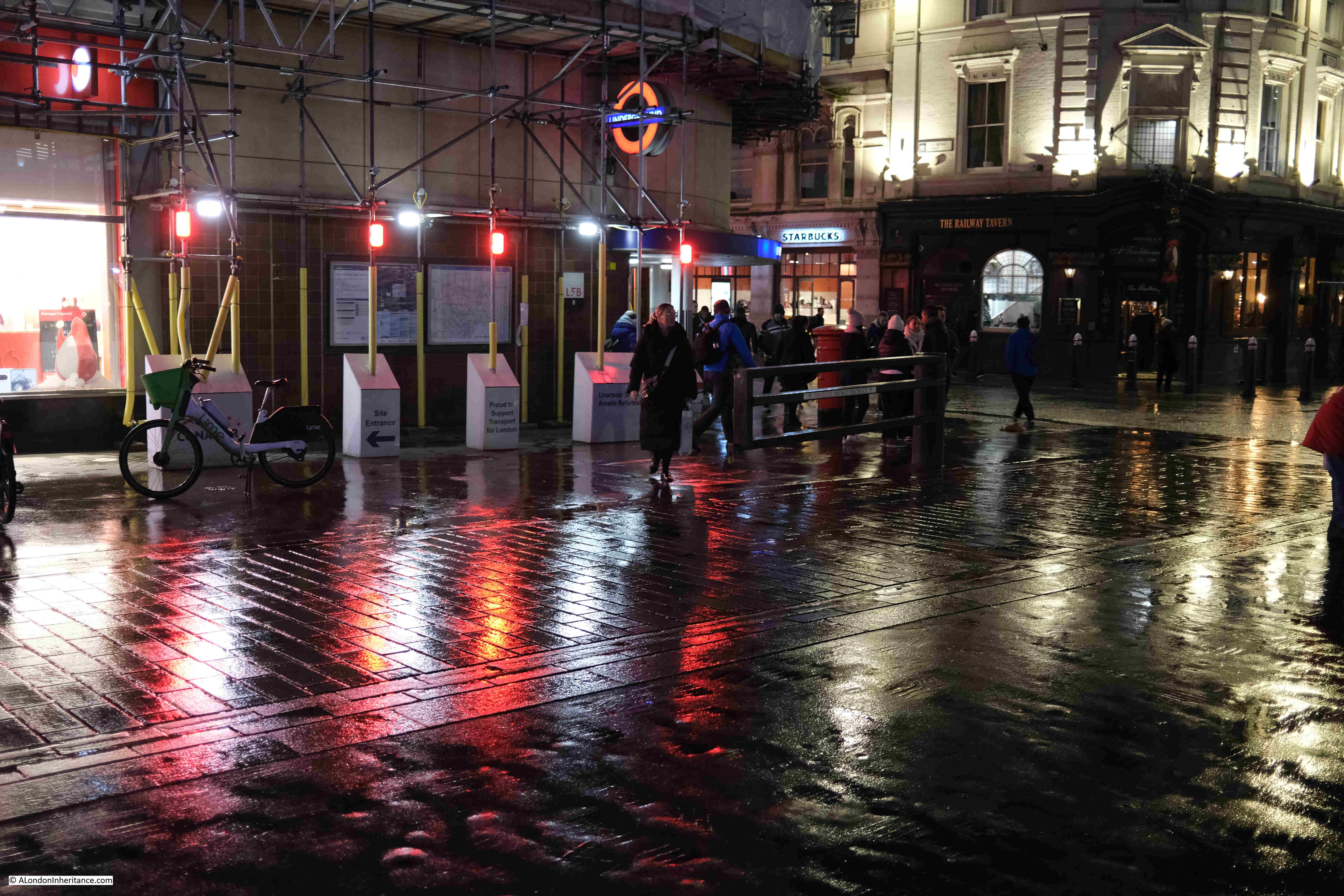
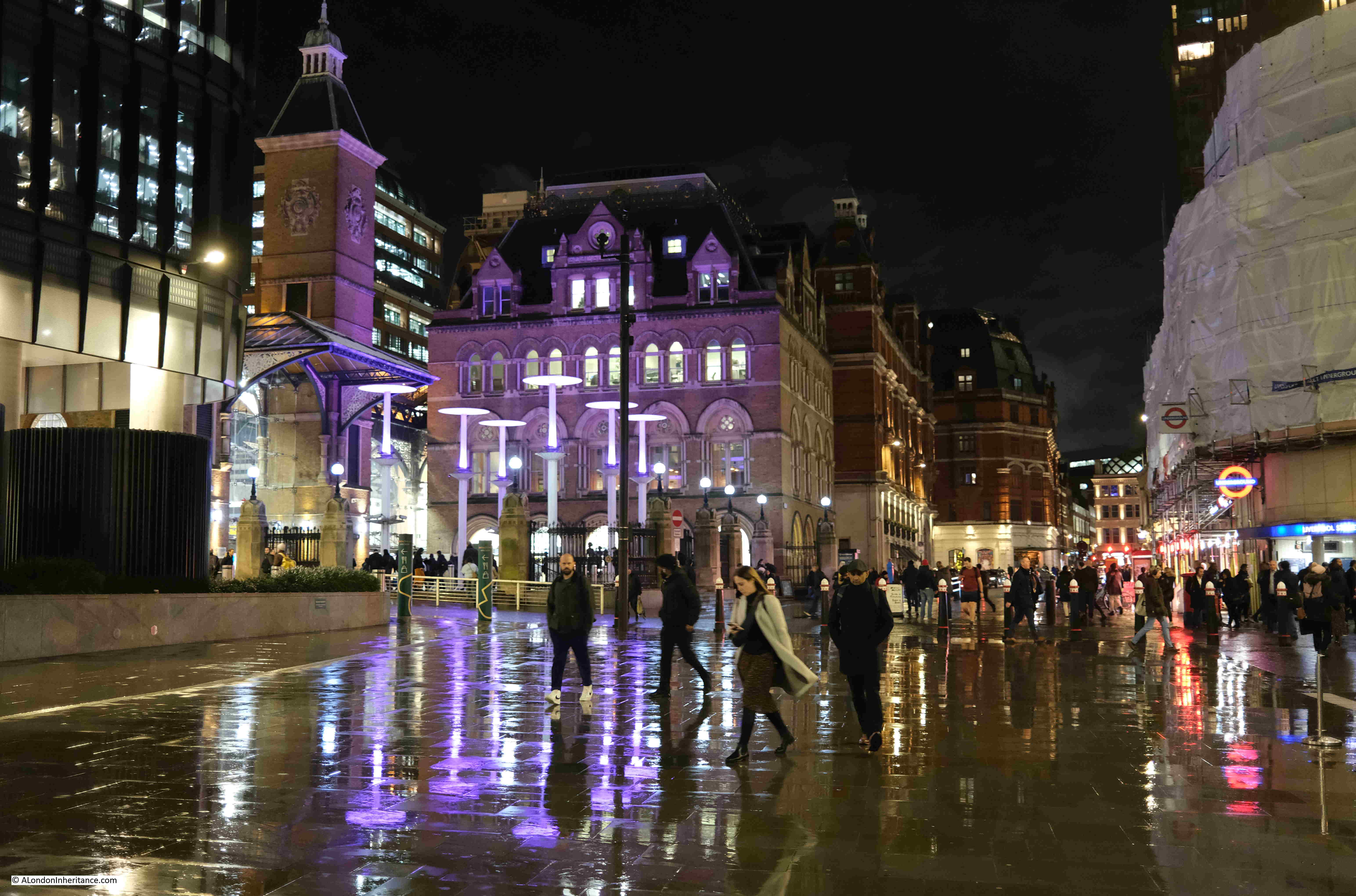
One of the good things about walking while it is raining are the reflections of lights on the surface of the streets, creating pools of colour. This is by one of the entrances to Liverpool Street underground station, with the Railway Tavern at the corner on the right:

Wet January Evening in the City

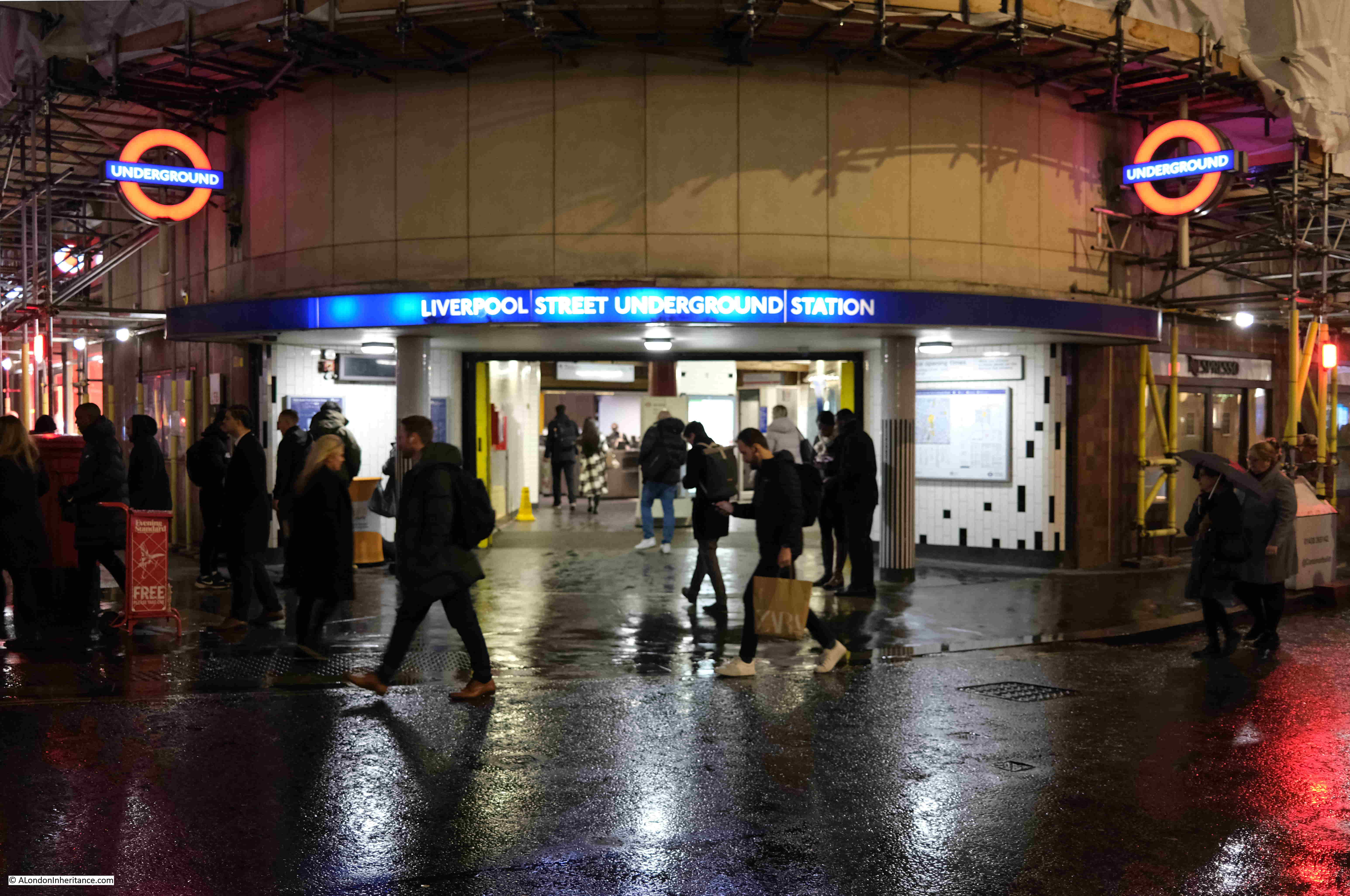
Entrance to Liverpool Street Underground Station:

Wet January Evening in the City

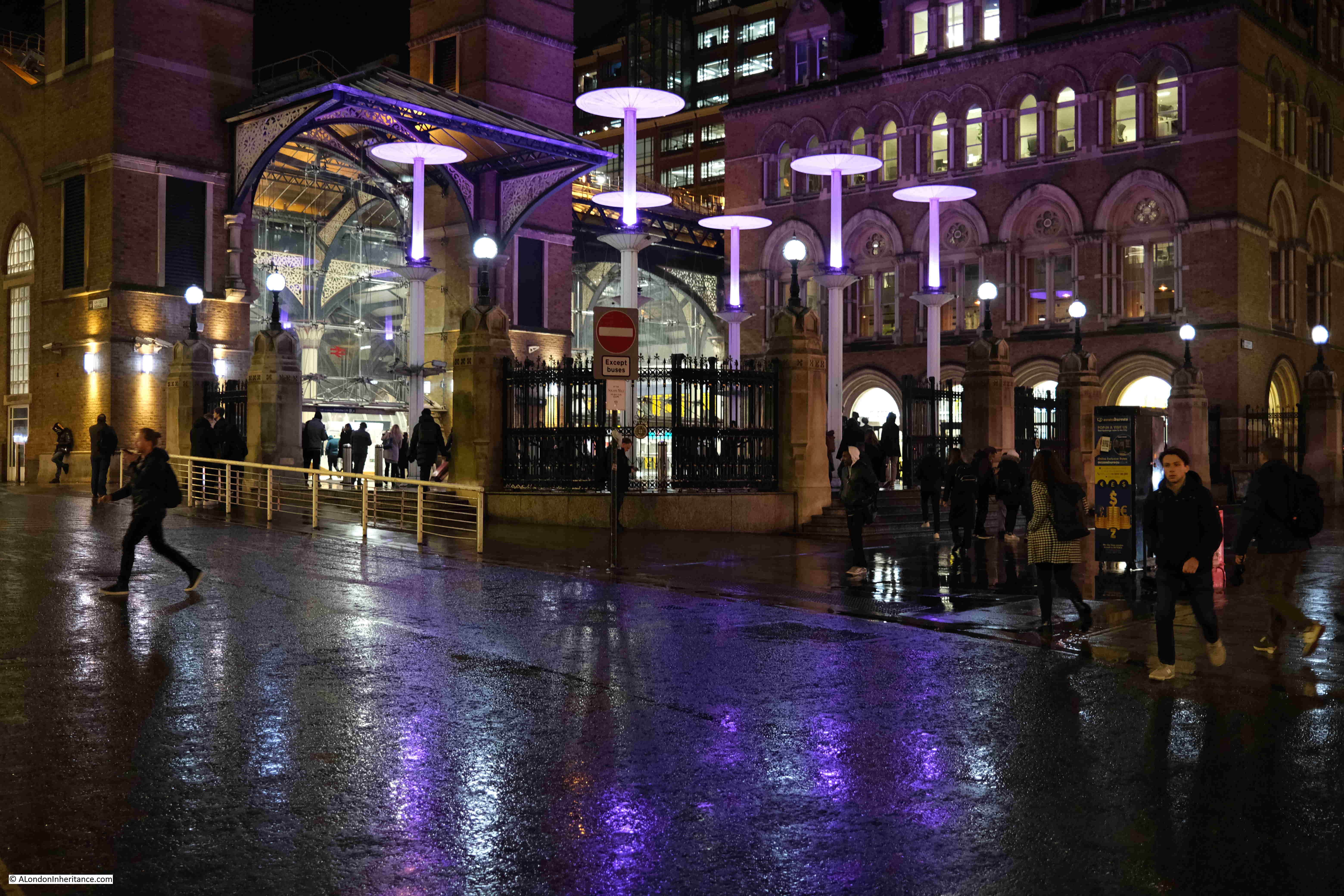
View back to the station entrance, with purple lighting, and the brightly lit interior of the station in the background:

Wet January Evening in the City

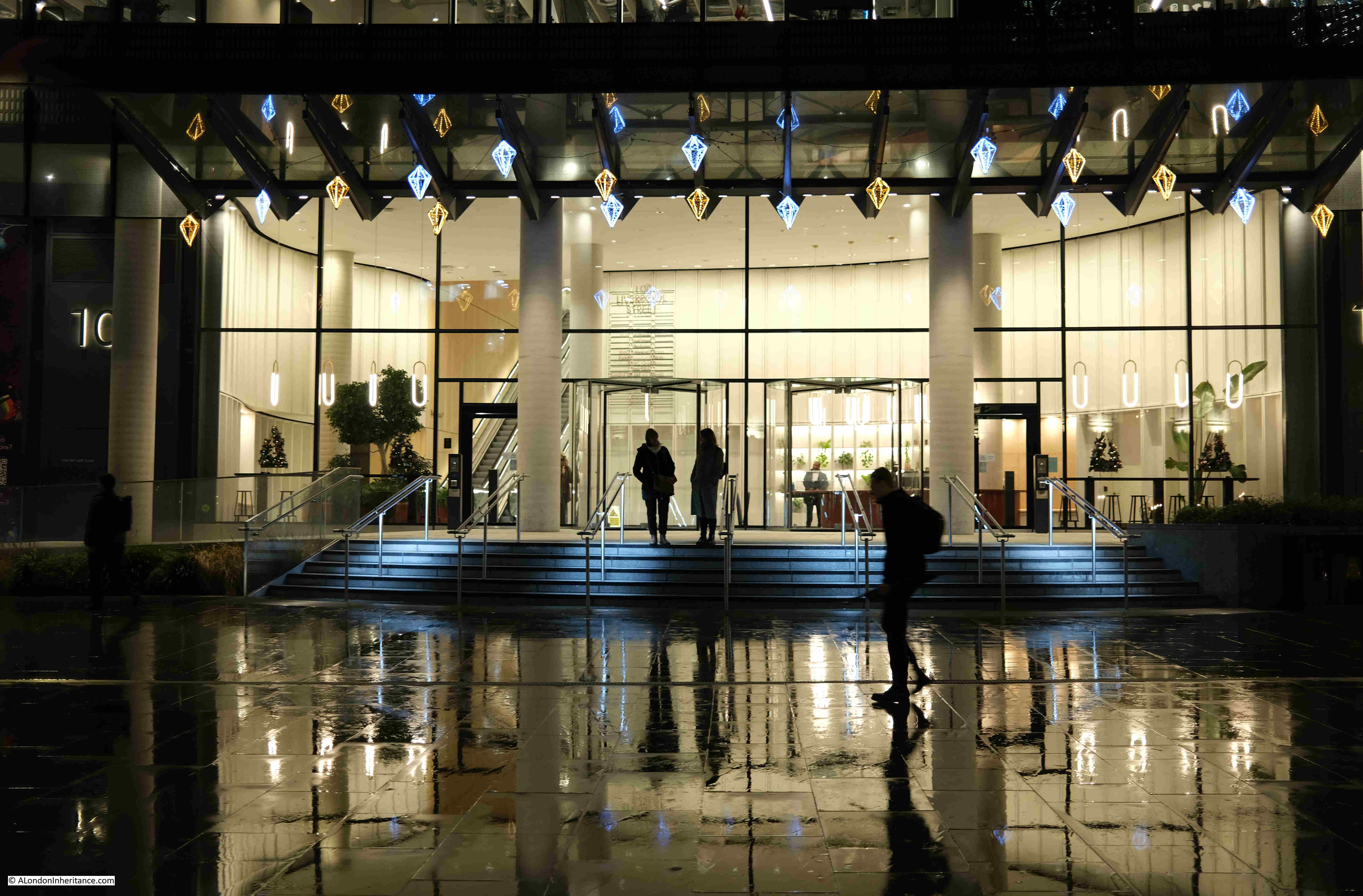
Entrance to the office building that is on the site of Broad Street Station:

Wet January Evening in the City

View back towards Liverpool Street Station. The alternative view, if the proposed development goes ahead, can be seen in this pdf. The view does not seem to appear on the projects website, only in the pdf of Exhibition Materials.

Wet January Evening in the City

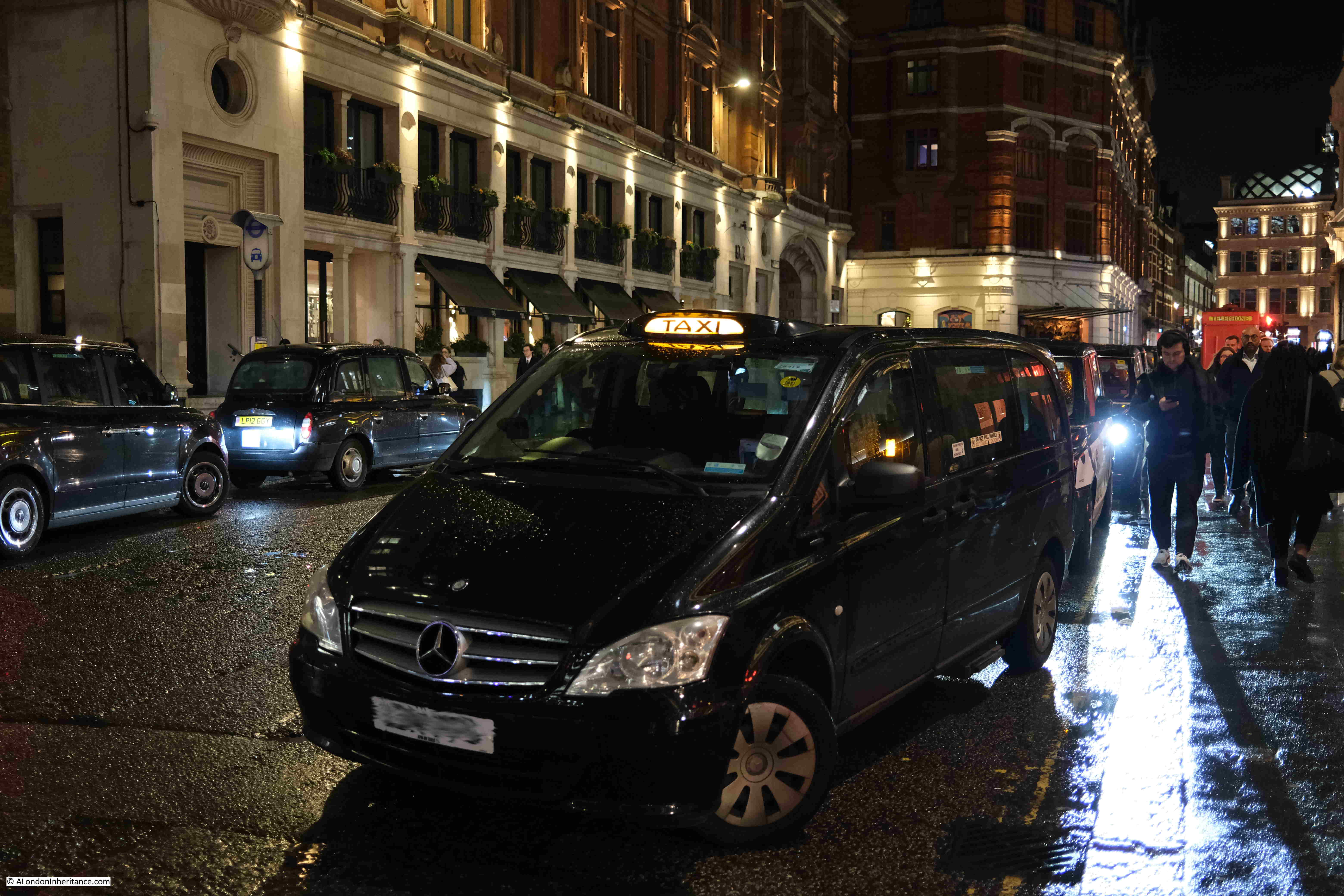
Taxis waiting outside the station:

Wet January Evening in the City

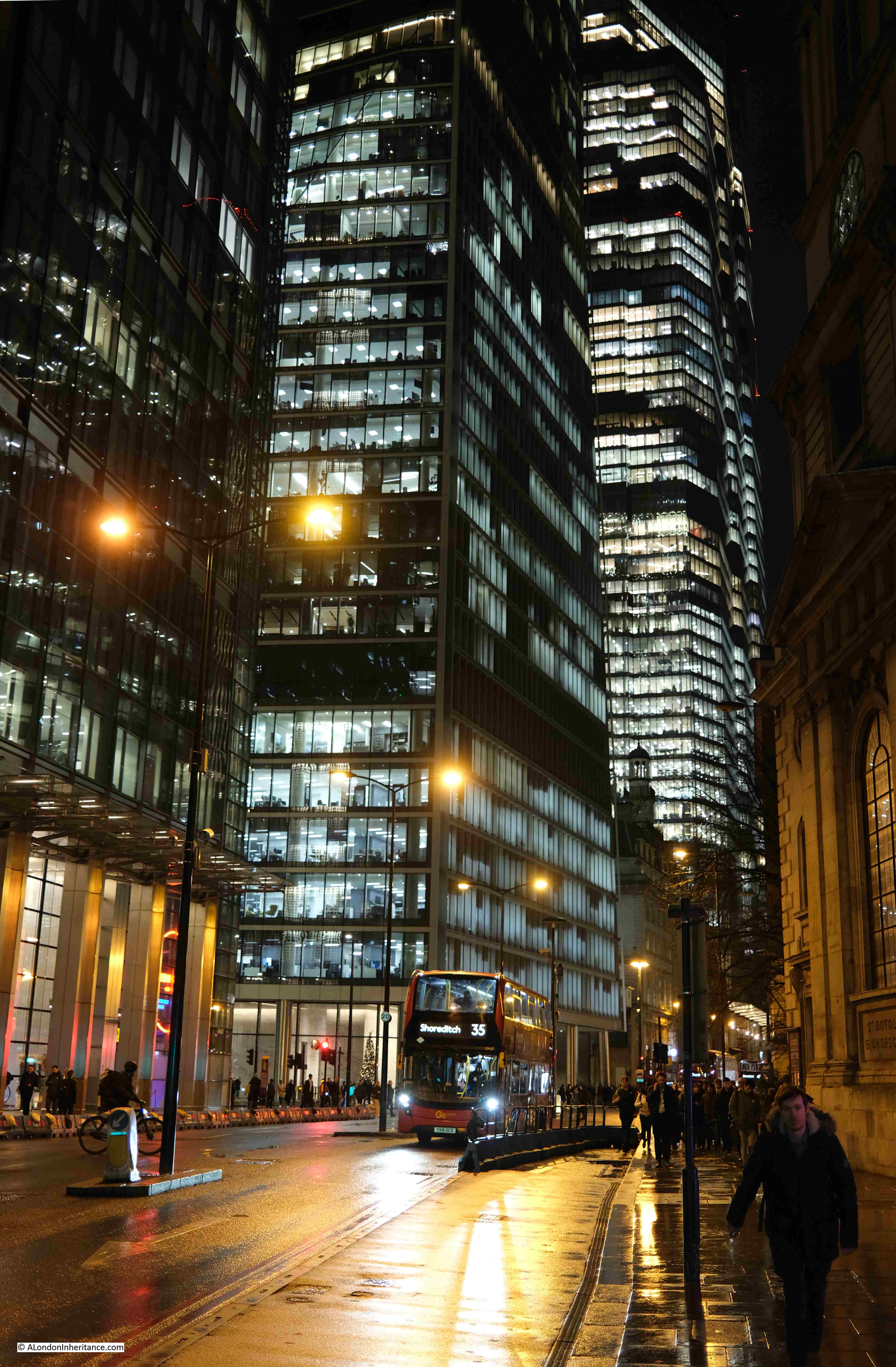
The view along Bishopsgate:

Wet January Evening in the City

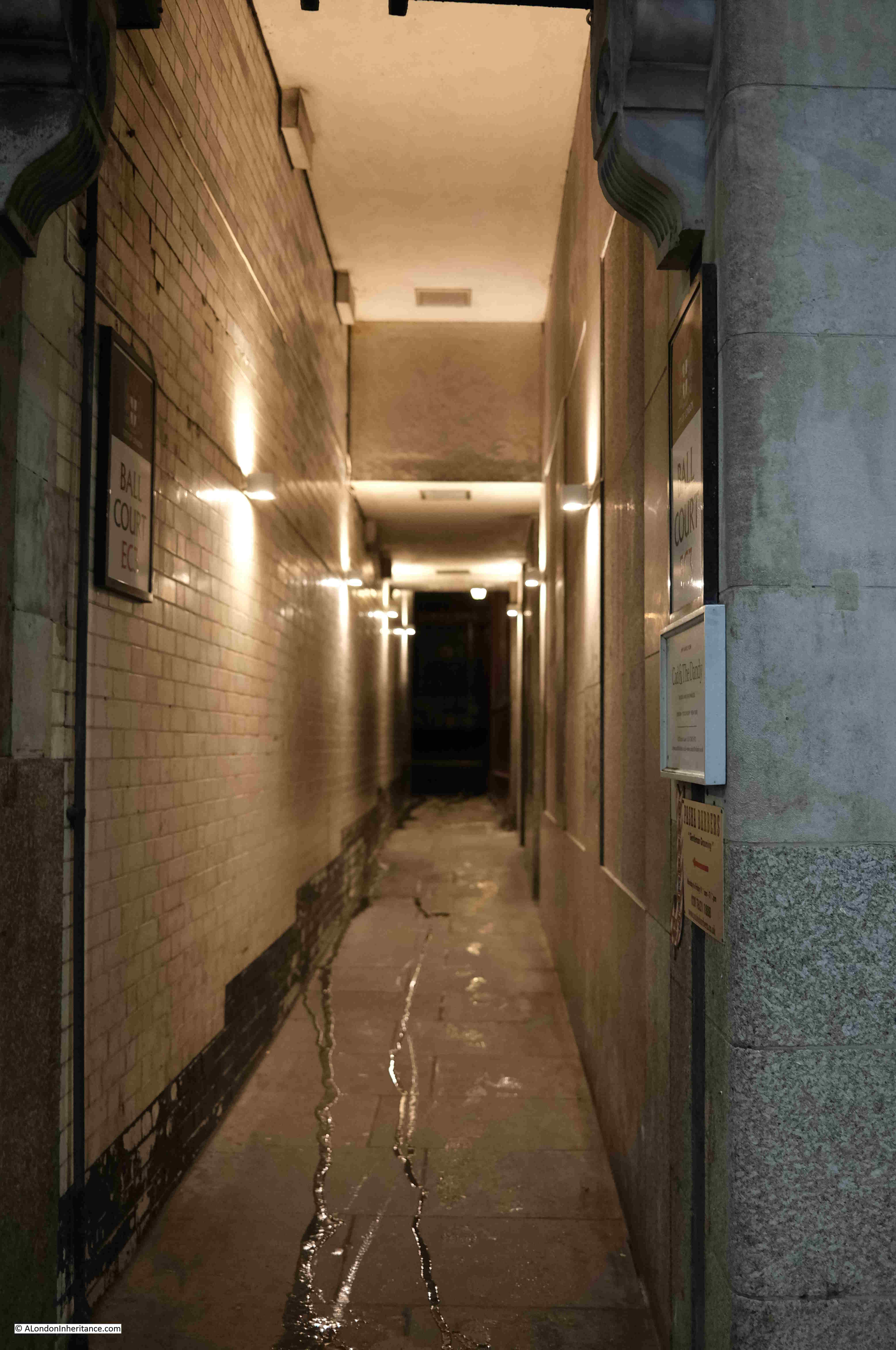
The main streets are much quieter than usual, and the alleys and courts that can be found across the City are dead:

Wet January Evening in the City

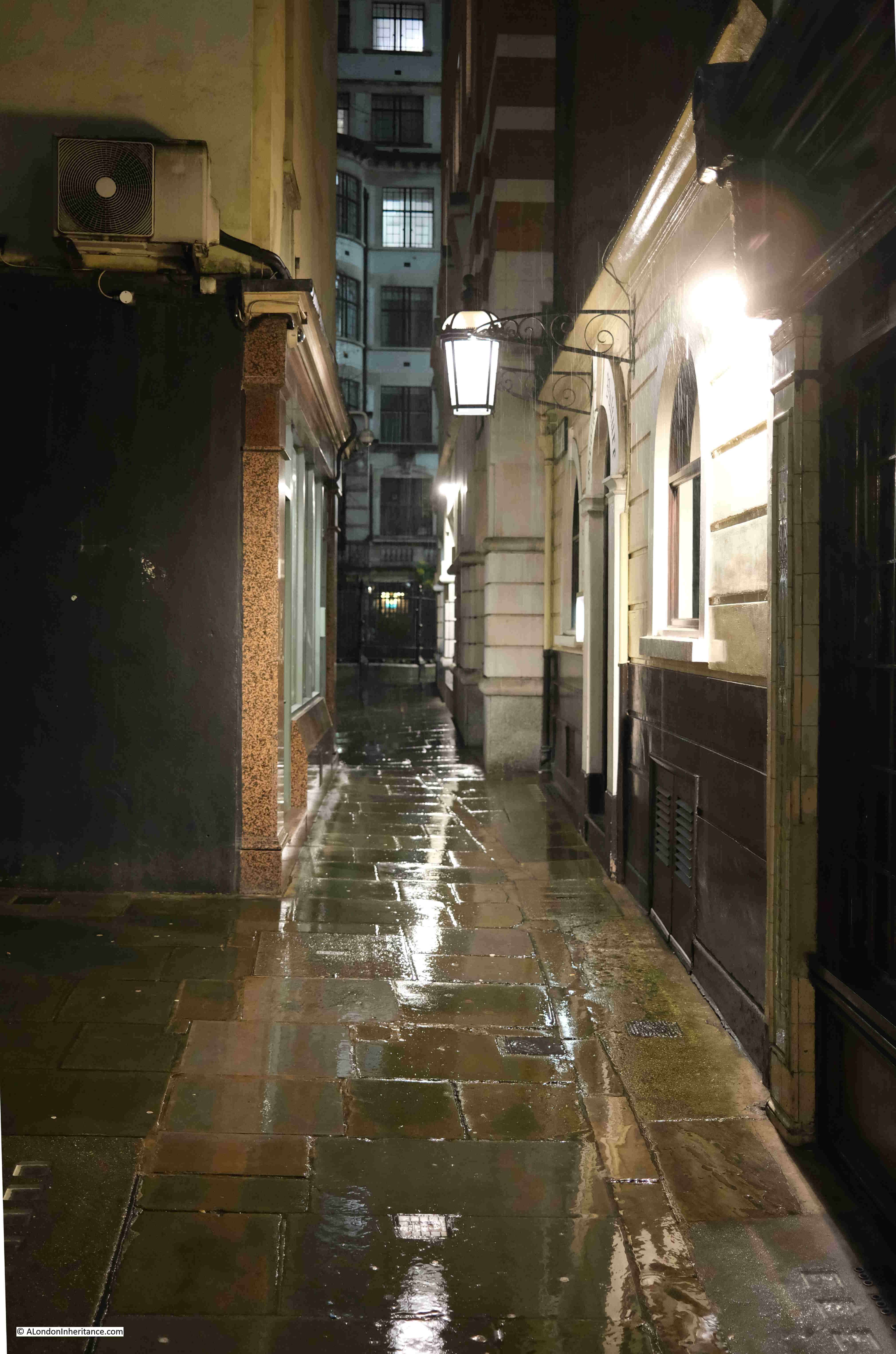
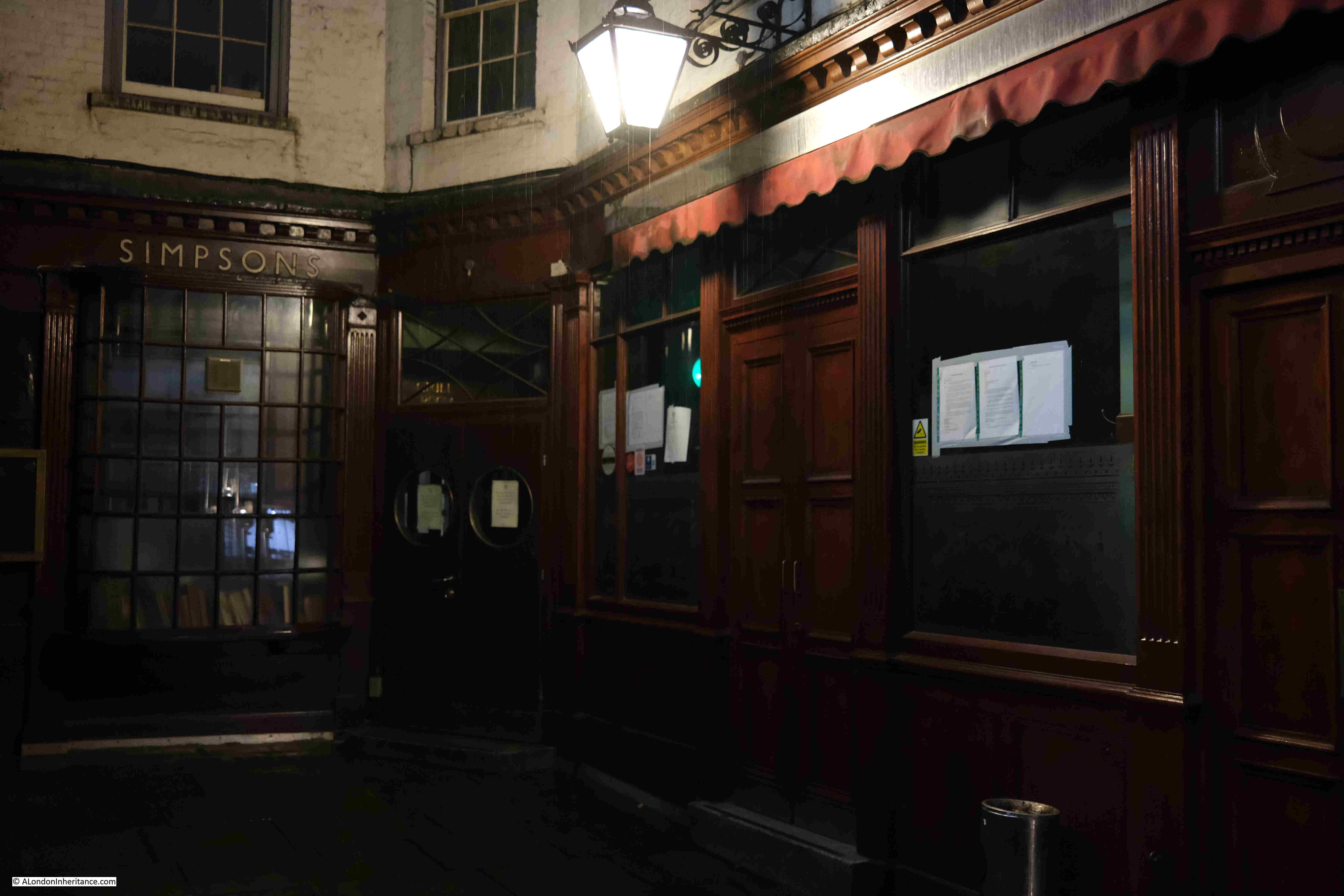
Ball Court, leading off Cornhill:

Wet January Evening in the City

The tragically closed Simpsons, in Ball Court:

Wet January Evening in the City

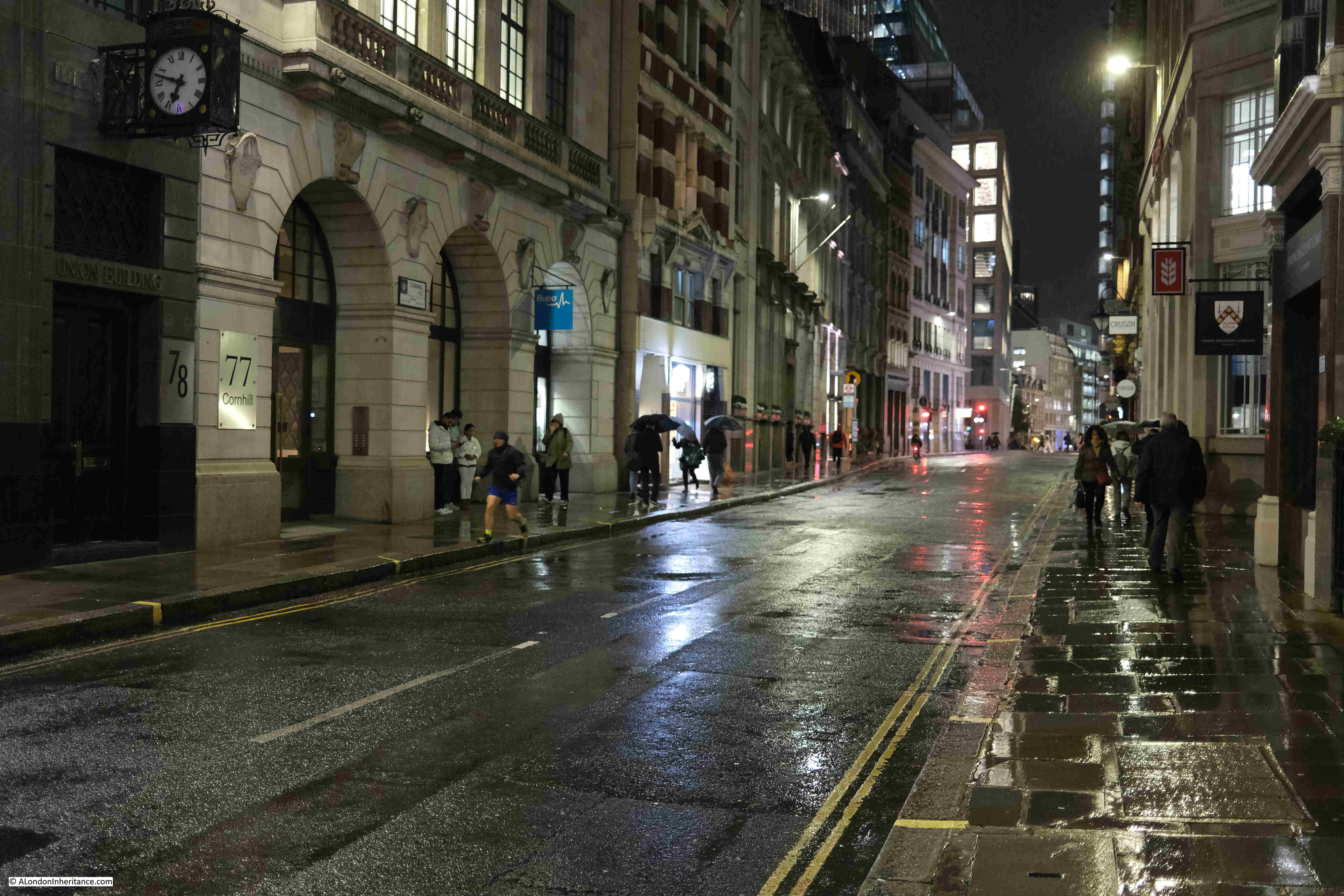
View east along Cornhill:

Wet January Evening in the City

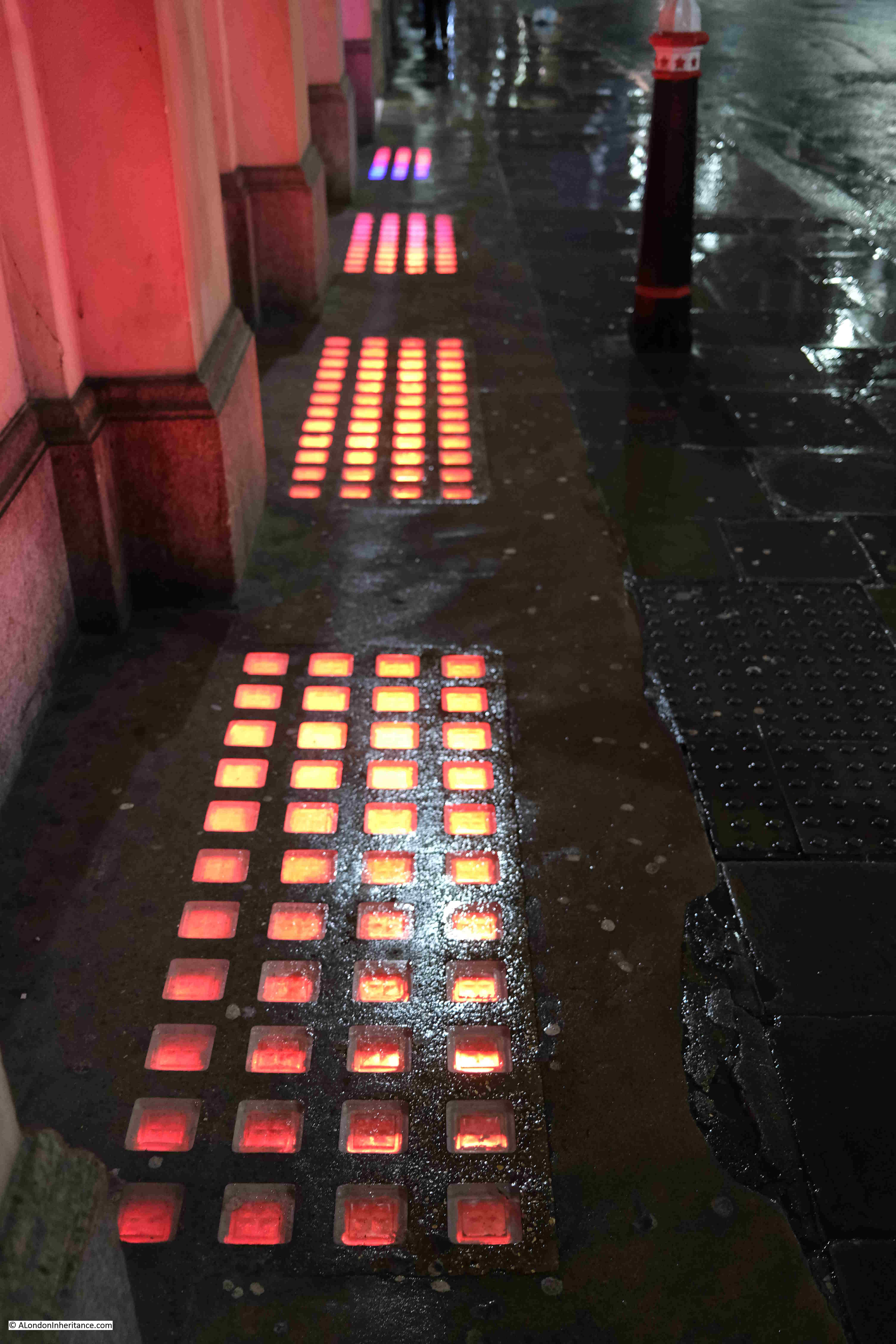
Colour from the basement:

Wet January Evening in the City

Cornhill looking west towards the Bank junction, with St. Paul’s Cathedral just visible in the distance:

Wet January Evening in the City

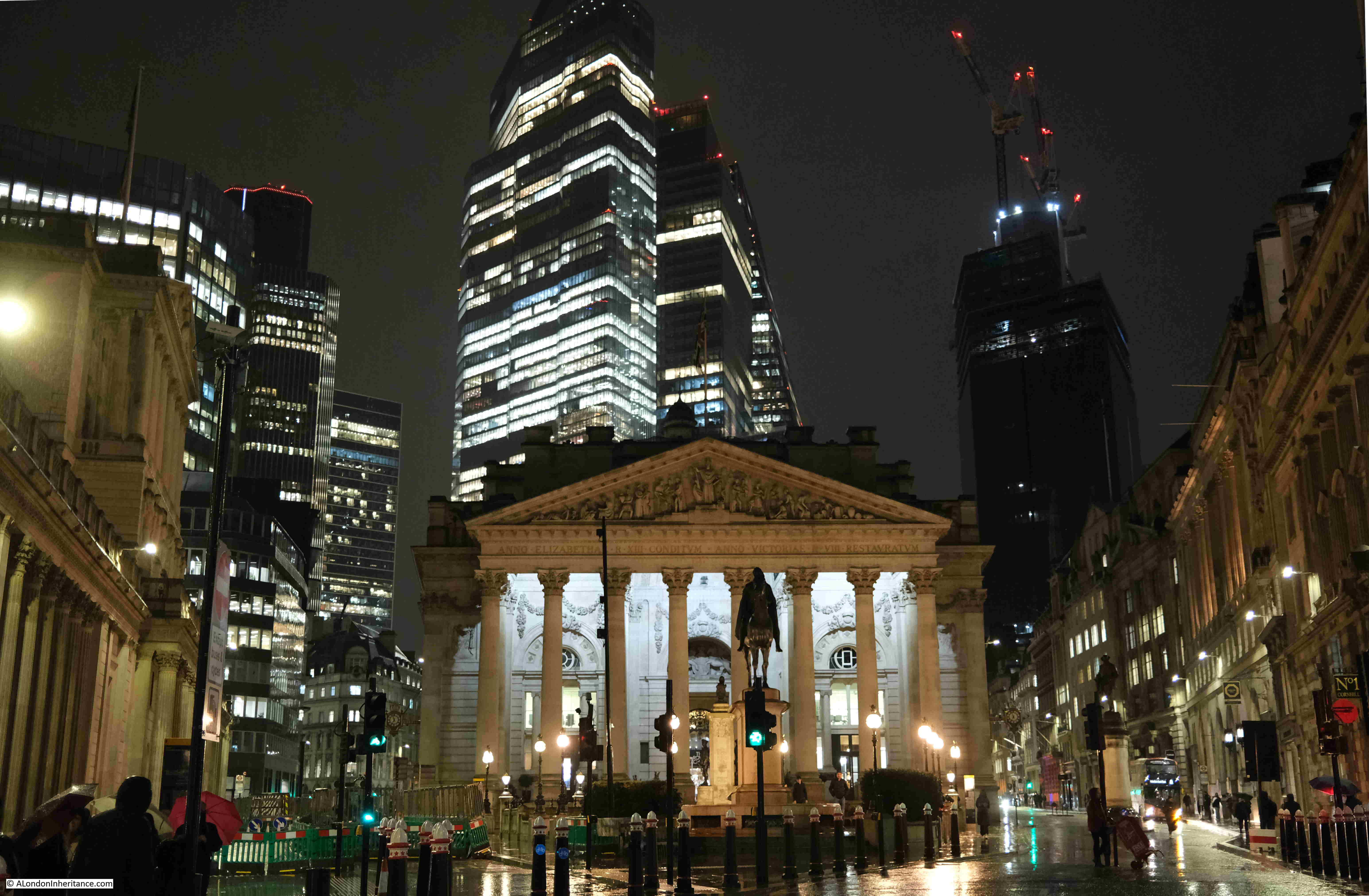
At the rear of the Royal Exchange:

Wet January Evening in the City

The towers of the City above the “relatively” low rise buildings around the Bank:

Wet January Evening in the City

At the Bank junction, in front of the Royal Exchange looking along Cornhill, and the rain was getting heavier:

Wet January Evening in the City

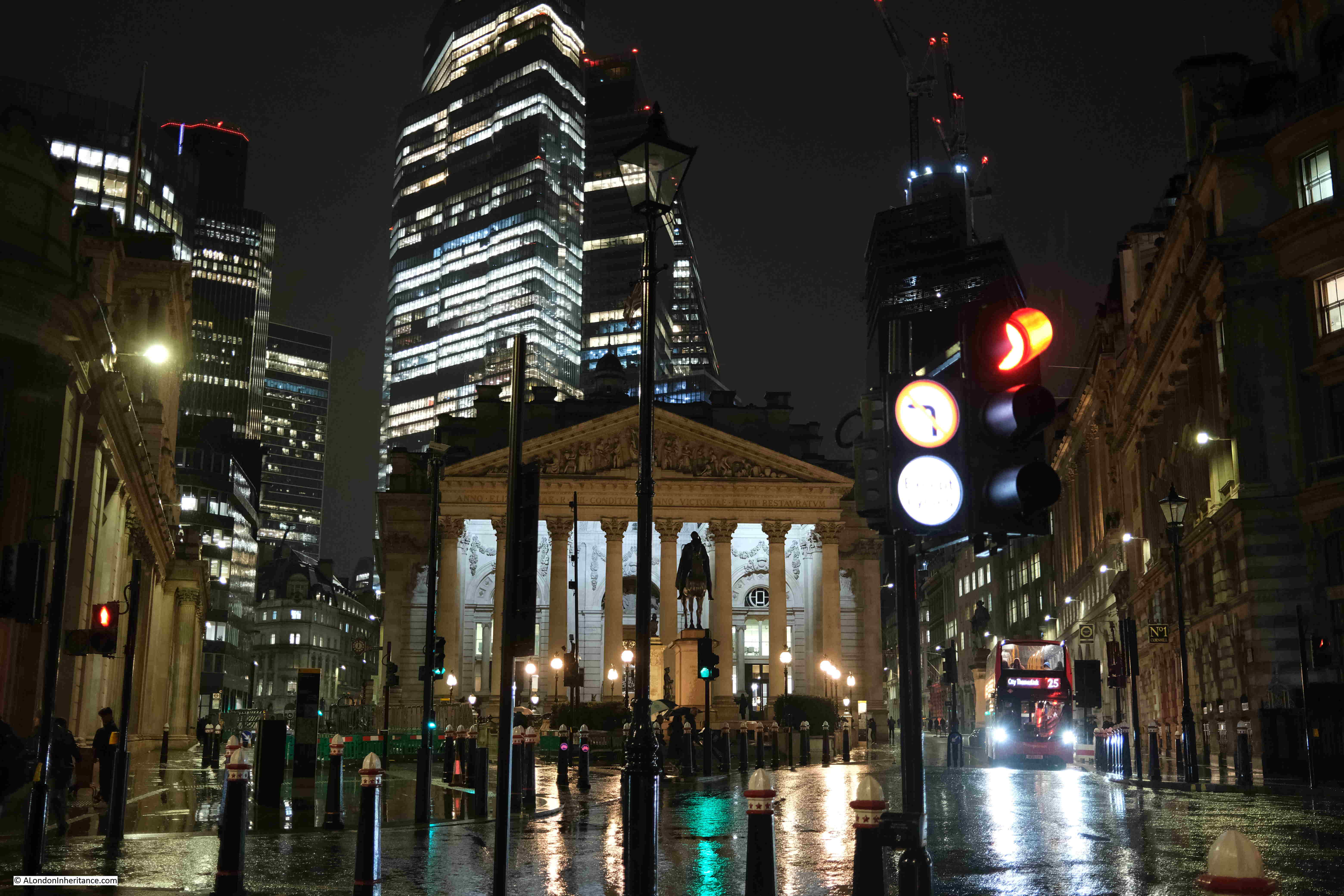
The Royal Exchange with the towers of the City:

Wet January Evening in the City

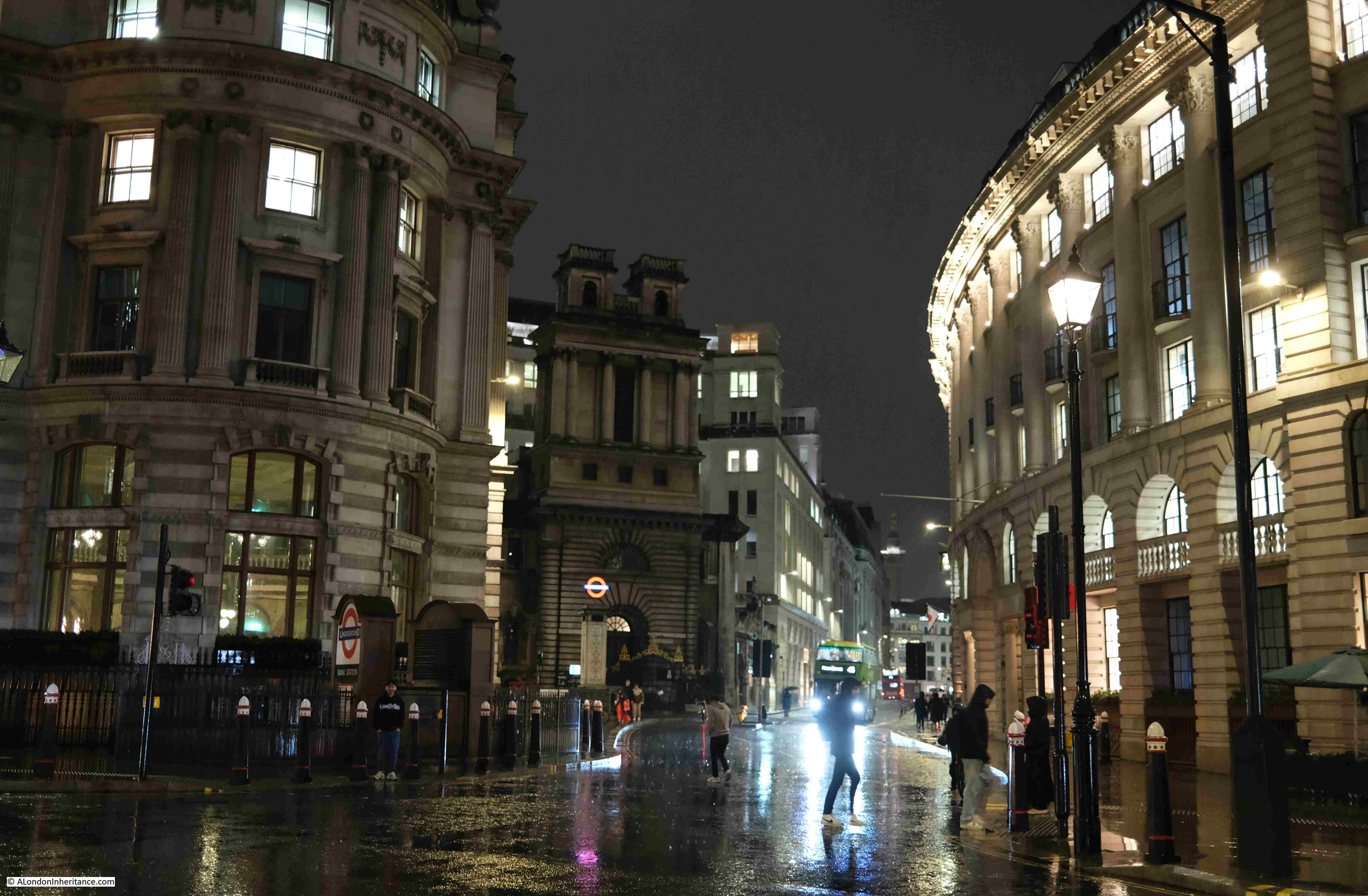
Looking down Lombard Street:

Wet January Evening in the City

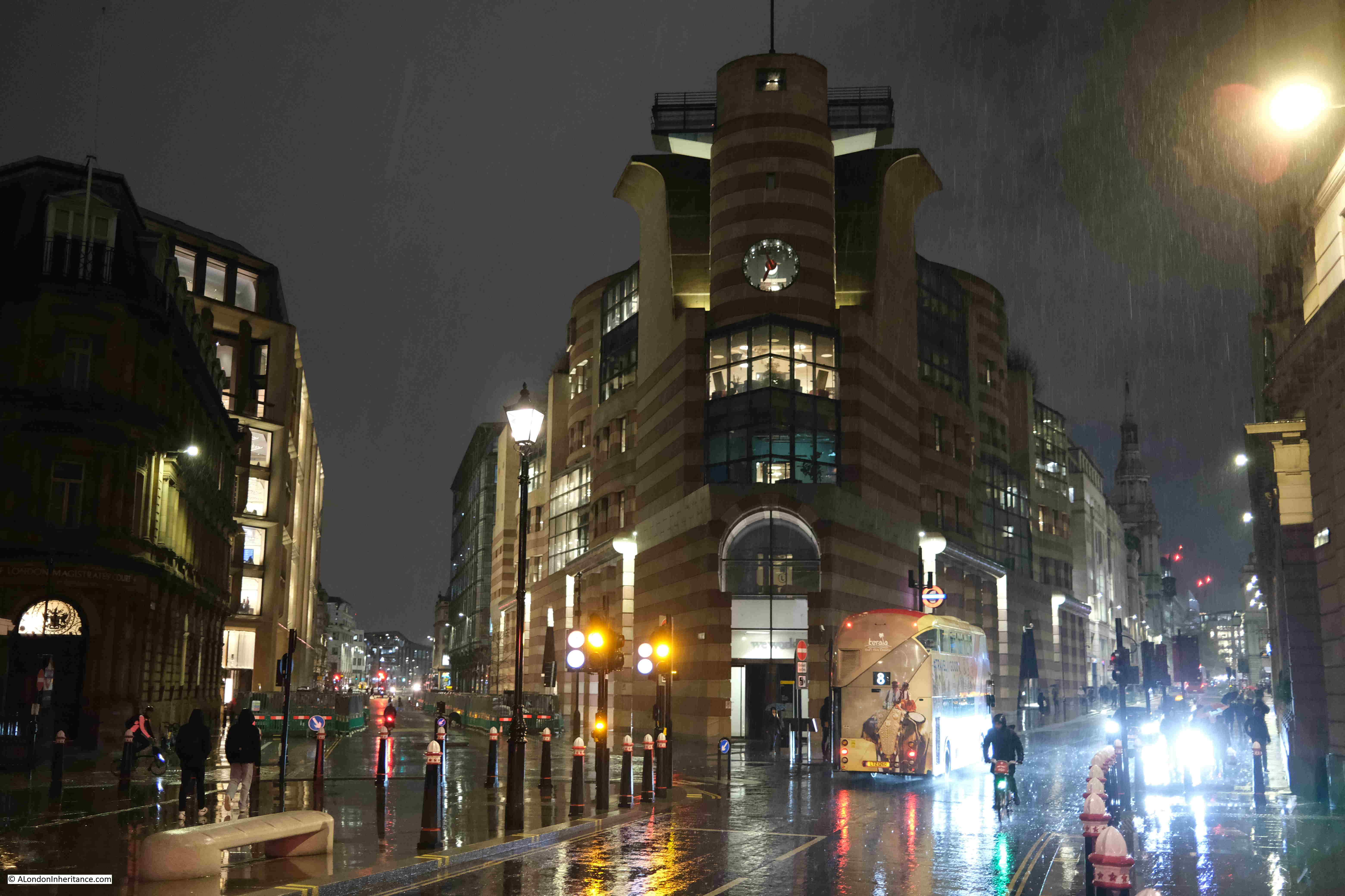
No. 1 Poultry, between Poultry (right) and Queen Victoria Street (left):

Wet January Evening in the City

A final look back towards the east of the City:

Wet January Evening in the City

The rain was very heavy by the time I reached the Bank, and as water and the electronics in a camera do not mix that well, I joined the few remaining commuters walking into the Bank station to head home.

The Festival of Britain – Land Travelling Exhibition

If you have followed the blog for a few years, you will know that I am really interested in the Festival of Britain. The primary site for the festival in 1951, was on the Southbank, in the area between County Hall and Waterloo Bridge.

There were though festival sites all across the country, as the intention was for the country to be involved, not just a London centric festival.

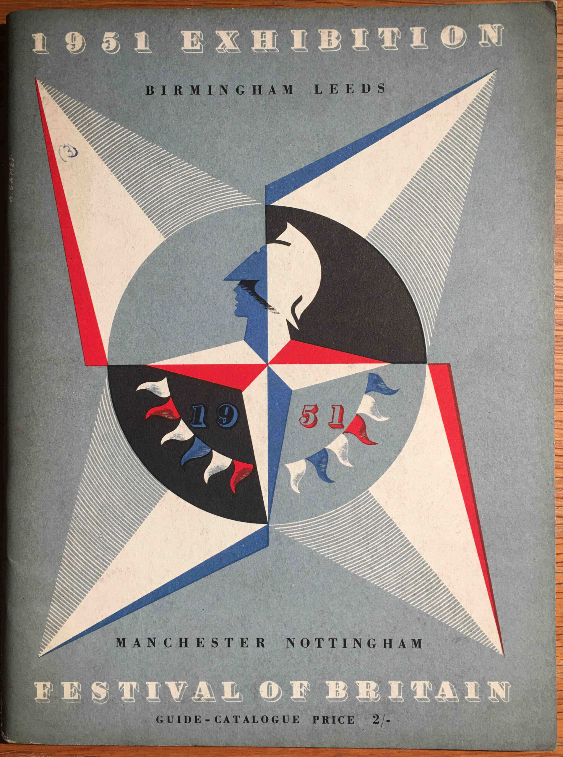
Each of the main festival exhibitions had their own festival guide book. All were based on the same format and design as the Southbank festival site, but with a different colour to the cover page where the Abram Games famous festival emblem featured.

I have been trying to collect all the festival guide books for some years, and I recently got hold of a copy of the guide book for the travelling element of the 1951 exhibition:

Festival of Britain Travelling Exhibition

This guide book covered the land travelling exhibition, which visited Birmingham, Leeds, Manchester and Nottingham. As the land travelling exhibition, this would reach major inland cities, where the exhibition on an old aircraft carrier covered major coastal locations (link to this at the end of the post).

The introduction provides the background to the travelling exhibition:

The Festival Exhibition is visiting four of our major inland centres of industry: Manchester, Leeds, Birmingham and Nottingham. It is therefore appropriate that the main theme of this Exhibition should be the British people and the things they make and use: our past and present achievements in technology and industrial design, and how these provide us to day with manifold opportunities to enrich our daily lives.

The things that will be seen in this Exhibition are not ordinary, average products, but some of the best things that this country is producing at the present time. They are things that we can be proud of, that can inspire and fill us with confidence in the future; and they are a challenge to British industry to emulate the achievements shown here.”

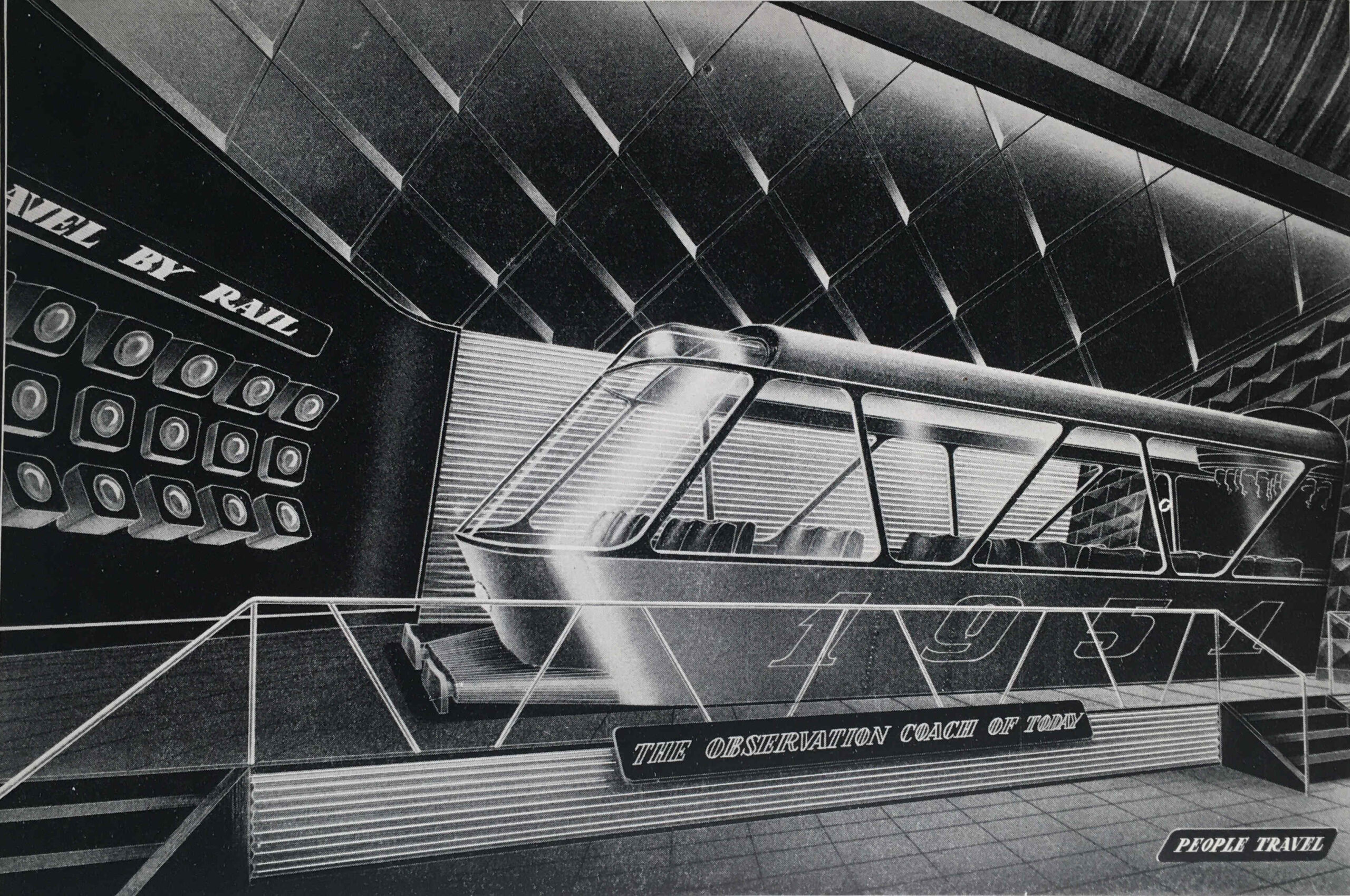
For a travelling exhibition, this was a complex undertaking with thousands of display items grouped into sections as the visitor walked through the exhibition.

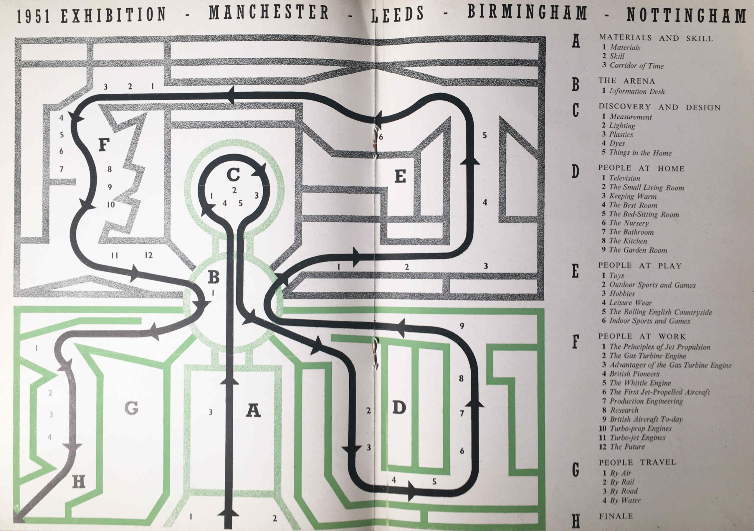
The themes were: Materials and Skill, Discovery and Design, People at Home, People at Play, People at Work, People Travel, and the route and individual displays within each section are shown in the following double page map from the guide book:

Festival of Britain Travelling Exhibition

The focus on technology and industrial design was appropriate for the locations of the exhibition as these were still major industrial centres. It also followed the overall theme of the future, presenting an optimistic view of the future following years of war, rationing and austerity. An attempt to show what the country could make, as there was still an urgent need to reduce imports, grow exports and sell for foreign currency, and to provide a unifying experience which would involve everyone across the country.

Unlike the Southbank Festival guide book, which contained long written sections describing the displays, the guide book for the Travelling Exhibition was mainly a catalogue of all the individual items on display, however it does contain some brilliant drawings of the exhibition areas.

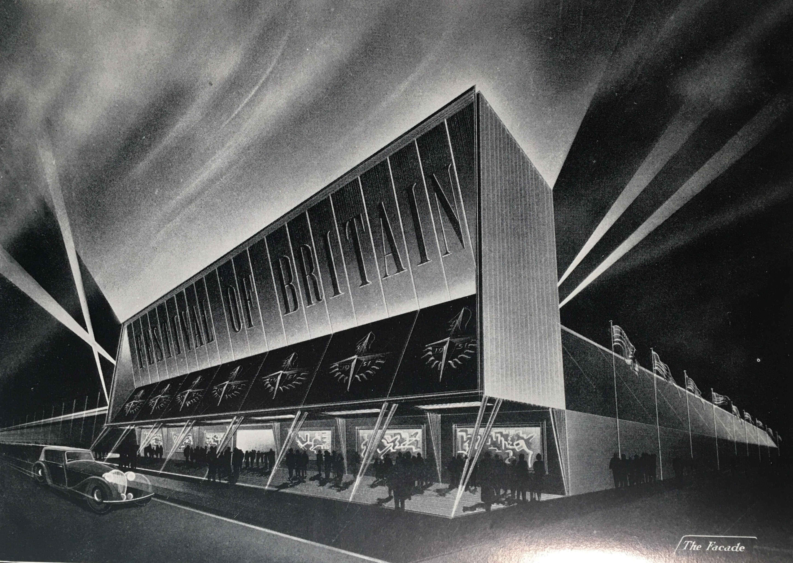
The following image is titled “The Façade”, and shows the main entrance to the exhibition:

Festival of Britain Travelling Exhibition

The image looks as if it is a Hollywood film premier rather than an exhibition of technology and industrial design.

The timetable for the travelling exhibition was as follows:

  • MANCHESTER – At the City Hall, Deangate. Open from Thursday, 3rd May to Saturday, 26th May inclusive
  • LEEDS – On Woodhouse Moor (Woodhouse Lane and Raglan Road Corner), Leeds. Open from Saturday, 23rd June to Saturday, 14th July inclusive
  • BIRMINGHAM – At the Bingley Hall, King Alfred’s place. Open from Saturday, 4th August to Saturday, 25th August inclusive
  • NOTTINGHAM – At Broadmarsh, Lestergate, Nottingham. Open from Saturday, 15th September to Saturday, 6th October inclusive.

The exhibition was open seven days a week, with a morning start, and closing at 11:00 pm, including Sunday, although on Sunday’s the exhibition opened at 2:30pm, as I assume there was still an expectation that people would be going to church on a Sunday morning.

The travelling exhibition was not the only Festival of Britain event organised in these cities, for example, in Birmingham, newspapers were also advertising other Festival of Britain events such as a City of Birmingham Show in Handsworth Park, with events including a dog Show, a Rabbit Show and ending with fireworks. There was also a military tattoo at the Alexandra Sports Stadium and a Festival of Opera and Drama at the Midland Institute and Moseley and Balshall Heath Institute.

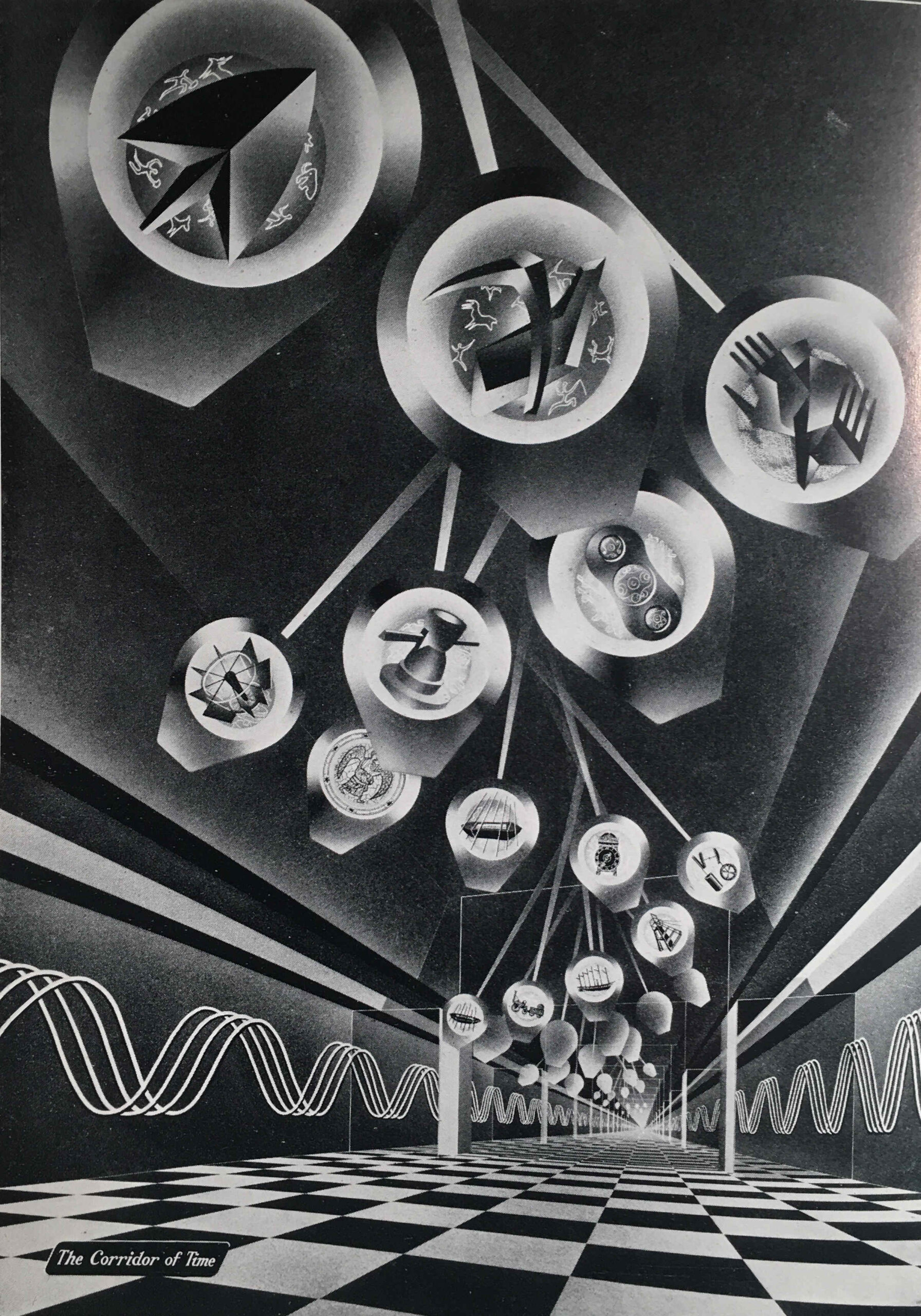
The next image shows the Corridor of Time:

Festival of Britain Travelling Exhibition

The Corridor of Time was introduced in the guide book as follows:

“The things that have been made in each age have depended upon the degree of man’s mastery over the materials of the earth and the development of his skill in making and using tools and machines. The story of the ascent of man, the ‘tool-using animal’, from the most primitive times to the present day is told in striking and symbolic form in the Corridor of Time. As we advance with time and see the achievements of the past mirrored in the future, we cannot but be optimistic of the possibilities for man that lie ahead.”

At the end of the Corridor of Time the visitor entered the arena where there was an information desk where “industrial enquiries will be directed to a special information room staffed by representatives of the Council of Industrial Design and of industry”.

It is interesting as to who the exhibition was aimed at, as at times the guide book almost sounds like a description of a trade show, rather than an exhibition that was aimed at the general population.

To help people attend the exhibition from the towns and villages surrounding the four cities, British Rail offered cheap day return tickets, and for Birmingham this offer applied to all stations within an 80 mile radius of the city.

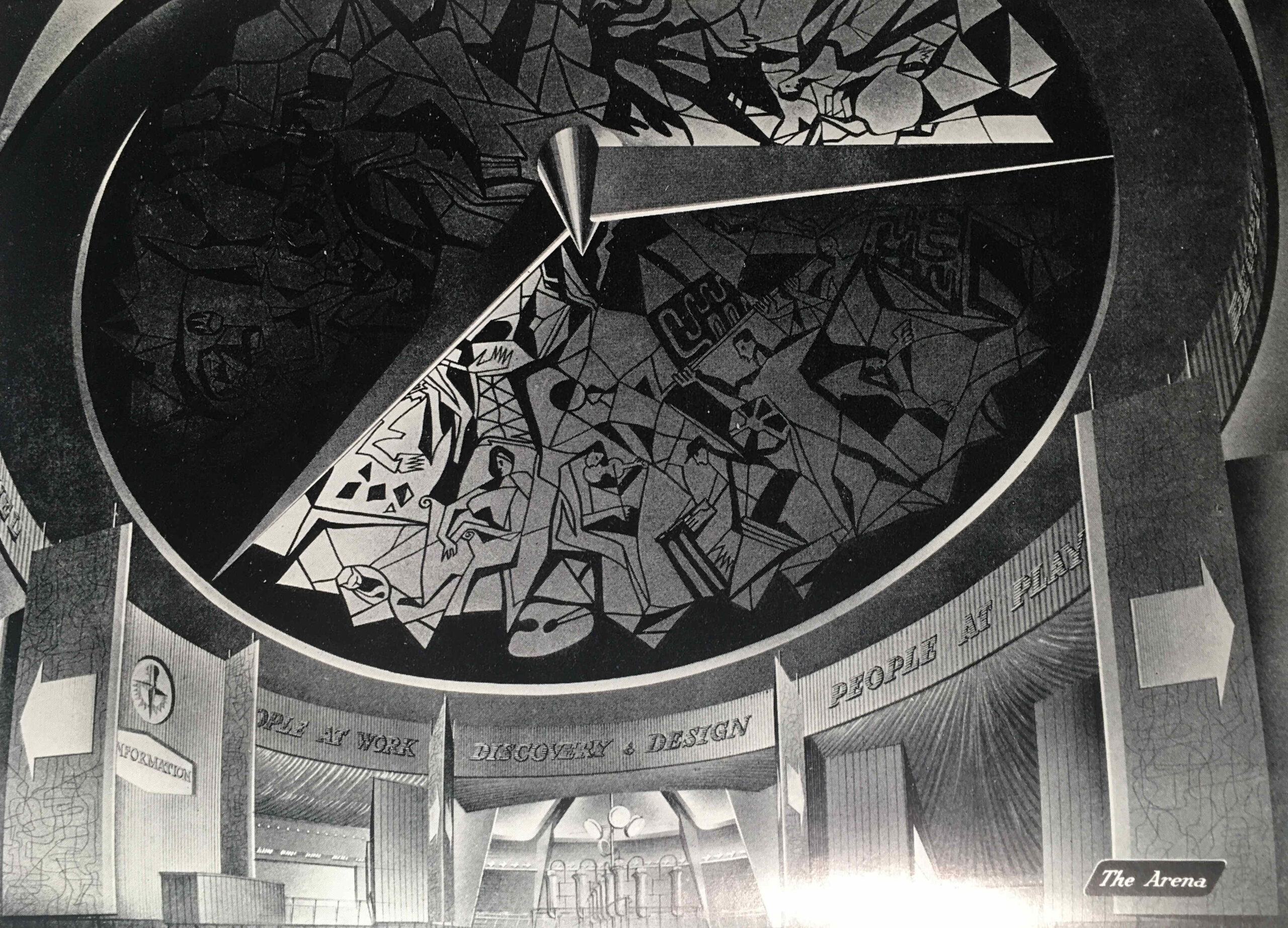
The following image shows “The Arena” which led from the Corridor of Time to the rest of the exhibition:

Festival of Britain Travelling Exhibition

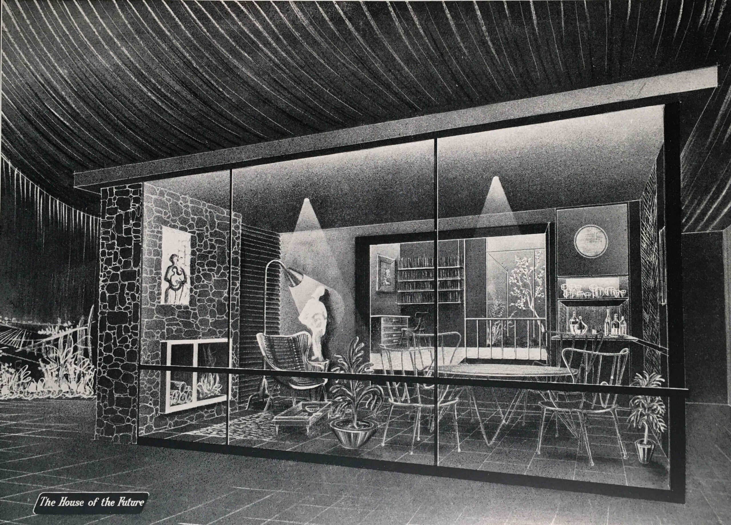
From the Arena, we enter the “People at Home” section of the exhibition, which in the guide book is illustrated by an image of “The Garden Room” of the “House of the Future”:

Festival of Britain Travelling Exhibition

The Garden Room is a view of what would be happening in the future with the popularity of conservatories and large windows facing onto a back garden, however in the exhibition there was a recognition of the housing problems that the majority of the population continued to face:

“THE BED-SITTING ROOM – With smaller houses and scare accommodation, this form of room has taken on a new importance in recent years. Special efforts and imagination can make the bed-sitting room very congenial, either for the adult living apart from the family or as a place of privacy for the older child.”

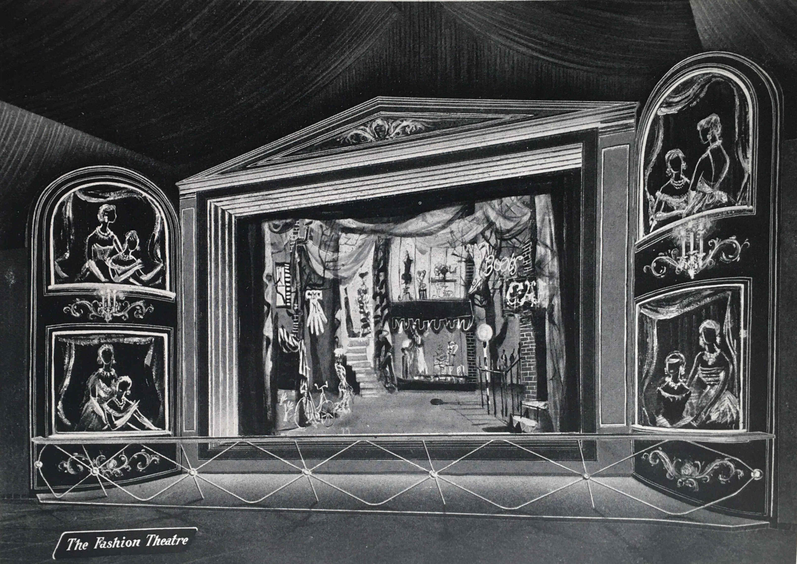
We then come to the “People at Play” section, which is illustrated with “The Fashion Theatre”:

Festival of Britain Travelling Exhibition

The People at Play section included displays on:

  • Outdoor Sports and Games
  • Hobbies (Amateur Photography, Amateur Radio, Painting and Home Cinematography)
  • Leisure Wear (which was displayed by “actress mannequins” in a continuous performance in the Theatre of Fashion)
  • The Rolling English Countryside (walking, rambling, mountaineering, cycling , rowing and canoeing)
  • Indoor Sports and Games

A look at the list above might imply that the exhibition was aimed at the affluent middle class, however taking Amateur Photography and Cycling as two example, that is exactly what my father was doing in 1951. He started off with a Leica camera purchased cheaply from a serviceman returning from Germany after the war, and cycled the country with friends after National Service, staying at Youth Hostels, which was a very cheap way of seeing the country.

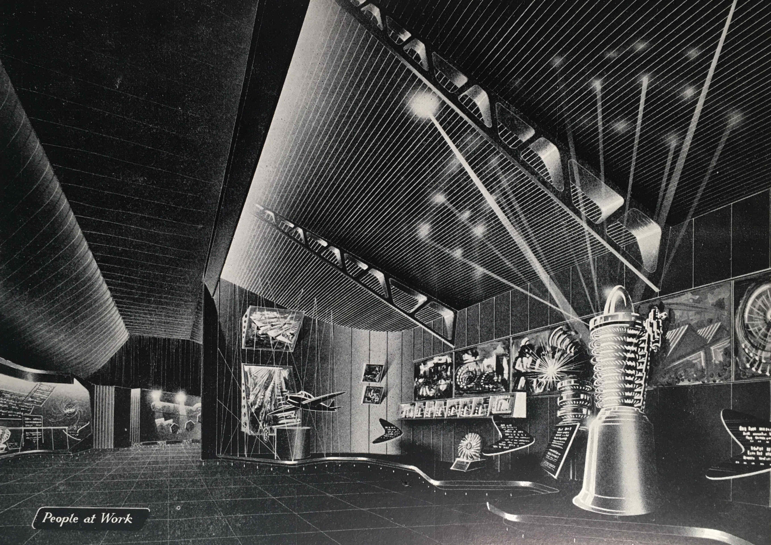
We then come to the “People at Work” section, with an image of the same name:

Festival of Britain Travelling Exhibition

“Britain’s industrial achievements and engineering skill are renowned throughout the world. We were pioneers and leaders in industrial engineering in the 18th and 19th centuries”, so began the introduction to the “People at Work” section. The guide book featured the jet engine, or the “Whittle Engine” as it was called in the Exhibition Guide after Frank Whittle who was instrumental in the development of the jet engine.

The guide mentions John Barber who had taken out a patent for what would become a gas turbine, the core of a jet engine, as early as 1791.

Barber’s designs were very much in advance of their time, and manufacturing technology was not at the stage where the designs could be turned into a working gas turbine.

In a perfect example of what ever you think the future will be, it will almost certainly be different, in the section on People at Work, there are some paragraphs under the heading “The Future”.

The guide explains that the future of electricity and energy production is with home supplies of coal and peat, and that cheap supplies of these, rather than the expensive oils currently being burned would help power the future.

No understanding in 1951 of the impact of burning large amounts of fossil fuels, and digging up large amounts of peat.

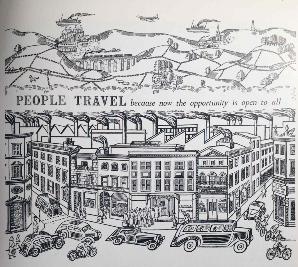
The next section of the exhibition is “People Travel”, with an illustration of the same name:

Festival of Britain Travelling Exhibition

The guide compares the arduous methods of travel at the time of the 1851 Great Exhibition, with the travel opportunities one hundred years later in 1951, with air travel and the car providing the means to explore the country and the wider world – “the private car has added a new degree of freedom to the mode of life of many people in all countries”.

To show some of the accessories that went with the freedom of travel provided by the car, the exhibition included:

  • Picnic Basket “Fieldfare”: G.W. Scott & Sons Ltd, 4-10 Tower Street, London W.C.2
  • Twin cup vacuum flask. British Vacuum Flask Co. Ltd. Lissenden Works, Gordon House, London, N.W.5
  • Coffee cups and saucers, acrylic. S.C. Errington (Hanwell) ltd, 132a Uxbridge Road, London W.7
  • Plastic sandwich box, Marris’s Ltd, 16 Cumberland Street, Birmingham

So the opportunity in the summer of 1951, if you had a car, was a drive out into the countryside, where you could stop and have lunch from your plastic sandwich box, drink coffee from acrylic coffee cups and saucers kept warm in the vacuum flask, all stored in your Fieldfare picnic basket from Tower Street.

“PEOPLE TRAVEL because now the opportunity is open to all”:

Festival of Britain Travelling Exhibition

The logistics of the travelling exhibition were impressive. It covered an area of 35,000 square feet, and was the world’s biggest transportable, covered Exhibition ever to be constructed.

It needed to be assembled and disassembled quickly due to the tight time schedule of openings and closings in the four different cities.

The exhibits were designed for quick and easy assembly, and to allow for differences between the sites, such as different floor levels, the exhibition structures were on adjustable footings. All exhibits were also completely wired for connecting up at each site.

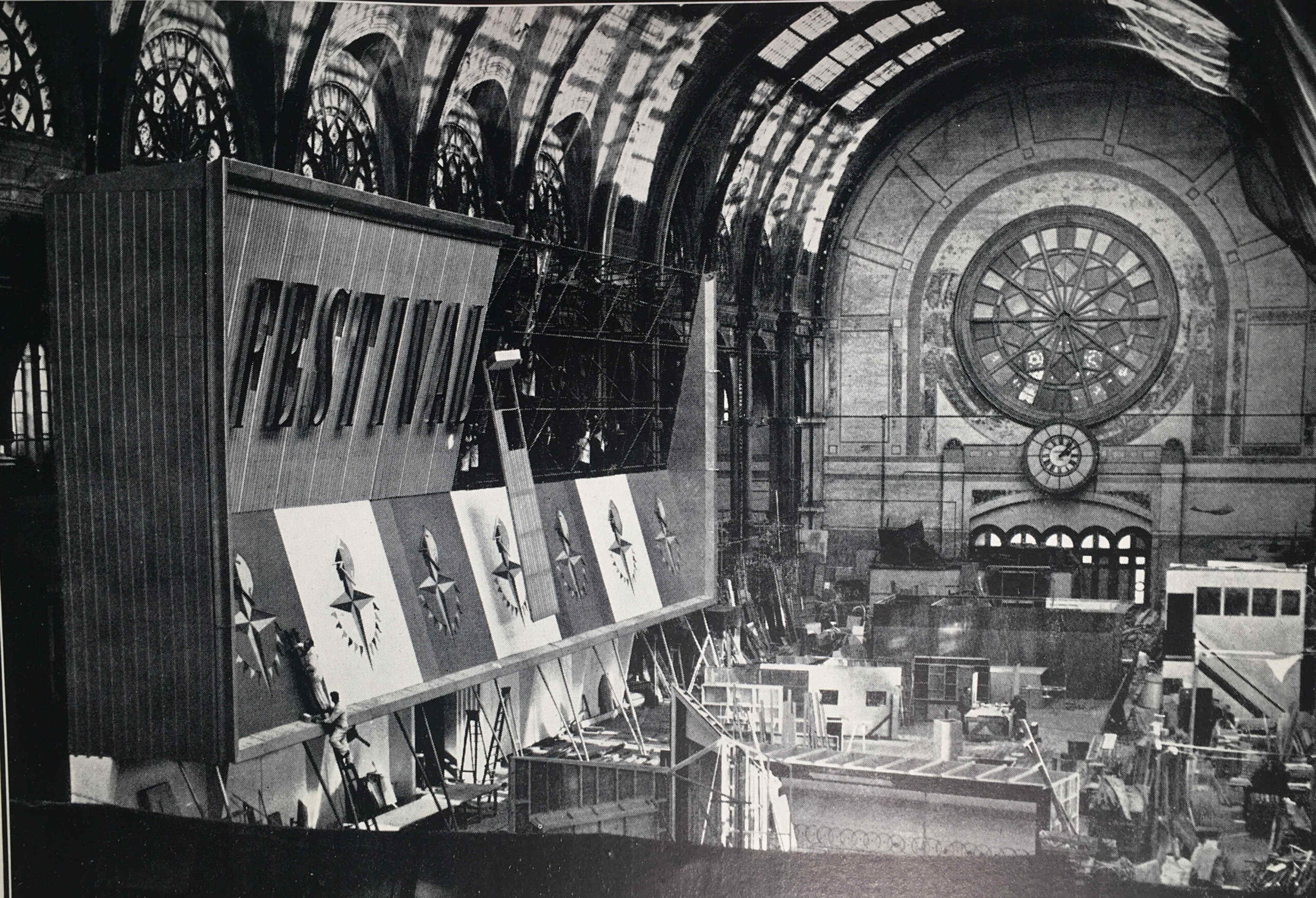
The guide includes a photo of the Exhibition Façade under construction, and I am sure that is the main hall of Alexandra Palace:

Festival of Britain Alexandra Palace

Alexandra Palace makes sense as it would have provided a large area for construction of all the exhibits, and the contractors responsible were the City Display Organisation, London.

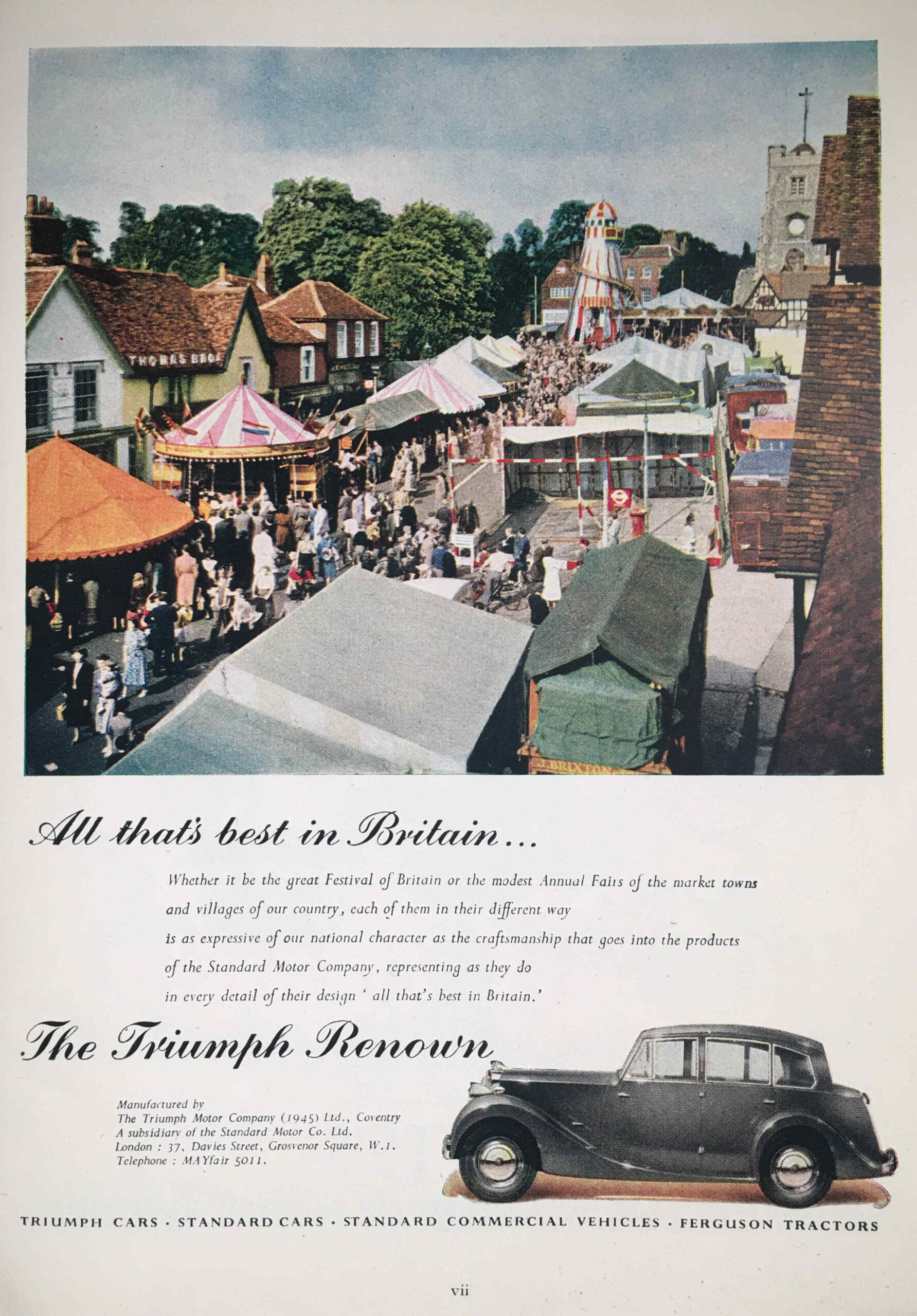
As with all the Festival of Britain Guide Books, the one for the Travelling Exhibition included a large number of adverts, many in colour, and they feature a range of British industrial enterprises, the vast majority of which have all disappeared in the years since the 1951 festival.

In the Triumph Renown, manufactured by the Triumph Motor Company, you could get out and visit places and events such as displayed in the following photo:

Triumph Renown

I think that is a location in outer London, as in the photo we can see the following:

Triumph Renown

Before Lego, there was Minibrix:

Minibrix

Minibrix were manufactured by the Minibrix Rubber Company, a subsidiary of the I.T.S. Rubber Company of Petersfield in Hampshire. Production started in the late 1920s.

The bricks were made out of solid rubber, and were therefore rather heavy compared to the plastic bricks that Lego would later introduce.

Competition from Lego, who used plastic for their bricks, which was cheaper to produce, and allowed a much wider range of models to be built, meant that Minibrix could not compete, and Minibrix ended production in 1976.

The fate of Minibrix sums up much of the industries and businesses featured in the Festival of Britain, with the majority disappearing in the next 40 years.

One that does still thrive is Rolls-Royce, who continue production of the jet engine in Derby.

I still have a couple of Festival of Britain Guide Books to find, but if you would like to read some of my other posts on the festival, you can find them at the following links:

alondoninheritance.com