Monthly Archives: August 2019

Southend on Sea – A London Bank Holiday

To really understand London and the lives of Londoners, we need to look outside the city to see how London has influenced the development of so many other places, one prime example being Southend on Sea.

Southend on Sea is on the Thames Estuary, not quite the open sea, and very different to the river that passes through London.

The first settlement around Southend was to the north of the town at Prittlewell, probably dating from the 6th or 7th centuries.

There was gradual development over the centuries, but from the late 18th century development dramatically increased and Southend on Sea became a major seaside resort of the 19th and earlier 20th centuries.

Passenger ships from the heart of the City would ferry day visitors to Southend, and with the opening of two rail lines (Fenchurch Street to Southend Central in 1856 and Liverpool Street to Southend Victoria in 1889), large numbers of Londoners would make their way to experience a day on the coast and to walk along the pier.

Southend is only Southend because of London.

As this is a Bank Holiday weekend, it seemed appropriate to join the thousands of Londoners who have made the same journey over the years and take a trip out to Southend on Sea.

Southend

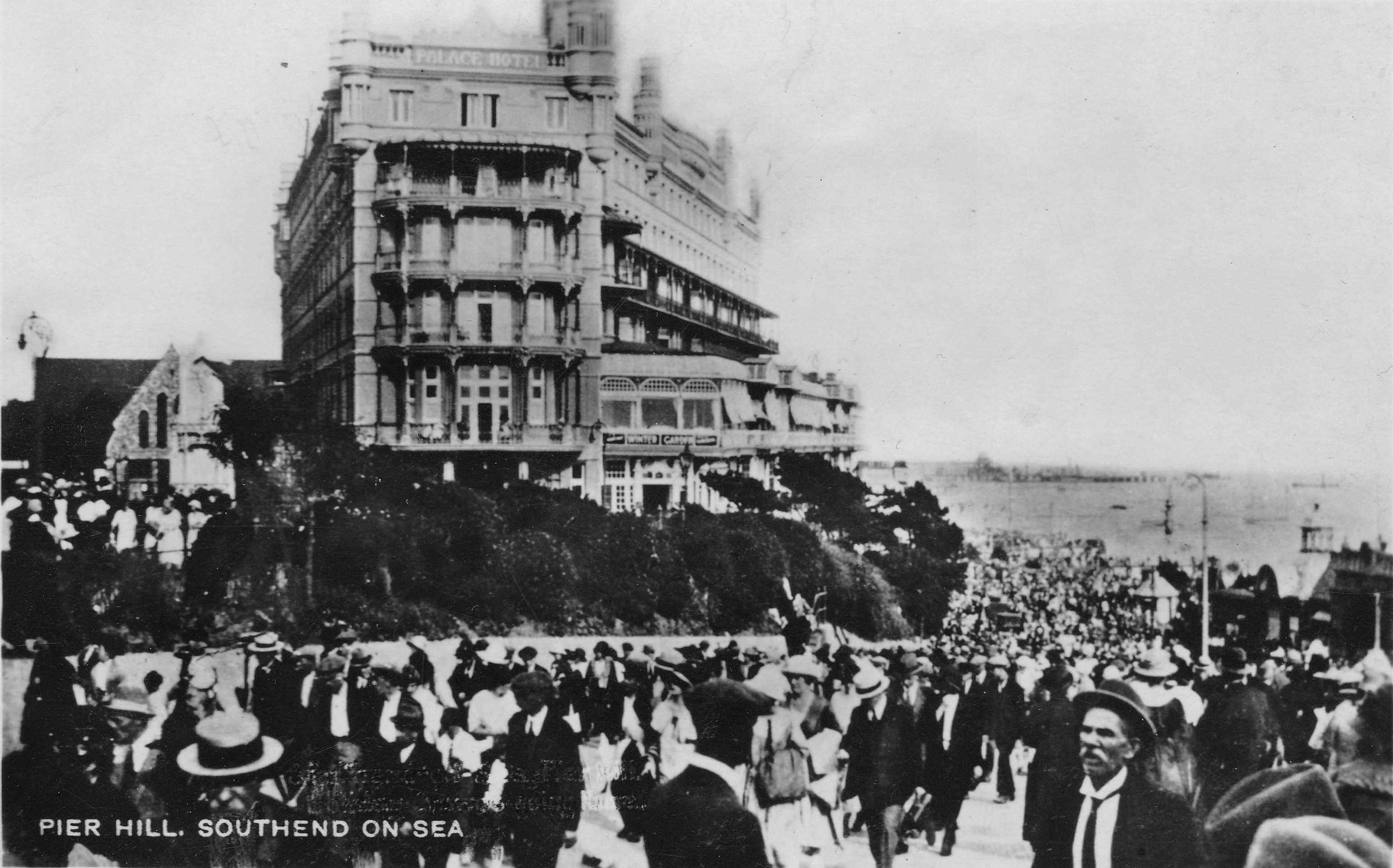
The above photo shows crowds streaming up Pier Hill. This leads from the pier and the parade along the sea front, up to the high street and the stations. It was probably taken towards the end of the day when day trippers were heading back to the stations for their journey back into London.

The Southend Standard from August 1910 provides a wonderful description of Southend on an August Bank Holiday:

“HOW SOUTHEND SPENT BANK HOLIDAY – Last year Bank Holiday was cold and wet, and holiday makers had a good deal of their enjoyment marred by cold winds and frequent showers. This year however, the Clerk of Weather changed his mind for once, and was in his most genial mood.

The sun shone from early morn to dewy eve; his somewhat warm attentions being tempered by a cool and steady breeze. Very early in the morning the incoming excursion trains began to unload their human cargoes; the railway stations, like gigantic hearts, beat at regular intervals and sent the human tides flowing outwards, to disperse themselves along the various arteries and veins of the town.

Such crowds there were too; everyone in their holiday rig; artisans and their wives, the poorer class of clerks, ‘Arry in fearsome ties, the latest cut of trousers, and bowler or straw hat stuck jauntily on one side; ‘Arriet in all the glory of purple velveteen, brown boots and large hat with sweeping ostrich feather; everybody and his uncle as the saying goes, was in the crowd that ceaselessly passed down the high street and spread itself along the front. By midday, the Parade was a sight worth seeing; right away from Westcliffe to Luna Park, the great mass of holiday making humanity moved to and fro and back again, like the tides of the estuary, merry laughter, jokes and greetings were everywhere. But it was down along the east front, in the afternoon that the holiday crowd was seen at its best, there the genus tripper was present in every variety.

The stalls which purveyed fearsome and wonderfully made American drinks did a roaring trade. Every fruit shop was the centre of a knot of customers and even the establishment whose claim to attention lay in the handing out of frizzling hot sausages and steaming mashed potatoes did a brisk trade.

From the shops at the commencement of the Parade to the gasworks every place did a roaring trade, they might have been huge magnets and the coins in the pockets of those outside made of steel, so quickly did the later pass over the counters, and from hand to hand.

The spaces of beach and sand which were left vacant were filled with hundreds of children and grown-ups, who sat about and enjoyed themselves to the full.  In the pools left by the residing tide the youngsters had great sport, and with pail and spade and tucked-up clothes, splashed and dug to their hearts contents.

‘Arries and ‘Arriets, regardless of the dust and the heat, danced round piano organs in the East End style, which is only born and cannot be taught.

By six o’clock in the evening the human tides begin to return to the railway stations and crowd the trains again. Much singing and dancing was there, not quite so clear and steady as in the morning, but nevertheless all good humoured.”

The train companies would arrange special excursion trains from London to Southend for Bank Holiday weekends, and newspapers in advance of the weekend would carry advertisements detailing the times and prices for those wanting to leave the city for a day by the sea. Very different to today, where the Bank Holiday is often a time for closures and engineering works, rather than special trains heading to the coast.

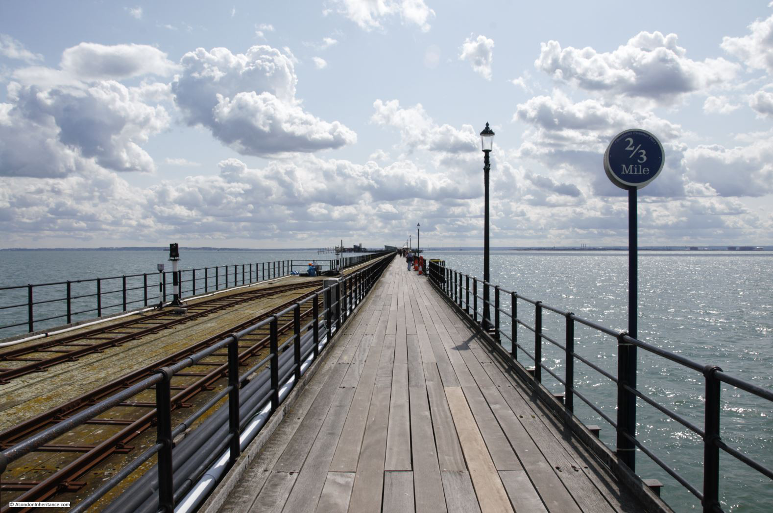
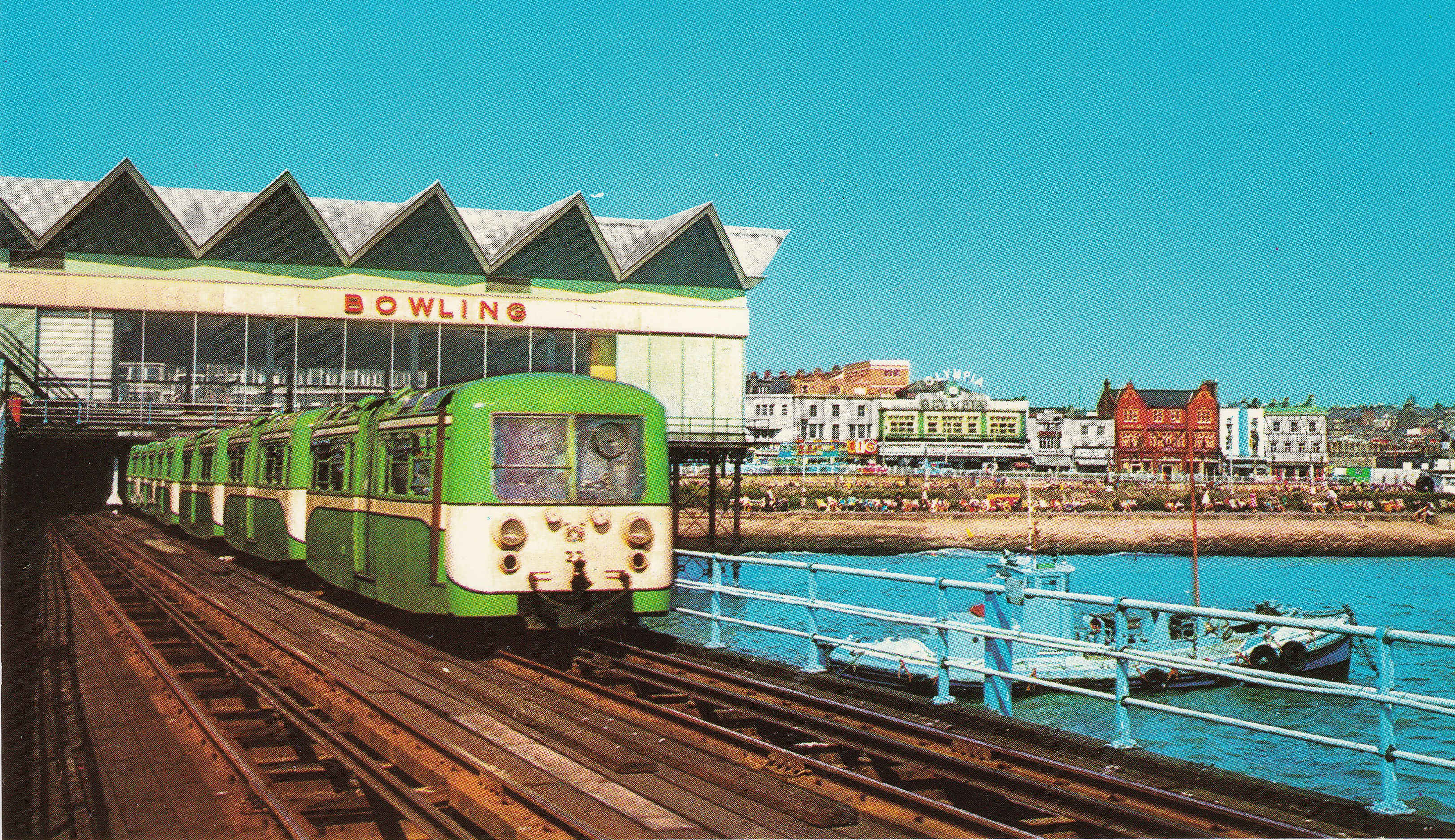
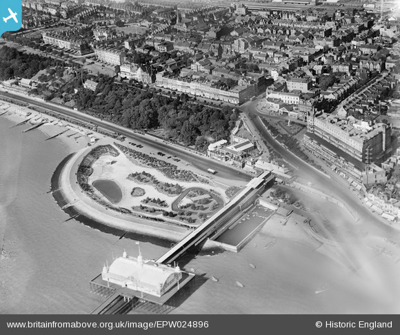
Southend Pier has long been a central feature of a day by the sea. The original pier opened in 1830, and the iron pier that we can walk along today followed in 1889. The end of the pier was extended several times with the Prince George Extension opened in 1929 bringing the length of the pier to 1.34 miles.

The pier railway was opened in 1890, reaching the end of the pier in 1891.

In the following years, Southend Pier has been hit by ships and suffered a number of fires. At times it seemed that the pier would not be restored and might even be closed, but somehow it has continued to stay open, a train still runs the length of the pier, and the buildings at the pier-head have been restored.

Time for a Bank Holiday walk along the pier:

Southend

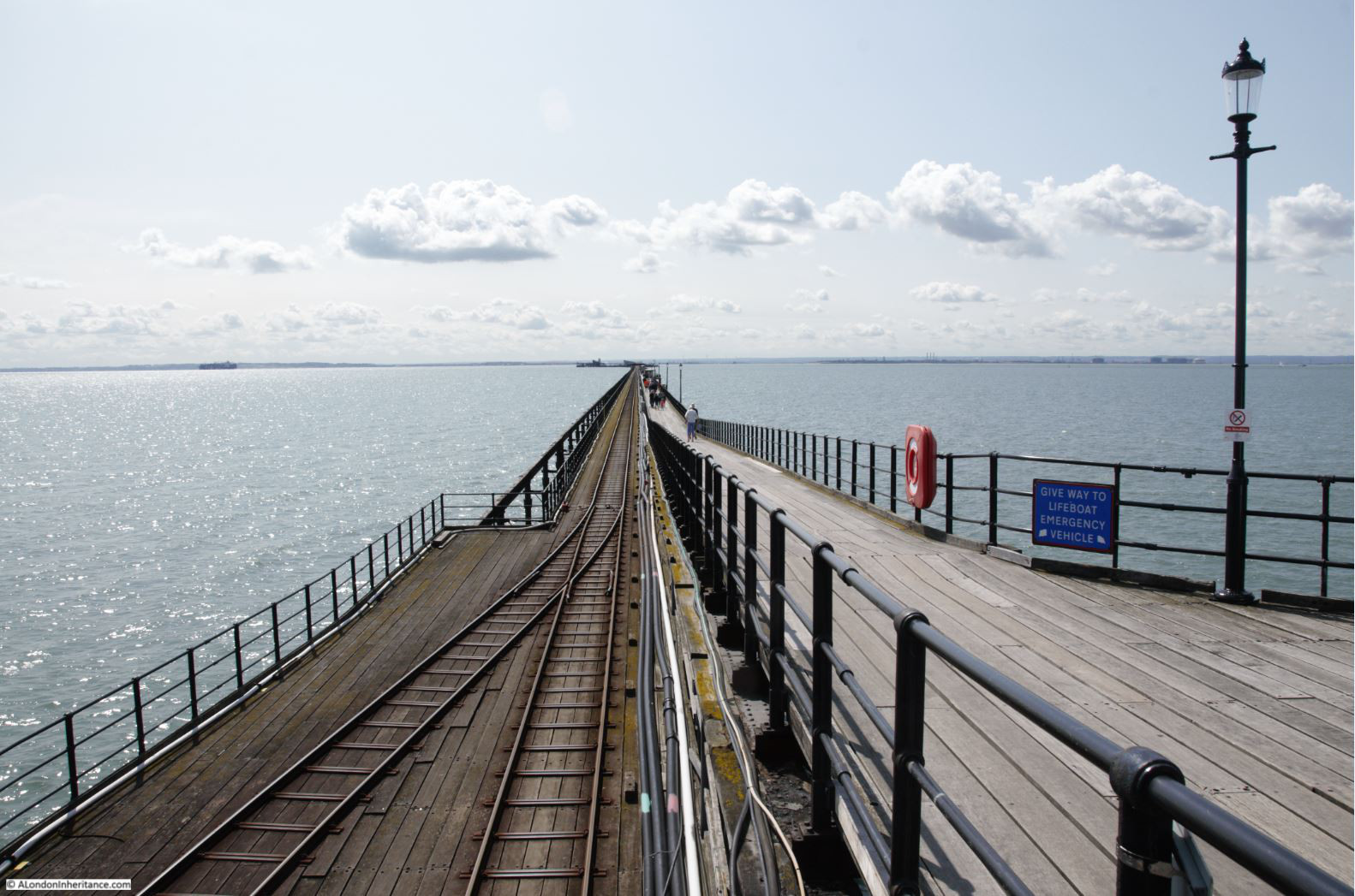
Once you start walking along the pier, the beauty of the estuary sky becomes apparent. The land on either side of the estuary almost blends with the water, and the wide open sky stretches from horizon to horizon.

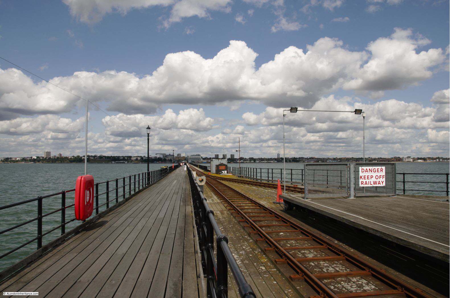
Distance markers tell you how far along the pier you have walked – and how far you still have to go.

Southend

The Southend Pier Railway still runs the length of the pier.

Southend

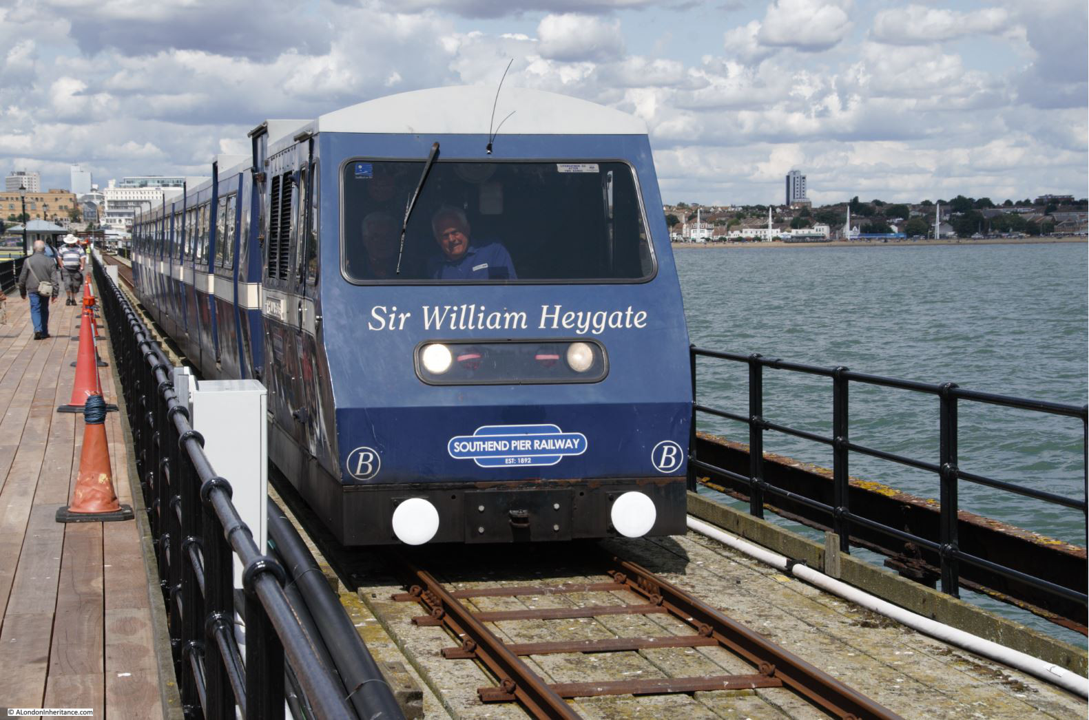
The first 1830 version of the pier included a horse-drawn tramway, however this was replaced by an electric tramway in 1890 soon after completion of the iron pier.

There have been a number of different versions of the pier train over the years – this is the first version I remember, with the bowling alley in the background which once was the main building over the start of the pier.

Southend

Conditions on a warm August day are very different to the wind and rain the pier has to endure, sticking over a mile out into a flat estuary  with no protection from everything that the weather can throw at the pier.

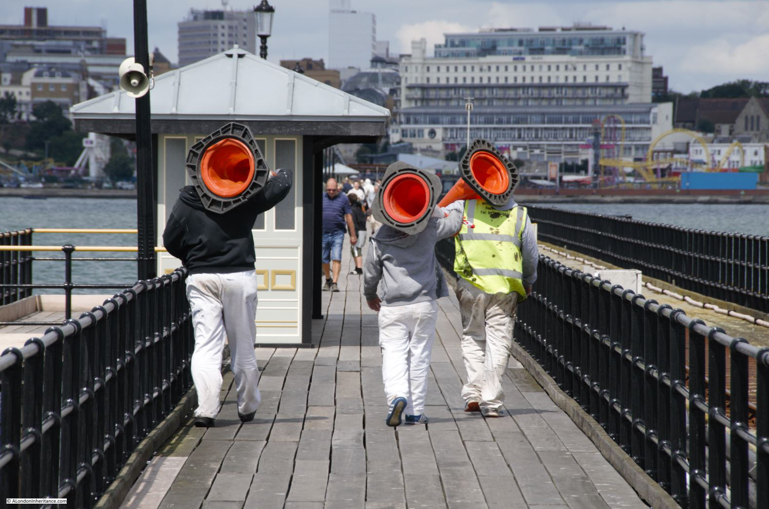
The pier therefore needs constant maintenance. Replacement of the wooden boards lining the walkway, painting of the railings, replacement and restoration of the iron supports of the pier.

Southend

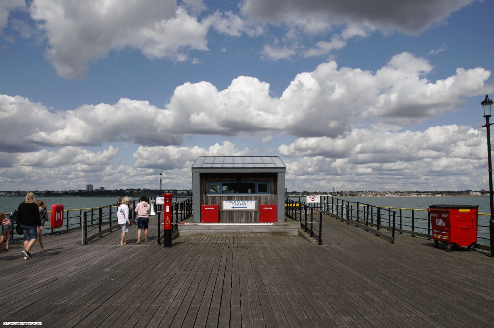
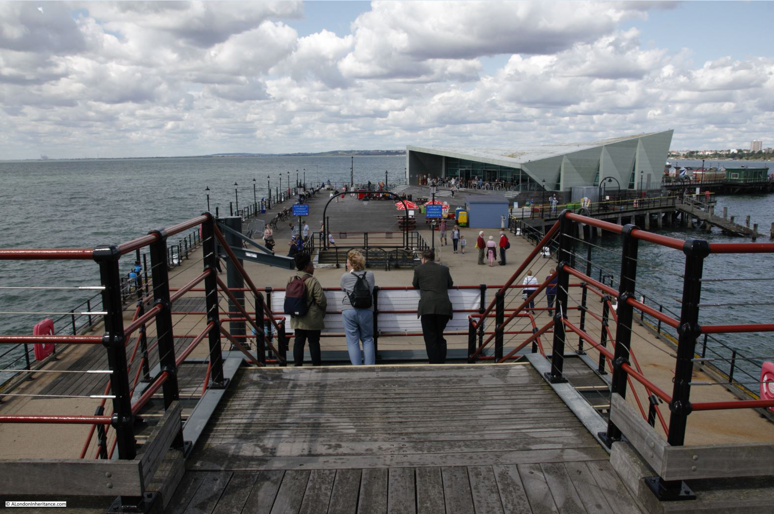
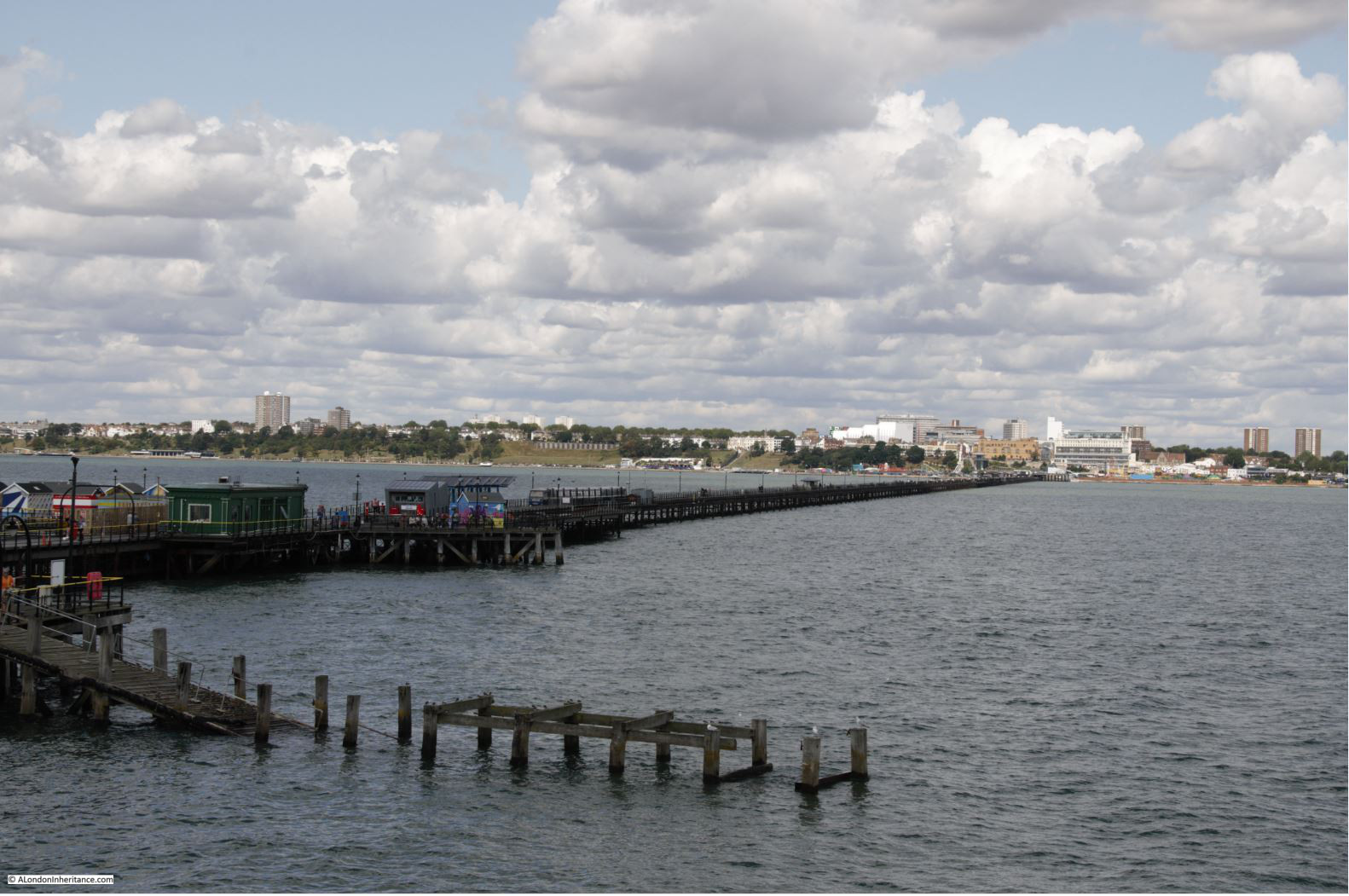
Looking back along the pier from alongside the station at the pier-head.

Southend

End of the pier station and estuary sky.

Southend

Colour at the end of the pier.

Southend

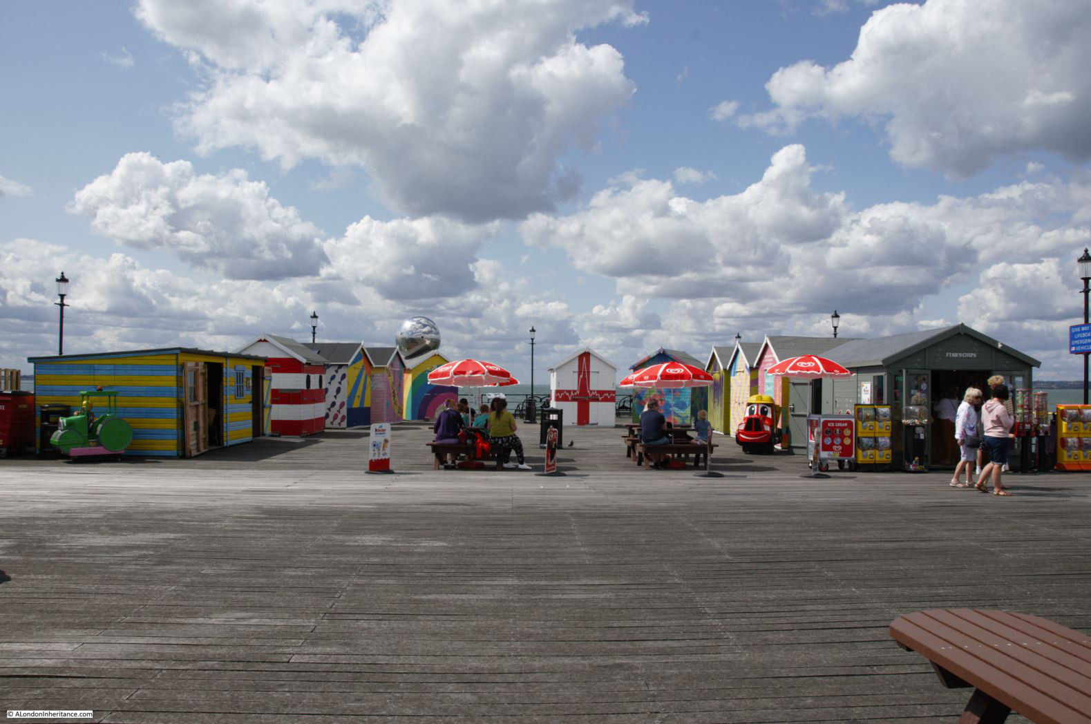
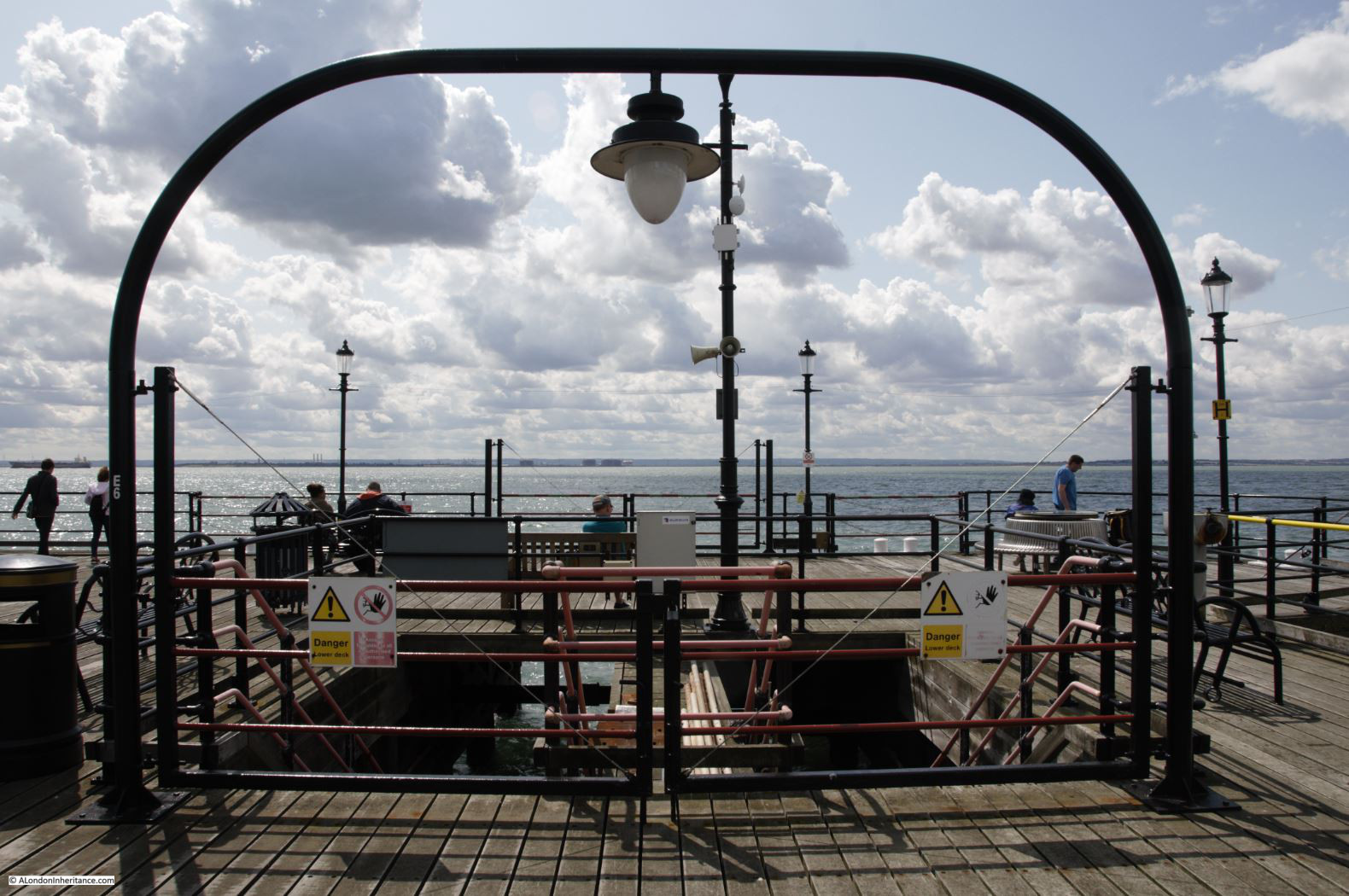
The pier did comprise upper and lower decks at the pier-head. The lower decks are now closed off.

Southend

Pier head:

Southend

Looking back at the pier head:

Southend

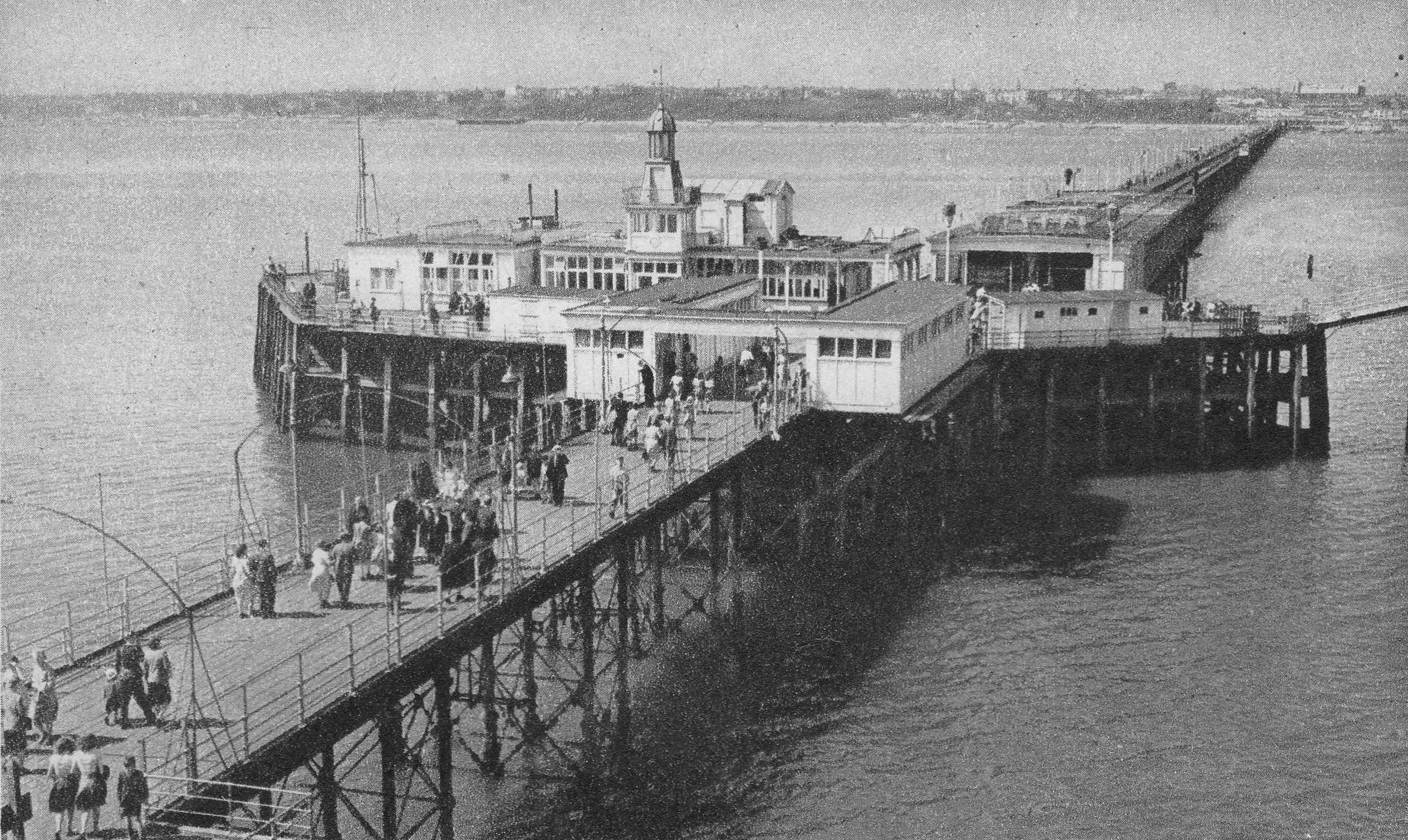
The following photo from the Britain from Above archive is titled “The Royal Eagle Paddle Steamer alongside Southend Pier, Southend-on-Sea, from the south-east, 1939”

Southend

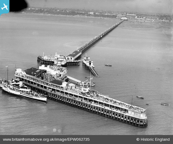
Note the two decks along the pier head, and the crowds of people on the pier and the ship.

The Royal Eagle ran regular day trips from the centre of London out to Southend, Margate and Ramsgate.

A typical advert for the service from May 1933 read:

“London’s Luxury Liners – Commencing 3rd June Daily (Fridays excepted) Royal Eagle for Southend, Margate & Ramsgate from Tower Pier at 9.20 a.m. Greenwich 9.50, North Woolwich 10.20.”

Day return fares during the week to Southend were 4 shillings and 5 shillings on Saturdays, Sundays and Bank Holidays.

If you wanted a slightly longer day at Southend, the Crested Eagle left Tower Pier at 9 a.m.

The mid section of the pier head as it was pre-war. Note also the end of the pier station, with two covered platforms for trains.

Southend

The very end of the pier:

Southend

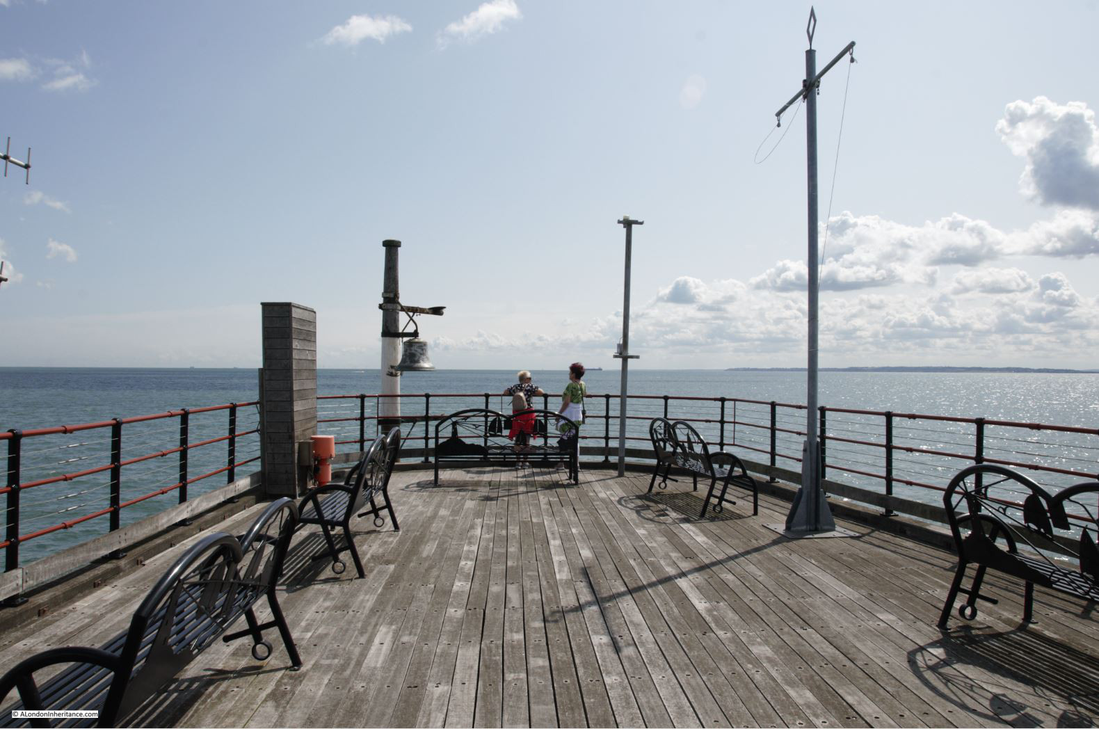
The view back along the pier towards Southend from the end of the pier:

Southend

From our 2019 viewpoint, it is probably hard to understand just how much a day out at Southend meant to someone living in East London. The ability to escape from the daily pressures of trying to earn enough to feed and house your family must have been essential to make life worth living. Whilst researching through newspapers, I came across the following tragic example from 1921. Hopefully a very rare case, but it does highlight what a day out at Southend meant to an east Londoner:

“TRAGEDY OF BOY’S SUIT IN PAWN – LOSS OF HOLIDAY CAUSES MOTHER’S SUICIDE.

Worried because she could not raise the money necessary to get her boy’s Sunday suit out of pawn so that he could go to Southend on Bank Holiday, Ellen Woolf (44) of Mile End, committed suicide by swallowing carbolic acid.

It was said at the inquest that the woman had had 14 children, of whom eight were living, and the clothes had been pawned during the week in order to get food.

She had also had additional worries over a sick child and debt. The husband served in France during the war, and was badly wounded. Before and since, for over 20 years, he had sold newspapers in Leadenhall-street for a living.

Suicide while of unsound mind was the verdict.”

The verdict should really have drawn attention to the pressures she must have been under, as these must have been the root cause of her state of mind – I will never take a trip to Southend for granted again.

Southend has had to change and adapt to continue to attract visitors who want more that just a walk along the pier or the Parade. As the 1910 report stated, in 2019 it is still about money, and attracting the coin out of the visitors pocket.

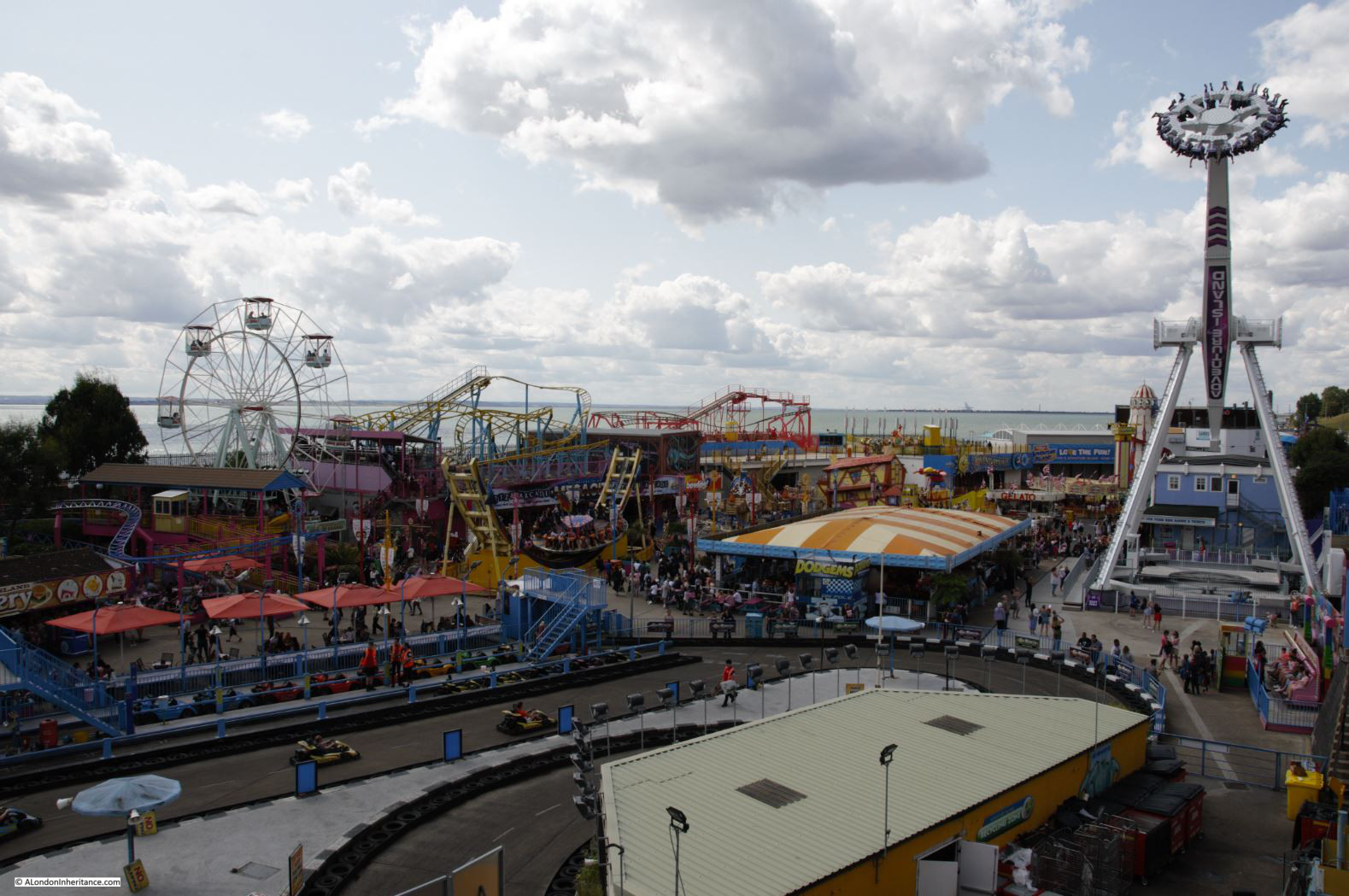
On either side of the pier, along the sea front is Adventure Island – a dense cluster of rides and amusements.

Southend

The following photo from the Britain from Above archive shows the sunken gardens in 1928, this is the same space as shown in the above photo.

Southend

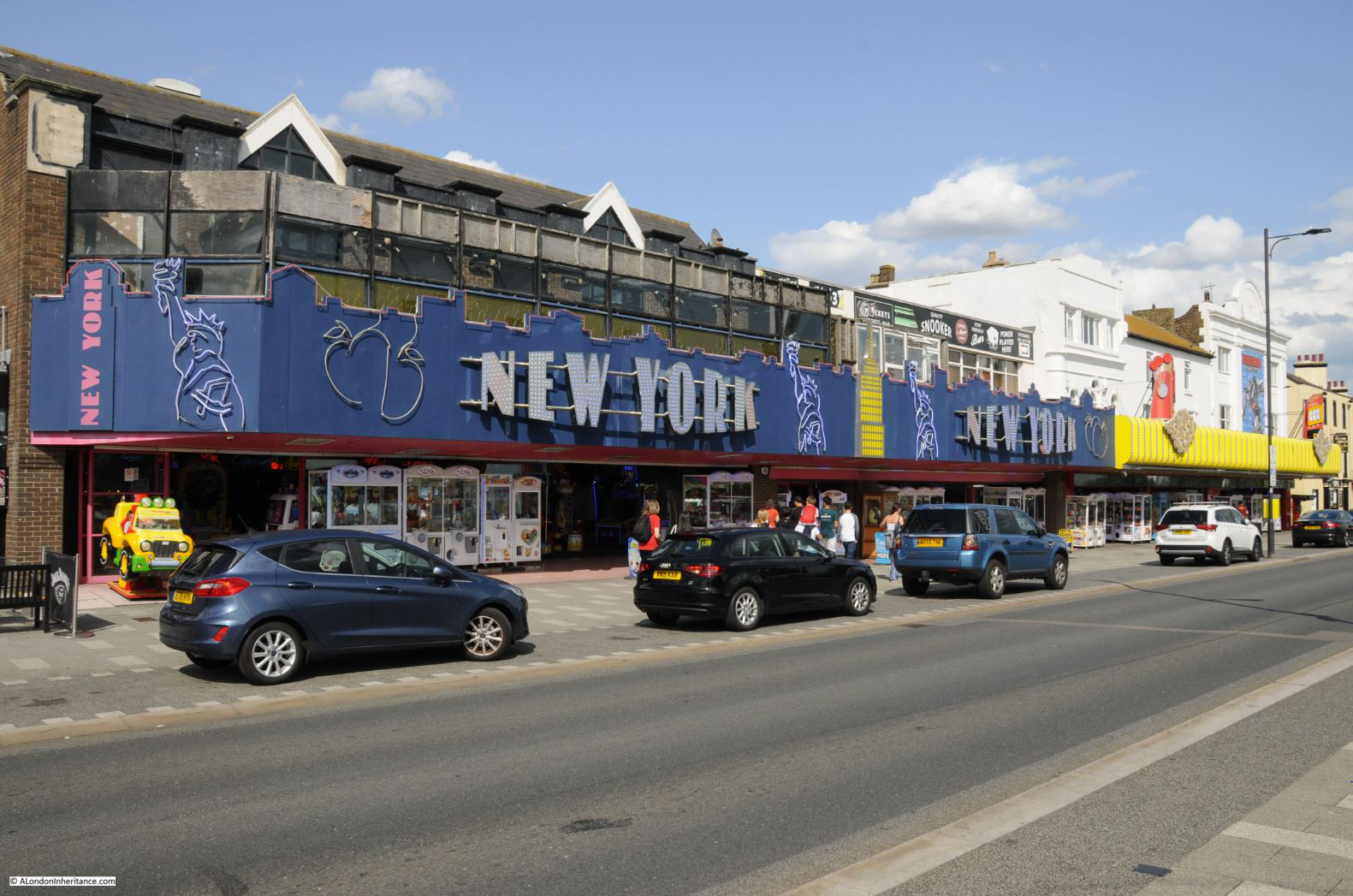
The old Marine Parade, or Golden Mile runs along the sea front to the east of the pier.

Southend

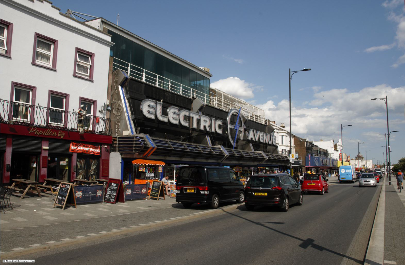
This was one of the places to go in the late 1970s with my first car on a Saturday night. Clubs such as Talk of the South (ToTS) were in the buildings on the left and customised cars would spend their time driving up and down the Golden Mile. Southend on a Saturday night was exciting when you are 17.

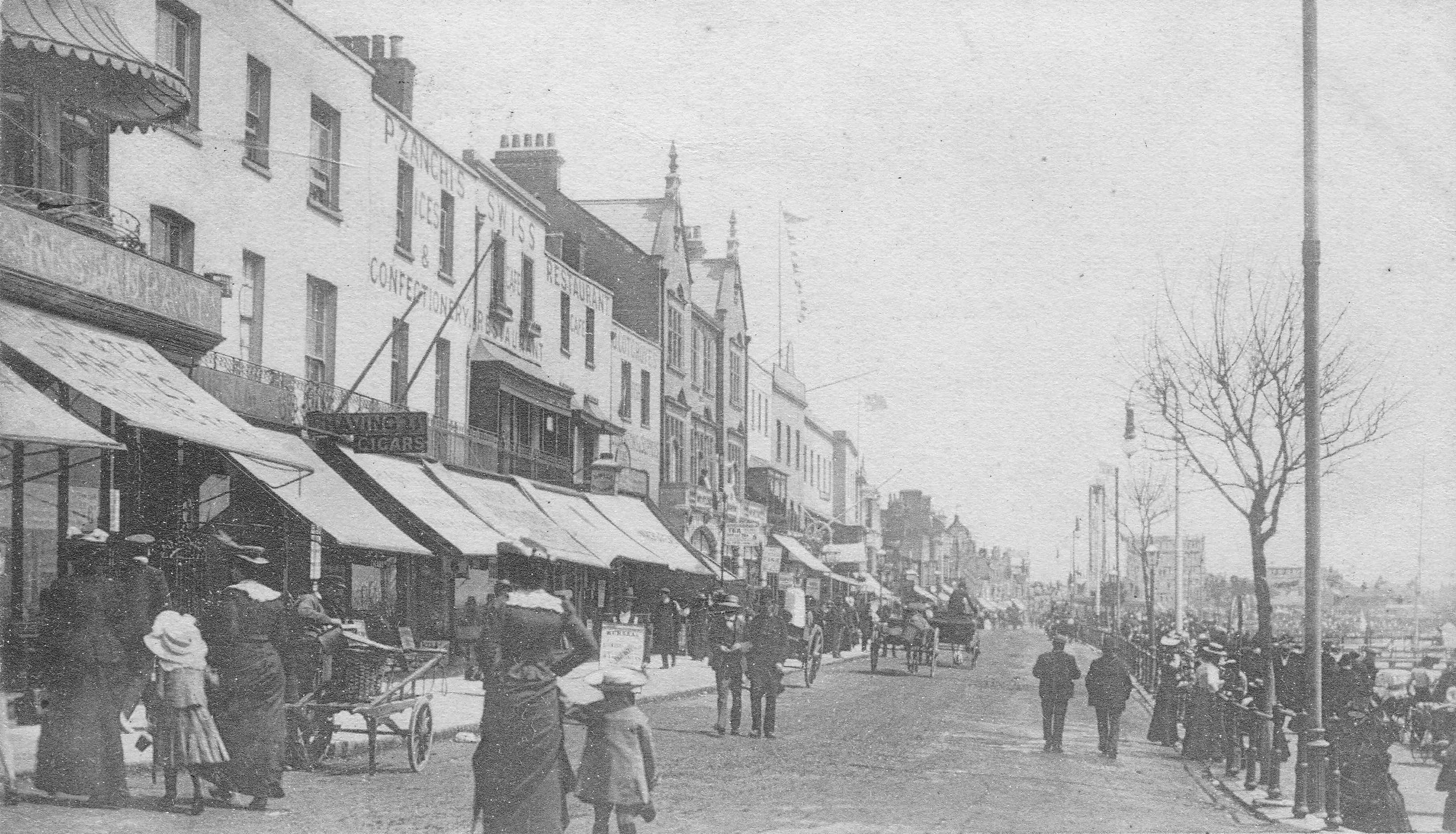
It was a very different scene in the early years of the 20th century:

Southend

Large amusement arcades now line the street:

Southend

There have been proposals over the years to demolish and rebuild large parts of the Golden Mile, but they never seem to move beyond the conceptual stage, so Southend’s brightly coloured and gloriously tacky eastern seafront continues into the 21st century.

Southend

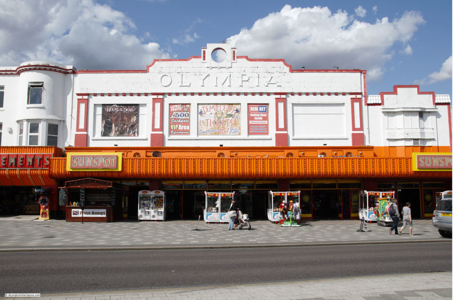
At the end of the street is the Kursal, now a shadow of its former self.

Southend

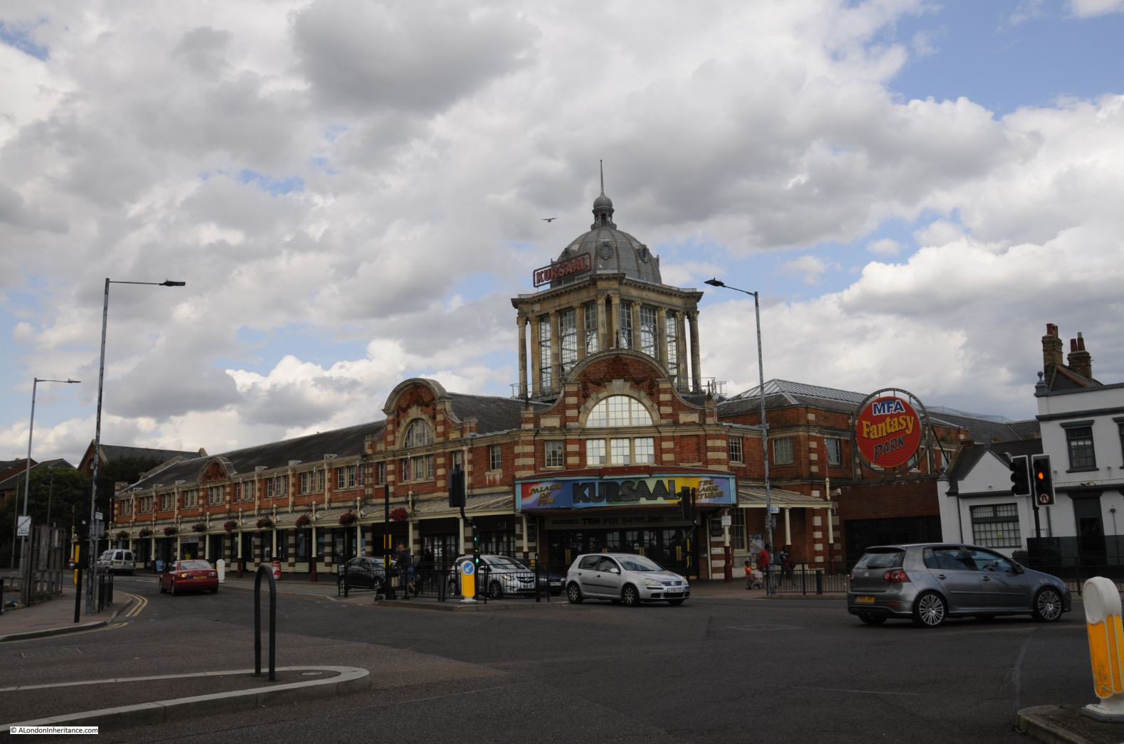
Opened in 1894 with the main entrance buildings opening in 1901, the Kursal consisted of dining halls, billiard rooms, bars etc. in the main building, with a large fairground covering the land behind.

The Kursal has been through many changes in use and ownership. In 1910 it was renamed the Luna Park, as referenced in the newspaper article at the start of the post. It has been used for greyhound racing and in the 1970s, the main ballroom was a rather good live music venue.

Leaving the seafront and walking up Pier Hill we find this strategically placed souvenir shop:

Southend

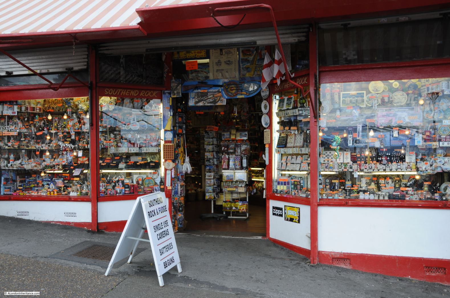
The shop has been here for as long as I can remember, and it is on the route back to the High Street and train stations from the pier and sea front. Just the place to stop off and buy your last minute souvenir before returning on the train to London.

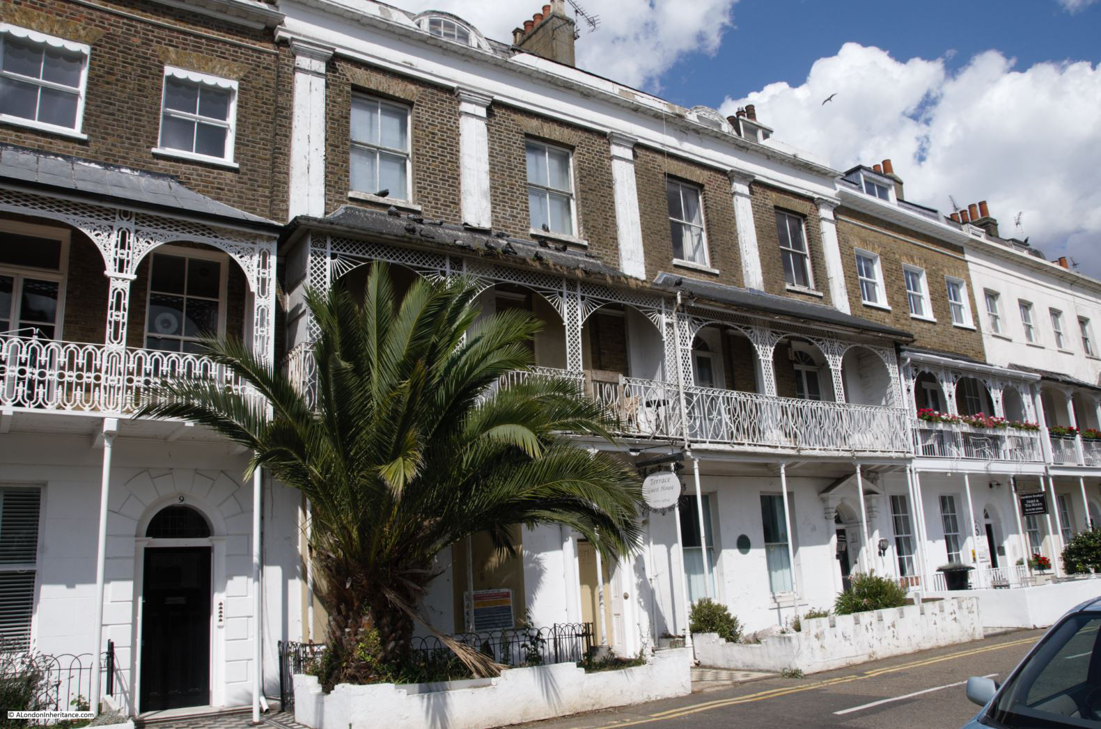
Southend is not all garish seaside buildings, there is some wonderful historic architecture. At the top of Pier Hill, turning to the west along the cliff top is the Royal Terrace.

At the far end, on the corner with the High Street, is the Royal Hotel and a line of late 18th century houses run along the street with superb views over the pier and estuary.

Southend

The terrace was built between 1791 and 1793. The “Royal” name of the terrace was given after the 1803 visit of Princess Caroline (the wife of the Prince Regent), who occupied numbers 7,8 and 9 – the houses in the centre of the photo below.

Southend

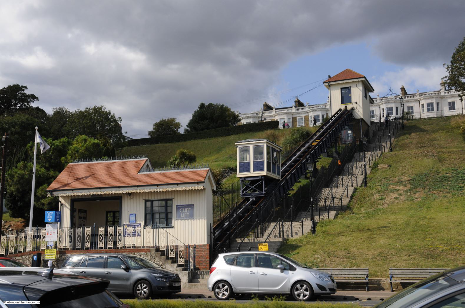
At the end of the Royal Terrace is the Cliff Lift, providing pedestrians with a route between the sea front and the top of the cliff if they want to avoid the walk.

Southend

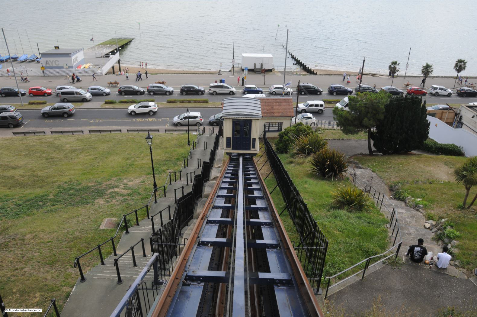
In 1901, a moving walkway was installed on the site, replaced by the lift which was constructed in 1912.

The lift has undergone several refurbishments and updates since, the most recent being a £3 million upgrade in 2010.

For 50p you can be carried smoothly up to the Royal Terrace:

Southend

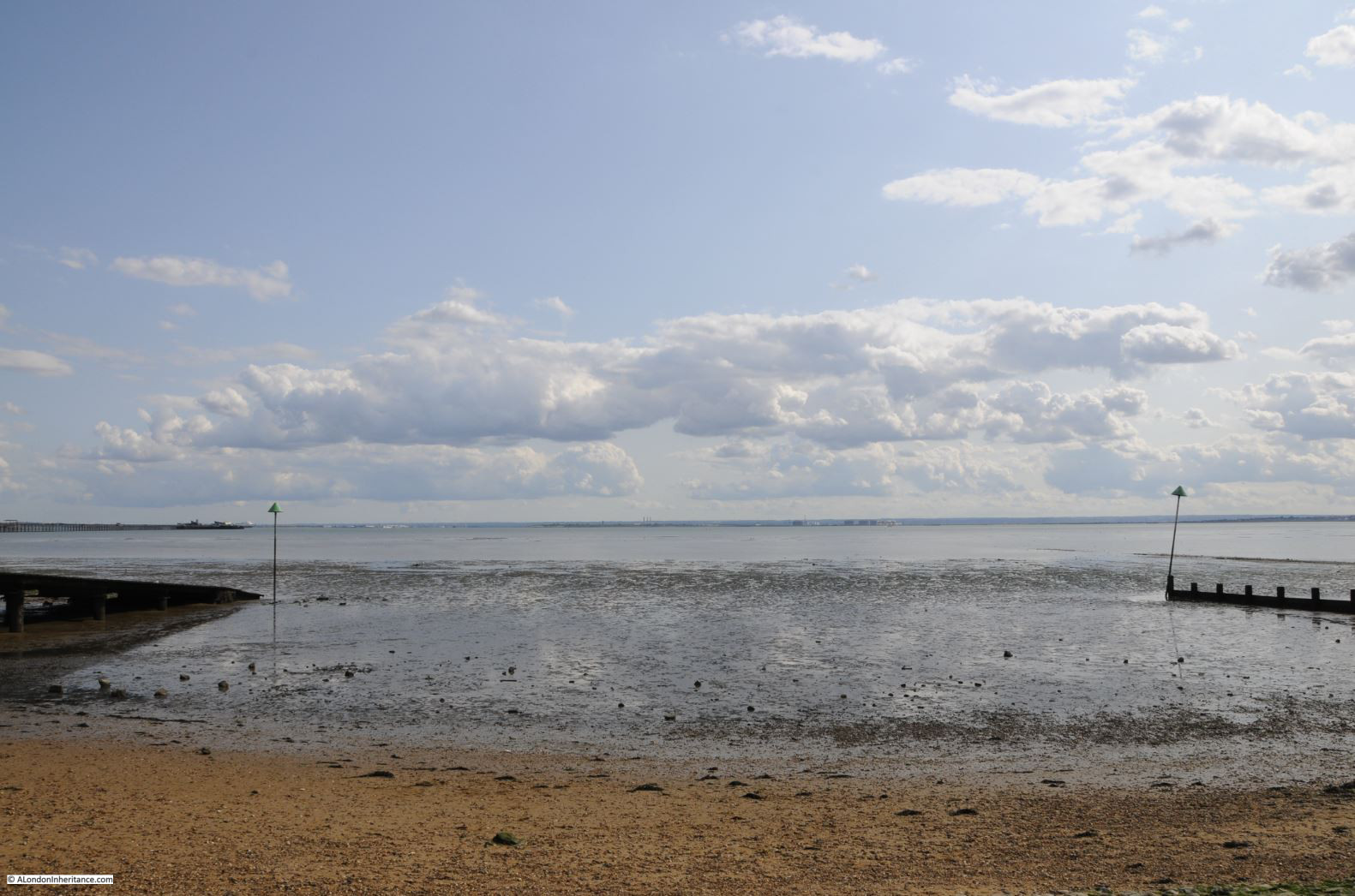
One final view across the estuary, where sand blends into mud, then water then sky, with a thin sliver of land across in Kent. Hard to believe that this is the the river that flows through central London, now over 4 miles wide between Southend and the Kent coasts.

Southend

Southend is only the Southend we see today because of London. A long heritage of being one of the main destinations for Summer weekends and Bank Holidays for those who lived in London.

Easy transport provided by passenger ships on the river and the opening of two railway lines to central London helped bring crowds out of London to spend their money in Southend. In the late 1920s and 1930 a new main road (now the A127) was opened between the Eastern Avenue at Romford and Southend, adding a dual carriageway from east London directly to Southend as visitors started the move from ship and train to car – a trend that would be accelerated in the post war years.

Tastes will continue to change and what people want from a day at the seaside will evolve, but I suspect that Southend will respond as it has done for two hundred years, and develop new ways to, as the 1910 article stated, remove the coin from the pocket of the visitor, but for me it will always be a place to get lost in the wonderful estuary sky.

alondoninheritance.com

Ironmonger Lane – Two Thousand Years of History

A couple of week’s ago I was in ironmonger Lane in the City of London, a narrow lane running between Cheapside and Gresham Street.

The buildings in the lane are relatively recent, and difficult to photograph due to the width of the lane, however Ironmonger Lane has a fascinating history, so for this week’s post, let me take you on a journey through time starting with the earliest traces of habitation in ironmonger Lane.

As with many City streets, ironmonger Lane suffered bomb damage in the last war, hence the relatively young age of the buildings that line the lane today.

The bomb damaged remains of number 11 Ironmonger Lane were being demolished after the war and the Guildhall Museum led an excavation of the site.

Number 11 is in the centre of the photo below:

Ironmonger Lane

Adrian Oswald, working on behalf of the Guildhall Museum excavated the site, and 16 feet below street level the remains of a Roman house and Roman mosaic were found.

Ironmonger Lane

The excavation was notable at the time as this was the first Roman mosaic that had been found since excavations at the Bank of England.

The mosaic and house were dated to around the 2nd and 3rd centuries.

It is intriguing to imagine that Ironmonger Lane was a street in Roman times, and this was the earliest traces of the buildings and people living in this part of the City.

Ironmonger Lane

The next traces of occupation in Ironmonger Lane are possible 9th to 11th century foundations found in the churchyard of St. Olave during an excavation in 1985 / 86. The churchyard is in the centre of the lane, and Roman bricks were also found during the excavations, providing further evidence of Roman building.

Early in the 12th century, Thomas Becket, who would become Archbishop of Canterbury and murdered at Canterbury Cathedral at the apparent command of King Henry II, was born in a house on the corner of Ironmonger Lane and Cheapside, a plaque marks the site today:

Ironmonger Lane

The Becket family owned part of the land at the southern end of Ironmonger Lane and alongside Cheapside.

Also in the 12th century, we see the first references to the church of St Olave (roughly half way along the lane), although certainly much older, and also to the Hospital of St Thomas of Acon (dedicated to Thomas a Becket), when hospitals were mainly religious establishments.

The Hospital of St Thomas of Acon was founded in 1227 on land at the southern end of Ironmonger Lane, between ironmonger Lane and Old Jewry, facing onto Cheapside.

The hospital would be important for how we see the southern end of Ironmonger Lane today.

Now for my first map. This is John Rocque’s map of 1746, although I have not yet reached the 18th century, the map is helpful in showing the location of some of these 12th century establishments.

Ironmonger Lane

Ironmonger Lane is in the centre of the map. Cheapside at the southern end, and Cateaton Street (which would later become Gresham Street) at the northern end.

Look to the southern end, and to the right of Ironmonger Lane is a block of building and the abbreviation “Cha” for Chapel – this is the area where Thomas a Becket was born and also the site of the Hospital of St Thomas of Acon.

The hospital was built on land purchased from the Becket family. The name Acon is the anglicised version of Acre (now part of Israel), and dates from the Third Crusade between 1189 and 1191, and possibly originates from an order of monks / knights formed during the Crusade and the siege of Acre.

In Rocque’s map, you can see that the Mercers Hall is also shown where the hospital was located.

The Mercers Company represented the interest of merchants who traded in materials such as wool, linens and silks and it was the Mercers who became patrons of the Hospital of St Thomas of Acon, and used the hospital’s chapel as a ceremonial meeting site from when the chapel was built in the 13th century in 1248.

Also in the 13th century, the second church in Ironmonger Lane is first mentioned. This is the church of St Martin Pomary which was located between the church of St Olave and Ironmonger Lane – two churches adjacent to each other. To see how close these churches were, look at Roqcue’s map above, to the left of St Olave, you will see the text “St Martin’s Church Yard”.

I have not yet mentioned anything about the name – Ironmongers Lane.

The name relates to the trade of Iron Mongers as in the medieval City, trades generally clustered around specific streets. The first mention of the name is from the 13th century, and there were many variants of the name, starting with Ysmongeres Lane, with other variations between the 13th and 14th centuries. The Agas map of 1561 records the street as Iremongers Lane.

The ironmongers would not stay too long in the area as it appears they have moved to the Fenchurch Street area in the 15th century – so the name is a remarkable survival of a medieval trade with a specific area.

In the 15th century, the Mercers were continuing their long association with the Hospital of St Thomas of Acon as in 1407 the Mercers purchased their own chapel in the Hospital’s church.

Moving a century later, and the 16th century was a time of dramatic change in ironmonger Lane.

In 1524, the Mercers built their first Hall on land purchased from the Hospital.

In 1538, the Hospital of St Thomas of Acon was taken over by the Crown during the dissolution. The Mercers negotiated the purchase of the land, and subsequently purchased all the hospital’s properties, and the company built the Mercers School on part of the land. I suspect they were a company never to pass by a good commercial opportunity.

The Agas map of 1561 shows Ironmonger Lane densely built, with the church on the east side of the street and the Mercers Hall facing onto Cheapside.

Now travel forward to the 17th century and in 1665, as with the rest of London, the occupants of Ironmonger Lane lived in dread of the plague, and as a preventative measure, the Mercers closed their school.

The following year, 1666, the Great Fire took hold of the area and burnt down the churches of St Martin Pomary and St Olave, along with the Mercers Hall.

Wren rebuilt the church of St Olave in the 1670s, but St Martin Pomary was not rebuilt, the parish was amalgamated with that of St Olave.

The Mercers second Hall and Chapel on the site were also rebuilt, opening in 1676 to continue the Mercers long association with ironmonger Lane. The fire had also destroyed all remaining evidence of the Hospital of St Thomas of Acon.

In the 19th century, Ironmonger Lane was a busy commercial street in the heart of the City.

The 1895 Ordnance Survey map shows St Olave and Mercers Hall, along with a Police Station and a Public House at number 11 – this was Mullen’s Hotel.

Ironmonger Lane

Credit: ‘Reproduced with the permission of the National Library of Scotland’ 

Census reports provide an insight into Ironmonger Lane, and the City of London in general. In the 1861 census, it was recorded that there were 23 people living in the Mullens Hotel at number 11:

  • 5 family members and the owner of the hotel
  • 8 workers, all female and listed as servants
  • 10 visitors to the hotel including;
    • Drapers from Ireland
    • Drapers from Cornwall (one with two sons)
    • A Commercial Traveler from Norwich

As ever, London was a temporary home for travelers who had business in the City.

In 1892, the church of St Olave was demolished, apart from the tower of the church. The demolition was under legislation brought in to reduce the number of City churches. The tower was converted into a rectory for St Margaret Lothbury.

The tower is difficult to photograph from street level when the trees are in leaf, but it is there.

Ironmonger Lane

View of St Olave as it appeared in 1830, before demolition of the body of the church and with the tower visible from ironmonger Lane.

Ironmonger Lane

Image credit: London Metropolitan Archives, City of London: catalogue ref: q8051273

The gates that lead from the street into the old churchyard of St Martin Pomary with the tower of St Olave behind.

Ironmonger Lane

So into the 20th century, and Ironmonger Lane suffered badly from bombing during the Second World War.

The Mercers Hall, built after the Great Fire, was destroyed during the night of the 10th / 11th May 1941, and it was bomb damage that opened up number 11 to the excavation work that revealed the Roman house and mosaic.

Walking the street today, and we can still see the tower of St Olave, the old church of St Martin Pomary would have been just to the right and in front of the tower.

A number of parish boundary markers can be seen on the walls of buildings along the street, including that of St Martin Pomary:

Ironmonger Lane

The third Mercers Hall is at the southern end of the street, rebuilt after the Second World War. If you look on the corner of the hall, and along the hall and buildings along the south eastern side of Ironmonger Lane, you will see several carvings of the head and shoulders of a woman with a crown.

Ironmonger Lane

The figure is part of the armourial bearings of the Mercers Company, known as a Mercers Maiden, the figure is probably that of the Virgin Mary, although there is no written evidence to confirm this.

Ironmonger Lane

Ironmonger Lane

The Mercers have long been associated with the charitable building of houses across London, and there would have been a carving, or statue of a Mercers Maiden on the outside of the building. I have photographed a number of these including a very fine example alongside the church of St Dunstan and All Saints Stepney, and also along Hardinge Street.

The Ironmongers Lane entrance to Mercers Hall:

Ironmonger Lane

The following photo shows the view along Cheapside. The entrance to Ironmonger Lane is just to the left of the red circled street signs..

Ironmonger Lane

The large building running along Cheapside in the centre of the photo occupies the land between Ironmongers Lane and Old Jewry originally the location of the Hospital of St Thomas of Acon.

The following drawing shows the Mercers Hall occupying the same site in 1881. Ironmonger Lane is at the left.

Ironmonger Lane

Image credit: London Metropolitan Archives, City of London: catalogue ref: q7707062

The above view shows the post Great Fire version of the hall after considerable refurbishment. It was this version of the hall that was destroyed in May 1941.

The photo of the building from Cheapside shows more memorials to Thomas a Becket on the building corner at the junction of Ironmonger Lane and Cheapside..

Ironmonger Lane

It was the original association of the Mercers Company with the Becket family dating back to the 12th century, and their patronage of the Hospital of St Thomas of Acon, that almost 900 years later has the Mercers Hall still on the same site.

Looking up Ironmongers Lane from Cheapside, the open space on the right is at the entrance to the Mercers Hall, the narrow width of the lane can be seen continuing north.

Ironmonger Lane

There are a couple of passages leading off from ironmongers Lane.

The wonderfully named Prudent Passage leads to King Street. originally this was Sun Alley, and this original name was in use in the 18th century, with the first mention of Prudent Passage being in 1875.

Ironmonger Lane

St Olave’s Court runs to Old Jewry, alongside the location of the church of St Olave, and probably over the site of St Martin Pomary.

Ironmonger Lane

The view looking north towards the junction with Gresham Street:

Ironmonger Lane

The view south along Ironmonger Lane from Gresham Street showing the narrow width of the lane.

Ironmonger Lane

Number 11 Ironmonger Lane is just along the lane on the left. No longer a hotel, a new building was constructed on the site following the 1949 excavations, and refurbished a number of times since, and it is here that the Roman house and mosaics were found, which brings us full circle on almost 2,000 years of history of Ironmonger Lane.

alondoninheritance.com

HMS President and the Oxo Tower

In 1947 my father was standing on the north bank of the River Thames, slightly west of Blackfriars Bridge, and took this photo looking across the river to the Oxo tower on the south bank and a sign on the river for HMS President.

HMS President

72 years later, I took a photo of the same view:

HMS President

The Oxo tower is still there as a significant south bank landmark, although the rest of the south bank view in the original photo has changed considerably.

All trace of HMS President has disappeared.

HMS President is the name given to the location of the Royal Naval Reserve in London. The current location of HMS President is shore based, occupying a riverside building and river access along St Katharine’s Way, just to the east of Tower Bridge. The onshore move was made in 1988 when the base on the river was sold, and it is this incarnation of HMS President that had made a brief departure when my father took the photo in 1947.

Up until the 1988 move to a shore location, HMS President was the name given to the ship used as a base for the Royal Naval Reserve, with the first ship taking the name being used as a Royal Navy Drill Ship (before the formation of the Volunteer Reserve as it was known in 1903), being based in the West India Docks.

The ship that was temporarily away when my father took the 1947 photo, was originally HMS Saxifrage, built in Renfrew, Scotland in 1918. She was from a class of ships called Q Ships. These were ships designed as ordinary merchant ships, but heavily armed and with the aim of luring submarines into making a surface attack (believing that the ship was not armed), and therefore being able to attack the submarine on the surface, rather than the almost random dropping of depth charges.

The following photo is off HMS Saxifrage alongside a jetty, just after completion:

HMS President

HMS SAXIFRAGE (FL 4510) Alongside a jetty on completion. Copyright: © IWM. Original Source: http://www.iwm.org.uk/collections/item/object/205120412

Being completed at the end of the First World War, HMS Saxifrage only saw active service in the final months of the war, including some engagements with U boats, one of which was sunk with depth charges after an exchange of gun fire. In 1922 she took on the role of the Royal Naval Volunteer Reserve ship and was moored at Blackfriars with a name change to HMS President.

Despite the Royal Naval Reserve moving onshore in 1988, the ship continued to be moored at Blackfriars as it had been sold, and was then used as a location for private events.

The ship only moved from Blackfriars a couple of years ago to make way for the building site that has taken over the location as this is now one of the construction sites for the Thames Tideway Tunnel, part of which can be seen in my 2019 photo.

Turning to look to the east from where I took the 2019 photo, this is the original entry to HMS President from the Embankment, now just a set of closed off steps leading to a drop into the river.

HMS President

This is the view of the Thames Tideway Tunnel construction site, which was occupied by HMS President.

HMS President

I looked back through my photo collection, and the last photo I had taken of HMS President before the ship moved, was in 2014 when the ship was decorated as a “dazzle ship”.

HMS President

Dazzle ship camouflage was intended to optically distort the view of the ship at sea and make the ship harder to locate and attack. This method of camouflage started to be used in the First World War and the 2014 painting of the ship in this style was by the artist Tobia Rehberger as part of the 14-18 Now World War 1 centenary art commissions.

HMS President in 2014 looks very much like a ship, however this was not the appearance when the ship left Blackfriars in 1947. When HMS Saxifrage was converted to become the Royal Naval Volunteer Reserve ship, the ship was not intended to sail at sea, or indeed on the river. The ship needed to provide accommodation space for training, a drill hall and act as a recruiting centre. The hull of the ship was retained, but a series of, what can almost be described as sheds, were built along the top of the hull.

This gave HMS President a rather strange appearance, and the view of the ship on the Embankment was often criticised for its rather cobbled together construction.

The recruiting function of HMS President is clear from the sign in the 1947 photo which reads “Recruiting every Wednesday 18:30 to 19:30. Annual bounty and training allowance paid. Training with the fleet.”

Removing the ship from Blackfriars, and transporting to Chatham Dockyard where the ship would undergo a full refit and replacement of all the buildings on top of the hull, was a difficult exercise.

This photo shows HMS President being moved away from the Blackfriars mooring. The series of sheds on the top of the ship can be clearly seen.

HMS President

The photo below is of the ship being towed towards Blackfriars Bridge. What is interesting in the photos above and below is the difference in the views of the north and south banks of the Thames. The view of the north bank is much the same as seen today, however the industrialised south bank seen in the photo below has changed completely. Note the Shot Tower at the southern end of Waterloo Bridge.

HMS President

Getting HMS President under Blackfriars Bridge was a rather tight squeeze.

HMS President

The time had to be carefully planned, as the tide had to be low enough to get the ship under the bridge, but there needed to be sufficient depth of water to ensure the ship could be floated.

When HMS President returned a few years later, the ship was restored to what would be the expected appearance of a ship, including the all important funnel, but there was still space for the Royal Naval Volunteer Reserve to carry out their training and drill activities.

The building across the river in the 1947 photo is the Oxo building with the Oxo tower.

HMS President

The site was originally occupied by Old Barge House Wharf, Old Barge House Corn Wharf and Iron Wharf. On the western edge of the site was Old Barge House Stairs, and these can still be found today leading down from the corner of the Oxo building. These are old stairs as they are shown on Rocque’s 1746 map of London.

The wharves were demolished in the late 19th century to make way for a power station for the Royal Mail. The site was then acquired by the Liebig’s Extract of Meat Company, manufacturer of Oxo meat extracts and Oxo stock cubes. and the new building, constructed as a cold store was completed by 1929. The original facade of the power station was retained, with the rest of the building demolished to create the new cold store.

The story associated with the letters being part of the window design is that permission was not given for an illuminated brand name to be part of the original building design, so the letters became part of the window design.

I have no idea whether this is true, however in the 1947 photo you can also see the name Oxo in large letters across the top of the facade of the building.

By the 1970s, the site was empty and was in a bad state of repair. There were plans to demolish the building, along with a redevelopment of the surrounding space, however the GLC purchased the building and then sold it to Coin Street Community Builders at a substantial discount.

I suspect this would never happen today – the building would be sold at the highest price and converted to either a hotel or expensive riverside apartments.

A major refurbishment of the building took place, which included a rebuild of most of the building behind the facade and the Oxo Tower Wharf building reopened in 1996, hosting a range of specialist shops, galleries and restaurants.

Returning to the site once occupied by HMS President, I walked over Blackfriars Bridge to look back at the Thames Tideway construction site,

HMS President

The Thames Tideway Tunnel, or super sewer as it is also known, is a major construction project, building a new intercept sewer that follows the Thames until Limehouse, where it cuts in land before reaching the Beckton treatment works. The aim of the new sewer is to intercept the sewers as they fall towards the Thames and prevent overflows into the river at times of high rainfall.

The route of the Thames Tideway Tunnel:

HMS President

There are a number of river construction sites where a shaft is being sunk down to the sewer tunnel. The area covered by these construction sites will be turned into an extension of the Embankment, so when construction is finished, the site in the photo below will be new public space.

HMS President

I photographed the view from Blackfriars Bridge in 2014, before HMS President moved. In this photo below, HMS President is the first ship on the right. The old Blackfriars pier is at the extreme right of the photo.

HMS President

This is the same view, five years later in 2019.

HMS President

The Tideway Tunnel construction site is on the right. When construction finishes, this will be the site of the new extension of the Embankment into the river, so the view will not return to that of 2014.

Note on the left side of the photo how the Oxo Tower is not now an isolated tower on the south bank when seen from Blackfriars Bridge. The new towers around the Shell Centre buildings in the background have changed this view.

HMS President is now in Chatham docks. The name of the ship has been changed back to HMS Saxifrage and restoration work in underway.

The name Saxifrage refers to the Saxifrage genus of plants which includes the variety London Pride – so a tenuous London connection between the original name of the ship, and the city where she would spend so many years.

HMS President was not the only naval training ship on the river along this section of the Embankment. HMS Chrysanthemum (which provided additional space for the naval reserve), was moored a short distance further west, and opposite Temple underground station was a ship used by the Sea Scouts.

To finish this week’s post, here is an extract from my father’s write up of his wartime diaries from the year 1942, where he talks about being a Sea Scout on a Thames training ship and their activities along the river:

“Opposite Temple Station lay the S.S. Discovery, the ship in which Captain Scott had sailed to the ant-arctic. The ship was used by the Sea Scouts which I had joined, and permanently manned by a small crew of teenage orphans, presided over by a grizzled old salt whose party piece was to accurately spit into the Galley Stove. My group, the Saint Pancras Sea Scouts, based at Tufnell Park, and very proud to be allotted Captain Scott’s cabin, would meet there every Sunday, to be taught seamanship and river craft. Part of our ‘job’ on the river was to sail a Whaler, several of us on either side of the boat, one oar each, the Skipper in the stern, a lookout in the bow, as far as Tower Bridge in one direction and Pimlico in the other, dependent on fog which could be hairy with a steamer bearing down on us. 

Sea Scouts were an unpaid adjunct to the River Police so as we journeyed along the Thames, barges and lighters would be boarded to check that all was secure, and anything suspicious investigated. 

A crowd would always be gazing at us from the Embankment, and if any pretty young girls were to the fore we would show off by performing dangerous climbs on the rigging, and I would eat my sandwiches suspended hammock like on the cables underneath the bowsprit.

However, my greatest claim to fame and humiliation was to loose my footing on the slippery gangway and fall into the cold and filthy river. the whole of Sunday afternoon was spent below decks trying to dry my sodden clothes over the stove.” 

alondoninheritance.com

Old Barrack Yard and the Chinese Collection

Before heading to Old Barrack Yard for today’s post, a quick update to last week’s post on Seven St Martin’s Place.  Thank you for all the feedback, personal links with the site and thoughts on who could have created the reliefs on the front of the building.

Through Twitter, TheTaoOfOat sent me this link to a site which included some posts from the original sculptor’s daughter. Hubert Dalwood was the sculptor who was commissioned to create the reliefs for the Ionian Bank. The material is aluminium which probably makes them rather unique.

I have been in contact with Hubert’s daughter, Kathy Dalwood, who is also a sculptor, to discover more about the background to these reliefs, and she will be letting me have some more information when she returns from travel. I have also e-mailed the developer to ask whether the reliefs will remain with the new hotel development.

Thanks again for all the feedback, it is brilliant to be able to bring some recognition to these wonderful reliefs and I will update the blog post as I get more information.

Now to the subject of today’s post – Old Barrack Yard.

I was in Knightsbridge last Tuesday on a rather wet July day. Leaving the underground station at Hyde Park Corner, I headed west along Knightsbridge, and a short distance along, turned south into Old Barrack Yard. The part I was interested in was not the street that connects directly onto Knightsbridge (which is a building site at the moment), but a bit further along after where the street turns east, there is a southern branch heading down towards Wilton Row.

I have marked the location in the following map extract  (© OpenStreetMap contributors):

Old Barrack Yard

My father took a number of photos of Old Barrack Yard on a rather sunny day in 1949:

Old Barrack Yard

Seventy years later, I photographed the same scene on a very wet day:

Old Barrack Yard

Although the weather conditions are very different, and my use of colour photography also tends to suggest a difference in the two scenes (I often wonder whether I should switch to black & white for these comparison photos) – the scene is very much the same, apart from some minor cosmetic differences.

The paving stones do though appear to be different in the two photos.

The name – Old Barrack Yard – provides a clue as to the history of the area.

The following map extract is from Horwood’s map of London, created between 1792 and 1795. The large block in the centre of the map is Knightsbridge Barracks.

Old Barrack Yard

Stabling for the Grenadier Guards were in use here around 1762, and by 1780 barracks had been fitted out, with an entrance through to Knightsbridge, allowing direct access to Hyde Park.

Ornate gardens had been created to the south of the barracks and a large yard was to the right of the barracks – part of this yard and the gardens to the south are the location of Old Barrack Yard today.

The military released the barracks in the 1830s, and the following extract from Reynolds’s 1847 map of London shows how the area had developed:

Old Barrack Yard

The barrack block can still be seen, and on the western edge of the original gardens, just below the barracks, is the church of St. Paul’s, built in the early 1840s. The yard can still be seen to the right of the barracks, and a crescent of housing has been built up to the corner of the church – this is Wilton Row.

Note that to the right of the old barracks block is the abbreviation “Exh” – this refers to an exhibition that was established here in the 1840s using parts of the yard and the old barracks.

The Chinese Collection was an exhibition of Chinese artifacts collected by an American merchant, Nathan Dunn, who had spent 12 years in Canton. The exhibition had previously been on display in the United States, but brought to London at the encouragement of a number of learned societies and individuals. Interest in China was high at the time with the first Opium War about to be brought to a successful close with the signing of a peace treaty with the Chinese in Nanking.

The Illustrated London News reported on the Chinese Collection in August 1842:

“Upon the left-hand side of the inclined plan, extending from Hyde Park Corner to Knightsbridge, and towards the extremity of St. George’s-place, a grotesque erection has lately sprung up with all the rapidity which distinguishes the building operations of the present day.

As the work proceeded, many were the guesses at the purpose for which it was intended; and to feed the suspense of the many thousands who daily pass this thoroughfare, the work was covered with canvas until just completed. The structure in question is the entrance to an extensive apartment filled with ‘curiosities of China’. In the design this entrance is characteristically Chinese, and is taken from the model of a summer residence now in the collection. It is of two stories, the veranda roof of the lower one being supported by vermilion-coloured columns, with pure white capitals. and over the doorway is inscribed in Chinese characters ‘Ten Thousand Chinese Things’. Such summer-houses as the above are usual in the gardens of the wealthy in the southern provinces of China, often standing in the midst of a sheet of water, and approached by bridges, and sometimes they have mother-of-pearl windows.

Although the above building is raised from the pathway, whence it is approached by a flight of steps, it is somewhat squatly proportioned. But such is the character of Chinese buildings, so that when the Emperor Kesen-king saw a perspective of a street in Paris or London he observed, ‘that territory must be very small whose inhabitants were obliged to pile their houses to the clouds;’ and, in a poem on London, by a Chinese visitor it is stated – ‘The houses are so lofty that you may pluck the stars’.

The collection we are about cursorily to notice, has been formed by the American gentleman, Mr. Nathan Dunn, who resided in China for a period of twelve years, and experienced more courtesy from the Chinese than generally falls to the lot of foreigners.

The design at first was merely to collect a few rare specimens for a private cabinet; but the appetite grew with what it fed upon, and thus Mr. Dunn has assembled what may, without exaggeration, be termed the Chinese world in miniature; and, it is equally true, that by means of this collection, we may, in some sense, analyse the mental and moral qualities of the Chinese, and gather some knowledge of their idols, their temples, their pagodas, their bridges, their arts, their sciences, their manufactures, their trades , the fancies, their parlours, their drawing rooms, their cloths, their finery, their ornaments, their weapons of war, their vessels, their dwellings, and the thousands of et ceteras.”

The approving description of the Chinese Collection in the Illustrated London News continued for a few more hundreds words. The exhibition was a considerable success, and was the place to be seen in 1842.

A view of the interior of the Chinese Collection:

Old Barrack Yard

The Chinese Collection exhibition closed in 1846, and in 1847 the pagoda that had been built for the exhibition at the entrance to Old Barrack Yard was purchased by James Pennethorne and relocated to an island in the lake at Victoria Park, Hackney, where it could be found until 1956.

By 1895 the barrack’s had disappeared (partly demolished in the 1840s, with final demolition in the late 1850s), and the buildings that form the lower part of Old Barrack Yard, photographed by my father, can be seen in the following map extract.

Old Barrack Yard

Credit: ‘Reproduced with the permission of the National Library of Scotland’ 

The upper part of Old Barrack Yard was still there, however this area would be developed in the 20th century, leaving Old Barrack Yard as a street that runs from Knightsbridge, turns to the east, then south into the section focused on in today’s post.

The entrance to Old Barrack Yard from the north is through a building that separates off this southern section of the street. The view from the end of the entrance arch:Old Barrack Yard

The same view in 2019 on a very wet July day (although with the cloud cover, i did not have the contrast problems that my father had on a very sunny day):Old Barrack Yard

Walking through the arch and this is the view looking back:

Old Barrack Yard

The same view today;

Old Barrack Yard

There are a number of references, including in the latest Conservation Area Audit by Westminster City Council, that the buildings around the arched entrance, shown in the above photos are part of the original stables for the barracks. My only concern is that they do not appear in the maps prior to 1895, although being stable buildings they may have been considered as part of the yard and therefore not shown as separate structures.

The top section opens out with the potential stable buildings surrounding a wider section of Old Barrack Yard, so this part of the street does have the appearance of a stabling area. The final, southern section is composed of a narrow walkway, separated from the stables area by three bollards, which appeared in the 1949 photos and remain to this day.

Two and three storey, early 19th century buildings line this final section of Old Barrack Yard.

Old Barrack Yard

1949 above and 2019 below. the tall buildings directly behind the old stables detract from their appearance, but Old Barrack Yard remains much the same.

Old Barrack Yard

A landscape view of the same scene:

Old Barrack Yard

I really like small details that remain the same – the leaning lamp-post, the access covers on the ground, the bollards, the drainage channel.

Old Barrack Yard

Walking backup, this is a wider view of what could have been part of the original stables for the barracks. The appearance perfectly fits the function of a stables, with a wider space between the buildings than in the rest of the street, with large openings on the ground floor for stables, rather than brickwork.

Old Barrack Yard

At the southern end of Old Barrack Yard is the side of the Grenadier pub. There is a doorway at the end Old Barrack Yard which provides access to steps that lead down into Wilton Row.

Old Barrack Yard

Looking back up from the southern end of Old Barrack Yard:

Old Barrack Yard

Walking through the gate at the end of Old Barrack Yard and down the steps takes us into Wilton Row. This is the view looking back on the Grenadier pub. The gate to Old Barrack Yard is on the right.

Old Barrack Yard

Parts of the Grenadier building could date from 1720, when it may have been part of the officers mess for the barracks. Again, my only concern is that the pub is not shown as a separate building on any of the maps prior to 1895.

To try to trace the age of the pub, I have been searching newspapers for any references.

The very first reference dates from 1828, when on the 20th February 1828, the Morning Advertiser carried an advert, with a rather shocking exclusion:

“WANTED a thorough SERVANT for a Public-House. One with a good character may apply at the Grenadier, Knightsbridge Infantry Barracks – No Irish need apply”

That last sentence is still shocking to see in print. The address implies that the pub was part of the infantry barracks, which makes sense as the pre-1895 maps may not have gone into detail with the structures within the barracks and barrack yard.

I have also found a couple of references that for a short period the pub was called the Guardsman. I have been trying to find newspaper references to confirm, and have only found one. In the Morning Advertiser on the 16th October 1856 there is the following advert:

“BRICKS – FOR SALE. 150,000 Bricks, 10,000 Pantiles, 20,000 plain Tiles, at the Life Guardsman public-house, Knightsbridge, and six adjoining houses. Inquire on the Premises.”

I am not aware of any other pub in Knightsbridge with this name, although given the barracks in Knightsbridge, this may be a possibility, however the late 1850s are when the final remains of the old barrack buildings were demolished, so the sale at the pub may have been of the demolished remains of the old barrack block.

What is clear is that the Grenadier is an old pub, and has its origins in the infantry barracks that occupied the area  for many years.

The Grenadier in 1951:

Old Barrack Yard

Old Barrack Yard is part of the very extensive Grosvenor Estate land, and is also within the Belgravia Conservation Area, this last classification should help Old Barrack Yard, with its references back to the original infantry barracks in Knightsbridge, survive for many more years.

Any signs of the Chinese Collection have long since disappeared. After the exhibition closed, the collection toured the country and then returned to the United States. It did later return to London,  when it opened at Albert Gate in 1851, not far from the original location. The Chinese Collection was not as popular this second time round, and closed a year later, with items from the collection then being sold at auction.

Old Barrack Yard is one of those hidden locations where you can walk from a very busy street into a totally different place. Whilst I was there, very few people walked through the street. Most of the people I saw were workers from the neighbouring hotels and offices using the arch at the top of the yard to smoke or make phone calls whilst sheltering from the rain.

It is well worth a visit, with the Grenadier pub an added bonus.

alondoninheritance.com