Monthly Archives: May 2017

Flying Over London

One of my first posts, three years ago, was about flying over London in a vintage de Havilland Dragon Rapide. I took a number of these flights between 1979 and 1983 as I loved flying, I had started working so I could afford tickets and I had a reasonable camera.

I continue to scan my negatives and I recently found some more photos of flying over London from Biggin Hill, over east London and the City before returning to Biggin Hill. For today’s post, here are a selection of photos from the earliest (black and white) to the later years (colour) of flying over London in a de Havilland Dragon Rapide.

I will start with the earliest and you will see an improvement over the years in the cameras I was using.

Firstly, here is the de Havilland Dragon Rapide. A design from the 1930s with this plane being manufactured in 1946:

Flying over London

The flights from Biggin Hill changed the routes taken to get from the airfield to the City each year which provided the opportunity to see different parts of south London. The flying height was low enough so that detail on the ground was clear, and the lower speed compared to jet aircraft allowed sufficient time to pick out the locations along the route.

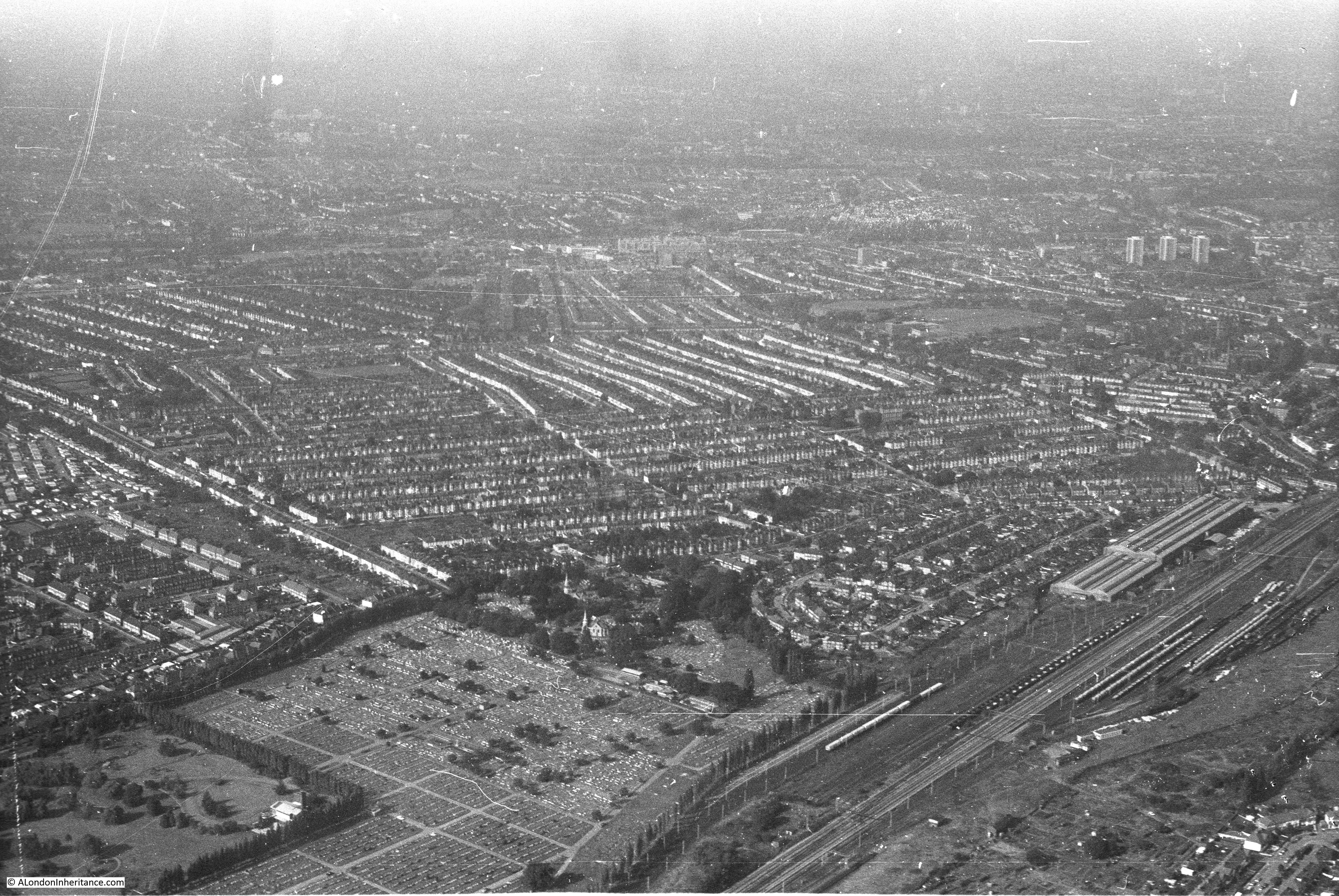
In the following photo, the large cemetery in the lower left of the photo is alongside Hither Green Crematorium, with Catford in the background of the photo.

Flying over London

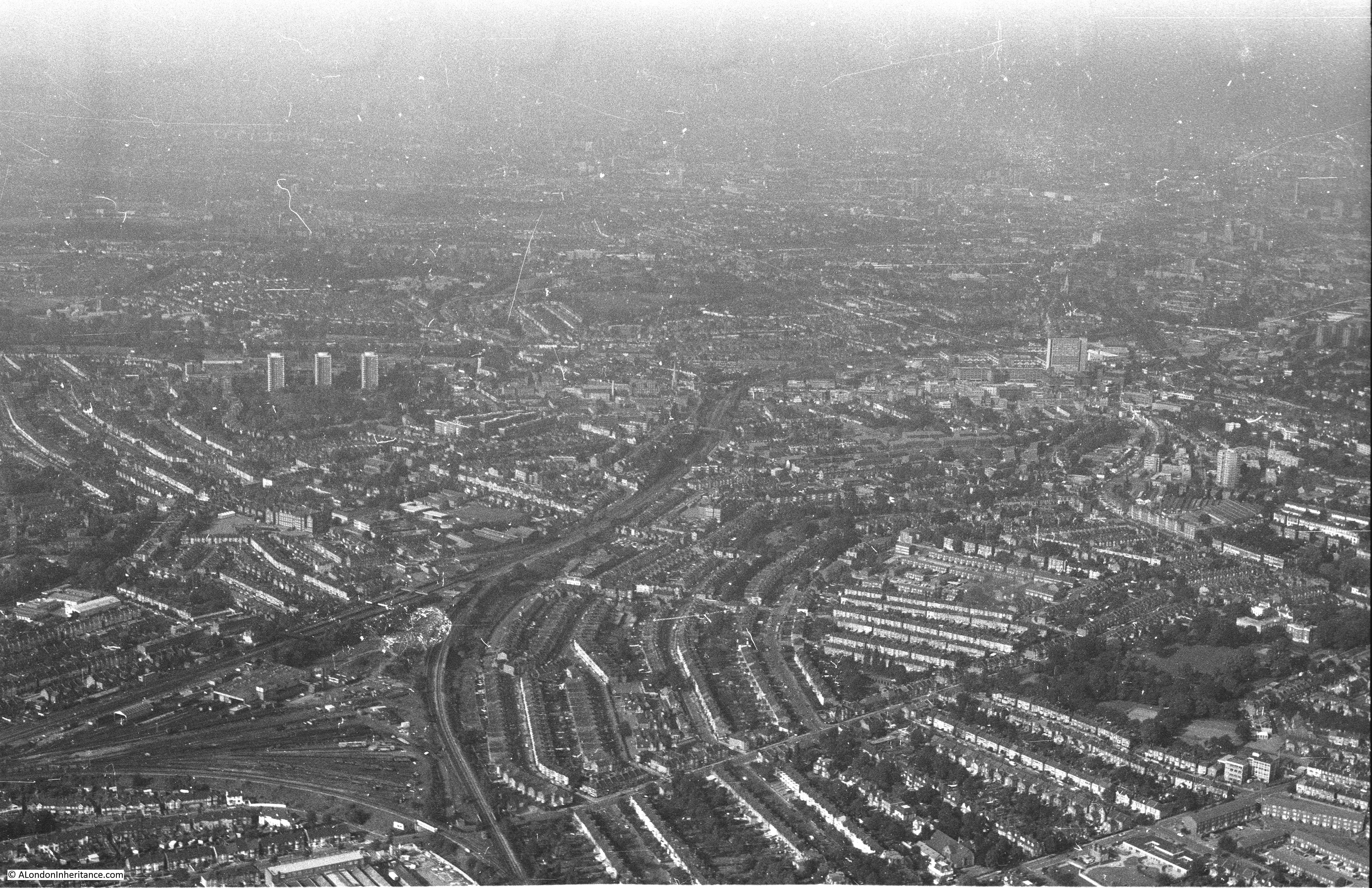
Hither Green – the railway can be seen running from the bottom of the photo, just to the left of centre, with Hither Green station being roughly a quarter of the way up the railway line:
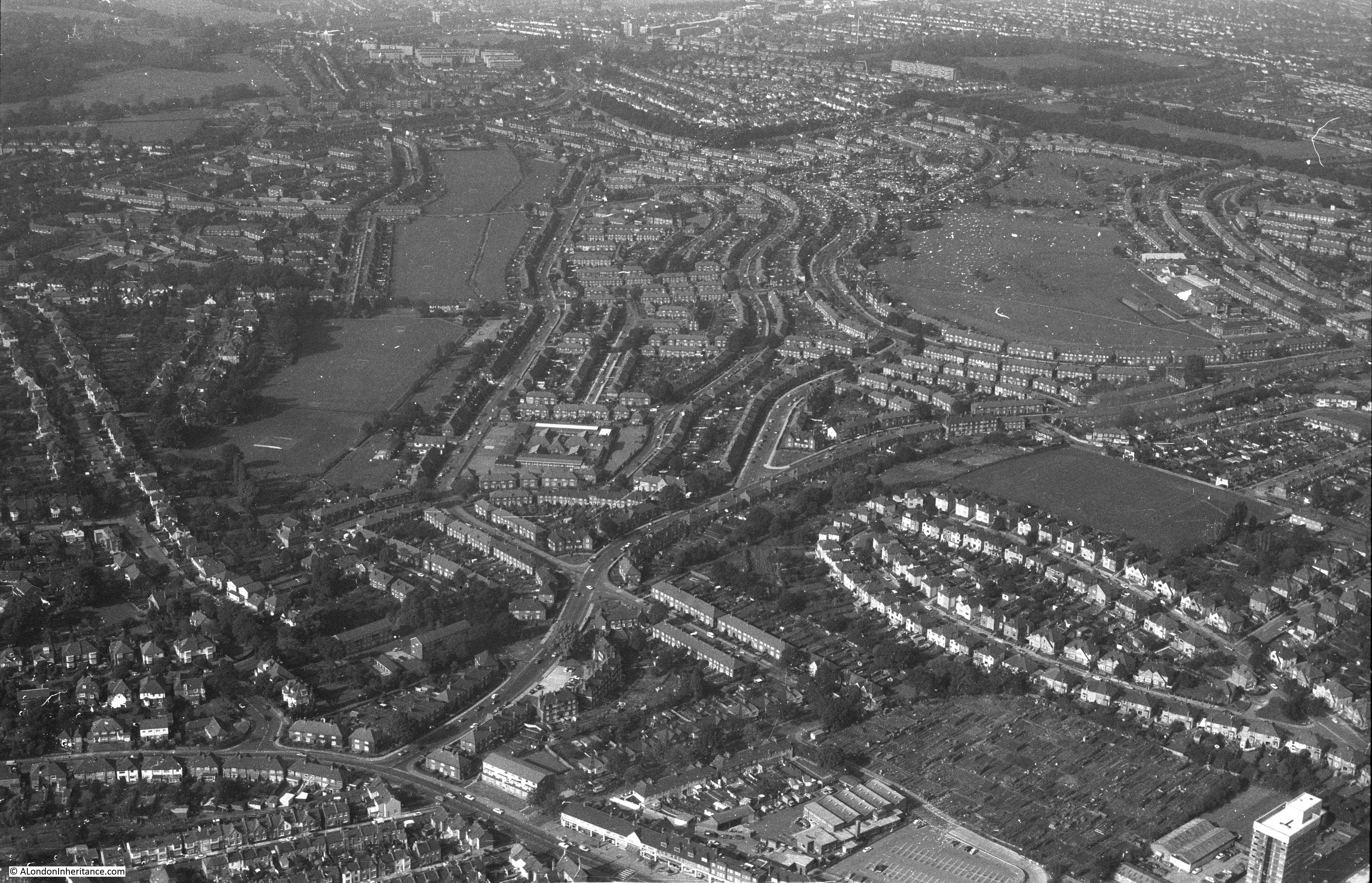
Flying over London

Bromley:

Flying over London

The distinctive loop of houses to the lower right of the following photo is the appropriately named Oval Road, just to the immediate north-east of East Croydon Station.

Flying over London

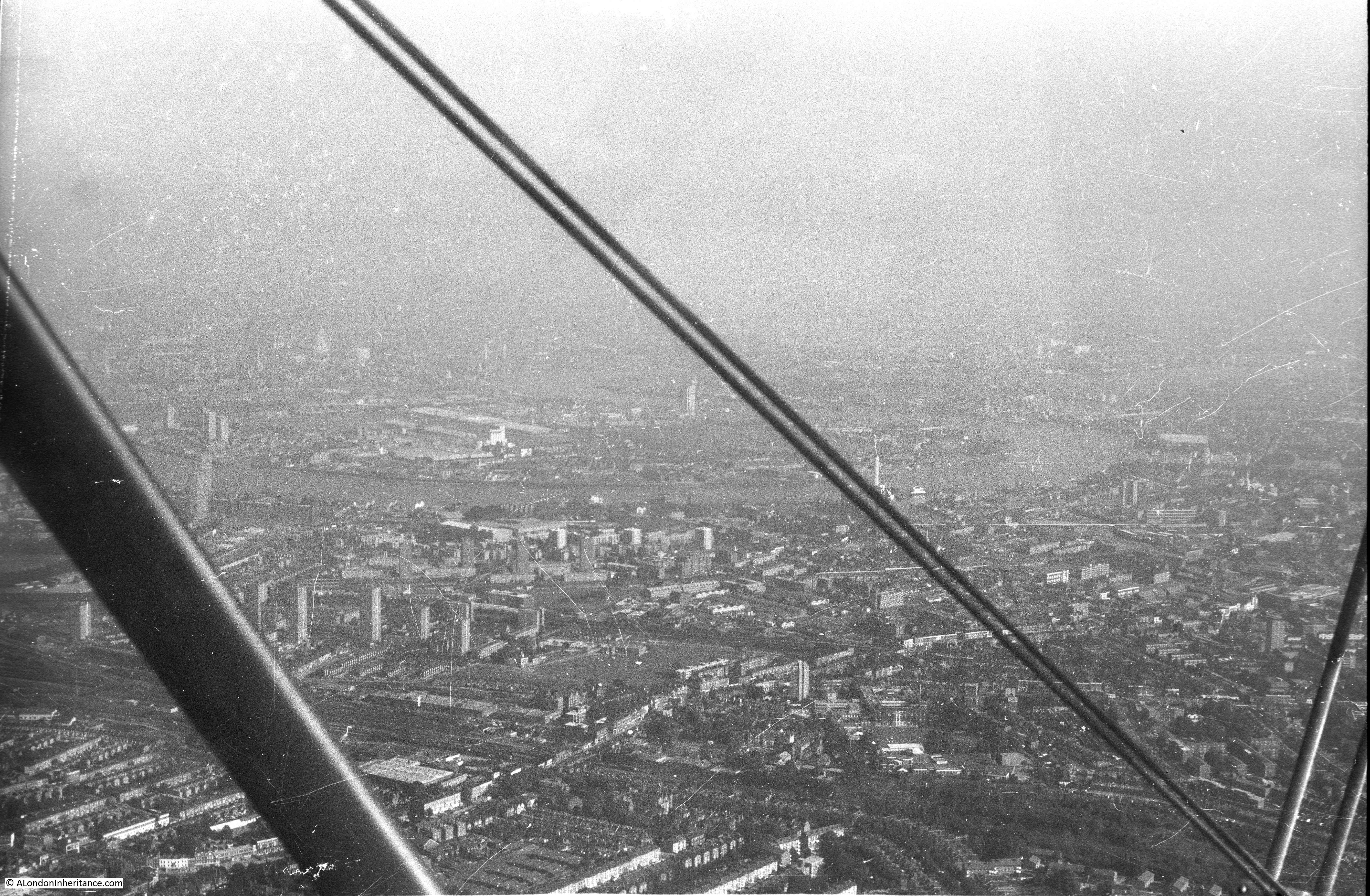
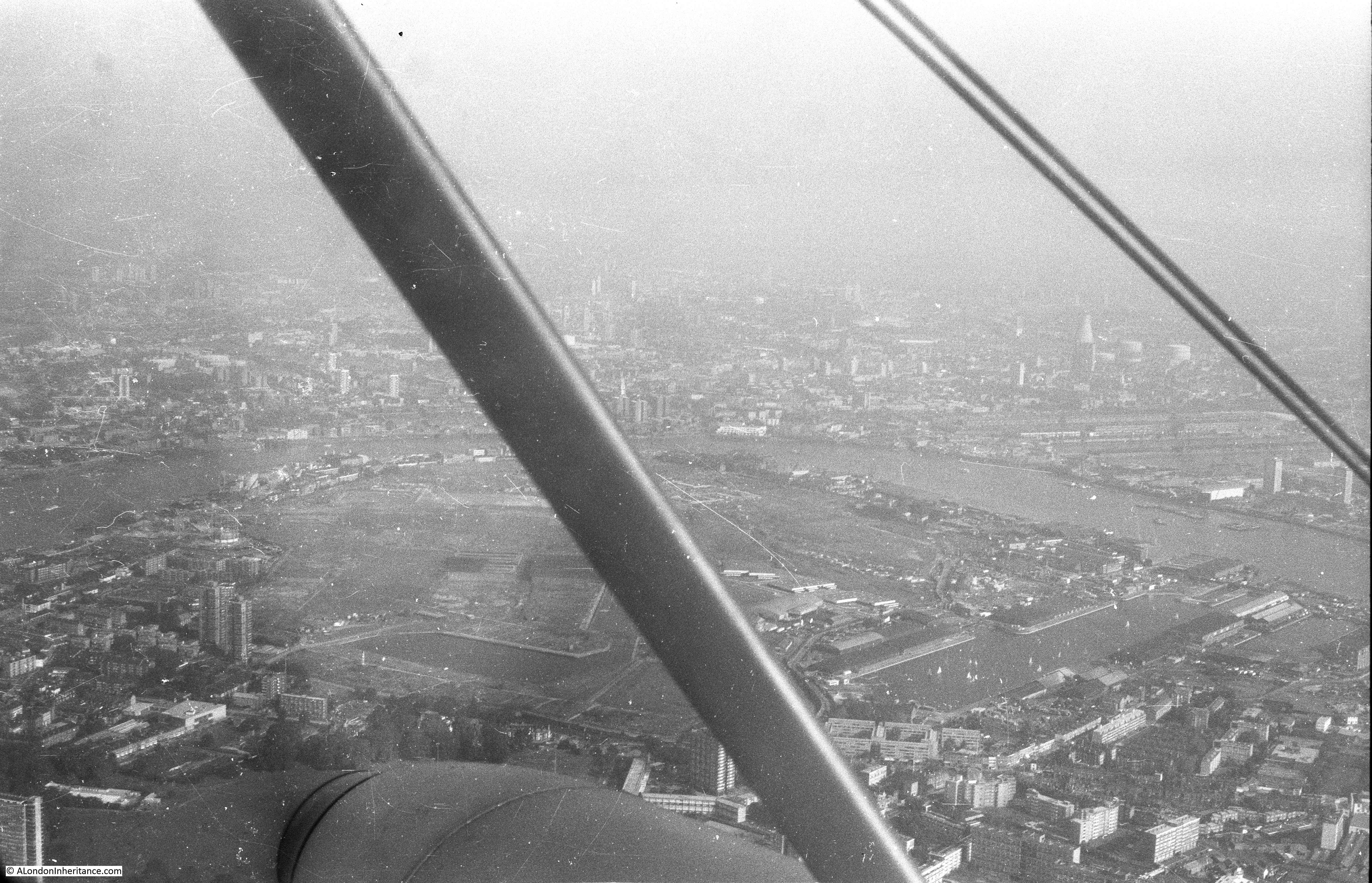
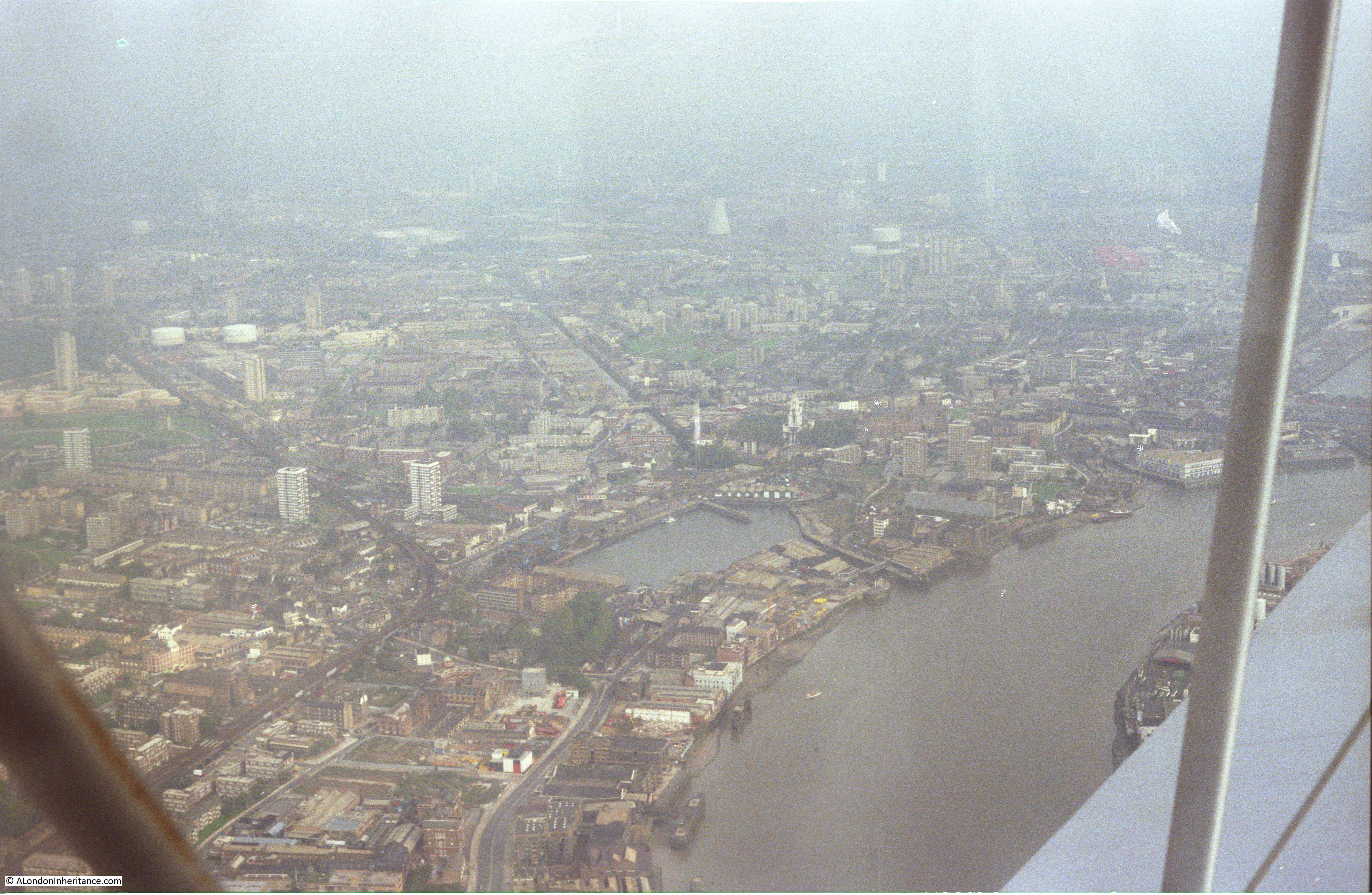
The next three photos are flying up to and over Rotherhithe and the land once occupied by the Surrey Commercial Docks. The Isle of Dogs can be seen across the river.

Flying over London

Flying over London

Flying over London

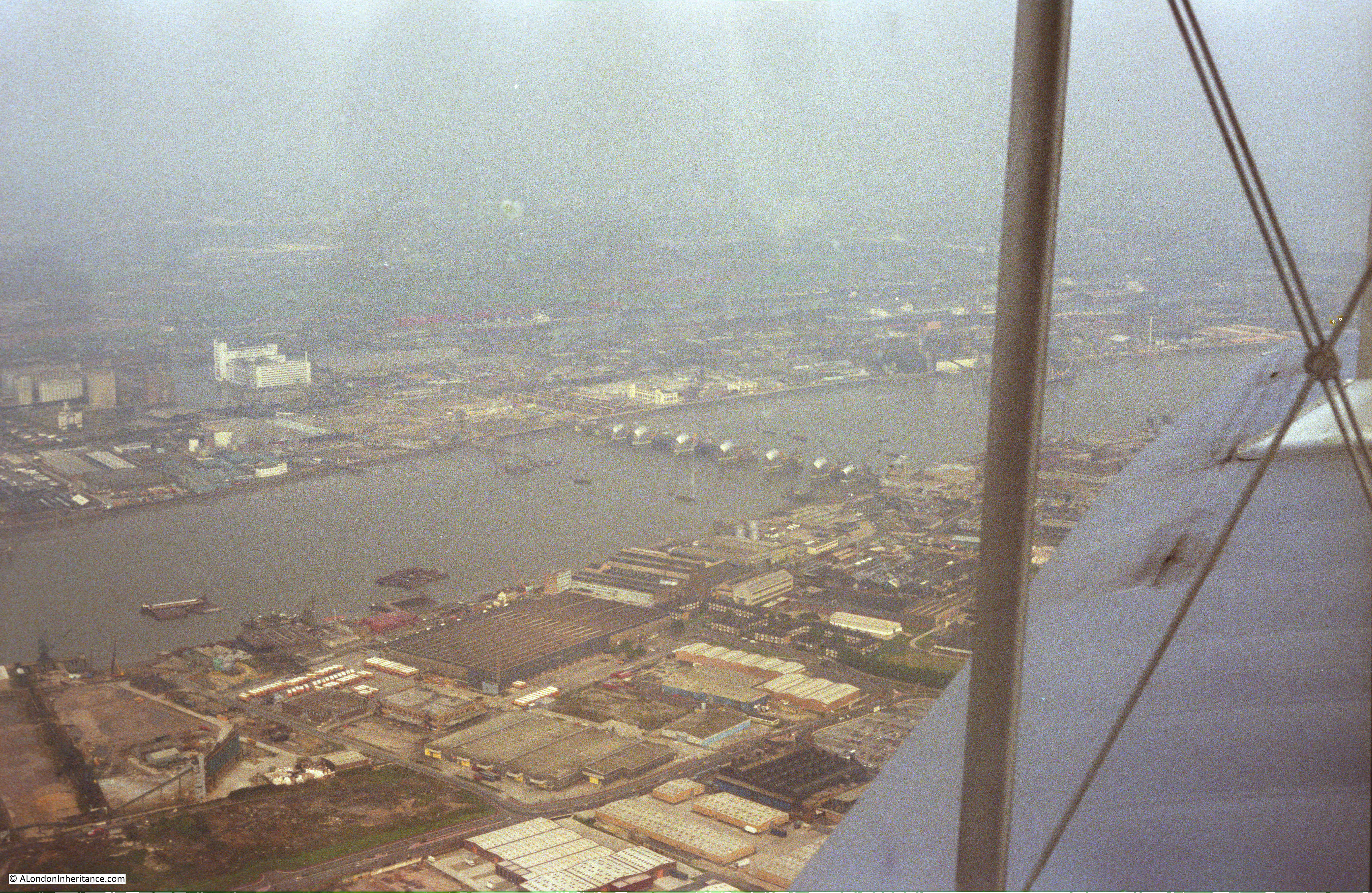
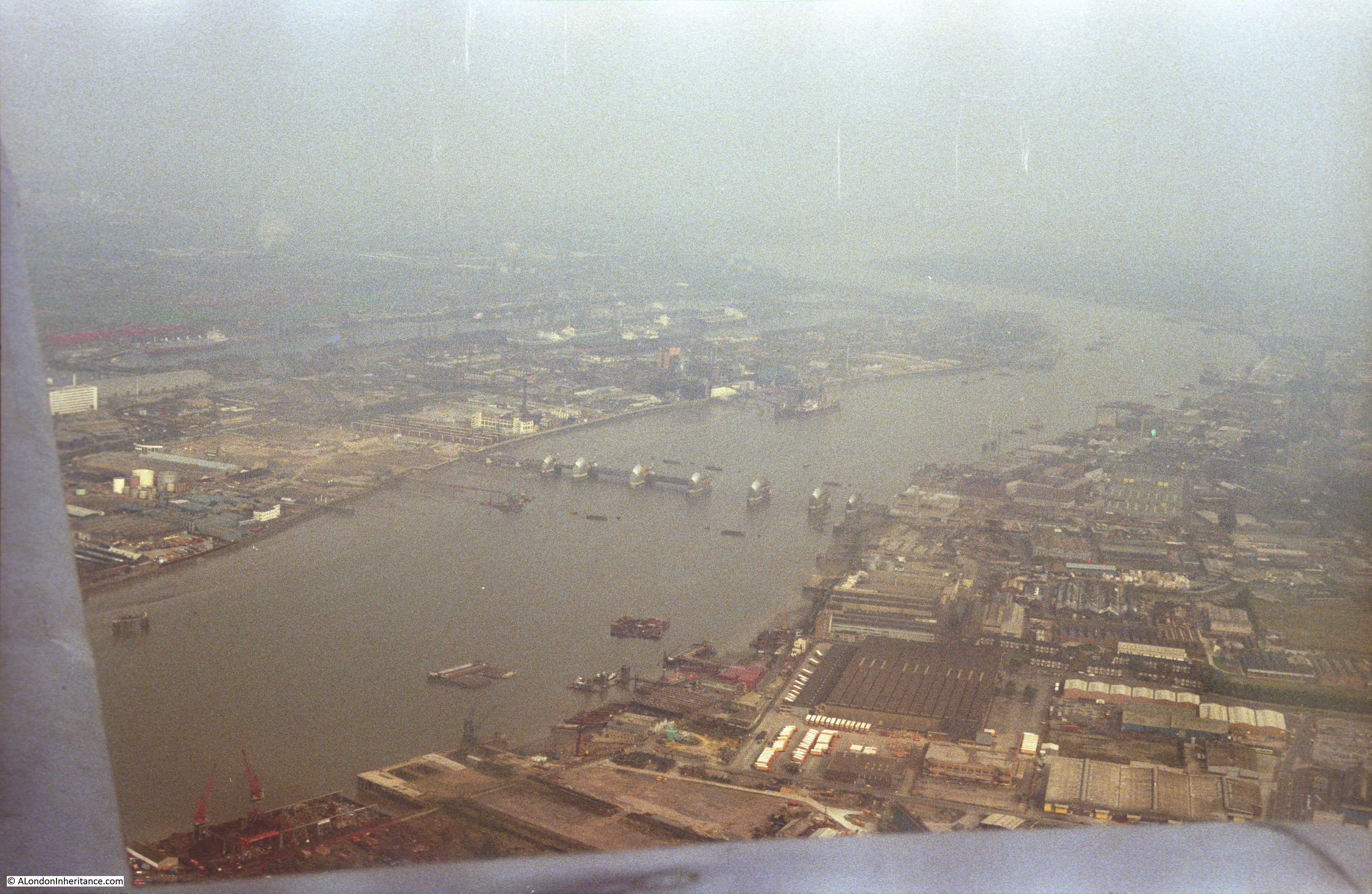
Moving on to a later year and I have changed to colour film and the flight from Biggin Hill has taken a slightly different route so we can see the Thames Barrier in the final stages of construction:

Flying over London

Flying over London

The northern end of the Isle of Dogs with from the top, the West India Dock (Import), the West India Dock (Export) and the South Dock. If you look just above the top dock, over to the right is the spire of a church, this is All Saints Church, Poplar. The Balfron Tower can be seen just behind the spire of  the church.

Hard to believe that this is now the Canary Wharf development and One Canada Square is now in the centre of these docks.

Flying over London

Looking back over the Isle of Dogs. Limehouse Basin is the area of water in the centre of the photo.

Flying over London

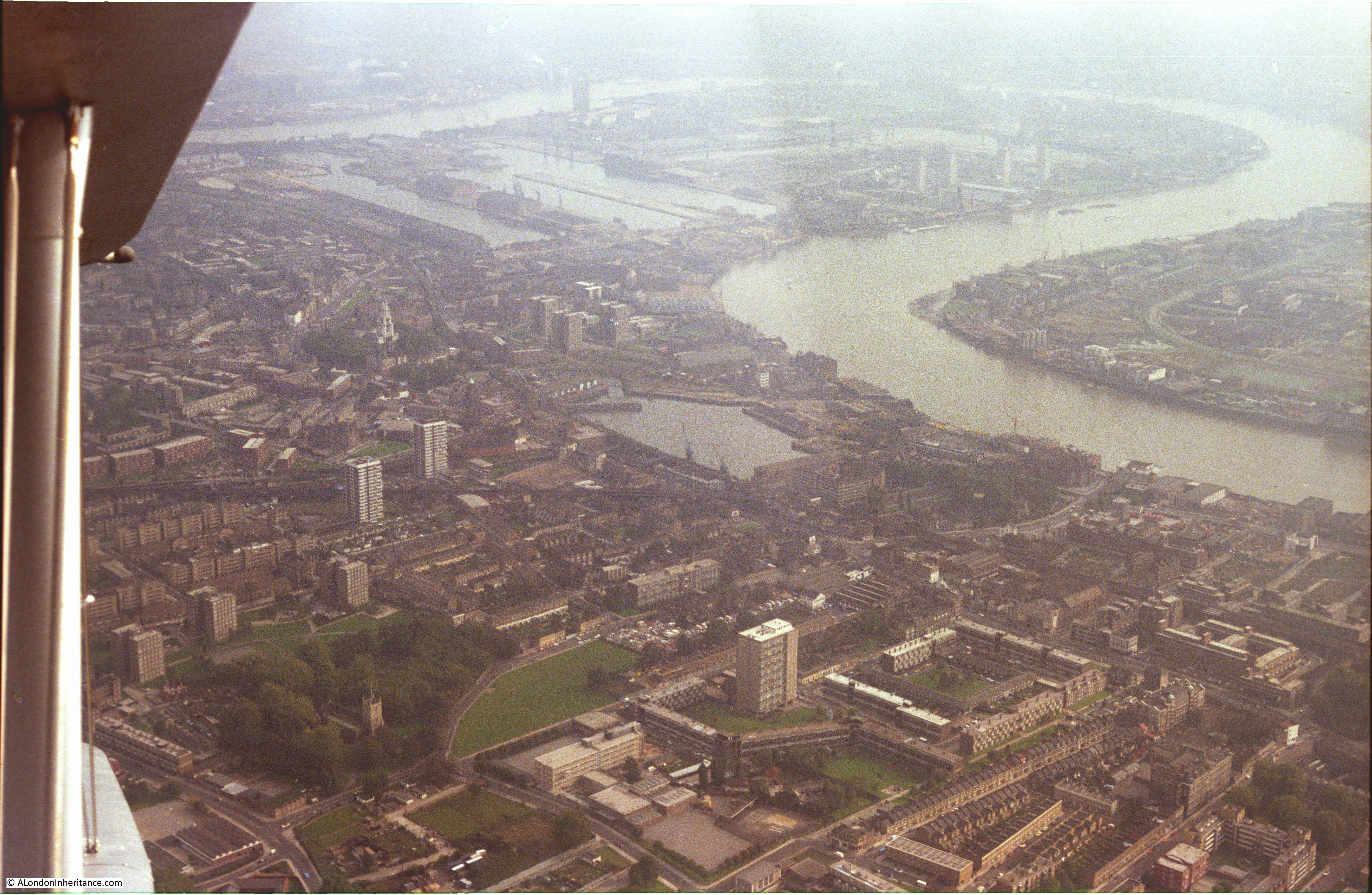
Looking back over Limehouse Basin. The Limehouse Cut can be seen running from the top corner of the basin. The Regent Canal is the line running from the lower left corner.

Flying over London

The church of St. Mary the Virgin, Rotherhithe is clearly visible in the lower part of the following photo. Shadwell Basin is across the river.

Flying over London

Approaching the City:

Flying over London

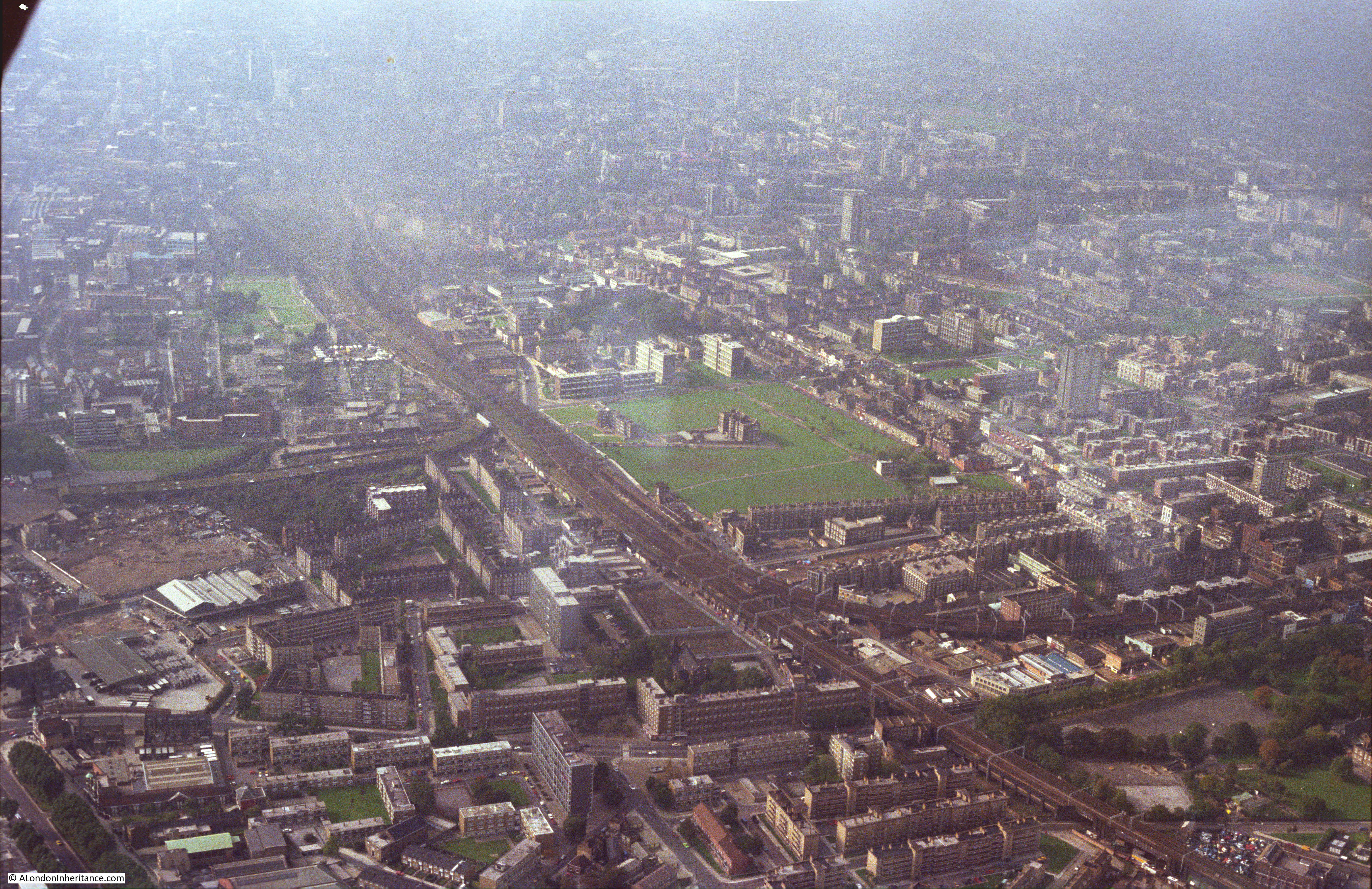
In the following photo, the railway line into Liverpool Street Station is running from lower right to top left of the photo. The grassed area in the centre of the photo is Weavers Fields, Bethnal Green.

Flying over London

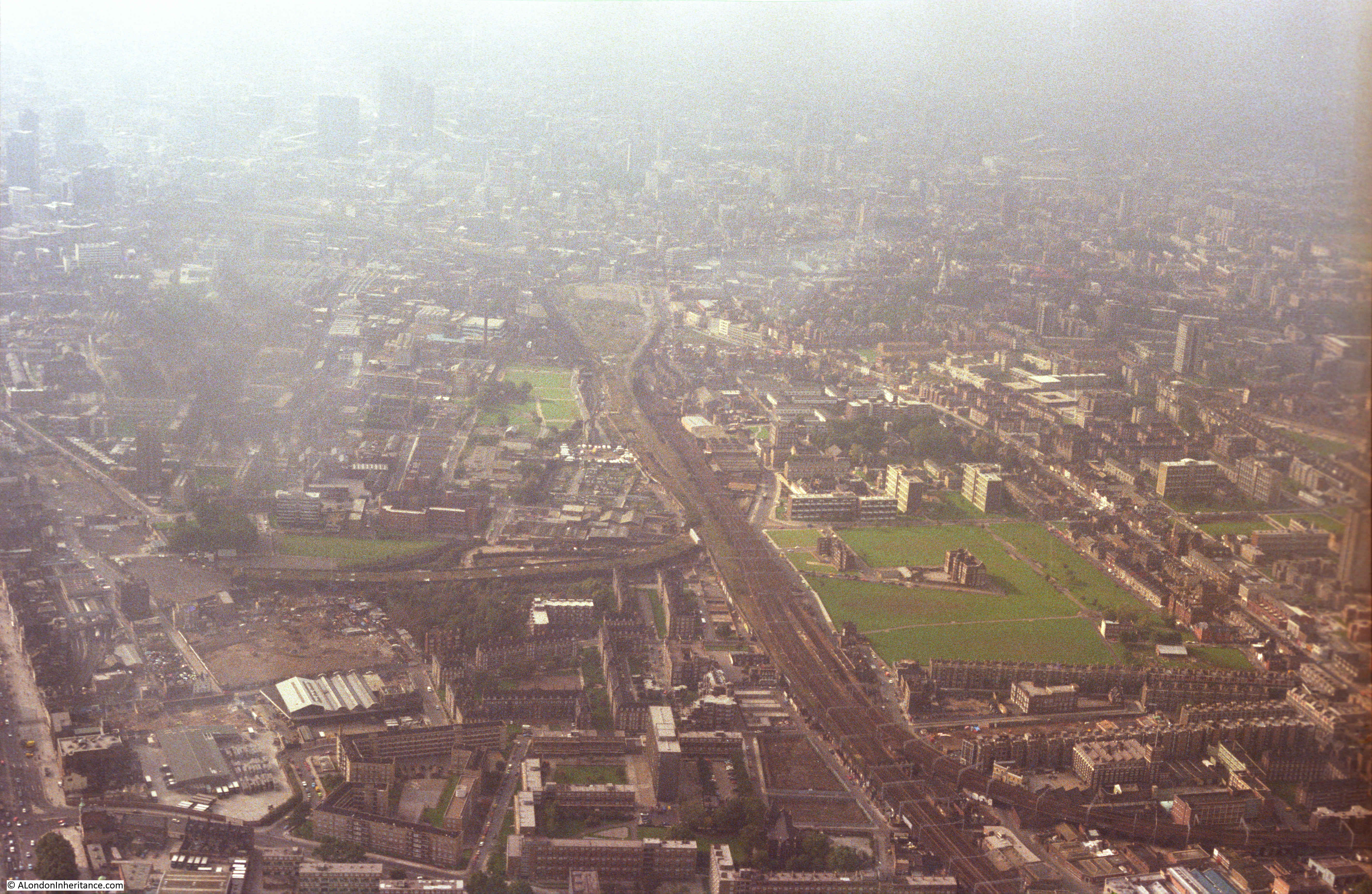
Another view looking along the railway into Liverpool Street Station. Bethnal Green on the right, Stepney and Whitechapel on the left.

Flying over London

Approaching the City:

Flying over London

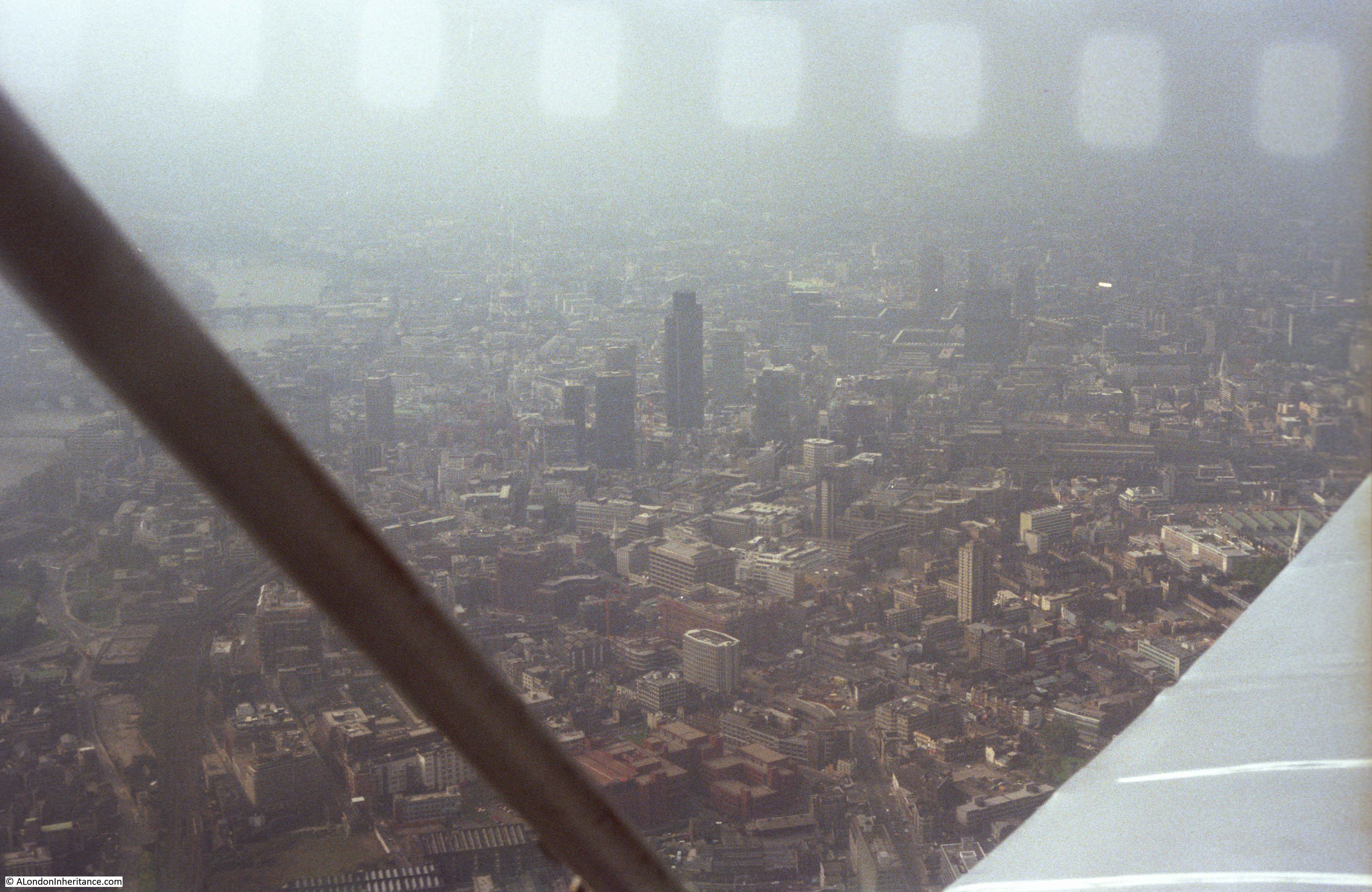
This was the view of the City when the NatWest Tower (now Tower 42) was the highest building in the City. It had just been completed when this photo was taken.

Flying over London

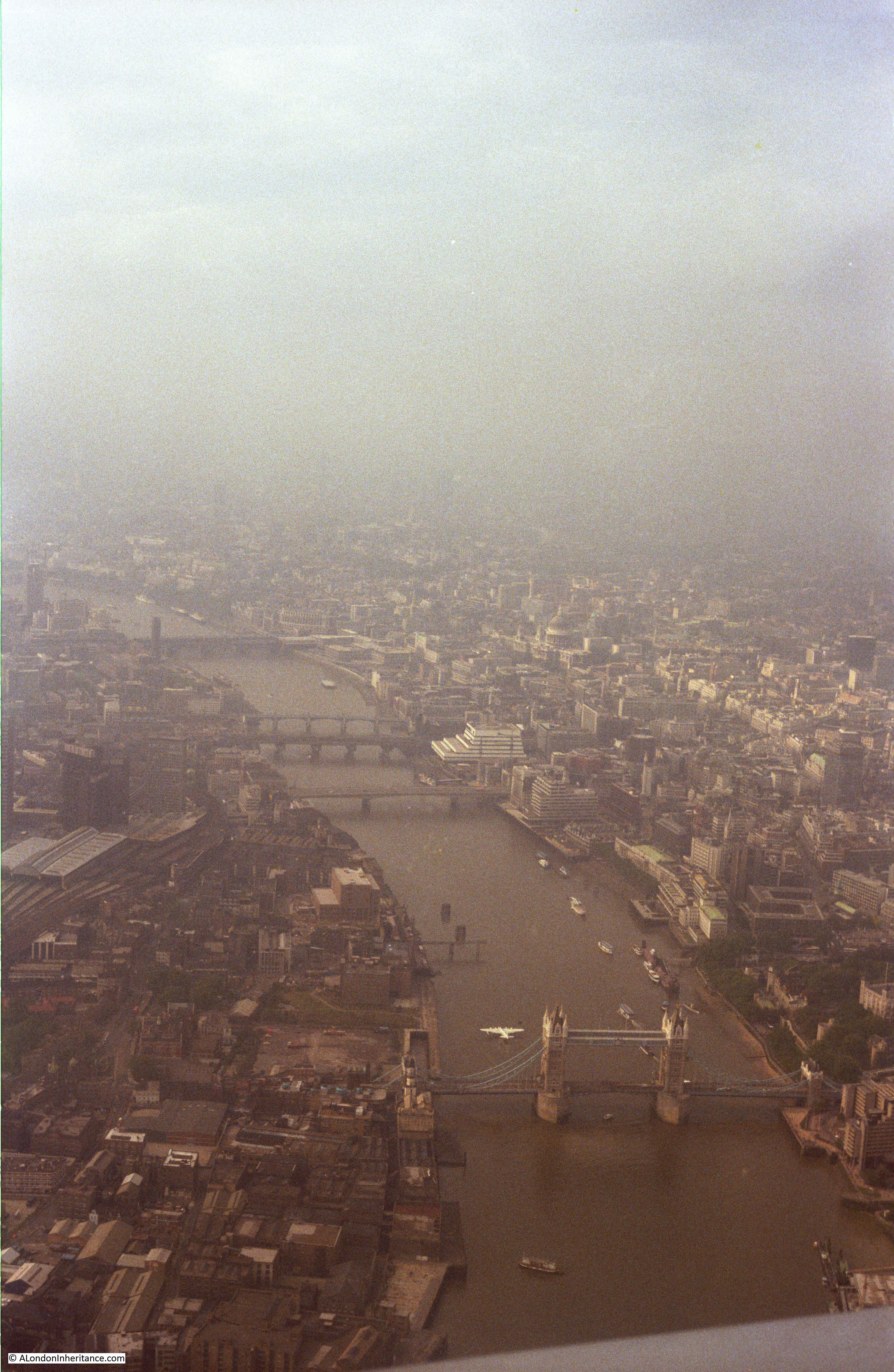
Flying over the river, looking west. This was before HMS Belfast was moored on the river and when warehouses still covered much of the south bank. Note the flying boat moored just north of Tower Bridge. This was a Shorts Sandringham – a remarkable sight to see on the river. The large white building on the north bank of the river is the old British Telecom Mondial House building.

Flying over London

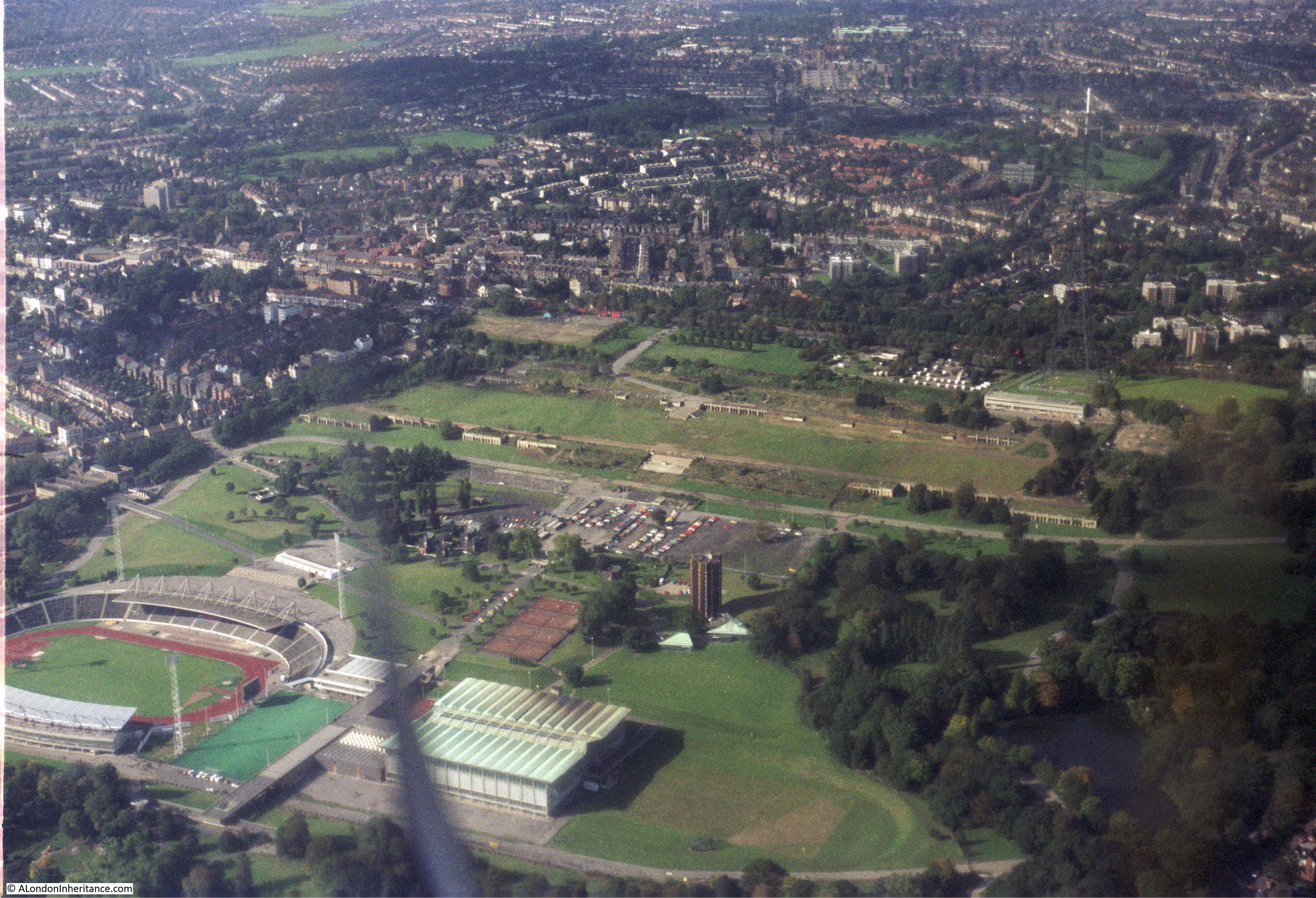
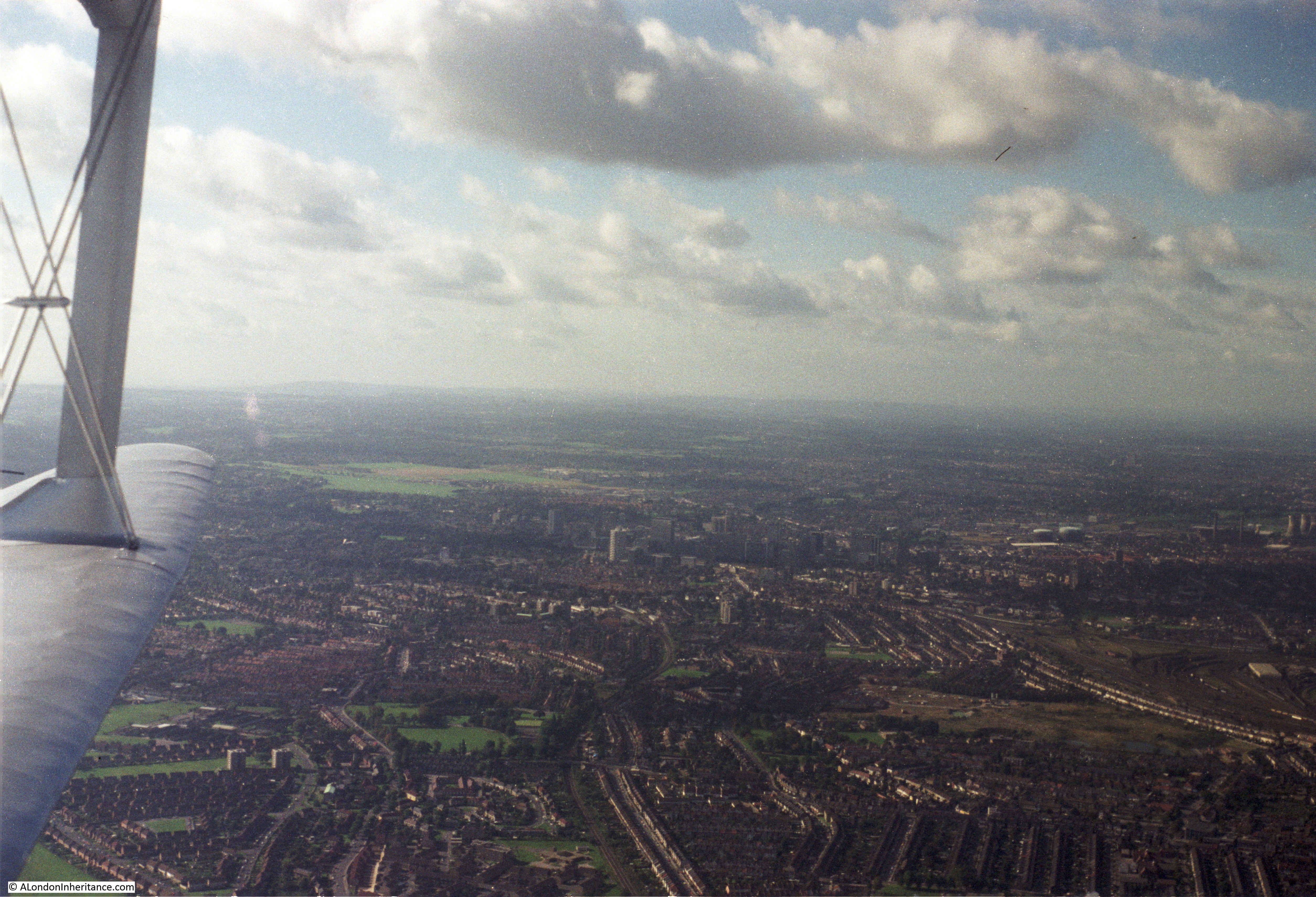
Now for the final trip with a better camera and film, and a different route. The sports ground at Crystal Palace:

Flying over London

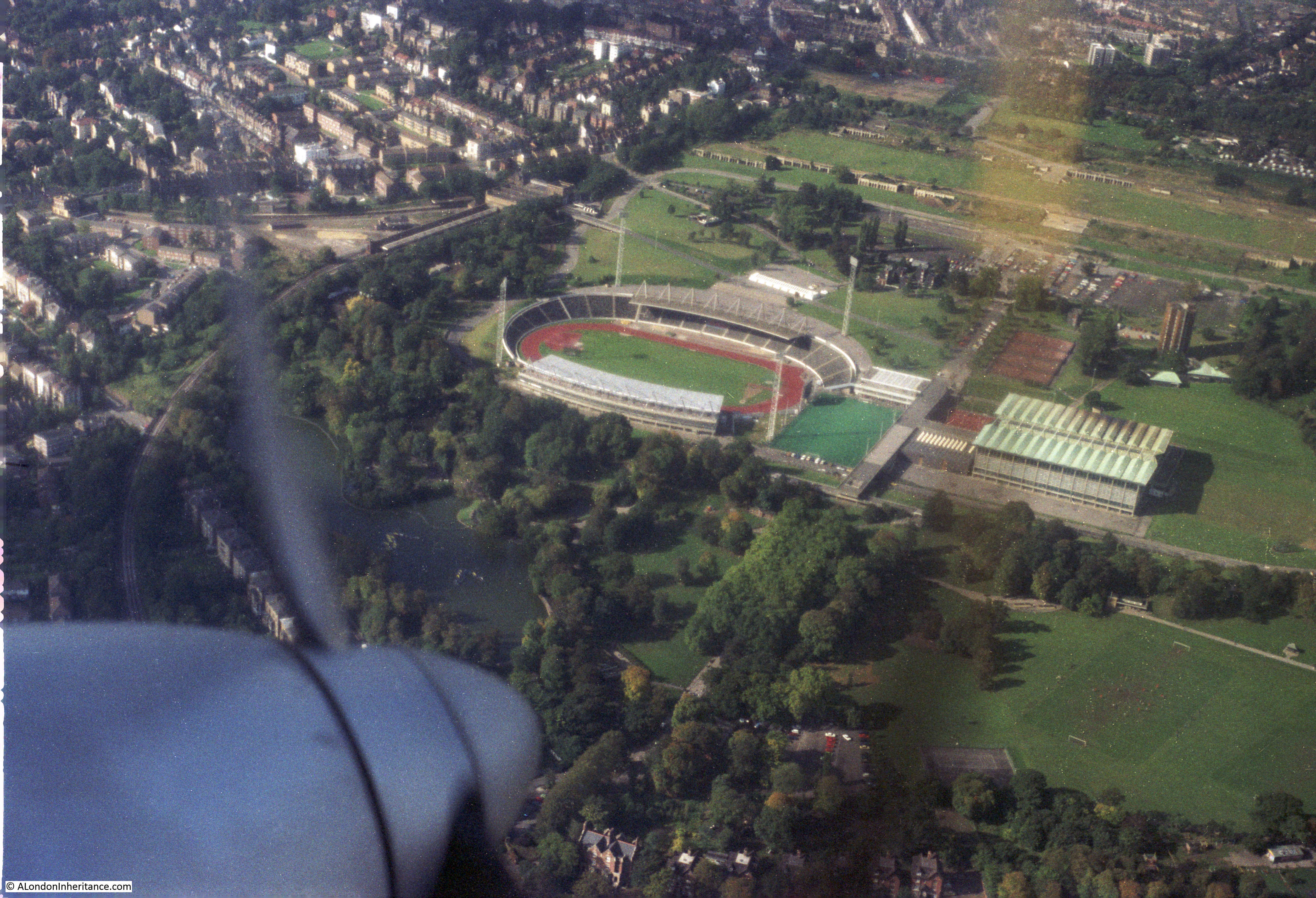
Slightly different angle on Crystal Palace. The tall Crystal Palace TV mast can be seen in the upper right of the photo:

Flying over London

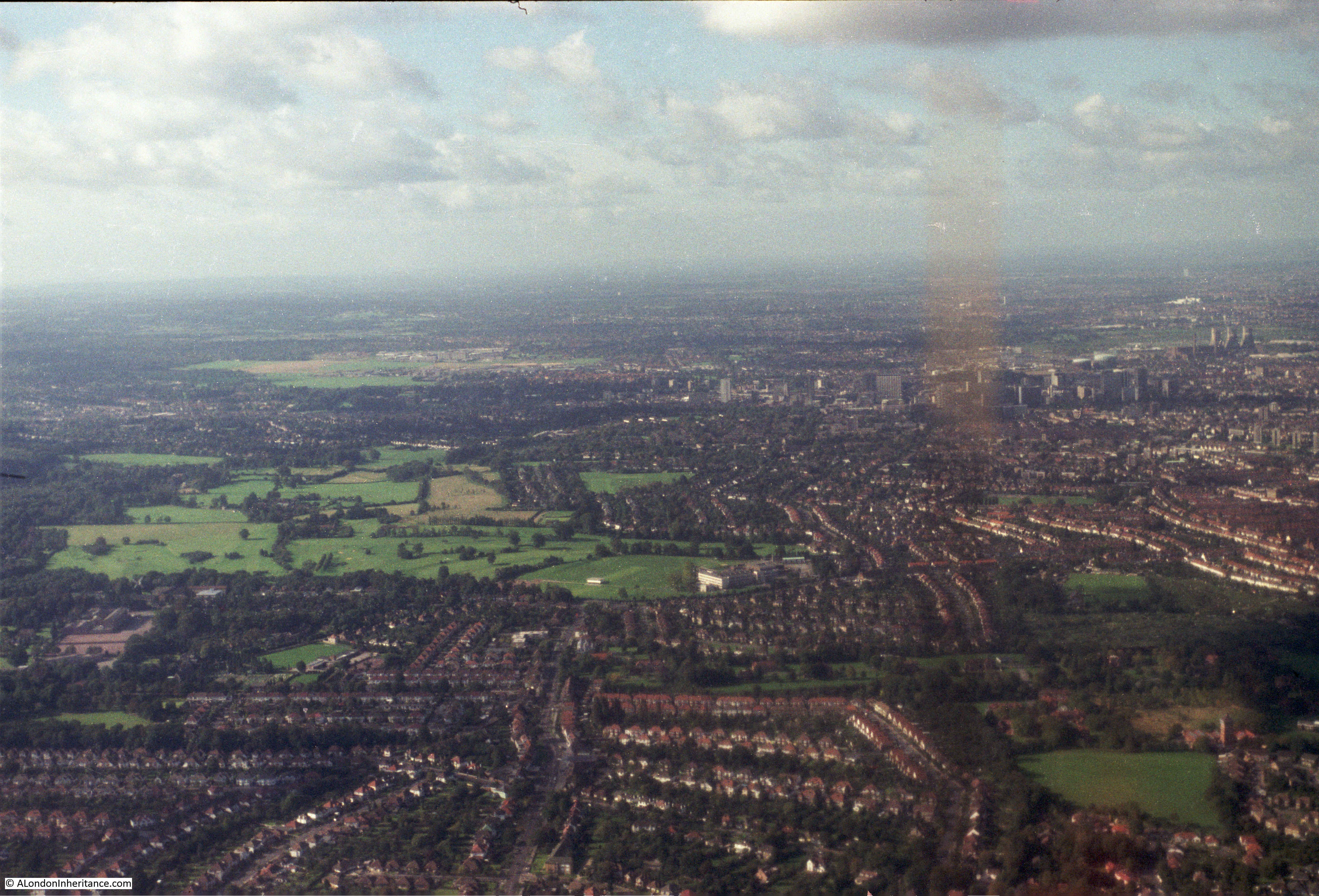
Not sure where the next two photos are, somewhere over south London:

Flying over London

That may well be Croydon to the upper right:

Flying over London

The isle of Dogs again:

Flying over London

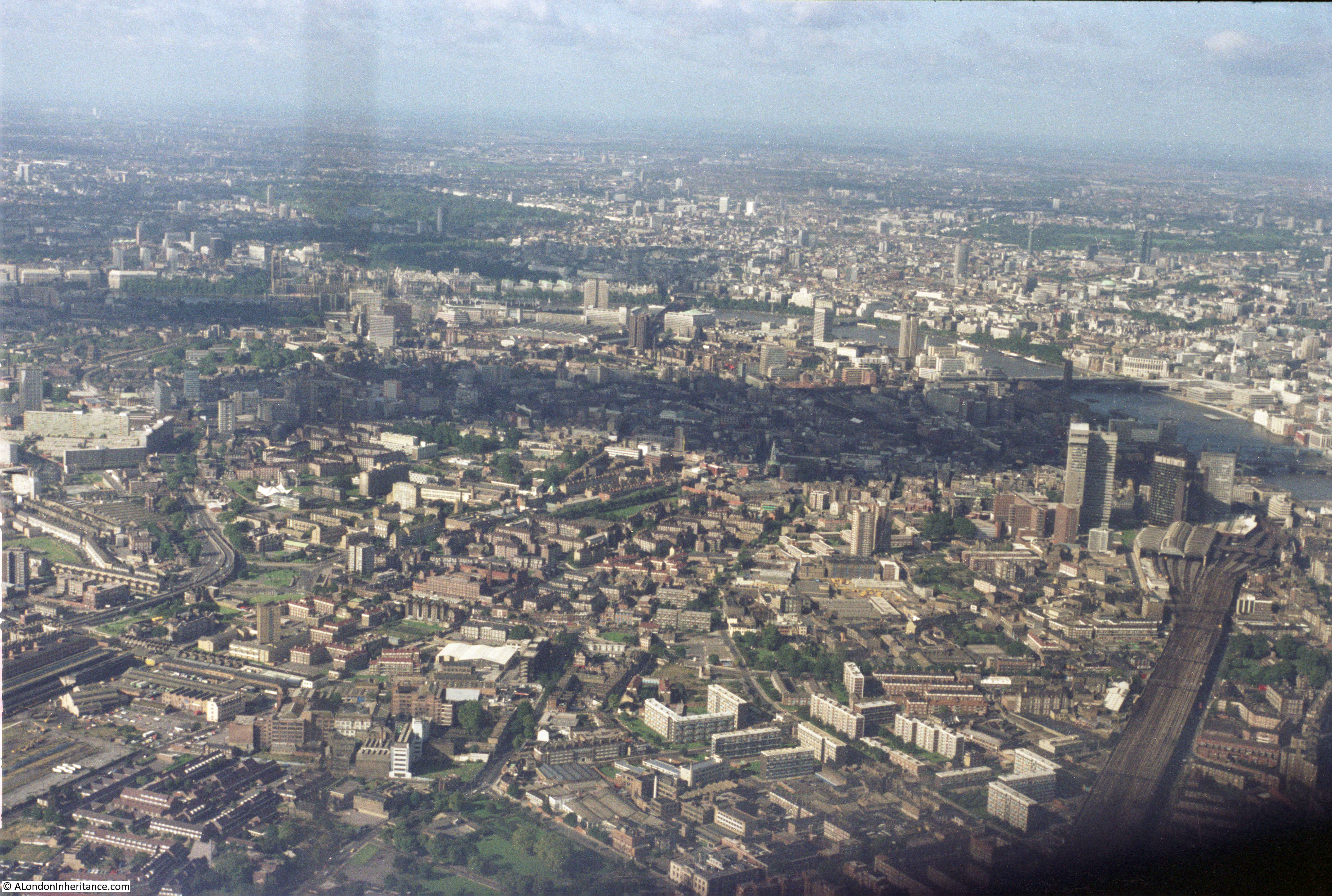
View looking over Bermondsey, Southwark and Lambeth with the railway running into London Bridge Station in the lower right quarter of the photo, long before the Shard.

Flying over London

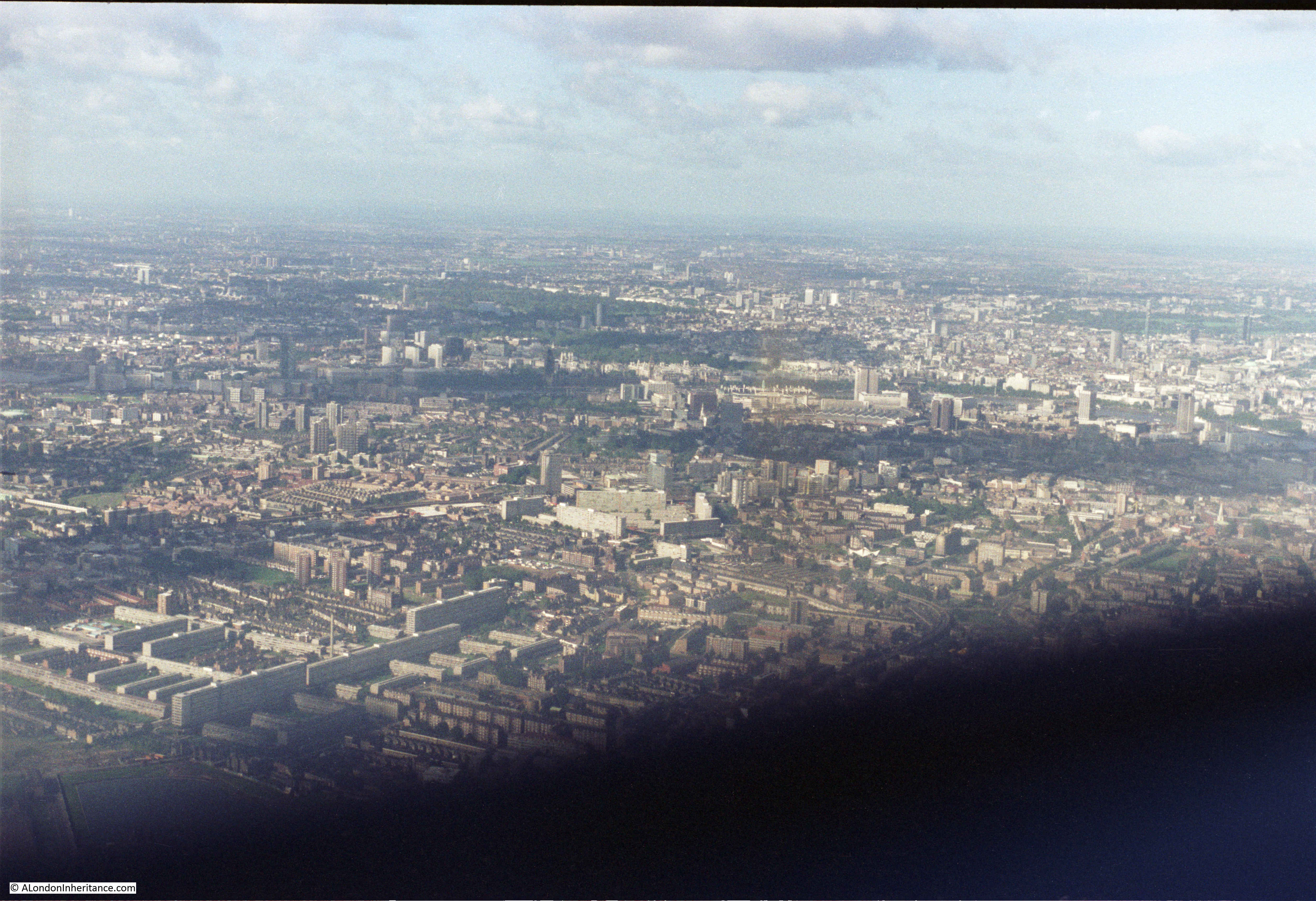
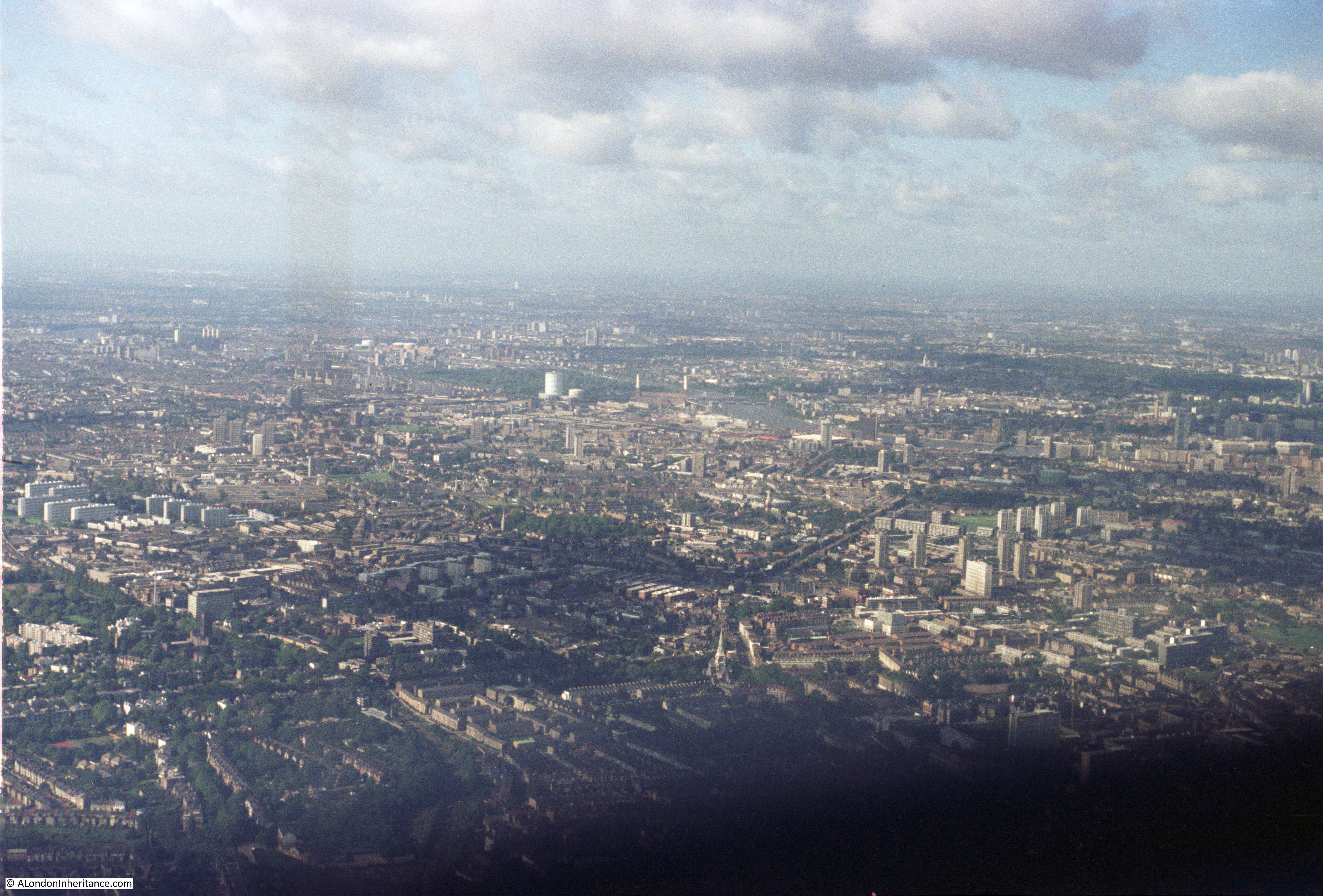
View from over south London looking north. The River Thames is running across the middle of the photo from left to right. The green areas in the upper part of the photo are St. James’s Park, Green Park and Hyde Park.

Flying over London

Another photo looking from south London over towards the north west. Just to the left of centre is the old gas holder at Battersea. The chimneys of Battersea Power Station can be seen just to the right of the gas holder and Battersea Park behind.

Flying over London

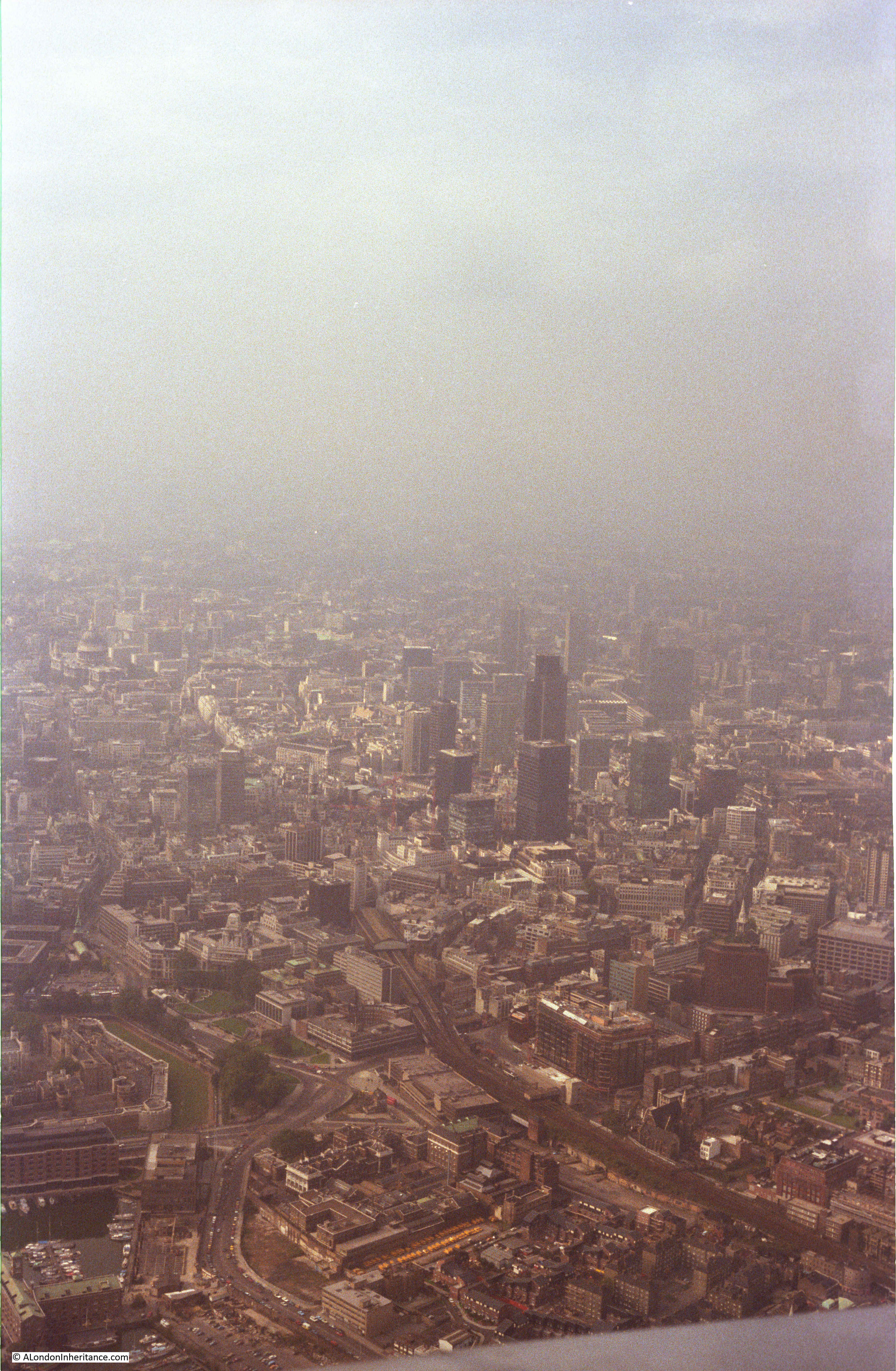
View looking over the City:

Flying over London

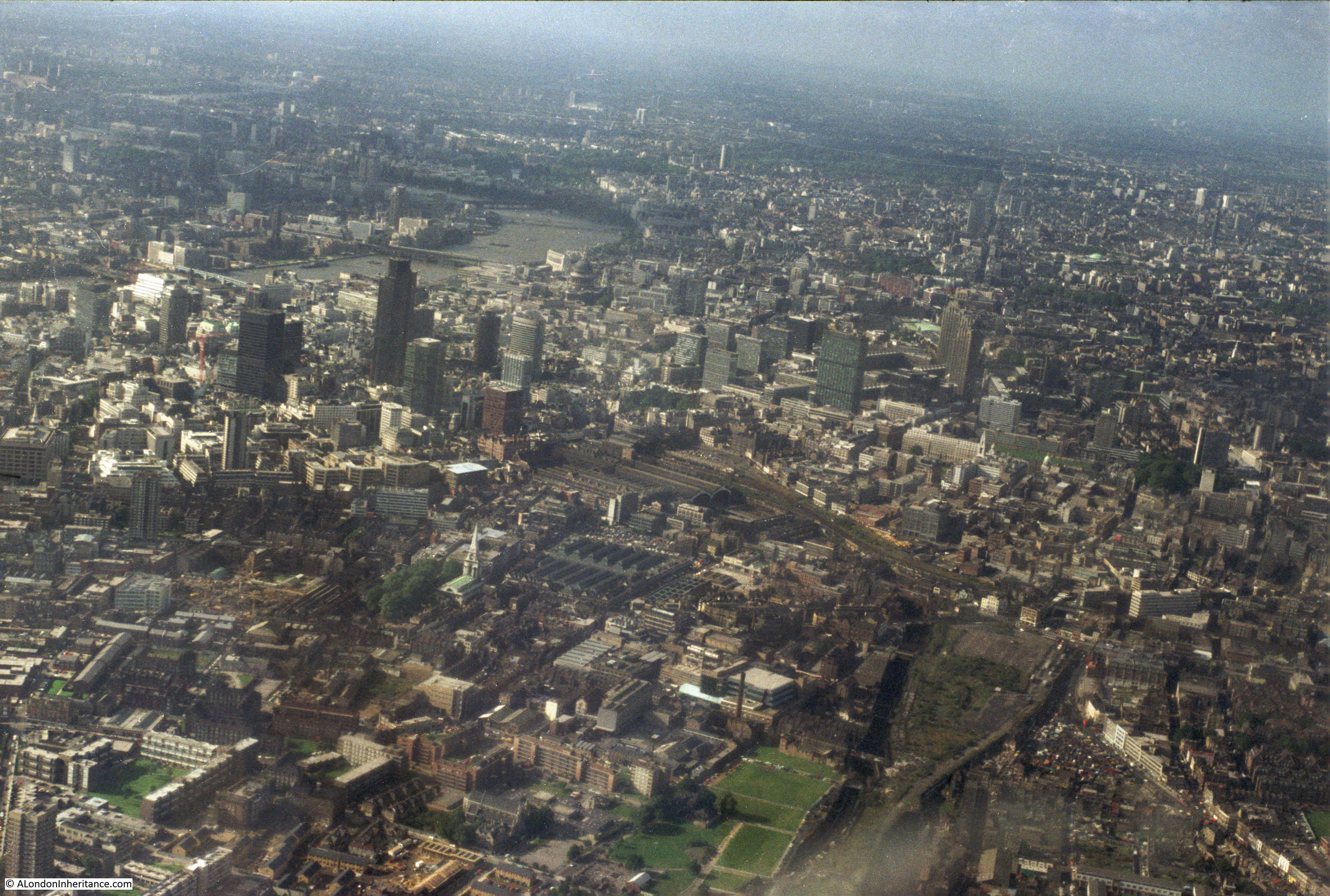
The City of London, with still the Nat West Tower being the only really tall building. Note also how few cranes there are across the City. I counted about five in this photo. It would be very different now. The rate of construction has increased rapidly since the early 1980s.

Flying over London

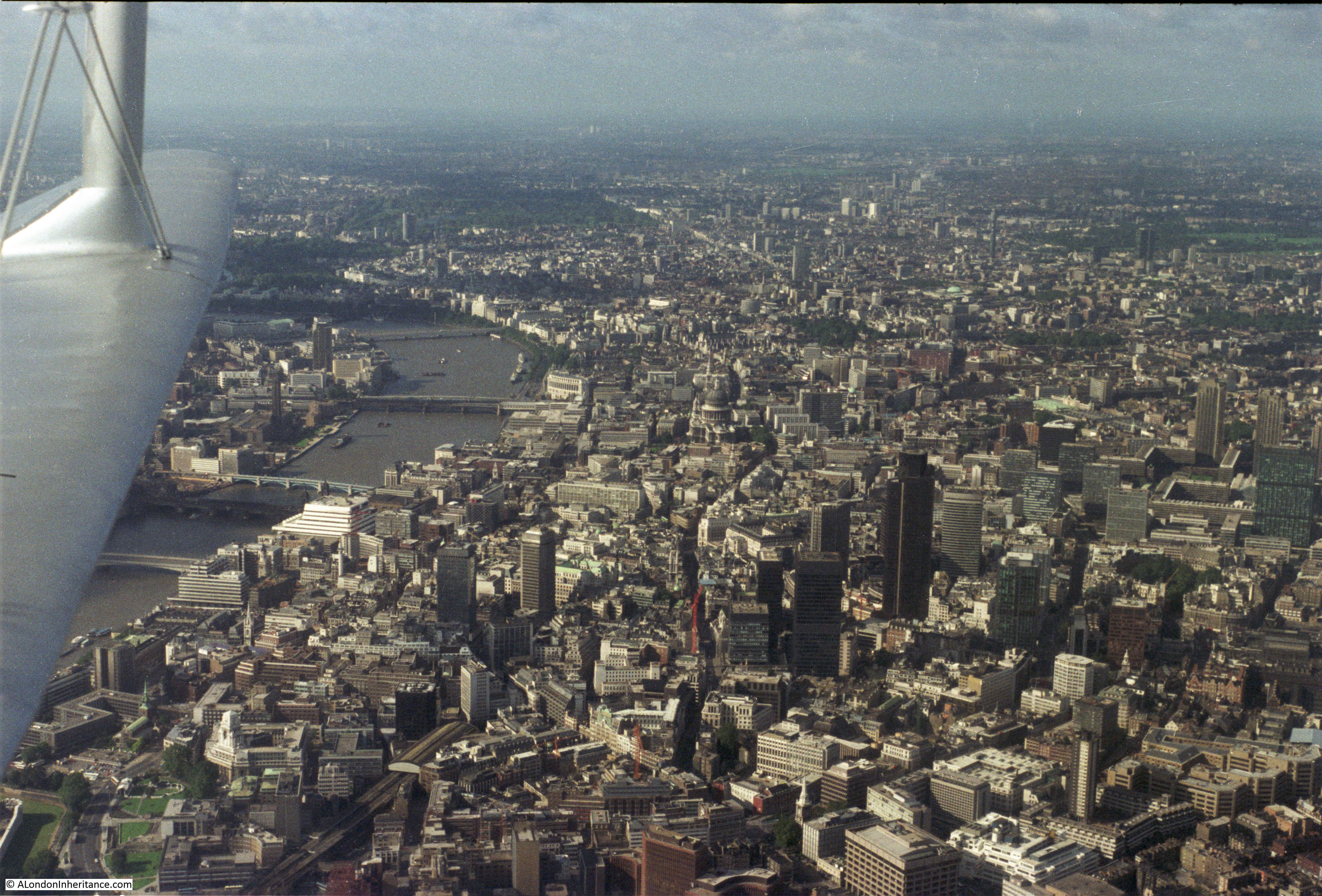
Another view of the City.

Flying over London

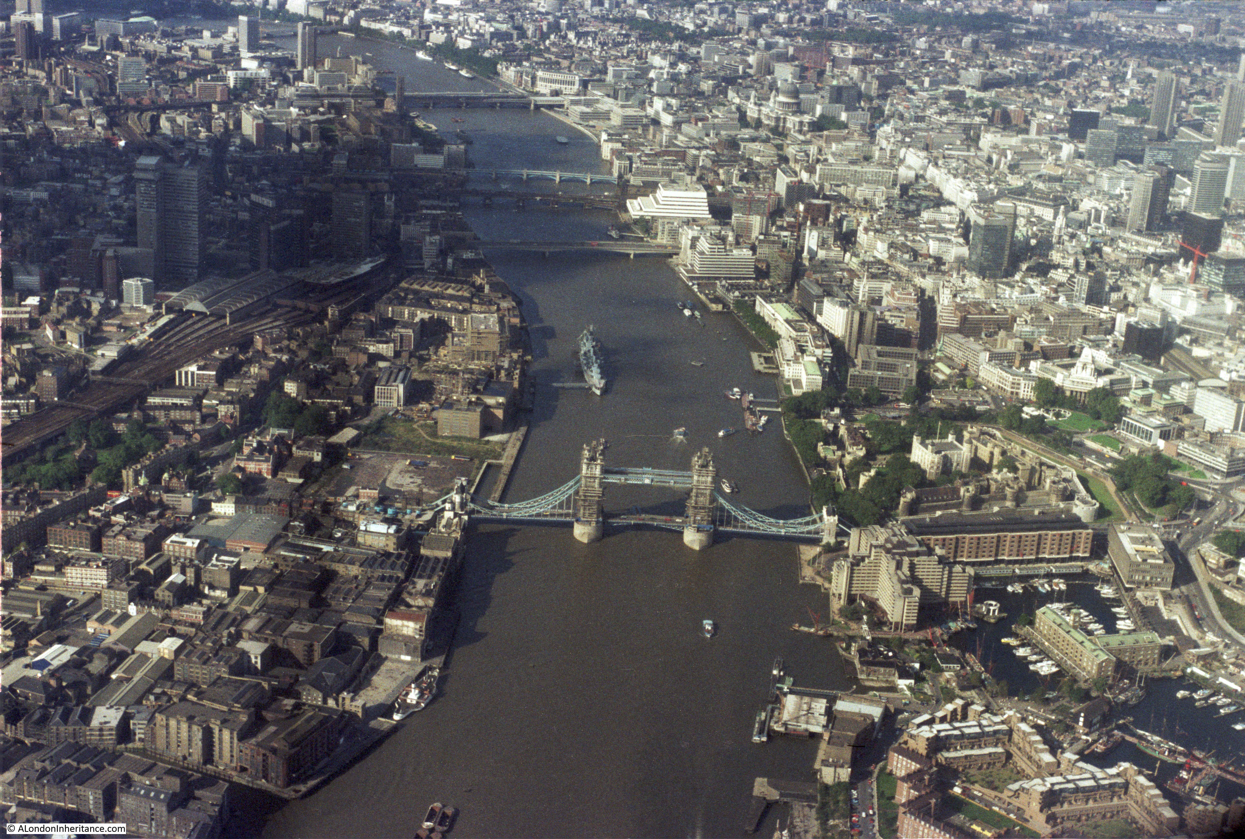
HMS Belfast is now moored on the river.

Flying over London

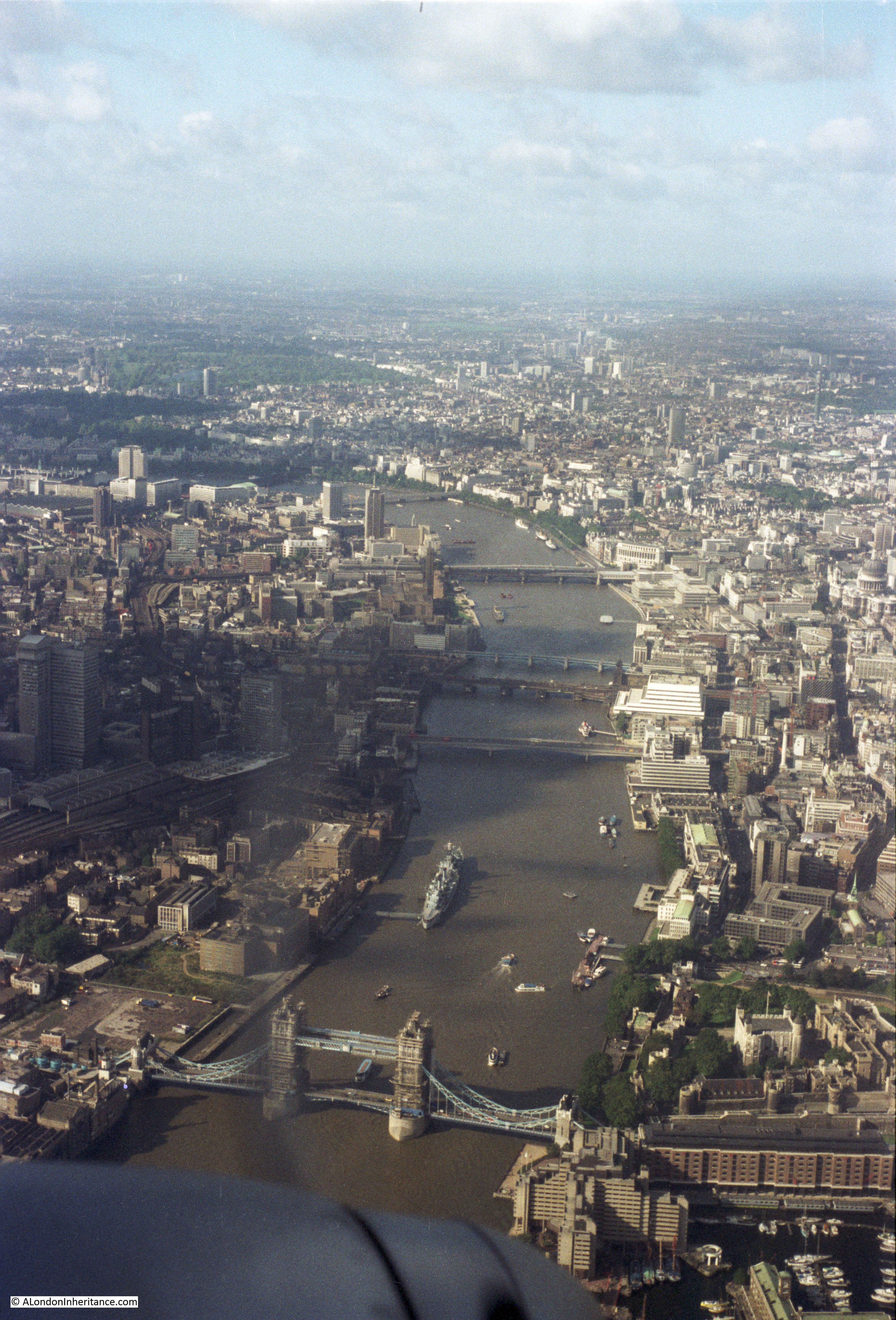
A final view whilst crossing the river.

Flying over London

These flights let me pursue my early interests in flying, photography and London all at the same time. Unfortunately I have not taken any similar flights since the early 1980s. My aerial views of London now are when I have been working abroad and fly back into Heathrow. I always make sure I book a seat on the right of the plane in the hope that the landing will be from the east, and even after all these years, I am still the one with my camera pressed up against the window.

alondoninheritance.com

Building Bankside Power Station

In 1953, soon after it started operation, my father took the photo below of Bankside Power Station. The photo suffers from a problem I often have when taking a photo of the southern bank of the river from the north on a clear day as the sun is in the south and puts the power station into silhouette.

In the photo, Bankside Power Station also looks only half built, which indeed it was. There is a smaller building on the left with two rows of chimneys receding from the river’s edge. This is the original power station on the site.

Bankside Power Station

Roughly the same view today. The Millennium Bridge now crosses the river in front of the old Bankside Power Station building.

Bankside Power Station

A view from further along the river showing the full size of the former Bankside Power Station building.

Bankside Power Station

This area of Bankside has produced energy for many years before the current Bankside Power Station was built. The following extract from the 1892 Ordnance Survey map shows towards the right of the map an Electric Lighting Works and on the left the Phoenix Gas Works. Both of these industries were located adjacent to the river as they both used coal to generate either electricity or gas.

Bankside Power Station

The original power station was built by the City of London Electric Lighting Company in 1891 and over the years underwent a number of extensions and upgrades to form the building with the two rows of chimneys as seen in may father’s photo.

Each chimney was connected to an individual boiler and a separate building contained the generator that was driven by the steam from the boilers to produce electricity for distribution in the local area and by cables across the river to the City. Electricity generation was originally a local activity with no national grid to distribute across the country. There were power stations located across London, including the Regent’s Park Central Station where my grandfather was superintendent.

The design of the original power station and the equipment used was highly polluting with so many chimneys pouring smoke, ash and grit onto Bankside.

Planning during the war identified the need for a significant number of new power stations across the country with post war consumption of electricity expected to surge. London would be one of the areas where the old, polluting power stations urgently needed to be replaced with cleaner power stations with higher generation capacity.

The 1943 County of London Plan proposed the redevelopment of the south bank of the river to remove heavy industry and line the river with offices, flats and public gardens with commercial and light industrial buildings to the rear. Heavy industry such as power stations were to be relocated out of central London to places such as Poplar, Rotherhithe and east along the river. The following extract from the 1943 plans shows the proposals for the south bank:

Bankside Power Station

As always happens with long-term, strategic plans, events take over and problems such as power shortages during the very cold winter of 1947 forced different decisions to be made and the go ahead was given in 1947 for a new power station to be built at Bankside. In giving this approval there was one major change. Originally it was planned for the power station to continue using coal, however the level of pollution in the area, the space needed for coal storage and the need to diversify power production away from one signal source Influenced the Government to change plans for the new Bankside Power Station to switch from coal to oil. As well as being slightly less polluting, oil had the advantage that it could be stored in large underground tanks, thereby removing the need for large fuel storage areas above ground.

Although oil was slightly less polluting, the new Bankside Power Station would continue to have an impact on the local area and on the river. Flue gases were washed by water taken from the river. These waters would then be returned to the river with a higher particle content and acidic level.

When the go ahead was given for the new power station, as well as concerns about locating such an industry in central London, there were also complaints that the new building would dwarf St. Paul’s Cathedral. Sir Giles Gilbert Scott changed the design from dual chimneys to a single chimney and ensured that the overall height of the chimney was lower than the dome of the cathedral. This was helped with the land on which the cathedral is built being higher than the river side location of the power station, however the reduced height of the chimney did contribute to ongoing local pollution problems.

Construction of the first half of Bankside Power Station took place between 1947 and 1953. This saw the completion of the western half of the building and the central chimney with first power being generated in 1953, and this is the status of Bankside Power Station that my father photographed in the photo at the start of this post.

He had also walked around the area a number of years earlier when construction first started. He took the following two photos showing the demolition of the buildings that had been on the site, and the start of construction of the new power station.

In this first photo, he is standing in front of what would become the wall of the building facing to the river, at the western edge. Five chimneys on the rear of the original power station can be seen, and on the far left of the photo are the lower levels of the new chimney.

Bankside Power Station

I took the following photo further away from the power station than my father’s photo above. If I was much closer it would just be looking directly into the building, however it does give a view of the same scene as it is today with the base of the chimney on the left of both photos. In the above photo it is the central core of the chimney which is seen, the brick outer structure is yet to be added.

Bankside Power Station

The second photo is looking directly across the construction site towards the south.

Bankside Power Station

The Britain from Above website has a number of photos taken by Aerofilms which show the Bankside site under development. The first photo is from 1946 and shows the site prior to development of the new power station. The site can be located by the double row of black chimneys of the original power station which is located in the middle of the lower part of the photo.

Bankside Power Station

The next photo is from 1952 and shows the power station nearing completion. The core of the chimney is complete, but it lacks the outer brick facing. The metal framework around the upper part of the chimney is the same structure as shown on the lower part of the chimney in my father’s photo. The original power station can clearly be seen covering the land where the second half of the new Bankside Power Station would later be built.

Bankside Power Station

The next photo is also from 1952 and shows the power station looking from the north. This again shows the original power station to the left of the new Bankside power station.

Bankside Power Station

And the final photo in June 1952, a couple of months after the above photos now shows the main building and chimney almost complete. The photo also shows the structures on the river that allowed oil tankers to dock and unload their cargoes into the underground tanks of the power station.

Bankside Power Station

Both the old and new Bankside Power Stations continued in operation until 1959 when the old power station was finally decommissioned and demolished. The second half of the new power station was built between 1959 and 1963 by when the building we see today was finally in place. In all, around 4.2 million bricks were used on the external walls of the building and chimney.

The oil crisis during the 1970s had a considerable impact on the financial viability of oil fired power stations. The power station was also continuing to pollute the local area and the river. Power stations were also being built out of cities and there were now power stations further down the Thames. The continued operation of Bankside Power Station could no longer be justified and electricity generation finally ended at Bankside in 1981, almost 100 years from the first, small steps in electricity generation on the site.

The building remained unused for a number of years until plans were put in place to transform the building into Tate Modern. A competition was held for a new design which was won by the firm of Herzog & de Meuron. Their design made very few changes to the external structure of the building so the original design of Sir Giles Gilbert Scott is basically the building we see on Bankside today.

Bankside Power Station is a wonderful building. It is from an era when power stations were built as cathedrals of power, Battersea Power Station being another example of the style. The preservation of the external structure of the building and that now through Tate Modern it is fully open is to be appreciated.

alondoninheritance.com

Puddle Dock And a City Laystall

Puddle Dock is a location that today, is a short street between Queen Victoria Street and Upper Thames Street, but for centuries was one of the large inlets along the river in the City that provided a dock for shipping. The photo below was taken by my father in 1947. I was originally unsure of the location as there is very little in the photo to identify the location today. The Thames is an obvious clue, but what confirmed this to be the original Puddle Dock is the short part of a bridge, seen to the right of the photo on the opposite bank of the river, along with the alignment of the dock and the length of the buildings on either side. All this I will explain below.

Puddle Dock

Firstly, the bridge across the river. This is the railway bridge across the river into Blackfriars Station. It is almost impossible to take a photo from the exact location as my father, however in the photo below I am standing in the middle of Puddle Dock and the bridge can be seen on the right with the arch on the opposite bank of the river in roughly the right position.

Puddle Dock

My next step in confirming this to be Puddle Dock was to check the map in the 1940 edition of Bartholomew’s Reference Atlas of Greater London. The extract from the map is shown below with Puddle Dock in the centre of the map, just to the right of Blackfriars Station.

Puddle Dock

In the 1940 map, the dock is angled towards the bridge, and the building on the right of the dock angles inwards halfway down in such as way that it would appear to be a shorter building to that on the left. This is exactly as the buildings appear in the 1947 photo, although the key point is that the right and left are transposed in the photo as it was taken looking out from the dock.

I am confident therefore that the 1947 photo is of Puddle Dock. I did check the London Metropolitan Archive Collage collection, but could not find any photos of Puddle Dock so they may be few and far between. When finishing off this post, I did find one photo of Puddle Dock in volume one of Wonderful London published in 1926 / 1927. The photo is shown below on the left:

Puddle Dock

Compared to my father’s photo, the building on the left had lost its upper floors by 1947, probably as a result of wartime bomb damage. Even by 1926 Puddle Dock was viewed as a remnant from the past. In Wonderful London, the text below the two photos reads:

“Dramatic Contrast: Old Puddle Dock Lonely And Dirty And Modern Wharves Crowded And Clean – By comparing these two photographs we can appreciate the growth of London’s commerce. in other days we should have found Puddle Dock, which is seen in the left-hand photograph crowded with lighters from ketch and galliot unloading their cargoes laboriously by hand. Now it is frequented only by dingy barges; while it makes a useful rubbish-heap for the neighbourhood. Apart from its narrowness, Puddle Dock could not be visited by great steamers, since it is near Blackfriars Bridge, and only a few large ships, specially constructed, come farther up the Thames than London Bridge. In the photograph on the right we look down the river from London Bridge. The fruit wharves are in the foreground, where trim freighters are being unloaded by cranes.”

In the 1947 photo Puddle Dock is strewn with rubbish, although I doubt Londoners were still dumping their rubbish at the dock, probably rubbish washed in at high tide. In the immediate post war years there was still lots of debris along the river edge from the bombed buildings along the Thames.

Puddle Dock today is the name of the street that runs down from Queen Victoria Street to Upper Thames Street and there are plenty of name plaques to hint at the original use of this area of land running down to the River Thames.

Puddle Dock

Puddle Dock has a long history. John Rocque’s map of 1746 shows the dock (circled in the extract below) as a large dock with the same width onto the river as the Fleet Ditch on the left. The way the shading is drawn probably indicates a sloping dock from the river up to Thames Street, very much like the 1947 photo.

Puddle Dock

For the last 300 years, newspapers contain many references to Puddle Dock. One article can be directly linked to the map above. If you look at the end of the dock, on the right it is labelled “Dung Wharf”. An article in the Evening Mail on the 25th November 1836 covered a legal case “The King v. Gore” which goes some way to explaining the name and purpose of Dung Wharf:

“This defendant has been indicted for a nuisance in keeping a quantity of filth and dirt at Puddle-dock. He has moved the proceedings into this court, and then suffered judgement by default. He was now brought up to receive the judgement of the Court.

The affidavits of several persons residing near Puddle-dock were read, in which they stated that their health was impaired in consequence of the stench arising from the filth which was allowed to accumulate at this dock. 

The defendant then put in an affidavit, stating that he had become a tenant to the corporation of London of the laystall at Puddle-dock; that he was obliged, by the covenant in his lease, to allow all persons to place any filth they chose there; that he was not allowed by his lease to suffer more than five barge loads to remain there at any one time, and that he had never done so; and that this had been a laystall ever since the great fire of London. He admitted that it was a nuisance to the surrounding neighbourhood, but that it could not be avoided.

The Attorney-General, for the prosecutors, said their Lordships would see it was necessary that the prosecution should be adopted. The inquest of the ward had made a presentment, and the Court of Alderman had no choice. They did not indict him for keeping a laystall, because that was authorised by act of Parliament. There were three in the city, Puddle-dock, Dowgate, and Whitefriars. With respect to the latter there had never been any complaint; but thank God, he did not live near Puddle-dock, for if he did he should have reason to complain. All the deponents to the affidavits had sworn that they suffered great inconvenience. It was not for keeping a laystall, but for the manner of keeping it, that the defendant was indicted. Mr. Gore had brought the filth from Covent-garden Market, even on Sundays. He said he must mix some vegetables up with the other filth. All the City wanted was, that the Court would pronounce such a sentence as would prevent the repetition of this mischief.”

The court case does not seem to have made any progress, as at the end of the article it states that “After a good deal of discussion, it was directed that the judgement should be suspended with leave to file fresh affidavits.”

The term “laystall” referenced to in the article is a place where “waste and dung” are deposited. The five barges at Puddle Dock obviously taking away the city’s waste and dumping somewhere down river. It must have been a horrible place to be in the summer and it is easy to understand the impact that the laystall had on nearby residents.

William Maitland writing in The History of London in 1756 states: “On the Banks of the River Thames are the Wharfs of Puddle-dock, used for a Laystall for the Soil of the Streets, and much frequented by Barges and Lighters for taking the same away, as also for landing of Corn and other Goods.”

Most written references to poor Puddle Dock I have seen associate the location with rubbish and filth.

The earliest newspaper article referencing Puddle Dock was from the 5th July 1722 which highlights both the graphic reporting of the time and just how dangerous it was on London streets:

“Another Misfortune happened Yesterday at Puddle-Dock, where a little Boy was killed by a Cart loaded with coals. The Child was stooping down to take up some thing from the Ground when the Cart Wheel ran over his head, and crushed it to Pieces. The Carman is absconded”

The origin of the name Puddle Dock can be found in Stow’s Survey of London from the 1603 edition where he writes: “Then is there a great Brewhouse, and Puddle wharfe, a water gate into the Thames, where horses use to be watered and therefore filed with their trampeling, and made puddle, like as also of one Puddle dwelling there: it is called Puddle Wharfe.”

The name “Puddle” is therefore from at least the 16th century and pre-dates the Great Fire of London. I have not had the time to find how far further back the name was in use – one of the ever-expanding list of things to check.

Puddle Dock today is rather a sterile place, however reading what has happened here in 300 years of newspaper reports really does bring home that for centuries this was a place of work, where people lived and where life in general played out between the City and river.

Tangible evidence of those who have worked around Puddle Wharf can be found in the trade tokens issued by businesses in the area. The British Museum has a collection of these tokens and the following is one issued by Thomas Guy at Puddle Wharf in 1668 (©Trustees of the British Museum):

Puddle Dock

In the decades after my father took the photo of Puddle Dock, the area has changed dramatically. The old dock was filled in, the Mermaid Theatre was built on the eastern edge of the dock, the river embankment was extended into the river and Upper Thames Street was rerouted to pass under Blackfriars Station to provide a direct link with the Victoria Embankment. See my post about the lost road junction between Queen Victoria Street and Upper Thames Street for more photos and history of the area.

The photo below is looking up from the river’s edge into what was Puddle Dock:

Puddle Dock

It is easy to walk past Puddle Dock. There are few reasons to walk along the street today, it is mainly a convenient route for traffic between Queen Victoria and Upper Thames Streets, but at least the name remains. One positive point is that despite the pollution from traffic along the streets on either end of Puddle Dock, it probably does smell far better than it has done for many centuries, when Londoners would have piled up their waste and filth at the laystall ready for disposal along the river.

alondoninheritance.com

Dorich House Museum

I had not heard of the Dorich House Museum until I was researching my post on a plaque in Gray’s Inn Place published a few months ago. The plaque was the only identifiable feature on a bombed building that my father photographed, and it was the plaque which guided me to the same location today although a new building has been constructed on the site, the plaque remains.

The plaque is of Sun Yat-sen and the sculptor was Dora Gordine (read the original post here).

Dorich House is the studio, gallery and living space designed by Dora Gordine in the 1930s and the building today forms a museum of the work of Dora Gordine as well as a remarkable example of a house designed by a sculptor. A few weeks ago I made the trip out to the edge of Richmond Park where the Dorich House Museum is located on the A308, Kingston Vale.

My father’s photo showing the plaque of Sun Yat-sen by Dora Gordine in Gray’s Inn Place:

Dorich House

The same location today:

Dorich House

Dora Gordin (she added the ‘e’ to the end of her surname in 1925) was born in Latvia on the 8th of June 1895 into a Russian Jewish family. The family soon moved to Estonia where she attended the National School of Applied Arts and Crafts in Tallin. After the Russian Revolution Dora’s brother Leopold left Estonia for London where he married an English women, studied engineering at Edinburgh University and then settled in Pimlico, became a British Citizen in 1930 and started a career as a civil engineer.

In 1924 Dora moved to Paris and established a home studio and started work. Whilst in Paris her work was exhibited in a number of exhibitions and she also worked as a painter in the British Pavilion at the 1925 Exposition Internationale des Arts et Industriels Modernes.

In Paris she met David Gourlay  and his girlfriend Janet Vaughan, members of the Bloomsbury Group, and it was through them that she moved to London in 1926, staying at Taviton Street where she met many other artists, writers and photographers.

Whilst in London, her work was being purchased by influential collectors including the millionaire businessman Samuel Courtauld.

She had a studio home designed and built in south-western Paris and in 1930 moved to Singapore for four and half years, where she became a British citizen by marrying Dr George Herbert Garlick, the deputy medical officer of the State of Johore. Although she was living in Singapore, her work was still being exhibited in London.

In 1935 she left Garlick and returned to London via Paris where she was soon involved with the Hon. Richard Hare, the son of Richard Granville Hare, the 4th Earl of Listowel.  It was Richard Hare who purchased the land in Kingston Vale in the same year for Dorich House which was completed the following year, when they were also married at Chelsea Registry Office.

Her separation from her original home and family in Estonia was complete and she never returned to Estonia, or appears to have been in much contact with her family. Her mother died in 1930, her brother Nikolai was murdered by the Nazis in 1941. Although not recorded, her sister Anna was almost certainly also murdered by the Nazis, the fate of all the Jews remaining in Estonia.

Dora Gordine on the stairs of Dorich House:

Dorich House

Dorich House was built in 1936 to a design by Dora Gordine. The name of the house is a combination of their first names DORa and RICHard, and Dora lived and worked in the house until her death in 1991 (Richard died in 1966 and after his death Dora never remarried and continued to live and work in the house).

The house was specifically designed to provide studio space for Dora to work, gallery space and a floor designed as a self-contained flat. The flat roof provides a viewing space to look over Richmond Park and the surrounding area.

On first sight, Dorich House presents a fortress like appearance with the outer walls constructed of industrial red brick. Large windows provide an indication of the light needed for the studio and gallery space.

Dorich House

Side view of the house showing the large glass windows of the studio and gallery space:

Dorich House

There is a panel outside the house showing the original plans:

Dorich House

From outside, there are clues to the displays to be found inside the house:

Dorich House

After Dora’s death in 1991, the house was purchased and restored by Kingston University and is now open as a museum displaying Dora’s work, and to see a building, designed by an amateur architect in the 1930s which perfectly suited her work as a sculptor and provided a remarkable living space.

The overall construction of the house is of brick outer walls with reinforced concrete floor slabs and flat roof. The use of reinforced concrete floors allowed large floor spans in the studio and gallery which provided the space to work and display.

The plaster studio on the ground floor is now used to display a film on the life of Dora Gordine, information panels and displays of her work:

Dorich House

Also in the plaster studio is a copy of the bronze relief “Power” by Dora Gordine, commissioned for the Administration Block of the Esso Refinery at Milford Haven.

Dorich House

Walking up the stairs to the 1st floor, the height of the floors is visible as are the large windows throughout the building that provide a wonderful use of light.

Dorich House

Half way up to the 1st floor landing:

Dorich House

On the first floor landing, arched doorways lead to the gallery area:

Dorich House

Where many examples of Dora Gordine’s work are on display. The high ceilings and large windows provide a perfect gallery space. The gleaming wooden floors were part of Dora’s design and she would get visitors to put on slippers to protect the wood.

Dorich House

The 2nd floor provided a self-contained flat where Dora and Richard lived. The rooms have been restored and furnished to provide an impression of how they would have looked during Dora and Richard’s occupation of the house, and they also display some of Dora’s early paintings and drawings along with the Russian art and artifacts collected by Dora and Richard.

Dorich House

Throughout this floor, large semi-circular windows provide considerable amounts of light into the rooms:

Dorich House

The dining room:

Dorich House

Connecting the two main rooms on this floor, which are now furnished as dining and living rooms, is a large circular door. The door has a unique design, in that it does not open outwards, but opens by the two individual panels retracting into the walls (although there was no sign saying not to, and although very tempting, I thought it better not to try to open the door).

Dorich House

There are photos in the house showing the door fully open with the panels concealed within the wall and the doorway providing a large, circular opening between the two rooms, changing the way in which these spaces are viewed.

The opposite side of the door from the living room:

Dorich House

View of the living room. An intimate space, but again well lit by the large semi-circular windows.

Dorich House

The 2nd floor living area contains smaller examples of Dora’s work:

Dorich House

Original tiling around fireplaces:

Dorich House

Dorich House

Views across to Richmond Park:

Dorich House

The flat roof has a central covered area and two large open spaces on either side. In the centre of the covered area is the figure “Running boy with balloon”:

Dorich House

The large, flat roof:

Dorich House

The height of the building is clear from the roof when looking over the surrounding buildings:

Dorich House

Dorich House was Dora Gordine’s dream home. The home was designed by Dora, her strong personality was very different to her husband Richard’s reserved character and this comes through in a house that was designed for her work and based on her views of modernism. There is a small room in the house that was Richard’s study, considerably smaller than the spaces within the house used by Dora.

The house was designed to promote healthy living with plenty of natural light and the roof terrace providing access to fresh air (Dora and Richard would have their meals on the roof terrace when the weather was good) and a high vantage point to look over their surroundings.

Walking through the house, it is also apparent that whilst the windows provide plenty of natural light into the house, they are also designed and positioned so that the viewer is not distracted by the external view and the focus is on the sculpture displayed within the rooms. The one exception to this are the living rooms where the lower, semi-circular designs provide good views of the surroundings.

Dora and Richard appear to have enjoyed an idyllic life at Dorich House. After 1950 they do not seem to have employed a house keeper and managed the house on their own. Dora worked on her sculpture and Richard continued his academic work on Russian art and literature. They had a very active social life at the house with a wide circle of friends from Richard’s former diplomatic work, artists, collectors of Russian art and their neighbours.

Dora Gordine had a long and fascinating life, from her birth in Lativia to her death in Kingston. She had traveled widely and avoided the fate of so many of her generation and background in both the Russian Revolution and the 2nd World War.

As usual, I feel I have not been able to do justice to such an interesting subject in such a short post (working out of the country this week has not helped), however it was fascinating to visit the Dorich House Museum and explore both the sculpture and architecture of Dora Gordine.

I will finish the post in the same place as I started with the plaque of Sun Yat-sen by Dora Gordine, unveiled in 1946 on the bombed building in Gray’s Inn Place. At the unveiling by Mr C.K. Sze, the Chinese charge’ d’affaires at the London embassy, Lord Ailwyn (President of the China Association) thanked Dora Gordine “for her worthy memorial and for her interest and inspiration born of her love and experience of China and the East which has enabled her to execute this simple and dignified bas-relief”

Dorich House

alondoninheritance.com