Monthly Archives: July 2020

Royal Victoria Military Hospital, Netley

London provides plenty of opportunities for discovering the history of places that were once of significant importance, but now only have a faint footprint. There are plenty of these places outside of London, and whilst I catch up on the research for some London posts, for this Sunday, join me on a trip to a fascinating small museum on the shore of Southampton Water. The museum is all that remains of the Royal Victoria Military Hospital, Netley.

Royal Victoria Military Hospital

The Royal Victoria Military Hospital dates from 1863 and was built at a time when there seemed to be almost continuous wars, or skirmishes across the world as the Victorian view of Empire tried to establish and maintain dominance. The most recent major conflict being the Crimean War of 1853 to 1856.

On completion, the hospital was a quarter of a mile in length, and had 138 wards with the ability to accommodate over one thousand patients.

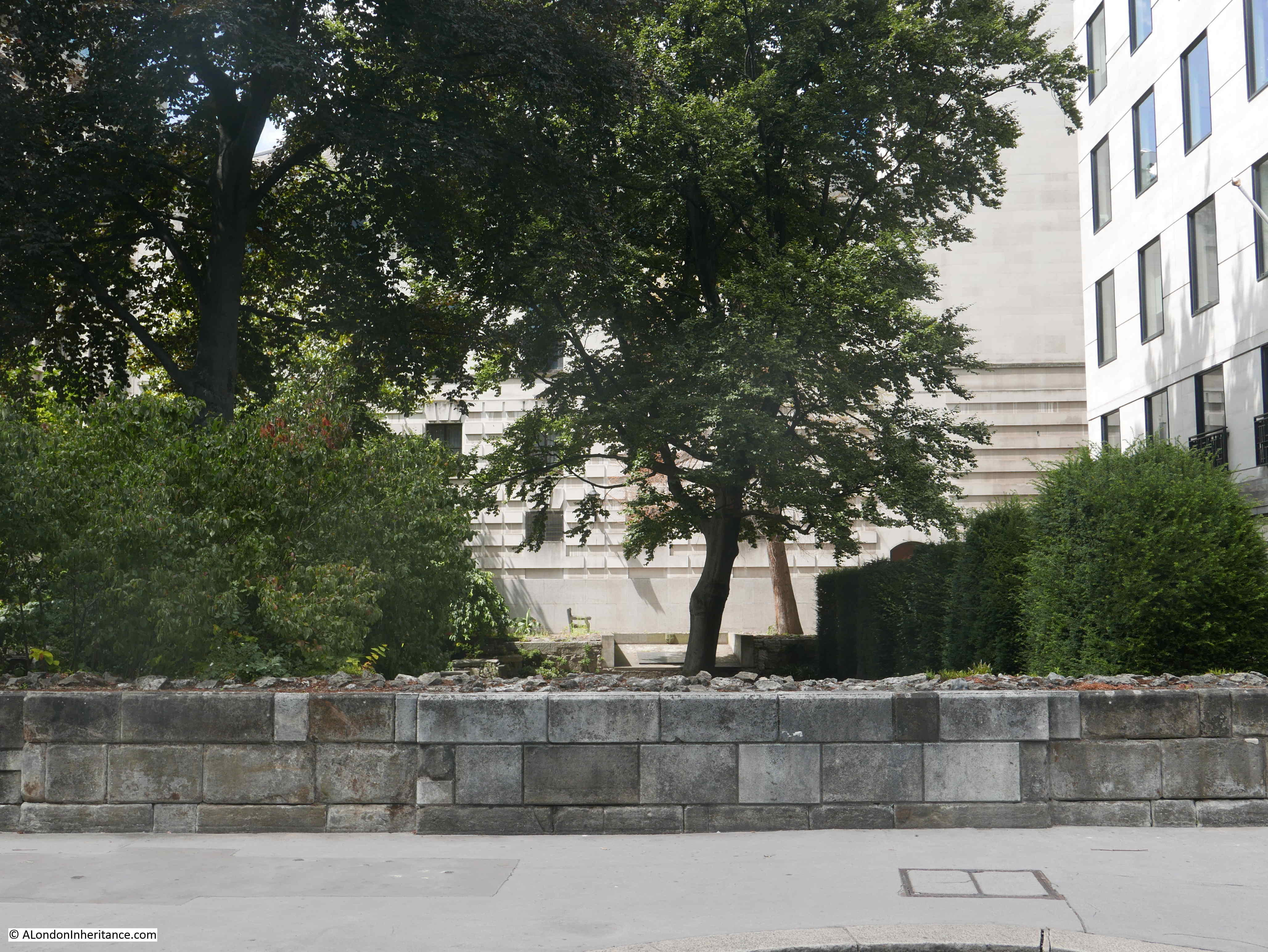
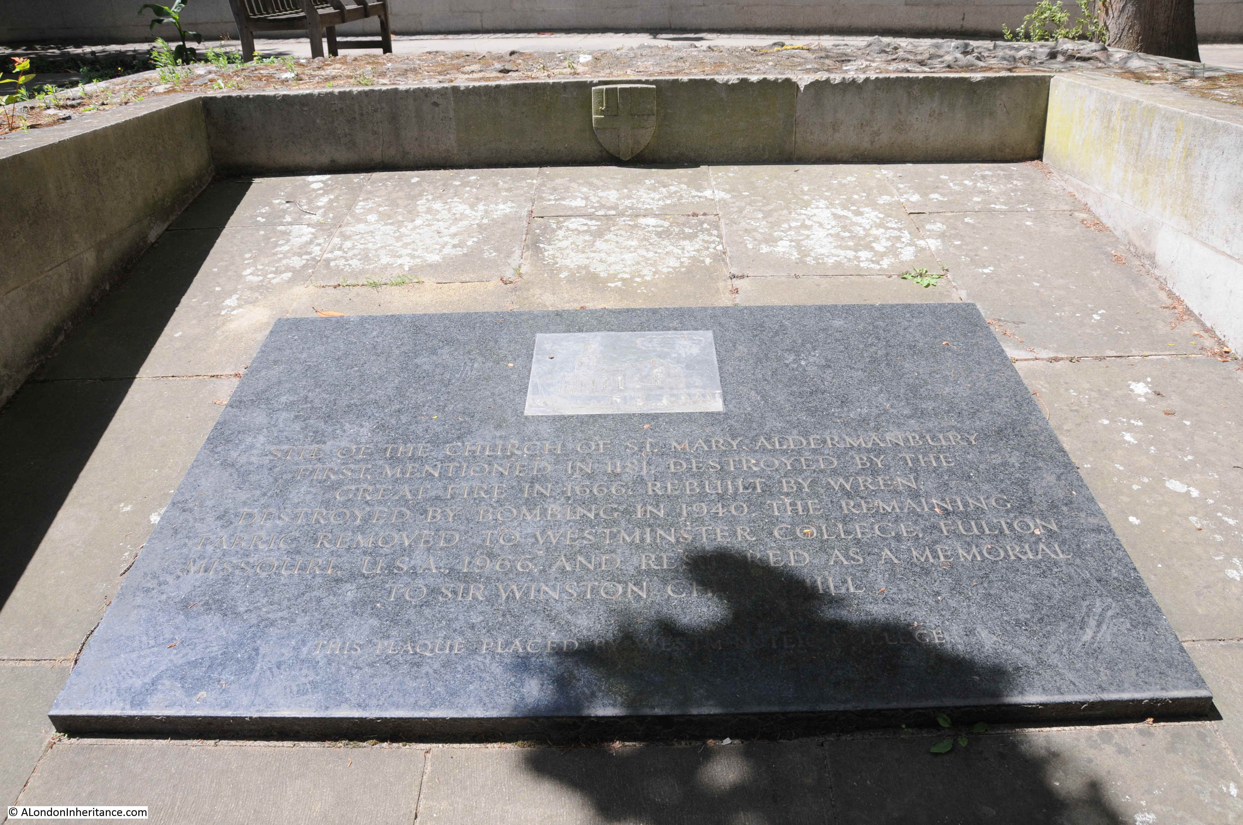
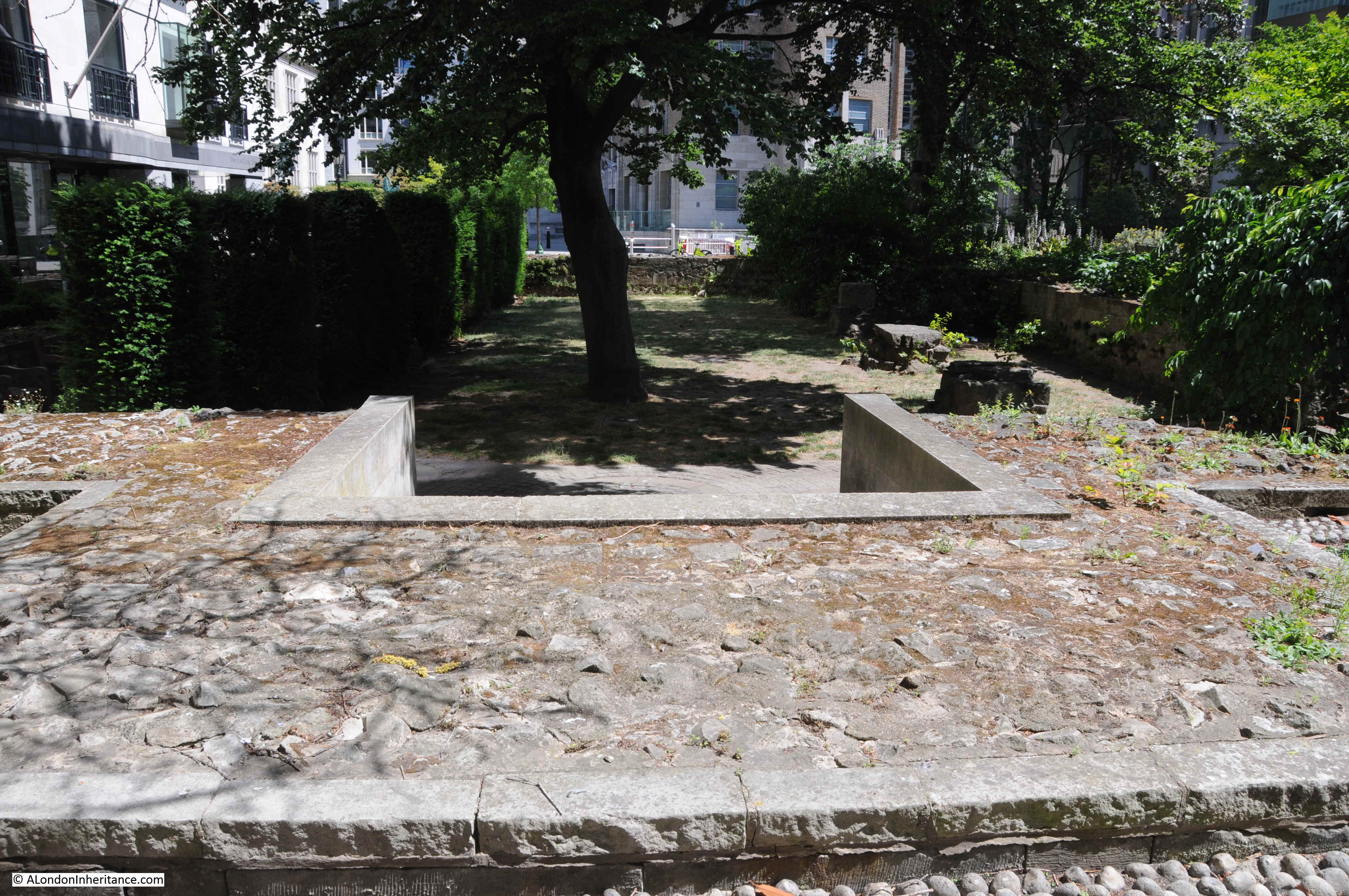
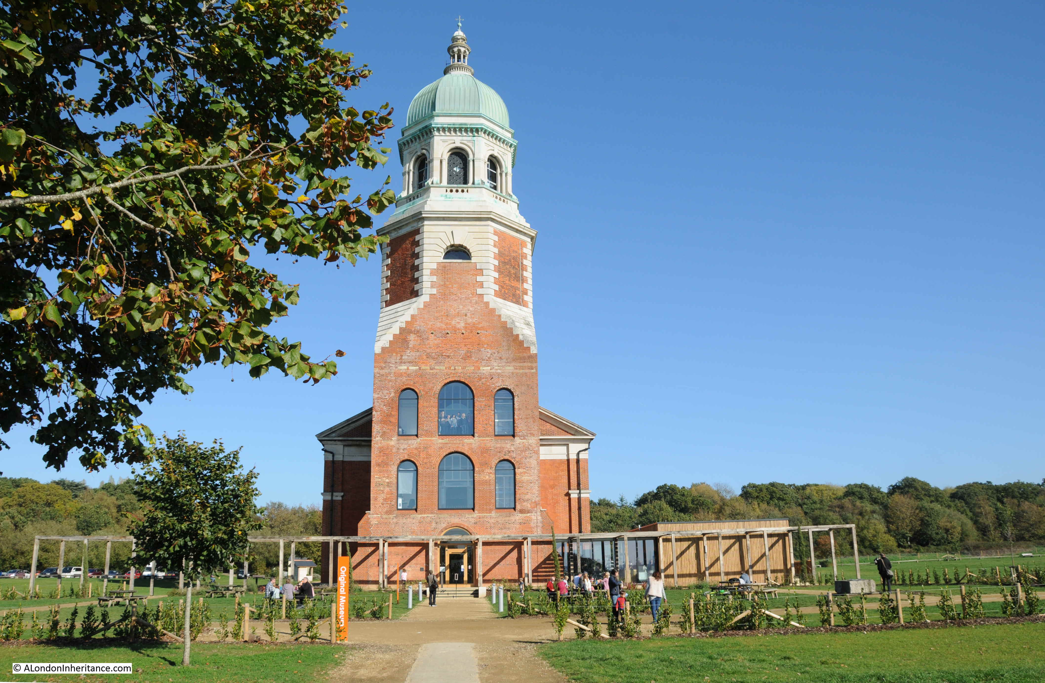
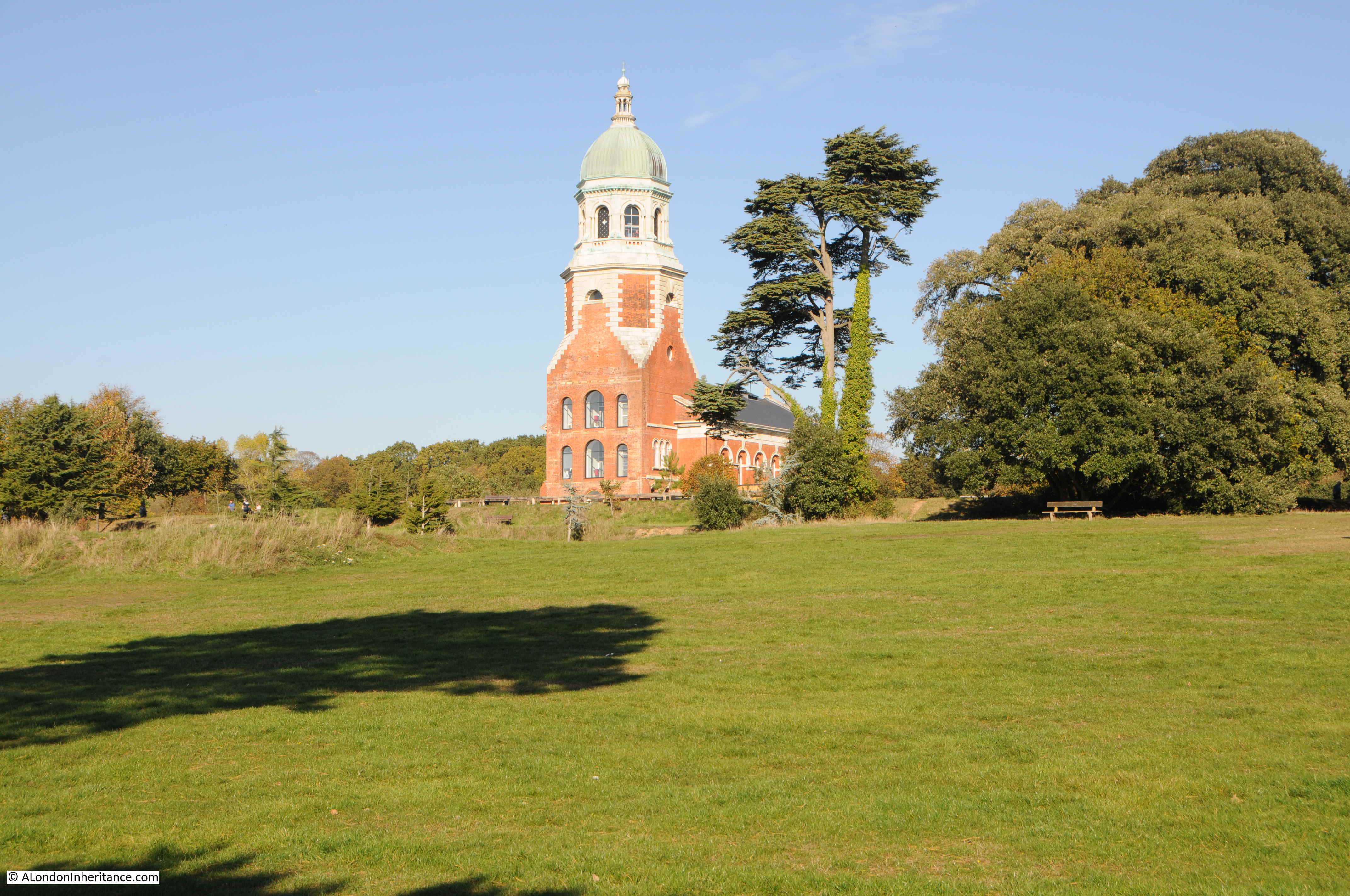
All that remains today is the original central chapel, shown in the photo above, and which now hosts a small museum dedicated to the history of the hospital. This chapel was once part of the central block, with two long wings of wards stretching to either side.

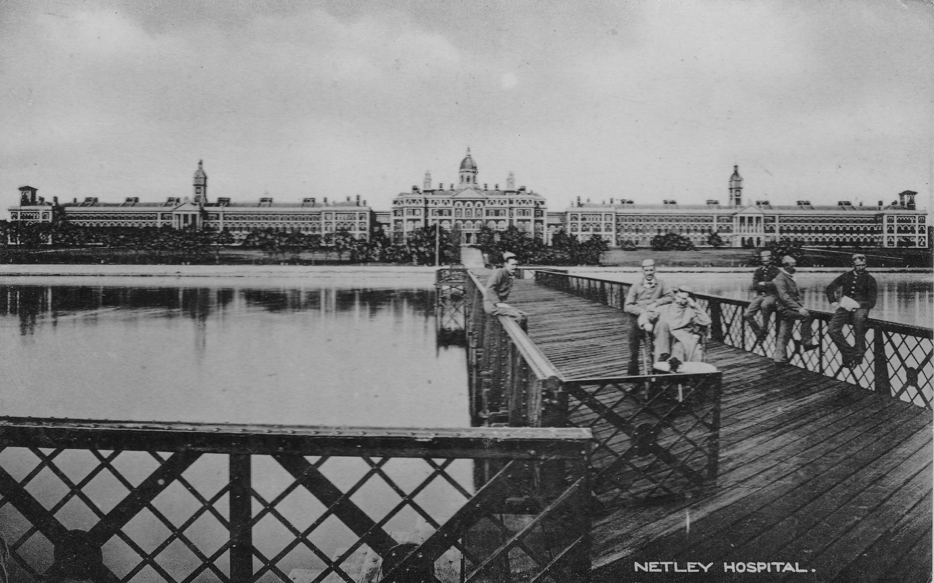
The following photo shows the Royal Victoria Military Hospital, soon after completion, from the end of the jetty that was built for the hospital, out into Southampton Water. The tower of the chapel can be seen in the centre of the photo and is all that remains.

Royal Victoria Military Hospital

The Royal Victoria Military Hospital was built at a site alongside Southampton Water for a number of reasons. Wounded troops would come from across the world on ships, along the English Channel, past the Isle of Wight and along Southampton Water to dock at Southampton.

This placed the hospital close to where potential patients would be arriving. A branch railway was constructed into the hospital grounds so that train loads of wounded troops could be efficiently moved from the docks directly to the hospital.

The hospital needed a large area to be available, and the space near the historic Netley Abbey provided room for the hospital, and additional land as the hospital grew.

The position facing onto Southampton Water was thought to provide benefits for both mental and physical health. The fresh sea air, the views across the water from grounds in front of the hospital were all expected to help with the recovery of patients.

The following map extract shows the location of the Royal Victoria Military Hospital (ringed), alongside Southampton Water, with Southampton at the top of the map (Map © OpenStreetMap contributors).

Royal Victoria Military Hospital

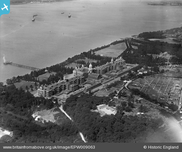
The size of the hospital can be clearly seen from the air. The following photo, from the Britain from Above site, taken in 1923 shows the main hospital buildings (the chapel can be seen in the centre), the gardens down to Southampton Water, and the hospital pier

Royal Victoria Military Hospital

The chapel was a key part of the hospital, hence the chapel’s central position and the tower providing a central high point. Patients were encouraged to participate in services, and the chapel considered of rows of benches at ground level, with a surrounding gallery with tiered benches

Royal Victoria Military Hospital

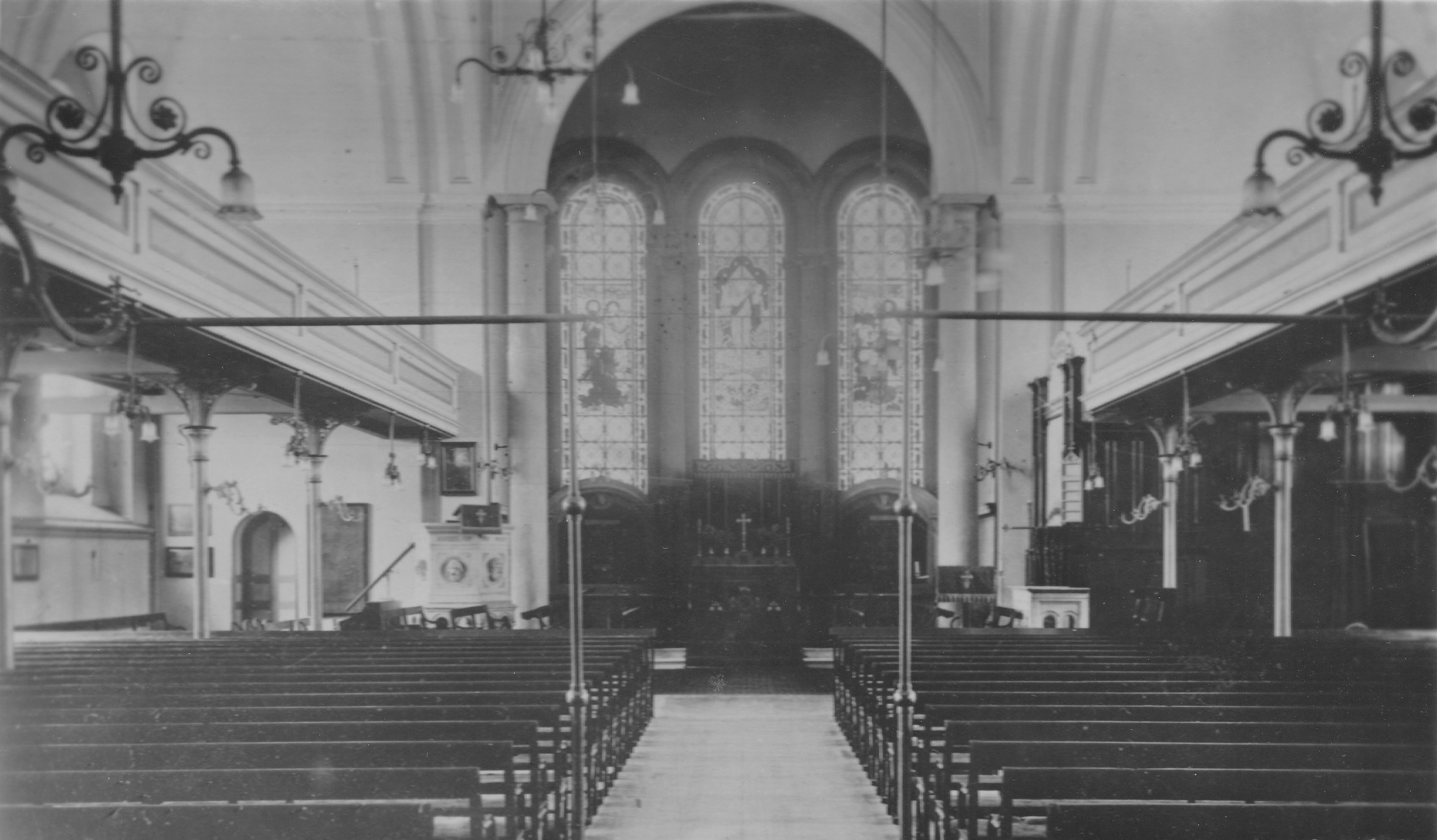
The chapel forms today’s museum, and has been restored to much the same appearance as when patients were attending services in the chapel. The benches that covered the ground floor have been removed, and today replaced by displays covering the history of the museum.

The gallery has an interesting display featuring the history of individuals involved with the hospital as patients, medical staff or workers displayed along the benches.

Royal Victoria Military Hospital

Much of the drive for the hospital came from Queen Victoria and Prince Albert. Conditions for wounded soldiers in the first half of the 19th century were very basic. They were often housed in normal barrack buildings, with very poor sanitation and limited medical care. Disease and infection would often account for the deaths of more patients than their actual wounds.

Having visited a number of forts, Victoria expressed the concern that wounded soldiers were being treated in worse conditions than those for prisoners (which is saying something given the conditions of prisons during the first half of the 19th century).

The Queen also had the support of Albert, who saw the provision of improved medical treatment as one of the improving initiatives of Victorian Britain.

Based on her experience of the Crimean War, Florence Nightingale was also campaigning for improved conditions and treatment of wounded soldiers. During the Crimean War, British casualties consisted of 2,755 killed in action, but a much higher number of 17,580 died of disease.

A meeting between Nightingale and Victoria was an opportunity for Florence Nightingale to put before the Queen all the problems with the current system, and how badly wounded troops were treated.

Victoria wrote to Lord Panmure, the Secretary of State for War, who agreed that there should be improved general hospitals for the military, and a survey was initiated for a suitable site, and the Royal Victoria Military Hospital at Netley was the result.

Although the hospital was intended to be seen as a leading edge improvement in the treatment of the wounded, the design did not really follow leading thinking by those who had significant experience in the treatment of large numbers of casualties.

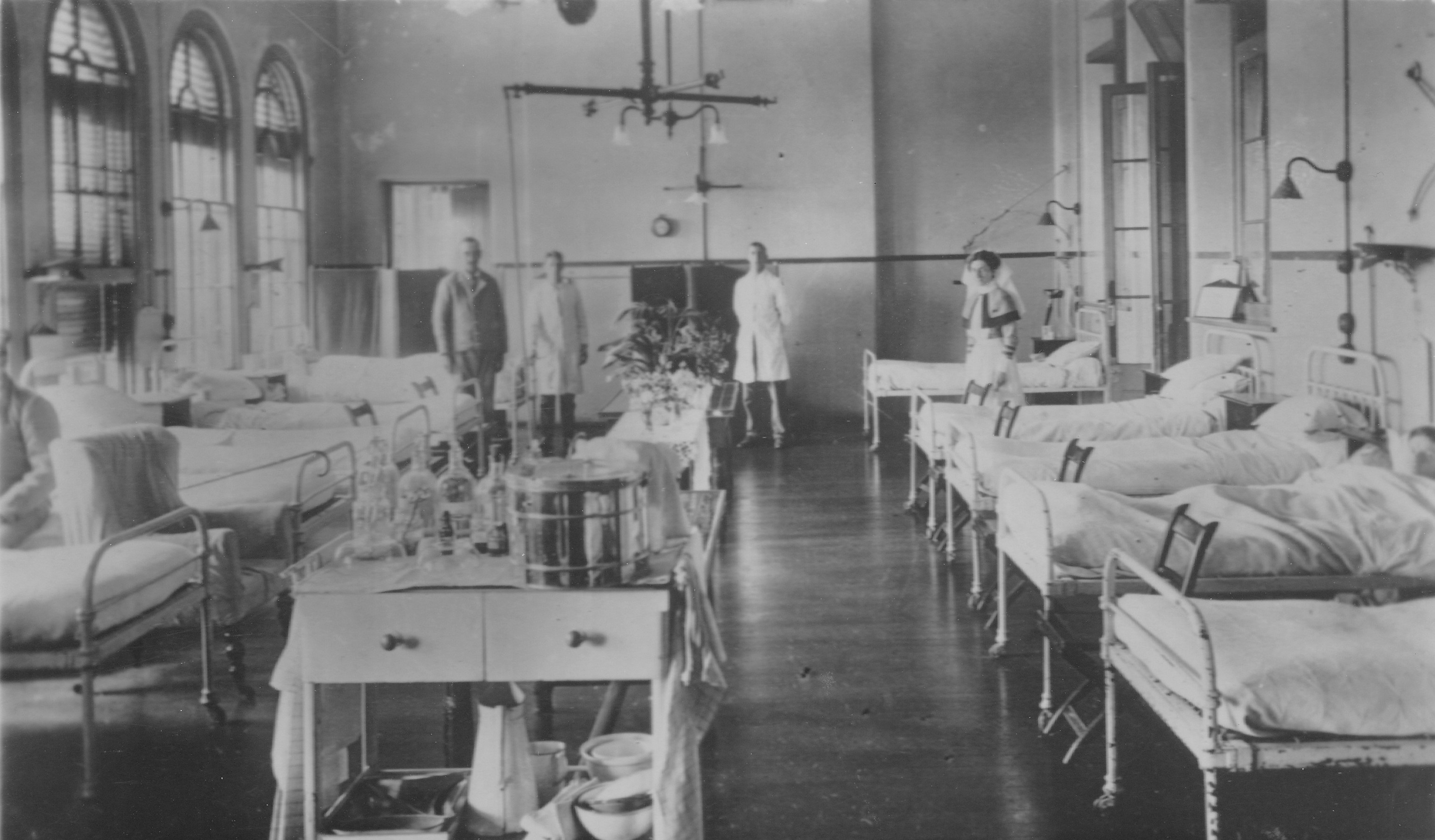
The Royal Victoria Military Hospital was designed with two large wings radiating from the central block (where the chapel was / is located). A corridor ran the length of the wings, and off the corridor were individual wards, sized to hold less than fourteen patients. Many of the wards were facing inland, so did not get a view across the gardens down to the water, or much access to fresh air. They were described as little more than cells for patients.

One of the corridors in the Royal Victoria Military Hospital:

Royal Victoria Military Hospital

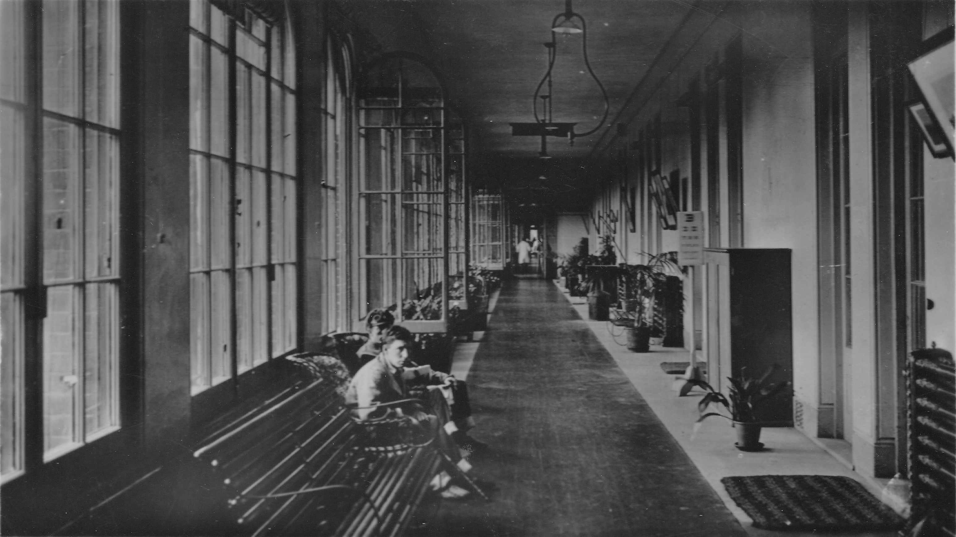
Florence Nightingale was highly critical of the new hospital. Her experience and research had led her to believe that the best design for a hospital was for separate areas for different types of patient need, general medical, those undergoing surgery, and for those convalescing.

These separate areas needed to be of sufficient size to provide plenty of space for the patients, free airflow and good ventilation to provide patients with plenty of fresh air.

She was critical of the ward design at the Royal Victoria Military Hospital where she found small wards, facing away from the water with limited ventilation:

Royal Victoria Military Hospital

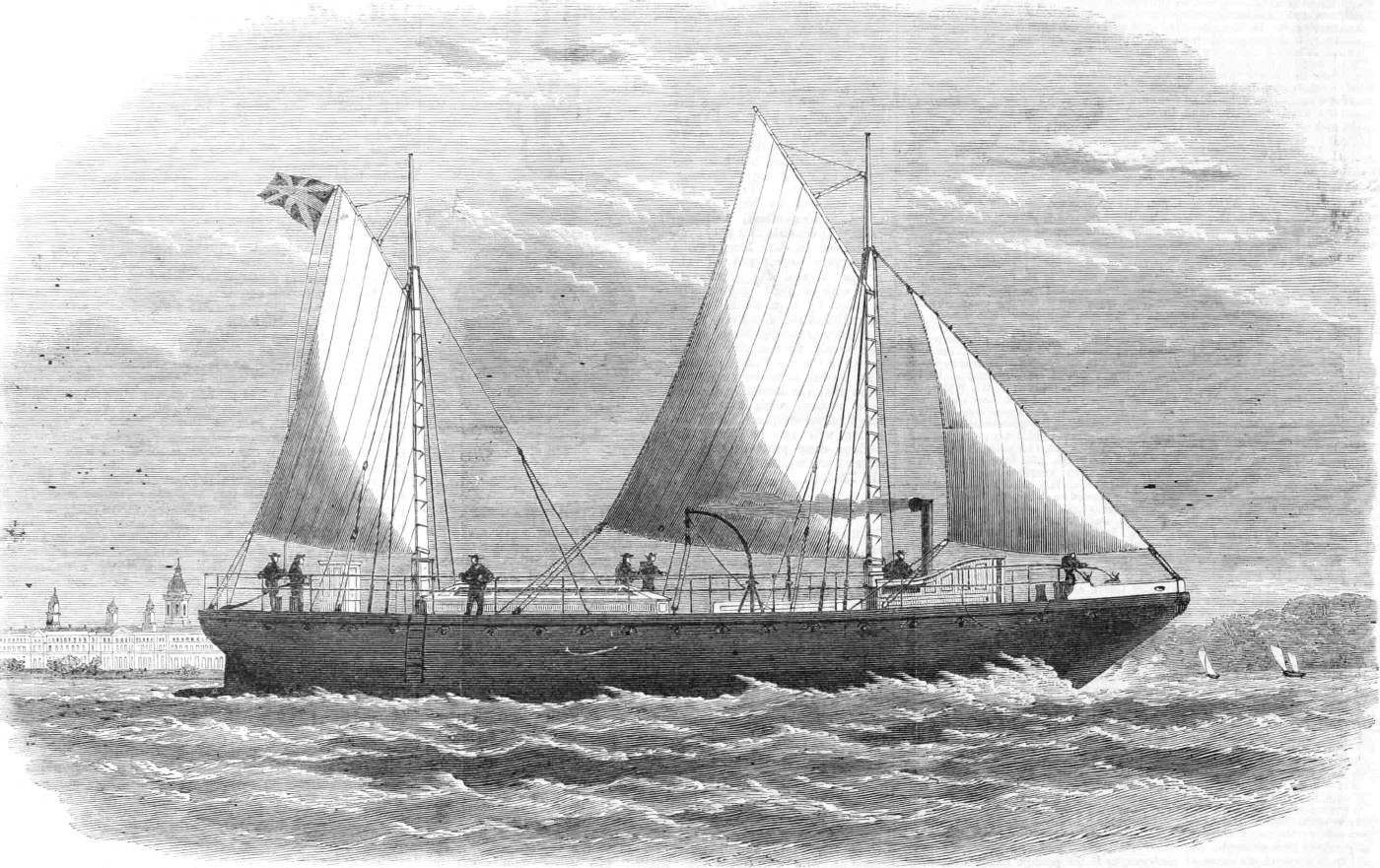
Queen Victoria maintained an interest in the hospital throughout construction of the hospital and throughout the hospital’s operation. When ever they were at Osborne on the Isle of Wight, described as the holiday home of Queen Victoria and Prince Albert, they would take the short journey across the Solent and down Southampton Water to the site of the hospital.

Queen Victoria’s ship, with the hospital in the background:

Royal Victoria Military Hospital

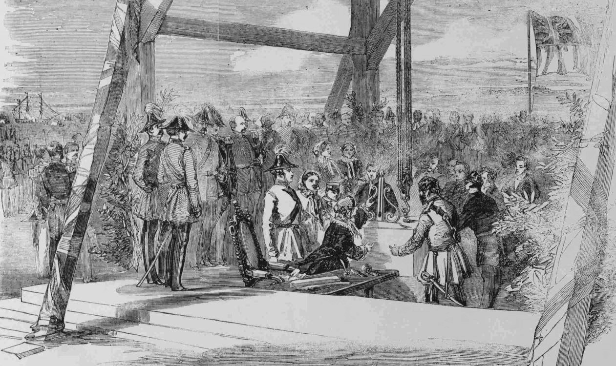
Queen Victoria laid the first stone of the new hospital in 1856. The newspaper reports described the scene, along with a tragic event during the ceremony that underlined the dangers that those in the army and navy were exposed to, even when not in battle:

“The Queen, Prince Albert, the Prince of Wales, Prince Alfred, and the Princess Royal, went on Monday to Hamble, on the Southampton Water, where her Majesty laid the first stone of the Royal Victoria Hospital, near Netley Abbey. After the ceremony had been performed, her Majesty inspected the troops employed on the occasion whilst at the dinner which had been provided for them. A sad accident occurred on board the Hardy, a screw gun-boat, two seamen, named Flanigan and Devine, having been killed while firing a royal salute. An inquest was held the next day, when it appeared that the accident arose from some burning fragments of the first charge being left in the gun and igniting the second charge. This was caused by defective sponging on the part of the deceased. The captain of the gun had his thumb over the vent at the moment, and it was blown off. Devine served in the trenches before Sebastopol, and was wounded by a shell at the storming of Malakoff. Flanigan had served in various parts of the world”.

Laying the foundation stone of the Royal Victoria Military Hospital:

Royal Victoria Military Hospital

Prince Albert would not see the hospital fully completed, he died in 1861, however Queen Victoria continued to take an interest in the hospital, and a visit to the hospital in July 1863 was one of her first public outings since Albert’s death: “Her Majesty the Queen recently visited the Royal Victoria Hospital at Netley, the foundation stone of which had been laid by the Prince Consort. This may be considered as the first public act of Her Majesty since her irreparable bereavement – an act every way very appropriate, as well as in accordance with her humane disposition”.

The Royal Victoria Military Hospital continued to grow over the coming decades, with additional facilities being built on the landward side of the hospital, including a psychiatric hospital which would attempt treatments for those suffering from the impact of war on their mental health, shell shock, and what is now recognised as post-traumatic stress disorder. Large numbers of shell shocked soldiers would be treated during the First World War.

The following map extract from 1907 shows the size of the hospital, the railway line dedicated to the hospital coming in from the top of the map, the “Lunatic Hospital” to the right and the Hospital Cemetery.

Royal Victoria Military Hospital

Credit: ‘Reproduced with the permission of the National Library of Scotland’ 

The number of patients at the hospital would reflect frequency and size of war’s that Britain was involved with around the world, with ships continuing to bring patients into Southampton for transport along the short distance to the hospital.

The size of the hospital was such that it was a significant landmark from Southampton Water, and one wonders how many troops leaving Southampton to fight abroad, would look at the hospital as they left, hoping that it would not be their destination on return.

The main hospital was demolished in the 1960s. It was a Victorian institution, and did not reflect the latest medical thinking when first built, so was very unfit for purpose in the later decades of the 20th century.

Countries of the former Empire were gaining their independence, so a hospital built to support the high number of casualties of the endless wars and conflicts that go with building and maintaining an Empire was thankfully no longer needed.

When Queen Victoria and Price Albert laid the original foundation stone, they also buried a time capsule, and when the hospital was demolished, there was much speculation as to the contents of the time capsule. The Daily Mirror on Thursday 8th December, 1966 reported:

“SECRET OF THE QUEEN’S BOX – the secret of Queen Victoria’s little copper box, buried 110 years ago, was revealed yesterday at a ceremony attended by eleven generals and an admiral.

The box was buried near the foundation stone of the Royal Victoria Hospital, Netley, Hants.

Queen Victoria put articles in the box before she laid the foundation stone of the military hospital on a sunny May afternoon in 1856. The Army authorities never knew exactly what was in the box.

Now the hospital is being pulled down, and, at yesterday’s ceremony the contents were revealed:

The first Victoria Cross ever made – and never awarded; a Crimea War medal: coins of the realm and the plans of the hospital.

The Victoria Cross was slightly tarnished, but otherwise unmarked, said one of the officers who looked at it. Later it was carried, in its box and under escort, to take its place in an exhibition at Aldershot arranged by the Royal Army Medical Corps”.

The chapel had been included in the plans for the overall demolition of the hospital, however as demolition worked along the two wings and started on the central core of the building, a decision was made to retain the chapel, and the tower – for an as yet unknown purpose. As demolition of the Royal Victoria Military Hospital completed, the chapel and tower were all that remained of such a significant Victorian institution that had seen countless thousands of wounded and damaged patients pass through its wards, many of whom would still die of their injuries.

The site now belongs to Hampshire County Council. The grounds occupied by the hospital are now the Royal Victoria Country Park, and after a number of limited uses, and periods of neglect, the council received a National Lottery grant in 2014 to repair and conserve the chapel and tower, and convert into a museum, which opened a couple of years ago.

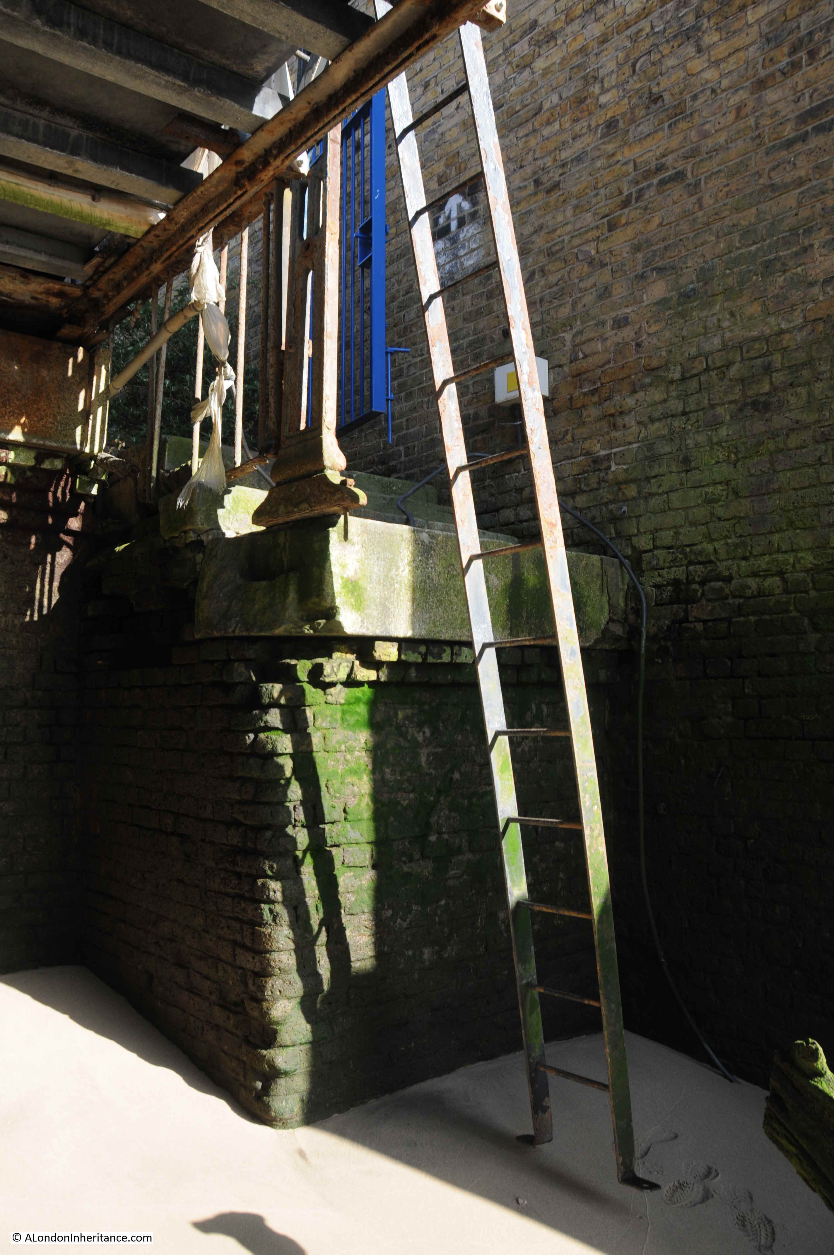
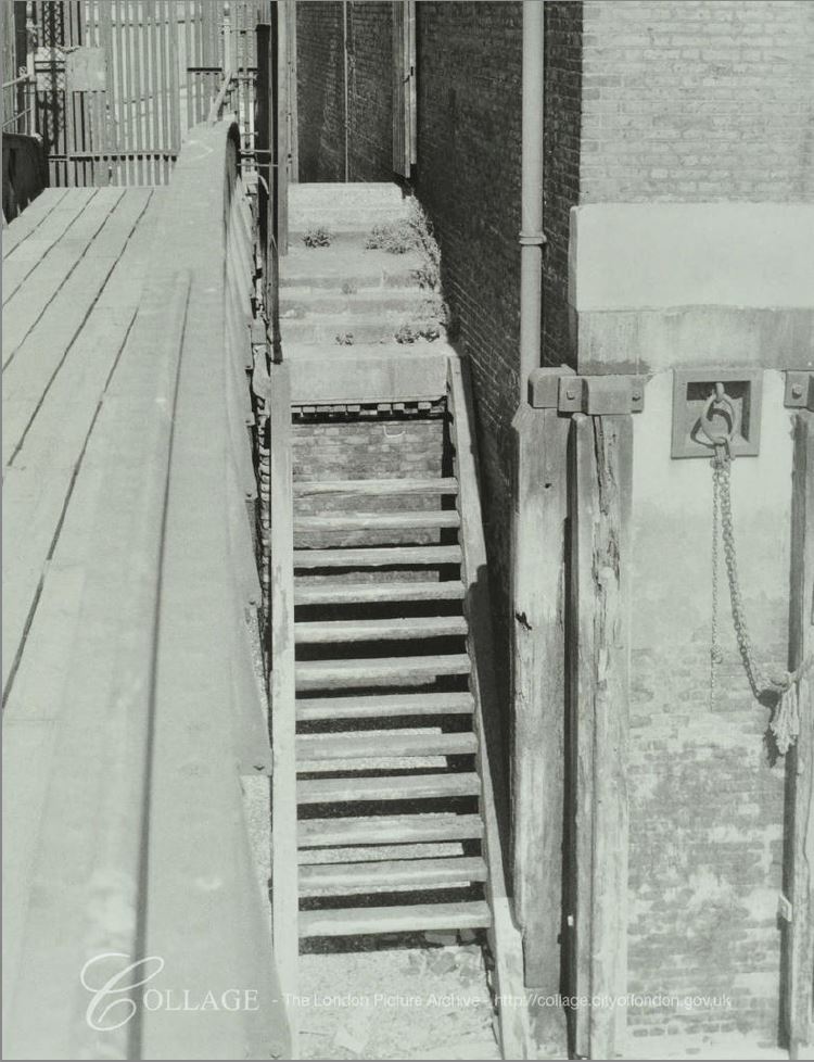
The museum in the chapel, tells the story of the hospital, medical treatments, and of those who worked and were patients in the hospital. The tower is open to climb to the top where the views provide an appreciation of the size and location of the hospital.

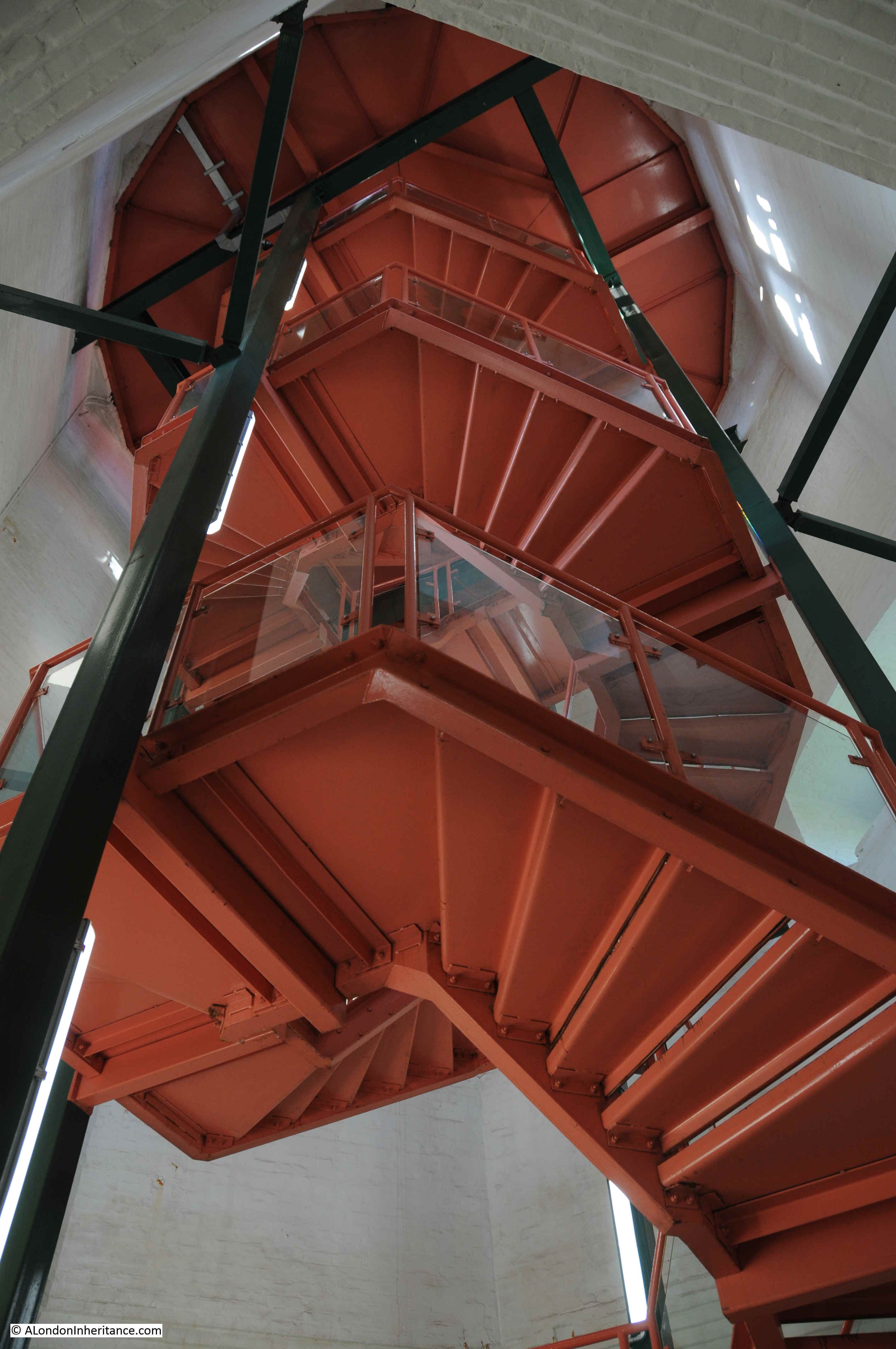
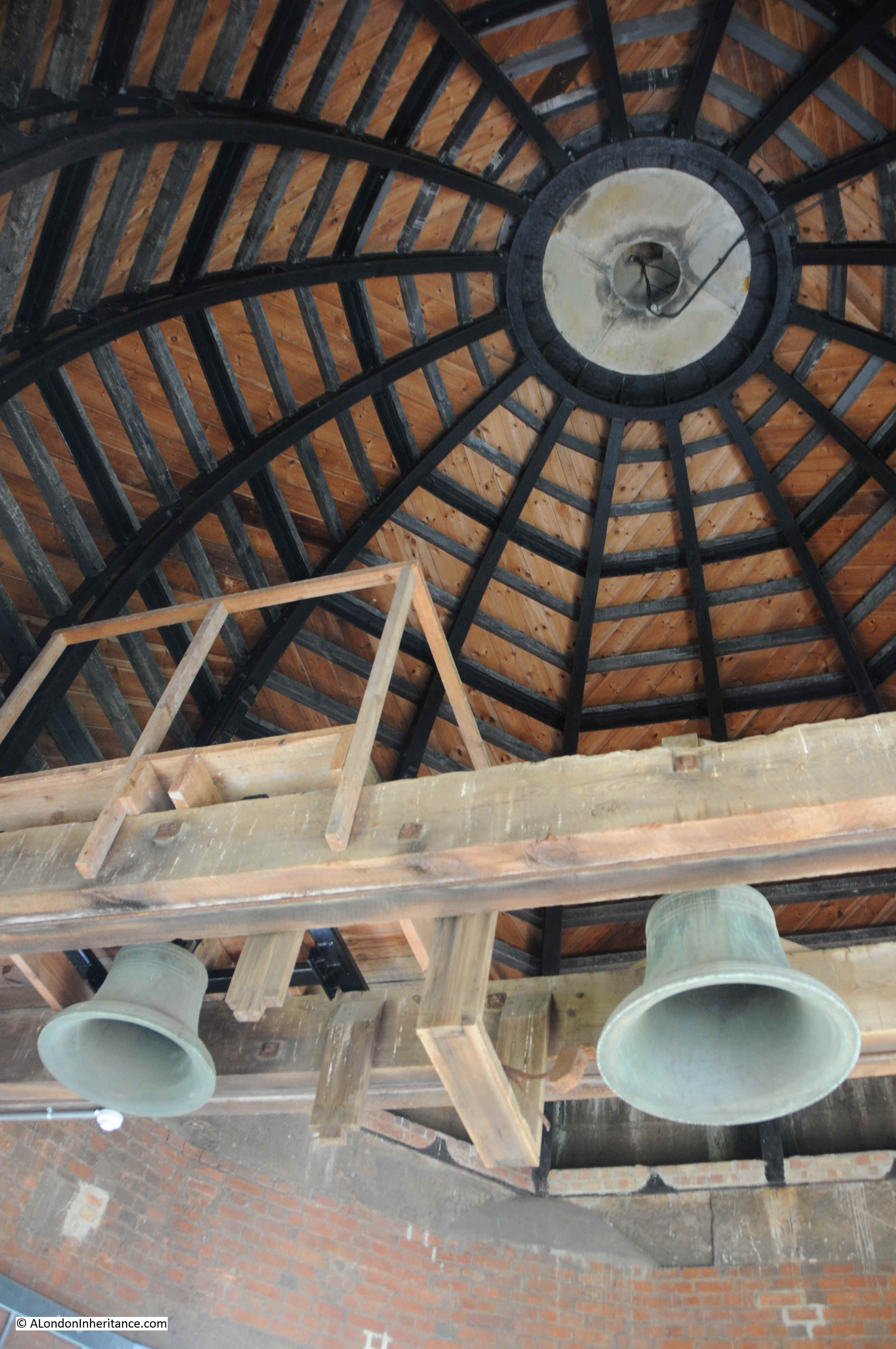
Stairs to the top of the tower:

Royal Victoria Military Hospital

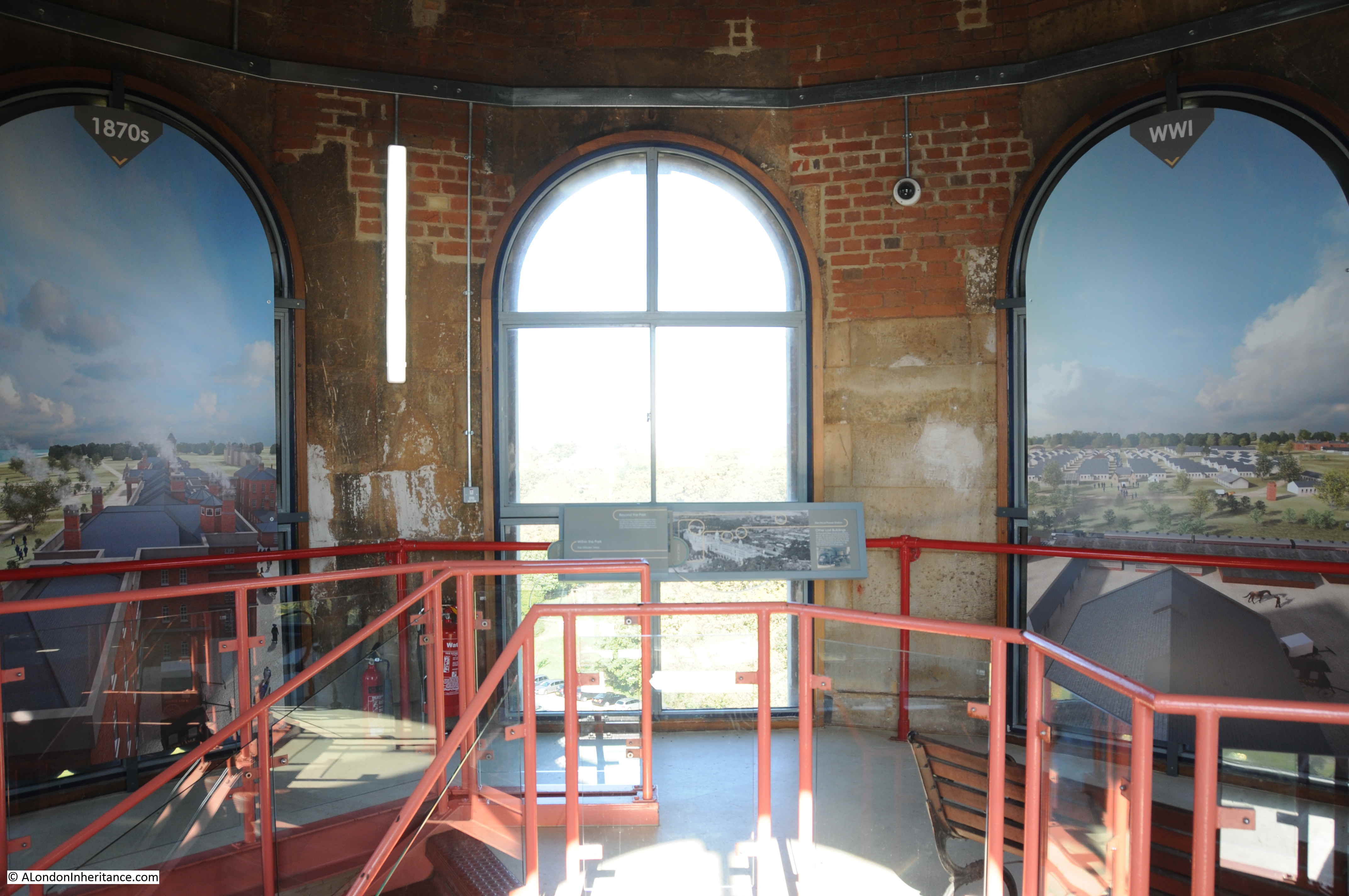
At the top of the tower, windows provide external views and painted panels give an impression of what the view would have looked like at different periods of the hospital’s history.

Royal Victoria Military Hospital

Top of the dome, with the original bells in place.

Royal Victoria Military Hospital

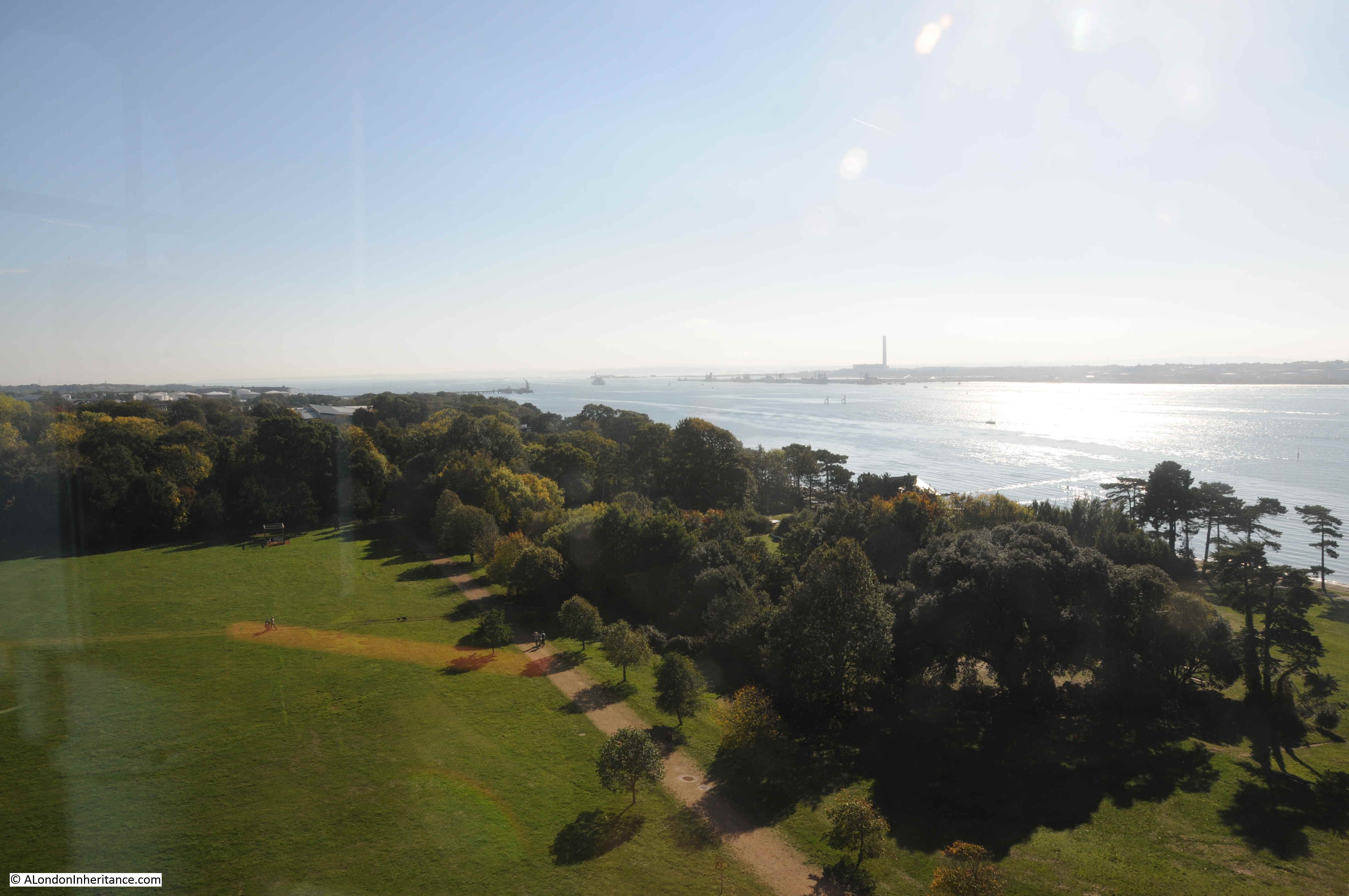
View to the south-east with Southampton Water stretching out to the Solent, the Isle of Wight and the open sea. The wing of the hospital would have originally stretched all the way to the far tree line.

Royal Victoria Military Hospital

View to the north-west with the buildings of Southampton in the distance. Again, this wing of the hospital would have stretched up to the trees.

Royal Victoria Military Hospital

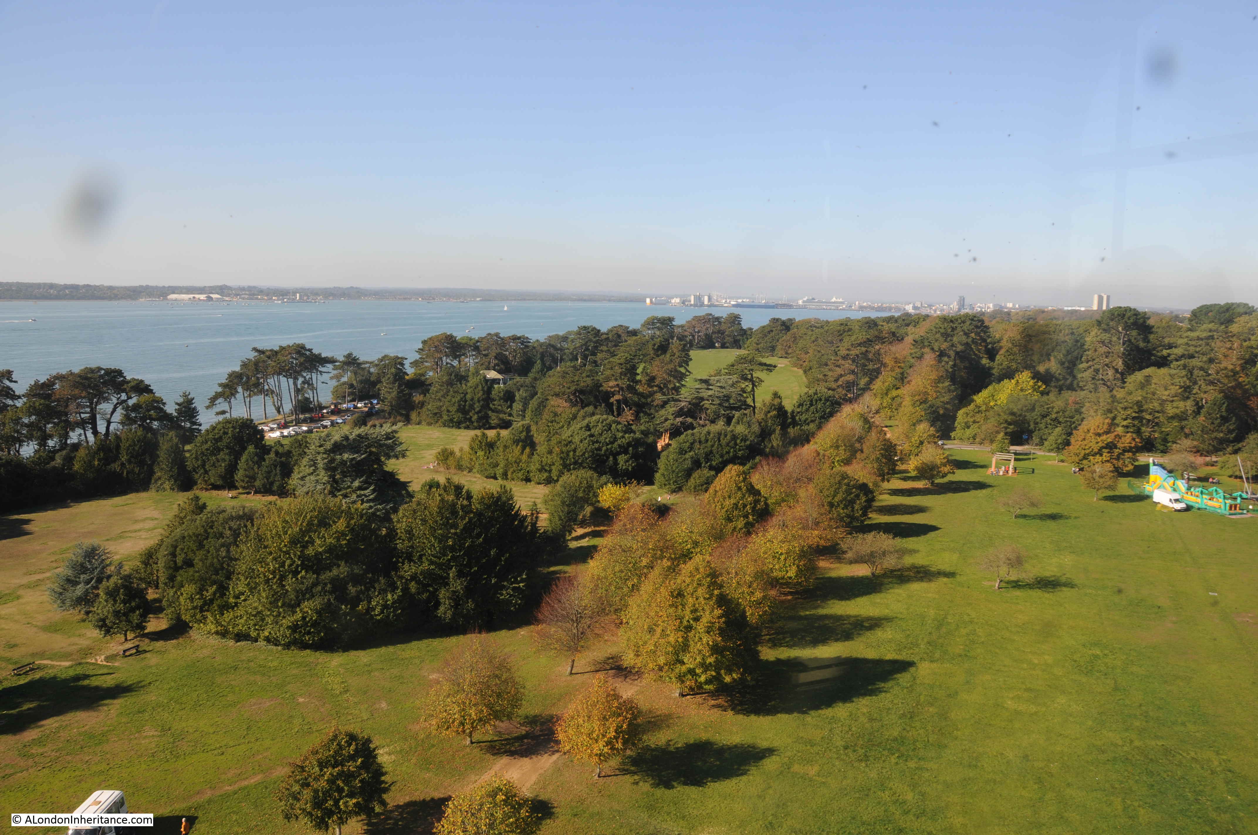
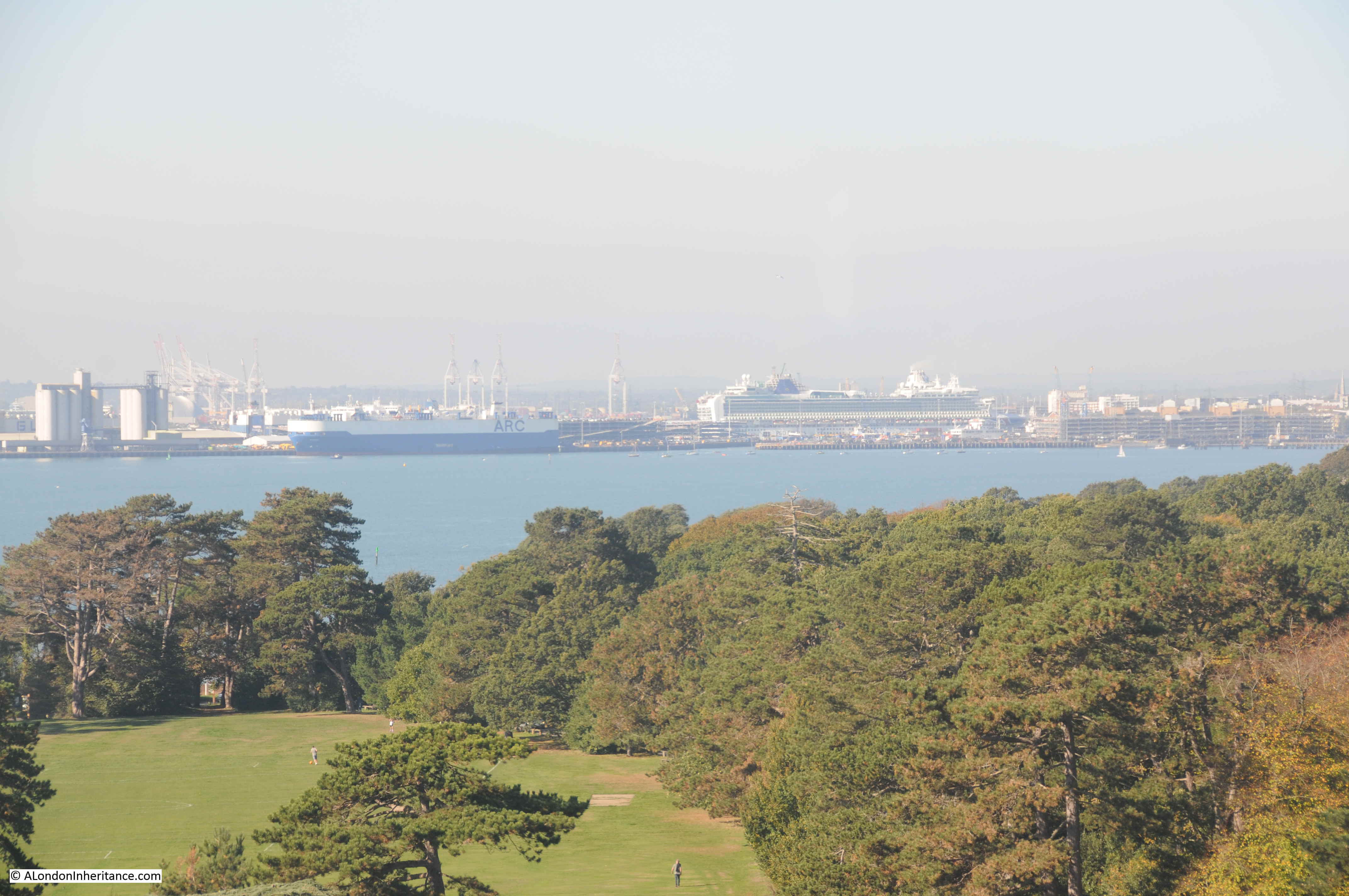
Shipping in Southampton is visible from the top of the tower. The Port of Southampton would have been the arrival place for the majority of patients heading to the hospital.

Royal Victoria Military Hospital

View to the north-east, with the shadow of tower and chapel on the grass.

Royal Victoria Military Hospital

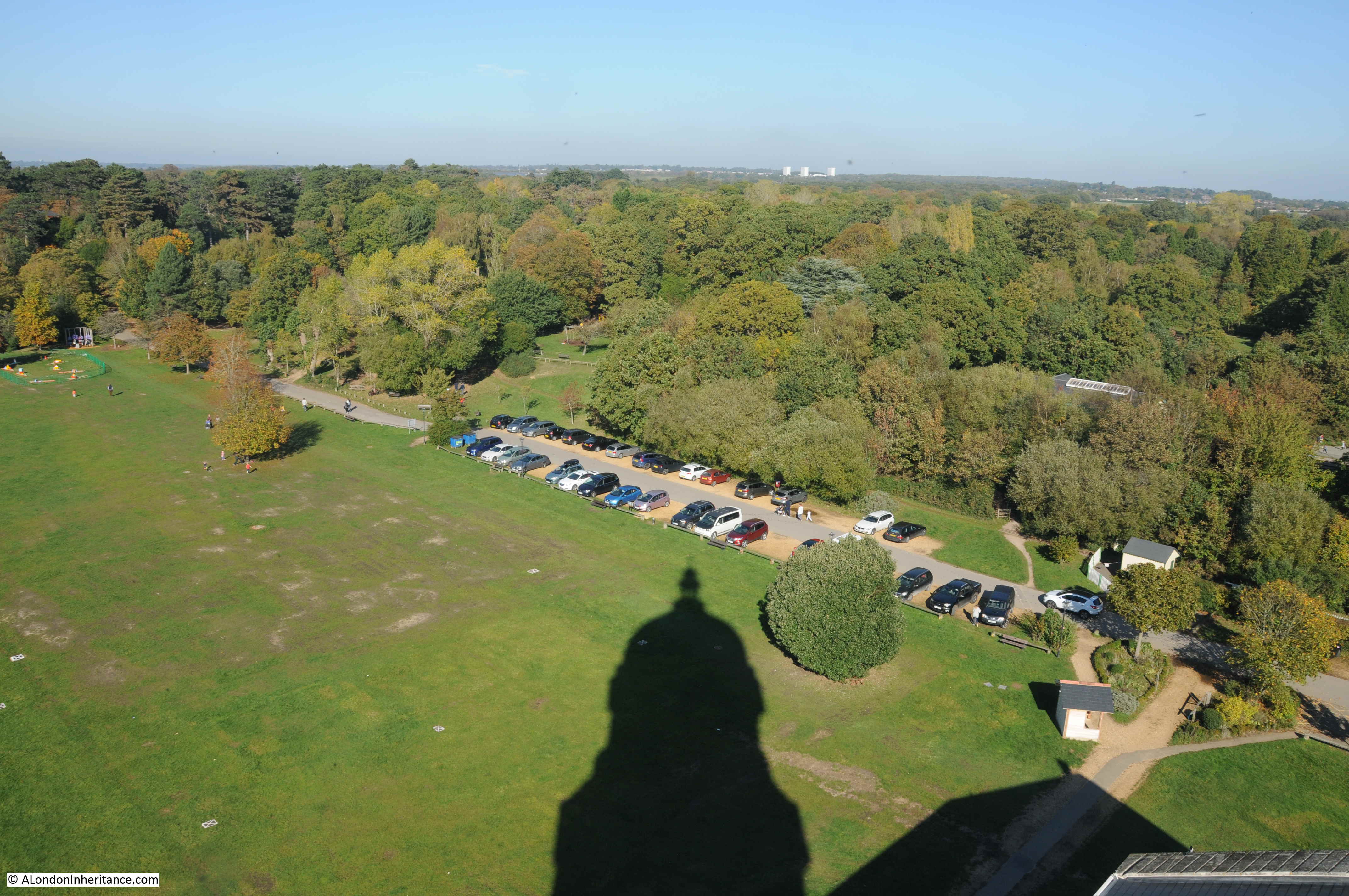
The tower and chapel of the Royal Victoria Military Hospital. The hospital’s wings would have been dominating the view to left and right.

Royal Victoria Military Hospital

The hospital sat on flat land at the top of a slope down to Southampton Water. This emphasized the size of the hospital to those passing the hospital on the water.

Royal Victoria Military Hospital

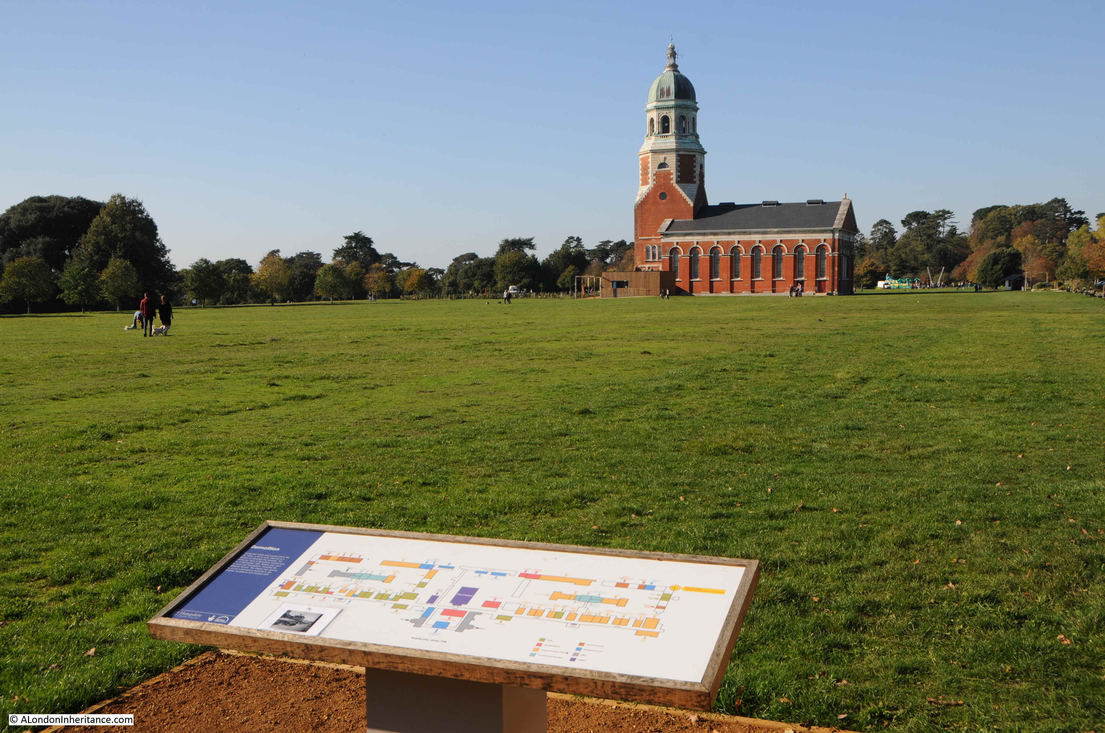
Historical information about the Royal Victoria Military Hospital has been extended out from the museum in the central chapel, to the surrounding landscape.

In a brilliant example of how this should be done, at the far corners of the original hospital wings, there are corner displays showing the buildings and views from each location.

Royal Victoria Military Hospital

So from each corner, you can really appreciate the size of the original building.

Royal Victoria Military Hospital

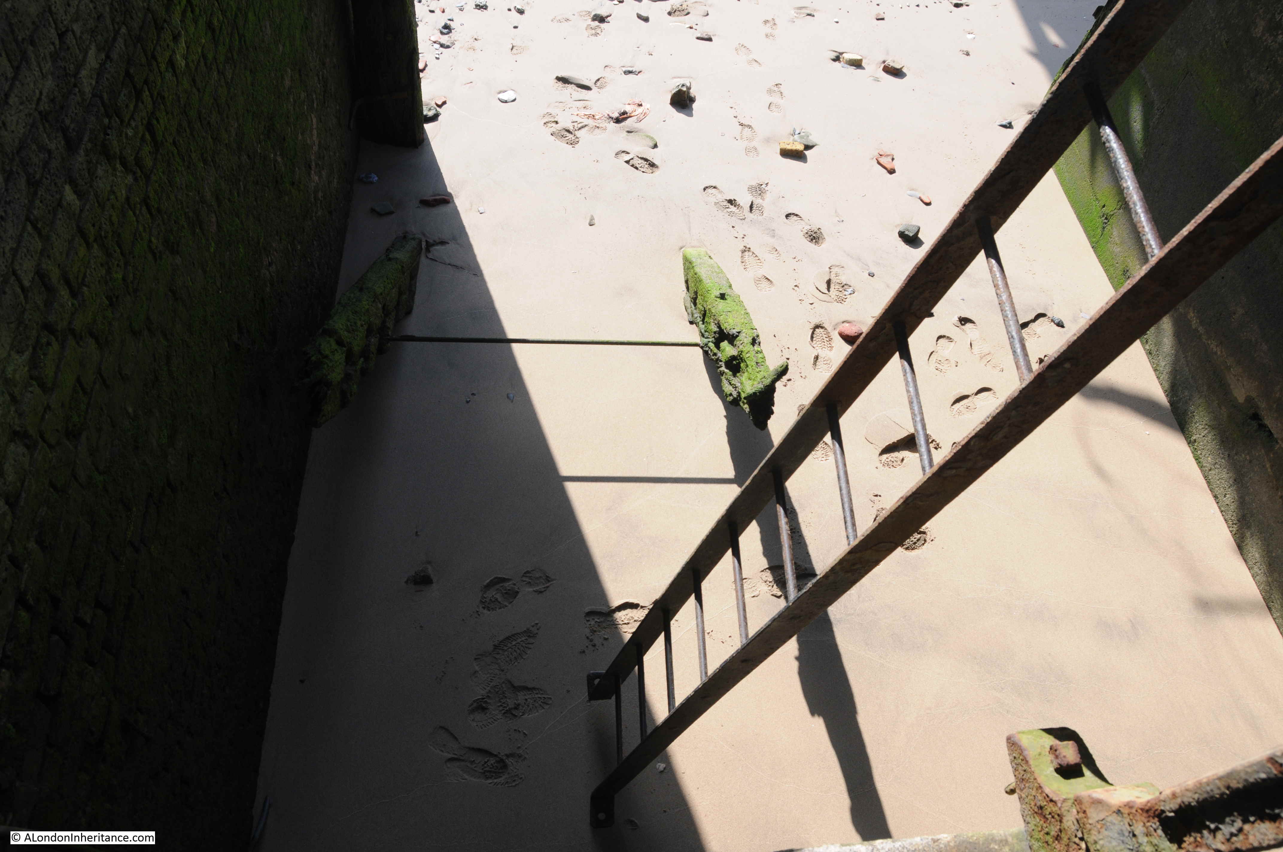
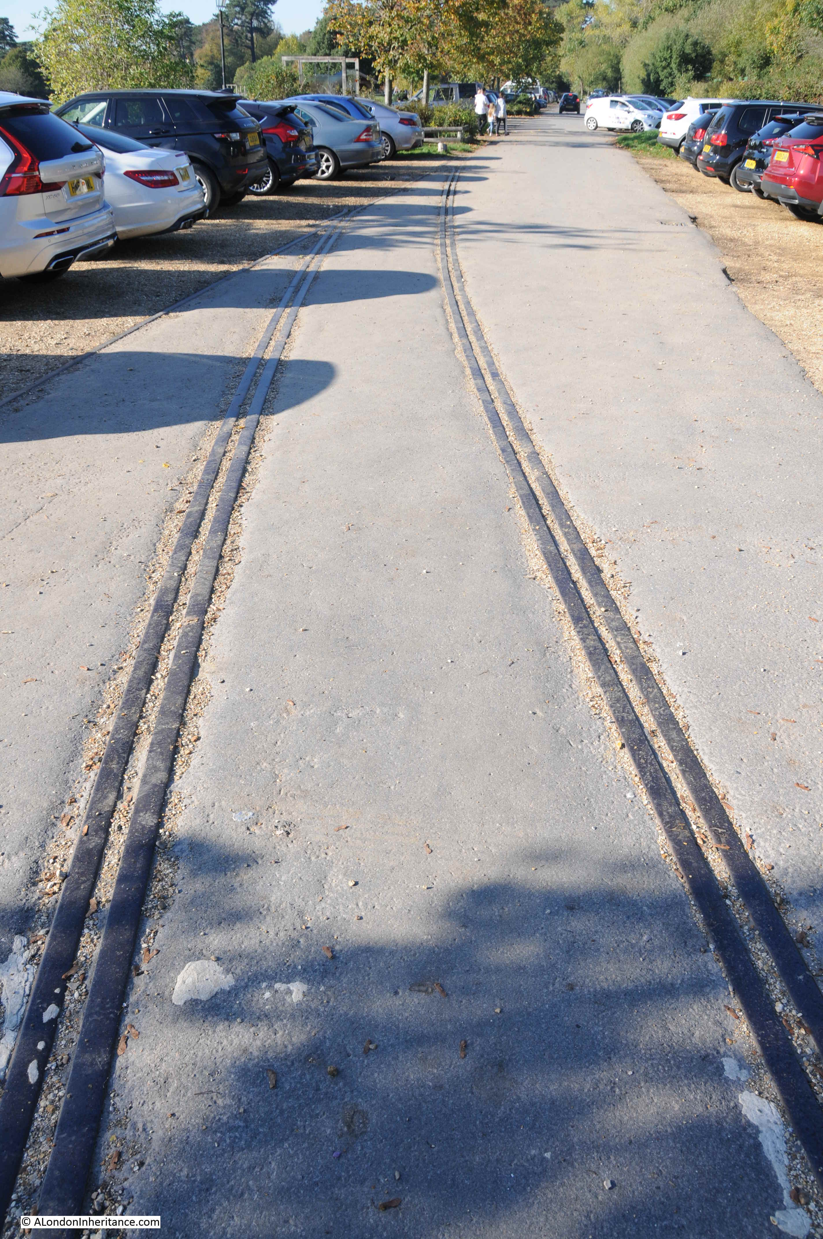
In the car park are the remains of the rail tracks that once transported patients to the hospital from the docks.

Royal Victoria Military Hospital

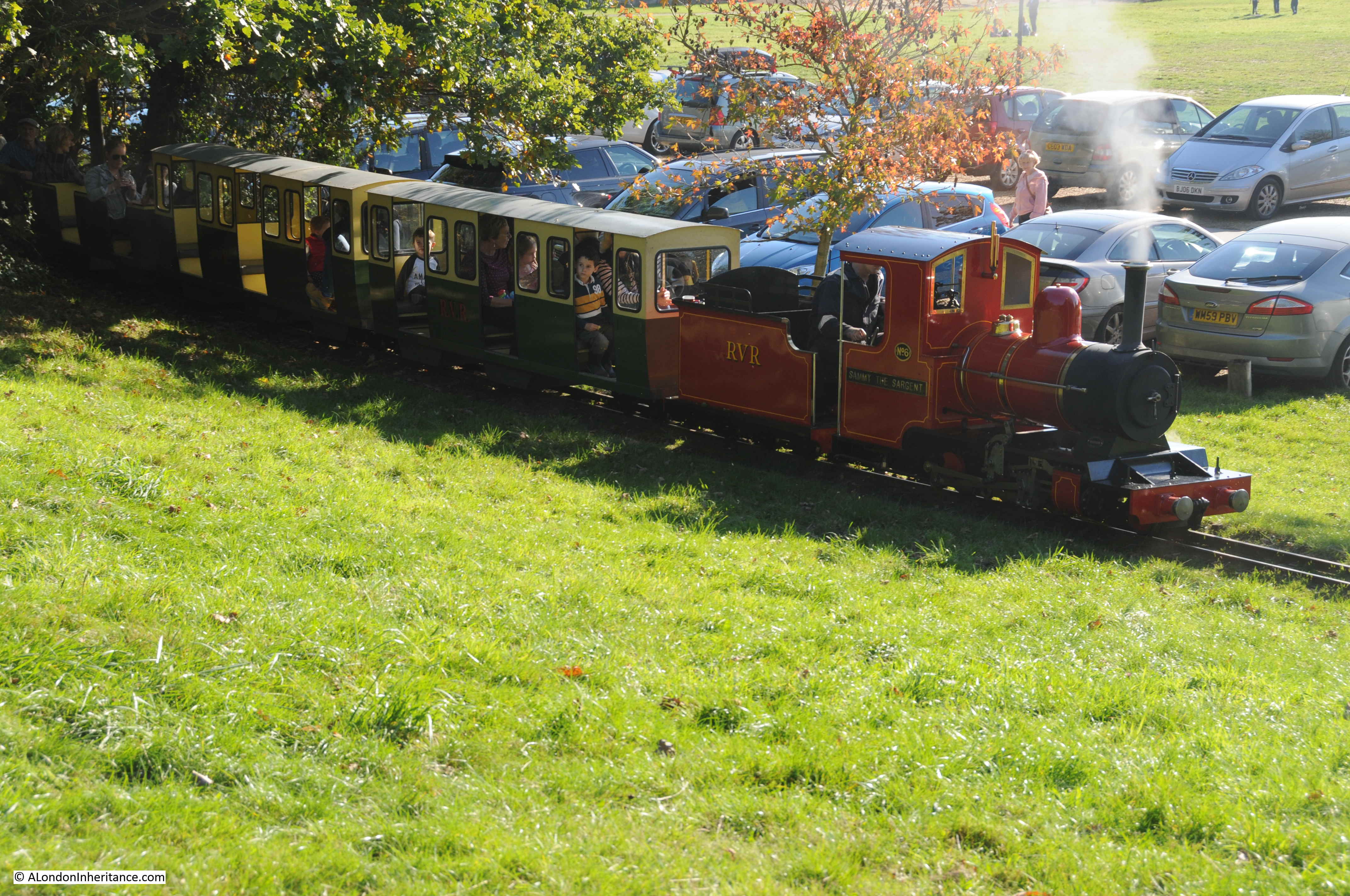
A very different railway runs through the park today:

Royal Victoria Military Hospital

The museum in the old chapel of the Royal Victoria Military Hospital shows just how a small museum can make use of a building, to display the history of the site, and the people who came into contact with the hospital.

The displays within the landscape of what is now a park, again show how a place that has disappeared can still be represented – it has really been well done.

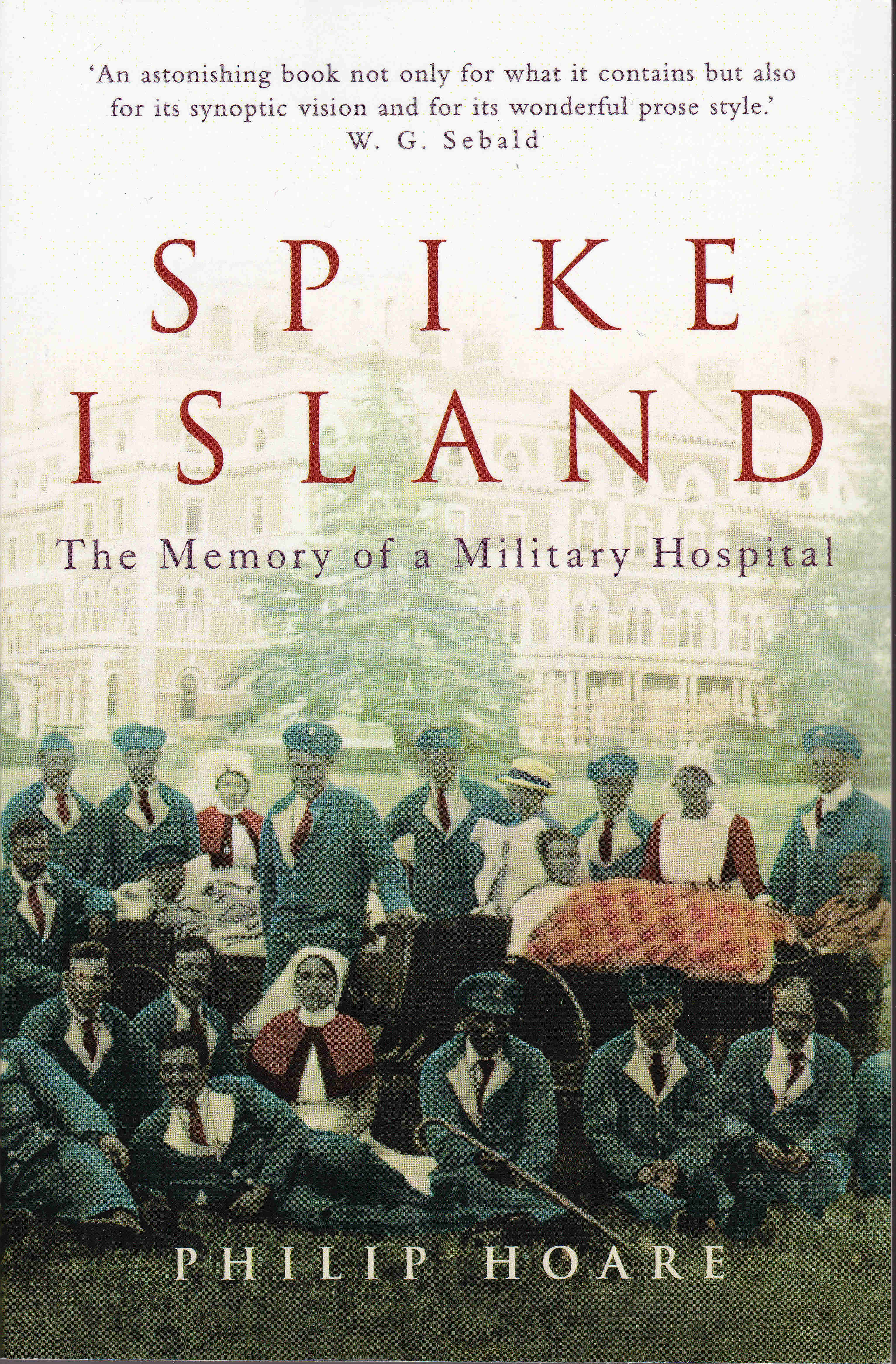
The Royal Victoria Military Hospital has a fascinating history. After visiting the place, I found the book Spike Island – The Memory of a Military Hospital by Philip Hoare. The book is both a fascinating personal history, and a deeply researched, in depth history of the Royal Victoria Military Hospital.

Royal Victoria Military Hospital

Out of London, but I am fascinated by history, how places change, and how we can still find the footprints of those places.

Next Sunday, i will be back in London.

alondoninheritance.com

Two Bombed Churches – St Alban and St Mary

I will complete my tour of the City pubs in the next week, but for today’s post, I am staying in the City, and visiting the location of one of my father’s 1947 posts, which shows a view of two bombed churches.

Two bombed churches

The church tower on the left is that of St Alban, Wood Street, and the smaller tower on the right is St Mary Aldermanbury. The remains of the body of the churches can be seen at the base of the towers. The photo was taken from Gresham Street. I took a photo from the same position today, but it was totally pointless, as new buildings completely obscure the view.

Two bombed churches

The 1947 photo shows that whilst the towers of the churches remained, the rest of the church, and the surrounding area, had been badly damaged by wartime bombing. The two churches are between Gresham Street and today’s route of London Wall. Wood Street runs between the two. The following map shows the location of the two churches today. The red circle shows the tower of St Alban, and the orange oval shows the site of St Mary (Map © OpenStreetMap contributors).

Two bombed churches

The 1894 Ordnance Survey map shows a very different place. The two churches, surrounded by streets, lanes, and dense building of low rise, individual buildings. The area today is occupied by large glass and steel office blocks.

Two bombed churches

Credit: ‘Reproduced with the permission of the National Library of Scotland’ 

The tower of St Alban looks out on very different surroundings today. The rest of the church was demolished in 1955 with only the tower remaining on an island, with Wood Street passing either side.

Where once the tower looked out over its surroundings, today, the surrounding office blocks close in and look down on the tower.

Two bombed churches

Fourteen years before the raids that would cause so much destruction, in 1926 Wood Street looked very different:

Two bombed churches

Image credit: London Metropolitan Archives, City of London: catalogue ref: v8482613

St Alban, Wood Street was an unusual church in that the tower was on the corner of the church. In the above photo you can see the body of the church on the right.

The church takes its name from St Alban, the first British Saint. The cathedral city of St Alban’s in Hertfordshire also takes it name from the same saint.

The London Encyclopedia states that the church was “built on the alleged site of the palace chapel of King Offa, the 8th century ruler of Mercia. In penance for his part in the murder of Alban, the first English martyr. Offa founded St Albans Abbey; and in 793 gave the patronage of Wood Street to the abbey”.  There is an immediate problem with this statement as Alban was recorded being executed in the early 4th century, whilst Offa was from the 8th century, so Offa could have had no part in murdering Alban.

The connection with the abbey at St Albans is probably correct. For example, in London Churches Before The Great Fire by Wilberforce Jenkins (1917), he states “The church was, at all events, built in Norman times, for we are told that the Abbey of S. Alban owned several churches in the Eleventh Century dedicated to S. Alban; and this was one of them”.

Jenkins aligns the church with a different Saxon King “Wood Street is said to have been formerly King Adel Street, justifying a tradition connecting the church with the Saxon King Adelstane. Anthony Munday, writing in 1633, gives his personal impression of the building as it then stood:

Another character of the antiquity of it is to be seen in the manner of the turning of the arches in the windowes and heads of the Pillars. A third note appears on the Romane bricks here and there inlayed among the stones of the building. King Adelstane the Saxon, as tradition says, had his house at the east end of this church”.

A Dictionary of London (Henry Harben, 1918)  adds a further twist to the street, with a first mention of the name Wodestrata dating to 1156-7. The book also includes a suggestion that the name came from the fact that wood was sold here – which is a possibility given the names of streets such as Milk Street and Honey Street to the south.

So there may have been some connection between the site and a Saxon King, the name comes from St Alban, and the abbey in the city of the same name owned the land, and the street is probably named after the sale of wood in the surroundings of the street – but as always, there is no firm written evidence from the time so impossible to be sure.

The original Norman church was rebuilt in 1633 and 1634 as the original Norman church was in a dreadful state of decay such that many of the parishioners would refuse to go into the church.

The church was then destroyed in the Great Fire, and the church destroyed in 1940 was built by Wren between 1682 and 1685 with the tower being added 12 years later.

St Alban, Wood Street in 1837:

Two bombed churches

Image credit: London Metropolitan Archives, City of London: catalogue ref: SC_PZ_CT_01_3672

Today, the tower sits on an island, with Wood Street passing either side. To the east of the tower is the City of London Police Station in Wood Street. In the following photo, the body of the church would be coming out from the church where the tree is located today, with the front of the church extending to the traffic island.

Two bombed churches

The church then extended back to cover a small part of the police station and the adjacent street.

I often wonder what someone who knew the area in the time of the 1926 photo would think if they could visit the area today.

Two bombed churches

The following photo is from the north, looking south down Wood Street. If you return to the 1894 OS map, you will see Liitle Love Lane, ran from Wood Street, this side of the church and circles around the church to Love Lane. Little Love Lane would have run roughly from the southern end of the traffic island, to the left, through the Police Station and round to Love Lane.

Two bombed churches

The following photo dates from 1915, and was taken from within Little Love Lane, with St Alban on the left, looking up to Wood Street.

Two bombed churches

Image credit: London Metropolitan Archives, City of London: catalogue ref: M0060679CL

In the above photo, the building opposite the end of Little Love Lane, showing just as a facade was the result of a First World War bombing raid on London by the Zeppelin L.13 over the 8th and 9th of September 1915. The use of incendiaries by the Zeppelin caused some serious fires in Wood Street and significant damage. A foretaste of what would come to the area in 25 years time.

The interior of the church showing the damage caused by the raids of 1940. we can see the entrance to Wood Street on the left with the large window above. The tower is on the right. As the tower now sites on an island, the eastern branch of Wood Street now runs in front of the tower in the photo below.

Two bombed churches

Image credit: London Metropolitan Archives, City of London: catalogue ref: M0017321CL

The second church in my father’s 1947 photo is that of St Mary Aldermanbury, of which there is even less remaining (in London) than there is of St Alban.

In the following photo I am standing at the junction of Love Lane (to the left) and Aldermanbury (to the right), looking over the site of St Mary Aldermanbury. The Wood Street police station is to the left, and the tower of St Alban can just be seen above the left hand corner of the police station.

Two bombed churches

Had I been standing in the same position, just over two hundred years ago in 1814, this would have been the view:

Two bombed churches

The buildings at the left end of the church are where the police station stands today.

St Mary Aldermanbury is another medieval church, with references to it belonging to St Paul’s and / or The Elsing Priory. It grew during the medieval period, for example the Mayor of the City in 1429 and 1437, Sir William Englefield, added a steeple to the church and renewed the church bells.

The church was one of the many destroyed during the Great Fire. Rebuilt by Wren, it was this church that is shown in the above print, and that was destroyed in 1940.

The main entrance to the church, shown on the right in the above print, faced onto Aldermanbury. A first reference to the name “Aldresmanesberi” dates from 1130.

Stow suggested that the Guildhall was originally a little further west, and was on the eastern edge of Aldermanbury, and that the street took its name from being adjacent to, or having within its precincts, the ‘bury’ or ‘court’ of the alderman of the City.

The fires of 1940 destroyed the core of the church, leaving only the tower and stone outer walls of the church remaining, and it was removed in the 1960s, however the outline of the church and churchyard remains today.

The following photo is looking from Aldermanbury at what was the front of the church:

Two bombed churches

Inside the footprint of the church, looking up towards the location of the tower, with stones and bushes marking the locations of the outer walls.

Two bombed churches

What was the base of the tower, with a plaque which provides some information as to the fate of the church, which I will come on to soon.

Two bombed churches

Looking back along the church from the location of the tower.

Two bombed churches

The name Love Lane survives in the street to the south of the church, and in the surrounding buildings:

Two bombed churches

There are many stories associated with St Mary Aldermanbury. Foundlings in the parish were christened Aldermanbury, but the name Berry was used as a more day to day abbreviation. One of the murderers of the young princes in the Tower is alleged to have died at the church, after taking sanctuary.

Judge Jeffries, the Hanging Judge was buried here in 1689, and the following print portrayed another event in the crypt of the church in 1778:

Two bombed churches

Image credit: London Metropolitan Archives, City of London: catalogue ref: q8018643

The text with the print states that George Roach, Robert Elliot and James Gould are stealing the leaden coffin of W.T. Aston in the vault of Aldermanbury Church.

The three were carpenters working on the church. At the time, coffins placed in the crypt had to be within a lead outer coffin. Overnight, the carpenters removed the inner coffin, cut up the lead outer coffin, removed it from the church, and sold the lead. They would have got away with the crime, but were reported by an apprentice who worked for their employer.

Roach and Elliot were sentenced to three years of hard labour. Gould seems not to have been charged, possibly because he gave evidence against the other two.

Sunday services were used as a means of making proclamations to the parish as a Sunday service would be the time when the majority of people in a parish were at one place, for example, in January 1754 “Sunday Morning, after Divine Service, a Proclamation for the Appearance of Elizabeth Canning, together with a Warrant direct to the Sheriffs of London for apprehending her, was read at the Door of the Parish-Church of St Mary in Aldermanbury”.

So why does nothing remain of St Mary Aldermanbury today, apart from the footprint of the church on the ground? The answer is that it was sent to America.

The Daily Herald on the 29th January 1963 provides some background:

“The cost of removing the Wren church of St Mary Aldermanbury to America was revealed yesterday. A staggering £1,670,000. 

The church, which now stands in the shadow of the Guildhall, is being shipped stone by stone to Westminster College, in Fulton, Missouri, where it will be reassembled.

it was bombed into a shell in the war and is a gift from London to the Americans.

Professor of Architecture at Nebraska University and Dr Robert Davidson, of Fulton, are in London to look into the arrangements for the church’s removal.

‘Virtually a military operation’ was how they described the task to me. But they seem to think it worthwhile. Just as well that their universities are a lot better off than ours.

The church is being re-erected at Fulton as a tribute to Sir Winston Churchill. At Fulton in 1946, Churchill made an historic speech about the need for western unity. In it he used a phrase that was to ring around the world – the Iron Curtain”.

In America, a large model of what the relocated and repaired church would look like, was made, and the importance of the project was such that President Truman made an inspection of the model.

Two bombed churches

The church is now part of the National Churchill Museum. The museum’s website has some video of the church in its new location.

Two bombed churches

I wonder what Wren, and the many thousands of parishioners who used the church over the centuries, would have thought of the new location?

Love Lane still runs to the south of the churchyard of St Mary Aldermanbury:

Two bombed churches

The churchyard includes a bust of Shakespeare. The playwright does not have a direct connection with the church, however two parishioners who were also buried in the church played a key part in ensuring Shakespeare’s plays would be available for future generations.

Two bombed churches

John Heminge and Henry Condell, were “Fellow actors and personal friends of Shakespeare. They lived many years in this Parish and are buried here. To their disinterested affection the world owes all that is called Shakespeare. They alone collected the dramatic writings regardless of pecuniary cost”.

Heminge and Condell published the Shakespeare Folio of 1623 which collected together his plays, many of which have no other printed copies.

The folio is represented by the open book below the bust. On the right page is printed the following words from Heminge and Condell “We have but collected them, and done an office to the dead, without ambition either of selfe profit or fame, onely to keepe the memory of so worthy a Friend and Fellow alive as was our Shakespeare”.

As usual, there is so much history to be found in a small area of the City. A plaque on the edge of the churchyard records the location of the Aldermanbury Conduit which provided free water from 1471 to the 18th century (the first date is strangely specific).

Two bombed churches

A rather nice drinking fountain, the gift of a Deputy of the Ward to the Parish of St Mary Aldermanbury sits at on the corner of the churchyard:

Two bombed churches

City churches fascinate me as they are a fixed point in an ever changing City. Performing the same function since medieval times, possibly earlier, and the surroundings of these two churches has changed so dramatically over the last 70 years.

Two bombed churches, they are now only ghostly outlines of the original churches. With St Alban only the tower remains, and with St Mary, only the foot print of the church and churchyard, but at least they remain.

Strange though that the stones of the tower of St Mary in my father’s 1947 photo are now standing in a location, many thousands of miles away.

It is also strange how stories spread about a location. Whilst I was taking photographs of the tower of St Alban, there was a couple looking quite intently at the tower. The man asked me if this is where people were hanged. I answered that I am sure it was not such a location – to which he replied very firmly that he was sure that it was. I have not heard or read any stories about executions taking place around St Alban.

In researching these posts, I always try to read and compare multiple sources, but as time stretches back, legends, hearsay and stories become accepted as fact, so it is always best to question and check – which is part of the enjoyment of discovering London.

alondoninheritance.com

Pubs of the City of London, July 2020 – Part 2

Welcome to part two of my walk to find the pubs of the City of London, as they were in July 2020. At the end of part one, I was at the Ship in Talbot Court. From here, I walked back to Gracechurch Street, then down to Cannon Street, looking for the:

The Bell – Bush Lane

Walk west along Cannon Street, and just before reaching Cannon Street Station, turn left into Bush Lane, and a short distance down is The Bell.

City of London Pubs

A pub has been at this location for many years, with the pub claiming 1660 as the year of the first business.

The pub is the smaller building in the terrace, and is Grade II listed. According to the listing record the current building dates from the mid 19th century.

Between the top two windows on the Bell is a rather nice plaster relief of a bell.

City of London Pubs

Apparently below the pub are the remains of Roman walls. The HMSO 1928 publication, Inventory of Roman London, mentions Roman walls and a tessellated pavement found in the area of The Bell and Bush Lane.

Back to Cannon Street, and continuing west, at the junction with Queen Street, is:

The Sugar Loaf – Cannon Street

Another Grade II listed pub is the Sugar Loaf, now back to its original name after a short stint as an O’Neills between 1996 and 2014.

City of London Pubs

The Grade II listing dates the pub to early 19th century. The first records I could find date from the 1850s when the pub started appearing in newspaper reports.

One particularly tragic report from the 19th May 1868 is about a 30 year old servant, Emily Volenworth, at the Sugar Loaf who threw herself from an attic window of the pub, and died soon after. I wonder what circumstances led her to such an awful fate.

At the junction of Cannon Street and Queen Victoria Street, I turned south along Garlick Hill to find:

Three Cranes – Garlick Hill

The Three Cranes is a recent name change to an old pub that until a few years ago was the Hatchet.

City of London Pubs

The pub is now named after Three Cranes stairs, one of the Thames stairs to the south of the pub. The pub sign shows a map with Three Cranes stairs in the centre. It looks like a version of the Agas map, but is lacking in detail. The name Three Cranes comes from the three cranes along the river near the stairs, used for moving cargo between ship and shore.

City of London Pubs

A good name for a pub, and a local reference, and I suspect was chosen to add some authenticity as a new name for the pub.

Ye Olde Watling – Watling Street

Back up to the Cannon Street / Queen Victoria Street junction, then up Bow Lane to the junction with Watling Street to find Ye Olde Watling:

City of London Pubs

The pub is named after the ancient street on which it stands (or the rough alignment of the original Watling Street). Built by Sir Christopher Wren in 1668, The Encyclopedia of London claims that the pub was used by Wren as an office whilst designing St Paul’s Cathedral.

A newspaper report from August 1948 states that the pub had recently been repaired following war time damage, and records that the pub was in danger of demolition. At the time it was called Ye Old Watling Restaurant.

Ye Old Watling in 1948 in a view that looks more like that of a market town, than the City of London. The tower in the background is that of the church of St Mary Aldermary.

City of London Pubs

On a sunny lunchtime and evening, the space outside Ye Olde Watling would be crowded with drinkers, whilst other City workers and tourists walking up to St Paul’s Cathedral would squeeze past.

The pub sign emphasises the Roman connection with Watling Street:

City of London Pubs

A short distance further along Watling Street is:

The Pavilion End – Watling Street

With any pub, there is a need to differentiate, to show the pub is different to those in the local area and to attract a specific audience. The Pavilion End does this by being a themed sports / cricket pub and is relatively recent.

City of London Pubs

Whilst the Pavilion End is a perfect pub for a cricket enthusiast, the building is the more historic point of interest and is a rather nice mid 19th commercial building.

The building is Grade II listed and retains the iron columns used to support the structure of the building. Many of these can be seen on the facade facing Watling Street, now painted red. The pub also has some rather ornate decoration around the doors.

The Grade II listing was dated 1977, and was fortunate as the 1970s were the decade when many of these buildings were at risk. The LMA Collage archive includes a photo of the building in 1971.

City of London Pubs

Image credit: London Metropolitan Archives, City of London: catalogue ref: SC_PHL_01_027_71_9832

The above photo illustrates the risk to City buildings in the last decades of the 20th century as the buildings on either side of what is now the Pavilion End have both been replaced with later buildings.

From Watling Street, i walked up Bow Lane, and turned into Groveland Court to find:

Williamson’s Tavern – Groveland Court

Groveland Court is a narrow alley off Bow Lane, with the main attractions being the pubs at the end of the alley, as Groveland Court does not lead anywhere.

Williamson’s Tavern has a long history, which a sign on the front of the pub informs:

“Williamson’s Tavern dates back to the 17th century, built not long after the Great Fire of London in 1666. The site became the address of the new Mayor of London and the wrought iron gates a gift from William III and Mary II who are thought to have dined here. 

By 1739 the building was not thought to be grand enough an address for the Mayor and it was sold to Robert Williamson for conversion into a hotel. the hotel remained in the Williamson family until 1914 when James Williamson died and it was sold at auction”.

City of London Pubs

The pub also claims to hold the oldest excise licence in the City and to be haunted by a poltergeist called Martha, whose presence apparently causes Police Dogs to bark as they pass Groveland Court, and refuse to enter the narrow alley.

Oppsite Williamson’s Tavern is:

The Four Sisters – Groveland Court

The Four Sisters is not really a pub, rather a cocktail bar / restaurant and is styled as a Georgian townhouse. I have included the Four Sisters as externally it does look like a traditional pub and has a traditional pub sign handing outside the building.

City of London Pubs

The wrought iron gates to the left of the above photo were the gift from William III and Mary II, mentioned in the history of Williamson’s Tavern. The Groveland Court Four Sisters is an offshoot of the main establishment at Canonbury Lane, Islington. Although the Groveland Court establishment has been closed since March, I am not sure if it is reopening as it has disappeared from the company’s website.

City of London Pubs

From Groveland Court, I walked back down to Cannon Street, up to St Paul’s Churchyard, then down Peter’s Hill to:

The Centre Page – Knightrider Street

There is a long history of a pub on this site, possibly dating back to at least the 17th century, although the current name is recent, having changed in 2002 from the Horn Tavern.

City of London Pubs

Although the pub has changed name, the large lantern on the corner has been a long term feature, which my father photographed from Sermon Lane (the original lane that now sort of runs to the west of Peter’s Hill at the top of the steps). I wrote a post about the Horn Tavern here.

City of London Pubs

From Peter’s Hill / Sermon Lane, I walked up to and along Carter Lane, to:

The Rising Sun – Carter Lane

The Rising Sun announces its location as you walk along Carter Lane, before you can see the actual pub:

City of London Pubs

Another Grade II listed, early / mid 19th century building, the Rising Sun is a typical City pub.

City of London Pubs

The Rising Sun is within the St Paul’s Cathedral Conservation Area, so as well as the Grade II listing for the pub, the surrounding area should be preserved as the narrow streets add to the pub’s character, although Creed Lane, the street I was standing in to take the above photo is currently closed off, with a large empty space where some new building work is underway. Hopefully whatever is planned will maintain the character of the area. Also looks like the facade in the distance has been retained.

City of London Pubs

From Carter Lane, I walked down St Andrew’s Hill to find:

The Cockpit – St Andrews Hill

The Cockpit is a lovely Victorian triangular pub, with one side on St Andrew’s Hill and the other on Ireland Yard.

City of London Pubs

The Cockpit is a perfect example of the difficulty of finding the true history of places and the origins of names. Most references to the Cockpit pub link the name to cock fighting and a cock pit on the site. References also include a name change, for example the London Encyclopedia states that “After cockfighting was banned in 1849, the name was changed to the Three Castles”.

The Three Castles name was though being used almost 50 years earlier with a reference in the Morning Advertiser on Saturday July 2nd 1808: “The Members of the Benefit Society of Taylors  held at the Three Castles, St Andrew’s Hill, Blackfriars, are requested to meet at the above house on MONDAY the 11th July at Eight o’clock in the evening”.

St Andrew’s Hill was originally named Puddle Dock Hill as the street led down to Puddle Dock on the Thames. I cannot find a cock pit reference on any early maps, and books such as Old and New London make no reference to a cockpit being located here. The most common historical reference to the area is that Shakespeare bought a house in 1612 in the area around St Andrew’s Hill and Ireland Yard.

There may well have been a cockpit here, and a pub on the site before 1808 may have been called the Cockpit, but it was not the banning of the practice in 1808 that caused the name change, and I can find no firm evidence that there was.

It is though a lovely, friendly pub, and usually one of those that can be guaranteed to be open at the weekend.

My next stop was a pub that looks similar to the Cockpit, and was actually open.

The Blackfriar – Queen Victoria Street

The Blackfriar is a magnificent pub, sitting on a triangular plot of land which has resulted in the shape of the pub.

City of London Pubs

Named after the Dominican friary which has given its name to the local area and the nearby bridge over the River Thames, the Blackfriar was built around 1875, so not long after Queen Victoria Street opened. The pub was Grade II listed in 1972, which probably explains how the pub has survived the development of the surrounding area. The triangular shape of the building is down to an original street and the new Queen Victoria Street.

To the left of the pub is a short stub of a street leading to a dead-end. On maps this is currently named as Blackfriars Court, but was originally Water Lane. The plot of land originally extended further south to make a more rectangular plot, however Queen Victoria Street sliced through the lower part of this plot and created a triangular plot on which the Blackfriar was built.

Designed by the architect H. Fuller-Clark, with decorations by the artist Henry Poole, the Blackfriar is a unique pub, both inside and out, and was open by the time I reached the pub.

Socially distanced tables were outside, and despite being very well organised and feeling very safe, it was quiet, which highlights the challenges that City pubs may encounter in the coming months. It is not just about reopening – there need to be sufficient people in the City, willing and wanting to go to a pub, and feeling safe when they are there.

From the Blackfriar, I walked up New Bridge Street, and turned left into Bridewell Place:

St Bride’s Tavern – Bridewell Place

St Bride’s Tavern is a modern looking pub, with a large central set of bow windows on the first and second floors of the building. I suspect it would look better if the wall and windows on either side of the central section were symmetrical, however today there are six windows on the right, and one on the left.

City of London Pubs

The austere facade of the pub is broken up with lots of greenery, there is usually a large display of flowers across the building. At the very top of the bow window are some interesting gold painted decorations:

City of London Pubs

The St Bride’s Tavern, or indeed any pub, has not been at this location for a long time. The 1894 Ordnance Survey map shows that at the time, the same space was occupied by a Police Station of the 3rd Division.

The pub is named after the church of St Bride’s which is a short distance to the north west, and the pub sign displays the spire of the church above the surrounding rooftops:

City of London Pubs

It was to the edge of St Bride’s church that I headed to next:

The Old Bell – St Bride’s Avenue

St Bride’s Avenue runs along the northern edge of St Bride’s churchyard, and despite the use of Avenue in the name, it is a narrow alley leading up from Bride Lane. The narrow space also made photographing the Old Bell somewhat difficult.

City of London Pubs

The Old Bell is an old pub, claiming to have been built by Sir Christopher Wren in the 1670s for workmen and masons working on the church of St Bride’s. On a warn summer’s day, the alley would frequently be crowded with drinkers – but not today.

City of London Pubs

I have used St Bride’s Avenue as the address for the pub, however the main address is on Fleet Street, where the pub also has an entrance, however personally, I always prefer the St Bride’s Avenue entrance. The narrow alley is a much better way to enter a pub rather than from the bustle of Fleet Street.

City of London Pubs

The Old Bell has survived the loss of the newspaper industry around Fleet Street, as workers from the papers published and printed along the street once made up a significant proportion of the pub’s clientele. Hopefully the Old Bell will continue to prosper long into the future.

Before walking up to Fleet Street, there was one more pub to find in Bride Lane, opposite the steps leading up to the Old Bell:

Crown and Sugar Loaf – Bride Lane

The Crown and Sugar Loaf could be easy to miss as you walk along Bride Lane, as your attention probably wanders to the adjacent church and the Old Bell, but it is a pub worth visiting.

City of London Pubs

A small pub, but with an interesting history. Although the space has been a pub for many years, it has only been the Crown and Sugar Loaf since 2004. The space now occupied by the Crown and Sugar Loaf was once part of the Punch Tavern, but this space was separated from the original pub when the Punch Tavern was sold, and a new pub opened in this smaller space.

The Crown and Sugar Loaf is an interesting name. Crown usually refers to some link or reference to Royalty. Sugar Loaf could either refer to the trade of the Grocer, or, Sugar Loaf was the name applied to a block of refined sugar, exported from the Caribbean.

The name is the original name for the pub that would be called the Punch Tavern, so the next pub was obviously the pub that was separated off from the Crown and Sugar Loaf, and was renamed as:

The Punch Tavern – Fleet Street

The Punch Tavern was originally the Crown and Sugar Loaf. It was renamed at some point in the 1840s. The first record I can find of the pub using the Punch name is from 1846.

City of London Pubs

The original Crown and Sugar Loaf dates to the 18th century. A newspaper report from October 1790 reports on the ever present risks to London buildings when the Crown and Sugar Loaf was badly damaged by a fire which started in a gingerbread baker’s in New Bridge Street;

“The flames communicated from thence to the adjoining premises backwards and burnt through to Fleet-street, the Crown and Sugar Loaf and Mr Pridden’s, were also much damaged before the flames could be extinguished”.

The reason for the name change in the 1840s were the number of drinkers at the pub who worked in the nearby offices of Punch magazine. The current building dates from 1894.

A short distance west along Fleet Street is:

Ye Olde Cheshire Cheese – Fleet Street

I am always a bit dubious about places that put “Ye Olde” in front of their names, but the Cheshire Cheese is genuinely old. The pub is housed in the building to the right of the brick built pair in the centre of the following photo:

City of London Pubs

The pub dates from 1538 and the current building dates from 1667. There is no entrance to the pub from Fleet Street, you have to walk down Wine Office Court to the left of the Cheshire Cheese to gain access. Wine Office Court dates from at least 1676, and takes its name from the office that issued licences for selling wine that was located in the court.

City of London Pubs

Perhaps one of the strangest stories from a London pub is that of the parrot that lived at the Cheshire Cheese and the national publicity of its death in 1926. From the Devon and Exeter Gazette on November 1st 1926:

“A Great Bird: The death after a long illness of the Cheshire Cheese parrot has gloomed half of London. The news was broadcast last night from 2LO with due solemnity. So far as a grey and scarlet South African parrot can achieve greatness, that bird did. For 40 years it was the biggest personality in Fleet-street. No really illustrious visitor to this country failed to secure an audience, at which the parrot always took the honours. It was a gifted talker, even by the highest Army standards, and beside such wide-tricks as imitating perfectly all the sounds of a public bar not only swore like a cavalry S.M. but obviously knew the right time to do it. I once saw it drop a cigarette box it was perforating. It promptly exclaimed just what most ex-Service men would say if they dropped a half crown down a grid. Once Princess Mary insisted on being introduced to Polly. It had to be done, but it aged the manager. If anyone had mentioned the Kaiser the King’s daughter would have heard things not mentioned to a drunken cow-puncher”.

As well as the parrot, the Cheshire Cheese has also been frequented by lesser celebrities such as Charles Dickens.

The Cheshire Cheese likes to wear its history:

City of London Pubs

Across the road from Ye Olde Cheshire Cheese, is:

The Tipperary – Fleet Street

The Tipperary occupies a relatively thin building at 66 Fleet Street:

City of London Pubs

A board at the front of the pub provides some detail as to the long history of the pub:

City of London Pubs

Further west along the Strand, at number 22 is:

Ye Olde Cock Tavern – Fleet Street

Another tall and narrow pub, sandwiched between two later stone buildings, Ye Olde Cock Tavern has an entrance which covers the entire ground floor aspect to Fleet Street:

City of London Pubs

Ye Olde Cock Tavern is Grade II listed, and the listing provides some architectural details:

“1912 by Gilbert and Constandures. Painted roughcast. 4 storeys and attic; a single bay facade; ground floor entrance with wide 4 centred arch. Timber mullioned and transomed oriel window with leaded lights at 1st floor. Attic within half-timbered gable with plain bargeboards. Steep tiled roof. Hanging sign on wrought iron bracket. Contains a C17 chimneypiece of stone supported on plain brackets with an oak overmantel flanked by enriched terminal pilasters”.

The Historic England listing gives a date of 1912, however the pub is much older, but at a different location. A pub with the name may have been established as early as the 17th century, however it was on the opposite side of the street. The pub moved to its current position in 1887 when the construction of a bank resulted in the demolition of the original pub.

The move across Fleet Street seems to have been the catalyst for an addition to the name. The only references I can find to the full name of Ye Olde Cock Tavern date from the 1880s. The pub had previously been known simply as the Cock Tavern. I suspect that “Ye Olde” was added to the name at the time of the move across the street to perhaps ensure that although it was in a new location, it was seen as a continuation of a name which had been on Fleet Street for many years.

The original pub seems to have been known for oysters, for example from a newspaper report from the 1st December 1846 “The country visitor to the metropolis has been, for more years than we can remember, accustomed to take his first oysters and stout at the Cock Tavern, in Fleet Street; and we have occasionally, like other people, trespassed upon his well saw-dusted floor”.

The move of the pub must have been to an existing building, before the re-work of 1912, as the Grade II listing makes reference to 17th century features remaining in the building.

City of London Pubs

Leaving Fleet Street behind, I walked north along Fetter Lane to find:

The White Swan – Fetter Lane

The White Swan in Fetter Lane is within a 1950s building, and now advertises as a Pub and Chophouse. Pubs have had to focus more on food over the years as there is more profit in food than there is in just the sale of beer and spirits at a bar.

City of London Pubs

Although the building is relatively recent, there has been a Swan on Fetter Lane since at least 1808, when the pub was used in an advert for a Chandlers Shop to let, with interested parties invited to ask for directions at the White Swan, Fetter Lane.

It is fascinating the different activities carried out within pubs, when they were far more of a community resource than today. I have written about many of the functions carried out within pubs along the river in east London, but interesting to see that many of these same functions were carried out at pubs in the City. For example pubs were a common place for inquests to be held, and on the 22nd November 1832, the Morning Post reported:

“Yesterday evening an Inquest was held at the White Swan, Fetter-lane, Fleet-street, on the body of a female named M. Cleallan, who committed suicide by cutting her throat with a razor. The Inquest was held before the City Coroner, J. SAYERS, Esq., and a very respectable jury. The Jury having viewed the body , and examined witnesses amongst whom was the husband of the deceased, unanimously returned the following verdict;- That the deceased committed the rash act in a fit of temporary derangement”.

The White Swan is within a rather nice brick building, with concrete surrounding the central windows. Between the first and second floors, the name “The White Swan” is carved on one of the concrete panels.

City of London Pubs

From Fetter Lane, I turned off into Norwich Street, to the junction with Furnival Street, to find:

26 Furnival Street

Much like the White Swan, 26 Furnival Street (the name of the pub as well as the address) is a pub which now concentrates far more on food.

City of London Pubs

The name change is recent as this was a typical corner pub called the Castle.

The name comes from the original street name – Castle Yard, which changed to Furnival Street in the early 1890s. Norwich Street, the street that runs alongside the pub back to Fetter Lane was called Magpie Yard. The Castle Yard name was changed to commemorate Furnival’s Inn – not an Inn in the pub sense of the word, rather one of the Inns of Chancery. Founded by William de Furnival in 1383, and later part of Lincoln’s Inn.

The current pub building dates from 1901, but there has probably been a pub on the site for a few hundred years.

And with 26 Furnival Street, I have concluded part two of my walk to find the pubs of the City of London. I had intended to complete this walk in two posts, however with each post being over 4,000 words, and plenty of photos, I do not want to inflict too much on you, the reader.

Part three will be the final post, and will cover pubs from Holborn, Smithfield and Aldersgate Street.

alondoninheritance.com

Pubs of the City of London, July 2020 – Part 1

I have been meaning to do this for some time, to take a walk to find all the pubs of the City of London and last Sunday I had the opportunity to do so. I wanted to do this for a number of reasons.

Working with my father’s photos, I am very aware that there was so much else that would have been fascinating to see recorded as a photo. The costs and limitations of film photography always restricted the number he could take as an amateur.

I like photographic themes and snapshots of a theme at a specific time. They tell the story of what life was like, what you could find on the streets of London, at a specific point in time. My first attempt was a couple of years ago when I photographed all the theatres in the West End. All closed now, but at the time a dynamic, cultural environment, attracting many thousands of people into London and supporting many jobs. Those posts are here and here.

I have also been thinking recently about the impact of the pandemic on the City of London. Is this one of those points in history which results in a significant change, or in five years time will everything be back to normal, the streets, offices, transport systems all crowded.

During the week the City is very quiet. So many companies are finding that it is perfectly possible to work remotely and the potential savings in office space costs are enormous, and for workers, saving both time and money by not having the crowded commute into London are significant benefits.

There will always be a need to have some working space in London, but it may be at considerably reduced levels to those we have at the moment, and whilst working at home offers significant benefits, there is a need for the type of interaction which can only be achieved face to face.

The question will be whether the number of those working in the city return to levels which can support the number of businesses which sell to city workers. All the coffee shops, retailers and pubs.

This may be an economic problem for the pubs of the City of London, so I decided to photograph as many as possible during a single day. I know many of these pubs, and also used the data made available on the Corporation of London website where you can map all the premises in the City with alcohol licenses. There are some basic filtering options to help separate out the many restaurants that also have alcohol licenses from the pubs, and I worked out a roughly circular route that took me to a total of 50 pubs.

I know there are some I missed, so will mop these up during a later walk.

Nearly every pub was closed, and the streets of the City were empty. No tourists, very few walkers and very few cars. The congestion charge now applies at weekends, which may also have an impact in reducing the numbers of visitors to the City.

Today’s post has the first batch of pubs, and a midweek post will cover the final batch. This second post will also include an interactive map of all the pub locations.

My walk started in the heart of the City, just north of Gresham Street, at:

The Old Doctor Butler’s Head – Masons Avenue

With an address in Masons Avenue, you might expect the Old Doctor Butler’s Head to be in a wide street, however you will find the pub in a narrow alley between Basinghall Street and Coleman Street.

Pubs of the City of London

The Old Doctor Butler’s Head is an old pub, with the building allegedly dating from just after the Great Fire.

On a summer’s evening, the alley is normally crowded with people having a drink after work.

It is named after Doctor William Butler, the court physician of King James I. Born in Suffolk in 1535, he lived until 1617, and during his life he used a number of bizarre treatments including firing pistols near the heads of his patients with epilepsy to scare the ailment from the patient.

His connection with pubs comes from his creation of a “purging ale” which he claimed had medicinal properties. There were a number of pubs with the name of Doctor Butler selling the ale, and the pub in Masons Avenue is the only one to remain.

The current building cannot date from Dr Butler’s time as it was built at some point after 1666, but there may have been an earlier pub on the same site.

Pubs of the City of London

Doctor Butler’s Head looking much the same in 1974:

Pubs of the City of London

Image credit: London Metropolitan Archives, City of London: catalogue ref: SC_PHL_02_0975_74_12394

From Masons Avenue, it was a short walk up to the junction of London Wall and Moorgate, to find:

The Globe / Keats At The Globe – Moorgate

I have not been in either of these two pubs for many years, and as far as I can tell they are now effectively one pub.

Walking across London Wall to Moorgate, there is an entrance to the Keats at the Globe in the small space that has now been truncated by the building of Crossrail:

Pubs of the City of London

Walk around the corner, and facing Moorgate is a large Victorian pub – The Globe, with a mirror image of the above entrance to Keats at the Globe, alongside the Globe.

Pubs of the City of London

The Keats at the Globe was originally a separate pub called the John Keats, but appears to now be a bar associated with the larger corner pub. It make an interesting combination of buildings, with the Globe forming a typical corner pub, and the Keats running through the length of the block of buildings having an entrance at both ends.

The reason for the Keats name is given in a plaque on the Moorgate facing side of the Keats pub, claiming that John Keats was born in the Swan and Hoop which was originally on the site in 1795.

Pubs of the City of London

John Keats was the son of Thomas Keats, a west country stableman, who moved up to London to manage the Livery Stable at the Swan and Hoop. He married Francis Jennings, the daughter of the proprietor of the Swan and Hoop and the poet John Keats would be the result.

Heading further north along Moorgate, then into South Place and Eldon Street:

Red Lion – Eldon Street

The Red Lion is on the corner of Eldon Street and Wilson Street:

Pubs of the City of London

Etched onto the pub windows are signs saying that the pub has been a “Purveyor of Quality Cask Ales since 1799”. Until the large corner sign was redecorated, it was claiming to have been established in 1887. I suspect that is when the current building dates from, and there was probably an earlier pub on the same site.

Nothing to do with pubs, but the following photo illustrates how the City streets may well be changing over the coming year. When Eldon Street curves into Broad Street Place, there is a branch of T.M. Lewin, originally founded in Jermyn Street in 1898, For many years, T.M. Lewin branches across the City have been selling shirts and suits to City workers.

Pubs of the City of London

However, from now on they will be selling online only, and have announced that all their shops will close. The streets are potentially going to look very different.

From Eldon Street, it was a short walk to Liverpool Street station, and:

The Railway Tavern

On the corner of Liverpool Street and Old Broad Street is the Railway Tavern.

Pubs of the City of London

Works for Crossrail have occupied much of Liverpool Street opposite the pub, but now seem to be coming to a close, so hopefully the street will soon be opening up fully.

The Railway Tavern seems to have been built in the 1850s or early 1860s. The earliest record I can find for the pub is from 1864 when the pub was used as a mailing address in an advert.

The pub backs on to the railway lines of the Circle and Metropolitan lines, which are open to the surface just behind the pub.

The Railway Tavern was opposite the old Broad Street Station and is now diagonally opposite Liverpool Street Station, and followed the 19th / early 20th century approach of building a pub outside a railway station and naming it the Railway Tavern.

Pubs of the City of London

Broad Street Station has been replaced by office blocks, however the Railway Tavern continues to provide a place for London commuters to have a final pint before running to Liverpool Street for the train home.

The next pub was very close:

Lord Aberconway – Old Broad Street

A short distance from the Railway Tavern, in Old Broad Street is the Lord Aberconway.

Pubs of the City of London

The Lord Aberconway was originally named the Kings and Keys, but has not always been a pub. The 1894 Ordinance Survey map does not show a pub at the location. It has though been associated with the nearby stations as it was previously a Railway Buffet and Refreshment Rooms.

The pub is named after Lord Aberconway who was the last Chairman of the Metropolitan Railway.

Pubs of the City of London

Outside the pub is a plaque claiming that the Lord Aberconway is “purportedly haunted with the spirits of the Great Fire of London victims”. 

Then via Liverpool Street into Bishopsgate, and:

Dirty Dicks – Bishopsgate

In Bishopsgate, all shuttered up was Dirty Dicks:

Pubs of the City of London

The pub, originally called The Old Jerusalem, took the name from a character who owned a hardware business in Leadenhall Street.

Nathaniel Bentley was originally a well off, well dressed young gentleman and owned the hardware business in Leadenhall Street. He was engaged to be married, but on the morning of the marriage he received news that his fiance had died. The room where the wedding breakfast had been arranged was locked and he vowed never to open the room again. He changed his way of living, wearing rags, never cleaning the store and generally living in squalor.

Whether the story is true is open to question. There are a number of alternative stories for why Nathaniel Bentley became Dirty Dick. For example, the East London Observer on the 11th June 1870 also used the marriage as the reason, but in this story he was jilted on the morning of the wedding with his bride claiming the cause being that he had not washed his neck. As a result, he swore an oath that he would never again use a bar of soap, use a brush, or allow a woman to enter his doors again.

What ever the cause. his actions resulted in him acquiring the nickname of Dirty Dick.

He refused his landlord access to the building, but when the landlord finally had access: “He found pictures and looking glasses on the walls of the living-rooms so encrusted with dirt that they could only be distinguished from the walls at close quarters. A study was the breeding place of countless spiders. In a bedroom was an old coat lying on the floor – the mattress used by Dirty Dick when he lay down to sleep”.

When he finally left the shop, he took shop soiled goods with him worth £10,000, and moved to Shoreditch. He did not stay there for long, and went on a tour of the country and whilst at Haddington in Scotland, he was taken ill and died in 1819, being buried locally in Haddington.

The link between Nathaniel Bentley and Dirty Dicks is somewhat tenuous. A landlord of the pub is alleged to have removed the contents of Bentley’s rooms in Shoreditch to the pub. The pub was later rebuilt in 1870, and continued the reputation as it was certainly a unique history, and good selling point to get visitors to the pub.

Also on Bishopsgate was:

Woodin’s Shades – Bishopsgate

Almost opposite Dirty Dicks, and on the corner of Bishopsgate and Middlesex Street is Woodin’s Shades:

Pubs of the City of London

Woodin was one William Woodin and the word “Shades” refers to a wine cellar.

William Woodin owned wine cellars in Thames Street, and a newspaper report in the Globe on the 6th April 1882 reported on the closure and sale of the wine cellars: “OLD WOODIN SHADES CELLARS – Thames-street. Absolute and Unreserved SALE of about 4,000 dozens of WINES of various descriptions in consequence of the immediate demolition of the Premises by the Fishmongers’ Company”.

As well as the wine cellars in Thames Street, William Woodin was also the landlord of the  Woodin’s Shades pub in the 1860s. The current building dates from 1893.

The Woodin’s Shades pub in 1959:

Pubs of the City of London

Image credit: London Metropolitan Archives, City of London: catalogue ref: M0029433CL

From Bishopsgate, down Middlesex Street with a very quiet Sunday morning market was:

The Astronomer – Middlesex Street

The Astronomer is a relatively recent name for this pub in Middlesex Street. Reopened in 2016 as the Astronomer, it was the Shooting Star, and before that, the Coach and Horses which opened in the middle of the 19th century.

Pubs of the City of London

It is a Fuller’s pub, and they claim the name Astronomer is because the building in which the pub is located is called Astral House. I would have thought the Shooting Star was also an astronomy related name, so no idea why pub companies sometimes change the name of pubs. Possibly to provide a clean break with any past issues, but I am not aware of any that would have resulted in a name change from Shooting Star.

From Middlesex Street, up north along Sandy’s Row to find:

The Kings Stores – Widegate Street

The Kings Stores is on the corner of Widegate Street and Sandy’s Row.

Pubs of the City of London

The current pub dates from 1902, when it was rebuilt as confirmed at the top of the building:

Pubs of the City of London

Before the rebuild and name change, there was a pub on the same site, but called the Hoop and Grapes. I suspect the name change was to give the pub a unique name, rather than being one of several Hoop and Grapes in the City, two of which we will be visiting in this journey around City pubs.

Pubs of the City of London

I always photograph graffiti and stickers when walking the streets of London. They are off their time and provide a record of different views of world events. There were several on my City walk. This was on a door opposite the Kings Stores.

Pubs of the City of London

Back down Sandy’s Row, then via Middlesex Street, Catherine Wheel Alley and Cock Hill, to:

The Magpie – New Street

The history of the Magpie should be straightforward, but is confused by the pub company’s own references to the pub where they state: “The site of our pub was an ambulance station at the beginning of the 20th Century, but its place in history was secured when one of the first electric ambulances was stationed here in 1909. At night time and Sundays this one vehicle served the entire city”. However, at the top of the pub is the year 1873, and the building does look purpose built as a pub.

Pubs of the City of London

Checking newspaper records for the beginning of the 20th century, and there is clearly a pub here. For example in 1902 a report of £1 being collected for charity at the Magpie Hotel, New Street, Bishopsgate, and in 1912 there was an advert for a Housemaid and assistant at the bar of the Magpie, New Street. The 1894 Ordnance Survey map also shows a Public House in the same location as the Magpie.

There was also a pub on the site prior to the year 1873, when I assume the current building was built.

I wonder if the confusion is down to the building directly behind the Magpie. Bishopsgate Police Station extends from where the front of the building is located on Bishopsgate, all the way back to New Street, where the street curves left past the Magpie. It may be that the ambulance was based there, at the rear of the pub rather than at the site of the pub, which from records was clearly a pub from 1873 to the current day.

Pubs of the City of London

One of the joys of wandering around London is finding things in the most unexpected places. New Street is a dead end for traffic, however at the end of the street Cock Hill provides a walking route down to Catherine Wheel Alley.

Cock Hill is a very quiet alley, but on the side of one of the buildings is a wonderful bit of art:

Pubs of the City of London

A large blue cockerel above an entrance to one of the buildings. The tile to lower right has the date 1991, and if I have interpreted correctly, the initials W.N.

Pubs of the City of London

I have not been able to find who created the work, and why it is here (apart from the obvious association with the name of the alley), but it brightens up an alley surrounded by tall buildings.

Then back to Middlesex Street, which I followed south to:

Hoop and Grapes – Aldgate High Street

My next pub is the first of two Hoop and Grapes in the City of London, and I suspect why the Kings Stores changed name from the original Hoop and Grapes. The original reason for pubs having such graphic names was to ensure people (many of whom were illiterate), knew where to go. If you said to someone “I will meet you at the Hoop and Grapes” you did not want any confusion as to which one.

Pubs of the City of London

The Hoop and Grapes has foundations going back to the 13th century. There are various dates for the main building with both the 16th and 17th Centuries being claimed. Pevsner provides a date of the late 17th century for the pub, however I suspect at that time, buildings were not often completely rebuilt, but use was made of any features worth keeping to keep costs down.

Pubs of the City of London

The Hoop and Grapes in 1961, when before or after a beer, you could also get your eyes tested at the adjacent optician and teeth at “Supreme Denture Service Ltd”.

Pubs of the City of London

Image credit: London Metropolitan Archives, City of London: catalogue ref: SC_PHL_01_001_61_4323

Then along Aldgate High Street, and cut through the alley of Little Somerset Street to find:

Still and Star – Little Somerset Street

The Still and Star is a perfect example of the continual threat to London pubs, and the challenges they face in operating an economic business. There was a threat to the pub from development in 2016, however the pub was listed as an asset of community value, which saved the pub from demolition.

Pubs of the City of London

The developers appealed and in 2018, the appeal was rejected, however the appeal document showed the potential challenge to the continual existence of the pub.

The appeal findings stated that from 1820 to the 2nd October 2017, the building had operated continuously as a pub, however in October 2017, the tenant vacated the premises leaving a number of unpaid bills. His reason was the lack of revenue, particularly outside the summer months.

I am not sure if the pub has been open since the end of 2017. There is a chalked sign up outside the pub stating that it is closed until late 2021. The Victorian Society had an article dated the 21st March 2019 stating that the Still and Star was again at risk.

Pubs of the City of London

The Still and Star is a historic pub, as it was not built as a pub, rather it is a converted house, turned into a pub when licensing was deregulated. The City of London Appeal Findings provide the following source for the name:

“It is believed that the name originates from the premises once containing a still for producing spirit, likely gin, in the hayloft, and the strong associations with the Jewish community around Aldgate and Spitalfields, the star referring to the Star of David”.

No idea what the future will be for the Still and Star. I suspect the reason that the previous tenant left sums up the problem for the pub. Whilst it may be an asset of community value, if it cannot generate enough revenue, who is going to cover the pub’s costs? The developer probably just needs to sit back and wait for time to prove that the pub cannot commercially survive.

Back to Aldgate High Street, and west to find the:

Three Tuns – Jewry Street

The Three Tuns was once a common name for City pubs, however as far as I am aware, this is the only Three Tuns remaining.

Pubs of the City of London

A pub has been on the site since the mid 18th century, and the present building dates from 1939. The pub had a brief name change to Hennessy’s in 2003, but fortunately the original name has returned.

The Three Tuns has a section of Roman wall in the cellar which is a very fortunate survival given how many times there must have been building on the site.

The three tuns, or barrels are on display between the first and second floors of the building, which managed to provide a reminder of the original name during the time the pub was Hennessy’s.

Pubs of the City of London

Back up to Aldagte High Street, and at the junction with Leadenhall Street, I took the southern branch to Fenchurch Street:

East India Arms – Fenchurch Street

The East India Arms takes its name from the East India Company, who had their offices in nearby Leadenhall Street.

Pubs of the City of London

The earliest records I can find of the pub date from 1830 when a meeting at the East India Arms Tavern in Fenchurch Street was mentioned in the London Evening Standard.

It is a lovely brick building which stands in contrast to the surrounding buildings.

The pub sign consists of the arms of the East India Company – which makes sense given the name:

Pubs of the City of London

The following photo provides a view along Fenchurch Street to the East India Arms in 1969, and gives an impression of the diversity of shops on London streets at the time.

Pubs of the City of London

Image credit: London Metropolitan Archives, City of London: catalogue ref: SC_PHL_01_010_69_3780

Back to Fenchurch Street and to Fenchurch Street Station, then south into the:

Ship – Hart Street

The Ship is a wonderfully ornate pub, which needs some better lighting conditions than on the day of my visit to do justice to the decoration facing the street.

Pubs of the City of London

The current building dates from 1887 and is Grade II listed, and as with the majority of City pubs, there was a pub on the site prior to the current building.

Just above the central ground floor window of the pub is a carved shell, with the words Jubilee Year and the date 1887. A reminder that the year the pub was built was also the Golden Jubilee of Queen Victoria.

Pubs of the City of London

The decoration on the pub is wonderful and fully justifies the Grade II listing.

Pubs of the City of London

A quick detour up New London Street from Hart Street:

The Windsor

My intention was to photograph what might be called the traditional pubs in the City, however I have included one very new pub, if only to show how some sites retain their use over very many years, despite the area changing considerably.

This is The Windsor in New London Street:

Pubs of the City of London

Just to the right of the top of the steps on the left of the photo is Fenchurch Street Station and a pub called the Railway Tavern was originally on the site of the Windsor.

The first references I can find to the Railway Tavern date back to 1854, so perhaps the pub was built as part of the rebuild of Fenchurch Street Station.

The Windsor occupies the lower floors of a modern office block. No idea why it is called the Windsor and has a picture of Windsor Castle on the pub sign. It is not as if trains from Fenchurch Street run to Windsor.

Back to Hart Street, and east to where the street turns into Crutched Friars, and:

The Crutched Friar – Crutched Friars

The Crutched Friar in the street of the same name, is a pub I have not been able to find too much about.

Pubs of the City of London

The name comes from the religious order that established a base near Tower Hill in the 13th century. One of the few City pubs that I have not been in – will have to investigate more once they open.

Keep walking east along Crutched Friars to the:

Cheshire Cheese – Crutched Friars

A short distance along from the Crutched Friar, and on the same street is the Cheshire Cheese which has been built under the railway viaduct of the railway into Fenchurch Street Station,

Pubs of the City of London

The railway was built in the 1850s, however a pub with the same name has been on the site for some years before the arrival of the railway. For example, a newspaper advert from the Morning Advertiser on the 4th July 1807: “Wanted for a respectable Public House, a stout active lad, with a good character from his last place. Apply at Mr Chipping’s, Cheshire Cheese, Crutched Friars”.

It is one of the more unusual locations for a City of London pub.

Back to Fenchurch Street, all the way west to Gracechurch Street, then south to:

The Ship – Talbot Court

The second Ship pub on the walk around the pubs of the City of London, but this Ship has a very different appearance. Located in Talbot Court which runs from Gracechurch Street to Eastcheap.

Pubs of the City of London

A sign on the front of the pub claims that the Ship was built after the previous pub on the site (The Talbot) was destroyed in the Great Fire of 1666. The rebuilt pub was renamed the Ship after the dock workers and deckhands that used to drink at the pub.

On a summer’s day, a very different clientele spill out into the space in front of the pub, but on my walk, it was closed and silent.

Pubs of the City of London

Not a single pub was open. If you look at the windows of the pubs, the majority had notices on doors and windows stating they are closed, and that they look forward to welcoming customers back as soon as they can safely open.

The challenge will be whether in a post pandemic world, there are enough customers to keep them all open.

That concludes part one of my walk to find the pubs of the City of London. In part two I continue west and north.

alondoninheritance.com

King Henry’s Stairs and Execution Dock

This week, I am back in Wapping, exploring one of the stairs that line the River Thames – King Henry’s Stairs.

The location of King Henry’s Stairs is shown in the following map. Along Wapping High Street, they are adjacent to Wapping Pier, and opposite Brewhouse Lane (Map © OpenStreetMap contributors):

King Henry's Stairs

The alley that leads to the stairs, opposite Brewhouse Lane:

King Henry's Stairs

The alley is between two of the few remaining undeveloped buildings alongside Wapping High Street. Looking towards the river, the Phoenix Wharf building is on the right and on the left is King Henry’s Wharf. Not yet developed into the standard apartment building which has been the fate of the majority of old warehouses that line the river. I am sure their time will come, indeed Phoenix Wharf has had a number of planning submissions and ownership changes, but nothing yet seems firm as yet.

King Henry's Stairs

King Henry’s Stairs are unusual for a number of reasons. Their current name is not the original name, they have a rather macabre history, and alongside the location of the stairs is the Wapping Pier, with an elevated walkway leading alongside the stairs out to the pier.

The following photo shows the entrance to the stairs down to the river foreshore, with the walkway to the pier on the right:King Henry's Stairs

However looking over the edge, where one would expect to see a series of stone steps leading down to the foreshore, there is nothing but a sheer drop down to the sand and mud below.

On the right, a metal ladder, a couple of feet out from the edge of the stairs, is hooked over the pier, and provides the only access to the foreshore below:

King Henry's Stairs

I stood there for a few moments trying to decide whether the ladder was safe. It looked straight out of a TV hospital drama, where you know what will happen next and anyone risking the ladder would find themselves flat on the ground below.

Swinging one foot out to the ladder, it swung on where it was hooked to the pier, the ladder not being fixed to the ground. Other foot on the ladder, and despite swinging I made it to the ground.

The foot prints in the above photo are mine as I took the photo after getting back up. On arrival the sand and mud was perfectly smooth.

Looking back at the ladder from the foreshore. It may have been fixed at the base at some point, but today is just hooked over the rail alongside the walkway out to the pier. Apart from a couple of steps at the top, there is no evidence of any steps having ever been in place.

King Henry's Stairs

The view back to the entrance. When I arrived, the blue gate was wide open which seems somewhat risky given the lack of stone steps and the abrupt fall to the foreshore.

King Henry's Stairs

Sticking out from the ground, a short distance away from the wall, are two lengths of wood with a metal pole between, They are angled towards the top of the stairs, and give a clue to what was here.

The following photo from the LMA Collage archive shows King Henry’s Stairs in 1971, and explains the wooden remains. There were once a full set of wooden steps leading from the top of the wall down to the foreshore.

King Henry's Stairs

Image credit: London Metropolitan Archives, City of London: catalogue ref: SC_PHL_02_0638_71_35_518_8

There is no indication of the age of the steps in the 1971 photo, however they look in reasonably good condition, and provide a safe route down to the foreshore. There is just under 50 years between the above photo and my photos, which shows the power of the Thames to erode and decay wooden structures. Daily tides, the continual immersion in water followed by exposure to the air and sunlight has reduced these steps to the two wooden stumps we see today.

The view from the foreshore is always worth it. A smooth layer of sand / mud covered in the tide worn remains of London brick, stone, and the lumps of chalk used to provide a smooth base for barges and lighters.

The algae covered walls show the height of the tide, and the old warehouses stare out on a very different Thames to when they were built.

The view looking to the west, towards central London:

King Henry's Stairs

The view to the east, with the towers of the Isle of Dogs behind the Wapping Pier:

King Henry's Stairs

The building on the eastern side of King Henry’s Stairs is King Henry’s Wharf:

King Henry's Stairs

The building probably looks much as it did when barges would be lined up on the foreshore, with the crane moving goods between barge and warehouse.

London Wharves and Docks was a directory of all the wharves and docks along the River Thames. Published by Commercial Motor. The directory provided key details for the hundreds of wharves and docks that lined the river from Teddington to Tilbury. According to the 1954 edition, King Henry’s Wharf was known as St. John’s and King Henry’s Wharves. The occupier was R.G. Hall and the building was owned by W.H.J Alexander Ltd of Leadenhall Street.  The facilities included;

General, dry goods, specifically dealing with cocoa, coffee, sugar, spices, dried and canned fruit, gums and cheeses. The cranage was 60 cwt and the building provided 1,900,000 square feet of storage space. The building included customs facilities and bonding, an examination floor and sufferance. The river facing side of the building had space for barge berths and the depth of water at high tide was 10 feet.

A closer view of the crane on the side of the building:

King Henry's Stairs

On the western side of the stairs is Phoenix Wharf. The Commercial Motor book does not have a listing for a Phoenix Wharf on Wapping High Street so I wonder if this was a name given to the building relatively recently. The small space between Phoenix Wharf and King Henry’s Stairs was Swan Wharf (the 1894 OS map does show a Phoenix Wharf, mainly as open space just to the left).

King Henry's Stairs

Looking back from the water’s edge. Phoenix Wharf on the left, then the open space of Swan Wharf. The walkway to Wapping Pier above. King Henry’s Stairs to the right of the walkway followed by the corner of King Henry’s Wharf.

King Henry's Stairs

I was puzzled by the name of the stairs and the adjacent building – why King Henry?

The earliest use of the name I could find was from 1823 when on the 8th November the London Sun reported: “SINGULAR SUICIDE – on Thursday morning, about two o-clock, a Gentleman went to a waterman plying at King Henry’s Stairs, and asked him to take him across the river in his boat, which he instantly got into, and the waterman proceeded with his passenger. When they had nearly reached the middle of the river, the stranger took off his hat, and in a moment threw himself overboard, after which he was never seen. There is no name in the hat, nor anything that can lead to a discovery of this unfortunate man”.

Newspapers of the later 19th century offered a clue as to the source of the name when they referred to the stairs, for example in the Shipping and Mercantile Gazette on the 7th July 1840, there is an article about a new pier being erected here, and the article states “King Henry’s Stairs, where in ancient times, the monarchs of England landed and embarked”.

What I do not understand is why monarchs of England would have embarked using these stairs in Wapping, in whenever “ancient times” were. As far as I know, there was no establishment or activities such as hunting on this side of the river that would have attracted a monarch, and there were far safer places towards the City for boarding boats.

The same newspaper article also provides an alternate name for the stairs by stating that they were: “commonly called Execution Dock”. I found this to be a recurring reference in 19th century newspaper reports that King Henry’s Stairs were formerly known as Execution Dock.

I checked Rocque’s map of 1746 for help, and in the location of King Henry’s Stairs was the name Execution Dock Stairs (in the middle of the map with the name extending out between ships on the river).

King Henry's Stairs

To confirm that this was the same location, comparing 2020 and 1746 maps confirms some streets in exactly the right location.

The stairs are off the road Wapping High Street (2020) and Wapping Dock (1746), but opposite where these stairs join this road, is a street with the same name and shape on both 1746 and 2020 – Brewhouse Lane. Compare Rocque’s map above with the 2020 map below:

King Henry's Stairs

Execution Dock is used for the name of the stairs in all early maps, always at the same location as King Henry’s Stairs.

The following maps all show Execution Dock at the same location: C. and J. Green (1828), R. Harwood (1799), William Morgan (1682). See the Layers of London site to layer these maps on a contemporary map.

Another example is the following 1755 Parish Map. Although not named, Brewhouse Lane can be seen with the same shape as in the other maps to confirm the location. What I like about this map is that three boats are shown clustered around Execution Dock. This was to show (as confirmed by the earlier newspaper article) that these were stairs where watermen were stationed ready to take a passenger along the river.

King Henry's Stairs

Execution Dock probably needs no introduction – it was the place where those found guilty of crimes at sea when the death sentence was imposed, were taken to be hung.

There was a considerable number of executions here, I have been trawling through records compiling a spreadsheet of dates, names and convictions (yes seriously) but ran out of time to complete for this post, however some example are worth examining to get an idea of the crimes and how the convictions were carried out.

Being executed at Execution Dock was a major spectacle. The authorities probably encouraged this so that “justice was seen to be done”, and it would also act as a major deterrent to those considering similar crimes.

Most references to Execution Dock refer to the crime of Piracy, however you could also be executed there for many other crimes, including Insurance Fraud, such was the fate of one Captain William Codling in 1802.

Captain Codling was on trial for “sinking a ship and cargo with intent to defraud the Underwriters”. It appears that his ship, the Adventure, should have been carrying a quantity of silver, however he had hidden this onshore, and when off Brighton, made holes in the hull of the ship causing her to sink. He and a couple of accomplices could then keep the silver and claim on the insurance – a crime that in 1802 was “an Offence most justly rendered Capital by Statute”.

Captain Codling was found guilt and handed the death sentence. The London Star on the 29th November 1802 carried a detailed account of the execution at Execution Dock:

He was executed on Saturday 27th November and between trial and execution was held at Newgate where since the Friday evening he had been “in solemn devotion and prayer, preparatory to his fatal exit”. His main regret was separation from his wife Jane and his son aged nine.

His wife Jane had traveled to Windsor to try and obtain a pardon from the King, but was not successful, arriving back at Newgate early on Saturday morning, without any success. He had a nephew who assured him that he would look after his wife and son. He appears to have been resigned to his fate, and his main concern was consoling his wife when she returned to the prison:

“The tender scene which now followed would require the pen of the most pathetic writer. The prisoner conducted himself with manly fortitude, and used every argument to console his wife, begging that she would suppress her grief, for that it affected him much more than his own unhappy fate. After some mutual endearments, she became more tranquil, and when they passed about an hour together, Dr Ford, the Ordinary of Newgate, entered, and advised Mrs. Codling to take her last farewell of her husband; Captain Codling himself joined in the request. Any description of their parting scene would appear a mockery of such real woe”.

The article also provided details on the procession that assembled to take Captain Codling from Newgate to Execution Dock. When reading this, consider that this was to guard someone convicted of insurance fraud and was accepting of their fate. The procession was as it was to show the power of the state, the law and judiciary and to act as a very strong deterrent:

“The cart was drawn up by two horses, a board nailed across for a seat, and another as a back to it. The Deputy Marshal was on horseback arranging the constables. Messrs Canner and Holdsworth (the two City Marshals) were likewise on horseback, with their staffs in their hands. A few minutes before nine o’clock the Marshal of the Admiralty arrived in his carriage, with two footmen behind, and the two Sheriffs were next in their carriages. The Rev. Dr. Ford, the Ordinary, followed in his carriage. There were about fourteen of the Sheriffs’ men on horseback to guard the prisoner, whilst the number of constables, all on foot, was about two hundred. Just as St Sepulchre’s clock struck nine, the executioner and his men came out with a pair of steps, which placing them in the back of the cart, they were both ascended. The Under Sheriff, came out with the death warrant in his hand, which he delivered to the Deputy Marshal. he then returned to the prison, and again appeared. conducting the unhappy Captain Codling to the cart and assisting him up the steps.

The mob, which had been collecting for some hours was now immense. the street, lamp-posts, windows and the roofs of the houses, were wonderfully crowded“.

The route taken from Newgate prison was along Ludgate Steet, passing St Paul’s Churchyard, , Cheapside, Leadenhall Street, High Street, Whitechapel, then down Gravel Lane and along to Execution Dock, where the procession arrived at half past ten. The cart was backed up the alley to the stairs.

The crowds in the City were recorded as being larger than for a Lord Mayor’s show. It was market day in Whitechapel, which caused problems getting through the crowds, and along Gravel Lane “the crowd was so great, and the street so narrow, that they were obliged to move very slowly and with great precaution”.

The gallows had been erected about ten to twelve paces from low water mark. Planks had been placed on the mud on which the officials could stand. Then at twenty minutes before eleven, on a signal from the Sheriff “the board was knocked from under his feet, and he was launched into eternity”.

Unfortunately with this method of execution, the end was not so quick. Although he was a weighty man, Captain Codling “struggled hard for three or four minutes”. After being left for a further fifteen minutes, he was taken down, covered with a black cloth, and his body was put into a boat to be taken away.

Captain Codling was described as “a stout well-made man, about 45 years of age – the complexion of a man used to the sea – very pleasing and affable in his manner; and prior to this, bore an extreme good character. he was dressed in double breasted blue coat, with guilt buttons and black collar”.

A print of an execution at Execution Dock in 1795, seven years before Captain William Codling, so probably very similar.

King Henry's Stairs

Image credit: London Metropolitan Archives, City of London: catalogue ref: p7491142

To the rear of the above print is a church tower. This is the tower of St Mary, Rotherhithe.

Unfortunately, Wapping Pier obscures the view of the church today from King Henry’s Stairs:

King Henry's Stairs

I took the following photo a little to the west of King Henry’s Stairs, the location of the stairs is marked by the red arrow. The church tower can be seen on the opposite bank.

King Henry's Stairs

Executions at Execution Dock covered many different crimes, the common factor being that the crimes happened at sea:

  • May 1701, Captain William Kidd was hung for piracy and murder and his body hung in chains off Tilbury
  • March 1734, the pirate Williams was executed and his body left to hang in chains
  • March 1737, four unnamed pirates were hung on the same day and left in chains
  • For the worst offences, the bodies of those executed would be left hanging from the gallows, or their bodies would be left in a cage for the tide to pass over them. Penalties were severe for anyone removing a body. In January 1739, a reward of £100 was being offered for information on who cut down and removed the body of James Buchanan
  • in January 1743, Thomas Rounce, who had been convicted for high treason by fighting against his King and country in a Spanish privateer was hung, drawn and quartered at Execution Dock
  • December 1781, William Payne, Matthew Knight and James Sweetman were hung after being convicted of Felony and piracy on the high seas. The bodies of Knight and Sweetman were hung in chains at Execution Dock, however the town of Yarmouth had applied to the Admiralty for the body of Payne, so it could be hung in chains on the coast at Yarmouth as a deterrent
  • In July 1800, James Wilson was executed after being convicted of fighting against his country, on board a French privateer
  • In July 1806, Akow ” a tartar” was executed for the willful murder of one of his countrymen on board the Travers, an East indiaman, on the high seas
  • In June 1809, Captain J. Sutherland was executed after being convicted of murdering his cabin boy – a crime of which he was protesting his innocence all the way to the gallows

Some of the crimes which carried a sentence of death seem relatively trivial. In December 1769, six “pirates” were hung in one day at Execution Dock. Edward Pinnel was hung for sinking and destroying a merchant ship, the five others; Thomas Ailsbre, Samuel Ailsbre, William Grearey, William Wenham and Rchard Hide were sentenced to death for entering a Dutch ship two leagues from Beachy Head and stealing sixty hats.

Newspaper reports of the execution of the six men provide an account from the time of how these events proceeded “They appeared very hardened and seemed totally ignorant and careless about the sudden transition they were going to make. the principal of them even wore a blue cockade in his hat, and when they arrived at the place of execution, he bow’d his neck to the halter and threw his hat among the populace. It is thought that more hardened wretches were scarce ever seen. From the great number of people that pressed to see the punishment of the above unhappy men, the great rails along a wharf near Execution-dock gave way, and above 60 people fell over the wharf; by which accident several of them were much bruised and one man killed”.

Executions at Execution Dock would decline in the first decades of the 19th century. The execution of George Davies and William Watts in December 1830 for the crime of piracy was recorded as being the first at Execution Dock for ten years. They would also be the last people executed on the foreshore of the River Thames.

From the 1830s onward, references to Execution Dock were for the normal occurrences at any of the Thames Stairs – accidents on boats close to the stairs, theft, boats for sale, bodies being found, problems experienced by the waterman with difficult passengers, fires and floods etc.

In the latter decades of the 19th century, references to Execution Dock turned from day to day events to historic tales of those who had been executed. I suspect that the new name of King Henry’s Stairs was gradually taking over, but it took some time as a name with the resonance of Execution Dock would take many years to be replaced in the conversations and memory of those who lived and worked in Wapping.

The name change was possibly down to the growth in Victorian trade and industry along the river’s edge at Wapping. To the Victorian businessman, the area was a place to be celebrated for trade and industry, rather than looking back at the barbaric practices of the past.

There is much speculation regarding the exact location of Execution Dock. Maps dating back to 1682 show what are now King Henry’s Stairs as Execution Dock, and the location in respect to Brewhouse Lane is the same. The change in name occurs in the first half of the 19th century, with the earliest use of King Henry’s Stairs being in 1823, with the name growing in use throughout the 19th century, as use of the name Execution Dock declines.

Many sites along the Thames at Wapping have claimed to be the location of Execution Dock, for example the Prospect of Whitby pub has a noose hanging from a gallows over the foreshore at the rear of the pub:

King Henry's Stairs

I suspect that King Henry’s Stairs / Execution Dock was the central location for executions, but in the hundreds of years that the practice was carried out, the location shifted along the foreshore to east and west of the stairs as the mud and foreshore shifted, to move around obstructions such as moored boats, building work facing on to the river, perhaps for the more notorious executions, the need to ensure good visibility of the execution from the shore and from boats on the river also dictated the location.

It is a very different place today – the view looking east from Execution Dock. hard to image the scenes that occurred here and where poor Captain William Codling was hung for the crime of insurance fraud.

King Henry's StairsI have not been able to find out why King Henry’s Stairs was used as the name for the stairs. Were the stairs named after the adjacent King Henry Wharf, or was the wharf named after the stairs – what was here first? I need to find some detailed maps of the area around the 1820s when the name appears to have been first used.

After leaving the foreshore, I climbed back up the ladder and stepped across to the top of the river wall, where the missing stairs should be leading down to the foreshore. I closed the gate as I headed back to Wapping High Street as if you were not too careful, and were expecting stairs, a nasty fall into the river or the foreshore could be the result – and there have been far too many deaths here over the centuries.

alondoninheritance.com