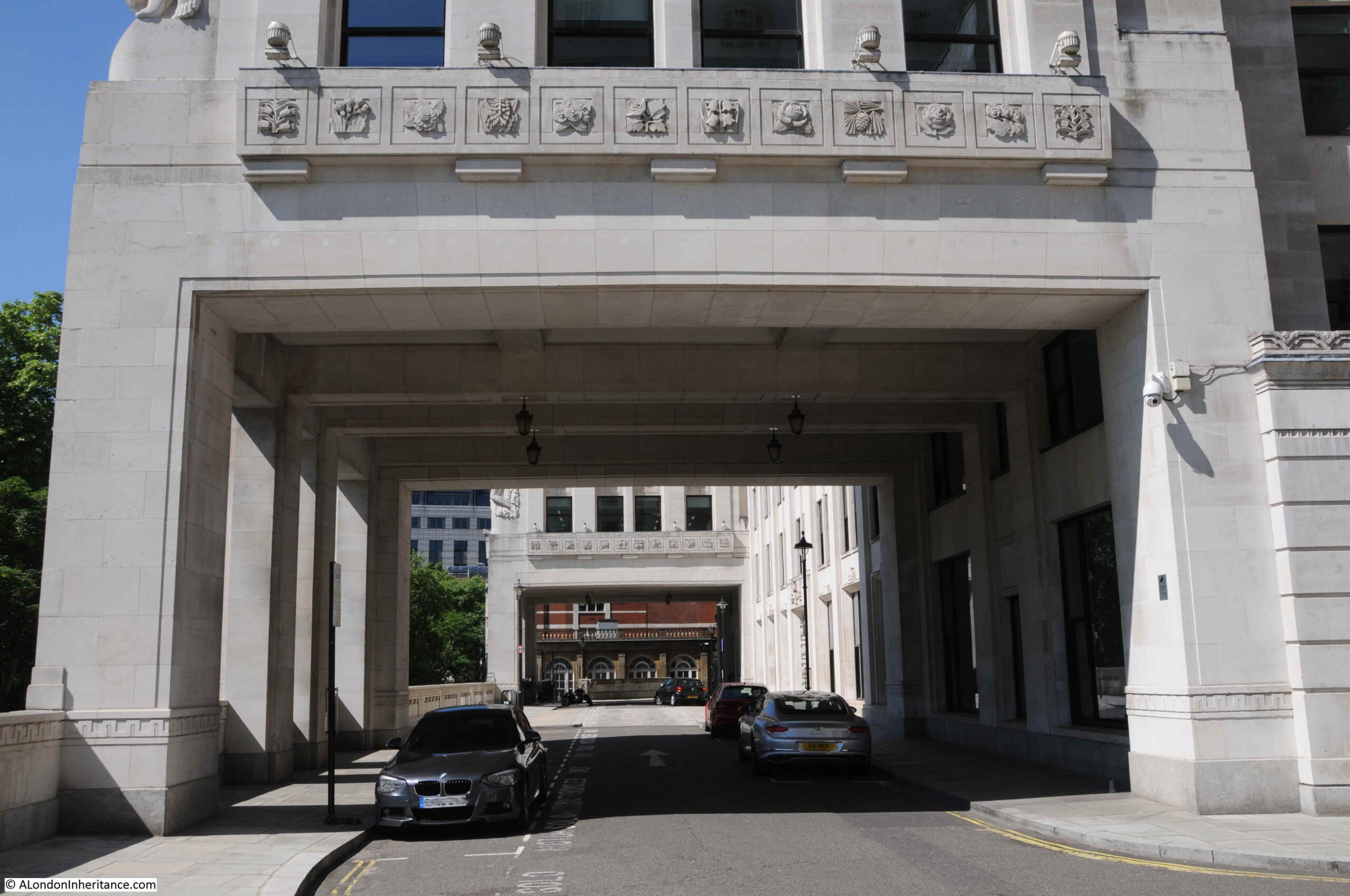
For the past four years, I have written an annual post on the work around Euston to create the extension to the station for HS2, recording the area from before work started to at some point in the future, when the new station will be operational.
One year on, and in 2021, the majority of the buildings in the surrounding streets have now been demolished, and work has extended to the west of Hampstead Road, along with the grounds between Euston Station and Euston Road. Walking the area now provides an indication of just how large an area is being developed for HS2’s London terminus at Euston station.
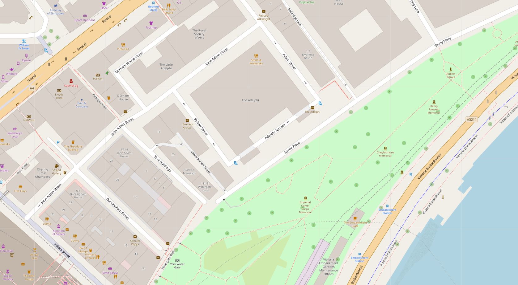
This is the view looking west from point S in the above map, at the south western corner of the station.
The road in the foreground is what was Melton Street, which now provides one of the access routes into the works.
From this point, there are a couple of pedestrian walkways that have been created through the site:
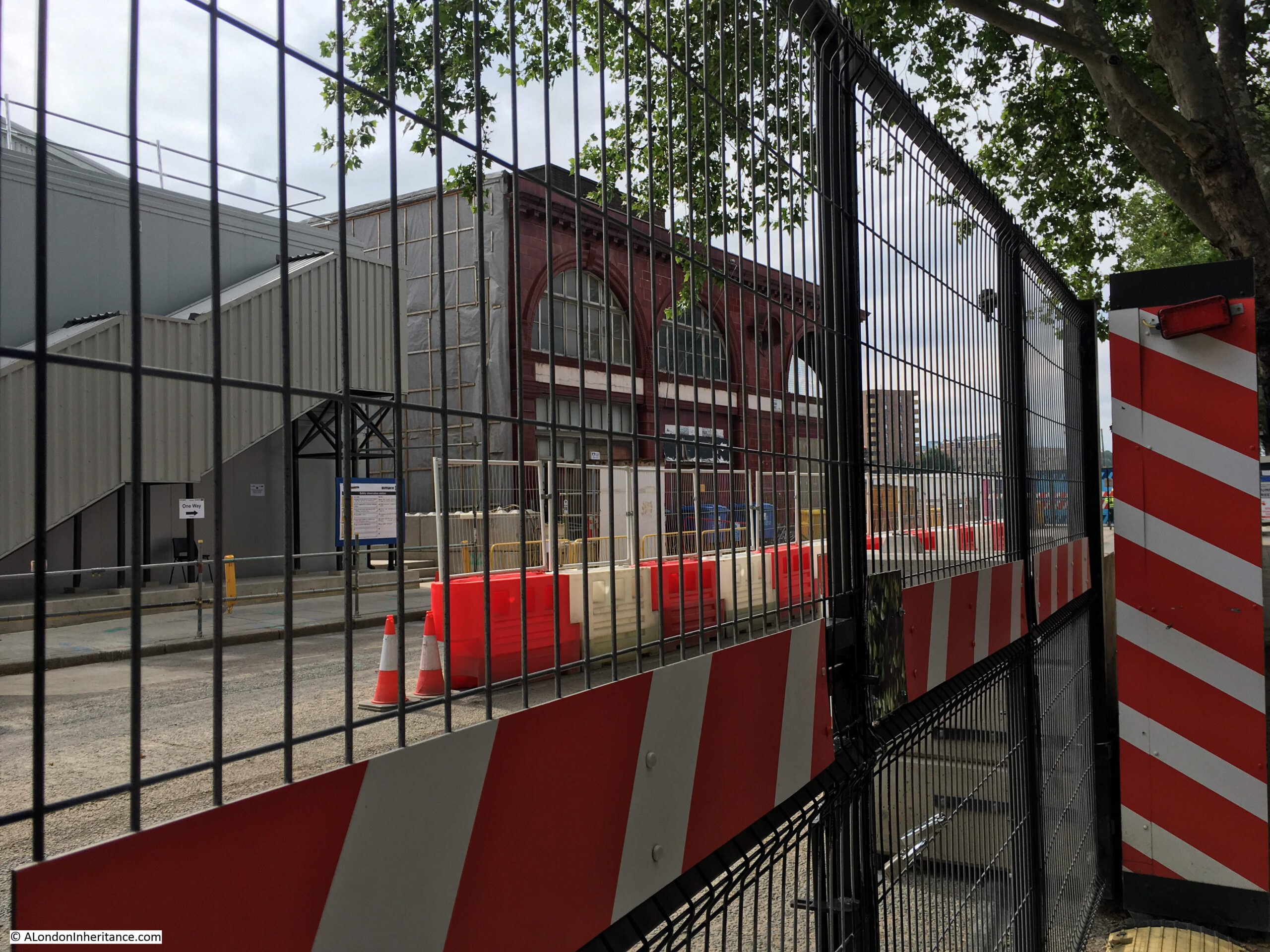
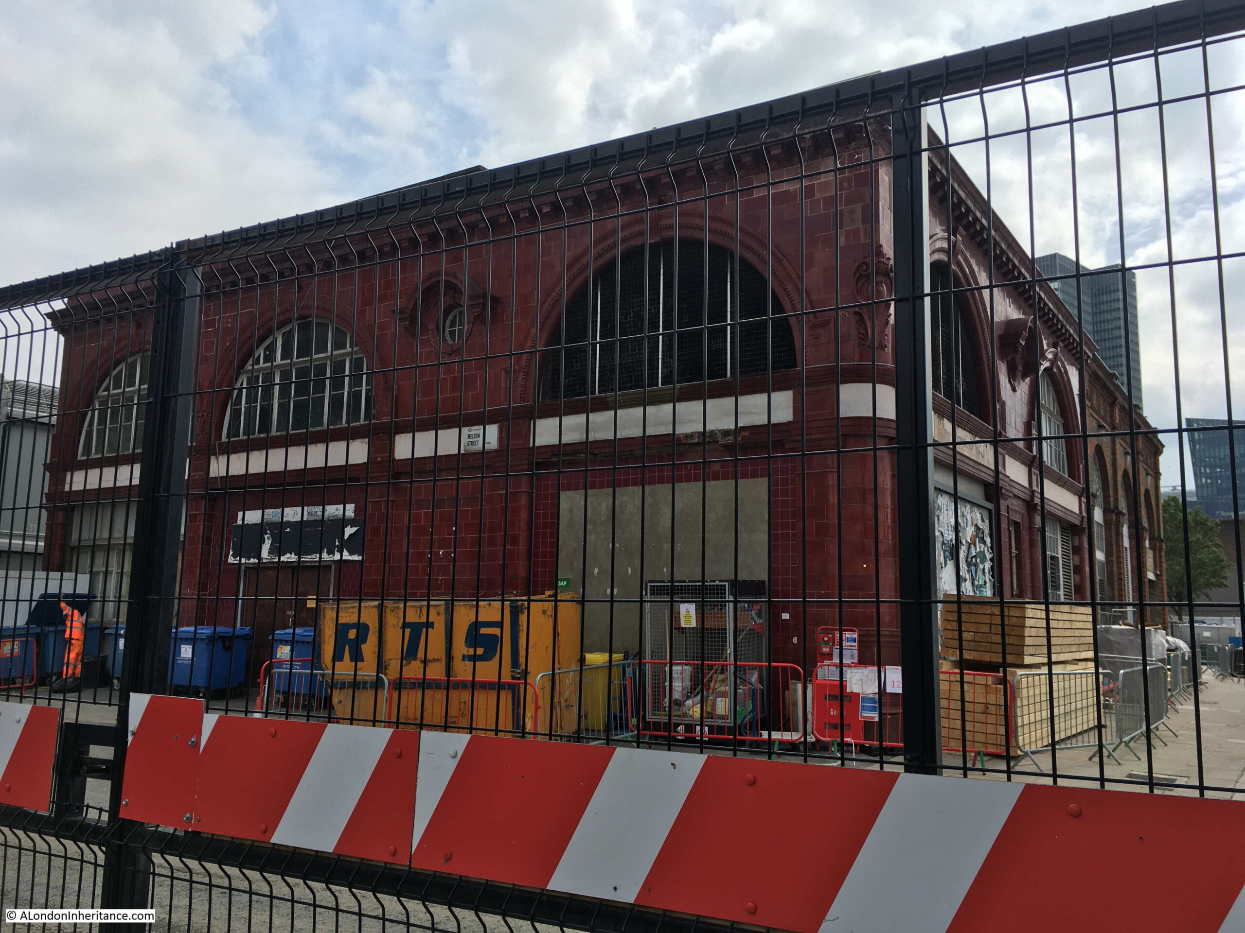
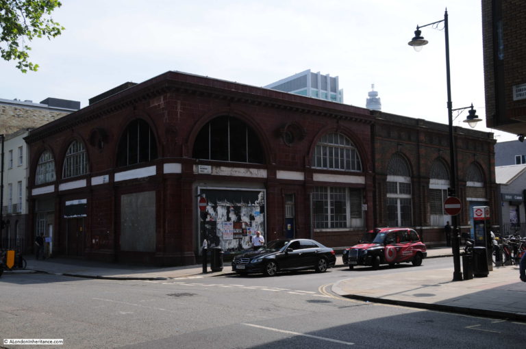
I turned right to head towards Drummond Street. The following photo is looking along the closed Melton Street. The old Euston Underground station of Leslie Green’s distinctive design is the one remaining building on the corner of Melton Street and Drummond Street.
View across Melton Street to the left of the above photo:
Here is the turning which takes you across Melton Street to Drummond Street:
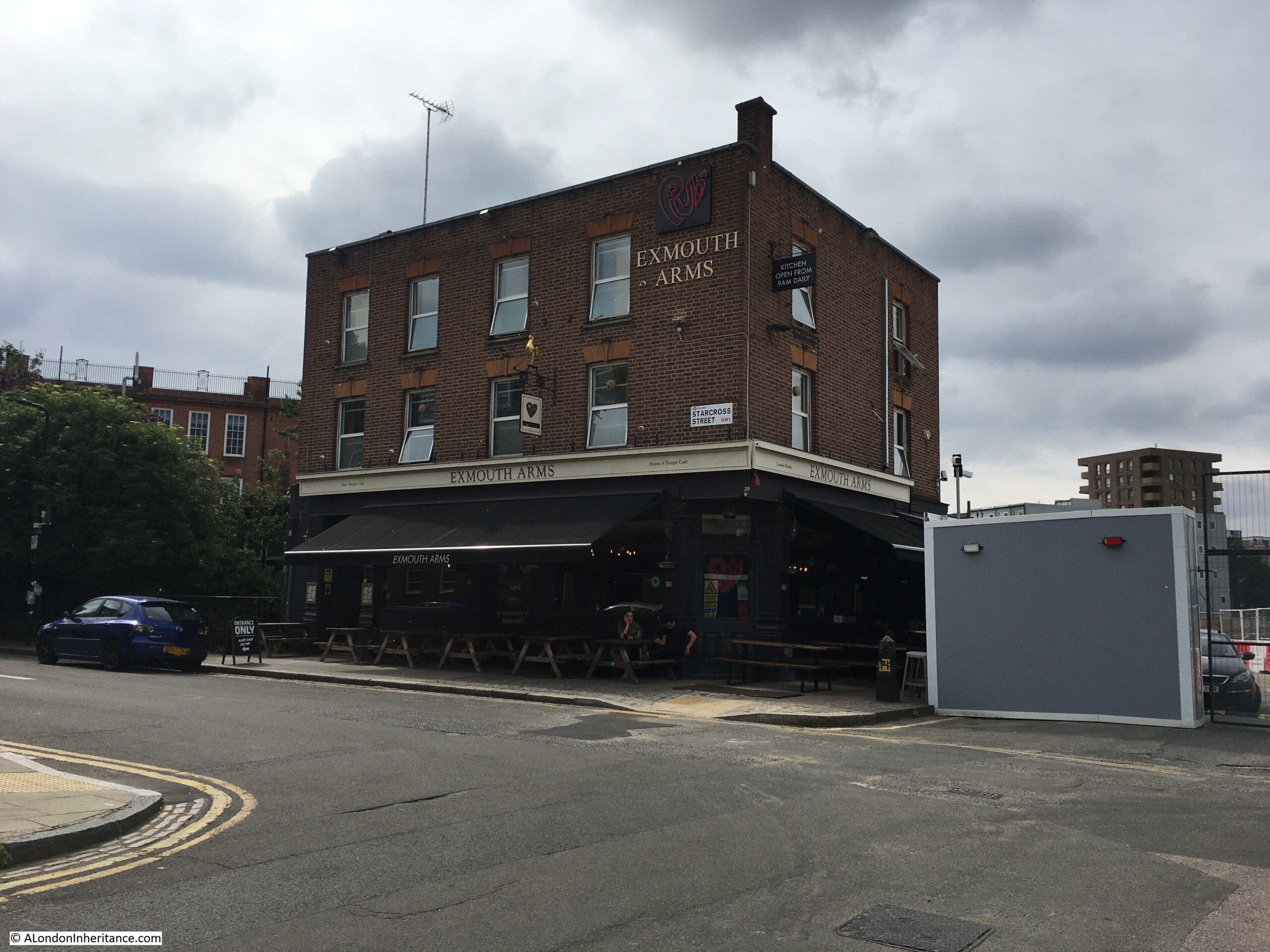
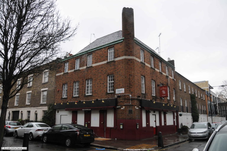
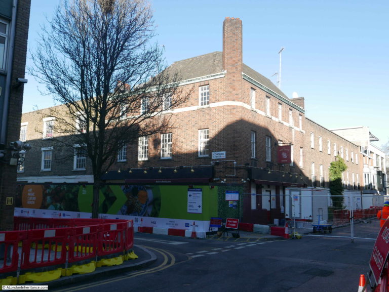
Into Cobourg Street and the Exmouth Arms is still open, on the edge of the construction site.
Another access gate at the end of Cobourg Street:
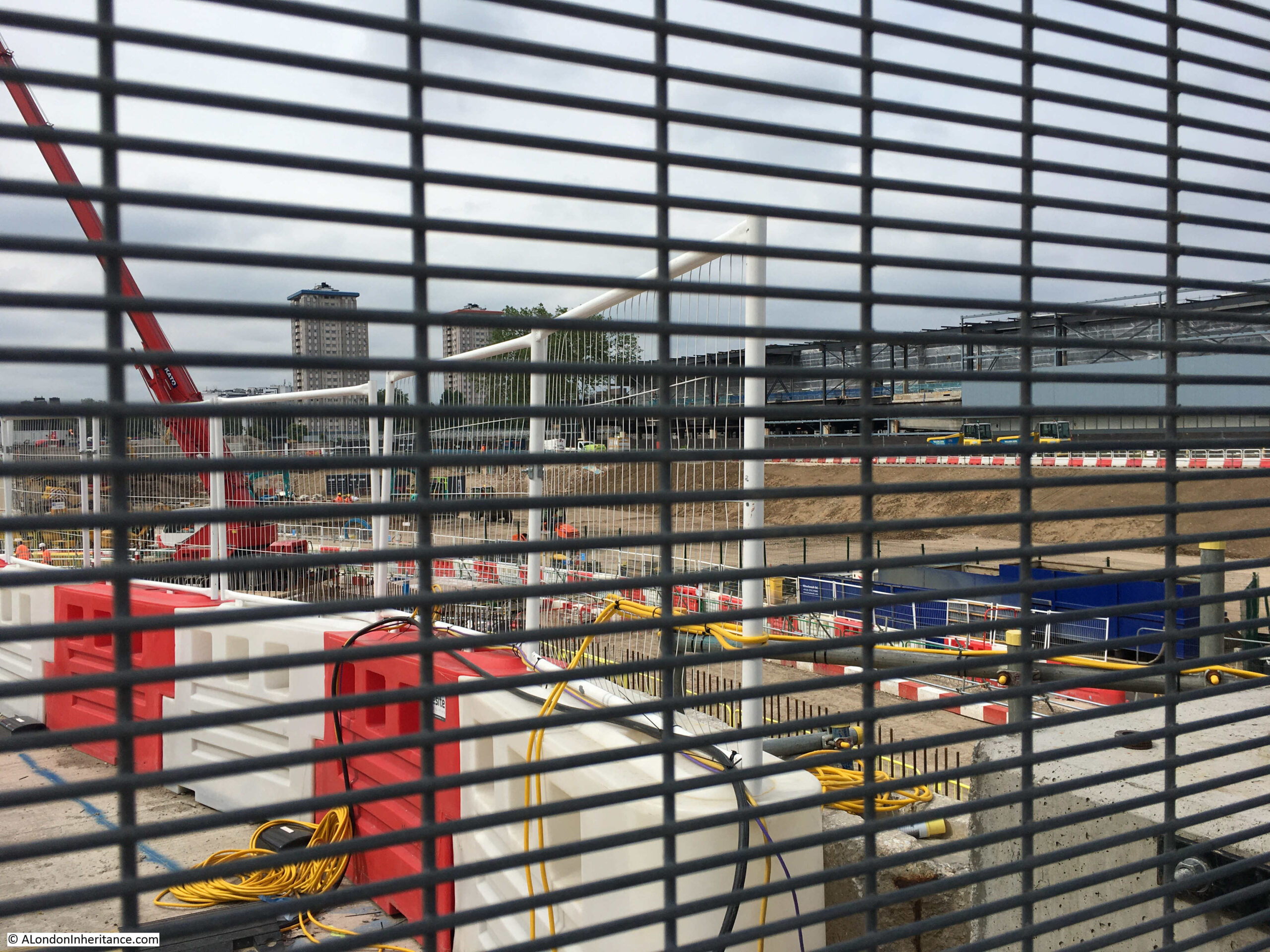
From where we can look out over what was St James Gardens, which is now a large hole:
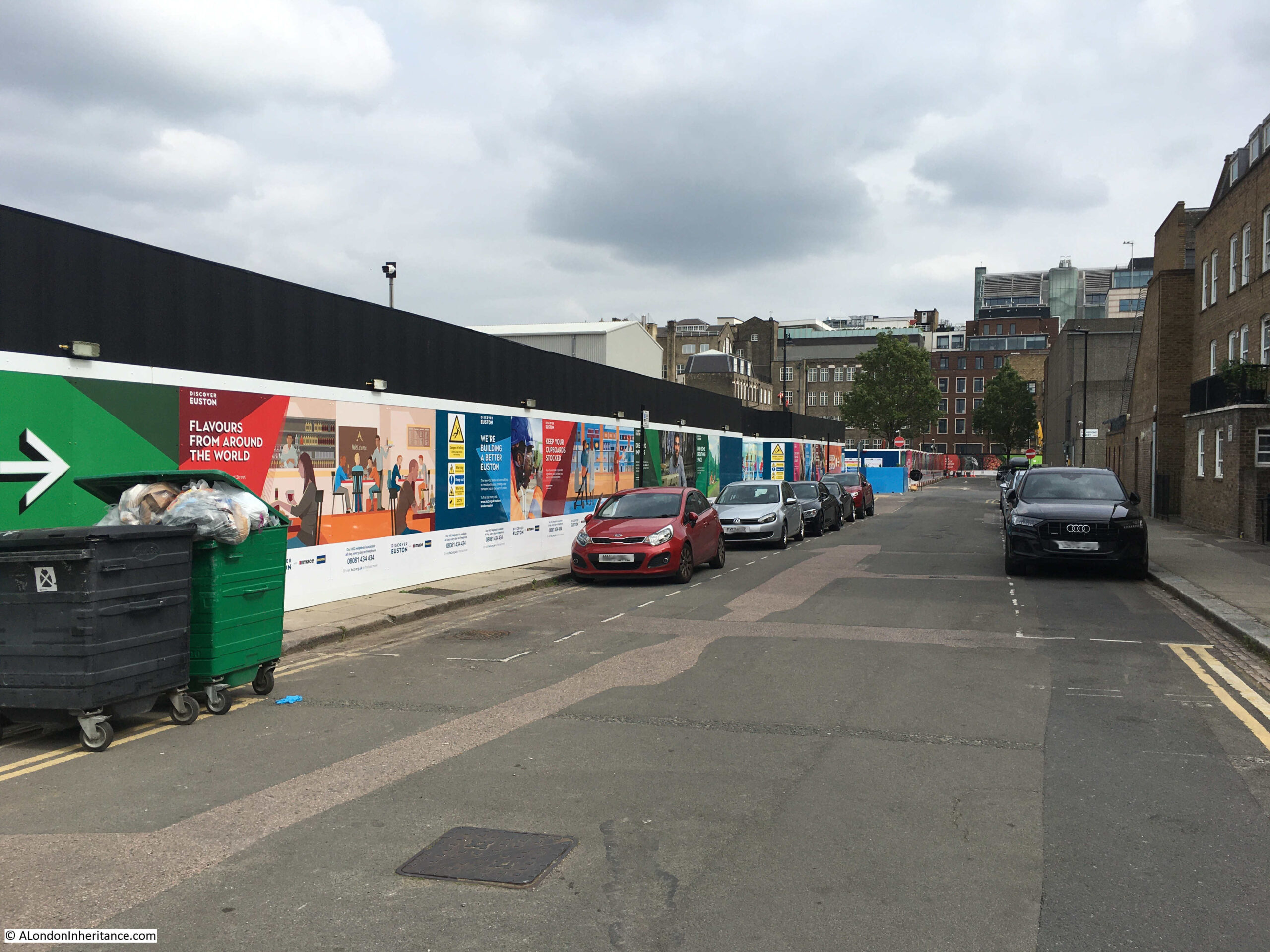
View back along Cobourg Street showing on the left the large and continuous hoardings that have been erected along the edge of the construction site:
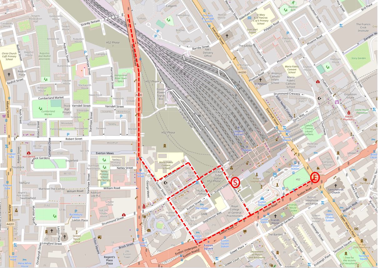
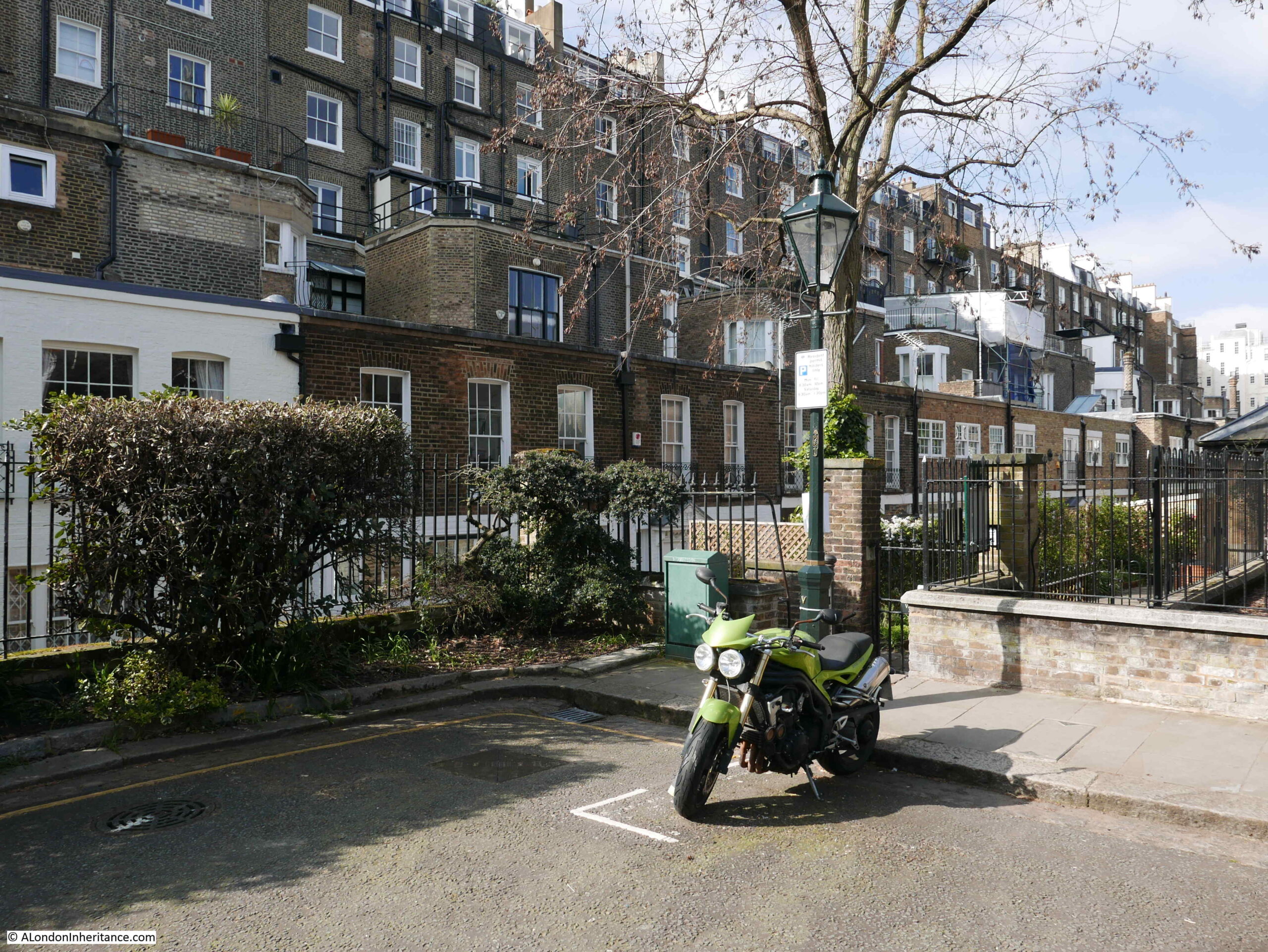
I cut through to the Hampstead Road and started walking north. This is the junction of Cardington Street with Hampstead Road:
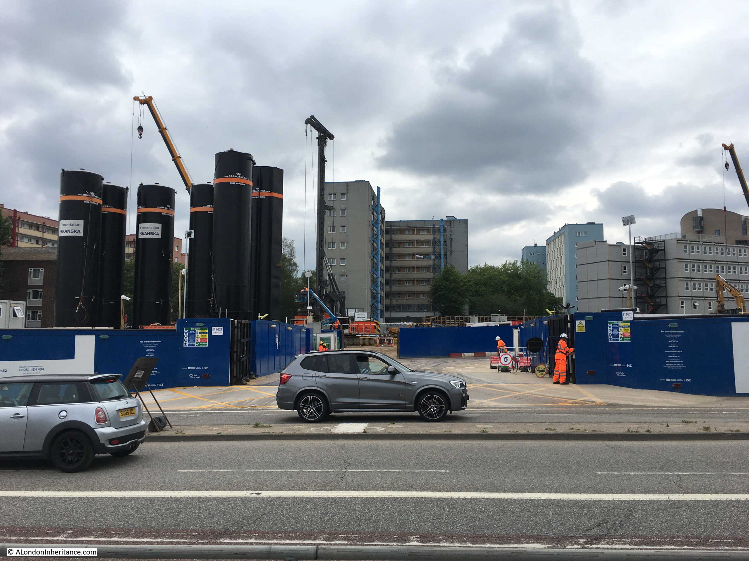
Walking further north along Hampstead Road and the area to the left of the street, south of the rail lines out of Euston are now another major construction site:
Work had not started here back in February 2020, and now demonstrates how large an area is being covered by the work to create the new Euston Station and HS2. The entrance to the new work area:
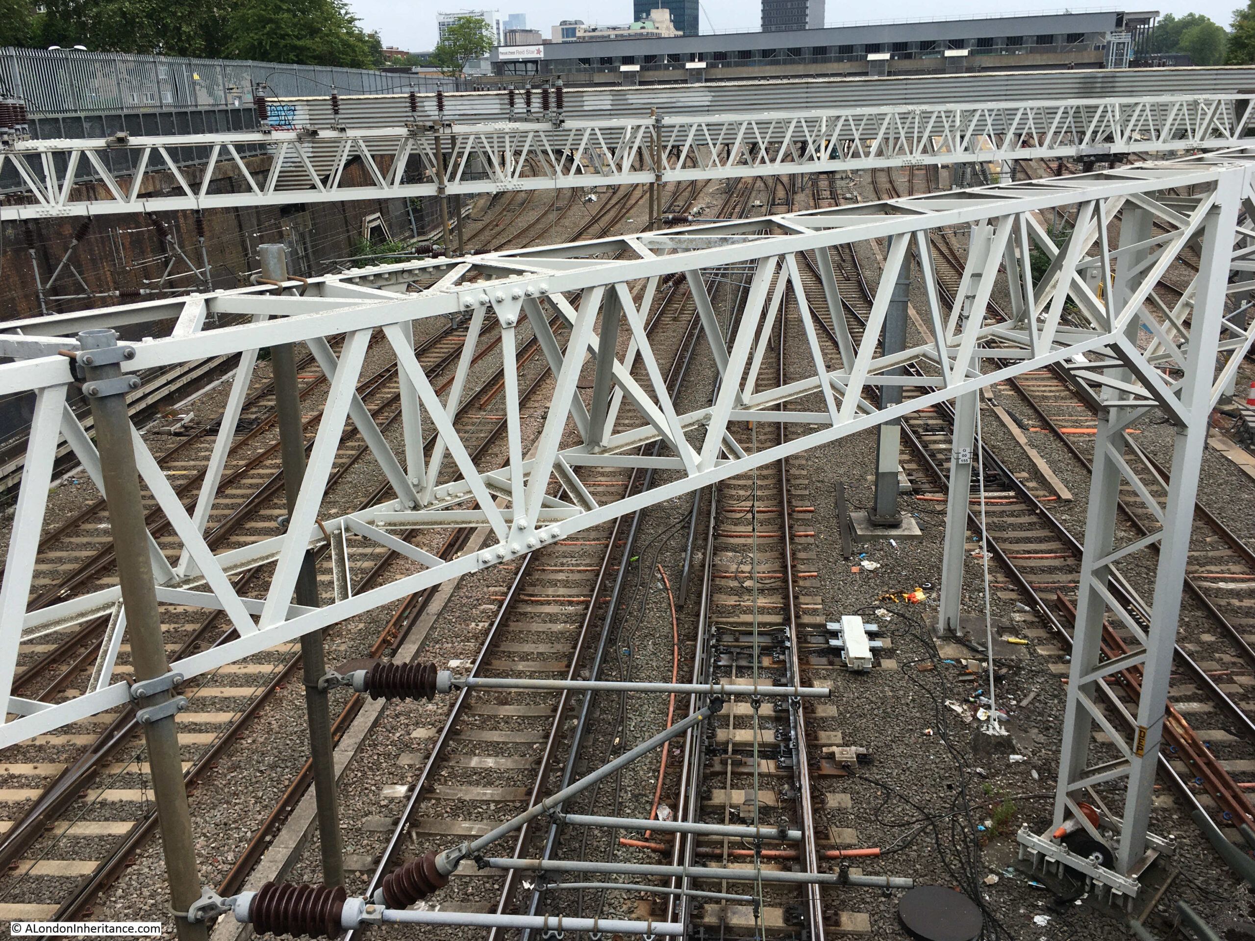
Obligatory camera over the wall shot to see the existing tracks running into Euston:
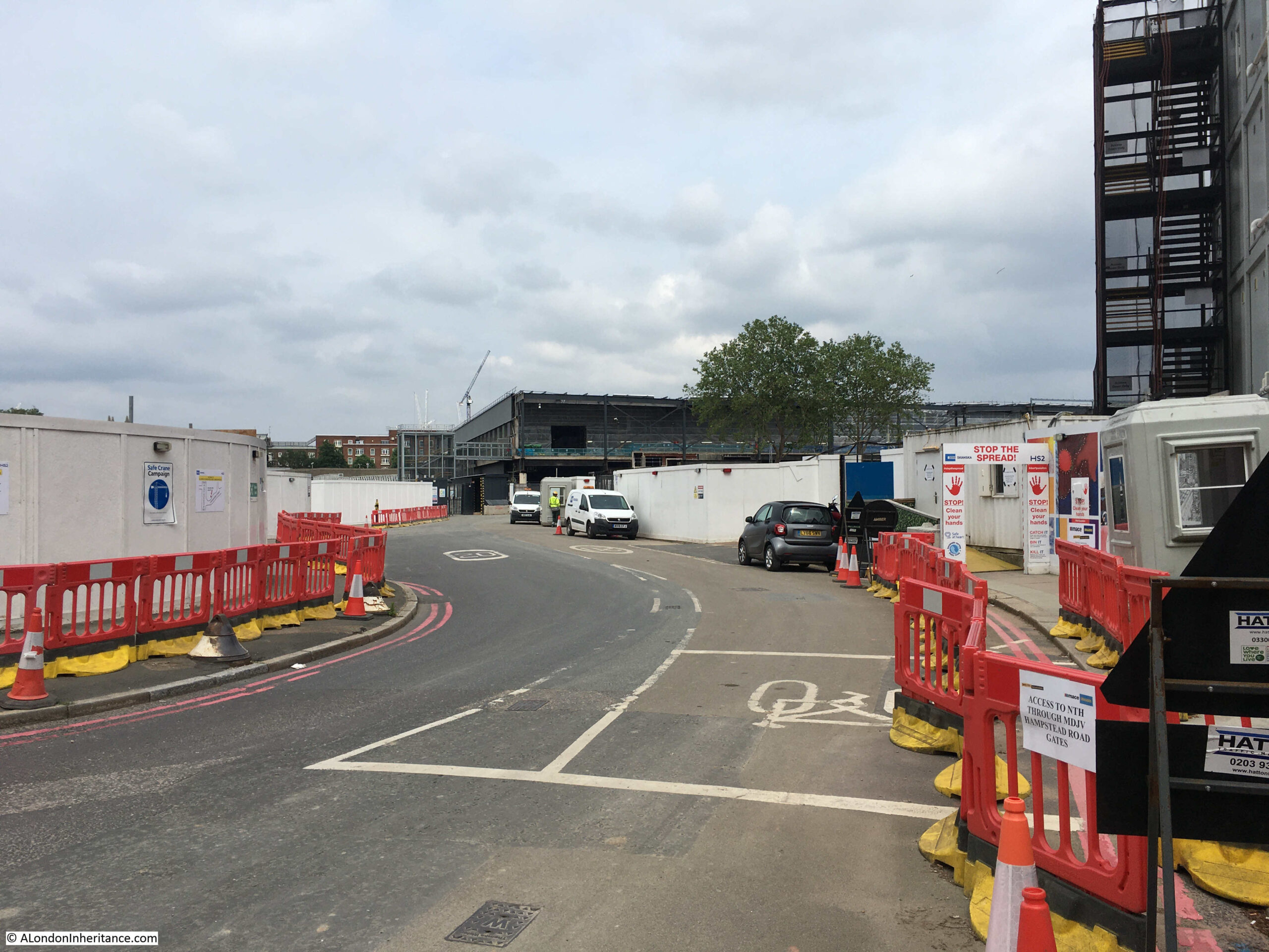
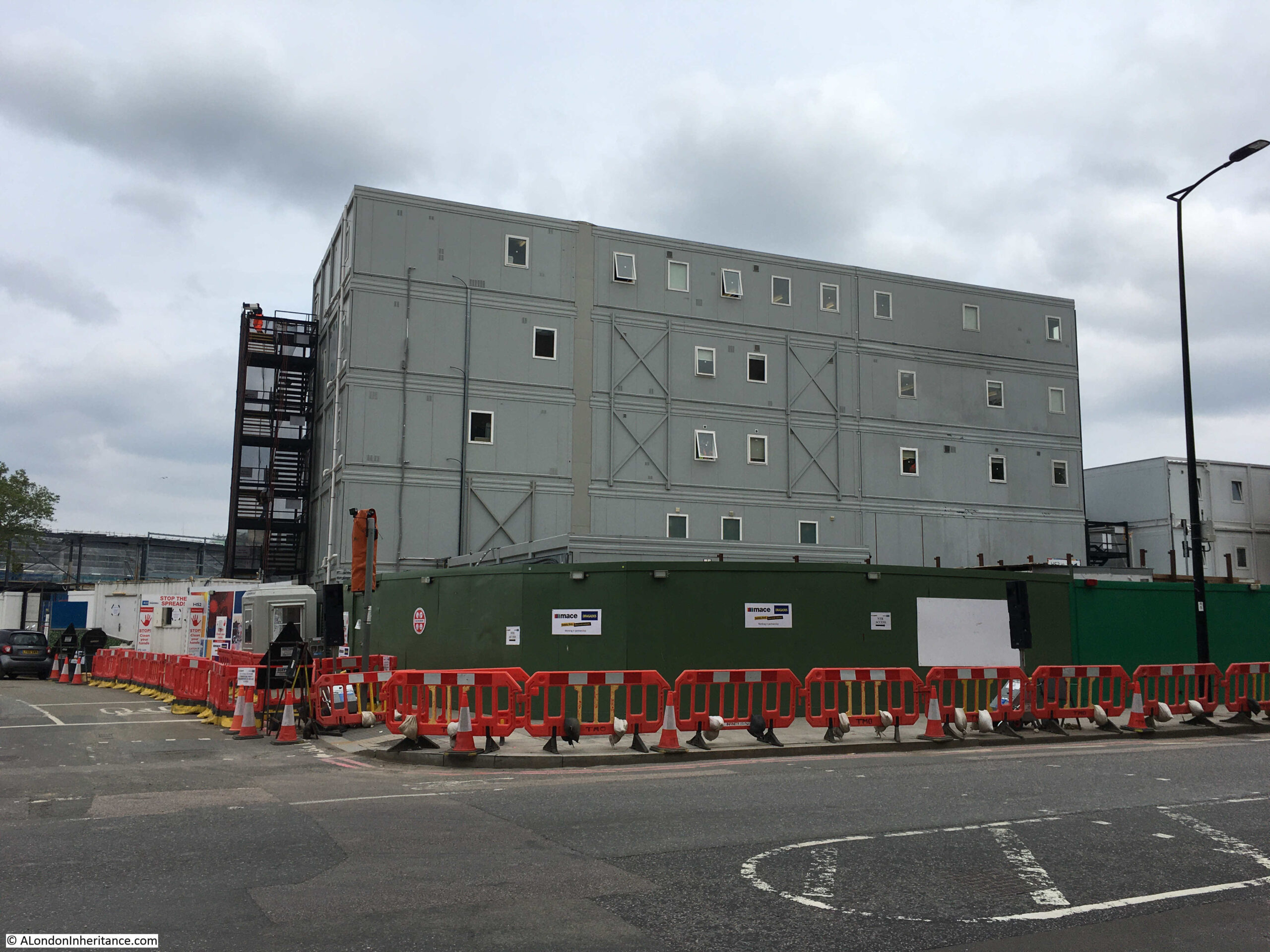
Walking back south along Hampstead Road, and it is not just the geographic size of the construction work, but the related infrastructure, with a number of large, temporary buildings constructed for those working on the site:
Back into Drummond Street and this is looking from the part of the street that has not been touched, through to the demolished section which now forms the pedestrian walking route to Euston station:
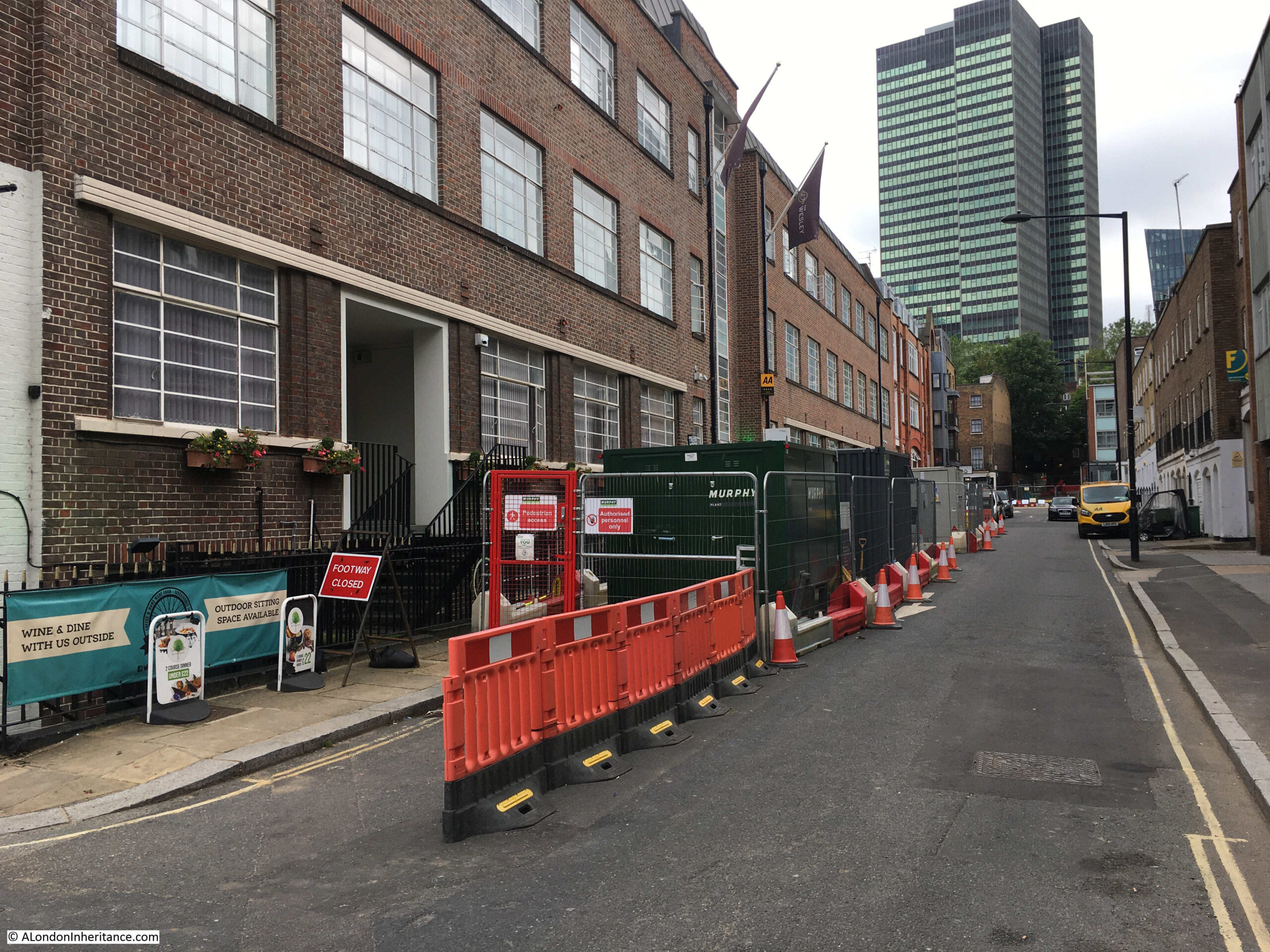
Although the western section of many of the surrounding streets are not being demolished, there are several works taking place along their length:
The following photo is from the junction of Euiston Street (which once went straght on) and Cobourg Street on the left:
The above photo was the location of the Bree Louise pub, here photographed just after the pub closed in 2018:
With hoardings in place in 2019:
Work blocking off Regnart Buildings:
View along Cobourg Street from the end of Euston Street:
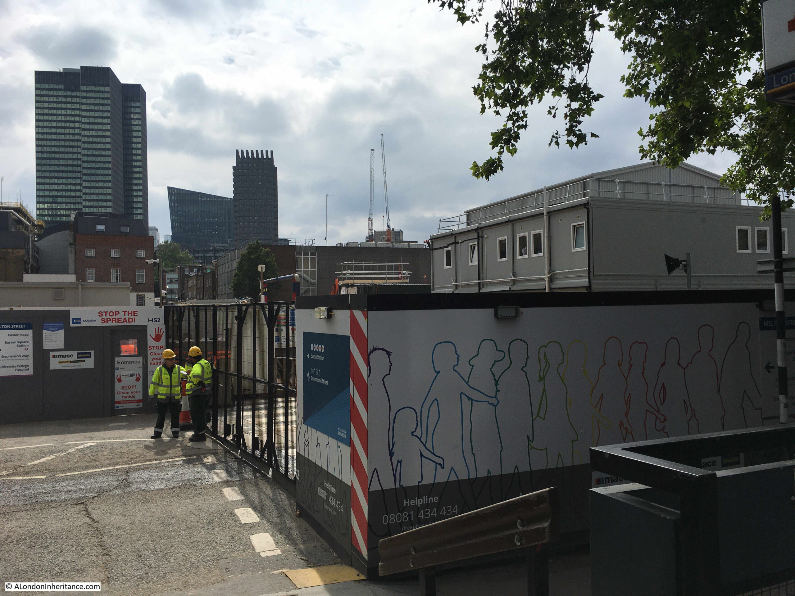
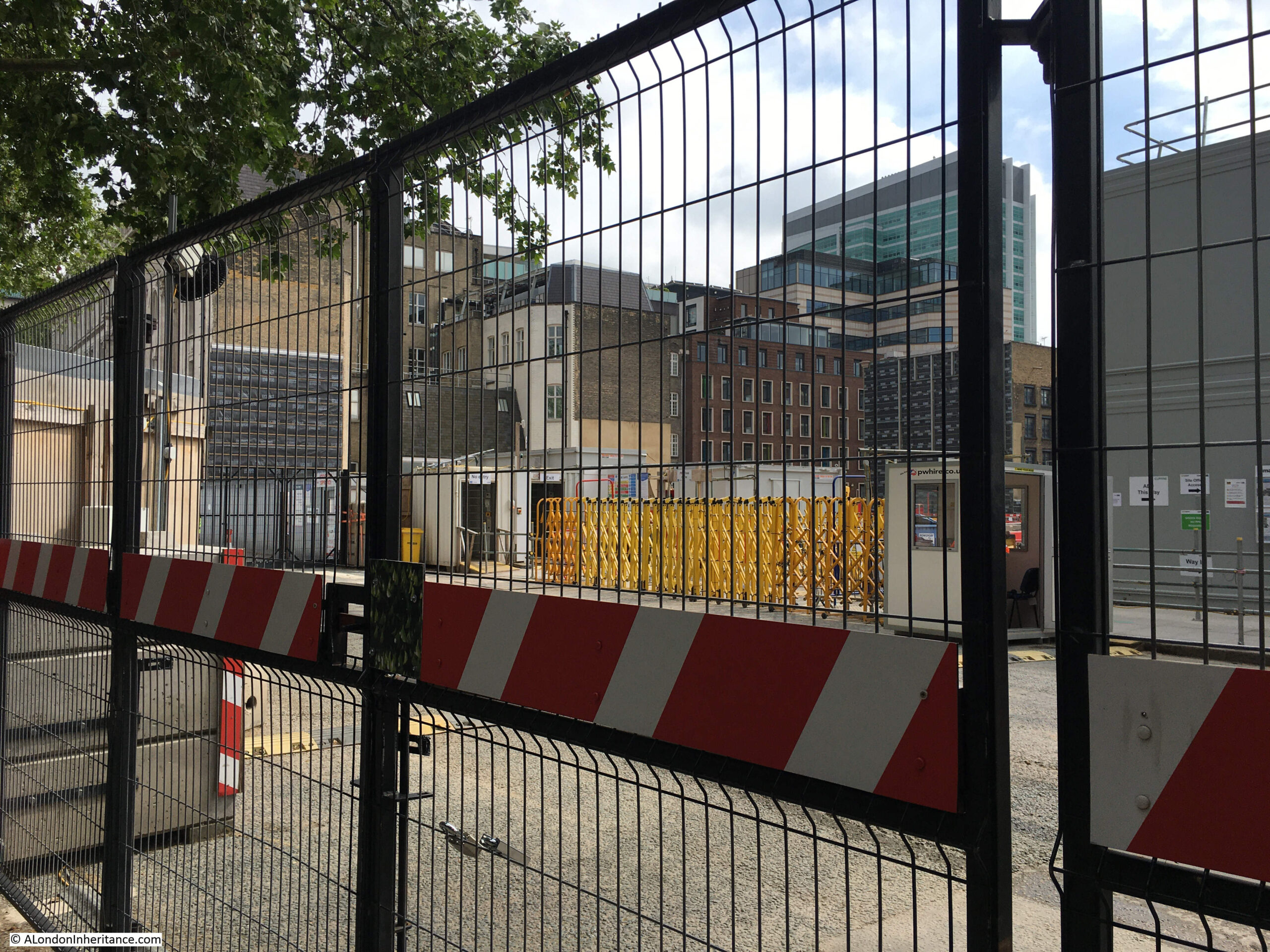
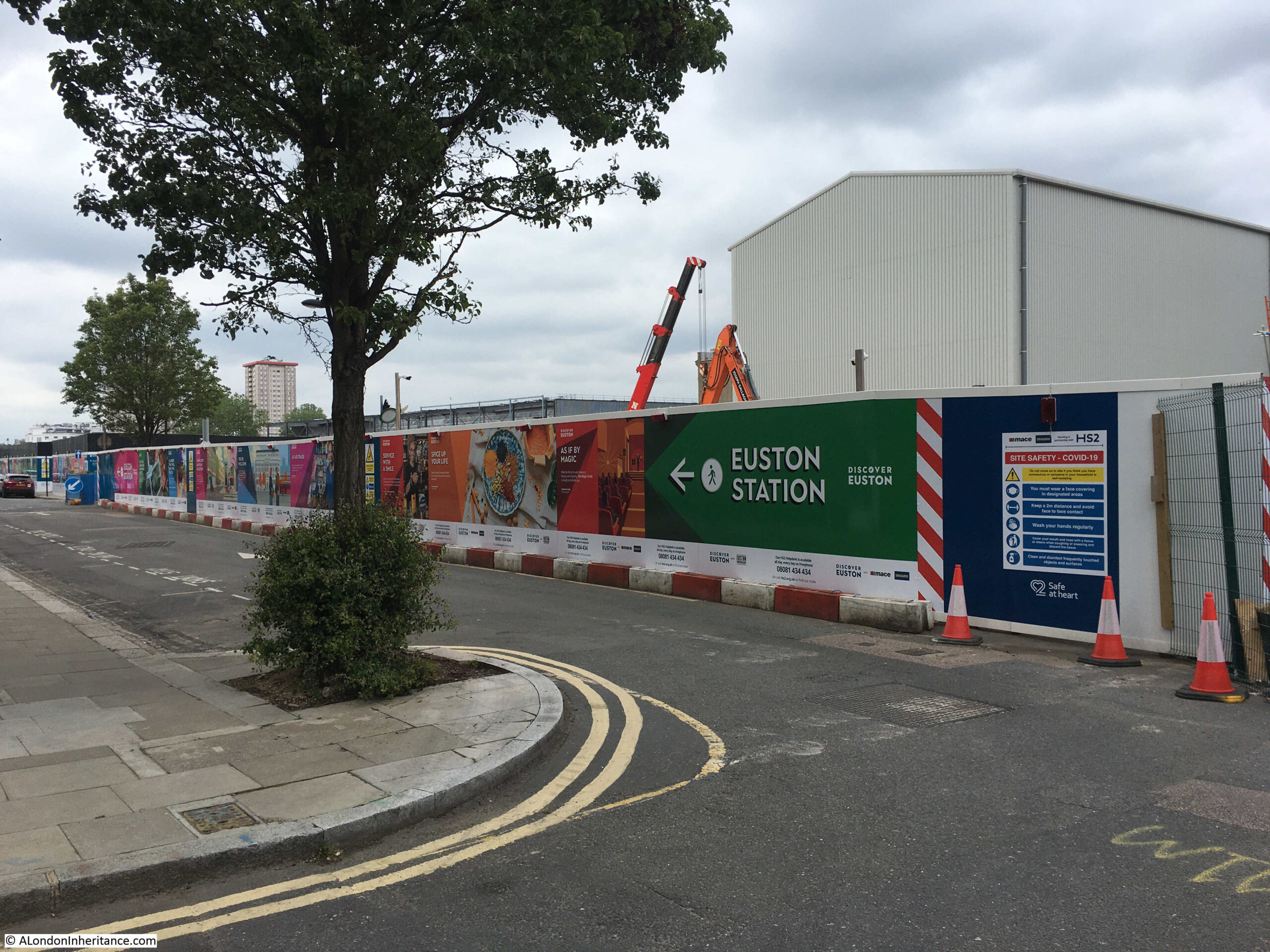
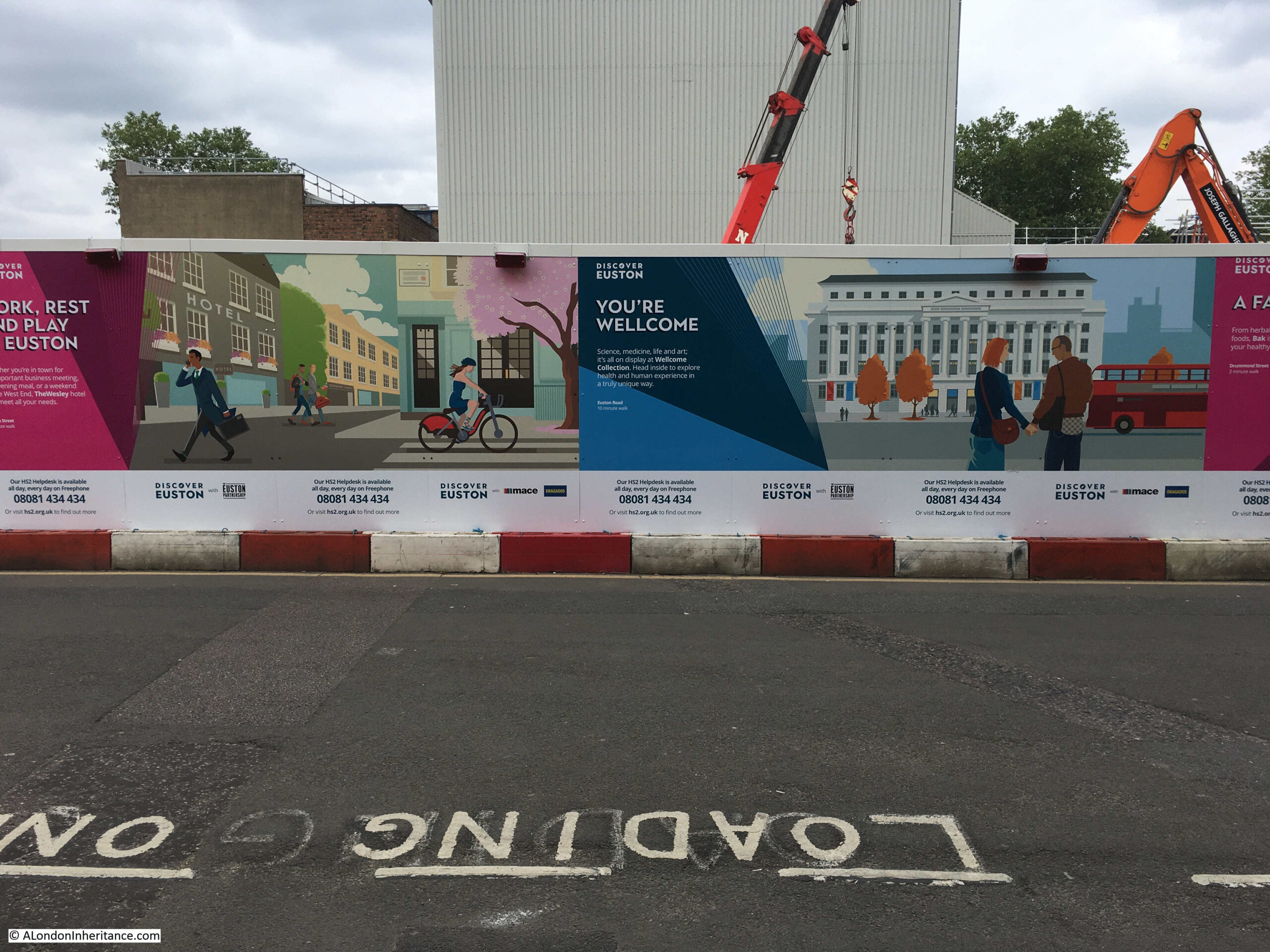
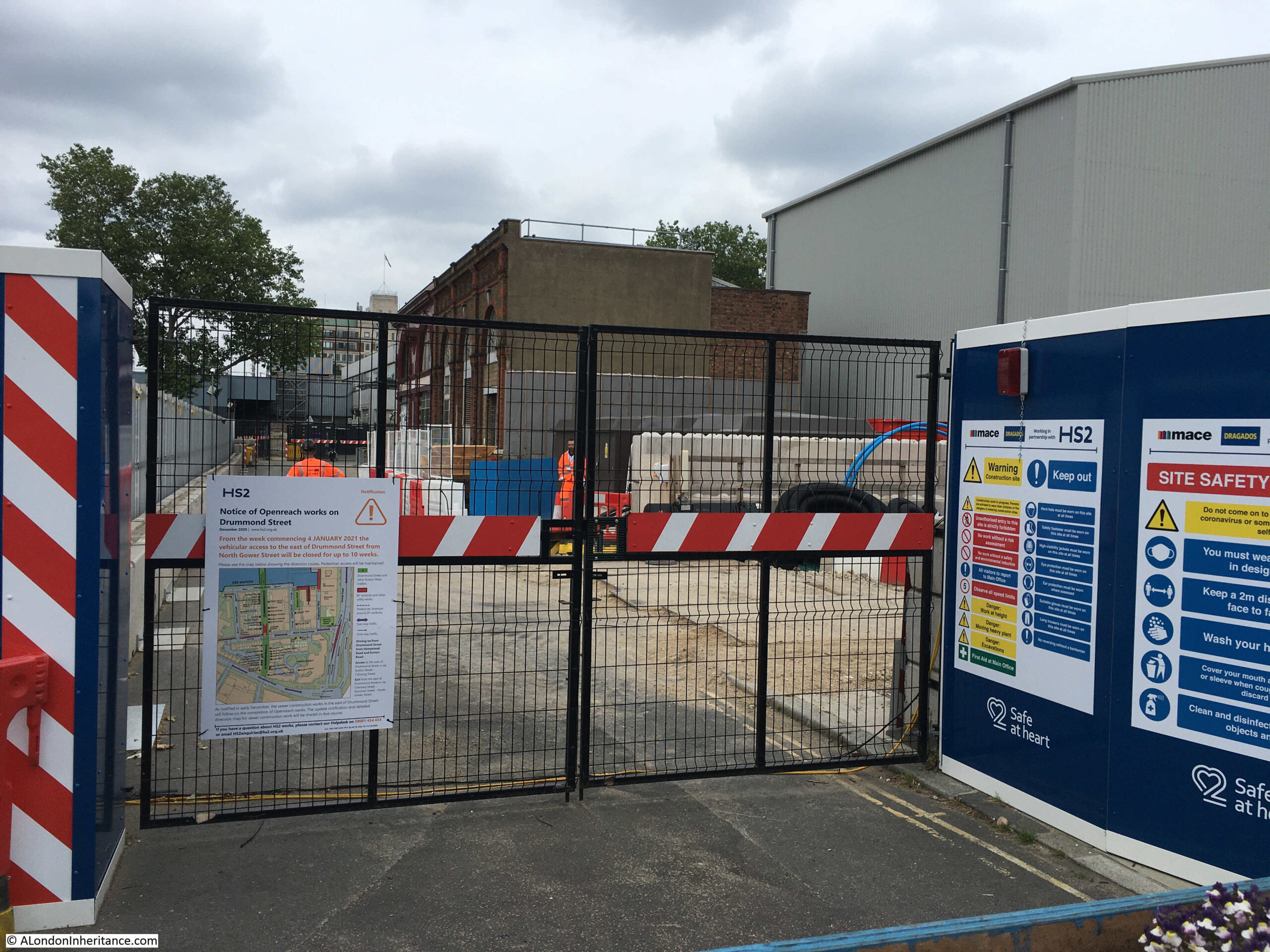
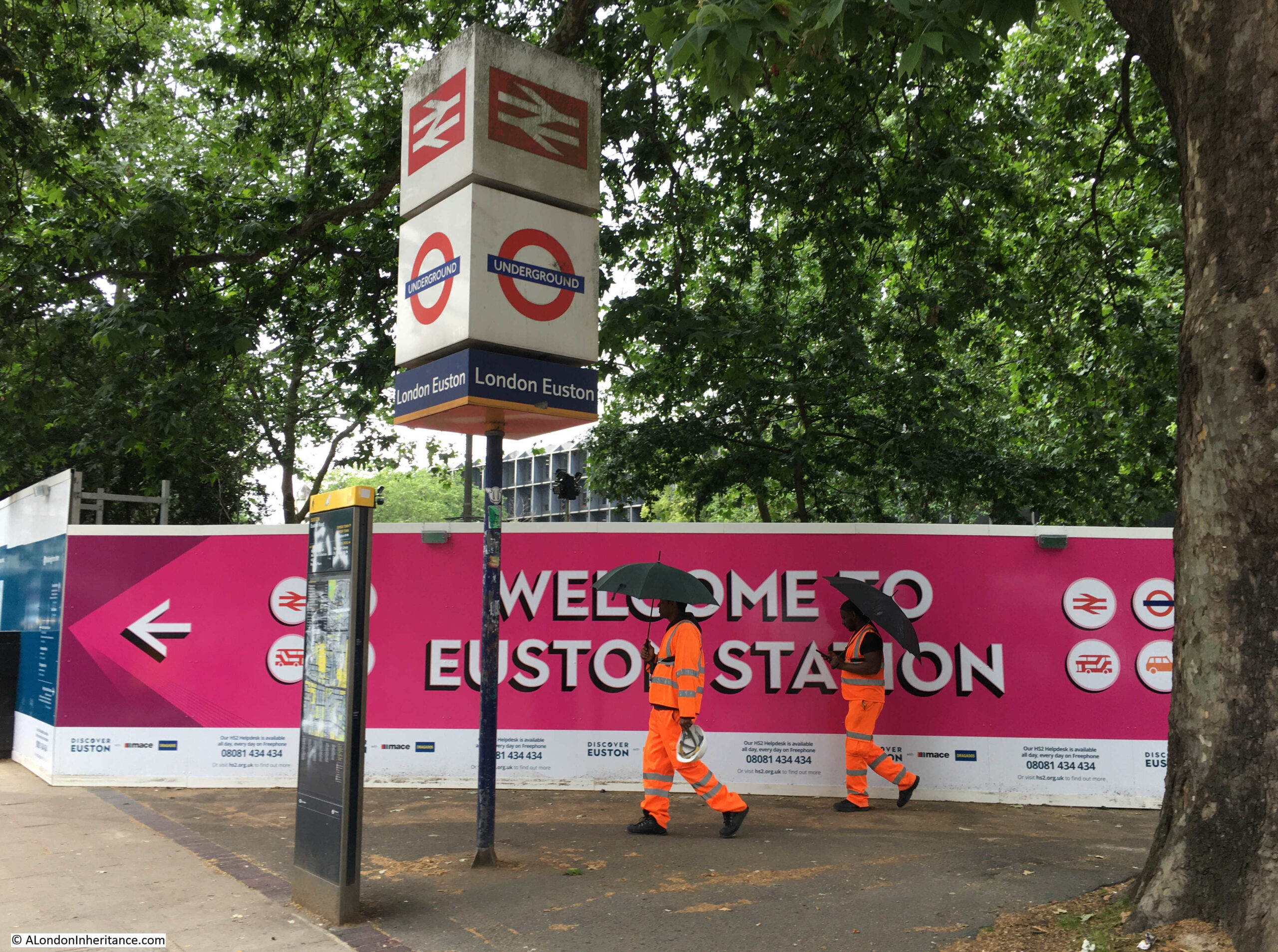
The whole construction site is very secure, with very few points to look in and see the work underway. Tall hoardings with information about local businesses and institutes, what there is to find in the area, the history of Euston station, the future HS2 etc. line the entire site, with well protected work access points the only means of access:
Work access point at the entrance to what was the eastern section of Drummond Street:
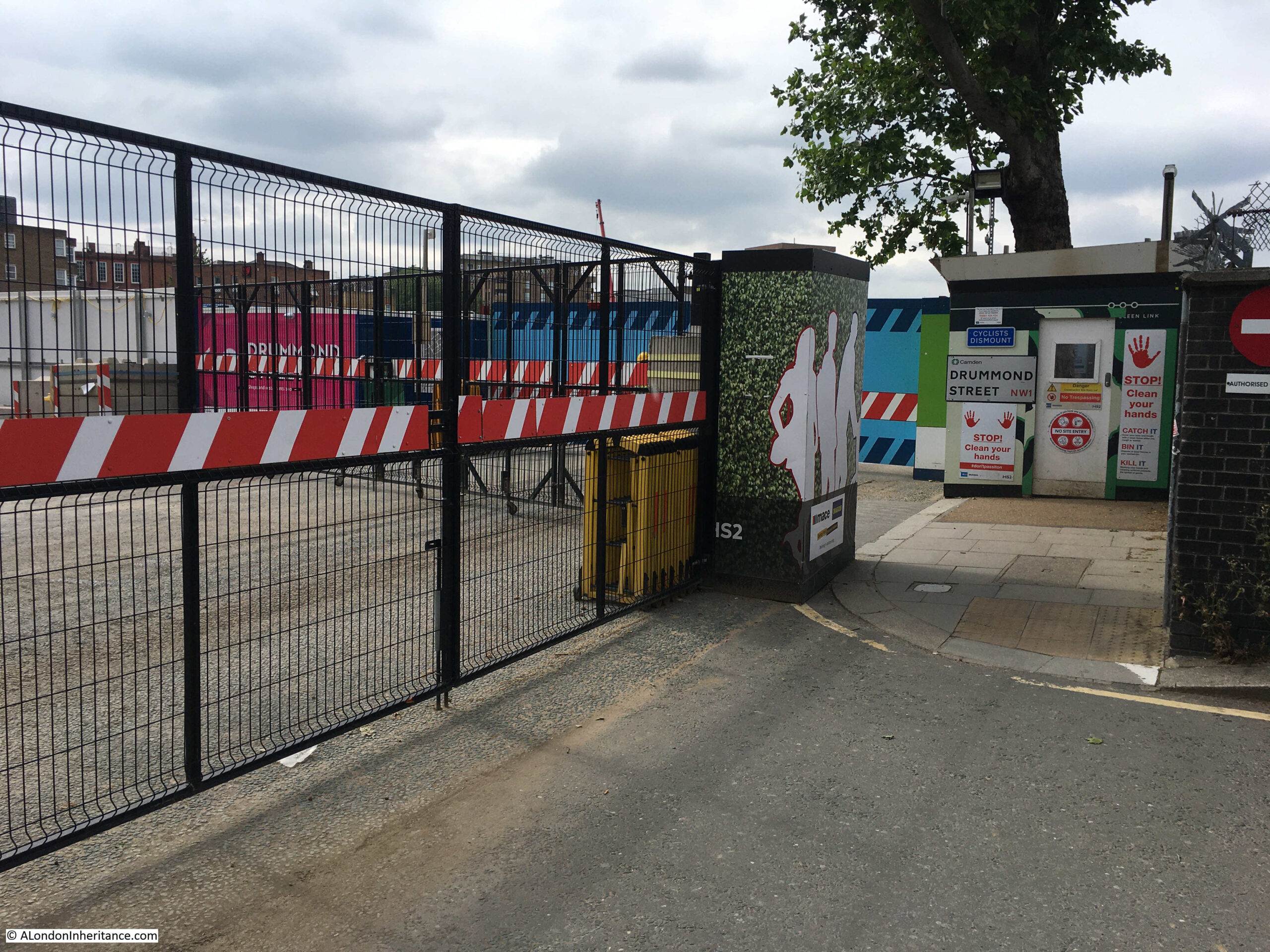
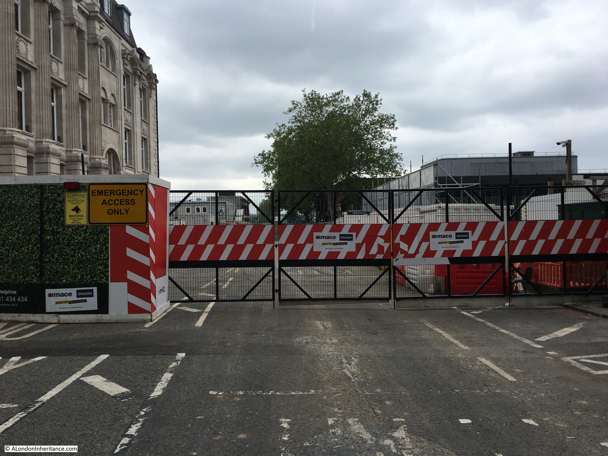
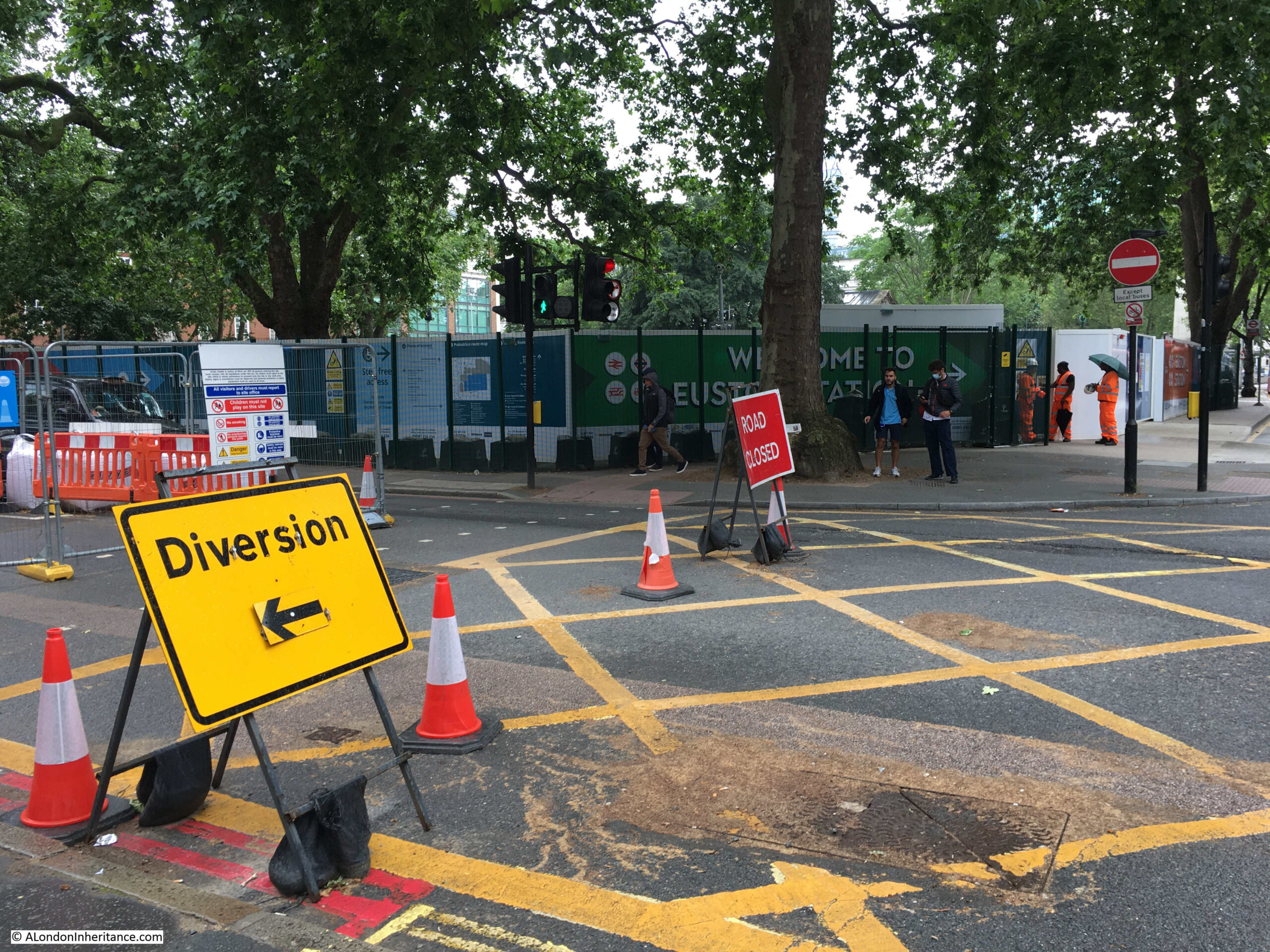
Walking back to Euston Road, and this is the Melton Street access point:
There is now only a short length of Melton Street in use, providing access for taxis and drop offs at the station to the immediate right. The traffic lights providing access to Euston Road only seem to change to green for a couple of vehicles, resulting in a number of rather irate drivers.
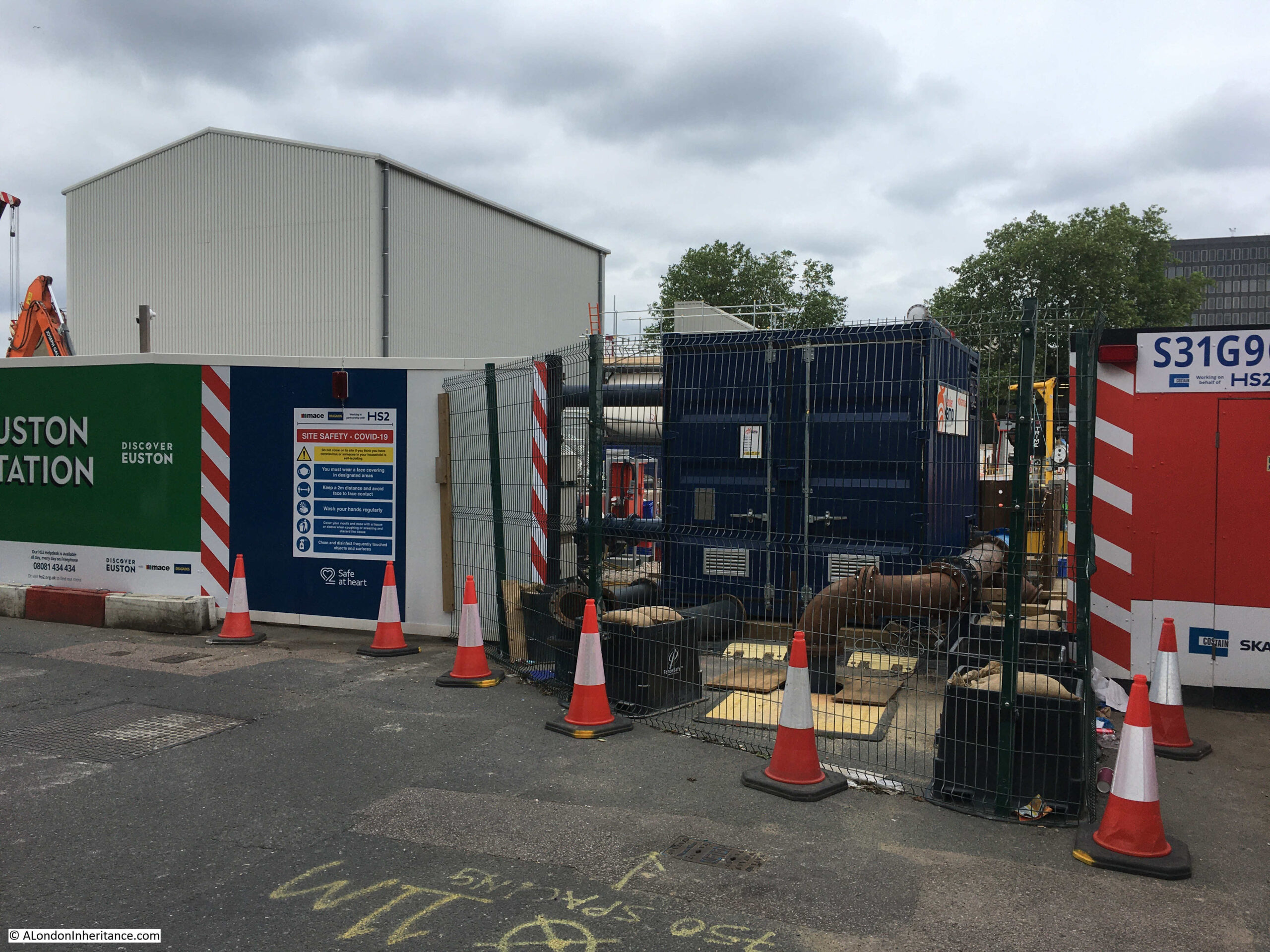
Further along Euston Road, and this view is looking across the bus access road to the station, to what was green space in front of the station:
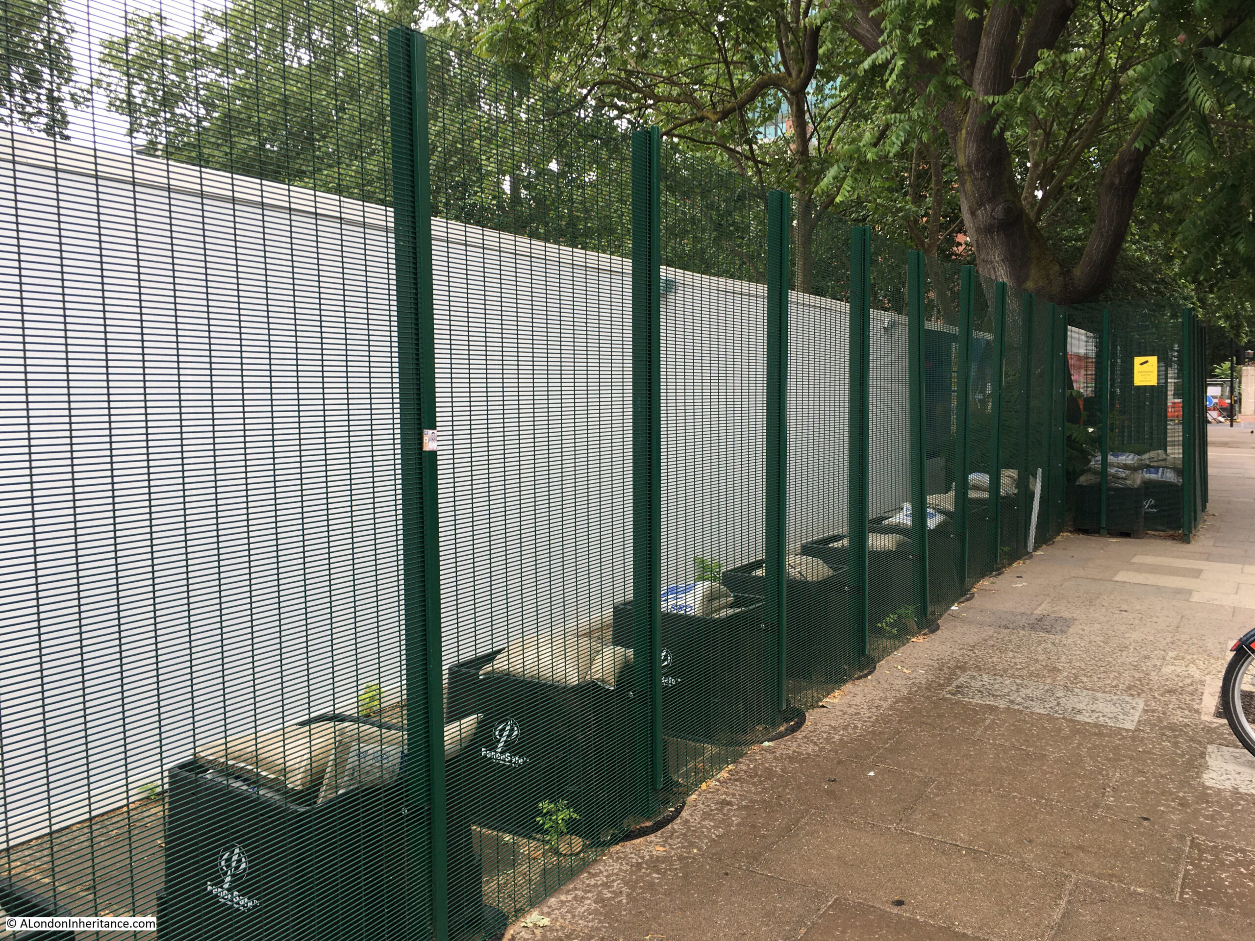
This green space is where demonstrators occupied the trees and dug tunnels a few months ago. Fencing around the site now seems to resemble some form of high secure establishment rather than a constructiion site.
Two layers of fencing, with an outer green mesh metal fence, and inner hoardings:
Indeed the whole Euston Station and HS2 construction site is the most secure of this type of construction site that I have seen. As well as the metal fencing and continuous hoardings through the site, there are plenty of orange high-vis security staff guarding entrances and walking the boundaries.
North east corner of the green space in front of the station. Closed Euston Square leading up to Euston Road on the left resulting in buses coming out of the station having to divert around Grafton Place adding to the congestion in the area:
The corner of Euston Square and Euston Road:
From the walkways and streets available to the public, there is really not much to see. The construction phase has reached what appears to be the end of demolition, there are plenty of big holes in the ground and temporary structures, but nothing yet of the new station.
According to the HS2 web site, “Phase One will open between 2029 and 2033”, so a minimum of eight more annual posts walking around Euston Station and HS2, more probably around twelve. By 2033 this area will look very different.
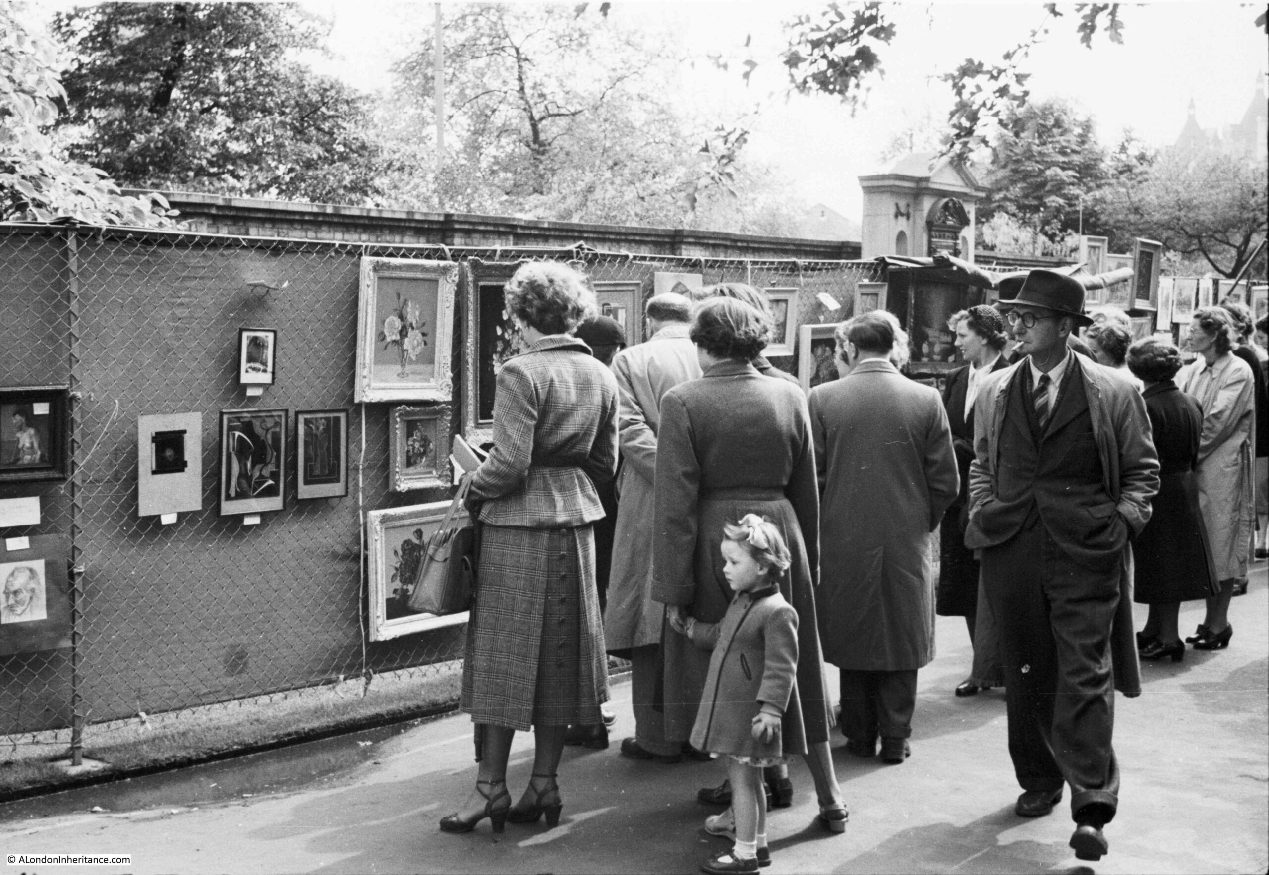
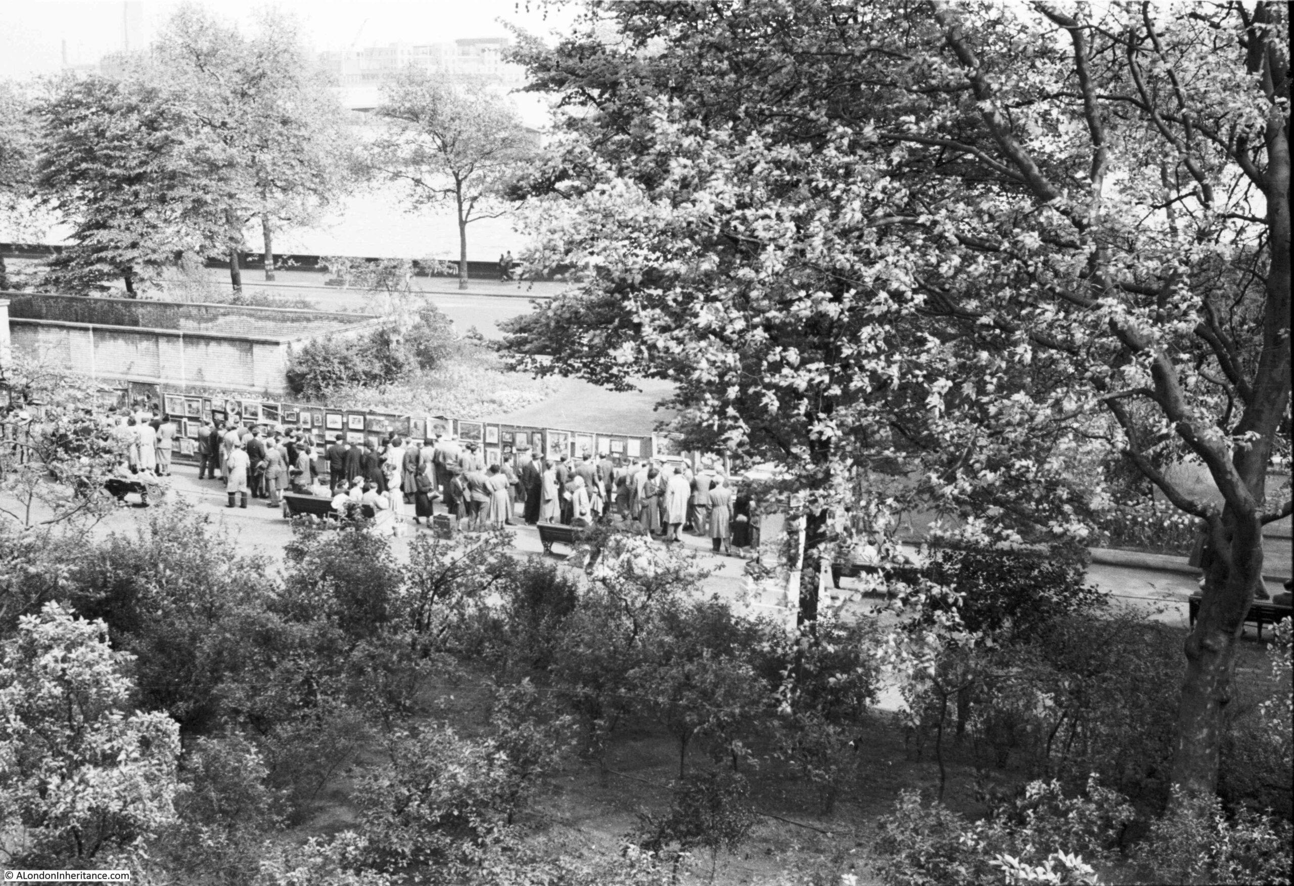
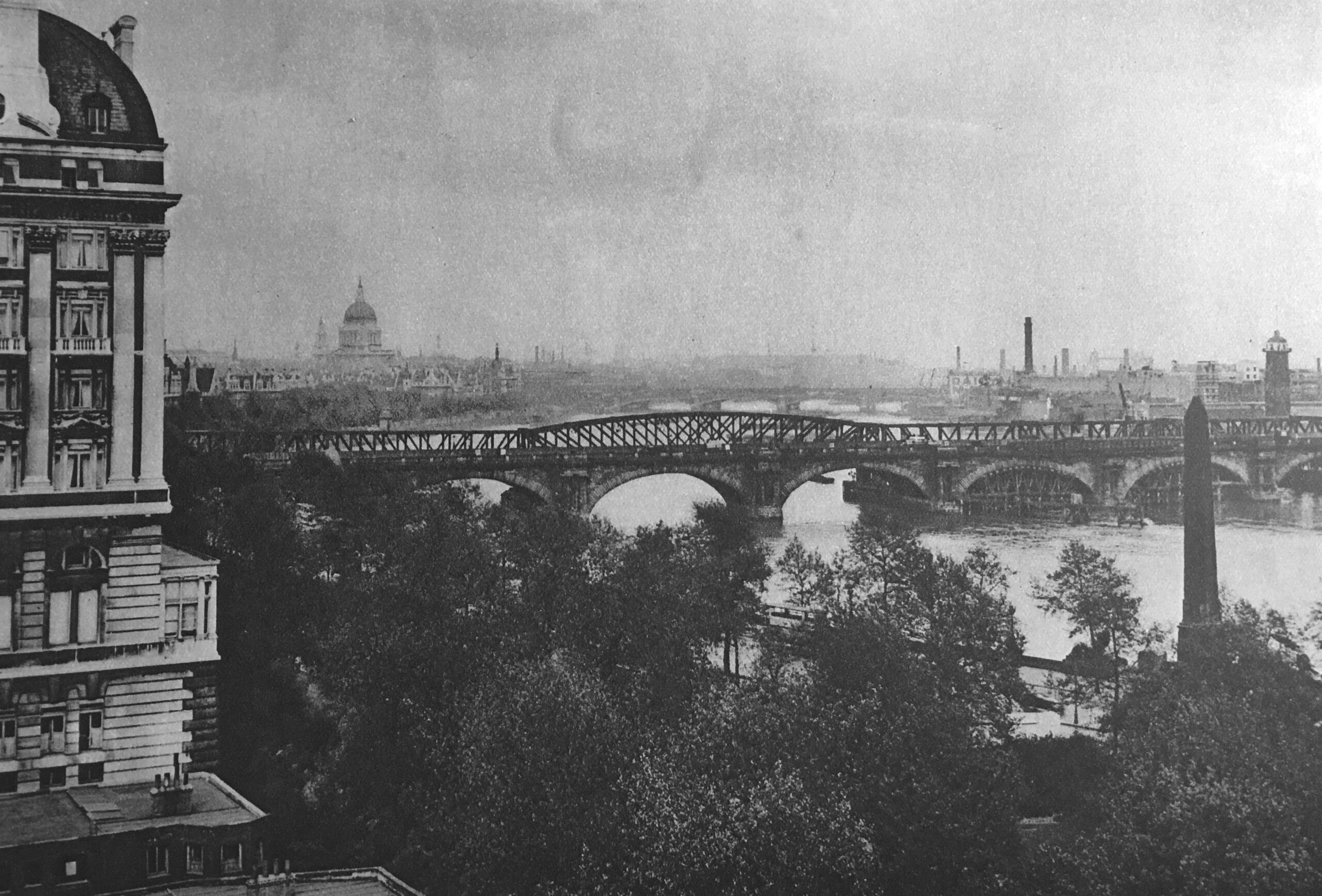
The Victoria Embankment Gardens has often been the location for an open air art exhibition, and a couple of the photos in my father’s collection show the 1952 exhibition:
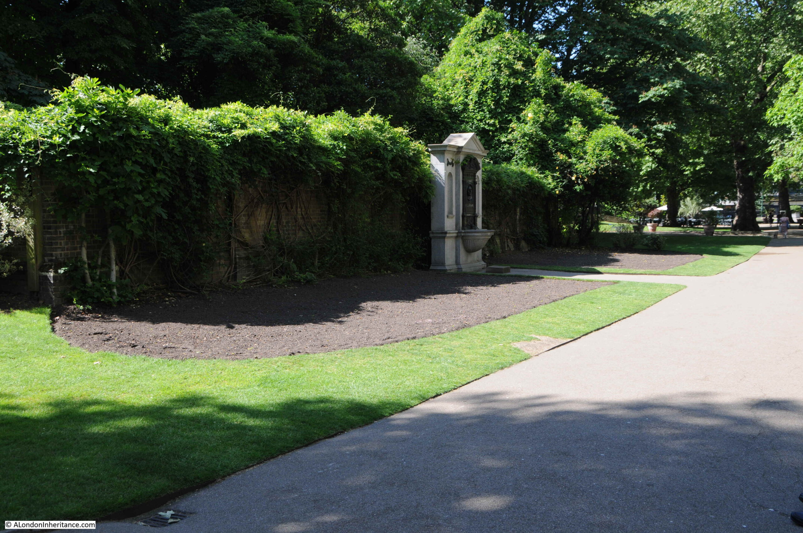
This could have been a difficult photo to locate, however the feature in the background made it easy to find the exact place. This is the same scene on a very sunny June day in 2021:
The first exhibition appears to have been in 1948, as an article in the Sphere on the 23rd May 1953 describes that year’s exhibition as the sixth annual open air exhibition of contemporary art. The article also states that the exhibitions were sponsored by the London County Council, and that “On all days except the final day the pictures are for sale”, which seems rather strange, not also to sell them on the final day of the exhibition.
Exhibitions also seem to have been during part of the month of May, which would explain the coats worn by those in the photo, although that could really be any summer’s day given typical British weather.
The little girl in the photo looks to be around five or six. She would now be around 75 and the only one from the photo still alive.
The Illustrated London News on the 12th May 1962 describes that year’s exhibition as opening on the 30th April and running to the 12th May, with 700 paintings on display from both amateur and professional artists.
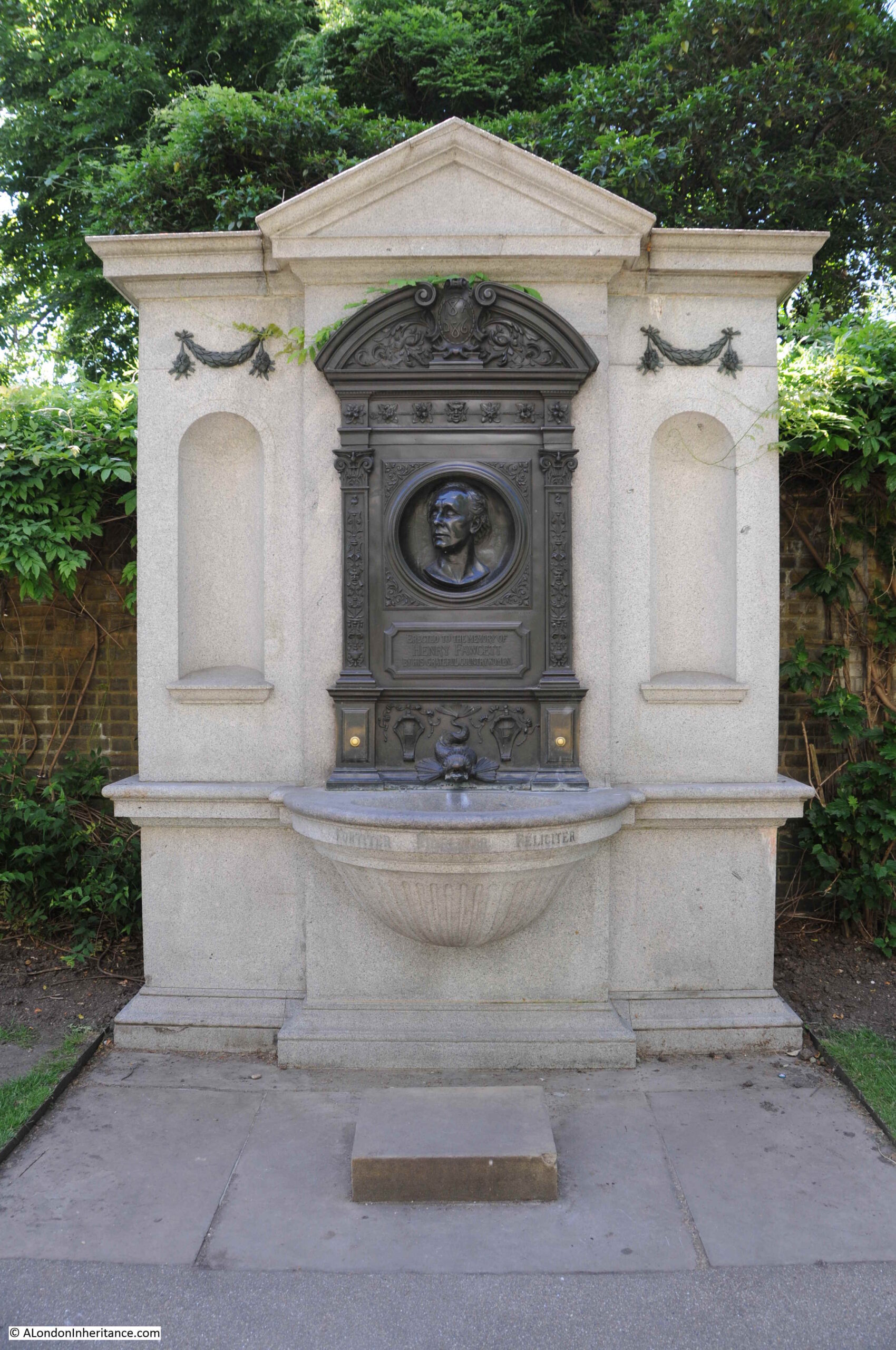
The monument behind the exhibition which enabled the location to be found, is to Henry Fawcett, the rather remarkable blind MP who championed the cause of women’s suffrage. His interests in the cause led him to meet Elizabeth Garrett who rejected his proposal of marriage in order to concentrate on becoming a doctor. He went on to marry Elizabeth’s younger sister, Millicent Garrett.
A statue of Millicent Garret Fawcett was unveiled in Parliament Square in 2018 with the words from one of her speeches “Courage calls to courage everywhere”.
The wall behind the monument is part of one of the air vents to the cut and cover underground Circle and District lines, a short distance below the surface.
The monument to Henry Fawcett:
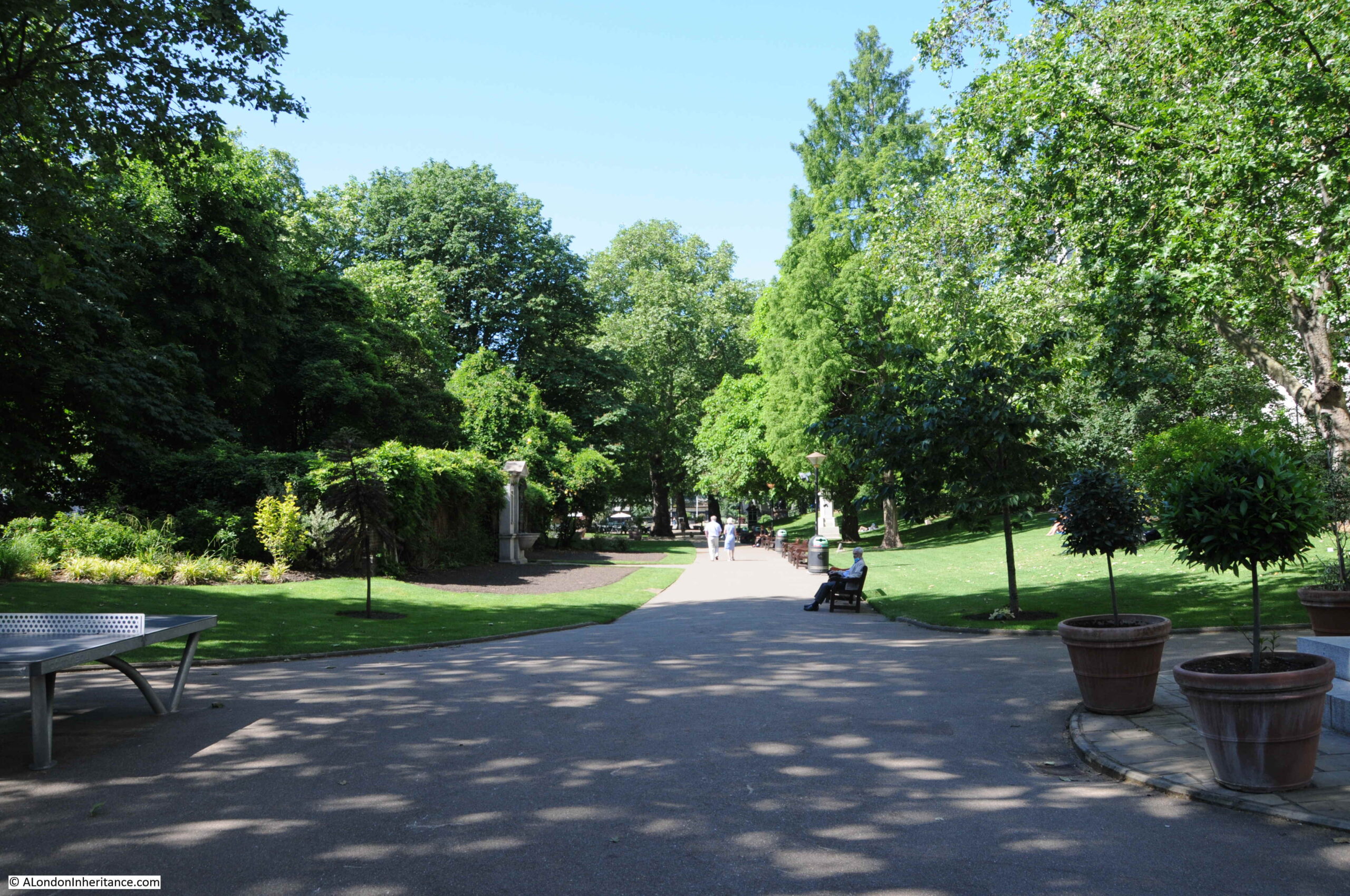
A wider view of Embankment Gardens, with the monument on the left.
The gardens are looking very green with plenty of plants and trees, which would cause a problem trying to recreate the following photo of the art exhibition:
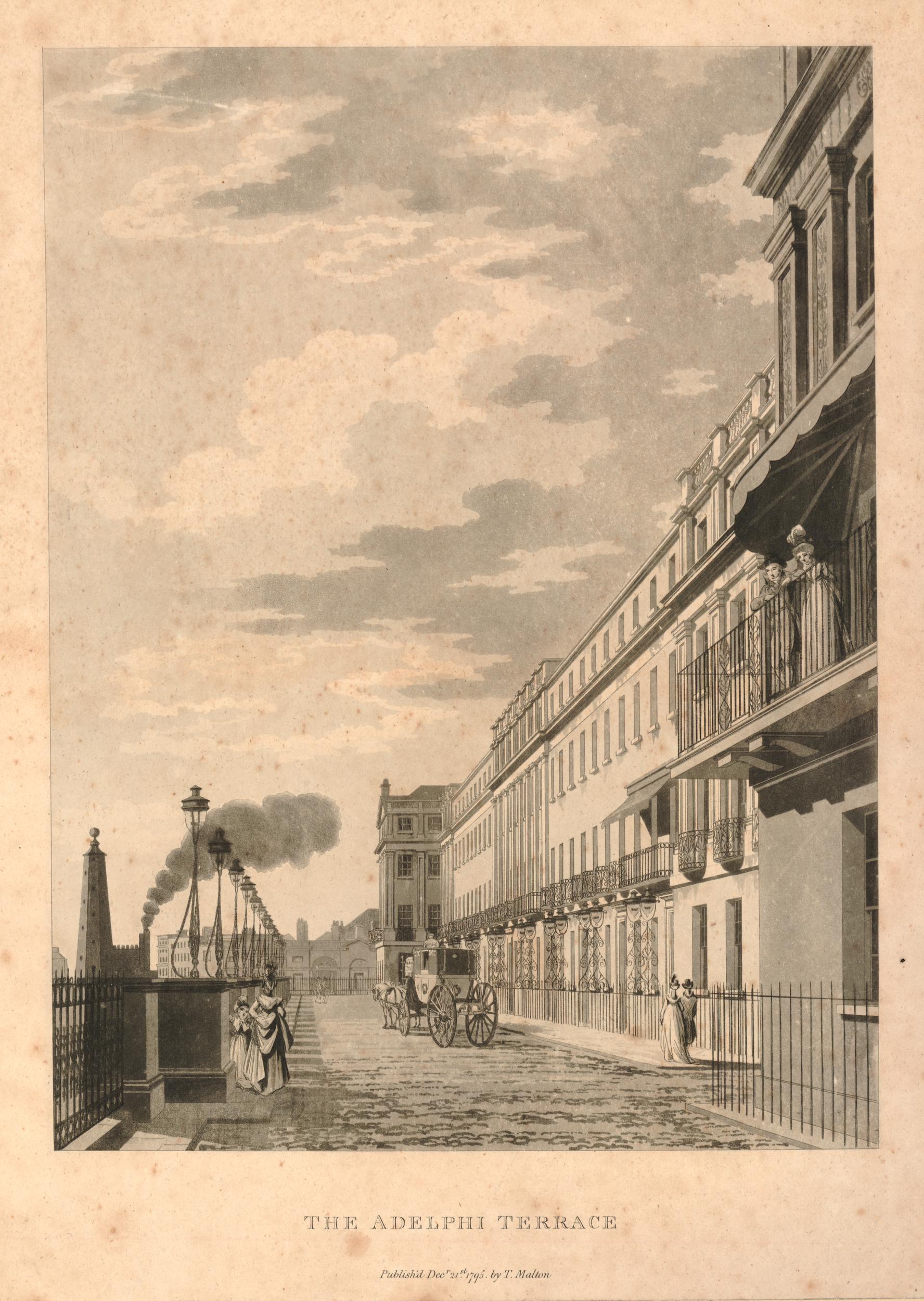
My father took the above picture from the Adelphi Terrace, overlooking the gardens. The art exhibition is running along the pathway through the gardens, and shows how far to the right the exhibition ran, as the edge of the Fawcett monument can just be seen on the very left edge of the photo. The Thames and Waterloo Bridge can be seen in the background.
Adelphi Terrace, from where the above photo was taken is shown in the following photo:
I walked up and down the terrace looking over the wall to the gardens below, trying to recreate my father’s photo, however the trees and bushes have grown considerably since 1952, and the best I could get was the following photo:
There is a small bit of wall visible in the gardens in the centre of the photo. This is not the monument or wall in the 1952 photo, rather a nearby fish pond, a short distance from where the art exhibition was held, and the nearest I could get to recreating the photo.
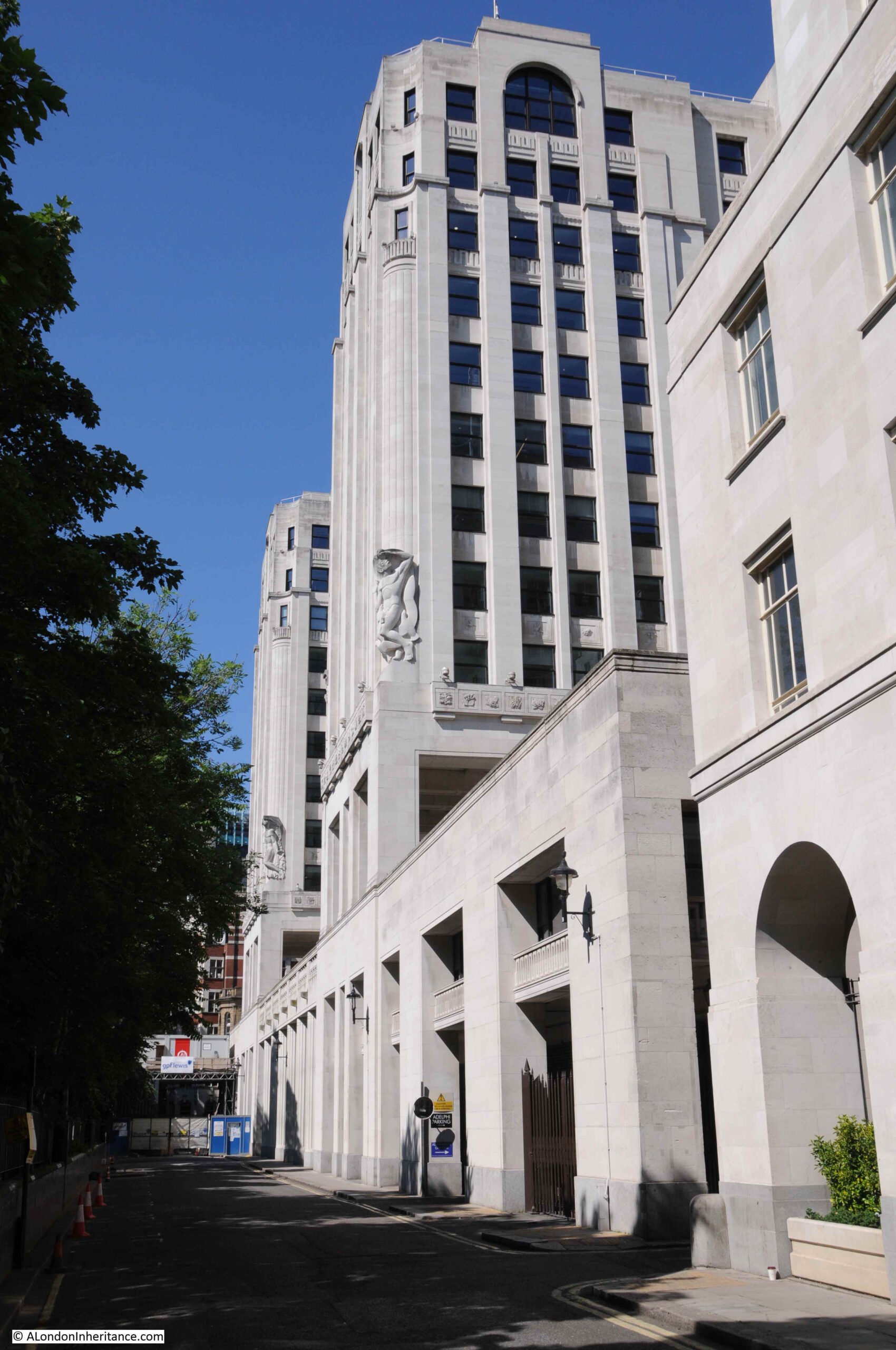
The Adelphi Terrace is in front of the Adelphi building, and raises the street around the Adelphi up above Savoy Place which runs at ground level between the Adelphi building and Embankment Gardens.
The following photo was taken from Savoy Place looking up at the terrace and the rather magnificent Adelphi building, and shows the height of the terrace:
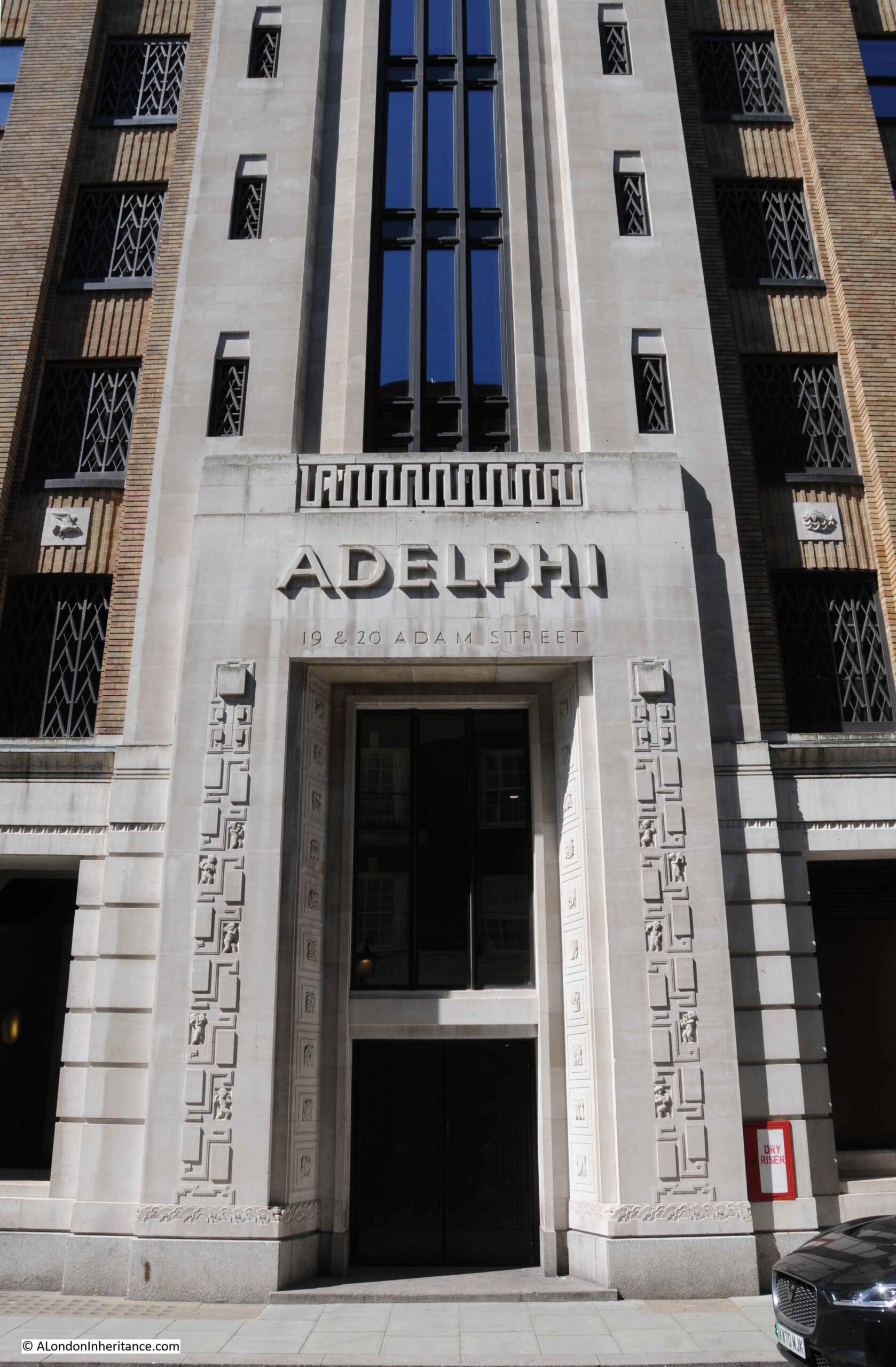
The main entrance to the Adelphi building is on John Adam Street, and the building consists of two outer wings which extend over the terrace as shown in the above photo, with the core of the building between and behind the two wings, up to John Adam Street.
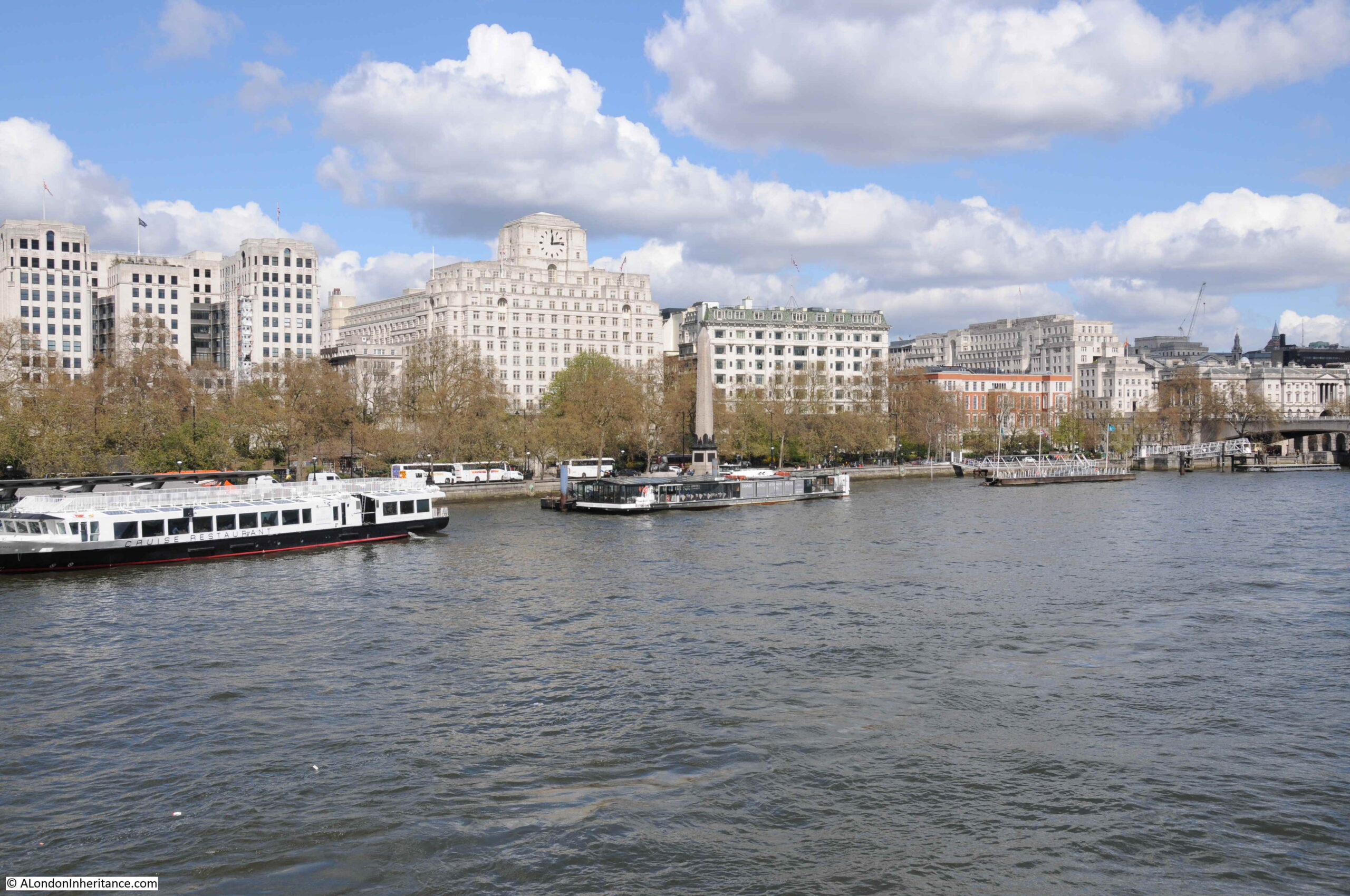
I thought I had a photo of the Adelphi from across the river, but I cannot find it. I did find a photo I took a few years ago which shows the three wings of the Adelphi as the building on the left of the photo.
From this distance the building does not look that impressive. It is only when you walk around the building that its unique decorative features can be seen.
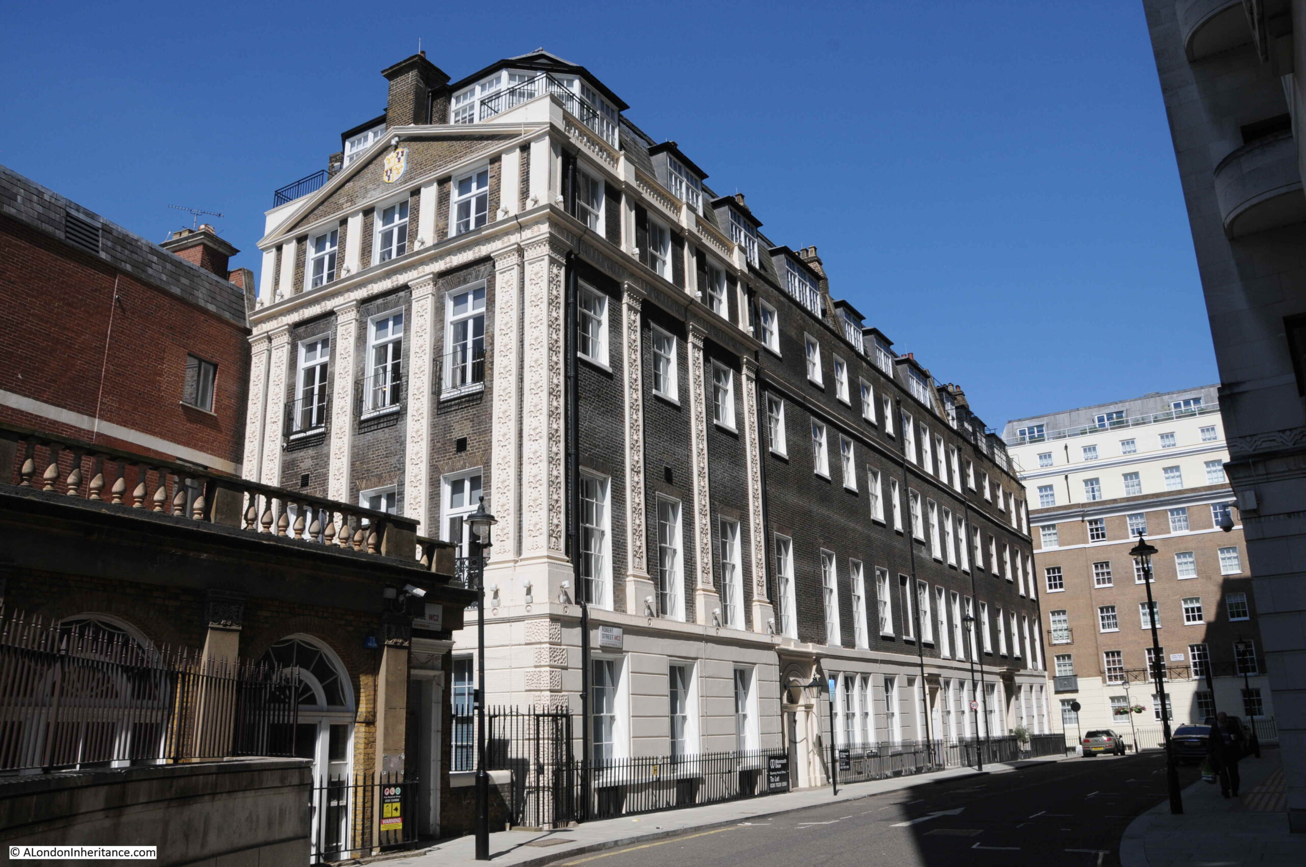
The Adelphi was built between 1936 and 1938, by architect Stanley Hamp of the partnership Colcutt and Hamp.
Of standard steel frame and reinforced concrete construction, what makes the building rather special is the large amount of architectural decoration and design that follow the art deco approach.
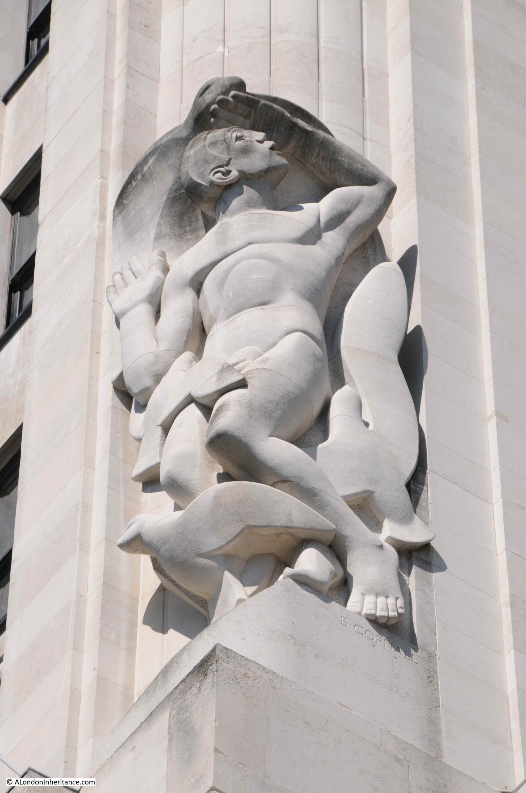
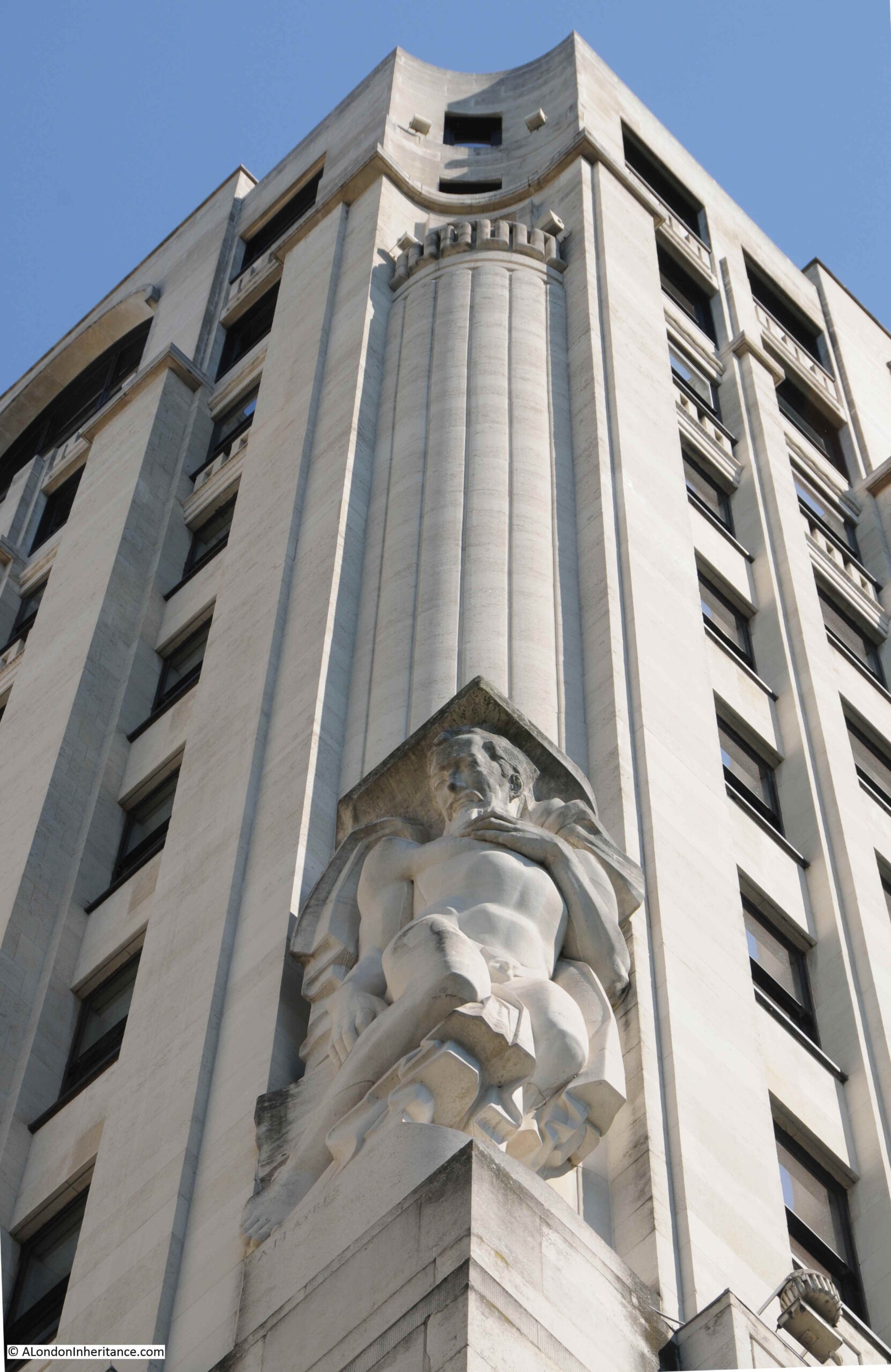
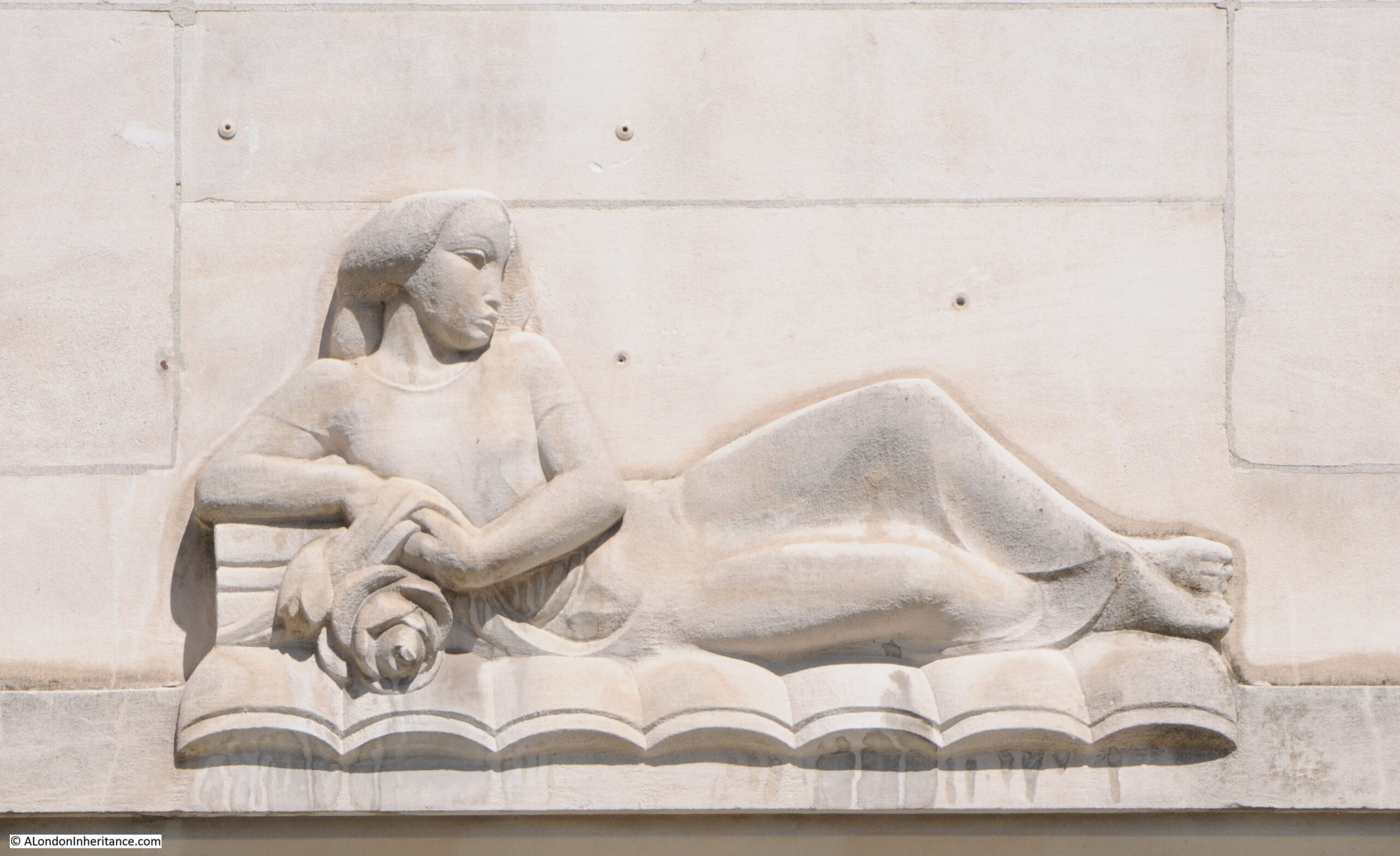
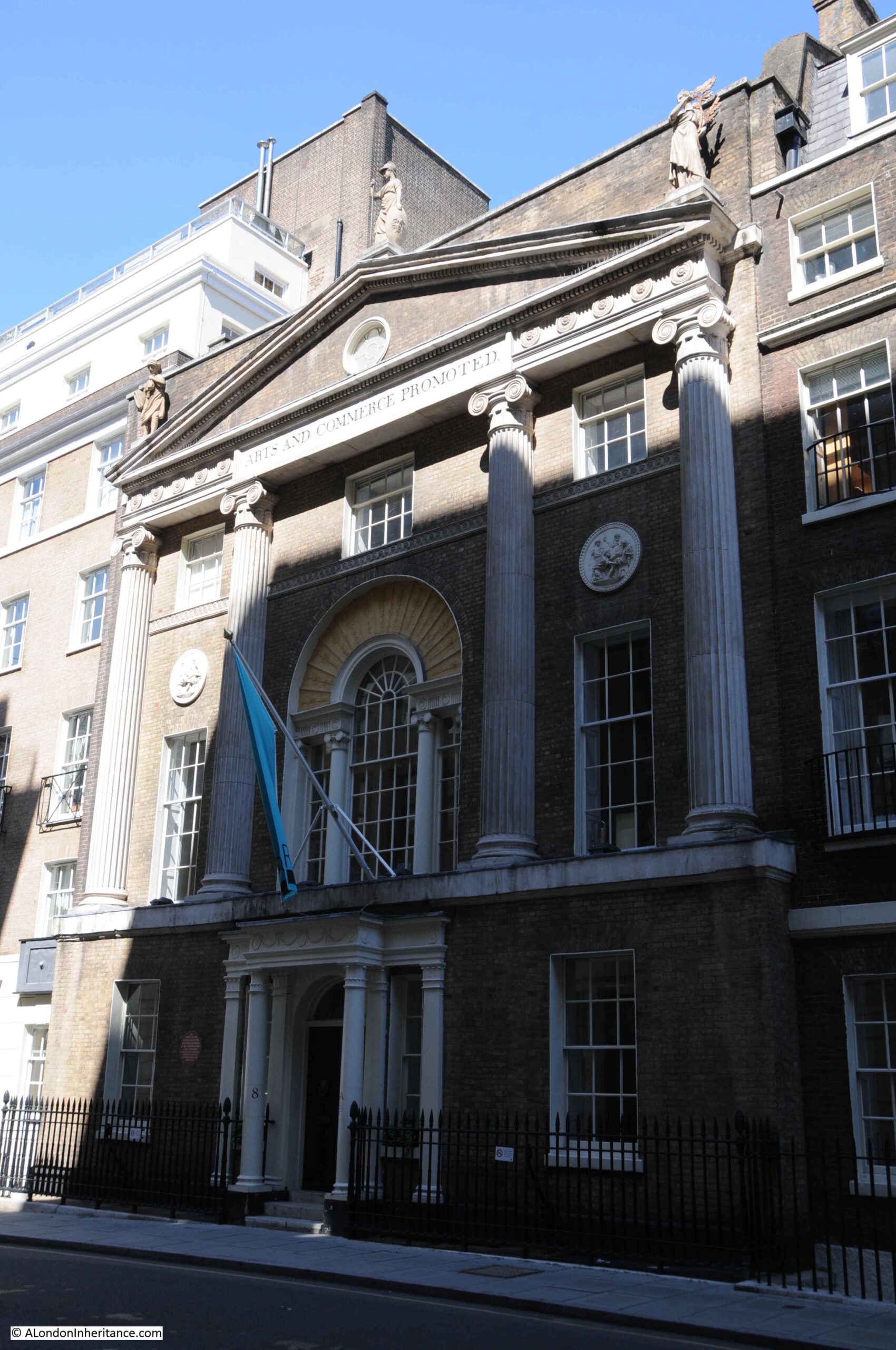
In the photo of the building from Savoy Place, two large allegorical relief figures can be seen on the two wings that extend over the terrace. There are four of these (the other two are on the other corners of the wings). These represent Dawn, Contemplation, Inspiration and Night, with Contemplation and Night being seen in the above photo.
The following photo shows a detailed view of “Night” by the sculptor Donald Gilbert.
The following photo shows “Dawn” by Bainbridge Copnall, with architectural decoration extending above the sculpture to fill in part of the curved corner of one of the wings.
There is detail across the building. The following photo shows a side entrance on Robert Street. Note also that where the building faces towards the river, Portland stone is used, with brick used for the other facades, but retaining Portland stone for the ground floor and architectural detailing.
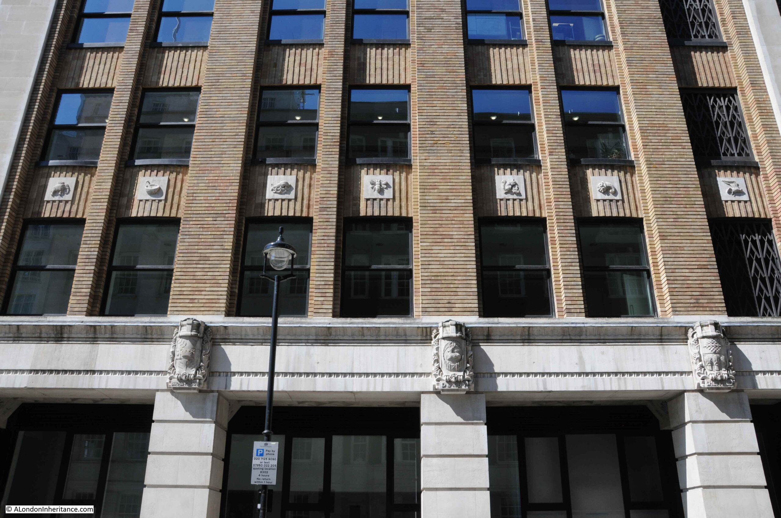
The sides of the building have small decorative panels between the brick pillars:
And carved coats of arms of UK cities between the ground and first floors. Three of these can be seen in the above photo, and in close up, the arms of Sheffield, Derby and Birmingham can be seen below:
Another view of Adelphi Terrace, which was constructed in part due to the 1930s expectation of the rise of the car as a means transport within the city, as well as replicating the original terrace:
Construction of the Adelphi in the 1930s required the demolition of an historic estate.
The original Adelphi estate was the work of Robert Adams and his three brothers, John, James and William. The name Adelphi comes from the Greek word adelphós, meaning brothers.
In the mid 18th century, the area now occupied by the Adelphi had been a rather run down area called Durham Yard, which had been the location of Durham House. At the time, the Embankment Gardens had not been built, so the space now occupied by the Adelphi was then facing on to the foreshore to the Thames. The damp conditions and flooding at high tide meant that this was not a good area to build the type of quality houses intended by Adams.
The plan developed, mainly by Robert Adams, was to build the houses and streets on a series of arches, which increased in height as the land descended from the Strand down to the river.
However the Adelphi Terrace in the above print is not in the same position as the Adelphi Terrace we can walk along today. In the above print, the block of buildings on the right were demolished to make way for the Adelphi building (not the building at the far end as we shall see).
In preparation for the construction of the Adelphi building, the whole of the block of houses that occupied the area, included the arches and space underneath the houses, was demolished all the way back to John Adam Street. As part of the build of the Adelphi, construction was pushed forward up to Savoy Place, so the terrace is now forward of the terrace in the above print.
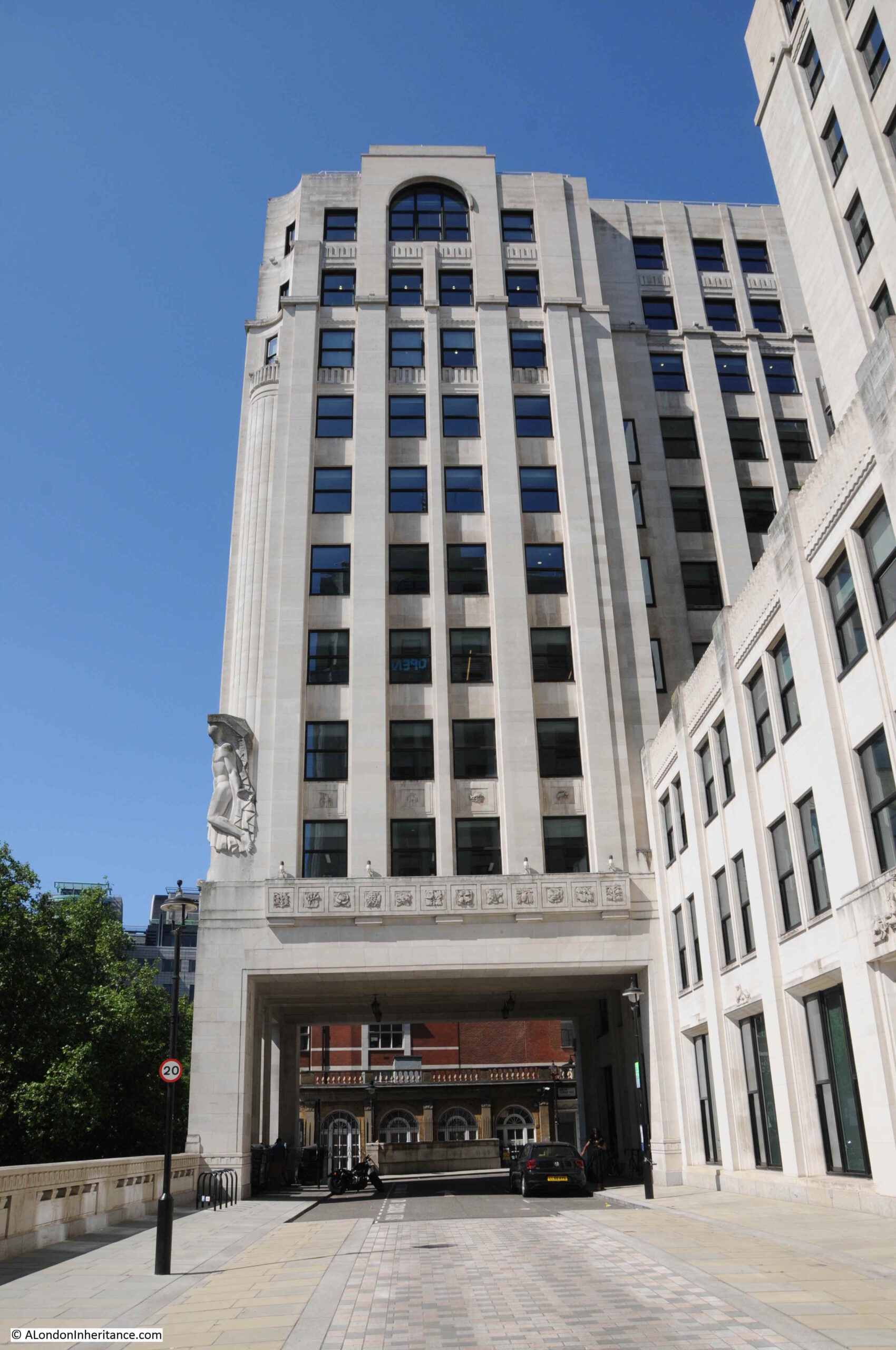
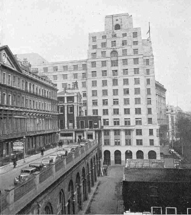
The following photo from just before demolition in 1936 shows the Adelphi Terrace on the left, with the block of houses which would also soon be demolished. In the background is the recently completed Shell Mex House (1932) with Savoy Place running to the lower right of Shell Mex House.
With the construction of the new Adelphi building and terrace, the terrace was pushed forward to also run up against Savoy Place, in line with Shell Mex House, so the area in the lower right of the above photo is now under the terrace.
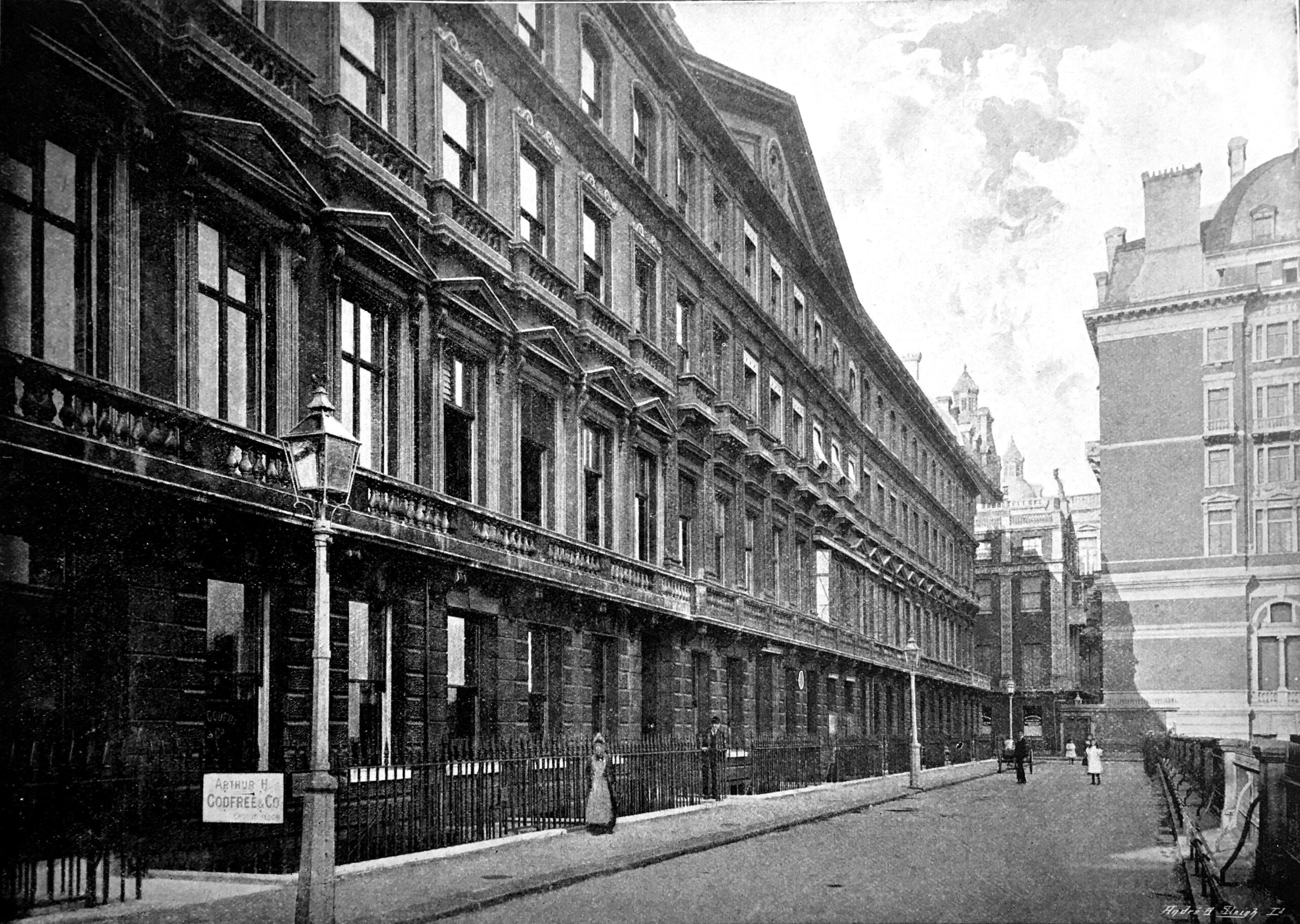
Another view of Adelphi terrace around 1897 before the construction of Shell Mex House:
If you look to the left of the second lamp post in the above photo, you can just see a round plaque. This was a medallion of the Royal Society of Arts recording the fact that the actor David Garrick had lived in the house. It was in one of the back rooms of the house that the actor died in 1779.
The large building on the right on part of the site now occupied by Shell Mex House was the Hotel Cecil.
And if you had been living in one of the houses in the terrace, this would have been your view as you looked along the river to the east, with the corner of Hotel Cecil on the left, and the first Waterloo Bridge crossing the river.
At the time of the above photo, the Adelphi was described as “one of the finest places to live in all London, as well as for pleasantness of situation as for convenience. The noise of the Embankment is sufficiently far away, and the hooters and sirens on the river suggest that sense of freedom and open space which goes with ports and their kinship with the sea. All too uncommon in London, late at night, the loudest noise is often the wind in the trees which move the lights of silent shipping“. Not from an early 20th century Estate Agents description, the quote is from the book Wonderful London.
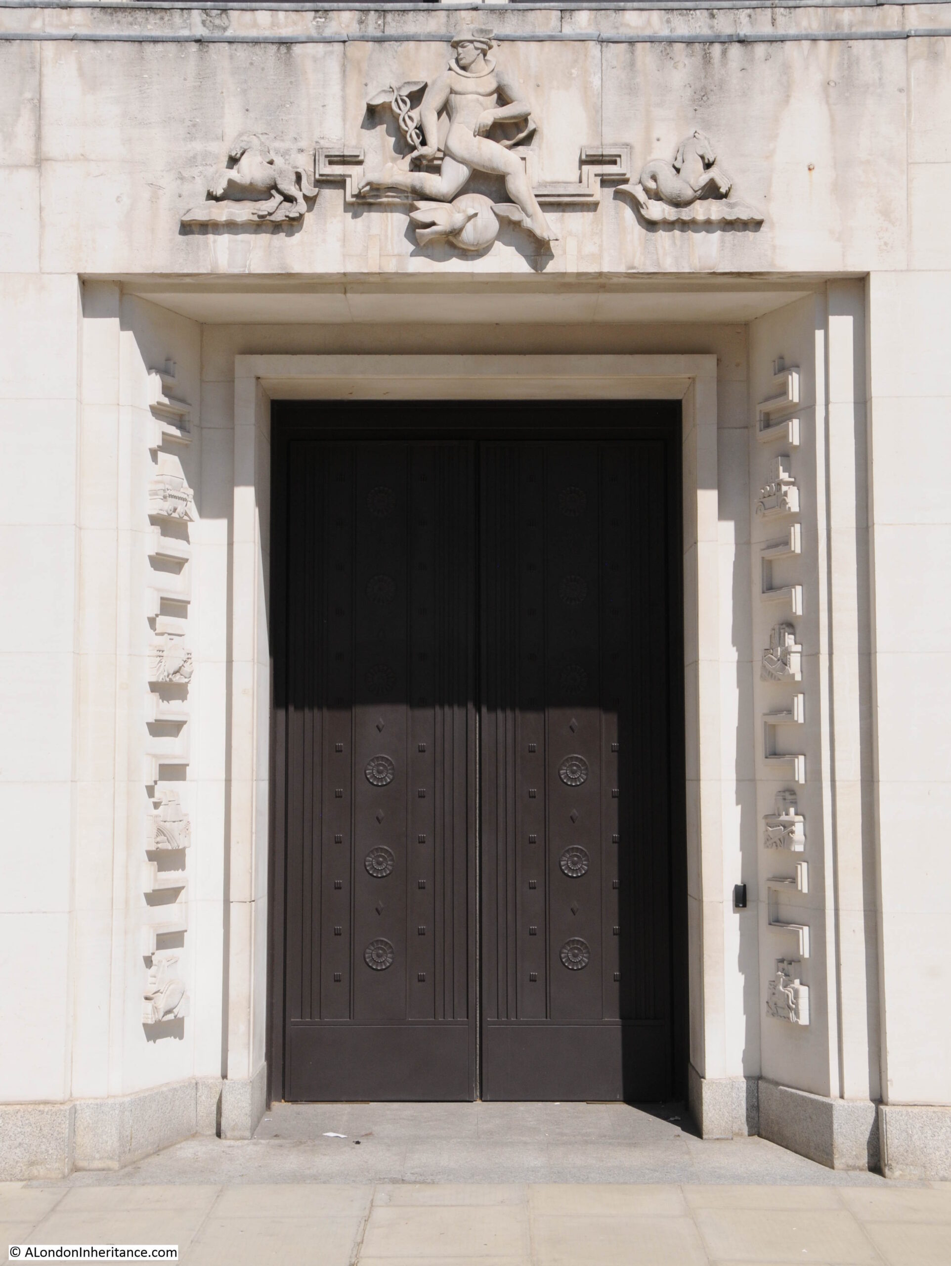
Continuing a walk around the Adelphi building, and more door surround decoration:
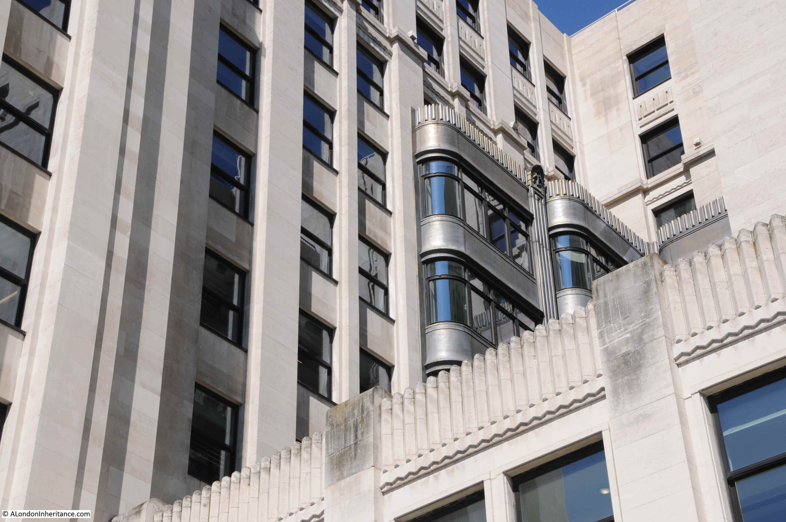
Looking back between the wings of the building, we can see bow windows extending outward, with metallic decoration:
More decorative carvings:
Balconies:
The main entrance to the Adelphi on John Adam Street:
What is confusing is if you look above the doors, is the address John Street, however if you look to the lower right, is the full name John Adam Street.
John Street seems to have been the original name, as it is used on the 1895 Ordnance Survey map, and by the time of the 1951 revision, the current full name John Adam Street is used. I suspect the name change was when the Adelphi was built in the 1930s.
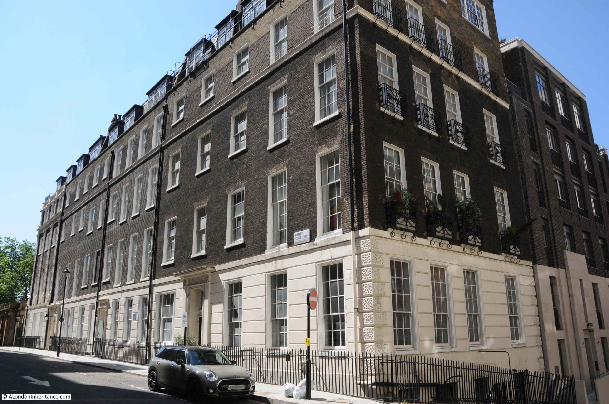
Having had a walk around the Adelphi building, time for a look at what remains of Robert Adam’s original estate. This is the view along Robert Street, with a fine terrace of buildings lining the side of the street. The end of the building on the left would have originally faced onto the original terrace, and is the same building at the far end of the terrace as in the 1795 print.
The scheme proposed by the Adams was highly ambitious. The land was sloping down to the river, and indeed consisted of part of the foreshore. The area would often flood at times of high tide.
Rather than building houses down along a sloping plot of land towards the river, with the resulting problems of damp and flooding, the plan consisted of building brick arches with the houses building on the platform created above.
The space within the arches would be sold or leased, and this approach would create a considerable improvement to the embankment of the Thames.
The plan and construction was ambitious, and the financial side of the project was rather risky, as a lease on the land was only signed a year after construction had begun in 1768, and parliamentary approval to build the new embankment along the river was not granted until 1771.
Costs for the project were so high that the money had run out by 1773 when much of the estate had yet to be completed. To raise additional finance, a method common in the 18th century was used whereby a lottery with 4,370 tickets selling for £50 each raised enough to complete the estate. Prizes for lottery winners included some of the houses on the estate as well as storage space in the arches below.
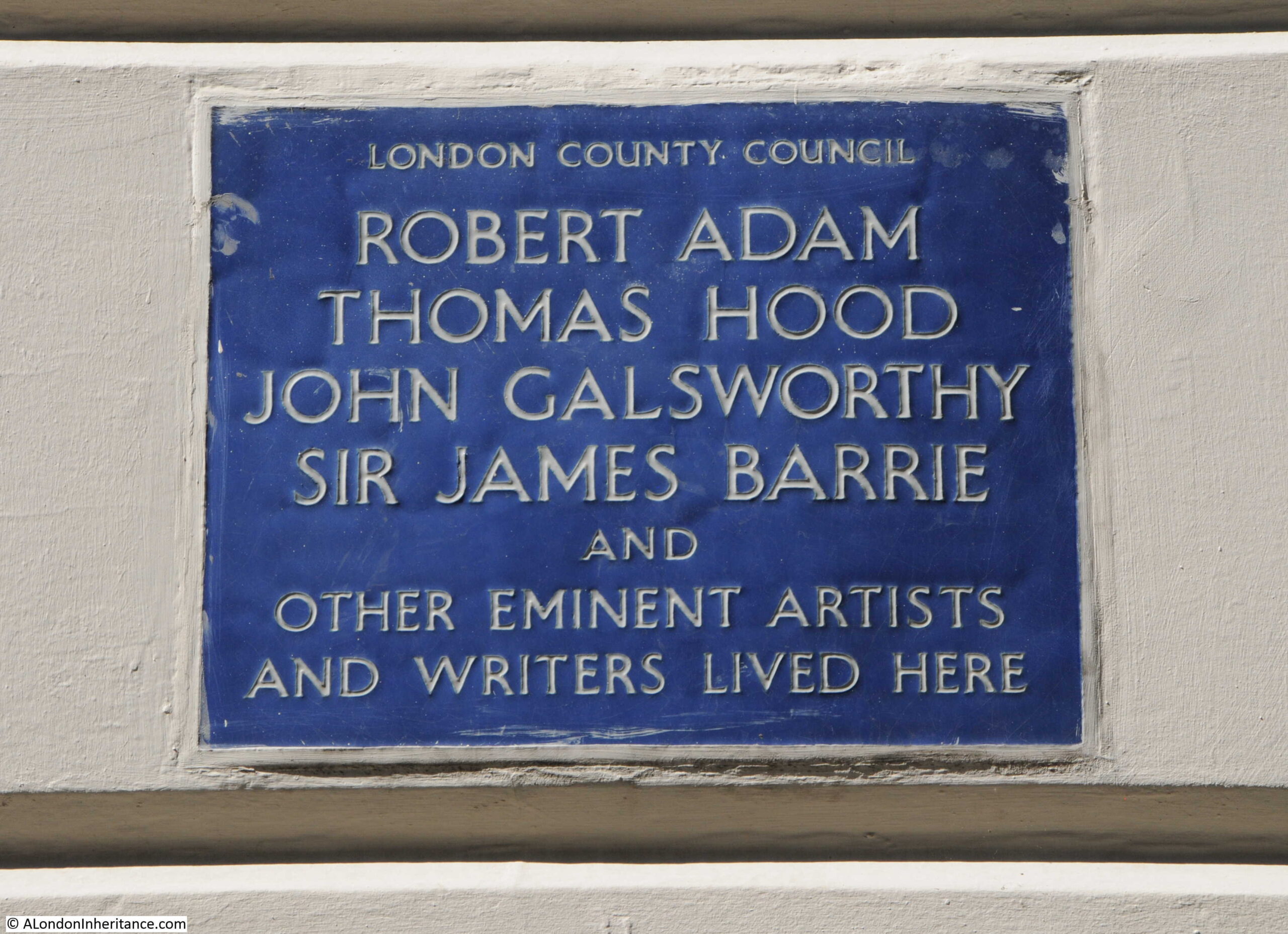
The following plaque on the terrace in Robert Street identifies some of those who have lived in the houses:
View of the terrace in Robert Street from the junction with John Adam Street:
Strange that with street renaming, John Street changed to John Adam Street, however Robert Street kept the original name without a rename to the full Robert Adam.
The houses were highly decorated including Adam fireplaces. Many of the first floor ceilings were also painted by either the Swiss artist Angelica Kauffman or Giovanni Battista Cipriani from Florence.
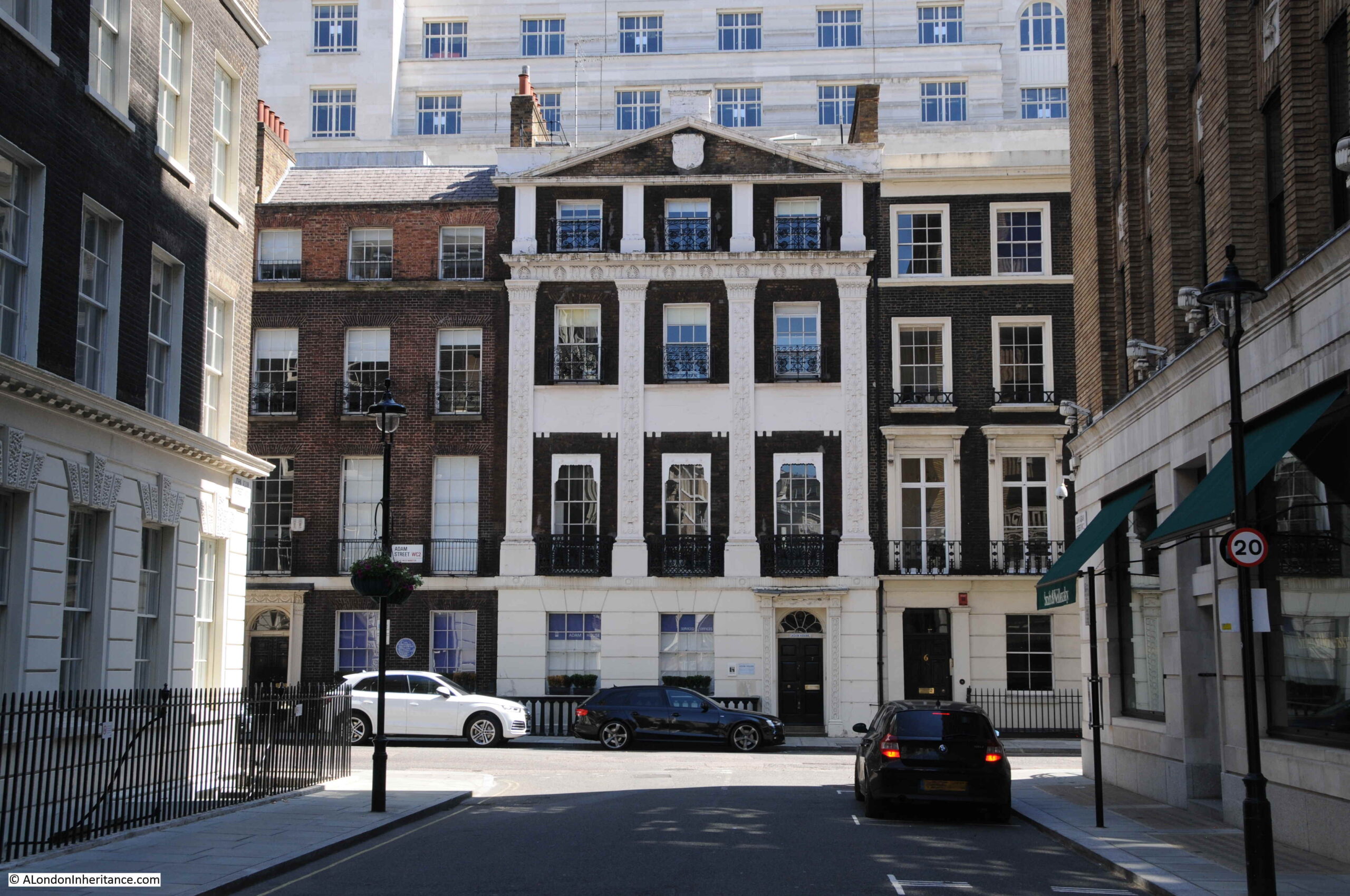
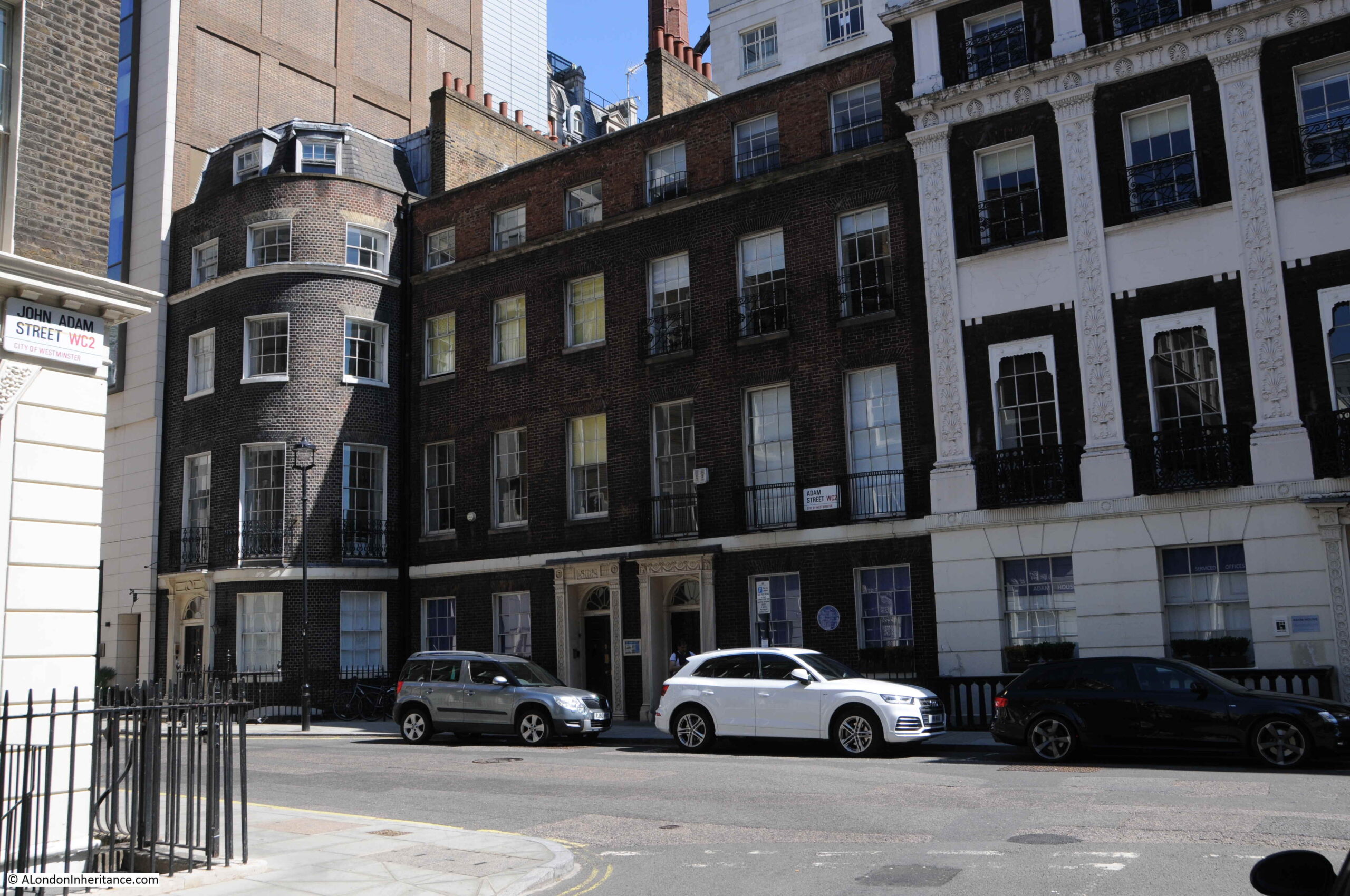
Walking to the north of the Adelphi, along John Adam Street, and we find this building which was clearly not built as one of the terrace houses:
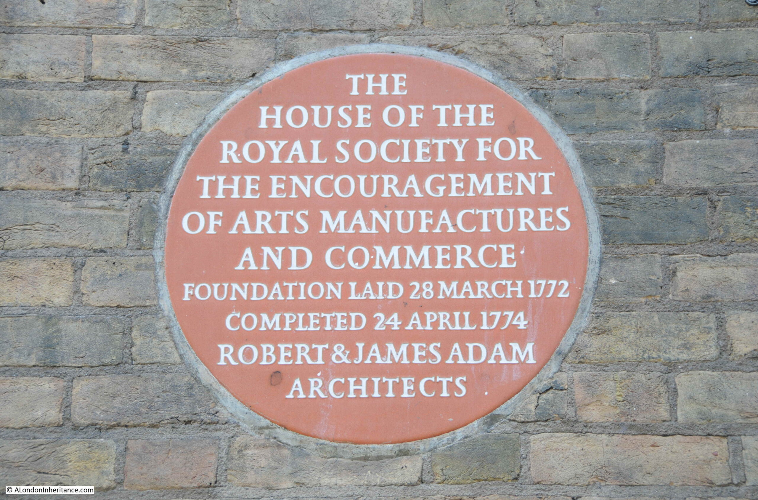
A plaque on the front identifies the building as the home of the Royal Society for the encouragement of arts, manufactures and commerce, which was founded in a coffee house in Covent Garden, and then moved to this building by Robert and James Adam in 1774. The building is still their home.
During the 1930s demolition ready for the construction of the Adelphi, demolition reached to the southern side of John Adam Street, so the street and home of the Royal Society are part of the original build, and the basement of the Royal Society building retains some of the brick arches built to raise the area above the sloping land.
In the 19th century, the arches and vaults below the houses had become somewhat different to what had been intended. The Sketch in 1903 includes the following description “The houses were built on deep arches that rivalled the Catacombs of Paris and these, at one time, were a great thieves kitchen, a tramps paradise, or doss house, that defied Watchmen and Bow Street Runners, and their successors the modern Peelers”.
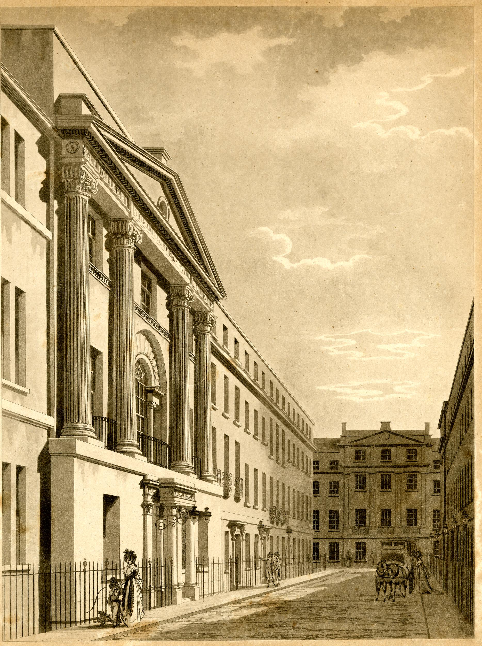
Looking along John Adam Street to the junction with Adam Street and we can see how the Adam’s plan included focal point houses at the end of the streets, and the type of decoration used.
I should have found the above print before visiting the site as I would then have taken the photo slightly further back to include the Royal Society building. If you stand in the street today, ignore the new Adelphi to the right, and Shell Mex House, the view does look much the same as in 1795.
The following photo is looking up Adam Street. The junction with the Strand is further along the street to the left, with an original house at the end of the terrace with a curved extension to the smaller width of the street. Adam Street was cut through to the Strand as part of Adam’s construction of the Adelphi.
The house behind the white car has a GLC Blue Plaque stating that the 18th century industrialist and inventor Sir Richard Arkwright lived in the house, with English Heritage’s background to the plaque stating that Arwright lived some of the final years of his life here in Adam Street before his death in 1792.
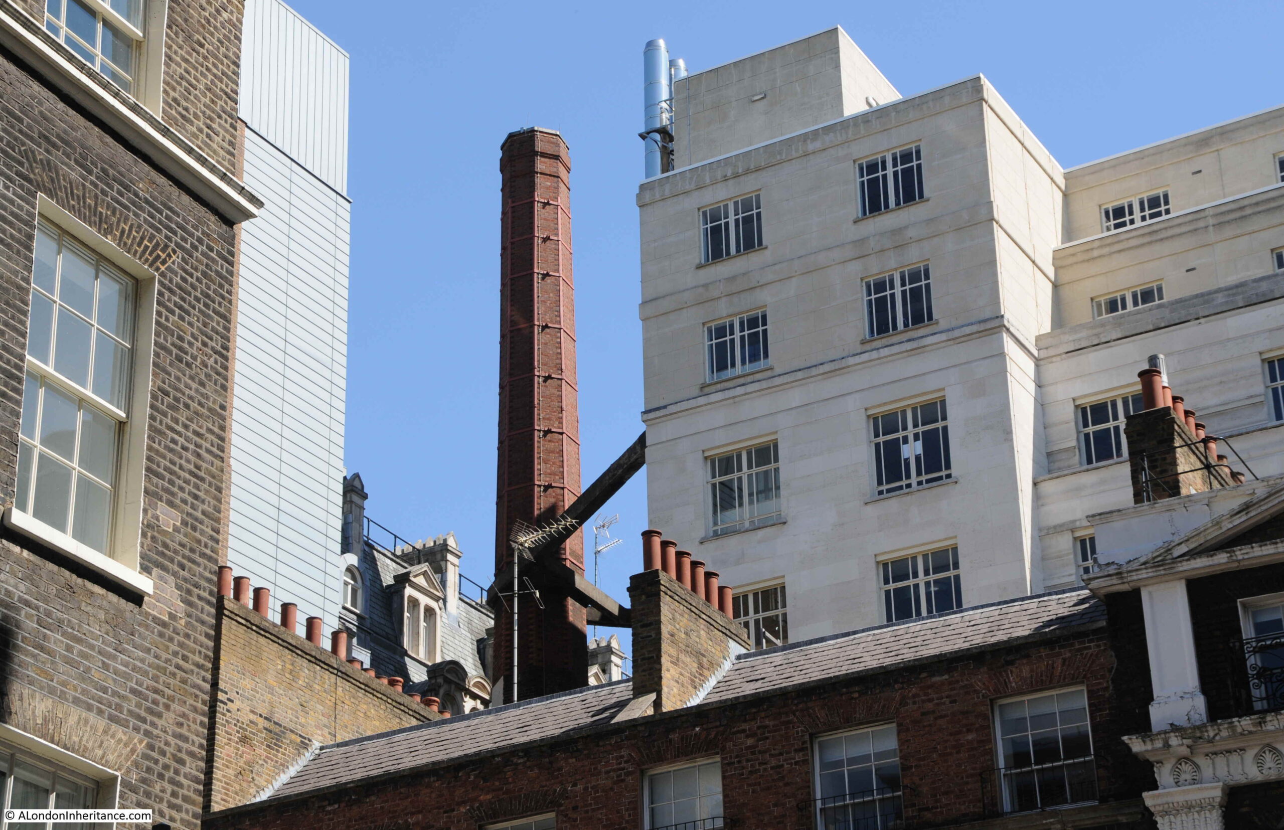
Looking above the houses in the above photo, there is an unusual sight hidden within the dense building of this area south of the Strand. A brick chimney with some robust steelwork providing support from Shell Mex House.
The type of brick chimney seen in the above photo was once relatively common across London, but now is an unusual sight. No idea of the chimney’s purpose, whether it was or maybe still is, part of the Shell Mex House heating system.
That was rather a detour from my father’s original photo of the open air art exhibition in the Victoria Embankment Gardens, but that is why I started the blog, as a means of getting out to find the location of a photo and discovering a wider area.
There is more to the story of the Adam’s brothers and the surrounding area, including the creation of the Embankment Gardens, Shell Mex House, and Lower Robert Street which still routes under part of the estate. The old river stairs that would have entered the river roughly along where Savoy Place is today, and some of the lost streets down to the river – hopefully all subjects for future posts.
And returning to the original photo, I wonder if the little girl in the photo can today remember walking in the gardens and alongside the art exhibition?
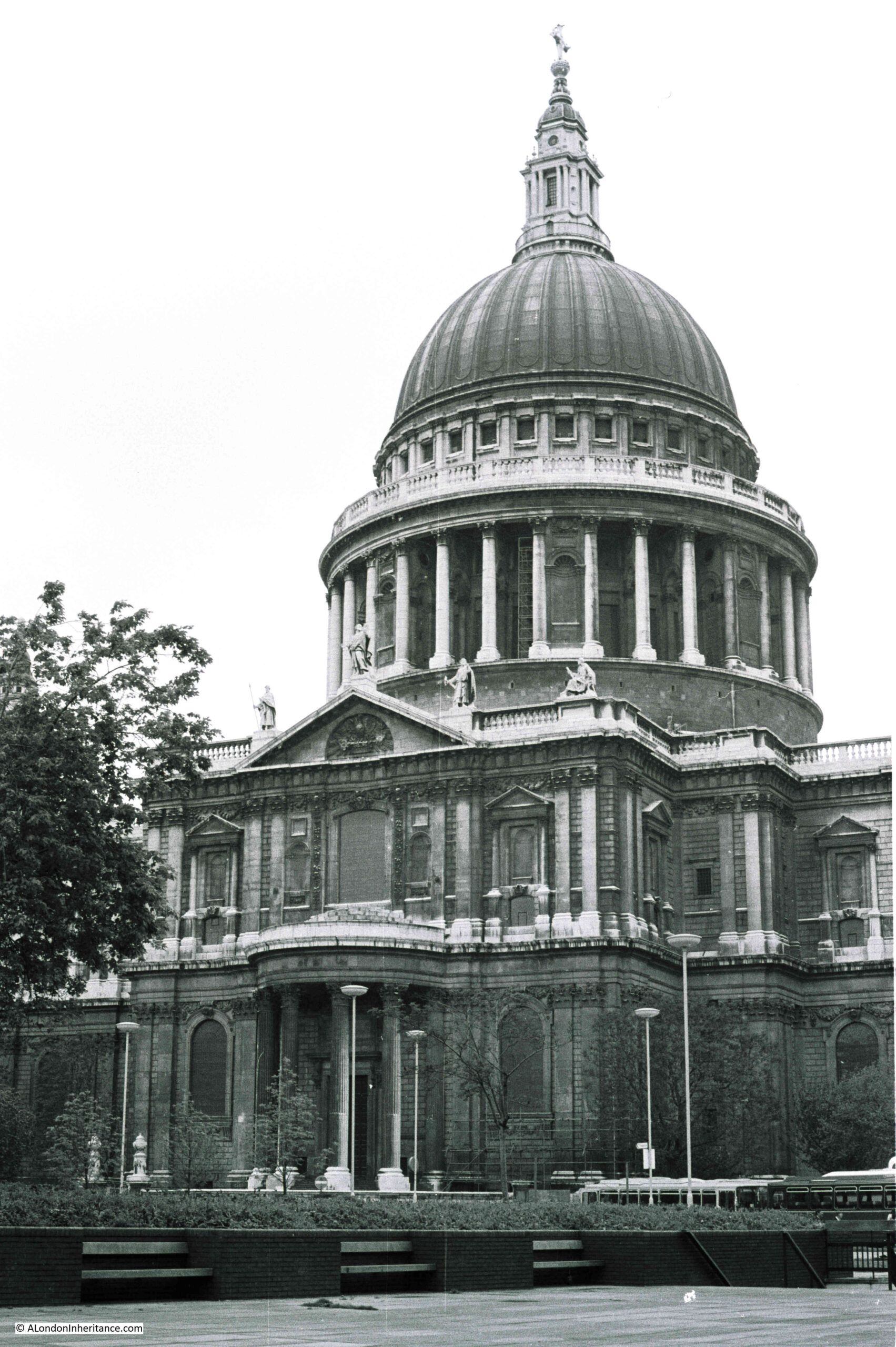
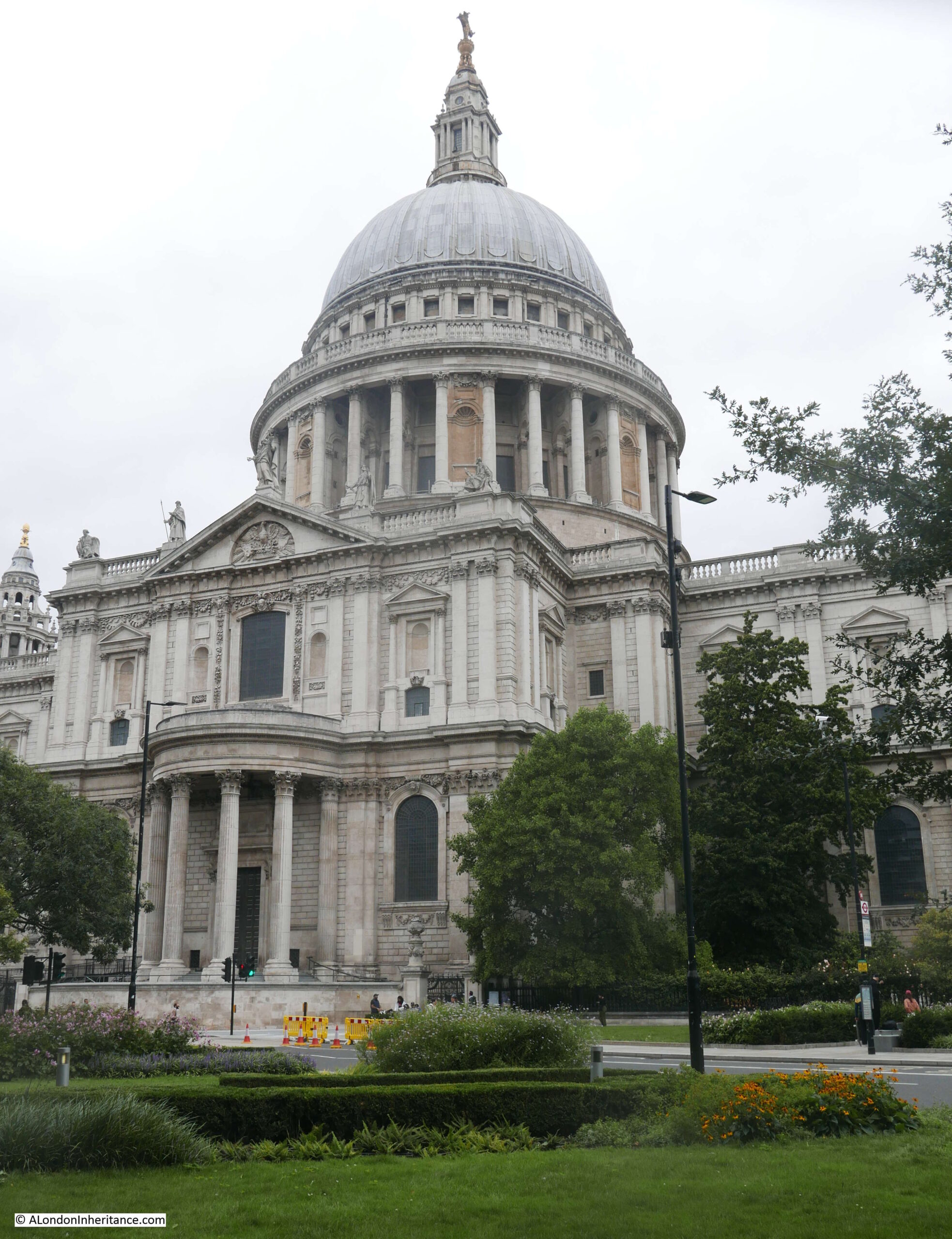
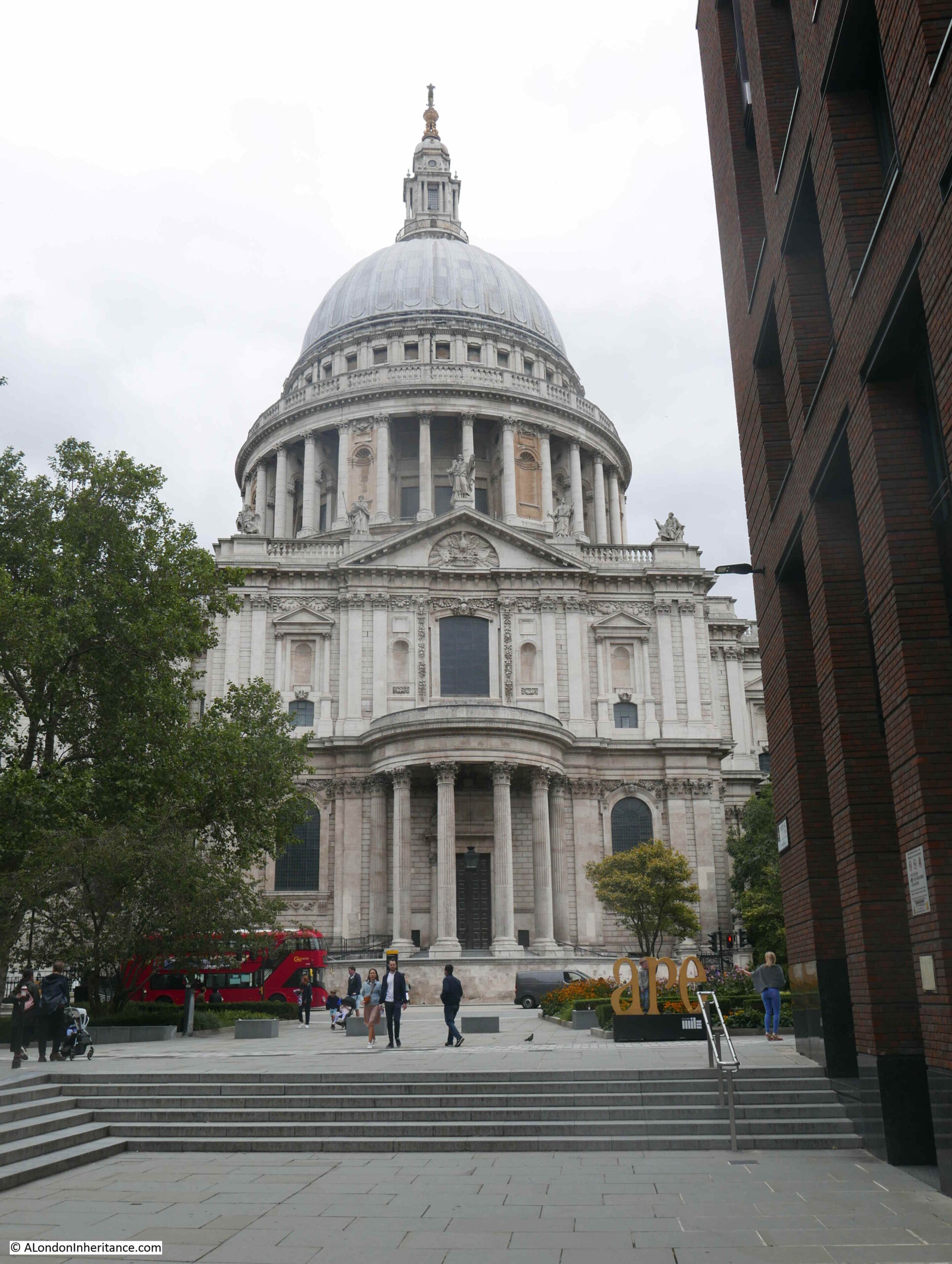
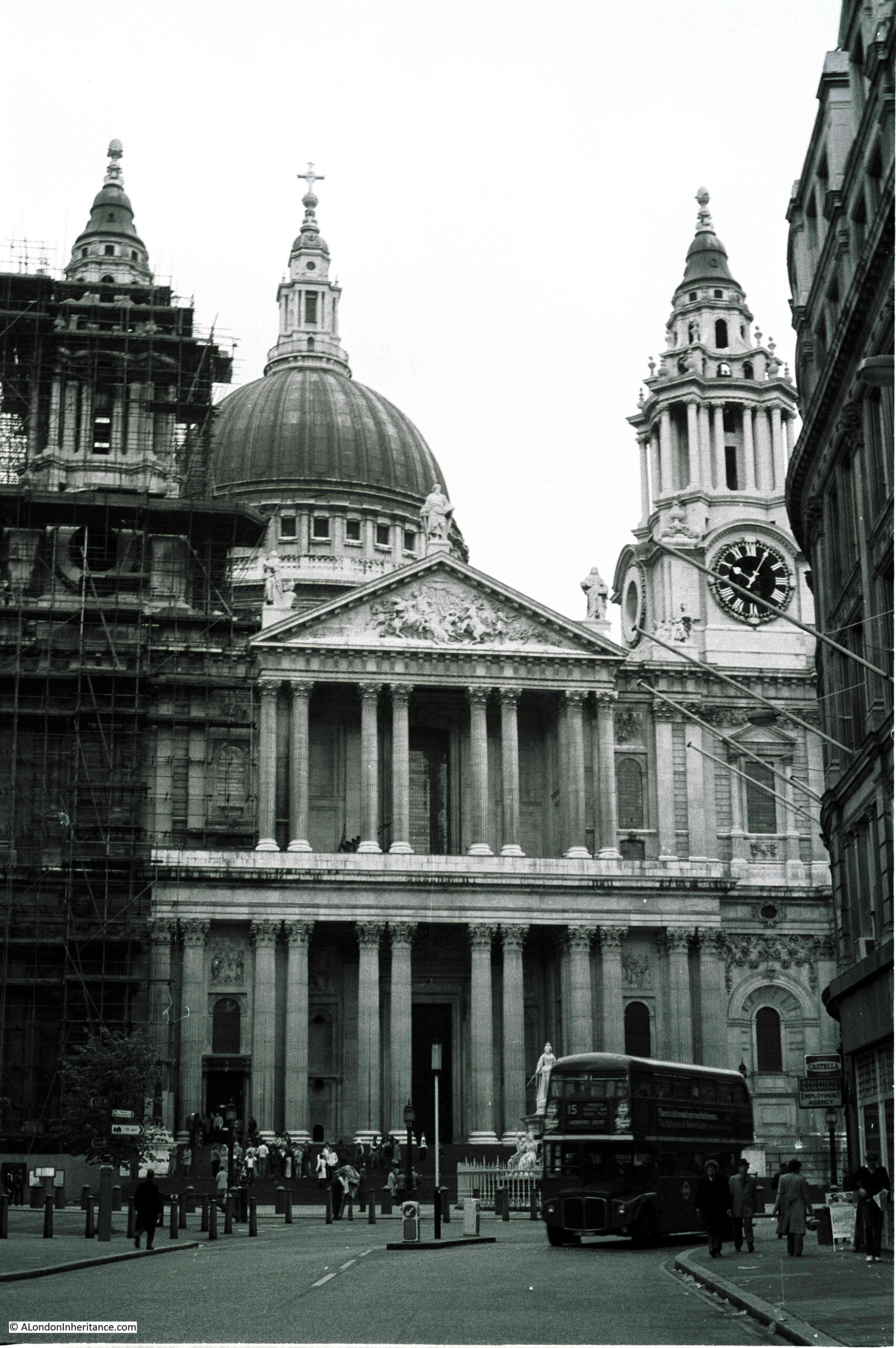
I was looking through some of my old negative scans and found four photos of St Paul’s Cathedral dating from 1977. Nothing special about the photos, and the cathedral is one of the buildings in the City that has not changed, however they did highlight how much dirt the cathedral had accumulated, and in comparison, how clean it looks today.
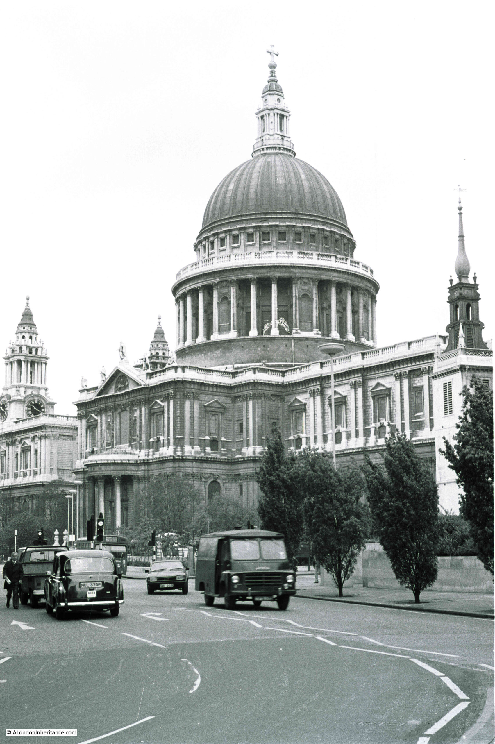
The following photo shows the view of the cathedral from the junction of Cannon Street and New Change in 1977:
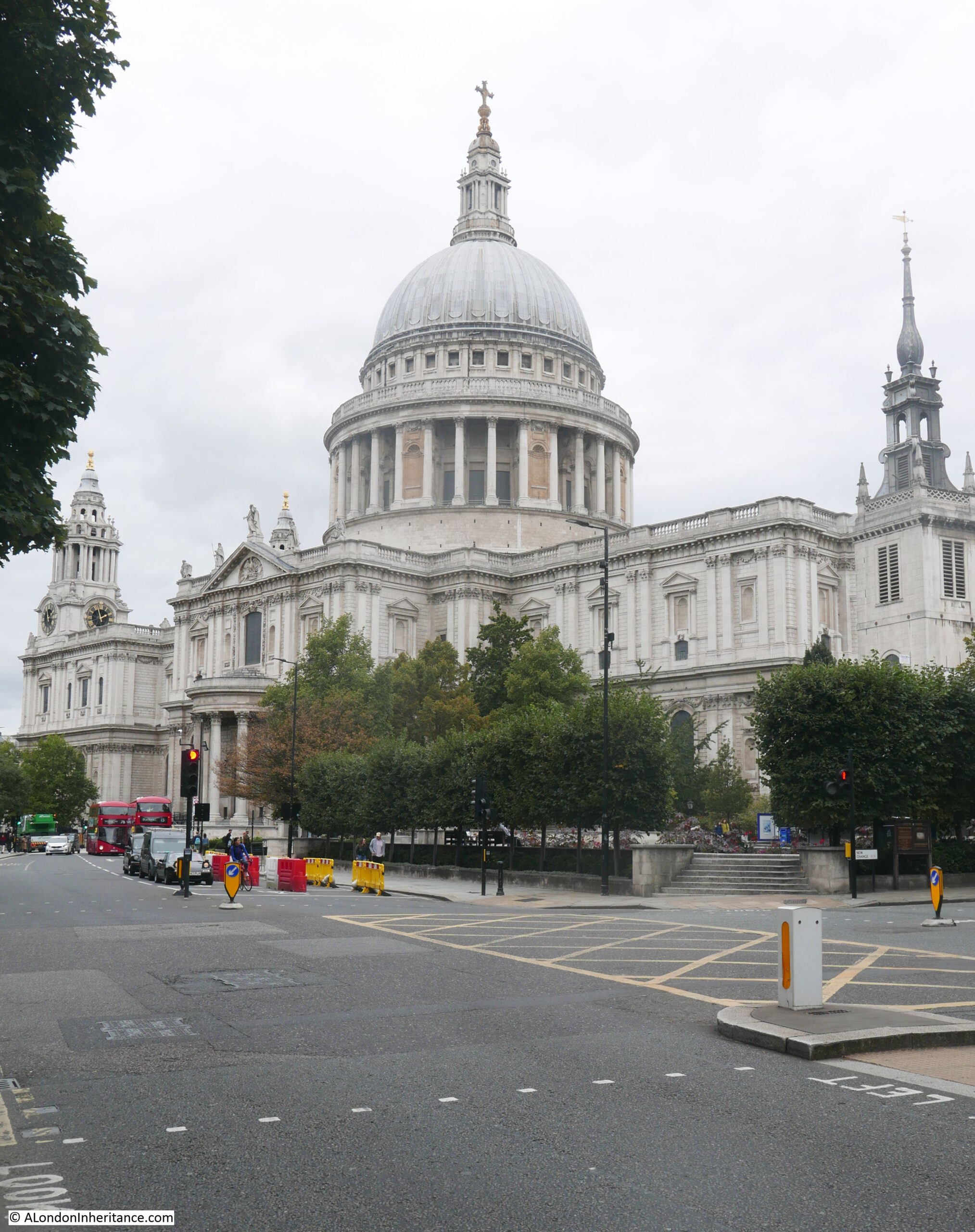
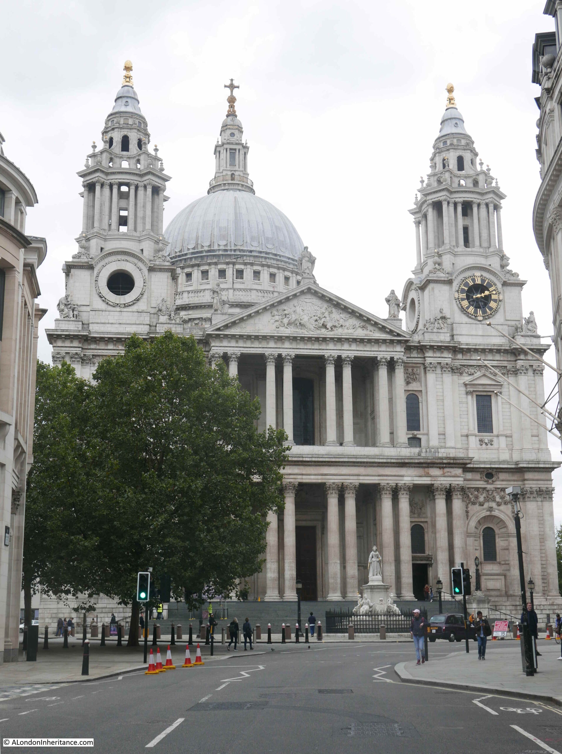
The following photo shows the same view, forty four years later in 2021::
St Paul’s Cathedral has had a number of extensive cleaning and restoration projects over the years, however the state of the cathedral in 1977 was probably not what those who worked on the mid 1960s cleaning project would have expected.
At the end of the 1960s cleaning, it was expected that with recent clean air legislation, and the City of London being designated a smokeless zone the cathedral would remain clean and there was a possibility that in “250 years time, St Paul’s Cathedral will look as Sir Christopher Wren would have liked to have seen it”.
The above quote and the following still is from a fascinating BBC programme from 1965, when “Tonight” had a lengthy feature on the cleaning of St Paul’s Cathedral. The full programme can be watched here, and also highlights the 1960s approach to health and safety (as illustrated in the still below) as well as the rather basic method of cleaning employed. At times the wind lifted the sheets preventing cleaning water from falling to the streets, resulting in some very annoyed City Police Officers who threatened those cleaning the cathedral with a summons if they did not stop work as water was blowing as far as Cannon Street.
Only 11 years after completion of the mid 1960s clean, the cathedral was again looking rather dirty.
The above photo is the south facing side of the cathedral in 1977 and the photo below is the same view in 2021:
In my 1977 photos, the cathedral appears cleaner towards the top, and dirtier towards the bottom of the building. Although central London was a much cleaner place than it had been for many centuries, vehicles were emitting far more pollutants than they do now, and pollution would still be blowing in from the surrounding area.
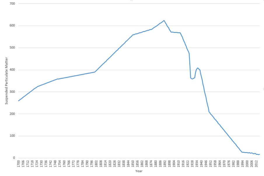
It is hard to appreciate just how dirty London was up until the late 1960s. Coal burning in homes, offices and factories along with electricity power stations, and industries producing gas from coal all contributed to a significant smog of pollution and dirt.
The 1960s cleaning of the cathedral had to deal with dirt that was over an inch thick in places, and we can get an idea of the impact of this amount of dirt from a Parliamentary question asked on the 06 April 1955 by Mr. George Isaacs, MP for Southwark, when he states that based on measuring equipment installed next to Bankside Power Station, and at the Town Hall in Walworth Road, they found that over a year, the “deposit recorded at that time was the equivalent to 235 tons to the square mile on Bankside and a mile away in Walworth Road the deposit was 60 tons to the square mile”.
In the written question, he states that it is necessary to live in the area to really know what the impact of this level of pollution to everyday life means, which he describes as: “Our people have grit in their eyes and grit in their food; there is grit underfoot and grit in the laundry on washing day. I know that what I say has happened. There are the large blocks of the Peabody Buildings less than 150 yards from the station. The only place there for women to dry their laundry is on the roof. They put their laundry on the roof, and the grit comes down. Father comes home to tea, and mother goes upstairs to take in the washing, and when she comes down father knows all about it because she is not in a good humour if she finds that she has to do her laundry all over again. I can say with some justification that this is a nuisance not only physically but in the way it upsets amenities and family life in the area”.
Whether these figures could have been accurately measured going back to 1700 is an interesting question, however the key point of the graph is the overall shape, and the rapid decrease in the second half of the twentieth century, confirming that the air is London is now much cleaner than it has been for many centuries.
The cathedral featured in classroom material produced by the National Society for Clean Air. A chart was produced which included a before and after the recent cleaning view of St Paul’s Cathedral. The chart also included a picture of a boy and girl in clean country air, as well as devices such as smokeless domestic heating equipment. Rather scarily, the chart also included drawings of the sections of the lungs of those living in the city and in the countryside, showing the damage that was being done to the lungs of city dwellers.
School education continues, with the Mayor of London now producing toolkits for schools focusing on air pollution and the dangers of high levels of Nitrogen Dioxide, which particularly affects children, and those with breathing difficulties.
Whilst the clogging grit and smoke that quickly blackened London’s buildings may no longer be a problem, invisible gases such as Nitrogen Dioxide, and very small particulate matter are now the main problem.
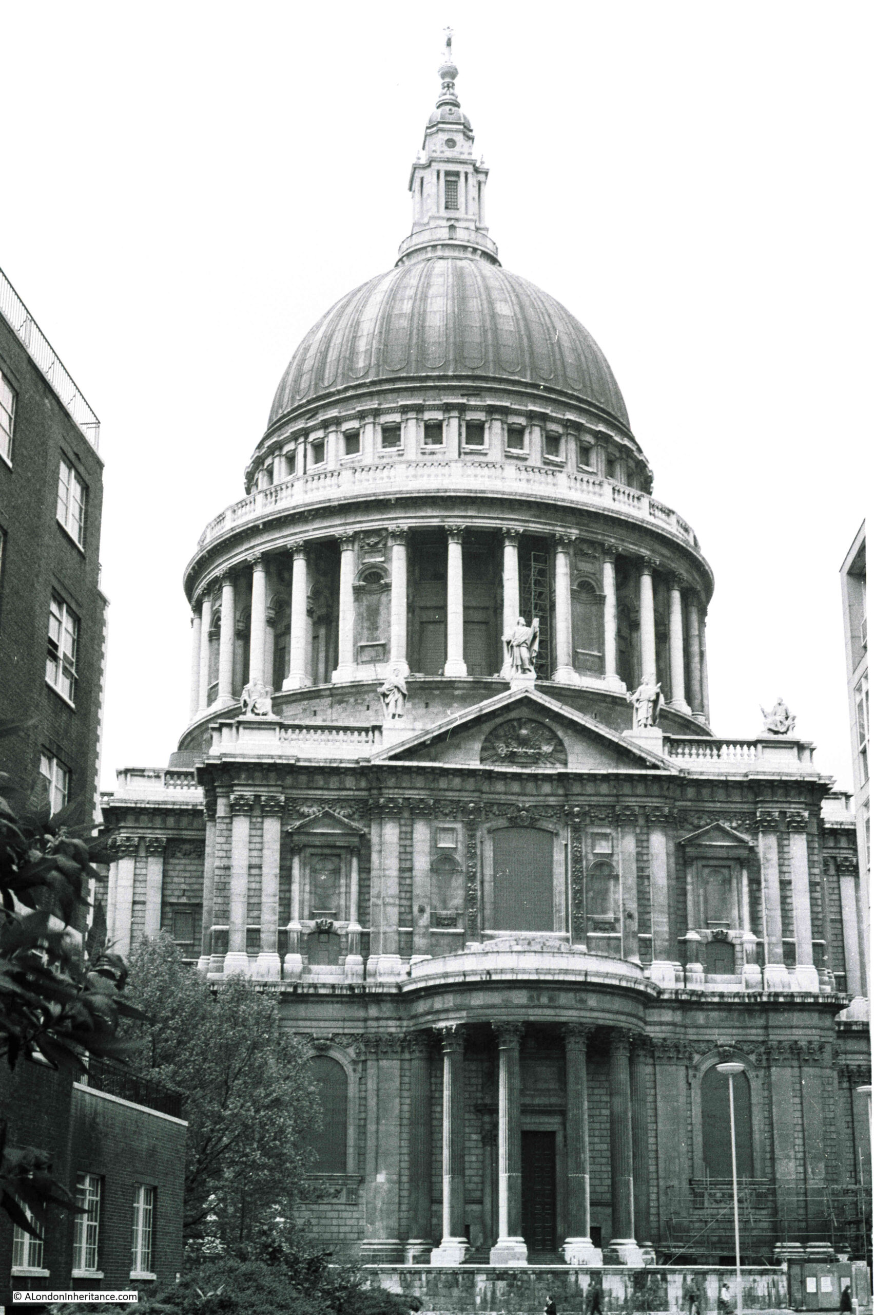
Another view of the south facing side of the cathedral in 1977:
The same view today of a much cleaner building:
The most recent full clean of St Paul’s Cathedral completed in 2011 ready for the 300th anniversary of the cathedral.
This had been a 14 year project which cleaned both the interior and exterior of the building. There were some controversial methods used to clean the cathedral, including a latex paste that was applied to the interior stone, which absorbed the layer of dirt and allowed this to be pulled away with the latex layer.
New methods have frequently been used for cleaning the building. In 1903, an American method of stone cleaning where a blast of pitsand was blown at the cathedral walls through a tube at a pressure of 30lb to the square inch, to try and remove the soot and dirt that was ingrained on the Portland stone of the building.
The main west facing entrance to the cathedral in 1977, photographed from Ludgate Hill.
The same view today:
My early memories of walking through the City are of a grey and dirty place, although it is also difficult to be sure how real some of these memories are. What is certain is that the buildings of the City are now much cleaner. The air in many places is better, but there are still many places where pollution levels are too high, generally close to busy roads as London today does not have the same polluting industries as it did.
Hopefully George Isaacs, MP for Southwark would be happy with the change, as well as Sir Christopher Wren who would now recognise the cathedral as it was when it was built.
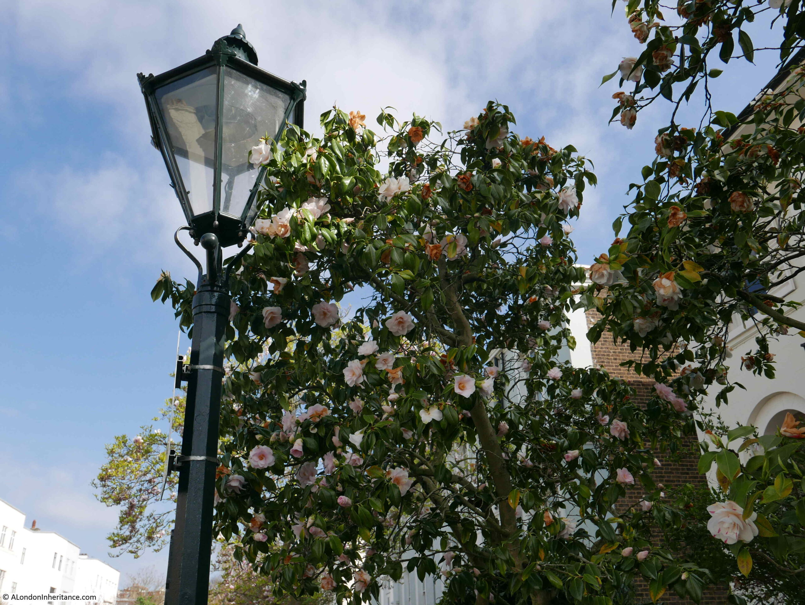
One of the pleasures of walking in London is turning off a very busy road and finding a very different place. The Cromwell Road in west London carries four lanes of traffic in and out of London, with the road being the main road route from Heathrow Airport to central London. It is the A4 that leads to the start of the M4 motorway. Lined with hotels, including the world’s largest Holiday Inn hotel. The road also passes the Natural History and V&A museum.
However, turn off the Cromwell Road opposite the Holiday Inn and after a four minute walk you will find one of the most picturesque of London’s mews.
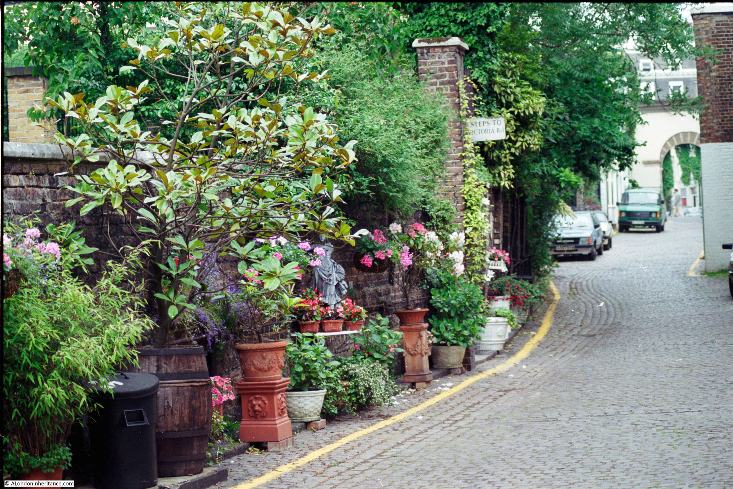
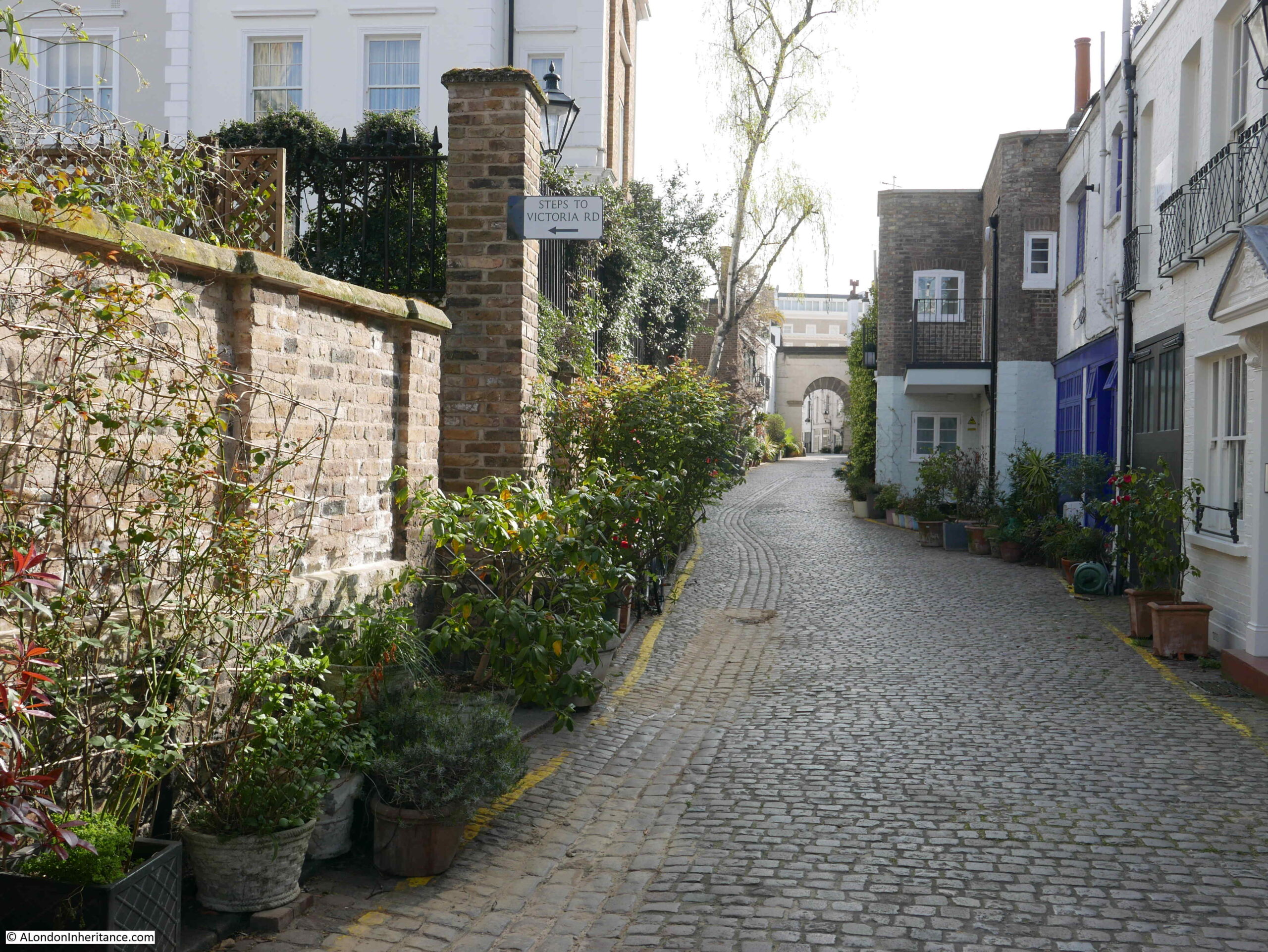
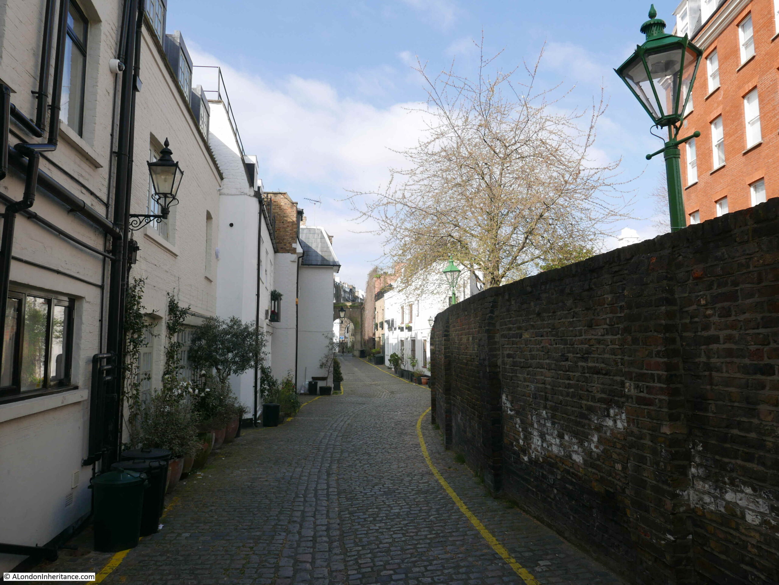
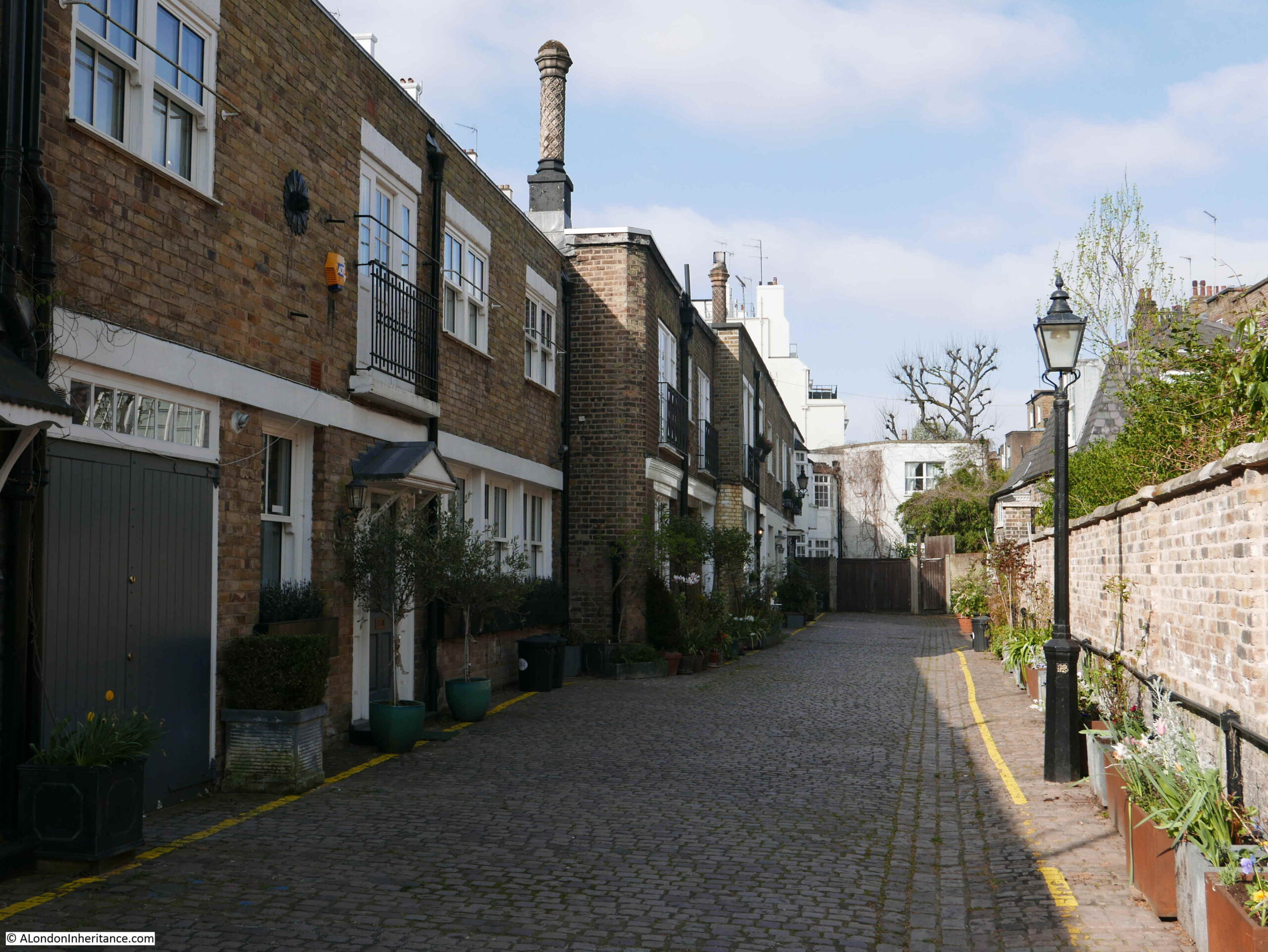
This is Kynance Mews, which my father photographed in 1986:
The same view thirty five years later:
The mews are a favourite of “travel and lifestyle” bloggers as well as on Instagram. I resisted the temptation to take any selfies whilst posing in front of the many picturesque locations along the mews.
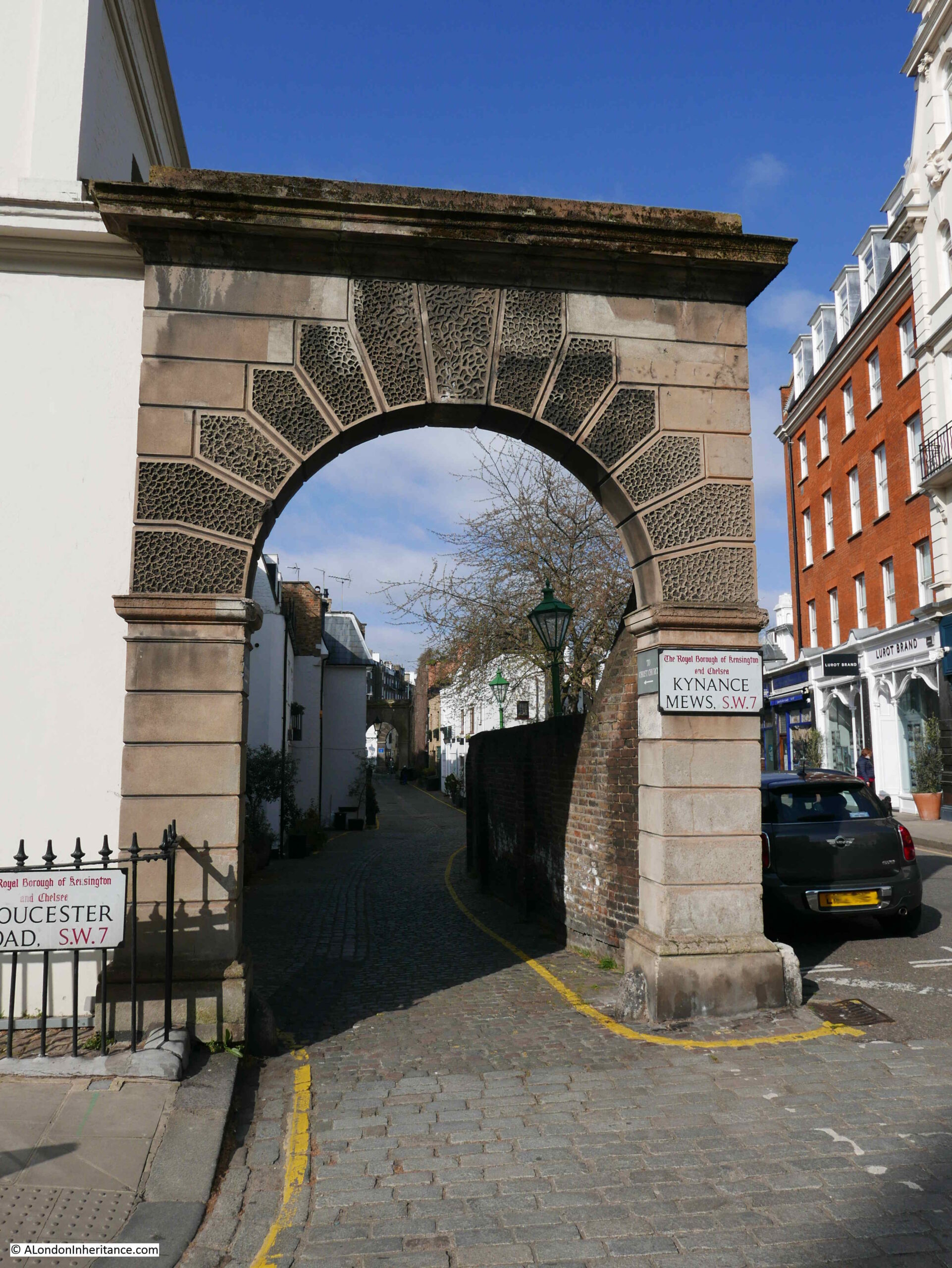
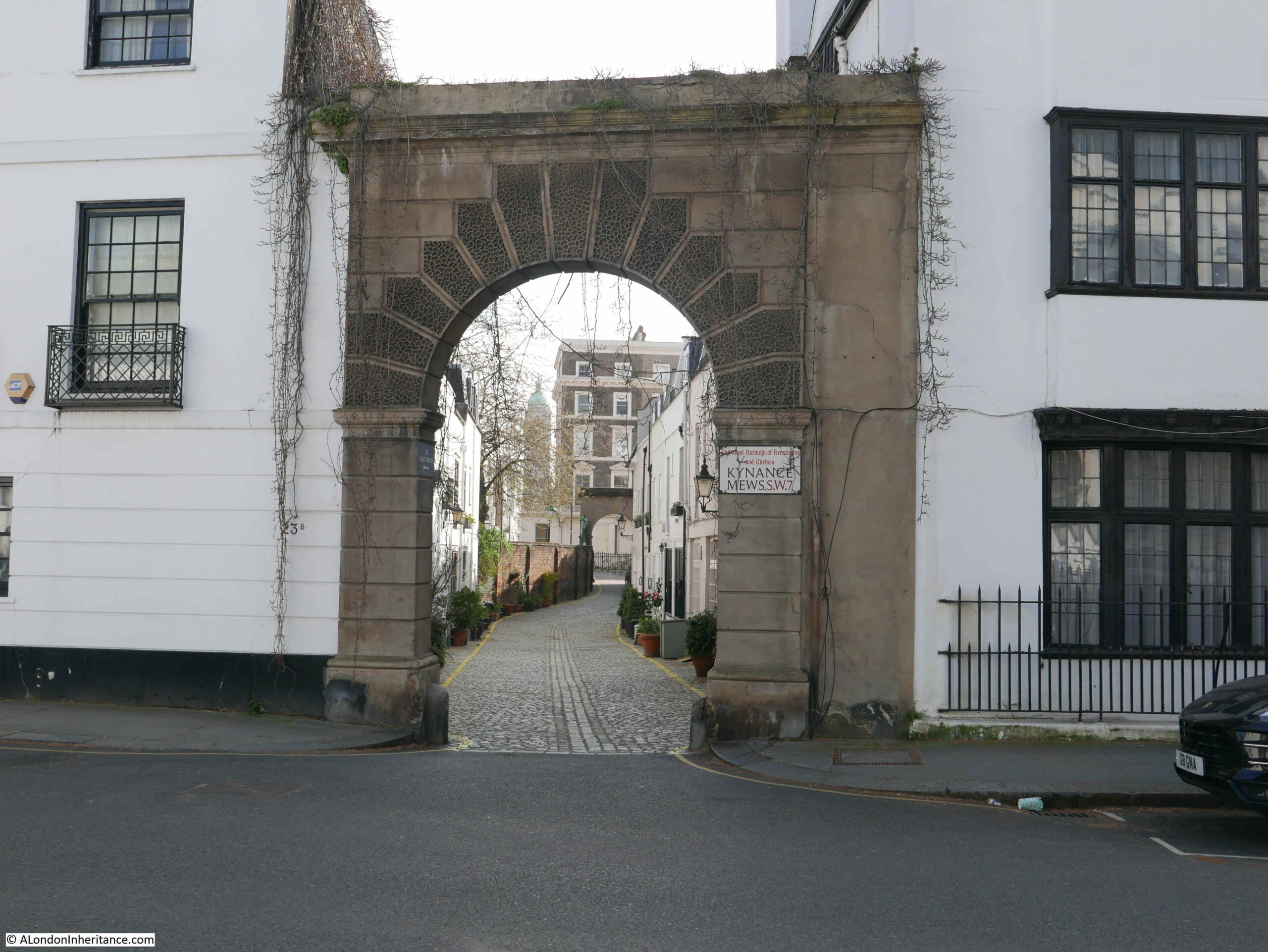
Kynance Mews starts on the Gloucester Road, where an arch can be found leading into the mews. The road on the immediate right of the entrance to the mews is called Kynance Place.
Looking through the arch and we can see Kynance Mews disappearing into the distance.
Kynance Mews is a few feet lower than Kynance Place and separated by a high brick wall.
Kynance Mews date from the 1860s, and owes its existance to the estate that was built to the south. The name is also not the original name for the mews.
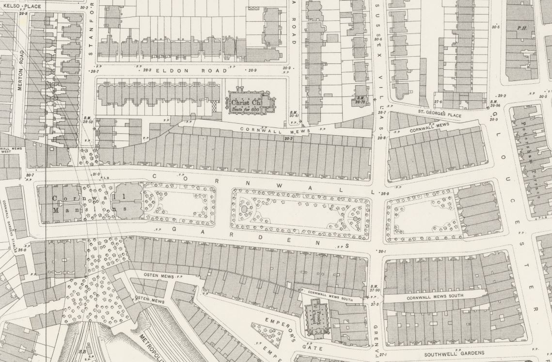
The following extract from the 1895 Ordnance Survey map shows the area thirty years after completion. In the centre of the map is the centre of the development – Cornwall Gardens, and behind the large houses on the north of the gardens is Cornwall Mews (‘Reproduced with the permission of the National Library of Scotland’).
The central area from Gloucester Road on the right and the edge of the map on the left was owned by Thomas Broadwood from 1803. By the 1850s, the area surrounding Broadwood’s land was being developed, and in 1862, Thomas Broadwood’s son (also called Thomas) decided to develop their own estate on the land.
After laying sewers in 1862, construction started on the houses and this work would continue until the mid 1870s. Work included the construction of Cornwall Mews which were built to provide stables to the large houses that the mews backed on to, the houses which formed the northern side of Cornwall Gardens.
The name Cornwall Gardens was chosen as the year when construction started (1862) was also the 21st birthday of the Prince of Wales, who also had the title of the Duke of Cornwall (the future King Edward VII).
The mews seem to have changed name from Cornwall to Kynance Mews around 1924. Kynance retains the Cornish connection with Kynance Cove on the Lizard, near Helson in Cornwall.
The entrance to Kynance Mews from Gloucester Road, with Kynance Place on the right of the mews entrance is one of the many strange street and building configurations on the estate. Kynance Mews is truncated in length and does not run the full length of Cornwall Gardens. Building lengths vary, and there are some rather odd alignments with the houses of neighbouring streets.
The reason comes down to Thomas Broadwood’s original land holding, with these early boundaries dictating the street and house plans we still see today.
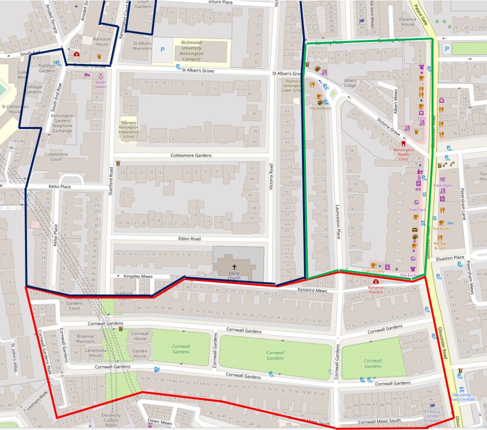
In the following map, I have outlined Thomas Broadwood’s land holding, and the boundaries of the Cornwall Gardens development in red. Cornwall / Kynance Mews runs along the top right of the boundary, but stops short as the end of the mews hit another land boundary, with the length of the houses at this point decreasing to align with the boundary (‘Reproduced with the permission of the National Library of Scotland’).
The red line of Broadwood’s boundary reveal some very strange street and building configurations. As we walk into Kymamce Mews, one of these can be seen with the first building in the mews that borders Kynance Place (then St Georges Place).
In the following photo the end of the boundary wall is on the right, followed by the first building, which starts of narrow and then does widen out slightly as Kynance Mews and Kynance Place diverge (see the above map).
The first section of Kynance Mews is relatively short, with Launceston Place cutting across (another Cornish connection with the Cornish town of the same name).
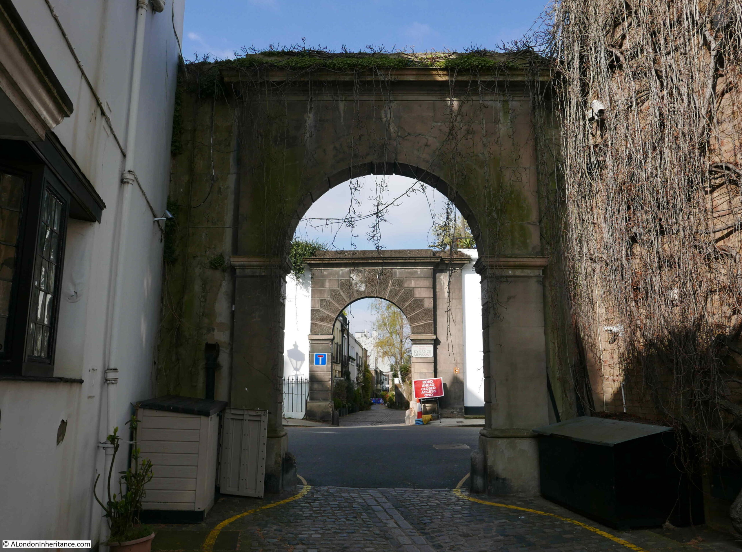
At the end of the first section, and start of the second section are two more arches that frame the entrance to Kynance Mews:
All three arches are Grade II listed, with their Historic England listing describing them as “Archway. Circa 1860. Simple stucco arch with rusticated piers and vermiculated architrave, cornice over”.
Crossing Launceston Place, and we can look back at the shorter section of Kynance Mews:
I visited the mews in April, before the plants and trees along the mews had come into leaf or flower. The two arches in Launceston Place should by now be topped with hanging green branches – part of what makes the mews popular with the Instagram and Lifestyle / Travel communities.
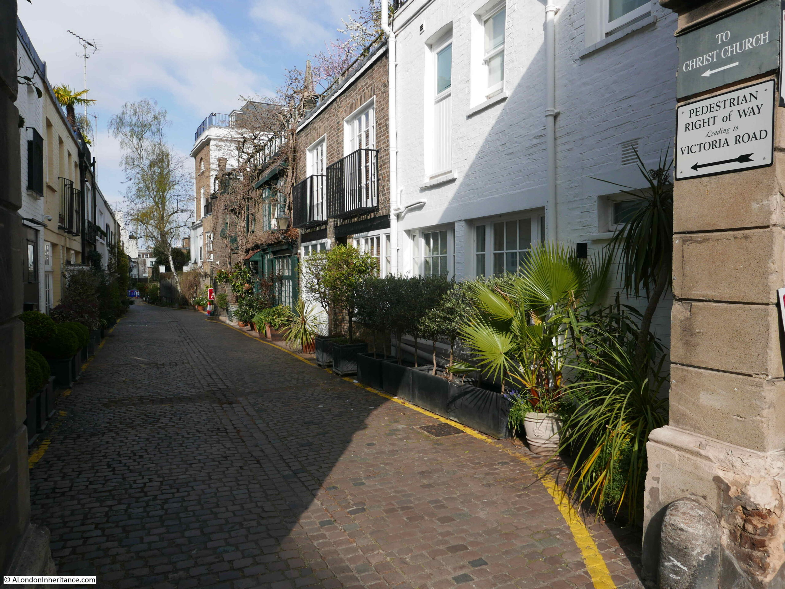
Walking through the arch and there is a sign on the right of the arch that points to a Right of Way and some hidden steps that provide a walking route out of the mews.
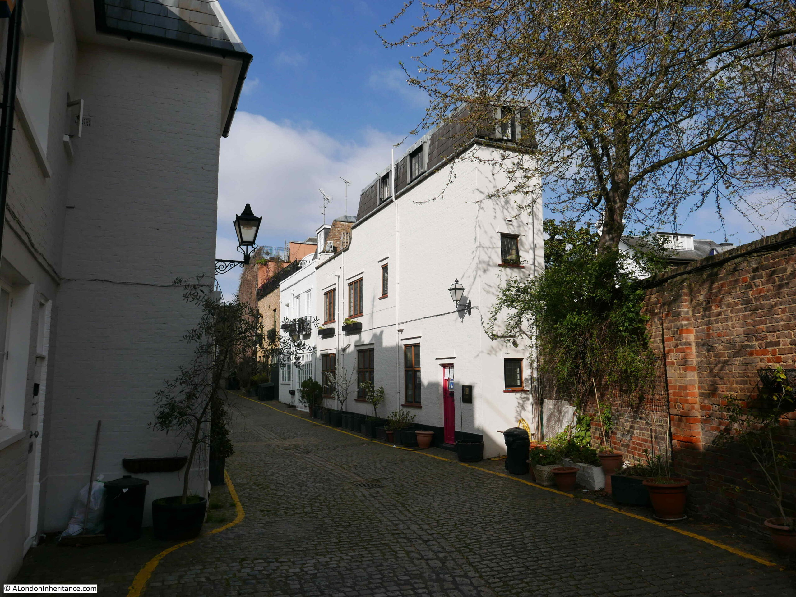
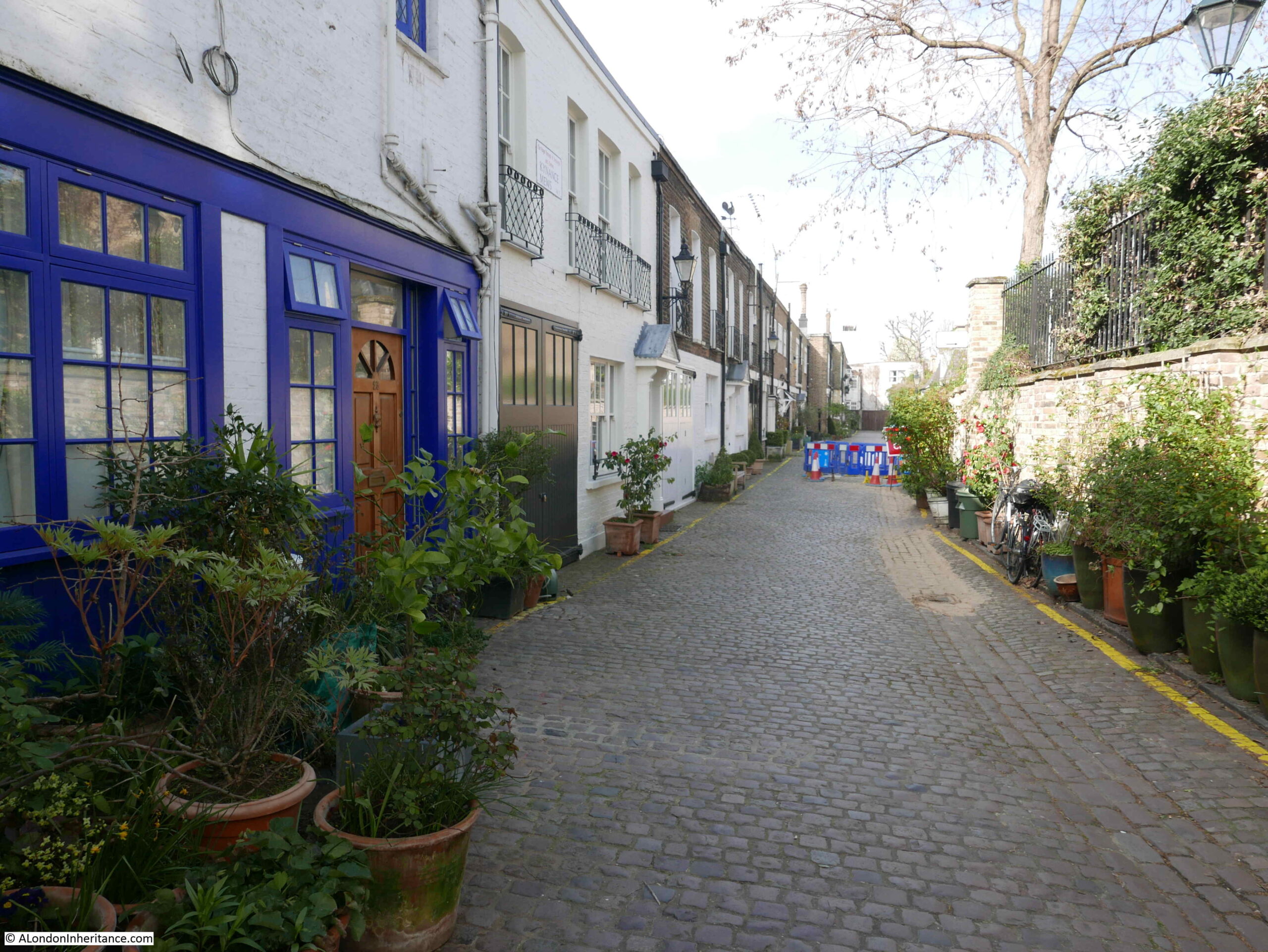
Walking further along Kynance Mews and we can see the two storey buildings that back onto the houses in Cornwall Gardens. A number of these retain the large doors that once would have been part of the stables.
The census of 1911 provides a view of the employment of those who lived in the mews:
Groom Domestic
Caretaker
Coachman Domestic
Farrier
Carman
Chauffer Domestic
Horse Keeper
The majority of those living in the mews had jobs that seem to have involved some aspect of providing the transport for those who lived in the large houses in Cornwall Gardens, there were also a number of trades people who were probably employed in local building and maintenance works.
The transition from horse to motor transport can be seen in newspaper reports from the 1910 onwards, including one from the 14th July 1928 when Lady Grace Indja Thomson of Bell Cottage, Kynance Mews was fined 10 shillings for driving without a licence.
Lady Grace Indja Thomson was the wife of Sir Basil Home Thomson, who was typical of many of the residents of the Cornwall Gardens estate, having passed through Eton and Oxford then working in the Colonial Service where he was posted as a Colonial Administrator in Fiji and Tonga. After resigning from the Colonial Service and returning home, he took up appointments first with the Prison Service, then the Metropolitan Police.
I suspect that the original occupiers would have been stunned by the prices the houses in Kynance Mews now sell for, and the rate at which they are increasing. A typical terrace house in the mews sold for £975,000 in 2001 and was sold again in 2020 for £2,175,000.
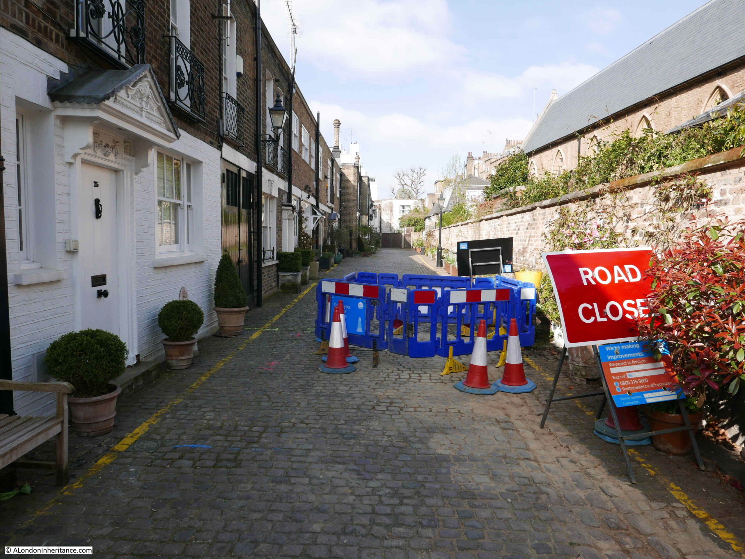
Despite these prices, and being in a mews, the houses still suffer with road works. This is the reason why my 2021 photo is slightly different to my father’s, which, as far I could work out, was taken in the middle of the road works.
The western end of Kynance Mews terminates in a dead end, with houses on another estate, not part of Thomas Broadwood’s original land holding and Cornwall Gardens development on the other side of the wall.
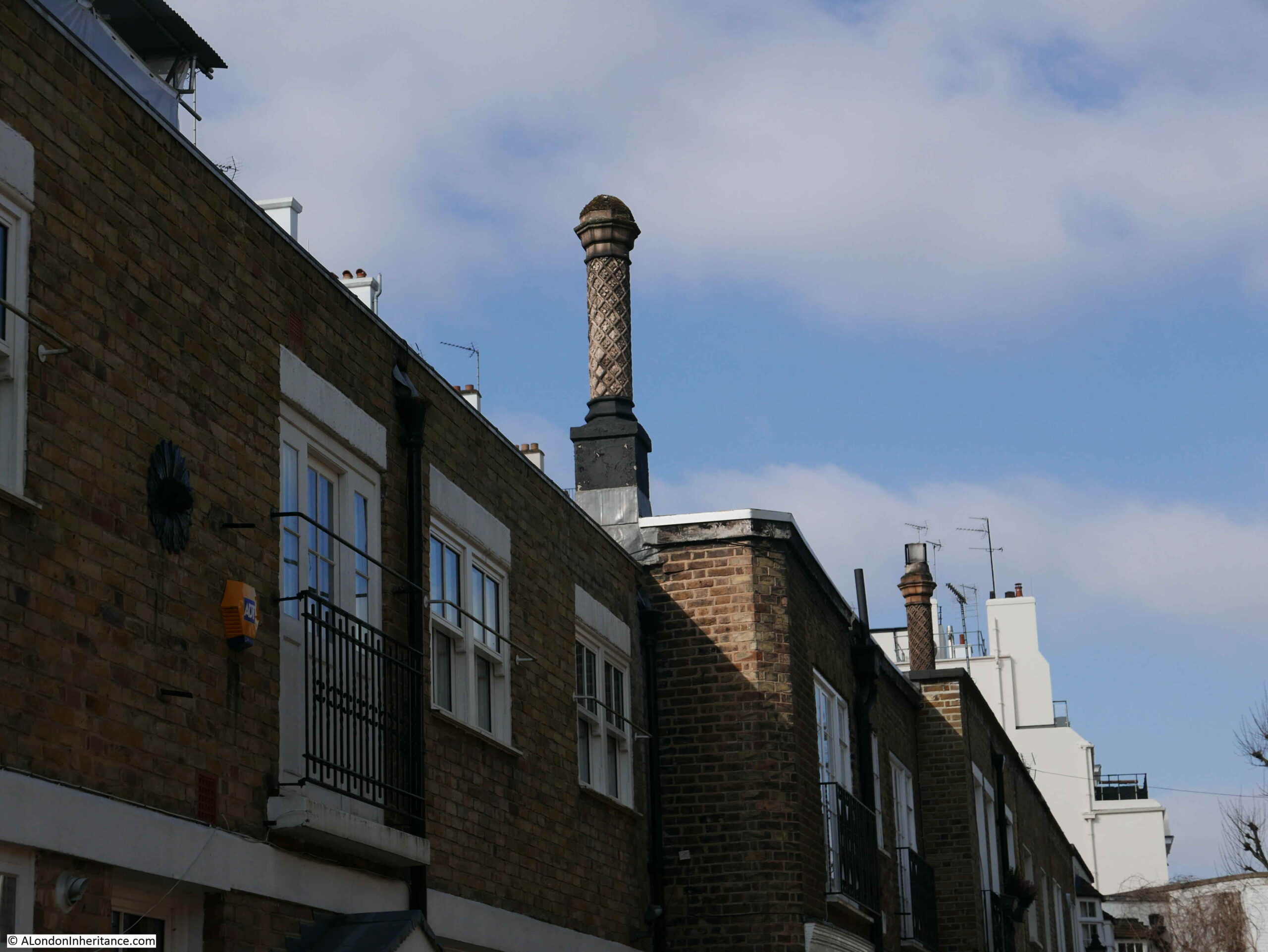
There are some rather ornate chimneys lining the roofs of some of the houses in Kynance Mews:
To the north of Keynance Mews, on the other side of the boundary wall is Christ Church, Kensington:
In my father’s 1986 photo, there is a sign projecting from the wall on the left. The sign directs the walker to a set of stairs leading up to Victoria Road, on the eastern boundary of the church. The stairs form part of the pedestrian right of way seen on the sign on the arch leading to this section of the mews.
There are a number of stubs of roads in this part of Kensington which reflect the original estate boundaries. Victoria Road has a short stub that passes the church and ends at the boundary wall with Kynance Mews, and this stub of road provides access to the stairs which can just be seen behind the motorbike and adjacent to the lamp post.
The above photo also helps to demonstrate the difference between the size of the mews houses in the foreground, and the much larger houses to the rear which faced onto Cornwall Gardens, and that the mews buildings were built to serve.
For the rest of the post, I will take a walk in the streets to the north of Kynance Mews, as the stairs were part of the original 1986 photo and the mews and land to the north show how original owners and land boundaries influenced the current layout of streets and buildings in this part of Kensington.
The land to the north of Kynance Mews was known as the Vallotton estate, as it was developed by the Vallotton family.
John James Vallotton purchased the first parcel of land in the area in 1794. His son Howell Leny Vallotton continued with land purchases to form a significant block of land amounting to around 20 acres.
Development of Victoria Road seems to have started around 1829, and development of the area would continue through the 1830s to 1850s.
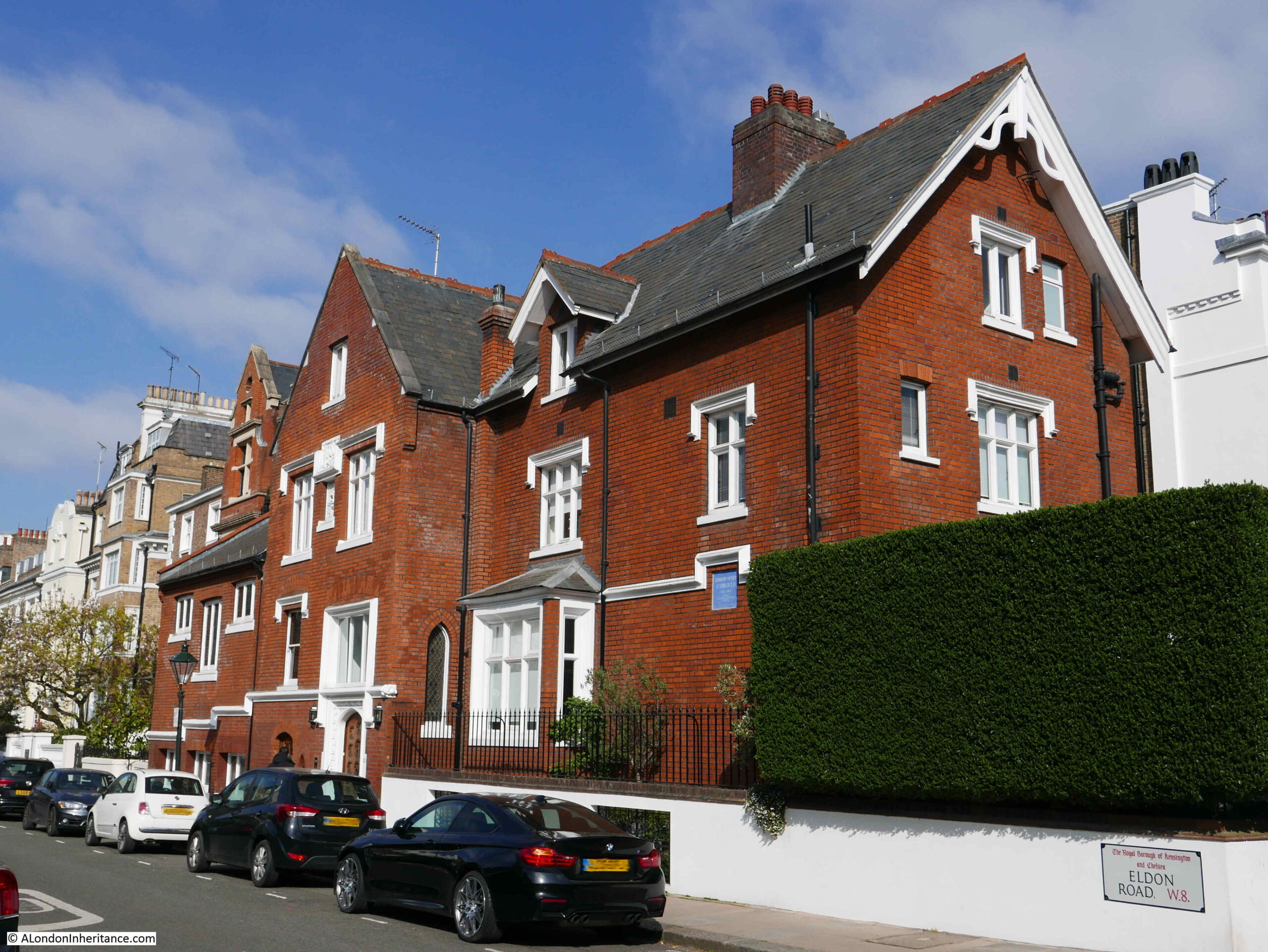
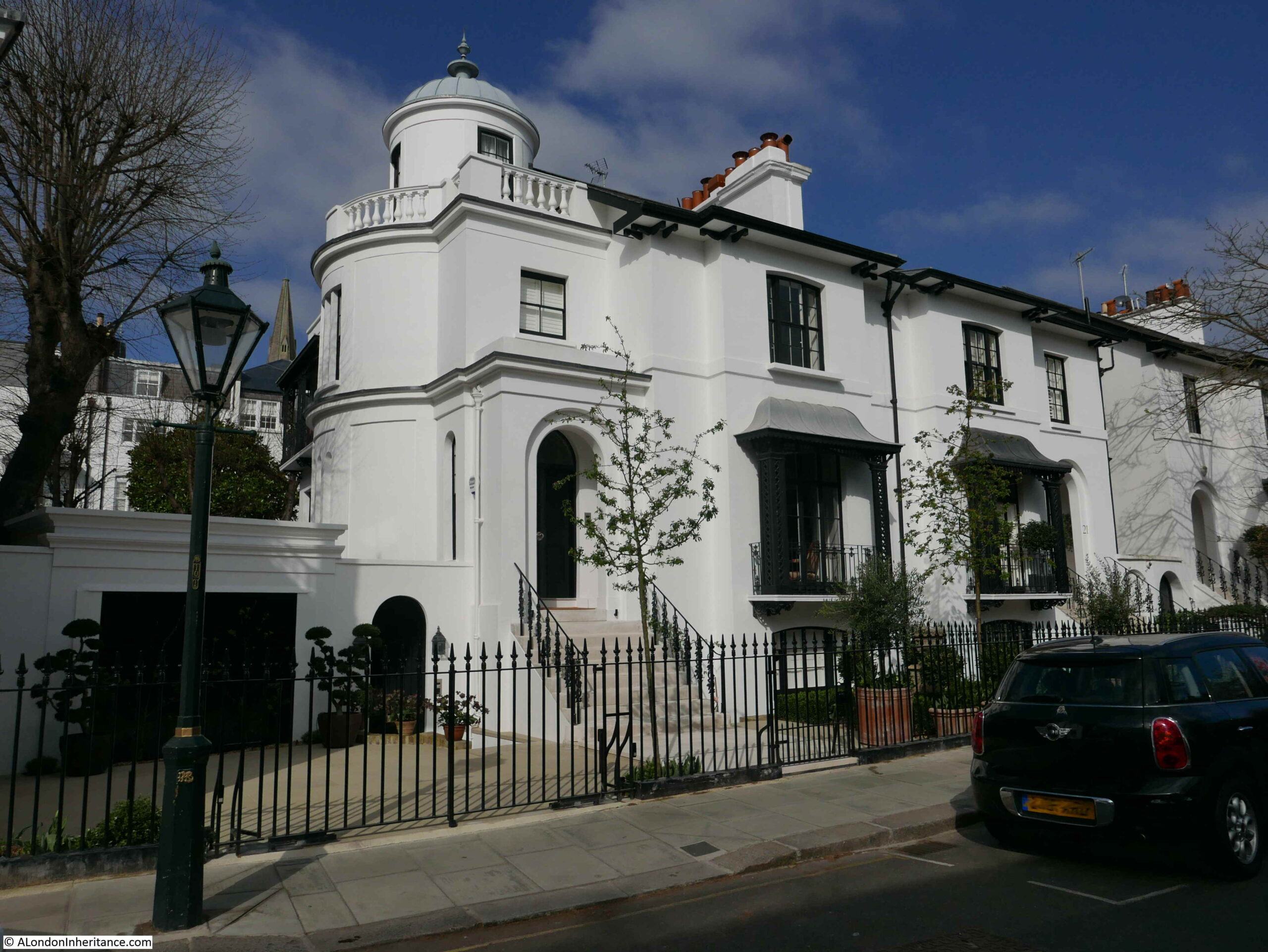
The Vallotton estate has a varied mix of architectural styles and construction materials. On the corner of Eldon Road and Victoria Road is number 52 Victoria Road:
Built between 1851 and 1853 for the painter Alfred Hitchen Corbould, the building has a square blue plaque recording his residence here, and that he was Art Tutor to the children of Queen Victoria.
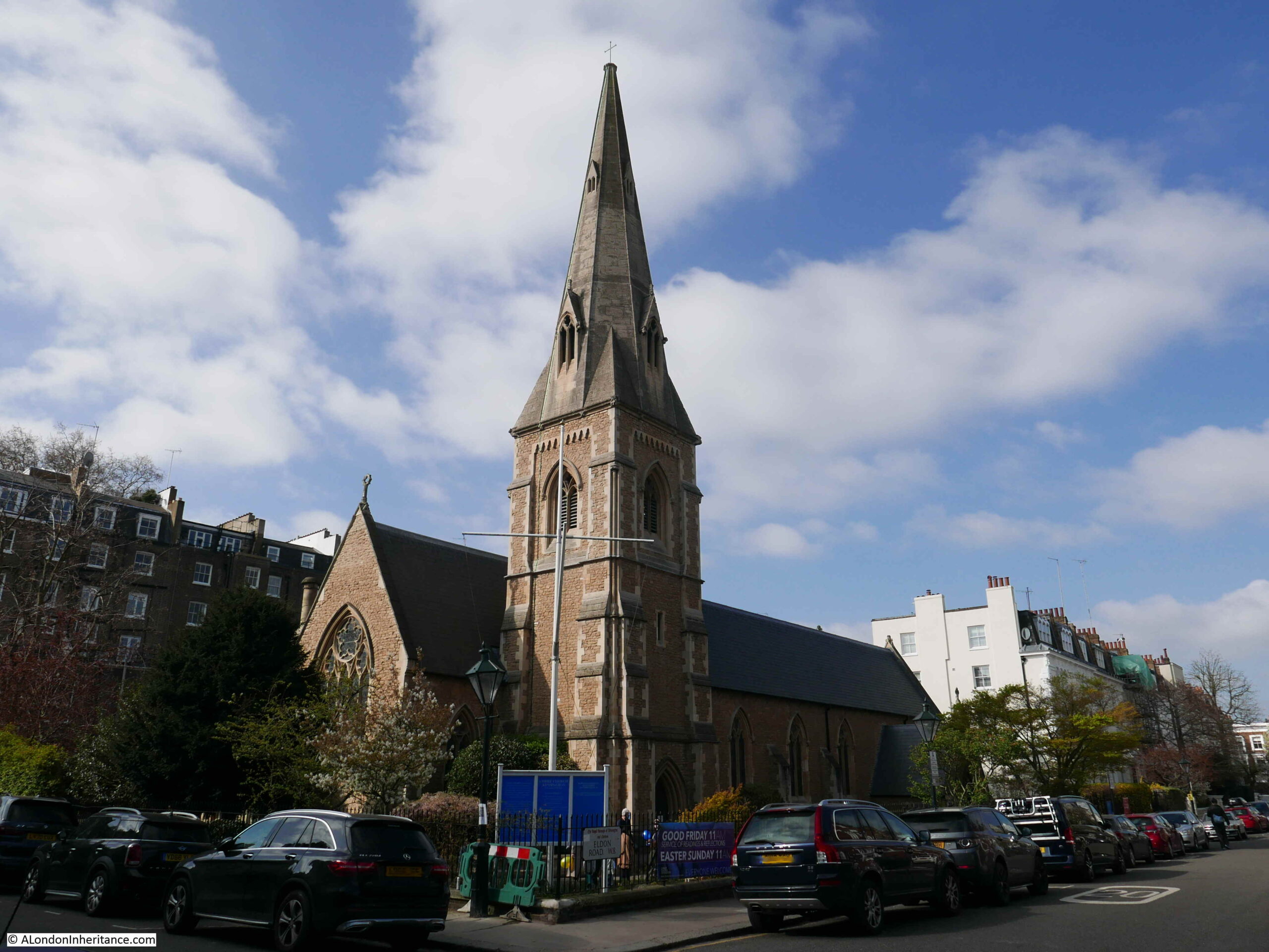
Opposite the above house, and on the corner of Eldon and Victoria Street is Christ Church Kensington, the church that backs onto Kynance Mews.
The church was built to a design by Benjamin Ferrey between 1850 and 1851 to serve the growing population of Vallotton’s estate. Vallotton had donated the land, and subscriptions were raised to fund the £3,540 bid for the work from builder George Myers of Lambeth.
Very few changes have been made to the church in the 170 years since completion and the church still looks as it was designed and completed.
Christ Church Kensington also serves the Cornwall Gardens estate, and is possibly one of the reasons why there is a public right of way between Kynance Mews and Victoria Road, to provide easy walking access to the church from the mews and Cornwall Gardens.
A church had been planned on the western end of Cornwall Gardens, however whilst the estate was being developed, the Metropolitan and District Railway was also being built and used land through the western end of the gardens where the church had intended to be placed.
The railway used the cut and cover method of construction and therefore prevented any work on the western end of the estate whilst it was being built, and complicated any construction on the land above when the railway was completed.
From the church, I continued to walk north along Victoria Road, the street that was the first part of the development of the Vallotton estate.
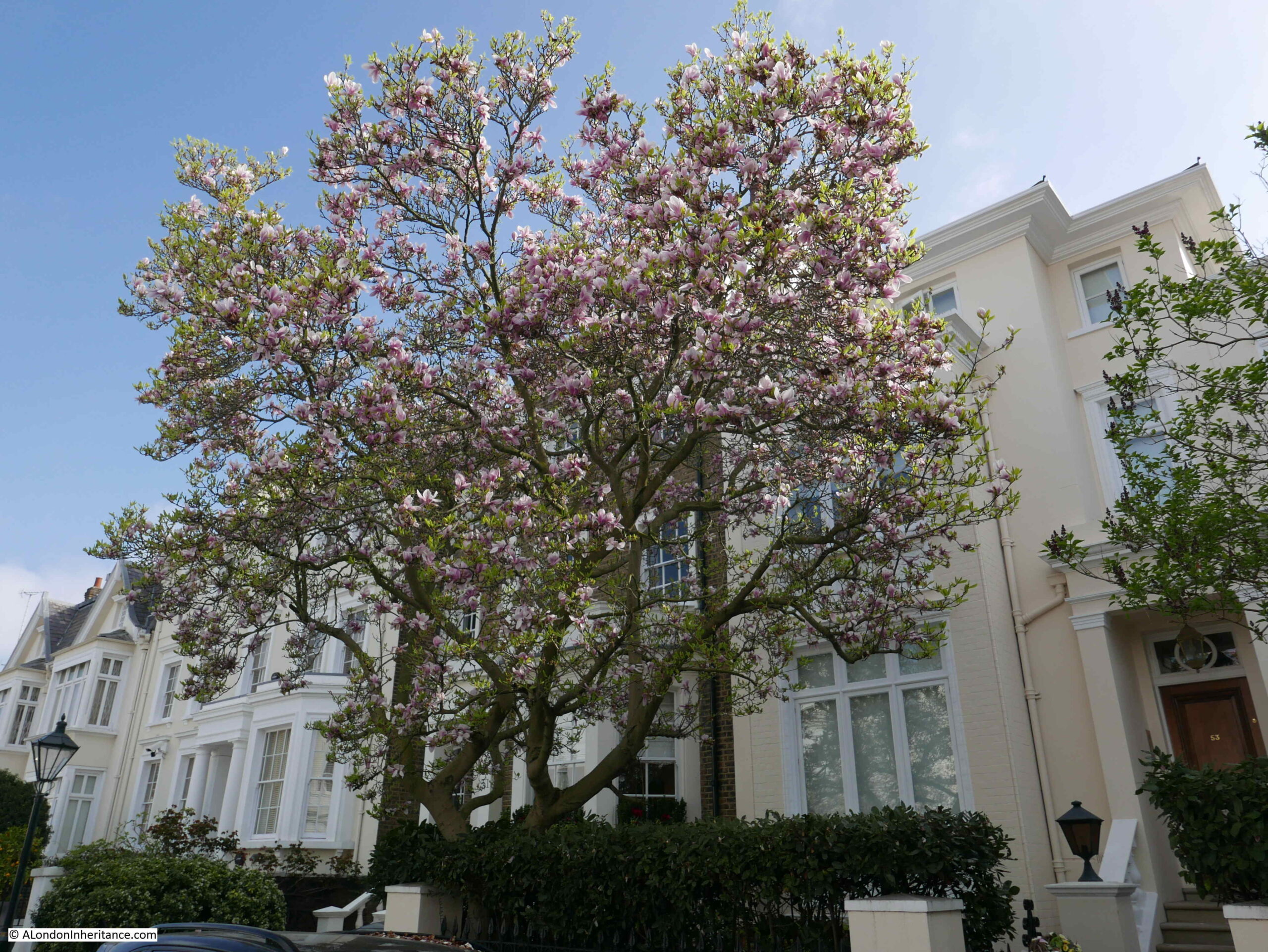
Victoria Road originally consisted of semi-detached pairs of villas, surrounded by substantial gardens. There has been a fair amount of ongoing development of the houses resulting in few being exactly as built.
Despite changes since their original construction, the houses still look magnificent. The street is quiet as the design of the estate and boundaries with other estates mean that it is not a through road.
The flowers and spring blossom on the trees add to the photogenic appearance of the estate.
Victoria Road is a long street that runs all the way north to Kensington Road, and I do not intend to walk that far, rather head back to the start of Kynance Mews, so at the road junction with St Albans Grove, I turn right.
It is here that I cross into another of the original estates that developed this part of Kensington.
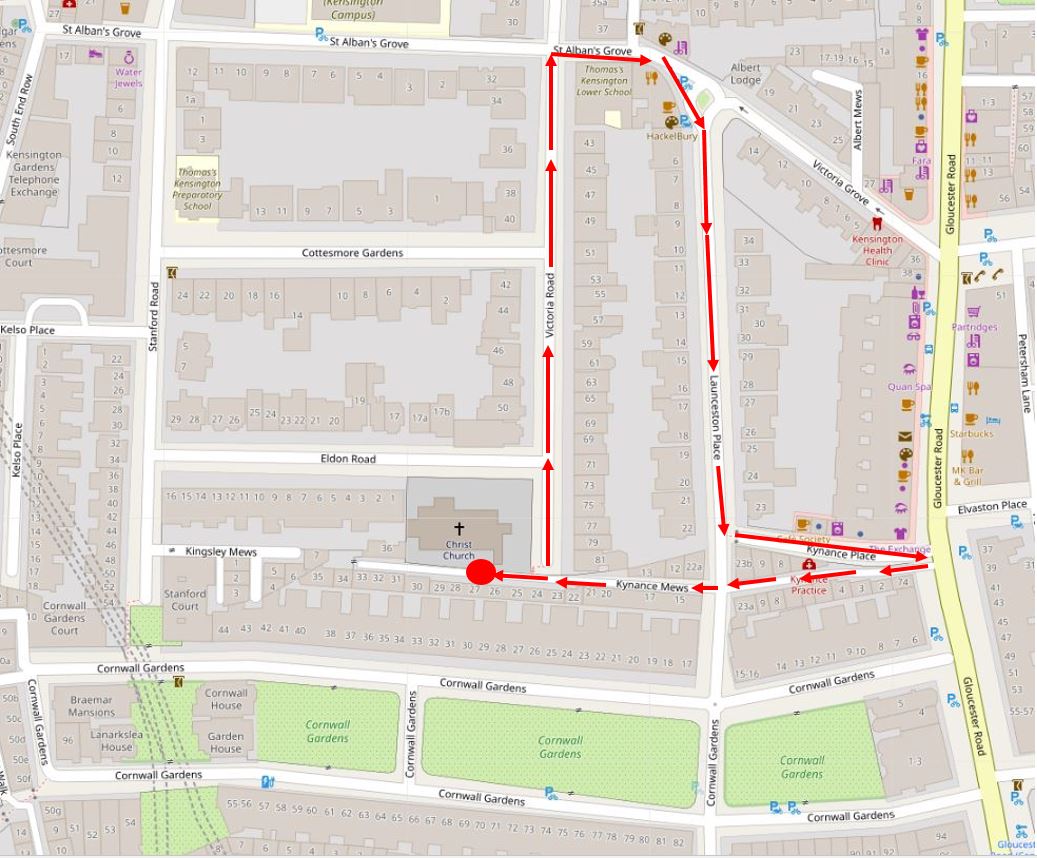
In the following map, I have marked the three estates that I am walking through. The Cornwall Gardens estate is marked by the red line. The Vallotton estate is bounded by the dark blue line and can be seen as the larger of the estates as it continues to head north.
The land comprising the Inderwick estate was purchased by John Inderwick in 1836 from Samuel Hutchins, who in turn had purchased the land from the manor of Kensington.
John Inderwick was an importer of pipes and snuff boxes who lived in Wardour Street. His pipe business was still in operation until as recently as 2000 when the business was finally closed. It had operated in Carnaby Street since the 1960s.
The relatively small size of the Inderwick estate probably explains the speed of construction, with work starting in 1837 and completed by 1846, with Launceston Place being the last street to be developed.
In the above map you can also see where the railway cut through the western end of Cornwall Gardens using the cut and cover method of construction. This was where the Cornwall Gardens church was intended to be built.
Launceston Place was the street that took me back down to Kynance Mews. The houses in Launceston Place are slightly smaller than Victoria Road, but are still lovely semi-detached villas.
With some interesting designs at some of the end of terrace pairs:
Where the gardens at the rear of the houses in Launceston Place meet the gardens at the rear of the houses in Victoria Road, there was an old footpath before the estates were built, that went by the name of Love Lane, which would also have been the original boundary of the Vallotton and Inderwick estates.
I find it fascinating when walking London’s streets that the route of 500 year old footpaths, and ancient land holdings can still be traced today.
Until 1883, Launceston Place was called Sussex Place. the name change seems to have been to extend the Cornish connection across the area.
Before Launceston Place cuts across Kynance Mews, I turn into Kynance Place, a short street that to the south has the narrow buildings and brick dividing wall with Kynance Mews, maintaining the division between the Inderwick and Cornwall Gardens estates.
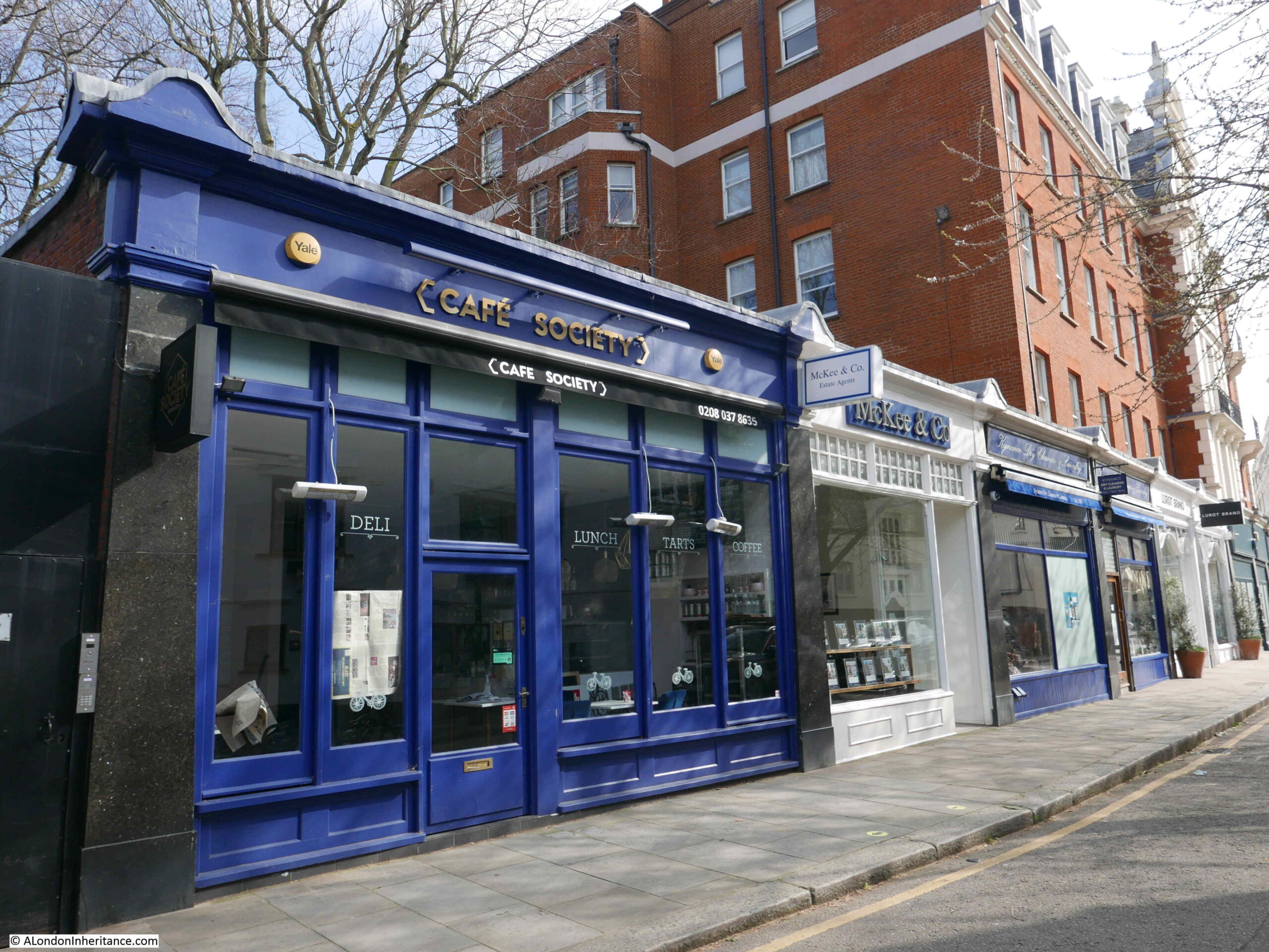
The northern side of Kynance Place has a line of small shops:
The early history of Kynance Place illustrates the problems that the early developers of these estates had with infrastructure.
Whilst Inderwick could complete the sewers across his estate, he would have needed a larger sewer to connect with to drain away from the estate. When he started to build the estate, no such sewers were available. There were plans to build a large sewer along Gloucester Road, however Inderwick would have had to pay the full costs of such a project.
Until there was a connecting sewer available, Inderwick was forced to construct a large open cesspool where Kynance Place now stands. Although Inderwick improved his own infrastructure, the estate had to wait until the 1860s when the Gloucester Road sewer was finally completed.
And at the end of Kynance Place, I am back to where I started the walk through Kynance Mews.
Kynance Mews probably looks even better now as the greenery will probably be out, and it is well worth a visit for a fascinating walk through an area where the boundaries of the three original estates that formed the area can still be found.