I cannot remember the last time I used a telephone box, or when I last saw anyone else using one. The mobile phone has effectively killed off the need to find a telephone box, yet they are still to be found across the city.
I have a number of photographic themes when walking London’s streets and for the last couple of years, London’s telephone boxes has been added to my theme list. So long a key part of the city’s street infrastructure, I wonder for how long they will survive.
The majority do not work, many have had their phone equipment removed, and many are not in a state that you would wish to stand in and make a call, even if they did work.
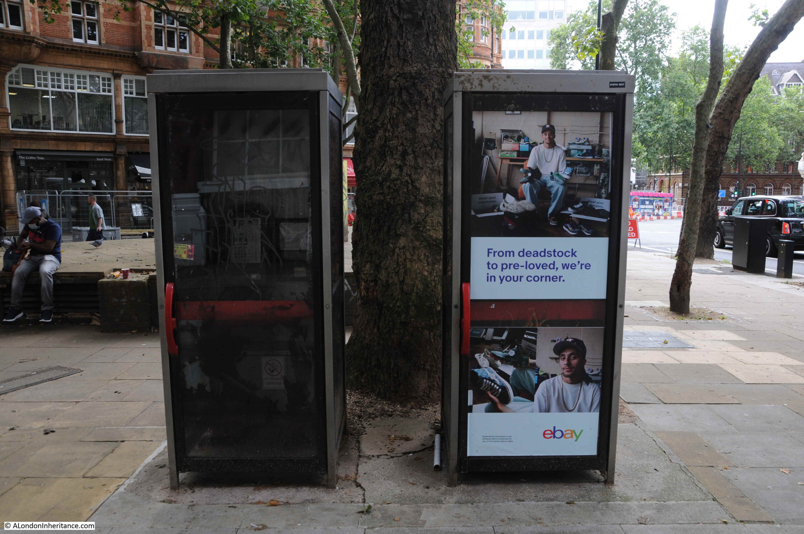
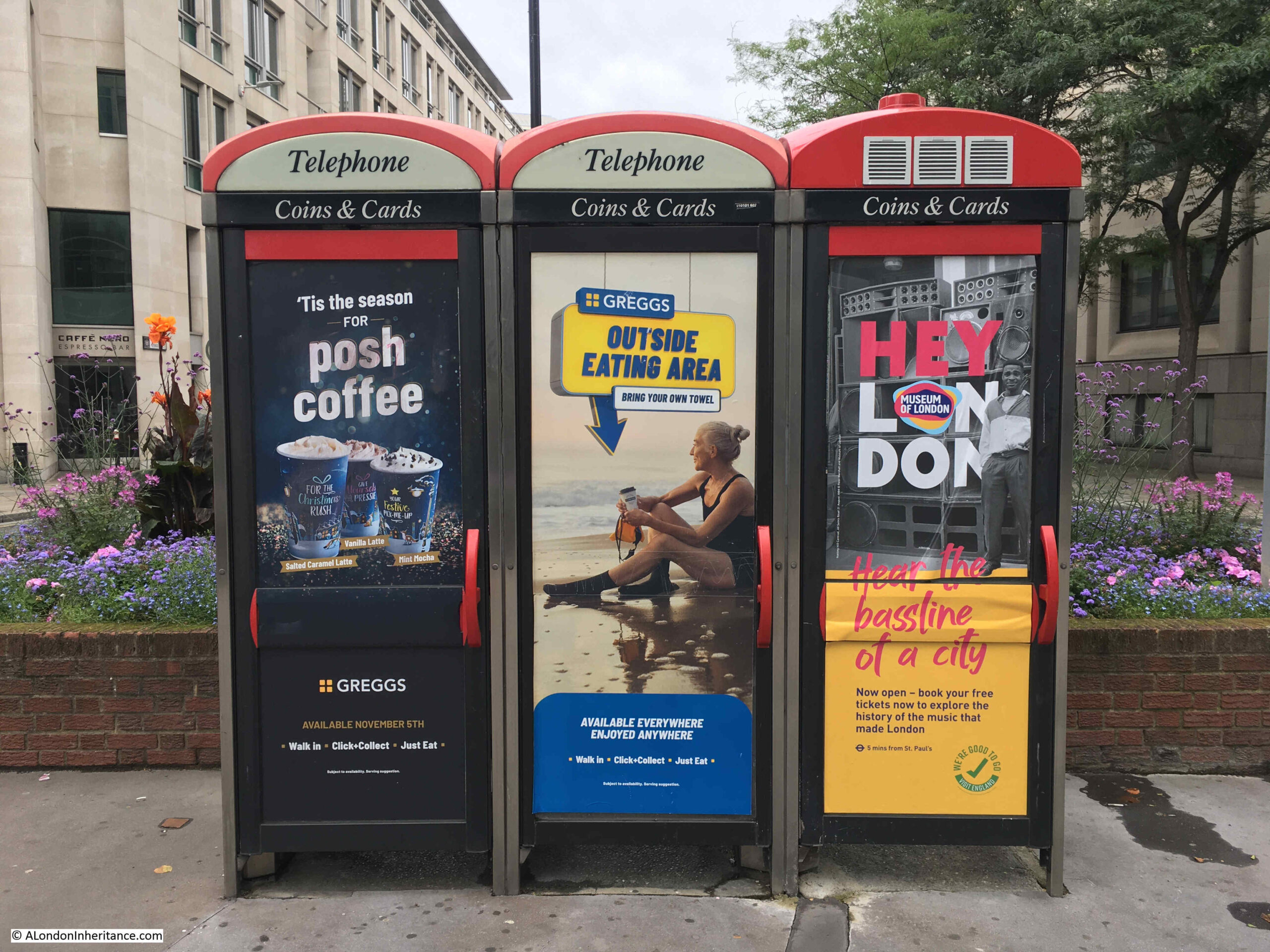
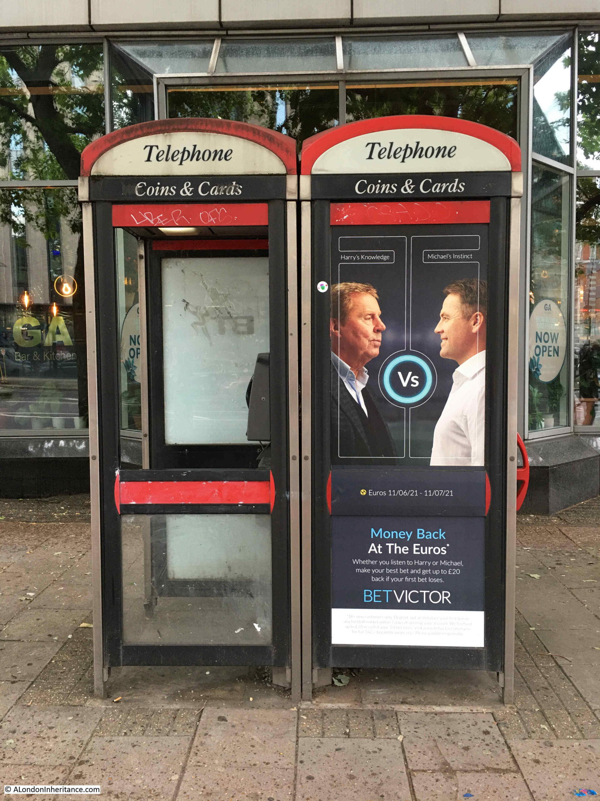
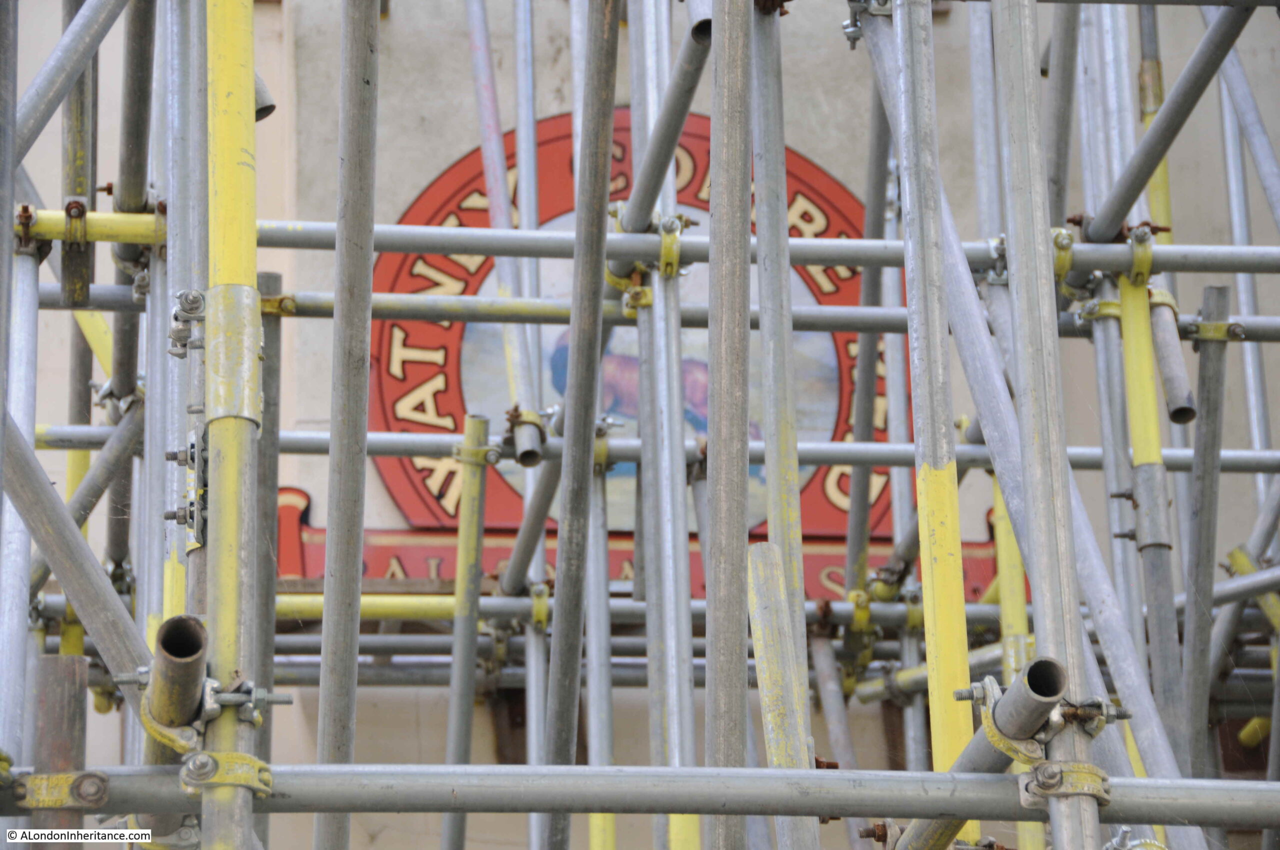
Some have found new uses. The most common being advertising as they are often in prime street locations, with full length advertising covering their windows.
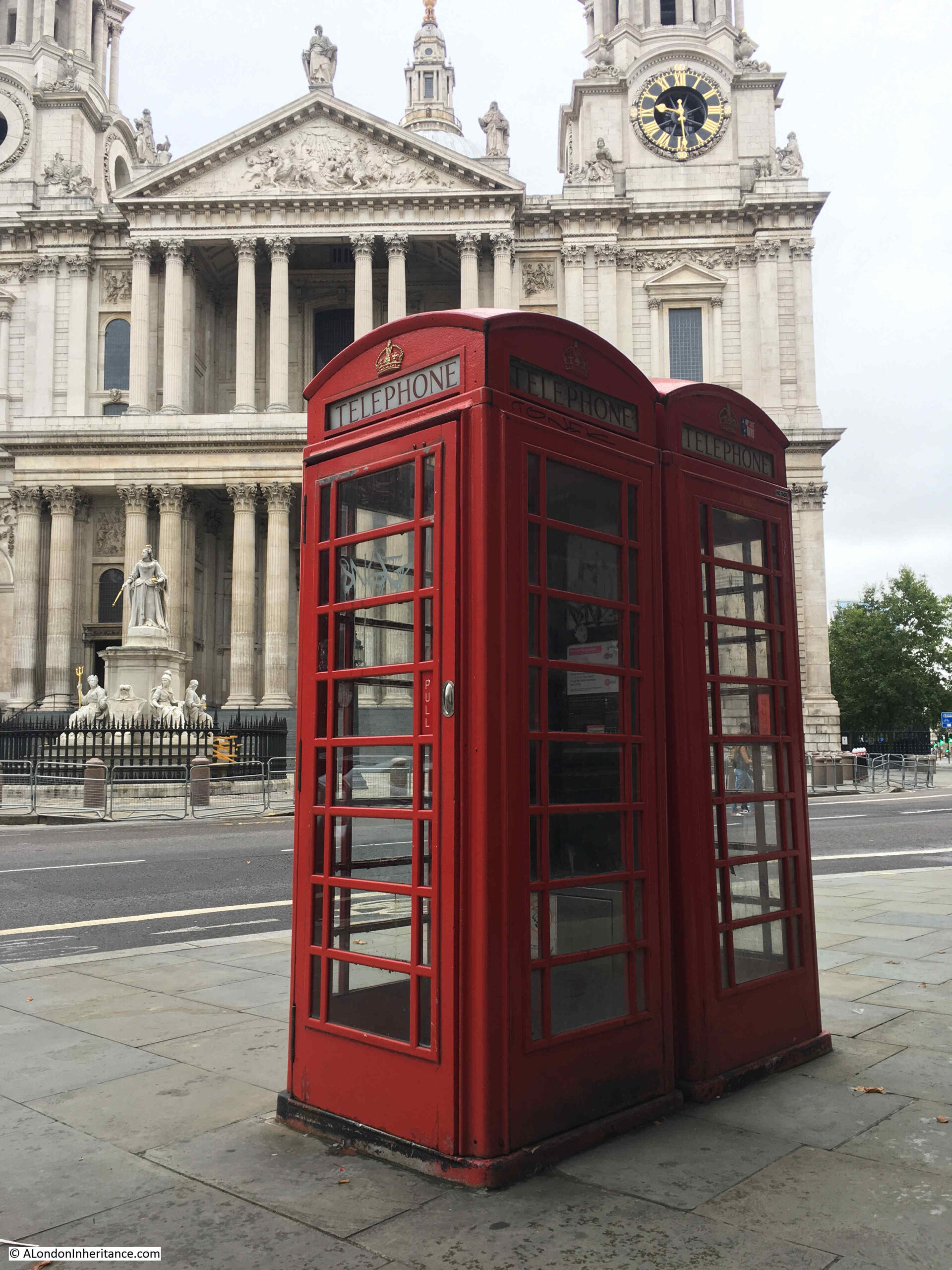
The original red telephone box was designed by Sir Giles Gilbert Scott, a design he entered into a Post Office competition in 1924. The model K2 telephone box was the result, which first appeared on the streets of London in 1926. He would then update the design to the K6 which first appeared in 1934 and is the traditional red telephone box we see across the streets of the city.
There have been many modifications, and significant redesigns, the majority of these coming after the Post Office / British Telecom was privatised in the 1980s.
The technology in the phone box has changed over the years. I can just remember the manual method of paying for a call when you had to Press Button A to put coins into the phone to make a call, then if the call was not answered, Press Button B to return the coins.
Having the right change for a phone call was always a problem, and hearing the dreaded pips when the money was running out and you had no more change was a challenge for calls of more than a few minutes.
I have to admit to finding telephone boxes rather scary. I know exactly why. As a young teenager I watched the short 1972 Spanish horror film La Cabina, or the telephone box on TV. It is why whenever I used a telephone box I would always keep my foot in the door, to keep it slightly open. The film is on Reddit, here.
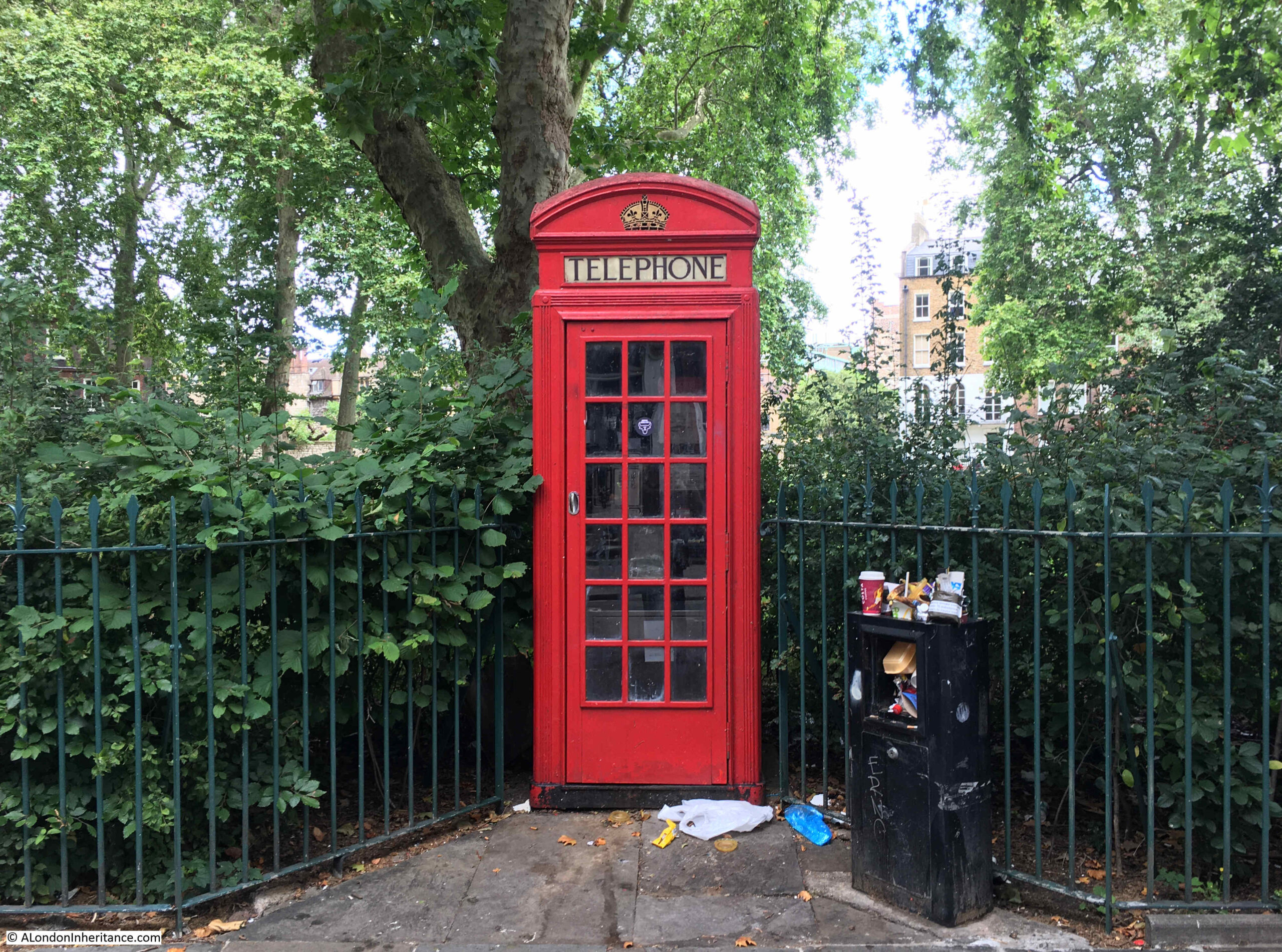
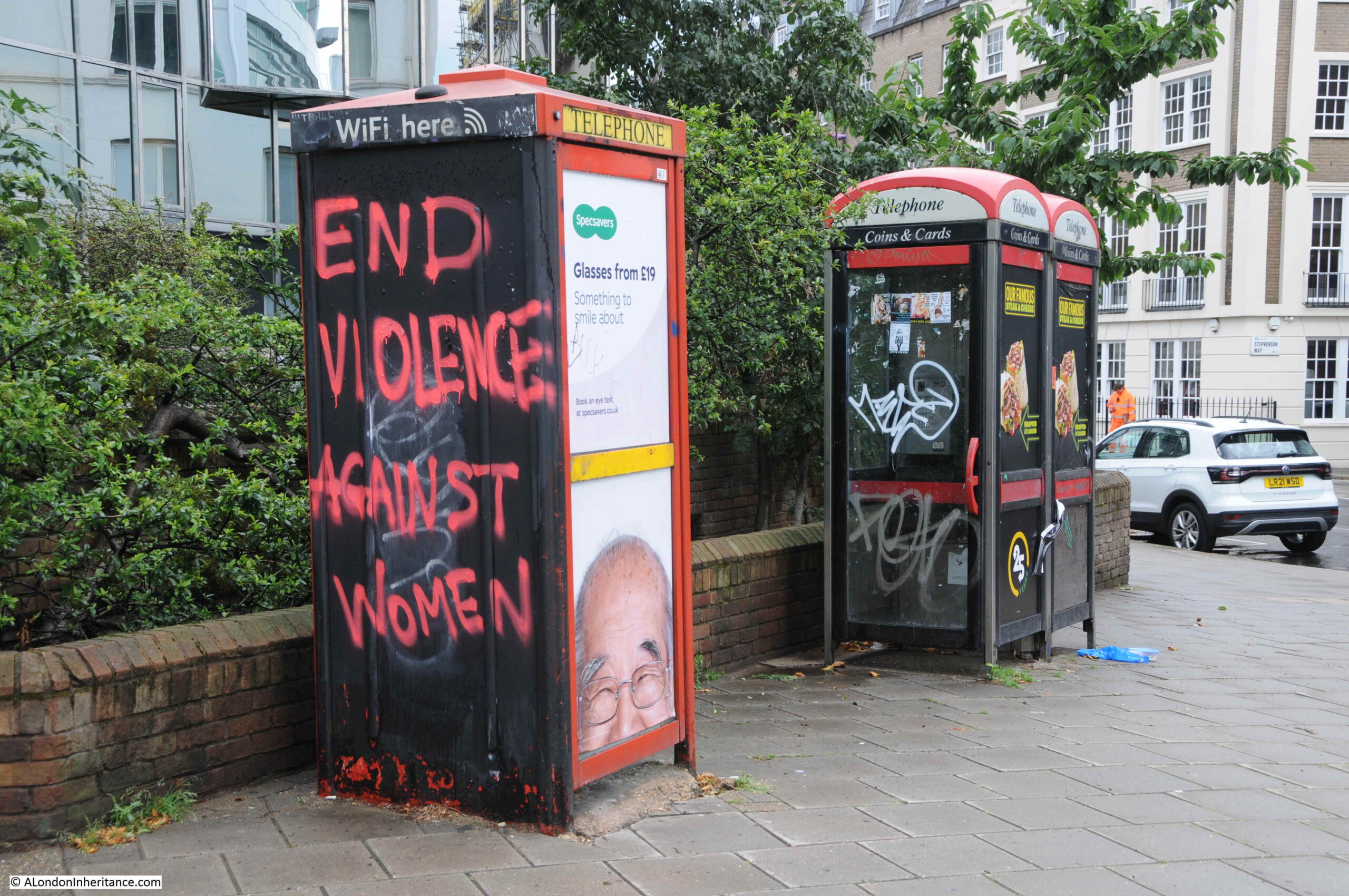
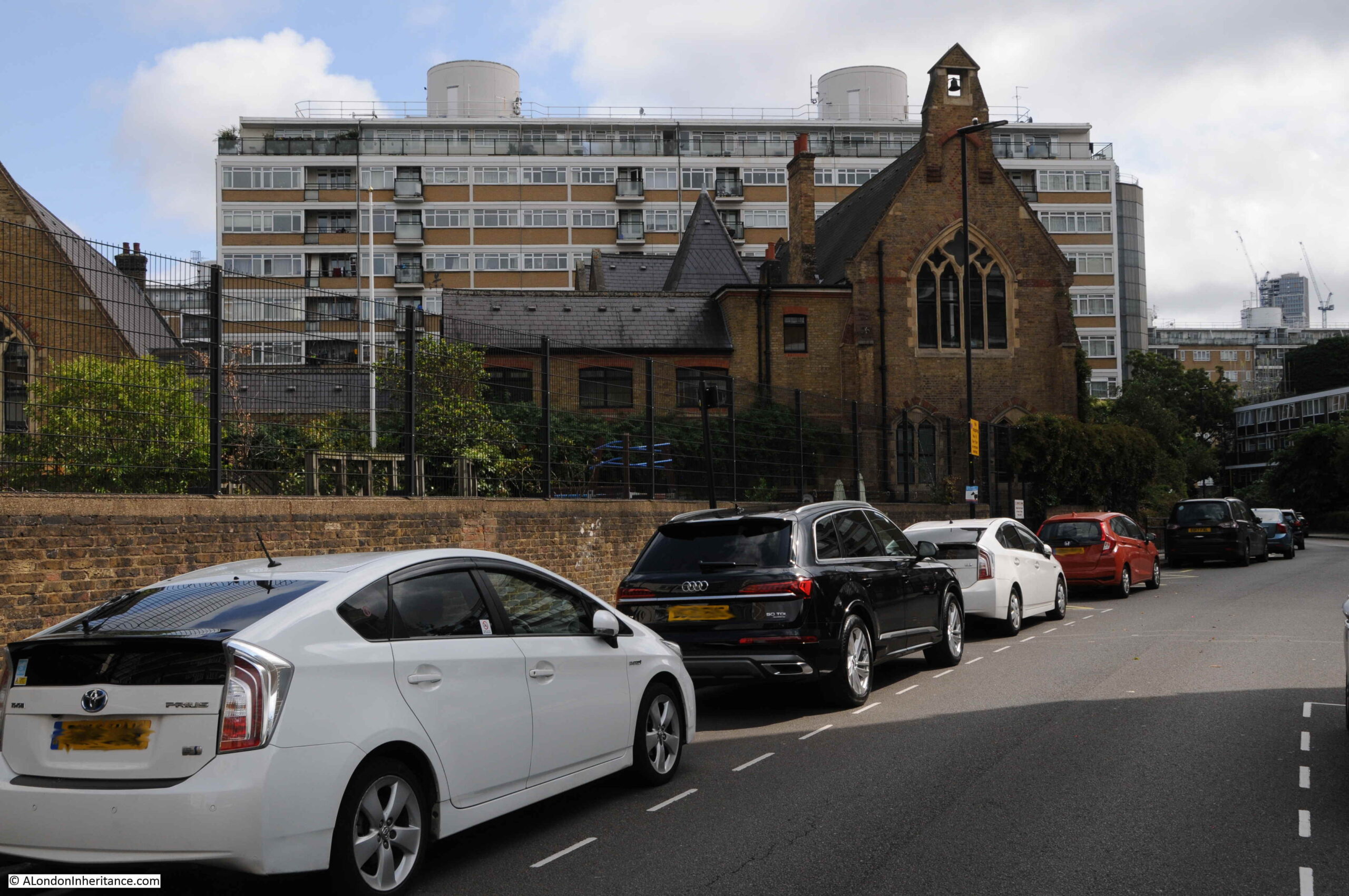
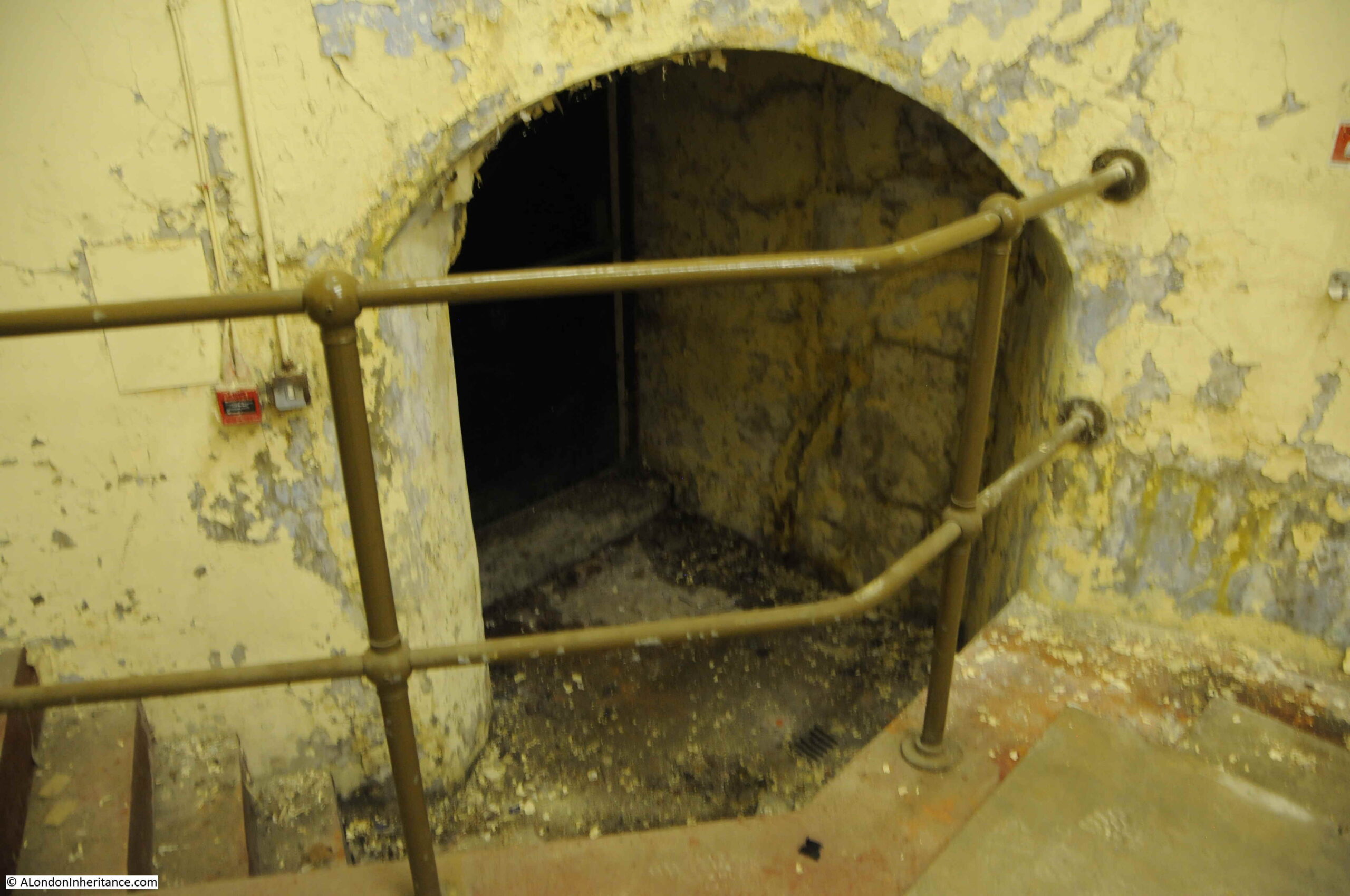
So, still never letting a door shut me in a phone box, here are a selection of photos of London telephone boxes, starting with Charterhouse Square:
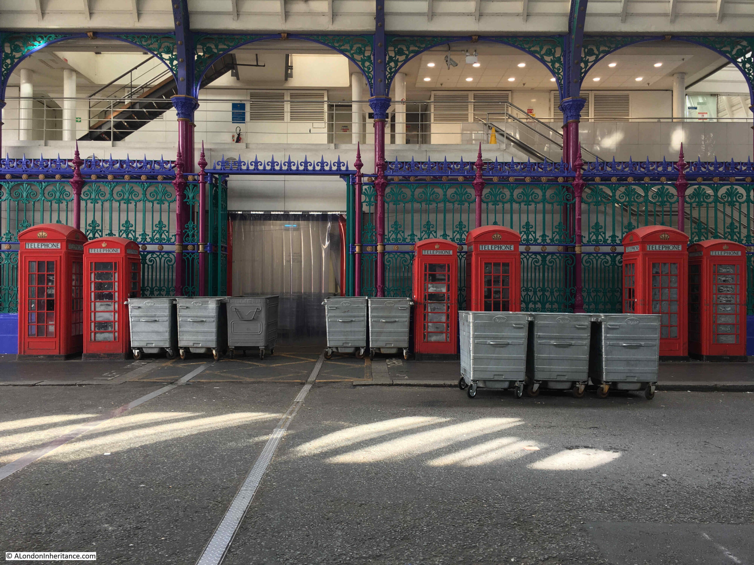
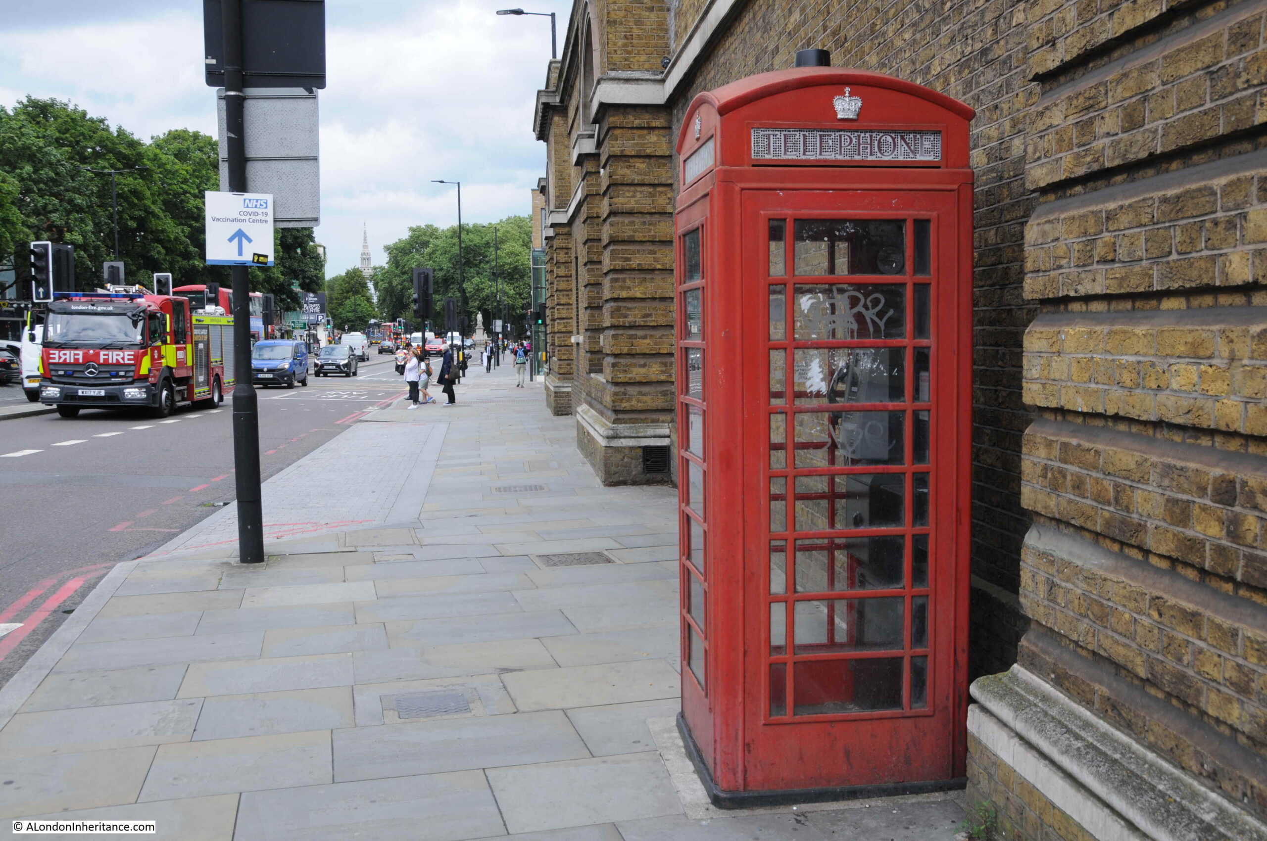
Grade II listed (the larger K6 models) telephone boxes at Smithfield Market:
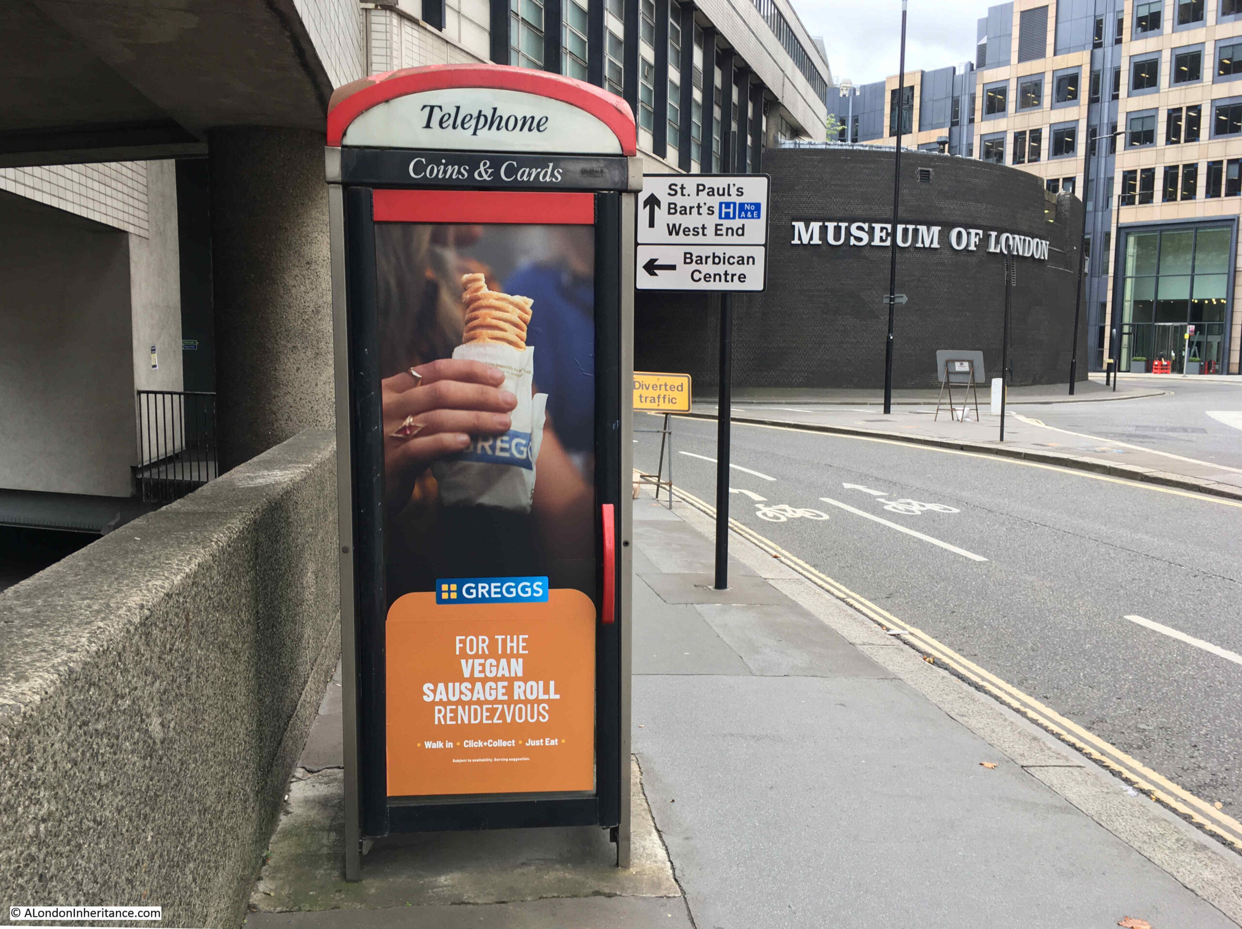
One of the modern versions of the telephone box, also showing how so many of these are now used for advertising. This one is in Aldersgate Street:
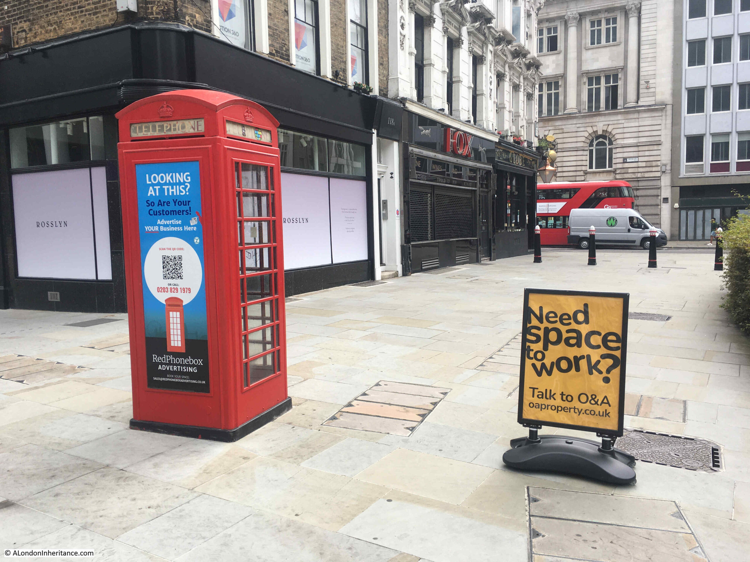
Advertising is a potentially profitable business for the reuse of telephone boxes. They are in locations where they are easy to be seen, and where there is a high footfall, so they originally could be found when you wanted to make a call. These original reasons for locating a phone box also apply to sites where advertising works best, and as advertised on the phone box in the photo below, at the junction of London Wall and Moorgate, there is a company (Redphonebox Advertising) that specialises in this new use.
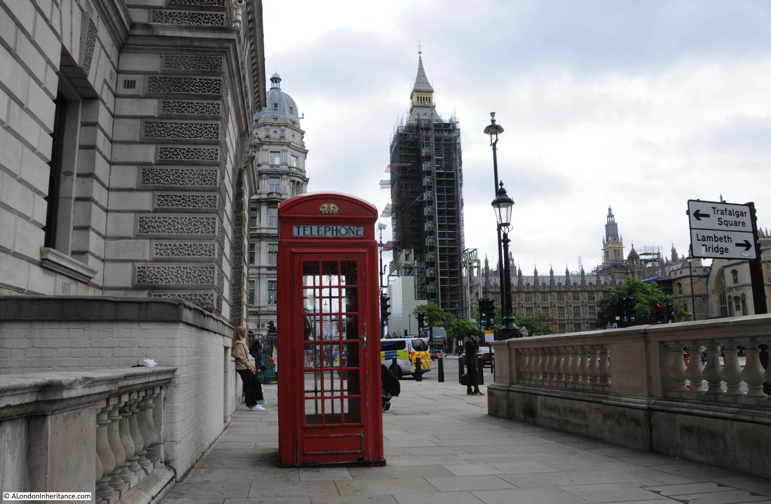
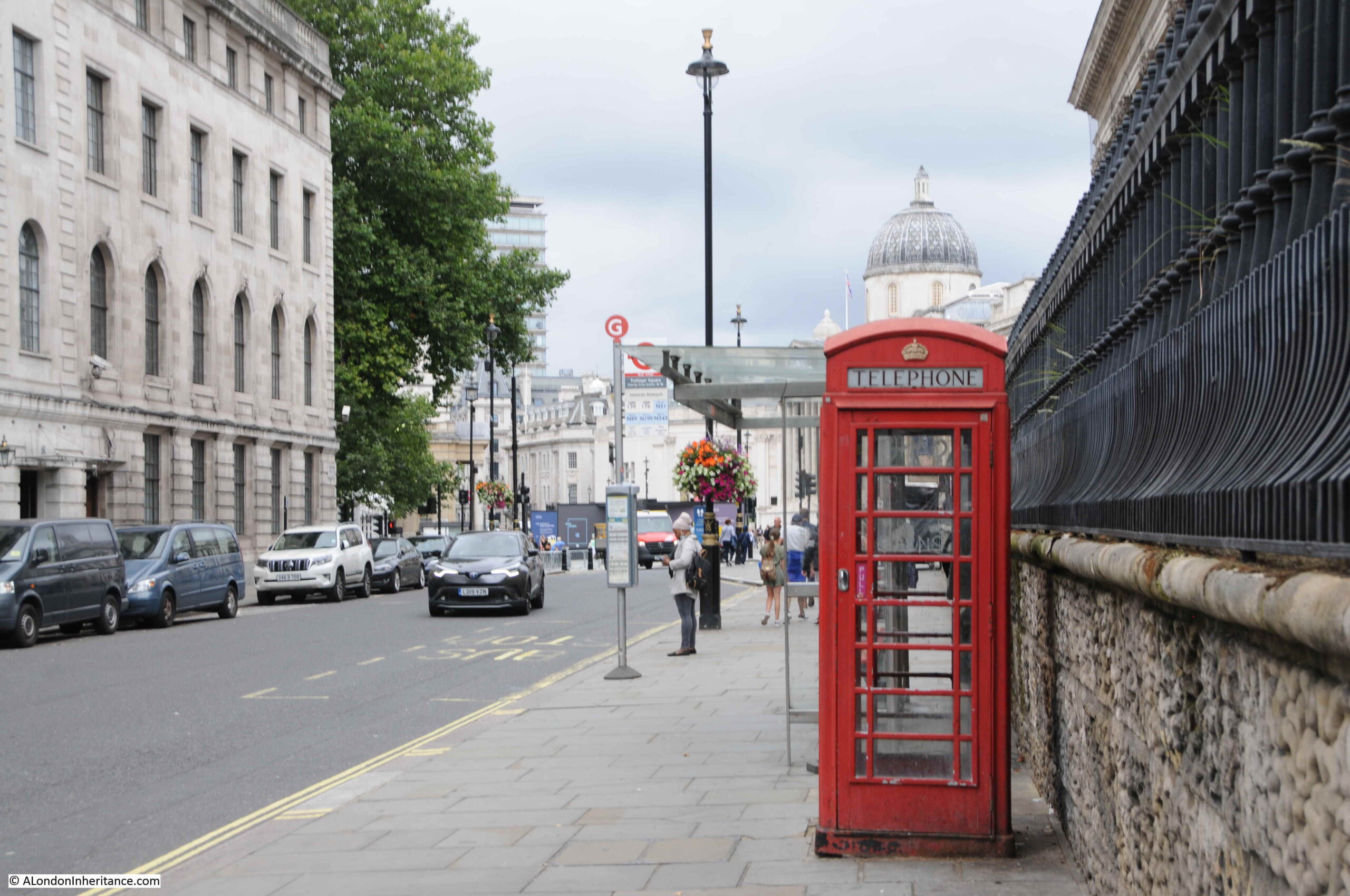
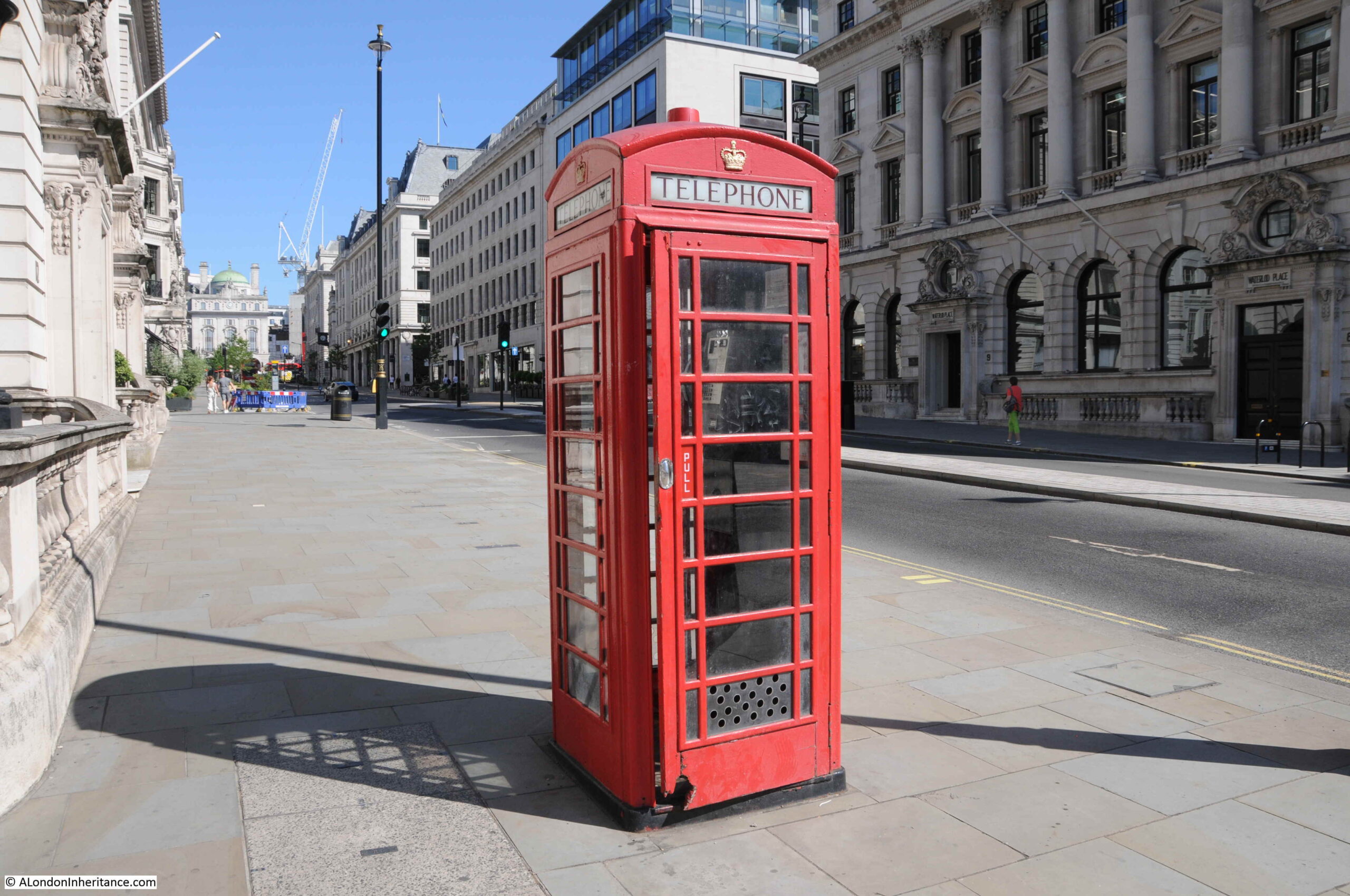
Perhaps the most photographed telephone box in London is this one in Great George Street / Parliament Square:
Before Covid, there would frequently be queues of tourists waiting to get their photo taken in a London red phone box with the Elizabeth Tower, or more probably Big Ben to those taking photos, in the background.
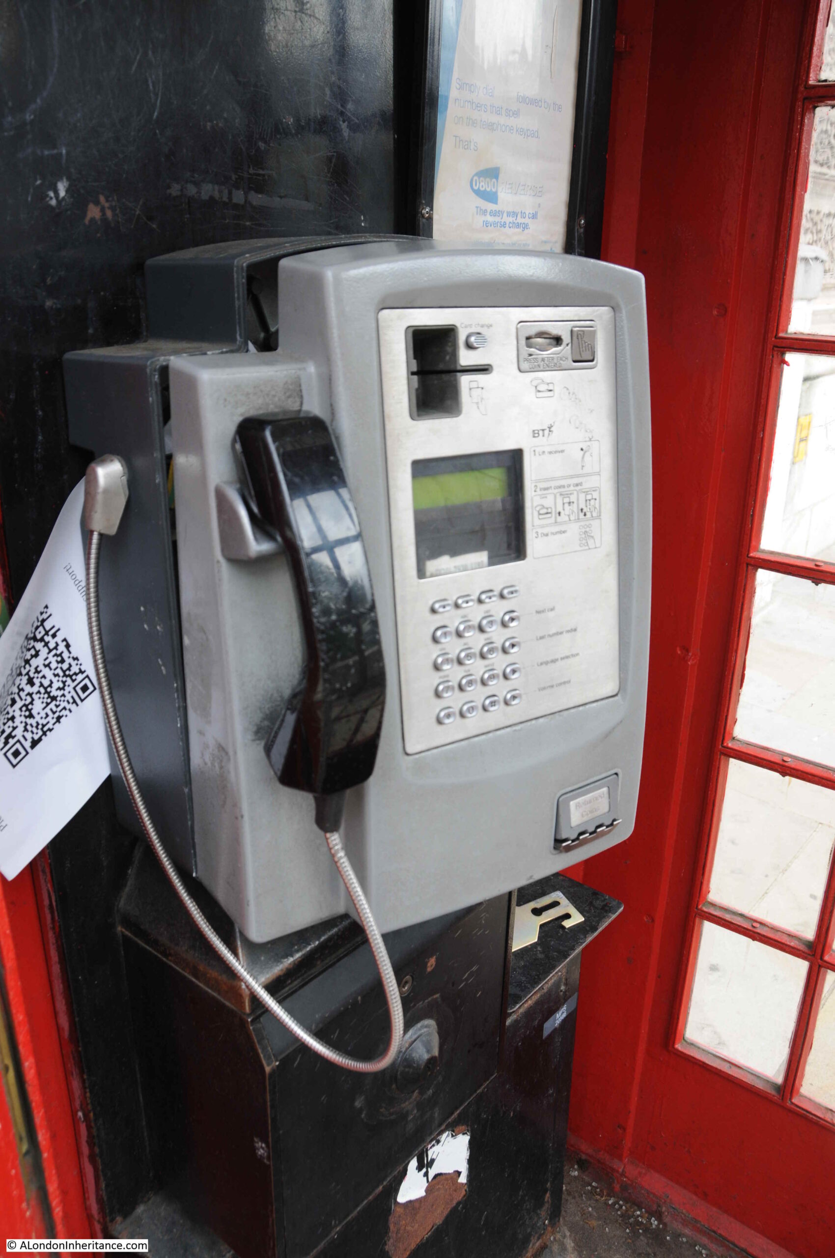
With the lack of tourists this phone box is now much quieter, and looking inside, even in such a prominent position, the telephone does not work, with the front panel being pulled away from the rear.
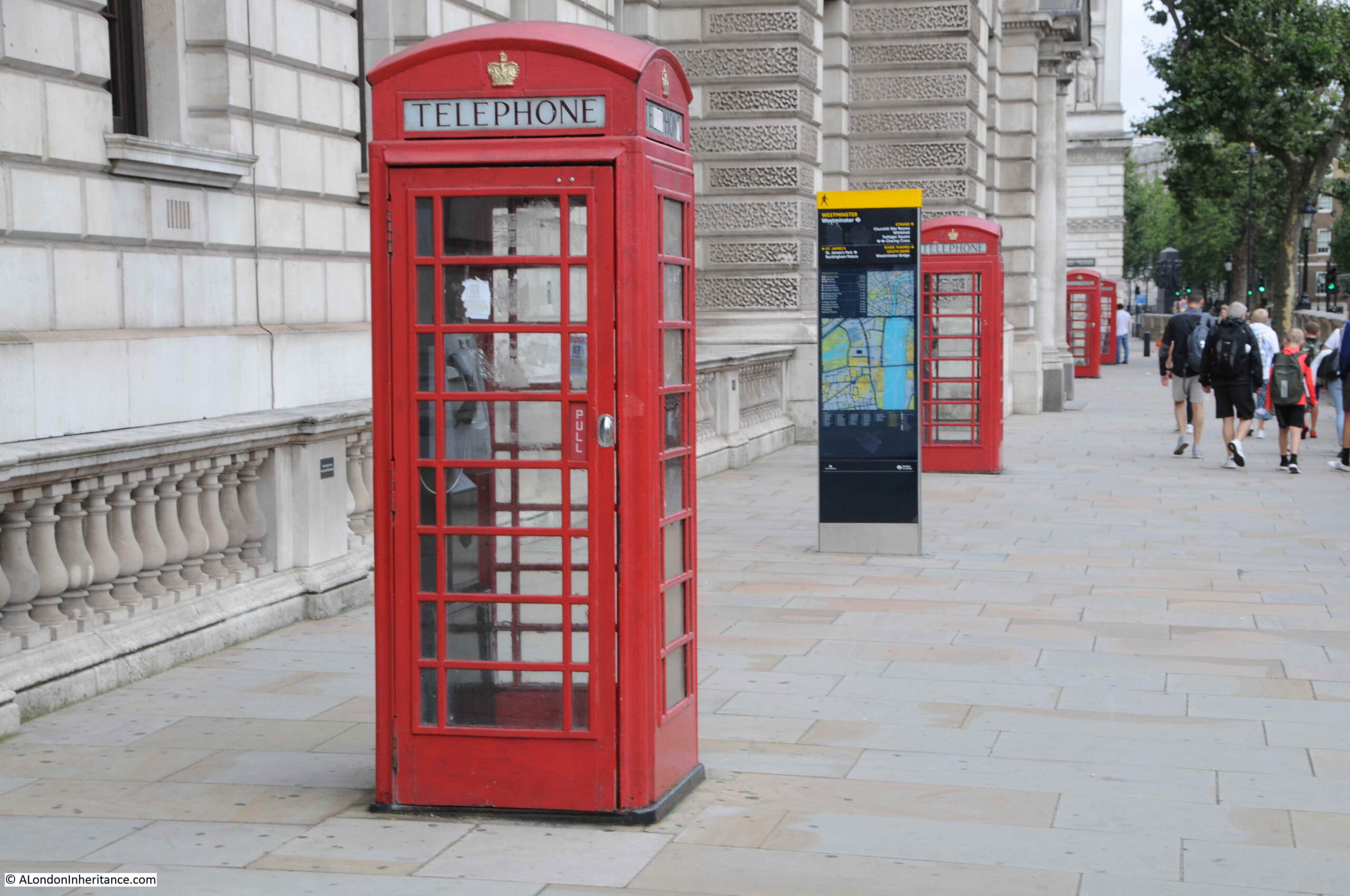
The following telephone boxes in Parliament Street are also a frequent destination for those wanting a photo with a phone box.
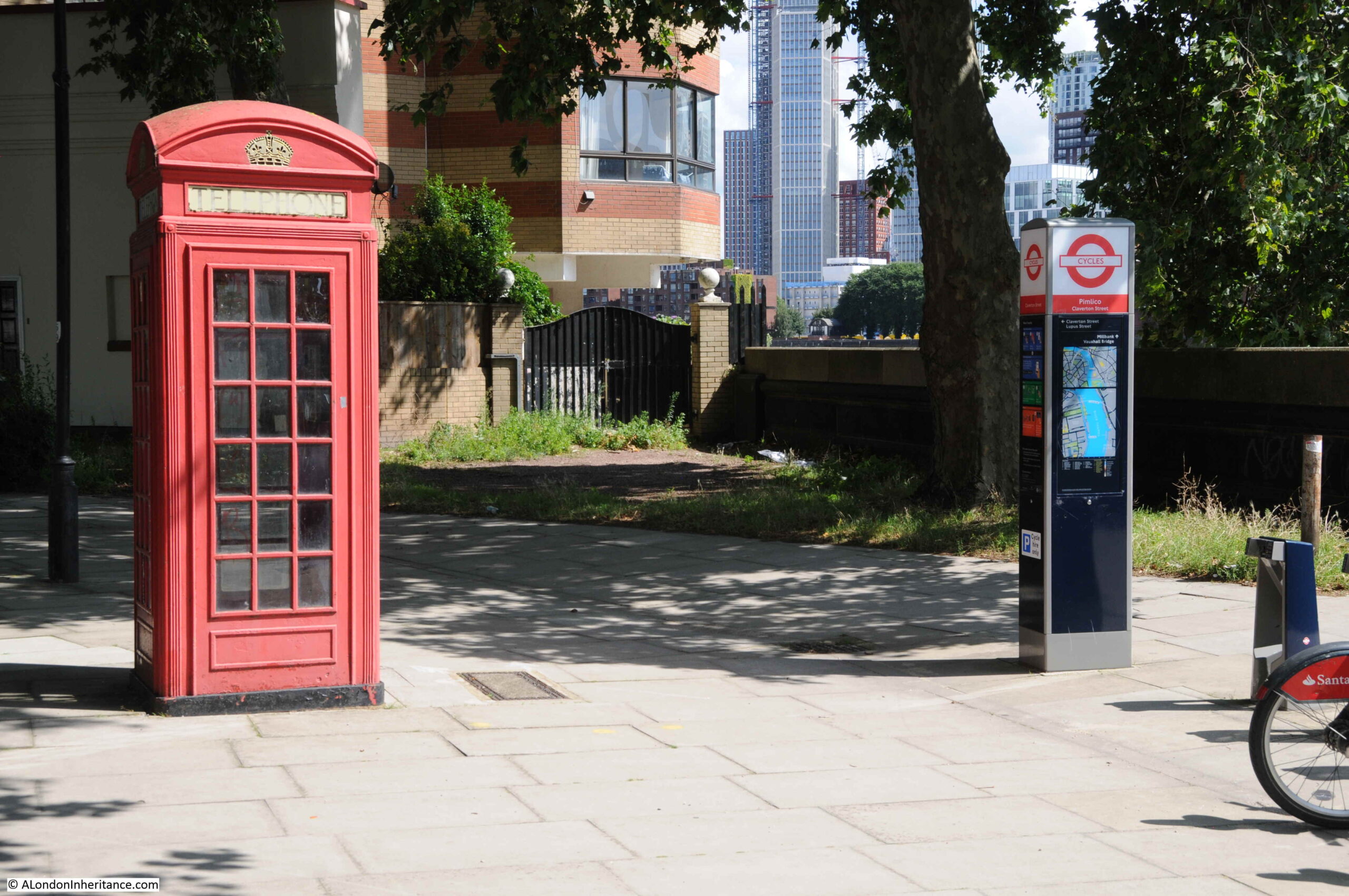
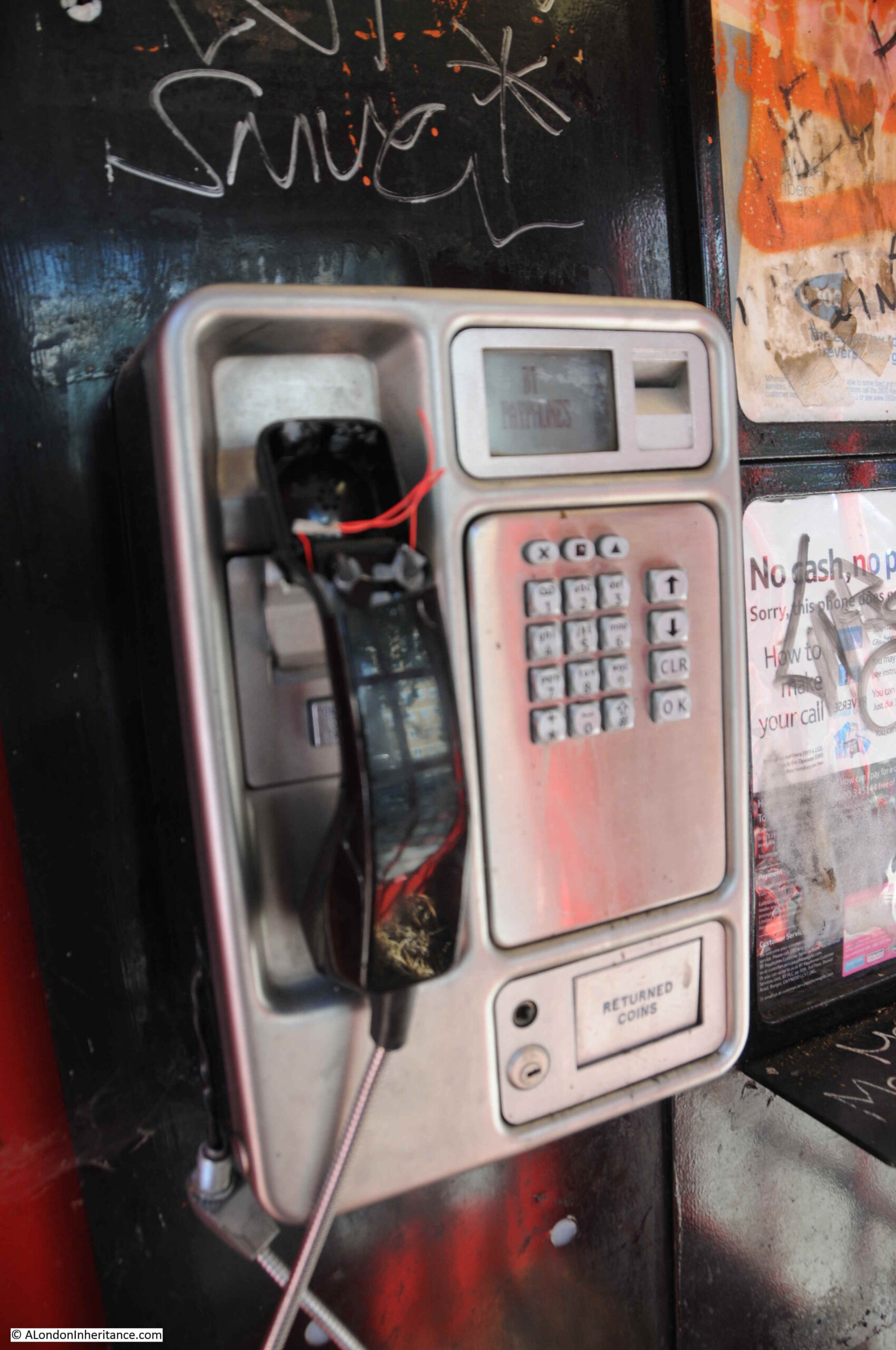
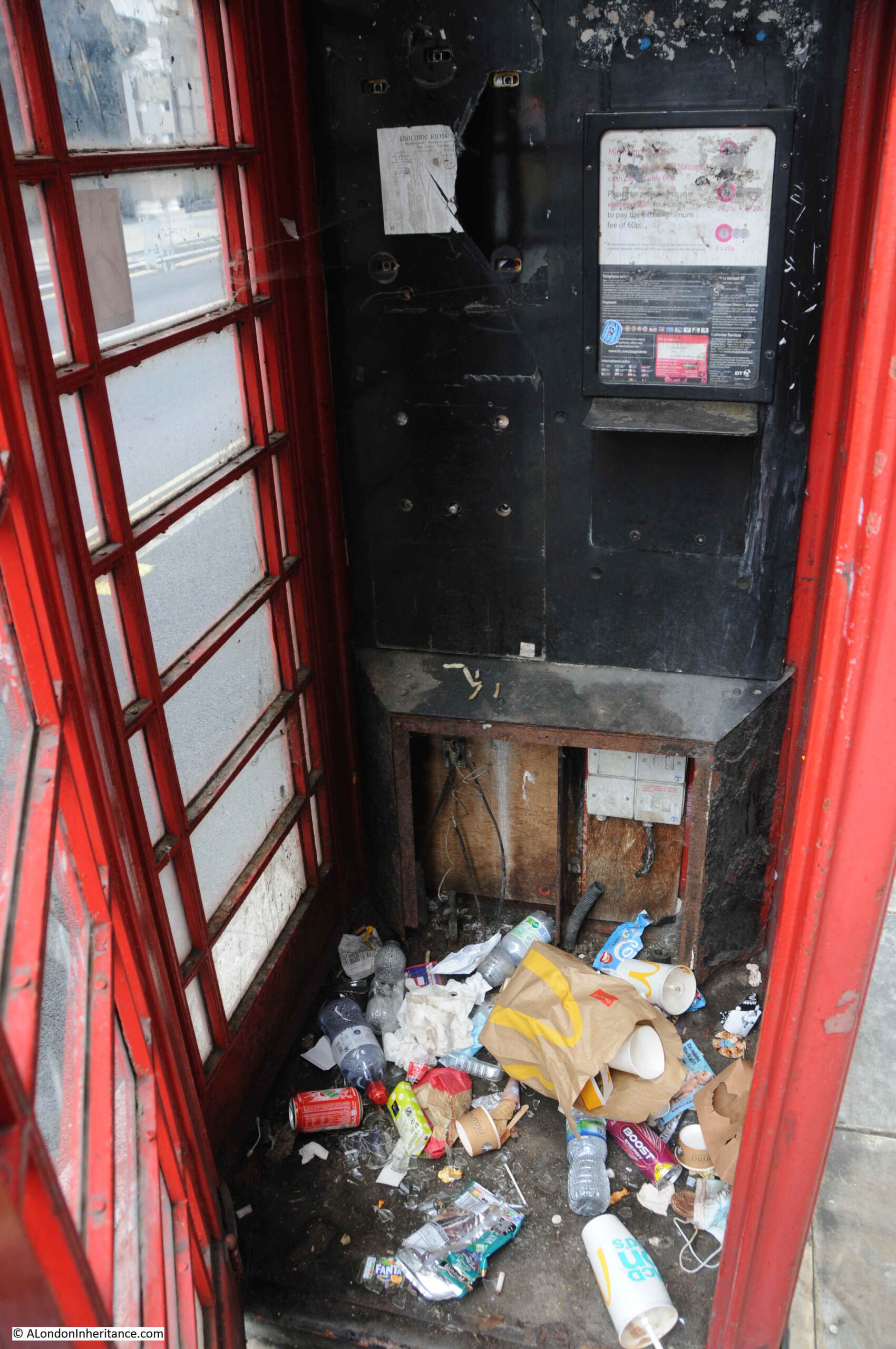
The following phone box is by the side of Grosvenor Road:
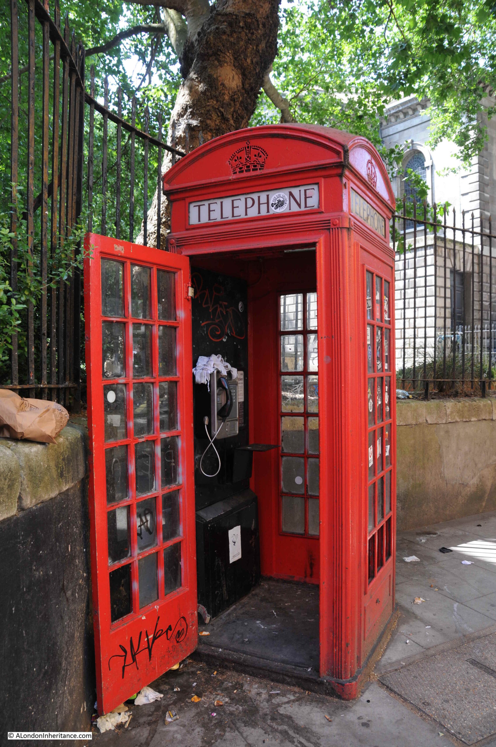
Internally, whilst the phone still has power, and the display reads BT Payphones, there is no chance of talking to anyone with the vandalised handset:
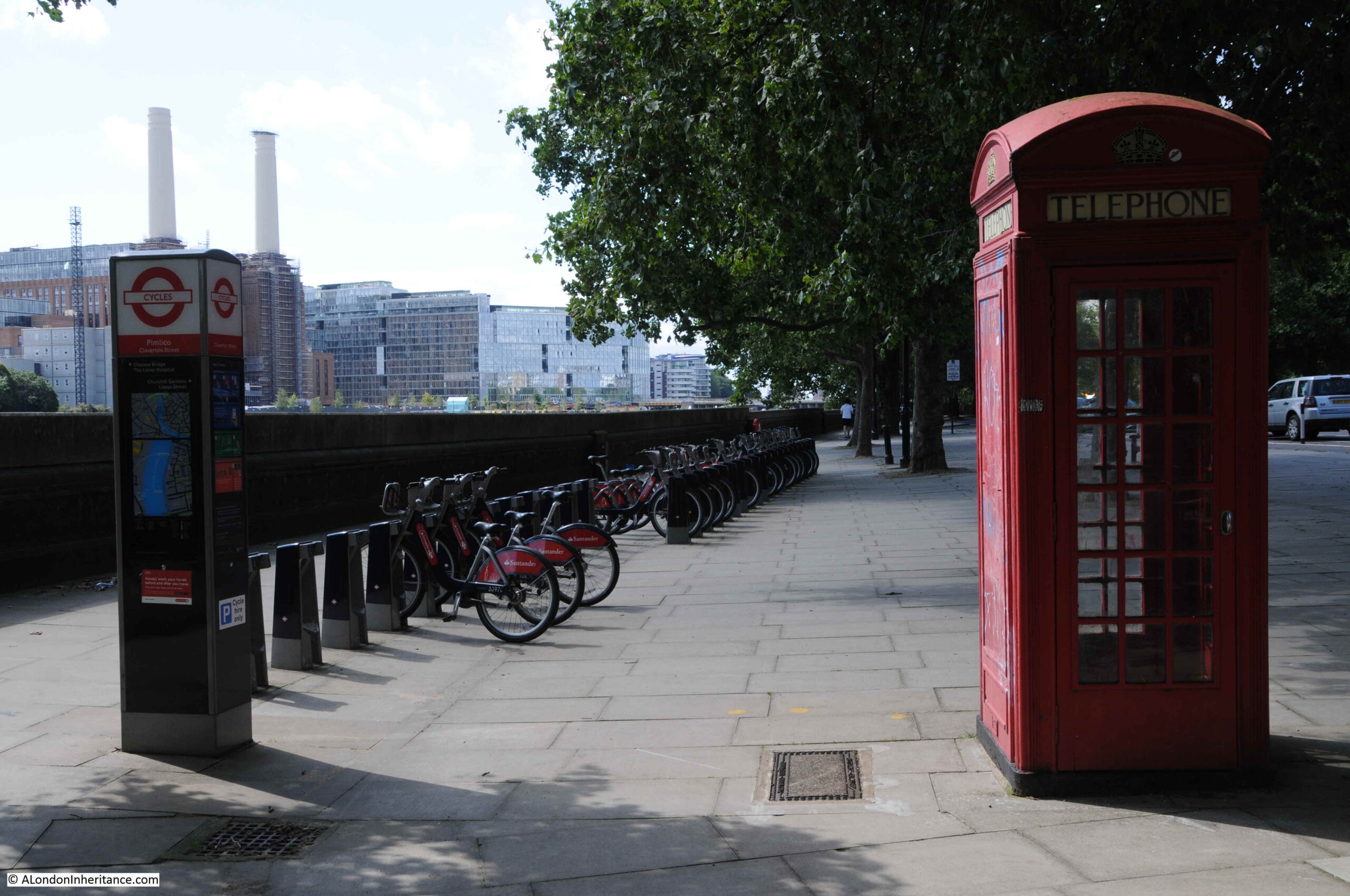
This view of the telephone box shows changing street furniture. The old, unused telephone box alongside a TfL cycle dock:
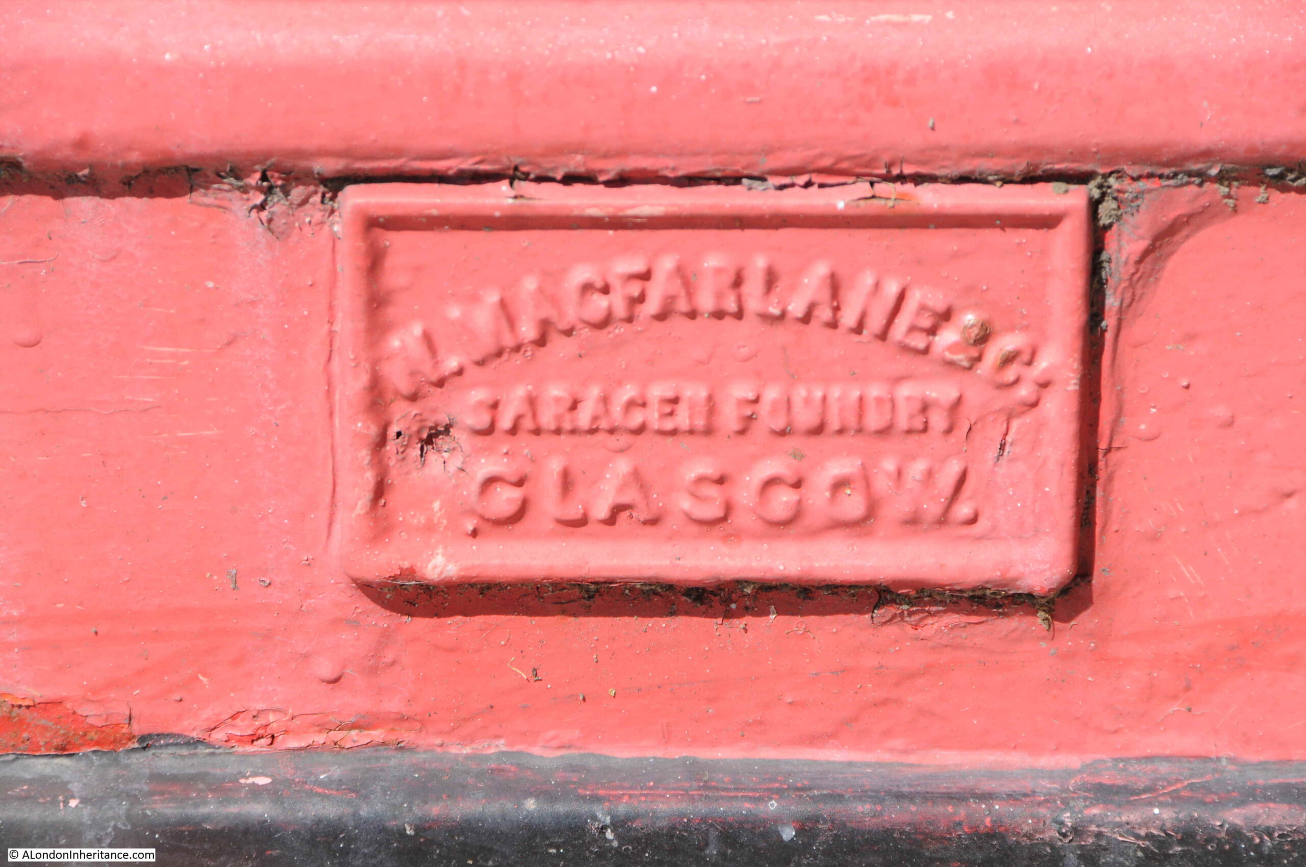
The above telephone box was made by Walter Macfarlane & Co, at their Saracen Foundry in Glasgow. It seems the company took on the manufacture of phone boxes in the late 1940s after their traditional markets started to disappear. The foundry closed, and the site demolished in 1967, however the company has left their mark on multiple telephone boxes across London:
Outside Pimlico Station:
Duncannon Street, looking towards Trafalgar Square and the National Gallery:
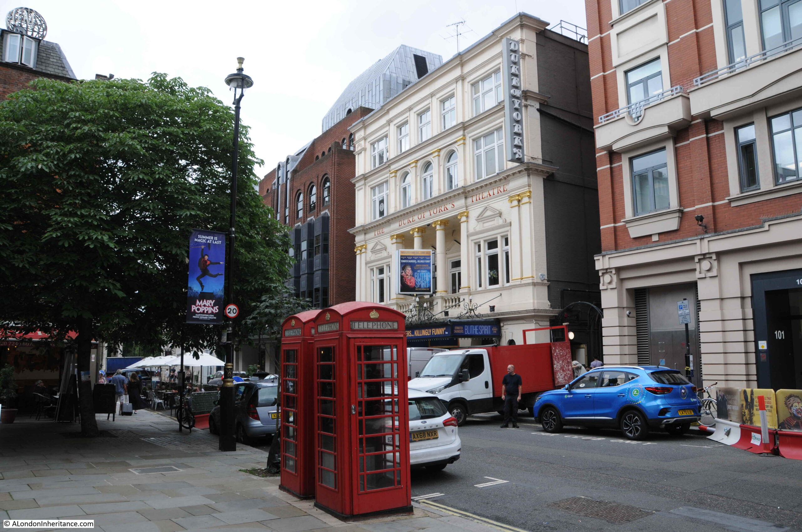
St Martins Lane, opposite the Duke of York’s theatre:
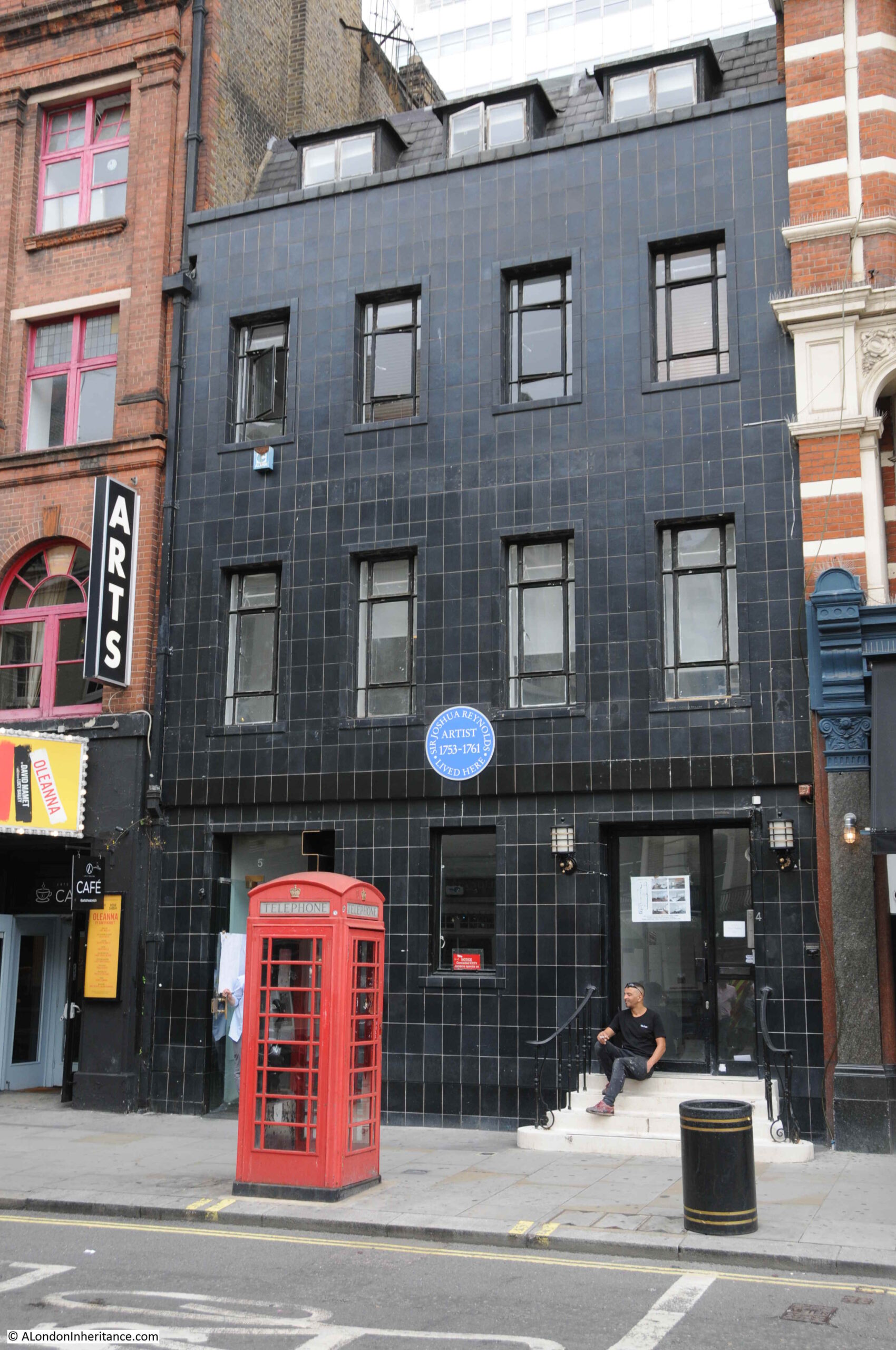
Great Newport Street:
The large blue plaque in the above photo records that the artist Joshua Reynolds lived there between 1753 and 1761.
Charing Cross Road, looking up towards the junction with Shaftsbury Avenue:
The telephone box in the following photo is in St Giles High Street with the church of St Giles in the Fields in the background. The door was left open, and at the time, it was not a phone box you would want to make a call from, even if it was working.
Shaftesbury Avenue:
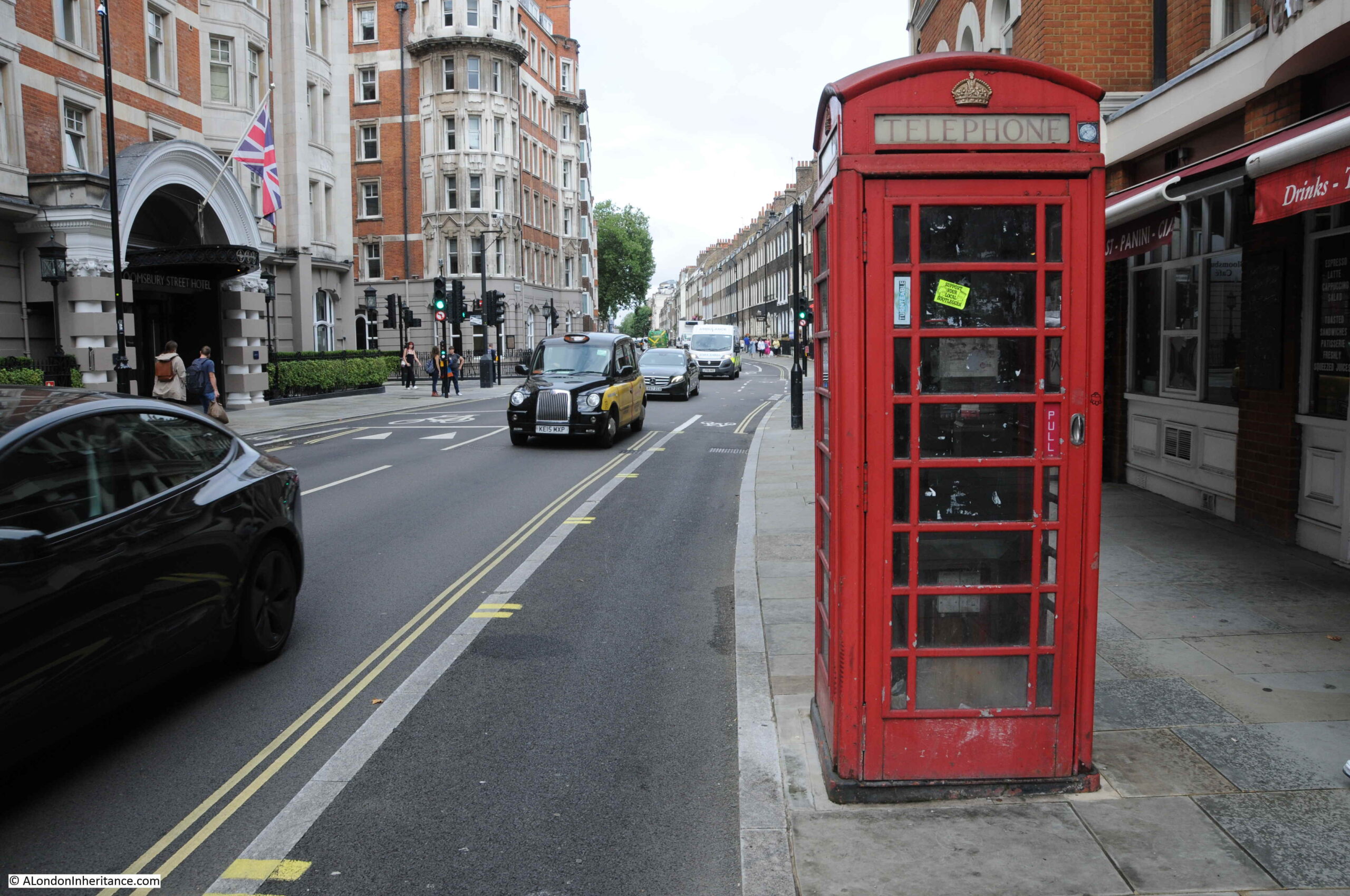
Bloomsbury Street, opposite the Bloomsbury Street Hotel:
As with many telephone boxes across London, despite being in Bloomsbury Street, the phone box is used as a litter bin. The telephone equipment has been removed.
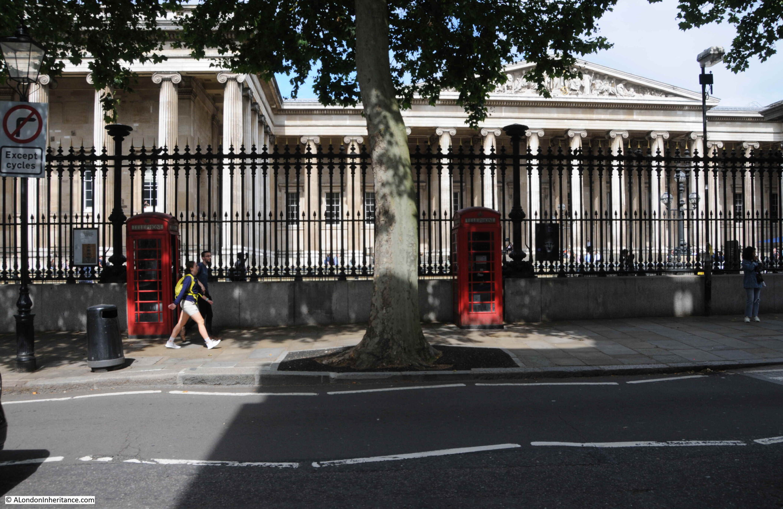
Outside the British Museum:
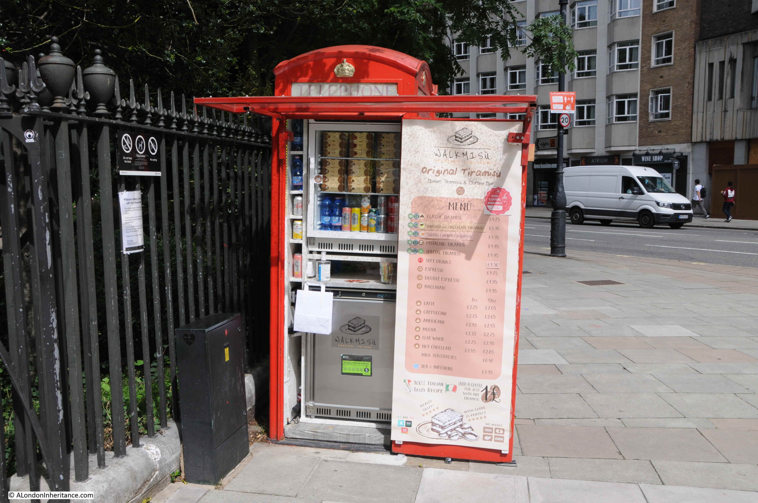
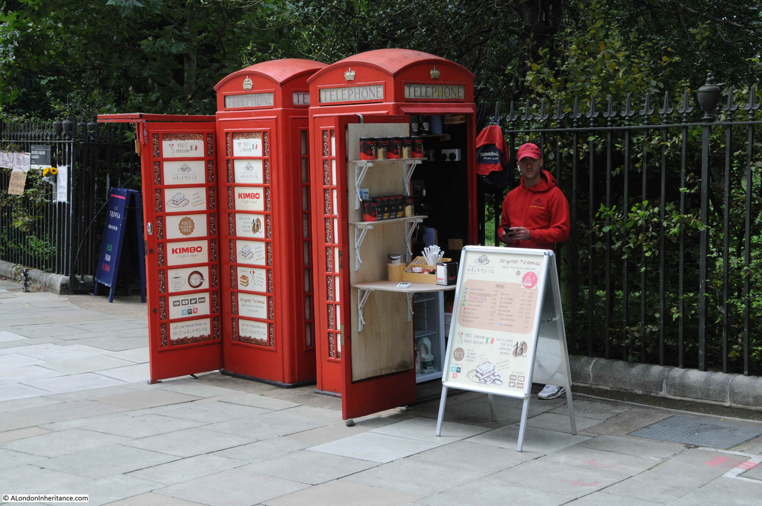
Telephone boxes have been converted to other uses. In Russell Square, two have been converted to a take away coffee shop:
Known as the Italian Tiramisu and Coffee Shop:
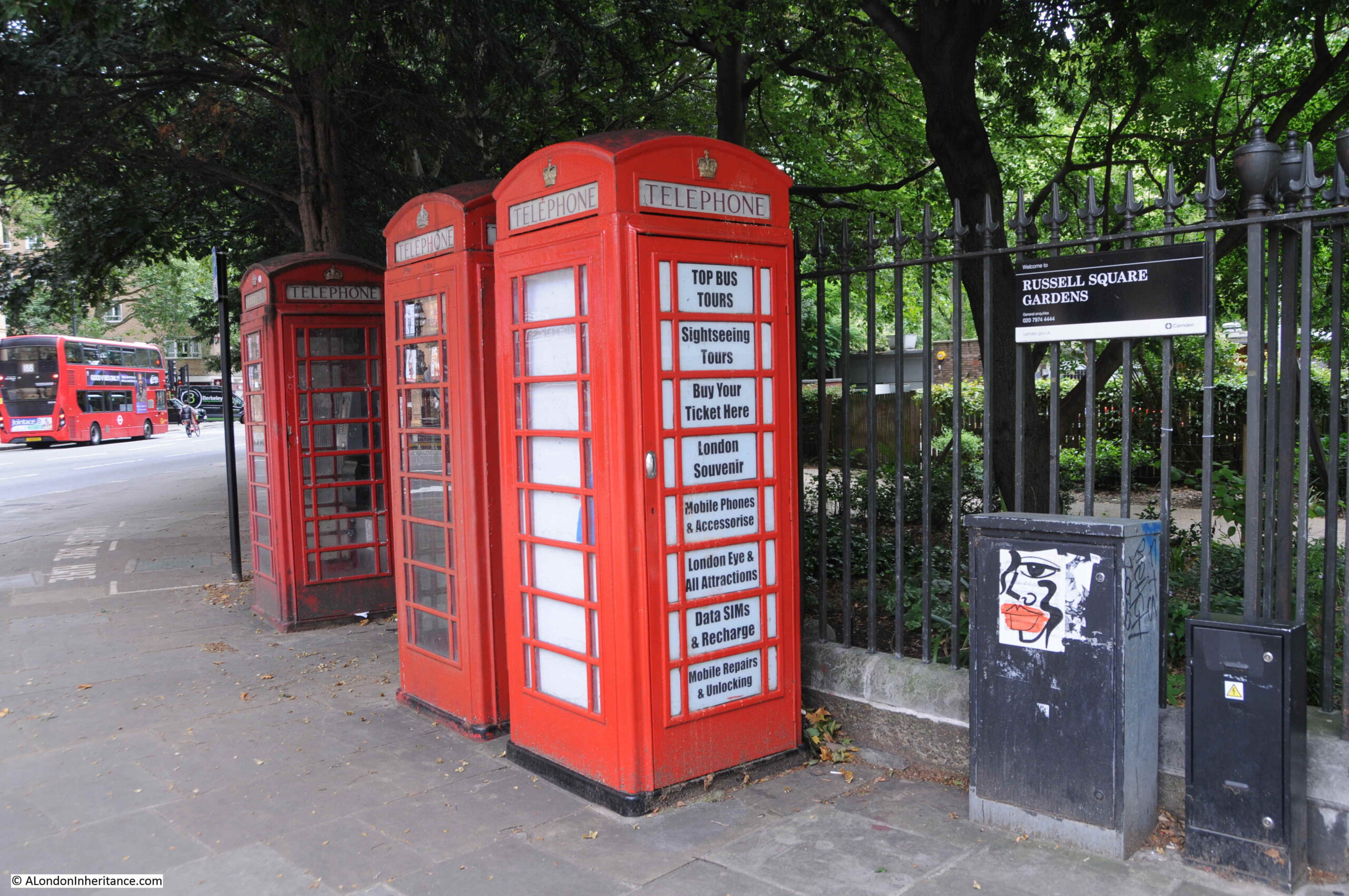
Walking further around Russell Square Gardens and there are another three, which according to the Historic England spreadsheet are Grade II listed:
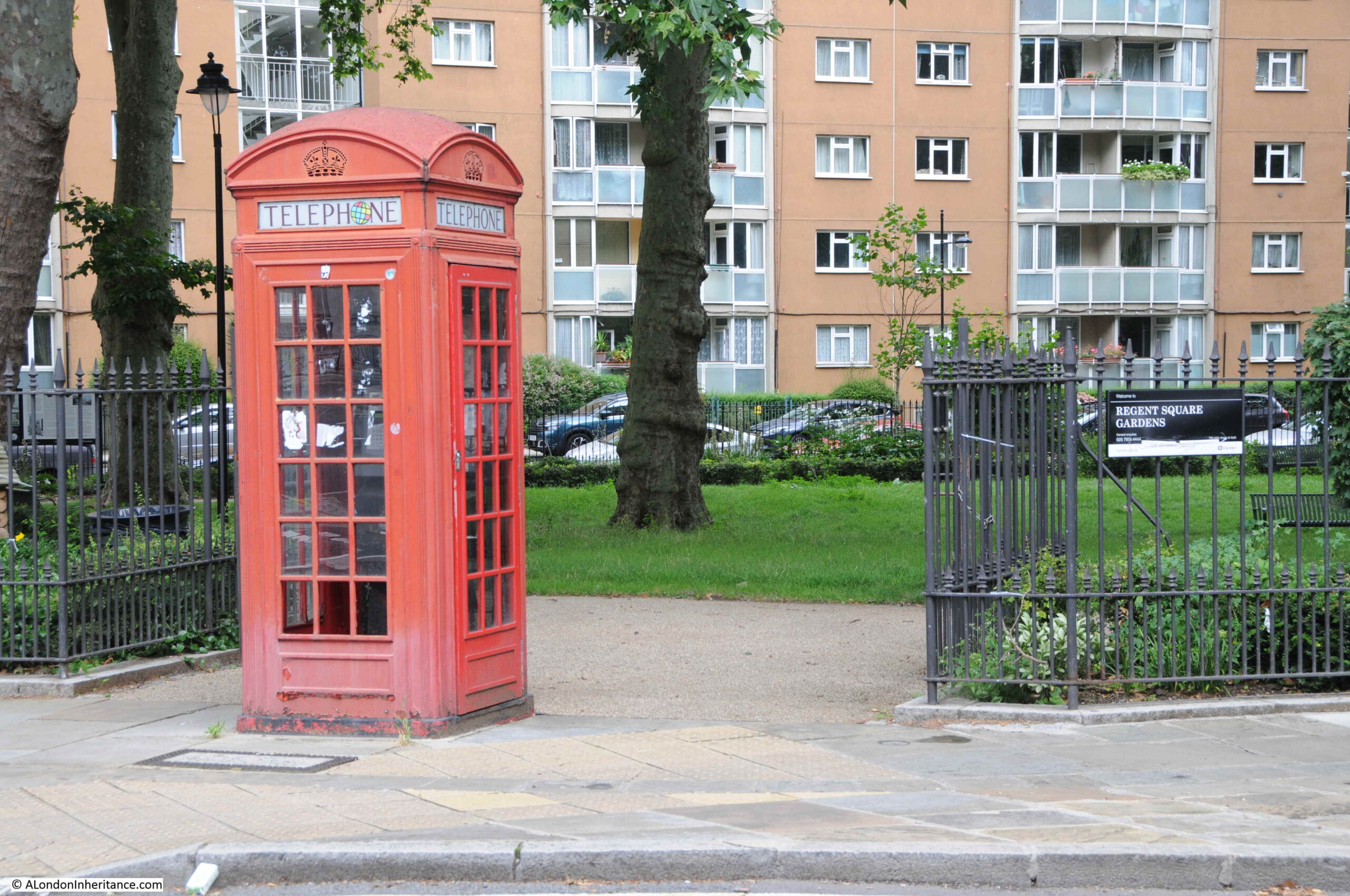
At the entrance to Regent Square Gardens on Regent Square:
Looking inside the Regent Square Garden’s telephone box:
At the junction of Euston Road and North Gower Street:
Upper Street, Islington:
Across the road from the above phone box is the following:
Waterloo Place, looking up towards Piccadilly Circus:
The Strand, close to Charing Cross Station:
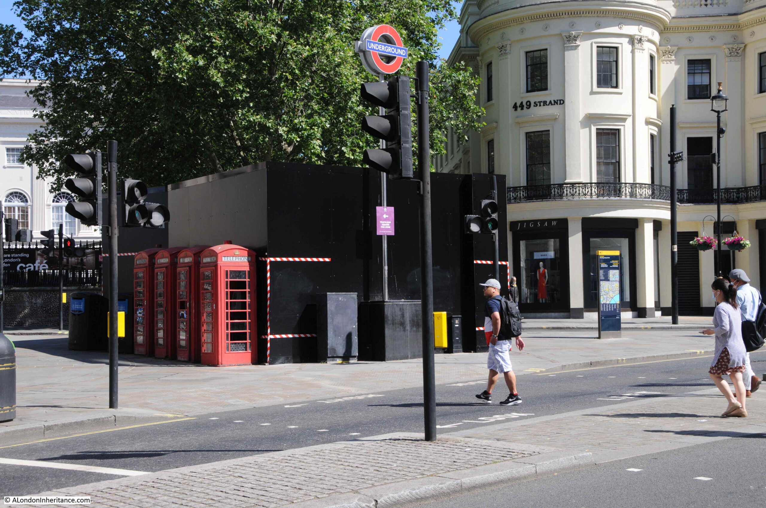
Opposite Charing Cross Station are these four telephone boxes:
They are usually more obvious, however the black hoardings to their right are slightly obscuring them.
Hard to imagine seeing a row of four, empty telephone boxes, however they were sited together in an area of frequent use. In a high footfall area, between the Strand, Charing Cross Station, Trafalgar Square and the theatres of the West End, they would have attracted a considerable number of users.
When I commuted into and out of London during the 1980s, train distruption would always lead to long queues at the phone boxes as the only means of communicating with those at home, or who you were to meet, that you would be late.
Later conversions of telephone boxes have tried to keep them relevant, however Internet access on a mobile phone renders WiFi from a phone box a failed model for their continued use.
These two telephone boxes are Grade II listed, so even if there are no customers who have an urgent need to make a telephone call from in front of St Paul’s Cathedral, they will probably be here long into the future:
In the triangle of land where St Martin’s le Grand meets Cheapside:
Telephone boxes advertising the time when cards as well as coins could be used to pay for a call:
Euston Road:
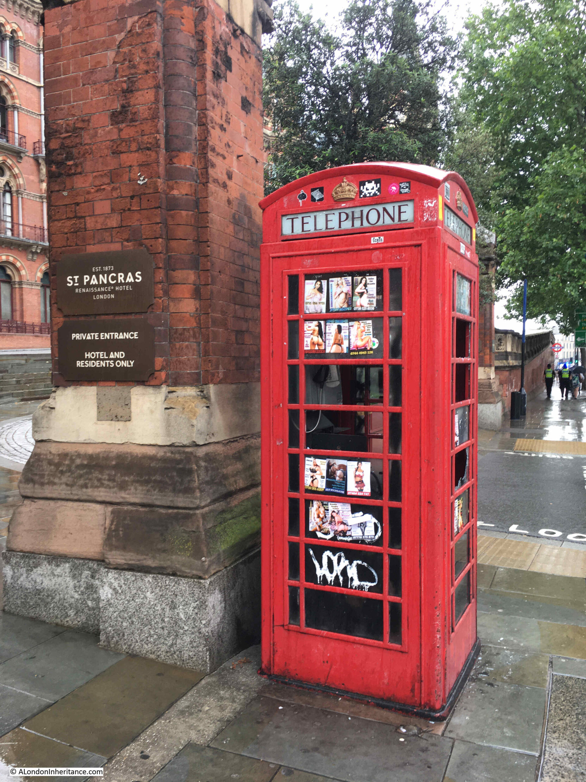
Outside St Pancras Station, with the sex work adverts that were once common across central London telephone boxes:
I titled this post the Death of the London Telephone Box, however that is not quite true. Many of them are listed so presumably will be around for years to come, and they are valuable assets as an advertising platform, however what they will not be used for is their original purpose of making telephone calls.
What is clear is that many are not maintained or cleaned. I have found very few that actually work. Many have had their equipment removed, others have been vandalised and many of the remainder are just dead.
I suspect the majority of people under the age of thirty have never used a telephone box, and find the concept of a fixed, wired phone rather antiquated.
They are a left over from a time when the only way to make a call when out on the streets was from a telephone box. When you needed to call for a lift home late at night, meet with friends, change an appointment, check on a place to meet, or just simply calling someone for a chat, the red telephone box was an essential part of street infrastructure.
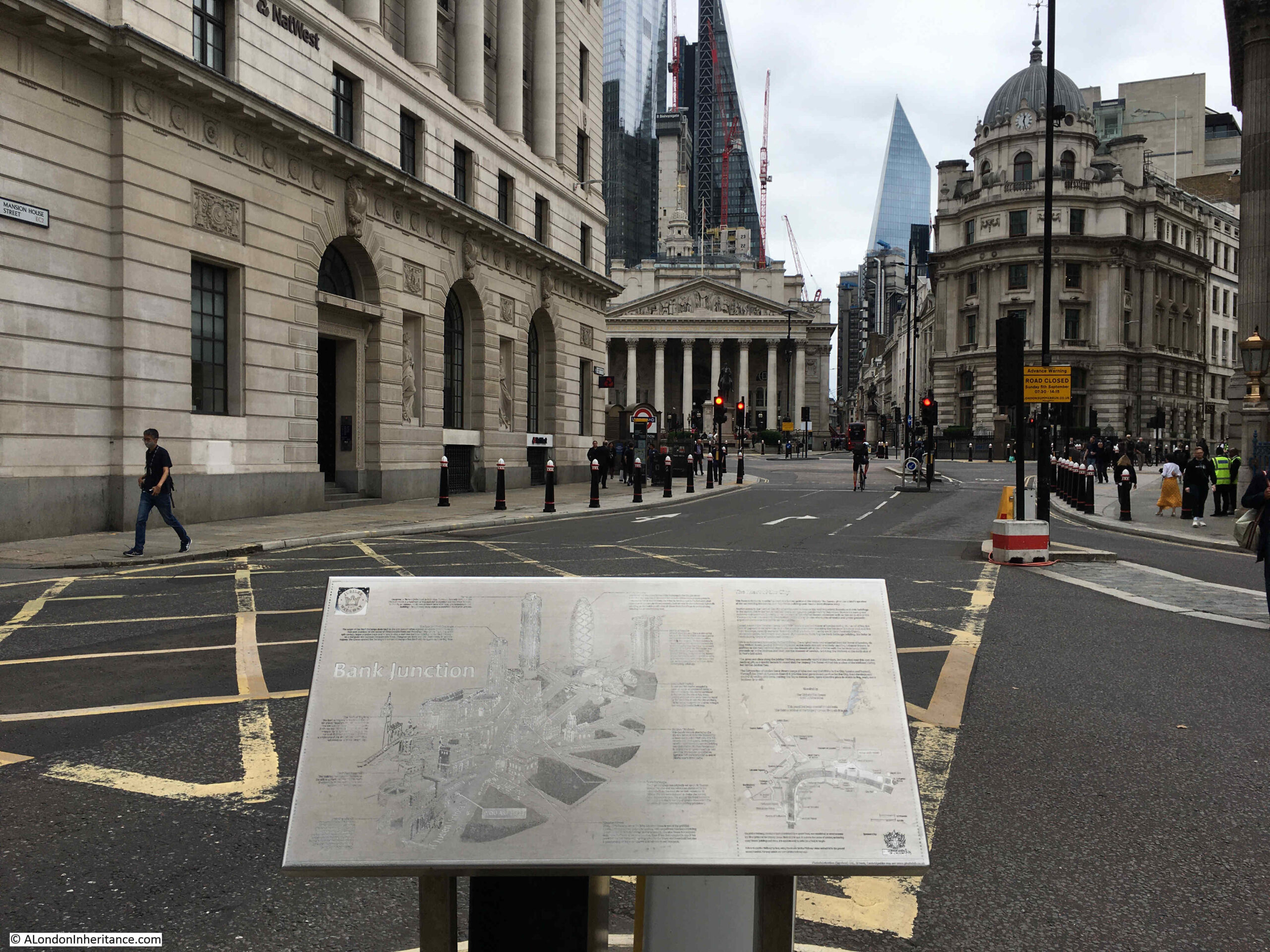
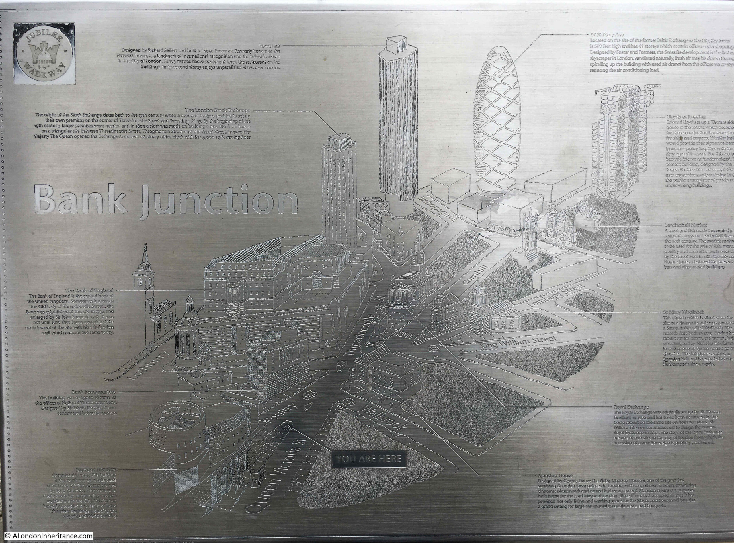
One of my other photographic themes is information panels, intended to show the passerby what can be seen in the area. I walked by this one a couple of weeks ago, close to the Bank junction:
The plaque was unveiled by the Queen in October 2002, and shows the City’s skyline as it was, just 19 years ago,
Thr highlighted buildings include the London Stock Exchange, Tower 42 (the old NatWest Tower), 30 St Mary Axe (the Gherkin) and the Lloyds of London building.
it is a strange location as none of these buildings can be seen from the location of the plaque. I cannot remember if it has been moved from a different location. The “You Are Here” label on the map implies it is in its original location.
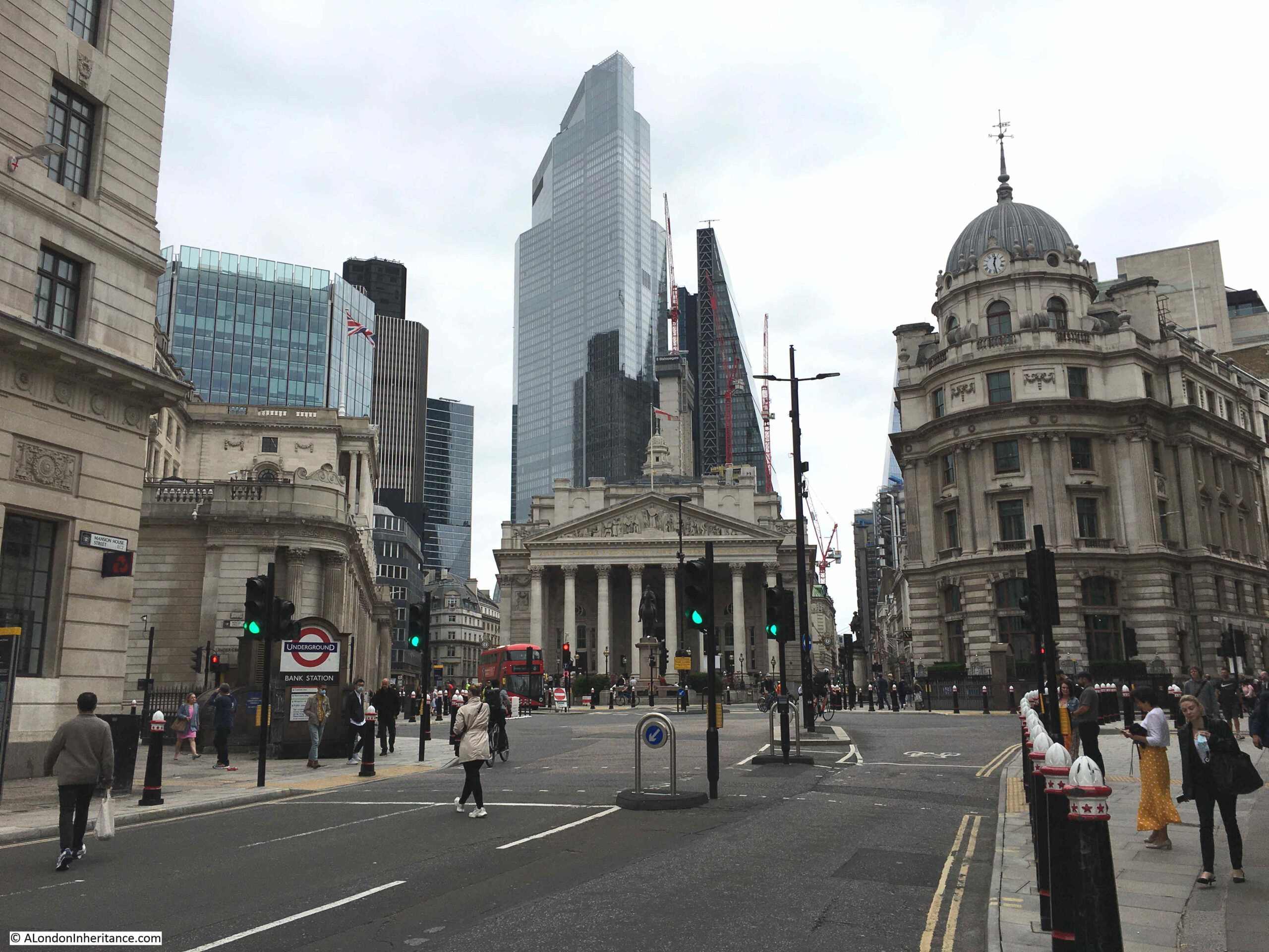
Walking further into the Bank junction and only Tower 42 remains visible, although now partly obscured.
London’s streets will continuously change, as technologies change as do the buildings lining the streets.
As with the transition from telephone boxes to mobile phones, there seems to be another transition gradually underway with the introduction of low traffic neighbourhoods, closure of many city streets to vehicles, cycle lanes etc.
It will be interesting to see how this impacts the city’s recovery from the pandemic, Does it enhance the city, or restrict its viability as a place to work.
In future, will the car in a city be seen the same as a telephone box today, an essential in the past, irrelevant in the future?
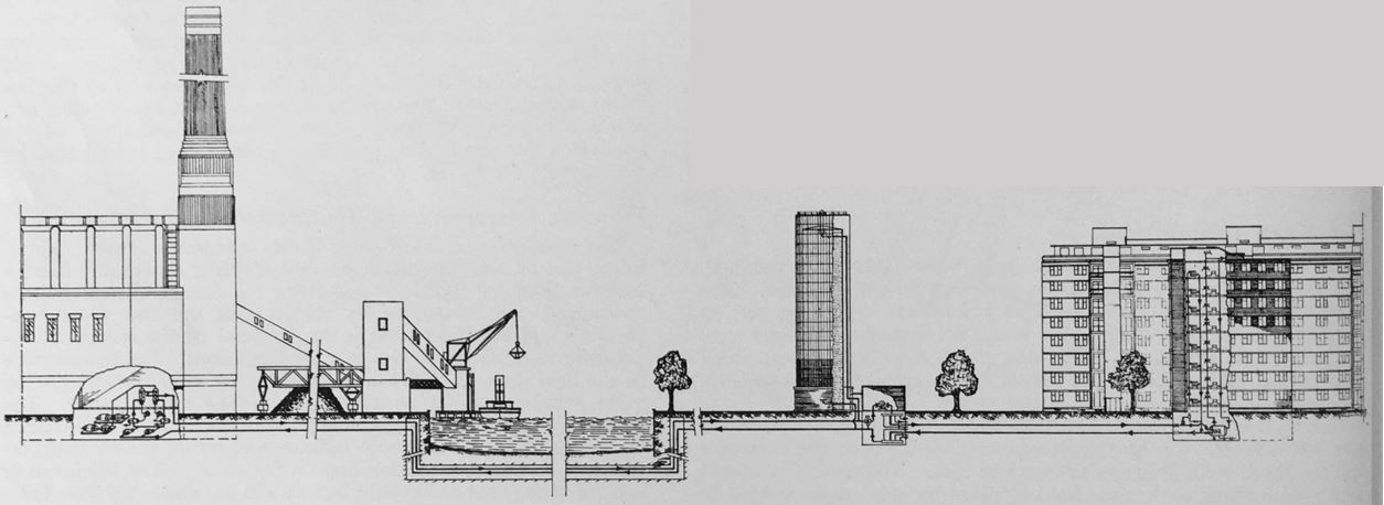
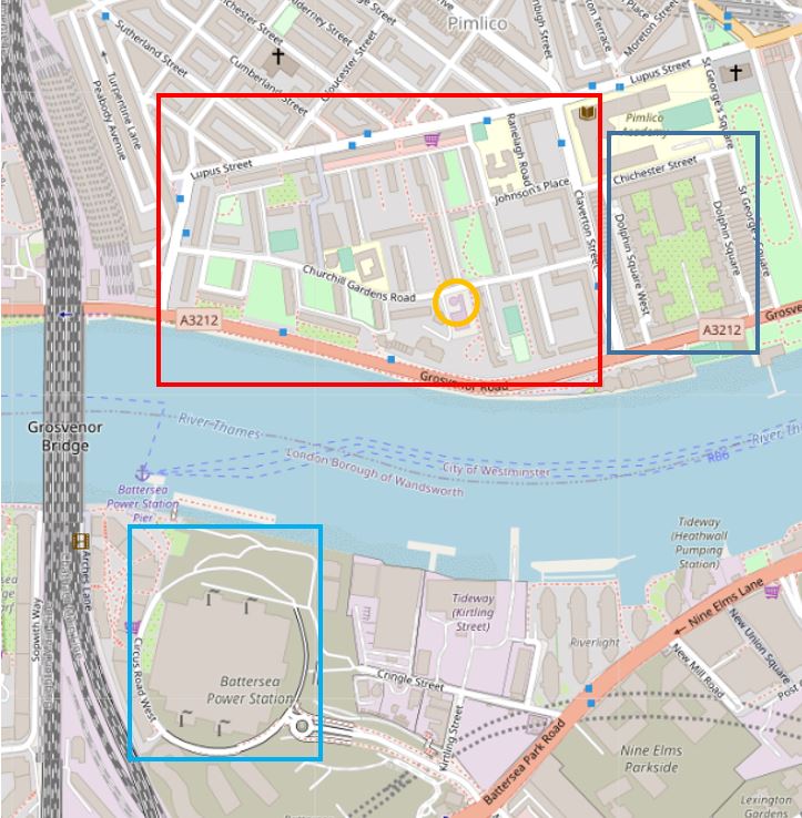
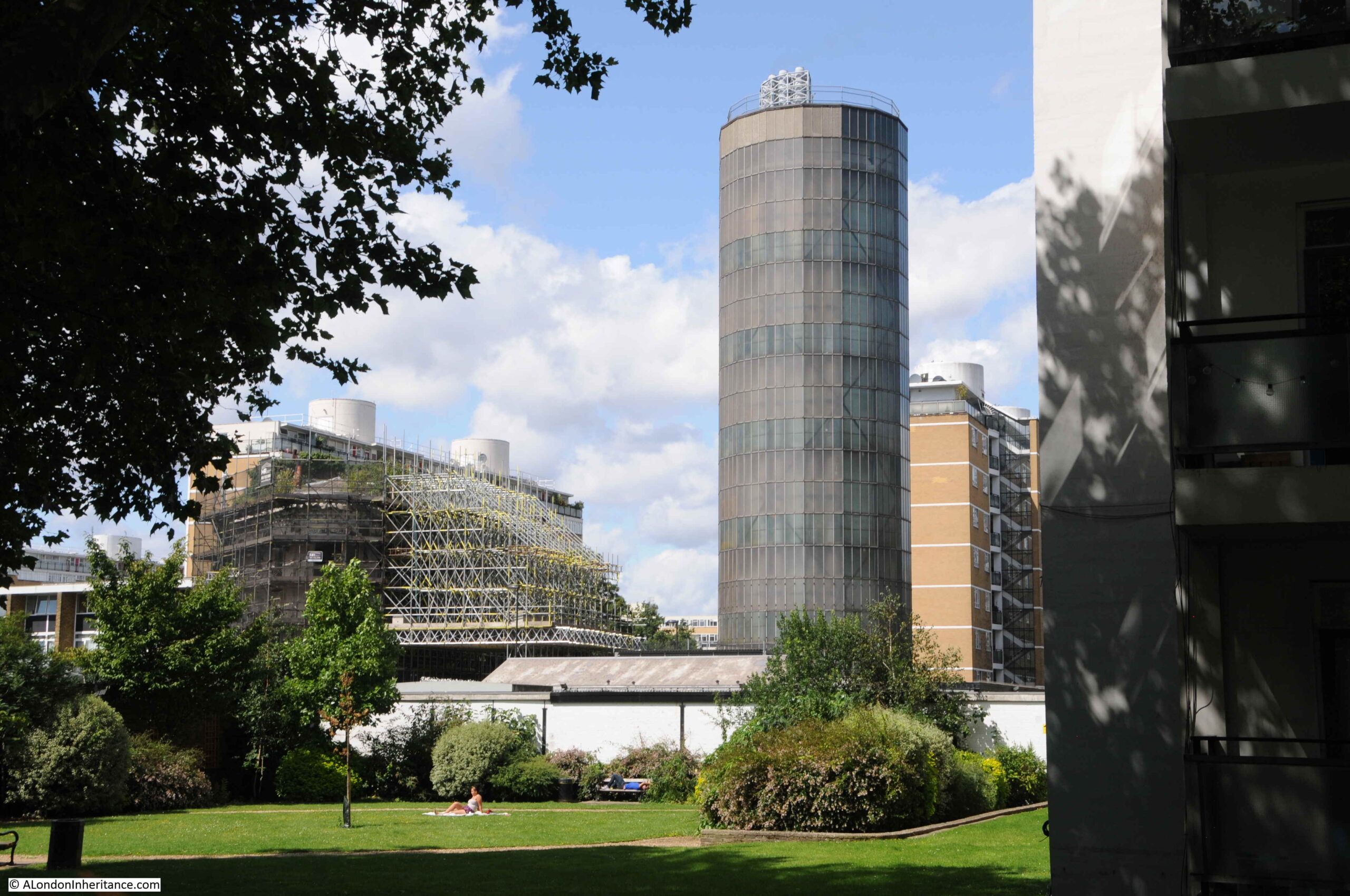
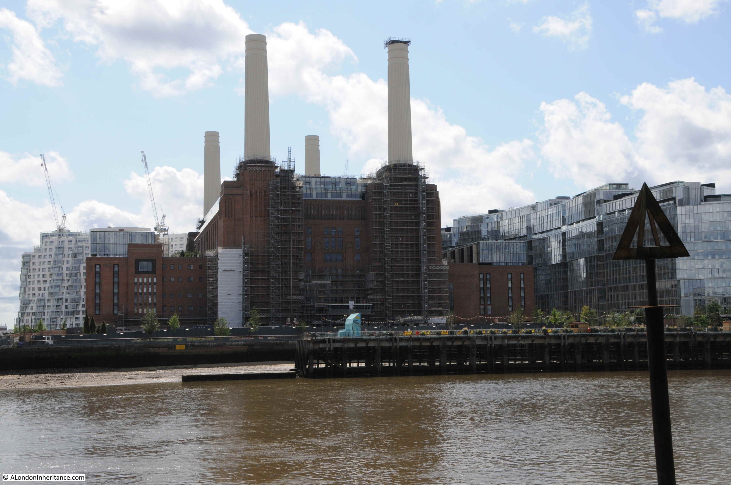
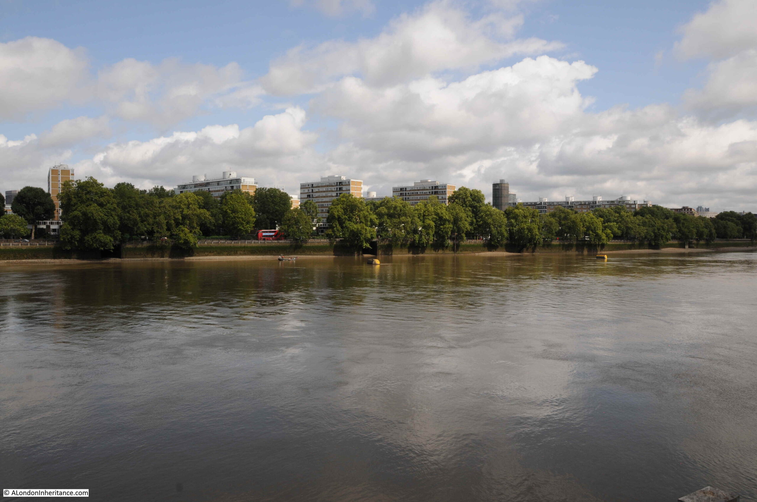
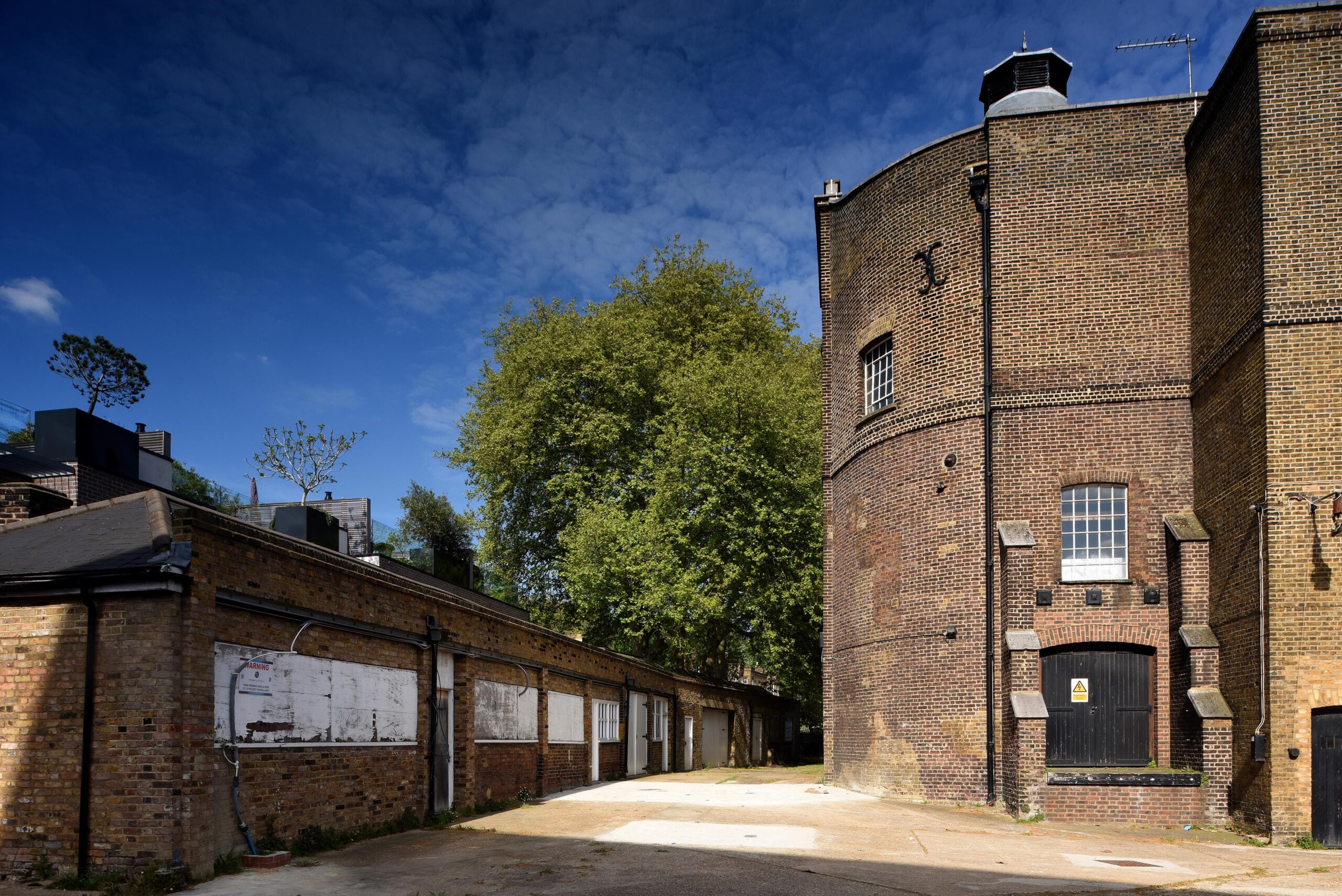
If you travel along Grosvenor Road, the road that runs along the Thames embankment in Pimlico, opposite Battersea Power Station, you may catch a glimpse of a tall, round tower between the blocks of flats that form the Churchill Gardens estate.
It looks rather out of place. An industrial construction within an area dedicated for residential housing. It is now 70 years old, and is the remains of an innovative solution to make use of waste heat from Battersea Power Station to warm the homes of those living on the opposite bank.
The tower is the most visible part of a highly complex system, that took hot water from Battersea Power Station, pumped it under the Thames through specially constructed pipes, stored water in the tower, then distributed it across both the Churchill Gardens and Dolphin Square estates for heating and hot water.
The system is described in considerable detail in a book published in 1951 for the Festival of Britain by the Association of Consulting Engineers. A large book that celebrates the work of civil engineering and construction across a wide range of projects.
The introductory paragraph to the section on the Churchill Gardens project provides an excellent description:
“In the ancient City of Westminster, almost within the shadow of the Houses of Parliament, so severely damaged by German bombers in 1942, great blocks of new flats are rising to meet the needs of London’s teeming millions, thousands of whom are still living in bomb-shattered houses built a century ago.
It is perhaps indicative of Britain’s will to survive and to surmount her economic troubles, that this great new housing estate, together with, it is expected an existing group of flats – probably the largest in Europe – is to have complete space heating and water heating by means of a district heating plan, thus banishing the dust and drudgery of the open coal fire, and the nuisance caused by the delivery and removal of fuel and ash for each block of flats. This plant is unique in two respects: it’s the first public heat supply in London, and it is also London’s first district heating plant wherein the heat is the byproduct of electricity generation. By this means the thermal efficiency of electric generating stations may be raised from its present figure of 25 per cent, to a figure approaching 75 per cent, for stations generating both electricity and heat.”
The section in the book is titled “District Heating Scheme, Pimlico Housing Estate and Dolphin Square”, as at the time the book was put together, the estate had not yet been given the name of Churchill Gardens.
The book includes diagrams and photos of the project.
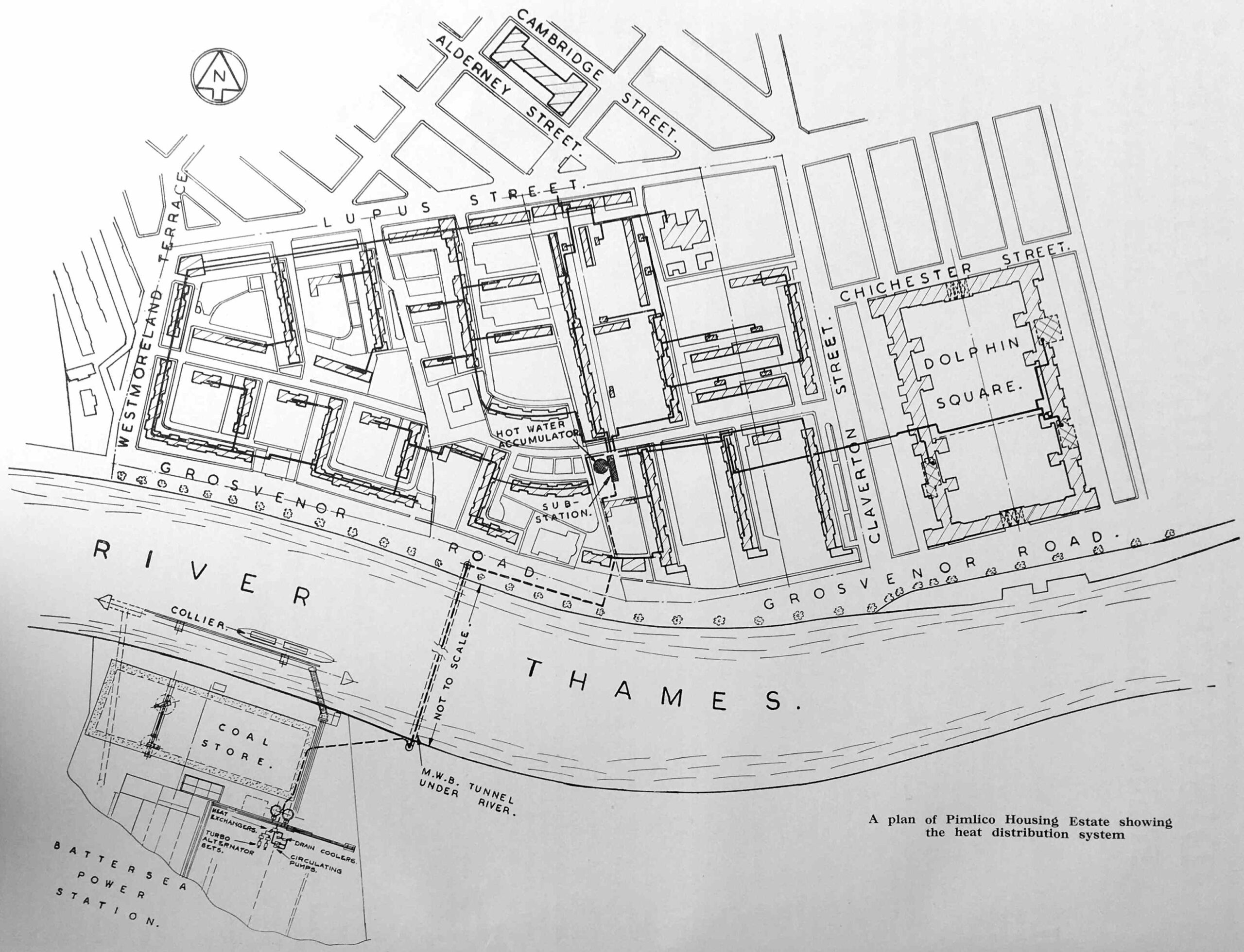
In the following diagram, we can see Battersea Power Station at lower left, pipes leading under the river to the Churchill Gardens estate which is bounded by Lupus Street, Claverton Street, Grosvenor Road, and Westmoreland Terrace on the western boundary (now an extension of Lupus Street).
In the lower centre of the estate is the tower, labelled as the “Hot Water Accumulator”. Dolphin Square, which also received hot water from the scheme is to the right.
The pipes under the Thames were installed in a pre-existing Metropolitan Water Board tunnel, and they consisted of 12 inch bore pipes for feeding water from Battersea and pipes for the return of water. They were insulated by being covered in 2 inches of compressed cork.
The water sent from Battersea Power Station was up to a maximum of 200 degrees Fahrenheit (93 degrees Celsius) and was stored in the tower, or to use its correct name, the “Hot Water Accumulator” before being distributed across the estate.
Hot water was fed directly to radiators for heating and to a calorifier for hot tap water (a calorifier is basically a coil of pipe inside a tank of water allowing heat to be transferred between the two, so water from the mains supply was delivered at the tap, rather than water from the power station).
The purpose of the tower was to store a sufficient supply of hot water to balance demand, for example when there was higher demand than could be provided immediately through the pipes under the river.
Water temperature was regulated by the injection of the cooler return water to the hot water as by the time water had been used to heat the estate and it was being pumped back to Battersea, it was 70 degrees Fahrenheit cooler then originally sent.
The following diagram shows the supply chain from power station to flats:
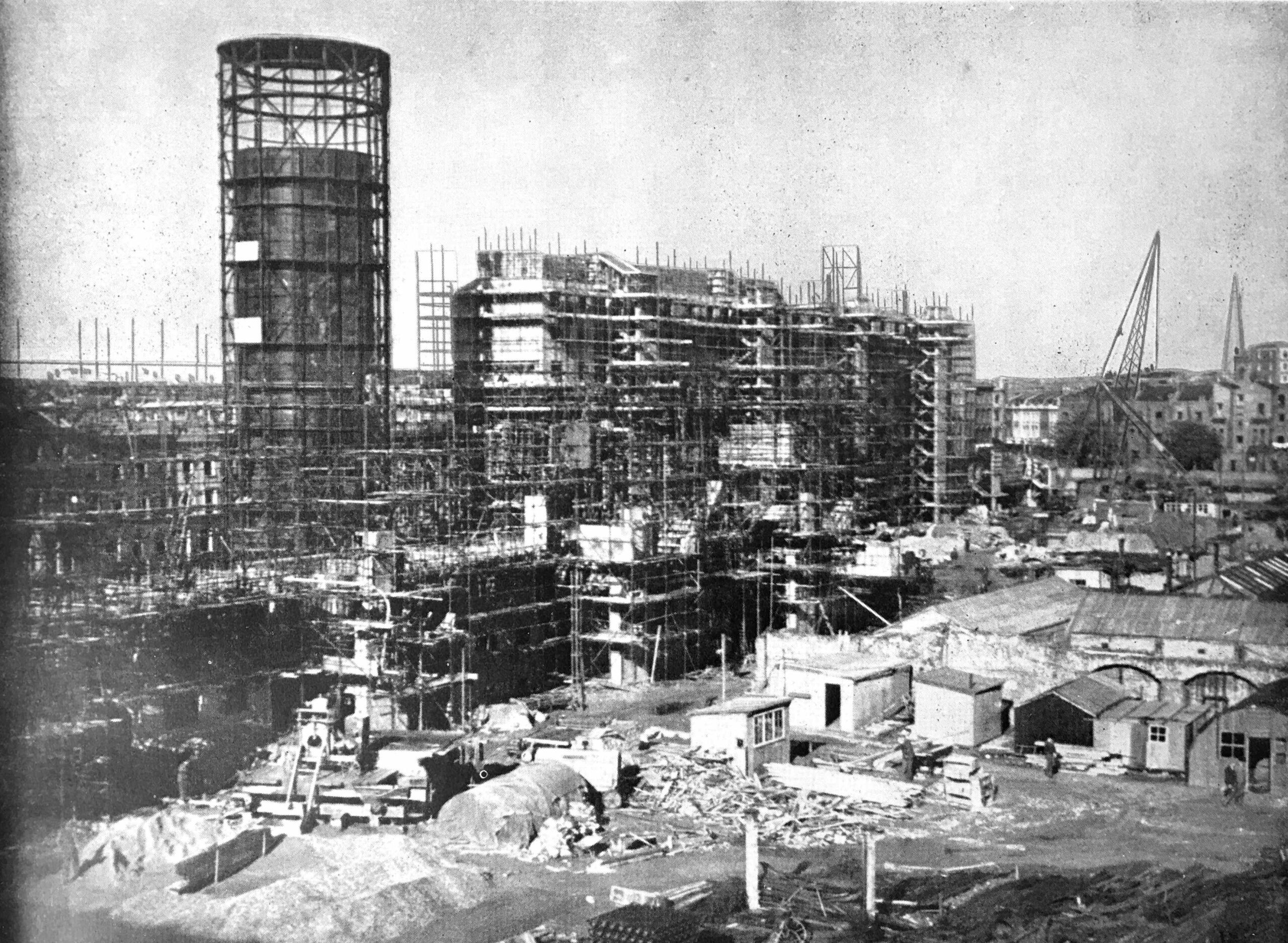
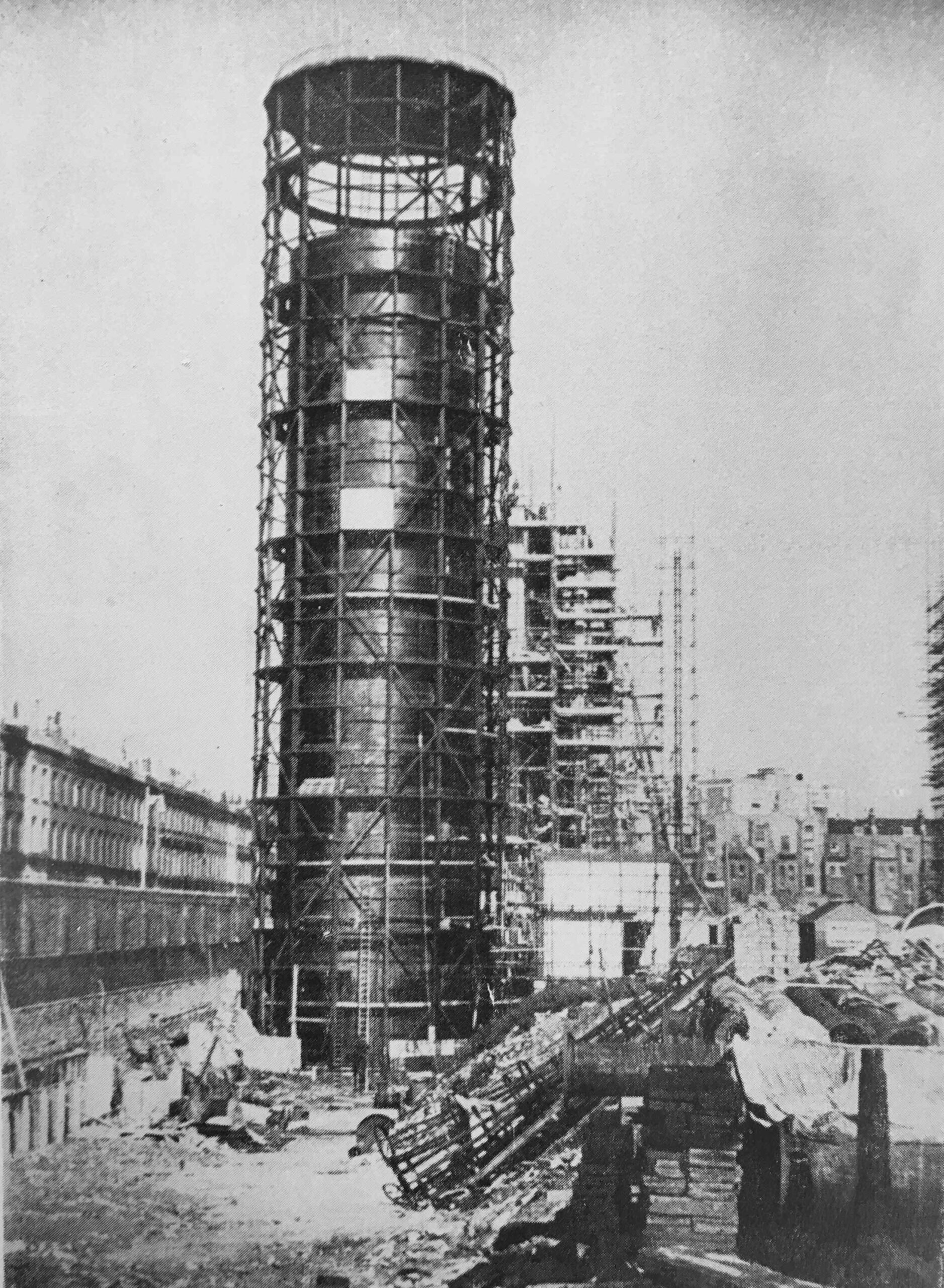
The hot water accumulator tower, along with the rest of the heating system was constructed at the same time as the rest of the Churchill Gardens estate:
The system had a number of safeguards built in as the Ministry of Health required assurance that the system would prevent the release of water at 200 degrees onto anyone who was working on the system. This included measures such as automatic stop valves which would operate when a fall in pressure was detected.
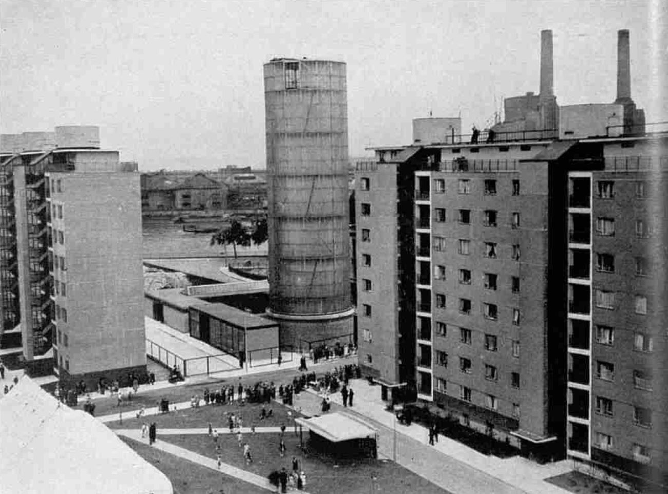
The outer surface of the tower consists of a steel framework with translucent glass panels.
Within the tower was the accumulator vessel which was 126 feet in height, and 29 feet in diameter. Constructed of mild steel plates and with a 3 inch layer of cork to provide insulation.
The project would save a considerable amount of coal, with the text in the book calculating a total of 10,000 tons of coal saved each year by taking the waste hot water from Battersea Power Station.
The amount of heat supplied to the individual flats across the estate was not measured, and a standard charge was applied to all residents for the service. For other buildings, the charge was based on the surface area of the installed radiators.
The hot water accumulator tower, and the first blocks of flats on the estate on the day of the official opening in 1951:
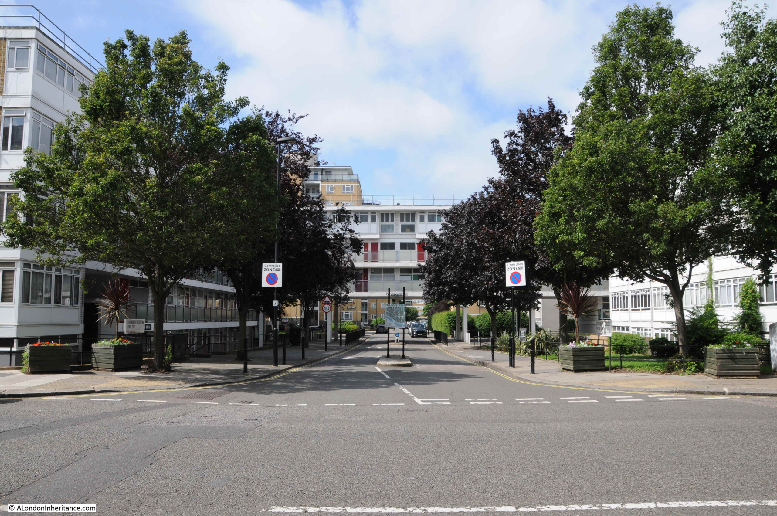
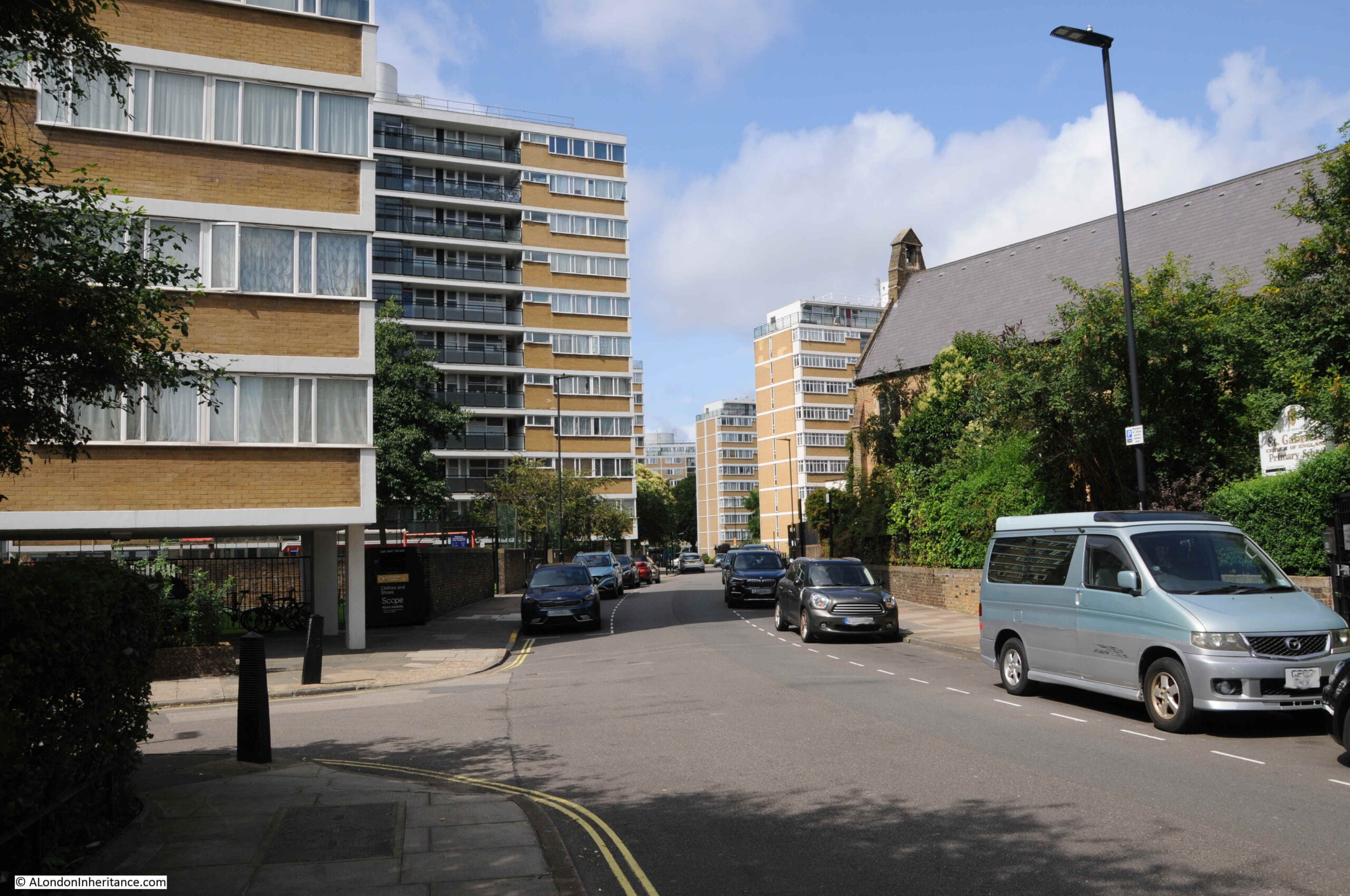
I went for a walk through the Churchill Gardens estate to find the accumulator tower and to take a look at the estate. Starting at the eastern side of the estate, I walked through the road that runs through the centre of the estate – Churchill Garden Road.
This is the view looking into the estate from Claverton Street:
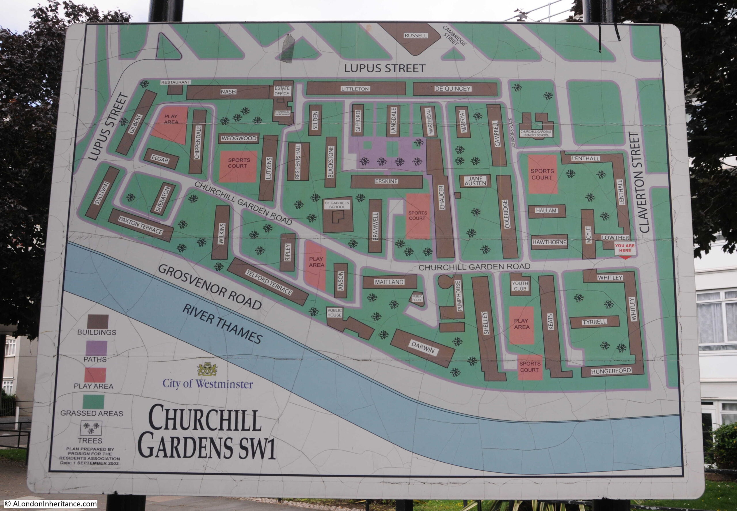
Map of the estate at the entrance from Claverton Street:
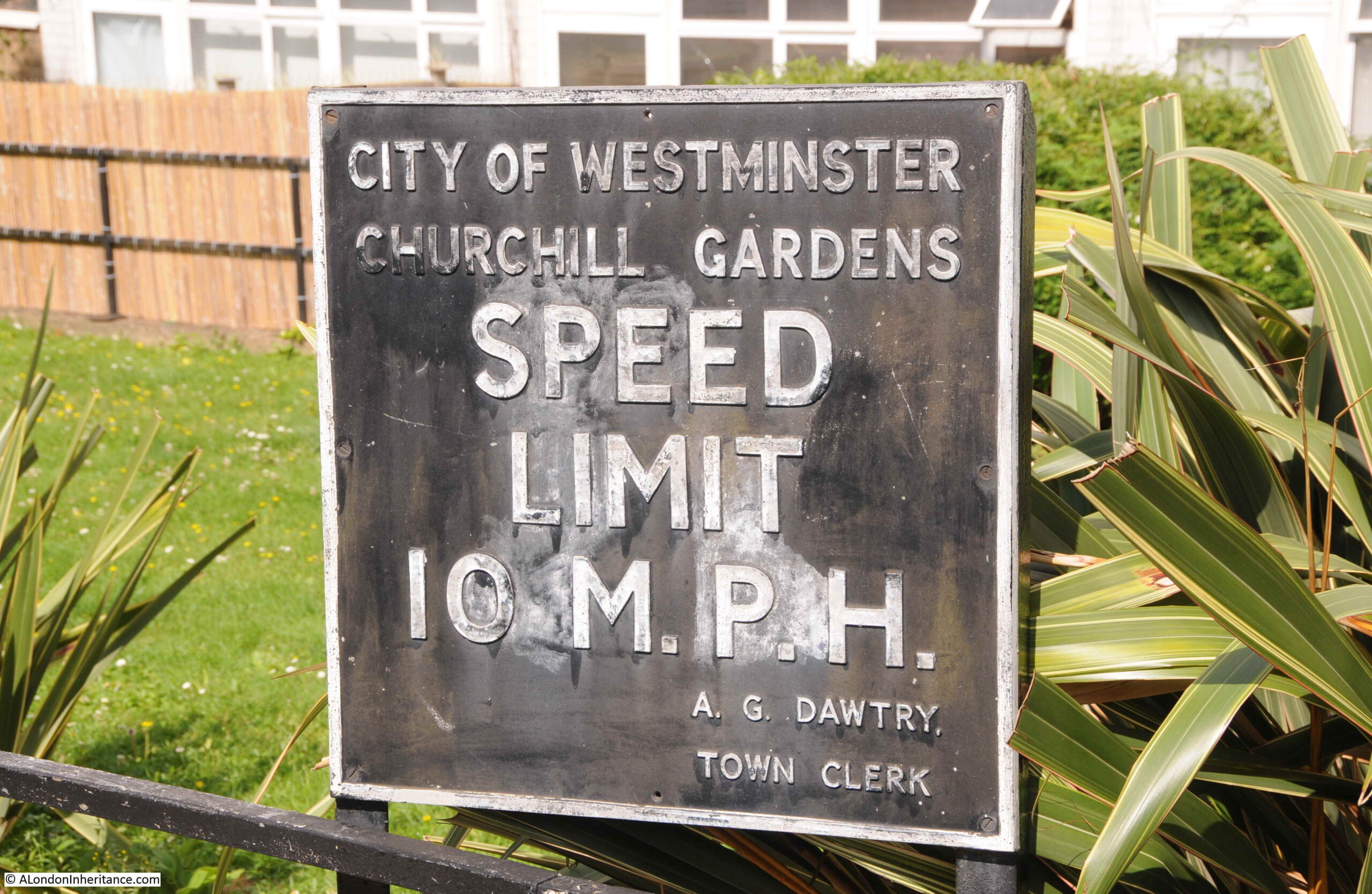
Along with an early speed limit sign:
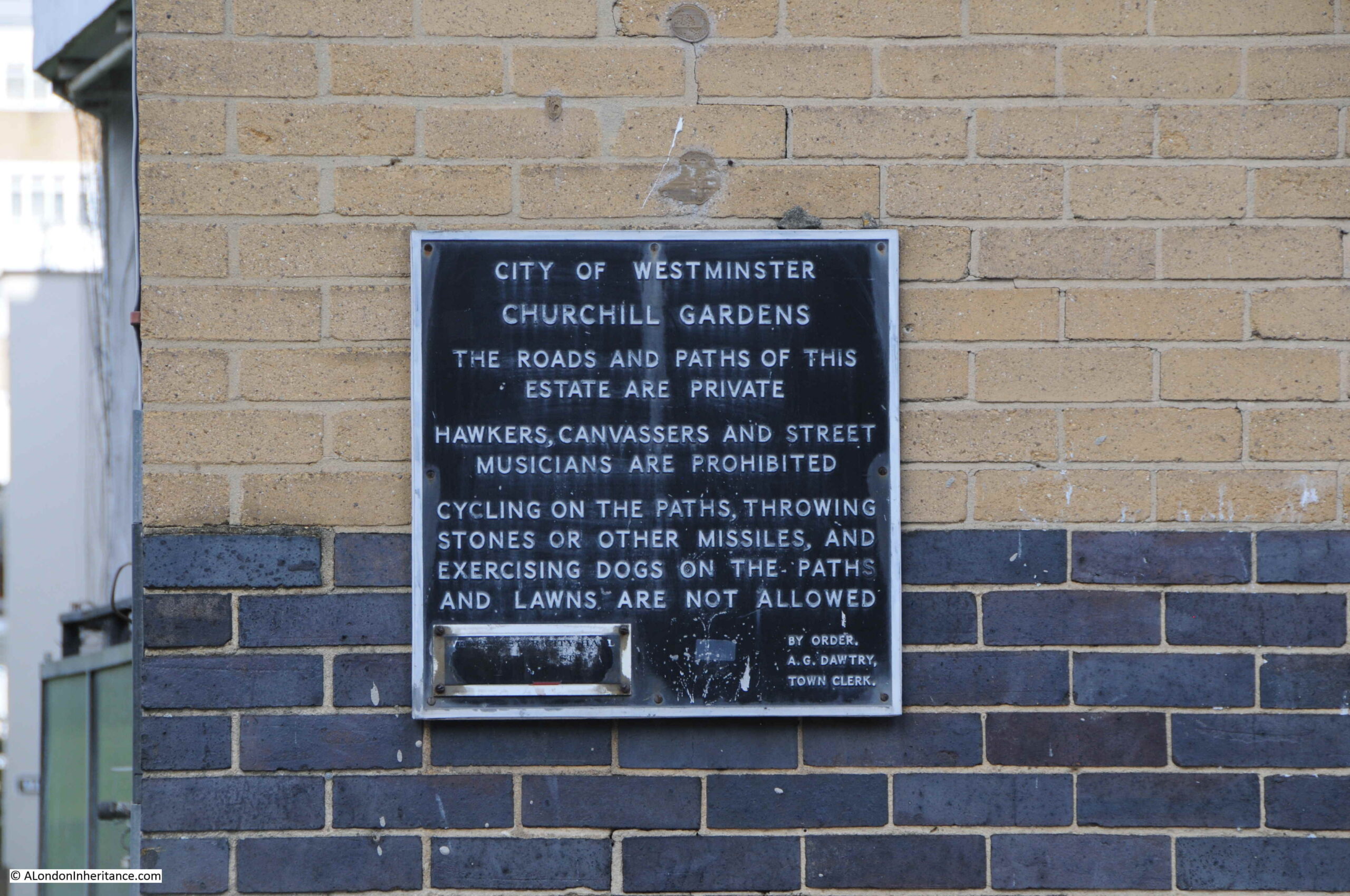
The A.G. Dawtry. Town Clerk mentioned on the speed limit sign was Sir Alan Dawtry, who was town clerk, then chief executive of Westminster City Council from 1956 to 1977. He lived for 61 years in the nearby Dolphin Square complex and was instrumental in saving the building when in the 1960s the company that owned Dolphin Square was going through financial problems, and there was a risk that the buildings would be sold off and converted to a hotel.
The above sign probably dates from the later part of the 1950s, as the estate was being completed.
Pre-war, the area occupied by the Churchill Gardens estate had consisted of industrial buildings and terrace houses. Bomb damage during the war, and the slum conditions of the housing meant that the area was ideal for redevelopment.
The 1943 County of London plan had proposed the development of large, well planned estates, and at the end of the war, Westminster City Council launched a competition for the design of a new estate.
The competition was won by Philip Powell and Hidalgo Moya, who were also responsible for the design of the Skylon for the Festival of Britain, the Queen Elizabeth Conference Centre in Westminster and the Museum of London building at London Wall.
The winning design by Powell and Moya included buildings with a variety of heights, consisting of eleven storey blocks to three and four storey houses and maisonettes. This was intended to break up any monotony across the estate, and to attract a broad cross section of residents.
Gardens and playgrounds would be provided between the buildings, and to address the urgent need for post war housing, the estate was designed to accommodate a high density of 200 people per acre, which was the maximum allowed at the time.
The first part of the estate that we reach from Claverton Street was the last finished. Built in the early 1960s, this part of the estate makes more use of glass than the rest of the estate:
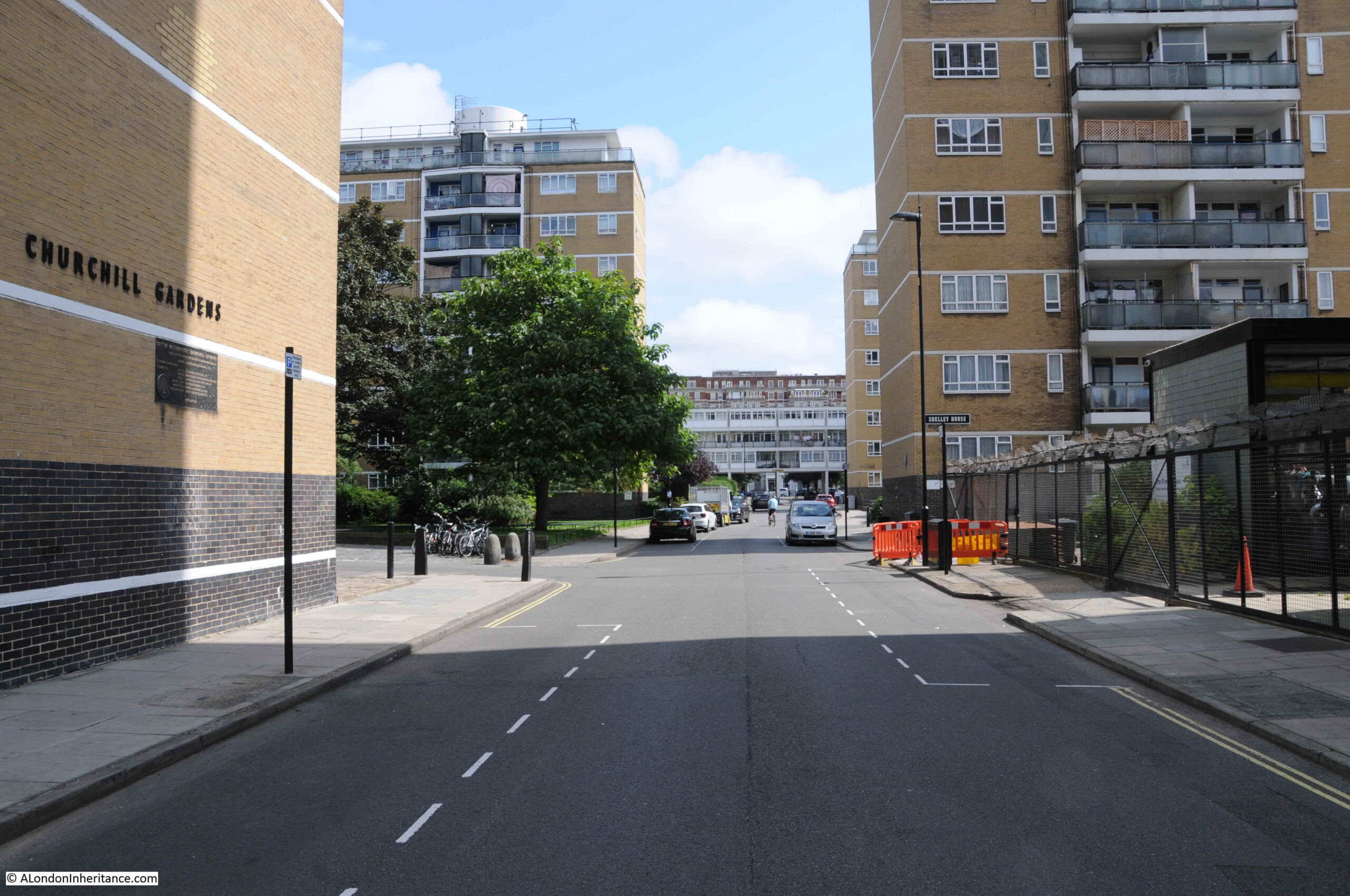
One of these 1960 to 1962 blocks crosses Churchill Garden Road, almost creating the impression of a gateway to the rest of the estate:
Looking along Churchill Garden Road, we can see the main blocks of flats:
The road curves as it runs through the estate, so the main blocks of flats do not form a continuous wall along the road. They are also aligned north – south so as to maximise the amount of day light that would fall on their main east – west facing windows.
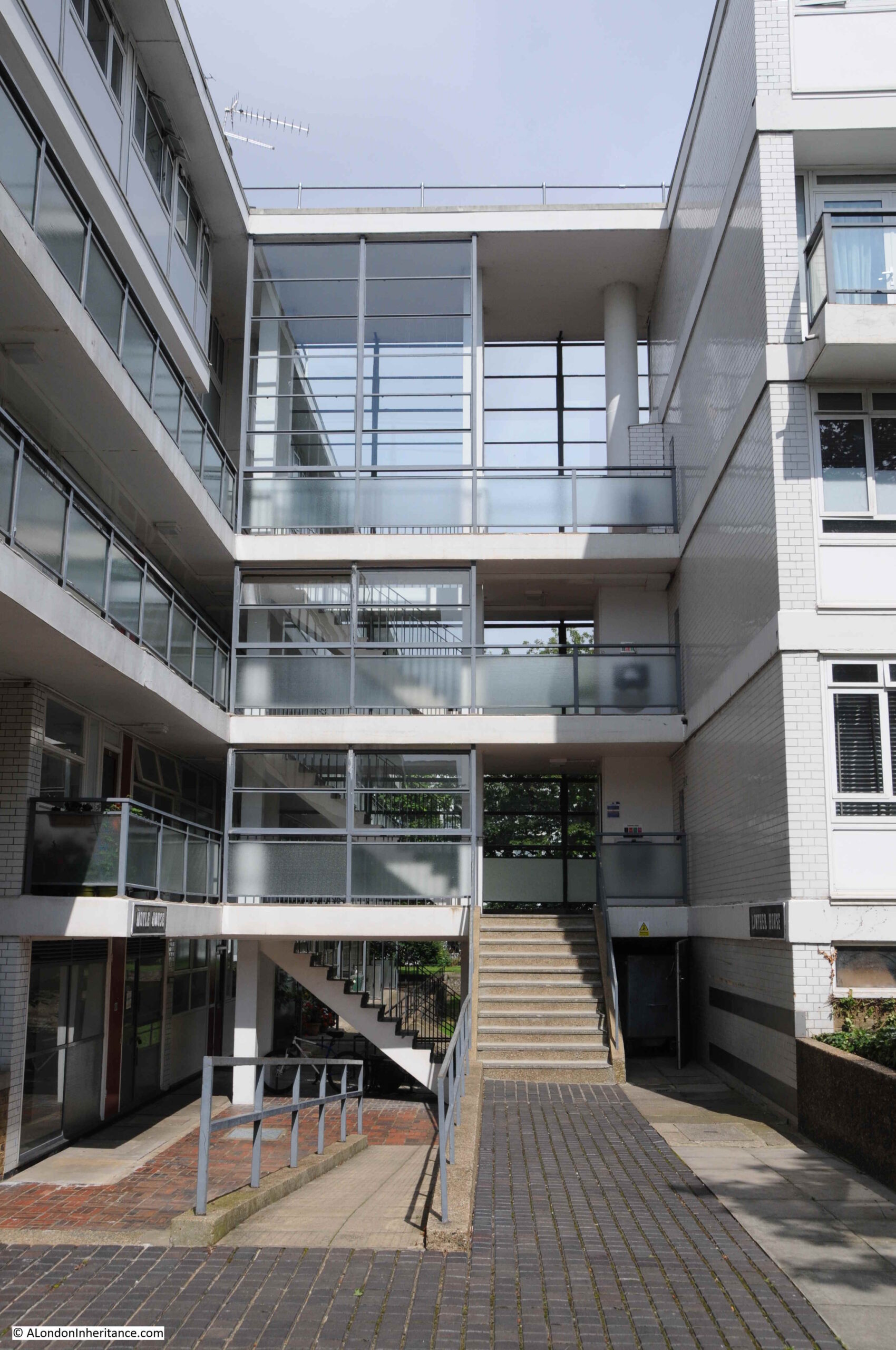
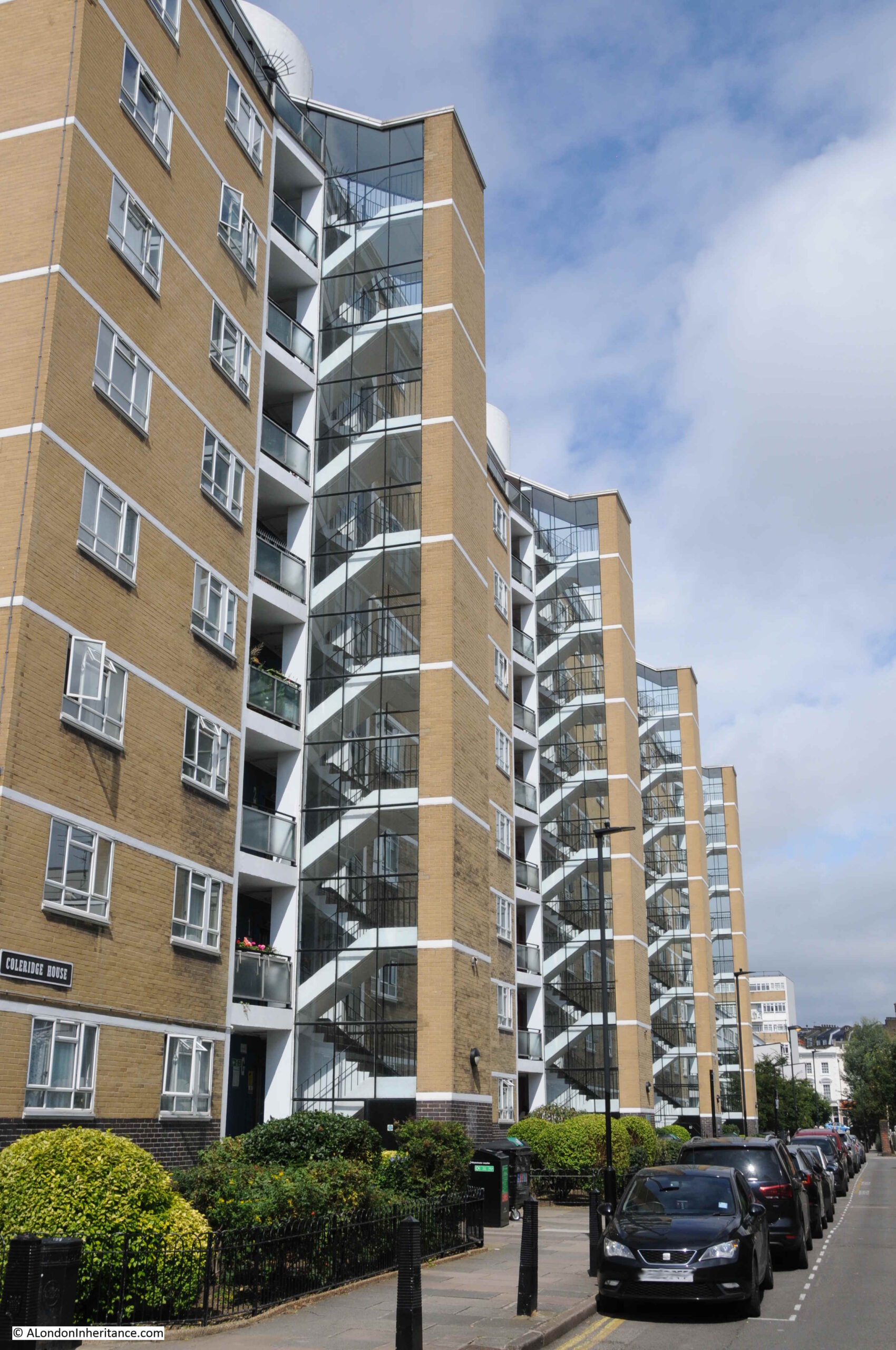
The blocks that were built during the first phase of construction, from 1946 up to 1951 have large, glazed stairways protruding from the sides of the blocks. Later blocks would have galleries running along the length of the blocks.
Well kept gardens between the blocks:
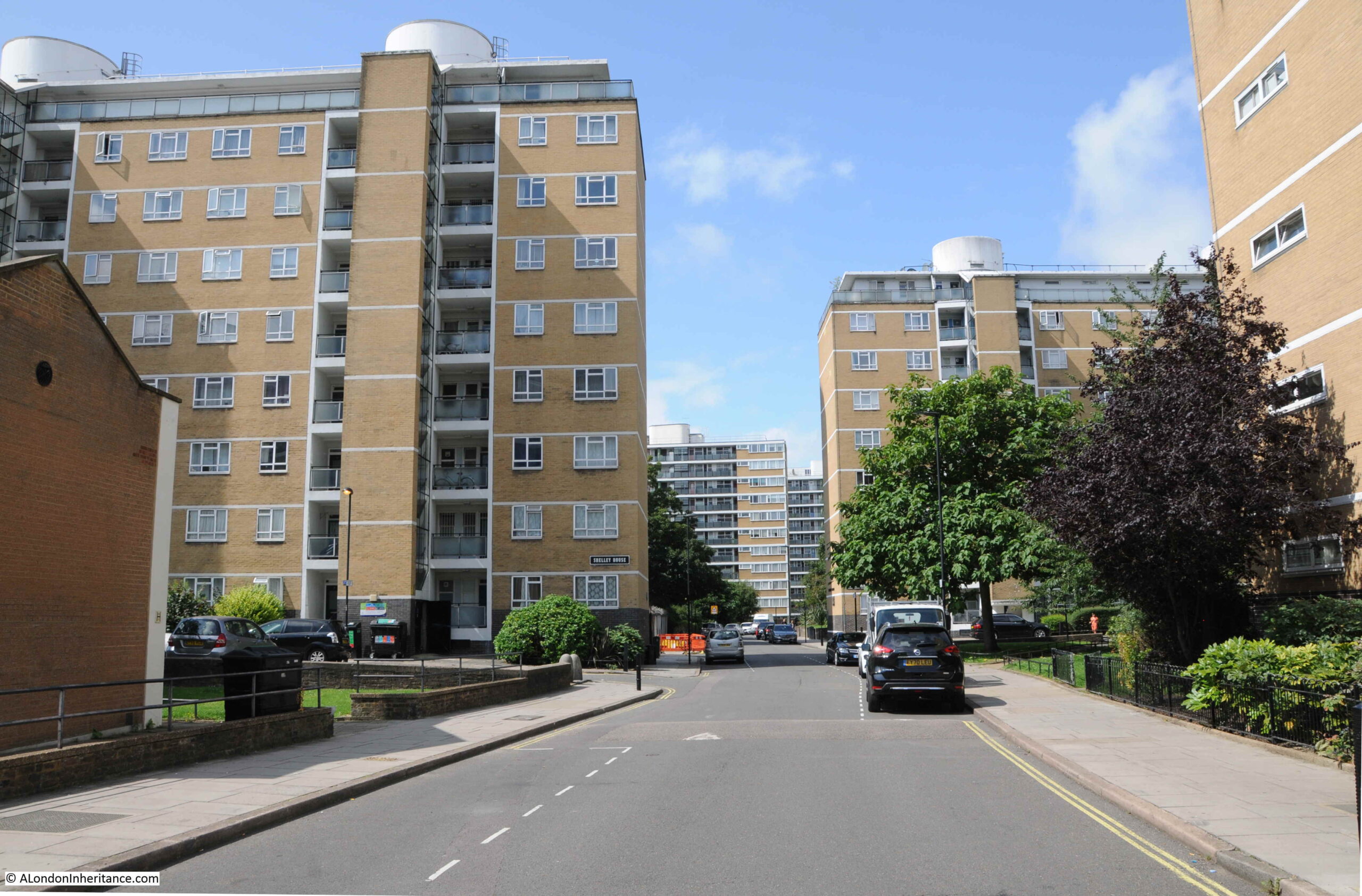
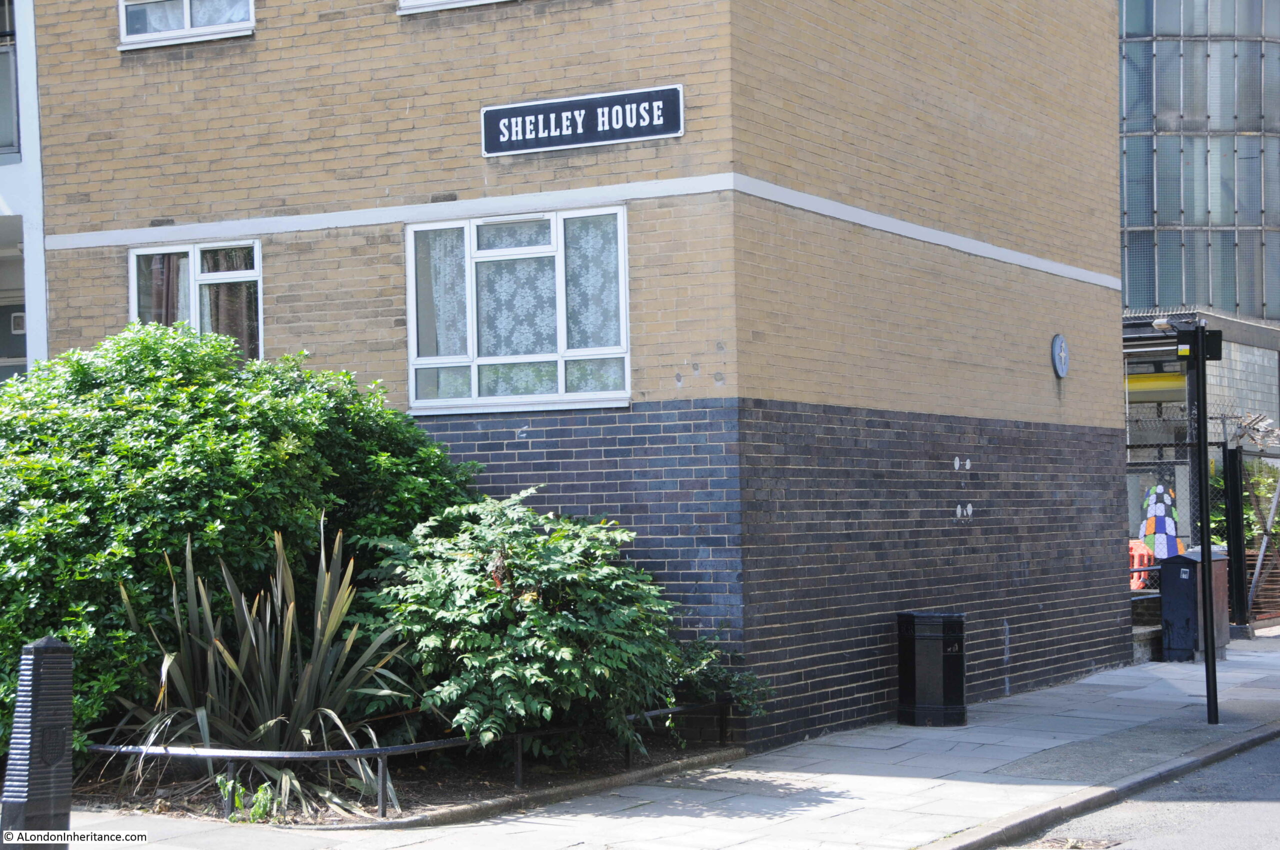
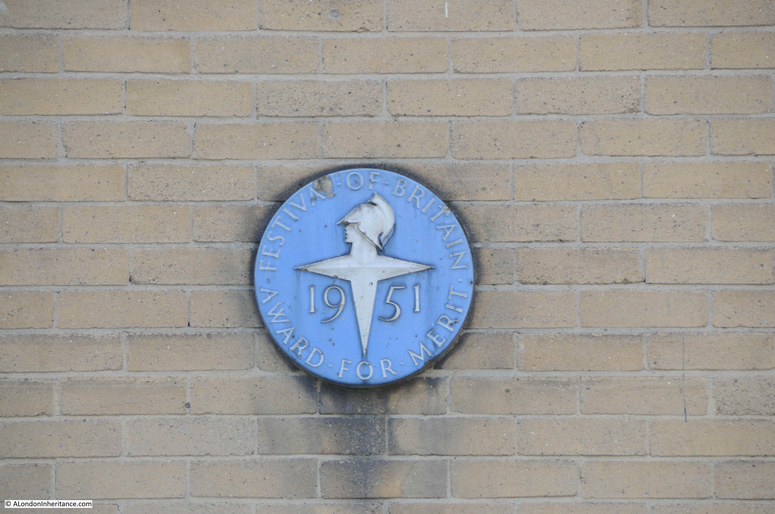
Shelley House with a glimpse of the hot water accumulator tower to the right:
In the above photo, a blue plaque can be seen on the wall.
Shelley House was one of the first four blocks completed by 1950 and the blue plaque is a Festival of Britain Award for Merit granted to these first blocks. These four blocks (Chaucer House, Coleridge House, Shelley House and Keats House) along with Gilbert House and Sullivan House on the western edge of estate, and the accumulator tower are also Grade II listed, and indeed the whole estate has been designated as a conservation area.
The Festival of Britain Award for Merit:
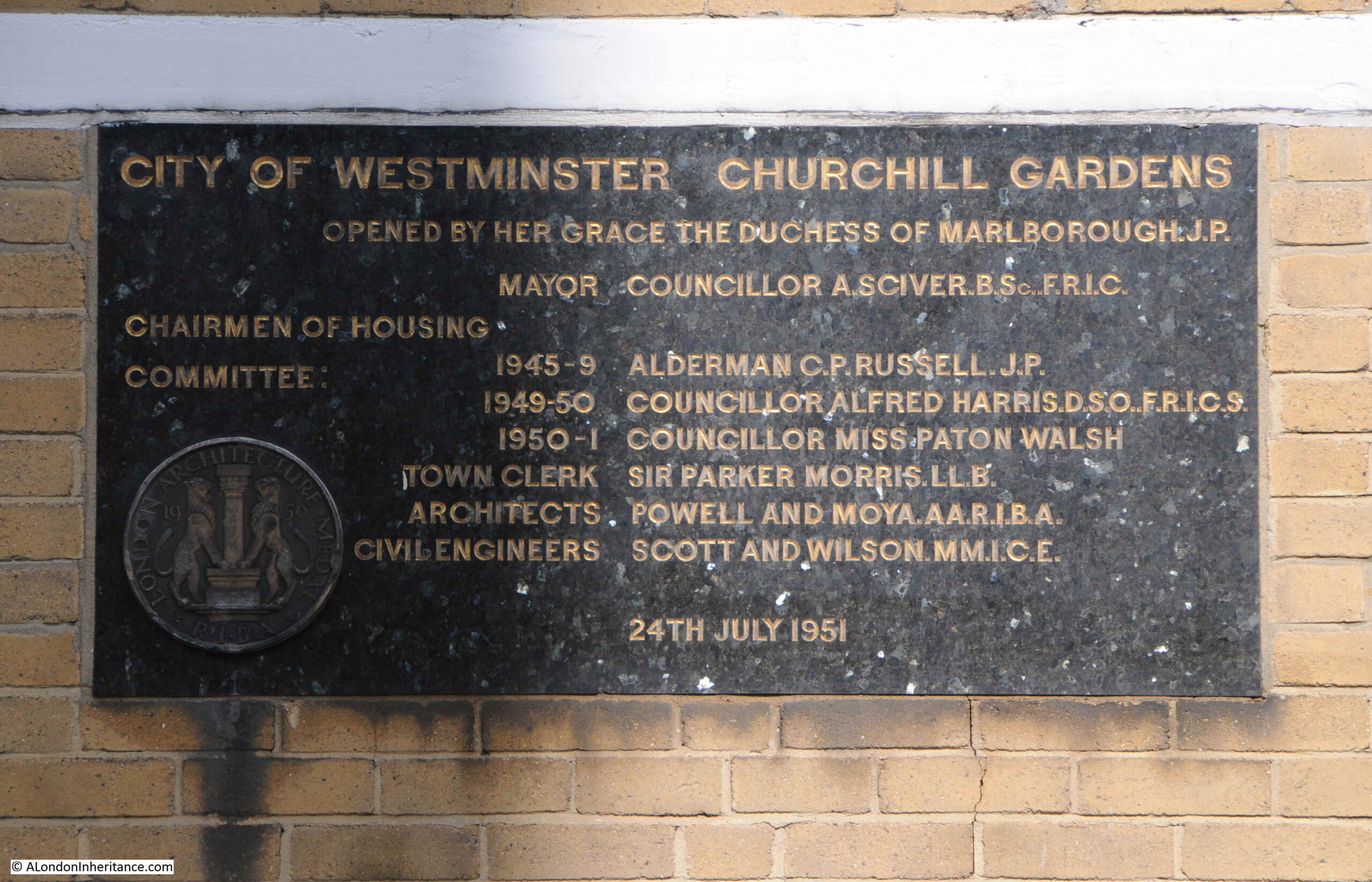
Looking back along Churchill Garden Road, and the block on the left has another plaque:
This plaque marks the official opening of the estate on the 24th July 1951 when the first phase of the estate, including the hot water accumulator tower, had been completed:
In the 1951 book by the Association of Consulting Engineers, the estate was called the “Pimlico Housing Estate”, as the estate had not yet been given an official name. A newspaper article in the Westminster and Pimlico News dated the 23rd March 1951 provides the sources of the name:
“It was disclosed at Westminster Council meeting that the name ‘Churchill Gardens’ was the brainwave of Housing Committee chairman, Councilor Miss Paton Walsh.
Mrs. Winston Churchill has agreed to perform the opening ceremony of the estate and of the district heating undertaking on Thursday, July 19.
Miss Paton Walsh pointed out that Mr. Churchill had many connections with Westminster in that he had lived and worked there and he was also their first honorary freeman of the city.”
The official opening covered the first phase of the estate and construction would continue into the 1960s. The 1950s were a difficult time for construction as there were so many competing demands for workers and materials as post war reconstruction gathered pace. This was also having an impact on Churchill Gardens as this article from the 3rd of August, 1951 edition of the Westminster and Pimlico News reported:
“Heartbreaking – It will be heartbreaking for home-seekers if flats at Churchill Gardens are held up while huge Government buildings started in the city are favoured and supplied with all the steel they need.
Sir Harold Webbe, Westminster’s MP attended the opening of Churchill Gardens. He is fully acquainted with the position. If there is a grave delay in the building of these flats he will undoubtedly use his influence in an effort to get things moving.”
Although the streets and houses that Churchill Gardens replaced had suffered bomb damage, with many regarded as slums, they were still occupied, and people were only moved when building had reached their part of the future estate. In 1959, contractors were preparing for demolition of the houses on the eastern edge of the estate ready for construction of the blocks that would be built in the early 1960s, however as the Westminster and Pimlico News reported on the 31st July 1959, there could still be delays:
“Demolition of houses in Claverton Street and Ranelagh Road, Pimlico on the site of Section IV of Churchill Gardens housing estate depends on rehousing the families still there.
Ald. C.P. Russell, chairman of the housing committee, said this at the Westminster Council meeting in a reply to a question put by Cllr. O.M. Boyd.
If rehousing proceeded at the anticipated rate, he expected demolition to start in the sprint of 1960.”
Another plaque from A.G. Dawtry. Town Clerk, this time banning Hawkers, Canvassers and Street Musicians, along with cycling on paths, throwing stones or other missiles, and that exercising dogs on the paths and lawns is not allowed.
It is at this point in the estate that we meet the hot water accumulator tower:
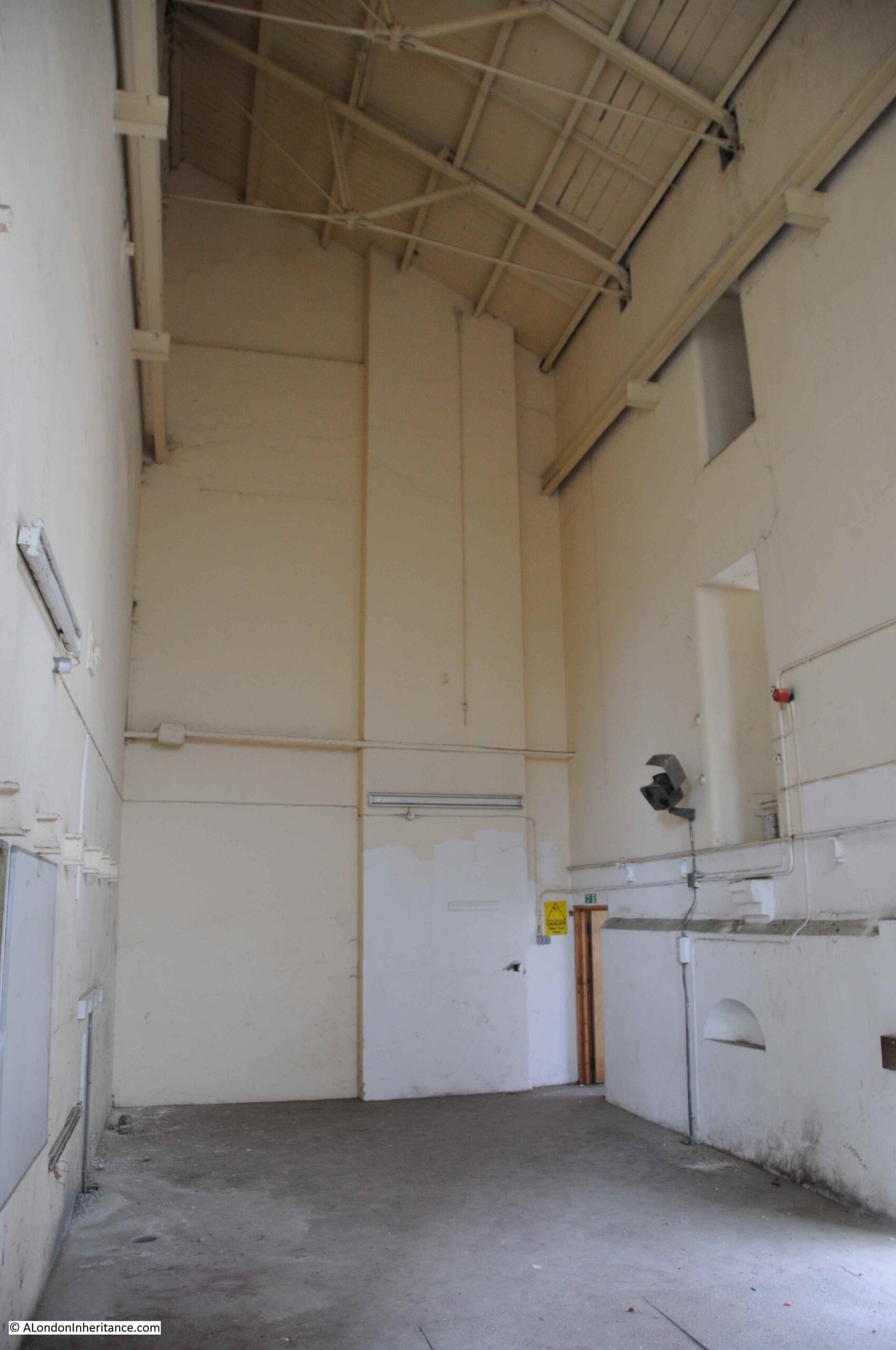
At the base of the accumulator tower are buildings that house equipment for the heating system.
The supply of hot water from Battersea Power Station ended in 1983, when the final generators at the power station closed.
The system supplying heat to Churchill Gardens was then converted to what we would now call as District Heat and Power system. In the buildings at the base of the accumulator tower are boilers along with heat and electricity generating systems which produce heat for distribution across the estate, along with electricity which is fed into the National Grid, which provides revenue to help subsidise the costs of the system.
A poor view through the fence into the equipment rooms at the base of the tower, along with a graphic of the tower on the glass:
The range of the system has extended from the original 1951 installation. As well as Churchill Gardens, the system now provides heating for Abbots Manor, Russell House and Lillington Gardens, with 5km of underground pipes serving 3,250 homes along with schools and commercial premises.
Another view of the equipment rooms, with the brick base of the hot water accumulator tower in the right:
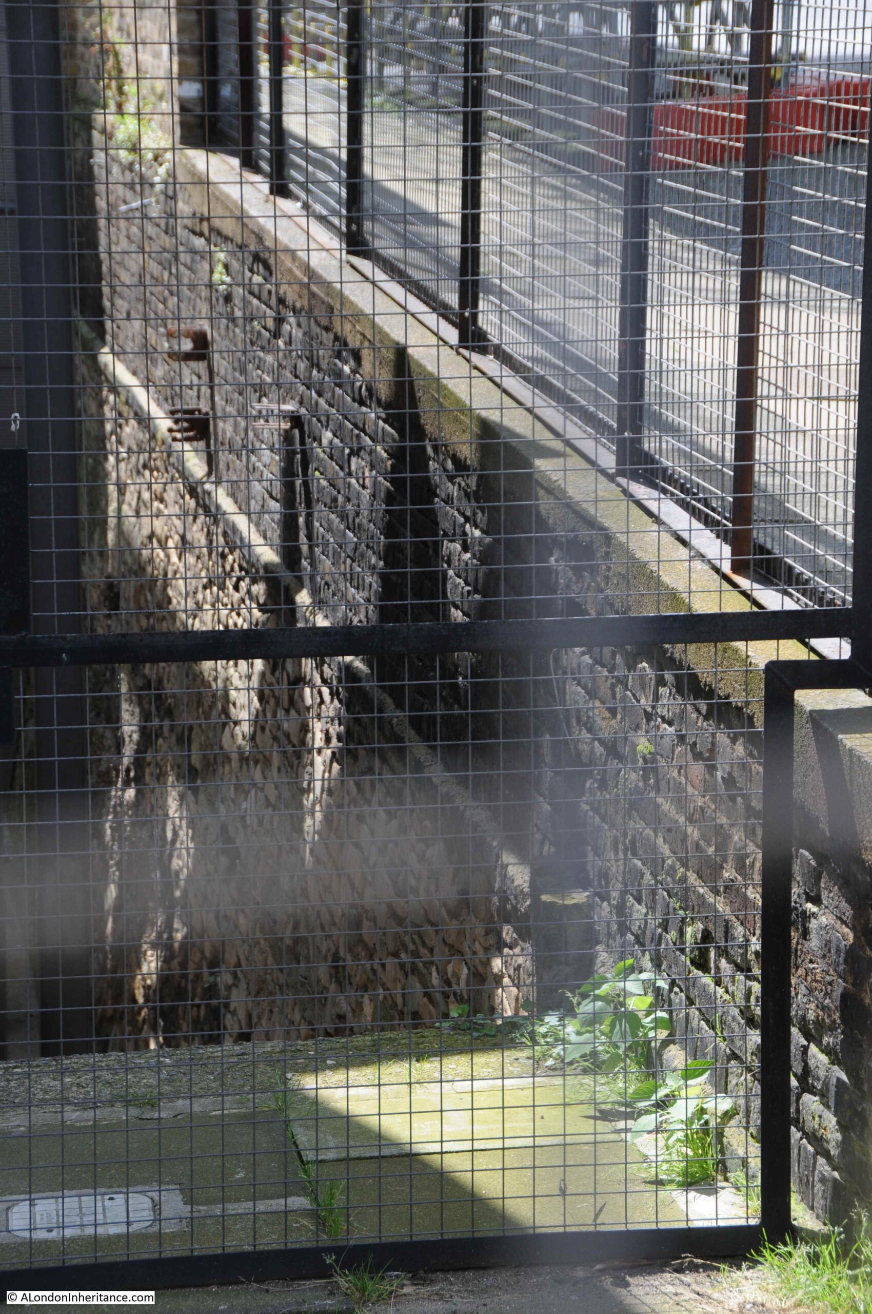
When you get up close, you can see that the tower is built within a deep pit, the following photo shows part of the side walls to this pit:
These walls look as if they have some age, older than the Churchill Gardens estate, and their original purpose is rather surprising.
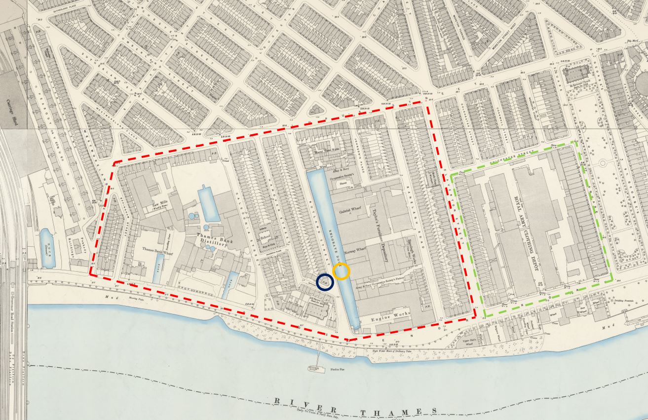
Before the war, there was a considerable amount of industry in the area now occupied by the Churchill Gardens estate. A distillery, saw mills, engine works and a furniture stores. There were also a number of wharves and docks, including one long dock called Belgrave Dock. This can be seen in the following extract from the 1894 Ordnance Survey Map (‘Reproduced with the permission of the National Library of Scotland’:
In the map, I have outlined the area occupied by Churchill Gardens in red and Dolphin Square in green. Note the difference in street layout between the area to the south of Lupus Street and the area to the north, which still remains much the same.
In the centre of the map is a long stretch of water – this is Belgrave Dock. I have marked the location of the hot water accumulator tower with the orange circle, and you can see that it stands in the middle of the dock.
The brick walls that can be seen in the pit next to the tower are the original surviving walls of Belgrave Dock. Rather amazing that these reminders of the areas industrial past survive.
Belgrave Dock seems to date from the early 19th century. The first written reference I can find is from the 26th February 1832 when the London News reported on a number of accidents during some of the very thick fogs that were covering parts of London at the time. As well as the Belgrave Dock, the report mentions the Grosvenor Canal, which was just to the left of the railway tracks on the left of the above map:
“FATAL ACCIDENTS DURING THE LATE FOG – Between eight and nine o’clock on Friday evening, a police constable discovered a woman in the Grosvenor-canal, Pimlico, quite dead: with assistance he got the body out, and conveyed it to the station-house, in Elizabeth street. The body was owned yesterday, and proved to be Mrs. Ann Hart, aged 72 years, residing in St George’s-row, near the wooden-bridge, Pimlico. There is no doubt that the poor old woman had, during the intense fog, walked into the Canal, which is very dangerous from its unguarded state, as she had her clogs on and a basket in her hand when found. She had merely gone out on an errand.
On Friday morning, john Dillon, a police-constable of the B. division, discovered the bodies of two men at the entrance of Belgrave Dock. They proved to be the bodies of Mr. Wilson, of No. 22, Prince-street, Lambeth, a wadding manufacturer, and his son-in-law, Mr. York; who it is supposed walked into the water during the fog.
The place is in a most dangerous state, particularly in foggy weather; and the only wonder is, that more accidents have not occurred. The place belongs to the Marquis of Westminster; and it is to be hoped that his Lordship will give immediate orders to have the evil remedied. We have heard that another female was brought out of the Canal yesterday morning.”
The report provides an impression of what the area was like in the early 19th century, and I like the address for poor Ann Hart as “near the wooden-bridge, Pimlico”.
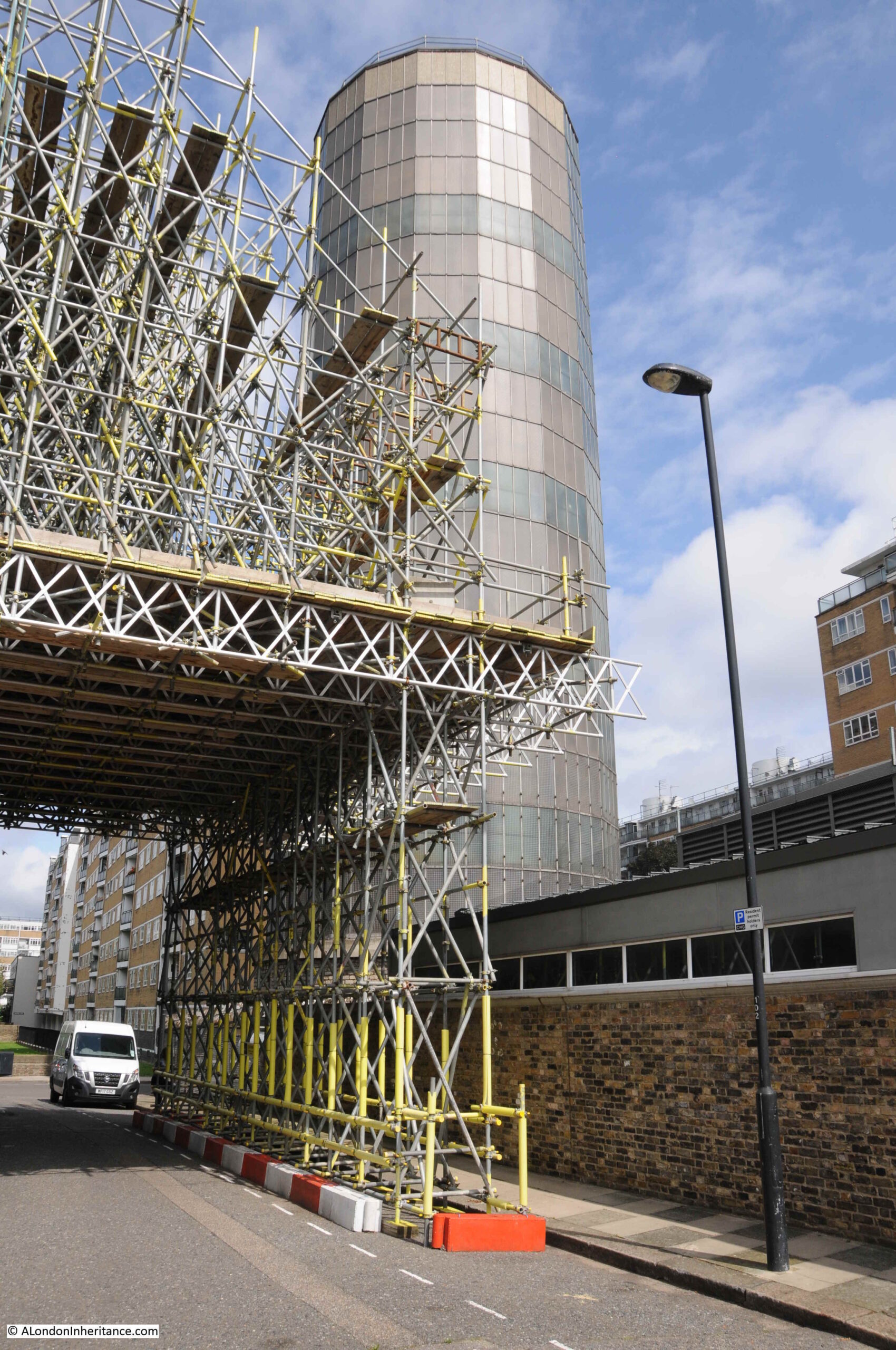
Walking down the side road to the tower, and this is the view of the tower from the south:
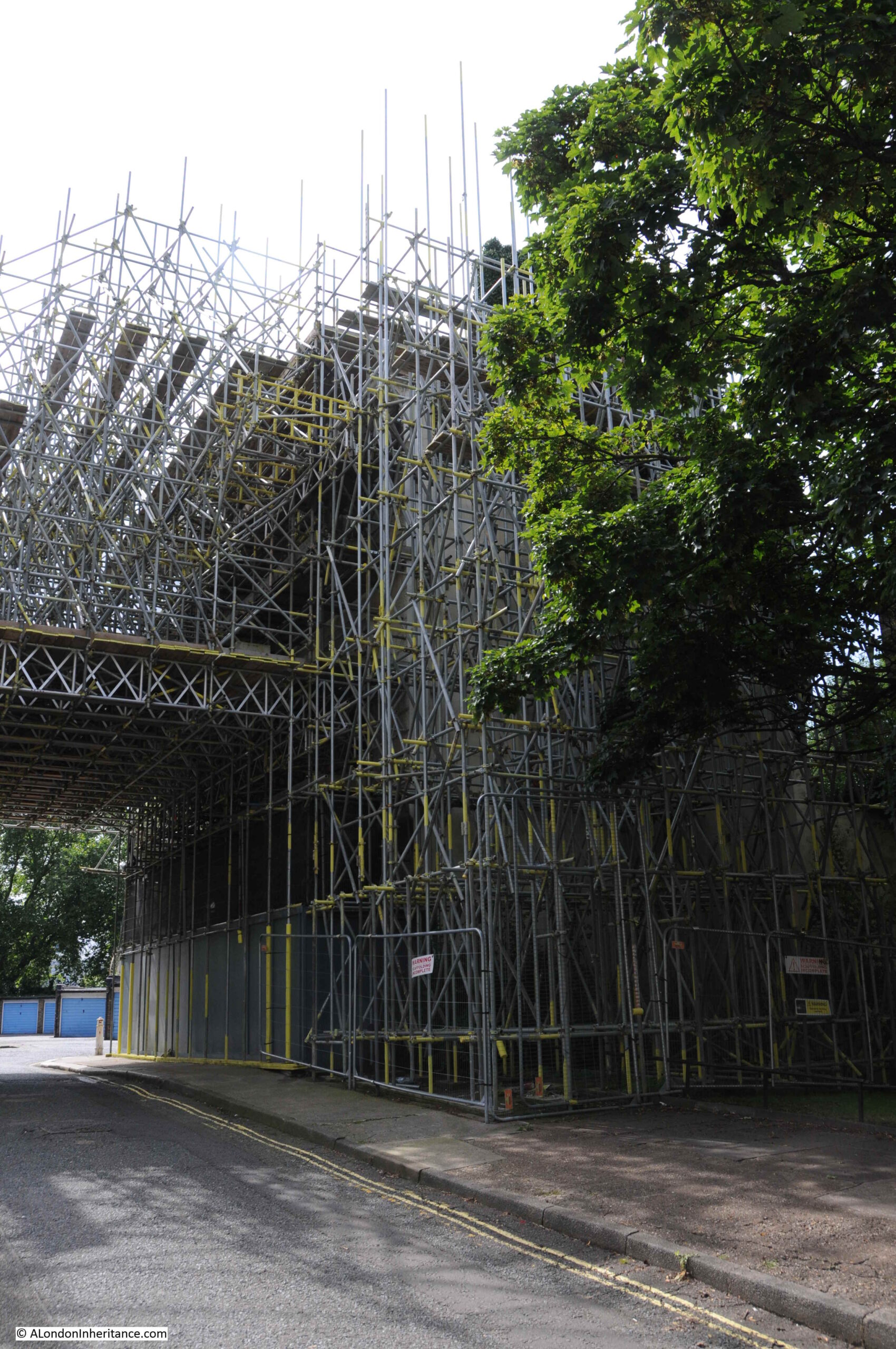
In the above photo, and in the photo below there is a large building completely covered in scaffolding, including scaffolding stretching across the road, presumably to provide some buttressing support to the building.
Buried underneath the scaffolding is a closed pub – the Balmoral Castle. A painted sign can just be seen on the side of the pub.
The Balmoral Castle dates from the mid 19th century and was part of the original development of the area. It can be seen in the 1894 Ordnance Survey extract above under the dark blue circle.
The pub seems to have been the focus for a number of sporting clubs, with the Metropolitan Cabdrivers Rowing Regatta and Mechanics’ United Rowing Club, along with the Pimlico Athletic Club all using the Balmoral Castle as their meeting place.
It was retained during the development of Churchill Gardens as the intention was to include community facilities for the residents. The pub closed in 2004, and the scaffolding was erected in 2014.
There have been plans to redevelop the area occupied by the pub and nearby Darwin House, but these do seem to be progressing rather slowly. In the meantime, part of the pub also seems to be supported by an incredible growth of what looks from a distance like a form of ivy.
Continuing along Churchill Garden Road, and we can see blocks built during later phases. These do not have the multiple external stairs, but have galleries along each floor.
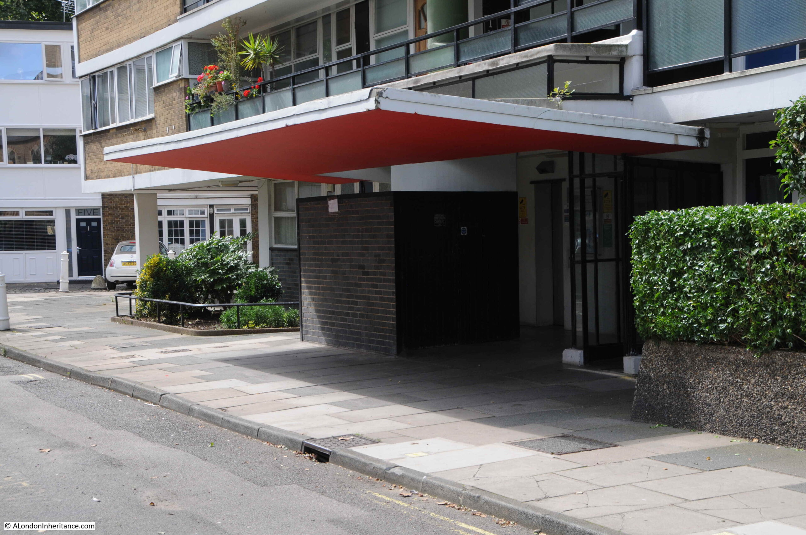
There are design features such as concrete canopies over the entrances to the blocks:
As well as the Balmoral Castle pub, a school was retained during the construction of the estate. This is St. Gabriel’s Church of England Primary School.
The block of flats behind the school has the distinctive white rendered, rooftop drums for water tanks and lift equipment found on the top of the blocks across the estate.
At the end of Churchill Garden Road, I reached the western end of Lupus Street which forms the western boundary of the estate. The following photo is looking back through the estate:
We then walked along Grosvenor Road, along the Thames for another view of the hot water accumulator tower, with the scaffolding surrounding the Balmoral Castle to the left:
Part of the Churchill Gardens estate faces directly onto Grosvenor Road, however there are some original buildings that have survived:
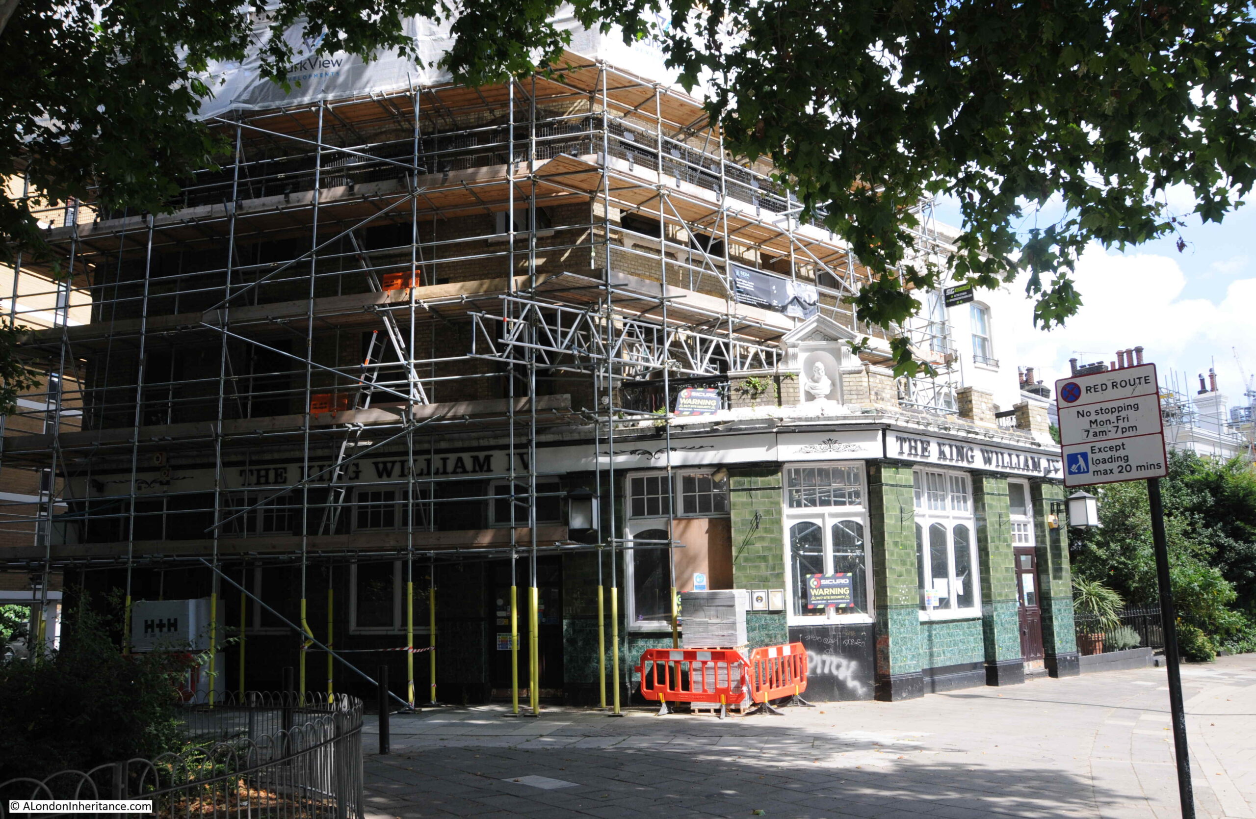
One of which was another pub that has recently closed and is now being redeveloped. This was the King William IV, originally from the mid 19th century and rebuilt in 1880:
The future of the old pub seems to be some form of housing. The Health and Safety Executive Notification of Construction Project taped to one of the windows states that the address is now “Travel Joy Hostels Ltd” and the project will consist of 6 new apartments being designed and built, an extra floor added, and a basement to be constructed to the rear.
The old doors to the pub, with a gutted interior behind:
A short distance along Grosvenor Road is Dolphin Square. This large estate was also provided with heating from the original Battersea Power Station / Churchill Gardens system:
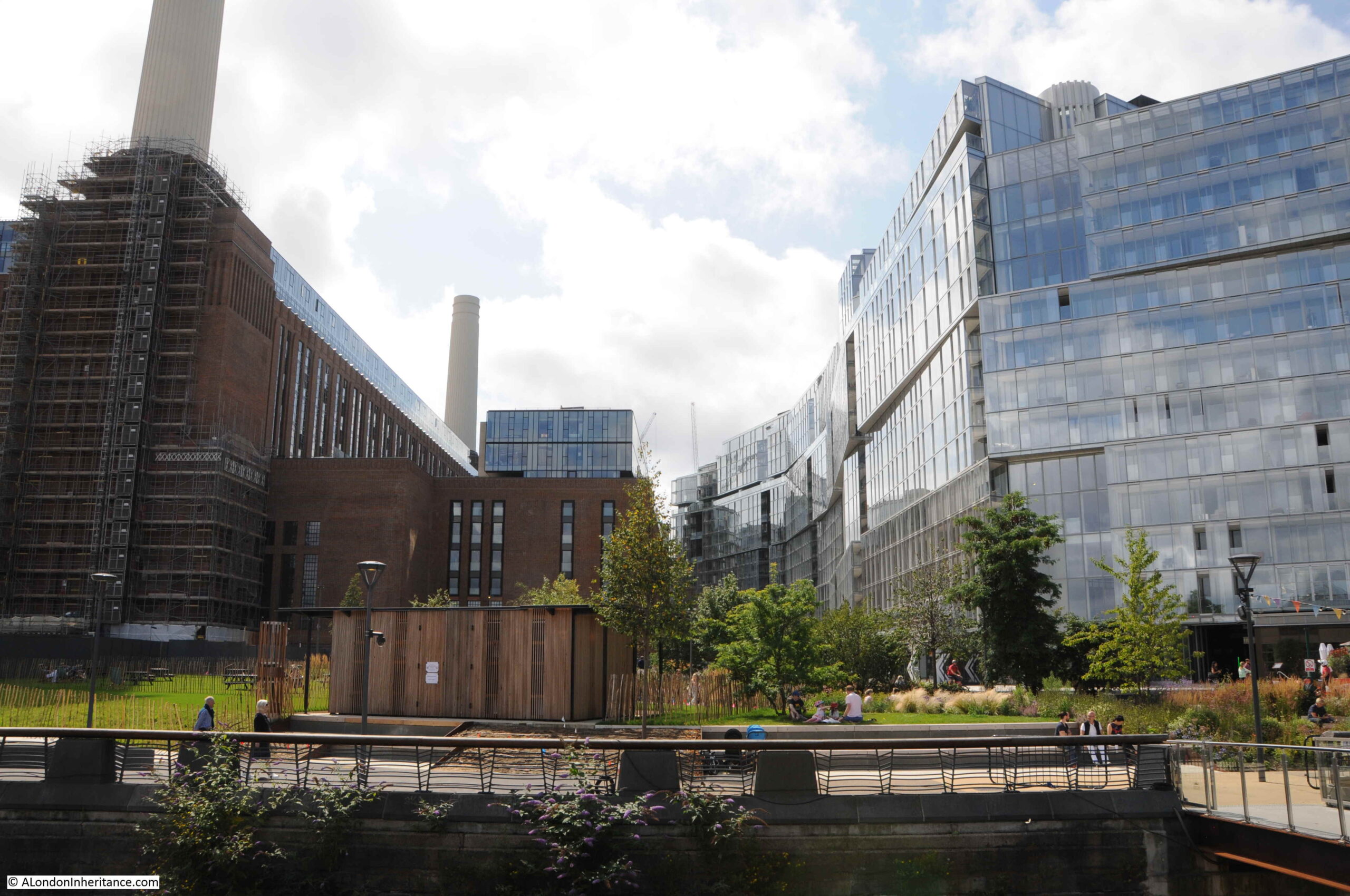
My original reason for exploring Churchill Gardens was to find the hot water accumulator tower, and there was one final part of the original system that I had to visit, and this was Battersea Power Station, which supplied the waste hot water across the river to heat the estate.
Battersea Power Station seen from across the river:
I also wanted to see how development of the old power station and the surrounding area was progressing. In the above photo, the large, glass apartment block that now sits between the power station and railway bridge can be seen on the right.
In the following photo, the additional building on top, and to the side of the power station can be seen:
Crossing the river on Chelsea Bridge, and the apparently random jumble of towers that are spreading along the side of the Thames in Vauxhall can be seen:
Battersea Power Station closed in 1983, and for many years the building was empty, roofless and derelict. After many false starts, much of the old building has been redeveloped. This included the complete reconstruction of the chimneys as the originals were structurally unsafe.
One of the chimneys is planned to included the Battersea Power Station Chimney Lift, which will lift visitors to the top of the tower to get a view from above. It is planned to open in 2022.
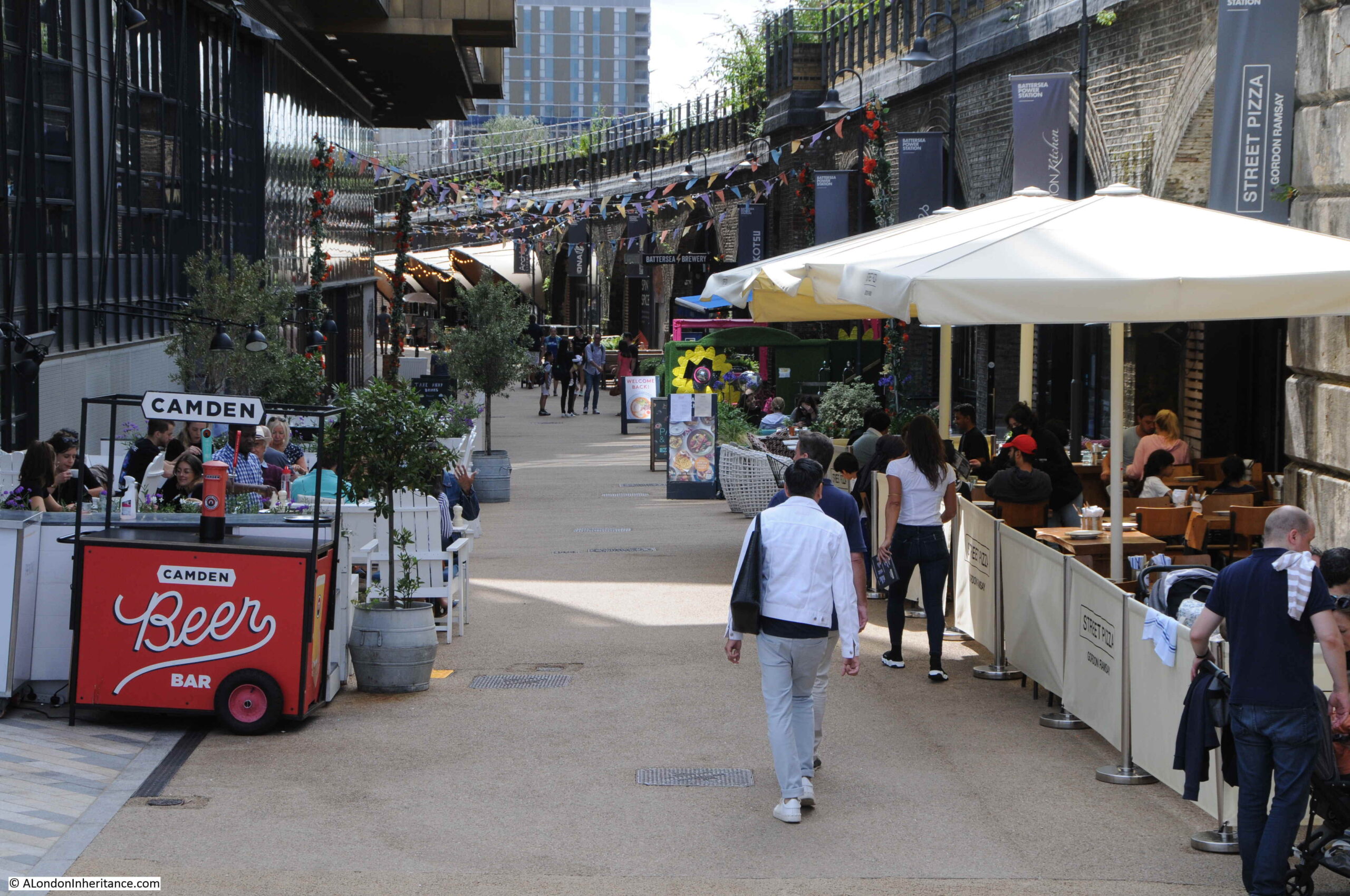
The redevelopment of the area follows the standard plan for any London developments – glass and steel apartments above, restaurants, cafes, shops and entertainment venues at ground level.
Alongside one of the new apartment blocks, restaurants, bars and a cinema have been built into the arches that line the railway viaduct:
From the Battersea side of the river, we can look across the river to the blocks of Churchill Gardens, and the hot water accumulator tower that was once supplied by the power station:
The new apartment block on the right closes in on the power station. There are restaurants on the ground floor and a small area of landscaping up to the river:
Looking between the power station and apartment building. A similar glass and steel building has yet to be built on the opposite side of the power station as the area links up with the tower blocks currently being built along Vauxhall.
The area behind and to the east of the power station is still blocked off for construction work, so there is not that much to see, apart from the area in front and around the new apartment building.
On a sunny Sunday, the cafes and restaurants seemed to be doing reasonably well.
The district heating system for the Churchill Gardens estate was the first of its type in London, and probably in the country. There have been a number of systems built since, the latest is the Bunhill 2 Energy Centre, built at the location of the long closed City Road underground station. Rather than waste heat from a power station, Bunhill 2 is unusual in that it takes heat from the Northern line tunnels below.
Bunhill 2 is an addition to the existing Bunhill energy centre built in 2012, which makes use of the more traditional gas powered engine to produce heat and generate electricity. The energy centre is open during this years Open House London event.
That was a rather long post, so thank you if you made it this far.
As usual there is so much to explore and discover. I find the combination of the hot water accumulator tower, built into the old Belgrave Dock, with the original side walls fascinating – relics of two very different industrial activities in Pimlico.
Churchill Gardens does have its problems, but is an estate that shows what can be done to provide housing with innovative design, well chosen materials, and importantly continuous maintenance of the buildings and landscape.
House of Illustration is a small arts and education charity dedicated to the art of illustration – an art form that can be found on almost every aspect of modern life. Originally based in King’s Cross, the charity is moving to a very historic location and transforming into the Quentin Blake Centre for Illustration.
Quentin Blake has been one of the most prolific and high profile illustrators of the 20th and early 21st centuries, with his work across many forms of illustration, including illustrating the works of the author Roald Dahl.
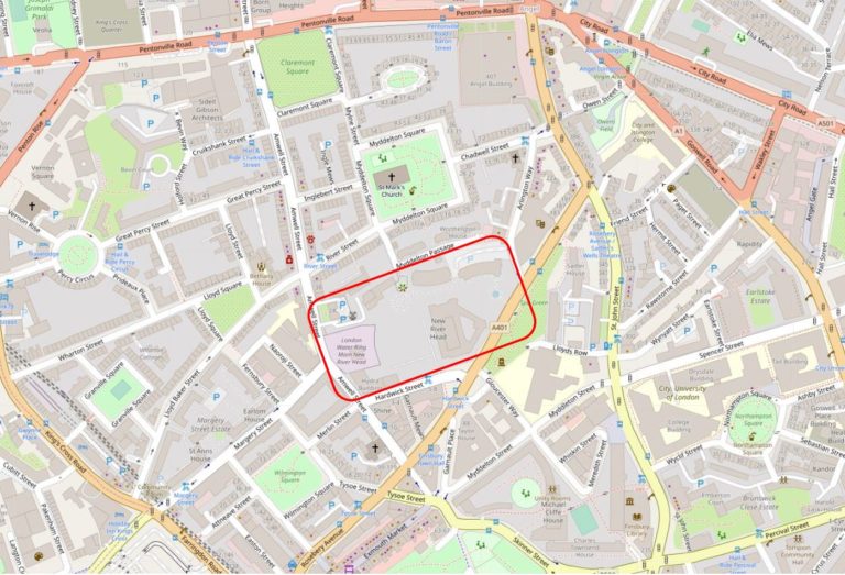
The new location for the Quentin Blake Centre for Illustration will be at New River Head in north Clerkenwell / Islington, the site of the reservoir that terminated the first man made river bringing supplies of water to the city of London in the early 17th century.
Having been empty for many years, the base of the early 18th century windmill, the engine house and coal store at New River Head will be sensitively transformed over the coming year into the new centre. This transformation will ensure that these buildings are preserved and after being hidden away for so many years, will be given a new life hosting one of London’s small, but so important charities and exhibition spaces. The centre will also eventually be the home for Quentin Blake’s archive.
So why is this the subject of this week’s blog post? A while ago, a colleague from the Clerkenwell and Islington Guide (CIGA) Course was offered the opportunity to visit the site and create a walk that would illustrate how water has been key to the area’s development, and to visit the interior of the windmill and coal stores and the exterior of the engine house before work begins to create the new centre.
Offered the opportunity to be involved, it took about a second to say yes, and for one week only there is a series of walks exploring the Fluid History of Islington, which, with the support of the Quentin Blake Centre for Illustration, includes access to the base of the early 18th century windmill, the coal stores and around the outside of the engine house at New River Head. I will be guiding on some of these walks, and colleagues from CIGA will be guiding the rest.
This is a unique opportunity to explore how water has influenced the development of the area, see these historic buildings up close, and learn about their future use.
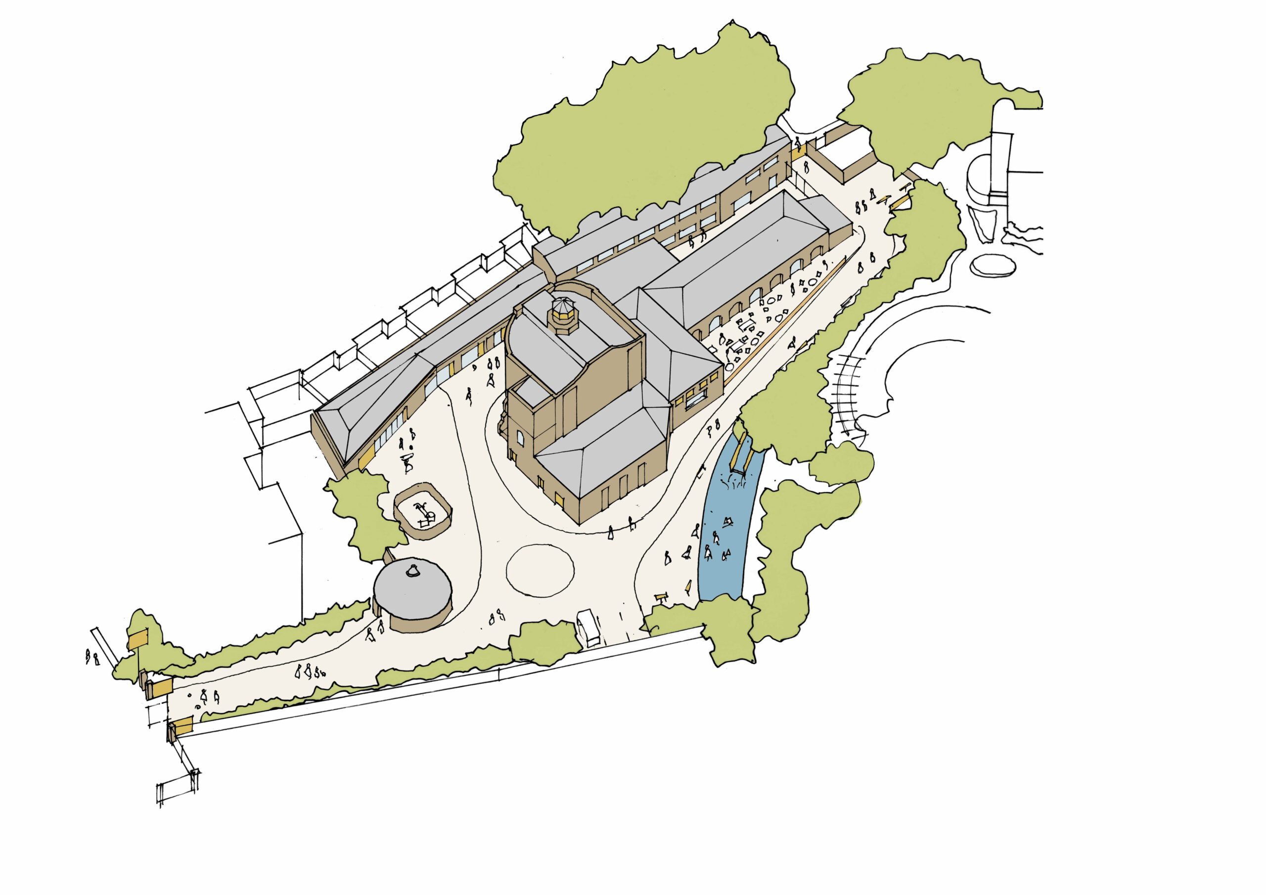
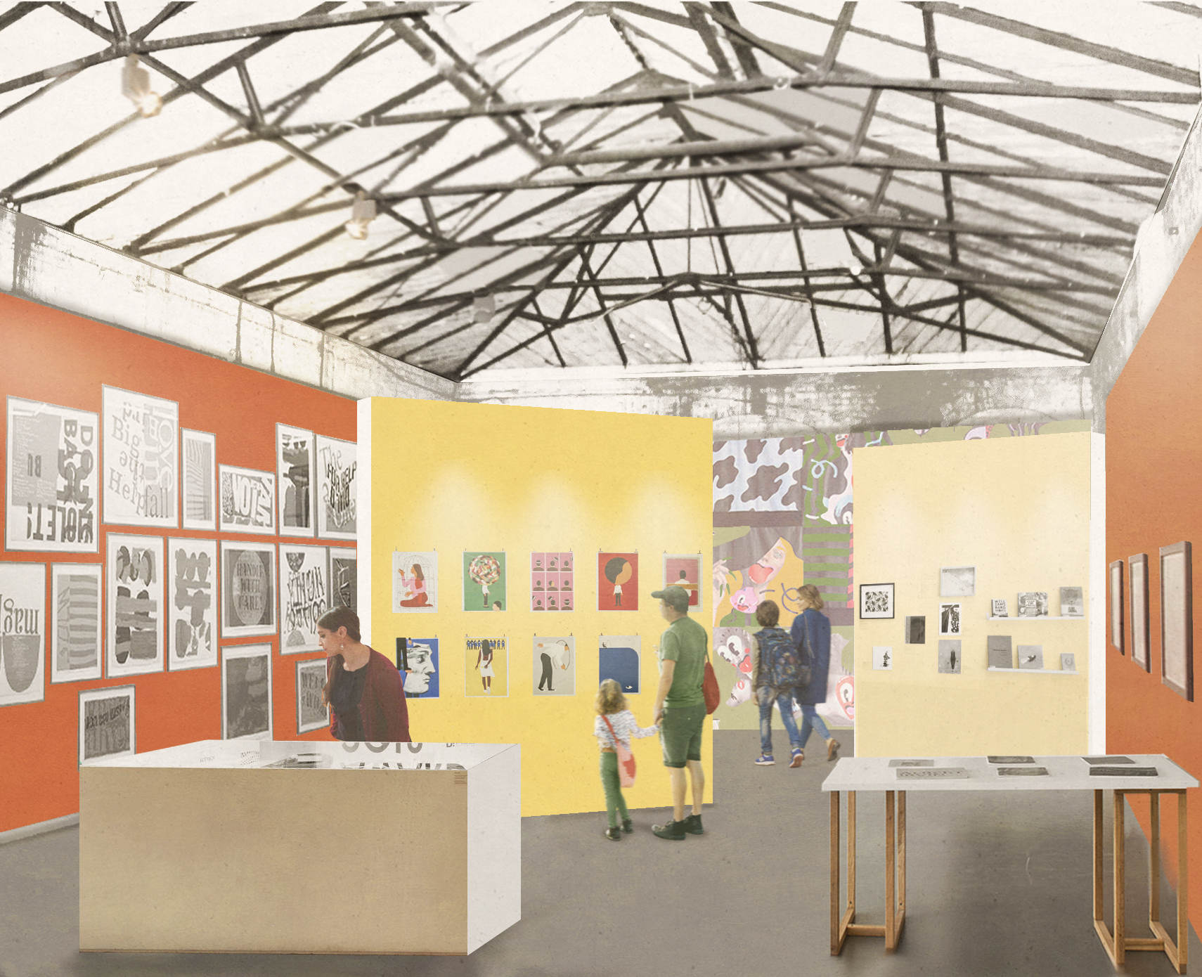
As an introduction to the walk, the following illustration is the proposed plan of the new Quentin Blake Centre for Illustration.
Credit: Quentin Blake Centre for Illustration, Tim Ronalds Architects
In the above plan, the round building to the lower left is the base of the early windmill. I took the following photo of the building on a recent visit:
The large building to the right is the old engine house. The interior will not be open for the visit as it is currently difficult to navigate, however we will walk around the outside of the building and talk about the part the engine house played in the development of New River Head and London’s water supply, along with the future of the site.
The old coal store forms the longer building to the right, and will be open during the visit:
As can be seen from the following illustration, when transformed to a new exhibition area, the fabric of the building will retain its industrial heritage:
Credit: Quentin Blake Centre for Illustration, Tim Ronalds Architects, Prospective Gallery
The location for the new Quentin Blake Centre for Illustration is at a place that played a key part in the supply of clean water for London’s growing population for a considerable period of time.
The New River and reservoirs at New River Head were the first serious attempt at bringing significant volumes of water into London from a distance, and avoiding the need to draw water from the Thames, which by the end of the 16th century was not exactly a healthy source of drinking water.
The New River dates to the start of the 17th century, a time when there was a desperate need for supplies of clean water to a rapidly expanding city. Numerous schemes were being proposed, and the build of the New River tells the story of how the City of London, Parliament, the Crown and private enterprise all tried to gain an advantage and ownership of significant new infrastructural services, the power they would have over the city, and the expected profits.
The New River proposal was for a man-made channel, bringing water in from springs around Ware in Hertfordshire (Amwell and Chadwell springs) to the city. A location was needed outside the city where water from the New River could be stored, treated and then distributed to consumers across the city.
The story of the New River dates back to 1602 when a former army officer from Bath, Edmund Colthurst who had served in Ireland, proposed a scheme to bring in water from Hertfordshire springs to a site to the north of the city.
As a reward for his military service, he was granted letters patent from King James I, to construct a channel, six feet wide, to bring water from Hertfordshire to the city.
Colthurst’s was not the only scheme for supplying water to the city. There were a number of other private companies, and the City of London Corporation was looking at similar schemes to bring in water from the River Lea and Hertfordshire springs.
Whilst Colthurst’s project was underway, the City of London petitioned parliament, requesting that the City be granted the rights to the water sources and for the construction of a channel to bring the water to the city.
In 1606 the City of London was successful when parliament granted the City access rights to the Hertfordshire water, a decision which effectively destroyed Colthurst’s scheme, which collapsed after the construction of 3 miles of the river channel.
It was an interesting situation, as Colthurst had the support of the King, through the letters patent he had been granted, whilst the City of London had the support of parliament.
The City of London took a few years deciding what to do with the water rights granted by parliament, and in 1609 granted these rights to a wealthy City Goldsmith, Hugh Myddelton. He was a member of the Goldsmiths Company, an MP (for Denbigh in Wales), and one of his brothers, Thomas Myddelton was a City alderman and would later become Lord Mayor of the City of London, so Myddelton probably had all the right connections, which Colthurst lacked.
Colthurst obviously could see how he had been outflanked by the City, so agreed to join the new scheme, and was granted shares in the project. Colthurst joining the City of London’s scheme thereby uniting the rights granted by James I and parliament.
Work commenced on the New River in 1609, but swiftly ran into problems with owners of land through which the New River would pass, objecting to the work, and the loss of land. A number of land owners petitioned Parliament to repeal the original acts which had granted the rights to the City, however when James I dissolved Parliament in 1611, the scheme was given three years to complete construction and find a way to overcome land owners objections, as Parliament would not be recalled until 1614.
There were originally 36 shares in the New River Company. Myddleton had decided to enlist the support of James I to address the land owners objections, and created an additional 36 new shares and granted these to James I who would effectively own half the company.
in return, James I granted the New River Company the right to build on his land, he covered half the costs, and Royal support influenced the other land owners along the route, removing their objections, as any further attempts to hinder the work would result in the king’s “high displeasure”.
The New River was completed in 1613. It was a significant engineering achievement. Although the straight line distance between the springs around Ware and New River Head was around 20 miles, the actual route was just over 40 miles, as the route followed the 100 foot height contour to provide a smooth flow of water, resulting in only an 18 foot drop from source to end.
The New River Head location was chosen for a number of reasons. A location north of the city was needed to act as a holding location, from where multiple streams of water could then be distributed through pipes across the wider city.
The location sat on London Clay, rather than the free draining gravel found further south in Clerkenwell, and it was also a high point, with roughly a 31 meter drop down to the River Thames, thereby allowing gravity to transport water down towards consumers in the city.
The site already had a number of ponds, confirming the suitability of the land to hold water.
By the end of the 17th century, London had been expanding to the west and developement was taking place around the area now called Soho, including Soho Square.
The challenge the New Rver Company had with supplying water to London’s expanding population was down to having sufficient volumes of water available, and with maintaining water pressure.
The City of London was much lower than New River Head, and water pressure was generally good, however further to the west of the city, the land was higher, and the difference in height between places such as Soho and New River Head was insufficient to provide a good supply to new developments.
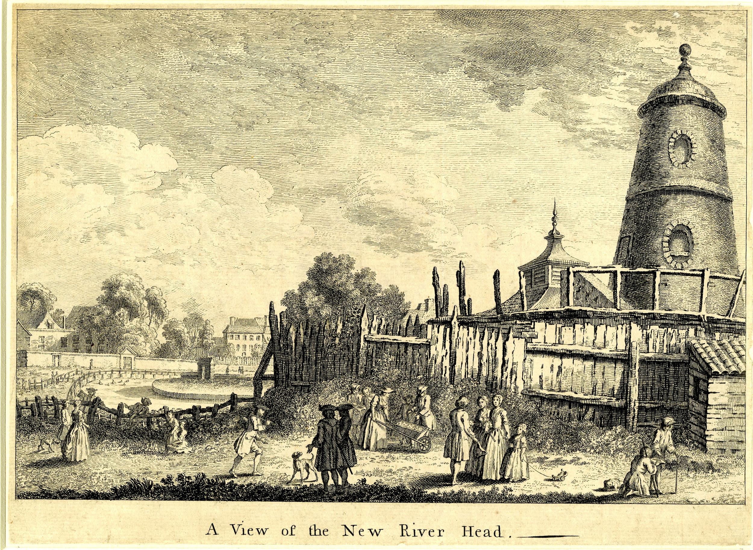
This is when the windmill appeared. The New River Company built a new reservoir at Claremont Square, towards Pentonville Road. This new reservoir provided extra storage capacity, and was also higher than New River Head, thereby able to deliver water at greater pressure.
A method was needed to pump water to the new reservoir and the method chosen was a windmill. This was in operation by 1709, but was never very efficient and the top of the windmill was severely damaged by a storm in 1720. Newspaper reports of the storm refer to “the upper part, quite to the brickwork, was blown of the Windmill at New River Head”
The storm also damaged large numbers of ships anchored in the Thames, and: “The Horse-Ferry boat, that passed to and fro from Greenwich to the Isle of Dogs was lost and is not yet found, and the Storm was so violent as to lay the Isle of Dogs under Water by the beating of Water over the Banks”
To the lower left of the windmill is a small building that would have housed the horse-gin, used between the storm and the installation of the steam engine to power the pumps, pumping water to the reservoir which can be seen in the lower part of the view.
If you look closely between the reservoir and the windmill, you can see what appears to be a couple of pipes running between the windmill and a building on the edge of the reservoir from where water is pouring into the reservoir.
Although now reduced to just the base, it is remarkable that part of the windmill has survived over 300 years, and it is the base of the windmill that we will see inside during the walk.
After the storm, a “horse gin” was employed which consisted of a small building adjacent to the windmill that provided room for a horse to walk in a circle whilst harnessed to a wheel. The rotation of the wheel was transferred to the pumps to provide the power to move water from New River Head to the higher reservoir.
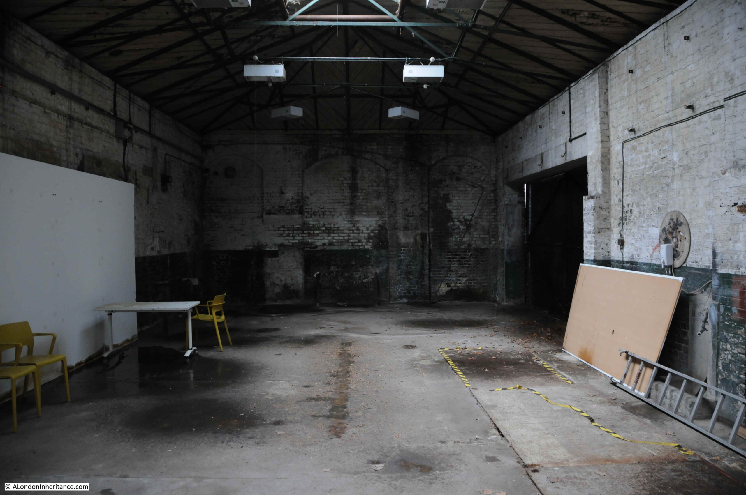
Later in the 18th century, this was replaced by a steam engine. Whilst we will not be able to go into the engine house, we will walk alongside to explore the history of the building:
Behind the engine house is a coal store used to store the fuel for the steam engines in the engine house. The following photo shows the coal store buildings on the left, with a storage area marked with dimensions on the right:
Some photos of the interior of the engine house:
New River Head would continue to play a part in the supply of water into the 20th century.
Reservoirs eventually built at Stoke Newington were of the size needed for London’s ever growing population, and the New River would come to terminate at these reservoirs rather than continuing on to New River Head.
The central Round Pond was drained in 1913. The remaining filter beds had disappeared by 1946, and New River Head became the head offices of the Metropolitan Water Board, along with supporting functions including a large laboratory building.
New River Head continues to be a key part of London’s water supply with one of the shafts to the London Ring Main on the site. The shaft is one of the 12 main pump out shafts across the ring main where water is taken out and distributed locally.
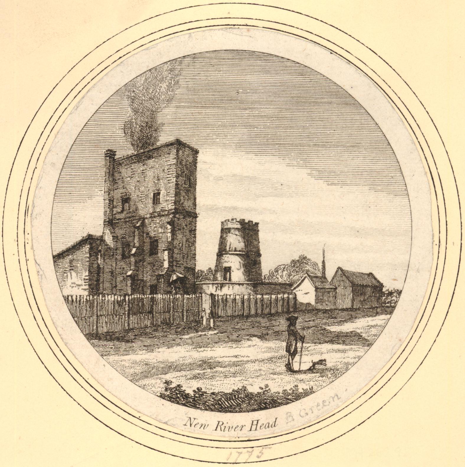
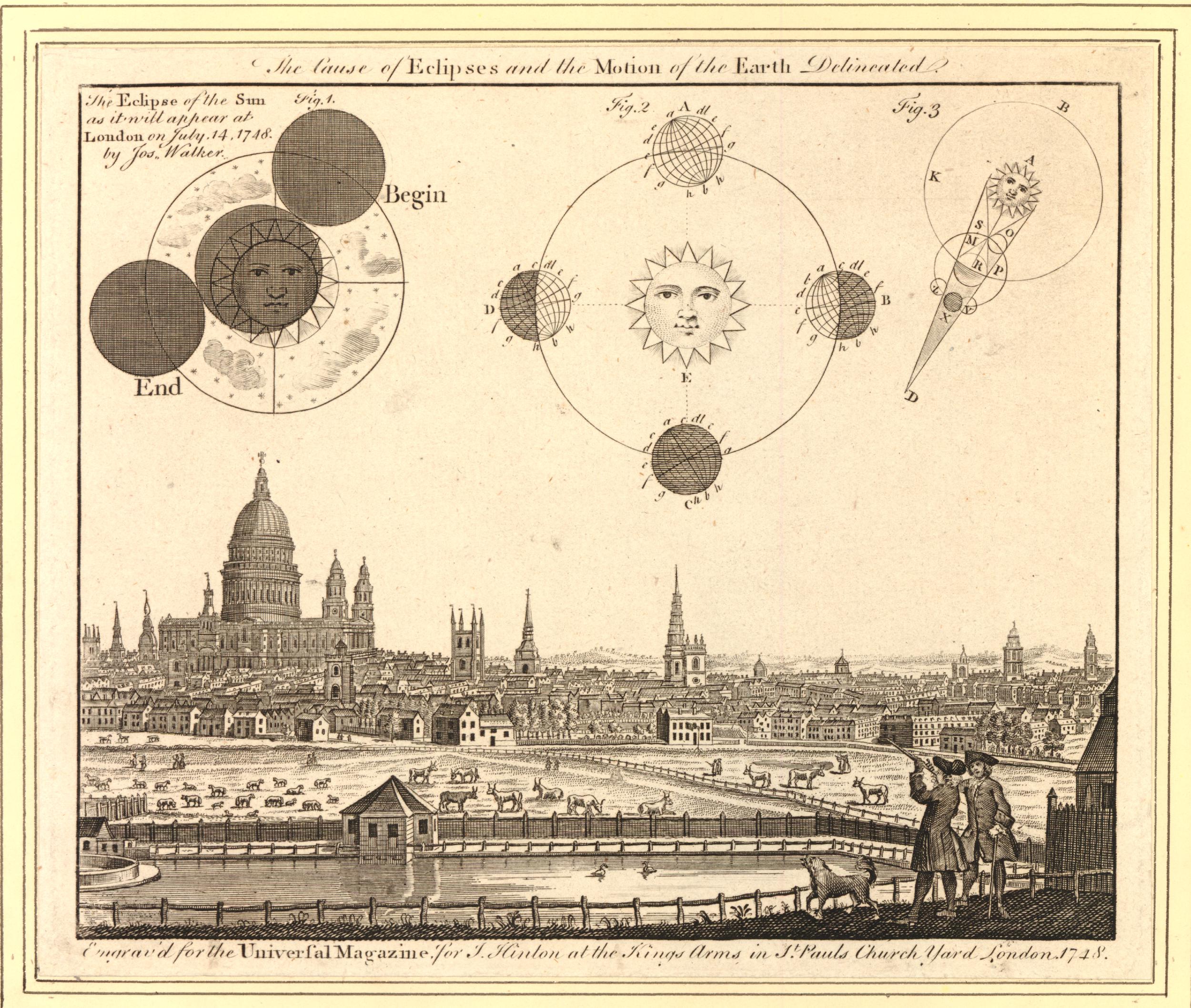
One of the two characters at bottom right is using a telescope, presumably to observe the eclipse which took place on the 14th July 1748.
The above print is the type of find that sends me searching for something that is not really related to the subject of the post, however as New River Head is in the view, there is a tenuous link.
The 1748 eclipse was an event well publicised in advance, and numerous papers published recommendations on how to view the eclipse, which sound very similar to what we would do today (apart from the candle).
1. Make a pin-hole in a piece of paper, and look through it at the eclipse. Or,
2. Hold a piece of glass so long over the flame of a candle, till it is equally blackened; and then the eclipse may be viewed through it, either with the naked eye, or through a telescope. Or,
3. Let the sun’s rays through a small hole into a darkened room, and so view the picture of the eclipse, upon a wall, or upon paper. Or,
4. Transmit the image of the sun through a telescope, either inverted, as usual on a circle of paper or pasteboard.
In London the eclipse would start at four minutes past nine in the morning and end at ten minutes past twelve. The eclipse was partly visible, however for much of the time it was obscured due to what were described as “flying clouds”.
I can guarantee that there will not be an eclipse at New River Head during the week of the walks, however the walks will provide a unique opportunity to view some of the buildings that contributed to the development of London’s water supply, learn about their future use, and to hear how water has influenced the development of Islington.
Even if you have not visited the area, or travelled to the underground station with the same name, you probably recognise the name of the Angel, Islington.
This is probably down to the game of Monopoly, where The Angel, Islington can be purchased for £100, and is one of the light blue board positions, along with Euston Road and Pentonville Road.
Monopoly is probably why the name Angel is nearly always followed by Islington. Unlike the majority of other places on the Monopoly board, the Angel, Islington is not a street, and when you buy a hotel for the location in the game, you are bringing some historic reality to the game.
The original Monopoly game was a US invention, and its migration to the UK happened when the board game makers John Waddington licensed the game for UK sale. The game required UK locations, and the story is that the Managing Director of the company, Victor Watson, along with his secretary, Marjory Phillips, visited the capital looking for locations for the game. Dependent on different Internet sources (always a dangerous thing), they either met, or had lunch at the Angel, and decided it would be a good location and name for inclusion in their new game.
The Angel, Islington had been a key London landmark and meeting place long before its appearance on the Monopoly board.
It appeared in the 1896 book “The Queen’s London”, published as a pictorial and descriptive record of London in the 59th year of the reign of Queen Victoria.
In the book, the Angel, Islington is described as:
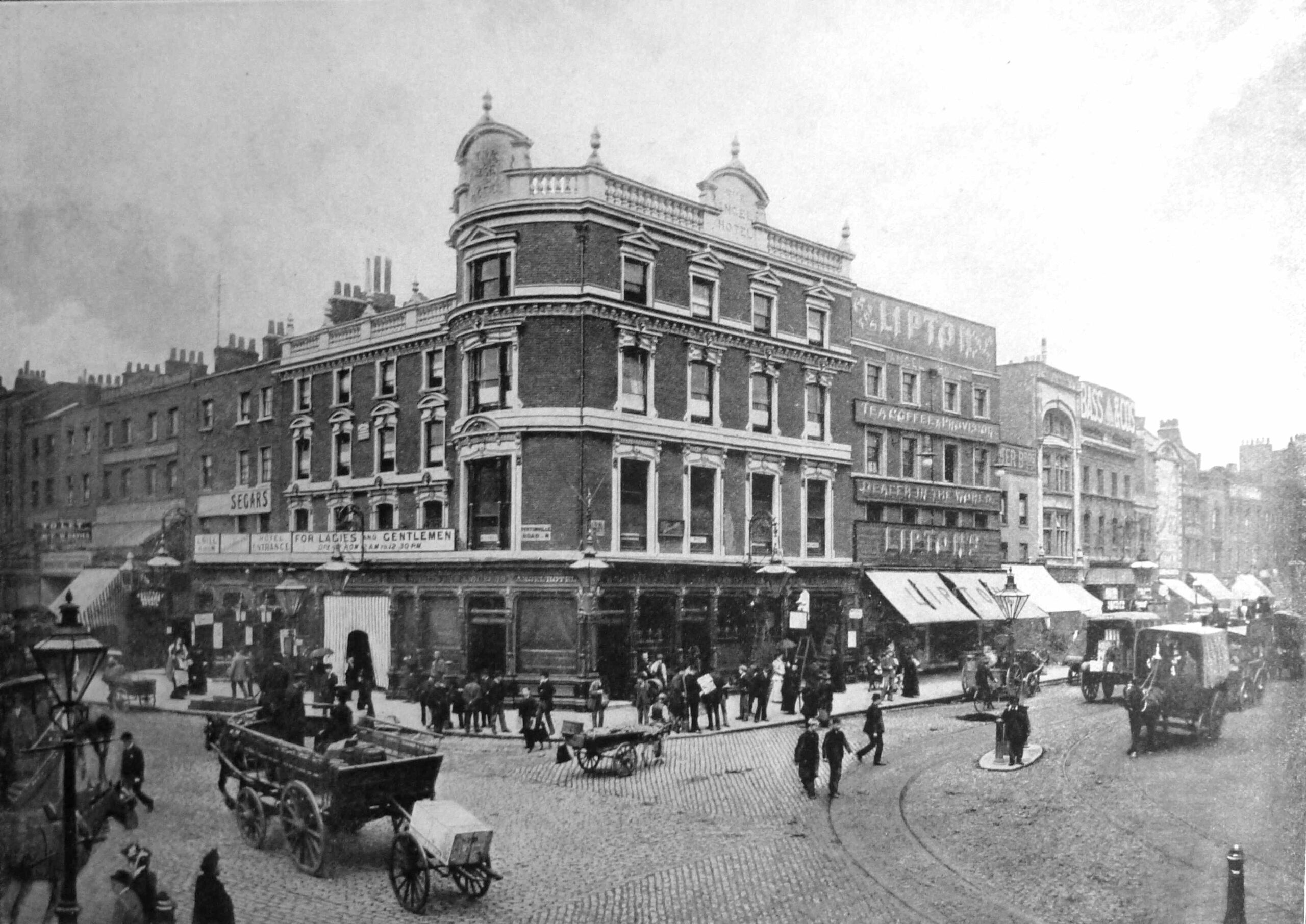
“Trams and omnibuses give an invaluable gratuitous advertisement to the inns at certain points on their route; and one of the hostelries best known in all London – by name at least – from this cause is the Angel. For here trams start and stop, and innumerable omnibuses converge and diverge. The Angel occupies a commanding position at the corner of the High Street, Islington, and of Pentonville Road, leading to King’s Cross, while it faces the end of the City Road, Goswell Road, and St. John’s Street Road. It is no wonder, therefore that the pavement in front of it should be always thronged.”
The photo from the 1896 Queen’s London showing the Angel, Islington:
The text from the Queen’s London sums up why the Angel, Islington became such a well known location – its position at the junction of four important London Roads.
To the left is Pentonville Road, opened in 1756 as the eastern section of the New Road. It took its current name in 1857 after the Pentonville Estate which had been built on land around the road.
To the right is the City Road, completed in 1761, to continue the New Road on towards east London. These streets formed an 18th century “North Circular” allowing traffic to pass around the City, and to reach the best street for entering the City. One of these was Goswell Road which in the map above branches off to the south from City Road.
To the south is St John Street which led to the City and provided a direct route to Smithfield Market.
To the north, Islington High Street now forms the A1, indicating the street’s importance as the start of a key route to the north of the country.
The Angel, Islington was therefore located where drovers and farmers bringing their sheep and cattle to Smithfield Market would stop off before making the final journey. Where those heading north or south would stop before continuing their journey. Where those travelling around the City would stop, as the junction was a key meeting point, a place where people could relatively easily travel to and meet others from across both London and the rest of the country.
The area has long been associated with livestock. Local cattle farms as well as the fields around Islington providing stopping off points to feed and fatten cattle on their way to Smithfield Market. The Royal Agricultural Hall, built a short distance away in 1862 continued this tradition.
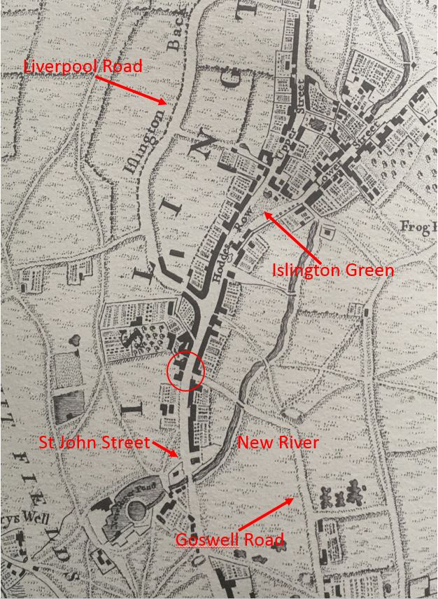
Long before the construction of Pentonville Road / New Road / City Road, the Angel had been a key stopping point. In the following extract from Rocque’s map of 1746, I have circled the location of the Angel, at the junction where the road that would become the start of City Road, with the branch of what is now Goswell Road, meet the street that continues south to Smithfield.
Looking towards the upper half of the map, we can see how three key streets converged just before the Angel, which also contributed to the location’s importance.
The Angel, and the buildings lining the road up to Islington Green, Upper and Lower Streets are surrounded by the fields that were used for livestock and for the temporary provision of grazing prior to completing their journey to Smithfield Market.
The building seen in the photo from the Queen’s London was originally built in 1819, however by the time of the 1896 photo it had been heavily modified over the years and was known as the Angel Hotel. It was demolished to make way for a new version of the Angel, built by the owners of the site, Truman, Hanbury, Buxton & Co. – the London brewery company.
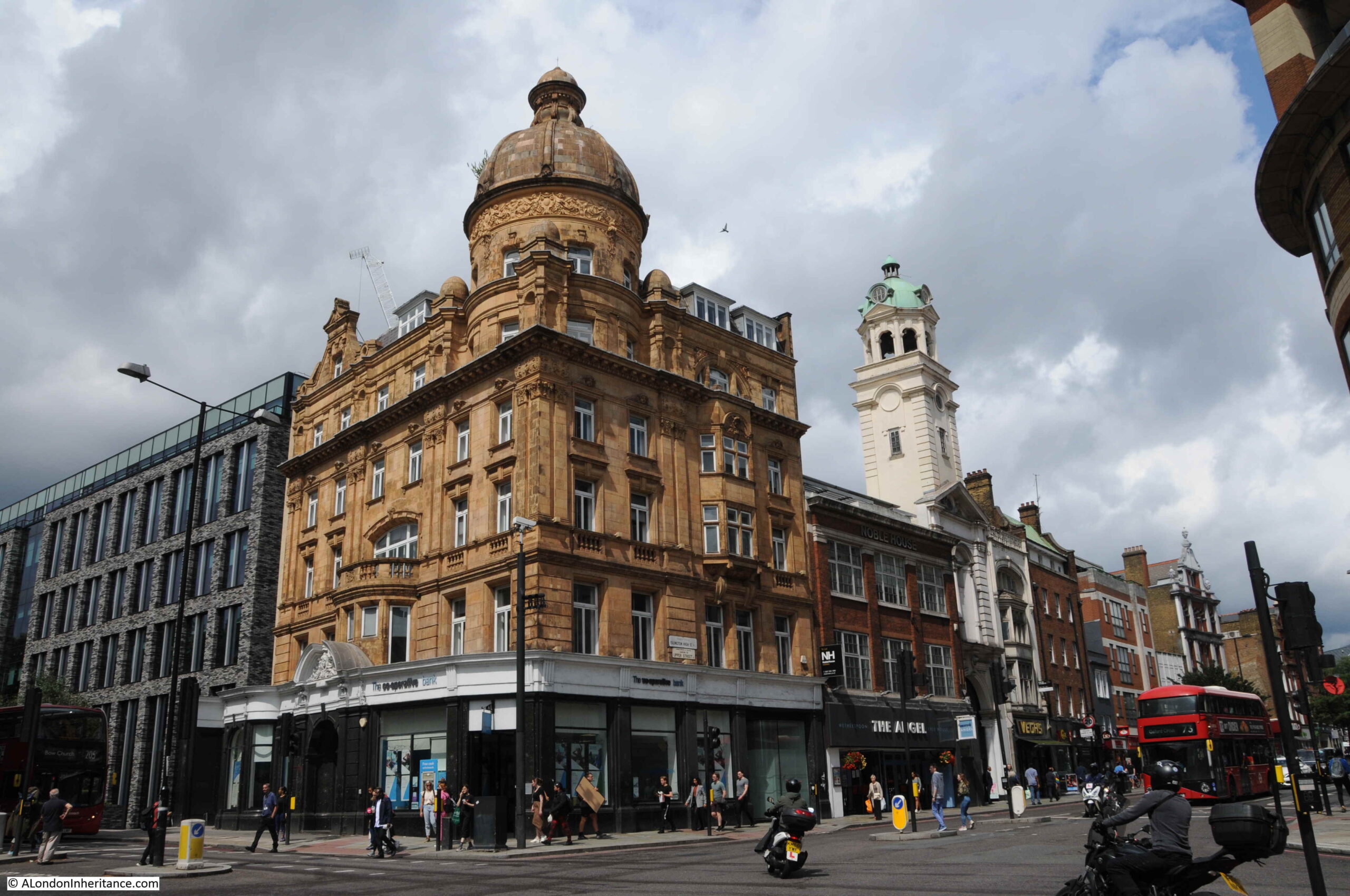
The 1903 building (again, modified a number of times over the years) is the building that we see on the site today:
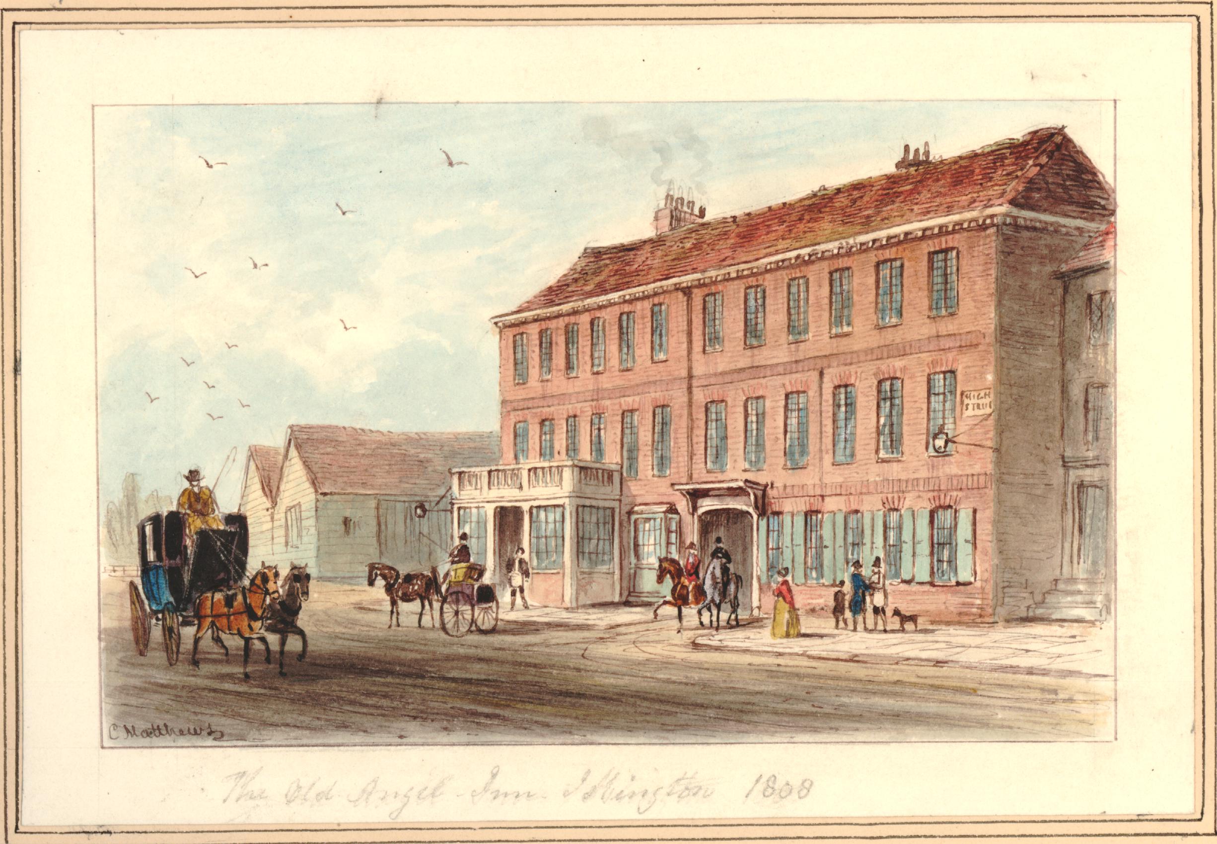
The location of the Angel has long been the site for an inn or tavern. Some of the first references are to an inn on the site towards the end of the 16th century, when the property on the site was called Sheepcote.
The name Angel for the inn appears around 1614. There is a Wikipedia reference as to the origin of the name, however I cannot find any written references, either to confirm the Wikipedia suggestion, or to offer an alternative. When researching these posts, I prefer to have at least two different written sources, so for the purposes of the post I cannot find the source.
The excellent “Streets with a Story – The Book of Islington” by Eric A. Willats does state that early in the 17th century, the Angel had a sign of the Angel of the Annunciation, with wings outstretched, however the sign only aligns with the name, and does not identify the source.
The inn was a staging post for travelers from and to the city, and it was a good place to spend a night before entering the city. There are numerous 18th century newspaper articles about thefts and muggings across the fields, paths and roads between Islington and the built edge of the city, so after dark it was not a safe place to travel, and the Angel Hotel was the perfect place to stay until the following morning.
The view is from what is now Islington High Street. The singe storey buildings to the left of the picture are stables that were on land owned by the Angel, located where Pentonville Road now runs, and extending across the street to the opposite side of the Angel.
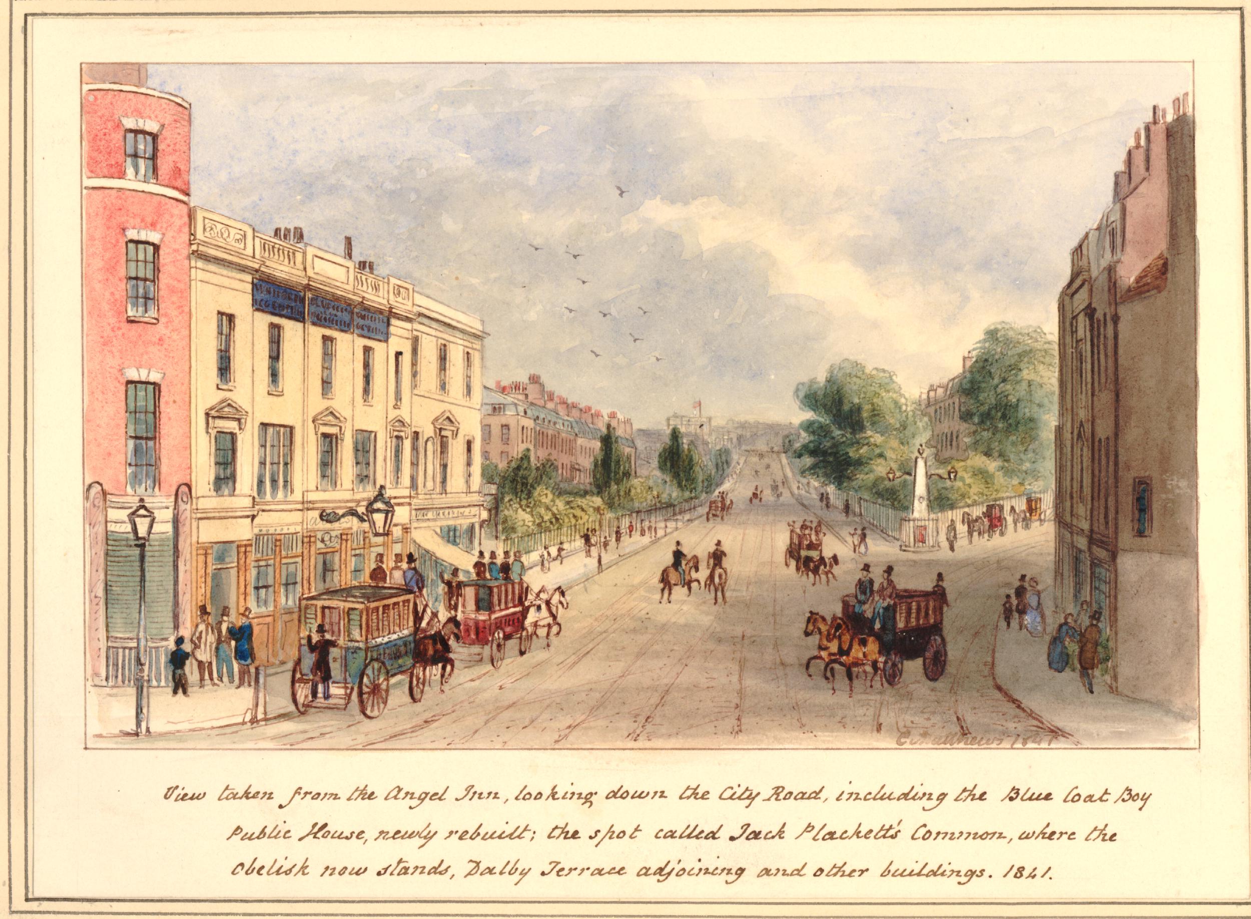
The print mentions the Blue Coat Boy public house. This is the building on the left of the print.
The print is also a perfect example of how easy it is to go off on a tangent with London’s history. The text at the bottom of the above print mentions Jack Plackett’s Common as the space where the obelisk now stands, (to the right of the print) at the junction of City Road and Goswell Road.
I suspect that Jack Plackett was John Plackett who was executed on City Road in 1762. A newspaper report of the time reads: “Yesterday the report was made to his Majesty at St. James’s, by Sir William Morton, Knight, Recorder of this City, of the Six Capital Convicts in Newgate, when John Plackett, for robbing Mr. Jacob Faye, was ordered, for Execution on Wednesday next, near the Turnpike-House, on the New Road from Islington to Old-Street”.
John Plackett was a career criminal who had already served seven years transportation for house robbery. At the end of this sentence, he returned to England and continued to commit a series of robberies between Islington and London.
The crime that led to his execution happened on the 10th June 1762, after he had spent the day drinking in a pub in Wapping. He left the pub around midnight and met the Norwegian merchant Jacob Faye (also written as Fayne).
Faye was trying to find his lodgings in Shadwell, however because of his poor English he could not explain where he wanted to go, or get any directions. Plackett met him and indicated that he should follow. Faye assumed he was taking him to Shadwell.
They walked for a lengthy time, and ended in the fields around Islington. It was here that Plackett hit Faye on the head from behind. Faye collapsed to the ground and after a while awoke to find that Plackett had stolen all his clothes and possessions, including his pocket book and money.
A reward was offered, and Plackett was quickly found, still in possession of Faye’s shirt. He was sentenced to be hung, and was executed on the 28th July 1762, on City Road, close to where he had committed his crime in the fields of Islington.
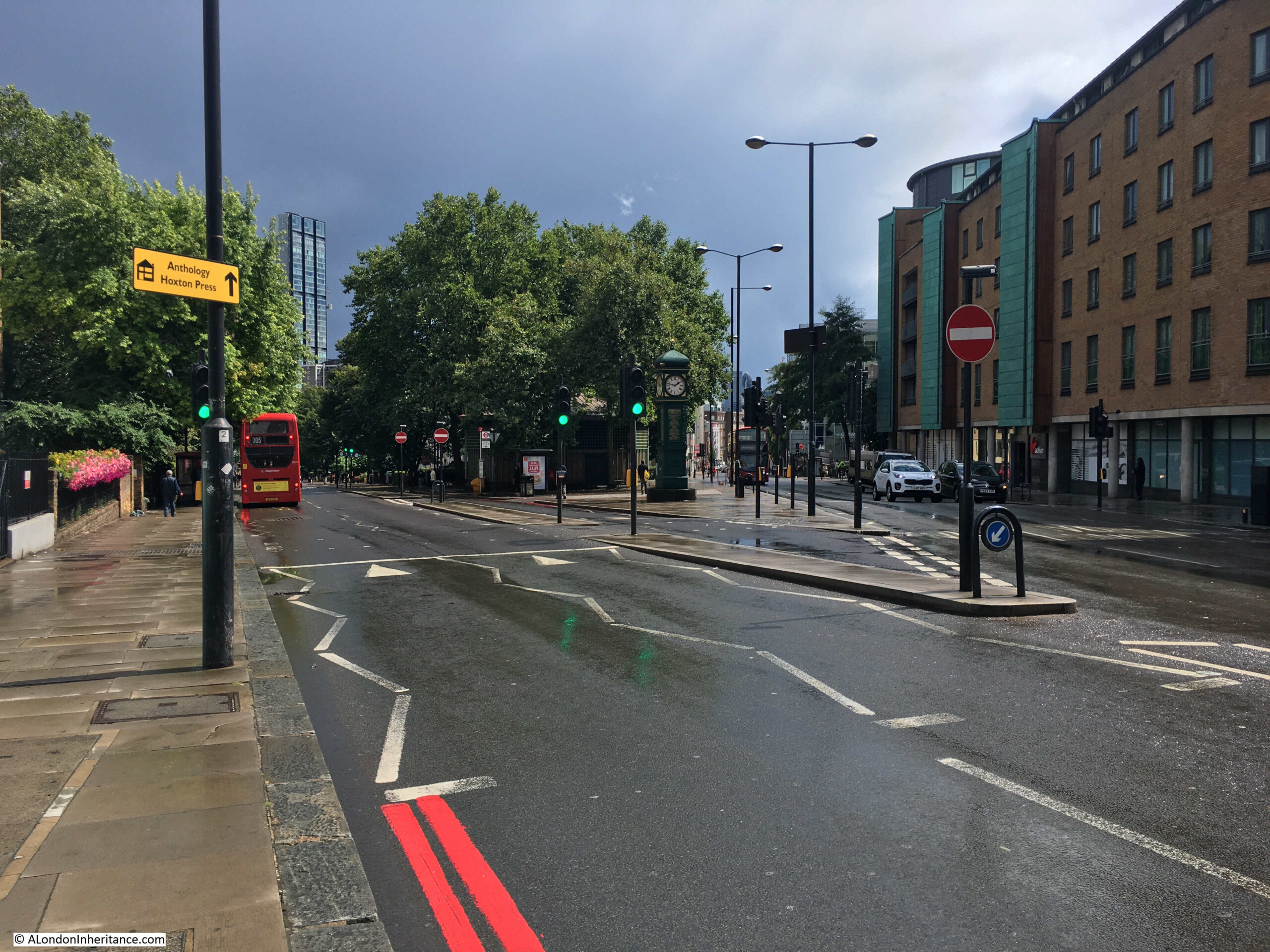
Although the obelisk has gone, there is still a landmark where City and Goswell Roads divide and at the point where Jack Plackett’s Common was located.
A short walk down City Road from the Angel, and this is the view where the roads divide:
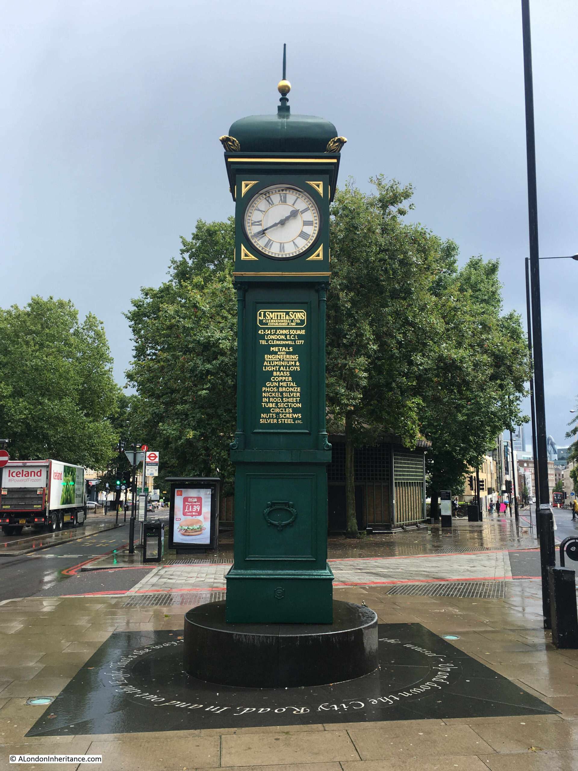
A clock tower is now at the space once occupied by the obelisk – the area identified as Jack Plackett’s Common in the print.
Apparently, the obelisk was replaced by a clock tower, which in turn was replaced early in the 20th century by the clock tower we see today.
Around the base of the clock tower are the words from the third verse of the nursery rhyme “Pop goes the weasel”, as the City Road in the rhyme passes to the left of the clock tower:
Up and down the City road, In and out the Eagle, That’s the way the money goes, Pop goes the weasel
The clock tower was made by the St Johns Square, Clerkenwell firm of J. Smith & Sons, and they donated the clock to replace the previous version. It was originally clockwork, and the company retained responsibility for maintaining and winding the clock. It is now electric.
It was somewhere on the space that stretches south from the clock tower that John Plackett was executed for the crime he had committed in the surrounding fields.
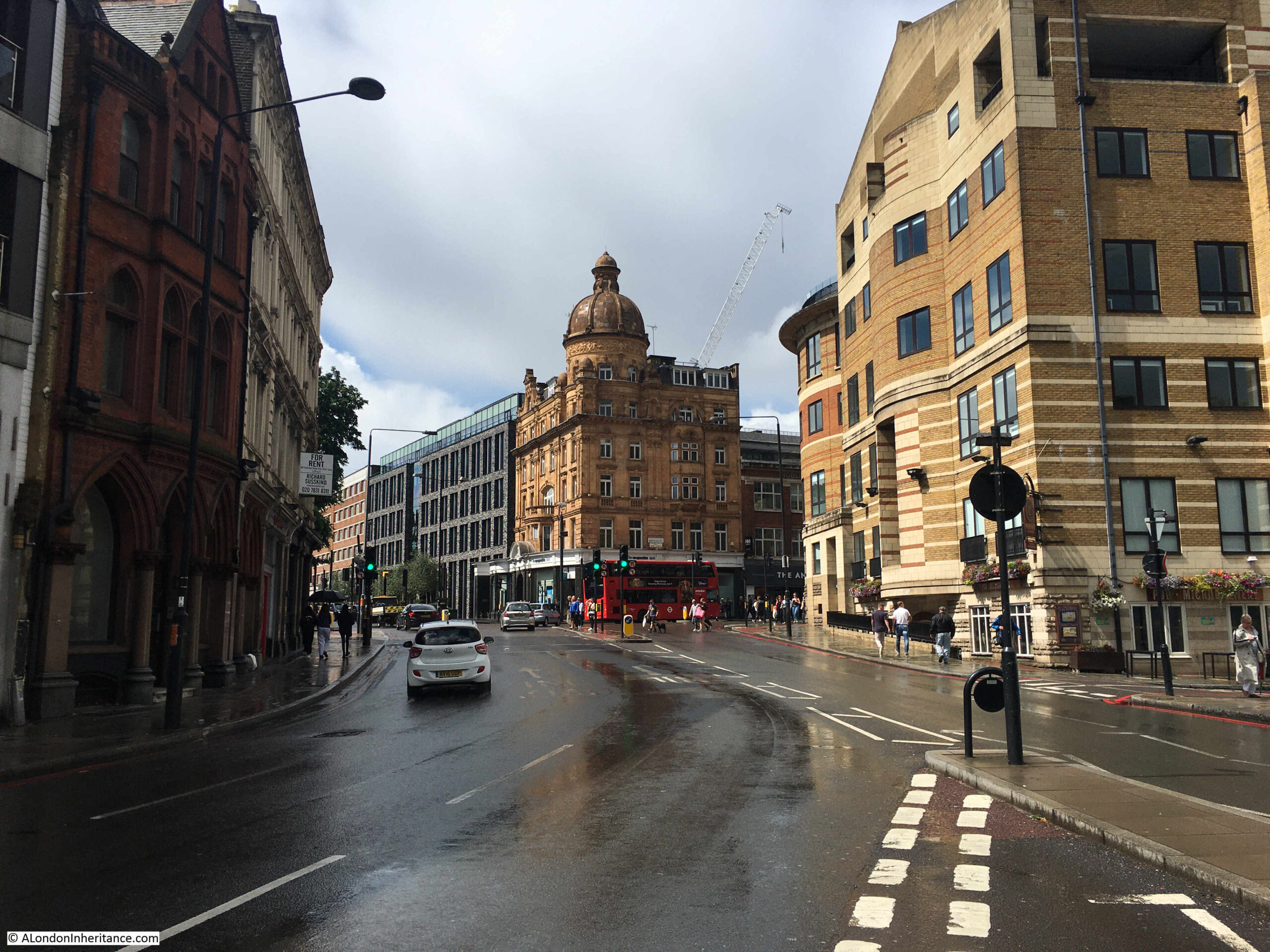
The view looking back towards the Angel, from where City and Goswell Roads divide, shows how both the height of the land, and the corner location contributed to the Angel being in such a prominent position for those travelling the roads in and out of the City of London:
Although many of the 18th century newspaper references to the area around the Angel often refer to crime, there are the occasional reports that bring to life the people that once walked these streets. A report from the 5th January 1793:
“Saturday, a cutler, in the City road, undertook for a wager of five shillings, to hold by the spokes of a carriage wheel, while it was turned round for a given distance. A Hackney Coach was in consequence procured, and he placed himself on the outside of the wheel, holding the spokes with his knees and hands, and in this position continued from the Angel at Islington, to the turnpike, the coachman driving for the most part of the way with great velocity. At the turnpike he leaped from the wheel while in motion, and when the horses were in a smart canter, resumed his station on his return, eating with much composure, an orange”.
Throughout the 19th and early 20th centuries, there are many adverts for staff, adverts for auctions taking place at the Angel, and also references to the many meetings that would take place, many with an agricultural theme, continuing the Angel’s long term association with those bringing their livestock to Smithfield Market, and also those visiting the nearby Royal Agricultural Hall. For example, in December 1900, there was a meeting of the Cotswold Sheep Society, who held their annual general meeting in the Angel Hotel.
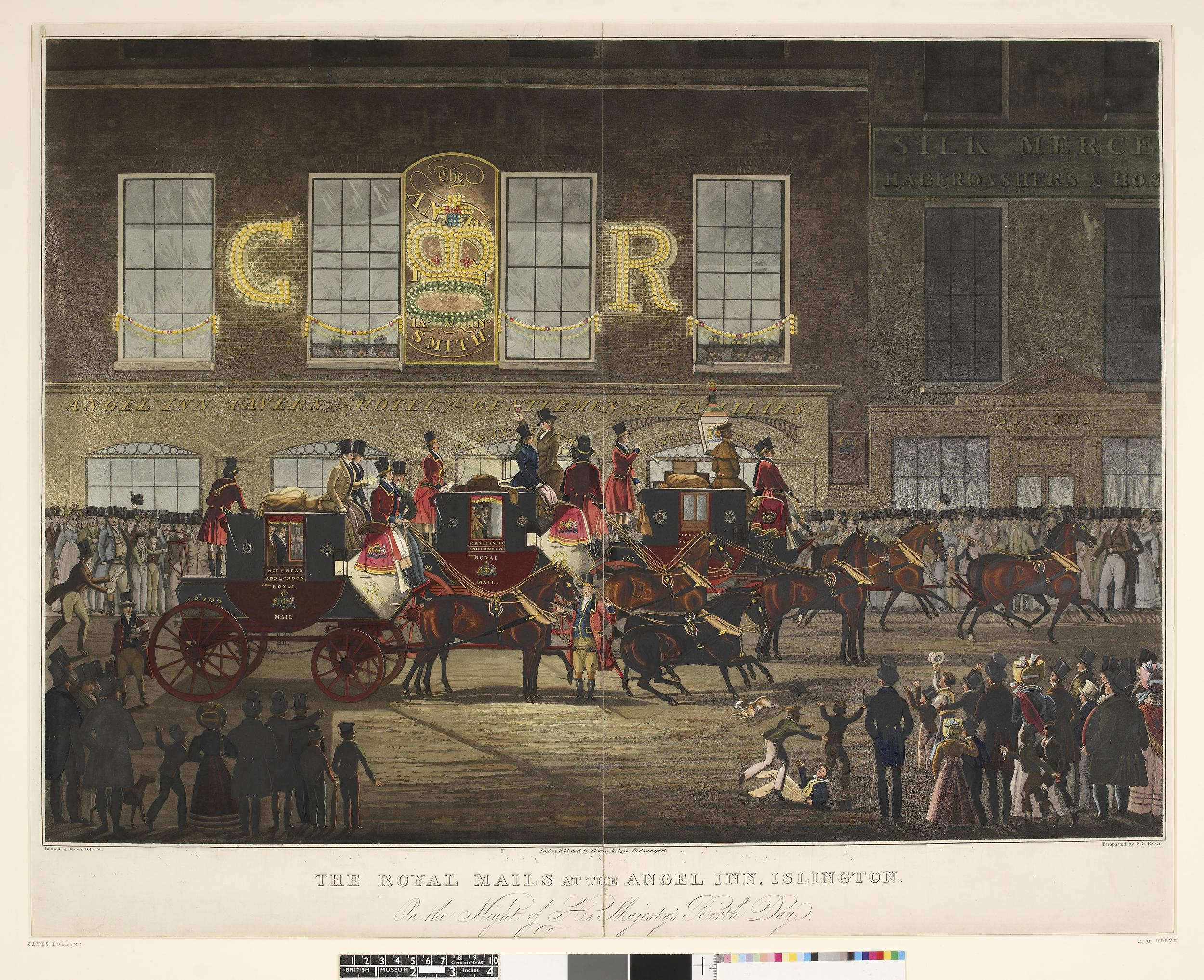
The destinations listed on the side of the coaches are Holyhead, Manchester and Liverpool, illustrating the routes that would be taken by those passing the Angel.
Lettering on the side of the building reads “Angel Inn Tavern and Hotel for Gentlemen and Families”.
The Angel would change significantly in 1921, when the lower three floors of the building were converted into a Lyons’ Café, with a Grill in the basement, Café on the ground floor, and cafeteria on the first floor.
The Lyons’ Café lasted until 1959, with the site then being sold to the London County Council.
The Angel had long been at an important road junction, with an ever increasing volume of traffic moving through the junction in front of the building. In 1932, Harold Clunn in The Face of London was describing the junction as “the busiest traffic centre of north London”.
The road junction was the reason for the London County Council’s purchase of the Angel site. There had long been proposals for ways in which the junction could be improved, however in the 1960s and early 1970s, a rather large roundabout was proposed as the solution for the amount of traffic using the junction, and the traffic bypassing the junction and using residential streets as alternative routes.
In January 1973, Mr. George Cunningham, the MP for Islington, South-West asked a parliamentary question about the plans for the junction and whether the Greater London Council or the national Government would be funding the costs.
Cunningham describes “The proposal at the Angel is for an enormous roundabout, the central island of which will be an acre or perhaps 1.1 acres in area. It will be surrounded by a relatively narrow carriageway of 20 yards—relatively narrow, that is, in relation to the central island”
There was strong opposition to the loss of the Angel, and such a large roundabout taking so much space, and in 1975 the GLC started researching less ambitious options for the junction. There was an updated proposal in 1979, however with political changes, proposals for the junction disappeared and the junction remained as we see it today.
The Angel, along with the Angel side of Islington High Street is now part of the Angel Conservation Area. In 1979 it was sold by the GLC to the New River Company, which by then was a property company and a subsidiary of London Merchant Securities. The building was refurbished and opened as offices and a bank on the ground floor. It now appears to be owned by an offshore property company.
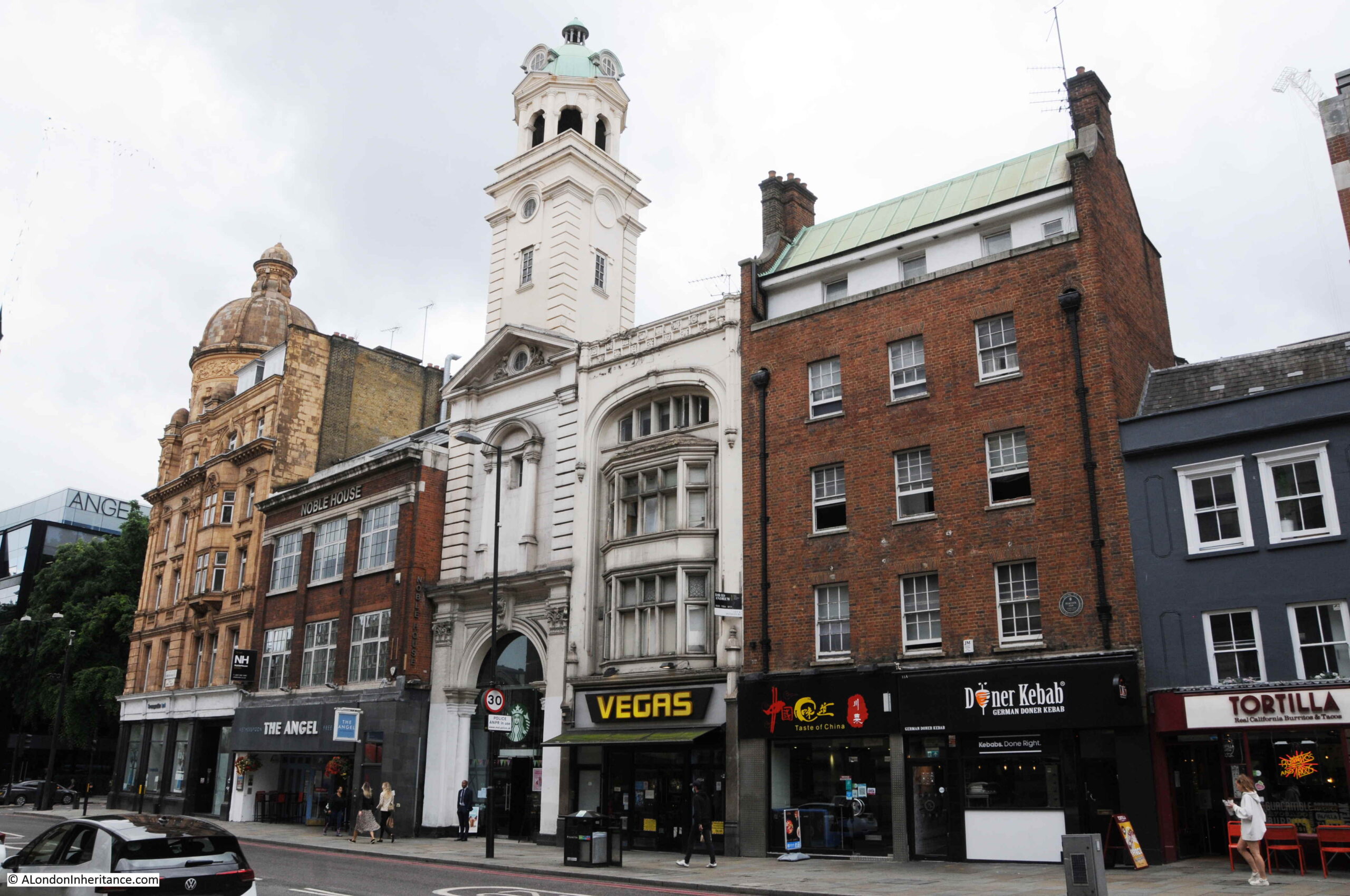
The western side of Islington High Street, with the Angel at the southern end has an interesting range of buildings, that tell part of the story of the evolution of this part of Islington.
In the above photo, the old Angel Hotel is on the far left. To the right is a Wetherspoons pub called the Angel. This is on land that was part of the original Angel Inn.
The narrow building with the tower is the remains of the Angel Cinema, built in 1911, the building was the narrow entrance foyer to the cinema, which led back to a large auditorium on land behind the buildings that face onto Islington High Street.
The building to the right dates from 1891, then the large brick building, along with the much smaller three story building on the right edge of the photo mark the site of another old inn, serving the people passing along these roads. This was the Peacock Inn that lasted from 1564 to 1962.
The large brick building was the final version of the Peacock and dates from 1931. The small building on the right is all that survives of the terrace that formed the 1700 version of the Peacock.
The Angel is still a well known landmark, as it was well before the game of Monopoly brought the name to the attention of those who had never been to the area.
When exploring London, it is always interesting to find long lost places and place names, that tell some of the history of London life, and discovering Jack (or John) Plackett’s Common was a perfect example.
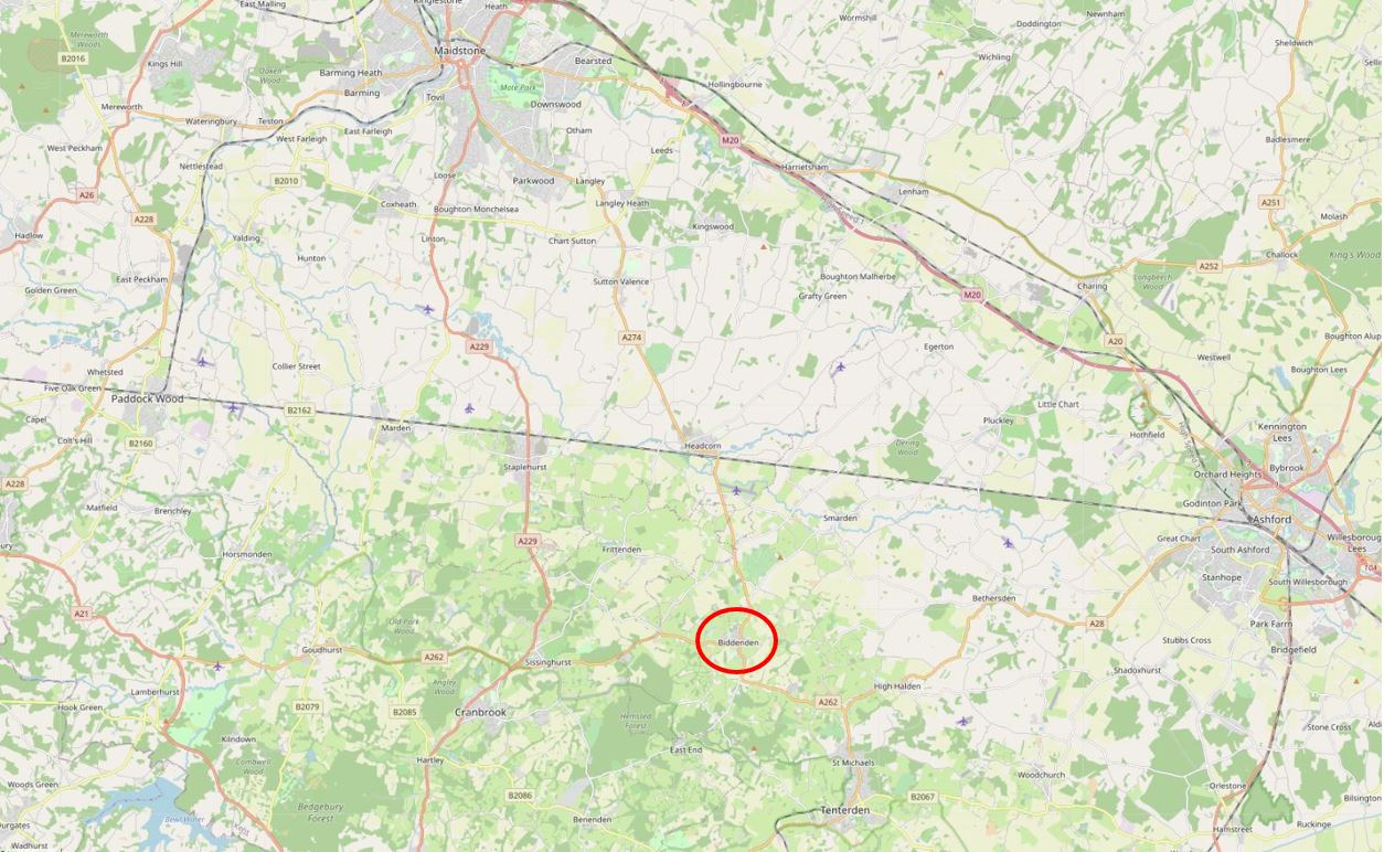
I ran out of time this week to complete the research and writing of the London post I had planned, so as it is summer, how about a trip to Kent, to visit the village of Biddenden, and discover the strange story of the Biddenden Maids.
This is not a random choice. As long term readers of the blog will know, as well as London, my father took lots of photos whilst cycling around the country and staying in youth hostels. This was with friends from London, and from his period of National Service.
I am also trying to visit the location of as many of these photos as possible, and take an updated photo to mirror the original.
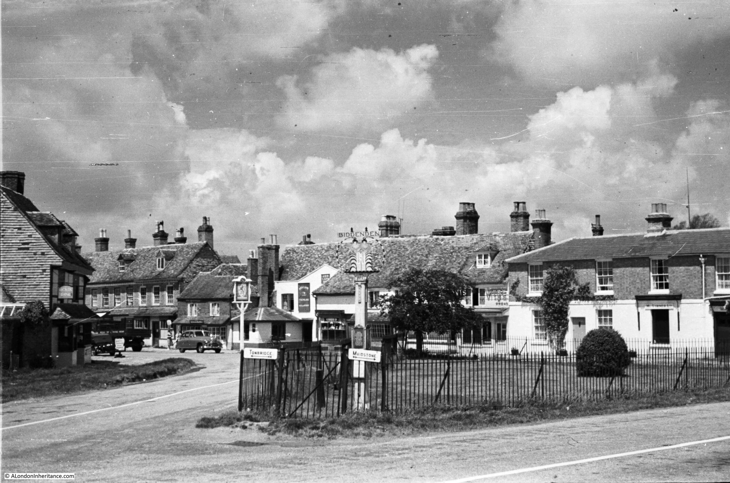
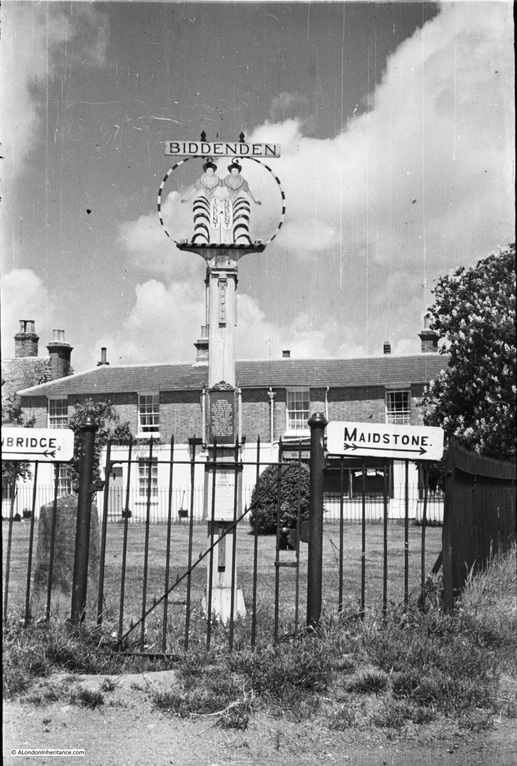
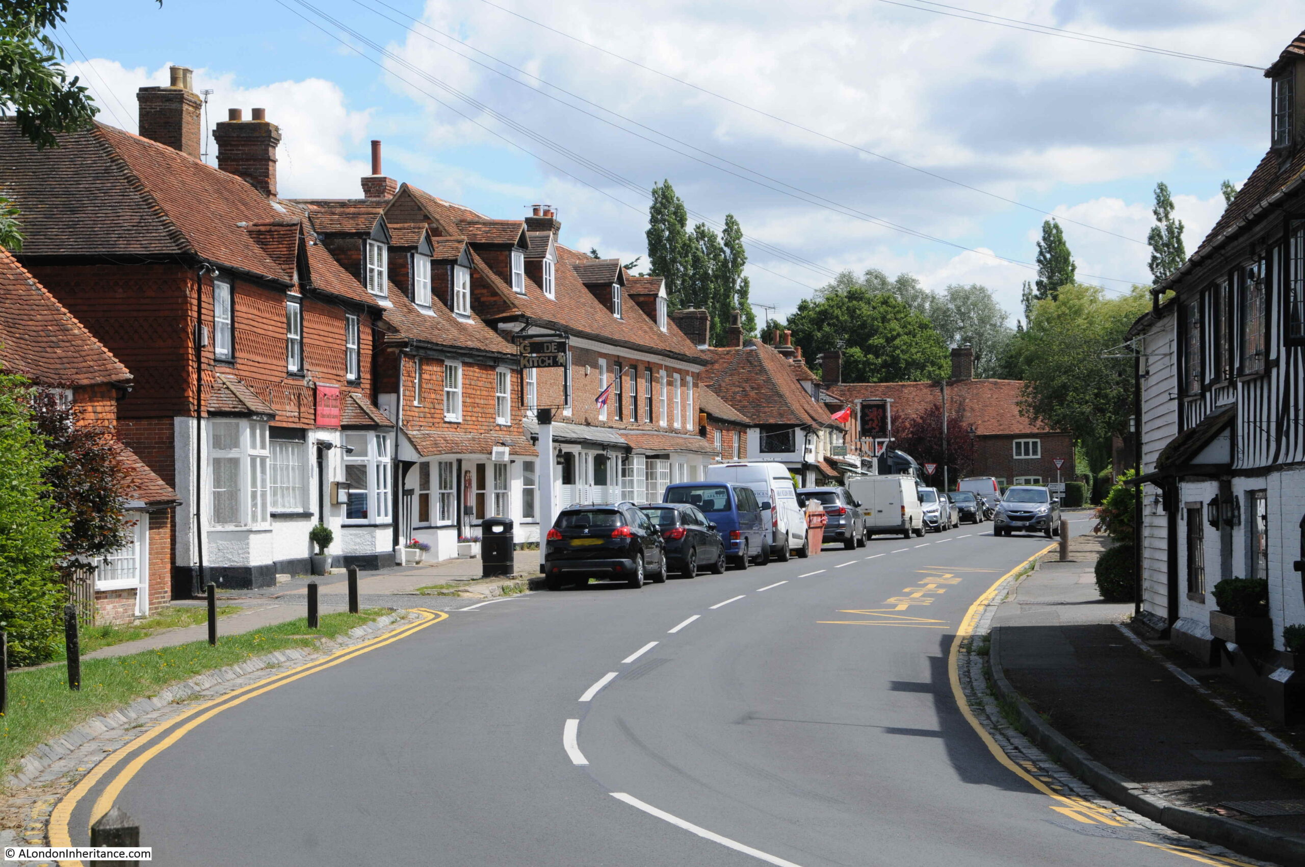
One trip in 1948 included a route through the county of Kent. I have already written about the visit to Canterbury, however they also passed through the small village of Biddenden, and this was the view of the village green on a summer’s day in 1948:
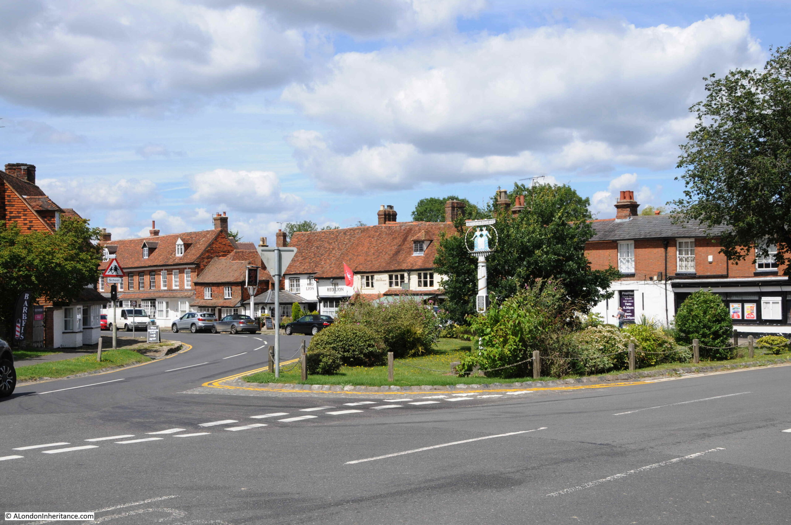
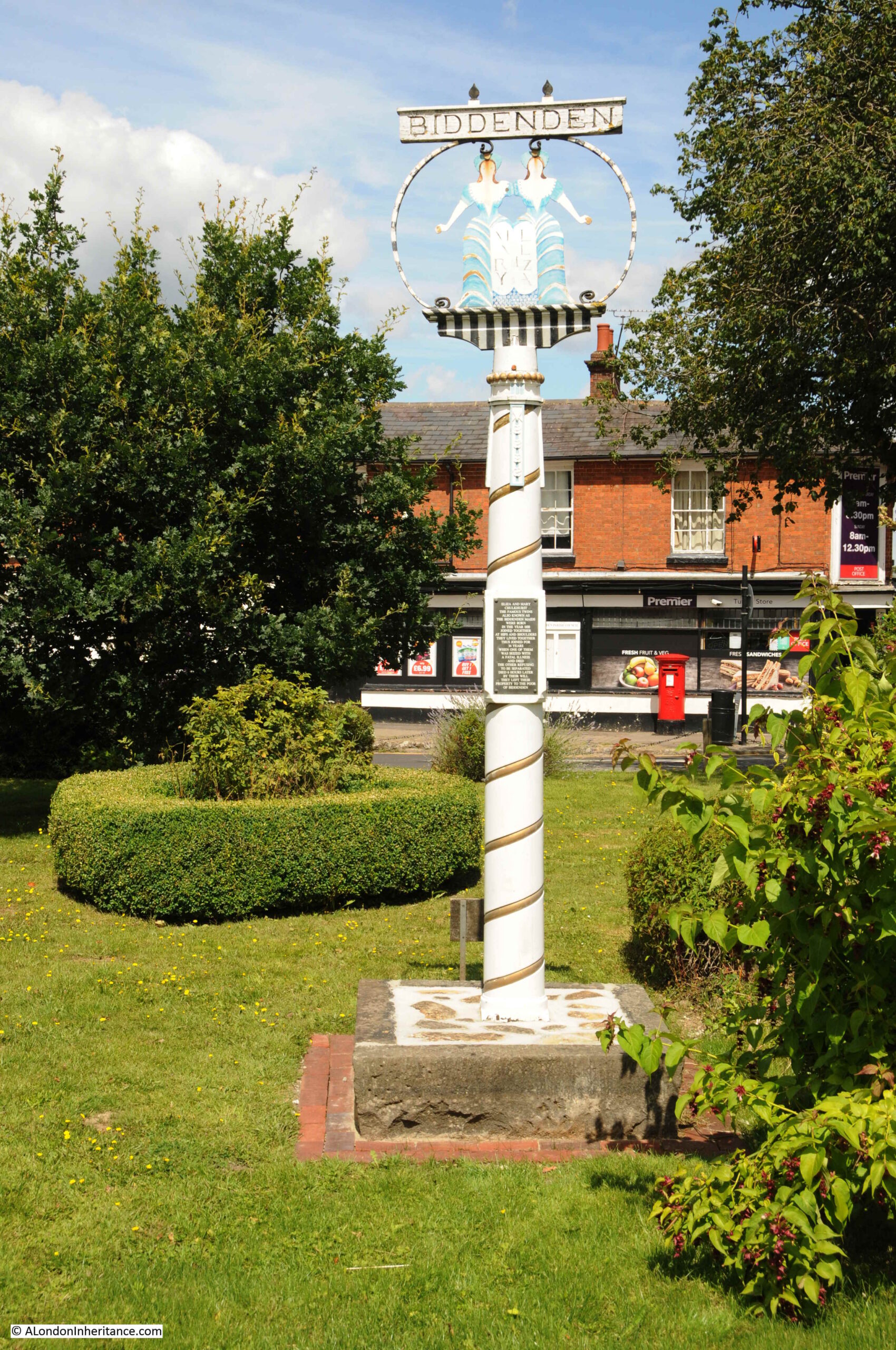
This was the same view in July 2021:
Although there is 73 years between the two photos, the area around the central village green of Biddenden still looks much the same. For a change, I even managed to take the “now” photo with similar weather to the original, although this was more through luck than clever planning.
The main difference is the number of cars parked, and the more organised road markings and boundaries.
The central green area has also lost the original iron railings, and the village name sign has also been moved back further into the green.
Biddenden is one of the many very picturesque villages in the Weald of Kent, the area of once forested land that stretched across the south of the county.
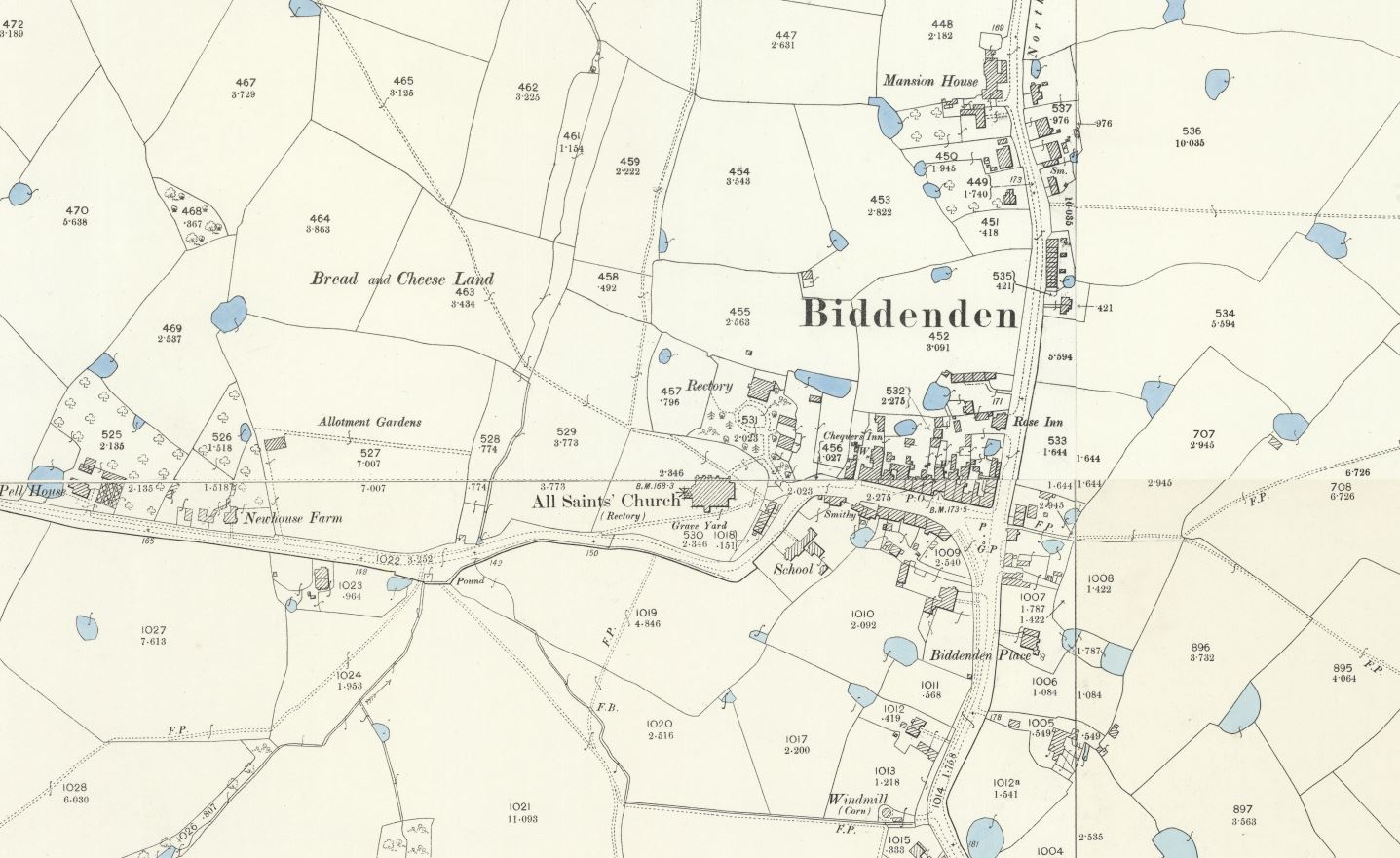
The village green in the above photos is located at the road junction to the right of the street with buildings lining both sides. There has been some development, mainly to the north of the village, and west of the church, however Biddenden is still very much a village surrounded by fields.
Many villages in this area of Kent have rather ornate name signs, which frequently include a historic fact about the village, however few illustrate a story as strange as that of Biddenden.
Looking closer at the name sign, it shows two women standing beside each other (1948 above and 2021 below):
They are the so called Biddenden Maids, or the conjoined twins Eliza and Mary Culkhurst.
A newspaper article from the 15th May 1885 provides some background to the Biddenden Maids:
“Among the various charities in the parish of Biddenden, in Kent, is one which has acquired some celebrity. On the afternoon of Easter Sunday a quantity of small flat cakes, made only of flour and water and impressed with the figures of two women, united at the sides after the fashion of conjoined twins, are distributed in the church porch to all comers. Bread and cheese, to a considerable amount, are given at the same time to the poorer parishioners. This, says tradition, was the legacy of the twin sisters, called the Biddenden Maids, who lived for many years united in their bodies after the manner represented in the cakes, and then died within a few hours of each other. There is also given to the recipients of the cakes a printed paper bearing upon it a representation of the impression on the cakes, and purporting to contain ‘a short and concise account of the lives of Elisa and Mary Culkhurst, who were born joined by the hips and shoulders, in the year of our Lord 1100, and in the county of Kent, commonly called the ‘Biddenden Maids’ .
It then proceeds- ‘The reader will observe by the plate of them that they lived together in the above state thirty-four years, at the expiration of which time one of them was taken ill and in a short time died. The surviving one was advised to be separated from the body of her deceased sister by dissection, but she absolutely refused the separation by saying these words ‘As we came together we will also go together’ and in the space of about six hours after her sister’s decease she was taken ill and died also.
By their will they bequeathed to the churchwarden of the parish of Biddenden, and his successors, churchwardens, for ever, certain pieces or parcels of land in the parish of Biddenden, containing twenty acres, more or less, which now let at 40 guineas per annum.
There is usually made in commemoration of these wonderful phenomena of nature about 1000 rolls, with their impressions printed on them, and given away to all strangers on Easter Sunday after Divine service in the afternoon; also about 500 quartern loves and cheese in proportion, to all the poor inhabitants of the said parish”.
At a distance of 900 years, it is hard to know the truth of this story.
Edward Hasted, writing in the “The History and Topographical Survey of the County of Kent” referenced the story as follows:
“There is a vulgar tradition in these parts, that the figures on the cakes represent the donors of this gift, being two women, twins, who were joined together in their bodies, and lived together so till they were between twenty and thirty years of age. But this seems without foundation. The truth seems to be, that it was the gift of two maidens, of the name of Preston; and that the print of the women on the cakes has taken place only within these fifty years, and was made to represent two poor widows, as the general objects of a charitable benefaction.”
Hasted did not seem convinced about the original story of the Biddenden Maids, however he does not give any further details or sources for his suggestion as to the truth of the story.
The money for the cakes and loaves came from the rents received from twenty acres of land known as Bread and Cheese land. If you look back at the Ordnance Survey map of Biddenden earlier in the post, two large fields to the upper left of the village were still called Bread and Cheese Land.
The first newspaper reference I can find to the Biddenden Maids is an article in the London Evening Standard in 1829. There are then numerous articles, mainly reporting on the Easter Sunday charity distribution, and the large number of visitors to the village who came to see and participate in the distribution of the cakes.
Popularising the Biddenden Maids would have helped the economy of the village.
According to Biddenden’s web site, the charity distribution still takes place:
“Once a year Bread and Cheese are given to local widows and pensioners at the Old Workhouse. Biddenden Biscuits, baked from flour and water, are distributed among the spectators as souvenirs. They bear an effigy of two female figures whose bodies are joined together at the hips and shoulders.”
A close up of the village sign in 1948:
In 1948, the wording between the two women was “IN KENT” – a continuation of the village name above to show the county of the village, however by 2021, the names of the two women, Mary and Eliza had replaced the county name.
The origin of the sign dates back one hundred years. In 1920, the King discussed the revival of village signs during a speech at the Royal Academy.
The Daily Mail then organised a village signs competition and exhibition with a fund of £2,200 being available in prizes. Of the ten awards made, the design for the sign at Biddenden received a special prize of £50.
There are a number of subtle differences between the signs of 1948 and 2021. This is probably down to the complete refurbishment of the sign in 1993.
This may have included the changes, such as, moving the sign back further into the green. replacing the county of Kent, with the names of the twins, and replacing the pole as the original square pole is now round, with some gold spiral decoration.
The photos of the village in 1948 and 2019 tell a story of how villages change, and stay the same. If you go back to the 1948 photo at the top of the post, there is a sign on the very first building on the left. The sign is for a bank, and looking at the high resolution scan from the scanner it seems to be a Lloyds Bank. Remarkable at a time when bank branches are disappearing by the day that in 1948 a small village of the size of Biddenden would have their own bank branch.
The building that was once the bank is shown in the photo below:
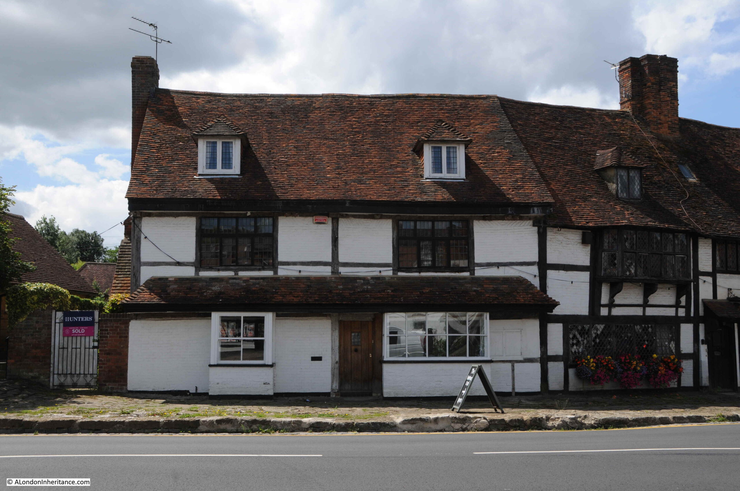
Not visible in the 1948 photo, but there is a terrace of rather special houses continuing on from the bank. These were Flemish Weavers cottages, dating from the 17th century:
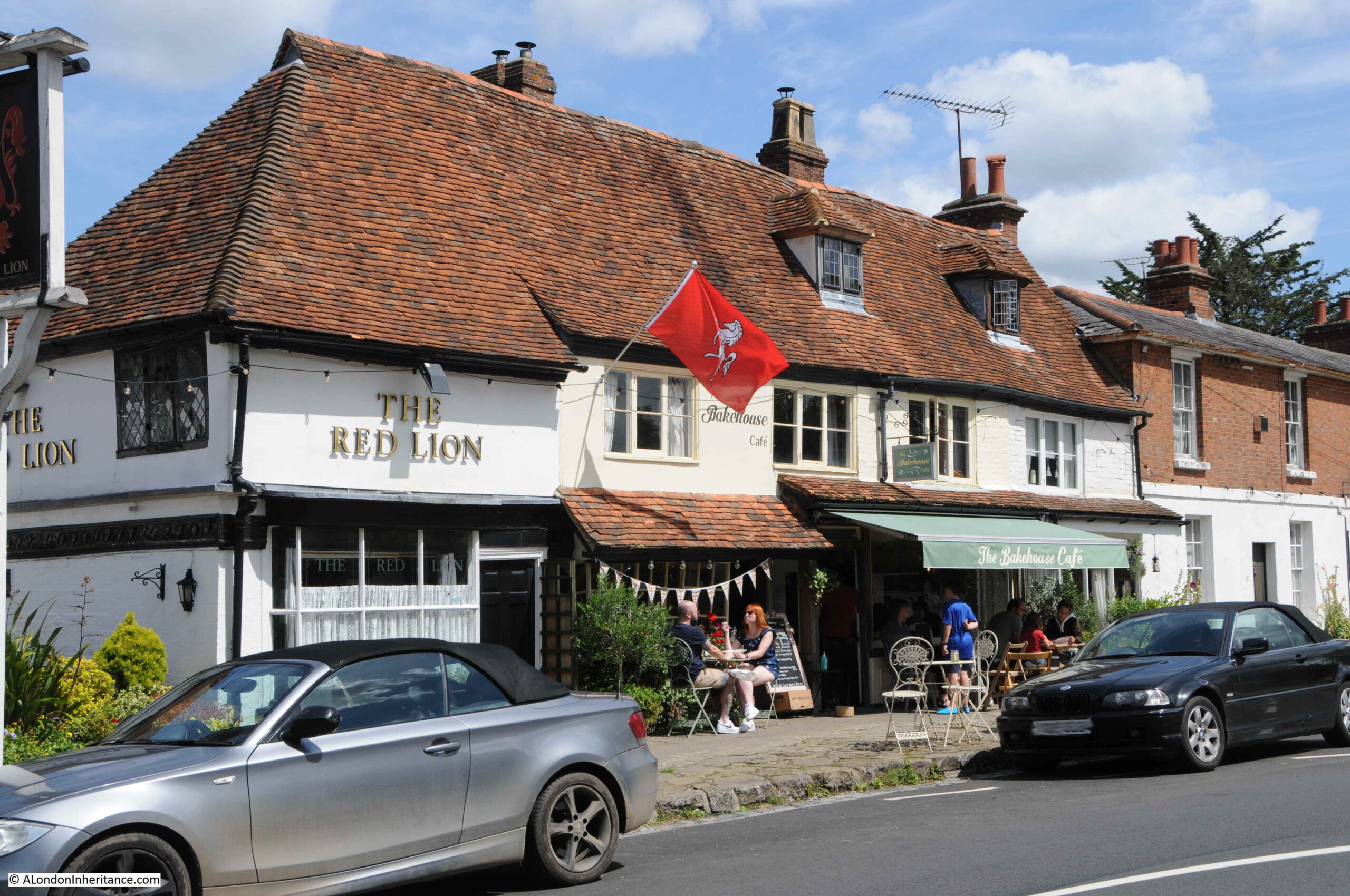
Directly opposite the above terrace, there is a pub and café:
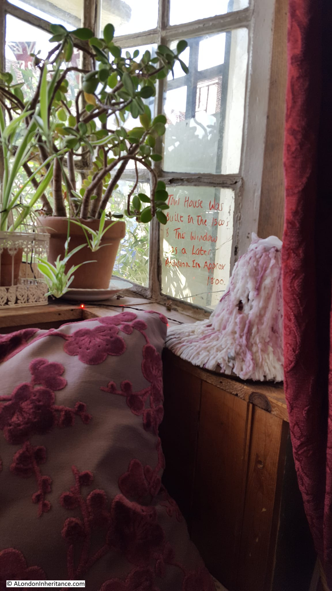
As we had travelled by car, the pub was out of bounds (Biddenden did have a railway station, however this branch of the Kent and East Sussex Railway closed in 1954), so we went into the Bakehouse Café, which was excellent, and which had the following inscription on one of the windows overlooking the street:
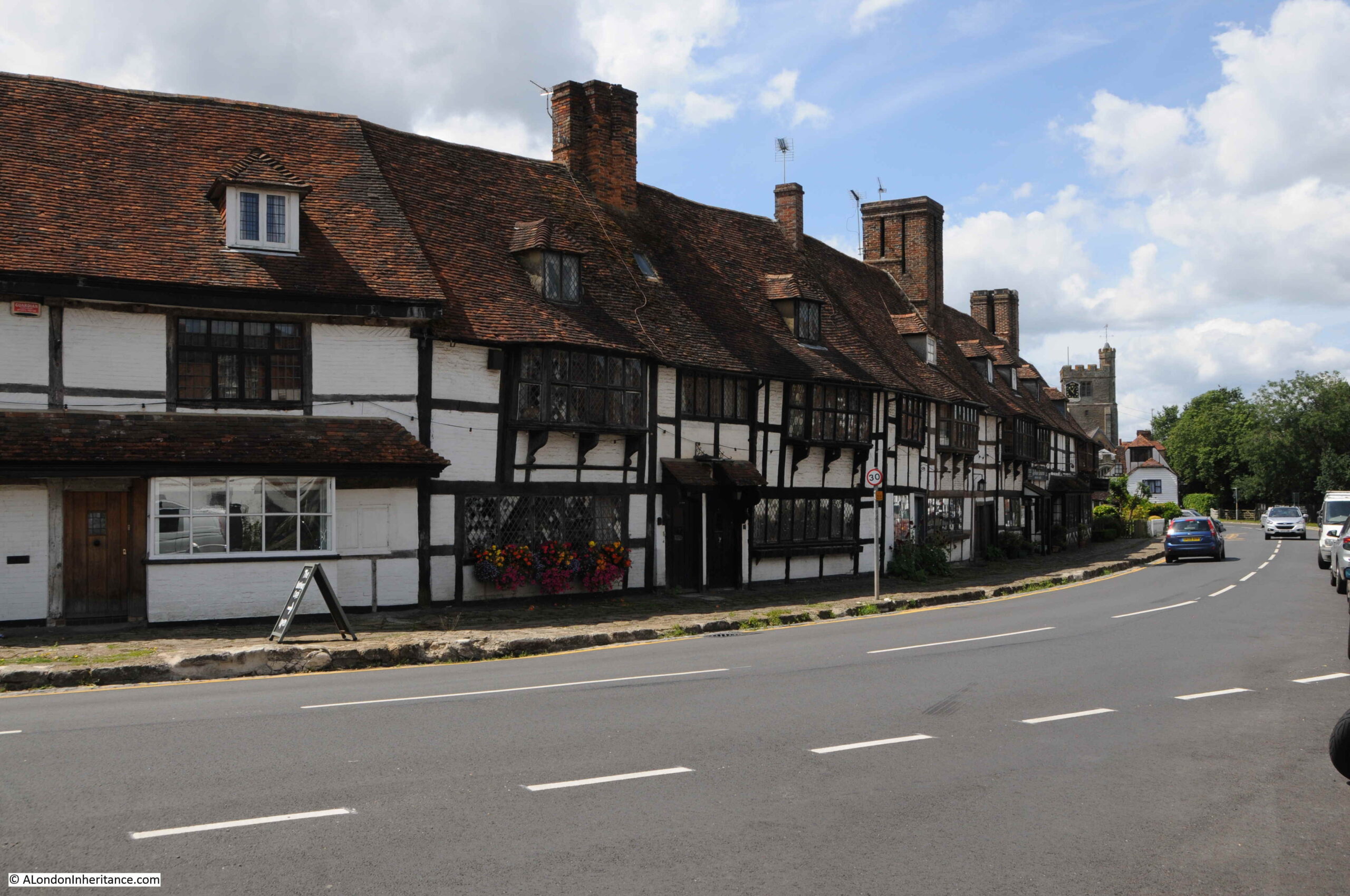
The main street through Biddenden village:
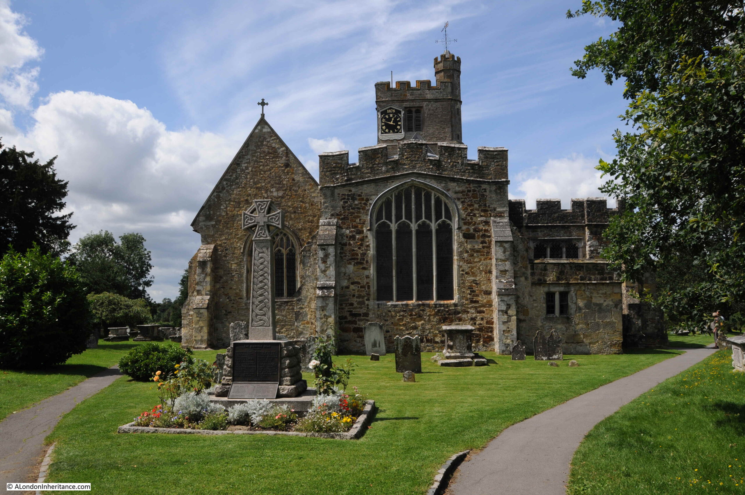
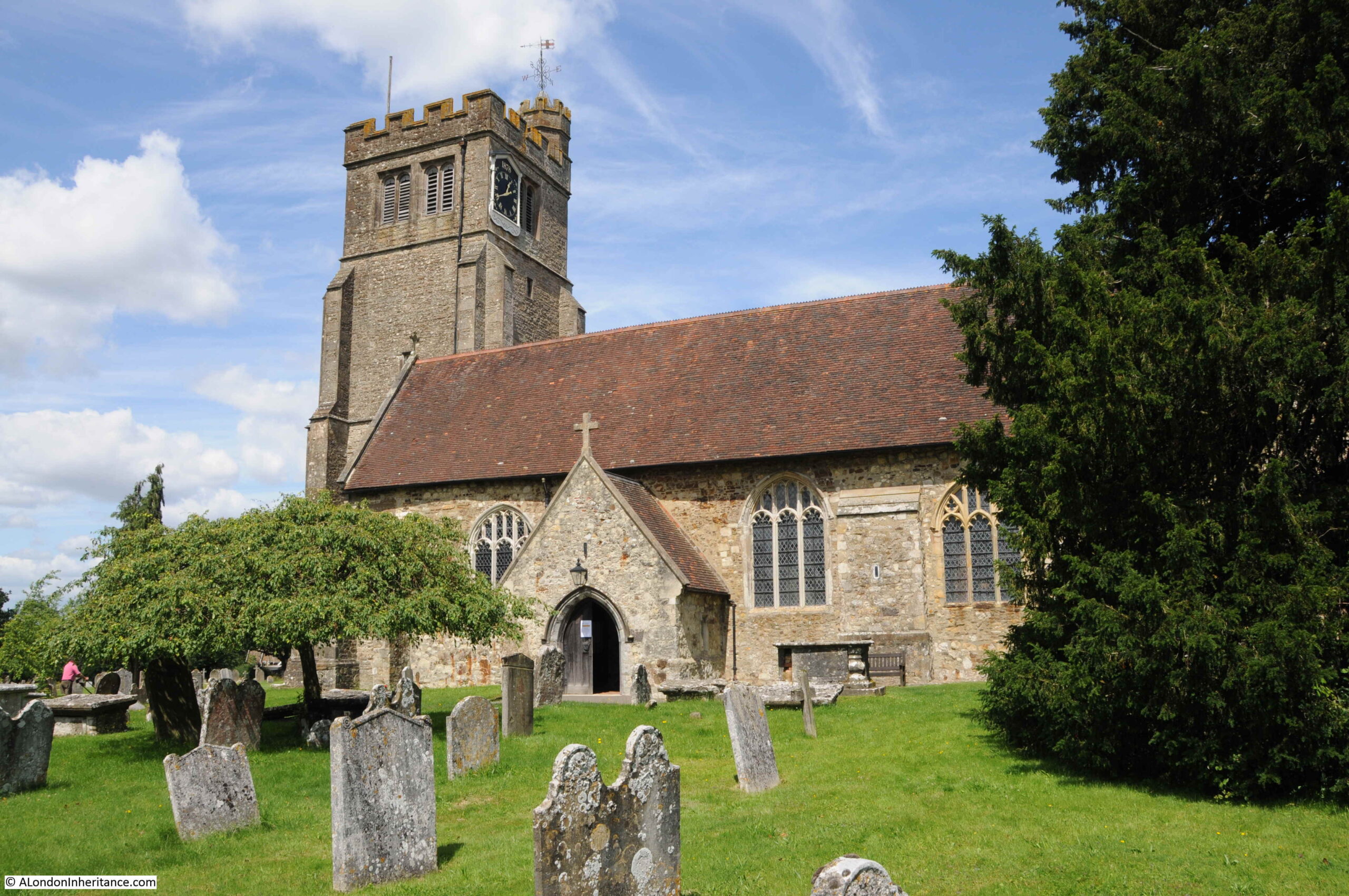
Behind me, in the above photo is the entrance to Biddenden’s church which stands at the western end of the village:
Parts of the church date from the 13th century, however there has been much later rebuilding. Unfortunately it was locked on the day of our visit so no opportunity to take a look inside.
At a distance of 900 years, it is almost impossible to be sure of the origins of the story of the Biddenden Maids, however the story is still central to the village, and it has been the driving force behind a charity distribution which has taken place for hundreds of years, and in a world where places get more and more standardised and similar, it is good for a place to retain its own unique identity.
For next Sunday, I will be back in London.
Southbank Walks
A couple of tickets have become free on two of my Southbank walks. If you are interested in exploring the history of the Southbank and the Festival of Britain, there is: