
The south bank of the River Thames between Westminster and Tower Bridges has seen many changes. Once mainly an industrial area lined with factories, warehouses and wharves, these have been replaced by offices, restaurants, Tate Modern, the reproduction Globe Theatre etc.
Any day of the year, the walkway along the south bank will be crowded with tourists, those who work along the south bank and as a straightforward route to walk between east and west London.
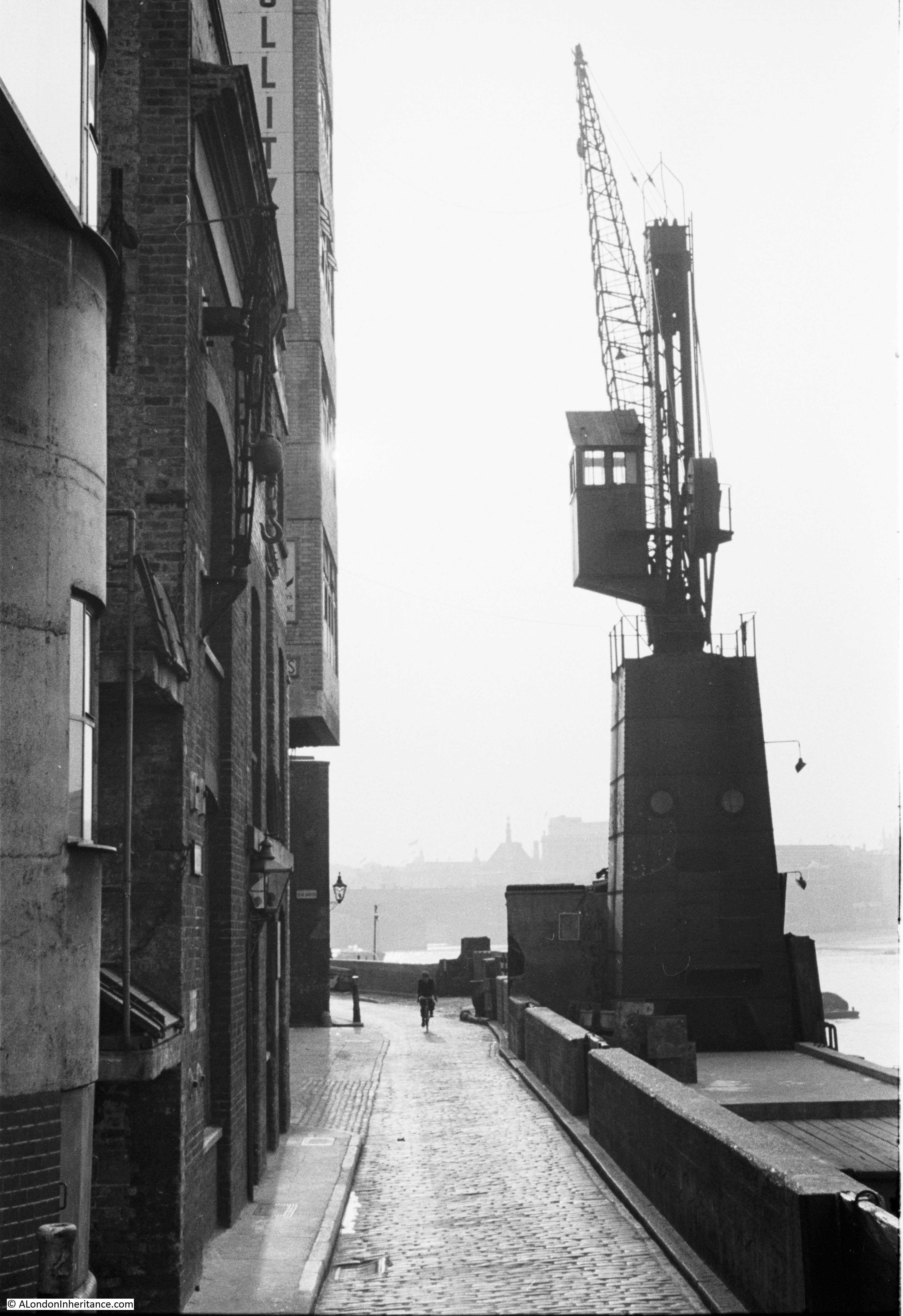
The south bank was not always like this. This was the view in 1953, photographed by my father, looking along Bankside, west from the base of Southwark Bridge. The photo was taken from the area of the steps leading up to the bridge.
The same view in 2017.

The scene is so very different, how do I know it is the same view? There are a couple of well defined points of reference.
If you look to the left of the crane, there is part of a large building, with a further building just a bit further to the left with a distinctive spire on the roof.
If you look in the same position in my 2017 photo, the large building is Unilever House, now fully visible as the crane is not obscuring, and the building with the spire is the old City of London school. The spire is clearly visible in both photos.
You will also notice that the street (1953) and walkway (2017) curves to the left in the distance.
The original photo was taken during a weekend, the shadows indicating this was late afternoon. My photo was also at the weekend, although early afternoon. The solitary cyclist has been replaced by the crowds who daily walk along the south bank.
In the 1953 photo, you can see part of a name at the top of one of the buildings. The full name is Beck & Pollitzer, a successful engineering company that is still in existence today, although not on Bankside.
Beck and Pollitzer was formed in 1863 by two immigrants from central Europe, John Beck and Sigimund Pollitzer. The company started as an importer and distributor of goods from across Europe and therefore needed warehouse space. In the late 19th century the company moved into warehouses on Bankside and eventually owned several on either side of Southwark Bridge.
The company evolved into a specialist engineering and support services provider and moved from Bankside to Dartford in Kent.
Beck & Pollitzer retain a link with London as they provide the transport and installation services for the Trafalgar Square Christmas tree.
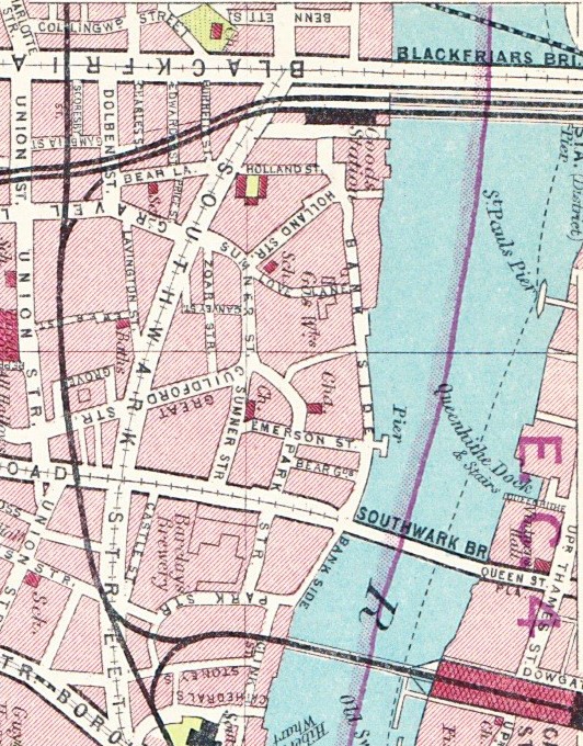
In my father’s photo, Bankside is the street that runs along the edge of the River Thames. Although today it is primarily a walkway, it is an old street. The following extract from a map of the Parish of St. Saviours Southwark by Richard Blome (late 17th century but published by John Stow in 1720) shows the area long before Southwark Bridge, with Banck Side (one of the spellings used in the 18th century) running along the edge of the River Thames.

The first Southwark Bridge opened in 1819, 100 years after the map was printed. If you look in the centre of the map you will see Bear Alley. To the right is Rose Alley. There is a small street to the right of Rose Alley, which continues south to the bottom of the map. This is the location of Southwark Bridge.
Bear Alley and Rose Alley are still there today, although Rose Alley is now blocked off from Bankside. You can see that at the southern end of Bear Alley there is an open space marked as Bear Garden – one of the locations around Southwark that hosted the types of “entertainment” for which the area was well known.
The following extract from the 1940 Bartholomew’s Atlas of Greater London shows Southwark Bridge with Bear Alley now called Bear Gardens. Note also that in both the 1720 and 1940 maps, Bankside was two words, Bank Side more accurately refers to the origin of the name. Today it is generally found as one word.
Bear Gardens today is a narrow street running south from Bankside. Bear Gardens is always rather empty when compared to the crowd who seem fixed on walking the length of the south bank without exploring slightly inland.

The construction of Southwark Bridge stopped Bankside from running alongside the river, it had to turn inland very slightly to run under the arches leading up to the bridge, before turning back towards the river.
Just to the left of where the top photos were taken is where the street runs inland and it is here that, despite the incredible amount of change in this small area, the view today is remarkably similar to that of 64 years ago.
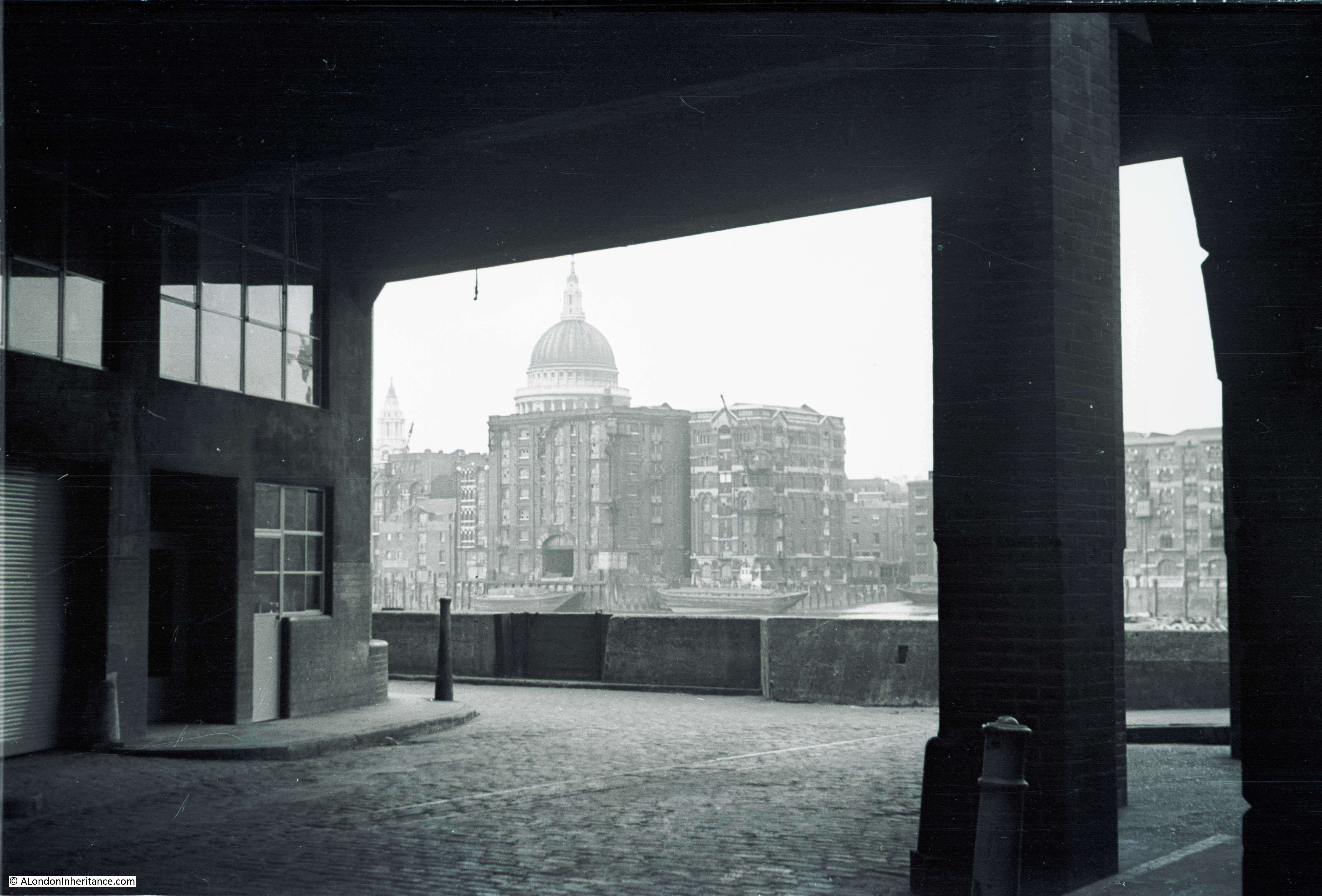
My father took the following photo from under the warehouses that ran straight up to Southwark Bridge. Bankside turns to the right at the point where the photo is taken to run underneath the bridge.
St. Paul’s Cathedral is behind the warehouses on the north bank of the river and Queenhithe is to the right of centre.
The same view today.
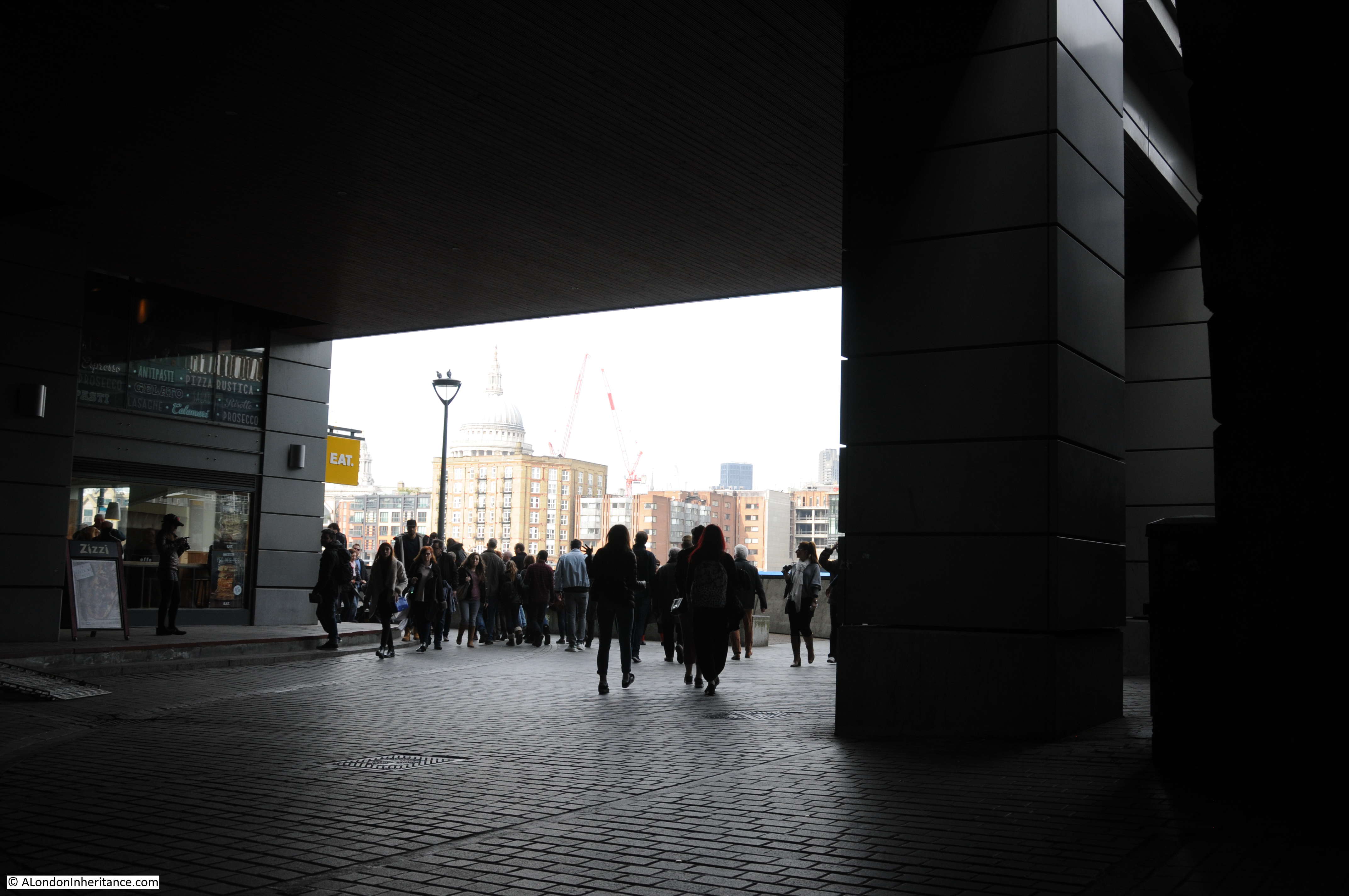
Although the warehouses along Bankside have long since been demolished, the new buildings follow the same layout, with a remarkably similar view across to St. Paul’s Cathedral. You can also see identical notches between the stone panels on the dark arch on the right of both photos, one of the arches that supports the run up to Southwark Bridge.
I suspect that the solitary man cycling along Bankside in 1953 could never have imagined how this area would change over the following decades.
When I left home and moved to London 40 years ago, I used to walk along this stretch of Bankside regularly and there was never anyone but me admiring the view. I recall what is now Tate Modern when it was the disused power station, behind link fences and most of this area had been razed, prior to redevelopment. And, further along, the Oxo building was a solitary and abandoned mess. Personally, the new lease of life for Bankside cheers me up and I love walking there now, always something to look at. The strange rubbish barge is no longer anchored out in mid stream though, I note.
No comment except just to say how much I enjoy these musings! Thank you.
What a fabulous photo the first one is. So evocative of the London of that era.
Back in the early sixty’s I worked in Farringdon St and used to park my car on Bankside, under one of the unloading cranes. If I recall correctly it was a bucket crane for unloading coal from lighters!
Lovely. And you’re right. I’d never even clocked that little street properly, still less realised the significance of its name. Thanks for this and all your other great research/posts
Two excellent posts once again,Admin. Thank you.
Sorry this comment is rather late. I have been away for a few days and am now on catch up.
Just a pedantic correction but John Stow died in 1604. It was John Strype who republished Stow’s famous Survey of London with added maps by Blome in 1720.
Matt – thanks for that, problem with writing too quickly and late at night. I will update.
I worked as a lighterman as all my ancestors, I worked at the Bankside wharf’s many times, now with Ancestry I found that my G’t , Gt grandfather living there, and my Gt grandfather born there. I have enjoyed your photographs very much.