Monthly Archives: August 2025

Walking the Limehouse Cut – Part 1

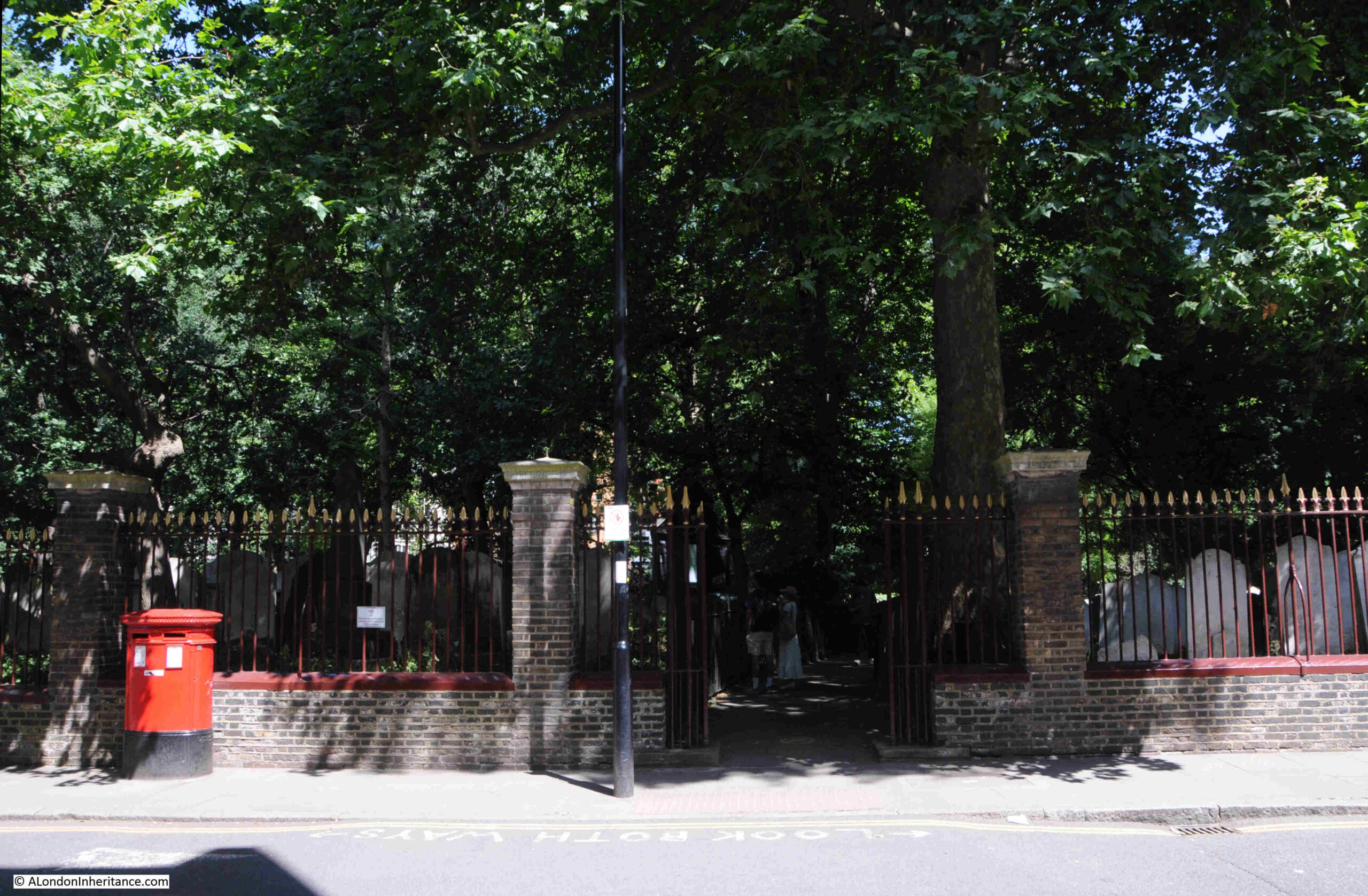
Thank you so much for ticket purchases of my walks announced last Sunday. They all sold out on the same day. I will be adding a few more dates for these walks in the coming months, and for an update as soon as they are on line, follow me on Evenbrite, here, and I will also announce in the blog.

For today’s post, I am walking along an 18th century engineering and construction innovation that helped transport goods from the counties north of London, into the city, and also served the industry that developed in east London.

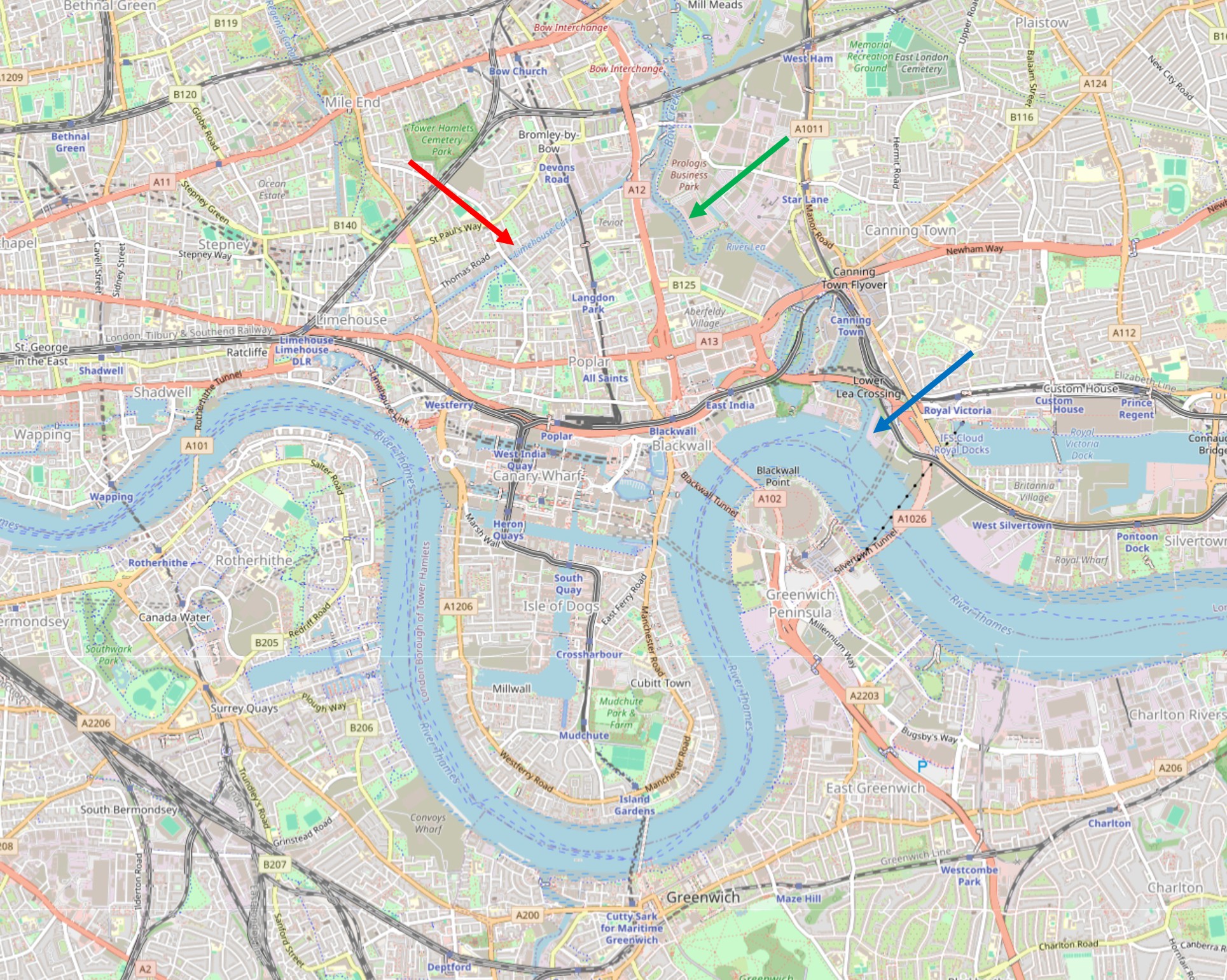
The River Lea (Lee is also used, but I will stick with Lea), runs from Bedfordshire, through Hertfordshire, and then through east London to enter the River Thames just to the east of the Isle of Dogs at Bow Creek.

The Lea was used to carry goods, such as grain and malt, from the counties to the north and east of London to the Thames, where barges would turn west and head into the City.

Traffic on the River Lea started to increase considerably during the 18th century, and during this period a number of improvements were made, including locks and cuts, to bypass meanders in the river.

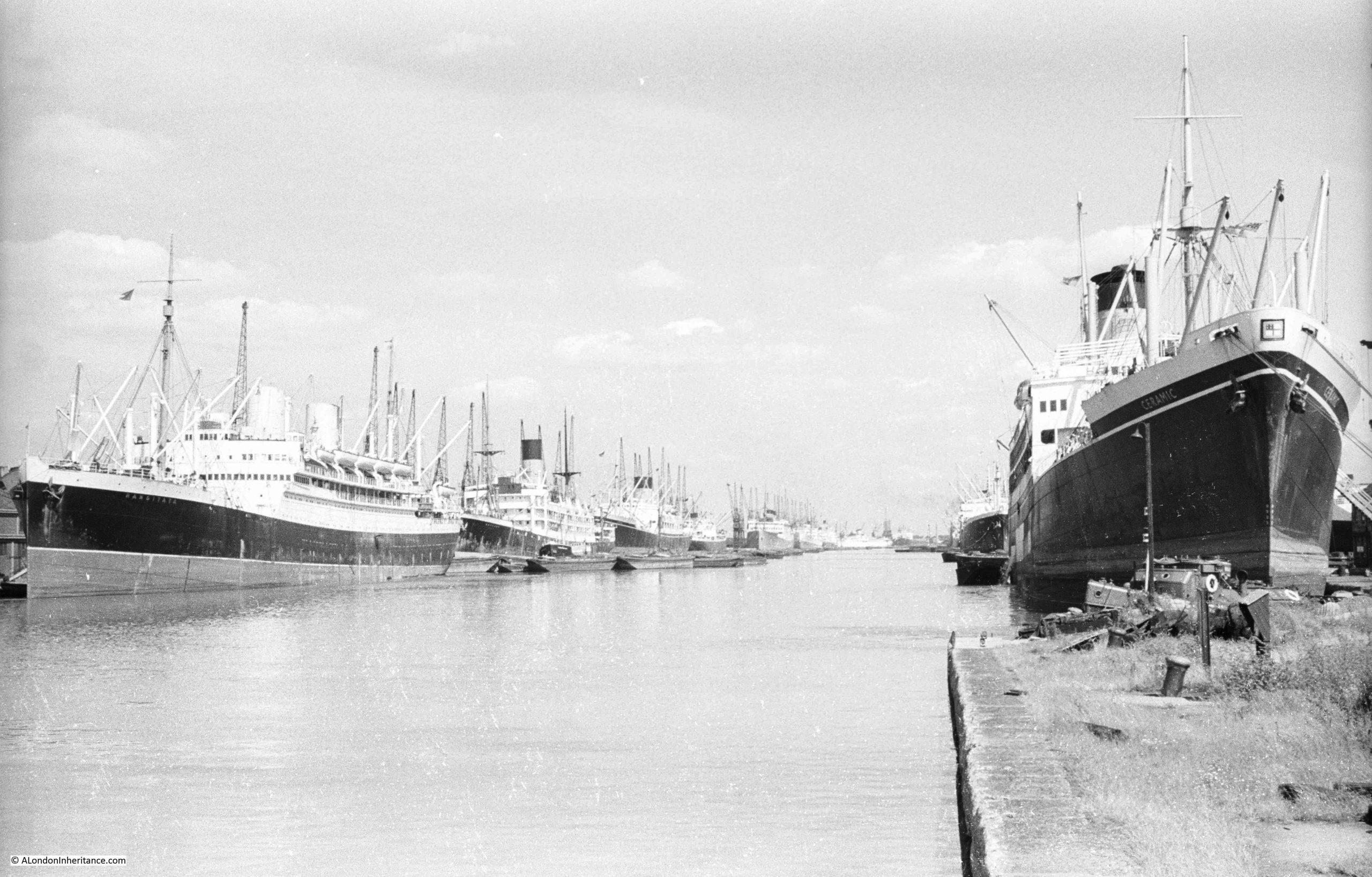
The big problem for those using the Lea to transport goods into the City was the Isle of Dogs. Being to the east, barges and shipping had to navigate around the Isle of Dogs before they could head into the City. This was at a time before the extensive use of steam power and when barges and shipping relied on the wind and tide.

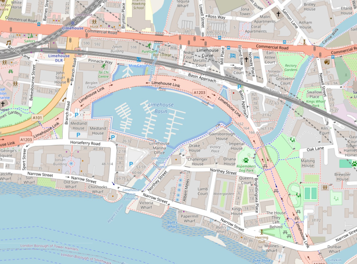
If you look at the following map, the River Lea is highlighted by the green arrow, with the entrance of the river into the Thames shown by the blue arrow. As can be seen, the Isle of Dogs caused a significant addition to the route to head west into the City (map © OpenStreetMap contributors):

There had been proposals to cut a channel through the northern part of the Isle of Dogs to provide a direct route, however use of the land for the docks that expanded across the area was a more profitable and efficient use of the land.

The Civil Engineer John Smeaton had been looking at how the River Lea could be improved to make it easier to navigate, and one of his recommendations was to build a channel or cut from the River Lea to the Thames at Limehouse.

This would provide a direct route to the Thames, and would avoid the time consuming journey around the Isle of Dogs.

The River Lee Act, an Act of Parliament, was obtained in 1766 to build the channel, and work swiftly commenced with the new Limehouse Cut opening on the 17th of September, 1770.

Referring back to the above map, the Limehouse Cut is highlighted by the red arrow, and it can be seen to run from the Lea at the upper part of the Cut, down to enter the Thames at Limehouse.

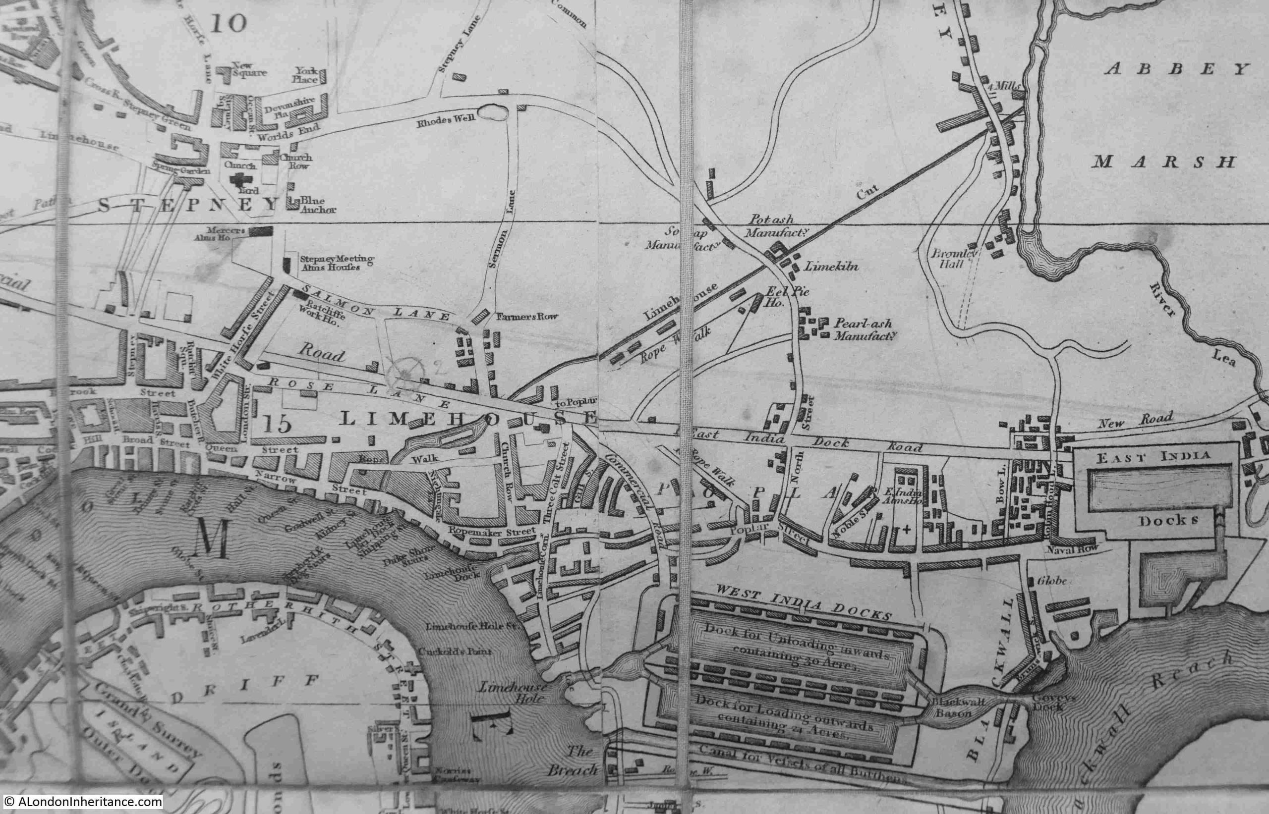
The map today shows the Limehouse Cut running through an area which is heavily built up, however even over 40 years after completion, much of this area was still rural, and in the following extract from the 1816 edition of Smith’s New Plan of London, we can see the Limehouse Cut running from Limehouse up to the River Lea next to Abbey Marsh through mainly empty land, which allowed a very straight channel to be built:

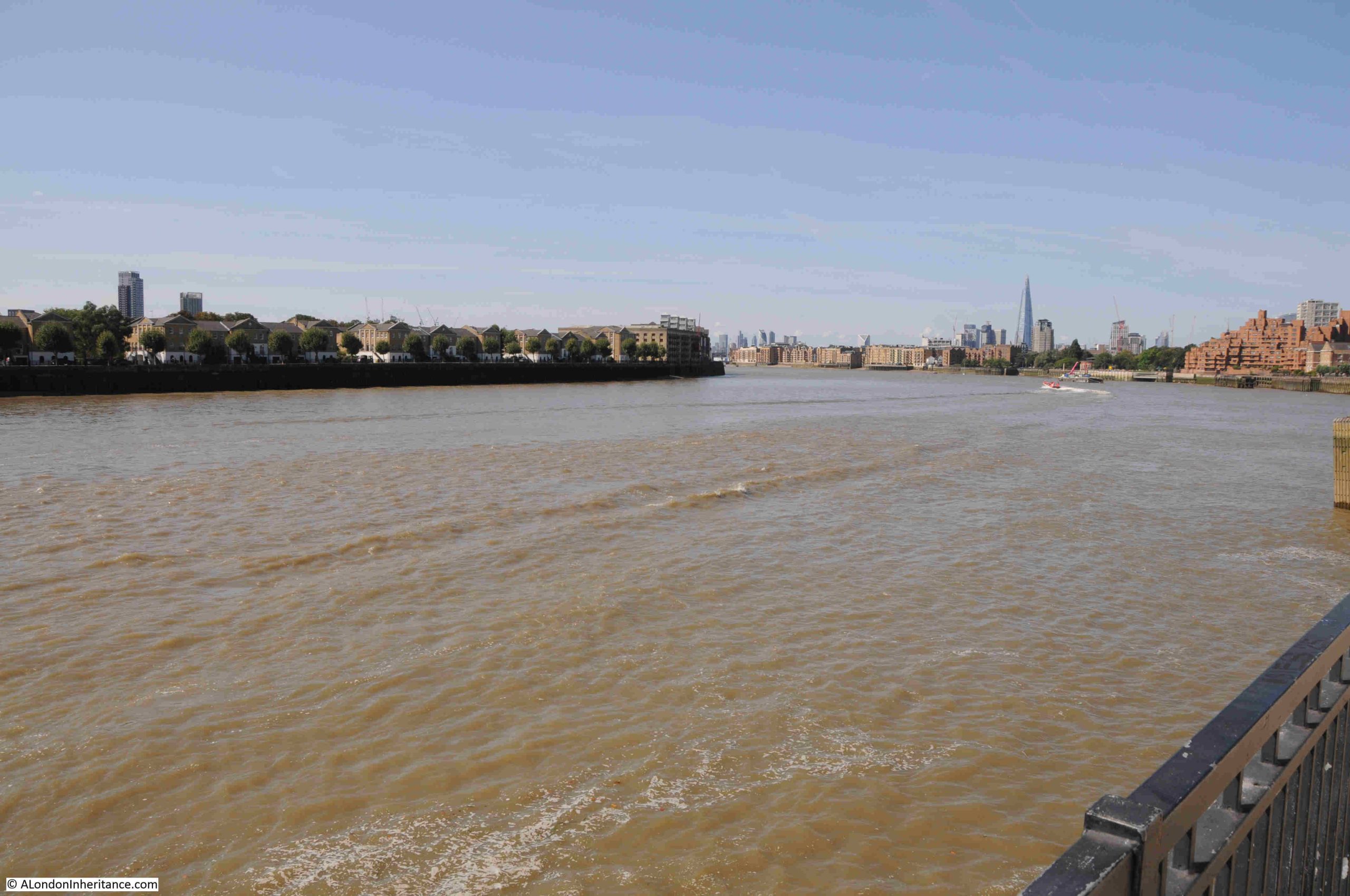
Not that clear in the above map, but the Limehouse Cut ran directly into the Thames, and the original entrance to the river can still be seen today:

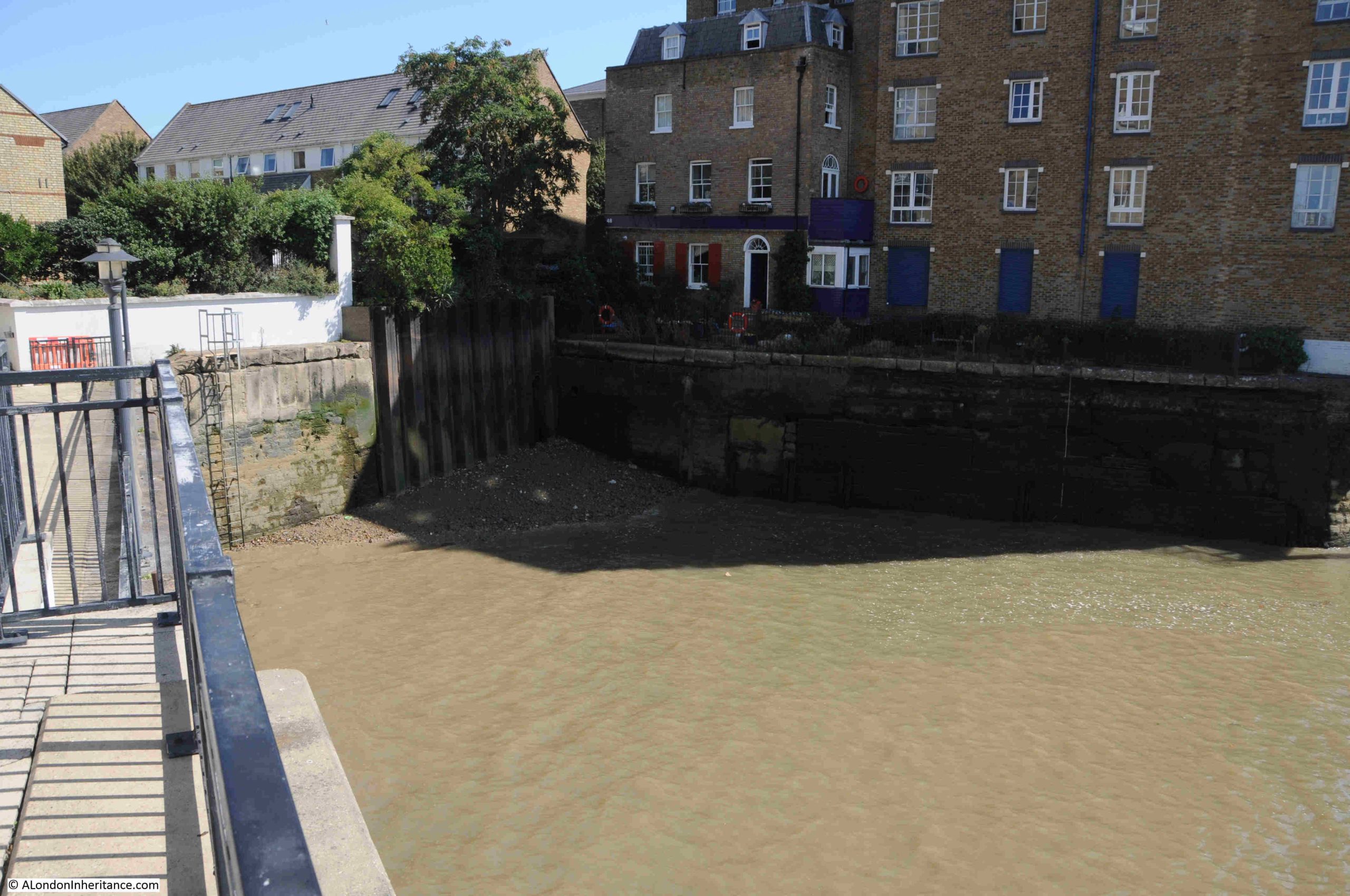
The view looking east from where the Limehouse Cut originally entered the Thames, where we see the Thames turning to the right to start its route around the Isle of Dogs:

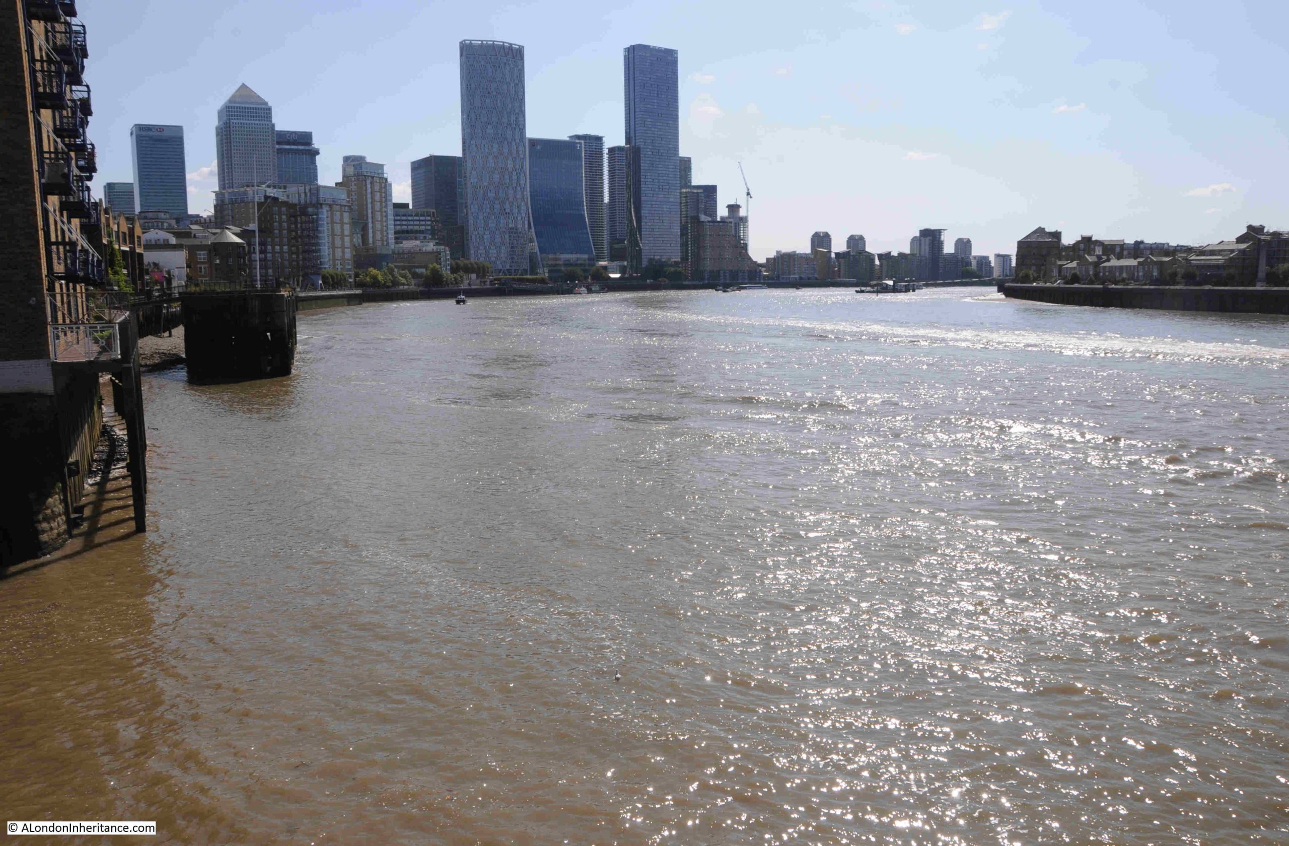
And looking west in the direction of the City, the Limehouse Cut provided a far more direct route for shipping on the Lea taking their produce and goods to the City:

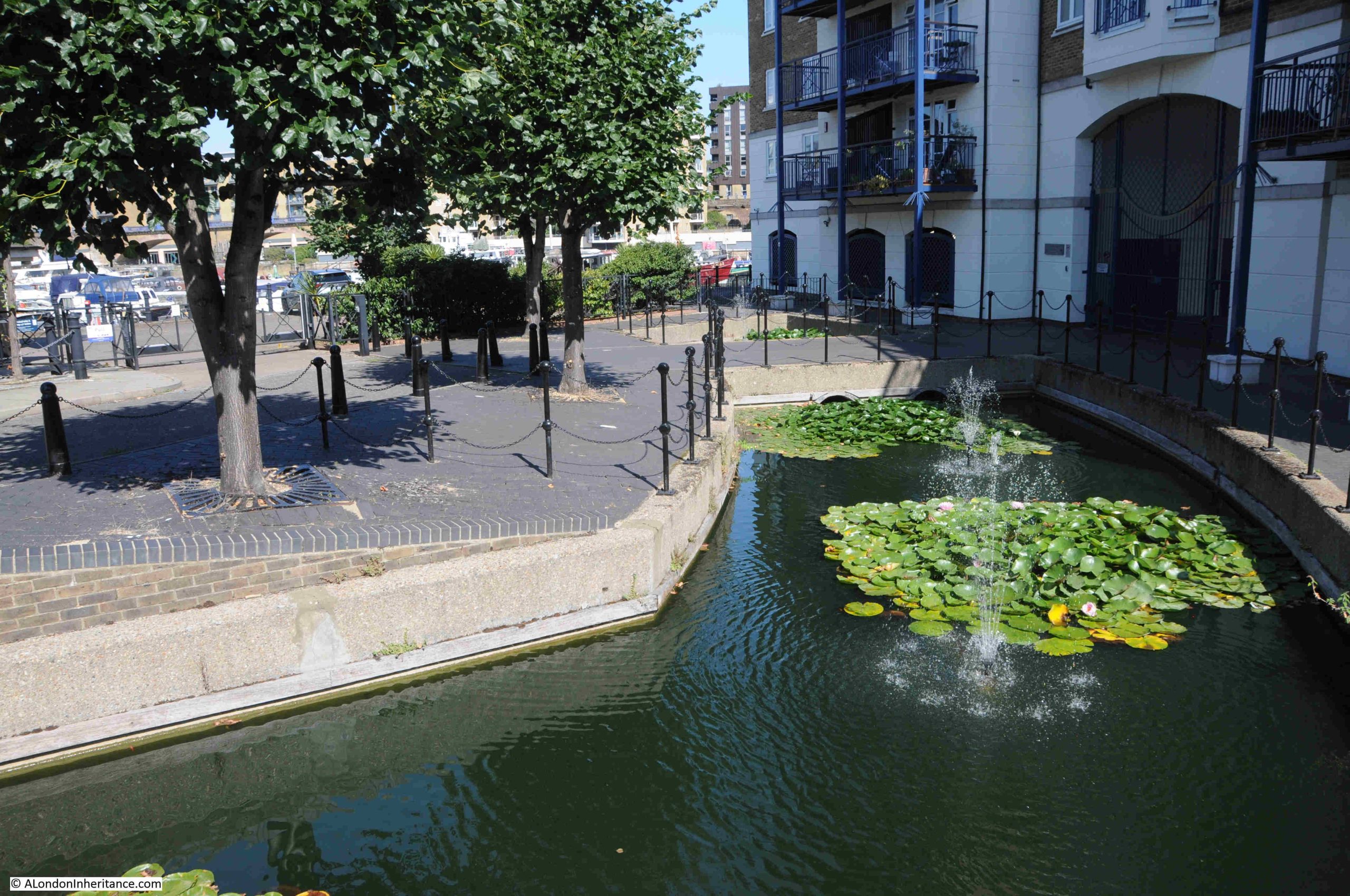
Whilst the old entrance remains, the Limehouse Cut is now diverted into the Limehouse Basin. If you refer back to the map of the area today, the Limehouse Basin is the area of water just to the left of the lower part of the Limehouse Cut.

The following map shows Limehouse Basin, look just to the right of where the channel from the basin enters the Thames and there is an indent. This is the original entrance to the Limehouse Cut (map © OpenStreetMap contributors):

The Limehouse Basin, or originally the Regent’s Canal Dock opened along with the Regent’s Canal in 1820, to form a place where shipping could dock, load and unload whilst transferring their goods between the barges that travelled along the Regent’s Canal.

The two entrances to the river for the Regent’s Canal Dock and the Limehouse Cut were very close together, and for eleven years between 1853 and 1864, the Limehouse Cut was diverted into the Regent’s Canal Dock, however after 1864 the original entrance was back in use, with a new bridge carrying Narrow Street over the canal. It seems that the return to the original route into the Thames was down to the imposition of additional charges and rules by the owners of the Regent’s Canal Dock on the users of the Limehouse Cut, who now had to pass through the dock to reach the Thames.

Use of the original route would last for another 100 years, when the Limehouse Cut was rediverted back into what is now Limehouse Basin, a routing it retains today.

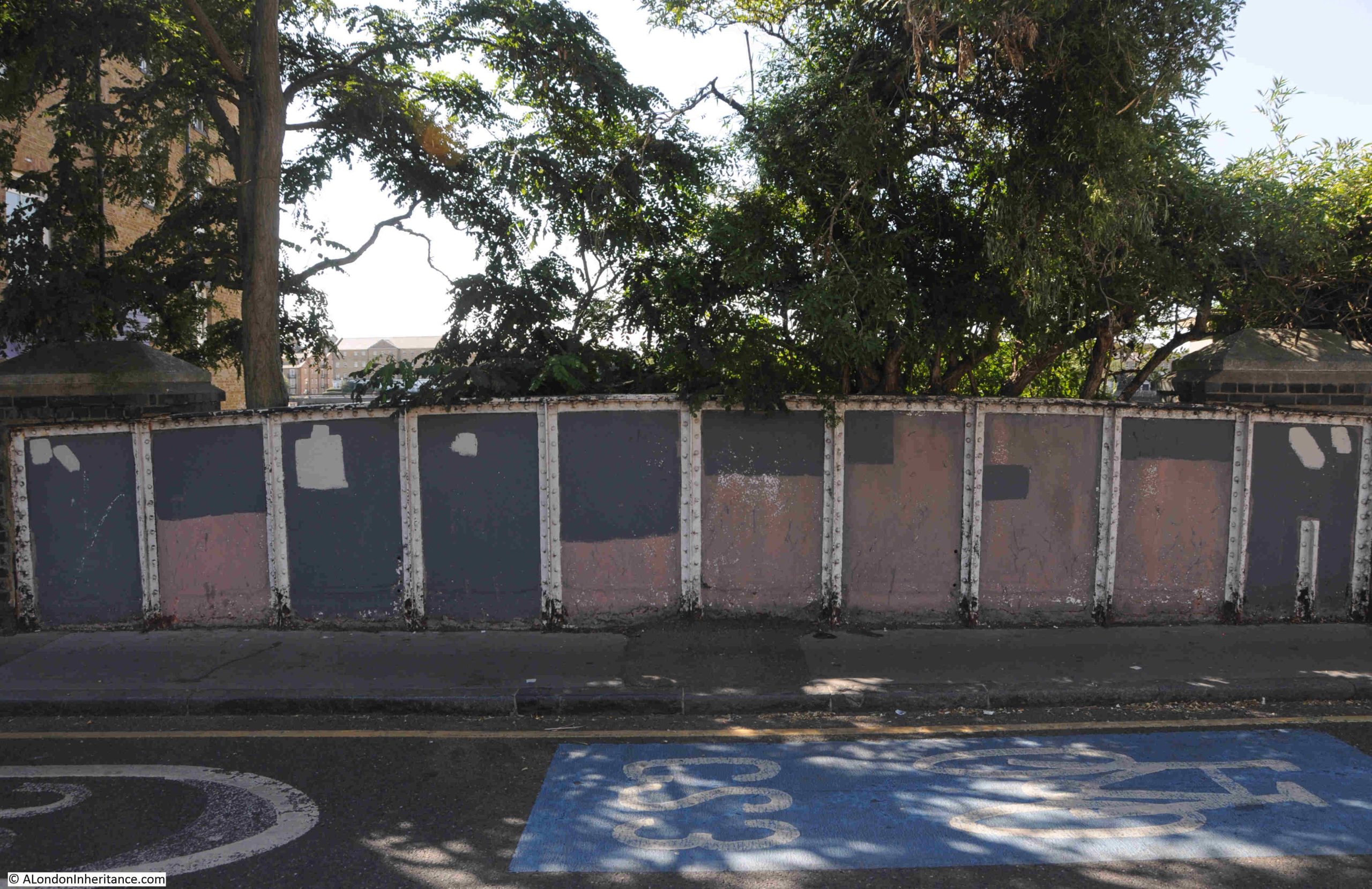
Although blocked up where the original entrance meets Narrow Street, we can follow the old route of the Limehouse Cut in the way the area has been landscaped as part of the redevelopment.

The side of the 1864 bridge that once carried Narrow Street over the Limehouse Cut remains:

The following photo is the view looking north from the bridge which once took Narrow Street over the Limehouse Cut, and a channel of water follows the original route. It was here that a lock was located to control the height and flow of water between the tidal Thames and the Limehouse Cut:

Which then continues after Northey Street:

And in the following photo, I am now at the Limehouse Cut, where it curves to head towards Limehouse Marina. The original route to the Cut is to the left of the photo:

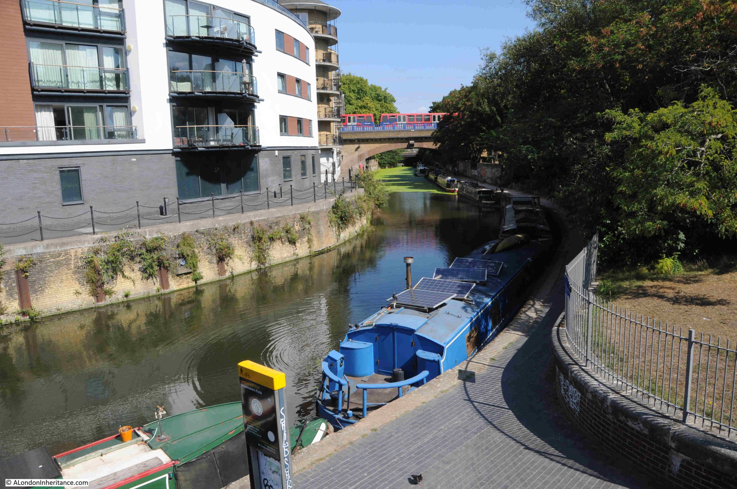
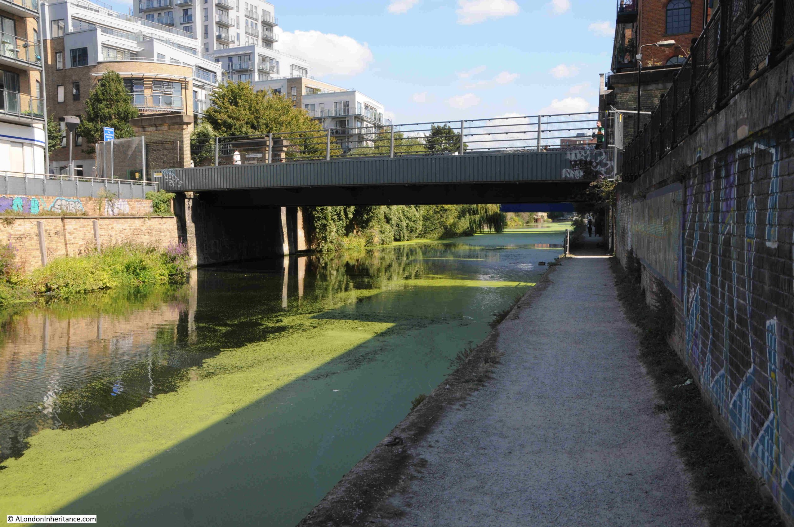
The following photo is looking north along the Limehouse Cut at the start of the walk. The first of many bridges can be seen. This one carrying the DLR over the Cut:

The Limehouse Cut took just 16 months to build, and was the first canal built in London as well as being one of the first across the country.

As can be seen in the maps at the start of the post, the Cut was (and still is) remarkably straight, and it followed a minor geological feature, where there was a slightly higher flood plain to the north west, and slightly lower flood plain to the south east of the Cut, although with so much later construction, this feature is hardly visible today.

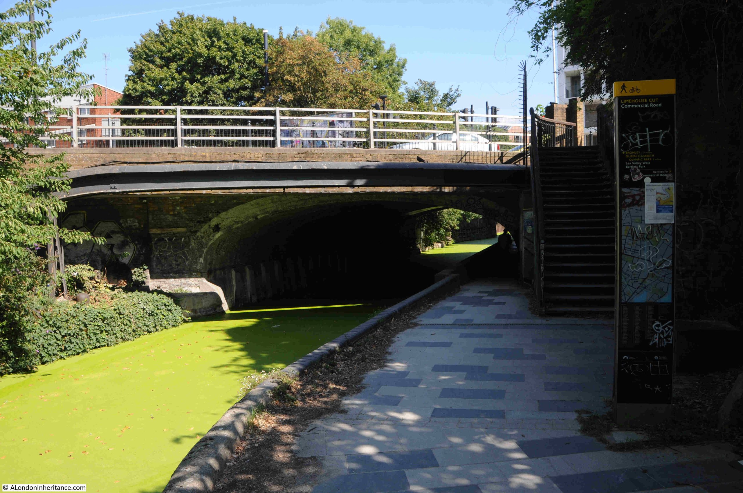
The first road bridge we come to is the bridge that carries the Commercial Road over the Cut:

The Commercial Road was built in the first years of the 19th century to connect the expanding docks to the east of the City, with warehouses, business premises and workers in the City and east London.

The Evening Mail on the 24th of August, 1804 was reporting on the build of the Commercial Road (or Grand Commercial Road as it was first called), and highlighted the Limehouse Cut as being one of the obstructions in Limehouse: “At a short distance before it arrives at Limehouse church, the direct communication is impeded; but to prevent, as much as public convenience could admit, any variation, the bridge of the Limehouse Cut is considerably enlarged”.

Although the bridge was enlarged, the Limehouse Cut still narrows as it passes under the bridge.

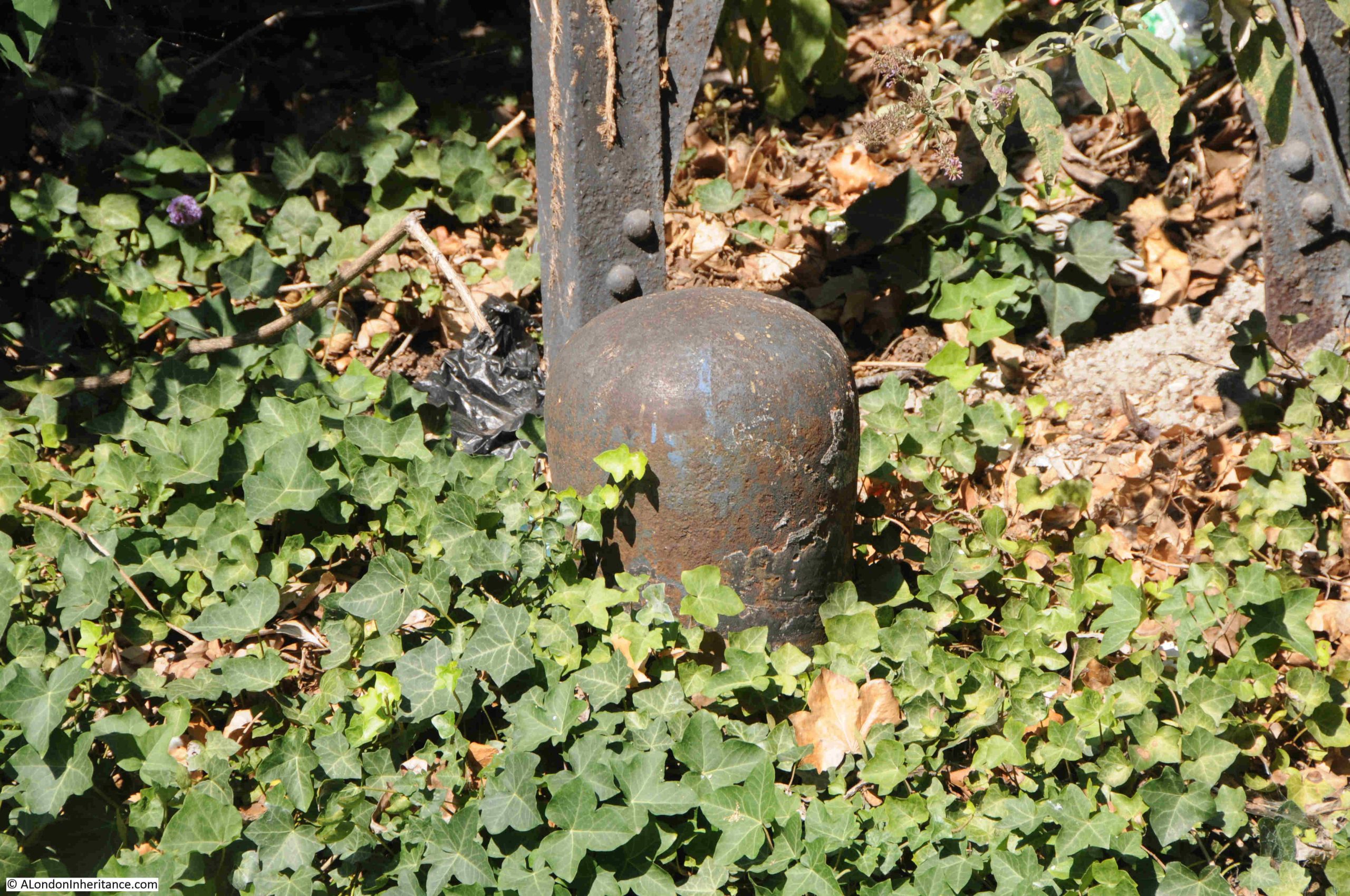
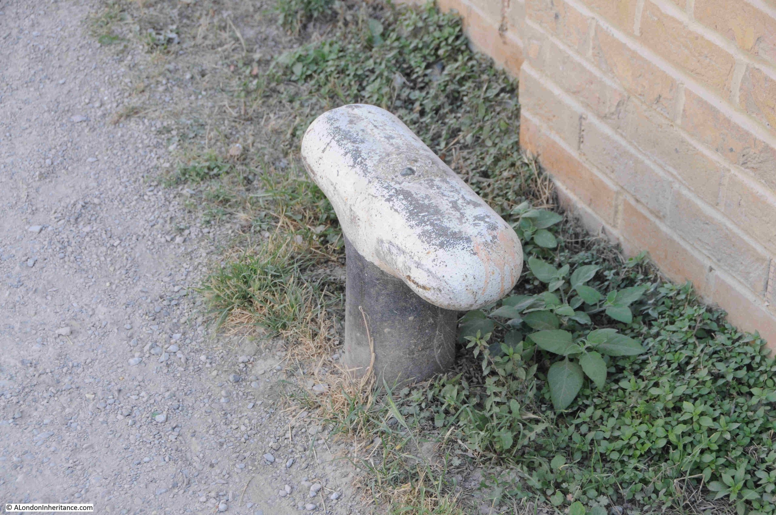
Along the route there are reminders of the heritage of the Cut, with features once used for mooring ropes:

Passing under the Commercial Road Bridge, and this is the view looking north:

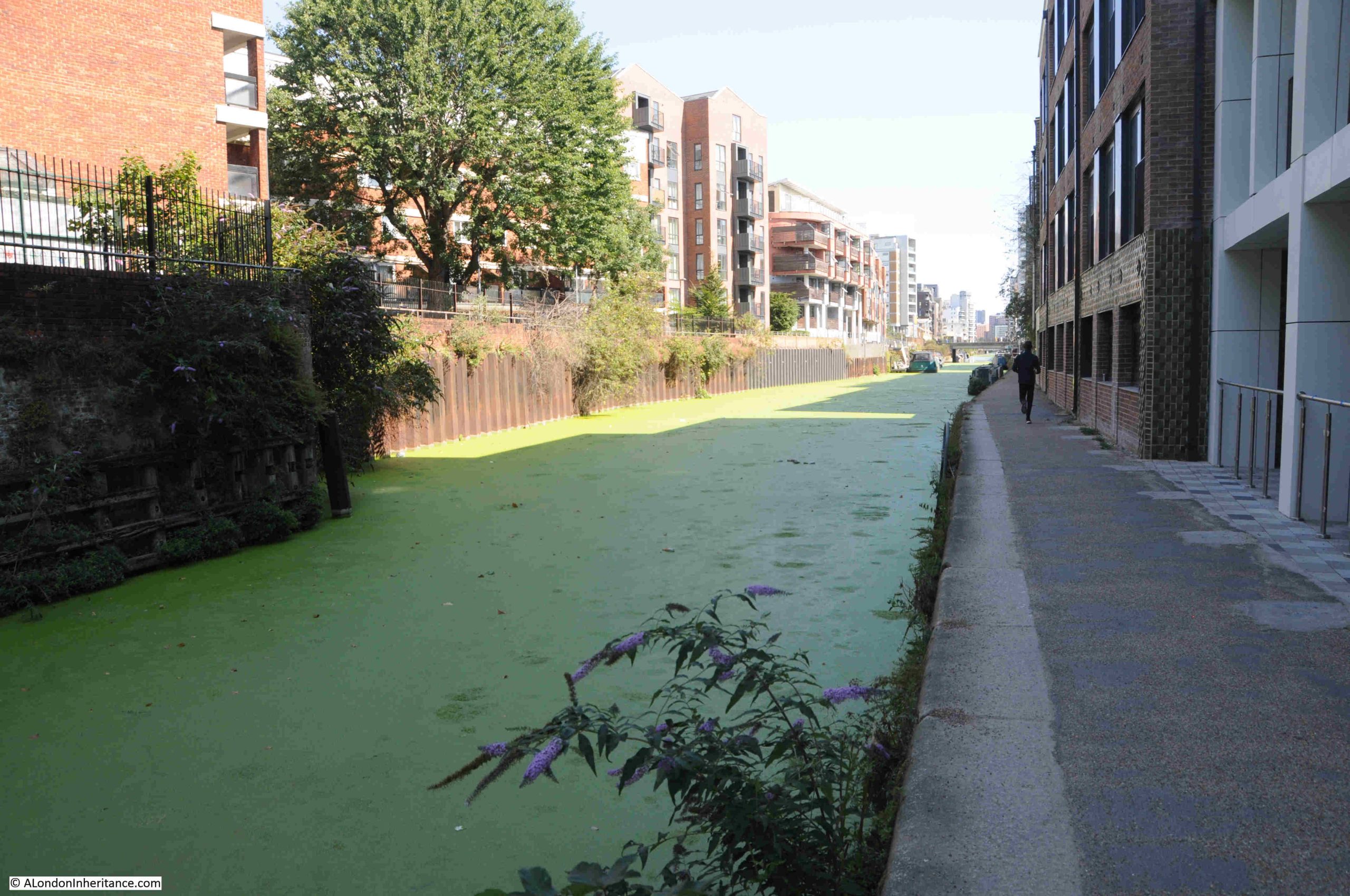
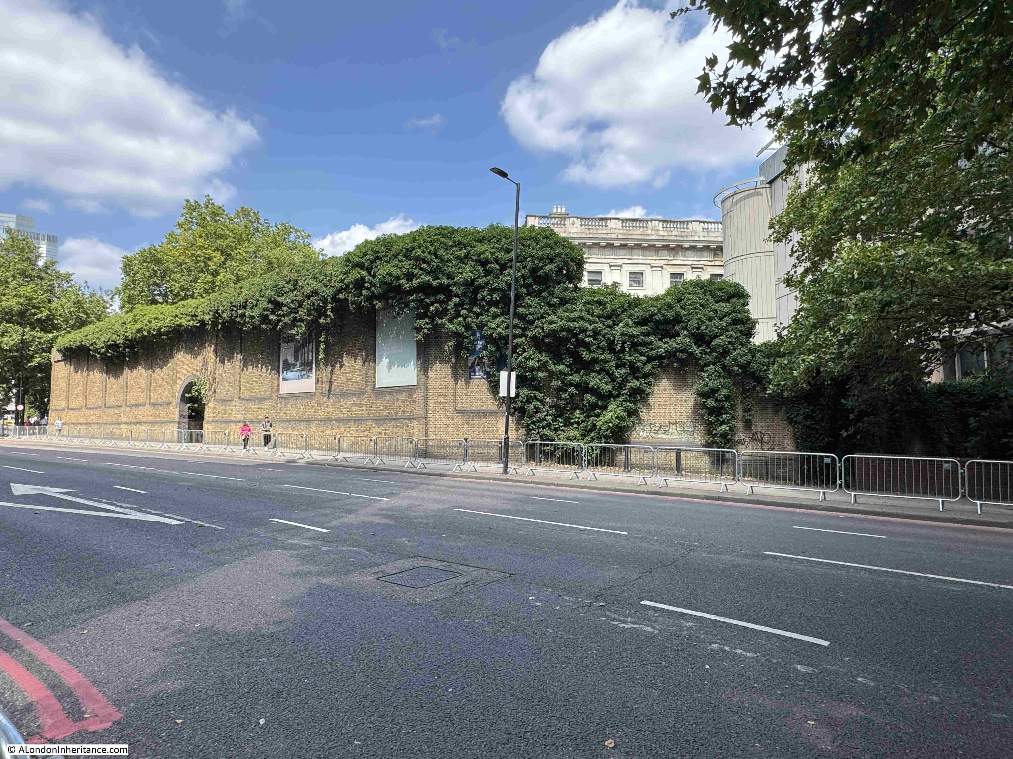
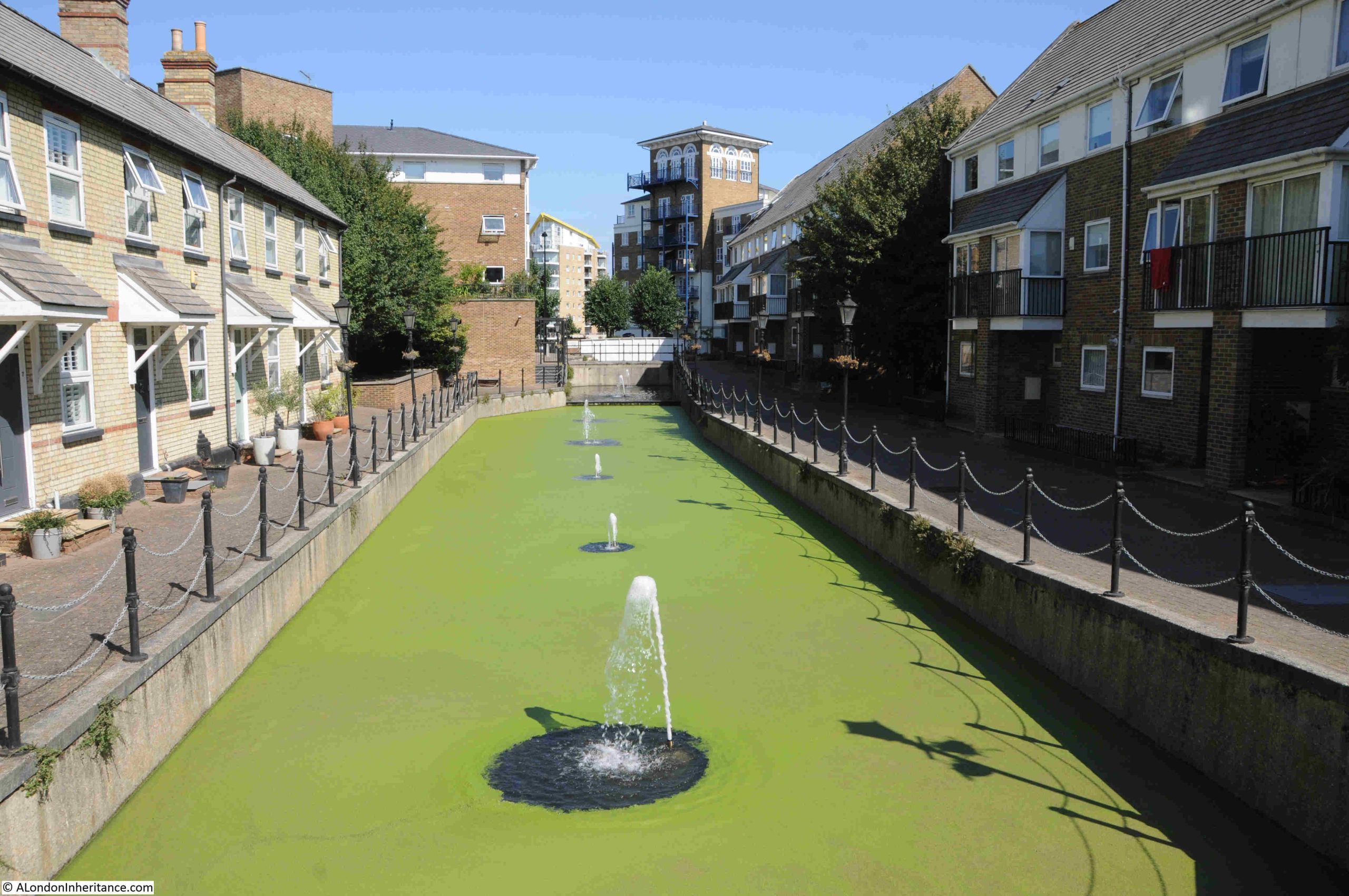
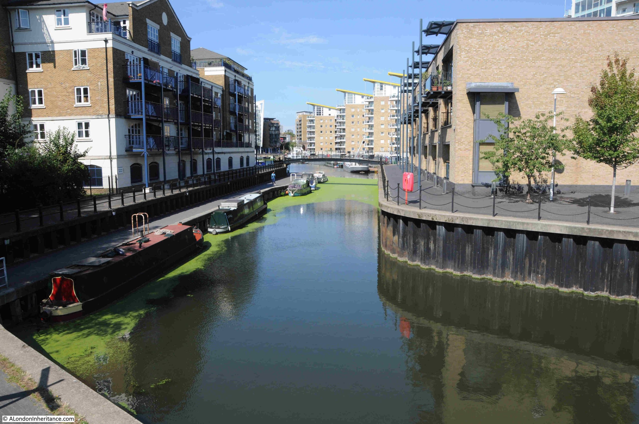
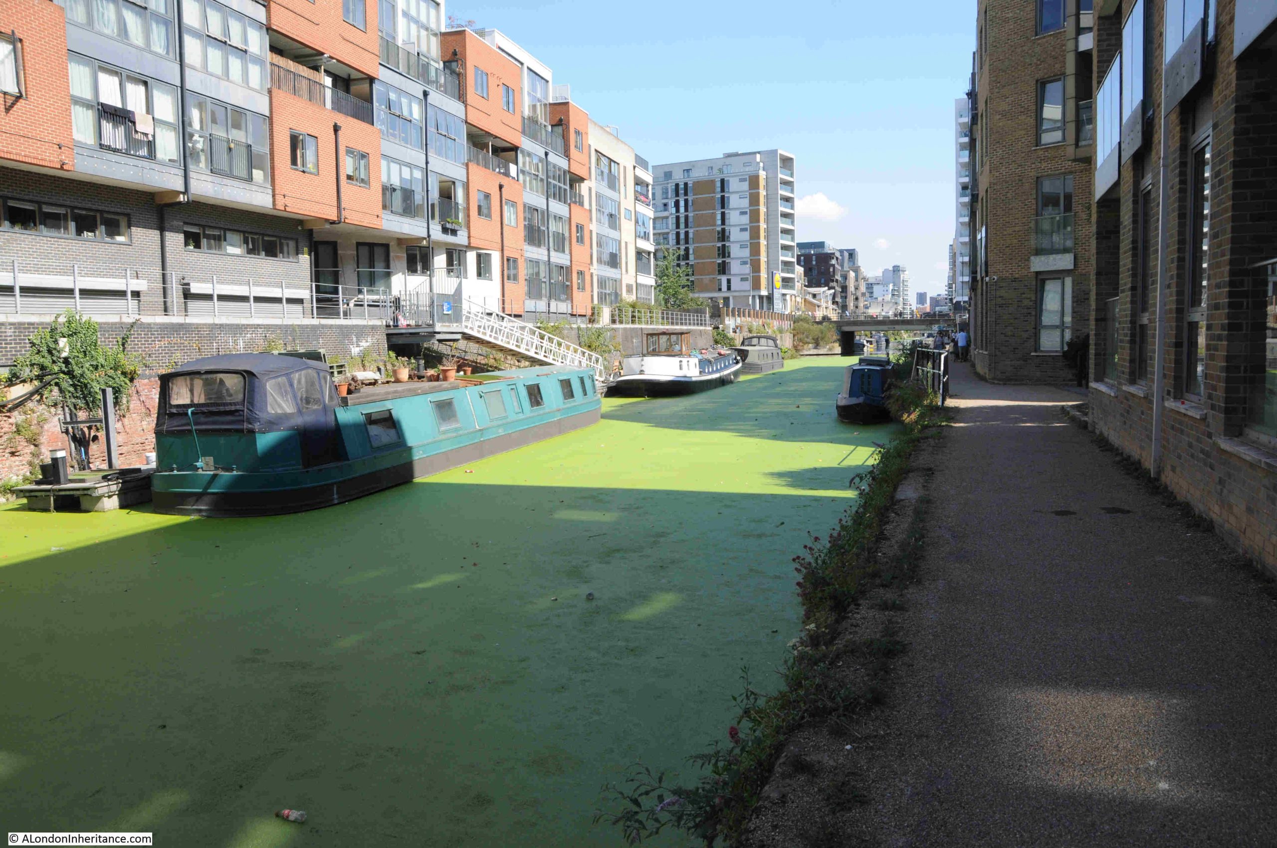
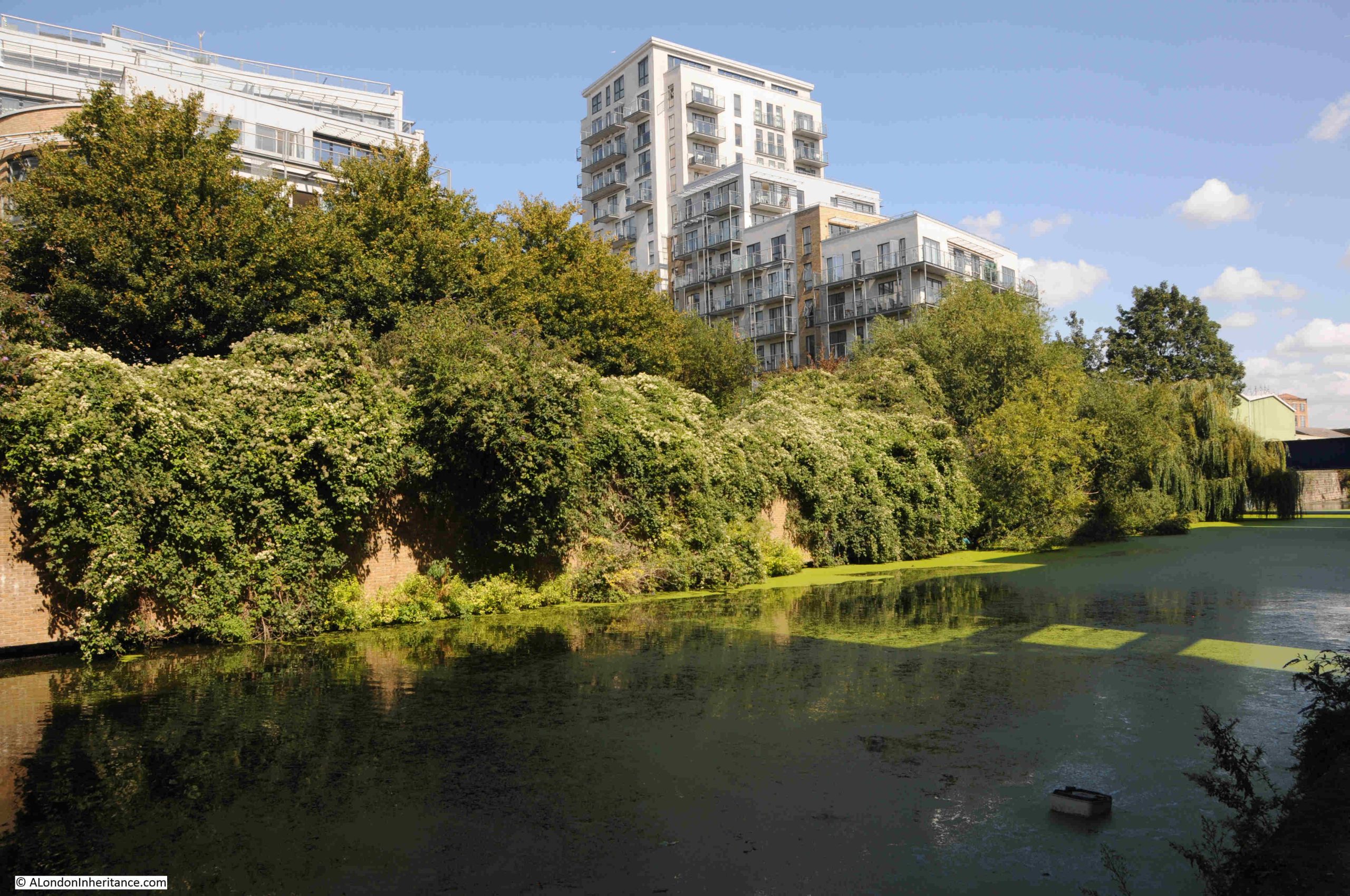
Much of the Limehouse Cut as well as the Limehouse Basin was covered in green weed growth, possibly a result of the hot summer:

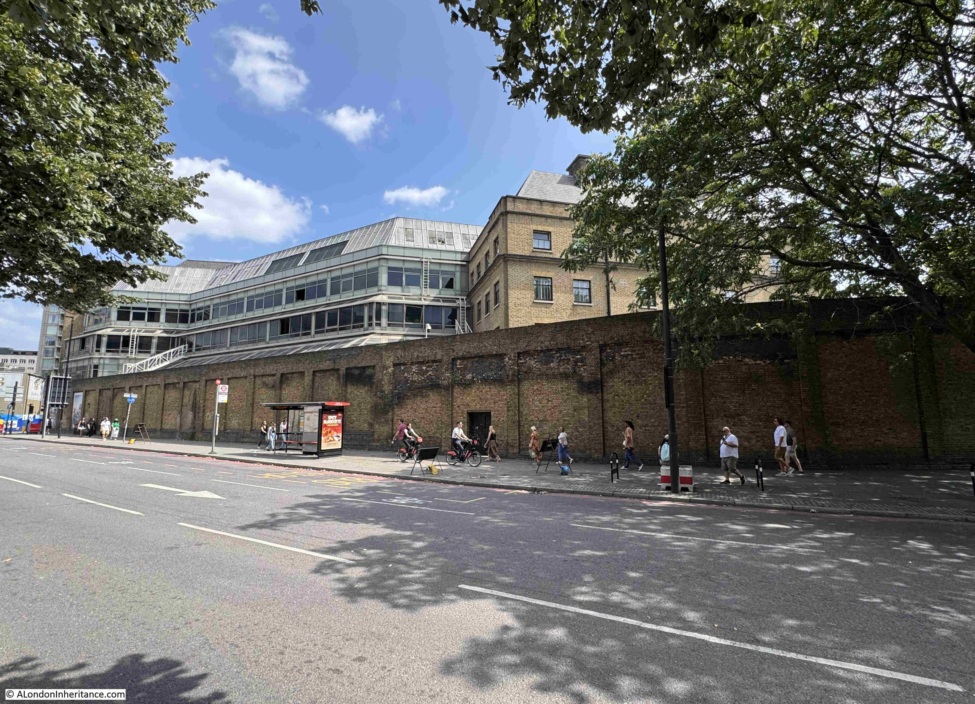
The majority of the land along the side of the Limehouse Cut has been converted to either new apartment buildings, or renovation of earlier buildings into apartments.

Very little examples of the old industries that once lined the Limehouse Cut remain, in the following photo is an example of part of the industrial heritage of the area:

In the late 19th century, the space in the above photo was occupied by a disinfectant factory. I do not know if the buildings and chimney we see today are part of that business, or from the early 20th century.

I have been trying to build a list of all the businesses that once operated along the Limehouse Cut, but it is one of many projects that is taking time to complete and is only partly done.

Looking to the right of the above photo, and we see the bridge carrying Burdett Road over the Cut. A Lidl is on the left, on space once occupied by a lead works:

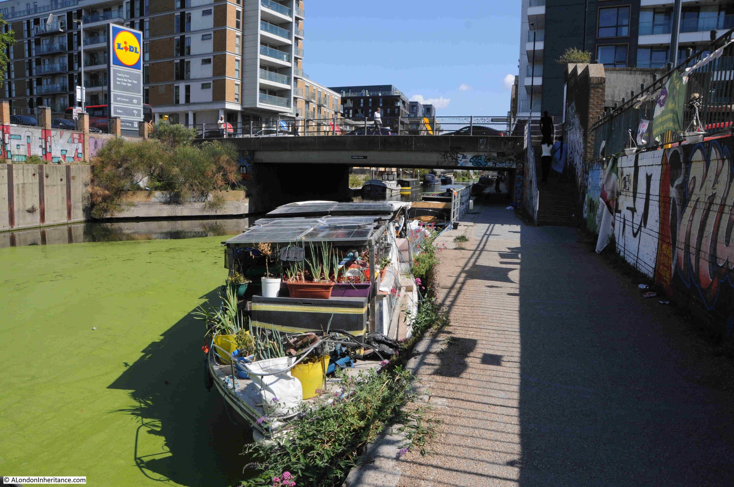
Passing under the Burdett Road bridge, and the Limehouse Cut carries on to the north. Walking the Cut highlights just how straight the route taken for the construction was, although the empty fields on either side have long gone.

To walk the Limehouse Cut, the eastern side of the Cut is the best route to take, this provides a continuous walkway from the Limehouse Basin, all the way up to where the Cut joins the River Lea.

The eastern side is marked “towing path” on OS maps, so this was the continuous pathway alongside of the Cut so horses and men could pull barges along the length of the Cut.

It is possible to walk parts of the western side of the Cut, however much of this route is built up to the edge of the water.

Along the footpath, there are more reminders of the heritage of the Cut:

Somewhere to stand and look out over the Cut:

Walking further along the Limehouse Cut, and there is a bit more industry along the western edge. Not the dirty, manufacturing businesses that once occupied the space rather light industrial, storage and distribution etc.

A short distance along and there is a short indent to the Cut named Abbott’s Wharf:

There was an Abbott’s Wharf to the left, however checking the OS maps for 1914 and 1951, and there is no indent at this position. There was an Abbott’s Wharf as a set of large buildings to the left, but the OS maps show a continuous tow path, without any indent, so this is probably part of the recent redevelopment of the area as a new apartment block to the right of the wharf is named Abbott’s Wharf.

A short distance along is the bridge that carries Bow Common Lane (to the west) and Upper North Street (to the east), across the Limehouse Cut:

The Limehouse Cut, along with the Regent’s Canal, helped the considerable industrial development of the area, and industry took up a considerable length of the sides of the Limehouse Cut.

Much of this was dirty, polluting industry, although there were places such as biscuit factories along the route.

In the 1860s, the rector of St. Anne’s Limehouse wrote that “no bargee who fell in had any chance of surviving his ducking in the filthy water”, such was the polluted state of the water.

Despite this claim in the 1860s, and the considerable range of dirty and polluting industries alongside the Cut, in 1877 the Limehouse Board of Works was claiming that the water was in excellent condition. At a meeting looking into a number of local issues, when talking about fever and smallpox:

“Mr. Peachey stated that fever was prevalent in the neighbourhood of the Limehouse Cut. Mr. Potto said that the disease could not be attributed to the Limehouse Cut for the water there was in excellent condition.”

I am not sure though whether Mr. Potto would have been happy to swim in the Cut despite his claim.

The bridge shown in the above photo was a notorious place for the appalling smell from adjacent industries and the bridge acquired the name of Stinkhouse bridge.

Stinkhouse Bridge was mentioned in numerous newspaper reports in the 19th century, including one report in 1844 about a fire at a factory complex next to the bridge. The factory was a pitch, tar and naphtha distillery. Naphtha is a distillation of crude oil, gas, or coal-tar.

There were attempts at cleaning up the root cause of the smells, for example, the following is from the East London Observer in November 1878, reporting on a local council meeting, where:

“The Medical Officer of the North District (Mr. Talbot), reported that in consequence of complaints made to him concerning noxious vapours in the vicinity of ‘Stink House Bridge’, he had carried out a series of systematic observations both as to their existence and their causes. The results of his examination, with the assistance of Inspector Raymond, were that the nuisance was traced to some six factories, and in each case a notice had been served by order of the Sanitary Committee, and a communication sent to the Metropolitan Board about the discharge of ammoniacal liquor into the sewers.”

The notices served do not seem to have had too much impact, as complaints continued for many years.

The name Stinkhouse Bridge continued to be in use for many decades. The last written use in either local or national press was in 1950.

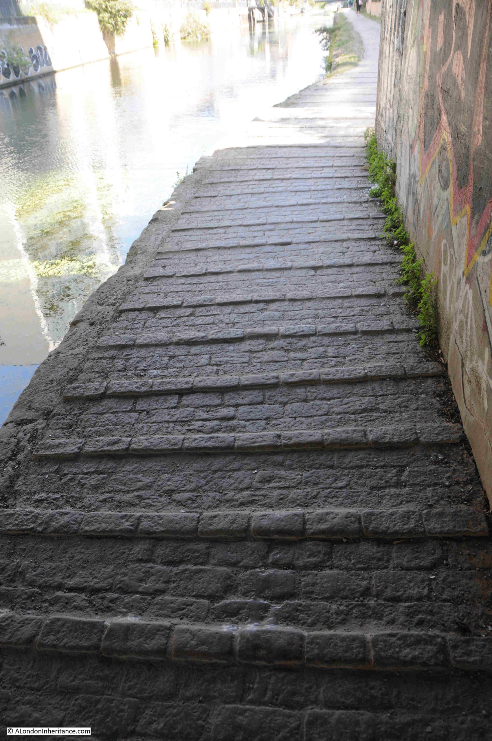
Underneath the bridge, there are raised sets along the towpath. I do not know if they are original, or if they were there to help provide grip for the horses pulling barges along the Cut:

As with the River Thames, the Limehouse Cut was both a playground and a death trap for children.

As industry populated the banks of the Cut, and streets with housing covered the surrounding area, children were drawn to the Cut by the attraction of water, the novelty of the barges both moored and passing along the Cut, and the variety of places to play.

This resulted in the deaths, usually by drowning, of a considerable number of children. Looking through old newspapers, a child’s death is reported almost every year.

For example, two years that are typical:

  • 1936 – A verdict of accidental death was recorded by Dr. R.L. Guthrie at a Shoreditch inquest upon John Brown aged 7, of 72 Coventry Cross Estate, Bow, who was drowned in Limehouse Cut on Saturday
  • 1937 – Dinner Hour Swim which Ended Fatally. A verdict of accidental death was recorded on George Henry Hector, aged 16, employed at Crown Wharf, Thames Street, Limehouse, who was drowned in Limehouse Cut

Fires were frequent along the Limehouse Cut, both in the buildings alongside, and in the barges travelling and moored along the Cut. Buildings were often storing or processing, and barges were transporting, highly inflammable goods.

One such example is from 1935, as reported in the following article;

“Frederick Carpenter, aged 15, of Provident Buildings, Limehouse, played a valuable part in assisting to prevent the spread of an outbreak of fire which involved three barges lying in Limehouse Cut, near Burdett Road, Limehouse.

Several craft were stationed close together, and Carpenter leapt through flames and smoke to loosen moorings so that those which were on fire might be separated from the rest. A crowd on onlookers helped to drag other barges out of the danger area. Of the barges which caught fire two were laden with timber and one with bales of sacks.

Firemen fought for more that an hour to extinguish the blaze.”

The Limehouse Cut is a very different place today:

In the above photo, the Limehouse Cut appears reasonably wide. It does narrow where it passes under bridges, but for much of its length, it is wide enough for barges to be moored either side, and a couple of barges to pass in the centre. This was not how the Cut was originally built.

When the Limehouse Cut was opened in 1770, it was only wide enough to carry a Lea Barge with a standard beam (width) of 13 foot. Very quickly this became a significant problem with the number of barges attempting to travel both ways along the Cut.

A couple of years after opening, passing places started to be built along the length of the Cut, but this was a very limited solution, and to support the expected rapid increase in use of the Cut, in 1773 it was decided that the whole length of the Cut should be widened to allow barges to pass in both direction.

It took some time to widen a working canal, but by 1807 the majority of the Limehouse Cut had been widened to 55 feet. The challenge was with the bridges, and as can still be seen today at a couple of the bridges, the Cut narrows to pass underneath the bridge.

The Limehouse Cut continues to be lined with a much smaller number of barges than when the Cut was in use as a route between the River Lea and the Thames, and the majority today appear to be residential:

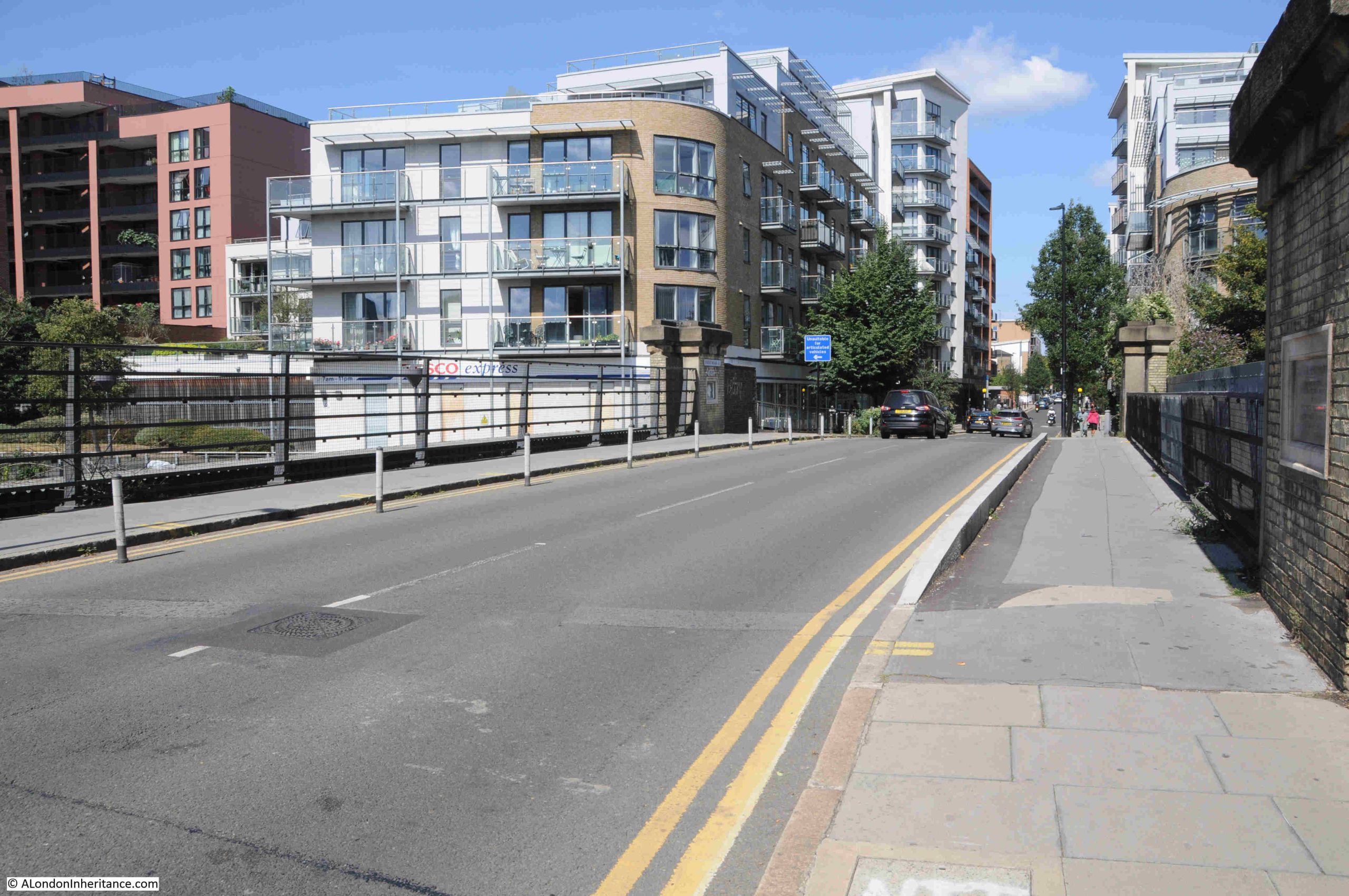
The following bridge carries Morris Road (to the south east) and Violet Road (to the north west), over the Limehouse Cut:

There are a range of interesting features here, and it is worth walking up to the bridge to take a look.

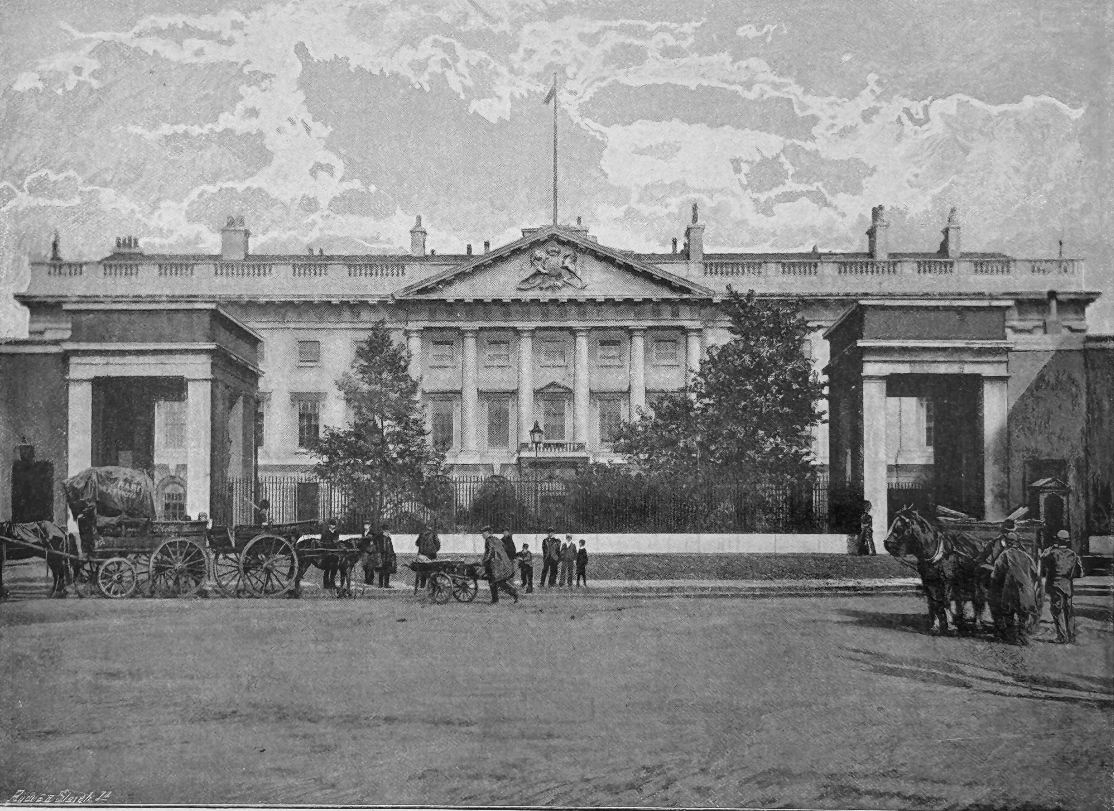
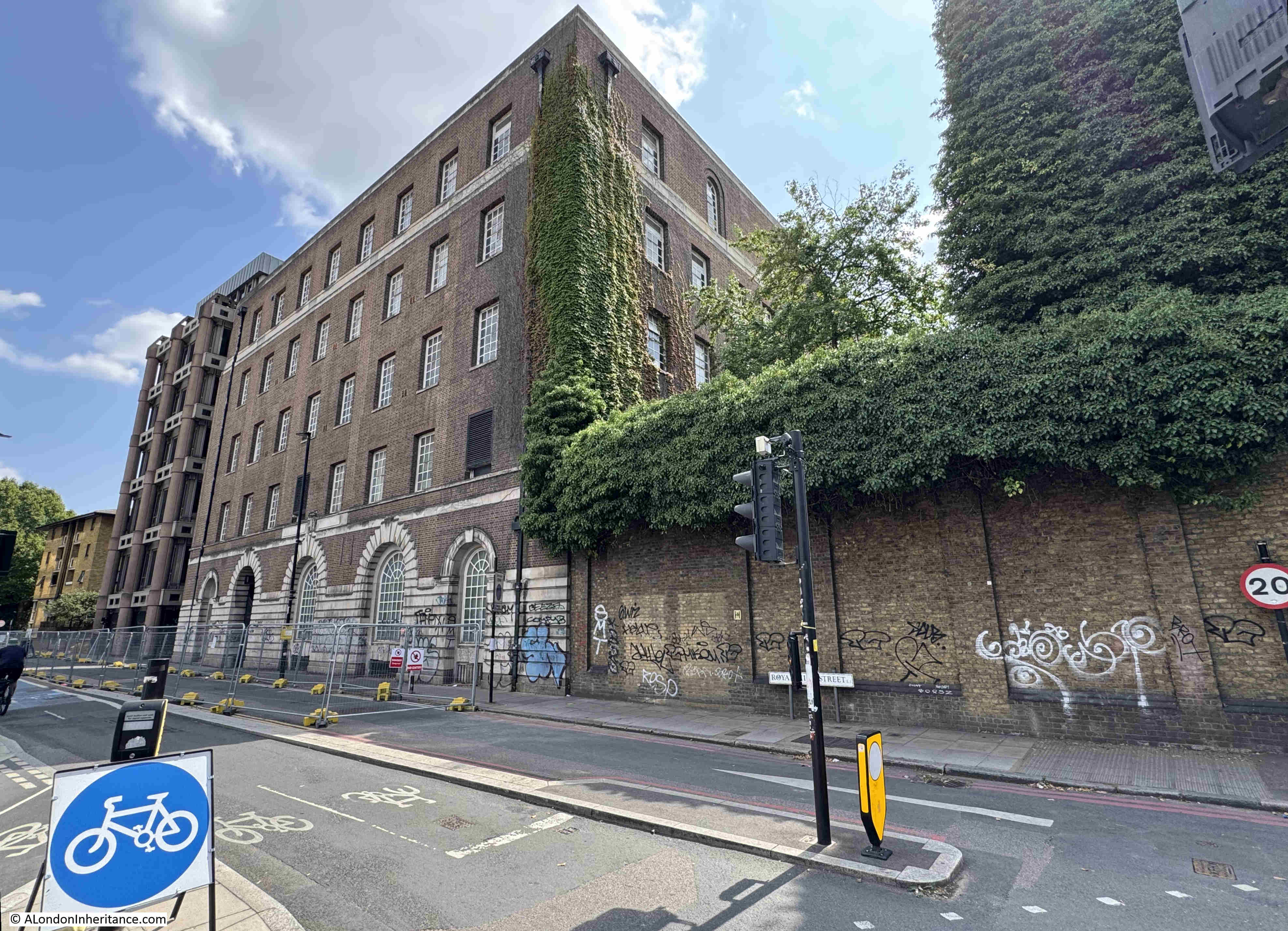
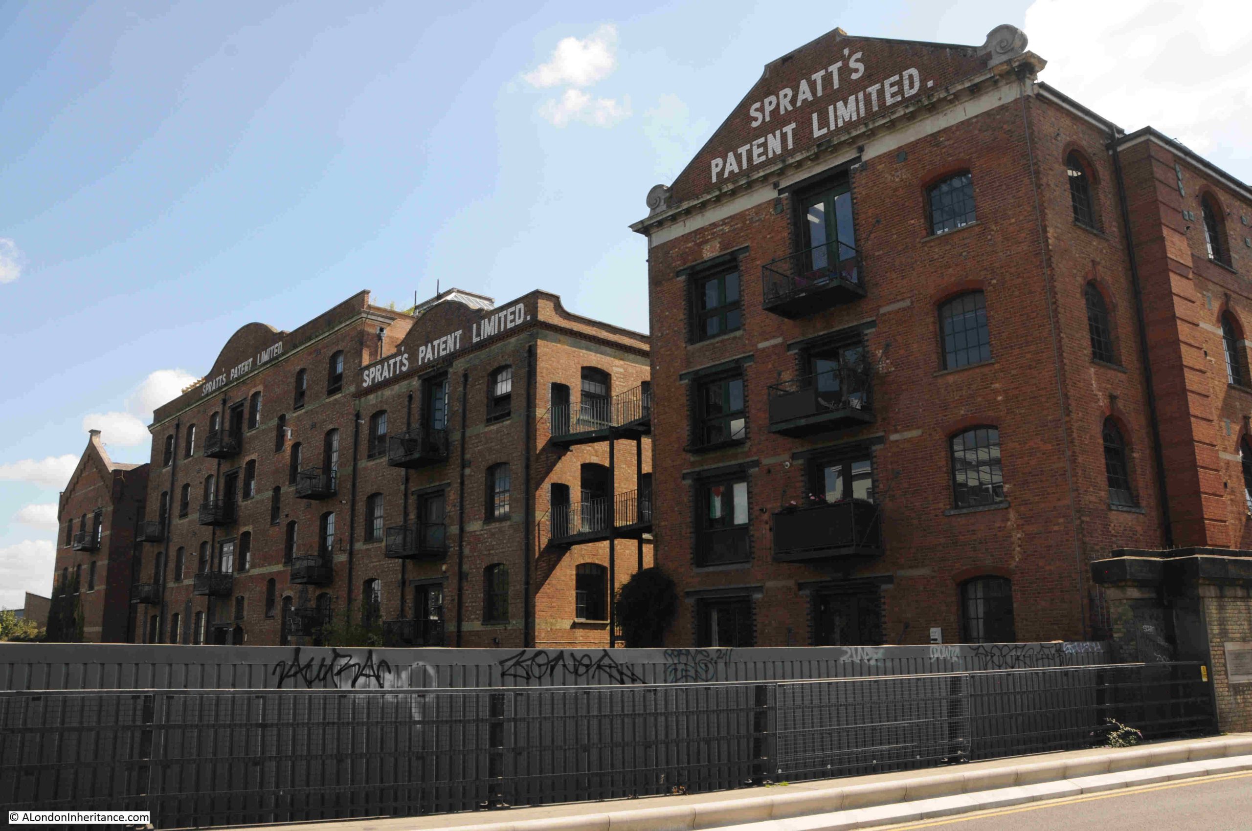
Firstly, along the eastern side of the Limehouse Cut is Spratt’s Patent Limited factory, a manufacturer of foods for a wide range of domestic animals, probably best known for their dog foods:

In 1910, Pratt’s Patent were supporting the Cruft’s dog shows, where they were described as “the universal providers to the dog, poultry and caged bird fraternities”.

At a 1910 Kennel Club show at Crystal Palace, Spratt’s Patent provided the food for 3,346 dogs.

Spratt’s Patent was founded by James Spratt, an American electrician who arrived in the UK in the 1850s intending to manufacture and sell lightning conductors.

The story behind the animal foods business is that in east London he saw dogs eating the hard biscuits left from the ships docked in the area. He patented a new dog food which was made by baking wheat-meal which had been mixed with rendered meat and vegetables. 

Whether it was coincidence or not, Charles Cruft, the founder of Cruft’s Dog Shows started off as an employee of Spratt’s Patent, and when Cruft went on to run the dog shows, Spratt’s became a key supplier.

For many years, the company was the largest manufacturer of dog food and dog biscuits in the world, and supplied not just domestic demand, but also the US and Europe, along with exports to many other countries.

They also had premises in Bermondsey and Barking. Their address in Bermondsey was used for advertising featuring Dog Medicines, Poultry Houses, Appliances and Medicines, and via Bermondsey, dog owners could also entrust Spratt’s Patent with their dogs whilst they were on holiday. The dogs were transferred to Mitcham, as in the following from the Kilburn Times in July 1891:

“PETS IN HOLIDAY TIME – our readers, before leaving for their holidays , might entrust their canine friends as boarders to Spratt’s Patent Dog Sanitorium, which is on a healthy site near Mitcham. The kennels are large and spacious, the dogs are groomed and exercised for several hours daily, and are not caged or chained. Write Spratt’s Patent Limited, Bermondsey for all particulars.”

Today the building is mainly residential.

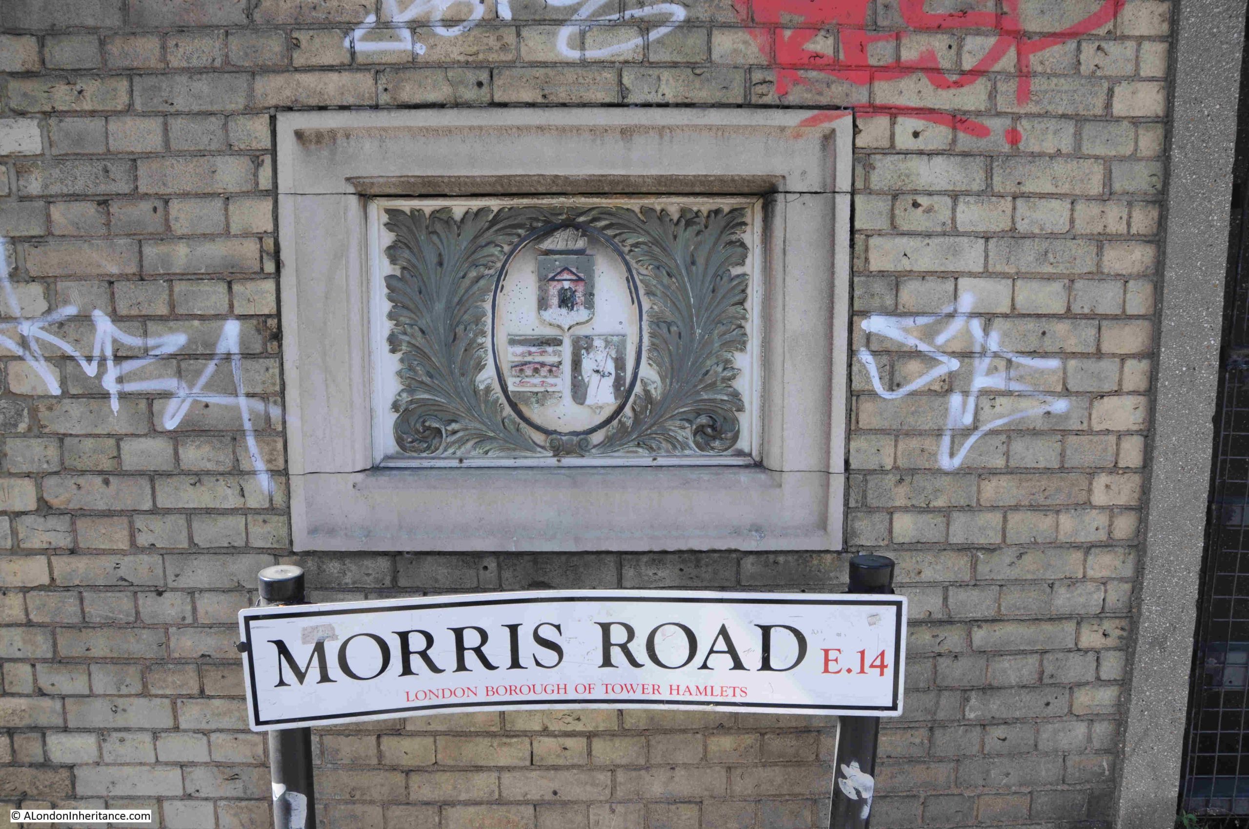
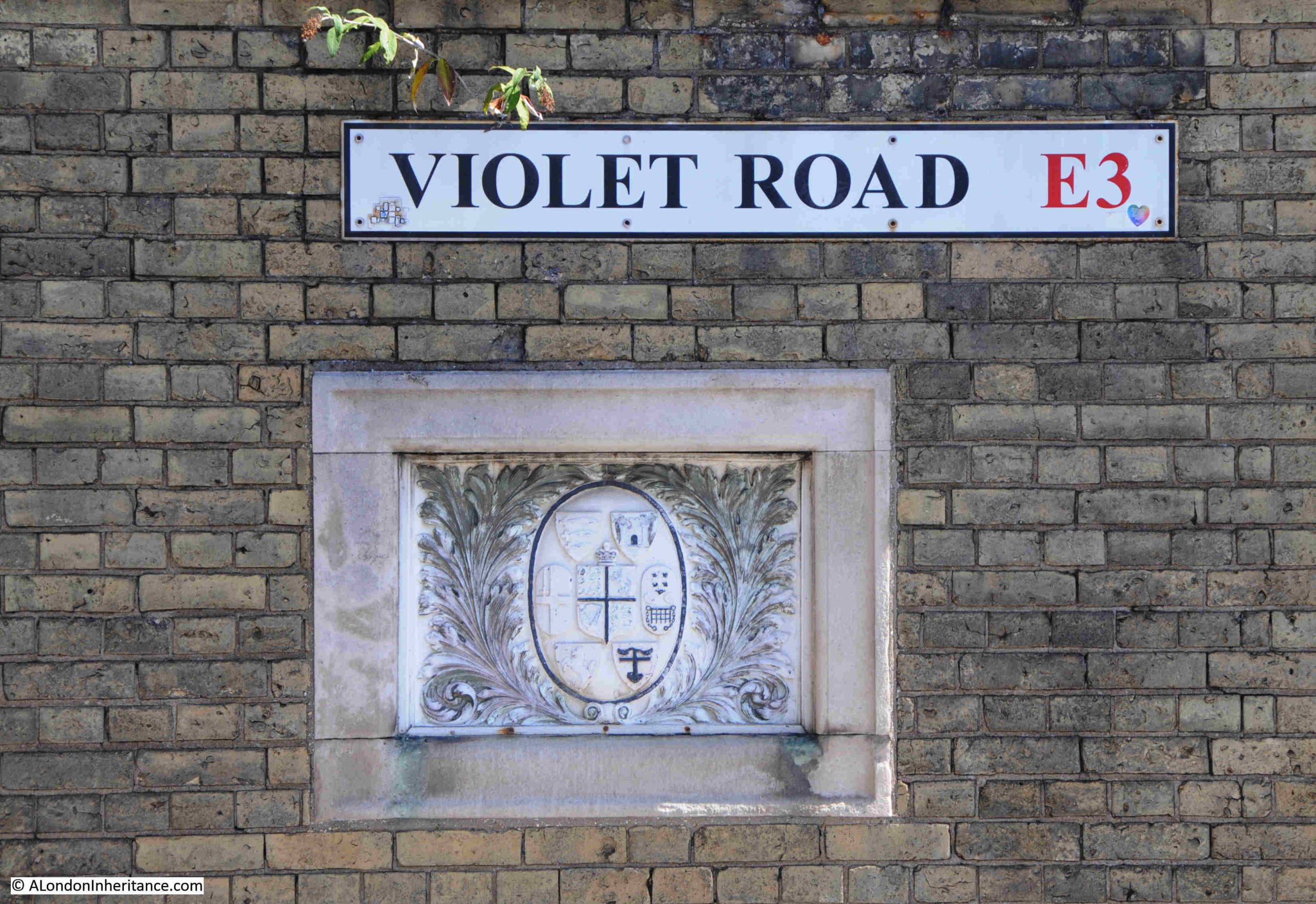
The bridge carrying Morris and Violet Roads over the Limehouse Cut has a new deck, however at the four corners of the bridge, the brick pillars survive:

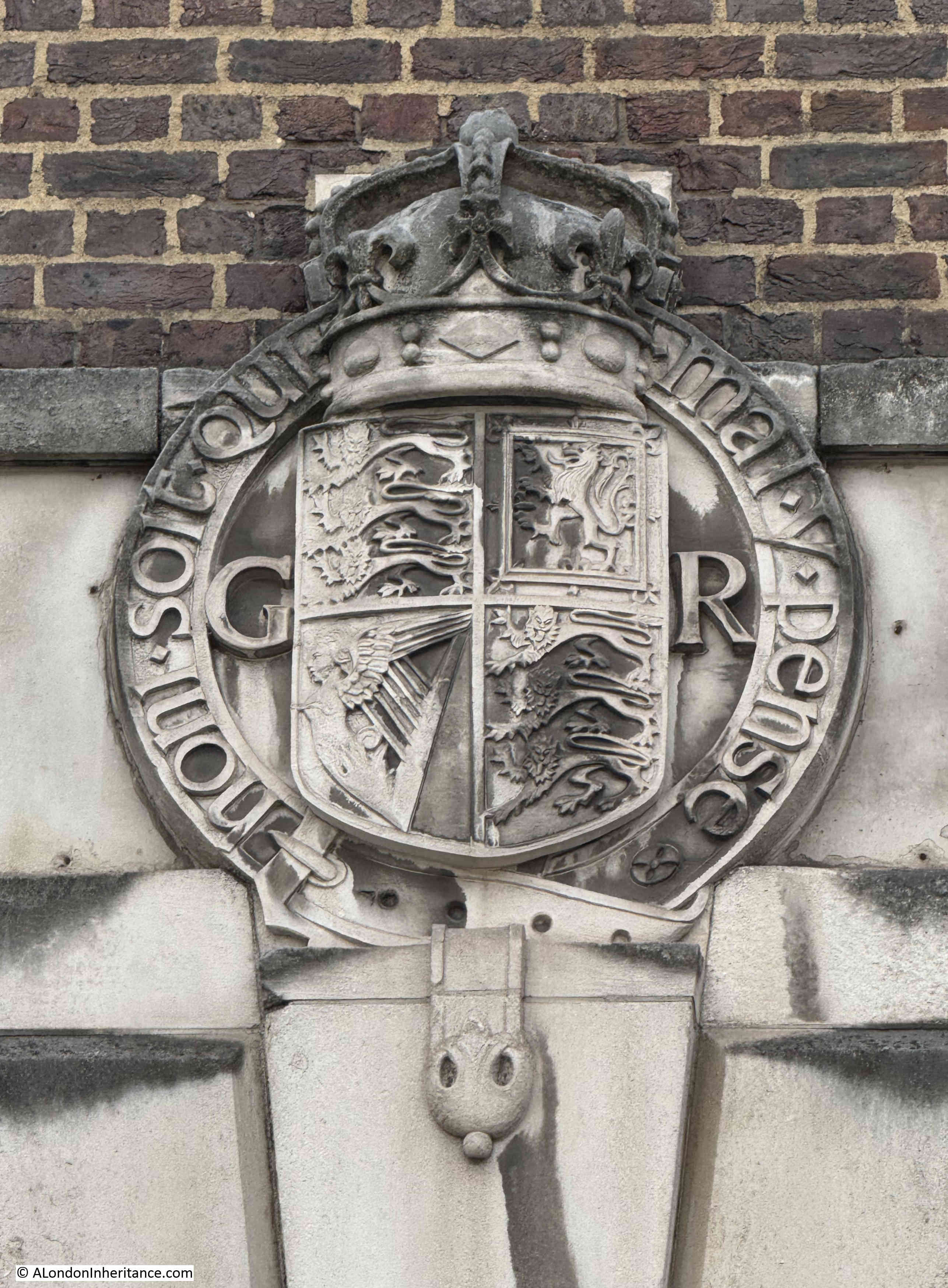
On one pillar is a plaque that tells that the bridge was built by the Board of Works for the Poplar District, and that it was opened on the 19th of May, 1890.

On the other three pillars there are coats of arms. These seem to be arms of many of the boroughs in London that may have some involvement with the Limehouse Cut.

In the following, the arms of the City of London are on the left, not sure about the arms on the right:

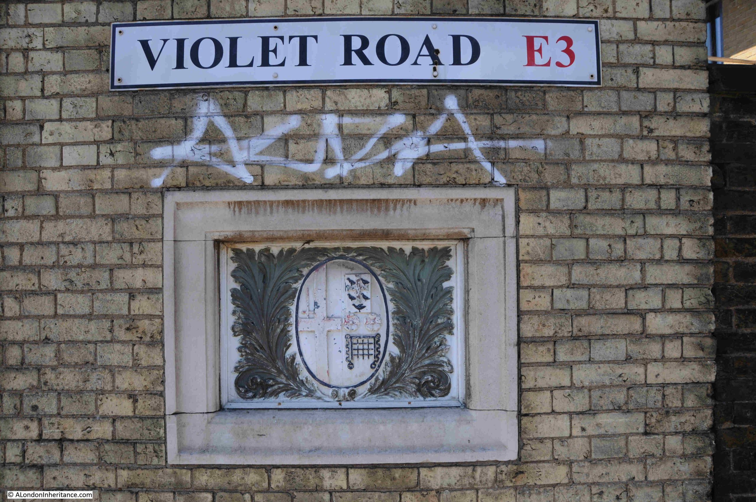
Morris Road is the eastern side of the bridge, towards Poplar, and the arms on this side of the bridge are those of old Poplar Borough Council:

And the third pillar has a collection of arms, which I need to research:

Back down alongside the Limehouse Cut, and the banks along the western side look almost as if they are lining a country canal.

In the next post, I will complete the walk, and reach where the Limehouse Cut meets the River Lea, the Bow Locks, and take a quick look at the Bromley by Bow Gas Works and Three Mills Island.

alondoninheritance.com

Two New Walks – The Strand, Thames Foreshore and Woolwich to the Royal Docks

It has taken me some time, however I have finally organised some new walks. Two walks that are very different, but both exploring some fascinating London history, with the second walk exploring an area you may not have visited before, and includes a crossing of the Thames on the Woolwich free ferry.

Details for these two new walks are as follows, and all proceeds from my walks cover both the costs of the walk, and the costs of hosting the blog, so your support is much appreciated.

From the Strand to the Old Thames Shoreline – The Transformation of Grand Estates to the Alleys and Lanes of Today

The Strand forms part of an historic route between the City of London and Westminster, and ran along reasonably high, dry ground along the edge of the Thames. The land down from the Strand once formed the northern edge of the river, an edge which has been continuously pushed back, with the 1860s / early 1870s build of the Embankment separating the old shoreline from the river for good.

The area from the Strand to the old Thames Shoreline has been home to the palaces and grounds that belonged to the nobility of the country, one of which can be traced back to the 13th century, and is still marked today, with part of the original estate owned by the King.

There have been grand palaces and gardens, water gates and Thames stairs, slums, poverty, 18th century grand houses and the “Hospital of Henry late King of England of the Savoy”. The land down from the Strand has been threaded with streams, alleys, vaults and tunnels.

Lasting around two hours, this walk will start at Embankment underground station and end at Temple underground station, this walk will explore the area as it is today and find what remains of the long history of this unique place, as well as the people who lived, sheltered and worked here and made this long-lost foreshore to the Thames part of London’s long history.

The walk lasts about 2 hours and meets at Embankment underground station. Final meeting point details will be emailed in the week prior to the walk. Please get in contact if not received.

Click here for dates and booking.

In the Steps of a Woolwich Dock Worker – From the Woolwich Ferry to the Royal Docks

“The appearance of the electric lights at the new docks, seen from any eminence where a full view of the whole sweep can be obtained, is on a clear night very striking and beautiful, especially if a position is chosen from which any of the brilliant sparks are seen reflected in the river. In another sense beyond pleasure to the eye, they are beacons of satisfaction to the people of Woolwich, for they typify better days in store, increase in trade, and reduction of local burdens.”

This was how the Kentish Independent on the 16th of October 1880 described the view from Woolwich following the start of the electrification of the Royal Docks.

It must have been a stunning sight, and the new docks, the largest in the world when completed, were a major source of employment for the inhabitants of Woolwich.

In this walk, we will follow a dockyard worker from Woolwich, cross the river by the Free Ferry, and then explore the history of the Royal Docks, starting with the King George V, then the Royal Albert, and finishing with the Royal Victoria.

Although the docks closed in 1981, we can still see the sheer scale of what was the largest dock complex in the world, by the size of the body of water where ships once arrived and departed, loaded and unloaded travelling across the world to and from London, carrying all manner of goods.

On this walk, we will explore the Free Ferry, the Thames foot tunnel, (a look at the entrances, rather than walk the tunnel – the lifts are usually out of order), the old North Woolwich Station and Pier, Pleasure Gardens, Royal Victoria Gardens, King George V Lock and Dock, the Dock pumping station that still keeps the docks full today, the Royal Albert Dock, London City Airport, some of the impressive buildings that survive from the Royal Docks working life, and how the docks have been, and continue to be redeveloped.

Click here for dates and booking.

Crossing the Thames on the Woolwich ferry, with the Thames Barrier and the Isle of Dogs in the background. The ferry dances around the second ferry as they both cross the river at the same time. The ferry forms part of the walk.

Please note the following about the Royal Docks walk:

  • I will send an email in the week before the walk with final meeting point details. If you do not receive, please get in contact.
  • The walk starts from in front of Woolwich Station on the Elizabeth Line
  • The walk crosses the river using the Woolwich Free Ferry
  • This walk is around 3 hours long and roughly 3 miles in distance
  • The walk finishes at the Royal Albert DLR Station
  • There are two optional extensions, firstly to look at the Queen Victoria Dock and then continuing to London City Airport where there is also a DLR station

If there is sufficient demand, I will be adding more dates, so please check Eventbrite if the current dates do not work for you.

I look forward to seeing you on a walk.

alondoninheritance.com

The Royal Mint – A Controversial Transformation

Thanks for the feedback to last week’s post where I had used plaque rather than plague. I think I was being a bit too quick with a spelling check. All hopefully now corrected.

I do not usually cover topical issues in the blog, however today’s post looks at a site which could well have a controversial transformation in the coming years, as well as a bit of the history of the site.

This is the tree hidden view of the old Royal Mint building, looking across East Smithfield:

The 1890s book “The Queen’s London” has a much clearer view of the building. I assume the two trees we see in the following image will grow into the two we see today:

The story of the Royal Mint goes back many centuries, and for much of the time, the Royal Mint in London was based within the Tower of London. A suitably secure place for the minting of the nation’s coinage.

By the end of the 18th century, steam power was taking over many industrial processes, and with the country’s growing international commerce, much of it based around the London Docks, the demand for coinage was growing.

The Tower of London was far too small a site to accommodate the new steam technology that could be used for the manufacture of growing amounts of coinage.

In 1798, King George III appointed a committee of the Privy Council to look into the future of the Royal Mint and the committee decided that a new location and building was required. 

The site would, ideally, still be within central London and close to the Tower of London, and also where a sizeable amount of land was available.

One such location was just to the north east of the Tower of London, a site which consisted mainly of a Royal Navy Victualling Yard, along with a number of small side streets, courts, workshops and housing.

I have marked the area which would become the site of the Royal Mint on the following extract from Rocque’s 1746 map of London, where it can be seen that the Victualling Yard occupied a large amount of the future space of the Royal Mint. The map also shows the size of the future site compared to the Tower of London, the Mint’s original home where only a proportion of the space was available to the Mint:

It took a while to clear the site, plan the new Mint and complete the build, and it was finally complete in 1809, with the Royal Mint moving out of the Tower of London, where it had been since 1279 when a small Mint was first established within the secure walls of the Tower.

The new building was the work of surveyor James Johnson along with his successor Robert Smirke.

The new Royal Mint building, twenty one years after completion, drawn in 1830 © The Trustees of the British Museum. Shared under a Creative Commons Attribution-NonCommercial-ShareAlike 4.0 International (CC BY-NC-SA 4.0) licence.):

The main Royal Mint building is Grade II* listed, the white entrance arches and lodge to either side are Grade II listed.

The early 19th century building is the main visible part of the complex (only just visible between the trees), and there is far more to the site as it expanded and adapted to post Royal Mint use over the years.

Looking through the railings, we can get a slightly better view:

I have a bit of a thing about the placement of some trees in London. Whilst I certainly believe that many more trees are needed across the city, there are some where they obscure the original view intended by the architects of a building. The Royal Mint building is a prime example, another is the Royal Festival Hall where the trees on the walkway in front of the building obscure the view of the Royal Festival Hall from across the river (see this post).

The Royal Mint was at Tower Hill until the Mint started to move out of the Tower Hill location in the late 1960s. Production of new decimal coinage along with a growing business producing coinage for other countries required a larger site, and in 1968, Queen Elizabeth II opened the new Royal Mint works at Llantrisant, South Wales, and the last coin was produced at Tower Hill in 1975.

Not everyone was happy to see the Royal Mint leave London, for example an H.J. Arlett of Peckham wrote to the London Evening News on the 1st of September, 1967:

“The business of producing coinage by the Royal Mint has now expanded to such an extent that it is proposed to move to a larger site in Glamorganshire. Why?

Why not keep this Chief Department appropriately enough in our Capital City? Subsidiary departments can always be opened in other areas should the need arise. Why should the defacement of this interesting capital of ours be allowed to continue and prove to the detriment of overseas visitors and our places of interest.

Which of our landmarks will be next, the Bank of England, the Royal Exchange, the Mansion House? How long before the Tower of London becomes another tower of Blackpool.

Let us keep our capital a centre of interest, not just blocks of offices.”

Questions about London’s purpose and future have probably been asked for as long as London has been the Capital City of the country.

Since the Royal Mint left the building, it has had a number of uses, including office space and I remember that a number of tech start-ups were based there in the late 1990s early 2000.

The controversial transformation I alluded to at the start of the post is the future use of the old Royal Mint site, with China planning that the whole site will become their new Embassy complex, having purchased the site in 2018 for £255 million.

The site is a considerable size of 2.10 hectares or over 5 acres. It comprises the original building that faces on to Tower Hill, as well as a complex of 1980s buildings onwards that were built around the site as it was used for office space. There is also the Grade II listed Seaman’s Registry, designed by James Johnson and built in 1805 as staff accommodation for the Royal Mint.

The site also contains some preserved remains of a Cistercian Abbey, the St. Mary of Graces monastery which date from the 14th century (which also illustrates how many religious establishments there once were in London, as just to the south, where St. Katherine Dock is now located, was the St. Katherine Hospital and Church, founded in the 12th century by Matilda, Countess of Boulogne, the wife of King Stephen who reigned from 1135 to 1154).

There is also a 14th century Black Death burial ground, many other archaeological remains as well as remains from the Royal Navy Victualling yard which occupied the site prior to the Royal Mint.

The overall scope of the site is shown in the map below where I have marked the planning application boundaries with the red line. The square indentation along the northern boundary is a BT telephone exchange. When three letter codes were used as part of the telephone number, this exchange was ROY for ROYal, due to the exchange’s location next to the Royal Mint.

The telephone exchange is apparently due to cease all operations in 2033 and to be empty the same year. Its future use will be interesting given the location of the building as being almost part of the proposed Chinese Embassy estate:

To add to the importance of the site, it is within the Tower of London Conservation Area and is also
within the boundary of the Tower of London UNESCO World Heritage Site.

The proposed embassy would not only be the largest embassy complex in the UK, but would also be China’s largest embassy in Europe, as well as being around 20% larger than their embassy in the US.

The proposed plans for the embassy complex include some very limited public access, as well as a small area for historical information and interpretation displays and exhibits.

The planning application has been turned down by Tower Hamlets Council, and the current status is that the application has been called in by the Government and is now under review by Angela Ryaner who oversees planning matters in her role as housing secretary.

The latest from early August is that Angela Raynor has asked the Chinese to explain why parts of the building plans are greyed out and marked “redacted for security reasons”.

The Grade II listed entrance arch and lodge:

There are very valid views on whether the site should be used as an embassy for China, and also why China needs such a large complex for their London embassy, but I also think that the future use of the building shows the lack of ambition (and money) that we have as a country, for the use and redevelopment of such an important site, at a very key location.

The clustering effect of the Tower of London, Tower Bridge, St, Katherine Docks and the old Royal Mint buildings would make the site ideal for redevelopment for cultural / historical use, even with the redevelopment of some of the buildings at the rear of the estate as residential to help fund, it would preserve the listed James Johnson and Robert Smirke building and the Seaman’s Registry for public use.

It would also have been aa brilliant location for the Museum of London (although the Smithfield site is equally good), and perhaps this shows the challenge of a City where too many historic sites such as Smithfield Market, the old Customs House in Lower Thame Street etc. are looking for a future use, and in reality is an embassy so very different to the site being redeveloped with apartment blocks and hotels, which would probably be the alternative.

This was part of the original intention for the site after client funds of two real estate investment companies had purchased the site from the Crown Estate in 2010, and who then received planning permission for new retail and leisure accommodation, 1.8 acres of landscaped public space, and a large amount of high specification office space.

The owners received an unsolicited offer from China in 2018, and it was probably too good an offer to refuse.

View looking along Mansell Street, the north western boundary to the site, with part of the brick Seaman’s Registry building visible along with 1980s additions:

The high brick wall seen in the above photo still surrounds much of the site, and was there to prevent access to a place where large amounts of coinage, gold and silver were being stored and processed.

Despite the walls intended to keep people out, much of the reported theft was by employees, and the following from the London Dailey Chronicle in November 1912 is typical of the small amounts of theft by employees of the Mint:

“THEFT FROM THE ROYAL MINT. A sad story of the downfall of a trusted employee at the Royal Mint was told at the Thames Police court yesterday, when Charles James, aged 55, a foreman packer, was sent for trial on a charge of stealing silver coins to the value of over £36.

James, it was said, had been 29 years at the Mint, and next year would have been entitled to retire on a pension. His salary was £2 a week, with 6s. extra for searching suspected persons.

He was seen by a packer to plunge his hand several times into bags of worn silver coins which were being emptied, and £36 3s 6d was found in his pockets. When accused James said, ‘I must have been mad’. He was stated to have recently been ill, and to have borne an excellent character. Bail was allowed.”

The following photo is along Royal Mint Street, along the northern boundary of the complex, and the tall brick building where the wall ends is the old Telephone Exchange:

The GR cypher on the arms on the building indicate that it was built in the reign of King George V, between 1910 and 1936:

The Royal Mint at Tower Hill was used for many other related purposes, not just for the production of coinage.

Go back to the end of the 18th century, and Britain was a country with a growing trade with the rest of the world. One of the problems with trade was knowing what you were actually buying from a producer in another country. France had only just started to use the metric system at the end of the 18th century, and the rest of the world used a number of different, localised systems.

In 1819, the Government tried to take the lead in establishing the relationship between weights and measures of different countries, and this work was to be done at the Royal Mint on Tower Hill. From the Morning Herald on the 6th of February 1819:

“The commercial world will learn with satisfaction that a plan has been commenced, under the auspices of the British Government, for determining the relative contents of the weights and measures of all trading countries. This important object is to be accomplished by procuring from abroad correct copies of Foreign standards, and comparing them with those of England at his Majesty’s Mint. Such a comparison, which could be effected only at a moment of universal peace, has never been attempted on a plan sufficiently general or systematic; and hence the errors and corrections which abound in Foreign tables of weights and measures, even in works of the highest authority.

In order, therefore to remedy and inconvenience so perplexing in commerce, Viscount Castlereagh, has, by recommendation of the Board of Trade, issued a circular directing all the British Consulates abroad to send home copies of the principal standards used within their respective consulates, verified by the proper authorities, and accompanied by explanatory papers and other documents relative to the subject. The dispatches and packages transmitted are deposited at the Royal Mint, where the standards are to be forthwith compared.”

Looking along East Smithfield, the street that forms the southern boundary to the Royal Mint estate, part of the upper floor of the James Johnson and Robert Smirke building can just be seen:

As well as the metals used for day to day coinage, the Royal Mint was responsible for measuring the quality of, and the production of gold and silver coins.

All coinage minted at the Royal Mint was sent to the Bank of England for distribution, and the Royal Mint issued an annual report on the quantity of types of coins and metals that they had produced, as well as coins that had been returned to the Royal Mint as worn or withdrawn. In the 1903 report, the Royal Mint stated that they had produced in the previous two years:

These numbers may not look large by today’s standards, however using the Bank of England inflation calculator, £7,993,701 as the total for 1902, would today be £851,292,858 (although this is not an easy comparison, as the value of different metals such as Gold have changed in a different way to inflation).

The report also includes details of the significant amounts of gold and silver that were being brought into the country as well as being exported.

There were complex rules for those involved with the smelting of precious metals such as Gold at the Royal Mint. These once included not allowing workers out of their work place for the entirety of their shift, and only releasing them to go home when the amount of gold had been checked against that at the start of the shift, with the worker then being issued with a certificate releasing them from their day’s work.

Whilst today Gold coins are not in common usage, they are still produced at the Royal Mint’s south Wales facility, although this is mainly for investment and collecting purposes.

You can today buy a quarter ounce Britannia Gold bullion coin (999.9 fine gold) for £680. The Royal Mint also produces Gold bullion bars, however if you sell, these are subject to Capital Gains Tax, whilst Gold Bullion coins are exempt from CGT due to their classification as legal British currency, although the £680 Britannia Gold bullion coin has a denomination of £25, so I doubt you will get one of these in your change, the value today being aligned with the metal of the coin rather than the denomination.

The view looking east along East Smithfield, the tall building on the left of the street is part of the Royal Mint estate, and is planned to be demolished, and replaced by a new building that runs along the eastern side of the estate:

Although a large site, the growth of the Royal Mint has raised questions about the location over many years. In 1881 there was the possibility of moving to a site on the Thames embankment, which had been completed in the previous decades. This proposal was turned down by the Select Committee on the London City Lands Bill who determined that the existing site and buildings were more than sufficient for the demands likely to made on the Royal Mint, with a few alterations made to the existing buildings.

To the east of the Royal Mint is the appropriately named Royal Mint Estate:

There are concerns about the impact of the embassy development on the Royal Mint estate, privacy, security, the potential impact of any demonstrations against the embassy etc.

In the above estate plan, Cartwright Street is the street along the right hand edge. There is a narrow row of flats along the right of this street, and then the existing buildings of the Royal Mint estate loom large, buildings that will be replaced by those of the Chinese Embassy.

The Royal Mint tells us a number of stories.

The move to south Wales after several hundreds of years in London was about the need for more space and the city being less of an attractive site for industrial processes. There was probably also a financial factor with the new site being cheaper, and less expensive than an update to the London site.

The Royal Mint continues to operate in south Wales, however the centuries of growth is now probably followed by decline with the growing reduction in the use of cash, and today the Royal Mint is now building on the demand for gold, a metal whose price has risen considerably over the last few years.

The future story of the Royal Mint, Tower Hill site also tells the story of changing global politics, the rise of China, and the decisions that the Government makes on the future of the site will show how we respond to changing global politics and how we make use of key, landmark historical sites in the city.

It will be interesting to see the decision making in the coming months and the eventual outcome for this historic site.

alondoninheritance.com

Tindals Burying Ground (Bunhill Fields)

Tindals Burying Ground was the original name of the Bunhill Fields Burial Ground, which today can be found between City Road and Bunhill Row.

The following extract from Rocque’s 1746 map of London shows Tindals Burying Ground:

The original name of the burying ground follows the setting aside of an area of land as a cemetery during the plague year of 1665.

Despite the pressure on space to bury the many thousands of victims of the plague, for whatever reason, the cemetery was not used, and in 1666 a Mr. Tindal took on a lease of the land, enclosed it with a brick wall, and opened the space as a cemetery for the use of Dissenters.

A wider view of the 1746 map, with the burying ground circled:

Old Street is running left to right along the top of the map, Royal Row, now City Road, runs to the east of the burying ground and Brown Street runs to the west. The name Brown Street has now been replaced by the extension of Bunhill Row along the western edge of the burying ground.

The use of the name Tindals Burying Ground was not confined to Rocque’s map, but was also in common use across multiple newspaper reports covering events in and around the burying ground, for example, from the Stamford Mercury on the 11th of February, 1768:

“On Saturday night last about ten o’clock, Mr. Hewitt, Watchmaker, in Moorfields, was attacked near Tindal’s Burying ground, by three footpads, who knocked him down, then robbed him of £32 and a dial plate, and beat him so terribly that his life is despaired of.”

Tindal’s Burying Ground was originally described as a place where Dissenters could be buried, and other terms such as Nonconformists were used to describe those within the cemetery. It was also described as the “Campo Santo of Nonconformity” as well as the “cemetery of Puritan England”.

These terms all described someone who did not conform with the governance and teaching of the established church – the Church of England. The 1662 Act of Uniformity defined the way that prayers, teachings, rites and ceromonies should be performed within the Church of England, and the 1662 date of this act explains why there was a need for a noncoformist burial ground four years later in 1666.

I cannot find out whether Mr. Tindal was a nonconformist, but it would perhaps make sense if he was.

The dead who would not have been welcome in a normal Church of England burial ground were buried at Tindal’s, for example in the following account of the burial of an executed criminal in 1760:

“Wednesday Evening, between Five and Six, the Body of Robert Tilling, the Coachman, who was executed on Monday last, for robbing his Master, was conveyed in a Hearse, attended by one Mourning Coach, to Tindal’s Burying Ground in Bunhill Fields, and there interred. The Rev. Mr. Whitefield attended the Corpse, and made a long Oration upon the Occasion, amidst the greatest Concourse of People that ever assembled in that Place; it is thought more than 20,000. The Corpse had been previously exposed in Mr. Whitefield’s Tabernacle near the Burying Ground.”

Robert Tilling was a nonconformist. After being taken from Newgate, he was hung at Tyburn on the 28th of April, 1760, along with four others convicted of burglary. In the report of his execution, he “made a long Speech, or rather Sermon at the Gallows, in the Methodist style”.

The origin of the name Bunhill Fields is interesting, and probably somewhat obscure. Most references talk about the name coming from the earlier name of Bone Hill, and that the site was used for informal burials and also for the 1549 dumping of 1,000 cart loads of bones from the charnel house of St Paul’s Cathedral.

The story of the dumping of bones is that there were so many, and after the following accumulation of the City’s dirt on top of the bones, a significant mound developed, on which some windmills were constructed.

If you go back to the larger extract from Rocque’s 1746 map, and look to the right of the Artillery Ground there is a couple of streets with names of Windmill Hill and Windmill Hill Row, so there must be some truth in the existence of windmills.

As usual, there are several variations of the name as well as stories of the area. There are a number of references that use the name Bonhill. In 1887, members of the East London Antiquarian Society were given a tour of the burying ground, where they were told that “The name was perhaps derived from Bon-Hill, a great tumulus which at one time stood on the Fen outside the City and marked an ancient British burying place, hence the name Bon-hill or Bone-hill fields.”

The City of London Conservation Management Plan states that in 1000 AD there were the “First corpses interred at Bunhill in Saxon times”.

The author Daniel Defoe in his “Journal of the Plague Year” implies that there may have been plague burials in Bunhill Fields, however that does not seem to be the case, and he was probably referring to the purchase of the burying ground which was later taken over by Tindal.

Bunhill Fields occupied a far wider area than just the burying ground, and earlier maps do show some hills spread across the fields.

As usual, there are many variations of names and stories, and it is impossible to be 100% certain of the truth of many of these. The fields were outside the walls of the City, for centuries much of the area was marshland, hence the name Moor Fields.

The entrance to Bunhill Burying Ground from City Road:

Gravestone to William Blake and his wife Catherine:

William Blake had some very complex religious views, and views of the roles of good and evil, human nature, sexuality etc. which were very different to those held by the established Church, hence his burial at Bunhill Fields.

The gravestone states “Near bye lie the remains of”, as Blake’s grave was the subject of damage over the years, as well as bomb damage in Bunhill Fields during the last war, so the exact location of his grave was lost.

Nearby there is a memorial slab which was installed in 2018 by the Blake Society following work by Portuguese couple Carol and Luís Garrido, who claimed they had identified the location of his grave:

Monument to the author Daniel Defoe (which dates from 1870):

As recorded on the monument, Daniel Defoe was the author of Robinson Crusoe. The date of his birth, 1661, shows that he was very much too young to remember, let alone to write a first hand account of the plague in his Journal of the Plague Year, which in reality he used the accounts and experiences of others to write the journal.

There are a couple of graves at Bunhill Fields which seem to have been the focus of attention over many years. The first is from the 1920s series of books Wonderful London, where the grave of Dame Mary Page is shown:

The focus of interest is not the front of the monument, but the reverse, where it is stated that Mary Page “In 67 months she was tapd 66 times. Had taken away 240 gallons of water without ever repining her case or ever fearing the operation”.

The front of the grave states that she was the “Relict of Sir Gregory Page Bart. She departed this life March 4 1728 in the 56 year of her age”.

Dame Mary Page was the wife of Sir Gregory Page. He owned a brewery in Wapping and was a Whig politician. He was also involved with the East India Company, including a period when he was a director of the company and this was the source of much of his wealth. He died in 1720 and was buried in Greenwich.

I cannot find any record of Mary’s religion, and it is strange that she was not buried with her husband. To have been buried in Bunhill Fields, she probably held some form of nonconformist views.

The rear of the monument today:

Bunhill Fields as a site is Grade I listed , and many of the individual graves are also listed, including the following grave of Joseph Watts, which is Grade II listed as: ” It is a well-preserved early-C19 chest tomb with still-legible inscriptions and high-quality relief carving”:

The land originally within Tindal’s Burying Ground is believed to have been extended in 1700 and again in 1788, such was the need for a site for nonconformist burials.

Following Tindal’s original lease, it remained a privately owned and managed burying ground until 1778, when it was brought into public management by the City of London.

Along with many other church yards and burying grounds in the mid-19th century, Bunhill Fields was closed for burials in 1854.

The King and Du Pont family monument which is Grade II listed:

The listing states that “It is a prominent and striking monument in an austere Neoclassical style, its polygonal form – derived ultimately from the Hellenistic-era Tower of the Winds in Athens – reflecting the late-C18 fashion for ancient Greek motifs”.

The vault beneath the plinth on which the monument stands holds a number of members of the King and Du Pont families from the late 18th century.

There is an interesting contradiction in attitudes during the 18th century (and indeed in later centuries), between those who were viewed as religious and displaying a range of admired personality traits and those who cost the state money.

Two different examples, both from the same newspaper on the 13th of December, 1754:

“Thursday evening was interred in Bunhill Burying Ground, the body of Mrs. Hannah Peirce, relict of that excellent Divine, Mr. James Peirce of Exeter. The Sweetness of her Temper, the exemplariness of her Behaviour, in every Religion and Condition, breathed a Spirit of a Religion, which is cheerful, patient, meek, and benevolent: Her whole Life was delightfully instructive, and in her 79th Year, she expired with remarkable Calmness and Composure”.

Meanwhile, on the same page as the above, there was an account of another who had just died, but this was very different where the person who had died was summed up by the amount they had cost the inhabitants of the parish:

“On Tuesday died Diana Nicholas, one of the Poor belonging to St. Nicolas Acorns in Lombard Street. In the Year 1691 she was found an Infant in a Basket in that Parish and taken care of: When she grew up she proved an Idiot, and forty years ago was got with Child, and, being unable to make known by whom, brought a further Charge on the Parish: So that it appears by the Accounts she has cost the Inhabitants near £20 per annum for sixty three Years”.

Two very different views of two deaths, where one was described with a range of perfect attitudes and character traits, whilst the other was down to simply how much they had cost the parish over their life.

Another of the graves that seems to be regularly featured when looking at Bunhill Fields is that of John Bunyan:

John Bunyan’s monument from the 1890’s book “The Queen’s London”:

John Bunyan was born near Bedford, and served with the Parliamentary forces during the English Civil War. He originally followed the Church of England, attending services in his local parish church.

A chance meeting in Bedford resulted in Bunyan joining the Bedford Meeting, a nonconformist group.

Bunyan took his nonconformist views and preaching seriously, to the extent that he served many years in prison, And it was during one of his spells in prison that he wrote his best known work “A Pilgrims Progress”.

His writing became more widely known after his death, and in the 18th century there were multiple editions of A Pilgrims Progress published, including cheap editions, and editions published in regular instalments.

The book was described as an allegorical writing, describing the journey of Christian from his home, the City of Destruction, to the Celestial City, which has been described as either Heaven or the Holy Land. There were also references to the Celestial City being London, and Christian’s Journey being Bunyan’s journey from Bedford to London.

The grave apparently belonged to one John Strudwick , in whose house in Snow Hill, Bunyan had died in 1688:

The gravestone of Thomas Rosewell. The gravestone is listed, not because of the gravestone (which I think is a later addition or replacement, rather as to who it commemorates, as the listing states *It commemorates a prominent late-C17 Dissenting minister, remembered for his infamous treason trial in 1684*:

The story of Thomas Roswell is one of religious persecution. He was born in Bath and arrived in London in 1645 where he trained as a silk weaver.

London in the middle of the 17th century must have been a hotbed of religious and political divide and conspiracy. Not just with the Civil War, but with the established Church, Catholicism and the many nonconformist groups.

Soon after his arrival in London, Roswell came into contact with the Presbyterians, which led him to train as a nonconformist minister. He became a private tutor and also served as a rector in parishes in Somerset and Wiltshire.

The years following the restoration of the Monarchy and Charles II were a time of persecution of nonconformists, and Roswell was forced out from his parishes in 1662, even though he was a firm Royalist.

Persecution continued and in 1684 he was put on trial for high treason, accused of speaking seditious sentiments during a sermon.

The judge at his trial was Lord Chief Justice, George Jeffreys, also known as the Hanging Judge due to the high number of defendants who were found guilty, resulting in Jeffreys passing the death sentence.

Roswell was also found guilty, and sentenced to death, however there was a significant public outcry and early the following year he received a Royal Pardon.

A look across Bunhill Fields:

An Act of Parliamnet obtained by the City of London in 1867 preserved Bunhill Fields as an open space, and in 1869, the grounds were open to the public.

The burying grounds were not spared during the Second World War, and they suffered serious bomb damage, and post war there has been a continual series of restorations of both the grounds and the gravestones and memorials, enabling the listed memorials to be removed from the heritage at risk register.

Bunhill Fields was also the location for an anti-aircraft gun which probably did not help with maintaining the condition of the site.

The walls and railings surrounding Bunhill Burying Grounds are Grade II listed and date from multiple periods from the late 18th century through to the late 19th century, along with later repairs and renovations.

Apart from a few monuments and graves, the majority are within an area surrounded by railings. It is possible to gain access to graves within this area by asking an attendant.

I have only touched on a very, very small number of the graves at Bunhill.

According to City of London records, there are 2,300 memorials within the burying grounds, and there are believed to be around 123,000 burials.

Each tells the story of those involved in nonconformist and dissenting religious traditions, and many, including that of Thomas Roswell show the risks that having a different belief to the established Church could entail.

And the burying ground now commonly known as Bunhill Fields, almost certainly owes its existence to Mr. Tindal who took a lease on the land in 1665 / 1666, enclosed the ground and opened the burying ground.

alondoninheritance.com

Soho Pubs – Part 4 and Resources

For today’s post, a look at five more Soho pubs, and my monthly feature on one of the resources available if you are interested in delving into the history of the city, as well as my latest read.

The Shakespeare’s Head – Great Marlborough Street

The Shakespeare’s Head is on the corner of Great Marlborough Street and Foubert’s Place, and is a perfect example of the flamboyant architecture of many Soho pubs. Taller than the buildings on either side, and looking out across a junction, the pub cannot help but attract attention, which must have been the intention of the original architect.

The pub claims to have been on the site since 1735 when a Thomas and John Shakespeare were the original owners, and who gave their family name to the pub. They apparently claimed that they were distant relatives of William Shakespeare, but how much truth there is in the story, and just how distant a relative is impossible to tell.

The Shakespeare’s Head makes full use of the name in the decoration across the building with the pub sign showing an illustration of Shakespeare, and in a false windows on the first floor corner of the building, there is a life size bust of Shakespeare looking down on the streets below, and the thousands of people who visit Soho on a daily basis.

The bust of Shakespeare’s has a hand missing, the result of a World War II bomb landing nearby.

The street naming for the pub’s location is a bit confusing, as by the street signs on the sides of the pub it is on the corner of Great Marlborough Street and Foubert’s Place, however on the opposite side of the street which is Great Marlborough Street on the pub, is a name sign for Carnaby Street, so the street to the right of the pub in the photo appears to have two names.

The Great Marlborough Street sign is old whilst the Carnaby Street sign is new, and as the junction where the pub is located sits at the northern end of Carnaby Street, I suspect the extended use of this name is to capitalise on the recent history of Carnaby Street. The pub uses Great Marlborough Street as an address.

There is not much to be found on the history of the pub, and there are very few references to the pub in a newspaper search, which is probably a good thing as most newspaper reports are usually about some form of crime involving a pub. The current building seems to date from the 1920s.

Whatever the truth or distance of the Shakespeare connection, the good thing with the Shakespeare’s Head is the wonderful design of the building in an era of rather bland city architecture, and long may Shakespeare look out from his first floor window.

The Blue Posts – Kingly Street

Another large corner pub with an individual design, and the second pub with the name Blue Posts to be found in Soho.

The pub was originally called the Two Blue Posts and at the time of the pub’s opening in 1728, Kingly Street was King Street.

I mentioned in the description to the previous pub that there were very few newspaper mentions of the pub, as they were nearly always connected with some form of crime, and the first mention I can find of the Blue Posts is a really strange story that highlights the 19th century attitude to mental health, and the type of violent crime to be found on the streets (although this is an unusual example). The following is from the 21st of June 1871, under the title “TAMING LUNATICS”:

“Robert Hodgson, an attendant at the Colney Hatch Lunatic Asylum, was charged yesterday, at the Middlesex Sessions, with violently assaulting a man named Richard Walker. It appeared from the evidence that the prisoner, at twelve o’clock on the night of the 9th of June, seized hold of the prosecutor in the Golden Lion, Wardour Street, saying ‘I know you, you are the man I want to see, your name is John Taylor’. The prisoner then seized him by the collar, pulled him into the street, opened his waistcoat, and took a box of cigar-lights from him. A crowd collected, and then the prisoner pulled him through several streets to the Blue Posts, King Street, and having made him take off his clothes, struck him several times with his fist saying ‘That is the way we tame lunatics’. The prisoner then took him to the Bricklayers Arms in King Street and in front of the bar he hit the prosecutor several times times under the jaw with his fist, made him bite his tongue, and pulled him by the beard, saying he was an escaped lunatic.”

The “prisoner” did eventually leave the other man alone, who then went to the police who found and arrested the prisoner.

During the trial, the counsel for the prosecution “suggested that lunacy was infectious, and had spread from the inmates of Colney Hatch to one of their keepers”. The judge delayed sentencing until he had spoken with the authorities at Colney Hatch.

Although the Blue Posts only has a brief appearance in the above account, these stories do help illustrate what life was like around these pubs, and shows how mental health was viewed, even someone as educated for the time as a legal counsel suggesting that lunacy was infectious.

The article also shows how human nature has not really changed. Where the article states that “a crowd collected”, and if the same thing happened in Soho today, a crowd would also collect, but these days they would all be filming the event on mobile phones.

The White Horse – Newburgh Street

Like many pubs in the area, the White Horse claims to be on the site of an original building dating back to the development of Soho in the early 18th century. The pub also claims that the galloping white horse was the sign of the House of Hanover that dates from the accession of George I in 1714, and that the use of the name and sign by inns of the time was a sign of their support of the new Royal House.

London’s pubs were once the meeting place for hundreds of clubs and societies, often societies that you would not have connected with the location of a pub, and for a number of years in the 1960s, the White Horse was the meeting place for the Royal George Angling Society, a long standing society who took their name from the first pub that they used for meetings.

This illustrates how pubs were far more embedded in society and everyday life in the past. They were not just a place for drinking, they were also a place for societies and clubs to meet. Individual pubs often had their own sports clubs, which added to their use as a place where communities would get together.

The White Horse also plays up to the stereotype of London policing in previous decades, where in a 1966 review of the pub in the Tatler, it is described as a “Quiet yet busy, little tavern. The landlord, a former detective, is helpful and genial, and attracts a wide cross section of drinkers. Among them are the sleekly dressed impressive looking policemen one finds stationed at West End Central in nearby Savile Row. An interesting pub, with interesting people.”

I bet is was an interesting pub with interesting people.

The current building dates from the 1930s, when it was rebuilt in an art-deco style.

The Red Lion – Kingly Street

Despite being a late 19th century build, the Red Lion looks as if has adopted the architectural style of earlier centuries. Like many pubs in Soho, there has been a pub here since the early 18th century.

As well as the clubs and societies mentioned with the White Horse, the Red Lion also shows how pubs were embedded in communities as they also were a place where inquests were held. In July 1833, it was reported that:

“SUDDEN DEATH OF DR TWEEDIE – On Monday an inquest was held at the Red Lion, King Street, on the body of Dr Tweedie aged 63. On Saturday night, Dr Tweedie, hearing that the kitchen chimney of his house in Southampton Row was on fire, ran down the stairs, and having procured two pails of water, with the assistance of another gentleman, extinguished it. The deceased then went up stairs, but had scarcely reached the landing, when he fell down, and was heard to groan heavily. The gentlemen immediately put him in a chair, but life appeared to have gone. In about two minutes, Mr Keeling, surgeon, Little Ormond Street, arrived and administered everything by which reanimation could be brought about, but without the desired effect. Verdict – ‘Death by the visitation of God”.

The Red Lion also served another common purpose of a pub, that of a mailing address, an example being in November 1835, when “a respectable young woman was looking for a situation as a Barmaid in a Wine Vault of respectable Public house”.

The Glass Blower –  Glasshouse Street

The name “Glass Blower” is relatively recent, as the pub was originally an early example of a type of 19th century drinking establishment called a Bodega. The South London Press on the 2nd of November 1872 explained the concept behind the Bodega:

“Since the ‘Bodega’ first startled London as a word of strange sound and unknown significance, it has rapidly asserted itself in public favour. Yes, it has over-stepped its original limits, and, taking the metropolis in sections, appears likely to bring the whole of it under conquest. But then even the Capital of the country may be taken by such an enemy with advantage rather than the reverse. The ‘Bodega’ means – but what matters to its meaning in Spain? In London it means a place where you can buy the best wines in glass or in bottle at the lowest remunerative prices. The ‘Bodega’ experiment has been tried so successfully in Glasshouse-street that Messrs. Lavery and Co. have now taken 13 Oxford Street to open on the same principle, and a very pleasant little inauguration dinner was given there on Saturday night, which gave infinite satisfaction to all present.”

The article brushes over the Spanish meaning of the word Bodega, but in Spain it is used for a winery, wine cellar, wine store etc. generally where wine is concerned, and its use in London in 1872 must have seemed rather exotic.

So the Glass Blower pub was the site where the Bodega was first introduced to London as the article confirms that this was where the Bodega experiment was successfully tried.

In July 1904, the Tatler had an article describing how actors would cluster at specific types of establishment, and described: “The ‘Bodegas’ are the most popularly patronised of these”.

Although a name for a type of establishment, Bodega was also the name of the company that owned and ran these places, the Bodega Company Limited. It is perhaps an early example of a company / brand that establishes a similar type of venue across multiple locations – a type of bar / restaurant which is all too common to find across the streets of London today.

Not quite the same, but today, many of the pubs in Soho are Greene King pubs, including the Glass Blower, the Blue Posts and the Shakespeare’s Head just from today’s post. They do have an individual look and feel, and to be honest, with the rate of pub closures today, I am happy for any company who keeps London pubs open.

I cannot find out exactly when the Bodega in Glasshouse Street changed to the Glass Blower, however it was still operating as the Bodega in 1958, when on the 1st of August the Bodega had placed an advert in the Middlesex Independent for a Barmaid.

The Glass Blower is now a very prominent corner pub that always seems to be doing well when I have visited.

A quick run through of five more Soho pubs, and now my monthly feature on one of the resources that I use to help research London’s history if you are interested in delving into more detail.

Resources – Historical Directories of England & Wales

If you have ever wanted to find where a business was based in a London street, or walk through a street to discover the people and companies that were based in the street, then there is a wonderful resource that can help. The Historical Directories of England and Wales, hosted by the University of Leicester, and they have been published under a Creative Commons Attribution-NonCommercial 2.0 UK Licence, which makes the content available to use under the terms of the licence.

It is not just London which is covered. There are trade and local directories for much of the country.

The link to access this resource is: https://leicester.contentdm.oclc.org/digital/collection/p16445coll4

where you will be met with the following screen:

For the purposes of the blog, I am interested in London, and when you click on the entry for London you are presented with a list of directories and filters for the periods covered:

As with the mapping available at the National Library of Scotland featured in my last resources post, these directories are a way in which a quick search can turn into a full evening of exploring London’s streets. An example of the level of detail available is shown in the following example.

As the last Soho pub in the above post was in Glasshouse Street, I searched for Glasshouse Street in the Post Office London Directory for 1895, and here is a detailed list from the directory of who occupied the street 130 years ago:

And to confirm the details for the Glass Blower pub, at number 42 we can see Bodega Co. (The) limited, George Courtney sec. Initially many of these establishments were named with the full company name, but as with the Glass Blower, after a while they just became known at the Bodega.

The listing also shows where the street in focus intersects with other streets (for example in the above – “here is Air Street”). This is really useful to help with referencing streets numbers from the directory with street numbers of today where streets have been renumbered, or individual plots consolidated. For places badly damaged during the last war (such as the City of London), this addition of where other streets joined is really useful as it helps locate the lanes, alleys, courts and indeed streets, which after bomb damage, were not rebuilt post war and have been lost completely.

These directories are a wonmderful resource provided by the University of Leicester, and help provide another layer of understanding to the history of the city’s streets.

What I Am Reading – The Dream Factory by Daniel Swift

The recreation of the Globe at Bankside has probably resulted in the Globe being the most famous of the early London playhouses, even if the current incarnation of the Globe is not quite at the location of the original.

The Bankside area also had the Bear and the Rose playhouses, although the Bear was mainly for bear baiting with plays as a side line.

Before all of these was a playhouse in Shoreditch, created by James Burbage in 1576, and this, the first commercial playhouse in London, is the focus of Daniel Swift’s book, along with the story of how Elizabethan Theatre began to flourish, with Shakespeare weaving through the story.

The book is very readable, and does, as the sub-title states, tells the story of “London’s First Playhouse and the Making of William Shakespeare” (who would go on to lend his name to a pub in Soho – a tenuous link with the rest of today’s post).

The book is published by Yale University Press, who have a good selection of books on London’s history and architecture. They also publish the Pevsner Architectural Guides and the recent editions of the Survey of London, numbers of which I have purchased over the years.

A recommended read if you are interested in the story of the first playhouse in London, along with London generally at this significant time.

alondoninheritance.com