Firstly, a really big thank you to everyone who identified the majority of the sites in this post. The feedback as comments or on Twitter has been fantastic. I have updated the post with details of the location. These are in italics to separate out from my original post. You will see I made one big mistake by assuming a location was in London!
The main theme of my blog is to track down the locations of photos taken by my father across London in the late 1940s and early 1950s, photograph the scenes as they are now, and in the process learn more of London’s history. The majority I have been able to identify and I still have to visit the location as it is today for a large number, however there are also many mystery locations that I have not been able to identify.
Although living in Camden, he took photos across London cycling through the city with his camera.
Many of the photos are easy to identify, my father either wrote the location on the back of a printed copy, the scene is recognisable, or there is a street name, pub name etc. within the photo.
Some I have been able to find through accident. I carry the photos on an iPad whilst walking London and occasionally I have recognised a street scene and am able to check with the copy on the iPad.
However there are a number I cannot place and for this week’s article I am publishing some of these in the hope that a reader may be able to help identify the location or event.
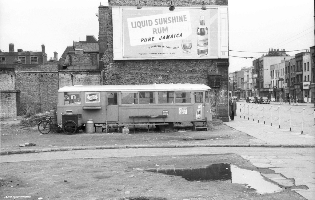
So, to start, the following photo just has “a temporary café on a bomb site” written on the back but unfortunately no further details. I am not exactly sure what the vehicle used to be. It looks to have been something that would have run on rails, but appears to have normal tyres. I like the three wheeler bike with the milk churn, either used for collection or perhaps a delivery service.
The above photo is the corner of Greenfield Road and Commercial Road, E1. Whilst the view in the immediate foreground is now completely different, the buildings along Commercial Road on the right are much the same.
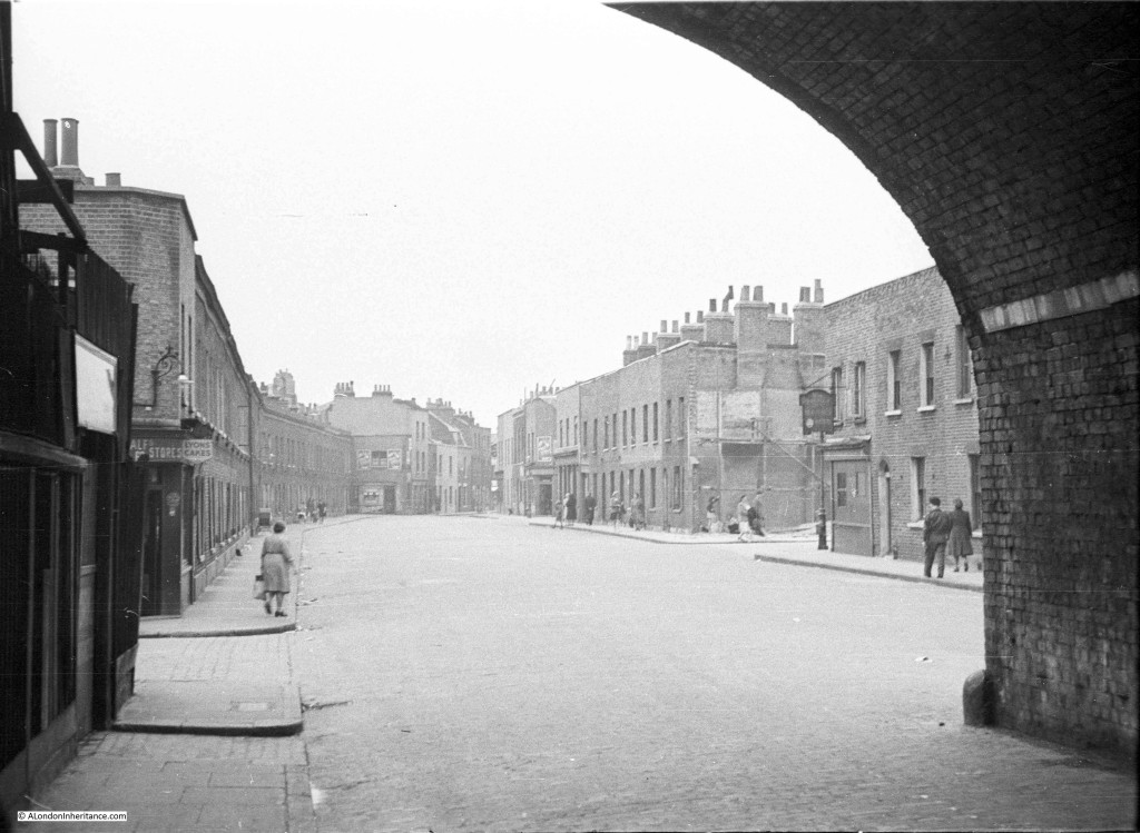
I suspect the following photo was taken in East London, possibly around the Docks judging by other photos on the same strip of negatives. It appears to have been taken from underneath a railway arch. There is a pub on the right, but the grain of the film does not allow the name to be read when zooming in.
Probably all these buildings were demolished over the last 60 years with only the railway arch remaining.
The above view just does not exist anymore. The whole street has disappeared and has now been replaced by a rather desolate view of buildings surrounded by high security fencing. This is Hardinge Street, E1, looking north from under the railway arches.
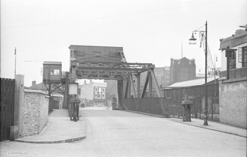
This photo also appears to have been taken around the Docks and I am sure I recognise the bridge from walking round the area but cannot place the location. Again there is a pub in the distance but the grain of the film does not allow the name to be read.
The above photo I should of known. I knew I had seen the bridge but could not place the location. The pub at the end is the Prospect of Whitby and the photo is looking along Glamis Road. The bridge is over part of the Shadwell Basin. The pub and bridge are still there but the surrounding area has changed considerably.
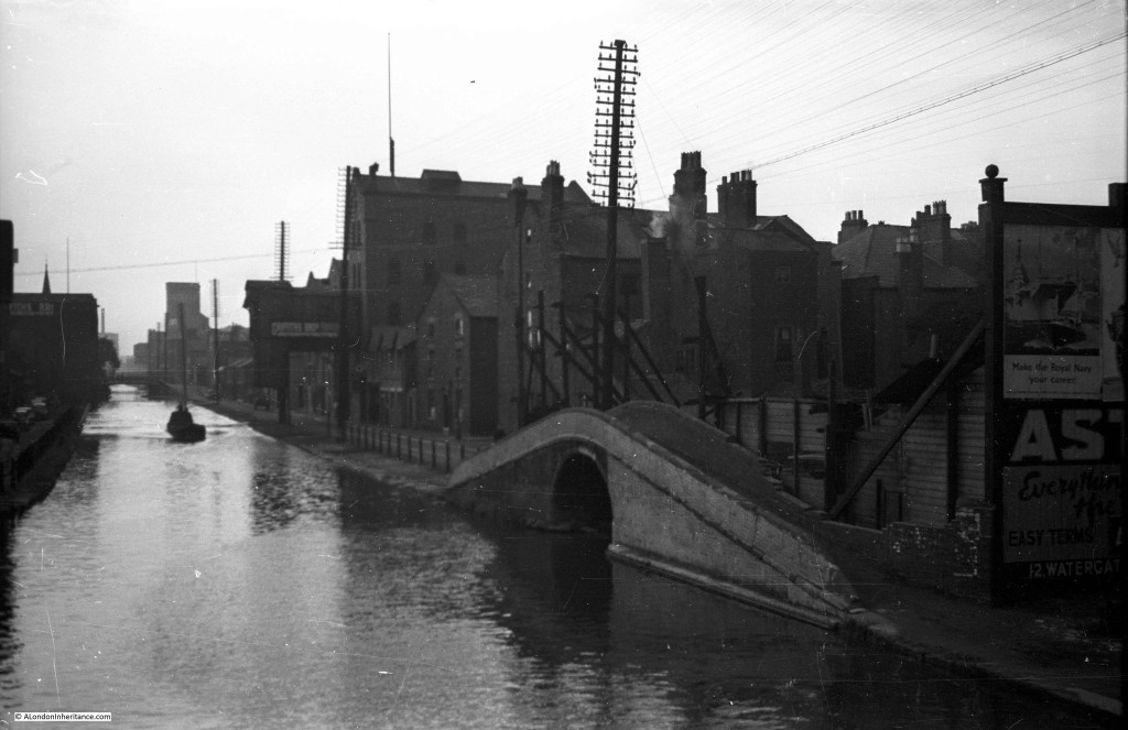
And again somewhere around the Docks. Given how straight the channel is I suspect it may be the Limehouse Cut, but from limited walking in the area I have not been able to place the photo. I need to walk the area again, however I suspect the buildings have also long gone.
And now for my big mistake. After the war, as well as photographing London, my father took lots of photos around the UK and Holland during cycling trips and National Service. The above photo was on the end of a strip of negatives with photos of East London so I wrongly assumed this was the same area, however it was taken in Chester. Must have been the last photo on the roll of film. See this link, there is a photo towards the end of the page showing almost the same view.
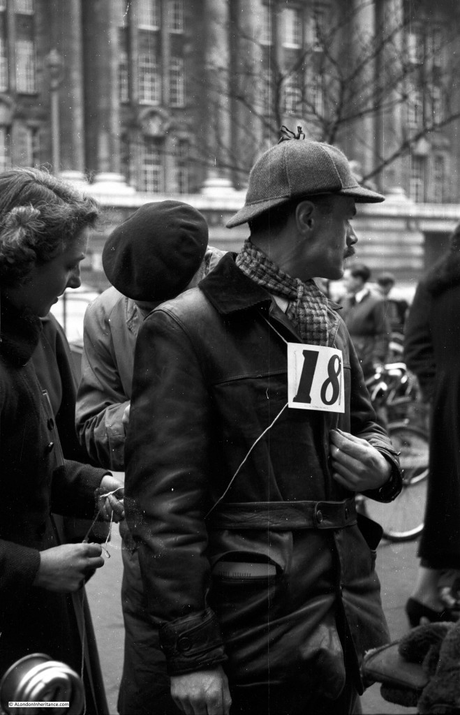
Now three photos of an event I cannot place. Judging from other photos on the same strip of negatives this was either 1949 or 1950. The girl in the background looking at the photographer would probably now be in her early 70s.
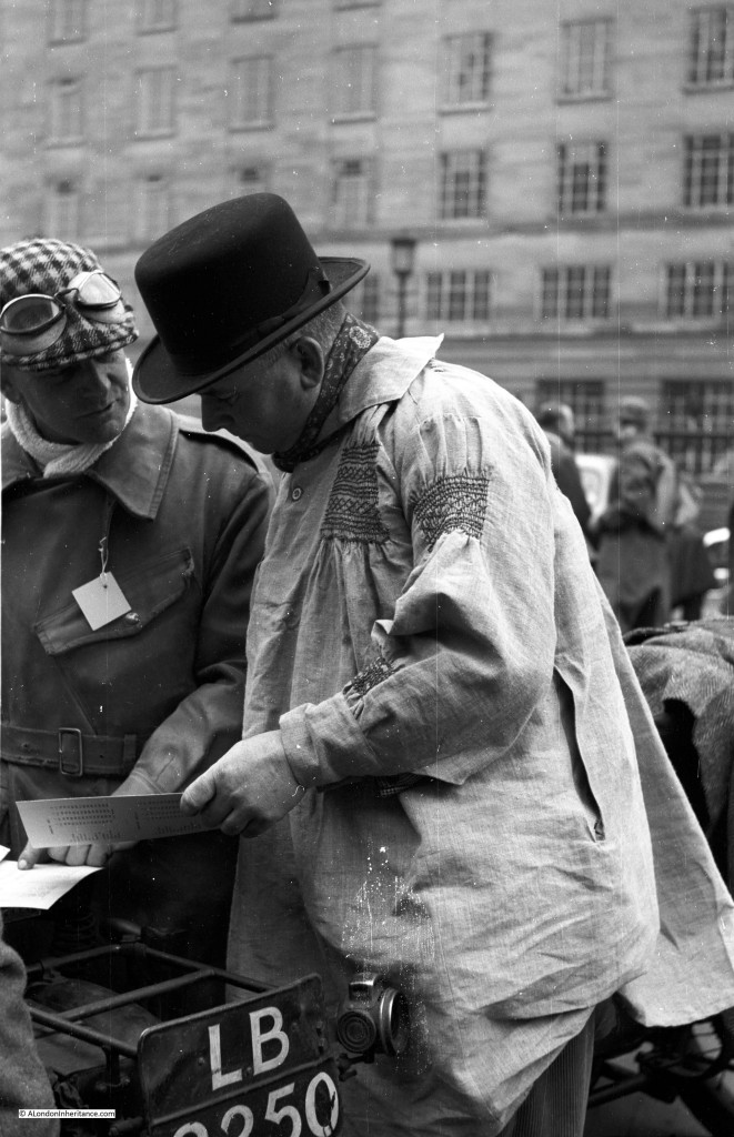
The following three photos could be the Pioneer Run from London to Brighton for pre 1915 motorcycles. the event had a Westminster start but the buildings could be around County Hall on the south of the river.
It seems to have been the start of some form of motorbike race. I thought the building in the background could have been the Ministry of Defence building on the Embankment, but on checking the style of the windows, it would appear not.
Same event, but a different building in the background.
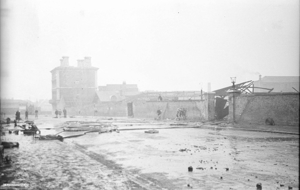
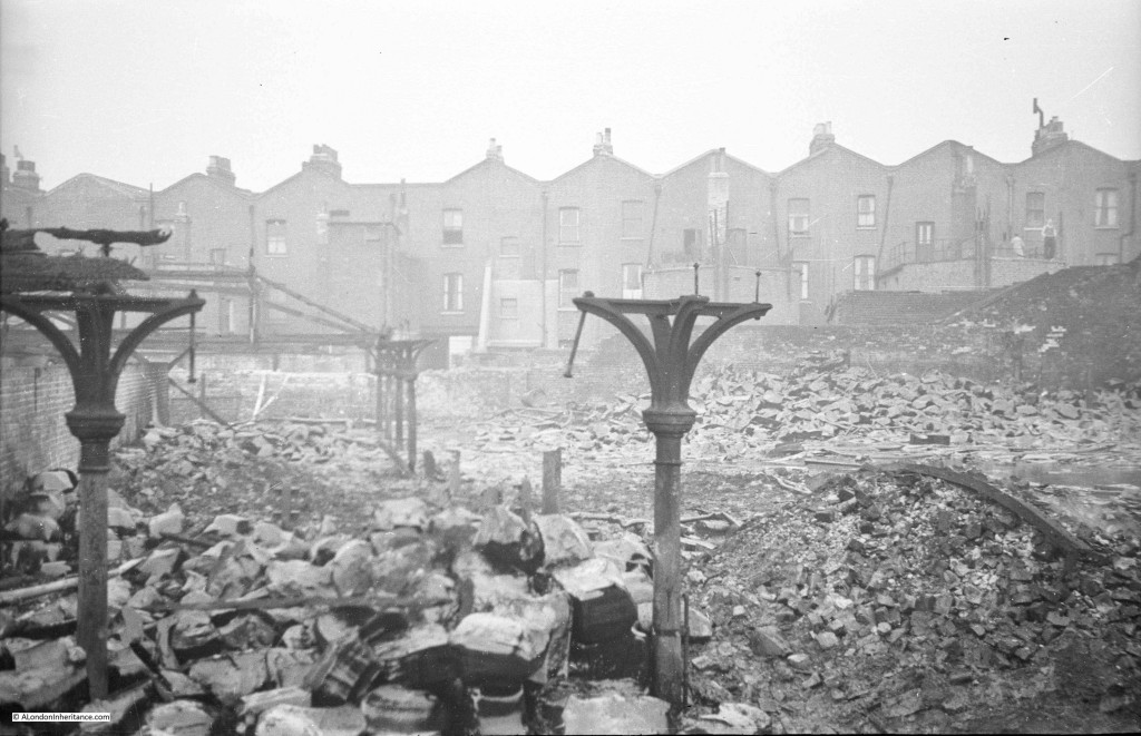
This photo appears to show the aftermath of a fire, but I have no idea where. Hoses are still scattered across the street and there appears to be much destruction beyond the wall.
What I like about this photo is the group of boys by the wall in the centre of the photo, also one having climbed to the top of the wall. This fits in with the stories my father told me about being a boy in London during the war and the freedom to explore bomb sites, collect shrapnel, remains of incendiary bombs etc. There were no real restrictions on where you could go and London was an open book to explore.
The following two photos could be around the Caledonian Market estate in Islington, with the building in the background being one of the pubs on the corner of the market.
The scene through the gate of what must have been a really bad fire. Note the man on the right, standing on the roof of his outbuildings surveying the scene.
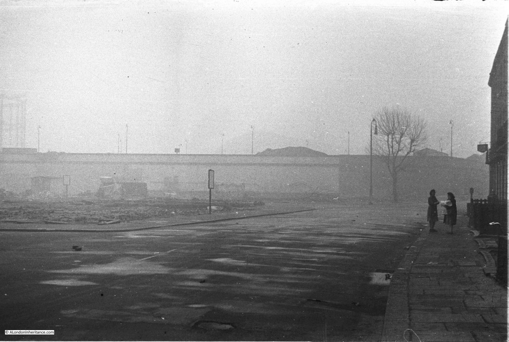
This photo probably has a cleared bomb site on the left. I wish I could read what was on the signs around the site. It is photos like this that bring home what a grey and desolate place many areas of London must have seemed just after the war. Reconstruction had not started, reminders of wartime damage were still very much in evidence and day to day life was still tough.
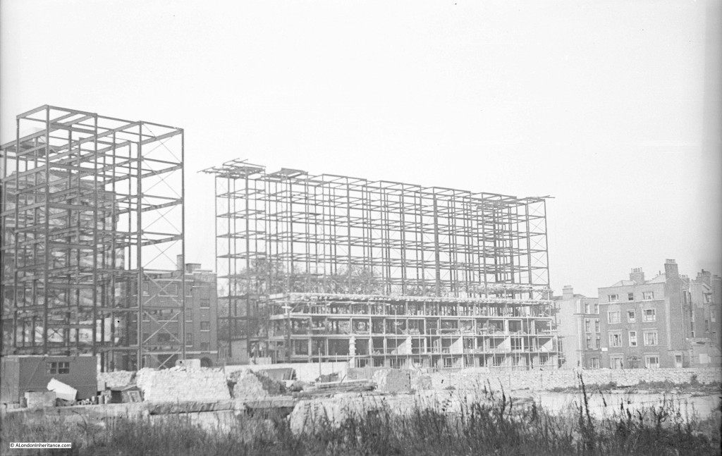
Some limited reconstruction had started and this photo shows the framework of a new building, almost certainly on a bomb site which extends into the foreground of the photo. It would be fascinating to know if this building is still there. From other photos on the same strip of negatives I suspect it may be in Holborn.
The following photo was taken looking across towards Harpur Street. The construction work is for new flats which are still there. It is not possible to reproduce the view due to new building, however the following Google Street View shows the flats today and the original buildings along Harpur Street to the right.
Back to another event I cannot place. It must be in one of London’s parks but I cannot identify either the location or the event.
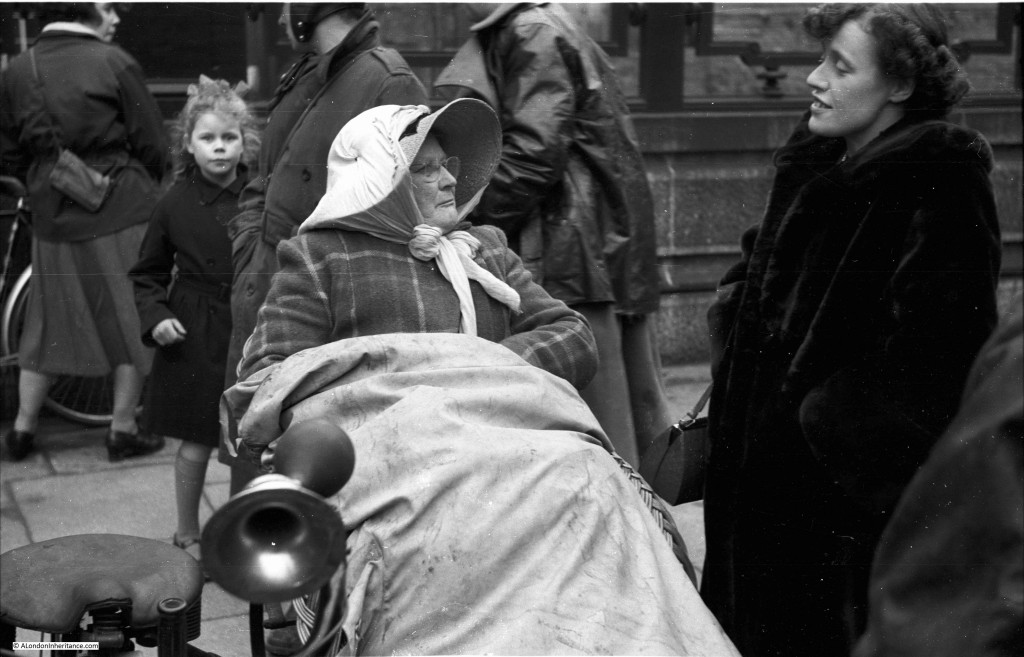
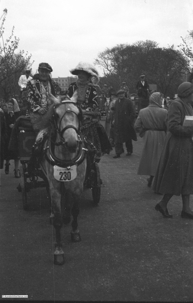
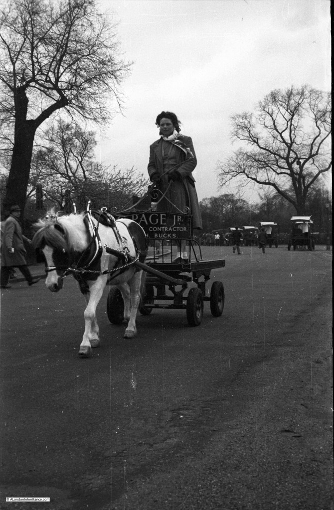
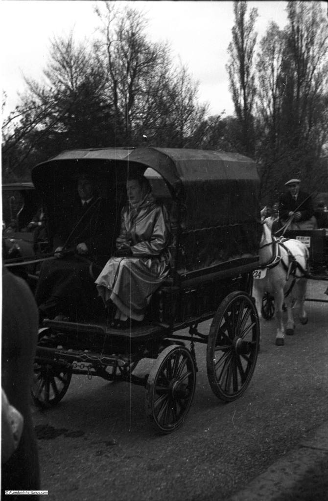
The following photos could be of the Van Horse Parade or the Cart Horse Parade, held in Battersea Park on Easter Monday. The parades merged into the London Harness Horse Parade and although still held on Easter Monday’s, the parade has now moved to Ardingly, West Sussex.
It seemed to be an event with all forms of horse drawn vehicles from the simple…..
….to the more comfortable, but I have no idea of the location or event.
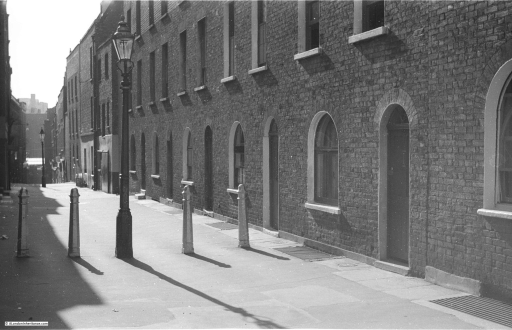
Many photos show streets and alleys which have probably long since been demolished, despite that with some modernisation of facilities they could still be perfectly good homes. I always try to avoid romanticising the past, living conditions and life in general for so many Londoners was very tough but this style of street and home looks far better than many that have been built since.
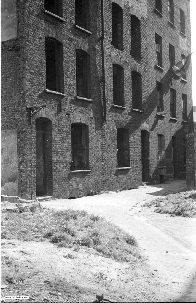
An empty building, probably through bomb damage, awaiting demolition. The far right of the building with the Union Jack still looks occupied. There were so many buildings like this across London in the late 1940s and early 1950s. Awaiting their fate, but some inhabitants still clinging on.
And finally an unknown street scene. Other photos on the same strip of negatives were taken in Campden Hill Road, Kensington, however I have been unable to locate this street.
The above photo is Tryon Street, off the Kings Road in Chelsea. Still very much the same.
When starting out on this project, I had the probably very unrealistic target to locate all the photos and visit and photograph the current location, learn about the area and understand what aspect of the scene interested my father to photograph these locations.
Although I am making reasonably good progress, any help with the photos shown above would be very gratefully received.

I zoomed in on the 3rd picture and the pub appears to be Prospect of Whitby in Wapping.
Darren – thanks for this, you are right. I just checked on Goole Street View and the photo was taken along Glamis Road. The bridge is still there although the rest of the area looks very different. Thanks again, another I can add to the “found” list.
I seem to remember the horse drawn vehicle parade. Those were the days of the brewery drays with their lovely shire horses. The parade we were taken to see was in Battersea Park in about the mid fifties, Easter Sundays? I believe I also went to one in Regents Park? Maybe there’s a society or association of horse drawn vehicles that could help? Loved the photo with the Pearly King and Queen! Yes you’re right about a grey town. It took a long time for the rebuilding to be completed,in some areas not until the mid sixties. Of course a little colour did show through once the clean air act came in. Until then there seemed little point in using colour films. Good post again today Admin. Carry on blogging!
From some Twitter feedback it appears to be the London Van / Harness Horse Parade, although now held outside of London on Easter Monday http://www.lhhp.co.uk/
The bridge was immediately recognizable for me. Shadwell Docks: https://en.wikipedia.org/wiki/Shadwell#/media/File:Shadwell_basin_bridge_1.jpg
I knew I had seen the bridge but could not remember where. So much of that area has changed.
Photo number 1 is on the corner of Greenfield St and Commercial Rd, E1. Looking east.. If you Google St view this, you’ll see it’s not changed that much at all.
Sorry, meant Greenfield Rd, not St.
Yes, found it (but Greenfield Road?). The buildings on the right have not changed that much. Thanks
The temporary Café in the first photograph intrigued me, it’s reminiscent of 1930s steam-powered railcars. I asked members of the Industrial Railway Society for their thoughts and had the answer in a few hours.
“It’s the top deck of an LT “diddler” trolleybus (no 52) and survived as Locks Cafe until the mid fifties.”
My thanks to David Wylie for that. There are photographs and brief descriptions of the surviving ‘Diddler’ here…
https://www.flickr.com/photos/rtw501/39437576521
https://plumbloco.smugmug.com/Other/London-Transport-Trolleybuses/i-sFsHT9b
Could the three pictures of the horses and carts be at either the Van Horse Parade or the Cart Horse Parade. The two were merged in 1966 into the London Harness Parade
I think you could well be right. Found a website for the event but it has now moved out of London to Ardingly, West Sussex
the building in the background of the photograph post fire with the fire hoses, looks a lot like one of the pubs around the Calledonian Market estate in Islington.
Tom, thanks, I am visiting the Clock Tower in a couple of weeks during Open House, London. I will look around.
What a pleasure to read on a Sunday morning in a bright home and outside even brighter.. Thank you for sharing.
The last photograph is of Tryon Street, off the Kings Road, in Chelsea.
Peter, are those row houses painted in pastels these days? I am away from home for the next ten days, but I was going to check a photo I have there from 12 years back, because that street looked mighty familiar to me. I would have placed it in Chelsea.
I will try to remember to scan the photo I am thinking of.
I believe the little houses in Tryon Street are indeed all painted in pastels. They are certainly in part of London that has been fashionable and desirable since the sixties. What a contrast!
Peter, thanks for this. Just had a look on Google Street view and it is much the same.
Only two months late, but I just uploaded photos that I think are Tryon Street to Flickr. These are from June, 2004.
Possibly Tryon St., Chelsea
And in fact one of those photos is freakishly close to the angle of your father’s shot.
Thanks Lisa, you are right, the third photo is very close to the photo my father took of Tryon Street. It is on my list of sites to visit. Thanks for letting me see this, good to fully confirm this is the right location.
You are very welcome! And if you’d like to post my photo, it is public and I think you’d be able to download it.
I think the canal picture is Chester, not London
A bit of searching, including ‘Griffiths Bros Canal’ brought up this page – http://www.chesterwalls.info/gallery/oldcanal2.html with an earlier photo (4th from bottom) taken from a similar angle.
You could well be right. What confused me was that the photo is on a set of negatives taken in East London, although he did taken photos on a trip to Chester, so it could well be. I will have to check further.
Reckon the photo of Limehouse Cut is taken from the bridge at Burdett Road. Have tweeted you a photo from my afternoon jog. The arched walkway and most of the buildings are gone but the perspective looks right and obscured on the left is the spire of the church on Bow Common Rd.
Thanks, the canal looks the same if only the buildings had not changed so much. Also had a comment and photo that it could be a canal in Chester. I will need to investigate further.
Chester photo does look uncanny!!
Hello, I logged on to say that the swing bridge is next to the Prospect of Whitby, Shadwell Basin in Wapping where I grew up, but see that other’s have beaten me to it!
I’m also a classic motorcycle buff and the pics of the bikes look like the Pioneer Run from London to Brighton for pre 1915 motorcycles (I could be wrong!) This usually starts at Tattenham Corner in Epsom, but their website states that in 1954 it started in Westminster,
http://www.sunbeam-mcc.co.uk/runs-and-events/pioneer-run/
If I had to guess a building, could that be at the side of County Hall next to Westminster Bridge?Although that’s the wrong side of the river.
Thanks. Just read about the Pioneer Run on the link and you are right, it probably is the same event.
The railway arches are on Hardinge St. E1
The arches do look the same, but from Google Street View there are still old buildings on the right which are not in the original photo. Following the rail tracks I found Watney Street and there is a building on the left which looks like the original pub. Could be this street?
Stepney friends are convinced of the location. Me too after seeing their responses (which I’ll send separately).
You should have viewed in the opposite direction from the other side of the arches 🙂
This is uncanny. I had a feeling the railway arch was one of the ones between Limehouse and Tower Gateway. Glad to know my hunch was in the right area, even if I couldn’t place it exactly!
Tim, I checked on Google Street View and it is completely different now (apart from the railway arch). Plan to take a walk around the area to explore further.
That’s right, there’s now a school where this part of the road used to run. Most of this side of the railway tracks has been redeveloped, but there are still lots of old buildings and quite a few unchanged streets in the area, so well worth a wander. I live a short stroll from here and I travel on this part of the DLR every day. I’ve often wondered if the school and other redeveloped areas along this part of the railway line were due to bomb damage, but happily your photo and the one Mick has provided a link to answer that one!
Same arches, 1954, from Pete Grafton’s site.
https://petegrafton.files.wordpress.com/2013/09/east-end-png-bridge-arch.jpg
The canal one is not Limehouse Cut. There is a road running parallel to, and right next to, the canal. Limehouse Cut doesn’t have anything like that. Actually, quite unusual to have an adjacent road like that, which might help in identification.
brilliant collaborative and fun detective work. I was pleased to have deduced Glamis road correctly (with a hunch about E1 railway arch) before discovering all the wealth of talent from across your readers. A friend tells me that photo 1 is early 1950’s from the cars and that the ‘rail car’ is from the 1930’s and did indeed run on rails when in service. I was especially intrigued by the canal photo (again relieved to find it was the trick question, not in London town). all the best
Rose
Have you tried Dave Walker Local Studies https://rbkclocalstudies.wordpress.com/2015/08/20/old-chelsea-more-photographs-from-the-miscellany/
I have looked through the rbklocalstudies site and it is really good. I do have a number of photos which I know are in Chelsea, but still need to find the exact location so will need to spend some more time researching on that site.
The motorcycle race (if that’s what it is) looks like County Hall. The first picture with the pillars is the eastern/inland frontage of the main building, the second could be one of the two more modern annexes fronting York Road. That would imply that the pictures were taken in Belvedere Road, in the southern stretch now closed to traffic.
tom is right the pub is the lamb one of 5 in the islington cattle market i lived in queens mansions just across from the fire the road is north road not shaw what date the fire was as it was to young but it was talk abouth by my family we moved into queens mansion in 1964 before that we lived in mackenzie road islington our house was bomb damage when a v2 rocket hit the prince of wales pub i was 6 years of age at the time and went to school in eden grove i can still see mackenzie road bomb damaged in my eyes it is now all upto date houses old mackenzie road as gone forever so as the cattle market
Re the Horse Parade photos.
Certainly, the first photo was taken in Regent’s Park. More specifically, it was shot in Chester Road, looking eastwards back across the Outer Circle, with the buildings in the background being in Chester Terrace.
We grew up on the Regent’s Park Estate, situated east of Chester Terrace and Albany St.
I remember visiting the Parades on Easter Monday mornings when we were kids in the mid – to – late ‘sixties/ early ‘seventies.
Thanks for a great blog.
Sean – thank you for the information, I will take a look next time I am in the area. My father also lived in the Regents Park Estate when he took most of the black & white photos of London. This was during the 1940s and early 1950s. He was in Bagshot House.
Yes, I know Bagshot House. It’s on the Cumberland Market Estate, which used to be owned by The Crown Estate. In 1970 we moved into a New-build block called Rothay, on the North-West corner of Cumberland Market, right opposite “The Crown flats” – as we on the council estate used to call them.
You might be interested in the following link
https://cumberlandmarketestate.wordpress.com/history-of-cumberland-market/
which gives a history of the Estate.
The Cumberland Market Estate was sold, in 2011, to The Peabody Trust.
Regards,
Hi Sean, thanks for the link to the Cumberland Market Estate, really interesting history of the estate. I have a number of photos taken around the estate showing the damage caused by bombing, however much of the Cumberland Market Estate appears to have suffered little damage, although my father’s account of his time there during the war does details incendiary bombs and parachute mines landing on the estate. Regards, David
The construction photo is in Holborn, here is a StreetView of the right side of the photo.
Rob, that is remarkable. That photo was one that was not identified from my original mystery locations post and I was giving up hope of finding it. I see the old house on the corner in Harpur Street is the same in Google and in the old photo and the construction site are the flats at the end of Harpur Street. How did you track this one down? Thanks again.
Part clue (Holborn), part knowledge of the area, part luck, part maps. Having said that, you still have five photos that have me stumped:
Image 16 of the original batch (just above the Holborn photo). It looks like an elevated train station in the background with a gasometer to the left. I can’t anything to match it in London.
Image 11of the original batch. That’s quite a drop after the second lamppost, and those tall buildings in the background have me baffled.
Image 12 of the original batch. Really so little to go on. Any clues from surrounding photos on the roll?
Image 13 of the second batch. Somewhere between Southwark Cathedral and Southwark Bridge should be easy to locate, especially with the two story building that juts out that would show up on an O/S map.
Image 3 of the second batch. I been through a lot of the back alleys in Hampstead, never seen this one!
Anyway, I look forward to the next installment of unknown locations.
Image 16 is the cleared bombed remains (on the left) of the Metropolitan Buildings on the corner of Goldington Street and Platt Street, NW1. The ‘Metropolitan Buildings’ was the first municipal block of flats to be built in London in the 19th century – it took a hit from a German bomb in 1941 (or 1944) – and then cleared after the war. In the background are the coal drops and beyond those out of sight is St Pancras station. The gasholders at Kings Cross are just visible at left. The buildings at right are still there – Goldington Street (although the very end one with the sign was demoilished). You can make out the entrance to Platt Street beyond them at right. So this picture – absolutely fascinating to see – is probably dated 1946 or ’47. It is the corner of Goldington Street and Platt Street (at right). The cleared site of the Metropolitan buildings was replaced by Cecil Rhodes House in the fifties. CUrrent Street View: https://www.google.co.uk/maps/@51.5341398,-0.1311222,3a,75y,139.99h,91.2t/data=!3m6!1e1!3m4!1sqYROdXqXq8qByCpiEFuPBQ!2e0!7i13312!8i6656!6m1!1e1
How do I know all this? – because the wonderful pictures of the area on Collage show the same street but a bit further down – and in one of the pictures you can see the same tree and street lights, and walled coal drops http://collage.cityoflondon.gov.uk/view-item?key=SXsiUCI6eyJ2YWx1ZSI6InBsYXR0IHN0cmVldCIsIm9wZXJhdG9yIjoxLCJmdXp6eVByZWZpeExlbmd0aCI6MywiZnV6enlNaW5TaW1pbGFyaXR5IjowLjc1LCJtYXhTdWdnZXN0aW9ucyI6MywiYWx3YXlzU3VnZ2VzdCI6bnVsbH19&pg=30&WINID=1477583313137#L0nye_UFUQMAAAFYBtQE-A/116338 – And in the following picture you see the Metroplitan Buildings in 1932 at the bottom left of the picture (click on the comment bullet) just below the coal drops: http://www.britainfromabove.org.uk/image/epw039587
Like RobBeer I’m intrigued by the way that the ground falls sharply away in image 11. I can’t think of any part of London that fits the bill. I wondered whether it could be somewhere in the valley of the Fleet River, but I don’t think the slope of the ground there is as steep as in the photo. Perhaps the photo wasn’t taken in London at all. Do you know the location of the photos that are either side of it on the roll of film?
I agree, it is a puzzle Malcolm. It may not be London, however the photos on either side of this one on the same strip of negatives are all in London, but they do jump around a bit and include the Southbank area and Hoxton. I have tried looking around these area but nothing that looks anything like this photo.
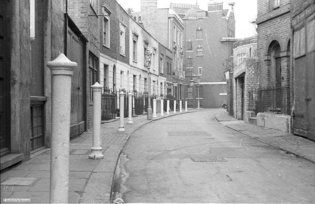
I’ve found the location of photo 11. It was taken in Clerkenwell, about half way down Albion Place looking westwards. Here’s a 1956 photo showing the same houses in Albion Place but looking eastwards: http://collage.cityoflondon.gov.uk/collage/app?service=external/Item&sp=Z%22albion+place%22&sp=62607&sp=X. The present view from roughly the same position as your father’s photo can be seen in Google Street View at https://goo.gl/maps/qgikpaWBJf62. Albion Place has been widened since the 1950s, the houses have been replaced by office blocks, the posts and lamp-posts have gone and the street is now open to traffic.
The steeper street beyond the second lamp-post in your father’s photo is Benjamin Street. In real life it’s not as steep as it looks in the photo. The white patch in the distance must be the roof of Farringdon Station. The dark block beyond the station roof is the former goods station (see illustration 514 at http://www.british-history.ac.uk/survey-london/vol46/pp358-384).
Malcolm, that is remarkable, thank you. This is one of the photos I suspected I would not find the location. So many streets have, as you say for Albion Place, been widened and the original buildings have long gone so that unless you can find an original photo, or someone who remembers the scene, it is impossible to locate. How do you track this one down? Thanks again, really appreciated. Regards, David
You ask how I tracked down the location of photo 11. The houses in the photo looked to me as if they had been built no later than about 1830. So we wanted an area of London which had terraced three-storey houses by 1830, where the ground sloped quite steeply in the background and which seemed semi-industrial. I could think of only one area that might fit the bill, which was the valley of the River Fleet. After an unsuccessful wander around Farringdon Road and some of the surrounding streets, I used the National Library of Scotland’s website to study the 1951 large scale OS map of that area. I was trying to find streets which were the right pattern and which were in the right direction relative to the valley bottom. That’s what led me to Albion Place.
Oh my goodness. I grew up in Hardinge Street, in Coburg Dwellings next to the convent at the Cable Street end. I had seen the photo that was linked here but how lovely to see your Dad’s photo. They are the only 2 I’ve ever managed to find of how it used to look. When I was little these houses were already gone and we used to play on the grassed area and on the debris left from when they were demolished. I later went to the secondary school, Bishop Challoner that now covers this area although when I was there only its playground blocked the end of Hardinge Street. I used to love the cobbles that were still there and can be seen in the foreground. I am now subscribed so will not miss any future gems.
Hello Teresa,
You’ll find more photos of Hardinge Street here:
http://collage.cityoflondon.gov.uk/collage/app?service=external/SearchResults&sp=Zhardinge+street
and here:
http://www.reelstreets.com/index.php/component/films/?task=view&id=2369&film_ref=river_beat
regards
Mick
Thanks for those Mick. The Commercial Road end hadn’t changed much when I lived there (not sure about now though) but Hardinge Street itself was very different. I remember huge corrugated iron fences on either side from the arches up. These debris areas were then cleared and grassed over. We also had corrugated iron opposite us for all the time I lived there although that area is allotments now. It used to creak and groan something chronic in the wind.
Hi Teresa, thanks for subscribing. I was really pleased to have found this location as it has changed so much since my father took the original photo. It is on my list for a visit to have a look around.
Re Hardinge Street, E1. The turning to the left is the wonderfully named Poonah St. The first right turn is Lake St and the second right is Ronald St. The pub on the corner of Ronald St is The Two Mariners at number 15 Hardinge Street
Thanks Vince – I wondered what the name of the pub was. Very different there now.
It’s highly unlikely that we will ever be able to identify the location of photo 12, because there are no really distinctive features. But what were the locations of the photos that were either side of photo 12 on your father’s strip of negatives? I’d like to try studying the large scale OS map of that area.
Image 16 is the cleared bombed remains (on the left) of the Metropolitan Buildings on the corner of Goldington Street and Platt Street, NW1. The ‘Metropolitan Buildings’ was the first municipal block of flats to be built in London in the 19th century – it took a hit from a German bomb in 1941 (or 1944) – and then cleared after the war. In the background are the coal drops and beyond those out of sight is St Pancras station. The gasholders at Kings Cross are just visible at left. The buildings at right are still there – Goldington Street (although the very end one with the sign was demoilished). You can make out the entrance to Platt Street beyond them at right. So this picture – absolutely fascinating to see – is probably dated 1946 or ’47. It is the corner of Goldington Street and Platt Street (at right). The cleared site of the Metropolitan buildings was replaced by Cecil Rhodes House in the fifties. CUrrent Street View: https://www.google.co.uk/maps/@51.5341398,-0.1311222,3a,75y,139.99h,91.2t/data=!3m6!1e1!3m4!1sqYROdXqXq8qByCpiEFuPBQ!2e0!7i13312!8i6656!6m1!1e1
How do I know all this? – because the wonderful pictures of the area on Collage show the same street but a bit further down – and in one of the pictures you can see the same tree and street lights, and walled coal drops http://collage.cityoflondon.gov.uk/view-item?key=SXsiUCI6eyJ2YWx1ZSI6InBsYXR0IHN0cmVldCIsIm9wZXJhdG9yIjoxLCJmdXp6eVByZWZpeExlbmd0aCI6MywiZnV6enlNaW5TaW1pbGFyaXR5IjowLjc1LCJtYXhTdWdnZXN0aW9ucyI6MywiYWx3YXlzU3VnZ2VzdCI6bnVsbH19&pg=30&WINID=1477583313137#L0nye_UFUQMAAAFYBtQE-A/116338 – And in the following picture you see the Metroplitan Buildings in 1932 at the bottom left of the picture (click on the comment bullet) just below the coal drops: http://www.britainfromabove.org.uk/image/epw039587
Here are the Metropolitan Buildings – which stood where the cleared site is in image 16 until they were bombed.
http://collage.cityoflondon.gov.uk/view-item?key=SXsiUCI6eyJ2YWx1ZSI6InBsYXR0IHN0cmVldCIsIm9wZXJhdG9yIjoxLCJmdXp6eVByZWZpeExlbmd0aCI6MywiZnV6enlNaW5TaW1pbGFyaXR5IjowLjc1LCJtYXhTdWdnZXN0aW9ucyI6MywiYWx3YXlzU3VnZ2VzdCI6bnVsbH19&pg=51&WINID=1477583313137#L0nye_UFUQMAAAFYBtQE-A/115969