Tag Archives: Southwark Cathedral

Bankside And Horseshoe Alley

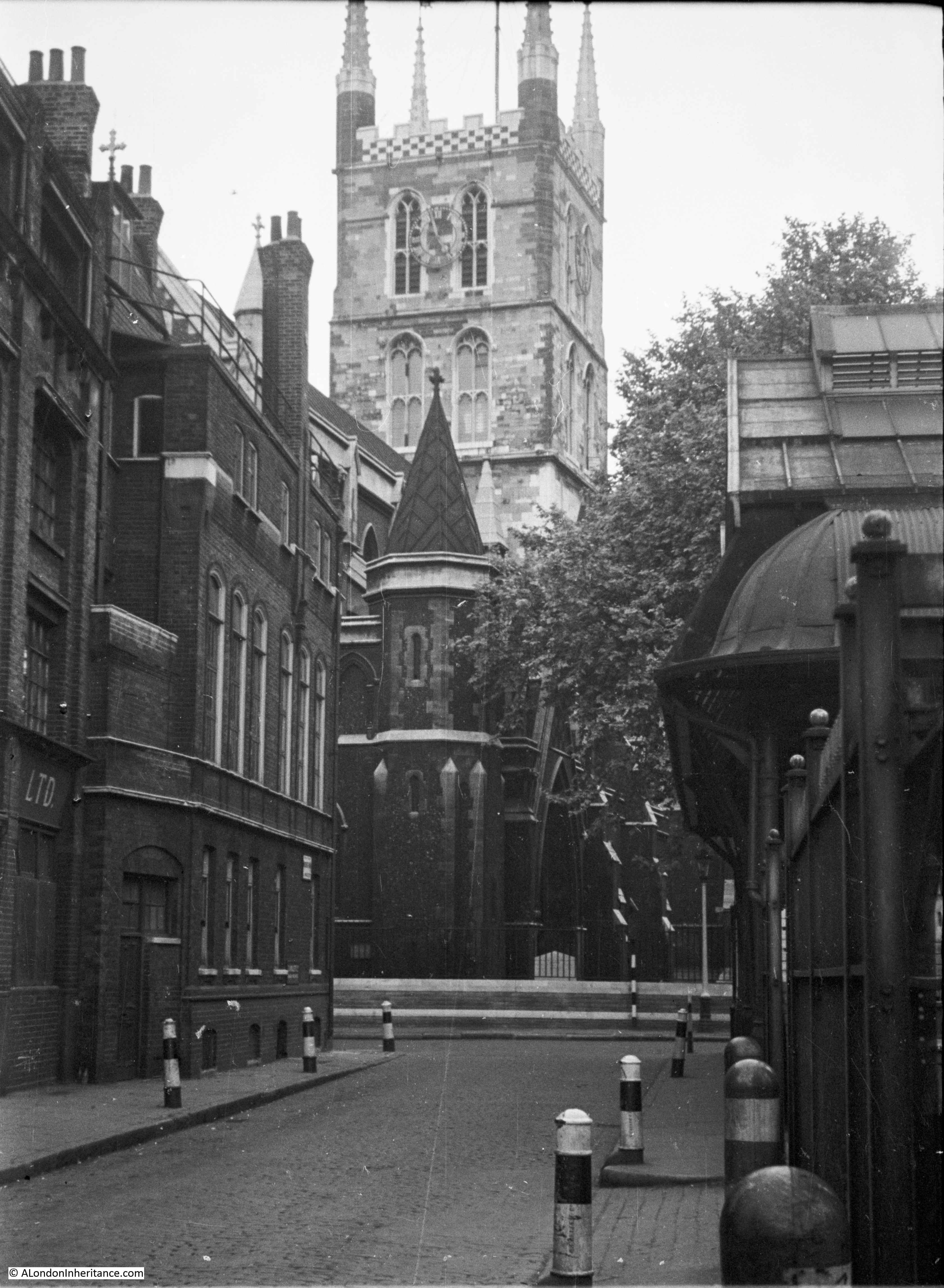
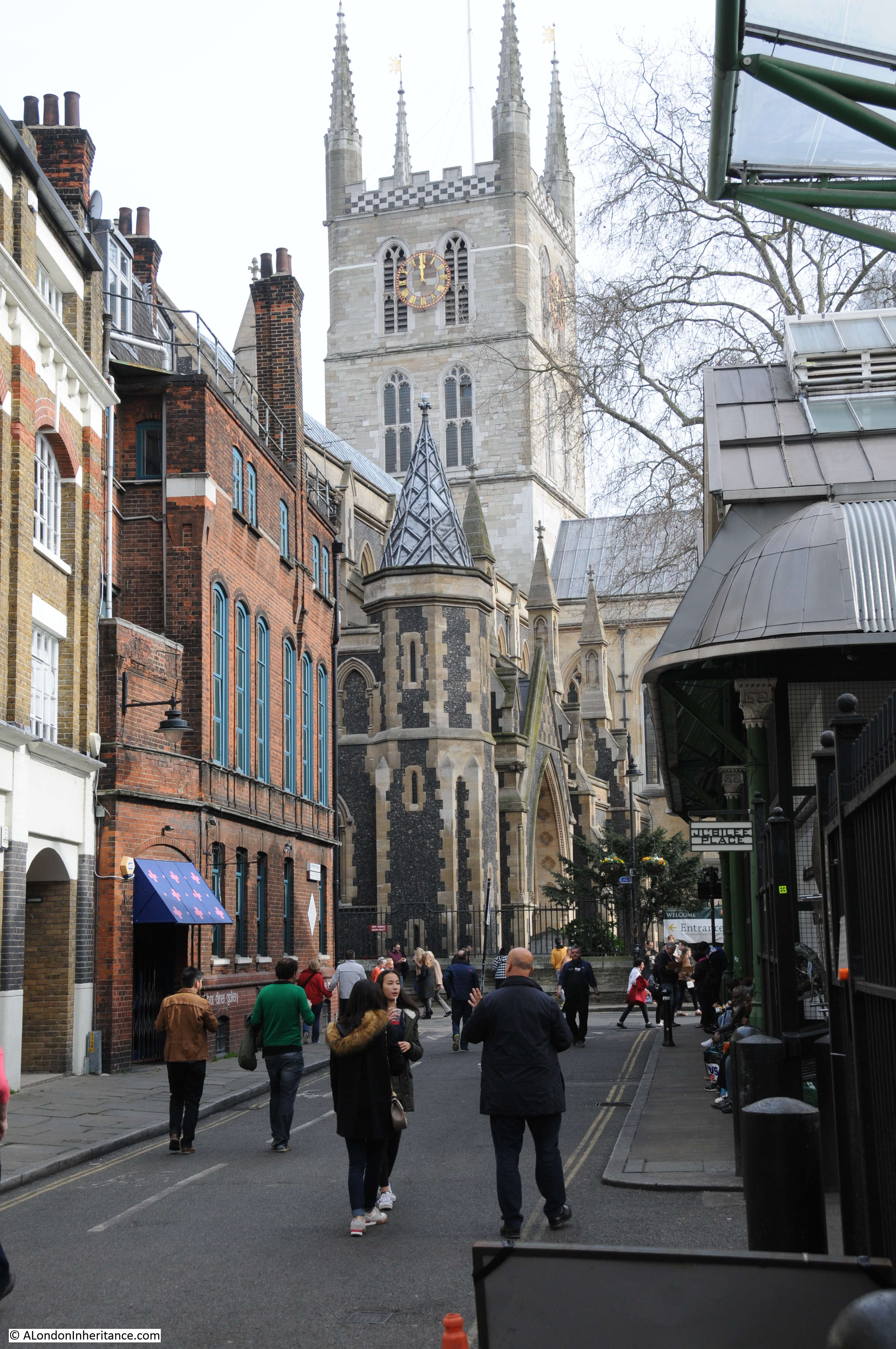
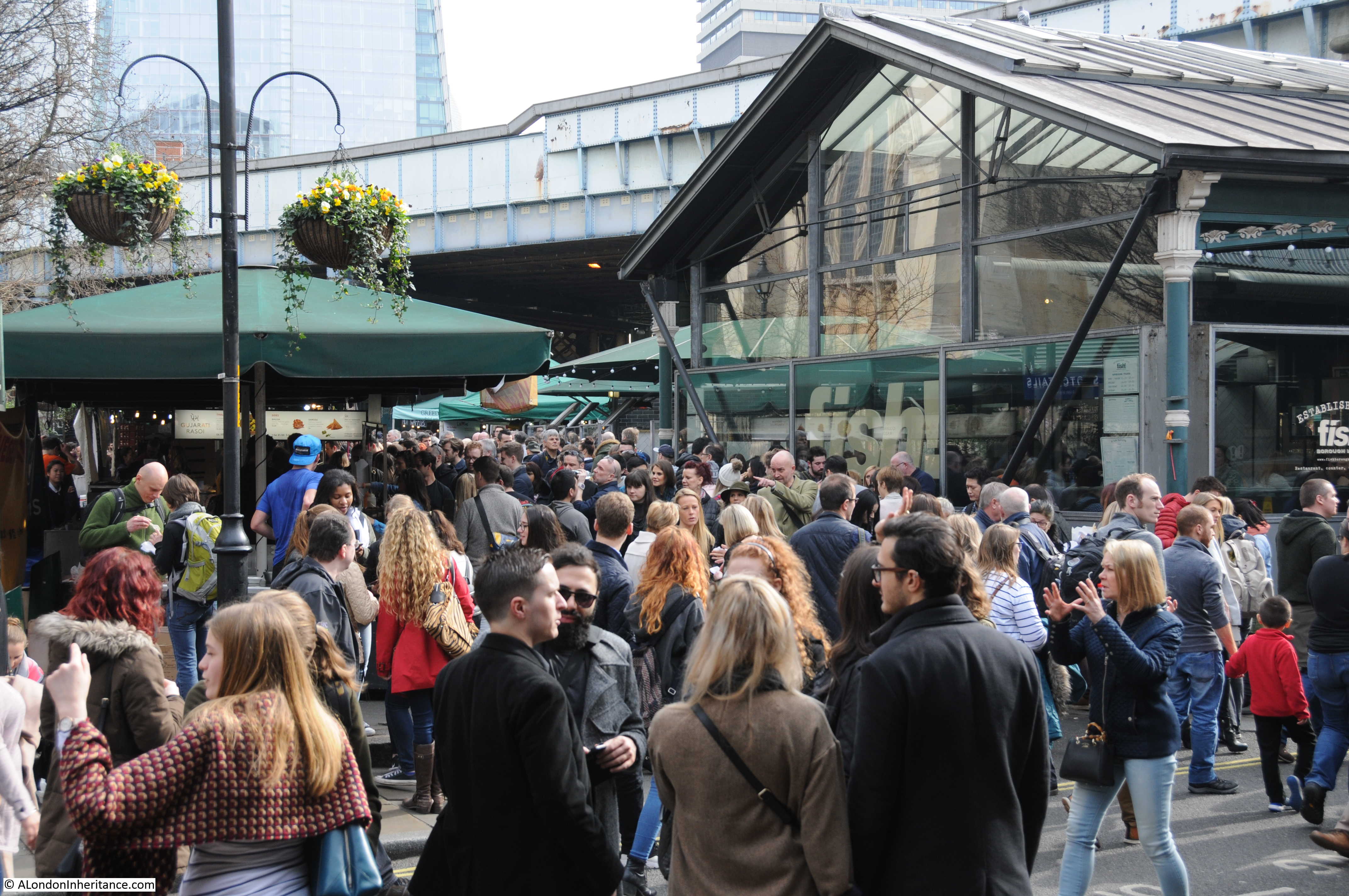
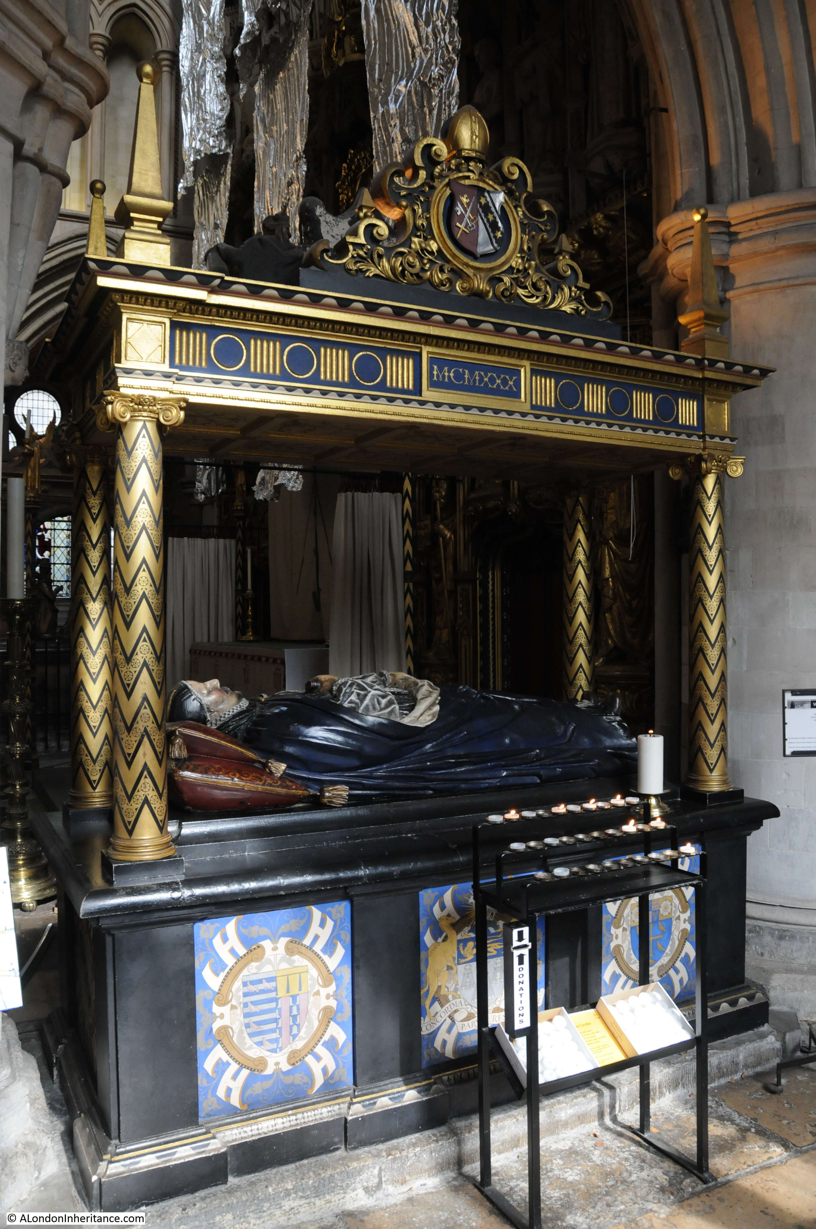
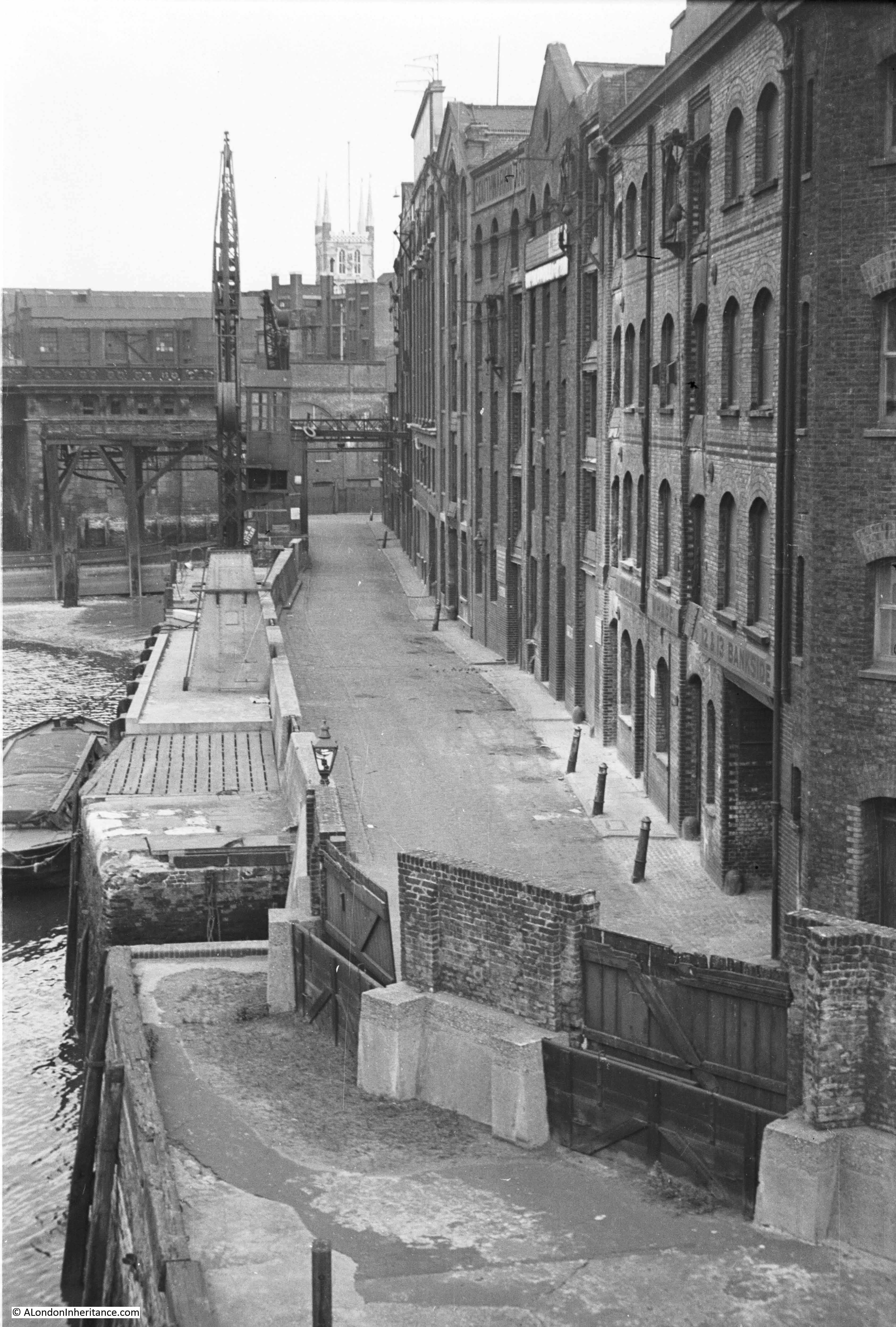
Last week I was at Southwark Cathedral. This week I have walked from the Cathedral to Southwark Bridge to look along Bankside back towards the Cathedral. This was my father’s view in 1953:

Bankside

I could not take a photo from the same position for reasons which I will explain shortly, so I took the following photo from Southwark Bridge showing this part of Bankside as it is now:

Bankside

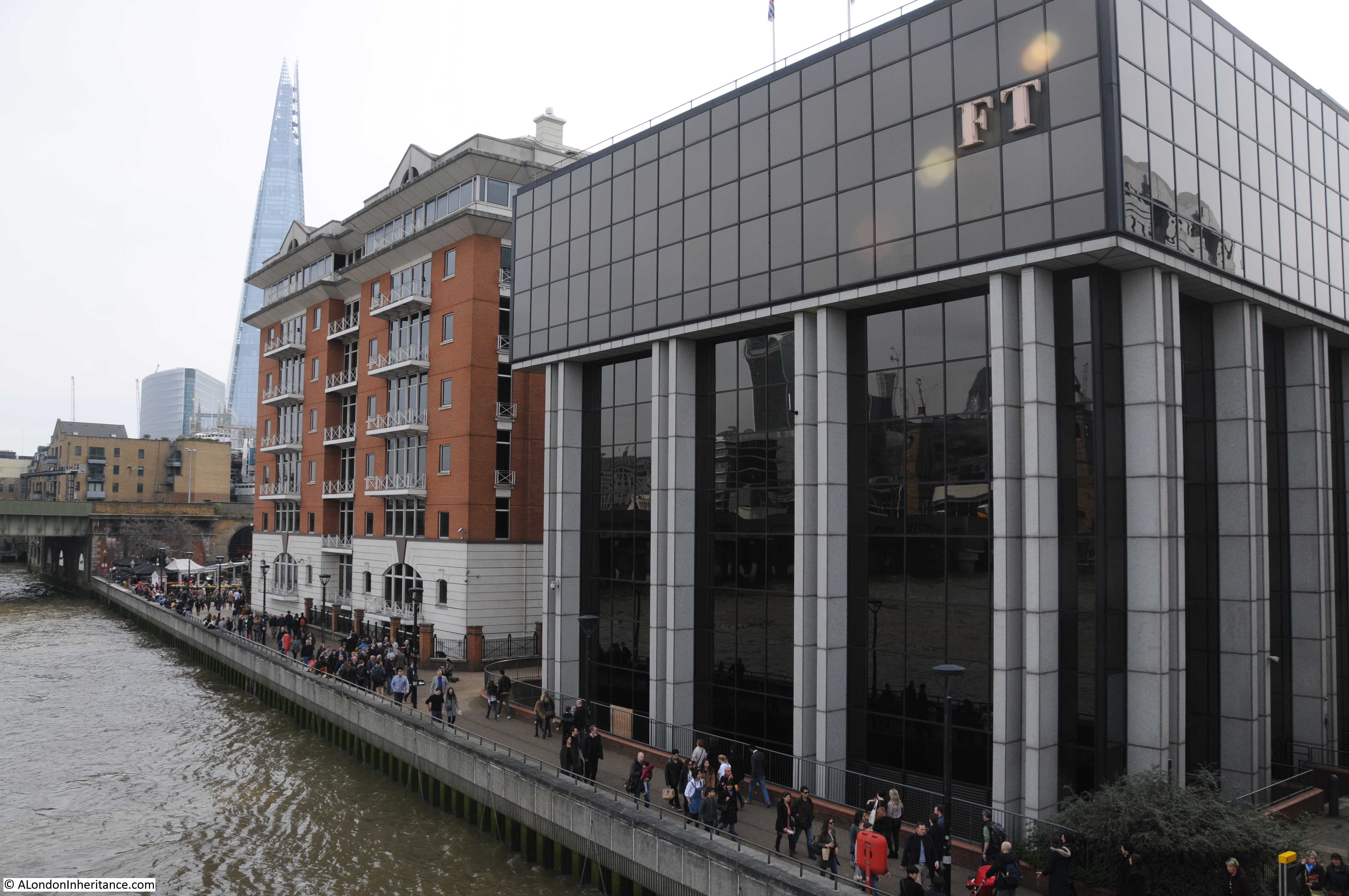
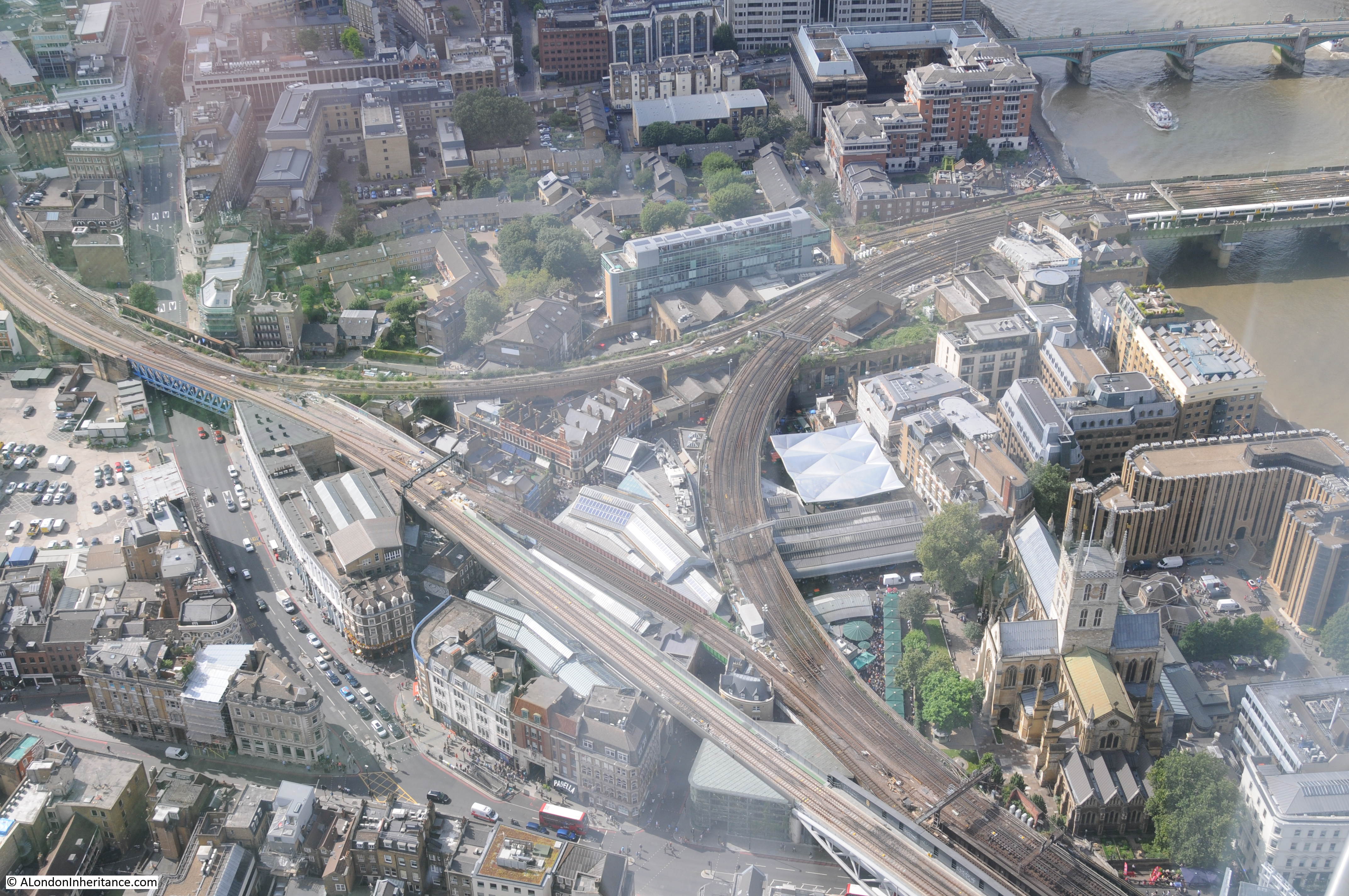
This short stretch of Bankside is completely different from 1953. A straight length of river wall and walkway now lines the river between Southwark Bridge and the railway bridge into Cannon Street station. The warehouses have been replaced by two office buildings and the cranes and infrastructure along the river have long since disappeared.

The changes since 1953 also include where the Bankside walkway is located and the alignment of the river wall.

I could not take a photo in the same position as my father as I would be looking from the bridge straight into the FT building on the right. The river wall has been pushed further into the river and the edge of the buildings now cover the original Bankside roadway. In my father’s photo it was possible to look straight along Bankside and see the tower of Southwark Cathedral from the bridge. Today, this is not possible as the two new buildings obscure the view having been built over the original road (also Southwark Cathedral is hard to see due to the taller buildings directly behind).

The river wall has been straightened and pushed into the river. Look at the 1953 photo and at the far end is the railway bridge. To the left of the crane you can see the brick pier of the bridge extending into the river. Today, the edge of this brick pier is now aligned with the edge of the river wall and Bankside walkway.

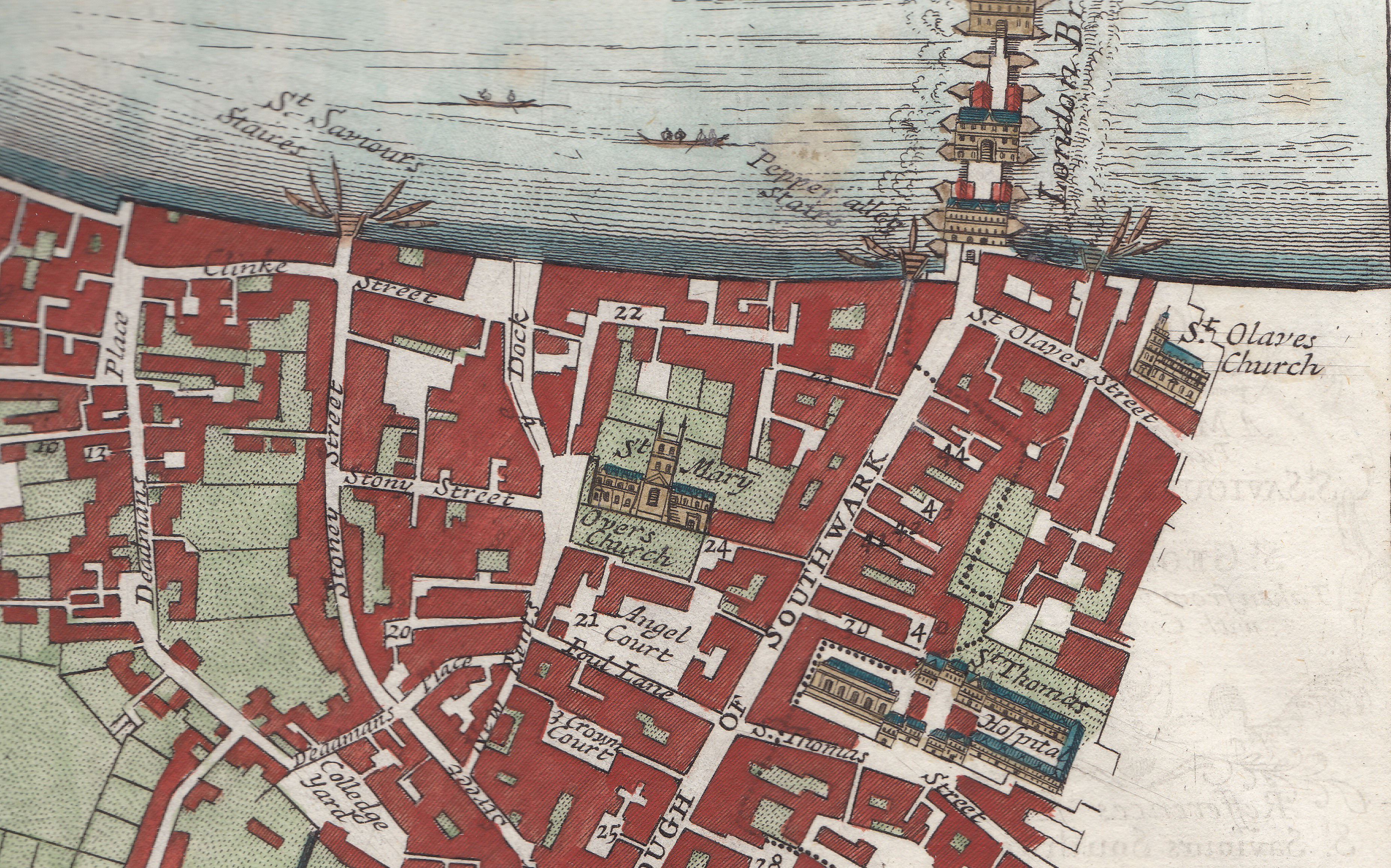
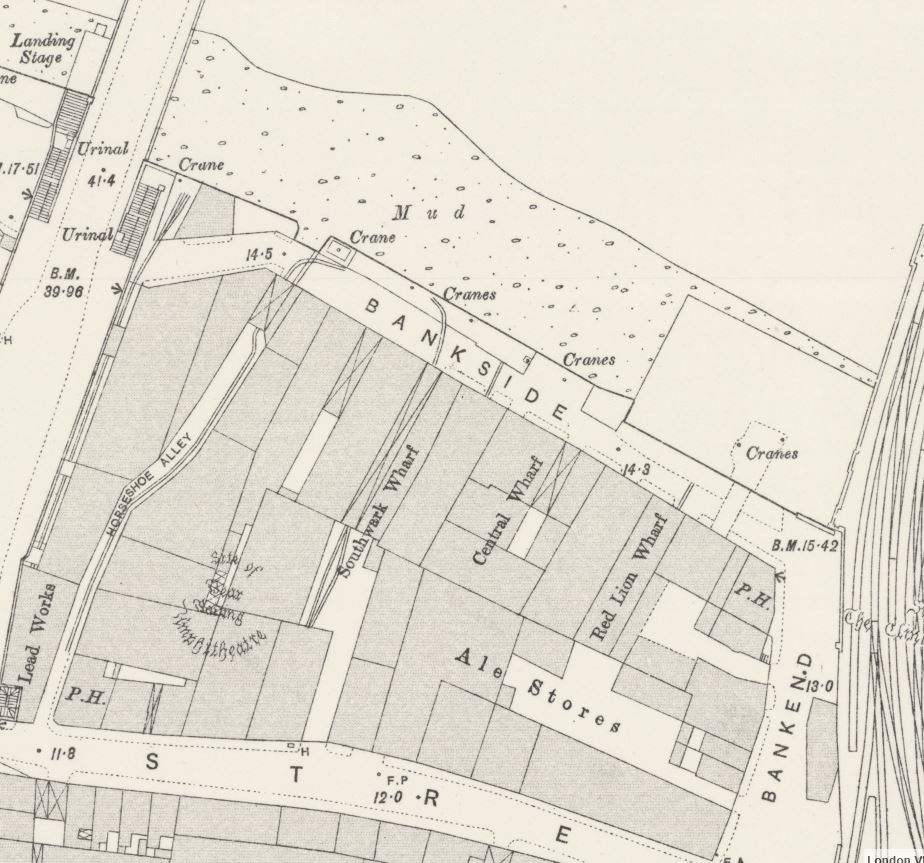
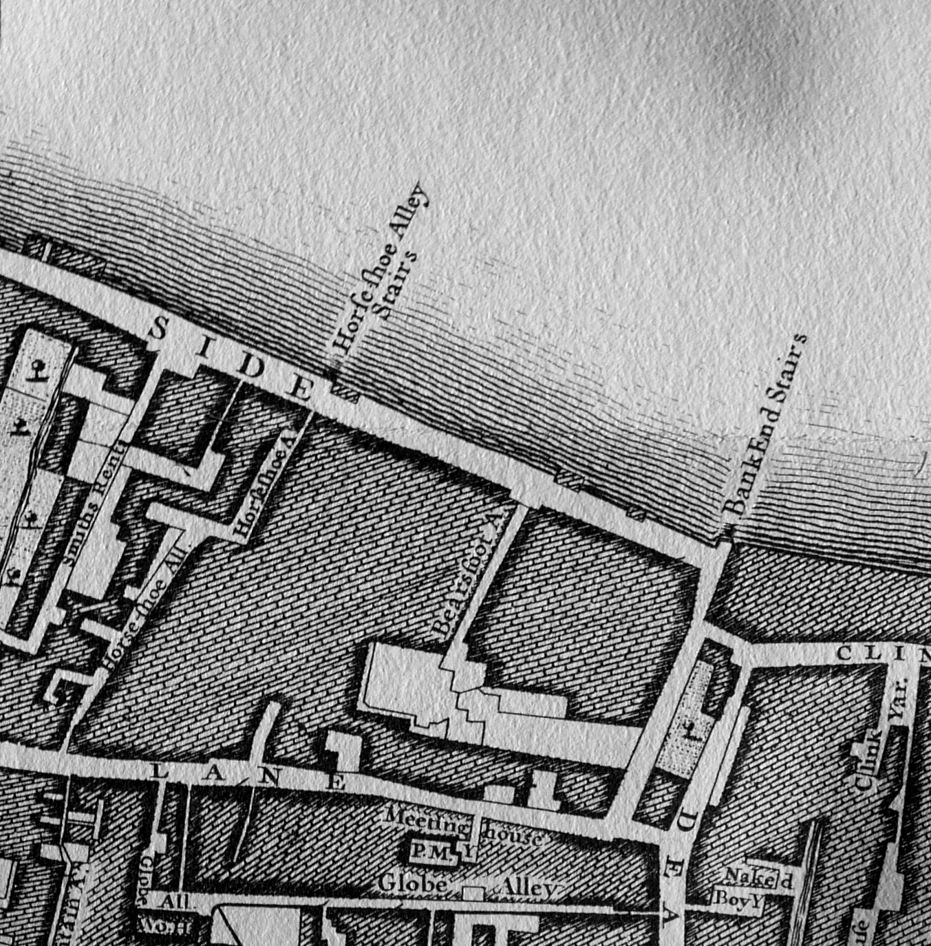
The following extract from the 1895 Ordnance Survey map shows this stretch of Bankside which I suspect had not change that much in the almost 60 years between the map and my father;s photo. It shows Bankside lined with warehouses, wharves and cranes along the river’s edge.

Bankside

There are a couple of features that interested me in my father’s photo. In the lower part of the photo is a solitary lamp mounted on the wall along the river and to the right is a large entrance on the ground floor of the building. What was this single lamp doing in this position?

Bankside

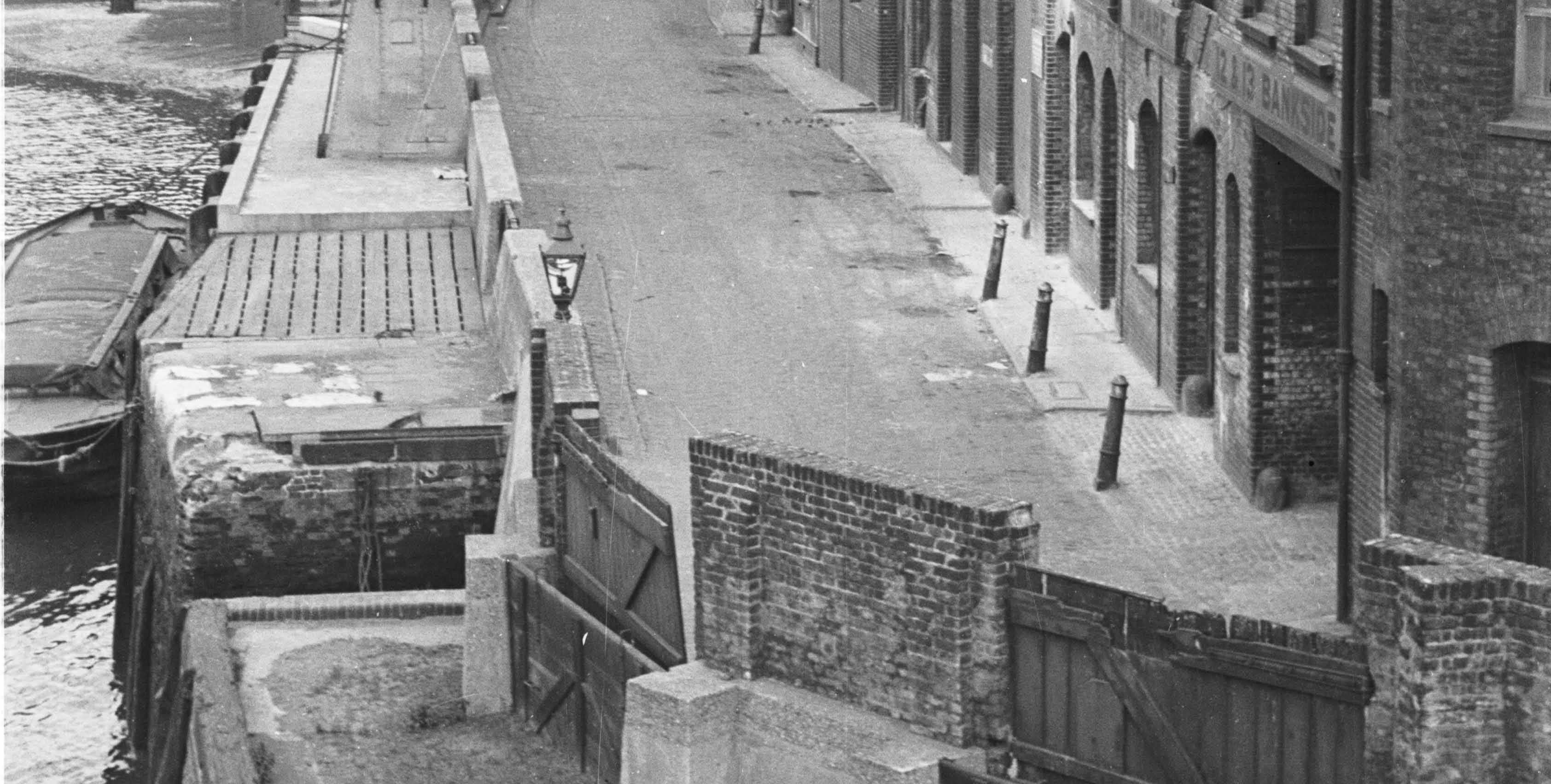
Looking at the 1895 map, the large entrance to the building on the right is the entrance to Horseshoe Alley. Covered over by the building, but opening out to an exposed alley as it heads in land. Opposite Horseshoe Alley at the water’s edge is what appears to be an opening in the river wall down to the river which can also be seen in the photo above to the left of the lamp.

I then checked my copy of John Rocque’s, map from 1746. In the extract below, Horseshoe Alley is there, but also, leading down to the river is Horseshoe Alley Stairs.

Bankside

So perhaps this single lamp was there to mark the position of the stairs and to guide those walking up and down what would have been rather dangerous and slippery steps down to the river.

Another feature that both of the above maps confirm is where Bankside ended at the appropriately named Bank End. It is at the edge of Bank End that the bridge carrying the railway across to Cannon Street station now runs. The Rocque map confirms that Bankside terminated here well before the railway bridge was built.

The approach road to Southwark Bridge runs over the street marked Smiths Rents on the left in the 1746 map.

There is an interesting story in the South London Press on the 4th March 1882 about Horseshoe Alley that shows how much flooding there was along this area of Bankside and the precautions put in place (or sometimes not) in an article titled: “The Floods in Southwark. How ‘Not To Do It’ “

The article reports on an inquiry by the St. Saviour’s Board of Works into flooding along Bankside:

“The chairman said that the board had been in communication with the Metropolitan Board of Works prior to the overflow with reference to the work to be carried out; and he apprehended that it was in consequence of that not being done that the flood took place. 

Mr Stafford asks: But did we not delegate one of our officers to attend to the question of floods specially, in order that the flood-gates may be closed at the proper time?

The surveyor (Mr Greenstreet) said that was the case. The board had appointed the clerk of the works to look after the barriers. With reference to the flood on Sunday week, he (the surveyor) was himself at Christchurch at 1 o’clock in the day. The clerk of the work’s unfortunately had only two men with him, though on such occasions he generally had four. All the dam-boards that were in use were at once put up so as to prevent the overflow of the water; but he found that at one important point-viz., Horseshoe-alley, the barricade had been removed. The water could not, therefore be prevented from coming in there, and it came up with such rapidity – more rapid, in fact, than on any previous occasion of which he had experience – that it washed away all the clay at Bank End. he found that nearly half of the dam-boards along Bankside were in an incomplete state, but some were now in proper order. The fact that the water overflowed was a pure accident that could not be prevented.

Mr Stafford asked the surveyor, with reference to the board at Horseshoe-alley, whether, prior to the flood he was aware it was not in position.

The surveyor replied in the negative. He only noticed its absence on the Sunday when the flood occurred, and it then struck him that the board must have been stolen.

Mr. Evans mentioned that on the Sunday in question he happened to be passing over Southwark Bridge when the water was coming up, and he immediately repaired to Bankside. He met the inspector and along with that officer they did what they could to prevent an inundation. Three men were employed to put up the barricades, and they had since complained to him (Mr. Evans) that they only received half a crown each for their work. As regarded Horseshoe-alley, he found that there were no boards there, and he took it upon himself to advise the inspector of nuisances to do what he could. 

Mr Hale asked the surveyor how long it was since he had ordered the removal of the boards at Horseshoe-alley. The Surveyor replied that he had not ordered their removal and that it was impossible to say where the boards went. It is pretty well a month since it went.”

I suspect the surveyor may have lost his job as a decision on his future was postponed for a later meeting.

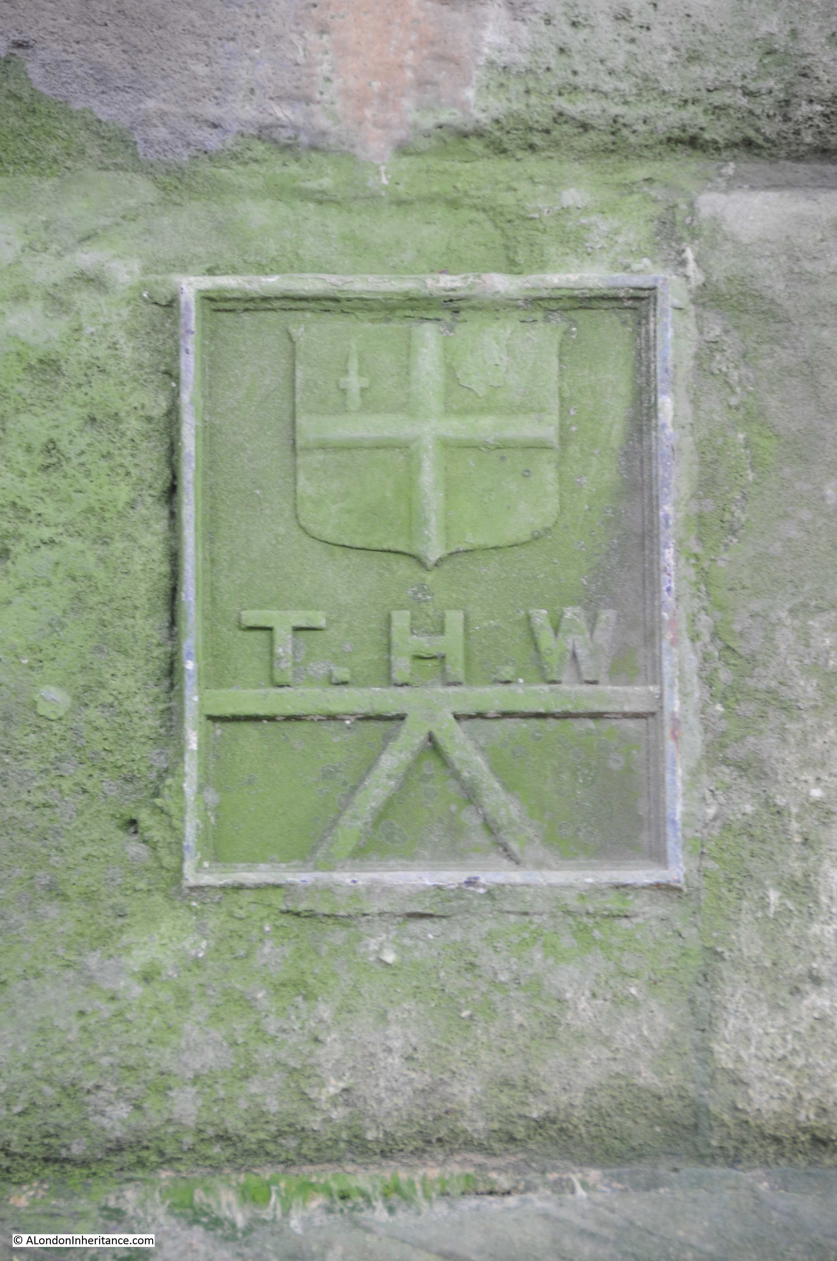
The flooding referred to happened on Sunday 19th February 1882. There were frequent floods along the Thames, however the river level for this flood was one of the highest and impacted a far wider area. There were reports of high tides and floods along the East Coast, but the greatest damage was done along the Thames.

The high tide on the morning of the 19th rose to above its normal height but did not give any cause for alarm, however it was the afternoon tide that went higher. By 2:30 pm the Trinity high-water mark at London Bridge had been reached. The tide continued to rise for another 30 minutes so that by 3pm it was now 2 ft higher than the Trinity mark.

Whilst some of the dams did hold, much of the Bankside and Blackfriars Bridge area flooded and there were bad floods in Lambeth. There was a heavy rush of water through Blackfriars Bridge Wharf with 2 foot of water flooding the surrounding streets. Men, women and children were reported to be “seen rushing about in all directions to find means of keeping out of the muddy water.”

The areas worse affected were Rotherhithe, Southwark and Lambeth on the south side of the river, and High Street, Wapping on the northern side. At St. Katherine’s Dock, the water level was recorded as being only 5 inches below the highest level ever recorded on the Thames which had occurred only a year earlier on the 18th January 1881.

The article mentions the Trinity high-water mark. I found the following on the river wall underneath Southwark Bridge on the north bank of the Thames. I believe it is one of the Trinity high-water marks:

Bankside

Looking back at my father’s 1953 photo it is easy now to understand the structures along the left side of the street. Heavy concrete walls, with the access points secured by heavy wooden panels slotted into the edges of the concrete walls to form a watertight seal.

Apart from the bridges that form the borders to this stretch of Bankside, there is only a single building that remains from the time when my father took the 1953 photo and the 1895 map.

Although not visible in the 1953 photo, if you look at the 1895 Ordnance Survey map, there is a Public House marked on the corner at Bank End. The pub is still there and is now called The Anchor:

Bankside

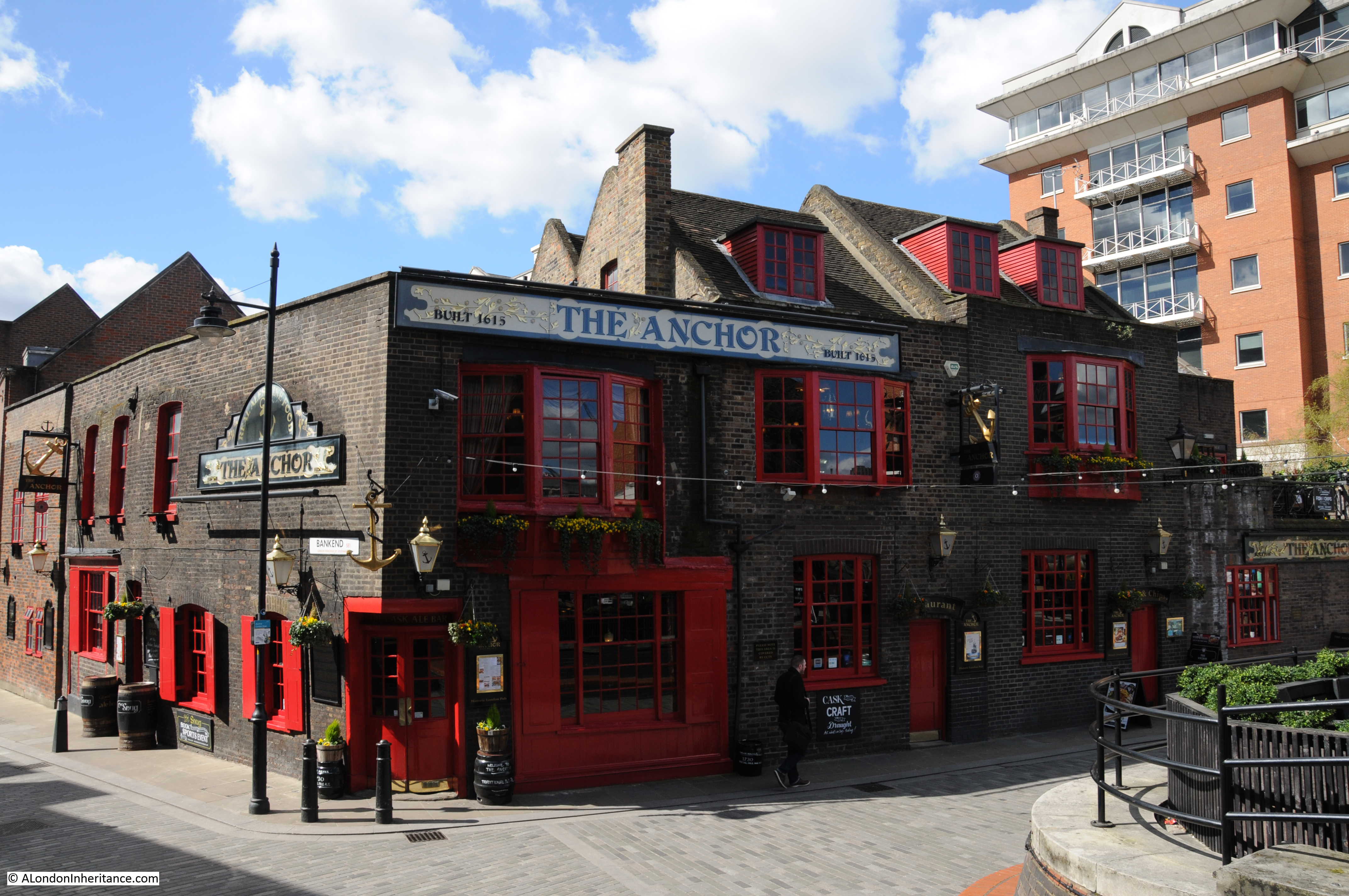
For part of the 19th Century the pub was called the Blue Anchor. In the 1953 photo there was only the relatively narrow street between the pub and the river, however today, with the straightening of the river wall out to the end of the brick pier of the bridge, there is a large open area in front of the pub – perfect for a beer on a nice day or evening.

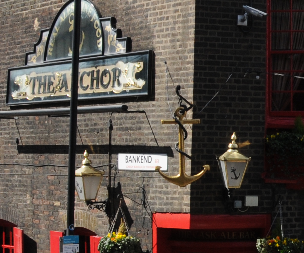
The area on the left of the above photo is Bank End, as confirmed by the name on the side of the pub, so if you stand here, this is where Bankside ends.

Bankside

Today, apart from the pub, this stretch of Bankside is rather bland and Horseshoe Alley and Stairs disappeared during the reconstruction which resulted in the river wall, walkway and buildings we see today. Stand here during a high Thames tide and it is easy to appreciate the challenges of protecting the land when all that was available to prevent an inundation were wooden boards .

I wonder what happened to the surveyor and if he had any role in the disappearance of the Horseshoe Alley dam-boards.

From Bankside To The Proud City

On a completely different subject, I recently found a copy of the film “The Proud City” on YouTube. The film tells the story of the planning for the post war reconstruction of London by Patrick Abercrombie and JH Forshaw. The film includes many views of London, along with Abercrombie and Forshaw explaining the background to the plan, along with some wonderful large scale posters of the maps that would be in the printed report along with models of areas to be redeveloped. The following screen shots from the film show some examples.

Bankside
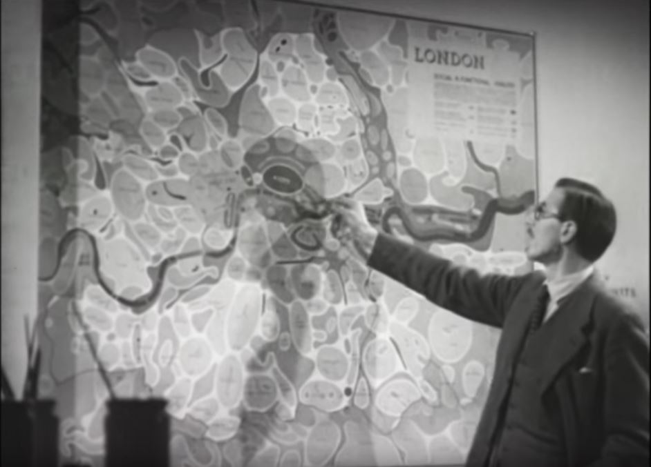
I wonder what happened to these large wall maps. I would love to have them on my wall. I featured a number of them in my post on the 1943 plan for post war reconstruction here.Bankside

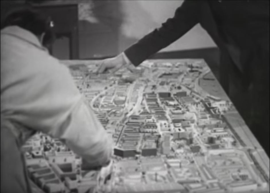
The film is very much of its time, but is 25 minutes well spent to see some fascinating film of London and to understand the thinking behind the Abercrombie and Forshaw plan.

The Proud City can be found here.

alondoninheritance.com

Southwark Cathedral

There are a few places in London where I can stand in exactly the same position as my father and the view is almost identical. In Winchester Walk, approaching Southwark Cathedral, the subject of this week’s post, is one of these locations.

My father took the following photo of the Cathedral in 1953 from Winchester Walk.

Southwark Cathedral

My 2017 photo from the same location:

Southwark Cathedral

I managed to get the alignment between these two photos almost exactly the same. The differences between the two are mainly cosmetic and if I had been there early in the morning with no people around and converted to black and white the photos would have been almost identical, amazing considering they are 64 years apart. The roof and air vents on the Borough Market building on the right are identical as is the roof line of the buildings on the left including the railing around the top of the wall at the base of the roof.

When I take photos at places where the view and surroundings are almost identical, knowing who was standing at this exact same place decades ago, it does bring home how quickly time passes and that we are all just very temporary occupants of these streets.

One of the differences between the two photos is the cleanliness of the buildings. It is perhaps difficult to appreciate how clean the buildings of London are today when compared to those of the city when the burning of coal in homes and factories was common across the city, and from the steam trains passing on the railway viaducts adjacent to the market and Cathedral.

Southwark Cathedral is in the background and Borough Market on the right – Borough Market being the reason why there are so many people around this area.

There has been a church on the site of Southwark Cathedral for many centuries, and the location close to the southern end of London Bridge, a river crossing point since Roman times, perhaps explains the importance of this location.

The first church on the site was possibly built around the 7th century, allegedly by a ferryman who used his wealth to fund the construction of the church. Edward Walford in Old and New London includes a story which also refers to a ferryman, but attributes the building of the church to his daughter, Mary Audrey. Old and New London records that this story came from Stow, who chronicled it as the report of the last prior, Bishop Linsted. Walford does then go on to state that this story has been much discredited.

I suspect we will never know who was responsible for the original church, however it was rebuilt in the 9th Century by the Bishop of Winchester and then in 1106 the church was re-founded by two Norman Knights, William Pont de l’Arche and William Dauncey as a priory for Augustine Canons.  The church was dedicated to St. Mary and then later to St. Mary Overie. Walford in Old and New London suggests that Overie is a corruption of the surname of Mary Audrey, however I suspect this is part of the discredited story. The official explanation is that Overie means “over the river”.

In 1424 the church held its only royal wedding when James I of Scotland married Jane Beaufort, the daughter of the Earl of Somerset.

During the reformation, the priory was closed and the church taken by Henry VIII, when it became a parish church, dedicated to St. Saviour.

The church was purchased by the parishioners in 1614 and in 1689 the new tower was completed which is the tower we see today.

In the following centuries the church went through periods of decay and repair. The tower was in jeopardy on a number of occasions , Walford reports that once was due to vibration damage resulting from the ringing of the bells. The south-eastern pinnacle was struck by lightning and fell on the roof of the south transept. The wooden roof of the nave was demolished, followed by the original nave.

The church became Southwark Cathedral in 1905 to recognise the importance of the church and the considerable growth in population south of the river. The full title of the church retains the original dedications as the Collegiate Church of St. Saviour and St Mary Overie.

The following map extract from the late 17th century shows the church with the tower looking as it does today. To the left of the church is a small open area into which leads into Stony Street. This is the street from which the 1953 and 2017 photos were taken, however at some point it has changed its name to Winchester Walk. Borough Market now occupies the area south of the Cathedral on what was once Angel Court and the wonderfully named Foul Lane.

Southwark Cathedral

The current name Winchester Walk retains a link the area has had with the Bishops of Winchester. Winchester House or Palace once occupied a large area west of the Cathedral which included a hall of which the circular window can still be seen when walking from the Cathedral into Clink Street.

Views of Southwark Cathedral from Old and New London.

Southwark Cathedral

The top right drawing shows the part of the Priory of St. Saviour’s, the oldest part of the church and dating from the 13th century. This part of the church is still in existence and I will find this during a walk around the Cathedral.

Wenceslaus Hollar also made a number of drawings of the Cathedral including the following showing the south front of the church. The print was published around 1690, although certainly drawn much earlier as Hollar died in 1677. The church in the distance to the left of the Cathedral is St. Paul’s Cathedral so this could be a pre-1666 print. The spire on the tower of St. Paul’s must have been added by Hollar as it collapsed in 1561.

Southwark Cathedral

The future of the church was at risk during the 19th century when the church was still a parish church rather than a cathedral. During the 19th century, railways would cut through the south of London to reach stations along the south of the river such as Waterloo and cross the river to reach stations on the north bank. Walking around Borough Market shows how part of the market is enclosed within railway viaducts, and the impact of these on both the market and the church can really be appreciated from the top of the Shard.

The following photo shows the Cathedral to the lower right with the loop of railway viaduct heading round to the bridge to Cannon Street Station on the north side of the river.

Southwark Cathedral

There were proposals to demolish the church during the planning of the railways along the south of the river, fortunately these did not get put into practice, however the proximity of these viaducts clearly demonstrates the impact of the railway in the area around the Cathedral.

The area to the south west of the Cathedral and within the area enclosed by the railway viaducts is now occupied by Borough Market.

Southwark Cathedral

If you are there during a weekend, I recommend avoiding the crowds in Borough Market and visit the Cathedral instead. The interior of the church is fascinating and well worth a walk around.

The view on entering the Cathedral, looking down the nave towards the Choir.

Southwark Cathedral

The following two photos show some of the medieval roof bosses from the 15th century wooden ceiling, installed following the collapse of the earlier stone ceiling.

Southwark Cathedral

Southwark Cathedral

At the end of the nave is the Shakespeare memorial. The carved figure of Shakespeare is from 1912. Sir Walter Besant in London, South of the Thames mentions that Shakespeare’s brother Edmund was buried in Southwark Cathedral.

Southwark Cathedral

The tomb of Bishop Lancelot Andrewes who died in 1625. Andrewes was one of the translators of the King James version of the Bible.

Southwark Cathedral

At the eastern end of the church is the retro choir. This is from the 13th century and is the oldest part of the Cathedral still standing (see the drawing of the retro choir in the drawings from Old and New London above).

Southwark Cathedral

There is an open archaeological excavation outside the main church which I will come to later. This shows a 1st Century AD Roman road and has an information panel which shows that the original Watling Street ran along the eastern edge of the church, just outside the windows that run along the left of the photo above. The road cut through the far corner of the church.

The majority of effigies are carved in stone, however Southwark Cathedral has a rather unusual effigy carved in wood which dates from the 13th century.

Southwark Cathedral

There is also an effigy of the rather shrunken body of Thomas Cure of Southwark who died on the 24th May 1588.

Southwark Cathedral

This superb wooden chest once held all the parish records. Made by German immigrants in the parish, it was given to the church in 1588.

Southwark Cathedral

A wonderful model of the church, although a couple of the pinnacles on top of the tower appear to be missing, perhaps recreating the lightning strike that brought down one of the pinnacles onto the roof of the south transept.

Southwark Cathedral

During my visit the High Altar Screen was partially hidden behind an artwork. The High Altar Screen dates from 1520, but with later added detail. The screen consists of carvings of saints and those who have been connected with the Cathedral.

Southwark Cathedral

Looking down the Nave from the Choir.

Southwark Cathedral

The painted ceiling on the base of the tower.

Southwark Cathedral

An epitaph to John Trehearne, Gentleman Portar to King James the First.

Southwark Cathedral

The epitaph reads:

“Had Kings a power to lend their subjects breath Trehearn thou should’st not be cast down by death. Thy royal master still would keep thee then but length of days are beyond reach of men, nor wealth, nor strength, nor greatmen’s love can ease the wound death’s arrows make. Thou hast these in thy King’s court good place to thee is given. When thou shalt go to ye King’s Court of Heaven.”

A salutary reminder that no matter your wealth or power, there is no escape from death.

Along the northern side of the church is the Harvard Chapel which is named after John Harvard, the benefactor of Harvard University who was baptised in Southwark Cathedral, or St. Saviour’s as it was in 1607.

Southwark Cathedral

John Harvard was born in Southwark in 1607. He emigrated to America in 1637 and settled in Charlestown where he became a minister. He was only there for one year, as he died in 1638. He left his library and part of his estate to the college that had been established two years earlier and which would take his name.

The stained glass window in the Harvard Chapel was given to the church by the US Ambassador in 1907.

Also within the Harvard Chapel is a tabernacle designed by Augustus Pugin in 1851, the year before his death in 1852. It was Pugin who was responsible for so much of the design of the Palace of Westminster, including the Elizabeth Tower.

Southwark Cathedral

The tomb of John Gower. a poet to King Richard II and Henry IV. His head is resting on three books representing three of his greatest works.

Southwark Cathedral

The railway viaduct and market now occupies part of what was the churchyard of the Cathedral. There are some steps in the south-east corner of the churchyard from where the difference between the quiet churchyard of Southwark Cathedral and the crowds of Borough Market can be appreciated.

Southwark Cathedral

There were a fair number of visitors to the Cathedral during my visit, however what most people seemed to miss was perhaps one of the most interesting features. Walk back out the entrance to the Cathedral and there is a corridor where the Cathedral Shop is located. At the end of this corridor is the result of some of the archaeological excavations that took place prior to the building of the rooms on the north-side of the Cathedral in 1999.

The excavations show the layered history of the Cathedral, starting with the remains of a Roman road from the 1st Century AD, 12th Century foundations of the Norman Priory, 17th Century Delft Kiln, 18th Century stone pavement and a 19th century lead water pipe.

The remains of a 1st Century Roman road between the walls of the cathedral and the wooden retaining panels.

Southwark Cathedral

The information panel explains that the Roman road was a smaller road running diagonally across the church and appears to be running up to the river to meet at the same place where Watling Street met the river.

Lower right are 12th Century remains of the Norman church. In the middle is the 17th Century Delft Kiln and at the top is the lead piping and pavement.

Southwark Cathedral

Looking along the excavations with a coffin behind the kiln.

Southwark Cathedral

It is good to see these features in situ rather than as isolated exhibits. They show the layered history of London’s past and how London has always been built on earlier versions of the city.

It is also not just the stones of the city that have a layered history. All those who have lived and worked in the city over the centuries are also part of these layers, and it is this that I feel part of (although on a very much shorter time span) when taking photos in the same locations as those from 60 and 70 years ago.

alondoninheritance.com