Monthly Archives: April 2025

St. James’s Square and the Growth of Stuart London

A couple of week’s ago, I was in St. James’s Square, where a combination of time of year, and weather contributed to one of those days where London is such a pleasure to walk and explore:

St. James’s Square was developed as part of the growth of Stuart London during the 17th century, when London was expanding westwards with the development of large estates in Piccadilly and St. James’s and eastwards through the developments of the East India Company in Wapping, Limehouse and Blackwall. St. James’s Square can be found almost half way between Piccadilly and Pall Mall.

The central gardens are an oasis of peace, away from the surrounding streets, including the street that surrounds the gardens which is packed with parked cars and vans, and traffic which appears to use one of five streets leading off from the square as a short cut, away from the main streets.

The gardens have a number of works of art, including the 1982 Leonardo da Vinci Monument (Vitruvian Man) by Enzo Plazzotta:

View looking north through the gardens. A small part of the church of St. James’s Piccadilly can be seen in the distance behind the statue:

I did not get the details of this work, which I think is relatively new:
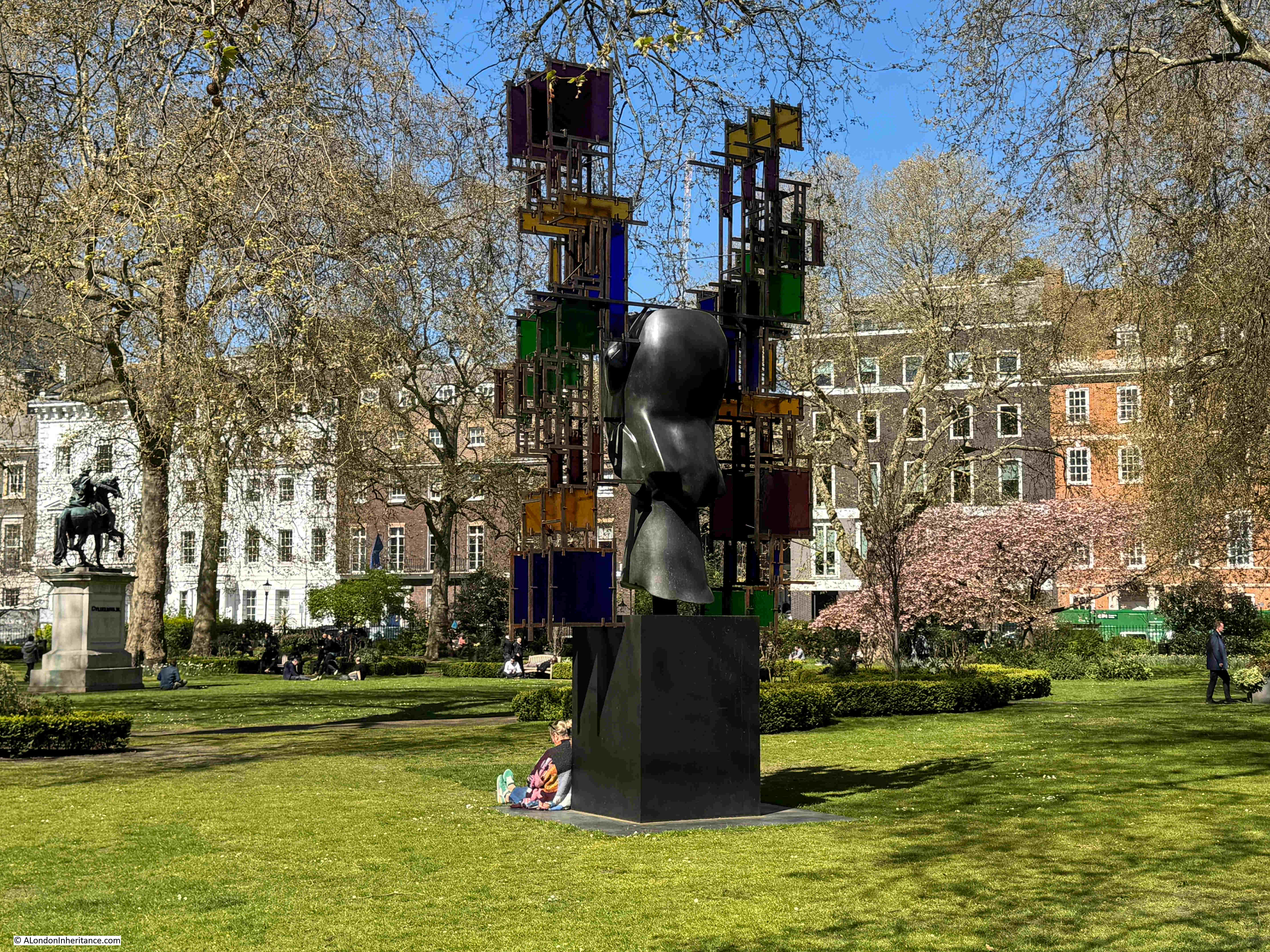
View across the gardens from the north west:

In the centre of the gardens is a statue of William III, cast in bronze with the king dressed as a Roman General. The statue dates from 1807, so is much later than the original square, and it is a statue that was some years in the making, as the funding for the statue had been provided in 1724 by the will of Samuel Travers, and was reported in newspapers of the time as follows:

“Samuel Travers Esq. of Hitcham in Berks, member of Parliament for St. Maws in Cornwall, Auditor to the Prince, and Clerk to the King’s Works, and who dy’d, last Week, has left a Legacy of £500 to Prince William, as much to Lady Essex Roberts; Money for erecting a statue to King William in St. James’s Square or Cheapside Conduit”.

Samuel Travers must have been very rich for the time. As well as the above, he also left considerable sums of money to other beneficiaries, including £500 for “maintaining seven decayed Lieutenants at Sea”, as well as a considerable sum to Christ’s Hospital.

The statue of King William III, with the Theatre Royal, Haymarket in the distance:

The view of the statue with the theatre aligned with the centre of the gardens, along one of the streets which leads off the square, gives the impression that this was part of the design of the overall area, however the theatre was built after St. James’s Square had been completed, and when the square was built, there was a much narrower street leading into Haymarket, along with buildings that blocked the view. The view we see today is the result of later improvements to the surrounding streets.

View from the western entrance to the central gardens:

If you walk from Jermyn Street along Duke of York Street to get to St. James’s Square, there is a plaque on the walk at the corner of street and square that provides some background as to the origins of the square:

Henry Jermyn, the Earl of St. Albans (and who gave his name to Jermyn Street which runs between St. James’s Square and Piccadilly) has already started development of area based on his leasehold of land where Pall Mall is now to be found.

In 1665, King Charles II granted the freehold of the land now occupied by St. James’s Square and the surrounding streets, to Henry Jermyn, two years after he had petitioned the King for the grant of land.

In the following years there were issues with the exact area covered by the grant of land to Henry Jermyn, and the City of London objected to the development of an area that had been fields and lanes as all the new houses would be a competitor for limited supplies of water, however Henry Jermyn’s relationship with the Crown appears to have overcome any objections.

Initial plans for the development of the square included a symmetrical plan of four wide streets leading from the square at the centre of each side of the square. During development, this plan was modified with narrower streets to extend the amount of built space, and on the southern side of the square, rather than a single street to Pall Mall, two streets were built at the south east and south west corners. The use of two narrow streets on the southern side of the square was aimed at preventing the square from being a major route from Pall Mall up to Jermyn Street.

Development of the square commenced in the late 1660s, and by the time of William Morgan’s 1682 map of London, houses lined three sides of the square, with smaller buildings between the square and Pall Mall, as can be seen in the following extract from Morgan’s map:

The original layout of the square included a central area surrounded by low fencing, but early in the 18th century, the centre had been taken up by a large pond, as shown in Rocque’s 1746 map:

A 1720 print showing the original design of the square, with a street for coaches lining the four sides alongside the houses, and a central square for walking surrounded by a low fence:

Image: © The Trustees of the British Museum. Shared under a Creative Commons Attribution-NonCommercial-ShareAlike 4.0 International (CC BY-NC-SA 4.0) licence.

The above print shows an ordered and tidy square, however there were ongoing issues with maintaining the cleanliness of the place, as described by Norman Brett-James in “The Growth of Stuart London” (London & Middlesex Archaeological Society 1935): “The condition of St. James’s Square left much to be desired, and Macaulay was not exaggerating when he describes the Square as ‘a receptacle for all the offal and cinders, for all the dead cats and dead dogs of Westminster. At one time cudgel play kept the ring there. At another an impudent squatter settled himself, and built a shed for rubbish under the windows in which the first magnates of the realm, Norfolk, Ormode, Kent and Pembroke, gave banquets and balls’ “.

To address issues with the square, in 1726 a Bill was put before the Commons to “enable the inhabitants of St. James’s Square to make a Rate on themselves, to clean, adorn and keep in repair the said Square”.

This improvement act appointed Trustees to care for and regulate the square, and their first meeting was held on the 23rd of June, 1726. This trust is still in place, and is the oldest Trust of its kind still operating in London.

The following 1754 print of St. James’s Square shows the central pond (a basin of water of 150 feet diameter), and if you look closely, to the left of the pond is a small boat with a man pushing the boat along with a stick and a woman sitting in the back of the boat – perhaps one of the most unusual features of a London square. There is also a small fountain in the centre:

Image: © The Trustees of the British Museum. Shared under a Creative Commons Attribution-NonCommercial-ShareAlike 4.0 International (CC BY-NC-SA 4.0) licence.

One of the more unusual events held in a London square occurred on the night of the 9th of September, 1695, when a fire-work display was held in the square to celebrate “His Majesties Glorious success in taking of Namur” (Namur, in what is now Belgium, was taken by the French during the Nine Years war , and recaptured in 1695 after forces led by the Earl of Athlone surrounded the town).

A print of the event shows fireworks in the centre of St. James’s Square, which also appears to be surrounded by soldiers simultaneously firing their guns:

Image: © The Trustees of the British Museum. Shared under a Creative Commons Attribution-NonCommercial-ShareAlike 4.0 International (CC BY-NC-SA 4.0) licence.

The statue of King William III from the time it was installed in St. James’s Square in 1807, in the centre of the basin of water, which was still occupying the central part of the square:

Image: © The Trustees of the British Museum. Shared under a Creative Commons Attribution-NonCommercial-ShareAlike 4.0 International (CC BY-NC-SA 4.0) licence.

From the 1820s there was more planting around the square, and by the 1850s this was making the central water filled basin into a rather dark and dank place, so in 1854 the basin of water was filled in, and the gardens gradually assumed the shape and planting we see today.

The majority of the buildings surrounding the square date either from the 19th and 20th centuries, or are rebuilds or significant remodels of the original houses. An example is number 4 St. James’s Square, in the north east corner, which is Grade II* listed, and is a 1726 to 1728 rebuild of the original 1676 house built on the site by Nicholas Barbon, a significant property developer of London in the late 17th century, and responsible for many of the original houses in St. James’s Square:

On number 4 is a plaque recording that Nancy Astor lived in the house, she was the first woman to sit as a Member of Parliament:

In the photo of the corner of the square just above, there is a building to the left of number 4, with a flag flying above the entrance with the number 5. This building was the Libyan Embassy in 1984.

On the 17th of April, 1984, a demonstration by the Libyan National Salvation Front was held outside the Libyan Embassy, to protest about the execution of two students in Tripoli opposed to the Gaddafi regime.

Barriers had been erected to separate the protestors from the Embassy and from a separate protest by those who supported the regime.

During the protest, shots were fired by those in the Embassy at the anti-regime protestors, and one of the police officers on duty during the protest was hit, and died later the same morning.

The police officer was PC Yvonne Fletcher, and today there is a memorial to her at the place in St. James’s Square where she fell:

There is also a tree planted inside the gardens as a memorial to PC Yvonne Fletcher by the Trustees of the square, and her colleagues at Vine Street police station:

To the right of number 4 is number 3, a 20th century occupant of the square, dating from 1934, and designed by architects Alfred and David Ospalek:

Above the ground floor are a series of stone panels by Newbury Trent, which represent the street-criers of London:

On the corner of the south east street leading from the square down to Pall Mall is this brick Grade II listed house, and it is prime example of how houses have been modified over the centuries:

From its appearance, the house could date from the original build of the square, however the house dates from around 1772, so almost 100 years after St. James’s Square was laid out and built.

If you look at the house, there is the ground, then first and second floors, with a band of brick running around the walls above the second floor. This band marks the original start of the roof of the house as the upper two floors were added in the 1850s. London houses have had so many modifications over the centuries.

Many of the newer buildings around St. James’s Square occupy the space of more than one of the original houses, however there are some new builds which occupy the same plot of land as the original house. The only way to generate more floor space was to build up, resulting in tall, narrow buildings, such as these two, also at the south eastern corner of the square:

The western side of the square – the building on the left with the two flags is the East India Club, one of west London’s many private members clubs:

House along the northern side of the square:

If you look just above the roof of the Mini car in the above photo, there is a very small part of a blue plaque showing, this is to record that Ada Countess of Lovelace lived here:

Augusta Ada King was the only legitimate daughter of the poet, Lord Byron. She was eight when her father died, and perhaps typically of the time, the majority of the reports of her death focussed on her father, the following being one example:

“She had small resemblance to her father. No one, we are told, would have recognised the Byron features – the finely chiselled chin or the expressive lips or eyes of the poet – in the daughter. Yet at times the Byron blood was visible in her look – and those who saw her in 1835, on her marriage with Lord Lovelace fancied they saw more traces of the poet’s countenance in the bride than they remembered at any other time. But dissimilarity of look was not the only dissimilarity between Byron and his daughter. Lady Lovelace cared little about poetry”.

The report does acknowledge that “Her favourite science was the mathematical”, and indeed she does seem to have been a mathematical prodigy from an early age, and the reference to being a “Pioneer of Computing” on the plaque is down to her work with Charles Babbage and his “calculating machine”.

From notes that she kept, Ada appears to have been one of the first to recognise that a machine such as that built by Babbage, could be used for more than just as a calculating machine. With the appropriate algorithm, such a machine could carry out a wide and varied range of tasks – although I wonder if Ada could have imagined just how far computing and algorithms have been embedded into almost every aspect of life, 173 years after her death.

Ada Countess of Lovelace died of cancer at the tragically young age of 36. She is remembered still to this day with the programming language Ada being named after her.

Further along the northern side of the square, on the corner with Duke of York Street are two houses, both from 1736. On the left is the Grade I listed Chatham House, and on the right (without a door to the square) is the Grade II* listed number 9, which has its entrance in the street leading out of St. James’s Square:

Chatham House on the left is home to the organisation of the same name, dedicated to international affairs, and also the source of the term “Chatham House Rule”, a rule that states that what is revealed at confidential meetings can be used, but the identity of the person who spoke cannot be revealed.

The house has also been the home to three Prime Ministers, as this really nice London County Council plaque on the building reveals:

The house on the right is on the site of the house where Henry Jermyn, the Earl of St. Albans died.

The reason why I was in St. James’s Square was to visit the London Library, one of the institutes that I use for research, and which has a entrance in the north-west corner of the square:

The London Library was founded in 1841 and moved to its current location in 1845.

The single bay entrance is deceiving, as the London Library occupies a considerable area behind this one façade, stretching back and around to the right, along the side of the building to the right of the above photo.

The building is a bit of a maze (which is part of the pleasure), and in the following photo, the shelves on the left cover just part of their collection of books about London:

And in an area known as the “stacks”, you walk amongst shelves, along floors which look down to more shelves of books below:

A magical place.

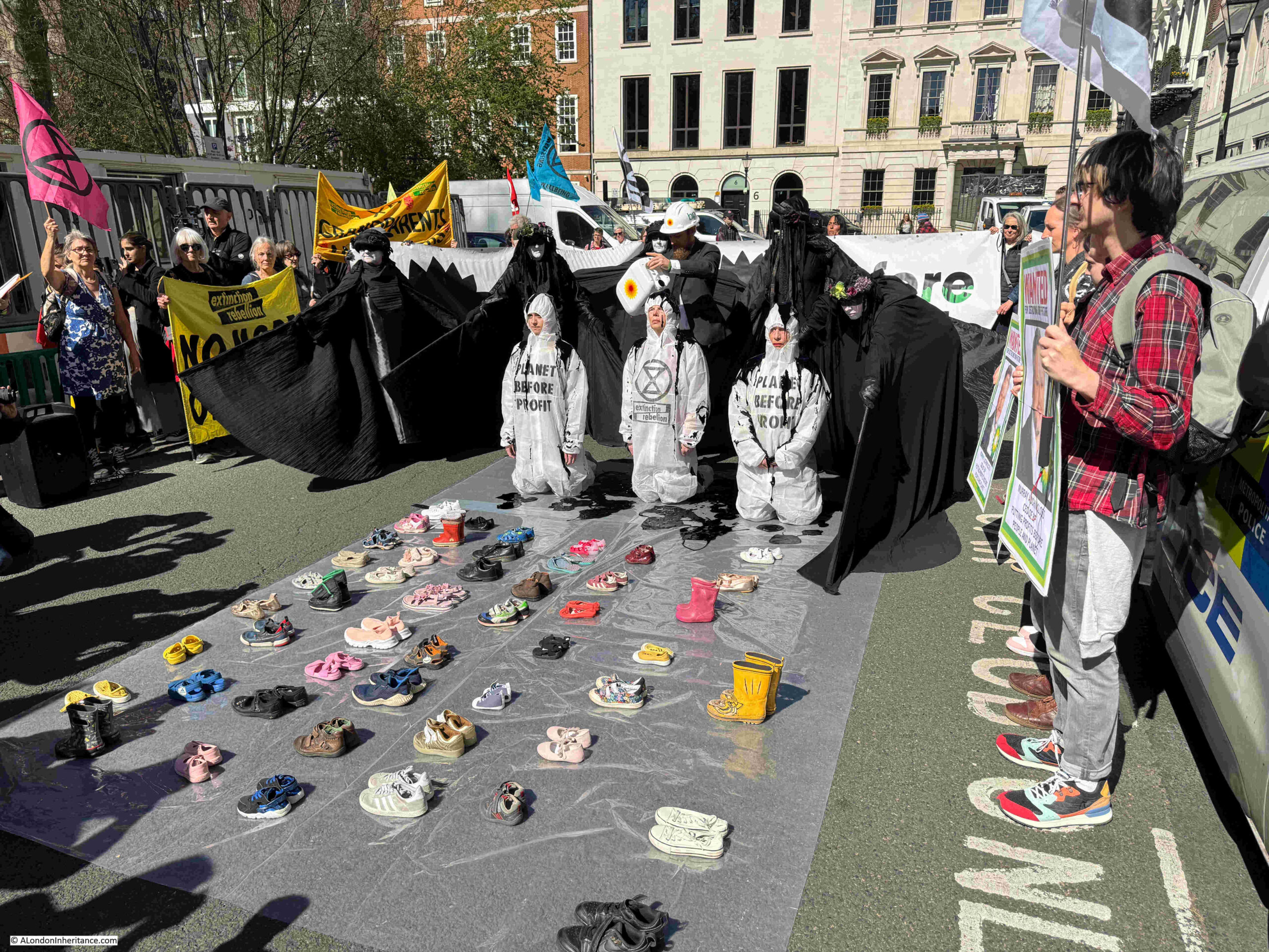
There is one more building in St. James’s Square which I have not mentioned, and on the day of my visit was to be a focal point for protest. The first indication of this was this small group within the gardens:

St. James’s Square is home to the registered office and worldwide headquarters of BP and Extinction Rebellion were holding a protest in the square, outside BP’s offices.

This started off with the north eastern section of the square being blocked:

BP’s offices:

Whatever your views of Extinction Rebellion, they have perfected a very theatrical method to get their message across, and are just one of many in the long running history of protest in London over very many centuries:
That is a very brief overview of St. James’s Square. A square that was part of the Stuart expansion of London during the late 17th century, as the city expanded into the surrounding fields.

A square that has been transformed over the centuries. Not just the central gardens, but also the new builds, rebuilds, and modifications of buildings surrounding the square, as the square changed from being the homes of the rich, aristocrats and well connected, to the home of international companies, institutes such as Chatham House, the London library, and a private members club.

A square that has been the home to many of those who were influential in their period of time, and a square that has seen protest, with one of these events resulting in the murder of a police officer by the representatives of a murderous regime.

Sitting in the central gardens on a glorious spring day, it was though intriguing to imagine the 1695 fireworks in the square to celebrate the victory at Namur, a display held on the edge of the growing city, and long before the use of gas or electric lighting, a very dark city.

alondoninheritance.com

Felixstowe Martello Towers, Bawdsey Radar and Sutton Hoo

For this week’s post, I am covering some of my father’s photos which were taken whilst cycling and youth hostelling around the country with friends from National Service.

On the 22nd of July, 1952, they were in the outskirts of Felixstowe, and encountered a couple of Martello Towers, along with a leading edge technology from the Second World War.

The Martello Tower on the Felixstowe Ferry golf course is the main building in the above photo, and if you look to the right, in the distance is a second Martello Tower.

Martello Towers date from the early years of the 19th century, and were built due to the perceived threat of invasion by the French forces of Napoleon Bonaparte.

The Felixstowe Martello Towers are part of a chain along the southern and eastern coast of England. A chain of 74 towers were constructed between Felixstowe and Dover, and these were then extended further along the Essex and Suffolk coast with another 29 towers all the way to Aldeburgh.

The name Martello is not from the person who came up with the idea or design of a circular defensive tower, rather the place where the British Navy first saw the effectiveness of such a design.

On the 7th of February, 1794, the British Navy were attacking the French in Corsica, and were firing cannonballs at a circular gun tower at Mortella Point. The circular design, along with very thick walls resulted in the cannonballs deflecting, or bouncing off the gun tower

The design was then copied for the Martello Towers along the English Coast. (Martello seems to have been a misspelling of the word Mortella).

Martello Towers were frequently constructed to assist shore based gun batteries, and to defend the point where rivers entered the sea, to prevent enemy ships from sailing inland. The two Felixstowe Martello Towers are to the south of the River Deben which leads inland to Woodbridge.

A short distance to the south is where the Rivers Orwell and Stour reach the sea, and there were two large forts on either side of the combined channel of these two rivers.

A 24-pounder anti-ship gun was the usual armament mounted on the roof of the towers, and this gun had a range of about one mile out to sea, and would have fired on an invader attempting to reach the shore, or enter the nearby rivers.

Internally, the Martello Towers had rooms for the officers and men who were stationed at the tower, along with supplies for their weapons and roof mounted gun, as well as supplies of food and water.

The Martello Towers had a very short operational life, and they never fired a shot in anger at any attacking ships, as after the defeat of Napoleon at the Battle of Waterloo in 1815, the threat of invasion by the French disappeared.

Some Martello Towers were retained by the Navy, some were used by the Coastguard, used for anti-smuggling operations, some had additional defensive weapons installed during the First and Second World Wars, and some became wireless radio stations for ship to shore communications.

Now redundant, the surviving towers are now often converted to residential, owned by councils, used by the volunteer National Coast Watch organisation, open for public access, or, in the case of the first Felixstowe Martello Tower that I am visiting, apparently closed and surrounded by a golf course.

The main and distant Martello Towers in my father’s photo are both Grade II listed. Another view:

When I visited the tower, there were plenty of golfers on the course, so it would not have been popular with them, or perhaps safe from flying golf balls, to wander onto the course to take photos from the same angle as my father, but in the above photo he had no such problems, and as well as the tower, to the left and in the distance is another feature of defending the country from European attackers that I will explore later in the post.

To get close to the first Martello Tower, it was a walk along the sea wall, with a warning to keep to this route:

They really do not want you to wander onto the course:

I was able to get up a grass bank to get a wider view of the tower, the entrance to the River Deben, and the opposite bank of the river:

The Martello Tower up close:

A sketch from June the 28th, 1837 showing the Felixstowe Martello Tower:

Image: © The Trustees of the British Museum. Shared under a Creative Commons Attribution-NonCommercial-ShareAlike 4.0 International (CC BY-NC-SA 4.0) licence.

The text below the sketch states that “The Martello Towers are used by Preventive Men”, and the following report issued by the Custom House, London on the 4th of April, 1825 illustrates the work of the Preventive Men:

“Whereas it has been represented to the Commissioners of his Majesty’s Customs, that on the night of the 23rd, Robert Wallis, Chief-boatman, and the Preventive Men belonging to the station at Newtown, Isle of Wight, were out on duty for the prevention of Smuggling, and towards Freshwater, fell in with a company of Smugglers, to the number of Forty-five or Fifty, who dropped their Tubs, and whilst the said Chief-boatman and some of the Preventive Men were endeavouring to secure one of the Smugglers, the whole company immediately fell upon them and severely beat and wounded the Chief-boatman, and broke his Cutlass, and also beat one of the Preventive Men, and took from him his Pistol, and the Smugglers having overpowered them, picked up their Tubs and escaped.”

A reward of £50 was then offered for any person who “shall discover, or cause to be discovered, any one or more of the said offenders.”.

The area of the east coast around Felixstowe would have offered numerous landing places for smugglers, along with the rivers Deben, Orwell and Stour offering routes to inland landing and hiding places, so smuggling would have been an ongoing problem for the authorities.

In one of my father’s photo, there is a second Martello Tower in the distance, so we continued along the sea wall to find this tower:

This second tower is on the side of the estuary of the River Deben, and appears to have been converted to residential:

The location of the two Martello Towers is shown in the following map, with tower 1 being the tower on the golf course and tower two being the one apparently now residential. The River Deben is running inland, and the map shows how these were positioned to defend the river entrance (© OpenStreetMap contributors):

To the south is Felixstowe, with the larger entrance to the Rivers Stour and Orwell. This river entrance continue to be important in the life of the country, as it provides access to the major container port of Felixstowe.

In the above map, I have marked Bawdsey, and the following is an extract from one of my father’s photos of Martello Towers, that shows the view across to the north bank of the River Deben, and large aerial towers at Bawdsey:

There is a fascinating parallel between the Martello Towers and these tall aerial towers across the River Deben. One is early 19th century and the other is a mid 20th century approach to defending the east coast from attack.

In the above photo, just below the second tower from the left, it is just possible to see Bawdsey Manor.

Grade II* listed Bawdsey Manor was built between 1886 and 1908 using a wide mix of architectural styles, originally as a holiday home for the family of Sir Cuthbert Quilter, but it soon became their main, family home.

The house and grounds passed through the Quilter family until 1937, when William Eley Cuthbert Quilter sold the estate to the Air Ministry, who were looking for a site to conduct research and development of the new technology of radar.

At the outbreak of war in 1939, Bawdsey Manor became both a training school and an operational radar station, and the aerial towers we see in my father’s photo were part of the radar installation.

The story of the development of radar for wartime use starts in 1935 when it was demonstrated that a system where a pulsed radio signal enabled aircraft to be detected as the radio pulse was reflected by an aircraft back to a radio receiver.

The Government approved an initial £60,000 to build 5 stations, and by September 1939 a chain of 20 stations had been built along the east coast. The system could detect aircraft up to 120 miles distant, a distance which provided around 20 minutes warning – a remarkable achievement given that it was just four years since the concept had been demonstrated.

The system consisted of smaller 75 metre tall wooden towers which supported receiving aerials and 100 metre tall steel lattice towers for the transmitter aerials.

These two types of tower can both be seen in my father’s photo.

The system became known as “Chain Home” and by the end of 1945 there were over 100 Chain Home radar stations, primarily around the coast of England, Scotland and Wales.

Continuous technical development during the war resulted in considerable improvements both in the use of radio technology, and the interpretation of the reflected signal.

One technical innovation was the development of the Cavity Magnetron by Harry Boot and John Randall of the University of Birmingham, which allowed high power microwave radio systems to be built, and that resulted in much smaller, accurate and more compact radar units to be deployed around the coast and importantly in aircraft, where systems were able to detect a periscope from a submarine above the sea surface.

The Cavity Magnetron is basically the same technology that powers your Microwave oven today, and during the war, along with jet engine technology, the design of the Cavity Magnetron was given free to the US, in return for their production capabilities.

A close up view of the steel lattice towers at Bawdsey from the Imperial War Museum collection:

THE BATTLE OF BRITAIN 1940 (CH 15337) The transmitter aerial towers at Bawdsey CH (Chain Home) radar station, Suffolk, May 1945. Copyright: © IWM. Original Source: http://www.iwm.org.uk/collections/item/object/205196697

The following work by William Thomas Rawlinson shows an unnamed radar station on the east coast of the country with the same two types of aerial towers as photographed by my father:

A CH (Chain Home) Radar Station on the East Coast (Art.IWM ART LD 5735) image: Standard steel transmitter towers in the foreground with wooden receiver towers in the background. In the foreground are piles of tires, some vegetation and a line of barbed wire fencing. Copyright: © IWM. Original Source: http://www.iwm.org.uk/collections/item/object/22519

The above work was purchased by the War Artists Advisory Committee who were responsible for the purchase, and or commissioning of a comprehensive collection of artworks showing various aspects of the last war. See this post for London related images from the War Artists Advisory Committee collection.

One of the key factors in the success of radar, was the display equipment and the operators ability to interpret the signals being received by the radar system.

Bawdsey, as with many of the other Chain Home radar stations, had a local receiver room, where the signals received by the wooden receive aerial masts would be displayed and interpreted.

The next two photos show the receiver room at Bawdsey:

ROYAL AIR FORCE RADAR, 1939-145. (CH 15331) Chain Home: Flight Officer P M Wright supervises (right) as Sergeant K F Sperrin and WAAF operators Joan Lancaster, Elaine Miley, Gwen Arnold and Joyce Hollyoak work on the plotting map in the Receiver Room at Bawdsey CH, Suffolk. Copyright: © IWM. Original Source: http://www.iwm.org.uk/collections/item/object/205210716

Interpretation required some considerable skill, with the signal being displayed as a line moving across a Cathode Ray Screen. A returned signal would result in a dip in the line, with the distance being measured by how far along the line the dip occurred, and the size of the dip showing the strength of the returned signal, and therefore some indication of the type and number of aircraft being intercepted:

ROYAL AIR FORCE RADAR, 1939-1945 (CH 15332) Chain Home: WAAF radar operator Denise Miley plotting aircraft on the CRT (cathode ray tube) of an RF7 Receiver in the Receiver Room at Bawdsey CH. Her right hand has selected the direction or heightfinding and her left hand is ready to register the goniometer setting to the calculator. Copyright: © IWM. Original Source: http://www.iwm.org.uk/collections/item/object/205196699

The air ministry continued to use Bawdsey as a training school and radar station up to 1974, when the site closed for four years, and from 1979 to 1986 it reopened as an air defence unit, when it was home to Bloodhound air defence missiles – a missile system intended to hit soviet bombers attacking British nuclear bomber bases.

I have not been able to find a date for when the towers were demolished.

Since release by the air ministry, Bawdsey Manor has been empty for periods of time, has been an international language school, and now is a PGL residential adventure centre for schools and groups.

From the second Martello Tower, we can look across the River Stour to Bawdsey Manor:

A daily foot and bike ferry runs across the Stour to Bawdsey from May to September, and there is a museum dedicated to radar and Bawdsey history near the manor, which is open on Thursdays, Sundays and Bank Holidays.

The above photo shows a fishing boat returning as it enters the River Deben from the sea. It is fascinating to think of the thousands of ships and boats that have made the same journey, and a very short distance from the Felixstowe Martello Towers is a location where the remains of a ship that may have made this journey was discovered:

Sutton Hoo

As the radar towers were being built at Bawdsey, and the Second World War was about to break out, a remarkable discovery was being made a few miles to the north under one of the burial mounds at Sutton Hoo.

The Sutton Hoo estate had been purchased by Edith Pretty after her marriage to Frank Pretty. She was the daughter of a wealthy industrialist, and had spent much of her early life travelling.

In 1930 she gave birth to a son, however four years later, her husband died.

Tranmer House (originally Sutton Hoo House), Edith Pretty’s home on the Sutton Hoo estate:

The Sutton Hoo estate included a number of burial mounds, located along the higher ground of the estate, where it rises up from the River Deben.

Possibly because of her earlier experiences of archaeological excavations seen during her travels, she appears to have had an interested in the purpose of the burial mounds, and if there were any remaining objects and evidence of their original purpose, to be found inside.

In 1938 she commissioned Basil Brown, a local, Suffolk amateur archaeologist, to excavate three of the burial mounds.

These mounds had been “robbed” in the past – an activity where people would dig down to find and take anything of value that they could find.

Despite having been robbed, sufficient evidence was found to show that one of the mounds had contained a ship, that there had been cremation burials, and that a range of valuable and exotic items had been buried.

Basil Brown returned to Sutton Hoo the following year, 1939, and started work on the largest mound on the site, and it was here that he found the rivets of a ship and the complete outline of the wooden planks of a ship which had long rotted away.

The discovery of the intact outline of a large ship within a burial mound caused some excitement at both local and national museums and archaeological institutions, and the dig at Sutton Hoo was taken over by a team led by Charles Phillips of Cambridge University.

In what had been the middle of the ship, a collapsed burial chamber was found, which remarkably was still intact and had not been robbed over the previous centuries.

As the burial chamber was excavated, around 263 objects were found, including some remarkable gold jewellery, silver bowls, coins and the remains of a helmet.

An inquest to determine the status of the treasure found at Sutton Hoo was held soon after the discovery, where it was decided that it belonged to Edith Pretty, however she donated it the same year to the British Museum, where it can be seen today.

For many years, there was no mention of Basil Brown as the original finder of the ship burial, however the British Museum have now corrected this, and he is named as the original finder of this nationally important, Anglo-Saxon discovery.

Edith Pretty died in 1942, and her son went to live with an aunt. The house was taken over by the War Office to home Land Girls, before being sold to the Tranmer family (hence the current name of the house)_ and in 1998, the Trustees of the Annie Tranmer Trust (Annie was the last of the Tranmer family to live at Sutton Hoo), donated the house and estate to the National Trust.

The National Trust have done an excellent job at opening up the estate. There is an exhibition centre at the start, with replicas of many of the finds which are now at the British Museum.

The ground floor of Tranmere House is open, and there are various exhibits about the discovery, Basil Brown and Edith Pretty, and a short walk from the house is the area where the burial mounds can be found, and the National Trust have built a tower with viewing gallery where it is possible to appreciate the size of the site, which is not that clear when walking around the site, as shown in the following panorama from the viewing gallery (the mounds are much flatter today today when when they were created):

And in the following copy of the above photo, I have marked the location of the ship burial. The National Trust have put up markers at the two ends of the ship, so the yellow line shows the 27 metre length and the orientation of the ship discovered by Basil Brown:

A ground level view along the yellow line in the above photo, with one of the ship markers in the foreground, and the other end of the ship can be seen by the second marker on the horizon:

The ship buried at Sutton Hoo is believed to have been dragged up from the River Deben, a short distance from the burial site, although it must have required considerable effort to drag a large wooden ship up the steep slope from the river.

View from the top of the viewing tower, where the River Deben can be seen with the town of Woodbridge on the opposite bank:

The ship burial appears to date from the Anglo-Saxon period, somewhere around the early 7th century. This type of ship burial, along with the range and quality of goods buried in the ship imply that the burial was that of a very important person.

There is no firm evidence to identify who was buried under the mound, however the majority of evidence suggests that it was Raedwald, who was King of the East Angles, and who died somewhere around the years 624 and 625.

Among the finds which are now on display in the British Museum is the helmet, where the surviving pieces of iron and tinned copper alloy have been added onto a reconstruction of the helmet:

Image: © The Trustees of the British Museum. Shared under a Creative Commons Attribution-NonCommercial-ShareAlike 4.0 International (CC BY-NC-SA 4.0) licence.

A gold belt buckle:

Image: © The Trustees of the British Museum. Shared under a Creative Commons Attribution-NonCommercial-ShareAlike 4.0 International (CC BY-NC-SA 4.0) licence.

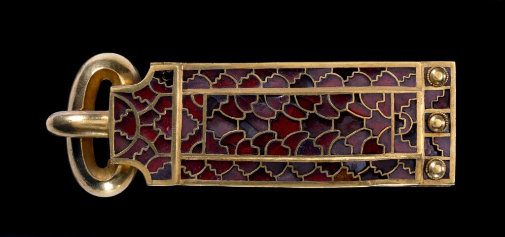
Many of the finds included silver bowls from Byzantium and precious stones from places as remote as Sri Lanka, showing that early 7th century, Anglo-Saxon England was not isolated, but was connected with global trade routes, and that some in Anglo-Saxon society were wealthy enough to afford not just the raw materials, but also the craftsmen to create the objects found at Sutton Hoo. Considerable expertise and specialist tools would have been needed to create these objects.

Another gold belt buckle, with inlaid garnet:

Image: © The Trustees of the British Museum. Shared under a Creative Commons Attribution-NonCommercial-ShareAlike 4.0 International (CC BY-NC-SA 4.0) licence.

A number of coins were found within the burial, which helped with dating, one of which is the following gold coin:

Image: © The Trustees of the British Museum. Shared under a Creative Commons Attribution-NonCommercial-ShareAlike 4.0 International (CC BY-NC-SA 4.0) licence.

There is a sort of connectedness between the Martello Towers, Bawdsey Radar and the Sutton Hoo Anglo-Saxon ship burial.

They are all to be found in this very small area due to their location close to the sea and the River Deben. The Anglo-Saxons used the river as a route to the sea, where many of the finds from the ship burial may well have arrived, either as raw materials and made in England, or as manufactured products.

The sea was also a route for invasion, and the area was defended firstly by gun emplacements on fortified Martello Towers, and then by radar detecting attacking enemy aircraft.

I always try and find a London connection when visiting the sites of my father’s photos from across the country, even though they may be very tenuous, and after Sutton Hoo, we crossed the River Deben into Woodbridge, where there is a rather nice milestone showing that we were 77 miles from London, on the main route from London to the east cost and Lowestoft and Great Yarmouth, a route now mainly replaced by the A12:

alondoninheritance.com

Junes Ladies Hair Stylist, Durham Row, Stepney – 1986

I have two new walks planned for this year, and they should be ready in June / July, however until then, if you have not been on one of my existing walks, I have just released three for May. They are, along with links for details and booking:

The Lost Streets of the Barbican on Sunday the 11th of May (Sold Out)

The Lost Landscape and Transformation of Puddle Dock and Thames Street on Sunday the 18th of May (Sold Out)

Limehouse – A Sink of Iniquity and Degradation on Saturday the 24th of May (Sold Out)

Continuing the theme of last week’s post, looking at changes across the streets of London between the 1980s and today, I am now in Stepney, hunting for the location of Junes Ladies Hair Stylist, in Durham Row, as photographed by my father in 1986:

The same house in 2024:

Junes Ladies Hair Stylist is a reminder of when very small businesses were run out of 19th century terrace houses, when services were very local, and when shops or businesses selling essentials such as food and household goods were frequently owned and run by an individual.

I suspect the business dated from the 1960s, or perhaps earlier. The sign for Junes Ladies Hair Stylist provides a phone number of STE 4835:

The use of three letters plus four digits was used for telephone numbers when the British telephone network used the original director system, with the three letters representing the location, so STE was for Stepney.

The conversion to an all number system was made national policy in 1965, and the conversion of London’s telephone network was completed in 1969, so that would be the latest date for the sign.

The fact that it was still on the sign in 1986 means that either the business had gone out of business between the late 1960s and 1986, or that regular customers did not need the number, or were aware of the new number (790) that replaced the STE for Stepney.

Hair dressers are still found across the city, but are now usually larger premises with multiple employees. Food and household goods stores are now larger supermarkets, or the large corner store such as the Nisa on the site of the Boleyn Pet Stores featured in last week’s post.

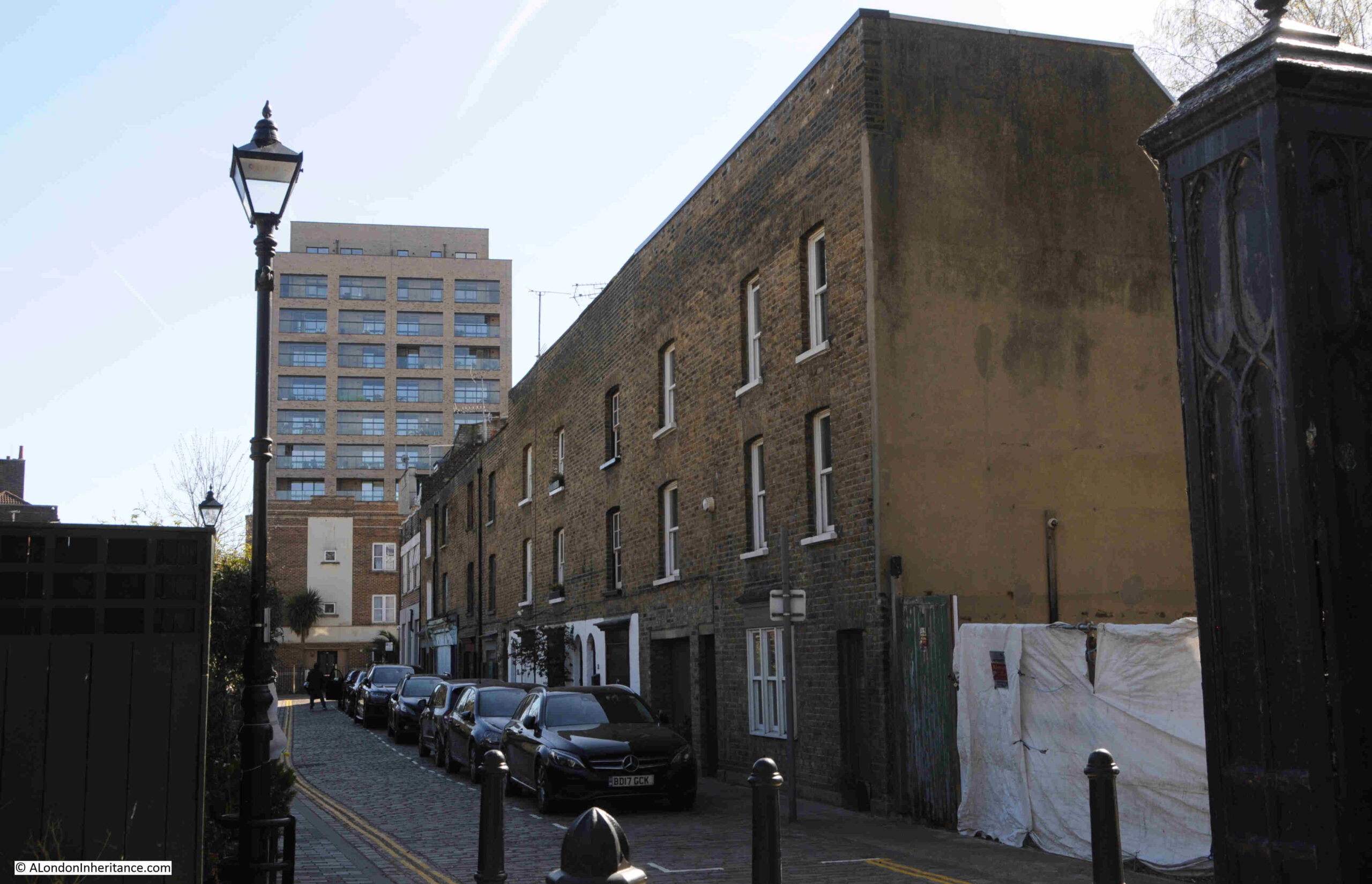
As well as Junes Ladies Hair Stylist, Durham Row was once a street with multiple small shops housed in single bay terrace houses, as seen in this view along Durham Row:

The surviving early 19th century houses are along the south side of Durham Row, the houses along the north site were destroyed by bombing during the last war, and on the other side of the fence to the right are small gardens of houses which have been built to replace those destroyed.

This quiet street was once a bustling east London street of small shops. A look at the 1910 Post Office Street Directory shows the shops along the south side of the street, in the surviving buildings, when number 11, the location of Junes Ladies Hair Stylist was then occupied by Albert Schensul, Umbrella Maker:

The north side of Durham Row had more shops, as the buildings along the south stopped at St. Dunstan’s Churchyard, whilst those along the north continued, and as with the south side of the street, we have a comprehensive range of small businesses and shops:

Despite the small size of the businesses in Durham Row, many looked beyond their immediate area for customers and placed adverts in newspapers, for example on the 13th of August, 1886, Mr. Adolphe Michels was advertising his “Great Wonder Boot and Shoe Stores” in the East End News, where his products were “All Leather. No cardboard used. Therefore every boot will wear to the last. Give me one trial, and you will walk miles for my boots”.

Unfortunately, the advert does not mention the house number of his Boot and Shoe Stores, just the address Durham Row, side of Stepney church, however, looking at the above list of businesses in Durham Row, there was a Mrs. Mary Ann Michels listed as a boot maker at number 30 (on the bomb damaged and lost north side of the street), so probably Adoiphe had died, and his wife Mary Ann continued to run the business to at least 1910.

Just a small example of how you can build a picture of a street and those who lived and worked in the street, even small streets such as Durham Row.

View looking east along the street, from where Durham Row meets the churchyard of St. Dunstan, Stepney:

The houses along the south side of Durham Row are all Grade II listed. The Historic England listing dates the buildings to early 19th century, and remarks on their “Small simple C19 shop windows”.

The Grade II listing is probably why the shop fronts survive, although all the houses now seem to be residential.

This is number 5, which in 1910 was home to Edward Henderson, Butcher:

And next door to the above shop, was number 3, which in 1910 was home to the Fried Fish Shop of Edmund Rowe:

At the western end of the terrace there is an empty space, also seen as empty on the early 1950s and late 1890s editions of the OS maps, where it may have provided access to the cinema that remarkably was once housed in a building that ran along the rear of the terrace houses, and is shown in both the late 1890s and early 1950s OS maps:

There is currently a planning application to build two, three bedroom semi-detached houses within the above space.

Durham Row is located to the north east of St. Dunstan Stepney, and I have highlighted the street with a red arrow in the following extract from the 1890s OS map (Map ‘Reproduced with the permission of the National Library of Scotland“:

The terrace houses on the south side of the street have survived, all the houses along the north side of the street, including where the street continues alongside the northern edge of the churchyard, were destroyed during the last war, but probably resembled those we can still see today in Durham Row.

A map of the same area today (© OpenStreetMap contributors)::

On the corner of Durham Row and White Horse Road, there is a closed pub. There was a pub here in the 19th century, but about half the size of the building we see today, which was the result of a 1936 rebuild. This is the Fish and Ring which closed in 1999 and is now residential:

The Fish and Ring is an unusual name for a pub, and I cannot find a direct link between the pub and a source of the name, however there is a story about a burial in St. Dunstan that may be the source. From the Eastern Post on the 3rd of January, 1914, which is a reprint of an article from the Morning Advertiser of 1805:

“STEPNEY’S ‘FISH AND RING’ – St. Dunstan’s church, Stepney possesses amongst its numerous interesting historical features, a curious story of medieval times.

On the outside of St. Dunstan’s Church, there is a monument inscribed to the memory of Dame Rebecca Berry, who departed this life April 26th, 1696, and over the inscription is a coat of arms representing a fish with a ring in its mouth.

It appeared that Dame Berry, in the early part of her life had been cruelly traduced by her enemies and accused of incontinence by her husband, who was a captain of the Royal Navy. On his return to his house on the banks of the Severn, his jealousy having been previously excited, he tore the wedding ring from his wife’s finger, and in his rage cast it into the river, bidding her never again to come into his presence if she valued her life, without producing that token of their ill-fated marriage, a thing he conceived utterly impossible. Mrs. Berry, distressed in the extreme at her husband’s groundless suspicions, yet dreading the violence of his temper, quitted her home and became a domestic in the house of a gentleman some miles distant.

A short time afterwards, while cleaning the inside of a salmon, she was going to cook for the family dinner, she found a wedding ring, and from the legend round it knew it to be her own, and the same her husband had thrown into the river. Overjoyed at her good fortune, she flew to her husband, and again protesting her innocence and the malevolence of her accusers, she laid before him the ring and informed him of the marvellous way in which she had regained it.

The husband, supposing the event to have been the interposition of Providence to prove his wife’s innocence, consented to her immediate return, and the parties, returning to London and from thence to Stratford, passed the remainder of their lives in peace and happiness.

The wife was the longest liver, and in her will directed that the monument and the device above described should be fixed up after her death to commemorate a fact which her gratitude taught her to believe was not altogether the effect of chance.”

This unusual story, and that the church and pub are very near each other must mean that the pub was named after the fish and ring on Dame Rebecca Berry’s monument, but whether there is any truth in the full story is difficult to confirm.

There is though an intriguing symbol on the side of the old pub:

With very limited time for research, I have not been able to find the meaning of the symbol. Whether it refers to a much earlier pub on the site, or a building of importance. I checked Rocque’s map from the decade before the 1757 date to see what was on the site.

I have marked the location of Durham Row with the red arrow, which seems to have been a passage along the northern side of a walled estate, and which led, as it continues to do, into St. Dunstan’s church yard.

There is a building in the top right corner, the current location of the pub, and a larger building to the south of the walled enclosure. Whether the castle and wings symbol seen on the old pub relates to a building within this enclosure, the owners, or something else entirely, I have no idea, but it is on the never ending list of things to try and follow-up.

After a look at Durham Row, I walked to Limehouse DLR station, and the following photos show just what can be discovered on almost any walk in London between two places.

A short distance south along Whitehorse Road we come to the ornate iron railings that form the boundary to St. Dunstan’s Churchyard, along with one of the gates into the churchyard:

The iron railings and gates that surround the churchyard are all Grade II listed, and are described as railings with “interlaced gothic arches and interval piers with gabled caps”.

A plaque alongside the gates detail the Rector, Church Wardens and the Surveyor at the time of their installation in 1844:

The spring weather was brilliant, which does always help, and St. Dunstan’s Church looked as if it was really a rural church, rather than in the heart of east London:

St. Dunstan’s is a fascinating, historic church. I wrote a blog post dedicated to the church back in 2018 during a visited on a much more dismal day. The post can be found here, (although when I visited, I did not see the fish and ring monument, I will have to return).

The long, tree lined walk up to the church from the southern corner of the churchyard:

Tree lined walk along the eastern side of the churchyard:

Along the southern side of the churchyard are some Mercers Almshouses. They can be seen in the extract from Rocque’s map shown earlier in the post:

Although as this plaque on the side of the building, under the eaves of the end of terrace house as seen in the photo above indicates, the current buildings date from 1856, replacing the row seen in Rocque’s map, which were built in 1691:

And in another example of how just walking the streets finds places that deserve their own blog post, on the corner of White Horse Road and Salmon Lane is the former site of the Stepney Meeting Burial Ground, Almshouses and School:

The Stepney Meeting was the first independent church in east London, dating from 1644, when it was set up by a group of Puritans called Independents. Their first Meeting House was built in 1674, and the Stepney Meeting opened this, their own burial ground in 1779, and built a row of small almshouses for women by the side of the burial ground.

The burial ground and the almshouses are shown in the following extract from Smith’s 1816 New Plan of London, although I think the almshouses were on the eastern edge of the burial ground, not on the western edge as shown in the map:

The burial ground was closed in 1853, but it remains as an example of one of the many non-conformist burial grounds in east London:

Google maps labels the burial ground as a Mercers Burial Ground – I suspect that this is a confusion between the Mercers Almshouses and those of the Stepney Meeting.

Terrace houses along Salmon Lane:

There are a couple of boundary markers on this terrace. The first is a boundary marker for the Hamlet of Ratcliff, a reminder of when east London was a collection of small hamlets surrounded by fields:

And some parish boundary markers:

Then there is York Square, a central garden surrounded by four sides of almost complete late 18th, early 19th century terrace houses, with many being Grade II listed:

Unusually for east London, York Square retains two pubs. On the north east corner is the Queen’s Head, which reopened in 2023 after a series of closures, and on the south western corner is the Old Ship:

I wrote last week that the Boleyn Pet Stores was an example of the many derelict buildings to be found across London in the 1980s. Whilst many derelict buildings and sites have been rebuilt, with the majority now residential, there are derelict buildings still to be found, and the following was on the northern side of Commercial Road – what was Callegari’s Restaurant:

Approaching Limehouse DLR station, and under the arches of the railway, there are the typical businesses that make good use of these spaces, one of which is Fast Lane Auto Repair:

The DLR railway viaduct and arches, were built for the London and Blackwall Railway which opened in 1840. The design of many of the arches where the railway crosses a road is interesting as the road is carried through a central arch, with separate pedestrian arches on either side:

And on reaching Limehouse DLR station, the bright spring sunshine was highlighting beer barrels from the nearby Craft Beer Company pub:

Junes Ladies Hair Stylist was an example of one of the many businesses and shops across London, that were usually run by an individual, and Durham Row was once a small shopping street serving Stepney with the majority of essentials needed for day to day life.

Whilst hairdressers continue to be found across London, they are now usually larger premises with multiple workers.

With the exception of shops used by specific ethnic communities, so many other small, individual shops have closed or are under threat by the major supermarkets who continue to open large, stand alone stores, or “local” stores such as the Nisa store shown in last week’s post.

I hope this post has also shown the pleasure of just walking the streets of London, that despite the considerable damage suffered by east London during the last war (and later developments), there is still much to be discovered and places that evoke the history and development of the area in so many streets.

alondoninheritance.com

Boleyn Pet Stores, Dalston – 1986

The 1980s were a time of significant change across London. The city had been in decline since the end of the 2nd World War. Not only having to deal with extensive bomb damage, but also with the loss of a significant amount of industry, including the closure of all the London Docks (with the exception of Tilbury), the docks having been the drivers of much of London’s growth during the 19th and first half of the 20th centuries.

There were large areas of derelict industrial land, including the extensive land in east London covered by the old docks. Much of the city’s 19th century housing stock was also in poor condition. A significant decline in population since 1939 had reduced demand, bomb damage had not been fully repaired, and buildings had been left derelict or had been poorly maintained.

The 1980s were the decade when the old London was disappearing, a new London was starting to emerge, and 40 years later, after significant demographic and population changes, considerable rebuilding, including the transformation of places such as the Isle of Dogs, Vauxhall etc. the almost exponential rise in house prices, change to a fully service based industrial model, changes to the way the city is governed etc. London is a very different place to the city that was disappearing in the 1980s.

We can see these changes in photos of individual places, and I will be featuring a number of these during the coming year, photos taken by my father on walks across the city, starting with the Boleyn Pet Stores at the junction of Boleyn Road and Bradbury Street in Dalston:

The same view today:

The London Picture Archive has a view of the pet stores in 1970, confirming that the business had been open for some years, but also showing that the building had decayed significantly during the 1970s and first half of the 1980s (this embedded image will probably not appear in email versions of this post. Go to the website by clicking here to see the image in the post):

By the mid 1980s, whilst the pet store was still open, the rest of the building appears unoccupied, the windows to the upper floor are broken, and the first floor is probably the home of some of the city’s pigeons.

In the 1970s and 1980s, this level of dereliction was quite common across many of the city’s street.

What the photo also shows is the benefit of random walking through the city. My father took many of these photos on random street walks, setting off to a specific area, then a random wander around the streets, particularly the side streets, and it is an approach which I have continued.

To get to the site of the Boleyn Pet Stores, I took the Windrush Line to Dalston Junction, crossed Kingsland High Street, headed north, where after a very short distance is Boleyn Road, and not far along is the junction with Bradbury Street. The location of the old pet stores is shown in the following map (© OpenStreetMap contributors):

In each post on 1980s location I will cover a different aspect of how the city has changed, and for this post I will look at overall population.

The London Data Store is a wonderful, free resource provided by the Greater London Authority. The website provides access to a wealth of data about the city, and to look at how population has changed. i used data from the London Data Store Historical Census Population data set to create the following graph which shows the population of Greater London:

The graph starts in 1801, where there is a population of just over one million.

During the 19th and first half of the 20th century, the population of the wider city continues rising at a rapid rate to reach a peak of 8.6 million in 1939.

For the previous 140 years London had industrialised, the large east London docks had been built, the City’s role in trade and finance expanded rapidly, government, West End entertainments, fruit, vegetable, fish, meat markets etc. there was hardly an aspect of life in London that had not expanded rapidly during this time.

The Second World War brought an end to the expansion of population. The loss to bombing of considerable amounts of housing, migration to new towns orbiting the city, the loss of industry, closure of the docks, all contributed to the decline in population, which reached a low of around 6.5 million in the 1980s.

By the end of the decade, a small increase heralded a change to London’s fortunes, which was visible in the 1991 Census data.

For the following decades, population would rise rapidly, returning to 1939 levels in the early 2020s, a change mainly driven by inward migration.

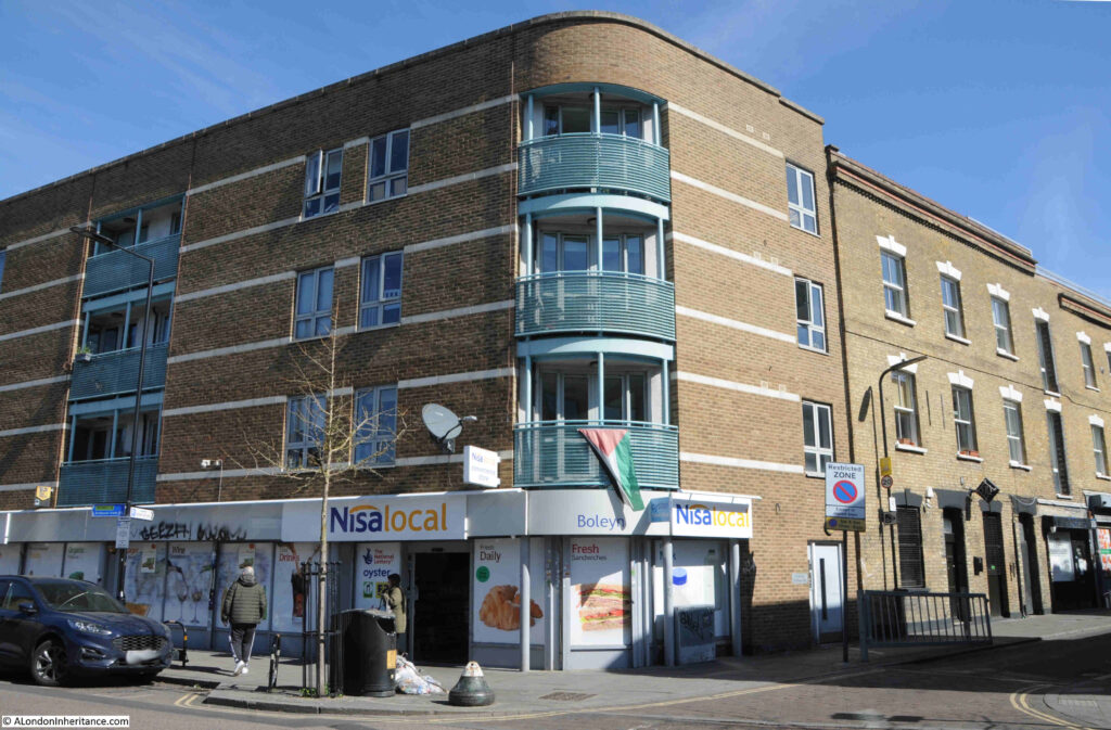
The rise in population increased demand for housing, which can be seen both in the rapid rise in the price of housing across the city, but also by the renovation, or demolition and rebuild, of almost any available space across the city, and as an example, the site of the Boleyn Pet Stores is now occupied by a new Nisa supermarket at ground level, within a new building of four floors rather than the previous three, allowing three floors of apartments to be built.

A change that can be seen across London, as well as the renovation of buildings of the type shown in the 1986 photo, which now sell at a price which must have seen unimaginable 40 years ago.

After finding the site of the Boleyn Pet Stores, I had a wander around the local streets, and found the following within a very small area, firstly this lovely, almost Gothic, building in Boleyn Road:

The building was built as the St. Mark’s Mission House, later the Cholmeley Boys Club, as still recorded above the door to the right:

The Mission House was built at the end of the 19th century, and was built as a result of the rapid rise in population in Dalston, along with the poverty and poor housing conditions to be found in the area.

In the Islington News and Hornsey Gazette on the 11th of June, 1898, we find one of the justifications during one of the fund raising bazaars for the Mission House (St. Marks, Dalston is on the eastern side of Kingsland High Street):

“As to the object of the bazaar, it might be a revelation to some of them to be told that there are over 8,000 people on the other side of Kingsland Hight-street in the parish of St. Mark’s, who have no room of suitable size wherein work in connection with the church might be carried on. Kingsland High-street acts as a sort of stone wall or barrier between the two sections of the parish, and the people on the other side of it will not cross over to them. Hence it became necessary for them to go to the 8,000 people living on the other side of the intersecting thoroughfare”.

The Arch Deacon of London was also at the fund raising bazaar and added that “Wherever a parish is intersected by a great thoroughfare, it was as if a river flowed between its two divisions”.

Interesting how major roads through a city can act as “a sort of stone wall or barrier” between the people on either side. Kingsland High Street is also now the A10, and is still a busy road through the district.

The foundation stone of the Mission Hall was laid when: “The Lord Mayor (who was accompanied by Miss Davies) and the Sheriffs of London paid a State visit to Kingsland yesterday afternoon, and laid the foundation stone of the new mission buildings of St. Mark’s Church, Dalston, which are to cost £3,600”:

Opposite the location of Boleyn Pet Stores is St. Jude Street, and along the street is an example of what can be achieved when buildings are renovated rather than demolished:

And at the end of St. Jude Street, at the junction with King Henry’s Walk is the Railway Tavern:

The first references I can find to the Railway Tavern are from the 1860s, when the pub was an operating business, so it must have been built somewhere around the mid 19th century, however it is a very different architectural style to the buildings to the left, and the two small, two storey houses to the right, which are up against the tall, flat wall of the pub. The buildings on either side all pre-date the Railway Tavern.

If such a building was planned today, there would probably be an outcry about how the design was not fit for its surroundings.

The Railway Tavern was named after the nearby North London Railway, and was close to Mildmay Park station in Mildmay Grove.

The station is shown on the 1927 edition of the Railway Clearing House, Official Railway Map of London:

The station closed in 1934, however the way the rail tracks part to provide space for the centre platform that was once between the tracks can still be seen on Google maps, at the following link:

https://www.google.com/maps/@51.5484962,-0.0825652,242m/data=!3m1!1e3?entry=ttu&g_ep=EgoyMDI1MDQwMS4wIKXMDSoJLDEwMjExNDU1SAFQAw%3D%3D

The transformation from the Boleyn Pet Stores to the new Nisa supermarket and apartments is indicative of how much of London has transformed over the last 40 years, and the same applies to the streets close to the old pet stores, where as well as new builds, the majority of the surviving pre-war and 19th century houses have been really well restored.

I will be looking at more places, contrasting the 1980s with the 2020s, and the trends that have changed London in more posts throughout the year.

alondoninheritance.com