Monthly Archives: May 2025

Bell Watergate Stairs – Woolwich

It has been some months since I last wrote about a set of Thames Stairs, so for today’s post, I am visiting another of these historic places that for many years connected the river with the land, and were once an essential part of life in London for very many people.

This is Bell Watergate Stairs, Woolwich:

Bell Watergate Stairs are listed in the Port of London Authority’s guide to Steps, Stairs and Landing Places on the Tidal Thames, although there is not much information provided, just the name, that they consist of stairs and a causeway, and that the concrete stairs and handrail are in poor condition. They are also confirmed as being in use.

Bell Watergate Stairs look in pretty good condition today, still with concrete stairs leading down to a causeway, with a handrail to the side. The causeway runs across a wider open space, and on the right is a sloping approach to the foreshore lined with stones, and along the upper part, there are wooden bars bolted to the stone surface to provide grip.

It was a very low tide on the day of my visit, leaving the causeway fully exposed, with green algae on the stairs, and along the side walls showing how far the water reaches:

The stairs are shown within the red oval in the following map, just north of Woolwich High Street, with a small street – Bell Water Gate – linking Woolwich High Street and the stairs. The jetty for the Woolwich Ferry is the feature on the left of the map  (© OpenStreetMap contributors):

The stairs are shown on the 1897 revision of the OS map, where the feature looked then, much as it does today, with the stairs and causeway within a wider entry into the river. The South Pontoon of the Woolwich Ferry is on the left and on the right is a Steam Boat Pier, originally used by the two steam ferries of the Eastern Counties Railway, the “Kent” and the “Essex”, to link Woolwich with the new railway station across the river at North Woolwich:

(Map ‘Reproduced with the permission of the National Library of Scotland)

If we then look at the same area, almost 60 years later, the following 1956 revision of the OS map shows Bell Watergate Stairs in the centre of the map. The old steam boat pier has been removed (there was a charge to use this cross river ferry, and it could not compete with the Woolwich Free Ferry).

If you look to the right of the above map, I have used a blue arrow to point out a similar feature to Bell Watergate Stairs, where there is an inlet to the Thames, with stairs leading up to land. Sixty years later, this feature had disappeared, with the expansion of the industrial premises along the river.

(Map ‘Reproduced with the permission of the National Library of Scotland)

The street leading up to the stairs was not named on the 1897 map, but in the 1956 revision, it is named as Bell Water Gate (I have used the single word Watergate in the title of the post, as this aligns with the Port of London listing – not that this means that it is correct and most references use Bell Water Gate).

As I have mentioned when writing about other Thames stairs in previous posts, whilst the physical feature of a set of stairs is fascinating, they are also important as they provide small snapshots of history and individual events which can be tied to a specific place.

They can illuminate different aspects of life in London over the centuries.

In the past, the river was a far more a part of many Londoner’s lives than it is today. Whether for work, travel, or just for play and entertainment. On the day of my visit, the stairs were quiet, however this has not always been the case, as “E.T.” was complaining about to the Woolwich Gazette on the 9th of August, 1901, when the hot summer weather was causing problems at the stairs:

“RIVERSIDE BATHING. Sir, – Surely measures can be taken to prevent this disgusting practice which takes place daily during the summer months at Bell Water Gate, Woolwich. The place in question is situated in close proximity to factories where young girls are employed. The language used by the lads is of the vilest description, and should not for one moment be tolerated. I sincerely hope that the authorities this should apply to will see these few lines, and in the name of decency stop once and for all the nuisance complained of.”

All along the river, Thames Stairs were places where children would play. The following is an extract from one of my father’s photos of Wapping Old Stairs, taken in 1948, and shows some children at the bottom of the stairs, alongside the water:

For children, the river could be a very dangerous place, and there were numerous reports of drownings, as well as many rescues. The following is from the Daily Mirror on the 9th of August, 1933:

“BOY OF 12 RESCUES A CHILD – A heroic rescue was made by a boy of twelve, Terence McNulty of Woolwich High-street, at Bell Water Gate, Woolwich, last night.

While playing on the steps leading down to the Thames, Peggy Ramsey, aged six, of Borgard-road, Woolwich Dockyard, fell into the river. Seeing the girl in difficulties, Terence plunged in and brought her to the bank. The girl was taken to hospital.”

Another example was in September, 1916, when: “A gallant rescue from drowning was effected yesterday morning at Woolwich by the Rev. C.W. Hutchinson, priest in charge of St. Saviour’s Mission, Woolwich. It appears that Arthur South, 12, Paradise Place, Woolwich, was playing on the steps leading to the river at Bell Water Gate when, on reaching for a box which was floating by, he overbalanced and fell into the river, being carried away by the tide.

Attracted by the screams of his companions, Mr. Hutchinson, whose mission house is close to the spot, ran out, and seeing the boy about 50 yards away, dived into the water, fully dressed, and succeeded in rescuing him. The boy was little the worse for his immersion, and after being treated at the Mission House, was able to go home.”

The Mission House was one of the establishments that was in Bell Water Gate, the street running up to Woolwich High Street.

The source of the name of Bell Water Gate Stairs is difficult to confirm, but the street leading from the stairs was also called Bell Water Gate, and in the street there was a Bell Public House, which dated from at least 1655, so the name of the stairs may come from the pub, along with the existence of a parish gate at the stairs. Bell being a common name for a pub, I think it is safe to assume that the stars were named after the pub, rather than the pub being named after the stairs.

The following 1907 report is typical of some of the mentions of the Bell public house: “At the Woolwich Police Court on Friday, William John Leonard, of the Bell public house, Bell Water Gate, Woolwich, appeared on an adjourned summons which charged him with permitting his premises to be the habitual resort of prostitutes for a longer time than necessary to obtain reasonable refreshment.

For the defence it was urged that the licensee was totally unaware of the character of the women who used the house, and maintained that it would have only been fair had the police notified him and given him warning first.

In giving evidence, John William Leonard, brother of the defendant, swore that he did not know that women pointed out by the police were prostitutes.”

I suspect that William Leonard, the landlord of the Bell, did know who was in his pub.

Bell Watergate Stairs could well have also existed when in the 17th century, and the stairs were once the main landing point for traffic between the river and the town of Woolwich, and they are the last of this type of stairs to survive in Woolwich.

A very early form of the Uber Thames Clippers operated from Bell Watergate Stairs, as in 1845, adverts in the Kentish Independent were informing the people of Woolwich that “Fast and Splendid Boats of the Waterman’s Company leave at the Waterman’s Pier, Bell Water Gate, Woolwich, every hour and half hour”, running to and from Westminster.

The boats offered an extensive number of stops, to, and as they returned from Westminster, calling at the Adelphi, Temple, Blackfriars’s and City Pier, and at the Thames Tunnel and Limehouse.

The following print dates from 1922 and is by Edward Arthur Evacustes Phipson. The view is looking down the street Bell Water Gate, towards the stairs at the end of the street, with the river and North Woolwich in the distance:

Attribution and source: Edward Arthur Evacustes Phipson, Public domain, via Wikimedia Commons

The above view has been replaced today by a very short street from the stairs up to Woolwich High Street with the Waterfront Leisure Centre on the western side, and new blocks of flats on the eastern side.

The stairs from the river showing the new flats on the left and leisure centre to the right. The buildings behind the stairs are in Woolwich High Street:

One of the reasons for the reduction in use of the stairs, as well as the redundant steam boat pier, is the Woolwich Free Ferry, which can be seen from the end of the causeway leading from Bell Water Gate Stairs into the river:

Although the area is rapidly developing with new apartment buildings, and the leisure centre has been here for a number of years, the location of the stairs was for many years surrounded by industry.

As an example, in 1893, the wharf next to the stairs was to be sold at auction, and was described as “This old-established concern, comprising a most valuable Wharf on the Thames at Bell Water Gate, Woolwich, with frontage of 180 feet, steam crane, large hopper, overhead tramway, large stores holding 2,000 tons, offices stabling for 20 horses, workshops, spacious yard with two entrances, capital residence etc. horses, vans, carts, machines and all the suitable trade fittings as a going concern.” Everything you would have needed to continue the coal merchants business.

On the western side of the stairs, Woolwich Power Station was one of the major developments, and is the feature labelled as “Works” in the 1956 extract from the OS map earlier in the post.

The electricity infrastructure alongside the stairs was the subject of one of the strangest newspaper stories about Thames stairs, when in April 1949:

“EXPLOSION AND FIRE CAUSED BY CAT – A cat caused an explosion and slight fire when it short-circuited a 33,000 volt transformer in the London Electricity Board’s transformer station in Bell Water Gate, Woolwich, early today.

The cat, which was chasing a rat, was killed. The explosion set light to the transformer housing, but no one was injured and the fire was out within half-an-hour.”

Events at places such as Thames Stairs can reveal society’s approach to domestic abuse and how someone who had attempted suicide was treated as a criminal rather than someone in need of help. There are a number of examples of this at Bell Water Gate Stairs, with the following being typical:

“MARRIED MISERY AY PLUMSTEAD – WIFE’S ATTEMPTED SUICIDE. Alice White, 31, married, 14 Barnfield Road, Plumstead,, was again before Mr. Disney at Woolwich, on Monday, charged with attempted suicide in the Thames at Bell Water Gate, Woolwich. Police Constable Falla found her with her hat and coat off, about to jump into the water, and she said she would do it again when she got the chance, alleging that her husband was the cause of the trouble.

Frederick White, the husband, said that the prisoner did not drink much, but she was upset about her son, who was away in a sanatorium for tuberculosis. he had had no words with her on the day in question.

Prisoner: He threatened to pull everything off me if I went out. When I was out with my boy, his brother threatened to break every bone in my body. They have both beaten me.

Husband: When I have words with her it is over the beer.

Wife: It’s you who has the beer.

Magistrate: You must both keep away from the beer, and try to agree. I will bind you (the woman) over for twelve months, and your husband must be surety.”

The following photo is looking back towards the land from the end of the causeway. To the left can be seen a small part of the new apartment buildings. These are built on the site of a large council car park, which in turn occupied the site of Woolwich Power Station, which closed in 1978:

One of the more unusual feature of Bell Watergate Stairs, compared to other Thames stairs can be seen in the above photo, where to the left of the stairs, there is a slopping, paved area running between foreshore and land, and this sloping area has some horizontal wooden treads bolted into the ground.

These can be seen in detail in the following photo:

These were used as foot holds when pulling a boat out of, or lowering into the river.

They may also have been used to reduce the friction between the bottom of a boat and the surface, with the keel of the boat running across the wood, rather than the stone surface. The bolts holding the wood to the ground are recessed, so would not have damaged any craft being pulled across them.

The impact on wood of regular covering with water as the tide rises, followed by drying out as the tide recedes can be seen in the following photo, where the wooden treads end at roughly the tide mark, with the wooden treads below this level having rotted away, with only the metal bolts showing that they had continued down to the foreshore:

As with so many other Thames Stairs, they are rarely visited these days, and I doubt are used to get between the river and the land.

These are still dangerous places, the damp algae on the steps was extremely slippery on my visit, and the Thames tides would still easily pull someone out into the river.

They are though important places to act as a reminder of how much Londoners were once dependent on the river, and of the countless thousands who have come into contact with Bell Water Gate Stairs. I will leave the last words to Mary Ann Carney, who in 1898 was up before the Magistrate for being drunk and disorderly at Bell Water Gate, with this little exchange:

Prisoner: Whenever I begin talking Irish the police think I am drunk and lock me up

Magistrate: I think your accent rather pretty but you are fined 5s or five days

Prisoner: God bless your Worship and long life to you.

alondoninheritance.com

Tower Subway and the Mystery of the Southern Entrance

On the north bank of Thames, and alongside the Tower of London, is a frequently photographed and written about structure, over what was the entrance to the Tower Subway, here with the ice cream van that seems to be there most days, selling to those visiting the Tower:

The story of the Tower Subway starts with an Act of Parliament which was passed in 1868 for the new tunnel at Tower Hill, urgently needed as the only route across the river to the east of London Bridge was the recently completed Thames Tunnel at Wapping (see this post), and during the latter half of the 19th century, the population of London, as well as the volume of trade passing through the city, the number of docks, and the amount of industry, was growing very rapidly.

People needed to cross the river. To get to work, to transport goods, for meetings and commerce, and with the expansion of London to the south of the river. There was a mile and a half gap between London Bridge and the new Thames Tunnel at Wapping, which, along with very busy streets, created a very considerable barrier.

It was estimated at the time that a million people lived on both sides of the river below London Bridge, and this population was continuing to grow.

The proposed tunnel would consist of shafts, between 50 and 70 feet deep on either side of the river. The north access point at Tower Hill and the southern alongside Vine Street.

A hydraulic lift would raise and lower up to ten passengers at a time, and at the bottom of the shaft there would be a small waiting area, with a cable pulled carriage transporting passengers between the north and south of the river.

It was estimated that the cost would be £16,000, it would take eight months to complete, and the engineer for the project was Peter William Barlow, who was also the engineer responsible for the first Lambeth Bridge..

Construction of the Tower Subway started in 1869.

Where today, there are plenty of photographs and video of major construction projects, in the 1860s, the only way to illustrate such a project was to lower an artist down to the tunnel, and in September 1869, an artist working for the Illustrated Times found himself in the tunnel, and reported that:

“After getting into the pail I was lowered some fifty feet, turning round and round like a joint of meat at the fire. A trolley was waiting at the bottom; I seated myself, and was propelled by a stalwart navvy. During my progress through the tube I heard the sounds on the water above; by candle light I could see the great strength and perfectness of the work, ribbed like the skeleton of some huge snake. Presently we stopped to allow a trolley laden with clay to pass; then we arrived at the telegraph station – a very complete arrangement, to enable men below to communicate with those above. While at the top of the shaft I had an opportunity of seeing it at work. Tinkle, tinkle goes a small bell. ‘More nuts’. Answer ‘All right’. Tinkle twice, tinkle three times. ‘Send down castings’. Answer, ‘All right’. Tinkle four times, ‘More air’, Answer. ‘Can’t have it yet; taking in lime’. And so on, saving a great amount of time.

The men having thrown out the clay in front of the shield, I saw them advance it. It was easily done with three or four men working the screws to the width of the casting; one of which is placed in the curve of the shield at the bottom, bolted it, and placed the side pieces, and finished with the top, screwing them all to the last ring of the tube. The clay through which they are passing is about the consistency of caked chocolate, the pick leaving a shining surface upon it. The men have plenty of air, but by candle light look weird and strange.”

The use of a shield was key to the success of the project, as was the use of iron for the rings forming the tunnel.

On completion of the tunnel in 1870, the speed and ease of construction supported the view that iron would allow considerably larger tunnels to be constructed, and some newspaper reports on the opening of the Tower Subway stated that: “Considering that a project has been recently discussed for carrying a subway from England to France, it would be ridiculous to go into raptures over the completion of a Tunnel from Tower Hill to Tooley Street”.

By the end of March 1870, the tunnel was being tested with invited guests. The mechanism for taking passengers between the two entrance shafts was described as a carriage, able to carry 14 persons, with a door at each end. A wire rope was attached to the carriage, and to cylinders at each end of the tunnel, with the cylinders being worked by steam power.

The tests though, demonstrated the limitations of the method, and the recurring problems that would result in the removal of the carriage, a short time after opening.

On one of the trials, the wire rope was unable to bear the strain, and snapped, with the carriage and passengers being left, midway through the tunnel. It took a while to repair the wire rope, the trial started again, but after a short distance, the wire again broke.

The trials ended soon after, with a stronger rope ordered for the opening of the tunnel.

The interior of a carriage in the Tower Subway:

Attribution and source: UnknownUnknown, Public domain, via Wikimedia Commons

The northern entrance to the Tower Subway as seen today:

The first commercial use of the Tower Subway, was late in the afternoon of Tuesday, April the 12th 1870, when paying freight was hauled through the tunnel, and the next day is was opened, with very little ceremony, for passengers.

By the end of 1870 though, London’s papers were starting to report on the Tower Subway as being a failure, with numerous problems with the lifts taking people up and down the shafts, and passengers often being stuck mid-way through the tunnel.

Such were the problems with the complexity and reliability of the lifts and the carriage, that the Tower Subway was soon converted to foot passenger use, and just over a year after first opening the following account is of a trip through the tunnel after conversion to a walk-way, by a correspondent of the London Daily Chronicle on the 30th of June, 1871. The account provides a view of what a walk through the tunnel would have been like (with the caveat that this was written by a journalist, so probably a bit of over emphasis on the poor conditions):

“I have just availed myself of my first opportunity of inspecting the work over which, not a great while ago, such a deal of enthusiasm was expended – the Tower Subway.

I found the City terminus under a conical little shed, planted in the midst of an expanse of rough flag stones, in very good keeping with the adjacent old Tower, and with the antiquated old gentlemen who strut around in medieval toggery within the Tower railings. I had made up my mind to descend luxuriously – in a sort of lift, comfortably fitted up – and after a railway rush under the river, to make a triumphant exit on the Surrey side. It appears, however, that the lift and the railway carriage didn’t pay, and so were of necessity abandoned. Instead of the lift I found a narrow, dimly-lighted spiral staircase, up which, as I descended, came an unsavoury odour.

The gas lights were most ingeniously placed exactly between the landings. At the bottom I found a turnstile, presided over by an unhappy little boy, condemned to spend in damp and gloom and foul air no less than fourteen hours and a half out of his twenty four, and that seven days a week. I commenced groping my way through what looks like a gigantic rats’ hole. lighted up at intervals with gas jets. The narrow rails on which the carriage ran at one time are still down, and serve admirably to trip up passengers and knock their heads against the girders whenever two have occasion to pass each other. Here and there the footpath is wet and sloppy. This is, perhaps, unavoidable, but it is certainly an unpleasant feature.

The safety of the structure is, no doubt, beyond question; but the leakage very forcibly suggests the idea of thousands upon thousands of tons of water overhead, and one is by no means sorry to reach the other turnstile, where another young unfortunate sits at the receipt of custom. Passengers are supposed to spend six minutes in performing the journey. This, I presume, doesn’t include the time which, on emerging into the open air, I, at least was compelled to spend in holding on to the nearest lamp-post.”

The following illustration shows the tunnel being used as a walk-way:

Attribution and source: Public Domain, https://commons.wikimedia.org/w/index.php?curid=298484

The tunnel continued in use as a walk-way, however in 1886, the project that would bring about the demise of the Tower Subway as a method for people to cross the river, was starting to appear just to the east, with the start of the construction of Tower Bridge.

When Tower Bridge opened on the 30th of June, 1894, use of the Tower Subway collapsed. With Tower Bridge, there were no shafts to descend and ascend, no damp, gas lit tunnel to walk through, and the new bridge was free.

The owners of the Tower Subway tried to sue the Corporation of the City of London for loss of tolls, and in September 1897, a shareholder meeting of the Tower Subway Company was held at 21 Great George Street, Westminster, when it was discussed and agreed that:

  • The arbitrator between the Tower Subway Company and the Corporation of London had awarded the company compensation of £11,000;
  • That the Tower Subway was to be sold to the London Hydraulic Power Company for £3,000;
  • And that the Tower Subway Company was to be wound up.

The name of the London Hydraulic Power Company still circles the Tower Hill entrance today, which is not the original entrance building to the subway, but a 1926 construction over the shaft. At the time of the purchase of the subway, hydraulic power was used to power much of London’s infrastructure – cranes across the docks, lifts, even the curtains in theatres were power by hydraulic power.

The tunnel was also used for the water supply of the city, and in September 1898, workers were laying 20 inch diameter iron water main pipes through the tunnel, connecting a growing network on the southern and northern sides of the river.

Much of this work was aimed at fixing what was called the “East London Water Famine”, as there were insufficient supplies of water to service the rapidly growing population of east London.

Pipes through the tunnel connected to the network of the Southern and Vauxhall Water Company to the south of the river, and from the northern exit of the subway, the 20 inch pipes ran to Leman Street, where they connected with the mains network of the East London Waterworks Company.

The following image is from the 1961 book “London Beneath the Pavement” by Michael Harrison, and shows water pipes running through the old Tower Subway:

As a diversion, I have mentioned a number of times over the years, how I find the journey of books fascinating. This is my copy of London Beneath The Pavement, and in 1961 is was owned by Richard J. Waller, who wrote his name inside the cover:

I do not know whether it was the same owner, but 30 years later, in 1991, either Richard J. Waller, or a later owner had cut a notice of the death of the author from the Daily Telegraph, and pasted it inside the book:

A very small thing, but part of an individual book’s journey through multiple owners.

Part of the title to the post is “Mystery of the Southern Entrance”, and now I need to explain why.

From the round brick entrance at Tower Hill, the Tower Subway heads south, crossing the river towards the new developments on the south bank of the river:

Openstreetmap has the Tower Subway Access marked (in my red circle in the extract below © OpenStreetMap contributors):

And leaving Tooley Street, there is a small, square building where the map has the subway access. A photo of this structure is also shown on Wikipedia as the entrance to the subway:

The original entrance on the south bank was demolished in 1990, and this building does indeed look like an entrance to a place that would hold utility services:

However, I am not sure whether this is the site of the original entrance.

Firstly, it is a reasonable distance back from the banks of the Thames, further than the distance between river and northern entrance. Why would this extra distance have been necessary?

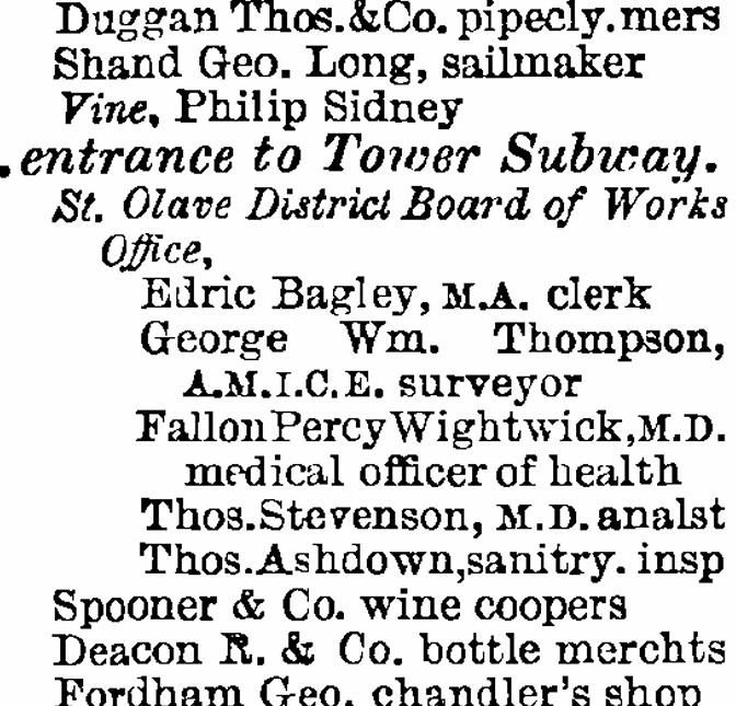
Secondly, newspaper reports often mentioned the southern entrance was next to the Vine public house in Vine Street, which the 1895 Post Office directory confirms:

In the following extract from the mid 1890s OS map, I have highlighted key features as follows:

  • Green arrow, track of the Tower Subway
  • Red arrow, small building next to the Vine which could have been the original entrance
  • Yellow arrow, the Vine public house
  • Blue arrow, location of the new building that today is often mentioned as the entrance to the Tower Subway

(Map ‘Reproduced with the permission of the National Library of Scotland)

As can be seen in the above map, the building at the blue arrow is a good distance from the banks of the river, and there is a small building next to the Vine, as mentioned in newspaper reports, and in the Post Office Directory.

Jump to the 1950 revision of the OS map, and we can see the track of the Tower Subway (green arrow) and although the Vine has gone, there is still a small building where the possible entrance next to the pub was located (red arrow), and at the point of the possible entrance building today (red circle), there is nothing marked:

(Map ‘Reproduced with the permission of the National Library of Scotland)

Looking at the location of the red arrow in the above map in more detail below, we can see the parallel dashed lines of the track of the Tower Subway terminate at the small building which was once next to the Vine public house – not at the location of the possible entrance today:

(Map ‘Reproduced with the permission of the National Library of Scotland)

To add to the confusion, there is a sign on the building that is the possible entrance today which states that the building is maintained by Jascom.

A couple of years ago, Vodafone published a video about the tunnel, and a Project Manager from Jascom is featured in the video, so based on this, the small building we see today must be the entrance to the Thames Subway.

This fascinating video is below, and shows the condition and use of the tunnel today:

But I still cannot get away from the references to the entrance being next to the Vine public house, and the track of the tunnel terminating at the small building closer to the Thames, which would also make sense as the work needed for the additional length of the tunnel to the building we see today, would have added to the overall cost of the project.

There is another option. The possible original location of the tunnel entrance today, would be at the south western end of the paved open space, to the south west of the old City Hall building, between Fire Station Square and More London Place. Is it possible that an additional length of tunnel was dug when this area was redeveloped to move the entrance away from the open space?

As the video states, the tunnel was purchased in the 1980s as part of the overall London Hydraulic Company pipe and duct network by Mercury, one of the 1980s challengers to British Telecom.

Mercury was taken over by Cable & Wireless, and then Vodafone took over part of the business which included the old Thames Subway, and as well as water pipes, the tunnel today now carries communications cables.

As is often the case, you start digging into a part of London’s history, and you are left with more questions.

I have messaged Jascom to see if they can clarify, however whether the small building is at the correct place, or whether it was further to the north, the Thames Subway is a fascinating story of one of the many methods of bringing the north and south banks of the river closer together, as London expanded, and the population, trade and commerce of the city grew.

The Tower Subway is also a story of how infrastructure evolves, from the original plan to carry passengers, then hydraulic power pipes and water supply pipes, and today communication cables have been added to the mix.

If you are interested in more history of Tower Hill, I have written a post on the Tiger Tavern at Tower Hill, click here for the post, how Tower Hill has changed over the years, click here, and for Johnny Eagle, the Tower Hill Escapologist and Strong Man, click here.

alondoninheritance.com

St. James’s – The Essence of Piccadilly

If you would like to explore the history and transformation of Puddle Dock and Thames Street, two tickets have just become available for my next walk on Sunday the 18th of May. Details and booking here:

The Lost Landscape and Transformation of Puddle Dock and Thames Street Tickets, Sun, May 18, 2025 at 11:00 AM | Eventbrite

St. James’s – The Essence of Piccadilly. The final part of the title of today’s post is a description of the church I took from a 1940s book about the area which I will quote from in more detail later in the post, but it does capture this historic 17th century church between Piccadilly and Jermyn Street, seen in the following photo from Jermyn Street:

The church was part of the same 17th century expansion of London that also resulted in nearby St. James’s Square, see my post from a couple of weeks ago.

A church was needed as the area was originally within the parish of St. Martin’s in the Fields, and the significant increase in population as fields were replaced by streets required a new, local church for the residents then moving into the new streets and squares.

The land was part of the original grant from King Charles II and was held as part of a leasehold by the Henry Jermyn, the Earl of St. Albans.

Construction of the church seems to have commenced around 1676, as the foundation stone was laid on the 3rd of April of that year.

The church was consecrated in 1684 after the freehold of the land had been obtained, and the majority of financing for the church was from the Earl of St. Albans.

The church gardens to the west of the church:

When consecrated, the church was lacking a steeple and spire, and the construction of these would cause some considerable problems.

The cost for building Wren’s design for the steeple and spire was estimated at around £800, and was rejected as being too expensive, so the vestry went for a design by Jonathan Wilcox (recorded as being a Mr Wilcox. Jonathan Wilcox was a carpenter who had worked on a number of other construction projects, including St. Vedas in the City).

In preparation for the spire, the steeple, brick and stonework up to the cornice at the top of the tower was completed, allowing work on the spire to start, first with the carpentry of the central structure to make ready for the lead sheeting that would cover the spire.

Before the lead sheeting was added, it was noticed that the structure was leaning to the west, and an investigation found that poor workmanship, wet clay and poor mortar used for constructure of the steeple had all contributed to the lean.

It seems that the construction did stabilise, but the vestry decided to replace the original spire with a new one, which appears to have been completed in 1700.

The spire does seem to have had a lean all the way up to the destruction of the spire, along with much of the rest of the church, in the bombing of October 1940.

The verger of St. James’s along with his wife both lost their lives as a result of the bombing.

The view of the church today from Piccadilly, rebuilt in the immediate post-war period:

Today, the church is known at St. James’s. Piccadilly, which makes sense as the church is to the immediate south of this major London street, and large ornate iron gates form the main entrance to the courtyard in front of the church from Piccadilly.

For many years after the church was built, it was known as St. James’s Westminster, reflecting a very different focus to the south, as in the years immediately following the completion of the church, the land to the north of Piccadilly was still being developed.

The use of Westminster rather than Piccadilly lasted into the early 19th century, as shown in the following print from 1814, the church is also referred to as being “situated on the north of Jermyn Street, fronting St. James’s Square”, even though St. James’s Square was not directly along side the church:

Image: © The Trustees of the British Museum. Shared under a Creative Commons Attribution-NonCommercial-ShareAlike 4.0 International (CC BY-NC-SA 4.0) licence.

The early emphasis on Westminster rather than Piccadilly may have been due to the gradual evolution of the street into a major thoroughfare.

Whilst a road described as an early “route to Reading” had existed on the current route of Piccadilly for centuries before the development of the street, it was only during the late 17th and early 18th centuries that the street was fully developed, and even in the early 18th century, the street had still not taken its existing name for the full route from what is now Piccadilly Circus to Hyde Park Corner.

As shown in the following map from 1720, the stretch to the east of the church was known as “Pickadilly” and to the west of the church, the road was “Portugal Street”:

Image: © The Trustees of the British Museum. Shared under a Creative Commons Attribution-NonCommercial-ShareAlike 4.0 International (CC BY-NC-SA 4.0) licence.

Walking into the church today, it is hard to imagine the state that the church was in, 85 years ago:

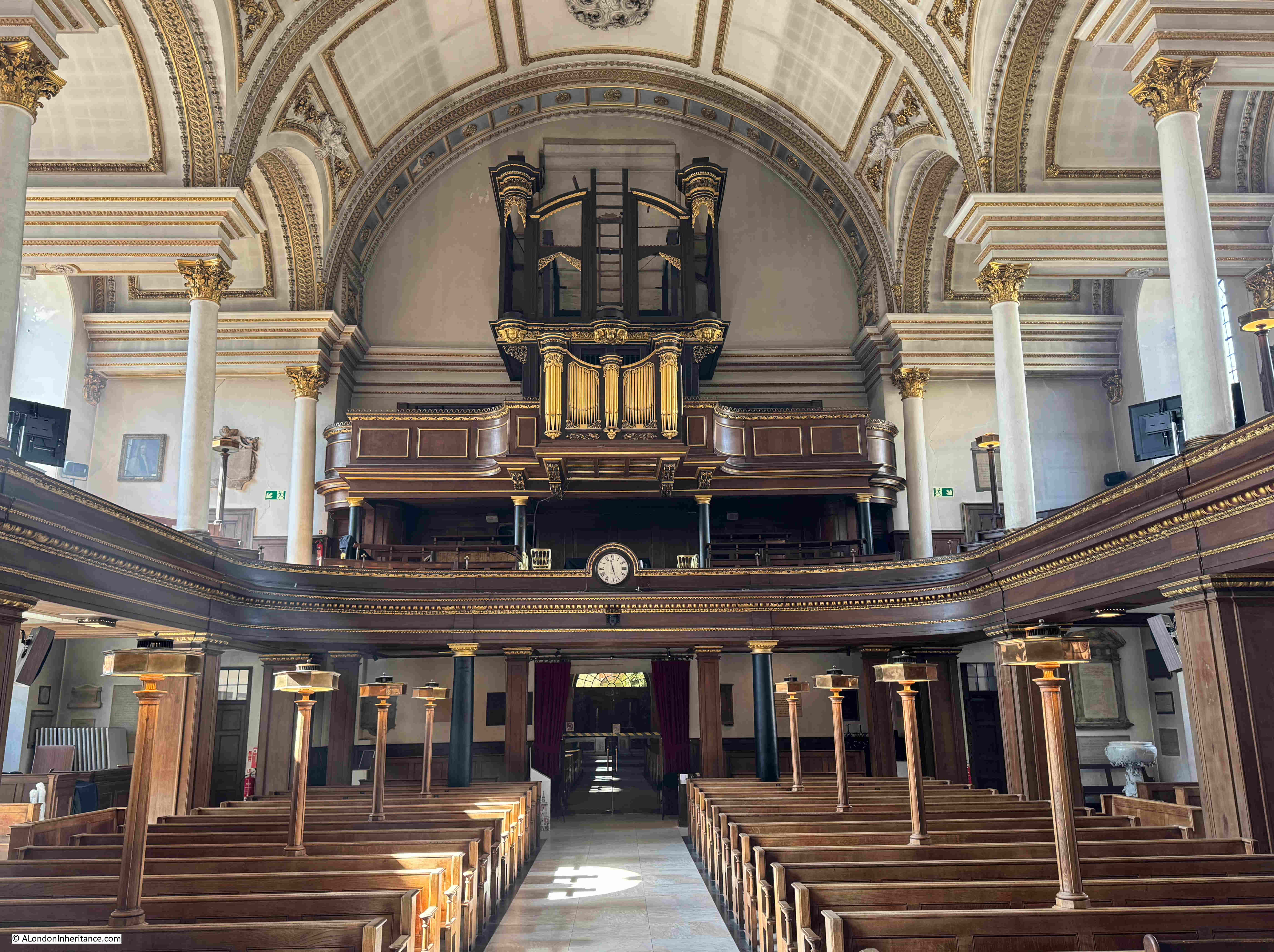
Looking to the west end of the church, with the fully restored organ:

The origins of the organ date back to 1686, when an organ was built by Renatus Harris for a Roman Catholic Chapel at Whitehall Palace.

With the Protestant William of Orange and Mary (who jointly ruled as William II and Queen Mary II) coming to the throne in 1689, the Roman Catholic Chapel was dismantled, and the St. James’s vestry petitioned the Queen to have the organ from the chapel installed in their new church., as a result, the organ was moved to St. James’s, being ready to play at Christmas 1691.

The organ was restored during the late 19th century, but was badly damaged during the bombing of 1940, luckily the organ case had already been dismantled and stored remotely. It was restored and rebuilt, ready for use in 1954.

After completion, and in the first decades of the 18th century, St. James’s Piccadilly was considered the most fashionable church in London. No doubt due to the residents of the new streets around St. James’s Square, and the large houses that were built along Piccadilly, which was also growing in prominence as an important London street.

There are a lovely series of books about the Piccadilly area in wartime by the author Robert Henrey.

Robert Henrey was a journalist, however his wife was the French writer Madeleine Gal who also wrote under the name of Robert Henrey. Writing was a joint enterprise with much of the material being hers and he supplied the editorship. 

They lived in Shepherd Market, and I wrote about the area in this post. In “A Village in Piccadilly” (1942), Henry wrote the following about St. James’s Church:

“I decided to attend matins at St. James’s Piccadilly. Only the south aisle remained standing after high explosives and incendiaries had rained down on both the church and the adjoining rectory during the night raids of the summer.

St. James’s was the essence of Piccadilly. Wrecked and charred, it continued to arrest the attention of the passer-by as the most spectacular ruin of the neighbourhood.

My first interest in St. James’s was when, as a child, it was pointed out to me that the steeple was sloping – a local tower of Pisa!. This had struck me so deeply that I never walked past without looking up at it with fascination. This steeple was the only part of the church for which Wren was not responsible; his original design was refused on the grounds of expense, and the work was given to a local builder.

What gave the church its picturesqueness was the open-air pulpit , the big yard paved with old tombstones that originally stood upright, and the gnarled tree that in summer spread its leafy branches over Piccadilly.”

The following photo is from the book “A Village in Piccadilly”, which shows some of the damage to the church:

There is also a short British Pathe film showing the bomb damaged church:

And this British Pathe film shows the 1946 opening of a Garden of Remembrance at the church, as well as more scenes of the considerable damage to the church in 1940:

The church has some rather unique lights mounted on the pews:

The walls of the church have a good number of monuments and plaques, and some of these record that it was not just the living who suffered wartime bombing, but also the dead.

This plaque is to William McGillivray, who died in London in 1825 and with his wife Magdalen, were buried at the church, with their graves being destroyed in 1940:

William McGillivray was a Scottish born fur trader, who spent the majority of his life in Canada, with a home in Montreal, as well as retaining a significant estate in Scotland.

McGillivray’s time with the North West Company was during the expansion of their operations across Canada, and with considerable competition with the Hudson Bay Company.

Furs were one of the major exports of both the North West and Hudson Bay Companies, and during the first decades of the 19th century, the excessive numbers of beaver trapped for their furs was leading to the scarcity of what had been a common animal. Many of the furs exported by the North West Company would have been traded through the Port of London.

The fur trade from Canada was gradually replaced by timber as in 1809 Napoleon had blockaded the Baltic Sea which prevented timber being exported to the UK, and in the same year, the countries other main source of timber, the United States enacted their Non-Intercourse Act, which prohibited trade with the UK – an act which did contribute to the industrialisation of the United States as for the time that the act was in place, British manufactured goods could not be imported into the US – a parallel with recent US tariffs perhaps?

His death in London was during a visit, rather than when living in the city.

Another grave destroyed in 1940 was that of Bartholomew Ruspini, who apparently in 1788 established the “Royal Cumberland Freemason School for the Daughters of Deceased or Distressed Freemasons”:

The school is still going, and is based in Rickmansworth, although judging by their fees, it does not look as if it would cover the daughters of those in financial distress.

Another of the graves or tombs destroyed in 1940 was that of Mary Beale, who unusually for the time, was a portrait painter:

According to the National Portrait Gallery, Mary was the daughter of a Suffolk clergyman who married Charles Beale, who was an artists colour-man – a person who made and prepared the materials that an artist would use.

She had a studio in London and produced a considerable number of portraits, and the National Gallery records her as being the earliest professional female artist in their collection.

Mary Beale – a self portrait:

Image source: © National Portrait Gallery, London and reproduced under Creative Commons licence CC BY-NC-ND 3.0.

In her portrait, Mary is holding in her right hand a portrait of her two sons, and on the wall on the left is an artist’s pallet, highlighting both her family and her profession.

Mary’s portrait is believed to date from 1666 – the same year as the Great Fire of London. No connection – just interesting to see an image of someone who may have witnessed such a disastrous event in the history of London.

A memorial to two other artists who were buried in the church. The Dutch marine artists William van der Velde the Elder, and his son William van de Velde the Younger:

Father and son van de Velde left Amsterdam in 1672 and settled in England. They became favourites of King Charles II, who, to encourage them to stay, provided studio space in the Queen’s House in Greenwich, as well as a salary of £100 each, a year.

The van der Velde’s established maritime art as a key part of Britain’s maritime identity, at a time when trade via the sea was rising rapidly, as well as the strength of the Royal Navy.

The Royal yacht ‘Cleveland’ by William van de Velde the Younger:

Image: © The Trustees of the British Museum. Shared under a Creative Commons Attribution-NonCommercial-ShareAlike 4.0 International (CC BY-NC-SA 4.0) licence.

A sample of some of the original monuments in the church. This is to Master Henry Nesbitt Brooke who died in Hammersmith at the age of 11 and was described as “A Most Promising Youth”:

Looking at some of the monuments, you do wonder about the history of the people recorded. Henry died in London in 1823 at the age of 11, and had been born on the Island of St. Helena.

St. Helena is the very remote island in the southern Atlantic, where Napoleon Bonaparte was held from his surrender in 1815 to his death in 1821.

The plaque does not record when Henry left St. Helena, but it is possible that he was on the island at the same time as Napoleon, and that they may have met.

The “artist, poet, visionary” William Blake, who was baptised in St. James’s in 1757:

William Yarrell – Treasurer and a Vice President of the Linnean Society of London:

The Linnean Society was founded in 1788 at a learned society devoted to the science of natural history.

The monument is a memorial to Yarrell, as he was not buried at St. James’s. Yarrell died in 1856, and I assume his memorial is at St. James’s as during the following year, 1857, the Linnean Society moved from Soho Square to Burlington House in Piccadilly (the current location of the society), so by the time the monument was completed, it was installed in the church nearest to the home of the society.

The font:

The font is believed to be the work of Grinling Gibbons, and dates from 1686. The font is of white marble. Gibbons is usually known for his work with carved wood, for example with the decoration on the reredos (wooden panels) behind church altars (such as the panels in St. James’s), but he was also exceptionally skilled at marble work as the ornate font demonstrates.

The font originally had a cover, however it is believed that this was sold by the church, possibly in 1822, when the font was moved to a location where the cover could not be hung.

The following print is from 1718 and lists Grinling Gibbons as the sculptor of the font, and also shows the ornate cover that was part of its original design and installation:

Image: © The Trustees of the British Museum. Shared under a Creative Commons Attribution-NonCommercial-ShareAlike 4.0 International (CC BY-NC-SA 4.0) licence.

The courtyard of the church, between the church and Piccadilly is where the high explosive bomb fell in 194o, and that did so much damage to the church. Today, it is busy place with food stalls and people taking a lunchtime break:

The Grade II listed Southwood memorial located between the courtyard and the garden to the west of the church:

The memorial is to Viscount Southwood, who died in 1946 and bequeathed money for the memorial garden, the opening of which is shown in one of the British Pathe films shown earlier in the post.

A walk along Church Place to the east of the church, shows the eastern end of the church, whare the altar is located:

Church Place from Piccadilly:

St. James’s Church is a lovely late 17th century London church, which tells the story of the westward expansion of London, how the building of new streets and significant increases in population required the division of parish boundaries into smaller areas, as what had been fields disappeared.

A church that looked almost a lost cause after the bombing of 1940, but too important not to be rebuilt, and as Robert Henrey / Madeleine Gal wrote in 1942 – the Essence of Piccadilly.

alondoninheritance.com

Late 20th Century Sculpture in the City of London – Part 2

In today’s post, I am continuing to track down the works listed in the 1994 booklet published by the Department of Planning of the Corporation of London with the title of “Late 20th Century Sculpture in the City of London”.

The full list was in the original post, and to identify the location of the works covered in today’s post, I have included the maps with numbers for each work which were included in the booklet:

Art was considered an important addition to the public space, particularly as part of the many developments taking place in the City in the later years of the 20th century, and the booklet includes the following statement of the City of London Corporation’s approach:

“The Corporation considers that art can contribute significantly to the quality of the environment. It will therefore encourage the incorporation of art and artworks into the urban scene, in appropriate locations. To this end it is important that the integration of art and artworks into developments and the local environment is considered at an early stage in their design.”

In the last post, I finished with Icarus near Old Change Court, so for today’s post, I made the short walk towards St. Paul’s Cathedral, to find:

13. Cannon Street, Festival Gardens, Young Lovers, Georg Erlich

To the immediate south east of St. Paul’s Cathedral, you will find Festival Gardens, created during and named after the 1951 Festival of Britain:

The gardens consist of a central green space, surrounded by walkways and seating, along with flower beds, and a water feature, and at the western end of Festival Gardens, Georg Erlich’s Young Lovers can be found:

Although the gardens were created for the 1951 Festival of Britain, the “Young Lovers” was not installed until 1973, eight years after Erlich’s death in 1966.

Georg Erlich was born in Austria where he had studied art, but for much of his life he lived in London, from where he had a very successful career, and was exhibited widely in the UK, as well as Europe and North America.

I cannot find out why it took several years after his death to install the Young Lovers, given that the Festival Gardens had been completed in 1951. I suspect it was after a reconfiguration of the gardens in the early 1970s. The original configuration of the gardens is shown in the following photo, and they were later extended to cover the area in the upper part of the photo:

I also cannot find out whether the Young Lovers was originally displayed at a different location, or whether the City of London Corporation intended to install the work at a different location prior to installation at the Festival Gardens.

The work does add a focal point to the western end of the gardens:

Although he did not take any photos of the gardens in 1951, my father did take a photo of the flags on the gardens at the time of the Festival of Britain – one of those times when it is a shame he was relying on a limited amount of film, rather than the almost unlimited number of photos we can take today with digital cameras:

As I left Festival Gardens, I walked past One New Change where there is a modern piece of sculpture. This is Nail, a 12 metre bronze sculpture by Gavin Turk:

“Nail” was installed in 2011, so much later than the works covered in the City of London booklet, however I have included it in the post simply as an example of the continuing use of sculpture to enhance the public realm, and hopefully so that when walking the streets, we stop for a moment to stop and think.

I was walking down New Change to reach my next destination, which was:

14. 20 Cannon Street, The Leopard, Jonathan Kenworthy

The following photo shows the latest version of 20 Cannon Street:

The Leopard, by Jonathan Kenworthy should be just to the right of the corner entrance to the building.

Using Google Street View, I did find the Leopard in 2008, when the side of the building along Friday Street (the street to the right), had larger gardens than we see today.

As well as 2008, Google Street View shows the area in 2009, the following year, and the Leopard has disappeared, as it had by then been relocated to the construction company Wates’ headquarters at Station Approach, Leatherhead, directly opposite the station entrance.

A quick search on Google Street View shows the Leopard can still be found in Leatherhead.

There are also versions of the Leopard by Jonathan Kenworthy in Chester, as well as outside the Lord Beaverbrook Art Gallery in Fredericton, New Brunswick, Canada.

Although not in its original location in the City of London, at least the Leopard was not lost, and for commuters from Leatherhead to London, the Leopard will be part of their daily entrance and exit from the station.

15. Barbican, Ben Jonson Place, Dolphins

The ordering of the list of sculpture is rather strange for a walking route, so from 20 Cannon Street, I then headed to the Barbican, to find the Dolphins:

Ben Jonson Place is a large raised plaza which runs above Beech Street, on the northern side of the Barbican Estate, and the Dolphins is a small work in the middle of a water feature along the southern side of the plaza, as shown in the above photo, and with a close up below:

The Dolphins are not part of the early build of the Barbican Estate, but were added in 1990, and in the City of London booklet on late 20th Century Sculpture, the Dolphins is one of only two where there is no name listed for the creator of the work.

The Dolphins was created by John Ravera, a Surrey born sculptor who trained at the Camberwell School of Arts and Crafts between 1954 and 1962.

He was based in Bexleyheath, Kent, where he had his own bronze foundry, and from where he created a wide range of works including water features, family groups, architectural reliefs, and was known for creating works that demonstrated the freedom of movement of their subjects, as can be seen by the dolphins leaping up from the central ring of small jets of water.

Ben Jonson Place along with the surrounding buildings are built of materials of a very similar colour, so the Dolphins also provides a splash of colour that attracts the eye whilst walking through the estate.

The next work in the list was a very short distance away, at the end of Ben Jonson Place:

16. Barbican, Series of Silver Metal Pipes, Mayer

Working through the list of 20th century sculpture in the City of London raises some interesting questions about the preservation of knowledge about public sculpture.

The City of London booklet did not list the sculptor for the Dolphins, and for this work, it is listed as a “series of silver metal pipes”, with just the last name of the sculptor.

The description is though accurate as it is just a series of silver metal pipes, with their different lengths forming what looks to be a sort of spiral staircase that wraps around the work.

This gives a clue as to its proper name, which is “Ascent”, by Charlotte Mayer, who was born in Czechoslovakia in 1929, and moved to the UK in 1939 with her mother to escape the Nazi occupation.

She trained in London, and lived in the city until her death in 2022.

Many of her works were based on spiral forms, as demonstrated by Ascent at the Barbican. I have no idea as to whether it was mirroring the towers at the Barbican, the tallest residential blocks in London at the time of their construction, but with Cromwell Tower behind, as shown in the above photo there is a possible link.

As far as I could see, there is no reference to either Charlotte Mayer or the name “Ascent” next to the sculpture, as the proper name of the work, which is a shame, as it would be good to have some background to the work and the sculptor on display to add more meaning to the work, rather than being, as described in the booklet as a “series of silver metal pipes”.

17. Barbican, Carmarque Horses, Enzo Plazzotta

The Carmarque Horses by the Italian born sculptor Enzo Plazzotta should be by the waterside terrace in the Barbican:

However despite walking up and down both sides of the terrace, I could not find the work, and cannot remember if and when I last saw it.

One of the things I have realised with writing the blog is that it is easy to take the street scene for granted, and often the buildings, landmarks, statues, plaques etc. that you walk past, just do not register, particularly these days when so many people are walking whilst looking at their mobile phones.

If it has moved, I cannot find a record of where to, although there do seem to be several versions of Plazzotta’s Carmarque Horses to be found in both public and private collections.

Enzo Plazzotta was an Italian born sculptor, who spent the majority of his working life in London, and whilst I cannot find the Carmarque Horses, there are a number of his works remaining across the city.

Despite the rather obscure location, I did have better luck with finding the following work:

18. 125 London Wall, Unity, Ivan Klapez

Hidden away at the end of one of the walkways alongside London Wall, is Ivan Klapez’s Unity:

Ivan Klapez is a Croatian figurative sculptor, who has been based in London for almost four decades.

Unity dates from 1982, and was part of the overall office development of Alban Gate which sits above the junction of London Wall and Wood Street.

The work is at the edge of an alcove, part of which can be seen to the right of the above photo, and looking directly at the alcove, we can see the location of Unity, which is above Wood Street, seen through the windows of the alcove:

Unity is an example of how the surroundings of a public work of art can change. Whilst this was probably once an area of higher footfall, during my visit I did not see another person, and nearby building work has shuttered off part of the space which does not help.

Probably intended as a focal point, Unity is now just a chance find for anyone straying into this part of the walkway alongside London Wall and Wood Street.

The next work on the list is very much in a busy place:

19. Bow Churchyard, Captain John Smith, Charles Renick

The majority of the sculpture listed in the City of London booklet is abstract or figurative. Unlike the first half of the 20th century, and the 19th century, very few are of real people, however in Bow Churchyard there is an exception. This is Captain John Smith:

Text on the plink explains why Captain John Smith has a statue in the City:

“Captain John Smith, Citizen and Cordwainer, 1580 – 1634. First among the leaders of the settlement at Jamestown, Virginia, from which began the overseas expansion of the English speaking peoples.”

Cordwainers were among the first of the craft organisations having received ordinances from the Mayor of London in 1271, and the name is derived from the early English word “cordwaner” meaning a worker in “cordwane” which was leather from the town of Cordova in Spain and the name dates back to around the 12th / 13th Century.

The statue is Grade II listed, and is in the old churchyard (now a paved public space next to the church of St. Mary-le-Bow), as Captain John Smith was a parishioner at the church, although after his death in London in 1634, he was buried in St Sepulchre-without-Newgate.

The statue is based on an early 20th century statue at Jamestown, and the origins of the version next to St. Mary-le-Bow is also explained on the plinth:

“This statue presented to the City of London by the Jamestown Foundation of the Commonwealth of Virginia was unveiled by Her Majesty Queen Elizabeth, the Queen Mother on Monday 31st October 1960.”

The statue was installed in 1960 to commemorate the 350th anniversary of Captain John Smith’s return to England in the winter of 1609 – 1610.

From St. Mary-le-Bow, I then headed to:

20. Guildhall Plaza, Glass Fountain, Allen David

Allen David was born in Bombay, India in 1926, and moved to Melbourne, Australia in 1948, where he studied drawing and architecture.

By the end of the 1960s he had moved to London, and in 1969 he received the commission for the Glass Fountain from a Mrs Edgar, who was the wife of Gilbert H. Edgar CBE, a City of London Sheriff between 1963 and 1964.

I have not seen the fountain working for some time, but when it does, it is flooded with water from multiple clear pipes across the whole of the sculpture giving the impression of covering it in water.

I think the Glass Fountain was installed during a remodelling of the area, as the next work in the list is also in the Guildhall Plaza and dates from 1972, so close to the 1969 date of Glass Fountain. It is:

21. Guildhall Plaza, Beyond Tomorrow, Karin Jonzen

Beyond tomorrow is a very short walk from Glass Fountain, and is close to the 1958 northern wing of the Guildhall:

Karin Jonzen was born in London to Swedish parents in 1914, and studied at the Slade School of Art, and during the war, she worked as an ambulance driver.

After the war, she made the decision to concentrate on figurative sculpture, and in 1951, one of her works was included in the Festival of Britain exhibition.

I had a look in the guide book for the South Bank festival site, and under “New Sculpture, Painting and Design”, is listed:

“Karin Jonzen – Sculpture. At the end of Waterways, near the Waterloo Bridge Gate”, so it was somewhere to the left of the southern approach to Waterloo Bridge.

The guide book did not include a name for the work, there are some references to it being a “standing figure”, but I can find no photos or references as to what happened after the Festival of Britain. Works for the Festival were often made quickly and cheaply, and out of temporary materials (even papier mache), so it may not have survived.

The commission for Beyond Tomorrow was as a result of three works that Jonzen entered into the 1968 Sculpture in the City exhibition, which led to the Corporation of London commissioning two works, one of which was Beyond Tomorrow, the second I will hopefully find in the final post of this series.

Hard to see in the following photo, which was taken in the dark shadow of the northern wing of the Guildhall, but there is a plaque recording the name Beyond Tomorrow, and the date of 1972. It also records that it was given by Lord Blackford and created by Karin Jonzen:

The reference to Lord Blackford is that the first casting of the work was made whilst Karin Jonzen was travelling. On her return she was not happy with the result, so she paid for a new version, created using bronze resin.

Lord Blackford was apparently so impressed with the work, that he paid for a new bronze casting to be made, which is the version we see today, and is why Lord Blackford is recorded as having “given” the sculpture.

22. Bassinghall Street, Woolgate House, Ritual, Antanas Brazdys

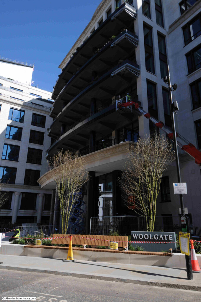
With Ritual by Antanas Brazdys, I was really not sure if I had found the right work, in the right place. I knew I was at Woolgate House, but it is a new development, not the Woolgate house that was here in 1969, when Ritual was installed.

Approaching the latest version of Woolgate House along Bassinghall Street:

It is interesting how buildings in the City of London frequently have the name during several decades of demolition and rebuilding, but that is not the subject of today’s post as I was here to find the statue, which today sits beside the street, a bike park, and the building:

The sculpture I found seemed to be too bright and shiny for a 1969 work, as the majority of the late 20th century sculpture featured in the City of London guide was of either stone or bronze, but here ii was, in all its shiny glory:

I was able to confirm it is the work Ritual, as whilst the City of London booklet on late 20th century architecture only has a few photos of the works listed. It does include Ritual, and here it is, outside one of the earlier versions of Woolgate house:

When originally installed, it appears to have been within the concrete approach to the entrance to Woolgate house. Today, it is within a small water feature and an area of planting which looks to be a good improvement from its original position.

Antanas Brazdys was born in Lithuania in 1939. he studied in Chicago and London, and become a senior sculpture lecturer at Cheltenham College of Art, and had works exhibited in many sculpture exhibitions, including the 1966 Open-air Sculpture Exhibition, at Battersea Park.

Many of his works are of the same materials and style as with Ritual.

It is interesting as I have worked through the the City of London booklet on late 20th century sculpture in the City of London, how many of the sculptors were from foreign born sculptors – Austria, Czechoslovakia, Italy, Croatia, Swedish parents, India and Lithuania, just in the selection in this post.

I do not know if that was a conscious decision of the City of London Corporation, or whether it was people with different origins and backgrounds who were bringing the creativity to the streets of the City during the later half of the 20th century.

I still have the remaining works in the list to track down, so will feature these in a post later in the year.

alondoninheritance.com