Tag Archives: Belgravia

The Star – Belgrave Mews West

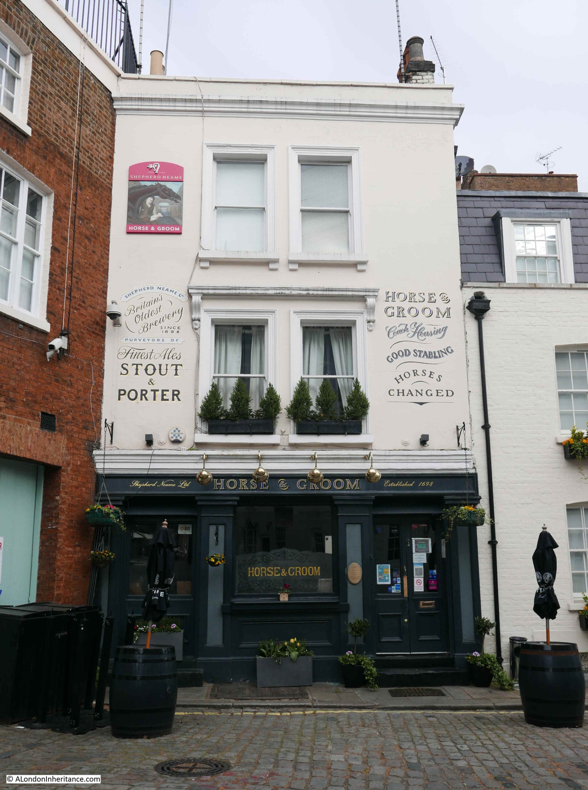
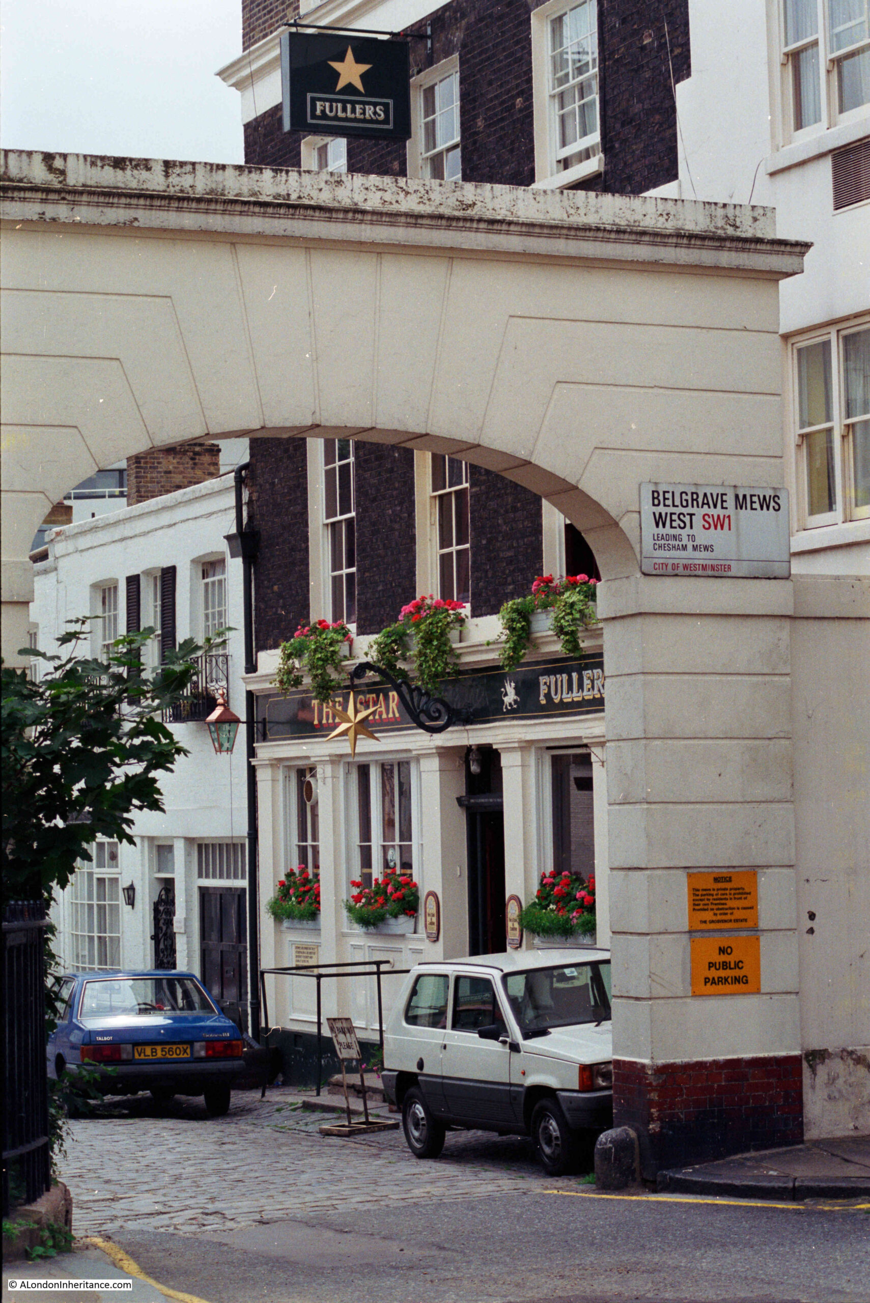
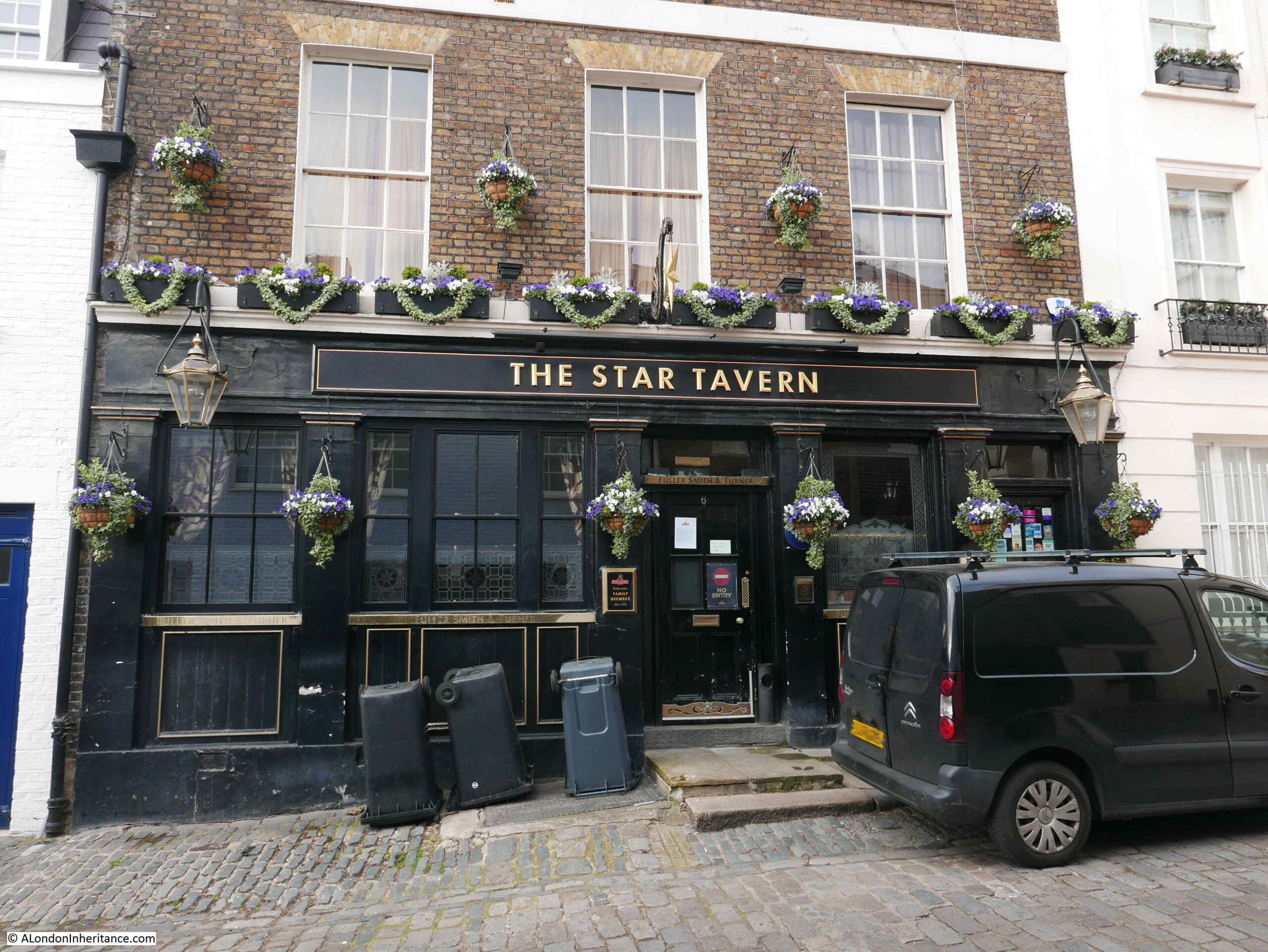
This week, I am back to exploring pubs of the 1980s, and unlike the last post on the Narrow Boat in Ladbroke Grove, today’s pub is still open. This is the Star in Belgrave Mews West:

Belgrave Mews West

The same view today:

The Star Belgrave Mews West

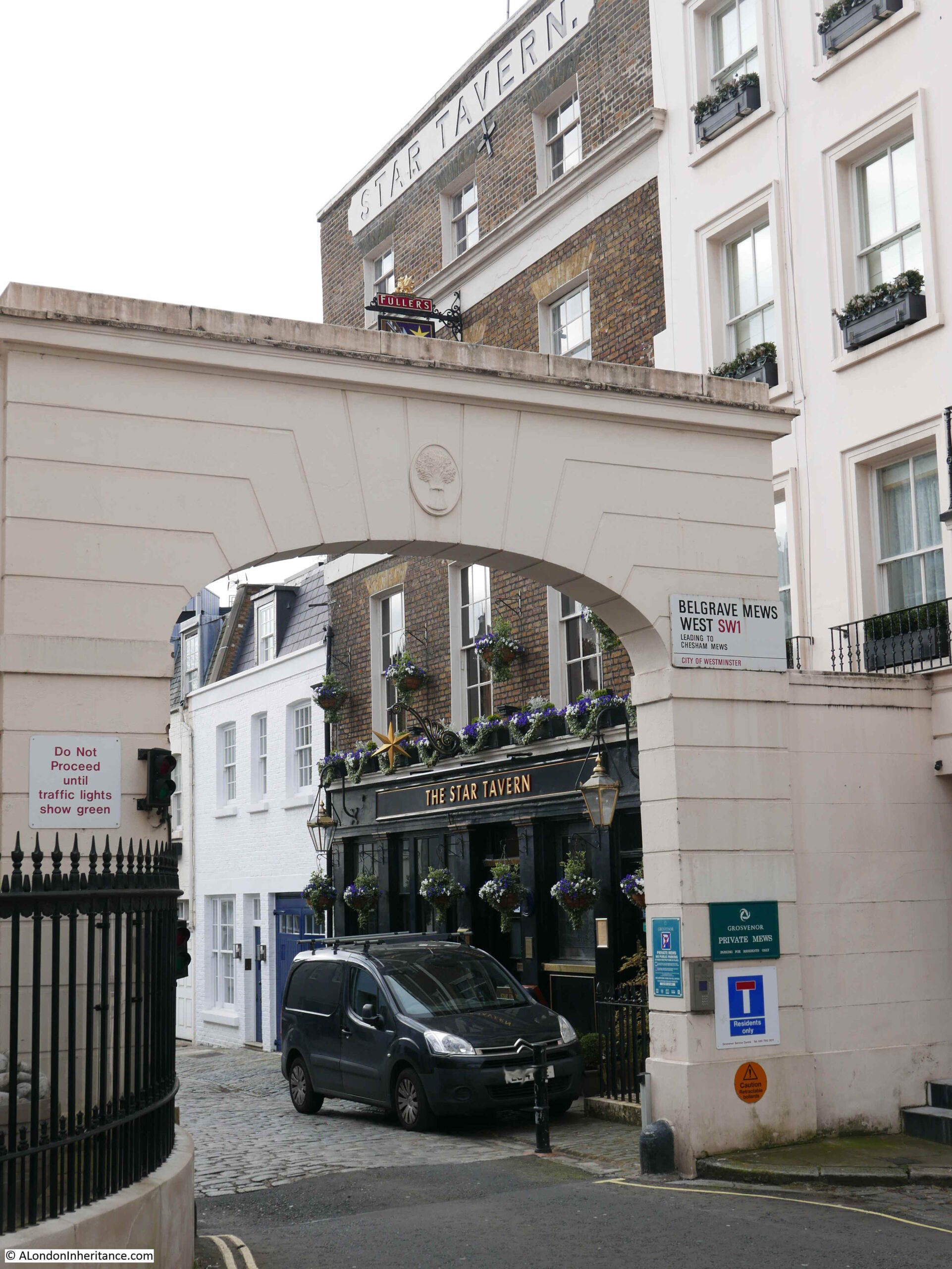
Apart from some minor cosmetic changes, and a change of colour for the ground floor of the pub, it has hardly changed in 35 years.

There is one minor difference which tells a wider story of how pubs have changed. Go back to the 1986 photo at the top of the post and look at the ground floor window to the left of the pub, and there is an Xpelair fan installed at the top of the window.

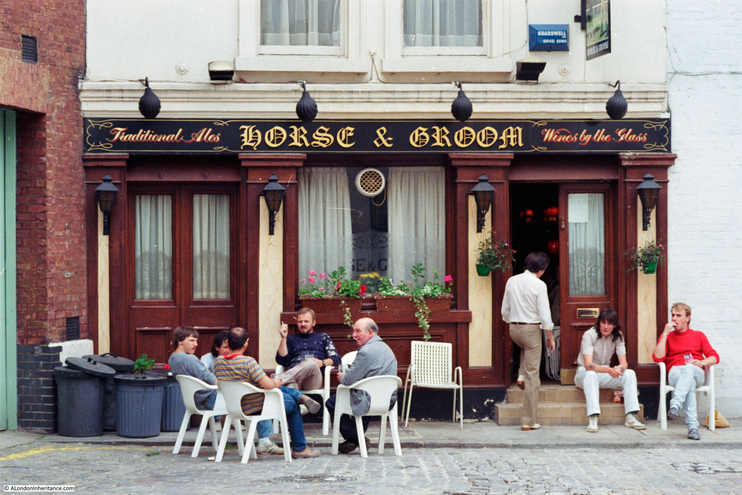
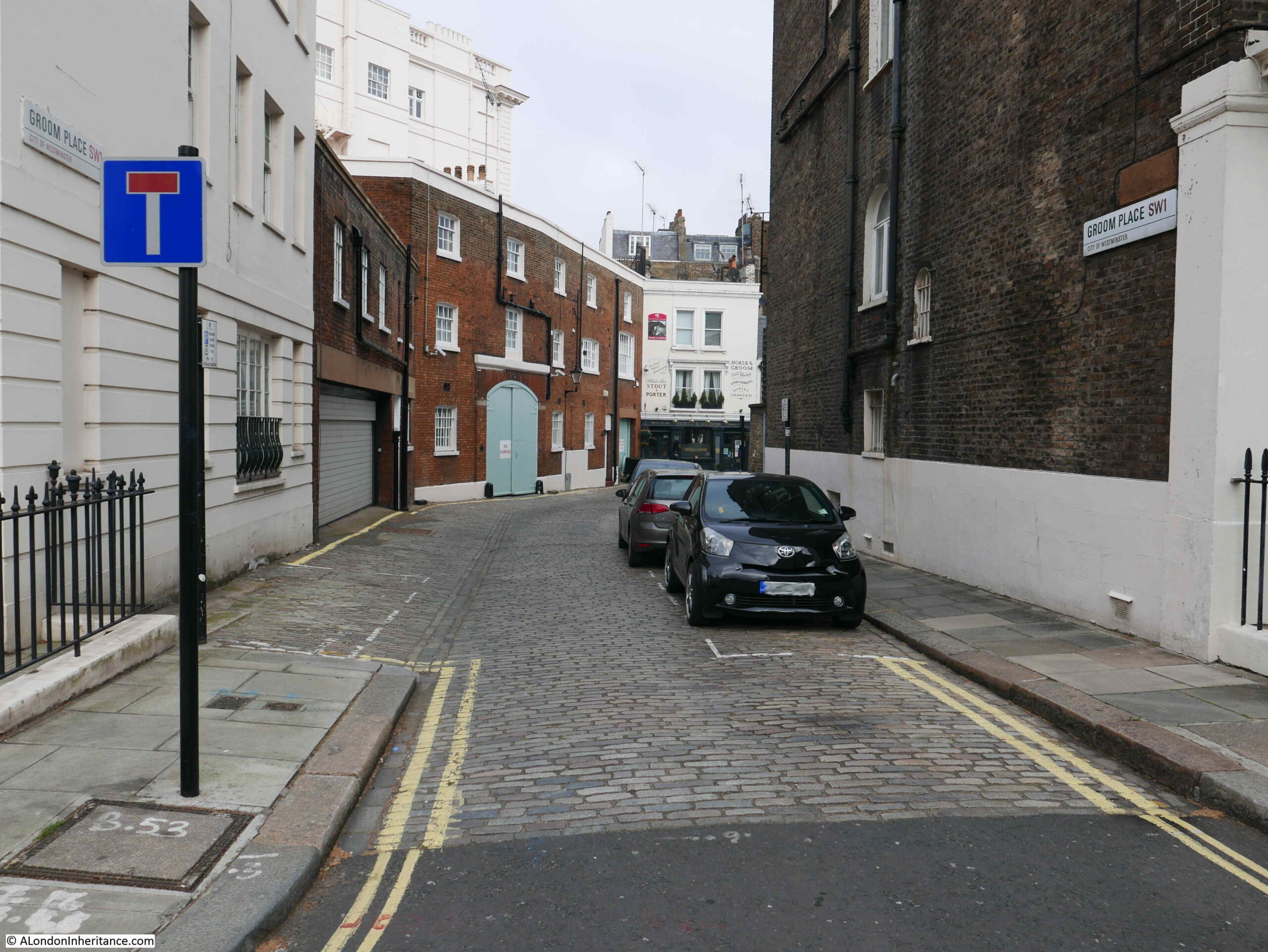
These were so common in pubs (there is one in the centre of the Horse and Groom Pub, Groom Place, Belgravia from a few weeks ago). They were needed as this was long before the smoking ban came into force in 2007, and pubs were mainly for drinking with a much smaller side line in food. I had a part time job in a pub in the early 1980s and I am sure I was on the equivalent of 20 day sometimes, just by breathing the air.

There is also a change at the top of the arch. In 1986 the top was plain, however in 2021 there is a wheatsheaf. The wheatsheaf is the symbol of the Grosvenor Estate, of which the mews are part.

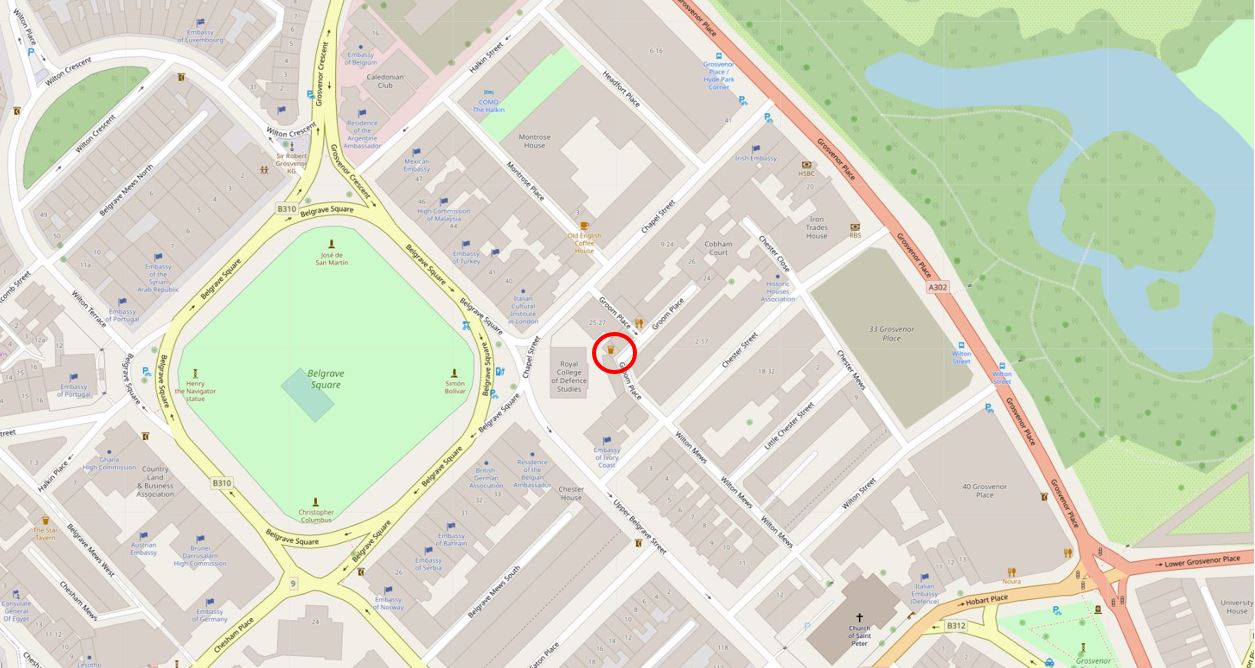
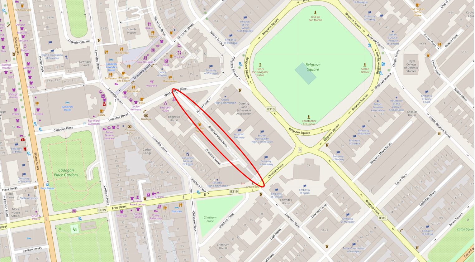
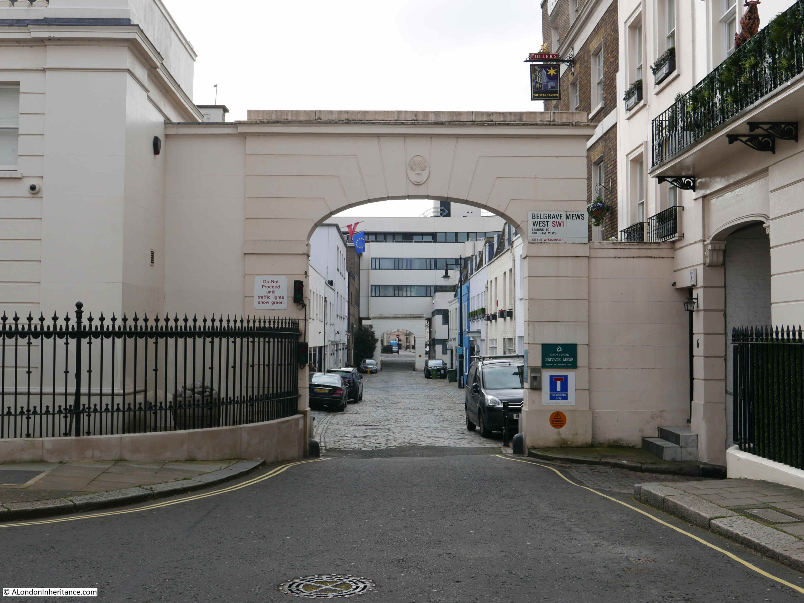
The Star is located at the northern end of Belgrave Mews West, which runs between Chesham Place and Halkin Place, just to the west of Belgrave Square. I have highlighted the location of the mews in the following map (Map © OpenStreetMap contributors):

Belgrave Mews West

The Star was part of the westward expansion of Belgravia in the 1830s / 1840s, with the development of the Grosvenor Estate. The pub has retained its original name, and the first reference I can find to the pub implies that it opened in 1848, as from the Morning Advertiser on the 13th March 1848, in the column detailing the results of licence applications:

“Star, Belgrave-mews West, Belgrave-square – Mr Woolff appeared for Richard William Ledger, a beer-house-keeper, and applied for a licence on the grounds that there were a great many workmen and servants of the nobility and gentry in the neighbourhood, who required that accommodation which only a licensed house could afford, and that there was no public-house nearer than the Turk’s Head which is distant 400 yards from the petitioner’s. There was no objection – Licence granted”.

The Turk’s Head mentioned in the licence application is still a pub, but is now called the Alfred Tennyson, and can be found at 10 Motcombe Street, Belgravia.

The Star looks to be in a purpose built pub building, so I am not sure what came first, the building or the licence application? I assume the building was designed with the sole purpose of being a pub.

The licence application is also interesting as it clearly identifies the target clientele. You would probably not have found any of the wealthy owners of the large houses around Belgrave Square in the Star, however for their servants, and those working in the area, the Star must have been a welcome escape.

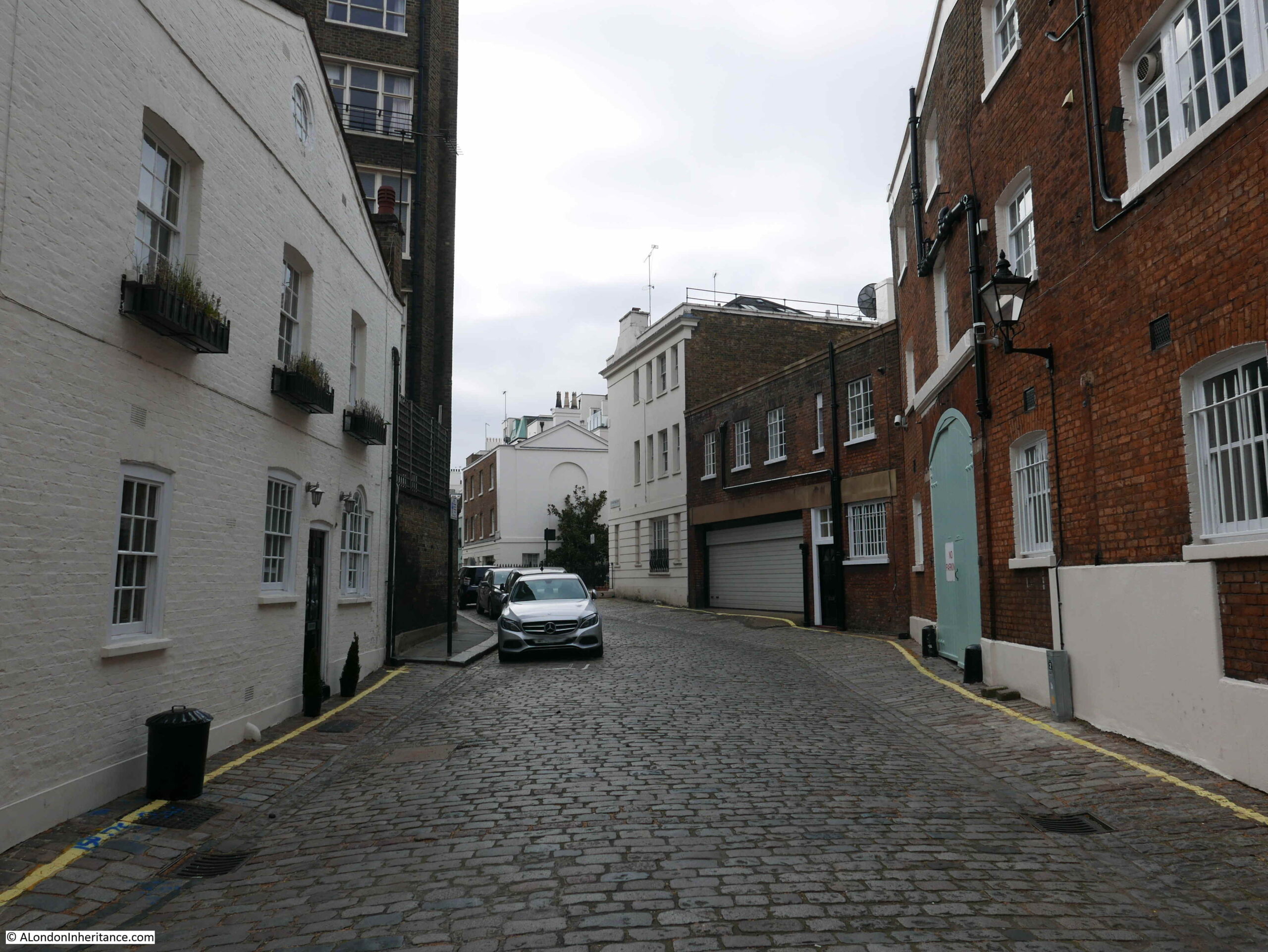
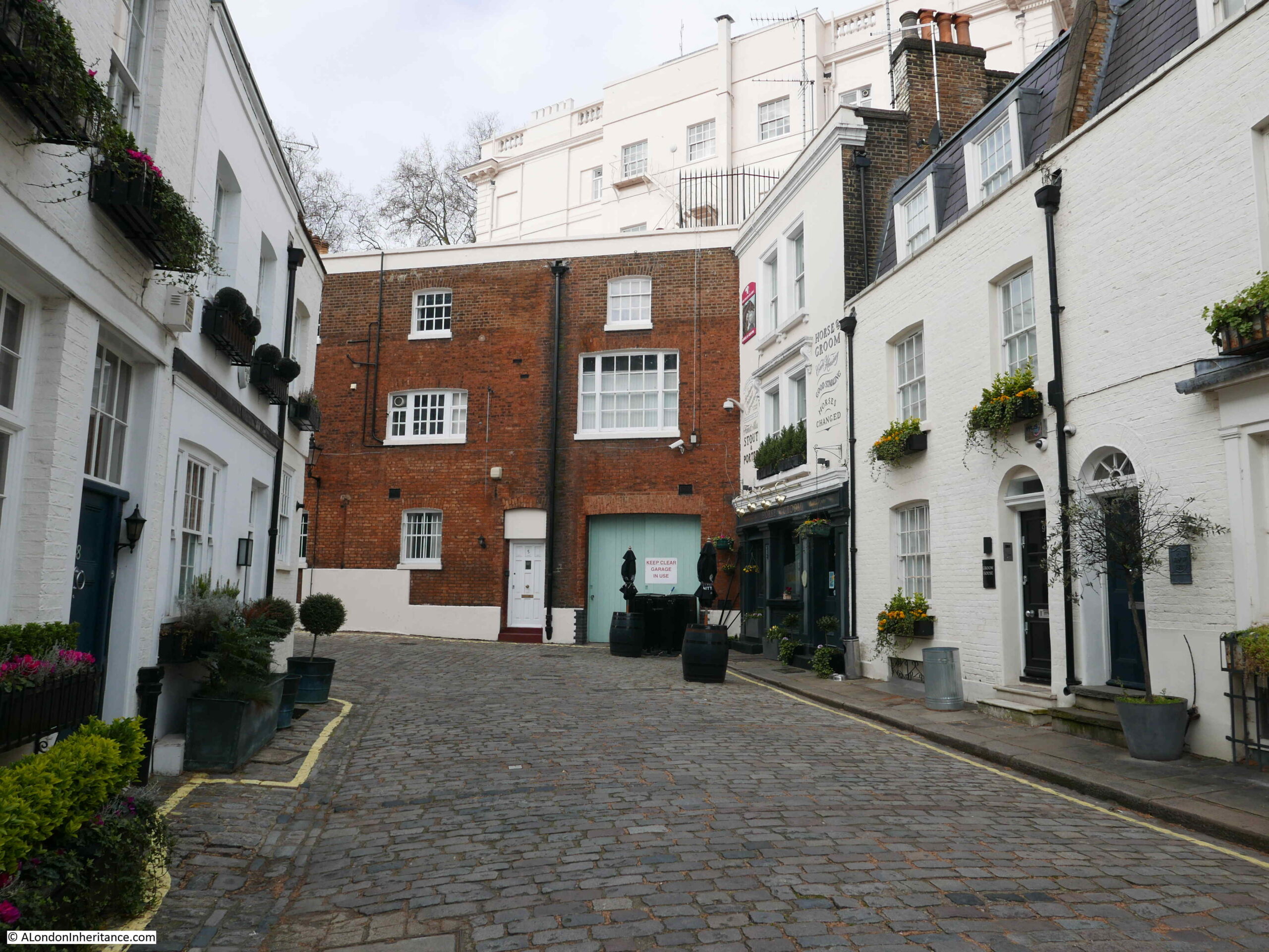
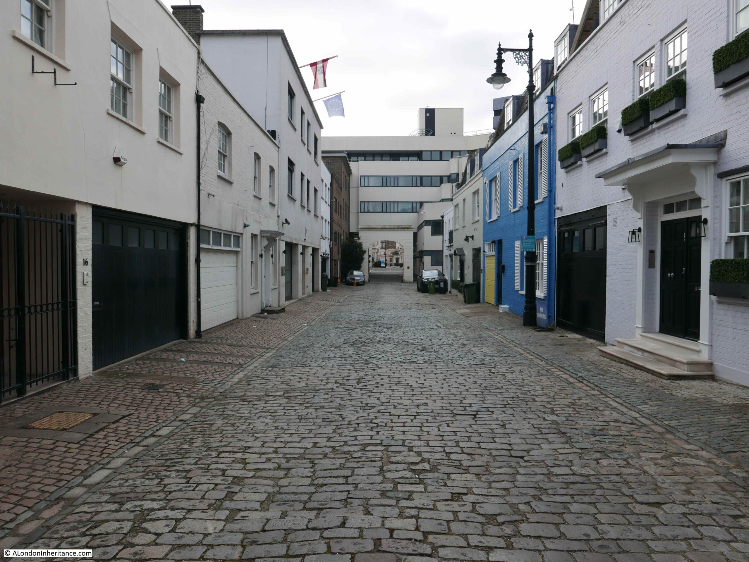
The following photo is looking south down Belgrave Mews West. Belgrave Square is to the left and the buildings on the left of the mews back onto the houses in Belgrave Square, which is probably where many of the pubs clientele worked.

Belgrave Mews West

The Star – currently closed, but opening soon.

The Star Belgrave Mews West

The Star seems to have been a place where the rich and famous, as well as many of the major criminals of the time met in the 1950s and 1960s.

It is the place where members of the gang who carried out the Great Train Robbery met to plan the raid.

A description of the pub in the Tatler on the 23rd July 1966 describes the rather colourful landlord at the time:

“The Star, 6 Belgrave Mews West. Pat Kennedy’s voice sounds like gravel-chips being steamrollered. It is heard at full blast any time of day or night, as he holds court in the upstairs bar. Paddy’s, as the pub is known, has seen it all. Name a personality, and he or she has been there. Nuff said”.

Those reported as frequenting the Star included actors Albert Finney, Diana Dors and Peter O’Toole, A couple of months after the above report, in a section on London’s best bars, the Tatler described the Star as “it attracts fanatical partisans of darts and pin-tables, and creates an illusion of spies and illicit rendezvous”.

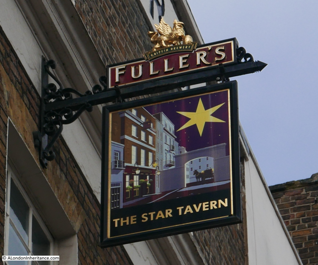
The pub sign features a view of the pub to the side, looking through the arched entrance to the mews, where a coach and horses are waiting.

The Star Belgrave Mews West

Looking through the arch with the Star to the left:

The Star Belgrave Mews West

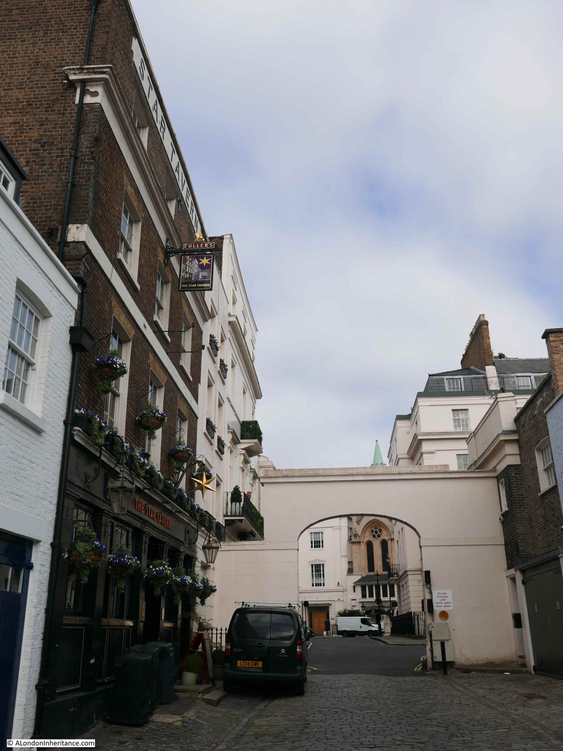
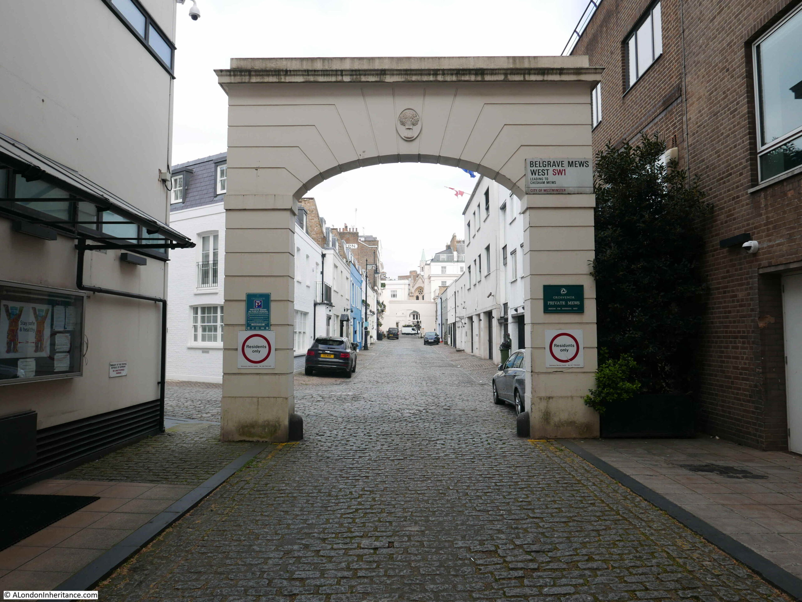
Walking further down the mews and this is the view looking up, with the pub at the far left:

Belgrave Mews West

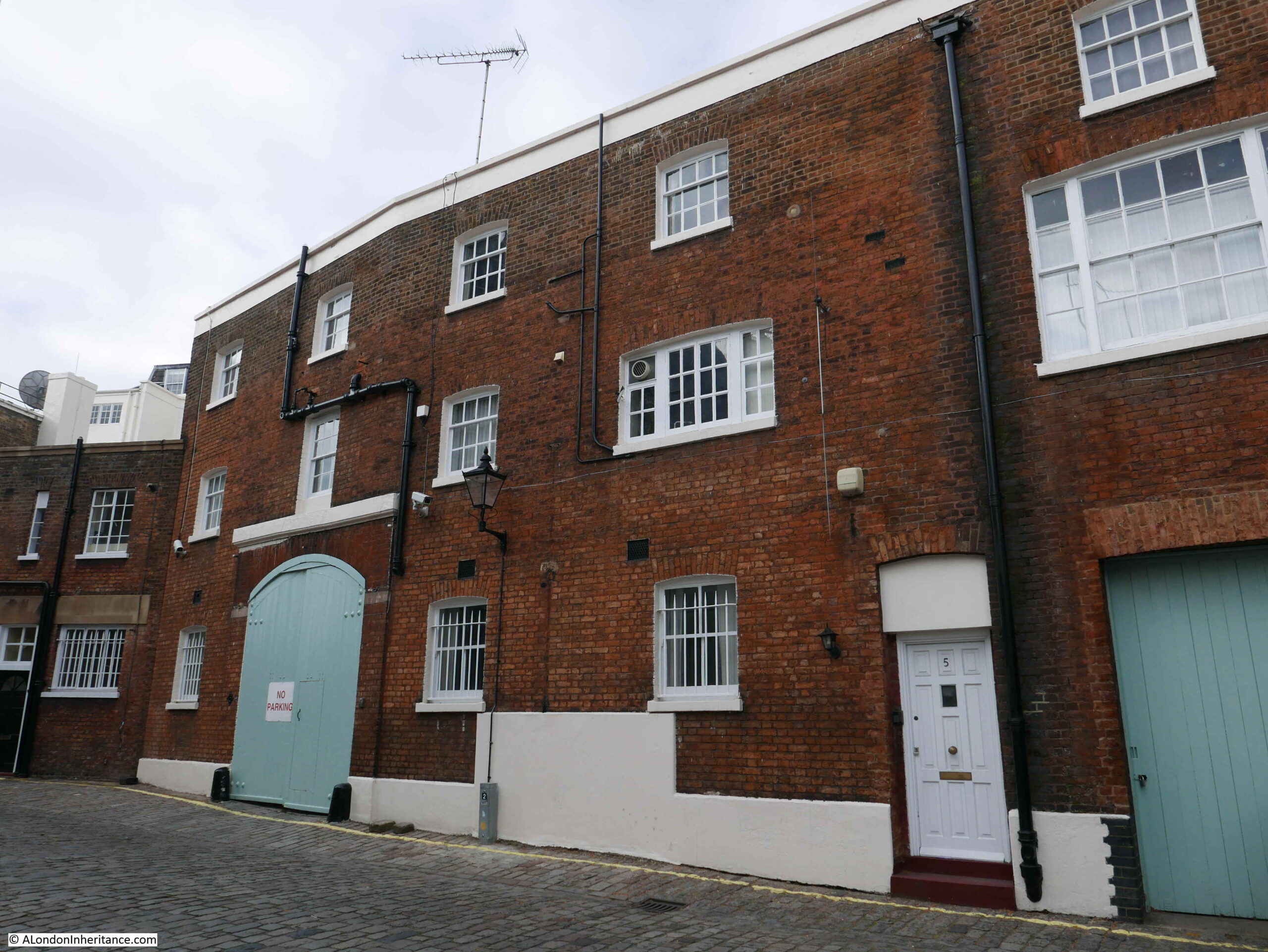
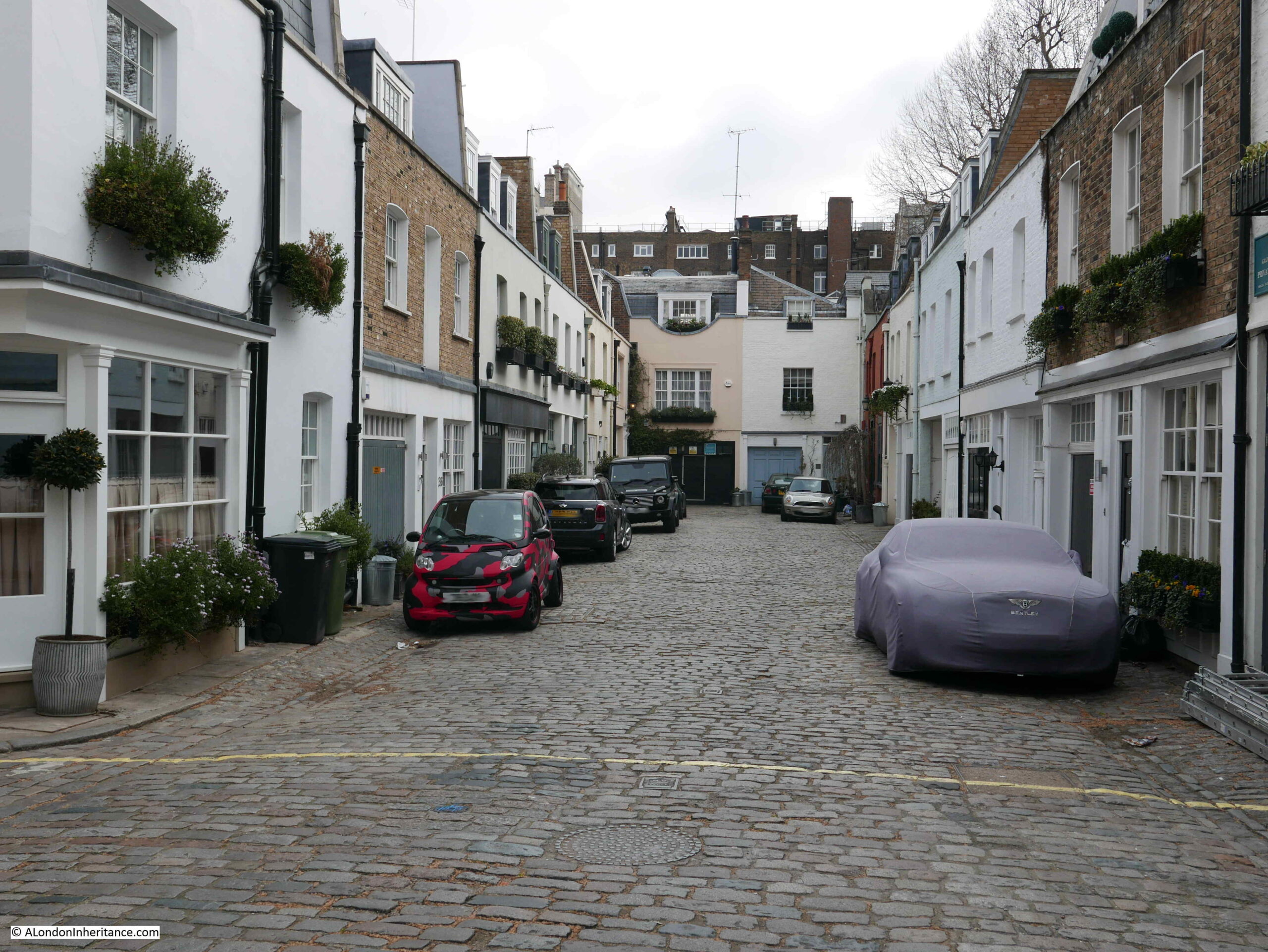
The majority of the buildings that line Belgrave Mews West are the type of buildings you would expect to find in such as place. Two storey buildings, many with large entrances on the ground floor which would have once been the stables for the large houses in Belgrave Square. The rear of these buildings face onto a small open space between them and the larger houses on Belgrave Square, allowing easy access when a servant needed to get the horse and carriage round to the front door in Belgrave Square.

The difference with Belgrave Mews West is that towards the southern end of the mews there are two embassy buildings.

The Austrian Embassy has a very impressive frontage onto Belgrave Square, however to the southern end of the mews, on the left, we can see the Austrian flag above the very plain rear of the embassy.

Belgrave Mews West

At the far end of the mews, between the arch that mirrors the arch by the Star is the German Embassy which occupies a large area of land between Belgrave Mews West and Chesham Place.

Belgrave Mews West

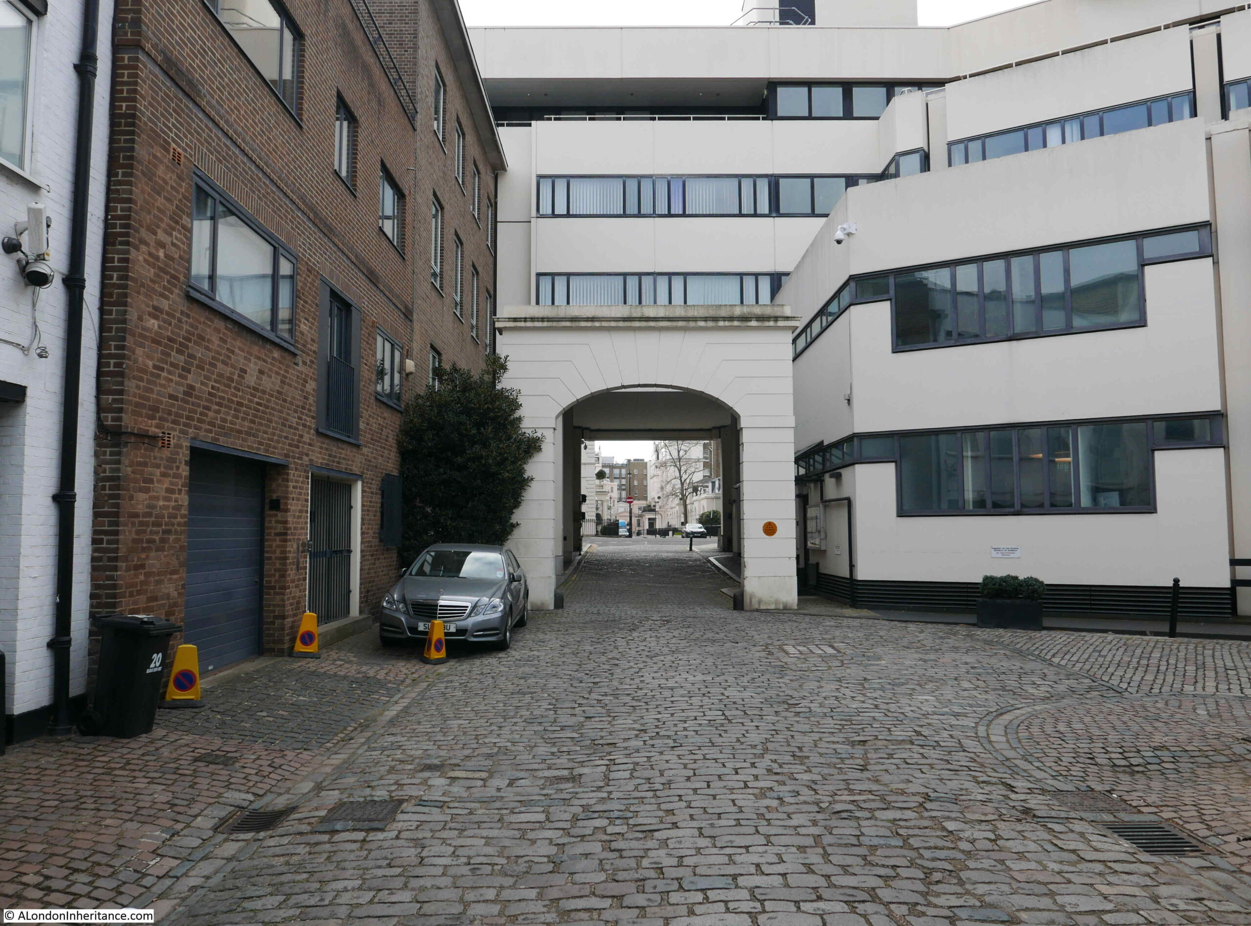
View through the southern arch of Belgrave Mews West:

Belgrave Mews West

The LCC Bomb Damage Maps show that the buildings in the space occupied by the Austrian Embassy in Belgrave Mews West suffered severe damage, and the houses that were along Chesham Place and the mews were damaged beyond repair, so bomb damage probably explains why the original early 19th century buildings have been replaced by more the more recent embassy buildings.

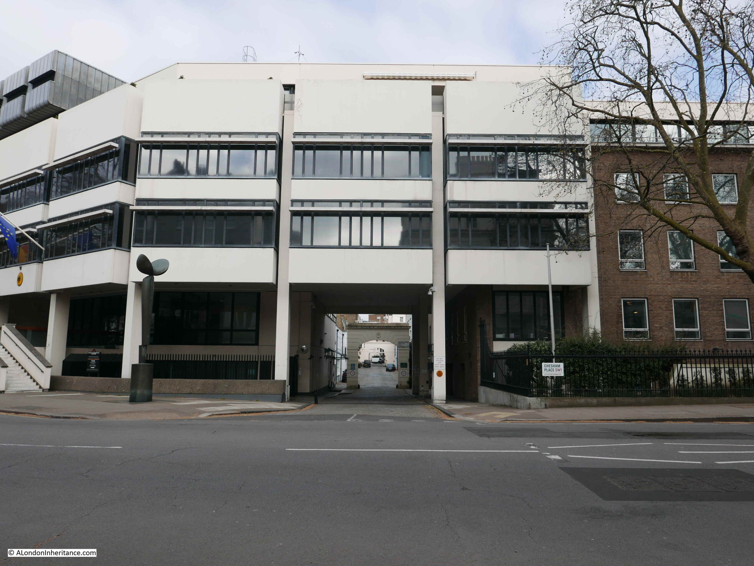
The following photo shows the entrance to Belgrave Mews West from Chesham Place, which passes underneath the German Embassy. I was surprised that it was so easy to walk around the embassy and take photos, however there were plenty of CCTV cameras around.

Belgrave Mews West

Belgravia has been a preferred location for embassies since the area was first built. In “Knightsbridge and Belgravia” E. Beresford Chancellor (1909) writes about Chesham Place, including that the “Russian Embassy has been located here since 1852”.

The Star is one of those wonderful pubs that make wandering the side streets so very enjoyable, even more so when the pub reopens on the 17th May. Brilliant to see that the Star is still to be found, and another pub added to the list to revisit when open.

alondoninheritance.com

Horse and Groom Pub, Groom Place, Belgravia

For this week’s post I am in Belgravia, an area of London I have not covered before, however this is a return visit to check on a pub last photographed in 1985. This is the Horse and Groom in Groom Place, Belgravia.

Horse and Groom

The same pub today, unfortunately closed whilst we are still under Covid restrictions.

Horse and Groom

The Horse and Groom in Groom Place is one of London’s ‘mews’ pubs. Not on a main street, rather tucked away in one of the small side streets that were designed for servicing the large houses on the main streets, for stabling the horses of their residents, providing (when originally built) lower cost housing and for some small industrial purposes.

Chester Street and Chapel Street run from Grosvenor Place to Upper Belgrave Street and Belgrave Square. Groom Place runs between Chester and Chapel Streets. I have highlighted the location in the following map, with a red circle marking the location of the Horse and Groom on the corner of Groom Place (Map © OpenStreetMap contributors):

Belgravia map

The green and blue to the right of the above map are the gardens and lake of Buckingham Palace Gardens.

This area of London is relatively new, having been built during the early decades of the 19th century.

Horwood’s map of 1799 shows some early building along Grosvenor Place, and the first houses in Chapel Street, however the rest is still field (unfortunately this area was on the edge of the page of my copy of Horwood’s map, so only part of the fields are shown).

Horwood's map of Belgravia

Smith’s New Plan of London dating from 1816 provides a better view of the area (but without the level of detail of Horwood’s map), and shows the Queen’s Gardens (what are now Buckingham Palace Gardens), with Grosvenor Place to the left of the garden with building now along the street and starting to reach into the fields behind.

Smith's new plan of London

There are some differences with Horwood’s earlier map. The above map shows a pond just below the word “Chapel” which does not appear on the more detailed Horwood map. There were several ponds in the area as Rocque’s map of 1746 show these, and the area was known to have been poorly drained.

There is an interesting detail in the above map. look to the left of the open space with the word “Chapel”, and you will see a wavy line running down from Knightsbridge. This was the River Westbourne when it still ran through what remained of the fields of west London, running down from the Serpentine in Hyde Park, which originally used the Westbourne as a water source, before the river became too polluted.

The ponds and the River Westbourne provide some clues as to the state of the area that would become Belgravia. In Old and New London (1878), Edward Walford writes:

“There was a time, and not so very distant in the lapse of ages, when much of Belgravia, and other parts of the valley bordering upon London was a ‘lagoon of the Thames’; indeed, the clayey swamp in this particular region retained so much water that no one would build there. At length, Mr Thomas Cubitt found the strata to consist of gravel and clay, of inconsiderable depth.

The clay he removed and burned into bricks, and by building upon the substratum of gravel, he converted this spot from the most unhealthy to one of the most healthy in the metropolis, in spite of the fact that the surface is but a few feet above the level of the River Thames at high water, during spring-tides”.

Thomas Cubitt started developing Belgravia in 1824 on behalf of the owner of the land, Richard Grosvenor, the 2nd Marquess of Westminster. As well as removing the clay, Harold Clunn in the Face of London (1932) states that the ground level was also made up by the use of the soil excavated to form the St Katherine Docks, however I suspect this was more towards the south of the estate around Pimlico rather than in the area of Groom Place.

The land consisted of what had been known as the Five Fields, an area of around 430 acres that stretched from roughly Hyde Park Corner down to Pimlico and Chelsea. The area was once part of the ancient Manor of Ebury, and in 1677 it came into the possession of the Grosvenor family through the marriage of Sir Thomas Grosvenor to Mary Davies who owned Ebury Farm with the associated land.

The name Ebury can still be found today with Ebury Street to the south of Belgravia, near Victoria Station, along with the nearby Ebury Square. Ebury Street follows the rough alignment of an old street called the Five Fields, and the original location of Ebury Farm (also called Avery Farm on early maps) was close to Ebury Square and Victoria Coach Station.

The name Belgravia comes from the village of Belgrave in Cheshire, which is part of one of the estates owned by the Duke of Westminster.

Returning to Groom Place, and where there is a branch leading up to Chapel Street, was, in 1985, L. Binelli, General Store:

Binelli General Stores, Groom Place

The General Stores have gone, the crooked corner door has been straightened, a window added to the first floor, and the building is now home to Muse – a restaurant run by the chef Tom Aikens:

Muse Restaurant Groom Place

A bit of detail from the 1985 photo – 1980s corner shops always seemed to have their windows stuffed with the products you could buy in the shop, and frequently a Lyons Maid ice cream sign.

Binelli store window

Walking up to Chapel Street, and we can see the original name of Groom Place:

Groom Place

Chapel Place was the name from the time the area was built up until the early 20th century (I cannot find the exact date of the name change).

Perhaps the name change was to mirror part of the name of the Horse and Groom pub, or to recall one of the jobs that would have been based here. It may have been changed to avoid confusion with another Chapel Place, between Oxford Street and Henrietta Place, which still exists today. The need to avoid confusion with other streets of the same name was a frequent justification for name changes.

Given the history of the area, there is one thing I am confused about with the Horse and Groom. Just above the door, the pub advertises “established 1698”.

Horse and Groom

This date was not on the original 1985 photo, and given that the area was built during the first decades of the 19th century, 1698 seems a considerable time before this development and was a time when the area was mainly fields.

The first reference I can find to the Horse and Groom dates from the 15th March 1852, when a rather cryptic paragraph in the Morning Advertiser states “Horse and Groom, Chapel-place, Belgrave-square. Joseph Prior applied for this licence and Mr Wire appeared in opposition – Licence refused”.

Why Joseph Prior was unsuitable for the licence to run the Horse and Groom and what caused Mr Wire to object is not recorded, but it does confirm that the Horse and Groom was a working pub in 1852, and therefore probably dates to when Chapel Place was constructed. The name of the pub refers to the main activity that took place in Chapel Place.

We can get an idea of how the area was developing from an advert for the Horse and Groom in the Morning Advertiser on the 18th June 1868:

“HORSE AND GROOM, 3 CHAPEL-PLACE, BELGRAVE-SQUARE, together with the GOODWILL AND BENEFICIAL POSSESSION. The premises are of recent elevation, combining all the requisites for carrying on the excellent full-priced trade this house is noted for. Protected, unopposed, and with the certainty of additional trade, arising from the countless mansions that are now being erected in Grosvenor-place and the vicinity, render this property comparatively speaking matchless”.

Looking down Groom Place from Chester Street:

Horse and Groom

The large building on the left in the above photo was Bryant’s Second-hand Saddlery, Harness and Horse Clothing Depot, established in the early 1830s.

The following photo shows the full building of the Horse and Groom and answers the question regarding the age of the pub.

Horse and Groom

If you look to the left of the windows on the first floor is writing stating that Shepherd Neame are Britain’s oldest brwery, and that they were established in 1698, so the sign above the door relates to the brewery, not the pub.

I can reasonably confidently date the pub to when Chapel Place was built, around the late 1820s / early 1830s.

The buildings housing the depot for all things horse related:

Groom Place

The following photo is from outside the Horse and Groom, looking back up Groom Place towards Chester Street.

Groom Place

I love looking for evidence in the built streets of London remaining from the time before they were built.

I have no evidence to confim this, but as shown in the above photo, the central part of Groom Place is in a dip, with the parts of the street going to Chapel and Chester Street rising in height.

The early maps show a pond roughly in the area of Groom Place, and perhaps when laying out the streets, the site of an old pond would not be where you want to build the expensive houses, so the smaller houses, and those occupied by stables were built on the site of the old pond.

The price of properties in Groom Place reflect the price of Belgravia in general. There is currently a two floor flat in Groom Place for sale for £2.795 Million. The covered Bentley in the following photo highlights the money you need to live in the area.

Groom Place

A final look back along Groom Place from just outside the old Binelli General Store:

Groom Place

Belgravia may not appear too interesting at first glance. Rows of similar terrace houses, foreign embassies, buildings owned offshore as investments and empty for much of the time, however look a bit closer and there are so many interesting little side streets and interesting buildings. The old Five Fields is just below the surface and it is still possible to trace some of the old roads and locations of the Five Fields and Ebury Farm which have transformed into the Belgravia we see today. There is plenty more to explore, including more mews pubs.

Thankfully the Horse and Groom is still there, although redecorated since 1985. It is a really good pub, and although great at any time of year, a visit in the winter and leaving after dark, into Groom Place can, just for a moment, recall what this part of Belgravia may have been like in the 19th century.

alondoninheritance.com