
Before getting into this week’s post, can I thank readers for all the feedback on last week’s post, and the mystery building to the left of the National Theatre. This was identified as the curved riverside end of a multi-storey car park and some of the comments included links to photos which clearly show the overall building, and the end wall that was in my photo.
The building partly visible behind this structure was the London warehouse of HMSO and also the Cornwall Press print works. This building can still be found along Stamford Street, and is now part of King’s College.
Again, my thanks for all the feedback.
Now for today’s post. I have always been interested in London’s relationship with the rest of the country. Frequently, this is seen as a negative. The north / south divide, London getting the majority of available infrastructure investment, higher wages in the city etc.
London’s central role in the country started many hundreds of years ago with the founding of the Roman City of London, located on a crossing point on the Thames, and where the new city was accessible from the sea.
Roads spread out from London, and the city became a cross roads for long distance travel. This was accentuated with the city becoming the centre for Royal and Political power, the Law and also a centre for trade and finance.
Look at a map of the country today, and the major roads that run the length and breadth of the country still start in London (A1 – London to Edinburgh, A2 – London to Dover, A3 – London to Portsmouth, A4 – London to Bath and Bristol, A5 – London to Holyhead).
Many of these major roads have been upgraded and follow new diversions, but their general routes have been the same for many hundreds of years. These A roads have now been mirrored by a similar network of Motorways.
The railway network follows a similar approach, with the main long distance routes running across the country to stations in London – (Waterloo, Liverpool Street, Euston, Paddington, St Pancras, Kings Cross etc.).
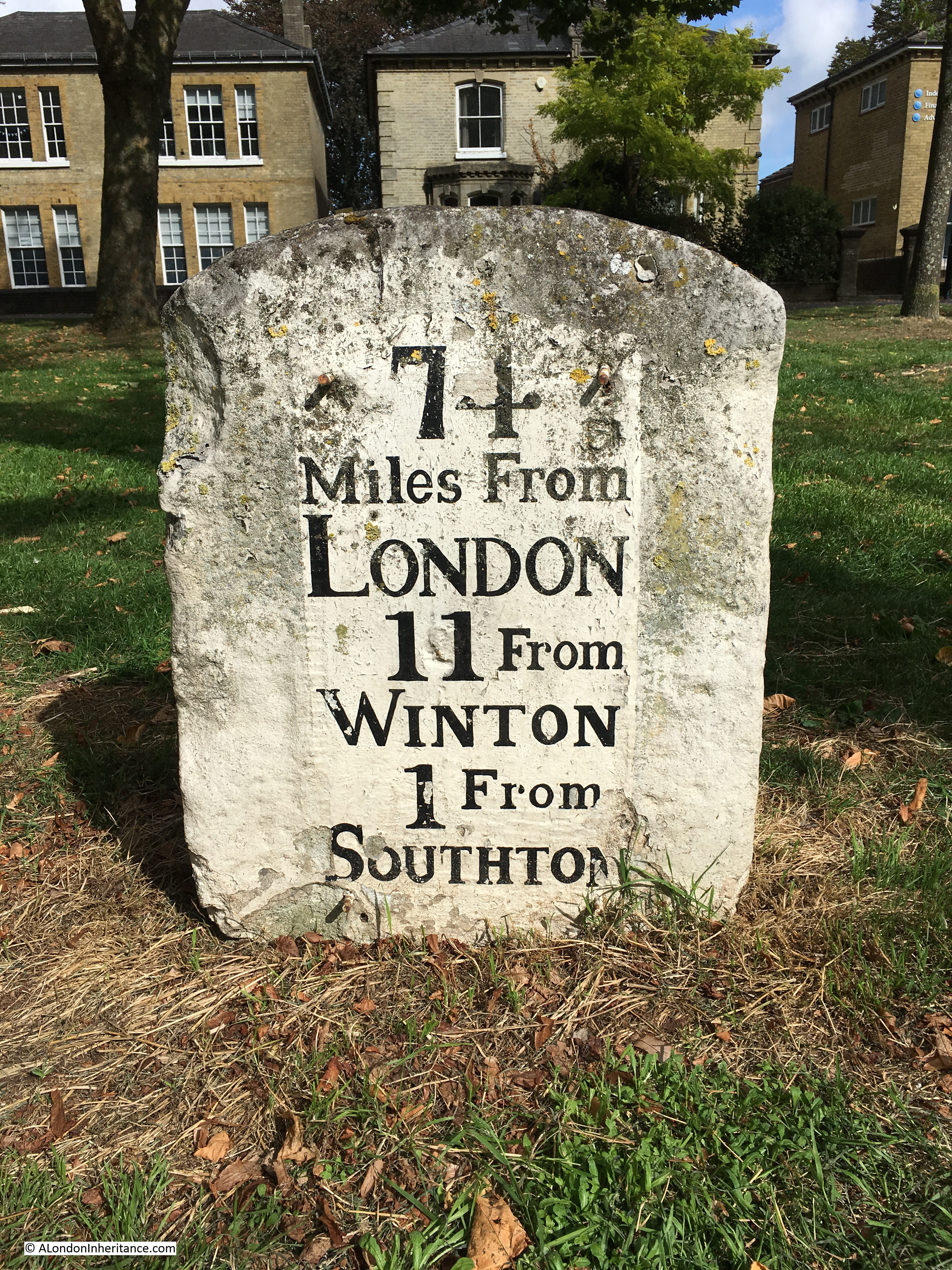
There are still tangible reminders to be found across the country’s roads that London has long been a destination for long distance routes, and in this post I will explore examples from around the counties close to London, starting with this 18th century milestone to be found in Southampton, indicating that it is 74 Miles from London.
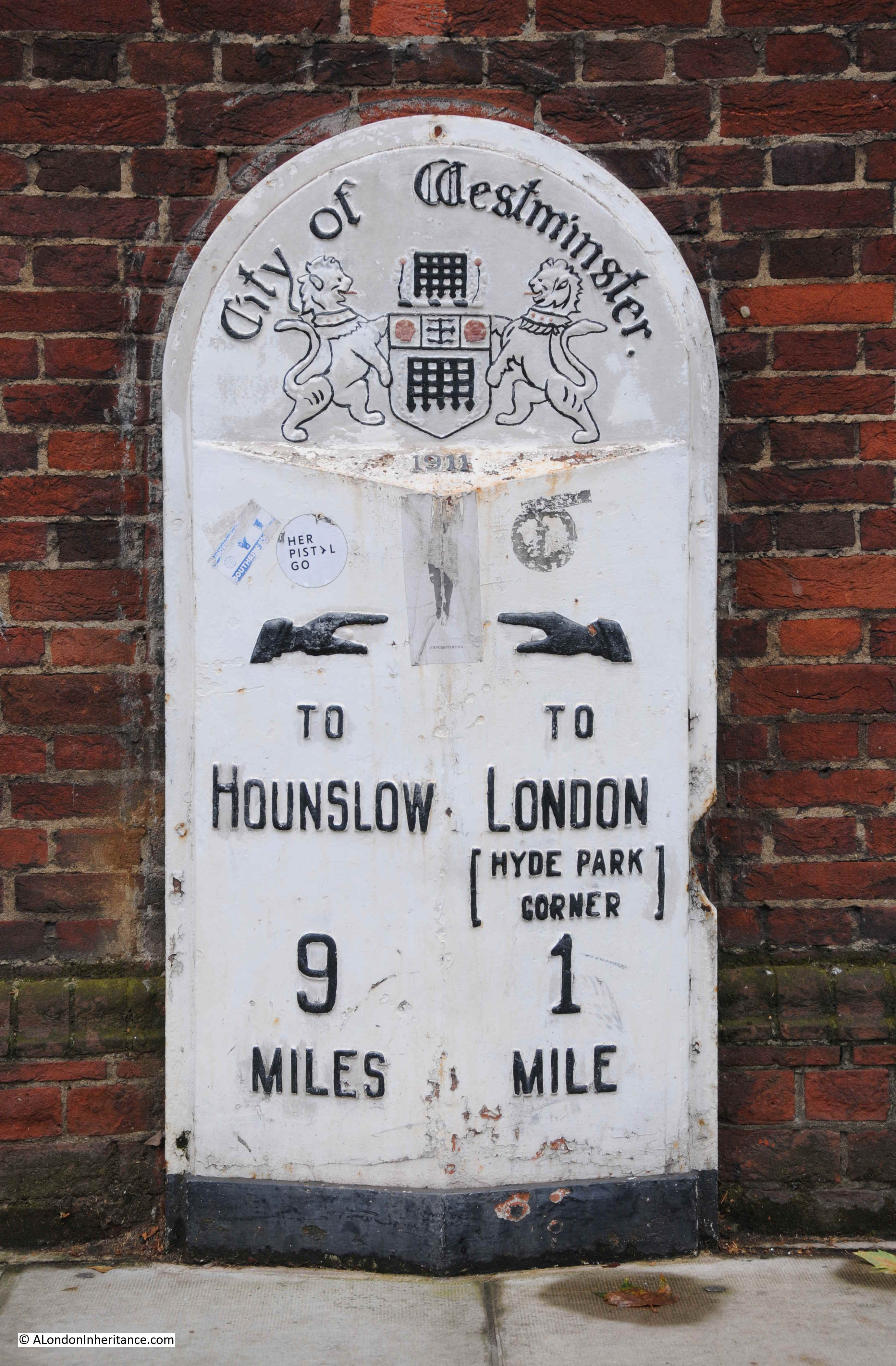
A number of these milestones can still be found in central London. There is a very fine example on the side of the Royal Geographical Society at the junction of Kensington Gore and Exhibition Road:

This rather fine example, with pointing hands, dates from 1911, with Hyde Park Corner being the London point from where distances have been measured.
To get really geeky, on the same wall as the above milestone, there is another marker that was used to measure the country. Loads of these can be found across London, and in the days before GPS they had an important role with accurately mapping and surveying the country.
This is a benchmark.
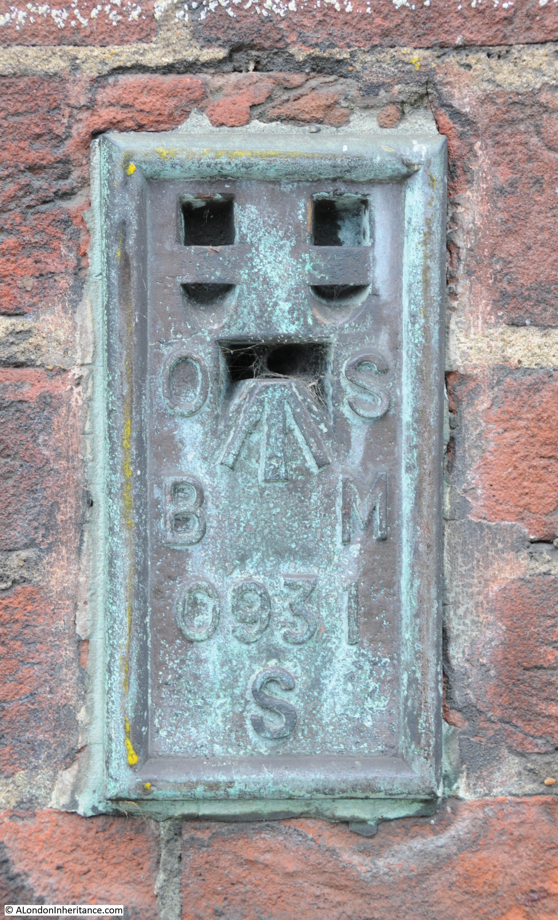
It was used during the 1931 to 1934 re-levelling of Greater London, when the height of the city above the Newlyn reference point in Cornwall was measured. The flush bracket rather appropriately on the side of the Royal Geographical Society was on a survey line from Staines to the British Museum, and was levelled at a height of 67.8260 feet [20.6734 metres] above mean sea level at Newlyn.
This was how the Ordnance Survey were able to show all the contour height lines on their maps.
The above milestone measured the distance to Hyde Park Corner, and before there was any standard for where distances to London should be measured, routes usually used the first point at the boundary of the city that the route reached.
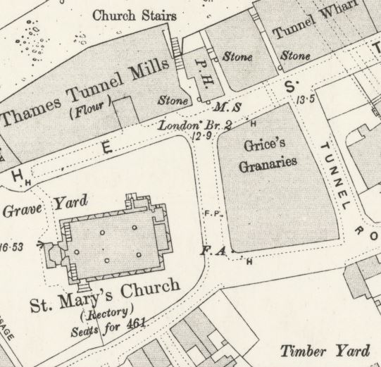
The Mayflower pub in Rotherhithe has a milestone set into the wall of the building.
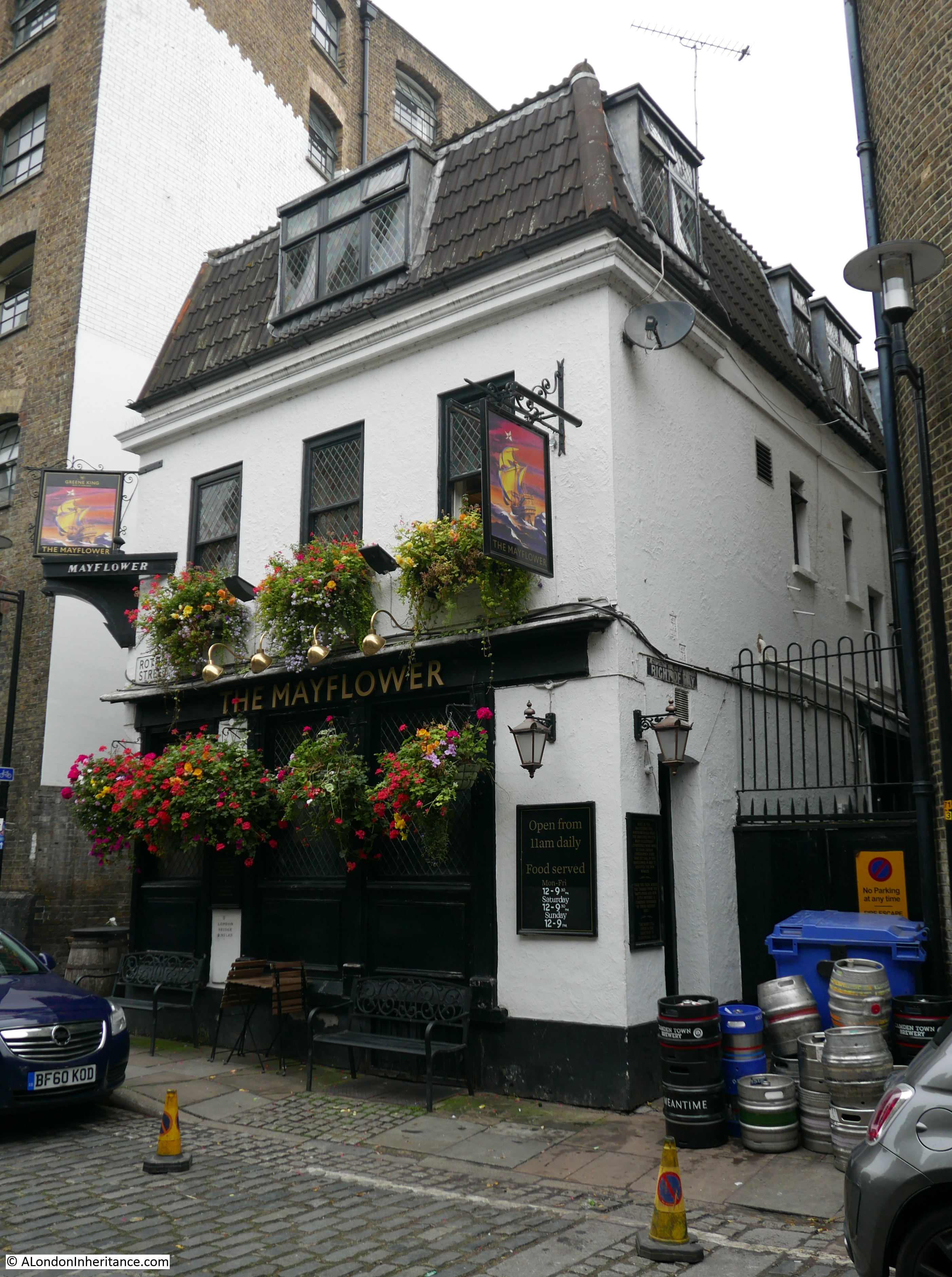
This example indicates a distance of 2 miles to London Bridge, which would have been the entry point to the City of London.
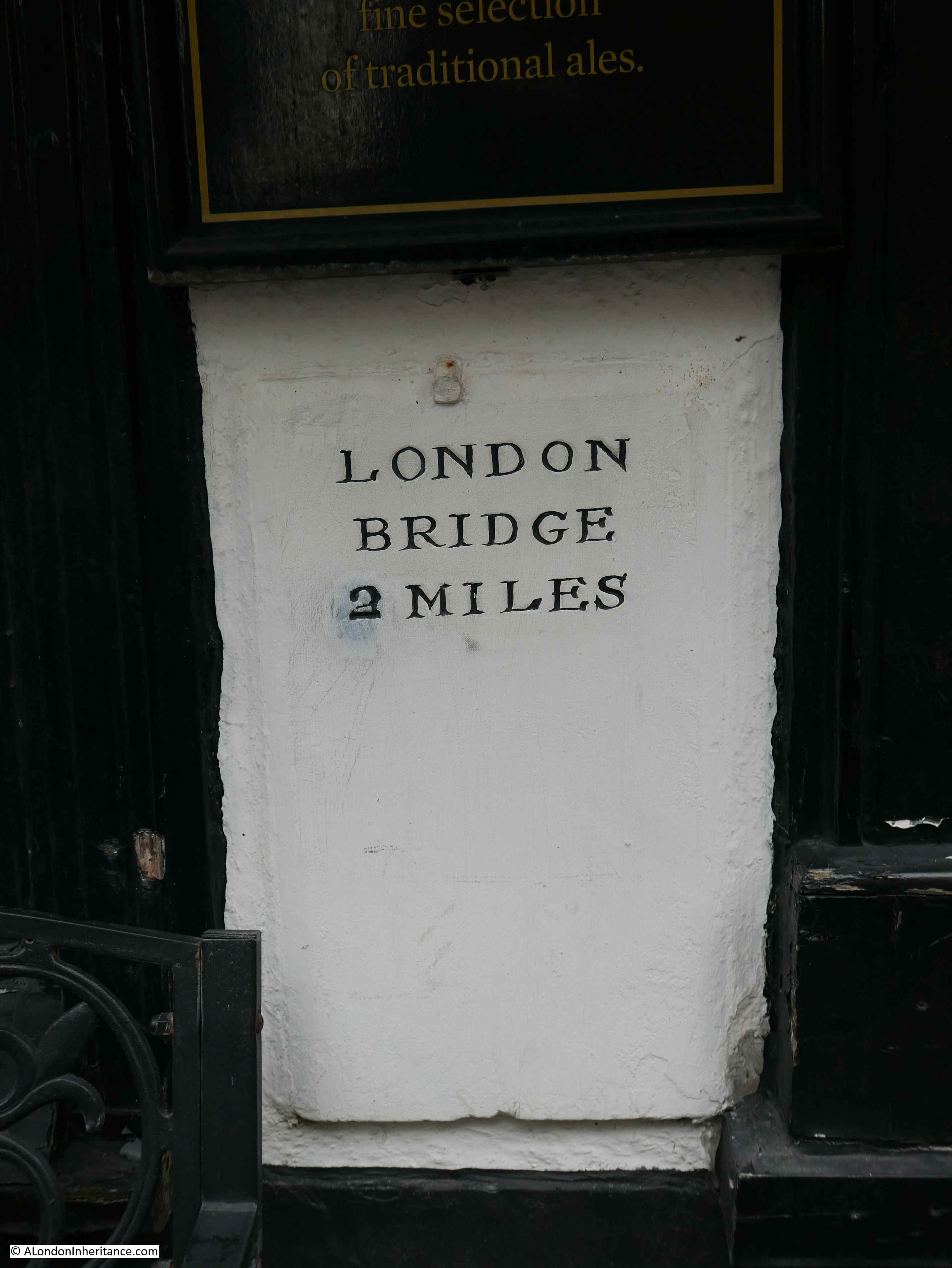
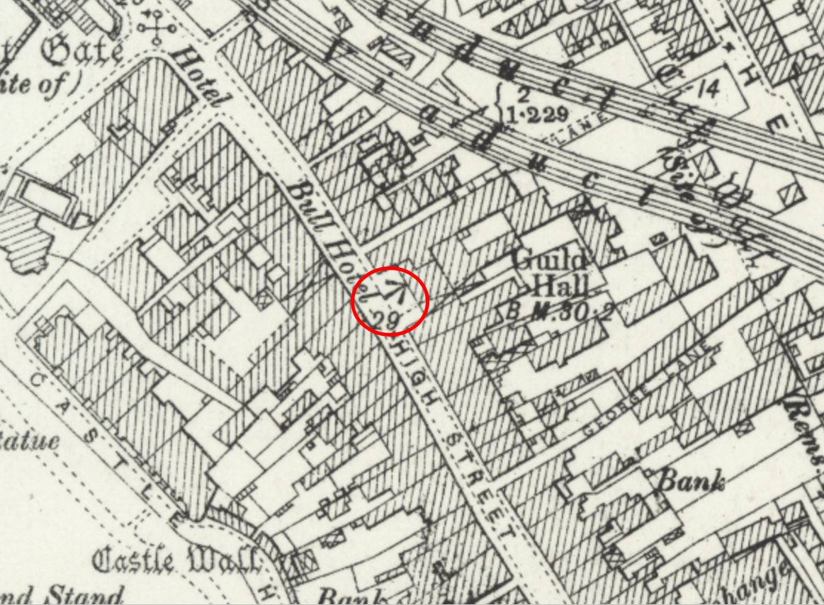
The 1894 Ordnance Survey map shows the Mayflower milestone marked as M.S. to the front of the pub (P.H.) in the following map extract, and includes the distance to London Bridge.
For centuries, London Bridge was the main crossing point from south of the River Thames into the City of London, and then to the northern routes which stretched out from the City, There is another fine example of a distance marker in Rochester, Kent where, on the front of this 1928 building above the word Furniture:
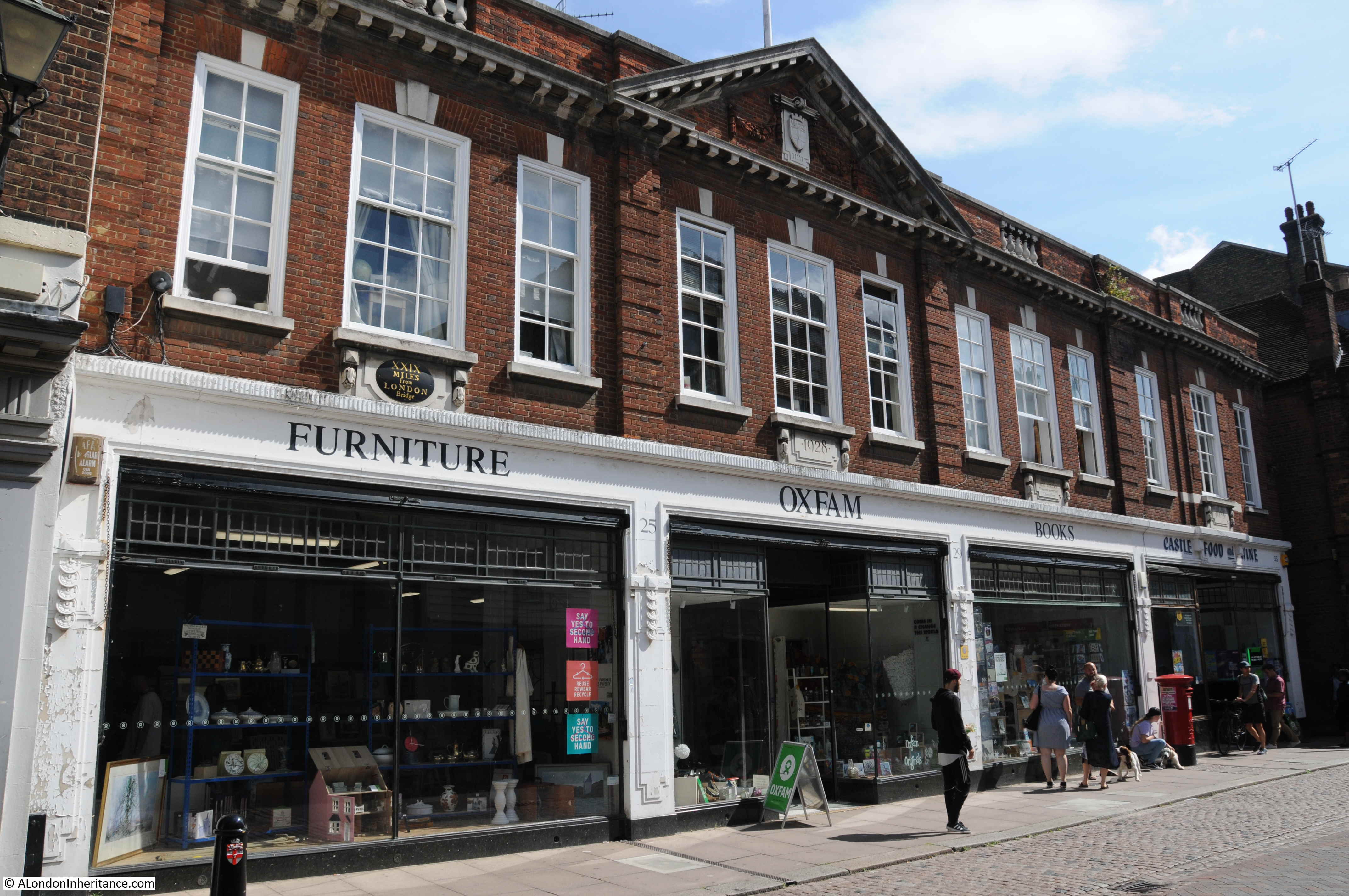
Is this example, indicating a distance of 29 miles from London Bridge.
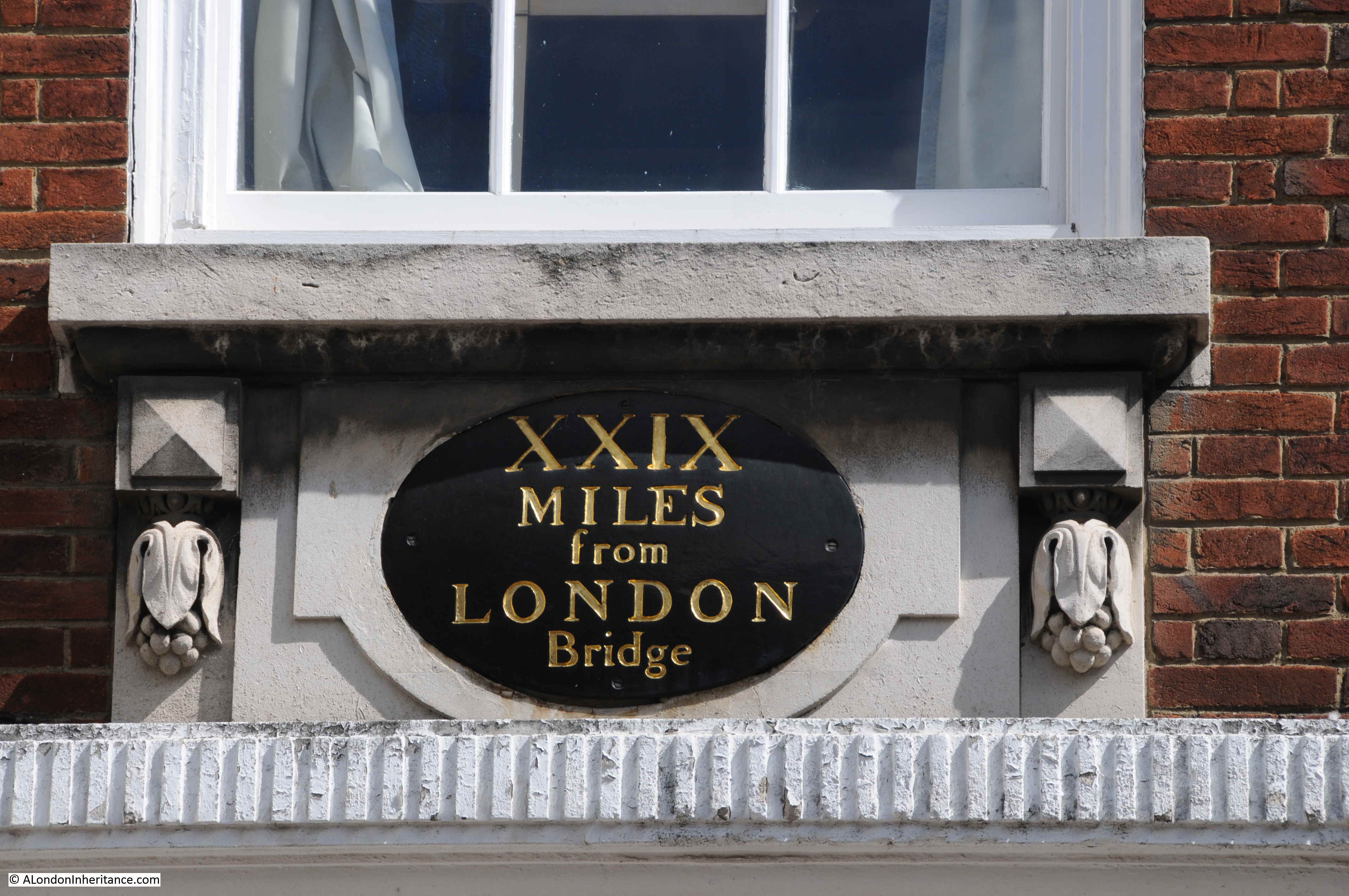
Although the building dates from 1928, it replaced an earlier milestone or wall sign, as the OS map revision of 1896 shows a marker and distance of 29 miles at the same spot as the above building. This is circled red in the extract below (‘Reproduced with the permission of the National Library of Scotland’).
Milestones marked the long distance routes from London. Camberley in Surrey is on the road that now has the designation of the A30. This was originally the main London to Exeter road.
The following photo shows the A30 at the eastern boundary of Camberley. Traffic lights, road signs, a car dealers – all the signs of 21st century travel, but look to the lower left of the photo and an old stone can be seen.
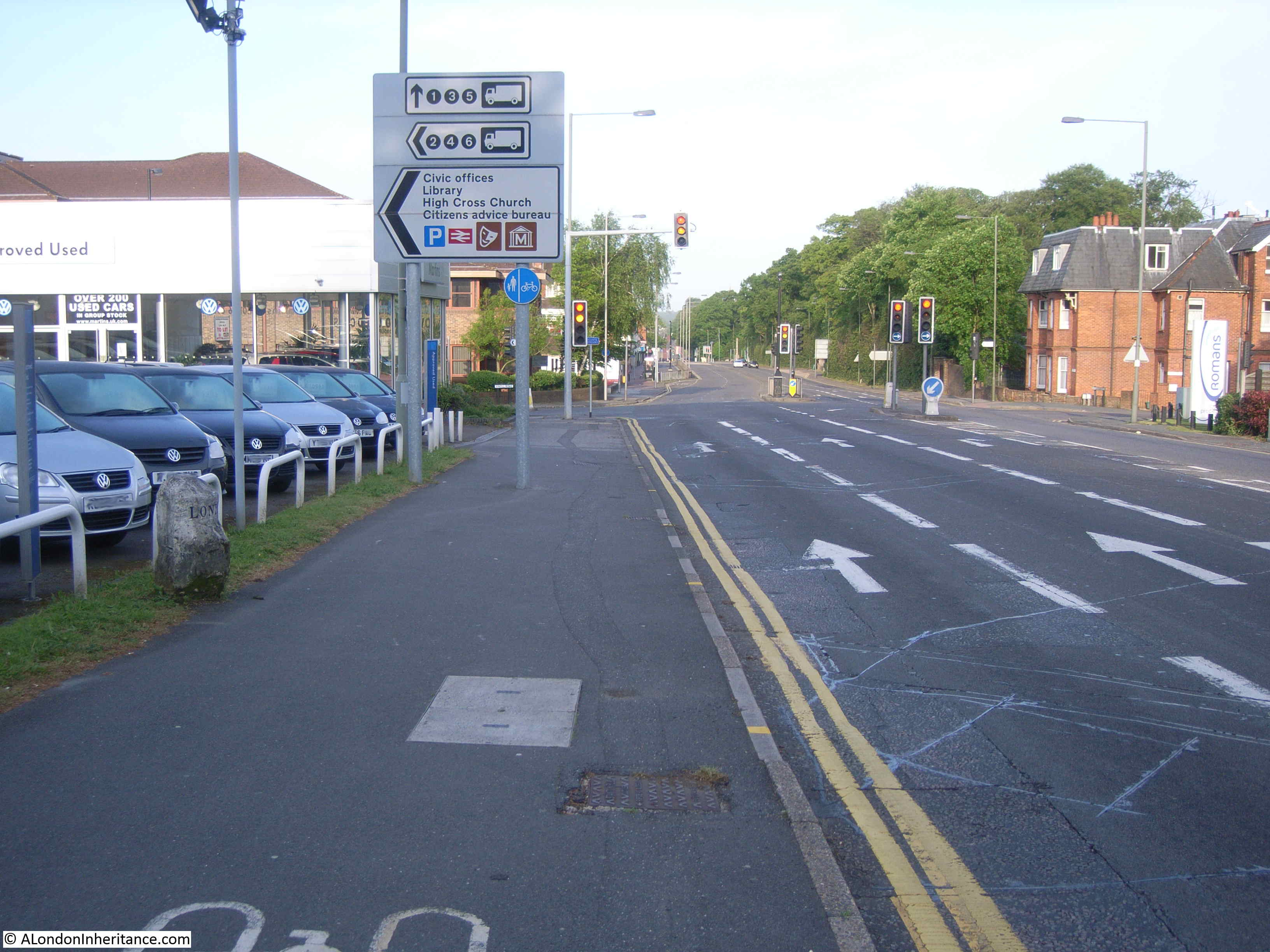
Indicating 29 miles to London. If you were a coach traveler from Exeter, bumping along poorly maintained roads for many hours, you would be counting down these milestones till you reached your destination.

As well as London, the milestone indicates the next village, town, turnpike boundary etc. that would be found on the route. These are shown on the side of the milestone facing traffic heading in the destination of the name. So, for example, Bagshot is on the opposite side of the milestone to the town of Bagshot as if you were travelling to Bagshot you would see the name and distance as you were heading to the town.
Coach travelers passing the above milestone would have to tolerate a very tough journey. In 1790, the typical times for a journey from London to Exeter would be:
- Leave London at 8pm
- Arrive Bagshot at 11:55 pm
- Arrive Salisbury at 7:15 am
- Thirty minute stop in Salisbury for breakfast
- Arrive Blandford at 10:45 am
- Arrive Dorchester at 12:55 pm
- Thirty minute stop in Dorchester for dinner
- Arrive in Honiton at 6:40 pm
- Arrive in Exeter at 8:50 pm
So if you were traveling the full journey from London to Exeter, you would have been on the coach for 24 hours, 50 minutes, covering a distance of 179 miles. We can now fly from London to Australia in the same time.
In the days before any form of electronic communication, these long distance routes supported mail coaches, and individual riders who were carrying important news and information to and from London.
A good example of this is commemorated by a plaque to be seen in Salisbury which commemorates the route taken by Lieutenant John Richards Lapenotiere in October 1805 when he brought the news of the Battle of Trafalgar, and the death of Nelson from Falmouth in Cornwall to London. A journey that took 37 hours to cover the 271 miles with 21 changes of horse.

Although Camberley is not mentioned on the map, Hartford Bridge and Bagshot are listed. These are the two locations shown on the Camberley milestone, so Lieutenant Lapenotiere would have passed along the same road carrying the news to London.
Signs indicating distance took many forms. In Wroxton, Oxfordshire, there is an unusual example:
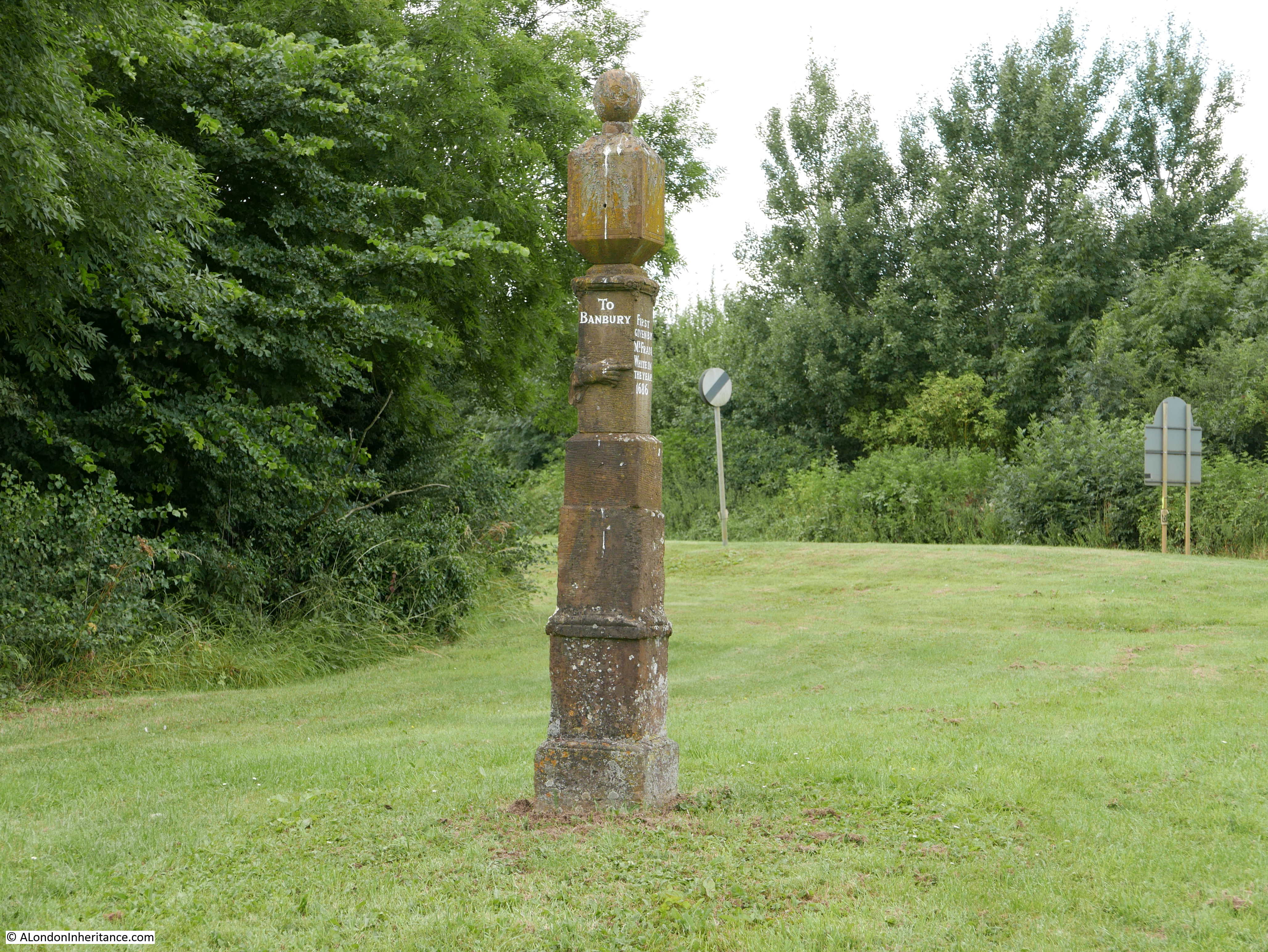
This Guide Post dates from 1686 and is a marker on one of the routes from Wales and the west to London. Allegedly used by salt merchants, the route follows the A422 down to Wroxton where it breaks from the road and heads to the south of Banbury.
The top of the guide post was originally a sundial and around the middle of the post are carved hands pointing to the towns along the adjacent roads.
The guide post was restored in 1974 and still looks in good condition with the directions and carved hands clearly visible.
This would have been the route to travel between London and Stratford-upon-Avon.

As well as milestones and guide posts, the first printed route maps were of the strip map form showing the full route of a road from source to destination. John Ogilby was one of the first to produce this type of map in the 17th century and the following is one of his maps showing the route from Chester to Holyhead, one map of a sequence showing the complete route from London to Holyhead (Attribution: John Ogilby (1600–1676), Public domain, via Wikimedia Commons)
.jpg)
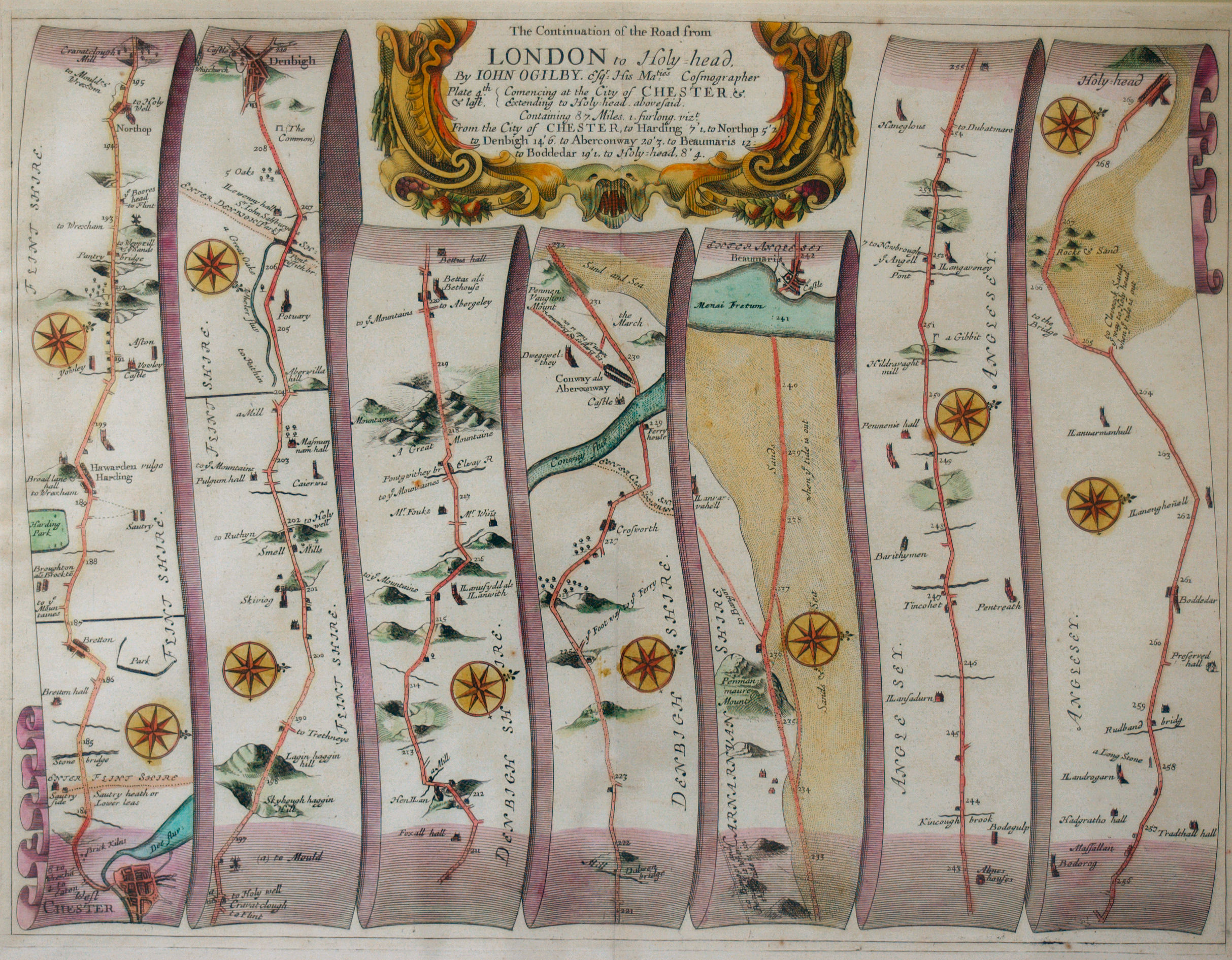
The Ogiby map includes the incremental distance in miles marked along the road, and milestones would have provided physical verification as the traveler passed along the road.
Many routes out of London still have lots of milestones tracking the distance from London.
This is the village of Ingatestone in Essex.
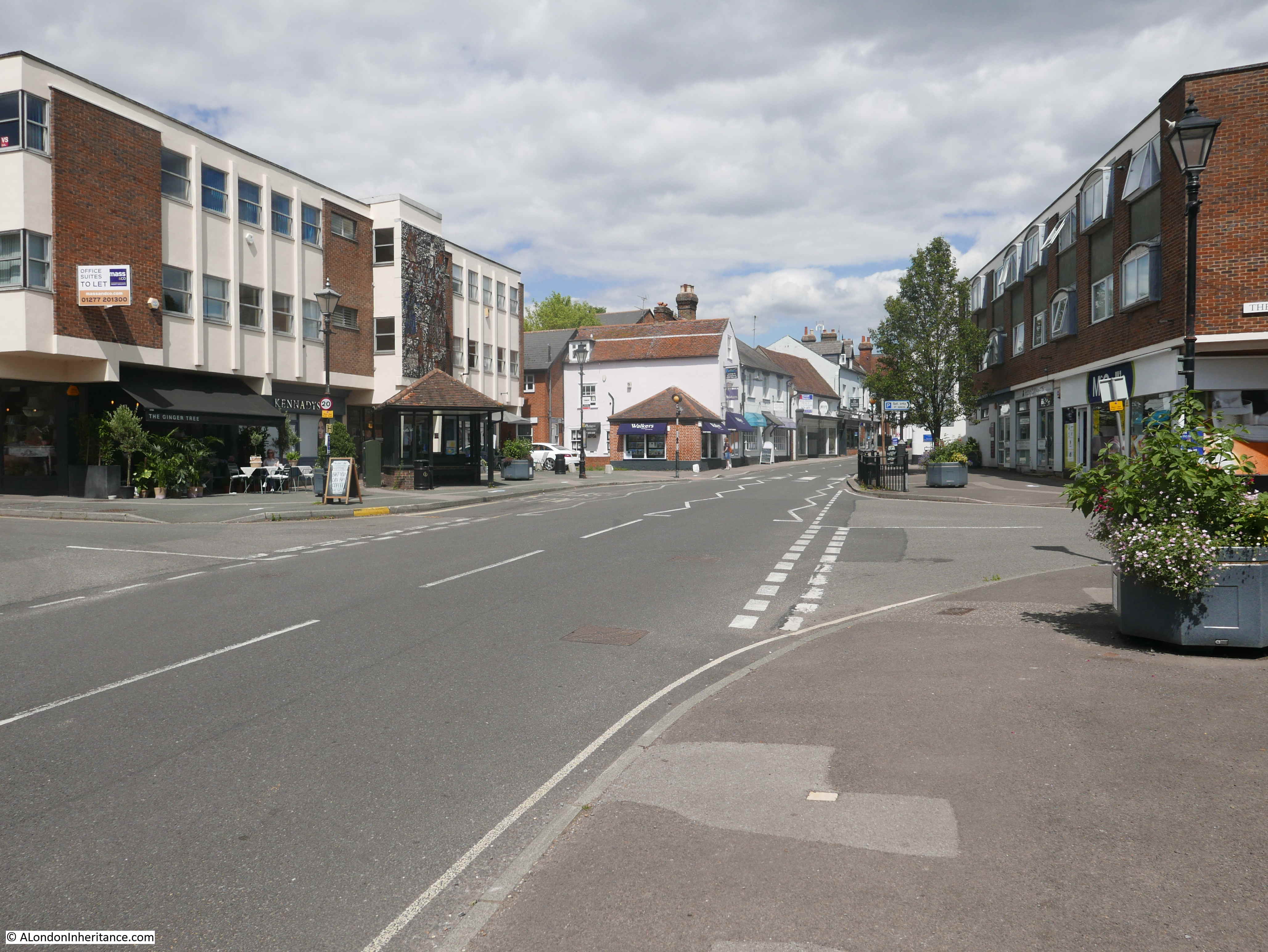
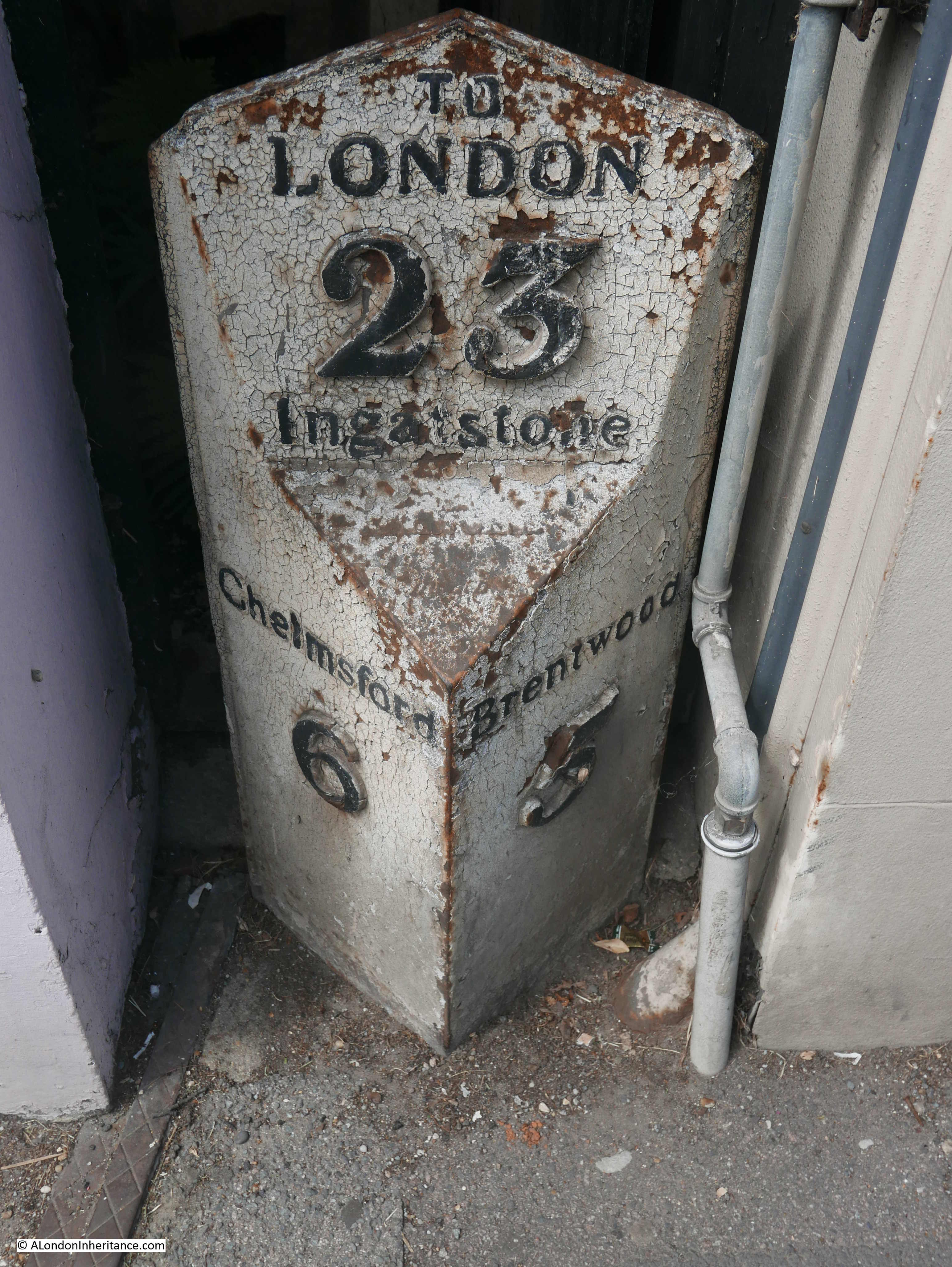
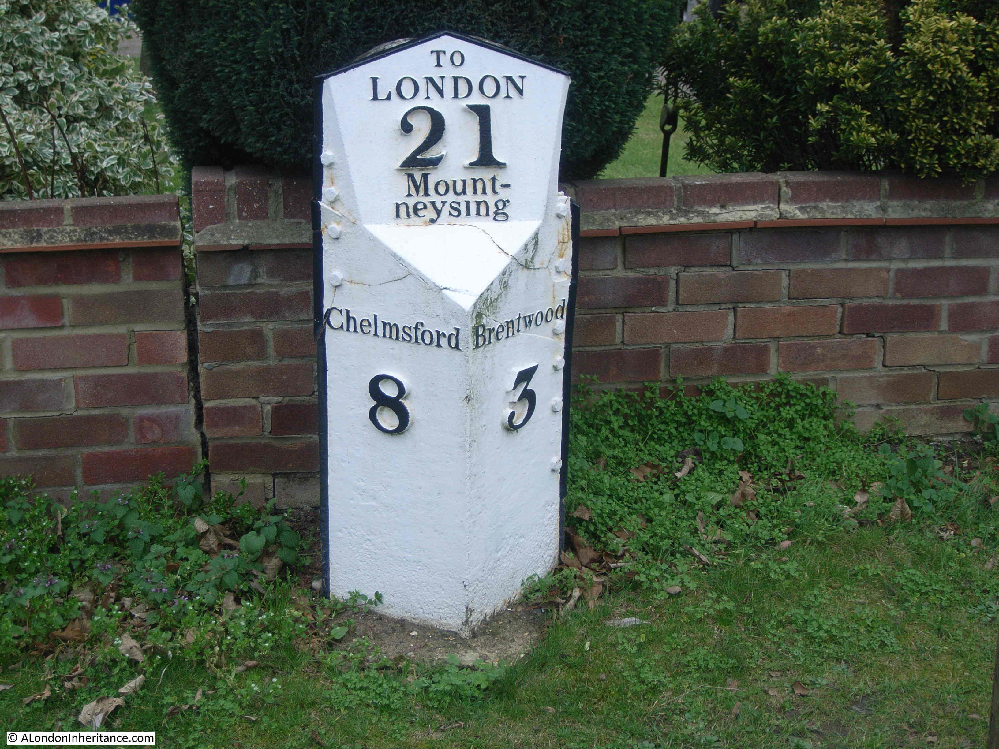
Ingatestone was on the original London to Colchester road, and has now been bypassed by the dual carriageway of the A12. In the centre of the village is a Grade II listed milestone from when the road was a turnpike and carried traffic from London to north Essex, Suffolk and Norfolk.
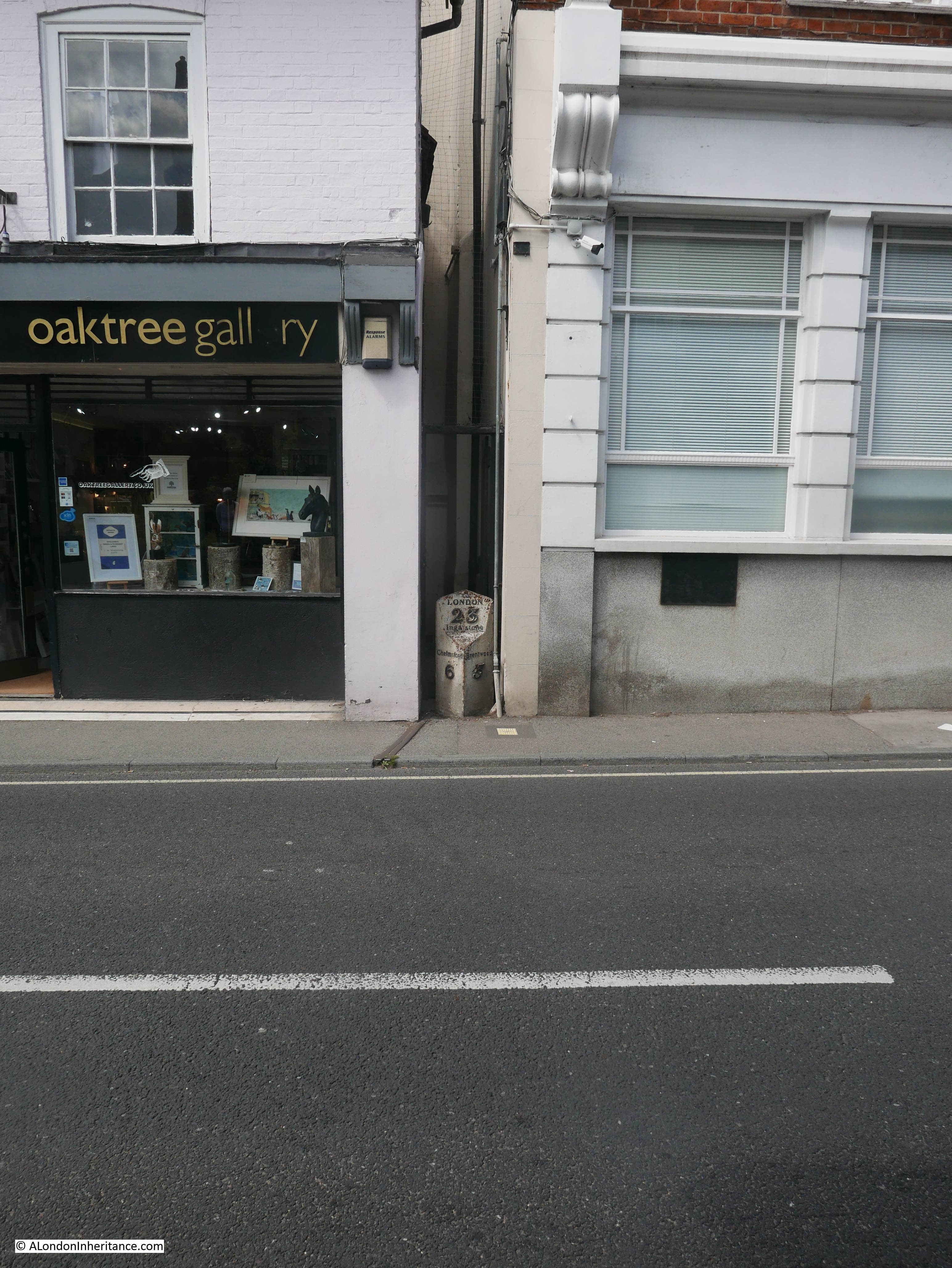
23 miles to London, 6 miles to Chelmsford and 5 miles in the direction of London to Brentwood.
The passing coach trade was often a reason for the expansion of villages on major roads, as they needed Inns and horse changes to serve the coaches.
Today, if a house for sale is close to a train station with a good service to London, it will increase the value of the property, and estate agents will emphasise the fact in their advertising. This was exactly the same in 1822, when the following advert appeared in the Morning Post:
“Stock Lodge, near Ingatestone, Essex – To be Let, handsomely Furnished or Unfurnished, for a term of five or seven years. The above healthy and cheerful Villa Residence, erected within these five years, for the reception of a Family of respectability, in the pleasant village of Stock, 26 miles from London, six miles from Chelmsford, three miles from Ingatestone where numerous coaches pass daily”.
Although this was almost 200 years ago, proximity to a good transport network, with numerous coaches passing daily was just as important as it is today.
Coaches would depart London for Essex from multiple Inns. In 1804, the Spread Eagle Inn, Gracechurch Street, was advertising:
- Chelmsford, Ingatestone and Brentwood Coach, Tuesday, Thursday and Saturday afternoon, two o’clock
- Chelmsford, Ingatestone and Brentwood Post Coach every morning, half past seven o’clock
Today, the train has replaced the coach to carry commuters between Ingatestone and Liverpool Street station, and the eastern end of Crossrail terminates at Shenfield, one stop towards London from Ingatestone further improving connectivity for this part of Essex with London.
This stretch of the London to Colchester road still has many milestones in place. These were frequently installed at each mile point, and were often a mandatory requirement when the road was administered by a turnpike. A turnpike trust was responsible for the maintenance of a major road, and for collecting fees from those travelling along the road to fund the upkeep.
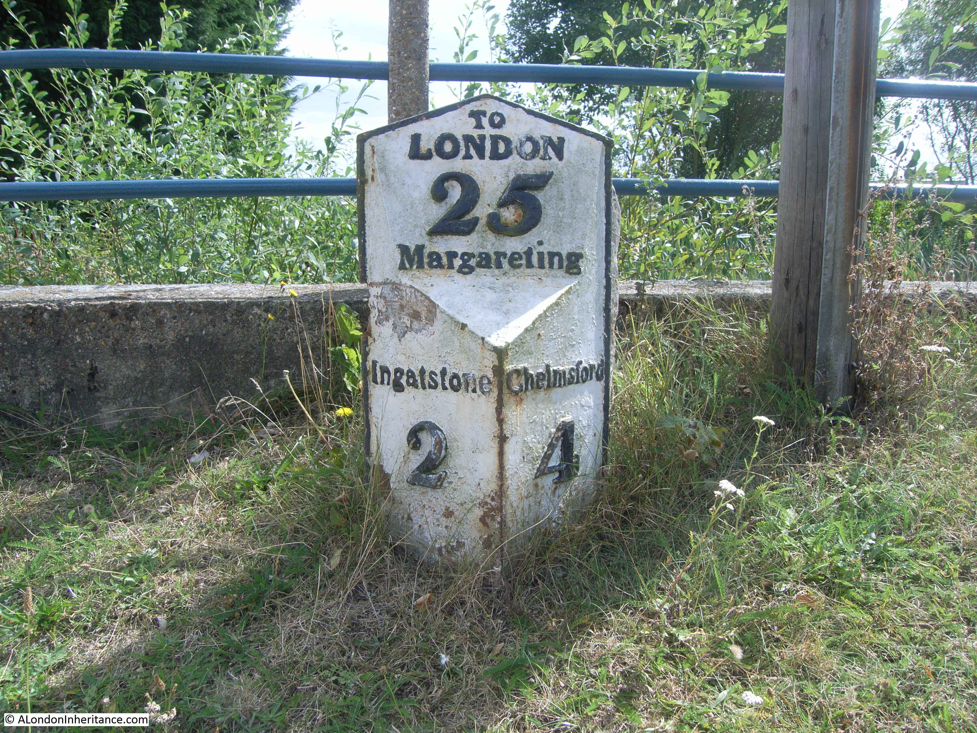
Heading out of Ingatestone towards Chelmsford is a milestone that has the original stone marker to the rear, with a later metal marker in front. We are now 24 miles from London.

Then 25 miles from London.
Heading from Ingatestone towards London and 21 miles:
The coach route through Ingatestone went to Colchester, a town from where you could transfer to other coaches heading across north Essex, Suffolk and Norfolk. Many milestones extended their London connection on past Colchester. This was often the case where the end point was of some importance, and there would be frequent direct travel to London.
An example can be seen with the following milestone in the village of Bradfield in north Essex on the road to the sea port of Harwich.
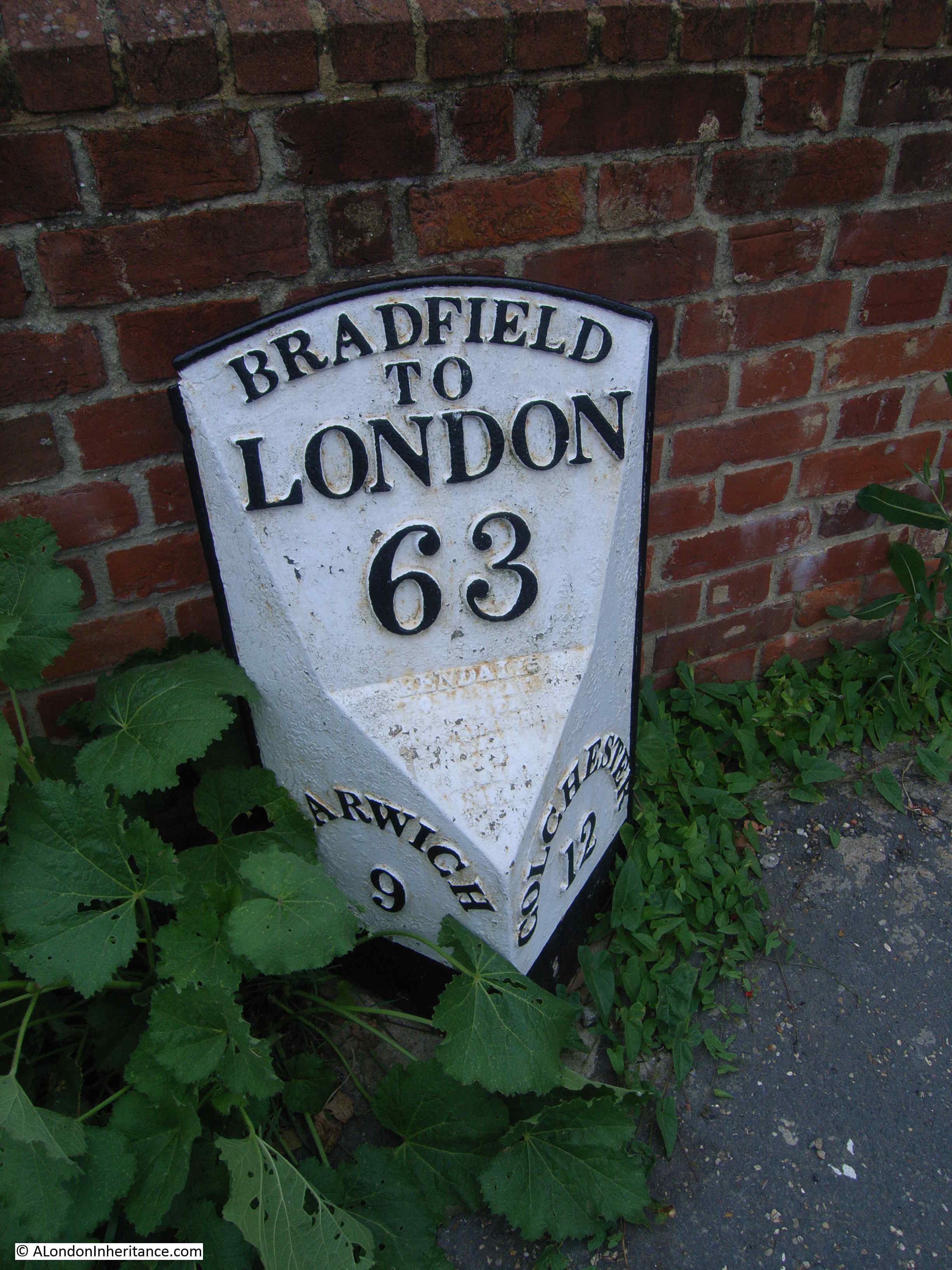
Harwich has long been an important port, serving northern Europe and also serving as a Royal Naval dockyard for periods, dependent on who the country was at war with at the time. A good coach service between Harwich and London would have been essential, and the milestones along the route between Colchester and Harwich provide a reminder.
The perils of travelling along these roads is clear from an inquest held in the Spread Eagle Inn in Ingatestone in 1828:
“Friday an Inquest was held at the Spread Eagle Inn, Ingatestone, on the body of a Yarmouth pilot, named Simkin, who was killed by the Telegraph coach, about nine o’clock on Wednesday night. The deceased was returning from London as an outside passenger on the above coach, and when at Ingatestone, the coachman, perceiving he was very much intoxicated, prevailed upon him to get inside; but this, it appears, was rather against the will of the deceased, who frequently expressed a wish to be ‘aloft’, and opening the door whilst the coach was proceeding at a brisk rate, he fell out, and the hind wheel passed over his thigh and across his body. He expired in a short time”.
There are still plenty of these milestones to be found across the country, however so many have been lost over the years. Road widening, vandalism, hit by passing vehicles, general lack of care, have gradually reduced their number.
They serve no purpose today. Travel these roads and a SatNav is probably guiding you to your destination, and telling you exactly how many miles you have to go, however they are an important link to when road travel was far more difficult than it is today, and coaches provided an important link between London and the rest of the country.
What has not changed is the importance of good travel connections, and looking at estate agent adverts for houses around Ingatestone and Stock today, they still list the benefit of frequent connections to London, but this time by train rather than by coach.