Tag Archives: Murals

The Mildmay Road and Wolsey Road Mural

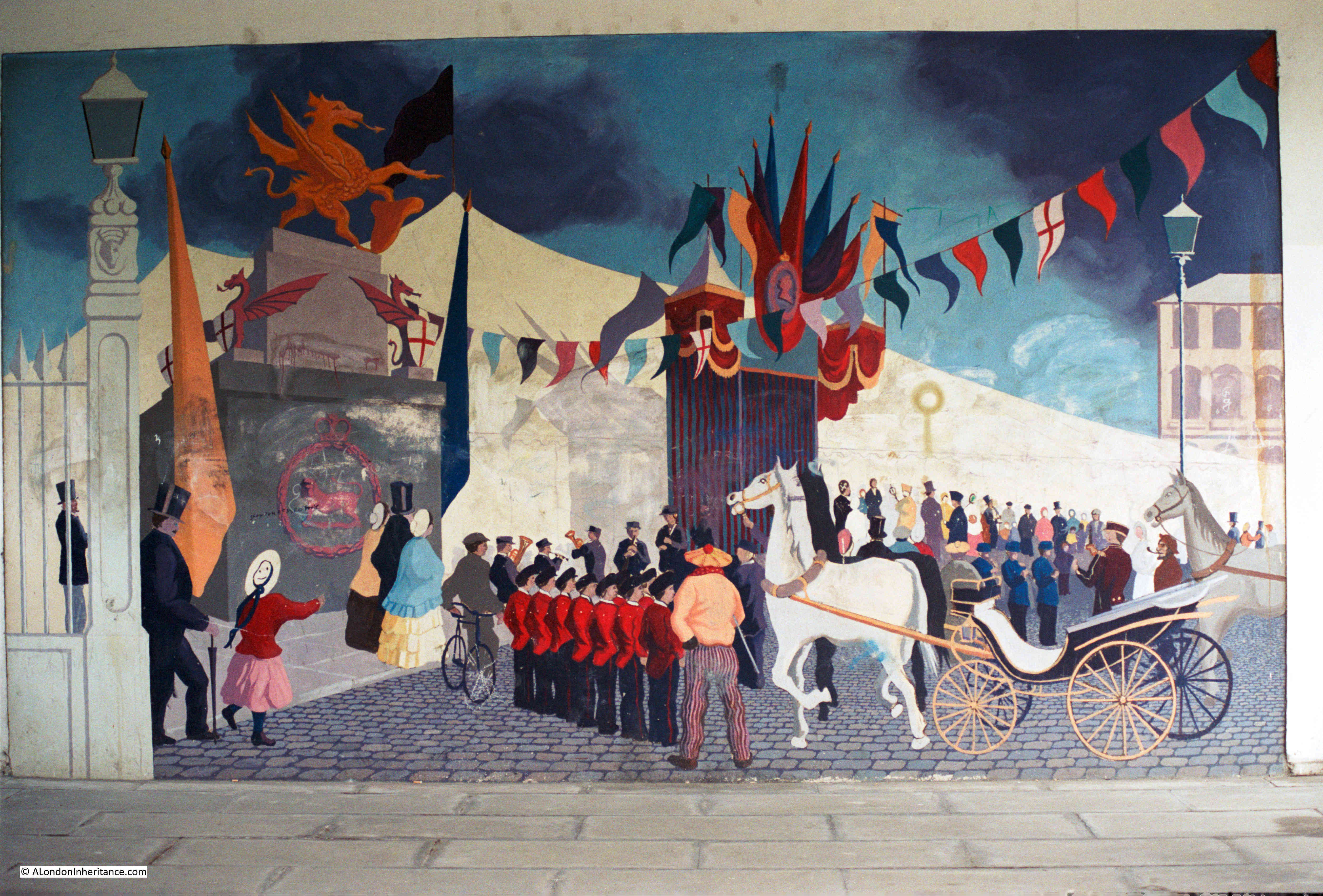
A couple of weeks ago, my post was about His and Hers Hairdressers in Middleton Road, Hackney. After finding the location of my father’s mid 1980s photo of the hairdresser, I continued on towards Newington Green, where one of the approach roads is Mildmay Road, and at the junction of Mildmay and Wolsey Roads, is the location of another of my father’s 1980s photos, this time of a rather wonderful mural:

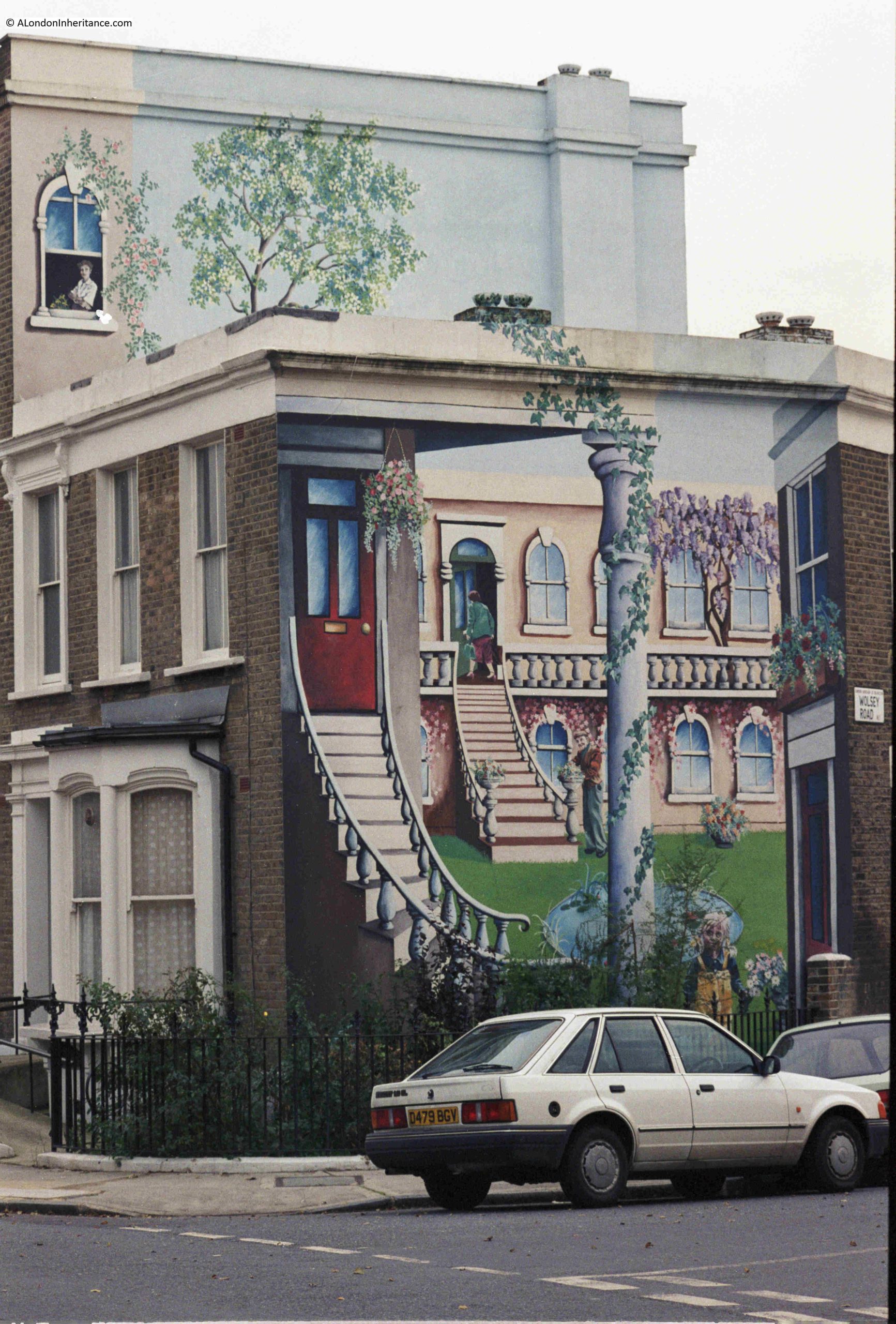
The mural is remarkable, not just for the subject, the colour and the detail, but also for the three dimensional affect the mural achieves, and that it extends not just along the end wall of the two storey house, but continues across to the third storey of the adjacent house.

The forty years between the above photo and the mural today, have not been kind to this wonderful artwork, and in 2026 we see a very faded mural, with much of the colour and detail gradually disappearing:

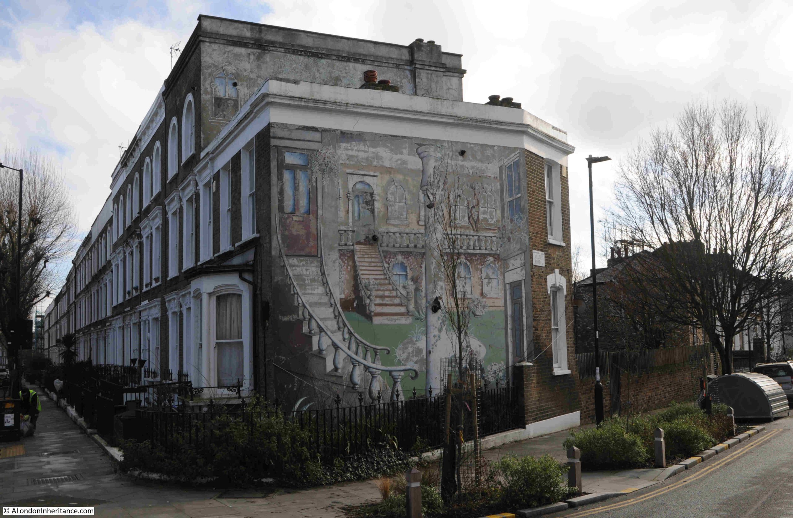
I cannot find any information as to the exact date of the mural, who created the work, and any meaning behind the image, and why on this particular building.

Comments with any information would be greatly received.

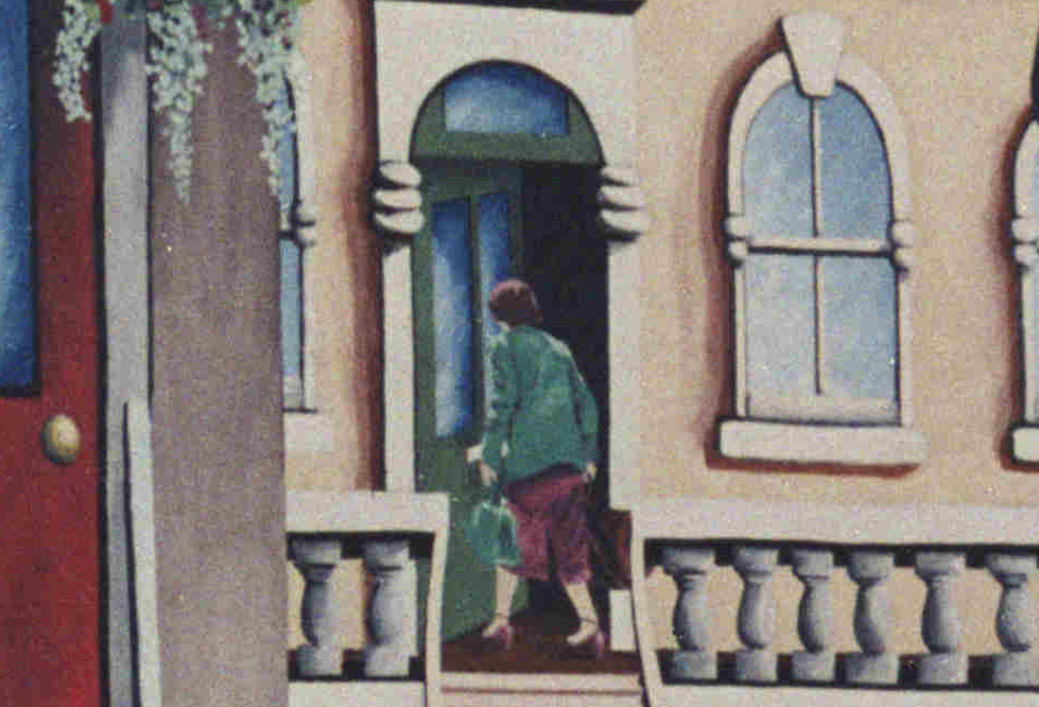
In the 1980s photo, we can see details which raise questions, for example there is a green door reached by some stairs leading up from the grass. The door is partly open, and a woman carrying two bags is going through the doorway.

Why is the woman there, who is she, was she a resident of the house, creator or sponsor of the mural?

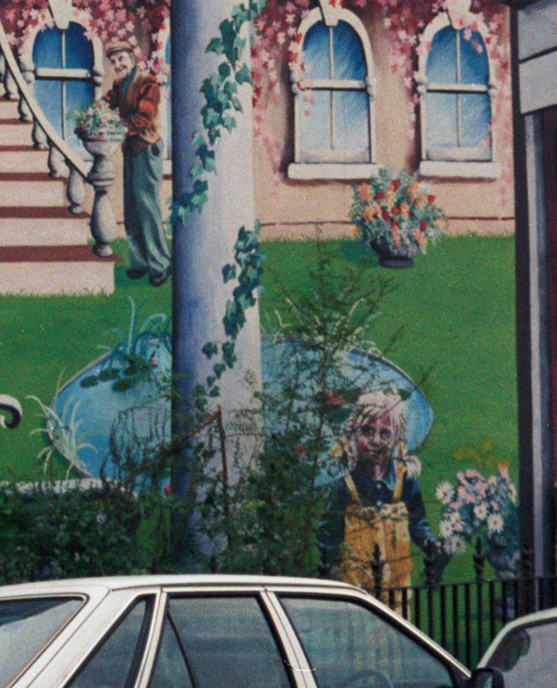
There is also a man at the base of the stairs, and a girl stands on the edge of the grass, holding a bunch of flowers, and looks out towards Mildmay Road. Were they also part of the same family?:

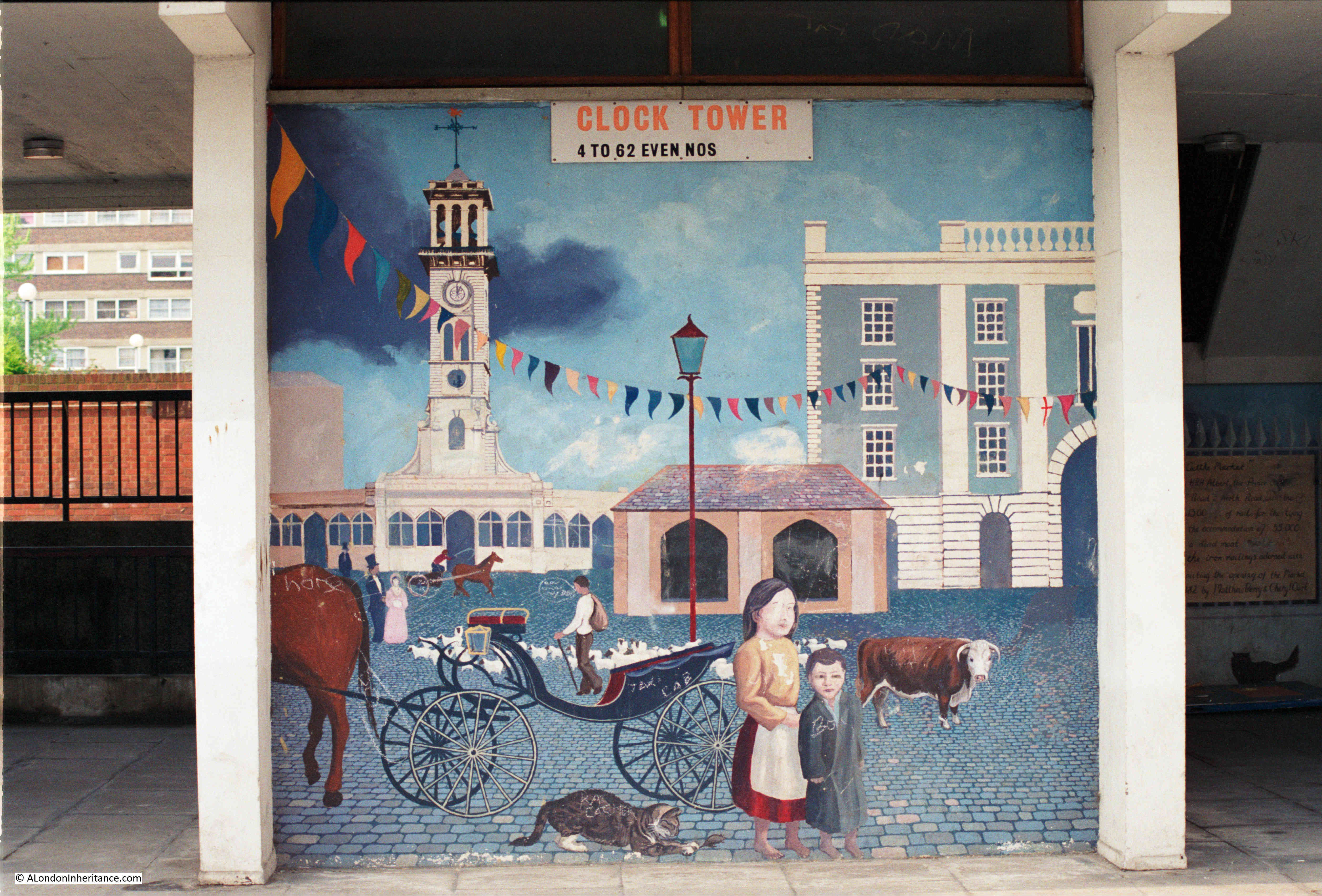
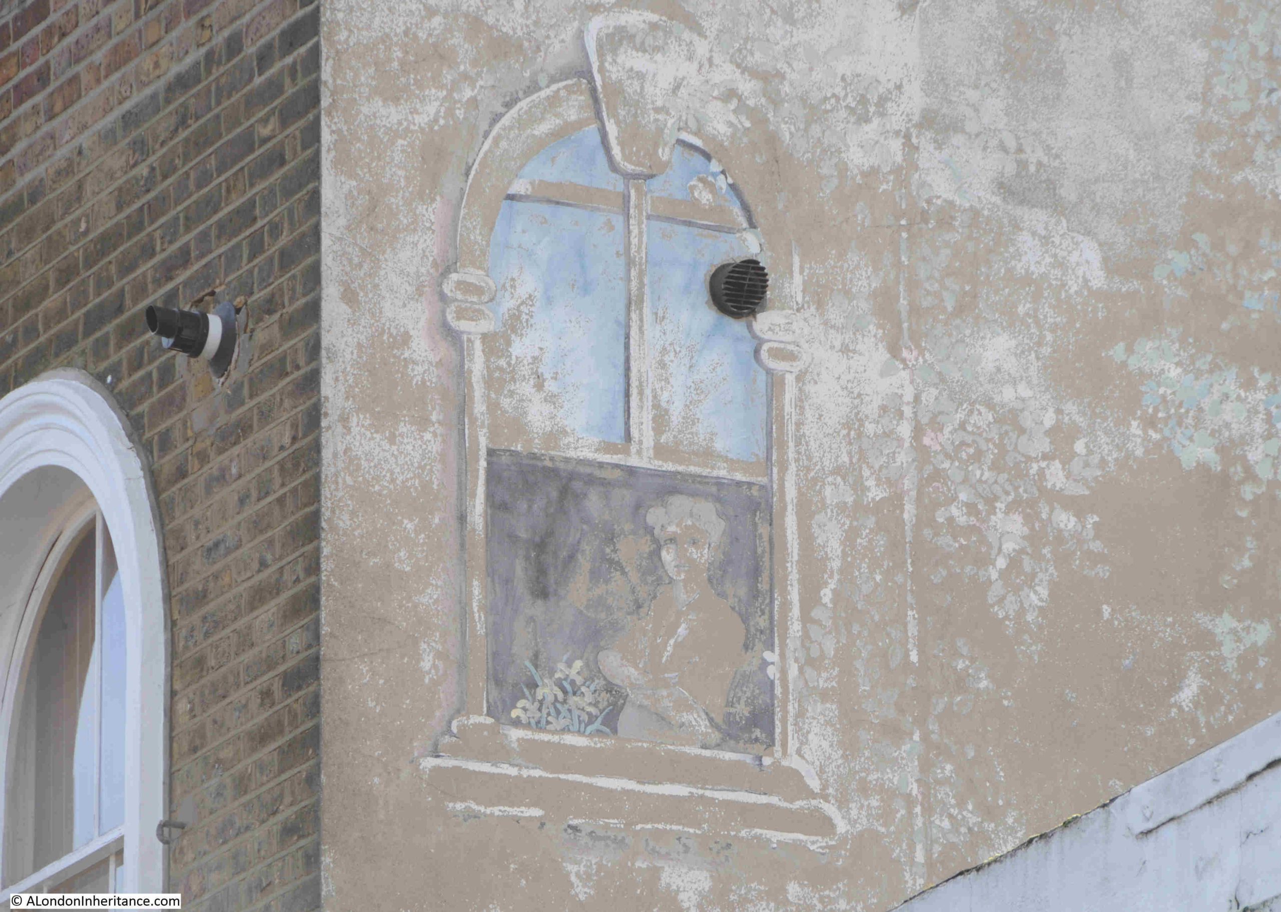
My father’s second photo of the mural was a close up of the part of the mural on the upper floor of the adjacent house, where a woman is looking out of an open window. I wonder if she is the same woman who was going in through the green door?

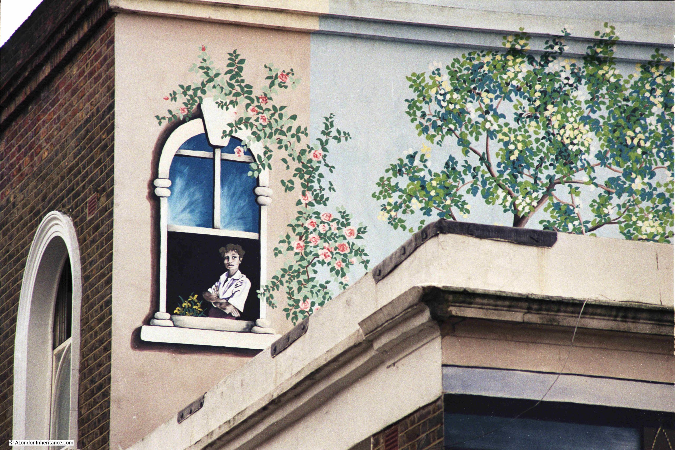
Forty years later, and this section of the mural exists in outline only, with just some of the blue sky in the upper part of the window remaining:

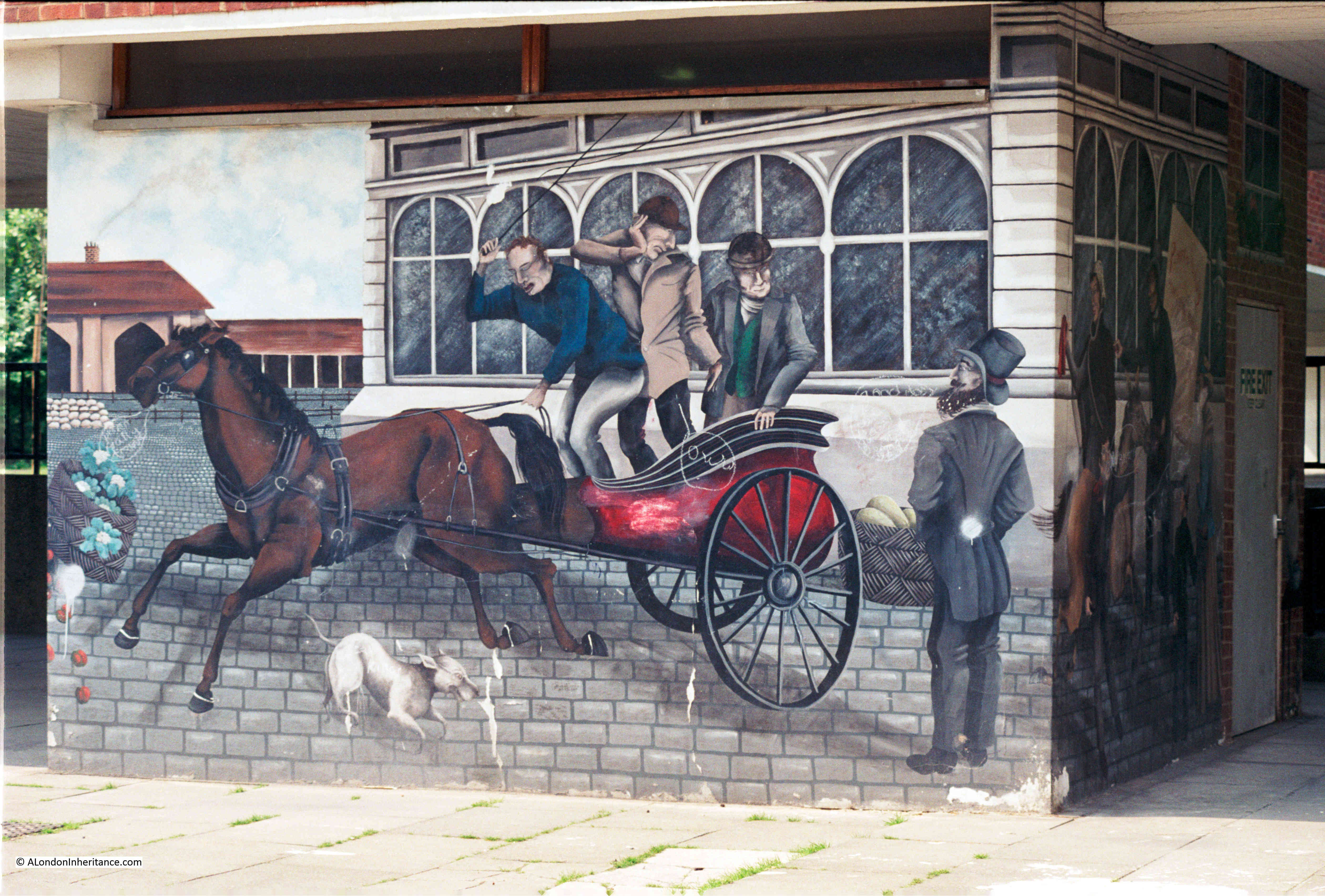
In Wolsey Road we can see that the three dimensional aspect of the mural is still clear. The mural covers a flat wall, and as well as the individual elements of the mural, the two sets of stairs, and the column, the two windows on the right of the mural are painted in such as way as to give the impression that they are on an angled wall:

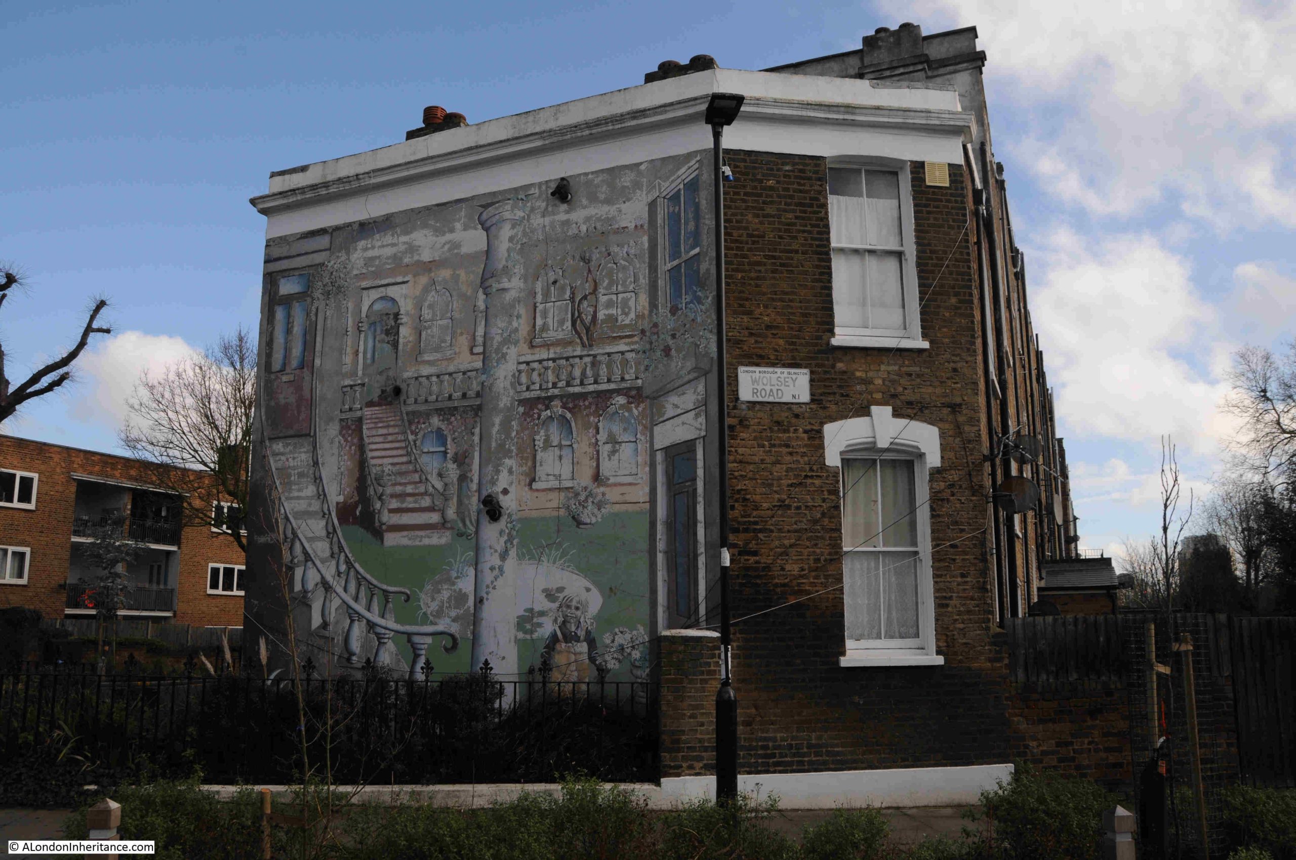
After forty years, the mural is faded, flaking and losing colour, but enough remains to show what it was like when created, as my father’s 198o’s photos confirm.

The mural is an example of what can be found whilst walking the streets of London, and the pleasure of wandering along London’s ordinary streets is a message I hope I have been able to get across in the last couple of posts on my search for some 1980s photos – The Flower Sellers and London Fields and His & Hers Hairdressers, Middleton Road, Hackney, and is a theme I want to continue in this week’s post, with no deep historical insights, just some views of the streets as I walked up from Middleton Road to Mildmay Road.

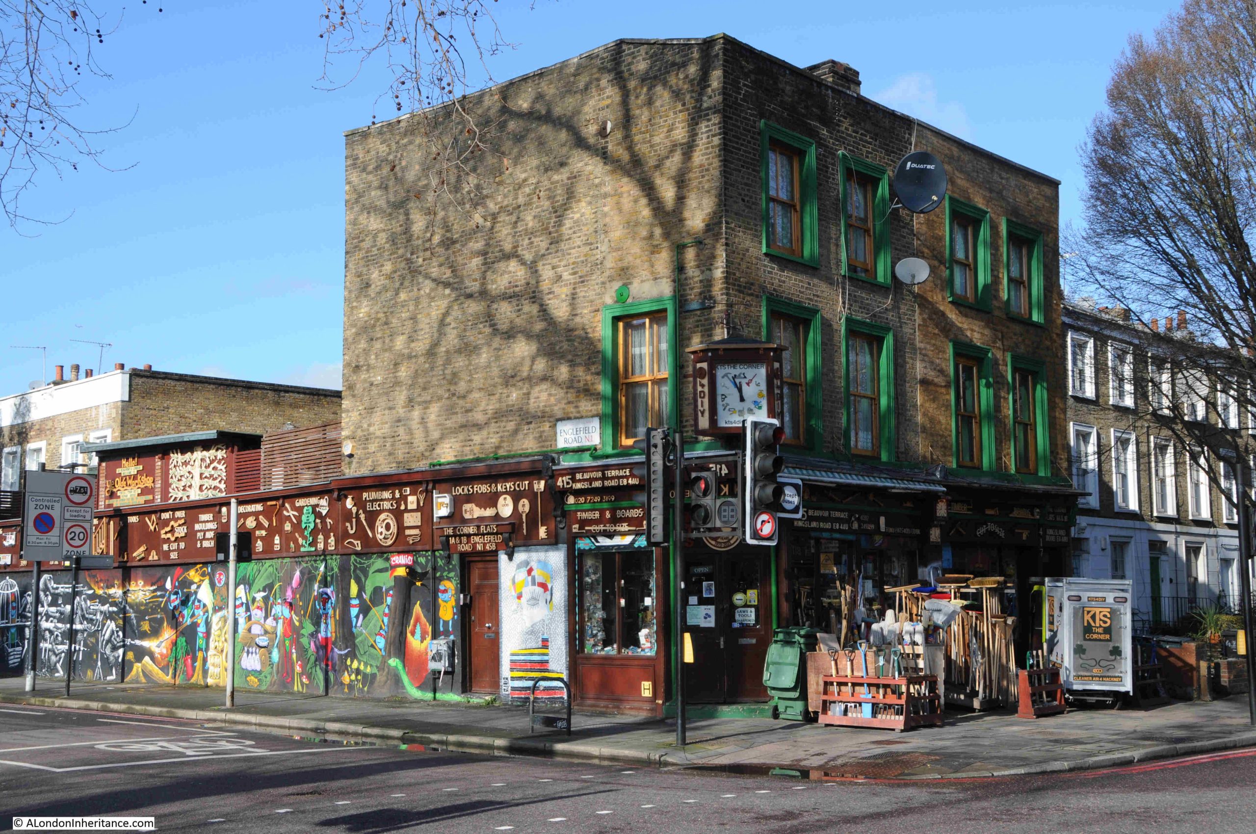
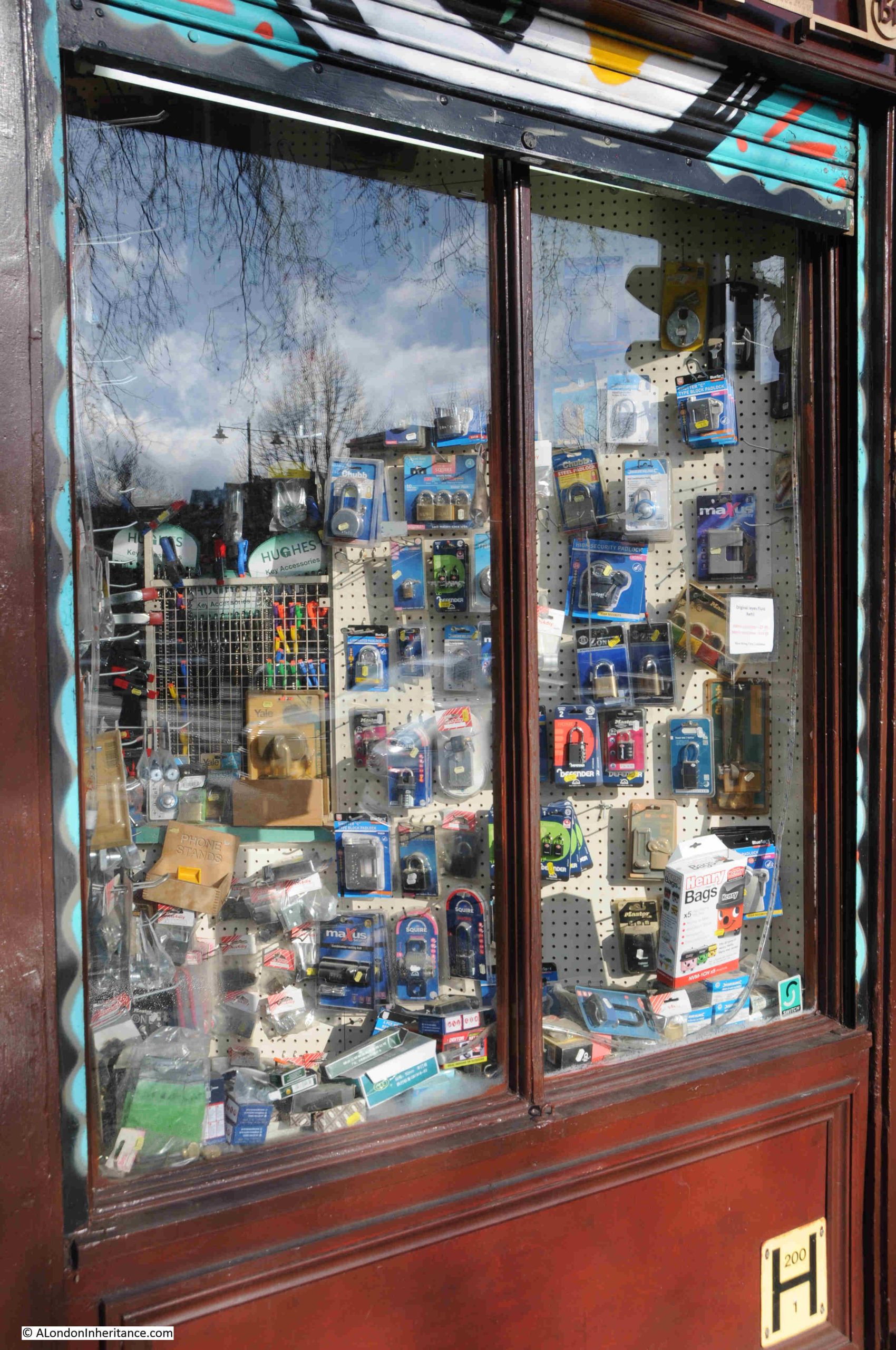
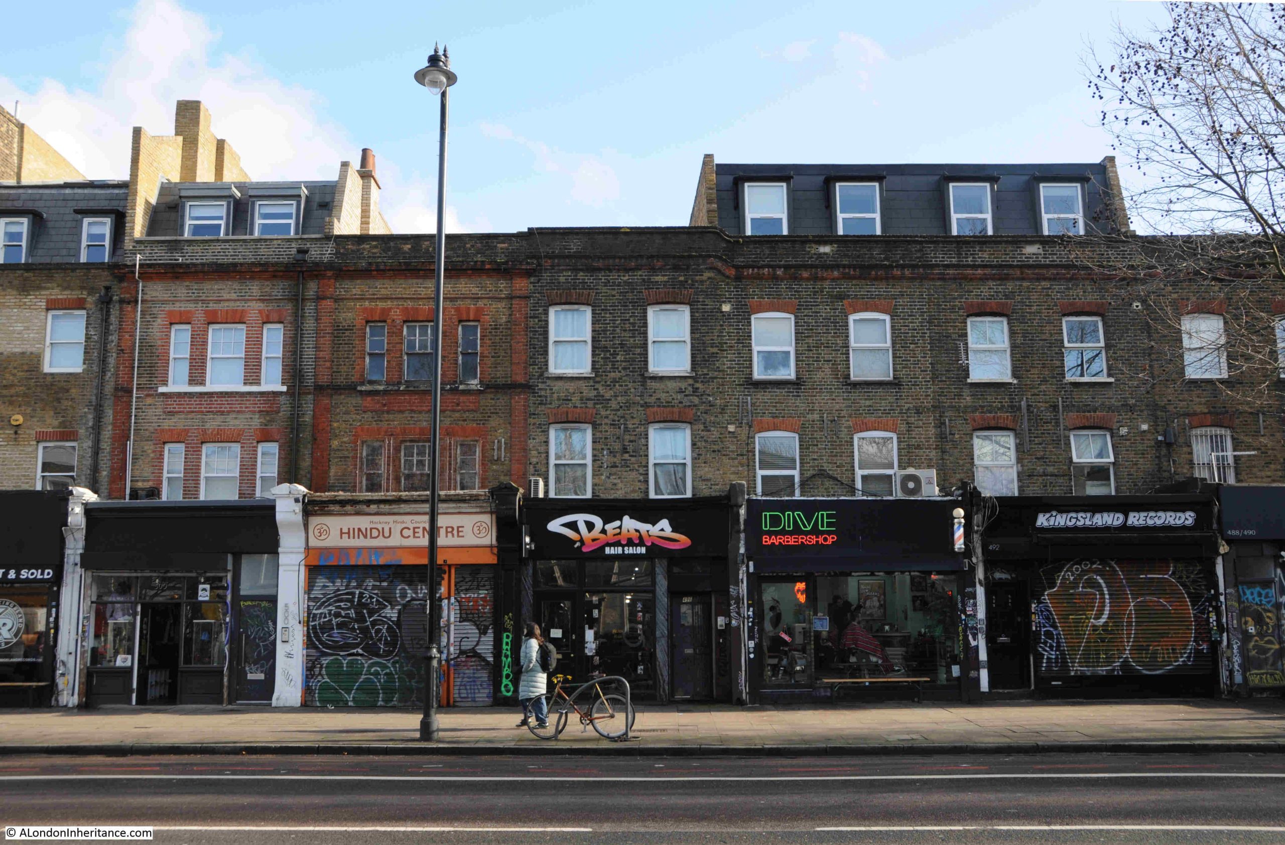
The route took me along Kingsland Road, where at the junction with Englefield Road is KTS DIY, a family run business, which according to their website has been there since 1973:

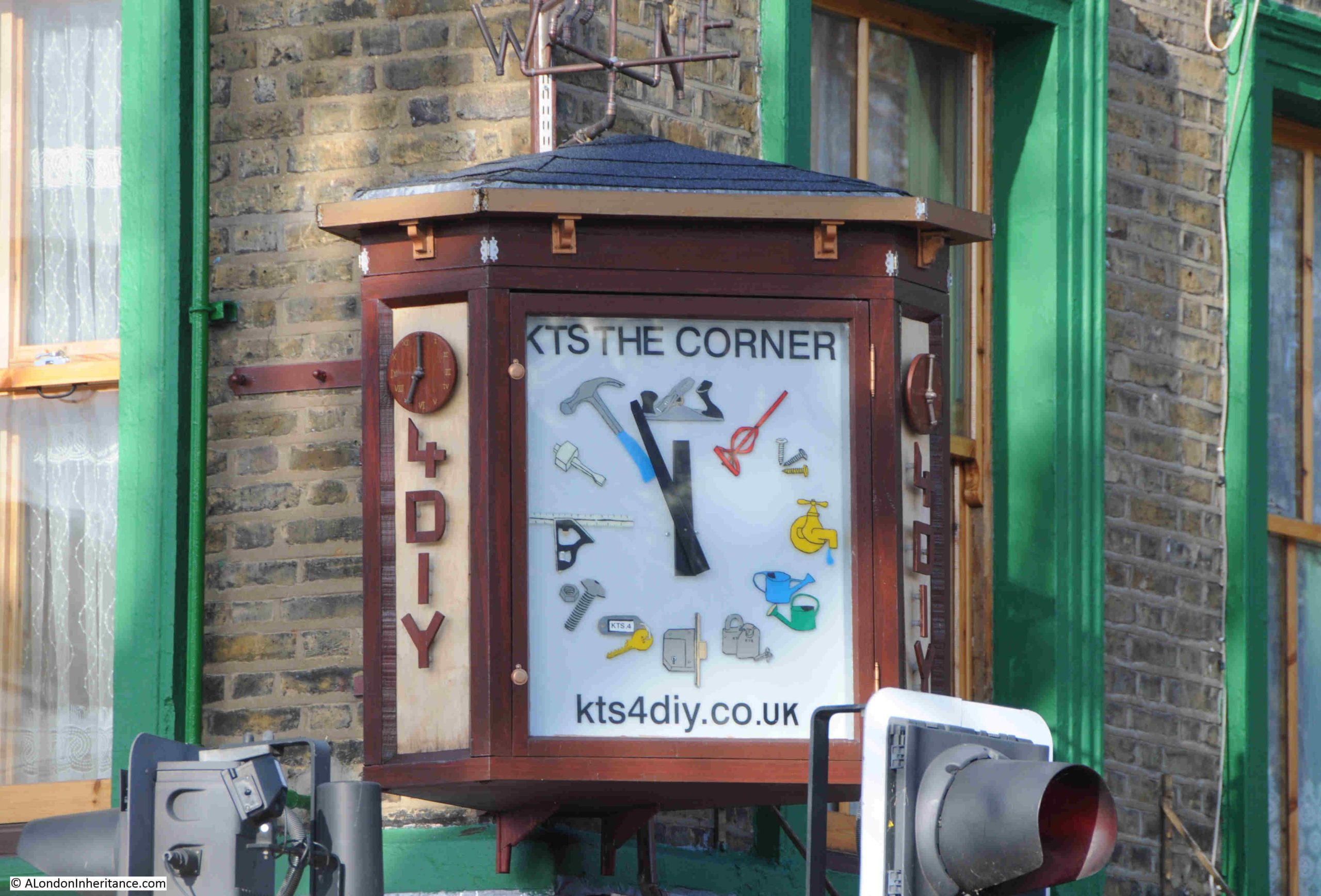
The clock on the corner of the building:

The store stocks a phenomenal range of DIY, building and household maintenance and cleaning equipment. The window display is just a very small part of what can be found inside:

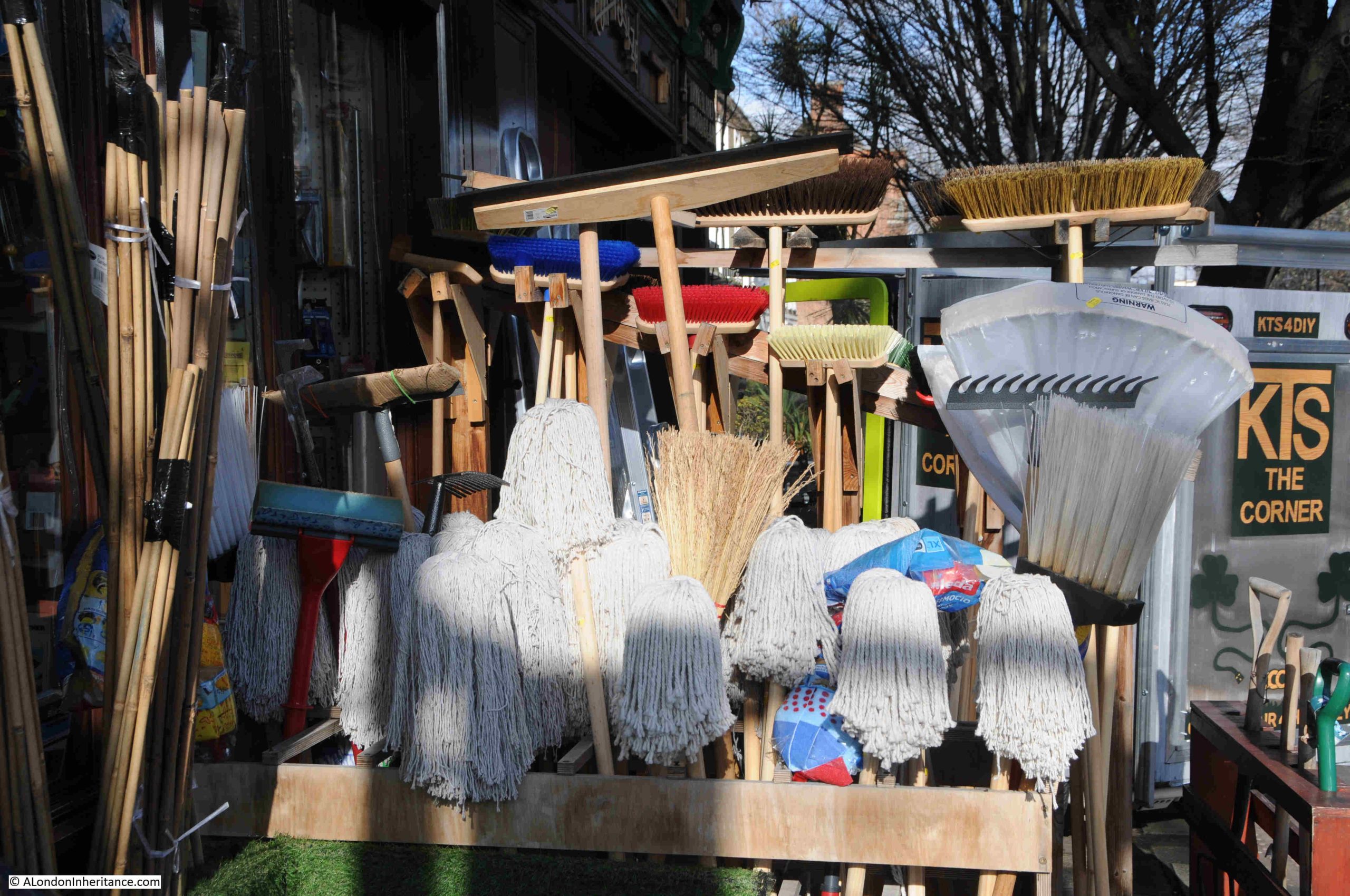
Mops and brooms in the February sunshine on Kingsland Road:

Opposite KTS DIY is the Haggeston, a pub which also has regular live music:

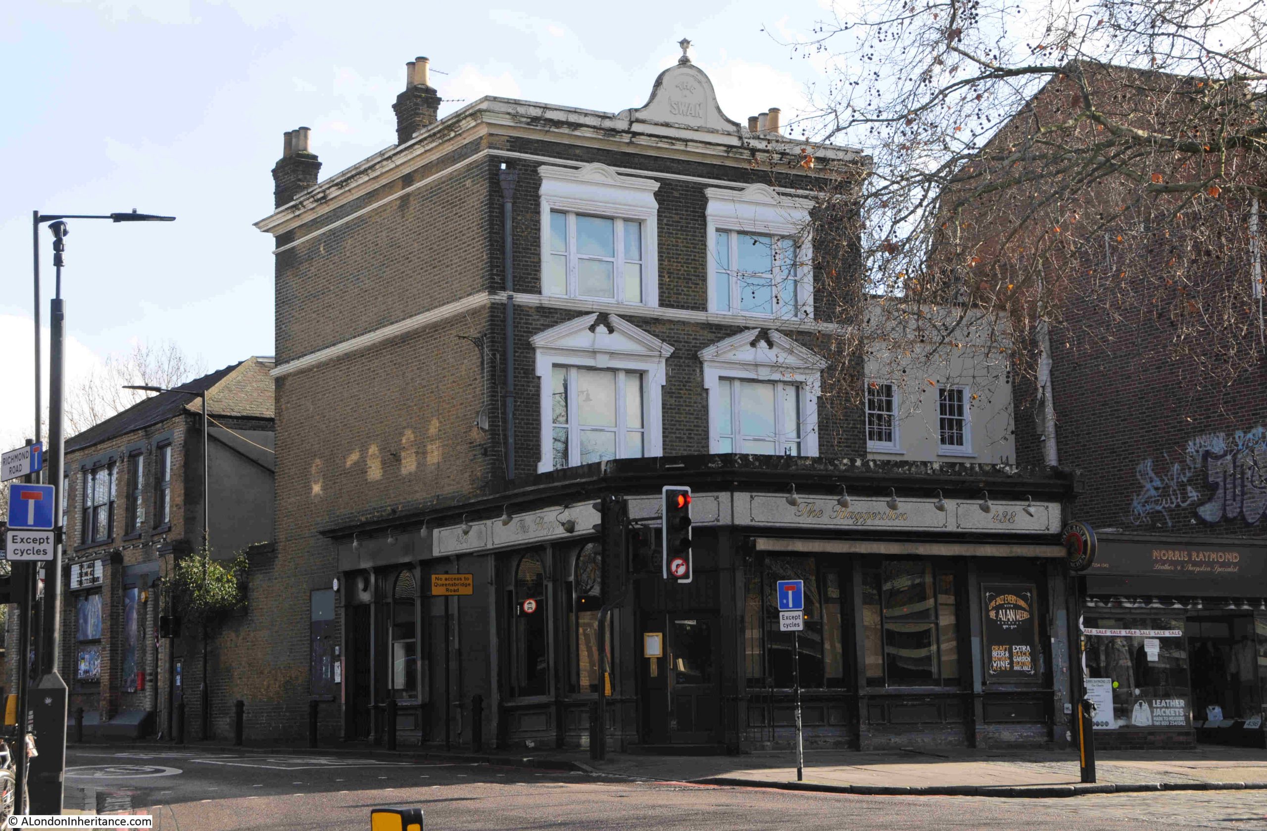
The current name of the pub dates from around 2009, and the original name of the pub was the Swan, as still displayed along the top of the building:

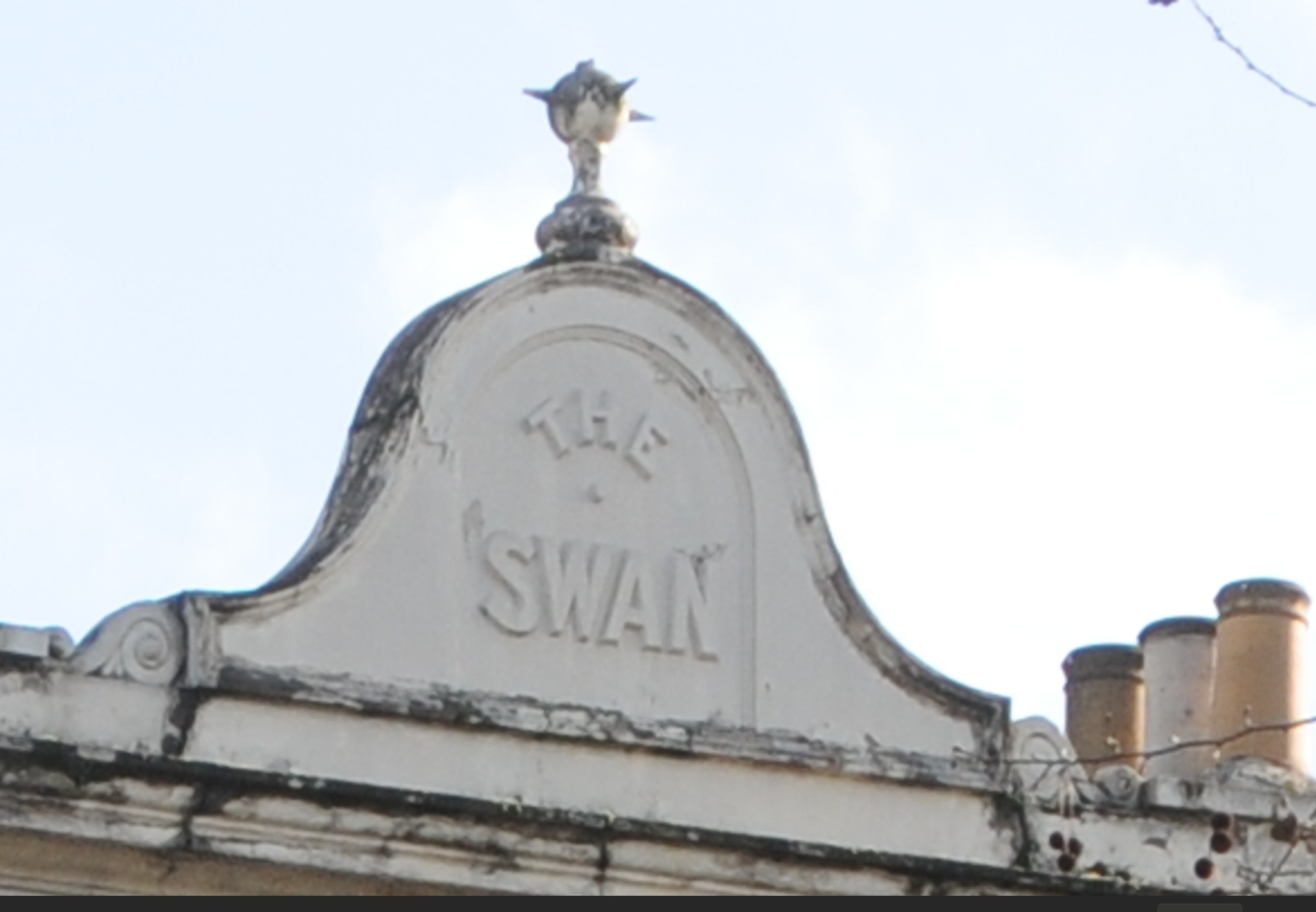
The Swan probably dates to the late 18th century. It was mentioned in an advert in the Morning Advertiser on the 15th of August 1807, an advert for the lease of a house, which gives a good impression of what this now densely built up area was like at the start of the 19th century:

“A neat, genteel brick-built detached dwelling house, with garden, and most pleasantly situated in the fields, near the Swan, Kingsland Road, an easy and pleasant walk from the Royal Exchange, and completely screened from the dust of the public road.”

It is good to know that back in 1807, advertisers of property used the same underestimates of distances in their adverts, as I am not sure the two and a third miles from the Swan to the Royal Exchange could be called and “easy and pleasant walk” for all.

The advert also demonstrates how pubs were used as a local reference points for many forms of public notice.

Further along Kingsland Road, and I am not sure what has happened to the windows on the first floor of this building:

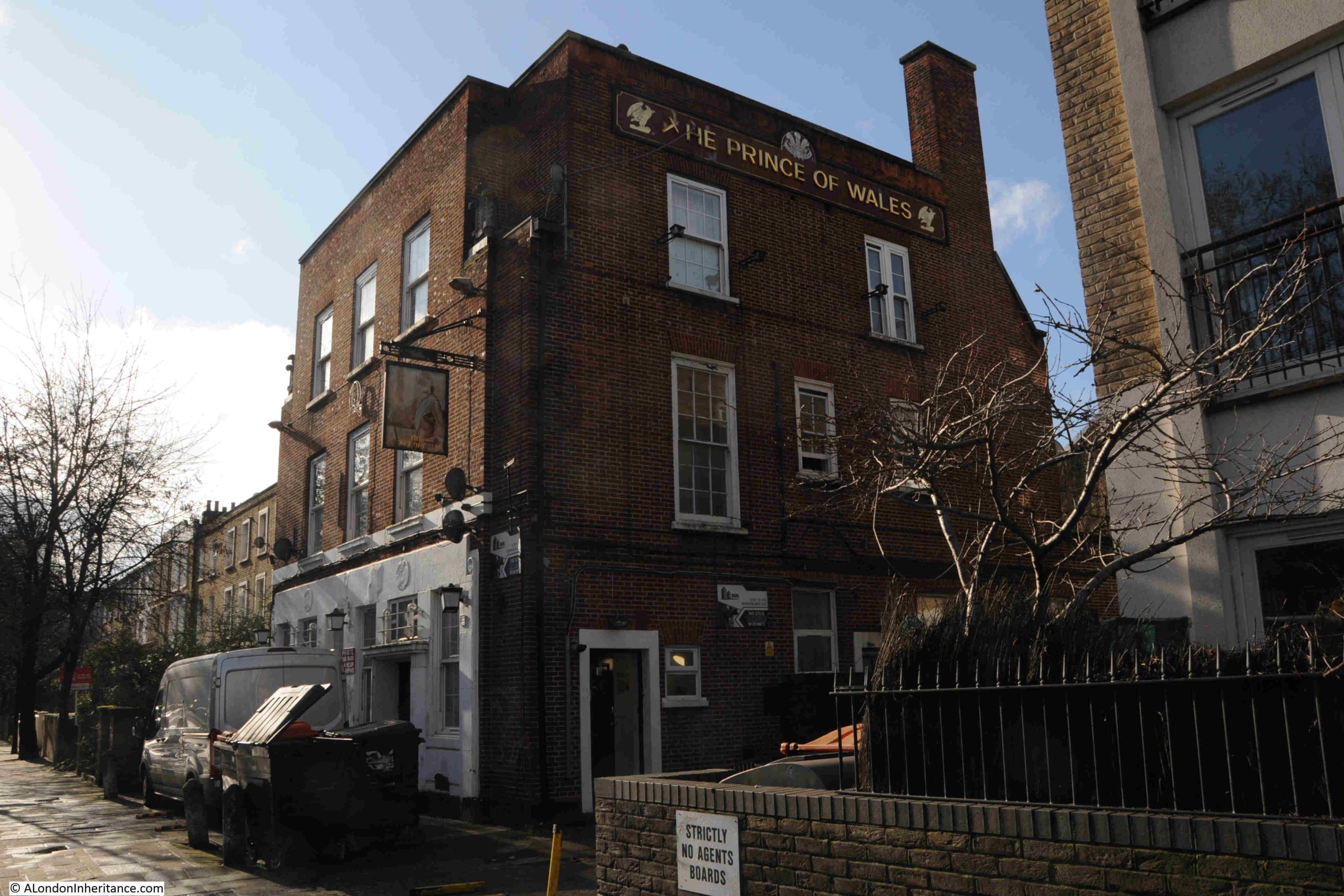
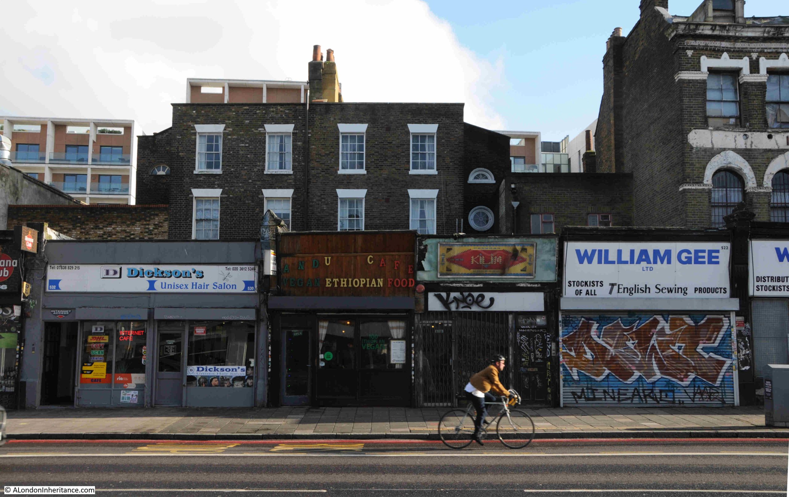
As with the mural on Mildmay Road, along Kingsland Road is the gradually fading sign of the Prince of Wales:

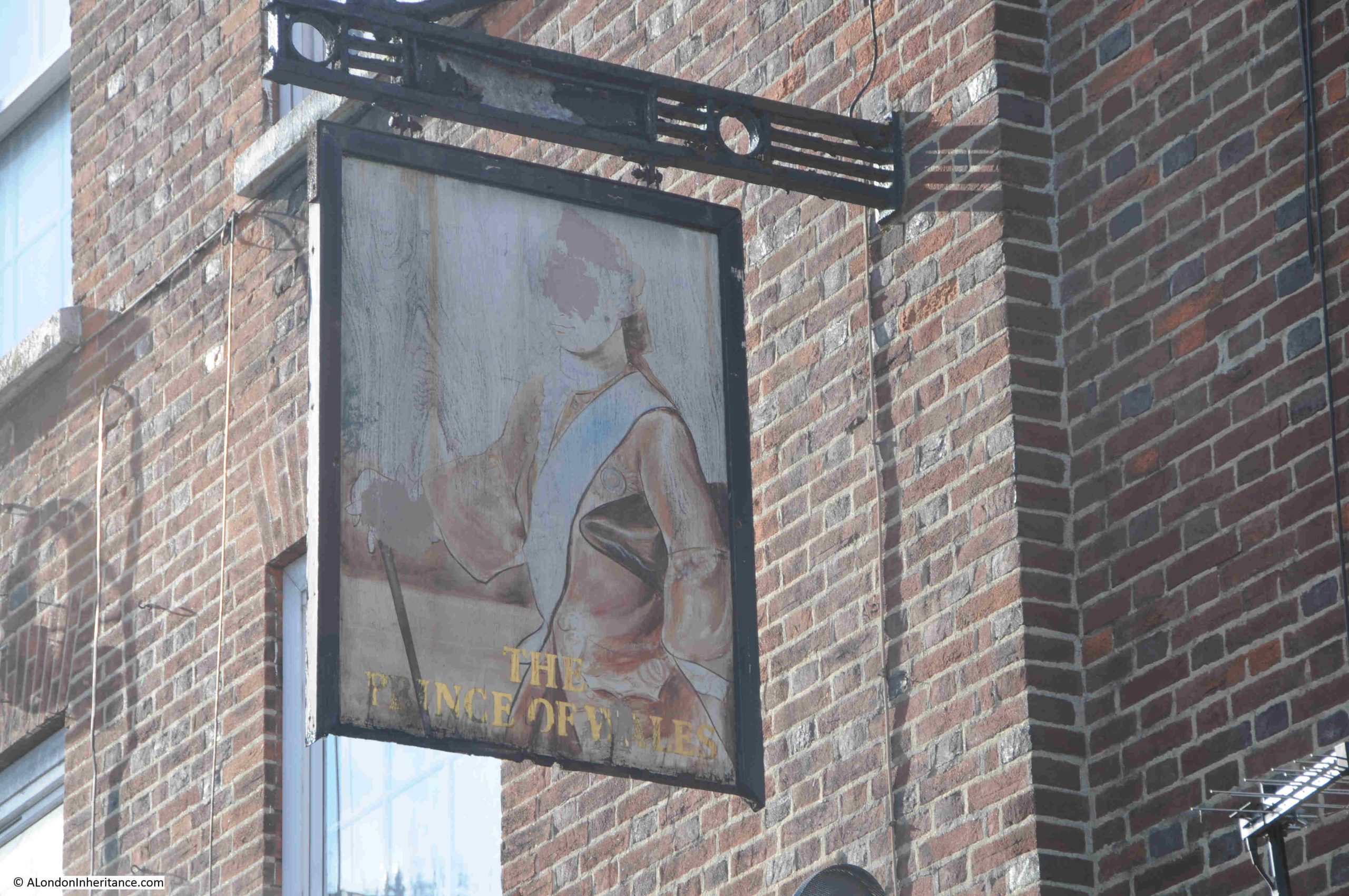
Despite closing around 26 years ago and converted to residential, the Prince of Wales name is still displayed at the tope of the building, a 1930 rebuild of the previous pub on the site:

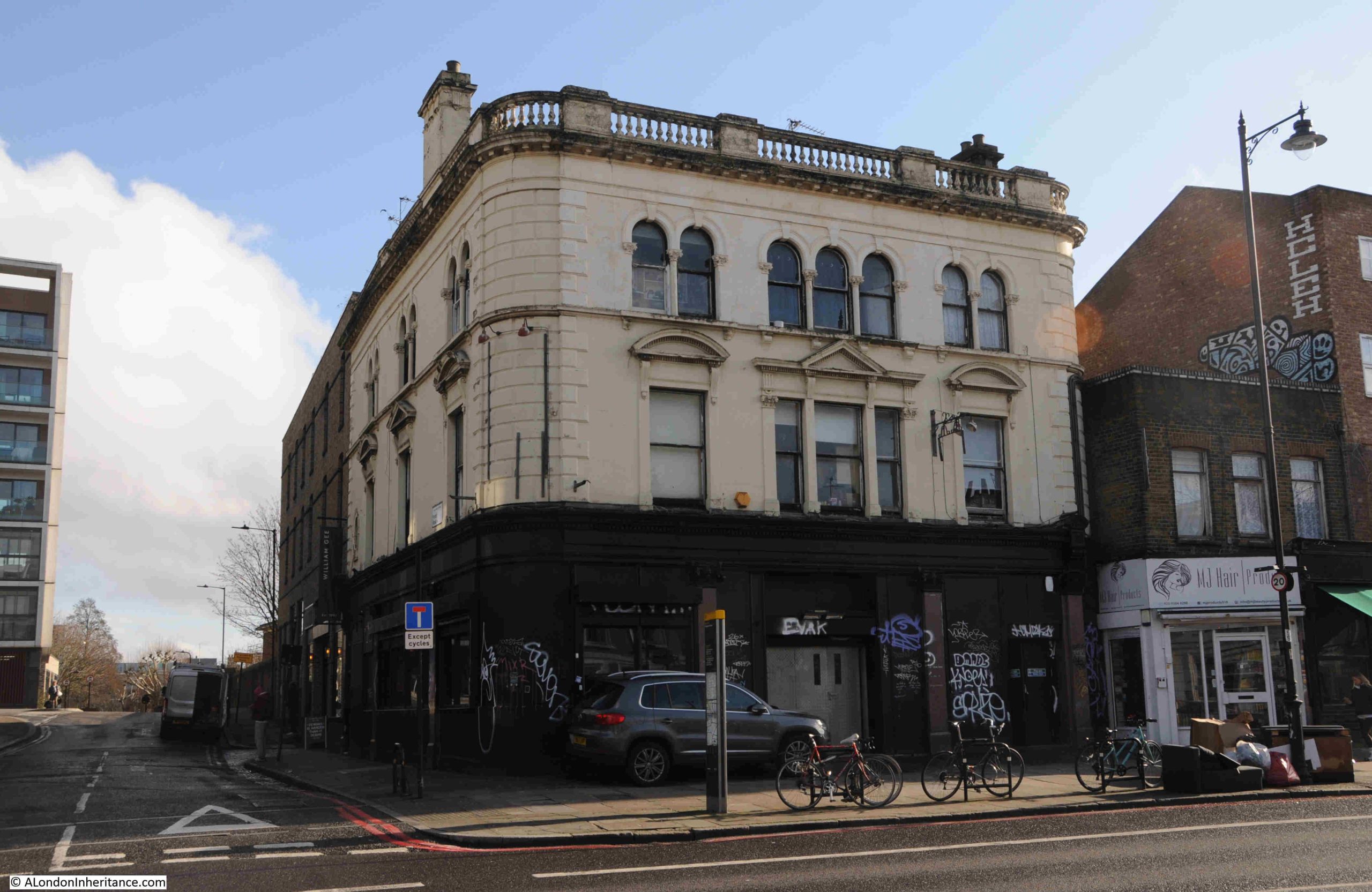
A short distance further along Kingsland Road is another closed pub, the Lamb, which dates from the early 19th century. The building is now a nightclub:

There were many pubs along Kingsland Road, reflecting both the importance of the road and density of the housing that was built in the fields to east and west of the road in the 19th century.

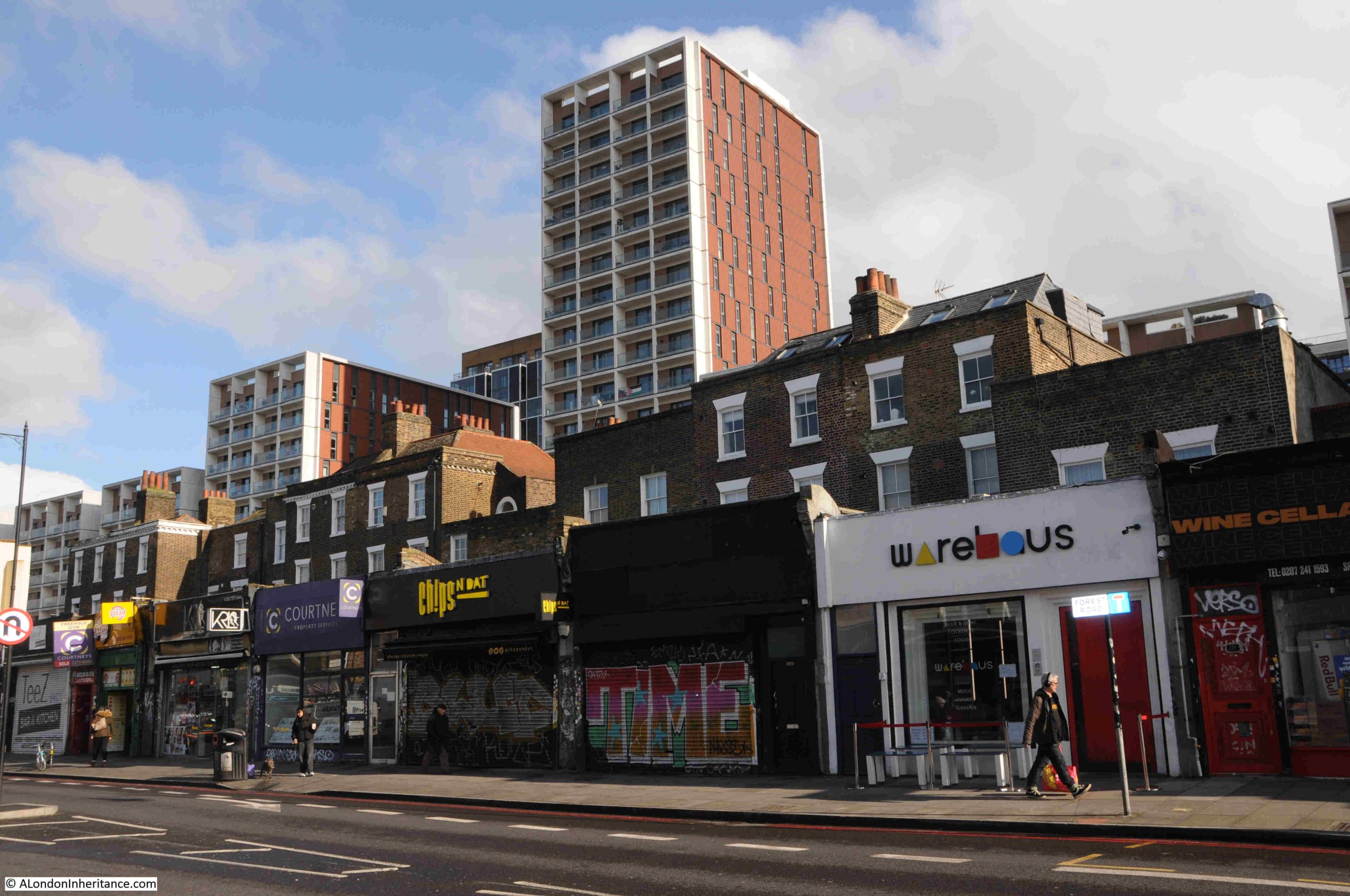
Kingsland Road is also home to terrace houses built during the late 18th and early 19th centuries. These were fine houses at the time, and frequently ground floor shops were added at a later date, built over the gardens that separated the house from the street:

The two semi-detached houses in the centre of the following photo are late 18th / early 19th century and are Grade II listed. At the time of the listing (1975), the building housed a factory, but now looks to ne residential, with shops taking up the space in front of the ground floor of the building:

The two larger buildings behind the shops in the following photo are also Grade II listed and date from the late 18th century. One can imagine how impressive these buildings appeared, before the shops and when the whole façade was visible from the street:

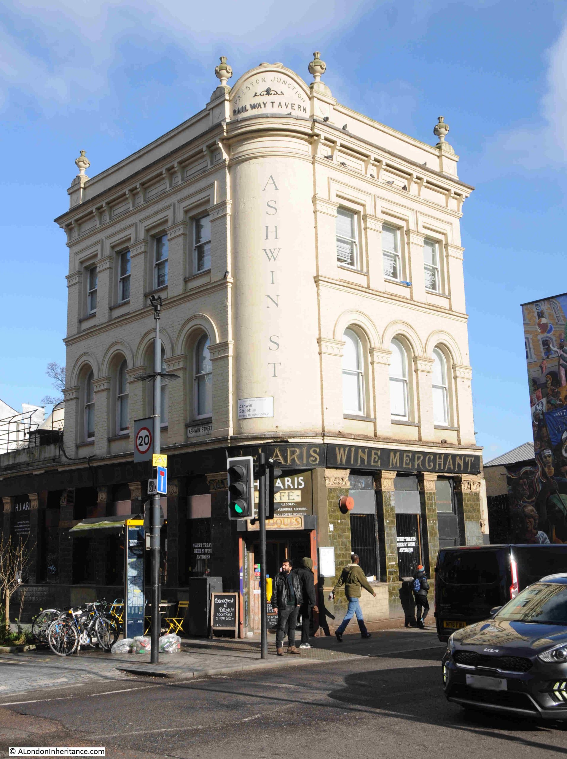
A slight detour down Dalston Lane from Kingsland Road is the old Railway Tavern, so named because it was almost opposite the original Dalston Junction station building, which has been rebuilt as part of a residential development.

The Railway Tavern is now a café / antique store:

The reason for the slight detour down Dalston Lane is to find another 1980s mural, however unlike the mural in Mildmay Road, this one is in a far better condition:

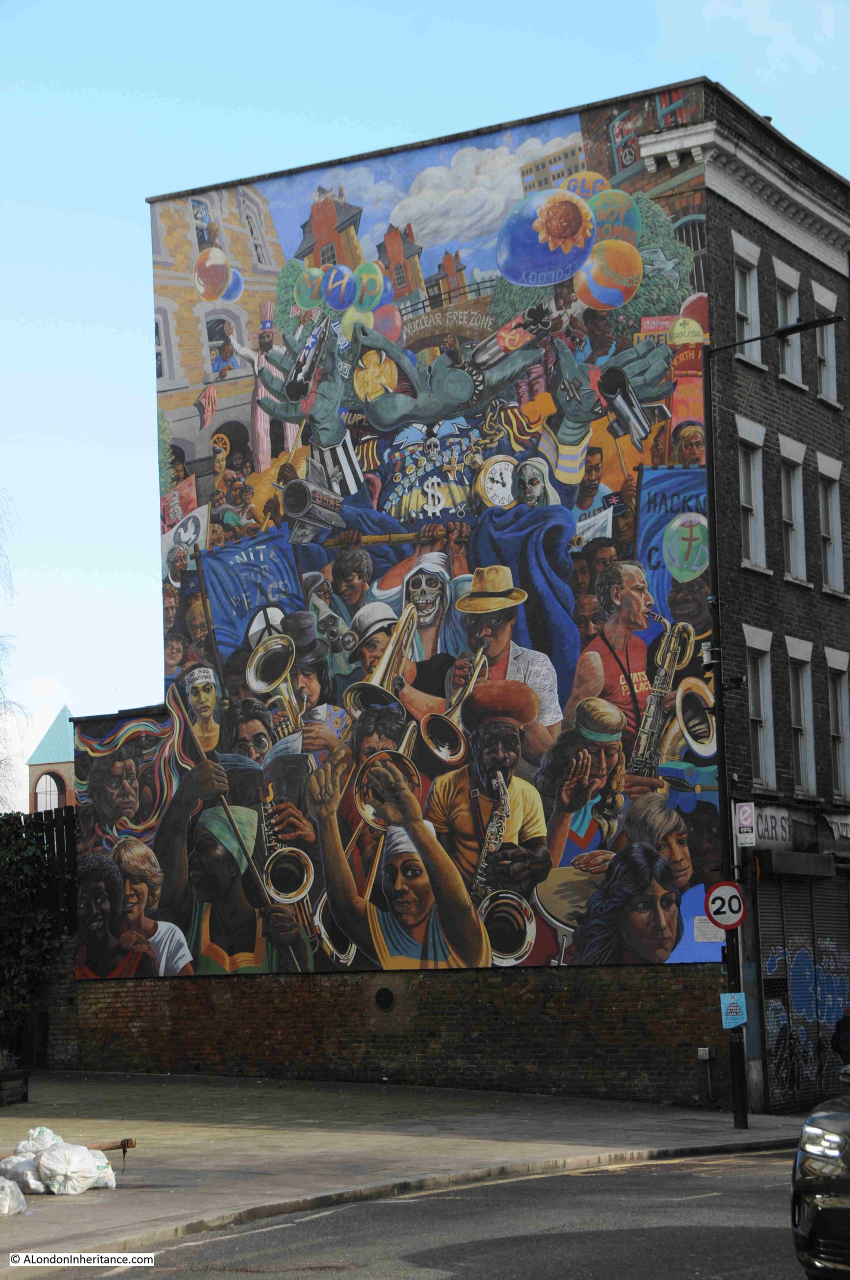
This is the Hackney Peace Carnival mural. The design dates from 1983 when it was created by Ray Walker to celebrate the Greater London Council’s Peace Year, and it was completed in 1985 after being finished by Ray Walker’s wife Anna Walker along with Mike Jones, following the death of Ray Walker in 1984.

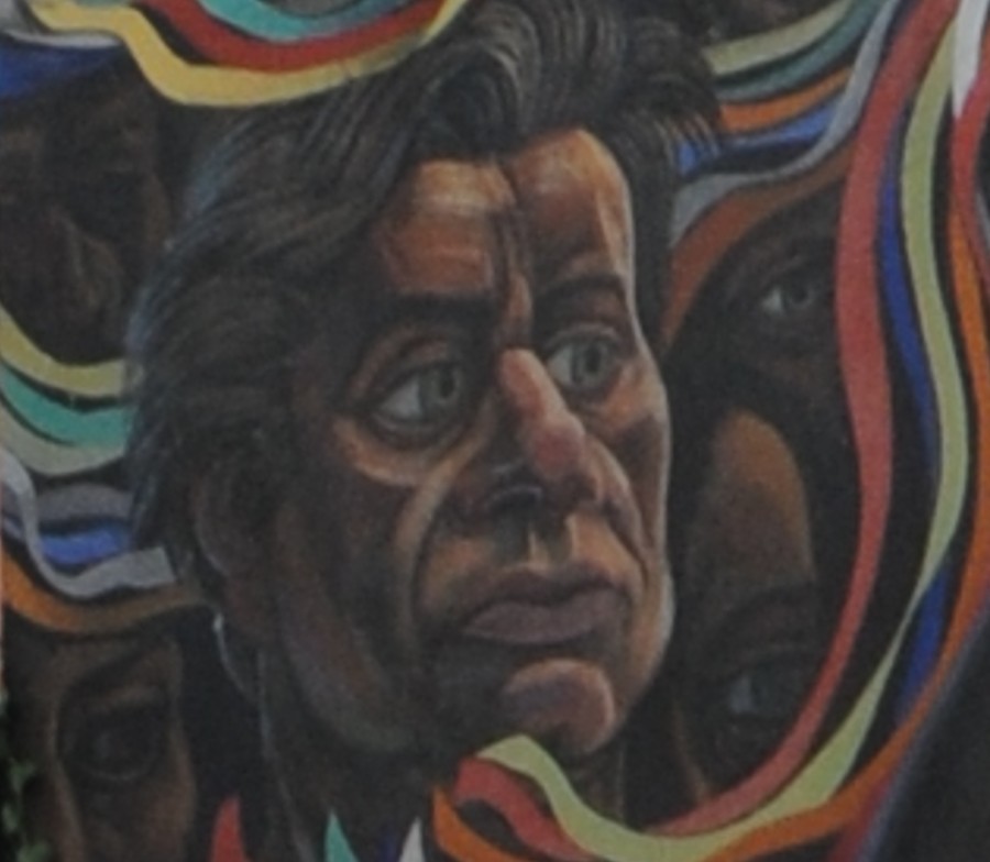
Ray Walker is shown in the mural to the lower left:

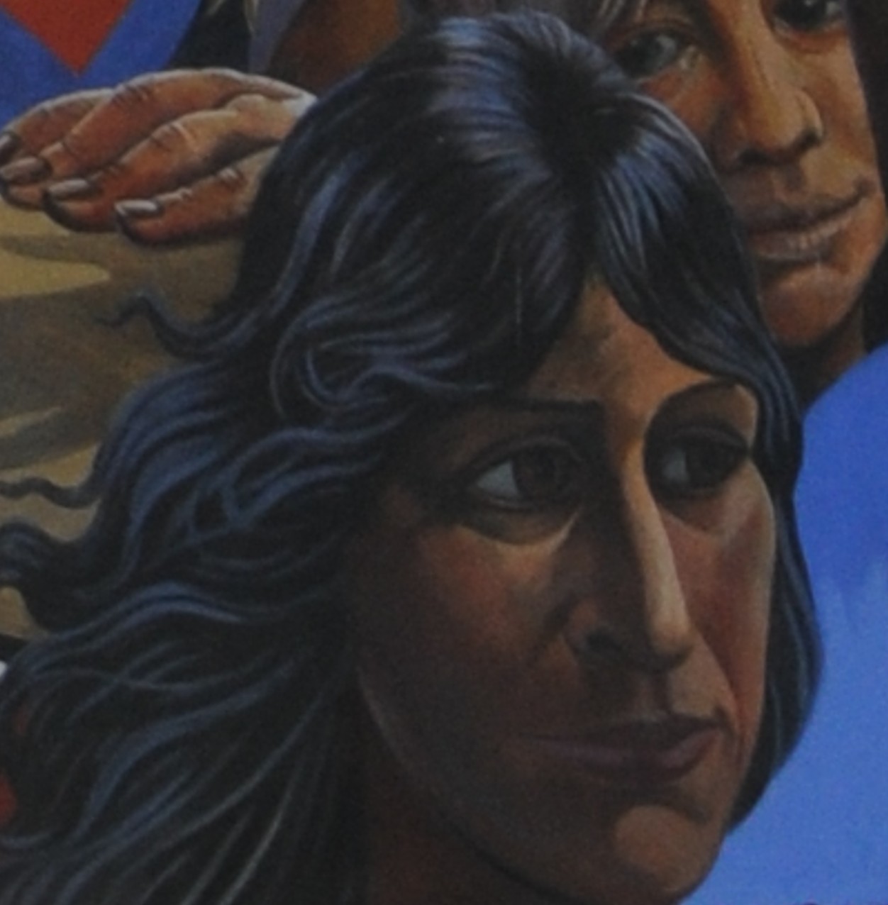
And Anna Walker is at lower right:

The excellent condition of the Dalston Lane mural compared to the Mildmay Road mural, when they are around the same age, is mainly down to the significant 2014 restoration of the Hackney Peace Carnival mural.

The 1980s seemed to be a prolific period for murals across the streets of London and GLC initiatives such as the 1983 Peace Year were responsible for a number of these, another of which was in Greenwich and was the Wind of Peace mural in Creek Road:

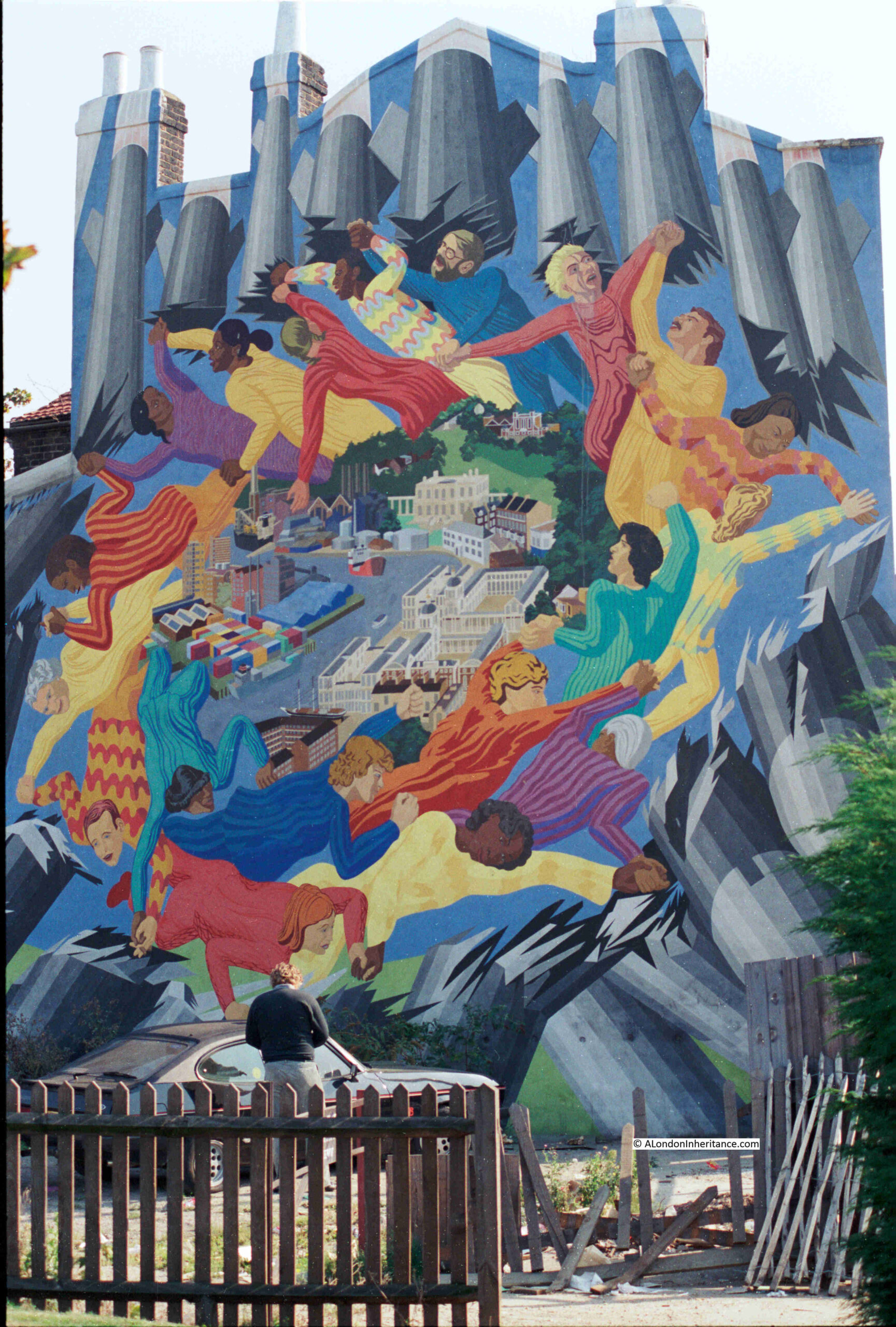
The Wind of Peace was commissioned by the London Muralists for Peace initiative, and painted by artists Stephen Lobb and Carol Kenna. It replaced an earlier mural showing the river and the land alongside the river in Greenwich.

The Wind of Peace has been lost as the building has been demolished. I wrote about the mural, along with another Greenwich mural in this post on the sad fate of two Greenwich murals.

From Dalston Lane, I then returned to Kingsland Road, and headed up to Mildmay Road via Boleyn Road, to find the mural at the start of today’s post.

A short post, with no maps, no deep dive into the area’s history, but I hope it demonstrates why walking the streets of London can be such as pleasure.

Caledonian Park – History, Murals And A Fire

Caledonian Park in north London in the Borough of Islington is today a green space in a busy part of London, with few reminders of the areas rich history.

I have much to write about Caledonian Park so I will cover in two posts this weekend. Today some historical background to the area, some lost murals and finding the location of one of my father’s photos. Tomorrow, climbing the Victorian Clock Tower at the heart of the park to see some of the most stunning views of London.

Caledonian Park is a relatively recent name. Taking its name from the nearby Caledonian Road which in turn was named after the Caledonian Asylum which was established nearby in 1815 for the “children of Scottish parents”.

Prior to the considerable expansion of London in the 19th century, the whole area consisted of open fields and went by the name of Copenhagen Fields. There was also a Copenhagen House located within the area of the current park.

The origin of the Copenhagen name is probably down to the use of the house (or possibly the construction of the house) by the Danish Ambassador for use as a rural retreat from the City of London during the Great Plague of 1665.

Copenhagen House became an Inn during the early part of the 18th century and the fields were used for sport, recreation and occasionally as an assembly point for demonstrations, or as Edward Walford described in Old and New London, the fields were “the resort of Cockney lovers, Cockney sportsmen and Cockney agitators”

The following print shows Copenhagen House from the south east in 1783, still a very rural location.

1125319001 ©Trustees of the British Museum

During the last part of the 18th century, Copenhagen Fields was often used as a meeting point for many of the anti-government demonstrations of the time. Old and New London by Walter Thornbury has a description of these meetings:

“In the early days of the French Revolution, when the Tories trembled with fear and rage, the fields near Copenhagen House were the scene of those meetings of the London Corresponding Society, which so alarmed the Government. The most threatening of these was held on October 26, 1795, when Thelwall, and other sympathisers with France and liberty, addressed 40,000, and threw out hints that the mob should surround Westminster on the 29th, when the King would go to the House. The hint was attended to, and on that day the King was shot at, but escaped unhurt.”

The meetings and threats from groups such as the Corresponding Societies led to the Combination Acts of 1799 which legislated against the gathering of men for a common purpose. It was this repression that also contributed to the Cato Street Conspiracy covered in my post which can be found here.

The following is a satirical print from 1795 by James Gillray of a meeting on Copenhagen Fields “summoned by the London Corresponding Society” which was “attended by more than a hundred thousand persons”.

140569001

©Trustees of the British Museum

Copenhagen Fields continued to be used for gatherings. In April 1834 there was a meeting in support of the Tolpuddle Martyrs, who had been sentenced to transportation to Australia for forming a trade union. Walter Thornbury provides the following description: “an immense number of persons of the trades’ unions assembled in the Fields, to form part of a procession of 40,000 men to Whitehall to present an address to his Majesty, signed by 260,000 unionists on behalf of their colleagues who had been convicted at Dorchester for administering illegal oaths”.

The final large meeting to be held in Copenhagen Fields was in 1851 in support of an exiled Hungarian revolutionary leader. The role of this rural location was about to change very dramatically.

Smithfield in the city was originally London’s main cattle market however during the first half of the 19th century the volume of animals passing through the market and the associated activities such as the slaughter houses were getting unmanageable in such a densely populated part of central London.

The City of London Corporation settled on Copenhagen Fields as the appropriate location for London’s main cattle market and purchased Copenhagen House and the surrounding fields in 1852. The site was ideal as it was still mainly open space, close enough to London, and near to a number of the new railway routes into north London.

Copenhagen House was demolished and the construction of the new market, designed by the Corporation of London Architect, James Bunstone Bunning was swiftly underway, opening on the 13th June 1855.

A ground penetrating radar survey of the area commissioned by Islington Council in 2014 identified the location of Copenhagen House as (when viewed from the park to the south of the Clock Tower) just in front and to the left of the Clock Tower.

The sheer scale of the new market was impressive. In total covering seventy five acres and built at a cost of £500,000. There were 13,000 feet of railings to which the larger animals could be tied and 1,800 pens for up to 35,000 sheep.

Market days were Mondays and Thursdays for cattle, sheep and pigs, and Fridays for horses, donkeys and goats. The largest market of the year was held just before Christmas. In the last Christmas market at Smithfield in 1854, the number of animals at the market was 6,100. At the first Christmas market at the new location, numbers had grown to 7,000 and by 1863 had reached 10,300.

The following Aerofilms photo from 1931 shows the scale of the market. The clock tower at the centre of the market is also at the centre of the photo with the central market square along with peripheral buildings in the surrounding streets.

EPW034971

The 1930 edition of Bartholomew’s Handy Reference Atlas of London shows the location and size of the market:

Caledonian map 1

As well as the cattle market, the construction included essential infrastructure to support those working and visiting the market. Four large public houses were built, one on each of the corners of the central square. The following Aerofilms photo from 1928, shows three of the pubs at corners of the main square. The two large buildings to the left of the photo are hotels, also constructed as part of the market facilities

The clock tower is located in the middle, at the base of the clock tower are the branch offices of several banks, railway companies, telegraph companies along with a number of shops.

EPW024272

A 19th century drawing shows the clock tower and the long sheds that covered much of the market:

Die_Gartenlaube_(1855)_b_089

By the time of the First World War, the cattle market had started to decline and was finally closed in 1939 at the start of the Second World War, with the site then being used by the army.

After the war, the slaughter houses around the market continued to be used up until 1964, when the London County Council and the Borough of Islington purchased the site ready for redevelopment. The Market Housing Estate was built on much of the site, although by the 1980s the physical condition of the estate had started to decline significantly, and the estate had a growing problem with drugs and prostitution. Housing blocks were built up close to the clock tower and there was limited green space with many concrete paved areas surrounding the housing blocks and the clock tower.

A second redevelopment of the area was planned and planning permission granted in 2005. The last of the Market Estate housing blocks was demolished in 2010 and it this latest development which occupies much of the area today.

In 1982 a number of murals illustrating the history of the market were painted on the ground floor exterior of the main Clock Tower building of the original Market Estate. In 1986 my father took some photos of the murals during a walk round Islington. As far as I know, these murals were lost during the later redevelopment of the area.

The introductory mural providing some history of the market:

Cattle Market Murals 1

A scene showing the opening of the market by Prince Albert in 1855. A lavishly decorated marquee hosted a thousand invited guests to mark the opening of the market.

Cattle Market Murals 2

The central clock tower painted on the Clock Tower building of the housing estate:

Cattle Market Murals 3

Other scenes from around the market:

Cattle Market Murals 4

Cattle Market Murals 5

As well as the photos of the murals, almost 40 years earlier in 1948 my father had taken a photo of the aftermath of a fire. I was unsure where this was and I published the photo below a few weeks ago in my post on mystery locations.

Old Pub Road 1

One of the messages I had in response to this post (my thanks to Tom Miler), was that the building at the back of the photo looked like one of the pubs at the Caledonian Market.

I took a walk around the periphery of the site trying to work out which of the streets and pubs could be the location of my father’s photo and found the following:

Pub Road 1

This, I am sure, is the location of my father’s photo. The street is Shearling Way running along the eastern edge of Caledonian Park. I probably should have been a bit further back to take the photo, however the rest of the road was closed and full of cars unloading students into the student accommodation that now occupies the southern end of Shearling Way – an indication of how much the area has changed.

The pub is hidden behind the tree, although it is in the same position and the chimneys are clearly the same and in the right position. The old yards and sheds that had burnt down on the right of the original photo have been replaced by housing.

I was really pleased to find the location of this photo, it is one I thought I would not be able to place in modern day London.

This Aerofilms photo from 1948 shows the pub from the above photo at the top left of the main market square with the road running up to the right. Above the road is the area that was the scene of the fire.

EAW015857

This is another photo of the scene of the fire and the housing in the background can also be seen in the above Aerofilms photo, further confirming the location.

Unknown Locations 17

Walking down the street I took the following photo of the pub, the front of the pub has the same features as on the 1948 photo.

Pub 1

The pub was The Lamb, unfortunately, as with the other pubs on the corners of the old cattle market, it is now closed.

To the left of the first half of the street, adjacent to the park, the original market railings are still in place:

Market Railings 1

A short time after the opening of the Cattle Market, a general or flea market had become established alongside. This market grew considerably and was generally known as the Cally Market, a place where almost anything could be found for sale. By the start of the 20th century, the size of the Cally Market had outgrown the original Cattle Market.

The journalist and author H.V. Morton visited the market for his newspaper articles on London and later consolidated in his book “London” (published in 1925) and wrote the following:

“When I walked into this remarkable once a week junk fair I was deeply touched to think that any living person could need many of the things displayed for sale. For all round me, lying on sacking, were the driftwood and wreckage of a thousand lives: door knobs, perambulators in extremis, bicycle wheels, bell wire, bed knobs, old clothes, awful pictures, broken mirrors, unromantic china goods, gaping false teeth, screws, nuts, bolts and vague pieces of rusty iron, whose mission in life, or whose part and portion of a whole, Time had obliterated.”

The Cally Market was also used during both the first and second world wars for major fund raising events. This poster from the first world war:

IWM PST 10955

 © IWM (Art.IWM PST 10955)

Along with the murals, my father took a photo of the Clock Tower in 1986. The original housing blocks that reached up to the clock tower can be seen on either side. The clock tower is surrounded by concrete paving.

Old Tower View 1

This is the same scene in 2015 from roughly the same point (although I should have been more to the left). The old housing blocks have been demolished and the clock tower is now surrounded by green space.

New Tower View 1

Looking at the above photo, the wooden steps that provide the route up inside the Clock Tower can be seen through the two windows.

Join me for tomorrow’s post as I climb the tower to the viewing gallery at the top for some of the best views across London.

alondoninheritance.com