
Before heading to Shenfield Street, a quick advert. I am still working on a couple of new walks for 2023, which should be ready in a couple of months, however I have set some dates for a limited number of my walks exploring Wapping, the Southbank and the Barbican.
For this week’s post, I am in Hoxton, looking at how Shenfield Street was decorated for the Coronation – the 1953 rather than the 2023 Coronation. This is a series of photos of the street taken by my father. One of the photos includes something that enabled much of his photography across London, and wider afield.
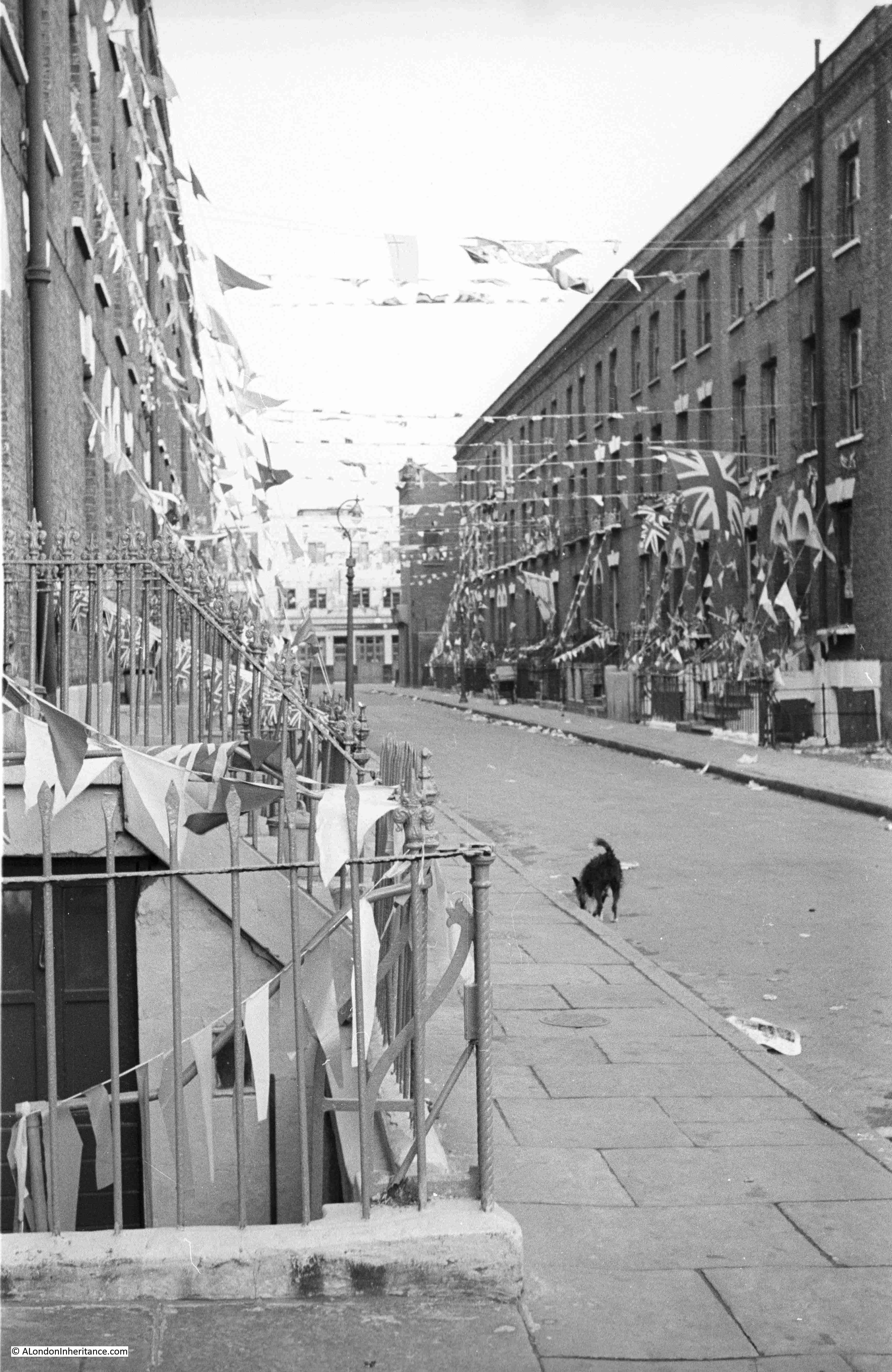
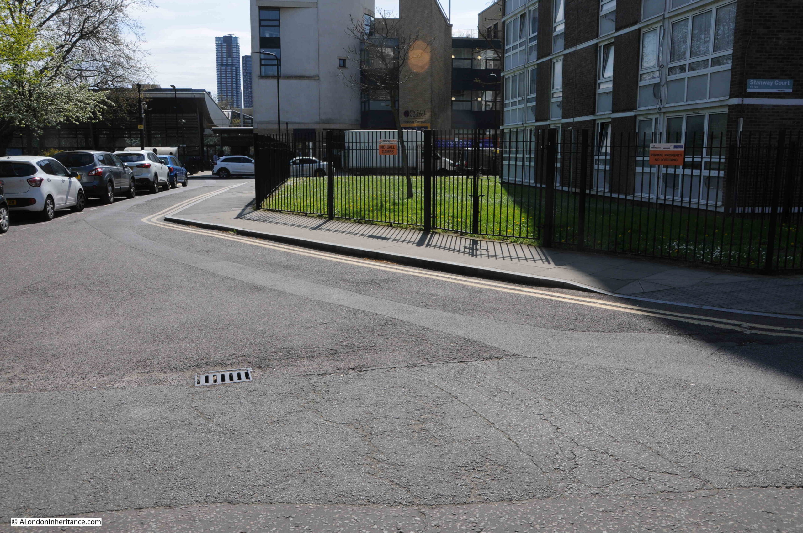
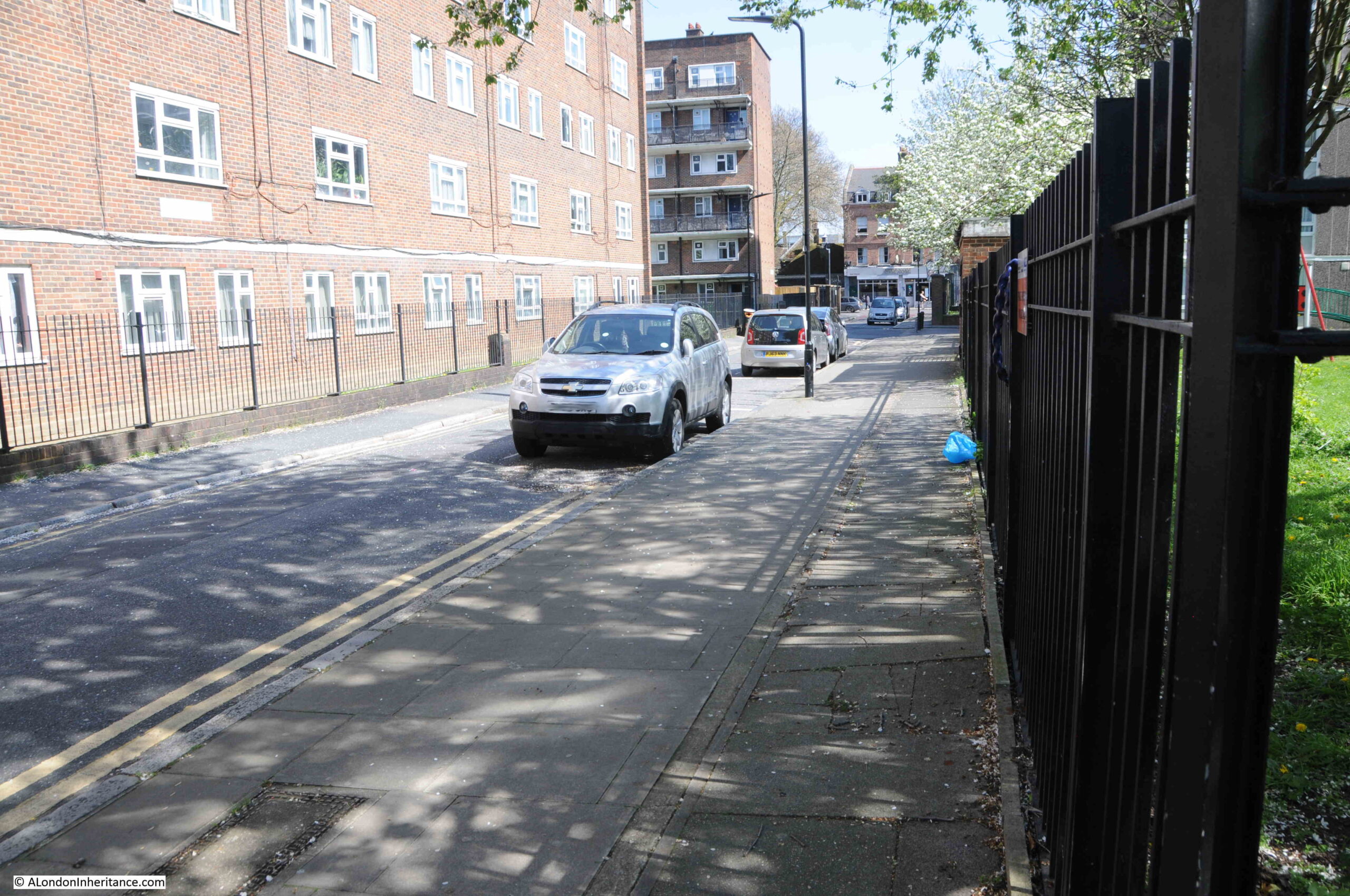
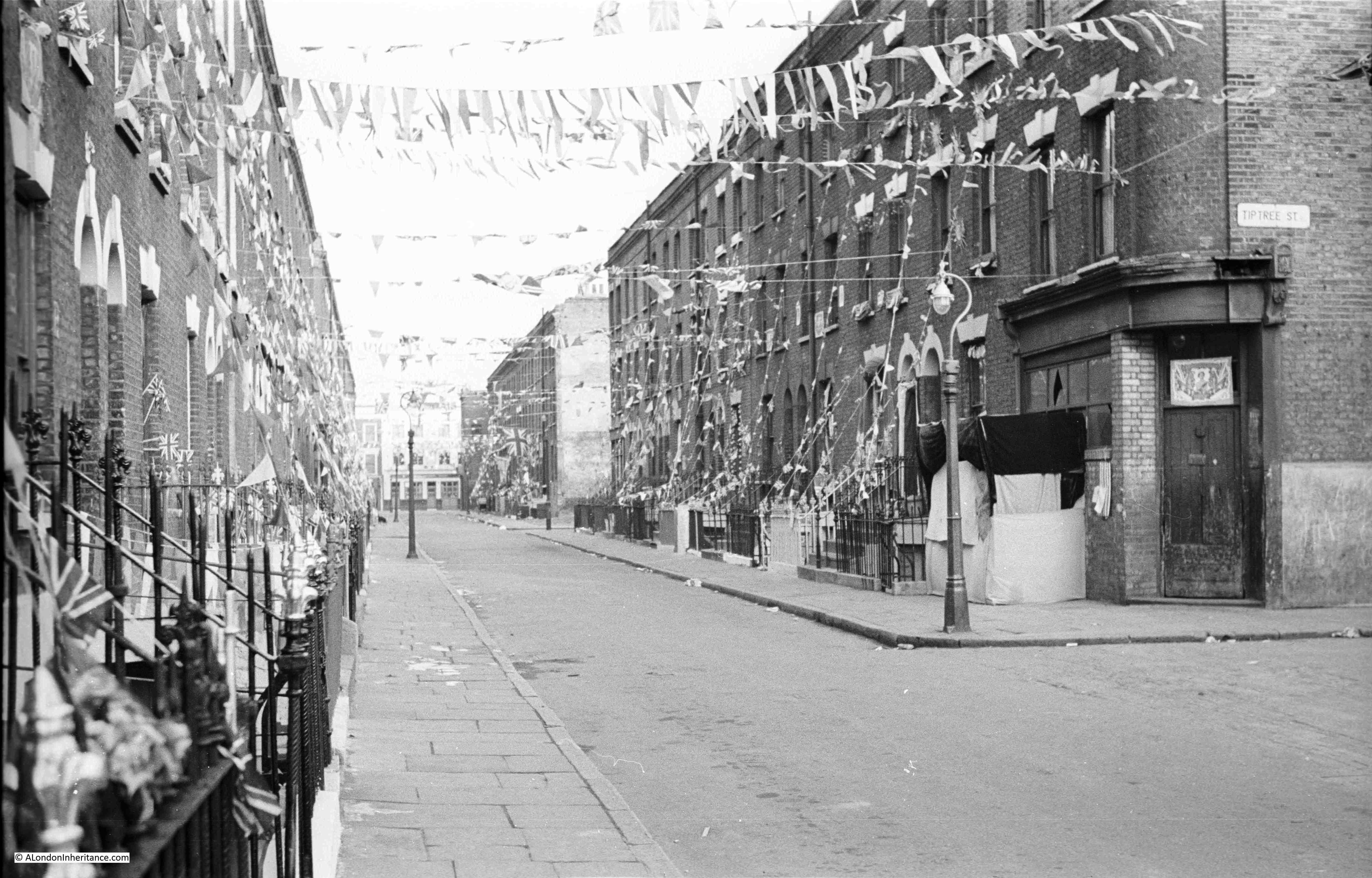
This is Shenfield Street, looking west towards the junction with Hoxton Street, on Sunday the 31st of May, 1953, two days before the Coronation on the 2nd of June:
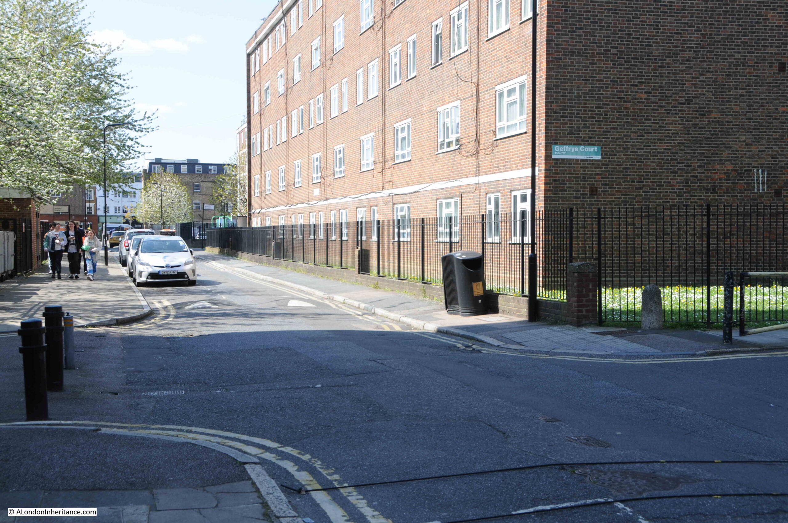
This is the same view today, at the end of April, just over a week before the 2023 Coronation:
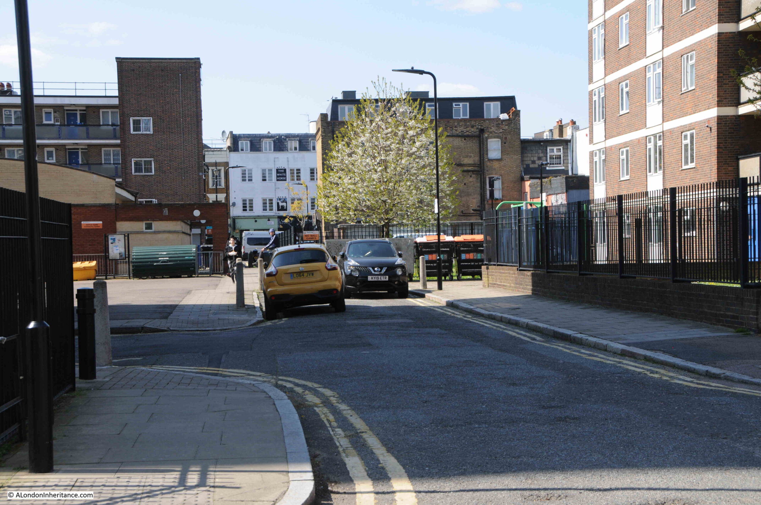
The white building at the end of the street in both of the above photos is the White Horse pub. Open at the time of my father’s 1953 photos, but closed in 2023, having closed as a pub in 2013.
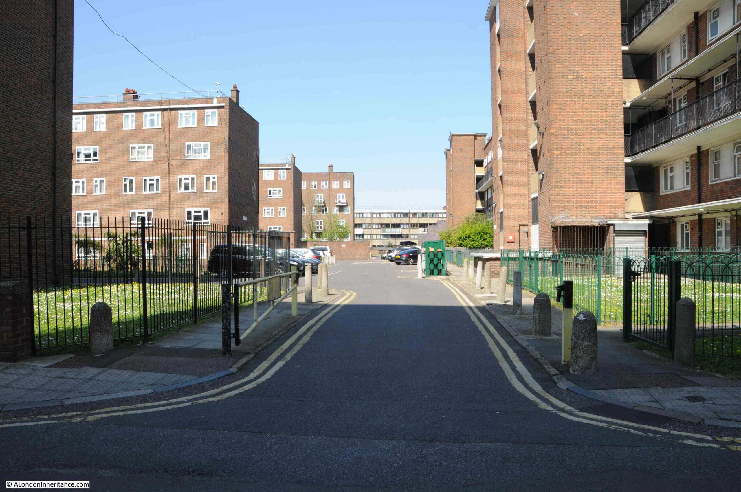
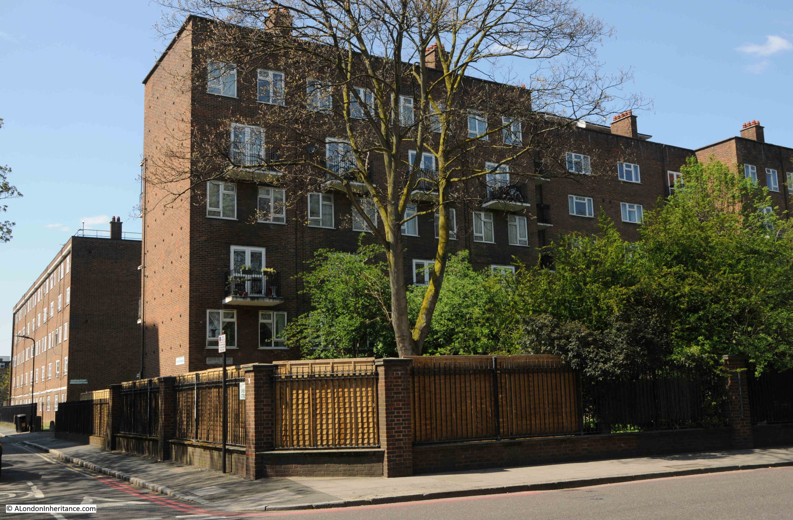
In the 70 years since the last Coronation, Shenfield Street has changed beyond recognition. Once a street lined with terrace houses, they have all since been demolished, to be replaced by the Geffrye Estate.
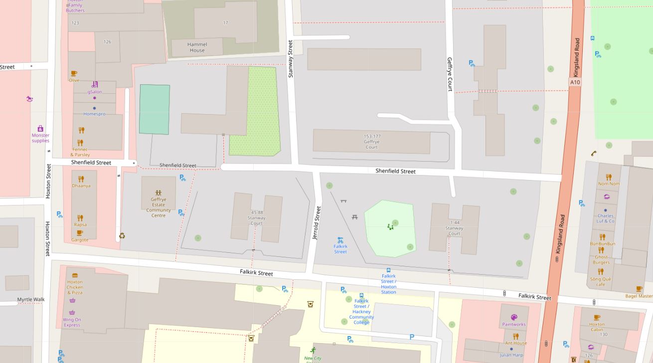
In the following map, Shenfield Street runs across the middle of the map, with Hoxton Street on the left and Kingsland Road on the right. In 1953, Shenfield Street provided a route between the two streets to left and right, but today is blocked for traffic, with only a pedestrian route through as shown by the grey section as the street approaches Hoxton Street (Map © OpenStreetMap contributors):
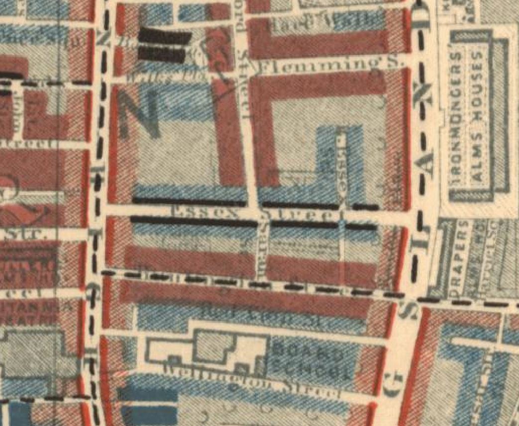
Construction of the street seems to have started in the late 18th century, however in 1799 as shown in the following extract from Horwood’s 1799 map of London, it was then called Essex Street, and is shown running across the centre of the following extract from the map:
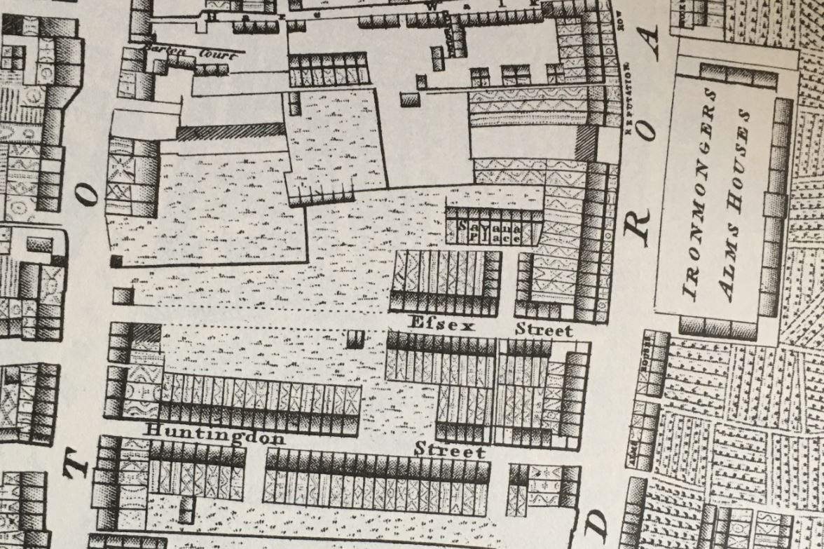
The map shows that building started from the Kingsland Road end of the street, and the houses then constructed appear to be densely built terrace houses, which I assume are the same houses that were still to be found in 1953.
The name change is interesting. I cannot find the source of the name Essex Street, or when it was changed to Shenfield Street. Essex Street was still in use in 1915, but had changed by 1945, when Shenfield was recorded in the LCC Bomb Damage Maps.
Street names were often changed to avoid confusion when there was another local street with the same name, however the nearest Essex Street seems to have been leading off from the Strand, a distance from Hoxton.
Shenfield was an interesting choice for the new name of the street, as Shenfield is a town in Essex, probably now better known as the eastern end of the Elizabeth Line. So by choosing Shenfield there was a continuation of the Essex connection.
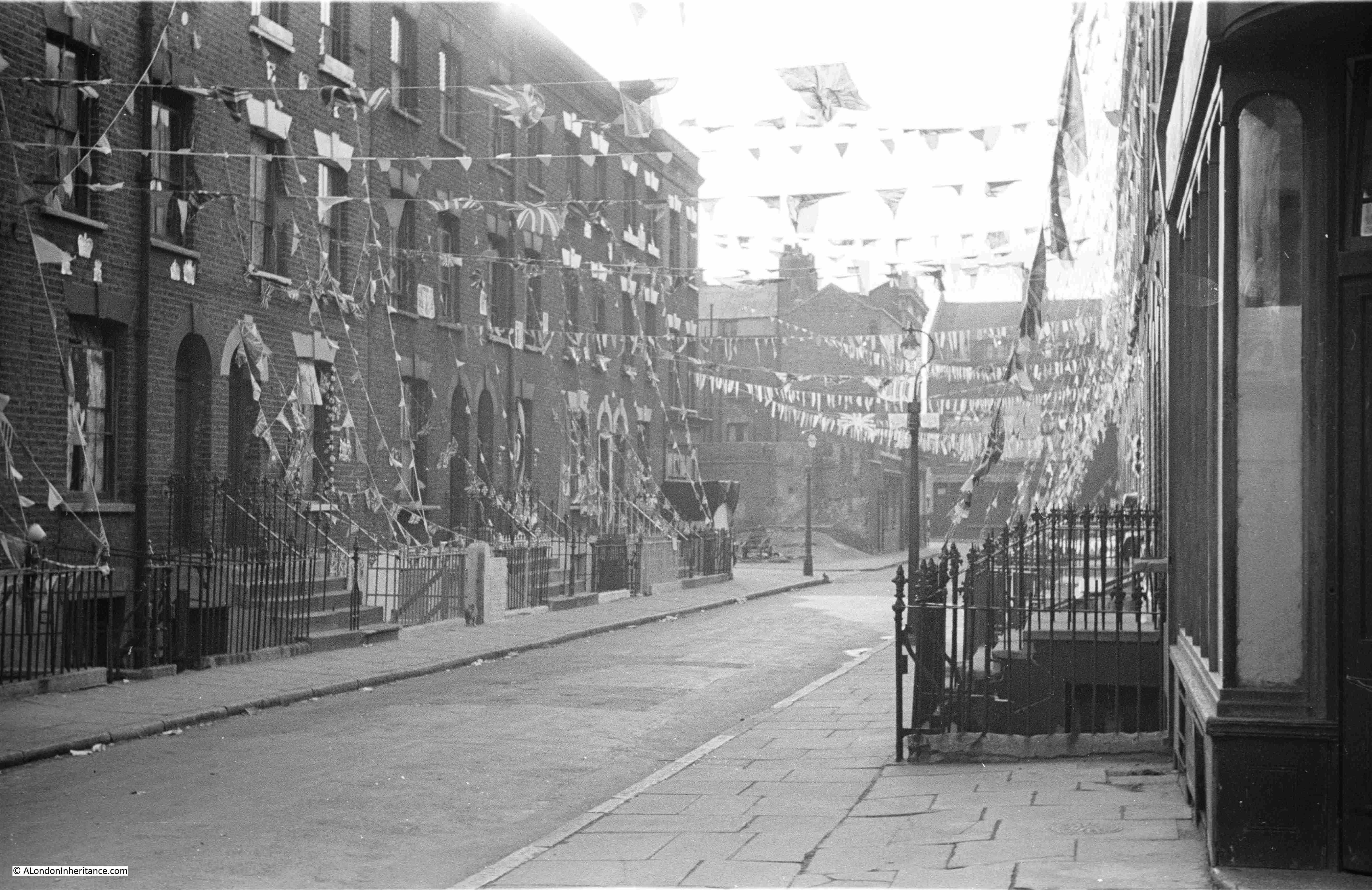
The following map extract is from 1957, and shows Shenfield Street with terrace housing lining the street as in my father’s photos. There is another Essex connection in the map. Towards the right of Shenfield Street, there is a small stub of a street heading north called Tiptree Street. Tiptree is another small town in Essex, some distance towards the northern part of the county, and no connection with Shenfield, so I have no idea why the two streets were given these names (‘Reproduced with the permission of the National Library of Scotland“).

My father took five photos of Shenfield Street, and I have located the position from where he took each photo, and the direction of view in the 1957 map (the first photo at the top of the post is the lower right photo):
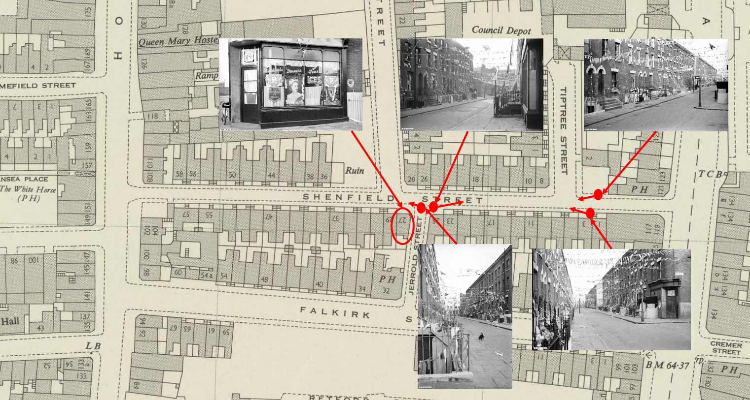
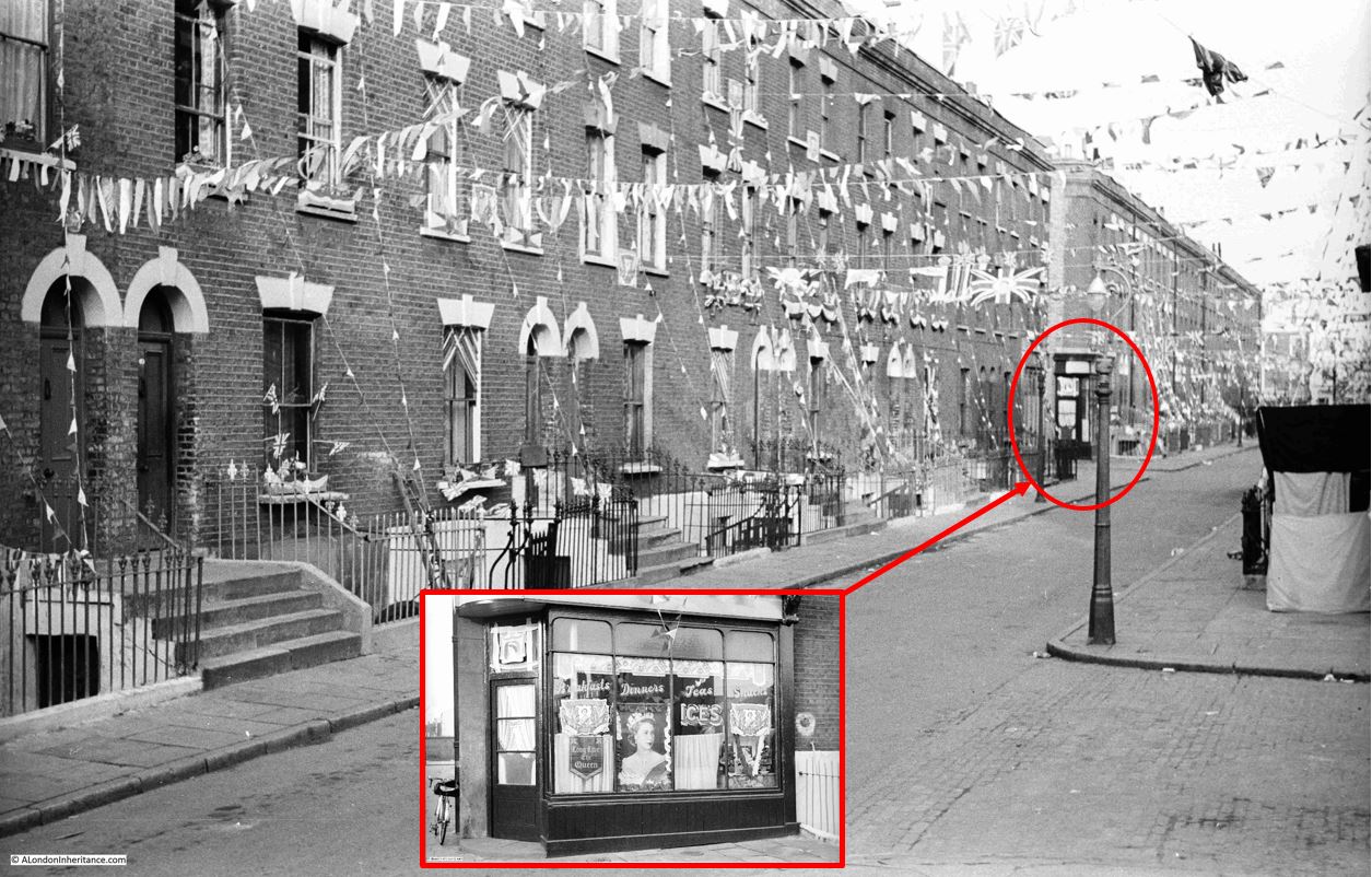
At top left of the above map is a photo that you may recognise as it has been in the header of the home page of the blog since I started in 2014, however I have never been sure of the location. I knew it was around Hoxton, but not exactly where. I will show later how I confirmed the location, that the café decorated for the Coronation was at 27 Shenfield Street, at the junction with Jerrold Street:
The photo is special for me, as it is the only London photo that shows my father’s bike, which is propped up against the wall to the left of the café. The bike took him all over London whilst taking these late 1940s and early 1950s photos, as well as youth hosteling across the country and to Holland.
The café does appear to have been well kept, and the lettering on the windows advertising Breakfasts, Dinners, Teas and Snacks is rather ornate.
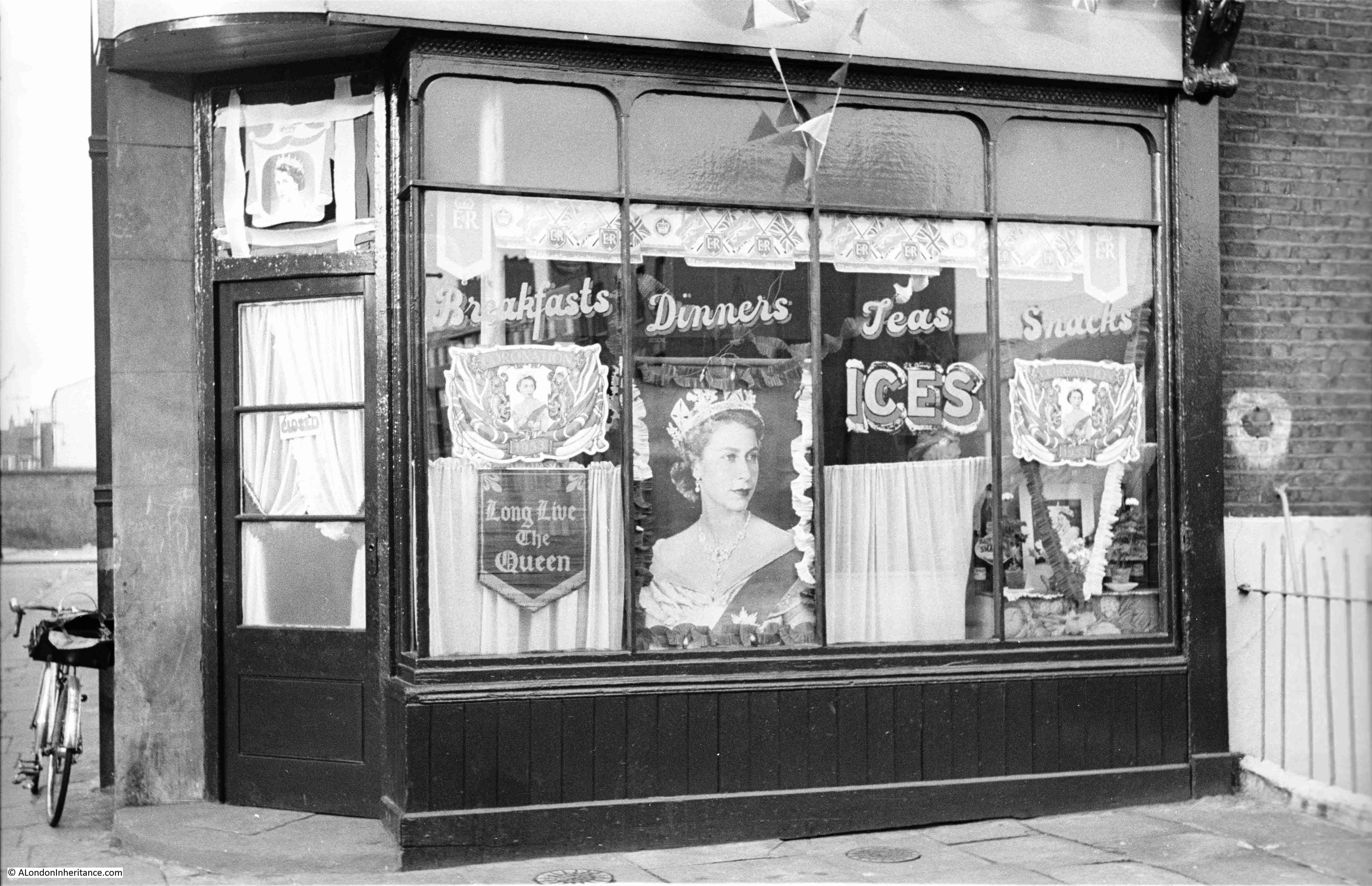
Jerrold Street still exists, however at the junction with Shenfield Street, the corner where the café was located has been cut to form an angled entry to Jerrold Street, so in the following photo the café would have been in the roadway and pavement leading back from the drain cover that can be seen in the road:
To the right of the café photo in the above map, is the following view, looking towards where Shenfield Street meets Kingsland Road. The photo was taken from the opposite side of the Jerrold Street junction, and the shop on the immediate right of the photo is at number 25 Shenfield Street:
In the above photo, Tiptree Street is along the street on the left, just after the lamp post, where Tiptree Street runs to the left.
The same view in 2023:
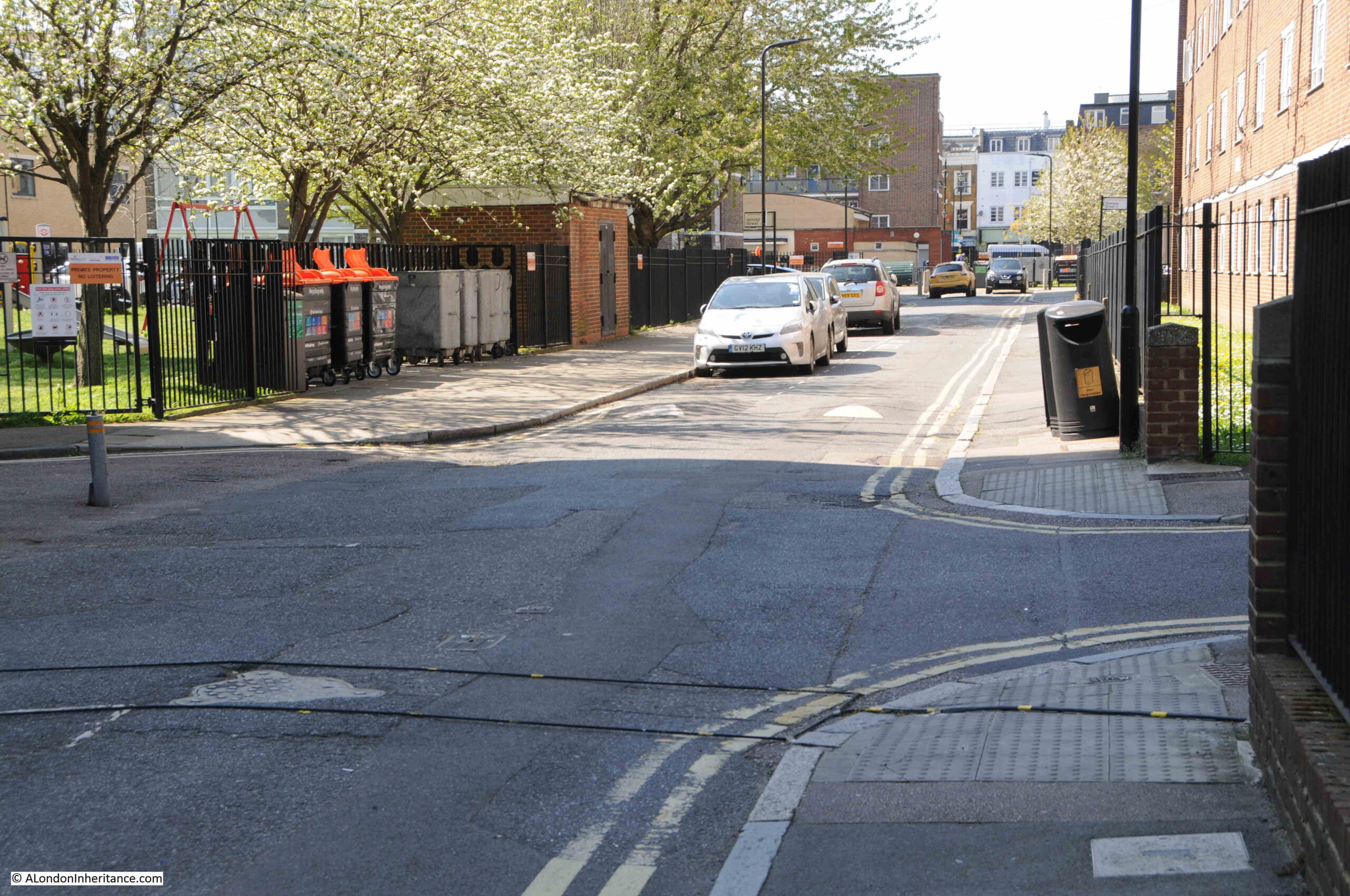
The location of the following photo, and direction of view, is at top right in the above map, it is looking towards the western end of Shenfield Street. The street which is running to the right, immediately in front of the location of the photo is again Tiptree Street:

The same view today, with not so much a street, rather an entrance to the estate leading off to the right, where Tiptree Street was once located:
It was this photo that allowed the location of the café to be identified. I have circled the location of the café in the following copy of the photo:
From the outside, the houses lining Shenfield Street look in a reasonable condition. Although there was significant bomb damage in a number of surrounding streets, Shenfield Street survived relatively unscathed, except for one house that was lost.
In Charles Booths poverty map, at the end of the 19th century, the street was classed as “Poor 18s to 21s a week for a moderate family”. In the following extract from the map, Essex Street as it was at the time of the survey, also has black lines running along the street, which means “Lowest Class, Vicious Semi-Criminal”:
A newspaper report from the 26th September 1922 offers a view of the conditions within the street:
“CROWDED STREET OF DOLE-DRAWERS. Amount Received Exceeds Pre-War Earnings. Every household in Essex Street, Hoxton is in receipt of relief from the Shoreditch Guardians, and the total so received is said to exceed the pre-war earnings of the whole street.
Probably one of the most congested streets in Shoreditch, Essex Street has several houses which are shared by six or seven families, and in one or two instances the number of people in each dwelling reaches 30.
Paper serves for glass in many of the windows.”
So the problem with the houses was not necessarily their construction, rather overcrowding and landlords who probably did not bother which much maintenance.
Another report from August 1939 shows how important it was (and still is), to have green, open space locally available:
“Novelty of Grass – Child Wedged In Railings. Three year old Lillian Turner always likes to visit her grandmother because in the backyard of her L.C.C. flat off Walmer Gardens, Hoxton, there was a patch of grass. She rarely sees grass, for there is none near her own home in Shenfield Street, Hoxton.
While her mother went upstairs to chat with her grandmother yesterday, Lillian ran out to the grass patch. She tried to squeeze through some railings to get to it, but became wedged by the shoulders.
Men passing tried to release her, but were afraid of hurting her and sent for the fire brigade. In a couple of minutes, six firemen with a fire pump and an ambulance arrived, but as they did so, Mrs. Turner managed to release her daughter, unhurt but suffering from shock.”
From the above description, you can understand why post war estate planning, such as the Geffrye Estate which was built following the demolition of the houses along Shenfield Street, included plenty of green space scattered across the estate.
The above two news reports also shrink the period for the name change from Essex to Shenfield Street to between 1922 and 1939.
The following photo is from the lower right position in the above map. Tiptree Street is the street leading off at the right. There is what appears to be an old shop on the corner at number 8, however most of the front of the shop appears bricked up and there is some strange contraption in front of the shop:
Look along the terraces of houses on the right, and half way along there is a light coloured wall. This was an internal wall of a house that was demolished following bomb damage.
The same view in 2023, with what was Tiptree Street on the right, and the location of the old shop was on the patch of grass:
This is the view looking down what was Tiptree Street, today access to the Geffrye Estate without any apparent naming:
Tiptree Street was originally lined with similar terrace houses to those in Shenfield Street. The terrace that was on the left survived the war, however only a single house survived on the right with the rest destroyed by bombing.
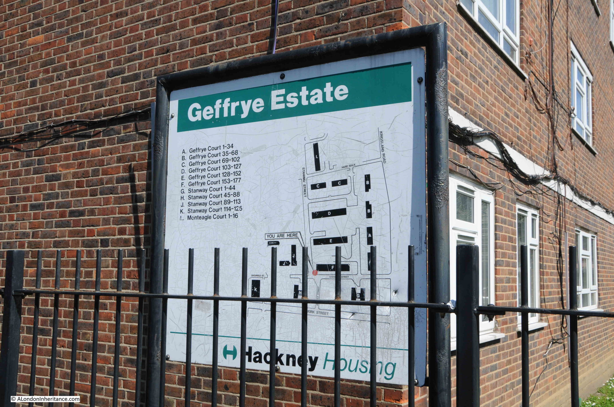
The whole area to the north and south of Shenfield Street is now part of the Geffrye Estate, which I again assume was built during the late 1950s / early 1960s. The estate consists of Geffrye Court, Stanway Court and Monteagle Court, as shown in the following estate map:
The name of the estate is interesting, and I am surprised it is still in use. I assume it is named after Sir Robert Geffrye who was twice Master of the Ironmongers Company as well as Lord Mayor of the City of London. Geffrye’s financial bequest enabled the Ironmongers Almshouses to be built, which are on Kingsland Road, just north of where Shenfield Street meets Kingsland Road.
The almshouses were purchased by the London County Council in 1911 to save the green space surrounding the buildings, as this space represented a significant part of the green space in the area.
It then became a museum by the name of the Geffrye Museum, however is now called the Museum of the Home.
Sir Robert Geffrye made some of his money from his involvement in the transatlantic slave trade through his investments in the Royal African Company.
Hackney Council have him as a contested figure in their Review, Rename, Reclaim initiative, and the council supported the Museum of the Home in a consultation as to whether a statue of Geffrye at the museum should be removed. The results of the consultation where that it should, however the museum trust decided to retain the statue.
There does not appear to be any mention on the Council’s Review, Rename, Reclaim web pages about renaming the Geffrye Estate.
Going back to the OS map of the street, and where Shenfield Street meets Kingsland Road, and on the northern corner there was the PH reference for a pub. This was the old Carpenters Arms which was demolished at the same time as the rest of the street in preparation for the construction of the Geffrye Estate. The corner where the pub was located is now an area of green space with a block of flats behind as shown in the following photo:
Shenfield Street today is so very different to 1953. I suspect that there must have been a street party along the street, for the street to be so decorated.
The houses in the 1953 photos look substantial and well built houses, although they were probably poorly maintained and in need of much modernisation. The problem with much of this type of housing was very poor maintenance and over crowding. With some care and updating, they could have been retained and would now form a rather impressive street.
Retaining the street would probably not have achieved the number of individual homes that the Geffrye Estate now provides, or the ability to include green space across the estate, a much needed improvement as green space was so very limited in this area of pre-war Hoxton.
I was planning to use Census data to map who lived in Shenfield Street to each of the houses, as using the OS map, the number of each house is easily identifiable in the photos, although I ran out of time – perhaps I will revisit in a future post.
You may also be interested in a couple of other posts showing Coronation decorations in London in 1953, including Whitecross Street and Ivy Street. Also, this post looked at Coronation Day in London.
My aunt and uncle lived in Hows Street (just a little bit further up the Kingsland Road) until they were forced to move out by LCC. They were rehoused up on the Essex coast and never recovered from it. Your father’s pictures so remind me of Hows Street as I remember it.
Thank you for a very interesting article. I was brought up in the Hoxton area and in the early 1960’s went to comprehensive school in Falkirk Street which runs parallel with Shenfield Street. Shoreditch Comprehensive School occupied virtually all of the southern side of the street, apart from a few buildings at each end. It was quite amusing to see a queue of children every morning, having attended registration, waiting to climb over the wall to escape into Hoxton Street market. The Geffrye Estate is just one of a number of faceless and ugly estates which dominated the area. As regards the grassed areas surrounding such areas, I wouldn’t get too excited. They were all fenced off and in the case of my own particular older estate, watched over by a caretaker who would chase children off the grass at every opportunity. Revenge is sweet they say and on one occasion I was involved in an illicit game of football on said grassed area. The game came to an abrupt end when I kicked the ball which sailed gracefully through the air, and smashed straight through the caretaker’s window! We disappeared from the grass faster than the winner of the Grand National!
Wonderful use of spotted photos of buildings on the map where you’ve been able to use this technique. Brings the map to life and I could wish you were able to use it more frequently, although I suspect it is time consuming and not particularly easy.
Very interesting to read this.
My ancestors once lived quite near here in De Beauvoir Crescent on the 1881 census but by 1891 had moved to West Ham. Always interested to hear about the area around that time. Thank you.
I’ve just stumbled across your very interesting article on Essex Street. My great grandmother, Hannah Elizabeth Wallace was born at 18 Essex Street in 1855 and I’m wondering if the houses pictured in 1953 are likely to be the ones that existed then. The family do not appear on the 1861 census but by 1871 they were living at the Bankstock Buildings on De Beauvoir Road but without my great grandmother who was possibly in service by then.
Excellent stuff!
I lived in a tower block between Falkirk (Huntingdon) and Shenfield (Essex) Streets, overlooking Kingsland Road, in the 70s and 80s. At that time I discovered the street name changes and that the houses in those streets were Booth blackspots. I assumed that they were slum-cleared after the war and that my block, and the Geffrye Estate, was built in the 50s, but that 1957 map nudges the estate into the 60s. Good to see what the old street looked like.
A fascinating and timely post. My mother is currently in a carehome in Shenfield so I go there regularly – and, growing up in Essex, Tiptree was always associated with the most delicious strawberry home we could never afford. What a great shame thé street was demolished rather than restored. I am sure the ‘green spaces’ are not used to any great effect and the buildings themselves are without any merit. Thank you for plotting it all and I would be fascinated by a census related post about the residents.
‘Bruce’s List’ gives 1939 as the date that Essex Street was re-named Shenfield Street
Thank you so much for this post. I lived in Kingsland Road opposite the Geffrye Museum with my parents. The house was shared by other families. I remember the derelict pub. Dad removed an old picture of the Monarch of the Glen. They used it to “draw” the fire!
Thank you so much for this post. I lived in Kingsland Road opposite the Geffrye Museum with my parents. The house was shared by other families. I remember the derelict pub. Dad removed an old picture of the Monarch of the Glen. They used it to “draw” the fire!
Thank you for the post, as always very interesting. The street of 1953 looks a place where people live, the street of 2023 looks a street of where people are housed. A subtle difference but I can’t help feel we’ve lost something.
This was so interesting as I am currently researching my family history and have found out that my Grandfather and Grandmother lived at 42 Shenfield Street in 1942 the year she died. Would love to see the census info.
Interesting, my grandparents were the tenants at the Queen’s Head on Hoxton Street Just north of Shenfield St from ~1955-62. They lived over and found the residents to be incredibly warm and friendly, even though they weren’t native Hoxton themselves.
It sounds much as you describe from the time of your father’s photo. Truly a village, many wouldn’t travel more than a mile from Hoxton St, something that I think continued up until recent gentrification.
You have described the area in such a way that I feel like have visited it,
The only connection I have to the area is that my Grandparents and parents lived at 42 Shenfield Street between 1940 to 1950. Only heating the address in conversations but it wetted my appetite to find out more about this place and thanks to your information I feel like I know so much more.
Many thanks for this Post. It proved very useful in helping to solve a Family History ‘mini-mystery’.
My Grand Aunt – Emily Maud STONE – was Baptised just North of ‘where we are’ here, in St Columba’s Church on Kingsland Road (a Listed Building, now the ‘Christ Apostolic Church’) on the 21st of March 1882 (a bit before the eras you’re talking about here, admittedly).
I have a copy of the relevant pages from the Church Register, which provides details (dates, parents etc) and. my Great-Grandparents’ address is listed as ‘3 Little Essex Street’.
I’ve since discovered that this Street, at some point, had its name changed to ‘Tiptree Street’. The ‘Little’ part makes sense, like ‘Off’ ([Big] Essex Street).
The Maps you Posted really helped me piece it all together, and loved the photos, spanning the years. A bit melancholic and mournful looking at them – ‘why didn’t we just maintain and improve, rather than demolish for monstrosities.’
Thanks again. Best Wishes, Ade xx
I am a resident of the Geffrye Estate and contrary to what some of the writers have said, its not a soulless place, its home to many residents, some of us have lived here for decades and yes some residents are new to the area as part of the diverse London that we live in. I grew up here in the 1970’s when the area was notorious for having the National Front offices near Hoxton Street, so I do not share the nostalgia for those days. However it is interesting to see how things used to look and the name changes. If those old terraced homes were still here today they would be worth close to millions now. There is a lady on Hoxton Square who was offered millions for a home, she turned it down. Good for her!
Thank you for sharing this history of the place that is my home since 1974.
My Grandad was born on Essex Street in around 1924 . The name change to Shenfield Street was apparently due to the bad reputation that Essex Street had . An infamous street , a bit like the Jago .
My Mum was also born on Shenfield Street and they were moved to Burtt House on Fanshaw Street when they demolished the road and houses to make way for the Geffrye Estate .
Lovely photos .
Great photos. My mum was born at 55 Essex street in 1931. Apparently born in a boxers house by the name of peddler palmer?
Thank you for this