
For this week’s post, I am returning to my exploration of the ancient stairs that line the River Thames. In the 1920s books Wonderful London there is the following photo of Ratcliffe Cross Stairs, described as “an ancient and much used landing place and point of departure of a ferry. There is a tradition that Sir Martin Frobisher took boat here for his ship when starting on his voyage to find the North-West Passage. Ratcliffe Cross is the old name for the thoroughfare leading to this landing stage, whence Butchers’ Row meets Broad Street, Shadwell, and Narrow Street, Limehouse”:
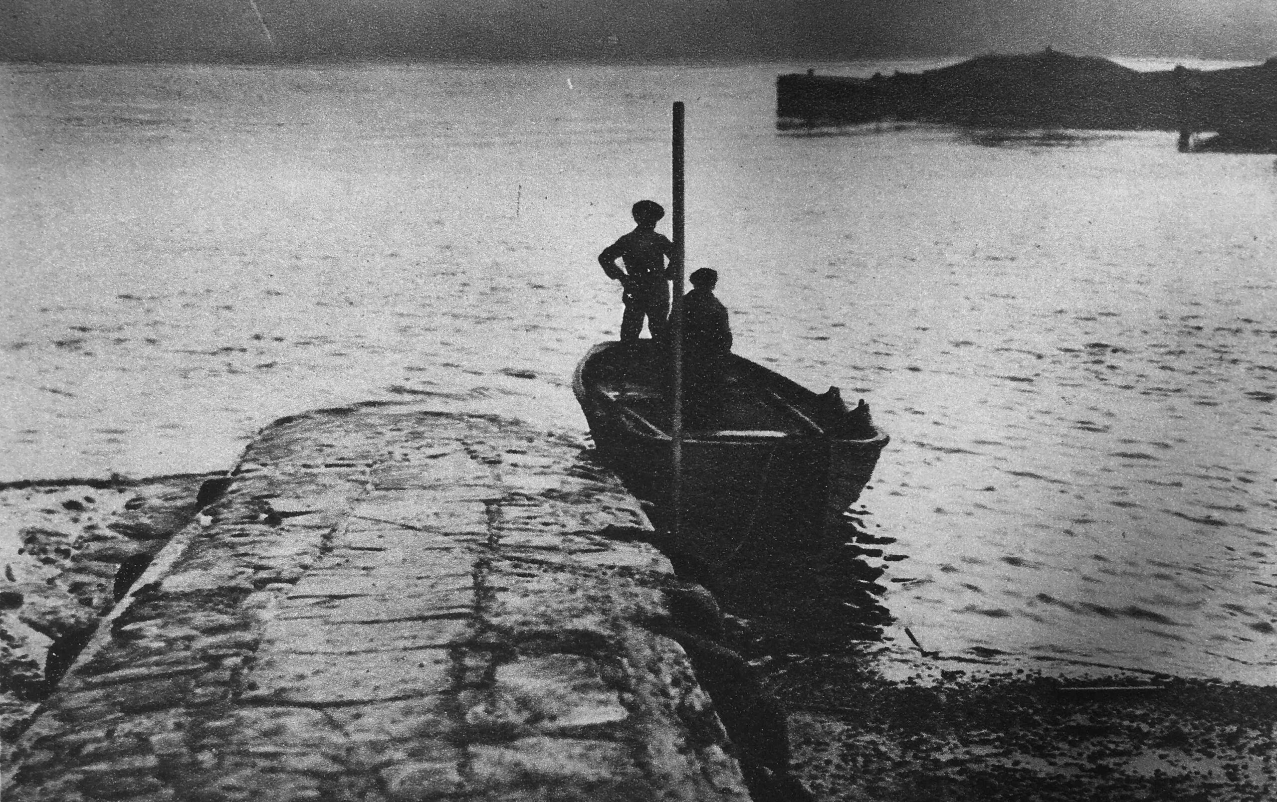
I do not know if that is the ferry mentioned in the Wonderful London text, but it does illustrate perfectly how these stairs, and the causeway that ran from the bottom of the stairs, was used to take a boat either along the river to another set of stairs, or to a ship on the river.
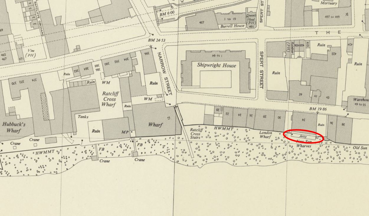
The following map shows the location of Ratcliffe Cross Stairs, with the red arrow pointing to where the stairs meet the river ( © OpenStreetMap contributors):
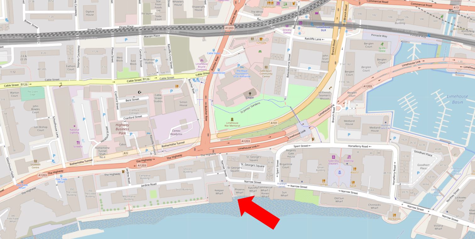
Limehouse Basin is the area of water to the right of the map, and the dark pink road above is the Highway leading into the Limehouse Link Tunnel, with the dark pink line of Butcher Row running north.
Ratcliffe Cross Stairs leads from Narrow Street at the point where it does a sharp bend to head north to a dead end at the Highway.
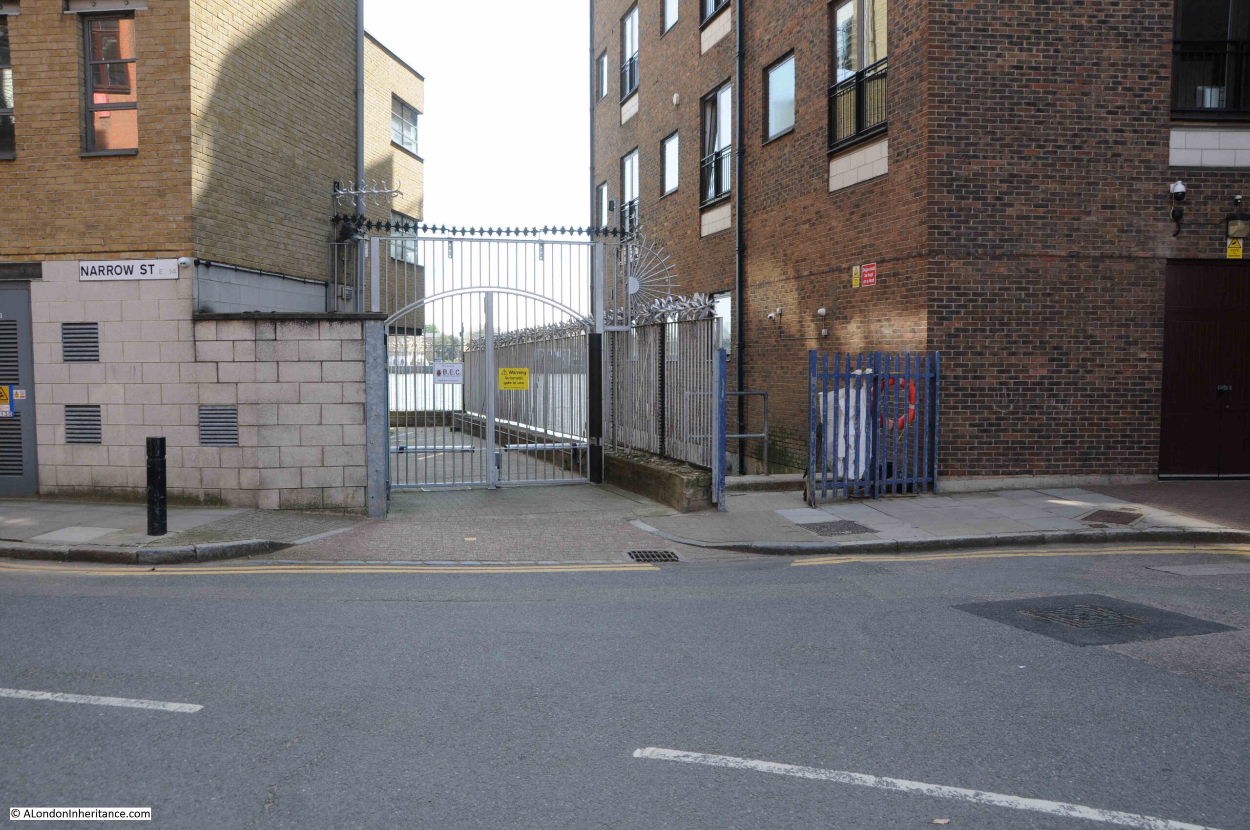
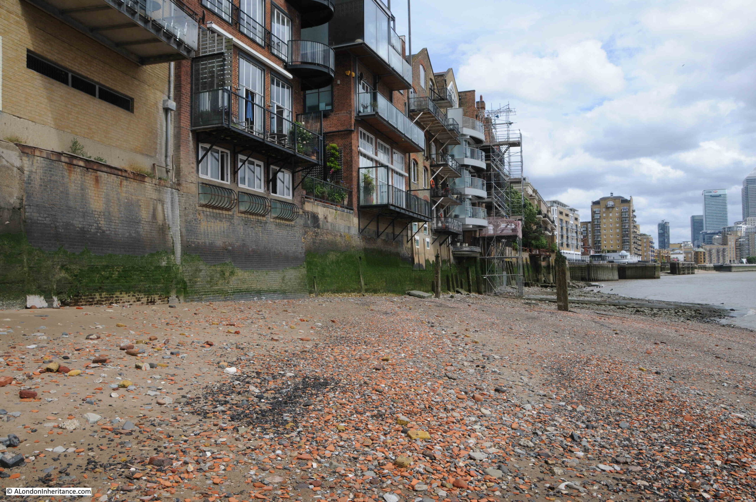
In the following photo, the dark blue gates are the entrance to Ratcliffe Cross Stairs:
Ratcliffe Cross Stairs are in what was the old hamlet of Ratcliffe. The name came from Redcliff as the high ground along the route of the main street that ran from the City to the east of London, parallel to the river had red sandstone exposed in the slight cliff that descended down to the marshy land along the river.
The road that ran along this higher land became known at the Ratcliffe Highway (now just the Highway), as it followed the river from the City to the hamlet.
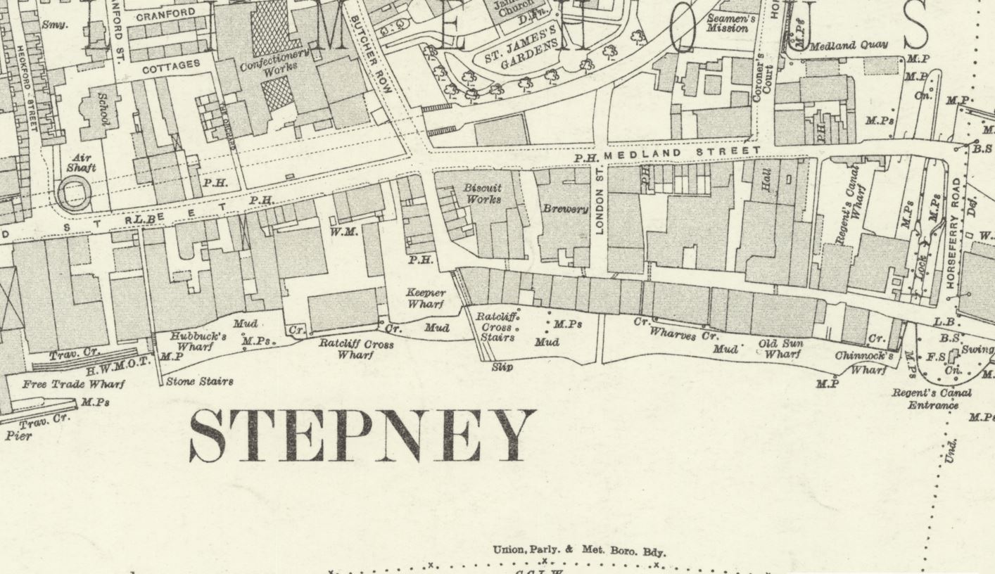
Although now not as well known as the stairs in Wapping, Ratcliffe Cross Stairs were important and well used river stairs, and to understand why, we need to look at maps that show the area at a time when development was limited, and much of east London was still fields.
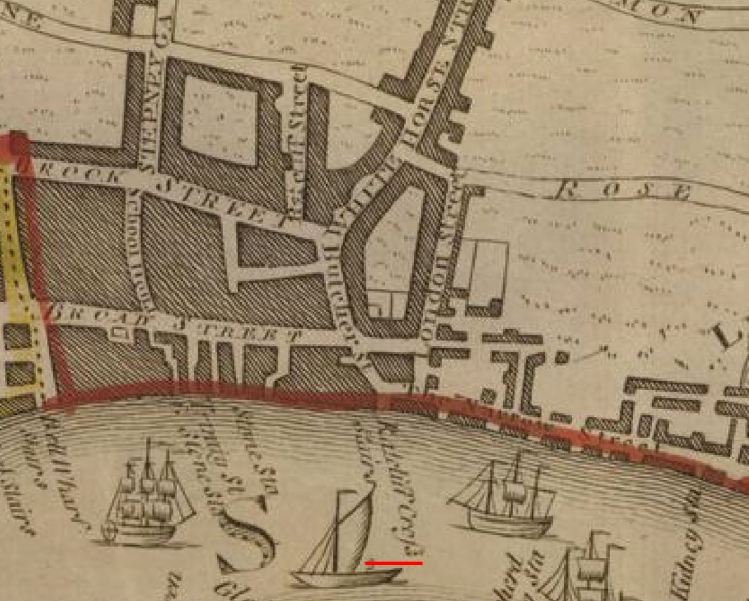
The following extract is from “A New and Correct Plan of the Cities of London and Westminster”, published by Haines and Son in 1796. Firstly, a close-up of the location of Ratcliffe Cross Stairs (underlined in red), shows the stairs were at the end of a road (Butcher Street) which led directly down to the stairs (© The Trustees of the British Museum):
Now using the same map, we can zoom out, and we can see the wider context of the location of the stairs (red oval):
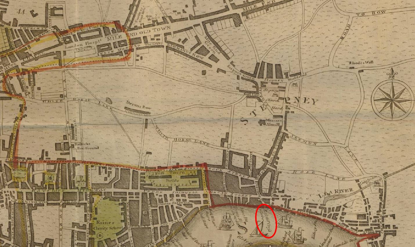
If we follow the route of the road that runs down to the stairs, then after running through some fields, and limited development along the road, we reach Stepney. Follow the main road through Stepney as it turns to the left, and we reach Mile End Old Town, so the road that runs directly to the stairs is the direct route from Stepney and Mile End.
Also, if we look to the left, we can see two main roads that run from the east of the City of London, which also run to Butcher Street, then down to Ratcliffe Cross Stairs.
So whilst today, the stairs are at a quiet location, where Narrow Street turns to a dead end, it was once at a key location, at the end of the main road that would have made the stairs the most direct route to the river from a wide area of east London.
Rocque’s 1746 map of London does not name the stairs, but the street leading back from the stairs is called Ratcliff Cross (centre of the map, along the Thames):
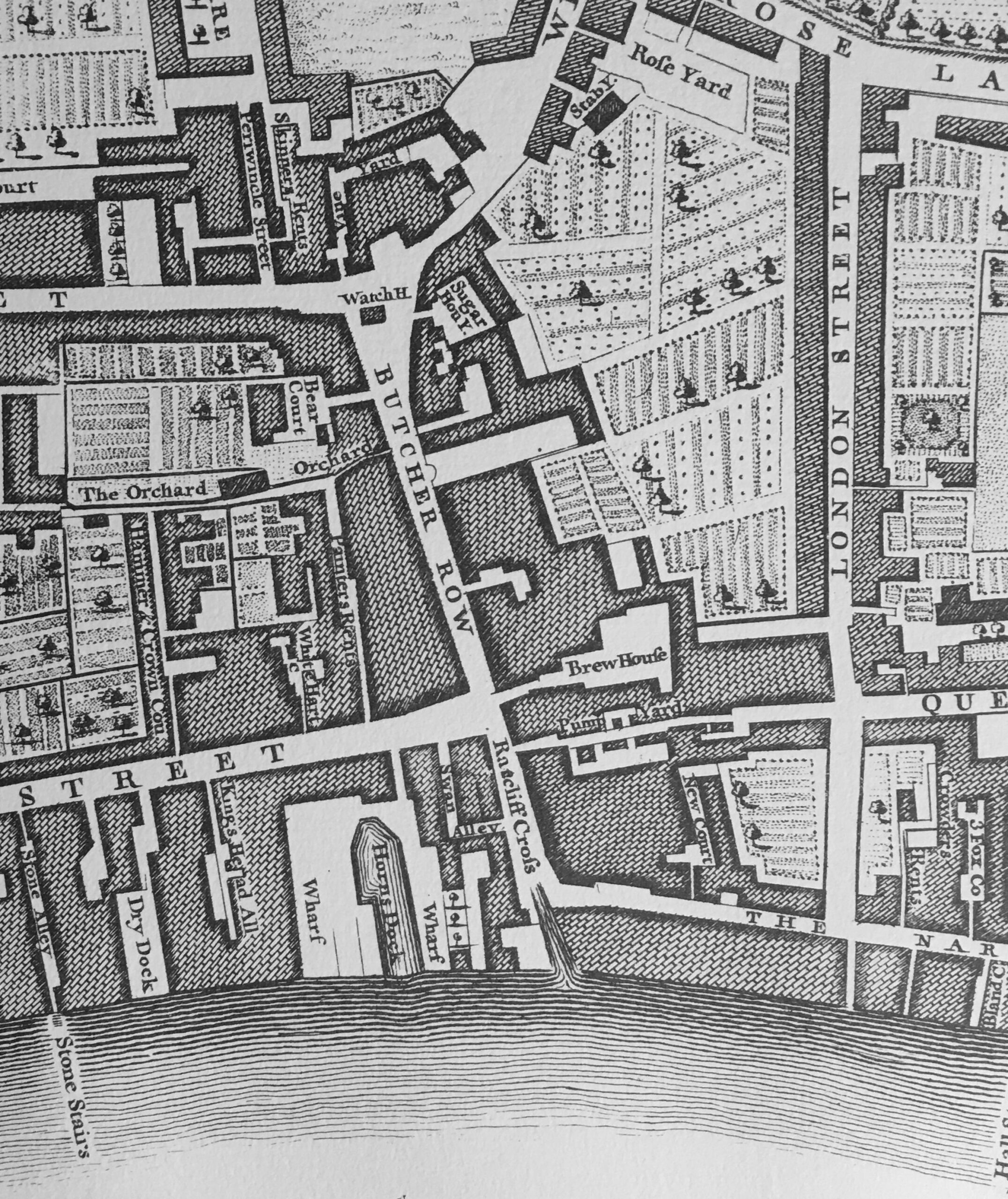
The above map also shows Butcher Row leading down into Ratcliff Cross, and there is a Watch House shown at the junction between Butcher Row and where the road to Stepney is off to the right, and the road to the City on the left.
A Watch House also confirms that this was an important route between Mile End, the City and the river.
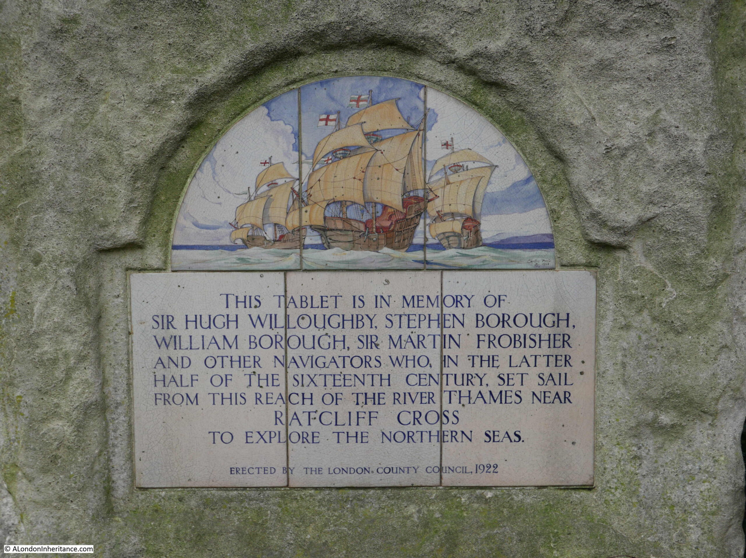
The stairs appear to have been in use in the 16th century, and were probably much older. Although I cannot find an early, verified reference to this, Ratcliffe Cross Stairs were alleged to have been used by explorers and adventurers of the later half of the 16th century, such as Sir Hugh Willoughby and Sir Martin Frobisher.
Sir Hugh Willoughby was a soldier, who took command of an expedition funded by the Muscovy Company, to find a north east passage along the northern coast of Russia, to the Far East. Willoughby, along with his crew would die in the attempt.
Sir Martin Frobisher was a sailor who made three attempts to find the north west passage to China. He survived all three expeditions, but failed to find a way through from the Atlantic to the Pacific.
I have found references to Ratcliffe Cross being used by 16th century adventurers such as Willoughby and Frobisher in a number of books on London and in a series of newspaper articles on the history of east London in the East London Observer in 1912.
There is also a plaque in the King Edward VII Memorial Park in Shadwell, next to the air vent / old pedestrian access to the Rotherhithe Tunnel:
Just a note on spelling – the hamlet and the stairs seem to be referred to by both Ratcliff and Ratcliffe. I am using the version with an “e” at the end as this was the spelling used for the Wonderful London photo.
There are a couple of points here regarding the reference to famous adventurers leaving the stairs. They were just the boarding point where they would have got onto a smaller boat to be rowed to their ship which was either moored on the Thames, or at Deptford.
Locations along the Thames were also not the last place in the country that they would have set foot, as these expeditions frequently stopped at places such as Plymouth to take on any final provisions and to pick up and leave final messages.
There is also a question as to whether any reference to Ratcliffe Cross refers to the stairs, or to a cross.
There are multiple references to there being some form of cross near the stairs which was used as a place to receive a blessing before departing, to make proclamations, and as a place from where news could be spread.
The cross appears to have been just north of the stairs, and at some point along Butcher Row.
Again, referring back to the maps above, this would have been a good location for a cross given the convergence of roads, and the road running from Mile End, through Stepney and straight down to the stairs.
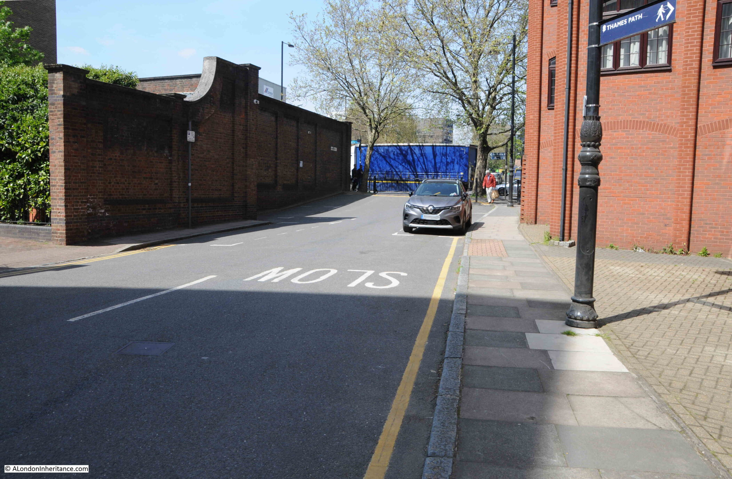
The following photo is looking north along the short stub of Narrow Street (that was Butcher Row) up to where the Highway joins the Limehouse Link Tunnel. Butcher Row continues north across the Highway.:
The cross was in place in the 18th century as the poet and playwright John Dryden has one of his characters mention having heard a ballad about the Protector Somerset being sung at Ratcliffe Cross.
There are also references to the cross being lost or demolished in the 18th century, and in the early 20th century there were attempts at setting up some form of commemoration of the cross, for example from the Shoreditch Observer on the 26th of July, 1913:
“The Borough Council in January last resolved to request the London County Council to consider the question of the commemoration of the site of ‘Ratcliffe Cross’ on the ground that the spot witnessed the departure of mariners in the time of Elizabeth.”
And from the East London Observer:
“The Council are aware that the question of a suitable perpetuation of the historic ‘Ratcliffe Cross’ has been recently referred to, and in this connection we beg to report that we have under consideration a communication from Mr. C. McNaught, dated 7th, December 1912, urging that some sign, signification, or memorial thereof should be placed on the pillars of the Ratcliffe entrance to the Ratcliffe and Rotherhithe Tunnel. We think that the suggestion embodied in the forgoing communication is one which should be supported, and therefore, we recommend that the London County Council be requested to give effect to what Mr. McNaught suggests in this matter, and that Mr. McNaught be informed of the actions taken.
Councilor Maynard could not see why a memorial of Ratcliffe Cross should be put on the most modern structure of Rotherhithe Tunnel. He did not think the London County Council would agree to it.
Councilor Brennan was in favour of the memorial, pointing out that the tunnel was the nearest spot to the site of the Cross.”
The above text is interesting, as it shows the conflict between commemorating old London on the latest infrastructure, and it also implies that the cross was not right by the stairs, rather towards where the Highway junction with Butcher Row is now located, as this is close to the entrance to the Rotherhithe Tunnel.
The Mr. McNaught mentioned in the above article was Charles McNaught. He appears to have been a local historian, and wrote a series of articles in the East London Observer titled “Roundabout Old East London”.
He seems to have been rather cynical about some of the well known historians who had published books about London. In one article, he writes that “When Sir Walter Besant and his lieutenants came down to Ratcliffe a little more than a dozen years ago, they found at first that the hamlet offered little to interest or instruct.”
He also wrote that “When Sir Walter Besant ‘discovered’ this part of London”
He implies that authors such as Besant (who wrote a number of books about the history of London) came to places such as Ratcliffe, with his “lieutenants”, they did not put the effort in to discover the real history of the place, and eventually found out what the locals already knew, whilst claiming to “discover” the place.
So we have stairs that were at an important location, at the end of a direct route from Mile End, that had an important cross close by which had some symbolic meaning for departing sailors, and was used to make announcements (the East London Observer reported that the cross was used to make a proclamation about Queen Victoria becoming queen), dates from at least the 16th century, and was known as a departing point for 16th century adventurers.
Time to take a look at the stairs:
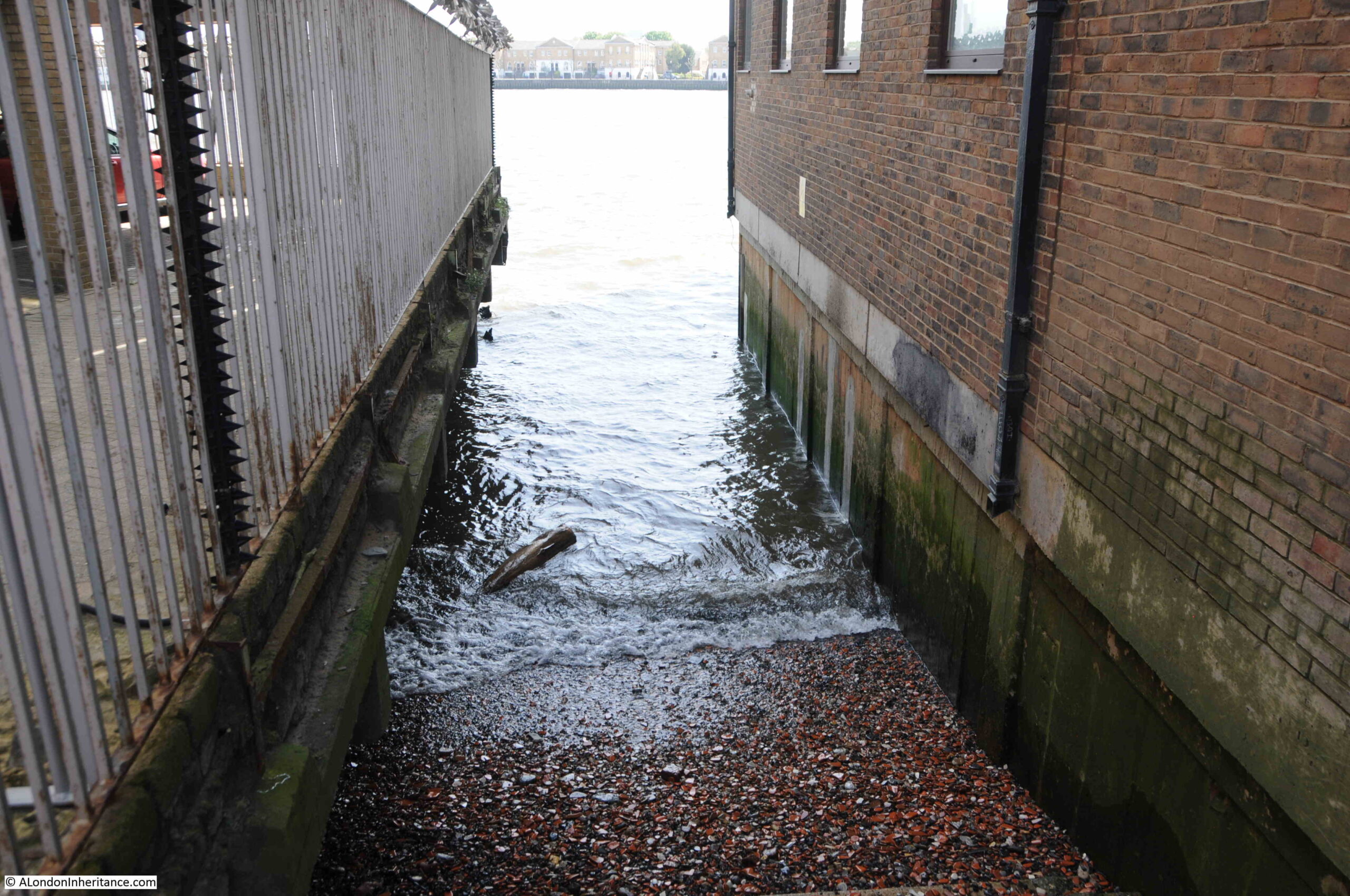
The above photo is an earlier photo to my latest visit, just to show how far the water of the Thames comes in at high water. The above photo was taken when the tide had already been receding.
The photo below is when the tide was out, and shows a set of steps down to the foreshore:
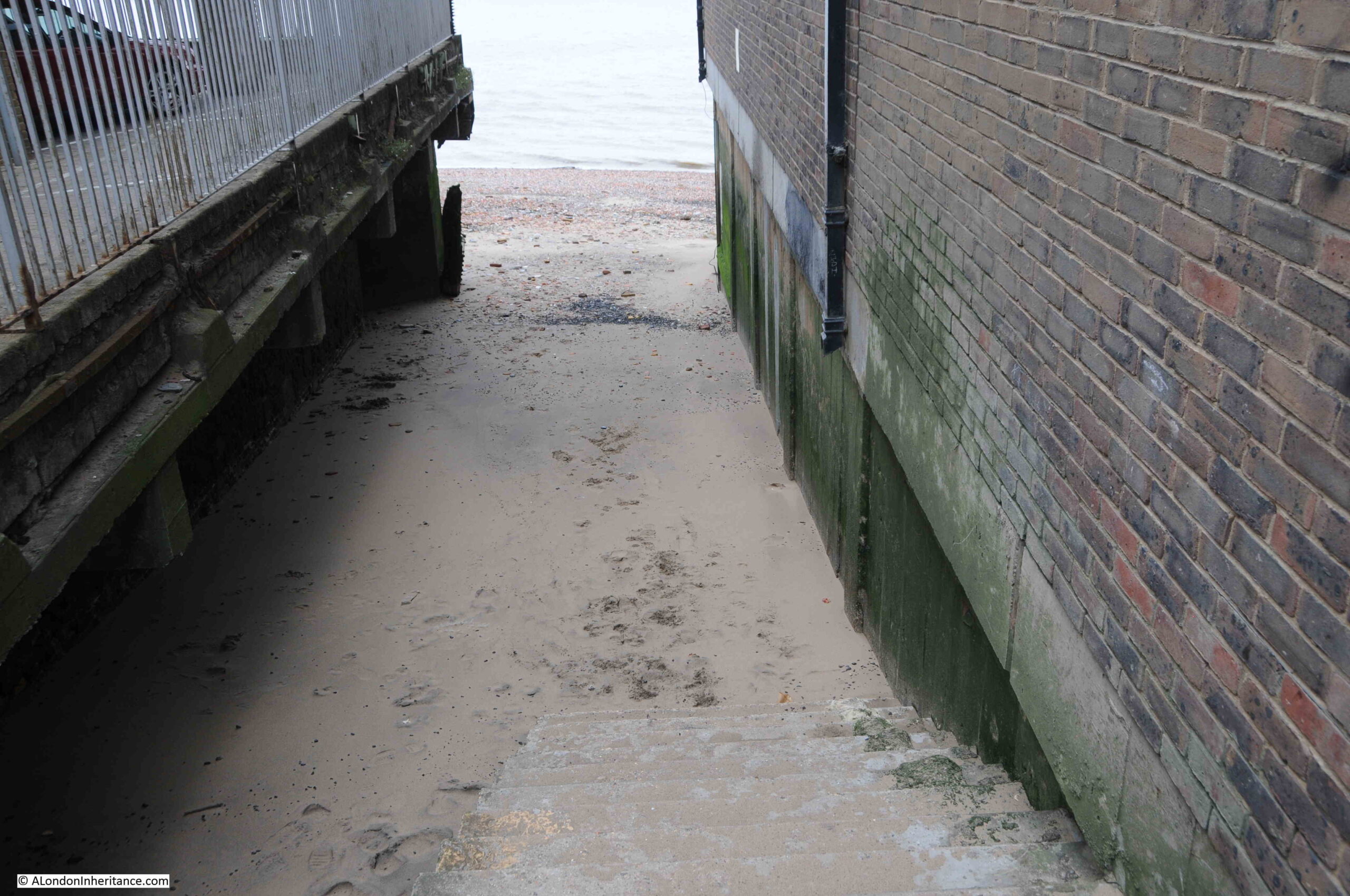
The foreshore nearest to the steps seems to be comprised of a very fine sand. There was a strong breeze during my visit, and walking through this section risked fine sand being blown in the eyes.
The following map is a 1914 revision and shows Ratcliffe Cross Stairs (just above the EY of Stepney) (‘Reproduced with the permission of the National Library of Scotland“):
Just to the left of where the stairs meet Narrow Street, where the street heads north, there is the PH symbol for a Public House.
In researching Thames stairs, the majority appear to have had a pub located next to the stairs. This would have been a place to wait for your boat to arrive, a place for a first drink after you have arrive back, or just simply had some business next to the stairs.
The pub was the Ship Tavern, and in 1939 “East London’s oldest woman licensee, Mrs. Rose Hannah M. Jenkins (aged 69), who for 40 years was in charge of the Ship Tavern, Narrow Street, Stepney, has died. The Ship was formerly the resort of men from the sailing ships who used to land at Ratcliffe Cross Stairs.”
In the above map extract, the stairs do seem to have a causeway extending across the foreshore, and the 1920s photo shows this causeway. Ratcliffe Cross Stairs does have a Historic England listing, with the “Old stone slipway to River Thames” being Grade II listed.
The causeway has today completely disappeared. Whether it was demolished, gradually eroded, or perhaps is covered by the debris deposited on the foreshore by the river, I do not know. It would be good if it was the later.
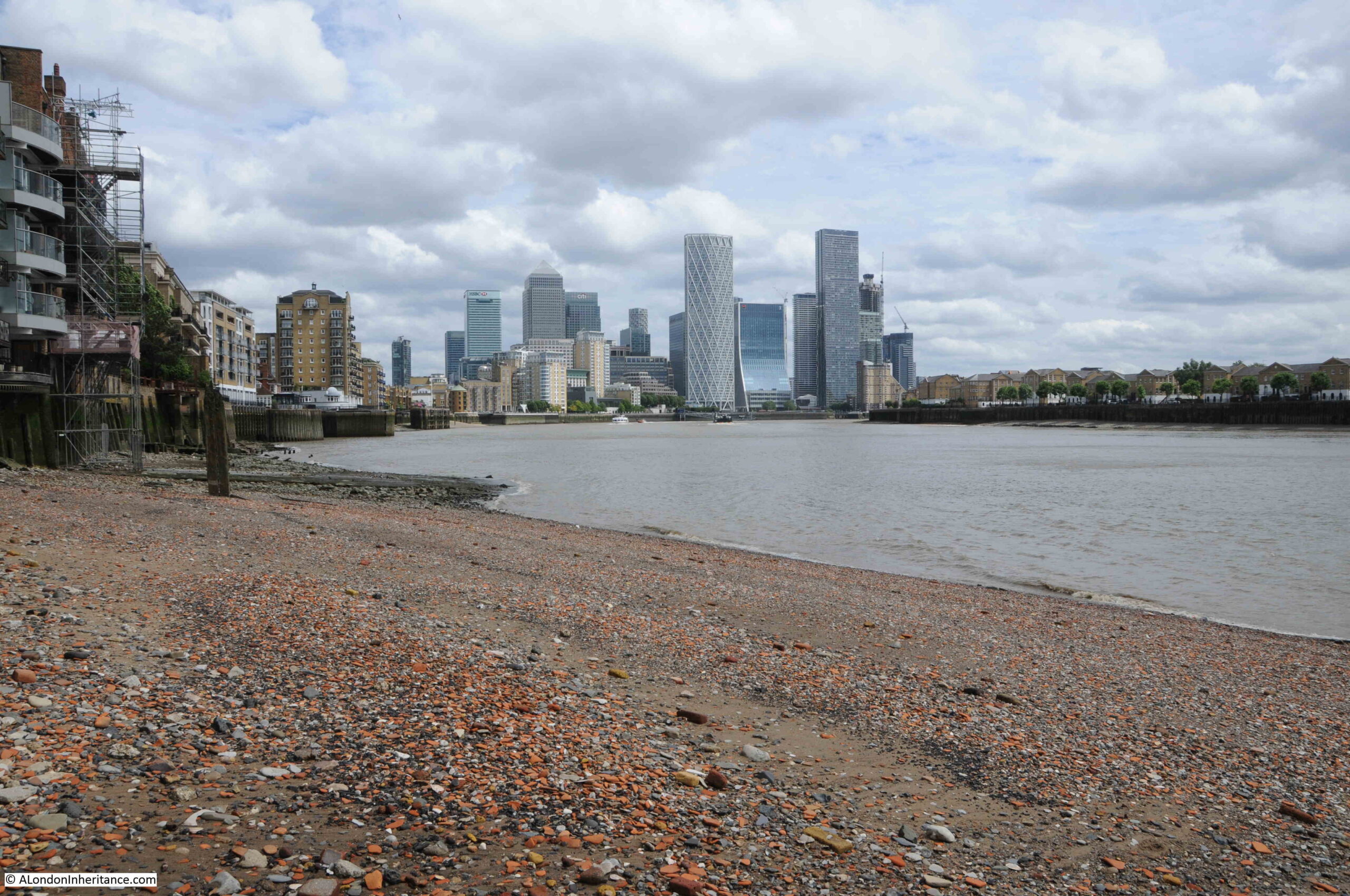
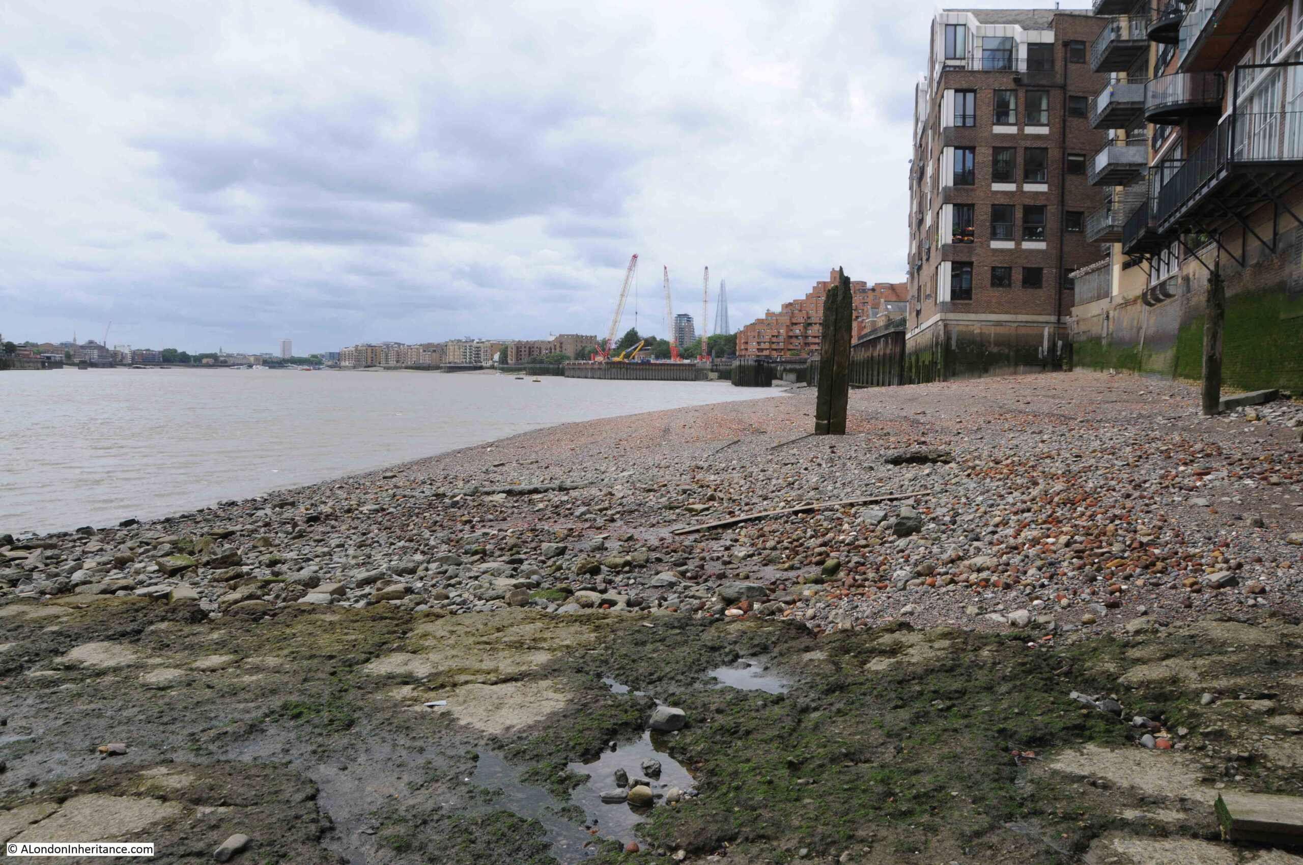
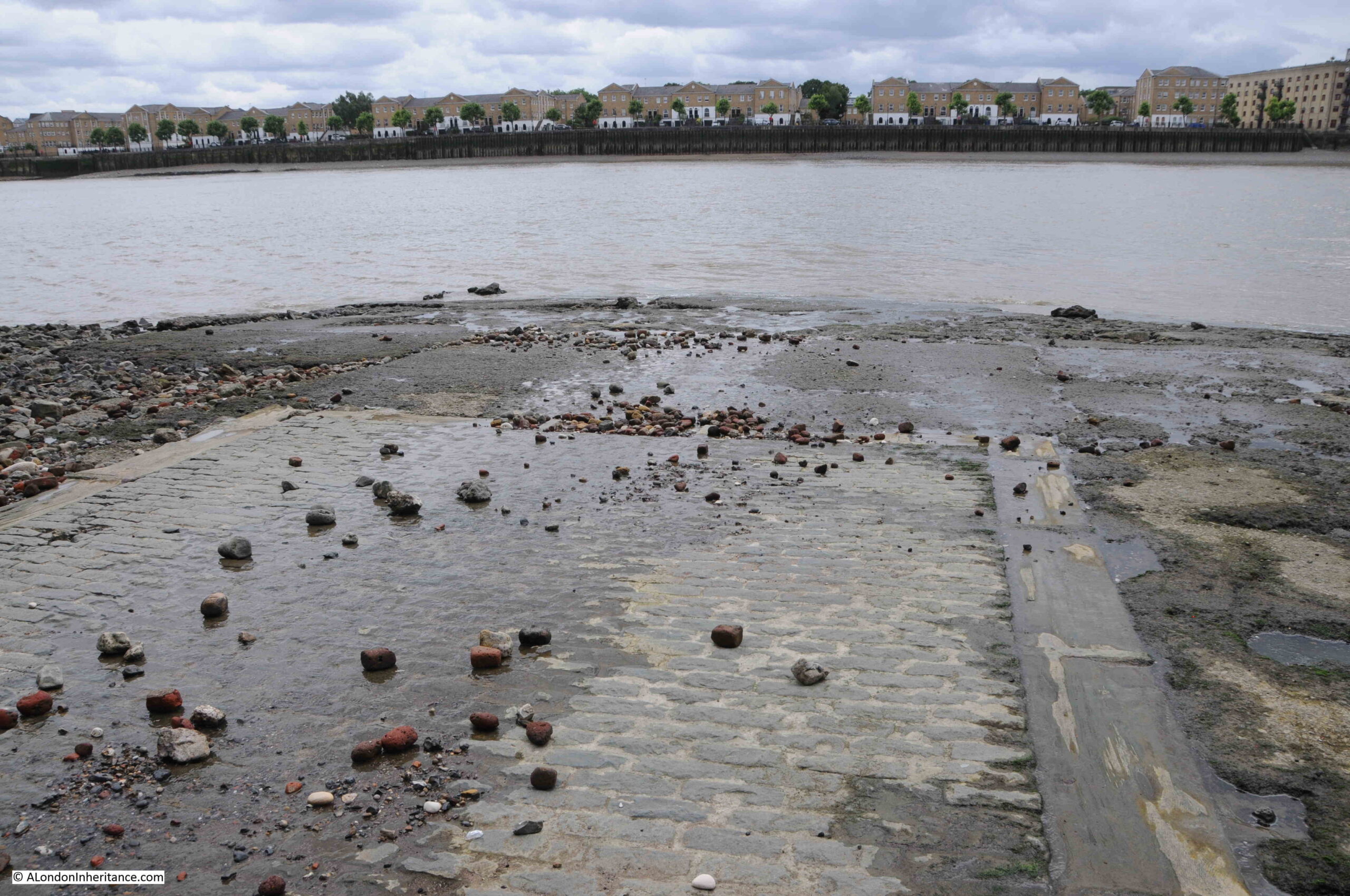
The view from the foreshore looking towards the Isle of Dogs:
View of the river frontage of the buildings that face onto Narrow Street:
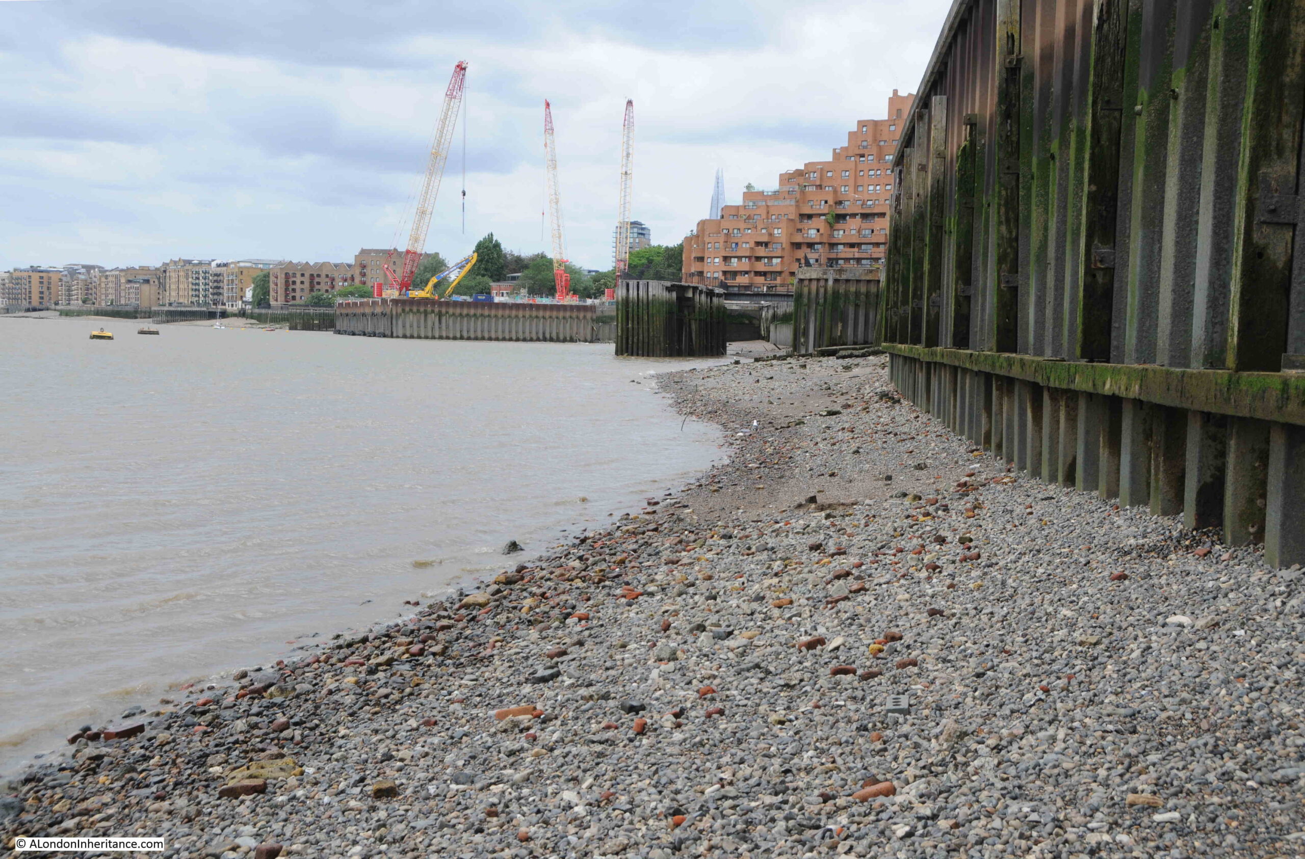
Foreshore looking towards the east:
A short distance along the foreshore showing the construction site for the Thames Tideway Tunnel:
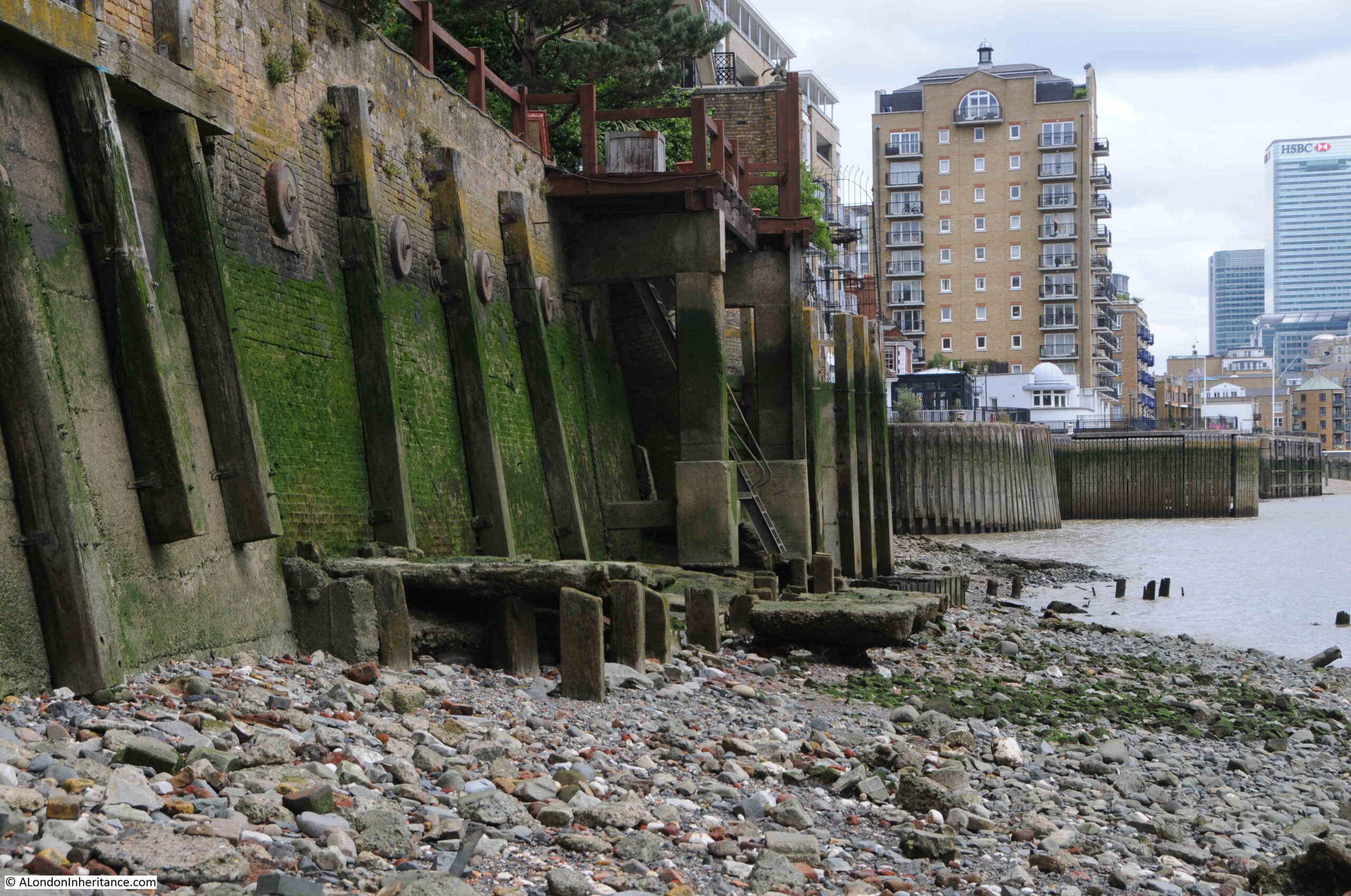
Looking back from the foreshore towards the stairs. The causeway would have run down from the stairs to where I am standing.
The above photo shows a couple of things. Firstly the size of the tidal range on the Thames. I was standing close to the water to take the above photo and at high tide I would be completely underwater by several feet. The green algae on the walls shows the height of the tide.
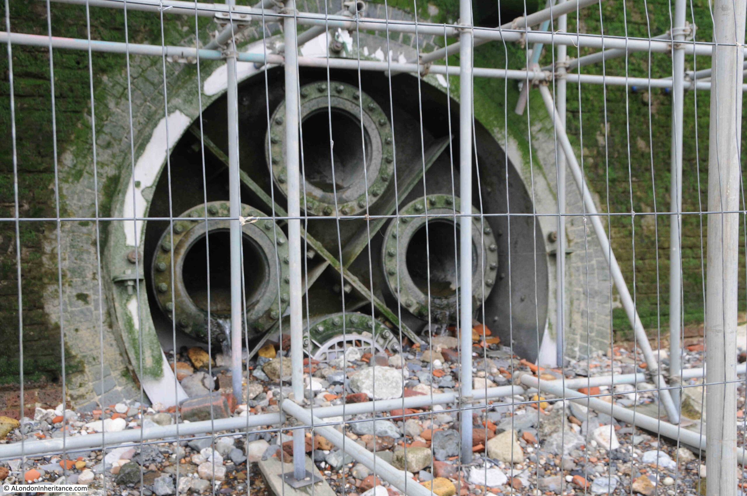
Also, a bit hard to see, but the height of the foreshore drops off on either side of the stairs. The foreshore is covered in stones, the remains of bricks, bits of wood and concrete, and I do wonder if parts of the causeway remain below the surface.
I checked in my copy of the Port of London Authority book: “Access to the River Thames. A Port of London Authority Guide, Steps, Stairs and Landing Places on the Tidal Thames” (published around 1995), and the following table shows the entry for Ratcliffe Cross Stairs:
Interesting that it referred to the stairs as a landing place in 1977 (so still in use), and that the paving had been renewed. The implication was that in 1995 the stairs and causeway were in good condition.
After the post on Wapping Dock Stairs a few weeks ago, I did email the Port of London Authority with a question as to who is responsible for the Thames stairs, however so far I have not received a reply.
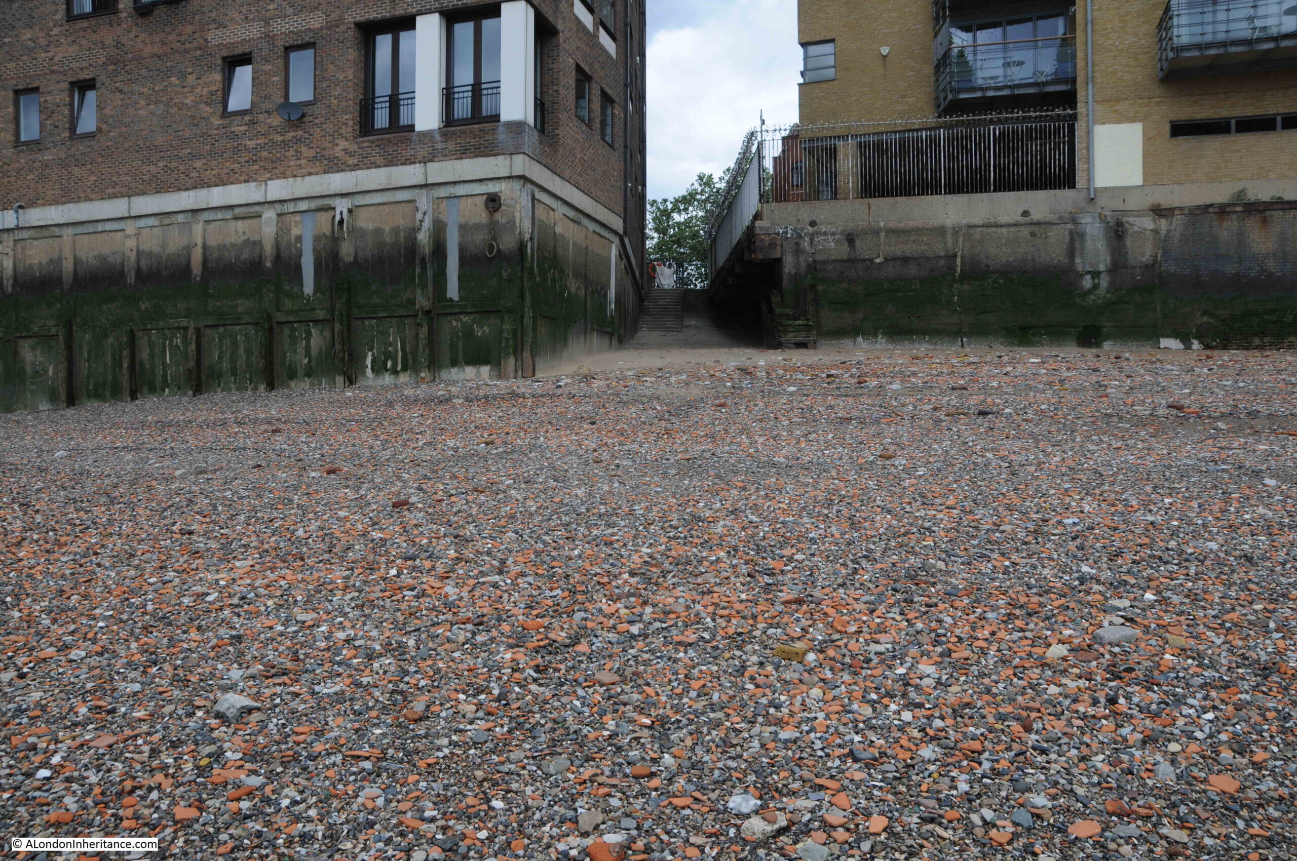
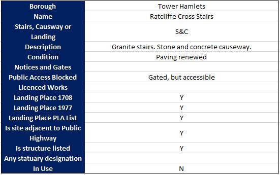
There is also the remains of the industrial use of the Thames. In the photo below there is a large layer of concrete, which may have been a slipway of some sort. The scaffolding is there to support maintenance work on the building above.
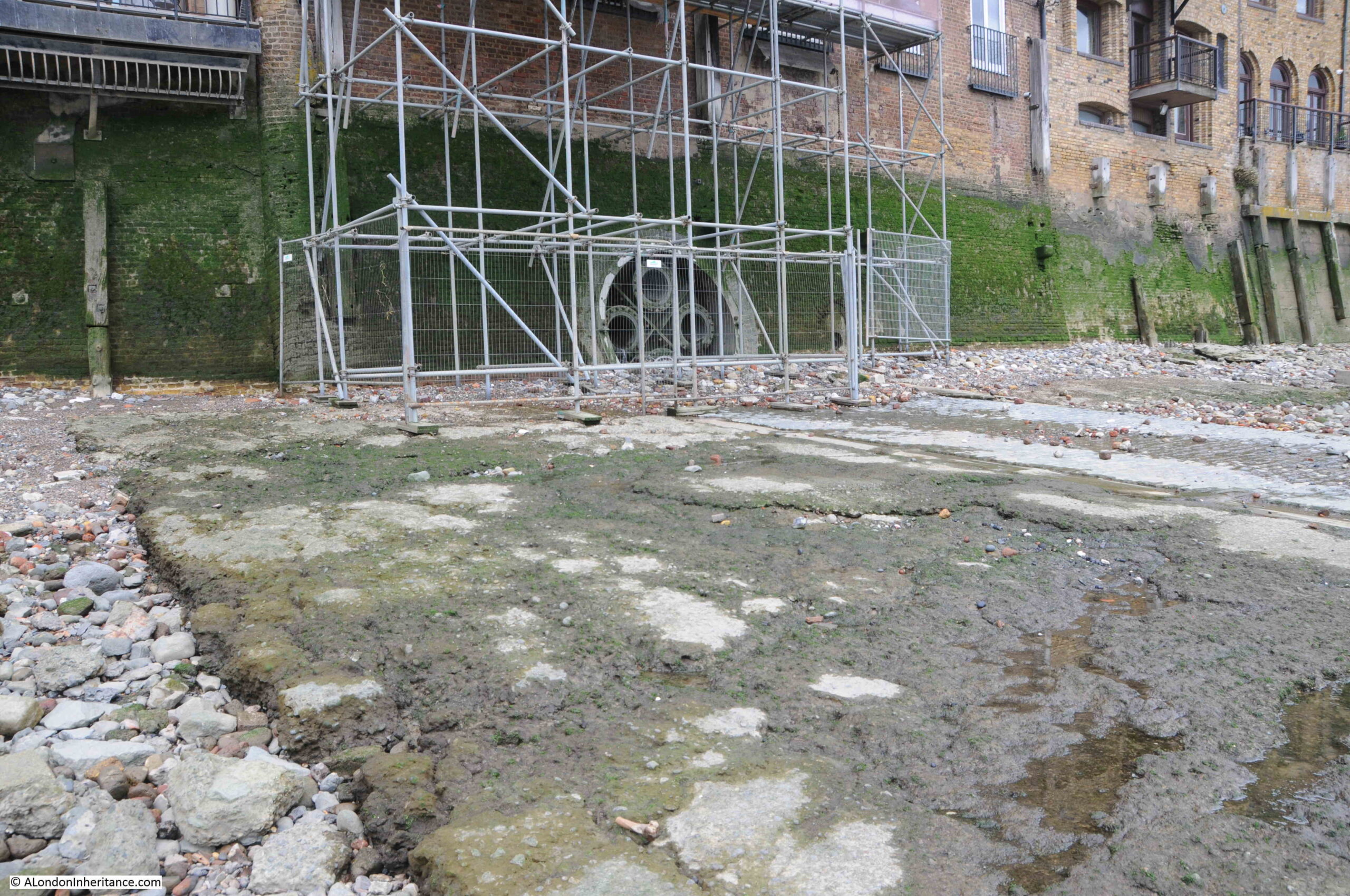
However behind the scaffolding is this large pipe which contains four smaller pipes. There were water draining from the two middle pipes, but I have no idea what they were used for, are they still used, and how far back they go.
There is a cobbled slipway on the foreshore, close by the stairs, and I did wonder if this was the site of the Wonderful London photo, however the slipway uses different stones, and is wider than the one in the photo:
The following extract is from the 1949 revision of the OS map. Ratcliffe Cross Stairs are in the centre of the map, and to the right I have highlighted a feature identified as a “jetty”:
Parts of this jetty are still visible:
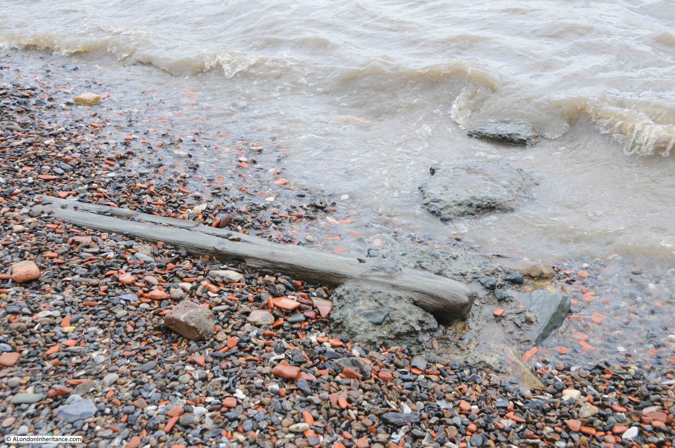
Wood and concrete on the foreshore:
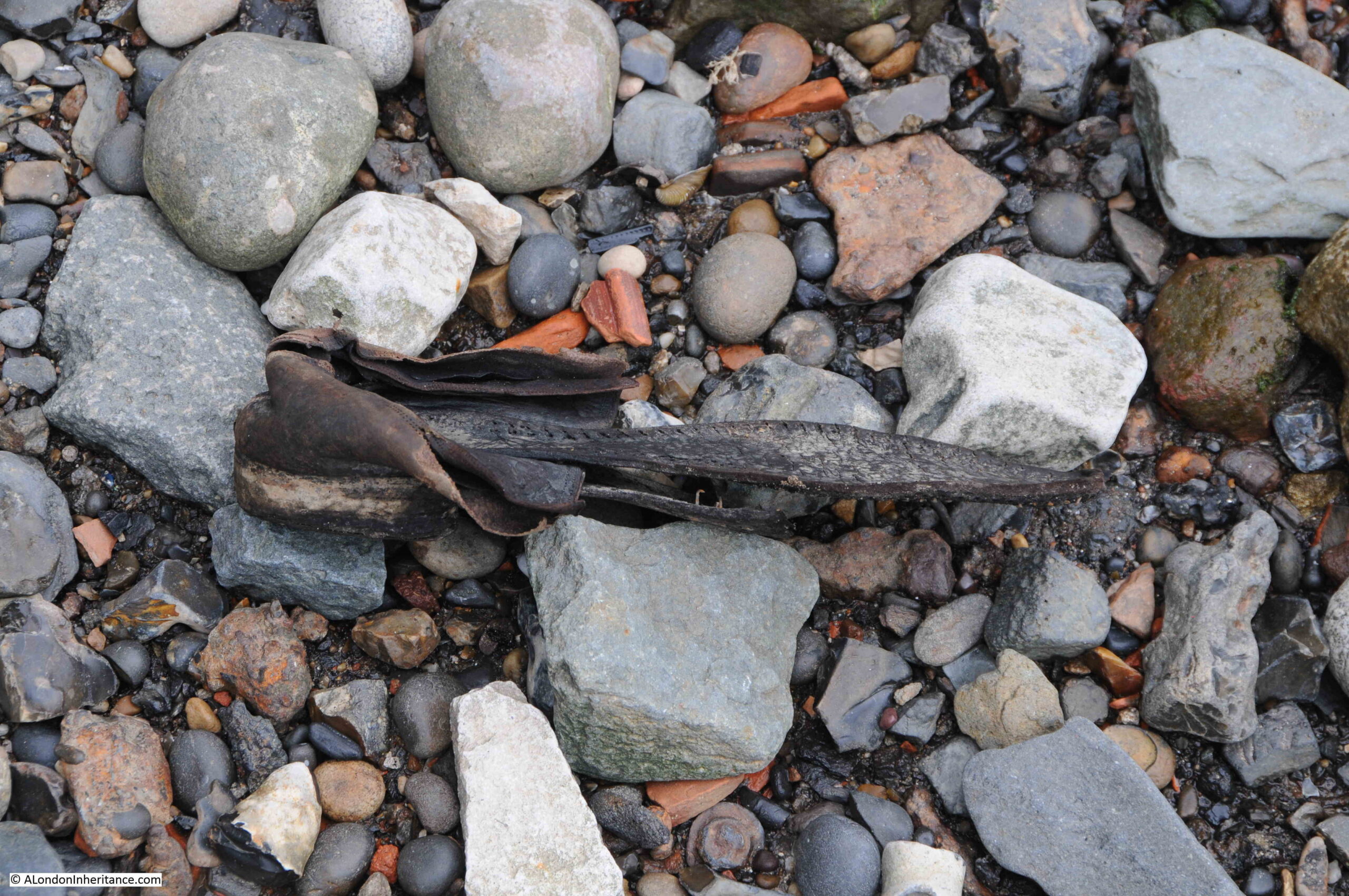
And the remains of an old shoe:
I do have a PLA Thames Foreshore Permit, but very rarely get the time for any serious searching. I have always wanted to find a complete clay pipe, but no luck. This would be a wonderful connection with those who once lived and worked on the river.
What I did find at Ratcliffe Cross Stairs was this stone bird:

It seems to have been made out of a lump of flint as the stone is exposed where part has broken off, however the overall shape of a bird and some of the decoration and colour can be clearly seen.
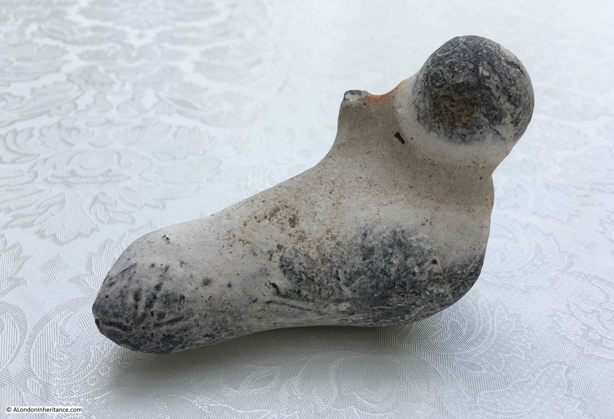
I have reported and sent photos to the Portable Antiquities Scheme Finds Liaison Officer at the Museum of London, so await an update as to whether it has any age.
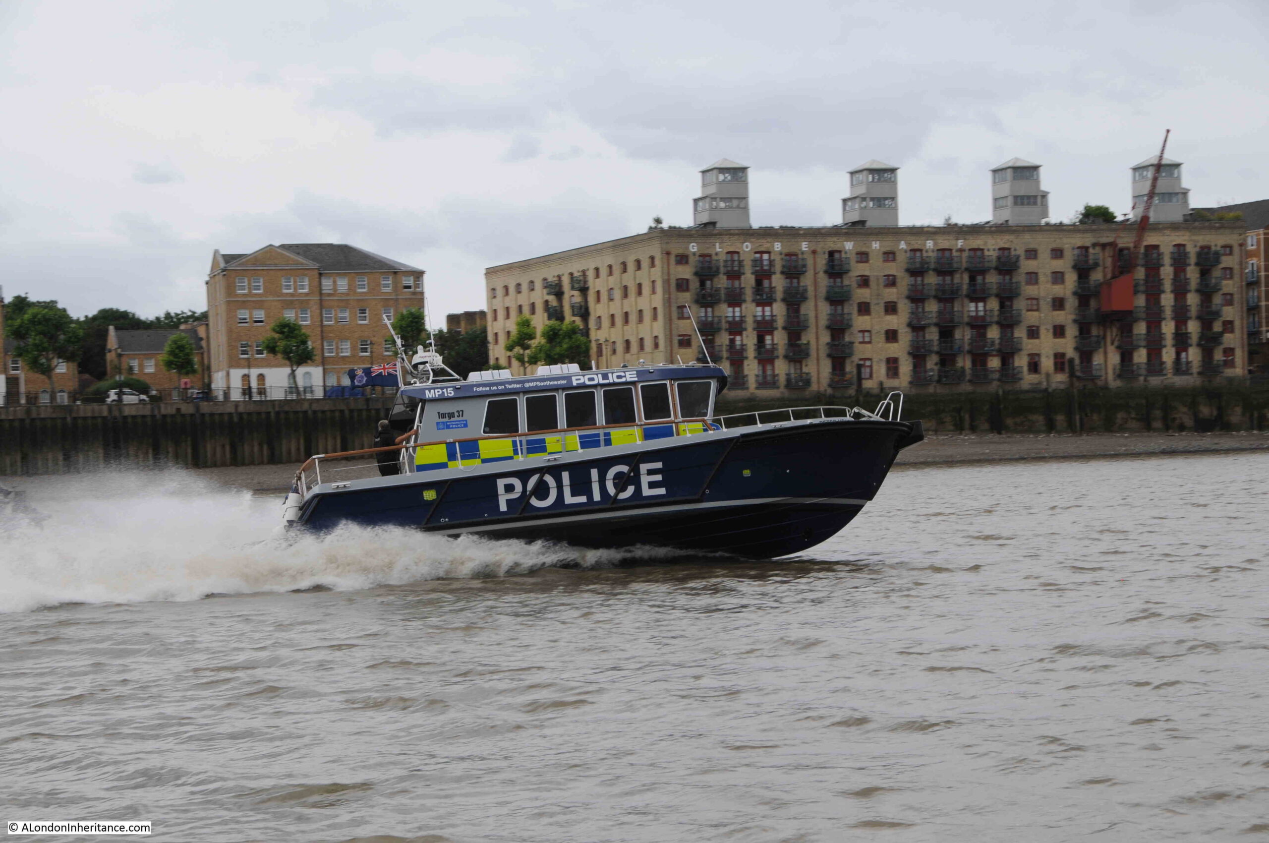
The River Police are still a very visible presence on the Thames, and in 1937, Police Constable Earnest Butters of the Thames Police received £5 “in recognition of his courage in rescuing a five year old boy who had fallen into the river at Ratcliffe Cross Stairs on July 2nd”.
Ratcliffe Cross Stairs deserve more recognition, and more research. There are no plaques or information boards at the stairs to provide any information as to the historic importance of the location (as with all the Thames stairs).
The Ratcliffe Cross, after which the stairs are named is a fascinating bit of lost east London history, and has been added to my very long list of things to try and find out more about.
That is another set of Thames stairs explored, and all the stairs I have covered in previous blog posts can be found in the map at this link.
Another superb piece of research, and a great read.
AHH But the question no one seems to be able to answer is: where is today the site of ratcliff Cross Wharf?
The large pipe with the smaller ones inside it is a sewer outfall: https://www.measurit.com/case-thames-river-outfall/
Sir,
Thank you for your weekly posts, which I always read in detail.
When I was last in London, I ventured down to the Thames shore on the south bank and found a piece of pottery, which I brought home.
When I read this week’s post, I realize, I should perhaps not have taken with me, what I had found.
Do I understand you correctly that you need a licence to do so?
Anyway it was the first time I descended the stairs to the shore of the Thames and was a mudlarker for 10 minutes and I loved it.
Excellent article!
Thank you, I found this very interesting.
Although not living in London I am fascinated by the
Stairs of old London and the countless stories
associated with them, many of which you brilliantly
research and recount. From a purely historical
reason these particular stairs have always held
a fascination for me but I’m also very interested
in the buildings that once stood either side of
them and all the others that existed, many of
which were pubs to cater for the vast number of
people who used them. A few years back I
was browsing the net and accidentally came
across some old 19th century paintings for sale
at an auction, one of which was of old buildings
either of these historic stairs. The reproduction
wasn’t great but being an artist myself I managed
to draw the painting from the rather grainy image.
I have since searched to see if the image is still
there on the internet but have failed to find it.
However I just wondered whether you were
interested in seeing the drawing I did at the
time as it’s fascinating to see how it used to
look and also tragic that these wonderful old
buildings have all disappeared. I only wish I
had bought the original as if I remember
it was only about a £100 at the time.
Great post as usual.
I was on that foreshore a few times between 2016 and 2018 and think that at that time the outfall had a single top hung cast iron flap covering the individual outfalls……but my memory may not be correct!
Looking at google maps the cobbled area is centred on the outfall and the concrete areas are to either side of the outfall so I guess the cobbles were installed to prevent or reduce scour when the outfalls were discharging. This may not have prevented scour and the are was subsequently increased on both sides by the addition of the concrete blanket.
The ‘remains of an old jetty’ area is interesting area. I remember the river wall and remains of the jetty being in poor condition but behind the river wall is a relatively large garden with several mature trees. I think the gardens belong to the adjacent now residential warehouse and the gardens are quite possibly the only privately owned garden for miles in either direction. The frontage of the garden onto Narrow Street is the remains of the old warehouse brick walls, suitably buttressed on the garden side and there is a garage block at the downriver end.
Anyone walking along Narrow Street is unlikely to be aware of the garden behind the wall, unless the trees have now grown sufficiently to overhang the walls.
I was told the film director David Lean lived in the property at one time.
There is a small metallic sculpture at the downriver end of the site, on the top of the wall, at the river wall.
Fascinating as usual! Really enjoy your research especially along the Thames as I have 18th century ancestors in Wapping, Ratcliffe and Limehouse.
The lower pipe inside the large outfall is well below the foreshore level and in order to discharge properly I’m sure it would originally be above the shore which just shows how much the higher the level is today. Maybe the Ratcliffe steps causeway is still below there.
That’s a fascinating area with multiple layers of history everywhere. I like the old sections of Dock walls which often show signs of fire damage from the Blitz and were patched up post-war. My Dad’s family grew up in Tilman Street, Shadwell so him and his 2 brothers most likely played around those stairs until chased off. A lot of people around there were moved to Becontree in the 1930s. His dad was a crane driver in the docks and ex-Regular soldier who was with the BEF in France 1914. Luckily he survived the war. I’ll take a walk down there on my next visit.
I have ancestors who lived in Butcher Row and Ratcliffe Highway/Square., My 4th Great grandfather was a Surveyor of Sloops . Your information is fascinating.
Thank you for the article. I was a pupil at the Hamlet of Ratcliffe School from 1956 – 1962 in Whitehorse Road, as was my brother from 1952 – 1957. It was also known as Greencoat and had its 250 anniversary in 1960. Butchers Row was very much narrower then and was widened to provide greater access to the Limehouse Link. Sadly the St Ketherines Foundation lost a lot of it’s land, and garden in the same blitz. Amazingly it had survived the war blitz. What had once been a quiet retreat became a noise ridden adjunct to the local council’s demolition derby.
Keep up the good work and lots more East London – Stepney – please.
Jackie Worrow
David Lean did live inNarrow Street he converted a couple of warehouses into a 4 story home close to where Lord Own lived.
Jackie Worrow
My interest in your blogs was first piqued when I read a book I found on a charity bookshelf . That was referring to a dock on the Southside of the river that was accessible via stairs but it was possible to pull up a carriage to the top of the stair thence getting access to both dock and warehouse. As this was a fiction I didn’t see it as relevant to fact but more as an indication of the way the river was used by the local people and further confirmed by your excellent blogs and the research you obviously undertake. Thank you for this.
For a number of years in the early 2000s I lodged mid-week in Reardon Path, close to Wapping New Stairs. I worked at Toynbee Hall and enjoyed the walk, also to Tower Hill or Aldgate Stations, which helped to get me home at the end of the week to Somerset. It was a delightful area and I see that Reardon Path used to be know as Red Lion Street. Many of the side roads seem to have changed names around there, Upper Well Alley is now Dundee Street and Church Street has become Scandrett Street – not quite so charming.
Perhaps you will cover these stairs one day.
Keep up the good work, fascinating stuff.
My Grandfather born 1891 in Brook street what is now the end of Cable street. Family were Watermen and Lightermen so probably used the stairs to the river.
Thank you, I have found this fascinating to read as I have so many ancestors with connections to the river from my watermen at Lambeth who worked on the Archbishop’s barge to those who lived here in Shadwell and Wapping. I am sure that they must have known these stairs well.
We maybe have ancestors in common, at the very least they probably knew one another !
Janice
Hello Pauline, Recently I had the joy of visiting The isle of Dogs, where some of my Ancestors came from. Doing some research some time ago, I have reason to believe that my Grandmother was not born at Millwall at all but at Ratcliffe. She was one of a Family of thirteen, her Maiden Name being Taylor. I just wondered if there might be a Family tie-up somewhere! I went in The History Trust Room at St. John’s Centre, I always ‘ feel my Forebears in there, this being my second visit. I do not reside in England these days,but enjoy it when I do. Some of them lived on Westferry Road. Best wishes.
I too have waterman/lighterman ancestry. The family name is Raymond, my great grandfather was Henry Albert Raymond, and one of his sons, Christopher was also on the water. They lived in Limehouse. You should visit watermans Hall on one of their open days.
Jackie Worrow
My family name Wilson. Some ancestors born in Lower Gun Alley Wapping.
Thank you! As ever, fascinating. I have been on a COLAS-organised foreshore visit at Wapping and have become worryingly interested in old River stairs. I would thoroughly recommend them to anyone on here.
A very interesting blog as usual .
I just came across this brilliant blog. I live nearby and can confirm that the original stairs are still there but buried under the foreshore. They were last uncovered in 2019 when a storm drain under the foreshore washed away a slice of the foreshore during a heavy rain storm. They became covered over again a few days later. If you email me I can send you the photos.
Robert Crampporne Merchant Taylor of Ratcliff in his will of 1665 describes his “now dwelling house in Ratcliff abutting on the street that leaders from Ratcliff Cross unto Limehouse on the north, to a messuage now in the tenure of Sarah Hutchens on the east, the river Thames on the south and to another messuage in the tenure of Isaac Duffield on the west.”
His son in law Richard Griffis mariner signs his will in 1651 as being of Ratcliff Cross, will proved 1658.
Hi, thanks for the research and information. I came across your site as I think my great great grandfather probably used these steps. I have a waterman’s and a lighterman’s licence from 1875 for him as well as Freeman of the Company of Watermen and Lightermen certificate from 1867, and his address is given as The Orchard, Broad Street, so would have been his closest steps.
Hi. Think from census and family knowledge my paternal ancestors were watermen/ lightermen. My grandfather was not one but his father was. My grandfather born 12, Brook street, Ratcliffe in 1891. I believe Brook street became the end part of Cable street.
Hallo, no comment just a question. A 1588 chart of part of the Thames has Ratcliffe Checke, and a drawing of Ratclffe spread along the thames. I am researching the Cartographers who lived and worked in Ratcliffe and the surrounding area, basically 1580-1700, thus if any of your correspondents have info like the 1655 will comment that may shed light on the peolple, I would be pleased to receive it all, anything at all.
Go to http://www.cartographyunchained.com and use contact page, thanks, MJF