
At the start of the year I commenced a project to track down all the locations listed in the Architects’ Journal of the 19th January 1972, as buildings that should be considered for preservation if comprehensive development of East London was undertaken.
By the early 1970s, East London had been through a period of almost continual decline since the end of the Second World War. The population of the area had decreased significantly, the docks were still working, however the potential impact on the London Docks of containerisation, much larger ships and different methods for handling cargoes was becoming clear. The growth of the docks at Tilbury and expansion of the container ports of Felixstowe and Southampton demonstrated that the London Docks had a very limited future.
This was also the time when a new Thames Estuary Airport at Maplin Sands was a serious option and work would soon begin on the new Thames Barrier.
New people were starting to move into East London and there was patchy development of buildings without any strategic plan for the area. Whole streets of historic buildings were at risk.
See my first post for more background on the Architects’ Journal article from January 1972.
In today’s post I start walking in Bermondsey to track down the locations in the Architects’ Journal category E – Medieval village centres along the southern river bank and around London Bridge.
Category E runs all the way to Greenwich, and in today’s post I am covering the sites around Bermondsey, in my next post it will be Bermondsey to Rotherhithe, with Greenwich being a future post.
Below is an extract from the 1972 map and today I am starting at site 68 and walking to site 75, tracking down the sites from the article and reporting on some of the other fascinating places in this historic part of London.

And here is a map of the same area today with the sites identified:
On the day that I managed to get off from work for this walk, the weather was typically overcast, but I was looking forward to tracking down these sites, just not the best weather for taking photos. I took the underground to London Bridge and walked down to the first location, which on the 1972 map looks to be on Long Lane at the junction with Kipling Street, but in reality is a short distance further east along Long Lane and here I found:
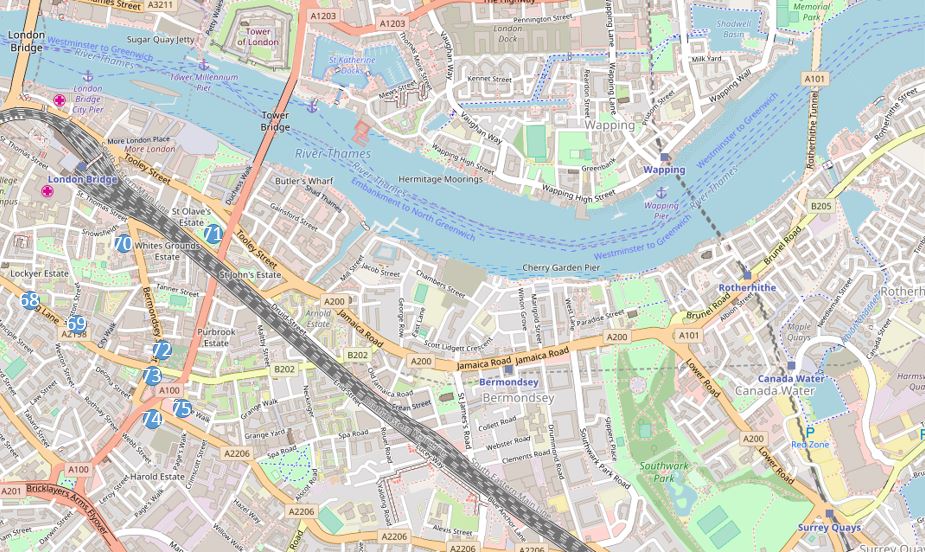
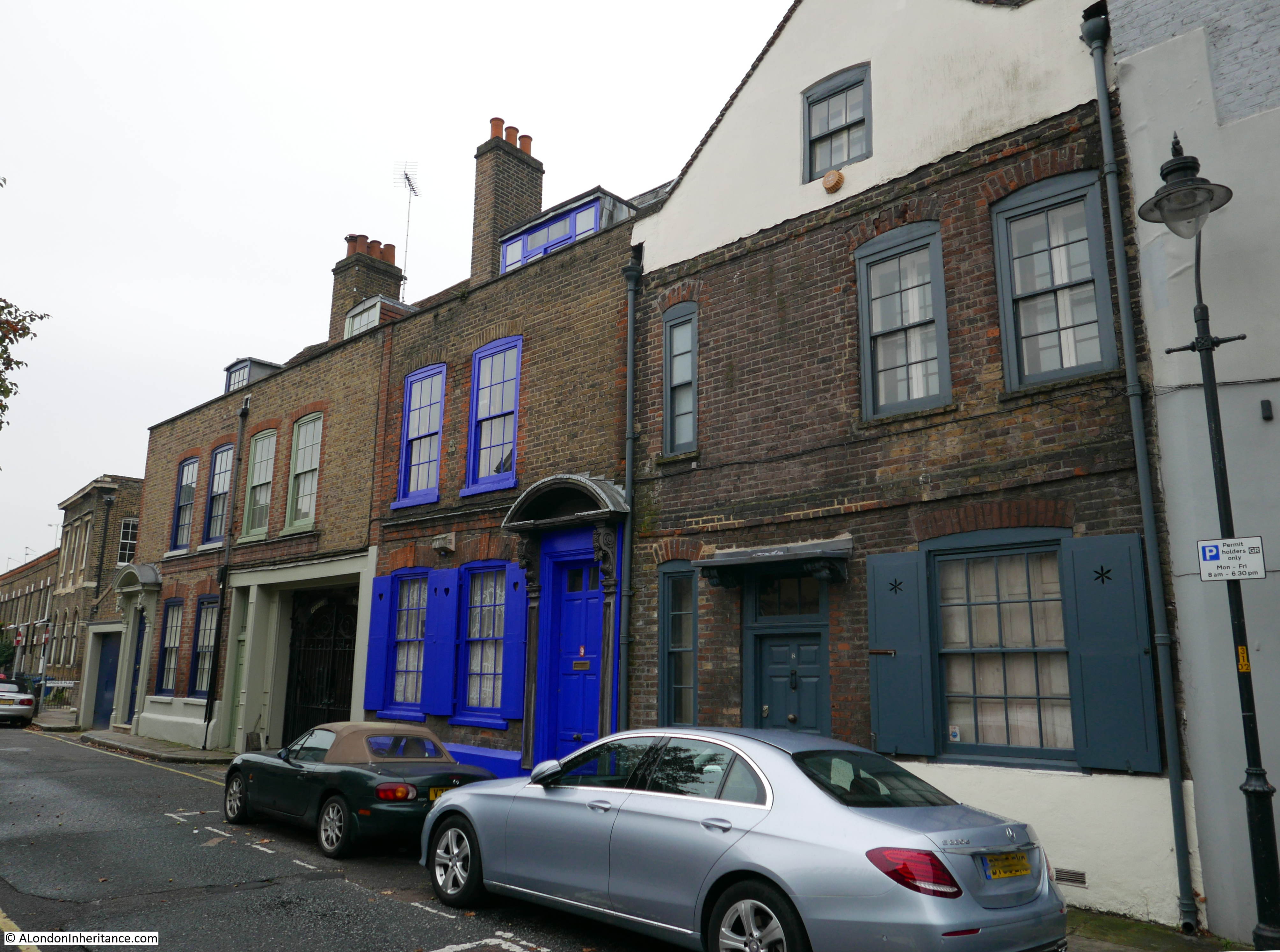
Site 68 – Early 18th Century Pair In Long Lane Bermondsey
Which unfortunately was undergoing some series renovation work. Under all the scaffolding and green netting are two 18th century town houses. The one on the right appears to have had some previous work, but the house on the left of the pair is Grade II listed. This building still has the original door surround, and the Grade II listing includes the railings in front of the building so I assume they are also original, but when I walked past none of this was visible due to the builders hoardings and the photo was at an angle due to lorries parked opposite.

The four bedroom house has already been sold, but the three bedroom house is still on the market and is yours for £2.4 Million.
Good that these town houses are still on this busy road and their Grade II listing should hopefully ensure a sympathetic restoration.
My next site was a short distance further along Long Lane to:
Site 69 – 18th Century House
I was not so lucky with this building. The map shows this building at the junction of Weston Street and Long Lane. I did walk around the area to see if I could find a building that matched the Architects’ Journal description as working through this project I have found that occasionally the 1972 map is slightly inaccurate, but I could not find anything.
A new building was in the process of construction on the site. I doubt that an 18th Century House has recently been demolished for this new construction so I assume that as was the concern of the 1972 Architects’ Journal, the building was at risk and was demolished.
The site that was originally occupied by an 18th century house:
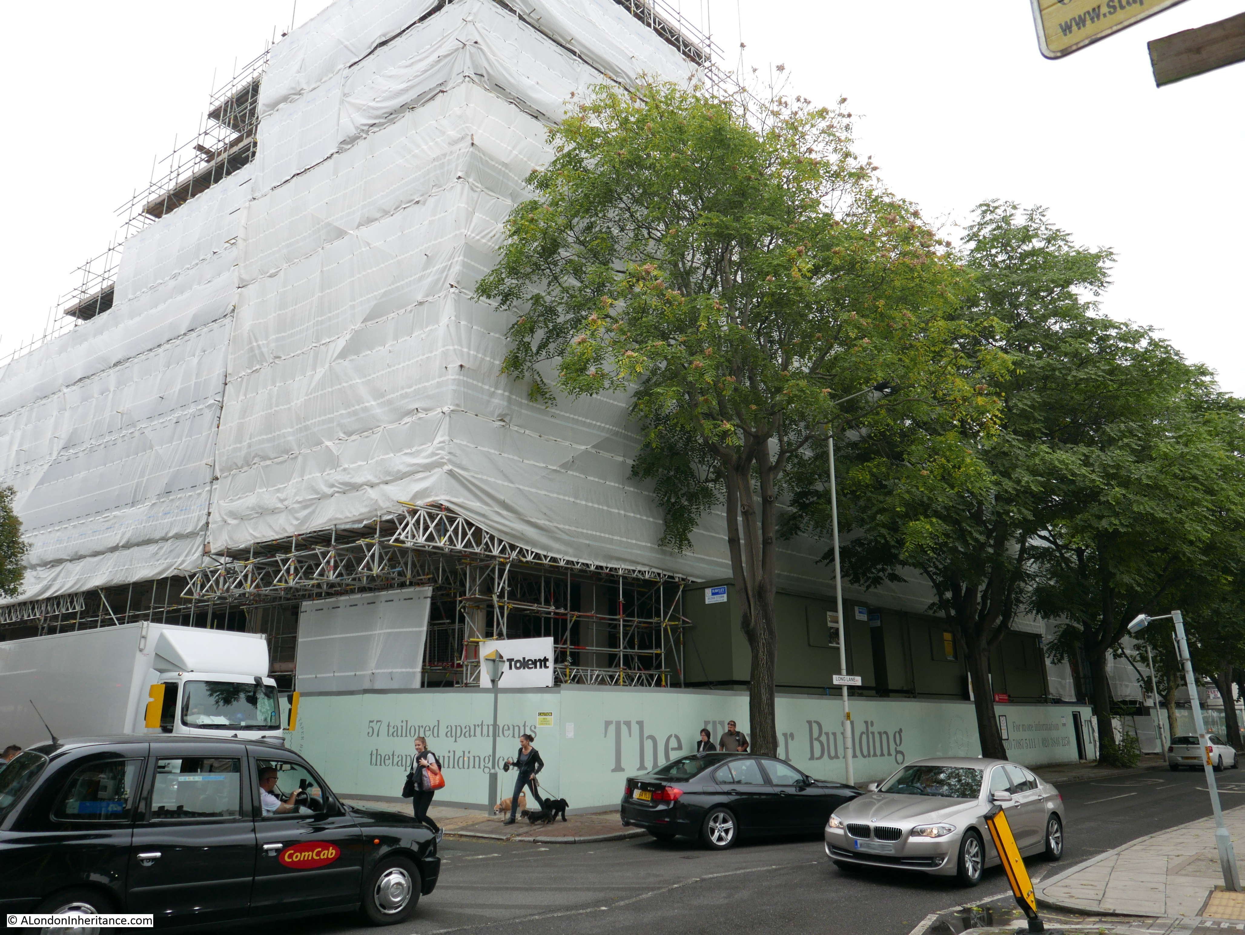
I continued walking along Lone Lane towards Bermondsey Street and passed a couple of interesting buildings. The first is the pub Simon the Tanner. The rate at which pubs disappear in London is such that for the last few years I have taken a photo of every pub I have passed, however hopefully this lovely pub is not at risk. The name references an Egyptian Saint as well as the leather working industry that once occupied large areas of Bermondsey.
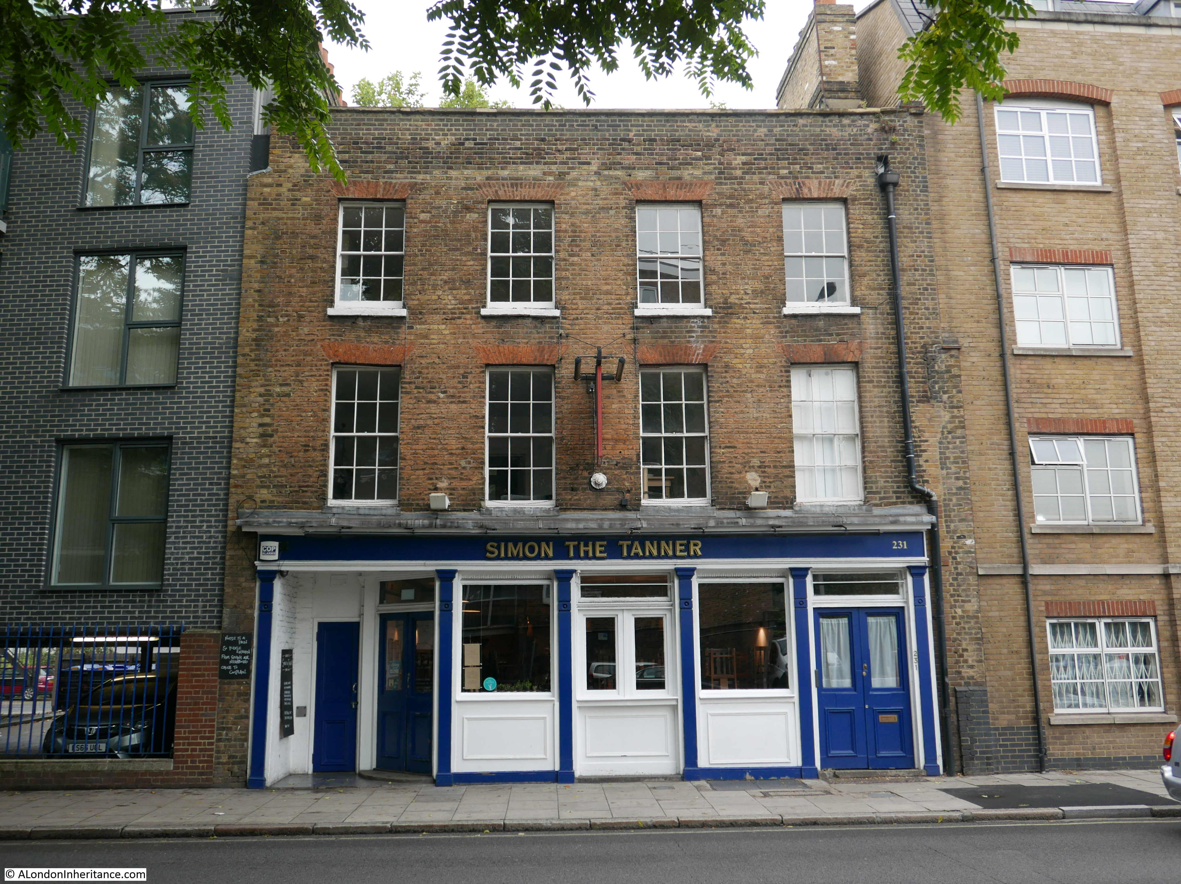
A short distance along from Simon the Tanner is this large building:
These were once the premises of Hepburn and Gale Ltd, once one of the largest tanners and leather manufacturers in Bermondsey. The current building dates from soon after 1898 when a large fire destroyed the previous buildings on the site.
The company had difficulty in competing with the growth of low-cost imports in the 1950s and 1960s and the Bermondsey operations closed in the 1970s.
The name of Hepburn and Gale is still displayed above one of the doors to the building:
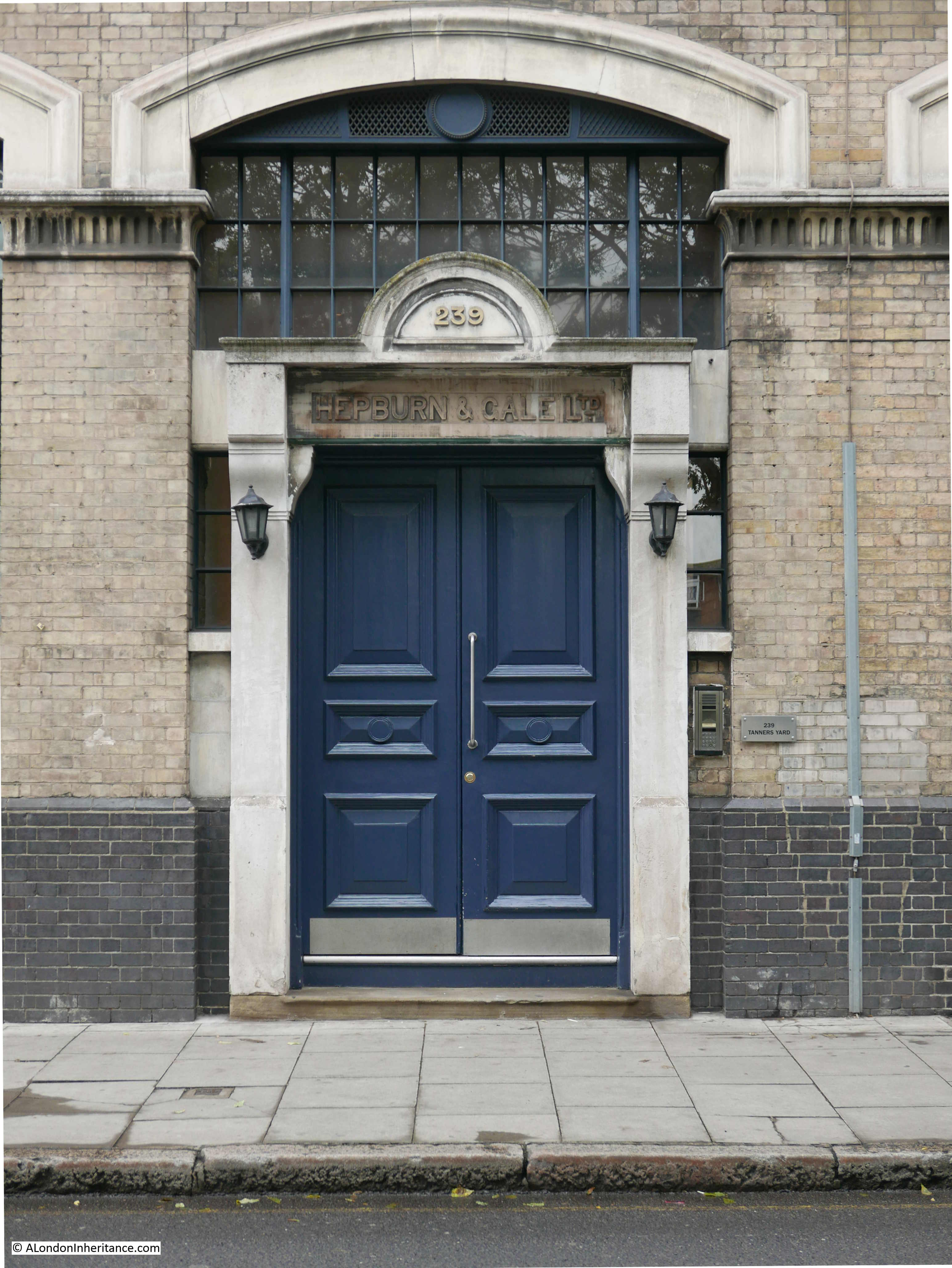
Leather working was once a sizable industry in Bermondsey and the scale of the Hepburn and Gale building provides a reminder of the size of these operations.
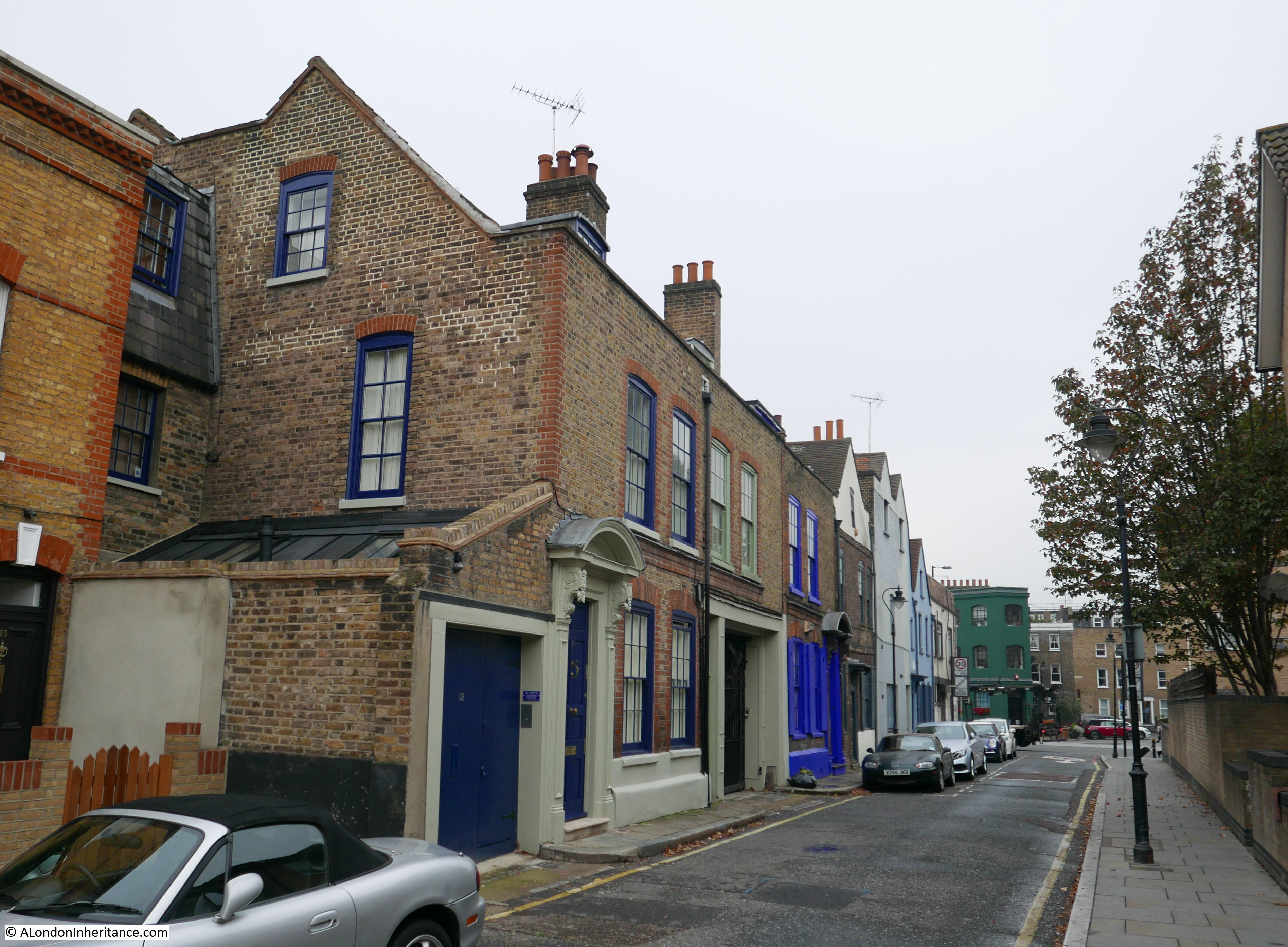
From Long Lane, I turned into Bermondsey Street and walked along Bermondsey Street to just past the junction with Tyers Gate to find:
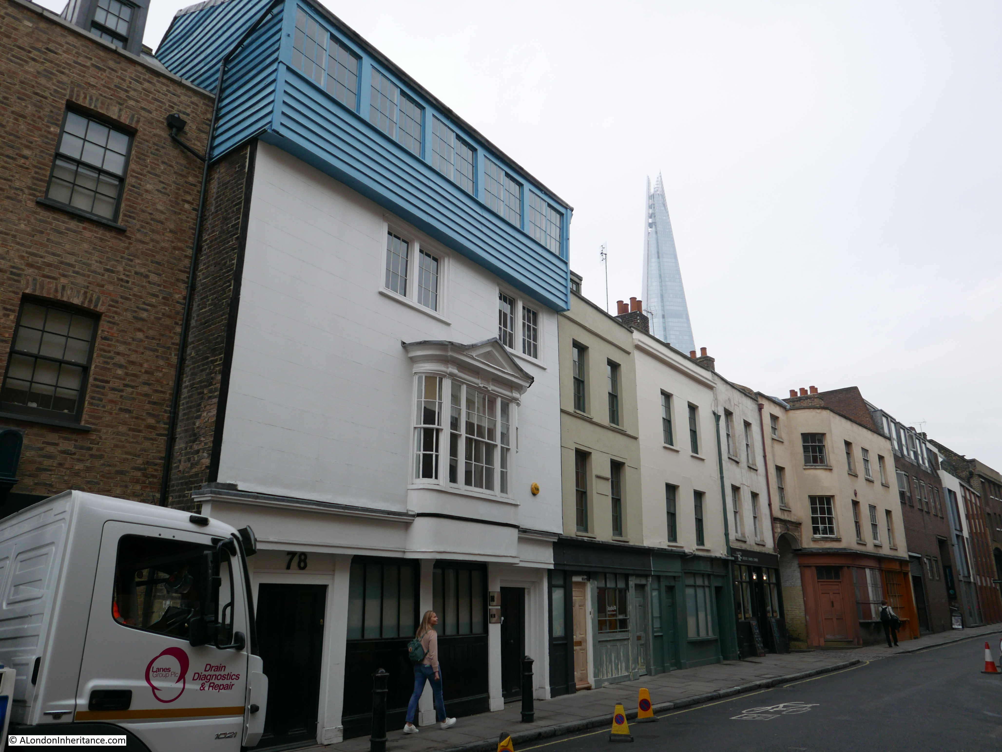
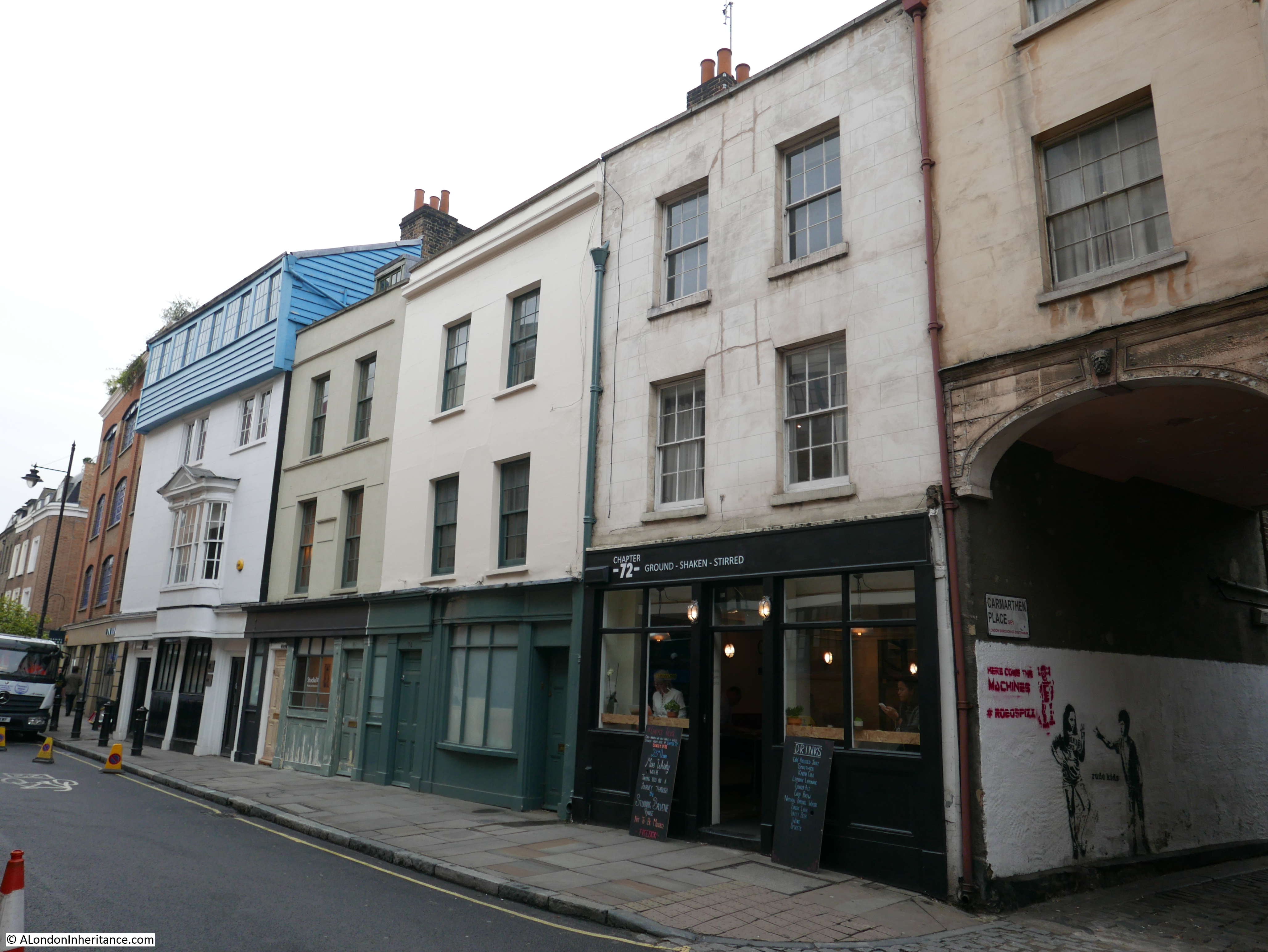
Site 70 – 17th Century Group
This is a fascinating group of buildings of very different styles. There are all Grade II listed, however where the Architects Journal in 1972 classed this as a 17th century group, the listing puts the buildings as early to mid 18th century. No matter their actual age, they form a group of buildings that do not appear to have been much “renovated” and are also of different architectural styles.
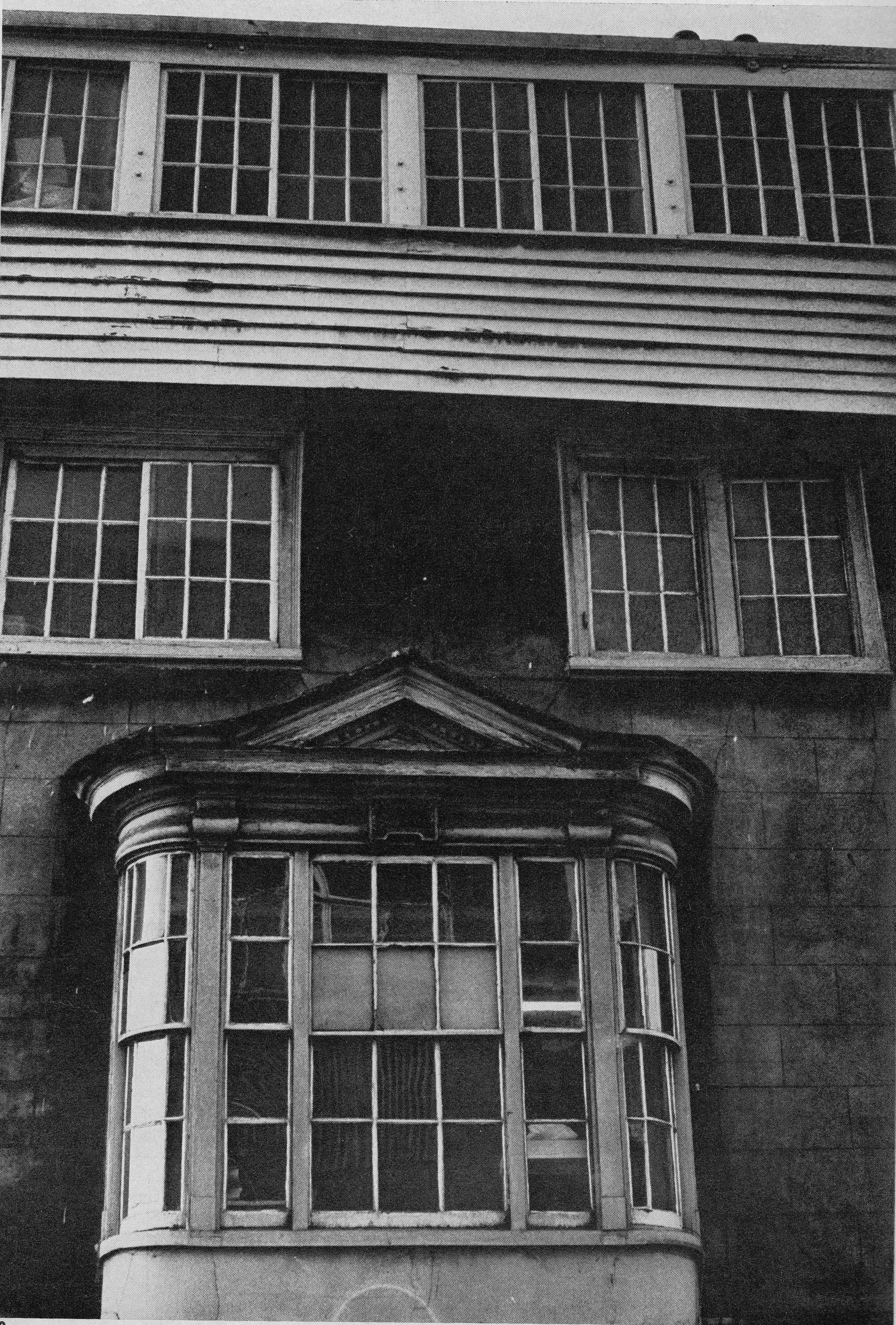
The 1972 article included a photo of part of the building with the timber clad top floor:
At the end of the group is this building that includes an arched entrance to Carmarthen Place, a corner door and an early shop front.
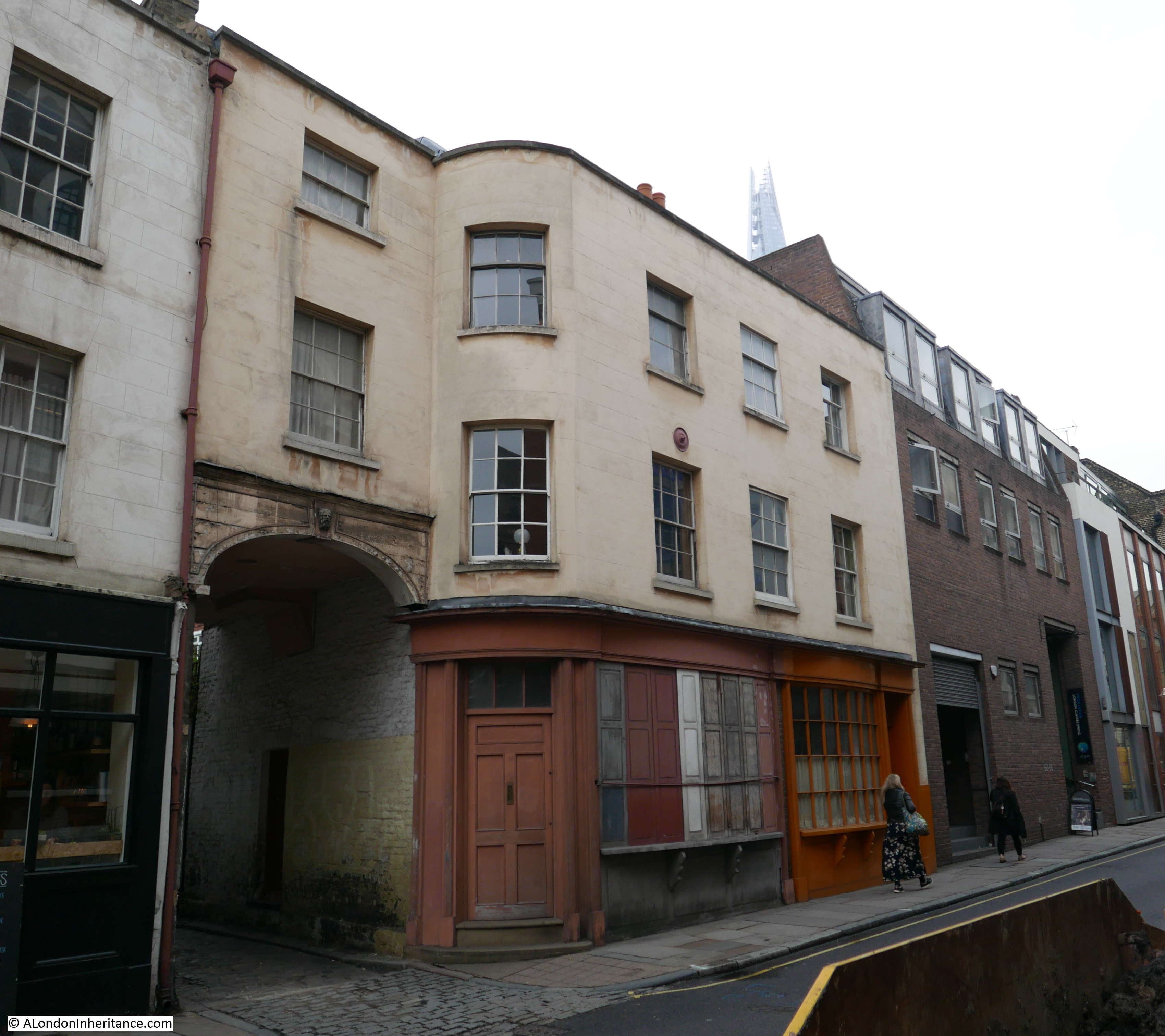
The entrance to Carmarthen Place includes what looks to be an imitation Banksy artwork and a carved keystone at the top of the arch.
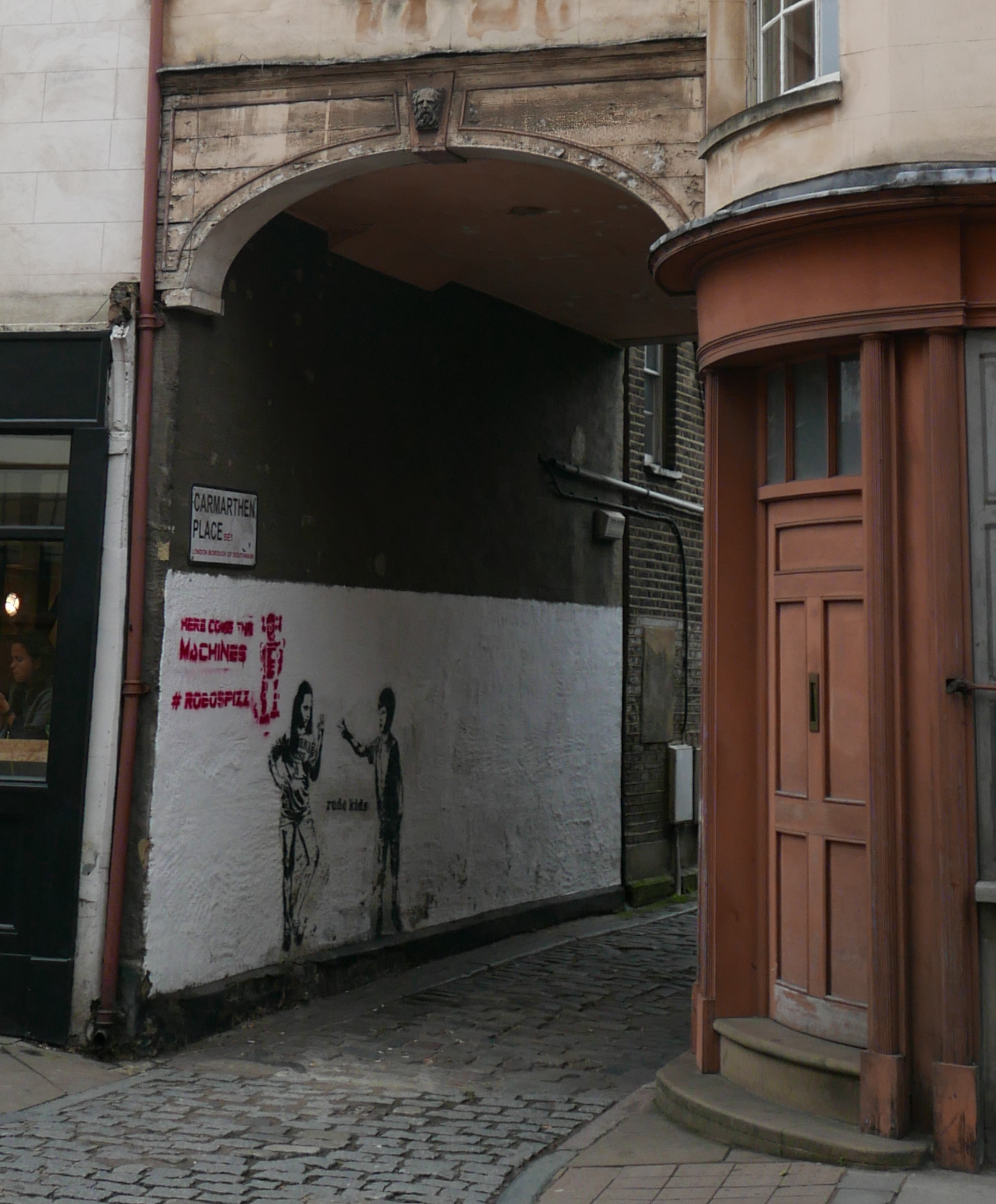
The group of buildings have the house in the above photo at one end and the building with the timber-framed top floor at the other end, framing a terrace of three more traditional 18th century buildings.
There is so much to explore in Bermondsey, each side street offers views of buildings that help to tell the story of the trades and businesses that once operated in the area.
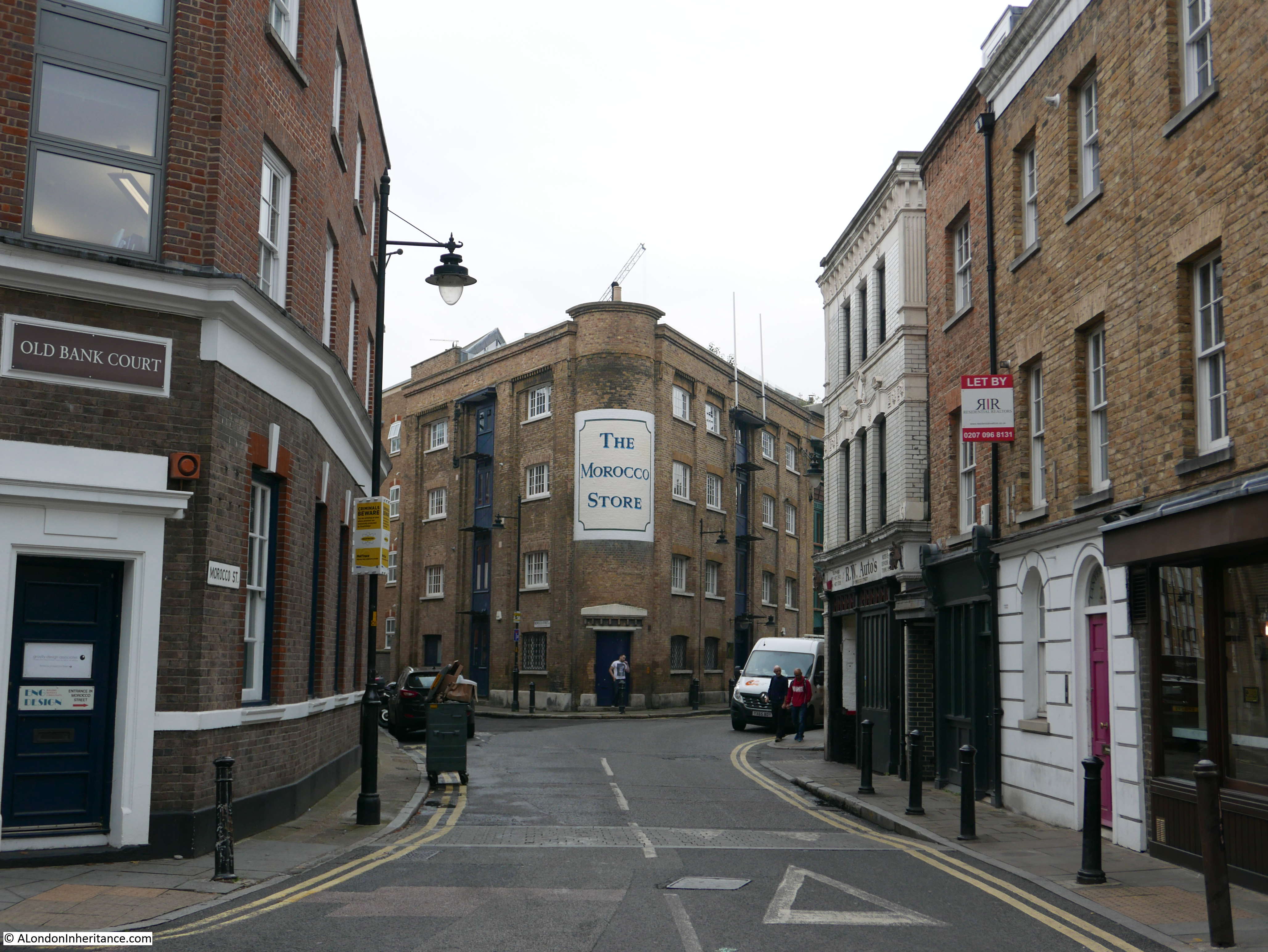
Looking down Morocco Street to the Morocco Store – an 18th century spice warehouse:
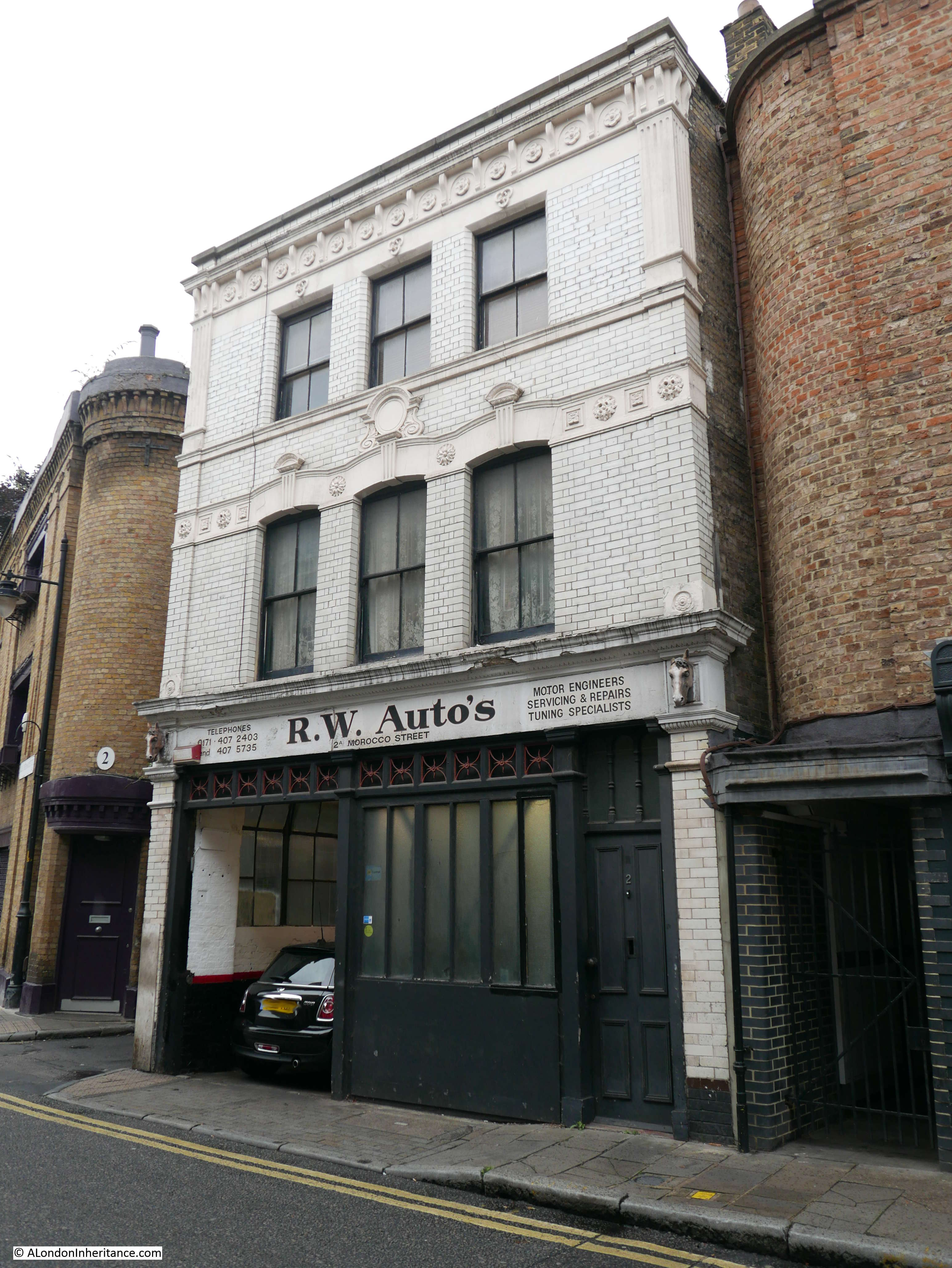
A short distance down Morocco Street is R.W. Auto’s – a local garage with horse heads on the edge of the facade that indicate the previous use of the building as a farriers.
Walking back along Bermondsey Street towards Long Lane and there are plenty of 19th century buildings, including this terrace of three, with the white plaque on the central building dating them to 1828 and with the initials PD who must have been the builder, architect or original owner of the buildings.
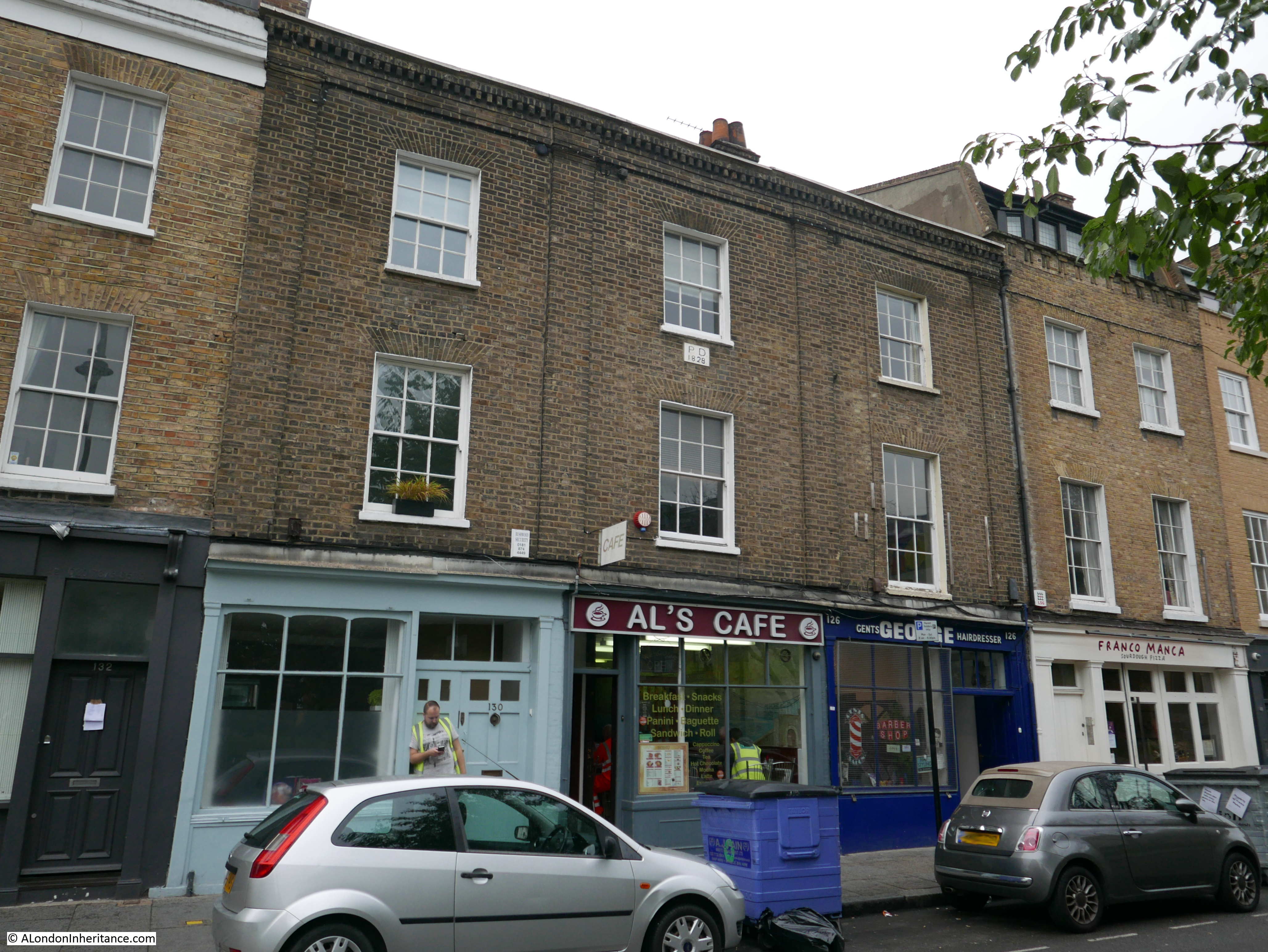
Al’s Cafe was attracting a steady stream of hi-vis jackets. With the amount of building work I passed in the area I am sure that Al is not short of trade.
Further along Bermondsey Street is this fascinating building with “Time and Talents Settlement” across the facade of the building above the ground floor:
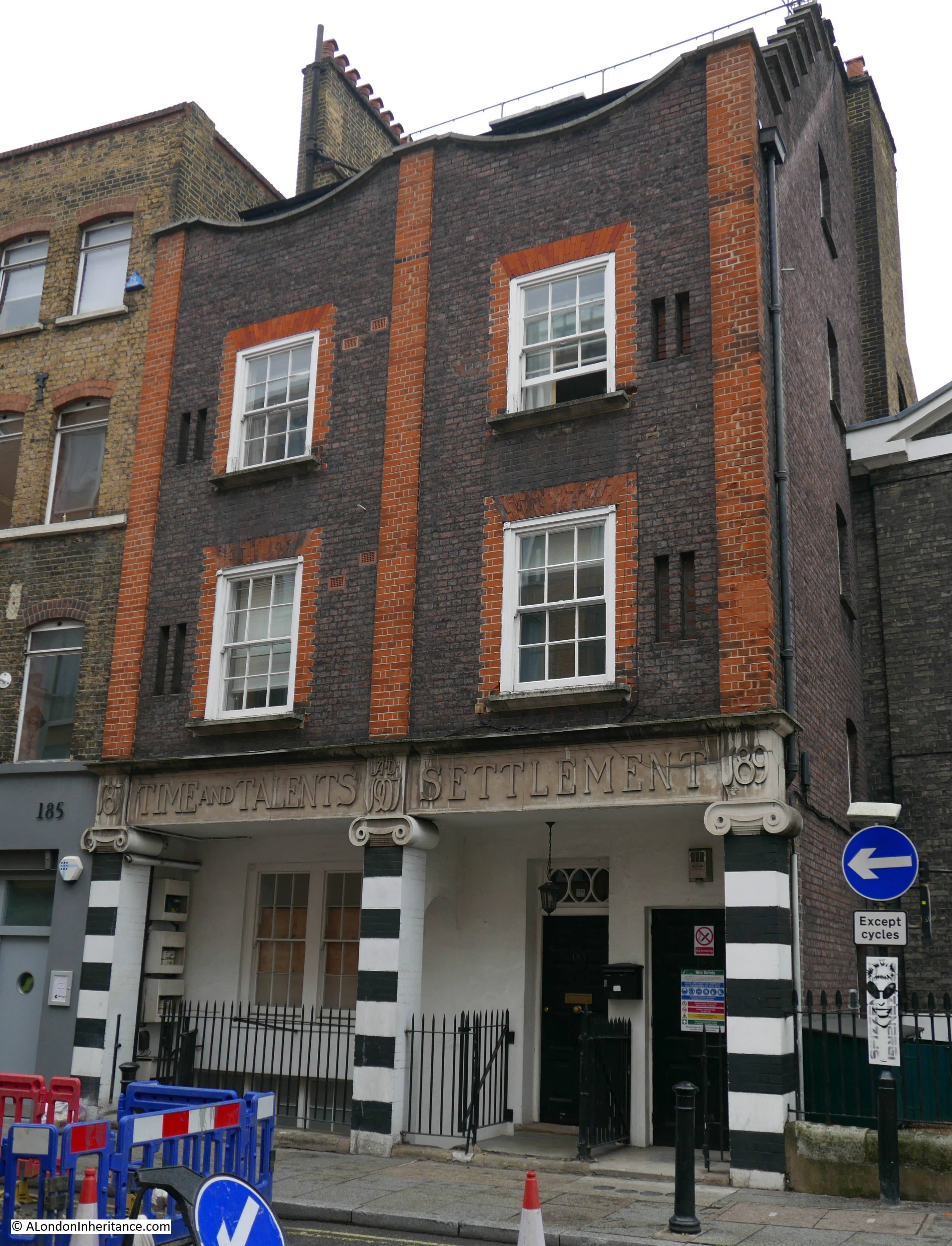
The Time and Talents Settlement was an Anglican organisation set up in 1887 in the West End by women with the aim of supporting young working girls and women. The organisation is still going, and from their website the founders “deplored the waste and futility of the protected lives of the majority of young girls who were only expected to be decorative and obedient.”
They wanted girls of leisure and education to use their time and talents (hence the name) to help others less fortunate.
The building in Bermondsey Street was built in 1907 and the architect was Sir Reginald Blomfield. It is now Grade II listed. The Time and Talents Settlement operated out of the building until 1980 when they moved to a new location in Rotherhithe.
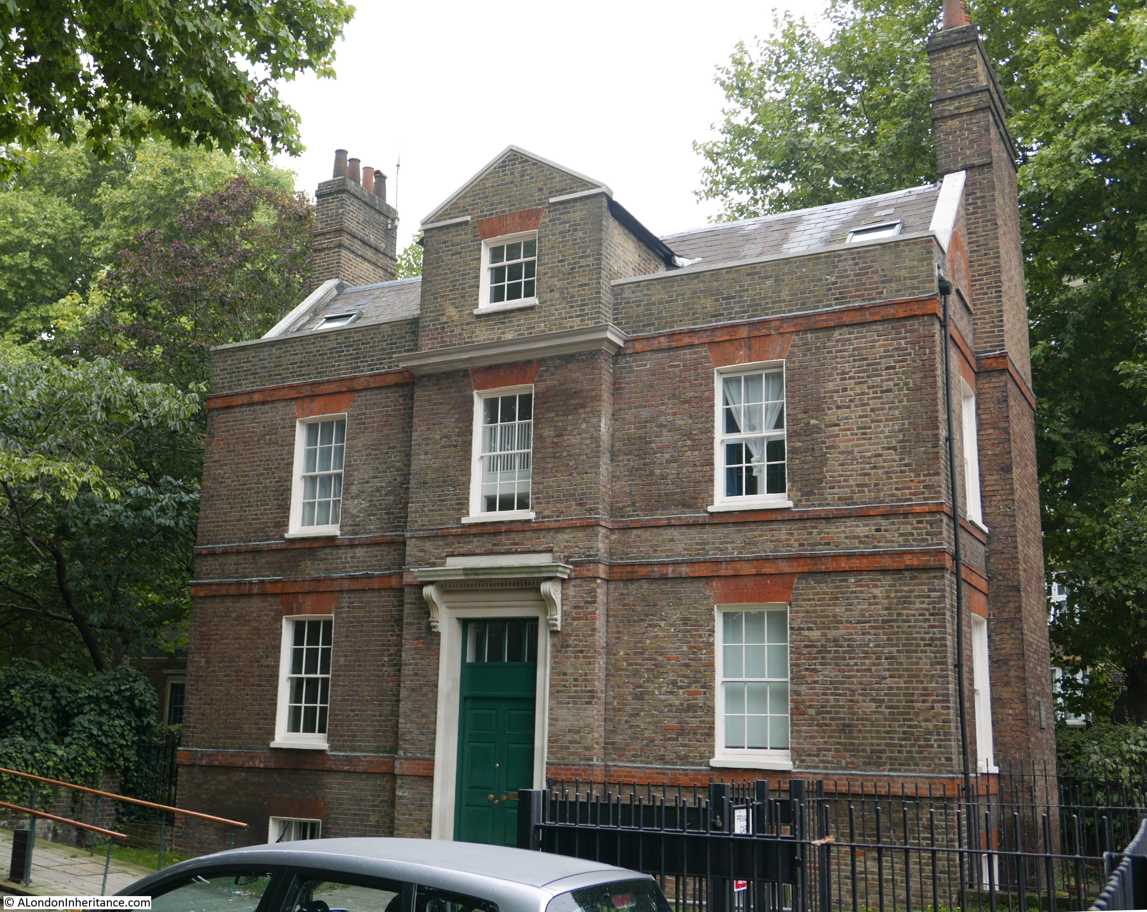
Set back between the Time and Talents building and the church of St. Mary Magdalene is the lovely Old Rectory building. For once, there were no parked cars or lorries and I was able to get a photo from directly opposite, just a shame about the lamp-post.
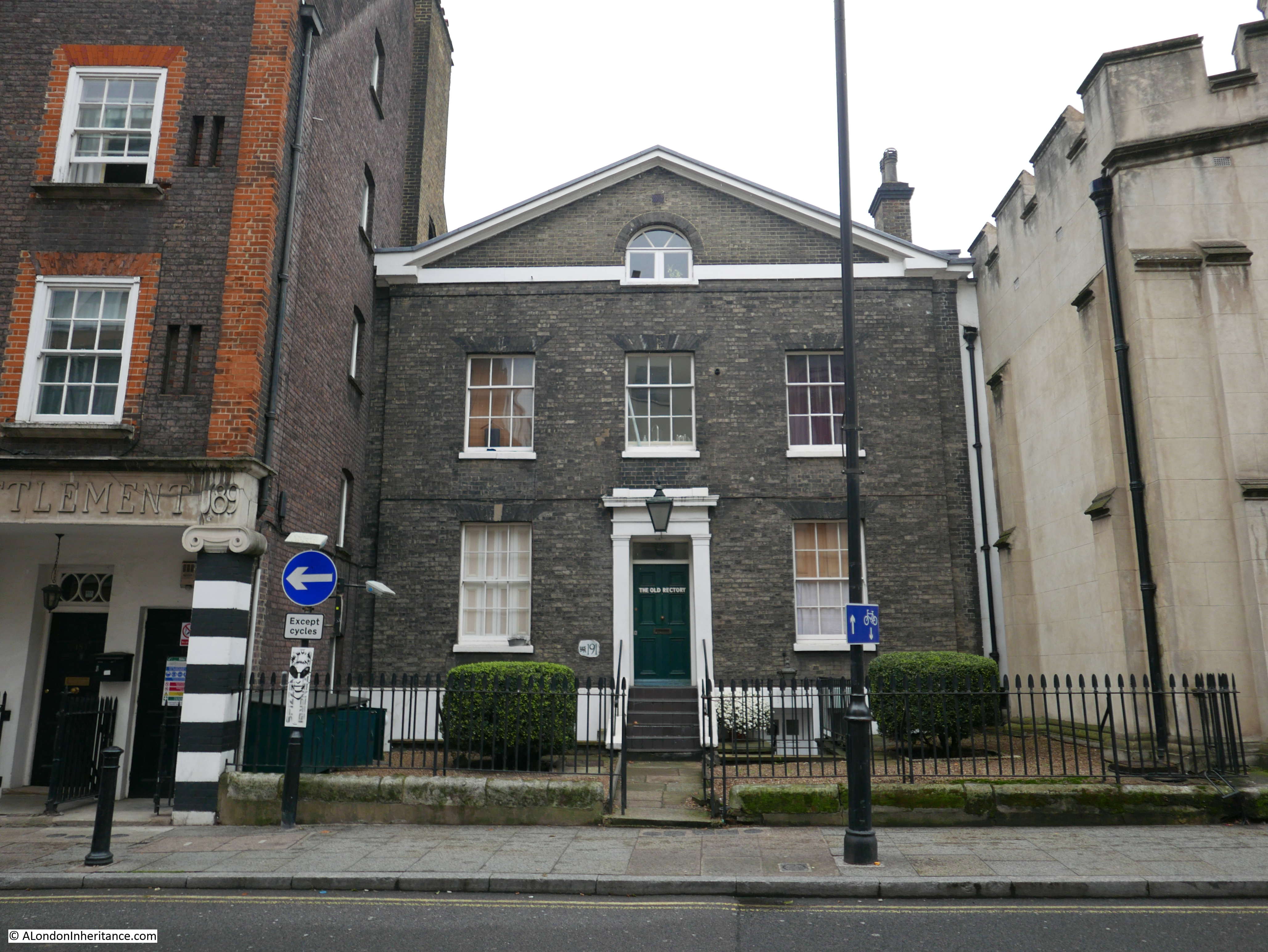
The Old Rectory dates from 1828 and was the rectory to my next Architects’ Journal location:
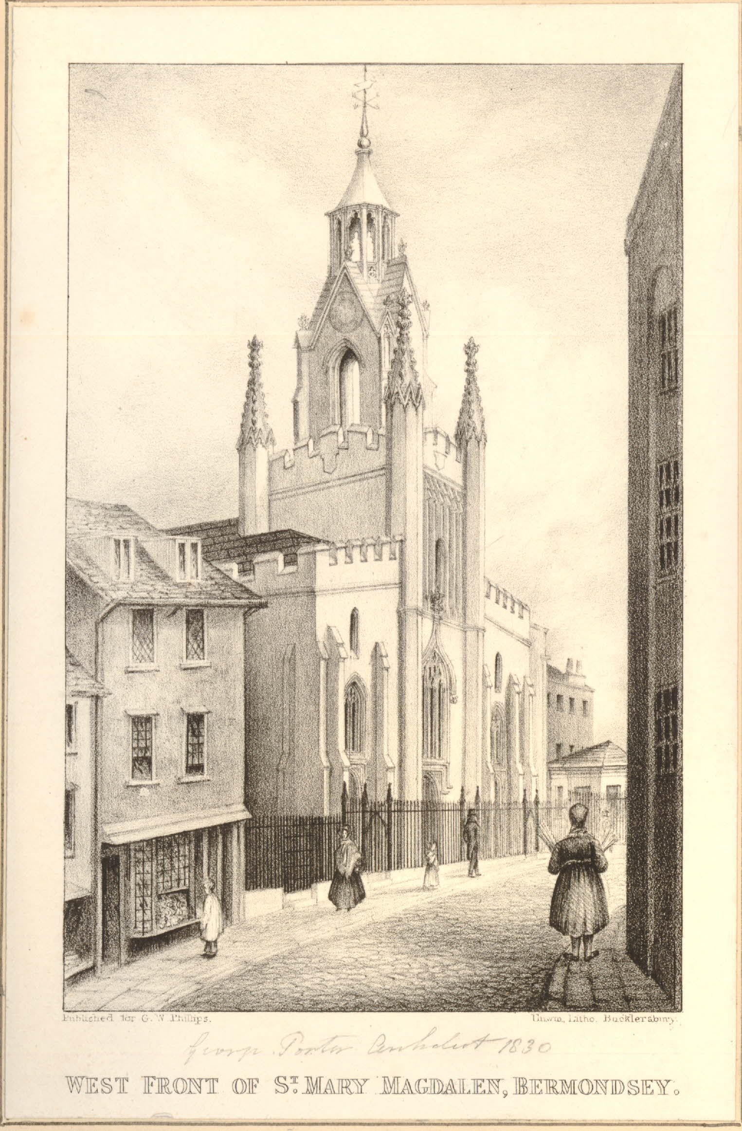
Site 72 – 17th Century And Early 19th Century Gothic St. Mary Magdalen
This is the church of St. Mary Magdalen at the Abbey Street / Long Lane end of Bermondsey Street.
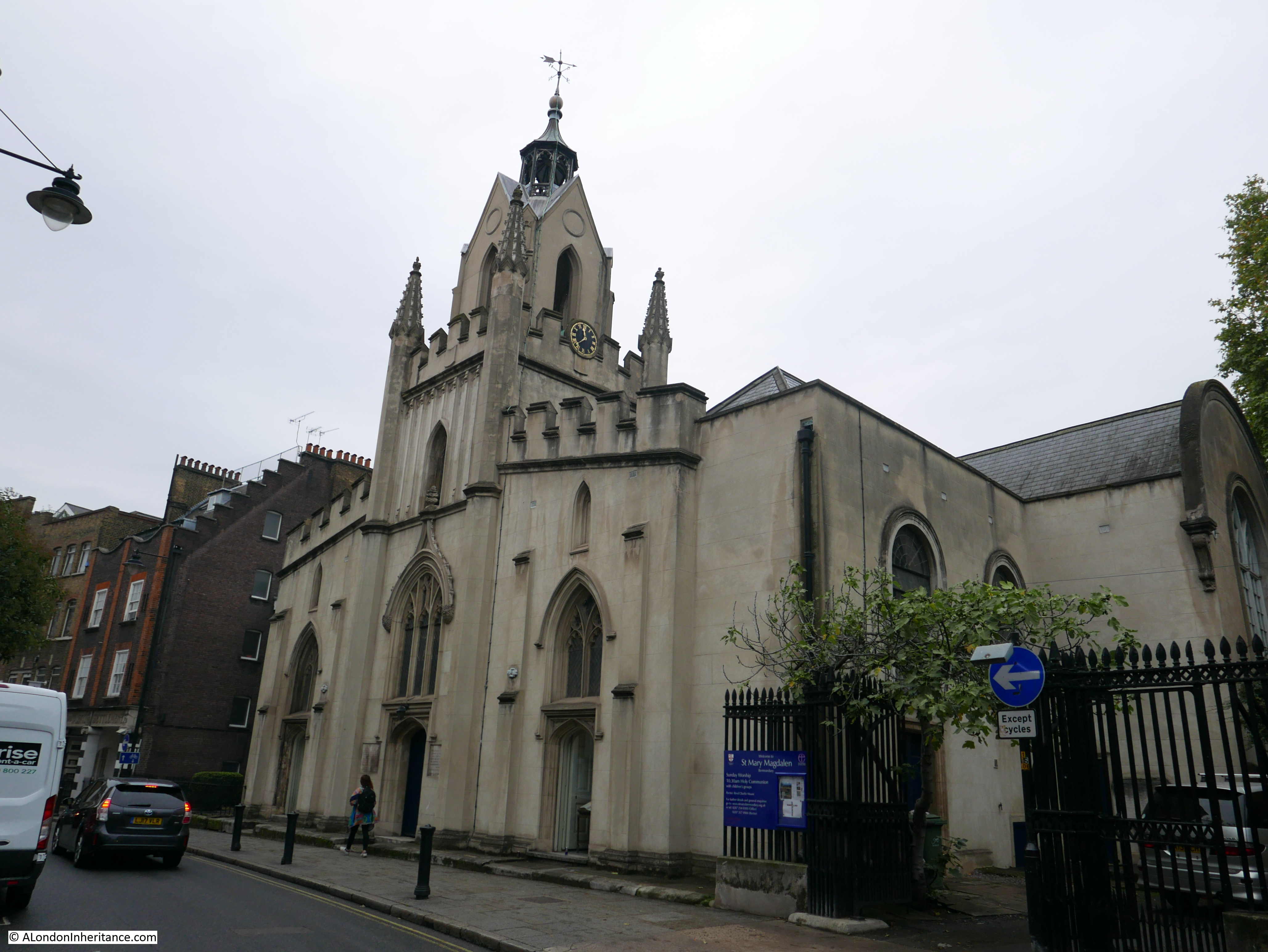
The church is a 17th century rebuild of an original church on the site from the 13th century. Whilst the church dates from the 17th century with various additions, changes, and modifications during the 18th and 19th centuries, there is a small part of the original 13th century church remaining in the form of the lower part of the interior of the tower.
The church survived undamaged during the Second World War.
The following print from 1840 shows the exterior of the church in Bermondsey Street identical to the view we see today, apart from the loss of the railings.
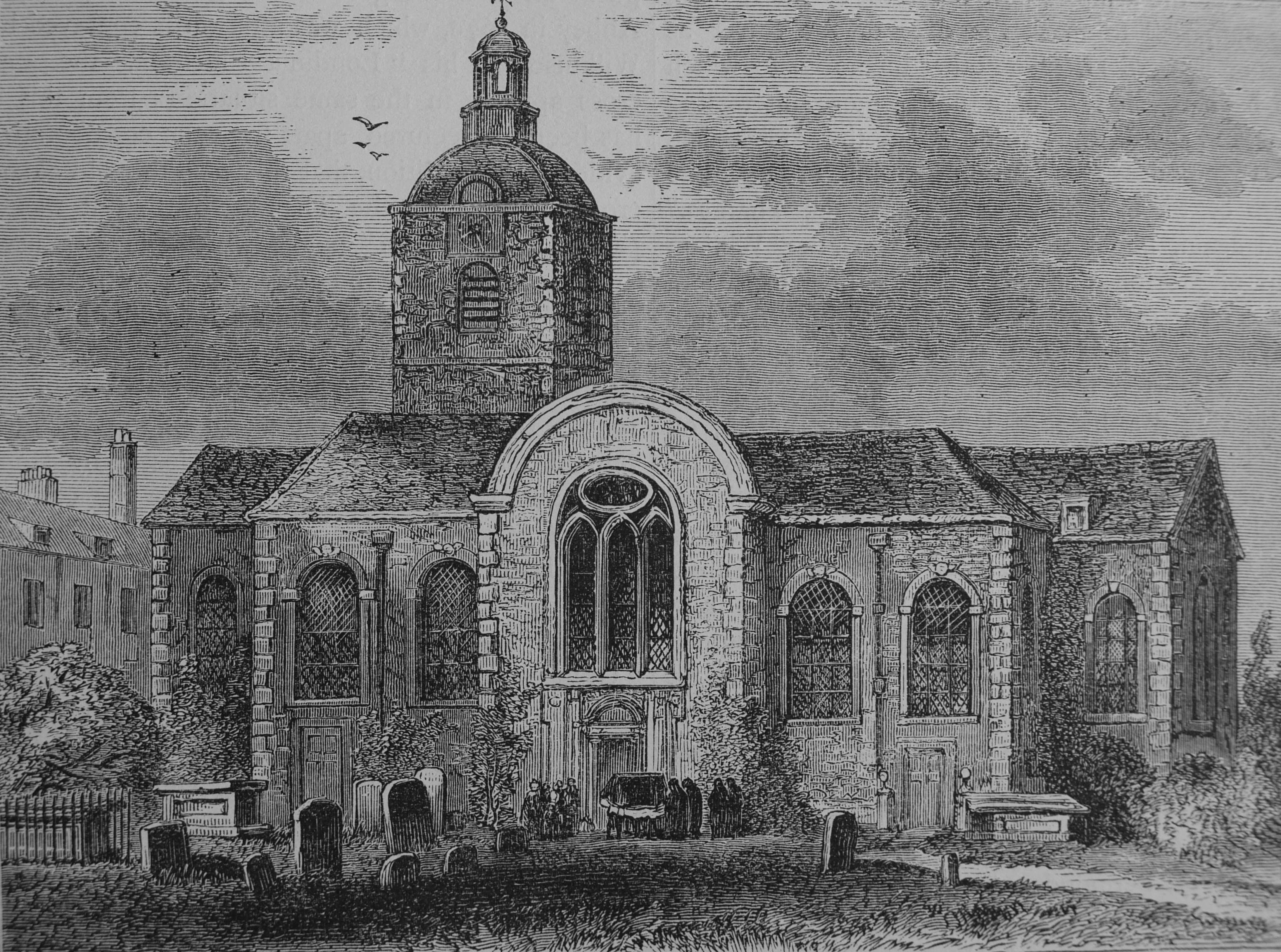
The original church is shown in the following print:
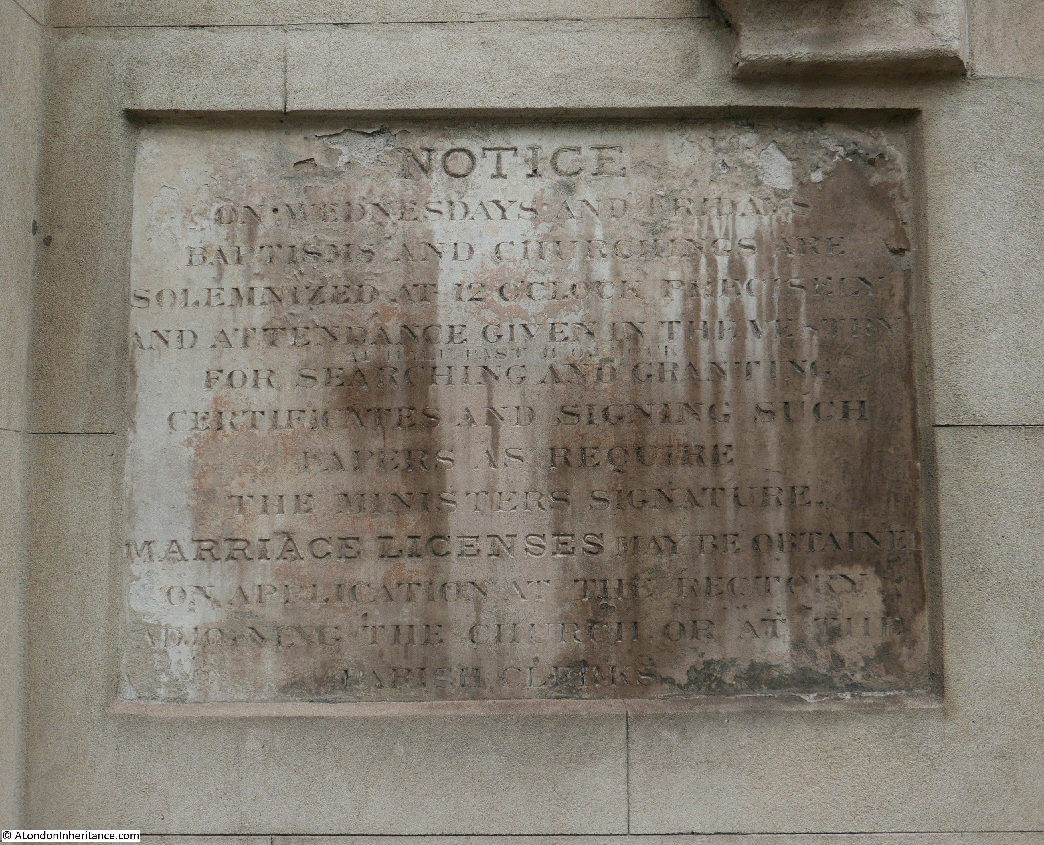
The dates and times for ceremonies at the church are written in stone on the front facade of the church. Baptisms and Churchings are solemnized at 12 o’clock. The problem of putting all this in stone is highlighted by just under half way down, someone has had to add “at half past 11 o’clock” in smaller letting. An omission or change after the main plaque was finished.
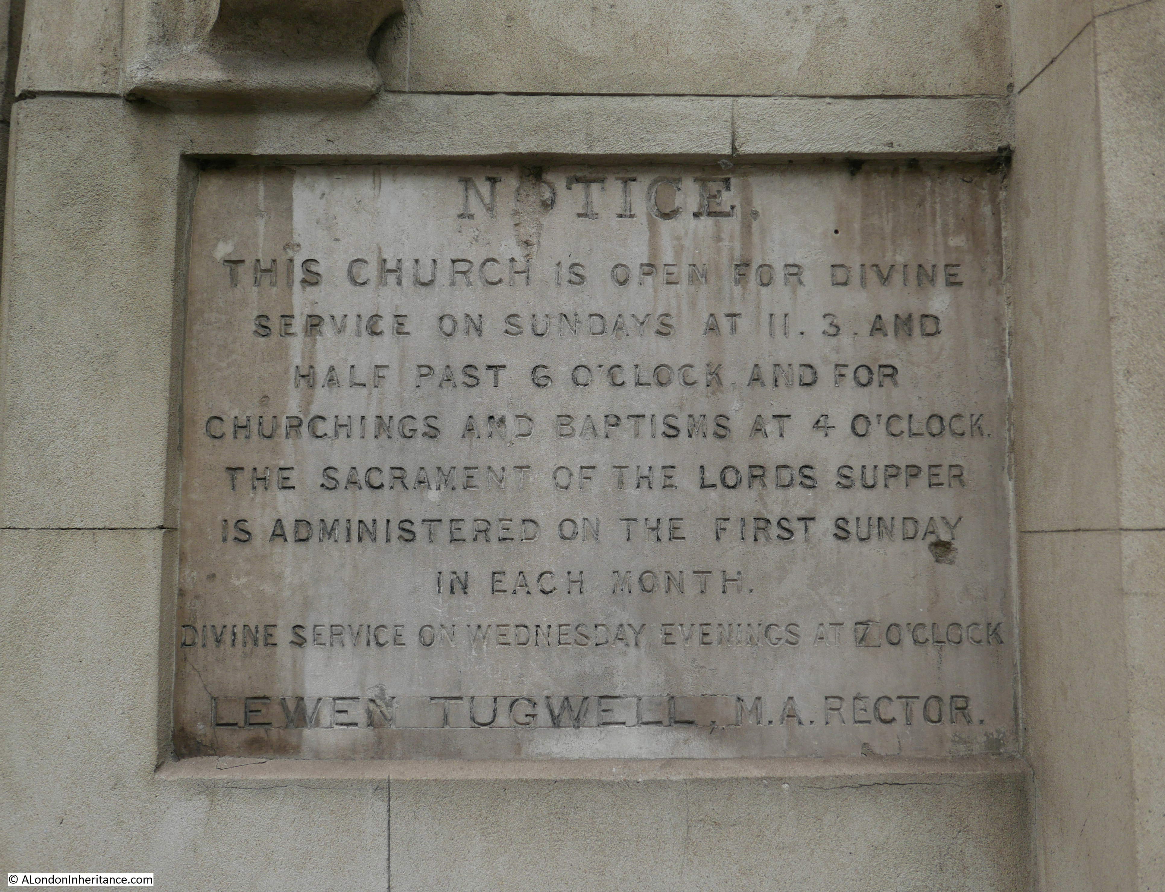
And with this plaque, the time for Divine Service on Wednesday evenings must have changed at some point as the number 7 is on a new square of stone inserted to replace the original stone.
Although the church is now surrounded by the busy streets of Bermondsey, it was once in open countryside and part of the Abbey of Bermondsey.
There may have been a monastery of some form on the site in the 8th century, however development of the large estate that would form the Abbey at its peak started in the last decades of the 11th century when a Priory was established. In 1399 the Priory became Bermondsey Abbey and lasted until the dissolution of the monasteries and abbeys by Henry VIII, when the estate was handed to Sir Thomas Pope.
Some of the Abbey buildings were still in existence in 1805 when the following print was made showing the remains of Bermondsey Abbey, drawn from the steeple of the church.
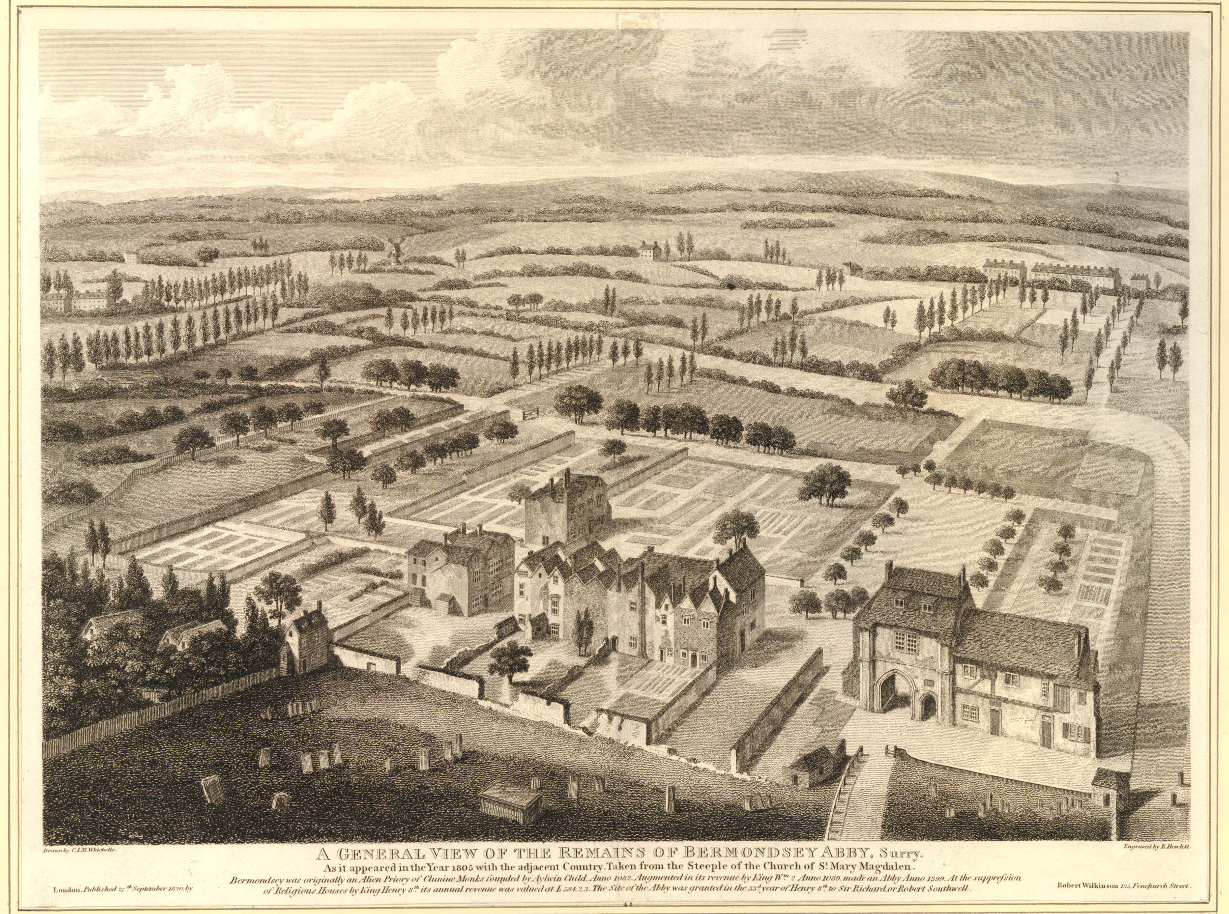
I am not sure the direction of view, however I suspect it is looking towards the south-east. What looks like a small patch of water in the left of the horizon could be the River Thames at the southern end of the Isle of Dogs with the higher ground of Greenwich to the right.
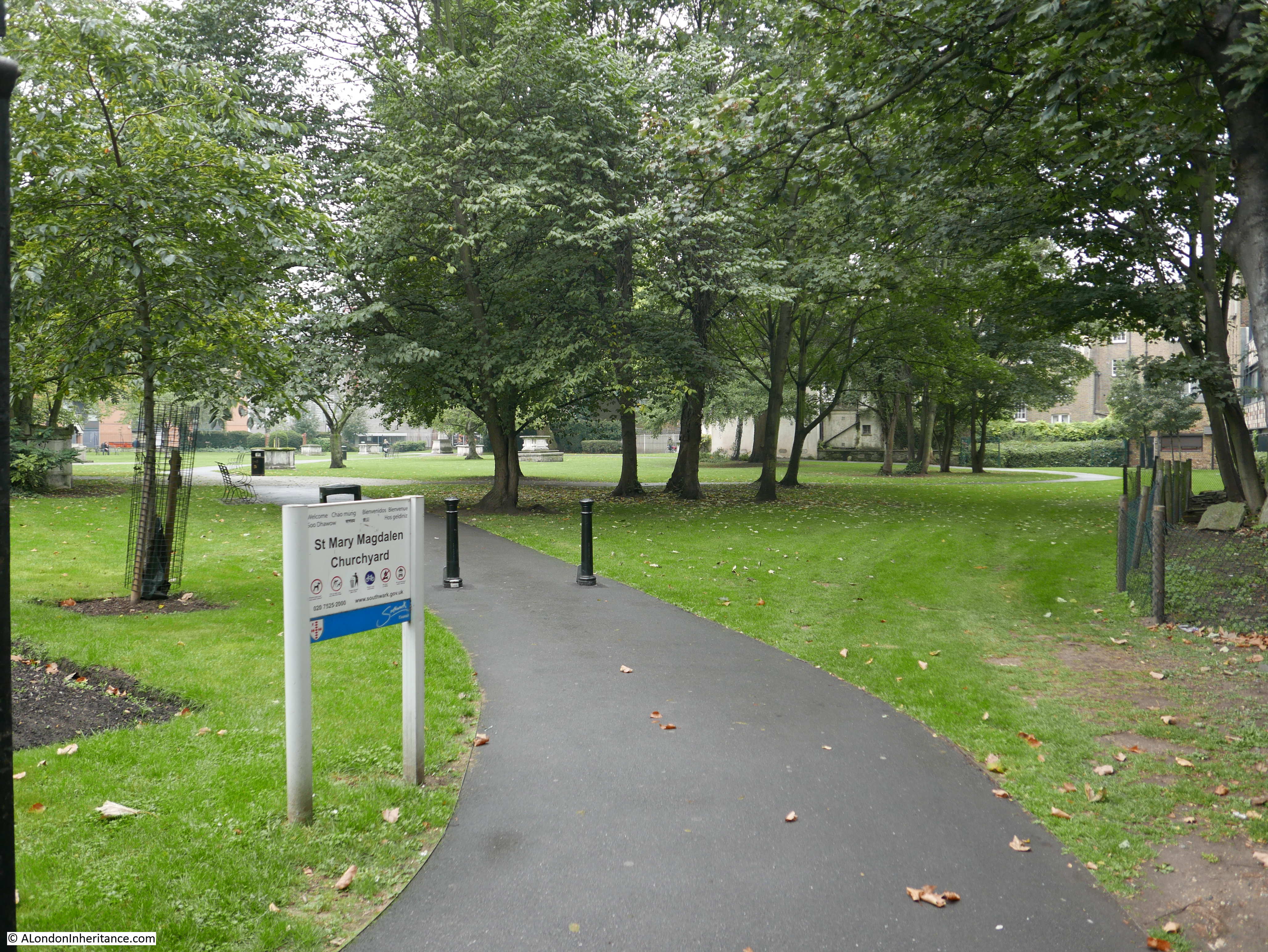
The churchyard is still here with a small number of remaining monuments.
Bermondsey Abbey deserves a much fuller description, however for the aims of this post, it was good to see that St. Mary Magdalen is the same as when the Architects’ Journal listed the building in 1972.
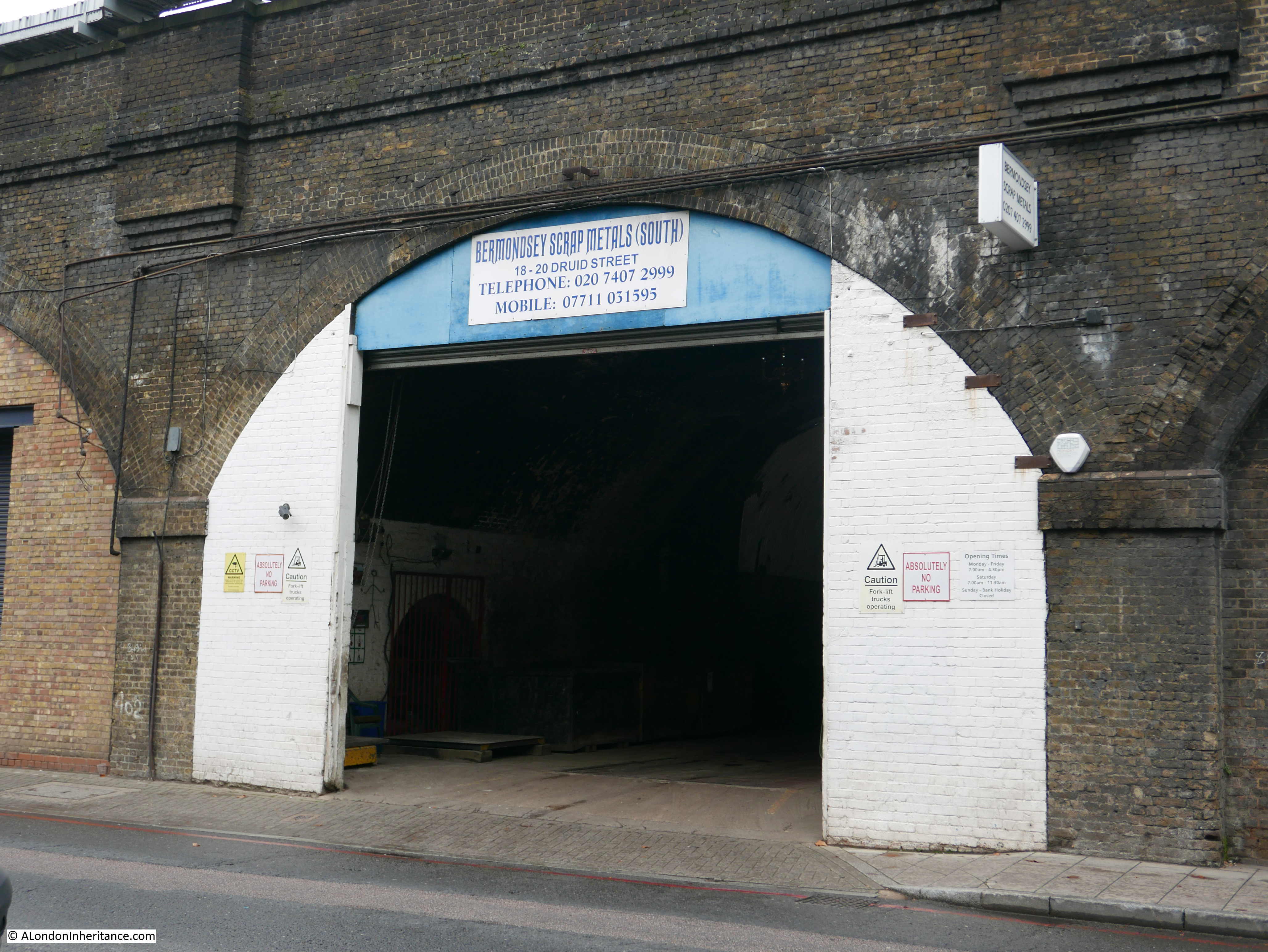
To reach my next location, I walked out the churchyard into Tower Bridge Road and headed in the direction of the river, passing under the brick railway viaduct to look for:
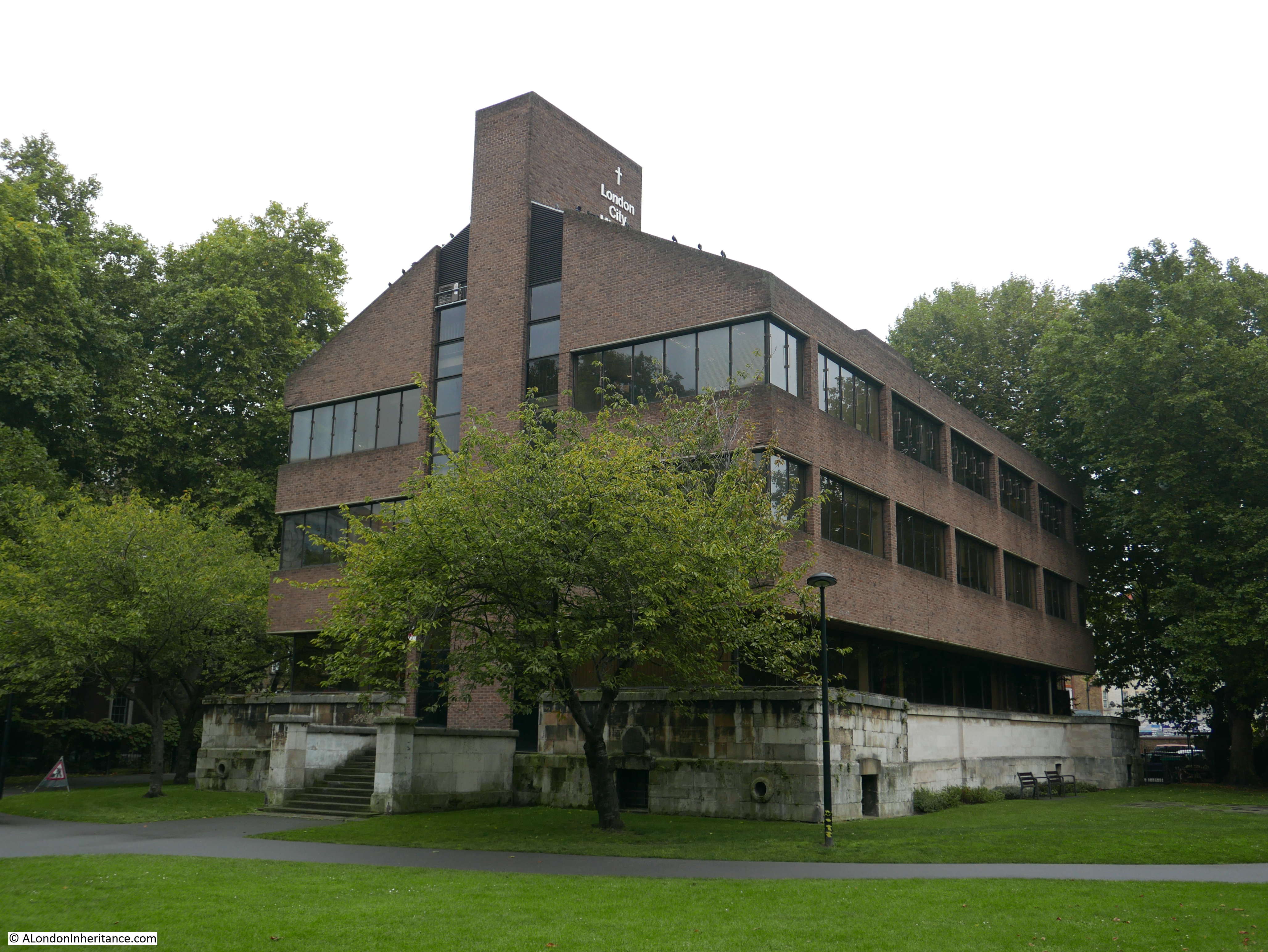
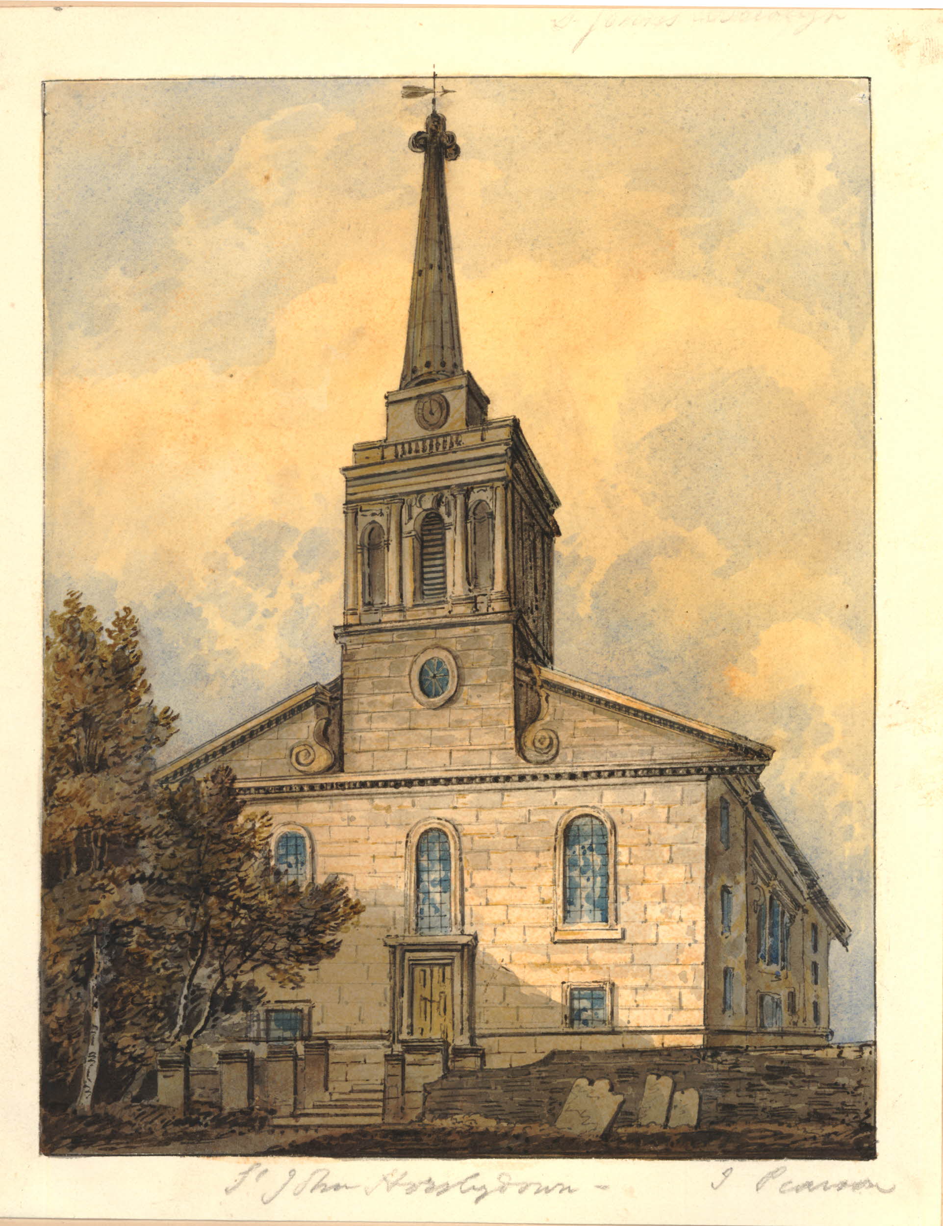
Site 71 – Bombed St. John, Horsleydown And Derelict 1730 Rectory
The rectory and church of St. John, Horsleydown were still damaged and derelict in 1972, and the article was concerned about their long-term future.
The rectory has been rebuilt in much the same style as the original building:
However with the church it is a very different matter.
The church had been badly damaged by bombing and had not been rebuilt after the war. There was a scheme proposed in 1956 to rebuild the church, but this was never followed through and the church remained in its post war condition before being eventually sold to the London City Mission in 1974.
The London City Mission built the building that now sits in place of the old church. The construction is interesting as the lower part of the external walls of the original church have been left in place, including the original flight of steps up to the door of the church, with a new brick office building sitting in the footprint of the original church.
The original church was completed in 1733 to a design by Nicholas Hawksmoor and John James.
The following print from 1818 shows the original church of St. John, Horsleydown.
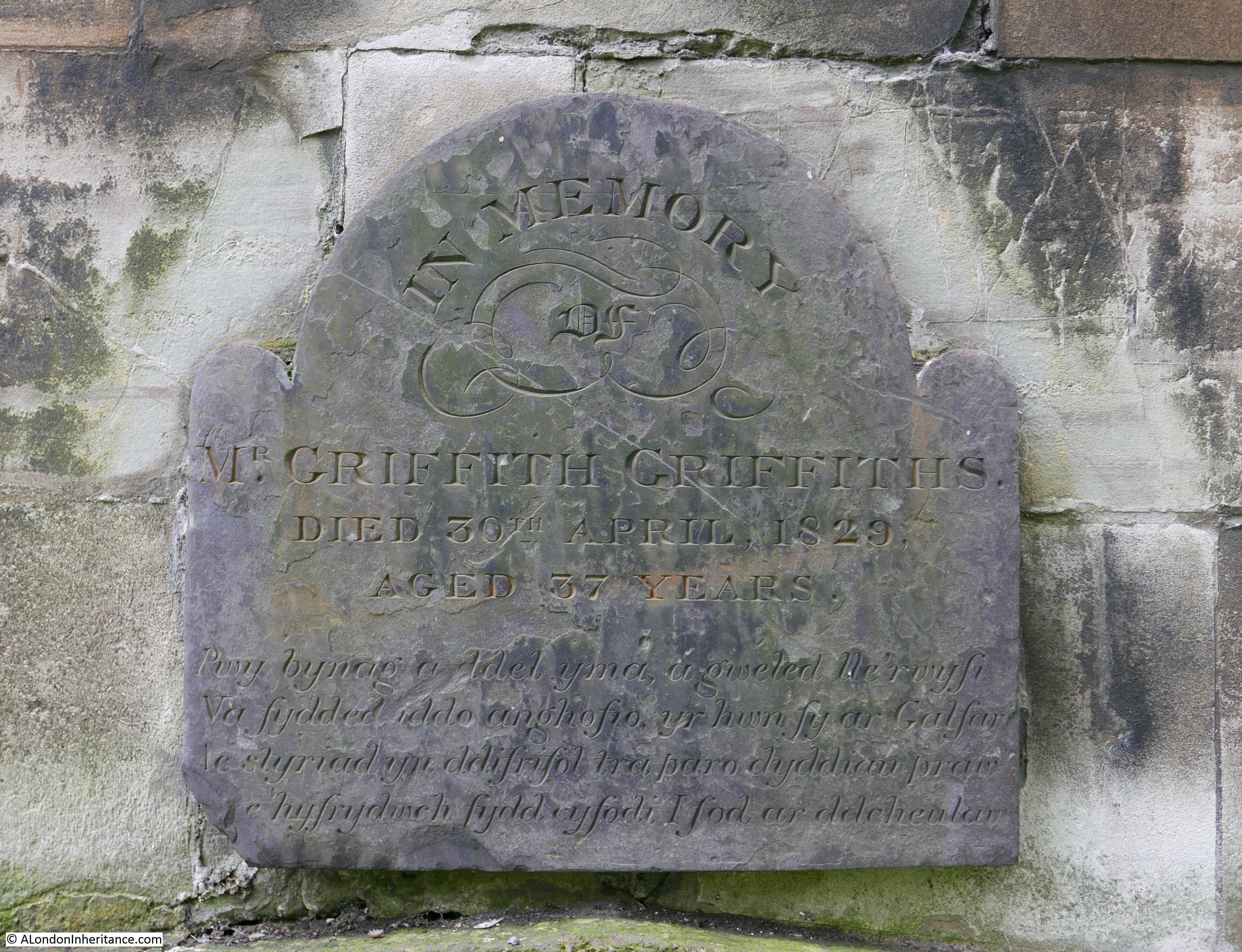
Despite the demolition of the church down to the lower walls and plinth, the remains of the church are Grade II listed. There are a number of gravestones and plaques remaining in the churchyard, including this plaque mounted on the lower wall of the church and in memory of Mr Griffith Griffiths who died on the 30th April 1829, aged 37. The text is in Welsh.
I walked under the brick viaduct running from London Bridge Station towards Greenwich to get to the church. I will pass under the viaduct a number of times to get to the sites in Bermondsey and Rotherhithe. The arches adjacent to the churchyard are occupied by the types of business that have always made good use of these facilities.
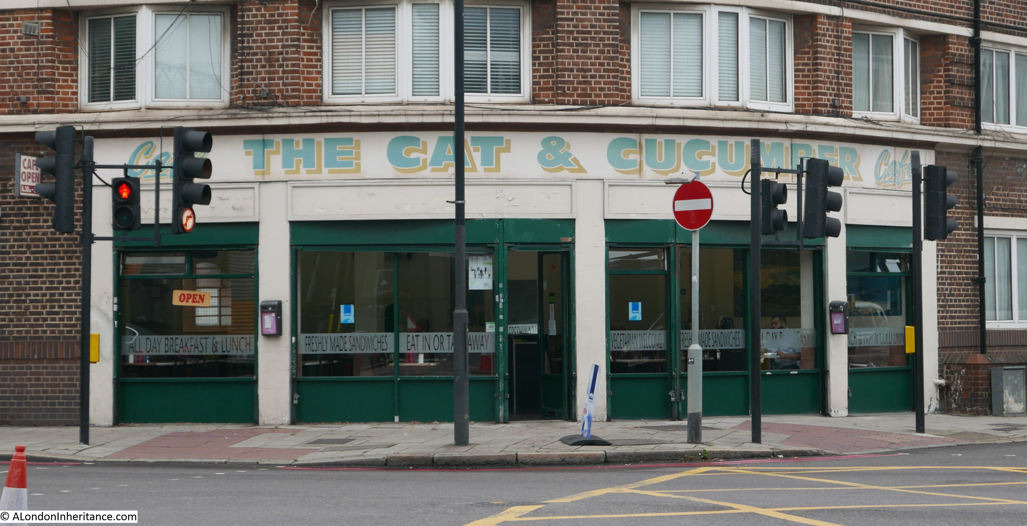
 Just outside the churchyard, at the junction of Tower Bridge Road and Druid Street is the wonderfully named Cat and Cucumber Cafe – a typical “greasy spoon” cafe (with excellent breakfasts).
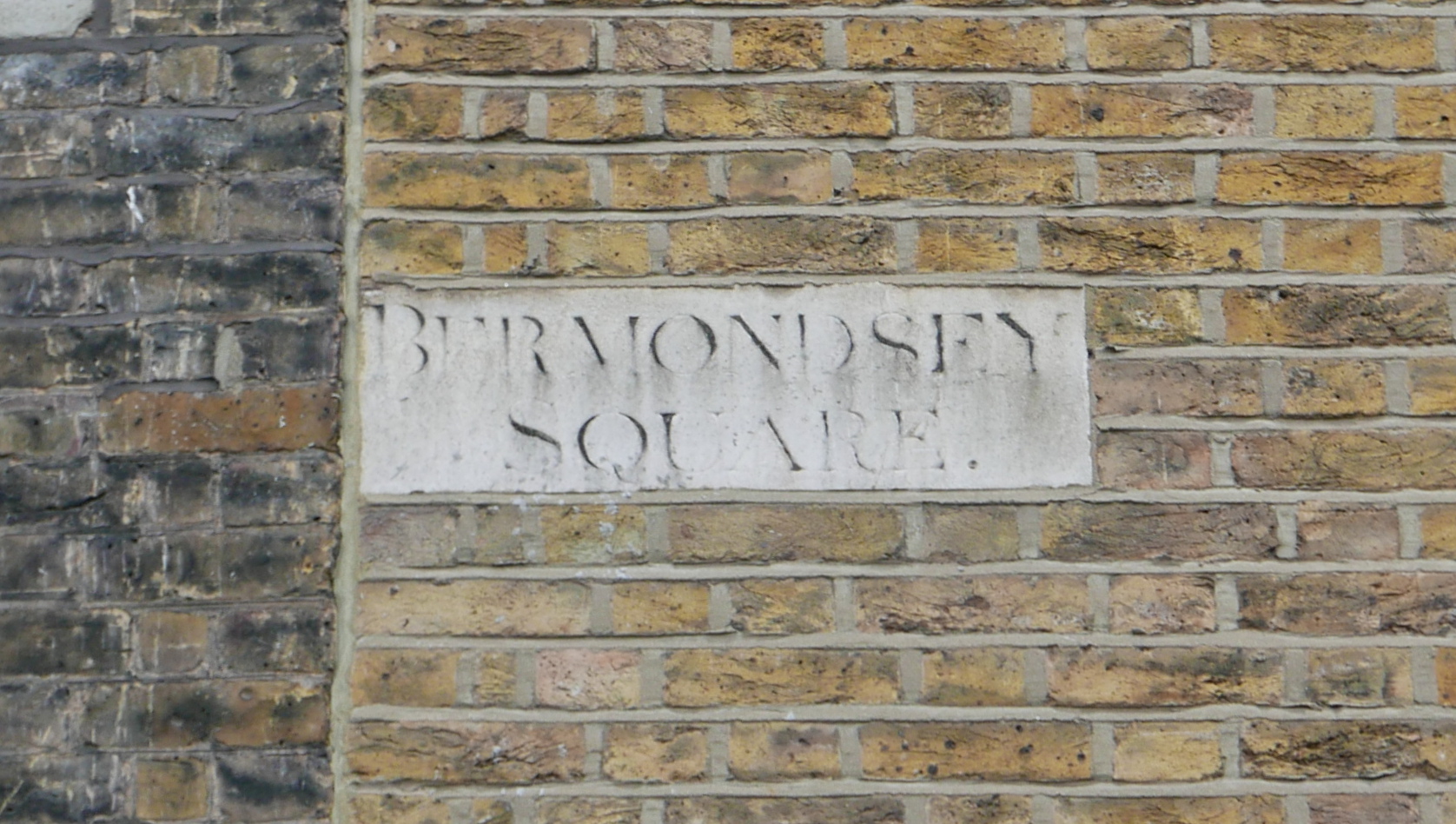
To get to the next location, it was a walk back along Tower Bridge Road, past the junction with Abbey Street to find the remains of Bermondsey Square:
Site 73 – Remains Of Late 18th Century Square
What was once an 18th century square, retains the name, but only a small section of the original buildings.
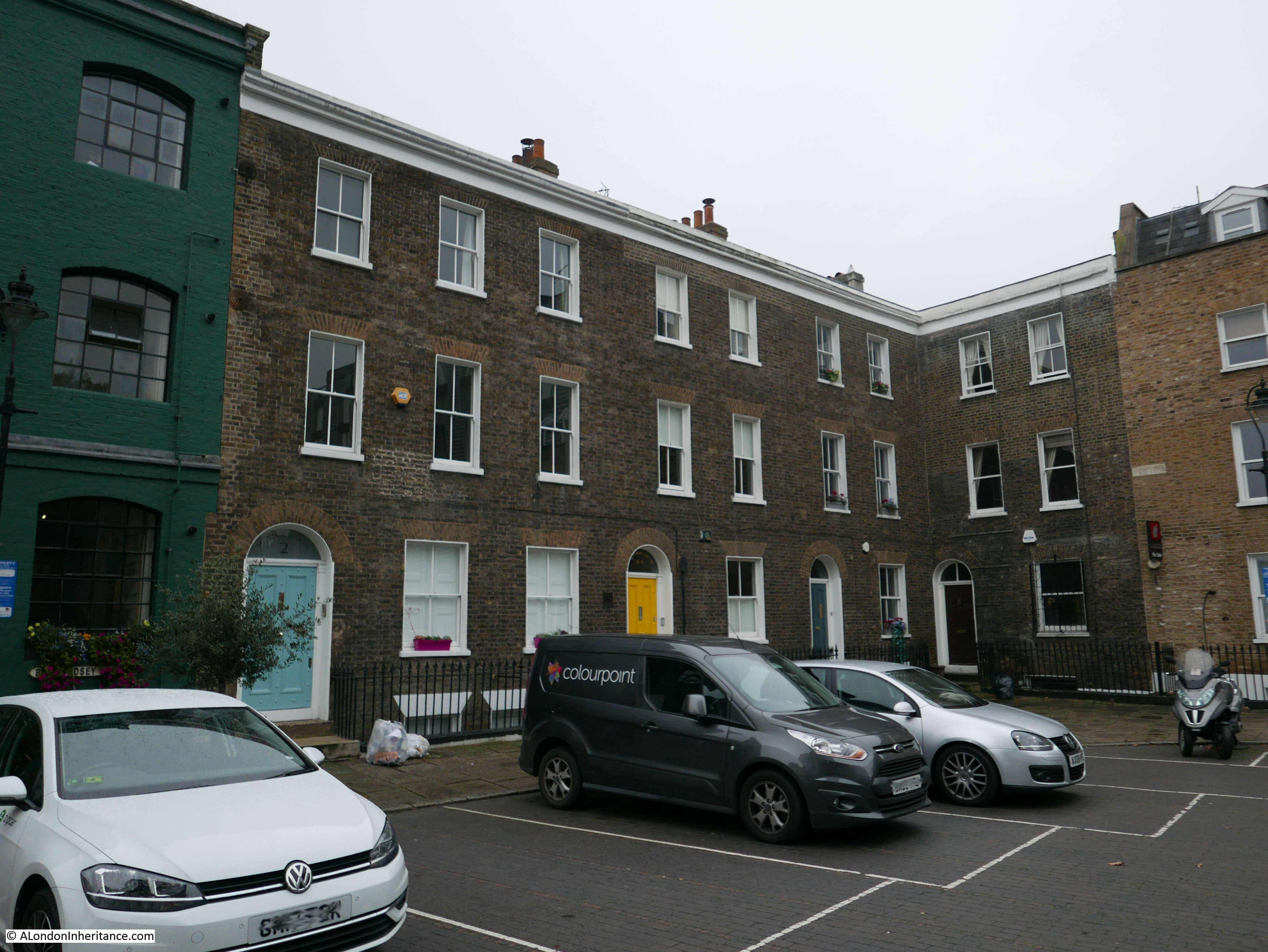
Much of the rest of the square is now occupied by recent developments, including a hotel, Sainsburys Local, and open space. These buildings, with their individually coloured doors did look slightly out-of-place in their new surroundings, but I am pleased that they have survived to give relevance to the name of Bermondsey Square.
The next location was a short distance further along Tower Bridge Road to the junction with Grange Road to find:
Site 74 – Late 18th Century Group
This is a short terrace of 18th century houses which now face onto a busy road junction:
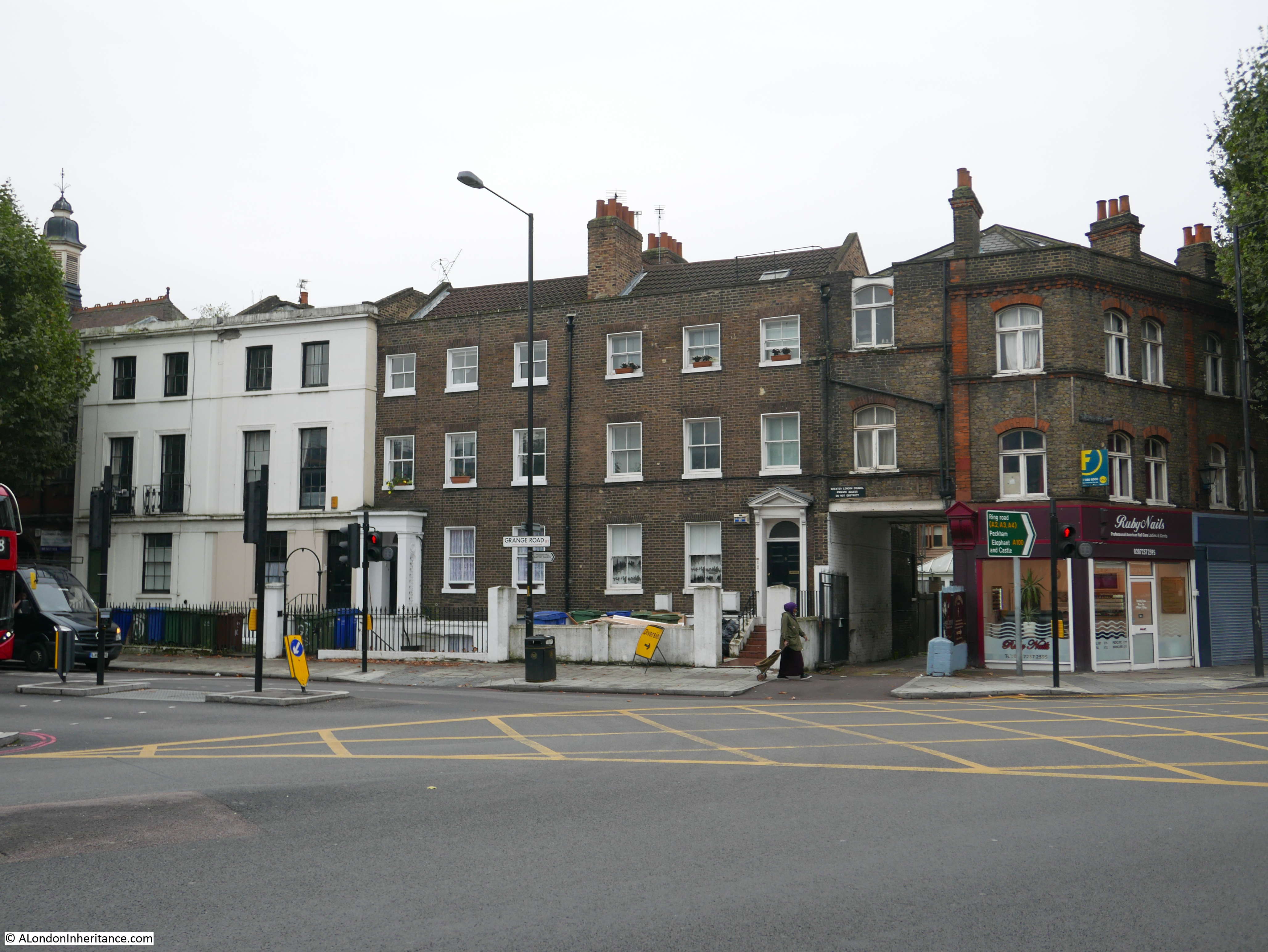
Above the entrance on the right of the houses there is a sign of a type that I have not seen before. Black background with white lettering stating “Greater London Council Private Access Do Not Obstruct”. I have seen plenty of do not obstruct signs, but not one prefixed with Greater London Council.
My final location for today’s post was opposite Bermondsey Square where a short walk down Grange Walk revealed a fascinating terrace of houses of architecturally different styles:
Site 75 – Late 17th Century Terrace
The first two houses:
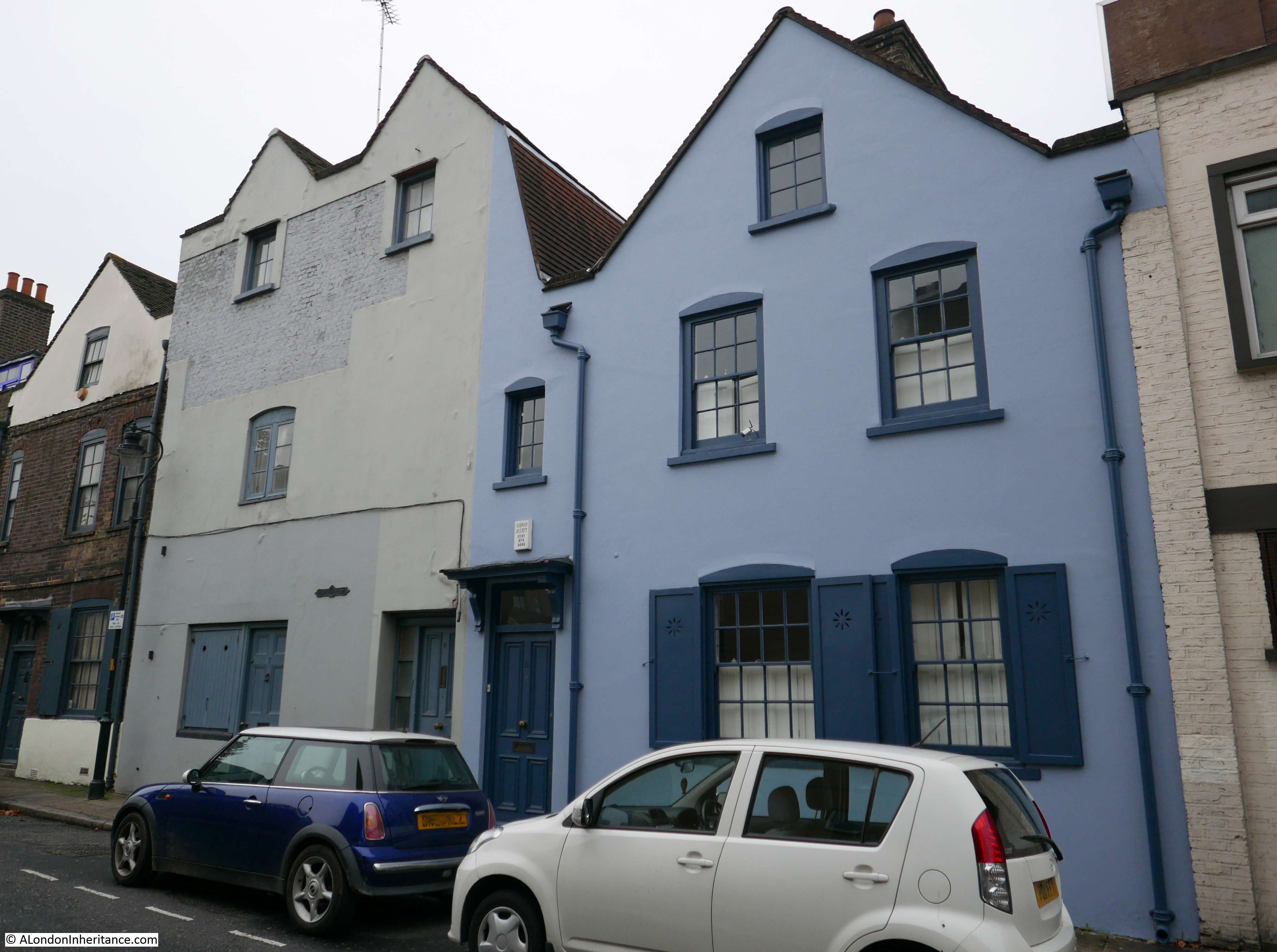
The rest of the terrace:
Within the structure of these buildings are apparently parts of the medieval stone gatehouse of Bermondsey Abbey as Grange Walk formed the southern extent of the Abbey’s grounds.
There are so many different features on these houses, evidence of building work over the years, there is a fire insurance mark on one of the houses – however I always feel rather strange examining in detail the facade of what is someone’s home. They are though a remarkable set of interesting buildings which contrast with the opposite side of the street which is all modern buildings
Looking back on the terrace of buildings in Grange Walk.
Bermondsey is a fascinating area, I have only scratched the surface in this post, but the 1972 Architects’ Journal was a good guide to find some interesting buildings.
Off the eight locations, one (location 69) has disappeared since 1972, and the church of St. John, Horsleydown has all but disappeared leaving only the plinth and lower walls remaining. Six sites have survived the intervening 45 years.
In my next post I will continue through Bermondsey and end up in Rotherhithe,
Fine way to start my Sunday morning, reading this. My mother’s family have origins in Bermondsey – 19th century leather worker/cat’s meat man – and I have spent some time exploring this area which is, indeed, fascinating. The change over the last 10 years is amazing and I am delighted that steps are being taken to restore some old buildings – though the price tag is eyewatering. That early 19th century print is interesting, given that I think the artist took many, many liberties if that is meant to be the depiction in 1805…where are all the buildings that were plainly already standing? Still, gives us some idea of what the place looked like in the early 17th century, I imagine. You seem to have had a great day out and I look forward to the next instalment.
I can think of only one word: excellent. As part of the ‘decline’ of the area, having been involuntarily moved out a week before my first birthday, I applaud what you are doing. I eagerly await the next episode.
Fascinating- thank you for this. I definitely will be retracing your steps around Bermondsey as I never realised what a wealth of interesting buildings still remain in site of the best efforts of the developers. Also fascinated by the old print of the Abbey showing the fields beyond, though as a previous correspondent remarks above, surely some artistic licence was involved!
Fascinating read.
Good to see these old buildings have somehow survived London’s obsession with replacing the old with the new. The houses on Bermondsey St/Tyler’s remind me of houses/shops in Faversham.
I enjoyed reading this very much.
J
Great Stuff – I look forward toward the next stage of your Bermondsey review as I used to work for 3 years in Spa Road Bermondsey back in the late 80s when it was still on the edge of apparently terminal decline, but with the merest hint of new developments coming with the refurb of the derelict Alaska building on Grange Road.
Many thanks as usual
This is part of London I don’t know – your article makes me want to visit it
next fine wekend
Very interesting article & looking forward to the Rotherhithe instalment!
Just one small correction Time &Talents was actually founded iin 1887 not 1895 Its 130 years old this year
Thanks for spotting that error. I will update the post
Quite where you found an explanation for the name of Simon the Tanner pub derived from an ‘Egyptian Saint’ I do not know. The true explanation is in this blog . . .
https://knowyourlondon.wordpress.com/2014/10/01/first-post-in-october/
– the information was provided by the Southwark archivist.
Hi Adrian, it is an interesting question. The references I found to Simon the Tanner all point to an Egyptian Coptic Christian who was also a shoe maker and lived in the 10th century. See the following sample of links: https://st-takla.org/Saints/Saint-Simon.html https://orthodoxwiki.org/Simon_the_Shoemaker http://www.copticorphans.org/blog/2011/10/st-simon-the-tanner-and-tomorrows-prayer-and-fasting-for-egypt/
The many references to him being a shoemaker and leather worker seemed relevant to Bermondsey, and the references to “Simon the Tanner” are the same as the pub name, however I suspect it is difficult to be 100% sure.
Does the Southwark archive have written records that the name was from the bible reference?
Thank you,Admin,for this post on Bermondsey. It is where I was born and lived for twenty three years until marriage transported me near to Bromley,so no distance really. In first year at grammar school we were taken for a walk all around here,as part of both geography and history lessons. I already knew most of it from my Dad, who as a lad was forever off rambling around London, looking and learning. It taught us to do the same. In those far off days you could leave home in the morning and roam for hours. Oh, it was a long time ago,but I still wander, look and learn, thanks to my freedom pass!
Eagerly anticipating your next post towards Rovverive!
This is where I was brought up and lived, until my mid 30’s and worked for companies that have long ago left the area. One note, it is South East London, not East, as that’s the other side of the river.
Yes, that confused me! Could have been better put.
Very interesting. Thanks very much.
It is interesting how these buildings have remained in tact,, given that this area suffered severe bombing during the Second World War. Equally post war rebuilding and slum clearance have changed the face of the areas near by. More recently former public housing has been demolished to be replaced by mixed developments, in the form of expensive flats, beyond the financial means of the original community who use to make up the area. Many of the previous inhabitants have long since escaped to the suburbs and beyond.
What a fascinating post. I was born in Bermondsey and write novels set there during the first half of 20th century. I recently went back on a research trip and walked the very streets you deal with here. You have uncovered some amazing details! I love all your research. Thank you.
A (non-poetic) translation of the memorial plaque:
Whoever comes here, and sees where I am
Must not forget, the one who was on Calvary
And consider seriously, while testing days persist
The delight to rise, to be at his right hand
A great read, I was born in Bermondsey in 1952 and lived in Vine Lane Buildings , the area holds lots of great memories having attended Tower Bridge Primary School . it was a thriving area and I quite often visit and walk many of the areas you had . Thanks.
Hi John, My mum also lived in Vine Lane buildings from 1938-42 and we have been trying to find photos of the buildings. Would you have any that you’d be willing to share please? Also, do you remember a catholic primary school near the buildings which we think was in Vine Lane.
Many thanks in advance for any information you may have.
Kind regards
Jill
I lived in Long Lane 198-83 and from my recollection there was no trace of an 18th century house at site 69 on the corner of Weston Street, which would have been opposite the Valentine & Orson pub (1960s and now demolished). I do remember loud pile-driving approximately at that location – presumably constructing a building that is now being already replaced by the flats development in your photograph. Prompted by this article I found some old photographs around Long Lane (https://www.flickr.com/photos/148112574@N05/) but none cover this exact location.