Firstly, a really big thank you to everyone who identified the majority of the sites in this post. The feedback as Comments or on Twitter has been fantastic. I have updated the post with details of the location. These are in italics to separate out from my original post. One reader also identified one of the remaining photos from my post last August. Have a look in the Comments section to see more feedback and some of the many links to more details.
Last August I published some of the photos taken by my father that I had been unable to identify the location or the event. Thanks to the considerable knowledge of readers, the majority of these photos were identified, including one which I had assumed to be in London, but was actually taken in Chester. The post can be found here.
My father took thousands of black and white photos between 1947 and 1953 (later photos would all be in colour). As well as family photos, they also covered London, the rest of the UK photographed during National Service in the Army as well as cycling holidays via Youth Hostels, as well as some taken in Holland during a cycling holiday.
I have identified nearly all the London photos, however there are a few remaining mystery locations that I have been unable to place and I am again seeking help with identification.
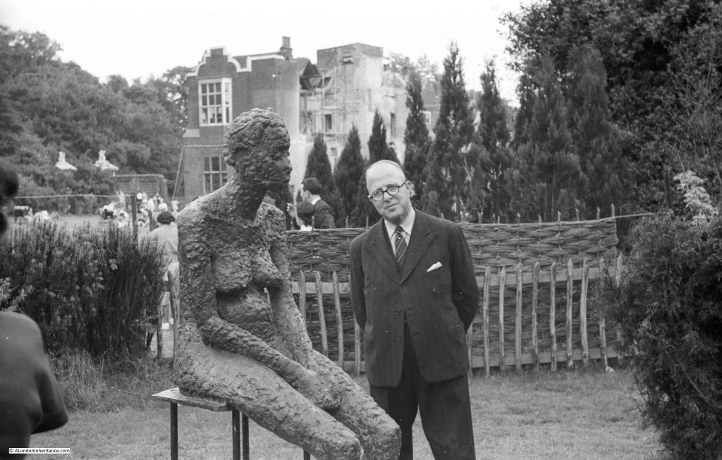
The first two photos are taken at the same location and show what looks to be a temporary work of art in the garden of a house which looks to be under repair, possibly due to bomb damage.
I do not know whether this was part of an exhibition, a one of piece of work, or the location. I am sure the location is in London as adjacent photos on the same negative strip show a bombed synagogue in east London along with views in Highgate, so this is possibly in the Highgate / Hampstead area.
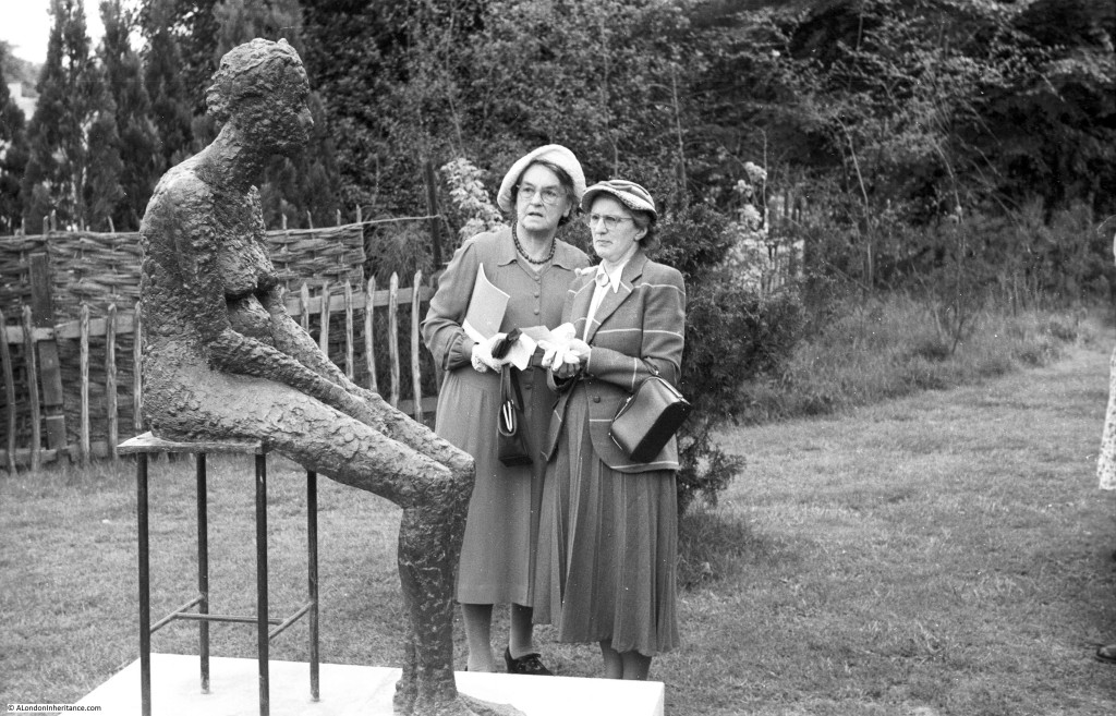
Given the way that these two are looking at the statue, I doubt it is to their taste. The woman on the left looks to be carrying a booklet, so I wonder if this was a guide and this work is one of several throughout the gardens?
The two photos above were taken at an outdoor sculpture exhibition at Holland Park. There is more information here and a British Pathe film of the event which can be found here. The film includes the sculpture in my father’s photo.
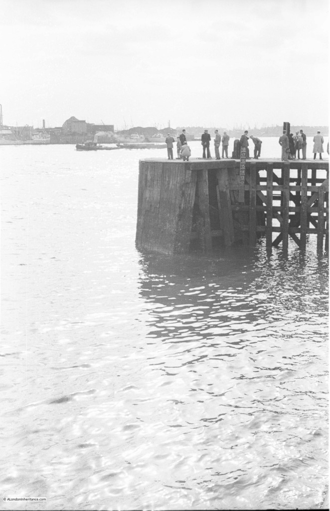
Many photos were taken along the River Thames. The majority I have been able to identify, however there are some, such as the following, which do not have any clear landmarks. The river in the distance appears to be curving to the left. This is one of three photos showing the same scene and I get the impression that the people are waiting for something. They are wearing jackets and some are wearing ties. They are possibly waiting for a boat to arrive at the jetty.
The consensus for the location of the above photo looks to be near the entrance to the Royal Victoria Dock at Silvertown, although there were a couple of other candidate locations identified. Adjacent photos on the strip of negatives were from the docks so Silvertown looks correct.
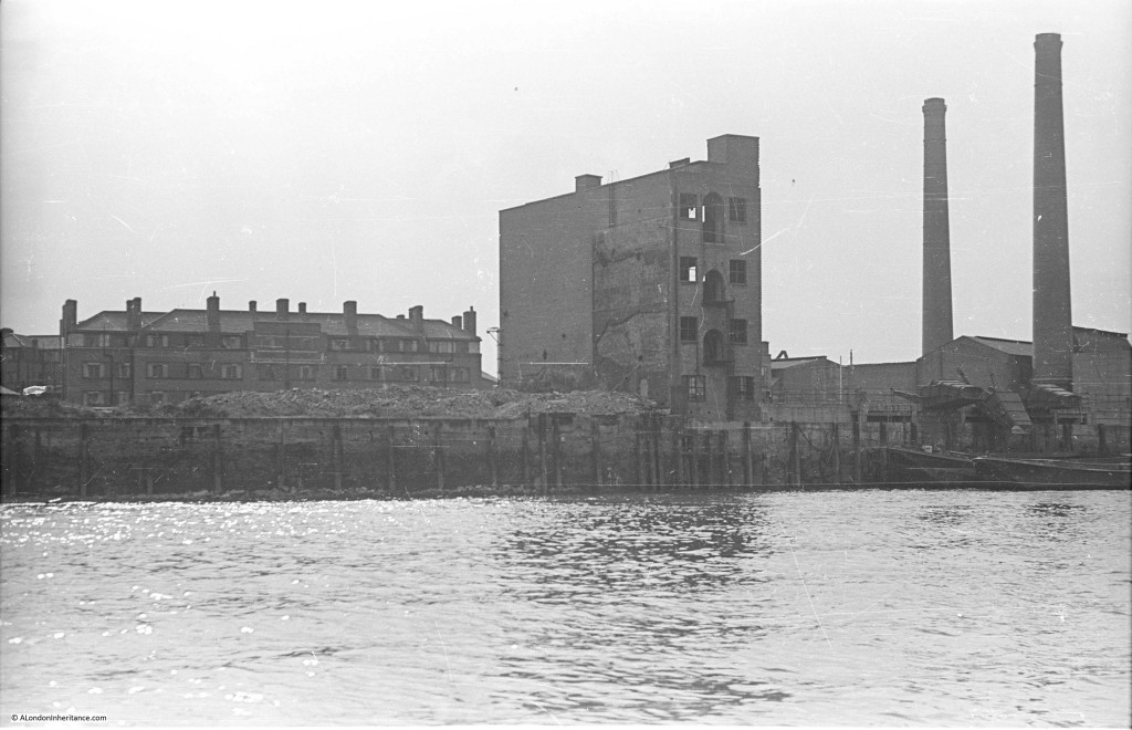
The following photo is one of a series taken on a boat journey down the Thames from Westminster Pier to Greenwich on the 23rd August 1947. I have been able to identify them all except for the following two. The first simply has “Rotherhithe” written on the rear of the photo. Normally there is a wharf or some other landmark which I can use to identify the location. There is nothing in this photo, although the two chimneys on the right should help.
The above photo is Upper Ordnance Wharf in Rotherhithe. There is a photo of the site here to confirm.
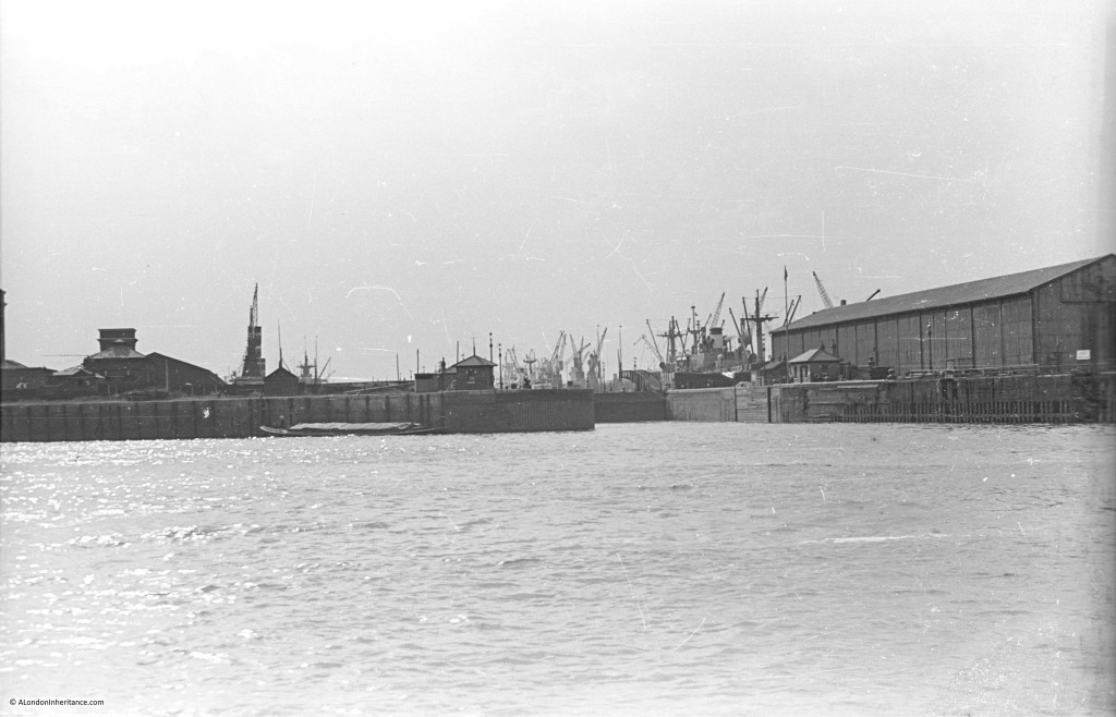
The following photo was taken on the same journey and I am sure is of one of the dock entrances on the Isle of Dogs, but I cannot identify which one.
The above I thought was on the Isle of Dogs but was in fact on the opposite side of the river and is the entrance to the Greenland Dock in Rotherhithe. The small building on the immediate left of the dock entrance is still there.
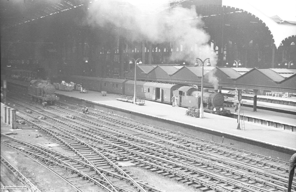
And now a couple of photos showing the rail side entrance to a station. Other photos on the same set of negatives were taken in the eastern side of the City and east London so this may be Liverpool Street, but I cannot be sure and there is nothing in the photos to confirm.
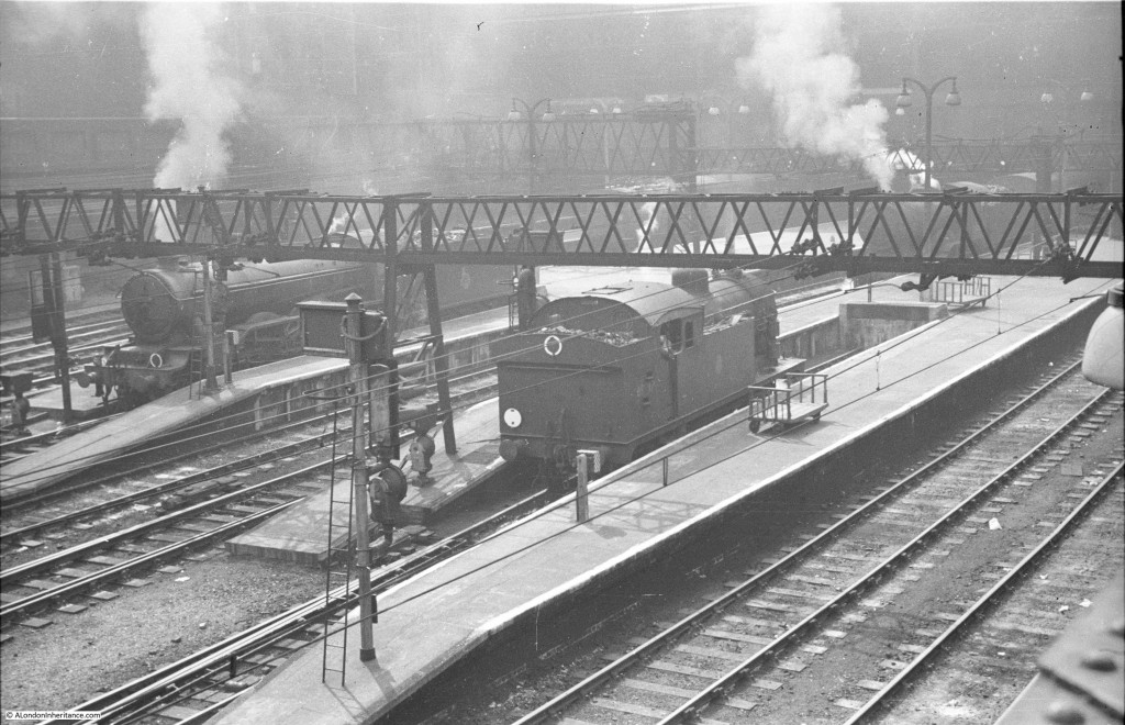
On the same strip of negatives, so I assume the same station.
The above two photos have been confirmed as being Liverpool Street Station.
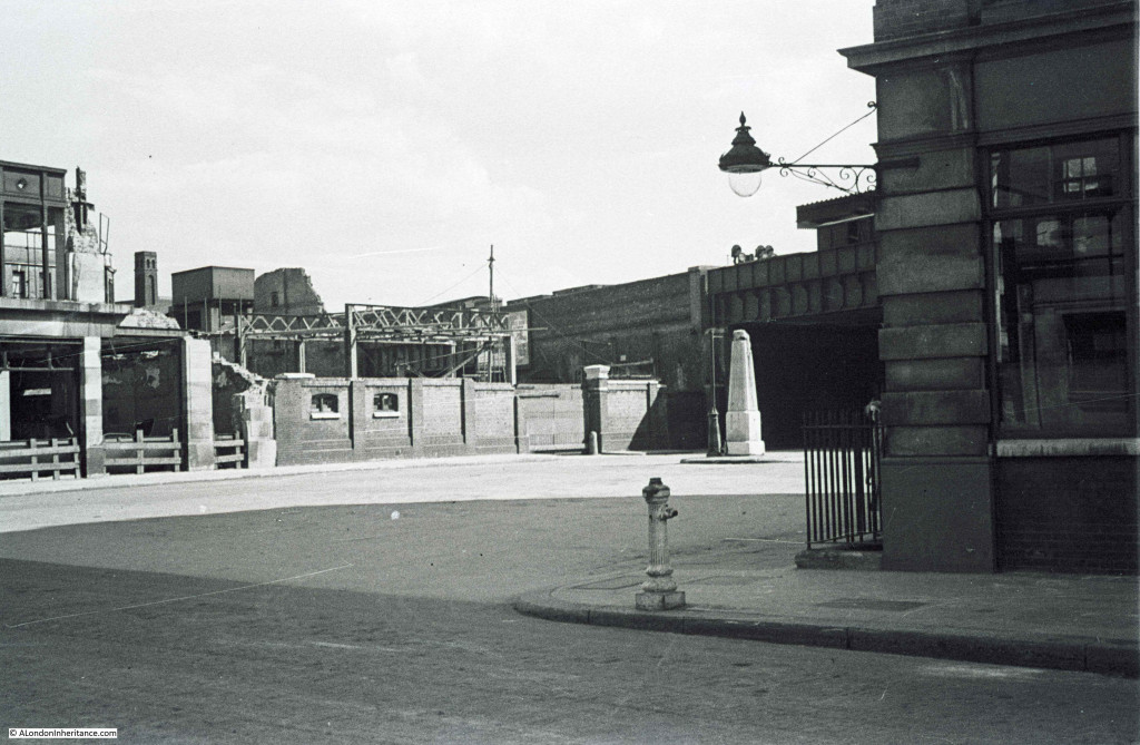
On the same strip of negatives as the following are photos of the area just north of the Tower of London. There is a bridge in the photo, so this may be the railway into Fenchurch Street station. Normally having a landmark such as the obelisk in the middle of the road would make it an easy photo to locate, however I cannot place this one.
Really pleased to have found the location of the above photo, America Square, just to the east of Fenchurch Street Station. There is a really good article on America Square here and a photo of the site immediately after bomb damage here.
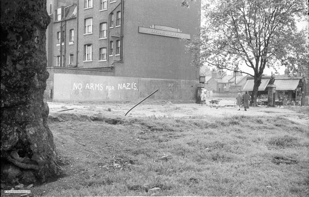
I can normally locate pubs where their name is visible, but I cannot track down this pub, the Masons Arms. As well as the location, I am also interested in why each photo was taken. I suspect in this one it was the “No arms for Nazis” graffiti, however given that this photo was taken post war I have no idea why this slogan would be relevant.
The consensus for the above photo looks to be the Masons Arms in Watney Market, Shadwell. The “No arms for Nazis” slogan probably refers to the argument for not rearming Germany in the early 1950s.
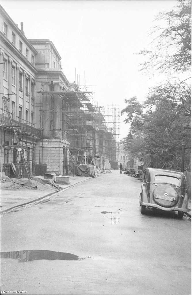
The next two photos appear to show the same row of buildings under various stages of repair. They appear to have been taken from opposite ends of the street and the first photo has more scaffolding so I assume taken earlier in the repair process.
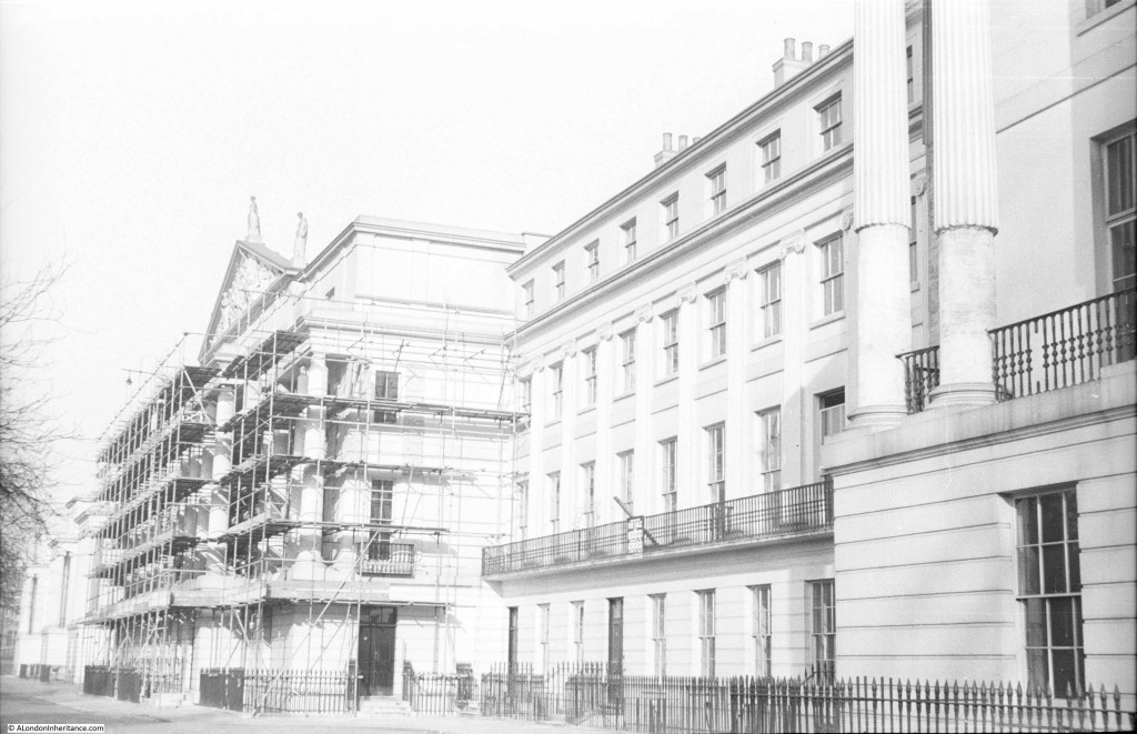
In the following photo some of the scaffolding looks to have been removed and there are two statues visible on the top of the building in the centre.
Lots of feedback for the above two photos as Cumberland Terrace, part of the Nash terraces along the edge of Regent’s Park.
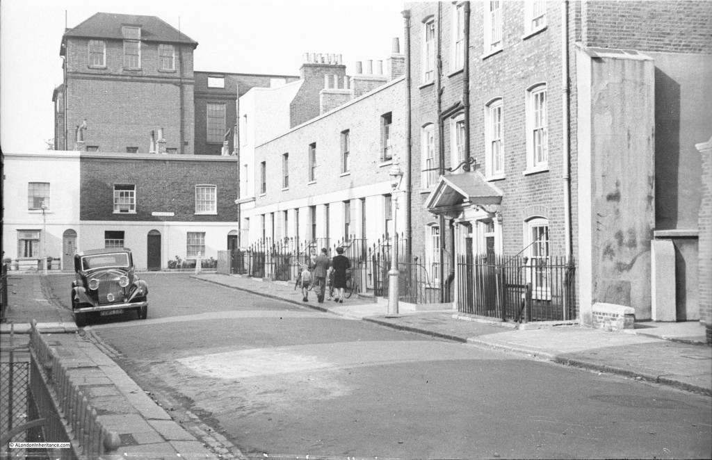
The following photo is one of the frustrating ones where there is a street name sign on the house at the end of the street, however the resolution of the 35mm film does not allow the name to be read despite trying many different scan options. The photo immediately before shows the bombed remains of Chelsea Old Church, so I suspect this photo is also in Chelsea.
The above photo is Lawrence Street in Chelsea looking north towards the far western end of Upper Cheyne Row.
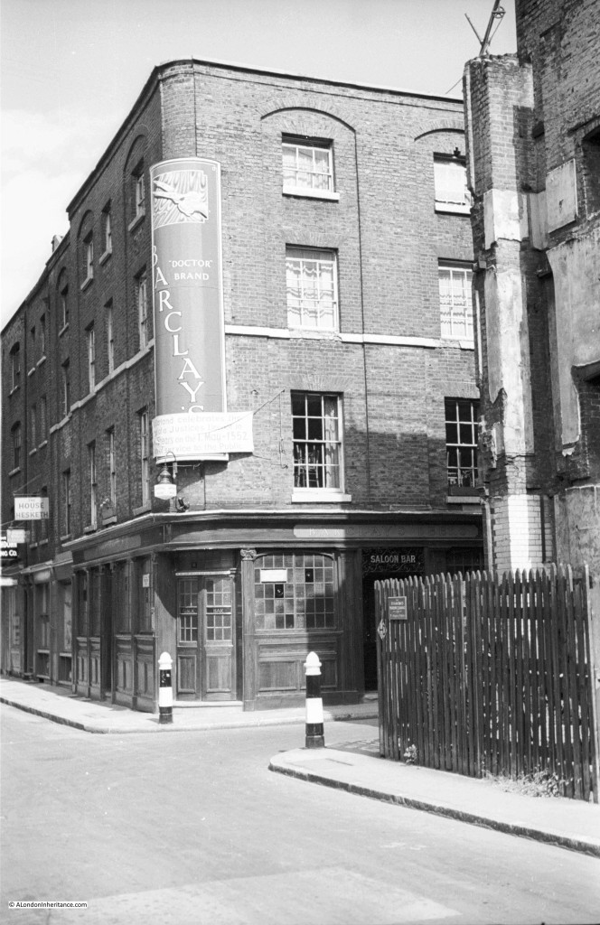
Another pub, and one which does not appear to have a pub name, although the words “Doctor Brand” are to the right of the brewery name Barclay’s.
The temporary sign across the bottom of the main sign with the brewery name reads:
Moorland celebrates the
grant of a Justices licence to
.. Shears on the 1st May 1552
…of service to the Public.
The left side of the sign is difficult to read as it curves away from the camera. I believe the significance of the 1st May 1552 is that prior to this date there was no licensing act and from this date onwards owners of pubs could apply for a licence, so was this a celebration of the fact that a pub on this site had been licensed since 1552?
Again, it is not just the location that fascinates me, it is the significance of the photo and why may father took them, probably due to this anniversary.
The above photo is of the Hand and Shears pub in Cloth Fair (one I really should have known having walked past and been in this pub a number of times). A pub has been on the site for many hundreds of years hence the reference to the 1552 grant of a licence.
The following photo is probably impossible to identify, however it is my (probably impossible target) to identify them all.
Photos on either side of this one are of Southwark Cathedral and a view of the Thames from Southwark Bridge, so I suspect it taken was on the south side of the river whilst walking from Southwark Cathedral up to the bridge.
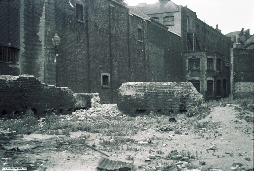 The above photo is probably around the area where the Globe now stands, leading back into the old Skin Market at the rear of Bankside.
The following photo is between photos of the area around the Albert Memorial in Kensington and photos of Hampstead, and I suspect it may be Hampstead, but I cannot identify the location.
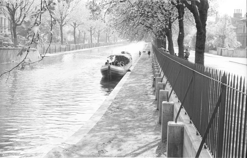
The following photo was taken on a sunny spring morning and I believe shows the Regent’s Canal. I have walked this in the past (before scanning this negative) and need to walk again, but cannot recall this scene.
The above view of the Regent’s Canal identified as being in Maida Vale, between Maida Avenue and Blomfield Road. Google Street View shows a much busier scene today.
My probably unrealistic target when I started this project was to identify all the photos both from London and across the UK (I plan to share some of the photos from across the UK later in the year as they show a country where towns still had their own unique features, there was little traffic on the roads and the heart had not been ripped out of many towns to create shopping centres).
Any pointers and help with identification of the above would be greatly appreciated.
Again, my thanks to everyone who contributed and helped to identify the locations of the above. My target of identifying all the locations of my father’s photos is starting to look almost realistic.

The second of the two buildings with scaffolding featuring statues is surely one of the Nash terraces in Regents Park – Cumberland or Chester. I was going to suggest Carlton House Terrace for the previous shot.
James – thanks, yes I am sure you are right. I have just had a look on Google Street View and think I can see the building with the statues, but it is mostly hidden by trees. I will have to take a walk. Thanks again.
You might get some help on the pub from this site:
http://pubshistory.com/LondonPubs/LondonPubIndex.shtml
Jan – thanks for the link. Looks a very interesting site. I have a few pubs to trace so will investigate further. Thanks.
Hello I believe the photo of the second pub was taken in Cloth Fair, Hand & Shears, 1 Middle St, London EC1A 7JA. The pub is still there and can be found not far from St Bartholomew the Great and near the one time London home of poet laureate John Betjamen. I think you may be right about the station being Liverpool Street station. The fancy canopy in the first picture is very similar to the canopy that is still there and can be seen from the upper level at the back of Broadgate. Your Dad’s pictures are fascininaing, what a wonderful resource and inheritance for you. It’s been a life enriching journey for you following in his footsteps I’m sure. I shall look forward to your readers identifying your mystery photographs. Thanks so much for a good read about my favourite topic, London past and present.
Best regards Rebekah
Rebekah, that is brilliant, thanks. I have just had a look on Google Street View and you are right, it is the same pub. It even has Est. 1532 written above the door which would confirm the age of a pub on the site and the banner on the original photo. I am sure the station is Liverpool Street, but I like to have some evidence before confirming I have the right location. I will have to take a walk around Broadgate. Thanks for your comments about the blog, really appreciated. Regards, David
Jo – name of the Hand and Shears is said to come from the opening ceremony at the great Cloth Fair held in Barts – at one time it was the largest cloth fair in Europe. It is said that the Lord Mayor opened the fair by cutting the first bolt of cloth – and this lead to the cutting of the ribbon that is used to open many other events. I suspect this might be said of other fairs elsewhere though…
The pub also has a first floor room called the Court of Pied Poudre – “dusty feet” where the market court sat when the cloth fair was in session. The idea was that people travelled to the fair from all over Europe, so justice had to be swift – and was done on site. But the current pub is more recent – but thought to be on a site of a guest house associated with St Bartholomew’s Prioty.
More about temporary fair courts here – https://en.wikipedia.org/wiki/Court_of_Piepowders
Was it just an annual cloth fair that evolved into the hedonistic Bartholemew Fair, or was there a separate and more regular cloth market?
More about the series of open air sculpture exhibitions held at Battersea Park and Holland Park from 1948 and 1966 here:
http://www.tate.org.uk/art/research-publications/henry-moore/jennifer-powell-henry-moore-and-sculpture-in-the-open-air-exhibitions-in-londons-parks-r1151300
It seems the exhibitions were stopped by a Conservative administration as a cost-cutting measure, then revived for a while in the 1970s again, before ceasing for good.
Andrew – yes, I saw there were also sculpture exhibitions in Battersea Park as well. I was looking on eBay to see if I could find any of the brochures for Holland Park. There were not any for sale for Holland Park but were several copies for the Battersea exhibitions. Perhaps a larger and more well attended site.
More about attendance figures here: https://municipaldreams.wordpress.com/2015/07/21/lcc_open_air_sculpture/
It seems that the first two exhititions at Battersea Park had very good attendance, over 150,000 in 1948 and 110,000 in 1951 (despite the competition from the Festival of Britain). The move to Holland Park in 1954 saw a drop to 60,000, then 72,000 in 1957, but it seems the attendance did not increase much when the exhibition went back to Battersea Park in 1960, 1963 and 1966.
I see the Hand & Shears pub has already been suggested, but just thought I’d add that there’s an up-to-date photo on the ‘Beer in the Evening’ guide which shows remarkable continuity with your Dad’s original photo here:
http://www.beerintheevening.com/pubs/s/29/2902/Hand_and_Shears/Barbican
Best wishes, Tim
Thanks Tim, yes that photo looks almost the same. Never need an excuse to visit a pub, so I will have to head to this one. Regards, David
I’m pretty certain the last one is at Maida Vale: a view like:
https://www.google.co.uk/maps/@51.524263,-0.1777629,3a,20.7y,222.64h,86.2t/data=!3m6!1e1!3m4!1sa5TbuezB3B_3S51xRfMZ4Q!2e0!7i13312!8i6656?hl=en
The concrete supports match up, as does the shape of the wall on the left.
If you move west a bit you can make out the distinctive shape of the first tree:
https://www.google.co.uk/maps/@51.5241191,-0.1780791,3a,15y,194.64h,90.99t/data=!3m6!1e1!3m4!1s32Nq7_nIgA8lt1PNnQuN1g!2e0!7i13312!8i6656?hl=en
Henry, that is remarkable, thanks. The distinctive shape of the tree is very clear and looks to be in the right position. The canal looks considerably busier and with far more greenery along the side than when my father took the original photo. Thanks again, david
The photo of the two ladies looking at the sculpture deserves a prize! Look forward to your posts and love a good mystery.
Thanks Vicky. Yes, I would love to know what they are thinking about. Fantastic expressions.
Another interesting blog,Admin! I was beaten to it with the Hand and Shears in Cloth Fair,probably a nod to the clothing and tailoring establishments around that area? The Taylor and Walker Masons Arms seemed to ring a bell as being around East Street,Walworth,but when I checked on google map,it’s the wrong building. Oh well,back to the research!
Thanks Jo. The Masons Arms has beaten me. I can usually find a pub when the name is clear but not this one, so I doubt it is there now, but hopefully someone may remember this one. Regards, David
have posted on twitter, but think the Masons Arms might be Watney Market, Shadwell. Can’t find any definite confirmation, but would fit in with other photos taken in that area.
Reference to it here – http://spitalfieldslife.com/2013/02/25/tony-bock-at-watney-market/
open space with mature tree would fit on map as grounds of Christ Church, Watney Street – see http://www.stgite.org.uk/chchwatneystreet.html
bomb damage to area 1941 and re-developed post war.
Had a shufti through the excellent Lost Pubs Project site (http://www.closedpubs.co.uk/) looking for Masons Arms in London. None of the ones for which they have photographs looks at all like yours, but there are four possibilities for which LPP doesn’t have photos. All four seem to have been demolished and vanished without trace upon checking Google Maps, but here are their addresses just in case you want to do deep level research:
169 Grange Road, SE1
31 Harper Road, SE1
19 Besson Street, New Cross
121/123 Bow Common Lane
Thanks for the addresses, I will investigate further as I do want to locate this photo. Lost Pubs Project site looks really good.
I think we can scrub Harper Road: photo found (http://pubshistory.com/LondonPubs/Newington/MasonsArms.shtml) looks dissimilar.
The canal photo looks very much like the Maida Avenue area of Little Venice too.
I’m less sure of this, but I think the dock entrance might be to the Surrey Docks:
https://www.google.co.uk/maps/@51.4957189,-0.0326058,3a,55.1y,192.61h,87.92t/data=!3m8!1e1!3m6!1s-ucu8Eo9wWjI%2FU6dqqh-3IoI%2FAAAAAAABPcA%2Ff11-egQ4VVU!2e4!3e11!6s%2F%2Flh6.googleusercontent.com%2F-ucu8Eo9wWjI%2FU6dqqh-3IoI%2FAAAAAAABPcA%2Ff11-egQ4VVU%2Fw203-h101-n-k-no%2F!7i4000!8i2000!6m1!1e1
The stone colouring on the square building matched up, and there is some sort of footbridge visible. Obviously, that area has changed so much it’s very hard to say for sure.
Yes, that looks right. The square building looks to be the one remaining feature. I had assumed it was one of the entrances to the docks on the Isle of Dogs as the photos on either side of this one on the strip of negatives were of the Isle of Dogs, but he must has looked over the other side of the river to get this one. Thanks
The fourth one down-the one with the chimneys- is looking toward Rotherhithe Street (StreetView: https://www.google.co.uk/maps/@51.5058215,-0.0343895,3a,90y,247.19h,96.99t/data=!3m6!1e1!3m4!1sCTmX9ROXkzoJrRML3e7BUg!2e0!7i13312!8i6656)
Found it by looking at a 1949 OS map. Map grid ref is TQ3680.
One chimney was for Upper Ordnance Wharf and the other was for a lead works. The warehouse in your photo appears abandoned but the doors are still there and it could still be in use at the time.
Thanks, thought this one could be difficult to find. I will have a look at the map reference.
This is pure guesswork, but the bridge and obelisk photo might be here:
https://www.google.co.uk/maps/@51.5113215,-0.0758965,3a,67y,162.91h,81.8t/data=!3m6!1e1!3m4!1saD__xxSaeSxNceZ3kaS1eQ!2e0!7i13312!8i6656
The ironwork on the bridge matches up, as does the angle of the railway. Clearly the railway could have used the same bridge design crossing other roads, however…
Henry, yes I had wondered about that location when walking the area. You are right that the bridge does match up however the surrounding area has changed so much. I will have to dig out some old maps and see if there is any reference to an obelisk being in this location.
Yes – this is it. America Square looking south.
picture immediately after raid here – http://100minories.lparchaeology.com/the-london-school-of-navigation/america-square-v1-bomb-damage-1944/
(caption says 1941, but link refers to V1 in 1944)
This one had been bugging me – the railway buildings on the bridge suggested a station – neither Shadwell & St George in the East or Leman Street stations fitted. hadn’t thought of the building being the far end of platform at Fenchurch Street.
That is fantastic, thanks. The photo clearly shows the location and the bomb damage. Thanks for the link.
and more about America Square (including more photos including of the obelisk) at http://www.commuterconsultant.com/2014/03/lost-london-america-square.html
This confirms that the bomb damage was a V1 in 1944.
That is a fascinating article about America Square and some great pictures of the obelisk. A shame there is no record of what happened to it. I cannot believe that something that lasted for 200 years was simply destroyed (having said that, with the way redevelopment often takes place I would not be surprised if it was simply lost). Thanks again for the research.
Henry, your guess very much matches up with historical photos of America Square. Take a look here:
http://www.commuterconsultant.com/2014_04_01_archive.html
The photo showing the devastation caused by a V1 strike in 1944 also shows the obelisk and the viaduct. Other photos show the brickwork of the corner of the building matches that in the original photo.
The Rotherhithe photo is Upper Ordnance Wharf. You can see it also here:
http://www.museumoflondonprints.com/image/322715/avery-illustrations-thames-riverscape-showing-upper-ordnance-wharf-1937
I am certan the “Isle of Dogs” photo is not the Isle of Dogs. Nothing is recognizable, and note the arched footbridge. Only one entrance lock had such a bridge, the Millwall Entrance Lock, but this was long closed (and there were flats to the side) by the time of the photo. I think it is also the other side of the water, in Rotherhithe.
Mick, thanks for the link to the photo, that confirms the location. I have a photo of the Millwall Entrance Lock taken on the same trip in 1947 showing bomb damage to the dock entrance. I will e-mail to you to confirm.
This is the Rotherhithe photo, Greenland Dock entrance:
http://www.museumoflondonprints.com/image/322705/avery-illustrations-thames-riverscape-showing-greenland-entrance-dock-1937
Hi David,
Yes, your first correspondent was correct. The two ‘photos of a building with scaffolding up is, in fact, Cumberland Terrace, taken from North and South ends of the terrace
Looks like they were cleaning the Stucco facings – the second ‘photo appears to be a lot “whiter”.
The building in the background of the first photo looks (a) vaguely Jacobean and (b) bombed. Could it be Holland House, which would fit on both counts?
Malcolm, yes, the consensus seems to agree that this is Holland House. I will have to visit.
The final photo is of the Regent’s Canal taken at the beginning of Blomfield Road, a few yards from the Maida Vale section of the Edgware Road and the Maida Hill tunnel.
I was pleased to see your dad’s picture of the Hand and Shears. I live quite nearby, and it’s very interesting to see what that pub and the area looked like fifty or sixty years ago.
I enjoy your posts very much. Your dad’s photos are such a rich inheritance for you, and I’m so pleased you share with us.
Thanks Alison, really appreciate the feedback. It is interesting how once you know the location of this pub, very little has actually changed. The changes to the pub are mainly cosmetic.
Have a look at the third photo here: http://londonphotoroutes.com/2015/03/18/holland-park-area/ and the illustration here: http://www.artvalue.com/auctionresult–searle-ronald-william-fordham-sculpture-exhibition-in-hollan-2783733.htm It must have been the 1954 exhibition in Holland Park that so upset the two ladies.
Thanks Baldwin. the link to the artvalue site is interesting. This must have been one of his very last black and white photos in London in 1954.
This one nails it I think 😉
http://www.britishpathe.com/video/open-air-sculptures-exhibition/query/Park
Baldwin, that is exactly it. At 1 minute 53 into the video there is the same sculpture as in my dad’s photo. Many of the people also have a brochure that one of the two ladies was also holding. I love the British Pathe description “Arty looking students examining various exhibits.” No wonder the two ladies looked either shocked or disapproving. Thanks for the research and link. Really appreciated.
Also at :30s here –
http://www.itnsource.com/en/shotlist/RTV/1954/05/27/BGX501130119/?s=Our%20sculptors%20are%20wonderful
Ian, excellent, thanks. The video has the sculpture in the photo by my father. It was all probably considered very modern art at the time and no wonder resulted in the reactions in the photos.
1954 was also the first year that Holland park was opened to the public, having been bought from the Earl of Ilchester by the London County Council in 1952, for a quarter-million pounds. Holland House was basically destroyed by heavy bombing in the midst of the Blitz on the night of 27-28 September 1940. It had deteriorated so badly since then that the LCC decided on demolition of all but the ground story & arcades of the central block plus the east wing. The latter is what can be seen in the background of the first photo ~ & also, on the far left, I think, the griffins on top of the gateway (attributed to Inigo Jones). The east wing was restored & re-opened, by the queen, as a youth hostel in 1959.
I rather hope you surprise yourself by finding another cache of hard-to-identify photos this year, David. The problem-solving skills of this blog’s regular readers are really impressive!
Hi Geraldine – I did not know that Holland House had been so badly damaged during the war. It is one part of London that I have not been to for some time and not really researched. I will have to change this.
I agree about the problem-solving skills. Fantastic feedback and have located nearly all the photos. The link to the British Pathe film on the exhibition at Holland Park was fascinating as it included the sculpture in the photo.
The frustrating one is Lawrence Street looking north towards the far western end of Upper Cheyne Row. The red building in the background, a school, has been pulled down for redevelopment this year. Email if you need the google street view details. James
Thanks James, when I checked on Google Street View the building in the background seemed covered in sheeting so I suspect this was in the process of being pulled down as you state.
In case you weren’t aware, Street View now allows you to see their older images – a click on the date at top left will reveal a timeline. Click on a dot, then the thumbnail image above to view the full-size image. Here’s Lawrence Street in 2008, with the school in all its glory.
Thanks Nick, I did not know that was possible. Good to see the original building in the background.
The LCC school in the background was the red bricked Cook’s ground later called Kingsley on Glebe Place. I started school there in ’39 and left in ’48. I last saw the school in ’14 when it was just a shell of walls. I was run off the property by a white hard hatted “Arab”?!
Image 15 is Laurence Steet in Chelsea. Looks almost identical today.
Thanks Angela – yes, checked on Google Street View and it is almost the same. I will have to take a walk around the area.
pictures 10 & 11 – yes, was sure this was Liverpool Street at first glance (locomotives right for that bit of ex LNER / GER, can’t think of any other London terminus you could get that sort of viewpoint from) but have now done some research to back this up.
https://www.flickr.com/photos/loose_grip_99/1743749047 shows the station roof. Don’t think you can view it from the same angle now, as a lot of the land at the ‘country end’ of Liverpool Street has been redeveloped.
Also, the second photo shows overhead wire electrification – no other London terminus had this in 40s / 50s. Liverpool Street – Shenfield line electrification works started pre 1939 but due to the war, it was not completed until 1949. (Not all platforms would have been electrified initially.)
re graffito on Masons Arms – I can find references on the web to “No Arms for the Nazis!”: European Trade Union Conference on Collective Security, Berlin, 1954.
Peoples History Museum, Manchester, have a banner “No Arms for Nazis” in their collection – their website seems to be poorly today, so while I can see an image via google search, I can’t get any info, but obviously some sort of campaign.
This would fit with Stepney area – quite a history of anti-fascist activity in the area (e.g. Cable Street), communist party MP (Phil Piratin) elected in 1945.
Yes, you are right the images of the station roof do look identical, that also fits with the locations of photos either side on the same negative strip as they are all from the same area.
Thanks for the information on the “No arms for Nazis” graffito. I will have a look at the Peoples History Museum website in the next few days, see if it get’s better. It must have been a campaign of relevance at the time as I am sure this is why my father took this photo. There is nothing else in the photo that would justify the scene.
Wonderful blog! So interesting! Love how so many followers have
helped solve the mysteries.
Thanks Linda – yes, it has been incredible the amount of information fed back on these locations. Even a link to a British Pathe film that shows the sculpture in Holland Park that my father photographed.
The sixth photo is indeed Liverpool Street station. The shape of the arches on the right hand side of the image matches this photo taken in Exchange Square at the back of the station:
https://goo.gl/maps/CYyaKeo7pSH2.
The lamps being the same in the sixth and seventh pics surely means that one’s from Liverpool Street too.
Elizabeth – yes they look exactly the same. Thanks for the link to the photo from Exchange Square.
Can’t help with the locations, but “No arms for Nazis” relates, I think, to the controversy of the early 50s as to whether Germany should be allowed to rearm.
Thanks Adrian, that would make sense. I could not work out why this slogan was relevant after the war but I suspect there was still an association between the Nazis and Germany for those that had been through the war.
I’m 99.98% certain that the jetty in photo one was located near the entrance to the Royal Victoria Dock at Silvertown. You can see the jetty at the bottom of this photo (it’s the one to the right) taken in 1938. Note the metal structure to its left, you can see the remains of that structure to the left of the only woman in the photo taken by your dad.
These people are not waiting for a boat to birth (it is obvious that it is not a commercial pier), but I believe they are waiting for a boat to pass by. Look closely and you’ll see that virtually all the men are carrying bags, camera bags. Look at the man to the very left, his stance would indicate he is taking a photo with a “box brownie” camera.
Any idea when the photo was taken, or was there any related photos of a passing vessel?
Rob, thanks for the link to the Britain from Above photo and I agree it does look to be the right location. There are three photos in total taken at the same place showing the same group of people and in one of the others you can also clearly see a camera. The photo was taken in 1947. I assumed they may have been waiting for a boat as they had jackets and ties, rather formal dress just to go ship spotting. There are other photos of the docks on the same negatives, but no photos of a passing ship so the reason they are there will have to remain a mystery.
To confirm 47Bus’s identifying Watney Street as the location for the Masons Arms, here is an O/S map from 1948 that clearly shows the location of the pub with the two remaining shops across the street and the entrance to Christ Church, shown in the photo by the two remaining gateposts.
Rob – thanks again. Good to have the confirmation.
The impossible-to-identify photo in Southwark really reminds me of some old photos I saw once of the site where the Globe Theatre now stands and the old ‘Skin Market Place’ which is now where the Globe’s goods yard/car park area is. It would make sense with the location of the previous/following photos you mention. if it’s not that exact site, the Bankside area was a warren of alleys and yards until as late as the 1970s, so this could well be an area to examine. I will try and look for some old photos to compare it to.
Chris – I agree it does look to be around that area which was a warren of alleys. I have walked around the area to see if any of the buildings could still be there, but cannot find anything that matches the photo, but as you say with the Globe Theatre and all the other development in this area, the buildings are probably long gone, but would be good to try and trace this one. Interesting blog you have – the “On the street where I live” post is interesting. That is a rare survivor.
The last photo is Maida Avenue looking west
Thanks Gentle Author. Yes, Maida Avenue and Blomfield Road. Google Street View shows a much busier canal today.
Another confirmation of the Liverpool St location comes from my father, 80 years a Londoner and a transport history and enthusiast and now a volunteer at the London Transport Museum. He writes: “The platforms are the ones on the west side of the station, the pictures being taken from the street at the northern end of the station, which was then open to the sky; since then buildings have been erected over the tracks. The pictures don’t include the tracks nearest the street which are directly below the viewpoint; at this time these were the only ones equipped for overhead line electrification, none of which is visible.”
Martin, thanks for this further confirmation. I remember that buildings have been constructed over the majority of the station. Not sure if any of the entrance or the tracks into the station are still visible. Plan to take a walk in the area to take a look.
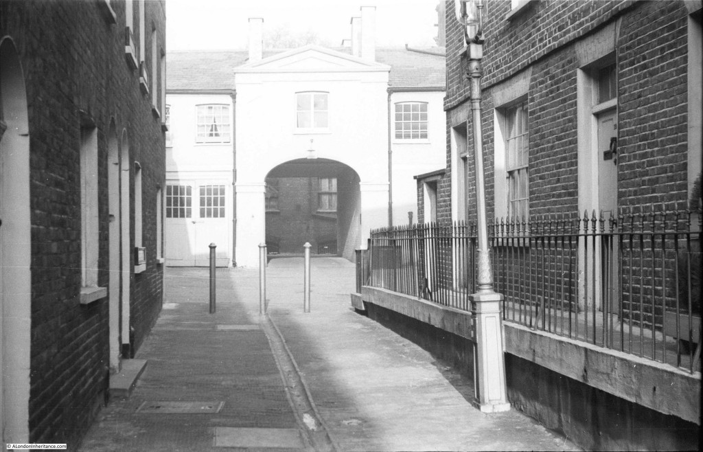
Mystery Location 3 is Old Barrack Yard, a tiny street to the south of Knightsbridge. The City of London’s Collage site has photos of it from the 1960s and 1970s at bit.ly/1TDJO5y .
Malcolm, thanks again. This is one location I thought could be impossible to find. The Collage photos confirm this location, but looking at the area now it appears to have been completely redeveloped although Old Barrack Yard is still marked on the map. Thanks for your help with these difficult locations, I really appreciate your investigative work.
Old Barrack Yard still looks very much as it did when your father photographed it. The main change is that the building visible through the arch has been replaced by something newer, which towers oppressively over the yard. Apart from that, the changes are only cosmetic.
Mystery location number 13 has been bugging me ever since I first saw it. One of your commenters suggested that the key to identifying the location might be the two storey building that juts out and which should show up on a large scale OS map. He was right. I wasn’t convinced by the suggestion that the location was somewhere near the site of the new Globe Theatre on Bankside. The large scale 1951 OS map of the area (courtesy of the National Library of Scotland’s website) seemed to show nothing near Bankside that matched the buildings in the photo. While looking for something completely different, I’ve spotted that in the early 1950s the buildings on the southern side of Angel Place, an alley off Borough High Street, did match the photo:
http://maps.nls.uk/geo/explore/#zoom=19&lat=51.5017&lon=-0.0919&layers=173&b=6 .
The following archive photos confirm the identification:
http://collage.cityoflondon.gov.uk/view-item?i=118120 (taken 1963)
http://collage.cityoflondon.gov.uk/view-item?i=178799 (taken 1961)
Present day maps still show Angel Place as an alley off Borough High Street but it’s now about 20 yards further south than when your father photographed it. In the NLS link above I’ve overlaid the 1951 OS map over the modern OpenStreetMap. By varying the transparency of the overlay you can see how Angel Place has moved.
That’s quite some detective work. Is that them all identified, then?
Here, by the way, would be the view now – https://goo.gl/JP0JnL – a private plot of land, a car park of course, in a nondescript backstreet of the Southbank. I wonder if that strip of wall behind the metal fence may be constituted by the one in your father’s photograph?
The wall in the Streetview picture runs along the southern side of the present Angel Place. It therefore isn’t part of the wall in the mystery location photo, which would probably have gone across the car park.
The Streetview wall is, in fact, the only remaining part of the Marshalsea Prison. It was the south wall of the prison. The wall in the mystery location photo seems to have followed the line of the prison’s north wall: compare this 1843 plan of the prison with the 1951 OS map: http://www.bl.uk/onlinegallery/onlineex/crace/p/zoomify88307.html. Whether the wall in the mystery location photo actually incorporated some of the north wall of the prison is more debatable but it’s quite possible.
Malcolm, thank you for this, a remarkable bit of investigative work. As you say, the Collage photos confirm the location. This was about the last of the unidentified photos. There was one I featured in one of the posts which was my own fault for not looking closely at the series of photos on the same negative strip which identified St. Pancras Old Church, the subject of last week’s post, but the photo you have identified I must admit I thought I would never find the location.
The Collage photos imply the wall may have been part of the old Marshalsea Prison and this may have been why my father took the photo – that is always the next stage after finding the location, trying to understand what was of interest in the specific place for him to photo.
Thanks again for your work on this, really appreciated.