Yearly Archives: 2014

Londoners – 1953

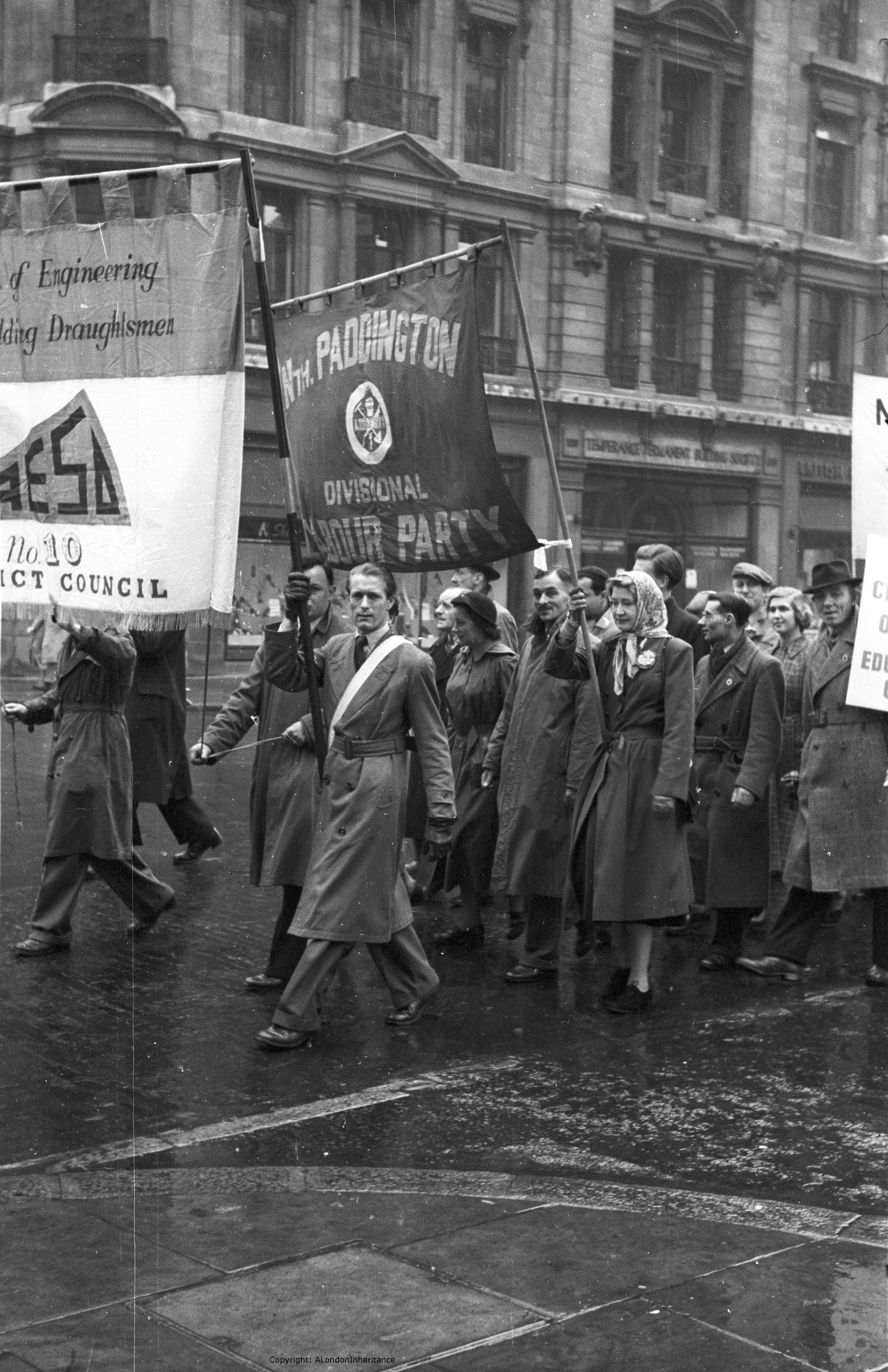
One of the great pleasures of scanning old negatives is that you never really know what the photograph will be until it appears on the computer screen. You can get a glimpse by holding the negative up to a light, but it only gives an outline of the photograph.

I recently scanned a series of my father’s negatives covering photos taken in 1953 at the time of the Coronation. It was interesting that there were no photos of the main participants of the Coronation, the photos instead being of the people waiting to watch along with other photos of Londoners at around the same time.

Coronation day was Tuesday 2nd June 1953, so these are photos taken around 61 years ago tomorrow (this post was published on Sunday June 1st 2014)

So for this week’s post, I present a series of photos showing Londoners from 1953.

Gentlemen

gentlemen

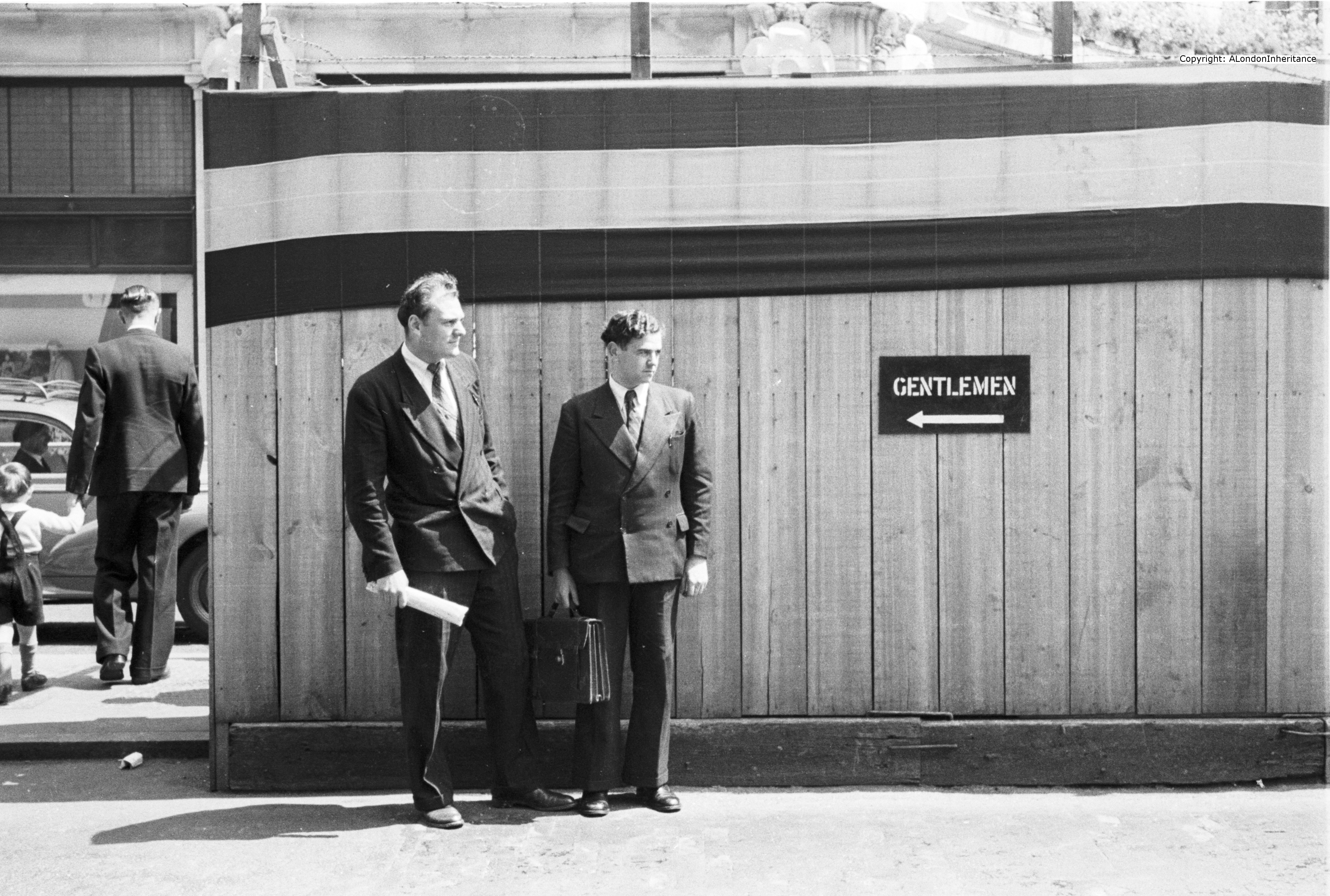
I have no idea where in London this photo was taken, but I suspect an opportunistic photo given the two very well dressed gentlemen and the sign. They are obviously waiting for someone or something, perhaps a taxi?

It demonstrates the benefits of always having a camera to hand when walking London, something I always try to do.

It is easy to take this type of photo with current camera equipment, even a mobile phone, but the above photo was taken on a camera that had manual focussing, speed and aperture adjustment, and a standard lens so it was not taken at a distance.

Coronation Crowds in the Mall

coronation crowd 1

The photo above and the one below are from a series of photos taken of the crowds after, and waiting for the Coronation. My father did not taken any of the Coronation procession, he was much more interested in the people waiting along the route.

The photo above shows a very busy Mall between Trafalgar Square and Buckingham Palace.

Waiting for the Coronation

coronation crowd 2

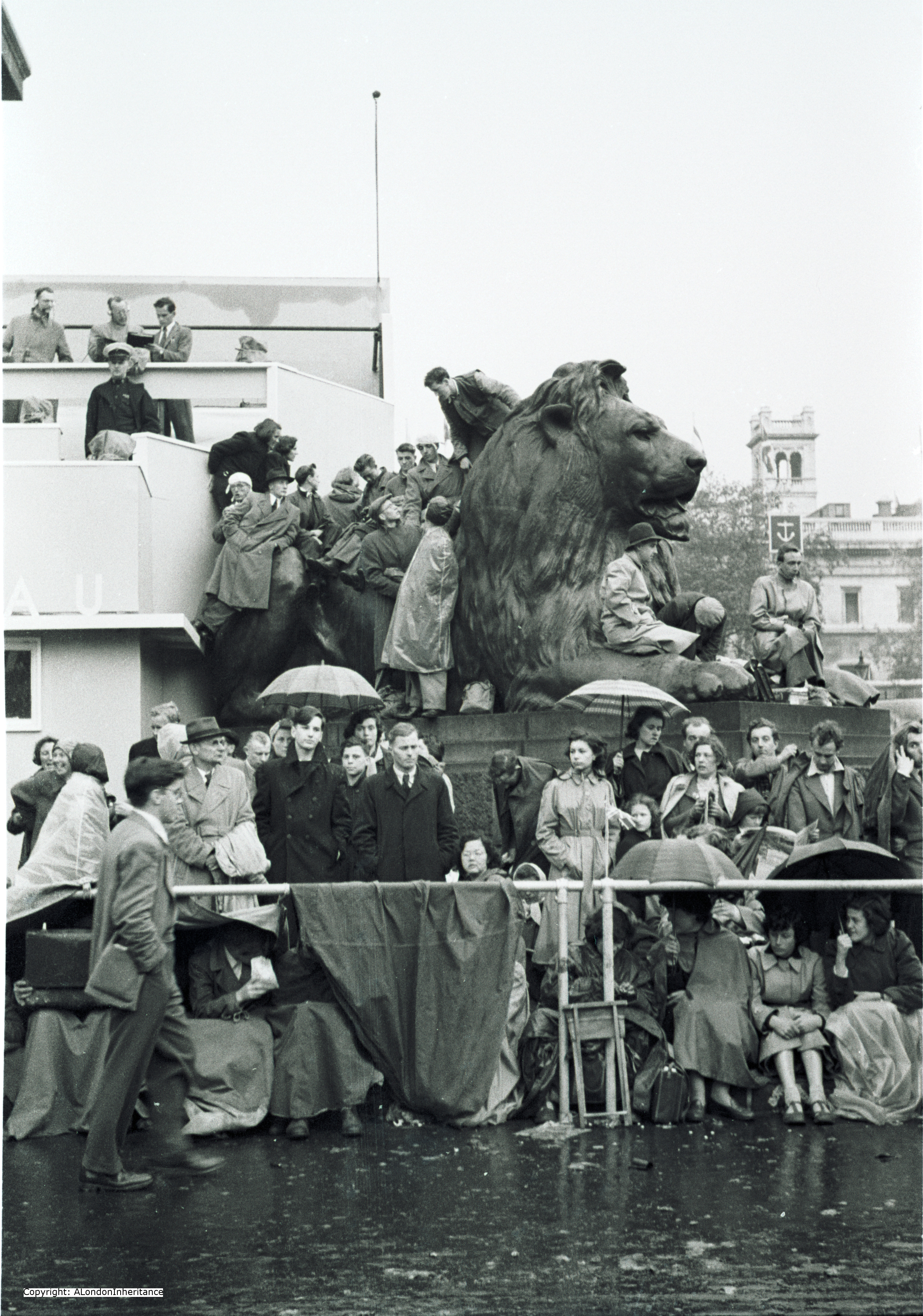
The above photo was taken in Trafalgar Square at the base of Nelsons Column looking towards the National Portrait Gallery.

The weather on Coronation Day was not good. Dull skies, a cold wind and occasional outbreaks of rain as highlighted in the above photo. This was the 2nd June 1953, typical British June weather !

The construction on the left of the photo is probably a BBC commentary / camera position. The two men at the top left have headphones on. This was the first time such an occasion had been televised.

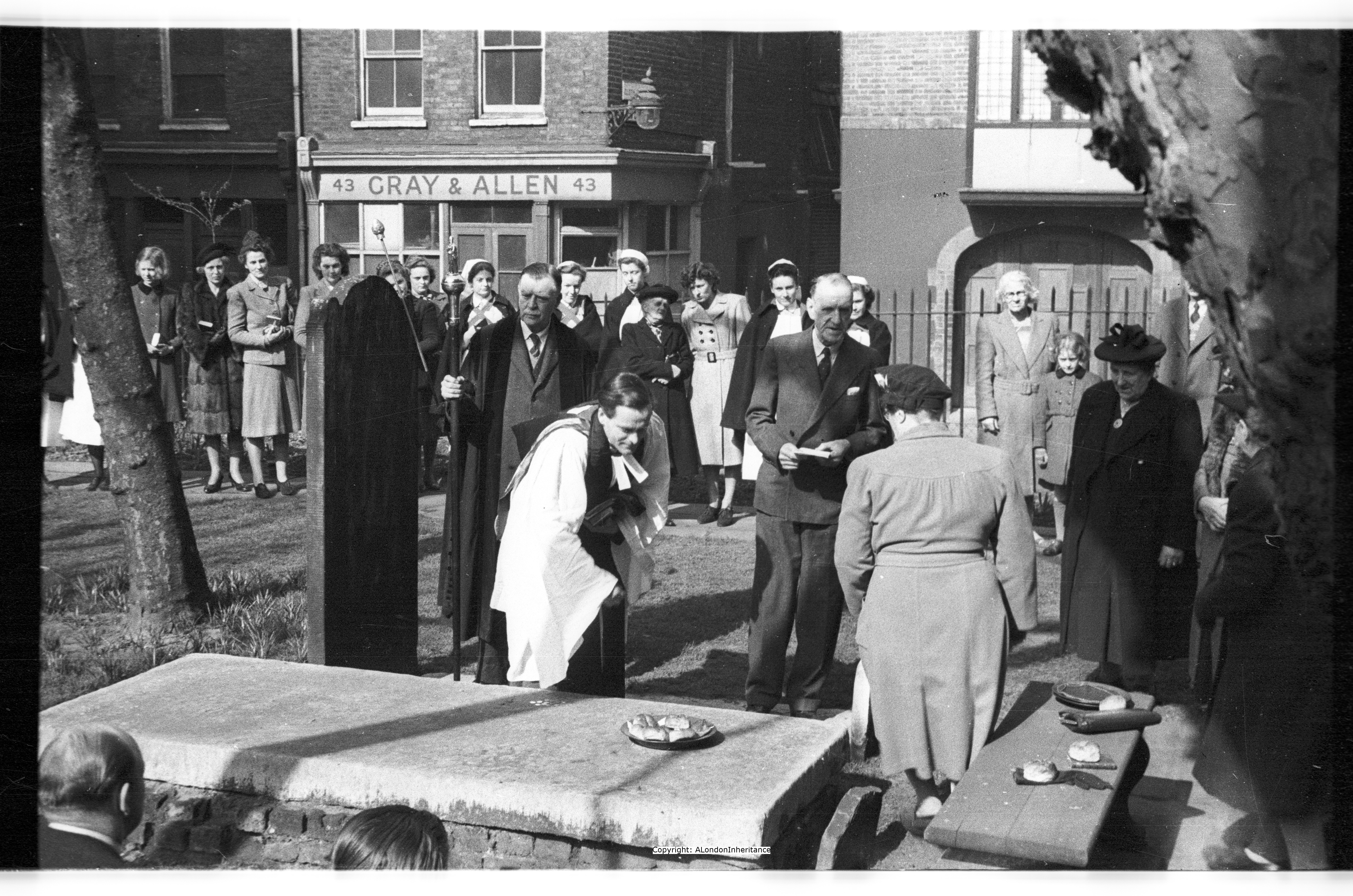
Childrens Entertainment

children watching

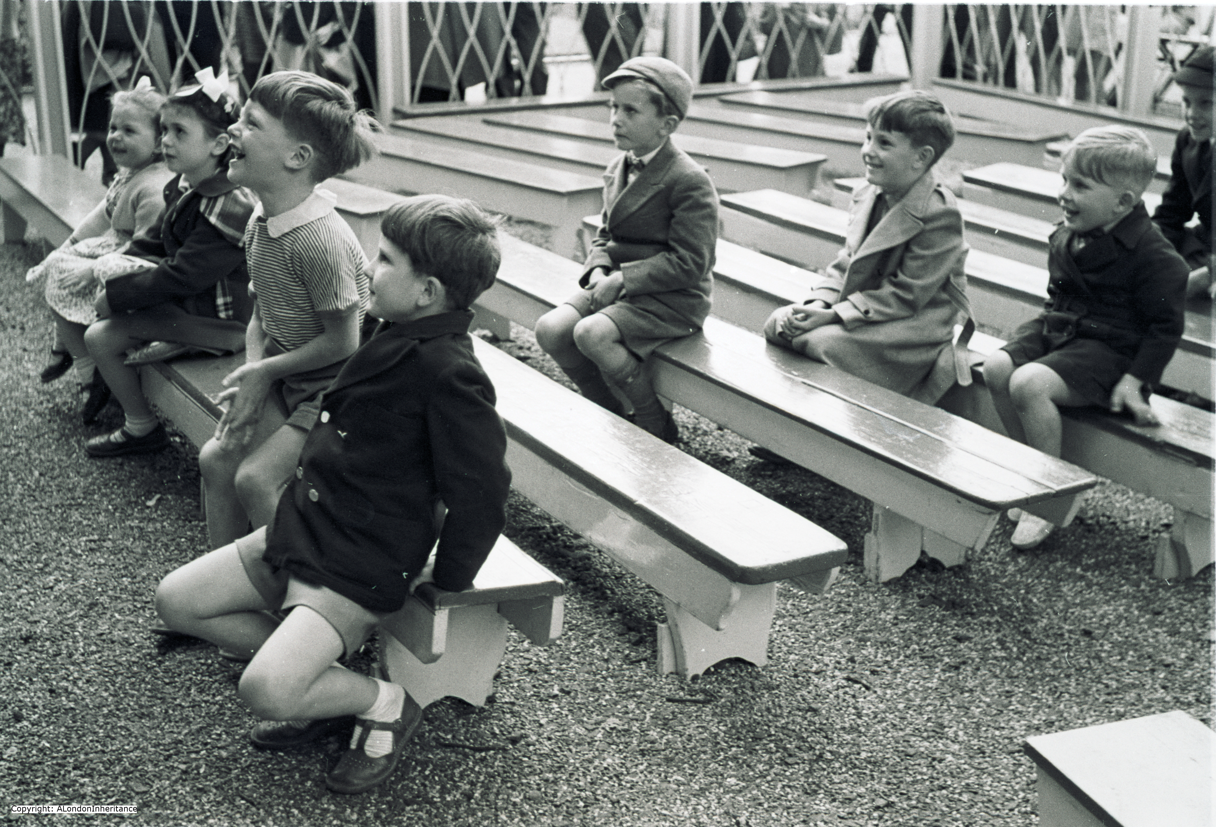
I do not know where or when this photo was taken, but it was on the same strip of negatives as the Coronation photos. It may show children’s entertainment set-up as part of the Coronation activities.

All these children must now be in their mid to late 60s. It would be wonderful to put names to them.

When scanning this photo and a couple more of the same scene, I was hoping that my father took a photo of whatever it was that they were watching. It would be great to see what was causing such reactions, but no, only a few photos of the children. This has informed my own photography. Whilst a specific subject may attract your attention when taking a photo, those viewing many decades later will want to know more, not just about the subject, but also about the surroundings, what else was happening at the time etc. This is obviously much easier now with digital photography where the cost of photos is almost negligible, but when these were originally taken film was expensive and my father did all his own developing which was time consuming and costly. I can understand why he only took a few of a specific subject, but many times when I have been scanning I was wishing he would have turned slightly and taken another photo.

Speakers Corner

speakers corner

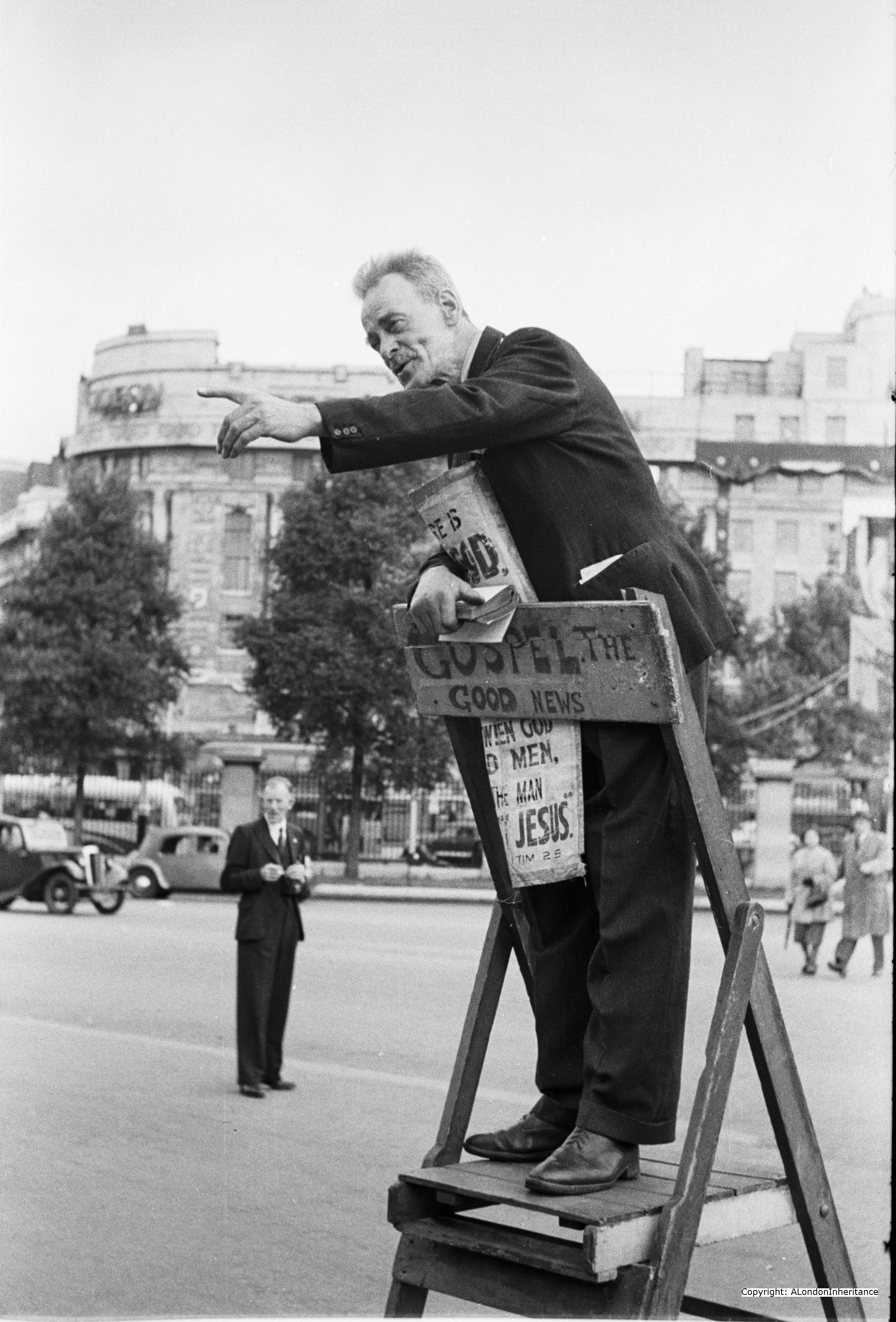
Preaching the Gospel at Speakers Corner. Bible in hand and very intense. This is one of these photos where I wish my father has turned to the left and taken some photos of the crowd. It would be good to see their reaction.

Watching on a Motorbike

man and womman on bike

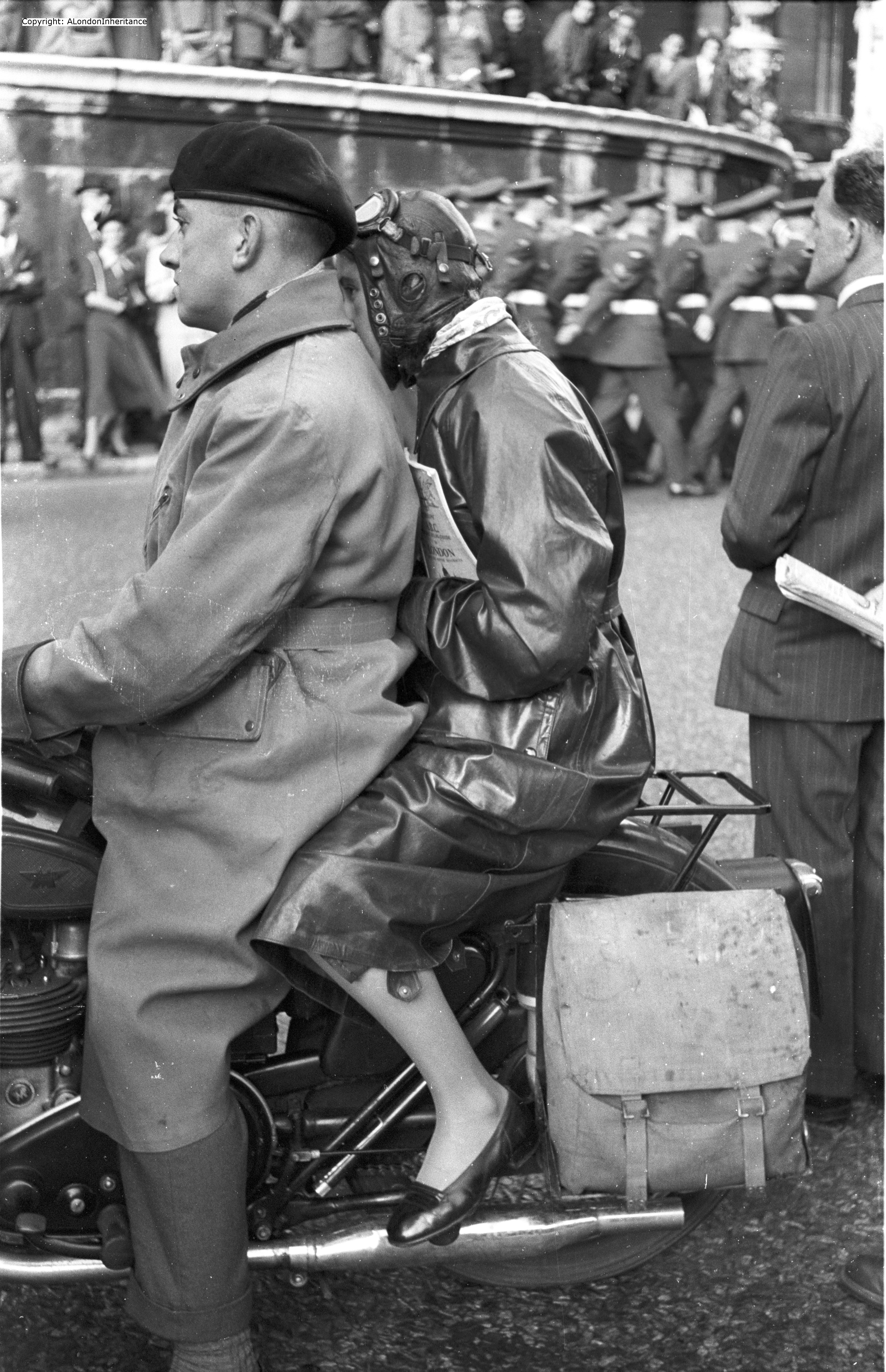
This couple have come up to London and found a position to watch a procession from their motorbike. I suspect they have come from outside central London as the woman is holding an ABC map of London.

Not the headgear that you could legally get away with these days. Not exactly suitable shoes for a motorbike, however I wonder if they had come up to London to visit a cinema, see a show or go to a restaurant.

I hope you enjoyed this series of photos of Londoners (and probably visitors to London) from 61 years ago.  Snapshots in the lives of people and of this wonderful city of London.

alondoninheritance.com

Walking Brunel’s First Thames Tunnel from Rotherhithe to Wapping

I have always been fascinated by what is beneath the surface of London and I can trace this interest back to the late 1970’s when I read one of my father’s books “Under London, A Chronicle Of London’s Underground Life-Lines And Relics” by F.L. Stevens and published in 1939. This contained stories of the infrastructure hidden under the streets of London including the Thames Tunnel.

Within this book, there were chapters on the Fleet Drain, Tube Tunnels, Roman London, Crypts and Vaults, Rivers, Wells and Water and Tunnels under the Thames. There is also a final chapter titled “London Takes Cover” which at only 10 pages looks to be a last-minute addition and starts “Queer things are happening under London to-day” and then talks about the preparations being made for Londoners to seek shelter underground from possible terrors on top. I wonder if they could have imagined what would happen to London over the next few years and what those terrors would be?

The chapter on Thames Tunnels starts with Brunel’s tunnel connecting Wapping and Rotherhithe, not only the first tunnel driven under the Thames, but also that the Thames Tunnel was the first tunnel under any river. It was an opportunity to walk this tunnel during closure of the line for maintenance work that I found on the London Transport Museum web site and tickets were ordered.

And so today, Saturday 24th May I was in the queue at Rotherhithe station for the 1:40pm walk through the Thames Tunnel. Blue disposal gloves were provided (there is still a risk of picking up a virus despite a much cleaner Thames. Demonstrates what the risks would have been during construction) Once in the station it was down a short flight of stairs, on to the platform and at the entrance to the tunnel.

Thames Tunnel

The Rotherhithe – Wapping Thames Tunnel was not the first attempt at a tunnel under the Thames. In 1799 a tunnel between Gravesend and Tilbury had been started, given up as a bad job then started again a couple of years later. A shaft was sunk and the tunnel reached within 150 feet of the other side of the river but was again abandoned.

A Thames Tunnel was badly needed. It was a four mile circuit between Rotherhithe and Wapping via London Bridge and ferries carried 4,000 people across the Thames every day at Rotherhithe.

Marc Brunel was convinced that a tunnel could be built and had the concept of a shield to protect workers at the face of the tunneling work. A meeting with investors was held on the 18th February 1824 and a company formed with Brunel appointed as engineer.

The shaft was started in March 1825 and all appeared to be going well, however in January 1826 the river burst through, but work pressed on and by the beginning of 1827 the tunnel had reached 300 feet.

As work progressed, in addition to the risk of the river breaking through, there were all manner of problems including strikes, mysterious diseases (the River Thames was London’s main drain, polluted with a considerable amount of sewage) and explosions from “fire-damp”.

The river continued to burst through. On Saturday 12th January 1828 six workman were trapped and drowned and despite the hole being filled with 4,000 bags of clay the project was temporarily abandoned due to lack of funds. The tunnel was bricked up and no further work carried out for seven years.

Work started again on the 27th March 1835 and carried on for a further eight more years.

In March 1843 staircases were built around the shafts and Marc Brunel  led a triumphant procession through the tunnel. Marc Brunel’s son Isambard worked with his father during the construction of the tunnel and was appointed chief engineer in 1827, however his work with the Great Western railway took him away from the tunnel during the later years of construction. Marc Brunel worked on the tunnel from start to finish.

As one of the sights of London, the Thames Tunnel was a huge success. Within 24 hours of the tunnel’s opening fifty thousand people had passed through and one million within the first fifteen weeks.

The Thames Tunnel was purchased by the East London railway in 1866 and three years later was part of London’s underground railway system.

Looking through one of the arches between the two tracks in the tunnel:

Thames Tunnel

Starting from the Rotherhithe end of the tunnel, we walked down the centre of the rail tracks avoiding carefully marked obstructions and walking over small bridges put in to avoid signaling equipment. The tunnel started with a gentle downwards slope towards the halfway point where an upwards slope took us into Wapping station.

Regular archways between the two tracks appeared to be spaced equally the length of the tunnel.

Walking through the tunnel from Rotherhithe to Wapping:

Thames Tunnel

Looking back down the tunnels from the Wapping end. The walk from Rotherhithe was through the tunnel on the right, walk back through the tunnel on the left:

Thames Tunnel

Looking back on an empty Wapping station:

Thames Tunnel

I am glad they turned the power off !!                                        Signpost and distances in the tunnel:

Thames TunnelThames Tunnel

Looking down the tunnel from Wapping:

Thames Tunnel

Original brickwork exposed:

Thames Tunnel

At the Rotherhithe end of the tunnel large pipes with the sound of running water descended below the level of the tunnel. According to the guide, if the pumps that drain this water failed then the tunnel would flood within a matter of hours.

Large pipes at the Rotherhithe end of the tunnel with the sound of water running through them:

Thames Tunnel

All too soon we had returned to Rotherhithe station and it was time to leave the tunnel. A fascinating glimpse of what is beneath London and the challenges of pushing the boundaries of early engineering.

Thames TunnelThe building that was originally the boiler house during the construction of the tunnel has been restored and is now an excellent small museum. It has a very well stocked bookshop with what must be one of the largest collection of books on Brunel I have ever seen.

The following picture shows a mural at the museum which illustrates the shield method of digging used by Brunel. This surrounds the original shaft down to the tunnel. It is now empty and the original stair case long removed. It was originally left open to the skies however fears that tunnel lights would act as guides to enemy aircraft in the 1940’s resulted in the shaft being capped.

Thames Tunnel

The tunnel passes underneath the paved area outside of the museum and heads towards the Thames.

Just to the north of the museum is a paved area that overlooks the river and provides an excellent view back towards the city.

Thames Tunnel

alondoninheritance.com

Lower Thames Street and the view to the Tower of London

A few weeks ago I was at the Monument and comparing how Monument Street has changed over the past 60 years. This week, I am still at the end of Monument Street, but now looking along Lower Thames Street towards the Tower of London.

The following is my father’s photo from about 65 years ago:

Dads lower thames street photo with copy

The building on the right is Billingsgate Market. The building on the left with the colonnades is the Coal Exchange and the building straight ahead with the sign on the wall is a pub, the Yarmouth Arms.

My 2014 photo from roughly the same position is shown below:

DSC_0922

Rather than standing on the left side of the road, this is now a thin strip in the middle of a considerably widened road. The corner of the pub in the original photo is roughly where the green traffic light in the centre of the road is now.

The buildings on the right of Lower Thames Street are the same (or at least the front of the buildings), however the big difference is the demolition of the buildings on the left to allow for the considerable widening of the road, along with the buildings at the end of the street which totally obscure the Tower of London.

The following photo taken around 1900 shows the Coal Exchange taken from the opposite side of Lower Thames Street.

Coal Exchange 1

Lower Thames Street and Upper Thames Street were originally just Thames Street, the main thoroughfare that ran east – west through the city and against the buildings that faced the River Thames.

The following map is the 1720 Tower Street Ward map and shows Thames Street as it was with the Customs House and Billingsgate Dock. The illustrations of ships tied up against the side of the Thames shows the main functions of the buildings along this stretch and the activities that would have taken place.

Thames Street Map

The first customs house (which stood a little to the east and was built in 1275) was rebuilt on the current location in 1385. Since then there have been four successive buildings on the same location. In excavating the foundations for the 1814 building, numerous Roman relics were found along with three lines of wooden embankments which demonstrated how the position of the bank of the Thames had moved further into the river thereby reclaiming more land.

In building the Coal Exchange in 1847 the remains of a Roman villa were discovered 13 feet below the level of Lower Thames Street on a foundation laid upon wooden piles driven into the marshy ground.

The Billingsgate Fish market ceased trading in Lower Thames Street in 1982 when it moved to east London (now in the shadow of Canary Wharf). It was the oldest market in London, dating from the ninth century and was a general market until the 17th century when it became a specialist fish market.

The Yarmouth Arms was at 88 Lower Thames Street. There are records of publicans for the Yarmouth Arms starting with a Lydia Estridge in 1816 through to Mrs Lily May Blow in 1944.

In “A Survey of London” by John Stow in 1603, he refers to the area as Belinsgate  saying that “it to be builded by King Beline a Briton, long before the incarnation of Christ”  and that it is “a large Watergate, Port or Harbrough for shippes and boats, commonly arriving there with fish, both fresh and salt, shell fishes, salt, Orenges, Onions, and other fruits and rootes, wheate, Rie and grain of divers sorts for service of the Citie, and parts of the Realme adioyning“.

Referring to the Customs House, John Stowe mentions “the auncient customes of Belinsgate in the raigne of Edwarde the Third everie great ship landing there, payd for standage two pence, every liitle ship with Orelockes a penny, and lesser boat called a Battle a halfpenny“.

Customs payments were also due on corn, coal, ale and herring.

Thames Street was also instrumental in the spread of the Great Fire of 1666. from the records of the cause of the fire “a strong east wind carried sparks from the burning timbers (of the bakers) across the narrow lane on to hay piled in the yard of an inn opposite. The inn caught, and from there the flames quickly spread into Thames Street, then, as now, a street famed for its wharfs. Stores of combustibles – tallow, oil and spirits – were kept in its cellars, whilst hay, timber and coal were stacked on the open wharfs nearby. The fire leapt to life.”

Today, Lower Thames Street is a dual carriage way with the main aim of getting traffic quickly between the east and west sides of the City, with little time to appreciate the history of the area, which is a shame as it perfectly sums up the layered history of the city and the dependency of the City on the Thames in becoming such a major centre of trade.

alondoninheritance.com


An AESD March and a St. Pancras Draughtsman

The title of my post this week is “An AESD March and a St. Pancras Draughtsman”. The AESD was the Association of Engineering and Shipbuilding Draughtsman, the trades union established in 1912 to represent Draughtsman working in these industries.

After National Service, my father worked as a Draughtsman for the St. Pancras Borough Council Electricity and Public Lighting Department.

The job of the Draughtsman is one of those long replaced by computer based applications. It was the role of the Draughtsman to draw up plans, whether these be the design of a ship, train or plane, along with all the components that make up these complex systems along with drawing up street plans, building construction plans etc. It was a key role that enabled the installation or manufacturer of almost everything in an industrial society.

Within the photo collection, there are photos of a march by the AESD. I have no idea of whether he was a member of the AESD, was participating in the march or just there to take photographs.

The following photo shows the AESD march about to reach Oxford Circus (I have included the rest of the photos of this march at the end of the post).

AESD March 2

I suspect this photo may have been taken in 1953. From what I have been able to find out, the AESD did not take much action, however there was an AESD strike at the Middlesex
Tool & Gauge Company in 1953. This lasted for five weeks from late August 1953 and did get national support, so this march may have been in support of this action. The dates fit well with other photos on the same set of negatives.

Like many small Associations and Unions representing specialised groups of workers, the AESD had to evolve and merge as the working landscape changed.

The AESD changed into the Draughtsman and Allied Technicians Union (DATA) to broaden the scope of membership. DATA then grew into the TASS (Technical, Administrative and Supervisory Staffs) which then became the MSF (Manufacturing, Science and Finance) following merger with the Association of Scientific, Technical and Managerial Staffs, which then merged with the Amalgamated Engineering and Electrical Union to form Amicus which then merged in 2007 with the Transport and General Workers Union to form Unite (I did not think it would be that complicated when I started checking !).

The benefit of working for the St. Pancras Borough Council Electricity and Public Lighting Department is that this work took him across much of London, drawing street plans and where electrical installation work was required. A perfect job for someone who loved walking London.

Plans were recorded onsite in a sketch book, then taken back to the office to be converted into large scale plans ready for work to be carried out.

The following is a sample page from one of my father’s sketch books:

Notebook

The left page covers Belgrave Square whilst the right shows the area around Grosvenor Gardens with Victoria Street, Buckingham Palace (B.P.) Road and Ebury Street. The markings are for the position of electric street lamps. The red line across the plan indicates that the transfer to a working plan had been completed.

Street surveying and documenting was all done manually. This is before the days of GPS, theodolites with integrated electronic distance measuring etc.

Within my father’s photo collection there are some photos he took of the St. Pancras Draughtsman’s office in which he worked. These show a very different working environment to that you would find today where this type of work is carried out on a computer with large screens showing the plans being developed.

Drawing up plans:

draughtsman 4

Tea break:

draughtsman 1This type of work was very tiring as it required concentration, drawing to an accurate scale, very neat and standardised lettering, good eyesight and attention to detail.

Note in the following photo the drawing tables placed against the windows. Natural light was still the best form of lighting in which to work. Also the magnifying glass for detailed work.

Taking a quick sleep at lunch break:

draughtsman 2All calculations were performed manually and a good knowledge of maths was required. Complex calculations were performed using aids such as Logarithm tables and slide rules:

draughtsman 3

The tools of the trade. Some of my father’s old drawing instruments:

Draughtsmans tools

The instrument hanging on the wall in the following photo is a draughtsman T-Square. The shorter length was placed up against the side of the drawing table and the long edge ran across the table. This was then used as a guide for drawing horizontal lines and as a rest whilst general drawing.

draughtsman5

The face of experience:

draughtsman6

Other photos of the march:

AESD March 4

The solitary police escort:

AESD Marcg 3

AESD March 5

 alondoninheritance.com


The South Bank – Before the Festival of Britain and the Royal Festival Hall

A common theme throughout my blog is that since the 1940’s many areas of London have changed so dramatically that they are almost unrecognisable, however there are almost always some points that have remained fixed and remain to this day to allow a photo from over 60 years ago to be compared with today from very similar points of view.

One of these areas is the South Bank, and for this post specifically the area bounded by Waterloo and Hungerford Bridges and Waterloo Station.

In my father’s photo collection there are a series of photos covering the South Bank as it was starting just after the war and through to the Festival of Britain which was held on the site, with the Royal Festival Hall being the legacy from the Festival.

Over the coming months I will cover this area in detail, however as a starter I have three photos that show the area as the demolition started in preparation for the building of the Royal Festival Hall.

The first photo was taken from the area of Waterloo Bridge looking towards County Hall.

The road in the centre of the photo is Belvedere Road and the bridge is taking the railway line from Hungerford Bridge across the Thames and Charing Cross station to Waterloo East.

The area to the right was ready for demolition and the construction of the Royal Festival Hall. The white sign to the right of the road is for “North London Demolition” indicating that demolition had already or was about to start. The sign just to the right of the bridge is for “Southern Railways Sale Room”. Not sure what would have been sold here as it is some distance from the station, perhaps unclaimed lost property?

Southbank 3Although it should have been easy, I had some challenges trying to find the location for this photo. Firstly it was not taken from ground level and as far as I can tell was not taken from Waterloo Bridge, but may have been taken from some derelict building adjacent to the bridge.

I spent some time working my way round the back of the Hayward Gallery and the closest I was able to get is shown in the following photo. The perspective is almost right, but I could not get into the exact position (see the slight difference where the slope of the roof of County Hall touches the Victoria Tower of the Palace of Westminster)

Southbank 3 new

DSC_1163Belvedere Road still runs in almost the same position and the bridge is still in the same location although obscured by trees.

I moved to the left and took the photo on the right which shows the road and bridge. I suspect the original curve of the road has been smoothed out slightly during the construction of the Royal Festival Hall, however it is still in almost exactly the same place.

As far as I can tell, the three photos I am featuring were taken from roughly the same position.

If we now turn to the left we can compare the view towards Waterloo Station as it was:

Southbank 1

The main entrance to Waterloo Station just to left of centre of the photo is almost the same as it is today. The railway still runs across the same arches, however the arches are now mainly occupied by bars and restaurants.

Southbank map 1The map extract to the right is taken from the 1913 edition of Bartholomew’s Handy Reference of London & Suburbs. I have circled the area being covered in this post. The map identified the two roads shown in the above photo. The road in the centre of the photo was Tenison Street and the road to the left was Rowley Place.

There are no obvious people in these photos, however look just to the right of centre in the above photo and there is a man standing on the site of the demolished buildings. Had he lived here and was returning to see what had been done to the area or just a curious passer-by? In the first photo there are a couple of children in the street with a cyclist just behind them.

Despite the horror and destruction of the war and the bombing of London, the large number of derelict sites across London during and after the war effectively became an adventure playground for children. Reading through my father’s account of his childhood in London during the war he tells of exploring and playing across the old bomb sites. They were not fenced off, there were effectively no health and safety rules as there would be today and London was free for a child to explore.

The same view today is very different:

DSC_1167

For this one it was very difficult to get the position right as the view of Waterloo Station is now totally obscured. I suspect that in the original photo Belvedere Road runs behind the brick walls. Waterloo Station is just behind the office blocks. All these were part of the original Shell Centre complex built for the Shell oil company between 1957 and 1962 after the closure of the Festival of Britain. The building to the left was the “Downstream Building” and the building and tower to the right was the “Upstream Building”. All part of the same complex  connected by tunnels under the railway so that employees could move between buildings without going outside.

The Downstream Building on the left was sold by Shell in the 1990’s and was converted into residential apartments.

Now turning to the right we can look across the site that will be occupied by the Royal Festival Hall.

Southbank 2

The large building is what is left of the Lion Brewery, the white Lion which used to stand on top of the building has already been removed and now stands at the southern end of Westminster Bridge. The building in the distance under construction with the cranes is the Ministry of Defence building that still stands on the north bank of the Thames.

Again, it was difficult to get the exact location, but the following picture shows roughly the scene as it is now:

DSC_1168

The South Bank is a fascinating place that sums up in a small area the changes that have and continue to take place across London, the change from light industrial use to service industries, entertainment and expensive apartments.

Over the coming months I will continue to explore the South Bank with the development of the Festival of Britain and the Royal Festival Hall.

alondoninheritance.com


A de Havilland Dragon Rapide Flight Over London

For this week’s post I am going to dive back into my own photo collection, and back to 1980 when my early interests in London, flying and photography all came together.  I found an advert for flights over London in a de Havilland Dragon Rapide. Cannot remember where I found the advert, it was probably one of the London evening papers. This was in the days before the Internet and to apply for tickets the process was to send a letter with a cheque and sit back and wait hoping that I would get one.

Thankfully I did, and on the booked Saturday when remarkably for British summer weather, it was ideal flying weather, it was a drive down to Biggin Hill in Kent.

The Dragon Rapide entered service in 1934 as a short haul commercial passenger transport with a crew of 1 and capacity for 8 passengers, and was designed and built by the de Havilland company who also manufactured aircraft such as the Gypsy and Tiger Moth and during the war the Mosquito, along with Britain’s first commercial jet airliner, the Comet.

The Dragon Rapide for my flight was G-AIDL which was manufactured in 1946 by Brush Coachworks of Loughborough under licence from de Havilland.

The Dragon Rapide 1

 de Havilland Dragon Rapide G-AIDL ready to go at Biggin Hill.

Biggin Hill is about 12 miles from central London and from the airport there is a good view over to the city. The weather was good, the plane was ready and boarding started.

Everyone had a window seat as there were two lines of seats against the edge of the plane with a very small passengerway in the middle. Very small and cramped compared to passenger planes of today, and very noticeable how thin the construction was between the passenger cabin and the outside of the plane.

Inside the Rapide

Inside the Rapide. This is what passenger flight used to be like. Everyone had a very good view. The door lock does not too strong though !!

The two propeller engines started and we taxied to the runway and were quickly away and heading towards London.

The flight was relatively smooth, but noisy due to the proximity of the engines and the non existent sound proofing in this age and type of plane, but that was part of the enjoyment and if it was quiet it would not have been the same experience.

At the relatively low height and slow speed it was easy to follow the landmarks below and see those of central London slowly getting closer.  The flight crossed the Thames at Greenwich, flew to the east of the city, turned and followed the same route back. This allowed passengers on both sides of the plane to get the same views of central London and to the east.

Limehouse basin

In the above photo we are crossing the Thames to the west of the Isle of Dogs. The Regents Canal basin is clearly seen in the lower right of the photo with the Limehouse Cut leaving the basin diagonally from the top corner. The Regents Canal leaves the basin roughly in the middle of the basin and passes the tower blocks and then the gasholders.

As I was sitting on the right of the plane, my first views of central London came when the plane turned and we started to head back.

Many of my photos are slightly blurred. I was taking photos from a moving object which was also vibrating so it was a challenge to get a good photo. This was also the days of film photography with the standard maximum film cartridge of 36 photos so I also had to ration how many I took, we would be past a location before I could change a film. This would not be a problem now with digital photography and a memory card capable of storing many thousand of high quality photos.

Central London

Despite these challenges, the photo above was almost perfect.

Christ Church Spitalfields stands out well in the lower right of the photo with Spitalfields Market in front of the church. Slightly above and to the left of Spitalfields Market is Liverpool Street station, and to the left of the station, the buildings of the City of London with the (as it was at the time) National Westminster Tower having just been completed and the tallest building in the city.

City and Thames

The second photo as we passed the city also came out well and shows Fenchurch Street Station to the lower right and St. Pauls to the right of centre. Still not that many tall buildings between the centre of the city and the river. The bridges starting with the bridge closest are London Bridge, railway bridge into Cannon Street station, Southwark Bridge, Blackfriars rail and road bridges

The gleaming white building between London Bridge and the rail bridge into Cannon Street station is Mondial House. This was a Post Office (British Telecom) building completed in 1975 which hosted one of the largest telephone switching systems in Europe and was a major international telephone exchange. Changes in telephone technology made the services provided within the building redundant by the late 1990’s and it was demolished in 2006.

Note that the Monument was very visible just to the right of London Bridge.

All too soon, the flight headed back along the Thames before turning back to Biggin Hill over Greenwich, giving some superb views of Greenwich, Blackheath and back towards London.

Greenwich 1

Looking down on Greenwich Park

Greenwich 2

 Greenwich and the edge of Blackheath

Greenwich 3

Looking back towards a very hazy city.

We landed back at Biggin Hill all too quickly and I had a roll of 36 photos to be rushed of to Boots for developing (how digital photography has changed all this!).

London is a fantastic city to explore at ground level, however flying over the city always puts the city in context. How central the River Thames is to the topography of the city, the differences between the south and north banks of the river, the complexity and difference in style and age of the buildings from the modern office blocks to the Tower of London.

Following a quick internet search, it is still possible to take a flight in a Dragon Rapide over London. See the Classic Wings web site for flights this year. I am very tempted to take another flight for a comparison view of the city 34 years later, and this time I can book via the internet rather than post. Now where is my credit card?

alondoninheritance.com


The Butterworth Charity at St. Bartholomew the Great

One of the many things I love about London is that there are still customs being performed, away from the crowded “tourist” areas of the city which have been on-going for many years.

One of these is the Distribution of the Butterworth Charity which takes place every Good Friday in the churchyard of the Priory Church of St. Bartholomew the Great in West Smithfield. Within my father’s photo collection there are photos he took of this about 65 years ago, so to experience the same event, I took the short walk from St. Paul’s underground station to St. Bartholomew’s ready for the 11:30 start, where I joined a crowd of about 80 people arranged around the edge of the churchyard, on a mild, sunny April morning.

Rather than my explanation of the background to the Butterworth Charity, I will reproduce the following from the back of the Order of Service sheet:

Butterwork service text 1

The ceremony takes the form of a church service in the graveyard with the distribution of the charity part way through. The form now is a token distribution of money to a poor widow of the parish (there was only one “volunteer” for this) followed by distribution of buns to all who attended.

The following is my father’s photo of the distribution from about 65 years ago:

Dads Butterworth 4 with copy

The ceremony is held on the same flat gravestone every year. What I also find interesting in these photos are the people in the background. Note in the above the nurses in uniform, who had probably come from the adjacent St. Bartholomew’s Hospital. The widows of the parish are waiting to the right of the photo. The following is my photo from the 2014 distribution. I have converted this to black & white to give an up to date photo which compares more easily with my father’s original. Often I find that comparing a colour photo with black & white can over emphasise the differences.

DSC_1125 BW

The buildings along Cloth Fair at the back of the churchyard are the same. The tree to the left has grown considerably, fashion has changed and these days there are not so many “poor widows” in the parish to collect the distribution of the charity, however the scene has not changed that much in 65 years, and I suspect is much the same going back to the start of the Butterworth Charity over 100 years ago.

The following photos are from 2014:

The buns emerge from the church:

DSC_1117 veritcal

The procession along the edge of the churchyard:

DSC_1119

The service:

DSC_1123

The buns are distributed:

DSC_1128

The following are the rest of the original photos taken by my father:

Dads Butterworth 1 with copy Dads Butterworth 2 with copy Dads Butterworth 3 with copy Dads Butterworth 5. with copy

It was a perfect start to an Easter weekend.

alondoninheritance.com


The Chair Repairer Found !

A few weeks ago I published a short post with two of my father’s photos of a man repairing a chair in the street. I have always been fascinated by these as the concentration and craftsmanship was clearly visible in the work being performed.

The Gentle Author included my blog on his Saturday posting at http://spitalfieldslife.com/ and the extra viewers and distribution across Twitter reached a wider readership than normal, and to my surprise I received an e-mail from Rachel South identifying the Chair Repairer as her grandfather, Michael George South of Ladbroke Grove.

What makes the story even better is that Rachel is the third generation in the upholstery business and chair caning, so there is a continuous line from Michael in my father’s photo to the present day.

See Rachel’s web site at: http://rachaelsouth.com/ The photo of the Chair Cave on Facebook is incredible.

Rachel provided the following information about her grandfather:

Michael South was born around 1903. He was from an Irish travelling background and had grown up in west London with his father and a number of half brothers and sisters. He died in 1964 from a brain haemorrhage which it was assumed was due to his other career as a bare knuckle boxer! My mother recalls two of his half brothers one called Danny who only had one ear and another who rode a motorbike on the wheel of death. So a lively background to say the least. 

Michael usually sat in Kensington or Knightsbridge to work.

So now, after more than 60 years since my father took these photos, it gives me great pleasure to introduce again, Michael South, chair caning craftsman of Ladbroke Grove:

Chairmender2

Chairmender1


 alondoninheritance.com


The View from Greenwich Park and the Isle of Dogs

There are a number of locations across London where the juxtaposition of areas where there has been really significant changes with those where there has been almost no change over many decades can be seen. One of the best locations for this is from the top of the hill next to the old Royal Observatory in Greenwich Park.

My father took the following photo in 1953 looking out across the Queen’s House and the old Royal Naval College across to the Isle of Dogs.

Old Greenwich hill

I took the following photo 61 years later in 2014 from the same location. Greenwich Park, the Queen’s House and the buildings of the old Royal Naval College have not changed. Even the paths across the park have stayed in the same position, despite the Equestrian events held on this area during the 2012 Olympics.

The view across to the Isle of Dogs is where the changes have been significant. Not just in the buildings that have changed what was a flat landscape into one where tall office blocks fill the horizon, but also in the core function of these areas, employment, traffic on the River Thames and how the landscape of London has changed over the decades.

New Greenwich hill

The area just across the River Thames from Greenwich Park is the Isle of Dogs. Here were some of the major docks that during the 19th and much of the 20th centuries were part of the complex of docks along the Thames that made London the busiest port in the world.

I took the following photo in the early 1980s. This was just after the docks had closed in the 1970s, but before the significant re-development of the docklands had started. At the time I was flying regularly between London and Amsterdam and always got a window seat as when the approach was over London the views were fantastic. I was always the one glued to the window! This is an evening photo on a route which took the flight in over Essex. across east London to the south of London to Heathrow.

isle of dogs

The Isle of Dogs is in the centre of the photo. The loop of the Thames (if I remember Geography from school this is a “meander”) around both the Isle of Dogs and the Greenwich Peninsular (future home of the Millennium Dome, now the O2) is very clear from this height.

I have added the names of the docks and the location of Greenwich Park where my father and my photos were taken in the following graphic.

London Docks Photo v3


The West India Docks were opened in 1802 and in total consisted of 54 acres of water. The Millwall Dock was opened in 1868 and consisted of 36 acres of water in the shape of an L (visible in the above photo).

The docks further east in the photo (Victoria, Albert and George V) were the last to be built in London and were the largest area of enclosed dock water in the world. The Victoria was opened in 1855, the Royal Albert in 1880 and the George V dock was opened in 1921, its’ construction having been delayed by the 1st World War. The soil excavated from the Victoria dock was used to complete the construction of Battersea Park, which until then had been partly marsh land.

The Regents Canal Dock is at the end of the Regents Canal were it enters the Thames at Limehouse. The canal connects the Grand Junction Canal at Paddington with the Thames. The canal was opened in 1820 with the dock constructed soon after.

The Greenland Dock is almost all that remains of the Surrey Commercial Docks that once covered most of the peninsular. The core of these docks was started in 1697 and with various developments lasted until 1970.

The complex of office blocks in Canary Wharf which now dominate the view from Greenwich Park have been built across the area that was occupied by the West India and South Docks. Parts of these docks remain but are now confined within an ever growing number of very tall office blocks.

The following map is from the 1940 edition of Bartholomew’s Reference Atlas of Greater London and shows this area of dockland in detail. Compare the significant number of docks that made up the Surrey Commercial Docks on the left page with the 1980s photo. These have almost all disappeared.

Docklands Map

There is a description of the Isle of Dogs in a “Peepshow of the Port of London” by A.G. Linney published in 1929:

“As has been established, its island area has been halved, but within the truncated region remaining cut off from the “mainland” many industries, mostly of a smelly sort (oil refining, chemical manufacture, candle making) are carried on; there are some timber yards and foundries. Poverty is not discernible on any wide scale, but it has to be admitted that the streets are sombrely depressing, though to my view the small streets of Millwall and Cubitt Town are boulevards when compared with the utterly drear, blank depression of those rows of houses such as one finds in pit villages of South Yorkshire and Durham”

The reference to “its island area has been halved” is to the area occupied by the docks which as can be seen from the map occupy a significant percentage of the Isle of Dogs.

The closure of the docks from the end of the 1960s to the 1970s resulted in the loss of a culture, often unique to a specific set of docks, and a chain of related industries that had made this part of London a major trading and industrial community.

It would take until the mid 1980s for any form of redevelopment to start across the acres of derelict land left after the closure of the docks, the results of which can now be seen from Greenwich Park.

Quite what the residents of the “small streets of Millwall and Cubitt Town” would have thought of the Canary Wharf development and the financial services industries that have now replaced the docks would be interesting to know.

alondoninheritance.com


Tideless Thames In Future London

As well as a large collection of photographs, my father also had a large collection of books about London which he started collecting during the early 1940’s as a young teenager. Most of the books are factual accounts about different aspects of London and London’s history, however some of these are plans for major projects being proposed at the time as well as reconstruction plans for London after the war.

I will be covering many of these books in my blog over the coming months and I want to start with a fascinating document which proposes a major change to the River Thames and has echoes in the Thames today.

The book is “Tideless Thames in Future London” by J.H.O. Bunge which was published by the Thames Barrage Association in 1944.

Header Page

There had been proposals for many years for a Thames Barrage with the aim of stopping the tides and providing central London with a river without any tides. The proposal compares the tides and mud flats along the Thames with other cities where damming rivers had produced effectively a slow moving lake with no tides. Boston in the USA where the 1906 damming of the Charles River had provided for the city “better health, water sports, riverside parks with the famous Boston orchestra’s loudspeaker concerts in the open are the results of this dam”. The book compares Boston with the mud banks along Putney, Fulham and Hammersmith.

The barrage would also have provided other functions which at the time were becoming critical due to the expected growth in traffic after the war, for example the provision of a road and rail bridge across the river.

So what would the proposed barrage have looked like? The  following picture from the book shows the proposed barrage at Woolwich.

Proposed Thames Barrage

The locks within the barrage were critical to the design as at the time the annual tonnage of shipping to London’s docks was well over 50 million. London was still the largest port in the world.

Note the road and rail bridges built into the overall design.

Had this been built (and it was estimated at a cost of £4.5 million and could be built in 18 months “if efficiently organised” which seems somewhat optimistic) London today would not have any tides with the river transformed into a slow moving lake.

The location of the proposed barrage is shown in the following map:

Map

Note the integration with the North Circular Road. There is a clear parallel with the river crossing at Dartford and the M25. The first Dartford tunnel was built in 1963, the second in 1980 and the Queen Elizabeth II bridge which is the clear successor to the bridge proposed by the barrage which opened in 1991.

There were many objections to the proposed barrage and the government of the day was strongly against the proposal. There was a debate on the subject of the barrage in 1937 in the House of Lords where a number of objections were raised. The usual concerns about the costs of building and then the costs of running the proposed barrage, and also:

– the impact on the hygiene of the river without a twice daily “flushing” of the river by the tides

– the impact on shipping of having to pass through the locks. Remember at this time, the docks in central London were very busy. The Port of London Authority stated that in 1936 there were “43,000 ships and 463,000 craft of one kind” passing through the river at the proposed location of the barrage and these would have to pass through the locks.

Stand on the banks of the Thames at Woolwich now, and it seems incredible to imagine that volume of shipping passing along the river in front of you.

The Port of London Authority objections also show the difficulty in planning for large scale projects for the future. I wonder if they could have imagined what would have happened to the London docks after the introduction of containerisation and the resulting increase in the size of shipping and the move of the major port facilities out of central London to Tilbury, Felixstowe and Southampton.

Personally I am very pleased that the barrage was not built. The Thames without tides would have taken much of the life out of the river that forms the core of London and was the reason why the city came to be built here in the first place.

The mud banks to me are not to be hidden. They maintain a link to the history of London. Stand on the banks of the Thames at low tide at almost any point on it’s course through London and you will see old bricks and stones that could have come from the buildings that once lined the river. The wooden stumps of old jetties still protrude above the mud along with the stone cobbles of old slipways.

The tides also continue London’s connection with the sea. Despite being in a city with ever growing towers of glass and steel, the daily rise and fall of the river maintains a natural connection.

Some ideas from the Thames Barrage Association did get built though, but in a very different form. The extension of the North Circular across the river via a bridge across the barrage can been seen replicated in the M25 and the crossings at Dartford, and the barrage itself turned into something not to keep the water in central London, rather to keep the water out of central London in the form of the Thames Barrier.

The book includes a photo of a model of what the barrage may have looked like:

Model in garden

Note the comments about the impact of the war, and the book published in 1944 was the last gasp of the proposal. The war did though allow the Thames Barrage Association to raise some additional justifications for building the barrage, including the difficulty that the London Fire Brigade had during the war with getting water from the Thames during low tides to fight the fires caused by the bombing.

I wonder what the Thames Barrage Association would have thought of the Thames Barrier?

DSC_1101

This is the Thames Barrier as seen from the bank at the Visitor Centre. At the time it was an ordinary high tide and the river was only about 6 inches below the river walkway. Really shows how much the barrier is needed. Inside the gates at the left is a walkway with along the wall, a profile of the River Thames from Thames Head to Sea Reach:

DSC_1113

When you stand beside a river it looks flat. The profile really demonstrates the fall of the Thames as it drops a total of 105m from head to sea.

Reading “Tideless Thames in Future London” provided a fascinating snapshot of how London, the Docks and River Thames were viewed at the time. When the volume of shipping on the Thames and at the London Docks was expected only to grow, and London was expected to continue to be one of the world’s major ports.

alondoninheritance.com