Tag Archives: Isle of Dogs

Limehouse Hole Stairs and the Breach

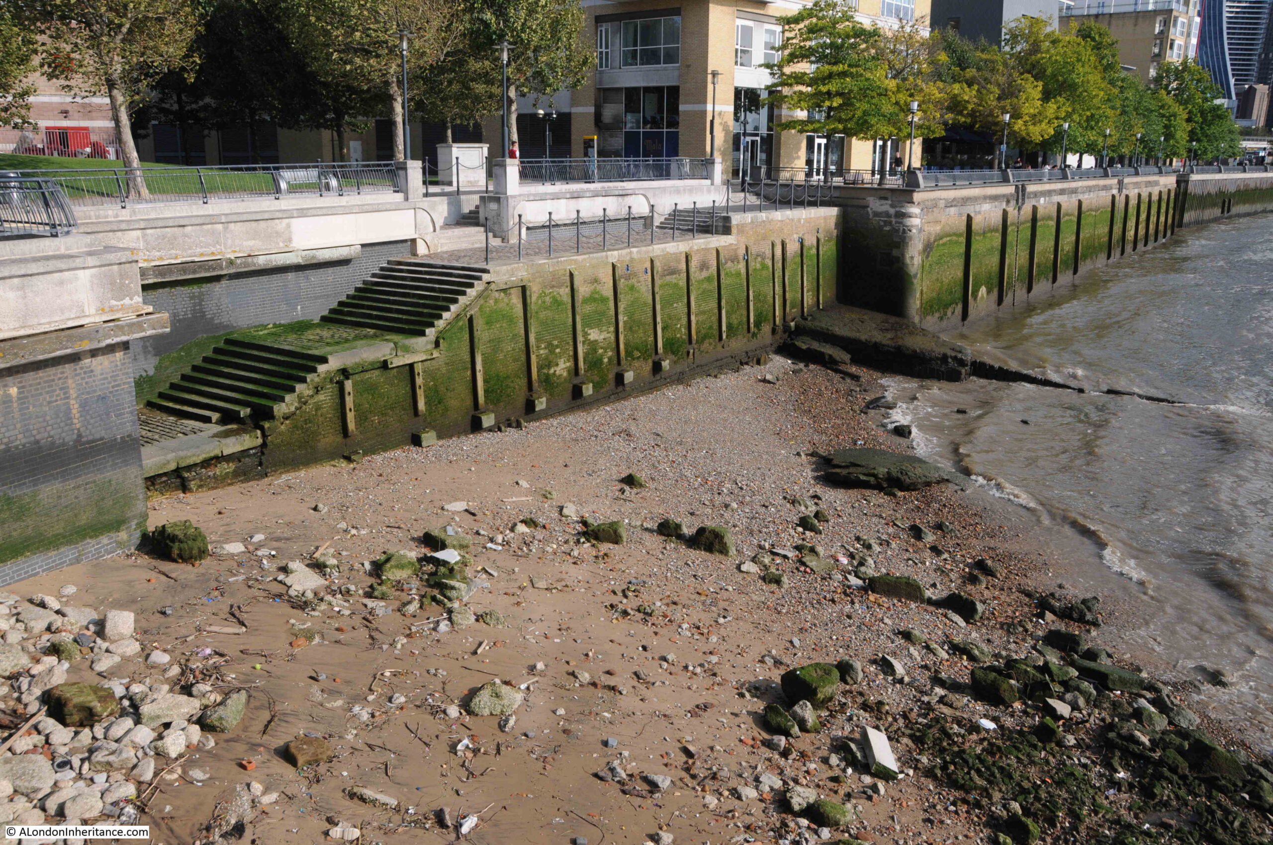
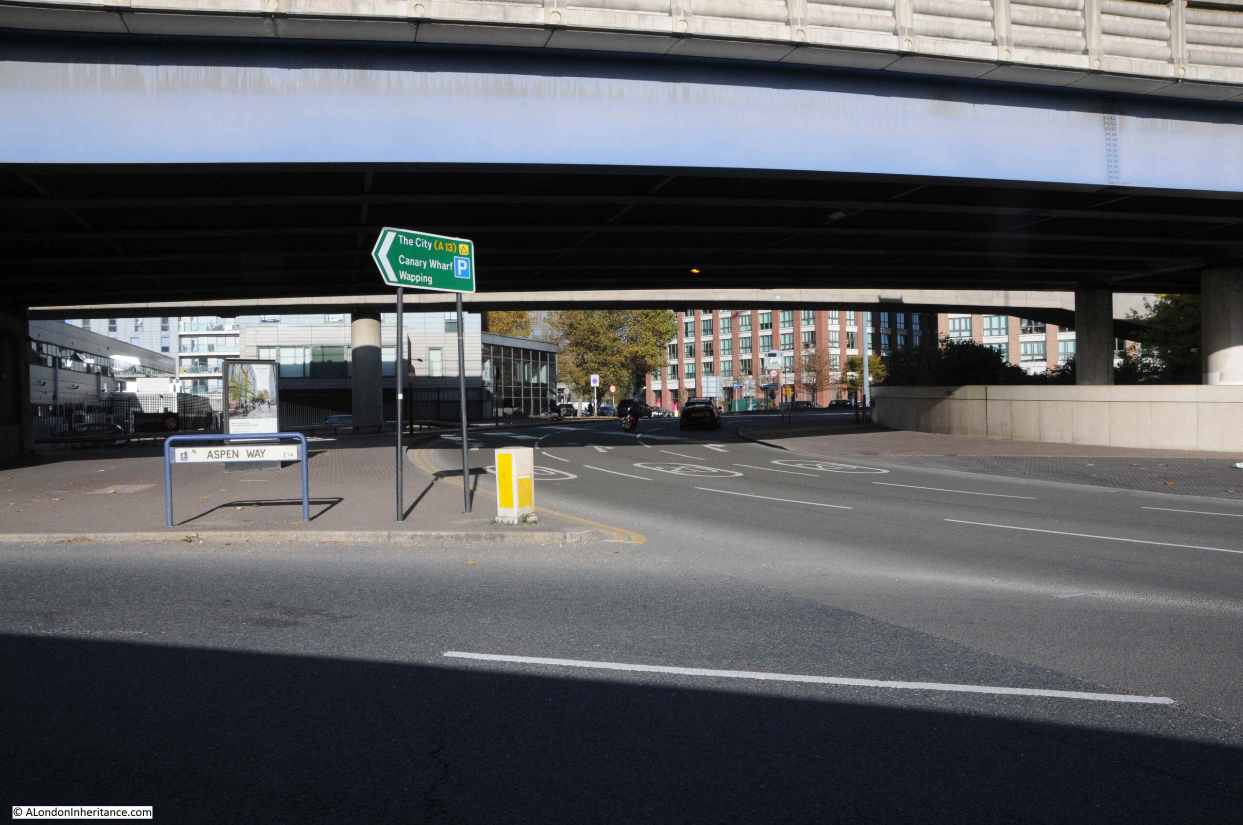
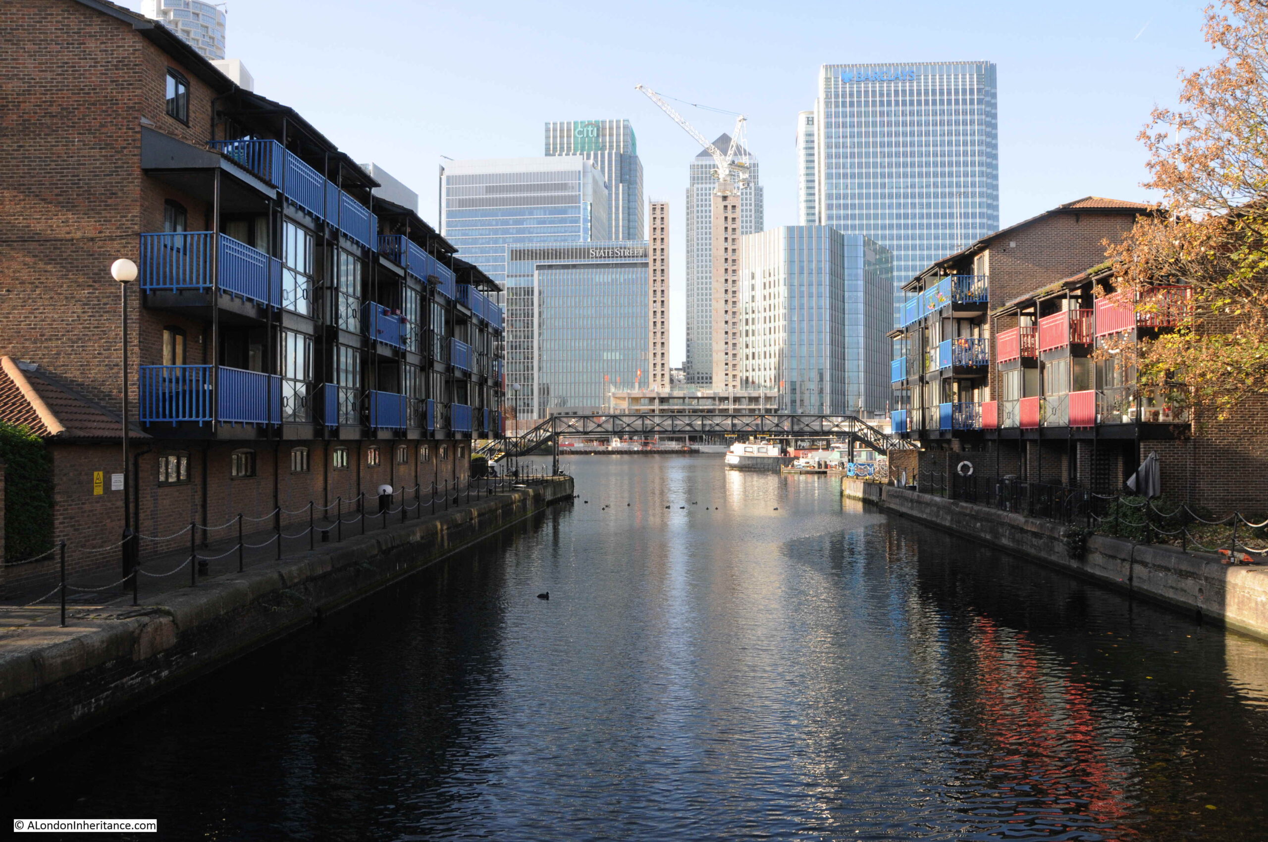
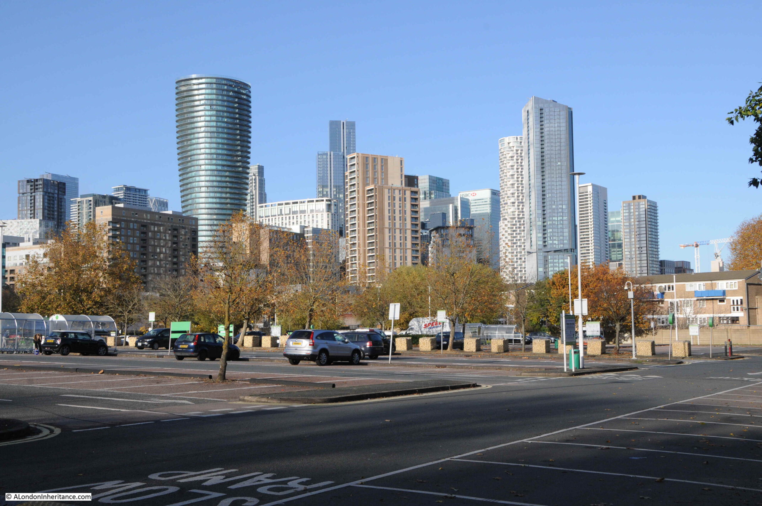
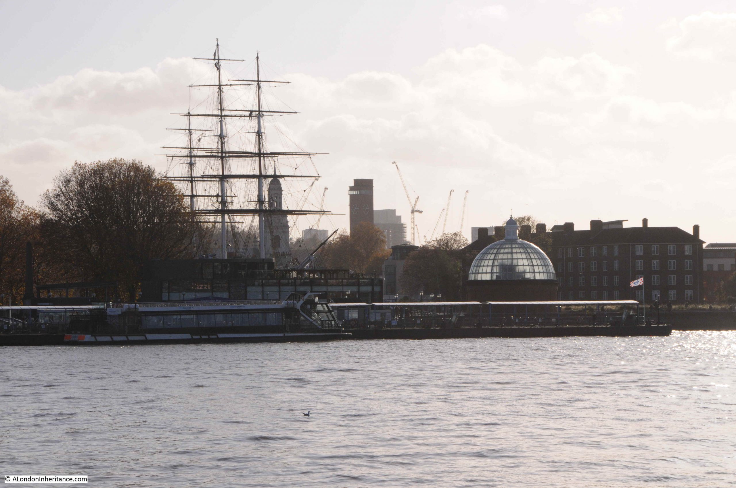
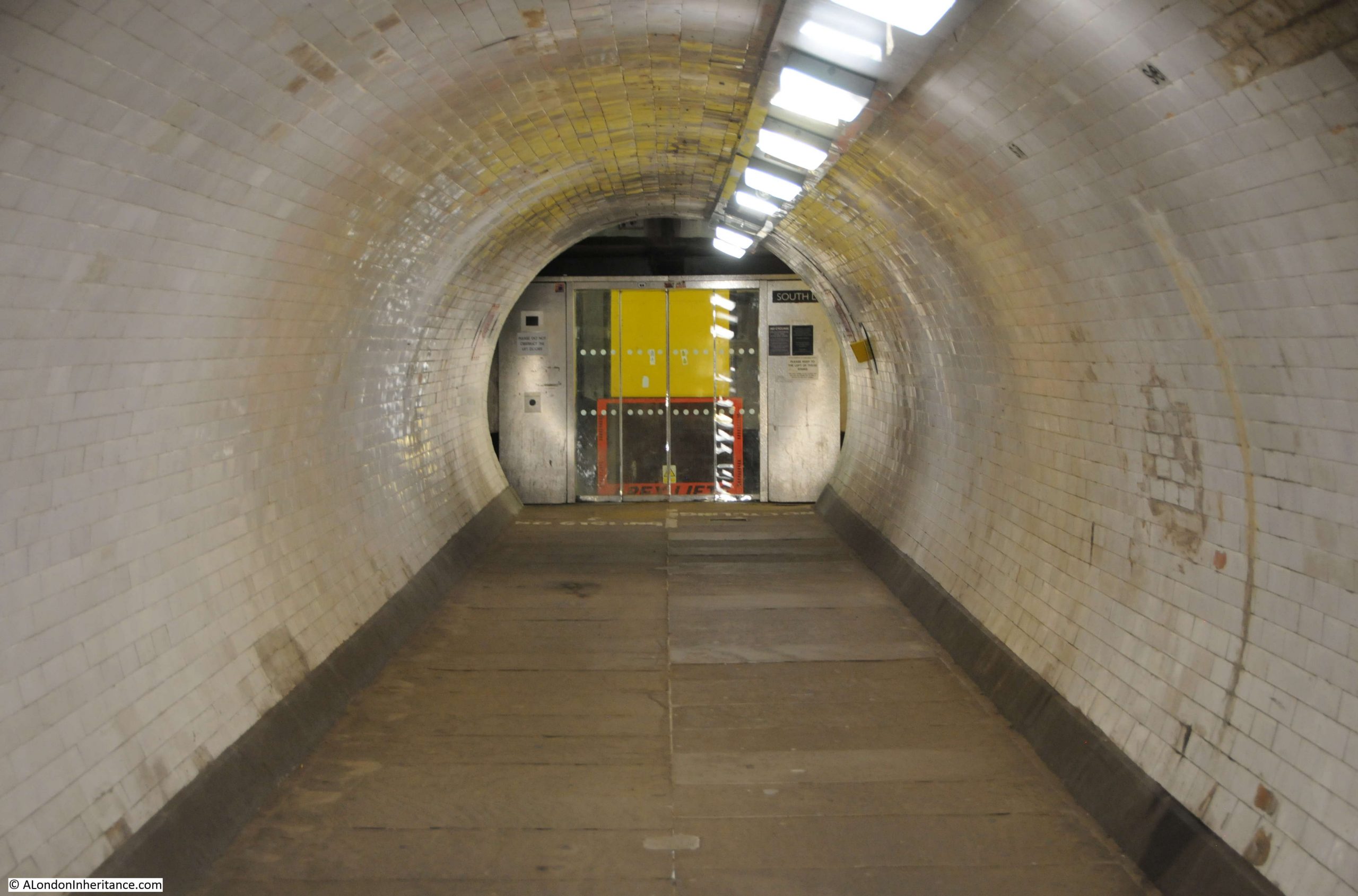
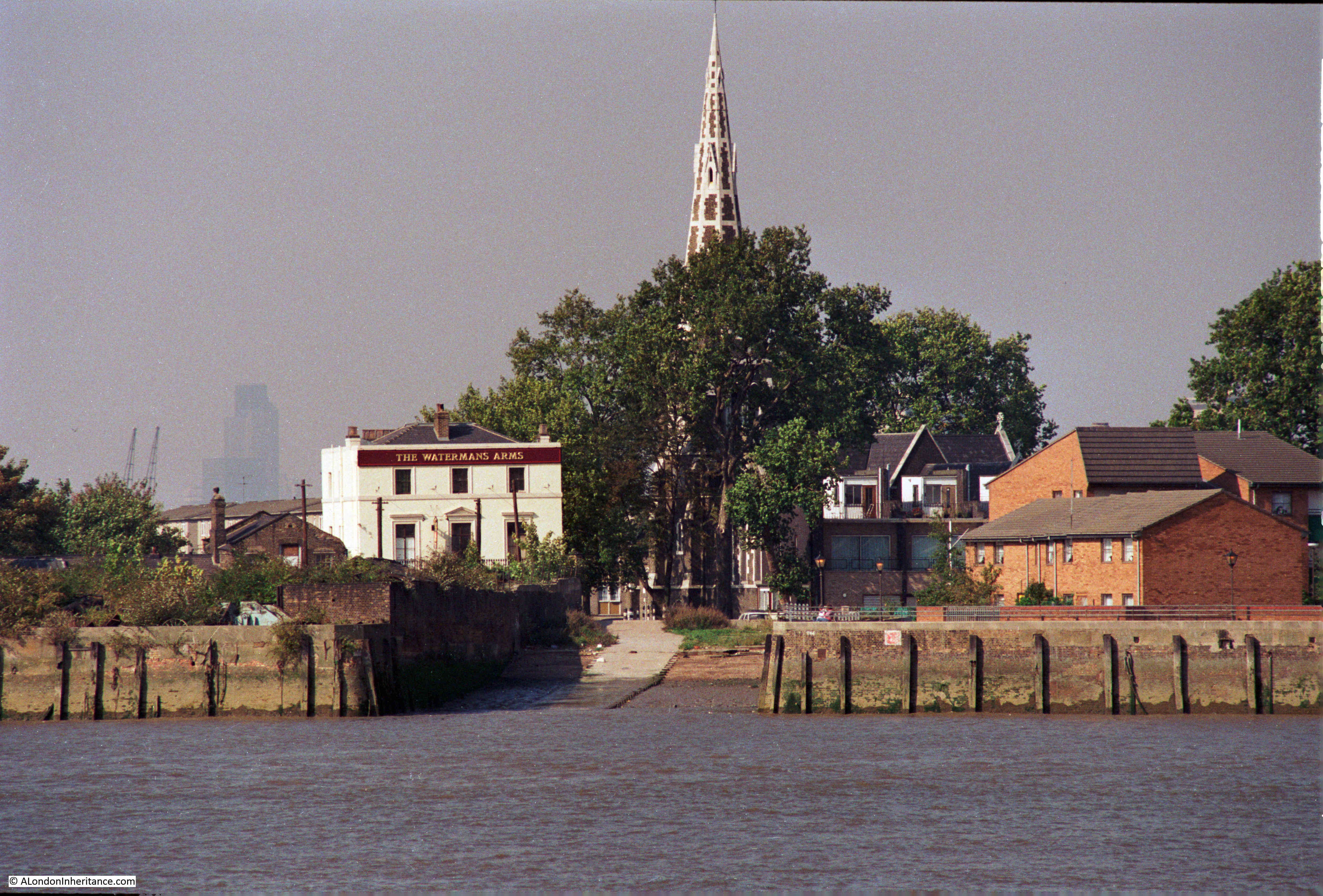
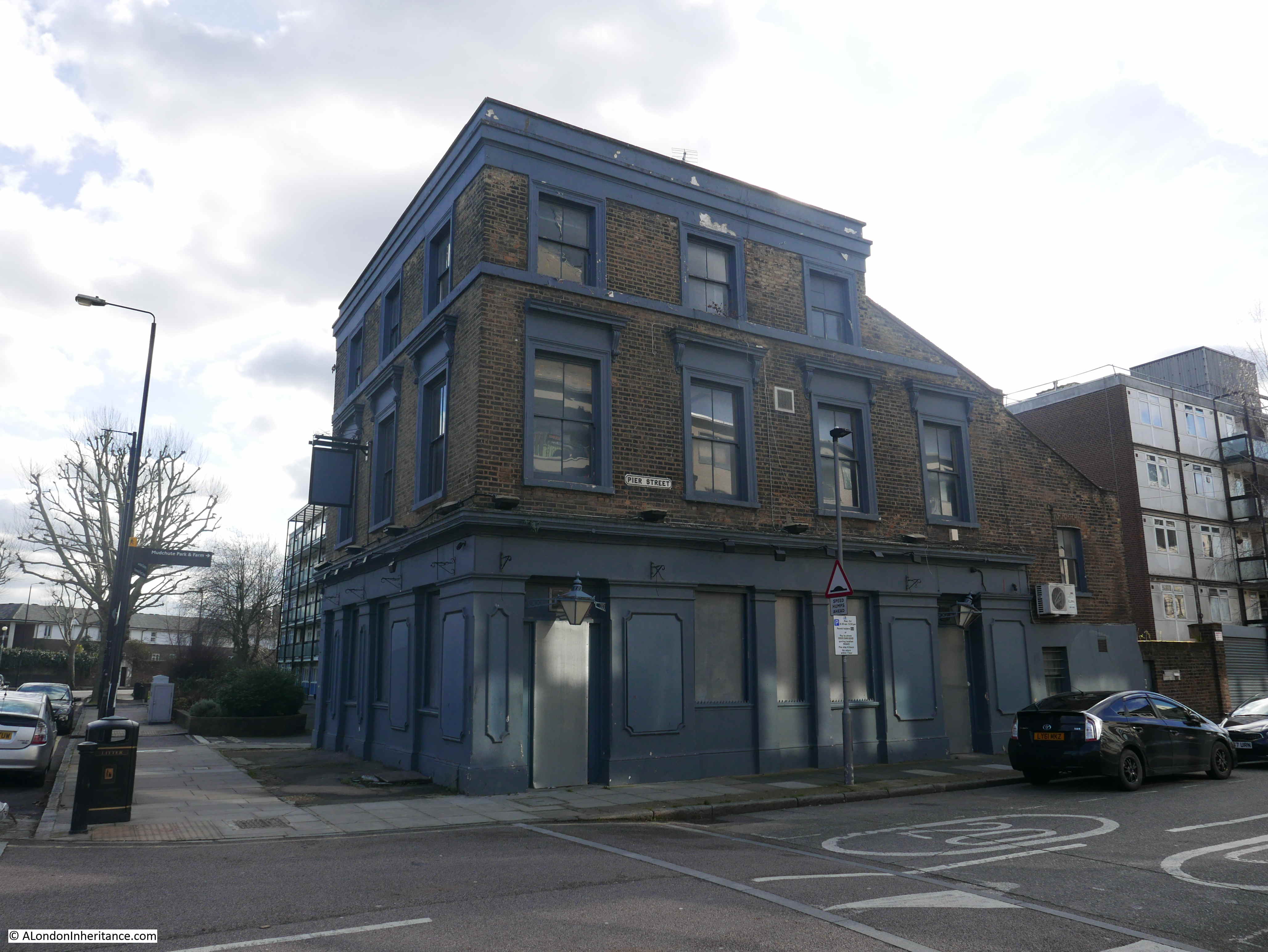
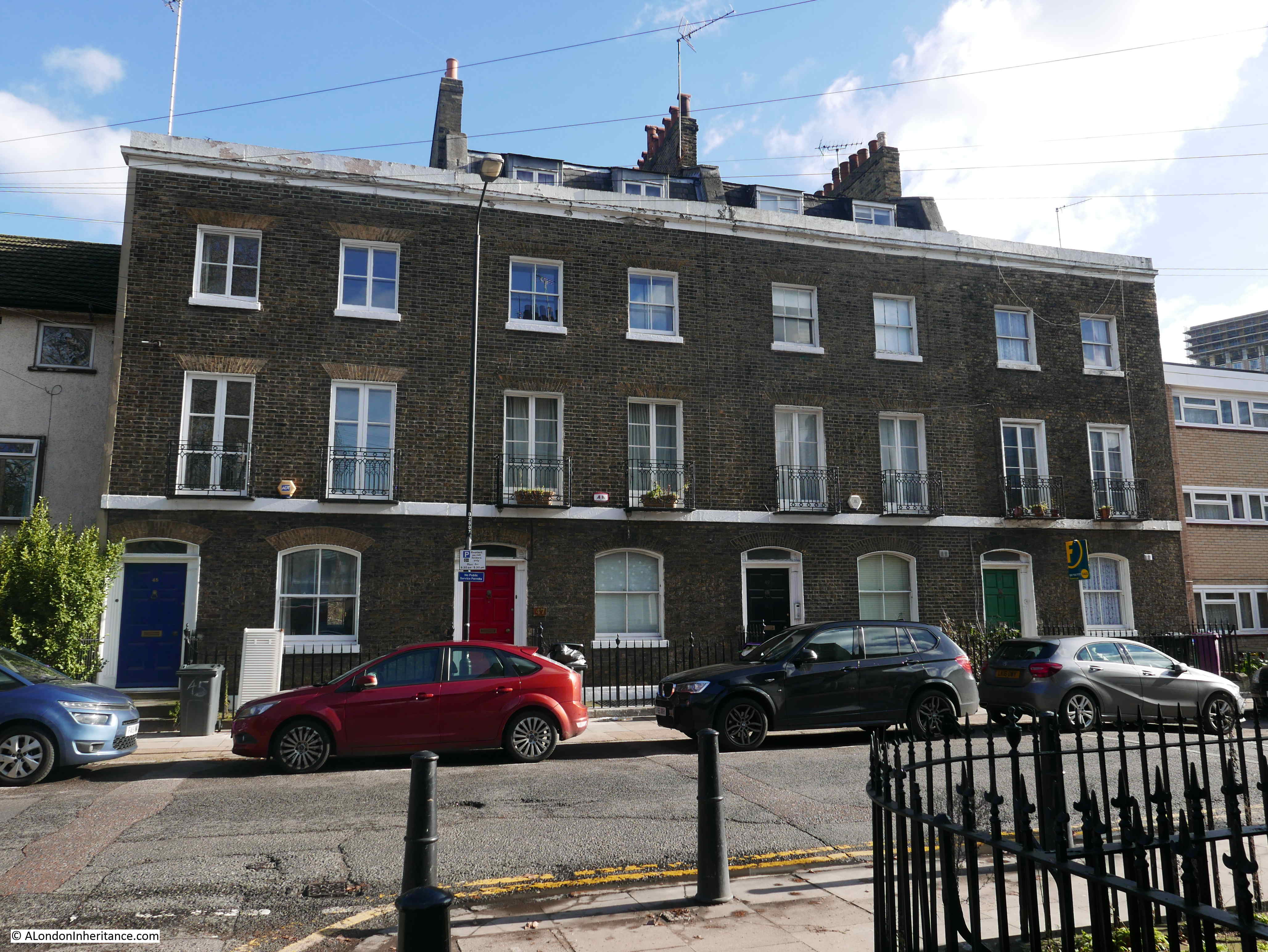
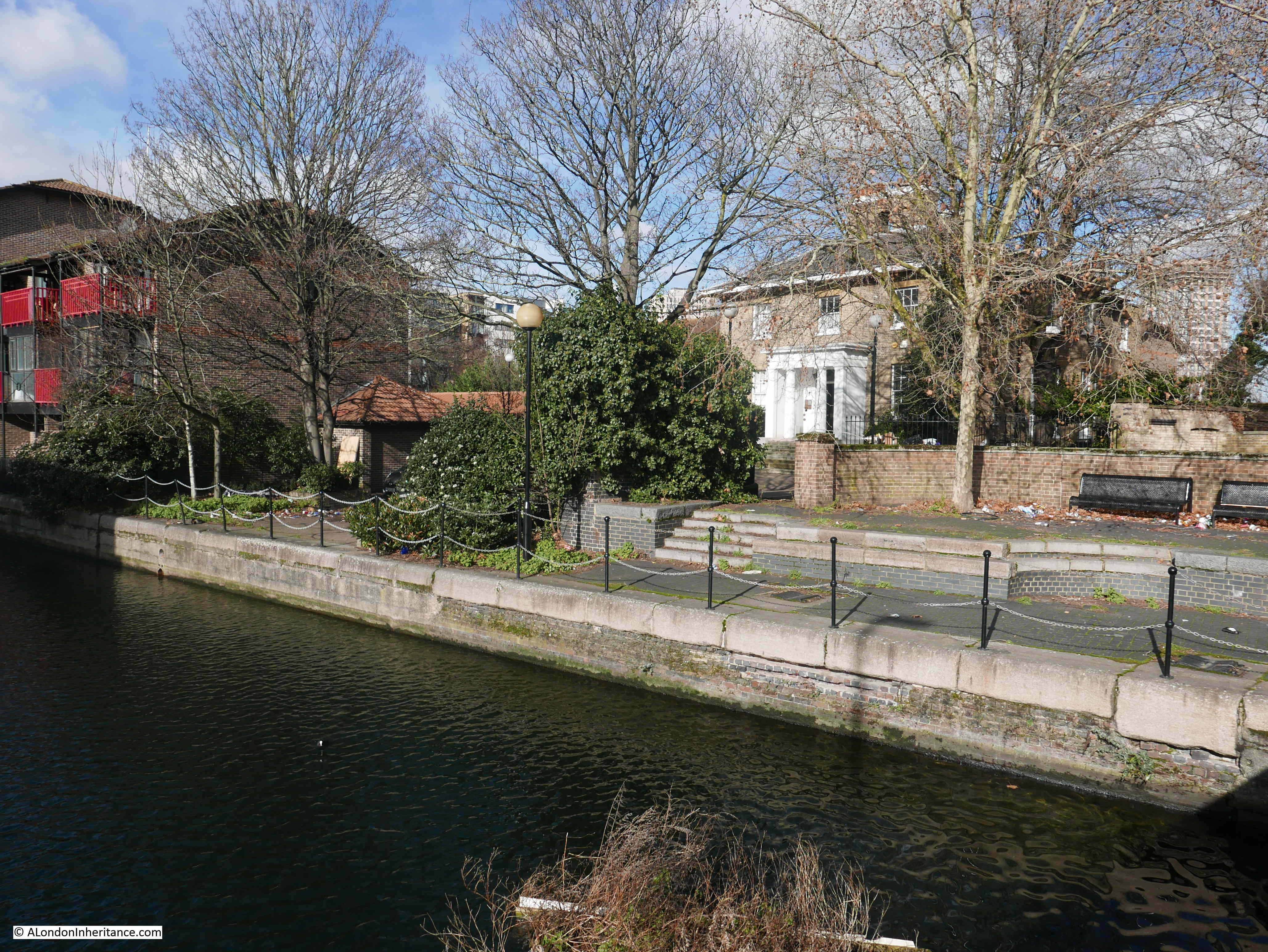
Limehouse Hole Stairs are one of the very old stairs between the land and the river. They are towards the eastern edge of Limehouse, in an area once known as Limehouse Hole, where the river turns south on its journey around the Isle of Dogs.

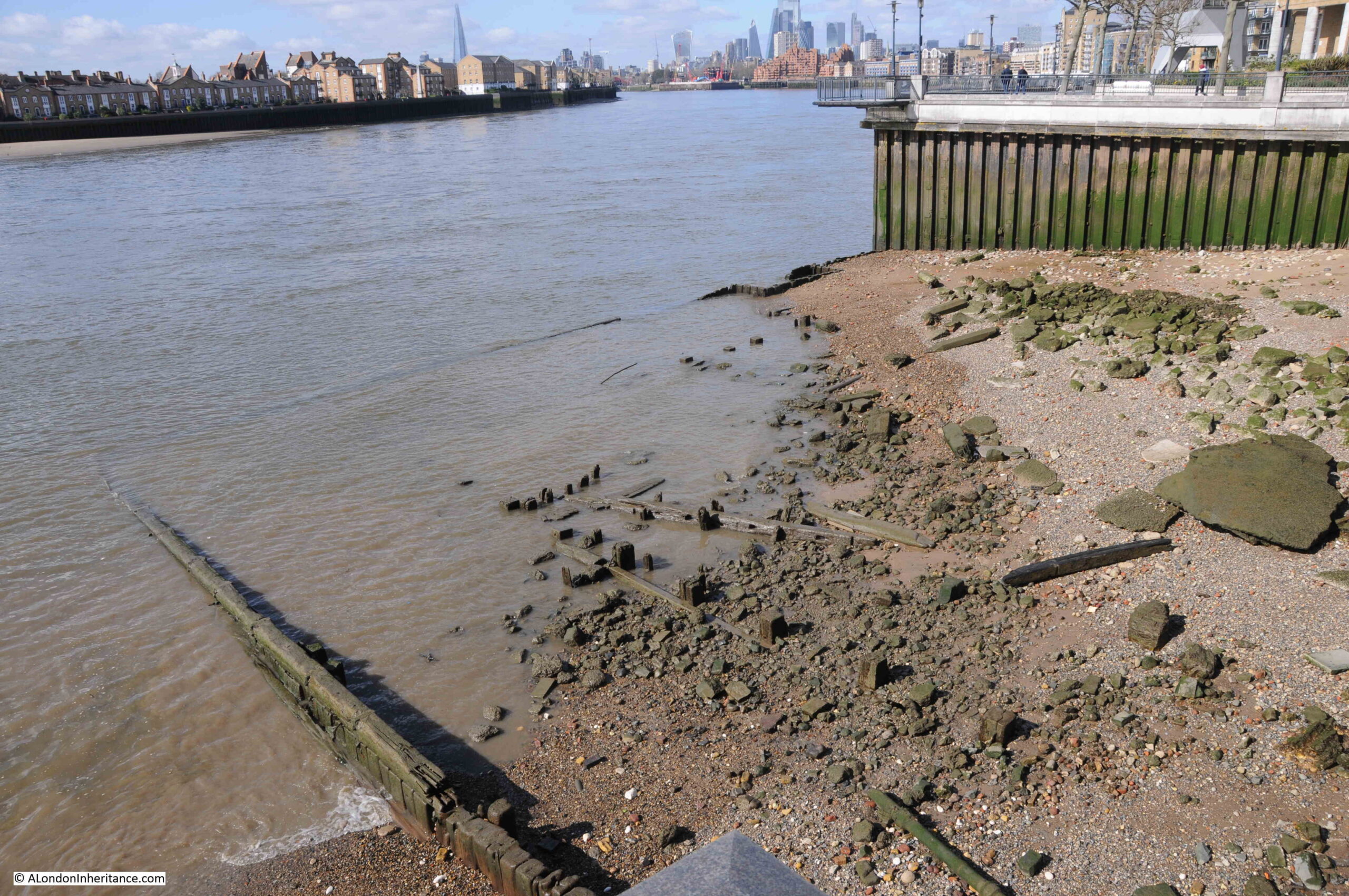
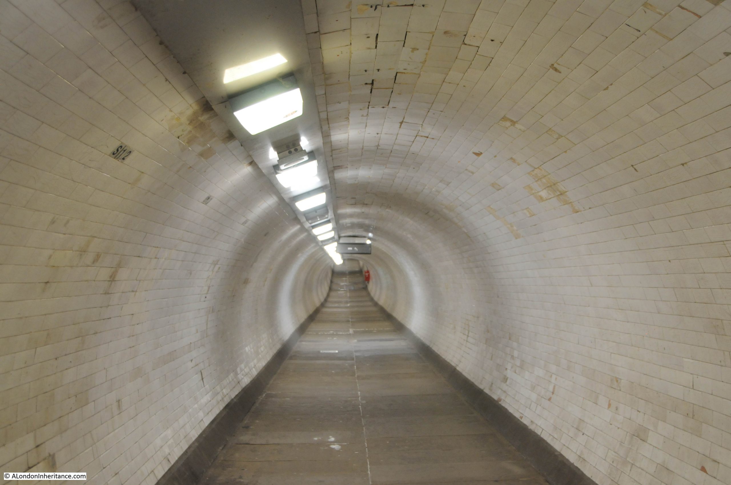
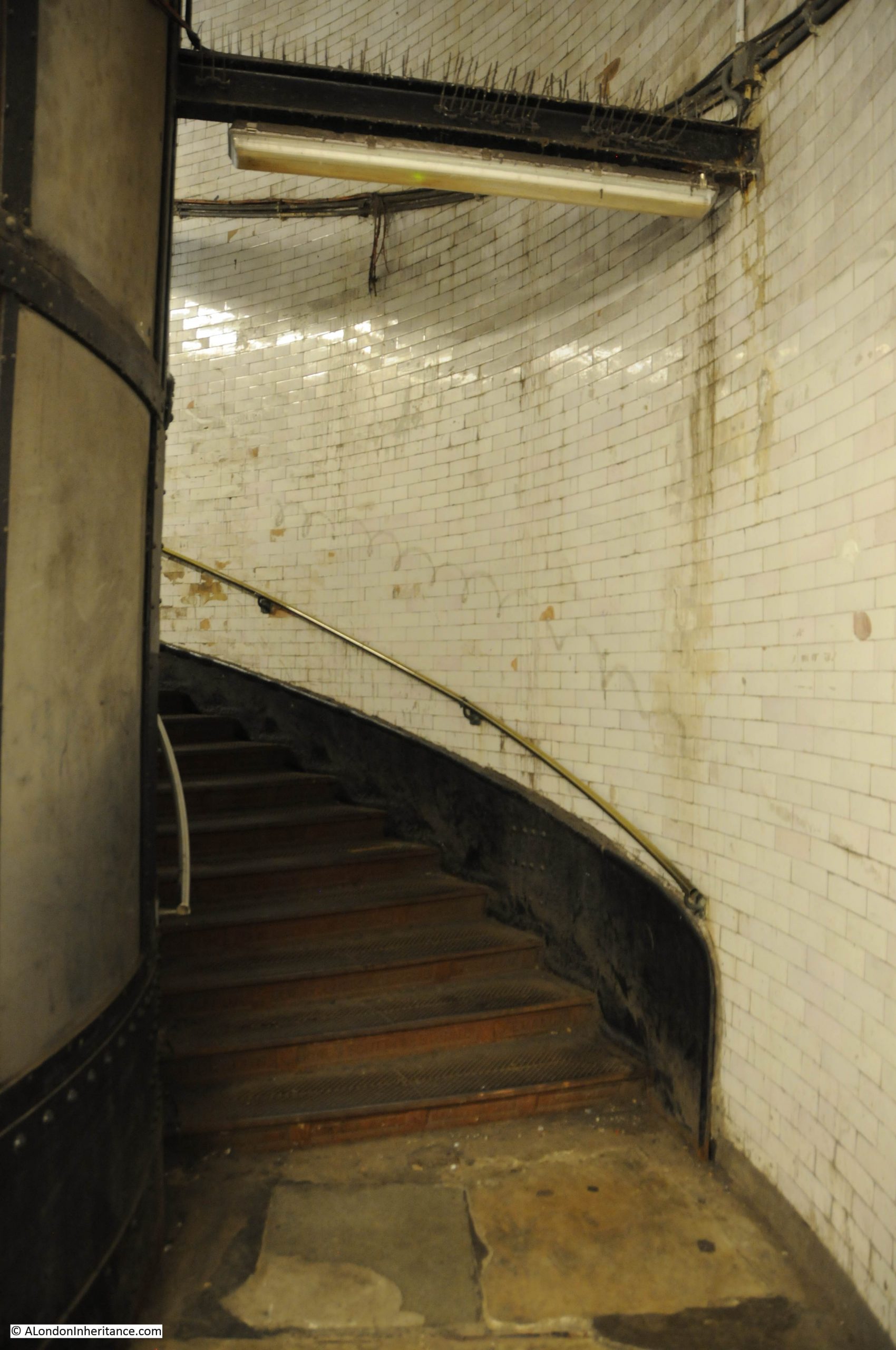
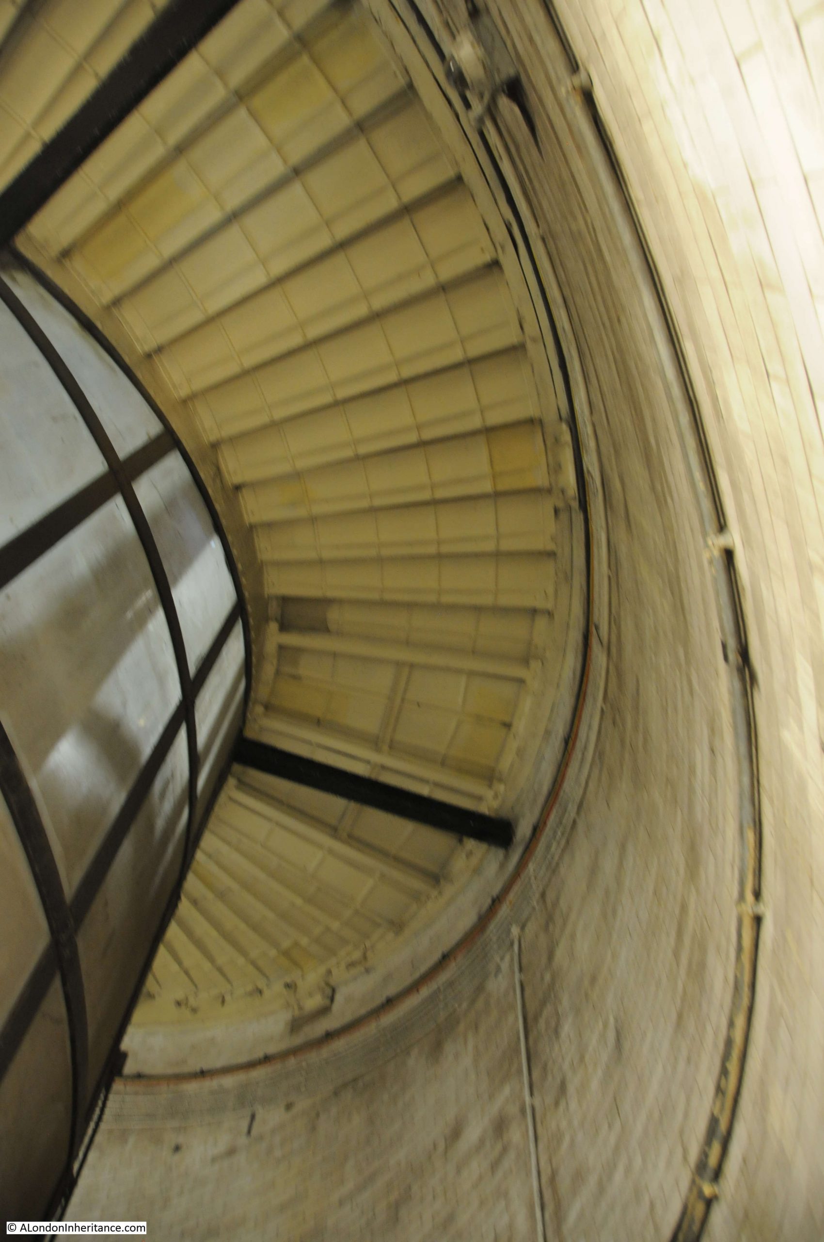
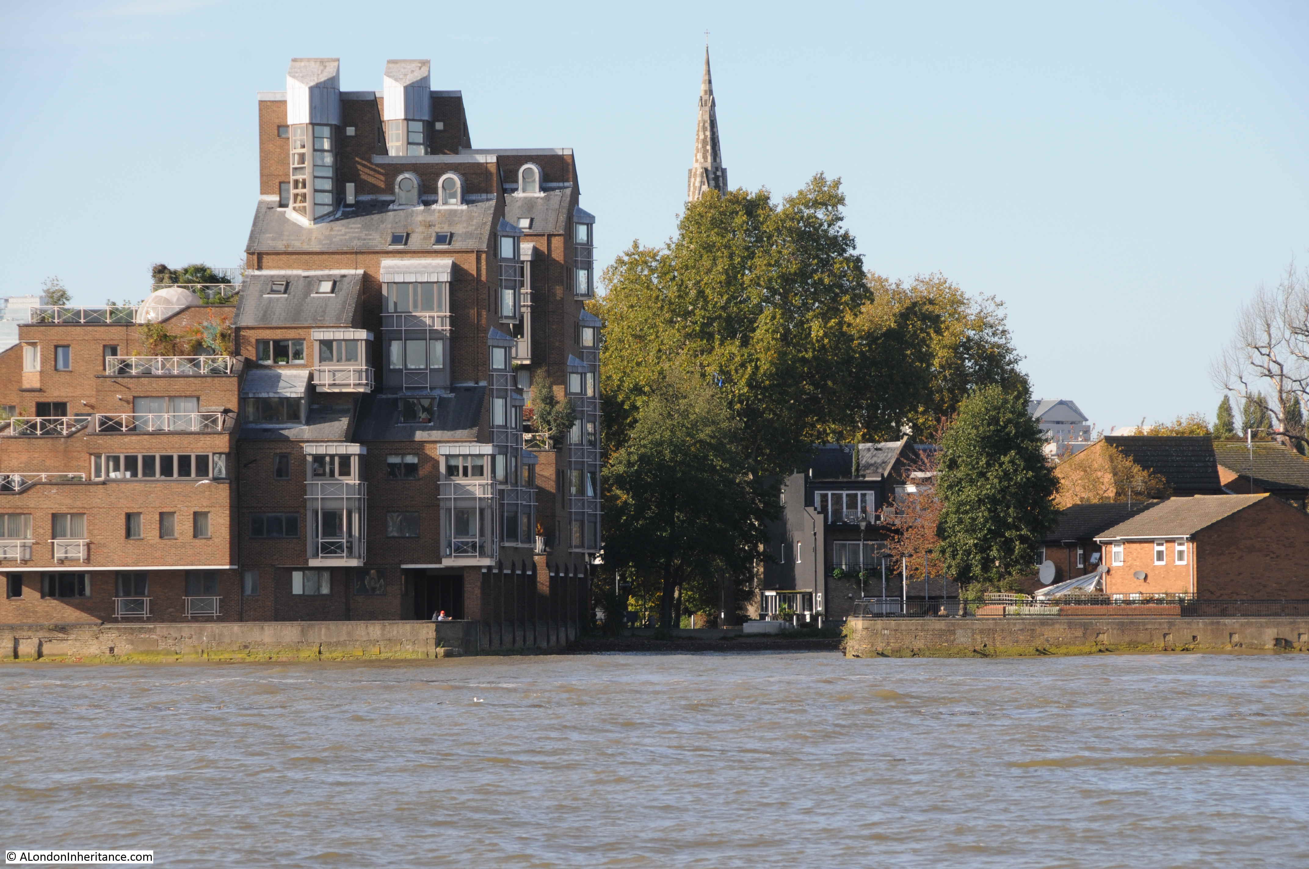
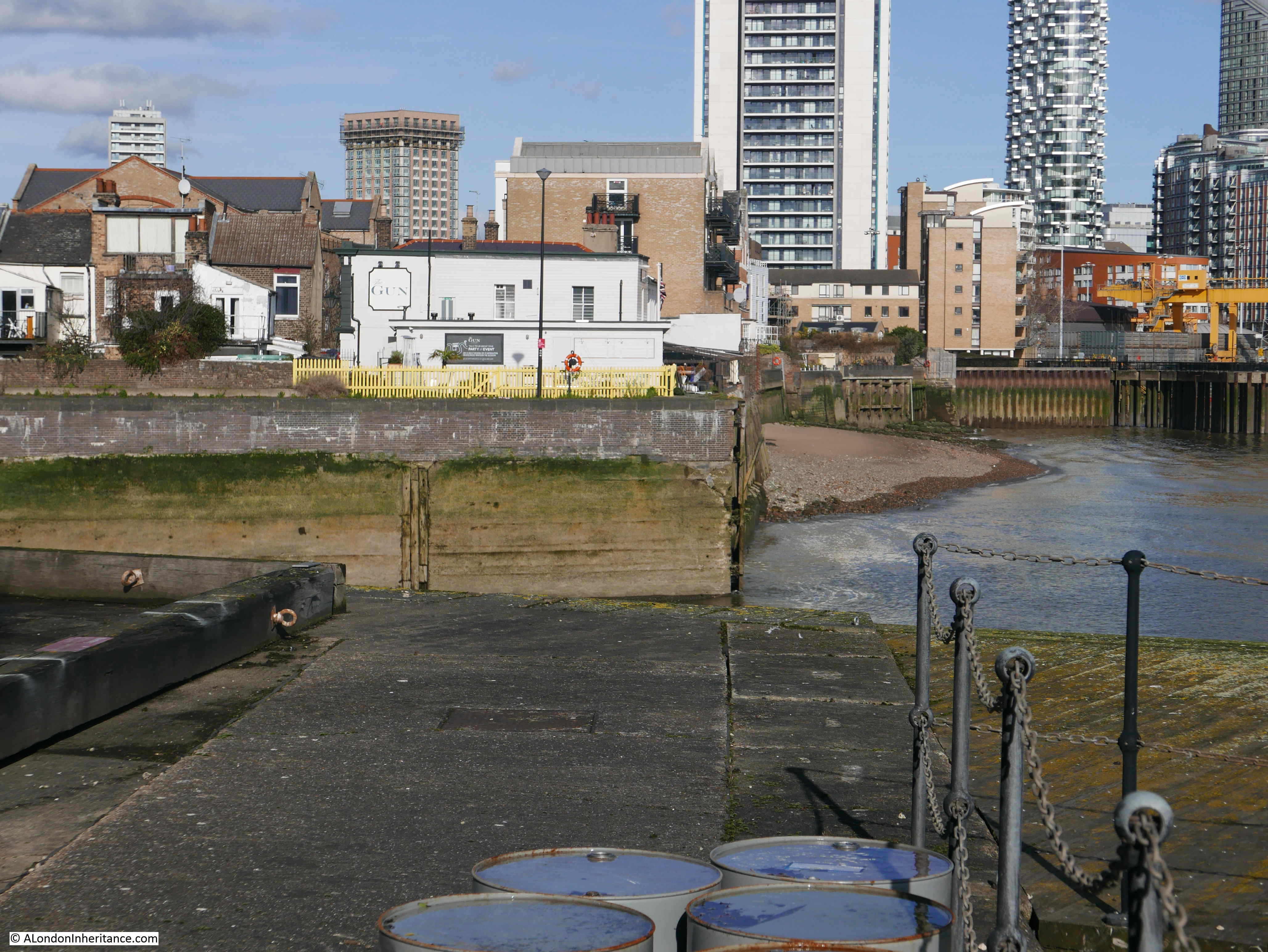
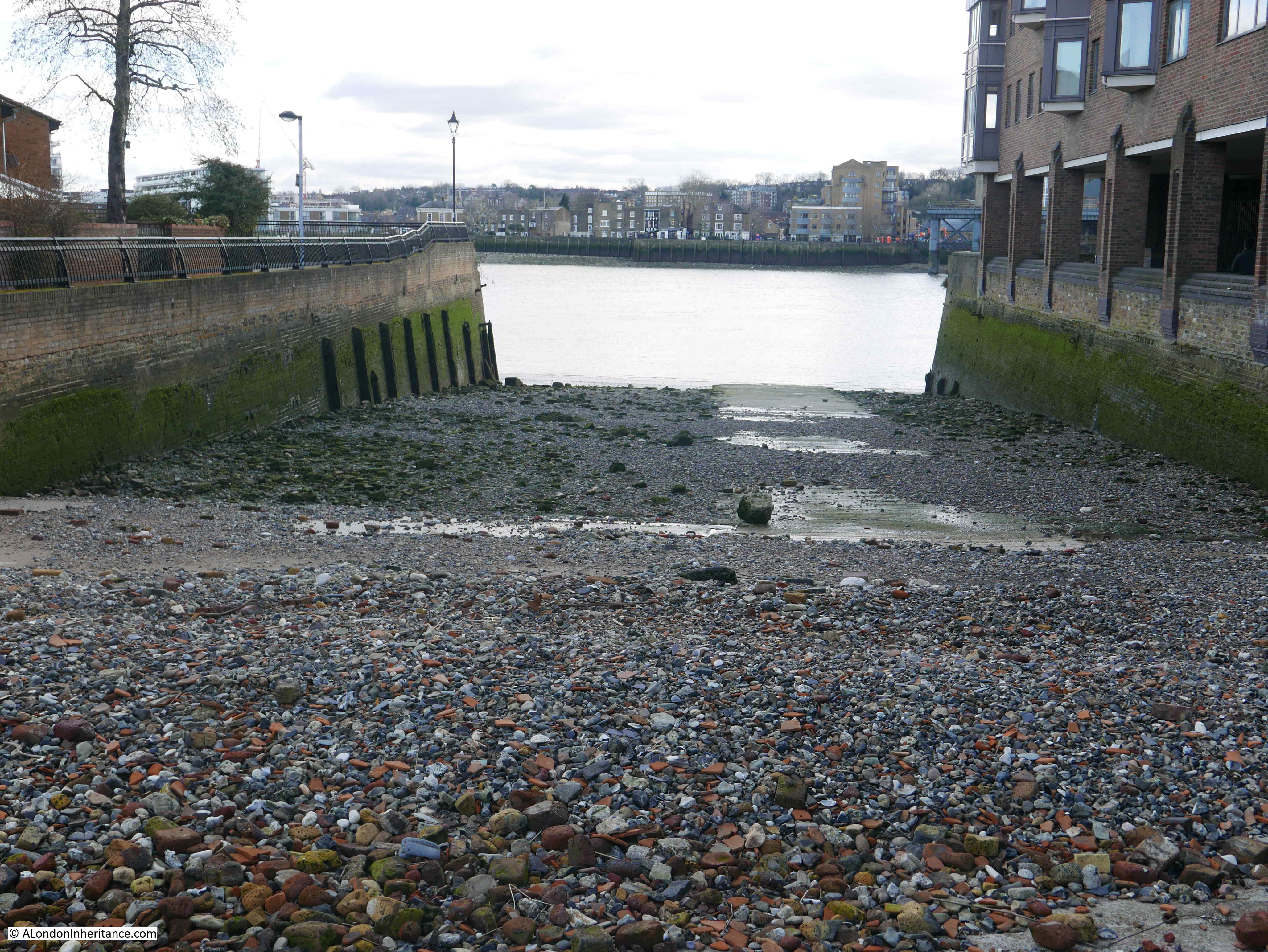
Today, the stairs are a wide and well maintained set of steps leading down from the walkway alongside the river, towards a very roughly rectangular area which is accessible when the tide is low:

Limehouse Hole Stairs

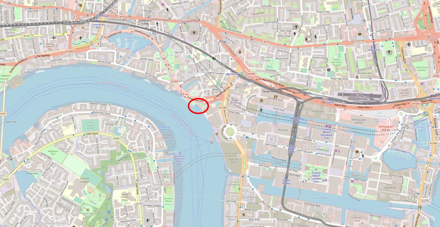
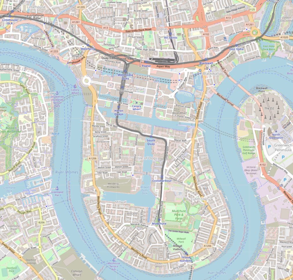
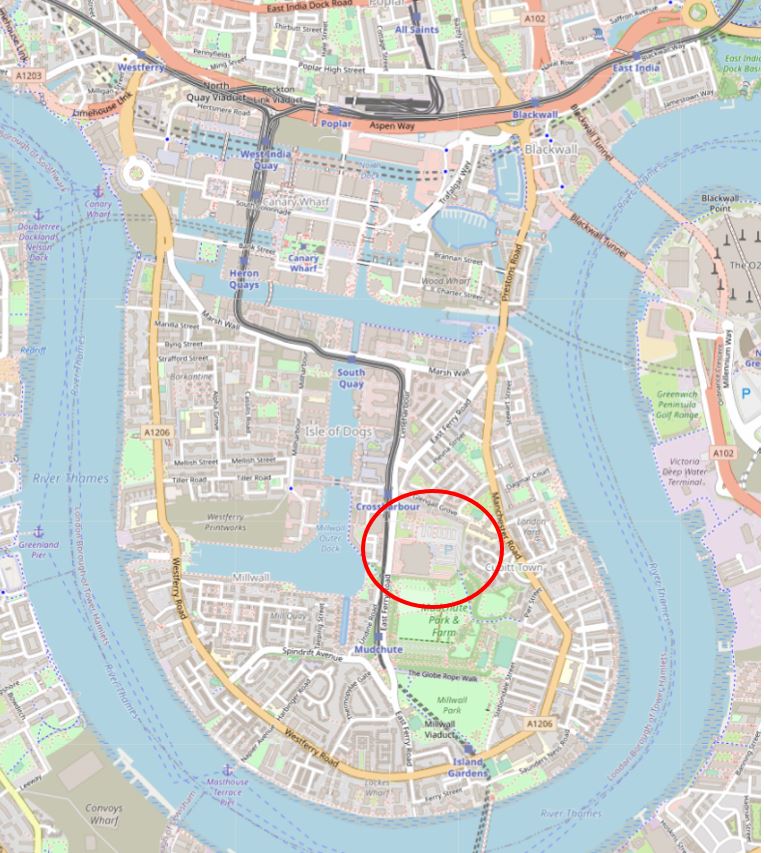
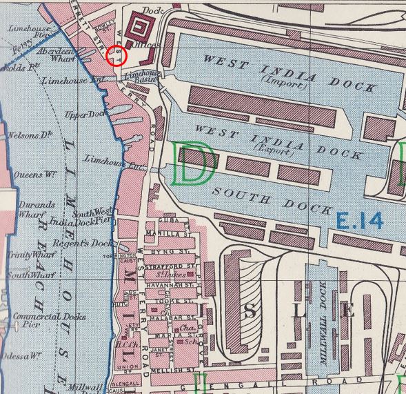
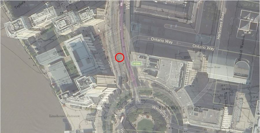
The location of Limehouse Hole Stairs is shown by the red oval in the following map (© OpenStreetMap contributors):

Limehouse Hole Stairs

On the foreshore at low tide:

Limehouse Hole Stairs

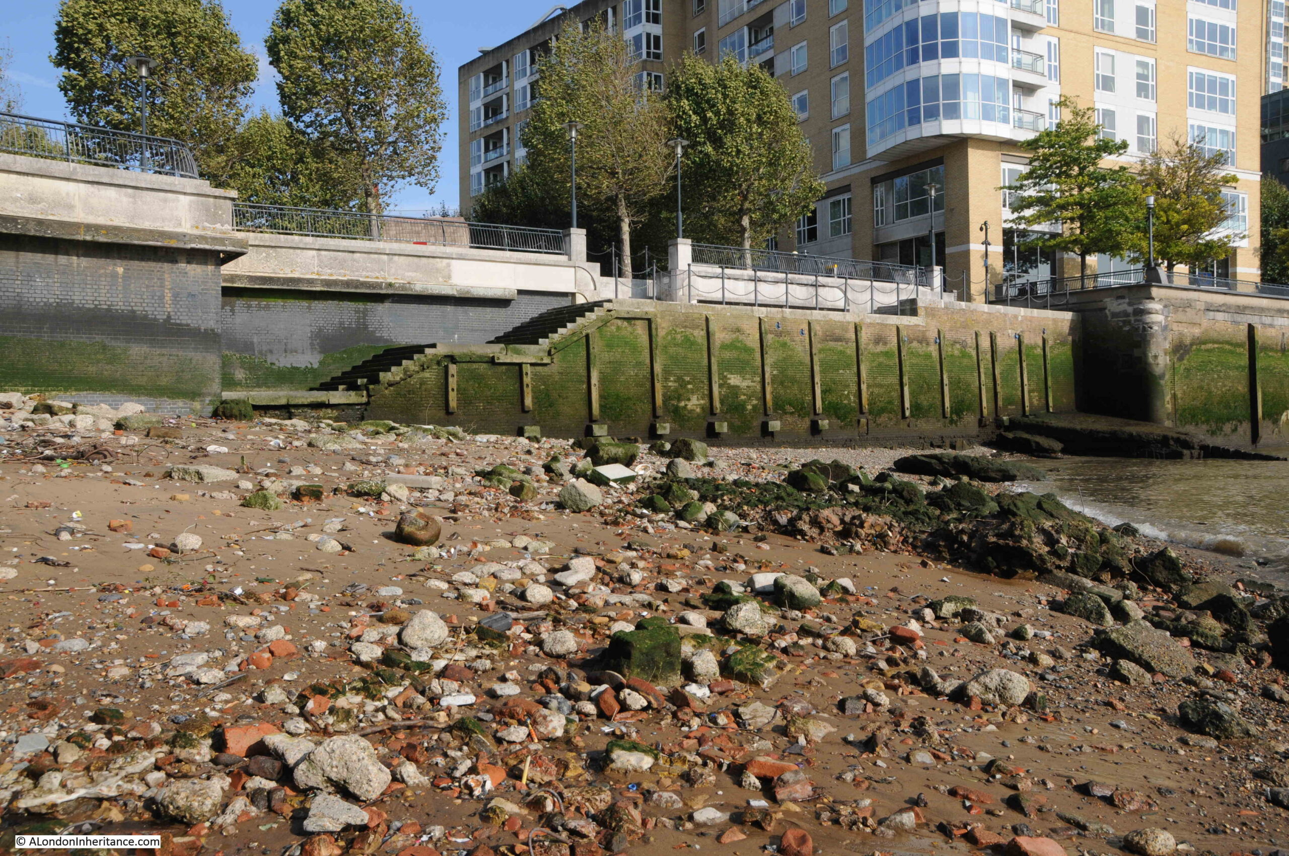
The foreshore at Limehouse Hole Stairs has large sandy patches along with plenty of stone and brick that has found its way into the river from the buildings and infrastructure that once lined the Thames.

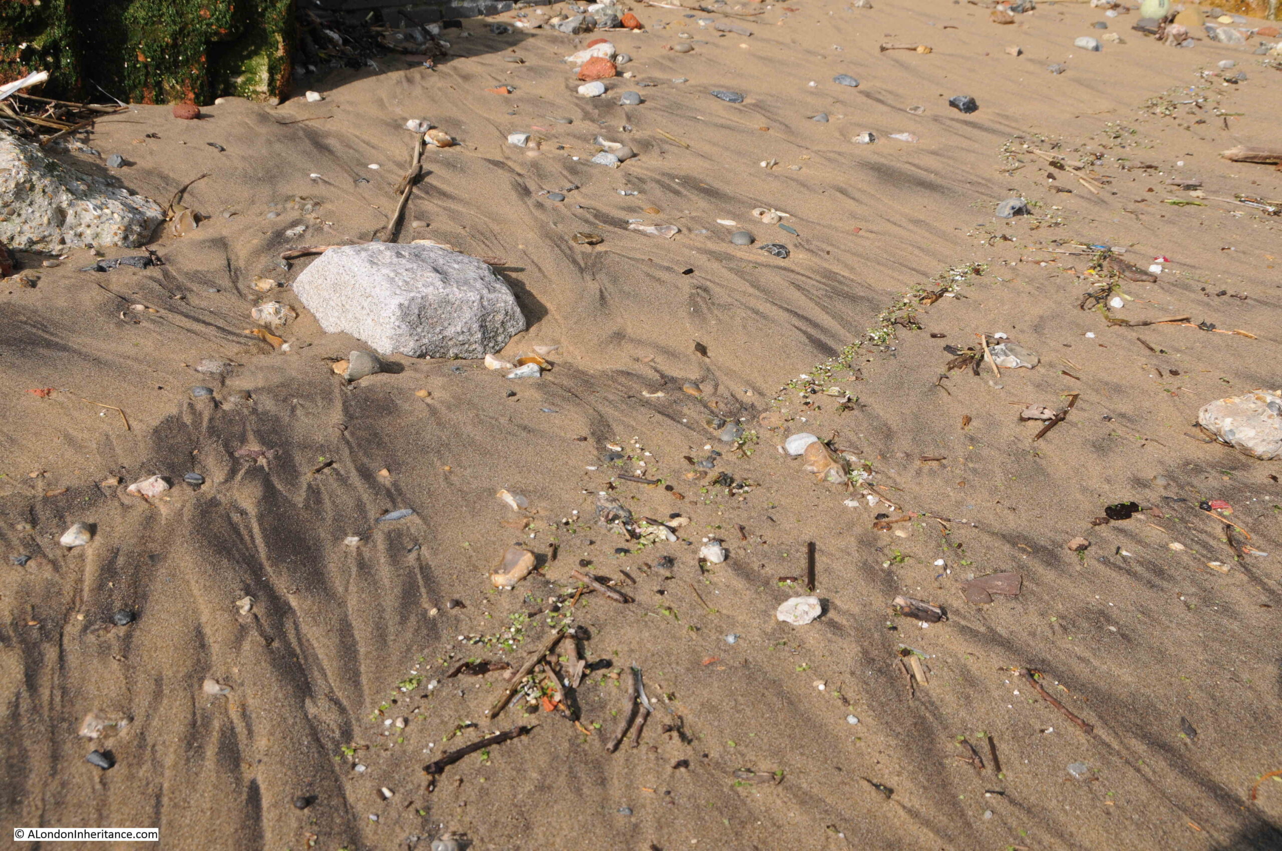
If you look closely, it is interesting how similar items can be found in lines along the foreshore. They were left when the tide went out, and form a line across the sand. I have no idea of the mechanism that leaves them in a line rather than randomly scattered, and on the foreshore at Limehouse Hole Stairs, a line of green glass / plastic / minerals (not sure what they were), was stretched across the sand:

Limehouse Hole Stairs

The Port of London Authority list of the steps, stairs and landing places on the tidal Thames has very little information on Limehouse Hole Stairs, just recording that they were in good condition, with stone and concrete steps and in use. The PLA had not recorded whether the stairs were in use in their two key recording years of 1708 and 1977.

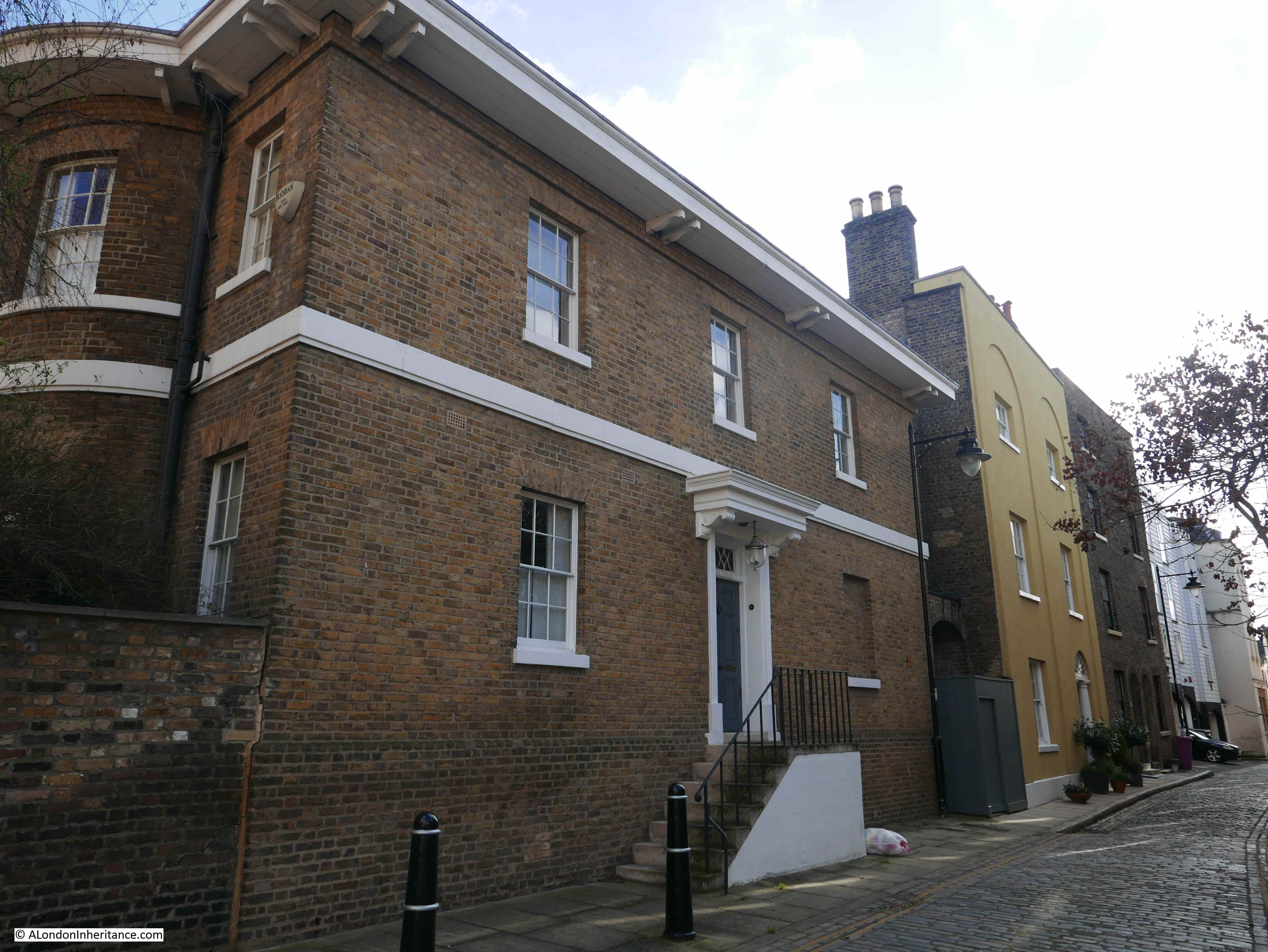
The stairs are old, but the stairs we see today are very different to what was there prior to the redevelopment of the area in recent decades, which I will show later in the post.

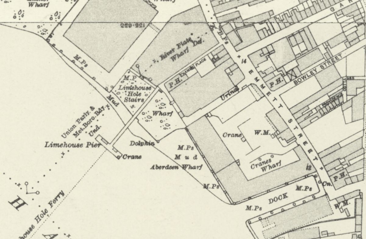
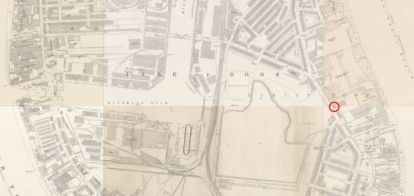
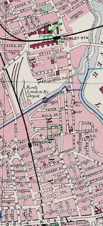
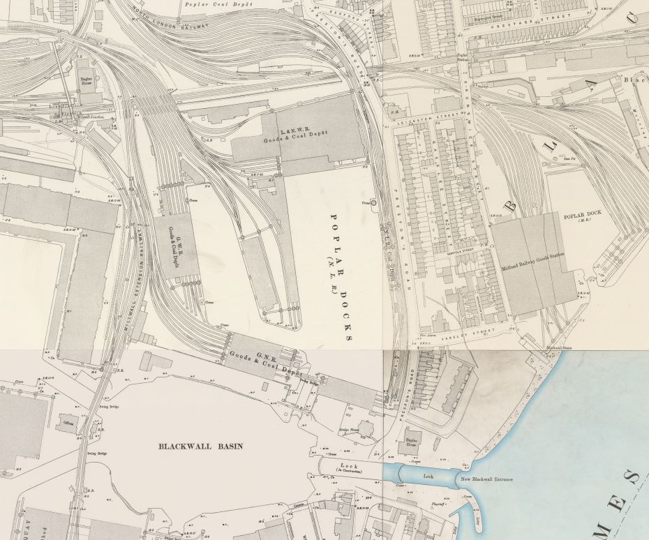
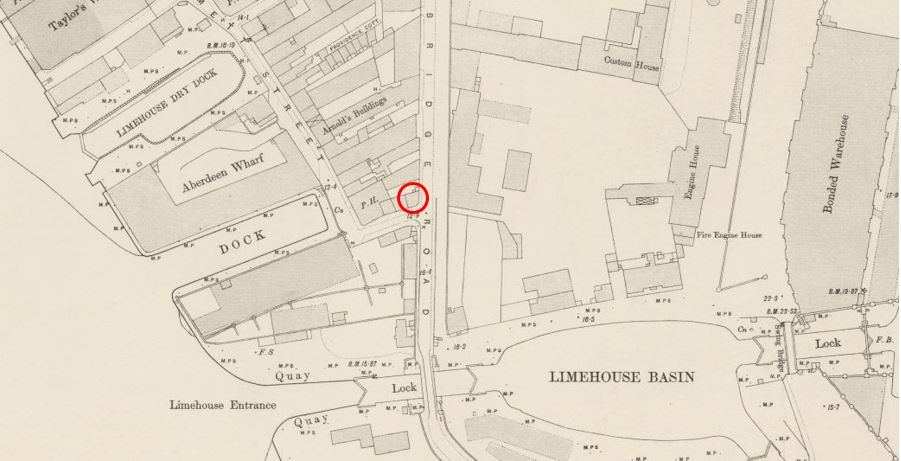
The following extract from the 1949 revision of the OS map shows the location of Limehouse Hole Stairs  (‘Reproduced with the permission of the National Library of Scotland“)..

Limehouse Hole Stairs

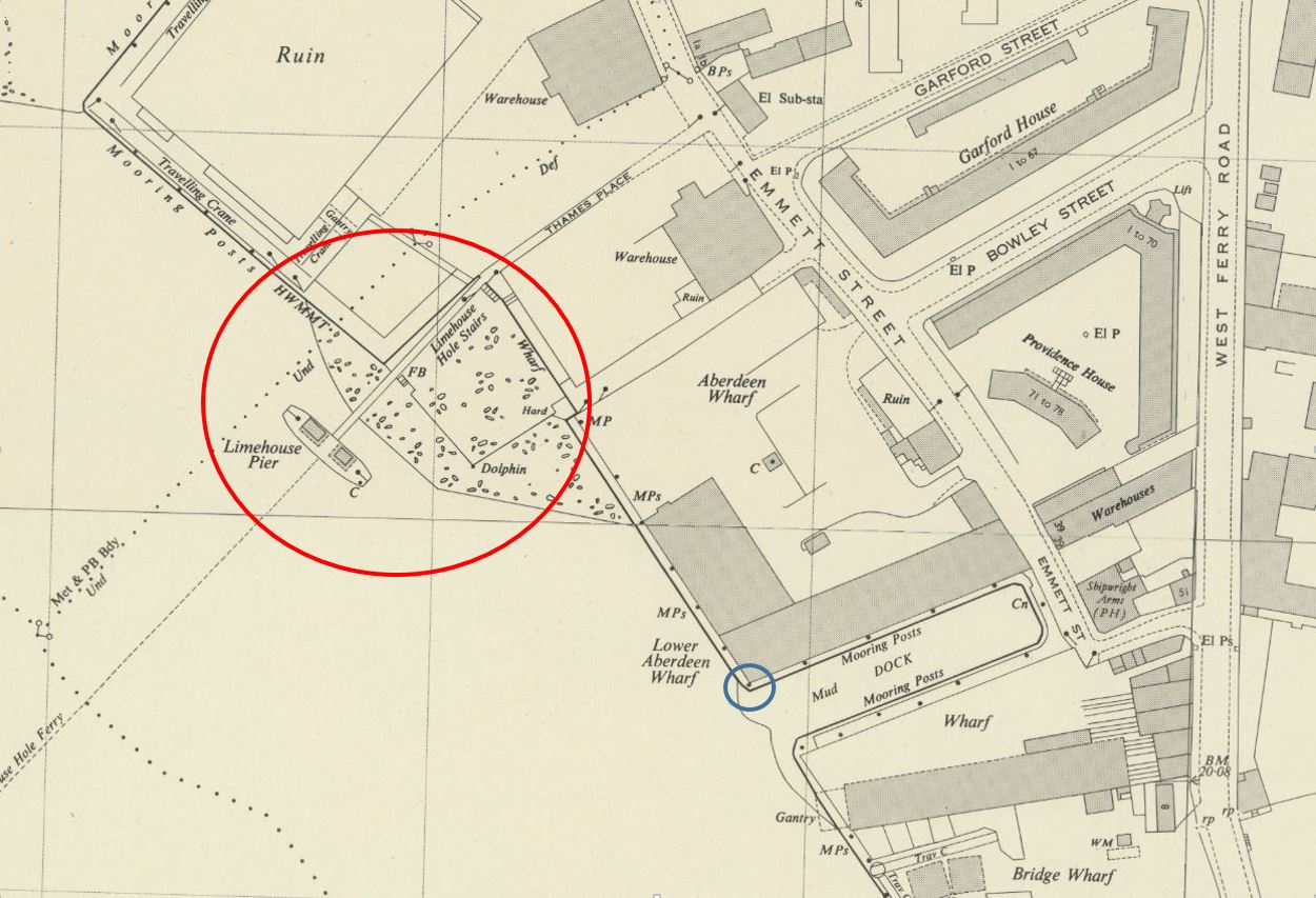
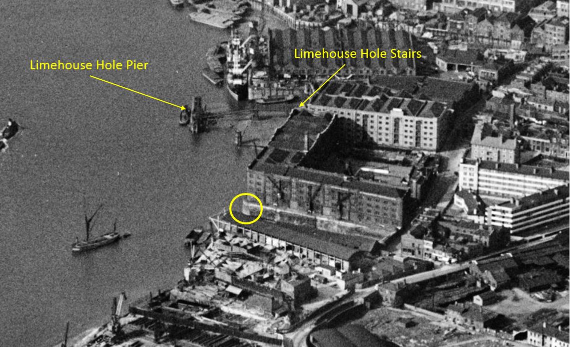
There is an area of foreshore that dries when the tide is low shown mainly within the red circle. Limehouse Pier extends into the river. Follow the pier back to land, and in the corner is Limehouse Hole Stairs.

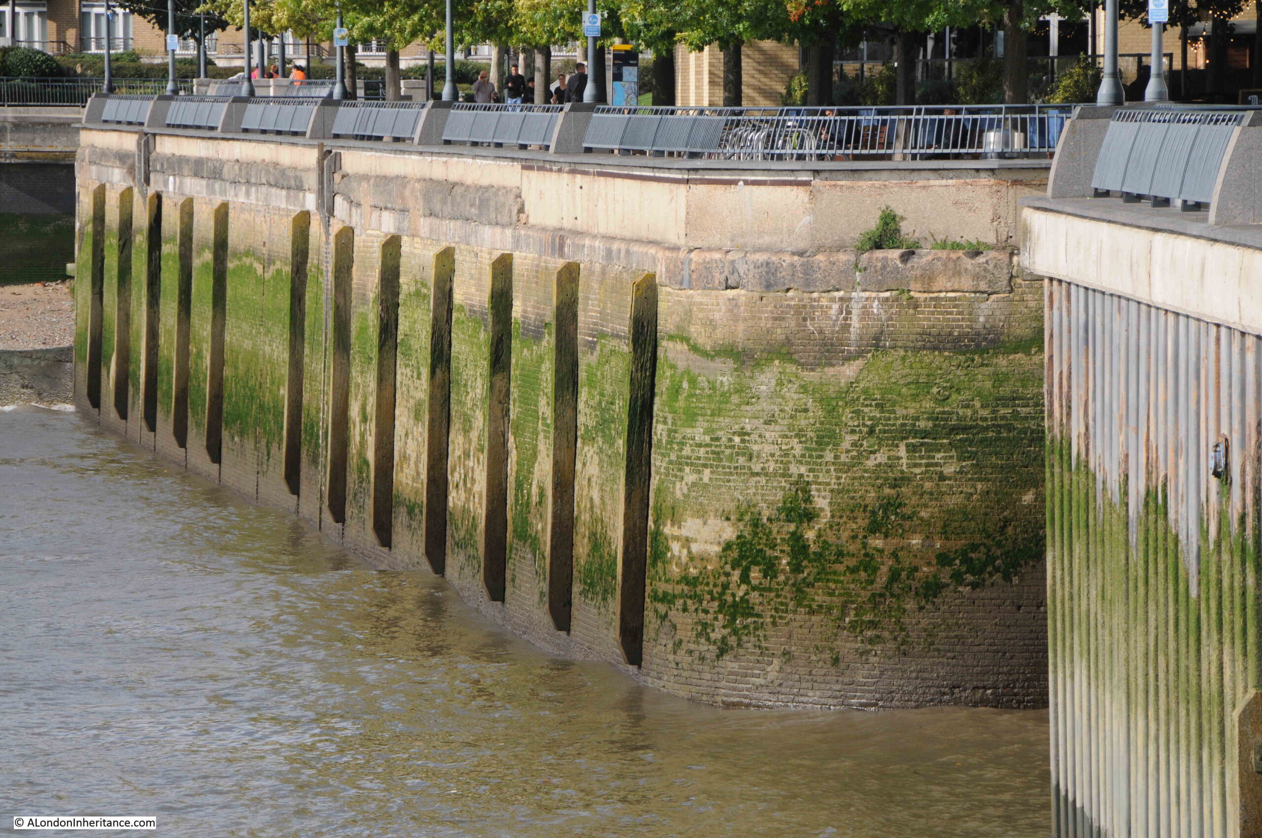
You can also see in the above map, a line forming two sides of a square, with the river walls forming the other two sides. The two lines running across the dried foreshore in the map were a wooden surround, parts of which can still be seen today, as I will show later.

I will come to the relevance of the blue circle later in the post.

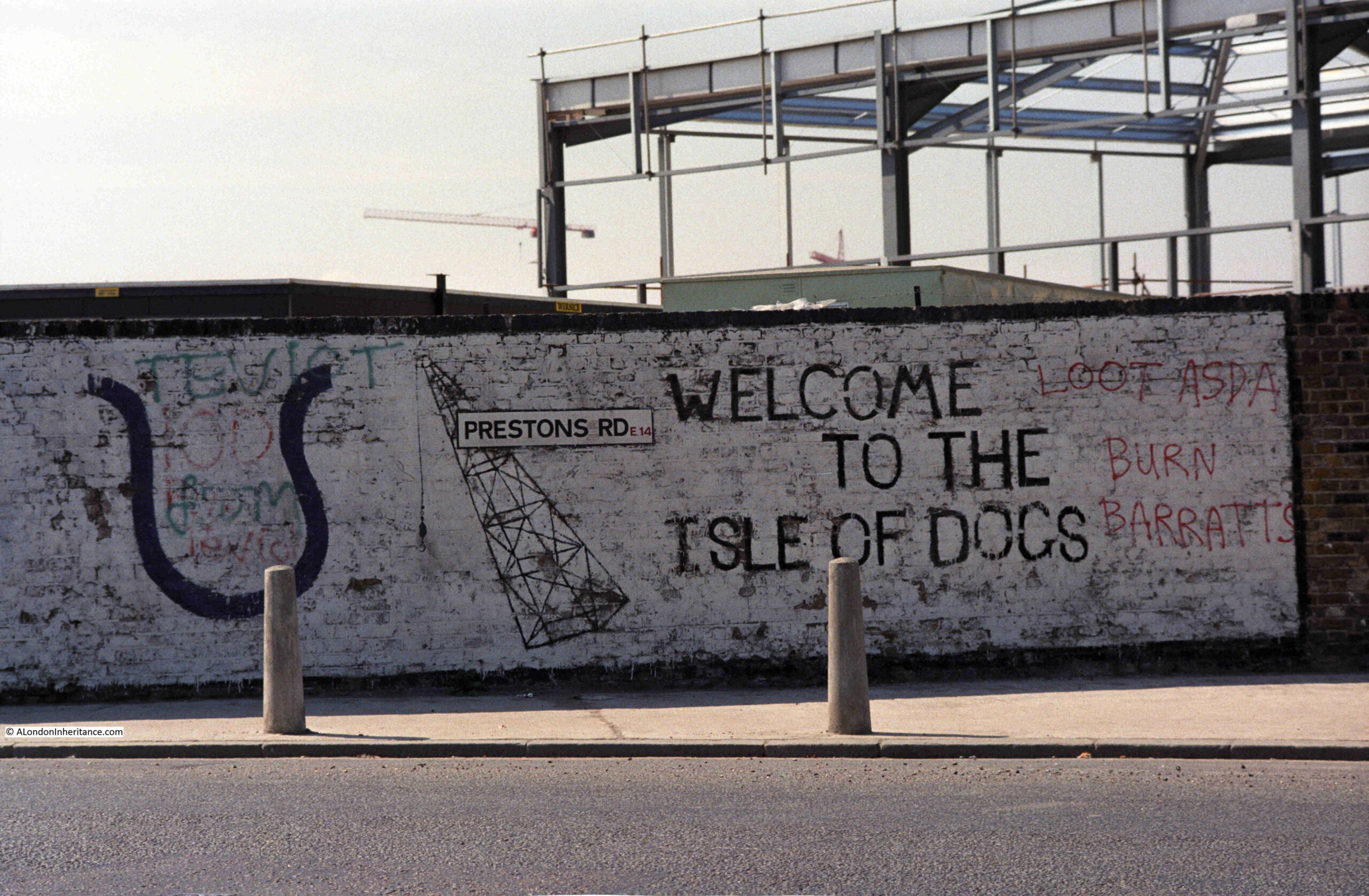
This area has a complicated naming history.

Written references to the stairs date back to the early 19th century, although these do not explicitly name Limehouse Hole Stairs. A typical advert in February 1807 was for the Schooner Anne which was for sale and could be seen “lying at Limehouse Hole, opposite the stairs”.

The name Limehouse Hole is also a bit of a mystery. It may refer to a form of small harbour or dock, although I find this unlikely as the larger Limekiln Dock is within the area traditionally known as Limehouse Hole.

I did wonder if the name referred to a hole in the river, perhaps a particularly deep part of the Thames, however in the area known as Limehouse Hole, the bed of the river is of a depth that is normal for much of this stretch of the river, typically around 6 metres deep at the lowest astronomical tide.

There is though a strange depression in the bed of the river not far to the west, in the middle of the river opposite the entrance to Limehouse Dock, where the river descends from a depth of 5.5 metres to a depth of 11.4 metres, all within a small area of the Thames.

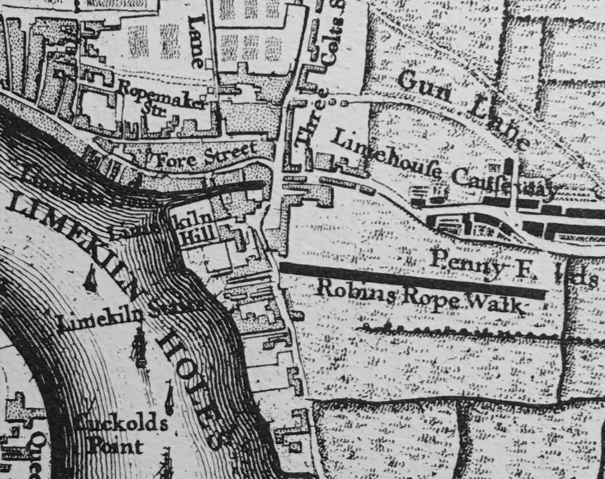
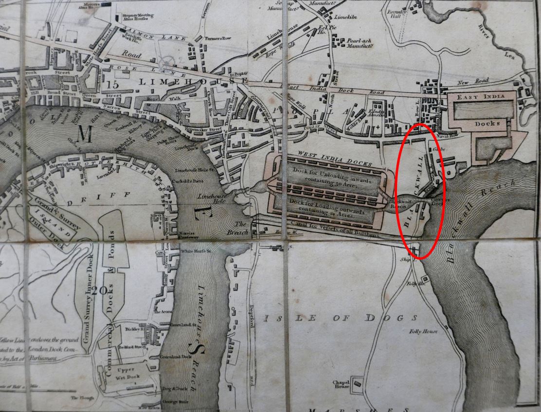
To add to naming confusion, if we look at Rocque’s map from 1746, there are stairs in the rough location of Limehouse Hole Stairs, however Rocque calls then Limekiln Stairs, and he also names this stretch of the river Limekiln Holes rather than Limehouse Hole, so perhaps the name refers to some aspect of the Limekiln industry, and as this industry declined, the name changed from Limekiln to Limehouse Hole.

The Survey of London does though state that the name Limehouse Hole was in use for this section of the river by the seventeenth century, so perhaps Rocque was confused with the Limekilns and Limekiln Dock, or in the 18th century there were different names in use.

The extract from Rocque’s map is shown below:

Limehouse Hole Stairs

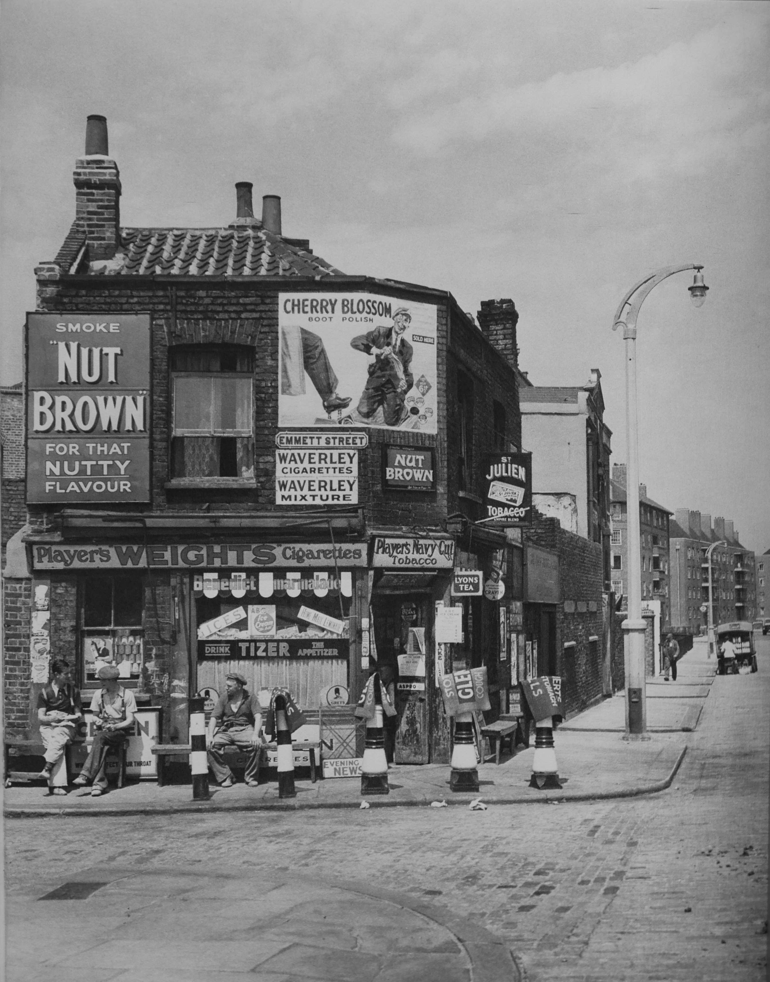
The first references to the full name of Limehouse Hole Stairs start to appear around 1817, and there are multiple references in the 1820s onwards. All the usual events that make their way into the papers – accidents on the river, ships for sale, fires in the buildings by the stairs, rowing competitions, and tables of rates for Watermen to charge to row passengers along the river.

In the OS map shown above, there is a pier coming out from Limehouse Hole stairs. The earliest reference I can find to the pier dates from 1843, when there was an article in the November 5th edition of The Planet recording a court case, where “On Tuesday, Jonathan Bourne, a waterman, and one of the proprietors of the floating-pier at Limehouse Hole stairs, appeared to answer a charge of carrying passengers in his boat on Sunday, in violation of the rights and privileges of William Banks, the Sunday ferryman. The real question in dispute between the parties was as to the right of the watermen owning the floating pier to convey passengers to and from the Watermen’s Company steamers which stop there. When the tide is low there is not sufficient water for the steamers to come alongside the outer barge of the pier, and the watermen row the passengers to the steamers, and vice versa, but no money is taken.”

From the article, it appears that the pier was owned by a group of watermen. The article also shows how watermen were regulated, and had specific rights covering what they could do, and when. I did not know that the Watermen’s Company ran steamers on the river. This must have been a far more efficient way of conveying passengers along the river, rather than rowing as watermen in previous years would have done. Also, an early version of the Thames Clippers that provide the same service today.

The pier seems to have disappeared by the 1860s, as in the East London Observer on the 1st of May, 1869, there was a report on a public meeting of the parishioners of Limehouse “to consider what action should be taken in obtaining the construction of a pier on the Thames, for the convenience of the inhabitants of Limehouse”, and that “there were many persons who would far rather go to the city by boat than either rail or bus”.

A new pier was needed because “the old pier was never under the management of the Thames Conservators, but under that of the watermen, who let it go to ruin”.

A new pier was built in 1870 and this second pier lasted until 1901, when it was removed for the construction of Dundee Wharf, and a couple of years later, the London County Council built the third pier on the site.

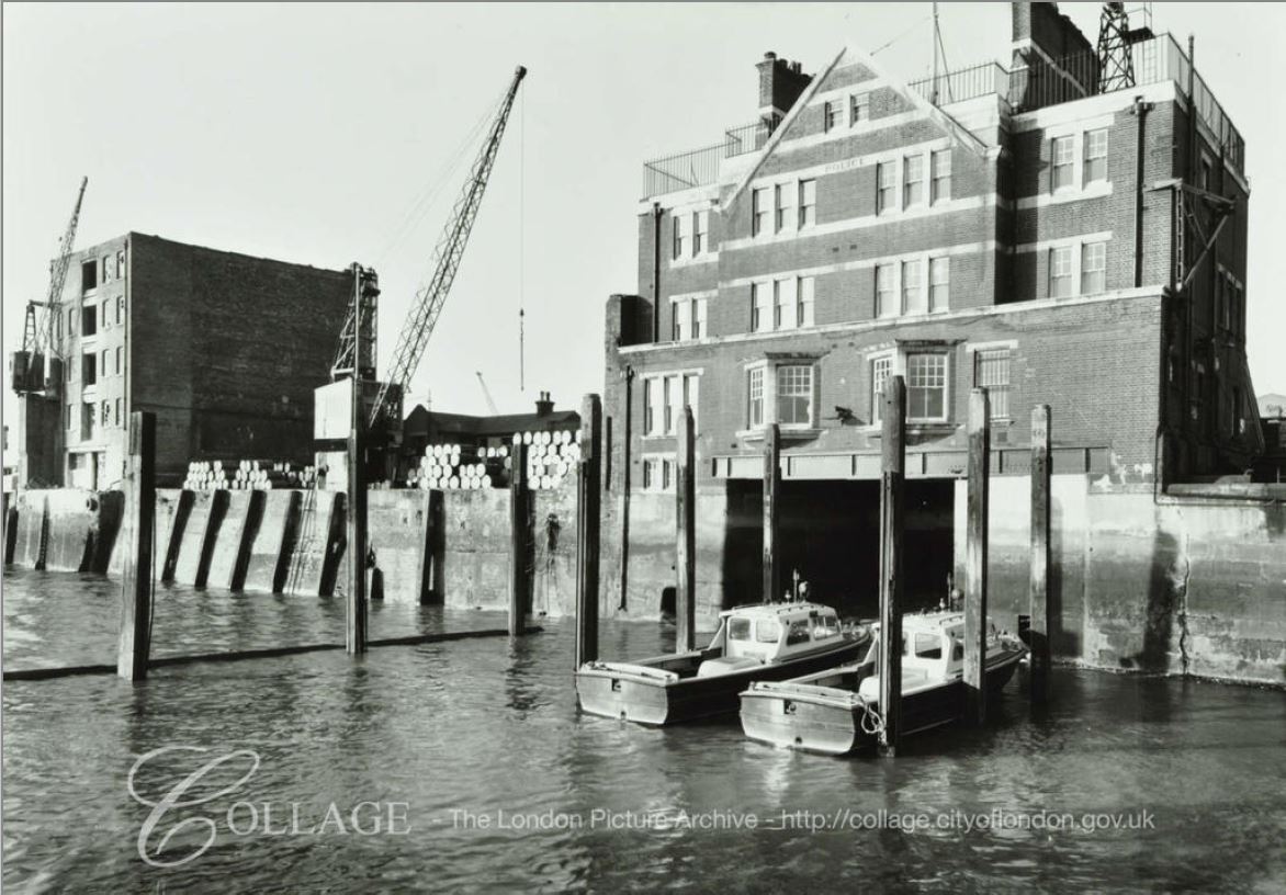
Getty Images have some photos of this third iteration of the pier, with the following photos showing the pier stretching out across the foreshore, with Dundee Wharf in the background, on the left. Click on the arrows to the sides of each photo to see all images of the pier in the gallery. (If you have received this post via email, the photo may not be visible due to the way code embedding works. Go to the post here https://alondoninheritance.com/ to see the photo).

Embed from Getty Images

The photos show the wooden surround which was shown in the earlier OS map. The photo helps with the purpose of this surround, as it presumably held back a raised area of the foreshore to create a reasonably level space for barges and lighters to be moored.

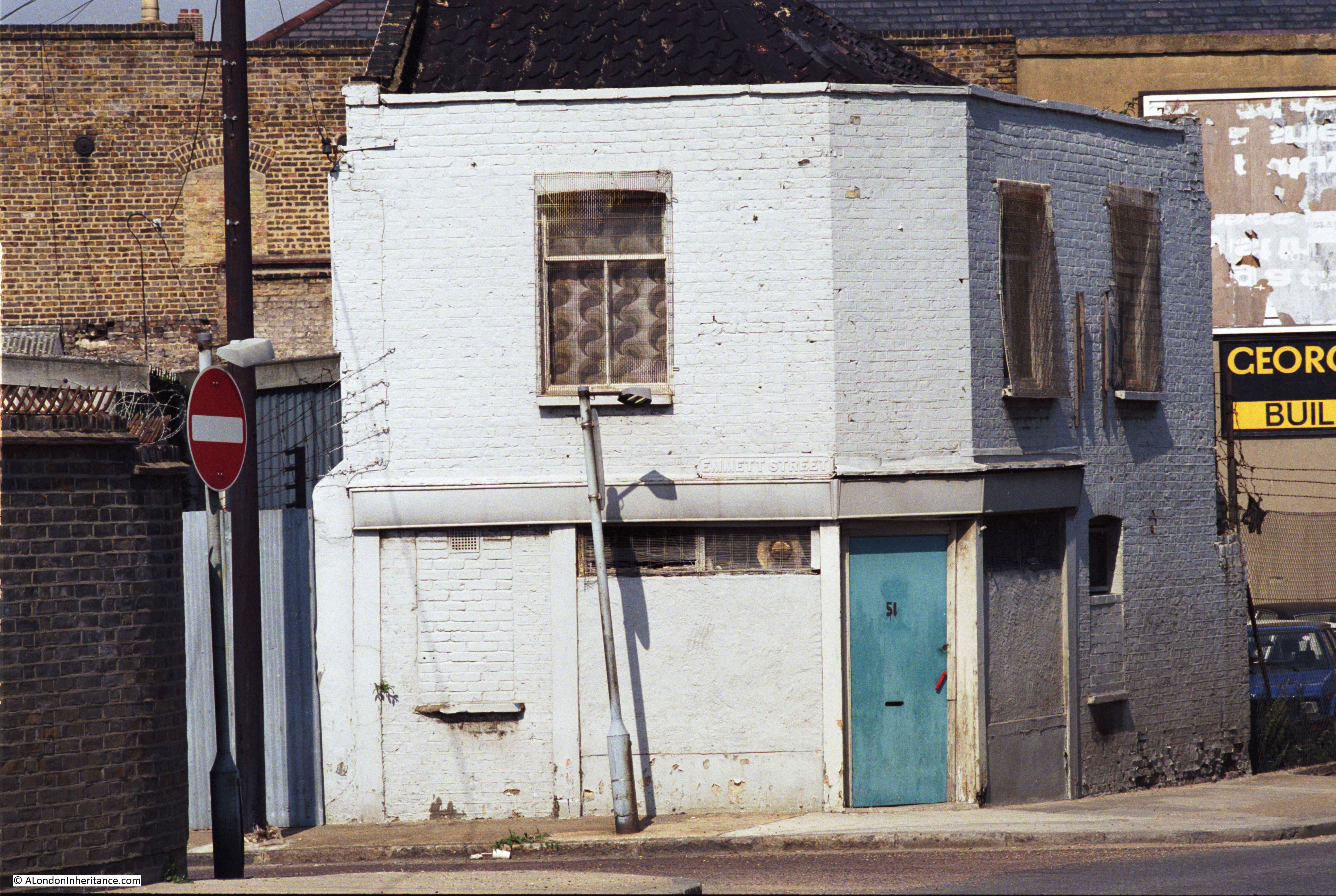
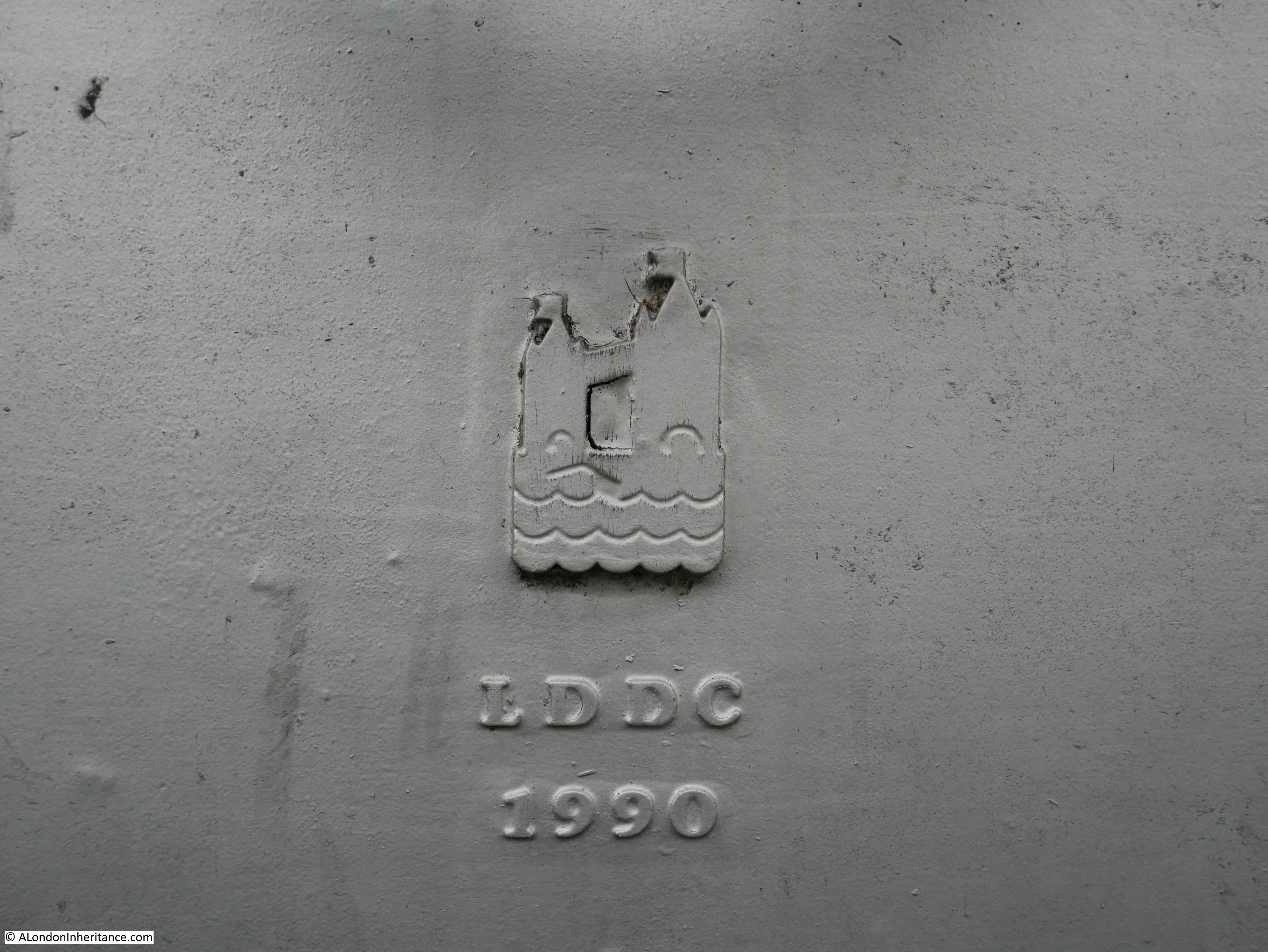
The Survey of London states that this third pier “was removed by the PLA in 1948, but the stairs and Thames Place, though closed off in 1967, survived until 1990”. The survival of the stairs until 1990 presumably refers to the version of the stairs prior to that which we see today.

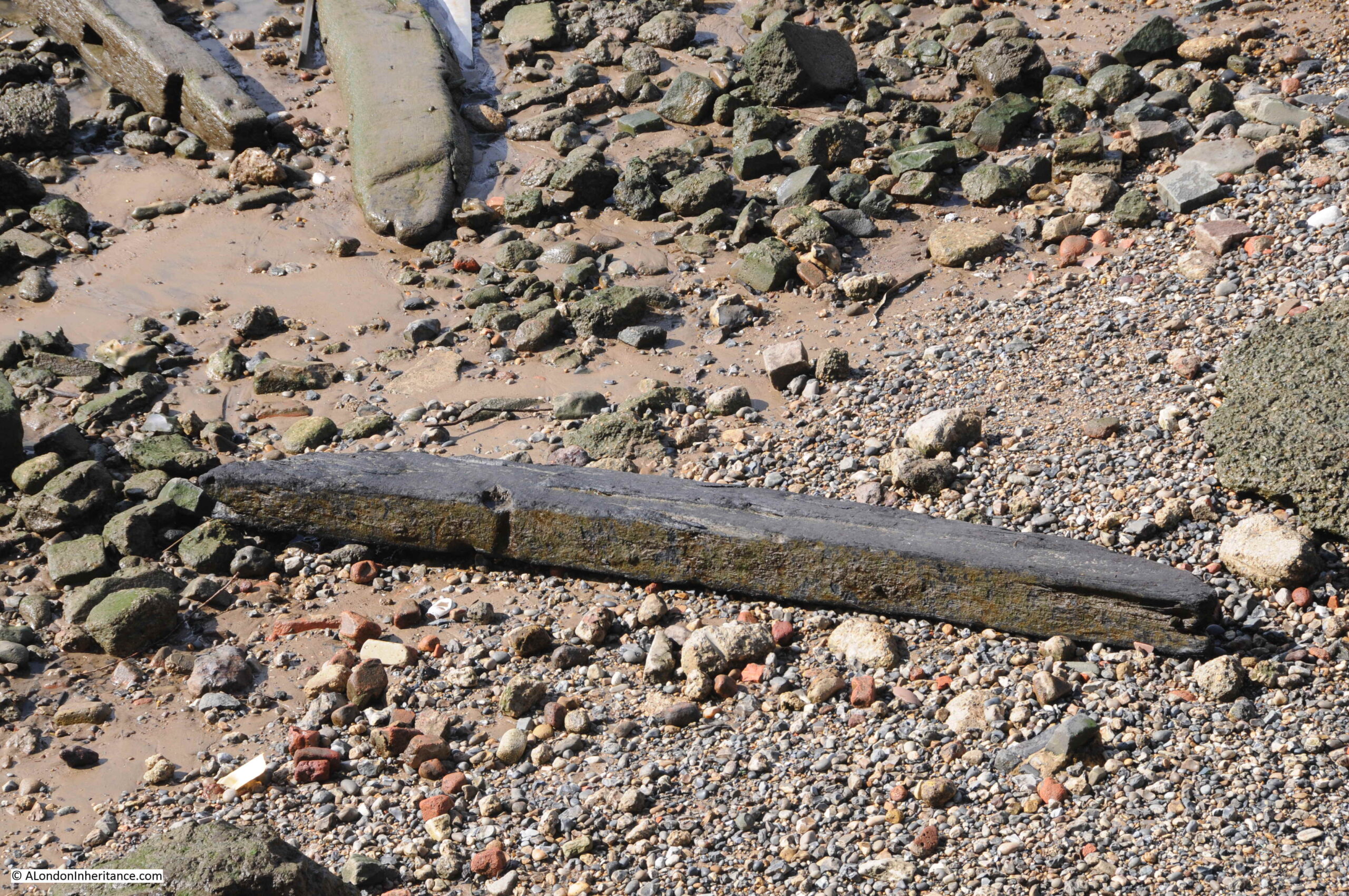
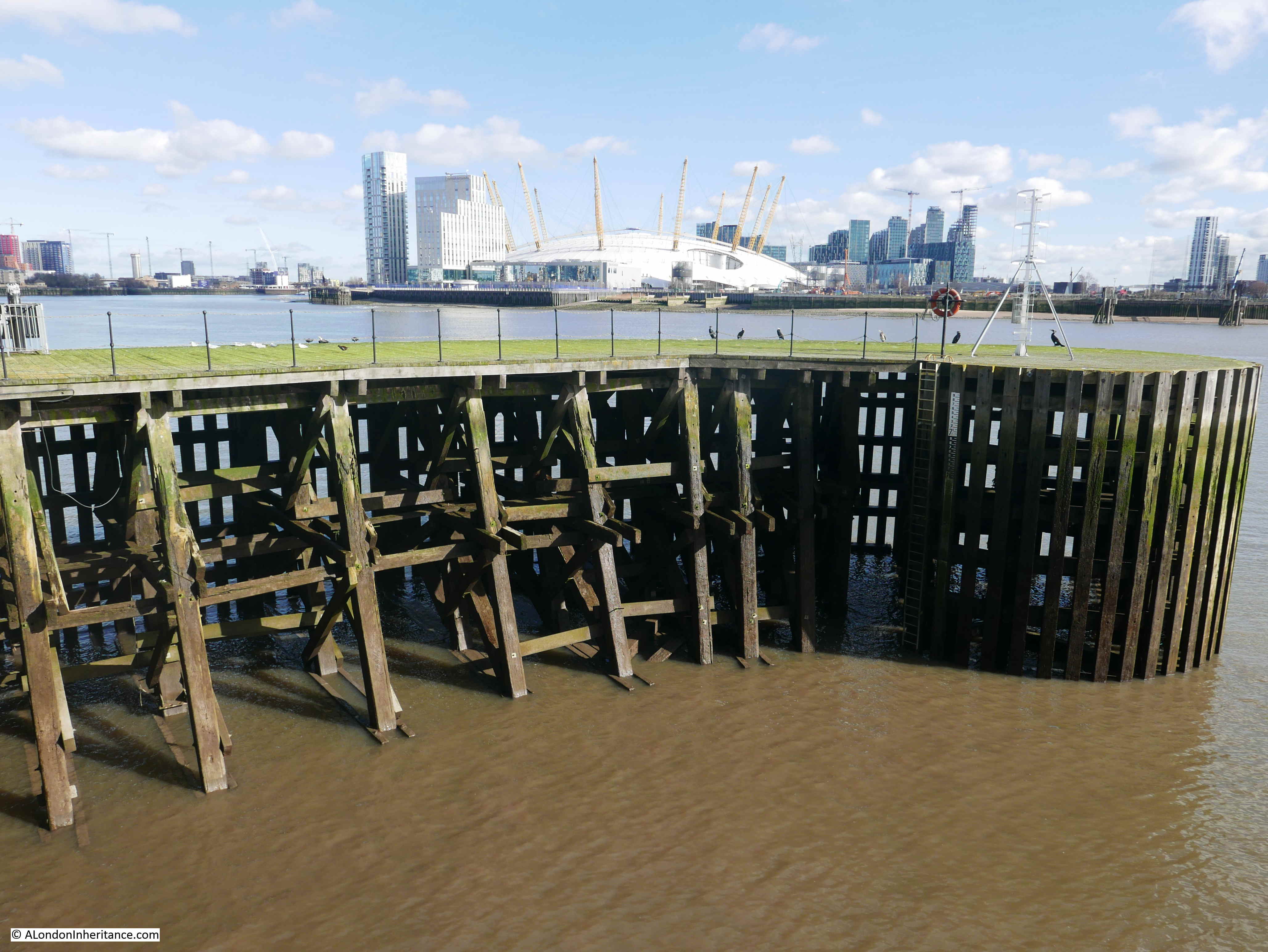
The result of multiple piers, along with the wooden surround to the area, means that there are still remains on the foreshore which we can see today:

Limehouse Hole Stairs

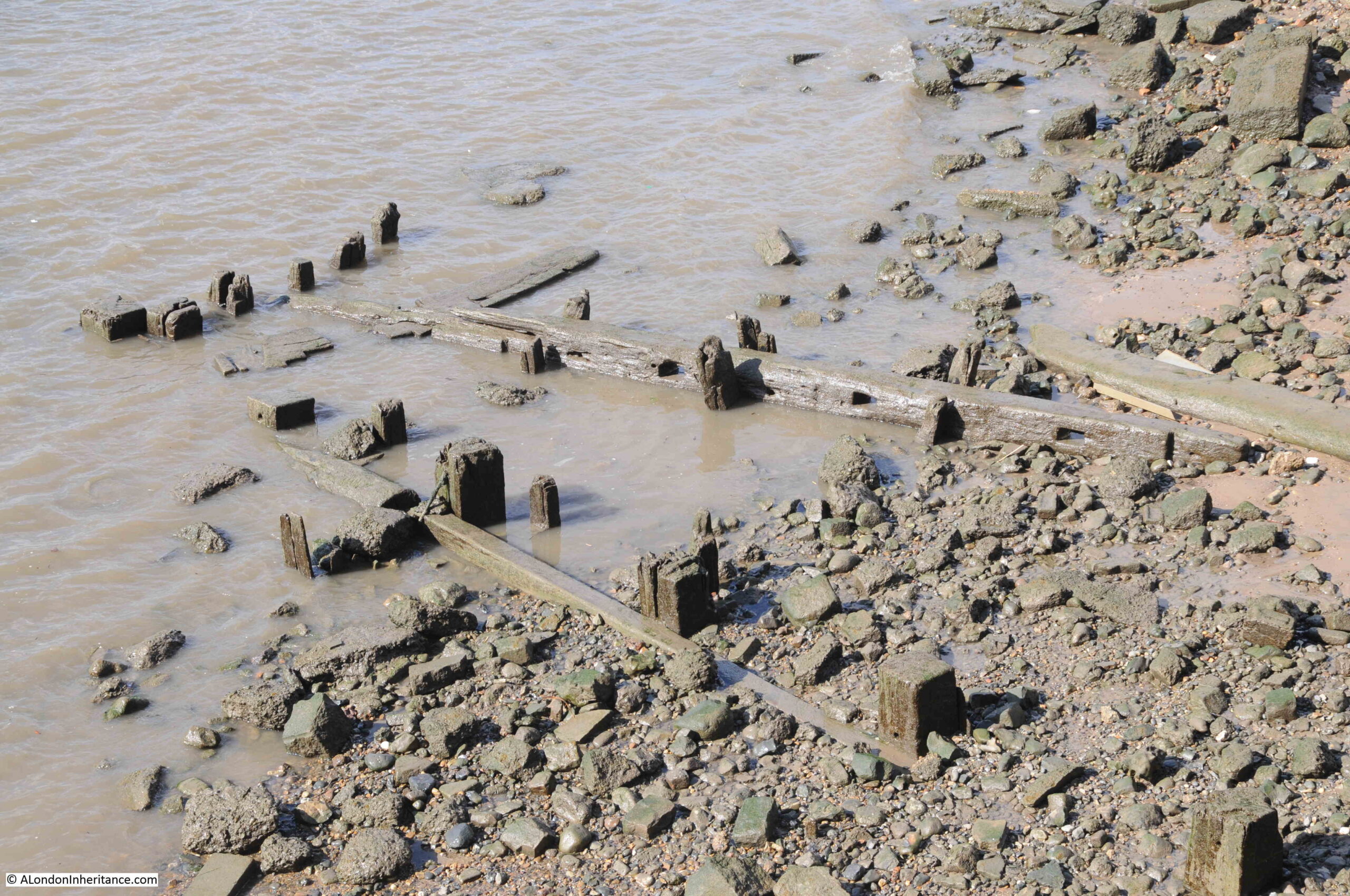
Including plenty of loose timbers which may have been washed here from other locations along the river:

Limehouse Hole Stairs

And when the tide is low, we can still see the wooden surround which once enclosed a flat area of the foreshore as can be seen in the Getty photo above:

Limehouse Hole Stairs

The following 1914 revision of the OS map shows Limehouse Hole Stairs and the pier, and also shows Limehouse Hole Ferry running across the river from the pier. This was a ferry to the opposite site of the river which landed at Horn Stairs, and which provided a fast way of crossing the river, rather than having to travel to either the Rothehithe or Blackwall Tunnels (‘Reproduced with the permission of the National Library of Scotland“):

Limehouse Hole Stairs

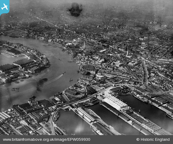
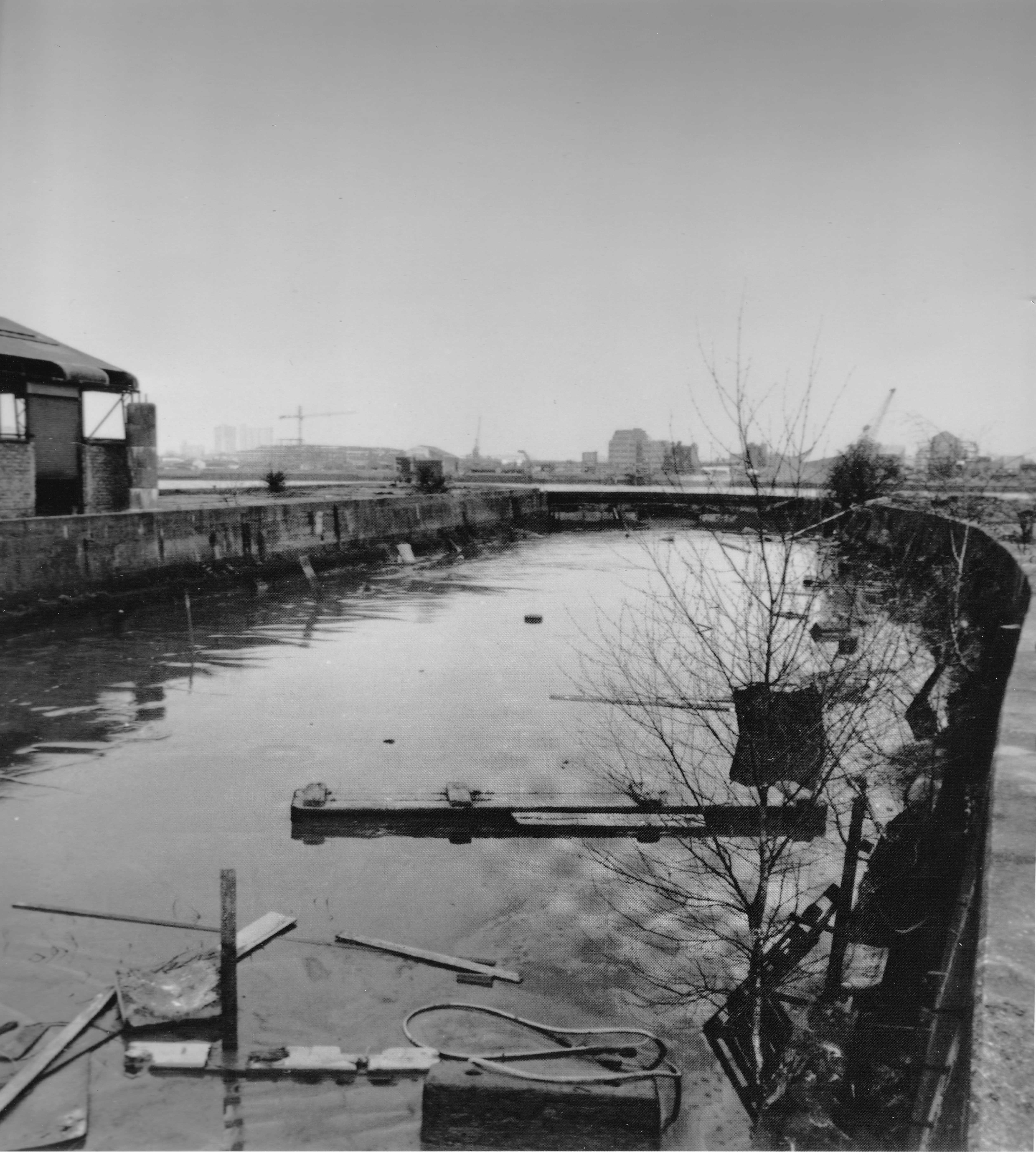
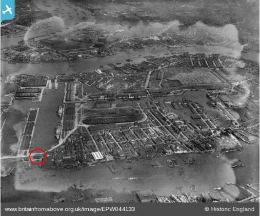
The following photo from Britain from Above shows the site in 1953 when the pier had been removed. I have marked Limehouse Hole Stairs, which at the time was simply wooden steps leading down to the foreshore. To get a closer view, the photo can be found here.

Limehouse Hole Stairs

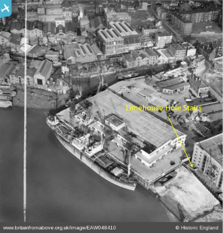
The pier had been removed just a few years before the above photo. Limekiln Dock runs inland towards the top of the photo, and, along with the shape of the river wall where Limehouse Hole Stairs is located, is the only feature that survives today. Almost every single building has disappeared.

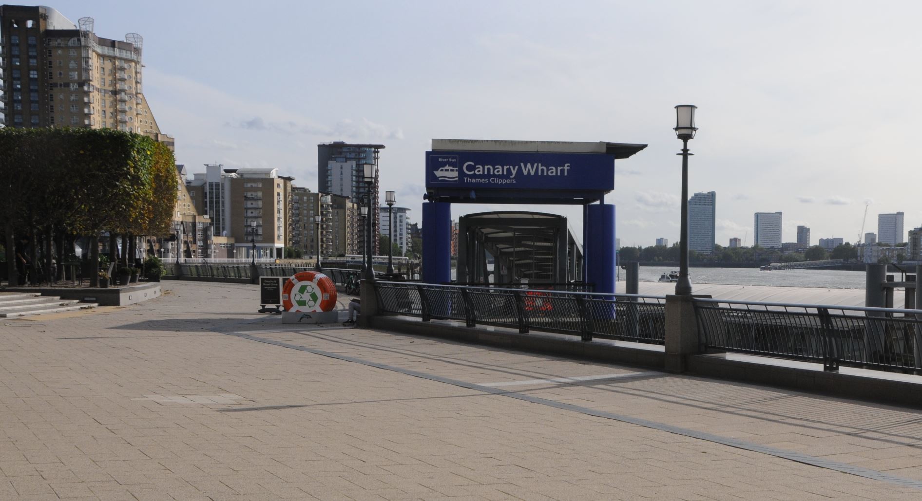
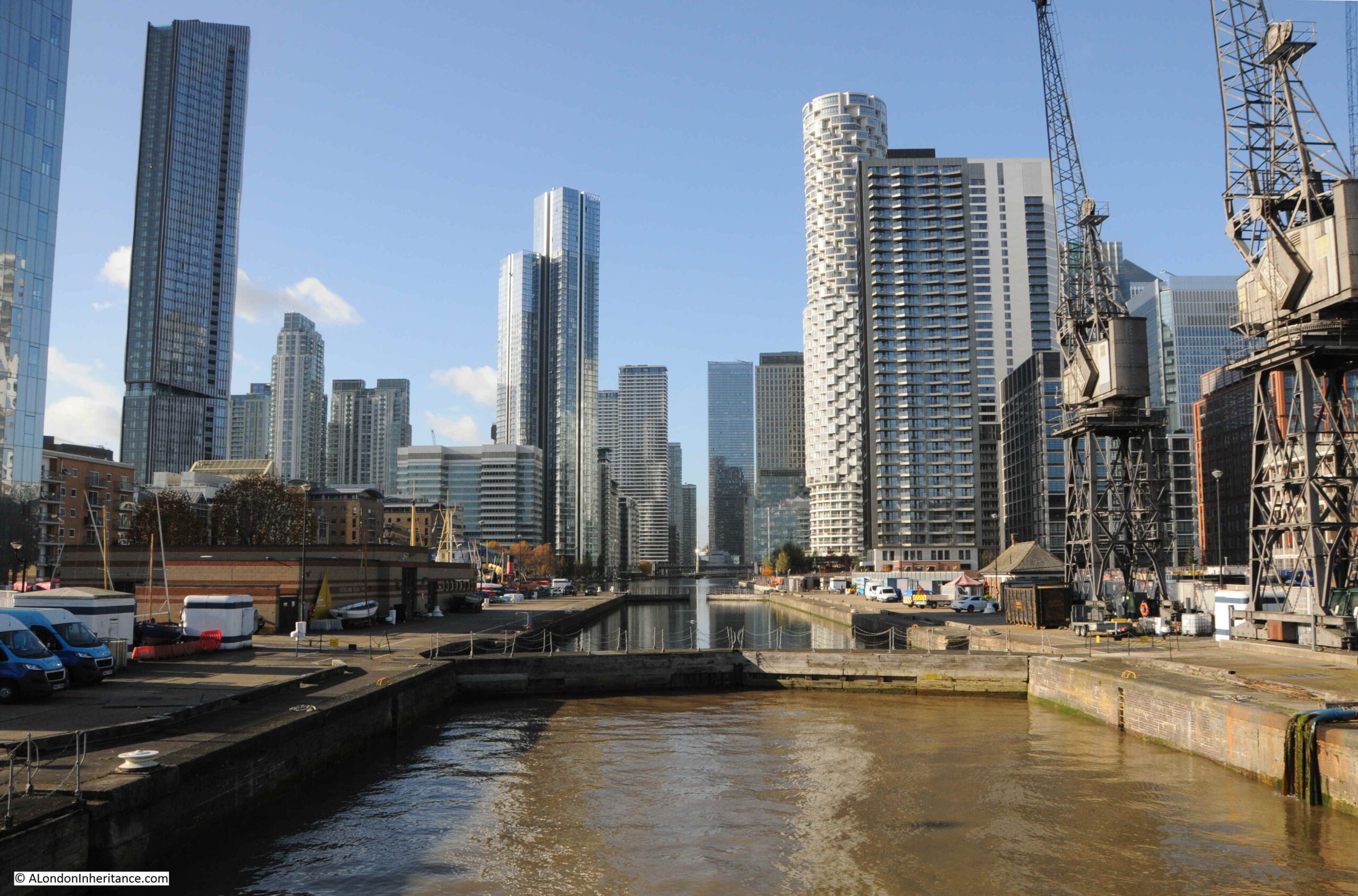
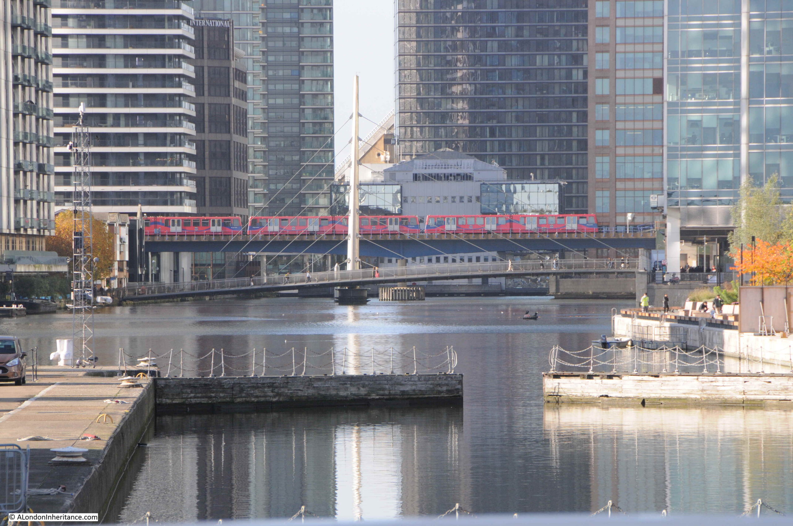
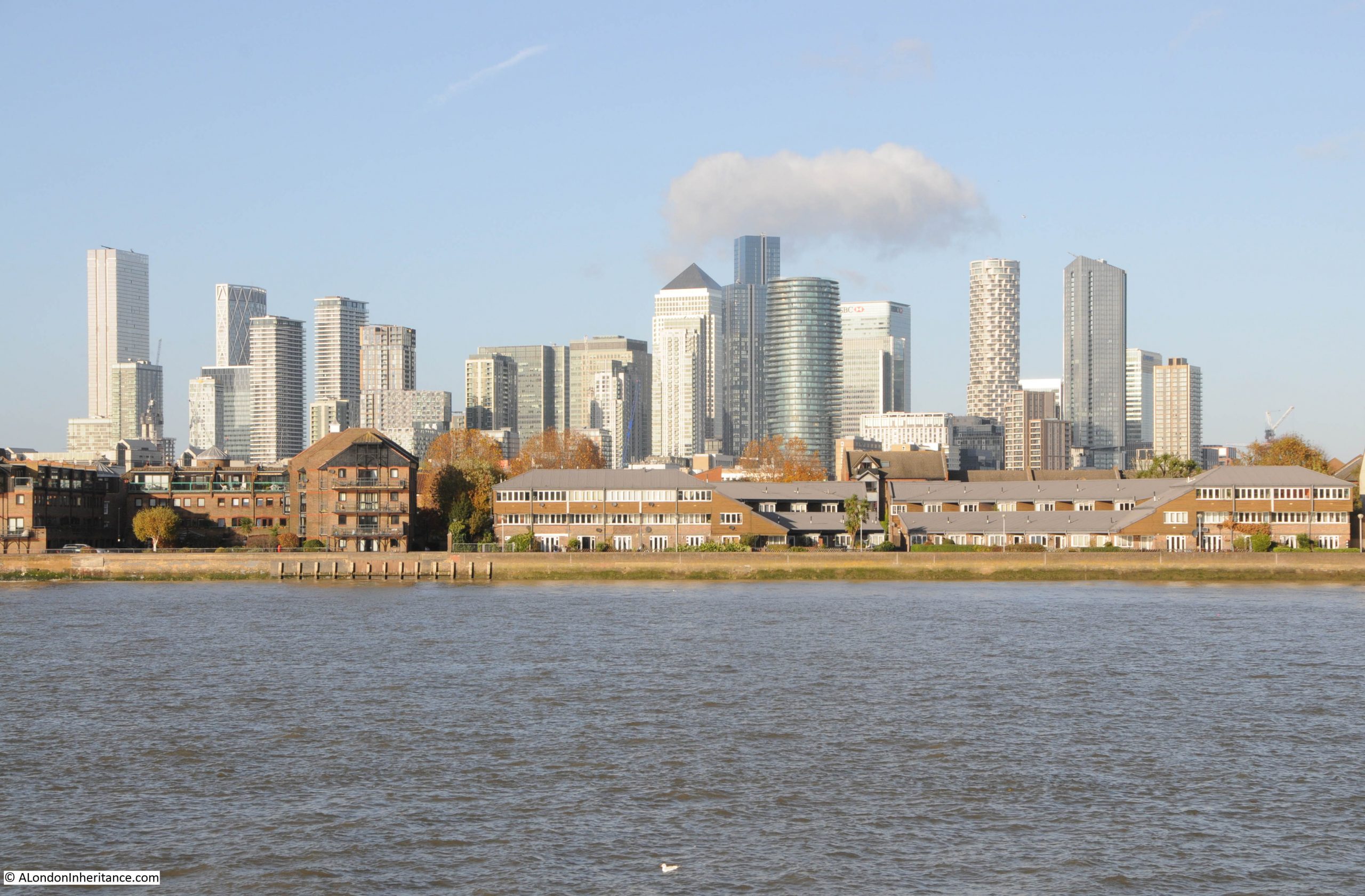
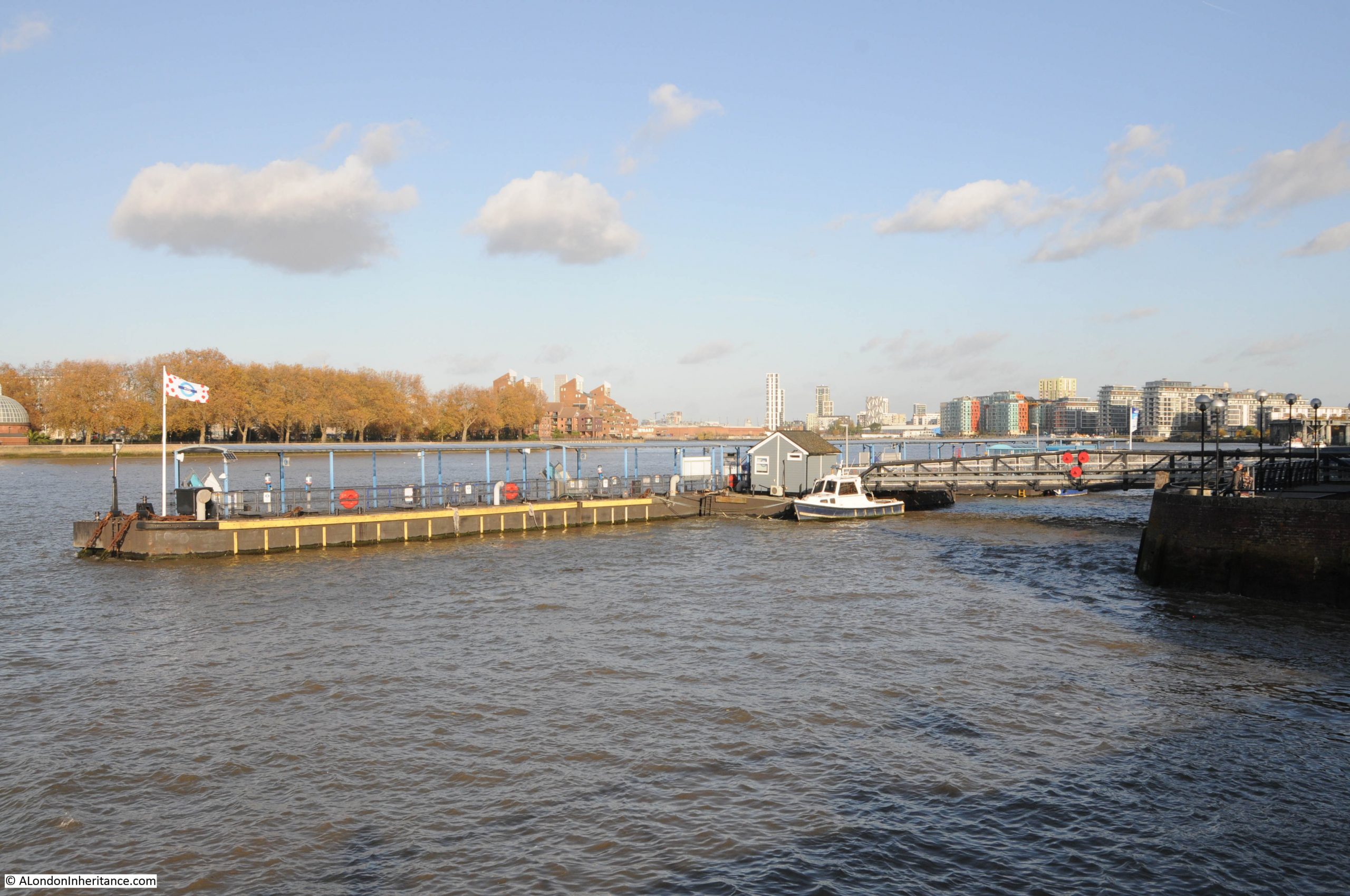
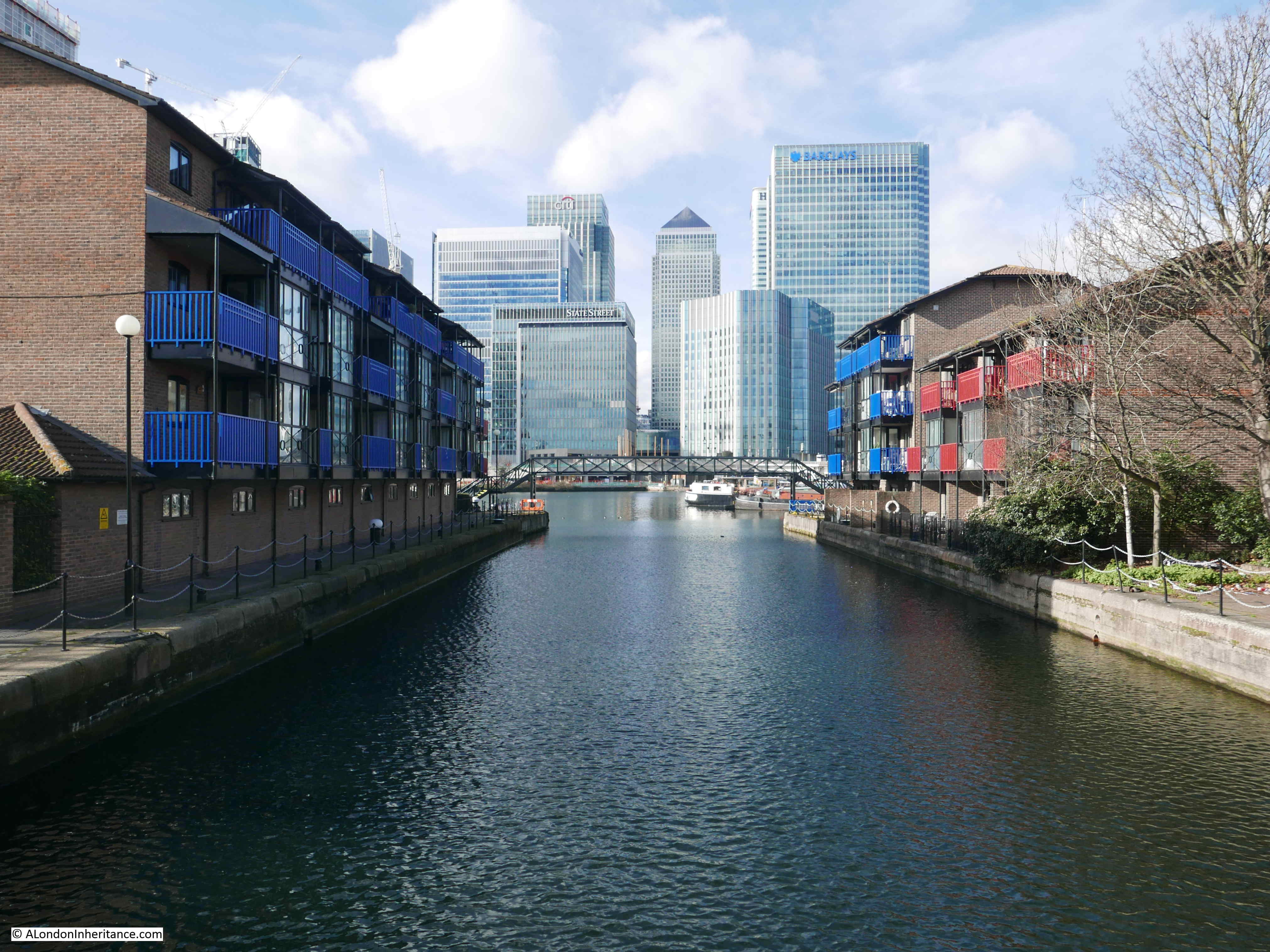
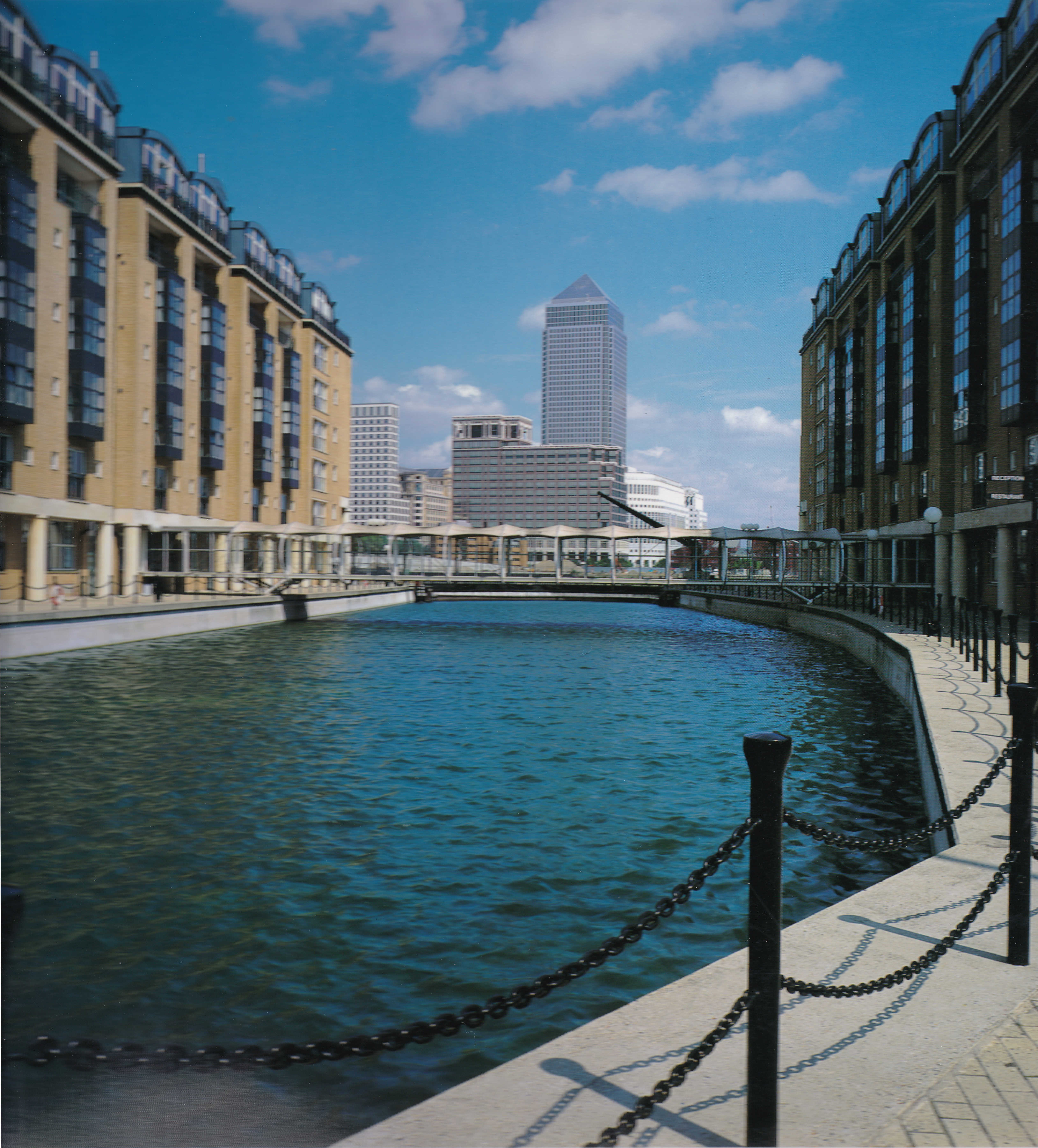
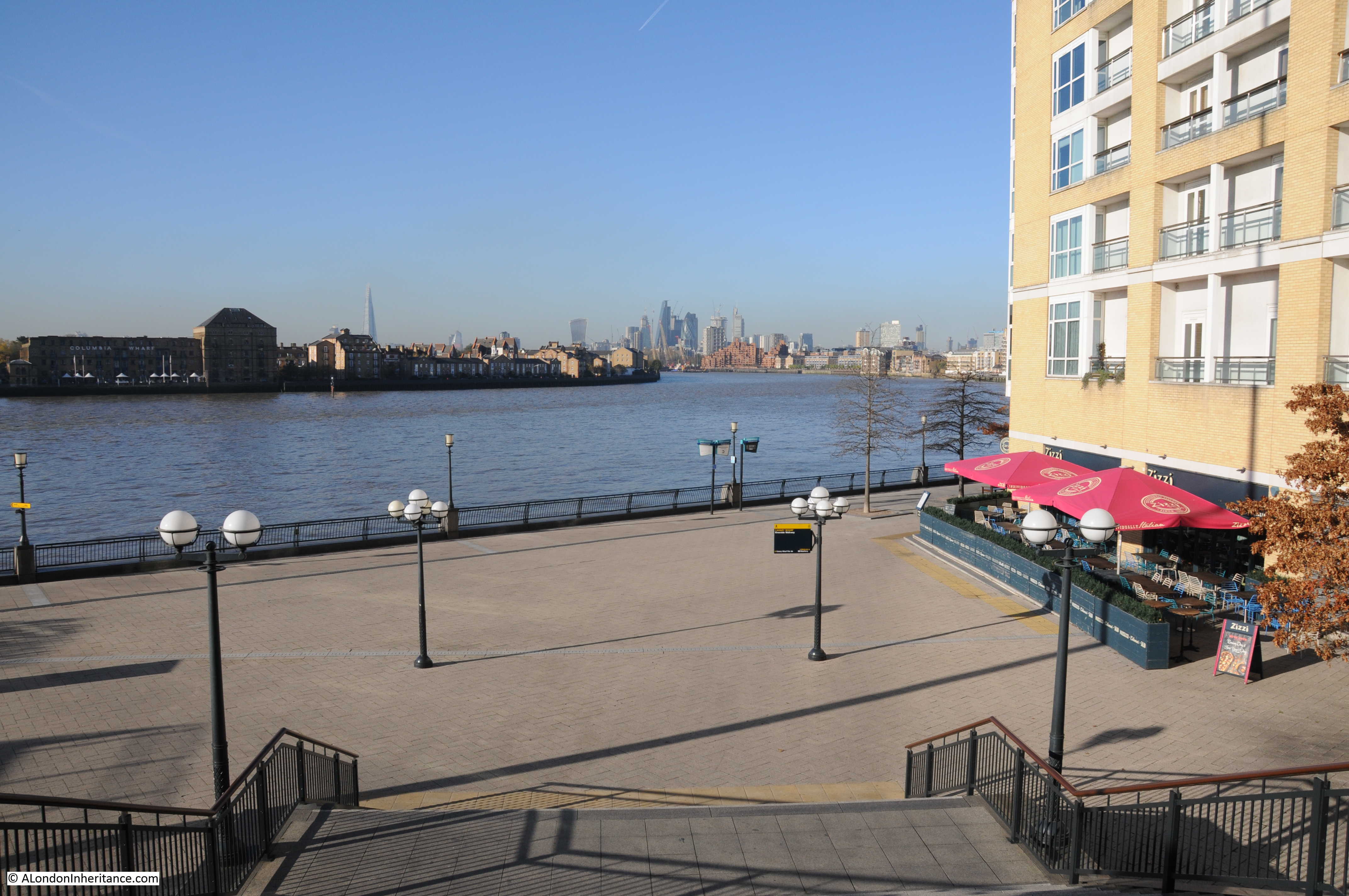
Although Limehouse Hole Pier has gone, there is another pier, a short distance to the south, where the Canary Wharf pier can be found today, which provides access to the Thames Clippers, providing a similar function to the old steamers that once docked at Limehouse Hole pier:

Canary Wharf pier

Looking north from Canary Wharf pier, and there is another feature that survives. In the following photo, looking towards the location of Limehouse Hole Stairs, there is a straight row of metal piling, followed by a brick wall:

remaining wall to a lost dock

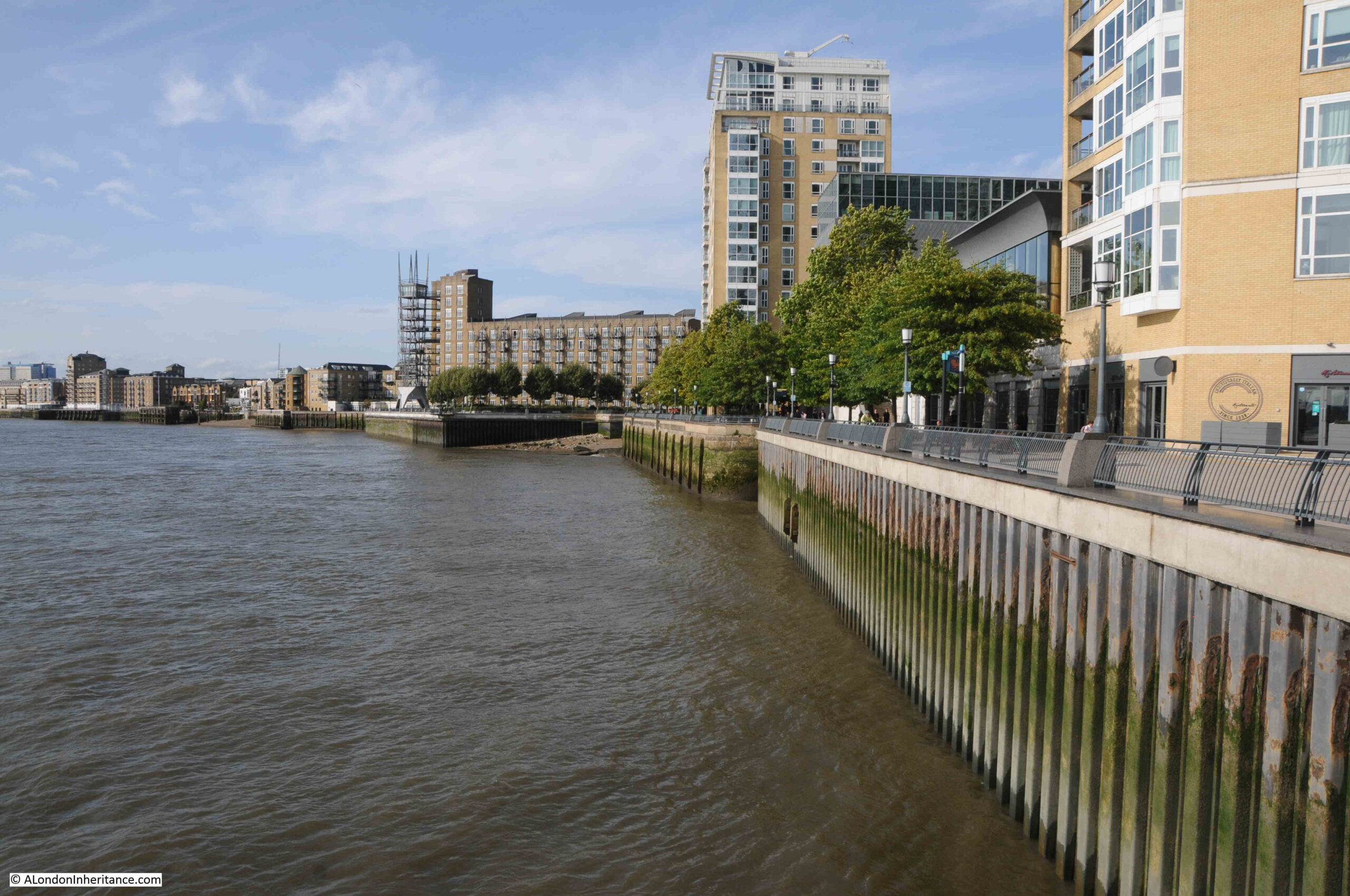
With a closer look, we can see that the brick wall turns inwards:

Remaining wall to a lost dock

Returning to the 1949 revision of the OS map, I have marked the curved brick wall in the above photo, by a blue circle in the following map:

Limehouse Hole Stairs

The curved brick wall was at the northern side of the entrance to a dock that ran alongside Lower Aberdeen Wharf.

The wall today looks as if it continues in land and I would love to know how much of the old dock, and the walls that once surrounded the dock, survive under the modern walkway that has been built as part of the redevelopment of the area.

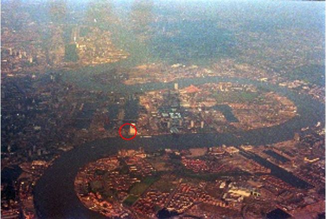
We can also see the dock in an aerial photo, again from the Britain from Above web site, and dating from 1938:

View of Limehouse

I have highlighted the corner wall we can see today in an extract from the above photo, and have also marked the stairs and pier:

Remaining dock wall

As well as Limehouse Hole Stairs, the other part of the title of the post is “the Breach”.

Much of the Isle of Dogs, and indeed much of the land alongside the Thames, is low lying, and over the centuries, it has been very common for there to be floods during high tides.

As London grew, and trade along the river developed, land was reclaimed, and river walls were built, but until the 20th century, these walls were often not of the height and strength we see today.

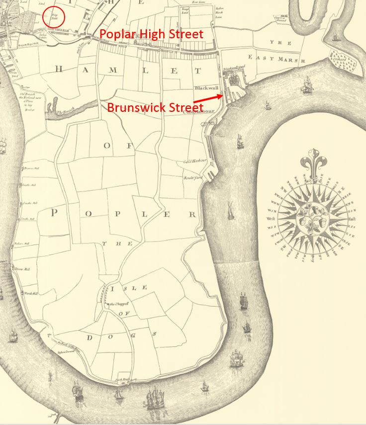
Nor far south of Limehouse Hole Stairs is an area of land where the river wall was breached, and was flooded, or in a state of marsh, for very many years. This was known as “The Breach”, and was shown on maps, including Rocque’s 1746 map, where it can be seen with a road running around what appears to be an area of marsh:

The Breach

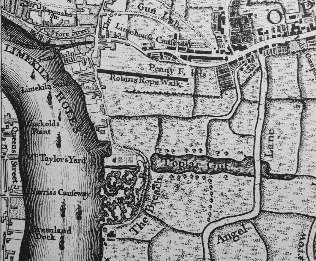
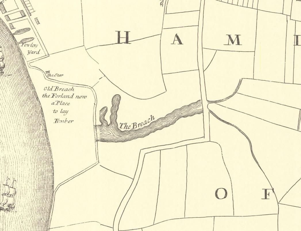
There is also a water feature in the above map called the “Poplar Gut”, and both this and the Breach were mentioned in an article in the East London Observer in 1903, when “Pepys in his diary under date of 23rd March, 1660, mentions that he saw the great breach which the late high water had made, to the loss of many thousands of pounds to the people about Limehouse. In Gascoyne’s map, the spot is marked by the explanation ‘Old Breach, the Foreland, now a place to lay timber’ and ‘The Breach’ is applied to what was more recently known as the Poplar Gut”.

The reason why the Breach happened where it did was down to the natural erosion of the land by the river at this particular point in its meander around the Isle of Dogs.

In time, and without any human intervention, the Thames would have cut through the northern section of the Isle of Dogs, leaving the part of the river around the south of the Isle of Dogs as an Oxbow Lake. The Thames has made subtle changes to its course over the centuries, and it is only in recent years that we have effectively put the river into a concrete and banked channel, and limited the natural forces of erosion.

There are also stories of people digging out ballast from the foreshore around where the Breach occurred, which would have contributed to the flood.

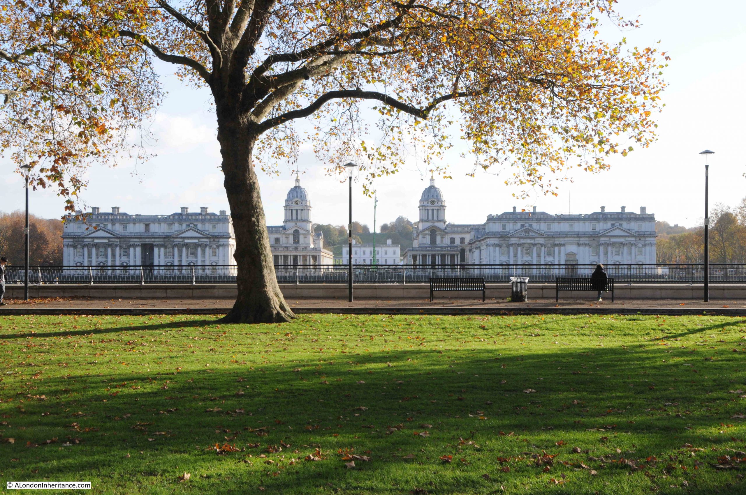
The view from Greenwich would have looked very different if the river had continued with the Breach.

in the quote from Pepys, he mentions that the Breach is now a place to lay timber, and this would have been a good place, as timber was often kept in a wet environment to stop the wood drying out and to allow gradual conditioning before sale.

In a parish map from 1703, the area is marked as a place to lay timber:

The Breach

In Rocque’s map, there is an inland area of water called the Poplar Gut and in the above map it is labelled as the Breach. This was part of the area that flooded when the river breached the bank along the river.

This must have been a significant area of reasonably deep water, as on the 10th of June, 1748, it was reported that “On Saturday last, in the evening as Mr. George Newman, son of Mr. Newman, an eminent Linen Draper in Whitechapel, was washing himself in Poplar Gut, he was unfortunately drowned, although all possible means were used by a companion he was along with, to save him, to the inexpressible grief of his parents, and all who knew him”.

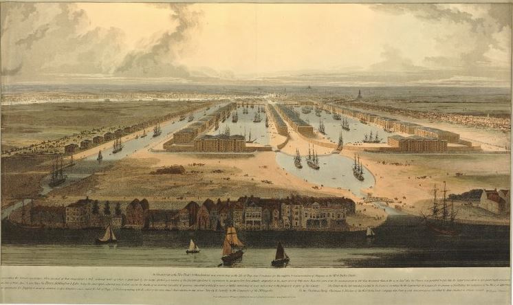
The Breach lasted for some years, and was still shown in the 1816 edition of Smith’s New Plan of London, which also included the recently completed West India Docks, which had been built over the Poplar Gut:

The Breach

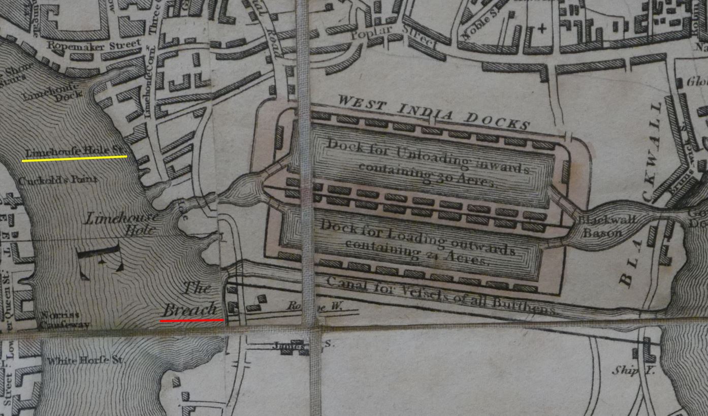
The Breach would soon be reclaimed after the publication of the above map, as the size and number of docks grew on the Isle of Dogs, and industry expanded along the edge of the river (the West India Docks and the channel across the Isle of Dogs will be the subject of future posts).

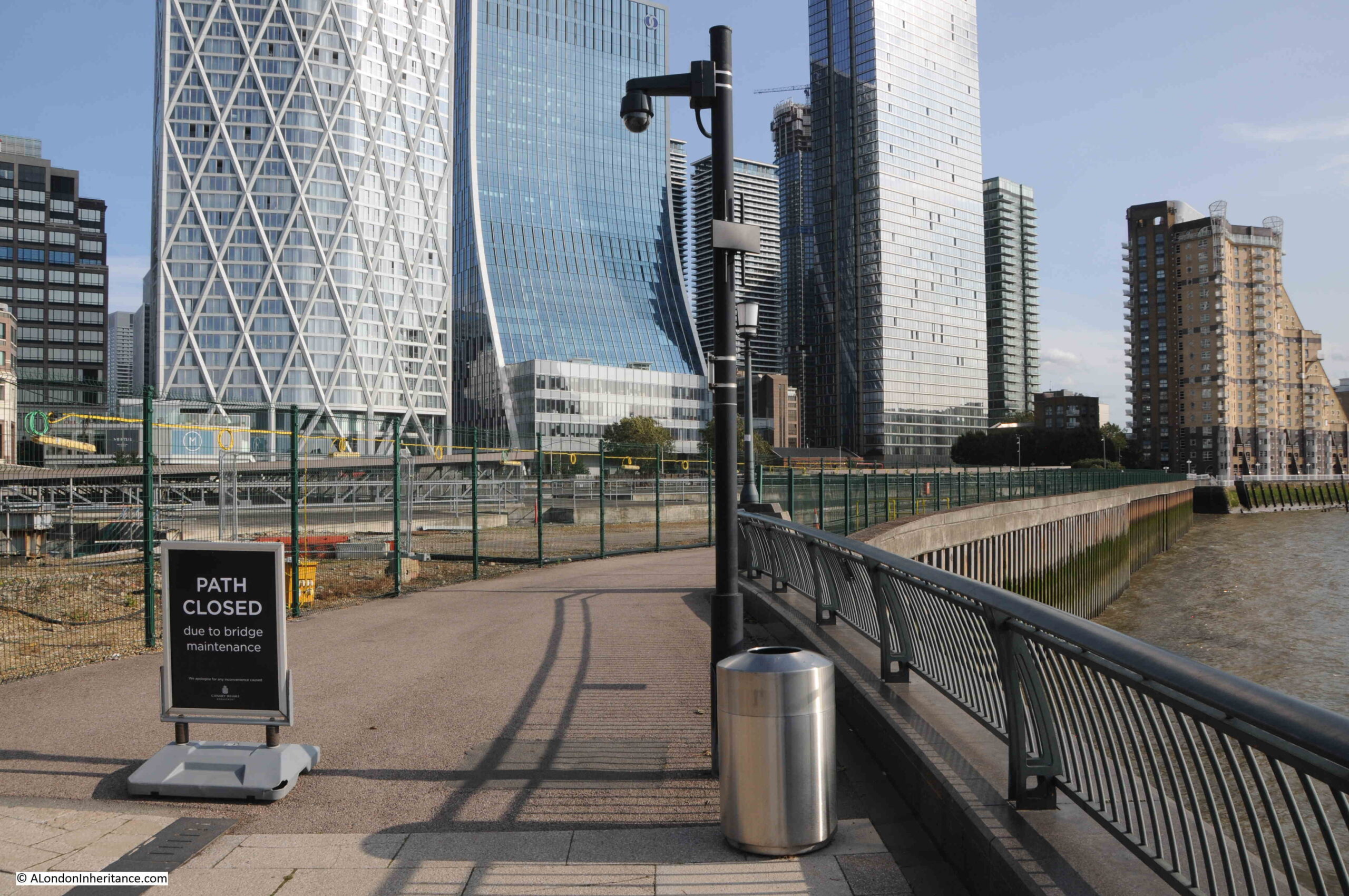
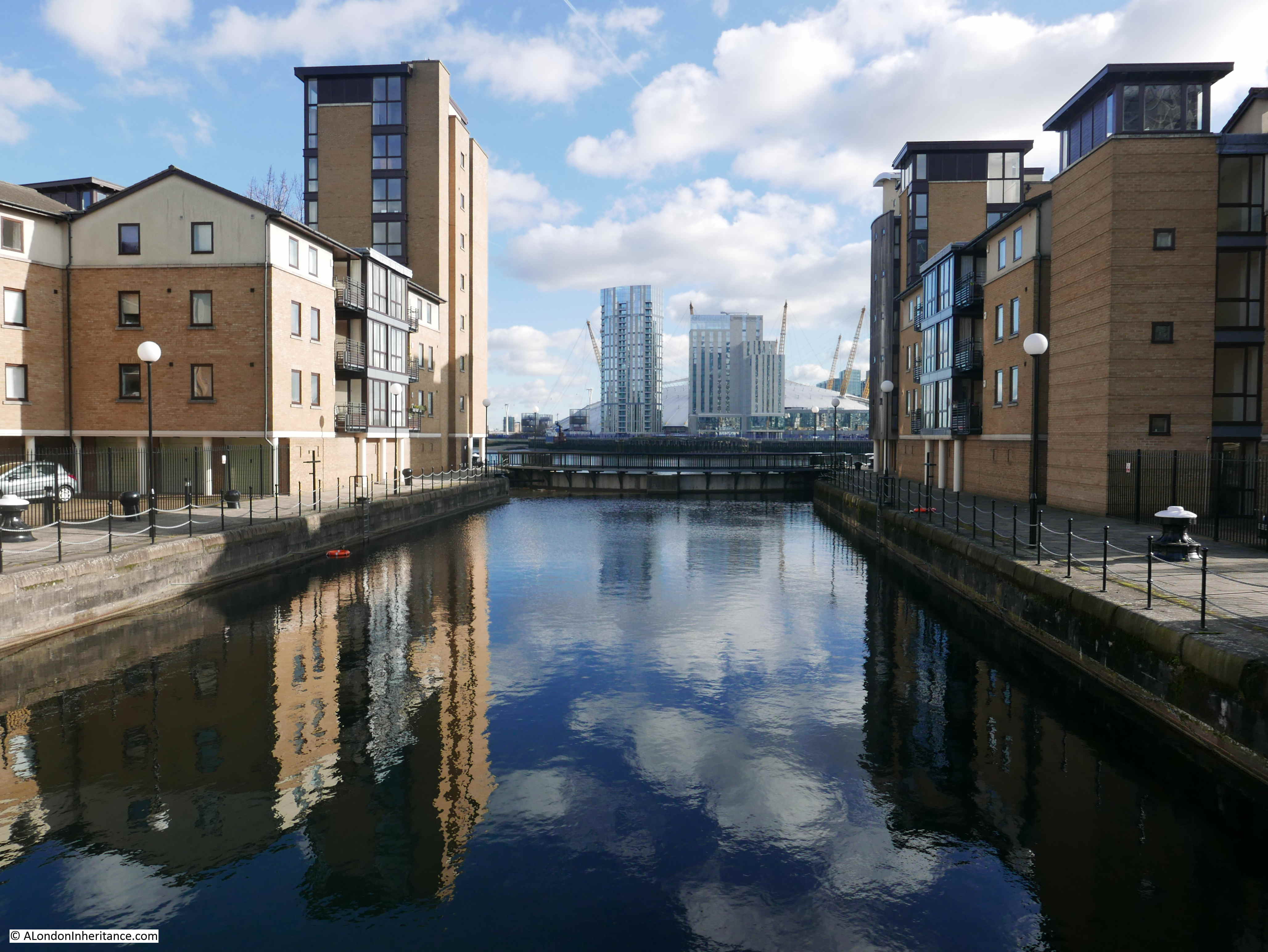
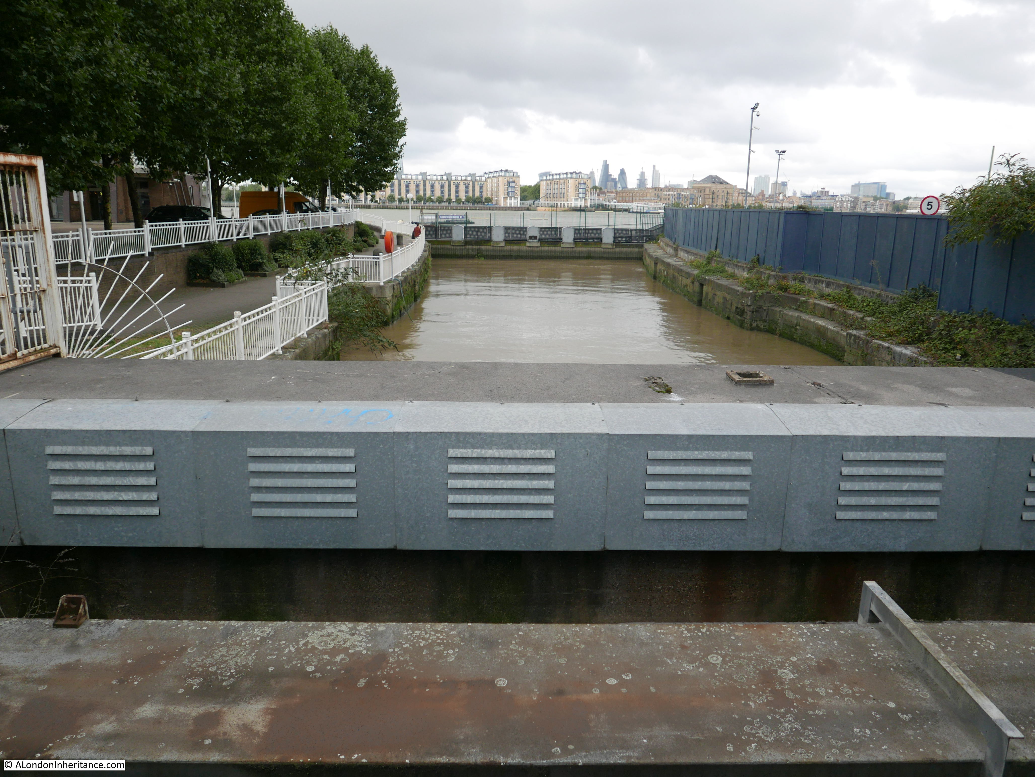
Nothing remains to be seen of the Breach today, although it was to the south of where the Canary Wharf pier is today, in the following view:

The Breach

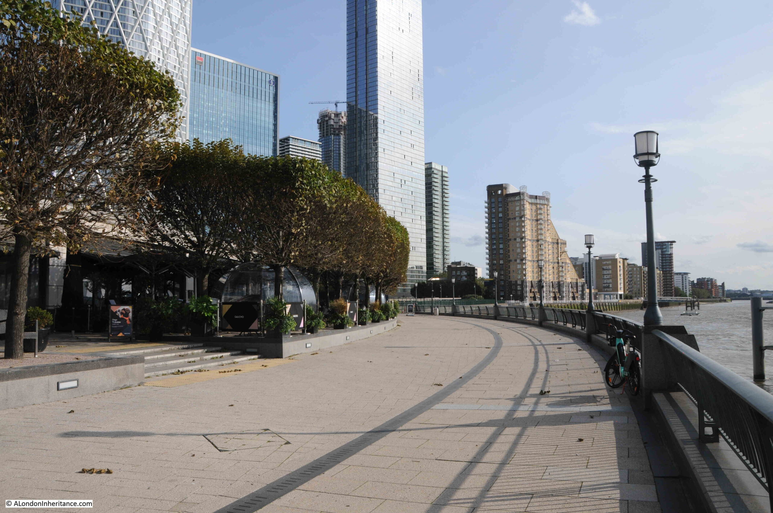
And almost as a reminder of when it was impossible to cross where the water of the Thames had breached the bank, during my visit, the path was closed, but this time for maintenance, rather than a flood:

The Breach

This small area of Limehouse has changed dramatically over the last few decades, however there are still places where we can see traces of the previous industrial. docks and riverside infrastructure.

Wooden planks still poking through the foreshore, although being gradually eroded, a brick wall running along the river’s edge, and location and names of the stairs that bridge the boundary between land and the river.

You can find links to all my posts on Thames stairs in the map at this link.

alondoninheritance.com

Prestons Road – Welcome to the Isle of Dogs

In 1986, my father photographed some graffiti on a wall in Prestons Road which runs from Poplar to the Isle of Dogs.

Prestons Road

The 1980s were a traumatic time for the residents of the Isle of Dogs. The docks had closed and the developments that would lead to the office complex around Canary Wharf, as well as many new housing developments, were underway.

Much of this new development would not directly benefit local residents. Thousands of office jobs for those living outside of the Isle of Dogs, and new homes being built which were typically much more expensive than traditional homes in the area. Very little of the money being poured into new developments would find its way to the original residents.

The graffiti on the wall in Prestons Road reflects some of the anger and frustration felt as a result of the developments. Barratts the builders are mentioned on the right of the wall, along with Asda.

Whilst the build of a new Asda store could have been seen as a positive for residents, in reality it was one of the many cultural changes imposed, where centralised shopping would badly impact the trade of multiple small, often family owned shops.

The graffiti was on a wall in Prestons Road. This road runs from a junction with Poplar High Street down to the so called Blue Bridge, which crosses the east entrance to West India South Dock from the Thames.

I have marked the two end points of Prestons Road in the following map. The road runs between these two points  (© OpenStreetMap contributors):

Prestons Road

My father took the photo at the top of the post, and did not leave a record of the location. I do vaguely remember walking past the wall in the mid-1980s and that it was somewhere near the Poplar High Street end of Prestons Road, somewhere around the location highlighted by the red oval on the following map  (© OpenStreetMap contributors):

Prestons Road

I think I found the location when I went for a walk along Prestons Road, and I will explain later in the post, however before walking the road, some background to a road that has changed significantly in the last decades.

The most significant change to Prestons Road is in the northern part, up to the junction with Poplar High Street. Between the northern and southern sections of the road, it has been divided by a large roundabout and the dual carriageways of the A1261, or the Aspen Way, which is carried over the roundabout, as can be seen in the above map.

The A1261 provides a route between the A13 at the start of the East India Dock Road in the west, through to the Lower Lea Crossing in the east.

Construction of this road had significant impact on the area, and in some ways, reinforced the division between the Isle of Dogs and the rest of Poplar. The A1261 was built as part of the transformation of transport infrastructure surrounding development of the Docklands, which included other major projects such as the Limehouse Link Tunnel.

To illustrate the impact of this road, and the roundabout, the following map is from the 1950 edition of the Ordnance Survey, which covers roughly the same area as in the above map. The location of the roundabout is shown by the red circle (‘Reproduced with the permission of the National Library of Scotland“):

Prestons Road

By comparing the two maps, it can be seen that the northern part of Prestons Road, up to Poplar High Street has changed to enable the entry and exit carriageways to the roundabout. Where Prestons Road once had a straight section down from Poplar High Street, it is now more angled to accommodate the roundabout. This will be relevant when searching for the location of the graffiti.

Taking a wider view of the area, we can see the Aspen Way running left to right at the very north of the Isle of Dogs. Just to the south, Billingsgate Market, and the office blocks around North Quay and the northern section of Canary Wharf reinforce the boundary created by the Aspen Way, leaving two main routes to the Isle of Dogs on the east and west of the peninsula – the eastern route being Prestons Road  (© OpenStreetMap contributors).

Map of the Isle of Dogs

This boundary between the Isle of Dogs and Poplar has been long in the making. The following extract from Smith’s New Plan of London, dated 1816, shows that the construction of the West India Docks had created a barrier across the centre, leaving only the two roads either side of the peninsula:

Prestons Road

In the above map, I have circled the location of Prestons Road, and whilst the southern section across the dock entrances was in place, the northern section had not been built. Instead, a turn to the right entered Brunswick Street.

I believe that the northern section of Prestons Road was built at the same time as the Poplar Docks which were located on the left of the section of the street just to the south of the roundabout.

We must go back to the 18th century, to see the area before any of the docks were built to understand how the docks, and then Canary Wharf and the Aspen Way have created an apparent northern boundary to the Isle of Dogs.

In the following map from 1703, we can see that the whole area was part of Poplar, with Poplar High Street already lined with buildings. To follow on from last week’s post, I have also circled a reference to Penny Fields to the left.

Map of the Isle of Dogs

Brunswick Street is to the right, however rather than just east and west routes, up until the construction of the docks, there were to roads running down from Poplar High Street, including the central road which ran down to the ferry across the Thames to Greenwich, at the southern tip of the peninsula.

So today, when crossing under the Aspen Way, it feels like a boundary has been crossed, and we are entering the Isle of Dogs. Time to take a walk along Prestons Road:

Prestons Road

The above photo was taken at the junction of Prestons Road with Poplar High Street.

For this post, I am using the spelling of the street as seen on the street name signs in 1986 and today. Many references to the street also refer to Preston’s, however to stay with the name signs, I will leave out the apostrophe.

The following photo is looking south from the junction in the above photo. The upper part of Prestons Road was angled slightly to the left when the roundabout was built. If I remember rightly, the wall with the graffiti was somewhere along the right side of the street.

Prestons Road

A short distance down the street is a turn off to the right with Poplar Business Park at the end:

Poplar Business Park

In the background of the 1986 photo, the frame of a building under construction can be seen. The majority of buildings to the south of Poplar High Street are relatively recent, and do not date back to the 1980s, however I wondered if the Poplar Business Park could be the building which was under construction when my father took the photo.

It is certainly in the right place, if my memory is correct that the wall was around here.

I looked for references to the Poplar Business Park to try and date the building, and found an advert from 1988 for “Moat Security Doors, Poplar Business Park, Prestons Road, Isle of Dogs, E14”, who sold iron gates to add security in front of a door, or as they advertised “Never be afraid to open your front door again”.

So the Poplar Business Park was in operation in 1988, so possibly safe to assume it was the building photographed under construction two years earlier. Interesting that whilst in the Poplar Business Park, they used Isle of Dogs in the address, despite being at the northern end of Prestons Road, very close to Poplar High Street.

If I am correct, the wall would have been to the left of the above photo, or perhaps to the left of the photo below which is looking up Prestons Road, with the side road to the Poplar Business Park being the street where the grey car is about to exit:

Prestons Road

A very short distance to the south is where Prestons Road crosses under the A1261, the Aspen Way, a very significant set of new road infrastructure:

Prestons Road

From the south, looking north, and the slip road to the east, up to the Aspen Way towards the City of London and one of the new road access points to Canary Wharf:

Prestons Road

From the edge of the roundabout we can see some of the new residential towers that are becoming so common across this part of east London:

Prestons Road

A full view of the routes that can be accessed via the roundabout that obliterated part of Prestons Road:

Prestons Road

This is the view looking south along Prestons Road into the Isle of Dogs. I do not live there, so I am not really one to judge, but when walking the area, it is only along here that I feel I am entering the Isle of Dogs:

Prestons Road

In the above photo, there is a tall brick wall, in shadow, on the right. This is the wall between the street and Poplar Docks, the construction of which I believe, resulted in the construction of this section of Prestons Road, as a road would have been needed along the boundary to serve entrances to the docks.

The following photo is of Poplar Dock today, looking west with two cranes remaining from when the dock was operational:

Poplar Dock

The site is now Poplar Dock Marina and is full with narrow boats and an assorted range of other smaller craft. Poplar Dock opened in 1851, however the site had originally been used from 1827 as a reservoir to balance water levels in the main West India Dock just to the west. In the 1840s the area was used as a timber pond before conversion to a dock.

Poplar Docks served a specific purpose, being known as a railway dock as the docks were almost fully ringed by railway tracks and depots of the railway companies.

Walking south along the street, and the area between the street and the river is full of new buildings, however there is a rather strange, flying saucer shaped building to be seen:

Blackwall Tunnel

The building is one of the air vents and access points to the Blackwall Tunnel, which runs parallel (but deeper) to the northern section of Prestons Road.

Looking north towards the roundabout, and we can see the tall brick wall that once separated Poplar Dock from Prestons Road:

Prestons Road

We now come to one of the crossings over the channels from the docks to the Thames:

West India Docks

This is the channel that ran from the Thames to Blackwall Basin, and then led into the West India Docks (see the extract from Smith’s New Plan of London, dated 1816 earlier in the post).

This is the view looking east along the channel towards the Blackwall Basin. The Canary Wharf complex has been built over much of the old West India Docks.

West India Docks

To the right of the above photo, behind the trees is the old Dockmaster’s House:

West India Docks

The Dockmaster’s House is named Bridge House and was built between 1819 and 1820 for the West India Dock Company’s Principal Dockmaster. The entrance to the house faces to the channel running between docks and river, however if you look on the right of the building, you will see large bay windows facing out towards the river. This was a deliberate part of the design by John Rennie as these windows, along with the house being on raised ground would provide a perfect view towards the river and the shipping about to enter or leave the docks.

A short distance further on and Prestons Road crosses another channel between docks and river. This is the channel between the West India South Dock and the Thames, and the view west provides a stunning view of some of the recent developments:

West India Docks

With the Docklands Light Railway crossing the old dock in the distance:

West India Docks

Original cranes remaining from when this was a working dock:

West India Docks

It is fascinating when standing here to imagine the many thousands of ships that have entered or exited through this channel, and where they had been coming from or going to.

Looking east where the channel meets the river.

Blue Bridge

The bridge that spans the channel in the above photos is the bridge that has taken on the name of the Blue Bridge.

Blue Bridge

Built during the late 1960s, the bridge is just the latest of a number that have spanned the channel.

I have never seen the bridge lift, but I was lucky enough to go under the bridge during a trip along the Thames on the Massey Shaw fireboat back in 2015:

Blue Bridge

The bridge marks the end of Prestons Road, continuing south, the road changes name to Manchester Road, all the way to the southern tip of the Isle of Dogs, where the road again changes name to Westferry Road, which then continues along the western side of the Isle of Dogs, all the way up to the West India Dock Road, which it joins opposite Pennyfields, explored in last week’s post.

The view heading south from the bridge:

Manchester Road

On the right of the above photo, there is a row of terrace houses that run along a street slightly offset from what is now Manchester Road. This terrace marks the original route of Manchester Road up to an earlier incarnation of the bridge.

Having come to the end of my walk along Prestons Road, there was one last place I wanted to find.

Asda was part of the graffiti on the 1980s wall, so I wanted to find the store that would change the approach to shopping on the Isle of Dogs.

I have marked the location of the Asda store, with its surrounding car park on the following map  (© OpenStreetMap contributors):

Isle of Dogs Asda

I walked along Manchester Road, then cut through Mudchute Park:

Mudchute

As usual, there is far too much for a weekly post, and I will return to the Isle of Dogs and places like Mudchute in future posts, however it was an area of land created by dumping the spoil when constructing and dredging Millwall Dock.

Now a large area of parkland, a city farm, and with a restored anti-aircraft gun, commemorating the Second World War when a number of these guns were based in the area, and the terrible suffering from bombing of those living on the Isle of Dogs:

Mudchute

An exit from Mudchute runs directly into the Asda car park, with the many new developments gradually taking over the Isle of Dogs in the background:

Isle of Dogs Asda

This was the change in shopping in the 1980s when many of the major stores opened up large “superstores” with car parks where you could drive and do a complete weekly shop without having to go to a number of separate shops.

Perhaps more convenient, but an approach that would result in the closure of so many individual, often family run shops.

The view across the car park to the Asda store:

Isle of Dogs Asda

The store gives away its 1980s heritage by the lack of lots of glass, which is typical of the majority of recent stores of this type.

Isle of Dogs Asda

The coming of Asda marked the early years of the developments that would dramatically change the Isle of Dogs, change that is continuing as the glass and steel towers continue to grow.

It would be great to know if I have the correct location for the wall with the graffiti.

If any past or current resident of the Isle of Dogs can confirm, or advise the correct location, I would be very grateful.

I assume the wall was just demolished as part of the development of the area, and the changes as a result of the new roundabout and the Aspen Way. A real shame that the wall was not kept, as part of the historical records of the changes to this fascinating part of London.

alondoninheritance.com

Greenwich Foot Tunnel

The hosting provider for the blog moved the blog to a new server infrastructure earlier last week. Apart from problems getting e-mail working again, everything seems to be working, however this will be the first post to be sent out via the e-mail subscription service, so I hope it is received. As well as the blog being moved, the weather last Wednesday was wonderful, so I did what seemed a good choice on a day of sunny weather, I headed to the Isle of Dogs and the Greenwich Foot Tunnel.

The Greenwich Foot Tunnel is at the southern tip of the Isle of Dogs, to the western side of Island Gardens, one of the best places to stop and take in the view across the river to Greenwich:

View of Greenwich from Island Gardens

Island Gardens are relatively small, but a very welcome area of green, open space facing onto the river. View through the trees of the four chimneys of the old Greenwich power station across the Thames:

Island Gardens

It would have been easy to stop and watch the river for some time, however after a walk from Poplar Station on the DLR, I wanted to cross to the other side of the river before the sun set too low on a late autumn day.

There are almost identical entrances to the Greenwich foot tunnel on both sides of the river. This is the entrance in Island Gardens, with a low sun directly behind the entrance:

Greenwich Foot Tunnel

On the opposite side of the river, the translucent glass roof of the Greenwich entrance can be seen alongside the Cutty Sark:

View from Island Gardens

The Greenwich Foot Tunnel was one of a number of tunnels constructed under the River Thames in the late 19th and early 20th centuries. Those wanting to travel between the north and south sides of the river had long been restricted to a ferry, or long journey to the nearest bridge in central London.

A single tunnel Blackwall Tunnel had opened in 1897, the Greenwich Foot Tunnel in 1902, the Rotherhithe Tunnel in 1908 and the Woolwich Foot Tunnel in 1912.

A period of fifteen years that had opened up a range of new routes to travel between opposite sides of the River Thames, no doubt one of the benefits of having the London County Council responsible for major works across the city.

A foot tunnel for those who lived and worked on different sides of the river, or who had business that needed a crossing, had been identified as an urgent need for a number of decades in the second half of the 19th century, however it was not until the final five years of the century that the scheme would get underway.

On the 12th May 1896, newspapers were reporting that a Bill for the tunnel was to be put before Parliament:

“PROPOSED NEW THAMES TUNNEL. A LONDON COUNTY COUNCIL SCHEME – The Bridges Committee of the London County Council have prepared a report, to come before the Council today, recommending that application should be made to Parliament for power to construct a foot passenger tunnel to connect Greenwich and Millwall, at an estimated cost of £75,000, and that the Parliamentary Committee of the Council be instructed to prepare the necessary Bill, to be introduced in the Session of 1897.

The report states that, in addition to the above amount, which is the estimated cost of land and works for the proposed tunnel, a sum of not less than £25,000 as the law at present demands, would have to be paid as compensation to persons interested in a ferry which exists at the spot in question; but it is hoped that the Council will succeed in obtaining a clause by which ‘improvement of interest will be considered, thereby reducing this amount very considerably.’

The plan is to have a tunnel with a footway of eight feet, and a headway of rather more than nine feet in the centre, reduced to a minimum of seven feet and a half at the outsides. Electricity is to be used for lighting the tunnel, as also for working the ventilating and pumping machinery. The time required for the execution of the works is expected to be about twelve months, Calculations are given to show that the proposed tunnel would be a more economical provision than establishing a free ferry.”

The London County Council estimated a cost of £75,000 for the construction of the tunnel, and this was the value put forward in the Bill to Parliament, however as with almost every major civil engineering project since, the cost would turn out to be much higher.

The council invited tenders for the construction of the tunnel, and the winning tender was from Messrs. J. Cochrane with a price more than one third above the estimated cost. The Bridges Committee recommended that the council accept the bid, however the council were not happy and wanted the additional third of the estimated cost to come from “local or other sources”, however when put to the vote, the recommendation of the Bridges Committee was accepted and the work would soon commence.

The new tunnel was opened on the 4th of August 1902.

The route down to the tunnel is via several flights of stairs from the entrance in Island Gardens. The lifts are currently out of use.

Greenwich Foot Tunnel

Spiral stairs line the inner wall of the shaft, with the central space being used for the lift:

Greenwich Foot Tunnel

From the bottom of the Island Gardens shaft, the view along the tunnel towards Greenwich:

Greenwich Foot Tunnel

In the above photo, a cream coloured section can be seen a short distance along the tunnel.

The section is the temporary war time repairs following damage caused to the tunnel by the nearby explosion of a high explosive bomb. A closer view is seen in the photo below, and there is an information panel on the left:

Greenwich Foot Tunnel war damage

The damage to the tunnel happened on the evening of the 7th September 1940, when a bomb exploded on the foreshore, over the route of the tunnel.

Within the tunnel, the blast caused the outer tiles and inner concrete lining of the tunnel to collapse over the length of the tunnel now covered by the temporary repairs. The outer iron lining appears to have held, however this was now leaking and water was entering the tunnel to such an extent that a week after the bombing, the tunnel was full of water.

The tunnel was such a key part of the local infrastructure, providing workers living on the south of the river with easy access to the docks, ship yards and factories in the Isle of Dogs and east London, that a repair of the tunnel was essential.

It took around ten days to pump out the majority of the water, enough that work could start on repairs.

Being wartime, a temporary repair was put in place, consisting of a length of iron collars bolted together to line the damaged area, and effectively form a smaller tunnel within the larger tunnel. At the time, these repairs were considered sufficient to last the war, following which, more permanent repairs could be put in place, and the tunnel restored to its original size.

As well as infrastructure projects always running well over their initial budget estimates, temporary repairs also often become permanent, and so it is with the repairs in the Greenwich Foot Tunnel, and the cream coloured iron rings, reducing the diameter of the tunnel, are still the result of the original 1940 repair work.

Walking through the temporary repairs and at the end we can see the tunnel continuing on down to the lowest point roughly under the center of the Thames.

Greenwich Foot Tunnel

Now we are roughly in the center of the tunnel, it is a good place to stop and consider the original construction.

I have a fascinating little booklet called “The Greenwich Footway Tunnel by William Giles Copperthwaite and Subaqueous Tunneling Through The Thames Gravel: Baker Street and Waterloo Railway by Arthur Harry Haigh”.

The booklet is an extract of the proceedings of the Institution of Civil Engineers, and was published in 1902, the year the Greenwich foot tunnel opened. It is a wonderful little booklet with details of tunneling below London and the impact of the geology through which the tunnels are constructed.

Greenwich Foot Tunnel

The first part of work to build the tunnel was the sinking of the shafts down to the point where the tunnel could start to be bored under the Thames.

The shafts were formed by sinking a caisson around the edge of the shaft, as the shaft was gradually excavated. A caisson is basically a hollow ring of iron or steel that forms a tube from top to bottom of the shaft and provides the strength to stop the sides of the shaft collapsing inwards, or the walls deforming.

The shafts, as with the whole of the tunnel, were constructed in an environment of compressed air. This method was used to control the ingress of ground water and to provide some support to the ground through which the tunnel is being bored. The use of compressed air did require some additional support for the workers, and faclities such as air locks to provide access to the work face.

The following diagram shows the method of sinking the caissons. The shaft was sunk through the water level which was found at a depth of 35 feet, from which point, construction continued using compressed air.

Method of sinking the caissons

The caissons, today the walls of the shaft, are made up of two steel rings. The outer diameter of the shaft is 43 feet, and the inner diameter is 35 feet. Allowing for the width of the two steel rings (one outer, one inner), there was a four foot gap between the two rings of the shaft. This was filled with a mix of 6 to 1 Portland cement concrete. The use of concrete as a filling between the two rings meant that accurate construction and fitting of the rings was essential as once the concrete was poured, there was no way to make any further adjustments.

This method of construction created a pair of incredibly strong shafts on either side of the river, and the weight of the caisson forming the wall of the Poplar shaft was a remarkable 2,560 tons.

Compressed air was put in place from the 2nd of May, and the following table records the depth below the surface achieved each day until completion of the Poplar shaft on the 31st May, 1900.

Digging the shaft

The table also shows the accuracy of the excavation by the very small amounts that the cutting edge was out of level. The increasing weight of the caisson can be seen by the load on the shaft.

The following drawing shows the route of the tunnel between the Poplar and Greenwich shafts. Note that just above the Greenwich shaft is the Ship Tavern. This pub was badly damaged during the war, demolished, and the Cutty Sark is now on the site of the pub.

Route of the Greenwich Foot Tunnel

The following drawing shows a cross section of the tunnel. As will be seen in my photos of the tunnel today, the tunnel descends from both shafts with a gradient of 1 in 15 feet, down to the central part of the tunnel where it passes under the deepest part of the Thames.

Cross section of the Greenwich Foot Tunnel

The diagram also shows the type of material that was being excavated through, and was a key consideration in the tunneling method used.

The drawing is a text book example of how to present lots of information in a single drawing. As well as the key lengths, gradients of the tunnel, high and low water level of the Thames, depth of water, dimensions of the shafts etc. the Progress of Tunneling at the bottom of the drawing shows how the tunnel was making its way under the river through 1900 and 1901 as it started from the Poplar shaft and headed to the Greenwich shaft.

Newspapers reported on reaching the half-way point:

“IT IS NOW HALF-WAY TOWARDS COMPLETION – A new tunnel between Poplar and Greenwich is another step in the piercings of the river bed which the London County Council splendidly inaugurated with the making of the Blackwall Tunnel.

The new tunnel will be opened to the public in about a year’s time, and, inasmuch as it is being made wholly in the interests of working men, it might be called the ‘Working Men’s Tunnel’. From shaft to shaft it will measure 1217 feet in length, and will cost about £109,500. The depth of the tunnel at the centre of the river is about 72 feet below the ground line, while the shafts have been sunk to an average depth of 63 feet.

At no part will the top of the tunnel be less than 13 feet below the river bed. No fewer than 1600 tons of cast iron tubing will be used in building the tunnel which will be lighted by electricity. You will approach the tunnel from the Greenwich side from the north end of Church Street, in the rear of the famous Ship Tavern; and on the Millwall side at the Western end of Island Gardens. Some such easy means of communication between one shore and another has long been needed, and many thousands of people will daily find it very handy once it is opened to the public.”

The lining of the tunnel was made up of cast-iron segments, of which eight segments and one key piece formed a complete ring around the tunnel. The lining was 12 feet, 9 inches in outer diameter and 11 feet 9 inches internal diameter.

The following drawing shows a cross section of the tunnel, including the lining, and ducts for services such as electrical wiring, ventilation pipes and cable conduits.

Greenwich Foot Tunnel

The interior of the tunnel was lined with white glazed tiling, which is still in place today.

The booklet includes some wonderful detail of sections of the tunnel lining:

Tunnel lining

The washers where the bolts secured the sections together were made using a short section of lead pipe. When the bolt was tightened, the lead would compress forming a water tight seal around the bolt.

Lead wire and iron filings were used to fill any spaces between sections, and the method of construction was so successful, that when air pressure was removed at the end of construction, only a dozen places had a small problem with water ingress and needed repair.

Tunnel lining

The tunnel was constructed using a shield of the type known as a trap or box shield, which the booklet describes as follows:

“The trap consisting of two diaphragms, the front one filling the upper half and the back one the lower half, of the circle enclosed by the cylindrical skin of the shield.

The bottom of the front diaphragm is a few inches lower than the top of the back one. In the event of an inrush of water from a ‘blow’ occurring at the face, the water must flow over the top diaphragm to get into the tunnel, and before it rises high enough to do this, the bottom of the top diaphragm is under water, and all escape of air through the shield is stopped. the water in fact becomes a seal to hold the air.”

The above description simplifies the design, construction and use of the shield, and cross sections through the shield as used at Greenwich are shown in the following drawings.

Tunnel shield

The central box formed a water tight chamber, and the shield consisted of thirteen rams for pushing the shield forward, and together exert a pressure of 1.5 tons per square inch, and a total thrust to push the shield forward of 750 tons.

The design of the shield was changed as it progressed on its route under the Thames, as improvements were identified and as different types of strata were encountered.

This included putting doors in the upper part of the shield, as well as the lower, giving workers an additional method of exit if there were problems at the face of the tunnel. It was noticed that after these additional doors were added, workers were more inclined to stay at the face of the shield after there had been a fall of material, as they had a higher route of exit than before.

As well as the safety of workers at the shield face, another consideration was the conditions of working in an environment where compressed air was used. As well as care of their workers, there was also probably a financial motivation as the Act of Parliament authorising the tunnel included compensation to those whose health had been damaged by working in compressed air. Compensation seemed rather limited though as a total of £20 had been awarded to three workers.

Two medical officers were appointed to oversee the construction of the tunnel. Those working in the tunnel were examined at least once a week and before anyone could commence work, they had to have a certificate of health from the medical officers.

Of those who applied to work on the tunnel, 13.9% were found to be unfit to work on initial examination, and of those who passed the medical, a further 5.7% were found to be affected by the increased air pressure, and forbidden to continue work in the tunnel.

Men worked an 8 hour shift with a rest period of 45 minutes, during which time they had to exit the tunnel.

Rooms were available with washing facilities at the construction site for the workers, and hot coffee was served as they left the tunnel.

A “medical lock” was available for treating those with “caisson-sickness”, probably similar to today where a diver has to decompress in a chamber. Only three workers needed to make use of this facility during the construction of the tunnel.

A concern with tunnel construction was the potential build up of carbon dioxide, and as the construction of the tunnel progressed, an experiment was approved whereby an apparatus was made and installed to removed carbon dioxide. This consisted of a series of wooden boxes bolted together. In each wooden box there was an amount of crushed pumice stone. Air was passed through the boxes, and it was found that deposits of carbonate of soda were found on the pumice stone, and that the experiment did result in the removal of some of the carbon dioxide in the air within the tunnel.

Construction of the tunnel was relatively straight forward given the technologies of the time, and construction methods were able to adapt to the changing sand, clay and ballast through which the tunnel was being bored. For a period between the 22nd February and the 1st May 1901, an impressive 10 feet per day was being achieved in driving the tunnel forward.

The tunnel met the Greenwich shaft without any problems, and minor precautions were made to stop any fall of sand or ballast from the area around the shaft as the tunnel was completed.

The Isle of Dogs and Greenwich were finally connected by a walking route.

In the following photo, the incline up to the Greenwich shaft from the centre of the tunnel can be seen:

Greenwich Foot Tunnel

I am not sure whether it was my imagination, however standing in the centre of the tunnel, it seemed possible to hear the sound of the occasional passing boat on the river above.

At the start of the incline where the tunnel rises by 1 foot in every 15 feet, up to Greenwich:

Greenwich Foot Tunnel

Almost at the Greenwich end of the tunnel looking down the incline:

Greenwich Foot Tunnel

Approaching the Greenwich end of the tunnel, and it looks as if we are approaching an entrance to some secret infrastructure below London – unfortunately it is only the closed entrance to the lift which should be operating.

Greenwich Foot Tunnel

The tunnel today is brightly lit and there is a frequent flow of walkers through the tunnel. It has not always been this way, and as the docks and industries closed on either side of the river the numbers walking through declined and there were times during the 1980s when you needed to be cautious when using the tunnel.

A final look down the Greenwich foot tunnel:

Greenwich Foot Tunnel

The Greenwich shaft is slightly deeper than the Island Gardens shaft. I counted 87 steps down from Island Gardens, and was rather surprised to count a round number of exactly 100 steps up the Greenwich shaft:

Stairs

Whilst walking up the shaft, a look up shows the cantilevered steps of the spiral above:

Spiral staircase

At the top of the steps, one of the current landmarks of Greenwich confirms that you have arrived on the south bank of the River Thames:

View of Cutty Sark

But before leaving, another look up shows the wonderful construction of the glass dome that covers the entrance to each shaft:

Entrance to foot tunnel

As well as the bomb damage to the tunnel, the entrance buildings and shafts were also damaged by bombing, with an oil filled incendiary hitting the Island Gardens shaft, causing considerable damage to the lift control equipment. The Greenwich entrance was also hit by an incendiary bomb, but did not suffer as much damage as at the northern shaft.

Entrance to foot tunnel

Plaques above both entrances to the tunnel record the opening in August 1902, along with key figures in the London County Council responsible for the tunnel:

Plaque of foot tunnel entrance

A view of the Greenwich entrance to the tunnel, with the Island Gardens entrance across the river, just to the right:

Greenwich Foot Tunnel

The original lifts were added in 1904, two years after the tunnel opened, these were attendant operated until the early 21st century. New lifts were installed in 2012, however there have been periods when the lifts were not that reliable, with significant problems with the glass doors closing reliably, and they are currently closed.

Greenwich tunnel lifts

A major problem with the lifts is that they are almost a custom design, having to fit inside the original lift space in the centre of the shaft, and also within such a historic structure.

Special parts for the lifts are sourced from Germany, and it is still expected that the lifts will be closed for some months.

Outside the tunnel entrance is an excellent view of the Cutty Sark:

Cutty Sark

And looking across the river is the ever expanding collection of towers that are growing across the Isle of Dogs:

View of the Isle of Dogs from Greenwich

View to the west, towards the City of London from close to the Greenwich entrance to the tunnel:

View of the Thames from Greenwich

Looking east from the entrance to the Greenwich foot tunnel:

View of the Thames from Greenwich

The Greenwich foot tunnel was certainly a success, and a major improvement on the ferry which the tunnel replaced.

A ferry had been operating between the Isle of Dogs and Greenwich for hundreds of years, and such was the level of traffic, that from 1883 the Thames Steamboat Company operated a steamboat ferry, which did have problems operating in a very crowded section of the river (hard to believe when looking at the view today just how busy the river has been).

Despite this, the steam ferry was carrying around 1,300,000 passengers a year, which seems remarkably close to the 1.2 million a year that the Royal Borough of Greenwich state on their website as using the tunnel today.

The booklet states that the foot passenger ferry rights continued to exist after the opening of the tunnel and were owned by the Great Eastern Railway Company.

It would be interesting to know if these rights still exist and whether Network Rail could today run a passenger ferry across the Thames at Greenwich.

alondoninheritance.com

The Waterman’s Arms – Isle of Dogs

For this week’s post, it is 1986, and I am standing outside the Cutty Sark pub in Greenwich, looking across the River Thames to the south eastern tip of the Isle of Dogs. The photo below shows the view which includes the spire of Christ Church, on the corner of Manchester Road and Glenaffric Avenue, the Newcastle Draw Dock leading down into the river, and to the left, a pub, the Waterman’s Arms.

Waterman's Arms

The same view today:

Waterman's Arms

Although the weather was the same for the “now” photo, the tide state was different which does change the views, however the Newcastle Draw Dock is still there today, just below the water.

Apart from the spire, Christ Church is still hidden by trees. Housing on the right is the same, however a large new build of apartments has been built on the left of the dry dock which completely obscures the Waterman’s Arms and the towers of the City, which in 1986 consisted only of the Nat West Tower.

The Waterman’s Arms was originally the Newcastle Arms, built as part of the Cubitt Town development. It seems to have opened in 1853, and that year is the first that I can find any written references to the pub, with two contrasting newspaper mentions.

In the Morning Advertiser on the 30th April 1853 there was an advert for a Servant, Potman and Waiter – possibly the first staff for the newly opened pub. In October 1853, the Kentish Mercury had a very different report on the pub, where George Henry Wood, the step son of Mr Harris, the landlord of the Newcastle Arms, was charged with stealing a horse, the property of Mr Brooker, a grazier of Poplar.

Apart from these mentions, there seems to have been very little reported about the Newcastle Arms, apart from the occasional advert for staff, and reference to the adjoining dry dock. most often related to criminal activity.

The most significant period in the pub’s history were a couple of years in the 1960s when the pub changed name to the Waterman’s Arms and became an East London centre for pub entertainment, attracting many national and internationally famous celebrities. I will cover this phase later in the post.

In 2011 the pub changed name to the Great Eastern and became a pub on the ground floor and backpackers hostel on the upper floors, and it was this version of the pub that I photographed when I was in the area last year.

Waterman's Arms

The adjacent Newcastle Draw Dock, photographed at low tide and looking across the river to the Cutty Sark pub.

Waterman's Arms

The reason why the Waterman’s Arms has a rather unusual history compared to other Isle of Dogs pubs is down to a brief period between 1962 and 1964 when the pub was run by Daniel Farson.

Daniel Farson was an interesting character. Born in 1927, he was the son of Negley Farson, an author and American foreign correspondent. After National Service in the American Army Air Corps (he had dual US / UK citizanship – he would later renounce US citizanship), he went to Cambridge University, then took a post as photographer with the Picture Post.

He had a variety of jobs in journalism and also the Merchant Navy, before joining Associated Rediffusion, one of the early independent television companies.

During his time at Associated Rediffusion, Farson proposed a TV programme on the boom in pub entertainment. This he saw as a continuation of the Music Hall tradition which was one of his interests. The proposed programme was to be called “Time Gentlemen Please!” and to help with research he visited a number of East London pubs. It was during this research that he found the Newcastle Arms. The pub was described as being “down on the floor” and the “pub with no beer”. The pub attracted very little trade and the brewery refused any credit for the purchase of beer.

Farson was also interested in the area of East London along the river, and had been living at 92 Narrow Street in Limehouse so was relatively close to the Newcastle Arms, although he admits to knowing very little about the Isle of Dogs, and his view of the location of the Newcastle Arms would have been very different if he had approached the pub from inland, rather than from the river.

Despite all the warning signs, he purchased the pub in 1962 using money left to him by his parents, and set about converting the pub to accommodate space for an enlarged stage area. He would use this to put on pub entertainment, based on Musical Hall traditions and building on the entertainment to be found in many East London pubs, although he attracted stars that would not normally be found in a pub at the tip of the Isle of Dogs, or a usual East End crowd.

Farson also changed the name of the pub from the Newcastle Arms to the Waterman’s Arms, a name he felt better suited the pub’s riverside location.

Farson’s proposed programme “Time, Gentlemen Please!” was shown at 9:45 on the evening of the 5th December 1962, and part was filmed in the Waterman’s Arms. The Daily Mirror description of the programme was:

“ITV commentator Dan Farson, who recently became landlord of a pub in London’s East End. takes a look at pub-land entertainment in tonight’s ‘Time, Gentlemen Please!’. 

Says Farson: ‘If the spirit of music-hall lives anywhere today, you’ll find it in the East End pubs.’ Many pub owners say that entertainment is a good boost for business.

So Farson and director Rollo Gamble visited four public-houses to film some of the professional and semi-professional acts that appear there.

One of the pubs was Farson’s own, the Waterman’s Arms, near the docks at the Isle of Dogs.

Most of the pub entertainers are singers, who present modern pub tunes along with the old music hall hits. One artist is 80 year-old Ida Barr, a star of the Edwardian music hall.

Others in the programme rejoice in such names as Tommy Pudding, Sulky Gowers, Welsh George, Queenie Watts and Tex, who wears a cowboy hat.

Says Gamble; ‘Though some of the performers are unknowns, there’s a lot of talent there. Some of these people live by touring the pubs, others entertain in the evening after a hard day’s work.”

Ida Barr, one of the original stars of the Edwardian music hall was a popular performer at the Waterman’s Arms, and she was still very active, including performing at London’s last remaining music hall, the Metropolitan Theatre in Edgware Road. She sang at the last performance at “The Met” on the 14th April 1963 before its demolition later that year as part of the road widening scheme for the Edgware Road.

As well as the Waterman’s Arms, the other pubs that featured in the programme were the Lansdown Arms, part of the old Collins Music Hall at Islington Green, the Rising Sun in Bethnal Green, and the King’s Arms in the Old Kent Road.

The entertainment put on by Farson in the Waterman’s Arm consisted of both local amateur and professional acts, old-time music hall stars, as well as those that you would not expect to see in a Victorian pub on the Isle of Dogs such as Shirley Bassey.

The audience at the Waterman’s Arms attracted not just the locals, but also those from the West End, and a global set of celebrities from the early 1960s. Names such as Lord Delfont, George Melly, Groucho Marx, Lionel Bart, Trevor Howard, Tony Bennett, Mary Quant, Norman Hartnell, Judy Garland and Clint Eastwood (who wrote the word ‘rowdy’ in the guest book).

Daniel Farson also discovered local talent who went on the perform at the Waterman’s Arms. One of these was Kim Cordell who Farson saw performing at the Rising Sun in Mile End Road and who was described in The Stage as: “In the booming world of pub entertainment, one personality is causing more and more comment. This is Kim Cordell, first seen in Dan Farson’s TV pub show Time, Gentlemen Please! and now the compere/singer of his pub on the Isle of Dogs, the Waterman’s Arms. Kim herself says: ‘Without a doubt, this has been the best year of my life. I seem to have found a real incentive for the first time’. Apart from her success at The Waterman’s, the year has included appearances on TV; two films, one called ‘Songs of London’ for the British Tourist and Travel Association, the other ‘London After Dark’, not yet released; and the lion’s share in a forthcoming L.P. ‘A Night At The Waterman’s'”.

Kim Cordell performing at the Waterman’s Arms:

Waterman's Arms

The Waterman’s Arms was a success in terms of the number of people arriving to watch the entertainment, the number of stars attracted to perform, and those who came to the Waterman’s Arms to be in the crowd, but it could not last.

In 1964 Farson received a call from his bank manager to tell him that he was £3,000 overdrawn.

The financial challenges were down to how much was being sold to fund the costs of running the pub. People would not arrive until 8pm, from then on the bar was crowded. Crowding meant that people could not easily get to the bar, so drink sales were limited.  For many there was more interest in the entertainment rather than a long evening’s drinking. They would watch the entertainment than move on. The costs of putting on entertainment were also high, particularly for the more famous acts.

He could not go on, and after a battle with the brewery, a new tenant was found, Daniel Farson sold up and left the Waterman’s Arms and Narrow Street and moved down to north Devon to start a career as an author.

One of the books that came out of this move was Limehouse Days. A record of his time in Limehouse and at the Waterman’s Arms. The front cover of the book shows Daniel Farson behind the bar at the Waterman’s Arms, talking to customers.

Waterman's Arms

The book does have some strange diversions, such as a chapter where Farson claims to identify Jack the Ripper, however the book, and the photos taken by Farson provide an intriguing view of life in East London in the late 1950s and early 1960s.

Daniel Farson was also part of Soho in the 1950s and early 1960s (and continued to visit after his move to Devon). He photographed and wrote about Soho in another book Soho in the Fifties, although due to his level of drinking there was always some doubt as to the details of the stories Farson would recall and tell.

His obituary by Philip Hoare in the Independent started with the paragraph “Mythomaniacal, egotistical, and often unable to tell the truth or the difference between it and fiction, the character of Daniel Farson – photographer, writer, and drunk – is redeemed by at least one grace: that of self-awareness: “One of the more bizarre aspects of my life is the way it has veered from triumph to disaster without my seeming to notice the change.”

He was also frequently mentioned in the obituaries and memoirs of others who found the pubs, bars and clubs of Soho as a second home. For example the following is from the obituary of the journalist and author Sandy Fawkes: “One close friend for 30 years was Daniel Farson, the television journalist, chronicler of Soho and spectacular drunk. He would suddenly turn from an intelligent conversationalist into a growling monster. “I loathe you,” he would shout suddenly between fat, quivering cheeks. Sandy Fawkes would go to stay with him in Devon, where he enjoyed comparative calm, though barred from local pubs.”

It was also in Soho that Farson met people such as the artists Francis Bacon and Lucian Freud, who would also go on to visit the Waterman’s Arms.

The Waterman’s Arms and Daniel Farson tell of a very different time. Soho has since lost so much of its character, and East London pubs have been disappearing rapidly over the last few decades.

The Waterman’s Arms is part of a listed group around the Newcastle Draw Dock, which also includes Glenaffric Avenue, Christ Church and Christ Church Vicarage, Manchester Road.

The future of the pub as the Great Eastern looked in doubt, running as a pub on the ground floor and backpacker hostel on the upper floors. The pub has a good location, close to the river and the Newcastle Draw Dock, so could easily have fallen to the fate of so many other London pubs, and been converted into apartments. The good news is that a very recent story in the Docklands and East London Advertiser reports that starting this month, the pub will get a £600,000 refurbishment,. The name of the pub will also be changed from the Great Eastern back to the Waterman’s Arms.

So although not visible from Greenwich as it was in 1986, hopefully the Waterman’s Arms will have a good future.

For a glimpse of the Waterman’s Arms when owned by Daniel Farson, the 1964 film London in the Raw by Arnold Louis Miller includes a sequence filmed in the Waterman’s Arms. The film is available from the British Film Institute.

alondoninheritance.com

New Deal For East London – Isle Of Dogs

In my last post, I had just left Poplar and was about to continue along the eastern edge of the Isle of Dogs in my hunt for the sites listed as at risk in the 1972 Architects’ Journal.

After crossing the bridge over the entrance to the Blackwall Basin, I turned towards the river along Coldharbour.

Site 27 – Early 19th Century Houses In Coldharbour

Coldharbour is a narrow street that runs parallel to the river in the space between the entrances to Blackwall Basin and the South Dock. It is not part of the main street along the east side of the Isle of Dogs, that function is performed by Preston’s Road, so Coldharbour is quiet, and probably not visited unless you have a reason to be there.

The street may well be a remnant of the pathway that ran along the Blackwall medieval river embankment, so has a long history however the houses identified by the Architects’ Journal only date from the early 19th century.

The artist William Daniell produced a series of prints of the new docks in 1802 and the following print shows Coldharbour as a line of buildings along the river front, between the entrance to the Blackwall Basin on the right and the South Dock to the left.

Isle of Dogs

Building has occupied this part of the river bank since at least the 17th century.

I approached Coldharbour from the north end of the street and this is the first of the historic houses that line part of the eastern side of the street. This is Isle House.

Isle of Dogs

The London Metropolitan Archive Collage site has a photo from almost the same position showing the house looking much the same in 1948.

Isle of Dogs

Image credit: London Metropolitan Archives, City of London: catalogue ref: SC_PHL_01_288_AV63_989

Isle House was built to a design by John Rennie between 1825 and 1826 as the Dockmaster’s house, and its elevated position and bay windows provided views of the river and the dock entrance just to the north. It replaced an earlier dockmaster’s house that had fallen into a state of dilapidation.

The design of the house, and the use of the large bow section, is very similar to Bridge House, the last building in my previous post. One of the possible reasons for the similarities of design is that this house was designed by Rennie’s father, although the design was also probably functionally best for the role of the occupant.

In my photo above, a row of taller terrace houses can be seen following on from Isle House. They are rather difficult to photograph in such a narrow street. I walked further down and took the following photo looking back.

Isle of Dogs

In the above photo, the furthest house, next to Isle House is Nelson House, built around 1820. The two houses closest to the camera with brick facing were built around 1809.

There is no access to the river along Coldharbour. There are various gaps between buildings, however they are all closed off so no possibility to view the river.

Isle of Dogs

Further along Coldharbour there is a rather imposing building. This is the entrance to the old Blackwall Police Station.

Isle of Dogs

Blackwall Police Station was built between 1893 and 1894 to a design by John Butler. The need for the police station was due to the poor conditions that the local division were housed in – an old hulk floating on the river.

The Police Station closed in the late 1970s, it was then converted into flats.

Isle of Dogs

The ground floor is raised above the level of Coldharbour as shown by the photos above where a flight of steps reaches up to the main entrance. This was a design response to a unique need.

The photo below of Blackwall Police Station from the river in 1969 shows a large entrance at river level. This was a boat dock to provide access for boats directly underneath the building so that stores, or indeed people, could be securely transferred within the building rather than alongside.

The height of the entrance had to be sufficient to provide access at all states of the tide.

Isle of Dogs

Image credit: London Metropolitan Archives, City of London: catalogue ref: SC_PHL_02_0183_69_1313

At the end of Coldharbour, where the street turns away from the river back up to Preston’s Road (although access is only for pedestrians, the junction is closed for traffic), is one of may favourite pubs. This is The Gun:

Isle of Dogs

The Gun is a genuinely old pub with a pub on the site since the early 18th century. The current name of the pub originates from 1771. Earlier names for the pub on the site were the Ramsgate Pink, the Rose and Crown and the first recorded name in 1722 as the King and Queen.

A board on the front of the pub states that Admiral Nelson met Emma Hamilton for “secret assignations” in an upstairs room. Whatever the truth in this, the pub is a perfect, out of the way location for a secret meeting.

The pub can get very busy, and is Grade II listed, so hopefully the future of this historic pub, alongside the river, is safe.

Returning to Preston’s Road, I continued to head south. crossing the entrance to the South Dock. There are some fascinating views from this point. This is looking north west with two types of crane symbolising the change that is taking place on the Isle of Dogs – original cranes for loading and unloading cargo alongside the docks, with the cranes that are now building the towers that are taking over large parts of the area.

Isle of Dogs

Looking along the entrance channel to the location of the original South Dock with a growing forest of high rise towers.

Isle of Dogs

The view in the opposite direction, across the River Thames to the Millennium Dome.

Isle of Dogs

I have a load of photos that both my father and me have taken of the Isle of Dogs over the years. Many of them I still need to scan, but there is one that I have scanned that I wanted to find the location of on this walk.

This is a photo of the Gun pub taken from the opposite bank of the channel between river and South Dock taken in 1986.

Isle of Dogs

This viewpoint shows the side of the Gun as well as the river frontage of the buildings alongside Coldharbour. The tide is out and the large entrance into the boat dock underneath the old police station can be clearly seen.

Crossing the bridge, I tried to find the location of the above photo. New flats have been built across the area. I walked in the entrance roadway hoping to find access to the river. The length up against the channel is fenced off. The nearest I could get to a similar photo is shown in the following photo, but I am not far enough out.

Isle of Dogs

This pontoon extends out into the river and I suspect my father took the photo from the end of the pontoon. It is behind a fence and locked gates in I think an area controlled by the Canal and River Trust – I will have to get in contact and see if I can access this area.

Isle of Dogs

Walking back up to the road, which has now changed name from Preston’s Road to Manchester Road, and the large blue bridge can be seen over the entrance to the South Dock.

Isle of Dogs

The bridge viewed from the southern approach.

Isle of Dogs

This latest incarnation of the bridge across the channel between docks and river was installed in 1969. The design of the bridge is the same as I saw in Amsterdam last year, although on a much larger scale.

Just to the south of the bridge there is a separate spur of Manchester Road on what was the original alignment of the street. Along this spur is a terrace of houses that date from the early 1890s.

Isle of Dogs

Up to this point, I had not seen any survivors from before the war, apart from the houses in Coldharbour. This terrace has managed to survive the expansion of the docks and the considerable bombing of the area during the war. The terrace is named Glen Terrace after the shipping line of the same name which operated on the space the houses now occupy prior to their construction.

The 1895 Ordnance Survey map shows that Manchester Road once ran on the alignment of the spur that runs directly in front of Glen Terrace and that a large Graving Dock once extended from the river up to Manchester Road.

Leaving Glen Terrace, I continued south along Manchester Road. Nearly all the building along this stretch of Manchester Road comprise post war flats of varying heights, there is very little or pre-war age, a reflection of the intense bombing of the Isle of Dogs and the post war loss of the Docks and their associated industries.

There is an interesting exception. Hidden behind a row of hedges and trees is a crescent of houses that would not look out of place in deepest suburbia. This is Jubilee Crescent:

Isle of Dogs

The houses in Jubilee Crescent form 28 retirement flats managed as social housing.

They were built in 1935, the year of King George V’s Silver Jubilee which accounts for the name of the crescent. They were built for retired workers in the shipbuilding industry by the ship repair company R. & H. Green & Silley Weir Ltd, who then handed the completed buildings to the Shipworkers Jubilee Housing Trust. They are now managed by the Southern Housing Group.

Walking along Manchester road there are a couple of closed pubs. The first is the Cubitt Arms:Isle of Dogs

The pub was built in 1864 and closed in 2011.

The Cubitt Arms may be an early example of planning blight. Whilst researching through newspapers, I came across the following article from The Era, dated the 31st January 1869:

“COMPENSATION FOR A PUBLIC-HOUSE ON THE ISLE OF DOGS – A Special Jury, under the presidency of Mr. Under-Sheriff Burchell was engaged the whole of Thursday at the Sheriffs’ Court, Red Lion-square, in the case of Smallman v. the Millwall Canal Company, to assess the amount of compensation to be given to the claimant of the Cubitt’s Arms, poplar, which premises were required for the new docks at the Isle of Dogs, and for the consequent damage to the property. Mr. Digby Seymour Q.C. and Mr. J.H. Lloyd were for the claimant; Mr. Hawkins, Q.C.  represented the Company. Several witnesses were called, and the compensation was estimated at between £5,000 and £6,000. Mr. Hawkins addressed the Court in mitigation, and, after a long investigation, the Jury awarded £3,760.”

The Millwall Canal Company was the original name of the company formed in 1864 to build the Millwall Docks. These docks form a reversed L shape with the lower arm of the L running from the middle of the Isle of Dogs towards the west. An eastern entrance would have been an advantage as it would have saved the effort of ships having to round the Isle of Dogs and enter from the west. An entrance from the east was planned by the Millwall Canal Company but never built.

I have ringed the location of the Cubitt’s Arms in red in the following extract from the 1895 Ordnance Survey map.

Isle of Dogs

The lower segment of the Millwall Dock is almost due west of the pub’s location. This lower segment has an entrance to the river in the west and the easterly entrance may have been proposed to run across the open land to the east of the dock, across the pub and into the river.

The pub was built in the same year as the Millwall Canal Company was formed, so the potential of an entrance running to the east would have put off any additional house building around the pub. it could have been this loss of customer business and the impact of not knowing whether you would still have a business in a few years that resulted in the claim for damages.

i will have to try and track down any plans showing the proposed route for the eastern entrance to confirm, but this does demonstrate that the impact of plans for large infrastructure developments on small businesses is not a recent problem.

The second pub is the Pier Tavern. Built a year earlier than the Cubitt Arms in 1863, but closed around the same time. It did have a short life as a restaurant, but is currently closed and the ground floor is boarded.

Isle of Dogs

I am sure it will end up as a full residential conversion.

A short distance further south is an interesting wall with a series of entrances running along the wall.

Isle of Dogs

There is a relatively recent housing development behind the wall, however this space was once occupied by Dudgeon’s Wharf, Pyrimont and Plymouth Wharf. It may be that these entrances originally led from Manchester Road into these wharves.

A short walk further on, I arrived at the final location listed in the Architects’ Journal as at risk in 1972.

Site 26 – Practically all that survives of original Cubitt Town – Cubitt’s Church in early English style.

This is the church of Christ and St. John on the junction of Manchester Road and Glenaffric Avenue.

Isle of Dogs

The Architects’ Journal reference to the church included the name Cubitt Town. This was the area to the south east of the Isle of Dogs that was developed by William Cubitt during the mid 19th century.  The development consisted of industrial premises on the land facing onto the river, with housing inland.

The rapid growth of Cubitt Town required a church to serve the growing population. Cubitt offered the land for the construction of the church, along with a donation, however he ended up funding the full construction and the church was completed around 1854.

The rows of terrace houses that once lined the streets of Cubitt Town and the industrial premises along the river have disappeared, however the church remains as a significant local landmark, with the tall spire being visible from across the river in Greenwich.

The street names have also changed. Newcastle Street was the original name for Glenaffric Avenue, so whilst Manchester Road has retained its name, some of the streets have changed name since Cubitt’s original development.

I walked up Glenaffric Street, alongside the church to find a pub at the end. This is the Great Eastern.

Isle of Dogs

The pub was part of Cubitt’s development and originally opened as the Newcastle Arms, in the street that was named at the time Newcastle Street. The pub later changed name to the Waterman’s Arms and relatively recently to the Great Eastern.

I have some photos of the pub from the 1980s and it has a fascinating history which I plan to cover in a later post.

Another reference to the name Newcastle is in the name of the dock that can still be found at the end of Glenaffric Avenue and adjacent to the pub.

Isle of Dogs

This is Newcastle Draw Dock, an open dock where boats can be drawn in, out of the river. This would enable a ship to be worked on and repaired below the waterline during periods of low tide.

The dock, the original brick wall and wooden buttresses are part of the reason for the dock being listed, as well as the dock’s part in the view from Greenwich of the dock, church and the pub.

Adjacent to the dock is a monument set into a brick wall. The smaller plaque to the left states “re-erected in 1882”, which must refer to the monuments previous location.

Isle of Dogs

I cannot find any reference to the significance and previous location of this monument. I suspect it must have been from within a church and appears to be the type that would decorate a tomb.

Having reached the church, I had found all the locations on my list from Bromley by Bow to the southern end of the Isle of Dogs. I now headed to Mudchute and to the DLR station of the same name, and there were still some fascinating places to be found.

Walking further along Manchester Road, and next to the Island Gardens DLR station are these derelict toilets.

Isle of Dogs

No idea of the age, however it is unusual to see buildings of this type and design still on the streets of London. The rather nice air vents on the roof make an interesting addition to the plain concrete walls, which I imagine would once have been full of adverts.

Further along Manchester Road is a very sad sight – this is the Lord Nelson pub which appears to be closed, although whether permanently or just for refurbishment is not clear.

Isle of Dogs

The pub was built in 1855 and today is still a good example of a Victorian corner pub, but in its original form it was a brilliant example of Victorian pub decoration.

The LMA Collage archive has the following photo of the Lord Nelson from 1904.

Isle of Dogs

Image credit: London Metropolitan Archives, City of London: catalogue ref: SC_PHL_02_0974_2301

A statue of Lord Nelson looks out from the corner of the roof. The font and lettering of the brewery and pub names, and a very large lantern hanging above the main entrance of directly onto the street corner.

Going for a pint at the Lord Nelson on a dark Friday evening must have been an experience. The windows lit and the light from the lantern shining out over the street corner.

I love traditional London pubs, and they are closing too fast, however I am always very aware that whilst they were important centres of the community, they also were there to encourage drinking and probably took far too much of a worker’s wages at the end of the working week.

The Lord Nelson marks a boundary in the road that rings the edge of the Isle of Dogs. Along the eastern edge, all the way from the entrance to South Dock, the road has been Manchester Road, but here it turns into Westferry Road which then runs along the western edge of the Isle of Dogs.

Directly opposite the Lord Nelson, and now in Westferry Road is another closed fire station.

Isle of Dogs

A fire station was originally opened on the site in 1877, however this was too small given the rapid development of the area and the new fire station was designed by the London County Council in 1904.

The main building fronts onto Westferry Road and there was a yard to the rear of the building in East Ferry Road. What stands out on the roof of the fire station is the number of chimneys. The building must have needed a considerable number of fireplaces to keep the building warm.

Just to the right of the main doors there is a plaque.

Isle of Dogs

Joan Bartlett and Violet Pengelly were two members of the Auxiliary Fire Service and were killed when a local school being used as an emergency depot took a direct hit by a high explosive bomb on the night of the 18th September 1940.

The fire station closed in 2006 and has since been converted into apartments. The small street that led into the fire station yard has been named Bartlett Mews, and the new flats adjacent to the old fire station are named Pengelly Apartments.

This was a fascinating walk from Bromley by Bow to the southern tip of the Isle of Dogs. As usual, I have only briefly touched on the places I have walked past, and far more deserves to be written.  Whether it is a building that has the core of a late 15th century manor house alongside the six lanes of the A12, London County Council Fire Stations, a pub that may have been in the sights of the Millwall Canal Company, and the hidden presence of the River Thames – I really enjoyed exploring this historic part of east London.

alondoninheritance.com

New Deal For East London – Bromley By Bow to Poplar

Two years ago I started a project to revisit all the locations listed as at risk in an issue of the Architects Journal. dated 19th January 1972. This issue had a lengthy, special feature titled “New Deal For East London”. The full background to the article is covered in my first post on the subject here.

I have almost completed the task of visiting all 85 locations, there are just a few more to complete. I had a day off work last Monday, the weather was perfect, so I took a walk from Bromley by Bow to the southern tip of the Isle of Dogs to track down another set of locations featured in the 1972 article, and also to explore an area, the first part of which, is not usually high up on the list for a London walk.

There was so much of interest on this walk, that I have divided into two posts. Bromley by Bow to Poplar today, and Poplar to the tip of the Isle of Dogs, hopefully mid-week.

I had five sites to visit, which are shown in the following map from the 1972 article, starting at location number 29, passing by sites 56, 28 and 27 before finishing at site 26.

To get to the start of my planned route, I took the Hammersmith & City line out to Bromley by Bow station. There have been some considerable changes to the area in the years since the 1972 article, changes which are still ongoing. The following map shows the area today with the five locations marked. One obvious difference between the 1972 and 2019 maps are the major roads that have been cut through the original streets, and it is by one of these new roads that I would start the walk.

Map  © OpenStreetMap contributors. 

The entrance to Bromley by Bow underground station has been a building site for the last few years, although with not too much evidence of building work underway. The exterior of the station entrance is clad in hoardings and scaffolding.

Bromley by Bow

The underground station entrance opens out onto a busy road. Three lanes of traffic either side of a central barrier. This is the A12 which leads from the Bow Flyover junction with the A11 and takes traffic down to the junction with the A13 and the Blackwall Tunnel under the River Thames.

Directly opposite the station is a derelict building. This, along with surrounding land has been acquired by a development company ready for the construction of a whole new, mainly residential area, including a 26 storey tower block.

Bromley by Bow

In the photo above, i am looking across the 6 lanes and central barrier of the A12. The construction of this road in the 1970s had a major impact on the area. It was once a network of smaller streets, terrace housing and industry, much of which was due to the location adjacent to the River Lea. The following extract from the 1940 Bartholomew’s Reference Atlas of Greater London shows a very different area. Bromley Station (now Bromley by Bow) is towards the top of the map with St. Leonard’s Street passing the station, leading down to Brunswick Road. Parts of these streets remain, however as the north to south route they have been replaced by the six lane A12. Many of the side streets have also disappeared or been shortened.

Bromley by Bow

There are still many traces that can be found of the original streets and the buildings that the local population would have frequented. This photo is of the old Queen Victoria pub at 179 St Leonard’s Street.

Bromley by Bow

The pub is surrounded by the new buildings of Bow School, however originally to the side of the pub and at the back were large terraces of flats which presumably provided a large part of the customers for the Queen Victoria. The pub closed in 2001 and is presumably now residential.

Walking further along the road, the road crosses the Limehouse Cut, built during the late 1760s and early 1770s to provide a direct route between the River Thames to the west of the Isle of Dogs loop and the River Lea.

Bromley by Bow

New build and converted residential buildings have been gradually working their way along the Limehouse Cut, however there are a few survivors from the light industrial use of the area, including this building where the Limehouse Cut passes underneath the A12.

Bromley by Bow

A short distance along is another old London County Council Fire Brigade Station for my collection. This was built in 1910, but has since been converted into flats.

Bromley by Bow

The building is Grade II listed, with the Historic England listing stating that the building “is listed as one of London’s top rank early-C20 fire stations“. The building originally faced directly onto Brunwsick Road and was known as Brunswick Road Fire Station, however with the A12 cutting through the area, the small loop of the original Brunswick Road that separates the fire station from the A12 has been renamed Gillender Street.

The short distance on from the fire station is the first of the Architects Journal sites on my list:

Site 29 – Bromley Hall

The view approaching Bromley Hall:

Bromley by Bow

For an area that has been through so much pre and post war development, the original industrialisation of the area and wartime bombing, it is remarkable that Bromley Hall has survived.

Although having been through many changes, the building can trace its origins back to the end of the 15th century when it was built as a Manor House, later becoming a Tudor Royal Hunting Lodge. The site is much older as it was originally occupied by the late 12th century Lower Brambeley Hall, and parts of this earlier building have been exposed and are on display through a glass floor in the building.

Bromley by Bow

The London Metropolitan Archives, Collage site has a few photos of Bromley Hall. The first dates from 1968 and shows the hall, apparently in good condition, but surrounded by the industry that grew up along the River Lea.

Bromley by Bow

Image credit: London Metropolitan Archives, City of London: catalogue ref: SC_PHL_01 288 68 5683

The photo highlights the impact that the A12 has had in the area. The above photo was taken from Venue Street, a street that still remains, but in a much shorter form. Everything in the above photo, in front of Bromley Hall, is now occupied by the six lane A12.

An earlier photo from 1943 showing Bromley Hall. The windows have been bricked up, I assume either because of loss of glass due to bombing, or as protection for the building.

Bromley by Bow

Image credit: London Metropolitan Archives, City of London: catalogue ref: SC_PHL_01_288_F1262

Bromley Hall is Grade II listed and has been open during Open House London weekends and is well worth a visit.

Further along is another example that this area, now isolated across the A12 was once a thriving community. This imposing facade is of Bromley Library, built between 1904 and 1906.

Bromley by BowBromley Library was one of four libraries in Poplar. The others being Poplar Library in the High Street, Cubitt Town Library in Strattondale Street and Bow Library in Roman Road. These libraries were open from 9 in the morning till 9:30 in the evening, and in 1926 almost half a million books were issued across the four libraries.

The Bromley Library building is now Grade II listed. It closed in 1981 and after standing empty for many years, the old library building has been converted into small business units.

I walked on a bit further, then took a photo looking back up the A12 to show the width of the road.

Bromley by Bow

Bromley Hall is the building with the white side wall to camera, and the library is just to the left of the new, taller building.

There is a constant stream of traffic along this busy road, when I took this photo it was during one of the occasional gaps in traffic when a pedestrian crossing just behind me was at red. There are not too many points to cross the road, with crossings consisting of occasional pedestrian traffic lights and also a couple of pedestrian underpass.

Much of this lower part of the A12 widening between the Limehouse Cut and East India Dock Road was originally Brunswick Street. The following Collage photo from 1963 shows Brunswick Street before all this would be swept away in the 1970s for the road between the Bow Flyover and the Blackwall Tunnel.

Bromley by Bow

Image credit: London Metropolitan Archives, City of London: catalogue ref: SC_PHL_01_288_AV63_989

Before the road meets the East India Dock Road, there are additional lanes to take traffic under the A12 and across to Abbott Road to the east.

Bromley by Bow

Close to the junction between the A12 and the East India Dock Road is the Balfron Tower.

A whole post could be written about Balfron Tower, the flats design by Erno Goldfinger and built in 1967. Balfron Tower tends to generate either love it or loathe it views of the building. dependent on your appreciation of high-rise accommodation and concrete construction.

The recent past has also been controversial in the history of the building. Like many estates from the 1960s, Balfron Tower suffered from lack of maintenance, failing lifts, problems with plumping and anti-social behavior.

In 2007 the building was transferred from Tower Hamlets Council to the housing association Poplar HARCA. The transfer included a commitment for refurbishment of the building which required considerable work and cost.

Tenants were initially given the option to remain whilst refurbishment was carried out, or move to a new local property. Whilst a number of residents took up the option to move, a number of residents remained.

The remaining residents were moved out in 2010, the reason given being the difficulty of managing a significant refurbishment project along with health and safety issues whilst there are residents in the building. Initially there was an indication that the residents may have a right of return, however this option disappeared as work progressed, and the costs of building works grew.

The redevelopment work is being undertaken by a joint venture including Poplar HARCA, LondonNewcastle and Telford Homes. There will not be any social housing in the refurbished building and all flats will be sold at market rates.

A long hoarding separates the building from the A12 with artist impressions of the new Balfron Tower and the address of the website where you can register your general interest, or as a potential purchaser of one of the flats.

Bromley by Bow

Balfron Tower photographed in February 2019, clad for building work.

Bromley by Bow

A couple of years ago, I climbed the clock tower at Chrisp Street Market and photographed Balfron Tower:

Bromley by Bow

This is a development that will continue to be controversial due to the lack of any social housing and the sale of the flats at market rates. Another example of the gradual demographic change of east London.

To reach my next destination on the Architects’ Journal list, I turn into East India Dock Road. A terrace of 19th century buildings with ground floor shops runs along the north of the street and above Charlie’s Barbers there is an interesting sign:

Bromley by Bow

Interesting to have this reference to a north London club in east London. I put this photo on Twitter with a question as to the meaning and one possible reference is the boring way Arsenal use to play and results would only ever be one nil. I would have asked Charlie, if he still owns the barbers, however they were shut during my visit.

Bromley by Bow

A short distance from Charlies Barbers and across the East India Dock Road was my next location.

Site 56 – Early 19th Century All Saints, Poplar, With Contemporary Rectory And Terraces

Buildings seem to have a habit of surrounding themselves in scaffolding whenever I visit and All Saints, Poplar was certainly doing its best to hide, however it still looks a magnificent church on a sunny February morning.

Bromley by Bow

Poplar was originally a small hamlet, however the growth of the docks generated a rapid growth in population. The East India Dock Road was built between 1806 and 1812 to provide a transport route between the City and the newly built East India Docks.

Alongside the East India Dock Road, All Saints was constructed in the 1820s by the builder Thomas Morris who was awarded the contract in 1821.

The church survived the bombing of the docks during the last war until March 1945 when a V2 rocket landed in Bazely Street alongside the eastern boundary of the churchyard, causing considerable damage to the east of the church.

The church was designed to be seen as a local landmark along the East India Dock Road and across the local docks. The spire of the church is 190 feet high and the white Portland stone facing would have impressed those passing along the major route between City and Docks.

Burials in the churchyard ended in the 19th century and the gravestones have been moved to the edge, lining the metal fencing along the boundary of the church.

Bromley by Bow

The area around the church was developed during the same years as construction of the church. A couple of streets around the church now form a conservation area. These were not houses built for dock workers. Their location in the streets facing onto the church would be for those with a substantial regular income, rather than those working day-to-day in the docks.

This is Montague Place where there are eight surviving terrace houses from the 1820s.

Bromley by Bow

At the eastern end of Montague Place there is another terrace of four houses in Bazely Street. These date from 1845 and are in remarkably good condition.

Bromley by Bow

The church and two terraces of houses form a listed group and are part of a single conservation area.

A short distance further down Bazely Street is one of my favourite pubs in the area – the Greenwich Pensioner. The pub closed for a few years recently but has fortunately reopened.

Bromley by Bow

One of the problems of walking in the morning – the pubs are still closed.

I continued along Bazely Street to Poplar High Street, then turned south to the large roundabout where Cotton Street (the A1206) meets the multi-lane Aspen Way. This is not really a pedestrian friendly area, however I needed to cross under the Aspen Way to continue heading south for my next destination.

This photo looking towards the east, is from the roundabout underneath the flyover that takes the Aspen Way on its way to the Lower Lea Crossing.

Bromley by Bow

As with the A12 along Bromley by Bow, this area has been cut through with some major new multi-lane roads as part of the redevelopment of the docks.

A poster seen underneath the flyover alongside the roundabout.

Bromley by Bow

A poster that is relevant to a specific point in time. I was not sure who would see the poster as it is facing inwards, away from the traffic on the roundabout, and I doubt that many pedestrians take this route.

Emerging from underneath the flyover and the developments on the northern edge of the Isle of Dogs can be seen.

Bromley by Bow

Crossing over Trafalgar Way, and one of the old docks can be found. This is Poplar Dock looking west with two cranes remaining from when the dock was operational.

Bromley by Bow

The site is now Poplar Dock Marina and is full with narrow boats and an assorted range of other smaller craft. Poplar Dock opened in 1851, however the site had originally been used from 1827 as a reservoir to balance water levels in the main West India Dock just to the west. In the 1840s the area was used as a timber pond before conversion to a dock.

Poplar Docks served a specific purpose, being known as a railway dock. The following extract from the 1895 Ordnance Survey map shows Poplar Docks almost fully ringed by railway tracks and depots of the railway companies.

Bromley by Bow

Credit: ‘Reproduced with the permission of the National Library of Scotland’ 

Again, the docks deserve far more attention than I can give in this post, so for now, I will leave Poplar Docks at their southern end and walk along Preston’s Road to get to my next location on the Architects’ Journal list.

Site 28 – Early 19th Century Dockmaster’s House, Now Empty

Those last two words must have been the reason for inclusion in the list. An empty building in the docklands in the 1970s would have been at risk, however fortunately the building has survived and this is the view when approaching the location along Preston’s Road.

Bromley by Bow

The Dockmaster’s House goes by the name of Bridge House and is now occupied by apartments available for short term rent.

The house is alongside the Blackwall entrance to the docks, a channel that connects the River Thames to the Blackwall Basin so would have seen all the shipping entering from the river, heading via the basin to and from the West India Dock.

Evidence of the historic function of the place can be found hidden in the gardens between the house and the channel.

Bromley by Bow

Bridge House was built between 1819 and 1820 for the West India Dock Company’s Principal Dockmaster. The entrance to the house faces to the channel running between docks and river, however if you look at the first photo of Bridge House taken from Preston’s Road you will see large bay windows facing out towards the river. This was a deliberate part of the design by John Rennie as these windows, along with the house being on raised ground would provide a perfect view towards the river and the shipping about to enter or leave the docks.

The Architects’ Journal in January 1972 were right to be worried about the future of Bridge House. Later that same year a fire destroyed the roof. The rest of the house survived and a flat roof was put in place.

The house was converted to flats in 1987 and a new roof to the same design as the original replaced the flat roof. The luxury flats did not sell, and Bridge House has hosted a number of temporary office roles before apparently now providing a short term let for flats which have been constructed inside the building.

The view from in front of the house. This side of the house is facing down to the channel that leads from the Thames to the Blackwall Basin.

Bromley by Bow

A view from the bridge over the channel showing the house in its raised position, overlooking the channel and to the right, the River Thames (although that view is now obstructed by buildings).

Bromley by Bow

Before continuing on down through the Isle of Dogs in my next post, I will pause here on the bridge over the channel between docks and river to enjoy the view.

This is looking west towards the original Blackwall Basin:

Bromley by Bow

This is looking east, the opposite direction towards the river with the Millennium Dome partly visible across the river.

Bromley by Bow

I really enjoyed this part of the walk, what could be considered an unattractive route, walking down from Bromley by Bow station is completely wrong. It is an area going through considerable change but there is so much history and so much to explore.

In my next post I will continue walking south towards the far end of the Isle of Dogs to find the remaining two locations from the 1972 issue of the Architects’ Journal.

alondoninheritance.com

London Docklands – A 1976 Strategic Plan

There have been numerous studies over the years looking into how London should develop and that detail a vision and proposals for the future that are frequently very different to the past. Many of these proposals get no further than the written page, however it is fascinating to see how London could have developed into a very different city if some of these proposals had been implemented.

In the early 1970s, East London and the London Docklands were suffering from the closure of the docks, loss of industry and employment and the gradual exodus of people. The area had also never fully recovered from the significant damage of wartime bombing.

My posts on the 1973 Architects Journal issue covering East London have explored some of the original issues, and these can also be found in a strategic plan published in 1976 by the Docklands Joint Committee.

I found the 1976 publication documenting the strategic plan in a second-hand bookshop, having been originally from the Planning Resources Centre of Oxford Brookes University.

The front cover provides an indication of the type of change proposed for the London Docklands, from derelict docks and industrial buildings to housing and schools more likely to be found in the suburbs, rather than East London.

London Docklands

The 1970s were a decade of confusion in the development of the London Docklands.

Dock closure had started in 1967 and continued through to 1970 with the closure of the East India, St. Katherine’s, Surrey and London Docks. Although the West India and Millwall Docks would not close until the end of the decade, the future of these historic docks was clear due to their inability to support the rapidly increasing containerisation of goods passing through the docks. Development of docks at Tilbury, Southampton and Felixstowe were the future.

The area covered by the docks, the industries clustered around the docks, and the housing of those who lived and worked in East London was significant, running from Tower Bridge to Beckton where the River Roding entered the Thames.

The Conservative Secretary of State, Peter Walker was clear in his views that the task of development was outside the scope of local government, and as a result a firm of consultants, Travers Morgan were hired to investigate the possibilities for a comprehensive redevelopment of the area.

The proposals put forward by Travers Morgan in their 1973 report proposed a number of possible development scenarios which included office development, housing and even a water park, however their proposals had minimal input from those who still lived and worked in the London Docklands. The Travers Morgan report was opposed by the Trades Unions and local Labour authorities and the Joint Docklands Action Group was setup to coordinate opposition.

Labour took control of the Greater London Council (GLC) in 1973, and in the 1974 General Election, Labour formed a minority government. The Travers Morgan proposals were abandoned.

The Secretary of State for the Environment established the Docklands Joint Committee in January 1974. The objectives of the committee are summarised in the opening paragraph of their report:

“The overall objective of the strategy is: To use the opportunity provided by large areas of London’s Dockland becoming available for development to redress the housing, social, environmental, employment/economic and communications deficiencies of the Docklands area and the parent boroughs and thereby to provide the freedom for similar improvements throughout East and Inner London.”

The committee was comprised of representatives from the GLC and the London boroughs both north and south of the river that came within the overall boundaries of the docks (Newham, Tower Hamlets, Southwark, Greenwich and Lewisham). The Government also appointed representatives to the committee and community organisations were represented through the Docklands Forum who had two members on the committee.

The proposals produced by the Docklands Joint Committee were very different to those of the earlier Travers Morgan study. Travers Morgan had identified a future need for office space, along with housing and retail, however the proposals of the Docklands Joint Committee focused on what the existing inhabitants required and how their skills could best be used and therefore developed a future based on manufacturing and industry.

Another difference to the earlier Travis Morgan study was in the way that the Docklands Joint Committee aimed to involve and consult the local population of the docklands. Public meetings were arranged, a mobile exhibition of the proposals toured the area, and in the words of the preface to the proposals “every effort will be made to ensure that everyone affected has the chance to know what is being proposed, and why, and to make his or her views known.”

The Strategic Plan as a draft for public consultation was published in March 1976 with a request that comments should be sent by the 30th June 1976.

The plan was very comprehensive including the routing of roads, public transport, industry and housing. Four maps within the plan provided a summary of the Docklands Joint Committee’s recommendations for how land use across the docklands would transform over the coming years.

Docklands Development Phase 1 – Up To 1982

London Docklands

The first phase of docklands development would start to expand established district centres and new housing would be built in Wapping, around the Surrey Docks/Deptford area (expanding the existing Redriff estate) and new housing in the south-east quarter of the Isle of Dogs.

The development of large industrial zones would commence, centred on the Greenwich Peninsula and along the river to Woolwich, the areas around the River Lea and Beckton.

The targets of the district centres were:

  • Wapping could have about 20,000 sq.ft of shopping, centred round a supermarket, together with a health centre, although this might be in temporary accommodation;
  • On the Isle of Dogs the southern centre could have a shopping centre of about 60,000 sq.ft together with a health centre;
  • Surrey Docks could also have roughly 60,000 sq.ft of shopping, centred around a large supermarket together with a health centre;
  • The East Beckton centre could be the furthest developed, with around 60,000 sq.ft of shopping, a secondary school. health centre, and community centre

For transport, short-term improvements would be made to the North Woolwich and East London line along with improvements to bus services and existing roads.

Docklands Development Phase 2 – Up To 1986

The second phase of docklands development continues the work of the first phase with expansion of housing in Wapping and the Isle of Dogs, with substantial new housing in Beckton. The plan proposed that by the end of phase 2 development across the Surrey Docks would be complete.

The plan was rather vague on new transport projects, however by the end of phase 2, the intention that a new underground line from Fenchurch Street Station would have been extended to Custom House. The strategy document described this new underground line as:

“New tube line (River line) – The Docklands Joint Committee have endorsed the proposed route from Fenchurch Street to Custom House but there are two alternative routes from Custom House to Thamesmead, shown dotted, which are to be further examined.”

In the map below, the River line is shown as a line of wide and narrow dashes out to just north of the Royal Victoria Dock. Other diagrams in the report show the two options for extending the route on to Thamesmead, one via Beckton and the other option via Woolwich Arsenal.

London Docklands

Docklands Development Phase 3 – Up To 1990

Phase 3 up to 1990 is where the major changes were implemented and would have resulted in a very different docklands to the area we see today.

Phase 3 included the filling in of the majority of the old docks, with the exception of the Royal Albert and King George V docks. The report does acknowledge that the ability to make these changes is very dependent on the future operations of the Port of London Authority on the Isle of Dogs and the Victoria Dock in Newham. This highlighted one of the key challenges for the Docklands Joint Committee in that they did not own any of the land across the docklands so the implementation of their proposals would be very dependent on large owners such as the Port of London Authority and the availability of significant funding.

Phase 3 aimed to address the lack of open space available to the residents of the Isle of Dogs and Poplar. In the north of the Isle of Dogs there is a new large area of green which the plan proposed as:

“The open space area not only provides space for playing fields for a secondary school associated with the district centre, but will also help relieve the deficiency of playing fields and open space in Poplar.”

Phase 3 would see the work in Beckton complete with new housing east of the district centre. In Silvertown and North Woolwich the release of land around the Victoria Dock would allow the extension of the Poplar and Silvertown industrial zones to the east.

For transport, phase 3 identified the possible route of a new road, the southern relief route (shown by the line of circles in the diagram below). The route shown would have involved two river crossings, complication by the need for opening bridges. The benefit of the route across the Isle of Dogs was, although dependent on the future of the Millwall Dock, it would pass mostly through vacant land. A disadvantage of the route was identified as the significant additional traffic the new road would feed into Tooley Street and the resulting addition to the congestion on the approach to Tower Bridge.

London Docklands

Docklands Development Phase 4 – Up To 1997

Phase 4 completed the development across the docklands, however still with options for train and road routes.

In the Isle of Dogs, there would be further additional housing, however the main feature is continuous open space from the north, through the centre of the peninsula, to link up with Mudchute in the south.

In the Silvertown and North Woolwich area, there would be additional housing and open space to occupy the area once covered by the Royal Victoria Dock.

The map shows the route reserved for the proposed road, and the two options for extension of the proposed River line on to Thamesmead.

London Docklands

The map for phase 4 shows how different the docklands would have been if the proposals of the Docklands Joint Committee had been implemented.

By completion, the allocation of the 5,500 acres within the Docklands area would have been:

  • 1,600 acres for industry
  • 1,600 for housing
  • 600 acres of public open space and playing fields
  • 600 acres for community services and transport

The remaining 1,100 acres was assumed to be still held by the Port of London Authority (the Royal Albert and King George Docks), the Gas Corporation at Greenwich and Beckton and the Thames Water Authority, also at Beckton.

Although the report documented the considerable redevelopment of the whole Docklands area, the report also identified as a priority the need to retain many of the older buildings that could still be found across the area.

An appendix of the report listed 101 buildings that were a priority for retention. An extract from the appendix is shown below with one of the maps, and following a list of the buildings in the Poplar and Isle of Dogs area.

London Docklands

London Docklands

The number in the third column is the floor space, not a financial value.

The need in the report to list buildings that should be retained is similar to the 1973 Architects’ Journal on East London which also listed buildings across East London that were at risk. There was considerable concern that wholesale development of such a large area of land would include the destruction of many of the historic buildings that could be found across East London. Many of these had lost their original function which placed them at further risk.

Following publication, a number of problems were quickly identified with the proposals.

The emphasis on industrial and manufacturing space rather than office space did not align with the wider environment across the country with the gradual decline in manufacturing and the potential growth in financial services and wider service industries that was taking hold in London.

The Docklands Joint Committee had no real powers and no direct access to finance for the purchase of land and the implementation of the proposals. This was further complicated by the lack of local authority finance due to the economic conditions of the mid to late 1970s.

The Docklands Joint Committee was also intended to coordinate the response of the individual local authorities that covered the docklands, however all too often these local authorities acted in their own interest. Examples being the work of Tower Hamlets to relocate Billingsgate Market and to bring the News International print works to Wapping in the early 1980s.

The Docklands Joint Committee did try to bring in private finance late in the process, however this was opposed by some of the local action groups who did not agree to the use of private finance in the development of the area.

In the meantime, the people of the Docklands were getting more and more frustrated with the lack of action, endless studies and consultations, but no significant development. Jobs and people continued to leave the Docklands. When the Docklands Joint Committee report was published in 1976 the population of the Docklands was round 55,000 and by 1981 this had reduced to 39,000.

The House of Commons expenditure committee examined the work of the Docklands Joint Committee in 1979  and came to the conclusion that since the committee had been formed, very little had been done.

As well as coming in front of the House of Commons Expenditure Committee, 1979 was also the year of another event that would seal the fate of both the Docklands Joint Committee and their proposals when a Conservative Government was elected.

Michael Heseltine as the Secretary of State for the Environment created Urban Development Corporations, one of which would focus on the London Docklands as the London Docklands Development Corporation.

The objective of an Urban Development Corporation was stated in the  Local Government, Planning and Land Act:

“Shall be to secure the regeneration of its area by bringing land and buildings into effective use, encouraging the development of existing and new industry and commerce, creating an attractive environment and ensuring that housing and social facilities are available to encourage people to live and work in the area.”

The Conservative ideology was also that private rather than public money would fund and drive much of the development of the Docklands.

Financial deregulation would also drive the demand for a new type of office space consisting of large open floor trading areas with the space to install the complex IT systems and their associated cabling that was a challenge in the more traditional buildings of the City of London.

The Docklands would change beyond recognition over the following years. The London Docklands Development Corporation published a glossy summary of their work in 1995 titled “London Docklands Today”. To emphasise the degree of change, the publication included a few before and after photos, including these of Nelson Dry Dock, Rotherhithe:

London Docklands

London Docklands

And these of the West India Docks in 1982 and 1993:

London Docklands

London Docklands

The Docklands area today continues to develop. The Isle of Dogs seems to be a continual building site, however it could have all been very different if the proposals of the Docklands Joint Committee were not now just an interesting footnote in the development of London.

alondoninheritance.com

The Westferry Road, Emmett Street Newsagent

Gala Day London by Izis was published in 1953 and brings together the photography of Izis Bidermanas with the words of writers. artists and poets of the day. The aim of the book was to have:

“Twenty-two amongst the most representative of our writers, poets and artists have contributed original texts relating to the photographs. Together their work forms a unique anthology both of the creative impulse which is alive in Britain today and of how London appears to our generation.”

The book is a wonderful collection of full page black and white photographs of London and Londoners, providing a snapshot of the city in 1953.

Westferry Road

Izis Bidermanas was born in Lithuania in 1911, but moved to Paris in 1930 to pursue his interest and career in photography. Being Jewish, he had to leave Paris during the war and escaped to Ambazac in south central France, part of Vichy France. It was here that he changed his first name from Israëlis to Izis to try to disguise his origin, but he was still arrested and tortured by the Nazis. He was freed by the French Resistance, who he then joined and took a series of portraits of resistance fighters which were published after the war to great acclaim.

After the war he returned to Paris to continue his photographic career and also started publishing books which portrayed his subjects in a humanistic, affectionate and nostalgic style.

Izis published a couple of books of London photography in 1953, The Queen’s People and Gala Day London – both full of wonderful photos that capture London at a specific point in time.

So why am I featuring Gala Day London for this week’s post?

It was one of my father’s large collection of London books and I was browsing through the book a few months ago and found one of his photos between two of the pages. Written on the back of the photo was “Newsagent – Emmett Street / Westferry Road, 5th September 1986”.

The photo was inserted alongside the page that had the following Izis photo:

Westferry Road

And this is the photo I found inserted in the book, my father’s photo taken on the 5th September 1986:

Westferry Road

Remarkably the photo is of the same location. Under the white washed walls, the bricked up windows, the loss of all the signage and the bollards on the pavement the building is the same.

The Emmett Street sign appears to be the same, but has been moved lower down the wall and painted over so is not immediately obvious. The larger wall of the building behind can also be seen in both photos.

It is incredibly sad to compare the two photos. What had in 1953 been a typical East London newsagent was now derelict and waiting for demolition as part of the redevelopment of the area around Canary Wharf.

My father’s notes on the back of the photo gave me the location – Emmett Street and Westferry Road so I had to find the location today.

The map below is an extract from the 1940 Bartholomew’s Atlas of Greater London. I have put a red circle around the junction of Emmett Street and Westferry Road where I believe the newsagent was located.

Westferry Road

I then checked the 1895 Ordnance Survey map as this is far more detailed and at the same junction there is a building on the corner of the junction with the same angled corner of the building where the entrance was located. I knew the building was on this side of the street as in my father’s photo the pole in front of the wall is casting a shadow, so the wall is facing south.

Westferry Road

The Ordnance Survey map is on the wonderful National Library of Scotland web site and the site has the ability to overlay a modern map on the 1895 map with adjustable transparency, so with a modern overlay and transparency the map looks like this:

Westferry Road

The link to the NLS site for the map is here.

The map gave me the exact location for the newsagent – underneath Westferry Road where it runs up to Westferry Circus.

A note on Westferry Road. In the 1895 OS map, the road is named as Bridge Road. At the time Westferry Road only ran as far north as the entrance to the South Dock, from there onwards it was named Bridge Road, presumably as this part of the road crossed the entrances to the South Dock and the Limehouse Basin.

By the 1940 map, Bridge Road had been renamed West Ferry Road.

Today, it is still the same name, however in the 1895 and 1940 maps it is West Ferry, today on maps and signs the two words have been combined to Westferry Road.

A couple of weeks ago I had a day off from work and for a change the weather was brilliant so I headed out on the DLR to Canary Wharf and took the short walk to Westferry Circus.

Emmett Street today has been lost beneath all the development of recent decades. Hotels, apartment buildings and one of the entrances to the Limehouse Link Tunnel have all erased this street. Emmett Street developed during the early 19th century to provide a link from Three Colt Street to Bridge Road along the back of the buildings constructed along the river front.

Westferry Circus was partly built over the old Limehouse Basin and the Limehouse entrance from the river. It is an elevated structure built higher than the original level of the land so Westferry Road slopes upward to meet Westferry Circus.

This is the view of Westferry Road as it slopes up to Westferry Circus. I tried to accurately locate the old newsagent building by referencing its position on the National Library of Scotland map, using the buildings alongside, the black lights along the edge of the road which appear visible as black dots on the overlay map, and the position of Ontario Way.

I have marked the location of the newsagent building using red lines in the photo below:

Westferry Road

It depends how the land levels have changed with all the building work, but the top of the upper floor of the newsagent would probably have been above the current level of the road.

There are also roads running either side of the elevated approach road to Westferry Circus. This is the view from the side, again I have marked where the old newsagents was located:

Westferry Road

This is the view looking up towards Westferry Circus. The newsagent was on the elevated road, to the left of the direction sign. I doubt if the three men sitting outside the newsagent could have imagined that their view would be changing to this over the coming decades – I wonder what they would have thought?

Westferry Road

As the weather was so good, here are a couple more photos, this one looking across Westferry Circus:

Westferry Road

And this one looking from the edge of Westferry Circus along the Thames to the City. It was here that the Limehouse entrance from the river ran across the open space at the bottom of the steps to a set of locks roughly where I am standing.

Westferry Road

It was fascinating to find my father’s photo in among the pages of Gala Day London. It was one of a number he took in the 1980s around the Isle of Dogs and East London.

The layout of the book consists of an Izis photo on the right hand page and a poem or descriptive text on the left. A wide range of authors and poets contributed to the book including John Betjeman, Laurie Lee and T.S. Lewis.

Opposite the Emmett Street photo was a poem written by Clifford Dyment, a poet, literary critic, editor and journalist, who lived from 1914 to 1971. His contribution appropriately is to the wonderful variety of the corner shop:

Westferry Road

The lines “it may be sherbet suckers, dabs, straps of liquorice” perfectly describe my memories of corner shops as a boy.

I do not know why Izis singled out this newsagent out of all the newsagents and cornershops there were across London at the time, or if the photo was natural or had been set up. The majority of his work in the two London books look natural. The following from the introduction to Gala Day London provides some clues of how he selected his subjects:

“Izis Bidermanas is both a foreigner and a poet who uses a camera. When we look at his photographs we recognise that the obvious subjects have been avoided and that ‘there is a poetry of cities which has nothing to do with things that receive three stars in the guide books. Perhaps it has been specially by way of Londoners rather than by stone and stucco that he has grown to know London. His pictures are above all an evocation of daily life. He has had a capricious sitter and has not attempted to bend her to his will but has preferred to attend upon her whim. This attitude has probably been responsible for the sense of humanity which arises from the pictures.”

It is always strange to stand at places such as Westferry Circus and look down on the view today knowing what was once here – it was then time to move on and make the most of the weather as I had a few more East London locations to track down and photograph.

alondoninheritance.com

West India Dock Impounding Station

Last weekend was the annual Open House event across London, two days when it is possible to visit so many locations across the city that are not normally open. I only had Sunday free this year, and planned a walking route that would take in five locations that I have walked past many times, but never had the opportunity to see inside.

The route would start on the Isle of Dogs and end just outside St. Katharine Docks. My first visit was to the West India Dock Impounding Station:

West India Dock Impounding Station

The Isle of Dogs has, and continues to undergo, significant development. The first building on my OpenHouse list is a low brick building between Marsh Wall and Westferry Road, surrounded on almost all sides by massive building sites.

This unassuming building is the West India Dock Impounding Station and since 1929 has provided the critical function of maintaining the water levels in the West India Dock complex and helping to reduce the build up of silt.

Side view of the building from Westferry Road:

West India Dock Impounding Station

The complex of interconnected docks (West India Dock Import, Export and the South Dock) form a large expanse of water. From the opening of the docks it was a challenge to keep the docks from silting up. Opening of the lock gates between the docks and river would frequently bring in a large quantity of water carrying silt which would be deposited across the docks.

The water level would also change. As well as the inflows and outflows when the lock gates were open, there was also evaporation from the large surface area of the water, as well as leakage through the walls and base of the docks.

The docks needed to be frequently dredged and there was an early attempt at a system to manage the flow of clean water into the docks built where Poplar Dock is now located, but these methods did not work well, or offer a long-term, cost-effective solution.

Plans for a new impounding station (impounding means the replenishment of a reservoir and in the case of the docks, the management of water into the docks) were ready in 1913, however construction of the new station did not start.

Modified plans were ready in 1921 and between 1926 and 1929 the new impounding station was built across the disused western entrance to the South Dock.

This view is from Westferry Road, looking along the disused entrance to the South Dock out towards the River Thames. The entrance now provides the water intake from the river to the pumps in the impounding station.

West India Dock Impounding Station

Externally, the building appears to be a simple, brick building with no hints of what could be inside. What does make the building stand out today, is that it is one of the very few surviving buildings in this area from when the docks were operational. So much has been demolished over the past decades.

The isle of Dogs was heavily bombed in the last war, but the building also survived intact throughout this period. I searched through photos of the area on the Britain from Above web site and found the following photo from 1934. The West India Export Dock is on the left of the photo, and to the right of this dock is the South Dock. The West India Dock Impounding Station had been completed five years before this photo was taken and is just visible between the South Dock and the river. The red circle surrounds the building.

West India Dock Impounding Station

To show the overall expanse of water that was topped up by the West India Dock Impounding Station, I took the following photo during a flight over London in the early 1980s. I have again circled the location of the building. the South Dock is behind the building, the West India Export and Import docks are to the left.

West India Dock Impounding Station

The building is slightly deceiving from the outside in that the machinery is all below ground level which is apparent on entering the building and looking down on the three large pumps and their associated electric motors that occupy the floor of the building.

West India Dock Impounding Station

These are all the original 1929 machines, apart from the normal wear and tear replacement or refurbishment of components. Each of the pumps consist of three component parts:

  • the large doughnut shaped housings for the impellers that pump the water from the river into the dock
  • a large electric motor that runs the pump
  • a smaller electric motor that acts as a starter motor – the pumps are direct drive, there is no gearing so the torque needed to get the pumps running is considerable

The photo below shows the drive between the electric motor and the pump. The large boards resting up against the wall at the back of the photo are blanking panels inserted across the lower half of the pump when the top half is removed to gain access to the impeller. Without sealing the pumps, water would escape into the building, which it did in the 1970s causing a minor flood in the building.

West India Dock Impounding Station

The pumps only operate when water needs to be transferred into the docks, so they do not run all the time. Generally only one pump is needed, the three pumps provide a level of redundancy to ensure that the impounding station can still work even with two pumps out of service for maintenance or repair.

Depth of water gauges:

West India Dock Impounding Station

The pumps and electrical equipment still have their maker’s name plate, giving the manufacturer, location and year of build:

West India Dock Impounding Station

Original meters showing the electrical feed to the motors:

West India Dock Impounding Station

Each of the pumps consists of three main parts. In the photo below are the electrical motors. On the left is the smaller starter motor which generates sufficient torque to get the larger motor and pump moving and on the right is the large motor which drives the pump. The box to the left of the starter motor is full of resistors used to absorb excess electricity generated by the starter motor when the main motor is running.

West India Dock Impounding Station

The electric motors drive the impellers which are housed in these large doughnut shaped pump housings. Water is drawn in from the Thames via the old inlet to the South Dock, and through a wire mesh which traps items floating in the water from being drawn into the pumps.

West India Dock Impounding Station

For each pump, there is a large blade that opens or closes the flow of water into the South Dock. The following photo shows two of these. When open, the blade is retracted into the large metal housing above floor level, when closed the blade is lowered to block the flow of water in the pipes below floor level, from the pump into the South Dock.

West India Dock Impounding Station

Monitoring water levels and control of the pumps is now mainly automated, however some of the original monitoring equipment is still in place. The photo below shows the original water level monitor. Water would rise up and down the large black pipe. A float on the top of the water column was connected by a cable to the gauge on the wall above.

West India Dock Impounding Station

Original tools:

West India Dock Impounding Station

The water level on the inlet from the river is monitored automatically, however a monitor also provides a view of the inlet.

West India Dock Impounding Station

As I mentioned earlier in the post, the West India Dock Impounding Station managed to survive the blitz and the significant bomb damage that devastated much of the Isle of Dogs. The building included an air raid shelter for the workers in the form of a heavily protected room at one end of the building. This can be seen in the photo below with the thick concrete layer between the room and the entrance level above.

West India Dock Impounding Station

I was really surprised to learn that the West India Dock Impounding Station is not listed. Given the amount of building on the Isle of Dogs where any spare land seems to either be occupied by a recent build, or is currently a construction site this is a real worry.

The building seems surrounded by over bearing building sites at the moment which are very visible on leaving the building.

West India Dock Impounding Station

I can only hope that in a world which seems to know the price of everything and the value of nothing, the building is protected from the developments which seem to be covering much of this area.

After leaving the West India Dock Impounding Station. I crossed over Westferry Road to the Thames path and crossed over the inlet from the river. Five large wheels control the opening and closing of the inlets to the Thames.

West India Dock Impounding Station

Each with a reminder of the old London Docklands Development Corporation.

West India Dock Impounding Station

A final look back along the inlet towards the West India Dock Impounding Station.

West India Dock Impounding Station

The opening of the West India Dock Impounding Station for Open House was organised by the Canal & River Trust and their guides were incredibly knowledgeable about this historic building.

Despite not being listed, I hope that the building will be protected in the future and continue to manage water levels across the docks using the original machinery within the 1929 brick building.

Now off to Limehouse for two more OpenHouse locations which I will cover in my next post.

alondoninheritance.com

The Massey Shaw Fireboat – On The River Thames, 29th December 2015

The weather in December seemed to be an endless run of overcast days and rain and in the run up to the 29th December 2015, I was checking the weather forecast on a daily basis and much to my surprise the forecast looked to be gradually improving with finally a sunny day forecast along with this December’s unusually very mild temperatures.

When the day arrived, and as the last of the overnight rain cleared, I made my way to the Isle of Dogs on a very quiet Underground and Docklands Light Railway, reaching South Quay just as the first hint of the dawn sun broke the dark of night.

The Massey Shaw fireboat is moored in the South Dock on the edge of the main Canary Wharf office complex. The plan for the day was to leave South Dock after nine and then travel up to central London to carry out some demonstrations of the Massey Shaw’s fire fighting capabilities during the early afternoon as part of the commemorations for the 75th anniversary of the 29th December 1940.

With the original 1935 engines running, and the expert volunteer crew having run through the process of preparing the boat for the day, pulling up the anodes, lifting the fenders and casting off the ropes, the Massey Shaw edged out into the South Dock as the December sun lit up the buildings of Canary Wharf.

Massey Shaw 29th December 2015 - 1

The following extract from the 1940 Bartholomew’s Atlas of Greater London has the mooring position of the Massey Shaw highlighted with an arrow and shows the entrance to the Thames through the locks at the South Dock entrance which is still the route through to the river.

Massey Shaw 29th December 2015 - 37

The locks are essential to maintain the water level in the docks whilst the height of the river fluctuates with the tides. At the time we left it was low tide so whilst the Massey Shaw waited in the lock, the water level dropped as water drained out into the river.

Massey Shaw 29th December 2015 - 2

With the level of the water within the lock having dropped to that of the river, the lock gates start to open and the River Thames opens up.

Massey Shaw 29th December 2015 - 3

Leaving the lock. It was fascinating to think of all the ships that have passed through this entrance coming from, and departing to, the rest of the world when these docks were in use.

Massey Shaw 29th December 2015 - 4

Moving out into the river. The weak December sunshine was a very welcome sight.

Massey Shaw 29th December 2015 - 5

Passing Greenwich.

Massey Shaw 29th December 2015 - 6

The route into London gave me an opportunity to learn more about the history of the Massey Shaw and how the boat steers and handles on the river and we had soon passed through central London, and reached Lambeth, opposite the old headquarters of the London Fire Service. Turning round, it was now the run back to the City and demonstration of Massey Shaw’s fire fighting capability.

Passing under Lambeth Bridge.

Massey Shaw 29th December 2015 - 38

The London Eye.

Massey Shaw 29th December 2015 - 39

Approaching Hungerford Bridge, it was time to test the Monitor. The Monitor is the steerable, high pressure jet which is a permanent fixture on deck. Additional water jets and hoses can be connected to the outlets running along the edge of deck, dependent on the type of fire.

Massey Shaw 29th December 2015 - 7

Switching one of the engines to power one of the water pumps results in a high pressure jet which can easily be directed towards a fire.

Massey Shaw 29th December 2015 - 8

The pressure of the jet is such that it was used not only to pour water onto a fire, but also to knock down walls where these had been left in a dangerous condition, or to provide a firebreak between buildings to prevent a fire spreading. Coming up to Southwark Bridge.

Massey Shaw 29th December 2015 - 9

The monitor can be positioned at a high angle with the jet then able to reach the upper floors of the warehouses bordering the Thames, or onto ships.

Massey Shaw 29th December 2015 - 10

The Massey Shaw then carried out the first demonstration in front of the location of Dowgate Fire Station, however the light was much better for the second demonstration so I will cover later in the post.

After the first demonstration it was back to moor on a swinging mooring at Bankside with the weather continuing to improve.

Massey Shaw 29th December 2015 - 11

Passing under the Millennium Bridge provided a unique view of this foot bridge.

Massey Shaw 29th December 2015 - 12

A good opportunity to enjoy the river and city in late December sunshine.

Massey Shaw 29th December 2015 - 13

A visit by the RNLI Tower lifeboat.

Massey Shaw 29th December 2015 - 14

The RNLI depart.

Massey Shaw 29th December 2015 - 40

Now heading back to the second demonstration, powering up and testing the water jet whilst passing Queenhithe. The attention to detail during the restoration was such that although a post war wheelhouse has been added, the lifebuoy is in the same position as when the Massey Shaw was operational – see the photos from the 2nd World War in yesterday’s post.

Massey Shaw 29th December 2015 - 15

Standing off the location of Dowgate Fire Station, and adjacent to the railway bridge into Cannon Street station, the Massey Shaw gave the main display using her on deck Monitor.

The Merryweather pumps on the Massey Shaw are each capable of pumping 1,500 gallons of water per minute through the main Monitor and the other deck outlets. This equates to an incredible 11 tons of water an hour.

Massey Shaw 29th December 2015 - 16

The following video shows the Massey Shaw in action.

Although the many warehouses that ran along the Thames have long since disappeared, the river edge continues to be populated with buildings that edge directly onto the river. These buildings, along with the many different types of craft that continue to travel along the river require the ongoing support of a Fire Service that can approach a fire from the river and support their land based colleagues, as well as providing rescue services on the river.

As part of the commemorations on the 29th December 2015, the Fire Dart, one of the fire boats currently in service with the London Fire Brigade arrived to demonstrate current fire fighting capabilities.

Massey Shaw 29th December 2015 - 17

Although of a very different design and using completely different construction materials, the function is basically the same – pump large volumes of water from the river at high pressure onto a fire.

Note also the very different uniforms of the crew compared to the wartime Massey Shaw (see yesterday’s post) where today life saving and protection from water and the elements are essential functions of the clothing worn by the crew. Comparing the uniforms of today with that of the men who fought fires during the war or sailed to Dunkirk in what appears to be have been little more than a thick jacket and trousers and a flat hat only adds to my admiration of these early fire fighters.

The Fire Dart, one of two current London Fire Brigade fire boats based at Lambeth at the river fire station demonstrating the use of their water jet.

Massey Shaw 29th December 2015 - 18

The main monitor on the Fire Dart is more flexible than that on the Massey Shaw in terms of the type of water jet that can be swiftly delivered. The jet can be quickly changed from delivering a single high pressure jet for force and distance, through to a cloud of water spray.

Massey Shaw 29th December 2015 - 19

The Fire Dart in front of London Bridge.

Massey Shaw 29th December 2015 - 20

Watching the Fire Dart run through its demonstration.

Massey Shaw 29th December 2015 - 21

Now both the Massey Shaw and the Fire Dart run up their main deck Monitors.

Massey Shaw 29th December 2015 - 22

The two jets at full pressure. Although the Fire Dart has more flexibility in how the water jet can be configured, the Massey Shaw jet appeared to be capable of slightly higher pressure, reaching higher than the Fire Dart.

Amazing to see two fire boats in actions, although 80 years separate their design, construction and materials, they are still performing the same basic function.

Massey Shaw 29th December 2015 - 24

The Fire Dart having finished demonstrating 2015 fire fighting capabilities, now heading back to Lambeth.

Massey Shaw 29th December 2015 - 25

It was then time to head back to the Isle of Dogs and enjoy the river and views of London on a very mild December afternoon.

Passing HMS Belfast on the river in a relatively low craft gives an appreciation of the size of the Belfast not always appreciated from the shore. It also gives an indication of what it must have been like to approach a large cargo ship in difficulties or on fire in the much smaller Massey Shaw.

Massey Shaw 29th December 2015 - 26

Approaching Tower Bridge.

Massey Shaw 29th December 2015 - 27

Looking down the river towards Rotherhithe.

Massey Shaw 29th December 2015 - 28

And a final view back towards the City.

Massey Shaw 29th December 2015 - 29

Passing Greenwich and approaching Greenwich Power Station.

Massey Shaw 29th December 2015 - 30

Running between the Isle of Dogs and the Greenwich Peninsula. I could not quite believe that this was late December.

Massey Shaw 29th December 2015 - 31

The flag of the Association of Dunkirk Little Ships.

Massey Shaw 29th December 2015 - 32

All too soon we had returned to the South Dock on the Isle of Dogs. Since departing, the tide had risen and there was some discussion as to whether the Massey Shaw would fit under the bridge, even with the mast on the wheel house lowered.

Although the bridge states West India Dock, as can be seen from the 1940 map shown at the start of this post, this is the entrance to the South Dock, with the West India Docks (import and export) being the two more northerly docks, although they are interconnected. Manchester Road is the road passing over this bridge.

Massey Shaw 29th December 2015 - 34

In the end, the safest decision was to raise the bridge to allow the Massey Shaw to enter the lock without any risk.Massey Shaw 29th December 2015 - 35

It was a remarkable day out and hopefully a fitting tribute to those who worked on the Massey Shaw on the 29th December 1940.

The attention to detail during the restoration means that being on, and seeing the Massey Shaw in action is as close to experiencing the fireboat as it would have been in 1940 as it is possible to get.

It was a fantastic experience on a mild and calm sunny day, but consider what it must have been like for fire fighters on the boat on a cold winters night, soaked by the mist from the water jets, fighting fires as the City continued to be bombed with smoke and burning embers being blown across the river.

My thanks to the Massey Shaw Education Trust for the day, and to the whole volunteer crew who provided a wealth of information on the history of the Massey Shaw and the operation of the boat.

I hope that yesterday and today’s posts have provided some insight into this historic craft.

The web site of the Massey Shaw Education Trust can be found here for more details of events and how to support this remarkable craft.

alondoninheritance.com