Tag Archives: Bethnal Green

A Corner Shop In Old Ford Road

Last Sunday, I took advantage of some glorious winter sunshine and headed out to Bethnal Green and Old Ford Road to find the location of a corner shop my father had photographed in 1986, when small, family owned corner shops still catered for the day to day needs of many Londoners.

This was Fowlers Stores at 33 Old Ford Road:

Old Ford Road

The same shop today in February 2019:

Old Ford Road

The 1986 photo shows a typical London corner shop. Shelves up against the window stocked with items such as Mothers Pride bread, a rather random assortment of household goods in the window on the left, always plenty of cigarette advertising, milk bottles in crates left outside for collection, and in Fowlers Store, an advert for Tudor Colour Films at the top of the door – a film brand I tried once as it was cheap before returning to Kodak.

What can be seen of the outside of the shop today looks in very poor condition, although I am surprised that the 33 Old Ford Rd sign is still there – 33 years after the original photo.

I would love to look behind the shutters and see how much of the original shop survives.

I am not sure when the shop closed, on the occasions I have walked along Old Ford Road in recent years it has always been closed with the shutters down.

There is a National Lottery Instants sign just above the door in my 2019 photo. I believe these were distributed when the National Lottery started scratchcard games in 1995, so the shop was open in the middle of the 1990s.

I checked the historic view feature in Google Streetview and the shop was closed in all images back to the first in July 2008, so the Fowlers Stores must have closed between the mid 1990s and 2000s.

33 Old Ford Road is located at the Cambridge Heath Road end of Old Ford Road, on the corner with Peel Grove, a street that is now a short dead end after the grounds of a school took over the central section of Peel Grove.

The shop is at the end of a terrace of 19th century houses / shops.

Old Ford Road

The buildings do not date from before 1850 as an 1844 map shows a limited amount of buildings here, along with some subtle road changes as Old Ford Road originally terminated further to the right of the above photo and this stretch appears to have been a combination of North Street and Gretton Street. The North East London Cemetery was located just to the north where the school adjacent to Peel Grove is now located.

I suspect it has been a shop for most of the life of the building.  In the 1891 Kelly’s London Post Office Directory, 33 Old Ford Road is listed as being occupied by William Stone – Grocer.

Given that the shop has probably been closed for at least 10 years, I am surprised it has not been converted for some other use.

The map below shows the location of the shop marked by a red circle.

Old Ford Road

Maps  © OpenStreetMap contributors. 

As usual, I use visiting a specific location as a reason for exploring the local area and after finding 33 Old Ford Road, I went for a brief walk.

I have already explored part of the area when I was tracking down sites listed as at risk in the Architects Journal focus on East London in 1973, but there were a couple of other streets I wanted to visit.

Turning off Cambridge Heath Road into Old Ford Road, before I had reached number 33, is the magnificent York Hall.

Old Ford Road

This magnificent building, opened in 1929, was at risk a few years ago, but fortunately has been saved and is owned by Tower Hamlets Council.

The building has housed Turkish Baths in the basement and all manner of functions in the large hall. Boxing matches were a regular feature and in the early days of the hall, political functions attracted the attention of the political groups trying to create trouble across East London. A newspaper article from the 17th February 1939 reports:

“LIVELY TIME FOR LIBERAL LEADER – FASCISTS HURL TOMATOES AND LIGHT BULBS: Tomatoes and electric light bulbs were thrown at the platform, when Sir Archibald Sinclair, Leader of the Parliamentary Liberal Party, was subjected to noisy interruptions while addressing a Liberal meeting in York Hall, Bethnal Green, London last night.

Three hundred Fascists had got into the hall with tickets which, it was alleged, they had printed themselves. It was not until the police had ejected a large number of people that Sir Archibald Sinclair was able to make himself heard. He was continually interrupted, and there was an uproar as a man was ejected.

When Sir Archibald rose the Fascists sang their marching song “We Want Mosley”.

There were attempts to drown his voice by singing. ‘Some people want to hear Mosley’ Sir Archibald shouted into the microphone, ‘but he isn’t here to be heard. The reason they are anxious to stop me speaking is that they know the words I speak will express the opinion of the great majority of people in Bethnal Green. I could not do so much for the Liberal cause as these people are doing’.

When the crowd again began to chant ‘We want Mosley’ the chairman said, ‘We will telegraph to Mr. Hitler and say that his hirelings have been playing his game’. 

In his speech Sir Archibald said: ‘The question which the Liberal party asks is how we are to defend democracy, to uphold the values of liberty, justice and international good faith – to expand the bounds of freedom, to raise the material and spiritual standards of our civilisation, to give every man and woman in these islands the opportunity of living a fuller, richer and more useful life in a peaceful and orderly world.”

York Hall hosted other, rather more peaceful events, for example, a couple of years earlier the hall was hosting an exhibition by the Bethnal Green Chamber of Commerce, where there was a miniature brewery on display, demonstrating the complete process of brewing and bottling.

Old Ford Road is an interesting road. It reaches almost to the River Lea having crossed the Regent’s Canal. The name is a reference to an old crossing point through the River Lea. I will save that walk for another time, as last Sunday, just after number 33 Old Ford Road, I turned right into Globe Road.

The name Globe Road is a reference to the pub, the Old Globe on the corner of Mile End Road and Globe Road.  The street has been through several name changes, the northern end through which I am walking was originally named Back Lane.

Globe Road is another long road that reaches down to Mile End Road, but for this post I only walked the length of the road to Roman Road (see the above map).

Most of the development of this stretch of Globe Road is down to the East End Dwellings Company who built large blocks of flats, as well as a rather nice terrace of houses.

The following photo comprises Gretton Houses in the distance and Merceron Houses nearer the camera.

Old Ford Road

The name Gretton is the same as the original name given to the short stretch of Old Ford Road roughly where number 33 now stands. I have not yet found the origin of this name.

The East End Dwellings Company was formed in the early 1880s by the vicar of St. Jude’s, Whitechapel, the Reverend Samuel Augustus Barnett. The intention of the Company was to provide housing for the poor, including those who other philanthropic housing companies often avoided, such as casual day labourers.

Gretton Houses were built in 1901 and designed by Ernest Emmanuel.

Old Ford RoadMerceron Houses were built in the same year, also to a design by Ernest Emmanuel.

Old Ford Road

The name Merceron is from one of the east London families who had control over large parts of Bethnal Green. The excellent book The Boss of Bethnal Green by Julian Woodford details the story of the family and their impact on Bethnal Green.

The buildings of Gretton and Merceron Houses that we see today are only part of the original construction as two blocks of these houses were demolished in 1982.

Directly opposite Merceron Houses is a wonderful terrace of houses, also by the East End Dwellings Company. the central pair of houses has a plaque naming the company as the builders of the terrace and that they were constructed in 1906.

Old Ford Road

The terrace of houses were designed by Henry Davis and built on the site of a row of weavers cottages.

Old Ford Road

Further down Globe Road is another large block of flats by the East End Dwellings Company.

Old Ford Road

This is Mendip Houses:

Old Ford Road

Mendip Houses running along Kirkwall Place from Globe Road:

Old Ford Road

This short stretch of Globe Road is rather unusual for east London as two pubs remain open in the street.

The first is The Camel:

Old Ford Road

The second is the Florist Arms:

Old Ford Road

Both pubs have the same owners so hopefully an indication that their safety is assured for some time.

This short stretch of Globe Road soon arrives at Roman Road. It continues across Roman Road and the next stretch of Globe Road is a story of lost railway stations and demolished pubs which I will save for another day, but on the corner of Globe Road and Roman Road is one of the magnificent, 19th century London fire stations.

This is the Grade II listed Bethnal Green Fire Station:

Old Ford Road

The building ceased operation as a fire station in 1968 and was empty for 10 years until it was taken over by the London Buddhist Centre who retain the building to this day.

Although the building looks really good today, the brickwork glowing in the winter sunshine, it was even more impressive after it was first built in 1888. the following photo from 1906 shows a very impressive tower on the right side of the fire station. I assume this may have been for hanging and drying hoses.

Old Ford Road

Image credit: London Metropolitan Archives, City of London: catalogue ref: SC_PHL_02_0474_3601

Unfortunately the tower was considerably truncated at some point. The following photo from 1973 shows the closed fire station with the main doors boarded up.

Old Ford Road

Image credit: London Metropolitan Archives, City of London: catalogue ref: SC_PHL_02_0474_3601

Considering the length of time that the fire station was empty it is remarkable that it has survived. Grade II listing in 1973 must have helped save the building, 5 years after the London Fire Brigade stopped using the building and with still no use planned.

The restored plaque on the side of the fire station in Bessy Street dating the construction of the building:

Old Ford Road

There is an interesting street sign here in Bessy Street:

Old Ford Road

To the left of the street name is the name and symbol of Globe Town:

Old Ford Road

I suspect the street sign dates from around 1986. Globe Town is a much older name, however after the GLC was abolished in 1986, responsibility for the area transferred to Tower Hamlets Council who created seven neighbourhoods, one of which was Globe Town.

The name Globe Town can be traced back to the start of the 19th century. Estate building to the east of Bethnal Green started in the closing years of the 18th century and by the early 19th century, the name Globe Town was being used for this new area.

The following map extract from 1844 shows the location of Globe Town.

Old Ford Road

As there have been a number of changes since this map was created, I have marked the key locations from today’s post. The red dotted line indicates the route I have walked – a very short distance.

I wonder how long the remains of the shop at 33 Old Ford Road will be there? With the speed of redevelopment across London I am really surprised that if indeed it has been closed since at least 2008, it has not already been converted into flats.

After finding the East End Dwellings Company buildings in Globe Road, I am also a good way through a side project to track down all their remaining buildings across London.

Finding one location also always identifies new areas to walk, so the rest of Old Ford Road, Globe Road and indeed Globe Town have been added to an ever increasing list. Returning will enable me to keep track of the old shop at 33 Old Ford Road.

alondoninheritance.com

New Deal For East London – Bethnal Green

On a cold, windy and grey day in February, a day that seems very different to the weather we are having in June, I walked to the sites in Bethnal Green, Mile End Road and Stepney, continuing in my project to visit all the sites listed as at risk in the 1973 Architects’ Journal issue: New Deal for East London.

I had intended to cover all these locations in a single blog post, however I keep finding things of interest during these walks, and I did not have the time to write the full post, and did not want to impose such a lengthy post on readers, so I split into two.

A few weeks ago was the post on Mike End and Stepney, and today I am in Bethnal Green.

The post covers sites 49 to 52, where I also find an 18th century boxer and an interesting walk down to Mile End Road.

Bethnal Green

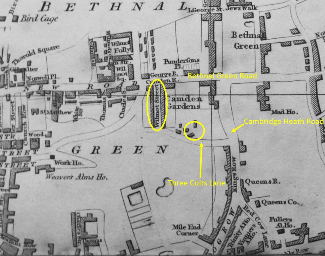
The area I will be walking is very built up, and has been since the early decades of the 19th century, however in 1746, Bethnal Green was still a hamlet surrounded by fields. Despite the very rural nature of Bethnal Green in 1746 it is possible to see the majority of the streets and features that we can walk through today.

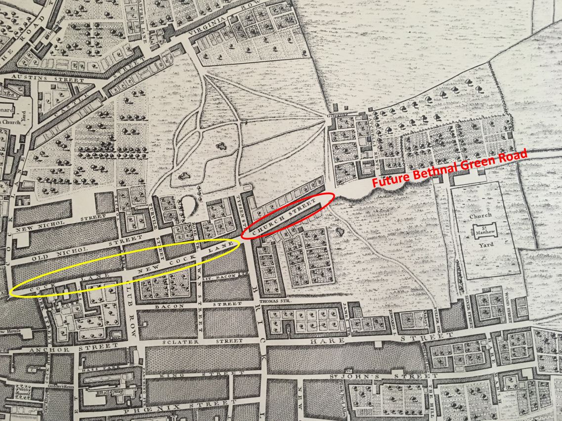
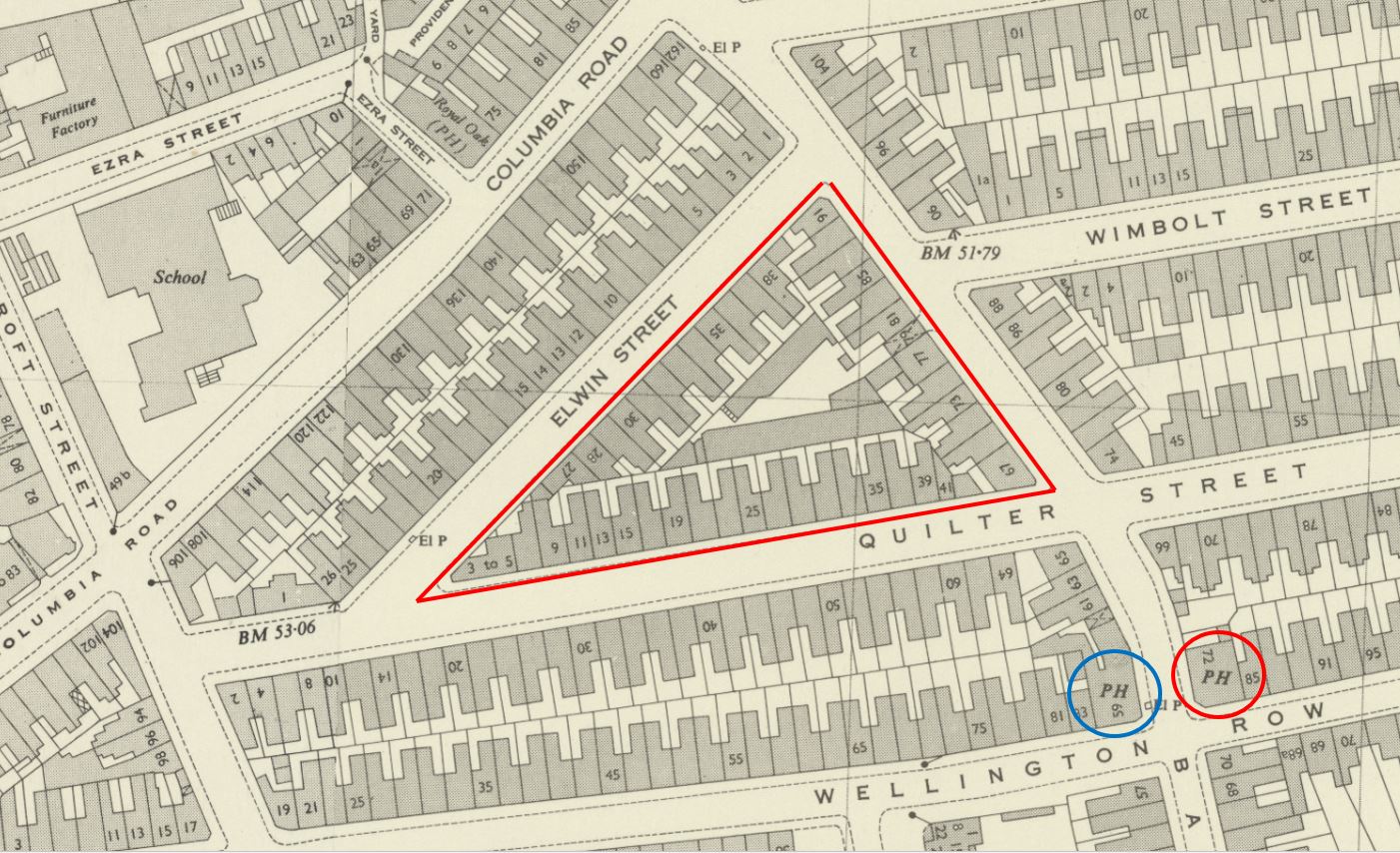
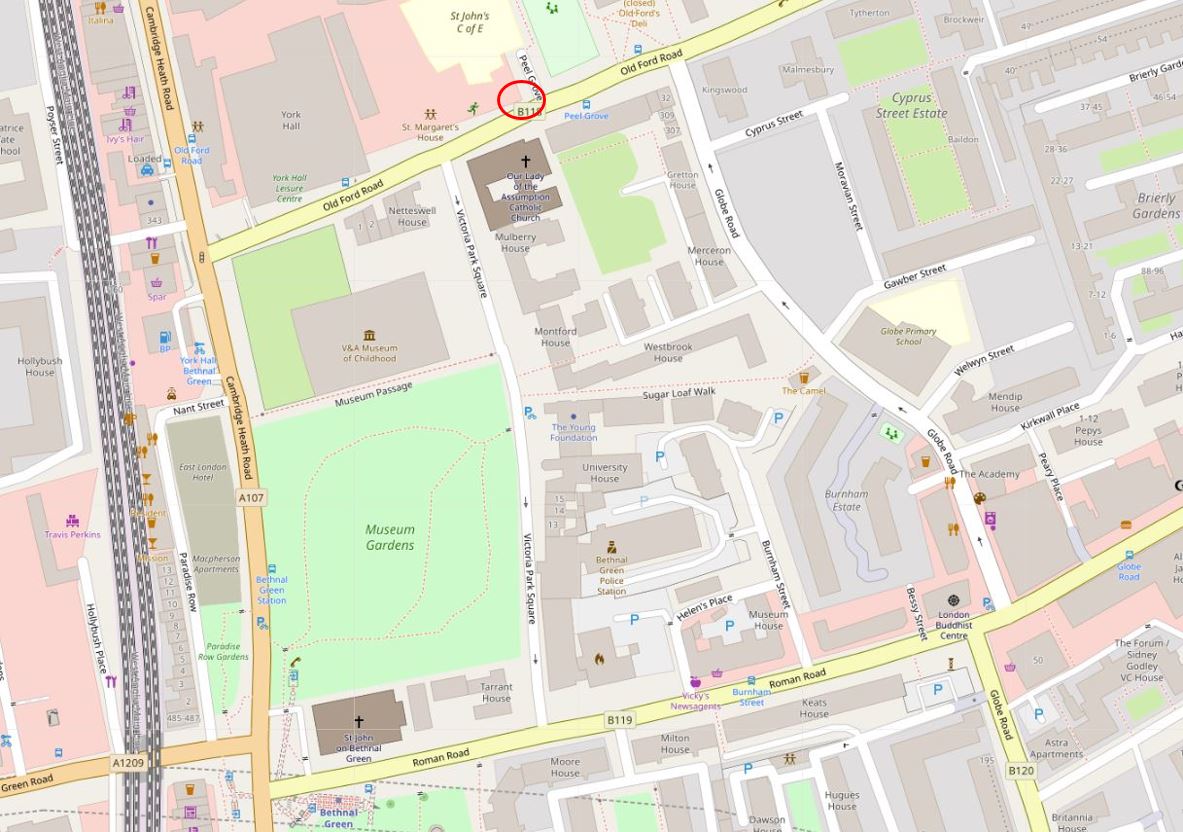
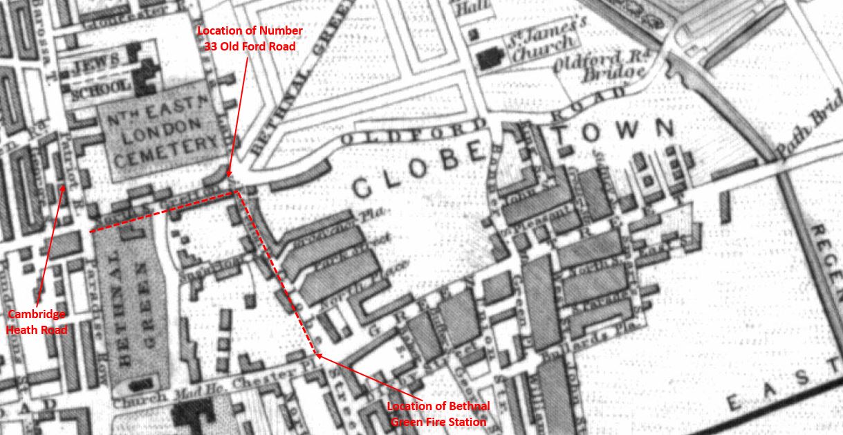
The following is an extract from John Rocque’s 1746 map and I have labelled the key features I will cover in the rest of this post.

Bethnal Green

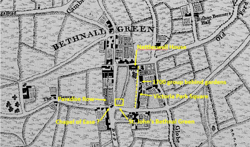
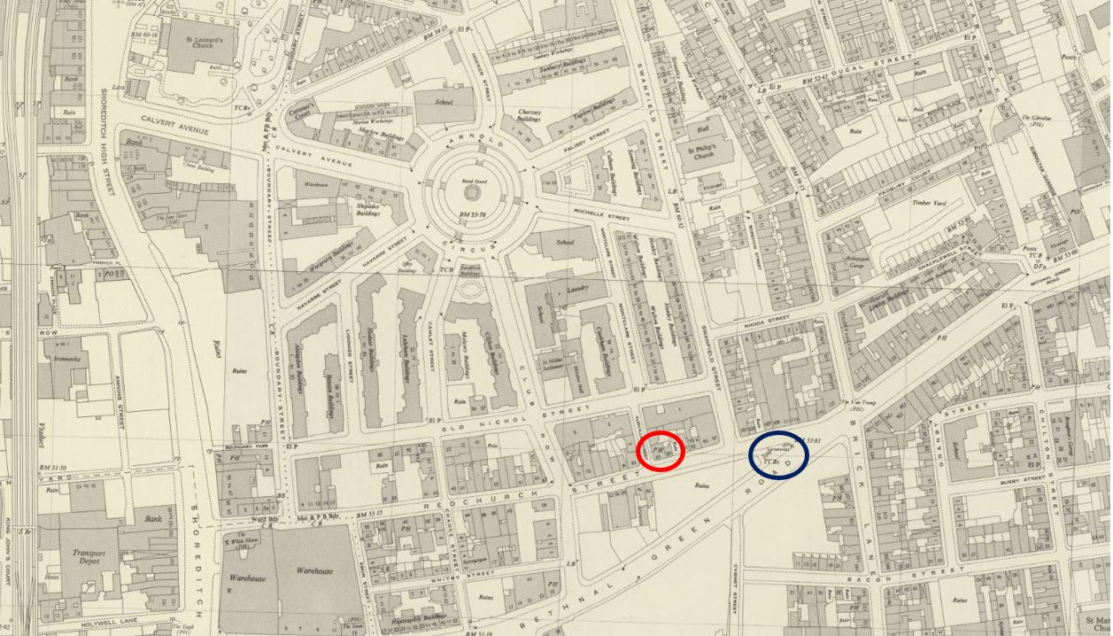
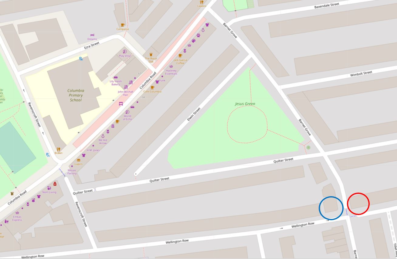
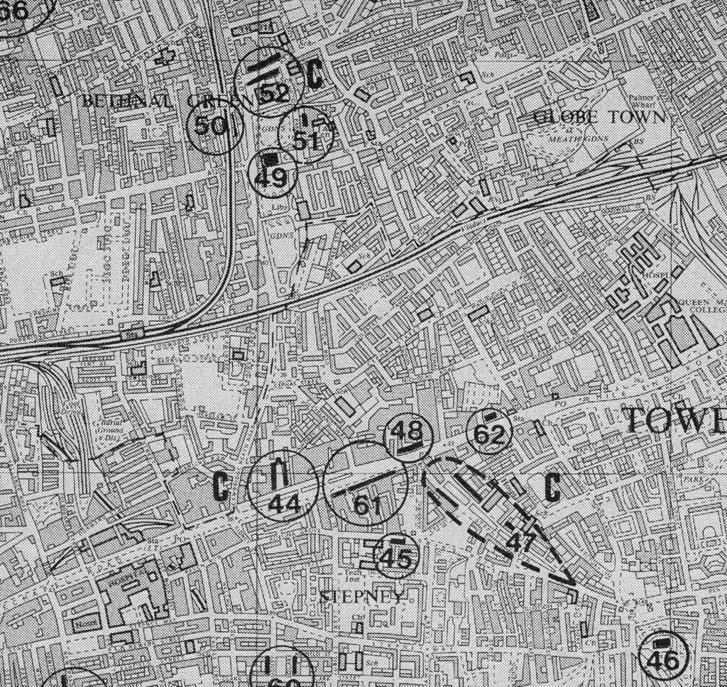
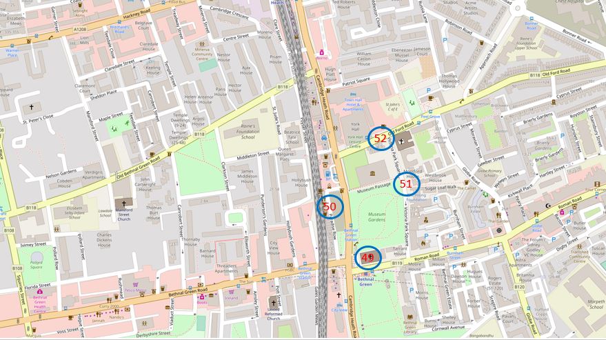
The area today, with the locations marked. Very different from the rural fields of 1746 (Map  “© OpenStreetMap contributors”).

Bethnal Green

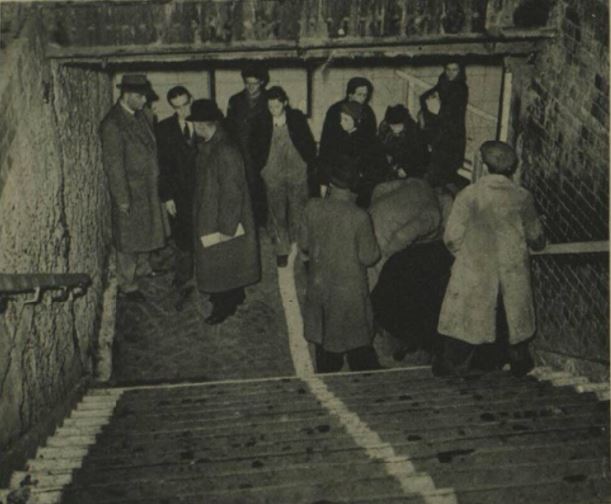
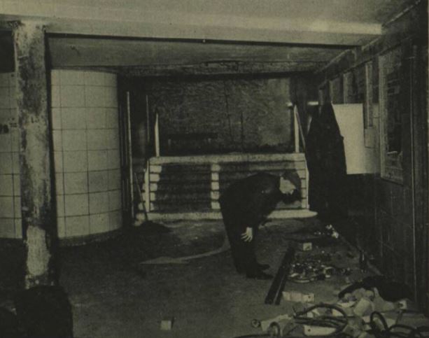
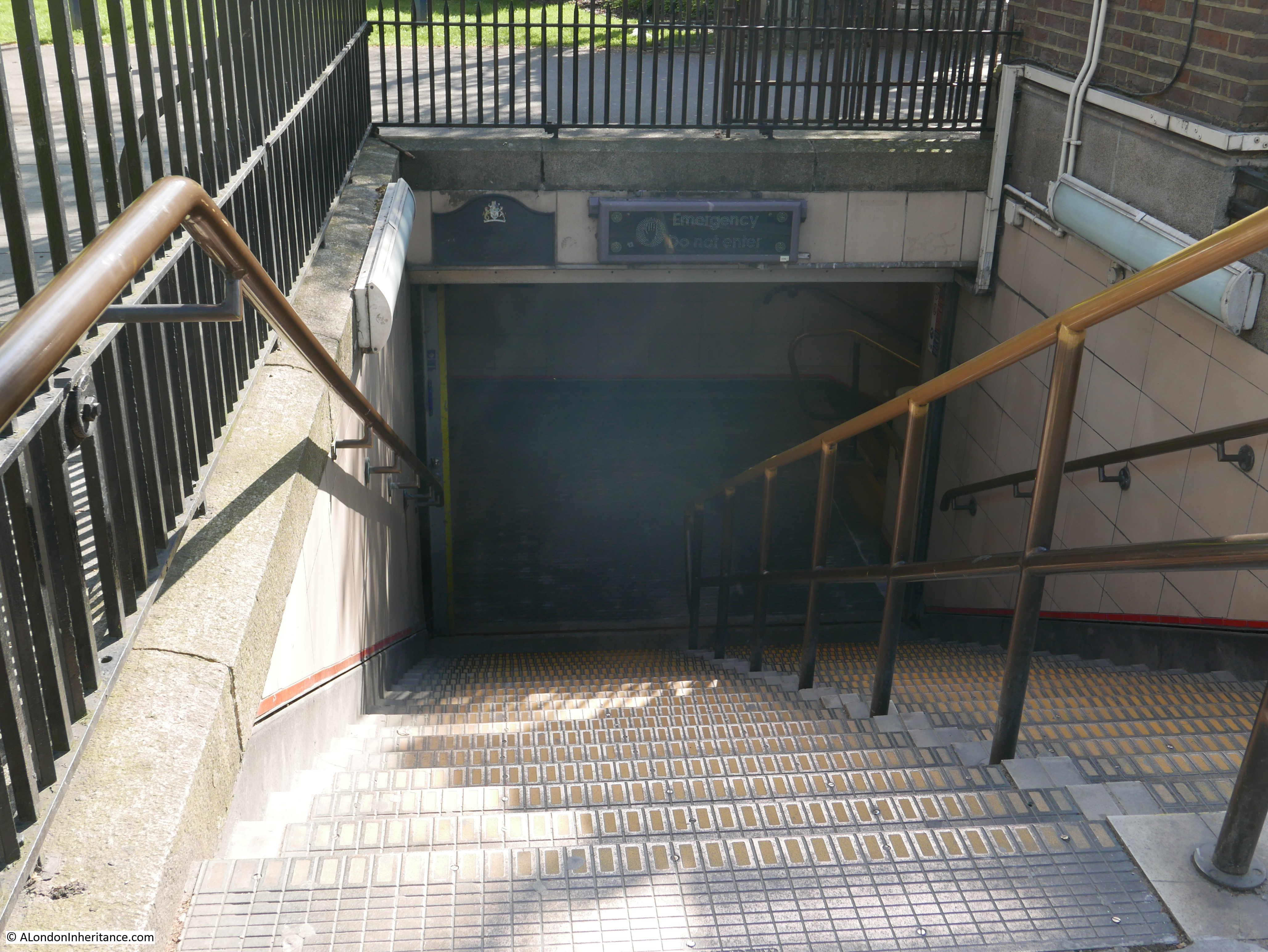
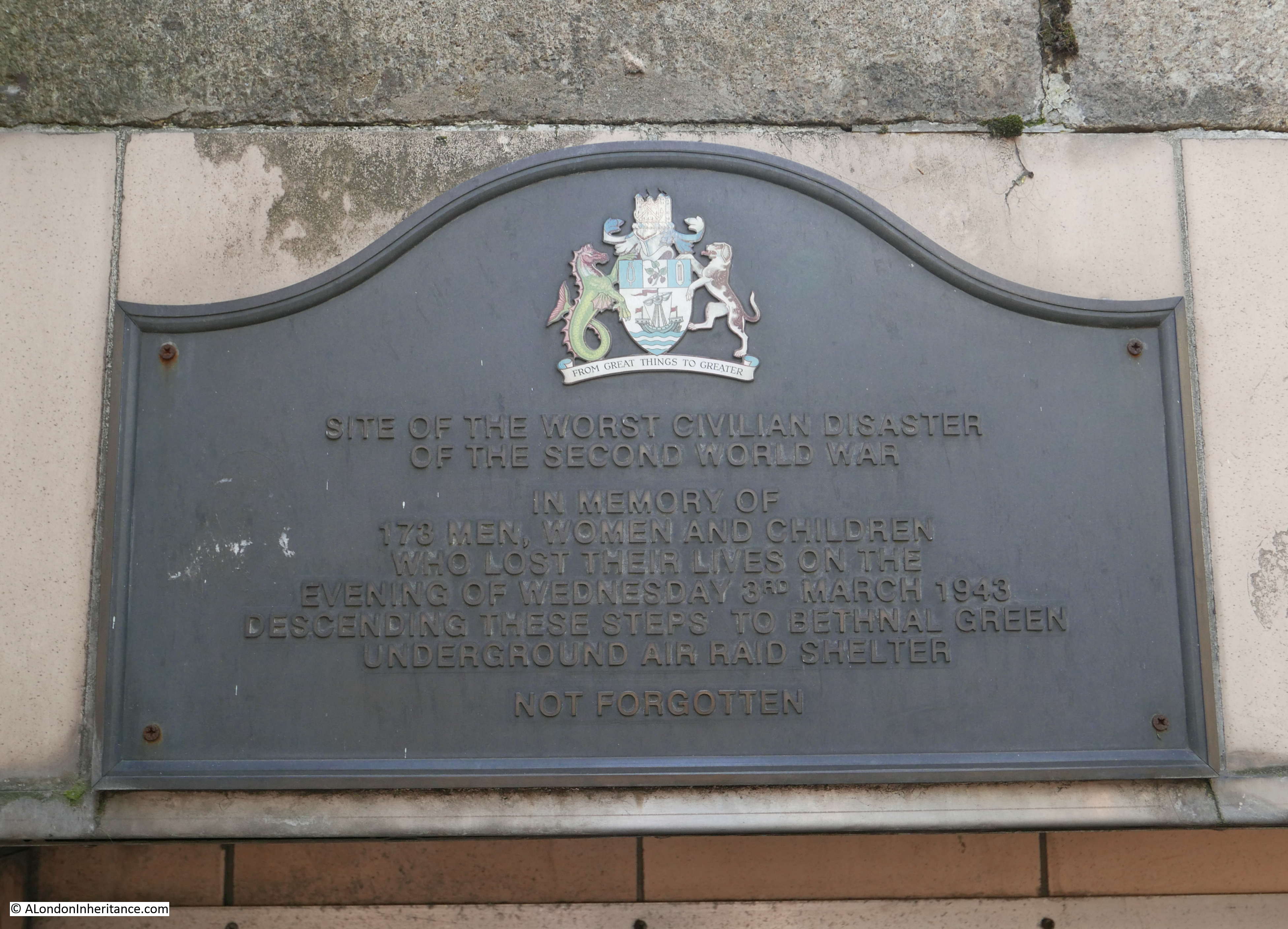
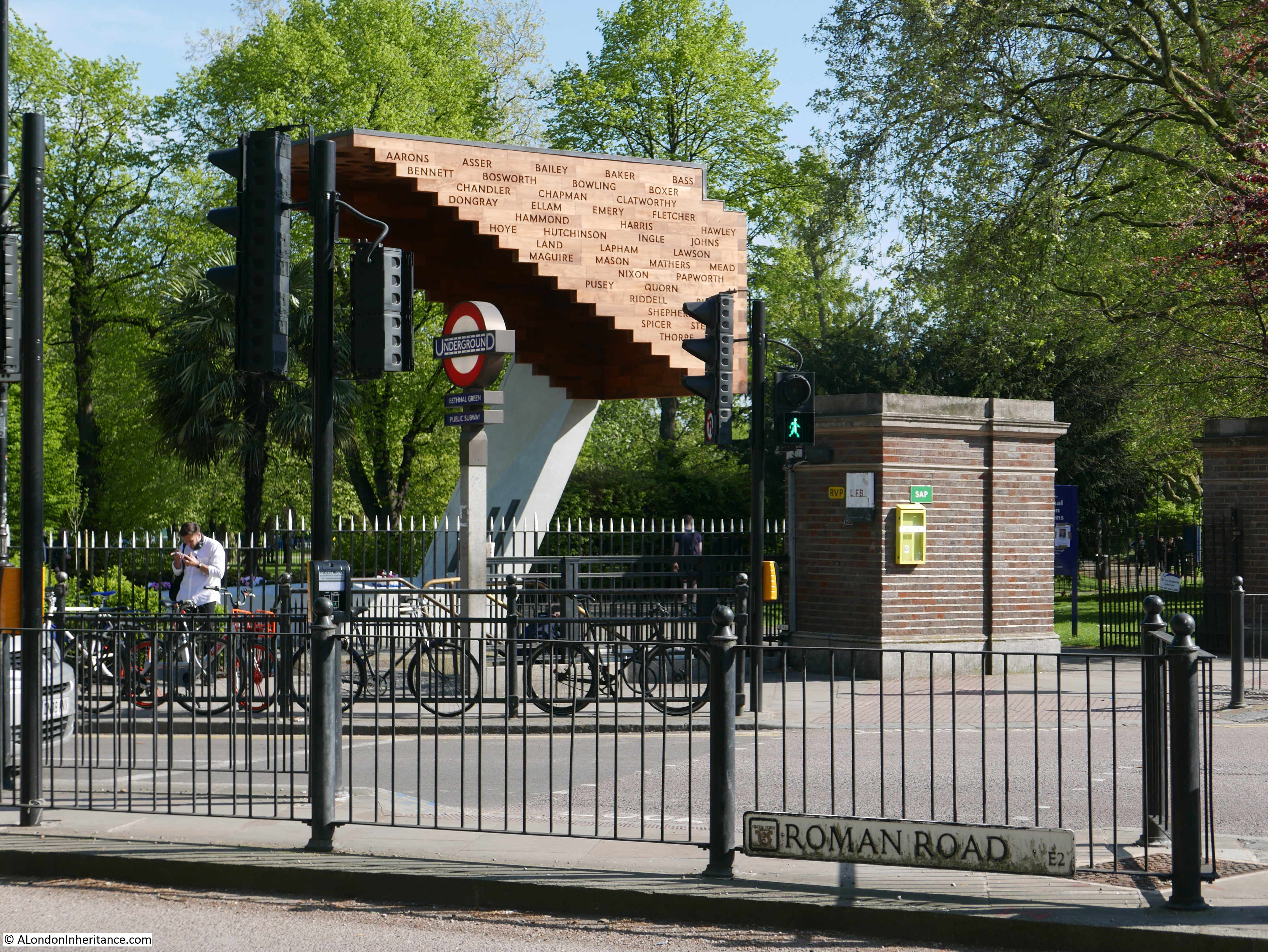
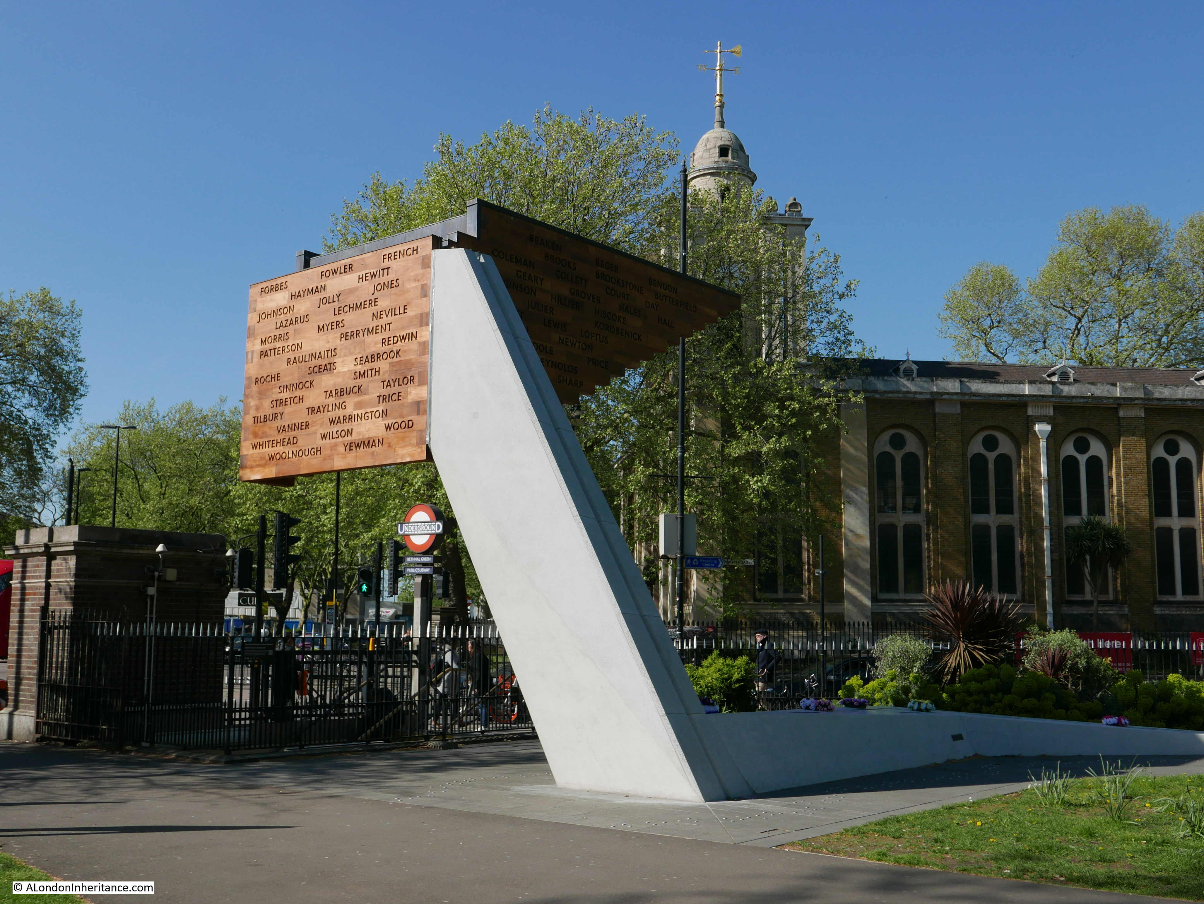
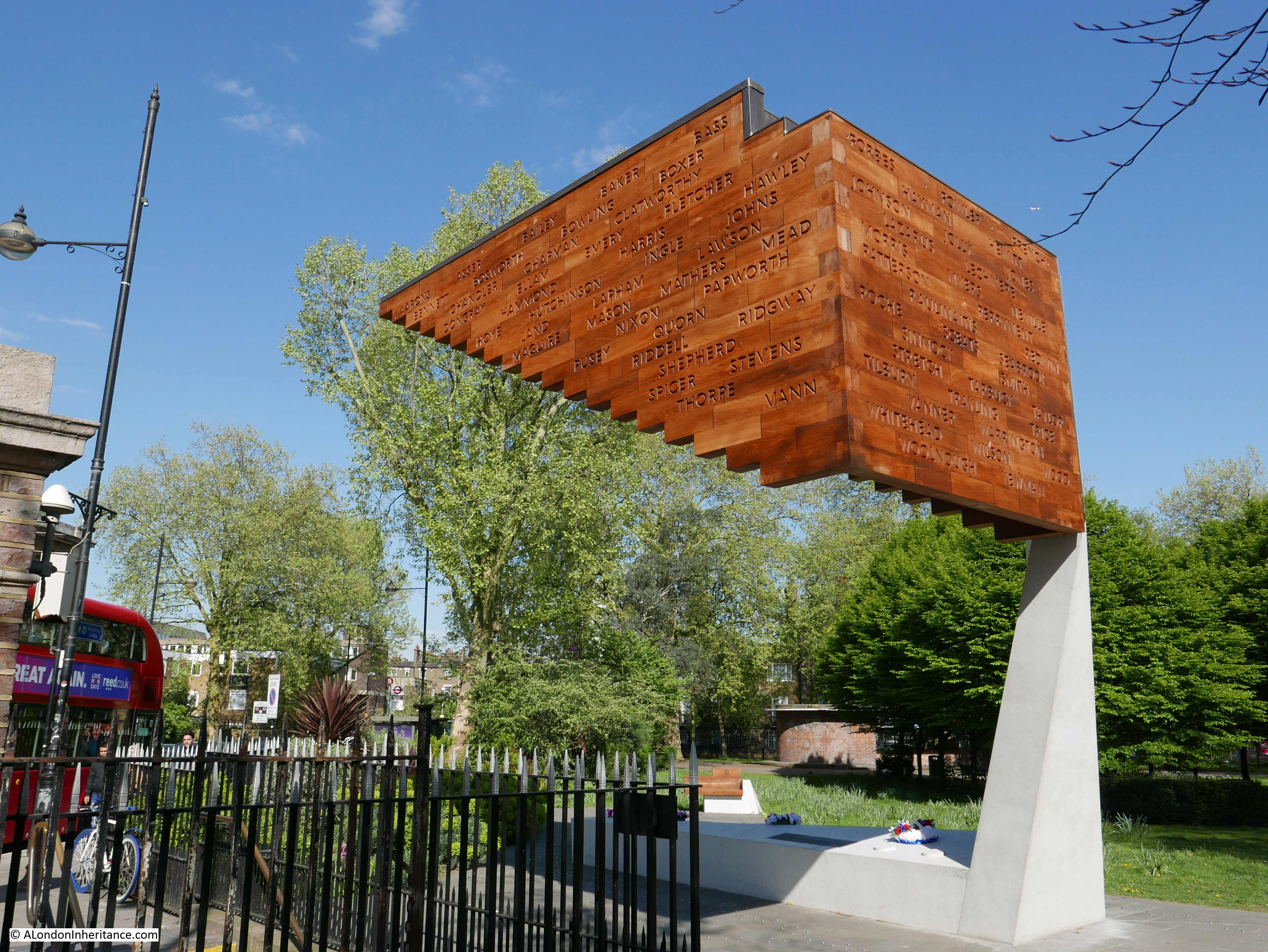
I travelled out to Bethnal Green on the underground and arrived at Bethnal Green Station which is at the junction of Roman Road, Bethnal Green Road and Cambridge Heath Road, and also located at this busy road junction is:

Site 49 – Soane’s St. John’s Bethnal Green

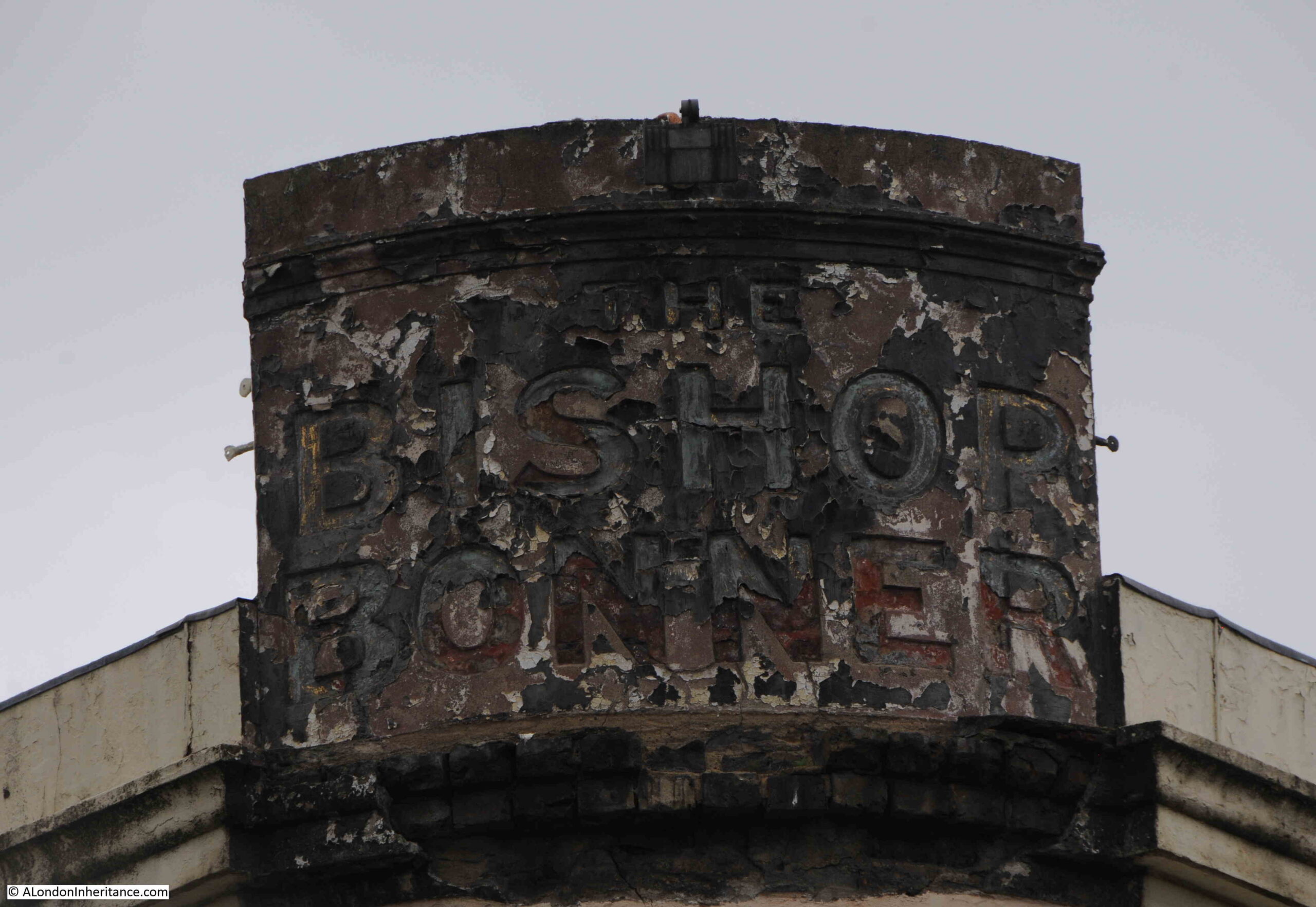
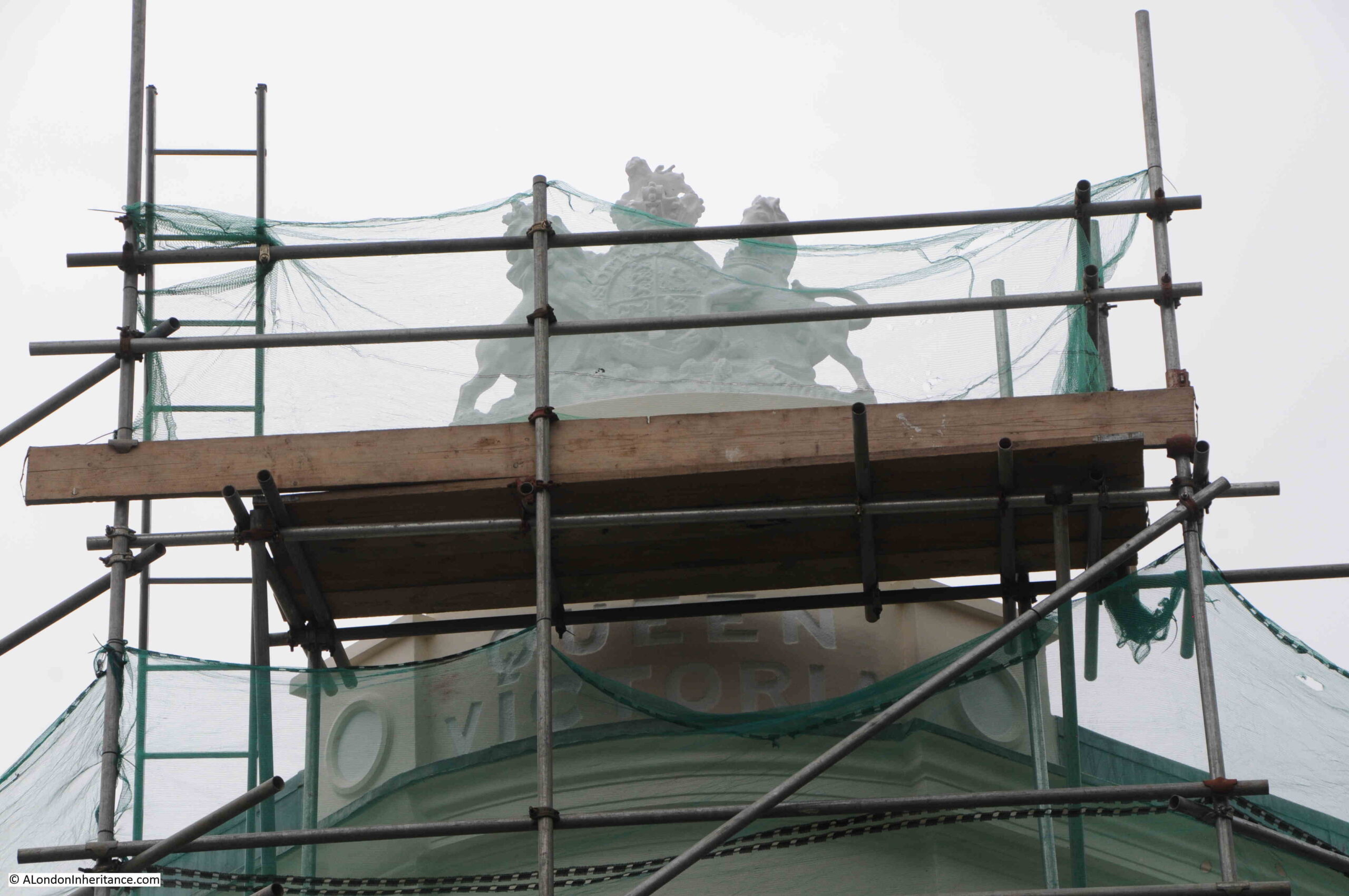
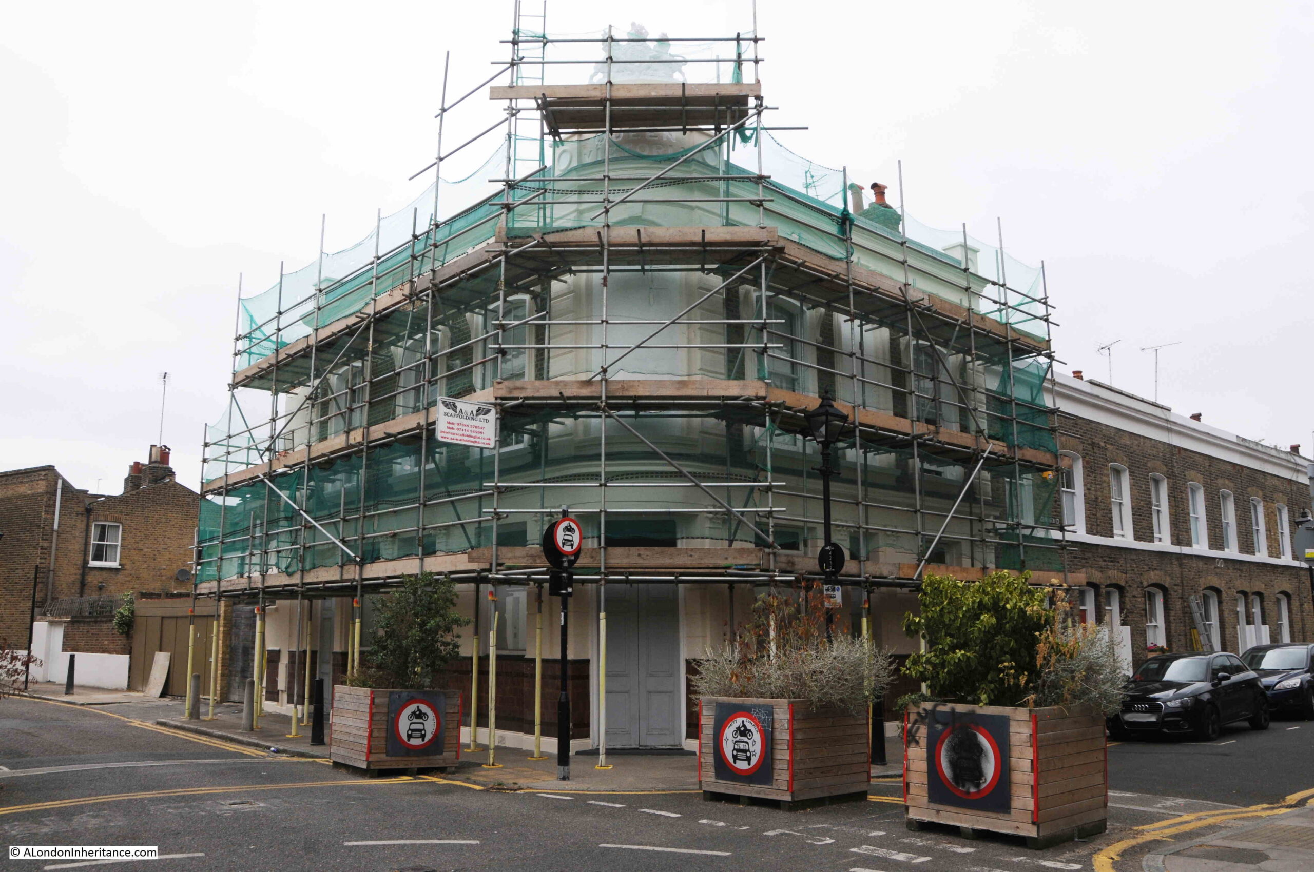
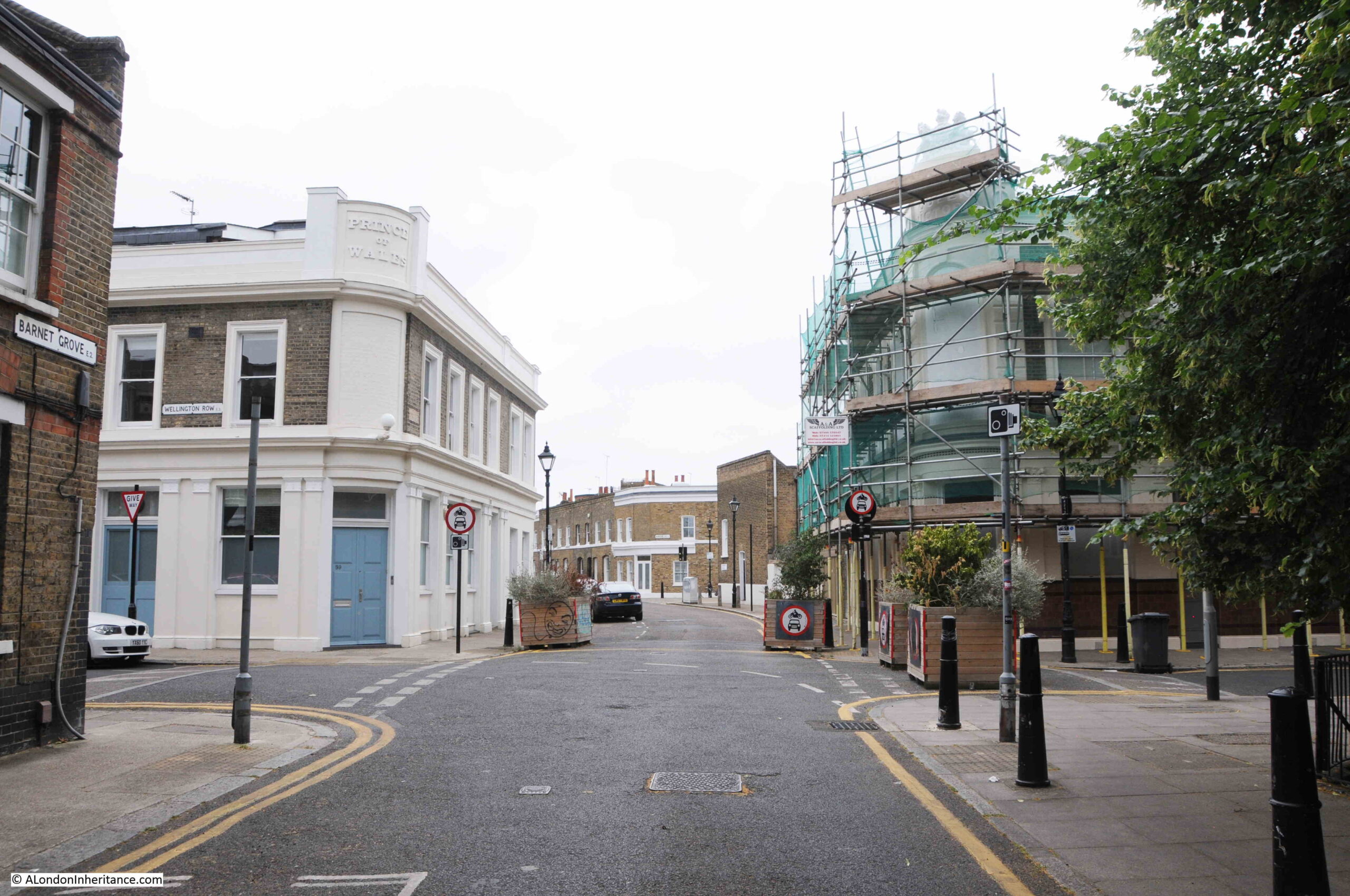
The church of St. John’s, Bethnal Green looks over this major road junction from the corner of Cambridge Heath Road and Roman Road.

Bethnal Green

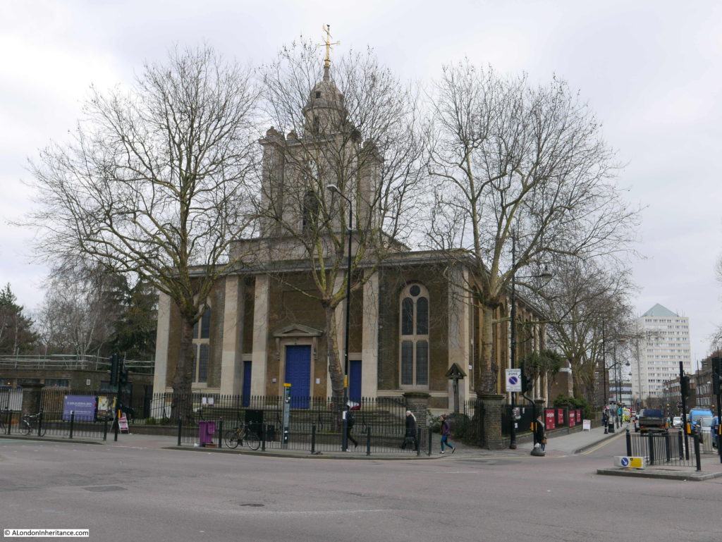
The church was designed by Sir John Soane and built between 1826 and 1828.

One of the so called Commissioners Churches as the church was a result of the 1818 and 1824 Acts of Parliament which provided sums of money and established a commission to build new churches.

These were needed in the areas where there had been considerable population growth and Bethnal Green is a perfect example of the transformation of an area from a low population, rural landscape, to a densely populated urban settlement.

The location of the church was on open land directly adjacent to what was already a road junction in central Bethnal Green, however there are also references to there being a Chapel of Ease on the site, or close to the new church, (for example the Tower Hamlets publication: “History of parks and open spaces in Tower Hamlets, and their heritage significance” mentions a Chapel of Ease in 1617). The Roque map does show a building of some form in the road junction which may have been the Chapel of Ease, although this is just speculation at this point and needs some further research.

The church was damaged by fire in 1870 with much of the interior and the church roof being destroyed. The church was reopened the following year after restoration, which included new bells cast at the Whitechapel Bell Foundry. The church did suffer some damage during the last war, fortunately not the major level of damage suffered by many other east London churches.

The church was closed on the day of my visit, however it is good to see that the church is still an imposing building overlooking this busy junction, even on a grey and cold February morning.

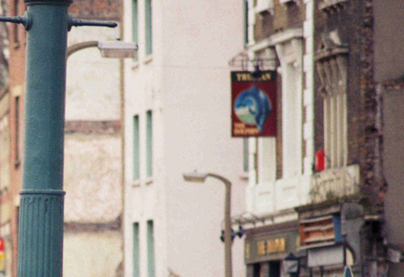
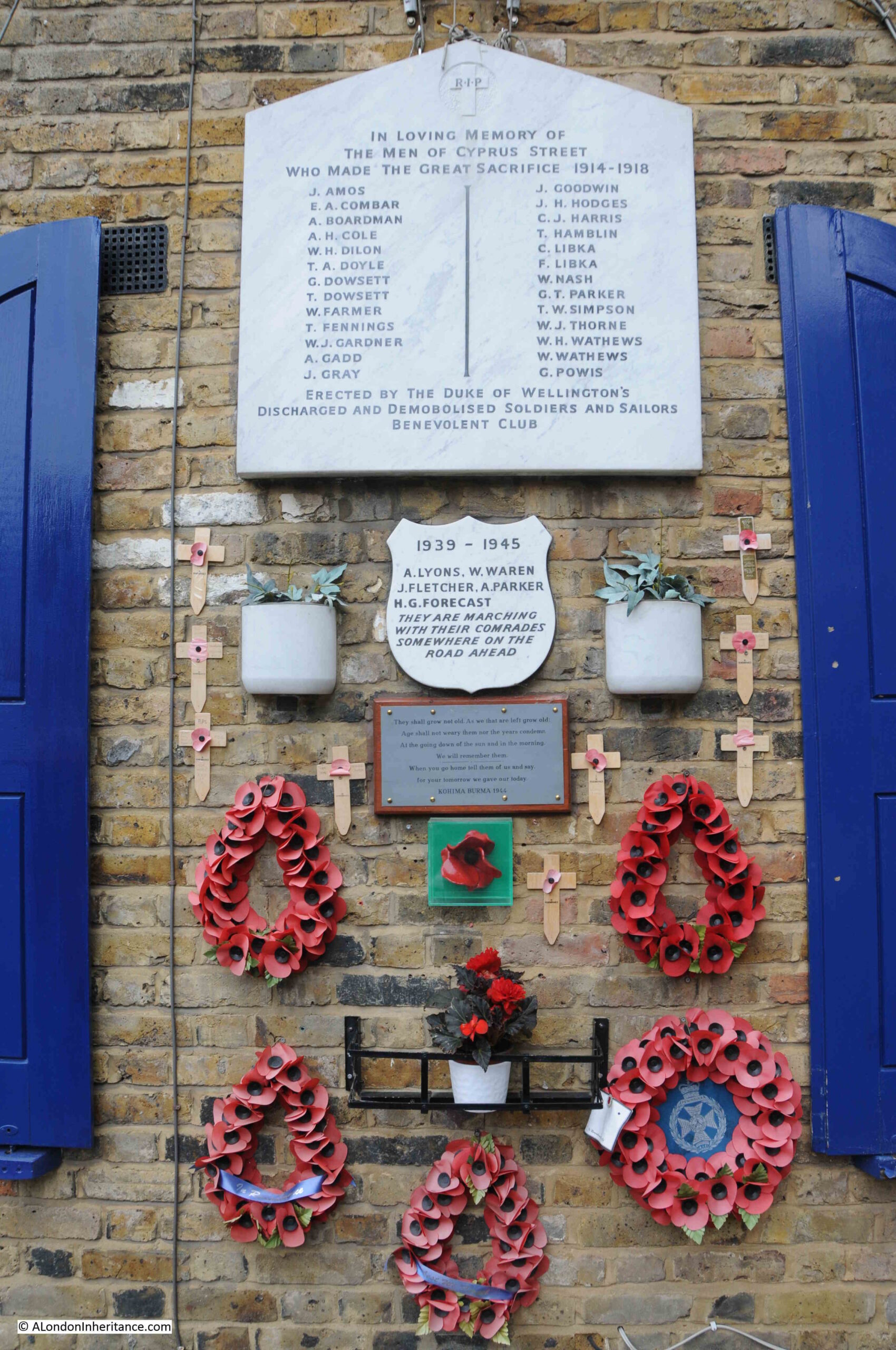
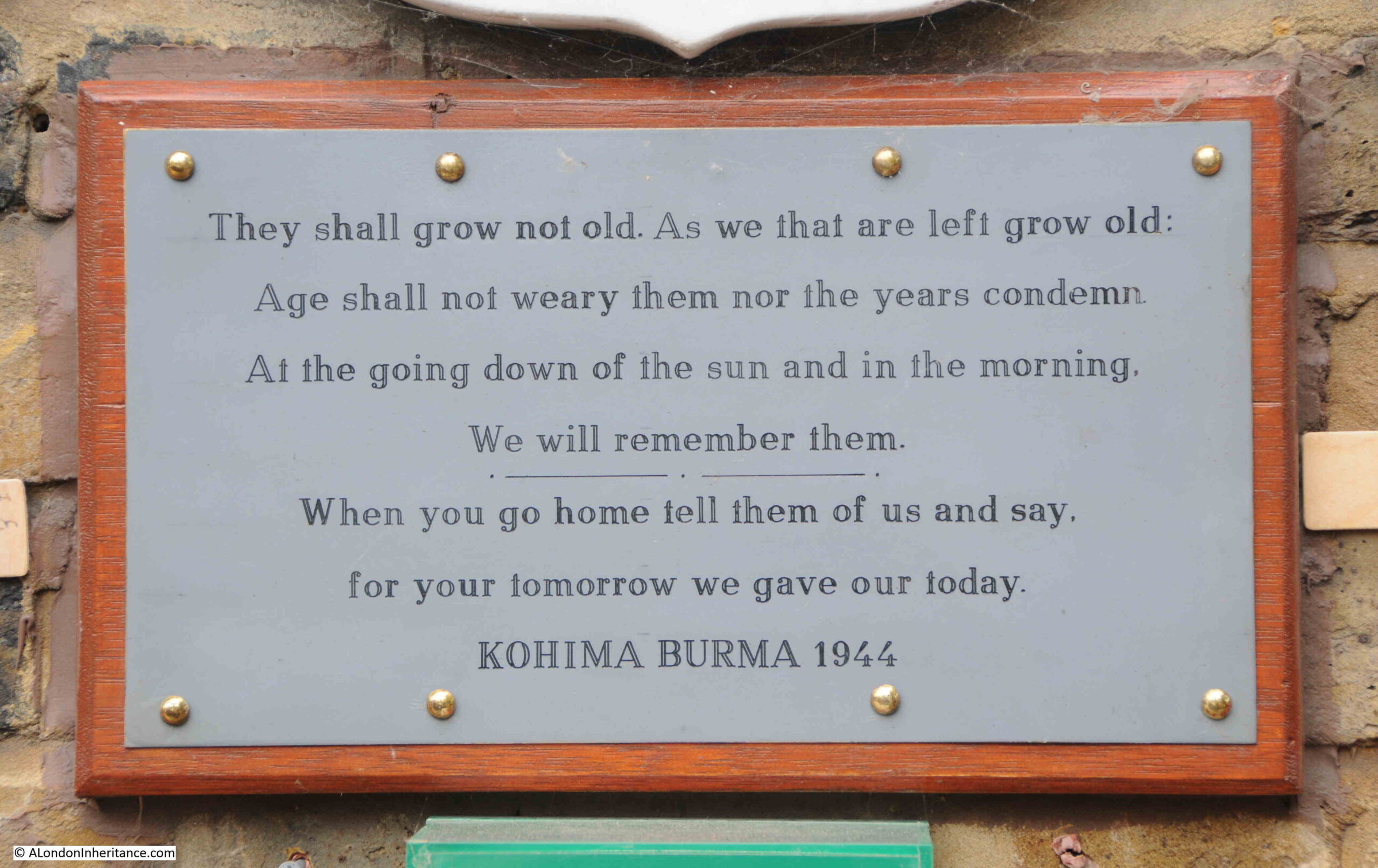
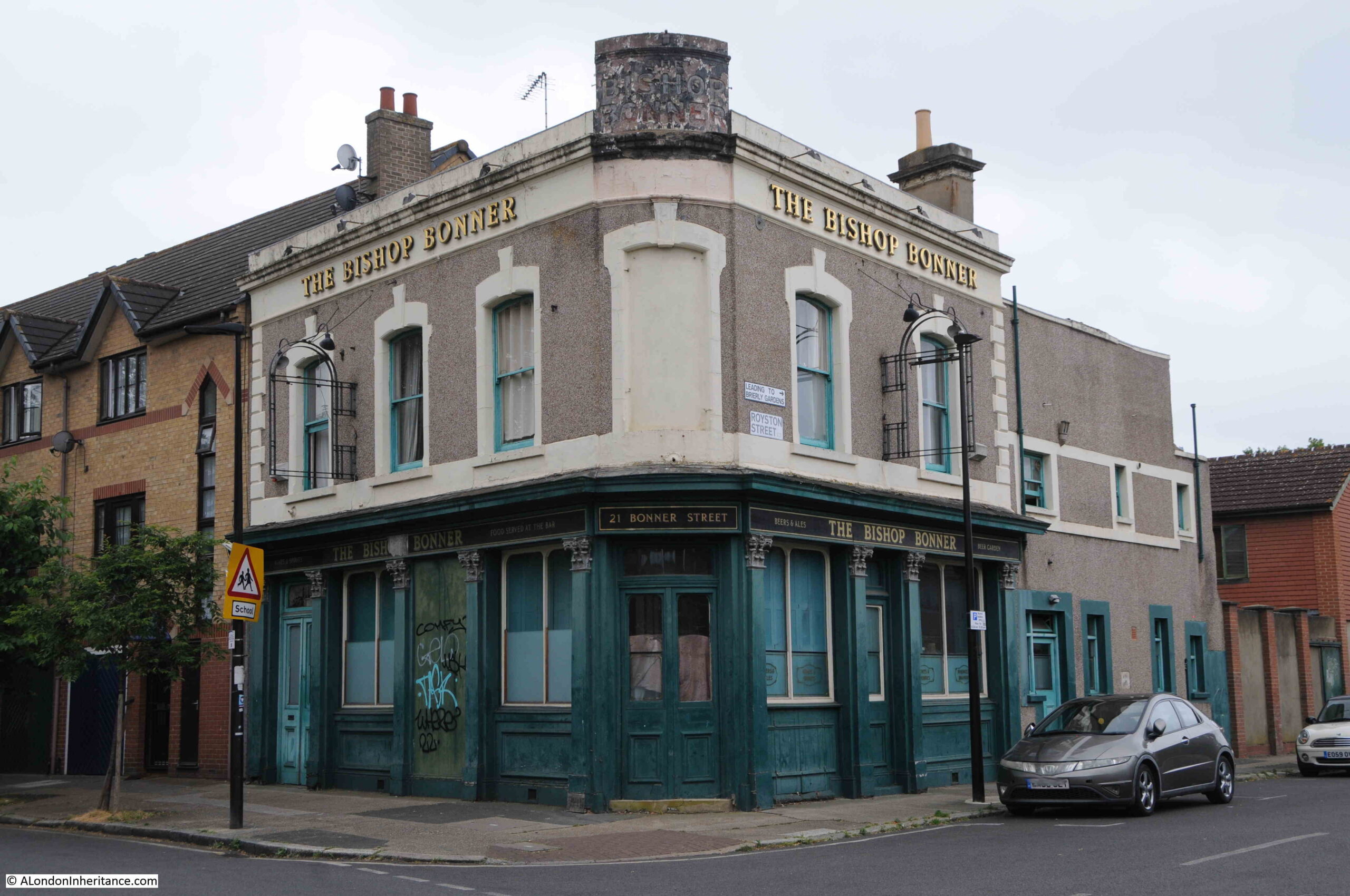
Diagonally across the junction from the church is the Salmon and Ball pub:

Bethnal Green

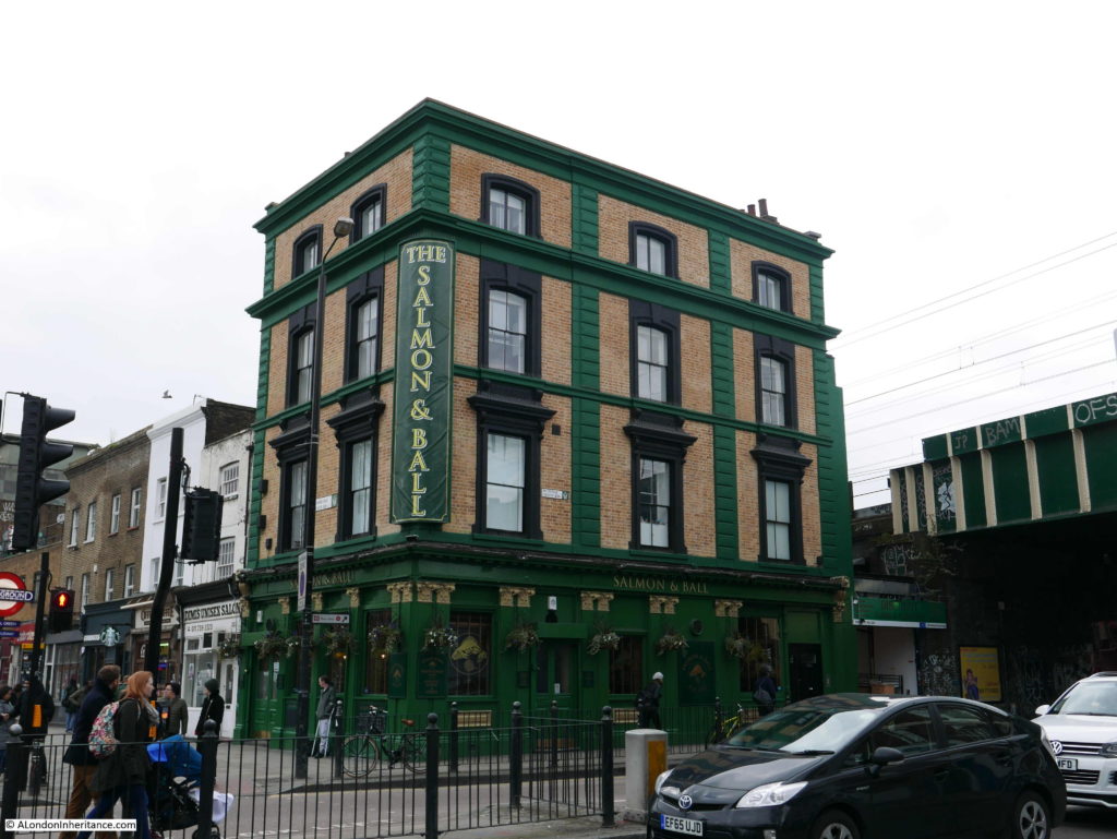
Early references to the Salmon and Ball date the pub to the first half of the 18th century, however the current building dates from the mid 19th century and is Grade II listed. The earliest contemporary reference I could find to the Salmon and Ball is from a newspaper report on the 26th November 1795 reporting that:

“This day about two o’clock, in consequence of Advertisements, several thousand Weavers assembled near the Salmon and Ball, Bethnal Green, to take into consideration a Petition to the House of Commons against the Bill brought in by Mr. Pitt, to prevent the people from meeting, &c. Mr. Heron was called to the Chair, when several resolutions were passed and a Petition against the Bill agreed upon.”

There are newspaper references to an east London Salmon and Ball going back to the 1730s, but they do not specifically confirm that they refer to the pub in Bethnal Green.

The name of the public is interesting, I have only found one reference to the origin of the name. In the East London Observer on the 9th January 1915 in an article titled “Roundabout Old East London” by Charles McNaught, there is the following reference to the Salmon and Ball:

“The Salmon and Ball, by the bye, figures prominently in more than one historical scene in the turbulent days of Bethnal Green Weaverdom. Apart from that, however, it is a tavern sign sufficiently incongruous to awaken curiosity. The early silk mercers adopted the Golden Ball as their sign, because, in the Middle Ages all silk was brought from the East, and more particularly from Byzantium and the Imperial manufactories there. And at Byzantium the Emperor Constantine the Great adopted a Golden Globe as the emblem of his imperial dignity. The Golden Ball continued as the mercer’s sign until the end of the Eighteenth Century and then it gradually passed to the ‘Berlin’ wool shops, and – conjoined with a fish or other animal – its was favourite sign for Taverns in the silk weaving area. 

The Salmon and Ball in Bethnal Green is not the only house with that sign; and other local names of the past include: The Ball and Raven, The Green Man and Ball, the Blue Balls, The Ring and Ball, and many others.”

No idea if this is the true origin of the name, but an interesting possibility.

My next stop was very close, and it was a short walk to:

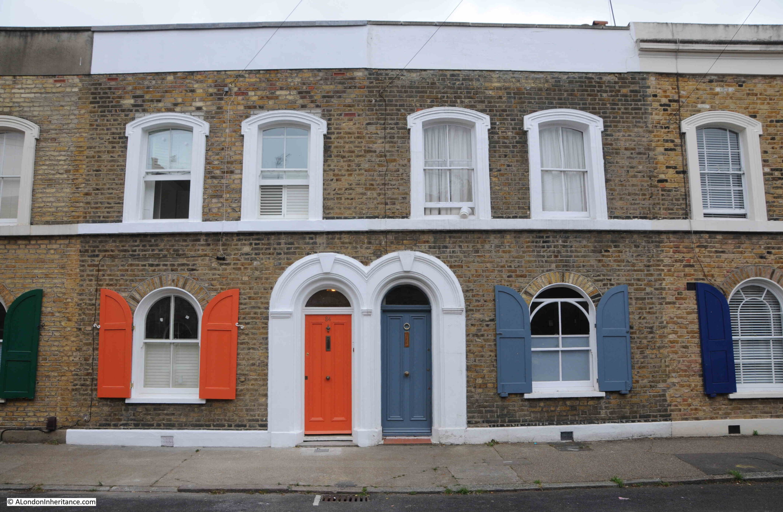
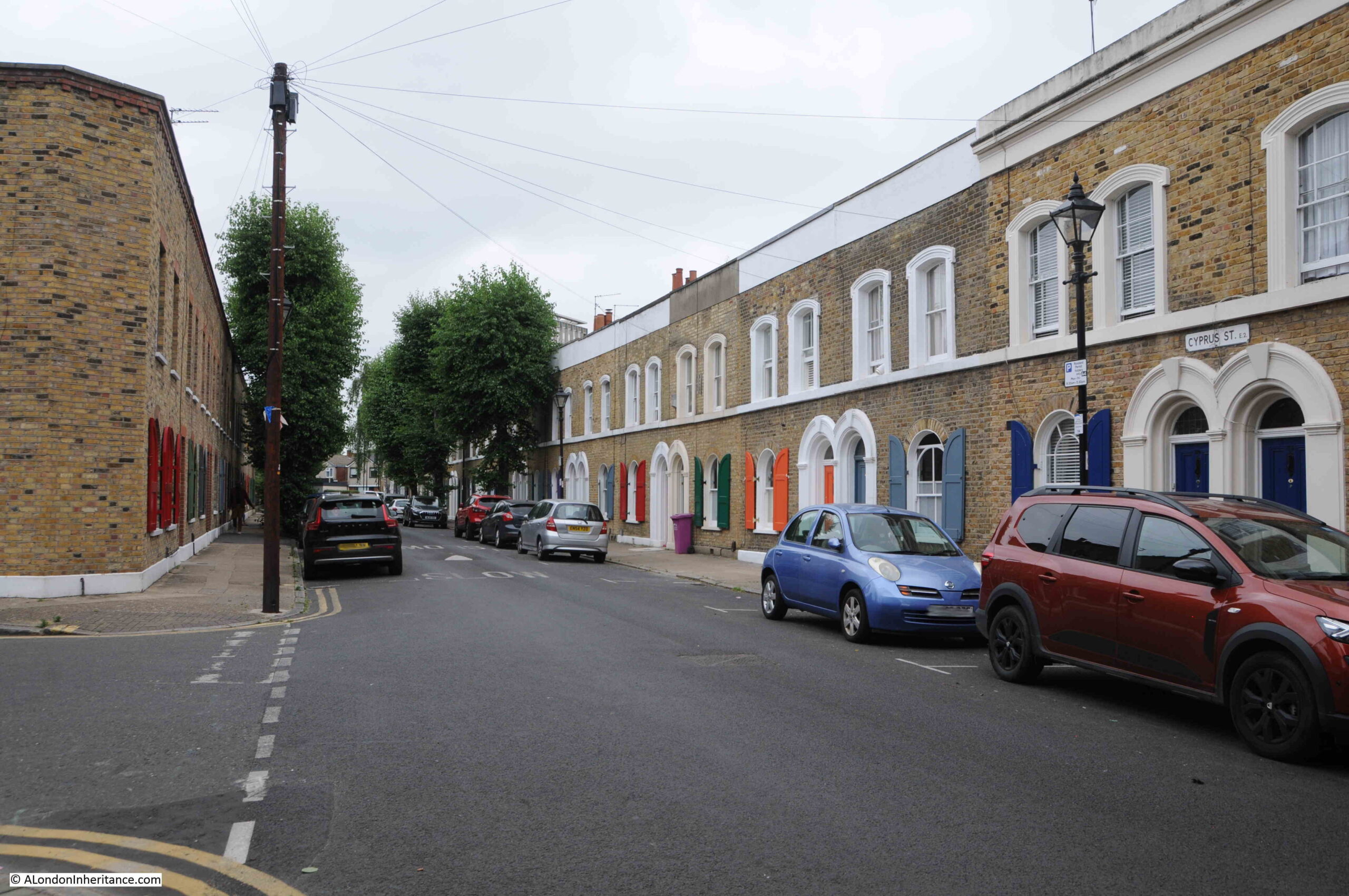
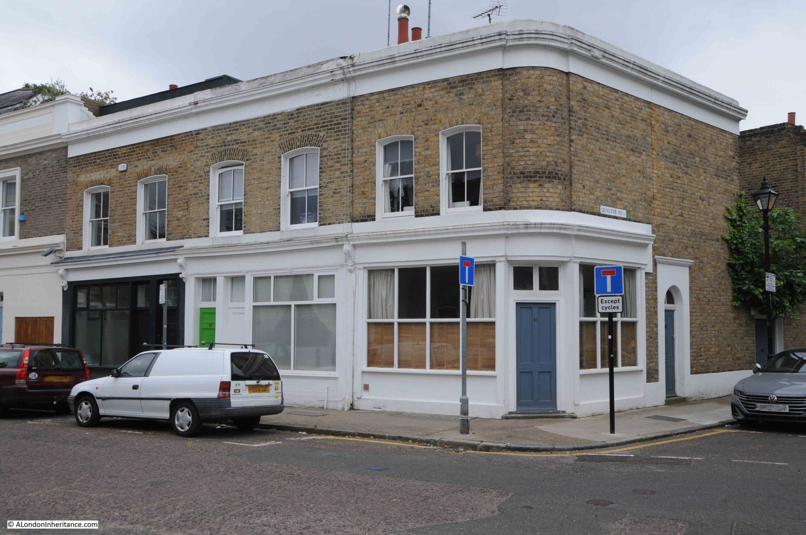
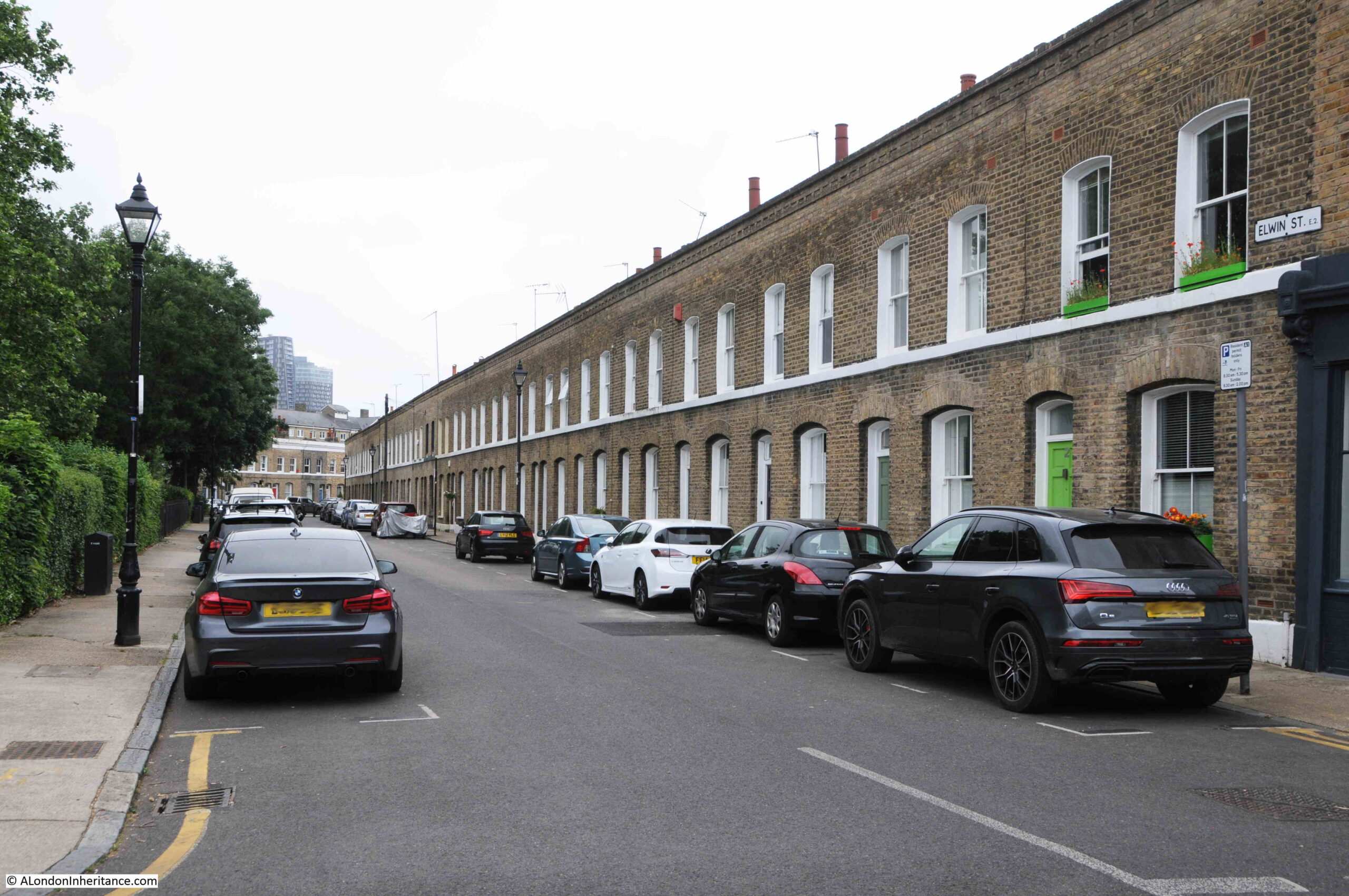
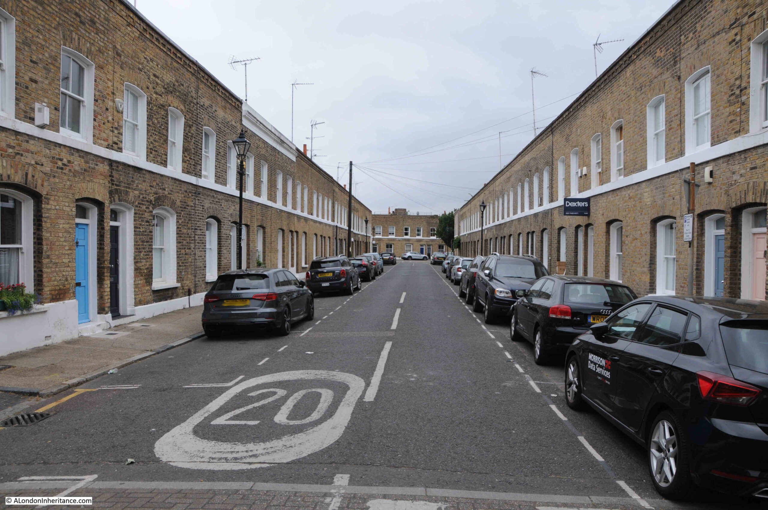
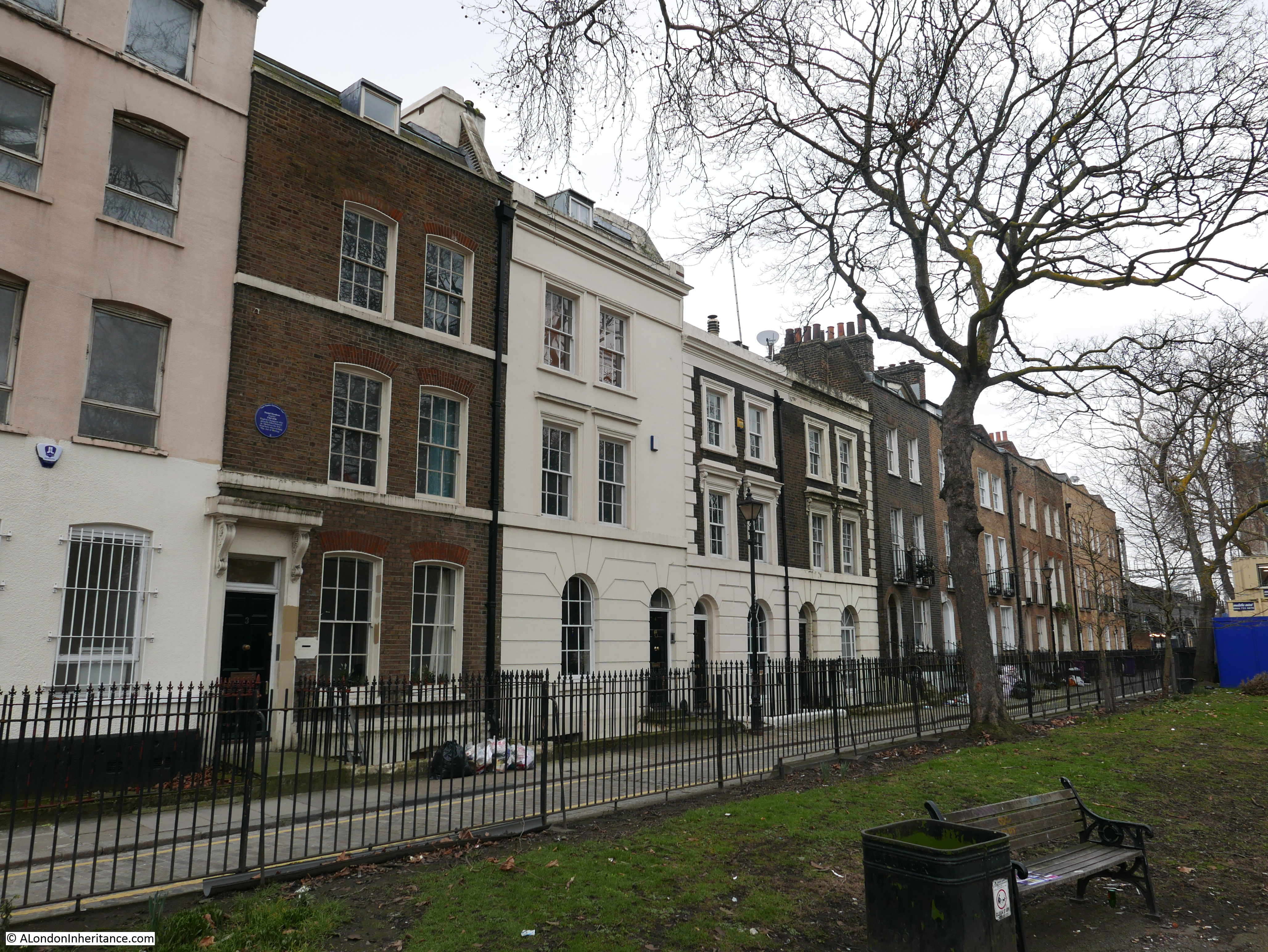
Site 50 – Early 19th Century Terrace

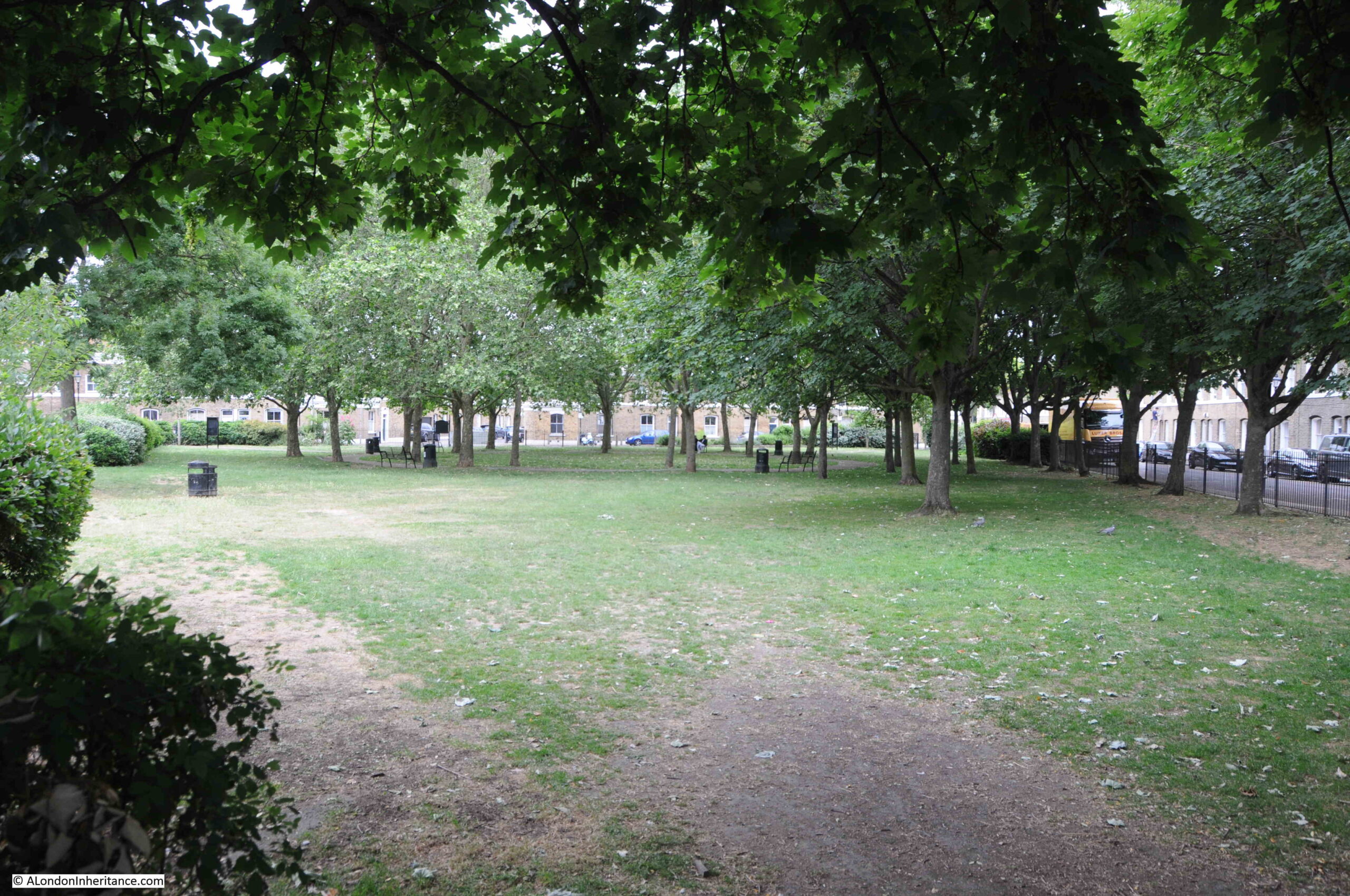
This location was just opposite the church, a narrow street that runs parallel to Cambridge Heath Road and that goes by the name of Paradise Row. For the main part of the street, houses run along one side, with the opposite side formed by Paradise Gardens, which in February really did not live up to the name.

The terrace of houses in Paradise Row taken from within Paradise Gardens:

Bethnal Green

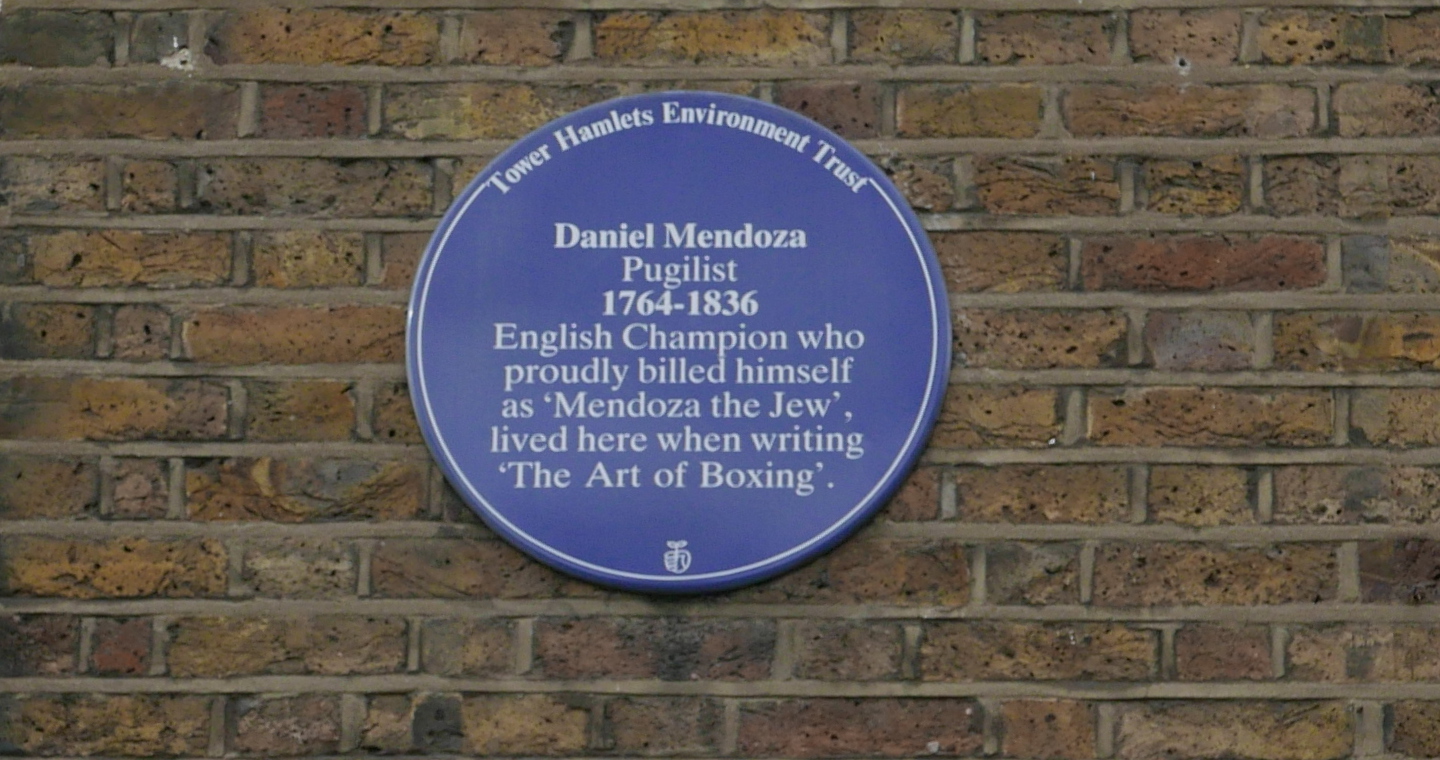
There is a blue plaque on one of the houses recording that Daniel Mendoza lived in the house:

Bethnal Green

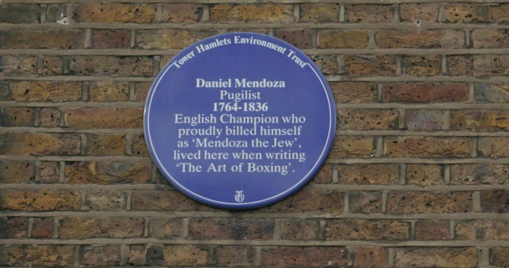
Daniel Mendoza was a fascinating character. A boxer, or pugilist who became heavyweight champion between 1792 and 1795. In an age when it was common to advertise yourself with a memorable name. As the plaque states he proudly billed himself as ‘Mendoza the Jew’ in honour of his Jewish heritage. For an example of how other boxers billed themselves, Mendoza’s first recorded successful prize fight was against the wonderfully named ‘Harry the Coalheaver’.

The plaque refers to Mendoza living in Paradise Row when he was writing ‘The Art of Boxing‘. In the 18th century, boxing was mainly a punching, grappling, gouging match between two fighters.

Mendoza advocated a more formal, scientific approach to boxing which he set out in his book ‘The Art of Boxing‘. In his preface to the book, Mendoza explains his approach and the reasons why boxing should have a more scientific method:

“After the many marks of encouragement bestowed on me by a generous public, I thought that I could not better evince my gratitude for such favours, than by disseminating to as wide an extent, and at as cheap a rate as possible, the knowledge of an ART; which though not perhaps the most elegant, is certainly the most useful species of defence. To render it not totally devoid of elegance has, however, been my present aim, and the ideas of coarseness and vulgarity which are naturally attached to the Science of Pugilism, will, I trust, be done away, by a candid perusal of the following pages.

Boxing is a national mode of combat, and as is peculiar to the inhabitants of this country; as Fencing is to the French; but the acquisition of the latter as an art, and the practice of it as an exercise, have generally been preferred in consequence of the objection which I have just stated as being applicable to the former.

The objection I hope, the present treatise will obviate, and I flatter myself that I have deprived Boxing of any appearance of brutality to the learner, and reduced it into so regular a system, as to render it equal to fencing, in point of neatness, activity, and grace.

The Science of Pugilism may, therefore, with great propriety, be acquired, even though the scholar should feel actuated by no desire of engaging in a contest, or defending himself from an insult.

Those who are unwilling to risque any derangement of features in a real boxing match, may, at least, venture to practice the Art from sportiveness and sparring is productive of health and spirits as it is both an exercise and an amusement.

The great object of my present publication has been to explain with perspicuity, the Science of Pugilism, and it has been my endeavour to offer no precepts which will not be brought to bear in practice, and it will give me peculiar satisfaction and pleasure to understand, that I have attained my first object, by having taught any man an easy regular system of so useful an Art as that of Boxing.”

Daniel Mendoza put his approach into practice throughout his career. He was highly successful and his name became very well known across the country. He made (and lost) a considerable sum of money.

His most famous fights were against Richard Humphreys, his former trainer and mentor. These fights were captured in a series of etchings (©Trustees of the British Museum), published very soon after the fights.

In the following we see the first fight held on the 9th January 1788 in Odiham in Hampshire

Bethnal Green

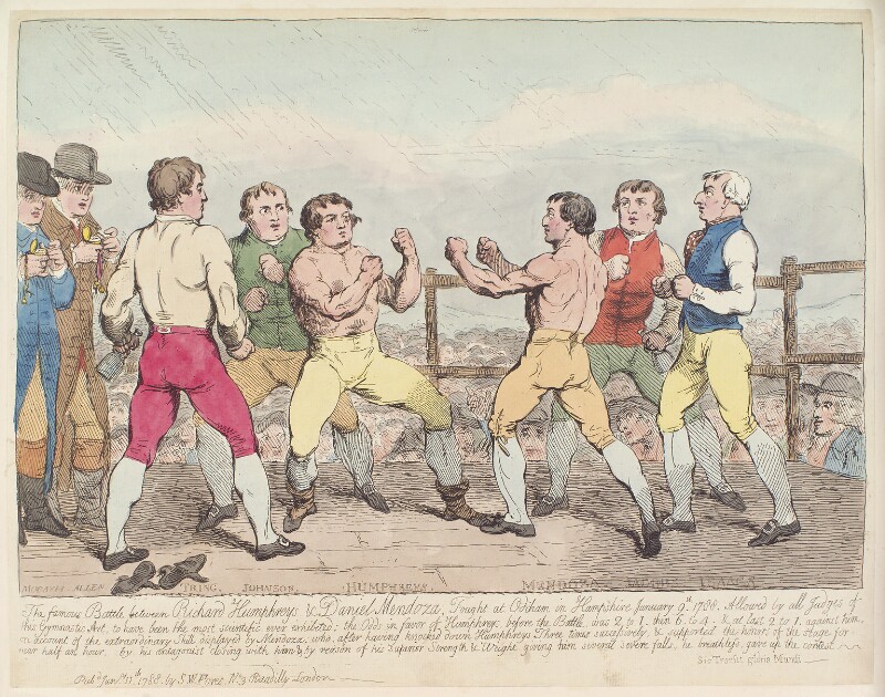
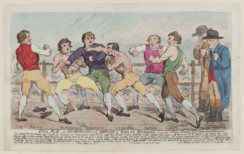
Mendoza lost the fight and the following etching “Foul Play” shows how Mendoza lost the fight through the actions of Tom Johnson, Humphreys second, who blocked a blow from Mendoza:

Bethnal Green

In perhaps an early version of the tension built up in advance of fights today, in the 18th century Mendoza and Humphreys traded insults and accusations at each other through a series of letters published in newspapers across the country.

In a letter written on the 16th January 1788 when Mendoza was living in London at No. 9, White Street, Houndsditch, Mendoza set forth three propositions for how the next fight should take place. He finishes the letter with:

“The acceptance or denial of Mr. Humphries to the third proposition, will impress the public with an additional opinion of his superior skill, or they must conclude that he is somewhat conscious of his inferiority in scientific knowledge. In imitation of the challenge of Mr. Humphries, I shall not distress him for an immediate reply, but leave him to consult his friends, and his own feelings, and send an answer at his leisure.”

Mendoza wrote a follow up letter on the 27th January 1788:

“To prevent the tedious necessity of a reference to the several letters which I have written, and which have appeared in your paper, I am induced to take my leave of the public, with the insertion once more of the conditions of my challenge to Mr. Humphreys, and I beg that the world will consider them as open to the acceptance of that gentleman, whenever he may think better of his boxing abilities.

The first condition is, that I will fight him for 250 guineas a side, the second, the victor to have the door, the third, the man who first closes to be the loser, fourth and last, the time of fighting to be in the October Newmarket meeting.

Mr. Humphreys would do well to insert this challenge in his private memorandum-book; and as a teacher of the art of boxing, it would not be amiss to have it penned, neatly framed, and hung up in his truly scientific academy.”

Letters continued and finally Humphries accepted the challenge, writing on the 31st July 1788:

“I have seen your letter, and accept your challenge. I am glad that you have at last found out your own mind. The terms shall be settled at a meeting which I will appoint by private letter to you.”

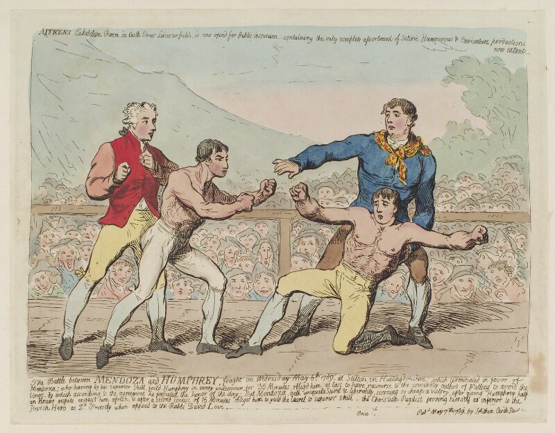
After the loss of the first fight, Mendoza won the next two fights. The following etching shows what looks to be the closing stages of the fight on the 6th May 1789 with Mendoza on the left and a collapsing Humphreys on the right.

Bethnal Green

After his boxing career declined in the 1790s, Mendoza pursued a number of other money making opportunities including landlord of the Admiral Nelson in Whitechapel, the occasional boxing match, running his own academy, and also what today would probably be classed as a ‘bouncer’ at the Covent Garden Theatre.

The theatre management were attempting to increase ticket prices, which resulted in riots and protests in the theatre.

“It is a notorious fact that the Managers of Covent-Garden Theatre have both yesterday and today furnished Daniel Mendoza, the fighting Jew, with a prodigious number of Pit Orders for Covent-Garden Theatre, which he has distributed to Dutch Sam, and such other of the pugilistic tribe as would attend and engage to assault every person who had the courage to express their disapprobation of the Managers’ attempt to rain down the new prices.”

In another newspaper report, Daniel Mendoza was reported as being at the head of “150 fighting Jews and hired Braizers, as Constables.” His actions supporting the theatre management did not help his popularity with Londoners as he was seen to be supporting the theatre management rather than the common theatre goer.

I can find very little information on Daniel Mendoza’s family. He appears to have had two sons and a daughter. One son also named Daniel (so presumably the eldest son) appears in a number of newspaper reports accused of robbery and also wounding a man with a penknife.

In another newspaper report, his married daughter along with another woman were reported as being assaulted by two cab drivers.

Daniel Mendoza died in September 1836. his lasting legacy were the changes to boxing through his approach to ‘scientific boxing’ which started the move of boxing towards a rules based sport.

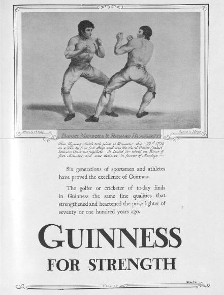
The contest between Daniel Mendoza and Richard Humphreys was still being used as an example of sporting excellence many years later, as shown in this Guinness advert from 1960:

Bethnal Green

The view from Mendoza’s house on Paradise Row must look very different today, with the volume of traffic on the Cambridge Heath Road, but good to see this terrace of houses still standing.

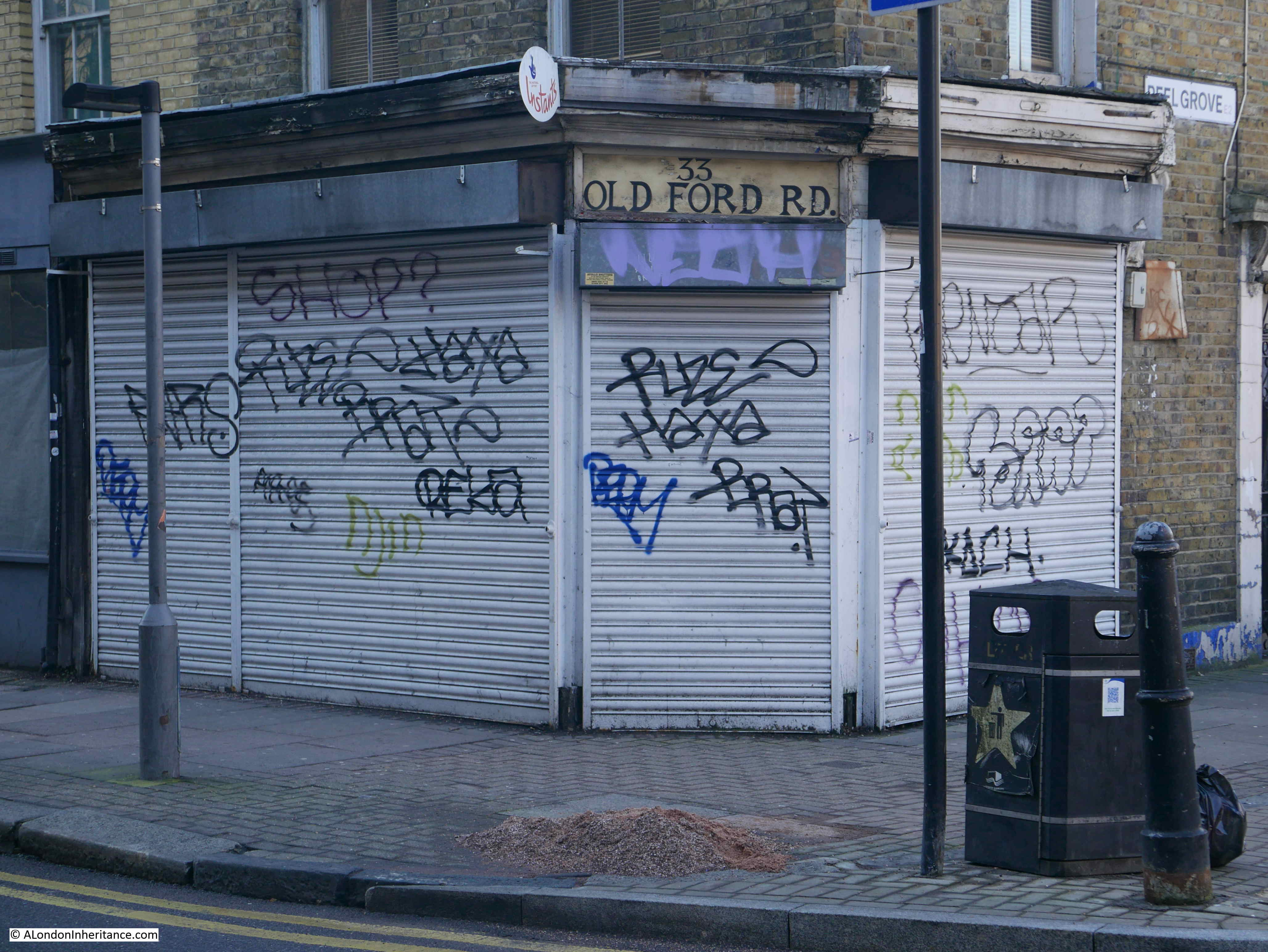
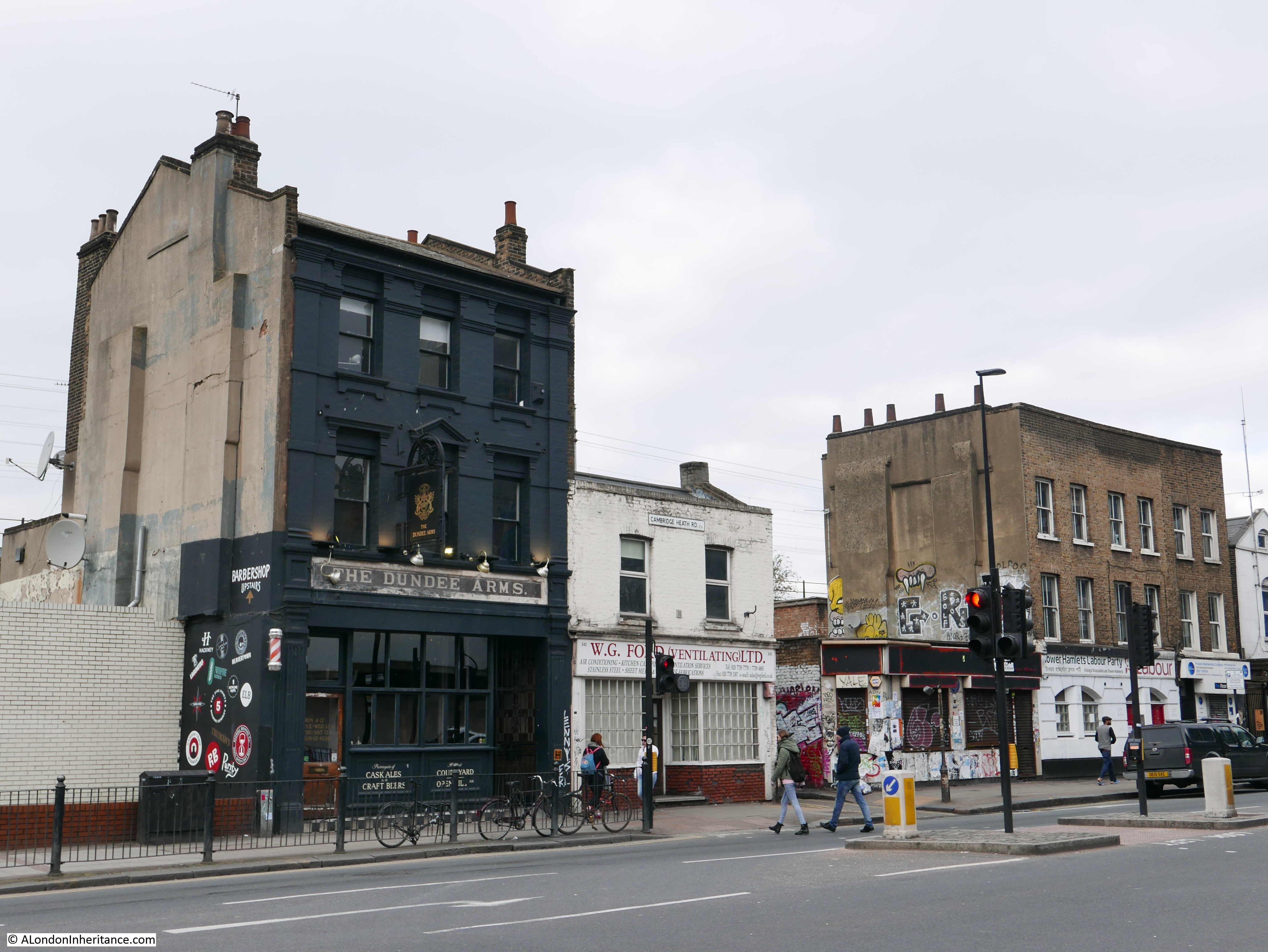
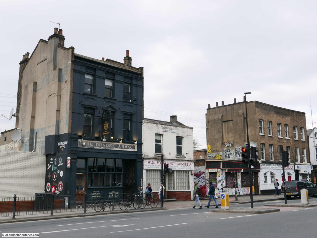
To get to my next location, I walked along the Cambridge Heath Road, passing the V&A Museum of Childhood, then turned into Old Ford Road, opposite this mix of buildings, including the Dundee Arms pub:

Bethnal Green

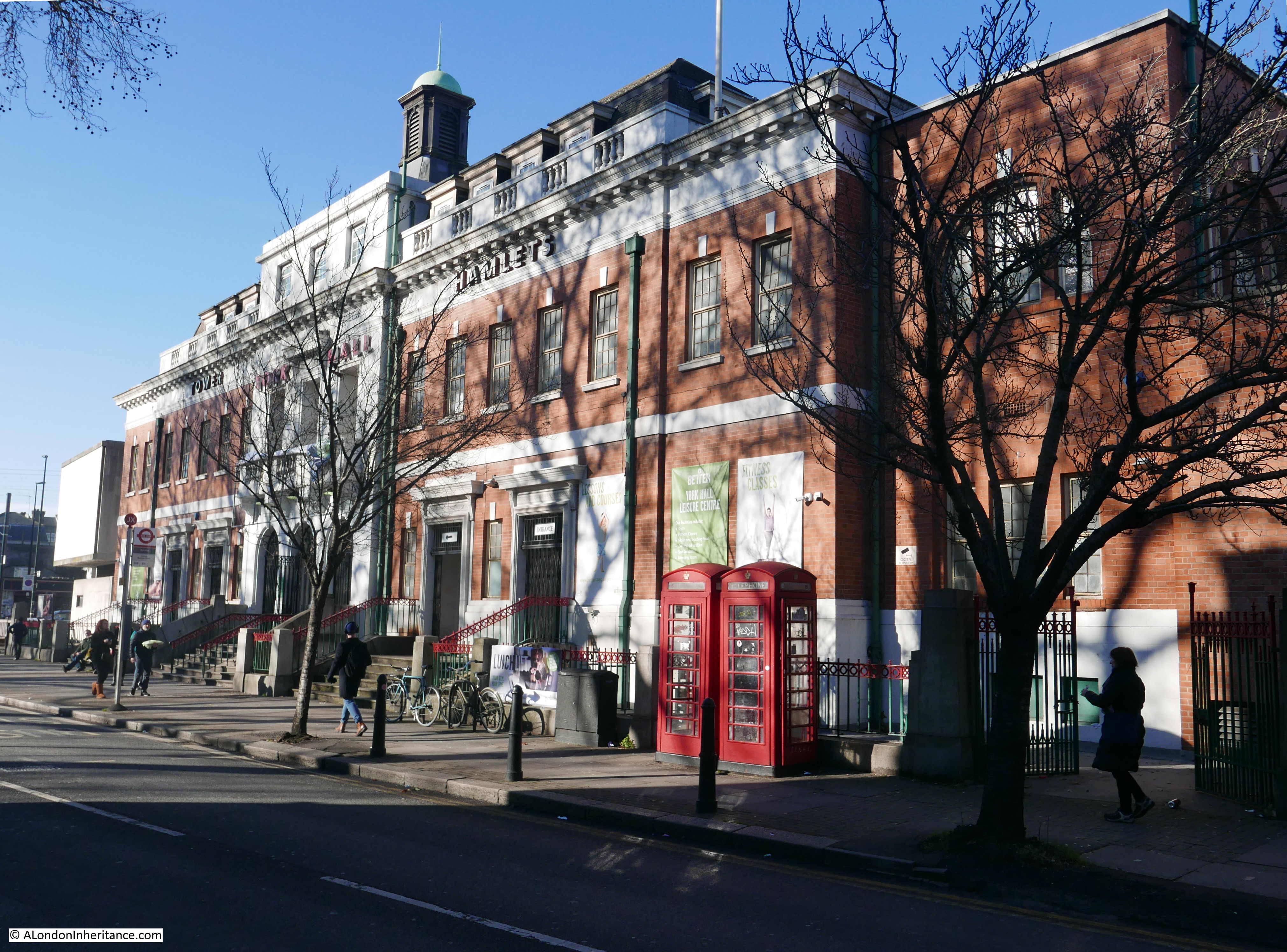
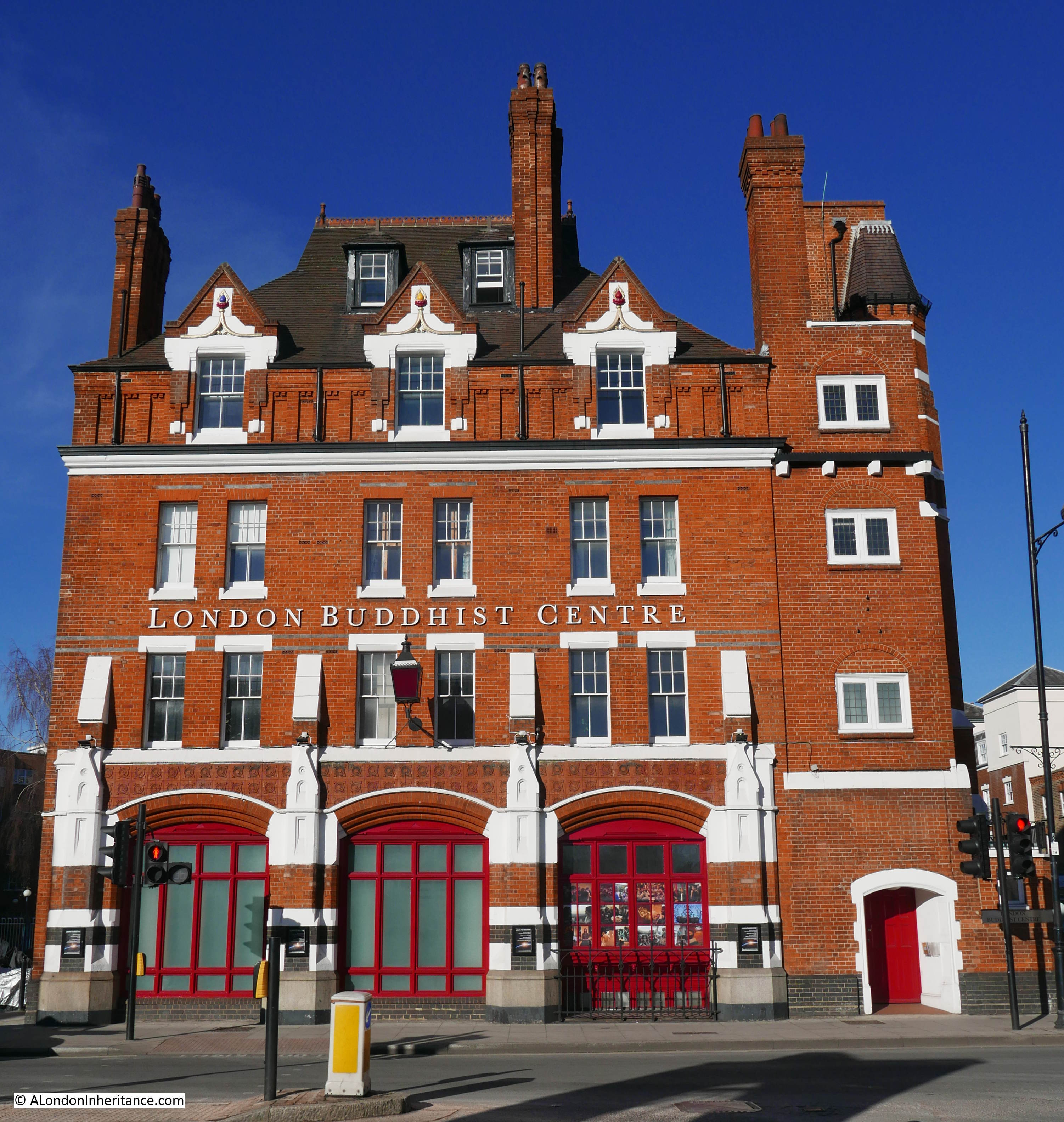
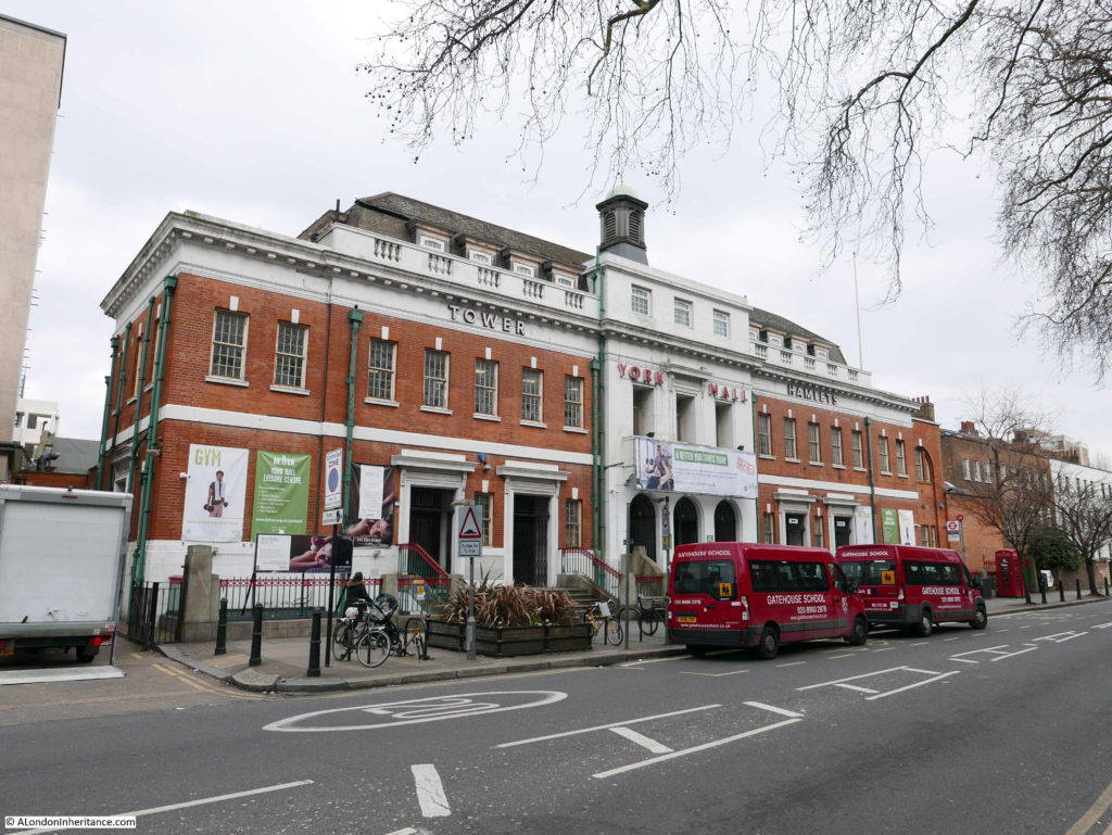
Along Old Ford Road is the York Hall leisure centre, swimming pool and in a link with Daniel Mendoza once one of Europe’s most significant boxing venues:

Bethnal Green

To the right of York Hall was part of my next location:

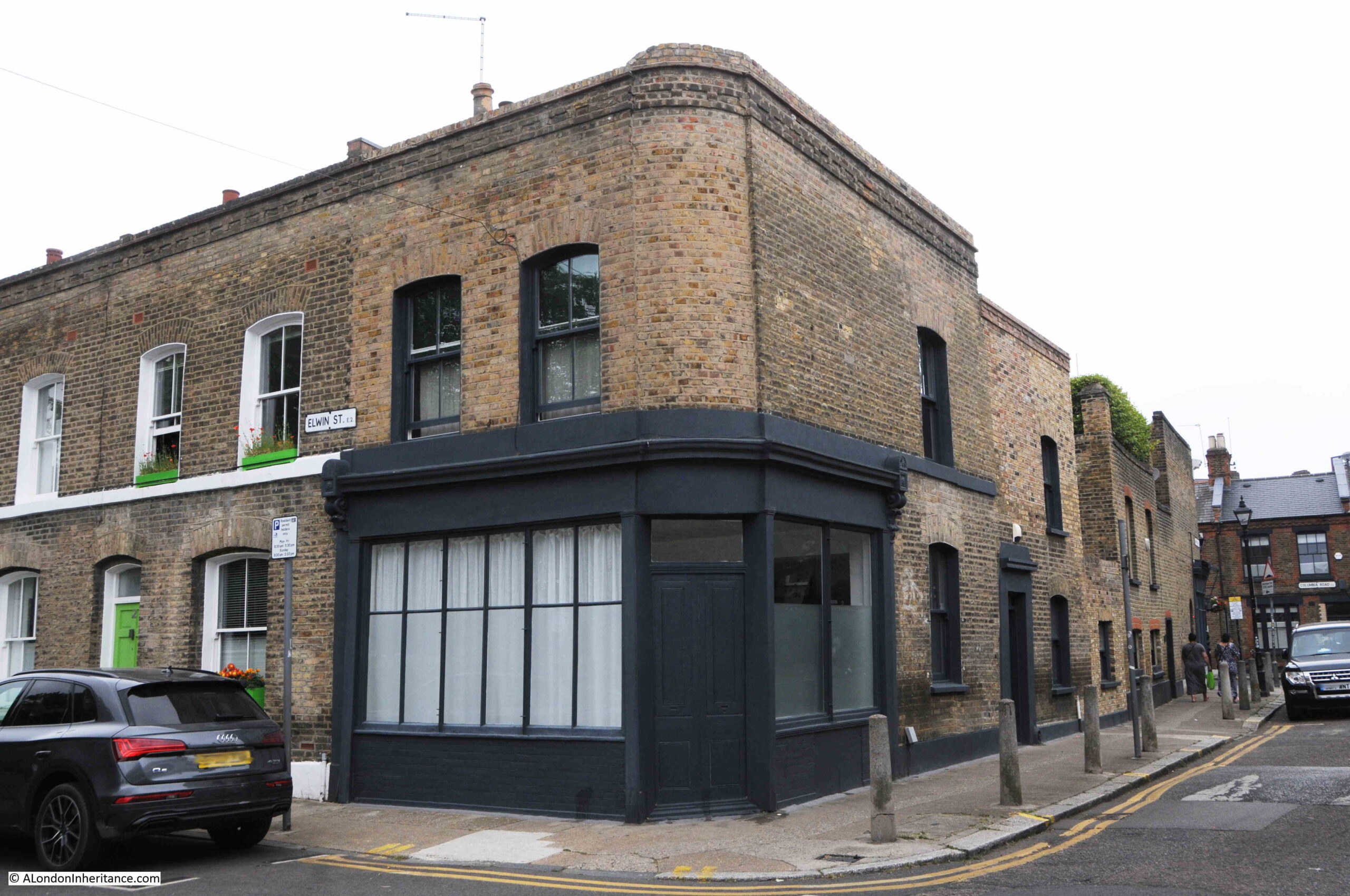
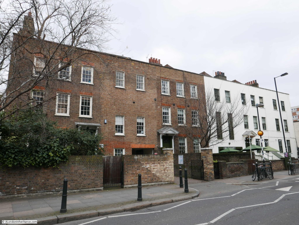
Site 52 – 17th Century Nettleswell House With Adjoining Late 18th Century Terrace: Across Road, Early 18th Century Terrace

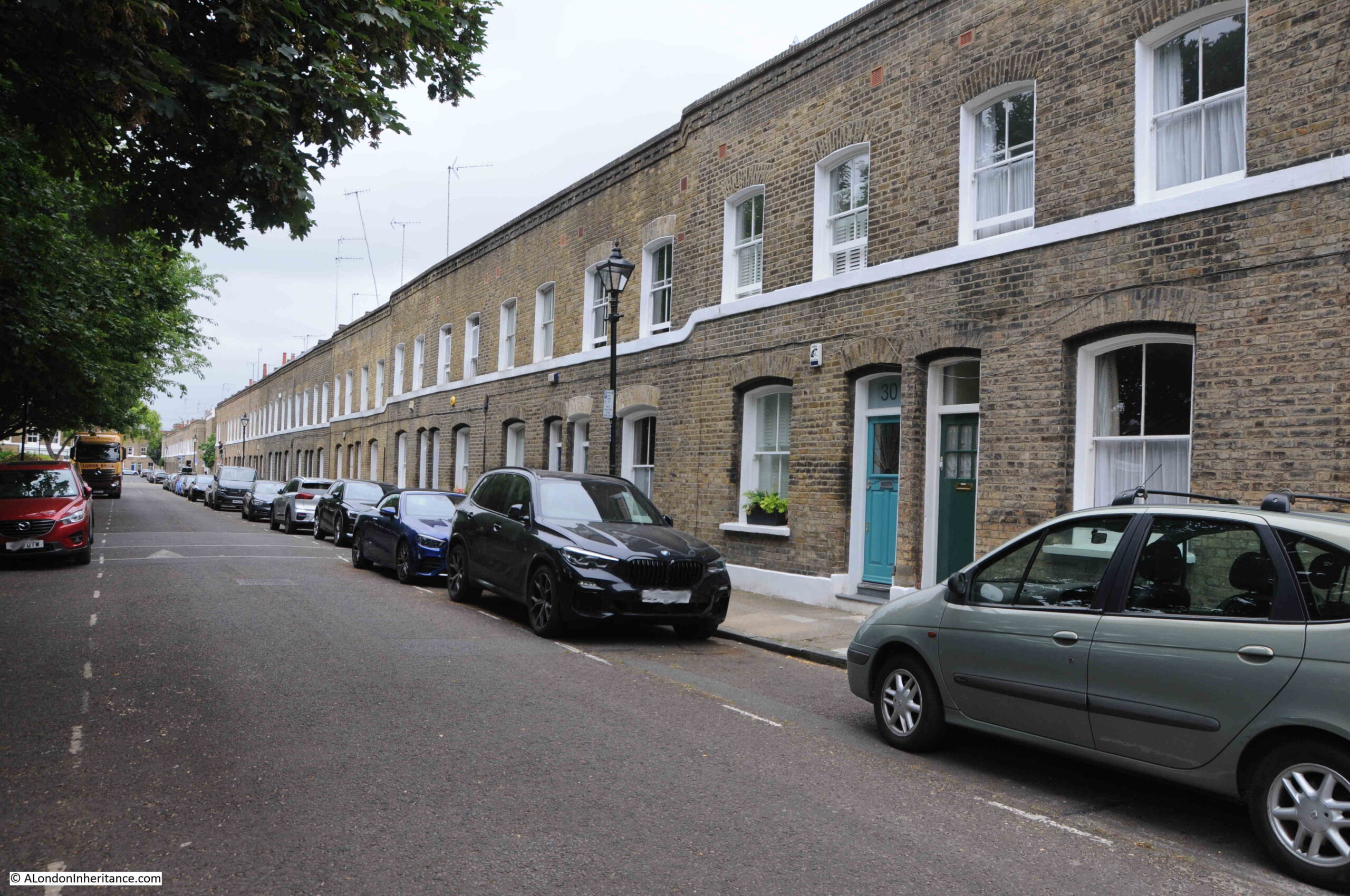
This is the early 18th century terrace, across the road from Nettleswell House on Old Ford Road:

Bethnal Green

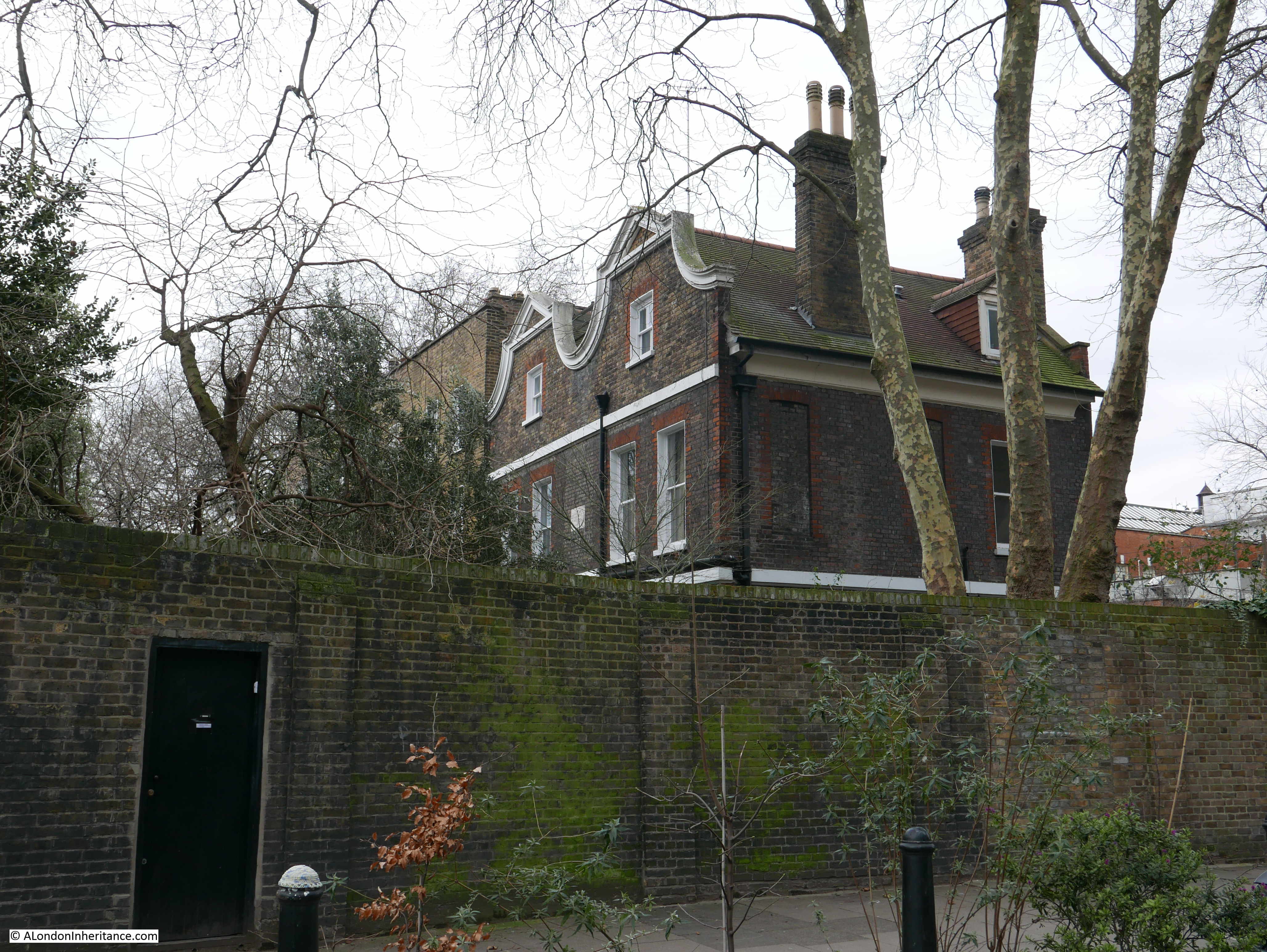
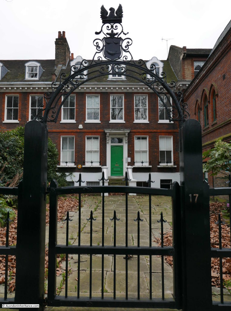
To get a view of Nettleswell House I turned off Old Ford Road into Victoria Park Square. It was difficult to get a good view of the buildings as they are concealed behind a tall brick wall, however they look in fine condition.

Bethnal Green

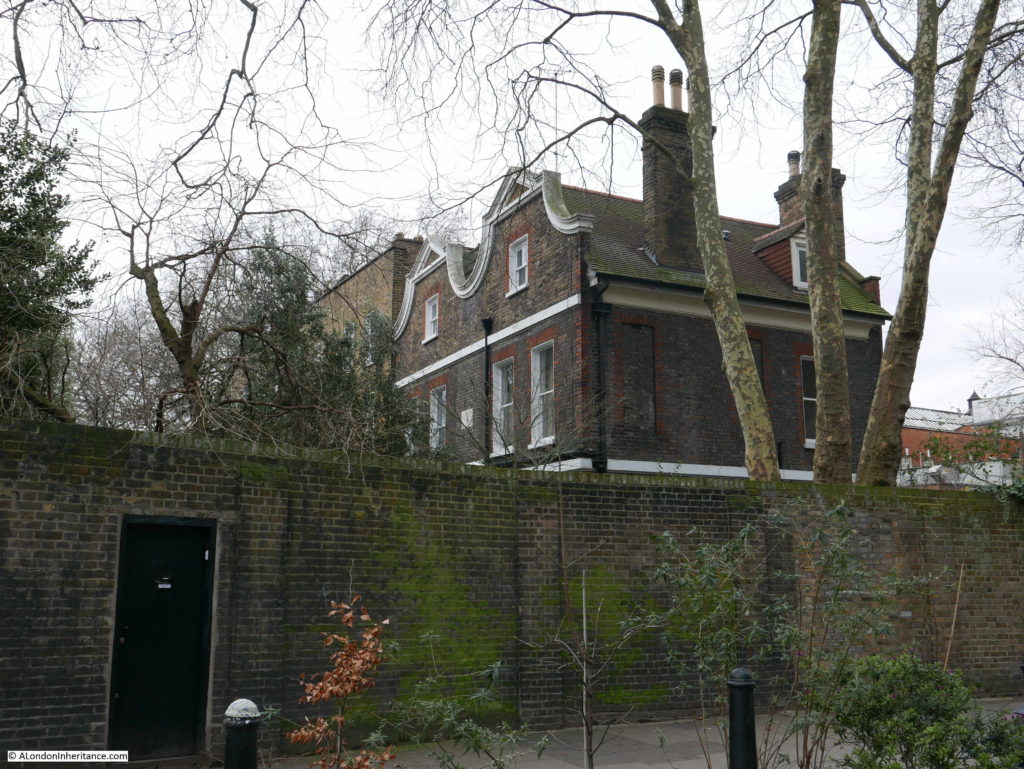
Nettleswell House is a Grade II listed building. The listing states that the building is late 17th century with early 18th century alterations.

There must have been an earlier building on the same site, with the same name as the listing also records what is on the plaque, just visible on the house in the above photo “Netteswell House – AD1553 – Remodelled 1705 and 1862″

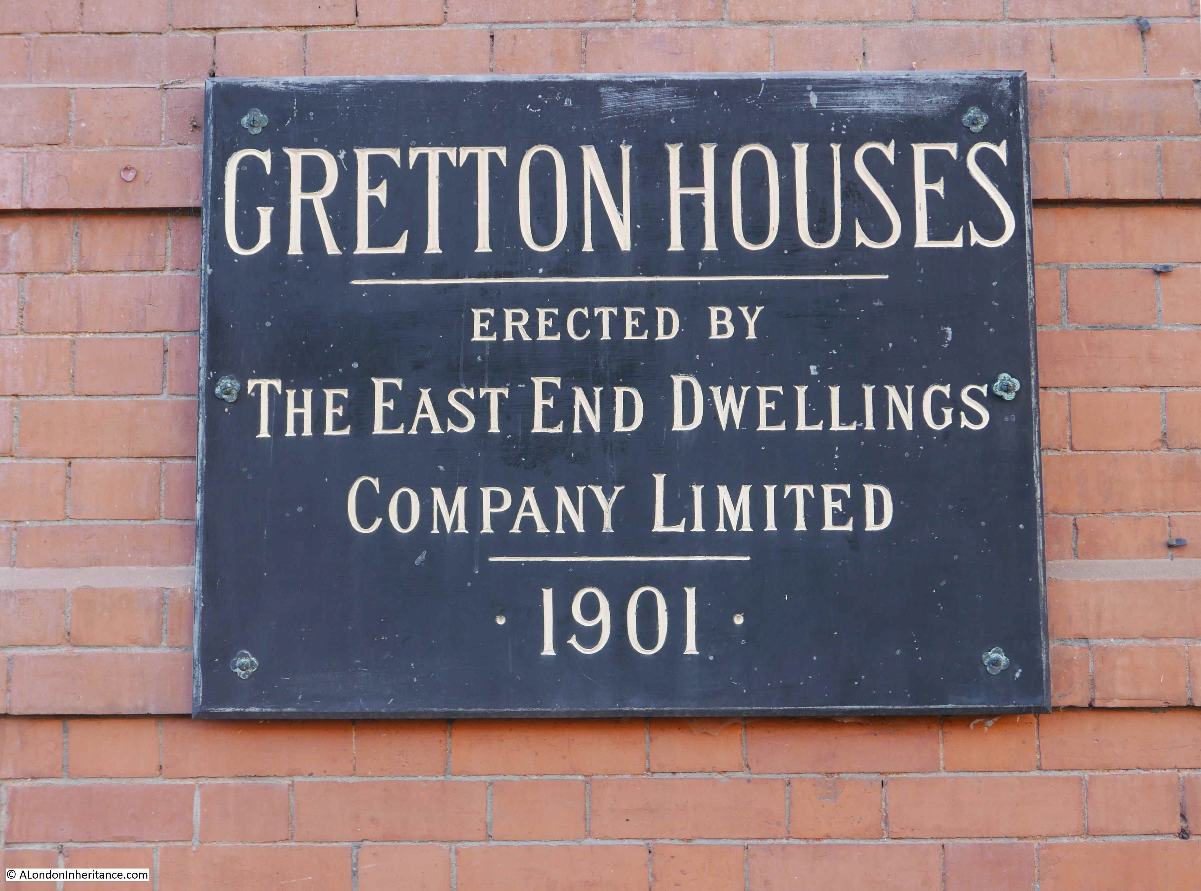
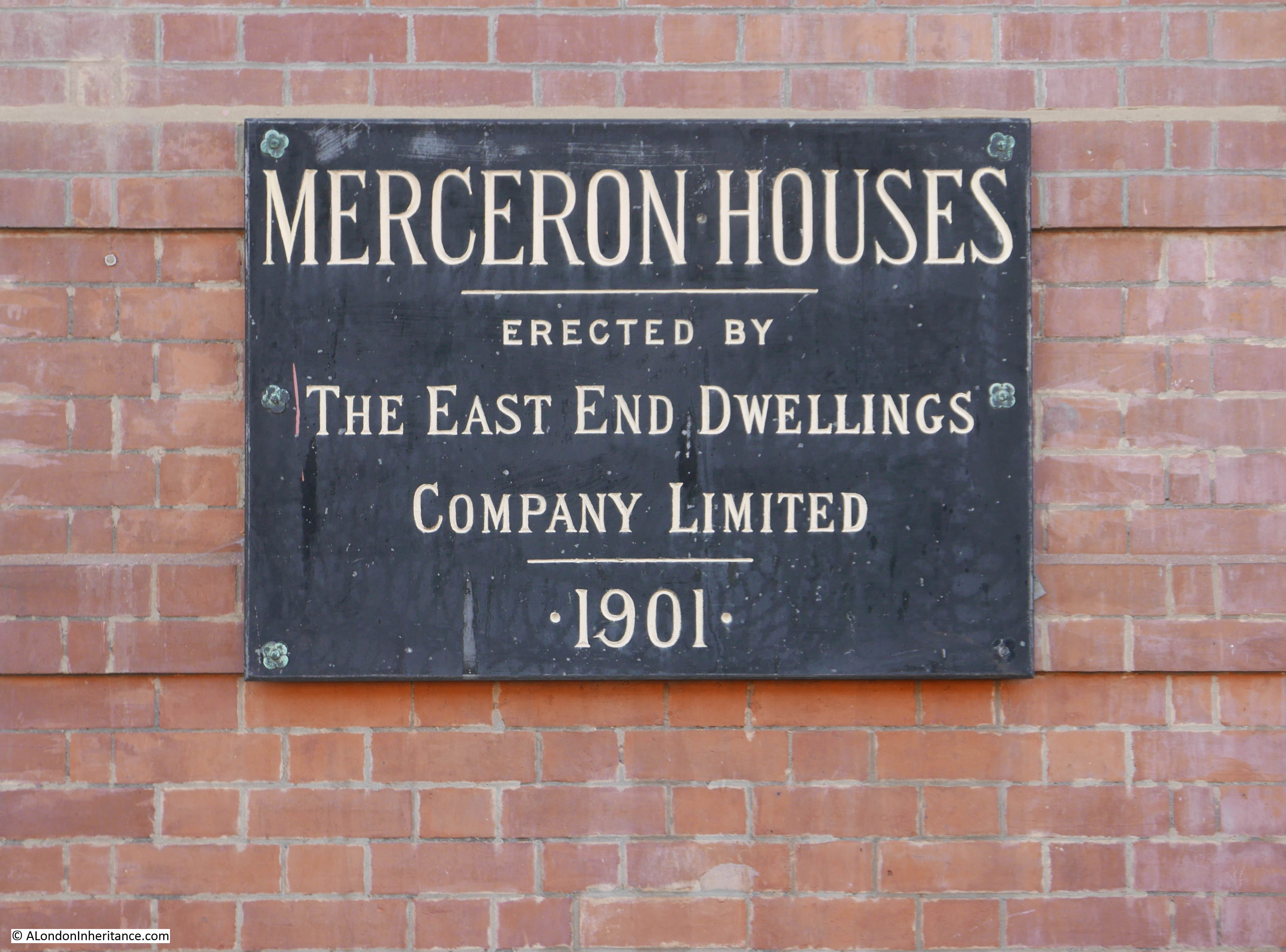
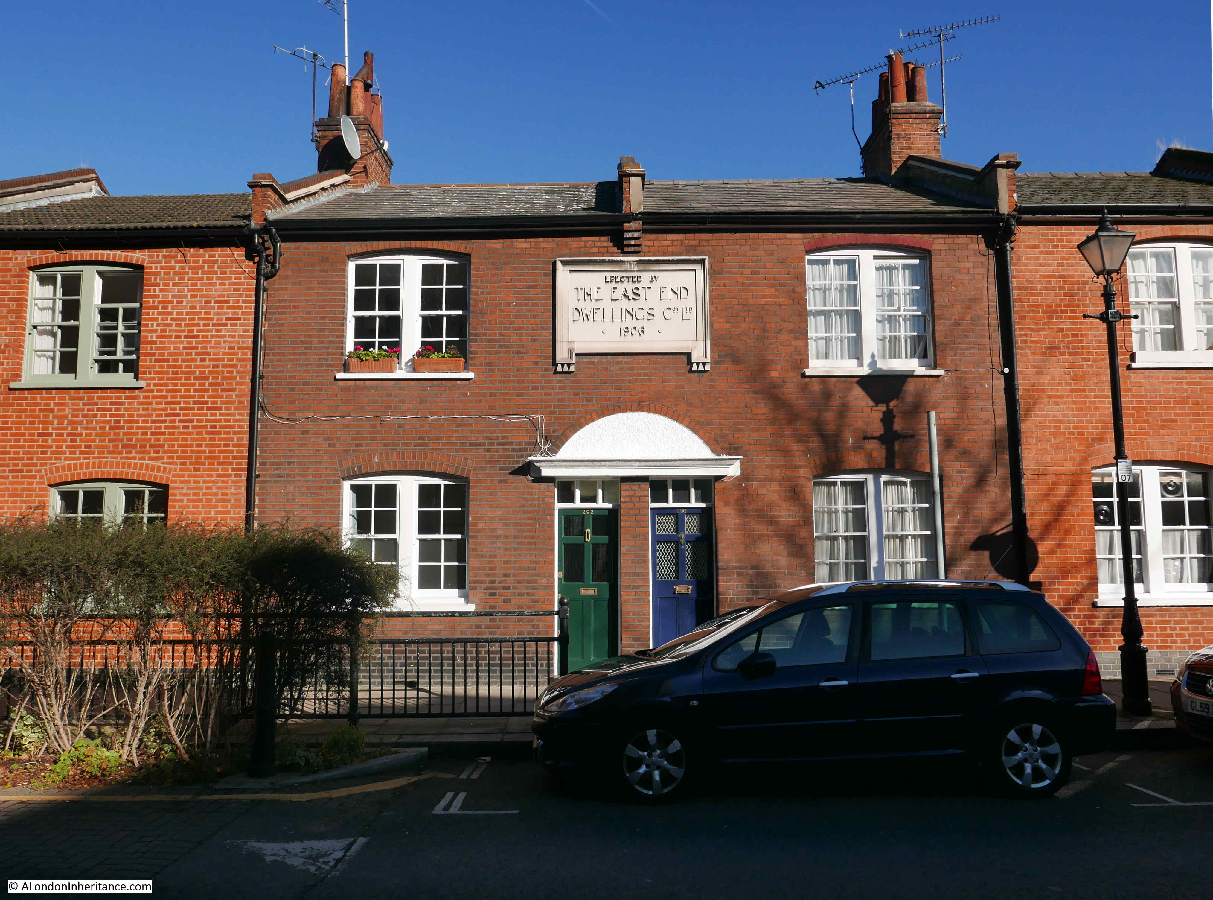
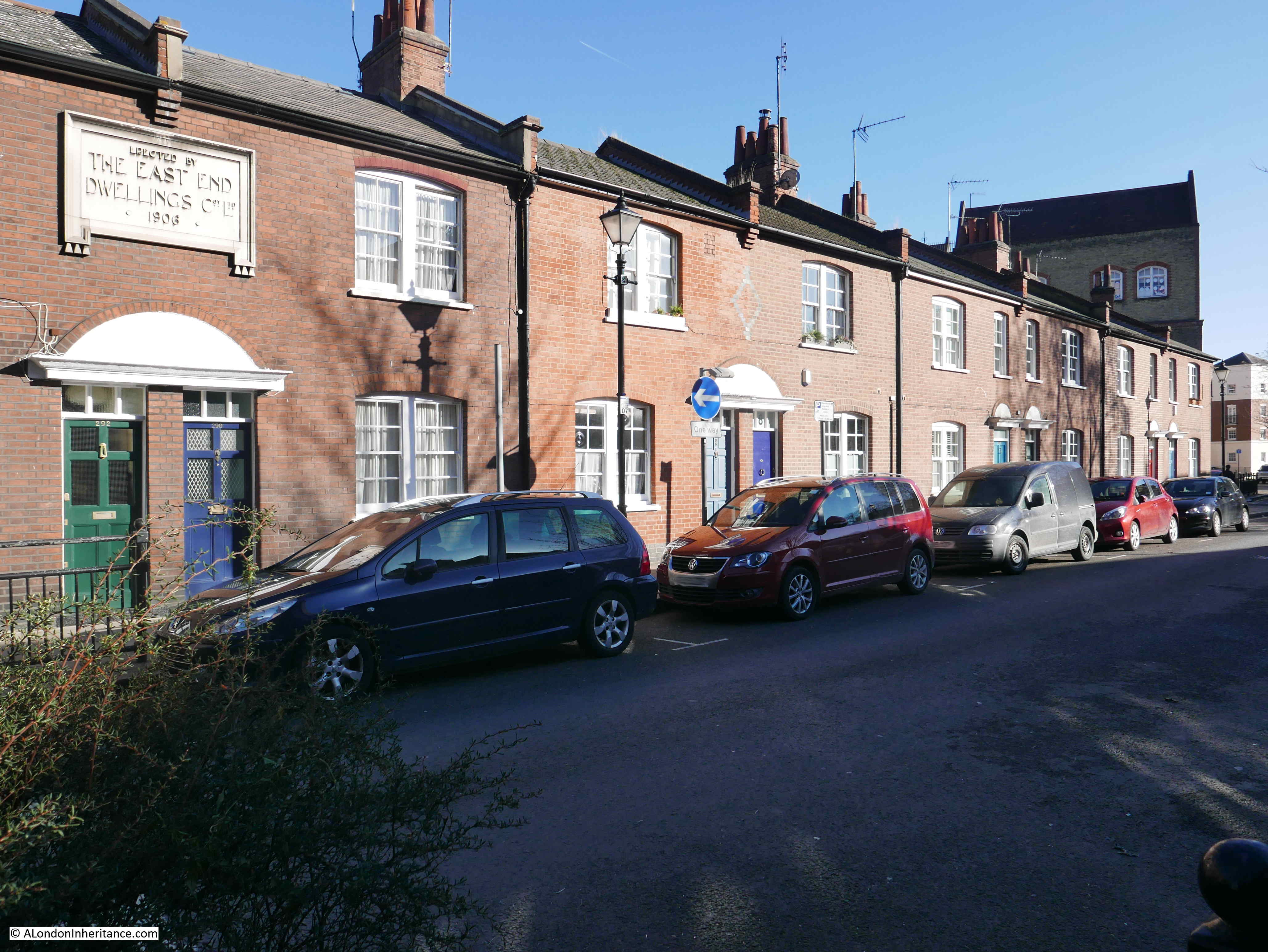
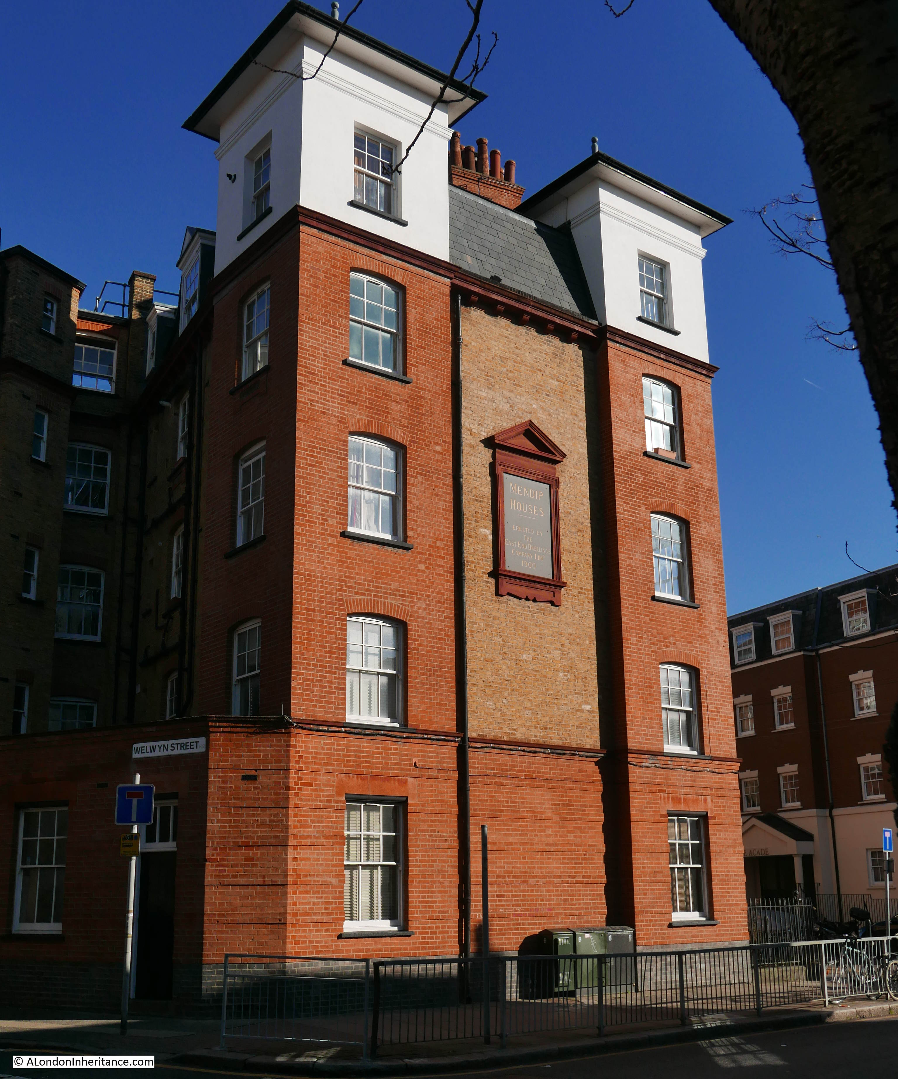
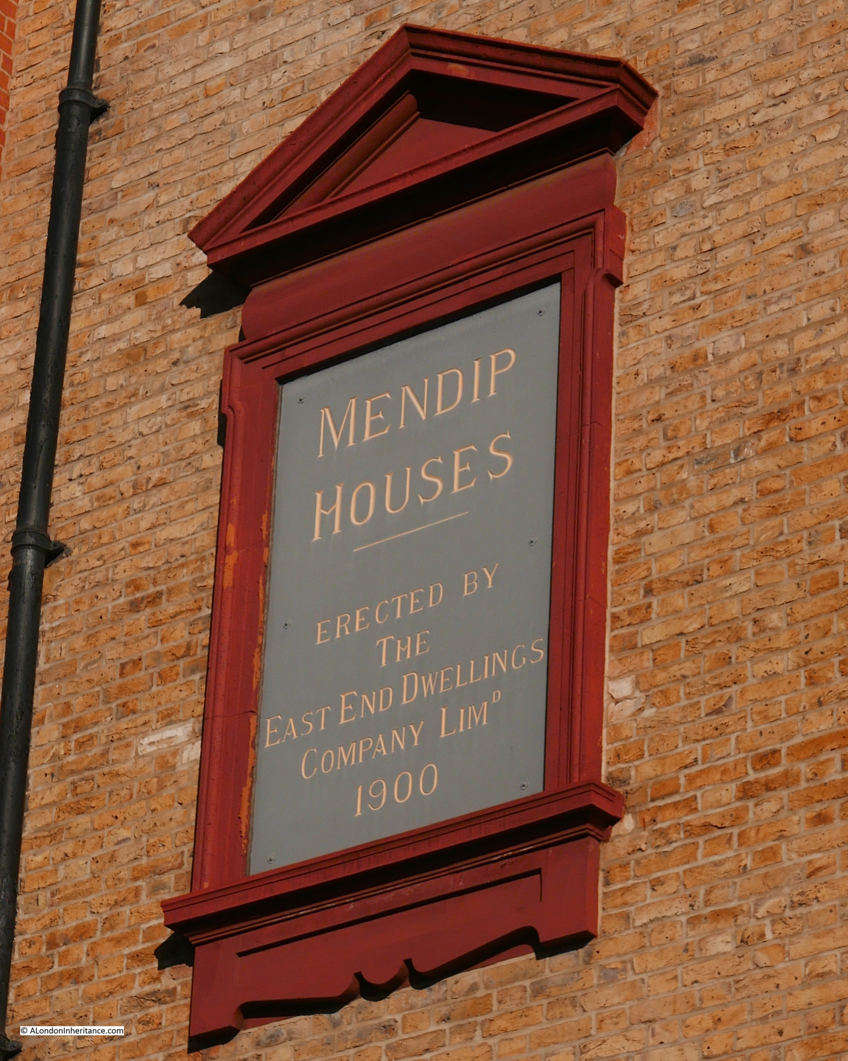
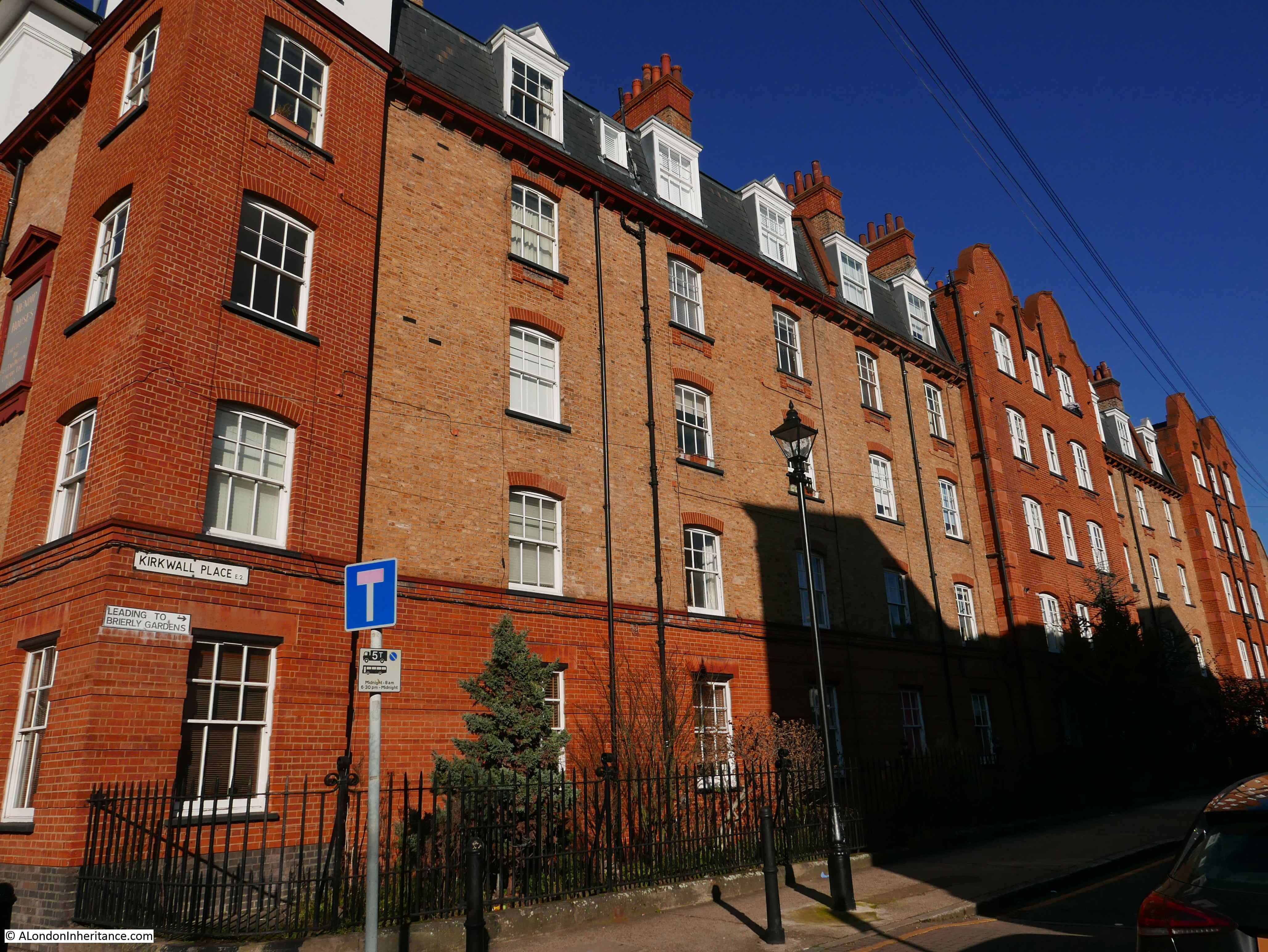
In my post on “New Deal For East London – Stepney Green” I found one of the buildings built by the East End Dwellings Company – Dunstan House on Stepney Green. Walking along Victoria Park Square I found another. Montford House was built by the company in 1901, two years after the Stepney Green building.

Bethnal Green

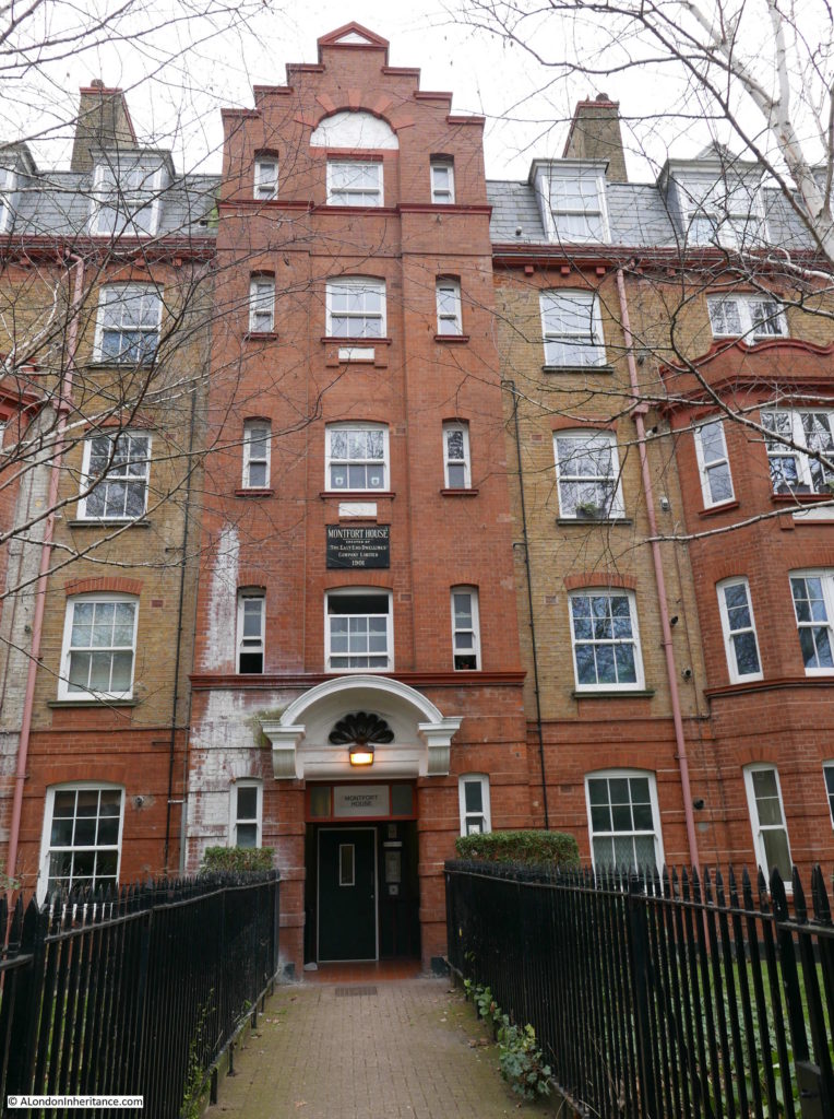
The name apparently is a reference to Simon de Montford and there are stories that he was blinded at the Battle of Evesham 1265 and became a beggar in Bethnal Green (the same story is sometimes given as the source of the name of the Blind Beggar pub).

In reality, Simon de Montfort was killed at the Battle of Evesham and was buried at Evesham Abbey, along with Henry, one of his sons. His other son, also called Simon did arrive in Evesham, but too late to help the cause of his father. He later escaped to France.

There are a good number of the buildings of the East London Dwellings Company remaining.  One of my ever growing list of projects is to map and photograph all their buildings.

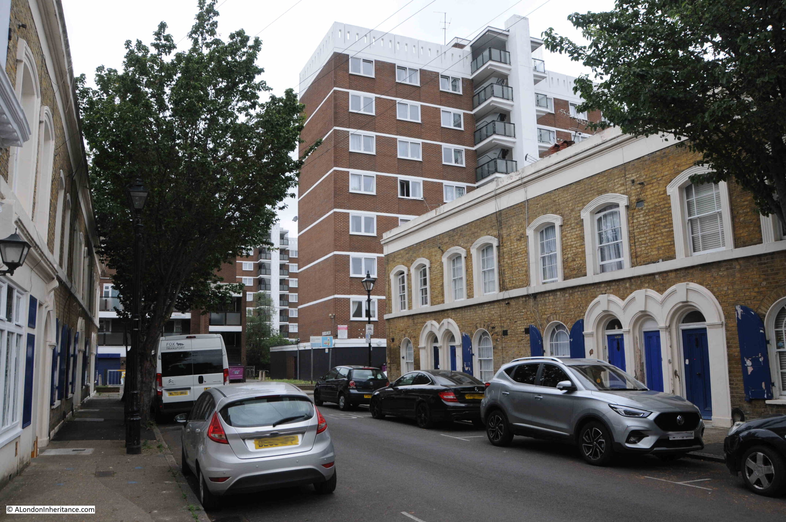
Further along Victoria Park Square, I found my next location:

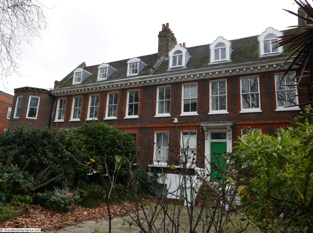
Site 51 – 1700 Group Behind Gardens

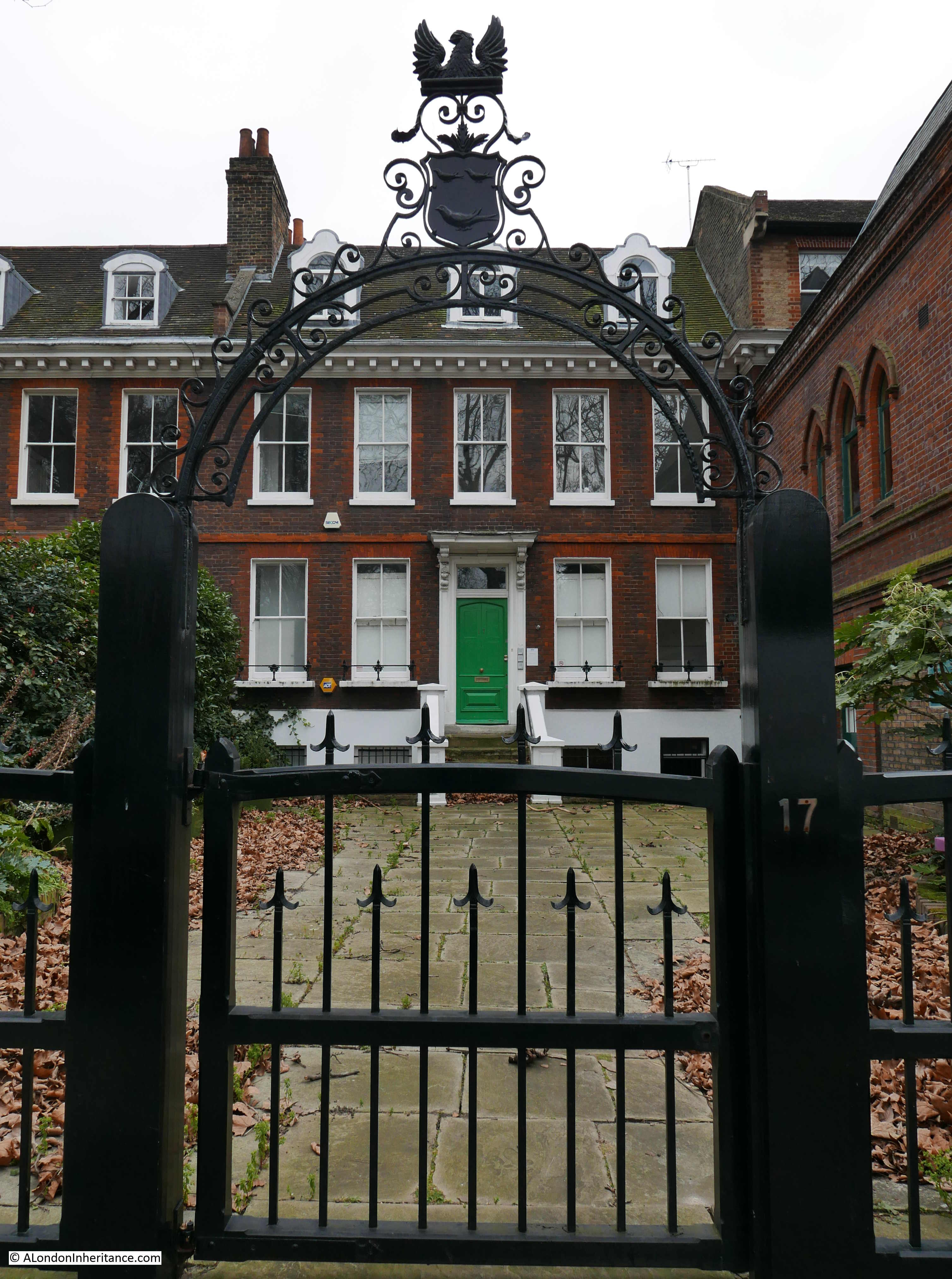
Along one side of Victoria Park Square is a magnificent group of buildings, all in good repair, and as indicated by the Architects’ Journal title for these buildings, they all stand back from the street, separated by a good sized front garden.

Some include some rather ornate ironwork between street and garden:

Bethnal Green

The terrace:

Bethnal Green

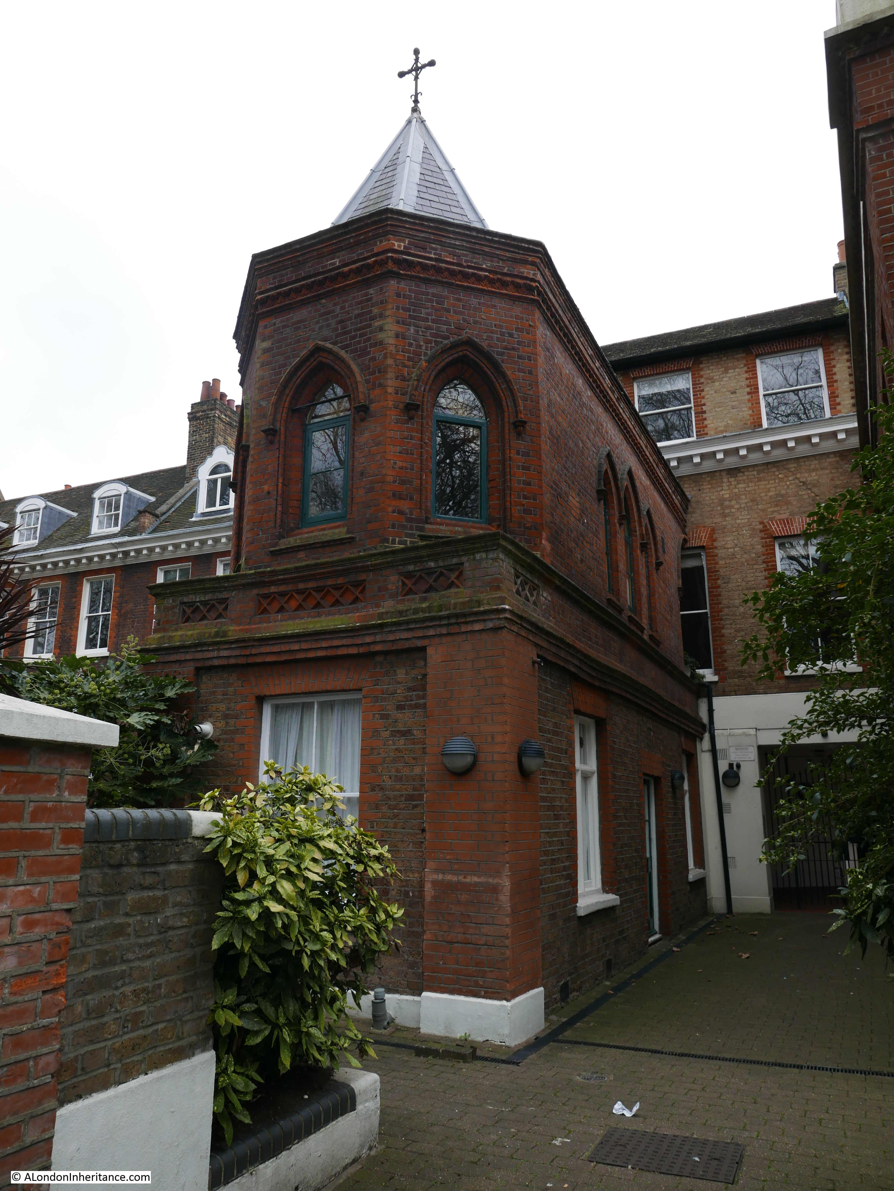
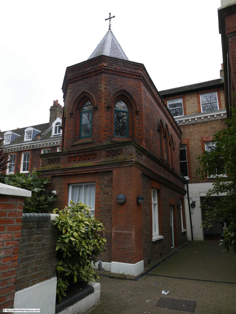
There is some fascinating architecture along this one street, including what looks to have once been a private chapel built as a rather strange extension to the house behind:

Bethnal Green

Finding this terrace was the last of four locations in Bethnal Green. I then walked down to Stepney, so to complete the post, here are some of the buildings to be found on the route from Bethnal Green to Mile End Road, along Cambridge Heath Road.

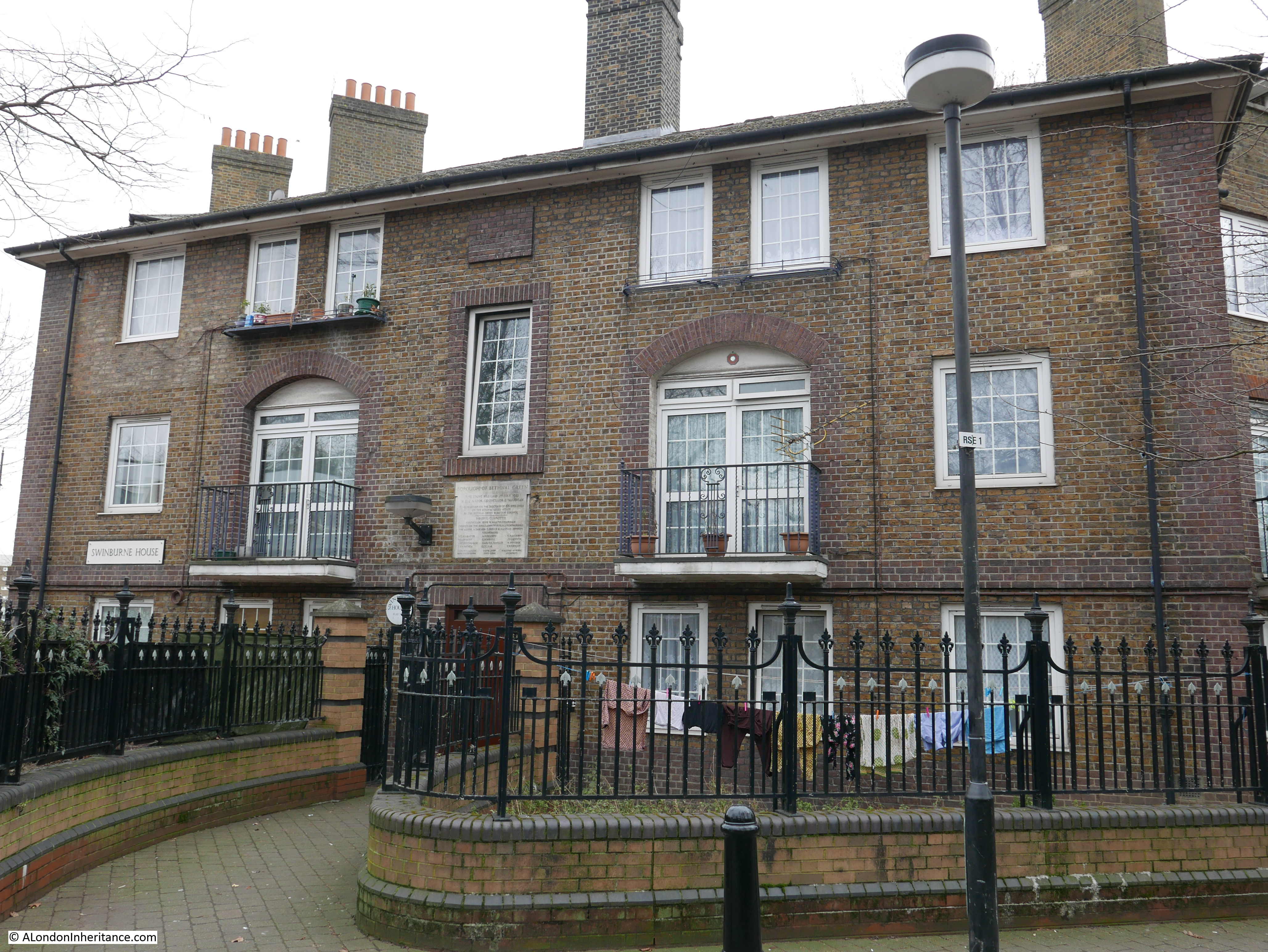
This building is along Roman Road, alongside Bethnal Green Gardens.

Bethnal Green

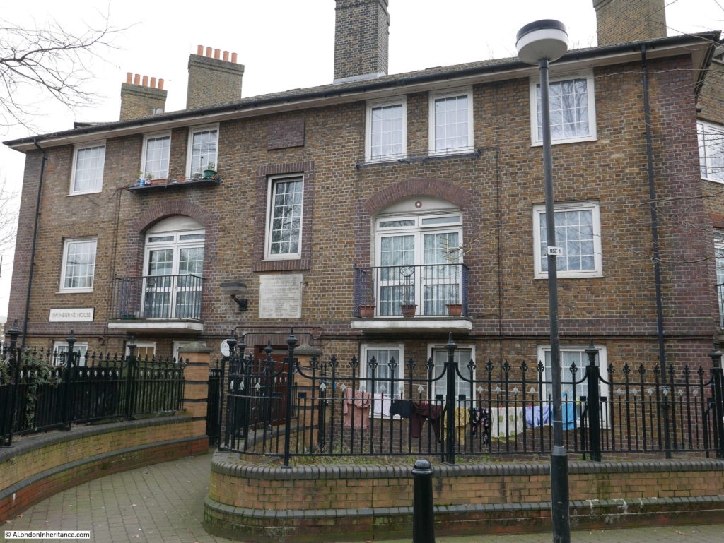
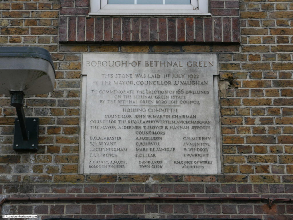
The building is Swinburne House and it demonstrates the change during the early decades of the 20th century from housing built by philanthropic organisations such as the East End Dwellings Company to council built properties.

A stone on the front of the building records that the stone was laid on the 1st July 1922 to commemorate the erection of 166 dwellings by Bethnal Green Borough Council. The names of the housing committee are also recorded.

Bethnal Green

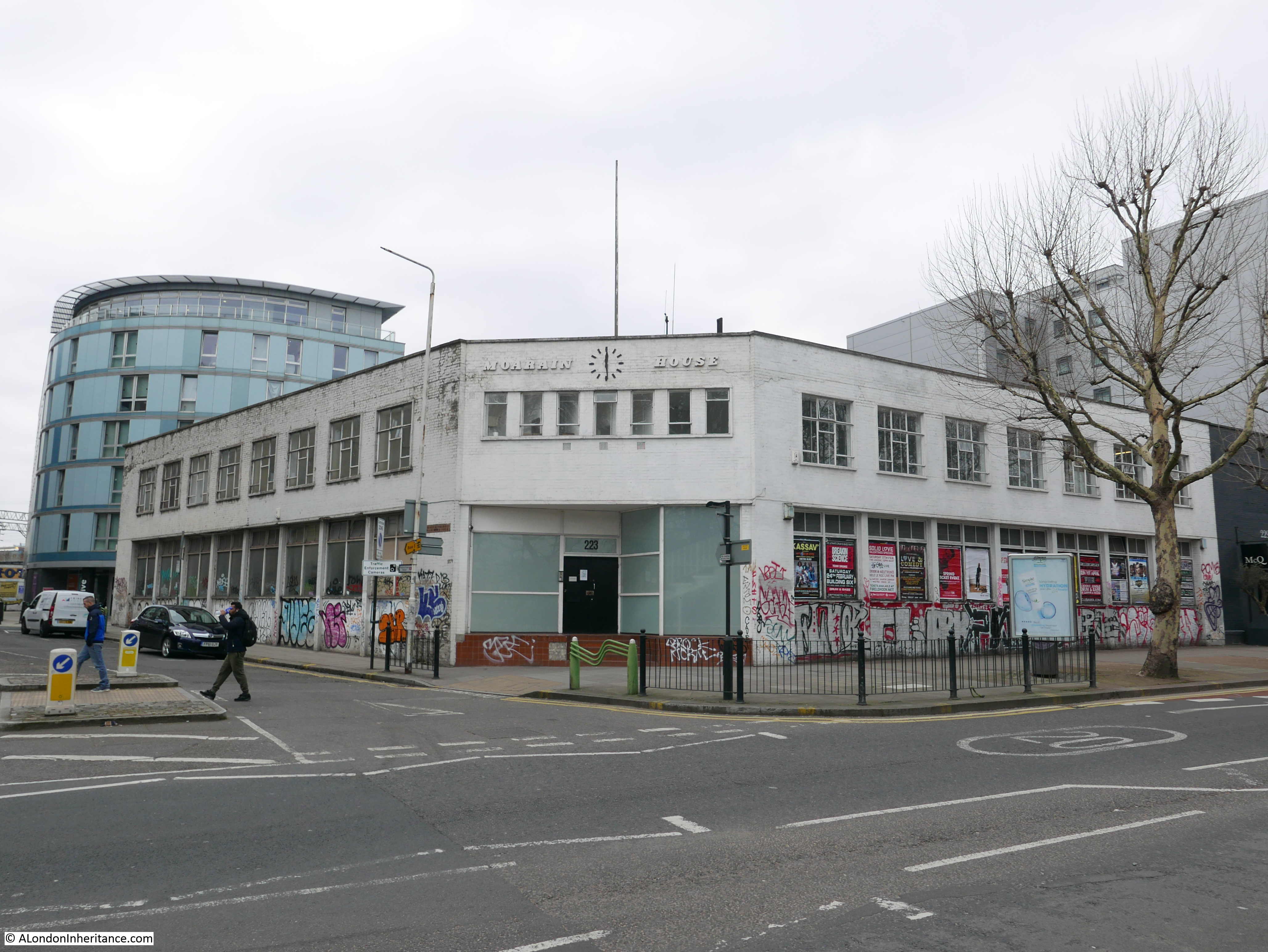
Along Cambridge Heath Road is this closed factory building, Moarain House:

Bethnal Green

I believe that this was the factory of umbrella manufacturers Solomon Schaverien. Many of their umbrellas include a label with the name Moarain on the inside of the umbrella.

I would not be surprised if the factory was replaced by an apartment building in the next few years.

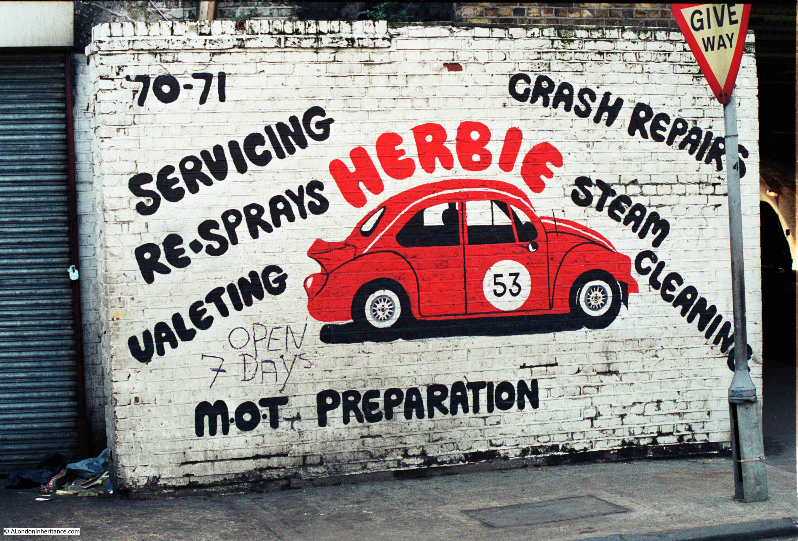
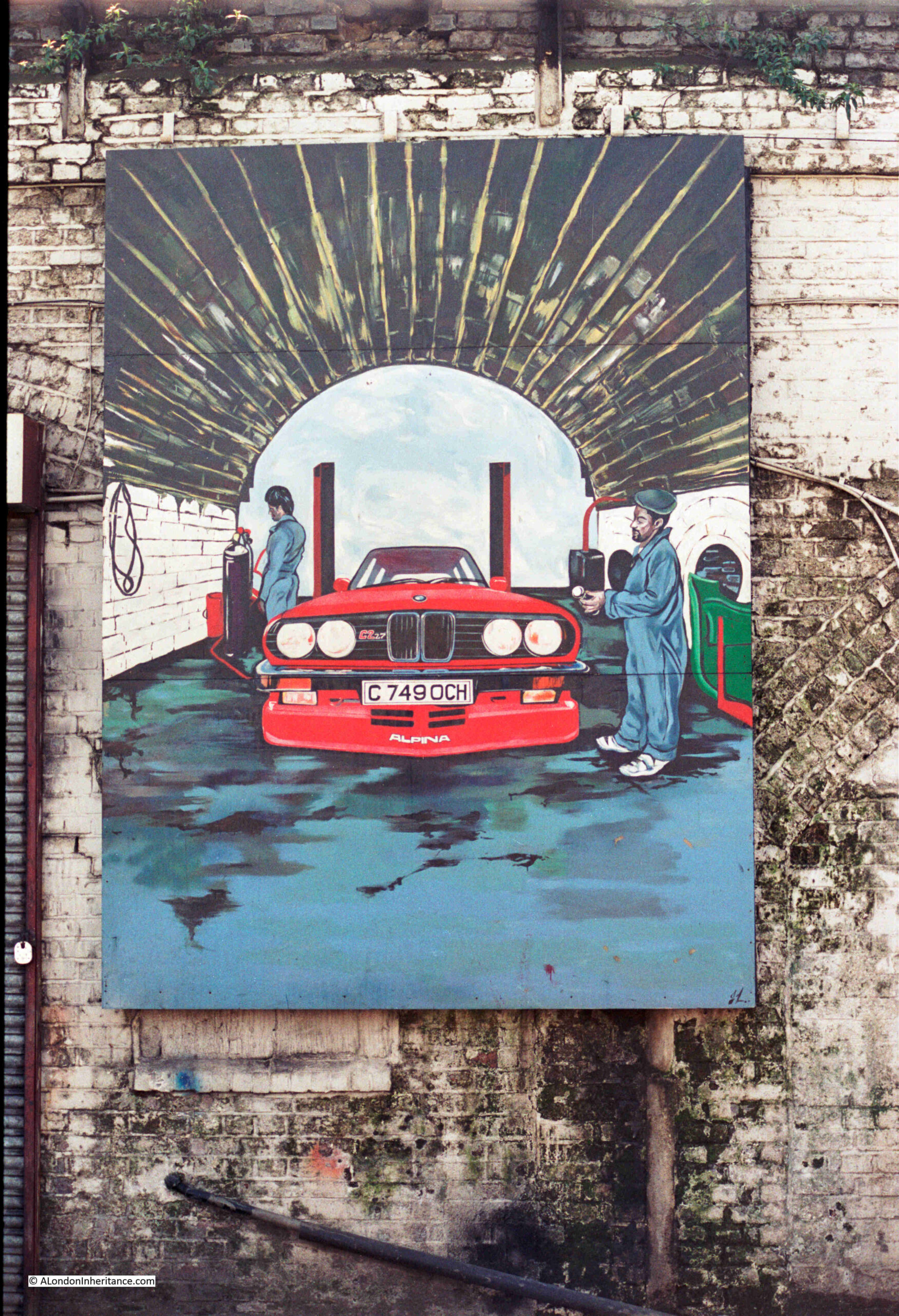
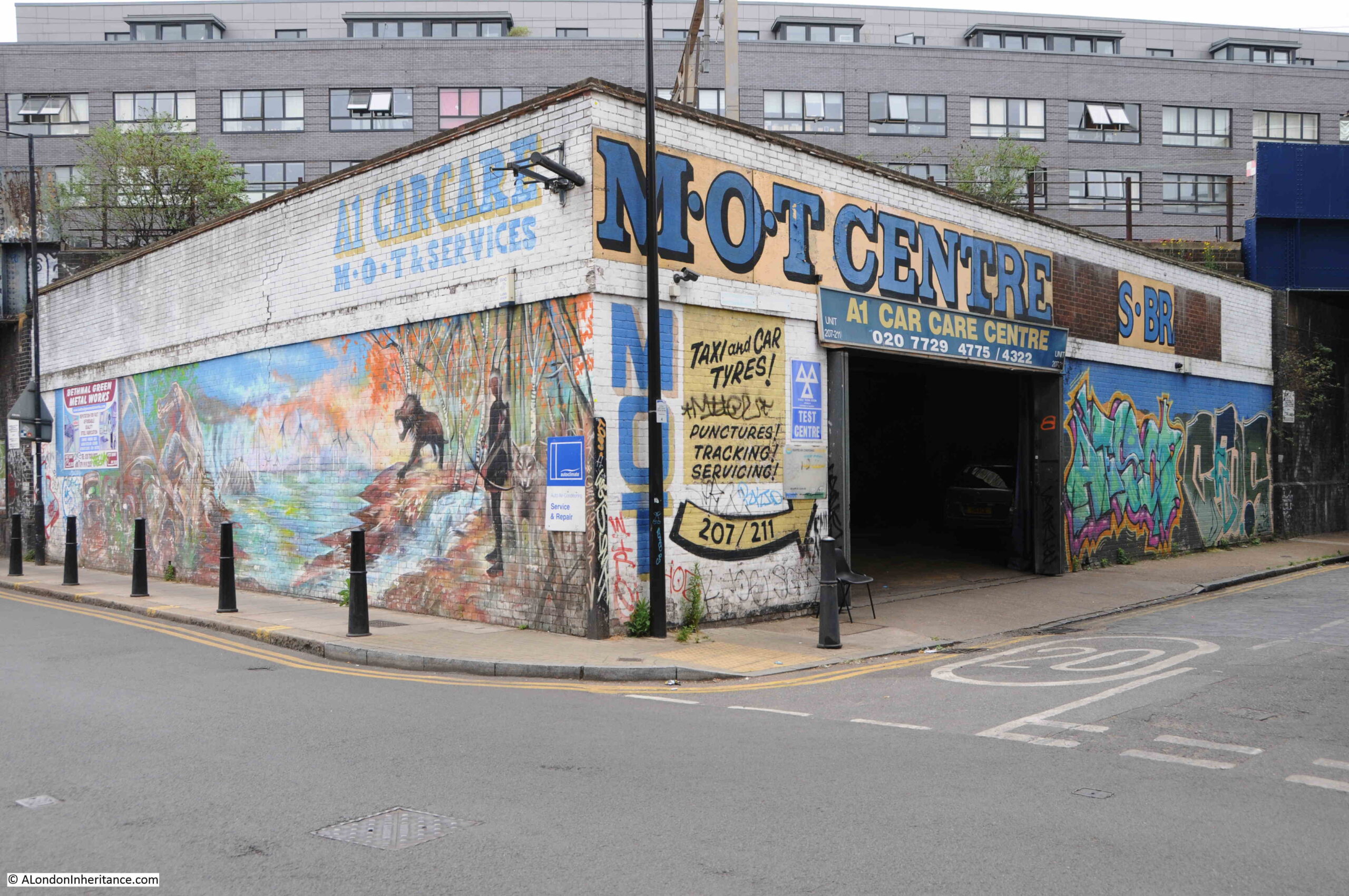
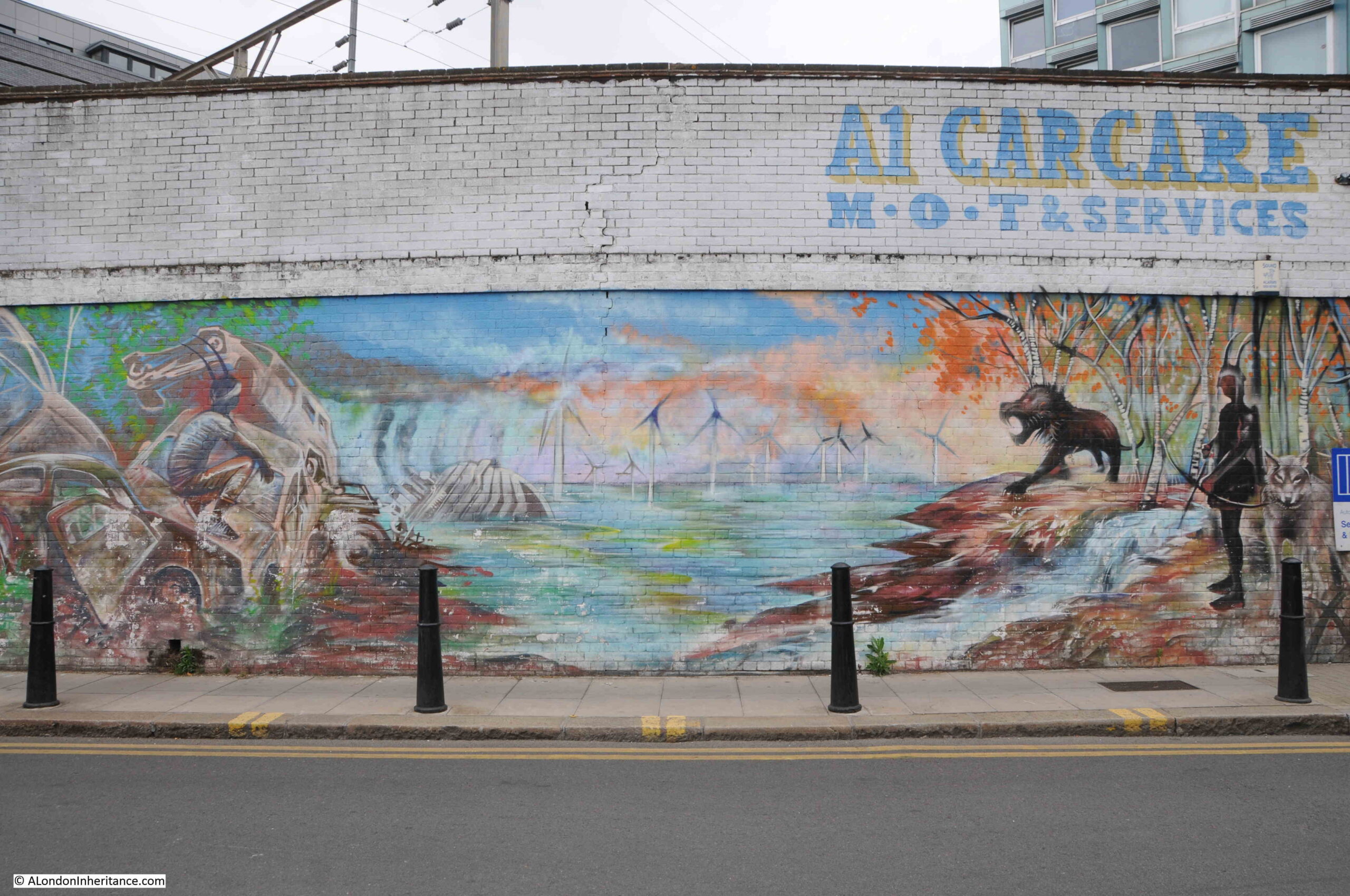
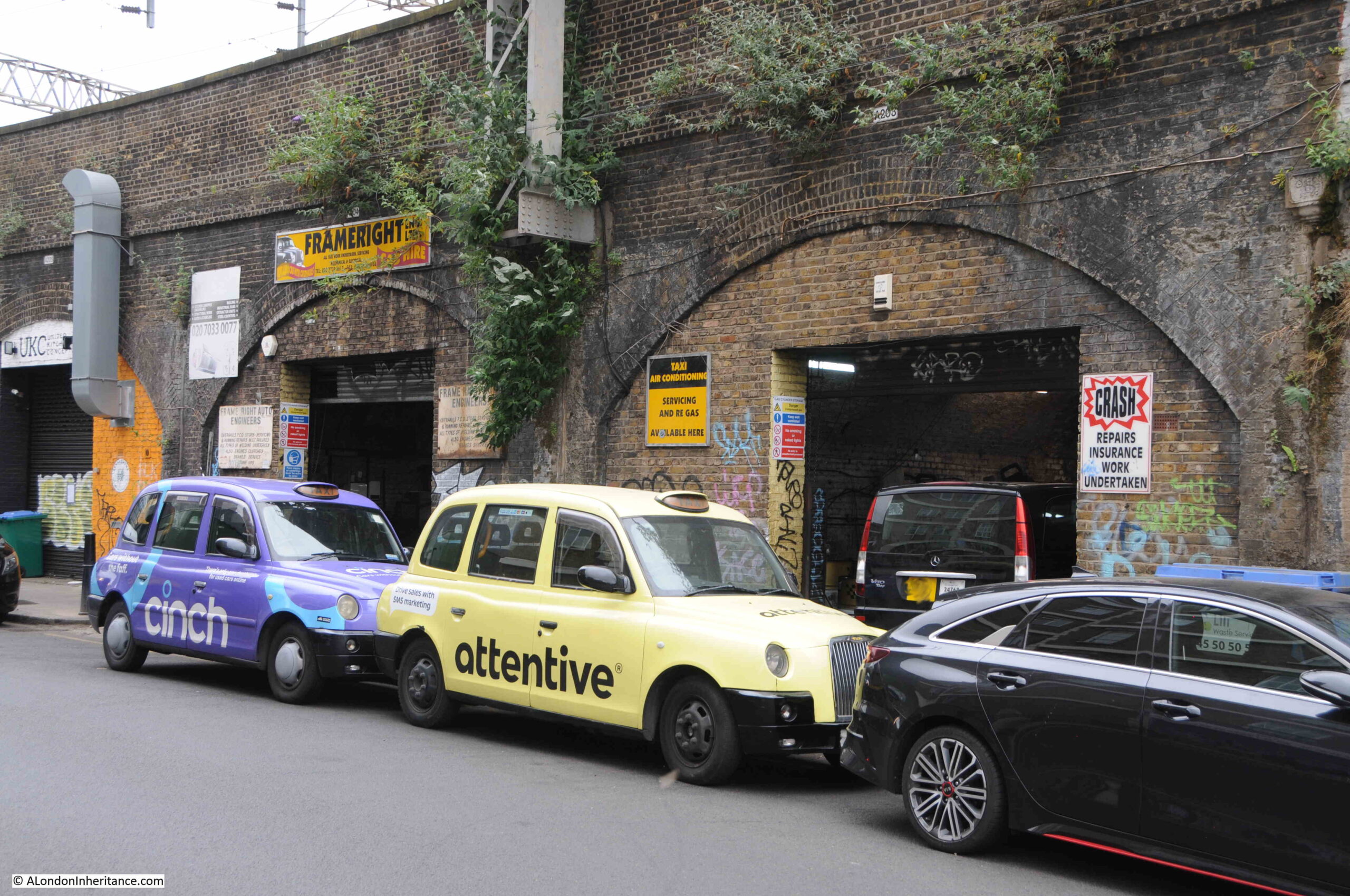
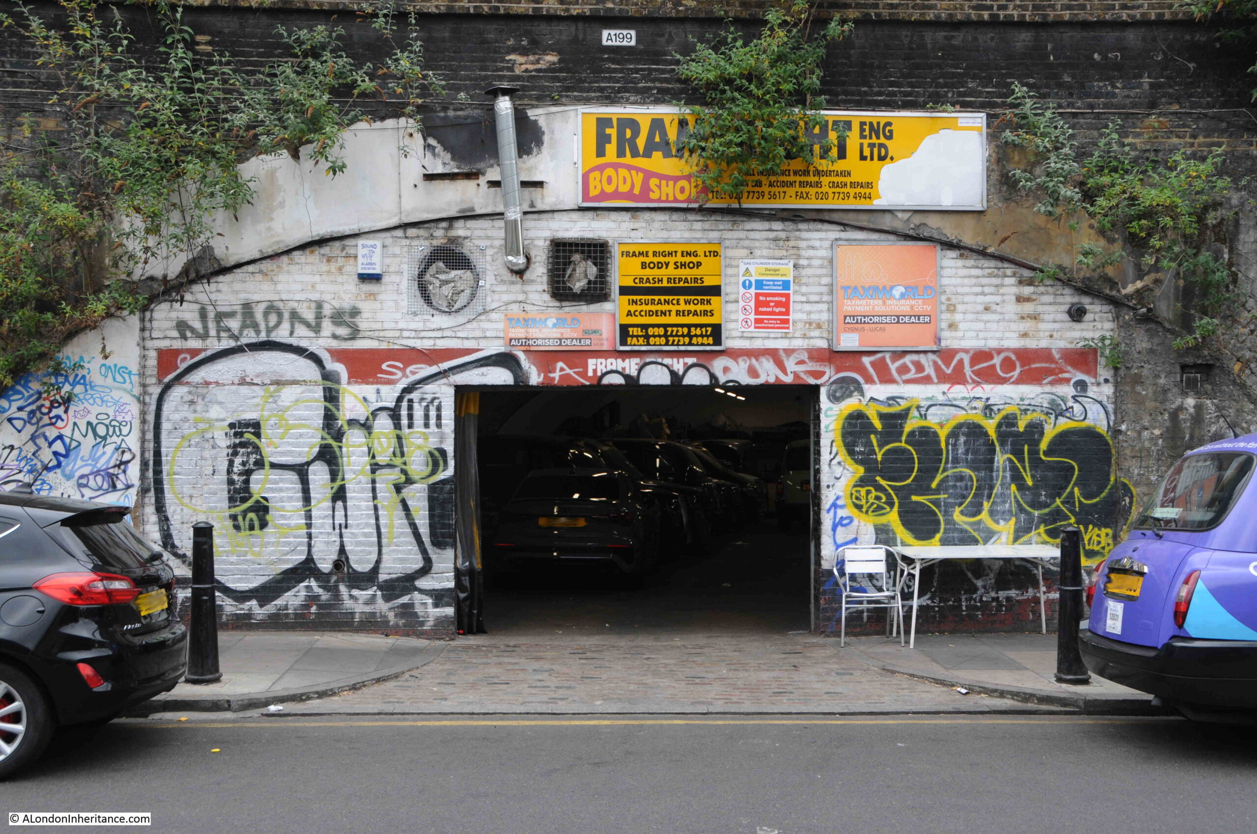
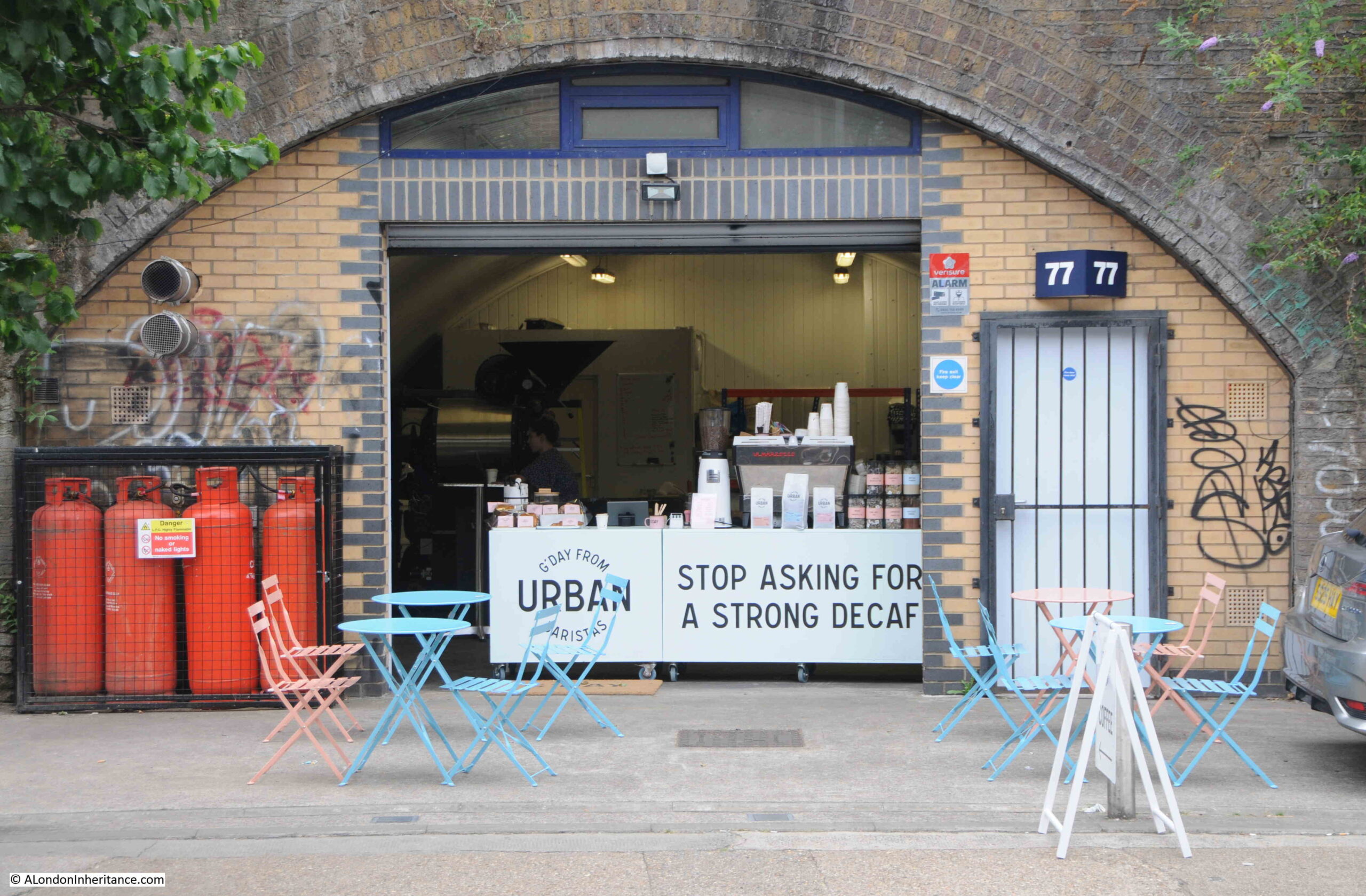
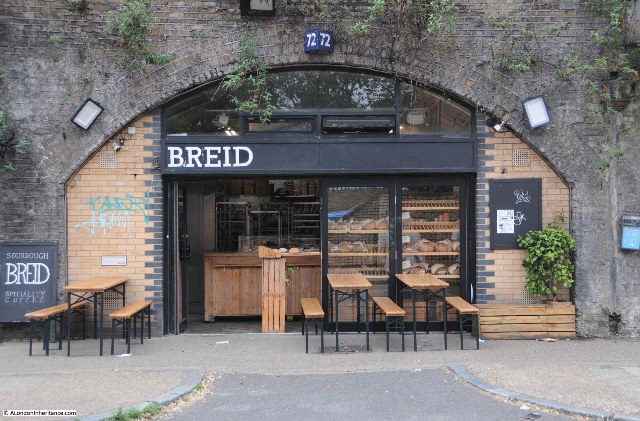
Just after Moarain House, the railway from Liverpool Street Station crosses Cambridge Heath Road. All the railway arches along Malcolm Place have been closed off, and the typical businesses that normally occupy railway arches (car wash, car repair, tyres, light manufacturing etc.) have all moved out.

Bethnal Green

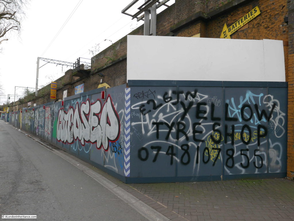
Network Rail are planning to redevelop these arches and the application for planning permission submitted to Tower Hamlets Council shows a row of arches with glazed brick for the piers, glass and stainless steel fascia – very different to the arches as they are now.

The proposed use of the arches are as a cafe, restaurant, drinking establishment, retail, light industrial and warehousing. No doubt increasing revenue for Network Rail, but another loss of the traditional use of railway arches by small businesses in East London.

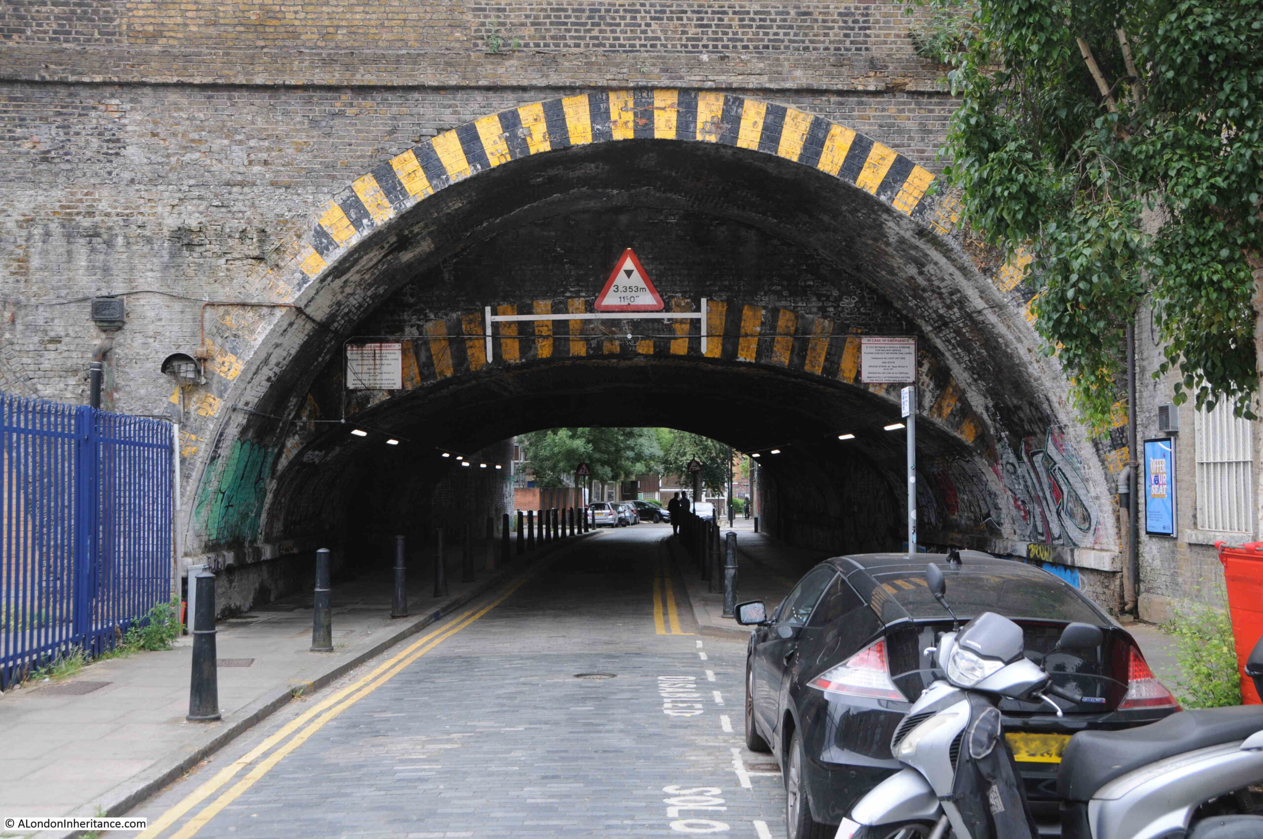
After passing under the railway I was soon at Mile End Road for the locations in my previous post. It was good to see that all the sites listed in 1973 are still to be found in Bethnal Green, and in good condition.

I find these walks fascinating not just by seeing if the sites listed in the Architects’ Journal have survived, but also the chance finds along the way, and in this walk opening a window on the world of boxing in the late 18th century, another building by the East London Dwellings Company and the evolution from charity to council construction of homes.

I am now almost through all 85 sites listed in 1973, just a couple of groups of buildings to visit, in Greenwich and the area running north and west along the River Lea / Bow Creek. Hopefully these walks will not be as windy and cold as my walk through Bethnal Green.

alondoninheritance.com

Bethnal Green’s Ordeal

At the end of the last war there were a number of booklets published by different Government Departments – the Metropolitan Police, the Post Office, British Railways and some of the London Boroughs. My father seems to have purchased a number of these as they were published, and this week I want to feature one of the booklets published in 1946 by a London Borough, with the title “Bethnal Green’s Ordeal”.

Bethnal Green's Ordeal

The booklet was published by the Council of the Metropolitan Borough of Bethnal Green and is a very slim, fifteen page account of Bethnal Green during the war. Written by George F. Vale, who had previously written a pre-war book about Bethnal Green, so I assume was a local resident. The booklet covers 1939 to 1945, but starts with preparations in 1938.

The booklet also includes a fold-out map showing the Borough of Bethnal Green with the location of major air raid incidents marked in red. Each dot represents a high explosive bomb, a parachute mine, flying bomb (V1) and long-range rocket (V2), but excludes incendiary bombs. (Click on the map to open a larger version)

Bethnal Green's Ordeal

Note in the bottom right hand corner the impact of the war on the population of Bethnal Green, with a population of 94,560 in 1939 falling almost by half to 50,641 in 1945.

Starting in 1938, we discover that 66,828 gas masks were issued to the residents of Bethnal Green on Wednesday and Thursday the 28th and 29th of September. This was followed by a period of comparative calm, until the war came to Bethnal Green with a vengance in August 1940:

“On Saturday night and in the early hours of Sunday morning, the 24th and 25th August 1940, the storm broke and we in Bethnal Green had some ideas of the dangers that lay ahead. Our baptism of fire consisted of several high explosive bombs each weighing 50 kilograms which were scattered over a fairly large area of the borough, extending almost in a line from The Queen Elizabeth Hospital in Hackney Road to Lessada Street, east of the Regent’s Canal in Roman Road.”

The raids continued through September between Saturday 7th September and the 24th of September 1940,  when 95 high explosive bombs, two parachute mines and literally thousands of incendiary bombs fell on Bethnal Green.

“No part of the district escaped this terrible holocaust. Bethnal Green Hospital, The Queen Elizabeth Hospital, the Central Library, Columbia market, the Power Station in Bethnal Green Road, the Hadrian Estate, the Burnham Estate, the Vaughan Estate and the Bethnal Green Estate were all hit, whilst the parish church of St. Matthew’s and St. Paul’s Church in Gosset Street were totally destroyed. On that night too, Columbia Market, which contained a very large public shelter was the scene of a very distressing calamity when a 50 kilogram bomb, by a million to one chance, entered the shelter by means of a ventilating shaft and caused extensive casualties to those sheltering.”

Thirty eight people were killed by the bomb on the Columbia Market shelter.

The booklet provides details that help understand Bethnal Green at the time. For example, there were still a number of stables across the Borough, and one of these, the Great Eastern Stables in Hare Marsh was hit and several horses were trapped and needed to be put down.

The composition of road surfaces amplified the impact of incendiary bombs as many were still covered by wooden blocks: “On the night of December 11th 1940, more fires were gaining hold on Bethnal Green than ever before. The area at the west end of Bethnal Green Road was a sea of flames, the wooden blocks which surfaced the road themselves catching fire and burning through almost to the concrete underneath.”

The booklet has a page covering the disaster at the Bethnal Green Underground Station. This was being used as a shelter and was one of the largest in London capable of accomodating 10,000 people.

The shelter was opened very rapidly in 1940 at the persistence of Herbert Morrison, the Minister of Home Security. The Sunday Mirror on the 6th October 1940 reported:

“The Man Who Gets Things Done –  Herbert Morrison, new Minister of Home Security, beloved by Londoners, is the man who gets things done.

Standing on the platform of the uncompleted Bethnal Green Underground station, 65ft below ground yesterday, he asked L.P.T.B and local council officials why it was not being used as a shelter.

He was told there were certain technical difficulties. ‘Is there anything to stop the people using it right away?’ he queried brusquely. He was told there were not. 

‘Then open it tonight’ said Herbert Morrison.

That is why several thousand men, women and children of the East End who last night found sanctuary in the station and tunnels – part of the new Tube extension not yet in use – bless the name of Britain’s ‘livest’ Cabinet Minister.

A.A. Shells were bursting in the sky during an alert when Mr Morrison and Admiral Sir Edward Evans arrived to inspect the station. Mr Morrison, after chatting with the experts, reached his decision about the opening of the station as a shelter in five minutes,

Council officials told him that everything was ready to make the shelter comfortable. 

Someone said the pit in the concrete track should be boarded over. ‘Let them sleep on the track’ replied Morrison.

Mr Morrison said in an interview: ‘You can tell the people we are going to utilise every inch of shelter we can find and we’re going to do it quickly’

The booklet describes the Bethnal Green Underground shelter:

“It had a sheltering capacity of 10,000; the highest figure reached was 7,000 in 1940-1 and in the summer of 1944 during the flying bomb raids. The Tube played a great part in the life – at night and in times of danger – of a great number of people in Bethnal Green; particularly the old people and mothers with children. It was provided with a canteen, a sick bay with a trained nurse regularly in attendance, a visiting doctor, a concert hall capable of holding 300 people and a complete branch public library consisting of 4,000 volumes.”

The worst civilian disaster of the war happened at Bethnal Green Underground station on the 3rd March 1943. The booklet records:

“On the night of the 3rd March the warning went at 8:17 p.m. and almost immediately hundreds of people were seen to be making for the shelter from all directions. It is estimated that in the first ten minutes after the sirens had sounded 1,500 people were admitted. Everything was normal and although the people were obviously anxious to get under cover there was no undue haste or panic, when suddenly, without any kind of preliminary warning, at 8.27 p.m. a salvo of rockets was discharged from a battery in Victoria Park. The shattering noise created by this operation undoubtedly caused the already anxious people to redouble their efforts to get into the shelter.

Unfortunately the reports of the guns were thought by many to be the sound of exploding bombs. At this critical moment it is said that a women, with a child, or a bundle, or perhaps both in her arms, fell on the stairs. So great was the pressure of the crowds behind her that in the matter of a few seconds there was a solid mass of bodies, piled up five or six deep, against which the people seeking admission and not knowing of the accident, still endeavoured to force an entrance.

On the instructions of the Home Secretary, Mr Herbert Morrison, a full enquiry into the circumstances of the accident was conducted by Mr. Laurence Rivers Dunne, M.C. one of the Magistrates of the Police courts of the Metropolis. The enquiry lasted from the 11th to the 17th March inclusive and in all eighty witnesses were examined. His final conclusions were:

(a) This disaster was caused by a number of people losing their self control at a particular unfortunate place and time.

(b) No forethought in the matter of structural design or practicable police supervision can be any real safeguard against the effects of a loss of self control by a crowd. The surest protection must always be that self control and practical common sense, the display of which has hitherto prevented the people of this country being the victims of countless similar disasters.”

The report appeared to put the blame on the people attempting to enter the shelter and their loss of control.

In reality, the entrance to the stairs down to the shelter were poorly lit, there was no central handrail and insufficient police or wardens to manage access to the shelter.

The Illustrated London News on the 13th March 1943 published an account of the tragedy and published photos of the entrance showing only side handrails and the general poor condition of the entrance.

Bethnal Green's Ordeal

It is easy to imagine how simple it would be for someone to stumble and fall in a crowd, and the impact that would have in such a confined entrance with no safety features.

Bethnal Green's Ordeal

The Illustrated London News report states that there were no bombs and no panic, and makes no mention of the salvo of rockets. An apparent contradiction to the report by Rivers Dunne, and despite the report stating that “No forethought in the matter of structural design ” could have avoided the tragedy, immediately after the tragedy, steps were taken to improve lighting, add handrails and barriers to shelter enhances, perhaps an acknowledgement of the contribution that the lack of these features had to the Bethnal Green tragedy.

173 people of all ages died on the 3rd March 1943 at the entrance to the Bethnal Green Underground shelter.

The entrance today – the woman fell at the bottom of the first flight of stairs:

Bethnal Green's Ordeal

A plaque recording the tragedy above the stairs:

Bethnal Green's Ordeal

A memorial to the disaster was completed in December 2017:

Bethnal Green's Ordeal

The memorial is located by the entrance involved in the disaster and represents the stairs down from the street, with the names of those killed carved into the side of the memorial:

Bethnal Green's Ordeal

There are 173 small conical light shafts cut into the  top of the memorial, and these are clustered closer together as the end wall is approached – representative of the way the tragedy unfolded:

Bethnal Green's Ordeal

The full names and age of those who perished are recorded on the upright support of the memorial. The repetition of the same surname, and the numbers of children involved shows the terrible impact that the tragedy must have had on individual family’s.

Bethnal Green's Ordeal

The memorial is a very fitting reminder of the tragedy at Bethnal Green Underground station in 1943.

Bethnal Green's Ordeal

One final comment on the tragedy comes again from the booklet and highlights the impact that war had on children:

“Some reference must be made to the work performed by the boys at the tragic Tube Shelter disaster. They helped with the injured and saw sights which probably no boy of such tender years has been called upon to experience. One boy was found by the Controller at the mortuary helping to unload the dead as they were brought from the scene of the disaster. The Controller said to him, ‘Don’t you feel somewhat upset by this?’ and the boy answered, ‘Well, Sir, I was sick when I first started, then I got over it, and anyway the job has got to be done.”

The remainder of 1943 and early 1944 was generally quiet in Bethnal Green, however Bethnal Green’s ordeal continued on the 13th June 1944 when a flying bomb fell in Grove Road. A total of twenty V1 flying bombs would fall on Bethnal Green.

These would be followed by the V2 rocket, with the first falling in Lessada Street in November 1944, the second in Parmiter Street in February 1945 and the final rocket just outside the borough boundary in Vallance Road in March 1945.

The booklet illustrates the effort needed by the Council and volunteers to respond to the bombing of Bethnal Green. The Borough Council had to arrange the clearance of 4,550 homes, providing storage space for the furniture from 1,350 and moving the furniture from 2,200 other homes to alternative accommodation.

Those too young to be conscripted into the armed forces were involved in a number of activities. Boys were used for multiple roles, acting as messengers, filling sand bags, installing blast walls at the London Chest Hospital, and it was the Scouts who erected the 5,000 bunks in the Bethnal Green Underground station shelter. Although evacuation of children from the city had started at the beginning of the war, the booklet records that a large number of children had drifted back to their homes and families in Bethnal Green. (This was also my father’s experience, as he only lasted three weeks after evacuation before returning home to the city).

The task of looking after and identification of so many dead civilians was a challenge for a single Borough. Of the 555 civilians killed during the war in Bethnal Green, there were 23 unidentified or unclaimed. These were buried in the communal grave at the City of London Cemetery, Manor Park.

Bethnal Green’s Ordeal also highlights the impact on the population of day to day precautions. For example, the black out came into full force on Friday 1st September 1939 and is recorded as being one of the war time restrictions that was the most difficult to bear. “It was easy to appreciate its importance during actual raids, but the hours of darkness were so many, especially during the long winter nights – many of which were raidless – that at times the depressing effects of the black-out were almost unbearable.” 

The booklet ends with two pages that provide some key statistics, and details of the organisations that developed within the borough to manage the impact of the war.

Bethnal Green's Ordeal

Bethnal Green's Ordeal

The memorial at the entrance to the Underground station is a reminder of the dreadful tragedy of one single event. The booklet is a reminder of the overall impact to one London Borough as summed up by the final paragraph in the booklet::

“Thus ends the story, perhaps rather fragmentary, of what an ordinary typical East End borough endured during the war years. It is hoped that it will serve as a reminder to the present generation and as a record for posterity of Bethnal Green’s Ordeal, 1939 – 1945.”

alondoninheritance.com

The Tiles At Bethnal Green Underground Station

Writing this blog has taught me to be far more observant of my surroundings than I have been in the past. I have no idea how many times I have walked along the Central Line platforms at Bethnal Green underground station, but in all those times I cannot say that the random tiles placed along the platform walls have resulted in a second glance, or the realisation that there is a design purpose behind these tiles.

I was visiting Bethnal Green again a couple of weeks ago and spent some time walking up and down both platforms, looking for the different tiles and taking photos. I have also tried to find the inspiration for the tiles and have been successful in a number of instances, but have yet to trace the origin for all of the tiles.

So, to start on the platform at Bethnal Green:

Tiles at Bethnal Green Underground Station

The tiles appear to represent London landmarks and associations with the counties served by the London Underground.

The first tile is a rather good representation of London Underground’s head office at 55 Broadway.

Tiles at Bethnal Green Underground Station

London Transport are in the process of moving out of 55 Broadway, so the tile will provide a historic record for the future of their original head office. My photo from a similar viewpoint when I visited the building shows how accurate the representation is on the tile:

Tiles at Bethnal Green Underground Station

Another London Transport association is this tile showing the London Transport roundel:

Tiles at Bethnal Green Underground Station

The Bethnal Green name is along the centre of the roundel in the photo below. To demonstrate the random distribution of the decorated tiles and how they blend into the rest of the tiling, look to the left, at the level of the wording for Bethnal Green in the centre of the roundel, past the vertical black stripe and you can just make out a slightly raised tile. This is one of the decorated tiles.

Tiles at Bethnal Green Underground Station

The following tile shows a swan with a crown around the neck.

Tiles at Bethnal Green Underground Station

This has been used as a heraldic badge since medieval times. It was used by the 2nd Duke of Buckingham and was adopted by the county of Buckinghamshire, also being incorporated in the coat of arms of the Metropolitan Railway.

In the British Museum Collection there is an example of this symbol in the form of a brooch, made around 1400. Known as the Dunstable Swan Jewel it was found on the site of a Dominican Priory in Dunstable in 1965. Fascinating that these medieval symbols can be found on the tiling of an East London underground station (photo ©Trustees of the British Museum)

If you look just below the left hand wing of the swan on the tile, there is a letter ‘S’ which is repeated on the majority of the tiles. The ‘S’ is for Harold Stabler who designed the tiles. He was originally asked by Frank Pick, the Managing Director of London Underground and the first Chief Executive of London Transport, to design a rabbit mascot for the country buses run by London General in 1922.

Frank Pick later commissioned Harold Stabler to design the tiles representing the counties around London served by the Underground railway, along with a number of London landmarks, including the following representation of the Palace of Westminster:

Tiles at Bethnal Green Underground Station

There are two crowns and what looks like a bowler hat – I have no idea what these represent, perhaps Monarch, Lords and MPs?

Harold Stabler was born in 1872. He was a skilled designer and worked in a number of materials including gold and silver and one of his commissions was the Ascot Gold Cup.

in 1936 he was appointed by the Royal Society of Arts as the first Designer for Industry, and he provided consultancy work on design to a number of industries and public bodies. He was involved in the creation of a pottery in Poole and it was this business which would create the tiles for the underground using Stabler’s designs.

He completed the tile designs in the 1930s, however Bethnal Green station did not open until 1946 as works for the Central Line extension had been delayed by the war.

The following tile shows what I assume to be five kings. The horizontal lines have some meaning, but I have not been able to identify the inspiration for this design.

Tiles at Bethnal Green Underground Station

Another tile has five flying birds rather than kings, and they appear to be flying over water. Again, I have not been able to identify the meaning behind this design.

Tiles at Bethnal Green Underground Station

This design is of the Crystal Palace, however this tile does not have the ‘S’ to be found on all the other tiles, so I am not sure if this is one of Stabler’s original designs.

Tiles at Bethnal Green Underground Station

The number five seems a common theme for the tiles. In the following design there are five birds, with two sets of short parallel lines between the top and bottom rows of birds. This tile is one of several held by the Victoria & Albert Museum and their record identifies this design as “five martletts, is the arms of the City of Westminster”.

Tiles at Bethnal Green Underground Station

This design was easy to identify:

Tiles at Bethnal Green Underground Station

The coat of arms for the county of Middlesex, also as shown below:

Tiles at Bethnal Green Underground Station

The following design appears to show the representation of a bird, such as an eagle. Another I have not been able to identify.

Tiles at Bethnal Green Underground Station

The following design shows a crown above a pair of oak leaves and three acorns:

Tiles at Bethnal Green Underground Station

I suspect this is from the coat of arms for the county of Surrey as shown in the following shield where there a crown with a pair of oak leaves, but with a single acorn:

Tiles at Bethnal Green Underground Station

The pictures are from the book ‘The Youngest County’ published by the London County Council in 1951 to commemorate the creation of the County of London. The book includes an overview map of London and the surrounding counties which helped with identification of a number of the tile designs.

This included the following tile which has the design of a horse:

Tiles at Bethnal Green Underground Station

Which appears to be very close to the horse from the coat of arms for the County of Kent:

Tiles at Bethnal Green Underground Station

The following design appears to be some mythical winged beast. A fascinating design, but one I have been unable to identify:

Tiles at Bethnal Green Underground Station

The final design:

Tiles at Bethnal Green Underground Station

Which must be a representation of the Coat of Arms for the County of London, as shown below. Although the crown is missing, the “Cross of St. George charged with a lion of England” as described in the book The Youngest County which also describes the whole design, including the crown as “sets forth in heraldic language that London is the Royal Centre of England, situate upon the water”.

Tiles at Bethnal Green Underground Station

I hope that I found all the different designs at Bethnal Green, I spent some time walking up and down both platforms looking for, and photographing the tiles (and in the process attracting some rather strange looks from travelers on the Central Line).

Although I have shown single tiles, there are multiple copies of each of these designs on both platforms.

In 2006 many of the plain tiles along the platform were replaced with replica tiles. There are still some original panels of tiles, and I understand that the decorated tiles are also original, however I do wonder if the tile showing Crystal Palace may be a reproduction as it does not include Stabler’s trade mark letter ‘S’ and it does appear to have a slightly different finish to the rest of the tiles.

Stabler’s decorated tiles were also installed at St. Paul’s, Aldgate East, St. John’s Wood and Swiss Cottage Underground stations. I believe they are still to be seen at Aldgate, but not sure of the other stations – something to check when I can visit.

Harold Stabler died in London in 1945, however it is good to see that his designs live on at Bethnal Green.

alondoninheritance.com

A Year Of London Books

When I started this blog, four years ago, I thought I knew London reasonably well – the last four years have taught me how little I really know.

As well as walking in London, over the last four years I have been reading a lot more London books. It is a wide field, books have been written about London for centuries, as well as what seems like a continuous flow of new books. There are also books about almost every aspect of London that you could imagine.

I find books through a number of routes, browsing both new and second hand bookshops and online, finding books as a direct result of something I have found on a walk, and through recommendations I have received as a result of some of my posts.

For this last post of the weekend, here are the London books that I have read over the past year, books that have taught me so much about the city.

I will start off with:

This – Is London

This book came from a second hand book shop in Alton, Hampshire. Browsing the shelves, I came across a book with the word London in the title. It looked interesting, was £4 so I took a chance and purchased.

This – Is London is by Stuart Hibberd who was a BBC Announcer in the early days of the BBC, when an announcer was the person who introduced all the programmes, read the news, looked after guests, and generally appears to have done almost everything (apart from the technical work) needed to get BBC programmes on air.

The book takes the form of a narrative diary, starting in 1924 through to 1949, a period which included so many events of historical importance, as well as the development of the BBC from the very early days through to the post war status of an established national and international broadcaster.

The book is very much of its time – written by a BBC announcer, when a Vice-Admiral was a BBC Controller. It feels that to read the book you need to be dressed in a dinner jacket, pipe in one hand and glass of whisky on the side table, however it is written by someone who was there at the time and includes some fascinating insights into how radio programmes were put on air (I did not know that the BBC had a studio in a warehouse on the Southbank in the 1930s) and some interesting stories of working in London.

The following is an example, and will be familiar to anyone who has experienced a last minute platform change at one of London’s stations, however I bet Southern Railways would not do this for you now, even if you did work for the BBC:

“On Saturday, 9th November 1935, after a long day at Broadcasting House, ending at midnight, with the help of a waiting taxi I managed to get to Charing Cross station about a minute before my train was due to leave at 12:10 a.m.; and I walked past the barrier on to Platform 4, above which was displayed on a board marked ‘Orpington and Chislehurst’. The train was not standing at the platform, but, as it was Saturday night, when trains are sometimes a little late, I thought nothing of that. When at 12.13 I went up to the ticket-collector and asked him what had happened to the Chislehurst train, he answered with surprise, ‘It has left from No. 2 platform on time’. This rather shook me, as of course I knew it to be the last train, and I also knew that the Orpington and Chislehurst board had been over the entrance to Platform 4 when I passed the barrier. There were five or six other passengers there bound for Orpington, who now came up and, in no uncertain tone, corroborated what I had said. As they raised their voices, along came an inspector. They were furious with him, saying, ‘How are we to get home?’, ‘We’ve all been fooled’, ‘I’ll report you’. and that sort of thing.

Realising that this would get us nowhere, and knowing that there was a train from London Bridge to Bromley at 12.45, and that I could if necessary walk the three and a half miles from there, I got into a train then leaving for London Bridge.

While in this train I did some quick thinking, and remembered that London Bridge was the Divisional Headquarters of the railway. Arriving there I went straight to the Inspector’s office, and told him what had happened, beginning in a rather causal tone of voice, ‘Nice game at Charing Cross tonight Inspector. Your men put up the Orpington train-board on No. 4, and then ran the train out of No. 2; and as it was the last train, I look like being stranded, unless I walk home from Bromley.’ He was incredulous, and said, ‘You must have made a mistake.’ No I assured him, I had made no mistake, and what is more, I warned him that he had better be prepared for the other angry passengers dropping in at any minute, who would not relish the walk from Bromley to Orpington at one o’clock in the morning. At this he opened his eyes and began to look worried, but was obviously reluctant to take any action to put things right. I paused for a moment or two; then decided to play my trump card. ‘It isn’t as if I had been out enjoying myself at the theatre or something,’ I said. ‘I’m B.B.C., and have been broadcasting on and off all afternoon and evening, and am pretty tired.’ The three magic letters, B.B.C. did the trick, and he at once decided to ring up the night controller on duty. At that moment, as I had warned him, a bunch of angry passengers from Charing Cross burst in to demand retribution. I explained that I had forestalled them, and that the Inspector was now talking to the night controller about it. We had to wait ten minutes or so while he checked up, then he sanctioned a special train, which drew into London Bridge station, just after one o’clock”.

You would not get a special train arranged for you today!

Stuart Hibberd signing autographs at a BBC exhibition – these were the days when a radio announcer was considered a true celebrity.

Again, the book is very much of its time, however as a first hand account of the early days of the BBC in London, This – Is London makes a fascinating read.

The White Rabbit

Last August I wrote a post about Queen Square, it was the location of one of my father’s photos as he had taken a photo of the water pump that can be found in the square. At the northern end of the square is Queen Court, a rather nice brick apartment building that has an entrance on Queen Square and Guilford Street. In the photo below is the Guiford Street entrance (see how money was saved in construction – the cheap bricks in the middle and the expensive bricks where the main facades face onto Queen Square and Guilford Street.)

To the right of the door is a blue plaque, to Wing Commander F.F.E. Yeo-Thomas:

Forest Frederic Edward Yeo-Thomas was born in London on the 17th June 1902. At a young age his family moved to France where he became fluent in French as well as English. He served in the First World War, and between the first and second world wars, he worked as a Director of the French fashion house Molyneux.

He returned to Englad at the outbreak of the Scond World War and joined the RAF and transferred into the Special Operations Executive (SOE) in 1942. His knowledge of France and the French lanquage, as well as his desire to help with the liberation of France made him a natural candidate for becoming a secret agent, working in occupied France,

The connection with Queen Court is as the location of the flat he would share with Barbara Dean after she acquired the flat in 1941. It was from Queen Court that he would leave when he was to be dropped into occupied France to make contact with the resistance, arrange supplies and organisation and report back to the SOE.

I walk past so many blue plaques, but this one demanded more research. I had heard of his code name ‘White Rabbit”, but did not know the full story of his work.

After 10 minutes online I had ordered the following paperback, published in 1954 by Pan Books with the rather dramatic cover illustration:

Although not written by Yeo-Thomas, it was written by his friend Bruce Marshall who had also lived in France and had worked in the Intelligence Services during the war.

Yeo-Thomas had already been dropped twice into occupied France, however in February 1944 he left Queen Court for his final drop into France, one that was to be the most challenging, and one that he was very lucky to eventually return from.

He was captured by the Gestapo during this third trip, interrogated and tourtured and eventually sent to the Buchenwald Concentration Camp along with 36 other prisoners from the allied forces.

The book is a raw account of the inhumanity of a totalitarian regime and should be required reading in order to understand the depths a once civilised society can sink to when others are regarded as sub-human.

The following paragraphs are from the description of Yeo-Thomas’ first days in Buchenwald:

“Guignard also corroborated what Perkins had already told them, adding dismal details of his own. They were, he told them, in the worst camp in Germany. Their chances of survival were practically nil: and if they did not starve to death, they would be worked to death; and if they were not worked to death they would be executed. Every single day more than three hundred prisoners died from starvation or from being beaten by the guards while working in Kommandos. Each Kommando consisted of hundreds of prisoners quarrying stone, dragging logs or clearing out latrines under the supervision of Kapos and Vorarbeiter. But the SS guards were also there and so were their Alsatian hounds, and when enough amusement couldn’t be derived from bludgeoning a man’s brains out there was always the alternative of setting the dogs upon him to tear out his throat.

They soon saw for themselves that these reports were not exaggerated. Walking up and down in the sunlight behind the barbed wire and conversing in makeshift esperanto with the other inmates of the Block, they saw groups of SS men wandering about the camp. They noticed too, that prisoners tried to avoid them and that when they couldn’t they politely removed their forage caps. But this salute did not prevent the guards beating up any prisoner whose appearance attracted their displeasure; and their new companions informed the thirty-seven that anyone attempting to resist this attention was punished either by shooting or strangulation or, if he were lucky, by twenty-five strokes on the small of the back with the handle of a pick axe.

A squat black chimney just beyond the Block was pointed out to them. ‘That’s the crematorium,’ they were told. ‘It’s the surest of all escape routes; most of us will only get out of this camp by coming through that chimney as smoke.”

After Buchenwald, Yeo-Thomas was transerred to other camps as the German lines collasped before he finaly escaped and made his way through to the Americal lines, returning home to Queen Square in 1945.

Afte the war he would help bring several Nazi war criminals to trial, he returned to work in Paris and from 1950 was the French representative of the Federation of British Industries. He died in 1964.

Yeo-Thomas was awarded the George Cross and Military Cross.  From France he received the Croix de Guerre and was made a commander of the Legion d’honneur.

The White Rabbit is a remarkable story of a remarkable man, one I only discovered after walking past a blue plaque.

The First Blitz

The next book is also a result of my Queen Square post. In the central square, there is a plaque on the ground recording the night when a Zeppelin bombed the square:

Again, this is a subject I knew a little about, but not in any great detail. In the comments and messages I received after the post, there was one from the author of a book on the Zeppelin attacks on London during the First World War – the long suffering credit card came out and I ordered the book.

The First Blitz by Ian Castle is a very detailed account of the bombing of London during the First World War, covering the background to the raids, the technology used by the attackers and defenders, a detailed account of each raid, richly illustrated with photos and maps showing the route taken by Zeppelins over London and showing the location of where each of their bombs landed across the city.

The book starts when Zeppelin airships were the method for attacking the city and ends with the Whitsun raid on Sunday 19th May 1918 when 38 Gotha aircraft took off to attack London with 19 reaching London. 48 people were killed and 172 injured in this final raid – an indicator of the type of mass attack from the air that would arrive 22 years later.

This Is London

When walking the streets of London, travelling on the Underground or the bus, do you ever wonder about the people around you? Who they are, what are their stories.

London is such a multi-layered construct and there are people all around the city who live and work in their very own confined view of London.

This Is London by Ben Judah is subtitled The Stories You Never Hear. The People You Never See.

The book starts at Victoria Coach Station at 6am in the morning where new arrivals to the city stumble of coaches and buses, and then takes the reader along a journey through London meeting the type of person who are there in the background of the city – office cleaners, builders, beggars, gangs and drug dealers, Filipina maids, the Arab daughters of incredibly rich fathers, witch doctors. The book is a relentless journey through so many of the different sub cultures and people that call London home for just a couple of months or for a lifetime.

In many ways I found the book a concerning read, the poverty, the almost slave like conditions, the lack of opportunity and the almost total isolation of many communities does not give much cause for hope, however it is an important book, a book that will make you look at the people you pass in the city in a new light.

Big Capital

Big Capital by Anna Minton, whilst tacking a very different subject to This Is London, raises a similar set of questions – who is London for, what is London becoming and who owns London.

Big Capital is about housing in London and those who struggle to find a place to live. Big Capital examines how housing has become a financial investment rather than a basic right.

As with This Is London it can be a concerning read, however it is also an important read to understand why there is a housing crisis in London, even though there is a never ending conversion of existing buildings into flats and new tower blocks of flats are constantly rising above the city.

The following extract from Big Capital summarises how housing is moving further into expensive, private renting and (also a theme in This Is London), the poor, slum housing that is growing at the bottom end of the market:

“For the last generation Britain’s economy and culture have been predicated on the ideal of home ownership, fueled by the Conservative vision of a property-owning democracy. But despite the mythology, Britain exceeded the European average of 70 per cent home ownership only in the early noughties. It has now fallen to 64 per cent, the lowest level in thirty years; the last time home ownership was this low was in 1986, when Right to Buy and the deregulation of the mortgage market were sending home ownership upwards. As home ownership falls and social housing is eradicated, expensive private renting is becoming the only option; in 2017 private renting overtook mortgaged home ownership in London. This is a middle class issue now, that people want to talk about, Betsy Dilner, director of Generation Rent, the campaign group for better private renting, told me, although she added: ‘People think we represent this middle-class professional group, but if you can find a way of making the private rented sector work for the most vulnerable people in society then it will work for everyone.’ Today, 11 million people in Britain rent privately in an overlapping series of submarkets ranging from the poor conditions and slum housing at the bottom end to student accommodation, micro ‘pocket living’ flats. apartments for professionals and luxury housing at the top.”

As you walk around London and see the endless building, the advertising hoardings outside new apartment blocks and the new towers rising above the city, Big Capital helps explain how we have reached this point and provides another view of London – it is an important book.

The Boss Of Bethnal Green

The Boss of Bethnal Green by Julian Woodford is genuinely a book that is hard to stop reading once started. It tells the story of Joseph Merceron who grew wealthy through his control of the vestry, the funds destined for the poor, funds that were destined for infrastructure improvements such as the Commission of Sewers, and much else.

The church of St. Matthew’s plays a central role in the story. The church is one that featured in the Architects’ Journal list of sites at risk in 1973 and I visited the church last year. I just wish I had read the book before my visit as walking around the site, knowing more of the remarkable events that happened, makes a site visit so much more interesting.

Joseph Merceron was also buried at the church and his grave is one of the very few remaining, and as Julian Woodford points out, his grave (and that of one of his key partners Peter Renvoize) survived both a late 19th century graveyard clearance and Second World War bombing.

I accidentally included Merceron’s grave in one of my photos of the church – in front of the corner of the church to the right.

The book also covers the politics of the time and how Merceron was able to flourish with a degree of state support, the prison system, the vestry system that was responsible for local governance, magistrates, bankers and all within the context of an ongoing battle between Merceron and a few, determined, opponents.

Whilst Merceron’s story is 200 years old, it is still relevant in providing a warning of how corruption can flourish in local governance without sufficient transparency or external, independent monitoring and audit – a fascinating book.

The Blackest Streets

Although the Old Nichol, an area of slums in Bethnal Green in the latter decades of the 19th century is at the core of The Blackest Streets by Sarah Wise, the books covers a much wider scope.

There are a number of recurring themes in this, and the other books. As with The Boss of Bethnal Green, the failure of the vestry system of local governance is still an issue in the later years of the 19th century, the problems with private renting, subletting and knowing who is really the owner of a property – themes also found in This Is London and Big Capital – indeed it is interesting when reading books about London of the past one to two hundred years, how many issues are much the same today.

The Blackest Streets also brings alive the reminiscences of Arthur Harding, born in 1886 and grew up in the Old Nichol. These were recorded between 1973 and 1979 and provide a first hand record of live in a London slum.

The book covers so much – communists and anarchists, street regulation, Charles Booth, domestic violence and street violence, ownership of property, fear of the workhouse – indeed the breadth and depth of The Darkest Streets provides not just a view of the Old Nichol, but of so much of London life during the last decades of the 19th century.

The Old Nichol would be swept away through one of the Metropolitan Board of Works / London County Council slum clearance initiatives and replaced by the Boundary Estate (I did not know that the central garden, Arnold Circus was named after Arthur Arnold, the head of new LCC Main Drainage Committee).

To say that I learnt a lot from The Blackest Streets is an understatement.

How Greater London Is Governed

Yes, I admit, this is probably taking London reading too far, however I found How Greater London Is Governed by Herbert Morrison in a second hand bookshop in Hay-on-Wye.

Herbert Morrison was a Labour politician and leader of the London County Council (LCC) from 1934 to 1940. The book is an overview of how the LCC governed London and the services that the LCC provides. It is an interesting contrast with the issues of governance in London highlighted in the previous two books, how significant was the improvement by the 1930s.

The book is full of pride in what the LCC has achieved and also the formality required to govern a city of the size and complexity of London.

The book includes a wide range of statistics to illustrate the services provided by the LCC:

  • maintenance of 400 miles of sewers
  • the provision of 63,600 dwellings with accommodation for 290,000 people (part of an ongoing slum clearance scheme)
  • maintains 32 general hospitals, 11 hospitals for the chronic sick and 30 special hospitals
  • maintains the London Ambulance Service, answering in 1932, 40,000 calls and conveying 300,000 patients
  • maintains 1,150 public elementary schools in which about 600,000 boys and girls are taught
  • has spent £17.5 million pounds on street widening
  • maintains 97 parks with an area of nine square miles
  • maintains the London Fire Brigade with 65 stations and 200 fire appliances
  • manages the safety of the public at 800 public buildings
  • the Council’s Supplies Department was responsible for the purchase of significant volumes of consumables including an annual purchase of 10,000,000 eggs, 15,000,000 pounds of potatoes, 30,000,000 pints of milk and 19,000,000 million envelopes

There are also maps to show the complexity of managing a city where there are so many different authorities with different boundaries for their scope of responsibility:

Along with tables on the population, birth and death rates. number unemployed etc.

How London Is Governed provides a snapshot of the city and shows how the governance of such a complex city had evolved from the Metropolitan Board of Works and the Quarter Sessions, and many of the issues of the 19th century as illustrated in the previous two books.

Everything You Know About London Is Wrong

Everything You Know About London Is Wrong by Matt Brown is a wide ranging review of the myths, urban legends and stories that take on the illusion of fact.

Covering topics such as Landmark Lies, Famous Londoners, Popular Culture and Plaques That Got It Wrong, for me reading the book generates the same worry I get when writing every weekly post, that something I thought I knew is just a myth, and that everyone else really knows the true facts.

I am not going to admit which ones i got wrong (mercifully few), but reading Everything You Know About London Is Wrong was fascinating, not just for correcting or confirming my knowledge of the city, but also for the additional background information the book provides for each of the “facts” and stories covered.

Docklands

This is the book I have just finished reading, Docklands – Cultures in Conflict, Worlds in Collision by Janet Foster.

This was another second hand purchase. The book, published in 1999 looks to have been originally owned by a student as there are pencil underlining, highlights and comments to key sections throughout. Although the book is an academic text (at the time, Janet Foster was a lecturer at the Institute of Criminology in Cambridge) it is very readable and tells the story of the Docklands regeneration programme, starting with a history of the area, through to the final, chapter “Making Sense Of It All” – an extensive summary of the development programme so far and what the future may hold for the Docklands.

The book makes extensive use of interviews, covering those involved with the development and residents of the area. The book also includes many photos and statistics to illustrate original Docklands and throughout the regeneration programme.

As a detailed, factual record of a key period in Docklands history, I have yet to find a better book.

My pile of London books to read seems to be growing at a rather worrying rate, however thanks to these and many other authors, I am filling in the considerable gaps in my knowledge of this endlessly fascinating city.

alondoninheritance.com

London Streets In The 1980s – Part 2

Back in May I published a number of photos we took showing London streets in the 1980s. Judging by the number of page views they were very popular (and can be found here), so for this week’s post, please join me in another walk along the streets of London in 1986.

We will start in East London.

In the mid 1980s, London still had very many independent corner shops selling a wide variety of goods from premises that had not really changed for many years. This is Fowlers Stores in Old Ford Road, off Cambridge Heath Road between Bethnal Green Underground and Cambridge Heath Overground stations.

1980s - 17

A general stores in Fordham Street, one of the many side streets between Whitechapel Road and Commercial Road.

1980s - 4

Corner shop in Parfett Street, again one of the side streets between Whitechapel Road and Commercial Road.

1980s - 1

Hessel Street at the junction with Commercial Road. The wall advertising has long gone and the café has been replaced by the Shalamar Kebab House.

1980s - 2

Not sure the exact location, but a side street off Commercial Road.

1980s - 3

There was always plenty of colourful graffiti to be found whilst walking round East London in the 1980s.

I like this one as it was obviously important to get the spelling correct:

1980s - 5

Back in 1986 Rupert Murdoch was well on his way in building up his reputation as a controversial character. This was the time of the printers strike when News International had built a new printing plant in Wapping and started the move of newspaper publishing out of Fleet Street.

1980s - 22

A quick hop across the river to Deptford. Graffiti on the side of a house in Grinstead Road:

1980s -18

Now back to Bethnal Green and the railway arches leading out of Liverpool Street Station, doing what railway arches always seem to do and host car maintenance businesses.

1980s - 19

Railway arches alongside Three Colts Lane, Bethnal Green:

1980s - 20

This is G.J. Chapman, located at 10 Penton Street, just off the Pentonville Road. The type of general hardware store that had an early morning and evening custom of moving many of their goods for sale out and then back into the shop. Closed I beleive about 20 years ago and now replaced by flats.

1980s - 14

Another corner store.

1980s - 13

Despite the very poor condition of the building that is home to the Boleyn Pet Stores, the building is still there. Fully repaired although the pet shop has long gone and the last time I passed was a café. The location is on the corner of Bradbury Street and Boleyn Road, Dalston.

1980s - 7

Cannot remember where this was, but typical 1980s posters.

1980s - 15

Street sign advertising the butchers….

1980s - 18

…. and a café. There were many of this type of pavement advertising. I included a number in my previous 1980s street photos post.

1980s - 16

The Nobody Inn. A pub in Mildmay Road, Islington. Last time I walked past it was a completely refurbished pub and restaurant with a new name.

1980s - 21

An upholstery business on the corner of Alfearn Road and Millfields Road, between Clapton and Hackney. Established 1950, but no longer there.

1980s - 12

Allen Road, Stoke Newington / Newington Green. You would not find a scrap metal dealer on this road now, although the building is still there.

1980s - 11

Florists in Dalston.

1980s - 10

Butchers:

1980s - 9

French’s Dairy in Rugby Street, Holborn. The plaque on the wall states that in the rear is the White Conduit (circa 1300), originally part of the water supply to the Greyfriars Monastery in Newgate Street.

The dairy has gone, but the plaque and building are still there.

1980s - 8

Whittington Park, Islington.

1980s - 23

An old shop front, brightly painted for a furniture business which seems to have gone out of business.

1980s - 24

Many of the buildings featured above are still there, but they now provide a very different function and the days of the individual general store, pet shop, dairy etc. are now mostly long gone or disappearing fast as the process of gentrification moves from one London street to the next.

Whilst the streets of London are now in a much better state of repair, they are loosing much of their individuality and colour (but I still enjoy walking them !).

alondoninheritance.com