Monthly Archives: September 2025

Parliament Hill (or Traitors Hill) – August 1947

Parliament Hill is at the southern part of the high ground of Hampstead Heath. From the top of the hill there are wide ranging views across London, although these views are somewhat obscured by the trees that have grown on the slope leading down from the top of the hill to the fields below.

Parliament Hill has for long been a place to visit, to walk, to look at the view, to play games, and to enjoy the fresh air and open space, above the congested streets of the city.

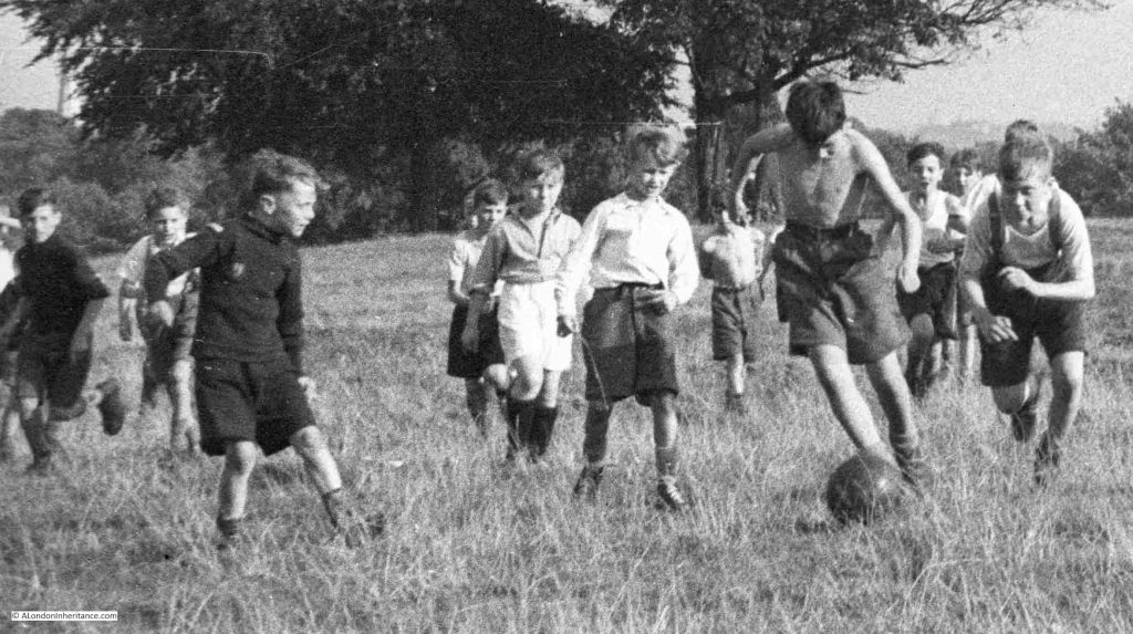
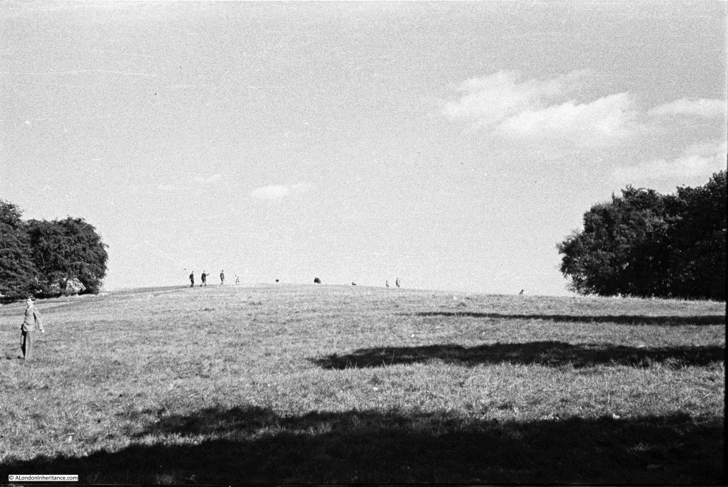
In August 1947, my father took a number of photos whilst on Parliament Hill, looking at the view, and the surrounding landscape. The first shows an intense, youthful game of football:
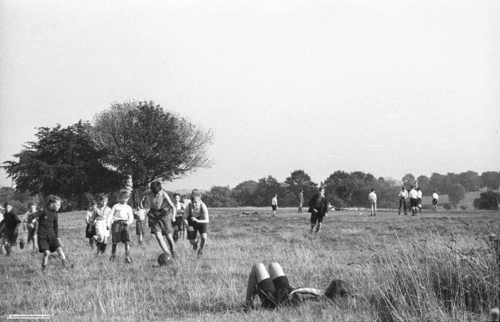
I love the concentration and their focus on the ball, a leather ball rather than the lighter balls in use today:
As usual for many places in London, there are different names for the hill, and different origins for these names.

Two names have been associated with the hill, and there is some common root to these names. The name in use today is Parliament Hill, however for most of the 19th century, Traitors Hill seems to have been the most common.

Examples of where references are made to these two names, and their origins include:

From the Holloway Press on the 8th of August 1952: “Of the many explanations of how Parliament Hill got its name, the most popular is that the instigators of the Gunpowder Plot met here to see the effects of their mischief. Some still call the place ‘Traitors Hill’. Another much favoured story dates back to the Civil War when the Parliamentarians had a camp on the site. The Royalists naturally called this ‘Parliament’ Hill ‘Traitors Hill'”.

On the 15th of July, 1897, there was a report of a garden party given by Baroness Burdett-Coutts at her home in Highgate, and after the garden party “A great many of the guests strolled through the numerous walks towards Traitors; Hill, whence, perhaps, the finest panoramic view of London is to be obtained. The extent of the view seemed to impress the Colonial visitors. Traitors’ Hill is so called from the fact that Catesby and his fellow conspirators awaited there the result of Guy Fawkes villainous attempt to blow up the Houses of Parliament”.

The hill seems to have been the destination for those holding parties in the surrounding houses, as another report from the Morning post on the 2nd of June 1834 explains that after a Fete held by the Duchess of St. Albans at her nearby villa “After the déjeuner there was a promenade to Traitors Hill, which is half a mile from the house, and through the most romantic labyrinth imaginable, whence there is a prospect of London and the counties of Essex, Kent, Surrey and Sussex.”

There are also claims that the Parliamentarians had cannon on the hill during the Civil War, and also used the high point as an observation post.

So whatever the true source of the name, it seems to date back to the 17th century, either from the 1605 Gunpower Plot or the English Civil War between 1642 and 1651.

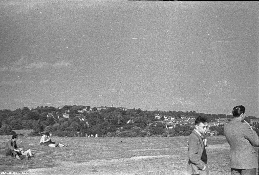
Looking east towards Highgate:
The same view in September 2025:
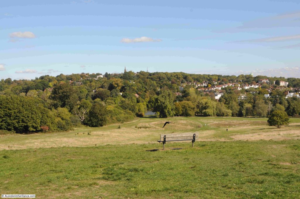
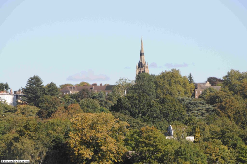
In both photos (a bit hard to see in my father’s photo due to the resolution of the film) you can see the spire of St. Michael’s, Highgate, the church that stands higher than any other church in London.

A close-up of the church from Parliament Hill, and hidden in the trees just below, someone seems to have a strangely large satellite dish:
Looking to the south-east:
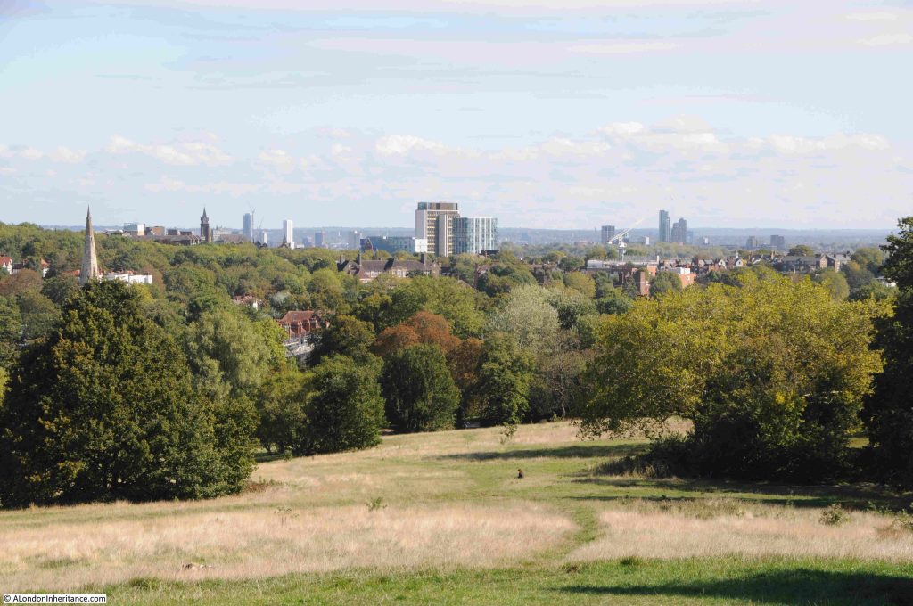
Looking over the city in August 1947, hardly a tall building in sight:
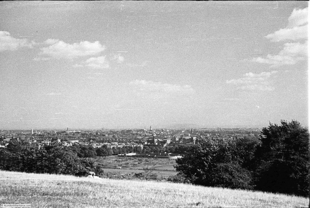
In the above photo, look between the trees and below the hill are open fields, Parliament Hill Fields. At the end of these fields are some low rise buildings. These are the Parliament Hill Fields Lido:
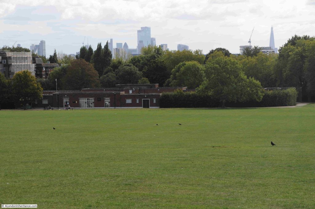
Parliament Hill Fields Lido was opened on 20 August 1938, and the following is a typical newspaper report on the opening of the Lido, part of a scheme by the London County Council for Lido’s across London:

“NEW £34,000 LIDO FOR LONDON – BATHING POOL TO HOLD 2000. With the opening of the new L.C.C. lido at Parliament Hill Fields on Saturday, another important link in the programme of providing London with a chain of modern swimming pools will be completed.

Since Mr George Lansbury, when first Commissioner of Works, gave London its first lido in Hyde Park in 1930, the popularity of these pools has increased enormously.

After Hyde Park came the first lido to be designated as such at Victoria Park built in 1934-35. Records show that in the height of the summer as many as 25,000 people bathe there on a Sunday morning.

The Parliament Hill Lido covers an area of approximately two and a half acres. It is 2ft 6inches deep at the shallow and 9ft 6 inches at the deep end, and holds 650,000 gallons of water, which will be completely filtered and purified every five hours. There are to be fixed and spring diving boards, foot and shower baths, and accommodation is planned for a maximum of 2024 bathers at any one time.

There are two terraces for spectators, and a café available for bathers and spectators alike. The lido had cost approximately £34,000.

The scheme originally approved by the L.C.C. also provided for lidos at Charlton Playing Fields at a cost of £25,000, Battersea Park, £40,000, Ladywell Recreation Ground, £27,000 and Clissold Park, £25,000.

The one at Charlton is nearing completion. The others will be undertaken by convenient stages with a view to the cost being distributed over a reasonable period.

Set among the trees, the lidos of London are vastly different from the cheerless, old-fashioned type of swimming bath. It would seem that they will ultimately render the old baths obsolete.

Including the two lidos already opened, the L.C.C. has eleven open-air swimming pools in London. These were patronised by over 1,000,000 swimmers in a year. Taking the lidos of Hyde Park and Victoria Park alone, the attendances in 1937 were: Children: 62,922, Adults: 175,379, Spectators: 93,731.”

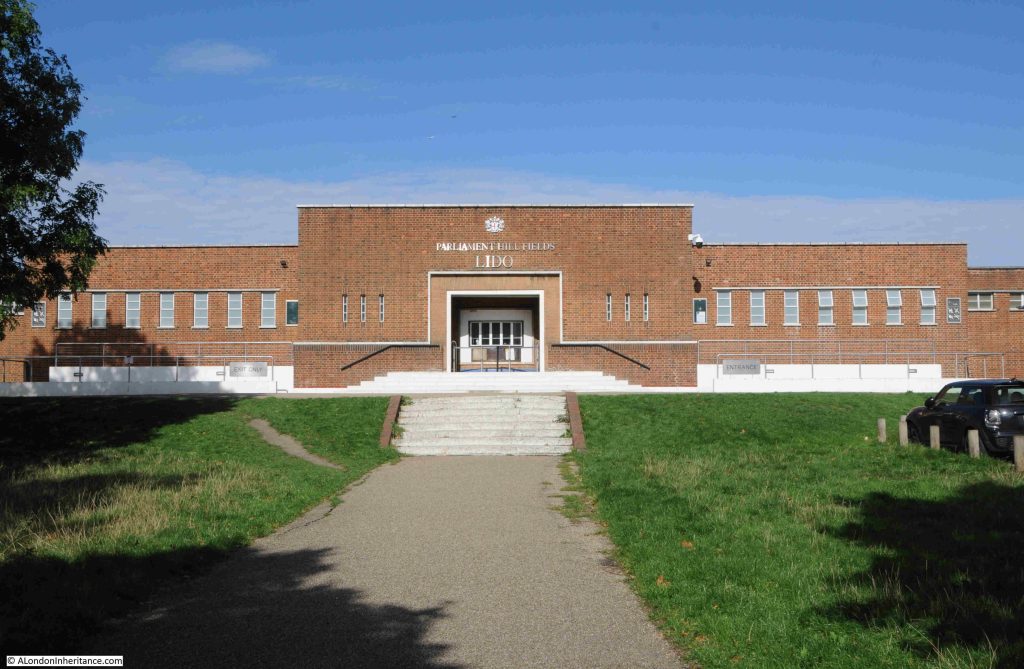
The entrance to Parliament Hill Lido:
Returning to the top of the hill:
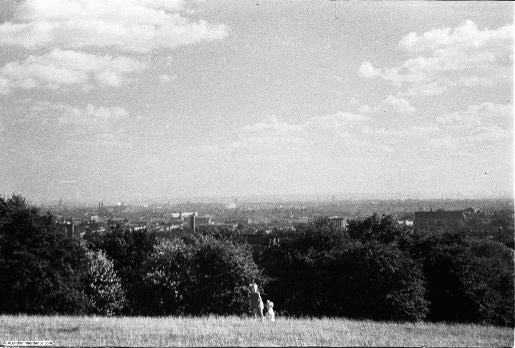
Parliament Hill and the fileds below, have long been a place to visit. The above photo shows a couple of children, and earlier photos in the post show people looking at the veiw, and more children playing football.

It was also a very popular place on public holidays, for example om the 11th of June 1892, the Hampstead and Highgate Express reported that: “PARLIAMENT HILL FIELDS – There were some thousands of holiday-makers in these picturesque fields on Whit-Monday. The International Band performed a selection of music in the afternoon, and in the evening Mr. Blake’s band similarly ministered to the enjoyment of the public. Cricket and lawn tennis were in full operation, and attracted large numbers of spectators.”

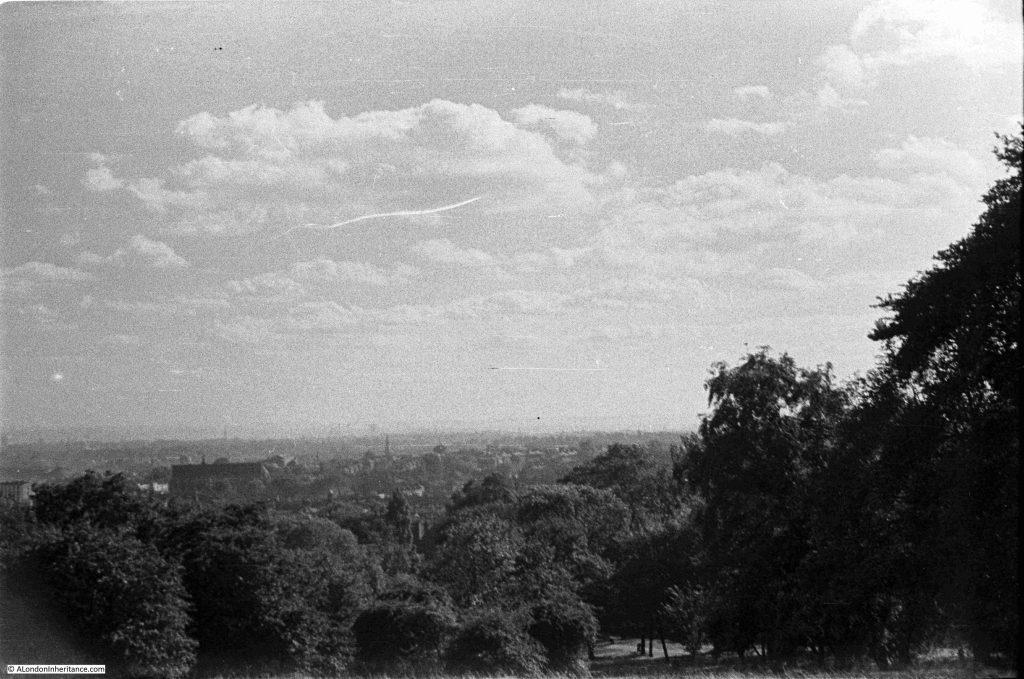
In 1947, the view from Parliament Hill was less obscured by trees than it is today, There were few stand out features as building height was much lower than it is today. The photos by my father were also made using the lower quality of film available post-war to the amateur photographer, and although taken using a Leica camera and Leica lens, enlarging the photos to look at distant features does not reveal much detail.

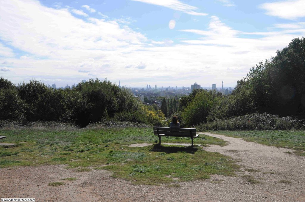
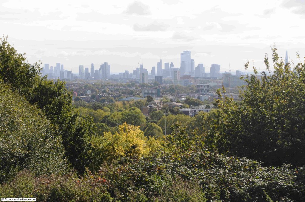
Comparing 1947 with today, shows just how the city has grown upwards:
The Parliament Hill viewing point today:
The view towards the towers of the City of London:
The Shard, with the dome of St. Paul’s Cathedral to the lower left of the Shard:
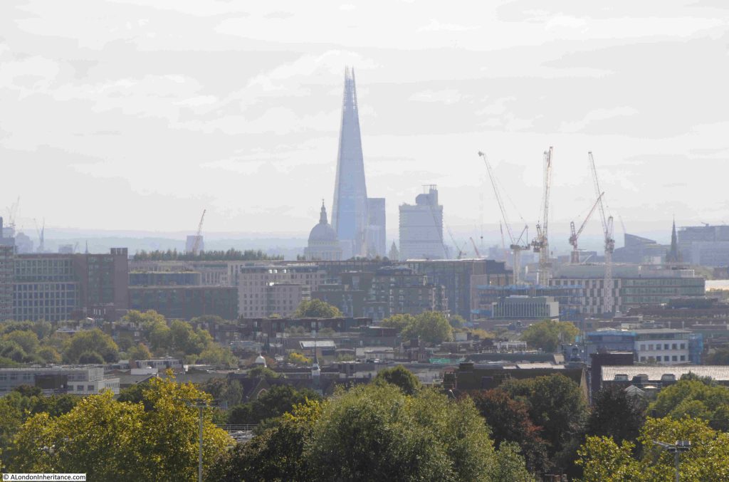
The BT / Post Office Tower, and to the lower left of the tower is the Victoria Tower of the Houses of Parliament. It must have been in this direction that the Gunpowder Plotters were looking, expecting to see an explosion – if the stories of one of the origins of the name Traitors Hill is true:
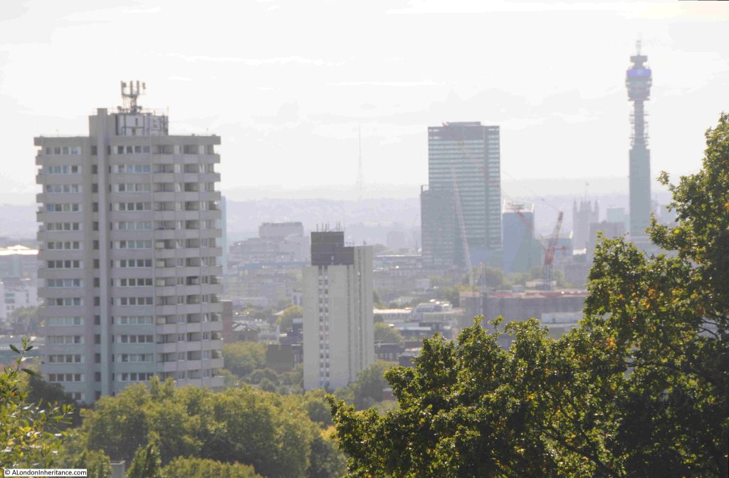
In the middle of the above photo, in the distant haze, is the radio and TV tower at Crystal Palace.

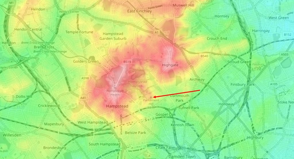
We can see why Parliament Hill is such a good place for a view by looking at a topographic map of the area.

In the following extract from the excellent topographic-map.com the high ground of Hampstead and Highgate is shown in reds and pinks, with the surrounding low ground in yellow and green.

I have marked the location of Parliament Hill with a red arrow, and as can be seen, it is on a small promontory, extending south from the higher ground of Hampstead Heath. To the right is the higher ground of Highgate, as illustrated by photos earlier in the post showing the spire of St. Michael’s, Highgate:
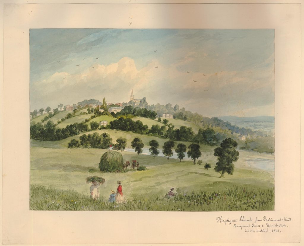
Parliament Hill as a viewing point and open space, has been photographed and painted for many years.

The following is dated 1841 and is by E.H. Dixon, and shows a “View of Highgate Church, from Parliament Hill in Hampstead Heath” (© The Trustees of the British Museum. Shared under a Creative Commons Attribution-NonCommercial-ShareAlike 4.0 International (CC BY-NC-SA 4.0) licence.)::
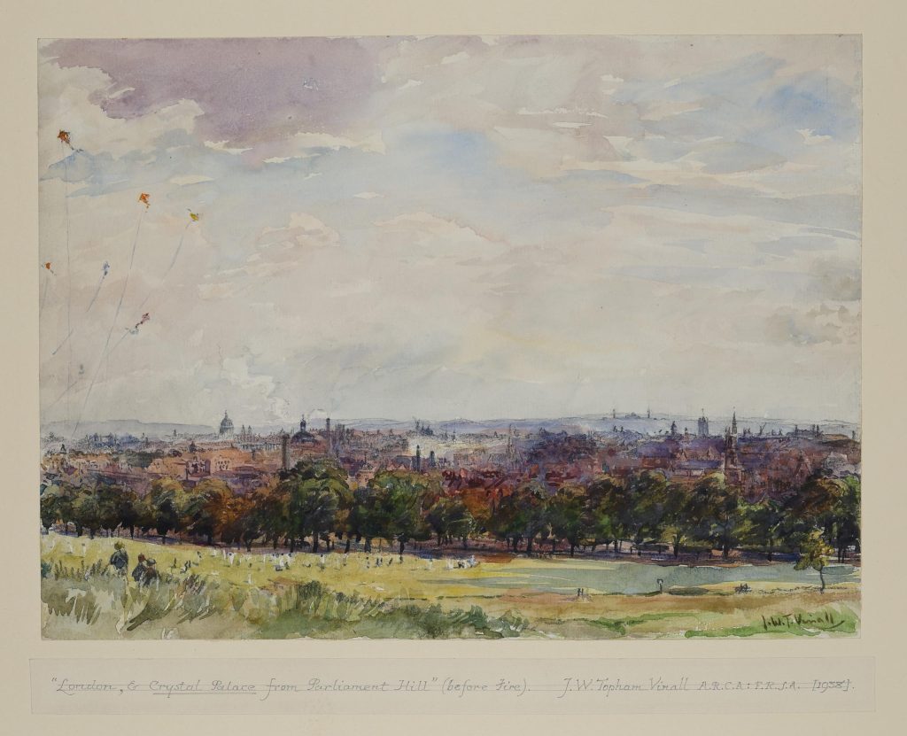
And a 1938 view by Joseph William Topham Vinall of “London, & Crystal Palace from Parliament Hill (before fire)” (© The Trustees of the British Museum. Shared under a Creative Commons Attribution-NonCommercial-ShareAlike 4.0 International (CC BY-NC-SA 4.0) licence.)::
Surrounding the viewing point:
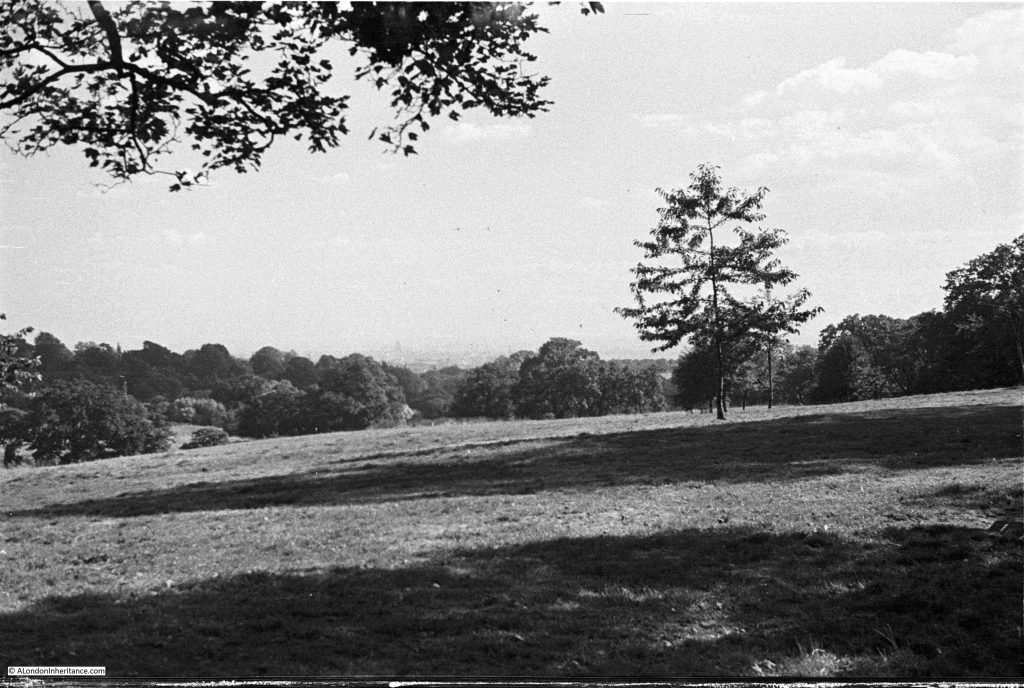
Looking up at the viewing point on Parliament Hill in 1947:
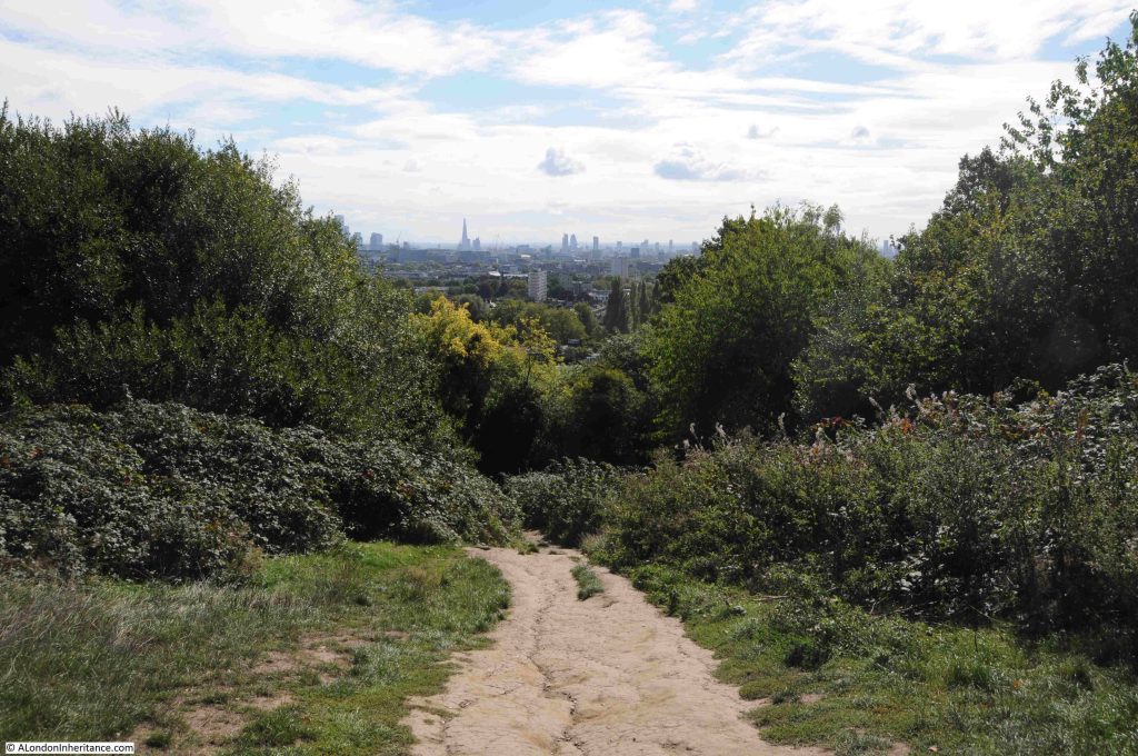
The tress just below the viewing point at the top of Parliament Hill obscure the full view, and you need to move left and right to view different parts of the city below.

Fromn the viewining point, there is a path that leads through the trees and bushes to a lower point, which does though provide a full panorama of the view to the south.

Descending through the trees:
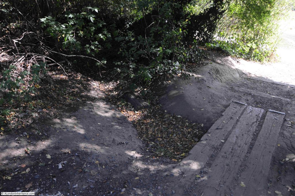
In the middle of the treeline, there is a dried up stream bed, and just to the side an area that is still damp and muddy – one of the many springs to be found in the area:
Once through the trees, the full panaorama opens up:
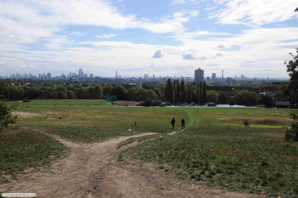
Click on the following panorama to enlarge:

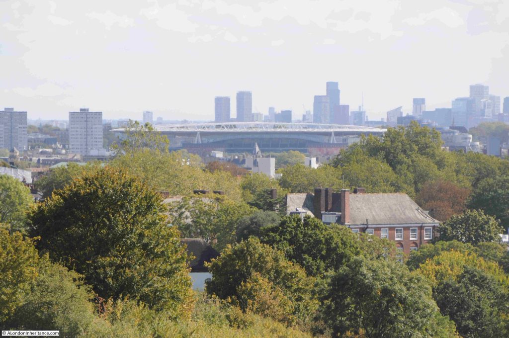
As well as the view to the south, looking to the east we can see the Emirates Stadium:
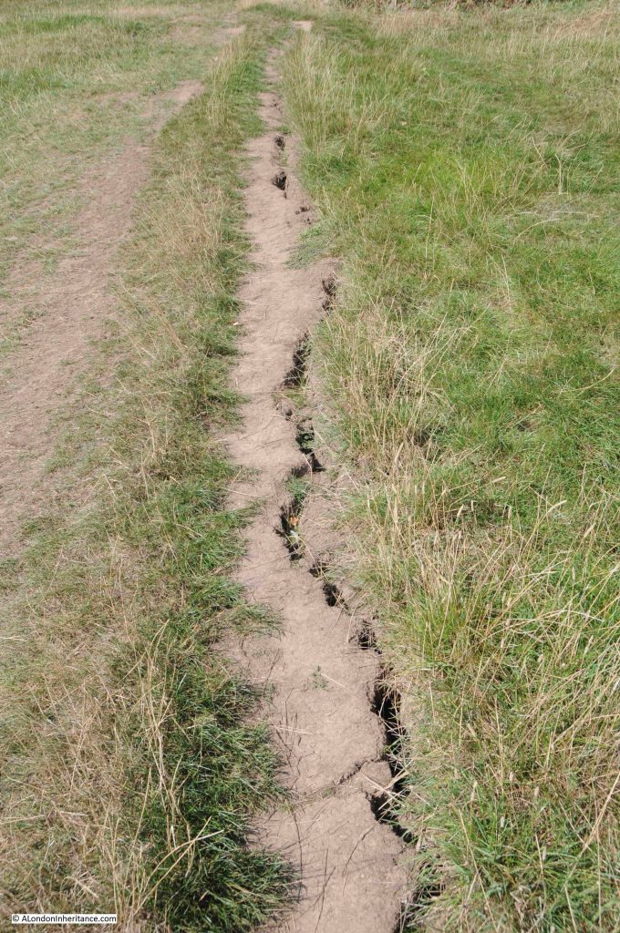
Walking down the hill into Parliament Hill Fields, there is evidence of a long hot, dry summer:
At the base of the hill, as well as the Lido, there is an athletics track. The track itself has recently been refurbished, and I believe that that the original facility dates from 1938, and this is when there were newspaper reports of the “opening of the new L.C.C. track at Parliament Field”, and the brick build and design of the buildings facing onto the track are of a similar design and material to those of the Lido:
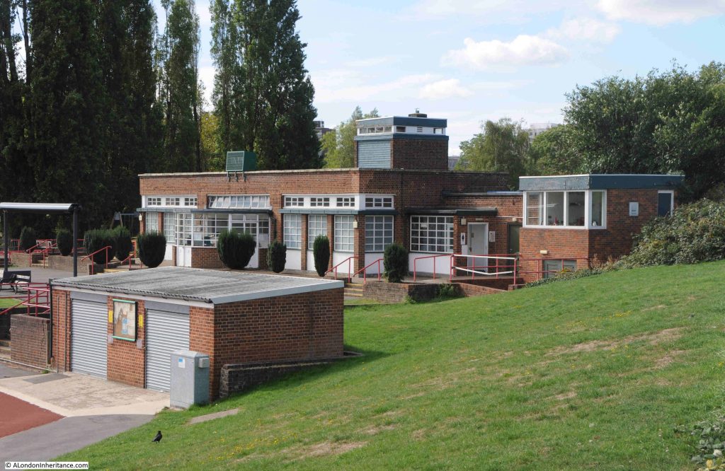
That Parliament Hill survives today as a public open space is down to a campaign in the 1880s.

In the later part of the 19th century, the hill was at risk of development. Houses had been springing up in the desirable areas around Hampstead, Highgate and Parliament Hill, and what the press called “The Battle of Parliament Hill” was a campaign to keep the hill free of housing, and retained as a public space.

This came about as a result of the Hampstead Heath Enlargement Act of 1886. The aims of the act was described in the Pall Mall Budget of the 20th October 1887:

“In the first place, the object sought for is the enlargement of Hampstead Heath, but is in reality the preservation of it. The actual proposal was the acquisition of the open space known as Parliament Hill, which, of, course, would, to that extent, be an enlargement of Hampstead Heath. But the point to be most insisted upon is that if Parliament Hill be not acquired Hampstead Heath would be spoiled. For one thing, half its beauty will be destroyed; but it is not the aesthetic consideration that we wish now to place in the forefront, although the destruction of all Coleridge saw ‘looking down from Hampstead Heath’ would of itself be no mean loss. More important, however, than a supply of food for the aesthetic sense, is a supply of fresh air for the lungs, and if Parliament Hill were once to be covered in bricks and mortar the health giving quality of Hampstead Heath would be destroyed.”

Parliament Hill was purchased for the public in 1887 for £300,000.

There is an ancient tumulus on the northern side of the hill, which has been excavated, but nothing was found within.

A child did find what was classed as treasure trove on the hill in 1892, reported from the time as “A small boy called Haynes has been the lucky finder of treasure, including coin and antique silver vessels, while playing with a toy spade in Parliament Hill fields. Valued at £2,000, the treasure trove has formally been taken over by the Crown and the lad’s compensation will be the bullion value of the articles only.”

Parliament Hill has also attracted myths and theories about the use of the place in antiquity. In the book Prehistoric London – It’s Mounds and Circle by E.O. Gordon (1932), Gordon claims the hill as an ancient meeting place and also places the hill at the northern corner of a triangular alignment of key London mounds:
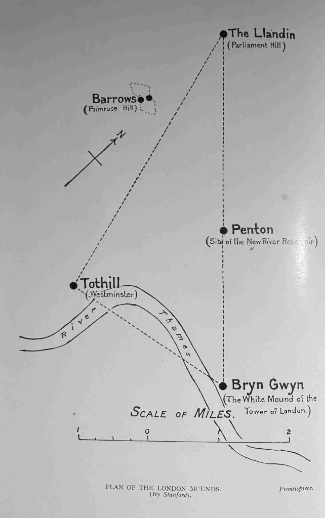
With the view across London, and across to the hills in the south, Parliament Hill has long been a place where people would stand and look, a place to look across to the hills that surround London to the south, and it is a special place, although probably not in the way E.O. Gordon thought about the place.

Parliament Hill or Traitors Hill – both names have their origins in events in the 17th century, and in the late 19th century the Parliament Hill was saved from the bricks and mortar spreading across London, so we can continue to stand and gaze across the city to this day.

alondoninheritance.com

London Maps in Books – 2

If you are interested in one of my walks, the following two walks have a few space available. Click for details and booking:

From the Strand to the Old Thames Shoreline: Transformation of a River Bank on Saturday October 18th

From the Strand to the Old Thames Shoreline: Transformation of a River Bank on Sunday October 19th

As any regular reader will know, I find old books and maps about London fascinating, and when the two combine, it is the perfect way to understand some of London’s history.

This is my second post featuring maps from books about London (you can read the first here), and these maps cover a range of areas and themes.

Some of the maps in today’s post are 200 years old, and are printed on thin, folded paper, so the photos are not perfect as I did not want to stretch or flatten the paper.

Click on the image to see each map in more detail.

The first map is from:

Fleet Street in Seven Centuries

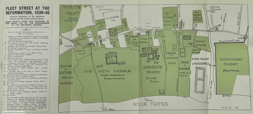
This book, by Walter George Bell was published in 1912. It is a detailed book of some 600 pages covering the history of Fleet Street, and includes a fold out map showing Fleet Street at the Reformation, 1538 – 40, and shows the property belonging to the religious houses and clergy and is based mainly upon the seizures of King Henry VIII at the suppression of the religious houses:

The map shows just how much property was owned by religious institutions. The small details within the map bring out features that require some follow-up, for example:

At number 9 there is a small property that is identified as “Priory of Ankerwyke”.

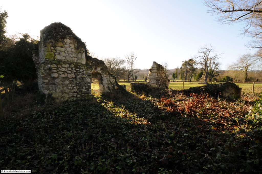
I assume it is the same place, but back in 2017 I wrote a blog post about the ruins of the Priory of Ankerwycke (a slight difference in spelling), along with an ancient yew tree.

Ankerwycke is on the banks of the Thames, to the south west of Heathrow Airport, and there is a really nice walk to the site from Wraysbury station (45 minutes from Waterloo station).

It was a Benedictine Priory, dedicated to St. Mary Magdalene. A small priory with only six or seven nuns and a Prioress at the start of the 16th Century with an annual income of £20. The Priory was founded at Ankerwycke around 1160 and closed during the dissolution in 1536. Today only a small part of the old Priory buildings survive:

Assuming that it is the same place, it demonstrates the importance of having a presence in London if even such a small Priory had a property on Fleet Street.

The map shows St. Bride’s Church, which we can still see today, and includes a location for the Bride Well in the churchyard.

Hanging Sword Alley is also shown, a name we can still find today, but with an altered orientation.

There are a number of pubs; including the Queen’s Head Tavern, the Bolt-in-Tun, The Boar’s Head the Cock and Key Tavern (next to Cock and Key Alley). Many of these seem to have an association with one of the religious institutions.

Four sets of stairs are also shown, and Temple Stairs is shown correctly as having a longer extension into the river. Temple Stairs had a small bridge like structure out from the foreshore (see towards the end of this post).

The History and Antiquities of the Parish of Islington

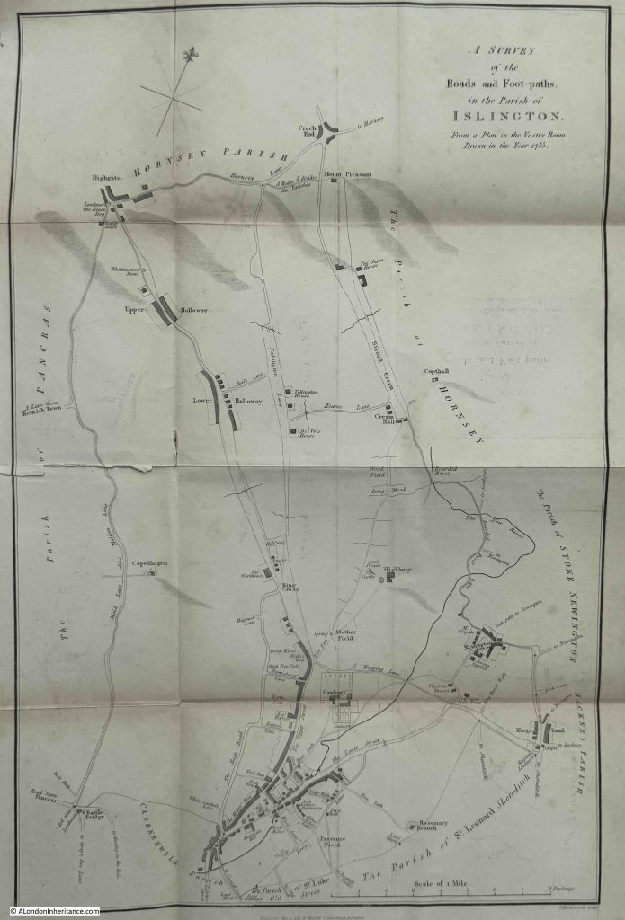
This book by John Nelson was publish in 1829, and inside the front cover is a very delicate map – A Survey of the Roads and Footpaths in the Parish of Islington. From a Plan in the Vestry Room, Drawn in the Year 1735:

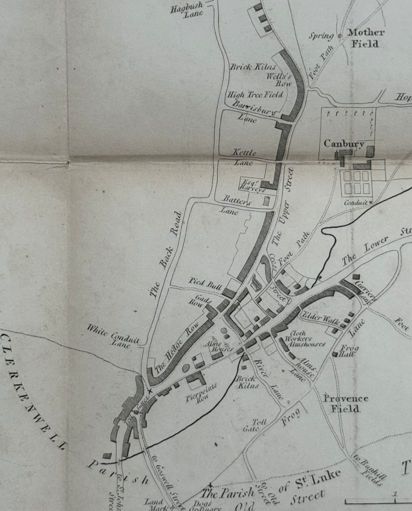
There is not that much on the map, no network of streets, large blocks of land owned by religious institutions etc. but what the map does show is how London has changed in 300 years. From an area where tiny little hamlets could still be found among the fields, where the New River, in 1735 over a century old, wound through the landscape, and where the layout of the core of Islington around the Angel, is the same then, as it is today, as shown in the following extract:

There is the same triangular arrangement below Hedge Row towards the lower centre of the map, and area which today is Islington Green.

Upper Street has the same name today, also known as the A1, and for long a major road from London to the north, and Lower Street to the right is now Essex Street.

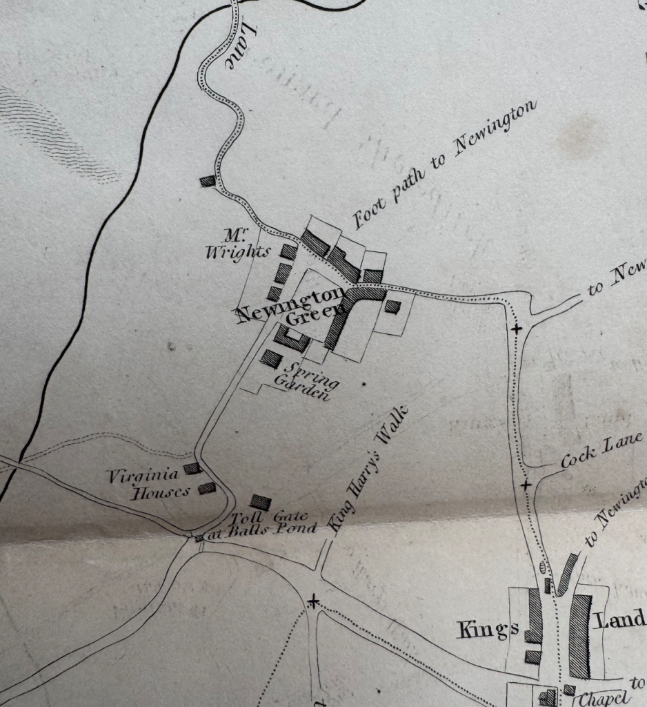
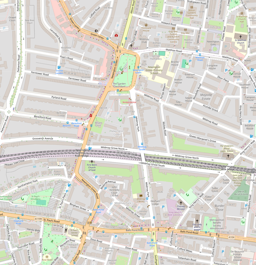
Many place names remain to this day, but have been transformed from small hamlets, for example Newington Green:

Newington Green is interesting, because we can still see some of the features of the streets today.
In the above extract, the houses of Newington Green are clustered around a central green. From the lower left of the green, a road runs south, but then curves around Virginia Houses.

If we look at the map day, there is still a central green, at the heart of Newington Green (upper centre of the map. Follow the road that runs from the lower left corner, and after it passes under the railway lines, it follows the same curve (allowing for some straightening over the centuries, as in the 1735 map, down to the junction with Balls Pond Road. so this curve of Newington Green Road is probably down to the boundaries of the Virginia Houses properties:

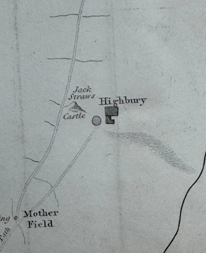
Other hamlets that have been transformed into landmark place names of today include Highbury:

There is a feature by the name of Jack Straws Castle to the left of Highbury. The book provides the following explanation for the name:

“The haughtiness and ambition of the knights Hospitallers, and the excessive riches that they accumulated, gave such offence to the community at this period, that in the insurrection under Wat Tyler, A.D. 1381, after totally consuming with fire their magnificent priory in St. John’s Street near Smithfield, causing it to burn by the space of seven days together, and not suffering any to quench it, a detachment of the mob proceeded with the same intention to the Prior’s country house at Highbury. Jack Straw, one of the leaders, appears to have headed the party engaged in tis affair, the number of which, as we are informed by Holinshead, was estimated at 20,000, who took it in hand to ruinate the house, from which circumstance, and having perhaps made the spot a temporary station for himself and his followers, the place was afterwards called Jack Straw’s Castle, by which name it continues to be known to the present day.”

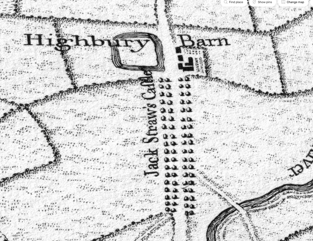
In Rocque’s map of 1746, the tree lined route to Jack Straw’s Castle today is Highbury Grove and the name Highbury Barn is still used for the pub at what was once the core of Highbury, long before the name became associated with a football club that had moved from Woolwich Arsenal in 1913:

From the roads and footpaths of Islington, we head south to:

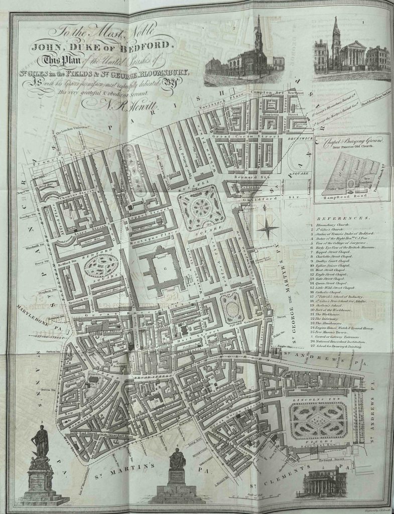
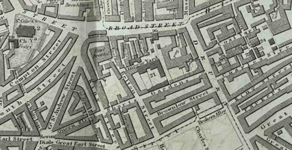
The History of the United Parishes of St. Giles in the Fields and St. George Bloomsbury

This book by Rowland Dobie and published in 1829 states that it combines “strictures on their parochial government, and a variety of information of local and general interest”, and it also includes a delicate, fold out map:

This book is interesting, not just for the historical content, but also it is a book with an agenda.

The preface to the book starts with the following paragraph:

“In the early part of 1828, an Association was formed in the United Parishes of St. Giles in the Fields and St. George Bloomsbury, for the laudable purpose of investigating and correcting the abuses which had too long prevailed under the government of a Select Vestry, possessing no claims to power but what was founded on assumption and usurpation.”

Local politics have long been a place of disagreement and controversy.

It seems that a Mr. Parton, the late clerk of the Vestry of the parishes had collected material for a historical account of the parishes, which was published in an imperfect states after his death.

Although he could not defend himself, the author of the book with the map, goes on to state that:

“Occupying a station both lucrative and influential, Mr. Parton too frequently forgot the impartial province of the historian in his zeal for advocating the cause of the assumed Vestry under whom he held his appointment.”

1829, the year of the book’s publication was also the year when the “pretended select Vestry” of St. Giles was overthrown in a Court, which Rowland Dobie, the author of the book, celebrated in his preface, as an act which would “establish the long-lost rights of the parishioners of St. Giles”.

Returning to the map, and we can see how the combined parishes had developed.

The area south of Great Russel Street was of older streets, whilst to the north there is the more formal development of the land owned by the Duke of Bedford, where we see with more widely spaced, straight streets.

If the map was completed shortly before the publication of the book in 1829, then the map shows the newly completed British Museum, following the demolition of Montague House which had been on the same site, and had been the first home of the British Museum from 1759.

Many of the sites within the map are numbered, and at number 21 (in the centre of the following extract) was the Workhouse, where the poor and needy of the parish would have ended up

The Workhouse shown in the map was the second to serve St. Giles. The first had been pulled down when Seven Dials had been redeveloped. The new Workhouse was build on land purchased for £2,252 10 shillings, and would support not just the Workhouse, but also a hospital and burial ground.

The expectation was that the Workhouse would expect “the poor to be relieved amounted to upwards of 840 persons, at an expense of above £4,000 a year”. A considerable sum, and the book uses extracts from Vestry minutes to highlight the problems of raising such an amount

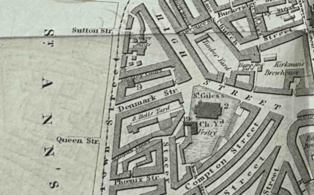
On the western edge of the parish was Denmark Street which led to Crown Street (at the time of the book, Charing Cross Road had not yet been formed from a widened and lengthen street we see today):

Denmark Street would later become an important player in 20th century British popular music. The street just survives today, whilst the area to the north of Denmark Street has been significantly redeveloped, included the dazzling lights of the Outernet.

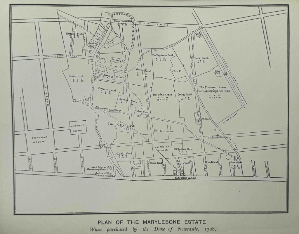
Marylebone and St. Pancras. Their History, Celebrities, Buildings and Institutions

Marylebone and St. Pancras by George Clinch was published in 1890, and includes the following map showing the plan of the Marylebone estate as it was when purchased by the Duke of Newcastle in 1708, with some of the planned new streets of the developed area shown overlaid on the fields of the original estate (the eventual redevelopment would be slightly different):

It is usually easy to see in London, whether streets were developed as part of an area development, or whether they were part of a centuries old street plan that had just followed original field or land boundaries, navigated obstacles, or followed the preferred routes for travellers.

In the above map, the new streets run straight across the fields, whilst Marylebone Lane follows a more natural route that aligns with the street’s long history.

Names such as the Clay Pitt provide an indication of what the fields were used for, with Dung Field being a rather descriptive name for the field’s use.

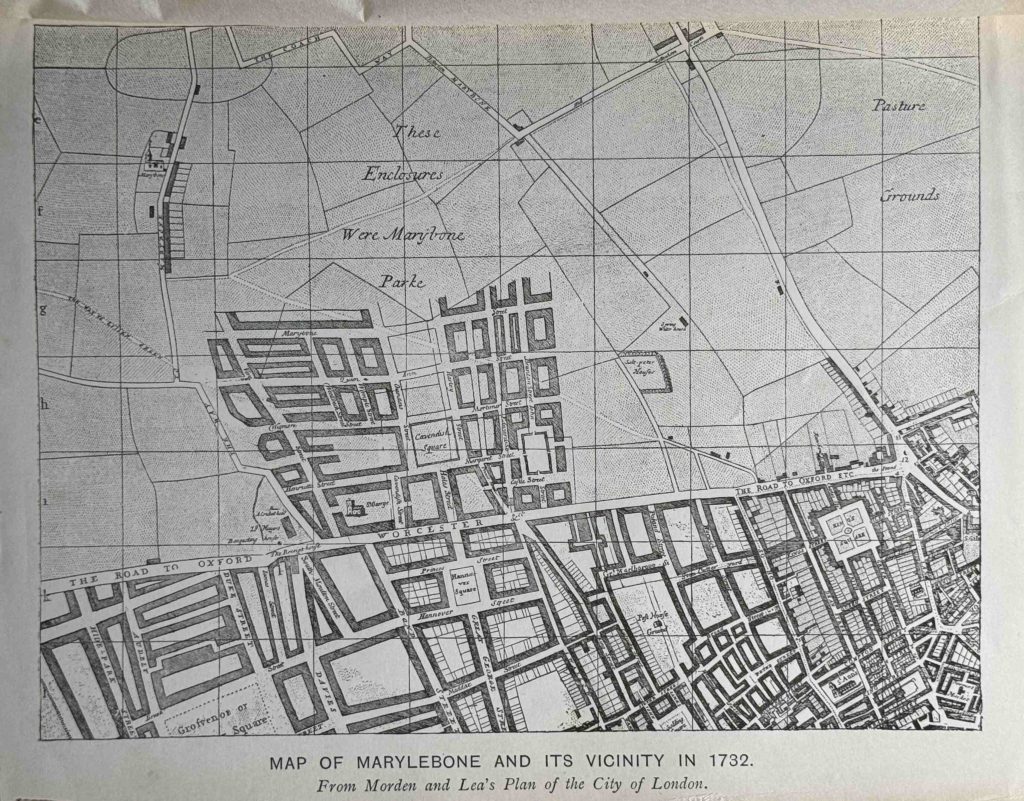
The actual development of the area is shown in the following map from the book, using Morden and Lea’s Plan of the City of London from 1732:

The map shows how these new estates were developed over once rural land. It must have been strange to see this new block of streets and large houses extending northwards whilst the surrounding land was still fields. An indication of what would happen to all the land in the map over the coming decades.

A Chronicle of Blemundsbury

A Chronicle of Blemundsey by Walter Blott F.R.Hist. S. published in 1892 has the sub title of “A record of St. Giles in the Felds and Bloomsbury, with original maps, drawings and deeds”, and it is packed with information across its 400 pages.

The name Blemundsbury in the title is the original name of Bloomsbury. Nearly every history of Bloomsbury gives the origin of the name as being from the Norman landowner William De Blemond. Blott’s book provides an alternative source as Blemond being corrupted from Bellemont, the name of the original Norman lord who owned the manor.

Another indication of how there always appears to be different stories for history going back 1,000 years.

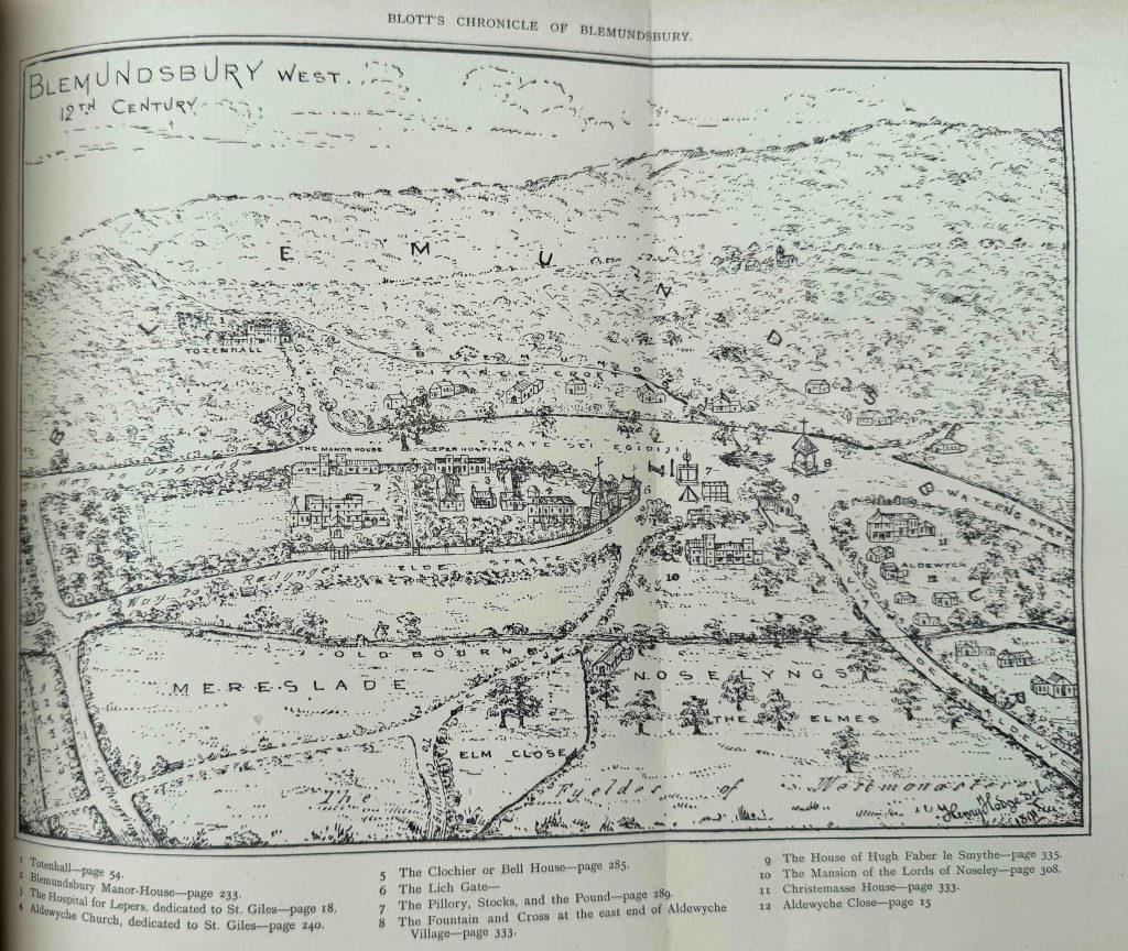
In Blott’s Chronicle of Blemundsey, he states that the original Manor of Blemundsey covered a far larger area than that of Bloomsbury today, covering an area from around Tottenham Court Road / Charing Cross Road in the west, to the River Fleet in the east, and he includes two maps to show a 12th century view.

This is Blemundsburys West:

Again, it is always difficult to know how accurate maps which claim to represent an area some hundreds of years earlier. really are. The book does reference a range of earlier maps, deeds, records etc. and many of the features shown in the maps can be found in other sources, so it is probably a reasonably good representation of the area in the 12th century.

There are a number of interesting features. In the above map, the road leading to the lower right corner, labelled Via de Aldwych is today Drury Lane. The street running to the right, labelled Watling Street is High Holborn.

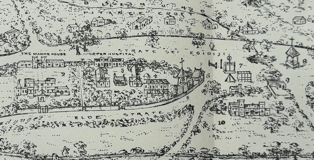
In the middle is a large open space where a number of roads meet, and to the left, a built area, shown in more detail below:

In the middle left is number 3, which in the key is the Hospital for Lepers. The book states that the founding of the hospital was down to Queen Matilda (also known as Maud, the wife of Henry I), and that it dates from 1108 to 1117 (the later date is the most commonly quoted date, the earlier date is probably the founding of the hospital and the later is the consecration).

The hospital was taken by Henry VIII, and in 1542 the old chapel of the hospital became a parish church, and the latest rebuild of the parish church is today the church of St. Giles in the Fields. The later part of the name of the church describes the area around the church when it became the parish church as this was still an undeveloped part of London. The chapel is number 4 in the map.

In the open space at the road junction is a number of items of public punishment with number 7 identifying the Pillory, Stocks and Pound.

Number 8 is the Fountain and Cross. A cross was often a feature of key road junctions, and today a street name such as Redcross Street by the Barbican is a reminder of when these features were to be seen.

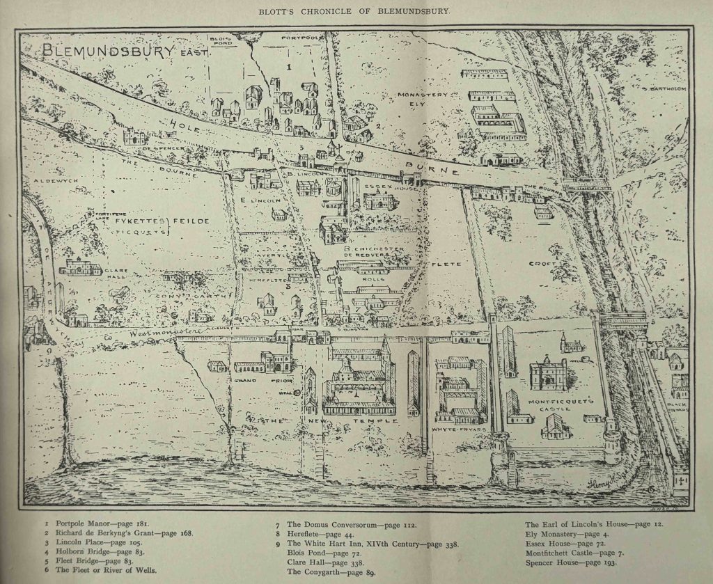
The book also includes a map of Blemundsbury East:

On the left of this map is Via de Aldewych (Drury Lane), to where is meets “the way to Westminster”, today Fleet Street and the Strand.

On the right is the River Fleet with the bridges between Ludgate Hill and Fleet Street on the lower part of the Fleet and the bridge leading to Holborn across the upper part.

In a previous post on Strand Lane, I quoted a reference from a 1709 publication that there were once 311 open channels of water crossing the route between Westminster Hall and the Royal Exchange, and the above map extract does confirm there were a number of channels (although 311 does seem rather high).

Along the top edge of the map there is a Blois Pond. The book gives the source of the name of the pond as “Alexander de Blois, Archdeacon of Salisbury and Chief Justice of England had just succeeded Bishop Bloet and taken his residence in Lincoln’s Inn, by the Old Temple. On the opposite side of the way was a pond which afterwards bore his name – Blois Pond”. This seems to date from the early 12th century.

A stream leads south from the pond, then seems to disappear after reaching Holborn.

Further south, along the edge of the Thames, as well as the Fleet, we can see three other channels that have an outlet into the river.

There are also a number of stairs along the edge of the river which again confirms the age of these structures.

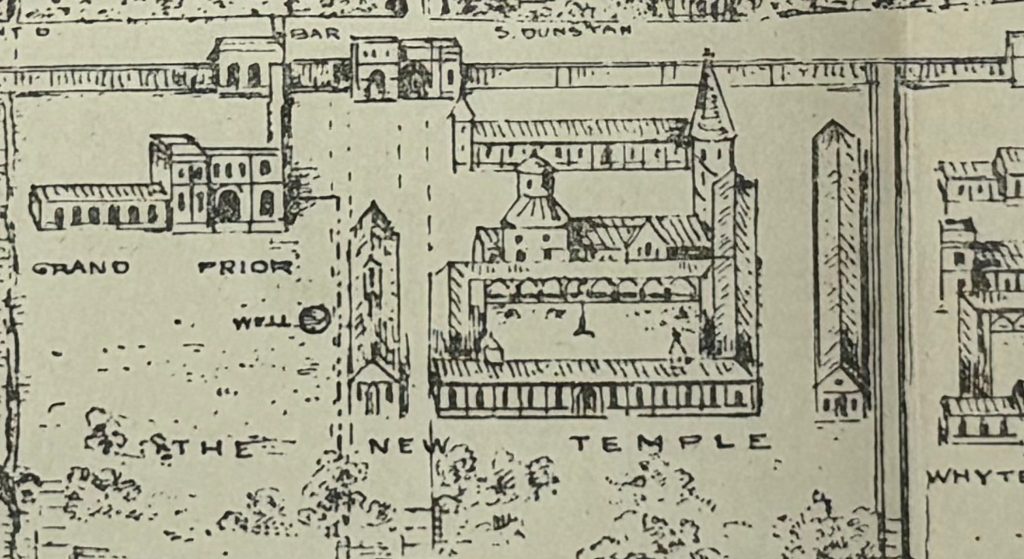
The following extract shows the distinct round tower of the Temple Church within the New Temple:

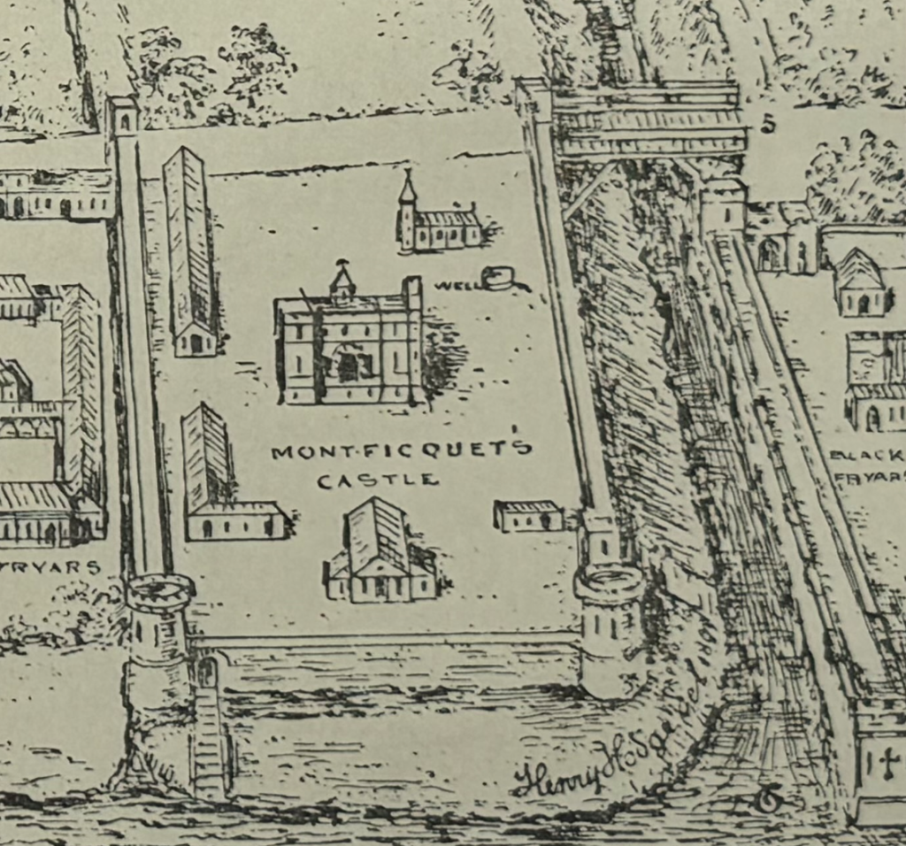
To the lower right of the map is a feature named Montficquet’s Castle (or Montfitchett Castle in the key):

The location of this “castle” is really confusing. Nearly all references to this castle mainly refer to it being a Tower, and across the Fleet in the Ward of Castle Baynard. So to the east side of the Fleet, not the western side as shown in the map.

In a Dictionary of London, Henry Harben refers to Montficquet as follows: “Montfiquit (Tower of) – Near the Wall of London, next to Castle Baynard, in the Ward of Castle Baynard, afterwards included in the precinct of Blackfriars.

Earliest mention (12th century): Land in parish of St. Martin de Ludgate in the corner opposite the land of the Dean of St. Paul’s. Stow says the castle was built by the Baron of Mountfiquit, who came over with William the Conqueror, not far distant from Baynard’s Castle.”

The inclusion of Montficquet’s Castle to the west of the Fleet shows that you need to be really careful when using historical sources, including maps. This is key when maps created centuries after the landscape they are attempting to portray. They do in general present a good representation of the area, but individual features need to be checked and verified.
With this caution in mind, a folding map in a book is a wonderful addition, and helps to tell the story of a place and how significantly London has changed. From the fields, footpaths and hamlets that are now under the streets and buildings of Islington, the rapid expansion of Marylebone, to the detail within the streets, such as the St. Giles Workhouse, after development.

alondoninheritance.com

Walking the Limehouse Cut – Part 2

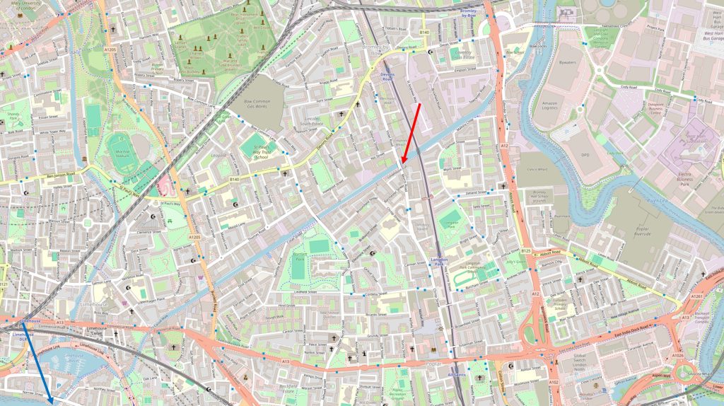
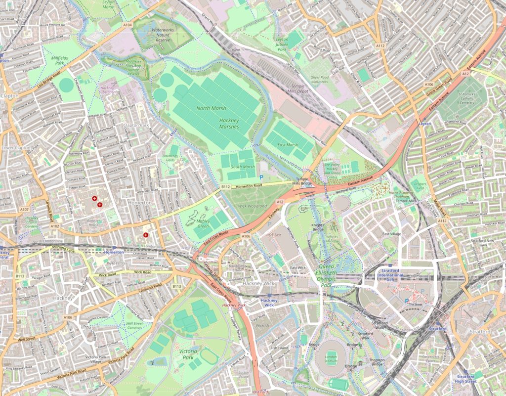
In the first part of my walk along the Limehouse Cut, I started where the Cut once entered the River Thames (blue arrow in the following map), and ended where Morris and Violet Roads cross the Cut (red arrow). In today’s post, I am continuing along the Limehouse Cut to where it meets the River Lea and walking up towards Three Mills Island (map © OpenStreetMap contributors):

From here onwards, there are not so many people walking along the tow path. The first part of the walk has been reasonably busy with walkers, joggers and cyclists.

If you do walk the same route, the only thing to watch out for is the occasional cyclist who does not give any warning of their approach, races up behind you, and when you are aware of them coming up behind, the distance is insufficient for both pedestrian and cyclist to safely move to opposite sides of the tow path. One cyclist almost ended up in the water when we both moved to the same side, and the distance between us required an emergency swerve.

This was only a single instance, the majority of cyclists are very considerate of pedestrians.

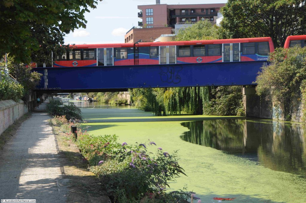
A short distance along from the Morris and Violet Roads bridge is the bridge that carries the Docklands Light Railway across the Limehouse Cut. As I passed under the bridge, a train passed above:

This is the section of the DLR that runs between Poplar and Stratford, Devons Road station to the north west and Langdon Park station to the south east. It was originally the route of the North London Railway, and on the land to the right of the above photo, there was a complex of engine and carriage sheds with multiple tracks to serve these, and provide a connection with the main railway.
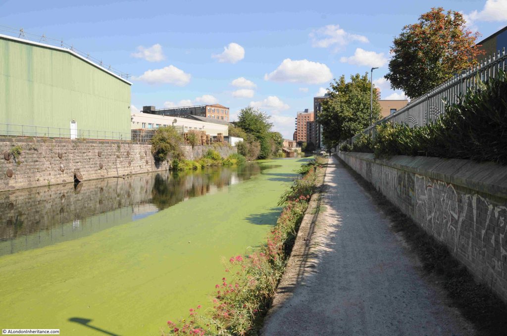
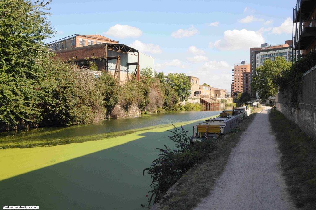
The Limehouse Cut now has a much more industrial / commercial feel to the land alongside the Cut, which probably explains why there are not so many people walking this section than along the earlier part of the walk:

Very few remains of earlier industry survive, however is the metal frame of an earlier building surrounding a new building seen to the left in the following photo. This was originally a furniture factory and what is now a rusty metal frame once extended over the Limehouse Cut to provide a gantry with facilities to load and unload barges on the water:
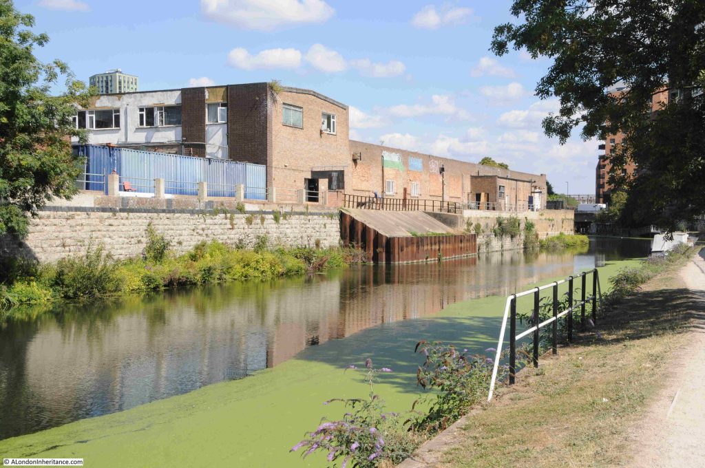
Further along there is a length of metal piling and concrete infill extending into the water. I cannot find any similar features in earlier maps, and it looks relatively new. No idea of the purpose:

For almost the entire length of the route, the Limehouse Cut has been a straight line. It was built at a time when north of a small area along the river, there was no development, so the original builders dug the Cut through what was rural land.

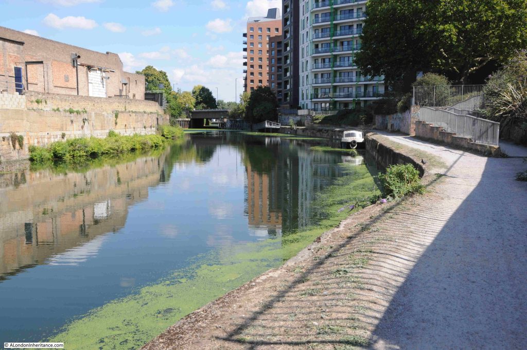
We are now though approaching the end of the Limehouse Cut and there is a slight curve in the route:

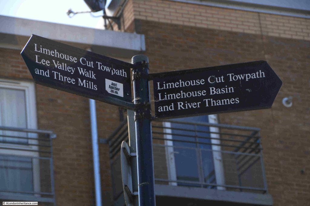
Well signposted:

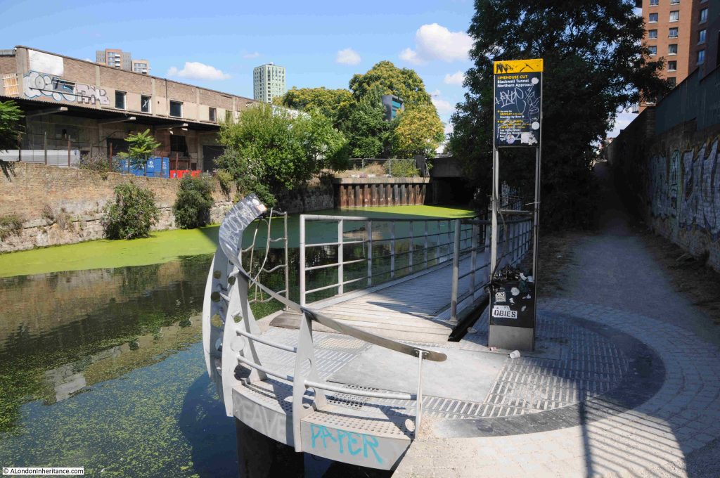
The towpath changes here and offers two routes. To the right, the footpath runs up to the six lanes of the A12 road, and to the left, and new walkway takes the walking route along the side of Limehouse Cut:

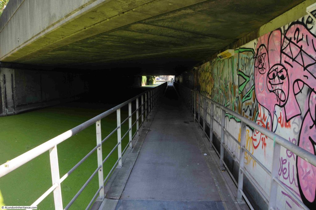
And under the A12:

This walkway was needed when the A12 was enlarged. This section has always been a narrow part of the Cut, and a place where Leonard’s Road crossed, however the routing of the A12 from Stratford down to East India Dock Road (A13) and the Blackwall Tunnel required a new, significantly larger bridge to be built.

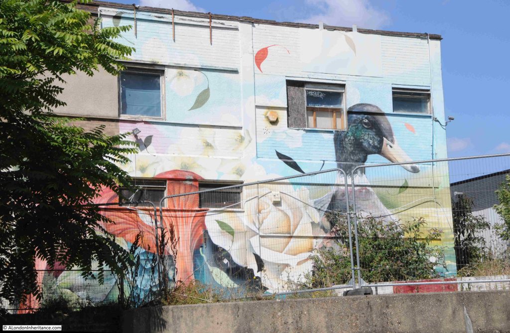
There were a good number of ducks along the length of the Limehouse Cut, and after walking under the A12, one of the breeds seen on the water has been painted on the wall of a building to the side of the Cut:

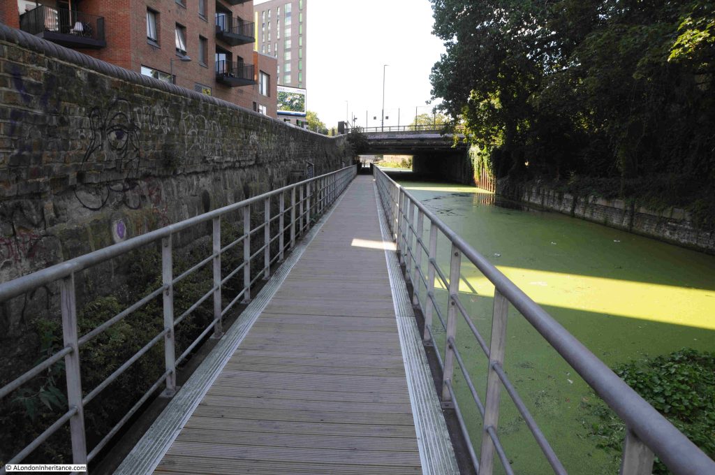
Looking back towards the bridge thar carries the A12, and next to it another bridge for Gillender Street. The original wall of the Cut can be seen on the left:

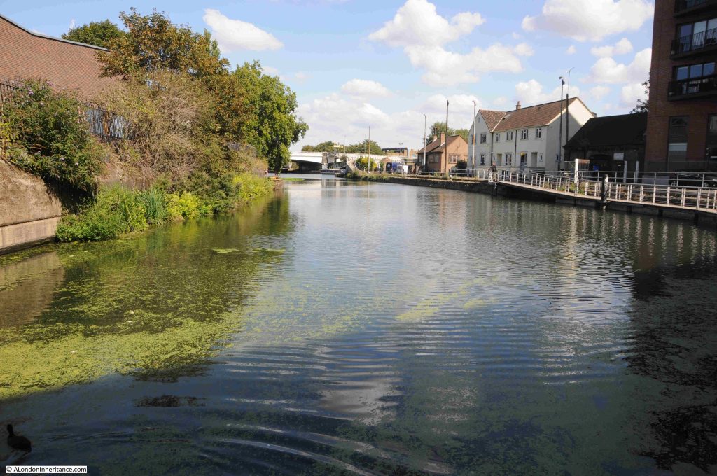
At the end of the walkway, the water opens up as we approach the River Lea:

I have been using the name River Lea throughout my posts on the Limehouse Cut, although two spellings are used for the river that the Limehouse Cut was built to bypass. Lea and Lee.

The source of the River Lea is in Bedfordshire, to the north of Luton. The river runs through Bedfordshire, Hertfordshire, on the edge of Essex before heading into Greater London.

The name Lea is used from the source to Hertforshire, and from Hertford to the Thames, both Lea and Lee are used.

The Lee comes from the Lee Navigation.

The reason why the Limehouse Cut was built was to bypass the River Lea as it ran to the east of the Isle of Dogs, to provide a more direct route to the City of London, to avoid the bends in the River Lea as it approached the Thames and to avoid the tidal sections of the Lea.

Similiar issues resulted in the construction of the Lee Navigation. This is a canal built on a parallel route to the River Lea, with an aim of smoothing out many of the bends in the Lea, providing additional space for boats, along a route where water levels could be managed. In a number of places the Lee Navigation and River Lea are combined as a single channel.

This is why a look at a map reveals a complex route of parrallel waterways, which often combine.

In the following map, the River Lea runs to the right and the Lee Navigation to the left, as they both pass through, and then head north from Stratford (map © OpenStreetMap contributors):

The River Lea had been subject to many previous attempts to manage the use of the river, make improvements and control water extraction. See my post on the New River for where this early 17th century approach for providing water supplies to the growing city met the Lea.

The 1767 River Lee Navigation Act authorised a number of improvements, including the construction of new lengths of canal, and further acts, such as the 1850 Lee Navigation Improvement Act allowed additional construction, including a number of locks along the route.

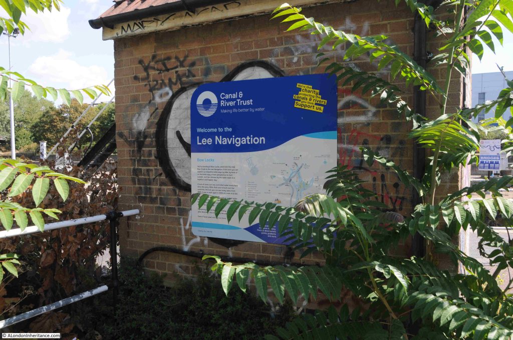
The parallel running, sometimes combining and both routes serving the same source and destination have resulted in both Lea and Lee being used, however Lea is for the river and Lee is for the Lee Navigation, the fully navigable canal system built over the last few centuries, that provides an easier to use route than the river, and we see this name as we approach the point where Limehouse Cut, Lee Navigation and River Lee combine:

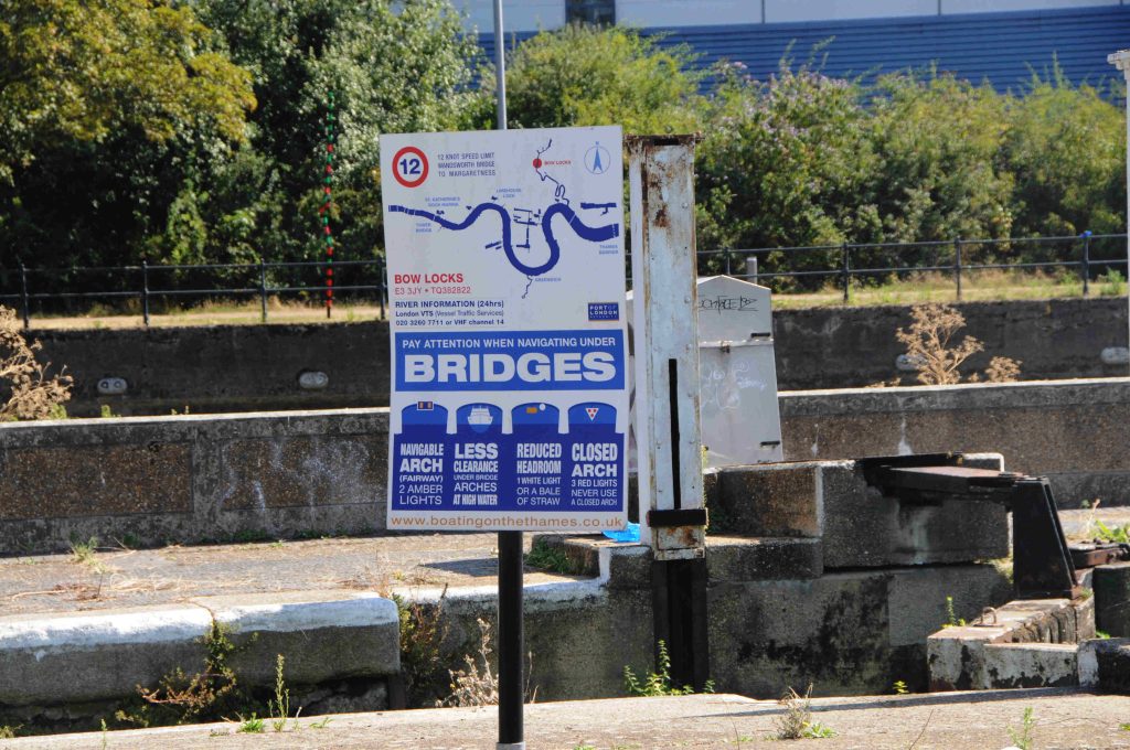
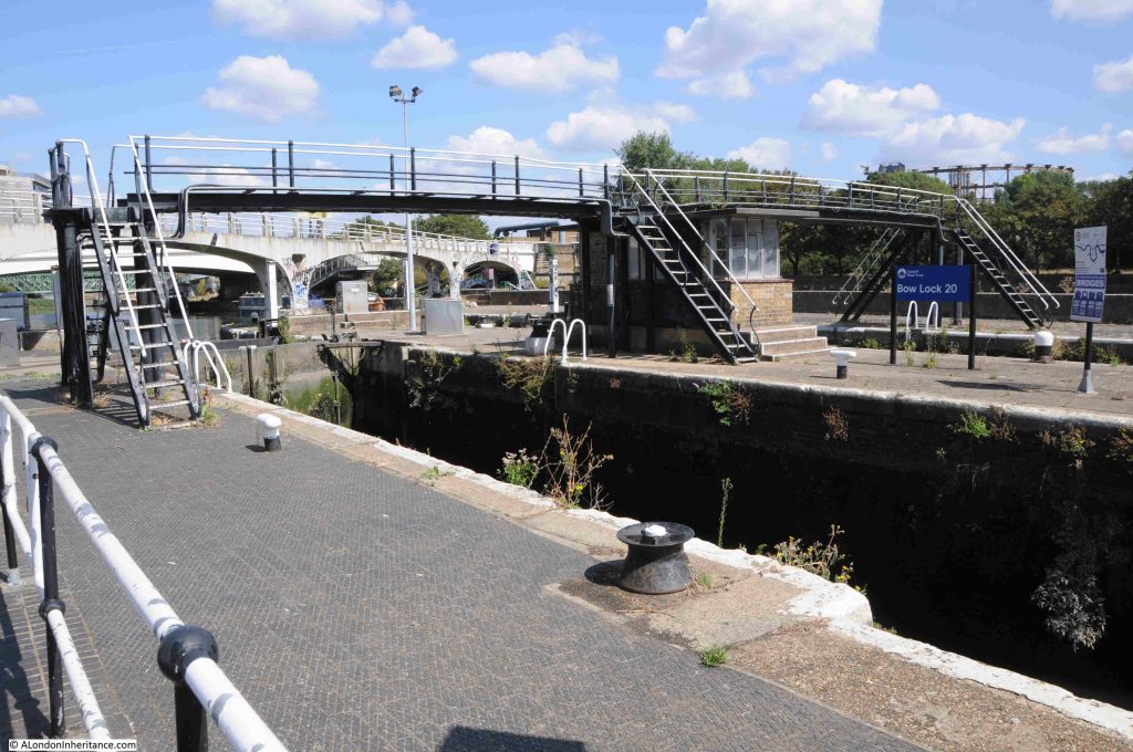
And it is here that we find the Bow Locks:

Bow Locks control access from where the Limehouse Cut meets the River Lea, and Bow Creek, also known as the River Lea which runs down to the River Thames, and is tidal:

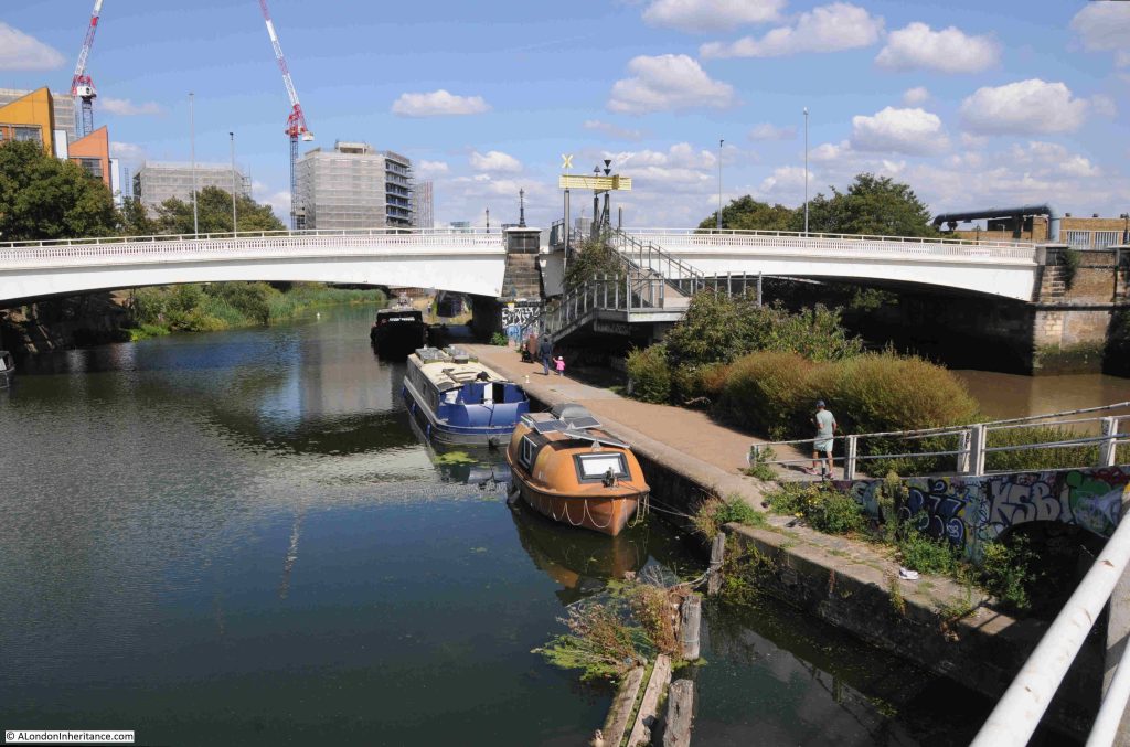
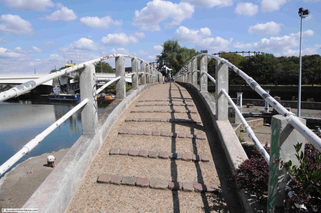
In the background of the above photo there is a grey / white bridge. This is a 1930s foot bridge that spans the waterways, and although I was at the end of the Limehouse Cut, I wanted to explore a bit further, so headed over this footbridge:

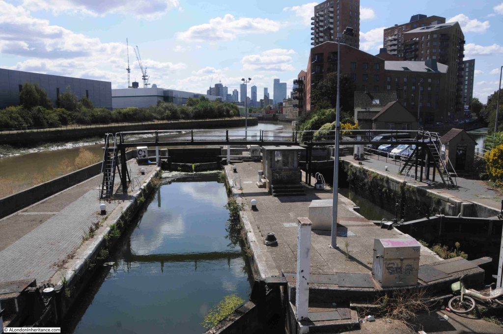
From the footbridge, we can look over the lock and along Bow Creek / River Lea as it heads towards the Thames. The mud banks on the side show that this stretch of the river is tidal, and demonstrates why the lock is needed. On the right edge of the photo, a small part of the Limehouse Cut can be seen. It is these locks that ensure there is a stable height of water in the Limehouse Cut:

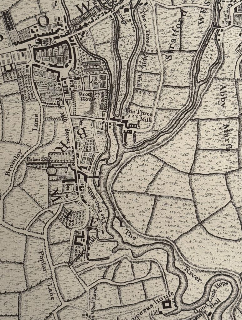
Around 20 years before the completion of the Limehouse Cut, where it joins the River Lea was an area of fields, orchards, gardens and limited housing. In the following extract from Rocque’s map of 1746, you can see the world BROMLEY curving to the left of centre. The Limehouse Cut went through the letter M as it ran from bottom left up to join the River Lea:

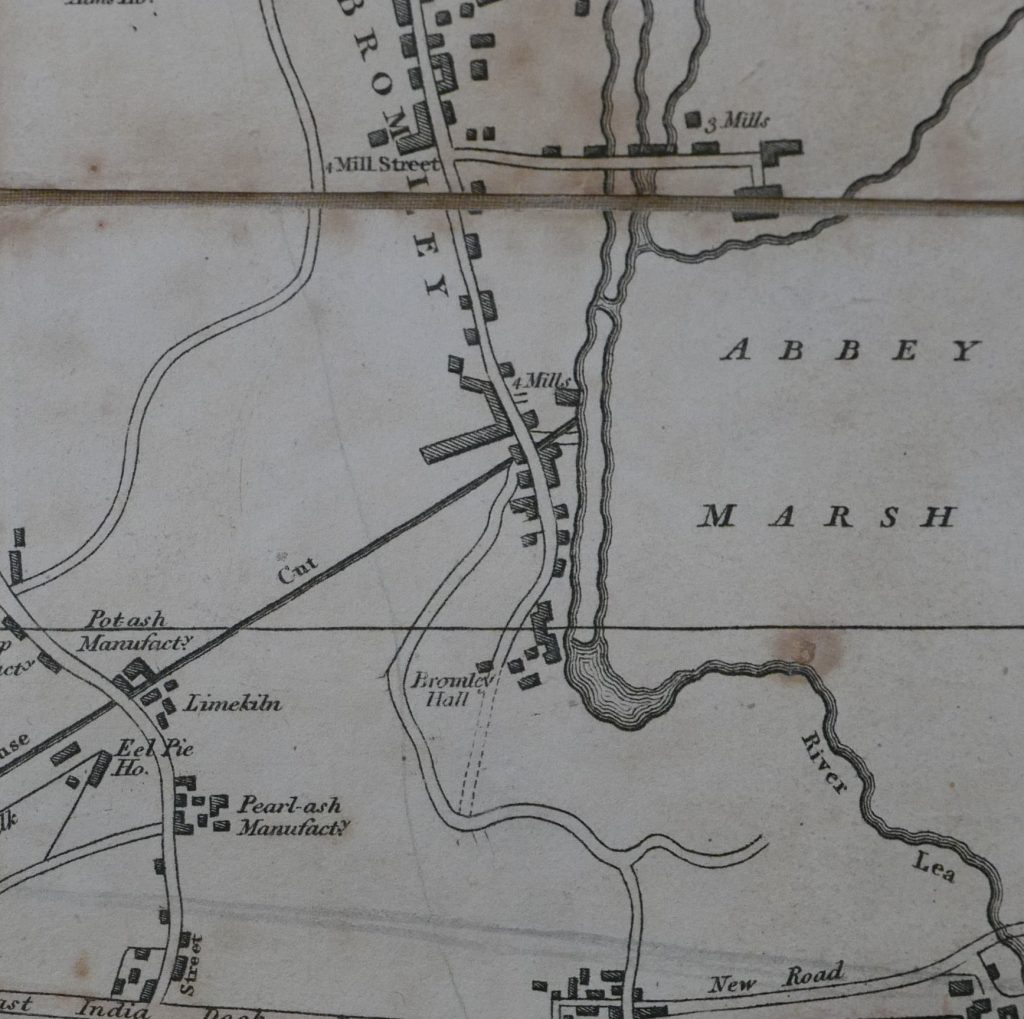
To demonstrate the complexity of the River Lea / Lea Navigation, and the associated waterways in the area, the following extract is from Smiths New Plan of London from 1816, and shows the straight line of the Limehouse Cut joining one of the strands of the Lea:

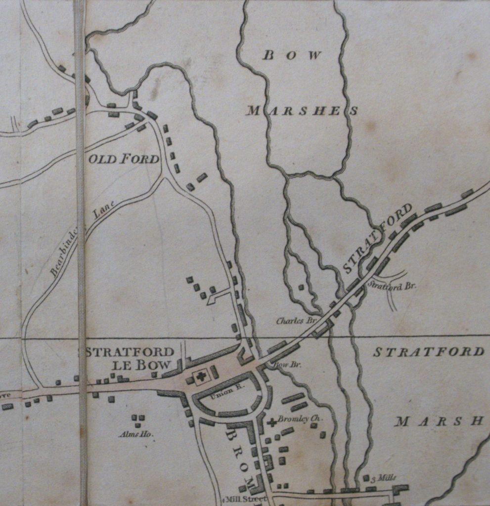
The complexity of this water network can be shown using the same map, but a bit further north in the area surrounding and to the north of Stratford. The names Stratford Marsh and Bow Marshes demonstrate the nature of the surrounding land, and how the Lea river system has had an impact on this area for centuries:

After that slight digression, I am still on the footbridge, and this is the view looking north with the bridge carrying Twelvetrees Crescent across the Lea:

The orange boat moored in the above photo is an old British Gas life boat, which I assume came from either a North Sea gas / oil rig or a ship – and is now performing a very different use.

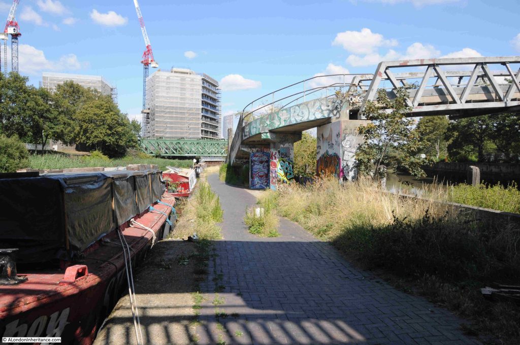
Walking under Twelvetrees Crescent Bridge, and there is a walkway that once provided access to the gas works just to the east:

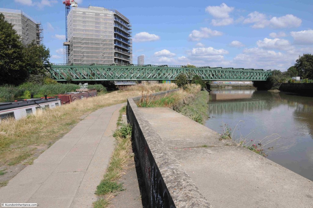
Further on is the bridge that carries both the District and the Hammersmith & City lines over the Lea:

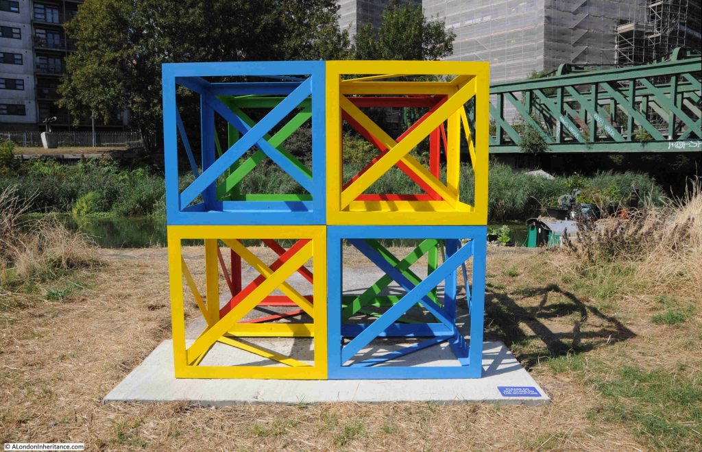
Along this stretch of the Lea is a rather isolated but colourful piece of sculpture. I knew it was sculpture as the small blue plaque on the concrete base states “Please do not climb on the sculpture”:

The sculpture is part of “The Line”, and the following is from the project’s website: “The Line is London’s first dedicated public art walk. Connecting three boroughs (Newham, Tower Hamlets and Greenwich) and following the Greenwich Meridian, it runs between Queen Elizabeth Olympic Park and The O2 on Greenwich Peninsula. The Line features an evolving programme of art installations (loans and commissioned works), projects and events, illuminating an inspiring landscape where everyone can explore art, nature and heritage for free.”

The above work is by Rasheed Araeen, who “is renowned for his use of an open cube structure with diagonal support in his sculptural works”.

A map of the route of The Line, and the works along the route, can be found at this link.

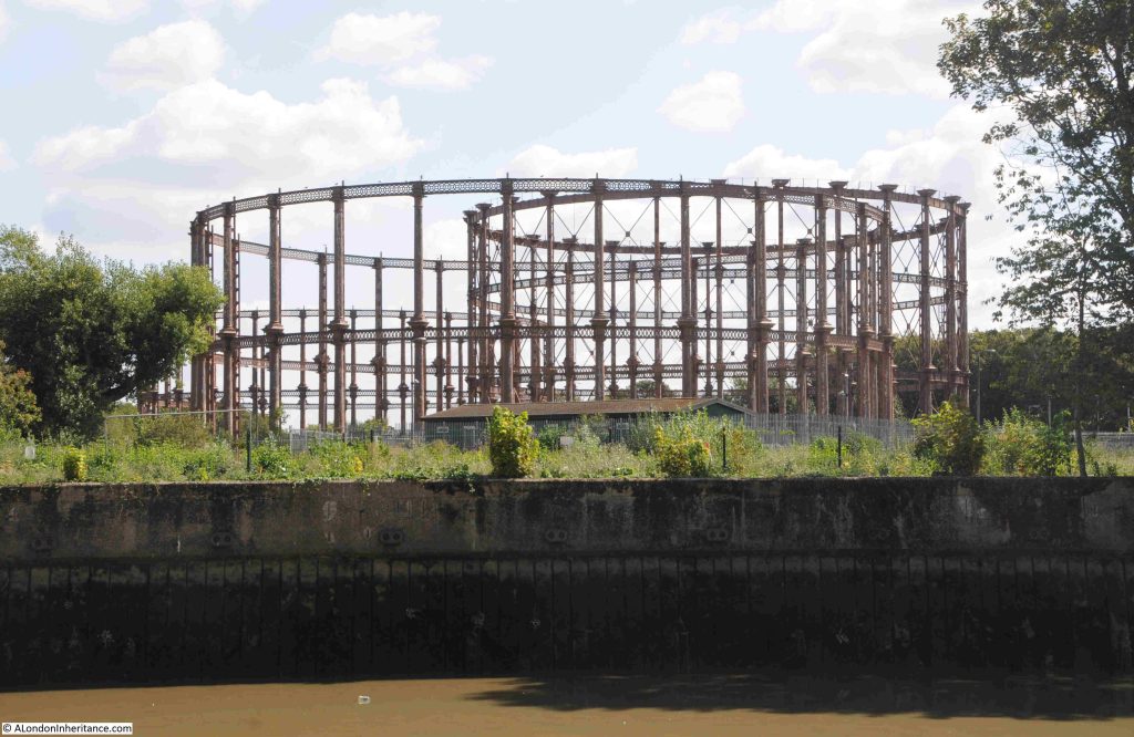
Looking across the branch of the Lea that runs to the right of where I am walking, are the old gas holders of the Bromley by Bow gas works:

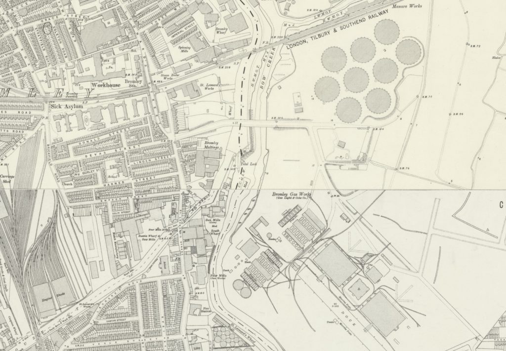
The 1914 revision of the OS map shows the round circles of the gas holders, and a short distance below is the Bromley Gas Works, who had their own dock leading from the River Lea. A small part of this dock still remains in the middle of an industrial estate which has taken over the land of the gas works:

(Map ‘Reproduced with the permission of the National Library of Scotland)

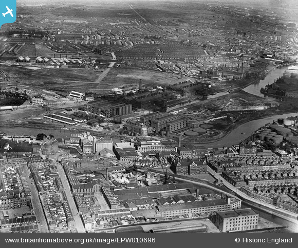
The following photo from Britain from Above shows the Bromley by Bow Gas Works in 1924. The River Lea can be seen running below the gas works buildings, and the dock that served the works can be seen coming of the Lea on the right of the photo, and running into the heart of the works. The gas holders are off to the left of the photo, a short distance from the works:

The Bromley by Bow gas works have a fascinating history and hopefully will be the subject of a future post, but for now I am continuing along the River Lea to my final stop.

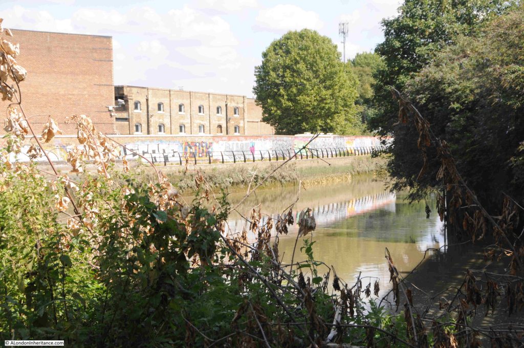
In the complex web of waterways, as we approach Three Mills Island, we can see through the trees and bushes that line the river, the Channelsea River, one of the old rivers that ran across Bow. It now runs up to Abbey Road where it disappears into a culvert, and also forms the southern part of the channels that now makes Three Mills Island, an island:

If you go back to the 1746 and 1816 maps, you will see the Channelsea River heading east from the Lea, just below the Mill.

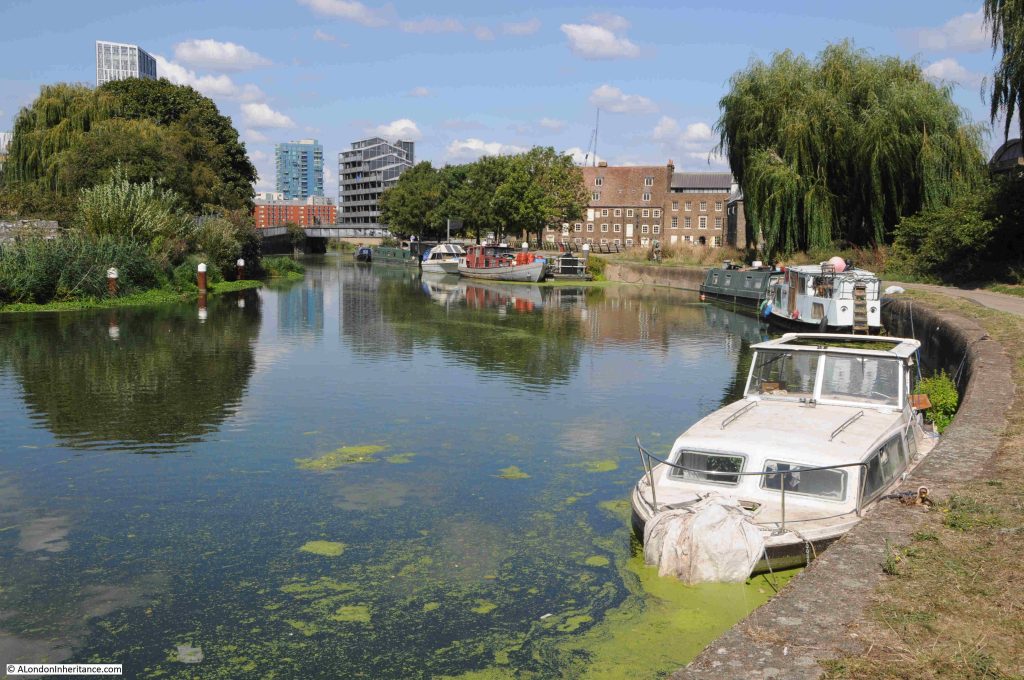
Back looking along the River Lea, and if it was not for the tower blocks in the background, this idyllic view could be deep in the countryside rather than being in east London:

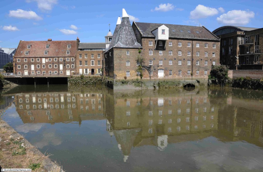
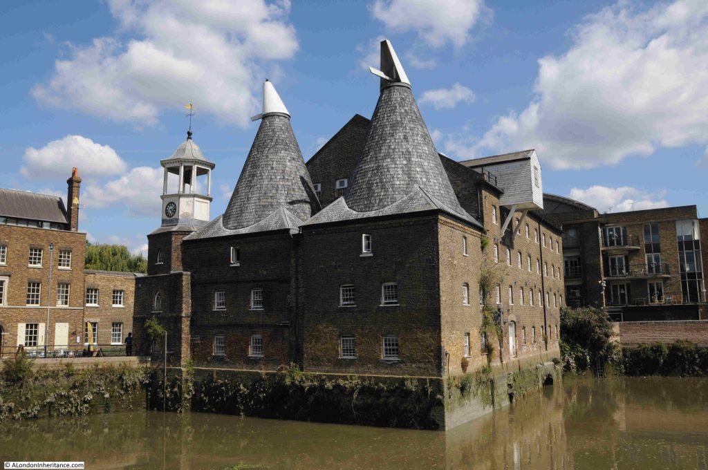
The brick buildings to the right of the above photo are those of the old mill buildings on Three Mills Island, which look glorious as you approach:

Although now an island due to the rivers that surround the site, it has not always been an island as the maps earlier in the post show. The site became an island when a channel along the east of the site was built from the Channelsea River back up to the River Lea.

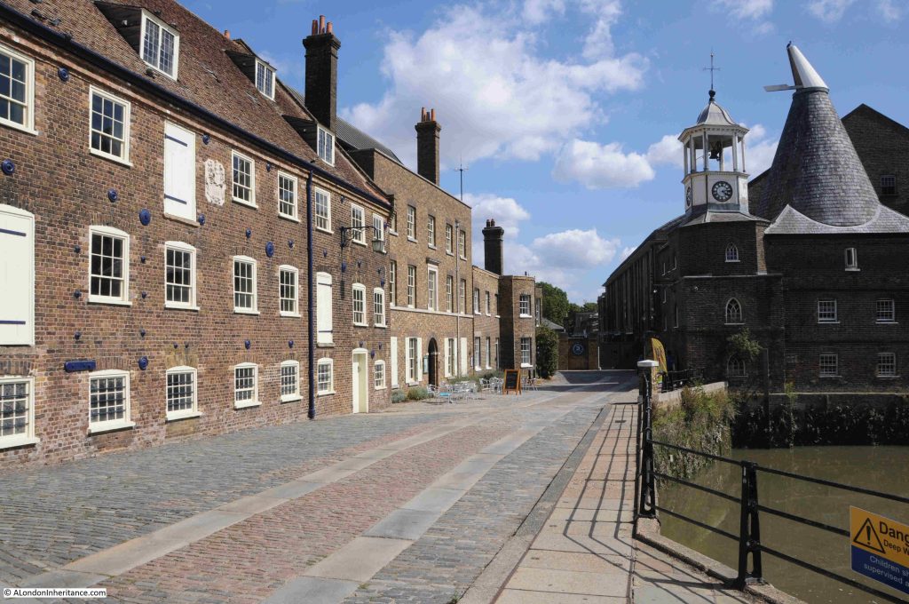
Mills have been operating here for centuries, making use of the power of the water and tides along the River Lea. The buildings that we see today are mainly 18th century and range from Grade I to Grade II listed:

Back in 1972, the Architects’ Journal featured a lenghty article on the sites in east London that were considered at risk. Bombing, post war industrial and population decline across east London resulted in a range of buildings that were considered at risk of demolition.

I started working through all the sites back in 2017, to see how many had survived. The first post in the series is here. I still have a small number to finish off.

Given what a wonderful set of buildings we see today, it is surprise (or perhaps not given the attitude to many old industrial buildings at the time), that the mill buildings were considered at risk, including what is the world’s largest surviving tidal mill.

At the end of the street in the above photo is 3 Mills Studio, a studio complex built on the site of the Three Mills Distillery, and the studios where Master Chef is filmed.

As with the gas works, the history of this site deserves a dedicated post, which will hopefully appear in the not too distant future.

It is a really interesting walk along the Limehouse Cut from the old entrance to the Thames, up to the River Lea, and along the Lea to Three Mills Island.

Limehouse DLR station is near the start of the walk and Bromley by Bow station is a short walk from the end (walk to the north of the nearby Tesco store, underneath the A12, then south to the station.

The Limehouse Cut was a clever answer to the challenges of 18th century cargo transport from the Lea to the City of London, along with the docks and industry along the Thames from Limehouse to the City.

The Limehouse Cut eliminated the need for a long detour around the Isle of Dogs, the curving southern stretch of the Lea into the Thames, and the tidal challenges of this stretch of river.

Today it provides the route for a fascinating walk.

alondoninheritance.com

There is Something Missing on the Southbank and Resources

I was going to continue my journey along the Limehouse Cut in today’s post. However, it is the first post of a new month, when I feature a Resources section in the post, looking at resources to help with researching and exploring London, so to keep the post to a reasonable size, I am starting with a different subject.

Also, the problems with the blog that I mentioned a few weeks ago have been reoccurring, with the site occasionally going off line, and also with very slow performance. I hope to be able to bring in some additional technical support to try and get this resolved this coming week, but if the blog and posts disappear for a while, it will be back.

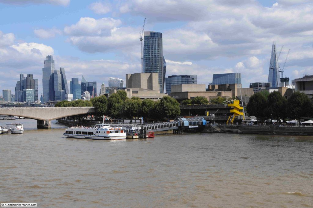
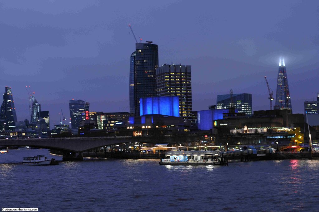
Last weekend I was walking across the footbridge alongside Hungerford Bridge, looking over at the very familiar view towards Waterloo Bridge, the City and along the Southbank, when I noticed that there was something missing:

For those of a certain age, the following clip may offer a clue:

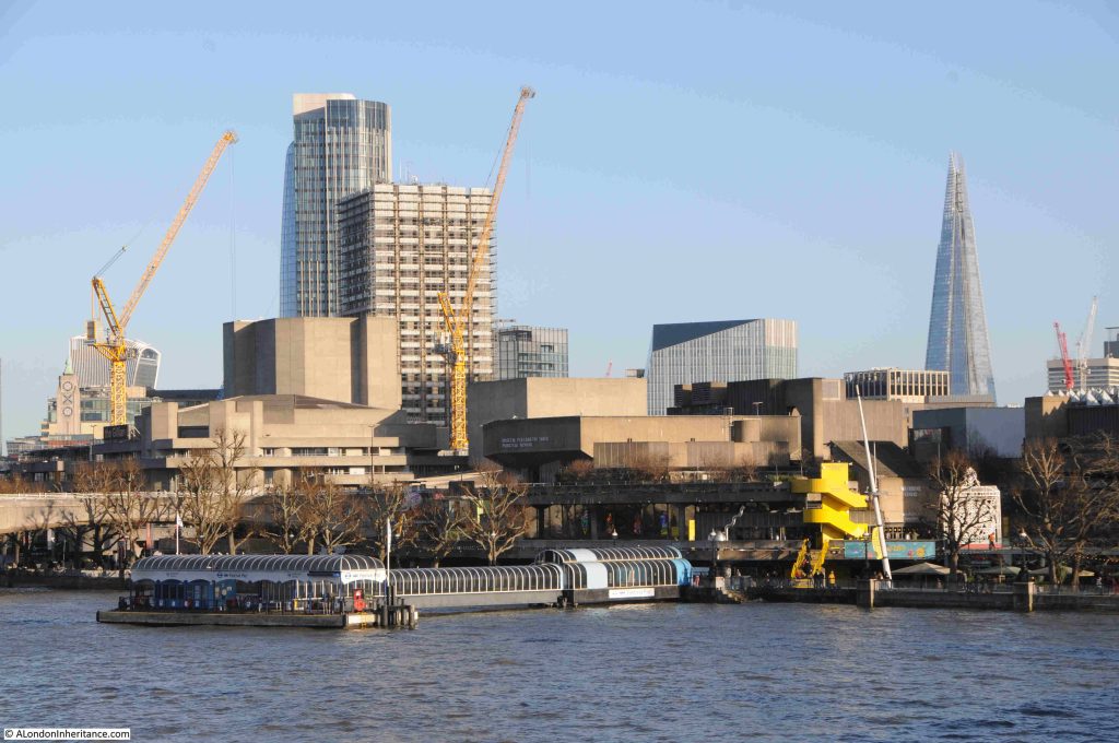
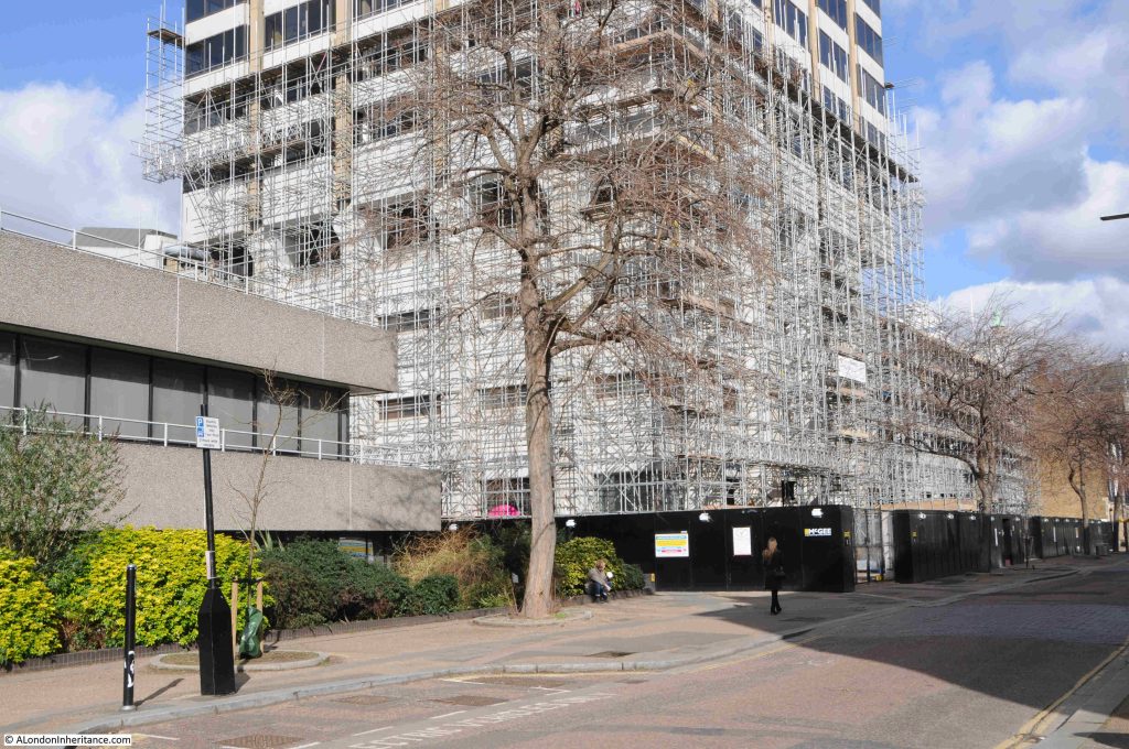
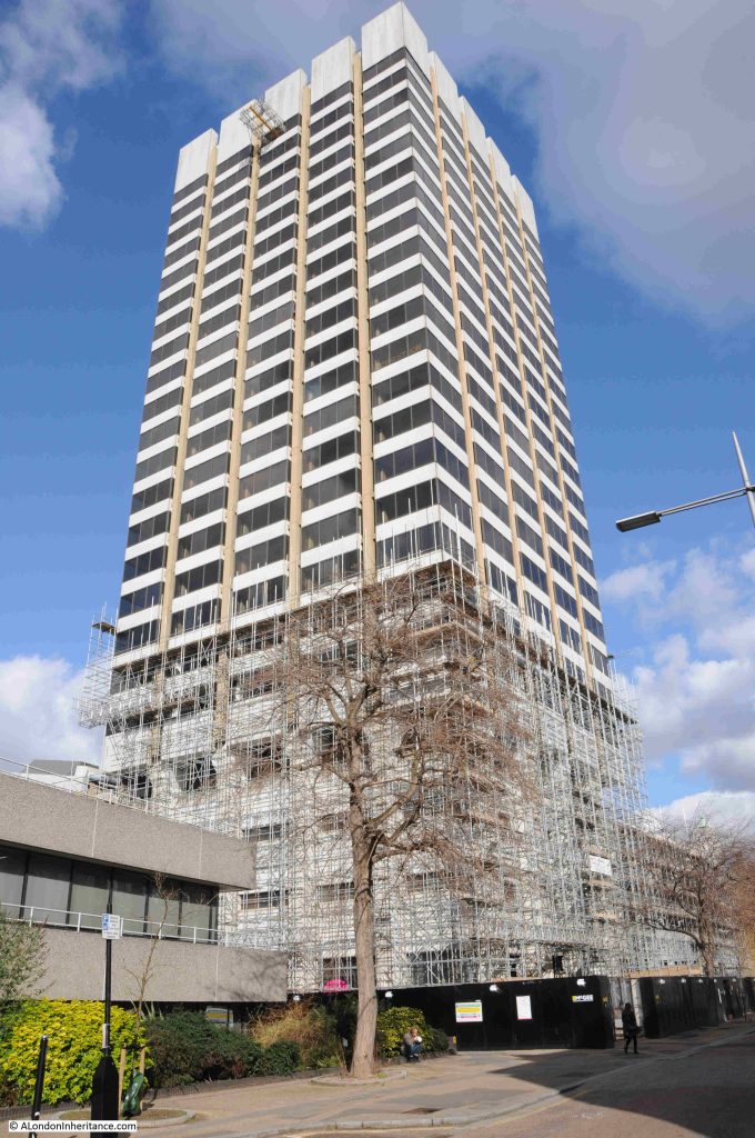
The missing feature is the white, square tower seen in the following photo, behind the right hand yellow crane, covered in scaffolding ready for demolition:

The tower was Kent House / the Southbank Television Centre / the London Studios, the original home of London Weekend Television, and in recent decades of ITV, with much of their national and local output coming from the studios that clustered around the base of the tower.

The building dates from a time when there were two independent TV stations covering London and the surrounding Home Counties. Thames Television broadcast from Monday to Friday, when on Friday evening Thames would handover to London Weekend Television who would broadcast until the following Monday morning.

London Weekend Television (LWT) took over the franchise for providing London’s weekend television service from ATV in 1968, with LWT’s first studios being at Wembley at facilities rented from Rediffusion.

LWT’s intention had been to have their own, purpose built, modern television studios along with space for offices so the company could be located in one place.

A site on the Southbank was available close to the National Theatre, and development of the new studios would continue the westward development of the south bank, and followed the 1944 Abercrombie plan for London which had proposed cultural, offices, residential and open space to replace the old industrial sprawl alongside the river.

The first transmission of TV programmes from the new studios was in 1972, with the site being fully complete two years later.

The tower block was mainly offices, although there was a studio higher up the tower for a number of years, when use was made of the view over London as a backdrop for programmes.

Surrounding the base of the tower were a number of studios used for the production of LWT and wider ITV national output as providing space which other broadcasters could use.

If you have watched almost any ITV live productions, game shows, dramas such as Upstairs, Downstairs, ITV’s World of Sport, BBC shows such as Have I Got News For You, QI, the Graham Norton Show, they were all filmed in the studios at the base of the tower on the Southbank.

The studios were also used by many other production companies and broadcasters.

The tower has been a feature of many of my photos, dating back to the late 1970s. This is a photo from 2017 when it was still occupied by ITV:

This photo from 2022 shows the tower standing in isolation on the Southbank (the Shard is hidden behind the tower):

As the local independent television regions went through a period of change and consolidation, LWT was taken over by Granada in 1994. Carlton Communications had previously won the franchise for the London weekday service from Thames Television, and by 2004 Granada and Carlton merged all their operations which included the many regional operators they had taken over such as LWT, to form ITV as a public limited company.

The studio complex also went through some changes from the South Bank Television Centre to The London Studios.

in 2018, ITV announced that the studios were to be closed allowing the buildings to be demolished to make way for new office and production facilities. ITV’s live broadcasts, mainly their daytime programmes would temporarily move to the old BBC Television Centre at White City as the BBC had moved out with the centre “donut” of offices being converted to apartments, and some of the studios remaining, and available for hire.

Later in the same year, it became clear that ITV would not be returning to any refurbished site, and they would use the studios at White City as a long term resource.

ITV had earlier purchased the freehold of the site from the properties division of the Coal Pension Fund, and I suspect they realised that the site was far more valuable if sold to developers, rather than the costs of refurbished studios and remaining on the South Bank.

The site was sold to Mitsubishi Estate, the Japanese property developer, and owner of a number of buildings across London.

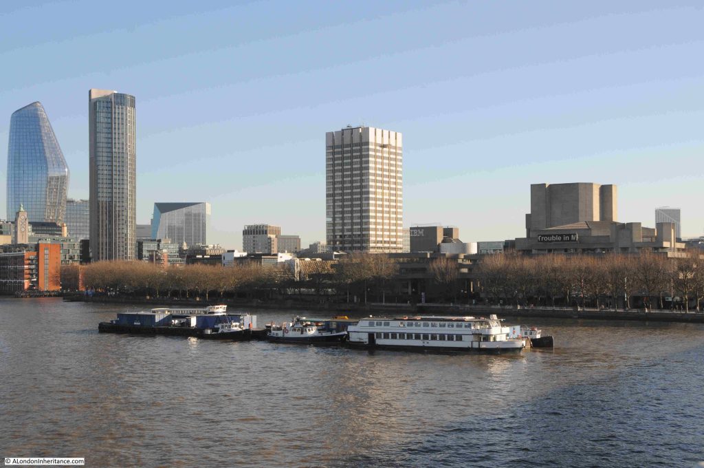
The view as was of the tower and the studios from the Embankment walkway:

The view now that the tower and studios have been demolished:

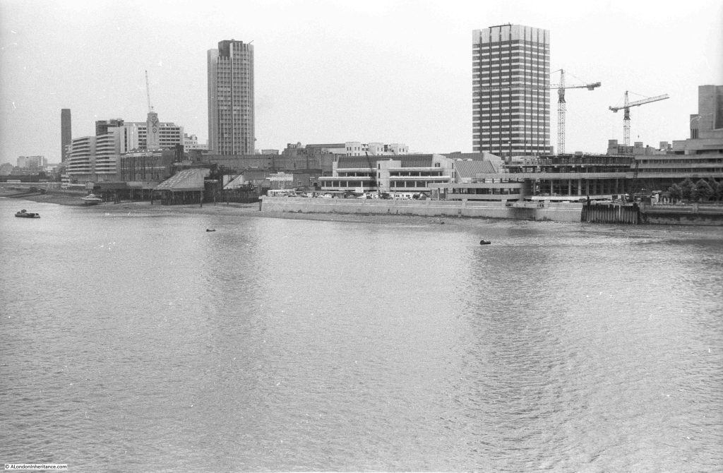
My first photo of the LWT tower and studio complex was in 1980, from the old walkway that ran alongside Hungerford Bridge:

In the above photo, the tower is towards the back of the complex, with the lower studios surrounding the tower and facing on to the river.

The Embankment wall and walkway was being extended in front of both the LWT studios and the new IBM building which was under construction just to the right of the ITV studios.

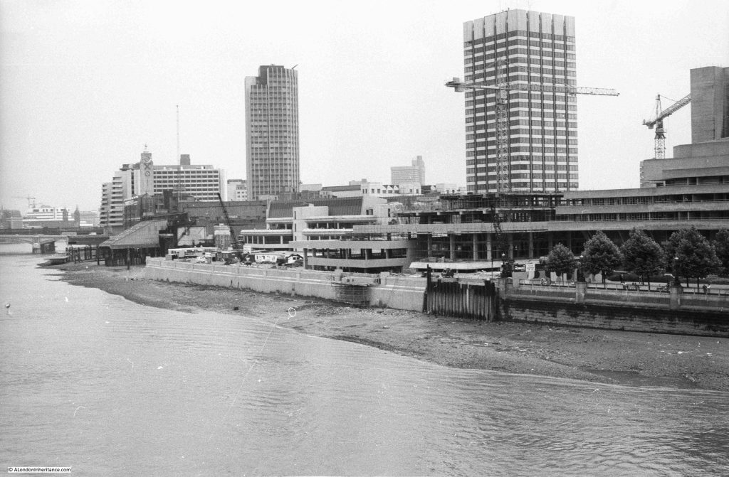
A different angle to the above view, further along the walkway, with the studios as the white building, and to the right, the IBM building under construction, a building designed by Denys Lasdun, who had also designed the National Theatre, seen to the right of the photo:

The tower to the left of the above two photos is Kings Reach Tower, formerly the home of IPC Magazines / IPC Media, now extended upwards and known as the Southbank Tower and converted to residential.

There is a bit of a mystery in the above two photos which I will come to later in the post.

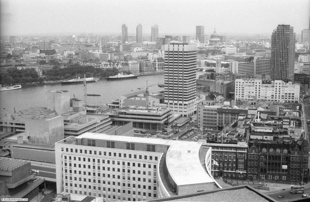
In 1980 I also took the following photo from the Shell Centre viewing gallery looking down on the LWT tower and studios:

As can be seen in the above photo, the tower is a distance back from the river, with low rise studios between the tower and river. The tower faces onto the street Upper Ground, and this was the view from the street of the base of the tower a couple of years ago, with the first scaffolding that would eventually cover the tower:

A look up at the tower from Upper Ground (personally, I think it was a really well designed and visually pleasing building):

Demolition and development of the site had been delayed due to a large number of objections. Michael Gove approved the proposals at the start of 2024, and the High Court upheld Gove’s decision in December 2024, and the owners of the site then moved quickly to award a £500 million contract to Multiplex to redevelop the site, with demolition of the tower and studios being the first stage.,

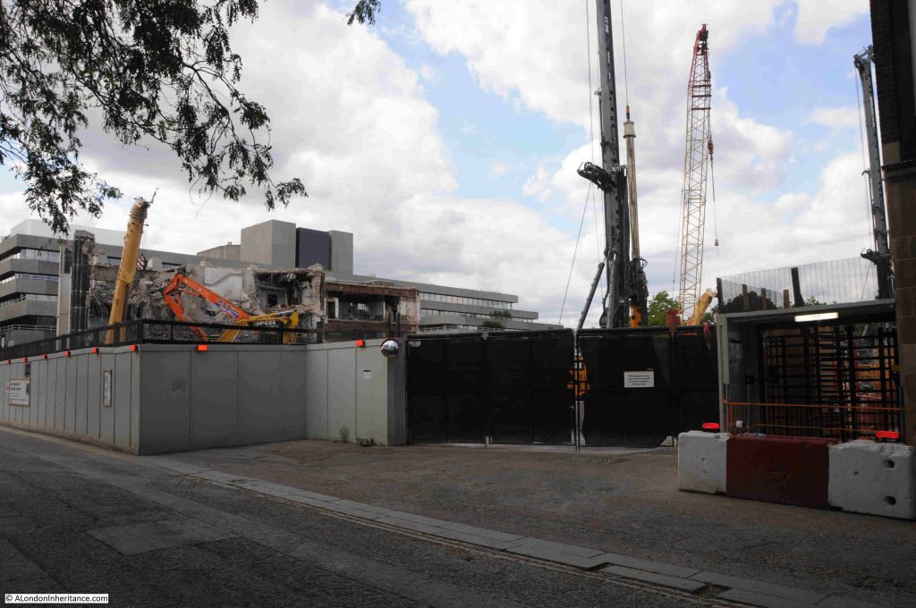
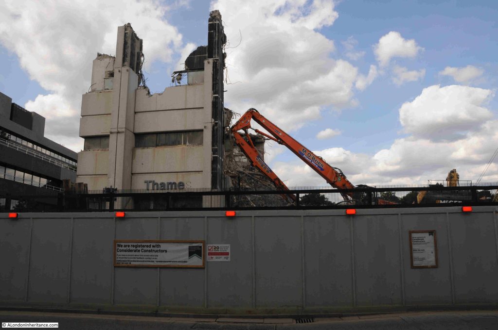
A walk along Upper Ground last weekend showed that demolition is now almost complete:

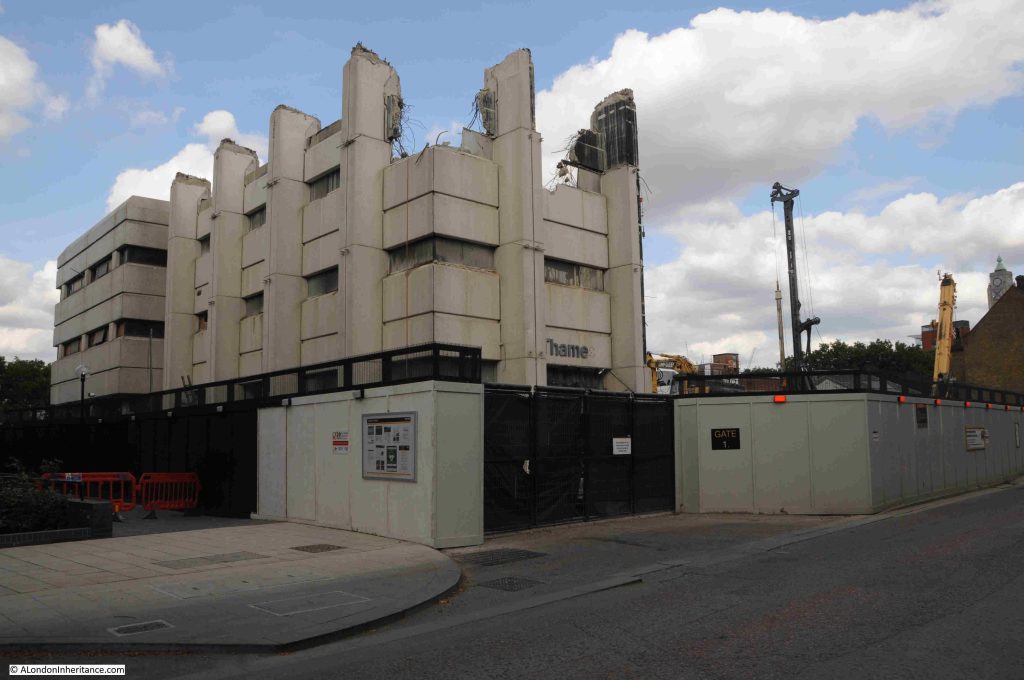
The south west corner of the complex was the only part remaining, and I suspect that by the time you read this, this remaining section will have gone.

In the following photo, the main entrance was underneath the “Thame” lettering. A couple of years ago this was the name Thames Television, as one of the last productions filmed in the building was a recreation of the infamous Bill Grundy interview with the Sex Pistols in December 1976, which had been filmed in a Thames Television studio next to Euston Tower. This was for the 2022 TV mini series on the band.

The remaining section looks almost like the ruins of a medieval castle. When I worked in the area in the late 1990s, it was common to see a queue of audience participants lining up along the base of the left of the building in the following photo, waiting to see what ever was being filmed that evening:

The new development will be very different, and will consist of a 25 storey office building, which will be connected to two further buildings of 14 and 6 storeys.

The space will provide offices and workspace, along with space “tailored to the needs of Lambeth’s emerging creative industries”. There will also be the obligatory open space, cafes, restaurants and a “cultural venue”.

See the page at the following link on the Matrix website (the company responsible for the development) to see an image of what the site will look like after completion, currently planned for 2029:

https://www.multiplex.global/uk/news/construction-starts-at-72-upper-ground-with-appointment-of-multiplex

The image on the above page shows probably the most attractive view of the development, rather than the view looking across the river to the site where the new towers will dominate the area.

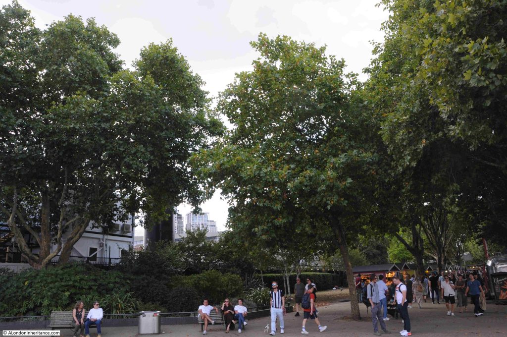
The image at the above page does not show the restaurants currently located at Gabriel’s Wharf, so whether these are hidden below the edge of new development, or whether the land will be included in the new development, I do not know.

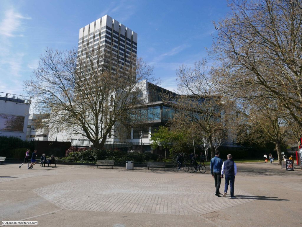
In many ways, the new development does continue the intentions of the 1944 Abercrombie plan regarding the use of the South Bank. The key issue is the sheer size of the development. If you look along the South Bank there is a reasonably consistent building height from County Hall down to the old IBM building, which has recently been refurbished, and is Grade II listed.

Kent Tower, the tower block of the LWT studios complex was the first tower along this sectionion of the South Bank, and as shown in my 1980s photo, it did stand out. It was though, set back from the river and did not dominate the IBM and National Theatre buildings.

I suspect that the new development will be very different, as will the view from the walkway alongside Hungerford Bridge in 2029.

A Southbank Mystery

I mentioned earlier in the post that there is a mystery in two of my 1980s photos.

Despite looking at these photos a number of times, there is a feature I had not noticed, and I cannot remember it from the time.

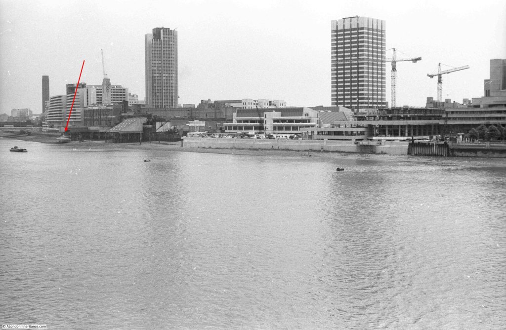
There is something on the foreshore at the end of the red arrow:

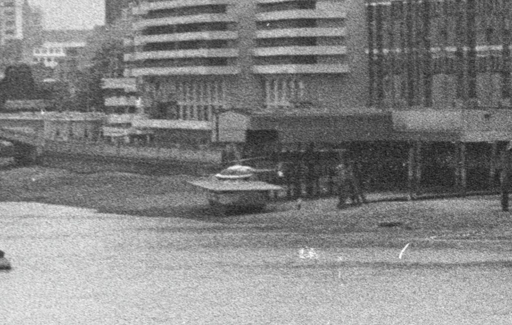
On a raised platform above the foreshore is a helicopter, the platform looks to be towards the end of Old Barge House Stairs:

I cannot remember ever seeing or hearing about a helicopter here. The location looks rather precarious, and the platform appears to be below the high tide level.

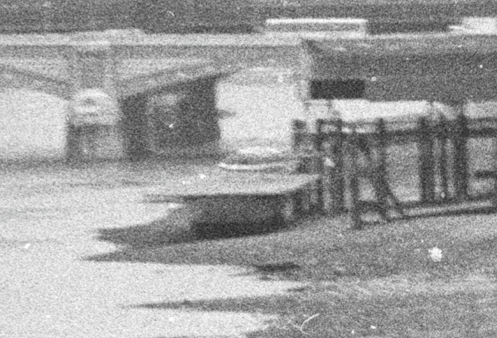
I did wonder if it was a model, but it looks very realistic in these grainy extracts from my film photos.

Whether it was a one off, temporary, or provided a service for some time, again I just do not know, but it is always interesting to discover stuff I did not know.

An even grainer view of the helicopter from a different angle:

The southern side of the river has frequently been used for helicopter services.

The London Heliport at Battersea has been providing a helicopter service since 1959, and in the early 1950s, after the closure of the Festival of Britain, where the Jubilee Gardens is located today was the site of a helicopter service linking central London with Heathrow Airport.

You could check for your flight opposite Waterloo Station, board your helicopter, and be speeding above the traffic to the airport.

I found the following Pathe news film about the helicopter service from the South Bank:

Resources – Britain from Above

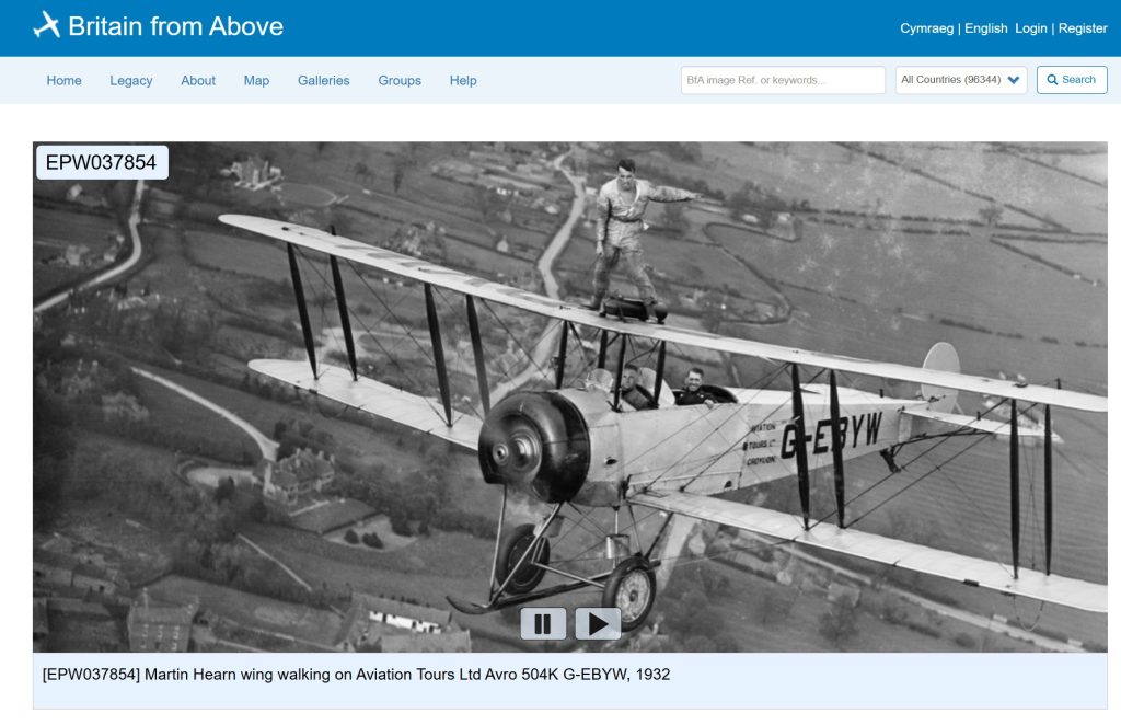
Continuing my monthly look at the resources available to research and explore London’s history, and for this month I am looking at the Britain from Above website, which can be found here:

https://britainfromabove.org.uk

Many of the resources I am covering are easy ways to get diverted and spend a whole evening looking at what is on the site, and Britain from Above is another example. There are very many photos covering the early to mid 20th century, not just of London but of the whole country.

The homepage:

The first thing to do is register, which is free. By registering, you are able to go full screen and zoom in to images at much greater detail.

The easiest way to then get started is to enter the name of a location in the Image Ref or Keywords box on the menu bar, and then click search.

This will bring up all photos which fit the search criteria.

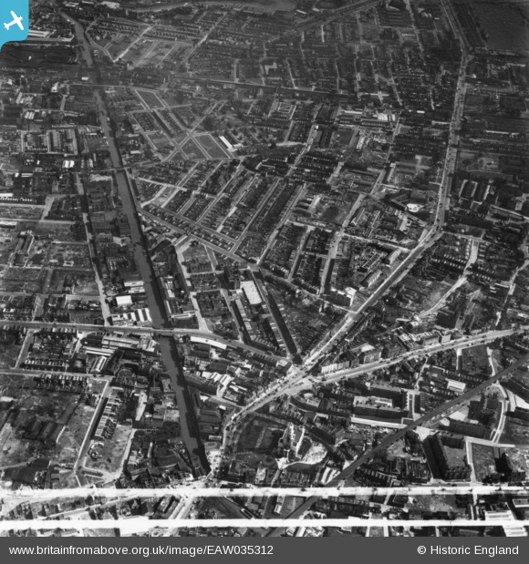
To demonstrate, I searched for the Limehouse Cut, the subject of last Sunday’s post, and of the many images available, the following is an example from 1951, which shows the Limehouse Cut, on the left side of the photo, and highlights that this was a very straight canal through former rural land which in the following years had been surrounded by industry and housing. Zooming in allows detail of the industry along the side of the Limehouse Cut to be seen:

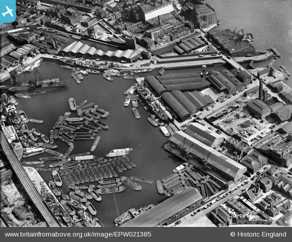
Searching for Limehouse Cut also brings up any images with the word Limehouse, and in the same search is this 1928 image of Regent’s Canal Dock. In 1928, the Limehouse Cut still used the original route into the Thames, and by zooming into the photo, this can still be seen, just to the north of the Regent’s Canal Dock (with the later redevelopment of the area, the Limehouse Cut would be diverted into the Regent’s Canal Dock, now known as the Limehouse Basin / Marina):

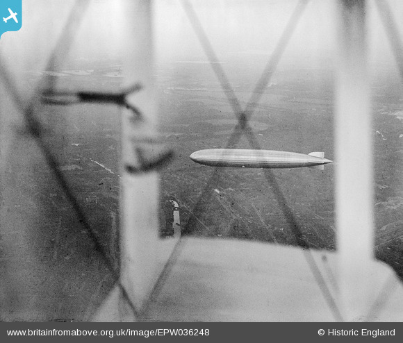
When searching, there are frequently some unusual photographic finds. In the same Limehouse Cut search is the following image of the Graf Zeppelin in flight over Limehouse in 1931, photographed through the wings of the biplane used by the photographer. The Limehouse Cut can be seen below and to the left of the wing. This must have been a remarkable sight for anyone on the ground at the time:

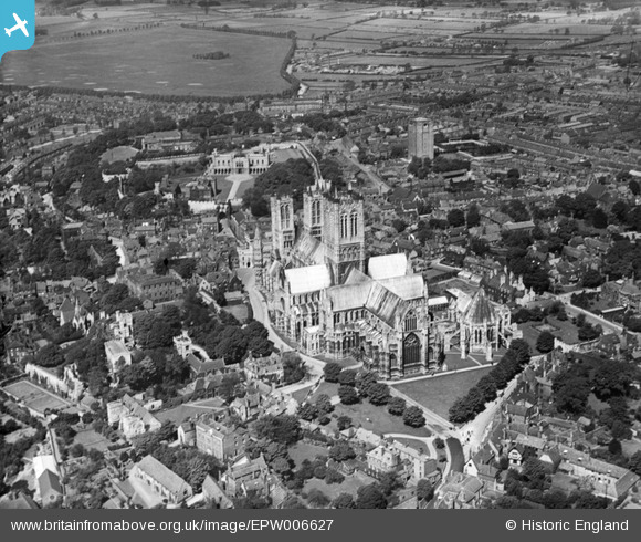
The archive covers much of the country, for example the following image is of St Mary’s Cathedral, Lincoln in 1921:

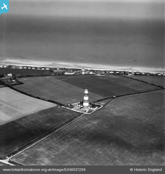
Land changes over the decades can be seen. The following image is of the Lighthouse at Happisburgh on the Norfolk coast in 1951. All those building along the edge have since been lost to coastal erosion.

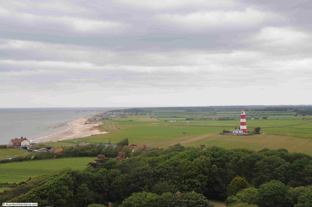
A few years ago, the Happisburgh lighthouse and the nearby Church of St Mary the Virgin, both had open days, when you could climb to the top of bother the lighthouse and the church tower. The following photo from the church tower shows the impact of coastal erosion on this part of the Norfolk coastline:

The Britain from Above archive is a wonderful archive of photos showing London and the rest of the country as it was. The use of photography helps provide an understanding of how places have changed. Aerial photos transforms maps into houses, industry, streets, fields, churches and cathedrals, canals and rivers, the coast, and even lighthouses.

Britain from Above allows reuse of the images, such to very reasonable rules of non-commercial use, no sale, no sub-licensing or use for advertising, making sure the link to the original image is shown and not clipped out of the image, which is really useful for a personal blog such as alondoninheritance.

An image from the site helped with the correct location of one of my father’s photos when I got the original location wrong in a post. Luckily there are readers who know far more about London than I do and provided an indication of the correct location.

An image from Britain from Above helped to confirm. See the post here: https://alondoninheritance.com/the-thames/st-katharines-way-ship-fires-thames/

Britain from Above is a really wonderful resource.

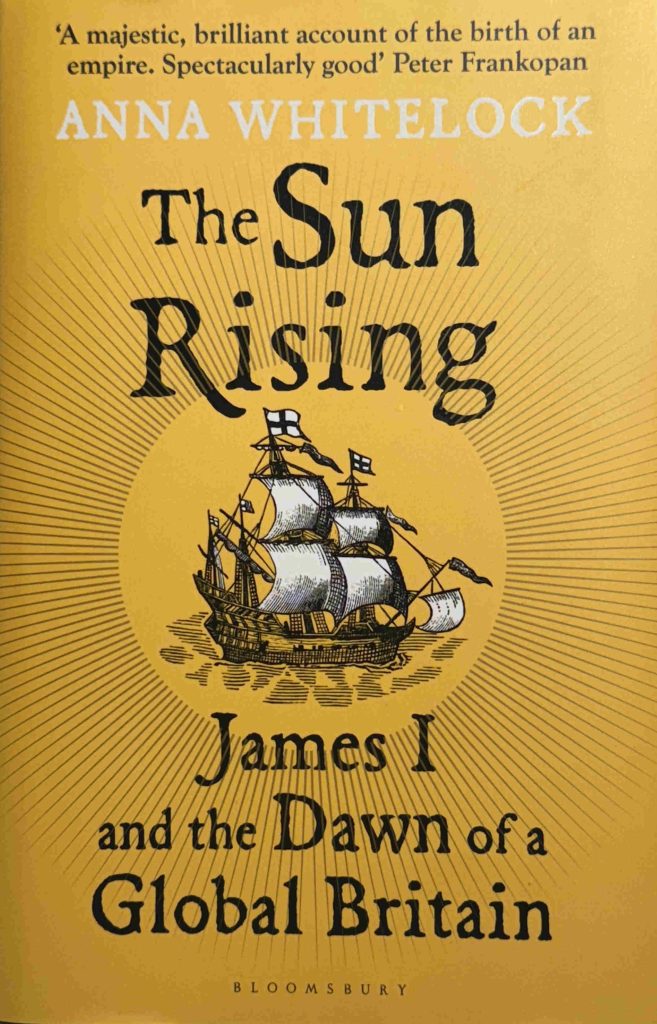
What I Am Reading – The Sun Rising by Anna Whitelock

The Sun Rising – James I and the Dawn of a Global Britain by Anna Whitelock was a speculative buy after seeing the book, which was published this year, on the shelfs of a bookshop.

The book focuses on the reign of James I, the first Stuart king after the Tudor dynasty came to an end with the death of Queen Elizabeth. A critical time in the country’s history as the Queen had not had any children.

What makes this book different is that it is not just an account of James I, but as the subtitle to the book highlights, it is about Great Britain starting to play catch up with other European powers such as the Netherlands, Spain and Portugal, in establishing networks of world trade.

London does feature heavily in the book, not just with accounts of the processions through the City, but also as the place where many of the trading companies were established to further trade with the rest of the world.

The book does cover domestic events, such as the Gunpowder Plot, trying to unify England and Scotland, Protestant – Catholic conflict, and James’ attempts at trying to unify European Christian powers etc. but the clear emphasis is on Britain’s global trade.

There is the Virginia Company of London, trying to establish settlements in the US, the Plantation of Ulster, the Muscovy Company and the East India Company. Trade with the Shah or Persia, early trade with India.

William Adams from Gillingham, and apprenticed in Limehouse features as a key player in attempts to trade with Japan. See my post on Adams, here.

Pocahontas arrived in London from Virginia, and was taken seriously ill near Gravesend at the start of her return journey. She died in 1617 and was buried at Gravesend.

Although the British trading companies focus was trade, not taking land, we see the start of how this would develop with the first African slaves arriving in the Virginia Plantation in 1619 – the start of the triangular slave trade between Britain, Africa, the Caribbean and America.

We also see the failure in the management of the colony at Virginia by the Virginia Company of London leading the the take over of the land and colony by the Crown – again a sign of what would take place across the world in the coming centuries.

What I did not realise was just how far and how extensive, the network of trade was at the start of the 17th century. Attempts to trade in with Persia, India, the far East, to China, Japan and the Spice Islands.

Some of the horrors inflicted on indigenous populations in the name of trade are covered, including the Dutch massacre of thousands of Bandanese people (on one of the Banda Islands, now part of Indonesia and the source of large quantities of nutmeg, mace and cloves).

My fascination with Thames Stairs and the river includes the lives of people who have travelled out from the stairs and the river on journeys across the world, and this book is full of them – ambassadors, traders, explorers, and settlers – it is quite remarkable how extensive these journeys were in the early 1600s.

The book is a really good read, and helps to provide an understanding of how Britain’s early steps in global trade would develop over the following three hundred years, and many of the horrors that went with this expansion.

And at its root was money. King James I for the revenues that trade would bring to the Crown, and the London trading companies, for the profits of trade. It always comes down to money.

alondoninheritance.com