
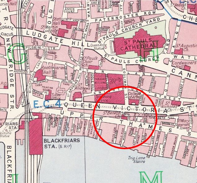
This week’s post is about one small area of London which has changed considerably since the 1940s. The following map is taken from Bartholomew’s Reference Atlas of Great London published in 1940.
Between Upper Thames Street and the River Thames was a network of streets and wharfs leading down to the river. Small inlets such as Puddle Dock, Wheatsheaf Wharf and Castle Baynard Wharf were part of the central London network of docks where goods were unloaded to the warehouses that stood along this stretch of the river.

The following photo is one my father took in 1948 and is one that I was having trouble trying to locate despite the very obvious landmark of St. Paul’s Cathedral. The streets are sloping down from St. Paul’s, a clear sign that this photo was taken from the southern side of St. Paul’s, where the land slopes down towards the river. Apart from the cathedral, the only other building with any distinguishing features is the building further up the road with the white brickwork down the corner of the building.
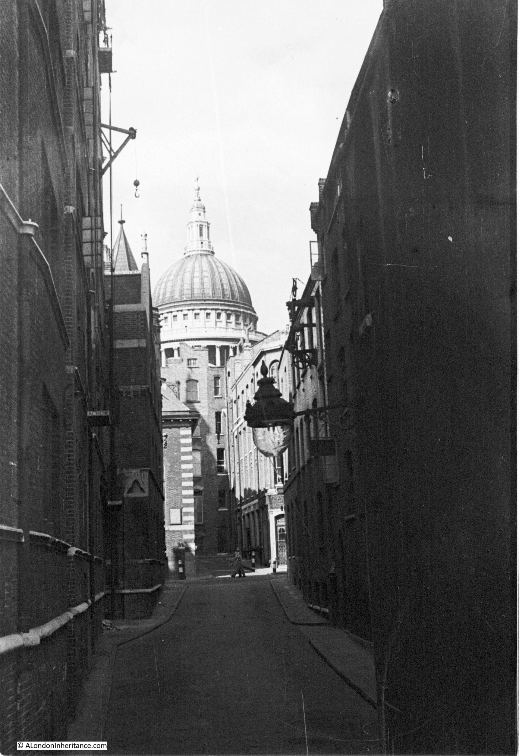
On the building on the left is a small crane located towards the top of the building. A further demonstration of activity in these narrow streets. I imagine that goods being taken to or removed from the warehouse by road would be loaded onto lorries in this side street using the crane to lower from the warehouse. Typical activity that could be found in all the streets and wharfs leading down to the Thames.
Following a walk around Upper Thames Street and Queen Victoria Street, I finally found the location of this photo, however the surrounding area has changed so significantly and the street my father took the photo in does not now exist.
The building with the white brickwork on the corner is the church of St. Benet and the road in which the photo was taken and is running up to the church is Pauls Pier Wharf. I have repeated the map below and circled the area. The church is in the centre of the circle and Pauls Pier Wharf can be seen running down to the river.
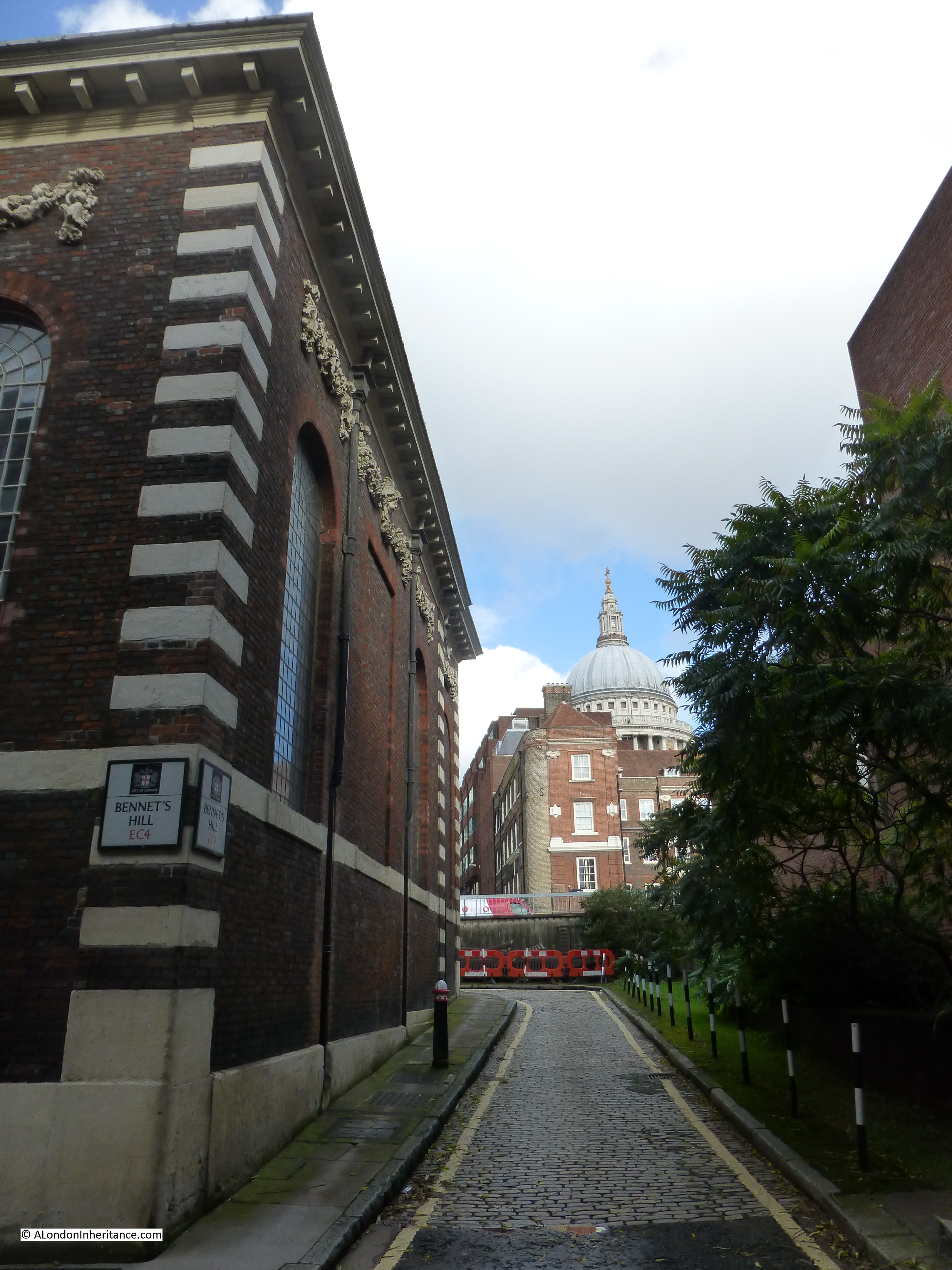
So what is there today? The church remains, but everything else has been lost. When this whole area was redeveloped, Upper Thames Street was widened and rerouted slightly to the south. I could not get to the position where my father took the 1948 photo, however to give some idea of the area now, the following photo is from the elevated Queen Victoria Street. If you go back to the original photo, this is roughly from the same position as from the first floor window of the building at the very top of the street, looking past the church and straight down Pauls Pier Wharf (which is now covered by the building behind the church).

The cobbled road is the remains of Bennets Hill and where it turns right, behind the church, that is the original position of Upper Thames Street. The whole area south of the church, where once Pauls Pier Wharf, Pauls Wharf and East Pauls Wharf used to be is now the 1980’s City of London School which occupies the entire site.
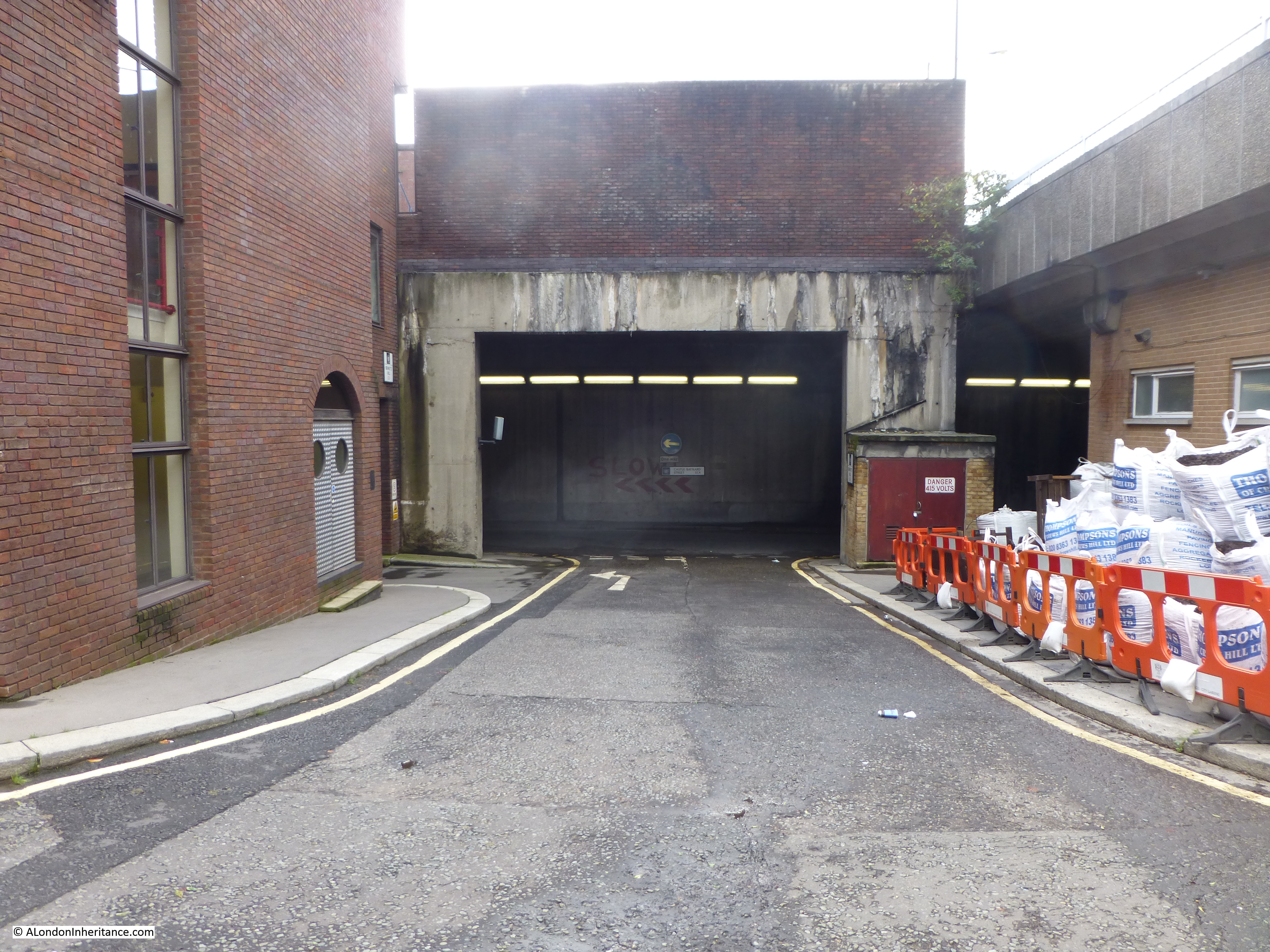
As part of the development of the entire area, Upper Thames Street was moved slightly south and along this stretch it is enclosed within a concrete tunnel with the school being built across the tunnel and down to the frontage on the Thames. The nearest I was able to get to recreate my father’s original photo was up against the wall of the school looking back up Bennet’s Hill. This shows how much of the original street has been lost. To take this photo I was standing roughly where the person crossing the road in the original photo is standing.
If you walk round to the other side of the church, it is possible to see the original route of White Lion Wharf. Again, this street has been lost and we are looking down into the concrete tunnel that carries Upper Thames Street (the first road in the tunnel is Castle Baynard Street and on the other side of the concrete wall is Upper Thames Street, also in the tunnel). Castle Baynard Street did not exist and is a creation of the redevelopment. It has continued the use of the Castle Baynard name as Castle Baynard Wharf, which was slightly to the west has also been lost. The eastern extremity of Castle Baynard was on this location. More on this in a future post.
On the right is the elevated White Lion Hill which leads from Queen Victoria Street down to the Blackfriars Underpass. Interesting that the White Lion part of the original street name has been retained but is now a Hill rather than a Wharf.
If you walk along the Thames Path a short distance in the direction of Blackfriars Station, and look to your right the road coming down from Queen Victoria Street is what was Puddle Dock as shown in the 1940 map. The road still retains the Puddle Dock name. This is what the old dock looks like now:

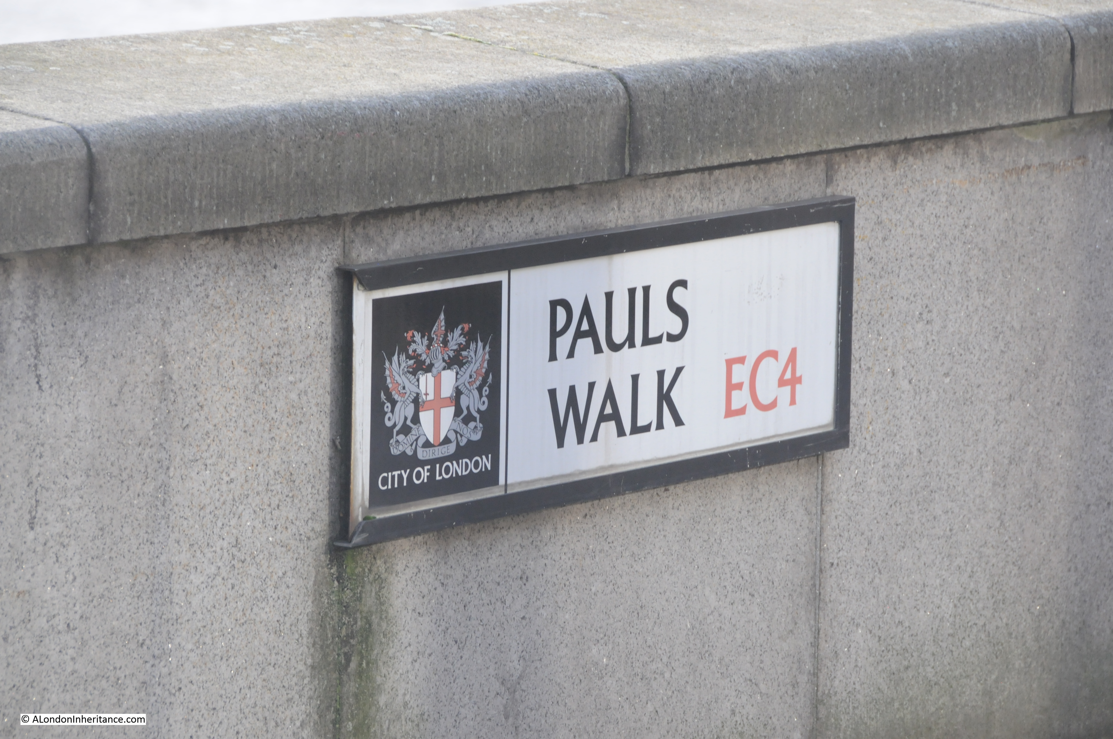
A further example of the re-use of the names of the streets and wharfs along this short stretch of the Thames, the Thames path in this section is named Pauls Walk. There were three wharfs with the name Paul; Pauls Pier Wharf, Pauls Wharf and East Pauls Wharf.
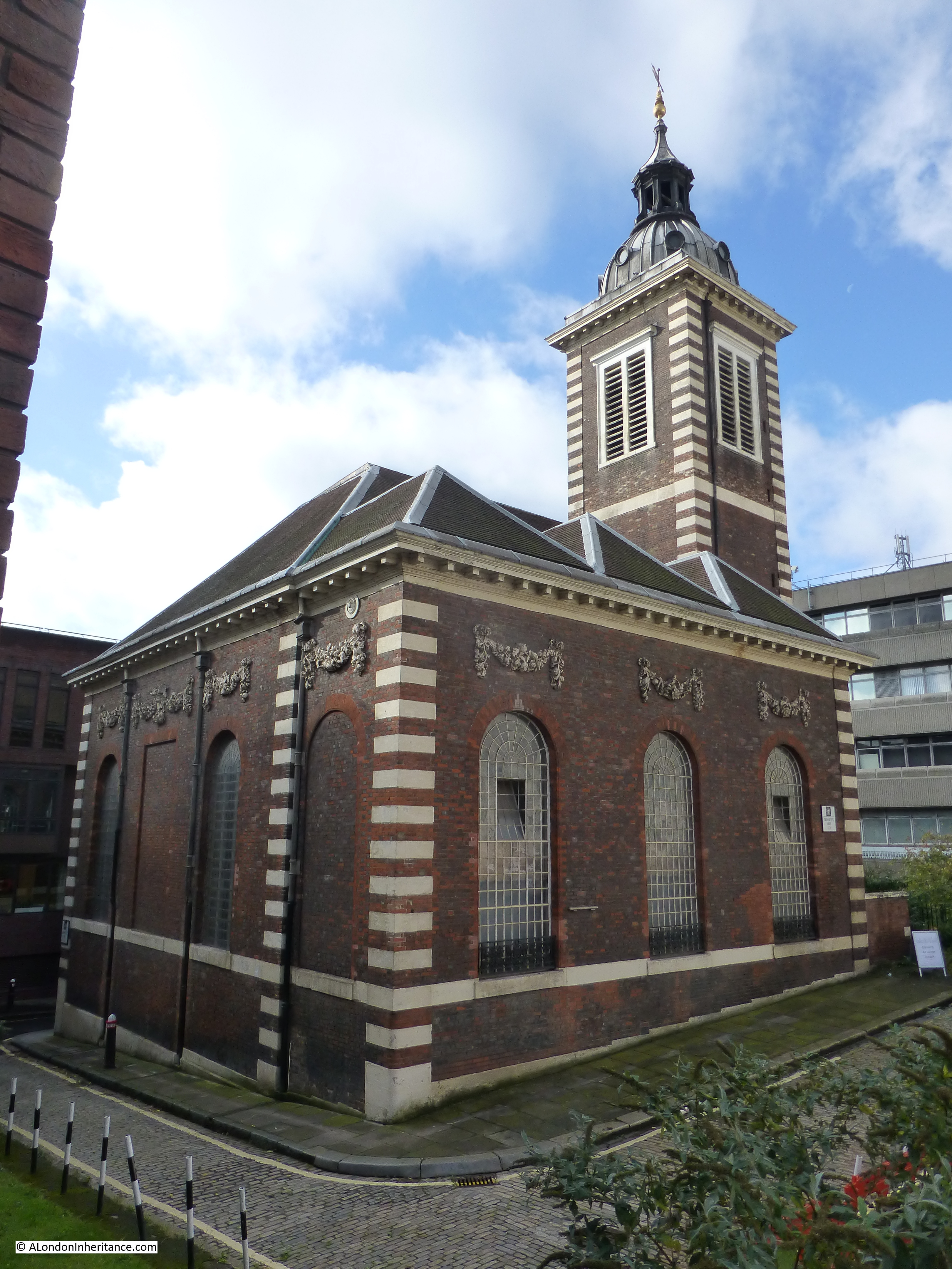
Returning to the church of St. Benet’s, this is an interesting church and well worth a visit. As with many City churches, first records of the church are from the 12th Century. The original church was destroyed in the Great Fire of London and the current church is one of Wren’s rebuilds of the City churches (although probably the design of the church was by Wren’s assistance Robert Hooke). Unlike many of the City churches, it was not damaged in the 2nd World War, indeed unlike so much of Queen Victoria Street and the docks onto the Thames, the small area between St. Benet’s and the river did not receive any significant damage. The church is one of the very few in the City that has not changed that much since construction after the Great Fire.
There was a time though when St. Benet’s was almost lost. In the later half of the 19th century there was a wave of church demolition of those that were perceived to be redundant and St. Benet’s was one of the churches scheduled for demolition, however Welsh Anglicans petitioned Queen Victoria for permission to use the church for services in Welsh. This right was granted and since then services have been conducted in the Welsh language. The Welsh connection is a very strong part of the identity of the church.
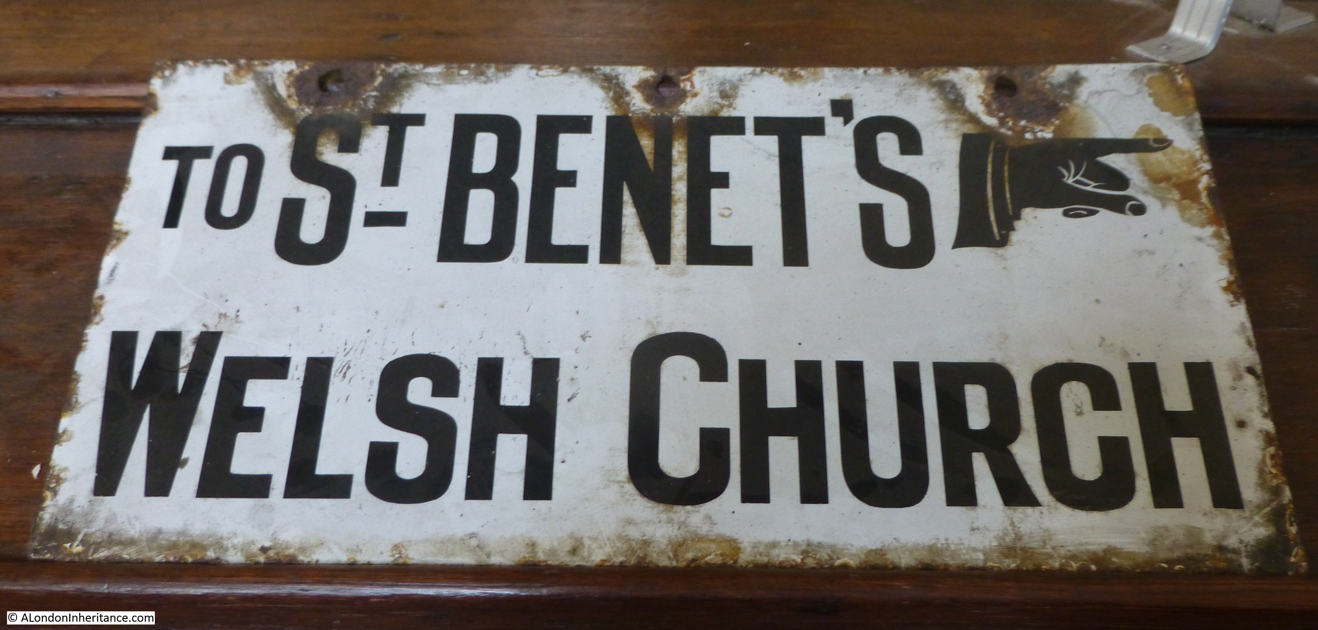
An old street sign, now stored inside the church:
The Welsh Dragon as a candle holder:

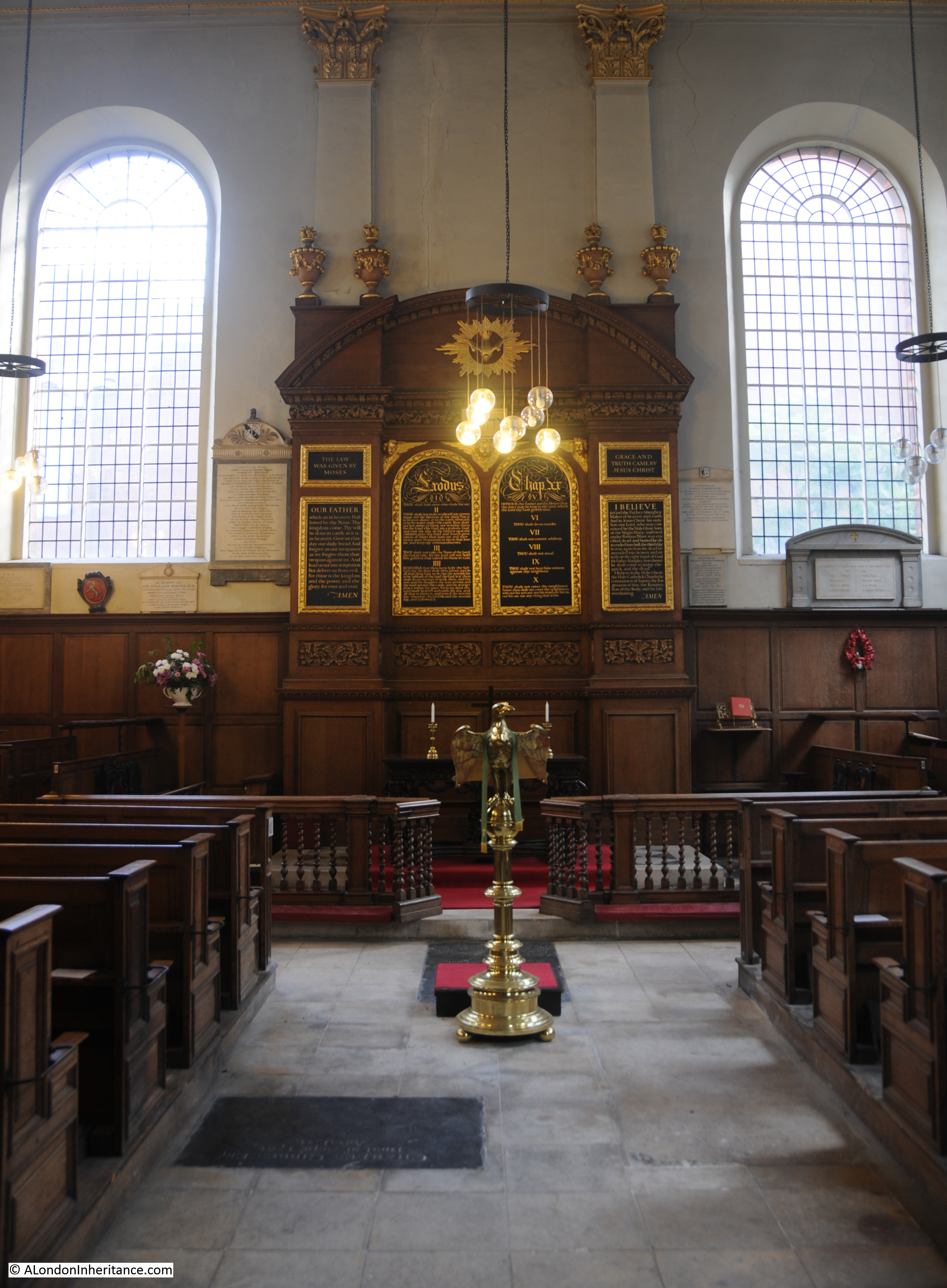
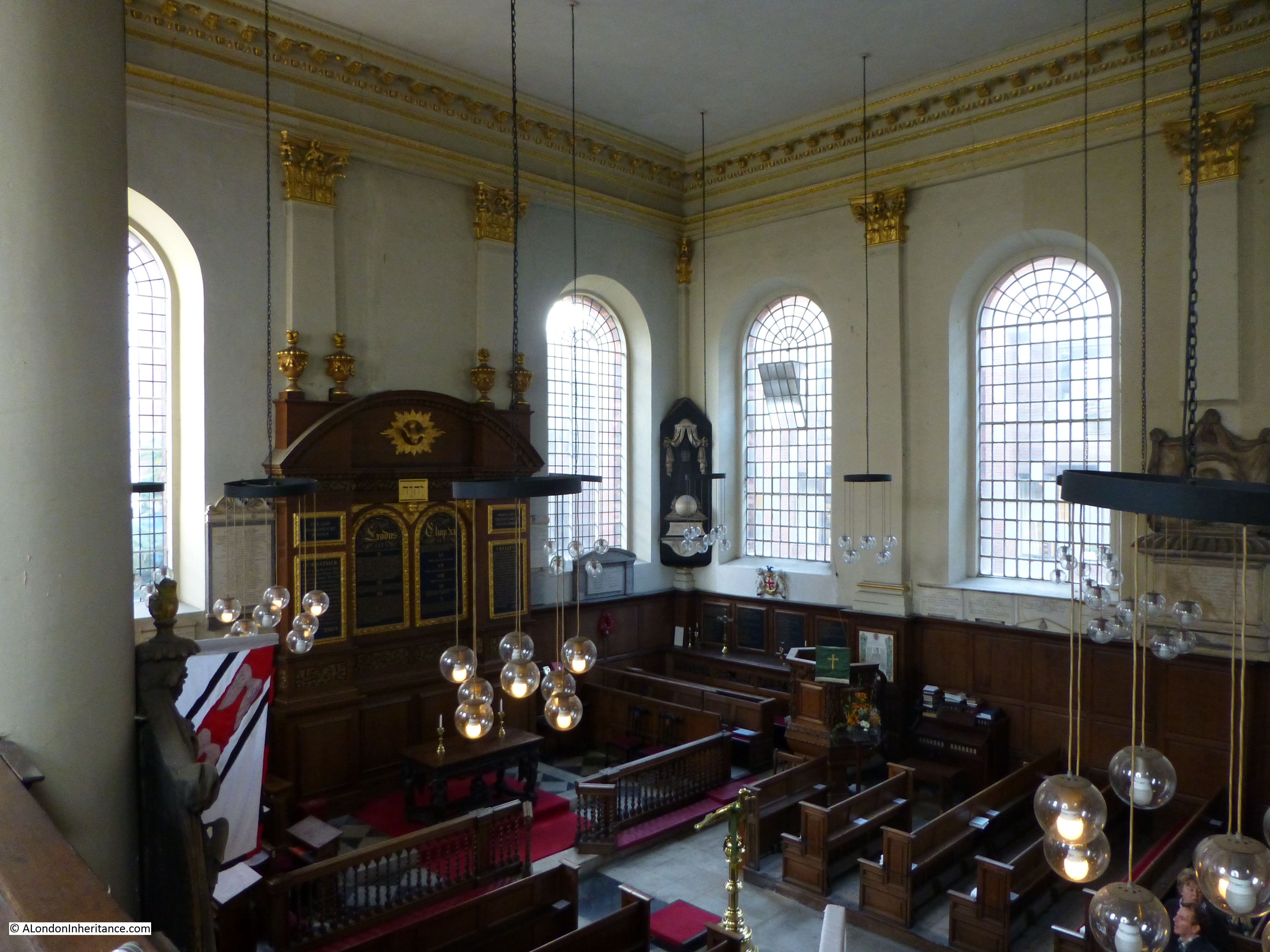
The interior of the church is bright, but with plenty of wood panelling and a large carved, but simple reredos behind the altar.
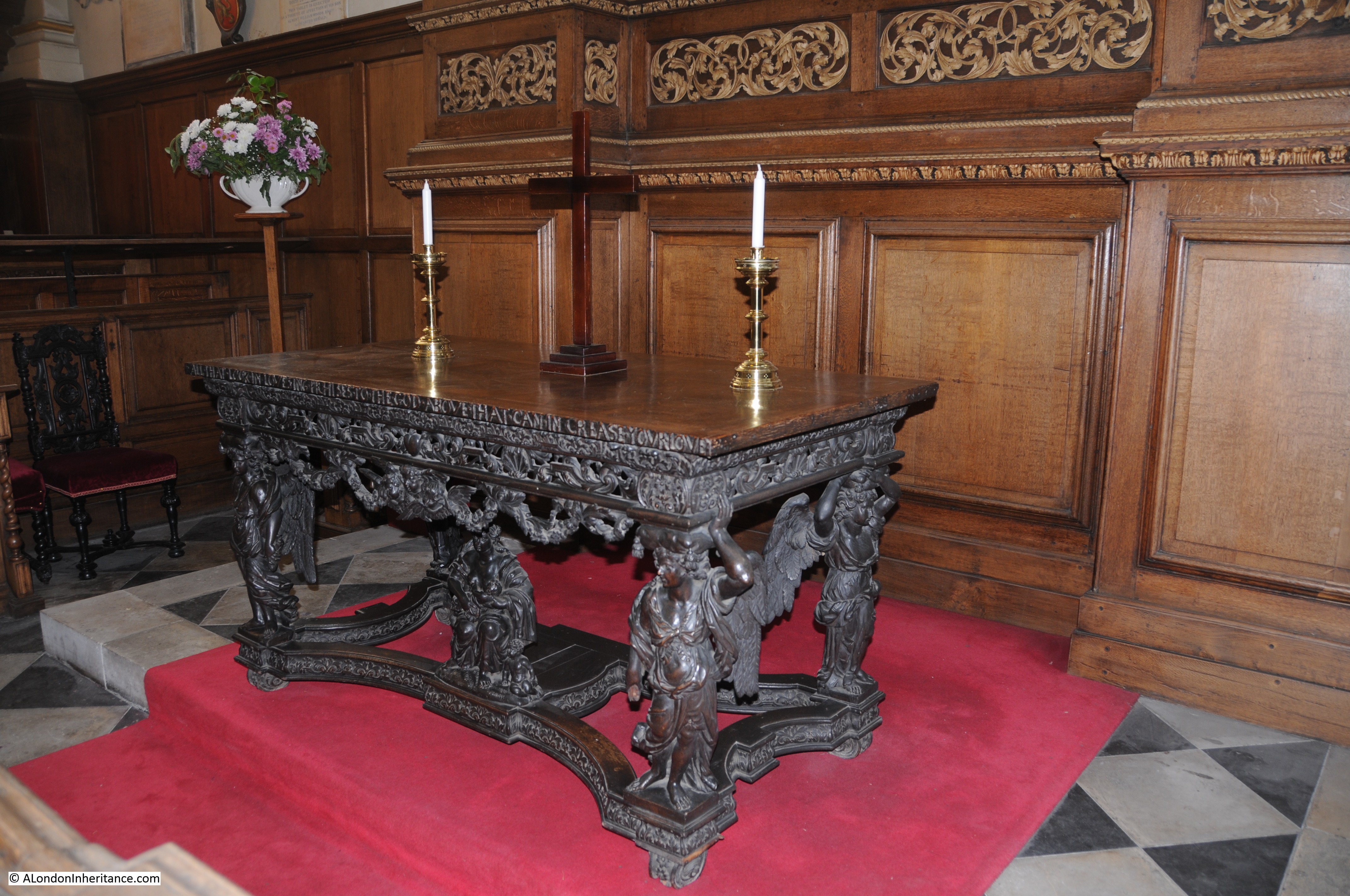
The 17th century altar / communion table with winged angels supporting a rich cornice and under the table is a figure of Charity with her children:
The view from the gallery:
Back outside the church, and standing on Queen Victoria Street we can look down on the church and Bennet’s Hill. The area north of the church was the original churchyard, however this was lost in the original 19th century widening of Queen Victoria Street.
There is some confusion as to the spelling of Benet in the name of Bennet’s Hill. The church has a single “n” in the name as does the hill in the 1940 street map, however as can be seen below, the modern day street name has “nn”. I have been unable to find whether this spelling change was for a reason or an accident with the new street signs.
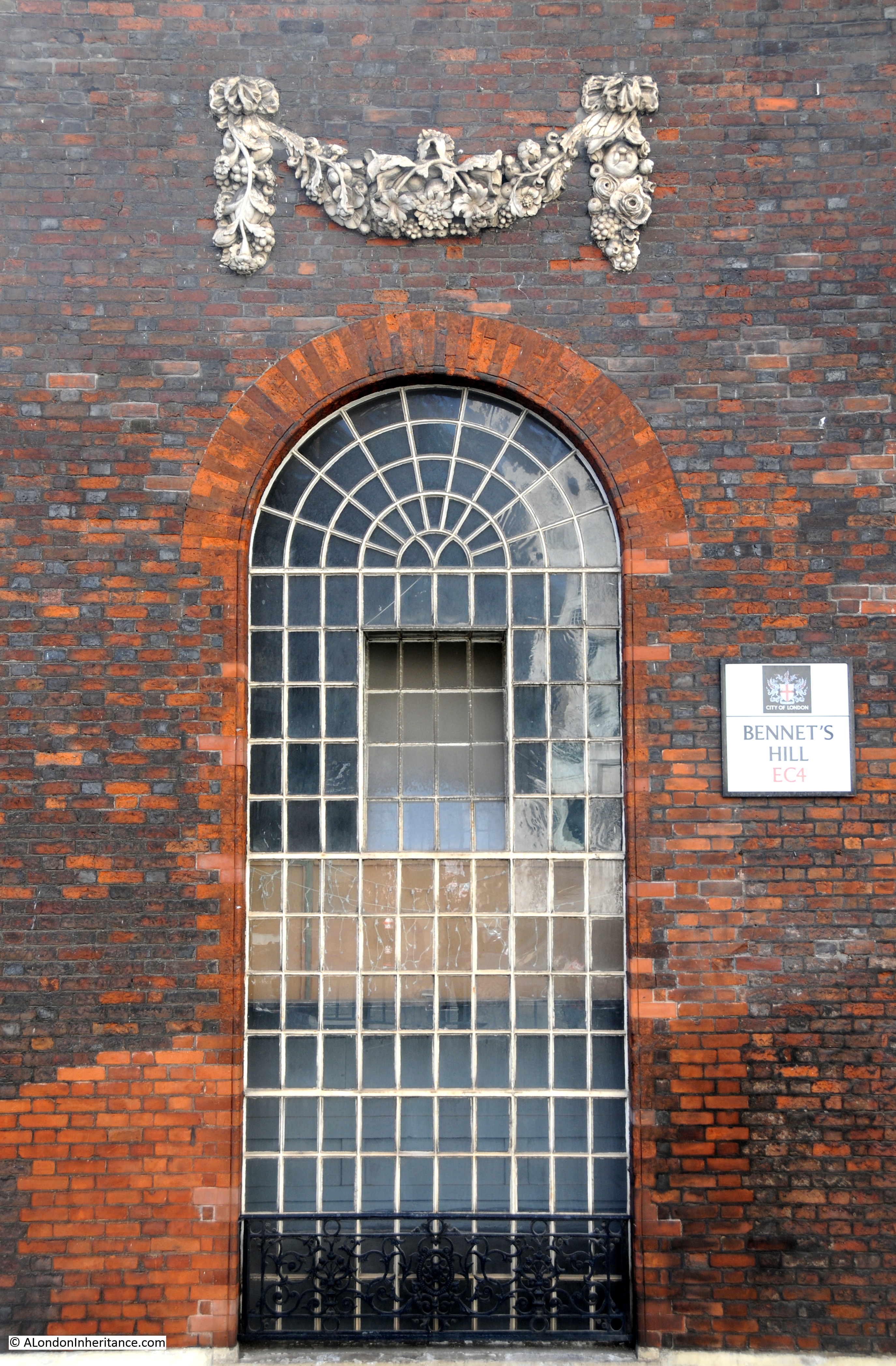
Good to see that the original stone carvings above the windows still survive.
Names though do change over the centuries. Stow in 1603 stated that the church was called St. Benet Hude (or hithe) and was up against Powles Wharffe (presumably the same as Pauls Wharf in the 1940 map). Whilst the names change slightly in their spelling it does demonstrate that they have been in existence for many hundreds of years, and for the wharfs and streets they lasted down to the reconstruction of the area in the decades after the war.
Old ghost sign on the side of the church:
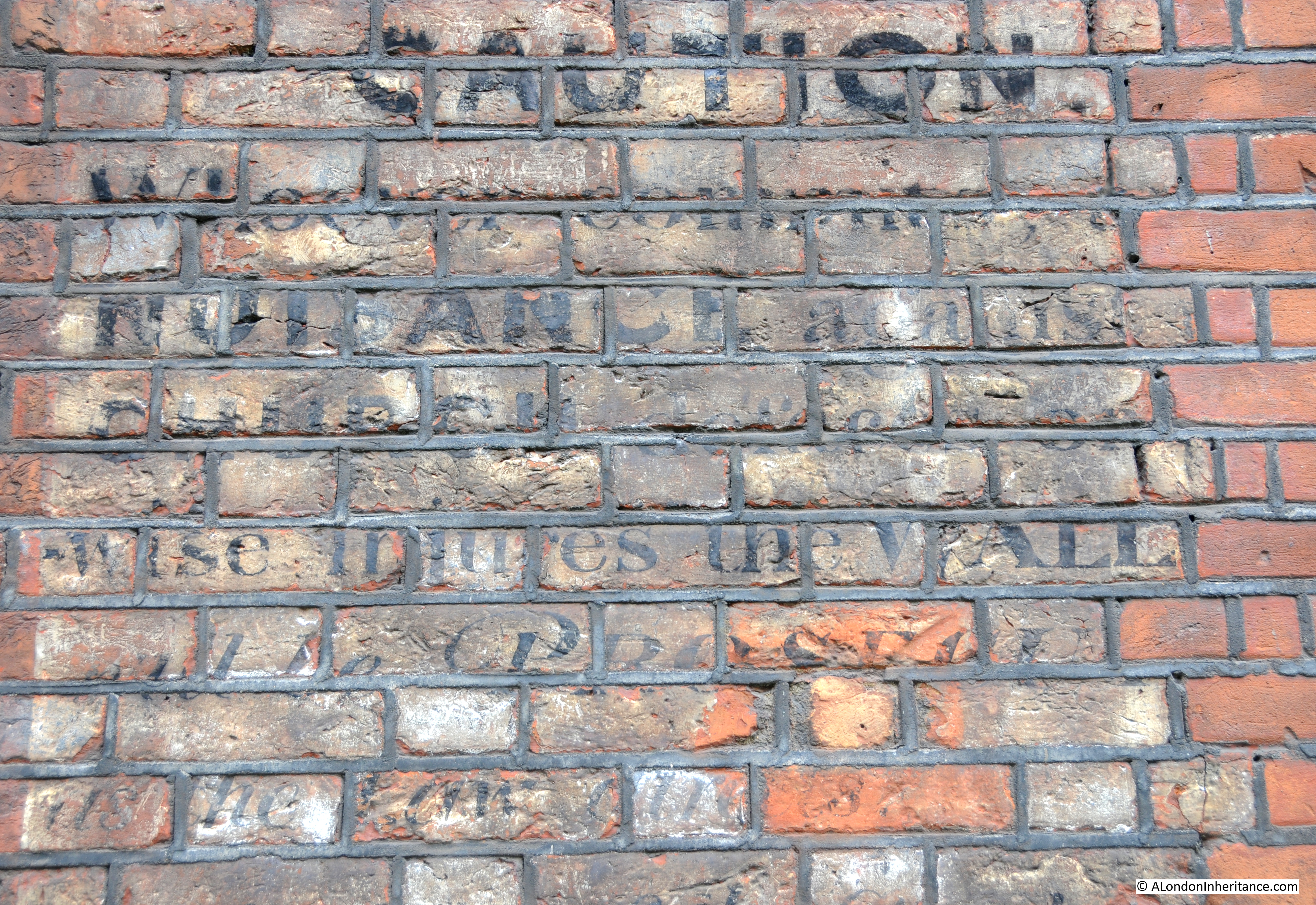
Which seems to read:
CAUTION
Whoever commits NUISANCE against …. church … otherwise injures the WALL will be PROSECUTED ….
One wonders whether the church’s current position, squashed between Queen Victoria Street, the Upper Thames Street tunnels and the elevated White Lion Hill would be considered as committing a nuisance against the church?
The sources I used to research this post are:
- Bartholomew’s Reference Atlas of Greater London published 1940
- The Old Churches Of London by Gerald Cobb published 1942
- London by George H. Cunningham published 1927
- Old & New London by Edward Walford published 1878
- Stow’s Survey of London. Oxford 1908 reprint
I really enjoy your detective work in discovering the location of your father’s photographs, and the way in which the streets have been altered since. Thank goodness for the churches — how else would we orientate ourselves!
Thanks for the comment. The churches are one of the few buildings in the City that have not changed so they make very useful reference points to understand what has changed around them. As you say, thank goodness for them, I fully agree.
I am reading a book partly set in Bayard Castle. I was looking up where the castle was. I found your blog, so interesting. Thank you for your all your hard work and sharing your knowledge.
Beautifully researched and presented, as are all your posts. They are powerful reminders of the past and careful assessments of the present. Thank you.
Thanks Ros. Very much appreciated.
Great sleuthing and photographs as ever.
I was wondering if the some of the businesses in the wharfs you mention here are the ones that feature in The Lavender Hill Mob where the whole Queen Victoria Street area can be seen as bombed out and mostly derelict…?
Hi Jane, thanks for the comments. You are right, the area near the river is where some of The Lavender Hill Mob was filmed. It was slightly further up Queen Victoria Street near the church of St Nicholas Cole Abbey which also features in the film. I covered this in an earlier post a few months ago which is here: http://alondoninheritance.com/thebombedcity/st-nicholas-cole-abbey-a-bombed-church-and-film-location/ Fascinating web site you have, just subscribed by e-mail.
I came across your excellent site while writing about walks I used to take along the north bank of the Thames on Sundays in 1961-2, especially one day when I had been exploring the foreshore and climbed up a vertical ladder to find myself looking up at the dome of Saint Pauls. Googling ‘Pauls Pier Wharf’, which is what the ladder led to, brought up the photo your father took in 1948. Exactly as I remembered it over half a century ago.
Hi Michael, thanks very much for the feedback. I think I have some photos of the foreshore and the ladder that you mention. Planning to use these for a future post. I suspect in 1961-62 the area had not really changed that much, the significant change was in the decades to come.
so interesting i my grandparents used to take me for walks in the early 60s to the tower of london walking up thames street which i always found fascinating even as a child we have lost so much history in the last 30 years in london all very sad thanks for the photos and comments
Inigo Jones is buried here
Thanks so much for the fascinating article on the Lost Wharfs of Upper Thames Street. In the eighties I used to work in a bank on Lambeth Hill near St Mary Somerset and spent many happy lunch hours wandering about the area with eyes half closed trying to imagine how things used to be. All the best.
Before I have even read a quarter of this page, it proves its value to me. The map solves a mystery that has been puzzling me for a few years: what was the building which is now the Youth Hostel near St Paul’s Cathedral?
I have walked past it many times (Carter Lane, corner Dean’s Court) and have noticed the quotation in Latin from the New Testament – you can read part of it here https://www.yha.org.uk/hostel/london-st-pauls
And there it is in the map – St Paul’s Choir School.
Thank you.
This site is great. I could spend hours looking at the photos and reading the text. I work right next to St Paul’s and often spend my lunch hour wandering the area. So much lost. Thanks for all your research and hard work it really is a wonderful resource.
A very interesting article. Could somebody confirm whether, “Pauls Wharf, East Pauls Wharf and Pauls Pier Wharf” were once owned by the Ipswich based grain merchants, Pauls. They owned a fleet of Thames sailing barges and regularly shipped grains and animal feeds to London from Ipswich. They had an animal feed business at Rotherhithe and for some time an office in the London Corn Exchange building in Mark Lane. Some years ago, the last Pauls animal feed company was bought by the Dutch company Forfarmers, B.V. and the Pauls malting company bought by a Belgian company. Ipswich Museum, I believe, has the historic records of the Pauls group of companies.
What an excellent and thoroughly researched article. How strange that my father (now 86) was trying to remember almost the exact same spot that he painted St Pauls Cathedral in the 1960’s, that your father took a photo of in 1948, even down to the same lamp! Thank you for sharing and shedding light on the mystery! If you want to take a look my father’s painting is here; https://terryscales.blogspot.com/2018/04/st-pauls-from.html
Thank you for your excellent work. Paul’s Wharf was owned (maybe still??) by the Dean and Chapter of St Paul’s and the road you mention was one of those leading to the very famous Paul’s Steps, a landing place for passengers carried by Thames Watermen from about the late 1400’s at least.
The wharf was rented by Samuel Enderby and his partners Charles Buxton, Isaac Buxton and Thomas Sims or Symes from about 1763 in the business of oil merchants. It burned down in 1769 but was quickly rebuilt and survived into the times you are studying. Its buildings extended both sides of the street marked Pauls Pier and the whole was a substantial and extensive place.
Samuel was a cooper and dealer in oils and colours and suchlike. Through this and his association with Buxton he founded, single-handedly, the London southern whale fishery for the sperm whale. Surviving his partners he and his family traded from this place until the 1830’s/40’s. Their ships would dock anywhere from the Isle of Dogs to the Pool, discharge to land, the oil brought to Pauls by barge.
I am near complete on their history and you can find my latest publication on the Docklands History Group site. It is my intention, once I get my house sold this year, to return to the fray in detail on the Wharf about which I have found much over the years.
Keep up the good work, most sincerely Charles
Wonderful images, my grandfather (Bob Evans lived on Queen Victoria Street) was curator for St Bennett’s Church, as a child I used to play around the church upper tames street and along the river ( tide was out) these images bring back wonderful memories of that area in the 50, s and sixties. Well done all concerned.
A most interesting article , thank you! My ancestor Hugh Boyd b.1761 d. 1840 was left a large estate by an uncle and part of it was the White Lion Wharf. The map is the first I have seen of the Wharf. More information if any would be most appreciated. Barbara
In my family history researches I have a copy of the PCC will, signed 22nd August 1803, of John Howell, Bricklayer, which states he was living at 1 Bennet’s Hill, in the parish of St. Benet Paul’s Wharf, London. As you can see Bennet’s Hill is spelt with two nns, a point you raised in your interesting article.
This will also states that John Howell built the house he was currently living in ‘on a site of ground adjoining to the College of Arms’. I don’t fully understand how his house was at 1 Bennet’s Hill if it was on land adjoining the College of Arms, as I didn’t think they were that close. Any comments?
Regards
Richard Woods
I believe Benet’s Hill originally continued northwards alongside the College of Arms, until Queen Victoria Street was driven through the area. The northern part of Benet’s Hill was renamed Goldman Street according to various maps.
This is shown by Horwood’s map of London which was published from 1792 to 1799 and which includes the street numbers of all the houses: http://www.romanticlondon.org/explore-horwoods-plan/. The map calls the College of Arms ‘Heralds Office’. According to the map, 1 Bennets Hill didn’t adjoin the College of Arms but was just across the street from it.
Horwood’s map of London is really excellent and very detailed, and as you say my ancestor, John Howell, house was just across the road from the College of Arms. The map is also very useful to exactly locate 226 Upper Thames Street (John’s brother Richard Howell) and another family connection at 105 Newgate Street, where Daniel Fenn carried out his business of watchmaker & tool maker.
Thanks for your information, which now makes sense of where my ancestor, John Howell, house was.
Thank you for the work you have undertaken to identify and talk about Upper Thames Street. As a 16 year old I was apprenticed to Charles Skipper and East (printers) of Shoe Lane. I was paid very little and my father who was a compositor on the Observer newspaper used to daily take me to lunch in Upper Thames Street. My memories of those days are of the little cafe we attended among the warehouses, and of the barges bringing goods to the tiny wharves along Upper Thames Street. In the summer I would witness sun tanned young guys carrying sacks of goods on their shoulders from the barges, presumably after coming down river on the tide. To me this seemed a much more manly type of work than being enclosed in a printing company in Shoe Lane. It was a place where the river touched the street via these small working wharves. It left one with a sense of the history of this street as a microcosm of commercial activity of our island nation and its connection with the sea via our great river Thames. It was another world of work ensconced in this ancient street. The period of which I speak soon saw the changes to the embankment and Blackfriars’s Bridge and I recall a Galley being found in the mud near Blackfriars Bridge during those excavations.