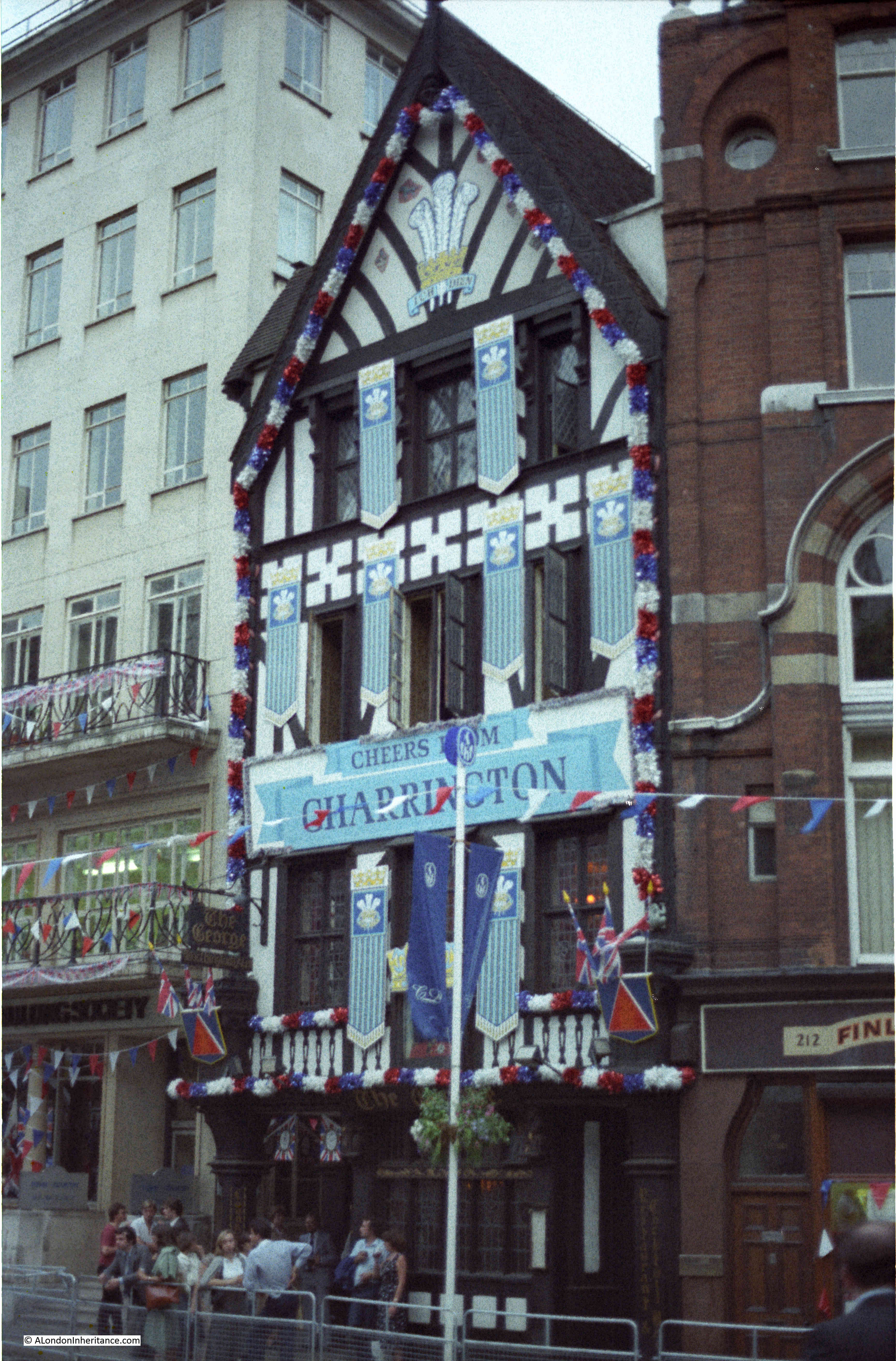
Three of my father’s photos in today’s post, which goes by the title of “The Gates of Stationers’ Hall – Perhaps”.
The reason for “Perhaps” at the end of the title is that I am still not completely sure that I have found the right location, but, as I will explain in the post, I cannot find any other location for the photo.
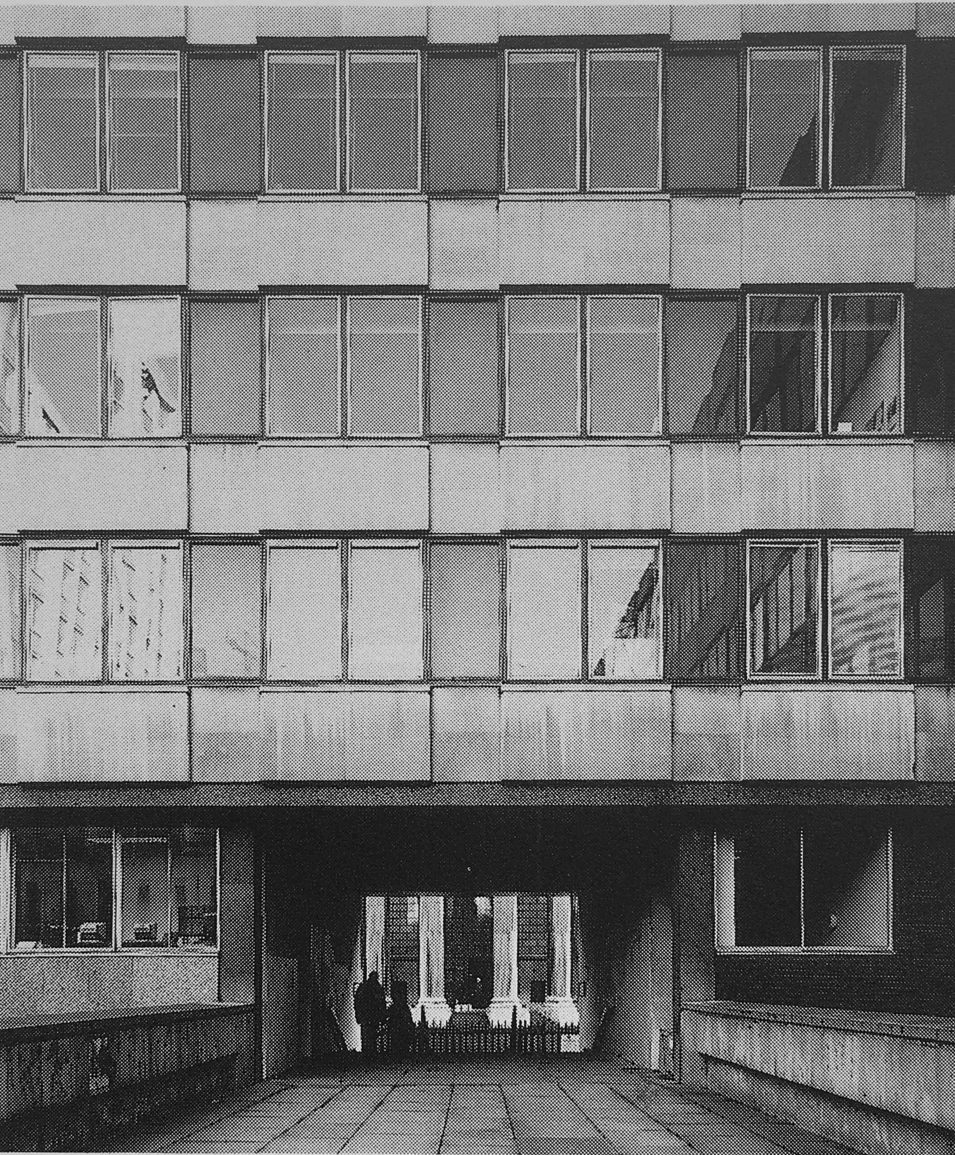
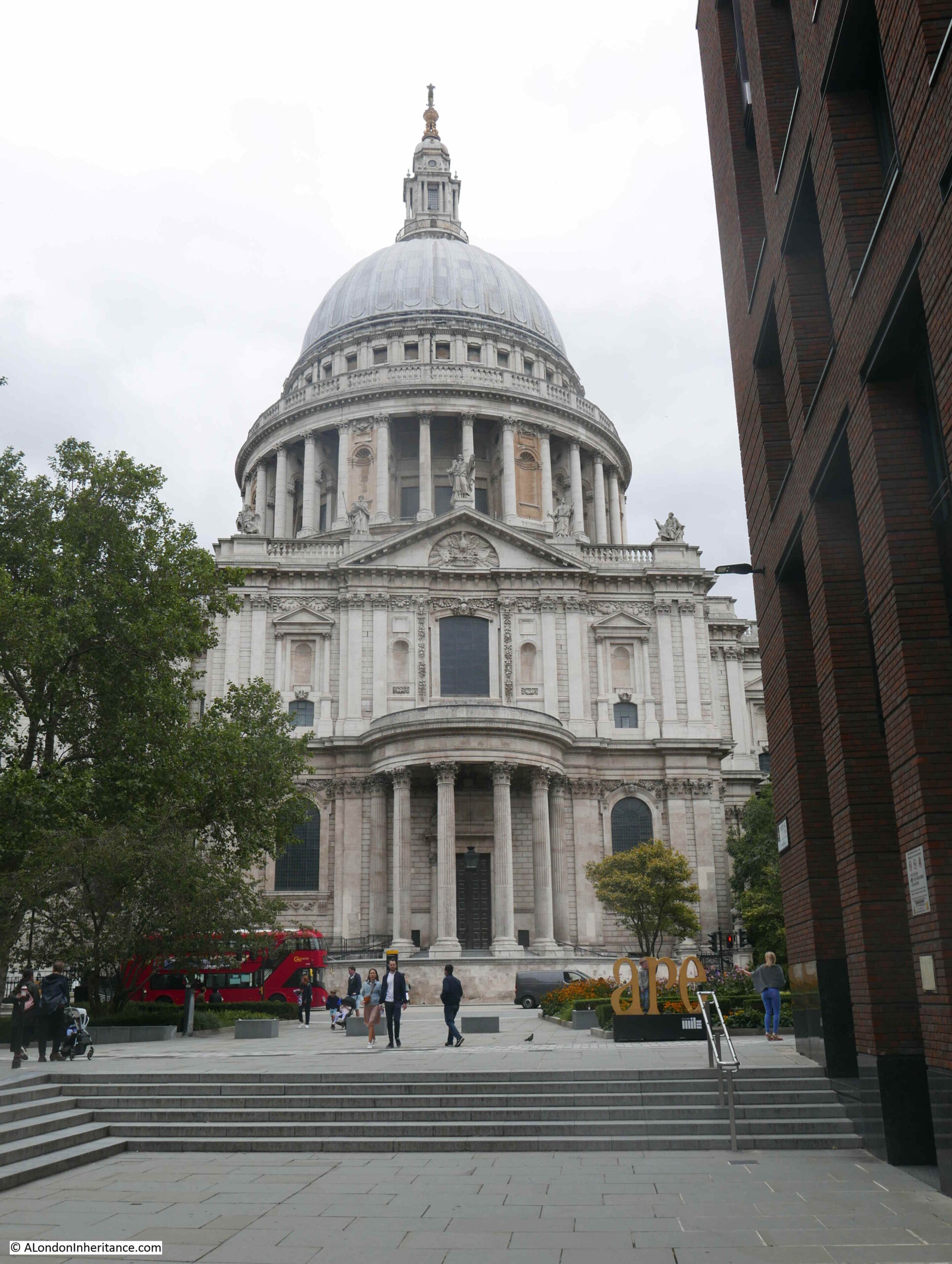
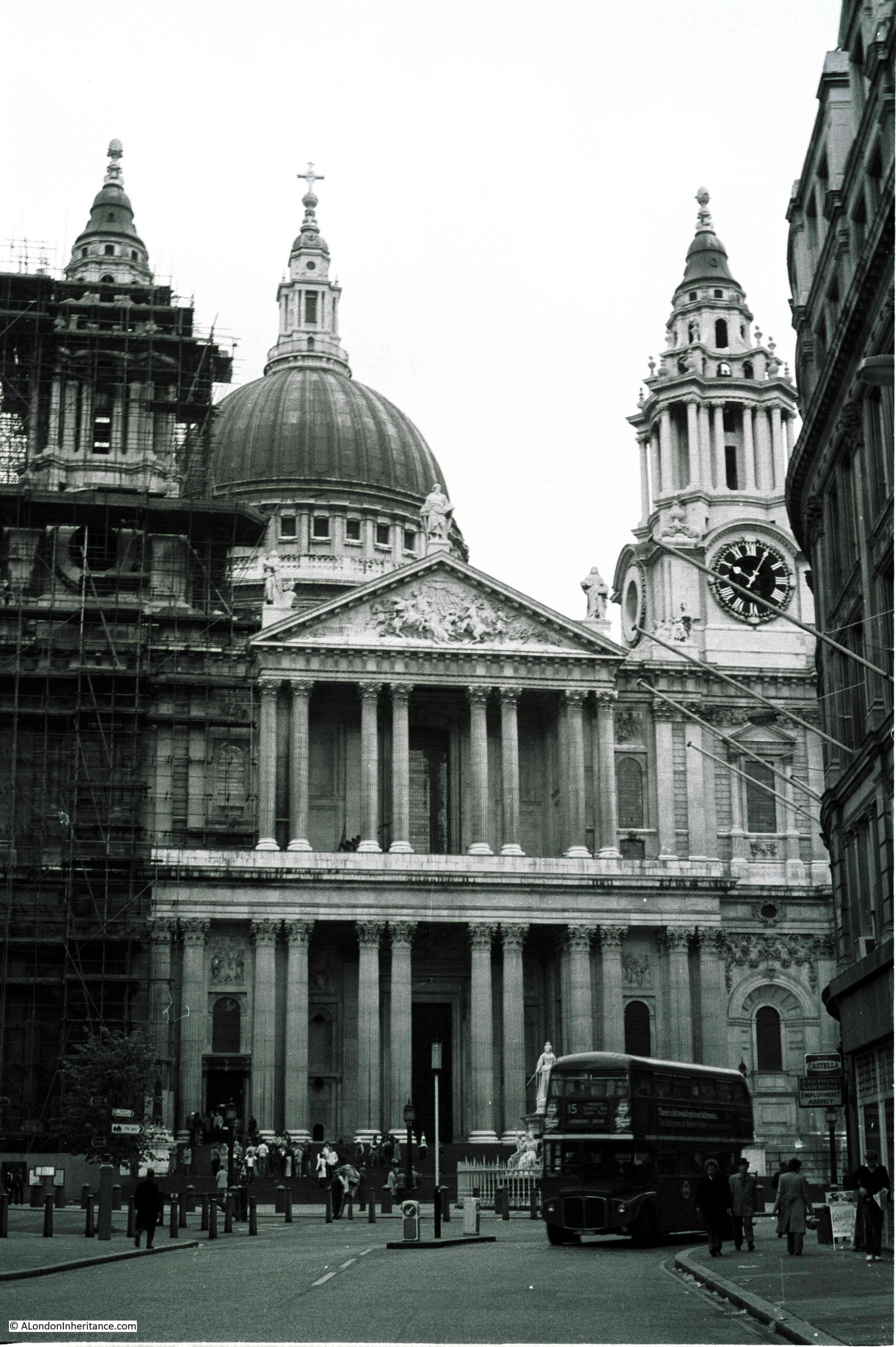
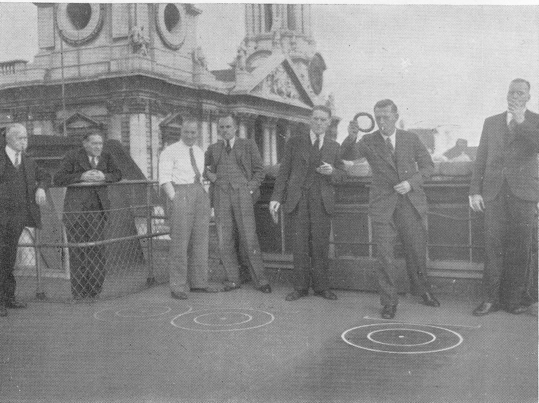
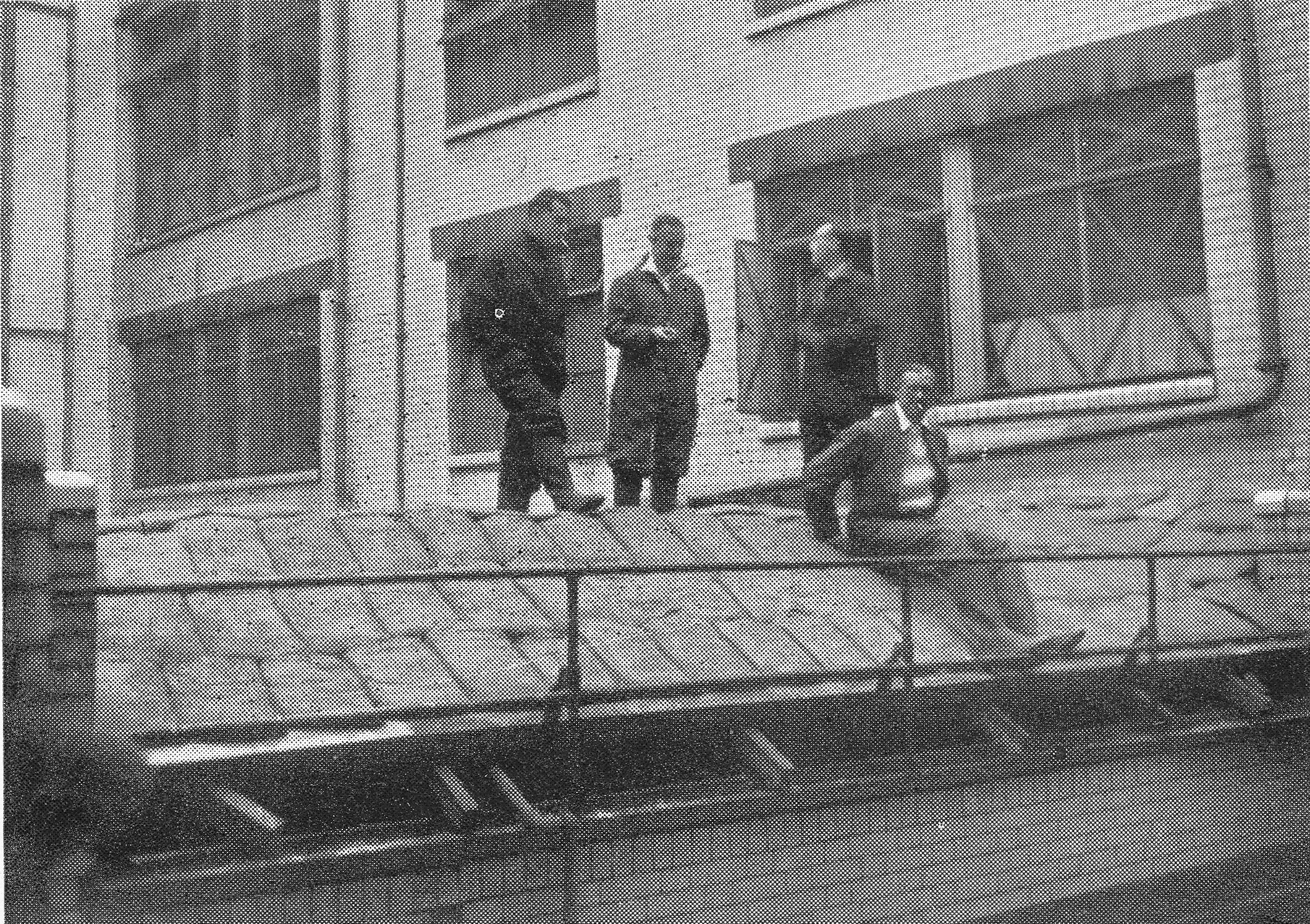
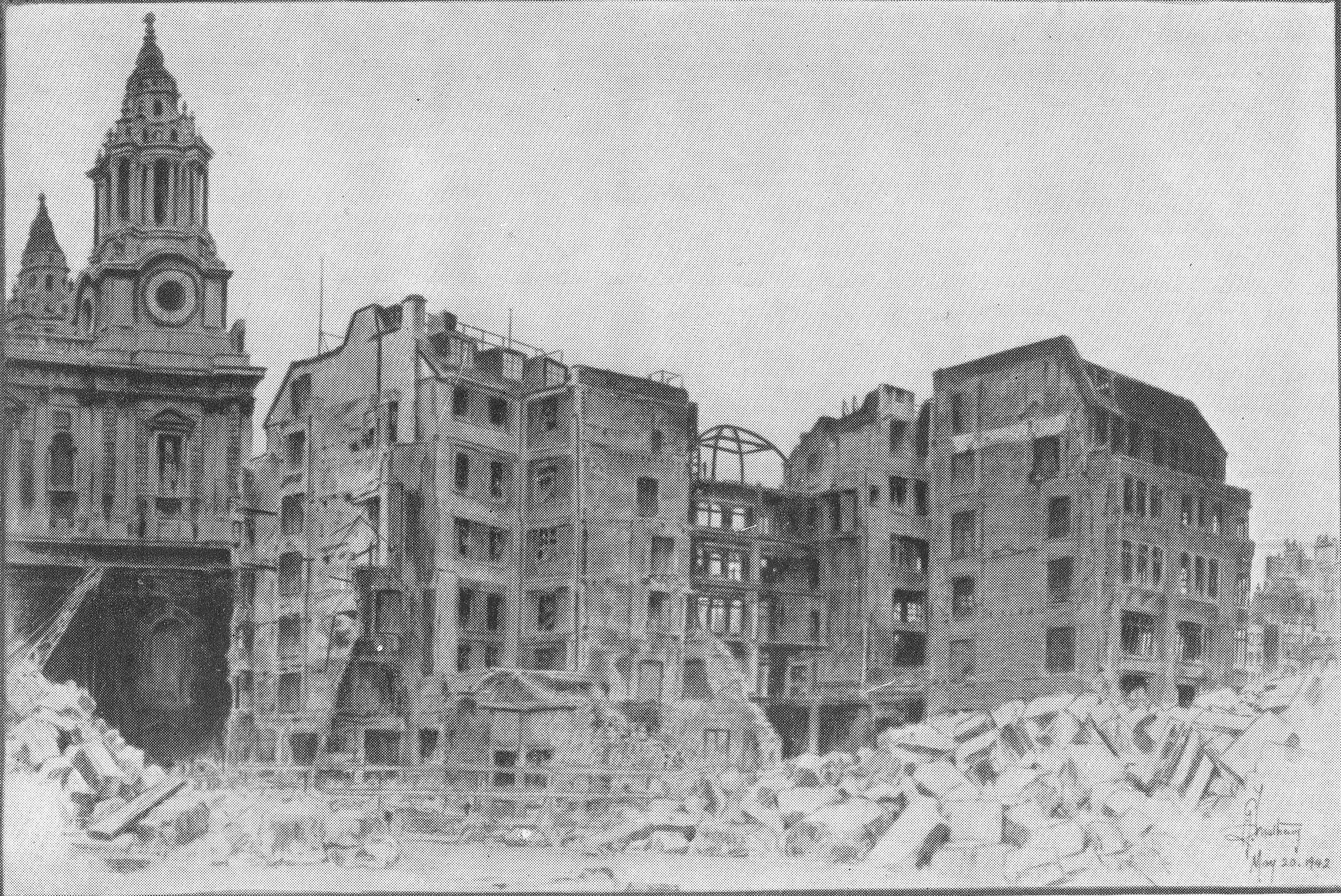
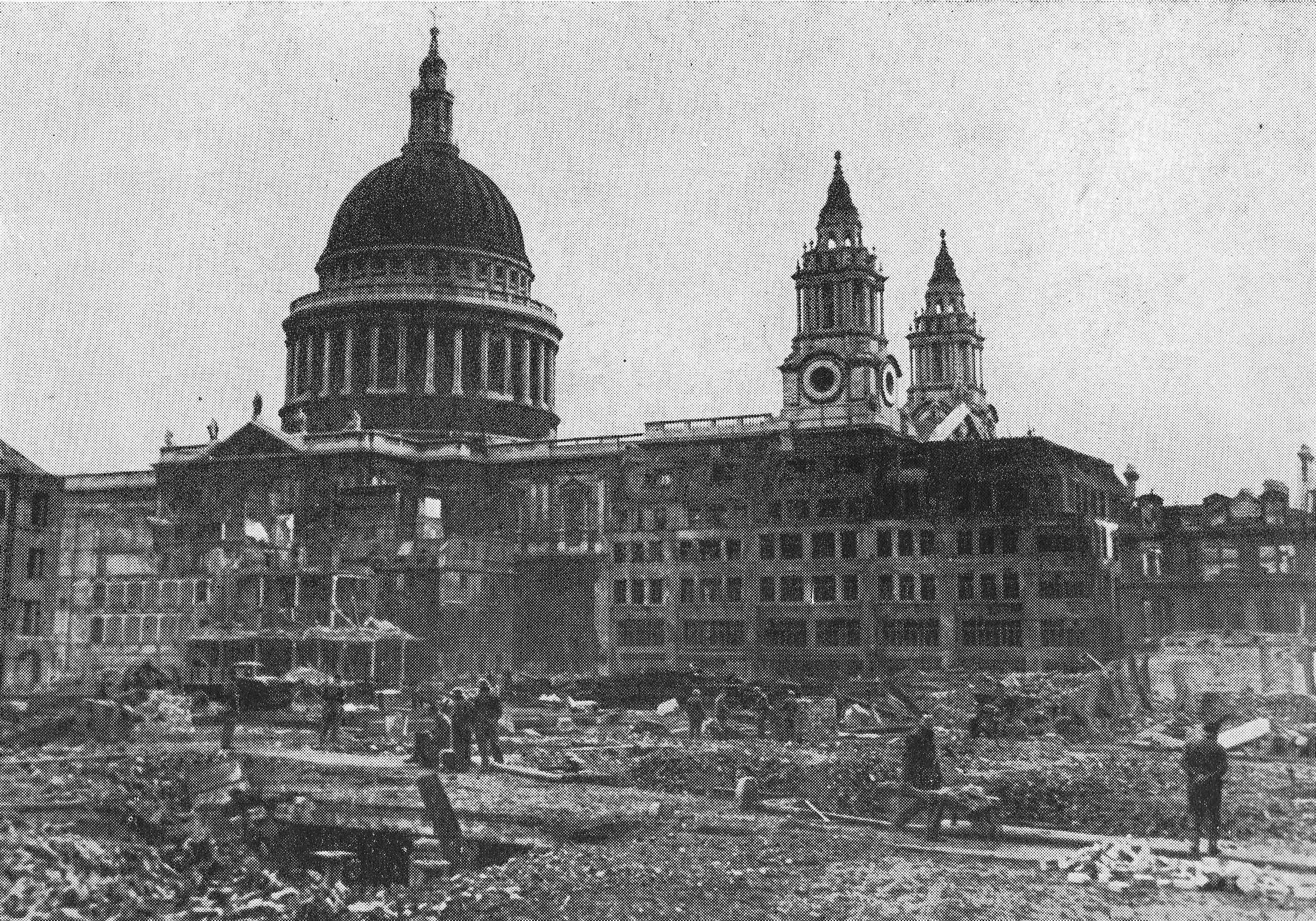
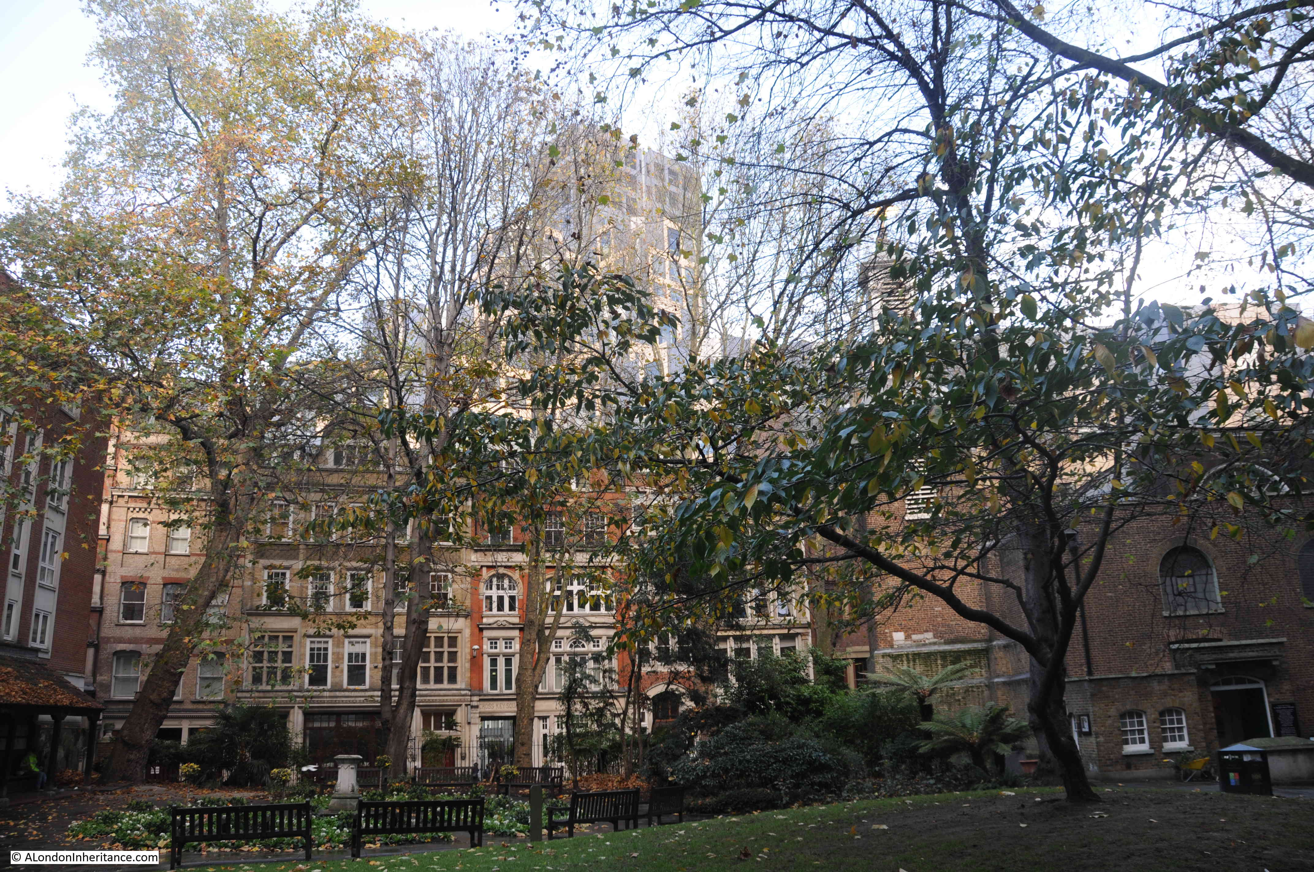
Each of the three photos are looking through some ornate iron gates, or railings, with part of St. Paul’s Cathedral in the background, with the twin towers on either side of the western entrance to the cathedral and the dome providing a clear landmark:
In the photo above, you can see a line of buildings leading to a gap towards the right of the photo where part of the western entrance to the cathedral can be seen.
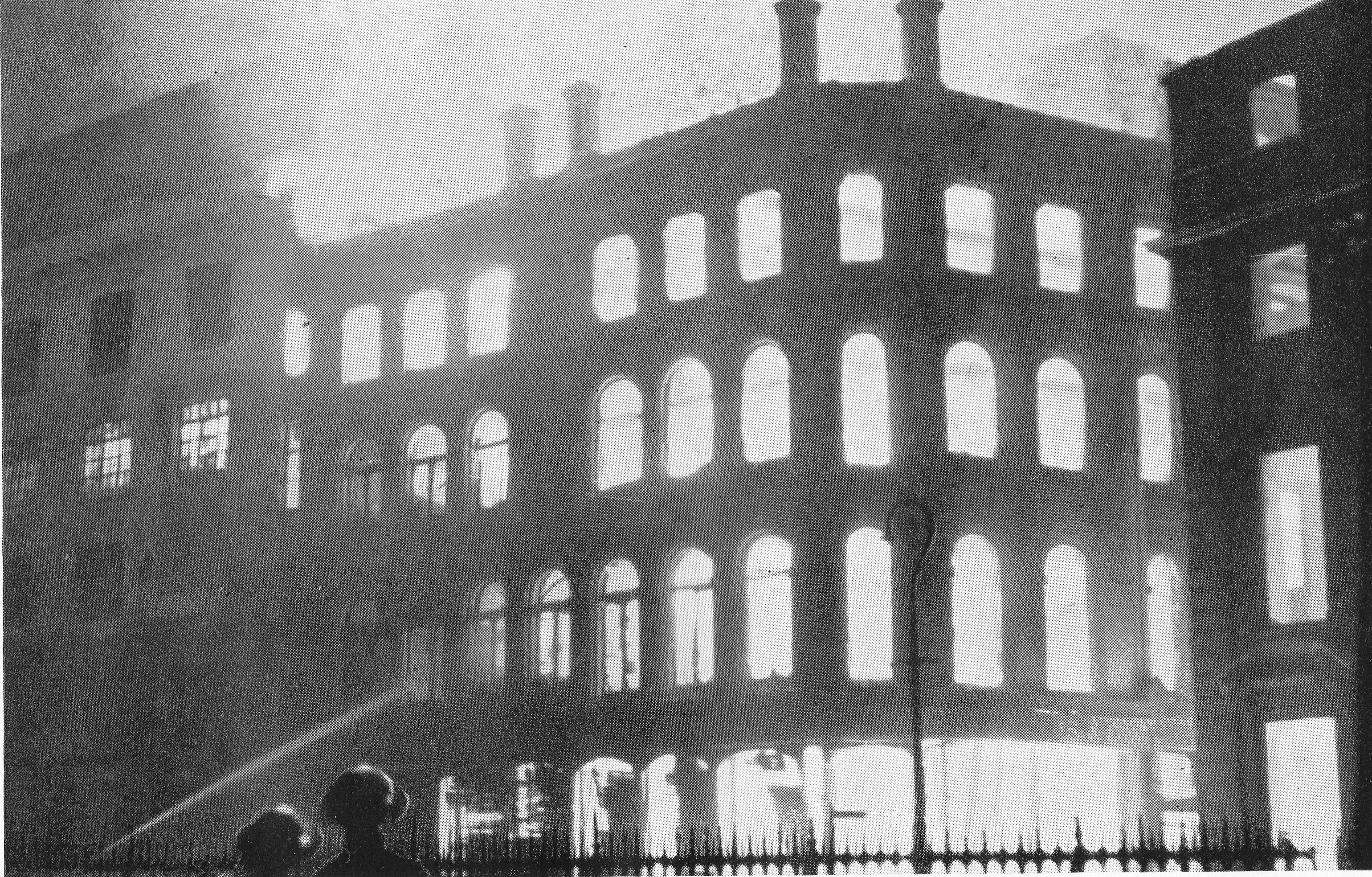
In the photo below, you can now see the dome, again through ornate ironwork, with more of the row of buildings in front of the cathedral:
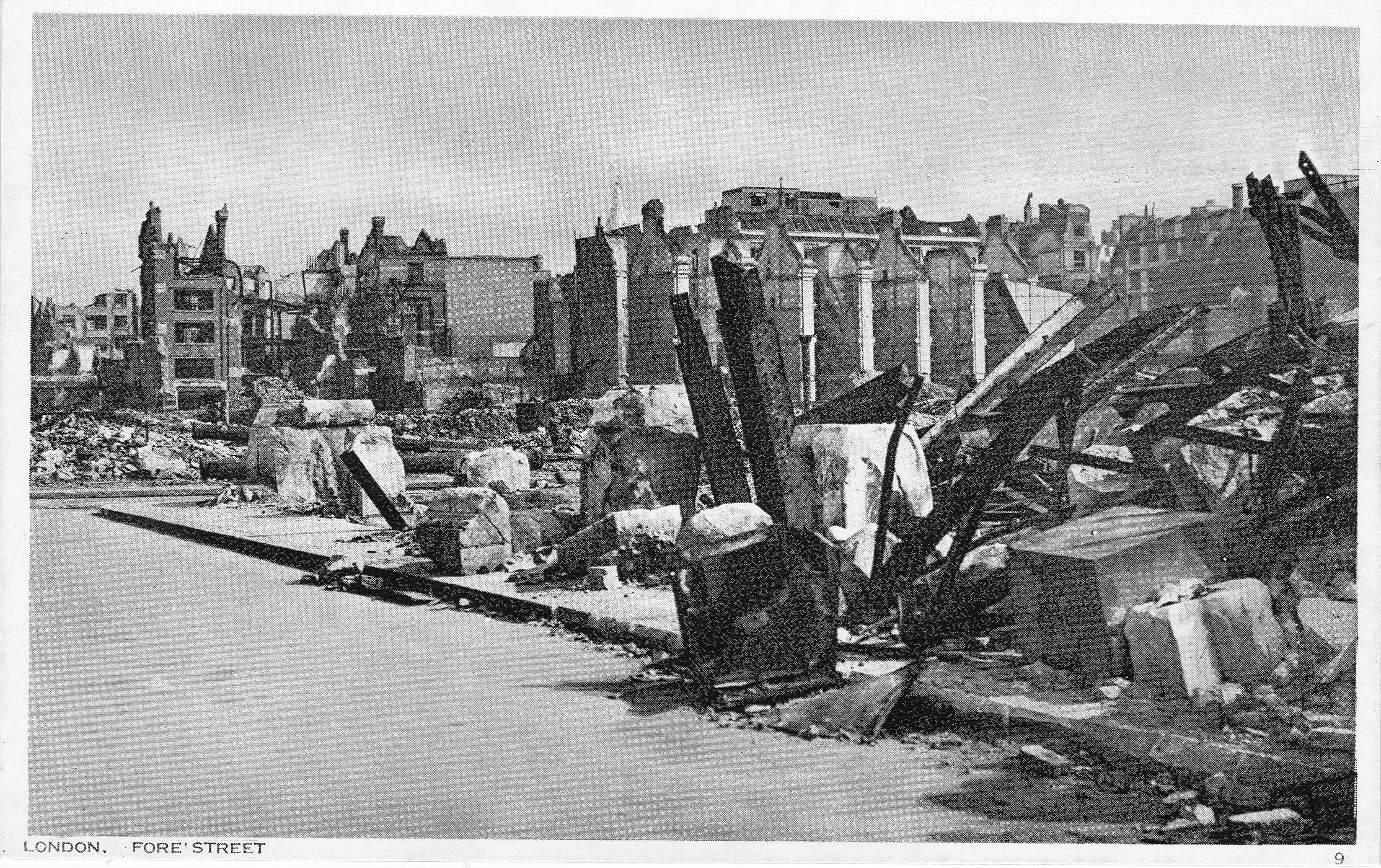
There is no glass in the windows of the building on the left, probably from wartime bomb damage. The buildings in the above photo were where the Paternoster Square development is today.
The following photo is very similar to the above photo, but is looking slightly to the right, with part of the western entrance visible:
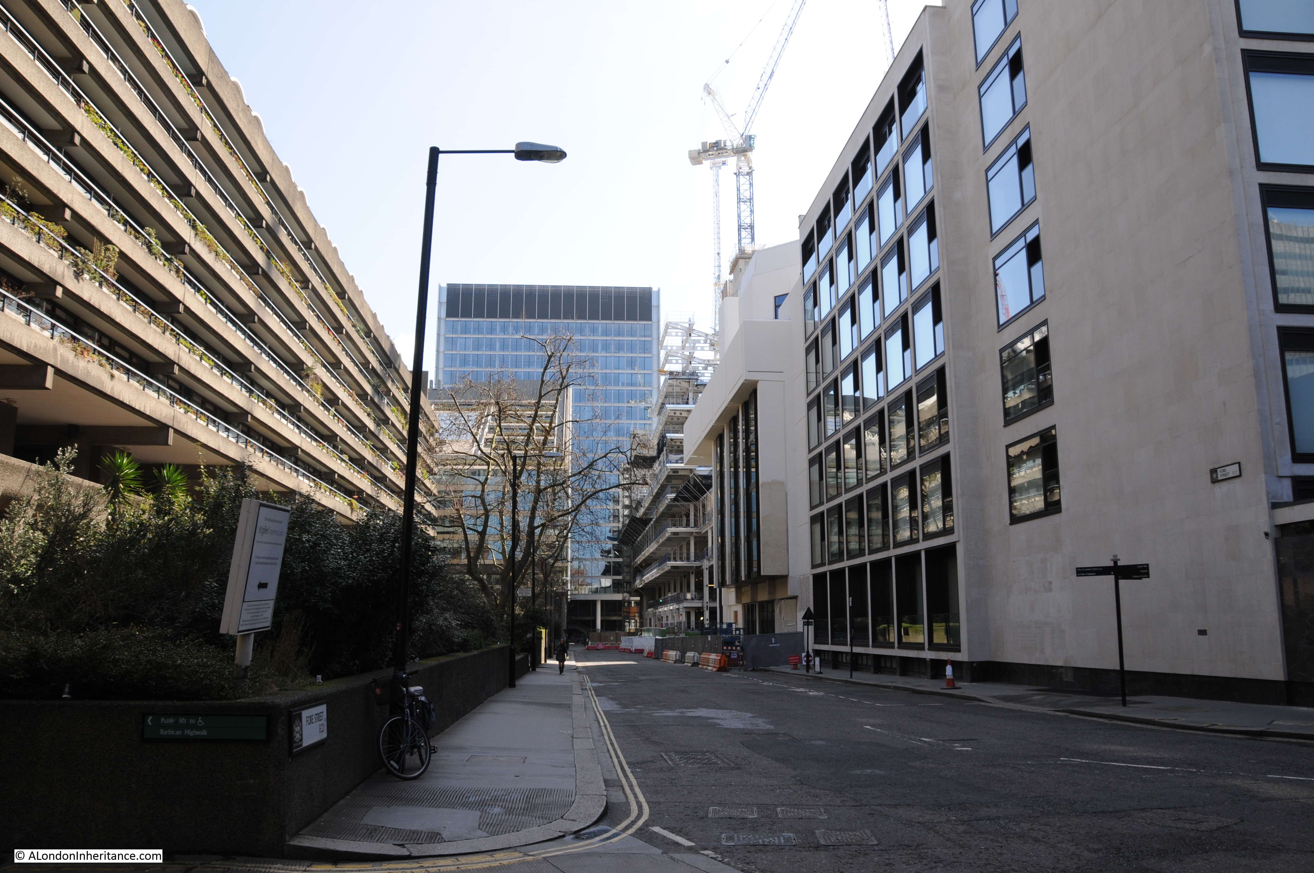
The Guilds and Livery Companies of the City of London often had their halls set back from the street, with a small courtyard in front, and an alley leading to the street. The alley would have an ornate iron gate to secure access to the courtyard and hall.
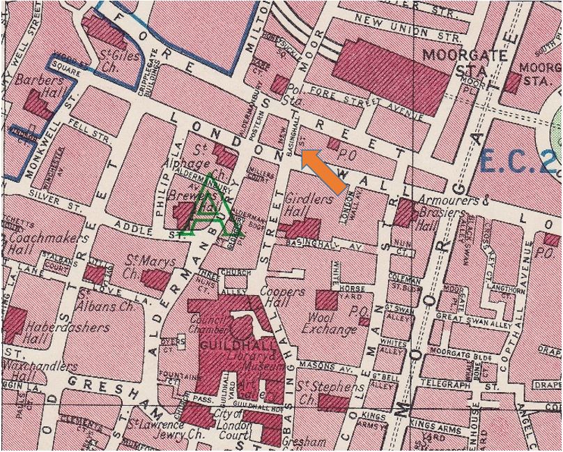
One of these halls, Stationers’ Hall is just to the west of St. Paul’s Cathedral, and I checked the OS map published a couple of years after my father took the above photo, and the location of the hall, and view across to the cathedral does seem to correspond to the three photos (Map ‘Reproduced with the permission of the National Library of Scotland“):
In the above map, I have underlined Stationers’ Hall with a red line. The square to the lower left of the hall is their garden, and to the lower right is a small courtyard with the double lines, possibly of a gate just to the left of the red arrow, and the lane Stationers Hall Court which could also have been the location of the gates.
The red arrow shows the rough direction of view for the photos.
It is across Ave Maria Lane, and some open space, as the area was bombed badly during the war. To the right of the open space, you can see a a couple of buildings to the right of London House Yard, and leading between the buildings is a small street, also with the name of London House Yard.
Below the red arrow is a line of buildings along Ludgate Hill, and between the two rows of buildings, where the arrow is pointing, there is a gap, and through this gap, the view of the western entrance to St. Paul’s Cathedral is visible, as can be seen in my father’s photos.
So, I am sure that my father was taking photos behind the gates of the entrance to Stationers’ Hall, the short double lines, or in Stationers Hall Lane, to the left of the start of the red arrow in the map. But I cannot be 100% certain.
The reason I cannot be certain is that I cannot find any photos of the gates to the hall to confirm.
In the photo, you can just see the inner gates, and these do not appear to have the ornate ironwork as in my father’s photos.
The outer gates, presumably the ornate iron work in my father’s photos, cannot be seen as they are wide open.
So again, the location looks exactly right, with the view across to the buildings opposite, including the slight offset to where London House Yard runs between the two buildings, and the view of the cathedral through the gap between buildings, all seeming to confirm.
But as I cannot find a photo of the gates, I will leave the word “Probably” in the title of the post.
Time to have a look at Stationers’ Hall, and the hall consists of buildings on two sides of a courtyard, in front, and to the right of the following photo:
The other side of the courtyard:
To learn about the Stationers’, I turned to the book “The Armorial Bearings of the Guilds of London” by John Bromley and published in 1960, which does seem to offer one of the more comprehensive overviews of the City’s guilds and companies.
In this book, the company has the name of “The Worshipful Company of Stationers and Newspaper Makers”, which was the full name used from 1937 to recognise the amalgamation of the Stationers’ Company with the Company of Newspaper Makers.
Today, the Newspaper Makers wording has been dropped, and the company describes itself as “The City of London Livery Company for the Communications and Content Industries”, showing how these City institutions have continuously evolved as their trades have changed.
The word “stationer” comes from the Latin word stationarius – a stall holder as opposed to an itinerant seller of goods, and it seems that the important role of these “stationarii” in producing, lending and selling books in mediaeval universities started to limit the name to this specific trade, which also then included bookbinders, illuminators and text writers.
In 1403, Text Writers and Illuminators were united by civic ordinance into a single Guild, which is the direct ancestor of the Company of Stationers’.
On the 4th of May, 1557, the Stationers’ were incorporated by Royal Charter.
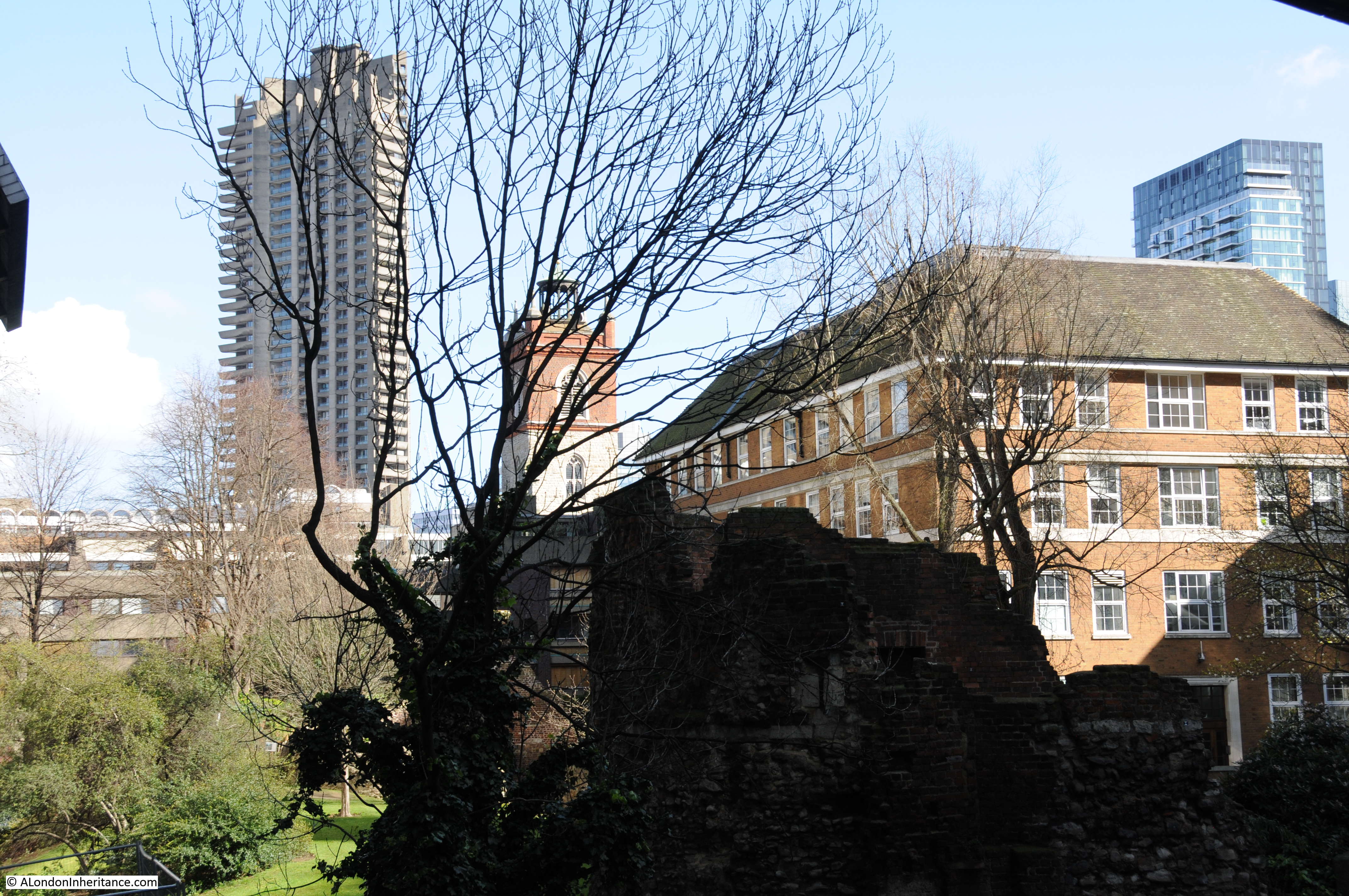
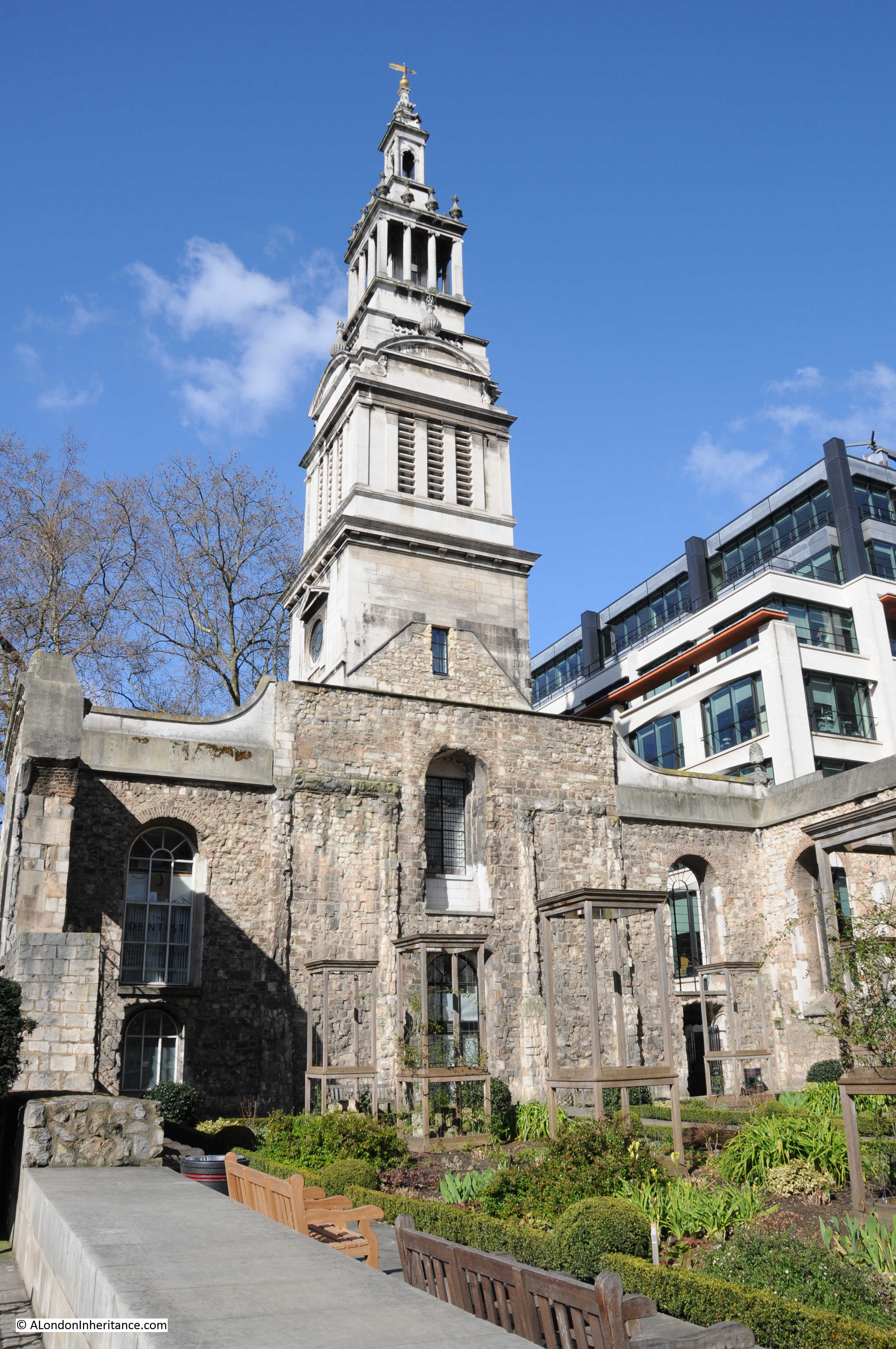
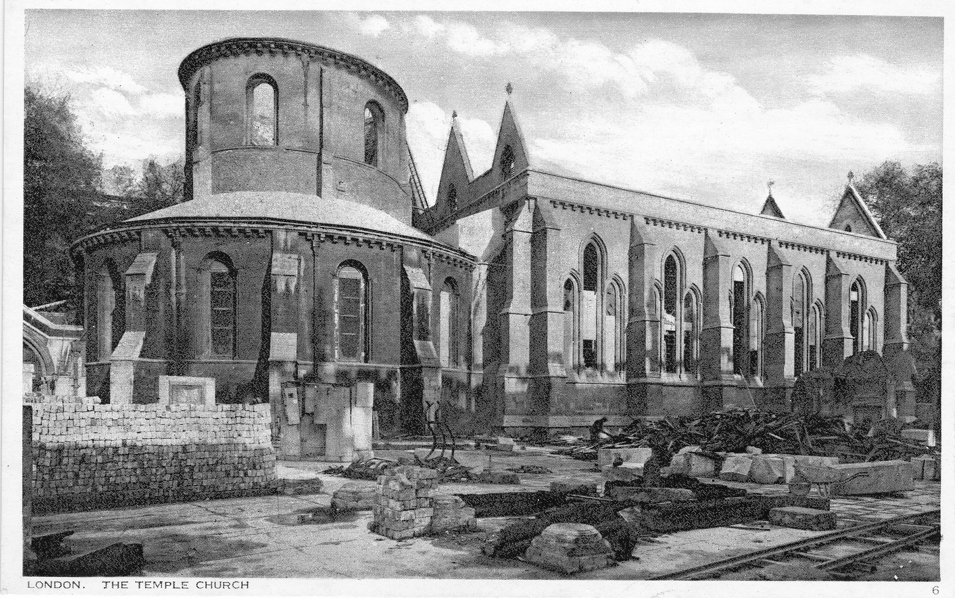
The Stationers’ have had a hall on the current site since 1606, following a move from their original, 1554 hall, a short distance away.
The hall has been rebuilt and been through a number of changes and modifications in the past 400 years. It was destroyed in the 1666 Great Fire and more recently suffered serious bomb damage in 1940, during the same raids that resulted in the cleared space seen in front of my father’s photos.
At the rear of the hall is a small garden, and a gate to the side of the hall provides access to Stationers’ Garden:
The following print from 1830 shows the entrance to the garden on the left, and the hall looking much the same as it does today:
On the front of the hall is a memorial to liverymen of the company who lost their lives in the Great War, 1914 – 1918:
And a plaque that records one of the trades associated with the Stationers’, recording that Wynkyn de Worde set up his press in nearby Shoe Lane around the year 1500:
An ornate sign for Stationers’ Hall, with their coat of arms, hangs from the hall:
The arms of the Stationers’ Company include three clasped books, an eagle between two Tudor roses, and above a white bird, a representation of the holy spirit, and a white cloud radiating beams of light.
The arms are also displayed on wooden bollards around the courtyard:
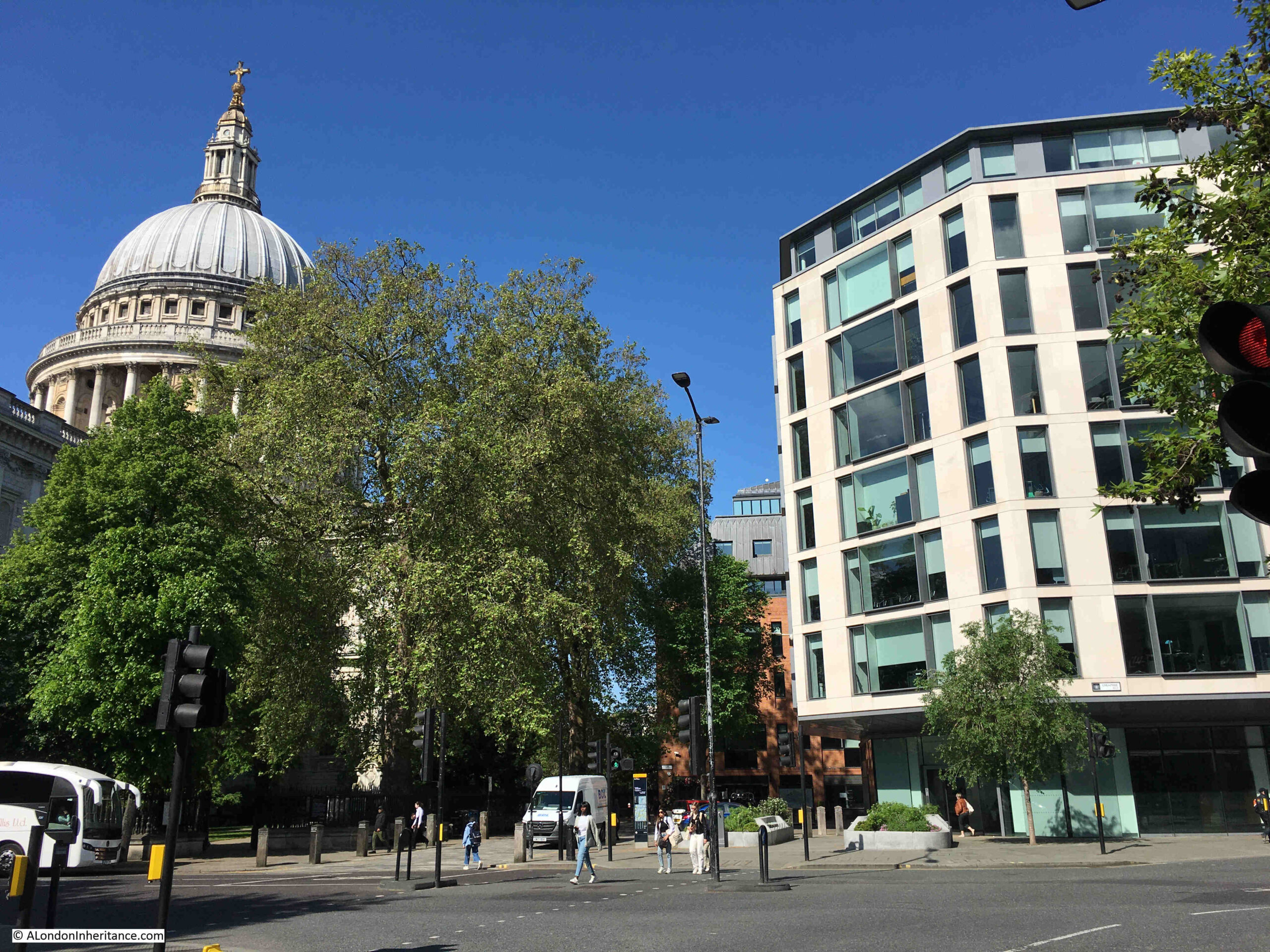
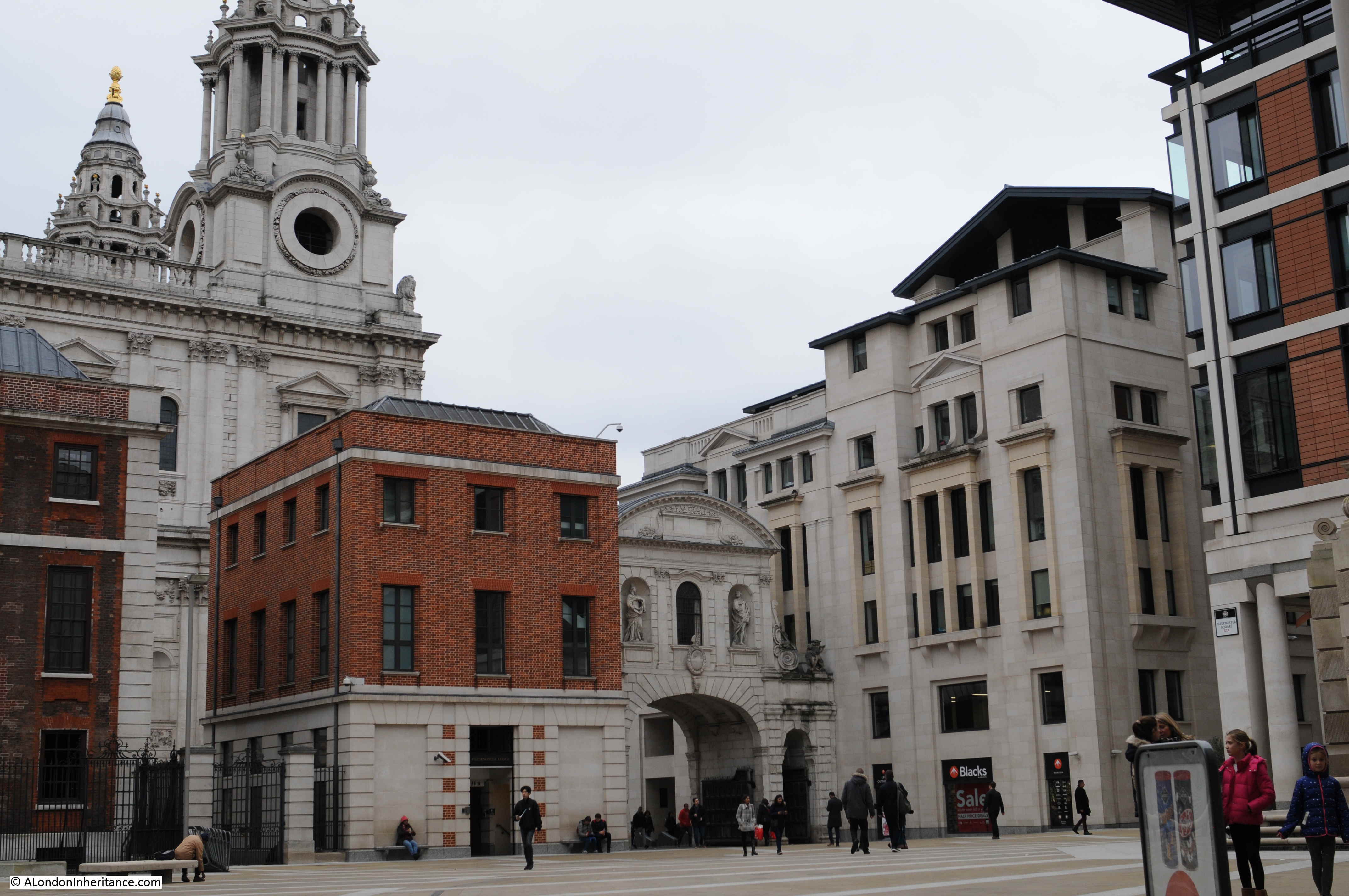
The following view is looking from the courtyard towards St. Paul’s Cathedral. The building surrounding two sides of the courtyard, and blocking the view of the cathedral is the Club Quarters Hotel:
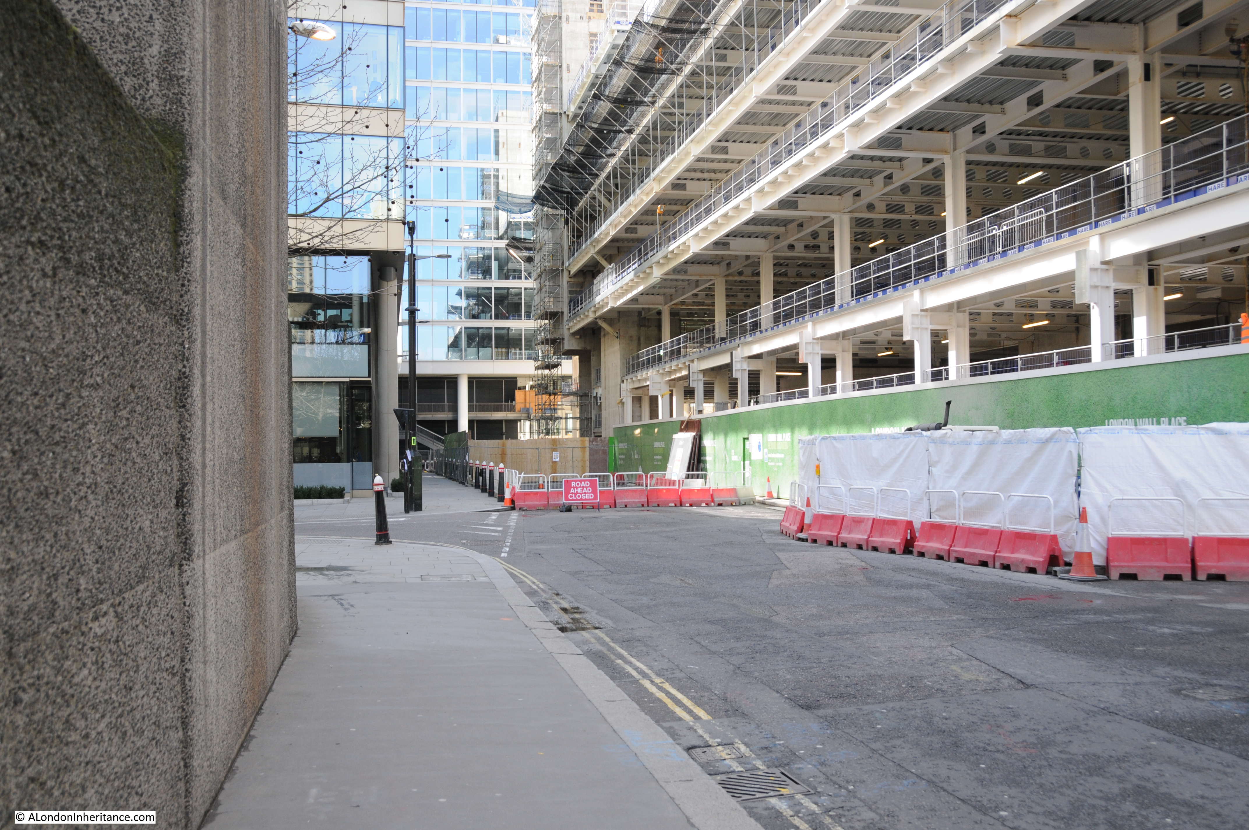
The walk way through the hotel, seen in the above photo, appears to be in the same location as the original exit from the courtyard to Ave Maria Lane. If I am right, it was in this walk way that my father took the photos looking through the old gates.
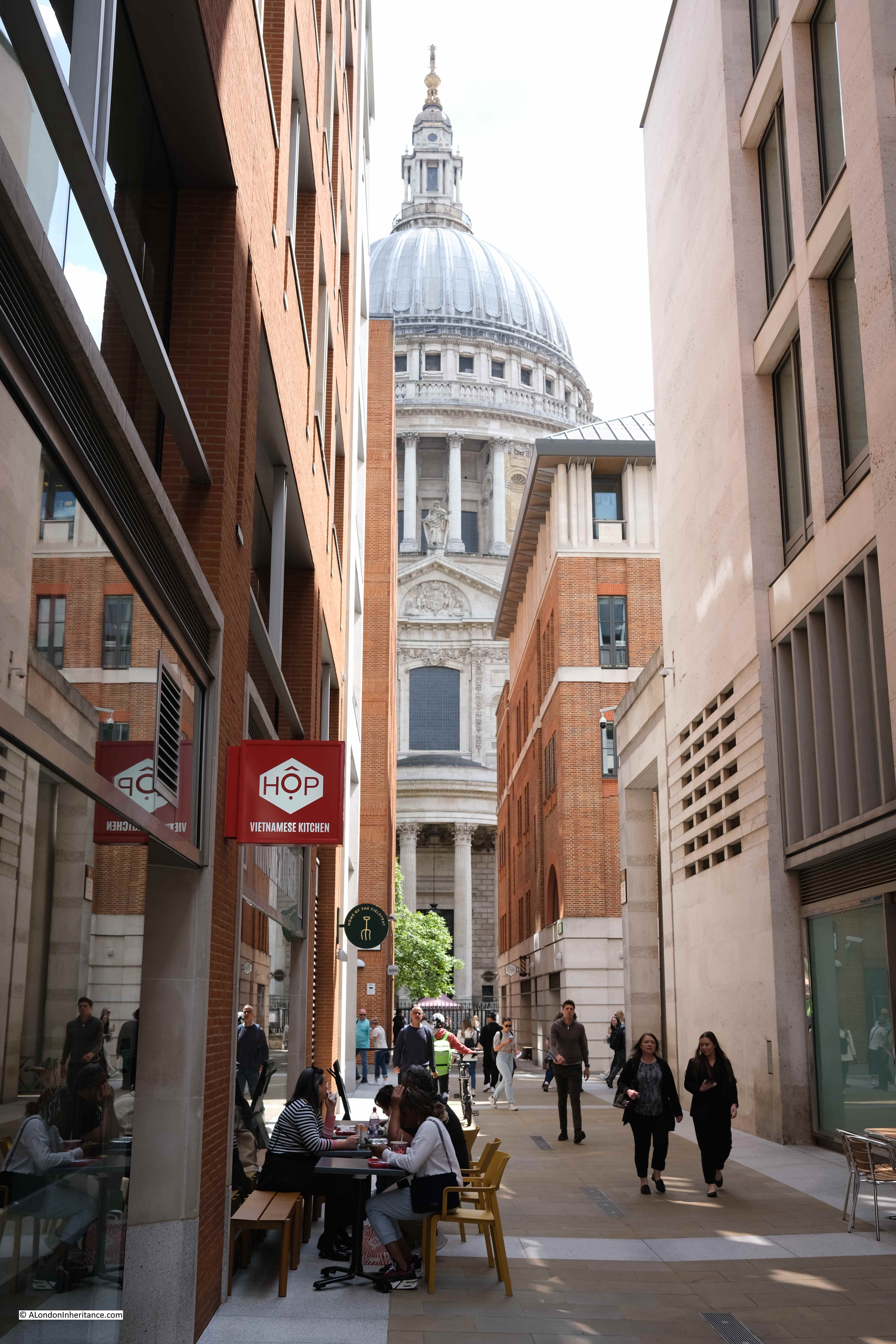
Walking through, and looking in the direction of the cathedral, the view is still blocked, now by the Paternoster Square development:
Looking back from Ave Maria Lane, with the entrance to the courtyard in front of Stations’ Hall, at ground level, and under the hotel. The gates in my father’s photos would have been somewhere around this entrance:
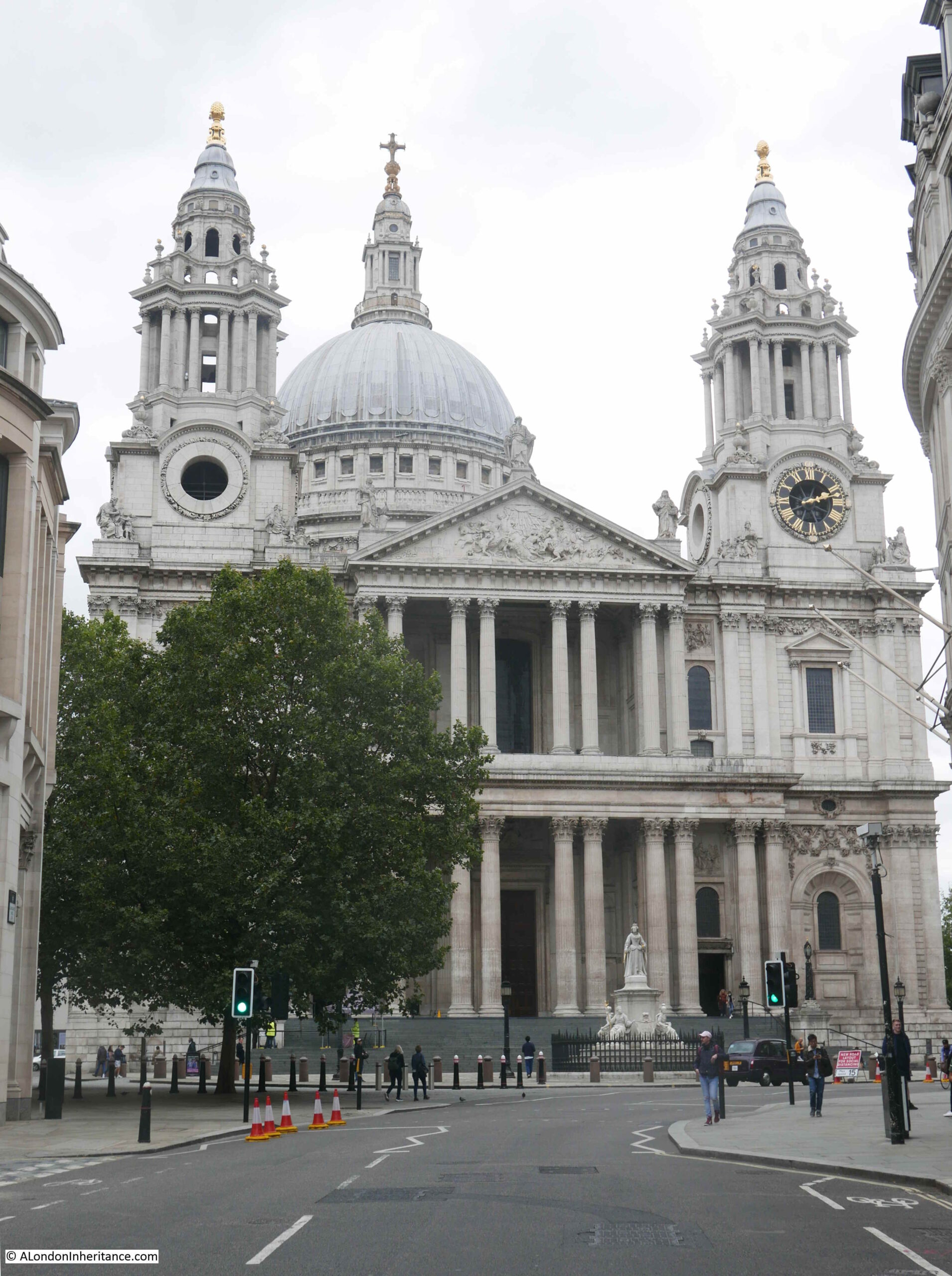
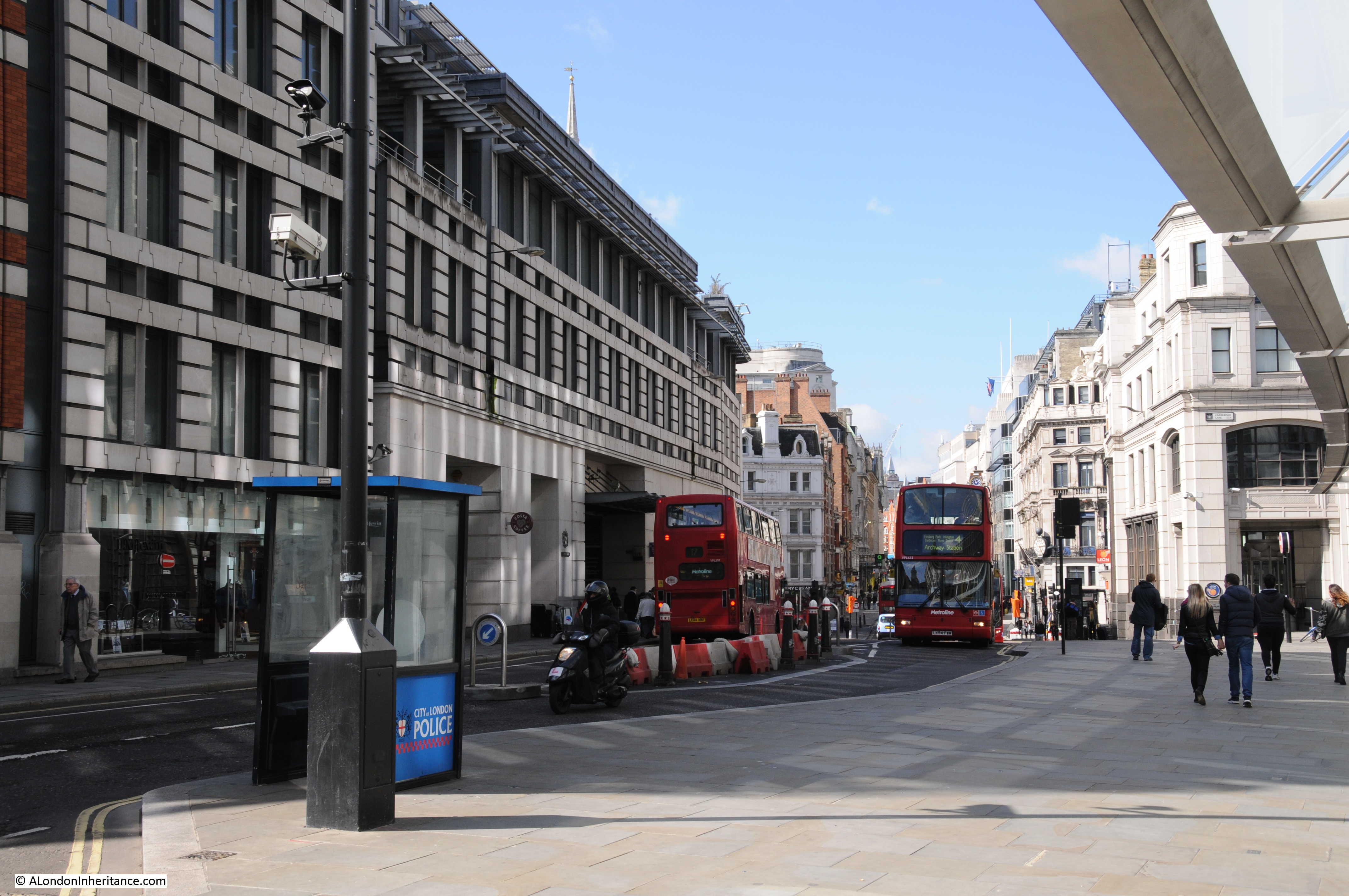
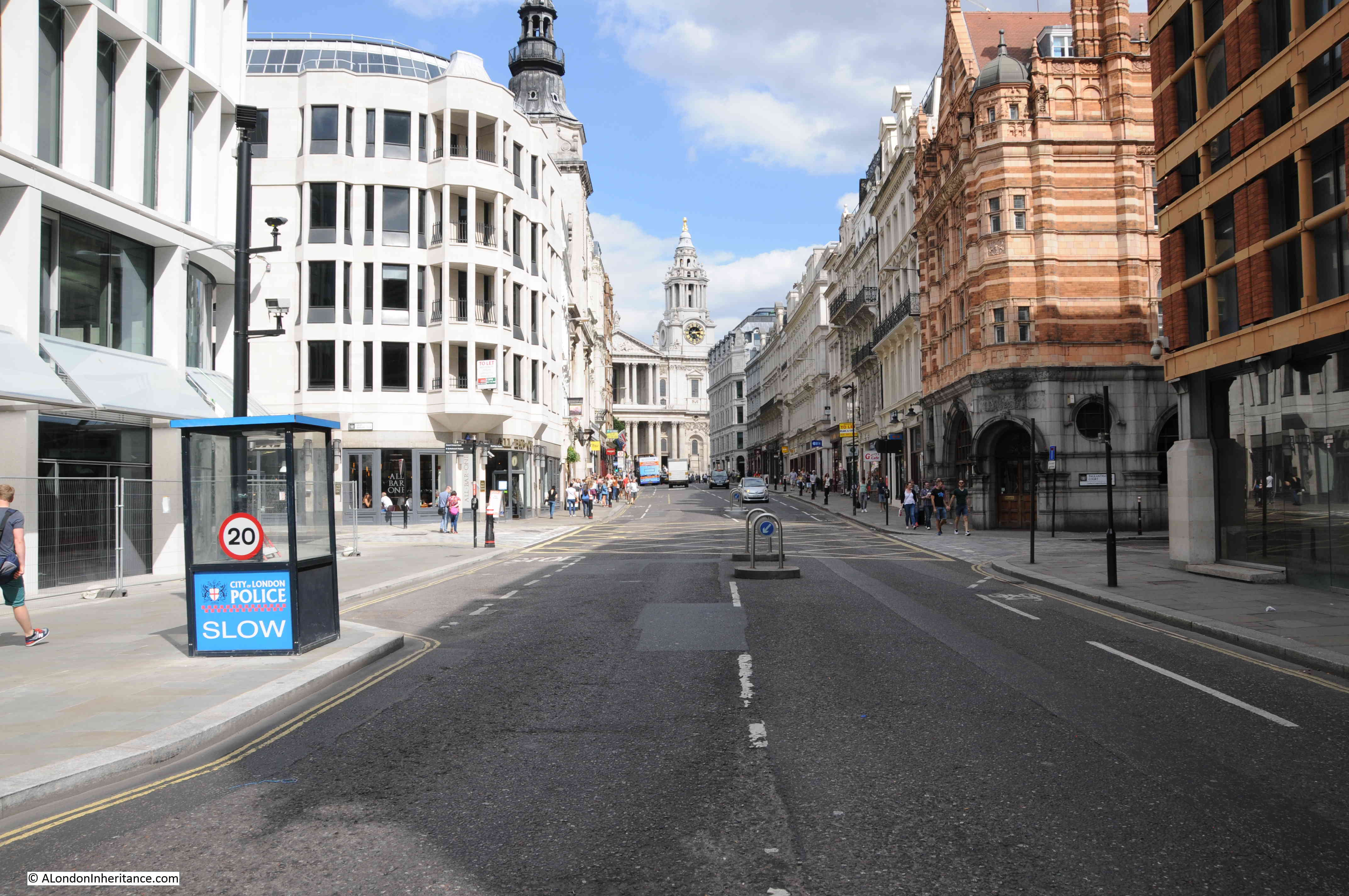
To get a view of the cathedral, I had to turn right and walk along Ave Maria Lane to Ludgate Hill, where, on the corner of the junction, I had the following view;
Compare the above view with my father’s photos, and imagine then walking to the left, back along Ave Maria Lane to where the entrance to Stationers’ Hall is located, and the alignment of the cathedral, the dome, two towers, is about right in the photos looking through the gate.
I cannot be completely certain, as I cannot find any photos of the gates with the hall behind, but the map, and the views across to the cathedral, including the gap between buildings, and the street layout, all look right.
So whilst I cannot guarantee, I can say that the gates were probably those at the entrance to Stationers’ Hall.
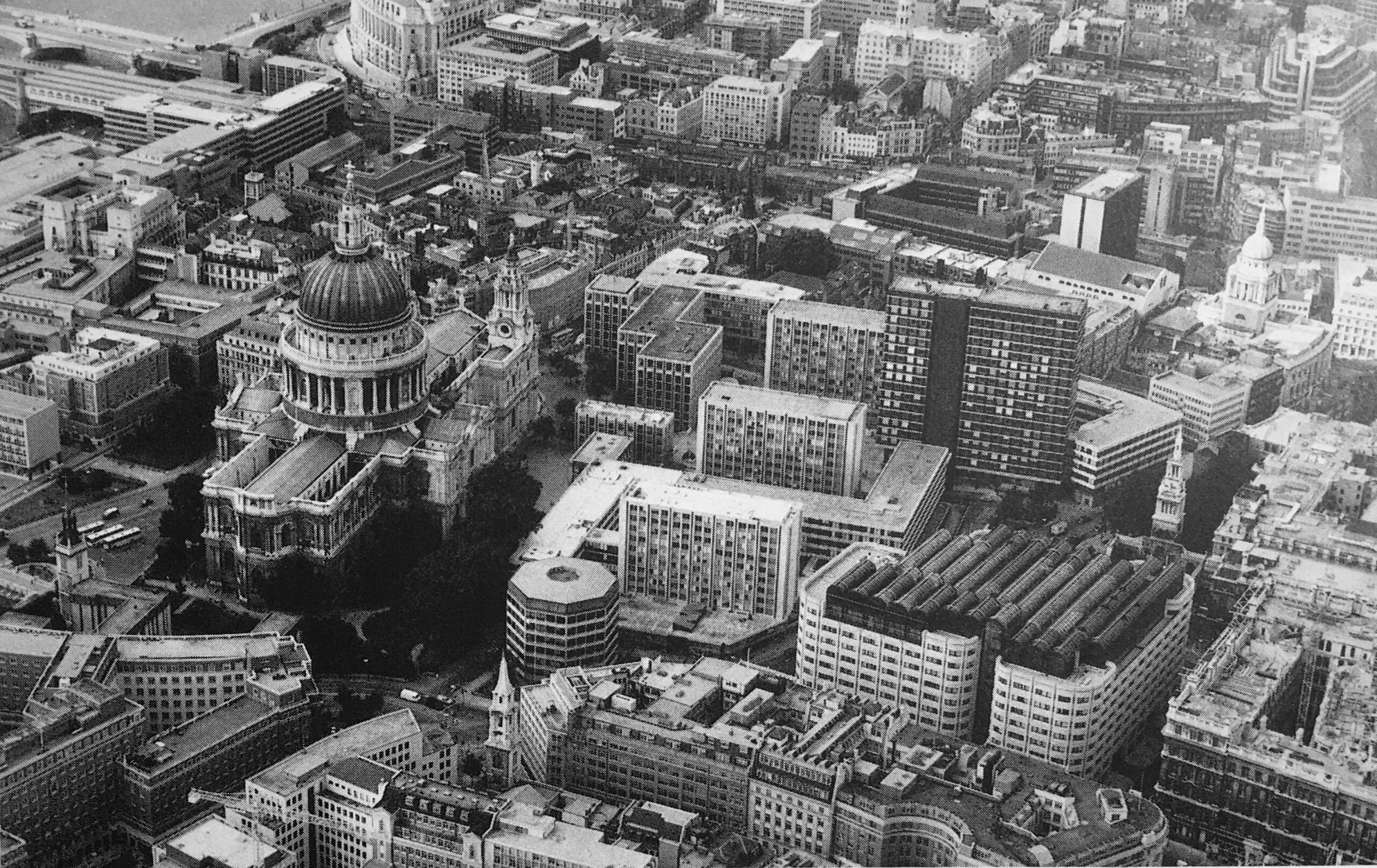
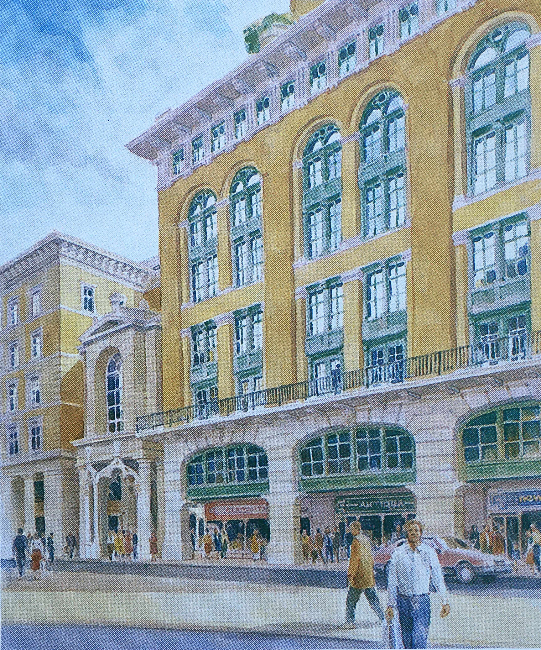
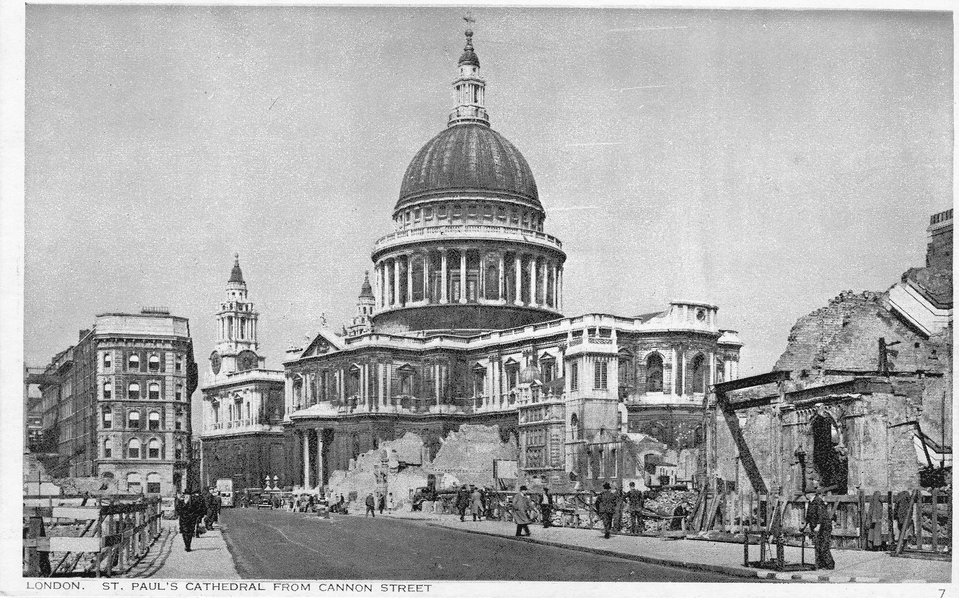
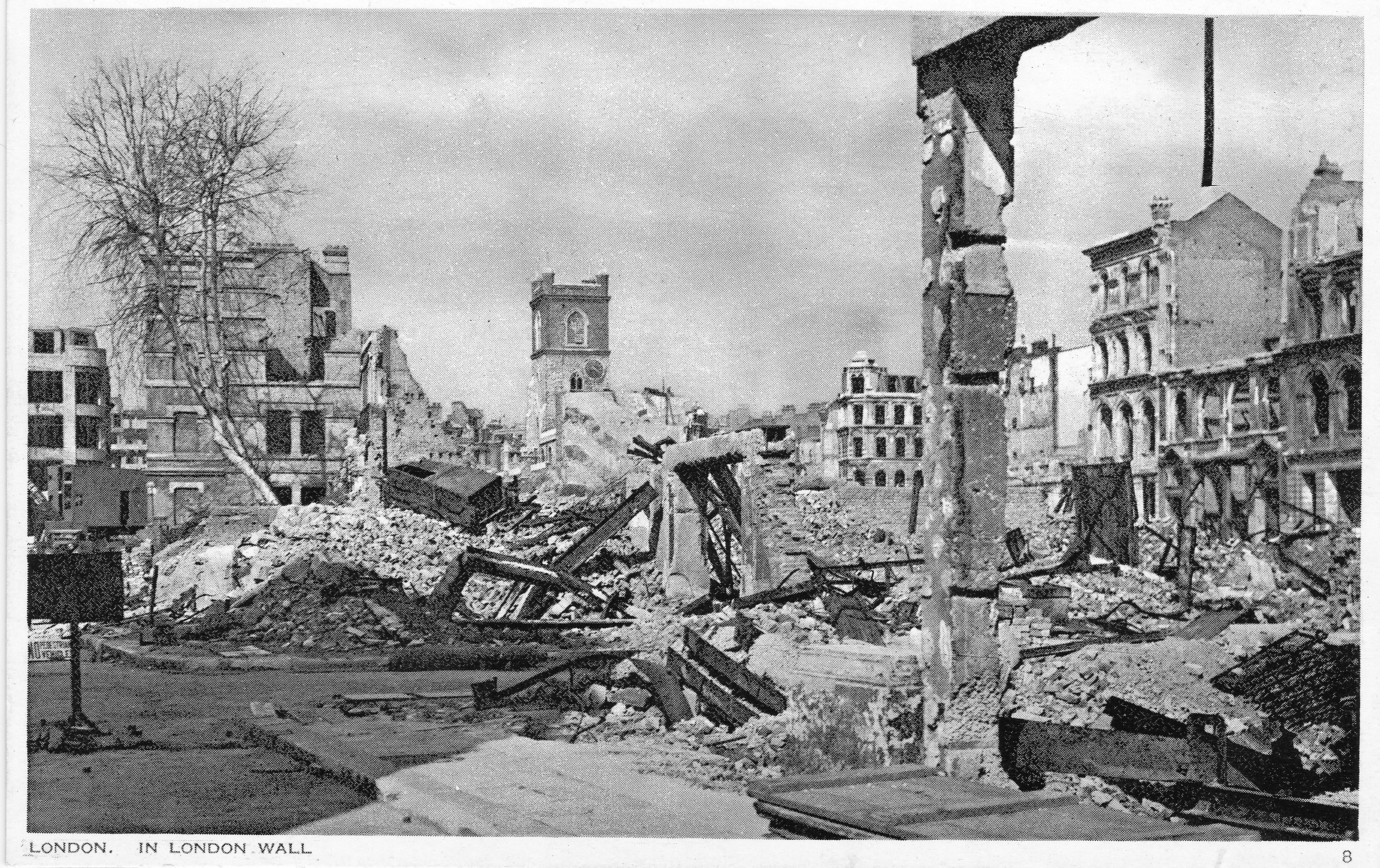
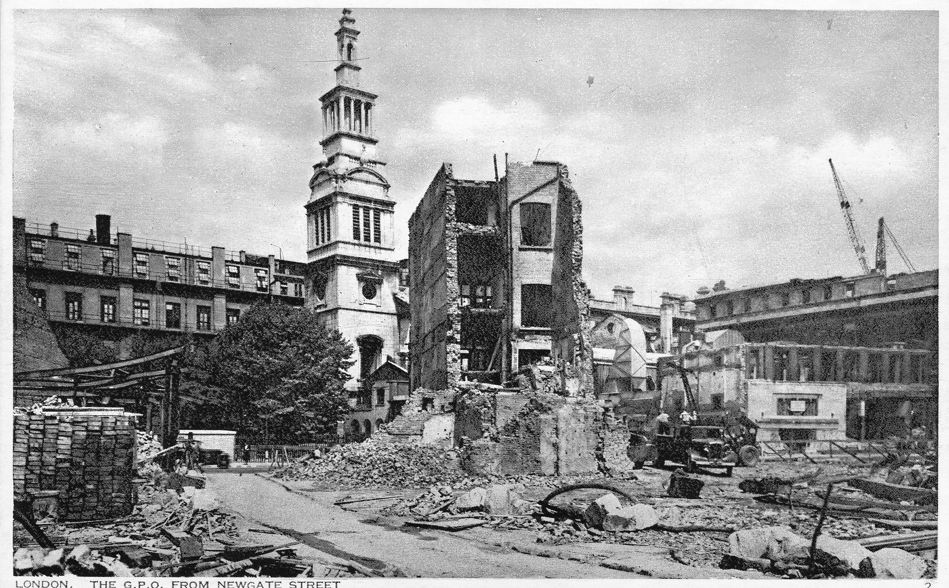
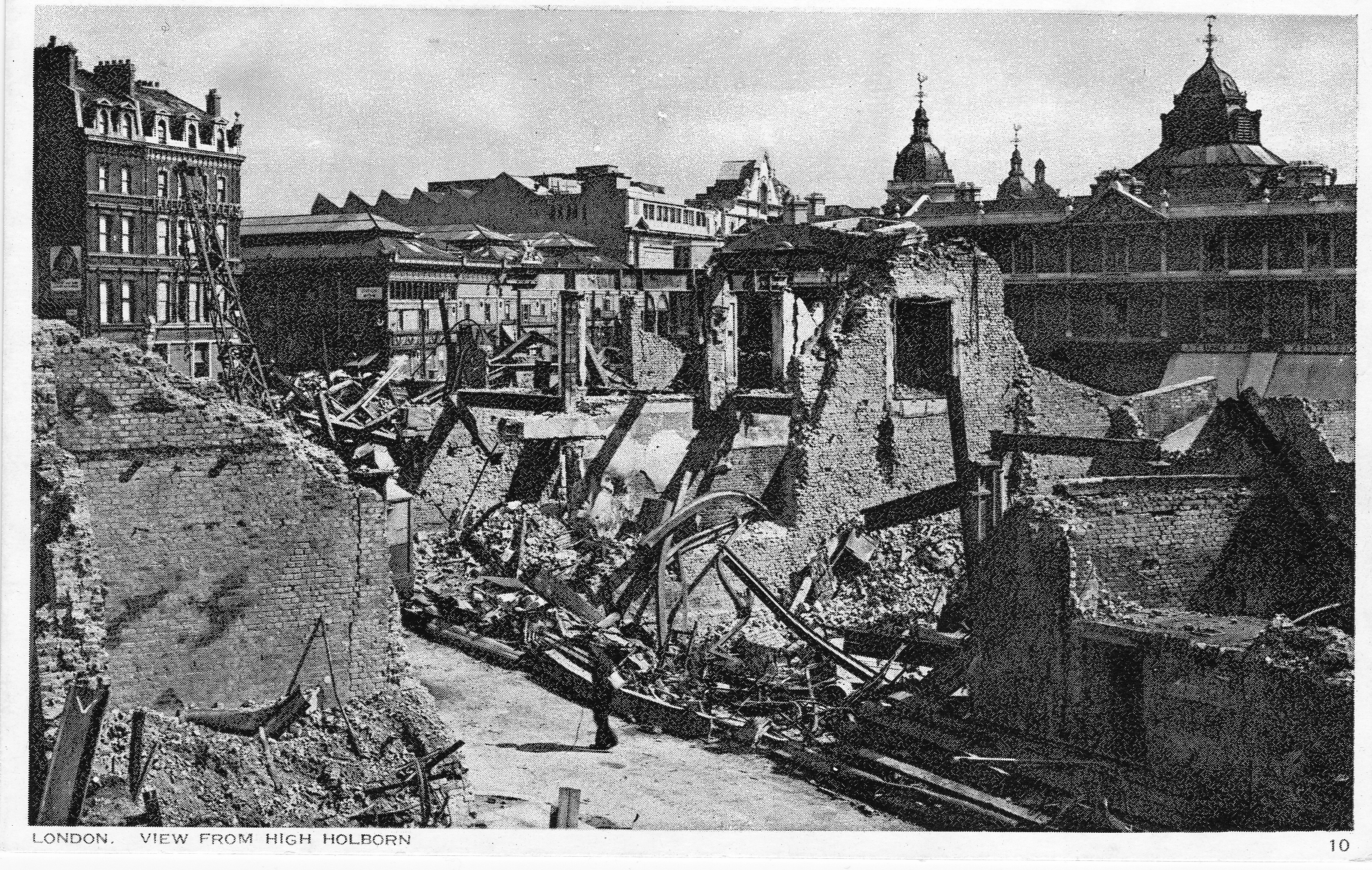
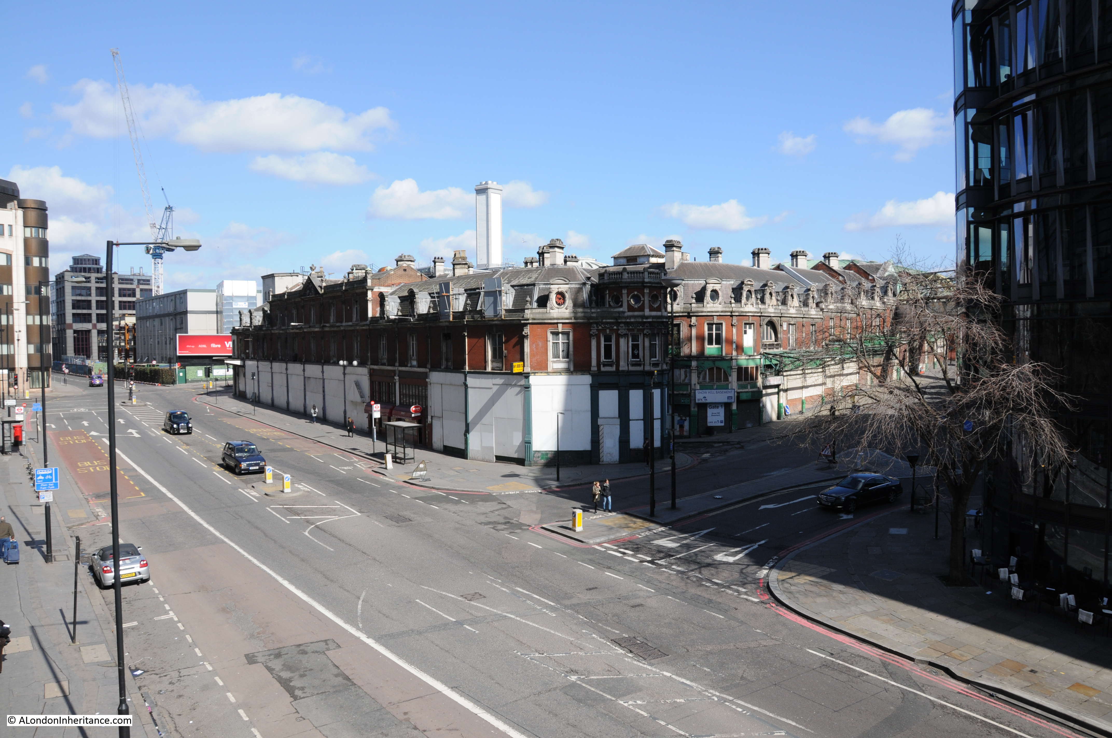
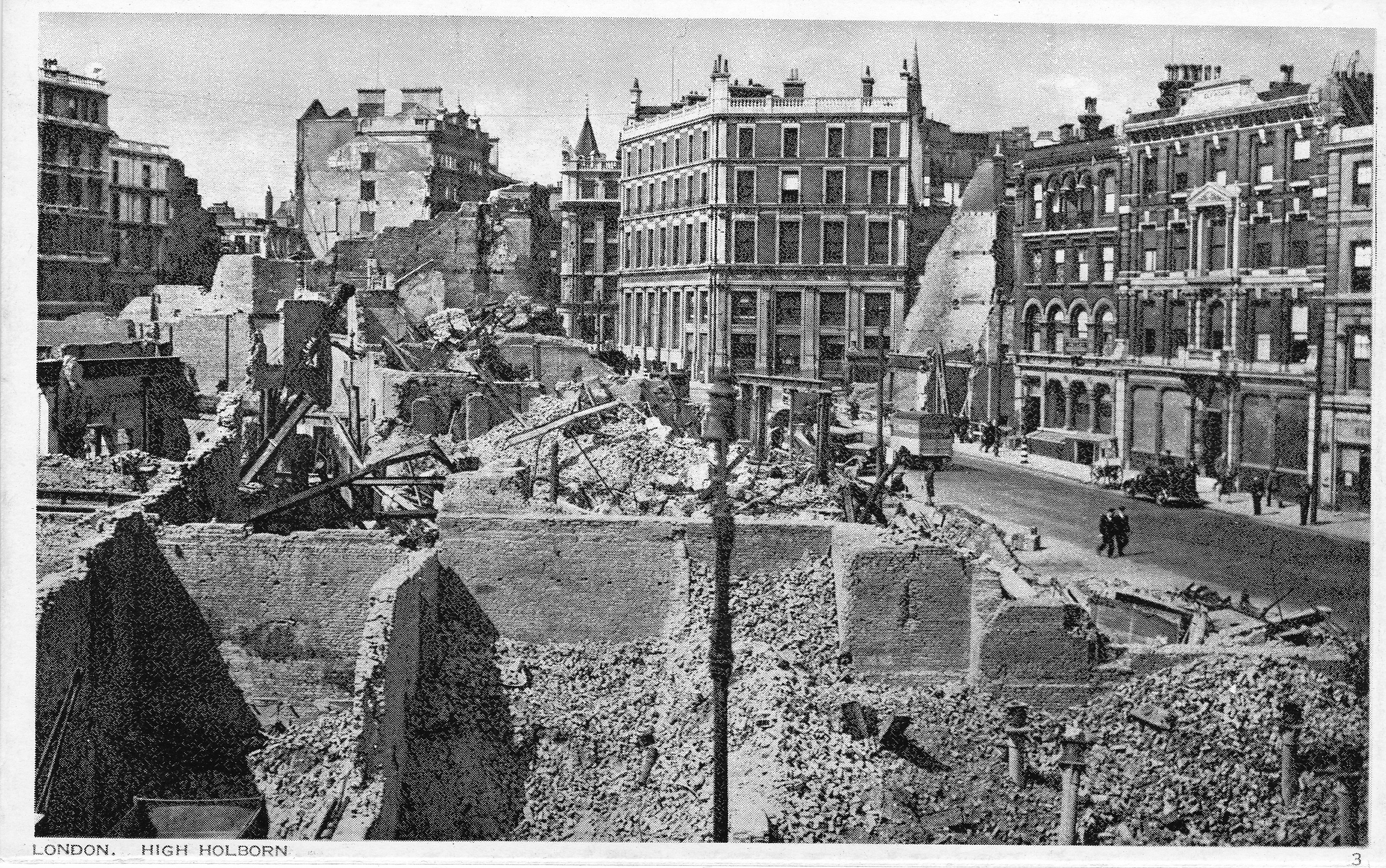
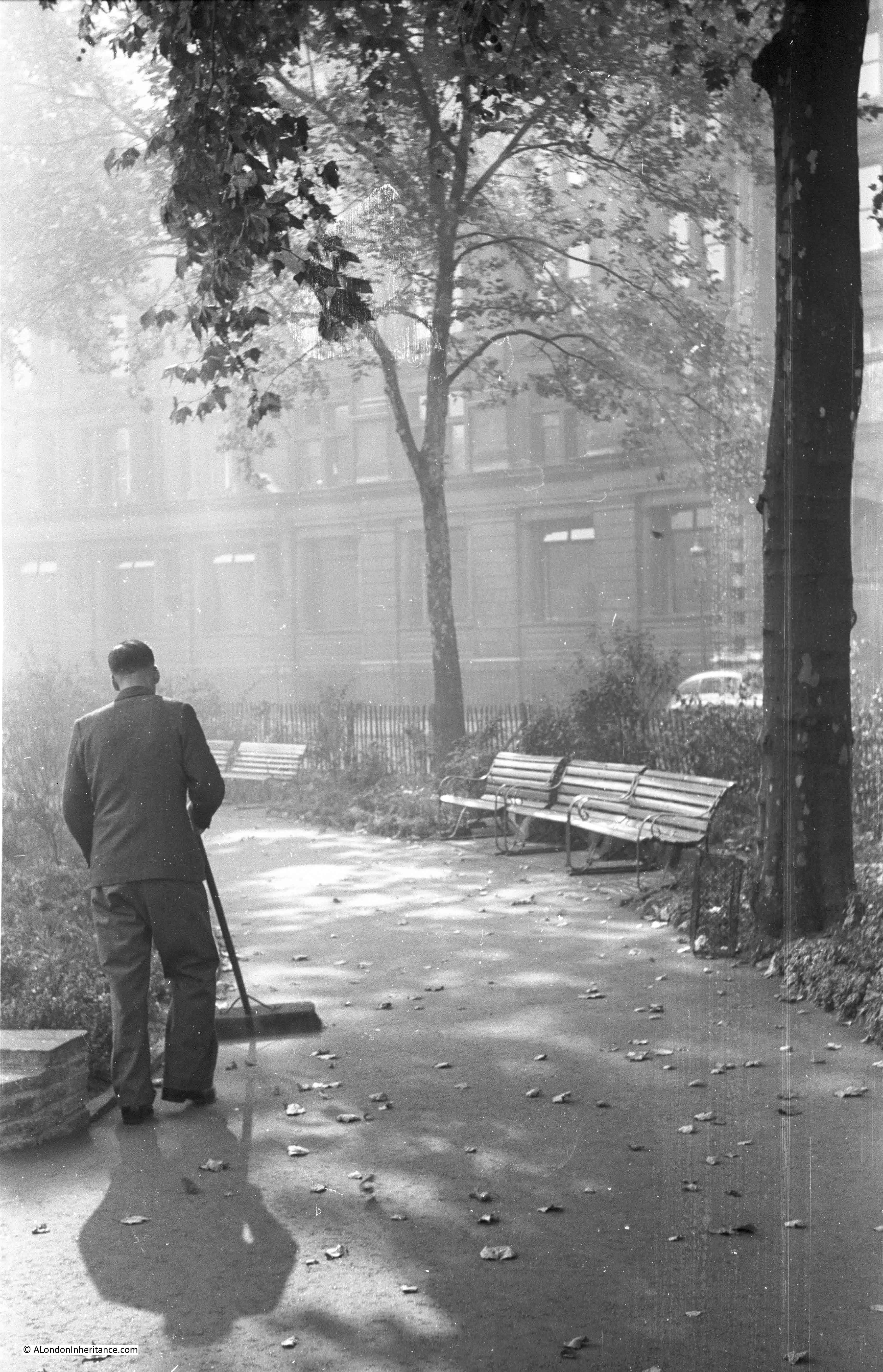
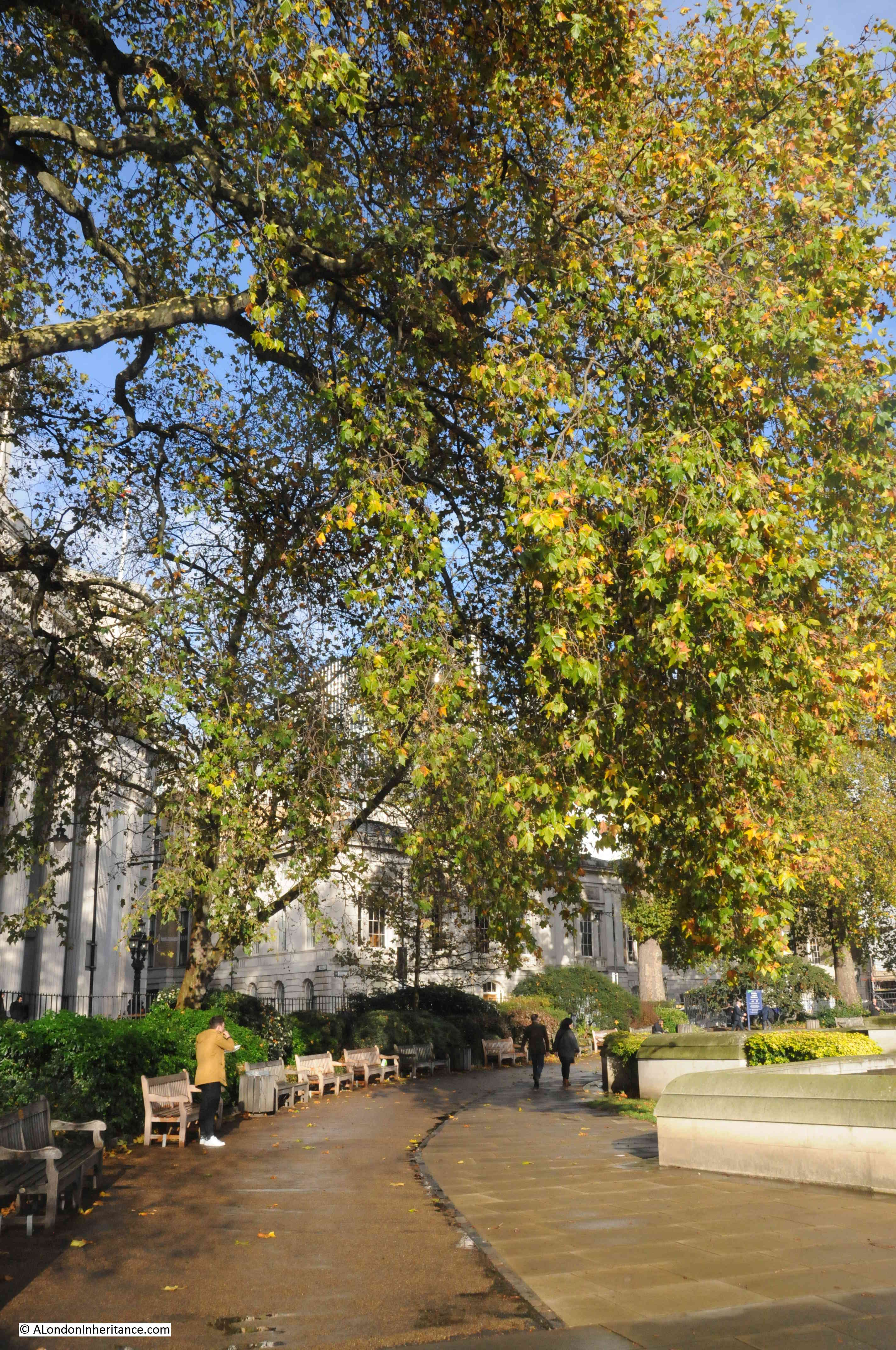
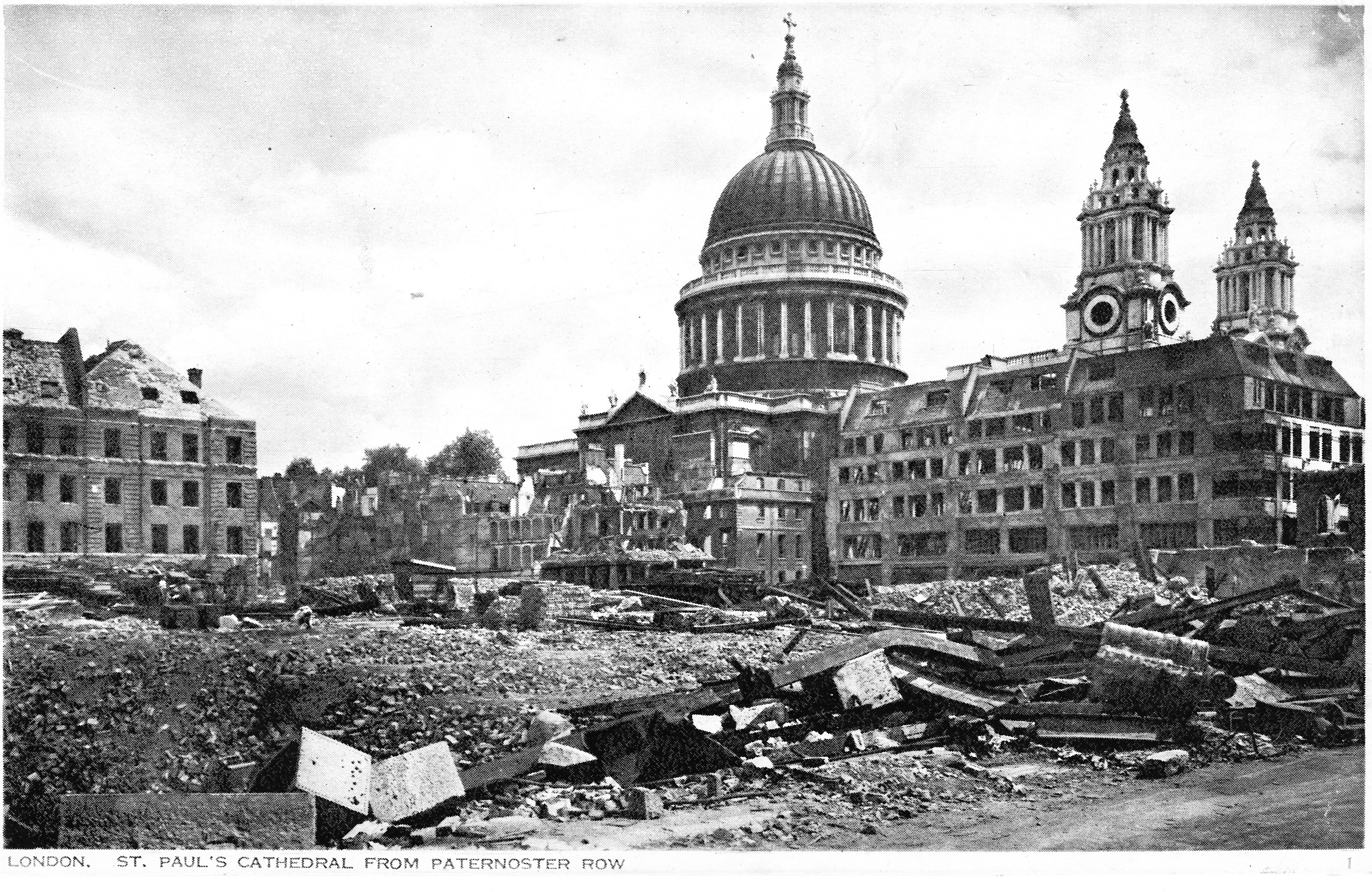
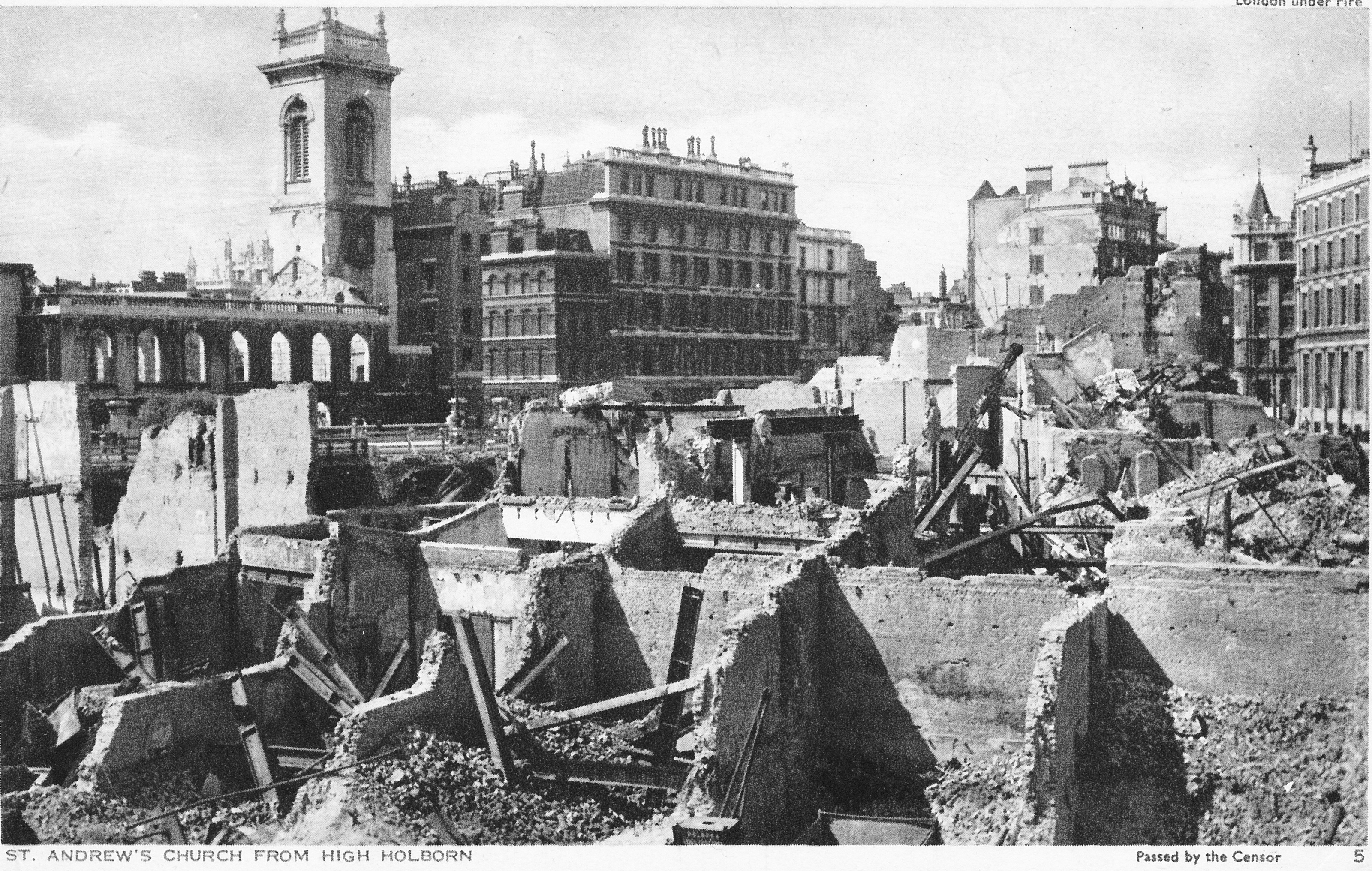
The area to the north of St. Paul’s Cathedral was destroyed during the war, mainly due to the use of incendiary bombs on the night of the 29th of December 1940. The destruction covered ancient streets such as Paternoster Row and Paternoster Square, and the shells of buildings were demolished and removed leaving a wide open space ready for new development.
The site was redeveloped during the 1960s, with the pre-war streets and original architectural styles being ignored, with an office complex built which followed a number of post war City planning themes which I will come on to later in the post.
The 1960s development was not popular, obstructed key views of the cathedral and tended to separate the cathedral from the area to the north. The buildings were not that well maintained and by the late 1980s the area was not an attractive place to work, or walk through, and did nothing to enhance the cathedral just to the south.
In the early 1990s, a proposed Masterplan was published by “Masterplanners” Terry Farrell, Thomas Beeby and John Simpson & Partners, and Design Architects Robert Adam, Paul Gibson, Allan Greenberg, Demetri Porphyrious and Quinlan Terry.
I have a copy of the Masterplan and it is fascinating to compare the original proposals with the site we see today. Not quite so architecturally ornate as the Masterplan, but very similar to what was originally proposed, and (in my view) a significant improvement on the 1960s development.
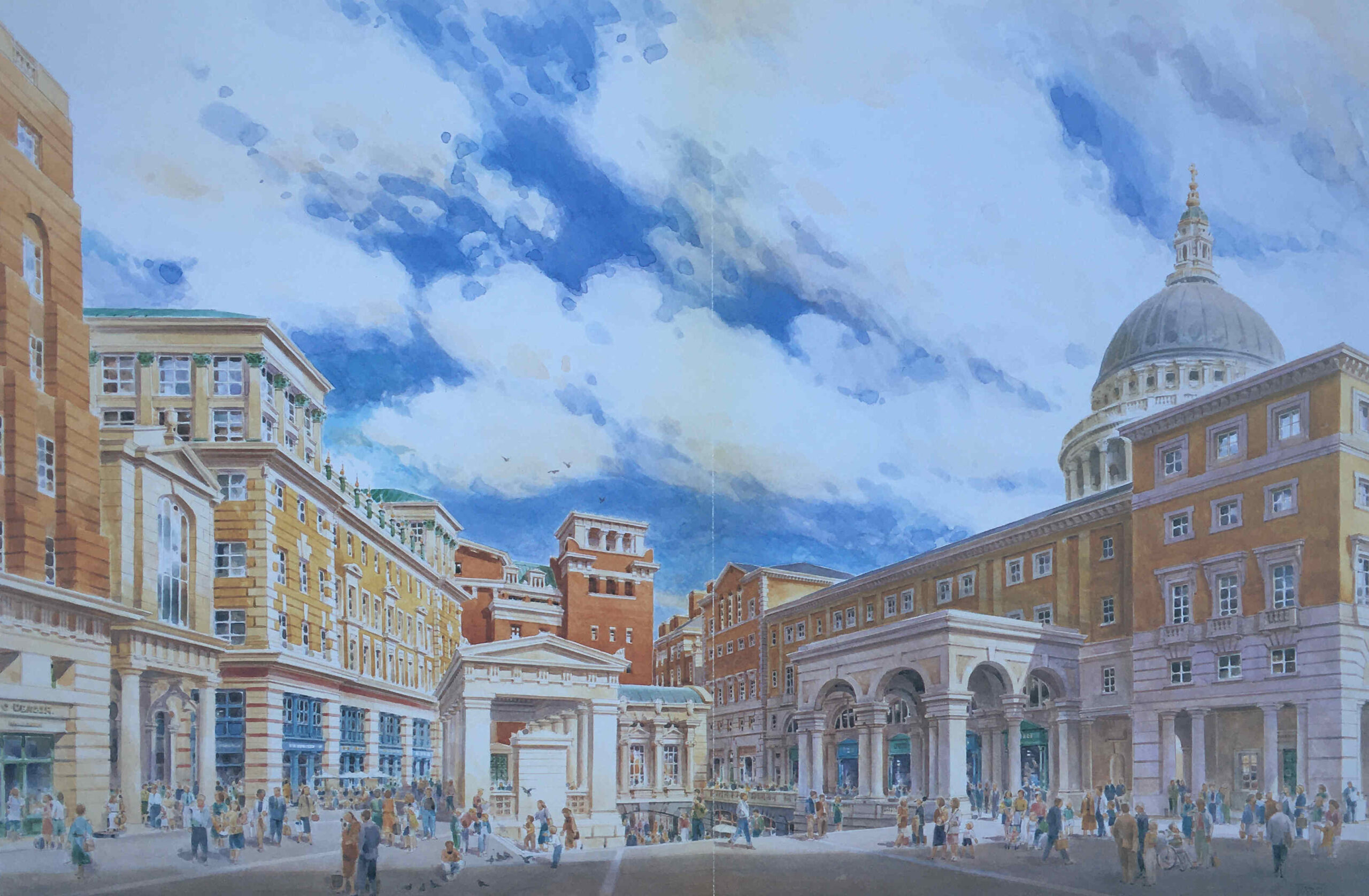
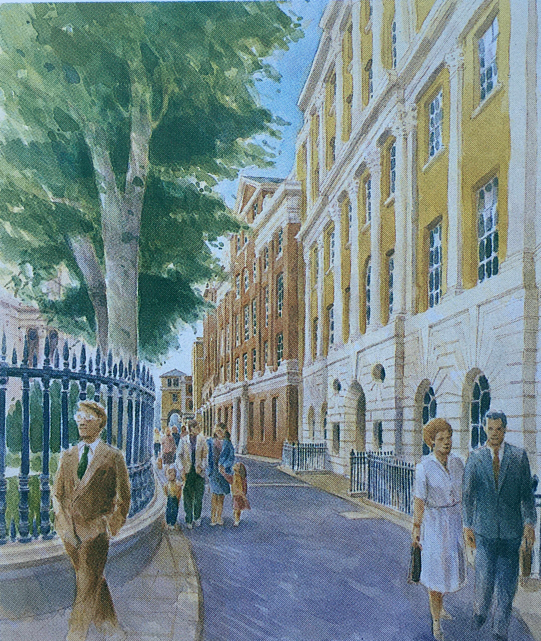
The following image is from the Masterplan and shows a “View of Paternoster Square looking south-east to the dome of St. Paul’s Cathedral”. The image is by Edwin Venn.
As with City developments such as the Barbican and Golden Lane estates, the damage inflicted on the City during the last war created the large area of space which could take a major, transforming development, rather than the simple rebuild of individual buildings.
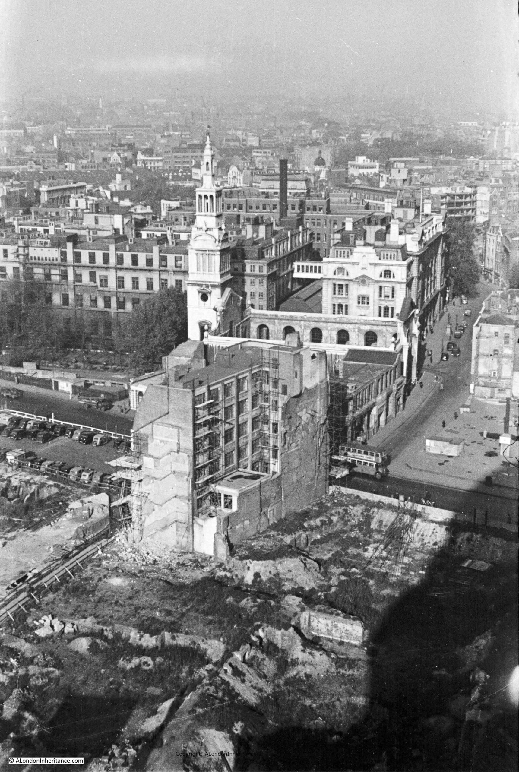
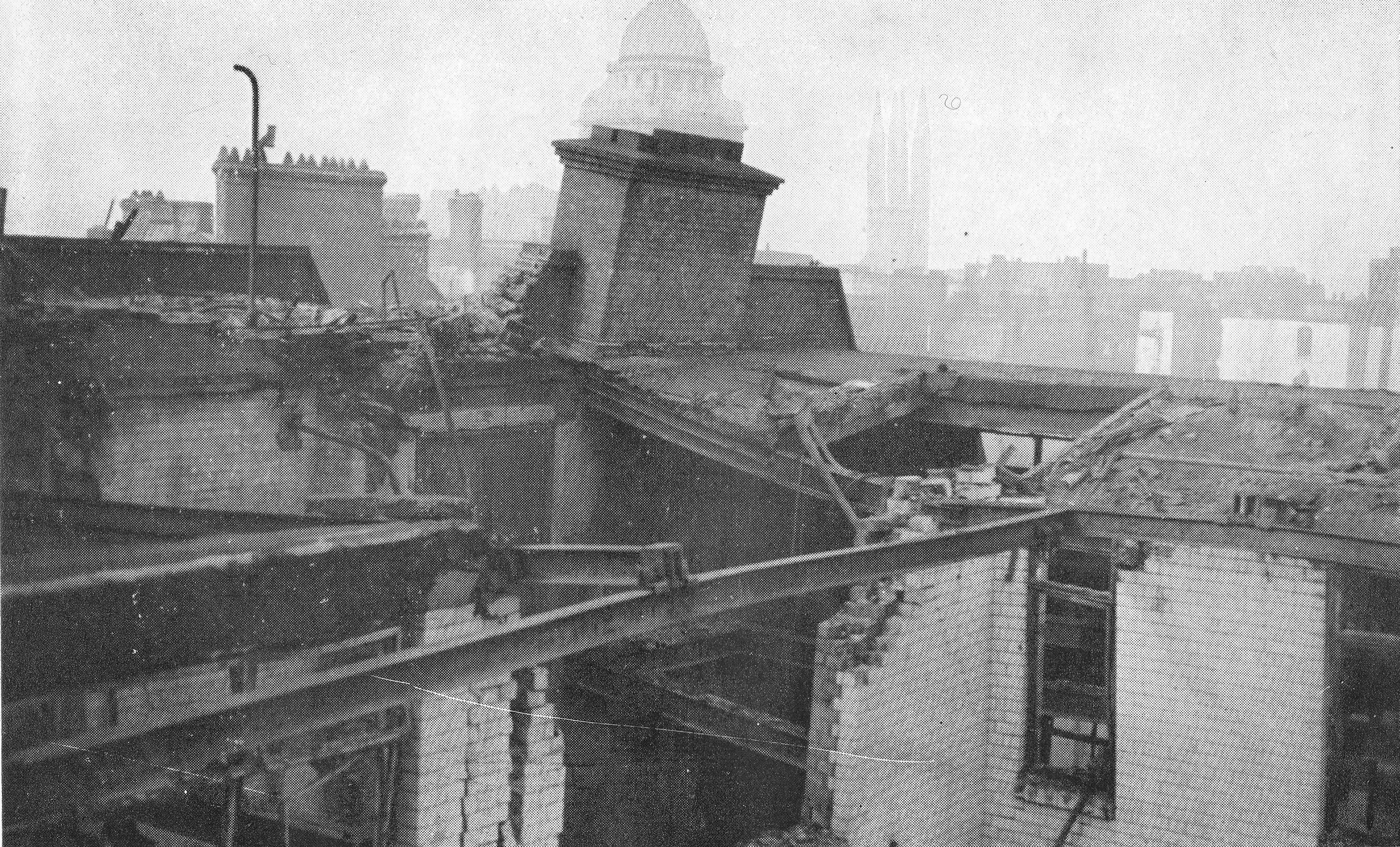
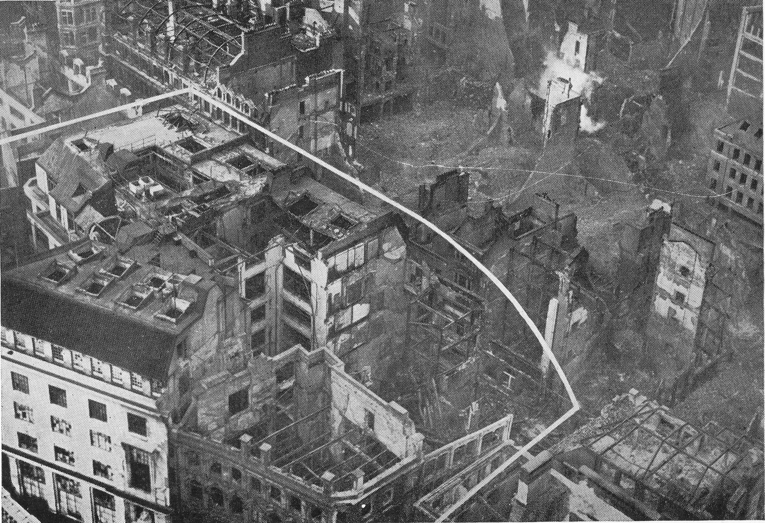
The following photo is one of my father’s, taken from the Stone Gallery of St. Paul’s Cathedral:
The shell of a building at the bottom left is the Chapter House of the Cathedral.
The circular features between what was Paternoster Square and the remains of the Chapter House are the outline of water tanks that were placed on site during the war to provide supplies of water for firefighting.
The following extract from Bartholomew’s 1940 Reference Atlas of Greater London shows the area to the north of the cathedral. In the map, a Paternoster Square can be seen. In the above photo, this is the rectangular feature at top left, with roads on all sides, but not a building in sight.
As well as Paternoster Square, the map shows a network of streets such as Ivy Lane, Three Tuns Passage, Lovells Court and Queens Head Passage.
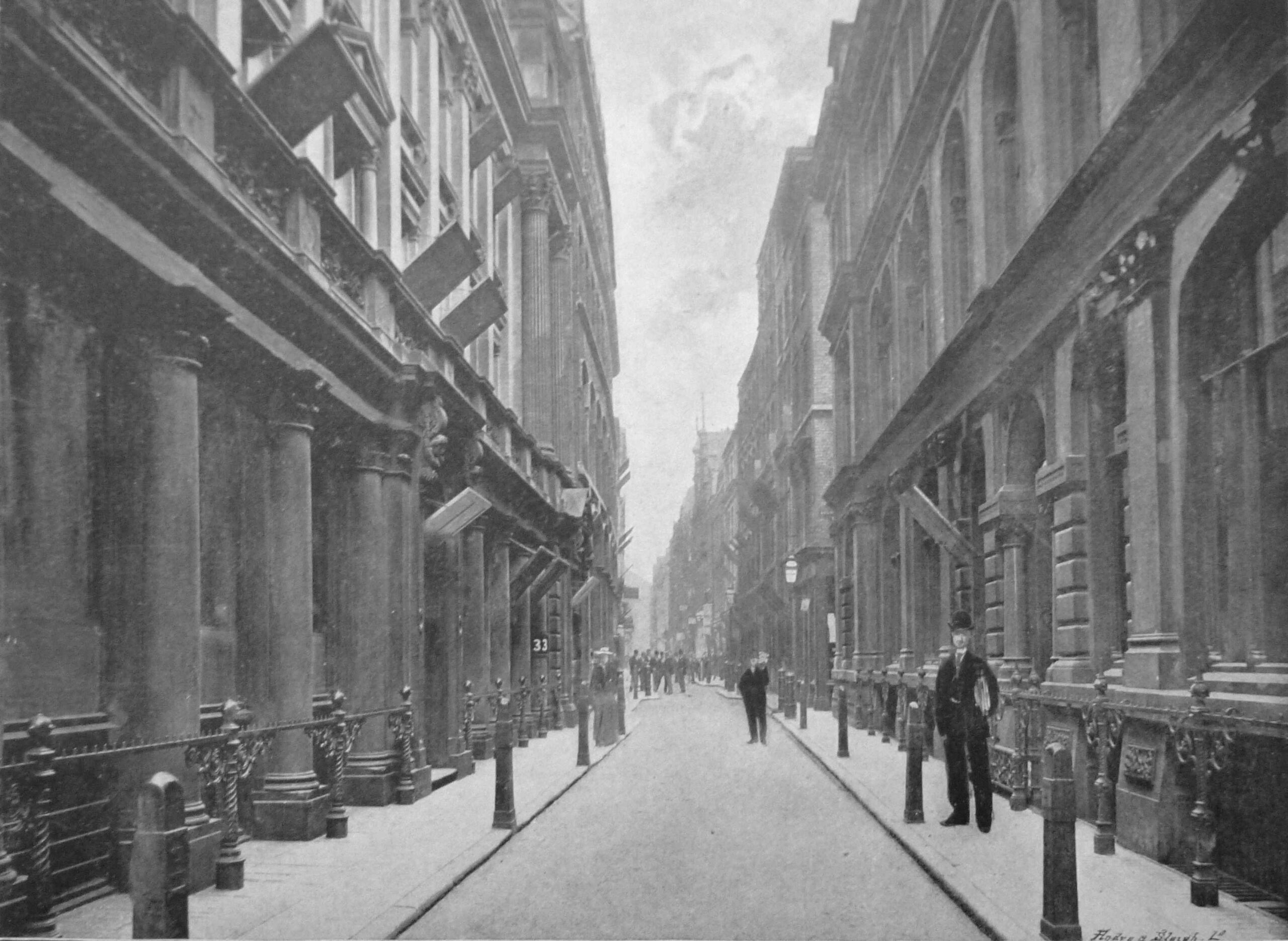
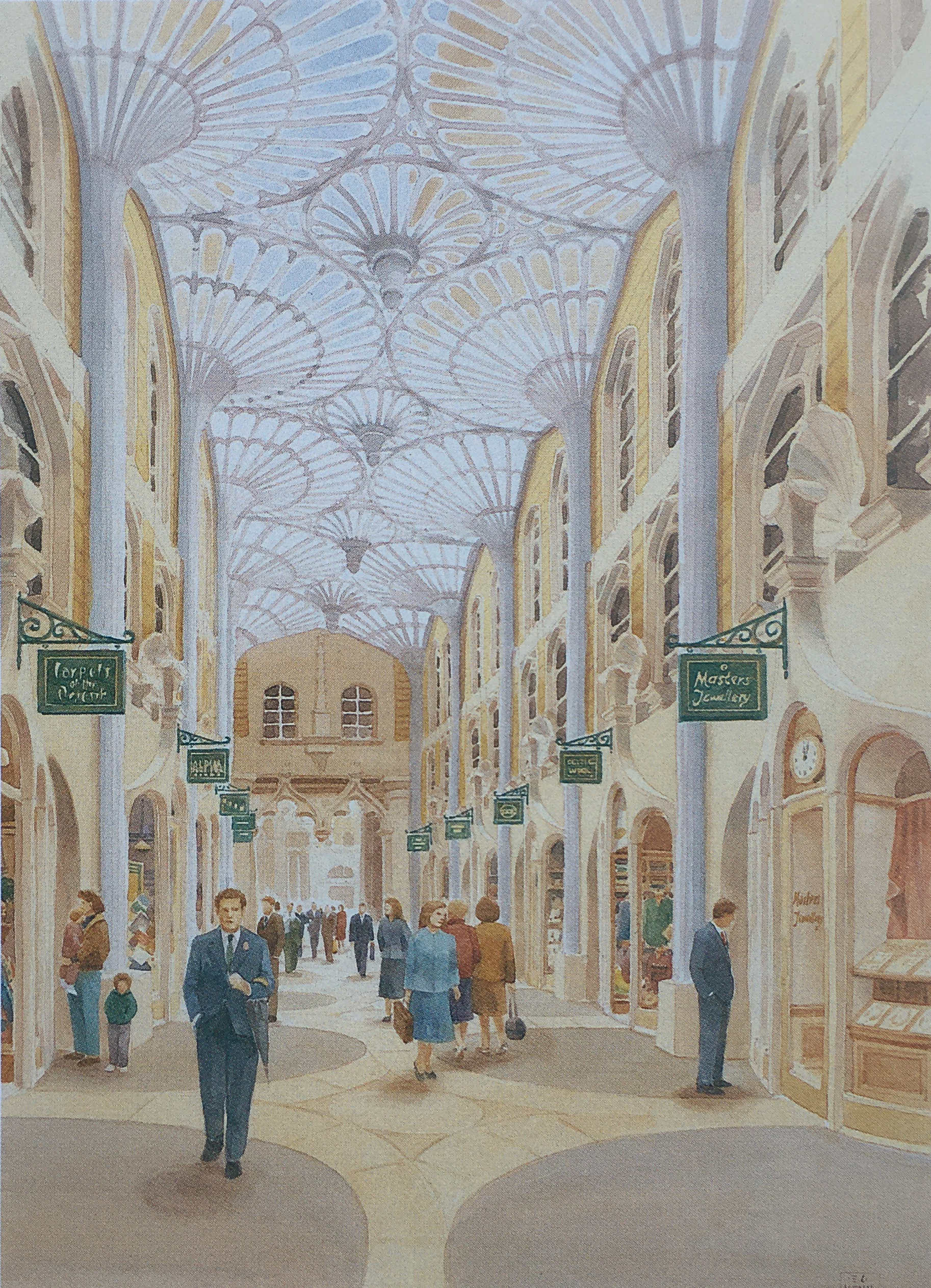
Running across the area was Paternoster Row, and the following photo from the book, the Queen’s London, published in 1896, shows the view along Paternoster Row, a narrow street but with substantial 19th century City office buildings on either side.
In the following photo, the dense network of streets and buildings to the north of the cathedral can be seen:
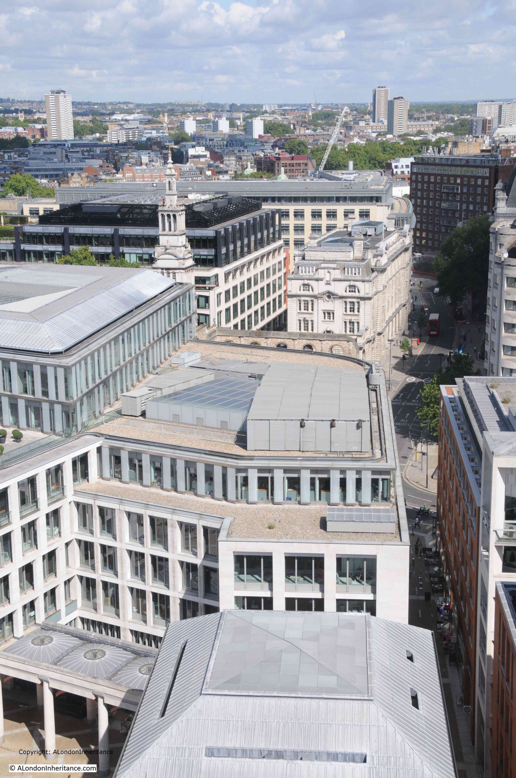
Another of my father’s views from the Stone Gallery, looking slightly above the earlier photo, with a bus running along Newgate Street. The Paternoster Square developments would occupy the area to the south of Newgate Street.
The same view today, showing the buildings of the Paternoster Square development:
The area, and street names are of some considerable age. The first written records of the streets date from the 14th century, with Paternosterstrete in 1312 and Paternosterrowe in 1349.
From the early 19th century onwards, the area was home to many publishers, stationers and book sellers. Much of the stock held by these businesses contributed to the fires started on the 29th of December 1940.
Harben’s Dictionary of London references a Richard Russell dwelling there in 1374 and described as a “paternosterer”, and that paternosterers were turners of beads, and gave the street its name.
Harben also states that “A stone wall was found under this street at a depth of 18 feet running towards the centre of St. Paul’s. A few yards from this wall in the direction of St. Martin’s-le-Grand wooden piles were found covered with planks at a depth of 20 feet”, and that under Paternoster Square, “Remains of Roman pavements and tiles were found in 1884”.
W.F. Grimes’ book, about his post war excavations across the City, “The Excavation of Roman and Mediaeval London” records his limited excavations across the area in 1961 to 1962, and that much of the Paternoster area “was not available for examination because the cellars had retained their bomb rubble and the sites around Paternoster Square had become a garage and car parks.”
In the limited excavations that did take place, Grimes found evidence of ditches and post holes, possibly where the wooden piles were found in the 19th century. He concludes that the area was probably occupied by timber framed buildings rather than stone.
The main discovery on the site was a hoard of about 530 coins, “mainly barbarous copies of coins of the Gallic Empire of the late third century A.D.”
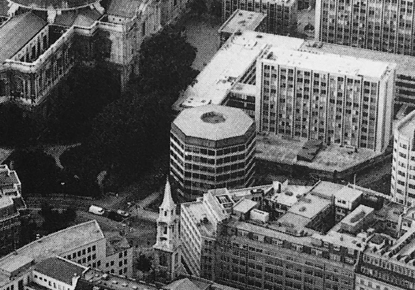
The limited excavation took place prior to the 1960s development of the site. This create a dense cluster of office blocks between the cathedral and Newgate Street, which can be seen in the following photo, to the right of the cathedral:
The 1960s development of the site was based on the plans by architect and planner Lord Holford who was commissioned by the City Corporation to advise them on architectural policy, and the development of buildings within the “orbit of the dome of St. Paul’s”.
Lord Holford’s plan for the site followed post-war thinking about the City’s redevelopment. This included the separation of traffic and pedestrians, with vehicles having priority at ground level, and pedestrians moved to elevated walkways.
The original street plans were rejected in favour of a rigid matrix of building blocks, which resulted in a horizontal slab of blocks with the 18-storey office tower Sudbury House being the highest.
Lord Holford’s explanation of his approach to the design of the site was that “there is more to be gained by contrast in design, than from attempts at harmony of scale or character of spacing” (I think this is the design approach used for the current developments between Vauxhall and Battersea Power Station).
Not all of Holford’s ideas were implemented, and many of the buildings were by other architects, so the new development ended up as a rather uninspiring addition to the land north of the cathedral.
The following photo shows the 1960s office block immediately to the right of the old St. Paul’s Chapter House:
In the following photo, the Chapter House is the older building in dark brick behind the tree, and the new lighter red brick building to the right occupied the site of the 1960s office block seen in the above photo:
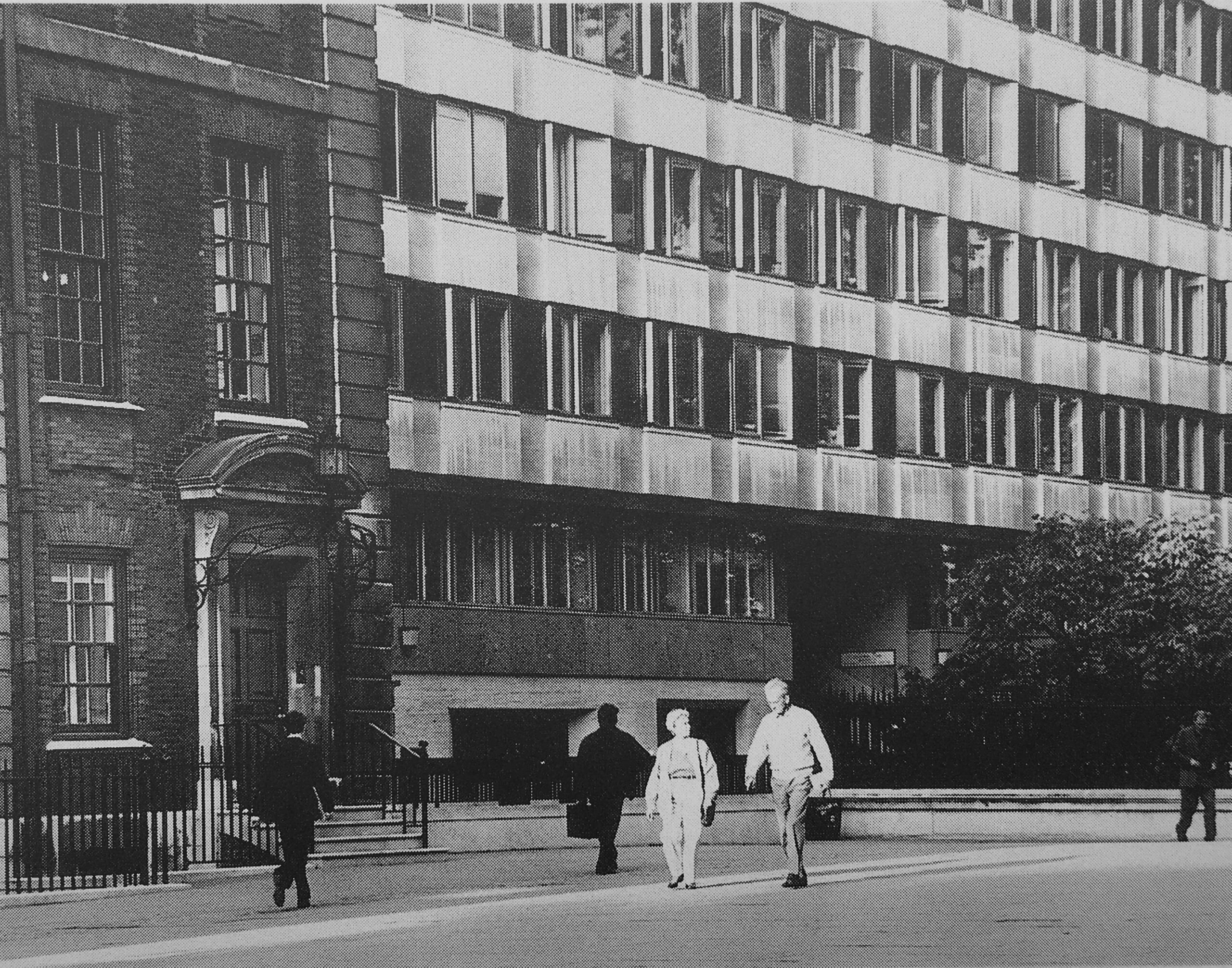
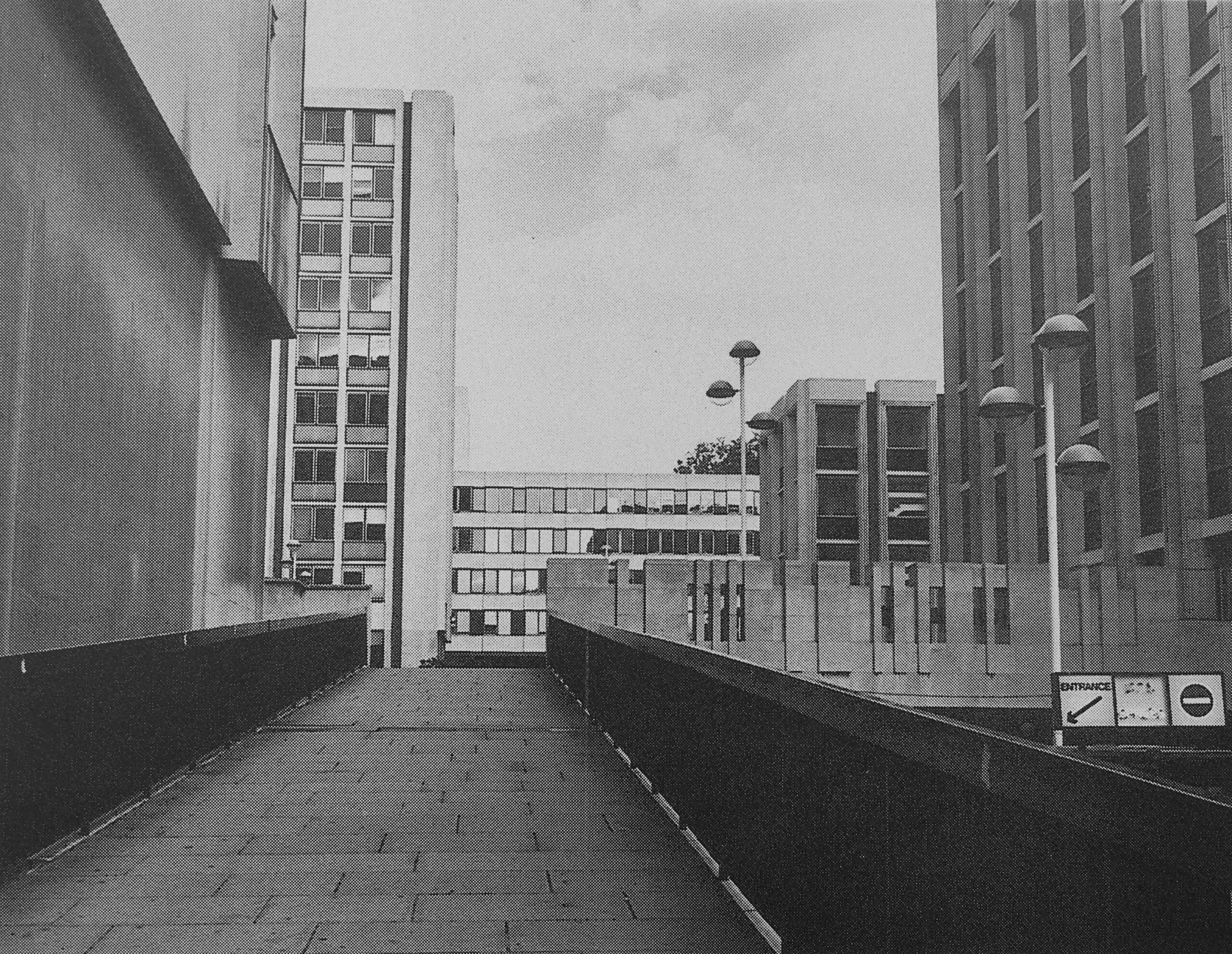
The following photo shows one of the access ramps that took pedestrians up to the pedestrian area. To the right is the lower vehicle route, with access to car parking:
I may be completely wrong, but I vaguely remember there being a pub on the upper pedestrian area, which had an outside area with a view over the surrounding streets.
The 1960s development took no regard of the views of the cathedral just to the south.
This is the view to the northern entrance to the cathedral, with only a small part visible through a tunnel that takes a pedestrian walkway through an office block:
In the Masterplan, the proposed redevelopment delivers this alternative view of the same part of the cathedral:
And whilst the buildings are less ornate than originally proposed, the view today is much the same as in the Masterplan, also with a café, on the site of the walkway:
The caption to the following illustration reads “St. Paul’s Church Yard will be re-aligned and the Cathedral gardens re-laid and enclosed”:
The gardens were re-laid and enclosed, and new office blocks occupied the space to the north, and whilst these were very different to the 1960s versions, they were not quite as ornate as the Masterplan envisaged:
The objectives of the Masterplan were to:
Restore views of St. Paul’s Cathedral from Paternoster Square at ground level and on the skyline, respecting St. Paul’s Heights and Strategic Views
To create buildings that are in harmony with St. Paul’s Cathedral
To restore the traditional alignment of St. Paul’s Church Yard and the Cathedral Gardens creating an enhanced public space
To re-establish a traditional street pattern and return pedestrian routes into the site to ground level
To create a new, traffic-free, public open space allowing ease of access, especially for the disabled
To follow the City tradition of classical architecture, using traditional materials such as stone, brick, tile, slate and copper
To be flexible enough for key corners, outside the Planning Application site to be integrated at a later date
To create a thriving new business community in the best traditions of City life
To create a much-needed, new shopping area in the heart of the City, with a variety of shops, restaurants and entertainment, linked into St. Paul’s Underground Station
To create new open public spaces for relaxation and enjoyment by office workers, visitors and shoppers alike
It is interesting to compare the development today with these objectives.
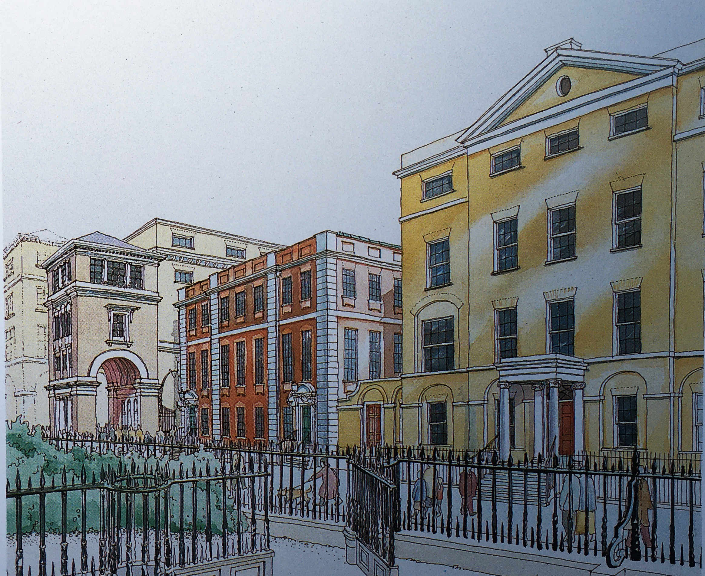
There was an intention to follow the City tradition of classical architecture, and this could be seen in the illustrations of the planned buildings, such as the following example showing “the frontage of the new buildings on Newgate Street”:
The frontage along Newgate Street today is comprised of standard office block design, without the classical architecture proposed in the Masterplan.
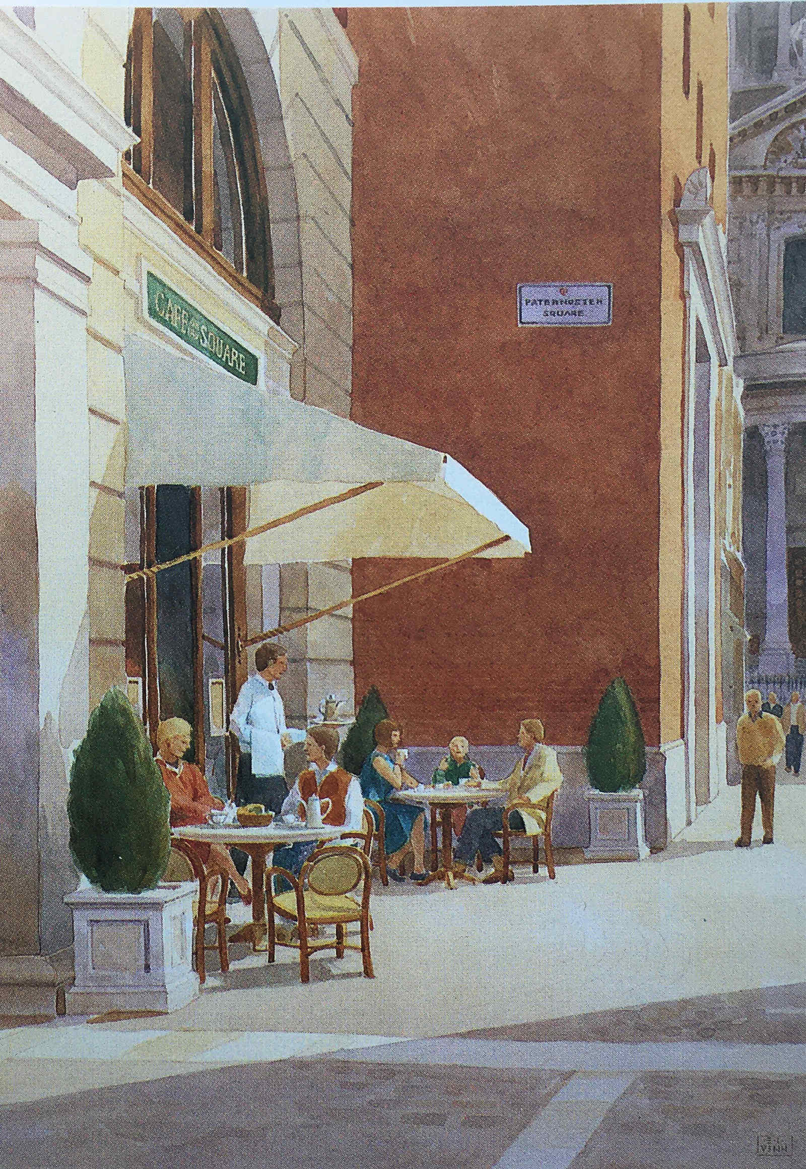
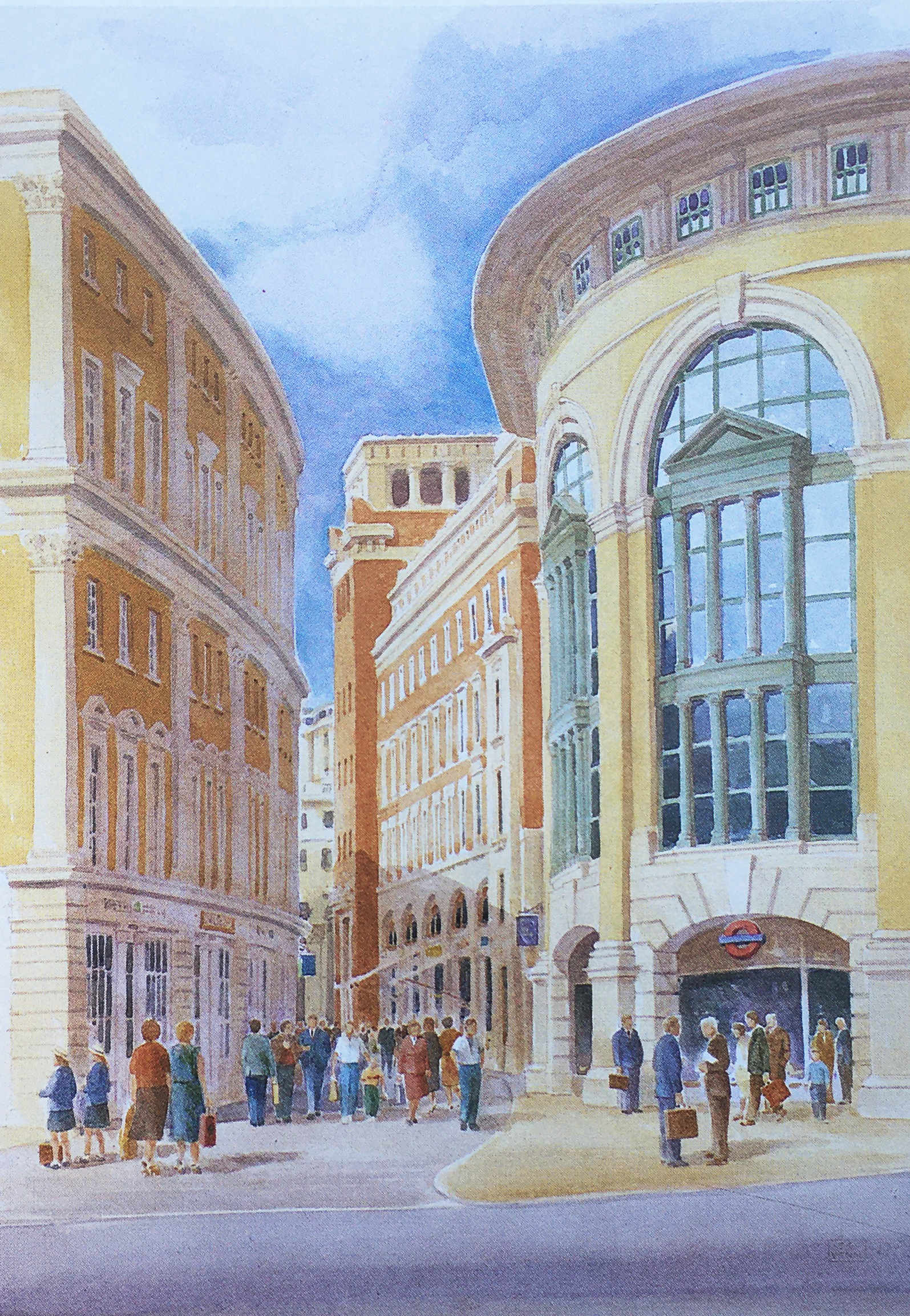
The title of the following illustration is “A Meeting Place – Paternoster Square will provide a social focus for the City, a place to meet friends and colleagues, to browse or to use the health club”:
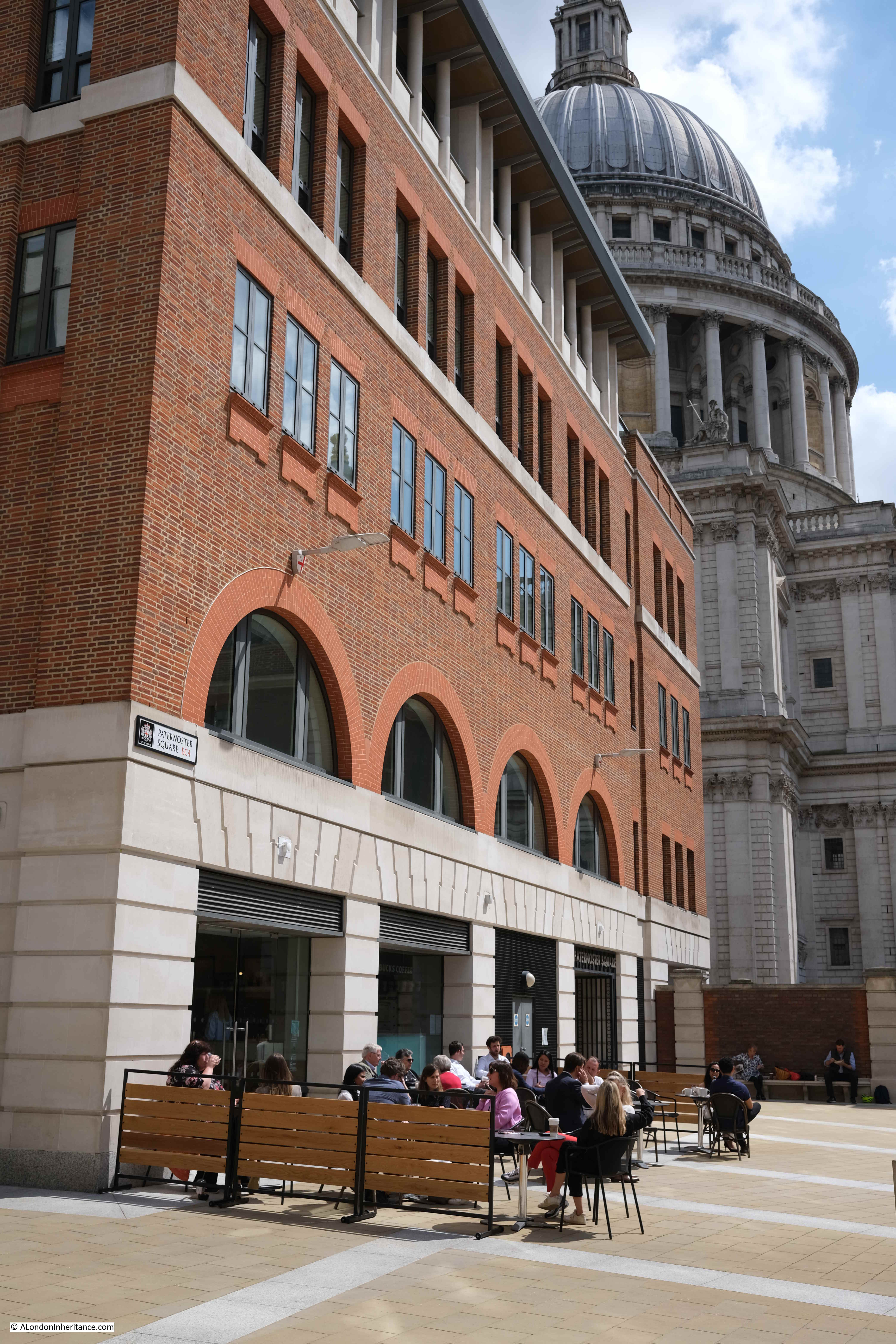
This approach can be seen across the Paternoster Square development, but in less ornate settings. Whilst the buildings do not have the same classical architectural styling, they do make use of stone, and there is a considerable amount of brick throughout the site which is a pleasant change from the glass and steel of many other recent City developments:
Whereas today, Paternoster Square is at a single level, in the Masterplan it was intended that there would be steps leading down to a Lower Court, so whilst the plan did away with the upper pedestrian and lower vehicle levels of the 1960s development, it did retain different levels, but for pedestrians. The Lower Court:
The plan was that Paternoster Row would become almost a continuation of Cheapside.
Cheapside was, and to an extent still is, the main shopping space of the City, and the One New Change development has enhanced this, but in the Masterplan, shopping would continue from Cheapside, across the road into Paternoster Row, and the underground station, which today is reached via a separate access point to the edge of the development, would have been integrated into the plan, as shown in the following illustration:
The St. Paul’s Chapter House was reduced to a shell of a building, as shown in my father’s photo, however it was restored and survived the 1960s redevelopment, and was included in the Masterplan, where it can be seen in the centre of the following illustration.
To the left of the Chapter House is a rather ornate three storey gateway into Paternoster Square, which today has been replaced by Temple Bar.
Temple Bar was included as an option in the Masterplan, which is described as “currently in a state of decay in a Hertfordshire Park”.
As mentioned earlier, the central Paternoster Square was intended to be multi-level, and in the following illustration, there is a rather impressive Loggia (an outdoor corridor with a covered roof and open sides), that would have provided a lift down to the Lower Court, would provide shelter, and would mark the access point to the Lower Court:
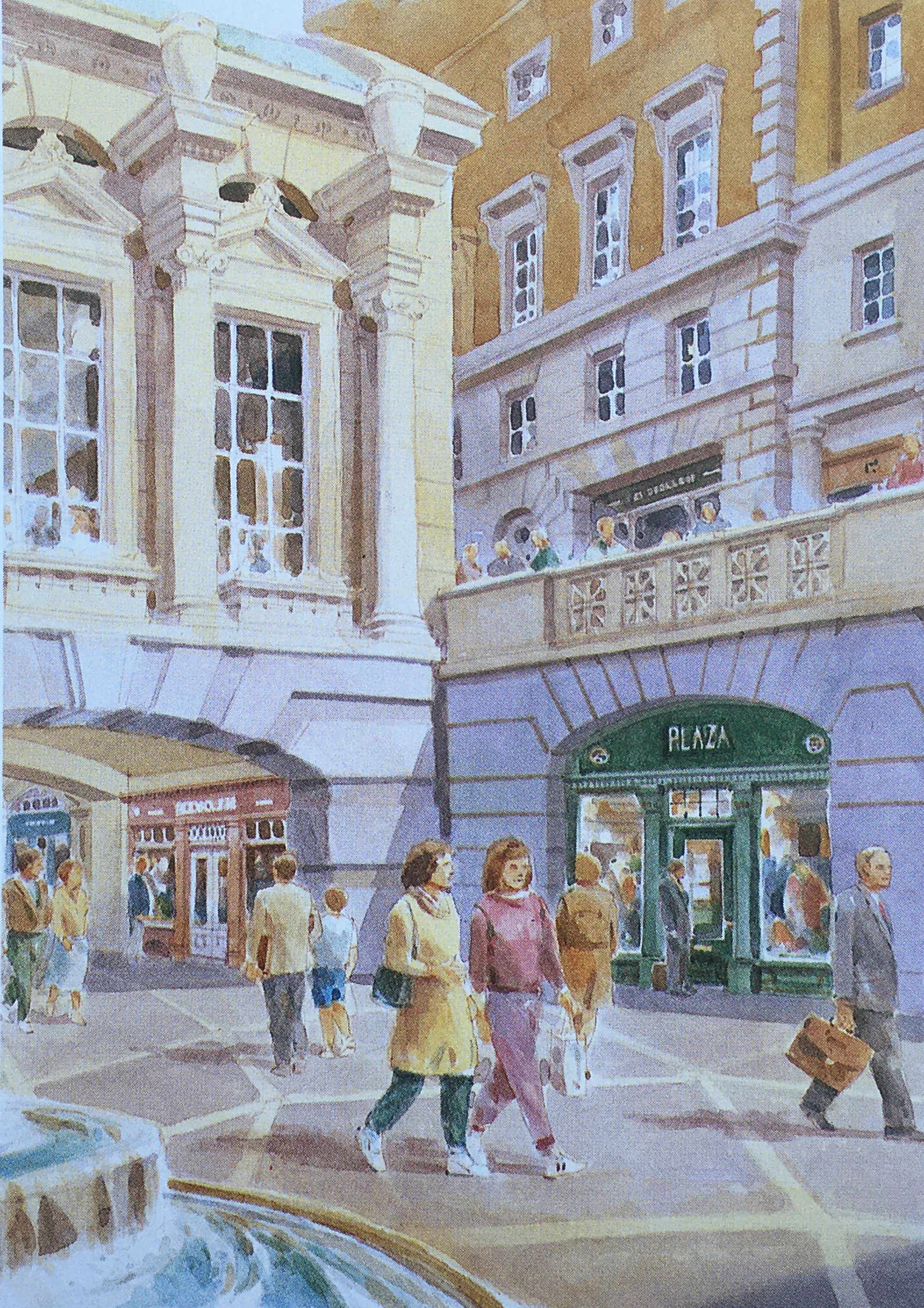
A key aim of the Masterplan was to bring life back to the area, and one of the ways to do this was via retail, and the plan stated that “Paternoster Square will be established as one of the foremost shopping areas in central London. There will be more than 80 shops, including a quality food hall or department store”.
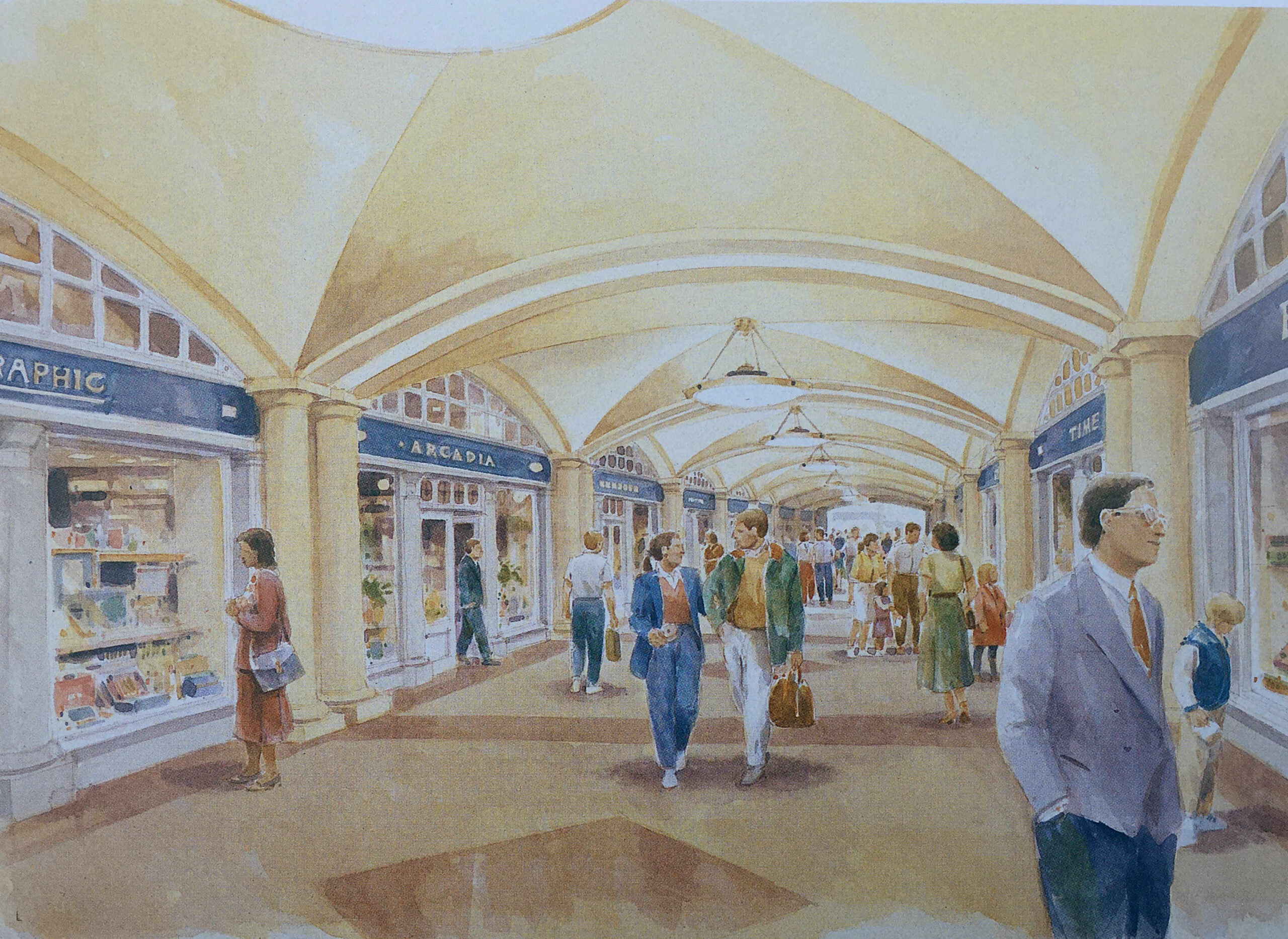
The approach to retail included a Shopping Avenue, which was a covered route between the Lower Court and St. Paul’s Underground Station:
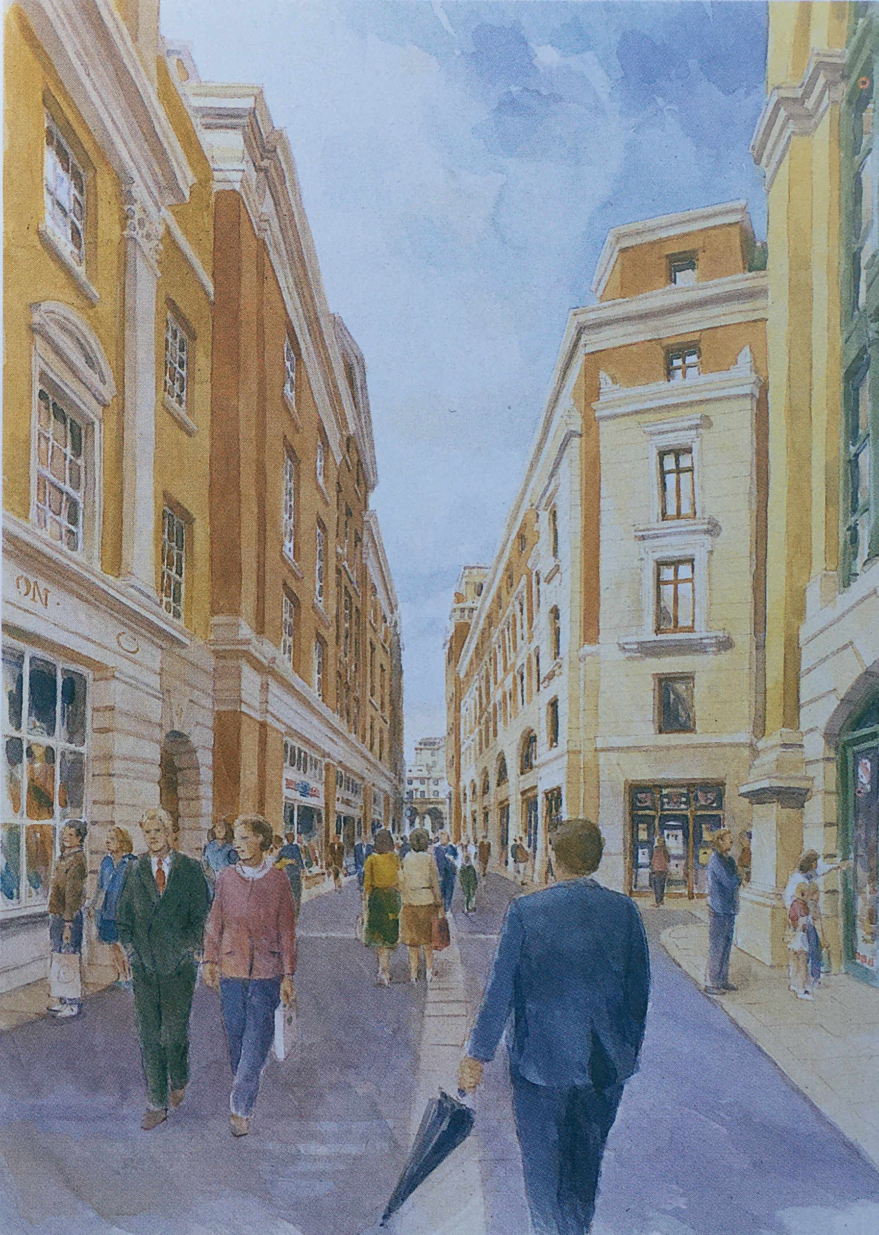
Shops would also line the new Paternoster Row:
And along the route of the old Ivy Lane, there would be Ivy Lane Arcade “designed in the tradition of famous London arcades. It will attract specialty shops such as jewelers and galleries”:
And shopping around Paternoster Square and Lower Court:
The Paternoster Square estate does have some shopping, but far less than was intended in the original Masterplan. There is no lower court and no covered shopping avenues.
Most of the shops are either restaurants, bars or take away food and coffee shops, aimed at local office workers and at the number of visitors who pass through as part of a visit to the area around St. Paul’s Cathedral.
There are also many other differences. Whilst the overall concept appears the same, the classical building style is now very limited as is the overall decoration across the buildings and ground level pedestrian spaces.
In 1995, the owners of the land commissioned Whitfield Partners to deliver a Masterplan for redevelopment, and it is the outcome of this plan that we see today. Similar in concept, but different in implementation.
The Paternoster Square development today has a large central space, is pedestrianised, and some of the pedestrian walkways do roughly align with some of the original pre-war streets.
The objective of bringing life back to the area has been achieved, and during the day it is generally busy with local workers, visitors and tourists, and on a summer’s afternoon, the bars and restaurants are particularly busy.
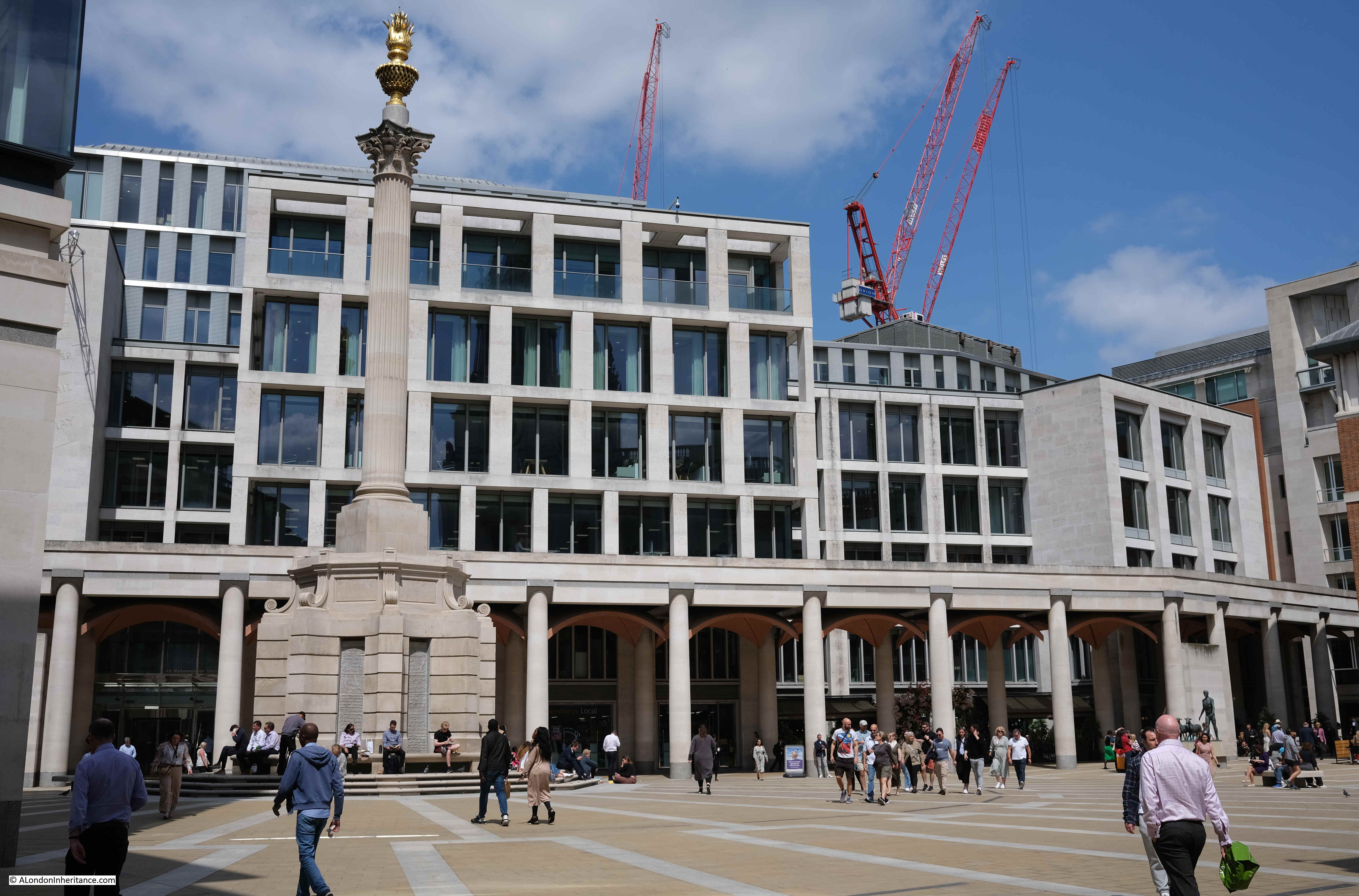
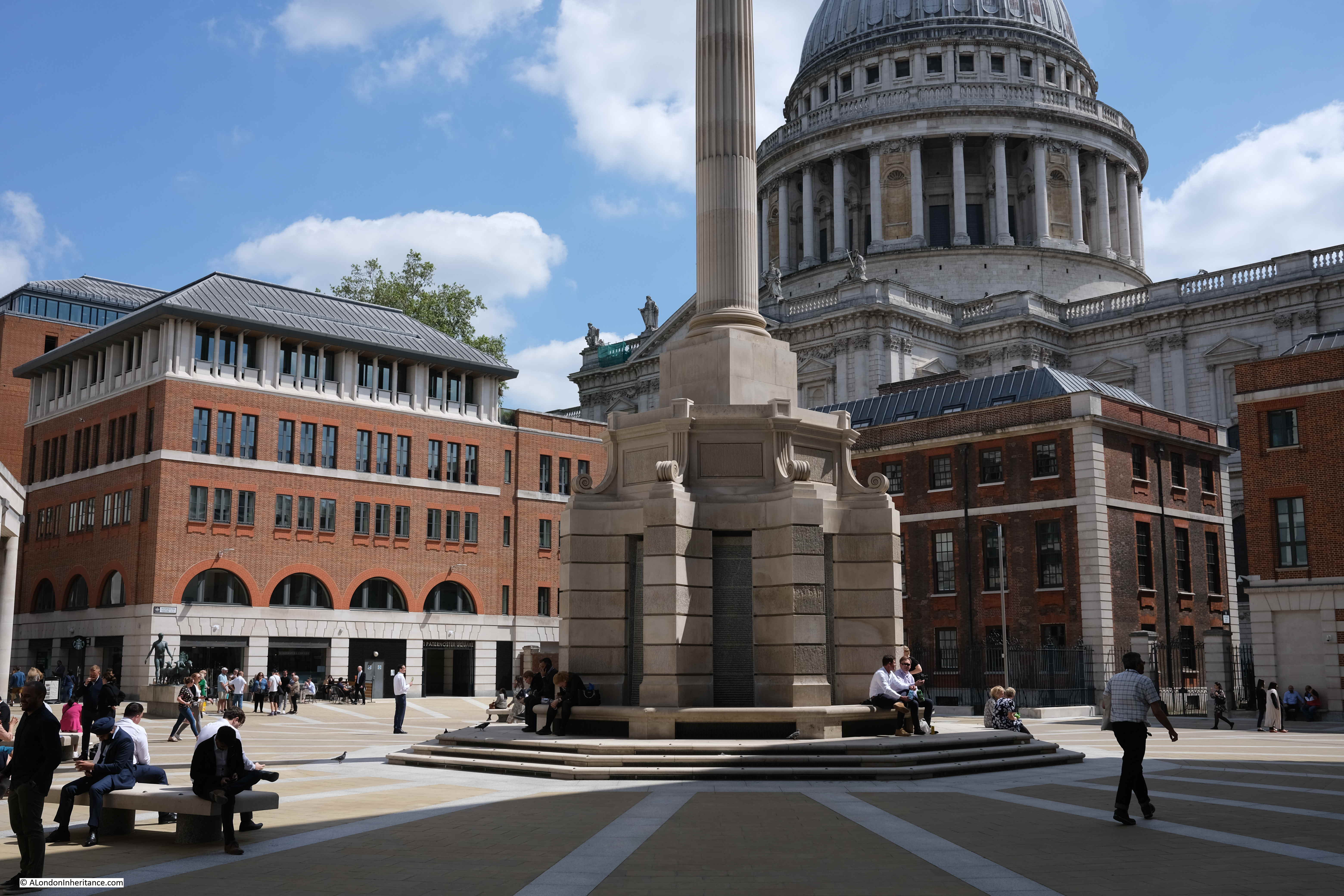
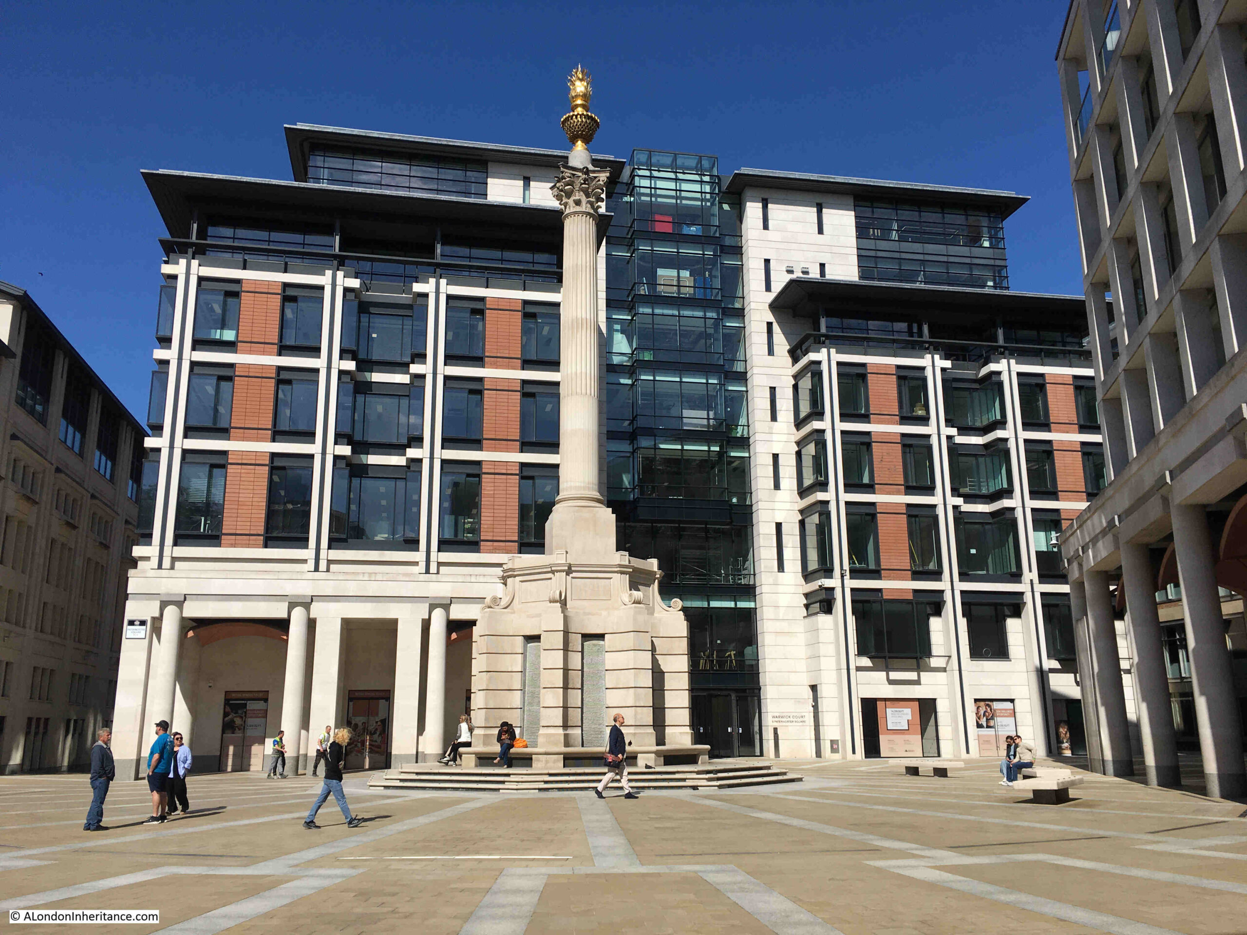
The central square features a 23.3 metre tall column, which conceals air vents to the parking space below the square:
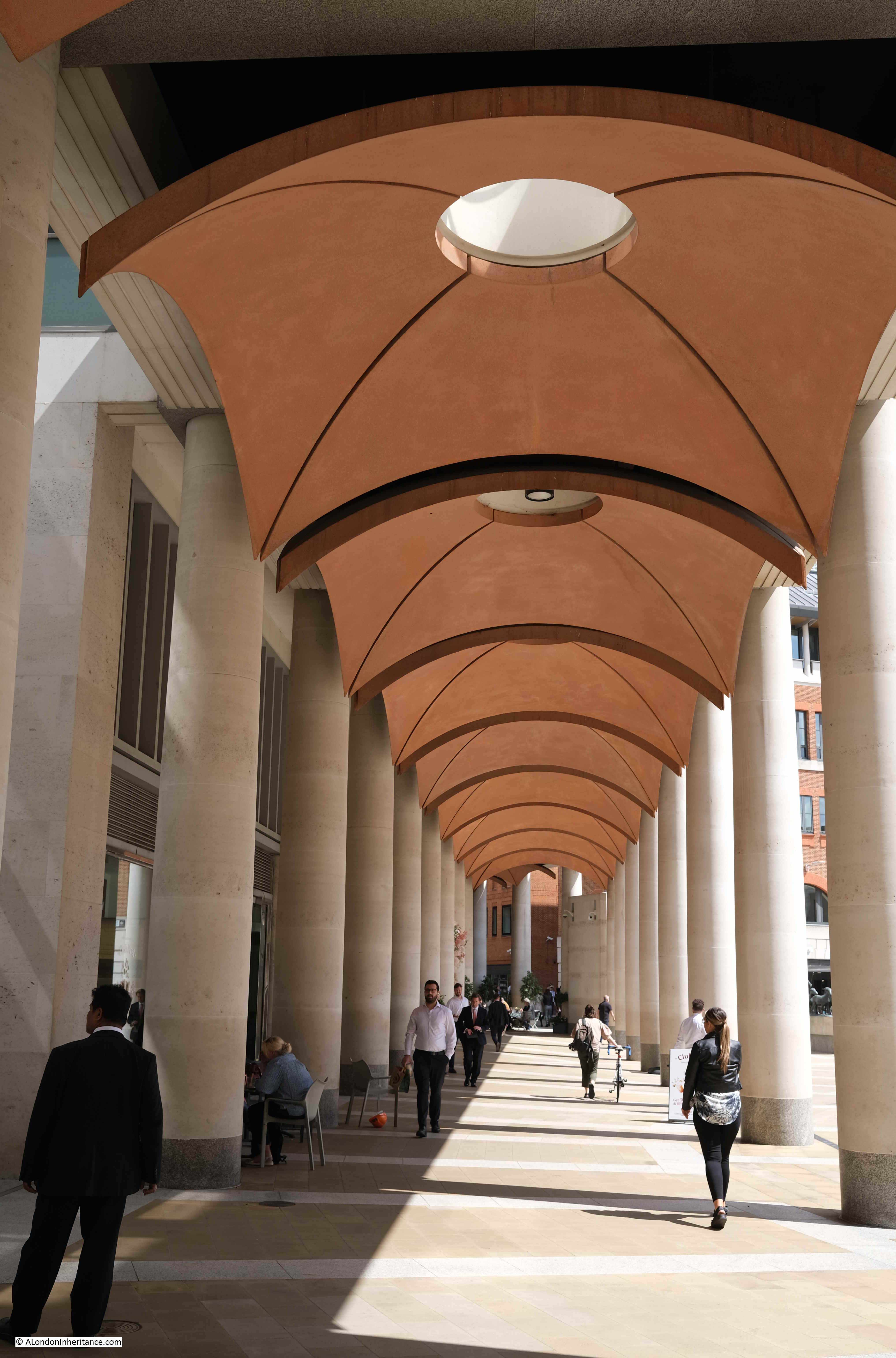
The Masterplan by Farrell, Beeby and Simpson included a Loggia which would have provided a lift down to the Lower Court, and mark the access point to the Lower Court.
Whilst the Loggia and Lower Court were not part of the implemented Masterplan, there is a covered way along the northern edge of the square which has similarities to the original Loggia:
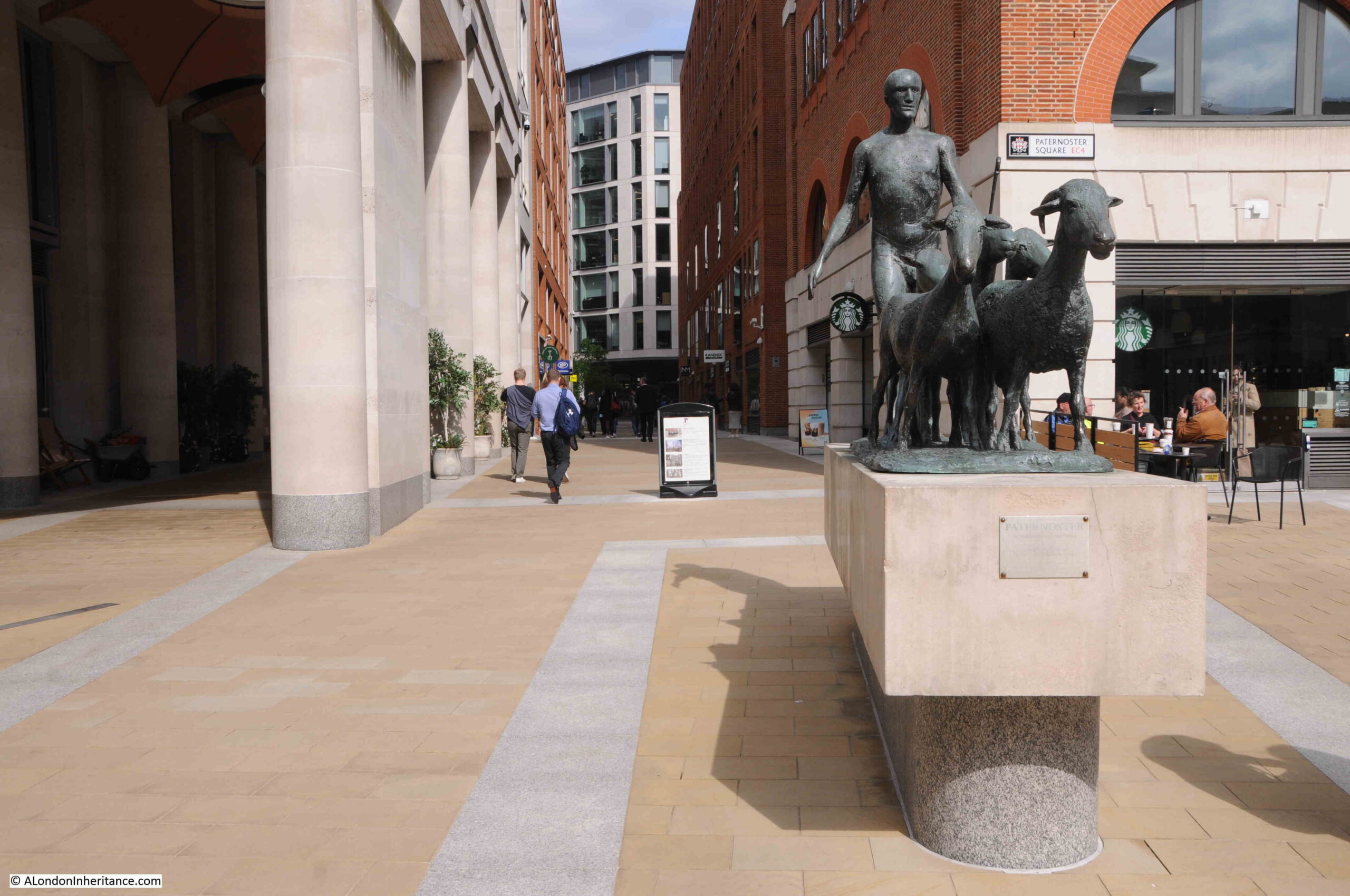
In the above photo, two groups of tourists with guides can be seen to the right. Between them is the artwork “The Sheep and Shepherd” by Elisabeth Frink. This came from the earlier Paternoster Square development as it was installed on the north side of the estate in 1975 when it was unveiled by Yehudi Menhuin.
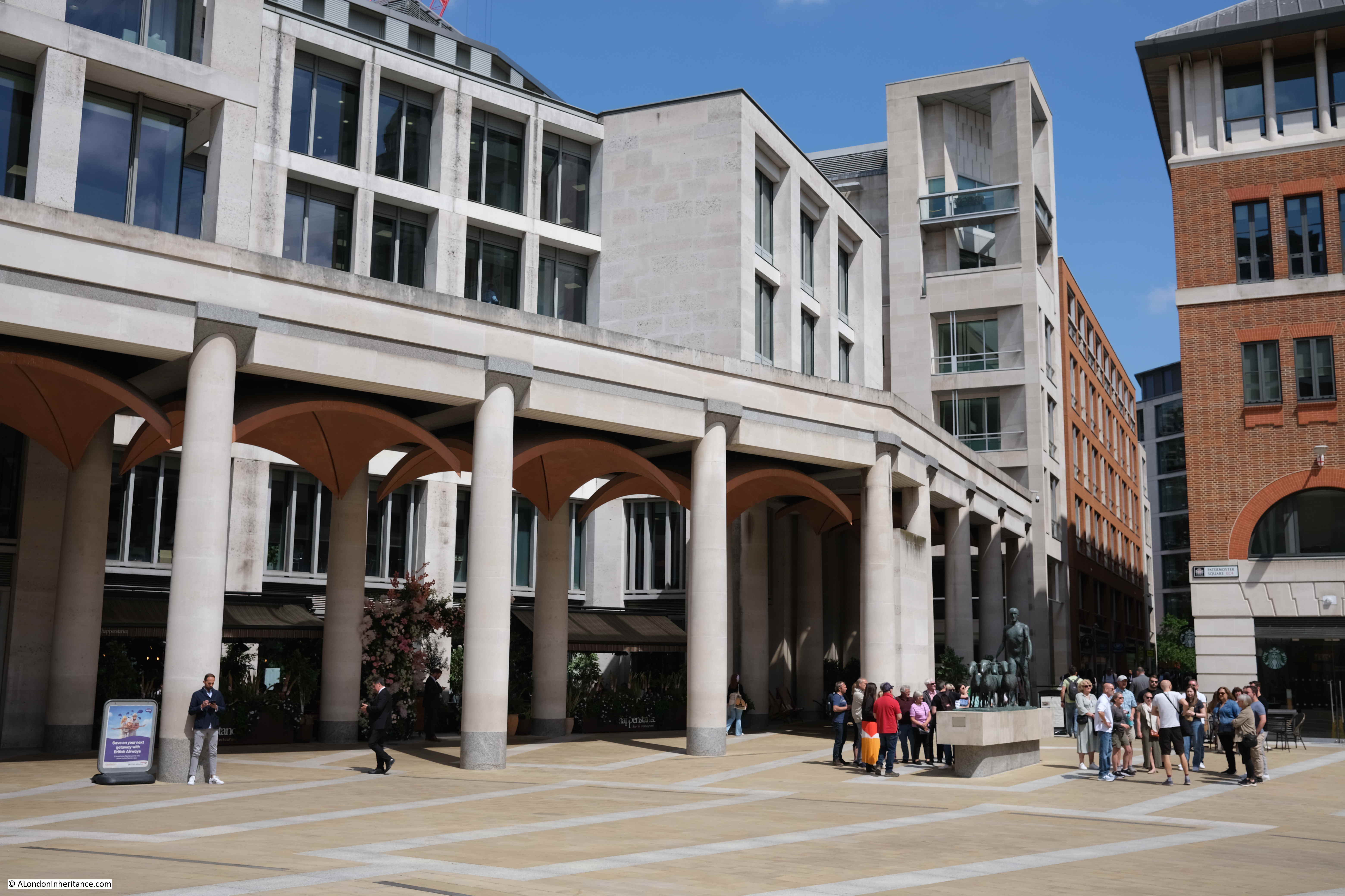
It was moved to the high walk outside the Museum of London in 1997 prior to demolition of the 1960s estate, then returned to Paternoster Square in 2003.
The Sheep and Shepherd stands where Paternoster Square joins to Paternoster Row (which, as far as I can tell is very slightly north of the street’s original alignment).
Looking through the Loggia that was built as part of the new development:
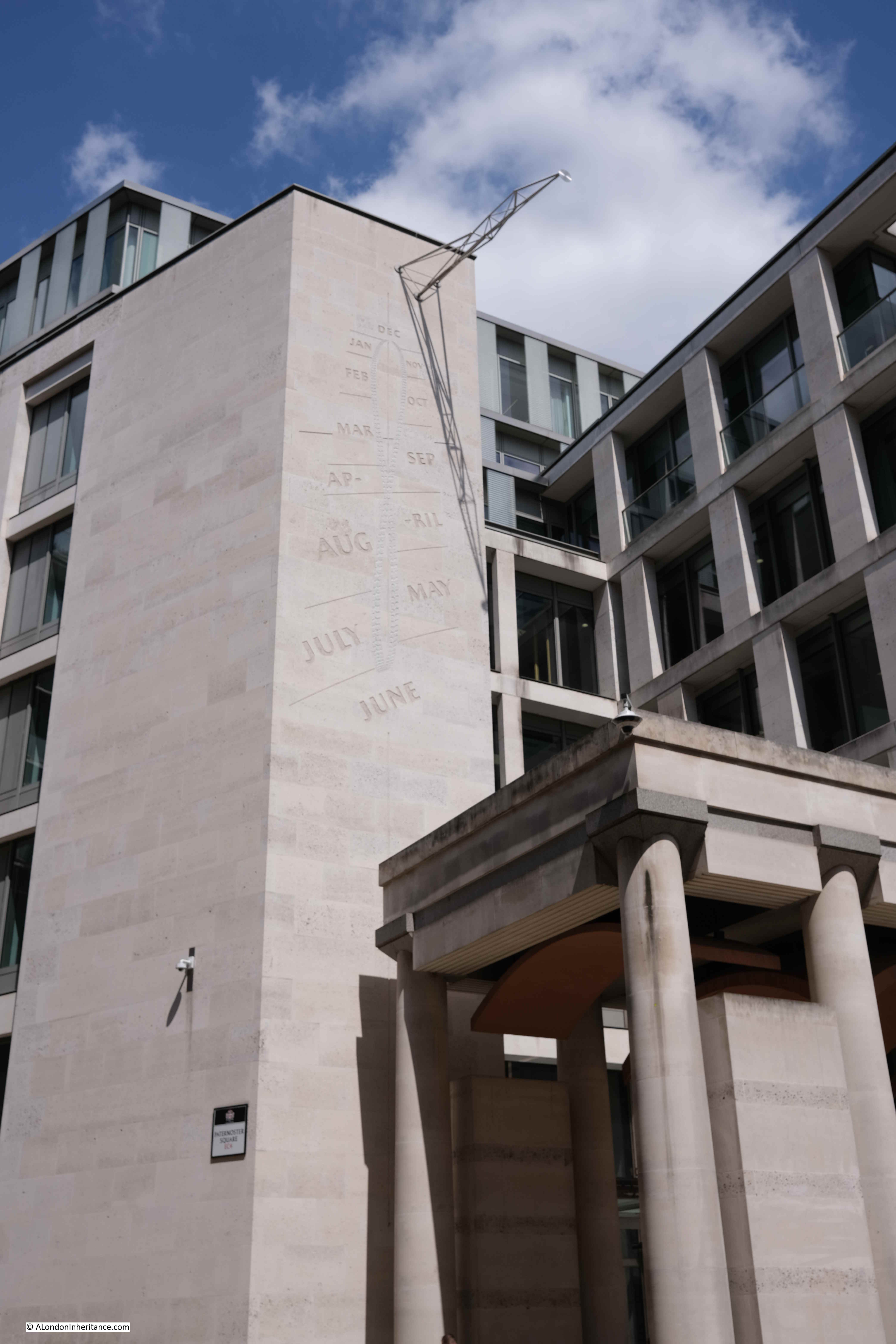
Rather than lots of classical decoration to the buildings, there is a “Noon Mark” on one of the buildings to the north of the square. In strong sunlight, at midday, the shadow indicates roughly the day of the year:
A key point with the development is the height of the buildings. In the 1960s development, there were office blocks that ran both parallel and at right angles to the cathedral and views of the cathedral were limited.
With the new development, building heights are lower and allow views of the cathedral. As can be seen in the following photo from the north west corner of Paternoster Square, the new buildings are just slightly higher than the original Chapter House (the older, dark brick building to the right of the column):
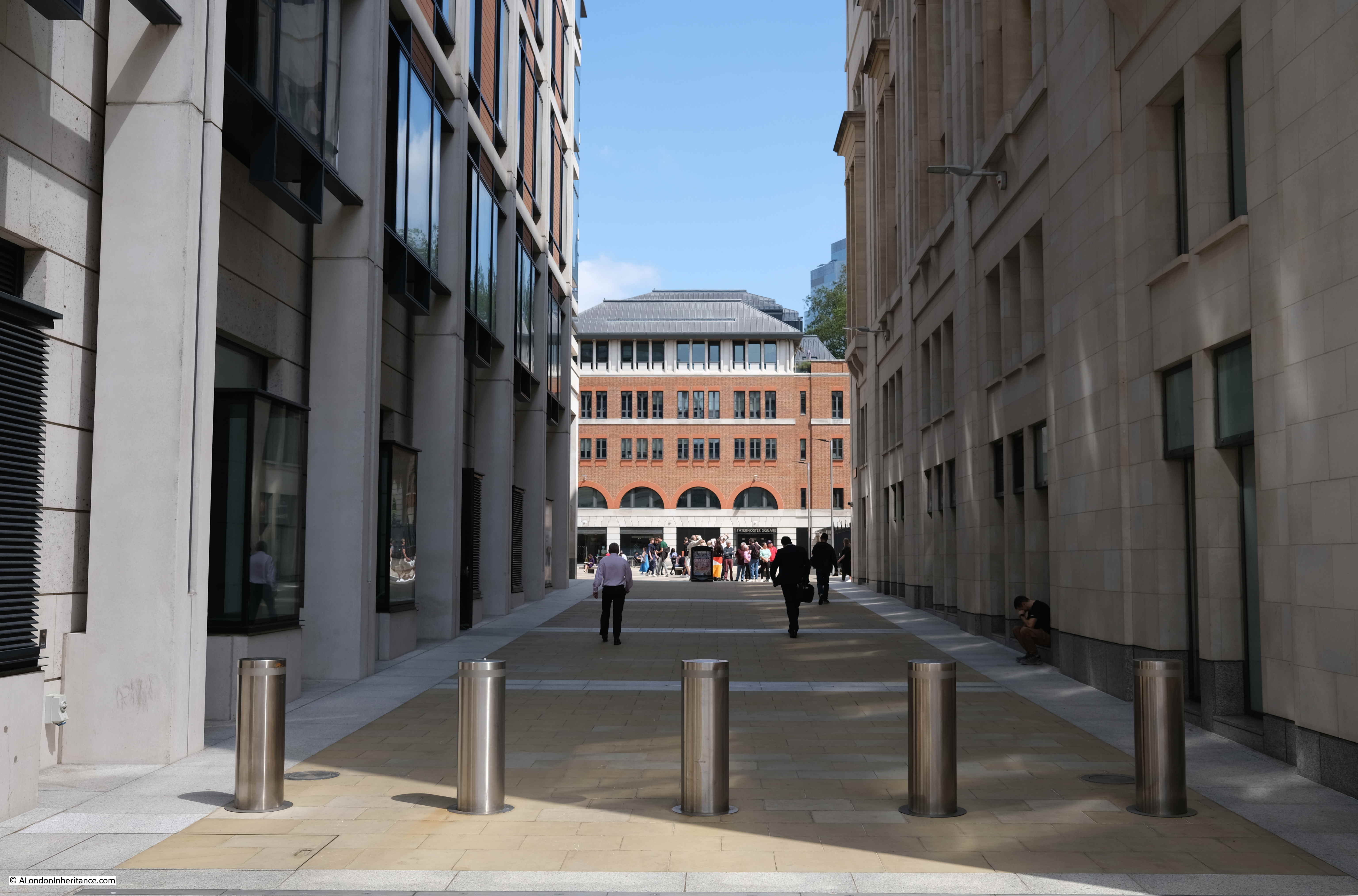
Whilst a number of the walkways do roughly align with the original streets, Paternoster Square is in a different place to the original square, which would have been to the northwest of the current square, to the right of the building in the following photo, which does retain some classical styling at ground level, but is a modern building above:
This is the view from the western end of Paternoster Lane towards the central square. This stretch of walkway is almost exactly on the original route of Paternoster Row:
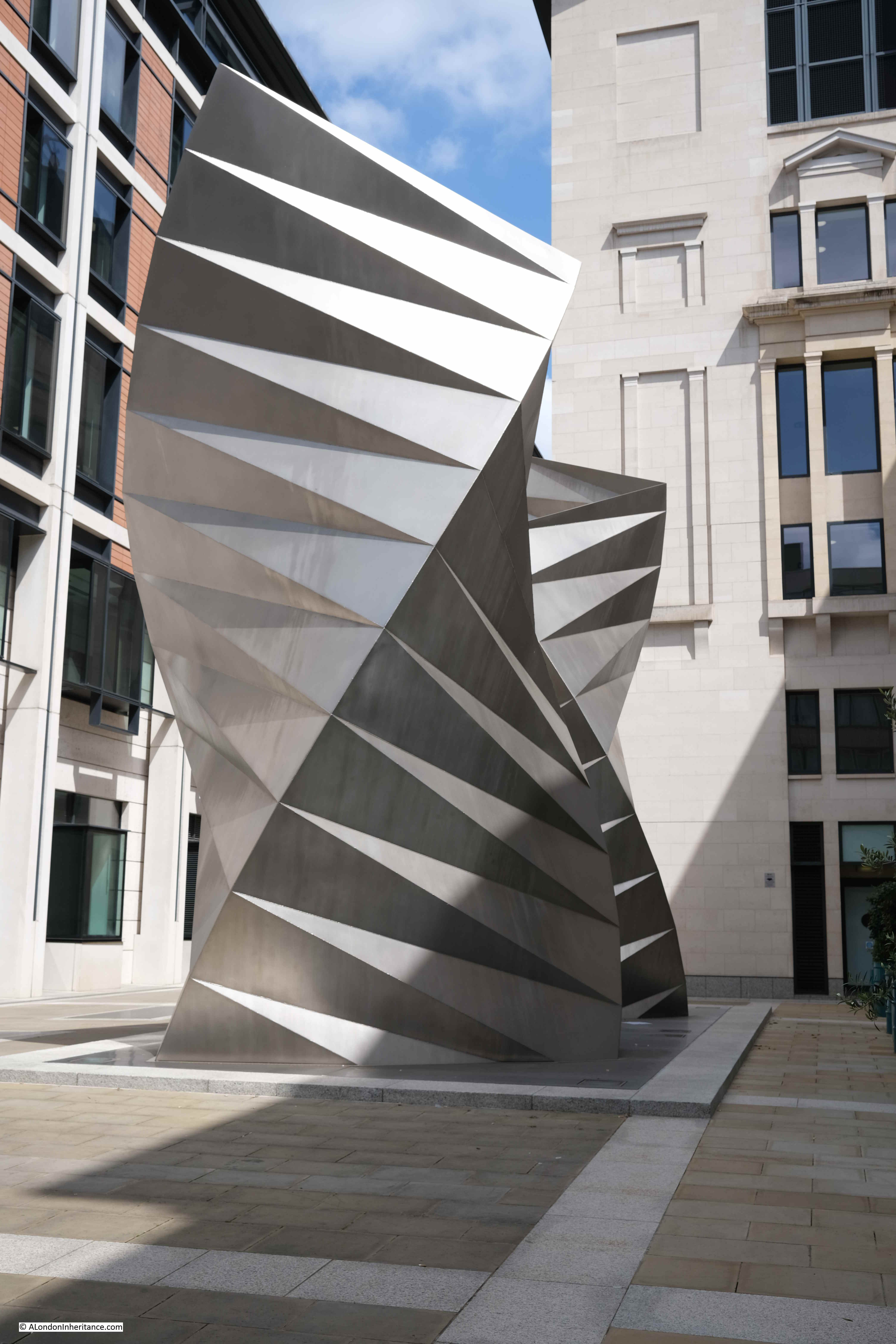
Sometimes it seems as if all the large sculpture across London’s streets is there to hide an air vent. This is the purpose of the column in the central square and also the purpose of a work of art on the corner where Paternoster Lane meets Ave Maria Lane:
This is a 2002 work by Thomas Heatherwick, and consists of sixty three identical isosceles triangles of stainless steel sheet welded together.
Round to the front of St. Paul’s Cathedral, and to the north of the large open space in front of the cathedral is an office block with shops at ground level which follows the alignment of the old street St. Paul’s Churchyard:
The following photo is taken from Cheapside looking towards the cathedral and Paternoster Square development, and may offer a clue as to why the implemented Masterplan is different to the Masterplan of Farrell, Beeby and Simpson:
To the right of the above photo are two sides of an octagonal building. It can be seen in the following extract of the photo of the 1960s estate:
One of the entrances to St. Paul’s Underground Station is just to the right of the building in the photo, and the building is either part above, or extremely close to, the underground station.
I have no evidence to confirm this, however it may be that the estate we see today was down to cost.
Whilst the initial planning permission did not include the octagonal building, the Masterplan did. It would have been demolished and the entrance to St. Paul’s Underground Station would be integrated into one of the new buildings as can be seen in one of the earlier pictures. The proposed lower shopping arcade would also have led into the underground station.
I imagine that anything involving changes to an underground station incur significant extra planning time and costs.
The overall Paternoster estate, whilst aligning with the original Masterplan, does not have the level of classical architecture proposed in the plan, or the split level with the lower court.
All this extra work would have incurred cost, and in so much of the built environment, decisions often come down to cost.
Having said that, compared to the 1960s development, Paternoster Square is a very considerable improvement.
It integrates well with the cathedral to the south, recreates alignments close to some of the original streets, certainly has brought life back into the area from what I recall of the previous development, and is a generally pleasant space to walk through.
Reading the Masterplan though, it is interesting to speculate what might have been, if this plan had been adopted.
You may be interested in the following posts about the area around St. Paul’s:
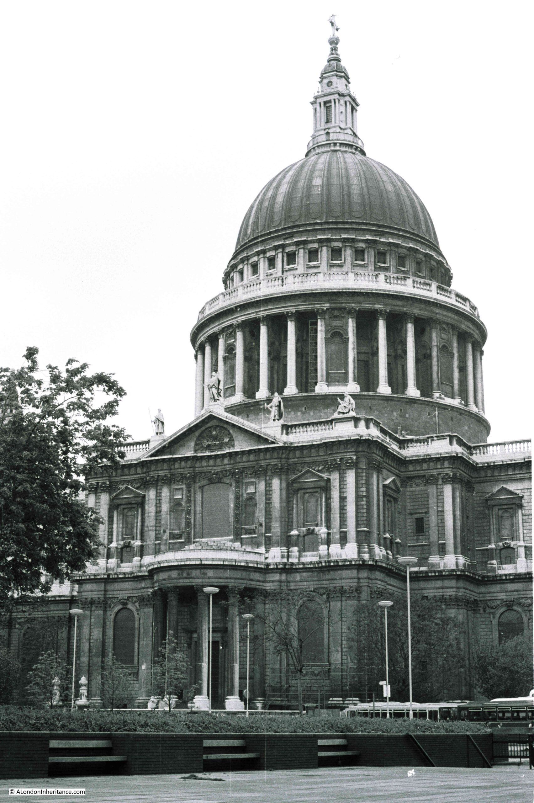
I was looking through some of my old negative scans and found four photos of St Paul’s Cathedral dating from 1977. Nothing special about the photos, and the cathedral is one of the buildings in the City that has not changed, however they did highlight how much dirt the cathedral had accumulated, and in comparison, how clean it looks today.
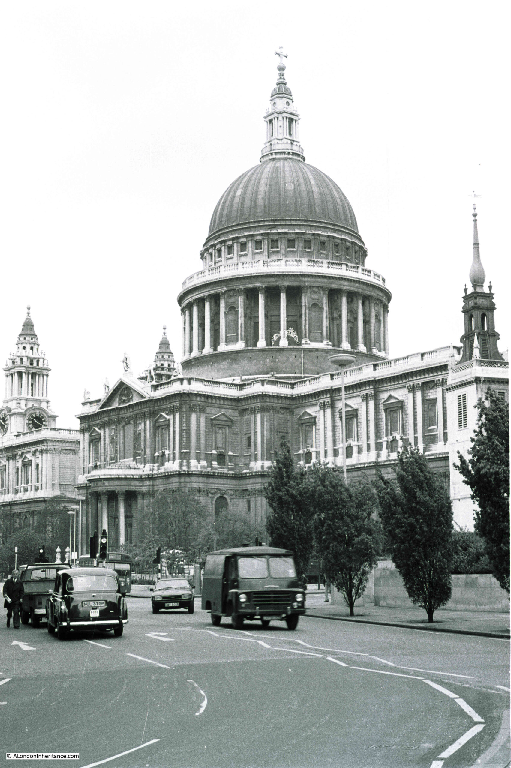
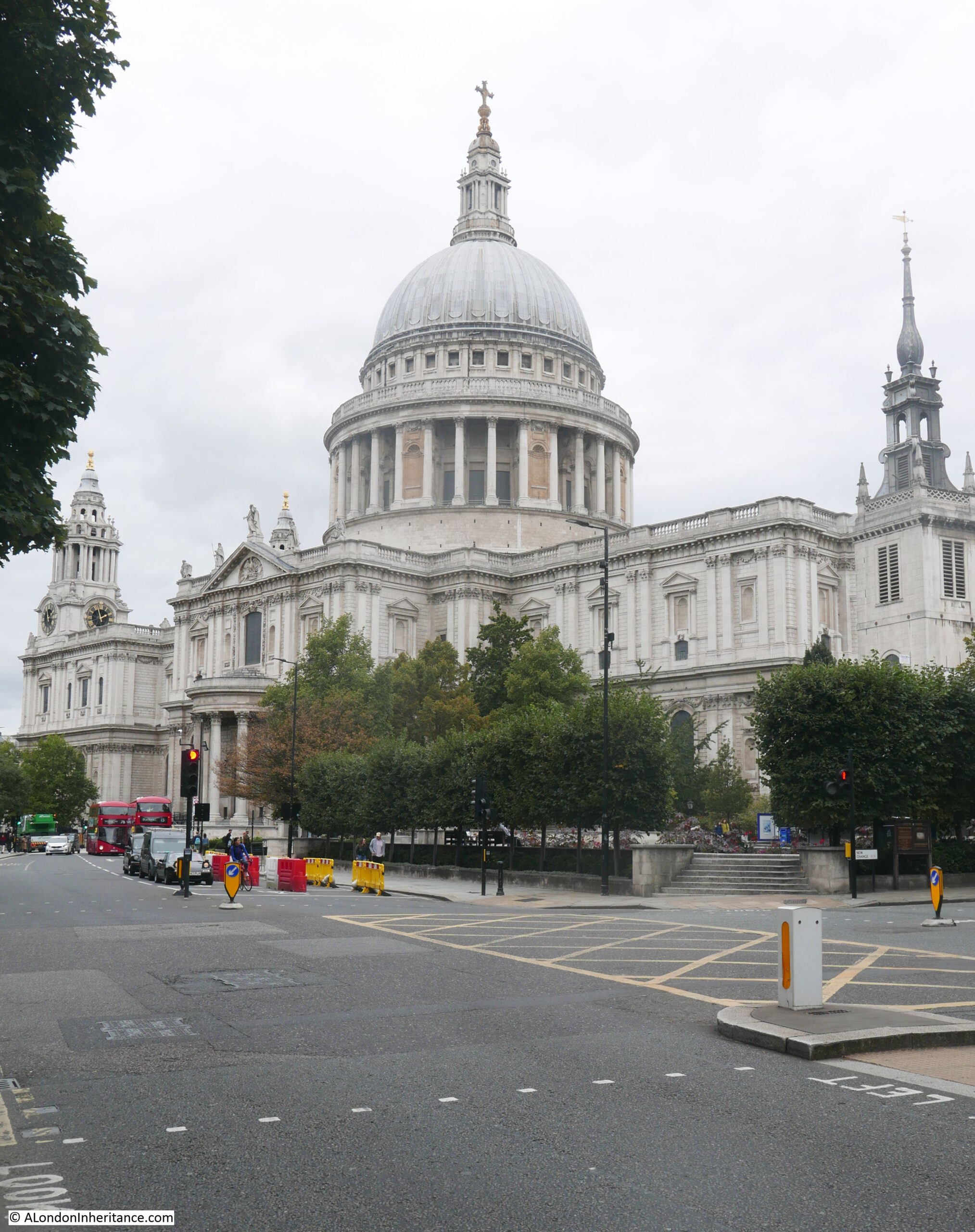
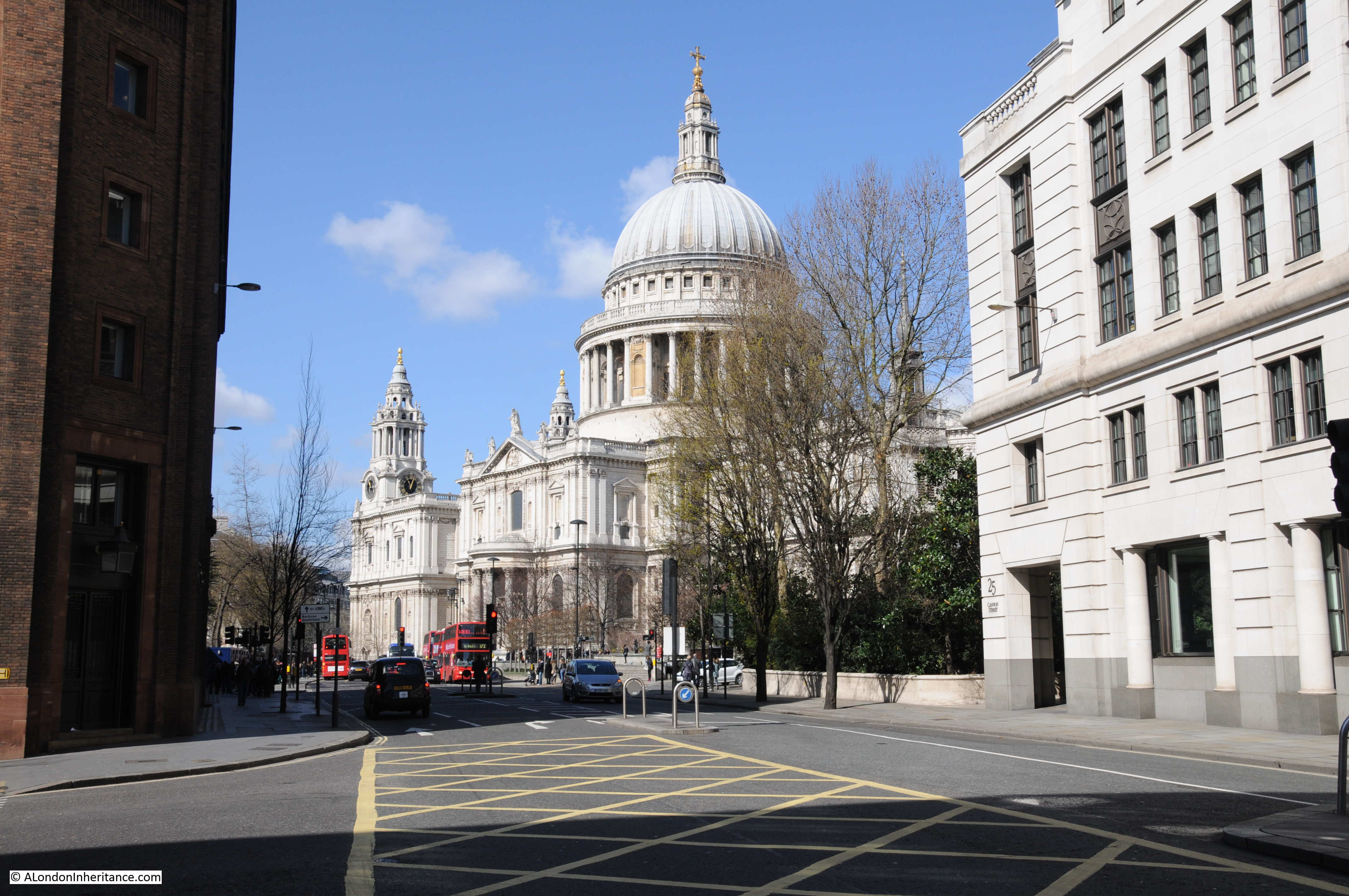
The following photo shows the view of the cathedral from the junction of Cannon Street and New Change in 1977:
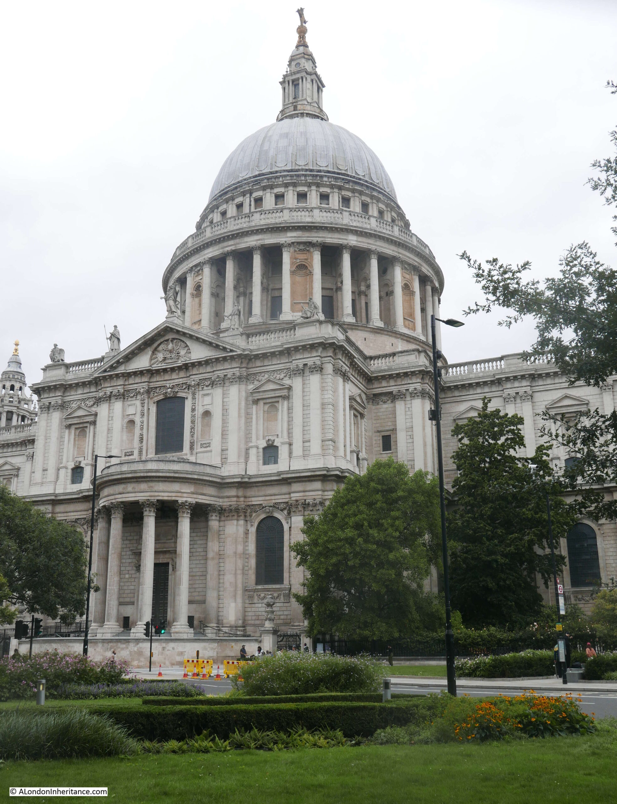
The following photo shows the same view, forty four years later in 2021::
St Paul’s Cathedral has had a number of extensive cleaning and restoration projects over the years, however the state of the cathedral in 1977 was probably not what those who worked on the mid 1960s cleaning project would have expected.
At the end of the 1960s cleaning, it was expected that with recent clean air legislation, and the City of London being designated a smokeless zone the cathedral would remain clean and there was a possibility that in “250 years time, St Paul’s Cathedral will look as Sir Christopher Wren would have liked to have seen it”.
The above quote and the following still is from a fascinating BBC programme from 1965, when “Tonight” had a lengthy feature on the cleaning of St Paul’s Cathedral. The full programme can be watched here, and also highlights the 1960s approach to health and safety (as illustrated in the still below) as well as the rather basic method of cleaning employed. At times the wind lifted the sheets preventing cleaning water from falling to the streets, resulting in some very annoyed City Police Officers who threatened those cleaning the cathedral with a summons if they did not stop work as water was blowing as far as Cannon Street.
Only 11 years after completion of the mid 1960s clean, the cathedral was again looking rather dirty.
The above photo is the south facing side of the cathedral in 1977 and the photo below is the same view in 2021:
In my 1977 photos, the cathedral appears cleaner towards the top, and dirtier towards the bottom of the building. Although central London was a much cleaner place than it had been for many centuries, vehicles were emitting far more pollutants than they do now, and pollution would still be blowing in from the surrounding area.
It is hard to appreciate just how dirty London was up until the late 1960s. Coal burning in homes, offices and factories along with electricity power stations, and industries producing gas from coal all contributed to a significant smog of pollution and dirt.
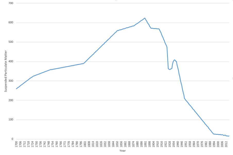
The 1960s cleaning of the cathedral had to deal with dirt that was over an inch thick in places, and we can get an idea of the impact of this amount of dirt from a Parliamentary question asked on the 06 April 1955 by Mr. George Isaacs, MP for Southwark, when he states that based on measuring equipment installed next to Bankside Power Station, and at the Town Hall in Walworth Road, they found that over a year, the “deposit recorded at that time was the equivalent to 235 tons to the square mile on Bankside and a mile away in Walworth Road the deposit was 60 tons to the square mile”.
In the written question, he states that it is necessary to live in the area to really know what the impact of this level of pollution to everyday life means, which he describes as: “Our people have grit in their eyes and grit in their food; there is grit underfoot and grit in the laundry on washing day. I know that what I say has happened. There are the large blocks of the Peabody Buildings less than 150 yards from the station. The only place there for women to dry their laundry is on the roof. They put their laundry on the roof, and the grit comes down. Father comes home to tea, and mother goes upstairs to take in the washing, and when she comes down father knows all about it because she is not in a good humour if she finds that she has to do her laundry all over again. I can say with some justification that this is a nuisance not only physically but in the way it upsets amenities and family life in the area”.
Whether these figures could have been accurately measured going back to 1700 is an interesting question, however the key point of the graph is the overall shape, and the rapid decrease in the second half of the twentieth century, confirming that the air is London is now much cleaner than it has been for many centuries.
The cathedral featured in classroom material produced by the National Society for Clean Air. A chart was produced which included a before and after the recent cleaning view of St Paul’s Cathedral. The chart also included a picture of a boy and girl in clean country air, as well as devices such as smokeless domestic heating equipment. Rather scarily, the chart also included drawings of the sections of the lungs of those living in the city and in the countryside, showing the damage that was being done to the lungs of city dwellers.
School education continues, with the Mayor of London now producing toolkits for schools focusing on air pollution and the dangers of high levels of Nitrogen Dioxide, which particularly affects children, and those with breathing difficulties.
Whilst the clogging grit and smoke that quickly blackened London’s buildings may no longer be a problem, invisible gases such as Nitrogen Dioxide, and very small particulate matter are now the main problem.
Another view of the south facing side of the cathedral in 1977:
The same view today of a much cleaner building:
The most recent full clean of St Paul’s Cathedral completed in 2011 ready for the 300th anniversary of the cathedral.
This had been a 14 year project which cleaned both the interior and exterior of the building. There were some controversial methods used to clean the cathedral, including a latex paste that was applied to the interior stone, which absorbed the layer of dirt and allowed this to be pulled away with the latex layer.
New methods have frequently been used for cleaning the building. In 1903, an American method of stone cleaning where a blast of pitsand was blown at the cathedral walls through a tube at a pressure of 30lb to the square inch, to try and remove the soot and dirt that was ingrained on the Portland stone of the building.
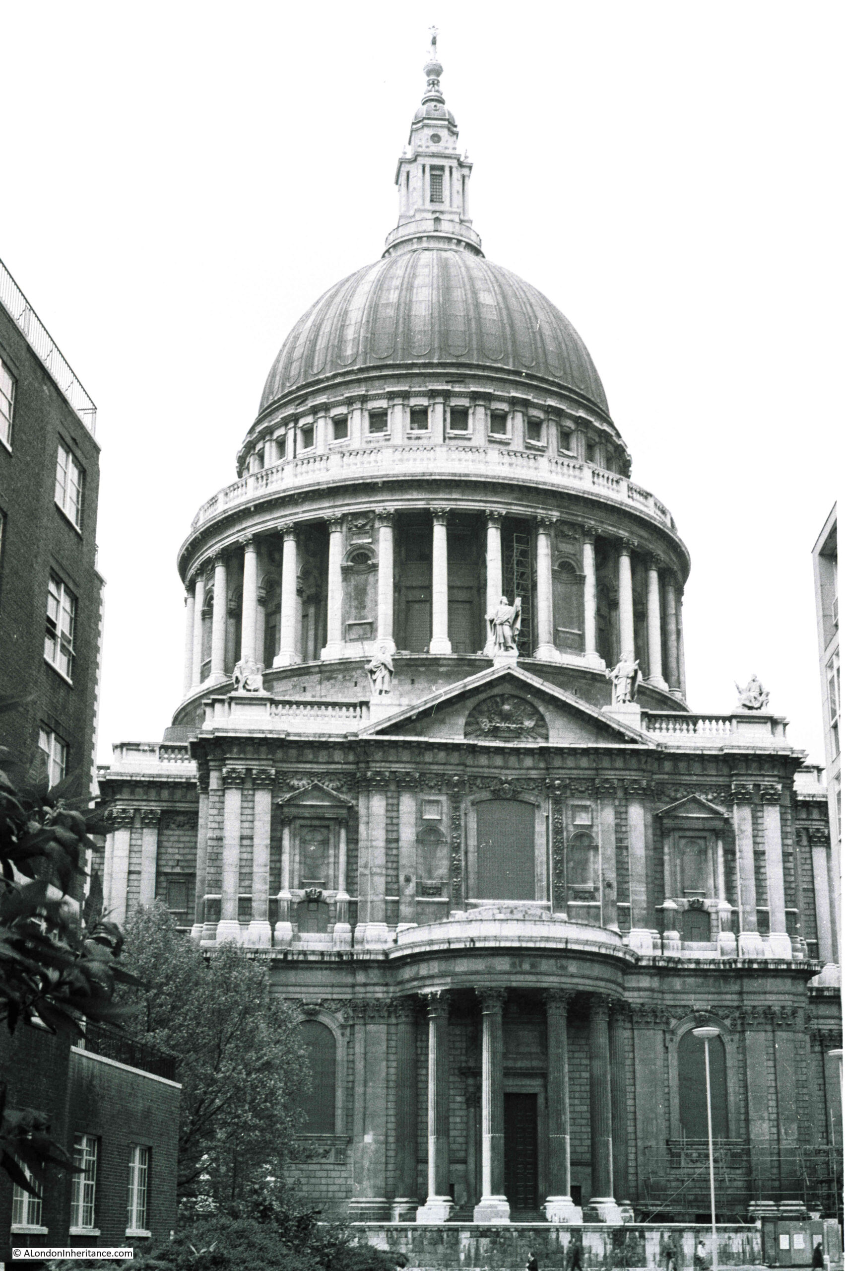
The main west facing entrance to the cathedral in 1977, photographed from Ludgate Hill.
The same view today:
My early memories of walking through the City are of a grey and dirty place, although it is also difficult to be sure how real some of these memories are. What is certain is that the buildings of the City are now much cleaner. The air in many places is better, but there are still many places where pollution levels are too high, generally close to busy roads as London today does not have the same polluting industries as it did.
Hopefully George Isaacs, MP for Southwark would be happy with the change, as well as Sir Christopher Wren who would now recognise the cathedral as it was when it was built.
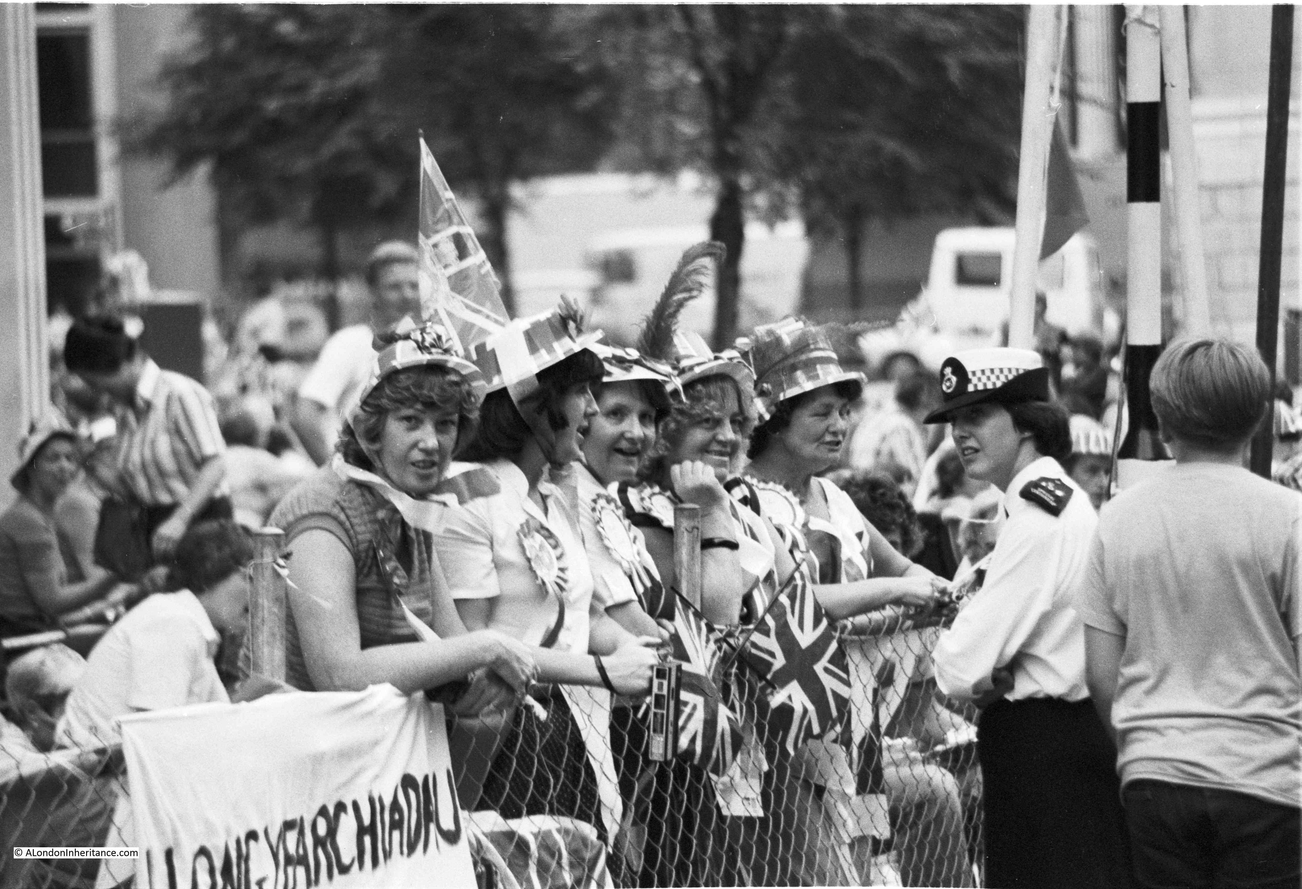
Yesterday evening, the 29th December, was the anniversary of one of the most intensive bombing attacks on London, when on the 29th December 1940 a mix of high explosive and large numbers of incendiary bombs created significant destruction across the City. It was during this raid that the image of the dome of St. Paul’s Cathedral, rising above the smoke and flames of the surrounding destruction was symbolic of both the suffering of the City and the will to survive.
I have written about the raid in a couple of previous posts including The Second Great Fire of London and the St. Paul’s Watch, and for this week’s post I would like to bring you another perspective from the same night.
Of the many buildings that surrounded the Cathedral to the north along St. Paul’s Churchyard and Paternoster Row were the offices, factory and warehouses of Hitchcock, Williams & Co. I am not sure how best to describe the company, but at the time they were a form of Fashion House and drapery, manufacturing and selling a wide range of clothes, hats, fabrics, ribbons etc.
The firm was established in 1835 by George Hitchcock and a Mr Rogers, who would leave in 1843. George Williams who originally joined the company as an apprentice, became a Director with Hitchcock in 1853 when the partnership Hitchcock, Williams & Co was formed. Always based in St. Paul’s Churchyard, firstly at number 1, then at number 72, with the firm expanding to take in many of the surrounding buildings.
George Williams originally joined the business as an apprentice, and as well as becoming a partner with Hitchcock, received a knighthood from Queen Victoria for services, which included the inauguration of the Young Men’s Christian Association (YMCA) which was founded in a room of the company’s premises in St. Paul’s Churchyard.
The buildings of Hitchcock, Williams & Co. were destroyed during the raids of the 29th December 1940. A paragraph in the newspaper reports of the raid included a mention of the company:
“The historic room in which the Young Men’s Christian Association was started was among the places destroyed on Sunday night. With seven other buildings, the George Williams Room – named after the founder, the late Sir George Williams – was burned to ashes. It was situated in the premises of Messrs. Hitchcock, Williams and Co, manufacturers, warehousemen and shippers, of St. Paul’s Churchyard, and was originally one of the bedrooms used by the 140 assistants employed in the Hitchcock drapery business.”
Just after the war, a small book was published by the Company, titled “Operation Textiles – A City Warehouse in War-time”, written by H.A. Walden, an employee of the company.
It is a fascinating book and provides not just a detailed account of an individual business in the City of London, but also as being written at the time, by an employee, provides a view of how a typical City company operated.
The book includes a number of photos which show daily life in the company before the war, during preparations for war and the results of the raid of the 29th December.
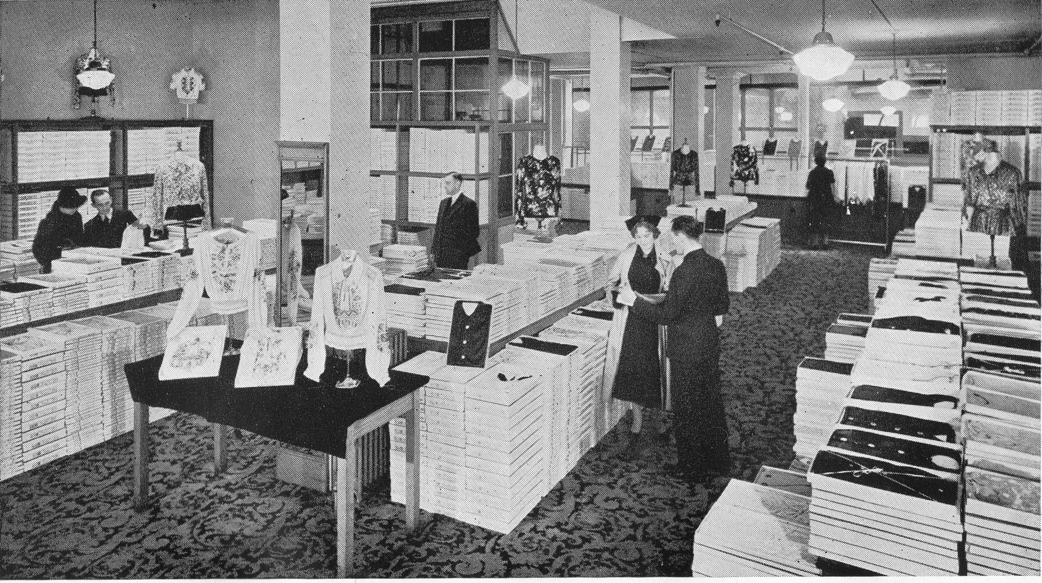
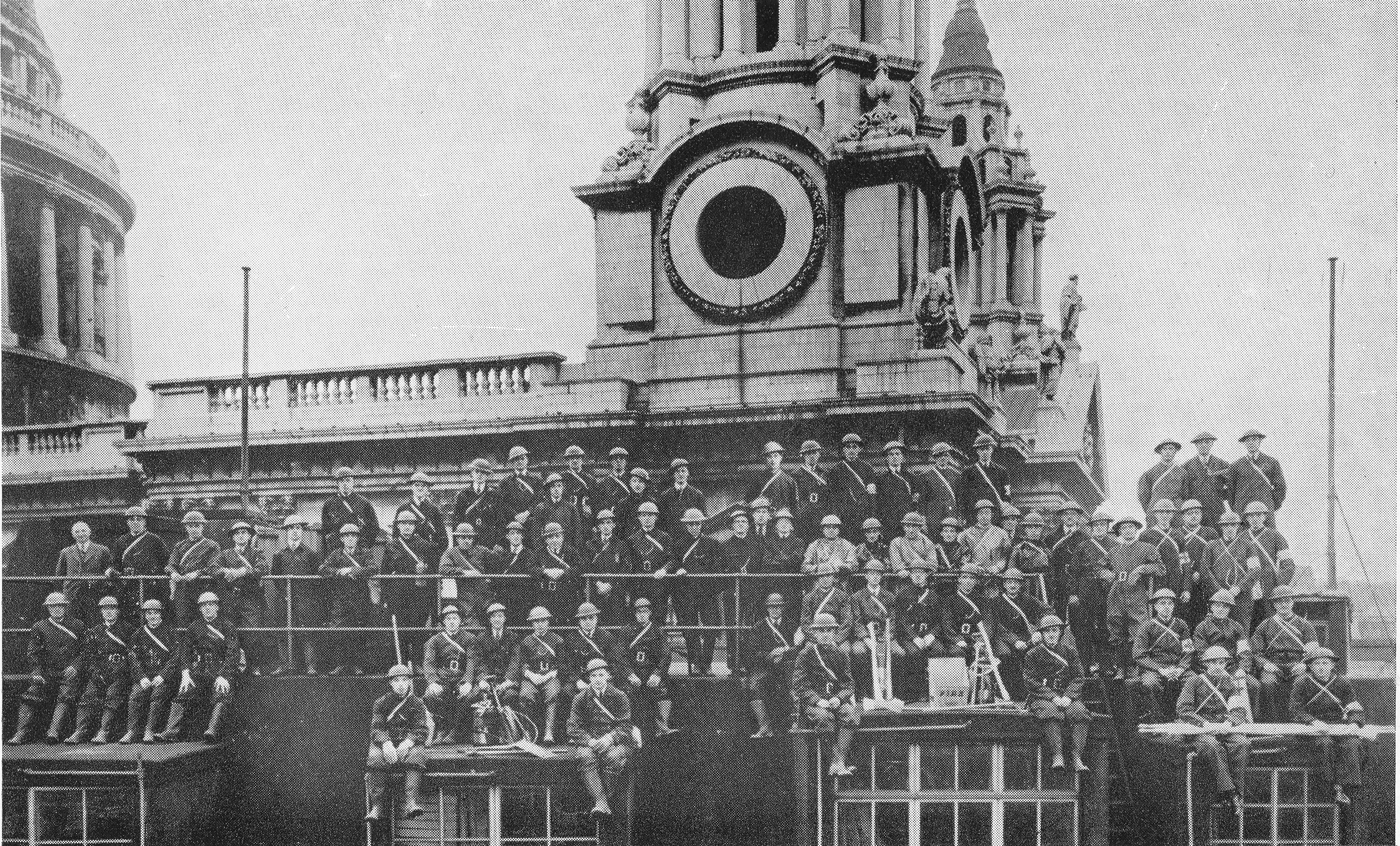
The following photo is titled “A Pre-Blitz View of our Blouse Department”:
“Staff Quoit Competition” – This photo helps show exactly where the Hitchcock, Williams building was located with the main entrance to St. Paul’s Cathedral, facing Ludgate Hill, seen in the background.
In fact St. Paul’s Cathedral features in the background of many of the photos in the book. The following photo taken in 1940 is titled “Our Firefighting And First Aid Units”:
In the following view of St. Paul’s Churchyard today, the buildings of Hitchcock Williams & Co occupied the majority of the space now occupied by the buildings, starting with the brick faced building on the right, where the old Temple Bar now stands and the majority of the space occupied by the taller building curving from right to left.
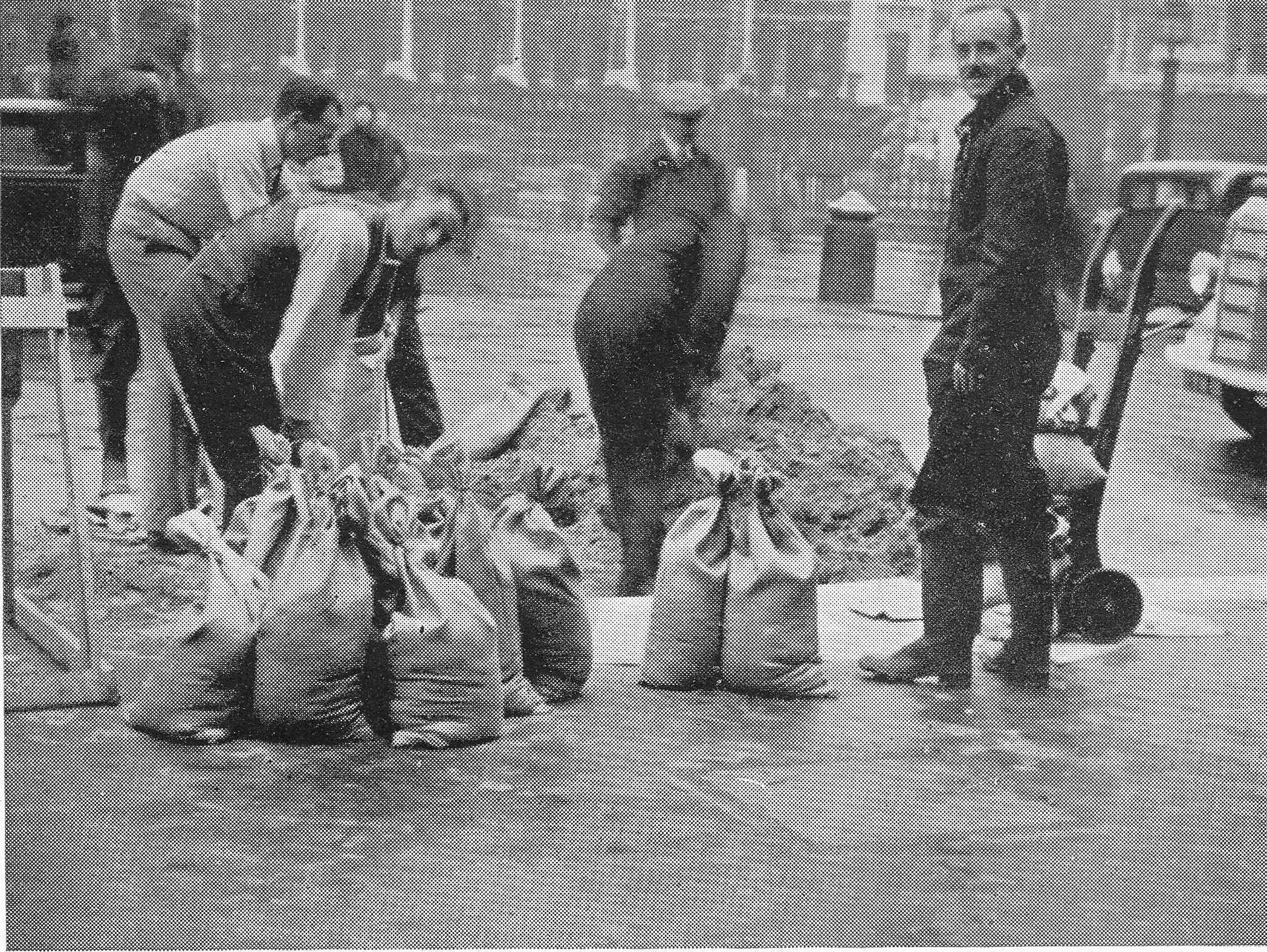
In the early stages of the war, building owners were encouraged to form their own fire fighting teams, and many City buildings were manned by employees of the company to help defend the building from what was expected to be attacks from explosive and incendiary bombs, although they were mainly equipped with buckets of sand and stirrup pumps, which were to prove of limited use on the night of the 29th December.
Preparations for war included not just the formation of fire fighting and first aid teams, but also protecting the building with sandbags as this photo titled “Sand Shifting Volunteers” demonstrates:
This photo titled “Stand Easy” shows part of a roof apparently lined with sandbags.
Hitchcock Williams & Co, as practiced by other large City companies, had a number of residential employees and during the war preparations included converting rooms to overnight shelters for residential staff and those assigned to fire watching shifts. This photo titled “Squeezin Hotel Bedroom” shows one of the converted rooms.
Judging by the preparations and planning detailed in the book, Hitchcock Williams & Co. was probably as well prepared as any City company at the start of the war, however such was the intensity of the raid on the 29th December 1940 that even with incredibly dedicated staff and detailed planning and preparations, they were insufficient to save the buildings in St. Paul’s Churchyard.
Rather than precis the events described in the chapter of the book that covers the 29th December, the following are the words written by H,A. Walden who was there on the night. The chapter has the perhaps rather understated title:
“The Great City Fire Blitz And How It Affected Our Personnel And Premises”
“It has been said, and written, that not since the Great Fire of 1666 has there been such a conflagration in the City of London as occurred on Sunday night, December 29th, 1940, the result of Nazi incendiary bombs. In this ‘blitzkrieg’ whole areas of the City became smoking ruins within a few hours. Narrow thoroughfares, old familiar places and historic landmarks, were obliterated. To write adequately of the scenes of destruction seems beyond the limit of one’s descriptive powers.
It was an awe-inspiring sight for those of us who witnessed it. St. Paul’s Cathedral, ringed by raging fires and falling masonry, its great dome superimposed and reddened all night by the reflected flames, seemed to take upon itself an even greater dignity, as it stood in the midst of this example of ‘Man’s inhumanity to man.’
Approaching the City from the South, I saw by the lurid sky that the fires must be near the Cathedral, and felt apprehension about our own premises. The journey on foot along Cannon Street, deserted but for firemen, was of a nightmare variety. Several big fires were in progress, particularly a large Queen Victoria Street block, the smoke and sparks of which filled the air. the sound of hostile planes roaring overhead and the hiss of great numbers of falling incendiary bombs, seemed more menacing than usual. Taking cover in various doorways en route, and reaching the Cathedral, I found that our near neighbours, Debenham and Company’s premises were almost gutted and Pawsons and Leaf’s roof alight in several places. The roadway was a mass of fallen masonry, and hose-pipes interlaced towards the brow of Ludgate Hill, where other fires were taking hold. Various buildings in Paternoster Row, Ivy Lane, Warwick Avenue and London House Yard were burning furious, and I shall not forget seeing the faces of some of our fire fighters in the glare, with every detail defined at a considerable distance. It should have been possible to read clearly by the light of the many fires.
Passing into the Warehouse, I learned that hundreds of firebombs had fallen in the near vicinity, some even on the Cathedral. Those which fell on our roof were effectively dealt with by our own squads, some of whom went out into the street to extinguish other incendiaries.
Here it must be recorded that many fires might have been avoided if other Warehouses and buildings nearby had had organised watchers and fire fighting staffs, such as our own. Perhaps, indeed, our premises would have been spared, for there appears to be little doubt that we became the eventual victims of other negligence, or lack of precaution.
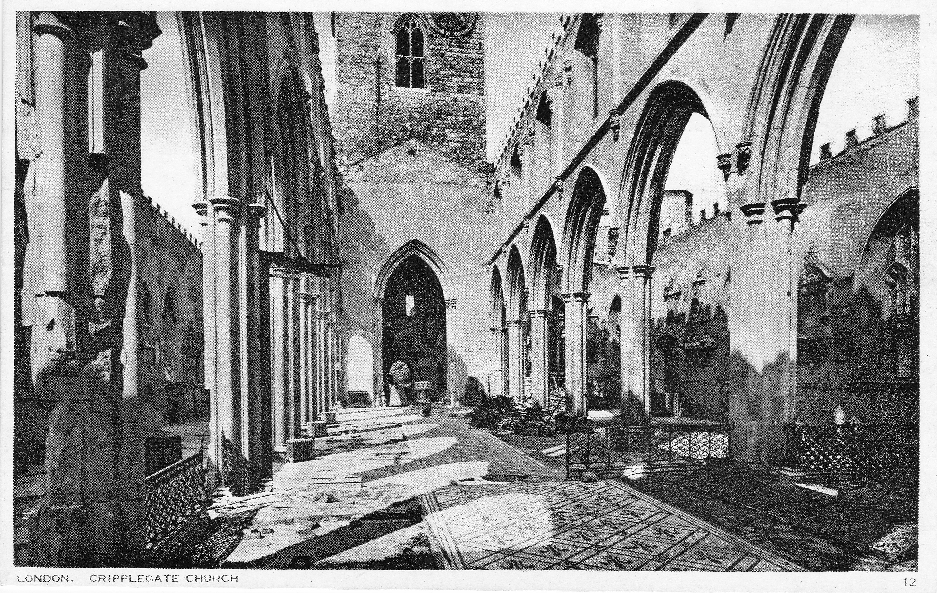
In addition to our own fire fighters and first aid men on duty, there were about 80 other occupants of our basement shelters, comprising assistants of both sexes and domestic staff, most of whom were unaware of the close proximity of the fires or the danger outside. Soon word was received that our premises must be evacuated at once, and Mr. Lester instructed me to conduct the women members of the staff immediately to the Crypt of St. Paul’s , where arrangements had been made to receive them. They quietly collected their necessities and blankets, and with one or two excusable exceptions, the calm manner of their journey despite the sight of flames and sparks which greeted them upon coming out of doors at ground level, is worthy of very special mention. The men followed shortly afterwards. All were most kindly received by Canon and Mrs’ Cockin and other clergymen and helpers. We were given cocoa and made as comfortable as possible on pews and forms. The quiet atmosphere of the Crypt made it seem miles away from the outside world. It was the first visit for some of the staff, and one clergyman was soon answering questions from a young lady regarding the Duke of Wellington’s huge funeral carriage standing nearby. By this time, Wren’s Chapter House adjacent to our own premises, was ablaze, and our old building, 69/70 St. Paul’s Churchyard, despite the firemen’s efforts, had caught fire.
It was a hopeless fight from the start. memories of this old part of the House, with its Victorian outline, came crowding in. How it had witnessed so many of the Cathedral ceremonies! How, in happier days, over many years, it had been made colourful and bedecked with flags and bunting to welcome Royalty and others visiting the City and St. Paul’s, the personalities who had worked there and long since passed on – old friends who used to visit its departments – the present staff which manned them, and their reactions when on the morrow they would come and find the old place a ruin of twisted steel! The quiet, philosophic bearing of Mr. Hugh Williams and the Manager as they stood and watched the burning warehouse were an example to us all.
To define in praise the work of our fire fighters would be to limit the extent of their great service. Three times the Police instructed them to leave as the building was becoming dangerous; but they refused to go, and eventually Mr. Lester had personally to order and almost drag them away. Even then they asked to stay and continue the unequal struggle. Stirrup-pumps were futile weapons to deal with such a fire. many of our men were utterly exhausted when finally they withdrew.
As we feared, there was worse to follow. The flames of burning buildings in narrow Paternoster Row fanned by a strong wind contributed to the succumbing of the newer blocks of our premises, the rear portion of which was soon doomed – steel and concrete have their limitations. The task of the squads of regular and auxiliary firemen was hopeless and overwhelming. Water was at a low pressure because of its universal demand over a wide area. Many of us could neither rest nor remain in the Crypt, but came out at intervals to stand and stare, fascinated – and dejected – at the scene confronting us but a few yards away; we were even warmed by the heat of the blaze. It was eerie to see the hoses lit up by the flames. They resembled giant snakes sprawling across the roadways and pavements. Most of the staff had by now put down their blankets on the stone floor of the Crypt and endeavoured to obtain some sleep. My own blanket covered a flat gravestone, the inscription of which recorded the death in 1787 of Elias Jenkins, a former verger of the Cathedral. It was surprising that so many actually slept, particularly those who were shouldering the great responsibilities and anxieties of the future.
The following photo is titled “Our Old Building, December 29th, 1940”:
On the 29th December 2018 I took the book with me to St. Paul’s Churchyard to track down the location of a couple of the photos. The following photo is of the same view as the above. Part of the Chapter House can be seen on the right of both photos. This is the only building that was rebuilt after the war and remains to this day.
In the grey light of a chaotic dawn, with buildings still ablaze, breakfast was where one could find it. There was very little water, and it was a strange sight to see people walking about with kettles in their hands trying to obtain it. Most of the staff who had been there all night were now sent home. The Headquarters of the Firm were made temporarily at Messrs. Evans’ Restaurants (next to our own premises), which had, apart from water damage, escaped the fire. We record our grateful thanks and admiration of Miss Richards and Miss Sheer, of their staff, who literally took us in and fed us. They made tea and cooked under the most irksome conditions, and were indefatigable in their cheerful assistance. They had slept in our basements for many weeks previously.
Our staff assembled here on Monday morning, seeking advice and instruction. The addresses of all were registered, and, with a few exceptions they were told to return home and await orders. This went on for two or three days, and about a dozen of us occupied the Crypt for a second night. Parts of our building were still burning, and it was late on this second occasion that some of us had the unusual sight of the Dean of St. Paul’s in his shirtsleeves, surveying our premises from the Crypt door. With a smile he remarked, ‘It takes Hitchcock, Williams an awfully long time to burn’.
The Firm had by now sought and found temporary offices at Textile Exchange, in the Churchyard, overlooking our still smoldering premises. The main room of these offices became a meeting place for everyone seeking information or giving it. A small Counting House and Entering Room staff were occupied acknowledging all mail and dealing with inquiries and urgent affairs. Mr Lillycrop had, fortunately, before leaving our stricken building, removed some books containing our customers’ names and addresses, thus enabling us to inform some thousands of them by January 7th of the calamity which had befallen our premises. A great number of replies were received expressing sympathy and offering help in some form or another. These greatly heartened and encouraged the Firm and staff in their determination to carry on. One letter concluded with, ‘Heil Hitchcock’s! Damn Hitler’.
The following photo is titled “Our Paternoster Row Frontage (after December 29th, 1940)”:
The following photo is of roughly the same scene today. The above photo extends further to the right than the photo from today, however that part of the view is obscured by the building on the right.
The following photo is titled “One Of Our Departments After The Fire”:
The following photo is titled “Main Roof Damage”:
The following photo is titled “Our Warehouse After Hitler Passed”:
Many problems were now being dealt with, to give but a few – Where should we find premises to house our Departments? In what state were the hundreds of ledgers and account books in the strong room which had now been submerged in debris and 14 feet of water? Where to obtain new stocks with the ‘Limitation of Supplies Act’ in operation? The claims of many members of staff who had lost their personal possessions in the fire? Where to accommodate the previously ‘living in’ staff, of whom there were approximately 150, when they returned to business? Immediately on seeing the staff on Monday morning, Mr. Hugh Williams, the Manager and some of the buyers went to inspect various places with a view to securing the premises and were able to obtain possession of four warehouses in the West End, and two showrooms in Cannon Street. By January 13th all these premises were in occupation by the various Departments which began establishing stocks and dispatching goods, though handicapped by a complete lack of counter fixtures etc.
The floor space in those early days was but a shadow of our former capacity, and indeed still is.
In addition to the complete loss of our main premises, there were also completely destroyed our four factories and workrooms, maintenance workshops at Warwick Lane and resident quarters at Crown Court, with everything they contained. Only Soft Furnishing and Piece Goods Departments were re-established in the City, at Scott House, Cannon Street, but on May 10th 1941, this building was also totally destroyed by enemy action. These departments were eventually transferred to the rehabilitated first floor of what remained of our 72 St. Paul’s premises.
The problem of the flooded basements containing our strong room and in it all our books and records was a serious one. Pumps were installed and operated for several days before the water was cleared, and debris removed, to allow an examination to be made of the contents. The strong room was found to have been badly flooded, and the removal of sodden books and documents and the process of hand drying every page by our already augmented staff will not soon be forgotten. The drying and de-ciphering continued for many months, in many cases figures became obliterated by mildew setting in. The practical help given by our customers who, when remitting, forwarded copies of their own ledgers was of great assistance to us. Many were themselves in a similar case and the difficulties of reconciliation of indebtedness can be appreciated. One customer at Hull had his premises destroyed on three occasions. Our bankers placed their special drying rooms at our disposal for some important documents and books – even a laundry gave assistance through the medium of its special apparatus.
Many of our ‘living in’ assistants and fire fighters had lost most of their clothes and personal belongings and for a few days the Guildhall (also badly damaged) was besieged by claimants for compensation. Each was interviewed by the Relieving Officer, and, in most cases, a cash payment on account was made for immediate necessities. A comprehensive form, setting out personal losses had to be completed and returned within 30 days. The administration at the Guildhall was sympathetic and businesslike. There must have been thousands of claims made as a result of the night of December 29th, 1940.
For some time, members of the staff worked among the debris and basements, clearing and salvaging whatever possible. The builders erected scaffolding at certain points with a view to rendering first aid to that part of our remaining building which might be made habitable for business. Meanwhile in Paternoster Row the Royal Engineers and Pioneers were in full possession continuing their work of demolition of unsafe buildings and walls. What remained of the older portion of our building was finally demolished by explosive charges on February 7th, 1941. Despite great damage, it fell only after great reluctance. Paternoster Row and London House Yard remained closed thoroughfares for the rest of the war.
This scene of desolation in the area at the rear of our buildings was terrible. It could be likened to the result of an earthquake. Publishers, publicans, booksellers, scent makers, cafes, solicitors – in fact, all branches of the professions and industry suffered. Notices and papers strung along railings and ropes indicating location of new or temporary addresses could be compared with washing hanging on a line.
The salvaging, drying and storing of a quantity of packing paper and string provided extremely useful, as these commodities became scarcer in supply. Our artesian well which pumped water from a depth of 500 feet in sufficient quantity to supply all our needs, was rendered useless. The reserve tank, for three days’ supply had a capacity of 18,000 gallons and weighed 90 tons. This provided useful salvage and ‘tank-busters’ was no misnomer for the men who were eventually employed to dismantle it.
Finally, we were indeed thankful that no lives were lost, nor serious injury received by any of our staff. Despite the great material losses the Firm sustained they set an example to all in their determination to rise again, Phoenix like, from the flames. Meanwhile over the front entrance door, the sculptured stone figure of ‘Industry’, undamaged, still smiles serenely down on our undertaking.
What further symbol is needed for this great century old business?”
The following photo is titled “Our Block, December 1940”:
In the above photo, the white lines shows the boundary of the premises of Hitchcock Williams & Co and demonstrate the size and scale of their operation around St. Paul’s Churchyard and Paternoster Row. In the lower right corner, part of the shell of a building can be seen with a rather distinctive chimney with lighter colour lower section and darker upper section. This building is the Chapter House of St. Paul’s Cathedral.
My father took a series of photos from the Stone Gallery of St. Paul’s just after the war (I covered these in two posts here and here).
He did not take a photo that exactly covers the area of the Hitchcock Williams building, however he did take the following photo showing the Chapter House with the same distinctive chimney.
In the above photo, the area occupied by the buildings of Hitchcock Williams are to the left and have now been cleared. The round circles are the marks left from the siting of large water tanks that were built after the raid of the 29th December on cleared land. This was to address the problem of water availability and low water pressure as described in the account of the raid.
To help locate where Hitchcock Williams stood in the area around St. Paul’s today, this is a photo I took a couple of years ago when the Chapter House was being restored showing the same view as in my father’s photo above. The premises of Hitchcock Williams were to the left of the Chapter House.
Operation Textiles – A City Warehouse in War-time is a fascinating little book, not just for the account of the 29th December 1940, but also for the background as to how a company operated in the City of London covered in the rest of the book. It is amazing how the company tried to operate as normal in the first months of war, including sending sales representatives with samples to the Channel Islands – they just escaped on the last boat as the islands were being invaded.
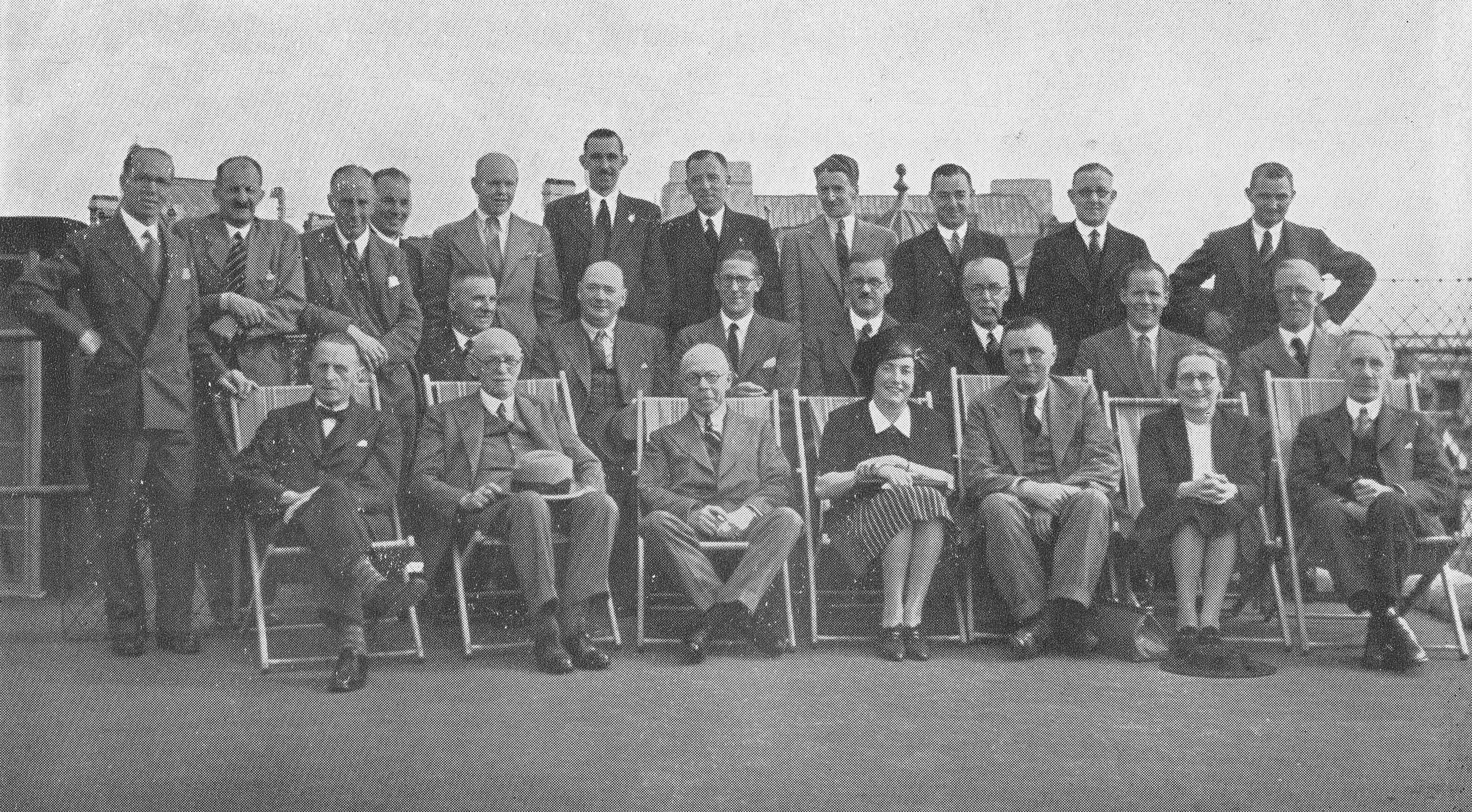
The company also appears to have had a very paternalistic approach and was very male dominated as were the majority, if not all of City companies of the time. A photo in the book taken on the roof shows the buyers meeting. Of the 25 staff of buyers, only two were female.
Hitchcock Williams & Co rebuilt their operations during and after the war and continued trading, however changing tastes, foreign competition and the economic recession of the early 1980s all took their toll and Hitchcock Williams closed in 1984. The company had been trading for 149 years and when it closed a fifth generation Williams was a Director of the company.
The area around St. Paul’s Churchyard and Paternoster Row are very different today, having been rebuilt twice since the destruction of the 1940s. Nothing remains of the buildings of Hitchcock Williams, however it is intriguing to wonder if the remains of their 500 foot deep artesian well can still be found somewhere deep under the current incarnation of buildings – something for future archaeologists to wonder about.
To close, here is a poem from the book which describes what must have been the feelings of those who looked over the bombsites of buildings that had been a significant part of their lives:
City Street, 1942
Desolate and gaunt the ruined buildings brood,
And gargoyles from a long dead sculptor’s mood
Still peer, unseeing, grinning in the dust,
Athwart with twisted girders etched with rust,
Who looks unmoved upon these rubbled mounds
Which once knew friends, and heard familiar sounds?
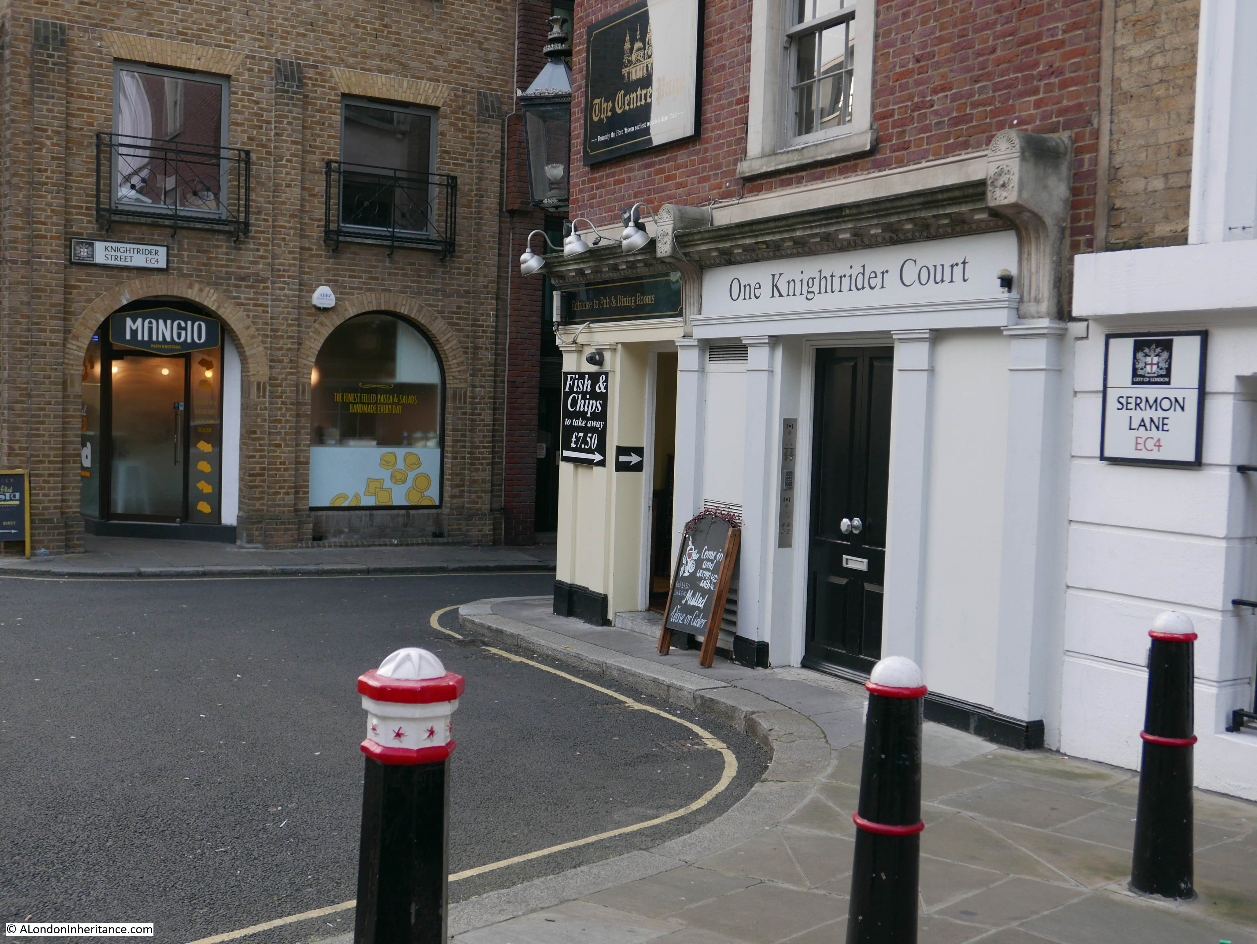
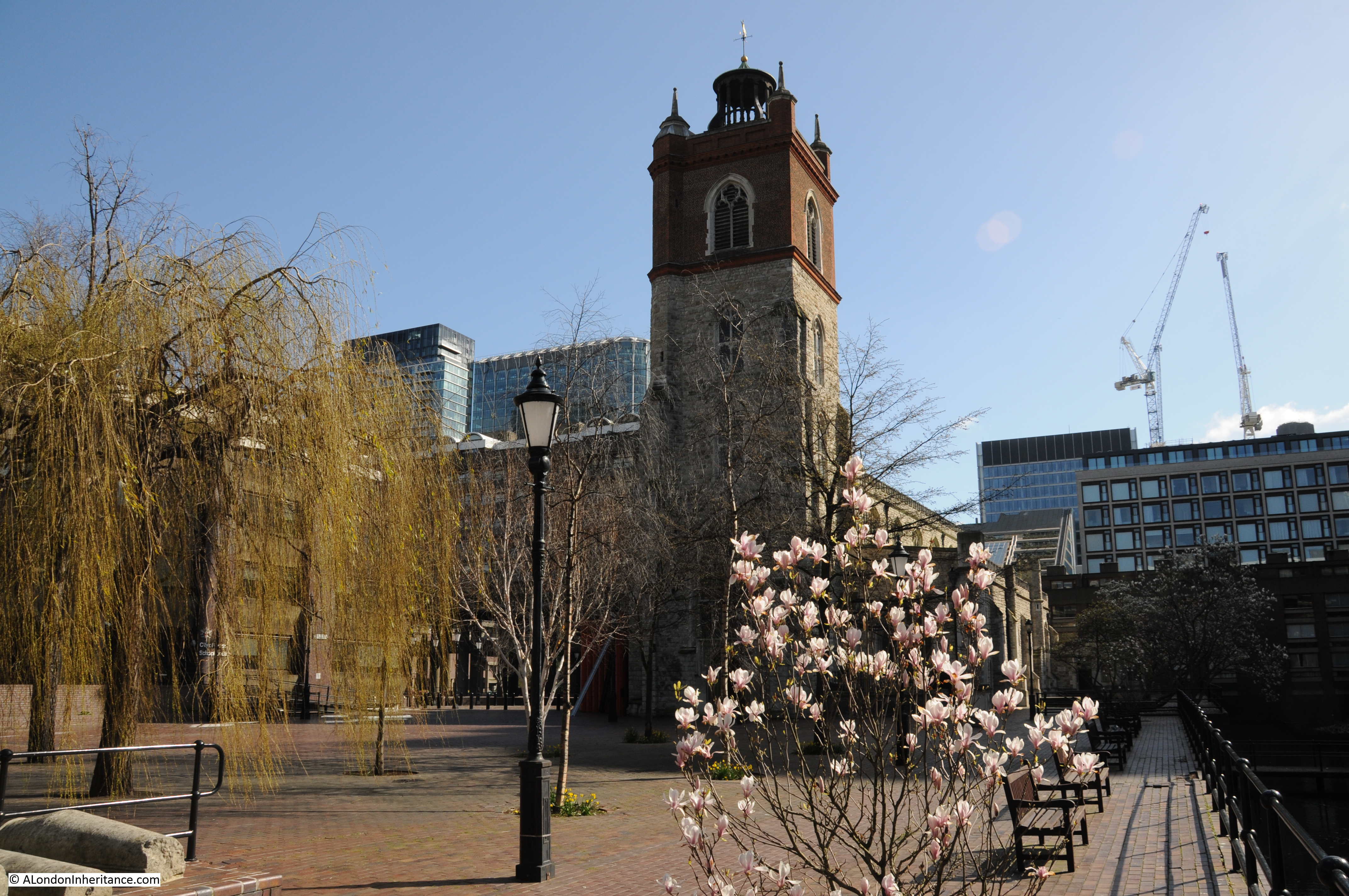
One of my father’s photos of the Horn Tavern has been in the blog header since I started the blog, and today I finally get round to covering the location.
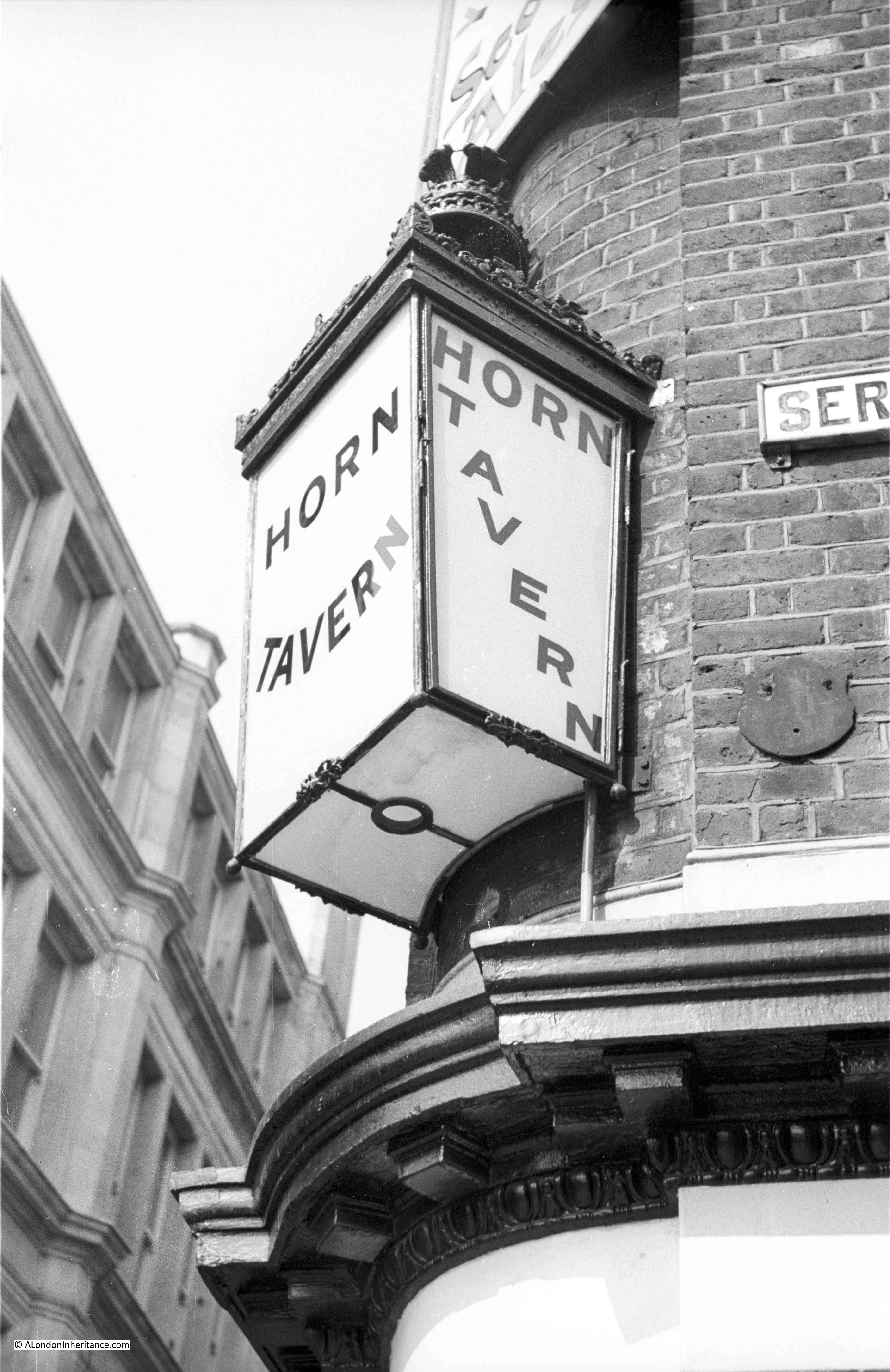
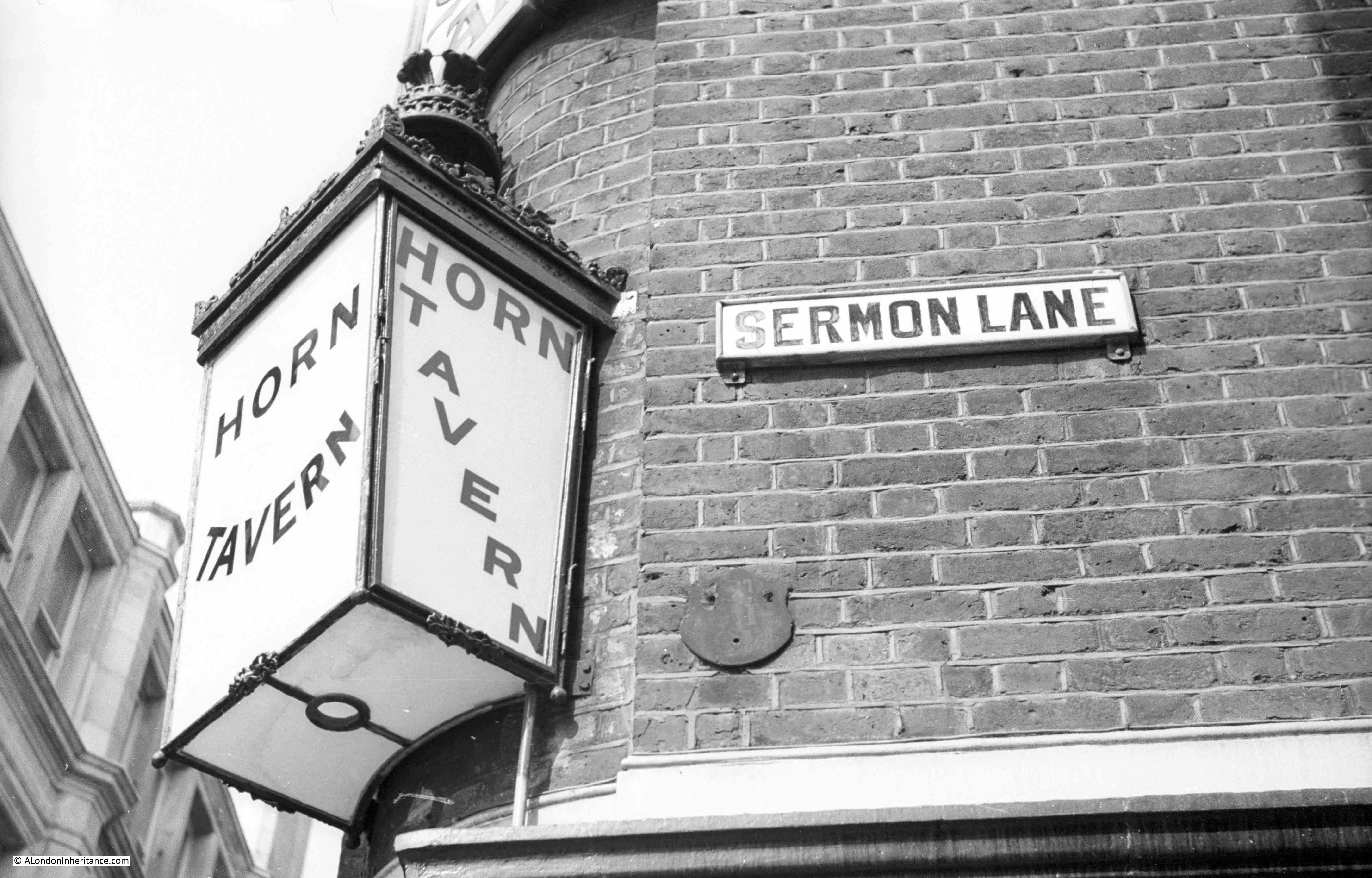
He took two photos of the rather ornate light on the corner of the Horn Tavern which was at the junction of Sermon Lane and Knightrider Street, just to the south of St. Paul’s Cathedral.
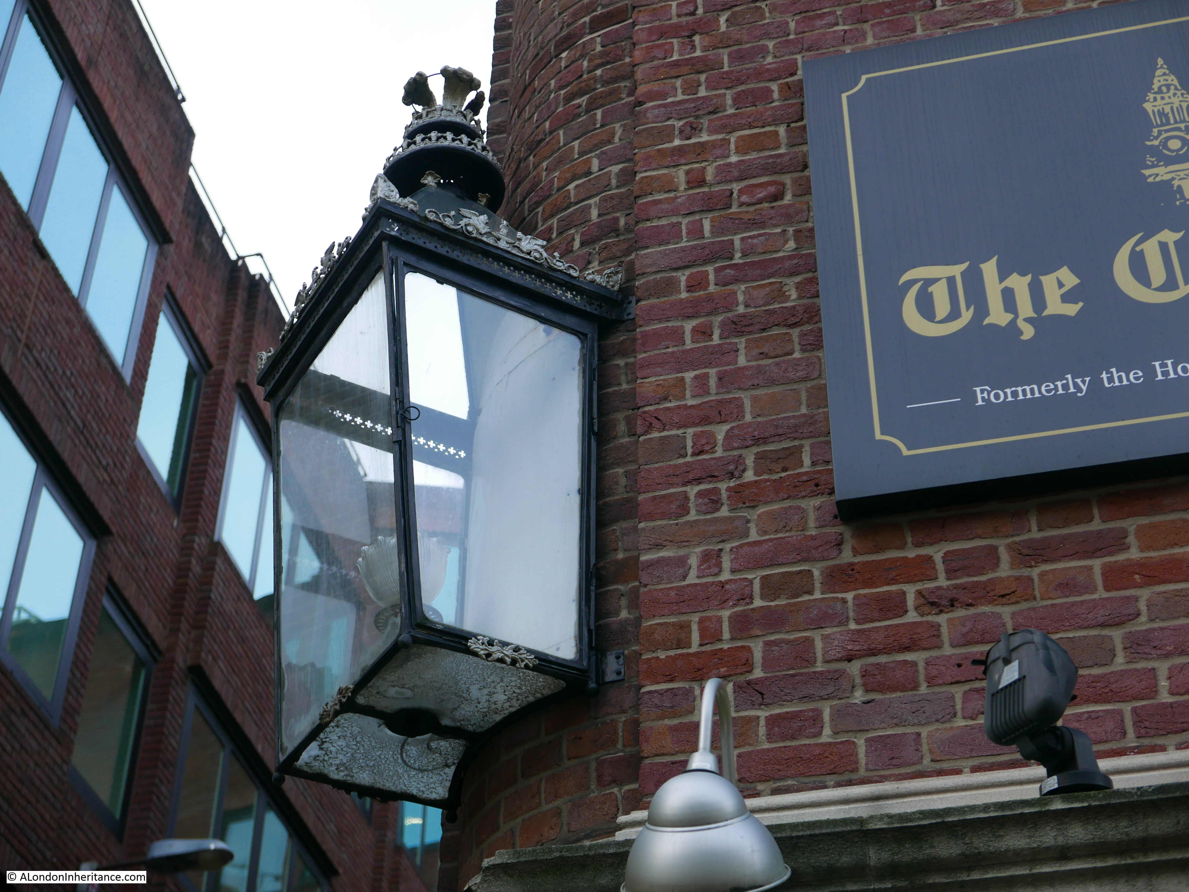
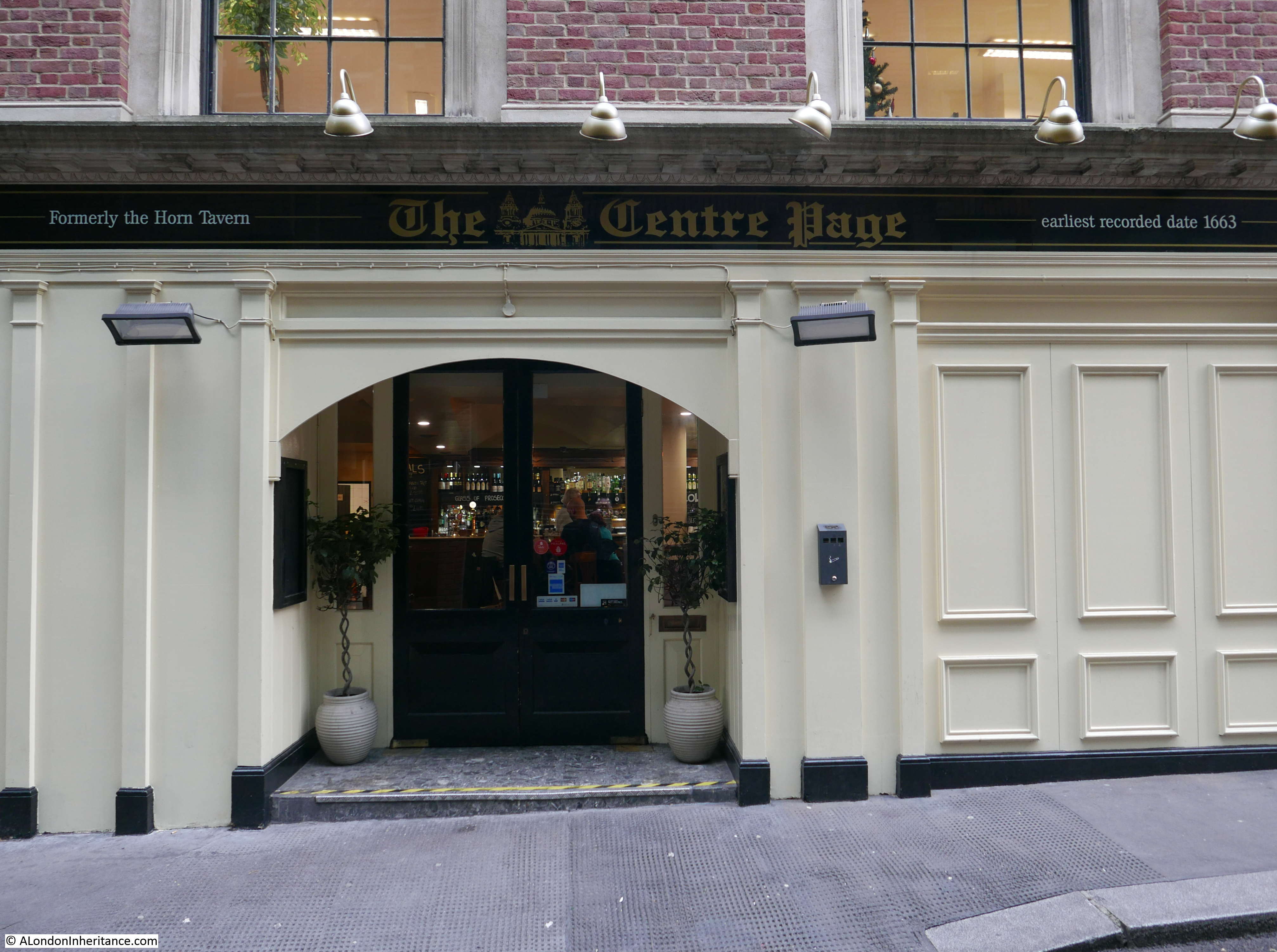
This is the same view today, the frame of the light is still there, however there have been some changes to the pub and the surrounding streets have changed significantly.
The differences in the photos highlight what has happened to the pub since my father took the original photo. The pub had a long history as the Horn Tavern, with references to the pub going back to the 17th century (although it is sometimes difficult to confirm that whilst the name may be the same, it may not be the pub at this location).
The pub changed its name to the Centre Page in 2002. I have no idea why the name changed, or the meaning behind the current name. I would have thought that a name as old as the Horn Tavern would have been preferable, especially given the location on the walk up from the Millennium Bridge to St. Paul’s with the attraction of an old name to the passing tourist trade.
I will continue referring to the pub as the Horn Tavern as I much prefer the original name.
The frame of the light in my father’s photo looks to be the same as the light in place today, however the wonderful glass with the pub name has been replaced with rather bland clear glass.
The original light must have looked brilliant and very inviting when lit on a dark London night.
There have been many changes in the immediate vicinity of the Horn Tavern. In my father’s photo, the name plate for Sermon Lane can be seen. Sermon Lane still exists but only really in name rather than as a lane.
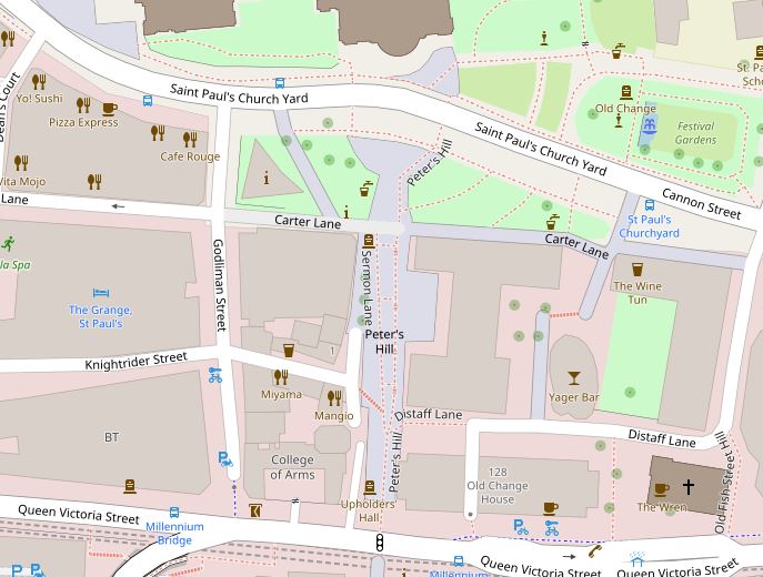
To set the location and changes in context, the following map shows the area today. Peter’s Hill is a wide walkway from Saint Paul’s Church Yard down to Queen Victoria Street.
Just over half way down on the left can be seen Knightrider Street. Where this meets Peter’s Hill, the Horn Tavern is on the upper corner of the junction. There is a truncated street running up and down from this junction and within Peter’s Hill can be seen the words Sermon Lane.
Peter’s Hill is one of the major changes to the area. The area between the cathedral and the river was once densely packed with office buildings, warehouses etc. Peter’s Hill carved through these buildings and streets to provide a wide pedestrian walkway from river to cathedral and opened up the view of the cathedral from the river and Bankside.
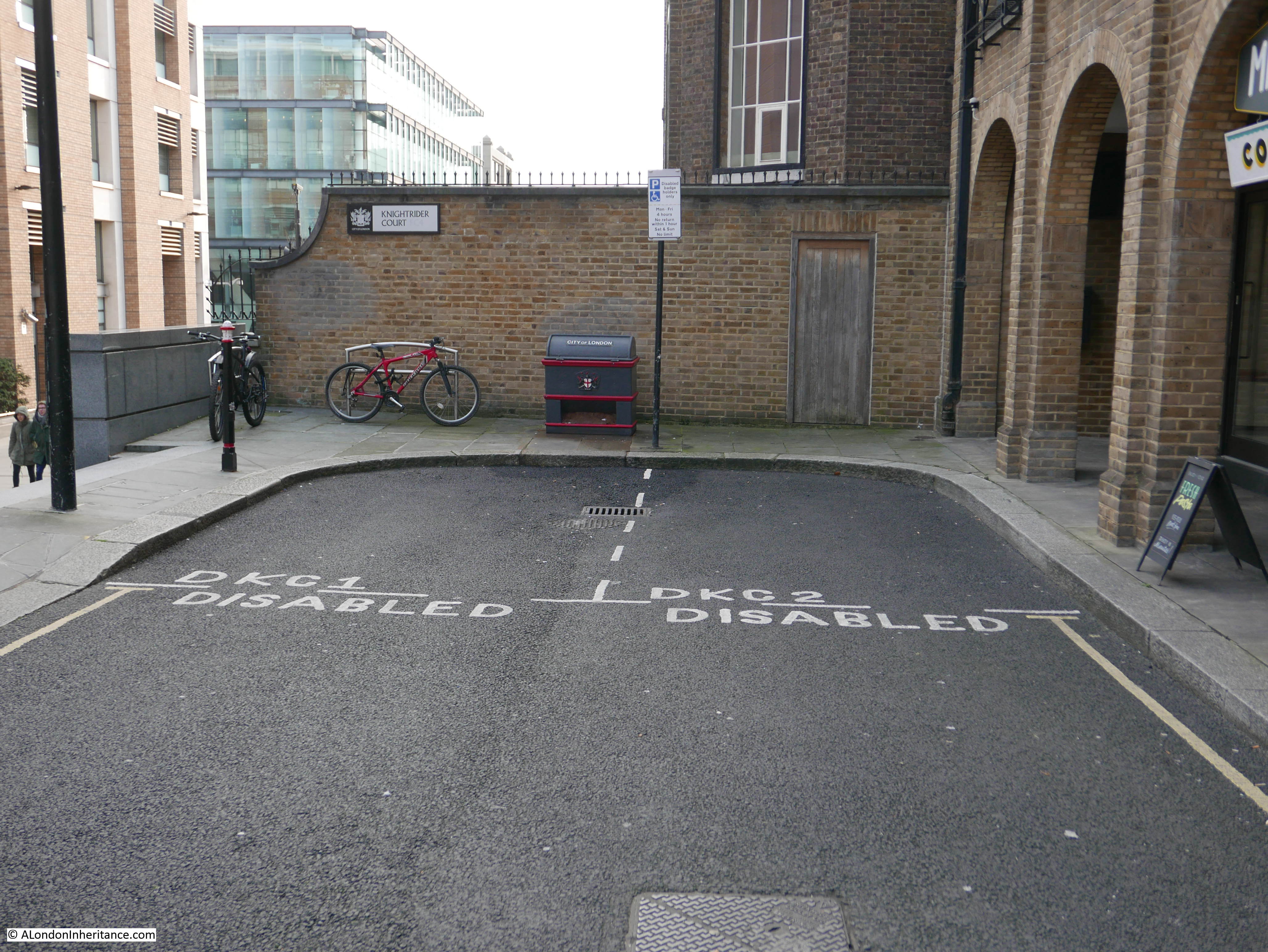
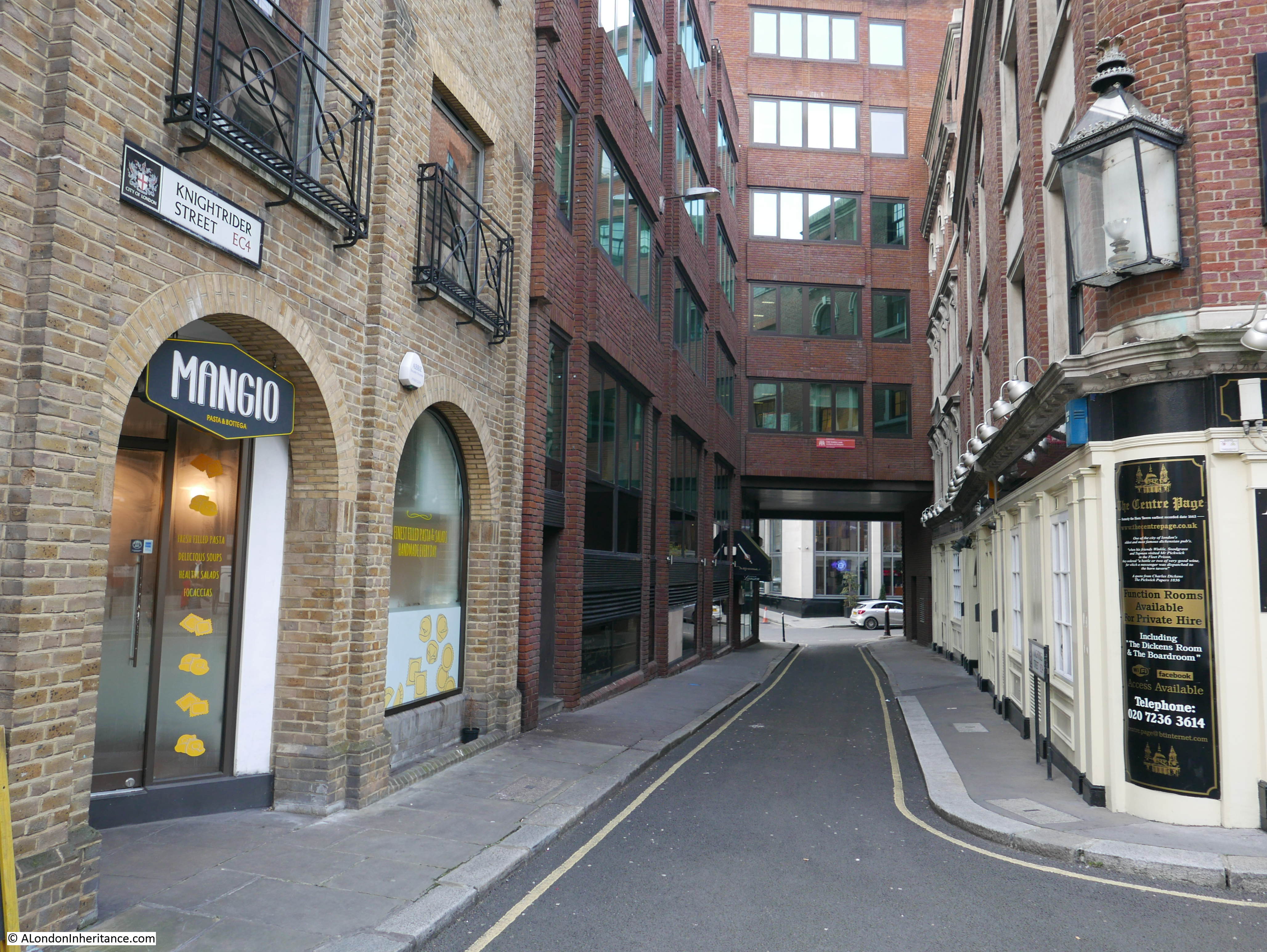
The following map is from the 1940 Bartholomew Atlas of Greater London. In the middle of the map can be seen Sermon Lane, when it was a street with buildings on either side. To the right of Sermon Lane is Knightrider Court – this has had a strange move which I will cover later in this post.
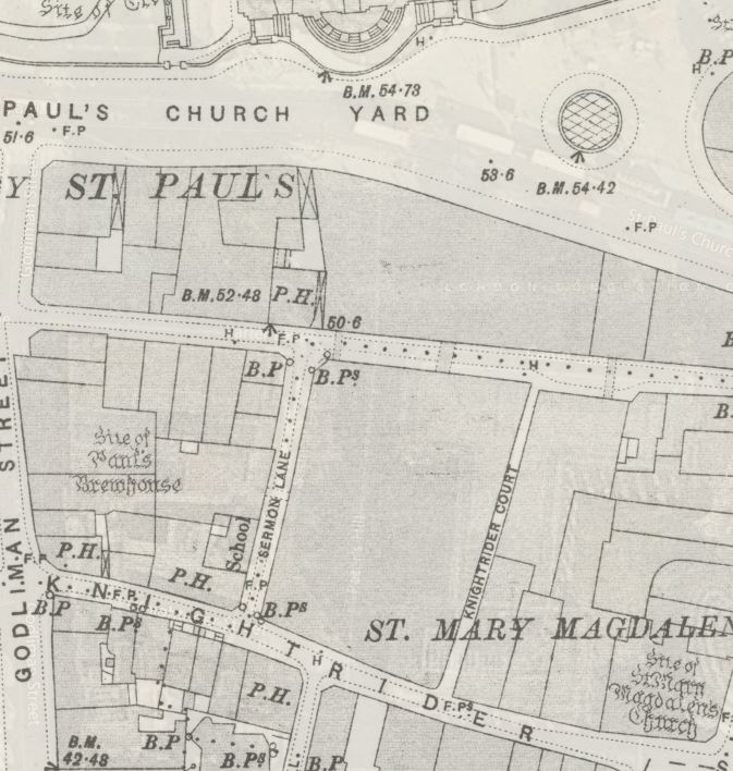
The 1895 Ordnance Survey map shows the area in more detail. The Horn Tavern is the P.H. on the corner of Sermon Lane and Knightrider Street.
Going back further to Rocque’s 1746 map, we can still see Sermon Lane, however to the right, Knightrider Court was then called Doolittle Alley (the second ‘o’ is missing from the map).
Doolittle Alley was the Doolittle Lane mentioned in Ben Jonson’s plays, for example from “The Magnetic Lady”, licensed for performance in 1632 and first performed by the King’s Men at the Blackfriars Theatre in the same year:
“She dwelt in Doolittle Lane, atop o’the hill there, I’the round cage was after Sir Chime Squirrel’s. She would eat naught but almonds, I assure you.”
I had assumed the origin of the name Sermon Lane was religious given the proximity to the cathedral, however the London Encyclopedia states “perhaps named after Adam Sermoneinarius, a 13th century property owner, or since it was once known as Sheremongers Lane, its name may have come from the sheremongers, who sheared or cut, and rounded the silver plates used in the minting of coins”.
There appears to be a common explanation leading back to John Stow’s Survey of London for the name Knightrider Street and Court. In the Streets of London, Gertrude Rawlings states that “Stow says it was supposed that the name refers to knights riding this way from Tower Royal to the tournaments at Smithfield. It has also been stated that a “knightrider” meant originally a King’s messenger, but no such word is known in our dictionaries”.
Photos of the area today show the changes to these streets. In the following photo, the Horn Tavern is on the corner and the paved area edged by the trees, leading up towards the cathedral is Sermon Lane, however this is all open space and the steps on the right form the only boundary with Peter’s Hill.
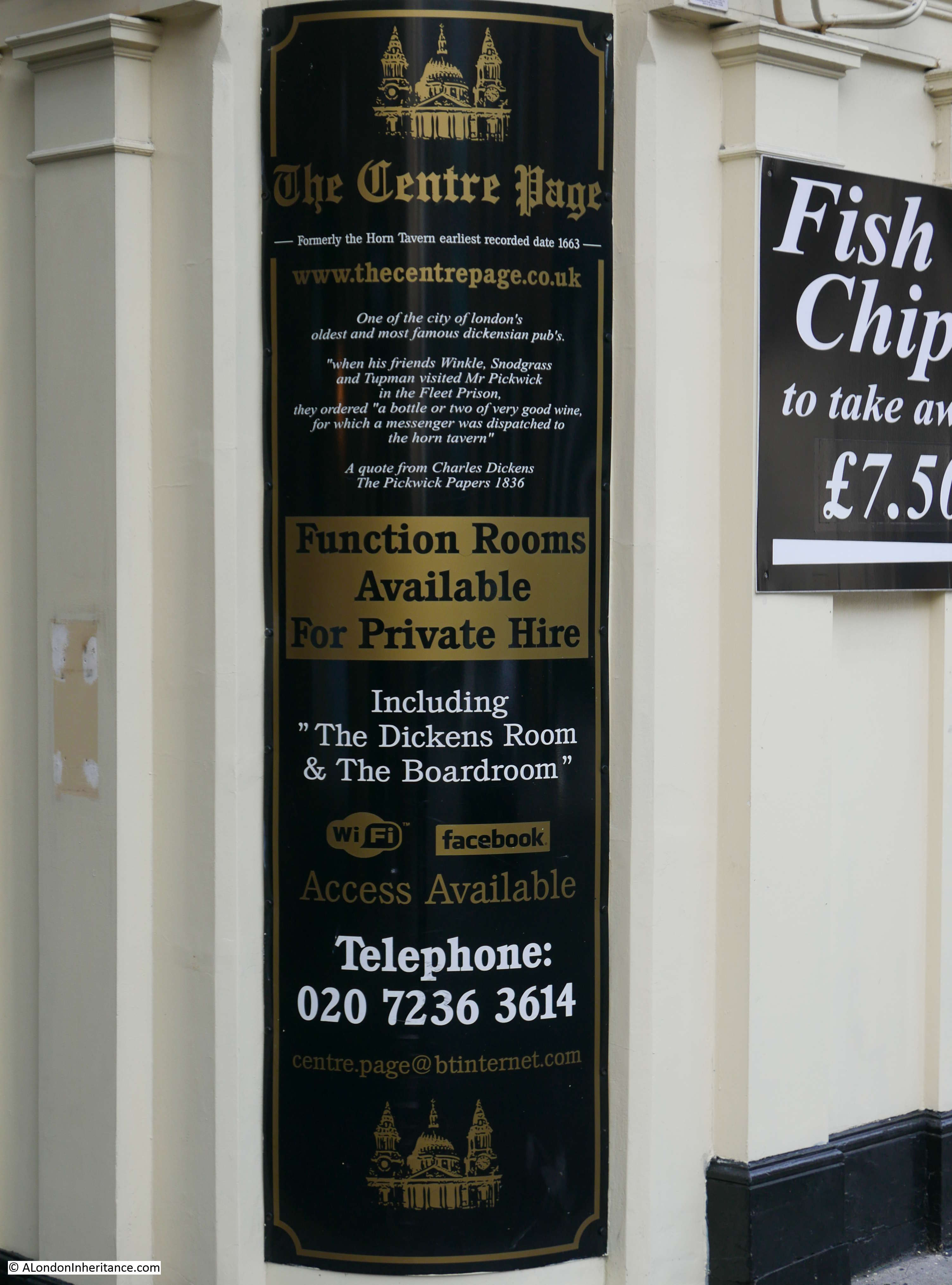
A large sign on the corner of the pub documents a link with Dickens and also states that the pub was formerly known as the Horn Tavern – again why change, there is even a Dickens reference to the original name.
View of the entrance to the Centre Page in Knightrider Street – again with the reference to the former name.
The current Horn Tavern building dates from the 19th century. Remarkably with the level of destruction around St. Paul’s Cathedral, the building survived the blitz.
The Horn Tavern appears in newspapers over the years for all the usual reasons – the meeting place for clubs, adverts for staff and rooms, people staying in the tavern being involved in local events etc. In October 1874 there was a rather intellectual contest held between teams from north and south of the river when twelve of the best players from the City of London Chess Club, played against twelve of the best players from the Bermondsey Chess Club. Unfortunately I cannot find any results to confirm whether the north or south of the river came out on top.
This is the view looking down what was Sermon Lane from the end near the cathedral. This space still retains the name Sermon Lane, however it is only a line of trees and steps that separate Sermon Lane from the main part of Peter’s Hill.
Looking down from the centre of Peter’s Hill, Sermon Lane is on the right.
In the above photo, Knightrider Court once ran through the buildings on the left, as can be seen on the 1940 and earlier maps, and Sermon Lane terminated directly on Knightrider Street, however fast forward to today, and Knightrider Court has moved.
The name is now used for the small section of street from just before the pub, and includes a small space after the junction with Knightrider Street.
In the following photo, One Knightrider Court can be seen above the entrance to the building to the right of the Horn Tavern (although today it is separate, this entrance and the building above was part of the Horn Tavern).
From the above viewpoint, turning slightly to the left and looking straight down there is this small length of street which also has the name Knightrider Court.
So although the original Knightrider Court has been lost, the name has transferred to take over the end of Sermon Lane and an additional small length of land in front of the opposite building.
I like the fact that names are retained, however it is deceiving that the name looks to be in the right place (it is a court shaped stub of land off Knightrider Street) but in reality it is in the wrong place.
This is the view looking down Knightrider Street.
As can be seen in the maps at the start of this post, Knightrider Street once continued on towards Friday Street, however Peter’s Hill now terminates the street. I explored the extension of Knightrider Street, past the church of St. Nicholas Cole Abbey in an earlier post: Distaff Lane – How London Streets Have Changed Over The Centuries, which also covers how the streets have changed in the area to the south of St. Paul’s Cathedral.
I would be really interested to know why the Horn Tavern’s name was changed to the Centre Page. I would have thought that retaining such a historic name would have been a good commercial decision. It would also be great to see the light with the name of the pub once again etched into whitened glass and shining on a cold London night.
I do a considerable amount of walking around London, on foot being by far the best way to explore and understand the city. When not hunting down the locations of my father’s photos, then either a random walk or a walk with a specific theme or target.
I also like looking at London from above. My first view of London from the top of St. Paul’s Cathedral was over 40 years ago and during occasional visits since it has been possible to witness the changing skyline of the city.
Viewing London from above also gives a geographical context to London. The relationship with the River Thames, the route to the open sea, the surrounding hills and how London has expanded from the original settlement around the City of London.
When thinking about a possible theme for a walk, I had been talking to someone who had recently completed the Three Peaks Challenge – climbing Scafell Pike in England, Snowdon in Wales and Ben Nevis in Scotland within a period of 24 hours. London does not have any equivalent peaks but what it does have is a number of tall buildings with viewing galleries, so on a Saturday in August I went for my own very unambitious 5 peaks challenge, to see London from the top of 5 locations – The Monument, Sky Garden, St, Paul’s Cathedral, Shard and the London Eye.
Only two of these needed climbing and it is there that any comparison with the 3 peaks challenge ends, but it did provide an opportunity to see the changing London skyline from different locations, understand the structure of London (for example only by looking from above can you really understand how the railways have carved up the south of the river) and just to enjoy the view of this remarkable city.
As you would expect, this is rather photo heavy, so I have split into three posts over the next few days. The first covering the Monument, Sky Garden and St. Paul’s Cathedral, the second post covering the Shard and London Eye, with the third post answering the question of the furthest man-made object visible from London (I am afraid the sort of question I find fascinating).
I am going to stay clear of any discussion of the buildings in these posts, rather just enjoy the views across London.
So, at 10:00 on an overcast Saturday morning in August (with the forecast for improving weather), I arrived at:
The Monument
Completed in 1677 by Sir Christopher Wren and Robert Hooke to commemorate the Great Fire of London, the Monument provides a view-point in the heart of the City. When built, the Monument at 202 feet high would have stood clear of the surrounding buildings but today is starting to feel rather enclosed with the continuing growth in height of buildings across the City.
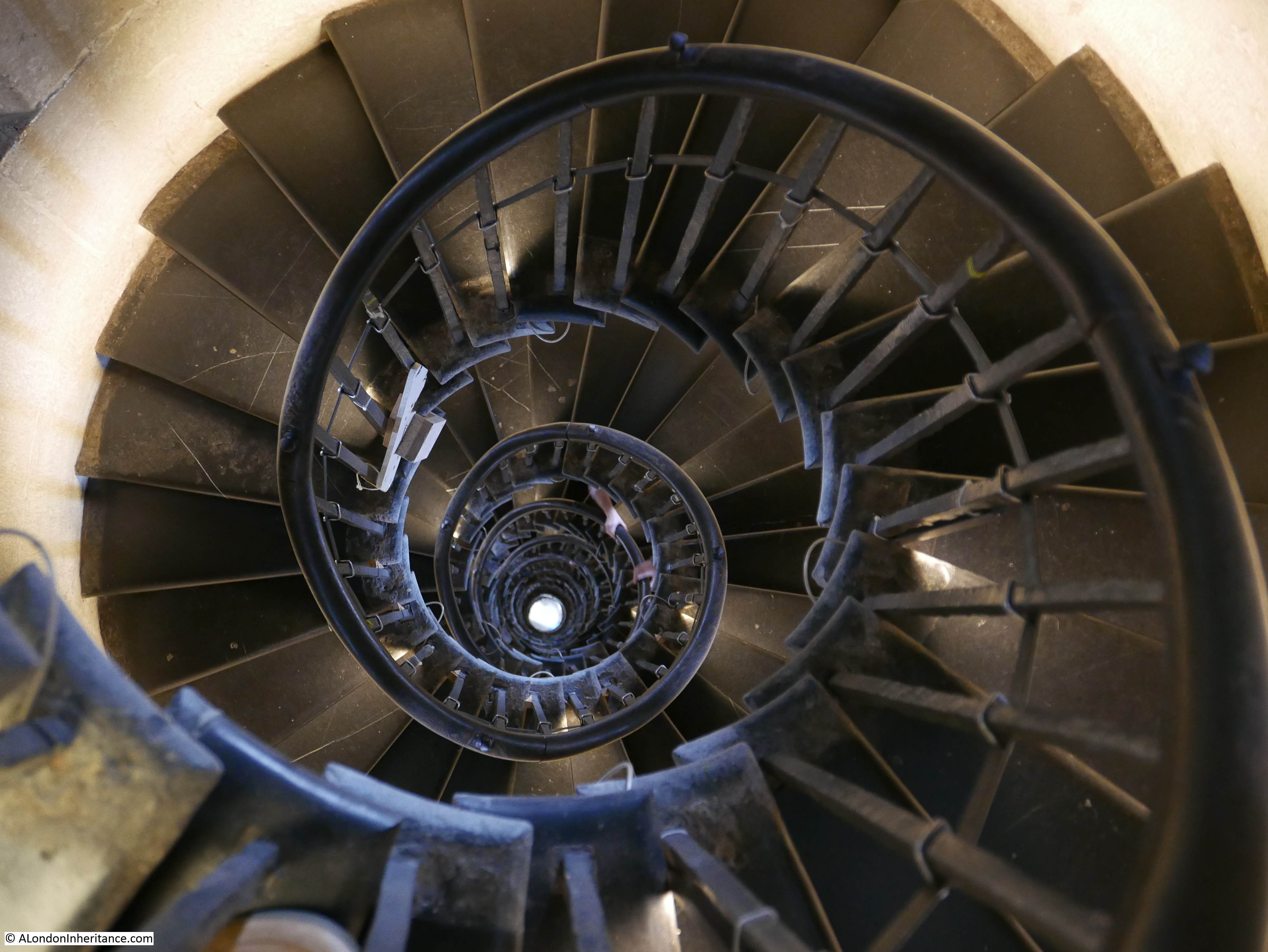
The viewing gallery is 311 steps from the entrance up a narrow cantilevered staircase, so after paying at the entrance it was a swift climb to the top for views across London from the oldest of the viewing points that I will looking from today.
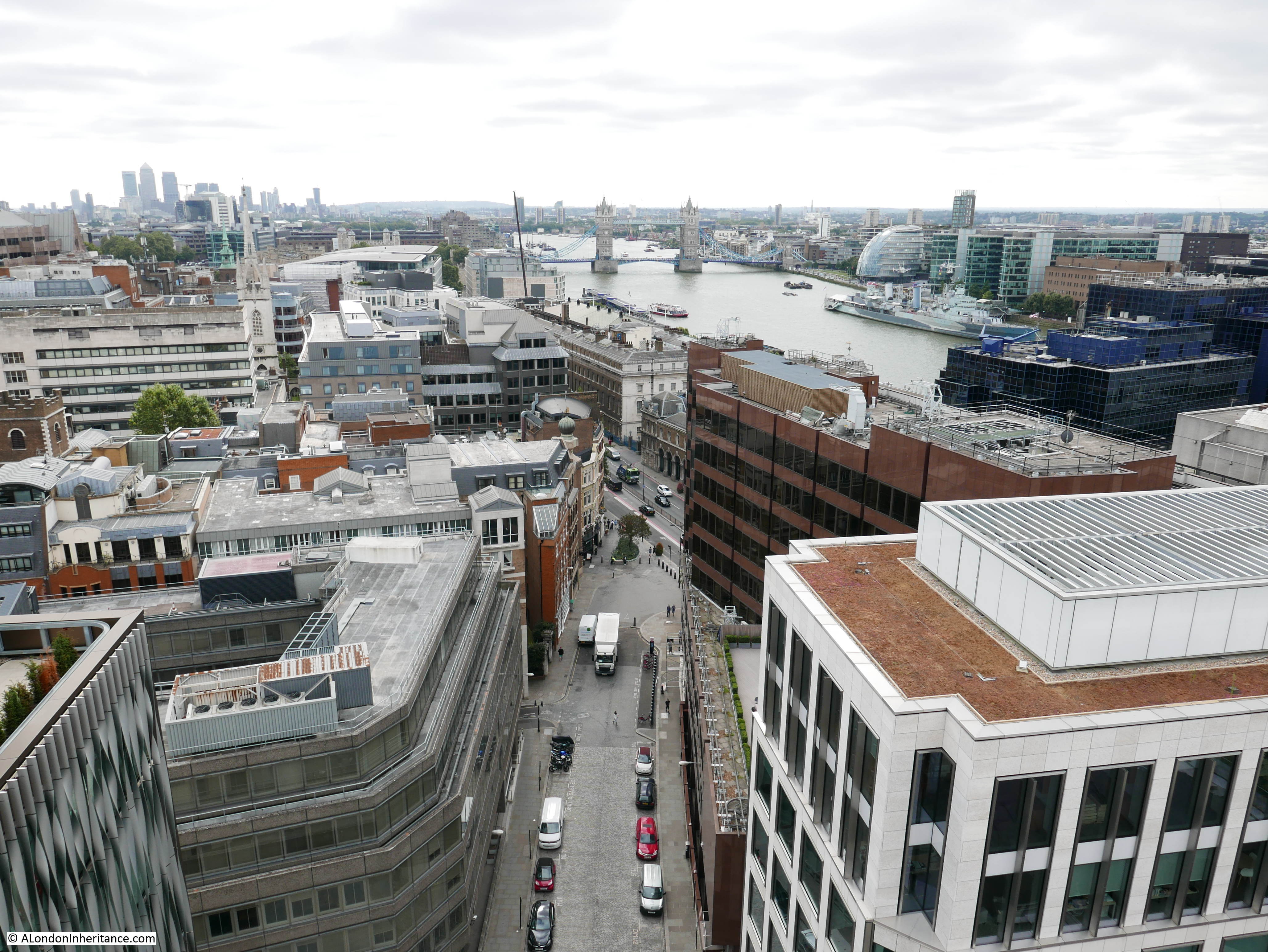
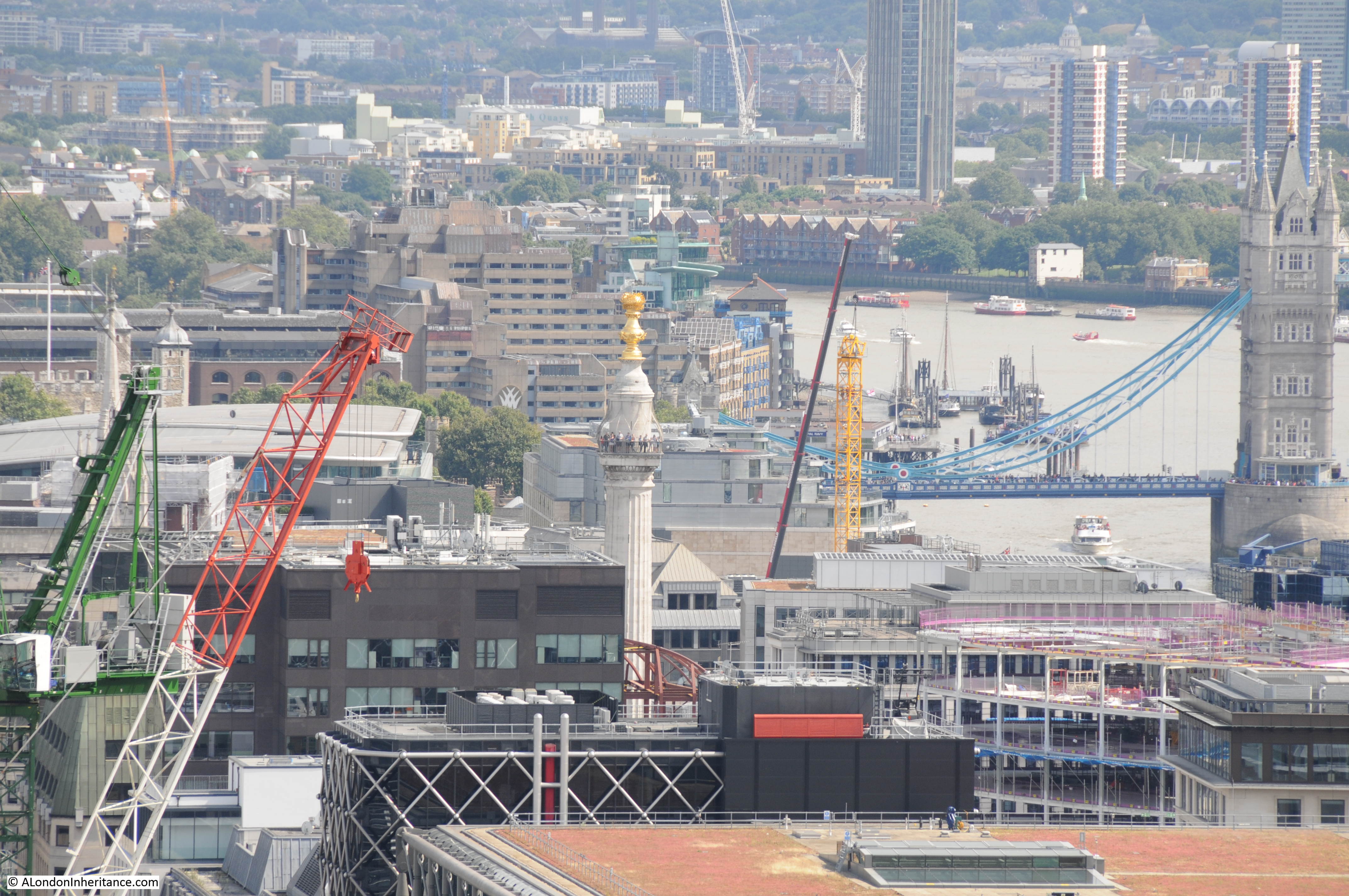
First view from the Monument, looking down Monument Street towards the old Billingsgate Market and running across the Thames, Tower Bridge.
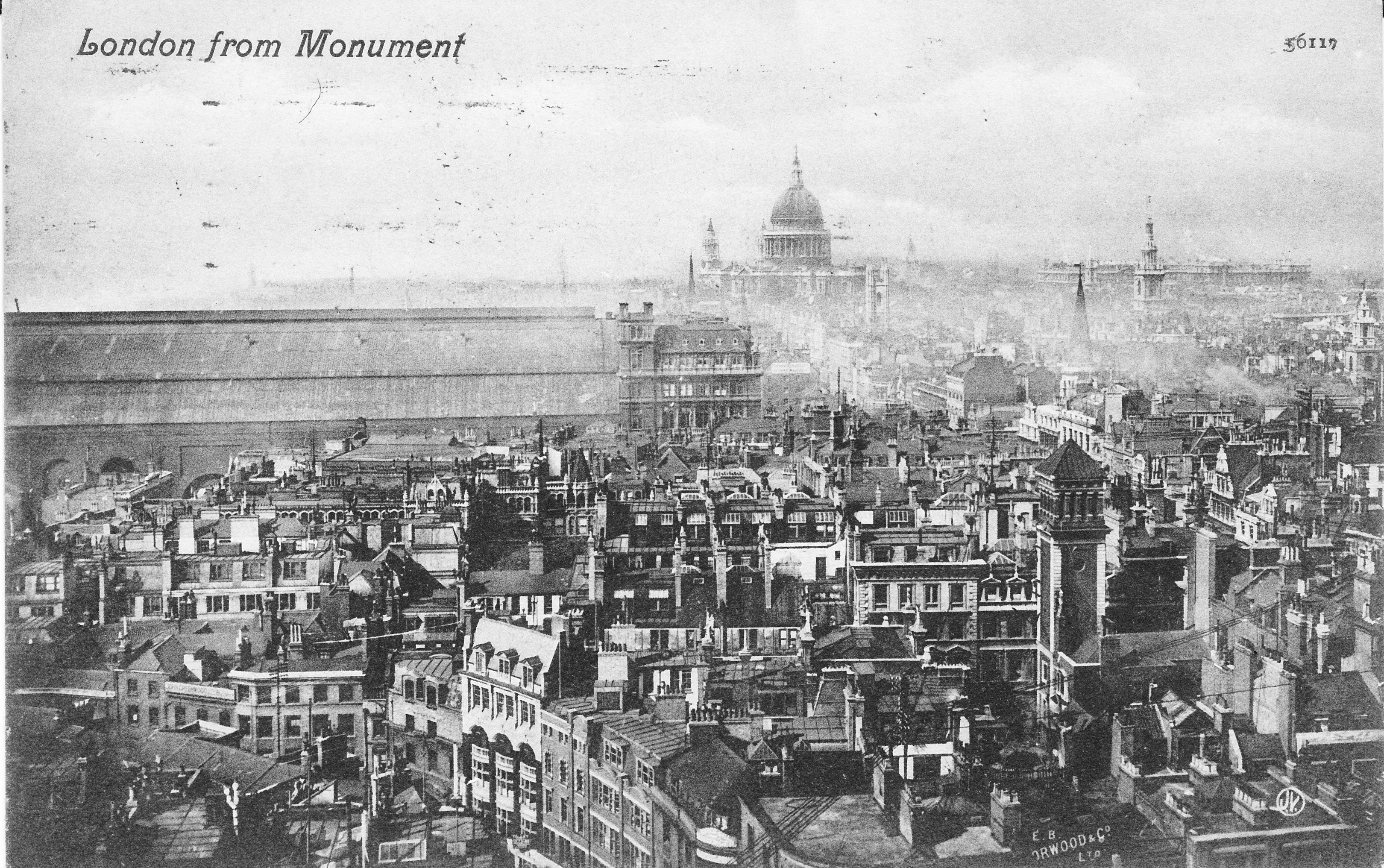
A series of postcards were published in the early 20th century showing the view from the Monument – the first showing a similar view to the above:
Looking up Gracechurch Street towards the towers of the City:
Looking up King William Street with the towers of the Barbican in the distance and the dome of St. Paul’s Cathedral on the left.
Similar early 20th century view to the above photo. The growth in height of City buildings is obvious by how the church steeples once towered above their surroundings.
St. Paul’s Cathedral and the Post Office (BT) Tower in the distance.
This view was once dominated by the roof of Cannon Street Station:
View back across the City towards the towers of Canary Wharf in the distance. The looming presence of 20 Fenchurch Street (the Walkie Talkie building) dominates this part of the City. The Sky Garden at the top is my next stop.
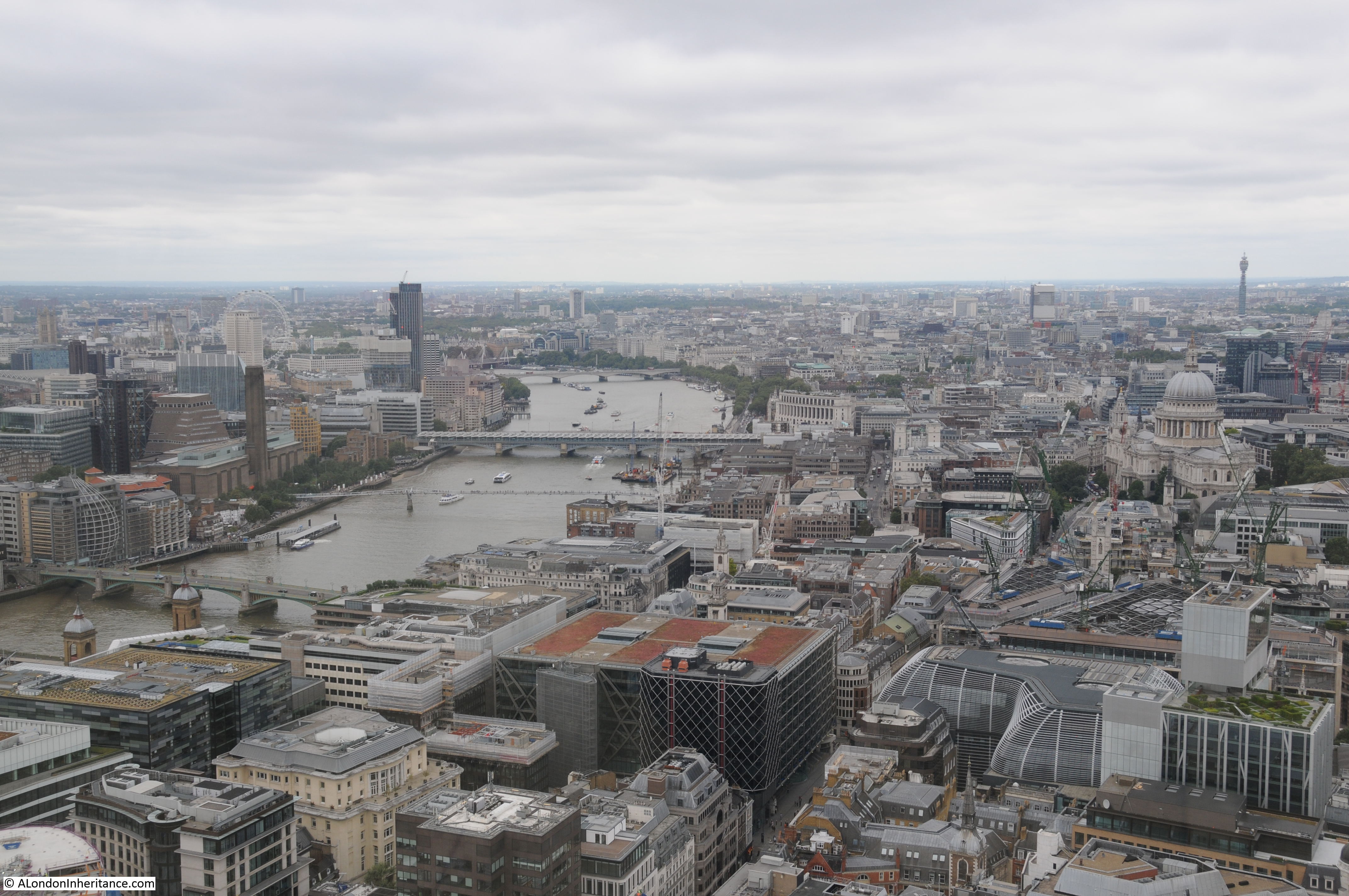
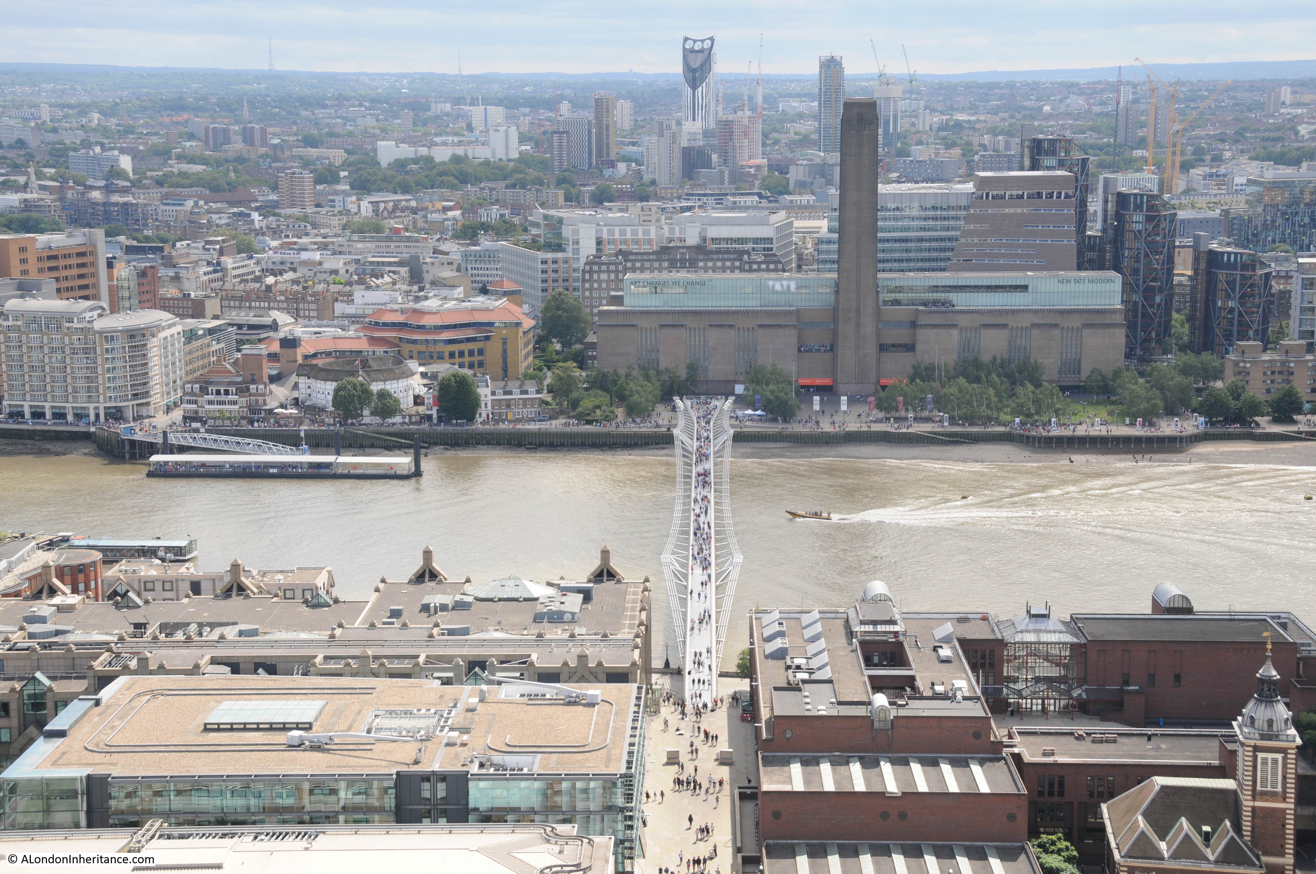
Although the River Thames is hidden by the buildings in the foreground, this is looking towards Bankside with the chimney of Tate Modern along with the new extension and viewing gallery to the left of the chimney. The top of the London Eye can be seen in the distance – my final stop later in the afternoon when hopefully the weather will have improved.
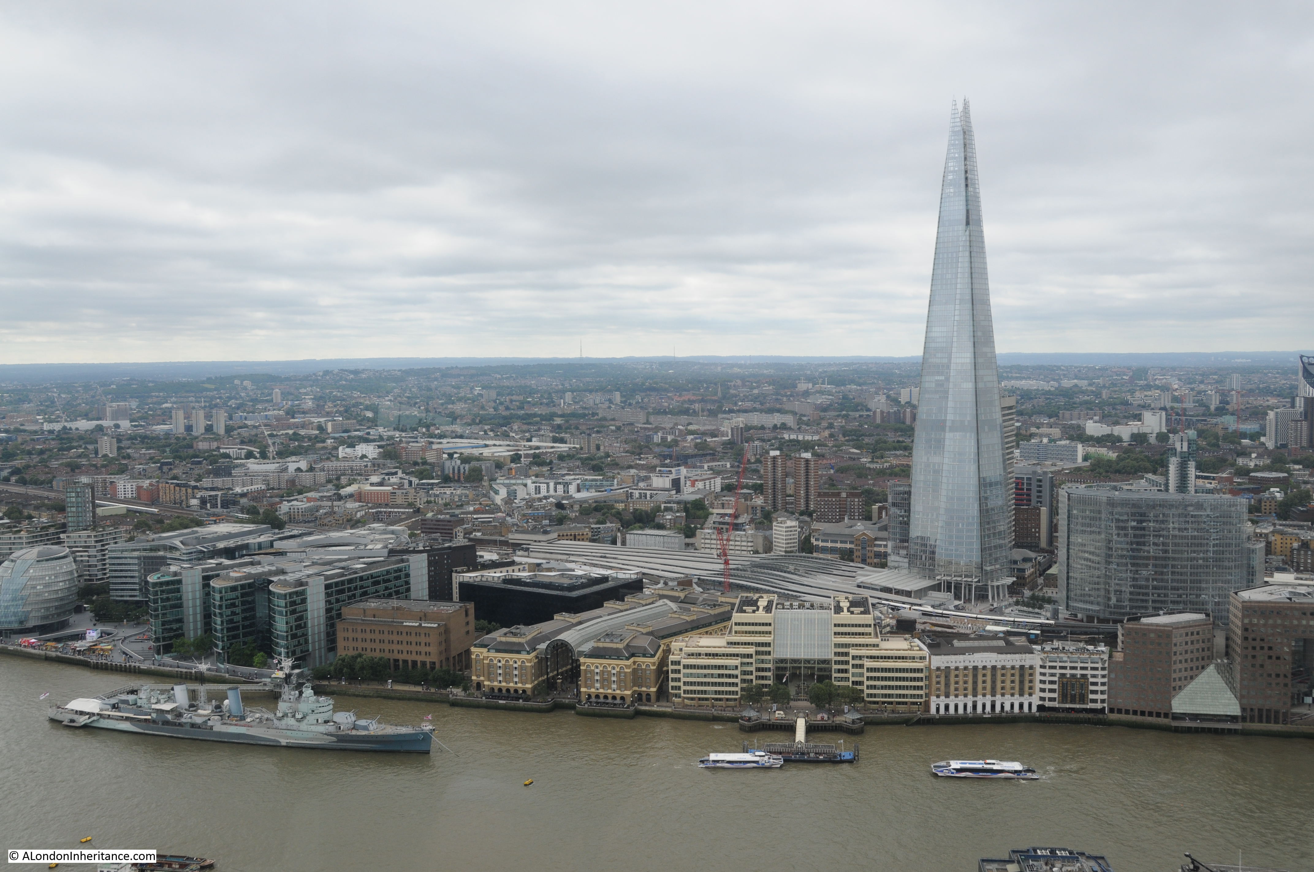
View across the river to the Shard. The church of St. Magnus the Martyr in the lower centre of the photo with London Bridge hidden behind the building to the right of the church. This building is on the route of the original London Bridge.
Time to descend the Monument and head off to the Sky Garden, always easier to climb down rather the climb up.
The Monument is the City’s original viewing gallery and although now rather hemmed in by the surrounding buildings still offers good views of the City of London.
Above the viewing gallery is the flaming orb which is hollow and reached by a further small flight of stairs. At the very top, not visible from ground level is a CCTV camera which provides a 24 hour time-lapse view on the Monument’s web site, which can be found here, although it does not appear to be updating at the moment.
Now on to my next stop:
The Sky Garden
Access to the Sky Garden was quick and efficient and the lifts provided a rest in between climbing the Monument and the next climb to the top of St. Paul’s Cathedral. Completed in 2014 and at a height of 525 feet, the design of the Sky Garden results in the best views being towards the south.
My first view was back towards the Monument which now looked busier than during my visit. Look closely at the top of the orb and the CCTV camera can just be seen along with the hollow top of the orb.
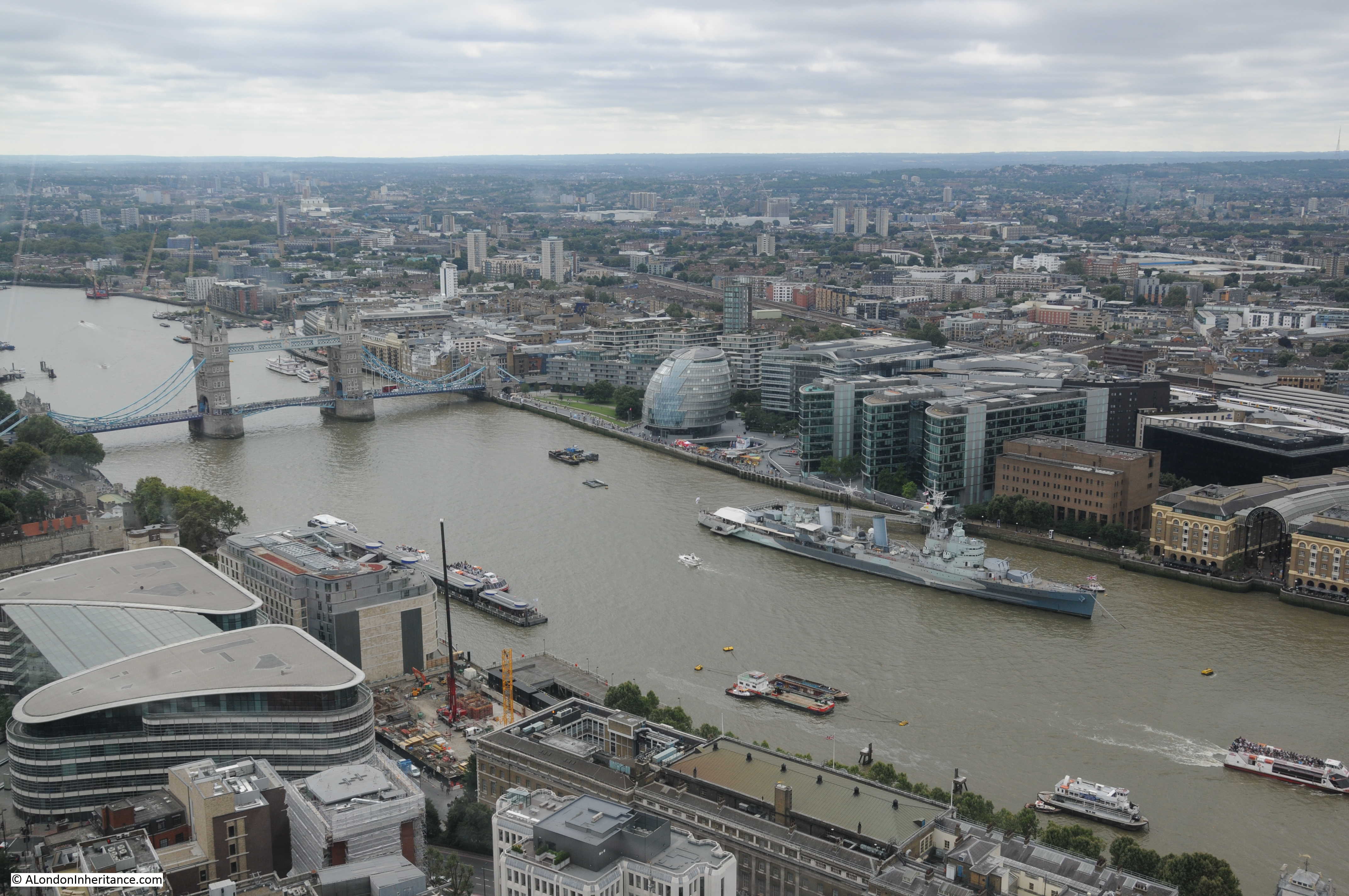
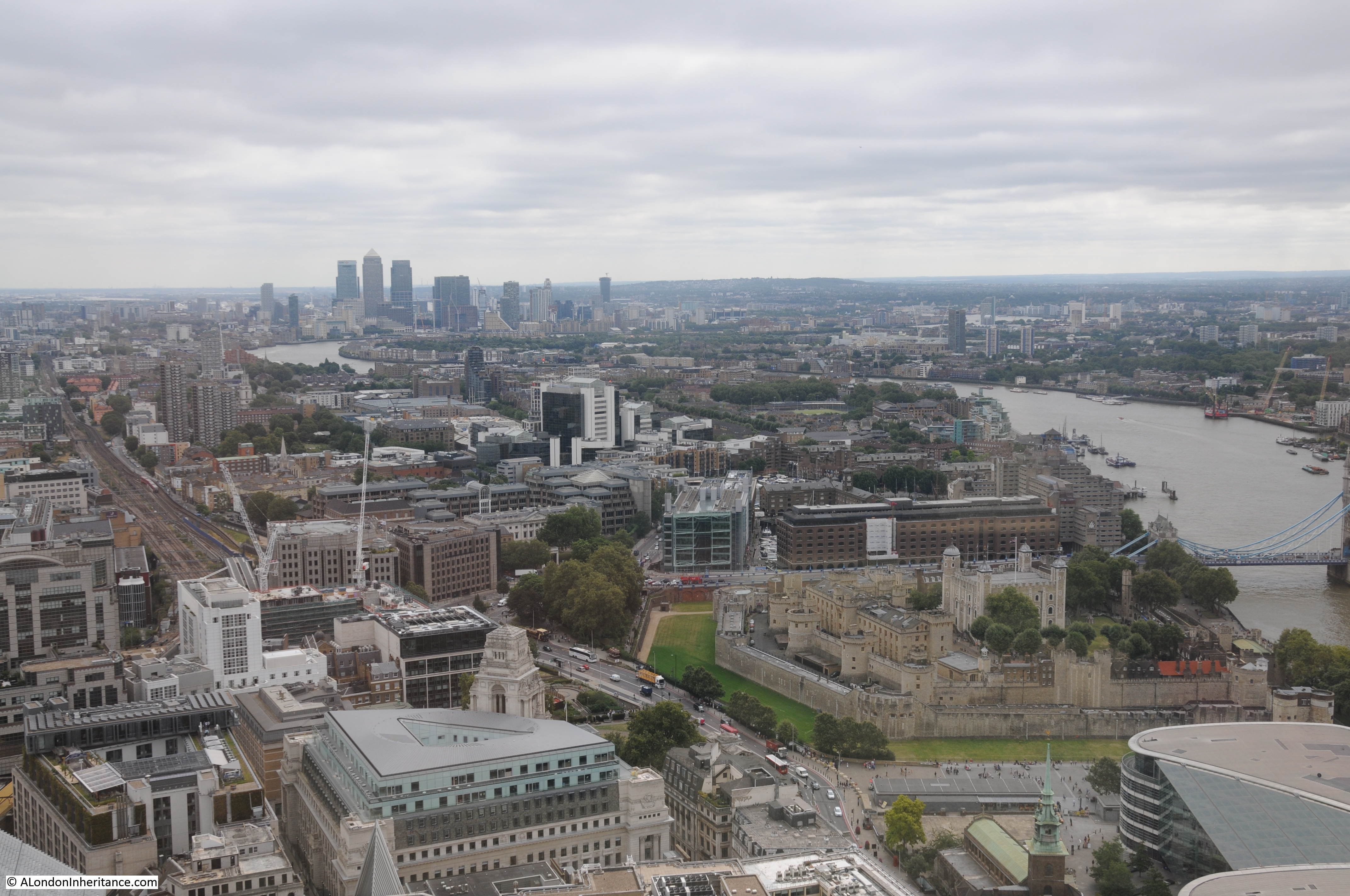
Views towards Tower Bridge, City Hall and HMS Belfast. From this height it is easy to understand the flooding risk to London with the height of the river and how low and flat the surrounding land is, and this was not a particularly high tide. It is also at this height that you can start to see the higher ground that surrounds London to the north and south.
View to the west with the Post Office Tower in the distance with Euston Tower just to the right. As yet, there are few tall buildings across this part of London.
Wembley Stadium can be seen between the Post Office Tower and Euston Tower.
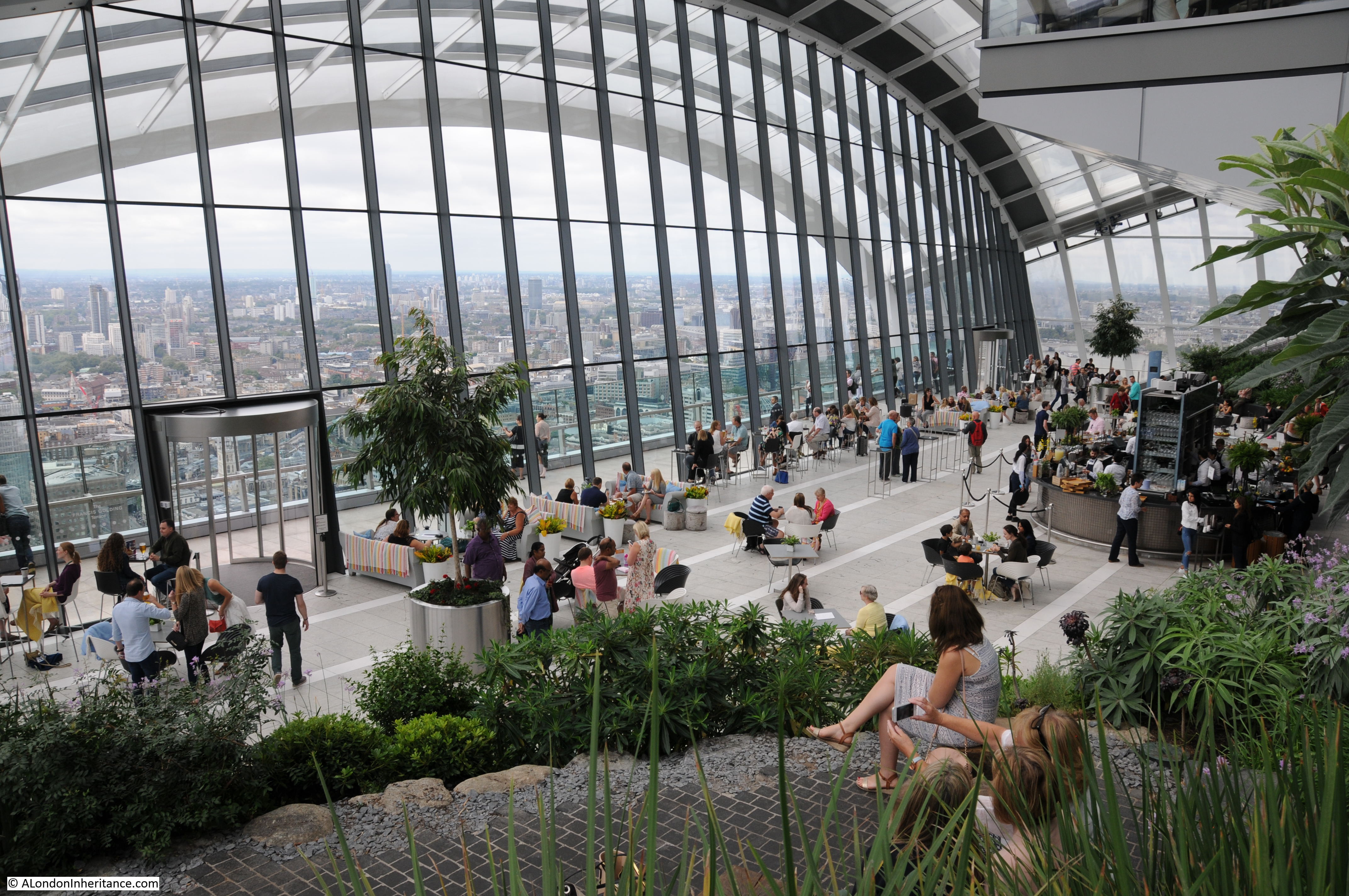
Internal view of the Sky Garden.
Through the revolving doors in the above photo, there is an external viewing gallery. Although there is still a glass barrier it is possible to look down on the City. The church of St. Mary at Hill is at lower centre with the old Billingsgate Market in the top centre.
Across the river towards the Shard:
And unlike the Monument, the view of the river from the Sky Garden is unobstructed.
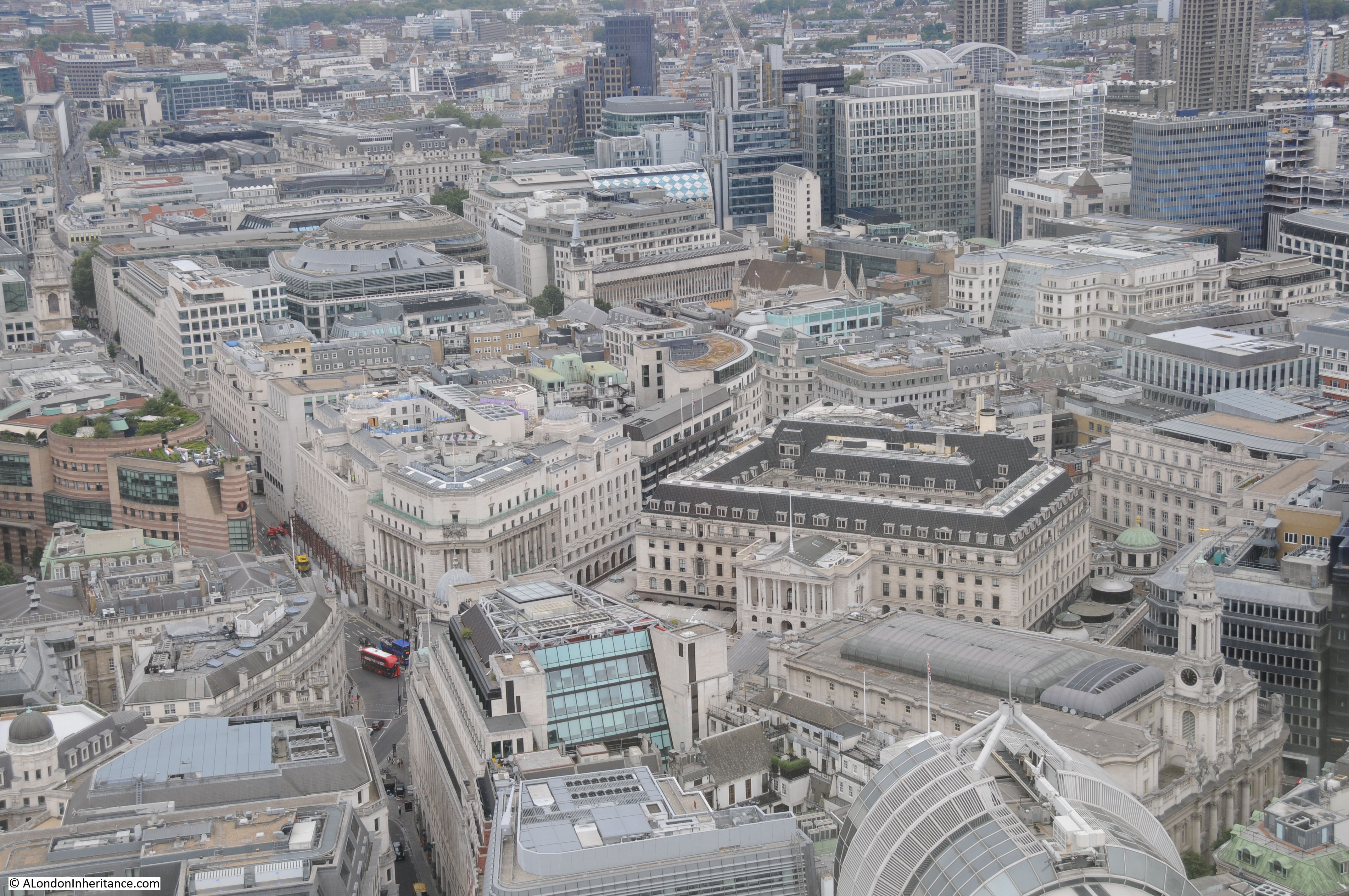
Looking down towards the Bank junction with the Bank of England building at the centre right.
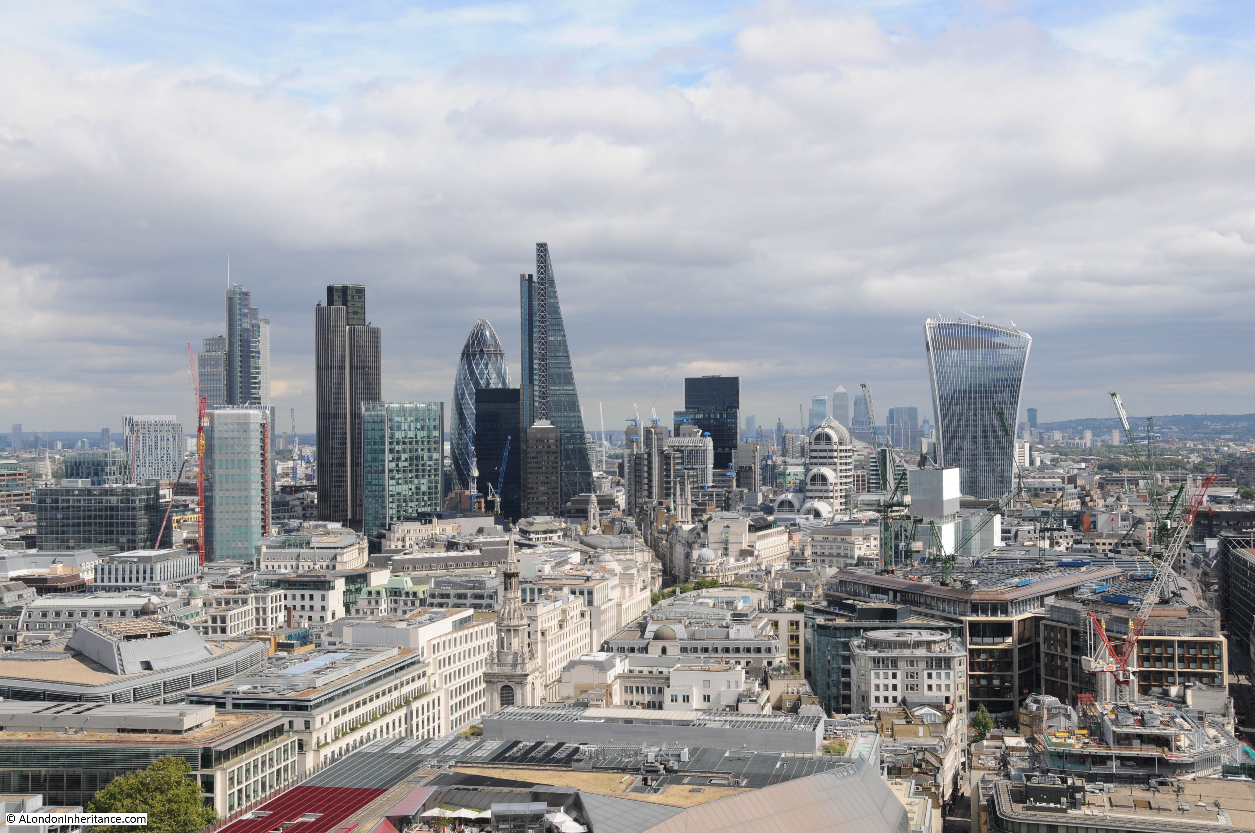
Looking north towards the other towers of the City. Tower 42 on the left, the 122 Leadenhall Street building (the Cheesegrater) in the middle and 30 St. Mary Axe (the Gherkin) on the right.
Tower 42, originally know at the NatWest Tower when completed in 1980 and at 600 feet high was the first really tall tower building in the City. I remember this being built and at the time bought a copy of, if I remember correctly, the Illustrated London News which had a superb photo of the building by a photographer who was suspended in a large bucket away from the top of the tower by a crane also mounted on the top of the tower. Rather precarious, but a superb photo.
The Gherkin building was completed at the end of 2003 and stands at 591 feet high with the Cheesegrater being completed in 2013 at 738 feet.
View towards Canary Wharf with the Tower of London at lower right. From this height we can start to see the route of the river as it heads east towards the sea.
View towards the east along Fenchurch Street and Aldgate High Street. The church of St. Botolph Without Aldgate can be seen to the left of centre, in front of the yellow crane.
From this height we can also start to see how the construction of the railways carved through London. Here, the rail tracks running from Fenchurch Street Station out towards the east.
Leaving the Sky Garden, with the promise of improving weather with the cloud breaking in the west, it was time for a walk to:
St. Paul’s Cathedral
St. Paul’s Cathedral is my favourite place to look out across London. It is the history of the building, location, the climb up the 528 steps through the Whispering Gallery, Stone Gallery and finally to the Golden Gallery, along with the chance to admire the internal architecture and the construction methods used.
My first climb of St. Paul’s was over 40 years ago and I started taking photos from the Lantern and Stone Galleries about 35 years ago. My father took a series of photos from the Stone Gallery just after the war showing the devastation around the Cathedral. These can be found here and here.
At the top of the final climb through the Dome, there is a small glass window at the centre which looks down to the floor of the church. This produces a strange optical effect as this is not looking through the roof of the dome directly above the floor, but through the space between the external and internal domes. The distorted view of the stairs that run up above the internal dome to get to the Golden Gallery can be seen in the periphery of this photo. It does though create the impression that you are directly above the internal dome.
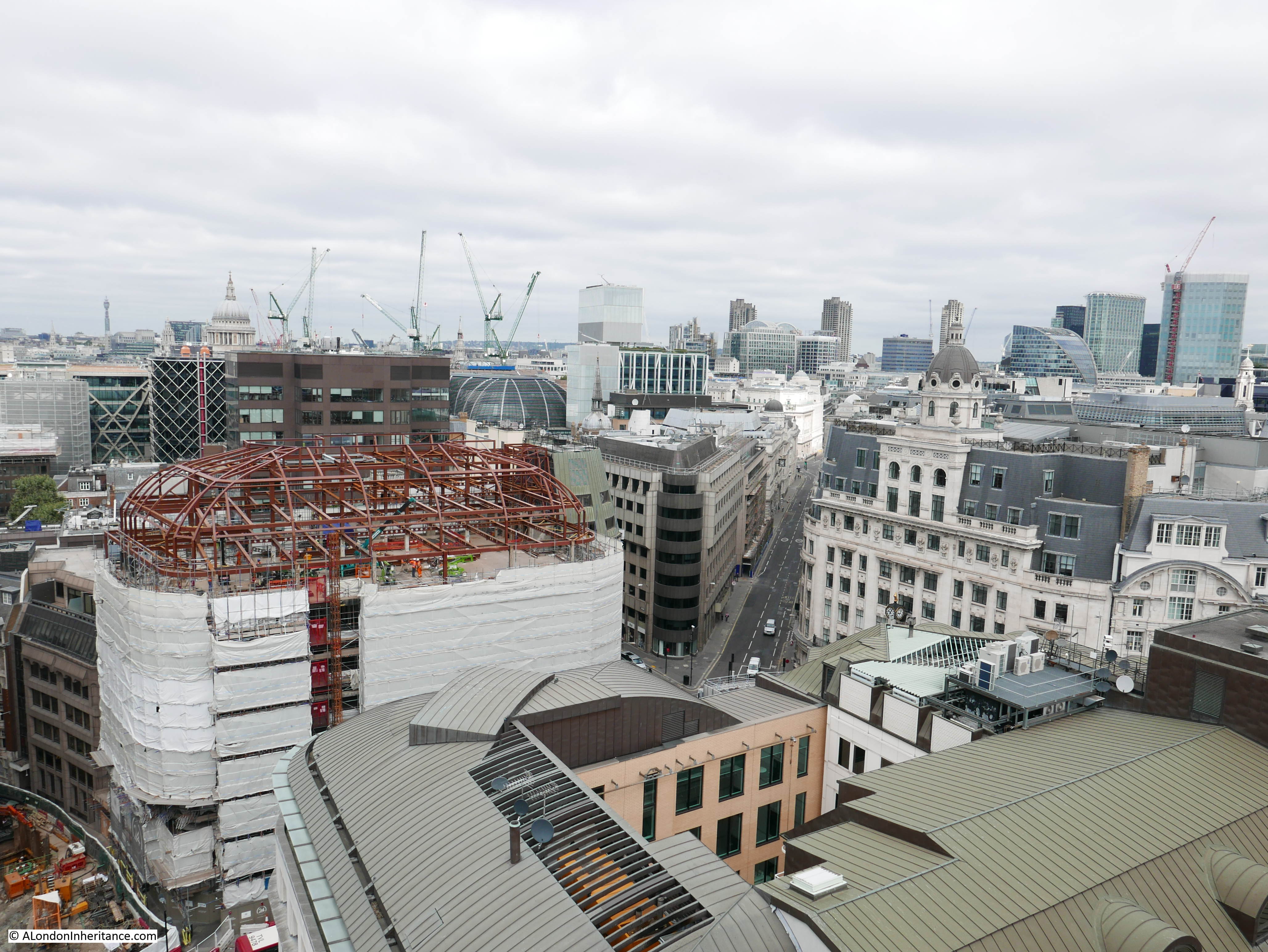
The first glimpse of the view through the door out to the narrow walkway that runs around the base of the Golden Gallery. The cloud is breaking and the sun is out.
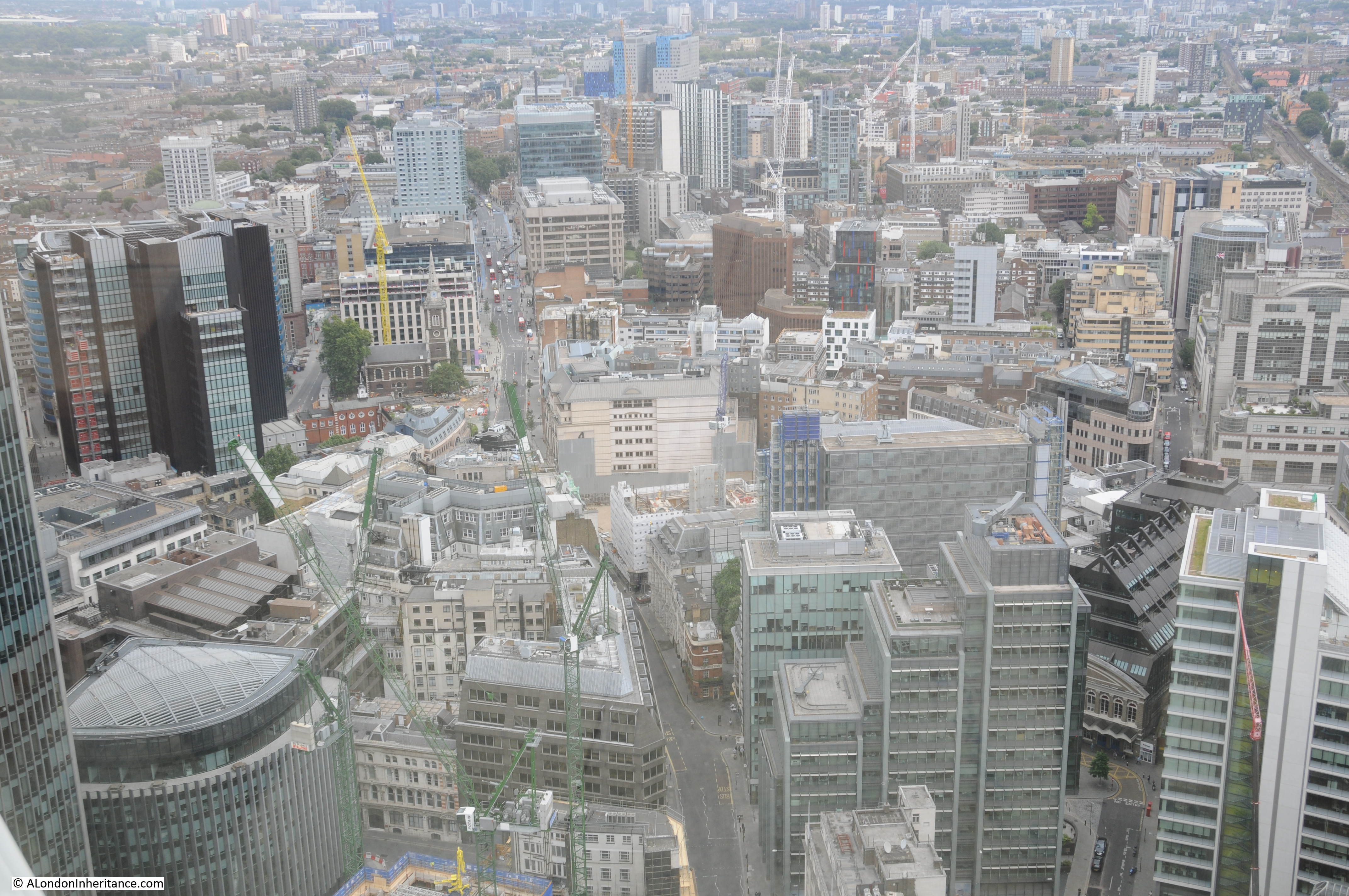
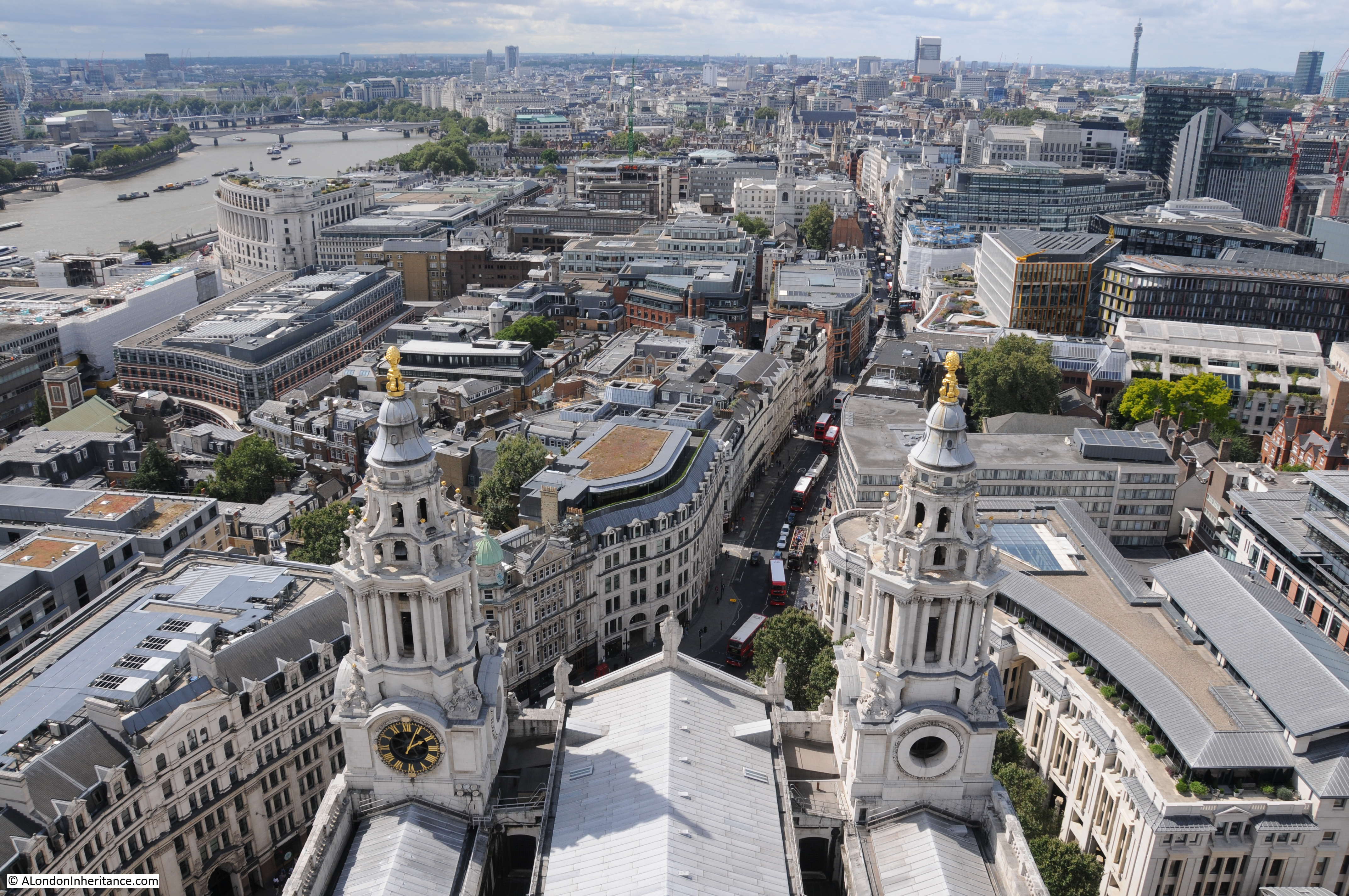
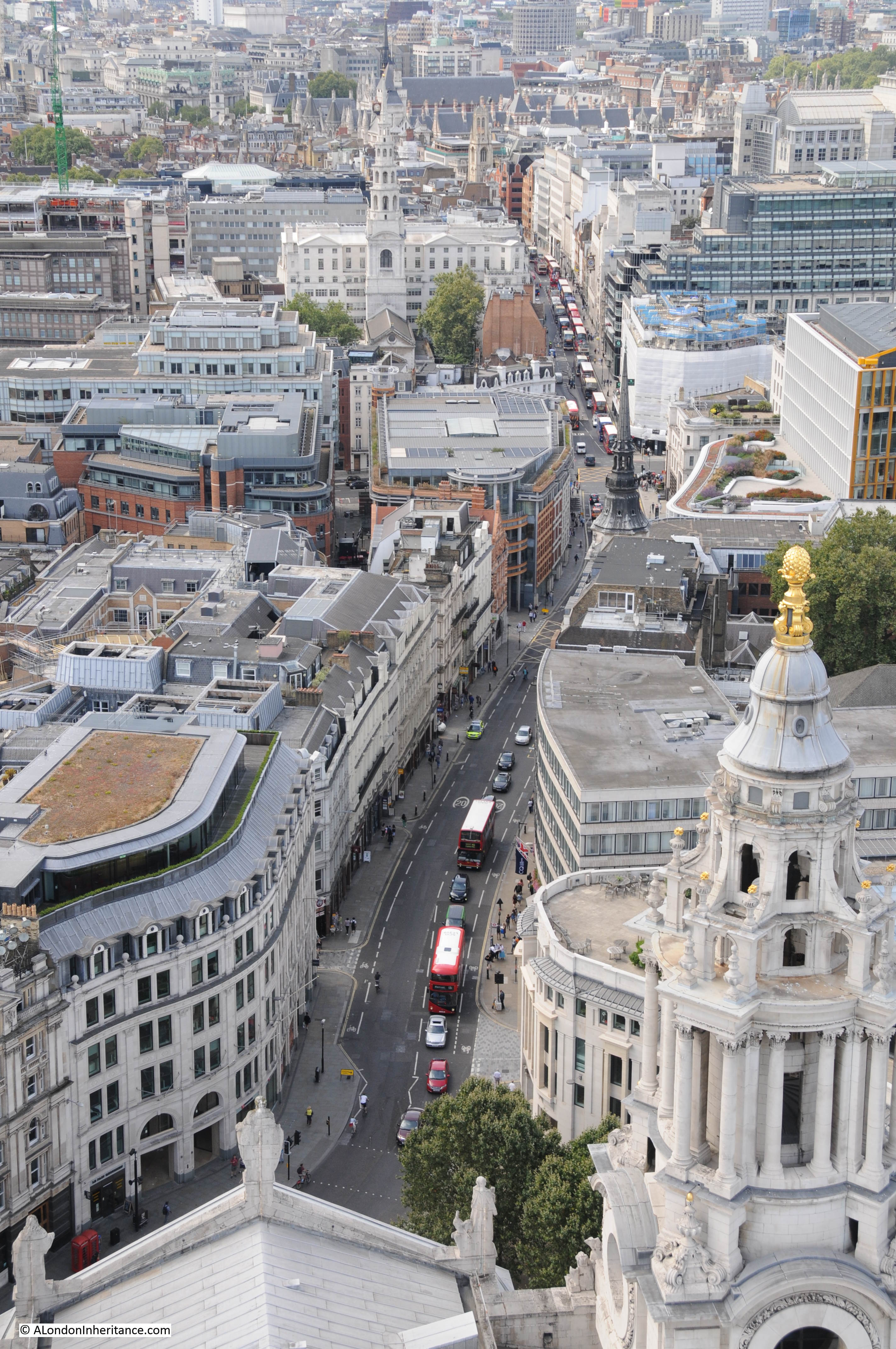
The view as you pass through the door, looking down between the two west towers to Ludgate Hill and Fleet Street.
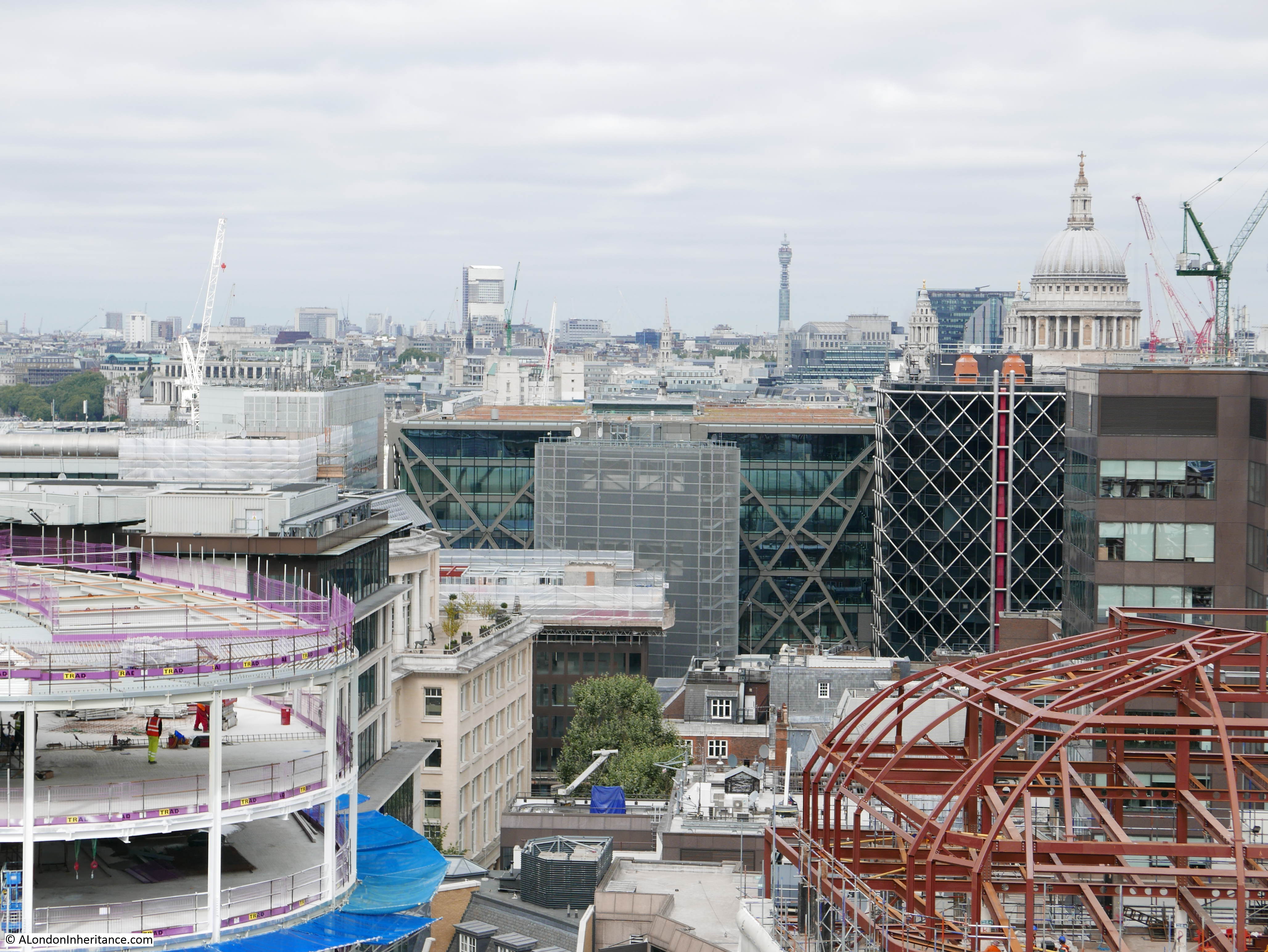
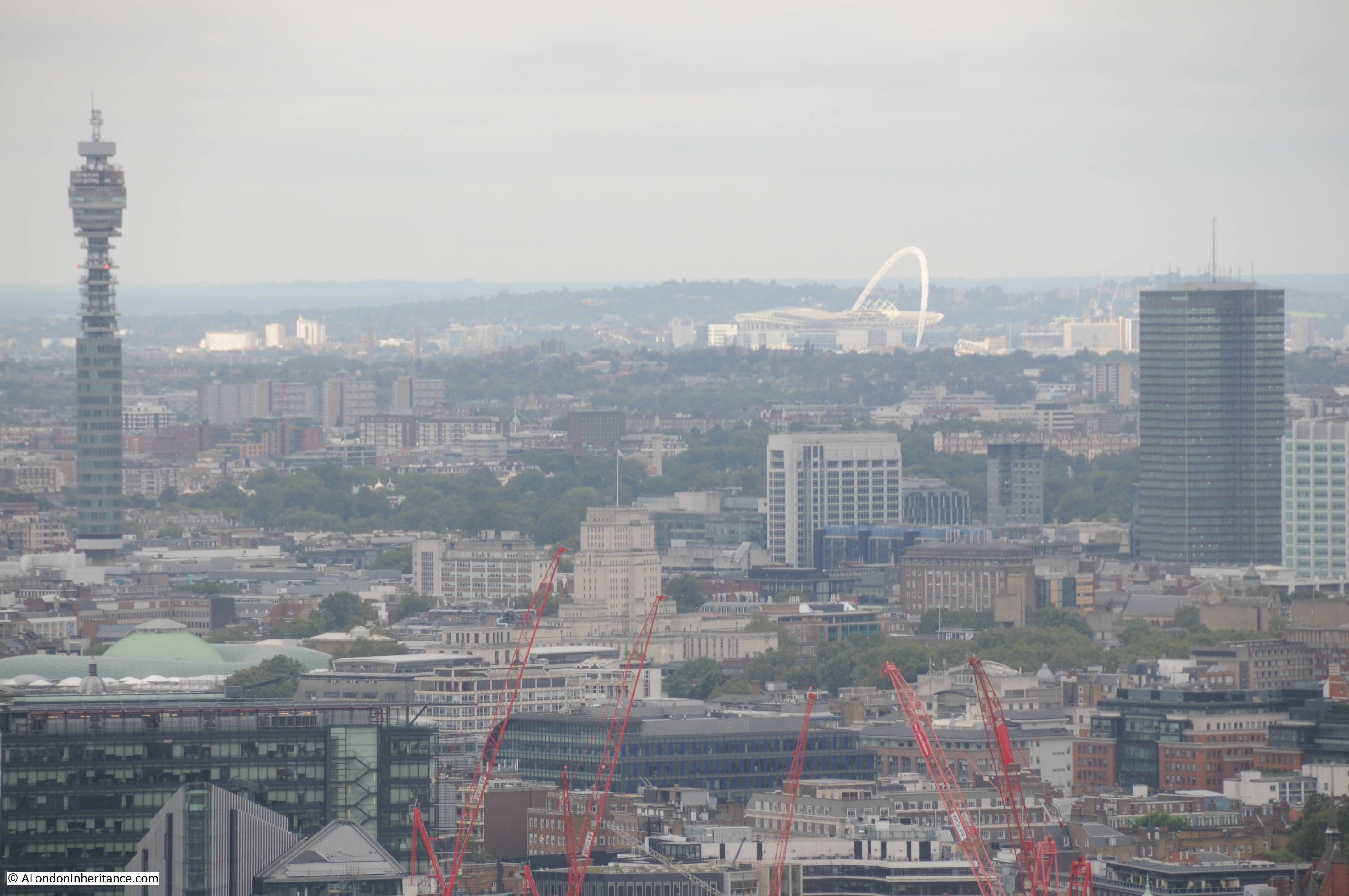
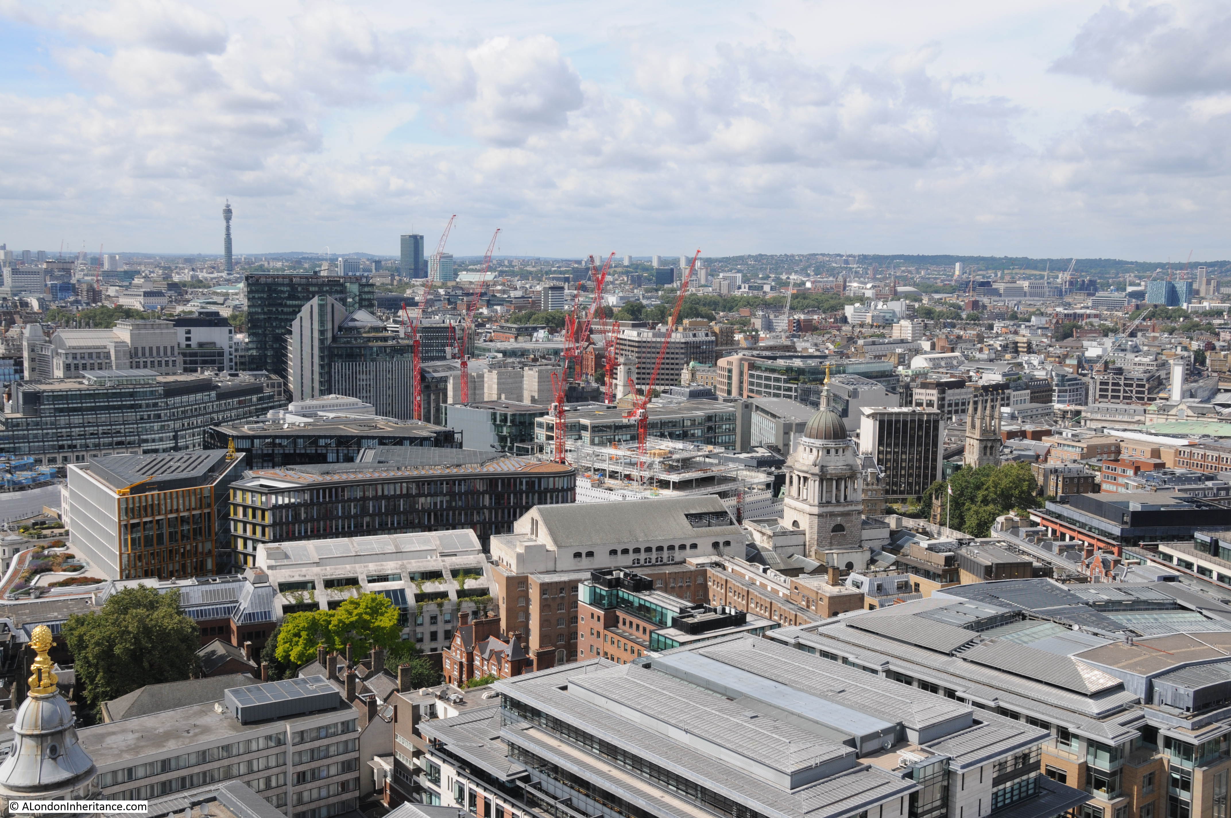
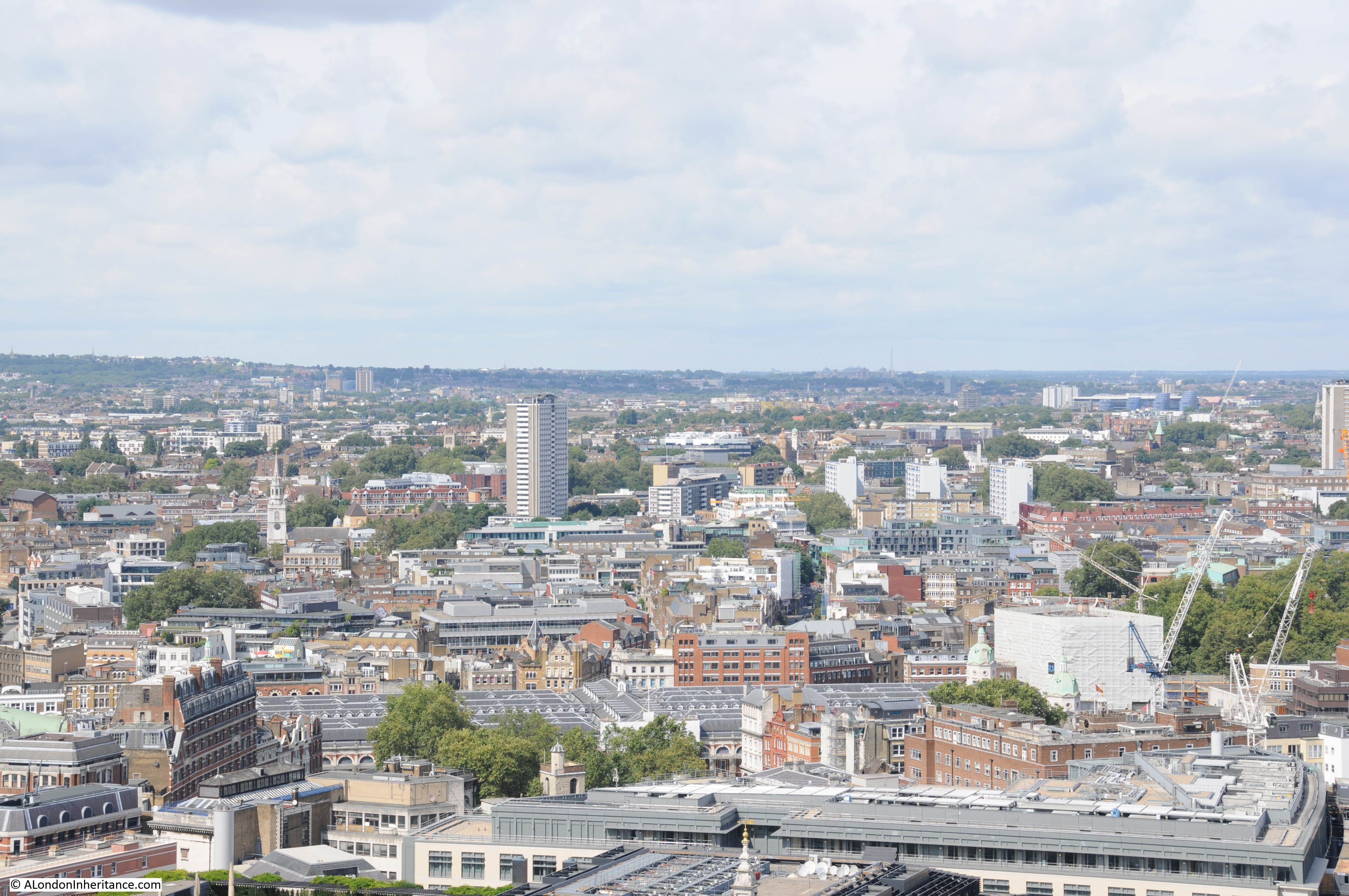
The view towards the Post Office Tower and Euston Tower. The Old Bailey can be seen to the lower centre right, just to the right of the red cranes.
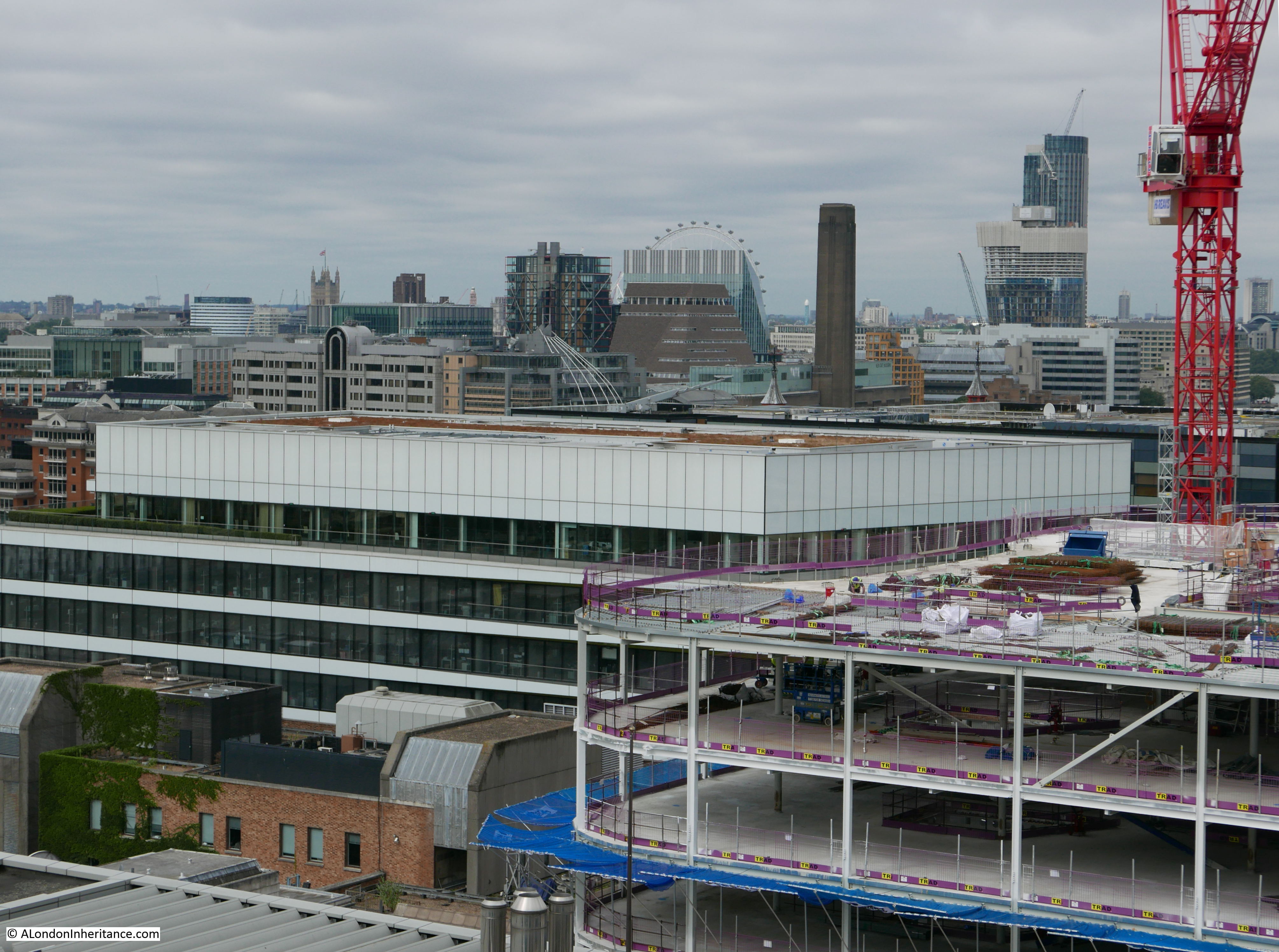
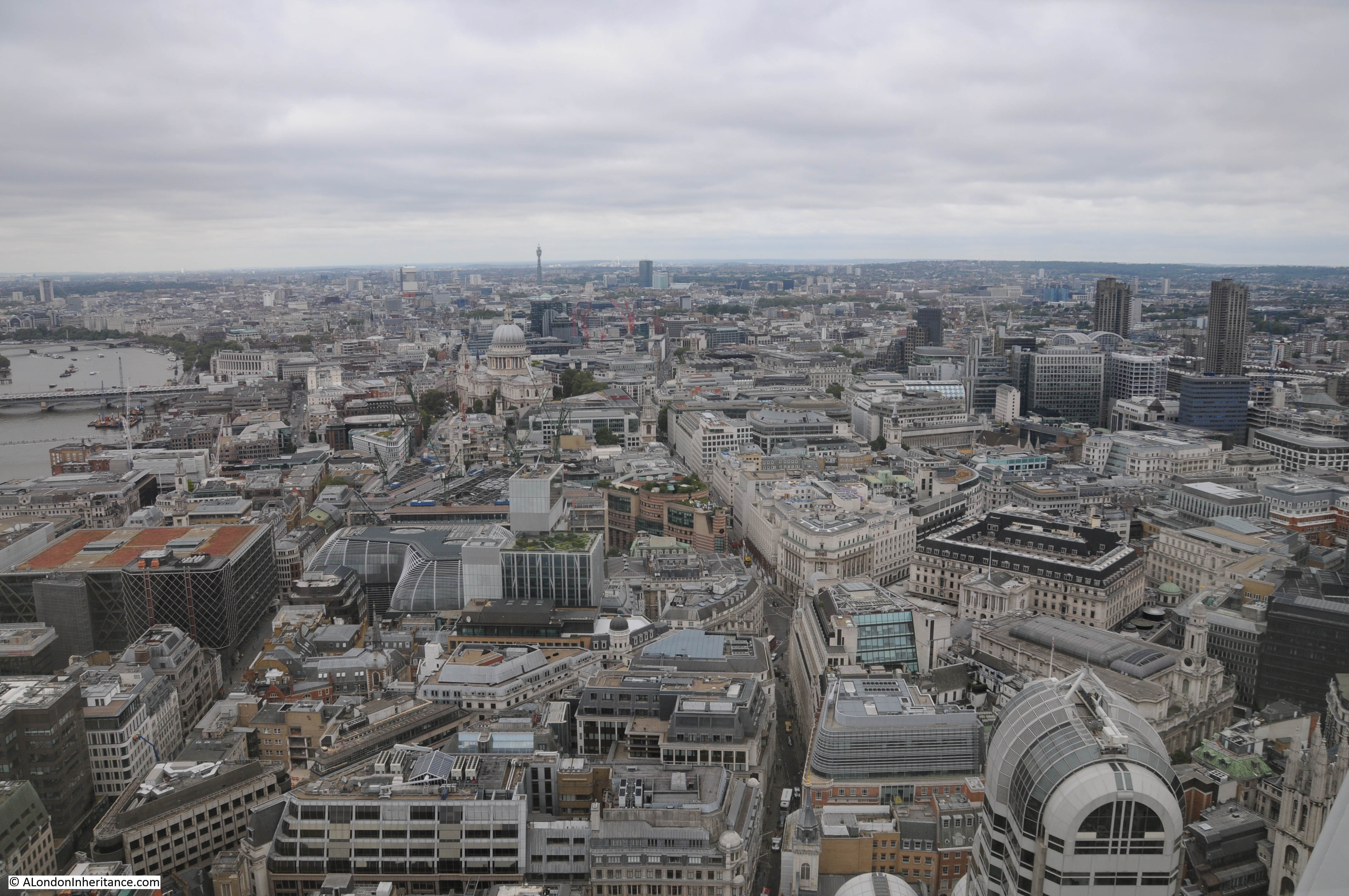
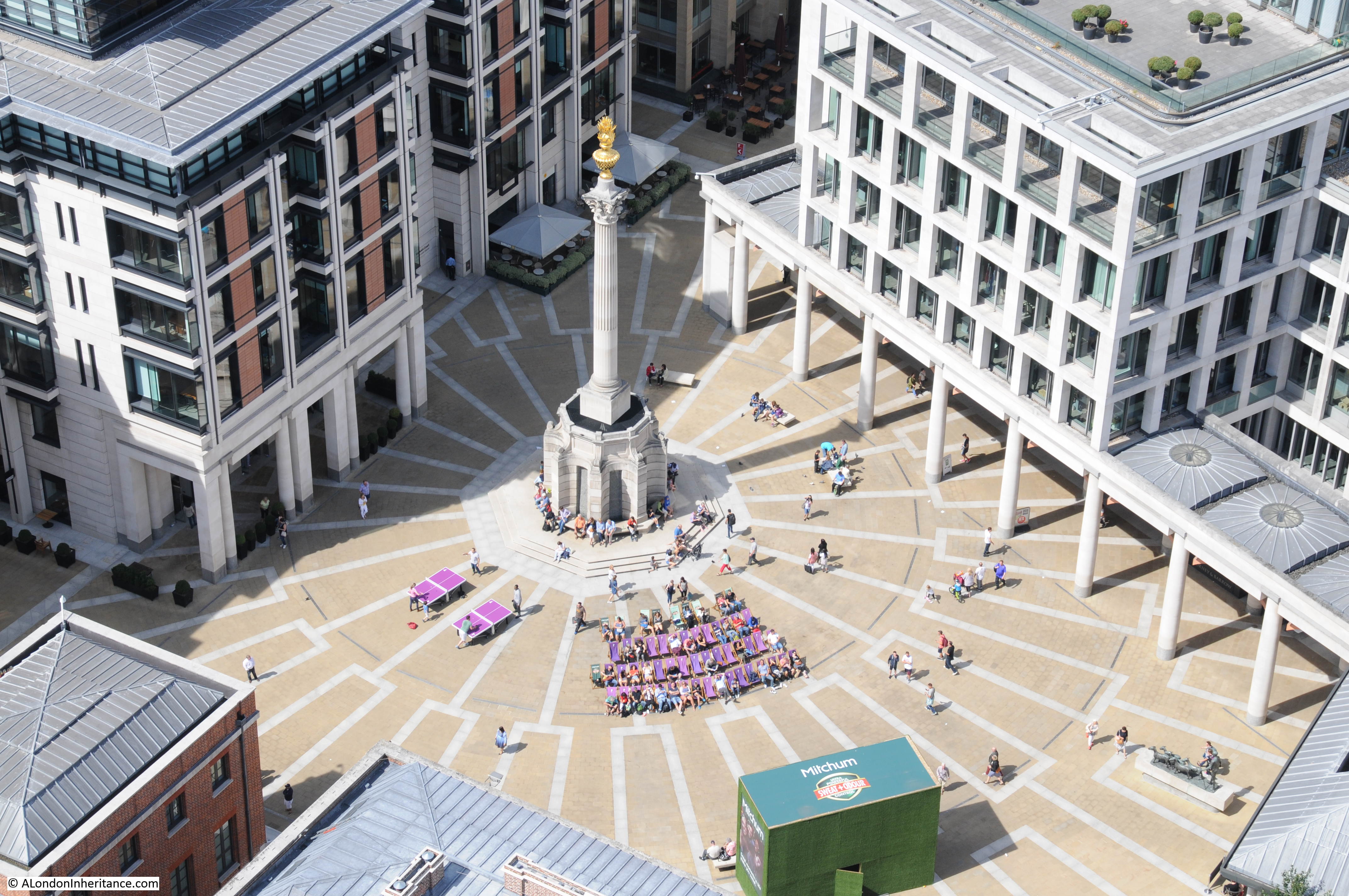
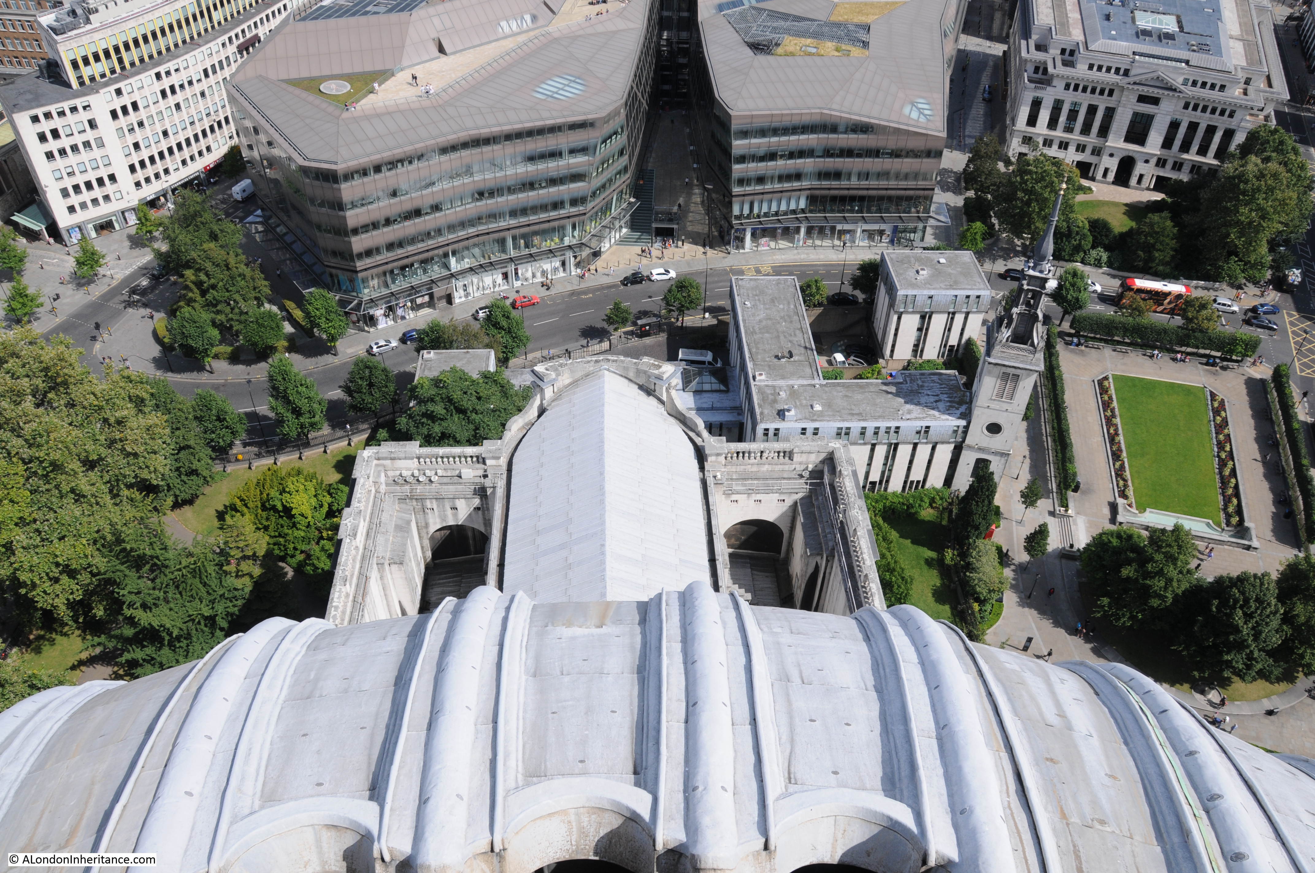
Paternoster Square:
The three tower blocks of the Barbican with the low-rise block running between the left and centre towers. The church of St. Giles Cripplegate can be seen at the base of the right-hand tower.
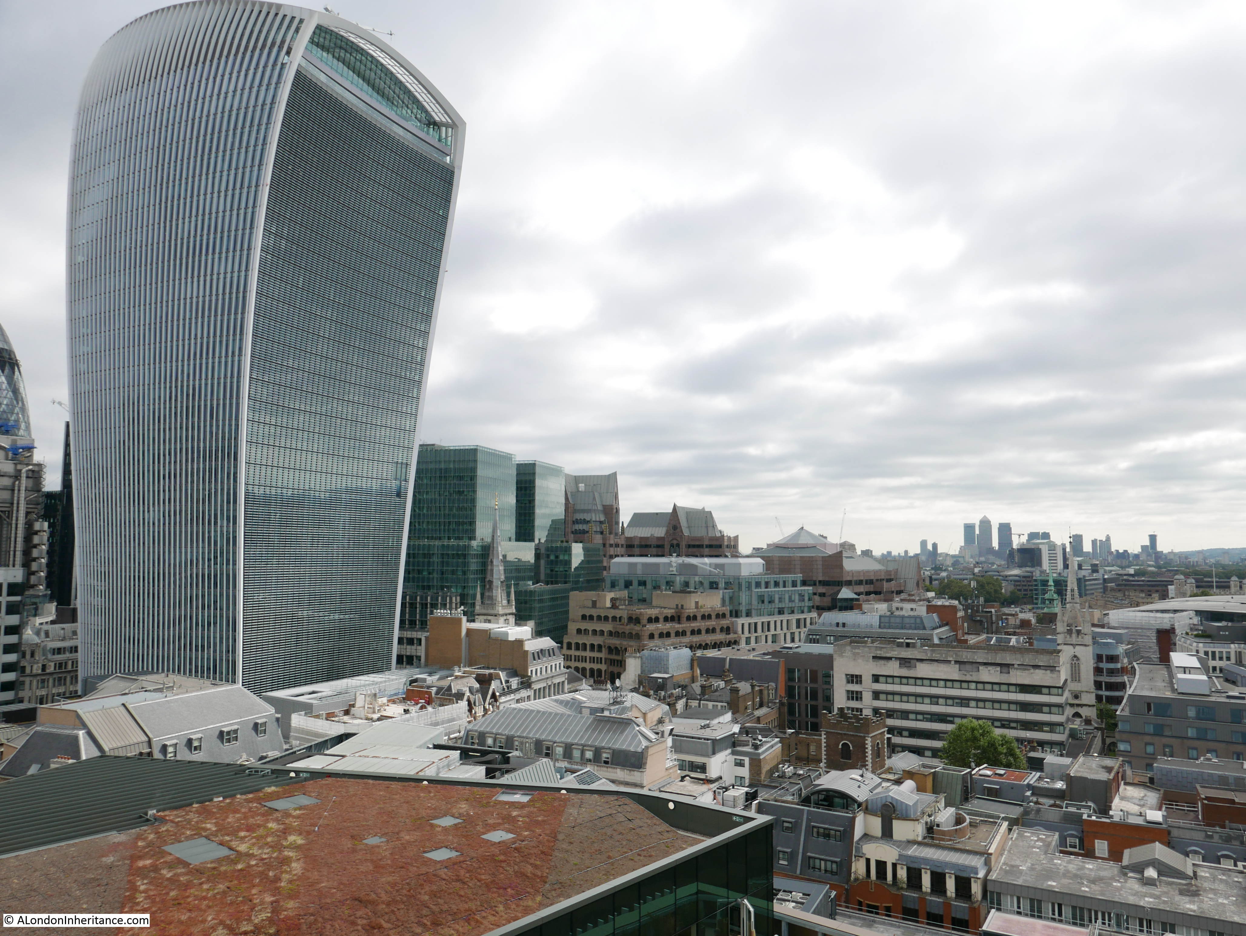
The view towards the east showing the cluster of towers in the City. This view also shows how the 20 Fenchurch Street building is separate from the main cluster of towers and much closer to the river. More towers will be added to this view over the coming years.
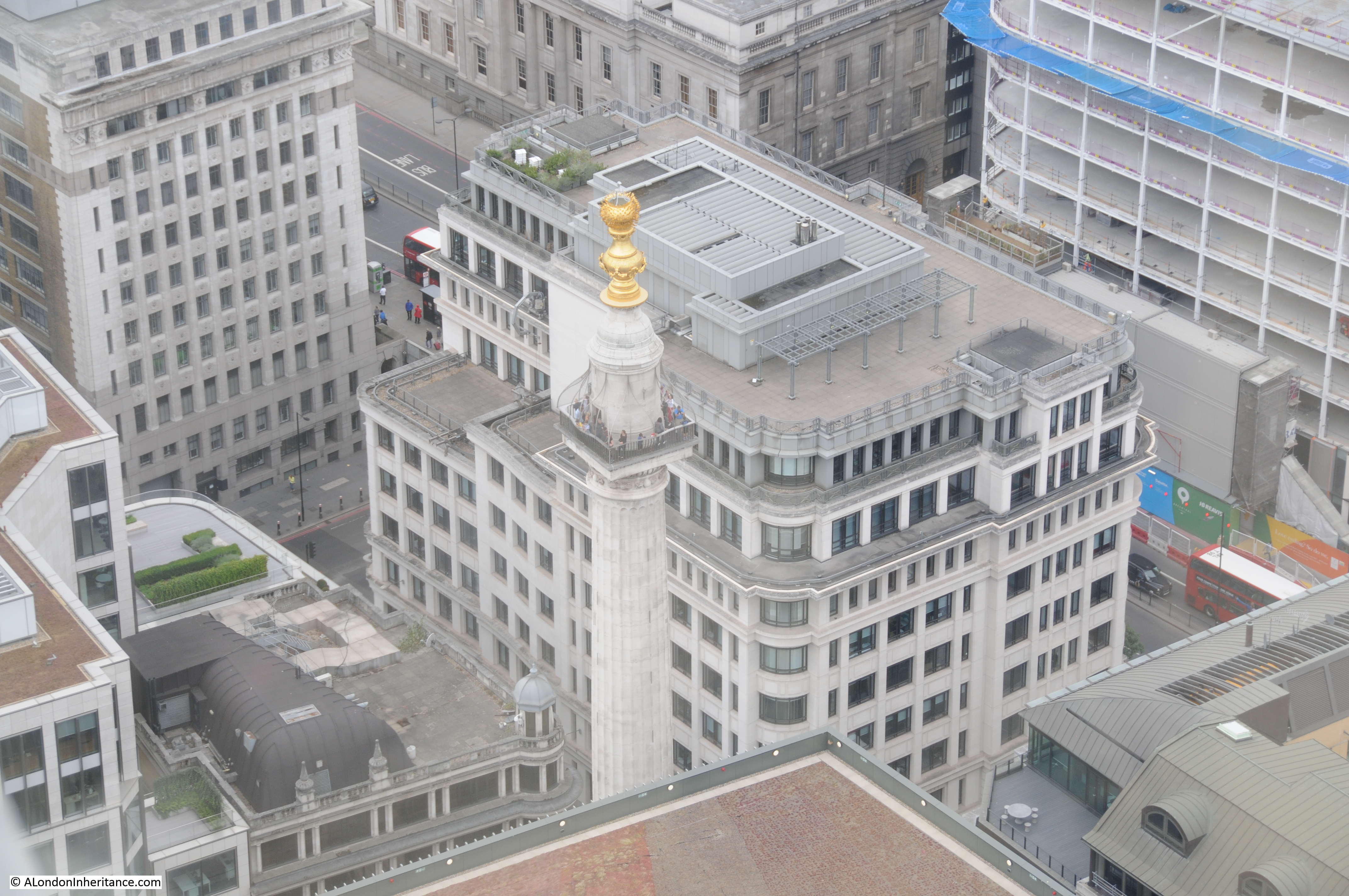
Close up of the Monument from St. Paul’s Cathedral:
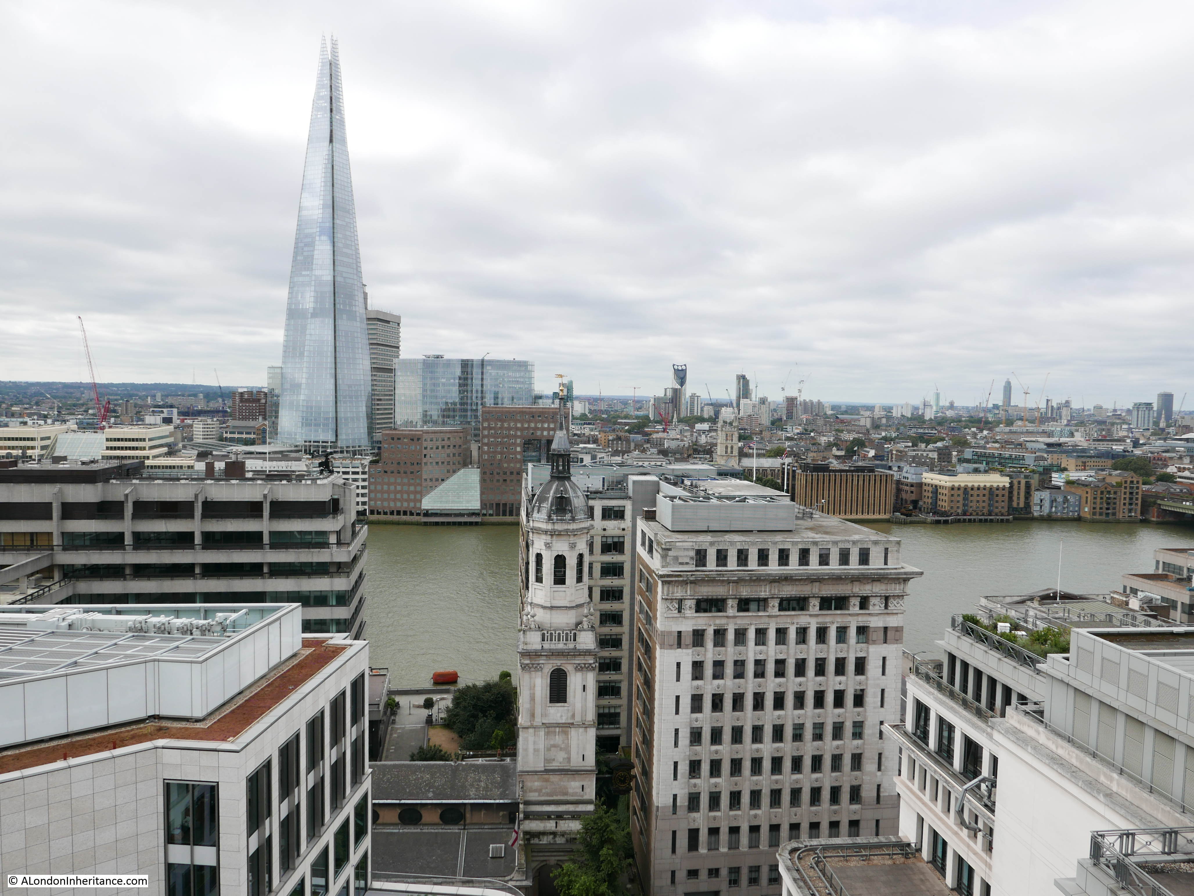
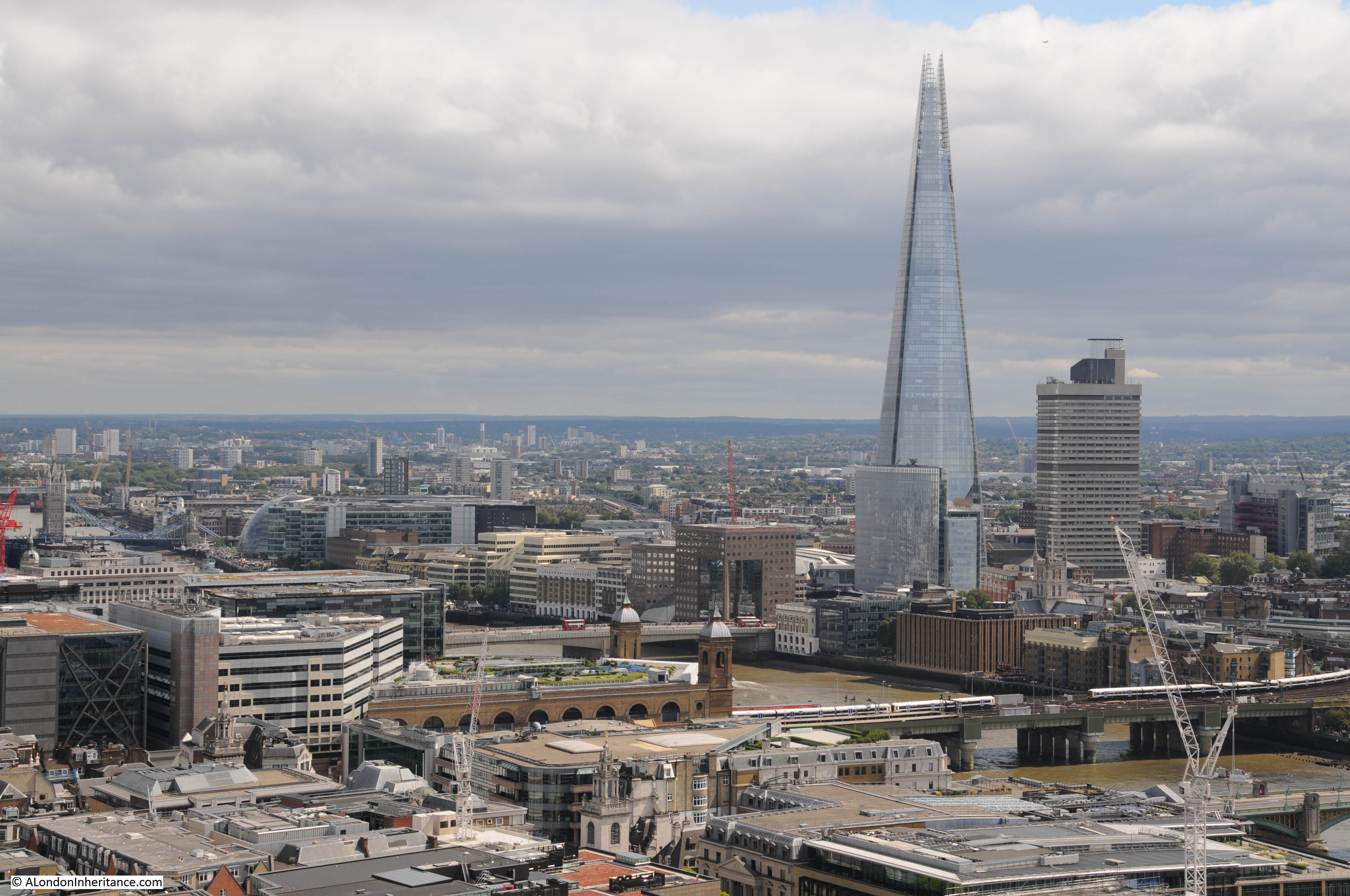
The Shard and Cannon Street station:
By climbing to the Golden Gallery we can get an understanding of the construction technique used to build the internal and external domes. From the gallery we can see some of the external construction techniques, for example the screen walls which were used as a method to hide the tops of the flying buttresses which were needed to strengthen the core of the cathedral. In the photo below, the roof of the Choir is in the centre, below the Dome with the screen walls running around the edge. The use of screens also avoided the need for expensive decorative work along the top of the choir walls and roof.
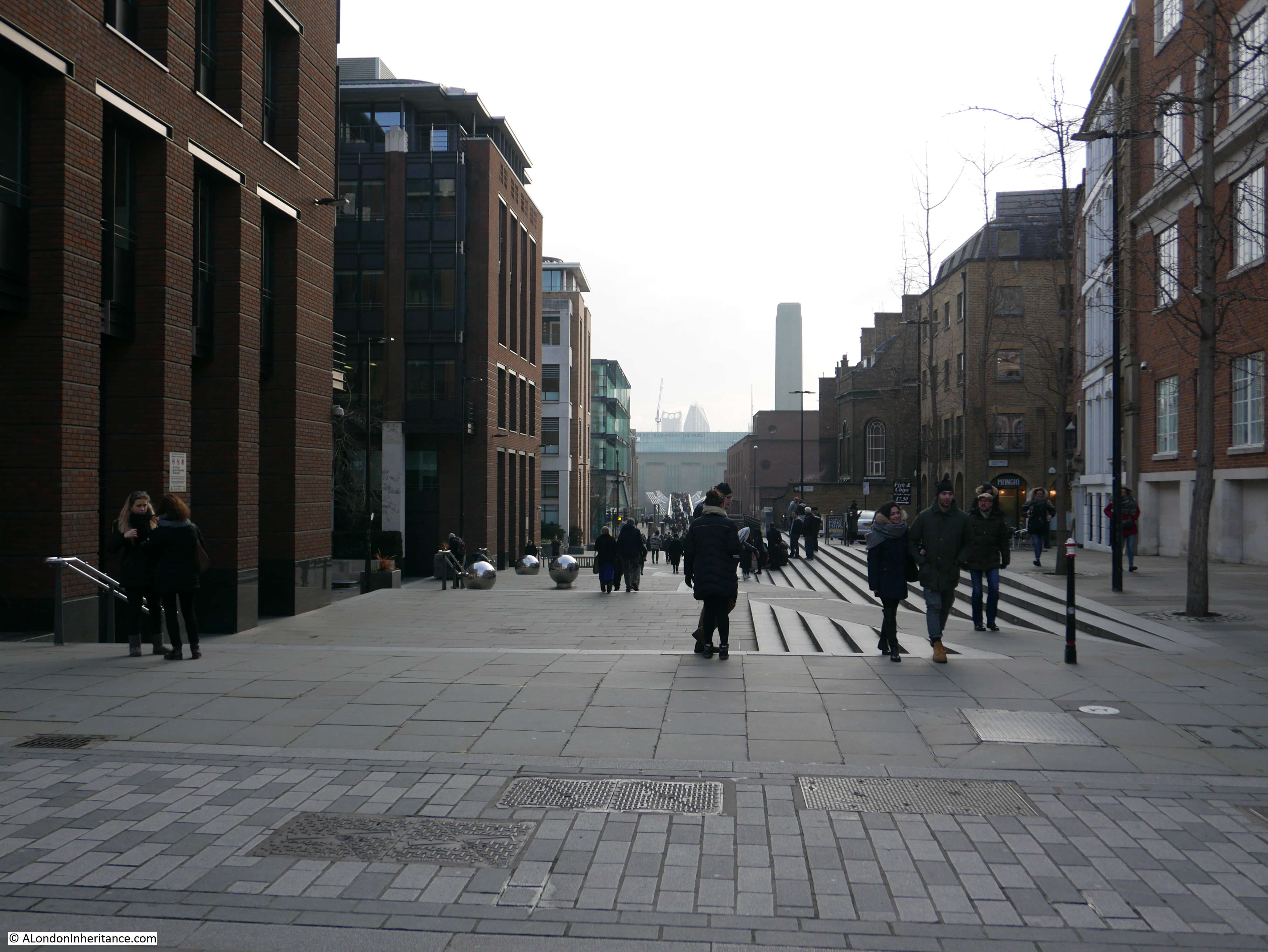
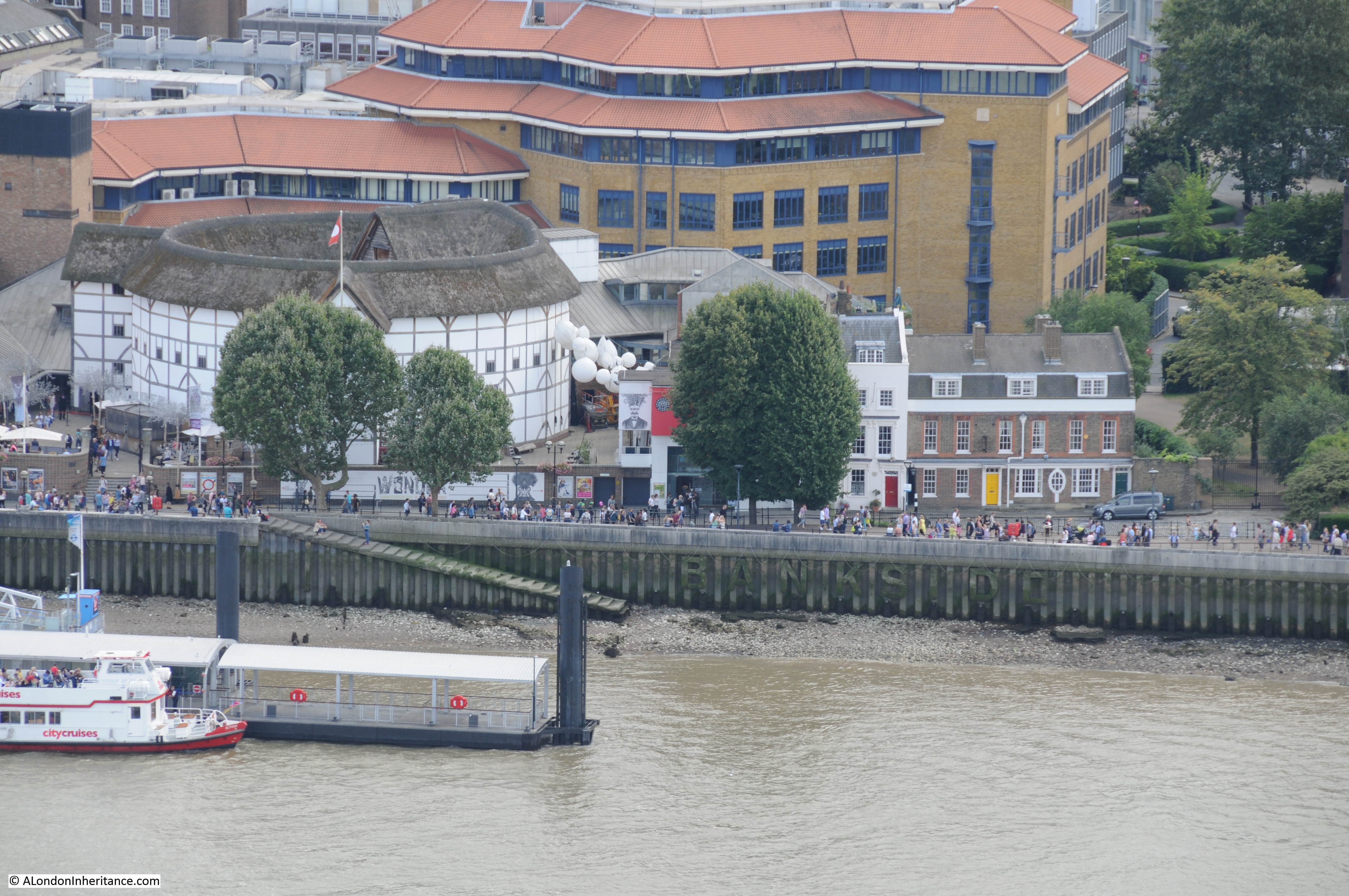
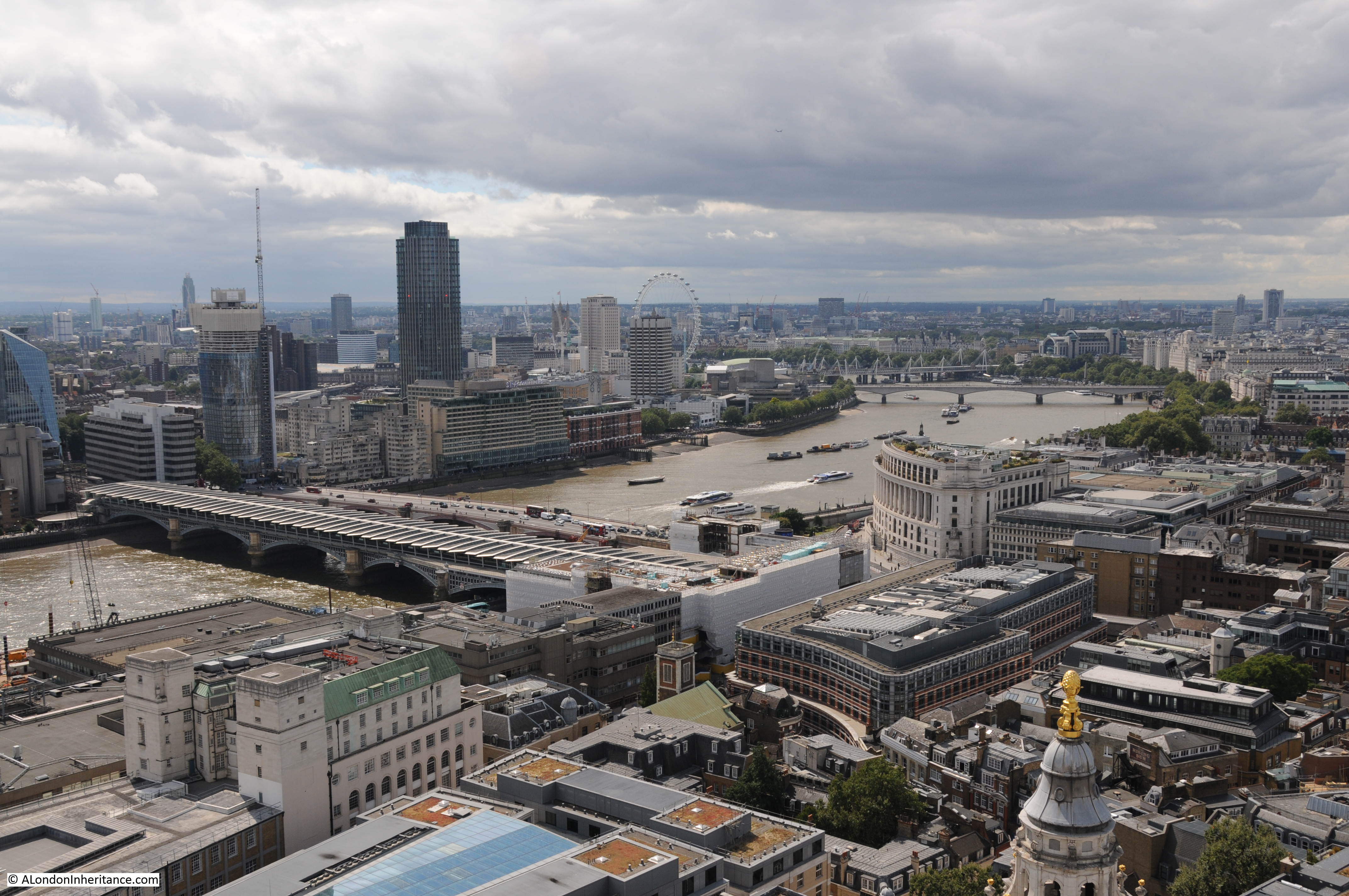
View looking across the Millennium bridge towards Tate Modern, the old Bankside Power Station.
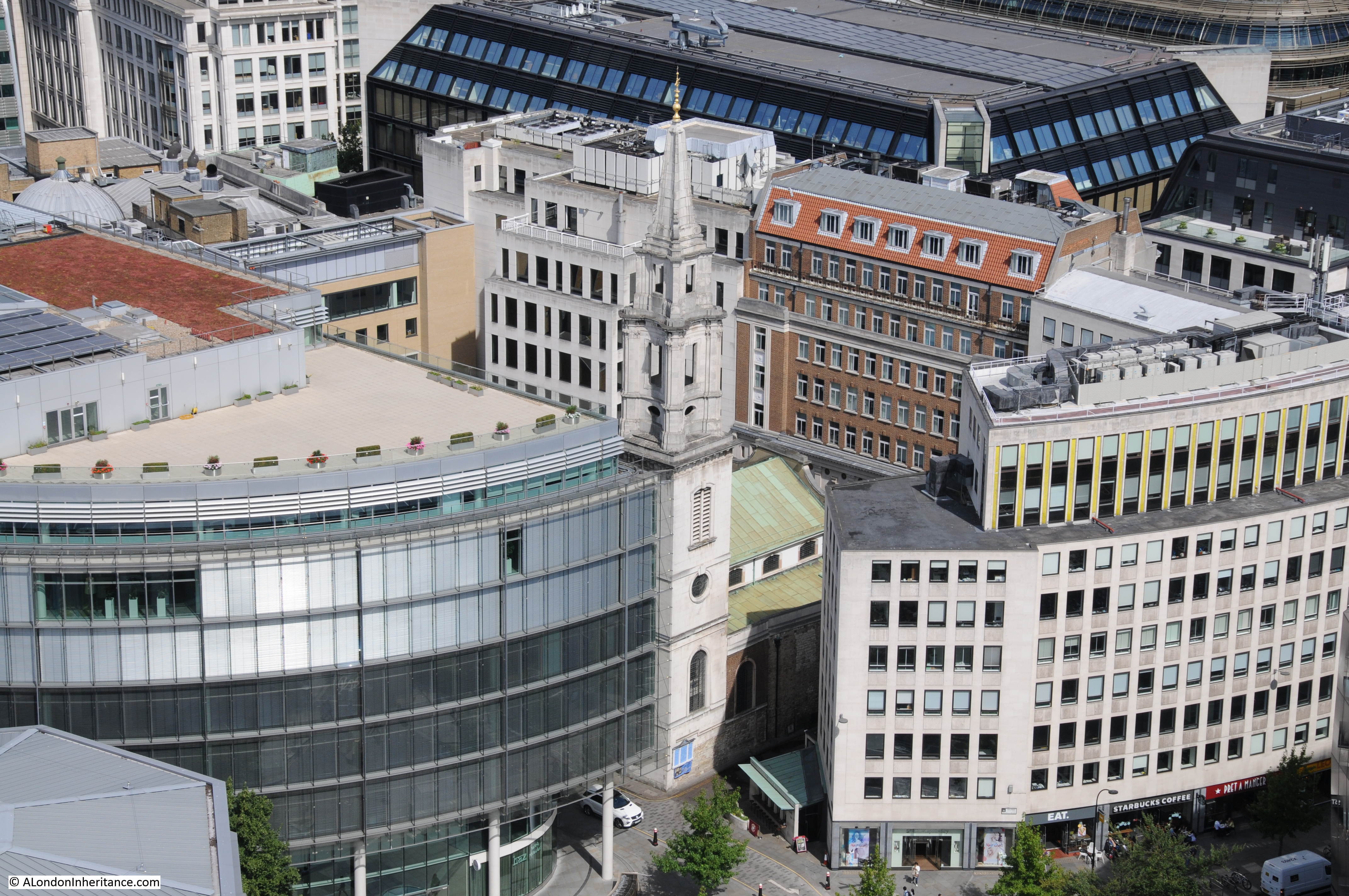
The view from the Golden Gallery includes many of the local churches. Here, the church of St. Nicholas Cole Abbey alongside a new building site. As soon as this new building is in place, the view of the church from the cathedral will be mainly hidden again apart from the very top of the tower.
St. Benets Metropolitan Welsh Church surrounded by Queen Victoria Street, the road down to Lower Thames Street and the City of London School.
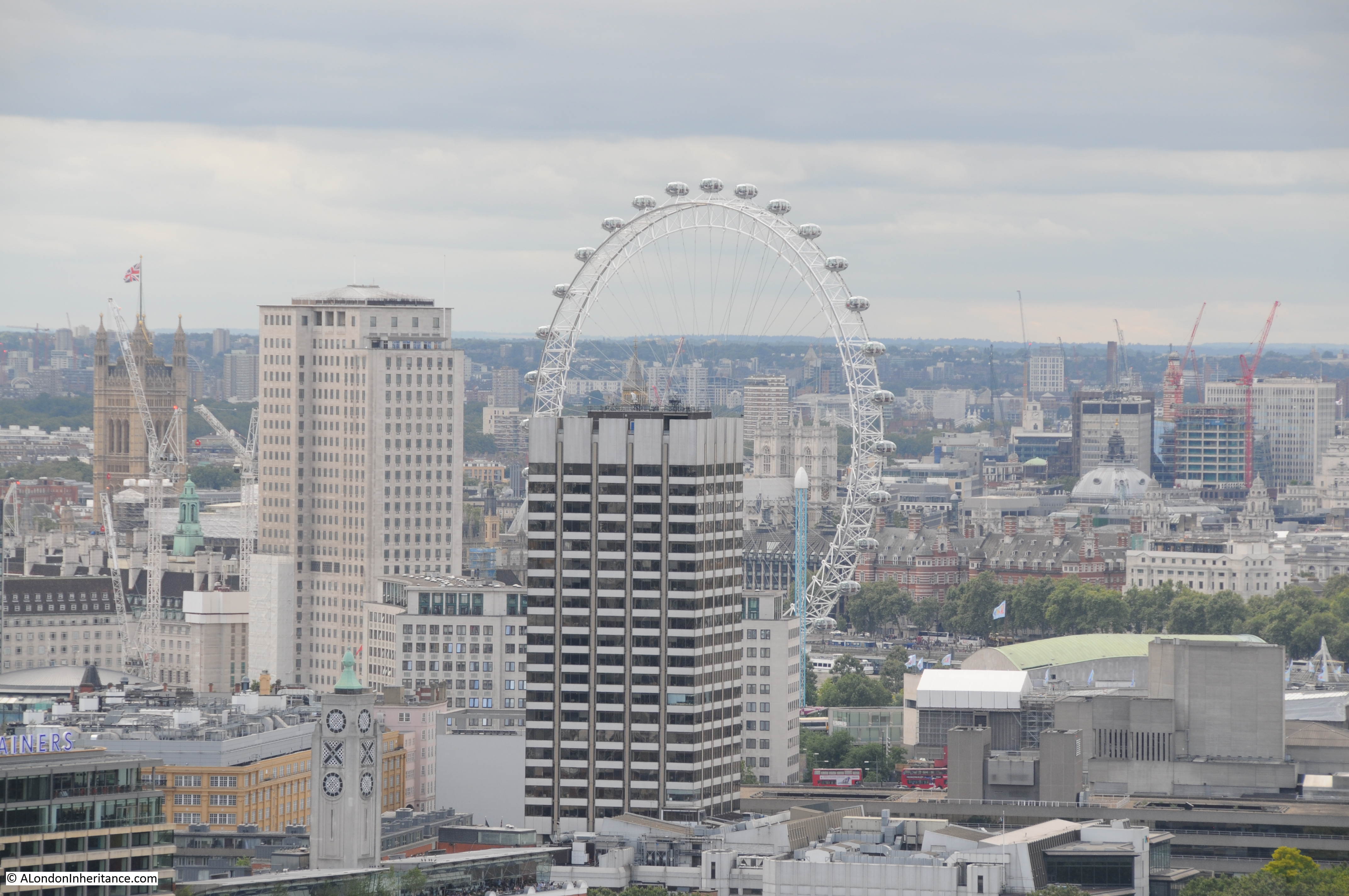
View across to the South Bank with the London Eye which will be my final stop.
Close-up view of Bankside. This was once an industrialised area, but is now home to the reconstructed Globe Theatre. 49 Bankside, the building partly covered by the central tree and with the red door is a centuries old survivor of large amounts of change along Bankside.
View along Ludgate Hill and into Fleet Street. The way that both these streets drop down towards Farringdon Street is a reminder that they originally ran down towards the River Fleet. The church of St. Martin-within-Ludgate is the dark tower on the right of Ludgate Hill. Further along on the left is the tower of St. Bride’s. Further along Fleet Street is the tower of St. Dunstan-in-the-West, and as Fleet Street curves towards the left behind the buildings is the tower of St. Clement Danes.
View to the west looking up towards Waterloo Bridge. If the Garden Bridge is built it will cut across the river in the centre of the photo, obstructing views of the cathedral from the South Bank and Waterloo Bridge.
The church of St. Vedas alias Foster in Foster Lane:
Looking northwest to the high ground around Hampstead Heath and East Finchley. A number of the old rivers that originate in the north of London come from this area including the Fleet, Tyburn and Westbourne. The maximum height of the land at Hampstead Heath is around 443 feet and at the base of St. Paul’s Cathedral is around 36 feet showing the considerable change in height from the centre of London to the ring of hills around the north and south of the extended city.
The tower of Christchurch Greyfriars alongside King Edward Street with the shell of the church a reminder of the bombing in this area during the last war:
View across to Alexandra Palace and Alexandra Park with the Emirates Stadium on the right. The land in the distance sloping down from the heights of Hampstead Heath:
The view from the Golden Gallery at St. Paul’s is superb. Standing 279 feet above the floor of the Cathedral on a narrow walkway in the open air is a wonderful way to experience the views across London.
After a quick look around the Cathedral and a much-needed drink in the Crypt Cafe, it was time to head to the Shard for number 4 in my London 5 Peaks Challenge which, along with the London Eye, will be the subject of my next post.
London Under Fire is the title of a set of postcards issued during the last war showing some of the damage caused by bombing around the city.
You might think that this was a strange subject for a postcard, and given the levels of censorship at the time, why would photos showing considerable damage to London be published?
The envelope containing the set of twelve postcards, “passed by the censor”:
Although showing how much damage had been caused, these postcards had a very serious message. Firstly, the photos were mainly of the City of London, not the main population centres, for example across east London that had suffered so much damage which directly impacted the lives of Londoners.
The postcards were meant to inspire and motivate the population, London has taken this much damage and has come through and will be rebuilt again. The rear of the postcards carried exerts from the speeches of Winston Churchill:
“Let us all strive without failing in faith or in duty”
“This is a time for everyone to stand together and hold firm”
This was after the initial Blitz but before the V1 and V2 weapons fell upon London. The war still had an at the time unknown number of years to run so the message carried by the postcards was very clear, we have taken this much so this is not the time to weaken in any shape or form.
As well as an example of one of the many forms of subtle propaganda employed during the war, today they are helpful in understanding how the city has changed so a couple of weeks ago, I took the postcards up to the city for a walk to see what the locations looked like now and how much remained from these original photos.
The first postcard is of St. Paul’s Cathedral from Paternoster Row, this whole area across Paternoster Square was destroyed during the attack on the night of the 29th December 1940. The area today is now covered by the Paternoster Square development, I located the position where I suspect the photo was taken from, but looking across towards St. Paul’s I was looking into an office wall with no sight of the Cathedral.
As well as the cathedral, the only building that remains today is the Chapter House. This had been reduced to a shell and is the building in the centre of the photo below the dome of St. Paul’s. The Chapter House was rebuilt and has recently finished a full restoration.
I had better luck with the next postcard, again of St. Paul’s but now from Cannon Street.
The photo was taken on the corner of Friday Street and Cannon Street. As can be seen in the postcard by the remains of buildings leading up to St. Paul’s along the right hand side of Cannon Street, this view was only possible due to the destruction of these buildings and in the plan for rebuilding the City, the area around the cathedral was opened up making the views we see today possible.
The next postcard was taken from London Wall and is looking north across to the church of St. Giles, Cripplegate.
With the amount of building along London Wall, I could not get to the exact position of the original photo, however I did find one position in London Wall where the church tower is visible today. This also shows the Barbican development which would cover so much of this area in the post war redevelopment.
Postcard showing the remains of the interior of St. Giles, Cripplegate. Again, the church suffered this damage mainly on the night of the 29th December 1940.
The church was rebuilt after the war, and apart from the remains of the Roman city wall, is all that remains in this area from the pre-war city following the development of the Barbican.
The next postcard is showing Fore Street, no idea where in Fore Street as there are no points of reference.
But this is Fore Street today. The Barbican is on the left and office buildings between Fore Street and London Wall are on the right.
The following postcard is titled New Basinghall Street.
I could not find a New Basinghall Street in the City today. There is a Basinghall Street, but not a “New”, so it was to the 1940 Batholomew’s Reference Atlas of Greater London to check and this is where I found New Basinghall Street, a short extension of Basinghall Street from London Wall to Fore Street.
Today, New Basinghall Street does not exist. In the photo below of Fore Street today, it was on the right, just past where the road is closed and passed to the right under the new office development to meet up with London Wall. Returning to the postcard of Fore Street, this shows a road leading off to the right and this may have been New Basinghall Street.
The next postcard is of the buildings of the General Post Office from Newgate Street. Strange that the postcard does not mention the church in the foreground, only the buildings of the G.P.O in the rear. The church is Christ Church, Greyfriars.
I could not get the same angle due to new building in the area, so I took the following of the church. The church was not rebuilt after the war, the tower was preserved and the main body of the old church turned into a garden. One of the few reminders in the area of the damage suffered during the last war.
We are now at Ludgate Hill, looking down towards the junction with Fleet Street. The church tower on the left is that of St. Brides.
Ludgate Hill today still has the slight bend to the left, however since the photo for the postcard was taken, the railway bridge has been removed and new building on the left has obscured the view of St. Brides with only the very tip of the steeple visible if you find the right place. The buses also look very different as well.
Now moving slightly to the west, the following postcard is titled “View from High Holborn”. The buildings in the background to the right are those of Smithfield Market.
Although I could find the position from where I suspect the photo was taken, the view is totally obscured by new building, so I walked back to where Holborn Viaduct crosses Farringdon Street and took the following photo of the market buildings.
The next postcard is of St. Andrew’s Church from High Holborn:
And another view of High Holborn. There is a single building in this wartime view that remains to this day.
The building is the one in the centre of the photos above and below. I could not get the same angle as the original photo as the photographer must have been standing on the ruins of buildings between High Holborn and Charterhouse Street so the original photo is looking onto the side of the building which in my photo is off to the right.
The final photo is of Temple Church, closed during my walk around London.
It would be interesting to know how many of these postcards were posted. I suspect the majority were purchased and kept as a record of the destruction of the City rather than for posting.
They provide a fascinating view of the city at a point in time, before the start of the post war redevelopment that in many areas such as the Barbican and Paternoster Square, would result in so much change.
Whilst the majority of my father’s photos came to me as negatives, a number were printed, and of these some had the location written on the back. As well as the location, a few are also specific about the time of year as the photo reflects how London appears as the seasons change.
For this week’s post, I bring you two photos on which my father had written the simple title “Autumn in Finsbury Circus”.
Both were taken early in the morning and show autumnal light shining through the trees, with the first autumn leaves on the path. There are two photos, one showing a woman pushing what looks like a pram, whilst the second shows a man starting to sweep the fallen leaves.
I suspect that he had taken these photos either for exhibition or competition at the St. Brides Institute Photographic Society as they have a more composed quality rather than the straight forward recording of London’s buildings and streets.
To try and find the location of these photos, a day off from work last Friday provided the opportunity for an autumn walk around London.
Finsbury Circus is much the same today, with one significant exception being that it is a major construction site for Crossrail with the centre of the gardens in the middle of the square being used for access to Crossrail and sections of the path that runs round the perimeter of the gardens also being closed.
If I correctly located the buildings in the background, they were behind part of the closed off path, however parts that remain open provided the opportunity to show that not too much has changed (if you ignore the major construction site to your left).
The layout of Finsbury Circus was established in the early 19th Century, with the office buildings we see today being built over the following century, with some redevelopment continuing today.
As one of the few areas of green space, the gardens were very popular with city workers, with a bandstand and bowling green occupying part of the centre of the gardens. A small, temporary bandstand remains today. The gardens at the centre of Finsbury Circus will be restored after the Crossrail works are complete.
The main entrance to the Crossrail construction site which currently occupies much of the gardens in the centre of Finsbury Circus.
Walking in central London, there are very few indicators of the season of the year. Apart from temperature and the times of the rising and setting of the sun, it could be any time of year. The natural indicators of whether it is spring, summer, autumn or winter are few and far between.
Taking inspiration from the title of my father’s photos, I thought it would be interesting to take a walk through the City and look for any other examples of where autumn can be found in amongst such a built environment.
The weather last Friday at least was very autumnal with strong winds and alternating between heavy showers of rain and clear blue sky (although in fairness that could be English weather at any time of year).
There are very few green spaces left in the City, the majority that remain are usually associated with a church, either still remaining or one that was lost in the last war, and it was to one of these that I headed to after Finsbury Circus.
This is the garden that occupies the site of St. Mary Aldermanbury. a church that was heavily damaged in the last war, not rebuilt and the remains shipped to America (see my first post here). Just south of London Wall at the corner of Aldermanbury and Love Lane.
A heavy rain shower as I stood in the garden, and a strong wind blowing the fallen leaves up against the far wall.
The next stop was the garden that occupies the graveyard of the church of St. Anne and St. Agnes at the corner of Noble Street and Gresham Street.
This garden occupies a relatively small space, however some mature trees reach up to the sky in amongst the surrounding buildings, with the leaves starting to turn to their autumn colours.
Walking to the end of Gresham Street, then turning up St. Martin’s Le Grand I came to Postman’s Park. At this time of year, the sun does not reach above the buildings to the south in order to shine on Postman’s Park, so the park spends much of this time of year in shade that appears to be made darker by the sunlight on the surrounding buildings. Many of the trees here had already lost the majority of their leaves.
Walking out from Postman’s Park into King Edward Street and I was back in the sunshine of an autumn day.
Heading south from Postman’s Park to one of the larger areas of green open space remaining in the City, the churchyard of St. Paul’s Cathedral.
Here plenty of mature trees can be found around the eastern half of the cathedral and their autumn colours looking spectacular against both the stone of St. Paul’s and the sky.
From St. Paul’s, it was then a walk down Cannon Street, Eastcheap and Great Tower Street to Trinity Square Gardens. (I did miss out the garden at St. Dunstan in the East as the sky to the east was getting very dark and I wanted to get to Trinity Square before another heavy shower of rain).
This large (for the City) open space also benefits from a lack of tall buildings to the south so the rare combination of a City garden that also gets the sun at this time of year.
The pavements showing the signs of recent rain. Overhung by mature trees, the pavements will soon be covered by leaves.
The old Port of London Authority building in the background with the new memorial to Royal Fleet Auxiliary and Merchant Seamen who lost their lives in the Falklands Campaign. The mature trees around the edge of the gardens just starting to change to their autumn colours.
My final visit was to the churchyard of St. Olave in Seething Lane. A small churchyard just catching the last glimpse of an autumn sun, with leaves on the trees starting to fall.
It was a fascinating walk through the city on a typical autumn day with extremes of weather from heavy rain showers to clear blue sky. Even with the amount of building there are still places were it is possible to observe the changing of the seasons and retain contact with the natural cycle through the year.
I fear though that with the ever increasing height of buildings in the City, these valuable survivors of the natural world will be spending more and more of their days in the shadow of their surroundings.
The photos we as a family have been taking of London only go back to 1947, so to go back further I also collect any old London postcards I can find with photographs of London. These really help to understand how London has changed, what specific areas looked like at a moment in time and what it would have been like to have been walking the streets when the photographs for these postcards were taken.
The following postcard is from the top of the Monument and shows how much the London skyline has changed over the last 100 years. Long gone are the days when the City churches stood well above their surroundings.
The road to the right is King William Street running up to the Bank. On the left of the photo is the original Cannon Street Station. The platform roof running off the edge of the photo with the station hotel being the large building to the right of the station roof. One of the adverts on the building to the lower right is for the “Aerated Bread Company” – a company formed in 1862 by a Dr. John Dauglish using a special yeast free process to produce an additive free bread. the company also had well over 200 tea shops, many of which were in London.
The next postcard is also from the Monument but this time the photographer has moved to the left and much of Cannon Street station is now visible. These old postcards also show how dominant St. Paul’s Cathedral was on the London skyline.
In the following postcard the photographer has moved further round the viewing platform at the top of the Monument and is now looking towards Tower Bridge. Billingsgate Market is to the lower right. Opposite Billingsgate Market is the London Coal Exchange, the building with the ornate tower on the corner. The church tower on the left is that of St. Dunstan in the East.
As it still is today, St. Paul’s Cathedral was another favourite spot for views of the London skyline. This time we can look back at the Monument. Compared to today where the Monument is surrounded by much taller buildings, in the early years of the last century it was one of the City’s highest points. This photo also provides another view of Cannon Street station and the substantial hotel / station entrance at the front.
We can continue past St. Paul’s and now have a look at the City from the tower of St. Brides Church, Fleet Street. This photo again shows how dominant the cathedral was and by far the tallest building in London. The church in the foreground is St. Martin-within-Ludgate. The large building to the left is the old Post Office headquarters.
The following postcard is from the Second World War. On the rear of the postcard is an extract from a broadcast speech made by Winston Churchill on the 11th September 1940 at the time when the major air raids on London had begun:
“This is a time for everyone to stand together, and hold firm!”
The next postcard also has an aerial view of St. Paul’s Cathedral before the devastation of the area by bombing. This shows how close the buildings used to press up against the cathedral. The area behind the cathedral, Paternoster Row and Square was a major location for the publishing trade with many book sellers and book warehouses. For a view of the devastation to this area see my posts with my father’s photos taken just after the war which can be found here and here.
Some old postcards capture a moment of major change in London. The following postcard shows not only the original Waterloo Bridge, but also the temporary bridge to the right that was constructed to carry traffic during the demolition of the old bridge and construction of the new.
I find the subject matter of some postcards rather surprising. The following two postcards show bomb damage in London during the last war. I would have thought to maintain morale, postcards showing significant bomb damage in the heart of London would not have been available, alternatively they could also have been used to inspire when coupled with the speech extracts on the reverse of the cards.
The first postcard shows the damage to Paternoster Row to the north of St. Paul’s. Both postcards carry extracts from speeches made by Winston Churchill. The first postcard has the same extract as the one above.
The following postcard shows St. Andrew’s Church from High Holborn. Note the “Passed by the Censor” statement on the lower right of the card.
On the rear of this postcard is the following extract from one of Winston Churchill’s speeches:
“Let us all strive without failure in faith or in duty”
The following postcard shows the view from the Victoria Tower of the Houses of Parliament. This is a post war card of the late 1940s / very early 1950s, and what I find interesting with this one is the empty patch of land on the right between Hungerford Bridge and County Hall. The photo for this postcard had been taken at a moment in time when the land had been cleared in preparation for the construction of the Festival of Britain. The Shot Tower can also be seen between Hungerford and Waterloo bridges.
Postcards also show the busy streets of London during the first years of the 20th century. The following postcard shows the view down Cheapside with the church of St. Mary-le-Bow on the right. If you look on top of the buildings on the left you can see the telegraph poles that carried the wiring for the early telegraph / telephone system in the City. This was before the installation of underground cabling and much of the wiring was carried across the roofs of the City.
And this postcard shows a very busy Piccadilly Circus.
The following postcard is looking down the Strand towards Trafalgar Square. The building to the right is Marconi House. Originally built as the Gaiety Restaurant, it was taken over by the Marconi Company in 1912 and played a key part in the development of wireless. During 1922 and 1923, the original 2LO – London Broadcasting Station was broadcast from this building.
Wrapped around the stairs on the buses are adverts for some of the consumer brands of the time – Wrigley’s, Swan Vestas and Dunlop.
Postcards also show that London has always been a centre for tourists and visitors with some of the postcards above being sent from London to destinations across the world.
Today, with the ability to take a photo on a phone and instantaneously send it across the world, the future of postcards looks rather bleak, however for roughly the past 150 years they provide a fascinating view of a changing city.
A couple of weeks ago I published the photos my father took of people waiting for the Coronation in 1953. That post can be found here.
Just under 30 years later there was another royal event in central London, and on the evening before people were finding the best position along the route to watch the events of the following day.
This was the wedding of Charles and Diana that took place on the 29th July 1981 and on the evening of the 28th July I took a walk from St. Paul’s Cathedral and along Fleet Street and the Strand to take some photos.
Starting at St. Paul’s Cathedral, this is where the best positions were and large crowds had already found their place ready for an overnight stay.
I must have had a couple of photos left on some Black and White film before moving to colour.
Outside St. Paul’s Cathedral:
Crowds at this perfect position looking across at the steps leading into the Cathedral: I must have then switched to a colour film:
Looking back up Ludgate Hill. Although this was the evening before, the road had been closed and a large number of people were just walking the route, taking in the atmosphere and watching the people who were settling in for the night along the edge of the route. It was a warm evening and I remember there being a real sense of a big event taking place the following day.
The same view today looking back up Ludgate Hill towards the cathedral. St. Martin Ludgate on the left is still there, along with many of the buildings on the right.
Just to the right in the above photo in 1981:
Now in Ludgate Circus. This was when the railway bridge still ran across the start of Ludgate Hill.
Just to the left of the railway bridge is the Old King Lud pub, decorated for the event. This was a lovely Victorian pub, built-in 1870,
After going through some changes in the 1990s, the pub finally closed in 2005 and became yet another of London’s lost Victorian pubs. The site is now occupied by a fast food store with offices above:
Moving up into Fleet Street. This road was still open and the pavements were busy with those walking and those waiting:
This was when Fleet Street was still occupied by newspaper publishers. The Express offices on the left and those of the Star on the right. I remember walking along Fleet Street and the side roads leading down to the Thames on a late Saturday afternoon / early evening and listening to the sound of the newspapers being printed and the amount of activity to get the next day’s edition distributed. All very exciting when you are young and exploring London.
Prepared for a night’s wait:
Along the side of the Royal Court’s of Justice:
The George pub in the Strand which fortunately is still there:
Most of the decorations were put up by the owners of the buildings along the route. “Official” street decoration was very limited, mainly these pennants hanging from lamp posts. Union Jacks along with red, white and blue bunting was out in abundance.
One of many events that have taken this route to St. Paul’s Cathedral, but a special event for me as this was my first opportunity to get out and photograph the streets and people preparing for the following day.