
Before starting on this week’s post on the Limehouse Cut and Angel Underground Station, can I thank you for all the feedback following last Sunday’s post. It is really appreciated.
I also hope that if you receive my posts as a subscriber, this one does reach you. For the last few days there has been a rather obscure error message in the component that links the blog with the WordPress tool that manages e-mail subscriptions. The hosting company is investigating, so my apologies if it does not reach you automatically.
You may well be wondering what on earth brings the Limehouse Cut and Angel Underground Station together in one post. I can assure you there is a common theme linking these two locations, which I hope will become clear as you read through the post.
Limehouse Cut
If you walk east along Narrow Street in Limehouse, over the bridge that crosses the channel from Limehouse Basin to the Thames, then turn towards the river along the Thames Path, and at the end of the new apartment buildings that go by the name of Victoria Wharf, you will find a short channel in from the river:
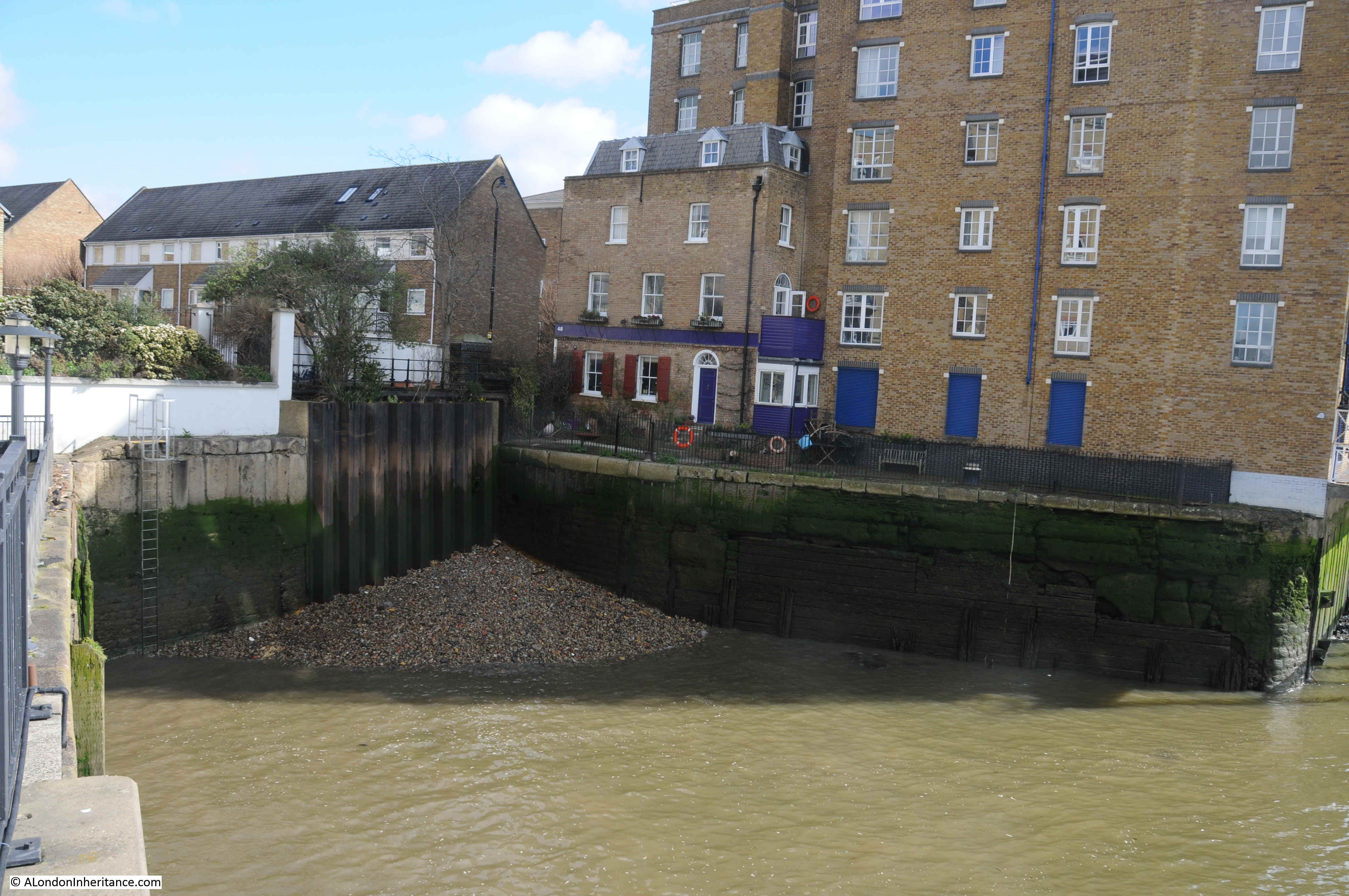
This was the original river entrance where the Limehouse Cut connected to the River Thames.
The Limehouse Cut was opened in 1770 to provide a direct route between the River Thames and the River Lea at Bromley-by-Bow.
The River Lea entered the Thames to the east of the Isle of Dogs, so the Limehouse Cut provided a much shorter route for barges heading to the City and east London by avoiding the need to travel around the full loop of the Isle of Dogs.
The following extract from the 1816 edition of Smith’s New Plan of London shows the Limehouse Cut running as an almost straight line from the River Lea at top right to the Thames, where I have marked the point where the Limehouse Cut connects to the river with a red circle – this is the short channel in my photo above.
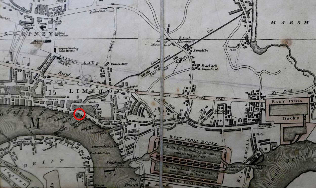
The area to the lower left of the Limehouse Cut was mainly open space, with a limited number of buildings and streets, however this would be changing very soon.
Soon after the 1816 map was published, another canal was built to help with transport across the city. The Regent’s Canal ran from Limehouse and headed north to loop around north London, allowing goods to be transported from the river to the north of the city, thereby avoiding the congested road system.
Part of the Regent’s Canal included a large basin, an expanse of open water just before the point where the Regent’s Canal entered the river. There were warehouses around the basin, and barges would gather, waiting to transit to the river when tides allowed the locks to be open.
The Regent’s Canal Basin, and the entrance to the river was built immediately to the west of the Limehouse Cut.
For eleven years between 1853 and 1864, the Limehouse Cut was diverted into the Regent’s Canal Basin, however after 1864 the original entrance was back in use, with a new bridge carrying Narrow Street over the canal. This would last for another 100 years.
The following extract from the 1955 revision of the Ordnance Survey map shows the Limehouse Cut running from top right down to the River Thames, with the Regent’s Canal Basin immediately to the left, labelled as “Dock” (‘Reproduced with the permission of the National Library of Scotland’).

By 1968 industrial activity in the area had been in long decline as was trade on the Regent’s Canal and Limehouse Cut. The entrance to the river was again closed, and the Limehouse Cut diverted into the Regent’s Canal Basin that was renamed as the Limehouse Basin.
The following extract is from a map of the area today. Limehouse Cut is coming in from top right and diverting straight into Limehouse Basin, I have again circled the original entrance with a red circle (Map © OpenStreetMap contributors).
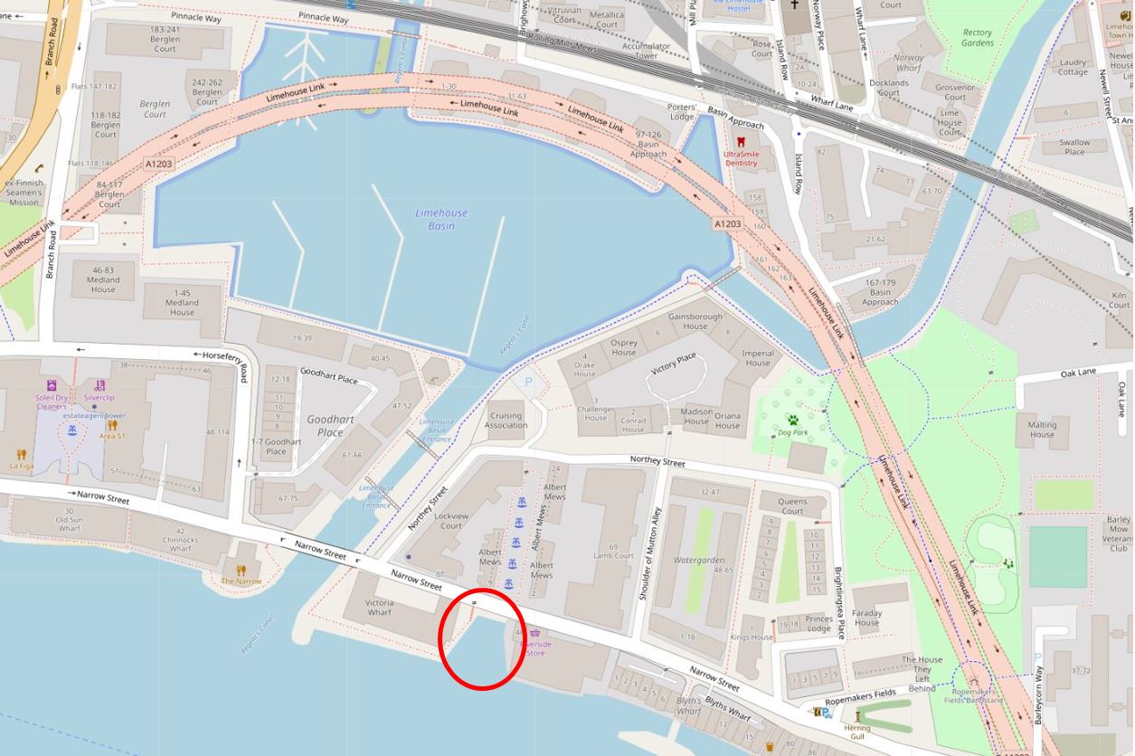
The pink road that appears to loop across the north of the Limehouse Basin is in reality underground as this is the Limehouse Link Tunnel.
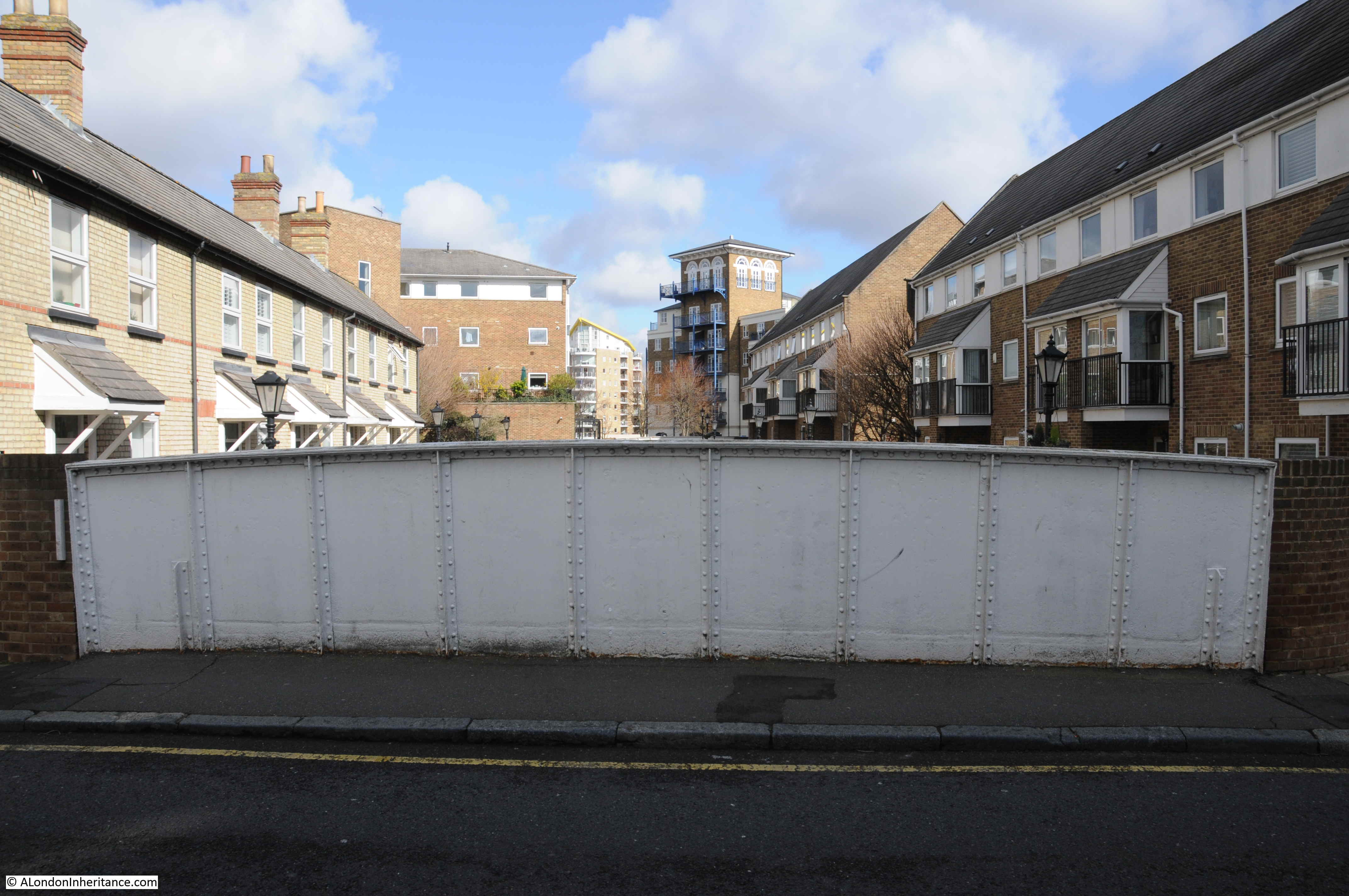
The following view is looking across the old entrance to Limehouse Cut. The wooden boards may well be the original planks that lined the entrance to the canal.

A couple of high explosive bombs landed in the immediate vicinity so the area surrounding the wooden planks may well be repaired bomb damage.
A very faded information board at the old entrance to the Limehouse Cut:
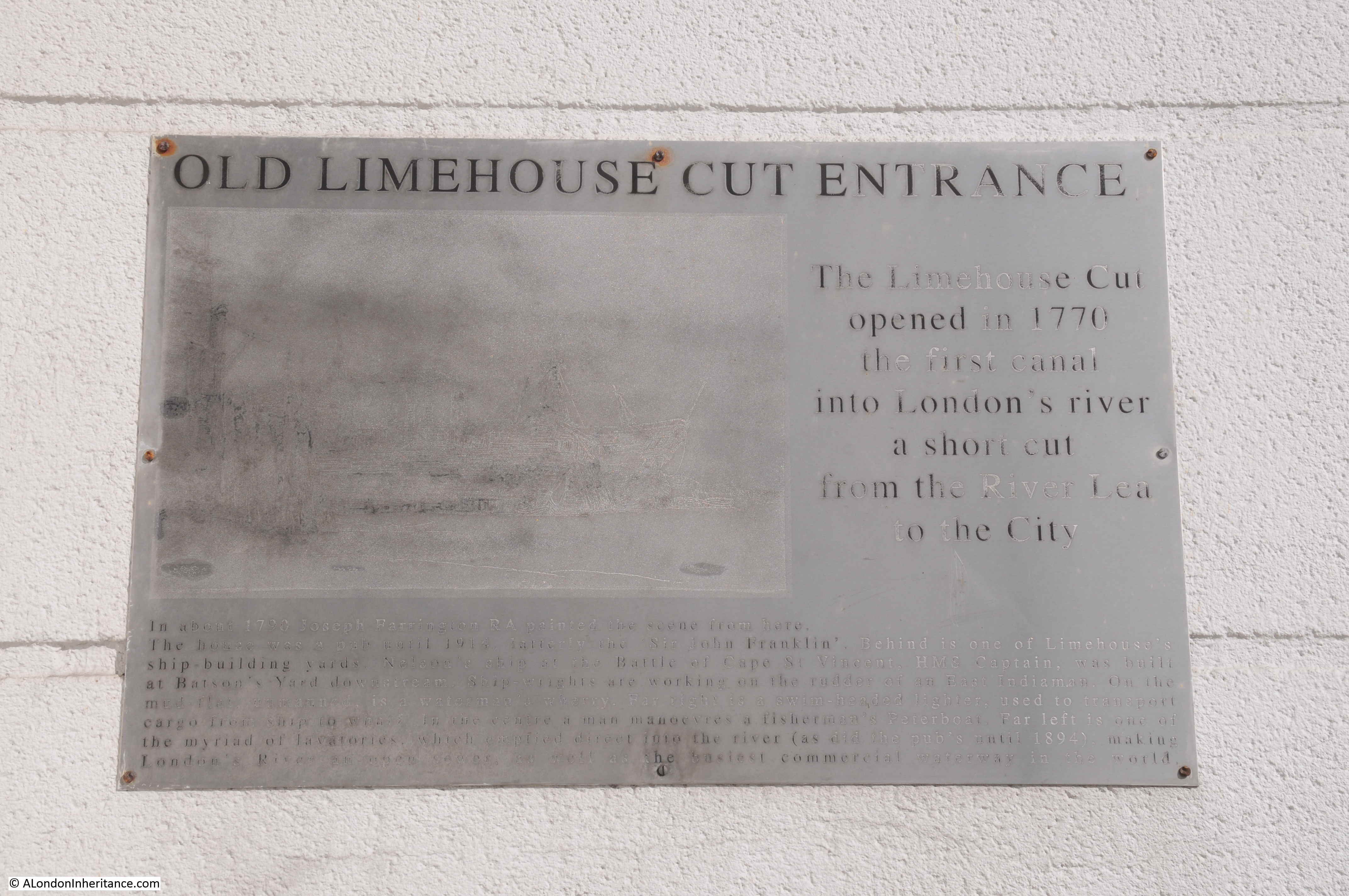
Between 1853 and 1864, the Limehouse Cut had been diverted to the Thames via the Regent’s Canal Basin. In 1864, the original entrance was restored, and a new wrought iron girder bridge was installed to carry Narrow Street over the Limehouse Cut. This 1864 bridge remains in place, although because of the filled in entrance, the bridge is not that obvious apart from the iron side walls as the street is carried over the Limehouse Cut. This is the view from Narrow Street looking south towards the Thames:

The view looking north:
Looking over the northern edge of the bridge, we can see the section of the Limehouse Cut that was originally the lock that controlled access between the non-tidal canal and the tidal river. Much restored late 19th century lock keepers cottages line the western side of the old lock (to the left in the photo below):

The old Regent’s Canal Basin, now the smaller Limehouse Basin, today hosts a marina, and provides links with the River Thames, Regent’s Canal and via the Limehouse Cut, the River Lea, and are all really interesting walks.
The old Limehouse Cut entrance is evidence of the canal’s original 1770 route into the River Thames for one of London’s early transport systems.
Angel Underground Station
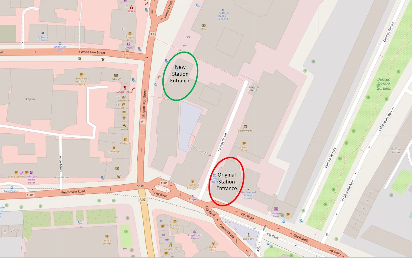
Today, the entrance to Angel Underground Station is on the corner of a modern brick office block, facing onto Islington High Street. It has not always been in this position.
To find the original station, you need to walk south to the junction of Islington High Street with Pentonville Road, and walk a short distance along City Road and on the left is a rather strange looking building:
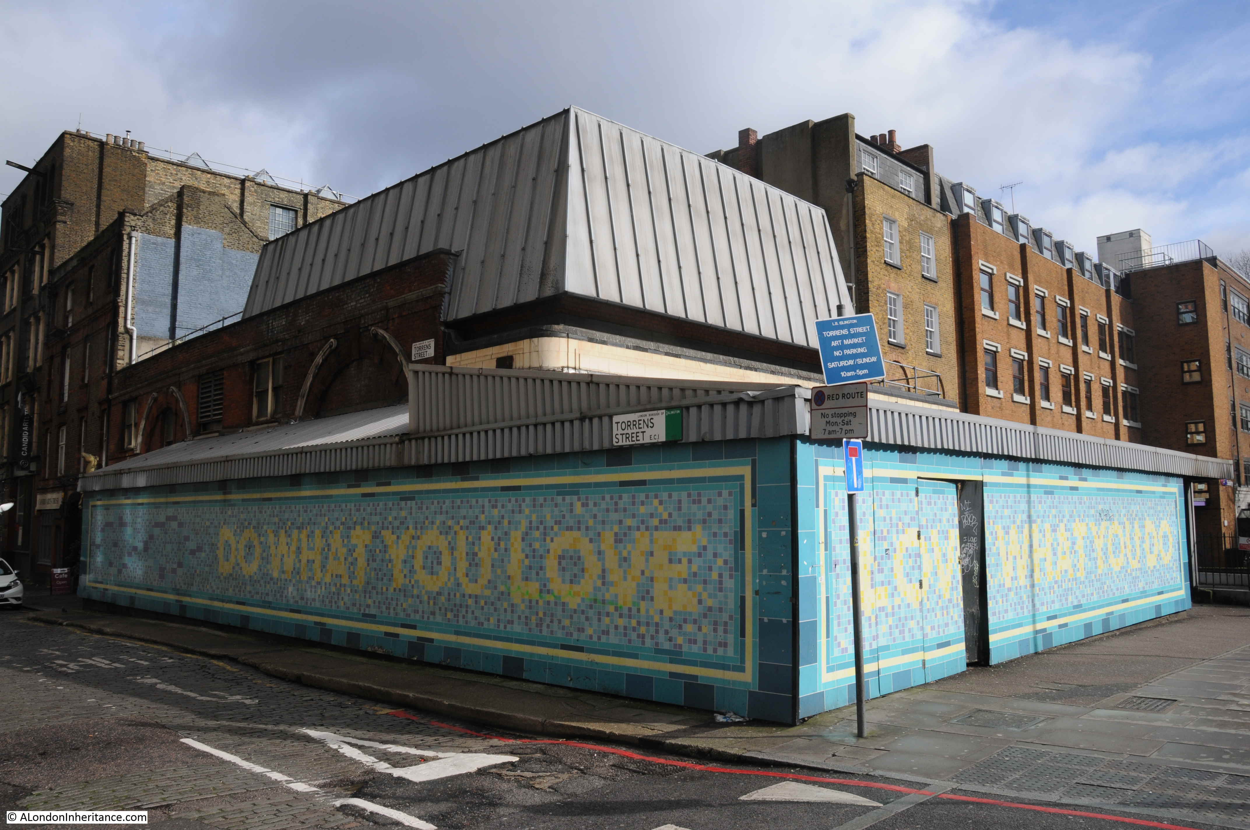
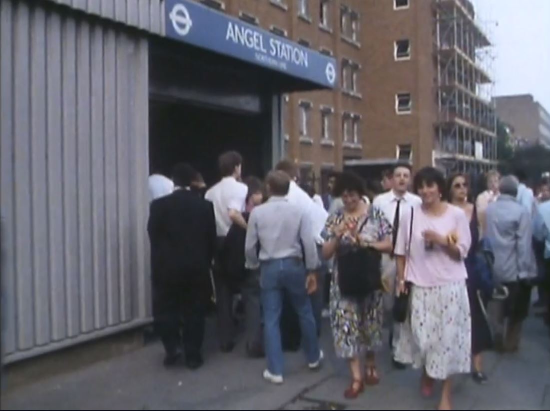
This is the original Angel Underground Station.
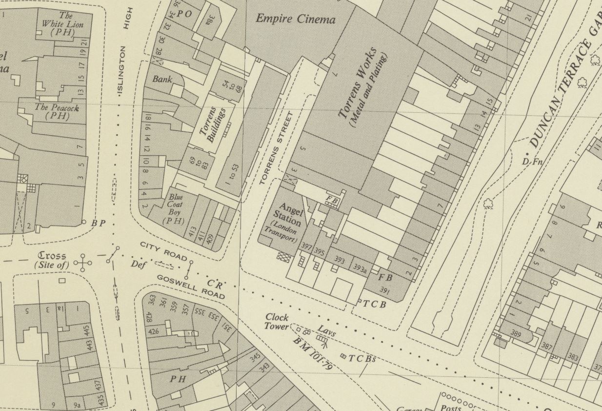
The Angel Station opened in 1901 as part of the City and South London extension from Moorgate. Six years later in 1907, the line was extended on towards Euston station. Today, Angel Station is on the Bank branch of the Northern Line. The following extract from the 1954 Ordnance Survey Map shows the original station in the centre of the map, on the corner of City Road and Torrens Street. This is the station building photographed above (‘Reproduced with the permission of the National Library of Scotland’).
The location of the old and new stations can be seen in the following map (Map © OpenStreetMap contributors):
When Angel Station was built, it had a narrow central platform, with both tracks running either side of the platform. Whilst this was probably fine for the short period of time before the line was extended, it was a rather dangerous place when the platform was crowded, and busy trains ran in both directions.
The following clip is from the 1989 BBC film Heart of the Angel (link at the end of the post), showing the crowded platform.

From the same film is a clip of the 1989 entrance to the station, looking down City Road and is on the right of my photo of the station at the top of this section of the post.
The platforms were also served by lifts from the ground level building. The exterior cladding around the original brick building was a later addition to provide extra space. The view down Torrens Street with the station on the right:
By the late 1980s, the station had a long history of overcrowding along the narrow single platform. It would frequently be rather chaotic when two trains pulled in, with passengers leaving both trains onto a narrow platform full of passengers waiting to get on the trains.
The lifts were also relatively small for the number of passengers at busy times and would also frequently break down. At the end of the 1980s a major rebuild of the station began.

A new tunnel was excavated to take the northern branch, thereby separating the northern and southern tracks so each could have their own platform. The southern branch today occupies the space of the original tunnel so has a rather wide platform compared to a normal station, as the platform occupies the space of the original platform and the northern tracks.
Escalators were installed to avoid the use of lifts, and these took passengers between the platforms and the new station entrance on Islington High Street.
The new station opened in 1992, leaving the original station building to sit on the corner of City Road and Torrens Street.

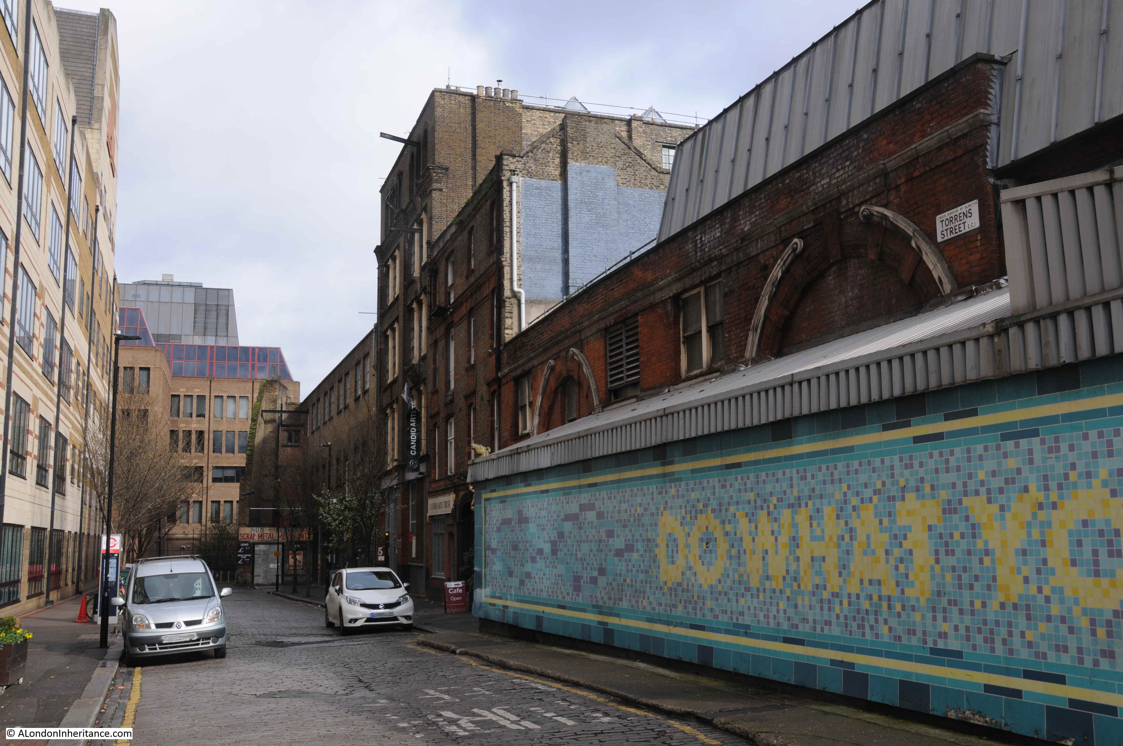
Crossrail 2 includes a station at Angel, and the complete eastern side of Torrens Street, including the original station building, was designated in the safeguarding map of sites for Crossrail 2 construction and operation.
The following view looks along Torrens Street at the buildings included in the safeguarding map.
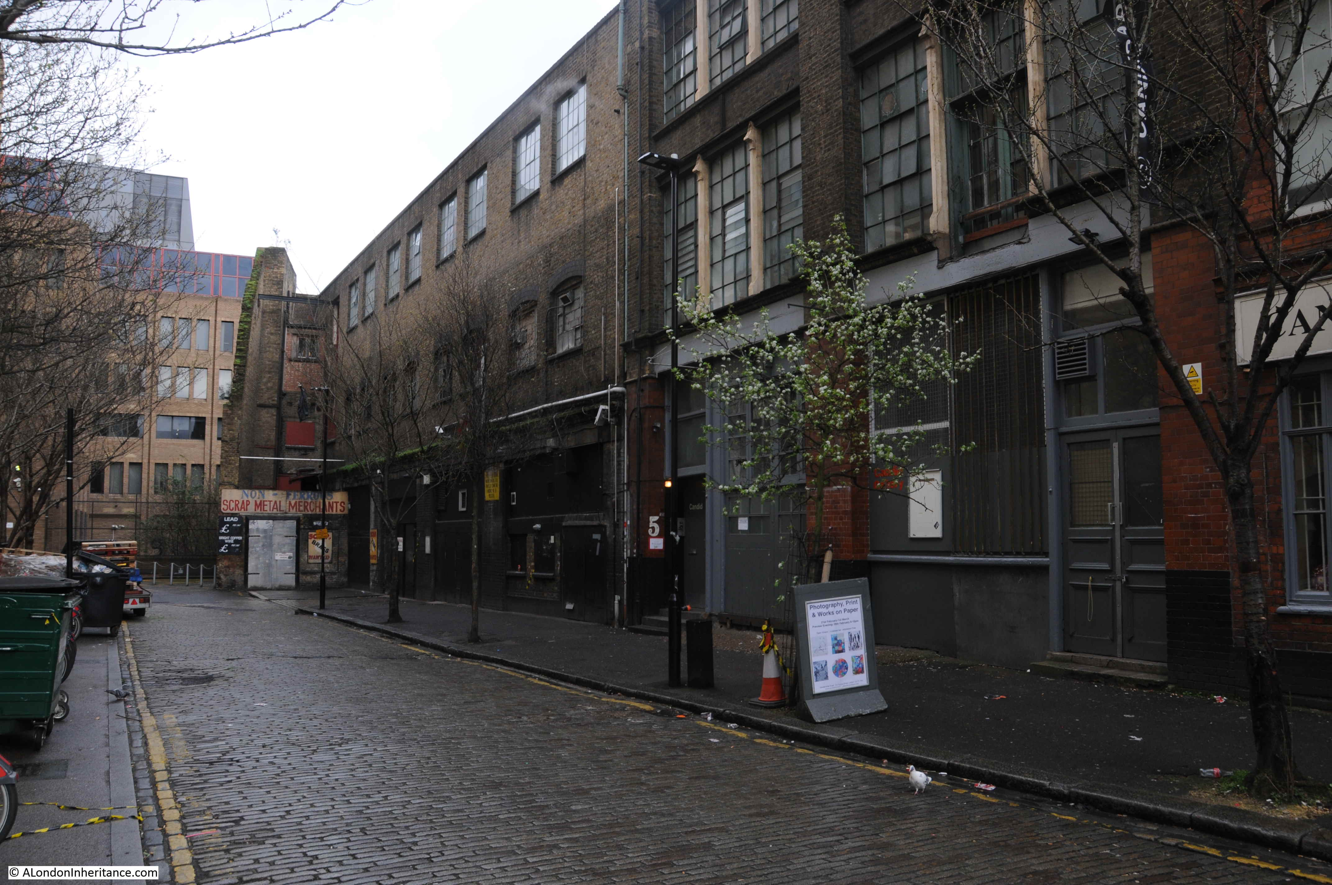
The buildings along this side of the street are an interesting mix of old warehouses.
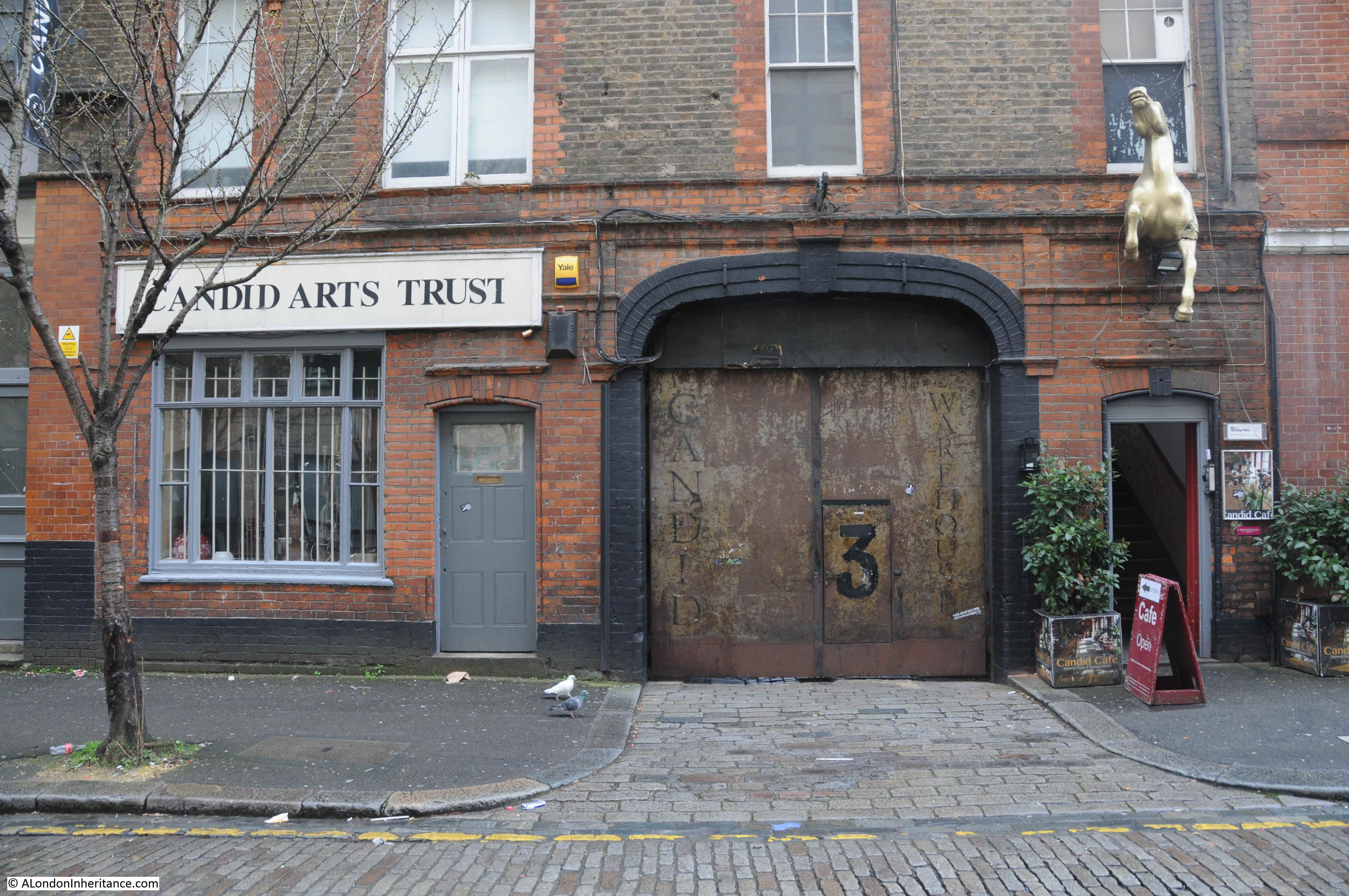
Candid Arts Trust occupies a 19th century warehouse:
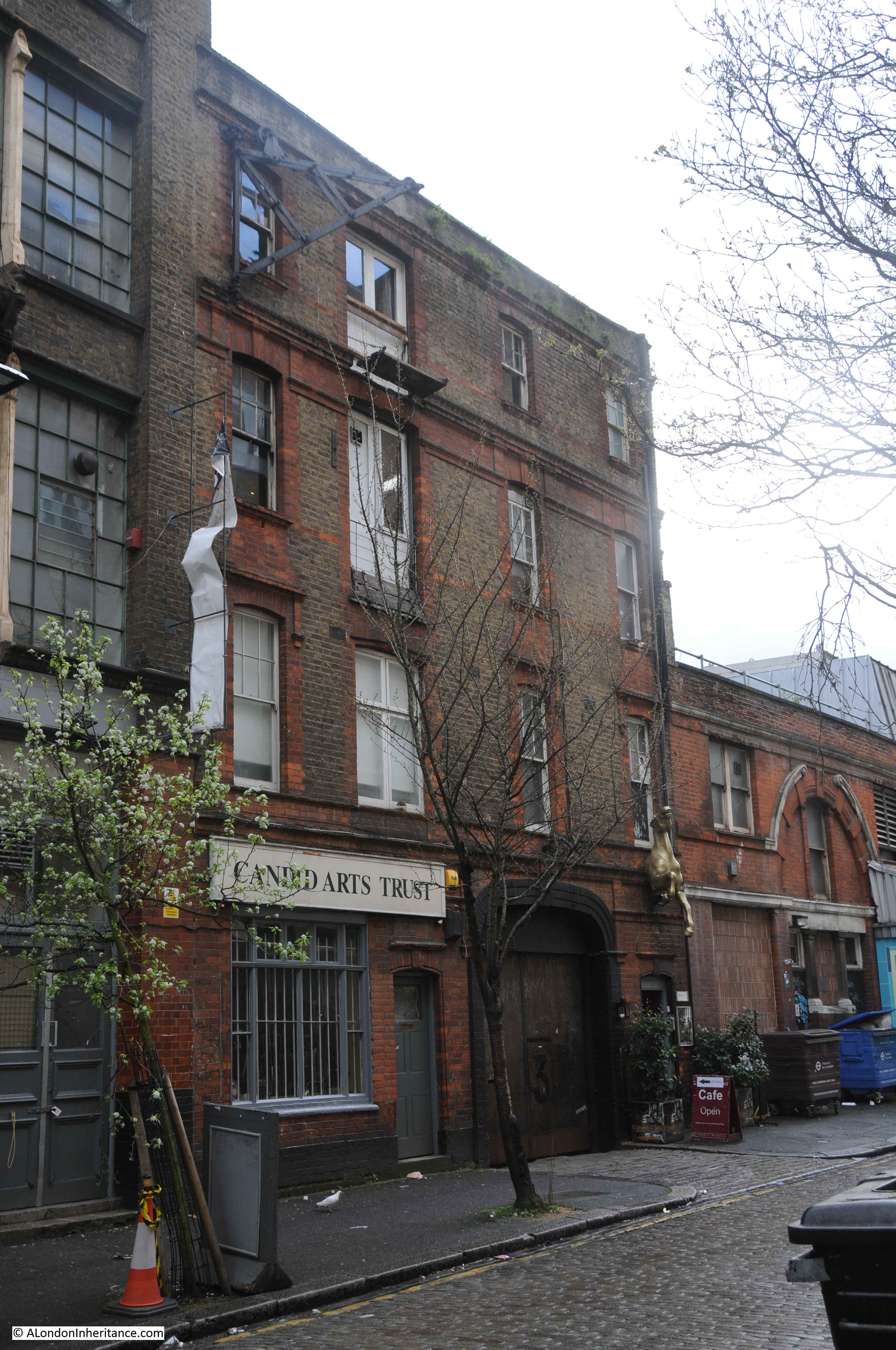
And at the end of the street is an early 20th century building that was constructed on the site of a smithy and may have been used to stable horses, however it would be occupied by a metal working and plating company.

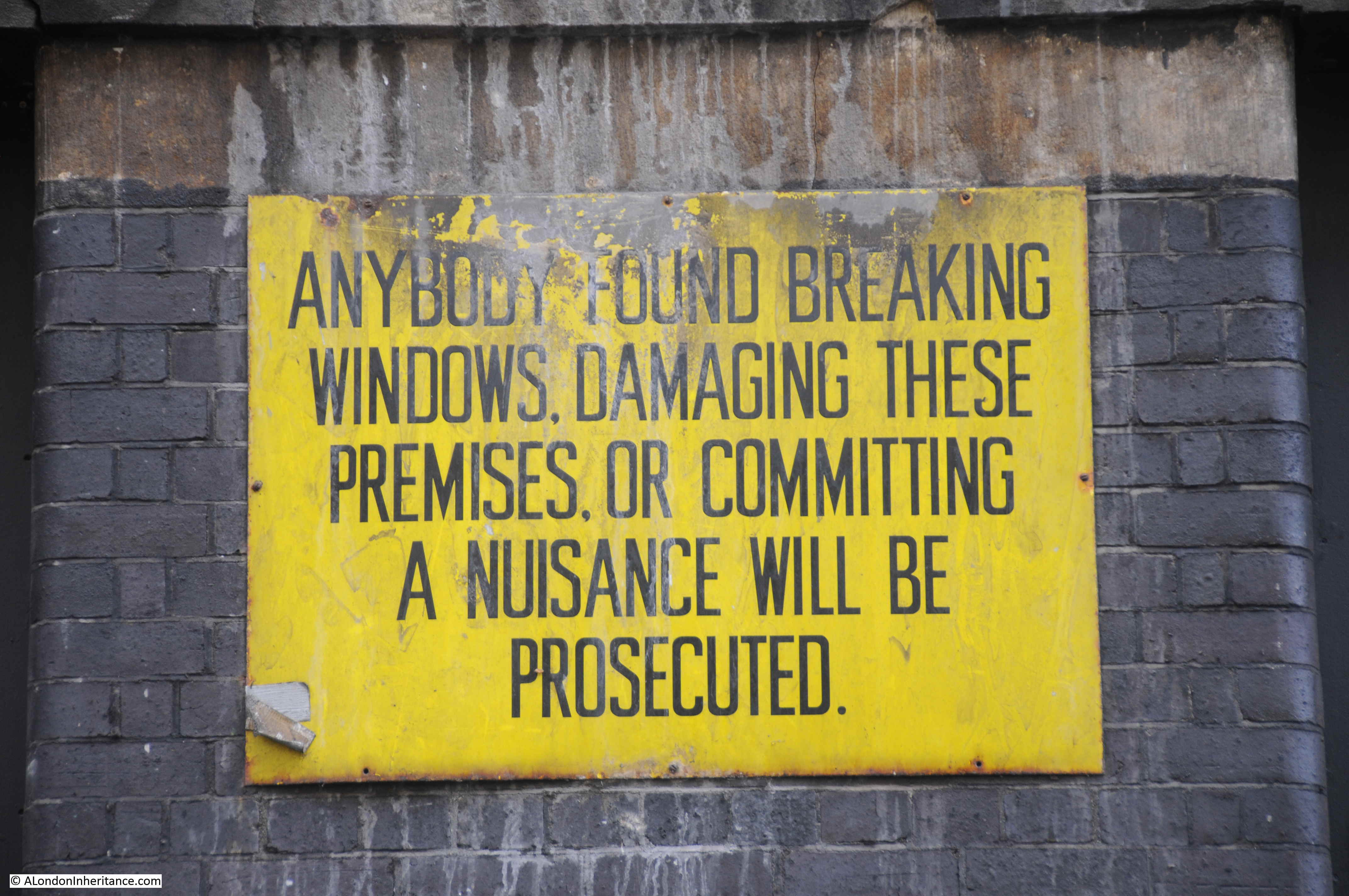
And there is still evidence of this activity:
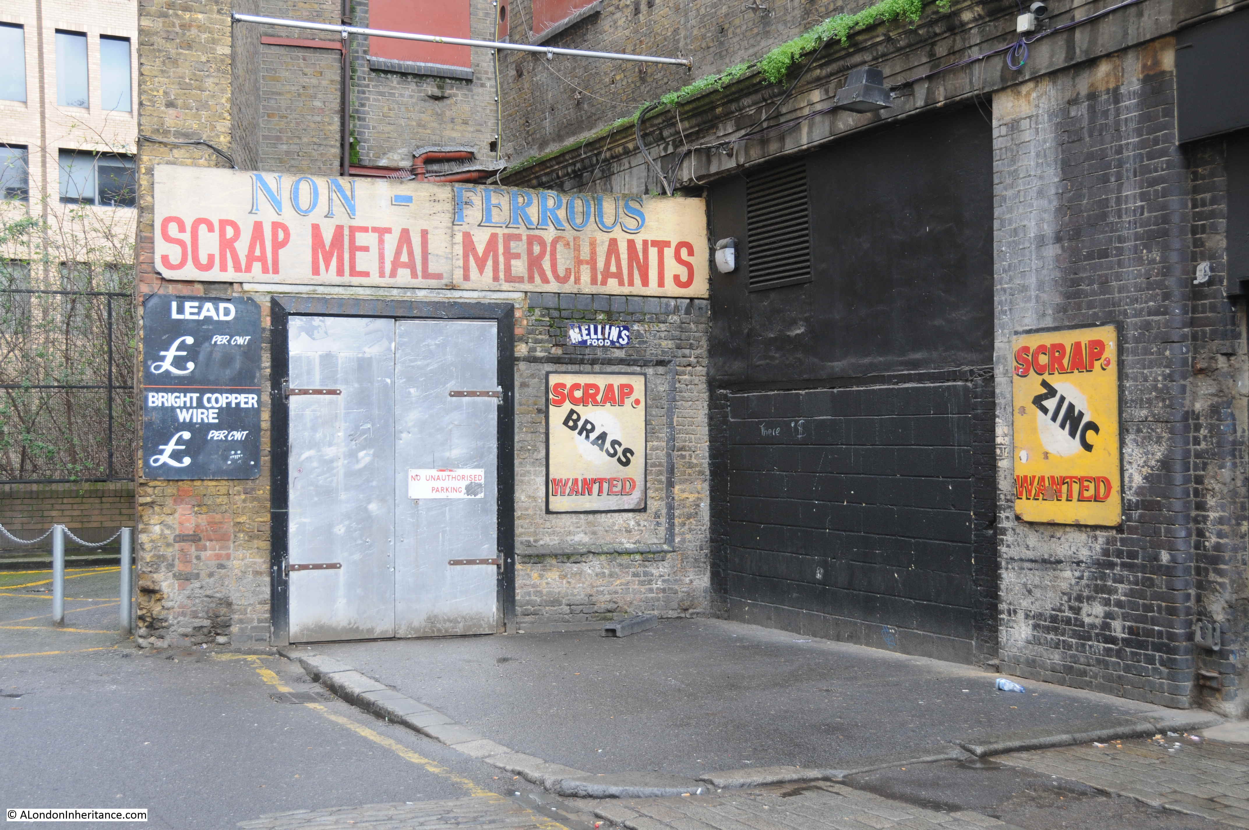
The building is now occupied by the “Islington Metal Works” – run by a hospitality company and the site is used for Wedding Receptions, Corporate and Christmas events.
The link between these two very different sites, in different parts of London is hopefully now clear; that they are the redundant entrances to once busy transport links that have now been diverted.
The entrance to the Limehouse Cut was once a busy route for barges moving between the Lee River and the River Thames, with the Limehouse Cut now diverted into Limehouse Basin.
The original entrance to the Angel underground station has now been closed for some thirty years, with passengers now diverted along escalators rather than lifts to the new station entrance on Islington High Street, with a considerably improved and safer platform layout at the station.
There are many examples of these across London where the ever changing transport system adapts to changing technology, different patterns of use and improvements.
A film was made for the BBC 40 Minutes series in 1989 documenting 48 hours in the life of the Angel station.
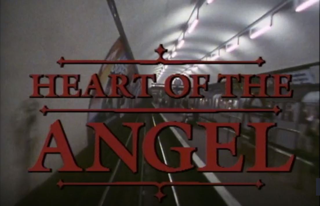
Heart of the Angel was made by the BAFTA award winning director Molly Dineen, and it is a very honest portrayal of a station struggling to cope with the numbers of passengers using the station and the creaking infrastructure supporting the station.
if you have a spare 40 minutes, it is well worth a watch and can be found here.
For years I have wondered at that strange corner, like a triangular beach, at Limehouse. And now all is explained! Thanks!
I moved to London in 1988, so the year before Molly Dineen’s film. Those stills show how much the place has changed in that time, even if we don’t always realise it. I’ll certainly watch the film over the next few days.
Clapham Common and Claphan North on the Northen Line still have their island platforms I think. In the 1960’s and 70’s I used to pass these every day on my commute to work and was fascinated enough to alight from the train now and again just to stand there and feel what is was like on the platform with a track on both sides.
I am so glad you are bringing attention to Molly Dineen’s documentary. Way back in 1968, I did my first teaching practice at the primary school on Duncan Street, so I’d take the Northern Line from Baker Street to the old Angel station & walk down lovely Duncan Terrace to get to work. Oh, those lifts! Some mornings, they made getting out to the City Road an achievement in itself. In “Heart of the Angel,” the lift attendants vie with the nighttime fluffers for star billing!
Excellent article, as ever. Until recently, there was another oddity down Torrens Street: this military tank, which could be hired. https://flic.kr/p/oav14R
Angel was a dreadful station- busy , dangerous and creepy . I rarely used it , even though I only lived behind Sadlers Wells. The new station is fantastic- there cheers for technology and funding . I have never walked around Torrens St- I shall remedy that.
Txs for an interesting post.
Your post didn’t reach either me or my husband’s e-mail inbox this week,so I expect we are in the muddle somewhere. But, as you see,I have come to it via your web page. (I’ll let the other half read it later)
Hope you get sorted out soon. Keep up the good work!
I was a bit taken aback to discover that the current Angel station entrance opened as long ago as 1992 – I still think of it as recent ! I moved to London that year, and as my girlfriend at the time worked in St John Street, I can very clearly remember using the old station when I came to meet her for lunch, as well as the triumphant opening of the gleaming – and extremely long – new escalators. It’s very hard to believe that was nearly three decades ago…
I live in Clapton now and I often explore the lower reaches of the Lee Valley and the Limehouse Cut – a circular walk / run along the Hertford Union Canal, Regents Canal, Limehouse Basin, Limehouse Cut, and Lee Navigation via Bow Locks and Three Mills is a regular route. But I hadn’t realised how the Cut used to enter the river until I read this – and I also hadn’t realised that I am directly over the Limehouse Link Tunnel whenever I follow the path along the North side of the marina. Thanks for both revelations.
Glad i got your blog up on the website i did not receive it last week from a selfish point of you glad there was a tangible reason very interesting read as usual.
Thank you so much for your posts. They bring my family history research to life! In the Will of James Sheppard, Mastmaker of Wapping Wall, proved on 16th June 1774, there are references to ‘freehold land or ground situate at Limehouse Breach near Poplar Cut, and freehold land situate on the north side of the New Cut from Limehouse to Bromley……..’
I lived in a block of flats in Poplar overlooking the “Cut.” Memories of coal barges being unloaded at the railway works in Devons road. A busy transport hub in the 1950s and 60s. Big canal walls to keep the kids from drowning! No public access like today, but then no chance now to play ‘chicken’ by climbing over the walls and hope your mum and dad never saw you (they always did….)
I watched Heart of the Angel when it was first shown, and Dineen was the current thing. All that time ago, wow. The escalators at Angel are the longest in London, or were at least. In retrospect the station design was the first of of the new style of rather bland finishes that have now mutated into rather crude ones – concrete, metal, poor quality mosaic. Ah well.