
For today’s post, I am in Carlton House Terrace. It is one of my favourite types of post as I am looking for a place that has been demolished, the site has changed significantly, however I can still find part of a building that helps to confirm the location.
The following photo was taken by my father in 1949, and shows a house in some form of courtyard, with some steps to a street on the right.
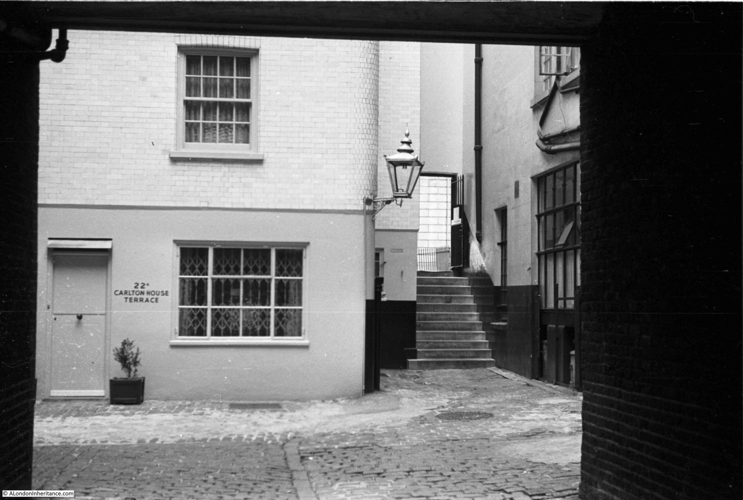
The location should be easy to find as the house has the address 22A Carlton House Terrace next to the door. The photo appears to have been taken from underneath some form of archway.
As well as finding the location of the above photo, I took a walk through the area to the north of Carlton House Terrace to explore the stairs and streets which few people seem to walk.
The following map shows my route, starting at S, where Carlton House Terrace meets Waterloo Place, and ending at E, on Pall Mall. Also on the map, the arrow shows the location of the photo (start of the arrow) pointing in the direction of the stairs through to the wall seen in the background of the stairs in the 1949 photo. Although there is a very different building on the site today, I will explain how I found the location in the rest of the post (Map © OpenStreetMap contributors).

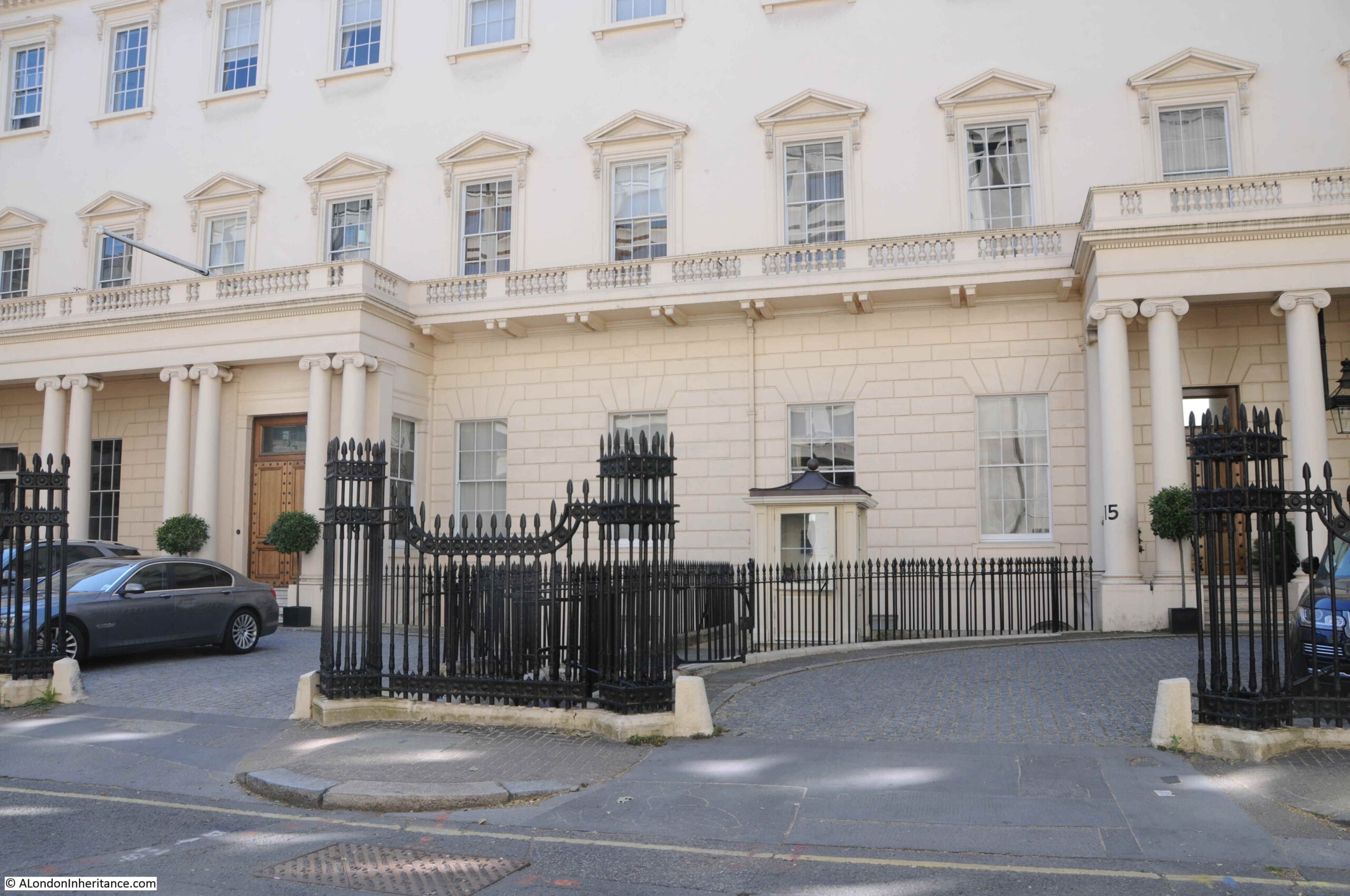
This is the view along Carlton House Terrace from the junction with Waterloo Place. The street is a dead end with no exit for vehicles.
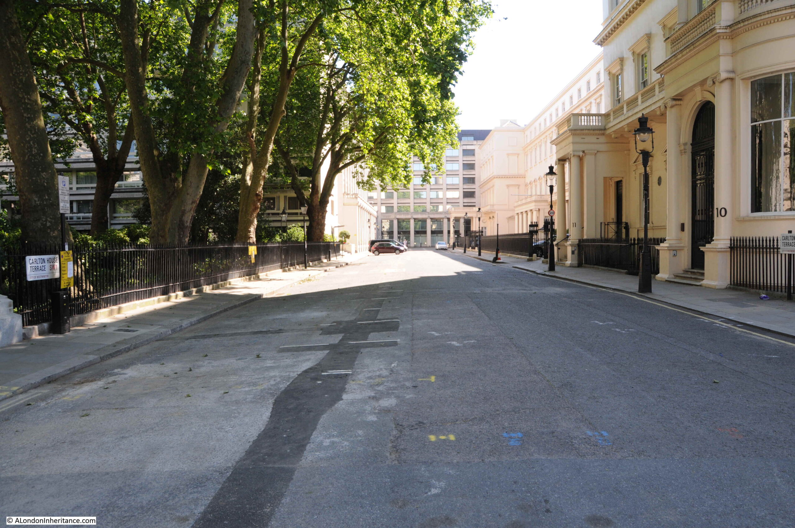
On the right of the above photo are the houses that were originally part of the plan by the architect John Nash to enhance the background to St James’s Park as the other side of the houses face onto The Mall, with the park on the other side.
Although part of the plans developed by Nash, much of the terrace seems to have been heavily influenced by architect Decimus Burton. The terrace was constructed in 1831.
Carlton House Terrace consists of a run of terrace houses, divided by the stairs that lead down from the end of Waterloo Place down to The Mall. The houses provide an impressive background to the northern edge of The Mall, however it is in Carlton House Terrace that we find the front of the buildings with their entrances and forecourts, and facades whilst not as impressive as on The Mall, still with considerable grandeur.
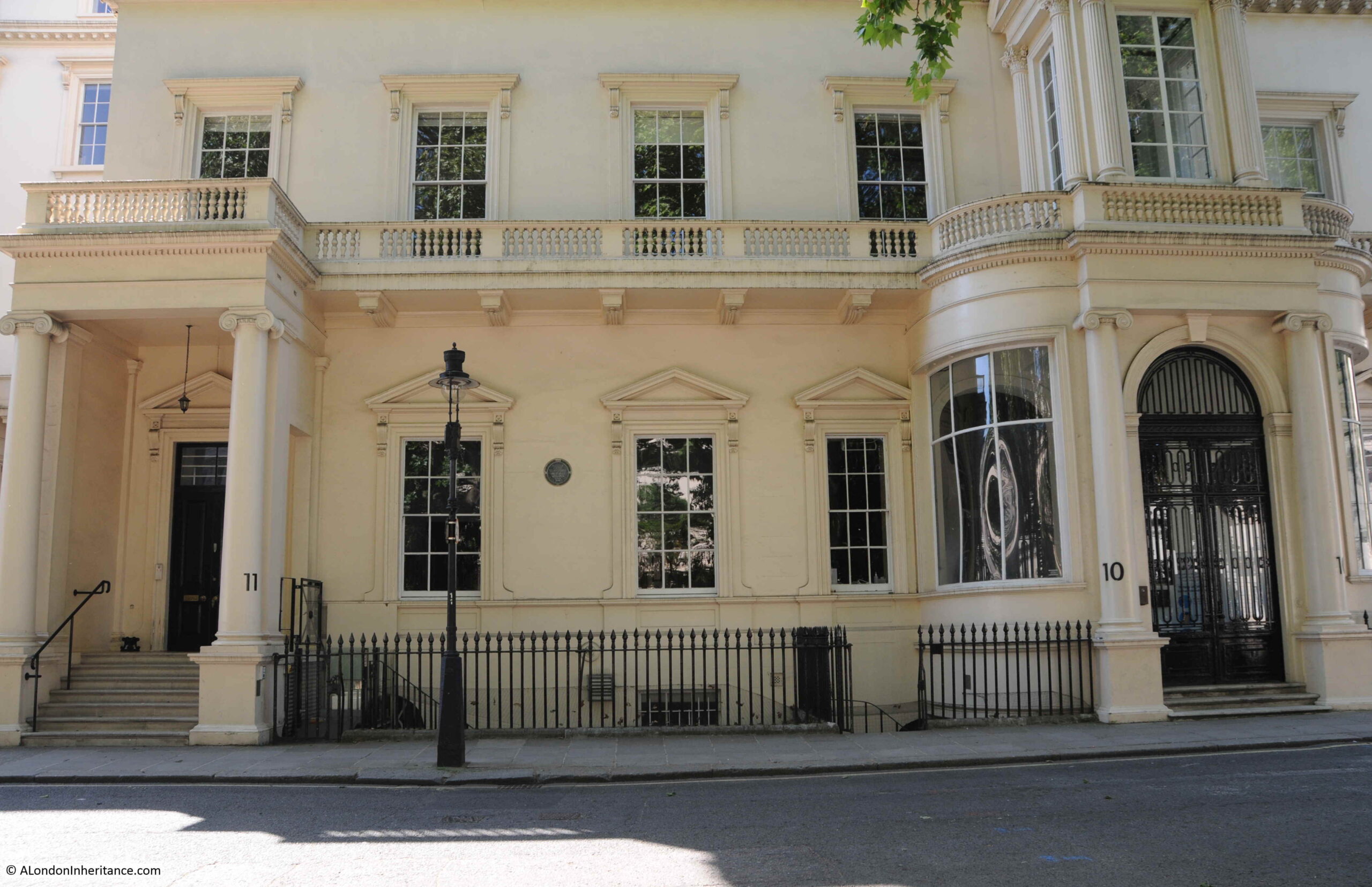
The round plaque in the above photo records that William Gladstone, the Liberal politician and Prime Minister lived in the house.
The view along the southern edge of Carlton House Terrace. The rear of these buildings face onto The Mall:
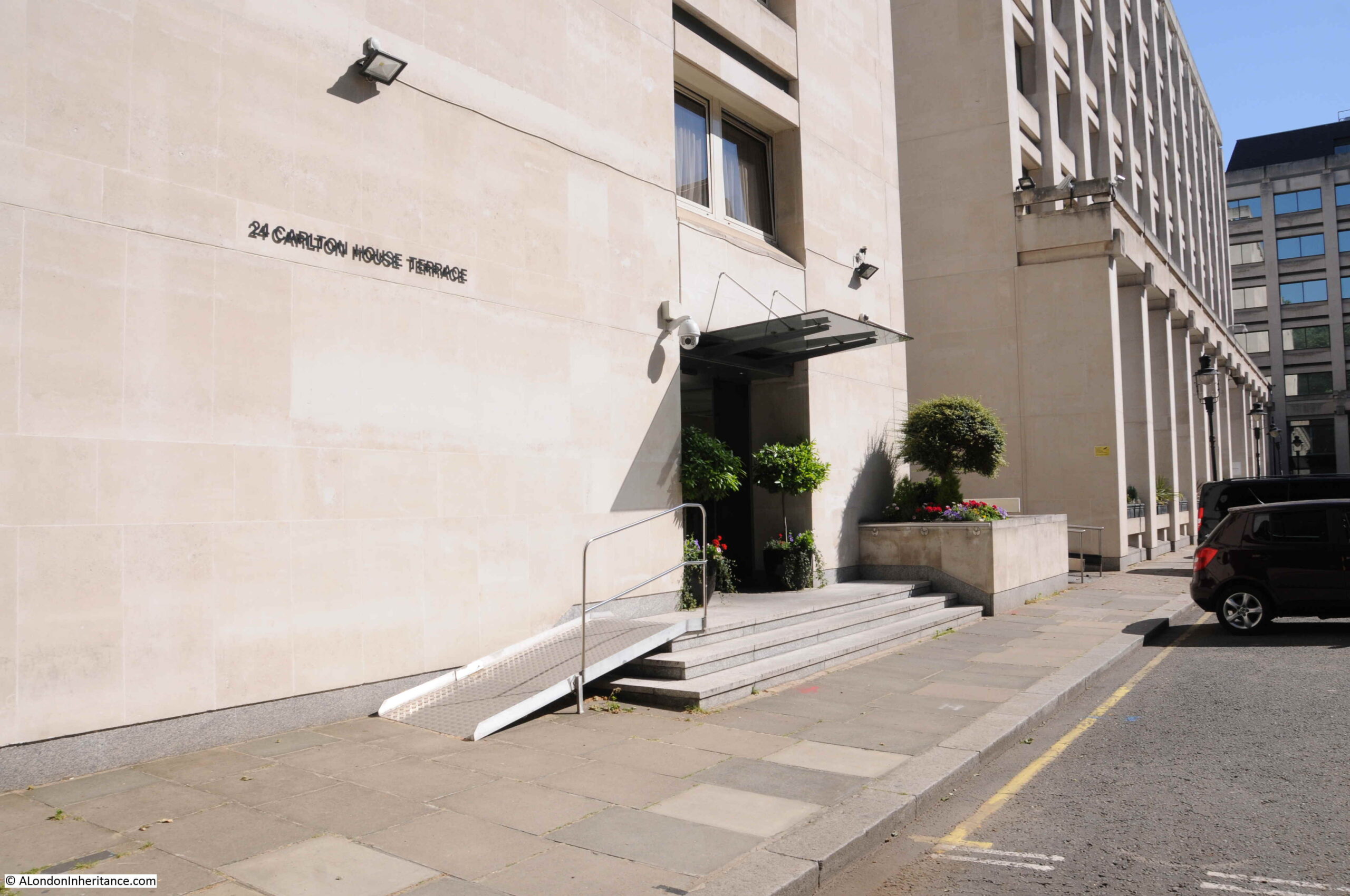
On the opposite side of the street is a relatively modern development. The number on the first building – 24 Carlton House Terrace – shows that the building is close to the 22A in my father’s photo.
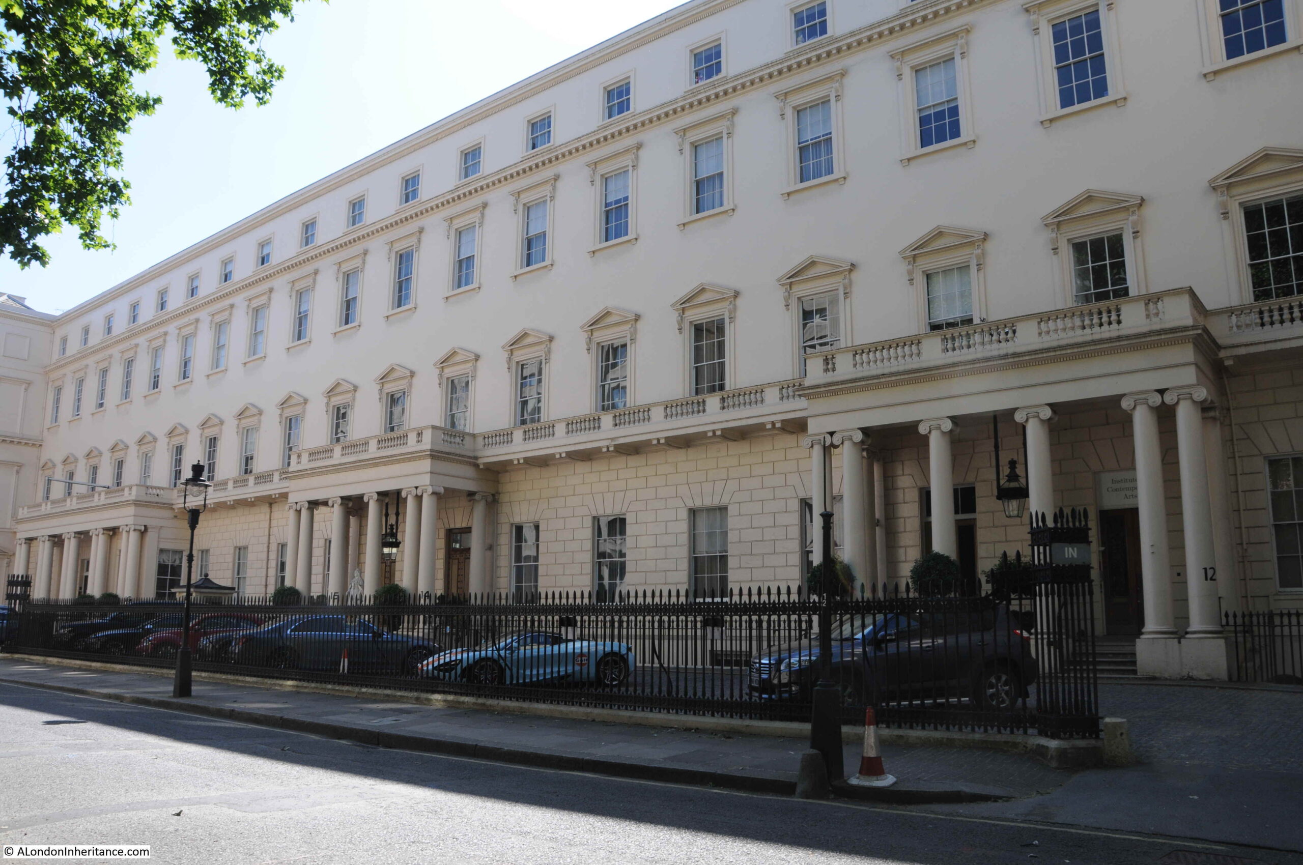
A wider view of the northern side of Carlton House Terrace.
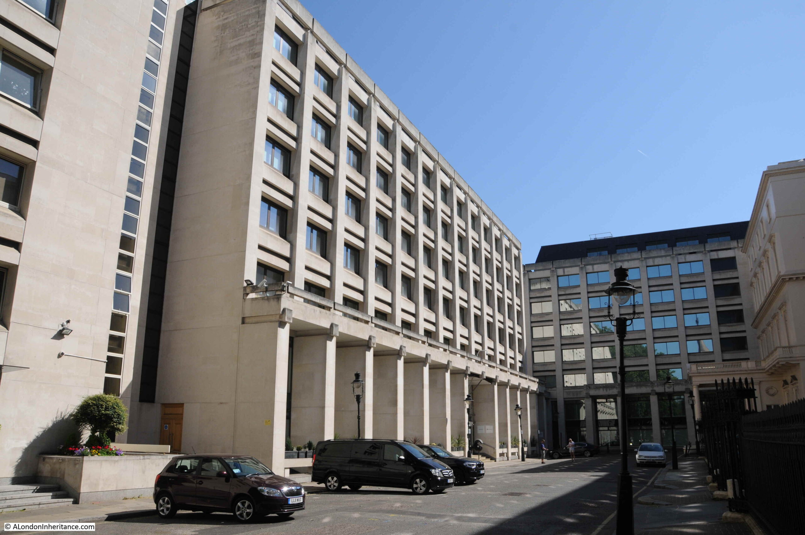
The large building on the left dates from the 1970s and is the former head office of the mining company Anglo American. It is this building that is on the site of my father’s photo.
To identify the location, I turned to the 1951 revision of the Ordnance Survey map as this was only two years after my father’s photo.
In the following photo I have marked the position from where the photo was taken with the red dot (‘Reproduced with the permission of the National Library of Scotland’).
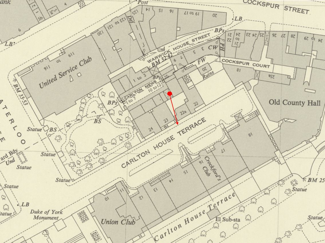
The red dot is under a feature which has an X arcros the dark grey for a building. The use of X is to show a building which has a walk / roadway through at ground level, and the buildings continue above. This explains the dark walls of such a feature on either side and above the immediate location of the 1949 photo.
Following the arrow across the open courtyard, and on the left of number 22A is the symbol for a set of stairs, exactly as seen in my father’s photo.
As usual, there is so much to discover in these maps. To the right of the above map is a building labelled “Old County Hall”. If we go back further to the 1895 Ordnance Survey map, we can see the same building labelled London County Council Office (‘Reproduced with the permission of the National Library of Scotland’).
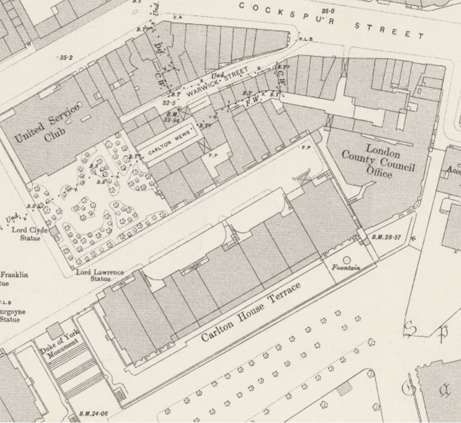
This was the first offices of the London County Coucil after it was formed in 1889, and prior to the move to County Hall on the Southbank in 1922. Prior to the London County Council, the building was occupied by the Metropolitan Board of Works, which the London County Council replaced.
The above 1895 map also shows the same features as the 1951 map, providing confirmation of the same features in my father’s photo.
if you look at the above two maps, the arrow in the first map is pointing to the houses on the south side of Carlton House Terrace, and there is a curving feature to the edge of the forecourt in the centre of the terrace.
The same feature can be found today, with the railings curving from street to building:
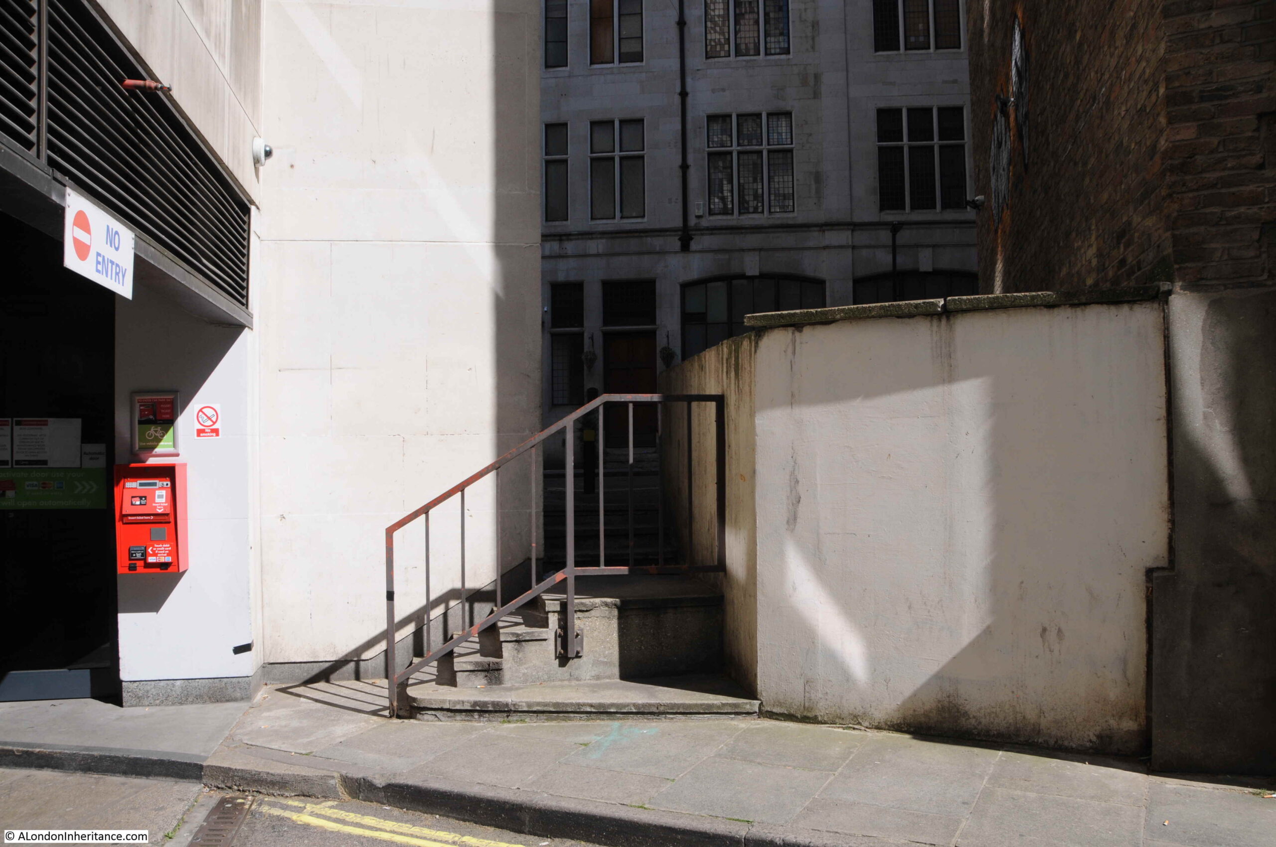
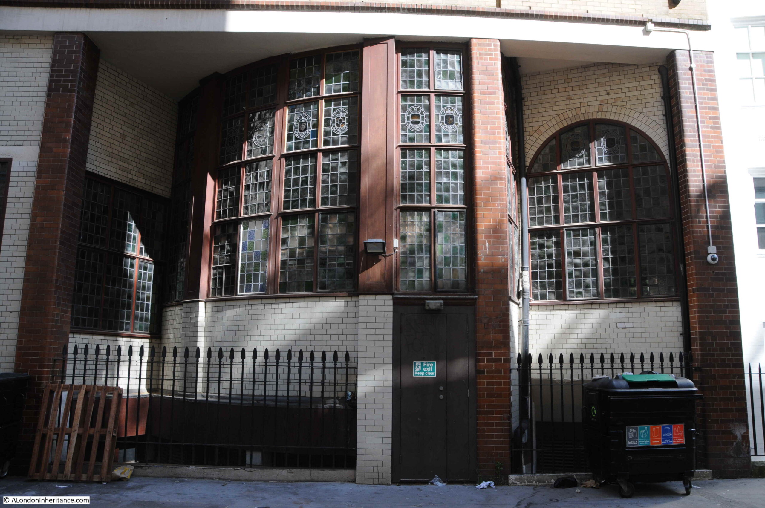
My father’s photo is looking towards some stairs which lead up to Carlton House Terrace, and through the gap above the stairs we can see part of the wall of a building.
To the left of the hut in the above photo is a drain pipe, and this can also be seen above the stairs. In the following photo, I have outlined the area of wall in red and included an extract from the 1951 photo to show the same area of wall.
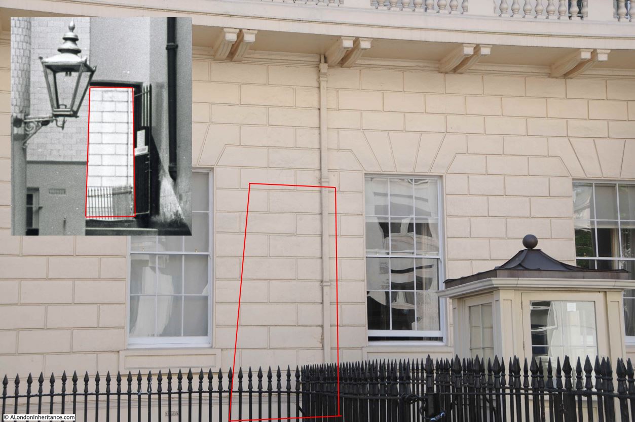
The following photo is from the south side of Carlton House Terrace, in front of the building in the above photo, looking across to the location of the stairs in my father’s photo. If I have worked out the exact location correctly, the stairs were just behind the car in the middle of the photo.
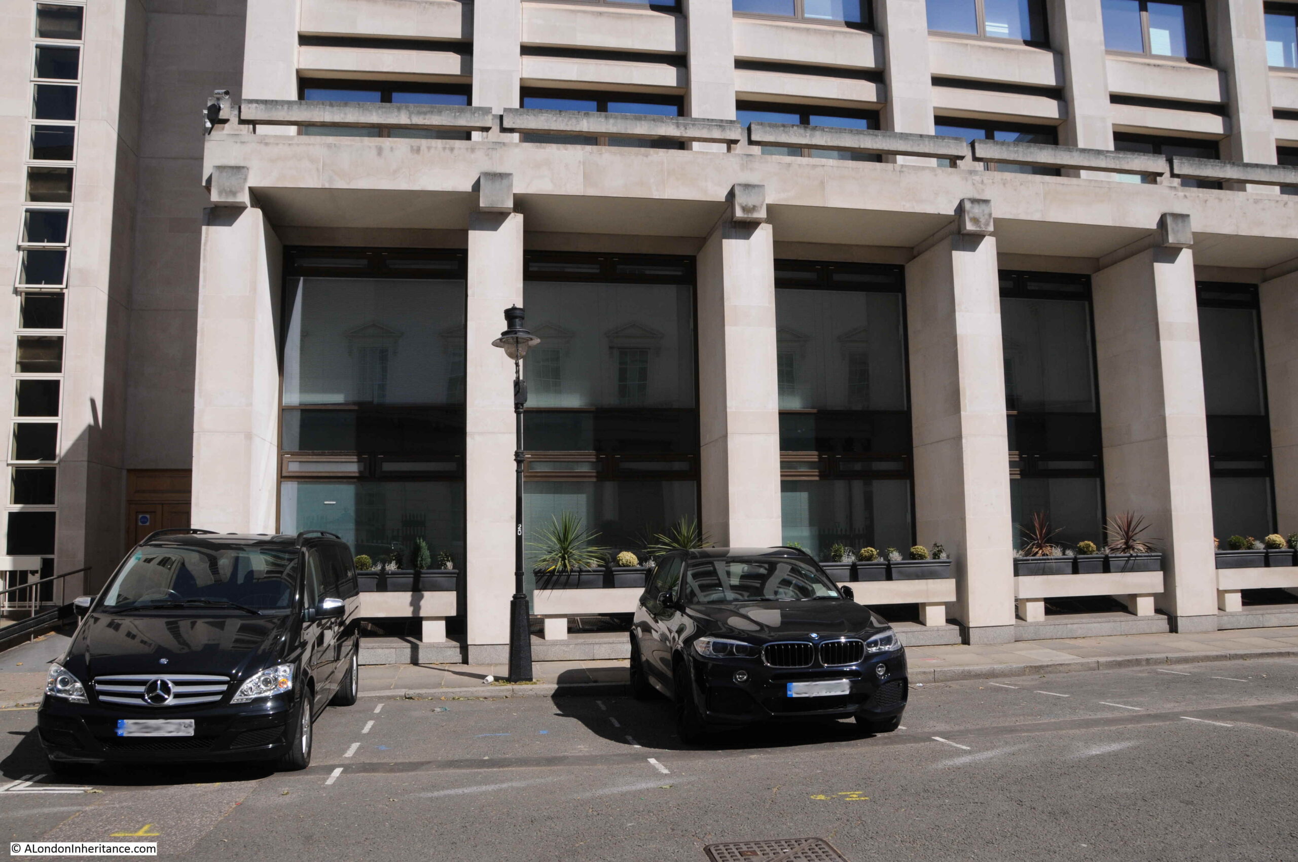
The above building was built during the 1970s. I cannot find when the buildings, courtyard and stairs in my father’s photo were demolished, however I suspect they were part of the demolitions to free up space for the building which now covers much of the northern side of this stretch of Carlton House Terrace, and occupy a large area of space back to Warwick House Street.
The following photo is from the eastern end of Carlton House Terrace, looking back to the junction with Waterloo Place and the stairs down to The Mall. The Duke of York’s Column (dating from 1834) which marks the stairs to the Mall and the split between the two sections of the terrace can be seen in the distance.

The street and terrace are named after Carlton House, which occupied much of the space now occupied by Waterloo Place. Carlton House had a considerable area of gardens which covered the space where today we can find the two sections of the terrace, on either side of the Duke of York’s Column.
I will save the story of the house and the rest of the terrace for another post, as my walk explored a couple of the streets to the north, between the terrace and Cockspur Street / Pall Mall (see map at start of the post).
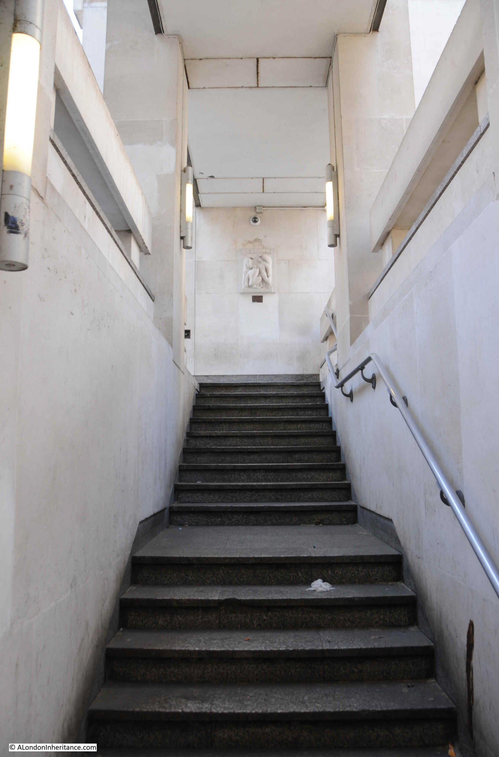
Although Carlton House Terrace is a dead end for traffic, there is an exit for pedestrians, with some stairs at the far north eastern corner of the terrace.
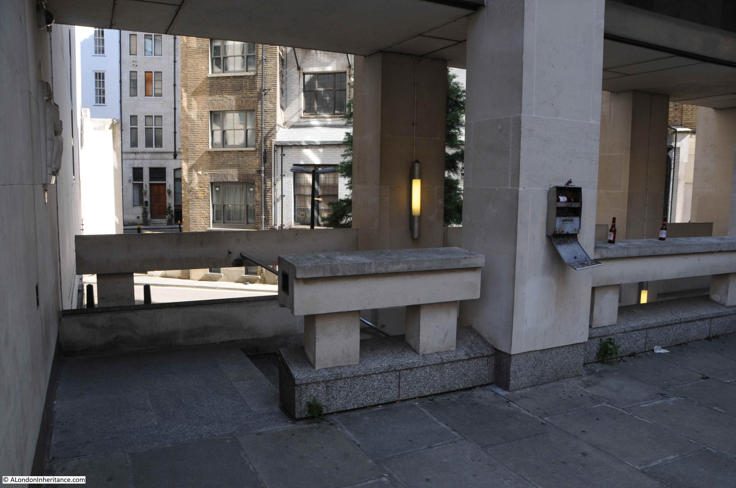
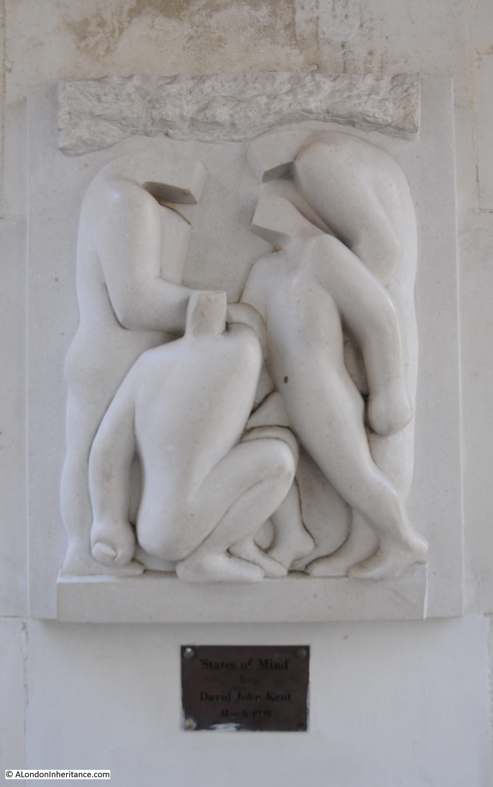
Looking back up the stairs, and there is an artwork by the sculptor David John Kent titled “States of Mind” at the top of the stairs:
Close up view of “States of Mind”:
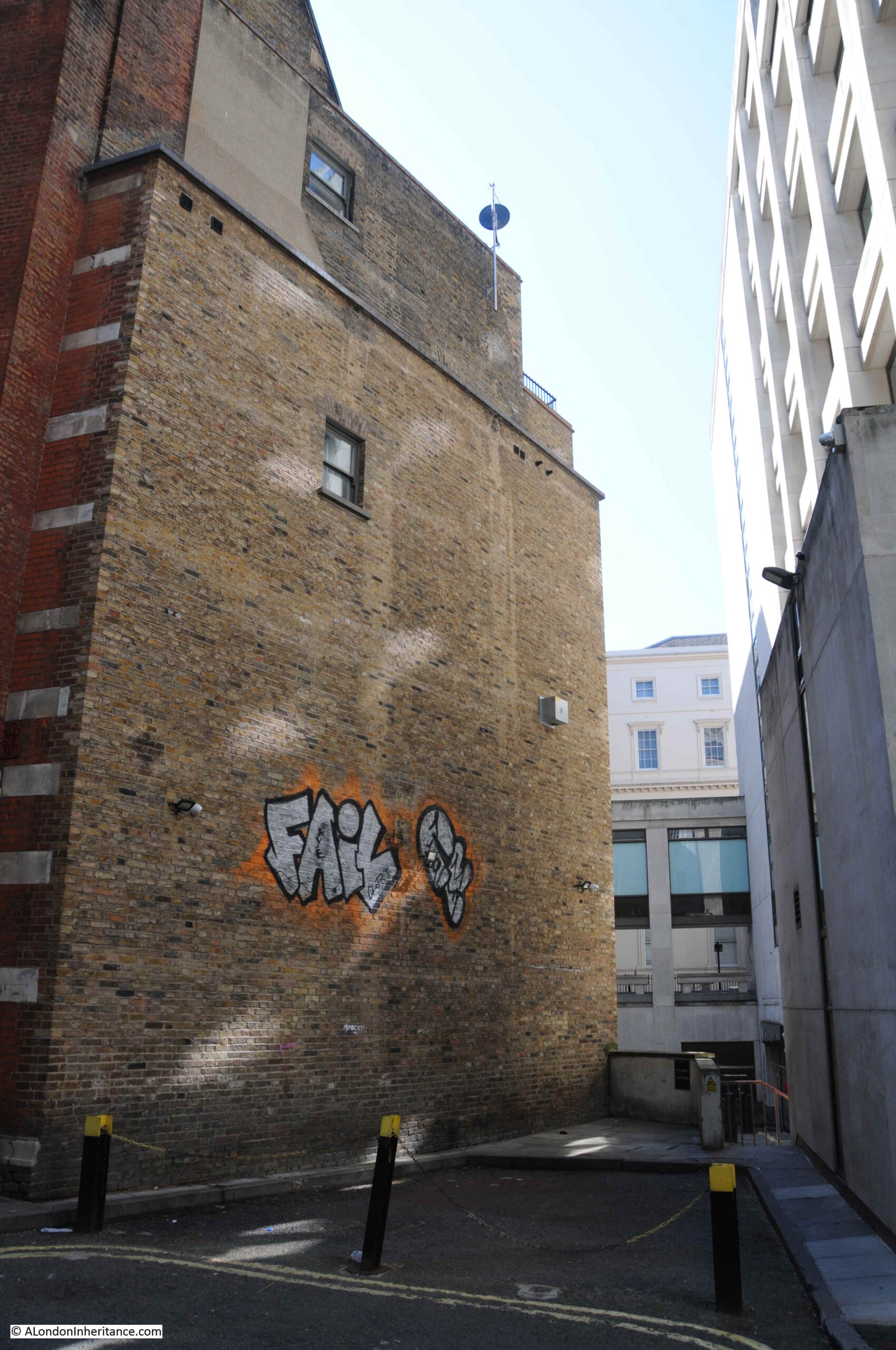
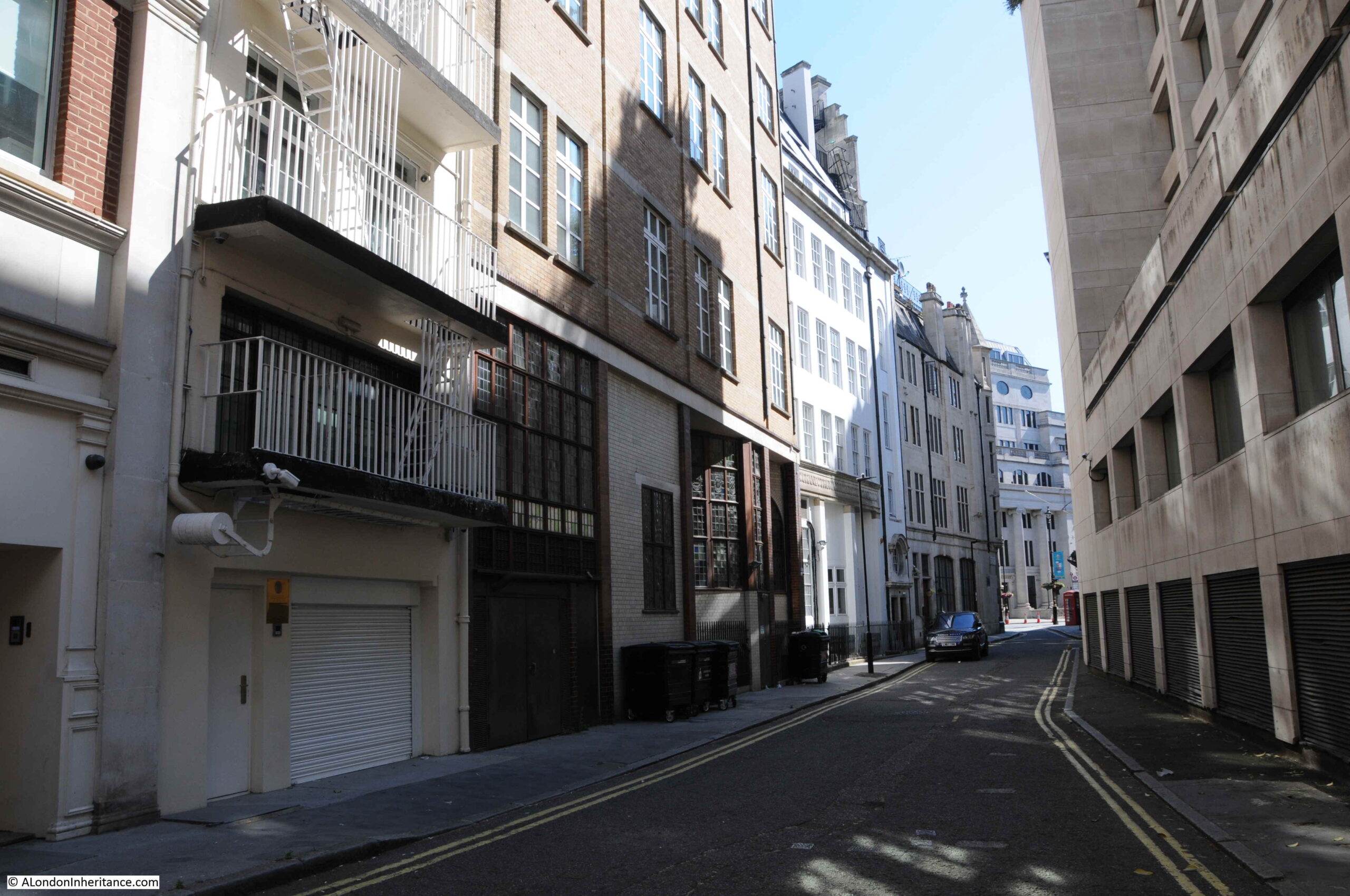
The stairs take us into a short street called Cockspur Court that leads from Spring Gardens. Cockspur Court is a dead end, and its only function seems to be to provide a service access to the surrounding buildings.
In the centre of Cockspur Court appears to be the loneliest tree in London. No other trees within view, and a tree that must spend much of its time in shade due to the height of the surrounding buildings.
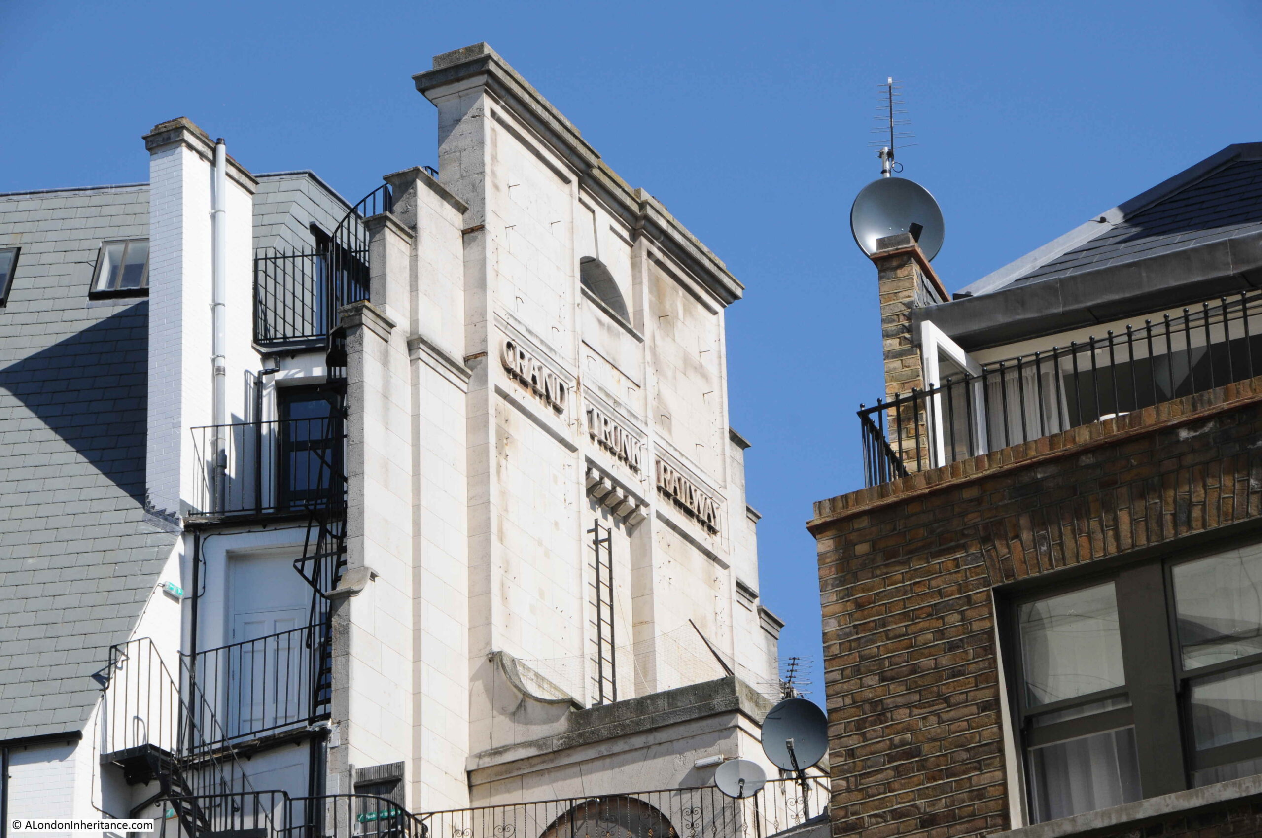
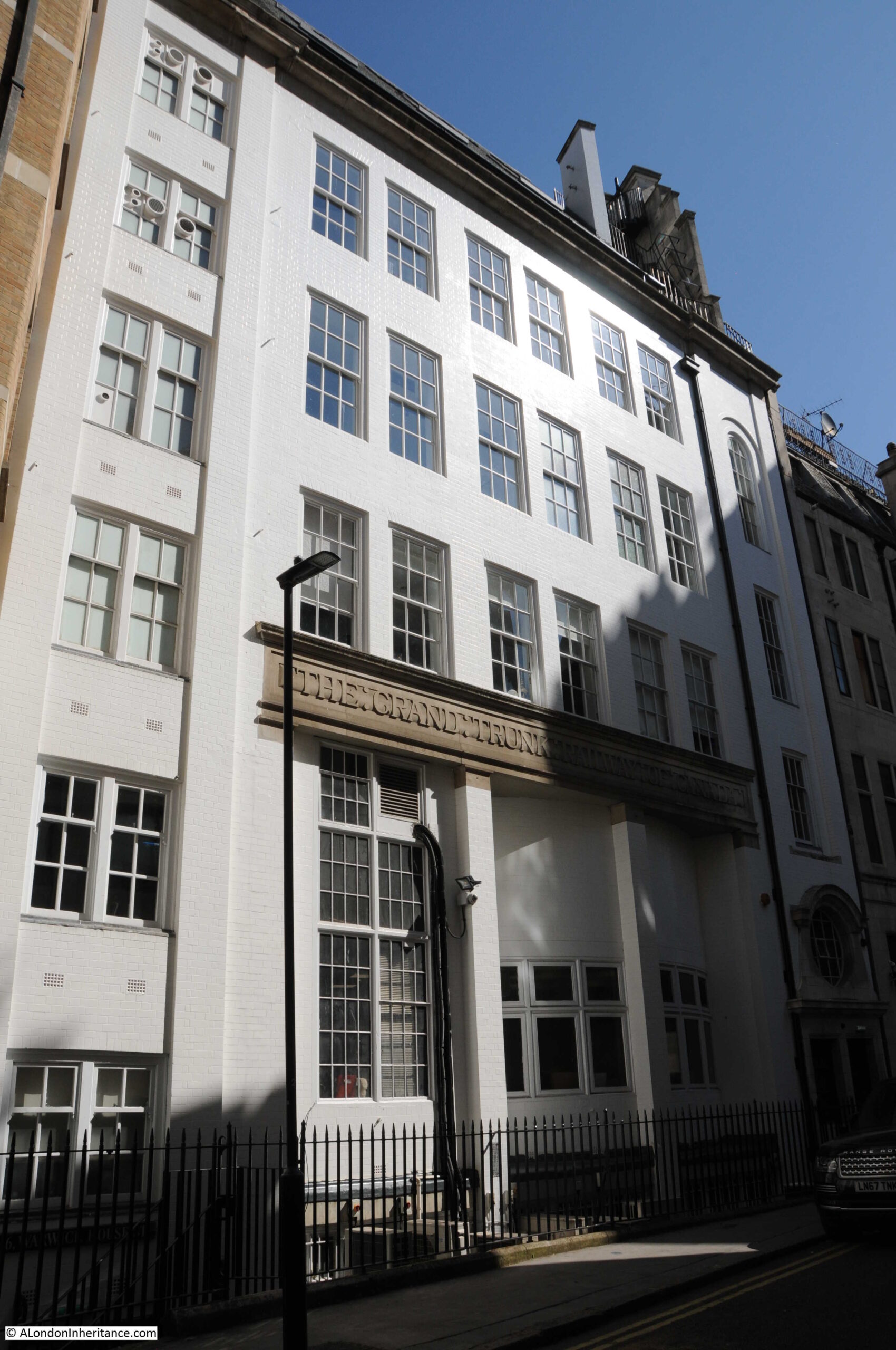
Looking across the court, and a building on the far side has the words “Grand Trunk Railway” displayed.
The following photo was taken towards the end of Cockspur Court, looking back towards Spring Gardens, again showing the lonely tree. The stairs down from Carlton House Terrace are behind the tree, and the large building behind the tree, and also running over Cockspur Court is the British Council Building, much of which occupies the space where the first London County Council building was located.

Although a dead end for vehicles, at the end of Cockspur Court, there is another set of steps:
Walking up these steps, and between two buildings:
Which leads into Warwick House Street:
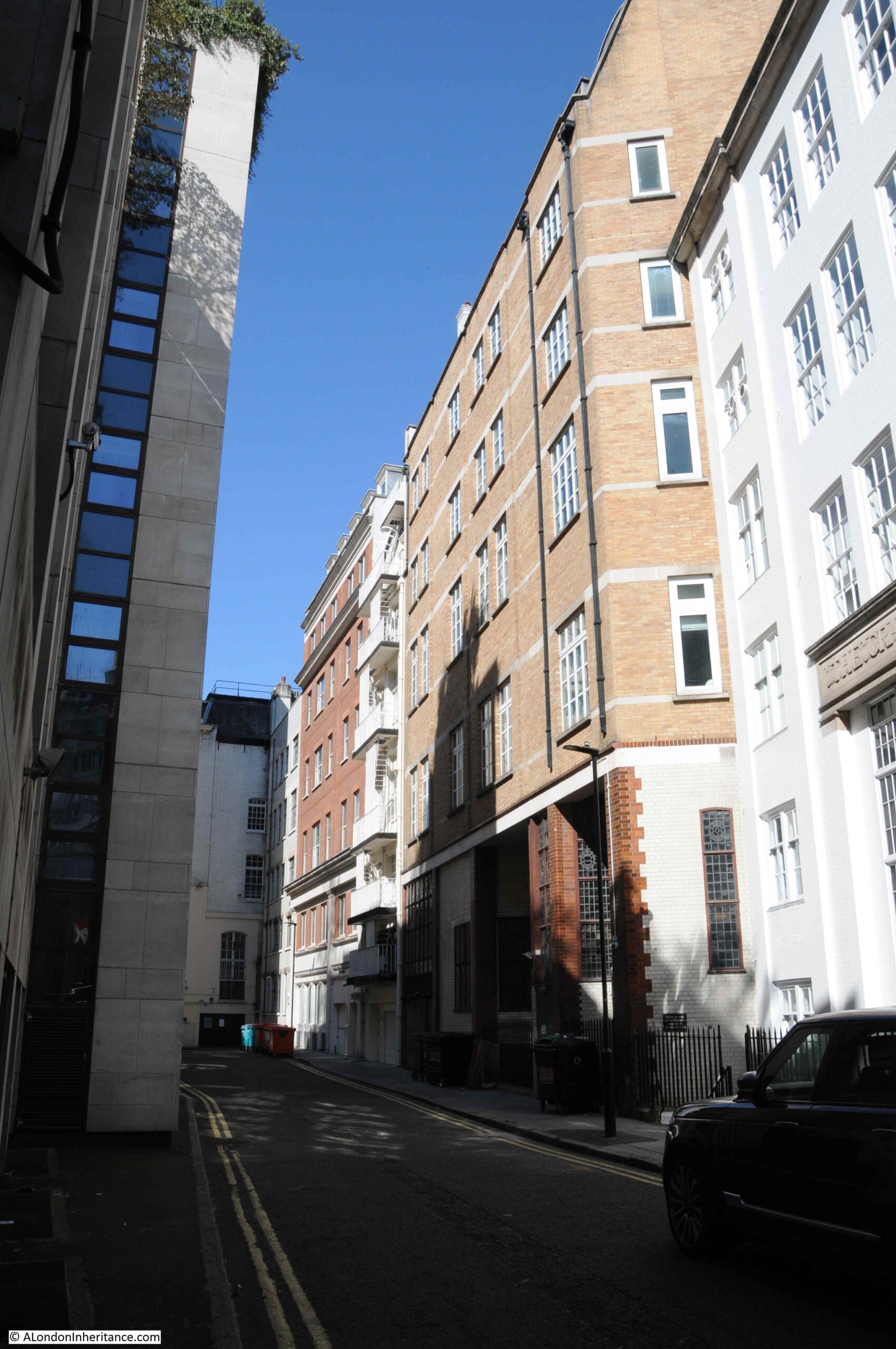
Despite appearing to be just a service road for the buildings on either side, Warwick House Street is actually a very old street, which predates Carlton House Terrace, and survives from the time of Car;ton House and the extensive gardens just to the south.
In the following extract from Rocque’s map of London from 1746, I have ringed Warwick Street, now Warwick House Street:
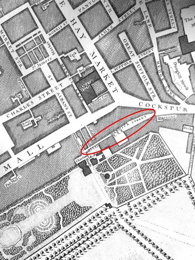
Referring back to the maps earlier in the post, it can be seen that the street follows the same route as the much earlier Warwick Street, apart from a slight change at the final junction with Cockspur Street.
In the 1747 map above, large gardens can be seen to the south. Carlton House Terrace now occupies this space.
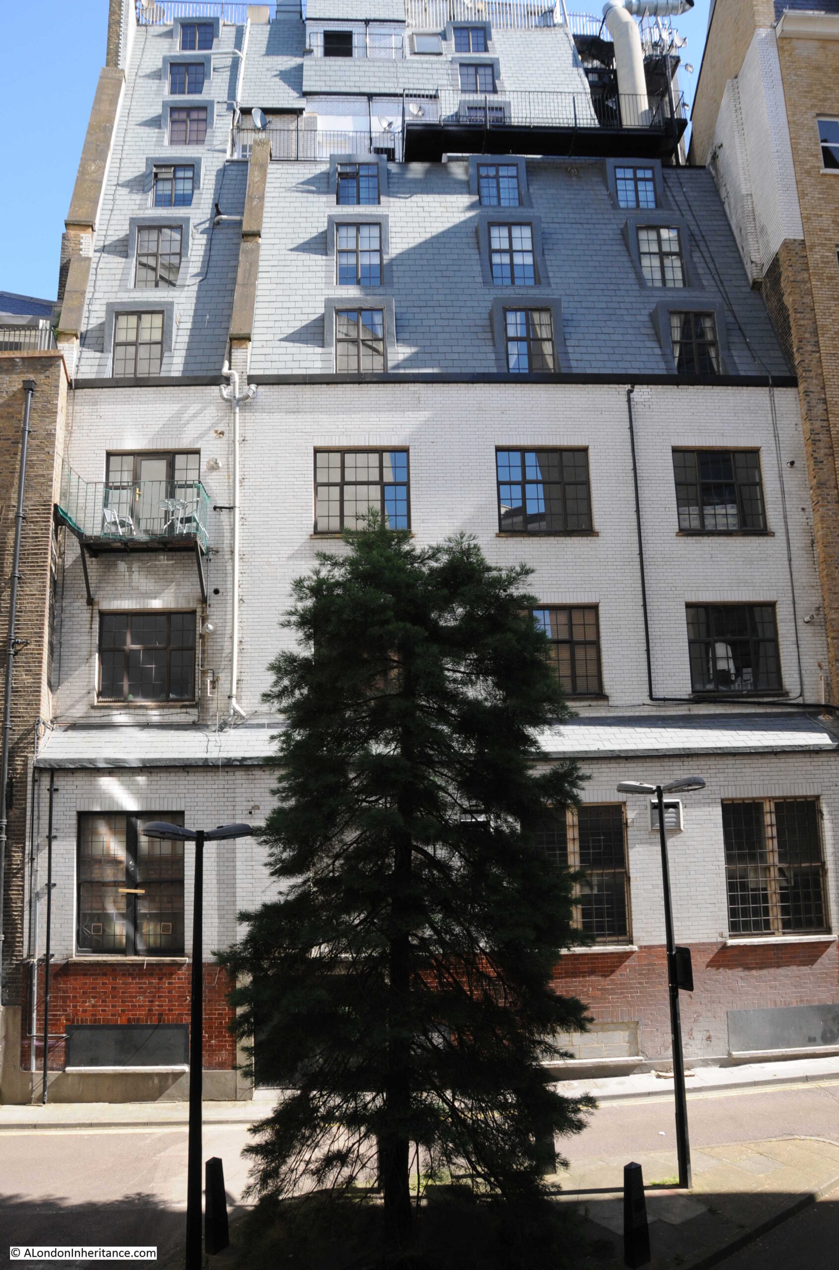
Warwick House Street consists of the backs of buildings that face onto other streets. To the north is Cockspur Street and Pall Mall, and there are a number of interesting buildings that have their backs on Warwick House Street, for example, this interesting mix of materials and shapes:
And on the same building that had “Grand Trunk Railway” displayed at the top, has “The Grand Trunk Railways of Canada” inscribed above the ground floor of the rear of the building:
Looking back along the street towards Cockspur Street and Trafalgar Square along a street that was here in 1746:
To take a look at the front of these buildings, I walked round to Cockspur Street.
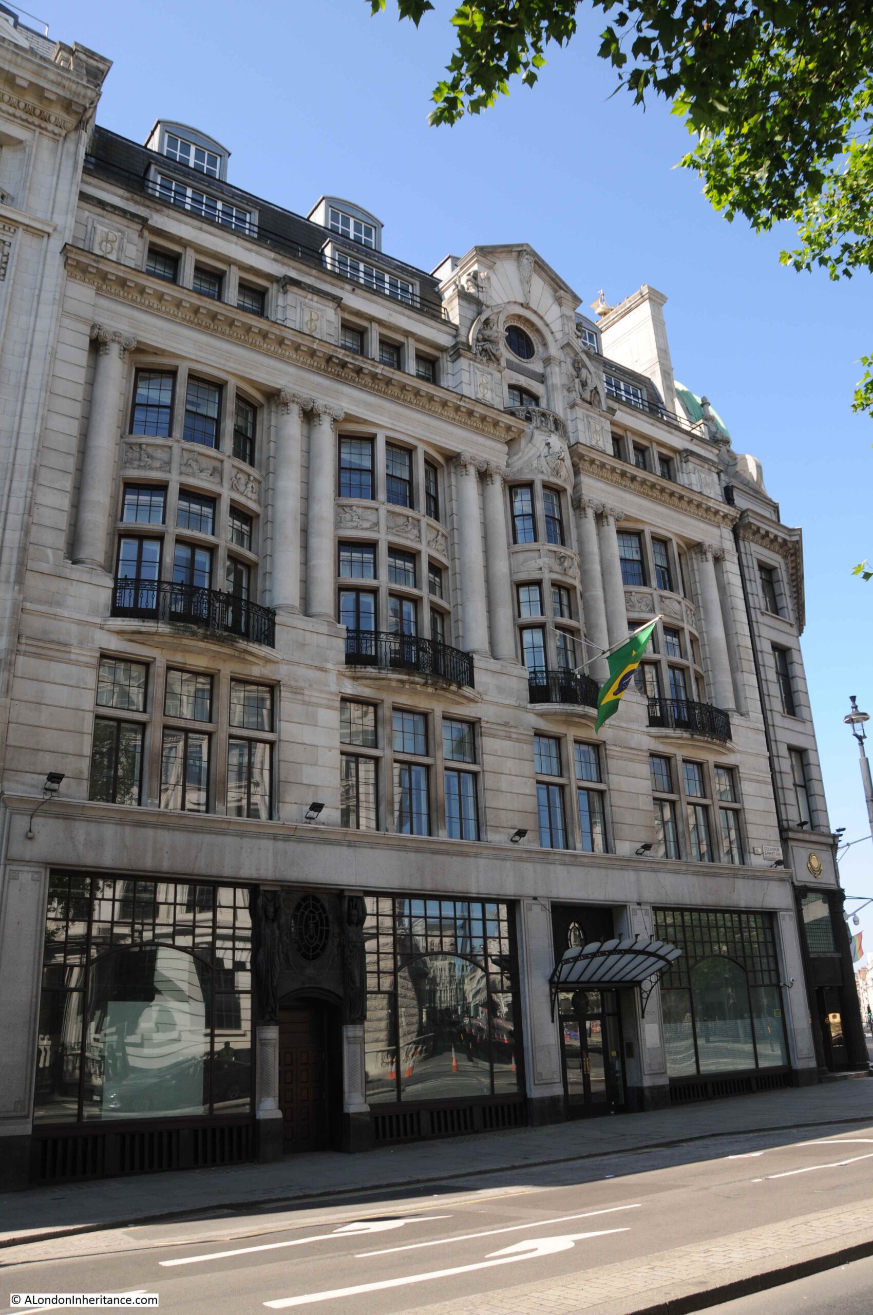
The Brazilian Embassy occupies the buildings which has the ground floor with a mix of materials and shapes:
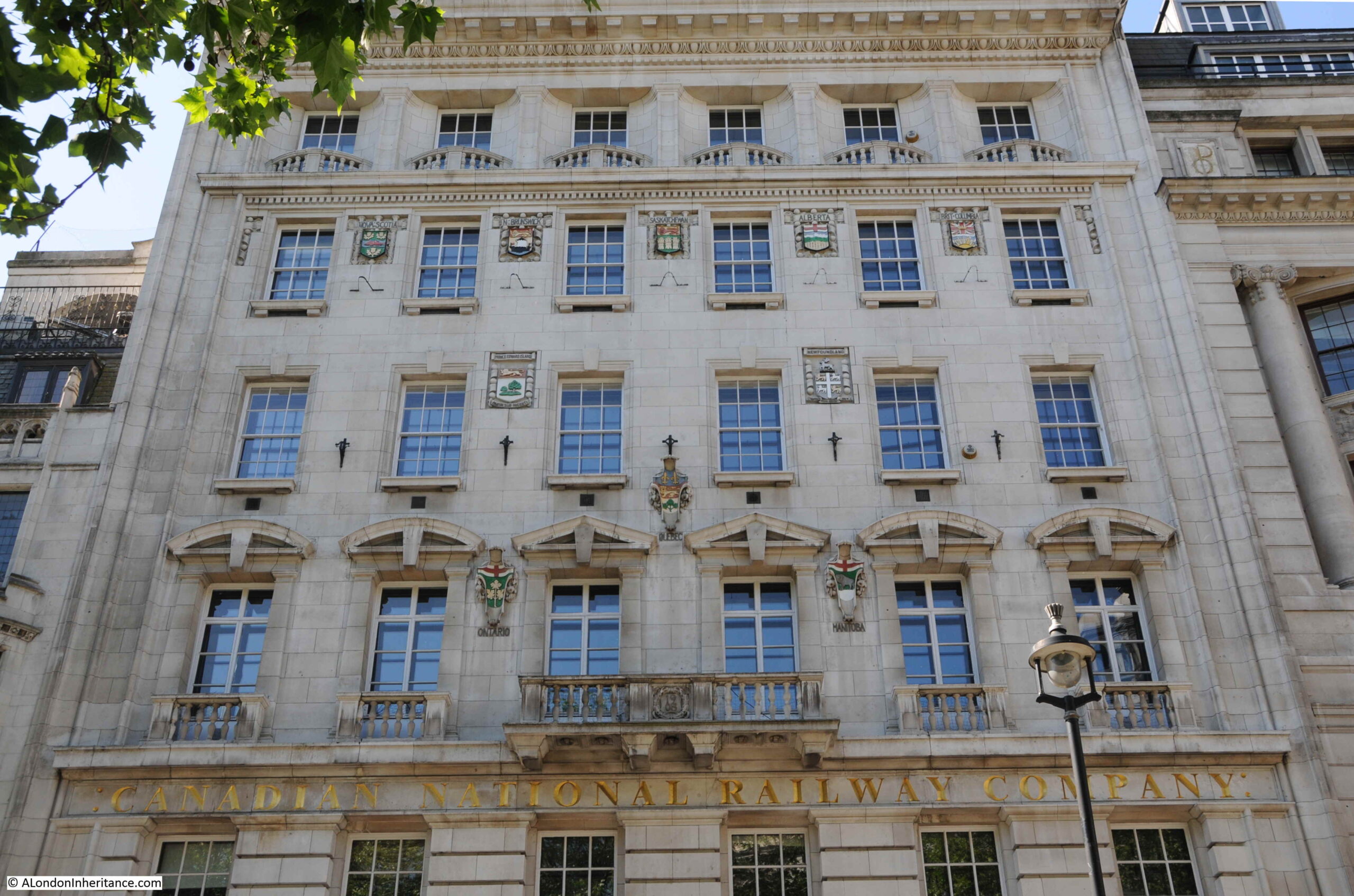
And the building with the railway references also has one on the front with the “Canadian National Railway Company”, the company that the “Trunk Railways” became part of. It is now the London Visitor Centre, and if I remember rightly, in the 1980s was the US Visitor Centre.

Confirming the building’s Canadian heritage, between the windows of the upper floors are the coats of arms of the provinces and territories of Canada:
I am pleased I found the location of the photo at the top of the post. Buildings and a view that have long been lost, however it is always good to find the exact location, and some remaining part of the view.
The sides streets are very close to Trafalgar Square, but are very quiet, mainly as they are basically service roads to the buildings on either side, but finding one that has been here since at least 1746 shows that whilst major houses and gardens come and go, and spaces are significantly reconfigured, in London, it is always possible to find traces of the past.
Thank you for a fascinating and interesting read as always.
The 70s building that replaced the old county hall is known as 10 Spring Gardens/ 24 Carlton House Terrace and was built by Howard V Lobb & Partners, consultant Sir Frederick Gibberd, 1970-75; it was originally for the British Council, who still occupy it today.
The British Council has moved to the new International Quarter on the Olympic Park in Stratford. 10 Spring Gardens is to be refreshed and improved (particularly the public spaces, which is much needed) by Crown Estates.
Well, not any more. When I first joined the British Council in 1988 it occupied not only the building up against Admiralty Arch, the ‘East Block’, but the block which later became Anglo-American the ‘West Bock.’ They were joined by a bridge at, I think 2nd floor level. Since then the BC’s footprint has shrunk dramatically, in stages, losing the West Bock, all its other buildings around London (Davies Street, Portman Place etc etc) and letting go the East Block floor by floor. Late last year it gave up its last toehold in Central London and moved its by now very small headquarters to Stratford Olympic Park. Both at home and overseas it has become a much slighter organisation, sadly.
Amazing research! Always interesting even though I will never visit these locations (Oh, but you never know!)
Email address corrected!
Thank you as ever, this is fascinating. I find that area quite spooky to be honest – the sense of all the stories of the past baked into those buildings of so many styles and eras. I imagine the Survey of London volumes for that area are really interesting too.
I sometimes used to walk around here in my lunch break . The over riding impression was of long straight vistas of high white uniform buildings. The States of Mind sculpture sums up my state of mind on the return lap. Never seemed to be anyone else strolling around back in the 1980s either.
Absolutely fascinating!
I always really enjoy your posts.
Thanks so much for sharing your fathers photos and the effort which you make retrace their locations and unfold the history.
The bit of Carlton House Terrace that is gone was pulled down in the late 60s to make way for the Gibberd development. Carlton House Terrace Mews was a particular loss, and there was a campaign to save the buildings was started by Simon Jenkins who was then editor of the Evening Standard and regularly challenged the destruction(s) going on in London. We need him and his campaigns today. A film called Bunny Lake is Missing (in which Noel Coward played a small part) used the area as a location and quite a bit of filming was done in and around the Mews. Not a particularly good film, but good images of the area.
I seem to remember that I identified Warwick House Street as the location of the fictional MI6 offshoot in the BBC’s Killing Eve.
Reading this great post, I was thinking the hidden Cockspur Court would be the perfect location for secret government offices – but then I do watch a lot of espionage drama!
Yes, just checked, and you can clearly see Fiona Shaw and Sandra Oh walking into Warwick House Street and entering one of the buildings by a back door there. Six minutes into episode 2 of the first series (on BBC iPlayer).
Why do I just love spotting places in London on films? Not easy for me, being a northerner and living in Manchester…..
Thanks for another fascinating post. I worked for The Crown Estate in the 1990s and used to walk round these streets a lot. I never knew that Warwick Street was so old.
Impressive detective work. It’s a pity that that the 1970s buildings in that area are so very ordinary and no match for the surviving original buildings.
Thanks as always for such interesting photos and commentary.
I have historical connections with this corner of London because my great-great-grandmother ran a private hotel in Suffolk Street (which was originally Great Suffolk Street as on the 1746 map above). Her son (my great-great grandfather) was born there in 1861. The buildings were designed by Nash and by the second half of the 19th C they were mostly “private hotels”, the most famous being Garlant’s. The Theatre Royal, Haymarket had/has its rear entrance in Suffolk Street. His Majesty’s Theatre (on the opposite of the Haymarket) burnt down in an amazing conflagration in December 1867. I imagine my 6 year old g-g-gf watching from his front windows!
What a fantastic investigation you’ve provided this week. So very interesting.
Fascinating how much a sharp pair of eyes and a bold spirit can still find in London.
Exemplary research, as always, providing fascinating detail which I’d never find on my own. In fact, as Veronica rightly says, you need ‘a bold spirit’ to venture solo around some of these more secluded areas, something I’m not sure I’m up to these days.
I’ve mentioned before that I grew up in this part of London – and today you are discussing pretty much the exact location! For the first 10 years of my life I lived with my parents at 18 Cockspur Court, which is clearly shown on your 1951 Ordnance Survey map. Our front door was in Cockspur Court (possibly the cross hatched rectangle as it did look like an archway with a giant door in it – there was no public access through here however), and our rear door exited on to Carlton House Terrace. The property where we lived had been a mews residence for the support staff to the houses in Carlton House Terrace (in particular No. 18 Carlton House Terrace – at that time the London residence of The Lord Astor of Hever, 1st Baron Astor, for whom my grandfather acted as private secretary), so there were garages on the ground floor where originally carriages would have been stored, there was a ramp up to the first floor where horses would have been stabled (in the 50s an apartment), and we lived on the top (2nd) floor where the horse grooms used to live. There was a similar arrangement in Carlton Mews with a U-shaped ramp up to a first floor balcony (which is indicated as a dotted line shaded in grey on the map) where horses were stabled, and a 2nd floor for the grooms – I remember these having spiral staircase up from the stables. I was able to explore this area as a child because the mews buildings had been abandoned – you wouldn’t let your child run free like this nowadays. Your first photo shows the steps down from Carlton House Terrace, allowing pedestrians to take a short cut through the mews to Warwick House Street. The open square captioned ‘Ruins’ was in fact a WWII bomb site. The London Electricity Board (LEB) had a workshop in No. 25a Cockspur Court, and they stored service vehicles at that end of Cockspur Court. I distinctly remember gas lamp lighters in Carlton House Terrace, but when these gas lamps were upgraded to electricity I wouldn’t know. Your photo showing the loneliest tree in London depicts almost precisely the view I had from my bedroom window. Note to Mike Kay – I also recognised Warwick House Street as a location in ‘Killing Eve’. Thank you for focussing on this area – it has brought back some distant memories.
No. 12 Carlton House Terrace is the ‘back door’ of the Institute of Contemporary Arts. I used it for 9 years in the late 1980’s and eartly 1990’s. Hope this isn’t a spoiler for your next chapter!
Wonderful stuff – as a Londoner born and bred I look forward to each outing.
I really enjoy your weekly blog! I am finishing for the umpteenth time John Fowles’ ‘The Magus’ which has its climax in London. In chapter 71 of the first edition (Jonathan Cape 1966 – Fowles has a habit of rewriting between editions), he wrote about St John’s Wood and 20 Allitsen Road as the possible original home of Maurice Chonchis. I wonder whether your father ever photographed that area? The book is set in 1953 so the dates align nicely. With regards Patrick Dransfield (HK)
Great post as always,Admin.
In the Roques 1746 map,to the right is shown Dunghill Mewse. I wonder how many people would have clamoured to live in a place with that name? Bet the property’s worth a fortune now……….
What a delightful jaunt you have taken us on! I so enjoyed the curve of the railings that have survived, and that magic piece of wall! Brilliant!
But how sad it is that all the interest of that small area in your father’s photo has been lost – the 1970s building is so BORING!
Please keep going, I really enjoy your essays!
Another fascinating piece of detective work. The Canadian National Railways’ building is particularly interesting with the arms of Canada’s provinces. According to Wikipedia, the address of the Grand Trunk Railway’s London HQ was 4 Warwick House Street.
Shone a light on an area I am not familiar with -must change that.
Thanks for that excellent and detailed essay on what is a very interesting little corner of London.
I used to live in the top floor of 27 Cockspur Street from 1970 to 1989. My father used to park his car where the lonely tree is. Perhaps they planted the tree to stop him parking there!
The TV series The Professionals (episode ‘Backtrack’) has a scene filmed in Carlton House Terrace and Spring Gardens.
Thanks for that reference to Carlton Terrace Mews.
I was trying to find the location of this photo on the English Heritage web site:
https://historicengland.org.uk/images-books/photos/englands-places/card/160415?place=Westminster%2c+City+of+Westminster+(Place)&terms=westminster&searchtype=englandsplaces&i=0&wm=1&bc=0%7c37%7c38%7c39&g=4513
and your map helped me locate it.
Regards,
Mel Gibbs
Fascinating post….my 4th great grandfather painted a picture titled ‘A View of the Mall with the back entrance to Carlton House’ in the late 1700’s, so this was particularly interesting.