A short distance from Waterloo Station, there are some wonderful streets. Lined with terrace housing that date back to the 19th and early 20th centuries. A couple of weeks ago, I went for a walk along these streets, starting at Roupell Street and ending at Aquinas Street.
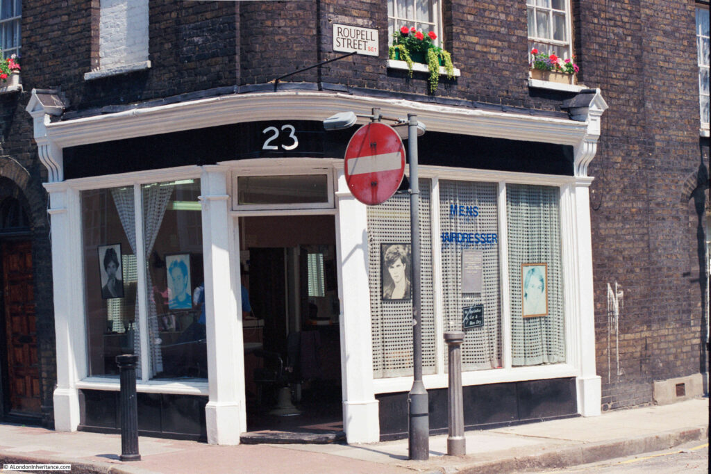
The reason for the visit was to revisit the site of a 1986 photo of a men’s hairdresser on the corner of Roupell Street and Cornwall Road:
The same view 35 years later in June 2021:
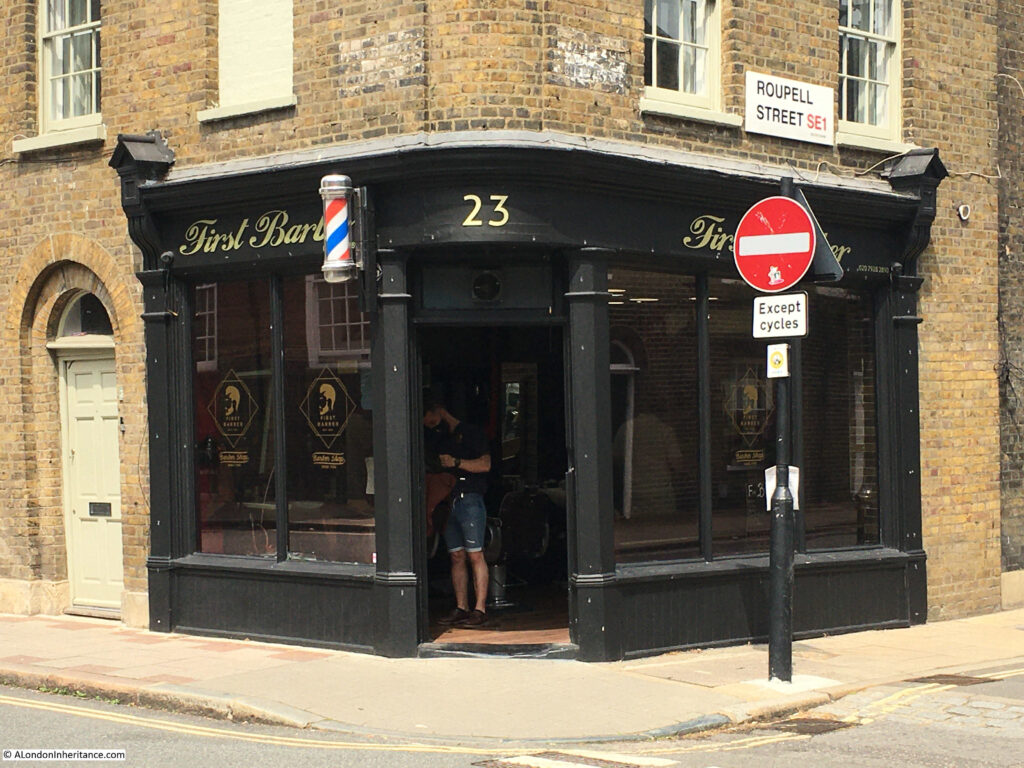
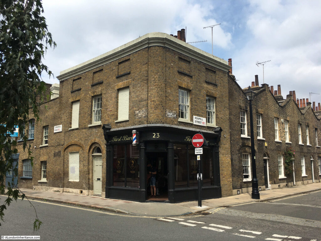
What was then, simply a “mens hairdresser” is now “First Barber”. Really good to see that the same type of business is in operation thirty five years later.
Getting your hair cut is a service which cannot be provided over the Internet, so hairdressers / barbers are the type of shops that will hopefully be on the streets for many years to come.
It did though get me thinking about name changes. In the 1980s I went to a hairdressers, or a hair stylist (see my post on the Hairdressers of 1980s London for lots more examples). When did the shop for a men’s hair cut change from a hairdresser to a barber? One of those gradual changes that you do not really notice until you compare street scenes.
Another 1986 photo shows the rear of the houses in Roupell Street. A jumble of chimneys and TV aerials:
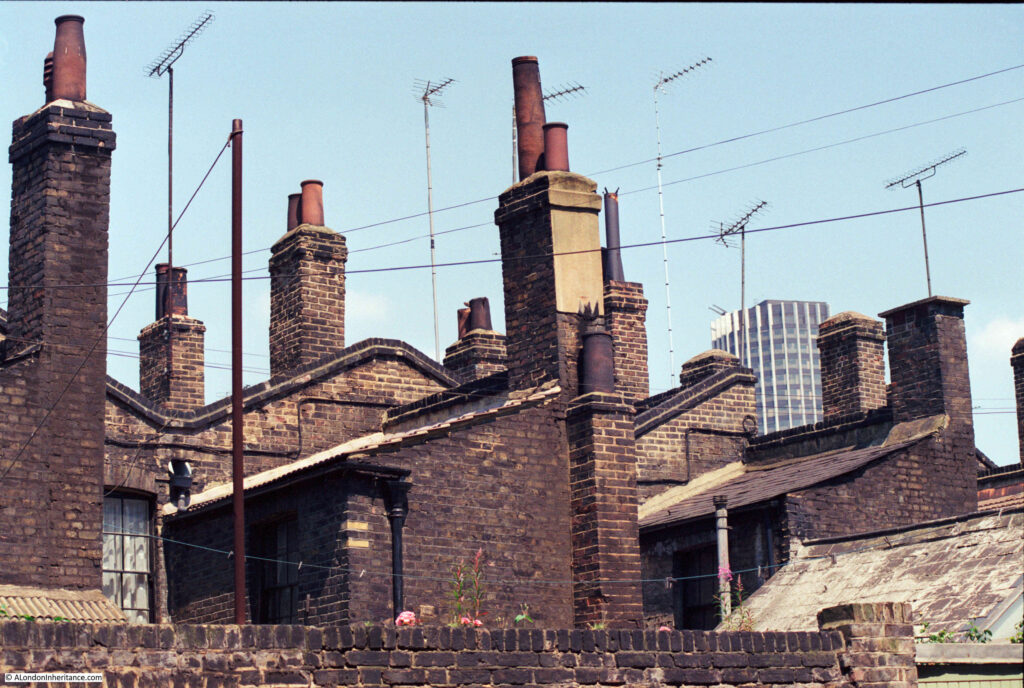
I walked down Brad Street, which runs behind the southern side of Roupell Street, trying to find the same chimney combination as in the 1986 photo, but there seem to have been many subtle changes. The following photo is the nearest I could get:
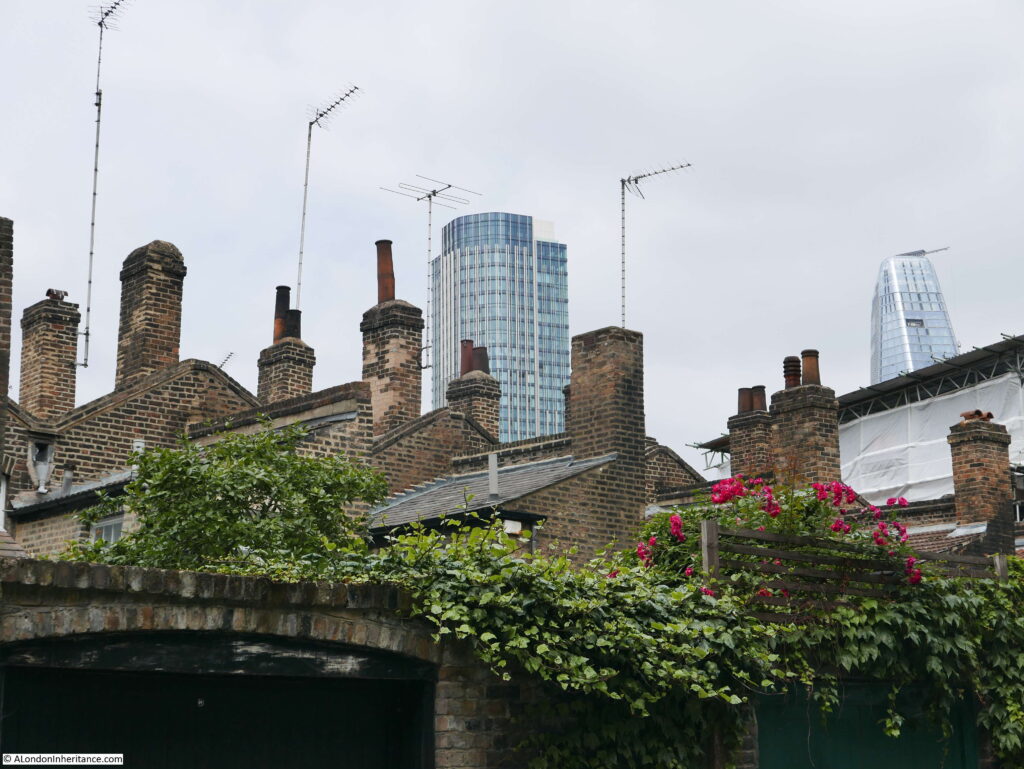
The centre tower in the 1986 photo was Kings Reach Tower, the home of IPC Media, publisher of a vast range of titles from Country Life to NME. It was sold some years ago, had additional floors added to the top (hence the difference in height between the two photos) and is now apartments.
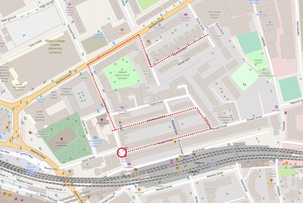
The location of the hairdressers / barbers is shown in the following map (red circle) (Map © OpenStreetMap contributors):
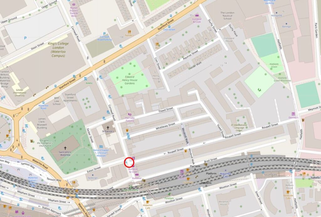
Roupell Street runs to the right of the red circle, and Waterloo East station is below.
Part of a roundabout can be seen on the left edge of the map. This is the large roundabout at the southern end of Waterloo Bridge, and Waterloo Station is just off the map to the left.
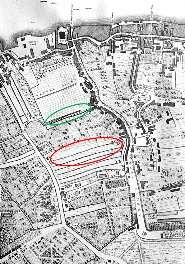
Development of the area is relatively recent. It was long part of the area known as Lambeth Marsh. An area of low lying land, with many streams and ditches, and marshy ground. During the 17th century, much of the area was being converted to different forms of agricultural use, and in 1746, Roqcues map shows some streets, limited building, and a network of fields (red oval is future location of Roupell Street and green oval future location of Aquinas Street, which I will be coming to later in the post).
By 1816, Smith’s New Map of London was showing increased building in the area, however the area around what will become Roupell Street (red oval) was still open land, with what may have been large plots extending back from the houses on Broad Wall.
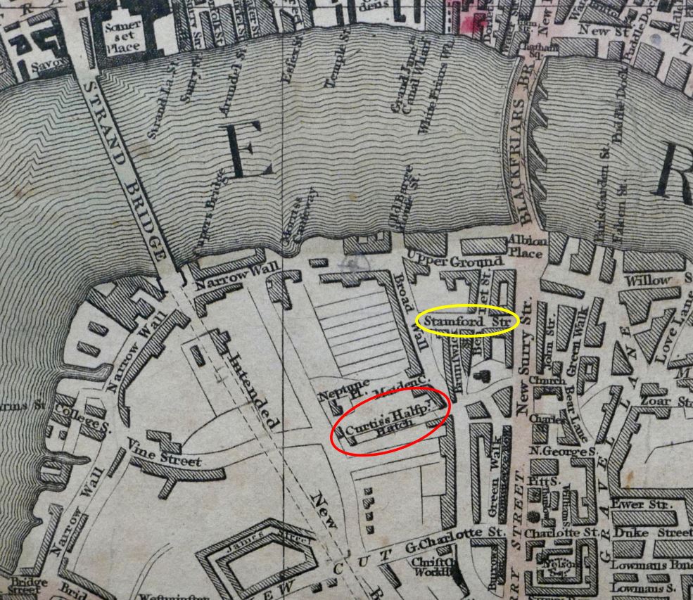
The yellow oval is around the first stretch of Stamford Street. This is the road that runs to the north of the area I am walking, and is a busy road connecting Blackfriars Road and Waterloo Road.
Note the Strand Bridge. This was the recently built first bridge on the site of what is now Waterloo Bridge. Also, running south from Strand Bridge is the outline of a street labelled “Intended New Road”. This is the future Waterloo Road.
In the above map, there is a track called Curtis’s Halfpenny Hatch where the future Roupell Street would be located.
This was named after a William Curtis who was the founder of a Botanic Gardens in the area. It was a suitable location for aquatic and bog plants as the area was low lying. The Halfpenny element of the name was the cost to use the route when it was previously a short cut through the agricultural land on either side.
The 19th century would bring considerable change and development to the area with the arrival of Waterloo Station, however this had not yet been built by the time of the 1847 edition of Reynolds’s Splendid New Map Of London. Roupel Street had arrived, but apparently not yet fully built, along with the streets that would fill in the area to the north (more on this later in the post).
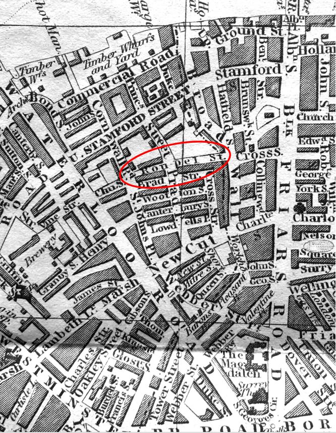
Between the 1816 and 1847 maps, Stamford Street was completed linking Blackfriars and the now completed Waterloo Road.
To explore the area, I went for a walk from Roupell Street to Aquinas Street, shown by the dotted red line in the following map, starting at the red circled location of the hairdressers (Map © OpenStreetMap contributors).
This is the full view of the corner building with the barbers at street level:
On the opposite corner is an identical building, even with the same bricked windows:
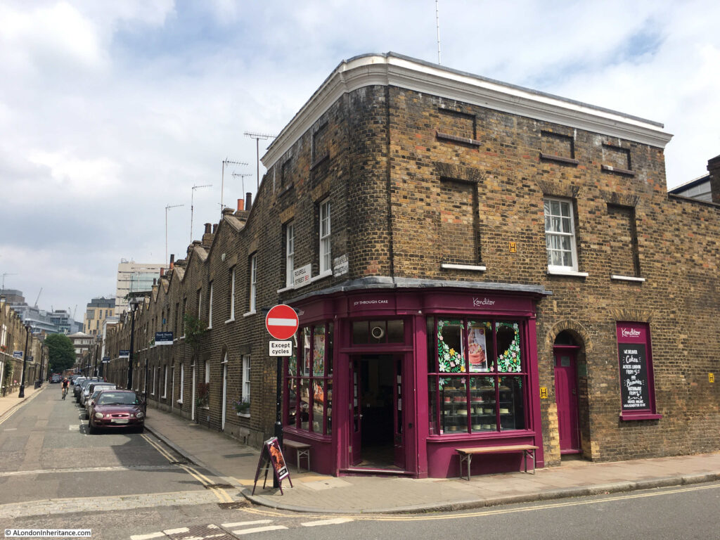
With a bakers shop now occupying the corner position.
Looking down the full length of Roupell Street:
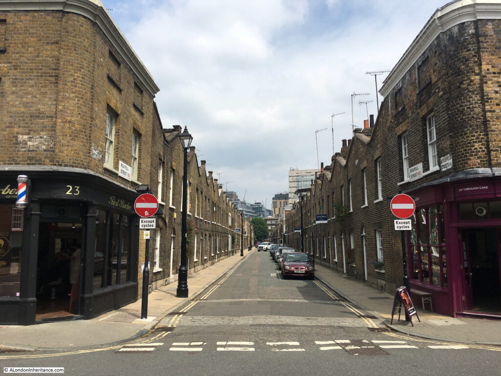
The name of the street comes from John Roupell, who purchased the land and built the estate in the early 19th century.
John Roupell had a Bankside metal works, and seems to have inherited the wealth needed to pay £8,000 for the land through his wife’s family.
The street was laid out and construction started around 1824. when John Roupell was 64. The houses in the street seem to have been occupied from the early 1830s as from 1835 onwards, references to those living in the street, or local events, start appearing in the press. One strange mention concerns a murder in a pub garden in Broad Wall, at the eastern end of Roupell Street, when during the inquest, one witness stated:
“John Bingley deposed he is a private watchman. On Sunday morning, about twenty minutes after two, witness was in Roupell-street; he heard a voice – apparently that of a women – exclaim ‘Here’s a villain! – he has got me down and is trying to kill me’.
By the Coroner – Did you hear any other words?
Witness – Yes, i heard the same voice say ‘Come to me’ and then in a fainter tone, ‘Have mercy on me’.
Apparently John Bingley thought it was a drunken row, and took no notice of the matter, he did not see any person answering the description of the deceased either alone, or accompanied by any other person – he does not sound perhaps the most pro-active watchman that you would want to employ on London’s streets.
Roupell built two storey terrace housing. Brick built, directly onto the street with no front garden or a small area protected by railings. Open the front door and you are directly on the street.
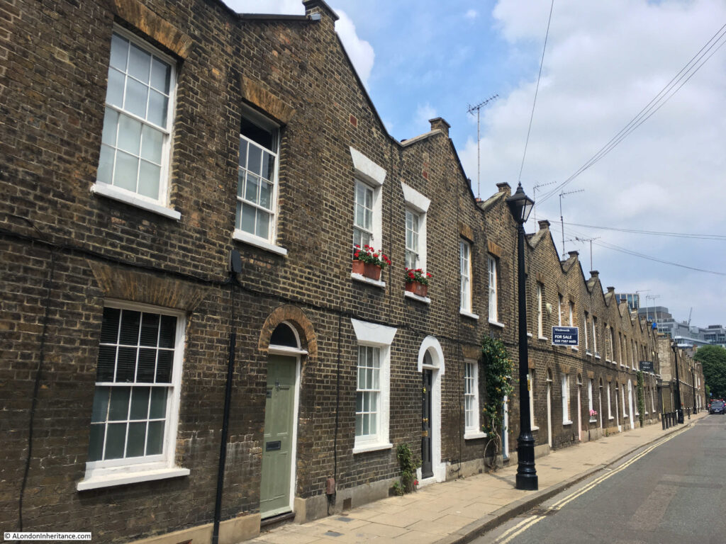
The first time that Roupell Street features in London’s newspapers is when the London Evening Standard reported, on the 1st June 1829, the impact of Roupell’s builders working extra hours:
“On Saturday evening a fire broke out in Roupell-street in one of the new houses belonging to Mr Roupell. On the first alarm, the engines of the Palladium and West of England fire-offices promptly attended, and by the aid of a plentiful supply of water the flames were prevented from spreading, and eventually subdued in about an hour, but not before one of the houses, nearly in a finished state, was totally destroyed and the adjoining one considerably damaged.
The fire originated under these circumstances:- Mr Roupell had bound himself by contract to have both houses finished by a given time, and the period fast approaching, men were employed to work beyond the usual hours.
Some of them were in the act of pitching some gutters, when the pot boiled over and set fire to the shavings and wood with such rapidity that it was with some difficulty all the workmen succeeded in effecting their escape.
Of course none of the houses were insured, as they were in an unfinished state.”
The street was quickly finished after the fire. By the time of the 1841 census, Roupell Street seems to have had a good population, with 250 people recorded in the census as living in the street.
Roupell had built the street for what were described as “artisan workers” and the 1841 census provides a view of the professions of what must have been some of the first people living in the street. This included; painters, labourers, clerks, printers, bakers, carpenters, bricklayers, compositors, paper hanger, hatter, an excise officer, lighterman, warehouseman – all the typical jobs that you expect to find in such a street in 1840s London.
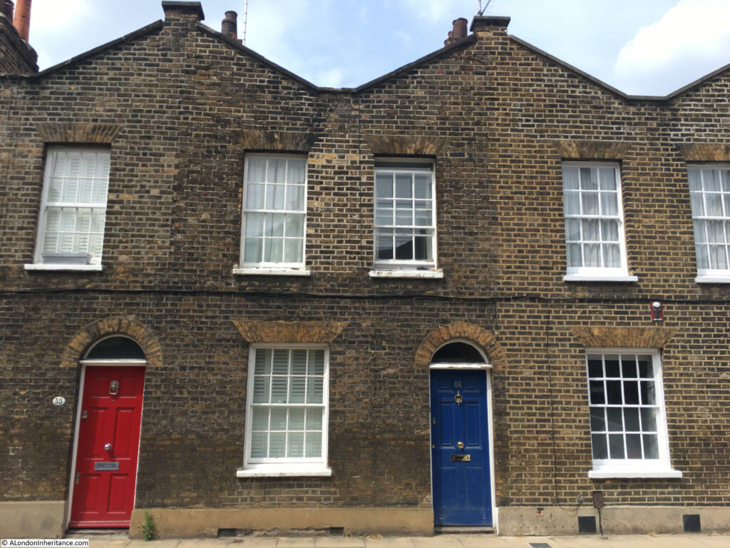
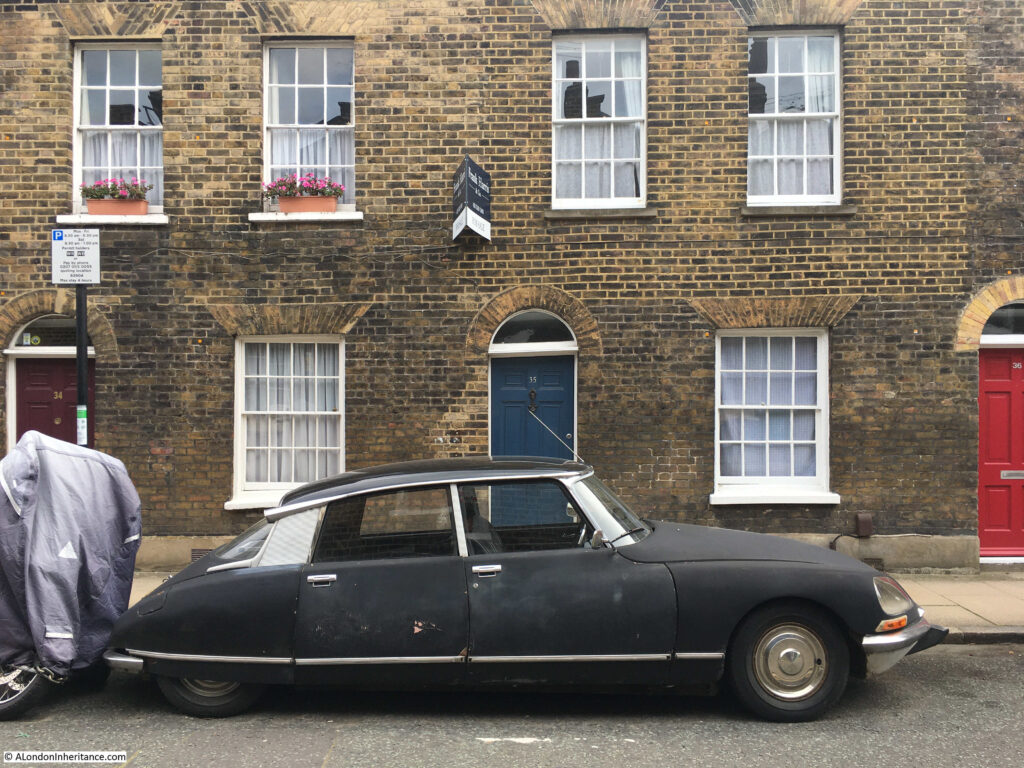
This Citroen has been parked on the street for many years, and provides one of the most photographed views of the street.
Walking further down Roupell Street, and a pedestrian walkway that was once a street cuts across. This is Windmill Walk.
On either side of the northern entrance to Windmill Walk are two buildings that have what appears to be shop fronts, along with what could be a very faded painted advertising sign on the wall.
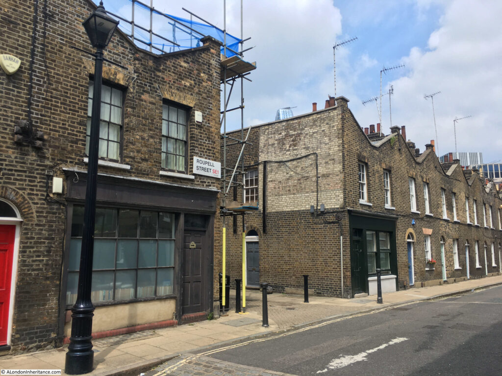
The 1910 Post Office Directory confirms that these were shops, and the businesses that operated in them at the start of the 20th century.
At number 61 (nearest the camera) was john Bowen Walters – Dairyman and at number 62 was Arthur Edward Cowdery – Baker.
The 2007 Conservation Area Statement records that the shop fronts are replacement / reproductions of the originals.
Directly across the street from the above old shops, is the Kings Arms, a brilliant local pub:
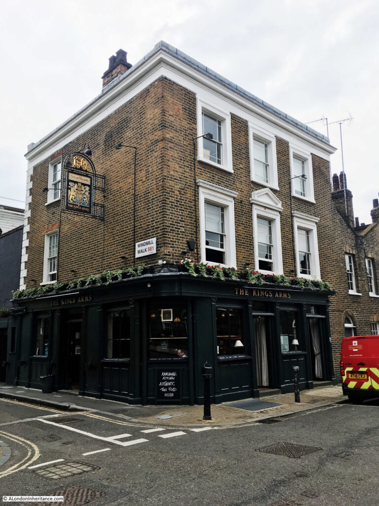
The Kings Arms was part of the original build of the street and has retained the same name since opening in the 1830s.
The first reference to the pub in the press provides a fascinating view of the agricultural nature of the area. An advert from the Morning Advertiser on the 22nd March 1836:
“Broadwall, Blackfriars-road – to Timber-merchants, Hard Wood-turners, Veneer-sawyers and Others, By Mr. C. COULTON on the Premises, a field opposite the King’s Arms, Roupell-street, Broadwall, on THURSDAY, March 24, at Twelve.
COMPRISING two hundred Yew Trees – to be paid for on the fall of the hammer. may be viewed till the sale, and Catalogues had of the Auctioneer, No 32, Union-street, Borough”.
The advert shows that in the 1830s, reminders of the old agricultural nature of this part of Lambeth could still be found. Two hundred yew trees sounds like a reasonable number so this was not a small field. I do not believe they like water logged conditions, so the typical wet conditions of the Lambeth Marsh were also disappearing.
The trees were almost certainly being sold to release the field for building, as in the late 1830s and 1840s, the remaining open space was being built on.
The majority of Roupell Street has a uniform appearance, however walking further east along the street and there is a three storey pair of houses.
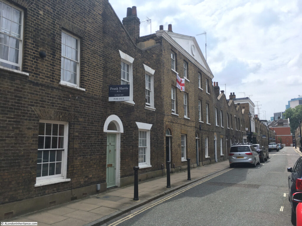
These houses were not part of the original construction of the street as within the triangular pediment at the top of the building there is the date 1891 which is presumably the date of construction.
The two houses retain the same width as those along the rest of the street and the doors and windows are also much the same, so it may be that in 1891 only the top floor and pediment was added to two existing terrace houses. Perhaps some late 19th century home improvements.
John Roupell died on the 23rd December 1835, when the St James’s Chronicle reported that he had died in his 75th year at his own residence in Roupell Street. Along with Roupell Street, he had a substantial portfolio of land and property in south London, part of which gets mentioned in a news report when his son Richard Palmer Roupell was a witness to a possible murder in his grounds at Norwood. At the inquest, Richard Palmer Roupell was described as a lead merchant of Cross-street, Blackfriars who has a country residence at Brixton Hill.
It may have been Richard Palmer Roupell who developed Theed Street which runs north from Roupell Street:
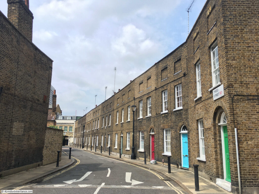
Theed Street still consists of a terrace of two storey houses, however there is a very different treatment at the top of the buildings where instead of the rise and fall of the triangular wall in Roupell Street, Theed Street has a top wall blanking off the roof at the rear, giving the impression of a more substantial row of houses.
According to Reynolds’s Splendid New Map Of London published in 1847, Theed Street had not yet been built. See the annotated map below:
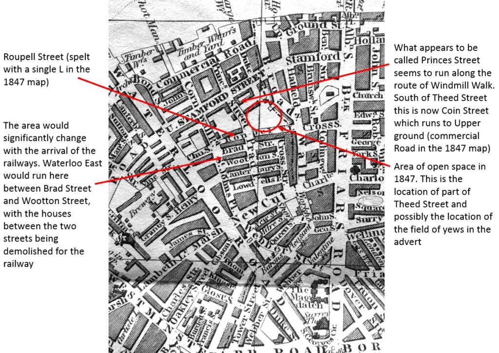
I am not sure whether the 1847 map is correct. Greenwood’s map from 1828 shows what would become Theed Street as an unnamed street running between two fields. It could be that in 1847 it was still unnamed and running between fields and therefore not considered worth recording – one of the challenges of trying to interpret maps of different scales and over the years as London changes.
Greenwood’s map does show that Roupell Street was originally called Navarino Street (after a naval sea battle fought by the British and allies against the Ottoman and Egyptian forces in the Greek War of Independence in 1827). This was in 1828, and Roupell seems to have quickly changed the name of the street.
Branching off Theed Street is Whittlesey Street which continues the same architectural style of Theed Street:
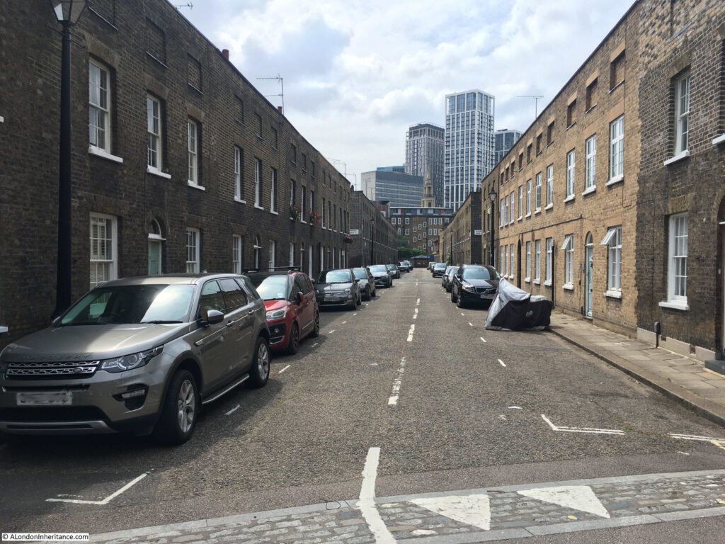
Looking back up Theed Street towards Roupell Street – not a parked car in sight which adds considerably to the view:
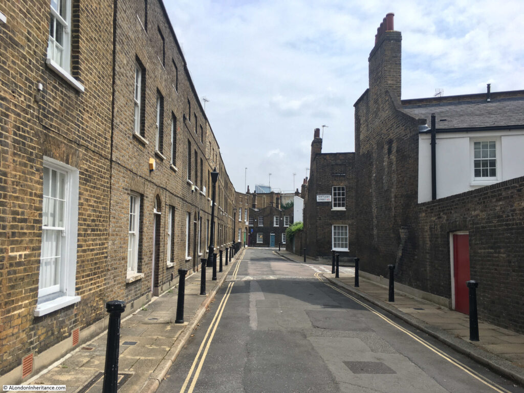
In the above photo, the house on the right is to the same design as those in Theed Street, and the way that the top line of brick hides the rear slopping roof can be seen.
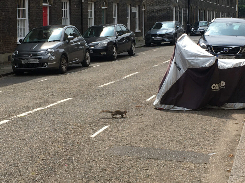
Not what you expect to see running across the street of such a densely built area:
Where Windmill Walk crosses Whittlesey Street:
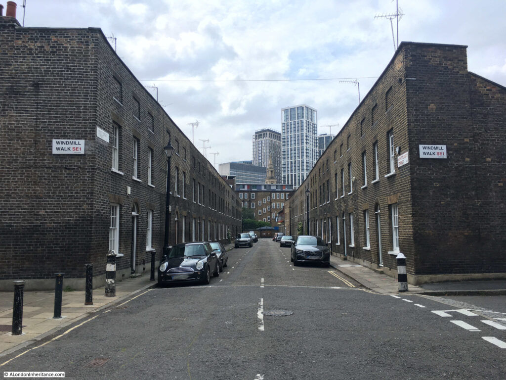
The towers in the distance of the above photo are the new blocks recently built around the Shell Centre site on the Southbank.
Reaching the end of Whittlesey Street, where the street meets Cornwall Road, the following photo is looking south with the railway bridge over the street and above that, the pedestrian walkways that take travelers down to the platforms of Waterloo East.
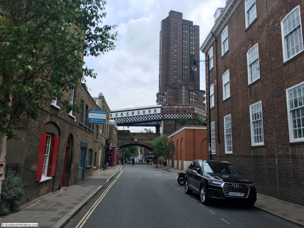
On the corner of Whittlesey Street and Cornwall Road is another pub – the White Hart:
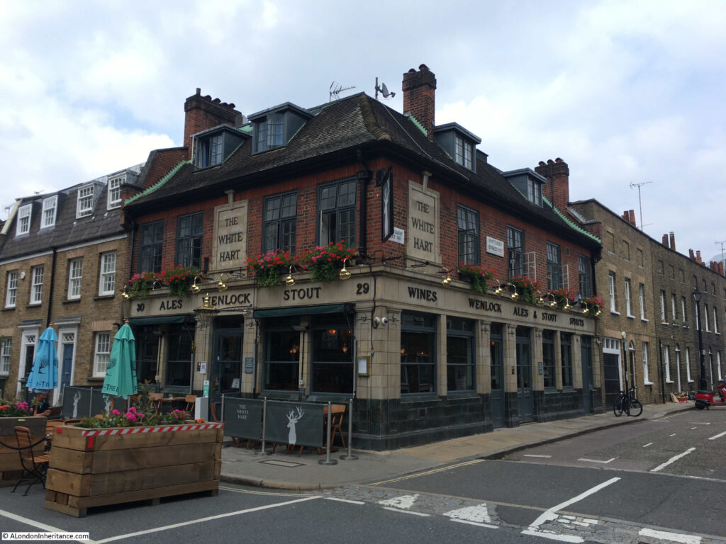
Another pub that has been here since the development of the area and that has retained the same name. The first record I can find of the pub dates from the 25th January 1849 when they placed an advert in the Morning Advertiser for a Barman or Under-Barman. In the advert the pub was described as “a respectable Tavern”.
From here, I am going to take a short walk from the area of Roupell’s developments as there is another street with some fantastic architecture.
Following the route in the map shown earlier in the post, I walked north along Cornwall Road to turn right onto Stamford Street, then south down Coin Street to find Aquinas Street:
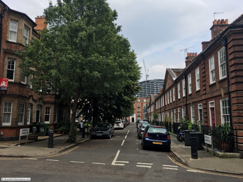
Aquinas Street is early 20th century, so later than Roupell, Theed and Whittlesey Streets, but like these early 19th century streets, Aquinas Street is lined by rows of terrace houses of a continuous and unique design.
This is the south side of the street:
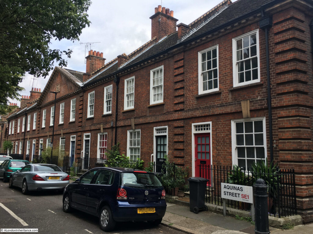
The south side of the street dates from 1911, and in the conservation area statement are described as Neo-Georgian, with their original doors, sash windows and railings. The terrace is Grade II listed.
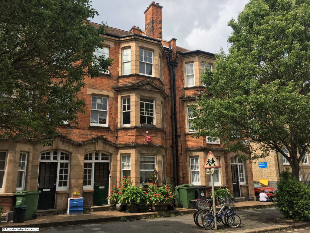
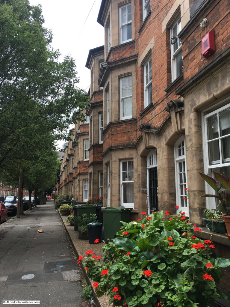
The northern side of the street has a continuous terrace of houses, but of a very different style:
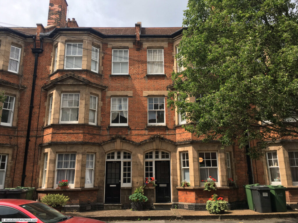
Substantial three storeys, each with a full height bay. They are not what you expect to find in this part of Lambeth and represent a rare example of a surviving, continuous terrace of houses dating from the early decades of the 20th century.
Aquinas Street is a perfect example of some of the wonderful streets that can be found by turning off the main streets of the city.
I started the post with the hairdressers / barbers on the corner of Roupell Street, so I will conclude the post by returning to the Roupell family.
John Roupell, the original developer of the estate, died in 1835. He died a wealthy man.
His son Richard Palmer Roupell had four children, however it appears that John Roupell was unaware of his grandchildren as Richard had the children with Sarah Crane who was recorded as the daughter of a carpenter. John Roupell would apparently have disapproved of this match, so Richard hid the relationship from him.
One of the four sons of Richard Roupell was William Roupell. He discovered that his father left his estate to his brother Richard, who was the only son born after Richard and Sarah had married (after John Roupell had died).
Richard forged his father’s will to leave his estate to his mother with Richard as executor. He was able to borrow against the estate. He also became an MP for Lambeth.
He had substantial debts and when those who had lent him money called for the debts to be repaid, he fled to Spain. He was persuaded to return, and then tried at the Old Bailey in 1862.
The trial gained considerable publicity, because of the level of forgeries, and because Roupell had been an MP.
An account of the trial was published, published in 1862 and described as “From the shorthand notes of Mr. G. Blagrave Snell – Shorthand writer to the Court of Bankruptcy”. The introduction to the account provides an indication of the sensational nature of the trial:
“The following pages contain the whole of the startling details of one of the most extraordinary series of forgeries that was ever disclosed in a court of justice in this country. No work of fiction, it may safely be said, ever was conceived, in which all the incidents that go to make up a tale of thrilling interest, can be more striking than is this bare, unvarnished tale of truth.
The principal party concerned in it was but the other day a member of Parliament, and a man of whom many prophesised that it would be no long time ere he would rise to distinction in the senate; but who by embarking on a career of reckless profligacy, has brought down absolute ruin upon himself, and upon his family an amount of calamity wholly undeserved, which would have been far greater had he not surrendered to justice by placing himself in the felon’s dock.
It was but recently that the pubic were surprised at the resignation of the Member for Lambeth. They little knew the tale that lay behind that resignation. They little knew that forgery and fraud had been the common paths and beaten ways of William Roupell for seven long years; that he had wasted the patrimony of his family, and had reduced them to comparative poverty even before his father’s death.
At length the fatal truth came out, and he was obliged either to face his father’s executors or fly the country. The family property had been fraudulently sold, and it was only when overwhelmed with difficulties, pecuniary and otherwise, that he resolved to confess the whole truth, even at the bar of the court of justice”.
A dramatic end to a once wealthy family, however we still have John Roupell’s original development as a memorial to his achievements, rather than his fraudulent grandson.

Thankyou! That was so interesting. I can remember happening upon these streets 50+ years ago and feeling like I was stepping back in time. It felt so quiet against the noise of Waterloo only yards away. Funny how images stick with you for so many years!
This is great, thank you. What a torrid history. The KA has been my favourite pub for years now, I bet they’d love this post on their Insta. I think the guy who owns the Citroen DS has a repair shop round the corner. There are usually several of different vintages lined up down Roupell St.
Steve who owns them is actually a conservation expert. There was a Citroen expert under the arches where th e Pleasuredome is now
Thank you. Such lovely buildings and streets. Really shows up the lack of thought of high rise modern development.
Roupell Street was used as a location in “For the Love of Ada” and the hairdresser’s featured as just that. Opposite at the time was a Newsagents, at least as seen in the film – a couple of stills here: https://www.reelstreets.com/films/for-the-love-of-ada/
There are also some photographs in the London Picture Archive https://www.londonpicturearchive.org.uk/quick-search?q=roupell%20street&WINID=1625990200473
which show it as it was in the film.
I believe the Citroen belong(ed)s to Stephen Bull who is/was the Chairman of the London branch of SPAB and was regularly see outside 285 Kennington Road where he has been supervising the restoration of the house for what seems like years, short documentary here:
Thank you for this link.
This was an amazing read, especially around the families of the actual owners of the land. Keep up the good work.
Another interesting and informative post. i worked in Waterloo Bridge House in the early 90s and on the South Bank in the second half of that decade, so got to know this area fairly well., especially the bakers Konditor and Cook! I never did visit Aquinas Street though. I recall both the pubs, but the the kings Arms was my preference. I also recall the French cars, which were used for period filming and were then usually parked in Cornwall Street.
Another fascinating post, with some personal interest for me.
My mother’s great grandfather, James Ebdon, who worked as foreman at the City Flour Mills, Puddle Dock, lived in Aquinas Street up to 1875. When I visited the area a few years ago to see his house I was disappointed to find it gone: some research showed that the Duchy of Cornwall rebuilt the street early last century.
Aquinas Street was Thomas Street when James lived there. The LCC changed the name to avoid confusion with other streets of the same name.
Have enjoyed walking around this area, like stepping back in time. So good that it is conserved, as so much has been lost through redevelopment.
Another wonderful post.
I “discovered” this area myself a few years back when planning a walk around the area south of the South Bank. But I didn’t get as far as discovering the story of Roupell’s will. It adds a whole new dimension to the history.
A wonderfully detailed trip around an overlooked area,the different architectural styles are fascinating…In Roupell Street alone there is no property
under one million pounds in value..
Wow you made my Sunday, my great grandfather William Valens and great grandmother Hannah Snow listed Roupell Street as their residence when they married at St. John’s Waterloo in 1853. He was a printer pressman. I have always meant to visit and I used to use Waterloo station a lot. So perhaps next visit. Thank you
Oh wow! I knew this area well in the 90s and 20-not-very-manys, working for HM Customs/HMRC out of Dorset House near the top of Stamford Street. Mostly drank in the Rose & Crown or occasionally the Stamford Arms opposite (but generally left that one to the posh lot from Customs HQ in Upper Ground).
Very familiar with Konditor & Cook *swoon* and the whole area, being in those days a bit of a South Bank fangirl and a huge lover of the waterfront walks. Had the odd gang beer in at Kings Arms, don’t think I was ever in the other one. Often walked along Roupell Street just to enjoy the lovely houses and avoid the polluted main road, I recognised it straight away and oh! your pictures took me right back…
Was around that time I was getting involved with researching my family’s history for my father: the home of his great grandfather for most of the 19th century was Carlisle Lane/Street, just at the bottom left corner of your last map. A much older road, but only developed seriously around the same time you describe. My ancestor more than likely helped decorate houses all round the area, being at various census times a plasterer, painter and paper hanger, and stepson of a builder.
I’m so glad the modern demolition squads haven’t been allowed to get at it! Thank you for so much more further history I’d never heard of, especially the naughty MP. At least he confessed and resigned – I wonder if he’d have been caught if he hadn’t owned up?
Stunning corner of traditional South-East London. I am a Bermondsey Boy but even just after the war most of our local housing of this kind had already been “slum cleared” between the wars. Hitler helped but sad to see the demise of Llewellyn, Bevington, St James’s, Drummond, and nearly everything to the East and between the last two save for a bit of Storks Clements and Bayard. As a junior errand boy I worked for Stewart & Wight the bakers of Tooley Street and we had a small shop in Roupell Street. Nostalgia sweeps over whenever I make a pilgrimage to he King’s Arms.
Interesting, as my father worked for a firm called “Burn Brothers Ltd” in Stamford Street from 1949-1959 when they relocated to new premises in St. Mary`s Cray Kent, as part of a scheme to move businesses away from London.
That was so interesting. I discovered my GGfather & relatives, by the name of Aubrey, lived in Roupell St & Cornwall Rd mid-(19th & were married & baptised at St John’s, Waterloo. They were silk hatters and I wonder if they had Huguenot origins.
I was amazed to find the houses had not been destroyed by bombs or developers.
Thank you
Another great post. I am very familiar with Roupell Street, having worked in an office on the corner of Blackfriars Road and Meymott Street, and coming into Waterloo would walk down Roupell Street to get to the office. The King’s Arms was my favourite of the pubs in the area, and was a regular there. Great to read a little more of its history, and the street in general.
Another fascinating post – thank you. The change from ‘hair dresser’ to ‘barber’ is probably a return to the original. Growing up in Putney in the 1950s I was always sent to the barber’s. It was a very spartan affair with chairs for waiting customers lining the walls. Late afternoon was the time for boys to go for a haircut. One style; short back and sides. Good behaviour was mandatory – any misdemeanour and the offender was physically ejected and would have to explain why he was returning home with uncut hair. Girls never went to the barbers; they went to the hairdresser. I’m not sure when barbers became redundant but it was because of a desire to move away from the spartan image and to offer other services like washing and blow drying. So probably 1970s when hair went long. Barbers ceased to exist and some places even catered for both sexes! The older generation tended to stick to single sex establishments. But even they became known as hairdressers.
Fascinating article! I used to walk up and down Roupell Street twice a day for a number of years, enroute to/from my then (nearby) office. For a few minutes, one was in a different world! The Citroen was there then (early 2000s)! Never got as far as Aquinas Street but will make sure I do so, next time I’m in the vicinity!
I believe that Roupell Street was used as a filming location for the Kray Twins film made in the early 1990’s. I think the street and the adjacent streets have appeared in several movies and TV shows & series.
I love these thoroughfares, they very often have an almost tranquil vibe, even though they are in a busy inner London district. With a bit of imagination, it’s possible to travel back in time to when the streets were first developed.
For anyone who visits or knows the city of Hull in East Yorkshire, John Street (opposite the New Theatre) and also the area around Leonard Street and the adjacent Hutt/Morpeth Streets (especially the northern most sections of Hutt & Morpeth Streets, which were built in the 1840’s/1850’s, 30-40 years before the majority of both streets) have a similar ambiance/mood, not particularly in the style of the houses exactly, but more in the way that you can almost imagine the year to be 1865 or 1910.
Thank you for delving into the history. This is a favorite area of mine in town. Since no one else noted it, I recommend reading Ian Nairn’s poetic account of Theed , Whittlesey and Roupell Streets in Nairn’s London on pages 118-19 of Nairn’s London.
Fascinating article. My x4 great grandfather George Alder lived in Roupell Street in 1840. His occupation at his death in 1840 was recorded as Excise Officer so may be the one referred to in the text. He had an interesting career – some suggestions that he was dismissed for fraud.
By the time of the 1841 census his widow (Sarah Alder nee Moore) was shown as living in Curtis Hatch with her son George Alder (junior) (a lawyer’s clerk). Presumably people still used the old name.
In the 1851 census George was still shown as living at 8 Curtis Hatch but he was living at 4 Richard Street in Lambeth in 1861 and 1871.
Thank you for another wonderful post. I found a listing for one of the houses, now beyond the reach of the artisans who once inhabited the road.
https://www.zoopla.co.uk/for-sale/details/59001890/
Once again a very well researched piece. The houses in Roupell Street are similar design to many in the area, especially those in Glyn Street, Aukland Street and Italian Walk in Vauxhall. These were built on the site of Vauxhall Gardens and were demolished in the 70’s. I worked for Lambeth Council in the 60’s when most of the area around Waterloo Station were going to be demolished in the slum clearance programme. Many were demolished, like Glyn Street, but those that remained have now become ‘desirable’ properties and sell for enormous sums, a far cry from the houses I knew back in 1966!
Until they boarded it in you used to get a great view of the rooftops from the far end of platform A at Waterloo East station.
I always love watching the film Waterloo Road.
I have walked those streets many times -great read
Hi,
I read your posts with great interest – even from Sydney!
I have an ancestor who sold a Wharf and Tenements in 1650 approx that abuts Wapping High Street and measures 2080 feet along the Thames and 75 feet along the side. The folk who sold the property were Constance (Manly) Ackworth and her broher Robert Manly. They sold to a John Parrey (who was a scrivener). The property had been inherited from a John Ackworth in 7 July 1658.
I wonder if you can estimate exactly where the property was or know anything about Wapping High Stree in those times. The information I have comes from a WikiTree profile that can be seen at https://www.wikitree.com/wiki/Acworth-62.
Interested to hear your thoughts.
Best wishes
Ian (riacworth@gmail.com)
Which station would you say is closest to these areas as I’d love to recreate your above walk?
I’m actually from West Norwood and an area near hear is still referred to as ‘Roupell.’ I was for a long time on the council housing register here in Lambeth, and when I ‘placed bids’ each week there was one area the council is still calling Roupell, even though we locals do not commonly refer to it this way.
Waterloo East or the main Waterloo station are the closest above ground stations, or Waterloo underground station. Roupell Street is a short walk from the station.
Love the photo of all the chimneys at the back of Brad Street – older photo – which had kept their grim original Victorian look, they speak of ‘Hard Times’ and which were to be found more often in their grimy Victorian originality until say the late 80’s. The parallel lines on the map, going by the age of it, could be mistaken for common strip fields, but I don’t think they are at all, having studied their distinctive curves and layout over wide parts of the country.
I knew Roupell Street in the late 1940s and early 1950s due to my father working in the area. It was a bit
‘down at the heel’, all houses having front doors opening on to the pavement and not at all desirable.
Around 1952/53 there was a TV comedy series with Eric Barker, long since dead, and it included a sketch
filmed on Roupell Street depicting a row of smart City Gents, dressed in bowler hats, suits, waistcoats, brief cases, and umbrellas simultaneously coming out of of the houses and walking to work. The joke of the sketch being this is the way people will want to live in the future, with much laughter from the audience. The script writers must have had a crystal ball. The rents then for these houses would probably have been around £1 a week, they are now being sold for over a million pounds.
I was fortunate enough to live in Roupell St from 2000 to 2004, where I rented the house opposite the owner of the Citroen. Of the several homes I rented in London, this house was my favourite: a fantastic central location with a then-affordable rent, plus a short walk to my job in London Bridge. The interior of the house would have been recognisable to its builders, apart from the modern bathroom, kitchen and radiators. The halls on both floors still had their original wooden panelling, there were matching wooden fireplace surrounds moulded to look like carved stone. The woodwork was grade II listed, removed from many of the other houses after remodelling to open-plan. It was a pleasure to live there, apart from being woken by the weekday clatter of pedestrian commuters heading from/to Waterloo on the pavement outside. The back of the house overlooking Brad St and Waterloo East station was unexpectedly quieter. I found the slow rumble of trains through the station in the early morning/late evening curiously soothing.
Thank you for another great post and for filling in a few blanks.
I live in the cheap seats – the Peabody Estate – at the Hatfields end of Roupell Street.
My wife has booked us on on the September South Bank walk so I will get more details then, I’m sure.
I lived on Aquinas Street from the early 90’s to the beginning of 2003. The rent was brilliant at the time 500 gbp a month and by the time I left it had only gone up to about 700 per month which was extraordinarly cheap for London. However the down side of Aquinas Street was the clash of the eclectic mix of residents. From shakespearean actors, to drug dealers, Doctors to raging alcoholics, pilots to gang members, you name it, at one time or another they all lived in the street. I remember coming home after a trip and seeing the rubbish hadn’t been collected , and my neighbour told me they refused because another resident had fired an airgun at the truck as they woke him up! One particular flat regularly got sold once a year as the residents above were drug dealers so had people coming all times of the day and night. This was the problem when there was a mix of home owners and council tenants. Most of the council tenants were lovely but there were some who were a nightmare and knew how hard it was to get them evicted so they made other tenant’s lives a living nightmare.
I have fond memories of my time there but some pretty hairy ones too 😉
From 1972 until 1977 I used to walk down Roupel Street from Waterloo East to Blackfriars Road Post Office where I worked. The character of the street was fast changing, one evening my colleague Frank and I were asked by a woman to pick up her drunk husband who was lying in the gutter outside the Kings Arms and deposit him still unconscious in the hall of her house opposite. Later though the accents of the locals changed and you heard people being invited in for a gin and tonics and the train announcements on platform A of Waterloo East were cut as it was disturbing the residents. The houses cost about £7,000 then, wish I bought one.
The shop you mention at 62 Roupell Street was still a bakers in 1939 – George E Winchester. I’ve been trying to decipher the ghostsign on the side of the building, but with very little luck. I suspect it was a sign advertising either Hovis or Daren bread, with a byline for the baker.
https://www.flickr.com/photos/royreed/29578632820/
There’s another ghostsign just off Roupell Street in Theed Street – ‘Any person found throwing stones in this street will be dealt with in a summary manner.’
https://www.flickr.com/photos/royreed/51997824465/