One of the pleasures of London is a random walk through the city’s streets. I have found very few streets where there is not something of interest. Unusual buildings, hidden bits of history, the new and the old showing how the city’s long expansion and development has taken place, and continues. One such street is Essex Road, Islington, and for today’s post, join me for a walk along part of this busy north London street.
Essex Road starts at Islington Green, where it runs from the north east corner of the green up to Balls Pond Road. To keep the post a manageable size, I will only cover the southern section from Islington Green up to the New North Road.
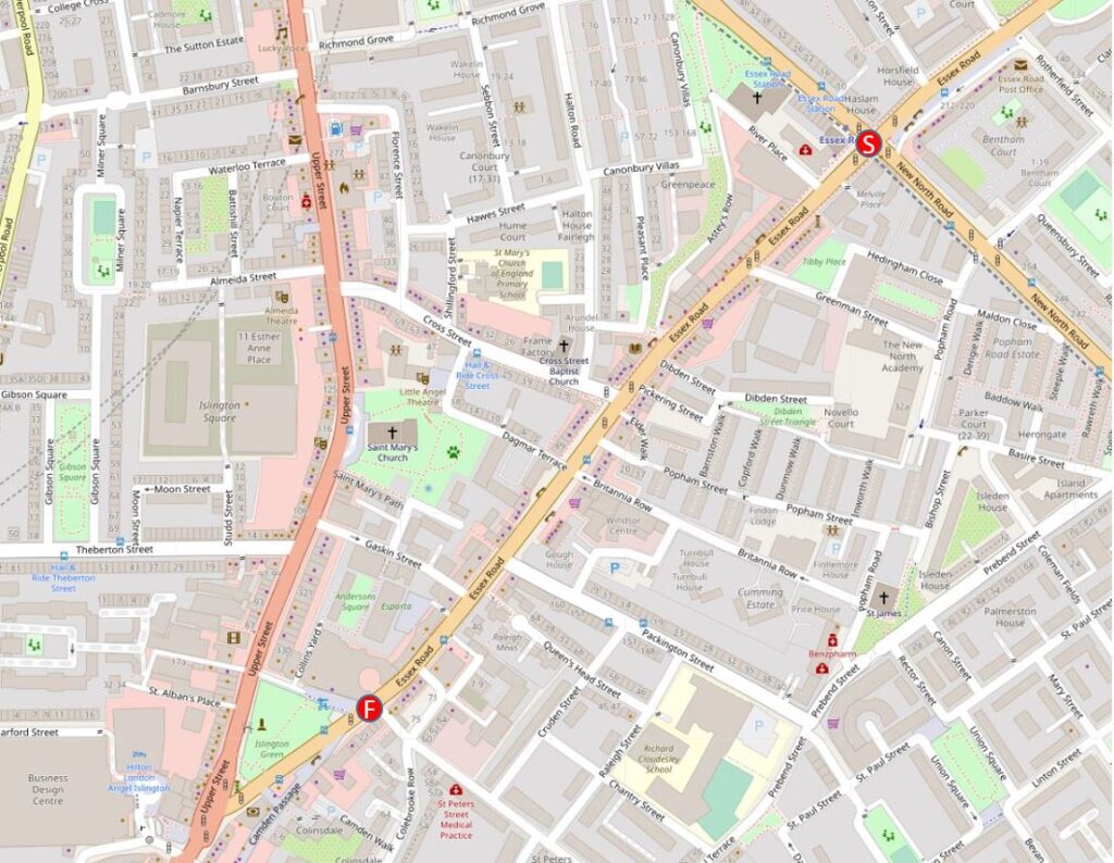
This stretch of the road is shown in the following map, starting at the Start (S) at upper right, and finishing at the Finish (F) at lower left (Map © OpenStreetMap contributors).
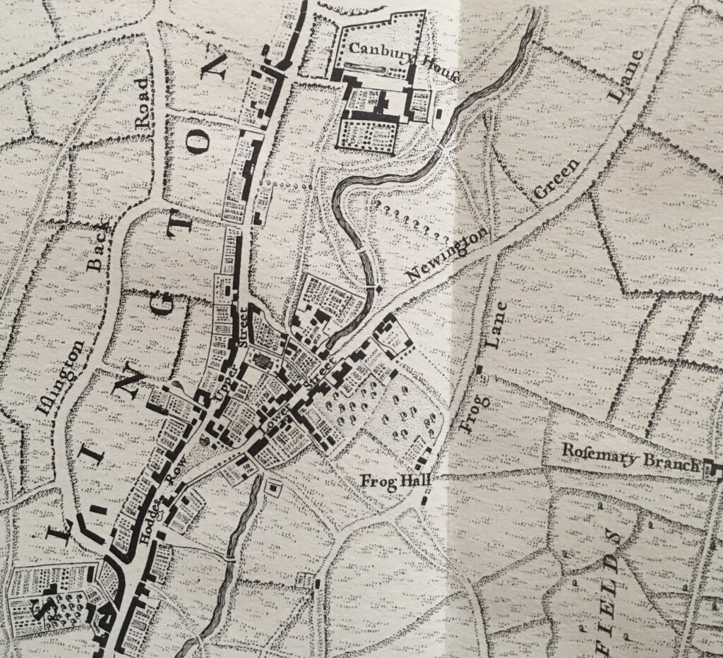
Essex Road is an old street, going back very many centuries. In 1746, the upper part of the street was called Newington Green Lane – because that is to where the street led, with the lower section called Lower Street, which continued on along the eastern edge of Islington Green. The Lower part of the name was because of the drop in height across Islington Green from Upper Street on the west, down to Lower Street on the east.
In 1746, the area was still rural. Fields surrounding the upper part of the street, with a number of large houses and inns lining the lower section. The New River crossed and ran under the street in a tunnel which continued further south to where the river emerged as it headed to New River Head.
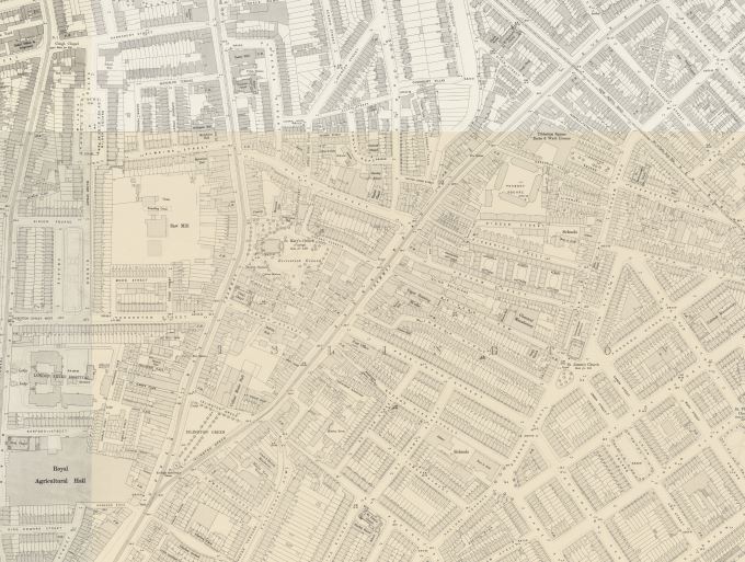
London was fast approaching these Islington fields, and whilst Essex Road would continue as a main route from Islington Green, the large houses and fields would soon disappear under a dense network of new building that would leave the area unrecognisable by the end of the 19th century. The following map shows the area in 1894. Islington Green is the triangle of land at lower left, and Essex Road as it was now called, follows the same route, up from the north east corner of the green (‘Reproduced with the permission of the National Library of Scotland’).
I am starting at the junction of Essex Road and the New North Road (S) in the map at the start of the post, and walking south to Islington Green.
The New North Road is, as the name suggests, a new road, although new is relative. It was not on the map in 1746, but was constructed in the first couple of decades of the 19th century as a more direct route from Shoreditch to what is now Highbury Corner.
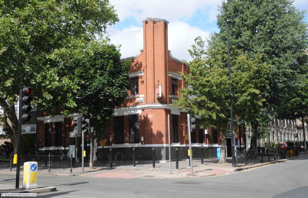
On the southwest corner of the junction is Essex Road station, opened in February 1904 by the Great Northern and City Railway, and is now part of the Great Northern rail network, with trains running to and from Moorgate in the City of London.
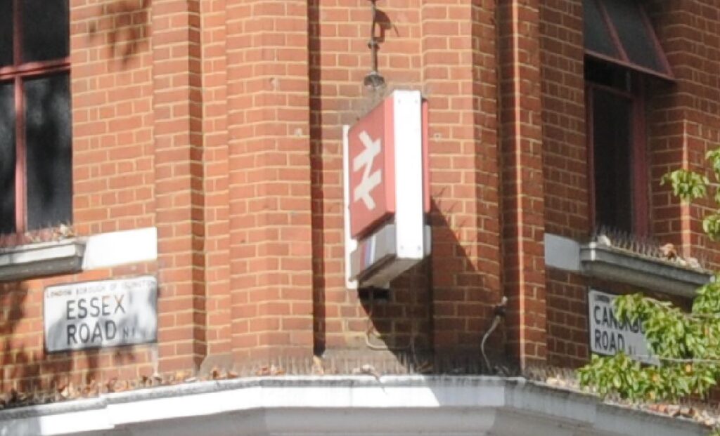
The station is unusual as it is the only underground station in London operated by a rail company. The original British Rail symbol can still be seen on the corner of the building:
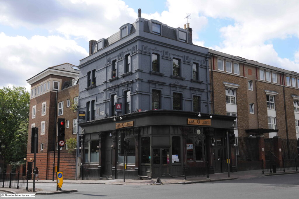
On the opposite corner to the station is the old Three Brewers pub, now the Akari Japanese restaurant.
Most sources seem to date the pub to around 1830, however this may be the current building. The earliest reference I can find is to December 1808 when the Morning Advertiser carried an advert for a sale of general household furniture at a location near the Three Brewers, Islington. Pubs were often used as landmarks when describing a local location.
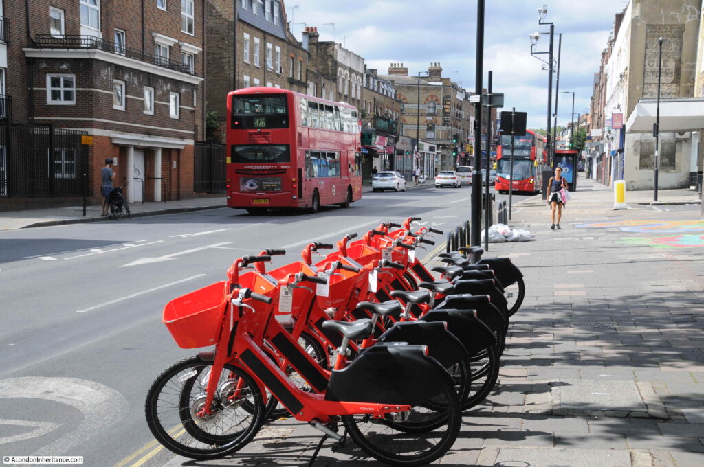
The view south along Essex Road near the station – a wide, busy street.
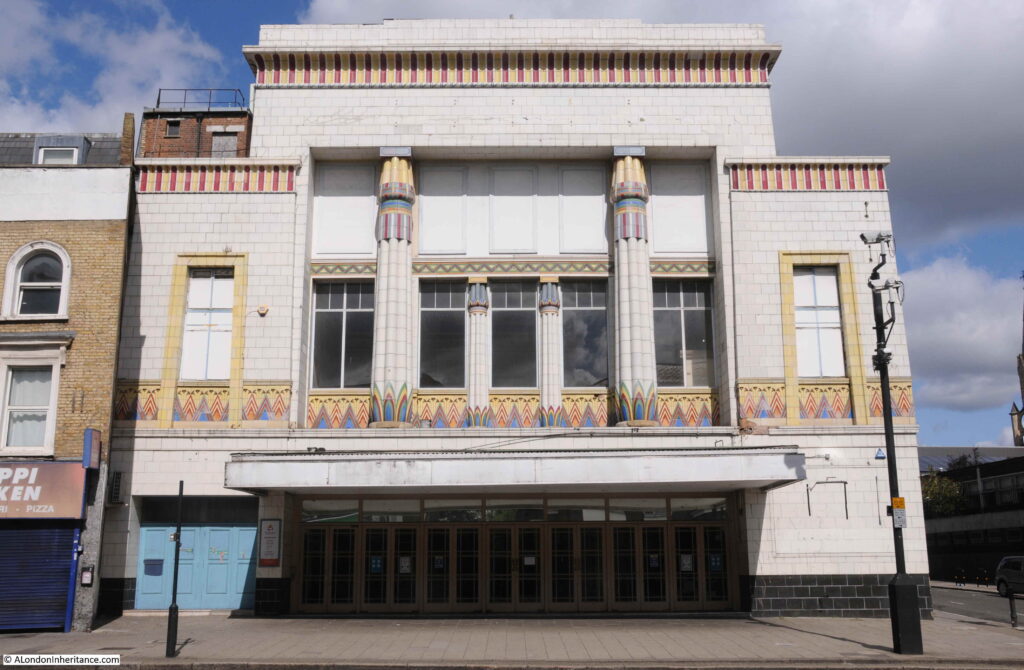
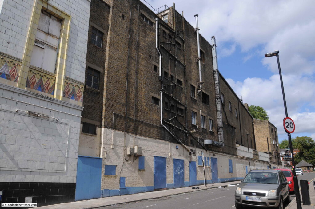
Heading south, we come to a rather ornate old cinema building. This is the old Carlton Cinema which opened on the 1st September, 1930.
The cinema really stands out due to its Egyptian façade which was the creation of Architect George Coles. The Egyptian theme was probably due to the discovery in 1922 of the tomb of Tutankhamun.
The Carlton offered not just film, but also stage shows, and in February 1931 the residents of Islington could be entertained by Al Davison and his band.
The Carlton became the ABC in 1962, but closed as a cinema ten years later in August 1972, when it was then converted into a Mecca Bingo Club, which would run to 2007. It was then purchased by Resurrection Manifestations, who use the old building as a place of worship.
The view along the side road (River Place, which runs up to the old route of the New River), shows typical cinema construction of a very ornate front façade, with a simple and functional rear of the building.
The old Carlton Cinema is Grade II listed.
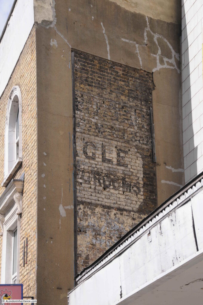
To the left of the cinema, an end of terrace building extends into the street, and on the side of the building is a part exposed sign.
The sign refers to the Eagle Dining Rooms. I found a couple of references to the dining rooms to confirm the full name in the Islington Gazette. On the 1st July 1902, there was an advert for:
“Wanted, a young girl for Stove Work; one used to the business. The Eagle Dining-rooms, 159 Essex Road, Islington”, and on the 13th June, 1910, under the advertisement section of the Islington Gazette, which had the remarkable title of “Servants and Girls Wanted”, there was;
“Respectable Girl Wanted, about 18, to Assist House and Kitchen; sleep out; closed Sunday. Eagle Dining Rooms, 159 Essex Road”.
Adverts mentioning the Eagle Dining Rooms in the Islington Gazette appear limited to between 1902 and 1910, so perhaps this gives an indication of the period of time that the establishment was in operation.
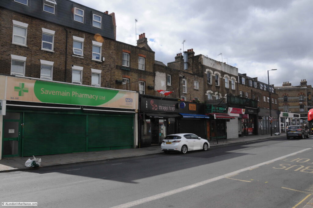
The following photo shows the opposite side of the street. Essex Road has a mix of architectural styles and building age. The photo shows some buildings (the smaller central terrace) that probably date back to the early years of the development of Essex Road, and where their original front gardens have been replaced with shops as the street developed and there was a growing population to serve.
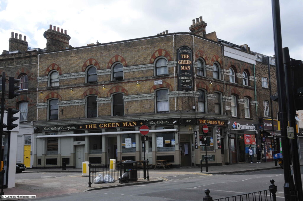
The Green Man pub on the corner of Essex Road and Greenman Street.
Greenman Street was named Greenmans Lane in the 1828 C&J Greenwood map, so is probably an old lane.
The site of the Green Man pub was apparently the site of the first Congregationalist Chapel in Islington. The chapel was built in 1744, and grew during the following decades as the congregation expanded. The lease on the building expired in 1865 and the chapel moved to a new location in River Street.
In March 1866, there was a license application by a George E. Muddyman, and a Mr Sleigh opposed the application as there were already many licensed houses in the district. The license was granted as the Peabody Buildings just behind the pub (which are still there) had recently been completed and were now occupied by “700 or 800 persons” and the Superintendent of the Peabody buildings stated that “all the tenants had signed the petition in support”.
So the Green Man pub probably dates from 1866, the occupants of the Peabody buildings behind the pub must have made up the majority of the pubs initial customers, and it was built on the site of the first Congregationalist Chapel in Islington. The pub must have originally been larger, as if you look at the photo, the Domino’s take-away occupies the ground floor of a building with exactly the same architectural features as the pub.
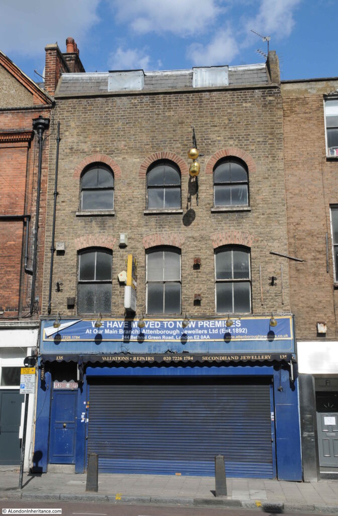
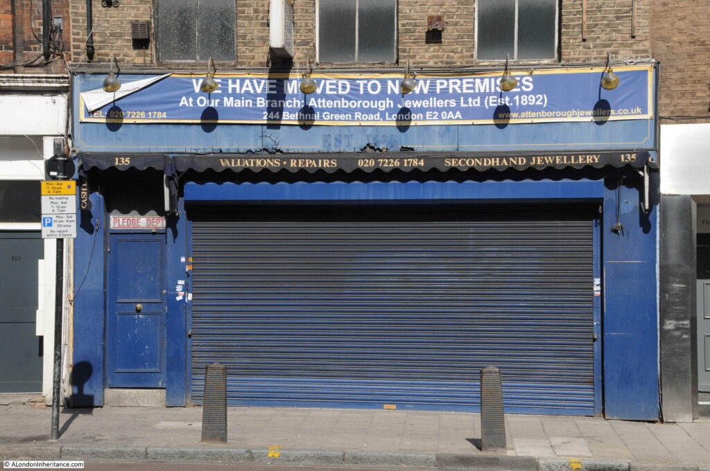
Opposite the Green Man is the closed shop of Attenborough Jewellers, who have now moved to their original main branch in Bethnal Green Road (I have some 1980s photos of the Bethnal Green branch to re-visit).
The shop also operated as a pawnbroker. Note the door marked as the entrance to the Pledge Dept on the left.
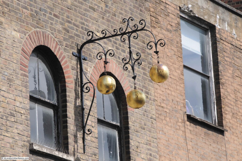
And the traditional sign of a pawnbroker on the front of the building:
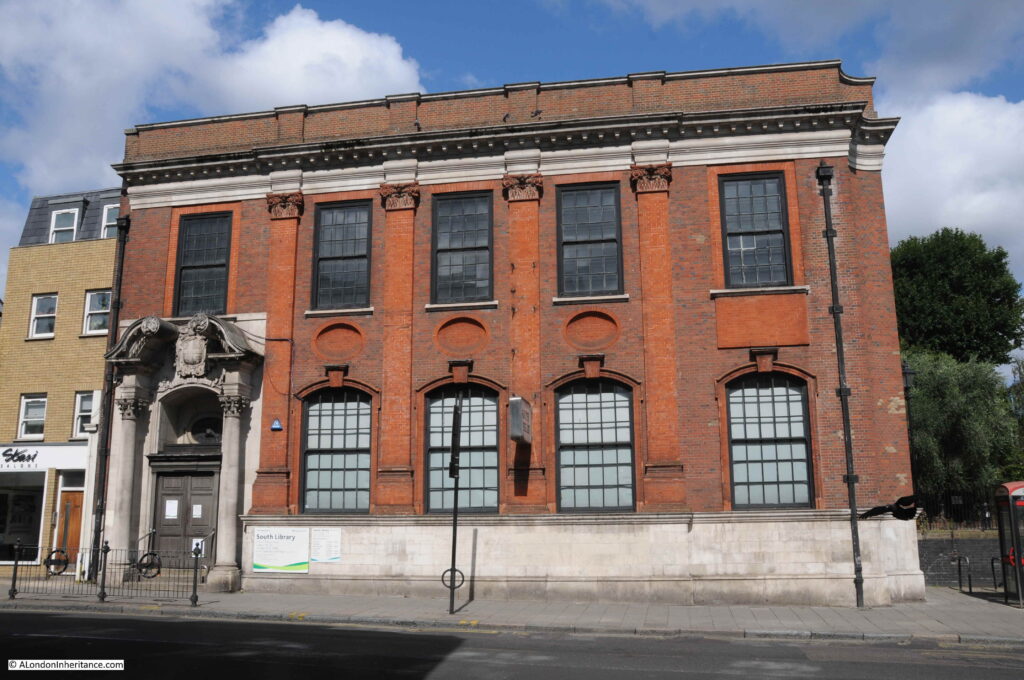
Continuing along Essex Road and we come to the South Library:
The foundation stone was laid in 1915 and the library opened in December 1916. A plaque inside the library states that it was presented by Andrew Carnegie, so it must have been one of the many libraries that Andrew Carnegie, the wealthy Scottish-American industrialist funded.
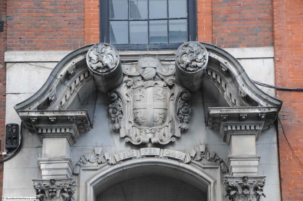
The coat of arms above the door of the library provides a quick history lesson on original land ownership in Islington. This version of the coat of arms was granted in 1901, and the four quarters of the shield are each part of the coat of arms of significant Islington landowners.
The Order of St John is at top left. George Colebrooke who owned the Manor of Highbury is at top right. Below that the arms of the landowners the Berners family and at bottom left is part of the coat of arms of Sir John Spencer who owned the Manor of Canonbury.
These arms were replaced in 1966 when the larger borough of Islington was formed, and the council probably thought that historical landowners did not reflect modern Islington, but it is good to see that the earlier coat of arms can still be found.
Opposite the library is this terrace of houses, which again reflect the diverse range of architectural styles, and the haphazard way that the buildings lining Essex Road have developed over the years.
The third building to the left is strange, The upper floors jut out without being in line with the adjacent building of the terrace. It would be interesting to understand the reasons behind this unusual design.
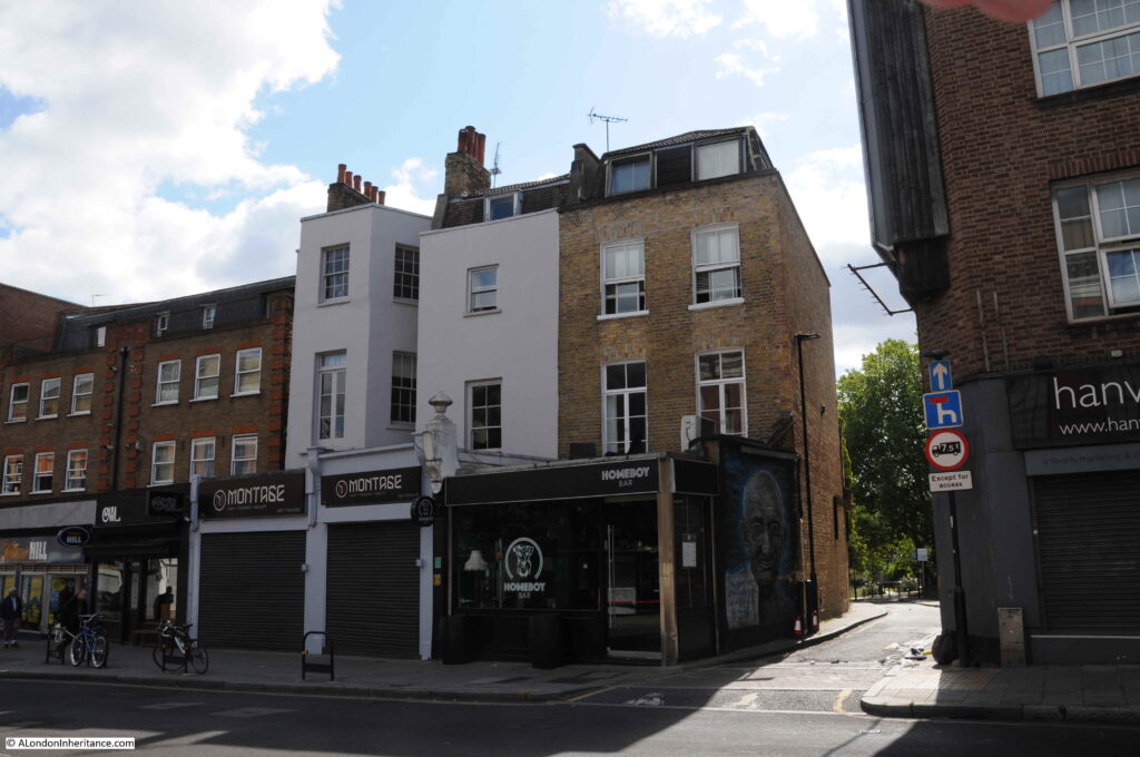
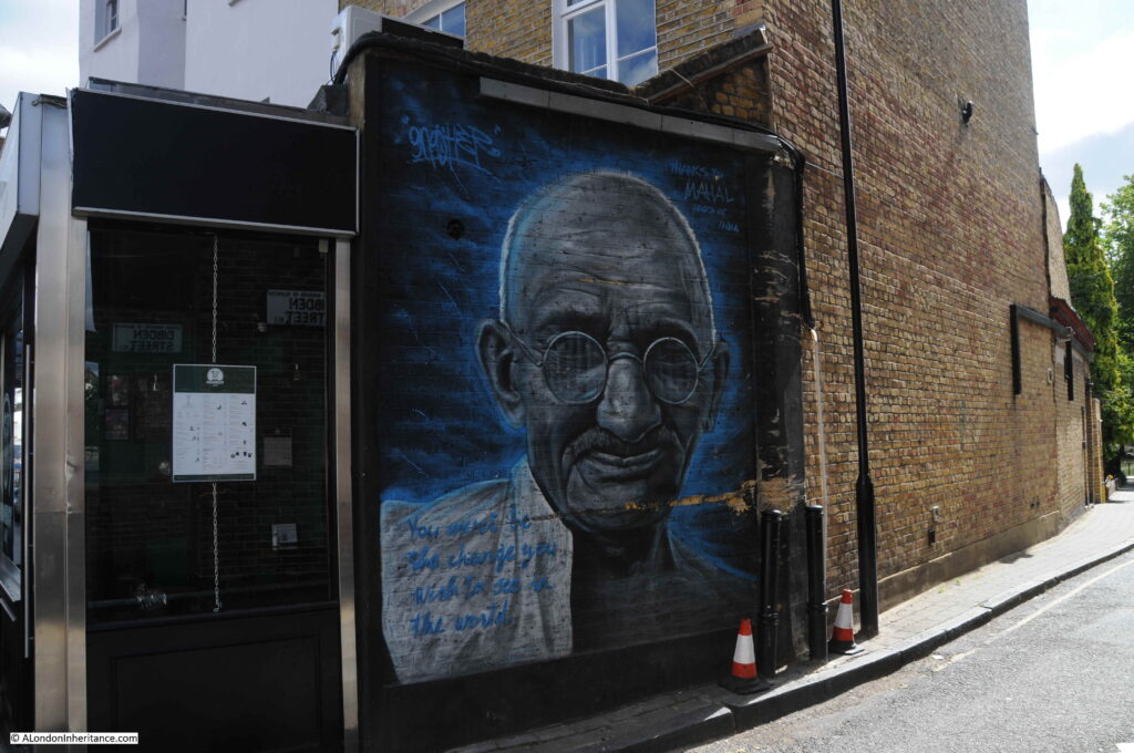
The small road to the right of the above terrace is Dibden Street, and in the entrance is a mural of Gandhi by graffiti artist Gnasher.
The text reads: “You must be the change you wish to see in the world”.
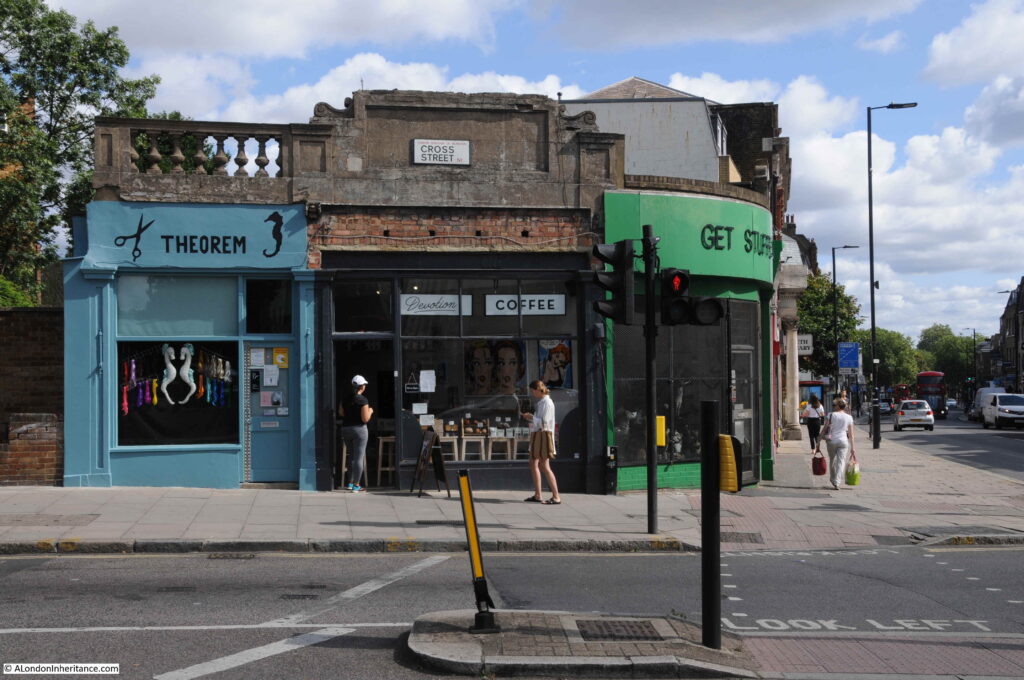
Further south at the junction with Cross Street is this collection of small shops with some interesting, concrete, architectural detail running along the top.
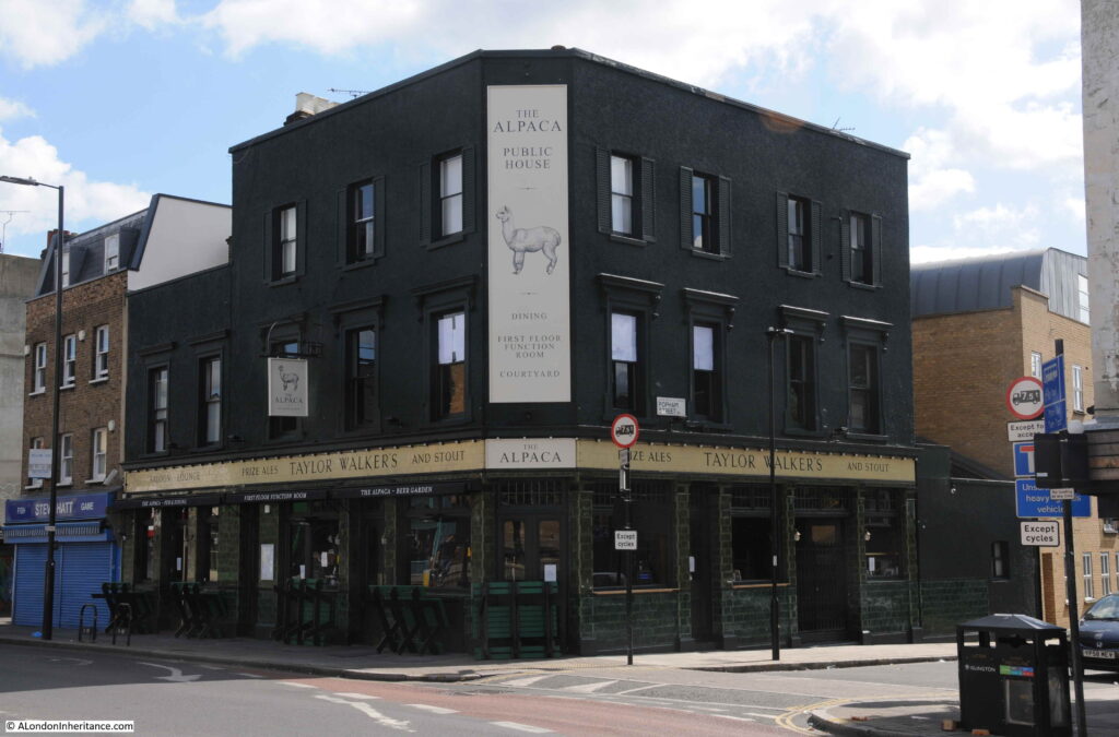
A short distance further along is the Alpaca pub:
The Alpaca is a very new name, dating from when the pub reopened in March 2020 – unfortunately probably the worst time for a new pub to open in recent years.
It was the New Rose, and originally the Half Moon.
The Half Moon dates from the early 19th century, and the first written record I can find of the pub dates from the 15th July 1824, when the London Sun recorded an inquest being held in the pub “on the body of Thomas Smith, aged 23, a Kentish town stage-coachman, whose death was occasioned in a pitched battle with a person of the name of Harry Bastie”. The inquest records how Thomas Smith’s brother described the battle, when he found him at:
“Copenhagen-house; he spoke to him, endeavouring to persuade him from fighting, saying that he was too fat, and had not an equal chance with the person he was going to fight, who was a good man, and had two ways of fighting: the deceased replied that unless he was to fight now that it had come to such a pitch, he would not be able to stand by his coach and get a single passenger.
A ring was formed, and his brother entered the ring first, and threw up his hat. The deceased was knocked down several times by his antagonist, who had the knack of tripping him up: witness was informed that the fight lasted two hours and fifteen minutes. During the fight the witness entered the ring and saw his brother lying on his back and was desirous of ending the fight, but the seconds interfered and turned him out of the ring.
He did not go to his brother until the fight was over, when his brother said ‘I’ll fight no more’. The deceased requested to sit down on witness’s knee, and he died soon after”.
The inquest was adjourned so the seconds could be found and interviewed. What the report does not record is the reason for the fight and why Thomas Smith would not be able to get a single passenger in his coach without going ahead with the fight.
The scene of the fight, Copenhagen-house is also in Islington, and I have written about the site in a previous post.
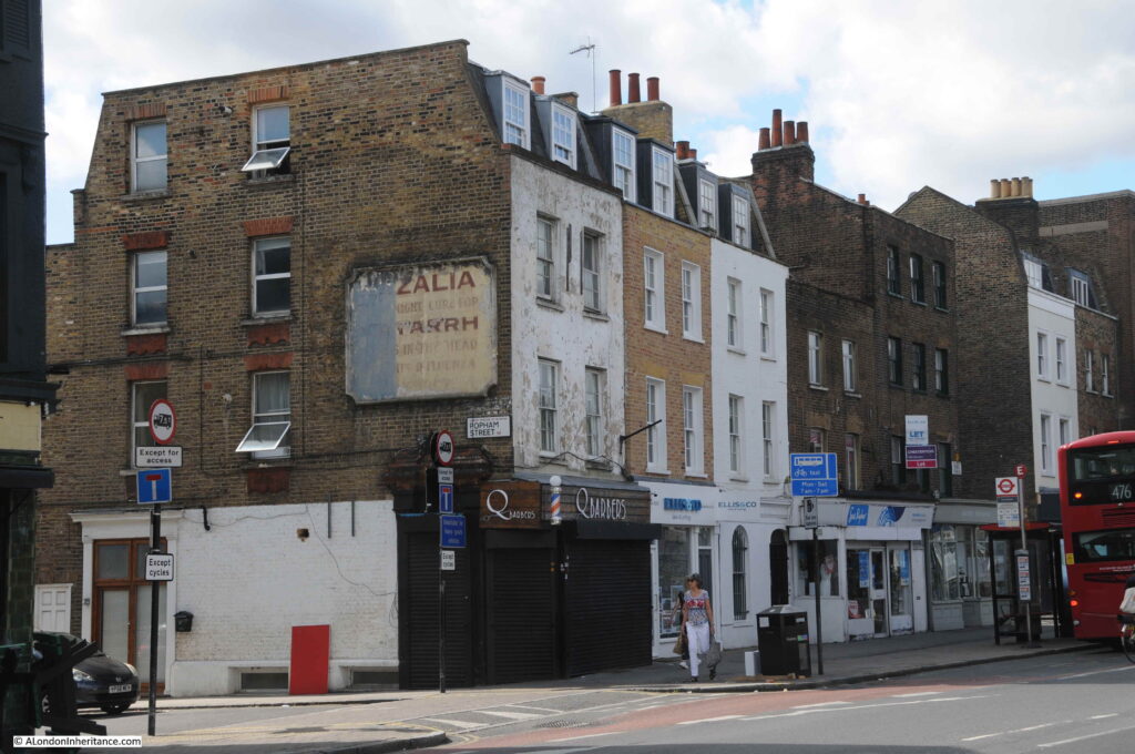
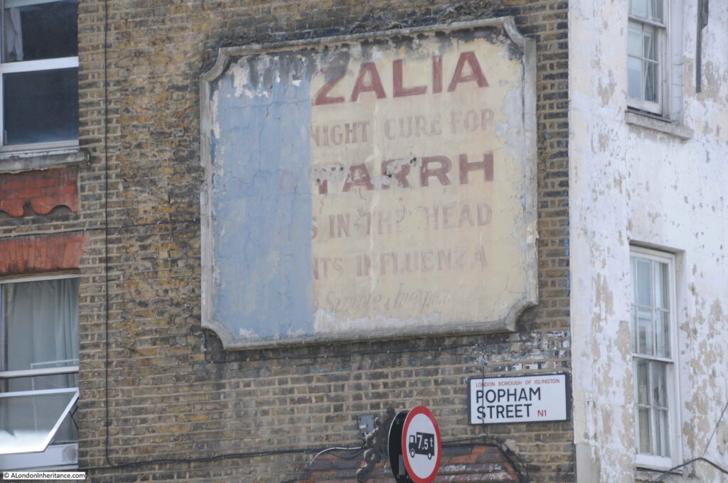
Opposite the Alpaca is another early terrace with on the side of the terrace facing Popham Street, another faded advertising sign.
The sign is advertising an American treatment which was advertised as a night cure of problems such as Catarrh and Influenza. The product went by the rather unusual name of X-Zalia, which probably sounded scientific during the first decades of the 20th century when it was sold.
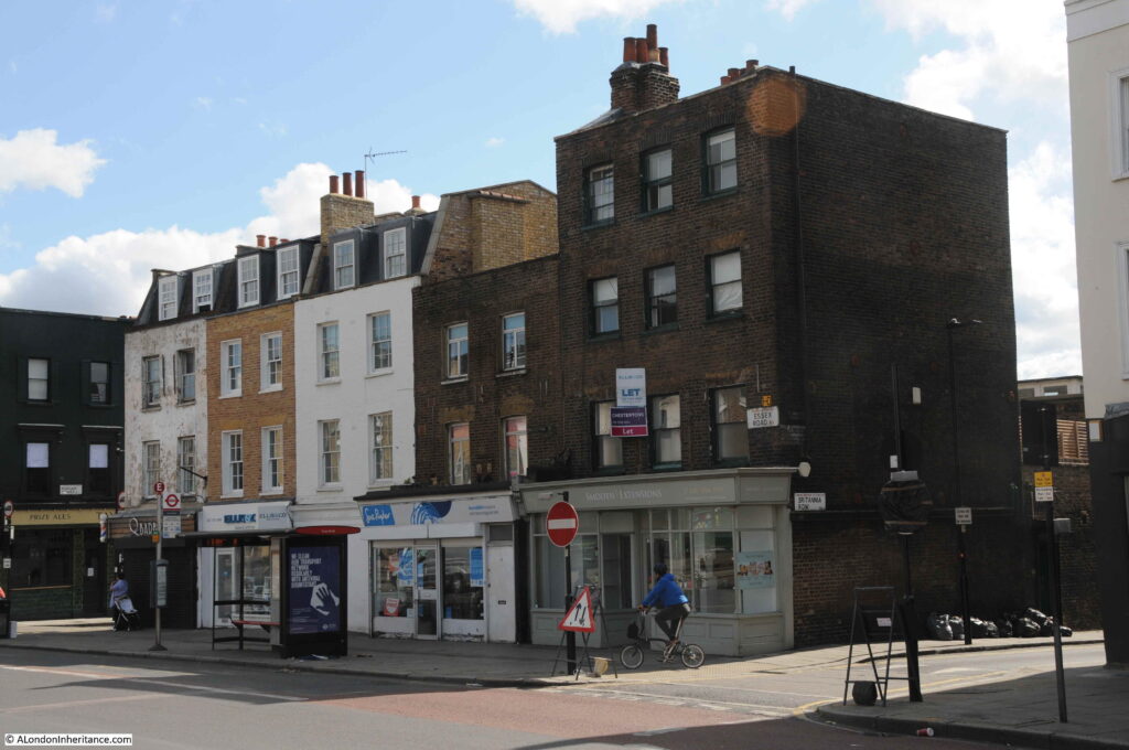
A view of the same terrace from the opposite end, another good example of the mix of architectural styles of the early houses along Essex Road.
The tallest building on the right is Grade II listed as it dates from the early 18th century and was one of the buildings on the 1746 map. The building was once the home of John C. Aston & Sons, Wholesale Ironmongers and Builders Merchants and behind the house, running along the lane we can see in the photo was a long, two-storey range of warehouses. The shop facing onto the street was the shop for John C. Aston’s business. Today it is a very different shop providing hair extensions.
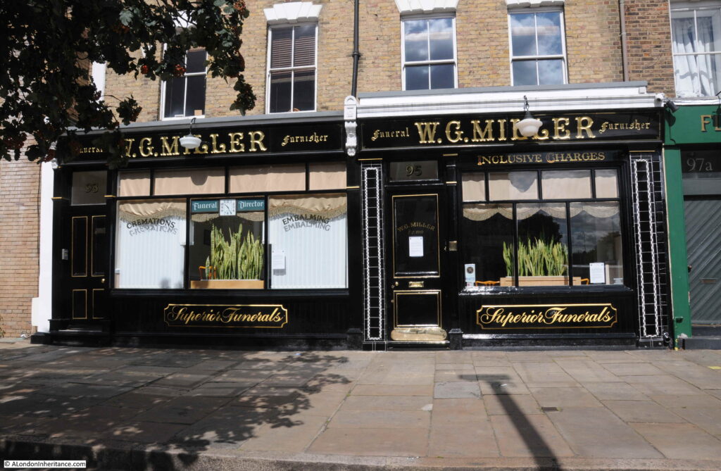
Across the road is a business that has been in operation for over 100 years. Established in 1918, W.G. Miller is the oldest family run funeral directors in Islington.
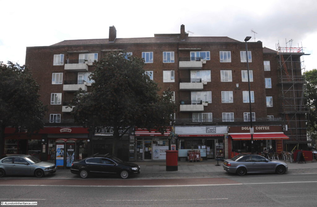
Further on is the Cumming Estate:
A rather functional block of flats, however they are named after two brothers who were responsible for much development around Islington and Pentonville. The brothers were John and Alexander Cumming who were one of the main developers of the Penton Estate in the late 18th century.
The brothers were Scottish and had built a reputation as watchmakers and businessmen. Alexander appears to have had royal and aristocratic patronage which probably explains their ability to fund their developments along Pentonville Road, centered around Cumming Street.
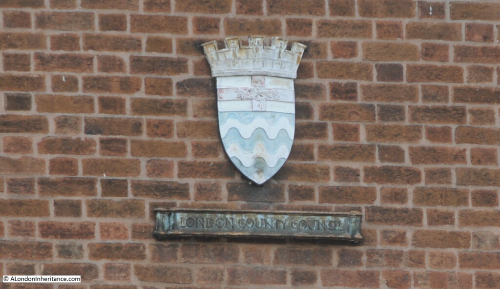
The housing block in Essex Road was developed by the London County Council and bears the typical coat of arms of the LCC, which can be found on many of their developments, although the one in Essex Road looks to be in a rather poor condition.
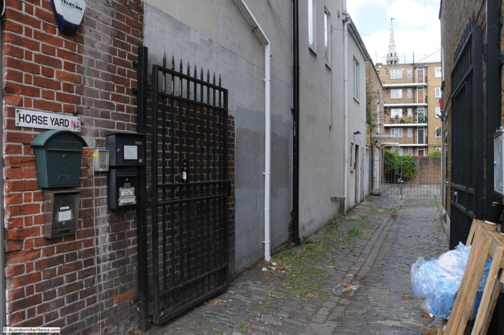
On the opposite side of Essex Road is Horse Yard. A narrow, cobbled alley that leads up to a yard, and which almost certainly was once the site of stables.
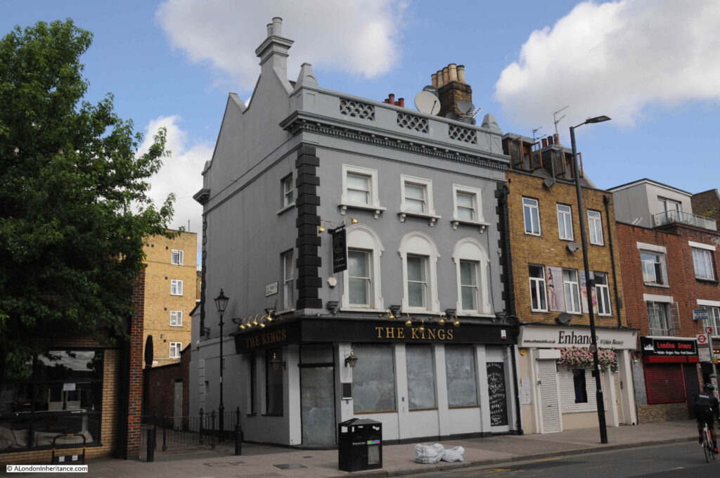
We now come to another pub, the Kings. When I was walking Essex Road, the pub was boarded up, which is always a very worrying sign with London pubs, however it was only for a change in ownership and the pub reopened at the end of 2020 – again not a good time to open a pub.
The pub was until recently called the King’s Head, and although the current building dates from the 19th century, this is an old pub and was probably one of the cluster of buildings on Lower Street in the 1746 map, as this stretch of Essex Road was then named.
The earliest reference I can find to the pub dates to the 22nd July 1758 when an article in the Oxford Journal reads:
“Sunday Morning early died Mr Cupit, master of the King’s Head in the Lower-Street, Islington. He went to bed on Saturday Night seemingly in good Health, and ordered his Wedding Sheets to be put on his Bed, saying, as they were his Wedding Sheets, perhaps they might be his Dying Sheets”.
An article that raises more questions than it answers.
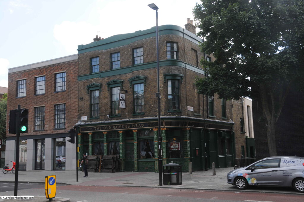
And almost opposite the King’s Head is rather appropriately the Old Queen’s Heads (Essex Road really does have a lot of pubs).
The Old Queen’s Head is a lovely tiled 19th century pub, but like the King’s Head, a pub has been here for a long time. and the earliest reference I can find dates to the 24th February 1748, when the following incident was reported:
“On Sunday Evening, about Seven o’Clock, three Persons returning to Town, were attacked in that part of Frog Field that leads to the Queen’s Head in the Lower Street, Islington, by three Fellows, but Mr John Scott, Foreman to Mr Gregory, a Taylor, Old Broad-street, thinking to save what he had, ran from them, when immediately one of the Roques followed him with a drawn Hanger, and cut him down on the back Part of his Head, so as to let out his Brain; they then made their Escapes, leaving his two Companions, whom they had robbed, to take care of him”.
18th century newspapers were always graphic in their descriptions of violence. A Hanger is a small sword.
The Frog Field does not exist anymore, however the 1746 map at the top of the post shows Frog Lane and Frog Hall to the east of Lower Street. At the time the area was still rural and after dark, it was a dangerous place to be.
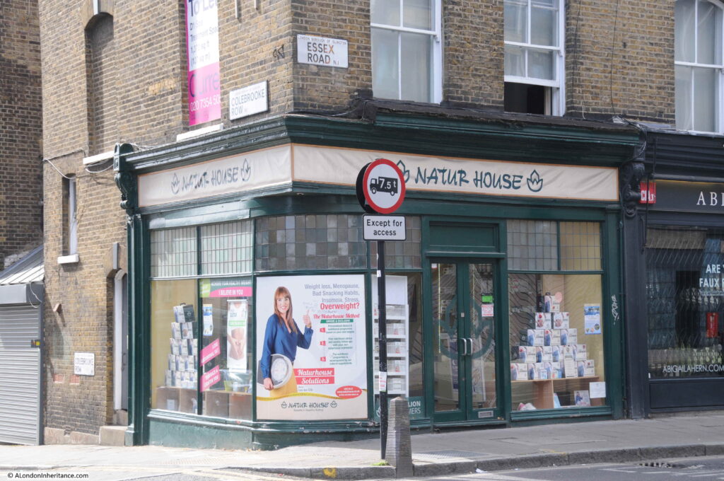
I like photographing shops and this is Natur House on the corner of Essex Road and Colebrooke Row.
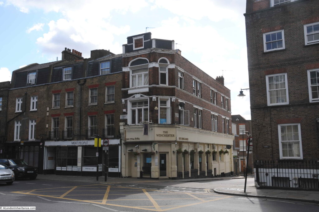
And a final pub before we reach Islington Green – the Winchester on the corner of Essex Road and St Peter’s Street.
Originally the Market Tavern and the Carved Red Lion, this is the first of the many pubs on Essex Road that travelers heading north along the street would meet.
And we now reach Islington Green after a short walk along part of Essex Road. To keep the post a manageable size, I have missed out a number of buildings and have tried to show a sample of what can be found in just one London street.
Digging a bit deeper into the streets and buildings around us is what makes walking London so interesting.

Thank you for the read, always look forward on a Sunday morning to read your post I was born down the Cally and brought up around the areas of Caledonian Road up to Horney Road, Finsbury park and Holloway
Love to read the interesting History on the Borough of Islington …
Another great post. Thanks for your weekly dose of fascinating insights during these dark days.
I lived in Twickenham for many years where the local cinema had been built in similar Egyptian style to the Essex Road Carlton and opened as the Luxor Cinema in 1929.
http://cinematreasures.org/theaters/9451/photos
A different architect from the Carlton but clearly the style was all the rage.
Sadly it was demolished in around 1980.
Many thanks again, for an interesting post, with many personal memories for me. The Kings Head was my grandfather’s haunt, whilst my grandmother preferred her Guinness from the Queen’s across the road! My love of books began in the South Library, I recall Saturday morning pictures at the ABC as I spent much of my pre-teen years in the mid-60’s in and around Essex Street. So much interesting stuff in and around that area!
Thanks for your really interesting and useful posts – interesting for people who love London and have lived there, and useful for people who have London based family history!
Another great post. Interesting History doesn’t have to be about great events. Day to day life can be fascinating! I live in Middlesbrough and only visit London occasionally for short breaks. Got unti your posts as a result of reading a post about Arnhem! Next time I am in London I will be looking more closely at what’s around me, I’ll attempt to get off the tourist trail!
I loved this post. I lived on Essex Road from 1970-77 and with a group of women friends we ran the Essex Road Women’s Centre in the shop where your photo of the Gandhi portrait now is, although in those days it was only a half shop. We had a lot of local contact with schools and people living around the area..very different then to what it is now. When I arrived, there was a lot of demolition going on behind the east side of Essex Road: it was the end of the old Popham Street buildings where Ken Loach had filmed “Cathy Come Home” two years before. Opposite the Women’s Centre in the SouthEast library was where Joe Orton and Keith Halliwell took books out and decorated the covers or inserted typed rude comments in the text! Years later the library had an exhibition of these books..some very creative collage covers. And the last photo, showing “Meat People” was a classic old style Italian caff called “Alberto’s” with meat and veg like bubble and squeak. Much missed. I still live nearby.
Great post of an area I know so well, I`ve walked along Essex Road thousands of times in the past 50+ years
Love reading your posts.
X-Zalia is a pun on exhale, many early 20th century brands were given catchy names like that or simply spelled in an odd way.
Another great post, thank you! Might you be doing the Balls Pond Rd end in another post? Would love to read that, as that is our patch.
Interestingly, a previous incarnation of the Old Queen’s Head dated back to the 16th century or further, with alleged links to Walter Raleigh (and a haunting!). Its current set-up (have had many a fun night in that one) has retained 17th century interior features.
lovelly pics brings back memoreies is it possible to bet any pictures of marquess before the estat was built say early to mid 60 s would be much appreciated as i was brought up at No 58 marquess road
Many of my relatives lived in Marquess road and Marquess Grove.
Fantastic maps and info and photos really interesting
Thank yiu for all the hard work in putting it together
I grew up in the City of London (1946-59)as my parents were caretakers of an office block in Canon Street and went to the Carlton Cinema many times. My memory of the underground station was the smell of damp! Enjoy reading your posts
What happened to the massive Marquess Council Estate on Essex Rd ? It won much praise for its architectural design when it was built with low rise, winding walkways “community friendly” layout it had a continental rather than british feel about itl Sadly the winding walkways and secluded corners became very attractive to muggers and burglers. The infamous Stockwell Strangler took a day out from his comfort zone to kill here.
I heard rumour that the whole Estate was demolished. It covered a vast area, what replaced it ?
I grew up in Canonbury just off Essex road. I went to Saturday morning pictures at the cinema and went swimming at the baths over the road with my primary school. They were rundown Victorian in the sixties! Many a happy day was spent in the splendid Essex road library, and I used to walk home through new river walk and play on the swings there. I went to drama school in the flats on Essex road, it was run by Anna Scher. I’ve often seen my fellow drama school mates on Eastenders! I’d love you to explore the new river walk and its surrounding streets. There’s great history there!!
Enjoyed the Islington blog. Please keep ’em coming! This blog interested me as I have lived at a number of
addresses in the area inc Florence St, Thornhill Rd, Highbury New Pk, Beresford Rd in the 60’s. Brought back many memories for an expat Londoner now living in Worcestershire. Suggestion for another blog:
Wapping….Royal Mint St and the Tilbury Warehouse….lots of history there…I also lived in Wapping in the 60’s. Gratefully!
Fascinating – thank you so much.
I cannot imagine how much work you must do to produce such detailed articles and so frequently.
I love reading them even if they are are not always areas I know and am enjoying in my spare time reading all your older posts.
very interesting post. Especially the pubs
Your information on the South Library was enlightening. I wasn’t aware that Carnegie’s beneficence reached to your side of the pond.
Of the 2,509 Carnegie libraries built around the world, 580 were built in the UK. Many of them continue to be used for their original purpose. However, Carnegie libraries are affected by local authority budget cuts which lead to the reduction in number of public libraries.
And there are 4 Carnegie-endowed libraries in Islington – with the (very descriptive) names of Central, South, North and West! https://carnegielegacyinengland.wordpress.com/?s=islington
Another fascinating and enjoyable read – thank you.
will you be doing the other half ?
Very interesting and well researched, thank you.
I loved this post. Actually I love them all, but this had special significance. My mum used to live up near the Balls Pond Road in the 1920s so I also hope you will do a post on that end. She mentioned going to the cinema – I’m betting it was the one in your post!
Green Man pub
It appears that the pub has always been that size, with what is now Dominoes (144 Essex Rd) a separate entity. The building on the side of the pub (2 Greenman St) has almost identical architecture.
Looking at past OS maps, from 1871, 144 Essex Rd, The Green Man, and 2 Greenman St are shown as three properties. As The Green Man is numbered 144A Essex Rd, I assume that the Chapel was 144 Essex Rd and took up the space now occupied by all three properties. When the chapel was demolished, the three properties that replaced it being built by the same builder.
I have thoroughly enjoyed reading this and find it really interesting, I was born in 1942 behind Essex Road in Asteys Row, and from you article I can see the how much it’s changed since I moved in 2002. Brilliant, thank you!
Thank you for another wonderfully informative and enjoyable post.
In your picture of the 3 shops on Cross Street at the junction with Essex Road, the one on the left with the seahorse in the window, ‘Theorem’, is a hair salon which I’ve been going to for over 20 years. The (very small) shop interior is shaped like an isosceles triangle, narrowing into a teeny tiny cloakroom/kitchen area at the back – worth taking a look on Google Earth to see this unusual shape for a building!
My name Bernard Hagon 40 years ago are used to own Marston Swan Lodge in upper street Islington opposite Tindale mansionz this was the oldest Winebar and the first in England. Dating back to Queen and it had a Royal Charter when I had it the owner of the freehold was Colonel PCM Hinkston a free winner of the city of London it’s still had the Royal Charter while I was there but I surrendered it when I sold the freehold premises.
Bernard, I think that’s the place I was told as a child to stay away from because there had been an axe murder there. Possibly in the late 50’s? Ring any bells? I remember the place had a bit of a boxing theme going on?
Thank you for your latest; it took me back to your Copenhagen Pub story. Your stories and photographs and maps are very informative. I live in Adelaide and use your work to assist me in attempting tp imagine what a life in London must have been like for my ancestors. My 2x great uncle, William Penry, had the “Copenhagen” in 1870. His sister, Sarah Perry, my 2x great grandmother, was an artificial florist living at 21 Sidney Gr. Islington and, reportedly, ‘in a good way of business’. They had grown up in the Red Lion Beer and Coffee House in Red Lion Alley Spitalfields.
Sarah also lived at Arlington St Islington and Rydon Crescent. In 1909 she was at 12 Dunford Road Islington and 46 Halton Rd.
I have not found all of these houses yet; your article will renew my vigor; getting a ‘grip’ on London from this distance is tricky.
One generation previously (1822), Sarah Perry’s father in law had been a baker at Penton Place Pentonville. I wonder whether they ever saw Dickens.
All the best,
Jan
I am trying to find a picture of the brewery my Grandad worked at in Essex’s Road with the enormous Guinness bottle set into the building. Does anybody recall this? My Mum vividly remembers this. It was formerly Foster Probyn’s then later in the 1960s became Youngs.
Thank you
Hi, I stumbled across your blog while researching my family tree and really enjoyed reading it. Would you by chance know if Essex Road was ever called Essex Place? In the 1850’s, my 3 x great grandfather was living at number 2 Essex Place, Mile End, Tower Hamlets. Do you know if this would have been Essex road, or would it be somewhere else in Mile End?
Cheers
Phil
Queensland Australia
Hi Phil, Essex Road (Islington) and Essex Place (Mile End) are a few miles apart. Essex Place no longer exists on Google Maps, probably flattened in the Blitz, as so much of the East End was during the war.
I can recommend https://maps.nls.uk/ for looking at old maps. I’ve looked briefly at the Mile End area, but have yet to locate Essex Place. I suspect it may have been a very minor road.
I hope this helps,
Alan S.
In this page of an 1850 London street map Essex Place is in the bottom left hand corner: http://london1850.com/cross07b.htm
Does anybody remember St. Paul’s (C of E) school in Dove Road Islington in 1961 onwards.
I don’t know it personally but my mother attended there in the 1920s and her father in the 1890s and early 1900s.
I stayed at a youth hostel in September 1973 and the following June that was called: “Student Services Hostel” Cross St. Essex Road 19; London N1. tel 226-8391. That’s the exact wording and punctuation from the 1972 ISTC Hostel List of 1972 that I have here. The hostel closed mid- January to mid-March. The manager was a thin fellow named Tim and he seemed to be a friendly fellow. There was a pub about a block to the west and a cheap little (Portuguese?) restaurant a block or 2 the other direction (east), at a T in the road, I think.
To me, that isn’t enough of an actual address to find it on a map or by walking around. Can anyone help me? I plan to visit London in a couple of weeks after a very LONG time and I’d like to go back there to see the building, if it still exists. If it does, I assume it has been changed greatly! Many thanks!!
Cross Street can be seen on Google Maps/street view here: https://www.google.com/maps/@51.5389649,-0.1010172,17.48z. My grandparents lived just the other side of St Mary’s Churchyard to the west.
Thank you very much, Alan.
Thanks for an enjoyable read. I was born between Caledonian Road and Highbury Corner in the mid-50s, so know the area well but moved to Scotland in the early 90s, so it’s great to catch up on old haunts
I write to ask if I could send you my photos of Islington in the 1970s.
I would be interested in your photos from the 1970s, Barry. What is your email, please, and I can contact you that way.
Thank you that would be good
I love reading about the Cally and surrounding areas, my Dad and his family came from this area, Fred Pace. Thank you for an interesting read.
Hi does anybody remember Sickert Court flats in Essex road N1
We have discovered that the ghost sign on the corner of Popham Street is in fact for a brand called Nazalia, not X-Zalia (as we had previously thought as well).
https://ghostsigns.co.uk/2024/07/x-doesnt-mark-the-spot-revisiting-an-islington-ghost-sign/
After sharing the ghost sign under X-Zalia in our book, we have recently learned that it was in fact advertising Nazalia. I have posted a blog here for those interested: https://ghostsigns.co.uk/2024/07/x-doesnt-mark-the-spot-revisiting-an-islington-ghost-sign/
X Doesn’t Mark the Spot: Revisiting an Islington Ghost Sign